Flood Avoidance and Mitigation Michael Powell Delaware Department of Natural Resources and Environmental Control Shoreline and Waterways Management

Flood Avoidance and Mitigation Michael Powell Delaware Department of Natural Resources and Environmental Control Shoreline and Waterways Management.
Dec 18, 2015
Welcome message from author
This document is posted to help you gain knowledge. Please leave a comment to let me know what you think about it! Share it to your friends and learn new things together.
Transcript

Flood Avoidance and MitigationMichael PowellDelaware Department of Natural Resourcesand Environmental ControlShoreline and Waterways Management
Shoreline and Waterways Management
What we do:
•Manage public beaches (i.e. erosion control, beach nourishment•Regulate construction along the Atlantic and Delaware Bay shore•Maintain inland navigational channels•Assist in floodplain mapping•Assist in regulating development in flood prone areas•Provide technical and financial assistance for flood projects
What constitutes a flood disaster?
Types of flood mitigation projects•non structural - floodplain management (loss avoidance)•non structural – flood mitigation projects (acquisition / relocation)•non structural – elevation and floodproofing•structural projects
Evaluating and designing flood mitigation projects•Determining flood risk
•floodplain maps and studies•flood damage history
•How to select a project - alternatives analysis•project goals and constraints•environmental constraints•avoiding impacts
•Benefit cost analysis
Success stories•Glenville floodplain buyout•Cape Henlopen State Park groin rehabilitation•New Castle County dry floodproofing projects


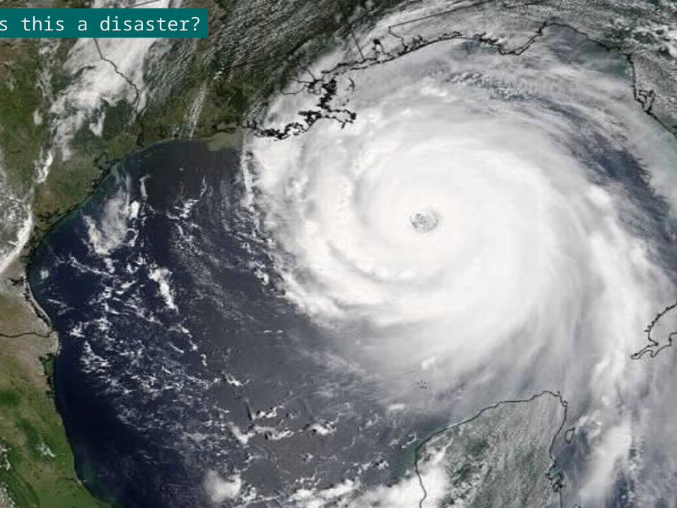
Is this a disaster?
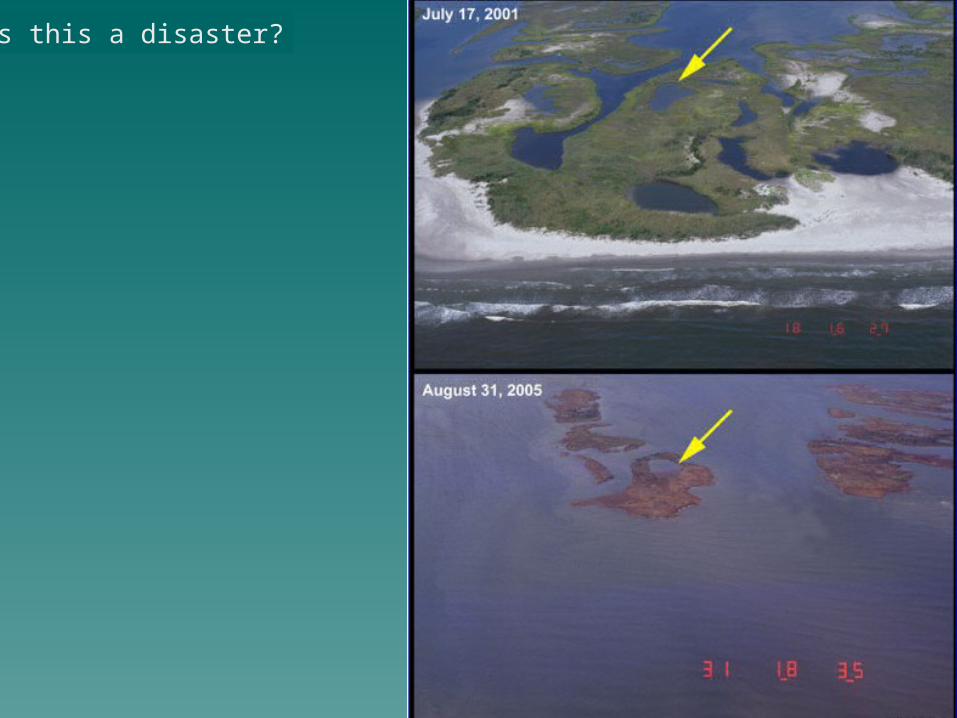
Is this a disaster?
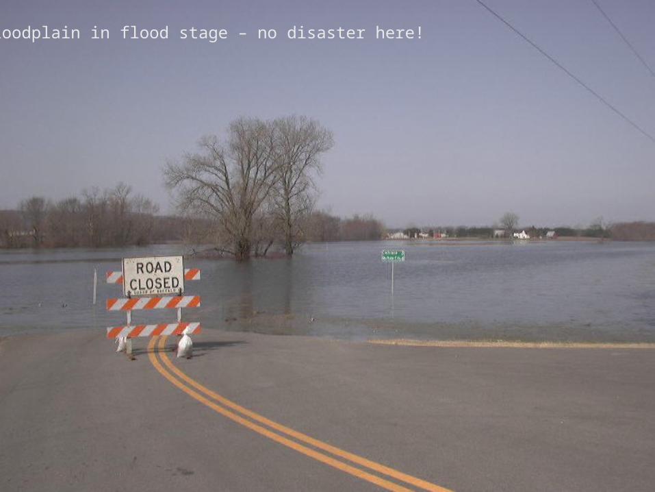
Floodplain in flood stage – no disaster here!
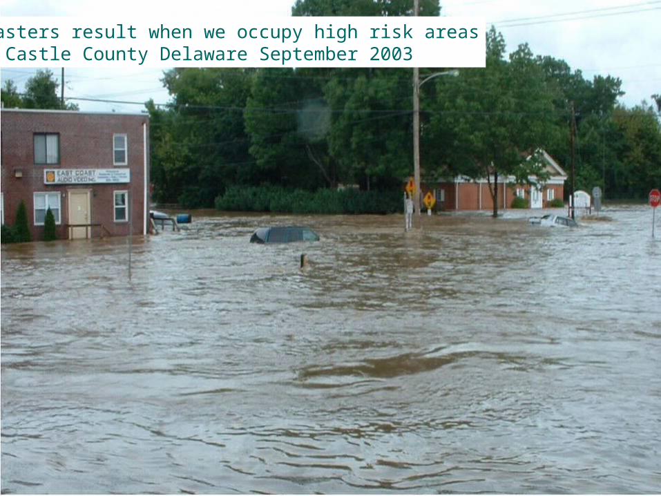
Disasters result when we occupy high risk areasNew Castle County Delaware September 2003
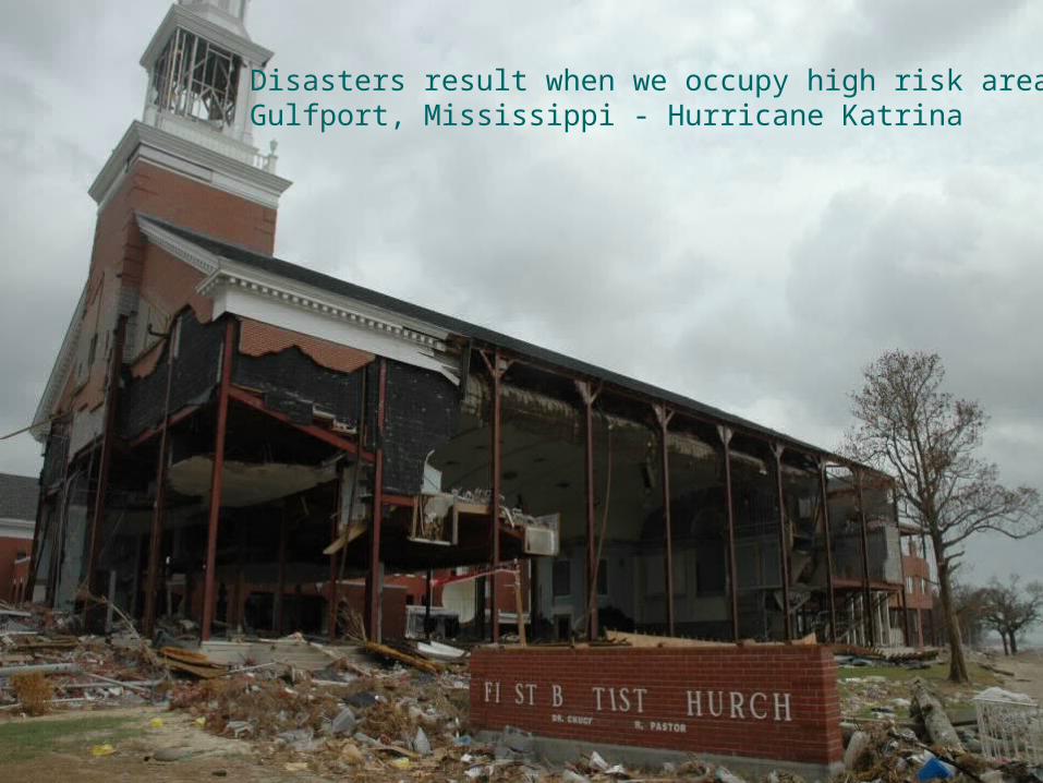
Disasters result when we occupy high risk areasGulfport, Mississippi - Hurricane Katrina

Hurricane Katrina was a major disaster affecting•Several states•Millions of people•Over $80 billion damage
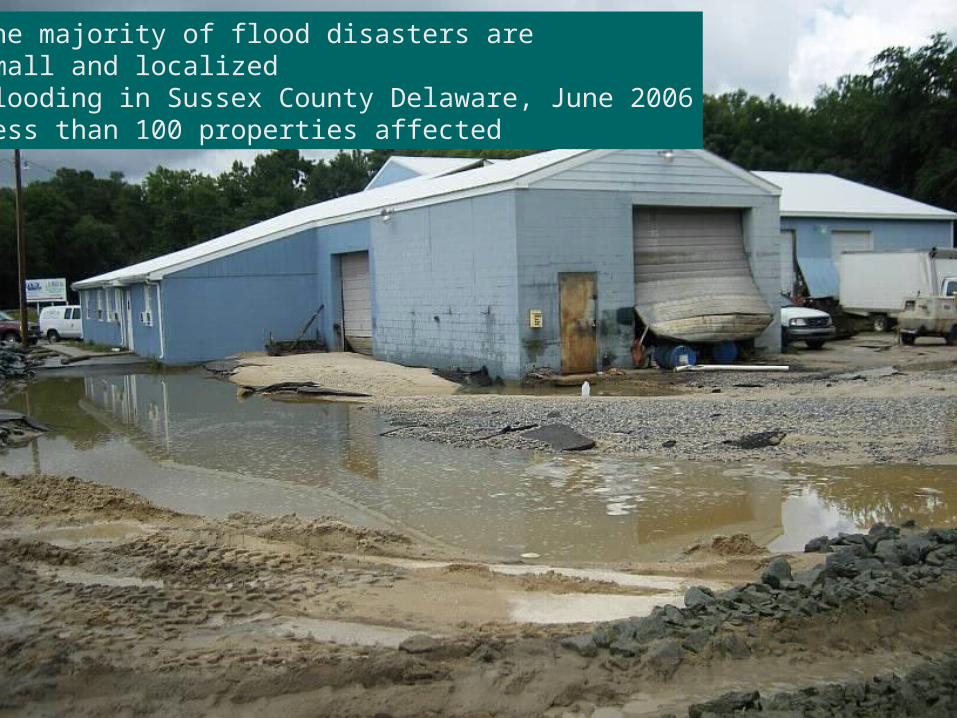
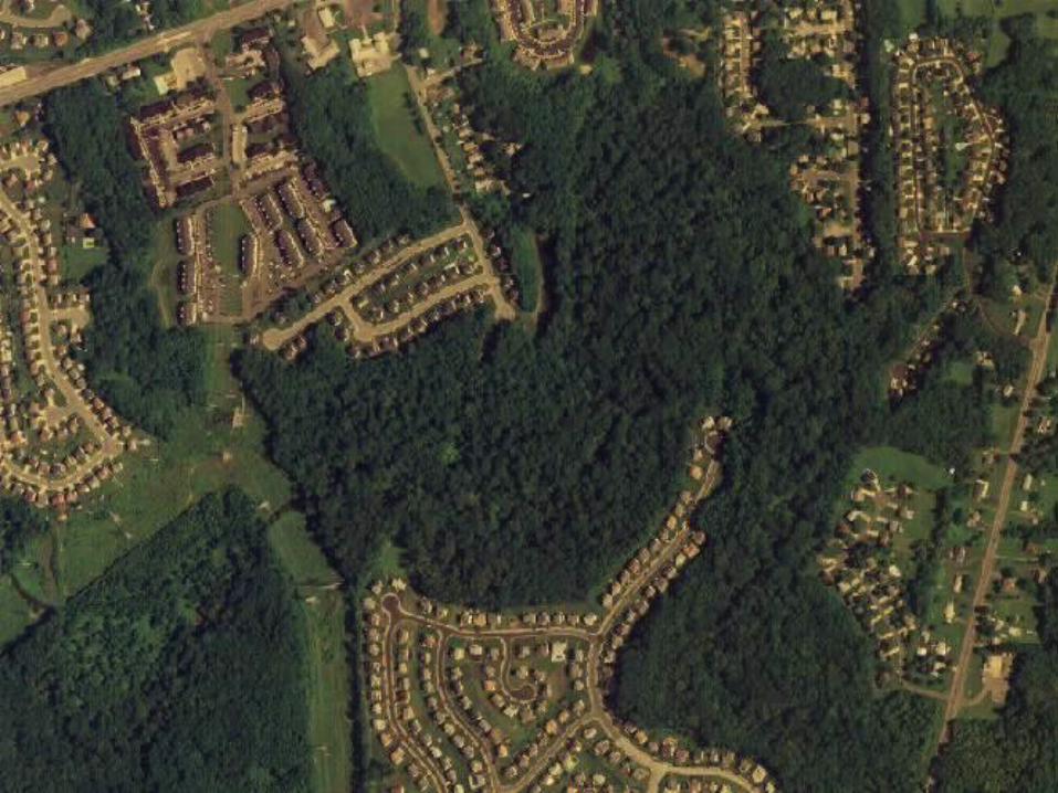
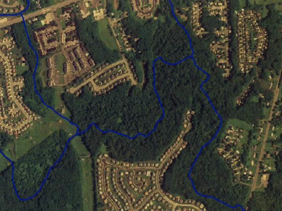
The majority of flood disasters aresmall and localizedFlooding in Sussex County Delaware, June 2006Less than 100 properties affected

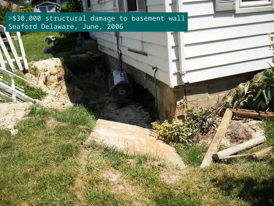
>$30,000 structural damage to basement wallSeaford Delaware, June, 2006

II. Types of Flood Mitigation Projects
Determining the flood risk at a given location
Floodplain management – Don’t occupy high risk areas
BestLocal land use regulations which define flood-prone areas
and prohibit new development in those high risk areas.
More CommonRegulations which discourage development in high risk
areas but allow development as long as buildings are designed to minimized flood risk
Types of projects to protect vulnerable development

FEMA issued floodplain MapWidely Available nationwideShows 100-year floodplain

88
89
90
91
Base Flood Elevations(100-year) storm(1% annual chance exceedence)
Best: Local land use regulations define flood-prone areas and prohibit new development in those high risk areas.
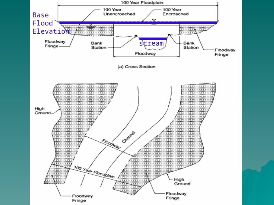
stream
BaseFlood Elevation

Base Flood Elevation = 89
Ground Elevation = 84
More Common: Regulations discourage development in flood prone areas, allow it with buildings designed tom minimize flood risk

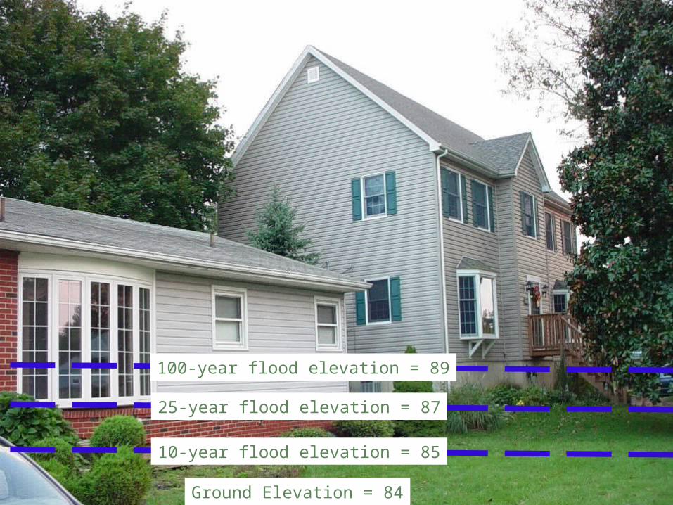
100-year flood elevation = 89
Ground Elevation = 84
25-year flood elevation = 87
10-year flood elevation = 85

Flood Level
Simple elevation of a flood prone house
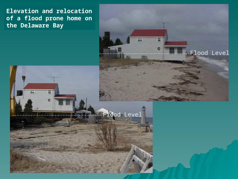
Elevation and relocation of a flood prone home on the Delaware Bay
Flood Level
Flood Level

Dry floodproofing of commercial structure in New Castle County
Flood Level

100 year floodplain
100 year floodplain
New wetlands/flood storage
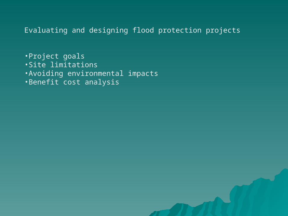
Evaluating and designing flood protection projects
•Project goals•Site limitations•Avoiding environmental impacts•Benefit cost analysis

Project goals
•Public safety – reducing risk to people•Property protection – public infrastructure and private property•Reduction in emergency response during storms•Avoid loss of critical services – fire, police, medical etc.•Environmental enhancement and restoration•Recreational opportunities

Site limitationsProperty factors frequently will dictate project options
•Size of property – availability of land for structural flood control•Historic properties – historic preservation issues•Environmental Protections
•Wetlands•Endangered species•Hazardous materials
•Local zoning and codes
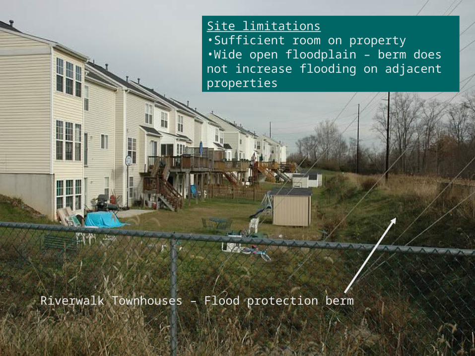
Site limitations•Sufficient room on property•Wide open floodplain – berm does not increase flooding on adjacent properties
Riverwalk Townhouses – Flood protection berm
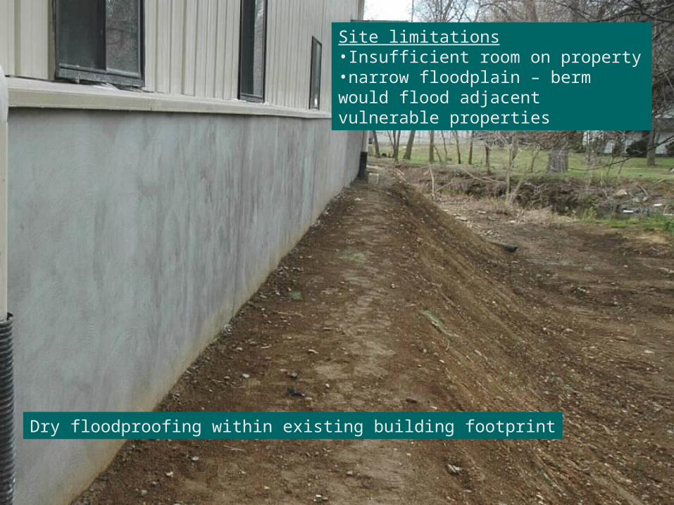
Site limitations•Insufficient room on property•narrow floodplain – berm would flood adjacent vulnerable properties
Dry floodproofing within existing building footprint
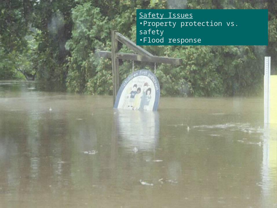
Safety Issues•Property protection vs. safety•Flood response
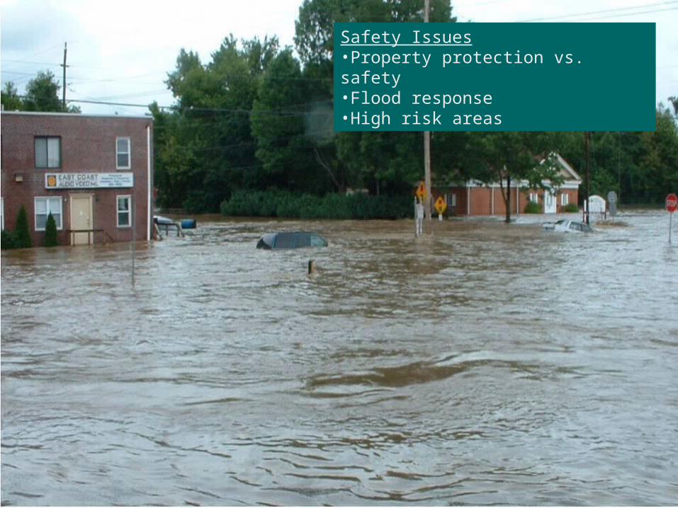
Safety Issues•Property protection vs. safety•Flood response•High risk areas
Benefit Cost Analysis
Generally a project should provide greater benefits than the cost to construct the project

Benefit Cost Analysis
Generally a project should provide greater benefits than the cost to construct the project
Project costs•Planning Design•Property acquisition•Construction•Management•Maintenance
Project Benefits(define project lifetime)•Damage prevented•Life/safety benefits•Recreational •Environmental•Reduction in response
100-year flood elevation = 89
Ground Elevation = 84
25-year flood elevation = 87
10-year flood elevation = 85

100-year flood elevation = 89 = $20,000
Ground Elevation = 84
25-year flood elevation = 87 = $10,000
10-year flood elevation = 85 = $5,000

100-year flood elevation = 89 = $20,000
Ground Elevation = 84
25-year flood elevation = 87 = $10,000
10-year flood elevation = 85 = $5,000
Project costs•Planning Design $2,000•Property acquisition $0•Construction $25,000•Management $2,000•Maintenance $0
Project Benefits – Elevate houseproject lifetime 25 years•Damage prevented $25,000•Life/safety benefits ???•Recreational No•Environmental No•Reduction in response ??? (No)

Success Stories
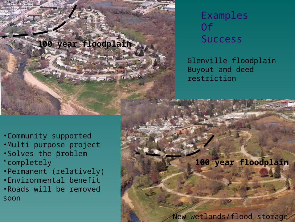
Examples OfSuccess
Glenville floodplain Buyout and deed restriction
•Community supported•Multi purpose project•Solves the problem “completely”•Permanent (relatively)•Environmental benefit•Roads will be removed soon
100 year floodplain
100 year floodplain
New wetlands/flood storage
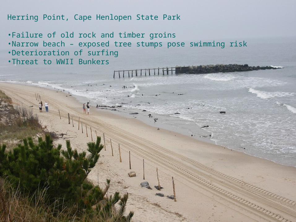
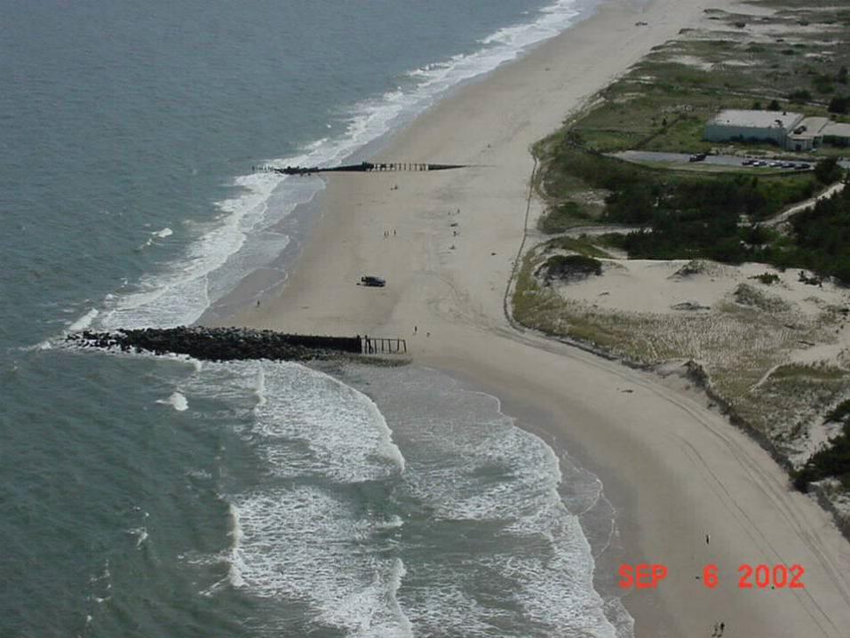
Herring Point, Cape Henlopen State Park
•Failure of old rock and timber groins•Narrow beach – exposed tree stumps pose swimming risk•Deterioration of surfing•Threat to WWII Bunkers

Sand transport is south to north. Groins which trapped sand flow have failed leading to rapid erosion

Sand transport is south to north. Groins which trapped sand flow have failed leading to rapid erosion
Define problem
•Swimming hazard•Loss of beach•Bluff erosion•Surf break deteriorated
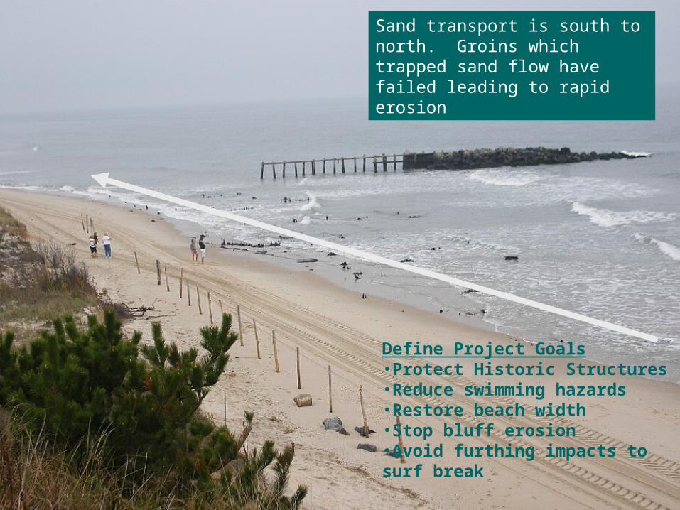
Sand transport is south to north. Groins which trapped sand flow have failed leading to rapid erosion
Define Project Goals•Protect Historic Structures•Reduce swimming hazards•Restore beach width•Stop bluff erosion•Avoid furthing impacts to surf break

Herring Point, Cape Henlopen State Park
Sand transport is south to north.Bunkers and parking area built in vulnerable location

•Swimming hazard•Loss of beach
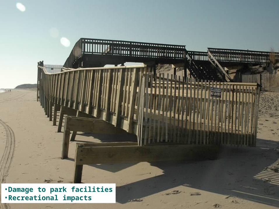
•Damage to park facilities•Recreational impacts
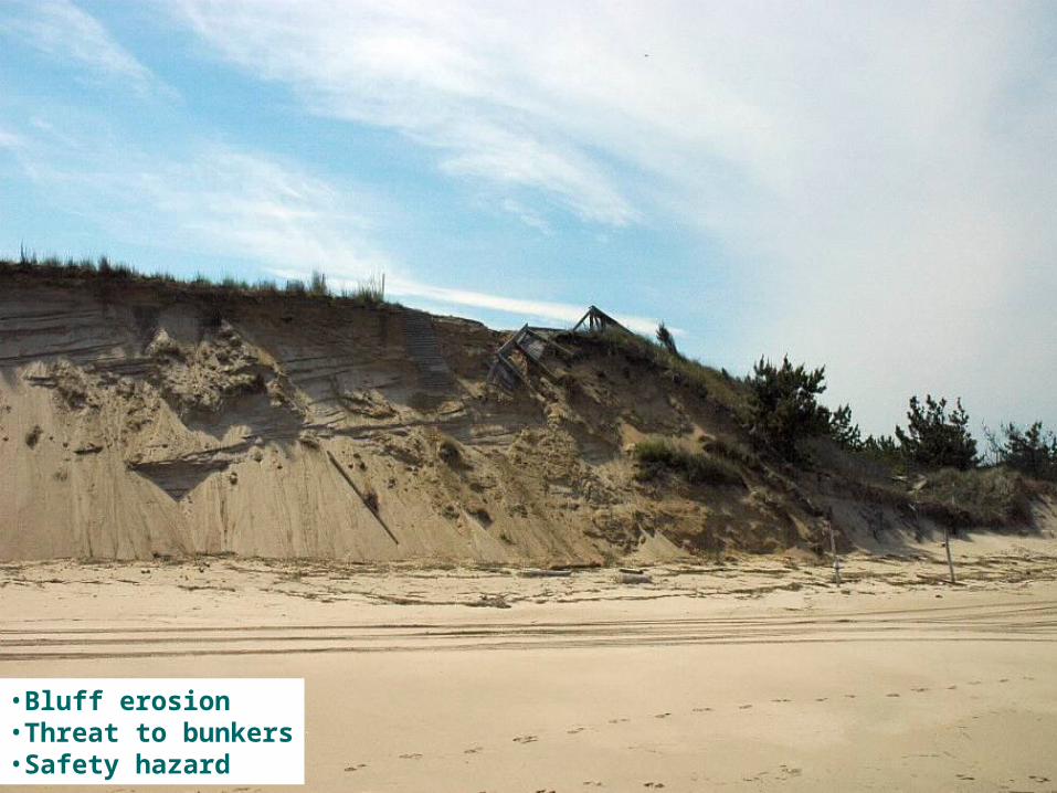
•Bluff erosion•Threat to bunkers•Safety hazard
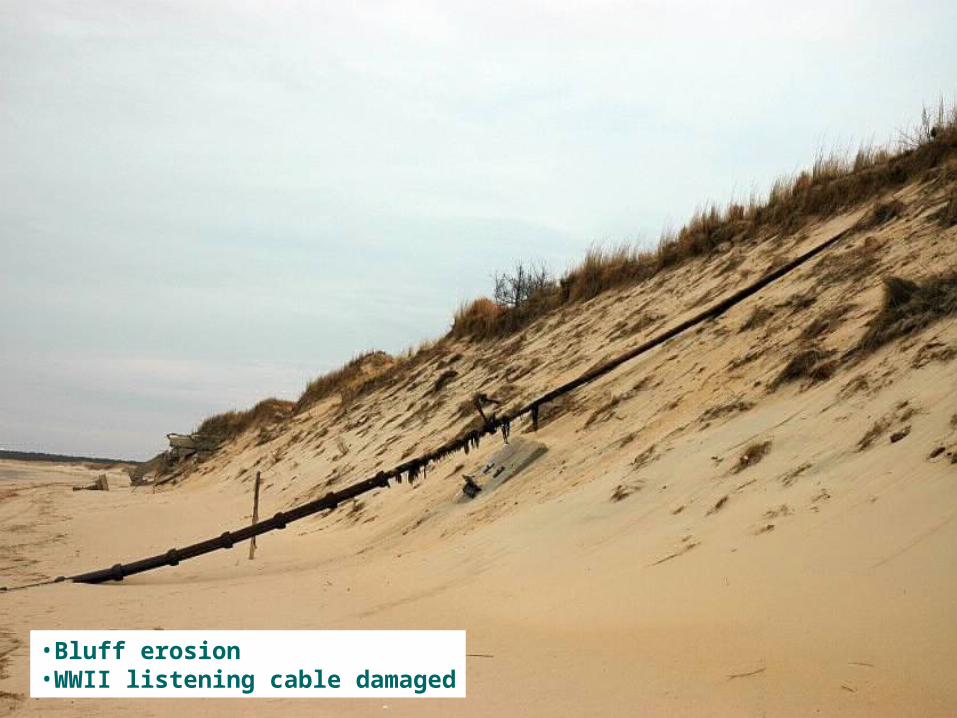
•Bluff erosion•WWII listening cable damaged
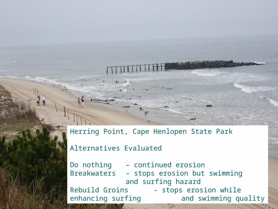
Herring Point, Cape Henlopen State Park
Alternatives Evaluated
Do nothing – continued erosionBreakwaters – stops erosion but swimming
and surfing hazardRebuild Groins - stops erosion while enhancing surfing
and swimming quality

Bluff locationBluff location JAN 9 2007
Consequences of failure to act:•Continued bluff erosion leading to hazardous conditions and incremental loss of the overlook parking lot.

Photo credit:Rod Rodgers

Photo credit:Kyle Howard

April 17, 2007Pre-construction photo
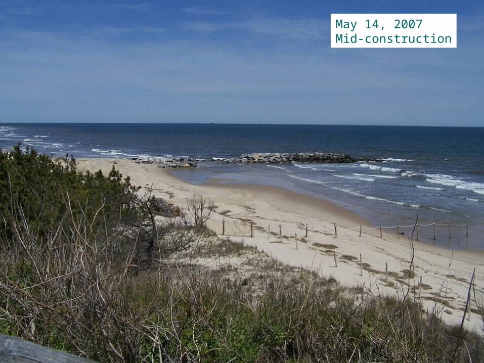
May 14, 2007Mid-construction
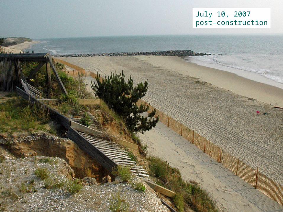
July 10, 2007post-construction

January 2008midwinter

Flow of sand

Concern about negative effects on “downdrift” beach?


Thank you
Questions???
Related Documents