Geogramme 2014 1 Fall 2014 Message from the Head 2013-2014 was a great year for showing the dynamism that is UBC Geography. It was a year full of changes— good changes such as the grand opening of the Biogeomorphology Experimental Laboratory in the neighbouring Ponderosa Commons West; the year-long building renovations that have given us new classrooms, a new courtyard, and an overall safer building; Loch Brown’s Flexible Learning Initiative on behalf of the Environment and Sustainability program; and our new Student Services Team. UBC Geography is a department that prides itself on the community of its students, faculty, and staff, and together, we are a community that is in active engagement with the rest of world. Part of this community engagement must be attributed to our Professional Leadership Network (PLN) which, for the 2 nd consecutive year, connects graduate students with industry professionals. This ground breaking program, the first of its kind at UBC, could not be possible without the help and support of faculty, students, and staff who all deserve credit for its success. We are also very lucky to have been awarded Flexible Learning Initiative funding in 2013/14 to explore new technologies and innovations to enhance student learning in our Environment and Sustainability program, as well as in 2014/15 to fund a field school course for Human Geography and Environment & Sustainability students. These innovations, led by Loch Brown and Siobhán McPhee, reflect our commitment to student learning. It’s fitting that with a year full of innovations and initiatives our physical building is changing too. Renovations have given us a safer building, four brand new rooms, a renewed GIC with the largest air photo collection in the province, as well as an updated courtyard, well suited for the new GeoGarden. We have also the new Biogeomorphology Experimental Laboratory (the first of its kind in Canada!), putting UBC Geography on the frontiers of science as there are both great scope and great demand for innovative and fundamental research in environmental sciences. Professor Marwan Hassan

Welcome message from author
This document is posted to help you gain knowledge. Please leave a comment to let me know what you think about it! Share it to your friends and learn new things together.
Transcript

Geogramme 2014
1
Fall 2014 Message from the Head 2013-2014 was a great year for showing the dynamism that is UBC Geography. It was a year full of changes—good changes such as the grand opening of the Biogeomorphology Experimental Laboratory in the neighbouring Ponderosa Commons West; the year-long building renovations that have given us new classrooms, a new courtyard, and an overall safer building; Loch Brown’s Flexible Learning Initiative on behalf of the Environment and Sustainability program; and our new Student Services Team. UBC Geography is a department that prides itself on the community of its students, faculty, and staff, and together, we are a community that is in active engagement with the rest of world.
Part of this community engagement must be attributed to our Professional Leadership Network (PLN) which, for the 2nd consecutive year, connects graduate students with industry professionals. This ground breaking program, the first of its kind at UBC, could not be possible without the help and support of faculty, students, and staff who all deserve credit for its success.
We are also very lucky to have been awarded Flexible Learning Initiative funding in 2013/14 to explore new technologies and innovations to enhance student learning in our Environment and Sustainability program, as well as in 2014/15 to fund a field school course for Human Geography and Environment & Sustainability students. These innovations, led by Loch Brown and Siobhán McPhee, reflect our commitment to student learning.
It’s fitting that with a year full of innovations and initiatives our physical building is changing too. Renovations have given us a safer building, four brand new rooms, a renewed GIC with the largest air photo collection in the province, as well as an updated courtyard, well suited for the new GeoGarden. We have also the new Biogeomorphology Experimental Laboratory (the first of its kind in Canada!), putting UBC Geography on the frontiers of science as there are both great scope and great demand for innovative and fundamental research in environmental sciences.
Professor Marwan Hassan

Geogramme 2014
2
GEOB 472: Cartography & Game of Thrones
Geography can work with a variety of disciplines. Elements of cartography and GIS analysis can be used alongside History, Criminology, Anthropology, Health Sciences, and Education. With my final cartography project I wanted to push the boundaries a bit by trying to add Creative Writing to that list by making a map visualizing characters and storylines.
How do we think about stories? How do we plan them out or break them down? There are ton of ways, but probably the most common structure is a ski jump with an inciting incident, rising action with a push and pull of tension, climax, denouement, and then a conclusion. Maps also tell stories in a unique way by combining various data sets into a single output which I thought would be applicable to visualizing the various aspects of characters and their experiences and interactions.
I was inspired by Randall Monroe’s work on xkcd, specifically his narrative charts visualizing Lord of the Rings, Jurassic Park, Star Wars, 12 Angry Men, and Primer. I mapped out storylines from Game of Thrones in a similar fashion with the horizontal axis as time and the vertical line groupings indicating which characters are together at a certain time. I picked Game of Thrones because of the complex characters and the detailed storylines. Great stories are usually character driven and the series is a prime example of telling human stories in a fantasy world.
I wanted to do the books but that would’ve taken much more time, as a lot more scouring for details would have been required. Also I wasn’t sure if everyone had read the books and I didn’t want to spoil anything for the upcoming season. When I started planning out the process, I thought that it would be best to use Adobe Illustrator but my professor, Sally Hermansen, suggested that I do the project by hand, which was a wonderful idea since my Illustrator skills aren’t the best. Doing the project by hand meant a lot of rough drafts, erasing, and then re-watching the first three seasons, for educational purposes, of course. I tried to map episode by episode to get a more accurate time line of character experiences.

Geogramme 2014
3
There are cartographic design principles incorporated into the project such as the neatline which is comprised of well-known quotes from the series or the use of dotted lines turning into solid ones to show how peripheral characters become more prominent in the story. There were a few challenges with the project such as leaving out certain characters, generalizing them into groups, or lines overlapping and going underneath in order to keep the characters organized. There are definitely aspects of the project that I would re-work in another iteration. Drawing and outlining by hand was tedious, but in the end, it felt fulfilling.
When I think about a story, I think about it in terms of characters experiences and interactions. Game of Thrones was a platform to show that storyline visualizations can take complex dynamic events and show them in a simplistic manner. With my final cartography project as a Geography undergrad, I wanted to use design ideas and aspects in an unconventional way. It was an opportunity to have fun combining two distinct topics that I’m passionate about and I’m looking forward to working on another creative project like this in the future.
Franklin Po 4th year Environment & Sustainability Major
Originally published in UBC GEOGRAPHER May 2014
Geography Breaking New Ground with Student Services Team
This past June, the Department of Geography reorganized its undergraduate and graduate student services into one team-based service which will provide both undergraduate and graduate students with more comprehensive and effective service. With the departure of the previous undergraduate advisor in June 2014, the department combined its graduate and undergraduate student services under the leadership of former Graduate Program Manager, Suzanne Lawrence, who now holds the new title of Student Services Manager. Joining her team is our newest staff member, Stefanie Ickert, as Student Services Coordinator. This exciting new team-based initiative is a big step forward towards a more holistic Geography community at UBC.
The idea of having a combined undergraduate-graduate student services team is relatively new to UBC. Many departments have separate graduate and undergraduate advisors and many of them are faculty members rather than staff. Professor Marwan Hassan, Head of the Geography Department,
believes this change will create a more effective, holistic, comprehensive, and timely service for students. Dr. Hassan elaborates, “From my first day as Head, I sought to empower staff, to utilize staff talent, for them to feel part of the decision making… This new Student Services team is just that. These two student-based services [graduate and undergraduate] naturally feed into one another. The previous system did not utilize the skills of the individual staff member. There was too much overlap in duties and responsibilities in the previous situation; it was based on need and necessity rather than long term visions or goals.”
This new student services team will have one person focused on major issues and long-term planning, and another staff member to do more day-to-day tasks. As a critical part of the interaction
Geogramme 2014
4
between the department and students, this new team will strengthen the Geography community as it strengthens the relationship between students and the department.
Mimi Yu Editor, UBC Geographer, Geogramme
The Flexible Learning Project in Geography
In fall 2013, Dr. Loch Brown, lecturer in the Department of Geography, was awarded a grant from UBC’s Flexible Learning Initiative. The UBC Flexible Learning Initiative is a university-wide project designed to introduce new and innovative teaching approaches to classes across UBC.
The Flexible Learning Project in Geography will focus on the transformation of 10 courses in the undergraduate Environment and Sustainability Program, which is the largest undergraduate program in Geography. The three-year funding for the project provides support from an Instructional Designer, Media Designer, RAs and two Postdoctoral Teaching and Learning Fellows. The postdoctoral fellows are responsible for supporting course transformation, conducting research, and coordinating project activities.
The main objective of the Flexible Learning Project is to increase student engagement and improve student learning experience using online activities, interactive classroom activities, and student projects.
In Winter 2014, Geography’s Flexible Learning Project provided support for three courses in which new approaches were introduced. For example, Professor Graeme Wynn piloted a flipped-classroom approach to his course GEOG 327—Creating Canada. Professor Wynn created a series of podcasts which students listened to before coming to class. As a result, more class time was available for discussions, group activities, and student presentations.
In GEOG 310—Environment and Sustainability taught by Professor Karen Bakker and Professor Jennifer Williams, students completed short on-line quizzes on course readings before coming to class. These quizzes were designed to highlight concepts that would form the basis for lectures and in-class activities. A final survey indicated that students felt that the quizzes helped them focus on important concepts and be better prepared for class.
The Flexible Learning Project in Geography also encompasses research on pedagogy and teaching practices in Geography, as well as the student experience in the Envrironment and Sustainability program. This research is motivated by the question, “What motivates students to choose Environment and Sustainability as their program of study? And what strategies do students employ to meet their educational goals?” This research will inform the development of pedagogies and classroom practices that will help students be aware of and achieve their educational objectives.
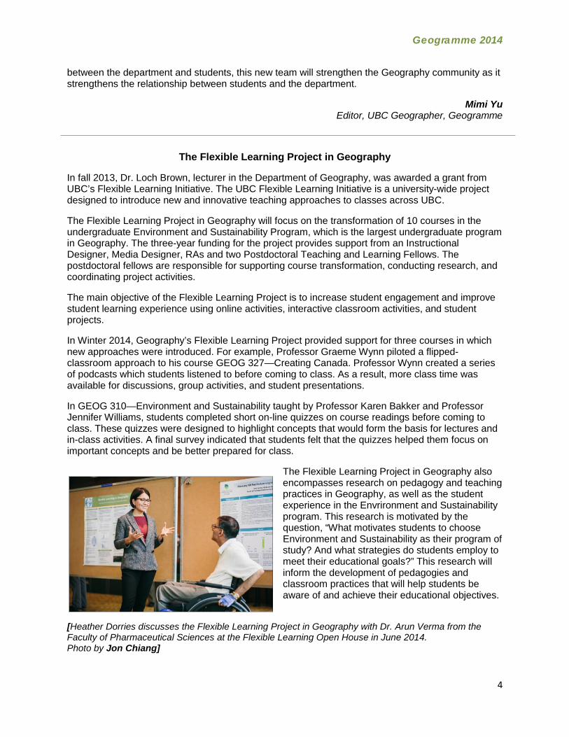
[Heather Dorries discusses the Flexible Learning Project in Geography with Dr. Arun Verma from the Faculty of Pharmaceutical Sciences at the Flexible Learning Open House in June 2014. Photo by Jon Chiang]

Geogramme 2014
5
In the coming semesters, the Flexible Learning in Geography project will also begin to create a repository of learning and teaching resources including videos and other media to support students and instructors in Geography.
Besides supporting work in individual departments, the Fleixble Learning Initiative at UBC provides an opportunity for scholars to share ideas. For example, Postdoctoral Teaching and Learning Fellows from across campus meet on a regular basis to discuss the scholarship of teaching and
learning. In June, UBC’s Centre for Teaching and Learning Technology hosted an open house to showcase the exciting work that is happening across UBC.
More information about the Flexible Learning Project in Geography can be found by visiting the project website at: http://blogs.ubc.ca/flgeography/
Heather Dorries Heather Dorries completed her PhD at the University of Toronto and joined UBC as a Teaching and
Learning Fellow in the Flexible Learning Project in Geography in December 2013
The New Biogeomorphology Experimental Laboratory
Left to Right: President Stephen Toope, Professor Marwan Hassan, Dean Gage Averill
The new Biogeomorphology Experimental Laboratory in Ponderosa Commons officially opened on January 23rd 2014, the outcome of four CFI grants amounting to approximately $3 million. The laboratory resides in the basement of Ponderosa Commons West, as a part of a university-wide effort to create, as Dean of Arts, Gage Averill elucidated at the grand opening, “student housing that had imbedded within them an academic enterprise. The idea is to put students closer together with the campus so they can see the kind of research and pursuits that go on here… we want open windows on the university’s work.”
In particular, this new lab is designed to establish an experimental laboratory to conduct innovative research on the interface between hydrology, geomorphology, ecology and climate (environmental sciences). Such a lab is unique in Canada with only one or two in the U.S.; this lab will put UBC research on the frontiers of science as there are both great scope and great demand for innovative and fundamental research in environmental sciences. Research in these topics is particularly important given the ongoing and anticipated changes to the Earth’s climate and land surface cover. Land-use changes and rising demands for natural resources will put increasing pressure on landscapes, almost certainly leading to significant, progressive deterioration. In order to make
Geogramme 2014
6
significant progress, it is necessary to combine lab experiments, computer modelling, and available long-term data sets in the research.
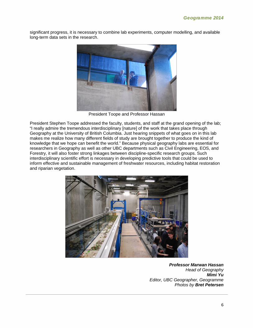
President Toope and Professor Hassan
President Stephen Toope addressed the faculty, students, and staff at the grand opening of the lab; “I really admire the tremendous interdisciplinary [nature] of the work that takes place through Geography at the University of British Columbia. Just hearing snippets of what goes on in this lab makes me realize how many different fields of study are brought together to produce the kind of knowledge that we hope can benefit the world.” Because physical geography labs are essential for researchers in Geography as well as other UBC departments such as Civil Engineering, EOS, and Forestry, it will also foster strong linkages between discipline-specific research groups. Such interdisciplinary scientific effort is necessary in developing predictive tools that could be used to inform effective and sustainable management of freshwater resources, including habitat restoration and riparian vegetation.
Professor Marwan Hassan Head of Geography
Mimi Yu Editor, UBC Geographer, Geogramme
Photos by Bret Petersen
Geogramme 2014
7
The Impact of the March 2011 Earthquake in Northeast Japan Today
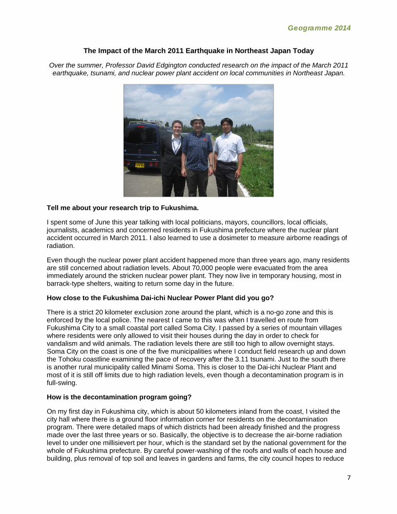
Over the summer, Professor David Edgington conducted research on the impact of the March 2011 earthquake, tsunami, and nuclear power plant accident on local communities in Northeast Japan.
Tell me about your research trip to Fukushima.
I spent some of June this year talking with local politicians, mayors, councillors, local officials, journalists, academics and concerned residents in Fukushima prefecture where the nuclear plant accident occurred in March 2011. I also learned to use a dosimeter to measure airborne readings of radiation.
Even though the nuclear power plant accident happened more than three years ago, many residents are still concerned about radiation levels. About 70,000 people were evacuated from the area immediately around the stricken nuclear power plant. They now live in temporary housing, most in barrack-type shelters, waiting to return some day in the future.
How close to the Fukushima Dai-ichi Nuclear Power Plant did you go?
There is a strict 20 kilometer exclusion zone around the plant, which is a no-go zone and this is enforced by the local police. The nearest I came to this was when I travelled en route from Fukushima City to a small coastal port called Soma City. I passed by a series of mountain villages where residents were only allowed to visit their houses during the day in order to check for vandalism and wild animals. The radiation levels there are still too high to allow overnight stays. Soma City on the coast is one of the five municipalities where I conduct field research up and down the Tohoku coastline examining the pace of recovery after the 3.11 tsunami. Just to the south there is another rural municipality called Minami Soma. This is closer to the Dai-ichi Nuclear Plant and most of it is still off limits due to high radiation levels, even though a decontamination program is in full-swing.
How is the decontamination program going?
On my first day in Fukushima city, which is about 50 kilometers inland from the coast, I visited the city hall where there is a ground floor information corner for residents on the decontamination program. There were detailed maps of which districts had been already finished and the progress made over the last three years or so. Basically, the objective is to decrease the air-borne radiation level to under one millisievert per hour, which is the standard set by the national government for the whole of Fukushima prefecture. By careful power-washing of the roofs and walls of each house and building, plus removal of top soil and leaves in gardens and farms, the city council hopes to reduce

Geogramme 2014
8
radiation levels by about half to two-thirds. There is a small army of construction workers spread throughout the city and at other towns in the prefecture. At the same time, the half life phenomenon of certain radiation products, such as cesium, means the radiation levels will also decline naturally. But the council is already behind schedule in decontamination because of the heavy snow fall last winter, but it plans to finish the program in one to two more years.
Removal of so much soil must mount up rapidly. Where does the city store the contaminated soil?
That’s a real problem. The soil is put in large black plastic bags and taken to various temporary sites and stored safely with the highest radiation-count bags in the middle of the pile. Discussions are still on-going as to where to finally store these bags. The only solution seems to be to dig a deep hole, probably on land inside the exclusion zone at the coast. But none of the villages there have given their permission. It’s not surprising!
Professor David Edgington Mimi Yu
Editor, UBC Geographer, Geogramme
2013-2014 Building Renovations
During the summer of 2013, UBC initiated a large renovations project to address the long standing drainage issues affecting the Geography Building, to perform seismic upgrades in the crawlspace to improve the seismic integrity of the building, to make building envelope repairs and to paint the exterior of the building. This project will be completed by the end of August 2014.
The grand opening of the Biogeomorphology Experimental Laboratory in Ponderosa Commons in February 2014 meant that the physical geographers now have a large world-class laboratory. All physical geography research labs and certain storage spaces were relocated there, freeing up space in the Geography building. The department took this opportunity to evaluate other poorly-used spaces in light of departmental needs and embarked on renovations to four areas. The objectives
Geogramme 2014
9
were to renovate existing labs, improve social space and accommodate research space requirements. In addition to these projects, the GIC (Geographic Information Centre) underwent structural upgrades and renovations to accommodate the air photo collection as well as improve student study space; and the courtyard was significantly improved as a result of a public realm initiative. All in all it’s been a busy year with lots to show for it!
Rm 112 – Geographic Information Centre In 2012, it was announced that the GIC would receive nearly 2.3 million aerial photographs depicting BC’s geographical history from the Provincial Air Photo Warehouse that closed in April 2012. To ensure public access to these photos, the GIC was renovated to accommodate the new photo collection. The current renovations also improve current student study spaces.
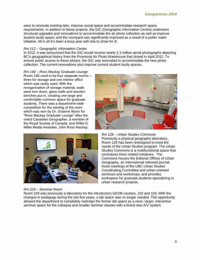
Rm 140 – Ross Mackay Graduate Lounge Room 140 used to be four separate rooms—three for storage and one interior office which was rarely used. With the reorganization of storage material, walls were torn down, glass walls and wooden benches put in, creating one large and comfortable common space for graduate students. There was a department-wide competition for the naming of the room which was won by Dr. Graeme Wynn for “Ross Mackay Graduate Lounge” after the noted Canadian Geographer, a member of the Royal Society of Canada, and Willet G. Miller Medal Awardee, John Ross Mackay.
Rm 126 – Urban Studies Commons Previously a physical geography laboratory, Room 126 has been redesigned to meet the needs of the Urban Studies program. The Urban Studies Commons is a multifunctional space that centralizes three related initiatives. The Commons houses the Editorial Offices of Urban Geography, an international refereed journal; hosts meetings of the UBC Urban Studies Coordinating Committee and urban-oriented seminars and workshops; and provides workspace for graduate students specializing in urban research projects.
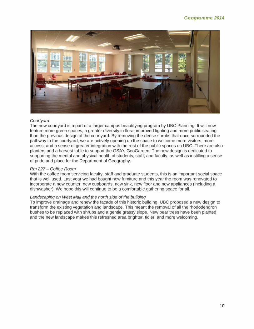
Rm 229 – Seminar Room Room 229 was previously a laboratory for the introductory GEOB courses, 102 and 103. With the changes in pedagogy during the last few years, a lab space was no longer needed. This opportunity allowed the department to completely redesign the former lab space as a nicer, larger, interactive seminar space for the colloquia and smaller seminar classes with a brand new A/V system.
Geogramme 2014
10
Courtyard The new courtyard is a part of a larger campus beautifying program by UBC Planning. It will now feature more green spaces, a greater diversity in flora, improved lighting and more public seating than the previous design of the courtyard. By removing the dense shrubs that once surrounded the pathway to the courtyard, we are actively opening up the space to welcome more visitors, more access, and a sense of greater integration with the rest of the public spaces on UBC. There are also planters and a harvest table to support the GSA’s GeoGarden. The new design is dedicated to supporting the mental and physical health of students, staff, and faculty, as well as instilling a sense of pride and place for the Department of Geography.
Rm 227 – Coffee Room With the coffee room servicing faculty, staff and graduate students, this is an important social space that is well used. Last year we had bought new furniture and this year the room was renovated to incorporate a new counter, new cupboards, new sink, new floor and new appliances (including a dishwasher). We hope this will continue to be a comfortable gathering space for all.
Landscaping on West Mall and the north side of the building To improve drainage and renew the façade of this historic building, UBC proposed a new design to transform the existing vegetation and landscape. This meant the removal of all the rhododendron bushes to be replaced with shrubs and a gentle grassy slope. New pear trees have been planted and the new landscape makes this refreshed area brighter, tidier, and more welcoming.
Related Documents