Evaluation of JPEG and JPEG2000 effects on remote sensing image classification for mapping natural areas ALAITZ ZABALA (1) , XAVIER PONS (1,2) , JOAN MASÓ (2) , FERNANDO GARCÍA (3) , FRANCESC AULÍ (3) , JOAN SERRA (3) (1) Department of Geography. Edifici B. (2) Center for Ecological Research and Forestry Applications (CREAF). Edifici C. (3) Department of Information and Communications Engineering (DEIC). ETSE. Autonomous University of Barcelona E 08193 Bellaterra, Barcelona. SPAIN [email protected] , [email protected] , [email protected] , [email protected] , [email protected] , [email protected] Abstract: This study measures the effect of lossy image compression on the digital classification of forest areas. A mixed classification method comprising satellite images and topoclimatic variables for mapping vegetation land cover was used. The results contribute interesting new data about the influence of compression on the quality of the cartography produced, both from a “by pixel” perspective and also regarding the homogeneity of the polygons obtained. The area classified in classifications only carried out with radiometric variables increases as image compression increases, although the increase is smaller for JPEG2000 formats, especially in fragmented areas. On the other hand, the area classified decreases in classifications which also take into account topoclimatic variables. Overall image accuracy diminishes at high compression levels, although the point of inflection occurs in different places depending on the compression format (highest accuracy for JPEG and fragmented images occurs at lower compression levels). As a rule, the JPEG2000 format gives better results both quantitatively (accuracy and area classified) and visually (images with less “salt and pepper” effect). Key-Words: Remote sensing , image classification, lossy compression, natural areas 1 Introduction and aims In 1991 the JPEG format [1], developed by the Joint Photographic Experts Group, first appeared and revolutionized image compression due to the fact that it achieves very high compression levels with no appreciable loss of image quality, at least for file sizes up to approximately 20% of the original. Later there appeared compression techniques based on wavelet transformations which permit even higher compression levels with similar image quality. In recent years, SID, ECW and JPEG2000 formats [2] have been particularly popular with the Remote Sensing (RS) and Geographic Information Systems (GIS) community. It is important to bear in mind that in every case we are dealing with lossy compression algorithms, which sacrifice part of the data in order to achieve a higher compression ratio. In spite of the spectacular nature of the compression levels achieved, there has been little quantitative analysis of the implications of these compressions. This study aims to assess the influence of image compression on digital classification applied to areas of natural vegetation and is based on the authors’ own experience and on that of studies [3], [4] and [5]. Moreover, our study covers a wider area, which should provide more representative results. In line with current practice, it also aims to evaluate multitemporality and the use of topoclimatic variables to improve the classification. 2 Material and methods The classification method used is a combination of satellite images and other topoclimatic variables over vegetation land covers, which is designed to improve the accuracy of the classifications [6], [7] and [8]. The training areas were obtained from other existing land cover maps, basically from the Mapa d’Hàbitats de Catalunya (Habitat Map of Catalonia). This areas are underwent to statistical treatment to guarantee their quality and to avoid problems of land

Welcome message from author
This document is posted to help you gain knowledge. Please leave a comment to let me know what you think about it! Share it to your friends and learn new things together.
Transcript
Evaluation of JPEG and JPEG2000 effects on remote sensing image classification for mapping natural areas
ALAITZ ZABALA (1), XAVIER PONS (1,2), JOAN MASÓ (2), FERNANDO GARCÍA (3),
FRANCESC AULÍ (3), JOAN SERRA (3)
(1) Department of Geography. Edifici B. (2) Center for Ecological Research and Forestry Applications (CREAF). Edifici C. (3) Department of Information and Communications Engineering (DEIC). ETSE.
Autonomous University of Barcelona E 08193 Bellaterra, Barcelona.
SPAIN [email protected], [email protected], [email protected],
[email protected], [email protected], [email protected] Abstract: This study measures the effect of lossy image compression on the digital classification of forest areas. A mixed classification method comprising satellite images and topoclimatic variables for mapping vegetation land cover was used. The results contribute interesting new data about the influence of compression on the quality of the cartography produced, both from a “by pixel” perspective and also regarding the homogeneity of the polygons obtained. The area classified in classifications only carried out with radiometric variables increases as image compression increases, although the increase is smaller for JPEG2000 formats, especially in fragmented areas. On the other hand, the area classified decreases in classifications which also take into account topoclimatic variables. Overall image accuracy diminishes at high compression levels, although the point of inflection occurs in different places depending on the compression format (highest accuracy for JPEG and fragmented images occurs at lower compression levels). As a rule, the JPEG2000 format gives better results both quantitatively (accuracy and area classified) and visually (images with less “salt and pepper” effect). Key-Words: Remote sensing , image classification, lossy compression, natural areas 1 Introduction and aims In 1991 the JPEG format [1], developed by the Joint Photographic Experts Group, first appeared and revolutionized image compression due to the fact that it achieves very high compression levels with no appreciable loss of image quality, at least for file sizes up to approximately 20% of the original. Later there appeared compression techniques based on wavelet transformations which permit even higher compression levels with similar image quality. In recent years, SID, ECW and JPEG2000 formats [2] have been particularly popular with the Remote Sensing (RS) and Geographic Information Systems (GIS) community. It is important to bear in mind that in every case we are dealing with lossy compression algorithms, which sacrifice part of the data in order to achieve a higher compression ratio. In spite of the spectacular nature of the compression levels achieved, there has been little quantitative analysis of the implications of these compressions. This study aims to assess the influence
of image compression on digital classification applied to areas of natural vegetation and is based on the authors’ own experience and on that of studies [3], [4] and [5]. Moreover, our study covers a wider area, which should provide more representative results. In line with current practice, it also aims to evaluate multitemporality and the use of topoclimatic variables to improve the classification. 2 Material and methods The classification method used is a combination of satellite images and other topoclimatic variables over vegetation land covers, which is designed to improve the accuracy of the classifications [6], [7] and [8]. The training areas were obtained from other existing land cover maps, basically from the Mapa d’Hàbitats de Catalunya (Habitat Map of Catalonia). This areas are underwent to statistical treatment to guarantee their quality and to avoid problems of land
uses changes due to temporal dynamic. In order to measure the effect of topoclimatic variables and compression on the results of the classification, various scenarios were considered. In each case, both situations were analyzed: scenario R had only images (radiometric variables) whereas scenario RTC also had topoclimatic variables. JPG and JPEG2000 compression techniques were also analyzed for each scenario. JPEG2000 will be referred to as J2K. Compression size was based on compression ratios (CR) and not on compression quality (standard for JPG) since we considered it more relevant given the clearly practical applications of our research. It should be borne in mind that the same compression ratio may produce different degrees of quality depending on the type of image:
FileOriginalofSizeFileCompressedofSizeCR =
The compression ratios used for each scenario were: 100% (uncompressed image), 60%, 50%, 40%, 30%, 20%, 10%, 5% and 1%. Analysis of classification accuracy (with or
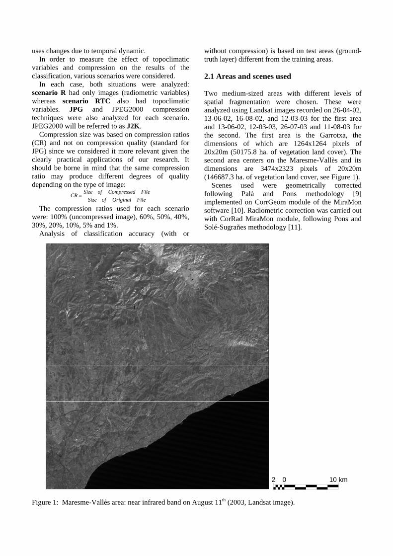
without compression) is based on test areas (ground-truth layer) different from the training areas. 2.1 Areas and scenes used Two medium-sized areas with different levels of spatial fragmentation were chosen. These were analyzed using Landsat images recorded on 26-04-02, 13-06-02, 16-08-02, and 12-03-03 for the first area and 13-06-02, 12-03-03, 26-07-03 and 11-08-03 for the second. The first area is the Garrotxa, the dimensions of which are 1264x1264 pixels of 20x20m (50175.8 ha. of vegetation land cover). The second area centers on the Maresme-Vallès and its dimensions are 3474x2323 pixels of 20x20m (146687.3 ha. of vegetation land cover, see Figure 1). Scenes used were geometrically corrected following Palà and Pons methodology [9] implemented on CorrGeom module of the MiraMon software [10]. Radiometric correction was carried out with CorRad MiraMon module, following Pons and Solé-Sugrañes methodology [11].
Figure 1: Maresme-Vallès area: near infrared band on August 11th (2003, Landsat image).
2 0 10 km
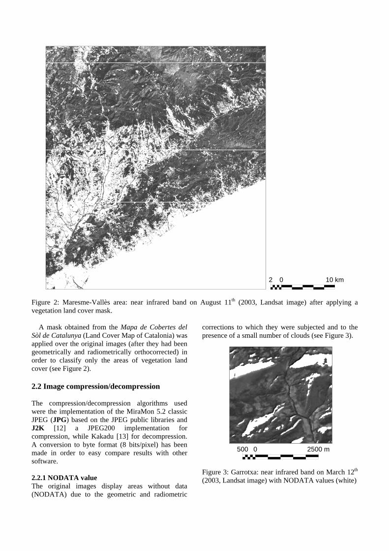
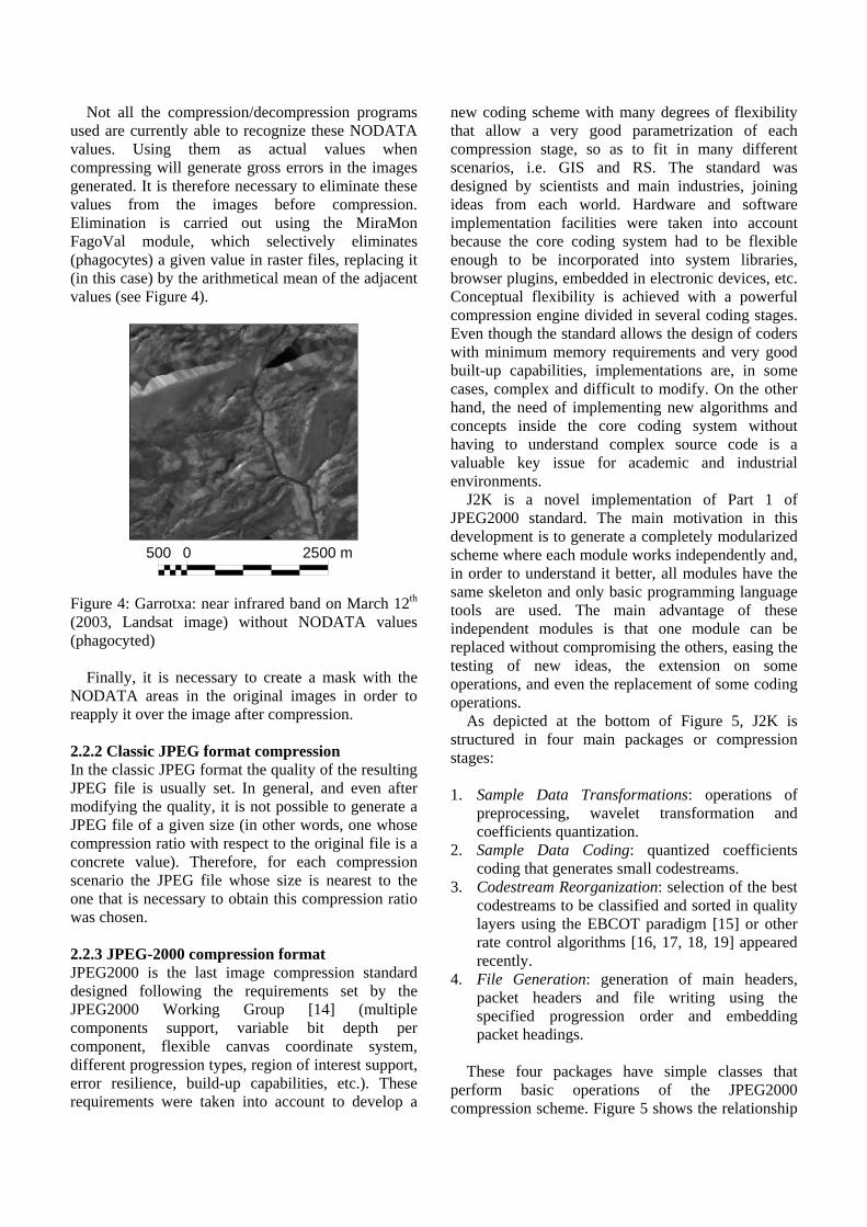
Figure 2: Maresme-Vallès area: near infrared band on August 11th (2003, Landsat image) after applying a vegetation land cover mask. A mask obtained from the Mapa de Cobertes del Sòl de Catalunya (Land Cover Map of Catalonia) was applied over the original images (after they had been geometrically and radiometrically orthocorrected) in order to classify only the areas of vegetation land cover (see Figure 2). 2.2 Image compression/decompression The compression/decompression algorithms used were the implementation of the MiraMon 5.2 classic JPEG (JPG) based on the JPEG public libraries and J2K [12] a JPEG200 implementation for compression, while Kakadu [13] for decompression. A conversion to byte format (8 bits/pixel) has been made in order to easy compare results with other software. 2.2.1 NODATA value The original images display areas without data (NODATA) due to the geometric and radiometric
corrections to which they were subjected and to the presence of a small number of clouds (see Figure 3).
Figure 3: Garrotxa: near infrared band on March 12th (2003, Landsat image) with NODATA values (white)
2 0 10 km
500 0 2500 m
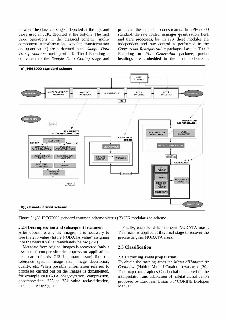
Not all the compression/decompression programs used are currently able to recognize these NODATA values. Using them as actual values when compressing will generate gross errors in the images generated. It is therefore necessary to eliminate these values from the images before compression. Elimination is carried out using the MiraMon FagoVal module, which selectively eliminates (phagocytes) a given value in raster files, replacing it (in this case) by the arithmetical mean of the adjacent values (see Figure 4).
Figure 4: Garrotxa: near infrared band on March 12th (2003, Landsat image) without NODATA values (phagocyted) Finally, it is necessary to create a mask with the NODATA areas in the original images in order to reapply it over the image after compression. 2.2.2 Classic JPEG format compression In the classic JPEG format the quality of the resulting JPEG file is usually set. In general, and even after modifying the quality, it is not possible to generate a JPEG file of a given size (in other words, one whose compression ratio with respect to the original file is a concrete value). Therefore, for each compression scenario the JPEG file whose size is nearest to the one that is necessary to obtain this compression ratio was chosen. 2.2.3 JPEG-2000 compression format JPEG2000 is the last image compression standard designed following the requirements set by the JPEG2000 Working Group [14] (multiple components support, variable bit depth per component, flexible canvas coordinate system, different progression types, region of interest support, error resilience, build-up capabilities, etc.). These requirements were taken into account to develop a
new coding scheme with many degrees of flexibility that allow a very good parametrization of each compression stage, so as to fit in many different scenarios, i.e. GIS and RS. The standard was designed by scientists and main industries, joining ideas from each world. Hardware and software implementation facilities were taken into account because the core coding system had to be flexible enough to be incorporated into system libraries, browser plugins, embedded in electronic devices, etc. Conceptual flexibility is achieved with a powerful compression engine divided in several coding stages. Even though the standard allows the design of coders with minimum memory requirements and very good built-up capabilities, implementations are, in some cases, complex and difficult to modify. On the other hand, the need of implementing new algorithms and concepts inside the core coding system without having to understand complex source code is a valuable key issue for academic and industrial environments. J2K is a novel implementation of Part 1 of JPEG2000 standard. The main motivation in this development is to generate a completely modularized scheme where each module works independently and, in order to understand it better, all modules have the same skeleton and only basic programming language tools are used. The main advantage of these independent modules is that one module can be replaced without compromising the others, easing the testing of new ideas, the extension on some operations, and even the replacement of some coding operations. As depicted at the bottom of Figure 5, J2K is structured in four main packages or compression stages: 1. Sample Data Transformations: operations of
preprocessing, wavelet transformation and coefficients quantization.
2. Sample Data Coding: quantized coefficients coding that generates small codestreams.
3. Codestream Reorganization: selection of the best codestreams to be classified and sorted in quality layers using the EBCOT paradigm [15] or other rate control algorithms [16, 17, 18, 19] appeared recently.
4. File Generation: generation of main headers, packet headers and file writing using the specified progression order and embedding packet headings.
These four packages have simple classes that perform basic operations of the JPEG2000 compression scheme. Figure 5 shows the relationship
500 0 2500 m
between the classical stages, depicted at the top, and those used in J2K, depicted at the bottom. The first three operations in the classical scheme (multi-component transformation, wavelet transformation and quantization) are performed in the Sample Data Transformations package of J2K. Tier 1 Encoding is equivalent to the Sample Data Coding stage and
produces the encoded codestreams. In JPEG2000 standard, the rate control manages quantization, tier1 and tier2 processes, but in J2K these modules are independent and rate control is performed in the Codestream Reorganization package. Last, in Tier 2 Encoding or File Generation package, packet headings are embedded in the final codestream.
Figure 5: (A) JPEG2000 standard common scheme versus (B) J2K modularized scheme. 2.2.4 Decompression and subsequent treatment After decompressing the images, it is necessary to free the 255 value (future NODATA value) assigning it to the nearest value immediately below (254). Metadata from original images is recovered (only a few set of compression-decompression applications take care of this GIS important issue) like the reference system, image size, image description, quality, etc. When possible, information referred to processes carried out on the images is documented, for example NODATA phagocytation, compression, decompression, 255 to 254 value reclassification, metadata recovery, etc.
Finally, each band has its own NODATA mask. This mask is applied at this final stage to recover the precise original NODATA areas. 2.3 Classification 2.3.1 Training areas preparation To obtain the training areas the Mapa d’Hàbitats de Catalunya (Habitat Map of Catalonia) was used [20]. This map cartographies Catalan habitats based on the interpretation and adaptation of habitat classification proposed by European Union on “CORINE Biotopes Manual”.
In order to guarantee the use of training areas with a maximum thematic homogeneity, habitats with 80% or higher cover were selected. The selected habitats were 60 meters eroded (module BuffDist of MiraMon) on both sides of its polygon borders to reduce effects of geographical positioning error. This value derives from the map scale of the base, as owed to the unavoidable errors in the delimitation of natural habitats (blurry borders). The eroded polygons have been fragmented in squares of 200 meter side. This allows some pixels to be used in the process of classification and others to be reserved as ground truth in a posterior validation of the results. Besides, a certain homogenization of the surface of every training area is obtained. In spite of the precautions taken up to here, the quality of the training areas can be still doubted. The following step is a depuration of the areas selected using the internal variability of them as criterion (iterative process).
2.3.2 Classifying method The classification methodology used demands that the variables used in the classification has to be standardized. The mixed classification is subsequently carried out using the MiraMon IsoMM and ClsMix modules. IsoMM is an IsoData implementation [21]. IsoData typically groups pixels of an scene to a class center previously specified with a minimum distance criteria. New class centers are calculated according to pixels incorporated in the previous phase. The process is iteratively repeated since pixels assignations to class centers are sufficiently constant or since a predetermined maximum iteration number is raised. The second part of the mixed classification is based on ClsmMix MiraMon module. This module reclassifies each spectral class of a non supervised classified image into thematic classes. These thematic classes are defined by a set of training areas.
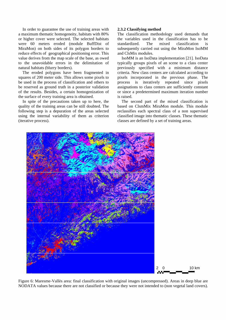
Figure 6: Maresme-Vallès area: final classification with original images (uncompressed). Areas in deep blue are NODATA values because there are not classified or because they were not intended to (non vegetal land covers).
2 0 10 km

The final classification (see Figure 6) is validated using a confusion matrix between the classified image and the training areas reserved for this purpose. The classification was repeated some times with the original images (uncompressed). The parameters values that maximize the accuracy in the classification were used in all the scenarios. An overview of the processes carried out are shown in Figure 7.
Figure 7: Diagram of methodology used 3. Results Figures 8 and 9 show the results for the images of the areas of the Garrotxa and the Maresme-Vallès respectively. For each area, the top graph shows the global accuracy obtained by the classifications and the bottom graph indicates the percentage of area classified, both related to the compression ratio (CR). In all the graphs, the color green indicates classifications that only include radiometry (scenario R) and in red those that also include topoclimatic variables (scenario RTC). Continuous line: JPG compression; dotted line: J2K compression. As the CR decreases, in scenario R the tendency is for the classified area to increase. This is probably due to a beneficial homogenization of the images. The increase in area is smaller for the J2K compression, especially in fragmented areas (Maresme-Vallès). On the other hand, in scenario RTC, the area classified decreases. This would seem to indicate that compression affects the topoclimatic variables more profoundly, perhaps because they are more continuous.
Figure 8: Results from the Garrotxa area. a) Global accuracy, b) Area classified
Figure 9: Results for the Maresme-Vallès area. a) Global accuracy, b) Area classified
Original images (integer and real)
Phagocyte NODATA value
Vegetation cover mask
Mixed classification: IsoMM + Clasmix
Standardization of values
Original images (byte)
Compression Decompression
NODATA Mask
Evaluation of results: training areas
Original images (integer and real)
Phagocyte NODATA value
Vegetation cover mask
Mixed classification: IsoMM + Clasmix
Standardization of values
Original images (byte)
Compression Decompression
NODATA Mask
Evaluation of results: training areas
Area classified - Maresme-Vallès area
60.00
62.00
64.00
66.00
68.00
70.00
72.00
00.20.40.60.81 CR
%
R - JPGRTC - JPGR - J2KRTC - J2K
Global Accuracy - Maresme-Vallès area
72.00
74.00
76.00
78.00
80.00
82.00
84.00
86.00
88.00
00.20.40.60.81 CR
%
R - JPG
RTC - JPGR - J2KRTC - J2K
Area classified - Garrotxa area
78.00
80.00
82.00
84.00
86.00
88.00
90.00
00.20.40.60.81 CR
%
R - JPGRTC - JPGR - J2KRTC - J2K
Global Accuracy - Garrotxa area
82.00
84.00
86.00
88.00
90.00
92.00
94.00
00.20.40.60.81 CR
%
R - JPG
RTC - JPGR - J2KRTC - J2K
As CR decreases, the global accuracy increases at first, but decreases for JPG at low CR, especially in scenario R – JPG. In scenario RTC – JPG, accuracy decreases, but to a lesser degree. On the other hand, for the J2K format global accuracy appears to increase indefinitely for the Garrotxa area, but not for the Maresme-Vallès area. 4. Conclusions The conclusions of the study suggest the following optimal work scenarios: • Scenario R – JPG: CR 0.2-0.1 is optimal for less
fragmented images (Garrotxa) as accuracy is greater (higher than the original image) and the percentage of area classified is similar or only slightly smaller. CR between 0.5-0.1 for more fragmented images.
• Scenario R – J2K: for less fragmented images we have not reached the optimal CR limit (in any CR, accuracy and area classified increase), but in more fragmented images, optimal CR is 0.05.
• Scenario RTC – JPG: optimal CR is 0.2 for only slightly fragmented images, although the results are similar to those for the original images. In more fragmented images, CR 0.5 has the largest area classified and only slightly less accuracy.
• Scenario RTC- J2K: maximum CR 0.3- 0.2 (Garrotxa) or 0.4-0.3 (Maresme) as the area classified later decreases below the area classified in the original image.
It is important to point out that the J2K format is better than JPG, but in border areas between highly differentiated spectral classes, compression produces mixing effects that lead to errors in these areas. Figure 10 indicates that the J2K classification (left), the border areas between Pinus sylvestris (blue) and Fraxinus sp. (pink) and between P. Sylvestris and Mediterranean mountain scrubland (green) remain unclassified (grey).
Figure 10: Border effects on classified images: original (left), J2K CR 0.01 (right).
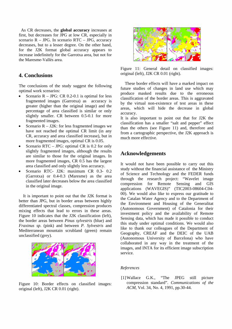
Figure 11: General detail on classified images: original (left), J2K CR 0.01 (right). These border effects will have a marked impact on future studies of changes in land use which may produce masked results due to the erroneous classification of the border areas. This is aggravated by the virtual non-existence of test areas in these areas, which will hide the decrease in global accuracy. It is also important to point out that for J2K the classification has a smaller “salt and pepper” effect than the others (see Figure 11) and, therefore and from a cartographic perspective, the J2K approach is much more effective. Acknowledgements It would not have been possible to carry out this study without the financial assistance of the Ministry of Science and Technology and the FEDER funds through the research project: “Wavelet image compression for Remote Sensing and GIS applications (WAVEGIS)” (TIC2003-08604-C04-00). We would also like to express our gratitude to the Catalan Water Agency and to the Department of the Environment and Housing of the Generalitat (Autonomous Government) of Catalonia for their investment policy and the availability of Remote Sensing data, which has made it possible to conduct this study under optimal conditions. We would also like to thank our colleagues of the Department of Geography, CREAF and the DEIC of the UAB (Autonomous University of Barcelona) who have collaborated in any way in the treatment of the images, and INTA for its efficient image subscription service. References [1] Wallace G.K., “The JPEG still picture
compression standard”. Communications of the ACM, Vol. 34, No. 4, 1991, pp.30-44.

[2] Taubman D.S., Marcellin M.W. JPEG2000: Image compression fundamentals, standards and practice. Kluwer, Academic Publishers, 2002.
[3] C. Pérez, D. Aguilera, A. Muñoz, “Estudio de viabilidad del uso de imágenes comprimidas en procesos de clasificación”. Teledetección y desarrollo regional. X Congreso Nacional de Teledetección, 2003, pp. 309-312.
[4] F. Tintrup, F. De Natale, D. Giusto, “Compression algorithms for classification of remotely sensed images”. Acoustics, Speech and Signal Processing. ICASSP ’98. Proceedings of the 1998 IEEE International Conference, Vol. 5, 1998, pp. 2565-2568.
[5] J.D. Paola, R.A. Schowengerdt, “The effect of lossy image compression on image classification”. Geoscience and Remote Sensing Symposium, 1995. IGARSS ’95. ‘Quantitative Remote Sensing for Science and Applications’, International 1: 118-120.
[6] P. Serra, X.Pons, D. Saurí, “Post-classification change detection with data from different sensors. Some accuracy considerations”. International Journal of Remote Sensing, Vol. 24, No. 16, 2003, pp.3311-3340.
[7] G. Moré, J.A. Burriel, R. Castells, J.J. Ibáñez, X. Roijals, “Tratamiento estadístico de variables radiométricas, orográficas y climáticas para la obtención de un mapa detallado de vegetación”. In C. Conesa, Y. Álvarez, J.B. Martínez, Medio Ambiente, Recursos y Riesgos Naturales: Análisis mediante tecnología SIG y Teledetección, Vol.1, 2004, pp. 261-273.
[8] G. Moré, J.A. Burriel, R. Castells, J.J. Ibáñez, X.Pons, X. Roijals, “Diferenciación de cubiertas de bosque para el Mapa de Cubiertas del Suelo de Catalunya a partir de la clasificación de imágenes Landsat”, Jornadas de inventario y teledetección forestal (INVETEL 2004). 2004.
[9] V. Palà, X. Pons, “Incorporation of relief into geometric corrections based on polynomials”, Photogrammetric Engineering & Remote Sensing, 61 (7), 2005, pp.935-944.
[10] X.Pons, MiraMon. Sistema d’informació Geogràfica i Software de Teledetecció. Centre de Recerca Ecològica i Aplicacions Forestals, CREAF, Bellaterra. 2002.
[11] X. Pons, Ll. Solé-Sugrañes, “A Simple Radiometric Correction Model to Improve Automatic Mapping of Vegetation from Multispectral Satellite Data”. Remote Sensing of Environment, 48, 1994, pp. 191-204.
[12] Francesc Auli-Llinas, Joan Ramon Paton, Joan Bartrina-Rapesta, Jose Lino Monteagudo-Pereira and Joan Serra-Sagrista, “J2K: introducing a novel JPEG2000 coder”. In Visual Communications and Image Processing. Society of Photo-optical Instrumentation Engineers (SPIE), Beijing, China, IN PRESS. Sponsored by SPIE, IST, July 2005.
[13] D. Taubman, Kakadu software. http://www.kakadusoftware.com/, 2000.
[14] ISO/IEC JTC 1/SC 29/WG 1, http://www.itscj.ipsj.or.jp/sc29. ISO/IECWorking Group that develops JPEG2000.
[15] D. S. Taubman, “High performance scalable image compression with EBCOT,” IEEE Transactions on Image Processing, Vol. 9, 2000, pp. 1158–1170.
[16 ] T. Masuzaki, H. Tsutsui, T. Izumi, T. Onoye, and Y. Nakamura, “Adaptive rate control for JPEG2000 image coding in embedded systems,” in Proceedings of the International Conference on Image Processing, Vol. 3, 2002, pp. 77–80.
[17] W. Yu, “Integrated rate control and entropy coding for JPEG2000,” in Proceedings of the Data Compression Conference, (Snowbird, UT, USA) 2004, pp. 152–161.
[18] K. Vikram, V. Vasudevan, and S. Srinivasan, “Rate-distortion estimation for fast JPEG2000 compression at low bit-rates,” IEE Electronics Letters, Vol. 41, January 2005.
[19] Y. Yeung and O. Au, “Efficient rate control for JPEG2000 image coding,” IEEE Transactions on Circuits and Systems for Video Technology, Vol. 15, 2005, pp. 335–344.
[20] CHC, “Cartografia dels hàbitats de Catalunya”. http://www.gencat.net/mediamb/pn/2chabitats-2.htm. The Internet.
[21] R.D Duda, P.E. Hart, Pattern Classification and Scene Analysis. John Wiley & Sons. New York. 1973.
Related Documents


![Image and Vision Computing Recognition... · JPEG2000 [15] being the obvious choice for compression standards. We feel that common image compression standards, such as JPEG and JPEG2000,](https://static.cupdf.com/doc/110x72/5ffb188cbb2de95845748969/image-and-vision-computing-recognition-jpeg2000-15-being-the-obvious-choice.jpg)