EUROPEAN ATLAS OF THE SEAS The Atlas viewer in its advanced mode consists of four main components: • A homepage, with a brief welcome text. o Help (1), Feedback (2) and Language (3) options. o Search (4) o Catalogue (5): with “Predefined maps” and “Create a map” options. o Do not show this home page again (6) 1 3 4 5 6 2

Welcome message from author
This document is posted to help you gain knowledge. Please leave a comment to let me know what you think about it! Share it to your friends and learn new things together.
Transcript
EUROPEAN ATLAS OF THE SEAS
The Atlas viewer in its advanced mode consists of four main components:
• A homepage, with a brief welcome text. o Help (1), Feedback (2) and Language (3) options. o Search (4) o Catalogue (5): with “Predefined maps” and “Create a map” options. o Do not show this home page again (6)
1 3
4
5
6
2

• A map viewer zone
o Info (1), Search (2), Layer and legend options (3) and Share options (4) o Zoom tools: Zoom in (5), Predefined zoom (6) and Zoom out (7) o Measure tools (8) o Get feature info (9)
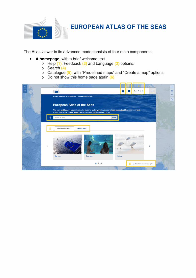
• An info page, with Help (1), Feedback (2) and Language (3) options.
1
2
3
4
5
6
7
8
9
• A search page, with three options to choose the map content:
2
1
3
1
2 3
4
o Search for layers (1), use the search text field for easy and quick retrieval of some specific layers from keywords.
o Predefined maps (2), these maps are made combining a background map and several layers grouped by theme.
o Layers (3) with info icon (4), to get information about the layer. Layers have been ordered in categories.
o Map layers can easily be displayed and combined on the map by clicking on them.
o The layer and the legend pane are automatically updated when selecting or unselecting layers.
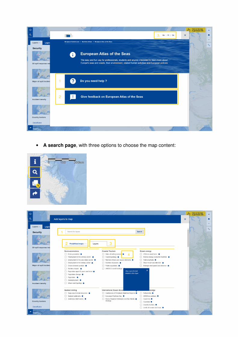
A layers and legend pane on the left allowing to:
o Selected layers (1) Layer settings (4) and get info about them (3) Choose the projection of map (Mercator or Arctic) Select Basemap (5) on the bottom of the pane Clear all layers (6)
o The legends (2) necessary to understand the map
• Share map page
6
3
4
5
1 2
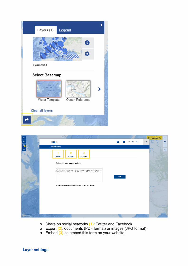
o Share on social networks (1): Twitter and Facebook. o Export (2): documents (PDF format) or images (JPG format). o Embed (3): to embed this form on your website.
Layer settings
3 2 1
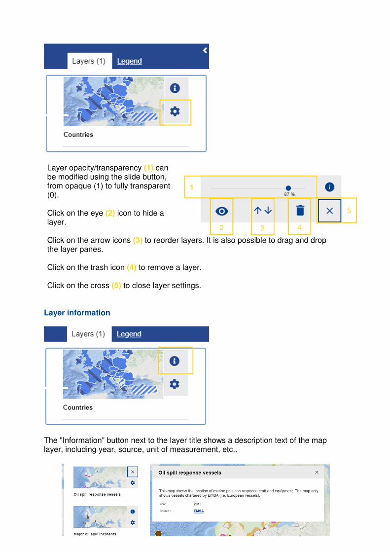
Layer opacity/transparency (1) can be modified using the slide button, from opaque (1) to fully transparent (0). Click on the eye (2) icon to hide a layer. Click on the arrow icons (3) to reorder layers. It is also possible to drag and drop the layer panes. Click on the trash icon (4) to remove a layer. Click on the cross (5) to close layer settings.
Layer information
The "Information" button next to the layer title shows a description text of the map layer, including year, source, unit of measurement, etc..
2 3 4
5
1
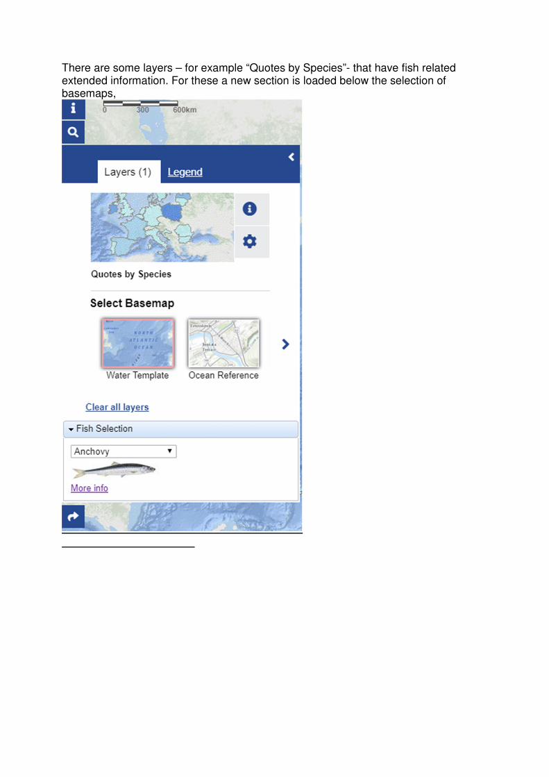
There are some layers – for example “Quotes by Species”- that have fish related extended information. For these a new section is loaded below the selection of basemaps,
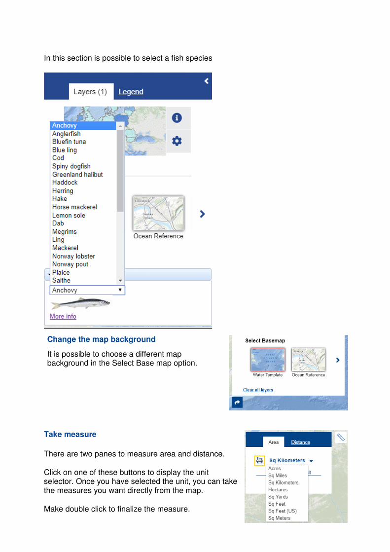
In this section is possible to select a fish species
Change the map background
It is possible to choose a different map background in the Select Base map option.
Take measure
There are two panes to measure area and distance.
Click on one of these buttons to display the unit selector. Once you have selected the unit, you can take the measures you want directly from the map. Make double click to finalize the measure.
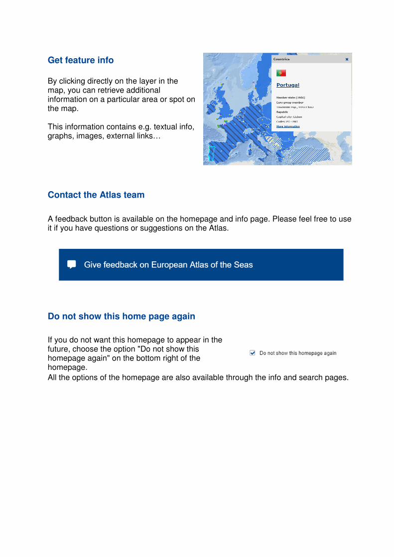
Get feature info
By clicking directly on the layer in the map, you can retrieve additional information on a particular area or spot on the map. This information contains e.g. textual info, graphs, images, external links…
Contact the Atlas team
A feedback button is available on the homepage and info page. Please feel free to use it if you have questions or suggestions on the Atlas.
Do not show this home page again
If you do not want this homepage to appear in the future, choose the option "Do not show this homepage again" on the bottom right of the homepage.
All the options of the homepage are also available through the info and search pages.
Related Documents