Esri UK Annual Conference 2015 Mobile Solutions Emma Sandison Hannah Dewey

Esriuk_track5_mobile_solutions
Aug 18, 2015
Welcome message from author
This document is posted to help you gain knowledge. Please leave a comment to let me know what you think about it! Share it to your friends and learn new things together.
Transcript

Esri UK Annual Conference 2015
Mobile SolutionsEmma Sandison
Hannah Dewey

ArcMap
Operations
Dashboard
Collector
Web AppBuilder
Esri Maps
for …
Open Data
Esri apps
ArcGIS Pro
Explorer
Story Maps
Configurable
Web Apps
Viewer
Insight
GeoPlanner
for ArcGIS
ArcGIS
Marketplace
esri
Esri UK Apps

Activities and mobile solutions
Collector ArcPad ArcGIS for
Windows
Mobile
Explorer Operations Dashboard
Field activities Planning and operation Public engagement
Custom web
applications
Web app
templates
Web AppBuilderWeb AppBuilder
Web AppBuilderExplorerWeb app templates/
custom apps

Data capture & maintenance• Collector for ArcGIS
• Web AppBuilder for ArcGIS
• Explorer for ArcGIS
Public information• Story Map Tour template
• Finder / Simple Map Viewer templates
Public reporting & internal review• QuestionWhere Builder
• Operations Dashboard for ArcGIS
• GeoForm template

Princes Street Gardens

• Data driven forms
• Capture photos and video
• Plan routes and get directions
• Edit offline and syncronise
• Edit related records/versioned feature-classes
Collector for ArcGIS
Efficiency booster and cost cutter

Web AppBuilder for ArcGIS
HTML5/JavaScript
Web AppBuilder
Widgets
Web Apps(Any Browser)
search for ‘live sites showcase’

Explorer for ArcGIS

QuestionWhere Builder

• Monitor and manage your operations
• Desktop (create) and browser (single view)
• Ready to use widgets anyone can configure
- Maps, Lists
- Bar Charts, Gauges
- Histograms, Indicators…
Operations Dashboard for ArcGIS
Create and Share
Views
Laptops Tablets

Web Application Templates
Web Map
search for ‘arcgis web app templates group’

demos…
Tree Inventory using Collector

Configure your web map
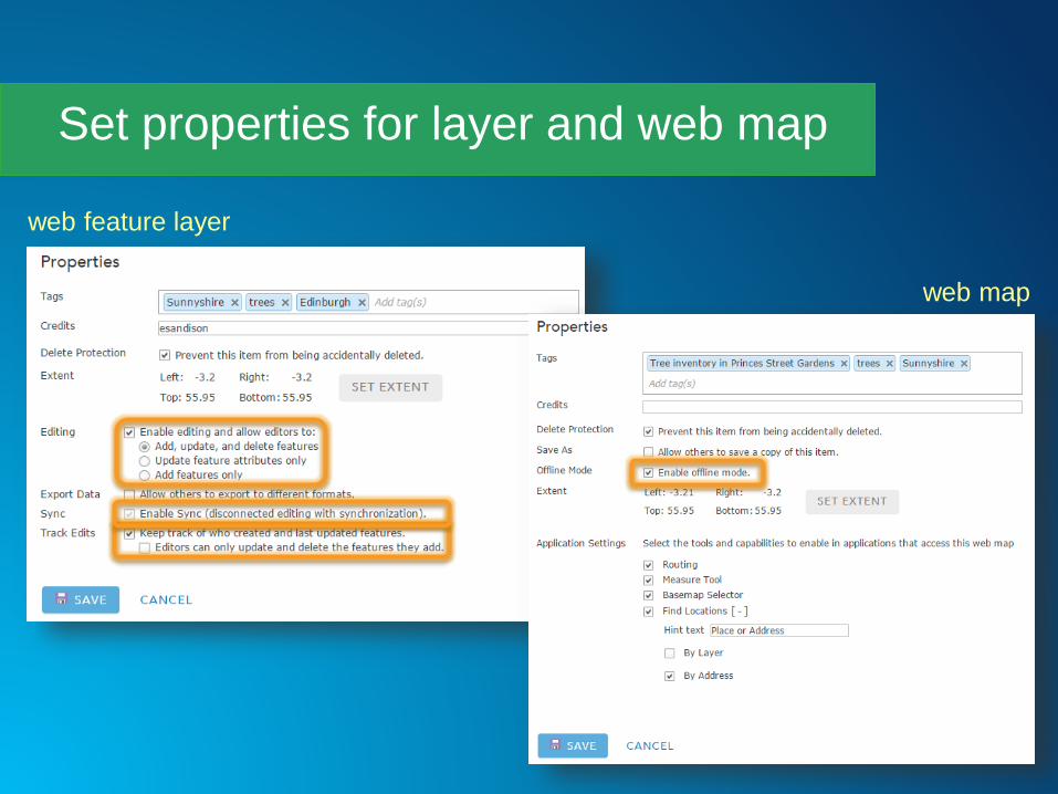
Set properties for layer and web map
web feature layer
web map

Capture details for a Cherry tree
Collector app on iphone
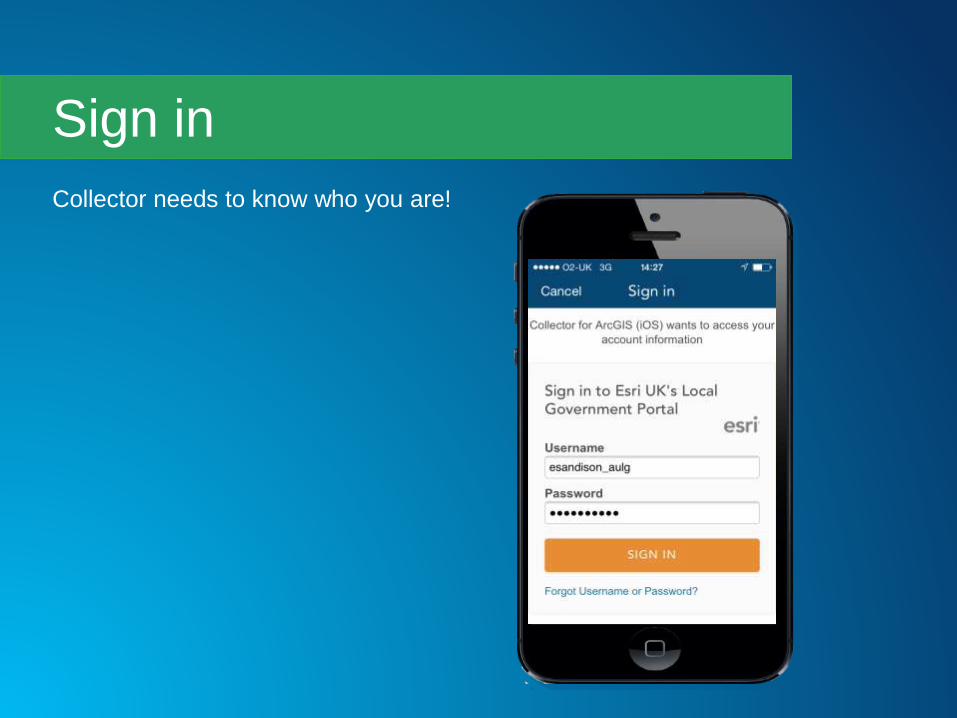
Collector needs to know who you are!
Sign in

• This web map can be
used in offline mode
• So you can download
your map and then sync changes
when you have connectivity
• We have 3G so we don’t
need to go offline today
Pick the trees web map
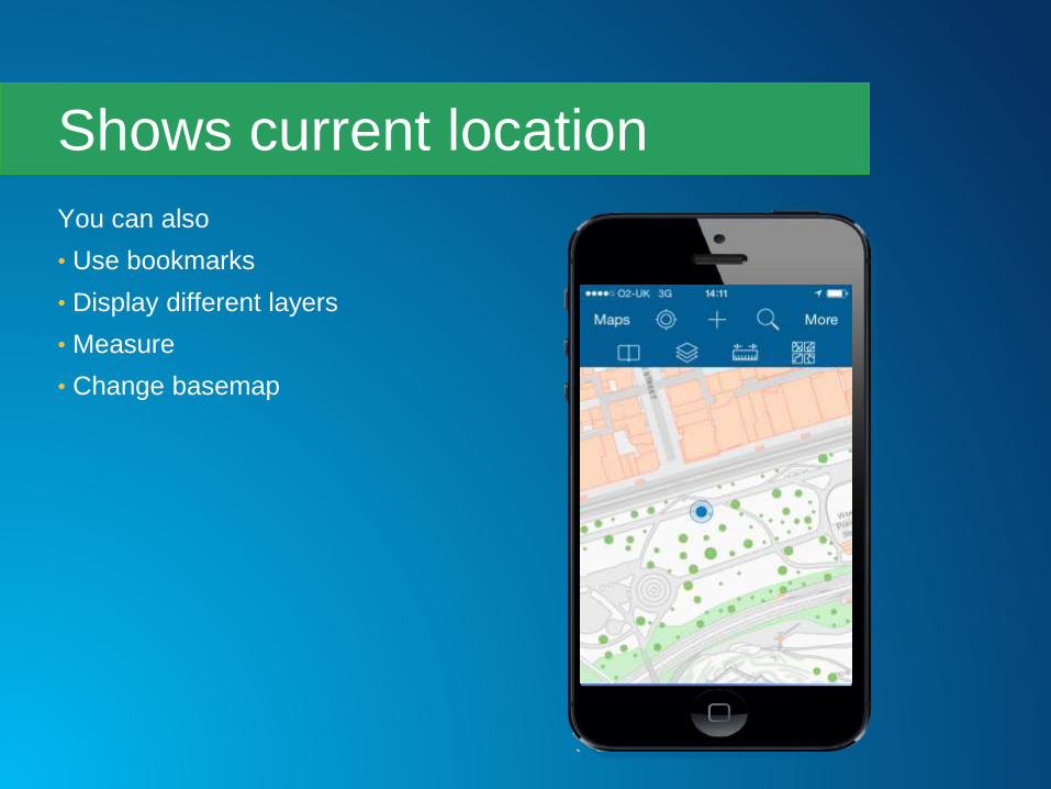
You can also
• Use bookmarks
• Display different layers
• Measure
• Change basemap
Shows current location

• Tree heights define symbology
• Set default properties
• Could also use species, problem etc.
Use feature template

• ID
• Street name
• Date surveyed
• Species
• Width
• Height
• Problem
• Ground surface
• Council owned
Collect details

Photos and videos are
stored as attachments
Add photos
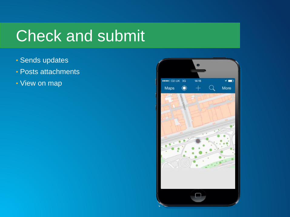
• Sends updates
• Posts attachments
• View on map
Check and submit


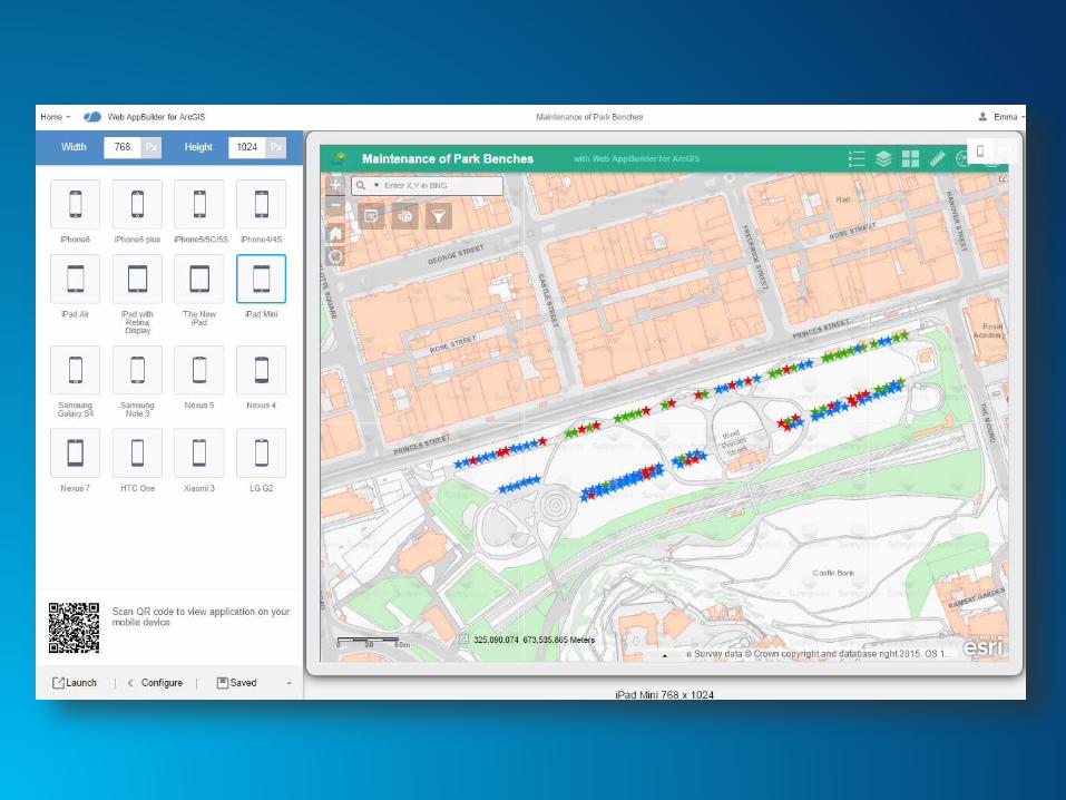
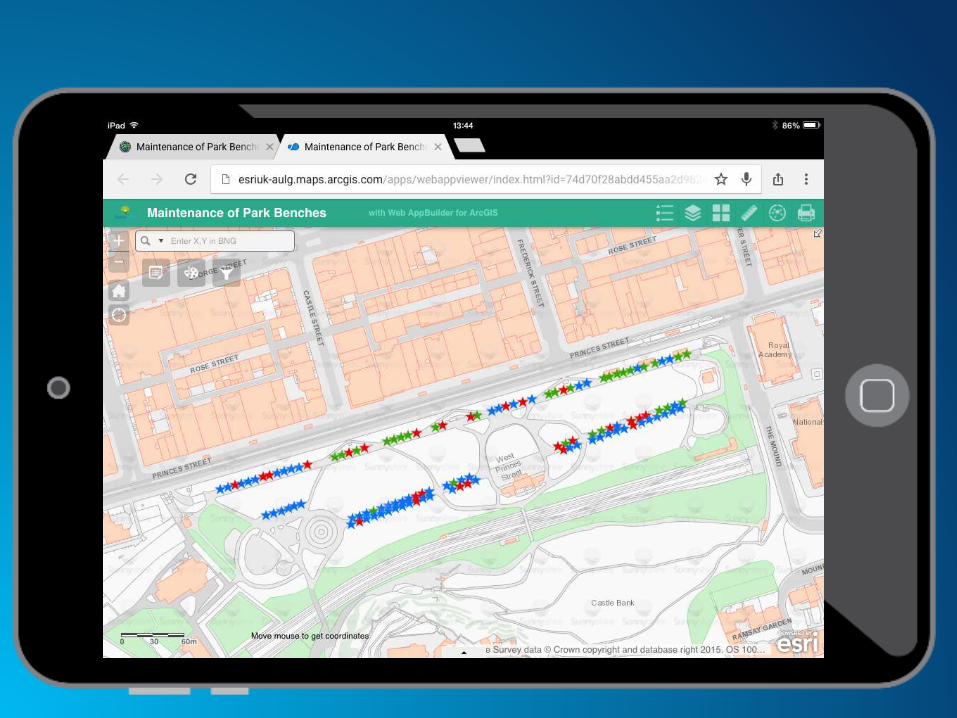
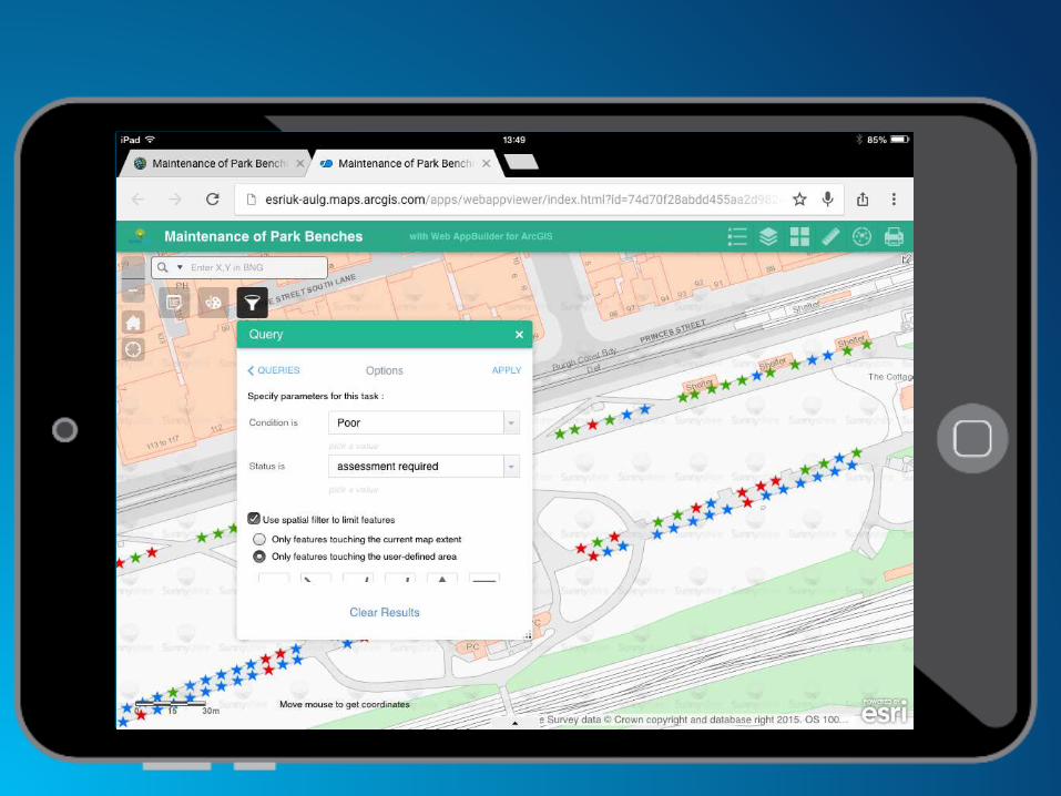
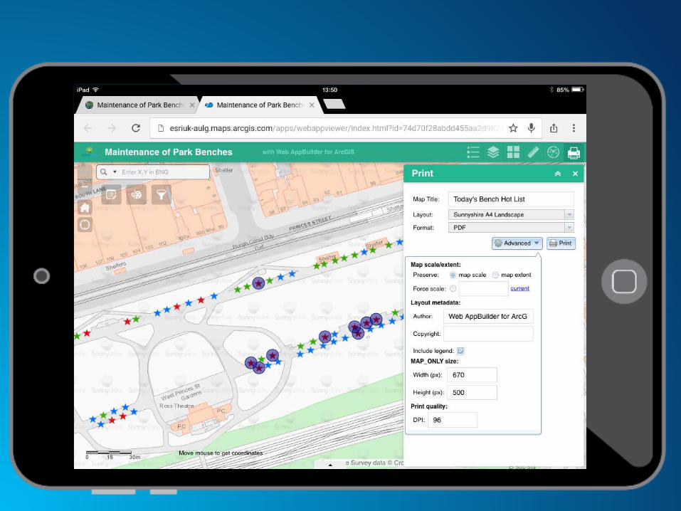
Bench Maintenance using Web AppBuilder


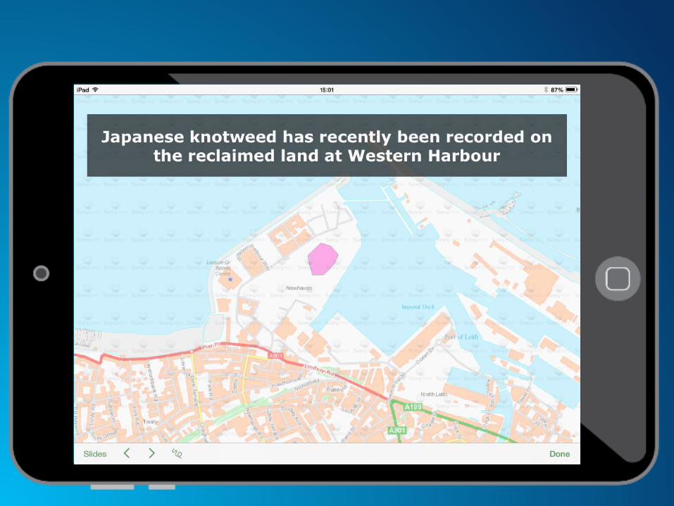
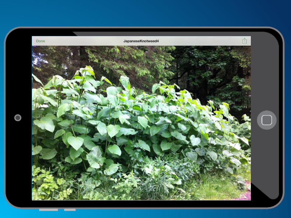
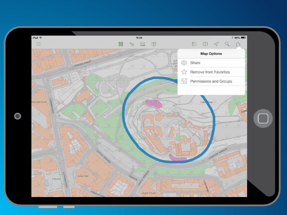
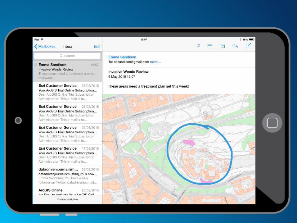
Invasive Weeds Review
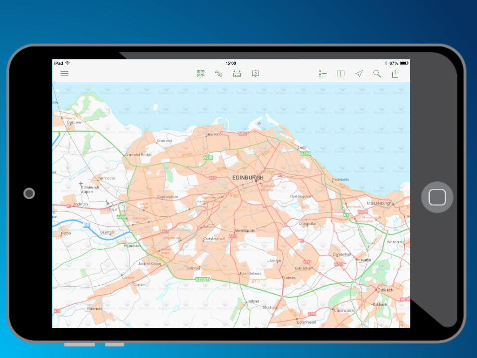
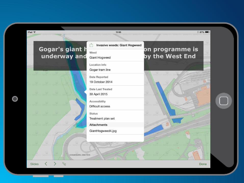
using Explorer


Report and monitor
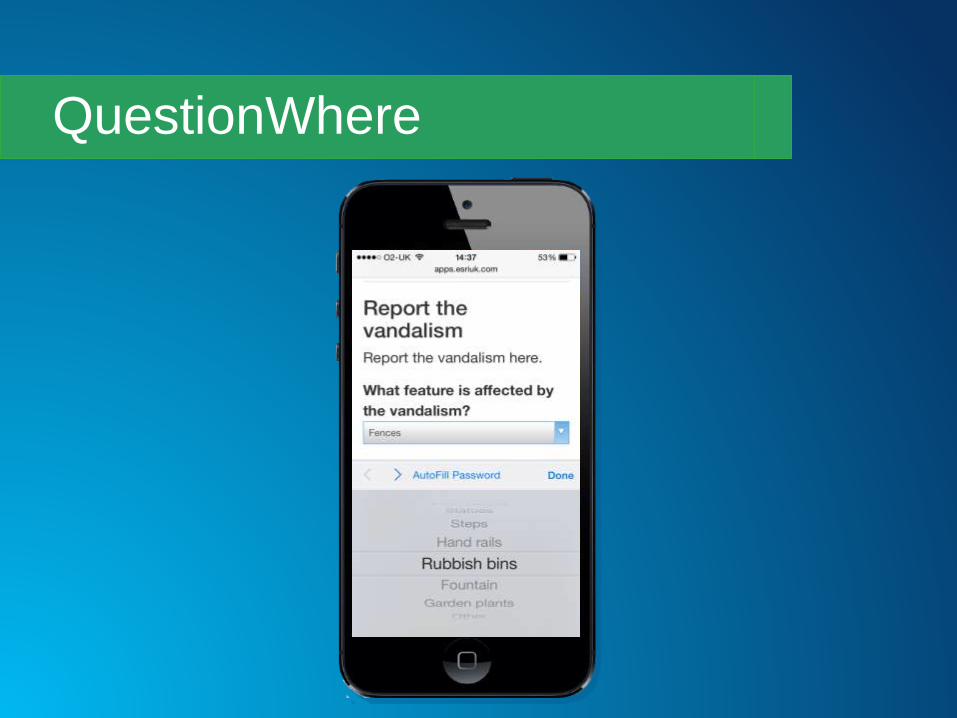
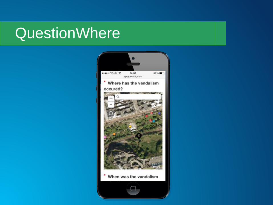
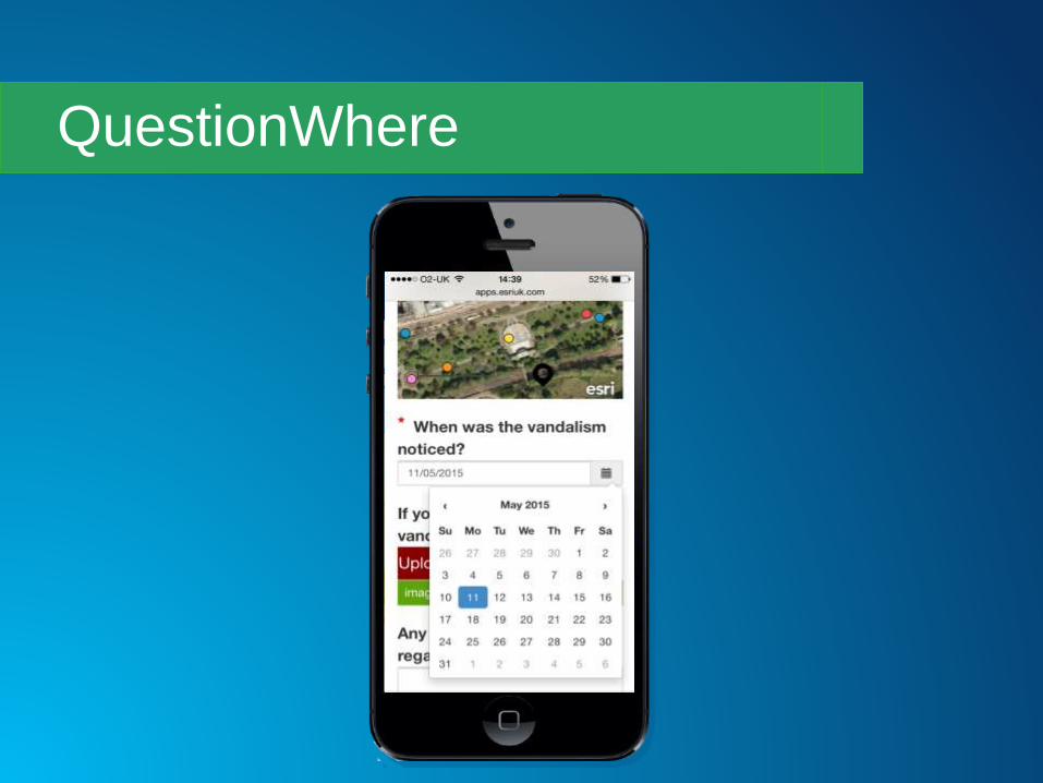
vandalismusing QuestionWhere Builder and
Operations Dashboard

QuestionWhere
QuestionWhere
QuestionWhere
QuestionWhere

QuestionWhere

QuestionWhere

QuestionWhere

Operations Dashboard

Operations Dashboard

Parks and Gardens Public
Feedbackusing GeoForm
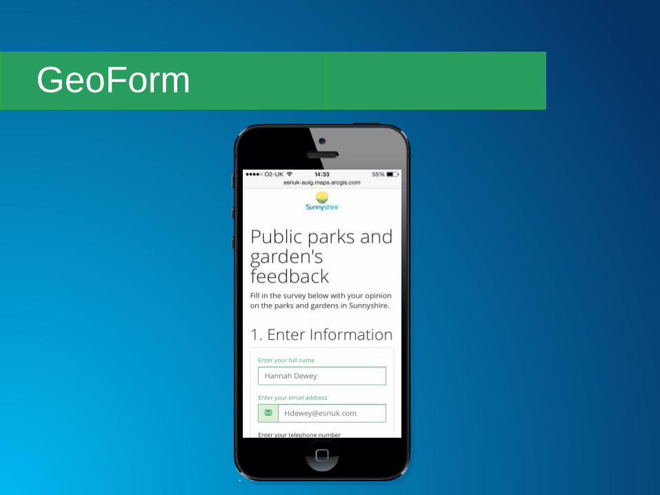
GeoForm

GeoForm

GeoForm

GeoForm

Tour the parks monumentsusing Story Map Tour
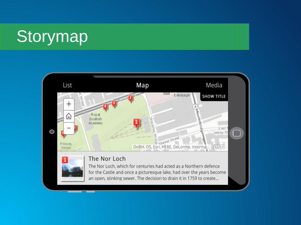
Storymap

Storymap
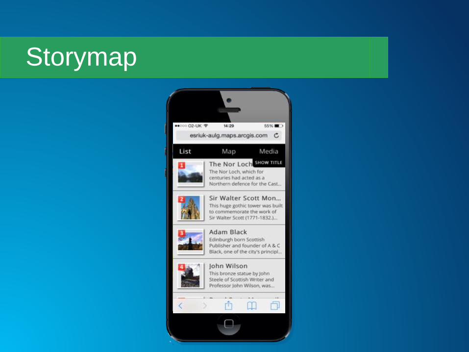
Storymap

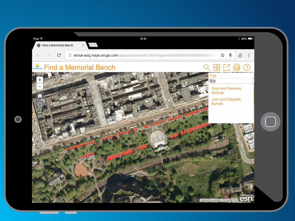
Memorial Bench Locator using Finder and Simple Map Viewer
web app templates


Summary
Collector ArcPad ArcGIS for
Windows
Mobile
Explorer Operations Dashboard
Field activities Planning and operation Public engagement
Custom web
applications
Web app
templates
Web AppBuilderWeb AppBuilder
Web AppBuilderExplorerWeb app templates/
custom apps


thank you!