Self Service – Better Service and More Time Ian Evans, Innovation & Integration Manager Innovation & Integration – Data, Analytics & Insight

Esriuk_track5_dio_self_service
Aug 12, 2015
Welcome message from author
This document is posted to help you gain knowledge. Please leave a comment to let me know what you think about it! Share it to your friends and learn new things together.
Transcript

Self Service – Better Service and
More Time
Ian Evans, Innovation & Integration Manager
Innovation & Integration – Data, Analytics & Insight

DIO – What we do
The Defence Infrastructure Organisation (DIO) plays
a vital role in supporting our armed forces by
building, maintaining and servicing what the men
and women who serve our country need to live,
work, train and deploy on operations.


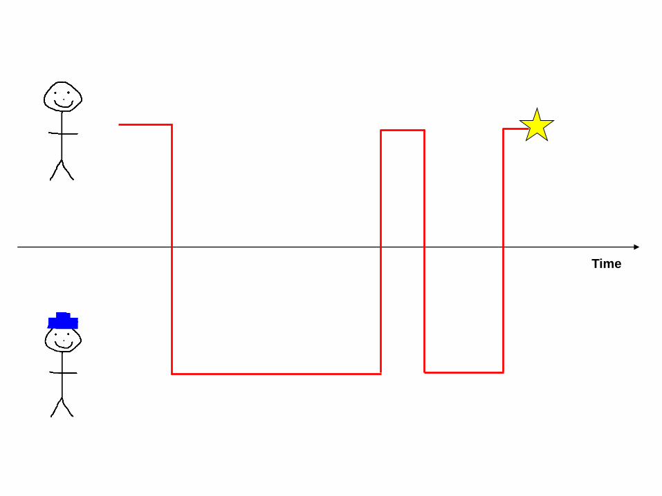
Diagram Convention
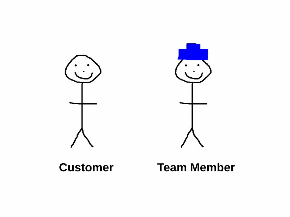
Customer Team Member

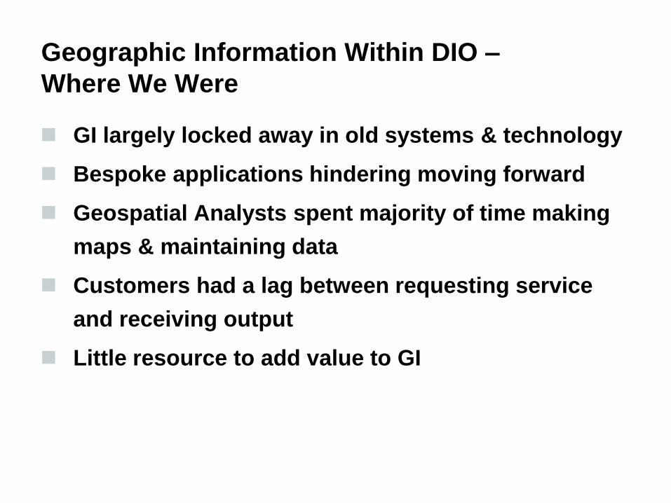
Geographic Information Within DIO –
Where We Were
GI largely locked away in old systems & technology
Bespoke applications hindering moving forward
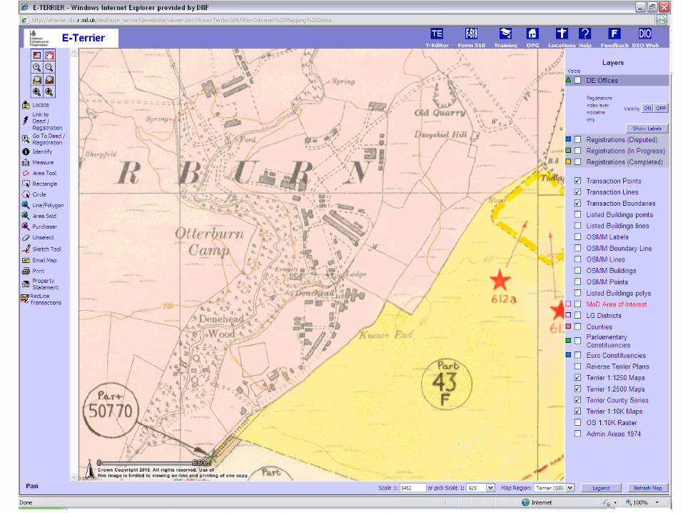
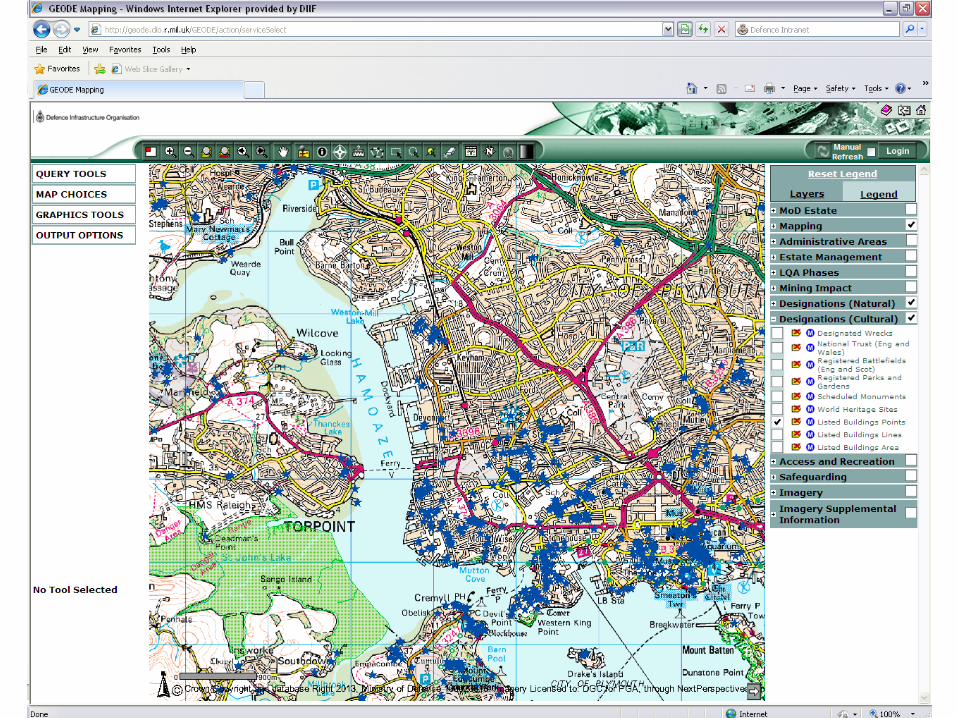
Geographic Information Within DIO –
Where We Were
GI largely locked away in old systems & technology
Bespoke applications hindering moving forward
Geospatial Analysts spent majority of time making
maps & maintaining data
Customers had a lag between requesting service
and receiving output
Little resource to add value to GI
Time

Geographic Information Within DIO –
Where We Are Going
Channel Shift customers
Give better results, quicker (for everyone!)
Provide solutions in new ways
Able to redeploy geospatial resources to higher
value tasks

Geographic Information Within DIO –
How Do We Get There?
Small team from a GI background
Didn’t want to experience similar upgrade problems
as before
Work within system constraints
Use solution that supported “Build easy, build fast,
build many” approach
Conclusion was to use ArcGIS Platform, and use it
off the shelf

Time for some examples…

Estate Policy – The Problem
Required to see many datasets together, on a
national and local scale
Interested in the relationship between the MOD
estate and those we need to liaise with
Many maps produced, trying to display different
datasets in the same geographic area

Time

Estate Policy – The Solution
Build simple “Viewer” Web Mapping Application
using ESRI UK RADAR product
Focus was on Marine Planning, so dealt with that in
first iteration
Many other teams will be interested in similar sorts
of data, so ensure reusability of services


Time


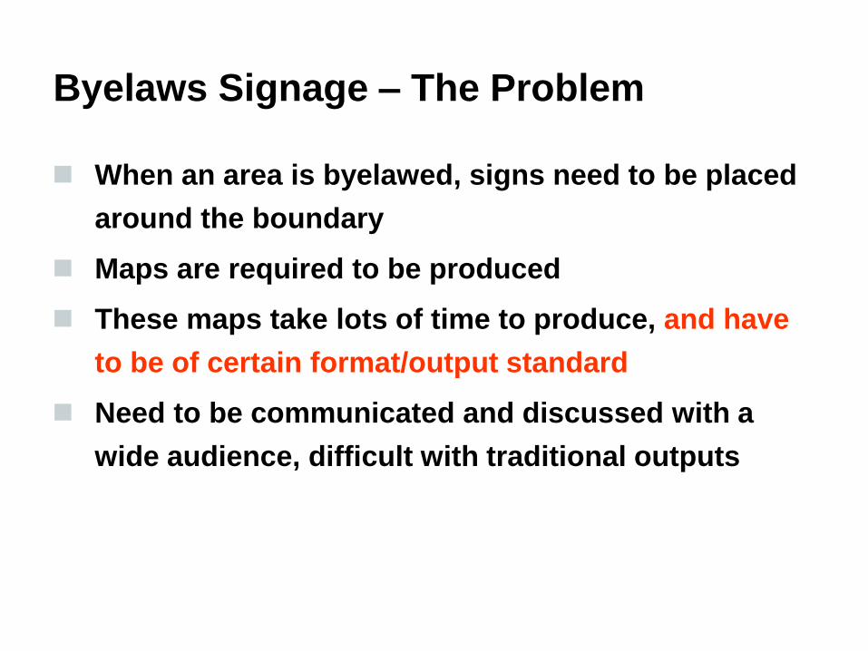
Byelaws Signage – The Problem
When an area is byelawed, signs need to be placed
around the boundary
Maps are required to be produced
These maps take lots of time to produce, and have
to be of certain format/output standard
Need to be communicated and discussed with a
wide audience, difficult with traditional outputs

Time
Byelaws Signage – The Problem
When an area is byelawed, signs need to be placed
around the boundary
Maps are required to be produced
These maps take lots of time to produce, and have
to be of certain format/output standard
Need to be communicated and discussed with a
wide audience, difficult with traditional outputs

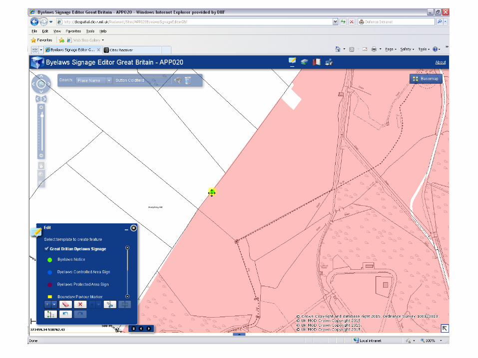
Byelaws Signage – The Solution
Tackle the part that took the most time –
communication between those involved, the estate
manager and the geospatial analyst
Produced Web Mapping Application that allows the
user to add points where they want byelaws signs
to be placed
This can be seen by the wider community, and
edits/amendments made before the geospatial
analyst produces the final maps


Time
Environmental Applications


Bird Box Locations – The Problem
Needed to record the locations of bird boxes on one
of the nature reserves
Traditionally paper based exercise
Accuracy of data was variable

Time
Bird Box Locations – The Solution
Use ArcGIS Online & the Collector app to allow
users to collect the location of bird boxes in the
field
Will allow easy updates of data, when new boxes
added or locations changed


Time

Conclusions
The Off The Shelf solution has worked for us
Agile has helped in many ways
Problem Identification is the key – if you can’t do it
all, can you do some of it?
With COTS, you need to get creative