The Caribbean Low Level Jet variability during August and September and its relation with the regional hydroclimate Ernesto Muñoz

Ernesto Muñoz
Jan 01, 2016
The Caribbean Low Level Jet variability during August and September and its relation with the regional hydroclimate. Ernesto Muñoz. JunJul & AugSep averages of 925 mb wind. JunJul. AugSep. NARR. ERA40. Strong easterly flow in Caribbean Sea during summer. - PowerPoint PPT Presentation
Welcome message from author
This document is posted to help you gain knowledge. Please leave a comment to let me know what you think about it! Share it to your friends and learn new things together.
Transcript
The Caribbean Low Level Jet variability during August and
September and its relation with the regional
hydroclimate
Ernesto Muñoz

JunJul & AugSep averages of 925 mb wind
NARR
ERA40
JunJul AugSep
• Strong easterly flow in Caribbean Sea during summer.
• CALLJ an extension of the North Atlantic trade winds amplified by regional gradients in SLP and temperature

The Caribbean and Central America

Motivation
• Previous studies of Caribbean hydroclimate mostly on precipitation from land stations.
• Lack of knowledge of role of Caribbean Low Level Jet on regional hydroclimate.
• Other LLJs are associated with moisture transport and downwind convection.
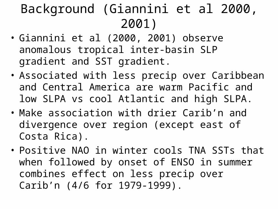
Background (Giannini et al 2000, 2001)
• Giannini et al (2000, 2001) observe anomalous tropical inter-basin SLP gradient and SST gradient.
• Associated with less precip over Caribbean and Central America are warm Pacific and low SLPA vs cool Atlantic and high SLPA.
• Make association with drier Carib’n and divergence over region (except east of Costa Rica).
• Positive NAO in winter cools TNA SSTs that when followed by onset of ENSO in summer combines effect on less precip over Carib’n (4/6 for 1979-1999).
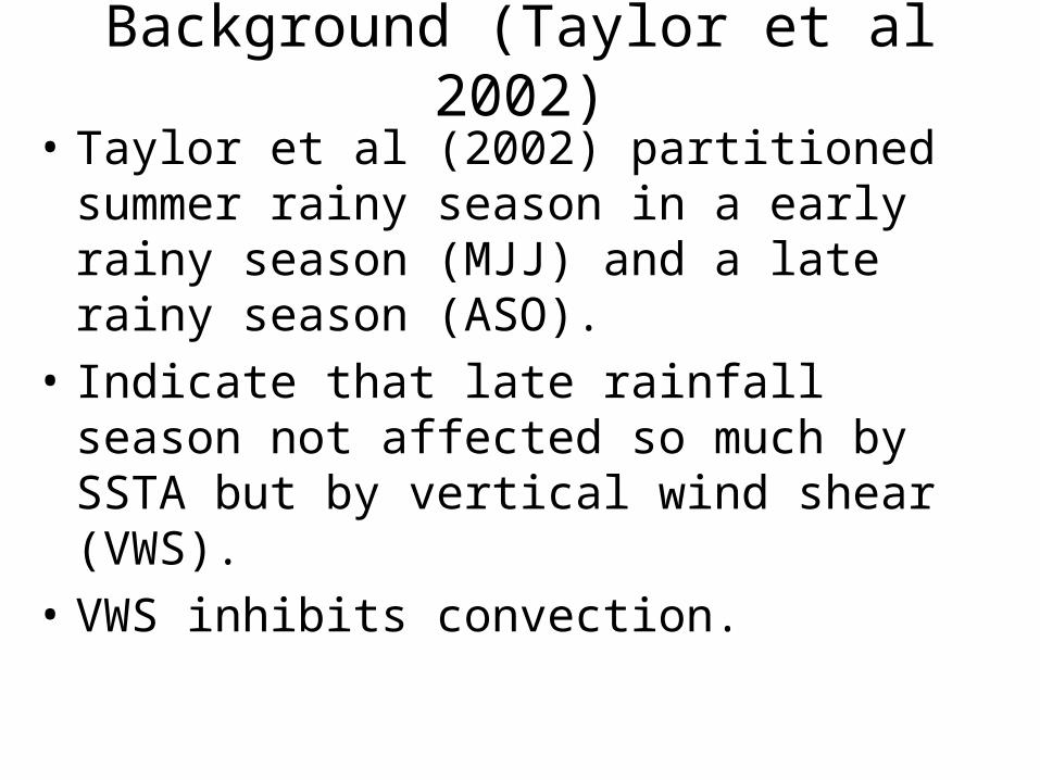
Background (Taylor et al 2002)
• Taylor et al (2002) partitioned summer rainy season in a early rainy season (MJJ) and a late rainy season (ASO).
• Indicate that late rainfall season not affected so much by SSTA but by vertical wind shear (VWS).
• VWS inhibits convection.
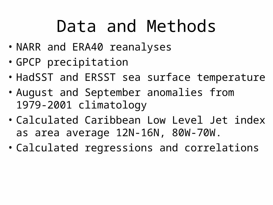
Data and Methods• NARR and ERA40 reanalyses
• GPCP precipitation
• HadSST and ERSST sea surface temperature
• August and September anomalies from 1979-2001 climatology
• Calculated Caribbean Low Level Jet index as area average 12N-16N, 80W-70W.
• Calculated regressions and correlations

Summer climatological conditions
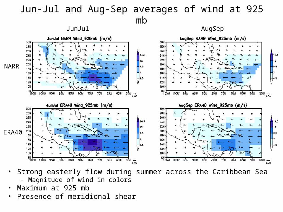
Jun-Jul and Aug-Sep averages of wind at 925 mb
• Strong easterly flow during summer across the Caribbean Sea– Magnitude of wind in colors
• Maximum at 925 mb• Presence of meridional shear
NARR
ERA40
JunJul AugSep
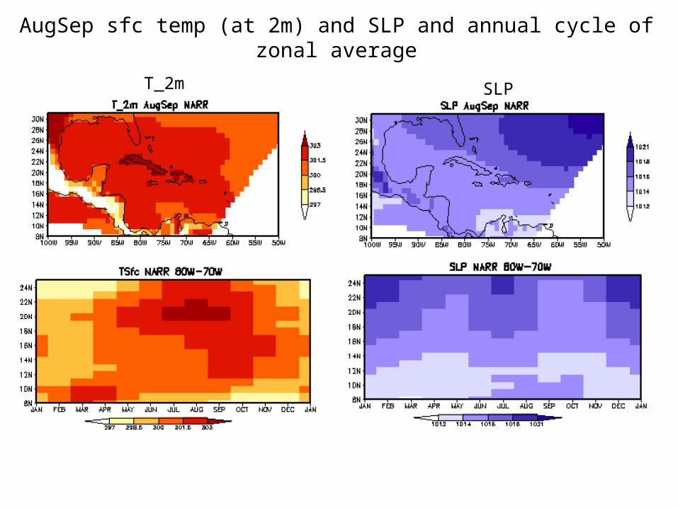
AugSep sfc temp (at 2m) and SLP and annual cycle of zonal average
T_2m SLP
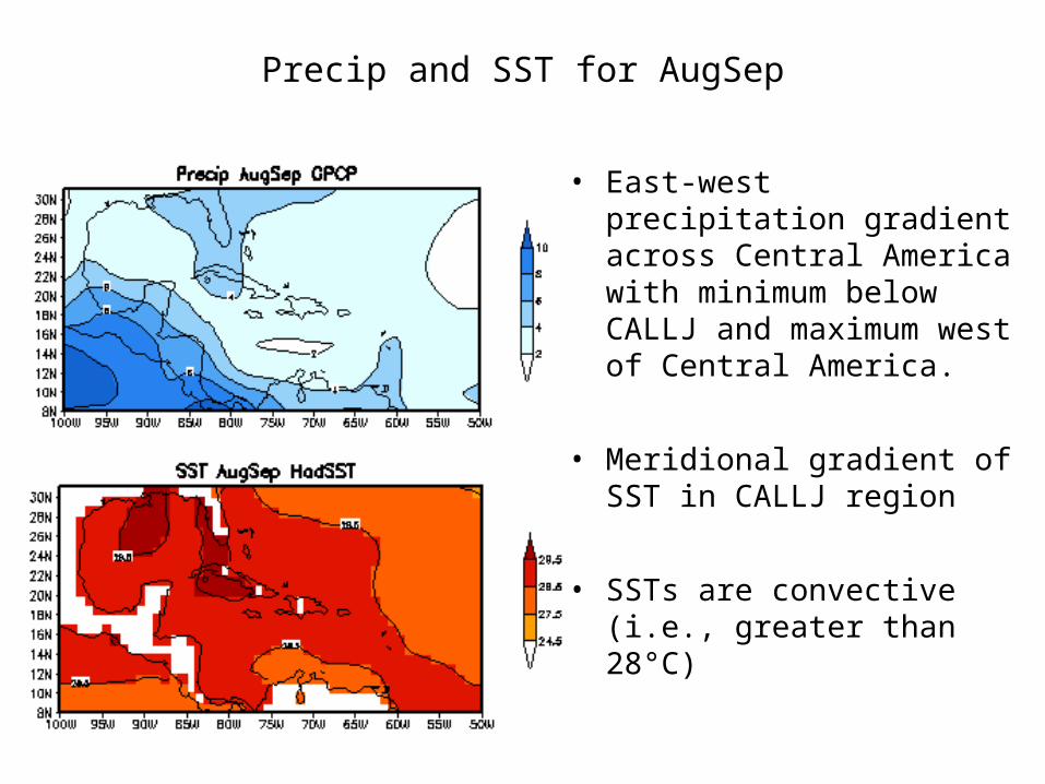
Precip and SST for AugSep
• East-west precipitation gradient across Central America with minimum below CALLJ and maximum west of Central America.
• Meridional gradient of SST in CALLJ region
• SSTs are convective (i.e., greater than 28°C)
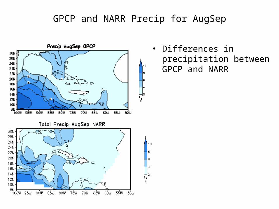
GPCP and NARR Precip for AugSep
• Differences in precipitation between GPCP and NARR
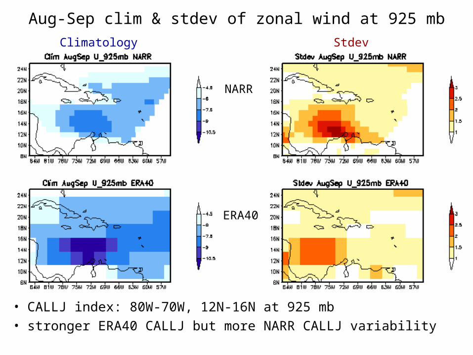
• CALLJ index: 80W-70W, 12N-16N at 925 mb• stronger ERA40 CALLJ but more NARR CALLJ variability
Aug-Sep clim & stdev of zonal wind at 925 mb
NARR
ERA40
Climatology Stdev

Interannual variability
• NARR and ERA40 CALLJ show similar variability throughout the 1979-2001 period.
• Correlation of 0.93 between NARR and ERA40 from 1979 to 2001.
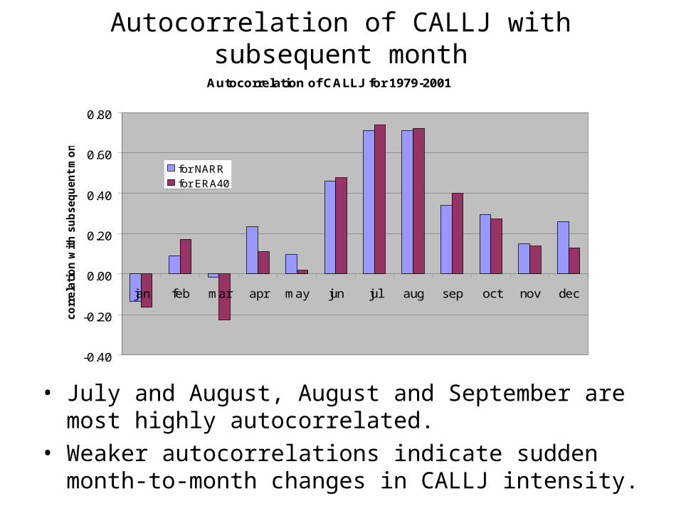
Autocorrelation of CALLJ with subsequent month
Autocorrelation of CALLJ for 1979-2001
-0.40
-0.20
0.00
0.20
0.40
0.60
0.80
jan feb mar apr may jun jul aug sep oct nov dec
co
rrela
tio
n w
ith
su
bseq
uen
t m
on
th
for NARRfor ERA40
• July and August, August and September are most highly autocorrelated.
• Weaker autocorrelations indicate sudden month-to-month changes in CALLJ intensity.
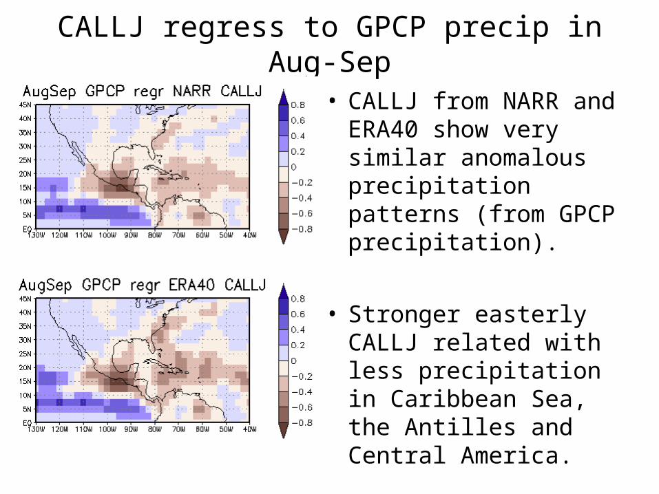
CALLJ regress to GPCP precip in Aug-Sep
• CALLJ from NARR and ERA40 show very similar anomalous precipitation patterns (from GPCP precipitation).
• Stronger easterly CALLJ related with less precipitation in Caribbean Sea, the Antilles and Central America.
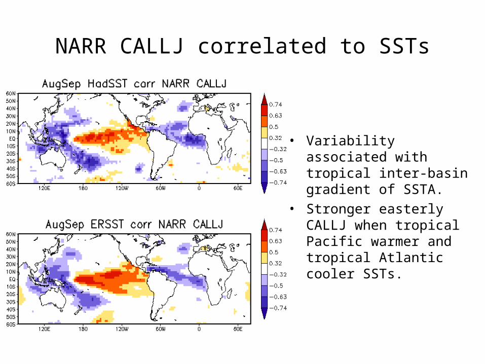
NARR CALLJ correlated to SSTs
• Variability associated with tropical inter-basin gradient of SSTA.
• Stronger easterly CALLJ when tropical Pacific warmer and tropical Atlantic cooler SSTs.

Closer look of previous plot
• East-west gradient of SSTAs across Central America.
• Stronger CALLJ associated with cooler SSTs in Caribbean Sea and warmer SSTs to the west of Central America.
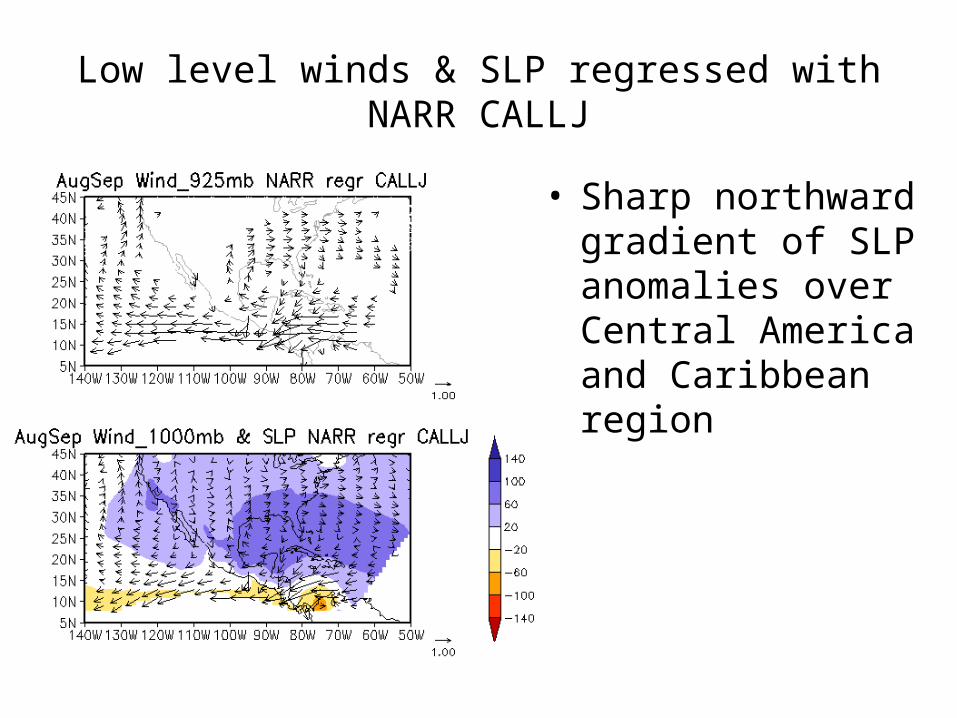
Low level winds & SLP regressed with NARR CALLJ
• Sharp northward gradient of SLP anomalies over Central America and Caribbean region

ERA40 CALLJ regress to ERA40 winds and SLP
• Similar pattern to NARR anomalies in Inter-Americas Sea region.
• Inter-basin pattern of SLP anomalies
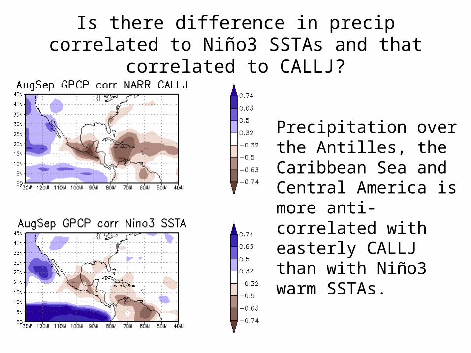
Is there difference in precip correlated to Niño3 SSTAs and that correlated to CALLJ?
• Precipitation over the Antilles, the Caribbean Sea and Central America is more anti-correlated with easterly CALLJ than with Niño3 warm SSTAs.

GPCP & NARR precip regressed on NARR CALLJ
• Similar pattern of precipitation between GPCP and NARR associated with strengthening of CALLJ.
• Less precipitation on Pacific coast of Central America and offshore; Isthmus and Gulf of Tehuantepec; central and eastern Caribbean; and east-northeast of Caribbean.
• Close to normal precipitation over and offshore of Caribbean side of Central America.
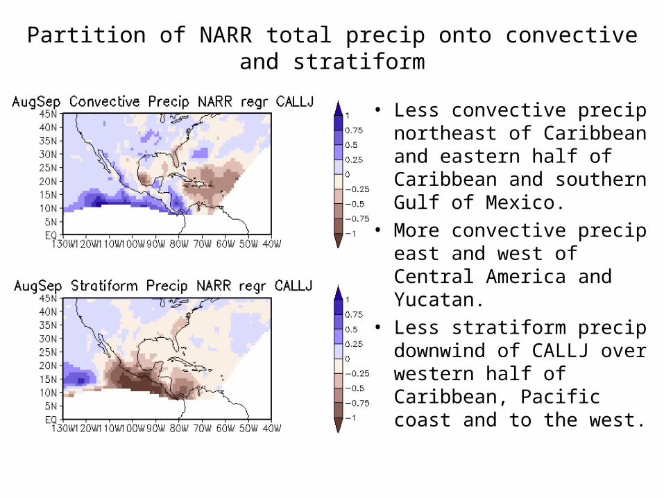
Partition of NARR total precip onto convective and stratiform
• Less convective precip northeast of Caribbean and eastern half of Caribbean and southern Gulf of Mexico.
• More convective precip east and west of Central America and Yucatan.
• Less stratiform precip downwind of CALLJ over western half of Caribbean, Pacific coast and to the west.
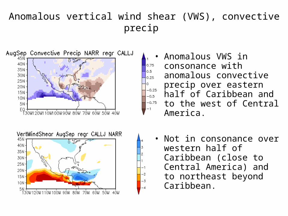
Anomalous vertical wind shear (VWS), convective precip
• Anomalous VWS in consonance with anomalous convective precip over eastern half of Caribbean and to the west of Central America.
• Not in consonance over western half of Caribbean (close to Central America) and to northeast beyond Caribbean.

Vertically integrated moisture flux
• Caribbean moisture fluxes directing west-southwestard to Central America.
• MFs increase in magnitude to and over Central America and to the west.
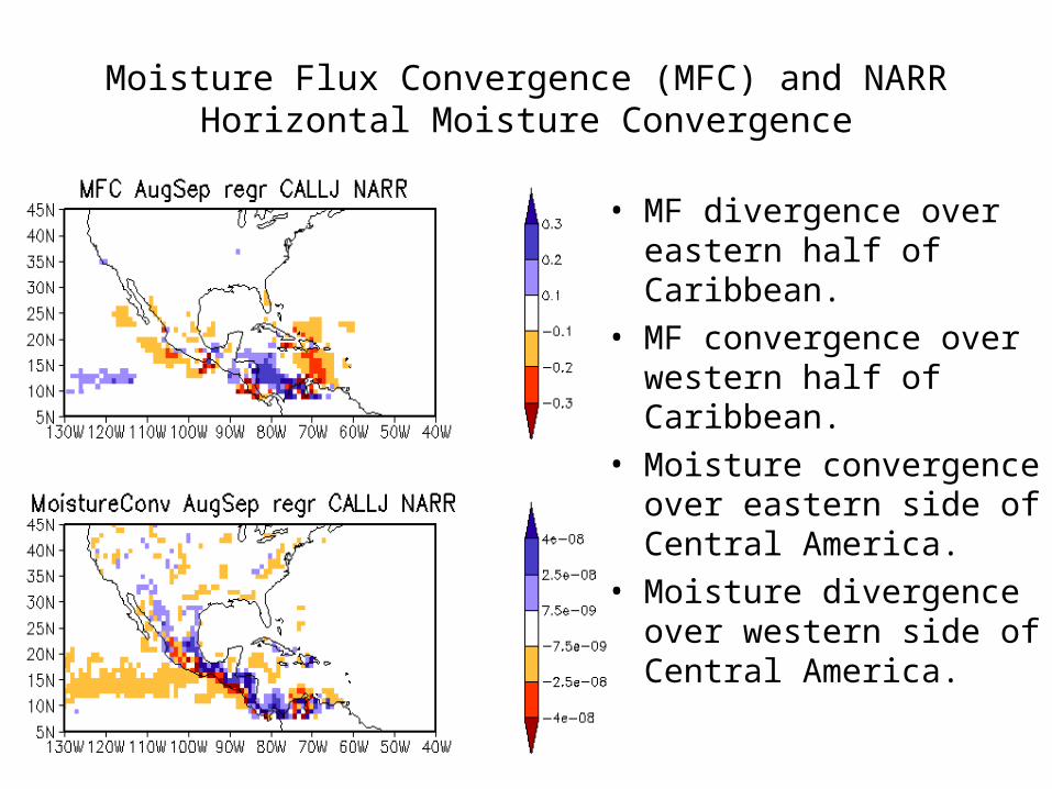
Moisture Flux Convergence (MFC) and NARR Horizontal Moisture Convergence
• MF divergence over eastern half of Caribbean.
• MF convergence over western half of Caribbean.
• Moisture convergence over eastern side of Central America.
• Moisture divergence over western side of Central America.

Summary• In August and September a strengthening of the
CALLJ is associated with:– a strengthening of the meridional SLP gradient in
Caribbean region,– an interbasin SST gradient,– less precipitation over western Central America and
eastern Caribbean,– MFDiv over eastern Caribbean and MFConv over
western Caribbean.– An increase of vertical wind shear over Caribbean and a
decrease to the west of Central America.
• The CALLJ seems to be a principal atmospheric modulator of Caribbean and Central American precipitation from year to year.
Related Documents