Environmental & Social Impact Assessment (ESIA) for the Polihali Western Access Corridor Volume 1 Environmental and Social Impact Statement Lesotho Highlands Development Authority Contract LHDA No.: 6004 Contract Name: Professional Services for the Environmental & Social Impact Assessment (ESIA) for the Polihali Western Access Corridor Document Ref: P2W-6004-DFR-0011 Document Date: [10 Novemberr 2017]

Welcome message from author
This document is posted to help you gain knowledge. Please leave a comment to let me know what you think about it! Share it to your friends and learn new things together.
Transcript
Environmental & Social Impact Assessment (ESIA) for the Polihali
Western Access Corridor
Volume 1 Environmental and Social Impact Statement
Lesotho Highlands Development Authority
Contract LHDA No.: 6004 Contract Name: Professional Services for the Environmental & Social Impact Assessment (ESIA) for the Polihali Western Access Corridor Document Ref: P2W-6004-DFR-0011
Document Date: [10 Novemberr 2017]


Revision History Version Issue Date Description of Changes
00 05 Oct 2017 First Draft
01 6 Nov 2017 Second Draft
02 10 Nov 2017 Final Report
E-ii

Acknowledgements
The team gratefully acknowledges the inputs and contrbutions of the following people:
• Lesotho Highlands Development Authority (LHDA) Katse and Polihali Field Operation Branch staff for their assistance with logistical arrangements for field work and stakeholder consultation;
• Staff of LHDA and the Lesotho Highlands Water Commission (LHWC) in Maseru for providing valuable information on LHDA policies and plans, and for their time and inputs at meetings and workshops during the course of the assessment;
• Communities and other stakeholders in the Polihali Western Access Corridor who gave of their time and knowledge to attend community meetings, focus group discussions and key informant interviews;
• Engineers for the road (AECOM) and powerline (Plantech) who worked collaboratively with the environmental team to address environmental and social concerns and for their willingness to modify road and powerline designs and alignments to achieve a sustainable outcome; and finally
• The specialist team members who contributed their knowledge and considerable expertise in their disciplines and went the extra mile to ensure the field work and reporting was done to a high standard within tight timeframes.

Non-Technical Summary 1. Project Overview
Phase II of the Lesotho Highlands Water Project (LHWP2) is designed to supply additional water to South Africa in return for significant revenue generation and hydropower supply for Lesotho. It comprises the Polihali Dam at the confluence of the Khubelu and Senqu Rivers in Mokhotlong District in the northeast of Lesotho; a new 38 km tunnel to transfer water to Katse Dam; and new feeder roads, bridges and power supply around and across the reservoir. The Polihali Dam and Associated Infrastructure (PRAI) is the subject of a separate Environmental and Social Impact Assessment (ESIA).
In order to construct the Polihali Dam and transfer tunnel, a new 54.5 km paved road and 35.4 km 132kV powerline and telecommunications line is required between Katse and Polihali within what is referred to as the Polihali Western Access Corridor (PWAC). Construction equipment and materials for the dam and tunnel will be transported from South African into Lesotho via the border posts of Caledonspoort / Ficksburg, and along the Northern Access Route (NAR) (from Pitseng to Katse) to join the Polihali Western Access Route (PWAR) at Ha Seshote. From Ha Seshote, equipment and materials will be transported along the new paved PWAR to the Polihali Dam and tunnel sites near Masakong / Tloha-re-Bue. The power supply to the tunnel and dam sites will run from the existing Matsoku substation and join the PWAR along which it is aligned for much of the route, before deviating near Masalla to take a short cut to a new Polihali substation near Masakong. The routes are shown in Figure E1.
This report comprises the Environmental and Social Impact Statement (ESIS) for the new road and powerline, refurbishment of the existing 66 kV line from Ha Lejone to Matsoku substation; upgrade of existing substations, as well as the construction work areas in the PWAC (herein referred to as the Project).
The ESIS excludes the following: i) transportation of construction materials through the border posts and along the NAR to Ha Seshote; ii) the western construction camps required for the powerline and road Contractors, iii) quarries and borrow pits located along the NAR or near Katse Dam, and iv) the eastern construction camp at Polihali (which is covered by the ESIS of the PRAI). The construction camps and upgrade of the NAR and associated quarries and borrow pits are to be covered under a separate EMP. The project components are summarised in more detail under the Project Description below.
2. Scope and Objectives
The scope of work for the PWAC Project required the preparation and submission of an ESIS that meets Lesotho’s environmental legislation and guidelines (i.e., Environmental Act No. 10 of 2008; the Environmental Impact Assessment (EIA) Guidelines of 2009); policies of the Lesotho Highlands Development Authority (LHDA); relevant international treaties and agreements to which both Lesotho and South African are party, and to address international standards (such as those of the World Bank).
The ESIS is required to meet the needs of decision makers to authorise the Project by providing a clear, informed and balanced presentation of the findings and the issues raised by stakeholders (including community members in the PWAC) in a format that can be easily understood.
The process followed is shown in the Figure E2 overleaf. A Project Brief was not required as part of the general scope of services as agreed by the Department of Environment (DoE) in May 2015, prior to the commencement of this assessment. The scope of services provided to the Consultant is provided in Attachment A.
E-i
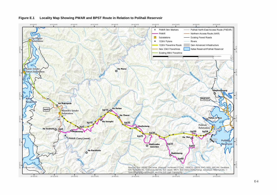
Figure E.1 Locality Map Showing PWAR and BPST Route in Relation to Polihali Reservoir
E-ii
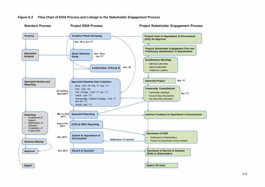
Figure E.2 Flow Chart of ESIA Process and Linkage to the Stakeholder Engagement Process
E-iii
Non-Technical Summary
The scope of work specified the need for the following specialist studies to be conducted as part of the ESIA: Ecology; Birds; Wetlands; Cultural Heritage (including archaeology); Social, and Public Consultation. The ecology study covered vegetation, mammals and herpetofauna, and a separate fish study was included to assess impacts of road and bridge construction.
A stakeholder engagement process (typically called ‘Public Participation Process (PPP) in Lesotho)1 was undertaken to ensure that issues and concerns are captured and addressed, and that transparent and regular communication is maintained with affected stakeholders during the ESIA, extending throughout construction. Section 7 describes the stakeholder engagement process and the issues raised.
The content of this ESIS describes the project components and construction activities; the alternative routes considered and assessed; the affected environment of relevance to the project; assesses the key impacts on environmental and social receptors and resources, and identifies appropriate and realistic mitigation measures. The mitigation and monitoring requirements are consolidated into a separate Environmental Management Plan (EMP) (Volume 2) for implementation by the engineers and Contractors appointed to construct the infrastructure. Additional mitigation measures for implementation by LHDA are also included as a separate section in the EMP.
3. Approach and Methods
The ESIA involved the following work tasks: Inception; Route Selection; Specialist Studies; Stakeholder Consultation; compilation of the ESIS and EMP, and Project Management. The sequence and timing of these are shown in Figure E.2.
3.1 Inception The inception task was an important first step to confirm the scope of work and schedule for the ESIA. It involved a team meeting and specialist team review of available desktop information and mapping to identify gaps and the focus of the various specialist studies. It also involved preparation of a Stakeholder Engagement Plan (SEP) including stakeholder mapping and a preliminary database. The inception report described the ESIA process and impact assessment methodology to be used. Supporting documents included a project level health and safety plan and skills development plan. The initial inception report was based on four possible options for the PWAC (Options A, B, C and D). These were assessed and compared in the Route Selection task. Once the preferred route was confirmed (Route B), the inception report was amended to tailor the work tasks to this route. The impact assessment methodology was shared with the DoE and the LHDA Panel of Experts to obtain their approval.
3.2 Route Selection The route selection report was required to motivate and recommend the preferred PWAC option from an environmental and social perspective and to identify the area of influence of the road, powerline and telecommunication corridor. The route selection assessed four corridors that had been identified primarily for the road but which at the time of the study was anticipated to be the same route for the powerline and telecommunications infrastructure. These four options had previously been assessed by Barry and Partners (2014a,b) and SMEC (2016) primarily on technical, cost and social criteria, but also considered extent of wetlands affected.
The route selection assessment for the ESIA involved the identification by the team of additional spatially explicit ecological and social criteria that can be identified in the available Google or LIDAR
1 The term Public Participation Process is used by the Lesotho Environmental Guidelines (2009) which is equivalent to the Stakeholder Engagement Process referred to by IFC Standards and which requires a Stakeholder Engagement Plan.
E-iv
Non-Technical Summary
imagery. A weighting and ranking system was developed to score and compare the four route options. A route selection report (ERM, 2017: P2W-6004-DFR-0002) was prepared to fulfil the requirement of Section 21 (5d, i.e., “reasons for selecting the proposed site and rejecting alternative sites”) of the Environmental Act of 2008 and the 2009 EIA guidelines. The findings were used to inform the selection of the preferred option and are discussed under Alternatives below.
3.3 Specialist Studies The team comprised specialists and assistants with significant field experience in Lesotho. Most of the core team members have worked on previous phases of the LHWP in Katse and/or Mohale catchments, thereby providing valuable context for the findings of the various specialist studies. Components covered included wetlands, flora, mammals, herpetofauna (reptiles and amphibians), birds, cultural heritage / archaeology; visual and social aspects.
Seven specialist studies were compiled for the ESIA. In general all the specialist studies involved:
• Data review and gap analysis – assembly and review of available data for the Project Area during the Inception and Route Selection phases to identify gaps and to confirm survey focus areas. Little primary data was available for the PWAC prior to the field surveys as data obtained for the Phase 1 (Katse Dam) did not overlap with the PWAC route, apart from some remote sensing derived land cover mapping;
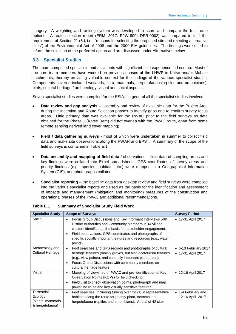
• Field / data gathering surveys - most of which were undertaken in summer to collect field data and make site observations along the PWAR and BPST. A summary of the scope of the field surveys is contained in Table E.1;
• Data assembly and mapping of field data / observations – field data of sampling areas and key findings were collated into Excel spreadsheets; GPS coordinates of survey areas and priority findings (e.g., species, habitats, etc.) were mapped in a Geographical Information System (GIS), and photographs collated;
• Specialist reporting – the baseline data from desktop review and field surveys were compiled into the various specialist reports and used as the basis for the identification and assessment of impacts and management (mitigation and monitoring) measures of the construction and operational phases of the PWAC and additional recommendations.
Table E.1 Summary of Specialist Study Field Work
Specialist Study Scope of Surveys Survey Period Social • Focus Group Discussions and Key Informant Interviews with
District Authorities and Community Members in 14 village clusters identified as the basis for stakeholder engagement;
• Field observations, GPS coordinates and photographs of specific socially important features and resources (e.g., water points).
• 17-31 April 2017
Archaeology and Cultural Heritage
• Foot searches and GPS records and photographs of cultural heritage features (mainly graves, but also ecotourism features (e.g., view points), and culturally important plant areas);
• Focus Group Discussions with community members on cultural heritage feature.
• 6-13 February 2017 • 17-31 April 2017
Visual • Mapping of viewshed of PWAC and pre-identification of Key Observation Points (KOPs) for field checking;
• Field visit to check observation points, photograph and map powerline route and key visually sensitive features.
• 12-16 April 2017
Terrestrial Ecology (plants, mammals & herpetofauna)
• Foot searches (including turning over rocks) in representative habitats along the route for priority plant, mammal and herpetofauna (reptiles and amphibians). A total of 42 sites
• 1-4 February and 12-16 April 2017
E-v
Non-Technical Summary
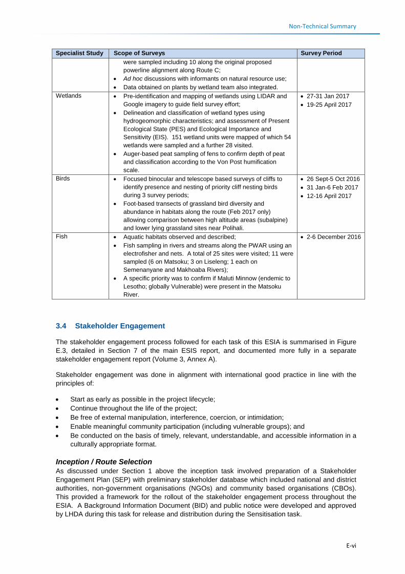
Specialist Study Scope of Surveys Survey Period were sampled including 10 along the original proposed powerline alignment along Route C;
• Ad hoc discussions with informants on natural resource use; • Data obtained on plants by wetland team also integrated.
Wetlands • Pre-identification and mapping of wetlands using LIDAR and Google imagery to guide field survey effort;
• Delineation and classification of wetland types using hydrogeomorphic characteristics; and assessment of Present Ecological State (PES) and Ecological Importance and Sensitivity (EIS). 151 wetland units were mapped of which 54 wetlands were sampled and a further 28 visited.
• Auger-based peat sampling of fens to confirm depth of peat and classification according to the Von Post humification scale.
• 27-31 Jan 2017 • 19-25 April 2017
Birds • Focused binocular and telescope based surveys of cliffs to identify presence and nesting of priority cliff nesting birds during 3 survey periods;
• Foot-based transects of grassland bird diversity and abundance in habitats along the route (Feb 2017 only) allowing comparison between high altitude areas (subalpine) and lower lying grassland sites near Polihali.
• 26 Sept-5 Oct 2016 • 31 Jan-6 Feb 2017 • 12-16 April 2017
Fish • Aquatic habitats observed and described; • Fish sampling in rivers and streams along the PWAR using an
electrofisher and nets. A total of 25 sites were visited; 11 were sampled (6 on Matsoku; 3 on Liseleng; 1 each on Semenanyane and Makhoaba Rivers);
• A specific priority was to confirm if Maluti Minnow (endemic to Lesotho; globally Vulnerable) were present in the Matsoku River.
• 2-6 December 2016
3.4 Stakeholder Engagement
The stakeholder engagement process followed for each task of this ESIA is summarised in Figure E.3, detailed in Section 7 of the main ESIS report, and documented more fully in a separate stakeholder engagement report (Volume 3, Annex A).
Stakeholder engagement was done in alignment with international good practice in line with the principles of:
• Start as early as possible in the project lifecycle; • Continue throughout the life of the project; • Be free of external manipulation, interference, coercion, or intimidation; • Enable meaningful community participation (including vulnerable groups); and • Be conducted on the basis of timely, relevant, understandable, and accessible information in a
culturally appropriate format.
Inception / Route Selection As discussed under Section 1 above the inception task involved preparation of a Stakeholder Engagement Plan (SEP) with preliminary stakeholder database which included national and district authorities, non-government organisations (NGOs) and community based organisations (CBOs). This provided a framework for the rollout of the stakeholder engagement process throughout the ESIA. A Background Information Document (BID) and public notice were developed and approved by LHDA during this task for release and distribution during the Sensitisation task.
E-vi
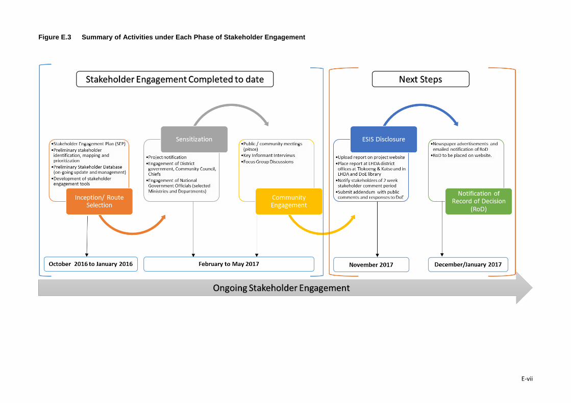
Figure E.3 Summary of Activities under Each Phase of Stakeholder Engagement
E-vii
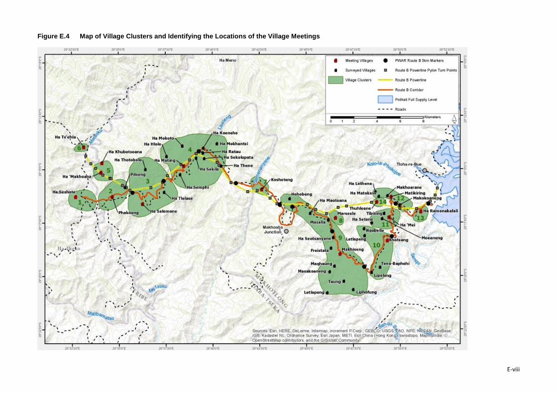
Figure E.4 Map of Village Clusters and Identifying the Locations of the Village Meetings
E-viii
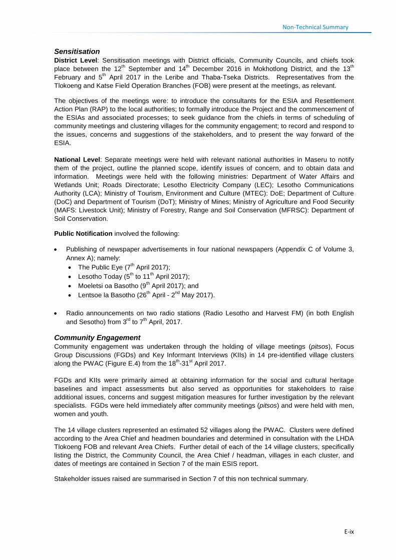
Non-Technical Summary Sensitisation District Level: Sensitisation meetings with District officials, Community Councils, and chiefs took place between the 12th September and 14th December 2016 in Mokhotlong District, and the 13th February and 5th April 2017 in the Leribe and Thaba-Tseka Districts. Representatives from the Tlokoeng and Katse Field Operation Branches (FOB) were present at the meetings, as relevant.
The objectives of the meetings were: to introduce the consultants for the ESIA and Resettlement Action Plan (RAP) to the local authorities; to formally introduce the Project and the commencement of the ESIAs and associated processes; to seek guidance from the chiefs in terms of scheduling of community meetings and clustering villages for the community engagement; to record and respond to the issues, concerns and suggestions of the stakeholders, and to present the way forward of the ESIA. National Level: Separate meetings were held with relevant national authorities in Maseru to notify them of the project, outline the planned scope, identify issues of concern, and to obtain data and information. Meetings were held with the following ministries: Department of Water Affairs and Wetlands Unit; Roads Directorate; Lesotho Electricity Company (LEC); Lesotho Communications Authority (LCA); Ministry of Tourism, Environment and Culture (MTEC): DoE; Department of Culture (DoC) and Department of Tourism (DoT); Ministry of Mines; Ministry of Agriculture and Food Security (MAFS: Livestock Unit); Ministry of Forestry, Range and Soil Conservation (MFRSC): Department of Soil Conservation.
Public Notification involved the following:
• Publishing of newspaper advertisements in four national newspapers (Appendix C of Volume 3, Annex A); namely: • The Public Eye (7th April 2017); • Lesotho Today (5th to 11th April 2017); • Moeletsi oa Basotho (9th April 2017); and • Lentsoe la Basotho (26th April - 2nd May 2017).
• Radio announcements on two radio stations (Radio Lesotho and Harvest FM) (in both English and Sesotho) from 3rd to 7th April, 2017.
Community Engagement Community engagement was undertaken through the holding of village meetings (pitsos), Focus Group Discussions (FGDs) and Key Informant Interviews (KIIs) in 14 pre-identified village clusters along the PWAC (Figure E.4) from the 18th-31st April 2017. FGDs and KIIs were primarily aimed at obtaining information for the social and cultural heritage baselines and impact assessments but also served as opportunities for stakeholders to raise additional issues, concerns and suggest mitigation measures for further investigation by the relevant specialists. FGDs were held immediately after community meetings (pitsos) and were held with men, women and youth. The 14 village clusters represented an estimated 52 villages along the PWAC. Clusters were defined according to the Area Chief and headmen boundaries and determined in consultation with the LHDA Tlokoeng FOB and relevant Area Chiefs. Further detail of each of the 14 village clusters, specifically listing the District, the Community Council, the Area Chief / headman, villages in each cluster, and dates of meetings are contained in Section 7 of the main ESIS report.
Stakeholder issues raised are summarised in Section 7 of this non technical summary.
E-ix
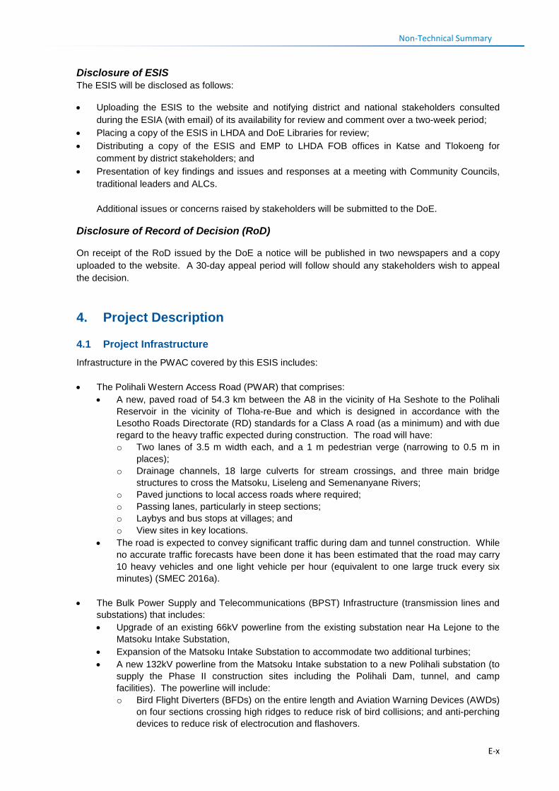
Non-Technical Summary Disclosure of ESIS The ESIS will be disclosed as follows:
• Uploading the ESIS to the website and notifying district and national stakeholders consulted during the ESIA (with email) of its availability for review and comment over a two-week period;
• Placing a copy of the ESIS in LHDA and DoE Libraries for review; • Distributing a copy of the ESIS and EMP to LHDA FOB offices in Katse and Tlokoeng for
comment by district stakeholders; and • Presentation of key findings and issues and responses at a meeting with Community Councils,
traditional leaders and ALCs. Additional issues or concerns raised by stakeholders will be submitted to the DoE.
Disclosure of Record of Decision (RoD)
On receipt of the RoD issued by the DoE a notice will be published in two newspapers and a copy uploaded to the website. A 30-day appeal period will follow should any stakeholders wish to appeal the decision.
4. Project Description
4.1 Project Infrastructure Infrastructure in the PWAC covered by this ESIS includes: • The Polihali Western Access Road (PWAR) that comprises:
• A new, paved road of 54.3 km between the A8 in the vicinity of Ha Seshote to the Polihali Reservoir in the vicinity of Tloha-re-Bue and which is designed in accordance with the Lesotho Roads Directorate (RD) standards for a Class A road (as a minimum) and with due regard to the heavy traffic expected during construction. The road will have: o Two lanes of 3.5 m width each, and a 1 m pedestrian verge (narrowing to 0.5 m in
places); o Drainage channels, 18 large culverts for stream crossings, and three main bridge
structures to cross the Matsoku, Liseleng and Semenanyane Rivers; o Paved junctions to local access roads where required; o Passing lanes, particularly in steep sections; o Laybys and bus stops at villages; and o View sites in key locations.
• The road is expected to convey significant traffic during dam and tunnel construction. While no accurate traffic forecasts have been done it has been estimated that the road may carry 10 heavy vehicles and one light vehicle per hour (equivalent to one large truck every six minutes) (SMEC 2016a).
• The Bulk Power Supply and Telecommunications (BPST) Infrastructure (transmission lines and substations) that includes: • Upgrade of an existing 66kV powerline from the existing substation near Ha Lejone to the
Matsoku Intake Substation, • Expansion of the Matsoku Intake Substation to accommodate two additional turbines; • A new 132kV powerline from the Matsoku Intake substation to a new Polihali substation (to
supply the Phase II construction sites including the Polihali Dam, tunnel, and camp facilities). The powerline will include: o Bird Flight Diverters (BFDs) on the entire length and Aviation Warning Devices (AWDs)
on four sections crossing high ridges to reduce risk of bird collisions; and anti-perching devices to reduce risk of electrocution and flashovers.
E-x
Non-Technical Summary
o Anti-climbing platforms • Telecommunications component that entails the provision of the required levels of
telecommunications infrastructure to provide voice and data facilities (including teleconference) to the Phase II Project Area.
The BPST also includes realignment of the existing powerline along the A1 road that crosses the Khubelu and Senqu Rivers where there is potential inundation of existing electrical infrastructure due to reservoir impoundment; new 33 kV lines across reservoir, including one from Tlokoeng substation to the permanent camp; and construction of a new Polihali substation. These are all covered by the PRAI ESIS.
4.2 Land Requirements, Servitudes and Compensation The BPST requires a total of 139 ha of which ~17.7 ha of permanent land-take is required for pylons and local tower access tracks and 120.3 ha in the 31-m wide powerline servitude (15.5 m either side of the centreline) and for the construction laydown sites. All arable land within the powerline servitude will be compensated. No houses require relocation from the powerline servitude (although 4-6 houses require relocation for the Polihali substation – included under PRAI ESIS). The PWAR requires a total ~170 ha of which ~164 ha is within the 30-m wide Road Reserve (15 m either side of the road centre line) and ~5-6 ha for camps and laydown areas (e.g., at bridges and culverts, but excluding quarries and borrow pits). All arable land and privately owned resources within the Road Reserve will be compensated while household structures in the reserve will require relocation to new sites (to be agreed with the owners). Compensation will be done in accordance with the LHDA’s Phase II Compensation Policy and schedule of rates. A separate RAP is underway and will be implemented under LHDA Contract No. 6006. 4.3 Construction Timing and Support Requirements Construction of the Project is due to commence in late 2018 and to take 20 months. The PWAR will be separated into two construction tenders each covering the western and eastern portions of the route. The powerline will be tendered as one contract. Staff requirements are estimated at ~200 people for the PWAR and 56 for the BPST of which ~150 are expected to be unskilled labour positions, primarily for the PWAR. Sourcing and recruitment will be done in accordance with LHDA’s Labour Recruitment Guidelines. The majority, if not all, of the labour are expected to be sourced locally from villages in the PWAC. It is unknown as yet whether local labour can reside at their home villages or will be required to stay in construction camps. A construction camp for the western portion of the PWAR is proposed for location adjacent to the Matsoku River, near the village of Phakoeng, while the western construction camp for the BPST is proposed at a previously used site near Matsoku substation. Both of these will be assessed as part of a separate EMP. The construction camp for the eastern portions of the PWAR and BPST is located near Polihali and is assessed as part of the PRAI ESIS (under LHDA Contract No. 6014). Requirements for water and electricity, and waste generation and disposal, have not been quantified as yet and will be determined by the selected Contractors. Water for construction purposes will be abstracted from the main rivers in the PWAC; electricity will be produced from generators at the camp or mobile units; and fuel supplies will be stored at camps and transported in mobile units to work sites. Laydown areas for the BPST infrastructure and materials are proposed at two sites in the PWAC (near Ha Salemone and Thuhloane). Laydown areas required for the PWAR will be determined by the Contractor.
E-xi
Non-Technical Summary Two quarries and 16 borrow pits have been identified along the PWAR and a further six quarries have been identified along the NAR and near Katse Dam. These are under geotechnical investigation to determine quantity of aggregate material and size and design. A detailed project description is provided in Section 4.
5. Project Alternatives
Project alternatives reported on in more detail in Section 5 of the ESIS include three levels of route alternatives:
• Substantive route options (i.e., two different route corridors); • PWAC (four route options A-D); and • Realignments of the PWAR and BPST within the PWAC. 5.1 Substantive Route Options: Two substantive route options were assessed by SMEC (2016) based on technical, geometric design requirements, safety aspects, cost as well as social and environmental aspects. The two routes were:
• Option 1 – A1 via Moteng Pass and Oxbow; and • Option 2 – A8 via Pitseng and the PWAR.
The study concluded that Option 2 involving the upgrade of the NAR and construction of the PWAR was the preferred option.
5.2 PWAR Route Options: Comparison of the four PWAR options (Figure E.5) in the Route Selection study for this ESIA considered ecological criteria, social and visual criteria that were identified by the team members. These included aspects such as the number and length of different wetland types crossed; the extent of route crossing more remote high altitude (>2800 m) areas of higher sensitivity for priority flora, herpetofauna, mammals and birds; the length of road close to (<50 m from) rivers and streams; and degree of visual exposure. Social data and criteria used were derived from the quantification done by Barry and Partners (2014a,b) and included aspects such as extent of arable land affected; and number of villages and social infrastructure served by the road option.
Overall ranking of the routes are summarised in Table E.2, including comparison with the overall ranking on technical grounds by Barry and Partners (2014) and SMEC (2016).
Based on ecological, social and visual criteria, Route A was the preferred route, followed by Route B as these offered the greatest social benefit and lowest ecological risks largely due to the length of route at altitudes below 2800 m. However, based on technical and cost criteria, Route D was the preferred route, closely followed by Route C, largely based on length of route and cost criteria. Construction of roads and powerlines at high altitudes in Lesotho have the highest ecological risks as these altitudes are the more remote and have relatively intact habitats for a number of endemic highlands flora and fauna, as well as the highest risk for damage to sensitive wetland ecosystems.
Route B was selected as the preferred route by the LHDA and GoL as it offered the best compromise between cost, technical risks and maintenance requirements of powerlines and roads at high altitudes (above the snow line); lowest ecological risks and greater social benefits to communities. The portion of Route B from Polihali to Makhoaba Junction also accords with the Government of Lesotho’s Road Development plans by improving the linkage between the A1 at Mapholaneng and Thaba-Tseka.
E-xii
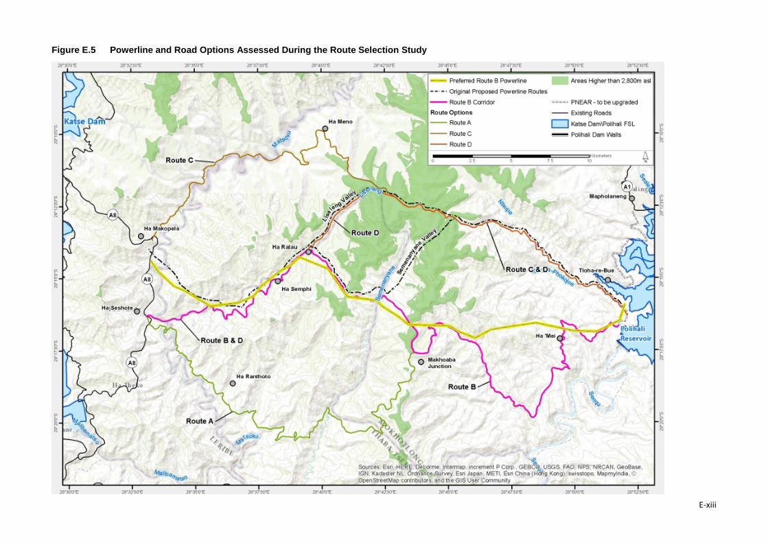
Figure E.5 Powerline and Road Options Assessed During the Route Selection Study
E-xiii
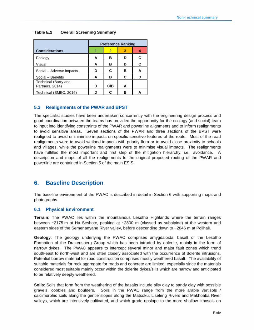
Non-Technical Summary Table E.2 Overall Screening Summary
Considerations
Preference Ranking
1 2 3 4
Ecology A B D C
Visual A B D C
Social – Adverse impacts D C B A
Social – Benefits A B C D Technical (Barry and Partners, 2014) D C/B A
Technical (SMEC, 2016) D C B A
5.3 Realignments of the PWAR and BPST The specialist studies have been undertaken concurrently with the engineering design process and good coordination between the teams has provided the opportunity for the ecology (and social) team to input into identifying constraints of the PWAR and powerline alignments and to inform realignments to avoid sensitive areas. Seven sections of the PWAR and three sections of the BPST were realigned to avoid or minimise impacts on specific sensitive features of the route. Most of the road realignments were to avoid wetland impacts with priority flora or to avoid close proximity to schools and villages, while the powerline realignments were to minimise visual impacts. The realignments have fulfilled the most important and first step of the mitigation hierarchy, i.e., avoidance. A description and maps of all the realignments to the original proposed routing of the PWAR and powerline are contained in Section 5 of the main ESIS.
6. Baseline Description
The baseline environment of the PWAC is described in detail in Section 6 with supporting maps and photographs.
6.1 Physical Environment Terrain: The PWAC lies within the mountainous Lesotho Highlands where the terrain ranges between ~2175 m at Ha Seshote, peaking at ~2800 m (classed as subalpine) at the western and eastern sides of the Semenanyane River valley, before descending down to ~2046 m at Polihali.
Geology: The geology underlying the PWAC comprises amygdaloidal basalt of the Lesotho Formation of the Drakensberg Group which has been intruded by dolerite, mainly in the form of narrow dykes. The PWAC appears to intercept several minor and major fault zones which trend south-east to north-west and are often closely associated with the occurrence of dolerite intrusions. Potential borrow material for road construction comprises mostly weathered basalt. The availability of suitable materials for rock aggregate for roads and concrete are limited, especially since the materials considered most suitable mainly occur within the dolerite dykes/sills which are narrow and anticipated to be relatively deeply weathered. Soils: Soils that form from the weathering of the basalts include silty clay to sandy clay with possible gravels, cobbles and boulders. Soils in the PWAC range from the more arable vertisols / calcimorphic soils along the gentle slopes along the Matsoku, Liseleng Rivers and Makhoaba River valleys, which are intensively cultivated, and which grade upslope to the more shallow lithosols on
E-xiv
Non-Technical Summary
lava with calcimorphic soils. The central portions across the Semenanyane River valley comprise lithosols on lava which are shallow rocky soils which are not suited to agriculture.
Land use: Land use in the project area comprises mostly scattered villages located at intervals along the route; agricultural fields located primarily around villages and up the valley slopes; and rangelands for livestock grazing. Crops grown comprise mainly maize, sorghum and peas, with wheat grown at higher altitudes in the central parts of the PWAC. Above 2650-2700 m little cropping is undertaken and the land is solely used for grazing of livestock; cattle, sheep and goats primarily in the summer months.
Climate: Highest rainfall occurs in the western parts of the route on the Katse side of the PWAC and in the higher altitude areas on either side of the Semenanyane River valley based on rainfall data from monitored sites at Katse, St Martin’s Mission, Mapholaneng and Mokhotlong over a 10-year period from 2003 to 2013. Rainfall diminishes further east towards Mokhotlong and Mapholaneng in the Senqu River valley. Average rainfall over the 10-year period averaged ranged from 751 mm at Katse and 837 mm at St Martin’s to 590 mm at Mokhotlong and a low of 231 mm at Mapholaneng. This decline in rainfall in the Senqu River valley, which falls within a rainshadow, is a large contributor to the dry and degraded conditions pertaining in that area. Snow is frequent in winter between April and September on high ground, particularly above 2700 mm. No wind or temperature data has been located for the PWAC.
Hydrology: The PWAC crosses several ephemeral streams and three main perennial rivers: the Matsoku in the west; the Semenanyane River in the centre and the Makhoaba River in the east. The Liseleng River is a permanent stream along which the PWAR is broadly aligned for the westernmost ~12 km of the route, and situated in close proximity (<~100 m) to the river for approximately 4.5 km
6.2 Biological Environment Vegetation: Lesotho Highland Basalt Grassland covers the majority of the PWAC and is classified as Least Threatened. Drakensberg Afroalpine Heathland is present in the higher lying mountains to the north of the PWAC while Senqu Montane Shrubland is present in the Senqu River valley to the south of the PWAC.
Vegetation comprises mostly montane grassland which ranges from low closed grassland at higher altitudes where grazing is less severe to open sparse grassland in the lower lying areas where grazing intensity is highest. While grass species diversity is relatively high in Montane Grassland along the PWAC, the diversity of forbs and geophytes is higher, although no species are clearly dominant. Rocky ridges and outcrops are important habitats for plants as they have a distinct flora that is dominated by succulents such as Euphorbia clavarioides, Crassula natalensis and Delosperma hirta, dwarf shrubs such as Lobelia galpinii and Searsia divaricata, and small, xerophytic ferns such as Mohria vestita and Cheilanthes eckloniana. A number of geophytes appear to be restricted to these rocky outcrops, including the endemic Eucomis schijfii, Haemanthus humilis and Bulbine narcissifolia. The higher mountain upper slopes and peaks at altitudes over 2800 masl comprises Montane Shrubland which is only represented by small patches on either side of the Semenanyane catchment in the central parts of the PWAC. Vegetation structure is low, open to closed shrubland with a relatively sparse grass understory. Helichrysum trilineatum, Chrysocoma ciliata and Pentzia cooperi are dominant species at these altitudes, often forming dense stands, while Euryops tysonii is more prominent in heavily grazed slopes at lower altitudes.
Flora: The PWAC is situated within the Drakensberg Alpine Centre (DAC) of plant endemism which has a rich diversity of flora with an estimated 2618 species of vascular plants (Carbutt and Edwards, 2006) and high plant endemism with ~13% strictly endemic to the region and 24% near-endemic.
E-xv
Non-Technical Summary
Less than 6% of the DAC is conserved (mostly in the uKhahlamba-Drakensberg Park in KwaZulu-Natal) and despite the Maloti Mountains dominating much of the DAC, only 3% of this is conserved, such as in the Sehlabathebe National Park, Bokong Nature Reserve, and Tsehlanyane Reserve.
Seven species recorded along the PWAC are considered species of conservation concern as defined by Raimondo et al. (2009) and as assessed by Talukdar (2002). While one - Boophone disticha - is classified as Endangered (Talukdar, 2002) because of a high demand within the traditional medicine industry resulting in declining populations, but is believed to be relatively widespread in the country and was recorded in a few locations along the PWAC. Four species have been classified as Vulnerable in Lesotho (Talukdar, 2002), two of which are endemic to Lesotho (Aloe polyphylla, Jamesbrittenia lesutica), and two which are widespread species in grasslands throughout Lesotho and South Africa (Eucomis autumnalis, Dicoma anomala). Two Near Threatened species, Aristaloe aristata and Cotula paludosa, were confirmed to occur just outside of the PWAC during fieldwork and may occur on the route.
Fauna: Mammal and herpetofauna species diversity in Lesotho is low and many species previously recorded no longer occur. Carnivores, antelope and baboons usually only occur in remote areas far from human settlements, on high plateaus or in riverine vegetation. Only two species are listed as Near Threatened: Grey Rhebok, which is endemic to the region and which were sighted in the upper Liseleng and Semenanyane River valleys in the central part of the PWAC), and Cape Clawless Otter (recorded at Matsoku Weir). Two mammals are endemic or near endemic to the high altitude parts (>2600m) of the Drakensberg region and are fairly common: Sloggett’s Rat (Ice rat) and Sclater’s Golden Mole. No primates were recorded although it is expected that baboon may occur from time to time in the central remote parts.
Important microhabitats for herpetofauna include: i) cliffs and rocky outcrops which are important for reptiles, particularly lizards; and ii) seeps and rivers and streams for amphibians. Of the five endemic frog species, two occur in fast flowing streams at high altitudes and may occur in the Liseleng and Semenanyane Rivers crossed by the PWAC: the endemic Maluti River Frog and Phofung River Frog. However, no confirmed threatened or near threatened reptile or amphibian species were recorded during the survey and none are likely to occur along the PWAC.
Birds: The PWAC has a relatively low diversity of species, which is typical of the Lesotho Highland region, with 130 bird species recorded, but with overall high level of endemism with 26 species or 21% of total avifauna considered regionally or locally endemic. Thirteen species are considered priority species (i.e., globally or regionally red-listed or locally endemic species), mostly cliff-nesting birds. In particular, the Bearded Vulture population of the Lesotho Highlands is of great regional and global importance for this regionally Critically Endangered species (Krüger et al., 2013; Krüger, 2015). Also, Southern Bald Ibis, globally listed as Vulnerable, is confined to the grasslands of southern Africa, with a stronghold of this species in Mokhotlong. It has drastically decreased in both number and aggregate range in the last 50-100 years (Henderson, 2015). The more degraded lower-lying sections in the eastern end of the PWAC support few endemic or red-listed grassland birds. However, these species – Drakensberg Rockjumper, Mountain Pipit, Drakensberg Siskin were present at the highest elevations along Route B in the Liseleng and Semenanyane River valleys thereby confirming these parts of the route as more important and of higher biodiversity value for birds. Bird transect data collected for this study confirmed many more restricted range, endemic species in the central high lying parts of the route.
Avian sensitivity mapping compiled for this study integrated a modelled dataset for predicted density of Bearded Vultures with buffer zones around confirmed nest sites. This was used to highlight the bird risks of a high altitude routing of the powerline and influenced the selection of Route B as the preferred powerline corridor.
E-xvi
Non-Technical Summary
Wetlands: A total of ~51.65 ha of wetlands comprising 151 map units were mapped along the PWAC and powerline route, consisting of six grouped wetland types. Sheetrock systems were the most extensive wetland type comprising~16.4 ha (31.8%) of the total wetland area recorded and comprised 40 of the 151 wetland units recorded (26.5%). This type had the largest proportion in the largely natural present ecological state category: three wetlands totalling 5.1 ha. These occurred all along the route but with extensive clustering in the central portion (kp 24-30) and others between kp 7 and 11. Fens were the second most extensive wetland type with ~15.6 ha (or 30.2%) of the total extent of wetlands recorded. Sheetrock systems are generally maintained by shallow seepage of water from upslope. The most extensive and intact Sheetrock system occurs between Kosheteng and the top of Makhoaba Junction (kp 24-26.5), which had a diverse flora with a number of priority plants such as Eucomis schifferi and Corycium nigrescens (orchid).
Fen systems typically contain peat which has a high water holding capacity and leads to this wetland type acting as sponges (i.e., storing water that is slowly released downstream), and therefore regulating streamflow. One nearly natural Fen near Ha Ratau had high wetland habitat diversity and peat of 3.1 m depth. All fens rate high to very high in terms of ecological importance and sensitivity EIS). Only eight fens were mapped along the PWAC but these comprised 30% of the wetland area recorded, with the largest of 4.85 ha near Ha Sekolopata. Most of the fens were located in the central part between Ha Ratau and Kosheteng where realignment of the PWAR has minimised impacts on several of these systems.
An important seepage wetland system was recorded between kp 7 and 8 near Ha Salemone, which had a number of priority plant species with medicinal value. The PWAR was realigned to avoid cutting across the central and upper parts of this system and rerouted below the main seepage zones. Seven seeps had springs which although mostly small and degraded are important for water supply.
The level of wetland degradation is similar to other areas in the Highlands, largely related to livestock grazing and trampling, and degradation of the catchment leading to changes in the hydrology. In some places wetland degradation along the PWAR is exacerbated by the impacts of the gravel road that has caused some gully erosion at culverts. These have combined to result in erosion and desiccation of wetlands, leading to encroachment of woody shrubs. Nonetheless, in terms of Importance and Sensitivity nine wetlands totalling 14.5 ha scored very high and 13 wetlands scored high.
Habitat Status: 55% of the habitats of the PWAC and 62% of the 132kV powerline route are considered modified (comprising fields, settlement, and highly degraded grassland) while the rest (45% and 38%, respectively) are considered near-natural (comprising grassland, river courses, wetlands and cliff and rocky outcrops and high altitude shrublands). In general, modified habitats are primarily the eastern and western ends while the central portion is near-natural.
The only possible biodiversity trigger for Critical Habitat is the presence of Bearded Vulture, which although only estimated to have 100-150 pairs in the Drakensberg and Maloti Mountains region, these birds forage across a wide area. No nest sites of this species were confirmed along the Route B, with the nearest nest identified on Route C, where they were regularly seen. Their main threat from the Project is a result of powerline collision but the rerouting of the alignment to follow the lower altitude Route B, has substantially reduced the powerline threats to this species.
Protected Areas: No formally designated protected areas lie close to the Project Area. Bokong Nature Reserve was declared under the LHWP Phase 1 as a form of compensation for biodiversity impacts of Katse Dam and improve protection of the Bokong catchment and river that supplies the dam. Construction traffic for the LHWP Phase II (Polihali) will be routed along the A8 through the Bokong Reserve.
E-xvii
Non-Technical Summary
In summary, the most important ecological features of the PWAC are the wetland systems with a number of priority plants, and threatened cliff-nesting and endemic birds, particularly those in the central high lying parts.
6.3 Social Environment Demography, Migration and Religion: The PWAR and powerline traverses the administrative districts of: Leribe, Thaba-Tseka and Mokhotlong. The largest portion of the PWAC falls within Mokhotlong (with 34.7 km or 64% of the road and 22.5 km (60%) of powerline), followed by Thaba-Tseka (18.8 km or 35% of road and 14.6 km or 38.7% of powerline).
Approximately 52 villages fall within the PWAC. A total of ~4060 people were resident in the 14 main villages in which pitsos and FGDs were conducted (based on 2006 census data). Extrapolation from this data suggests the possible number of residents in all ~50 villages along the PWAR is around 14,260. Ha Seshote at the westernmost end of the PWAR had the highest population (882 people) given its relative accessibility and improved social infrastructure and services. Village size and population decreases further east along the PWAR as road access deteriorates higher up the Liseleng valley. On the Mokhotlong (eastern) side of the PWAC, Makhiseng had the highest population. Retrenchment from the mines in recent years may have altered the population profile and migration patterns. There is still a tendency for out-migration of adults to see work in the lowlands of Lesotho or in South Africa and for some local migration to centres such as Ha Seshote for proximity to infrastructure and services.
The majority of the residents are Basotho, while some Asians live in Seshote where they run shops. Most people follow a Christian religion but also follow traditional believes and customs.
The extended family system is widely practiced, where family members share livestock, and mutually assist each other with farming, house building, rituals and dispute arbitration. Social networks and financial saving schemes are widespread.
The communities in the PWAC are relatively vulnerable given their isolation, lack of income earning opportunities and harsh conditions for reliable food supply and poor access to services. As a result levels of education are low and diseases, such as HIV/AIDS and Sexually Transmitted Infections (STIs), are high as a result of poor socioeconomic conditions and education levels. Vulnerable households are those who do not own land or cannot farm (the elderly and disabled) or child-headed households.
Settlement and Land Use: The majority of people live in small villages mostly clustered on ridgelines or slopes in the Liseleng, Semenanyane or Makhoaba River valleys. Most of the houses, particularly those in the more remote villages between Phakoeng and Polihali are constructed of mud (often mixed with dung), stone and thatching grass. A few people have built concrete brick and corrugated iron roof houses, which often require less maintenance than traditional structures. Most villages have some crop fields around the village but fields may extend far up the mountain slopes, well away from the villages. Grazing land for livestock is generally limited and of marginal quality close to villages, and livestock is often herded several kilometres away to find grazing, and spend considerable periods of time in the high mountains during summer.
Agriculture: Land is of primary importance to sustain the livelihoods of the local population. It is used for agriculture, livestock grazing, harvesting of other natural plant resources, and for housing. Most households have fields. Cropping is mainly for subsistence purposes and is characterised by rain-fed cereal production. Very little produce is sold as there is limited surplus for bartering or sale and limited access to markets. Share cropping and hiring people to work on fields is common with
E-xviii
Non-Technical Summary
payments for labour in cash or with grain payments. Some households in the remote, centrally located villages rely on the cultivation and sale of marijuana.
Livestock are reared mainly for subsistence and few are sold except in critical times of financial need. Sheep and goats are reared for the sale of mohair and wool although it was reported that livestock numbers are lower due to the drought over the past two years. One woolshed is located at Kosheteng and serves villages in the Liseleng and Semenanyane valleys. Agricultural market and extension services are limited due to poor road access and residents expect the road to increase opportunities in this regard. Key challenges facing crop farming are pests, drought, frost, hail storms, erosion and weed encroachment, while threats to livestock farming are stock theft, animal diseases, snow, and decreasing quality and availability of grazing. Poor road infrastructure is a key challenge affecting the transport of wool from the woolshed.
Employment, Household Income and Skills: Main sources of income are sale of wool and mohair, although some people supplement income with sale of natural resources (thatching grass, brooms, rosehip berries), stones for house building, and traditional beer. Other income is from pensions or grants and remittances from family members with jobs elsewhere. Skills mentioned in the local communities included drivers, mechanics, builders, electricians, welders and a few skilled technicians.
Natural Resource Use: local communities have a high reliance on natural resources on a daily basis including medicinal plants, woody shrubs for firewood, weaving and thatching grass, and sand from riverbeds for building. Trees – mainly willows and poplars – are often privately owned and used for poles for building. Permission for the harvesting of resources and areas is given by the chiefs or community councillors. Three specific areas of importance for medicinal and other culturally important plants were recorded in close proximity to the road and require further surveys to confirm search and rescue requirements.
Health and Healthcare: There are only two healthcare centres in the PWAC, located at Ha Seshote and St Martin’s Mission. There is also a health post building at Khotsang that is used for outreach services although the services are not regularly provided. No outreach or mobile health services operate along the PWAC. The Ha Seshote health centre, located at the westernmost point of the road at the junction of the PWAR with the A8 road (in Leribe District), serves ~52 villages, including all the villages in the Liseleng valley as far as Ha Thene. If services are unavailable at the Ha Seshote health centre people are referred to a mission run hospital (i.e., Mamohau Hospital) in the village of Ha Poli, located ~16 km north of Ha Seshote. The Paray Hospital in Thaba-Tseka town is reportedly located too far away from the PWAC area; it is only used when emergency health care is required.
St Martin’s health centre at Makhoaba (in Mokhotlong District) is run by the Christian Health Association of Lesotho (CHAL) and services ~25 villages along the eastern side of the PWAC from Kosheteng to Polihali. Residents at the furthest villages (i.e., Ha Polihali) reportedly take up to six hours to walk to this facility. Patients who need services that are not offered at the health centre are referred to the Mokhotlong Hospital.
Ha Seshote and St Martin’s health centres are each staffed with two registered nurses and two trainees, and offer outpatient care, vaccinations/immunisations for children under five years, TB treatment and Anti-Retroviral Treatment on weekdays. The latter also provides antenatal care services and deliveries.
Key challenges faced by these health facilities include lack of funds for outreach services; shortage of staff and medical supplies and lack of ambulance facilities to transport patients in emergencies. St Martin’s health centre does not provide family planning services or contraception as it is a Roman
E-xix
Non-Technical Summary
Catholic facility. Lack of transport results in sick and pregnant members of the community having to walk long distances to these health facilities, often in extreme weather conditions in winter and are often exposed to security risks when returning after dark.
Education: There are ten primary schools (three in the western half and seven in the eastern half of the PWAC) and three high schools (one in the west and two in the east). Ha Seshote is the main educational centre for the western half with the Laghetto Primary School, a Roman Catholic mission school which serves ~10 villages, including Liseleng and Phakoeng which fall under the Thaba-Tseka District. The Laghetto High school serves around 22 villages, including al the villages in the entire Liseleng valley, and offers all grades (grades 8-12). Ha Tšehla Government Primary School also serves about 10 villages. On the Mokhotlong side of the PWAC there are two high schools: one at Khotsang and another at Makhoaba. St Martin’s High School in Makhoaba is a mission school and it serves 10 villages between Matsoku and Mapholaneng; while Khotsang Combined School is a government school and offers grades 1 – 10.
Schools in the mountainous districts, such as the PWAC, are generally remote and hard to reach, and characterised by poor infrastructure; single teachers teaching a number of grades; high pupil to teacher ratios; high absenteeism of both teachers and learners; and infrequent inspections with limited support by education authorities due to transport difficulties. These schools tend to attract less experienced and unqualified teachers compared to schools in the lowlands and foothills. Residents along the PWAC are therefore hopeful that the new road will improve support for, and access to, education.
6.4 Cultural Heritage Permanent settlement in the remote higher lying parts of the Highlands started from the mid-1870s. Sites of cultural heritage tend to be focused around the villages of important chiefs, sites of community rituals / ceremonies, notable historical events, as well as old trading stations, churches and schools. This cultural heritage is both tangible (buildings, graves) as well as intangible (the stories, oral traditions, rituals, performance and knowledge which are linked to these sites). Communities rely on various plants, animals and mineral substances which are used for medical and cultural purposes.
No Stone Age or Iron Age archaeological sites were recorded along the PWAR or BPST. Identified heritage resources were limited to lron Age / Historical villages situated along the existing gravel road that will be upgraded for the PWAR, including burial sites associated with those settlements. A total of 60 cultural heritage sites were identified along the PWAC, connected with existing Basotho communities. These included 20 graveyards / cemeteries; 29 ash heaps (with unknown number of burials); four separate ruins; one spiritual site; three areas for useful plant harvesting, and three sites for tourism enhancement (waterfalls).
Most graves and ash heaps close to the PWAR are located in the eastern half, mostly in villages such as Masalla (Ha Makhoaba) and Ha Makhiseng, although a couple of significant graveyards also occur near Phakoeng on the western side. The majority of graves comprised unmarked rocks located on grassy slopes that are not easily distinguished; several are located close to the road or near streams. The traditional practice of interring the bodies of stillbirths or very young infants within household ash heaps raises the potential for human remains being contained within these deposits. Further investigation is required to confirm the presence of human remains in ash heaps within the PWAR impact zone and the associated mitigation requirements under the separate RAP. Two sites with ruins of old settlement structures (one at Hohobeng on Makhoaba Pass and one near Ha Semphi) occur close to the proposed road.
E-xx
Non-Technical Summary
7. Stakeholder Issues and Concerns
7.1 Community Issues Overall, the community members in the majority of villages where discussions were held had high expectation that their quality of life would improve and that the road would provide more economic opportunities (jobs and access to markets to sell produce), and better access to social, health and agricultural extension services. There were also unrealistically high expectations that the powerline would provide household electrical connections in the villages (although it was made clear that the powerline was a high voltage supply for dam construction and that it was the responsibility of LEC to supply communities).
The main anticipated negative impacts raised by community members and key informants were: • Loss of / damage to houses and arable land, including from rocks rolling into fields; • Loss of fuelwood, medicinal plants and other natural resources; • Increased risk of social ills (e.g., teenage pregnancy, and school absenteeism / dropouts) during
the construction phase; • Construction disturbance from noise, dust, etc. and traffic safety risks, especially at schools; • Increased crime over sale of dagga and alcohol; • Increased stock theft due to improved access (although potentially counter-balanced by the
improved access to police enforcement); and • Interference with water supply sources, such as wetlands;
7.2 District and Traditional Authorities Issues raised at sensitisation meetings with district and traditional authorities related to:
• Employment and access to jobs; • Approach and form of compensation for damage to houses and fields; • Rehabilitation of quarries; • Electrification of houses; and • Potential impact on springs.
7.3 National Authorities Various issues were discussed that assisted the team to understand available contextual information for the ESIS, and the issues and challenges faced by government departments related to service delivery. The key issues discussed with national authorities that are of direct relevance to the PWAC included:
• Concern over the management of impacts of the road on wetlands, mainly as a result of concentration of flows from culverts;
• Increasing applications for mineral rights to establish quarries in the highlands for sale of aggregate, and community compensation requirements for quarries;
• Stock theft issues related to the road; • Road and powerline servitudes and building restrictions; and • Siting of pylons to avoid problems relating to foundations and gully erosion. The full set of meeting minutes are contained in Appendix D (Volume 3, Annex A).
E-xxi
Non-Technical Summary
8. Key Impacts
8.1 Social Impacts All the communities in the estimated 50 villages along the PWAR are positive and enthusiastic about the proposed paved road and the improvement in their quality of life that they expect it will bring in the form of new market opportunities to sell produce; and obtain easier access to essential services (education, health, policing and agriculture etc.). Many residents perceive the road will also lead to improved transportation and electricity provision, and additional education, clinic and agricultural facilities.
8.1.1 Construction
The most significant negative social impacts of the PWAC construction identified are: • Physical displacement for approximately 40 families who will have to be resettled to new
homesteads, probably within their existing villages;
• Loss of arable land mainly for the widening of the PWAR and deviations from the existing track, as well as new access tracks for powerline construction;
• Noise and disturbance during the 20-month construction period, especially near schools, religious institutions and livestock centres (e.g., woolsheds);
• Loss or disruption of community water supply if pipelines are broken or water sources polluted or flow restricted;
• Increased safety risks caused by traffic collisions or from open pits and trenches, if left unprotected;
• Increase in anti-social behavior caused by presence of work force and influx of work seekers resulting in increased crime, prostitution, teenage pregnancy, school dropout and increase in HIV/AIDS and STIs; and
• Increase in pressure on existing social services/infrastructure and cost of living due to presence of a workforce with cash income. However, this is expected to be limited in the Ha Seshote area due to the relatively small labour requirements for the road and powerline compared to the Polihali Dam on the eastern side.
8.1.2 Operation
The most significant negative operational phase impacts are. • Increased risk of traffic accidents with pedestrians and livestock due to the significantly
increased traffic and driving speed of road users on the PWAR, especially during dam construction (for the first three years of road operation) when it is estimated that on average one large truck will use the road every six minutes;
• Increase in anti-social behaviour due to the presence and use of the road by long-distance
drivers of delivery trucks, who may seek casual sexual relations with local women/girls leading to a shift in cultural norms; and increased prostitution, HIV/AIDS, teenage school dropout etc.; and
E-xxii
Non-Technical Summary
• Increased cost of living due to a combination of increased exposure of residents to a wider variety of goods, and cumulative cost increases along the PWAR caused by the significant increase in workers employed in dam construction and paid cash income.
Overall, the road is expected to lead to a net positive gain in community health and well-being as long as construction and operational impacts are well managed and potential opportunities for communities optimised through implementation of livelihood support projects.
8.2 Ecological Impacts 8.2.1 Terrestrial Ecology – Construction Phase
• Clearance of ~190 ha of grassland and shrubland habitat for road and powerline construction, will affect the known locations of four threatened species: Boophone disticha, Jamesbrittenia lesutica, Eucomis autumnalis and Dicoma anomala. However, these are fairly widespread species and the road alignment was rerouted around an important site at kp 7-9.
• Some spiral aloes planted at homesteads in villages alongside the existing gravel road may be affected by road widening or realignment. These should be censused and relocated before construction.
• Some medicinal and other plants used by communities occur within the Road Reserve, notably the same site with important threatened species between kp 7-9, a thatching / weaving grass site near Ha Thene (kp 16), and a community botanical garden at Ha Semphi (kp 12).
• Site clearance and blasting will have localised impacts on fauna, particularly snakes, lizards and small burrowing animals that live in rock crevices which will suffer mortality during construction. However, all the species recorded and likely to occur along the PWAC are believed common and widely distributed.
8.2.2 Terrestrial Ecology - Operation Phase
• Spread of alien invasive plant species that are introduced during construction activities is predicted to encroach along the road and into adjacent habitats where they may outcompete indigenous vegetation, decrease faunal habitat quality and reduce grazing availability.
• Increased access is expected to facilitate the increased harvesting and sale of wild spiral aloes to road users; wild colonies are reported to occur in the higher mountains along the PWAC which may become rapidly depleted. Awareness raising of road users and communities is required.
• Similarly, the new road will also increase pressure on other useful natural resources and may encourage outsiders to come to the area to collect or purchase medicinal or other plants, which may result in a decline in availability for local residents.
8.2.3 Birds - Construction Phase
• Loss of habitat for birds due to site clearance for the road is of higher significance in the central parts of the route where more endemic grassland bird species occur than in the more cultivated and settled sections on either side.
• Construction phase activities of the road (including blasting, trucking and moving of rock, and associated noise and vibration) will have more significant impacts for cliff-nesting birds and
E-xxiii
Non-Technical Summary
endemic grassland bird communities in the more remote, high lying central sections of the route on either side of the Semenanyane River valley.
8.2.3 Birds - Operation Phase
• Operation phase impacts of the powerline are primarily related to increased risk of mortality of birds from collisions with the powerlines, and possibly by electrocution on live elements of the infrastructure. Mitigation that has been proposed and integrated into the design by the engineers is the full marking of the 132kV powerline with bird diverters, and installation of aviation warning devices in the four highest risk sections where the line crosses high altitude sections or ridgelines.
• Operation phase impacts of the road are related to bird disturbance from traffic noise, vibration
and movement, and mortality from collision with traffic. This impact is of greatest significance for the higher altitude 9 km section of the road where conservation priority endemic and threatened birds are most likely to occur. No feasible mitigation is possible to reduce this risk.
9. Key Mitigation and Monitoring Requirements
9.1 Mitigation Measures
9.1.1 Terrestrial Ecology
Mitigation for PWAC impacts on flora, mammals and herpetofauna include:
Biodiversity Awareness and Training • Develop induction and training and awareness materials related to biodiversity conservation and
hold regular training sessions with Contractor staff. • Code of Conduct for staff to include biodiversity protection measures.
Vegetation, Flora and Fauna Habitats • Minimise the footprint of site clearance and vehicles on terrestrial habitats and flora and fauna.
Minimise spread of alien invasive plants through cleaning of vehicles, equipment, and regular monitoring and control measures to curb spread.
Spiral Aloe Census of Homesteads Requiring Resettlement • Spiral aloe census in households along the PWAR to quantify number of aloes that may be
impacted by construction. • Spiral aloe relocation with resettler households or to new colony or plant nursery / garden. • Teaching of community members to propagate spiral aloes for legal sale to road users and for
replanting into colonies.
Plant Search and Rescue and Establishment of Community Nurseries / Plant Safeguard Areas • Search and rescue of priority plants in road and powerline footprints by experienced field
botanists. • Establish community gardens or other form of plant safeguard areas along the PWAC to protect
useful medicinal and other plants. These areas may create opportunities to enhance biodiversity awareness; and benefit communities through ecotourism and sale of plants.
E-xxiv
Non-Technical Summary
Community Plant Resources • Identify the presence of useful plant resources requiring relocation to nurseries and support the
harvesting of natural resources by local communities prior to site clearance. • Promote the creation of indigenous plant nurseries to be run by interested community members. • Use seeds and propagated plants in the rehabilitation of project disturbed areas.
9.1.2 Wetlands
Minimise concentration of stormwater flow and flow velocities downslope of the crossing or road by installing sufficient culverts and maintaining flow laterally across the width of wetland crossings. Identify and implement innovative design measures to disperse sub-surface flow across the entire wetland front at the road crossings in accordance with a detailed method statement that should be developed together with a wetland specialist.
Protect and maintain culvert discharge outlets against erosion and implement measures to spread surface flow. Install energy dissipaters, such as rock-packed mattresses radiating out from the culverts at 45 degrees.
Undertake further botanical assessments of the Seep and Sheetrock systems located between kp 7-9; kp 15.67-15.76 and at kp 25 and identify plant search and rescue requirements prior to construction.
As far as technically possible, avoid or minimise construction activities, laydown areas, borrow pits or any other related disturbance in important plant and wetland areas (i.e., Wetlands 03 and 04 between kp 7 and 8 and around Wetlands 34 to 48 between kp 24 kp 30), including erosion and sedimentation. Any quarries and aggregate plants in this area will require the input of a suitably qualified wetland specialist to undertake additional surveys and to provide further advice on mitigation.
Implement sediment protection measures at all wetland and stream crossings (such as the use and placement of hay bales or geotextile solutions).
Pollution prevention by maintaining a 100 m buffer from wetlands for polluting activities such as siting of toilets, fuel stores, vehicles maintenance or refueling and 50 m for deposition of topsoil to minimise sedimentation.
Rehabilitate road verges to minimise the creation or use of preferential flow paths that might lead to the concentration of flows. Install low level grassed swales to spread and slow flows.
Rehabilitate wetland areas to a suitable level that must be approved by a wetland specialist. This shall include removal of all subsoil from wetlands or adjacent slopes.
9.1.3 Birds
• Minimise site clearance footprint by ensuring construction activities, including vehicular access, are restricted to the minimum area and construction works areas are delineated on site plans.
• Conduct a pre-construction bird survey of the powerline and road alignments to confirm the status of sensitive avian sites (nest sites, key high altitude habitat), and to inform potential additional impact mitigation, which could include scheduling construction activities or other measures to reduce disturbance around active nesting sites.
• Fit Bird Flight Diverters (BFDs) to the entire length of the new 132kV powerline (using diverters configured as per industry standards for a 132kV powerline).
E-xxv
Non-Technical Summary
• Fit BFDs to sections of the 66kV line from Ha Lejone to Matsoku substation during the
refurbishment. Where feasible, these should be fitted to the sections of the line that cross high ridgelines and the Katse Dam. Priority stretches to install BFDs are: pylons 6-8, 11-14, 16-20, 46-54, 57-58 (particularly 46-54).
• Fit appropriate Aircraft Warning Devices (AWDs) to high avian collision risk sections of the line as follows: pylons 14-16; at deviation pylon 17 (over the western ridge of the Semenanyane valley); at deviation pylon 21 (over the eastern ridge of the Semenanyane valley); as well as between deviation pylons 26-28 between Marasele and Thuhloane.
9.1.4 Fish / Aquatic Habitats
• Pollution controls, including: • No refueling or equipment maintenance or other polluting activities, or toilet facilities, shall
be allowed (except in emergency) within 100 m of a water course; • No deposition of rock or soil stockpiles within 50 m of a water course to avoid sedimentation
and destabilisation of banks; and • No disposal of blast rock in water courses.
• Sediment control measures through erosion protection of riverbanks and concurrent rehabilitation.
• Natural flow of rivers will not be permanently diverted or blocked and some downstream flow shall be maintained at all times.
• Optimise construction of in-stream sections of bridges during low flow months (May-Sept).
9.1.5 Social Mitigation
Mitigation measures for negative impacts prior to and during construction include:
• LHDA to implement the LHWP Phase II Compensation Policy in accordance with the requirements to be outlined in the RAP (under LHDA Contract No. 6006).
• Contractors to maximise recruitment of local residents from the PWAC area (in line with LHDA’s
Labour Recruitment Guidelines) in order to minimise the risks linked to work-seeker in-migration and to optimise benefits to local communities.
• LHDA and their Contractors will maximise opportunities for local suppliers of goods and services
to benefit from road and powerline construction. LHDA should continue to raise awareness of opportunities for local suppliers.
• LHDA to raise awareness of risk of increased social nuisances, HIV/AIDs and STIs, and traffic
risks with schools and local community members.
• LHDA to commission a hydrocensus of community water supply to verify and map the location of pipes, taps, springs and water sources which could be disturbed during construction; and to make provision for avoiding these, where possible, or creating alternative supply.
• Contractors/Engineers to undertake an asset condition survey of household structures within agreed buffer distances from the Road Reserve based on construction activities to provide a baseline for potential claims for compensation from construction damage.
E-xxvi
Non-Technical Summary
• Contractors to minimise construction disturbance / nuisances through controlled blasting; limiting hours of blasting to daylight hours and avoiding important school periods (e.g., exams); controlling speed of construction vehicles; controls on worker behaviour through adherence to a code of conduct; and avoiding disruption and pollution of community water supply.
Enhancement measures for potential positive impacts include:
• Contractors and LHDA to ensure maximum employment of local residents in accordance with LHDA’s Labour Recruitment Guidelines and to meet the expectations of community members.
• Maximise local procurement as per LHDA’s Phase II Procurement Policy and the Contractor Procurement Framework.
• LHDA to implement social development projects in terms of LHDA’s Livelihood Restoration and Social Development Framework (LRSDF) for project affected people along the PWAC.
• LHDA to collaborate with the relevant authorities, service providers, potential partners and local
communities to deliver enhanced socio-economic benefits within the Project Area.
9.1.6 Cultural Heritage Mitigation
• LHDA (under the RAP contract) will confirm grave locations and options for avoidance, and agree with the affected families the mitigation requirements e.g., exhumation and reburial, ceremonies etc. All exhumation and reburial must be done in accordance with permit requirements from Department of Culture and Department of Health.
• Demarcate remaining graves in the Road Reserve or adjacent areas to prevent damage during construction, and undertake regular checks to ensure no damage caused.
• Respond to any grievances raised by community members to resolve issues related to graves.
• Implement the Chance Finds Procedure (CFP) in case additional cultural heritage found during construction.
• Demarcate boundary of any ruins of household structures and avoid damage. Consider obtaining oral history of the abandoned structures.
9.1.7 Landscape / Visual Mitigation
Mitigation for landscape/visual impacts are largely related to potential for mitigating visual scarring caused by access tracks, as no further realignments of the powerline or road are possible or required. These include:
• Align access tracks along contours and avoid cutting straight down slopes to avoid erosion; • Install sufficient culverts to minimise erosion; • Monitor and remove alien invasive plants; and • Rehabilitate disturbed areas concurrent with ongoing construction.
E-xxvii
Non-Technical Summary
9.2 Monitoring Measures
9.2.1 Vegetation and Flora
• Monitor and remove alien invasive plants along PWAR and new access roads to powerline.
• Monitor the status of spiral aloe colonies and collection and sale of spiral aloes along the PWAR (through collaboration of LHDA and DoE).
9.2.2 Wetlands
• Monthly inspections of wetland crossings by a suitably qualified specialist during construction and one-year post-construction liability phase to check compliance with the EMP and identify additional mitigation requirements that may be needed.
• Quarterly monitoring inspections must be undertaken by a suitably qualified wetland specialist during construction and the one year post construction liability phase to check the effectiveness of design and mitigation measures and to identify additional measures that may be required.
• Five-yearly monitoring of wetland health including present ecological state; peat depth and humification; erosion; presence of priority plants. Fixed point photographs should be included.
9.2.3 Birds
• Monitor bird mortality rates on the powerline (systematically, at least every two-months) and the road (opportunistically) for at least the first two years post-construction. If high collision risk sections of the powerline are identified, identify additional mitigation, where feasible.
9.2.4 Aquatic Habitat
Monitoring during construction and one-year post-construction by Contractors should include:
• Water quality up and downstream of river crossings; • Reinstatement of riverbanks and adjacent habitats affected by construction activities; and • Sedimentation of aquatic habitats downstream of river crossings.
9.2.5 Social
Social monitoring during construction includes:
• Contractor is required to conduct asset condition surveys in accordance with LHDA’s Asset Condition Survey Protocol;
• LHDA will ensure that regular independent monitoring and evaluation audits of the RAP and its implementation are conducted throughout construction and the operational phase to verify the progress and effectiveness of livelihood restoration and social development projects that are implemented along the PWAC;
• LHDA is to monitor the grievance register and process on a regular basis to ensure that persistent concerns are addressed timeously and effectively.
9.2.6 Cultural Heritage
Cultural heritage monitoring is limited to checks on the implementation of the CFP during construction and tracking the status and management of any cultural heritage artefacts found.
E-xxviii
Non-Technical Summary
9.2.7 Visual
Visual mitigation is limited to monitoring of alien plant encroachment, erosion and rehabilitation success to ensure unsightly scarring of the landscape is ameliorated.
9.3 Other Recommendations
• Sand mining: LHDA in collaboration with relevant government departments (e.g., DoE, Roads Directorate, and/or Ministry of Mining) should monitor the location, incidence and extent of sand mining that may occur along rivers and streams traversed by the PWAR as a result of improved road access, and take steps to enforce legal restrictions.
• Tourism enhancement: LHDA should collaborate with the Lesotho Tourism Development Corporation (LTDC) to support communities to develop skills and opportunities for tourism in the PWAC.
• Integrated Catchment Management (ICM): Include the PWAC into the ICM strategy for the LHWP Phase II with a focus on identifying opportunities to enhance grazing resources and reduce land use pressures to support biodiversity enhancement with a particular focus on wetland protection;
• Biodiversity Management Plan (BMP): Incorporate relevant long term biodiversity mitigation and monitoring measures presented in this report into the BMP for the LHWP Phase II. This should include measures related to monitoring of spiral aloe populations and control their harvesting and sale; monitoring of priority bird nest sites; baseline surveys of priority frogs in the Liseleng and Semenanyane Rivers; monitoring of community nurseries and harvesting of medicinal and other plant resources; and increased protection measures for wetland systems such as sheetrock wetlands in the Makhoaba Junction area. This will require participation of local communities, including livestock herders.
• Biodiversity Offsets: consider the potential for biodiversity offsets to compensate for the impacts of the PWAC, which could include the identification of some form of new protected areas along the PWAC (such as in the upper Liseleng and Semenanyane valleys) and their evaluation in the context of other offset requirements and opportunities for the Polihali Reservoir. The evaluation should include consideration of the various biodiversity features that are affected by the PWAR and PRAI and which need to be identified in possible offset areas. This should also include identifying other biodiversity features of importance in Lesotho (which may not be impacted by LHWP Phase II) (such as Maloti Minnow) that also warrant protection. Such evaluation should include identification of additional conservation actions that can be implemented to enhance or restore degraded habitats.
10. Summary and Conclusions
The Route Selection study leading to the selection of Route B as the preferred route for the PWAR and BPST followed by a number of subsequent realignments of the road and powerline have resulted in an optimal routing for the proposed infrastructure. This has been achieved through close collaboration between the engineering and environmental team, facilitated by LHDA. Earlier preferred alternatives for the PWAC (Route C and D) traversed more extensive distance at high altitude, posing a significantly higher risk to biodiversity.
E-xxix
Non-Technical Summary
The key sensitivities along the proposed road and powerline route along Route B include specific sections located mainly in the more remote and higher lying central parts of the alignments, where there are more wetlands and habitats with priority plant species and a higher presence of priority birds, including vultures, which are prone to powerline collisions. These remote, higher altitude sections of route (up to 2800 m) are also the most scenic parts, offering broad vistas of the mountainous landscape. For the most part, realignments of the road and powerline have avoided and minimised the risks to wetlands, plants, birds, and the visual impacts. The ESIA has identified a number of additional mitigation measures that can minimise the remaining residual impacts to an acceptable level. The most important mitigation requirements are aimed at minimising the risks of long term damage to wetlands and downslope habitats from erosion through installing sufficient and appropriately designed culverts to reduce the concentration of flows and velocity of runoff, and from alteration of subsurface flows that maintain the hydrology of wetlands systems, through use of appropriate road construction materials. The installation of BFDs along the entire 132kV powerline and AWDs on specific high lying sections are important mitigation to reduce bird collision risks.
The rural communities along the PWAC are poorly served by the existing dirt track along the PWAR, which is impassable for most of the year and does not properly connect through the Semenanyane River valley in the centre. Residents of these villages are forced to walk long distances to access health care, schools, shops, and other services. As a result, residents have indicated overwhelming support for the road project. Overall, while acknowledging the negative social impacts of construction and the loss of land and other natural resources, residents believe it will improve their quality of life through facilitating access to improved additional services and market opportunities. The social impact assessment has assessed the various negative and positive impacts of the project for local residents and identified appropriate mitigation to reduce the negative impacts and enhance the positive ones.
All mitigation measures identified by the environmental (and social) team list are consolidated in a standalone EMP (Volume 2) that is expected to provide the basis for the conditions of approval of the project. Measures relevant to Contractors for construction and the post-construction defects liability phase will be incorporated into tender design and contract documentation for the appointed Contractors.
Overall, the findings of this ESIS indicate that the impacts of the project can be successfully mitigated to an acceptable level through adherence to the provisions of the EMP, and the project can be developed to achieve an overall positive outcome for the residents of the PWAC.
E-xxx
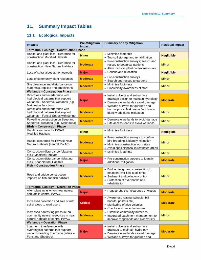
Non-Technical Summary
11. Summary Impact Tables
11.1 Ecological Impacts
Impacts Pre-Mitigation Impact
Summary of Key Mitigation Residual Impact
Terrestrial Ecology – Construction Phase Habitat and plant loss - clearance for construction: Modified Habitats Minor • Minimise footprints
• Top soil storage and rehabilitation Negligible
Habitat and plant loss - clearance for construction: Near Natural Habitats Moderate
• Pre-construction surveys; search and rescue to botanical gardens
• Alien invasive plant control measures Minor
Loss of spiral aloes at homesteads Major • Census and relocation Negligible
Loss of community plant resources Moderate • Pre-construction surveys • Search and rescue to gardens
Minor
Site clearance and disturbance on mammals, reptiles and amphibians Moderate • Minimise footprints
• Biodiversity awareness of staff Minor
Wetlands – Construction Phase Direct loss and interference with hydrological patterns that support wetlands – Sheetrock wetlands (e.g., Makhoaba Junction)
Major • Install culverts and subsurface
drainage design to maintain hydrology • Demarcate wetlands / avoid damage • Wetland surveys for quarries and
borrow pits at Makhoaba Junction to identify additional mitigation
Moderate
Direct loss and interference with hydrological patterns that support wetlands – Fens & Seeps with spring
Moderate Minor
Powerline construction on Seep and Sheetrock wetlands (e.g., Makhoaba) Moderate • Demarcate wetlands to avoid damage
• Site access roads to avoid wetlands Minor
Birds – Construction Phase Habitat clearance for PWAR: Modified Habitats Minor • Minimise footprints Negligible
Habitat clearance for PWAR: Near-Natural Habitats (central PWAC) Moderate
• Pre-construction surveys to confirm bird breeding & identify mitigation
• Minimise construction work sites • Avoid spoil disposal in restricted areas
Minor
Construction disturbance (blasting etc.): Modified Habitats Moderate • Minimise footprints Minor
Construction disturbance: (blasting etc.): Near-Natural Habitats Major • Pre-construction surveys to identify
additional mitigation Moderate
Fish – Construction Phase
Road and bridge construction impacts on fish and fish habitats Moderate
• Bridge design and construction to maintain river flow at all times
• Sediment and pollution control • Protection of river banks and
rehabilitation
Minor
Terrestrial Ecology – Operation Phase Alien plant invasion on near natural habitats in central PWAC Major • Regular checks / clearance of weeds Moderate
Increased collection and sale of wild spiral aloes to road users Critical
• Awareness raising (schools, bill boards, posters etc.)
• Monitoring of aloe colonies • Checks and law enforcement
Moderate
Increased harvesting pressure on community natural resources in near natural habitats of central PWAC
Moderate • Establish community nurseries • Integrated catchment management to
improve rangelands and biodiversity Minor
Wetlands – Operation Phase Long term interference with hydrological patterns that support wetlands leading to erosion gullies – Fens and Sheetrock
Major • Install culverts and subsurface
drainage to maintain hydrology • Demarcate wetlands / avoid damage • Wetland surveys for quarries and
Moderate
E-xxxi
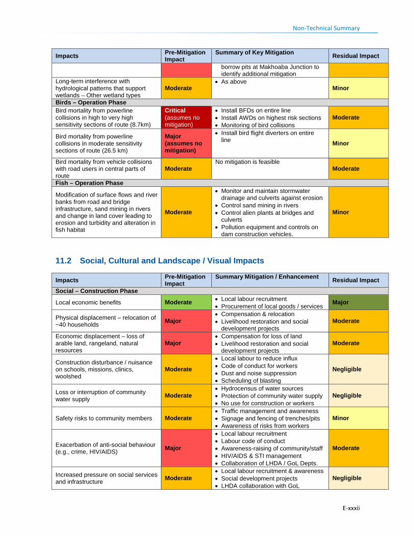
Non-Technical Summary
Impacts Pre-Mitigation Impact
Summary of Key Mitigation Residual Impact
borrow pits at Makhoaba Junction to identify additional mitigation
Long-term interference with hydrological patterns that support wetlands – Other wetland types
Moderate • As above
Minor
Birds – Operation Phase Bird mortality from powerline collisions in high to very high sensitivity sections of route (8.7km)
Critical (assumes no mitigation)
• Install BFDs on entire line • Install AWDs on highest risk sections • Monitoring of bird collisions
Moderate
Bird mortality from powerline collisions in moderate sensitivity sections of route (26.5 km)
Major (assumes no mitigation)
• Install bird flight diverters on entire line
Minor
Bird mortality from vehicle collisions with road users in central parts of route
Moderate No mitigation is feasible
Moderate
Fish – Operation Phase
Modification of surface flows and river banks from road and bridge infrastructure, sand mining in rivers and change in land cover leading to erosion and turbidity and alteration in fish habitat
Moderate
• Monitor and maintain stormwater drainage and culverts against erosion
• Control sand mining in rivers • Control alien plants at bridges and
culverts • Pollution equipment and controls on
dam construction vehicles.
Minor
11.2 Social, Cultural and Landscape / Visual Impacts
Impacts Pre-Mitigation Impact
Summary Mitigation / Enhancement Residual Impact
Social – Construction Phase
Local economic benefits Moderate • Local labour recruitment • Procurement of local goods / services
Major
Physical displacement – relocation of ~40 households Major
• Compensation & relocation • Livelihood restoration and social
development projects Moderate
Economic displacement – loss of arable land, rangeland, natural resources
Major • Compensation for loss of land • Livelihood restoration and social
development projects Moderate
Construction disturbance / nuisance on schools, missions, clinics, woolshed
Moderate
• Local labour to reduce influx • Code of conduct for workers • Dust and noise suppression • Scheduling of blasting
Negligible
Loss or interruption of community water supply Moderate
• Hydrocensus of water sources • Protection of community water supply • No use for construction or workers
Negligible
Safety risks to community members Moderate • Traffic management and awareness • Signage and fencing of trenches/pits • Awareness of risks from workers
Minor
Exacerbation of anti-social behaviour (e.g., crime, HIV/AIDS) Major
• Local labour recruitment • Labour code of conduct • Awareness-raising of community/staff • HIV/AIDS & STI management • Collaboration of LHDA / GoL Depts.
Moderate
Increased pressure on social services and infrastructure Moderate
• Local labour recruitment & awareness • Social development projects • LHDA collaboration with GoL
Negligible
E-xxxii
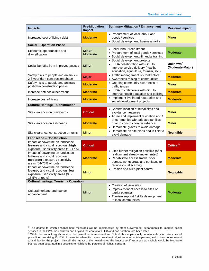
Non-Technical Summary
Impacts Pre-Mitigation Impact
Summary Mitigation / Enhancement Residual Impact
Increased cost of living / debt Moderate • Procurement of local labour and
goods / services • Social development/ business skills
Minor
Social – Operation Phase
Economic opportunities and diversification
Minor-Moderate
• Local labour recruitment • Procurement of local goods / services • Social development / financial training
Moderate
Social benefits from improved access Minor • Social development projects • LHDA collaboration with GoL to
improve service delivery (health, education, agriculture, tourism, etc.)
Unknown2 (Moderate-Major)
Safety risks to people and animals – 2-3 year dam construction phase Major • Traffic management of Contractors
• Awareness raising of communities Moderate
Safety risks to people and animals – post-dam construction phase Moderate • Ongoing community awareness of
traffic issues Minor
Increase anti-social behaviour Moderate • LHDA to collaborate with GoL to improve health education and policing Moderate
Increase cost of living Moderate • Implement livelihood restoration and social development projects Moderate
Cultural Heritage – Construction
Site clearance on graveyards Critical • Confirm location of burial sites and
avoidance measures • Agree and implement relocation and /
or ceremonies with affected families prior to construction disturbance
• Demarcate graves to avoid damage
Minor
Site clearance on ash heaps Moderate Minor
Site clearance/ construction on ruins Minor • Demarcate on site plans and in field to avoid damage Negligible
Landscape – Construction Impact of powerline on landscape features and visual receptors: high exposure / sensitivity areas (13-17%)
Critical
• Little further mitigation possible (after realignment already implemented)
• Rehabilitate access tracks, spoil dumps, works areas and cut faces to reduce visual scarring
• Erosion and alien plant control
Critical3
Impact of powerline on landscape features and visual receptors: moderate exposure / sensitivity areas (64-75% of route)
Moderate Moderate
Impact of powerline on landscape features and visual receptors: low exposure / sensitivity areas (9.5-16.5% of route)
Minor Negligible
Cultural heritage/ Tourism - Operation
Cultural heritage and tourism enhancement Minor
• Creation of view sites • Improvement of access to sites of
tourist potential • Tourism support / skills development
to local communities
Moderate
2 The degree to which enhancement measures will be implemented by other Government departments to improve social services in the PWAC is unknown and beyond the control of LHDA and has not therefore been rated. 3 While the impact significance of the powerline is assessed as Critical this applies only to relatively short stretches of powerline comprising 13-17% of the route, where it crosses prominent ridgelines or mountain passes, and it does not represent a fatal flaw for the project. Overall, the impact of the powerline on the landscape, if assessed as a whole would be Moderate but has been separated into sections to highlight the portions of highest concern.
E-xxxiii

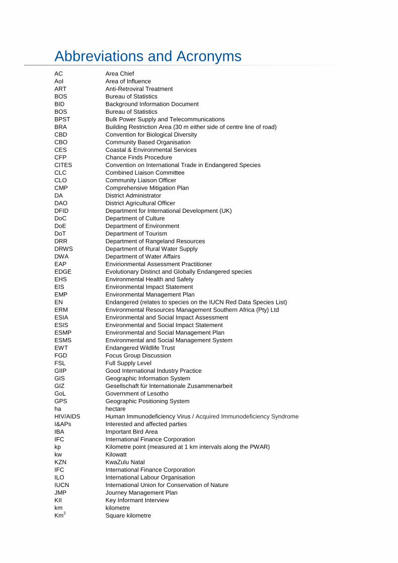
Abbreviations and Acronyms AC Area Chief AoI Area of Influence ART Anti-Retroviral Treatment BOS Bureau of Statistics BID Background Information Document BOS Bureau of Statistics BPST Bulk Power Supply and Telecommunications BRA Building Restriction Area (30 m either side of centre line of road) CBD Convention for Biological Diversity CBO Community Based Organisation CES Coastal & Environmental Services CFP Chance Finds Procedure CITES Convention on International Trade in Endangered Species CLC Combined Liaison Committee CLO Community Liaison Officer CMP Comprehensive Mitigation Plan DA District Administrator DAO District Agricultural Officer DFID Department for International Development (UK) DoC Department of Culture DoE Department of Environment DoT Department of Tourism DRR Department of Rangeland Resources DRWS Department of Rural Water Supply DWA Department of Water Affairs EAP Envirionmental Assessment Practitioner EDGE Evolutionary Distinct and Globally Endangered species EHS Environmental Health and Safety EIS Environmental Impact Statement EMP Environmental Management Plan EN Endangered (relates to species on the IUCN Red Data Species List) ERM Environmental Resources Management Southern Africa (Pty) Ltd ESIA Environmental and Social Impact Assessment ESIS Environmental and Social Impact Statement ESMP Environmental and Social Management Plan ESMS Environmental and Social Management System EWT Endangered Wildlife Trust FGD Focus Group Discussion FSL Full Supply Level GIIP Good International Industry Practice GIS Geographic Information System GIZ Gesellschaft für Internationale Zusammenarbeit GoL Government of Lesotho GPS Geographic Positioning System ha hectare HIV/AIDS Human Immunodeficiency Virus / Acquired Immunodeficiency Syndrome I&APs Interested and affected parties IBA Important Bird Area IFC International Finance Corporation kp Kilometre point (measured at 1 km intervals along the PWAR) kw Kilowatt KZN KwaZulu Natal IFC International Finance Corporation ILO International Labour Organisation IUCN International Union for Conservation of Nature JMP Journey Management Plan KII Key Informant Interview km kilometre Km2 Square kilometre
Abbreviations and Acronyms
kV kiloVolt LAA Land Administration Authority LDCs Least Developed Countries LEC Lesotho Electricity Corporation LHDA Lesotho Highlands Development Authority LHWC Lesotho Highlands Water Commission LHWP Lesotho Highlands Water Project LHWP2 Phase II of the Lesotho Highlands Water Project LIDAR Light Detection and Ranging LN Legal Notice LTDC Lesotho Tourism Development Council LVIA Landscape and Visual Impact Assessment LWSP Lesotho Water and Sanitation Policy masl Metres above sea level m amsl Metres above mean sea level MAFS Ministry of Agriculture and Food Security MAP Mean Annual Precipitation MC Municipal Council MCC Millennium Challenge Corporation MDTP Maloti Drakensberg Transfrontier Project MFRSC Ministry of Forestry, Range and Soil Conservation mm milimetre MM&A Morija Museum and Archives MEMWA Ministry of Energy, Meteorology and Water Affairs MoH Ministry of Health MoLGCA Ministry of Local Government and Chieftainship Affairs MSMEs Micro, Small and Medium Enterprises MTEC Ministry of Tourism, Environment and Culture MWGA Mohair and Wool Growers Association NAR Northern Access Road NBSAP National Biodiversity Strategic Action Plans NES National Environmental Secretariat NGO Non-Government Organisation nMAR Normal Mean Annual Runoff NSDP National Strategic Development Plan NT Near Threatened (relates to species on the IUCN Red Data Species List) NTS Non-Technical Summary OPGW Optic Power Ground Wire ORASECOM Orange-Senqu River Basin Commission OVC Orphans and Vulnerable Children PC Principal Chief PES Present Ecological State PHAP Public Health Action Plan PISA Participatory Initiative for Social Accountability PLRD Project Labour Recruitment Desk PNEAR Polihali North East Access Road PPP Public Participation Process PPC Protection & Preservation Commission PPE Personal Protective Equipment PPP Public Participation Process PRAI Polihali Reservoir and Associated Infrastructure PS Performance Standard RAP Resettlement Action Plan RD Roads Directorate RfP Request for Proposal RoD Record of Decision SABONET Southern African Biodiversity Network SADC Southern African Development Community SANBI South African National Biodiversity Institute SCP Systematic Conservation Planning SDMP Social Development Master Plan SEP Stakeholder Engagement Plan
Abbreviations and Acronyms
SMS Safety Management System STIs Sexually Transmitted Infections TB Tuberculosis TB-DOTS Tuberculosis-Directly Observed Treatment Shots TDS Total dissolved solids TLB Tractor – Loader- Backhoe ToR Terms of Reference TRA Travel Risk Assessment UNCCD United Nations Convention to Combat Desertification UNESCO United Nations Educational, Scientific and Cultural Organisation UNFCCC United Nations Framework Convention on Climate Change USDA United States Department of Agriculture VHW Village Health Worker VIP Ventilated Improved Pit VU Vulnerable (relates to species on the IUCN Red Data Species List) WASA Water and Sewage Authority WCS Wetland Consulting Services WGS84 World Geodetic System developed in 1984 and updated in 2004. It is an Earth-
centred, Earth-fixed terrestrial reference system and geodetic datum. WGS84 is based on a consistent set of constants and model parameters that describe the Earth's size, shape, and gravity and geomagnetic fields.
WFP World Food Programme ZVI Zone of Visual Influence

Glossary of Terms Technical Term Definition Area of Influence The Area of Influence (AoI) is the area likely to be directly and indirectly affected by
the project, including all its ancillary aspects, such as access roads, quarries and borrow pits, and construction camps, as well as unplanned developments induced by the project (e.g., areas subject to induced population influx or shifting agriculture or settlement along access roads). The Area of Influence (AoI) may be defined differently for various aspects of the ecological or social environment depending on the nature of the activitiy and is effect on a receptor or resource. Collectively the AoI for different aspects comprises the Project Area, which is typically a larger area that encompasses the majority of impacts.
Biodiversity The variability among living organisms from all sources including, inter alia, terrestrial, marine and other aquatic ecosystems and the ecological complexes of which they are part; this includes diversity within species, between species, and of ecosystems.
Biodiversity Offset Biodiversity offsets are measurable conservation outcomes resulting from actions designed to compensate for significant residual adverse biodiversity impacts arising from development plans or projects after appropriate prevention and mitigation measures have been taken.
Community engagement
Part of the Social and Environmental Assessment, community engagement is an ongoing process involving disclosure of information, consultation with affected communities, and the establishment of a grievance mechanism.
Compensation Payment in cash or in kind for an asset or a resource that is acquired or affected by LHWP Phase II activities.
Consultation Consultation involves interactive communication between the client and the affected communities. The consultation process should be undertaken in a manner that is inclusive and culturally appropriate and that provides the affected communities with opportunities to express their views on project risks, impacts and mitigation measures, and allows the client to consider and respond to them. The consultation process will ensure free, prior and informed consultation.
Critical Habitat Areas with high biodiversity value, including (i) habitat of significant importance to Critically Endangered (CR) and/or Endangered (EN) species; (ii) habitat of significant importance to endemic and / or restricted-range species; (iii) habitat supporting globally significant concentrations of migratory species and/or congregatory species; (iv) highly threatened and / or unique ecosystems; and/or (v) areas associated with key evolutionary processes (see IFC PS6, Paragraph 16).
Critically Endangered A taxon is Critically Endangered (CR) when it is facing an extremely high risk of extinction in the wild in the immediate future, as defined by IUCN criteria (www.iucnredlist.org)
Economic displacement
Loss of income streams or means of livelihood resulting from land acquisition or obstructed access to resources (land, water, or forest) due to the construction and operation of LHWP Phase II.
Ecoregion An ecoregion is defined as a "relatively large unit of land or water containing a characteristic set of natural communities that share a large majority of their species, dynamics, and environmental conditions.
Ecosystem Services Defined as the benefits that people obtain from nature. These are typically divided into four categories. • Provisioning services are the goods or products obtained from ecosystems, such
as food, timber, medicines, fibre, and freshwater. • Regulating services are the benefits obtained from an ecosystem’s control of
natural processes, such as climate, disease, erosion, water flows, and pollination, as well as protection from natural hazards.
• Cultural services are the nonmaterial benefits obtained from ecosystems, such as recreation, spiritual values, and aesthetic enjoyment.
• Supporting services are the natural processes that maintain the other ecosystem services, such as nutrient cycling and primary production.
Ecological Importance and Sensitivity (EIS)
With reference to wetlands, the EIS of a wetland provides an indication of how important the wetland is in terms of certain ecological criteria. It also provides an indication of the sensitivity of the wetland to impacts such as changes in flow for
Glossary of Terms
example. It is determined based on a qualitative assessment and scoring of the ecological criteria. As with Importance and Sensitivity, it is also indicated as Very High, High, Moderate or Low/Marginal.
Endangered A taxon is Endangered (EN) when it is not Critically Endangered but is facing a very high risk of extinction in the wild in the near future, as defined by the IUCN criteria (www.iucnredlist.org) or provisionally assessed by expert group.
Endemic A species that has ≥ 95% of its global range inside the country or region of analysis (IFC PS6 GN79).
Fen Being a type of mire, fens are open ended wetland systems (having surface water and groundwater inputs and outputs) that contain peat. In the Highlands of Lesotho characteristic features of the fens are the lawns (meadows) of sedges and grasses, scattered pools and hollows, hummocks and meandering stream channels. In the alpine areas of Lesotho fens generally do not occur below an altitude of approximately 2750 mamsl, although exceptions do occur. They are also usually dominated by minerals from surrounding soils (Moore and Bellamy, 1974; Mitsch and Gosselink, 1986).
Fossorial Animal that digs burrows Flashover Abnormal electrical discharge that can result when bird excretion short circuits the
insulator strings or jumper clearances. Habitat The environmental or ecological area in which an animal, plant species or other
organism lives. Household A group of persons with one family head bound by blood, marital or legal relationship
living together in a dwelling (home or homestead). Humic soil For a soil to be classified as a humic soil according to Soil Classification: A
Taxonomic System for South Africa (1991), the soil must contain 1.8 % or more organic carbon in a soil sample taken between the depths of 250 mm and 450 mm.
Humification Scale As applied to peat, the humification scale is a representation or indicator of the degree of decomposition of peat (organic material). As applied in this study, the method involved the visual evaluation of freshly extracted peat based on the 10-point von Post humification scale (von Post and Granlund, 1926). This in-situ method gives a rapid description of the peat stratigraphy (analytical order, position and structure of the peat) along a peat profile or core.
Hydrogeomorphic A combination of hydrology (i.e., the nature of movement of water) and geomorphology (i.e., landform characteristics and processes) (Ollis et al., 2013).
Importance and Sensitivity (IS)
With reference to wetlands, the IS of a wetland provides an indication of how important the wetland is in terms of certain ecological, hydrological and human benefit criteria. It also provides an indication of the sensitivity of the wetland to impacts such as changes in flow for example. It is determined based on a qualitative assessment and scoring of the Ecological Importance and Sensitivity, Hydro-functional Importance, and Direct Human Benefit Importance of the system. The assessment of each of the above is based on certain criteria and the IS is derived from the highest score of the three, indicated as Very High, High, Moderate or Low/Marginal.
Invasive Aliens Species are identified as invasive aliens when (i) they are non-native to an ecosystem, and (ii) their introduction is liable to cause environmental harm, or harm to human health and livelihoods, because they spread rapidly and have negative effects on native species through competition, predation, or disease. Invasive species can be flora, fauna, or other organisms (e.g., microbes) but generally refer to plants.
IUCN Red List This list has been developed by the International Union for Conservation of Nature (IUCN) and the details the global conservation status of a wide range of biological species. The Red List website is http:/www.redlist.org.
Key Observation Point Receptors refer to the people located in the most critical locations, or key observation points, surrounding the landscape modification, who make consistent use of the views associated with the site where the landscape modifications are proposed. KOPs can either be a single point of view that an observer/evaluator uses to rate an area or panorama, or a linear view along a roadway, trail, or river corridor.
Livelihood Comprises the capabilities, assets (including both material and social resources) and activities required for a means of living. A livelihood is sustainable when it can cope with and recover from stresses and shocks, and maintain its capabilities and assets both now and in the future, while not undermining the natural resource base.
Glossary of Terms
Livelihood restoration The measures that are required to mitigate the negative impacts on households that will be economically and physically displaced by LHWP Phase II, through loss of shelter and assets, and loss of access to resources, markets and services that support livelihoods. These measures are in addition to compensation, since compensation alone does not guarantee the restoration of livelihoods.
Local communities Community within the Project's Area of Influence.
Peat Fibrous organic material composed of well-preserved plant remains that are readily identifiable, generally occurring in low energy, permanently saturated conditions in wetlands.
Physical displacement Relocation as a result of loss of or damage to homes / shelter. Present Ecological State (PES)
With reference to wetlands, PES is the current state, condition or health of a wetland system determined relative to its pristine or natural state. It usually involves a qualitative assessment of the changes to wetland hydrology, water quality, geomorphology, vegetation and fauna using indicators of such change based on certain criteria. It is indicated in categories ranging from A to F representing Natural or Pristine to Critically Modified, respectively.
Project Area The Area of Influence within which the majority of impacts of the project are likely to occur.
Mire A fresh water wetland which develop in areas where precipitation exceeds potential evapotranspiration and where the drainage of surface water is restricted, creating a net water surplus (Mitsch and Gosselink, 1986). Mires are also commonly called peatlands because the conditions under which they develop often results in the formation of organic or peat soil.
Modified Habitat An area that may contain a large proportion of plant and/or animal species of non-native origin, and / or where human activity has substantially modified the primary ecological functions and species composition.
Modified Habitat An area that may contain a large proportion of plant and/or animal species of non-native origin, and / or where human activity has substantially modified the primary ecological functions and species composition.
Natural Habitat An area composed of viable assemblages of plant and/or animal species of largely native origin, and/or where human activity has not essentially modified an area’s primary functions and species composition.
Net Gain Net gains are additional conservation outcomes that can be achieved for the biodiversity values for which the critical habitat was designated. Net gains may be achieved through the development of a biodiversity offset and/or, in instances where the client could meet the requirements of paragraph 17 of this Performance Standard without a biodiversity offset, the client should achieve net gains through the implementation of programs that could be implemented in situ (on-the-ground) to enhance habitat, and protect and conserve biodiversity (IFC, 2012b).
No Net Loss No net loss the point at which project-related impacts on biodiversity are balanced by measures taken to avoid and minimise the project’s impacts, to undertake on-site restoration and finally to offset significant residual impacts, if any, on an appropriate geographic scale (e.g., local, landscape-level, national, regional) (IFC,2012b).
Offset Biodiversity offsets are measurable conservation outcomes resulting from actions designed to compensate for significant residual adverse biodiversity impacts arising from project development and persisting after appropriate avoidance, minimisation and restoration measures have been taken.
Receptor Humans or other animals which can be impacted by Project activities. Resettlement Action Plan
The document in which a project sponsor or the responsible entity specifies the procedures that it will follow and the actions that it will take to mitigate adverse effects, compensate losses, and provide development benefits to persons and communities affected by an investment project.
Resource An element of the physical, biological, cultural or human environment which is not a human or other animal (these are referred to as receptors) which can be impacted by Project activities. Typical resources include: • In the physical environment: geological resources, sediments, land, water
quality, water supply, air quality, noise level, vibration levels, light • In the biological environment: terrestrial, freshwater and marine habitats; flora;
biodiversity at the community, species and generic levels; protected areas; ecosystem services;
• In the human or cultural environment: subsistence resources; community health,
Glossary of Terms
welfare, amenity and safety; employment and incomes; business and economic activity; land use; traffic; sites and features of archaeological, historic, traditional, cultural or aesthetic interest. These may also be referred to as livelihood assets.
Restricted Range Restricted range species include those with ranges in the following criteria: endemic to a site or found globally at fewer than 10 sites; animal species having a distribution range less than 50 000 km2; or bird species with a global breeding range less than 50 000 km2 (IFC PS6, 2012).
Scenic corridor A linear geographic area that contains scenic resources, usually, but not necessarily, defined by a route.
Sense of place The unique quality or character of a place, whether natural, rural or urban. Seep Wetland A wetland area located on gently to steeply sloping land and dominated by colluvium
(i.e., gravity-driven), unidirectional movement of water and material downslope (Ollis et al., 2013).
Set aside Set-asides are land areas within the project site, or areas over which the client has management control, that are excluded from development and are targeted for the implementation of conservation enhancement measures. Set-asides will likely contain significant biodiversity values and/or provide ecosystem services of significance at the local, national and/or regional level. Set-asides should be defined using internationally recognised approaches or methodologies (e.g., High Conservation Value, systematic conservation planning) (IFC, 2012b).
Sheetrock Wetland A wetland area located on gently to steeply sloping land dominated by shallow organic soils overlying relatively flat exposed sheetrock which may form shallow pools. These systems can be rain fed or seepage driven. There is generally a unidirectional movement of water and material downslope in these systems but in many cases relatively flat shallow pools can temporarily store water.
Social development Initiatives to ensure that communities in the Project Area become beneficiaries of the development. It refers to a more open-ended programme of interventions aimed at contributing to social and economic development of Project affected communities. The scope of these interventions typically extends beyond directly affected (physically and economically displaced) households and villages to include other members of the Project Area.
Social impacts Includes impacts associated with the following: • Settlements, dispersed villages, solitary dwellings and mobile / semi-mobile
groups (including temporary and permanent human residents with both formal and informal tenure of land/structures);
• Population dynamics including population size, structure, settlement pattern and migration;
• Tangible and intangible cultural heritage sites and items, including archaeological heritage;
• Ecosystem services, including provisioning services, regulating services, supporting services and cultural services used by human receptors;
• Social infrastructure including both tangible (i.e., schools, community centres, electricity and potable water services) and intangible items (i.e., meeting places, shaded areas);
• Individual and communally owned assets (i.e., farm animals and/or grazing land); • Livelihood sources; including formal and informal activities; • Community groups including civil society groups; • Gender; • Human rights; and • Community health, safety and security (including wellbeing).
Spring An area where groundwater emerges at the surface, usually providing a source of permanent surface water which may or may not be flowing.
Stakeholders Any and all individuals, groups, organisations and institutions interested in and potentially affected by LHWP Phase II or having the ability to influence the Project.
Stringset This is the assembled components attaching the conductor, earth wire and OPGW to the structure. It includes hardware fittings and insulators.
Supercritical (flow) Supercritical flow can also be termed as rapid or fast flow. It is the flow at which depth of the channel is less than critical depth, velocity of flow is greater than critical velocity and slope of the channel is also greater than the critical slope. The opposite of supercritical flow is subcritical flow, where flow has low flow velocity and depth that
Glossary of Terms
is deeper than critical depth. Tensioner A machine designed to resist draw tension (brake), tension induced by the winch.
This is to ensure that phase conductor is not in contact with the ground or other stationary objects while stringing is in progress.
Toolbox Talk A daily short discussion of a supervisor to convey safety or environmental related issues, work methods etc. surrounding a specific procedure or task to be done.
Threatened A taxon is Vulnerable (VU) when it is not Critically Endangered (CR) or Endangered (EN) but is facing a high risk of extinction in the wild in the medium-term future, as defined by the IUCN criteria (www.iucnredlist.org).
Valley Bottom Wetland A mostly flat wetland area located along a valley floor, often connected to an upstream or adjoining river channel (Ollis et al., 2013).
Viewshed The outer boundary defining a view catchment area, usually along crests and ridgelines. Similar to a watershed. This reflects the area, or the extent thereof, where the landscape modification would probably be seen.
Vulnerable groups People who by virtue of age, physical or mental disability, gender, economic disadvantage, or social status may be more adversely affected by resettlement than others and who may be limited in their ability to adapt to the change, claim compensation, or take advantage of resettlement assistance and related development benefits.
Wetland The National Water Act 36 of 1998 provides the legal wetland definition used in South Africa: “land which is transitional between terrestrial and aquatic systems where the water table is usually at or near the surface, or the land is periodically covered with shallow water, and which land in normal circumstances supports or would support vegetation typically adapted to life in saturated soil.”
Zone of Visual Influence
The ZVI is defined as ‘the area within which a proposed development may have an influence or effect on visual amenity.’

Table of Contents Section 1 Introduction .............................................................................................. 1-1
1.1 Introduction and Background 1-1 1.1.1 Lesotho Highlands Water Project Phase II 1-1 1.1.2 Project Overview 1-2 1.1.3 Other Project Components 1-2 1.1.4 Project Area 1-3 1.1.5 Other LHWP Phase II Contracts Relevant to the PWAR and BPST 1-8 1.1.6 Scope and Objectives 1-8 1.1.7 Consultant Team 1-9 1.1.8 The Applicant 1-12
Section 2 Approach and Methodology .................................................................... 2-1 2.1 Overview of ESIA 2-1 2.2 ESIA Process 2-1
2.2.1 Lesotho’s EIA Requirements 2-1 2.2.2 Stakeholder Engagement Requirements of the EIA Guidelines 2-2
2.3 Specialist Studies 2-5 2.3.1 Introduction 2-5 2.3.2 Data Sources 2-6
2.4 Assumptions, Limitations and Exclusions 2-7 Section 3 Administrative and Legal Framework ..................................................... 3-1
3.1 Institutional Structures 3-1 3.1.1 Central Government 3-1 3.1.2 Local Government 3-2 3.1.3 Traditional Governance 3-3 3.1.4 National Authorities 3-4
3.2 Legislation, Policies and Plans 3-5 3.2.1 Lesotho Legislation, Policies and Plans Relevant to Environmental Protection 3-5 3.2.2 Protected Species 3-14 3.2.3 LHWP Treaty and LHDA Policies and Guidelines 3-16
3.3 Permit Requirements 3-21 3.4 Relevant Initiatives 3-21 3.5 International Conventions 3-22 3.6 International Standards 3-24
3.6.1 World Bank ESS and IFC PS 3-24 3.6.2 Voluntary Principles on Security and Human Rights 3-28
Section 4 Project Description .................................................................................. 4-1 4.1 Introduction 4-1 4.2 Motivation for the Project 4-2
i
Table of Contents
4.3 Summary of Overall Project Components and Activities Included and Excluded from this ESIA 4-2 4.4 Polihali Western Access Road 4-5
4.4.1 Proposed PWAR Route 4-5 4.4.2 PWAR Design Specifications 4-10 4.4.3 Ongoing Detailed Design Studies and Work 4-36
4.5 Bulk Power Supply and Telecommunications 4-37 4.5.1 Overview 4-37 4.5.2 132kV Powerline and Telecommunications Route 4-38 4.5.3 Design Specifications 4-51 4.5.4 Substation Upgrades 4-58 4.5.5 Ongoing Detailed Design Studies and Work 4-60
4.6 Construction Timing 4-60 4.7 Construction Support Requirements 4-62
4.7.1 PWAR / BPST Construction Camps 4-62 4.7.2 Support Services for Construction (Water, Electricity and Waste) 4-63
4.8 Rehabilitation of Works Areas 4-65 4.9 Recruitment 4-66
4.9.1 Introduction 4-66 4.9.2 Labour Requirements 4-66 4.9.3 Labour Recruitment Desk 4-66 4.9.4 LHDA Responsibilities for Recruitment 4-66 4.9.5 Contractor Responsibilities for Recruitment 4-67 4.9.6 Rotation of Unskilled Labour 4-67 4.9.7 Working Hours 4-67 4.9.8 Training and Skills Enhancement 4-67
4.10 Procurement 4-68 4.11 Land Acquisition and Resettlement and Compensation 4-68
Section 5 Analysis of Alternatives .......................................................................... 5-1 5.1 Introduction 5-1 5.2 Substantive Transport Route Options 5-1 5.3 PWAR Route Options 5-3
5.3.1 Background and Purpose 5-3 5.3.2 Alignment of PWAR Options A-D 5-4 5.3.3 Findings of Barry and Partners and SMEC 5-6 5.3.4 Route Selection Study for the ESIS 5-6
5.4 Realignments of PWAR and BPST Routes 5-10 5.4.1 Introduction 5-10 5.4.2 PWAR Realignments 5-12 5.4.3 132kV Powerline Realignments 5-16
ii
Table of Contents
Section 6 Baseline Environment ............................................................................. 6-1 6.1 Area of Influence 6-1 6.2 Physical Environment 6-2
6.2.1 Terrain 6-2 6.2.2 Geology and Soils 6-4 6.2.3 Land Use and Land Capability 6-5 6.2.4 Climate 6-8 6.2.5 Hydrology (Main Rivers and streams) 6-9
6.3 Biological Environment 6-10 6.3.1 Vegetation 6-11 6.3.2 Mammals 6-23 6.3.3 Herpetofauna 6-24 6.3.4 Birds 6-26 6.3.5 Wetlands 6-33 6.3.6 Threats to Biodiversity and Ecological Systems 6-45
6.4 Habitat Status Assessment 6-47 6.4.1 Assessment of Habitat Status in the PWAC 6-47 6.4.2 Designation of Critical Habitat 6-51
6.5 Socio-Economic Environment 6-56 6.5.1 Demography, Religion, Migration, Socio-Cultural Profile 6-56 6.5.2 Land Use, Settlement and Land Use 6-59 6.5.3 Agriculture 6-61 6.5.4 Employment and Household Income Sources 6-63 6.5.5 Natural Resource Use 6-64 6.5.6 Health and Healthcare 6-66 6.5.7 Education and Schooling 6-68 6.5.8 Access to Services 6-69 6.5.9 Cultural Heritage 6-72 6.5.10 Visual / Landscape 6-77
6.6 Ecosystem Services 6-79 6.6.1 Introduction 6-79 6.6.2 Provisioning Ecosystem Services 6-80 6.6.3 Habitats and Ecosystem Services 6-83 6.6.4 Ecosystem Service Dependencies in the PWAC Project 6-86
Section 7 Stakeholder Engagement ........................................................................ 7-1 7.1 Objectives 7-1 7.2 Approach and Methods 7-1
7.2.1 Consultation Context 7-1 7.3 Consultation Methods and Activities 7-3
7.3.1 Phase 1: Inception / Route Selection 7-3
iii
Table of Contents
7.3.2 Phase II: Sensitisation of Government, Community Councils and Chiefs 7-8 7.3.3 Phase 3: Community Engagement 7-10 7.3.4 Phase 4: Disclosure of ESIS for Stakeholder Review 7-17 7.3.5 Phase 5: Disclosure of ROD to Stakeholders 7-17 7.3.6 Alignment of Stakeholder Engagement with International Good Practice 7-17
7.4 Sensitisation Issues 7-20 7.4.1 District and Traditional Authorities 7-20 7.4.2 National Authorities 7-20
7.5 Summary of Community and Key Informant Issues 7-25 7.5.1 Community Issues 7-25 7.5.2 Key Informant Issues by Sector 7-34
Section 8 Overview and Screening of Potential Impacts ....................................... 8-1 8.1 Construction Phase 8-1 8.2 Operation Phase 8-3 8.3 Screened Out Impacts 8-5
Section 9 Impact Assessment Methodology .......................................................... 9-1 9.1 Introduction 9-1
9.1.1 Impact Prediction 9-1 9.1.2 Evaluating Significance 9-4 9.1.3 Mitigation of Impacts 9-5 9.1.4 Dealing with Uncertainty 9-6 9.1.5 Cumulative Impacts 9-6 9.1.6 Management and Monitoring 9-6
Section 10 Social and Health Impacts ..................................................................... 10-1 10.1 Overview and Context 10-1
10.1.1 Community Expectations of the Project LHDA and Other Authorities 10-1 10.1.2 Construction Phase: Local Economic Benefits 10-4 10.1.3 Construction Phase: Physical Displacement and Resettlement 10-9 10.1.4 Construction Phase: Economic Displacement and Livelihoods 10-18 10.1.5 Construction Phase: Disturbance from Increased Nuisance Factors during PWAR and
BPST Construction 10-22 10.1.6 Construction Phase: Loss/Disruption or Pollution of Community Water Supply 10-26 10.1.7 Construction Phase: Increased Safety Risks to People and Animals 10-28 10.1.8 Construction Phase: Exacerbation of Anti-Social Behaviour 10-30 10.1.9 Construction Phase: Increased Pressure on Social Infrastructure and Services 10-33 10.1.10 Construction Phase: Increased Cost of Living and Debt Generation 10-35 10.1.11 Construction Phase: Loss/ Displacement of Farming Expertise 10-37
10.2 Operation Phase 10-38 10.2.1 Overview 10-38 10.2.2 Operation Phase: Economic Opportunities and Diversification 10-38
iv
Table of Contents
10.2.3 Operation Phase: Social Benefits Resulting from Improved Access 10-40 10.2.4 Operation Phase: Safety Risks to People and Animals 10-42 10.2.5 Operation Phase: Increase in Anti-Social Behaviour 10-44 10.2.6 Operation Phase: Increased Cost of Living 10-45
10.3 Summary of Social and Health Impacts 10-47 Section 11 Cultural Heritage & Landscape / Visual Impacts ................................. 11-1
11.1 Overview 11-1 11.2 Construction Phase Impacts 11-1
11.2.1 Construction Phase: Impact of Site Clearance and Construction on Graveyards, Cemeteries and Ash Heaps 11-1
11.2.2 Construction Phase: Impact of Site Clearance and Construction on Ruins 11-5 11.2.3 Construction & Operation Phase: Impact of the Powerline on Landscape Resources11-6 11.2.4 Construction & Operation Phase: Impact of the Powerline on Visual Resources 11-9
11.3 Operation Phase Impacts 11-14 11.3.1 Operation Phase: Potential to Enhance the Value of Cultural Heritage Resources 11-14
Section 12 Ecological Impacts ................................................................................ 12-1 12.1 Terrestrial Ecology 12-1
12.1.1 Construction Phase: Impact of Site Clearance and Cut and Fill on Vegetation and Flora12-1
12.1.2 Construction Phase: Destruction of Planted Spiral Aloes in Villages during Road Construction 12-3
12.1.3 Construction Phase: Impact of Site Clearance on Other Plants Used by Communities12-4 12.1.4 Construction Phase: Impact of Site Clearance and Blasting on Mammals and
Herpetofauna 12-6 12.1.5 Operation Phase: Increased Spread of Alien Invasive Plants 12-7 12.1.6 Operation Phase: Increased Collection and Sale of Wild Populations of Spiral Aloe 12-8 12.1.7 Operation Phase: Impact of Increased Access to Natural Resources 12-9
12.2 Wetlands 12-11 12.2.1 Construction Phase: Impacts of Site Clearance and Construction of the Road and
Powerline on Wetlands 12-11 12.2.2 Operation Phase: Impacts of Road and Powerline Maintenance on Wetlands 12-29
12.3 Birds 12-33 12.3.1 Overview 12-33 12.3.2 Construction Phase: Impact of Powerline Construction and Substation Expansion on Birds
12-34 12.3.3 Construction Phase: Impact of Road Construction on Birds 12-37 12.3.4 Operation Phase: Impact of Powerline Collisions on Birds 12-40 12.3.5 Operation Phase: Impact of Road Use and Polihali Dam & Tunnel Construction Traffic on
Birds 12-44 12.4 Fish 12-46
12.4.1 Construction Phase: Impact of the PWAR and related Infrastructure on Fish and Fish Habitats 12-46
v
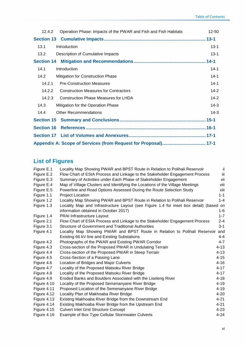
Table of Contents
12.4.2 Operation Phase: Impacts of the PWAR and Fish and Fish Habitats 12-50 Section 13 Cumulative Impacts ............................................................................... 13-1
13.1 Introduction 13-1 13.2 Description of Cumulative Impacts 13-1
Section 14 Mitigation and Recommendations ........................................................ 14-1 14.1 Introduction 14-1 14.2 Mitigation for Construction Phase 14-1
14.2.1 Pre-Construction Measures 14-1 14.2.2 Construction Measures for Contractors 14-2 14.2.3 Construction Phase Measures for LHDA 14-2
14.3 Mitigation for the Operation Phase 14-3 14.4 Other Recommendations 14-3
Section 15 Summary and Conclusions ................................................................... 15-1
Section 16 References ............................................................................................. 16-1
Section 17 List of Volumes and Annexures ............................................................ 17-1
Appendix A: Scope of Services (from Request for Proposal).................................. 17-1
List of Figures Figure E.1 Locality Map Showing PWAR and BPST Route in Relation to Polihali Reservoir ii Figure E.2 Flow Chart of ESIA Process and Linkage to the Stakeholder Engagement Process iii Figure E.3 Summary of Activities under Each Phase of Stakeholder Engagement vii Figure E.4 Map of Village Clusters and Identifying the Locations of the Village Meetings viii Figure E.5 Powerline and Road Options Assessed During the Route Selection Study xiii Figure 1.1 Project Location 1-1 Figure 1.2 Locality Map Showing PWAR and BPST Route in Relation to Polihali Reservoir 1-4 Figure 1.3 Locality Map and Infrastructure Layout (see Figure 1.4 for inset box detail) (based on
information obtained in October 2017) 1-6 Figure 1.4 PRAI Infrastructure Layout 1-7 Figure 2.1 Flow Chart of ESIA Process and Linkage to the Stakeholder Engagement Process 2-4 Figure 3.1 Structure of Government and Traditional Authorities 3-1 Figure 4.1 Locality Map Showing PWAR and BPST Route in Relation to Polihali Reservoir and
Existing 66 kV line and Existing Substations 4-4 Figure 4.2 Photographs of the PWAR and Existing PWAR Corridor 4-7 Figure 4.3 Cross-section of the Proposed PWAR in Undulating Terrain 4-13 Figure 4.4 Cross-section of the Proposed PWAR in Steep Terrain 4-13 Figure 4.5 Cross-Section of a Passing Lane 4-15 Figure 4.6 Location of Bridges and Major Culverts 4-16 Figure 4.7 Locality of the Proposed Matsoku River Bridge 4-17 Figure 4.8 Locality of the Proposed Matsoku River Bridge 4-17 Figure 4.9 Eroded Banks and Boulders Associated with the Liseleng River 4-18 Figure 4.10 Locality of the Proposed Semenanyane River Bridge 4-19 Figure 4.11 Proposed Location of the Semenanyane River Bridge 4-19 Figure 4.12 Locality Plan of Makhoaba River Bridge 4-20 Figure 4.13 Existing Makhoaba River Bridge from the Downstream End 4-21 Figure 4.14 Existing Makhoaba River Bridge from the Upstream End 4-21 Figure 4.15 Culvert Inlet Grid Structure Concept 4-23 Figure 4.16 Example of Box Type Cellular Stormwater Culverts 4-24
vi
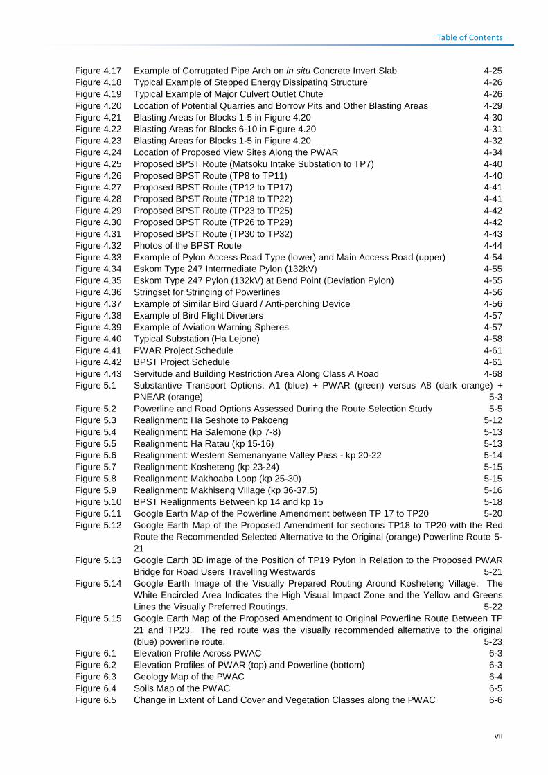
Table of Contents
Figure 4.17 Example of Corrugated Pipe Arch on in situ Concrete Invert Slab 4-25 Figure 4.18 Typical Example of Stepped Energy Dissipating Structure 4-26 Figure 4.19 Typical Example of Major Culvert Outlet Chute 4-26 Figure 4.20 Location of Potential Quarries and Borrow Pits and Other Blasting Areas 4-29 Figure 4.21 Blasting Areas for Blocks 1-5 in Figure 4.20 4-30 Figure 4.22 Blasting Areas for Blocks 6-10 in Figure 4.20 4-31 Figure 4.23 Blasting Areas for Blocks 1-5 in Figure 4.20 4-32 Figure 4.24 Location of Proposed View Sites Along the PWAR 4-34 Figure 4.25 Proposed BPST Route (Matsoku Intake Substation to TP7) 4-40 Figure 4.26 Proposed BPST Route (TP8 to TP11) 4-40 Figure 4.27 Proposed BPST Route (TP12 to TP17) 4-41 Figure 4.28 Proposed BPST Route (TP18 to TP22) 4-41 Figure 4.29 Proposed BPST Route (TP23 to TP25) 4-42 Figure 4.30 Proposed BPST Route (TP26 to TP29) 4-42 Figure 4.31 Proposed BPST Route (TP30 to TP32) 4-43 Figure 4.32 Photos of the BPST Route 4-44 Figure 4.33 Example of Pylon Access Road Type (lower) and Main Access Road (upper) 4-54 Figure 4.34 Eskom Type 247 Intermediate Pylon (132kV) 4-55 Figure 4.35 Eskom Type 247 Pylon (132kV) at Bend Point (Deviation Pylon) 4-55 Figure 4.36 Stringset for Stringing of Powerlines 4-56 Figure 4.37 Example of Similar Bird Guard / Anti-perching Device 4-56 Figure 4.38 Example of Bird Flight Diverters 4-57 Figure 4.39 Example of Aviation Warning Spheres 4-57 Figure 4.40 Typical Substation (Ha Lejone) 4-58 Figure 4.41 PWAR Project Schedule 4-61 Figure 4.42 BPST Project Schedule 4-61 Figure 4.43 Servitude and Building Restriction Area Along Class A Road 4-68 Figure 5.1 Substantive Transport Options: A1 (blue) + PWAR (green) versus A8 (dark orange) +
PNEAR (orange) 5-3 Figure 5.2 Powerline and Road Options Assessed During the Route Selection Study 5-5 Figure 5.3 Realignment: Ha Seshote to Pakoeng 5-12 Figure 5.4 Realignment: Ha Salemone (kp 7-8) 5-13 Figure 5.5 Realignment: Ha Ratau (kp 15-16) 5-13 Figure 5.6 Realignment: Western Semenanyane Valley Pass - kp 20-22 5-14 Figure 5.7 Realignment: Kosheteng (kp 23-24) 5-15 Figure 5.8 Realignment: Makhoaba Loop (kp 25-30) 5-15 Figure 5.9 Realignment: Makhiseng Village (kp 36-37.5) 5-16 Figure 5.10 BPST Realignments Between kp 14 and kp 15 5-18 Figure 5.11 Google Earth Map of the Powerline Amendment between TP 17 to TP20 5-20 Figure 5.12 Google Earth Map of the Proposed Amendment for sections TP18 to TP20 with the Red
Route the Recommended Selected Alternative to the Original (orange) Powerline Route 5-21
Figure 5.13 Google Earth 3D image of the Position of TP19 Pylon in Relation to the Proposed PWAR Bridge for Road Users Travelling Westwards 5-21
Figure 5.14 Google Earth Image of the Visually Prepared Routing Around Kosheteng Village. The White Encircled Area Indicates the High Visual Impact Zone and the Yellow and Greens Lines the Visually Preferred Routings. 5-22
Figure 5.15 Google Earth Map of the Proposed Amendment to Original Powerline Route Between TP 21 and TP23. The red route was the visually recommended alternative to the original (blue) powerline route. 5-23
Figure 6.1 Elevation Profile Across PWAC 6-3 Figure 6.2 Elevation Profiles of PWAR (top) and Powerline (bottom) 6-3 Figure 6.3 Geology Map of the PWAC 6-4 Figure 6.4 Soils Map of the PWAC 6-5 Figure 6.5 Change in Extent of Land Cover and Vegetation Classes along the PWAC 6-6
vii
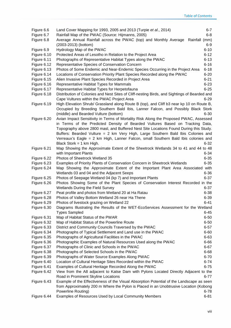
Table of Contents
Figure 6.6 Land Cover Mapping for 1993, 2005 and 2013 (Turpie et al., 2014) 6-7 Figure 6.7 Rainfall Map of the PWAC (Source: Hijmanns, 2005) 6-8 Figure 6.8 Average Annual Rainfall across the PWAC (top) and Monthly Average Rainfall (mm)
(2003-2013) (bottom) 6-9 Figure 6.9 Hydrology Map of the PWAC 6-10 Figure 6.10 Protected Areas of Lesotho in Relation to the Project Area 6-12 Figure 6.11 Photographs of Representative Habitat Types along the PWAC 6-13 Figure 6.12 Representative Species of Conservation Concern 6-16 Figure 6.13 Photos of Some Endemic and Near-Endemic Species Occurring in the Project Area 6-18 Figure 6.14 Locations of Conservation Priority Plant Species Recorded along the PWAC 6-20 Figure 6.15 Alien Invasive Plant Species Recorded in Project Area 6-21 Figure 6.16 Representative Habitat Types for Mammals 6-23 Figure 6.17 Representative Habitat Types for Herpetofauna 6-25 Figure 6.18 Distribution of Colonies and Nest Sites of Cliff-nesting Birds, and Sightings of Bearded and
Cape Vultures within the PWAC Project Area 6-29 Figure 6.19 High Elevation Shrub/ Grassland along Route B (top), and Cliff b3 near kp 10 on Route B,
Occupied by Breeding Southern Bald Ibis, Lanner Falcon, and Possibly Black Stork (middle) and Bearded Vulture (bottom) 6-30
Figure 6.20 Avian Impact Sensitivity in Terms of Mortality Risk Along the Proposed PWAC, Assessed in Terms of the Predicted Density of Bearded Vultures Based on Tracking Data, Topography above 2800 masl, and Buffered Nest Site Locations Found During this Study. Buffers: Bearded Vulture = 2 km Very High, Large Southern Bald Ibis Colonies and Verreaux’s Eagle = 2 km High, Lanner Falcon, small Southern Bald Ibis colonies and Black Stork = 1 km High. 6-32
Figure 6.21 Map Showing the Approximate Extent of the Sheetrock Wetlands 34 to 41 and 44 to 48 with Important Plants 6-34
Figure 6.22 Photos of Sheetrock Wetland 35 6-35 Figure 6.23 Examples of Priority Plants of Conservation Concern in Sheetrock Wetlands 6-35 Figure 6.24 Map Showing the Approximate Extent of the Important Plant Area Associated with
Wetlands 03 and 04 and the Adjacent Seeps 6-36 Figure 6.25 Photos of Seepage Wetland 04 (kp 7) and Important Plants 6-37 Figure 6.26 Photos Showing Some of the Plant Species of Conservation Interest Recorded in the
Wetlands During the Field Survey 6-37 Figure 6.27 Peat profile and photos from Wetland 20 at Ha Ratau 6-38 Figure 6.28 Photos of Valley Bottom Wetland 26 near Ha Thene 6-39 Figure 6.29 Photos of livestock grazing on Wetland 22 6-41 Figure 6.30 Diagrams Illustrating the Results of the WET-EcoServices Assessment for the Wetland
Types Sampled 6-45 Figure 6.31 Map of Habitat Status of the PWAR 6-50 Figure 6.32 Map of Habitat Status of the Powerline Route 6-50 Figure 6.33 District and Community Councils Traversed by the PWAC 6-57 Figure 6.34 Photographs of Typical Settlement and Land use in the PWAC 6-60 Figure 6.35 Photographs of Agricultural Facilities in the PWAC 6-63 Figure 6.36 Photographic Examples of Natural Resources Used along the PWAC 6-66 Figure 6.37 Photographs of Clinic and Schools in the PWAC 6-67 Figure 6.38 Photographs of Selected Schools in the PWAC 6-68 Figure 6.39 Photographs of Water Source Examples Along PWAC 6-70 Figure 6.40 Location of Cultural Heritage Sites Recorded within the PWAC 6-74 Figure 6.41 Examples of Cultural Heritage Recorded Along the PWAC 6-75 Figure 6.42 View from the A8 adjacent to Katse Dam with Pylons Located Directly Adjacent to the
Road in Prominent Skyline Locations 6-77 Figure 6.43 Example of the Effectiveness of the Visual Absorption Potential of the Landscape as seen
from Approximately 200 m Where the Pylon is Placed in an Unobtrusive Location (Kobong Powerline Routing) 6-78
Figure 6.44 Examples of Resources Used by Local Community Members 6-81
viii
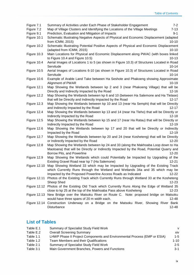
Table of Contents
Figure 7.1 Summary of Activities under Each Phase of Stakeholder Engagement 7-2 Figure 7.2 Map of Village Clusters and Identifying the Locations of the Village Meetings 7-13 Figure 9.1 Prediction, Evaluation and Mitigation of Impacts 9-1 Figure 10.1 Schematic Illustrating Negative Aspects of Physical and Economic Displacement (adapted
from ICMM, 2015) 10-10 Figure 10.2 Schematic Illustrating Potential Positive Aspects of Physical and Economic Displacement
(adapted from ICMM, 2015) 10-10 Figure 10.3 Main Locations for Physical and Economic Displacement along PWAC (with boxes linked
to Figure 10.4 and Figure 10.5) 10-13 Figure 10.4 Aerial Images of Locations 1 to 5 (as shown in Figure 10.3) of Structures Located in Road
Servitude 10-14 Figure 10.5 Aerial Images of Locations 6-10 (as shown in Figure 10.3) of Structures Located in Road
Servitude 10-14 Figure 10.6 Example of Arable Land Take between Ha Seshote and Phakoeng showing Approximate
Alignment of PWAR 10-19 Figure 12.1 Map Showing the Wetlands between kp 2 and 3 (near Phakoeng Village) that will be
Directly and Indirectly Impacted by the Road 12-16 Figure 12.2 Map Showing the Wetlands between kp 6 and 10 (between Ha Salemone and Ha Tlelase)
that will be Directly and Indirectly Impacted by the Road 12-17 Figure 12.3 Map Showing the Wetlands between kp 10 and 13 (near Ha Semphi) that will be Directly
and Indirectly Impacted by the Road 12-17 Figure 12.4 Map Showing the Wetlands between kp 13 and 14 (near Ha Tleho) that will be Directly or
Indirectly Impacted by the Road 12-18 Figure 12.5 Map Showing the Wetlands between kp 15 and 17 (near Ha Ratau) that will be Directly or
Indirectly Impacted by the Road 12-19 Figure 12.6 Map Showing the Wetlands between kp 17 and 20 that will be Directly or Indirectly
Impacted by the Road 12-19 Figure 12.7 Map Showing the Wetlands between kp 20 and 24 (near Kosheteng) that will be Directly
or Indirectly Impacted by the Road 12-20 Figure 12.8 Map Showing the Wetlands between kp 24 and 33 (along the Makhoaba Loop down to Ha
Maotoana) that will be Directly or Indirectly Impacted by the Road, Potential Quarry and Borrow Pits, and Powerline 12-20
Figure 12.9 Map Showing the Wetlands which could Potentially be Impacted by Upgrading of the Existing Gravel Road near kp 7 (Ha Salemone) 12-21
Figure 12.10 Map Showing Wetland 33 which may be Impacted by Upgrading of the Existing Track which Currently Runs through the Wetland and Wetlands 34a and 35 which may be Impacted by the Proposed Powerline Access Roads as Indicated 12-22
Figure 12.11 Photos of the Existing Track which Currently Runs through Wetland 33 at the Kosheteng Sheep Shed 12-23
Figure 12.12 Photos of the Existing Old Track which Currently Runs Along the Edge of Wetland 35 close to kp 25 at the top of the Makhoaba Pass above Kosheteng 12-23
Figure 12.13 New Bridge over the Matsoku River on Route C. Note: proposed bridge on Matsoku would have three spans of 20 m width each. 12-48
Figure 12.14 Construction Underway on a Bridge on the Matsoku River, Showing River Bank Disturbance 12-48
List of Tables Table E.1 Summary of Specialist Study Field Work v Table E.2 Overall Screening Summary xiv Table 1.1 LHWP Phase II Project Components and Environmental Process (EMP or ESIA) 1-5 Table 1.2 Team Members and their Qualifications 1-10 Table 2.1 Summary of Specialist Study Field Work 2-5 Table 3.1 Main Government Branches, Powers and Functions 3-1
ix
Table of Contents
Table 3.2 Local Government Composition at Various Council Levels 3-2 Table 3.3 Principal and Area Chiefs in the Project Area 3-3 Table 3.4 Main Institutions Responsible for Environmental Protection of Relevance to Roads and
Powerlines 3-4 Table 3.5 Legislation, Policies and Plans Relevant to Environmental Protection 3-5 Table 3.6 Lesotho Highlands Treaty, Policies and Guidelines Relevant to Environmental and Social
Protection 3-16 Table 3.7 Summary of Permit Requirements 3-21 Table 3.8 Initiatives Relevant to Environmental Protection / Conservation in the Project Area 3-21 Table 3.9 International Conventions Relevant to the Project 3-22 Table 3.10 Summary of Relevant World Bank and IFC Safeguards 3-24 Table 3.11 IFC Environmental Health and Safety Guidelines 3-27 Table 4.1 Summary of Components Related to PWAC that are Included and Excluded from this
ESIS 4-2 Table 4.2 Summary of Road Route 4-5 Table 4.3 Summary Description of PWAR Design Specifications 4-11 Table 4.4 Proposed Passing Lanes 4-14 Table 4.5 Catchment Parameters for the Matsoku River Bridge 4-18 Table 4.6 Catchment Parameters for Semenanyane River Bridge 4-20 Table 4.7 Catchment Parameters for Makhoaba River Bridge 4-22 Table 4.8 Proposed Major Culvert Sizes 4-22 Table 4.9 Preferred Quarry and Potential Borrow Pit Sites 4-27 Table 4.10 Potential Borrow Pit Sites 4-27 Table 4.11 Expected Significant Blast zones 4-28 Table 4.12 Proposed Junctions 4-35 Table 4.13 Summary of 132kV Powerline Route 4-38 Table 4.14 Summary Description of Powerline Design Specifications 4-51 Table 4.15 Estimated Permanent Land Take 4-54 Table 4.16 Estimated Temporary Land Take 4-54 Table 4.17 Summary Description of Substation Upgrades 4-59 Table 4.18 Construction Camp Staff Estimates for the PWAR and BPST Contracts 4-62 Table 4.19 Waste Types Potentially Generated during the PWAR and BPST Construction 4-64 Table 5.1 Summary Comparison of Substantive Route Options 5-1 Table 5.2 Criteria and Derived Values Used in the PWAR Route Selection Study 5-7 Table 5.3 Results of the Ecological, Social and Visual Screening Exercise 5-9 Table 5.4 Overall Screening Summary 5-10 Table 5.5 Summary of Road and Powerline Realignments 5-11 Table 6.1 Area of Influence of the Project on Different Aspects 6-1 Table 6.2 Land Cover Extent in the PWAR (30-m Road Reserve) in 1993, 2005 and 2013 6-6 Table 6.3 Main Rivers, Catchment Area, Mean Annual Precipitation (MAP) and Runoff (MAR), and
MAR as a Percentage of MAP per Quaternary Catchment Boundaries (Midgeley et al., 1994) 6-10
Table 6.4 Species of Plants of Conservation Concern within PWAC 6-19 Table 6.5 Mammal Species of Conservation Importance Confirmed Along the PWAC 6-24 Table 6.6 Endemic and Near-Endemic Reptiles and Amphibians Confirmed to Occur in the
General Vicinity of the PWAC, including the Polihali Reservoir Area 6-26 Table 6.7 Priority Bird Species Known or Considered Likely to Occur in the PWAC Project Area
and their Status 6-27 Table 6.8 Numbers of Definite and Possible Colonies and Nests of Cliff-nesting Birds Located
during Surveys Conducted along Routes B and C of the PWAC 6-28 Table 6.9 Summary of the Wetland Types and Extent Delineated within the PWAR and Powerline
Corridor 6-33 Table 6.10 Summarised Results of the PES Assessment for the Sampled Wetlands 6-40 Table 6.11 Summarised Results of the IS Assessment for the Sampled Wetlands 6-42
x
Table of Contents
Table 6.12 Summarised Results of the WET-EcoServices Assessment for the Various Sampled Wetland Types 6-44
Table 6.13 Summary of Terrestrial Habitat Status along the PWAR and Powerline 6-48 Table 6.14 Extent and Location of Terrestrial Habitat Status Classes along the PWAR 6-48 Table 6.15 Extent and Location of Habitat Status Classes along the Powerline Route 6-49 Table 6.16 Categories of Critical Habitat 6-52 Table 6.17 Critical Habitat Status Assessment of PWAC 6-53 Table 6.18 Number of Households and Population by Main Village in each Cluster Along PWAR and
Powerline 6-56 Table 6.19 Habitat Types Present in the PWAC Area of Influence 6-83 Table 6.20 Typical Ecosystem Services by Habitat Type in the PWAC 6-83 Table 6.21 Ecosystem Services of the PWAC Project Area 6-84 Table 6.22 Ecosystem Service Dependencies of the PWAC Project 6-86 Table 7.1 Stakeholder Groups and their Relevance to the PWAC Project 7-5 Table 7.2 District, Community Councils and Traditional Authority Sensitisation Meetings 7-9 Table 7.3 Dates of meetings with National Government Ministries/ Departmental Officials 7-10 Table 7.4 Village Clusters, Dates of Meetings, Meeting Villages, Number of People at Meetings,
Area Chiefs and Recently Established ALCs (in grey) 7-12 Table 7.5 Key Informant Meetings 7-15 Table 7.6 Summary Demonstrating Alignment of Stakeholder Engagement Process Followed with
International Good Practice Principles 7-18 Table 7.7 Issues and Concerns Raised during Meetings with District Government Officials,
Community Councils and Chiefs 7-21 Table 7.8 Issues and Concerns Raised During Discussions with National Authority Stakeholders of
Relevance to the PWAC 7-22 Table 7.9 Photographs of Public Consultations along the PWAC 7-26 Table 7.10 Anticipated Positive Impacts Raised During Sensitisation Discussions with National
Stakeholders 7-27 Table 7.11 Anticipated Negative Impacts and Concerns Raised During Community Meetings 7-29 Table 8.1 Summary of Construction Activities, Effects and Potential Ecological and Social Impacts8-1 Table 8.2 Operational Activities and Potential Effects and Impacts on Ecological and Social
Environment 8-4 Table 9.1 Designation for Magnitude Characteristics 9-2 Table 9.2 Definitions for Impact Type, Extent and Duration 9-3 Table 9.3 Definitions for Likelihood Designation 9-4 Table 9.4 Impact Significance 9-4 Table 10.1 Indicative Procurement Spend 10-5 Table 10.2 Impact of Project on Local Economy 10-8 Table 10.3 Approximate Numbers and Location of Structures to be Relocated from the Road
Reserve 10-11 Table 10.4 Impact of Physical Displacement 10-17 Table 10.5 Impact of Economic Displacement 10-21 Table 10.6 Disturbance from Increased Nuisance Factors 10-26 Table 10.7 Loss/ Disruption or Pollution of Community Water Supply 10-27 Table 10.8 Increased Safety Risks to People and Animals 10-30 Table 10.9 Exacerbation of Anti-Social Behaviour 10-33 Table 10.10 Increased Pressure on Social Infrastructure and Services 10-35 Table 10.11 Project Induced Increased Cost of Living 10-36 Table 10.12 Loss / Displacement of Farming Expertise 10-38 Table 10.13 Economic Opportunities and Diversification 10-40 Table 10.14 Social Benefits Resulting from Improved Access 10-42 Table 10.15 Safety Risks to People and Animals 10-43 Table 10.16 Increase in Anti-Social Behaviour 10-45 Table 10.17 Increased Cost of Living 10-46 Table 11.1 Summary of Graves and Ash Heaps at Risk of Construction Damage 11-1
xi
Table of Contents
Table 11.2 Summary Description of Burial Sites in Close Proximity to PWAR 11-2 Table 11.3 Impacts of Construction on Graveyards and Ash Heaps 11-5 Table 11.4 Impacts of Road Construction on Ruins 11-5 Table 11.5 Impacts of Construction on Ruins 11-6 Table 11.6 Assessment of Landscape Resource 11-9 Table 11.7 Assessment of Visual Impacts 11-13 Table 11.8 Positive Impacts of Road on Tourism and Cultural Heritage Opportunities 11-15 Table 12.1 Impacts of Site Clearance and Cut and Fill on Terrestrial Vegetation and Flora 12-3 Table 12.2 Impact of Road Construction on Planted Spiral Aloe Populations 12-4 Table 12.3 Impact of Site Clearance on Plants Used by Surrounding Communities 12-5 Table 12.4 Impact of Site Clearance and Blasting on Mammals and Herpetofauna 12-7 Table 12.5 Impact of Alien Plant Invasion on Plant and Faunal Habitats 12-8 Table 12.6 Impact of Increased Access to Wild Populations of Spiral Aloe 12-9 Table 12.7 Impact of Increased Pressure on Natural Resources through Increased Access to
Resources 12-11 Table 12.8 Summarised Results showing the EIS Categories Associated with the Wetlands that will
be Directly Impacted / Lost due to the Road 12-14 Table 12.9 Area and Number of Wetlands Impacted by the Road and Powerline 12-15 Table 12.10 Impacts of the Proposed PWAR on the Wetlands – Construction Phase 12-31 Table 12.11 Impacts of Upgrading the Old Road for Access Purposes (In Areas Not Aligned with the
New Road) and Creating New access Roads on Wetlands – Construction Phase of the PWAR and Powerline 12-31
Table 12.12 Impacts of the Proposed Powerline on the Wetlands – Construction Phase and Operation Phase 12-32
Table 12.13 Impacts of the Proposed PWAR on the Wetlands – Operation Phase 12-32 Table 12.14 Powerline Route Sensitivity for Birds 12-35 Table 12.15 Summary of Bird Sensitivity to Disturbance and Habitat Loss 12-36 Table 12.16 Impacts of Powerline Construction on Birds 12-37 Table 12.17 PWAR Route Sensitivity for Birds 12-38 Table 12.18 Summary of PWAR Route Sensitivity for Birds 12-38 Table 12.19 Impacts of Road Construction on Birds. Refer to Table 12.17 for location of route
sensitivity classes. 12-39 Table 12.20 Bird Sensitivity to Powerline Collision for All Sections of Powerline 12-41 Table 12.21 Summary of Bird Sensitivity to Powerline Collision 12-43 Table 12.22 Impact of Powerline-related Mortality on Birds. 12-44 Table 12.23 Impacts of Road Use and Traffic on Birds 12-45 Table 12.24 Impact of Road and Bridge Construction on Fish and Fish Habitats 12-49 Table 12.25 Operational Impacts of Road and Bridges on Fish and Fish Habitats 12-52 Table 13.1 Cumulative Impacts of the PWAC with Other Related Projects 13-1
List of Volumes and Annexures Volume 1: ESIS (This Report) Volume 2: Environmental Management Plan Volume 3: Specialist Studies (Social)
Annex A Stakeholder Engagement Report Annex B Social Report Annex C Cultural Heritage (including Archaeology) Annex D Landscape and Visual Impact Assessment
xii

Table of Contents
Volume 4: Specialist Studies (Ecology) Annex E Terrestrial Ecology Report Annex F Wetland Specialist Report Annex G Bird Specialist Report Annex H Fish Specialist Report
xiii

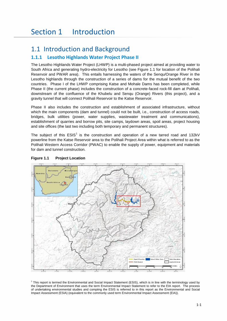
Introduction Section 1
1.1 Introduction and Background 1.1.1 Lesotho Highlands Water Project Phase II The Lesotho Highlands Water Project (LHWP) is a multi-phased project aimed at providing water to South Africa and generating hydro-electricity for Lesotho (see Figure 1.1 for location of the Polihali Reservoir and PWAR area). This entails harnessing the waters of the Senqu/Orange River in the Lesotho highlands through the construction of a series of dams for the mutual benefit of the two countries. Phase I of the LHWP comprising Katse and Mohale Dams has been completed, while Phase II (the current phase) includes the construction of a concrete-faced rock-fill dam at Polihali, downstream of the confluence of the Khubelu and Senqu (Orange) Rivers (this project), and a gravity tunnel that will connect Polihali Reservoir to the Katse Reservoir.
Phase II also includes the construction and establishment of associated infrastructure, without which the main components (dam and tunnel) could not be built, i.e., construction of access roads, bridges, bulk utilities (power, water supplies, wastewater treatment and communications), establishment of quarries and borrow pits, site camps, laydown areas, spoil areas, project housing and site offices (the last two including both temporary and permanent structures).
The subject of this ESIS1 is the construction and operation of a new tarred road and 132kV powerline from the Katse Reservoir area to the Polihali Project Area within what is referred to as the Polihali Western Access Corridor (PWAC) to enable the supply of power, equipment and materials for dam and tunnel construction.
Figure 1.1 Project Location
1 This report is termed the Environmental and Social Impact Statement (ESIS), which is in line with the terminology used by the Department of Environment that uses the term Environmental Impact Statement to refer to the EIA report. The process of undertaking environmental studies and compiing the ESIS is referred to in this report as the Environmental and Social Impact Assessment (ESIA) (equivalent to the commonly used term Environmental Impact Assessment (EIA)).
1-1
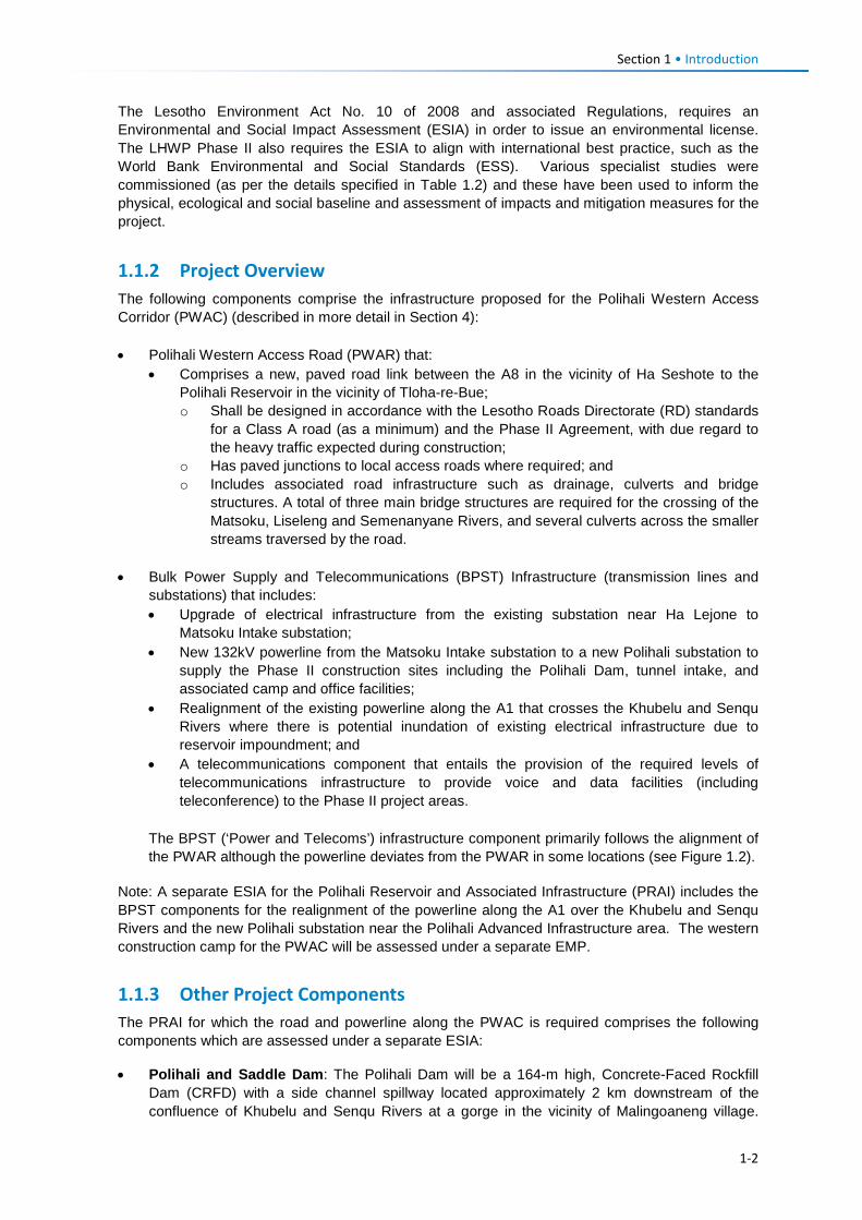
Section 1 • Introduction
The Lesotho Environment Act No. 10 of 2008 and associated Regulations, requires an Environmental and Social Impact Assessment (ESIA) in order to issue an environmental license. The LHWP Phase II also requires the ESIA to align with international best practice, such as the World Bank Environmental and Social Standards (ESS). Various specialist studies were commissioned (as per the details specified in Table 1.2) and these have been used to inform the physical, ecological and social baseline and assessment of impacts and mitigation measures for the project.
1.1.2 Project Overview The following components comprise the infrastructure proposed for the Polihali Western Access Corridor (PWAC) (described in more detail in Section 4): • Polihali Western Access Road (PWAR) that:
• Comprises a new, paved road link between the A8 in the vicinity of Ha Seshote to the Polihali Reservoir in the vicinity of Tloha-re-Bue; o Shall be designed in accordance with the Lesotho Roads Directorate (RD) standards
for a Class A road (as a minimum) and the Phase II Agreement, with due regard to the heavy traffic expected during construction;
o Has paved junctions to local access roads where required; and o Includes associated road infrastructure such as drainage, culverts and bridge
structures. A total of three main bridge structures are required for the crossing of the Matsoku, Liseleng and Semenanyane Rivers, and several culverts across the smaller streams traversed by the road.
• Bulk Power Supply and Telecommunications (BPST) Infrastructure (transmission lines and substations) that includes: • Upgrade of electrical infrastructure from the existing substation near Ha Lejone to
Matsoku Intake substation; • New 132kV powerline from the Matsoku Intake substation to a new Polihali substation to
supply the Phase II construction sites including the Polihali Dam, tunnel intake, and associated camp and office facilities;
• Realignment of the existing powerline along the A1 that crosses the Khubelu and Senqu Rivers where there is potential inundation of existing electrical infrastructure due to reservoir impoundment; and
• A telecommunications component that entails the provision of the required levels of telecommunications infrastructure to provide voice and data facilities (including teleconference) to the Phase II project areas.
The BPST (‘Power and Telecoms’) infrastructure component primarily follows the alignment of the PWAR although the powerline deviates from the PWAR in some locations (see Figure 1.2).
Note: A separate ESIA for the Polihali Reservoir and Associated Infrastructure (PRAI) includes the BPST components for the realignment of the powerline along the A1 over the Khubelu and Senqu Rivers and the new Polihali substation near the Polihali Advanced Infrastructure area. The western construction camp for the PWAC will be assessed under a separate EMP.
1.1.3 Other Project Components The PRAI for which the road and powerline along the PWAC is required comprises the following components which are assessed under a separate ESIA:
• Polihali and Saddle Dam: The Polihali Dam will be a 164-m high, Concrete-Faced Rockfill Dam (CRFD) with a side channel spillway located approximately 2 km downstream of the confluence of Khubelu and Senqu Rivers at a gorge in the vicinity of Malingoaneng village.
1-2
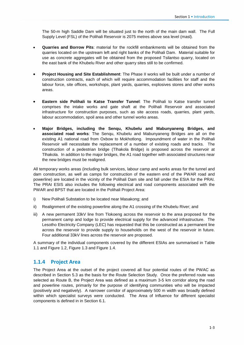
Section 1 • Introduction
The 50-m high Saddle Dam will be situated just to the north of the main dam wall. The Full Supply Level (FSL) of the Polihali Reservoir is 2075 metres above sea level (masl).
• Quarries and Borrow Pits: material for the rockfill embankments will be obtained from the
quarries located on the upstream left and right banks of the Polihali Dam. Material suitable for use as concrete aggregates will be obtained from the proposed Tsilantso quarry, located on the east bank of the Khubelu River and other quarry sites still to be confirmed.
• Project Housing and Site Establishment: The Phase II works will be built under a number of
construction contracts, each of which will require accommodation facilities for staff and the labour force, site offices, workshops, plant yards, quarries, explosives stores and other works areas.
• Eastern side Polihali to Katse Transfer Tunnel: The Polihali to Katse transfer tunnel
comprises the intake works and gate shaft at the Polihali Reservoir and associated infrastructure for construction purposes, such as site access roads, quarries, plant yards, labour accommodation, spoil area and other tunnel works areas.
• Major Bridges, including the Senqu, Khubelu and Mabunyaneng Bridges, and
associated road works: The Senqu, Khubelu and Mabunyaneng Bridges are all on the existing A1 national road from Oxbow to Mokhotlong. Impoundment of water in the Polihali Reservoir will necessitate the replacement of a number of existing roads and tracks. The construction of a pedestrian bridge (Tlhakola Bridge) is proposed across the reservoir at Tlhakola. In addition to the major bridges, the A1 road together with associated structures near the new bridges must be realigned.
All temporary works areas (including bulk services, labour camp and works areas for the tunnel and dam construction, as well as camps for construction of the eastern end of the PWAR road and powerline) are located in the vicinity of the Polihali Dam site and fall under the ESIA for the PRAI. The PRAI ESIS also includes the following electrical and road components associated with the PWAR and BPST that are located in the Polihali Project Area:
i) New Polihali Substation to be located near Masakong; and
ii) Realignment of the existing powerline along the A1 crossing of the Khubelu River; and
iii) A new permanent 33kV line from Tlokoeng across the reservoir to the area proposed for the permanent camp and lodge to provide electrical supply for the advanced infrastructure. The Lesotho Electricity Company (LEC) has requested that this be constructed as a permanent line across the reservoir to provide supply to households on the west of the reservoir in future. Four additional 33kV lines across the reservoir are proposed.
A summary of the individual components covered by the different ESIAs are summarised in Table 1.1 and Figure 1.2, Figure 1.3 and Figure 1.4.
1.1.4 Project Area The Project Area at the outset of the project covered all four potential routes of the PWAC as described in Section 5.3 as the basis for the Route Selection Study. Once the preferred route was selected as Route B, the Project Area was defined as a maximum 3-5 km corridor along the road and powerline routes, primarily for the purpose of identifying communities who will be impacted (positively and negatively). A narrower corridor of approximately 500 m width was broadly defined within which specialist surveys were conducted. The Area of Influence for different specialist components is defined in in Section 6.1.
1-3
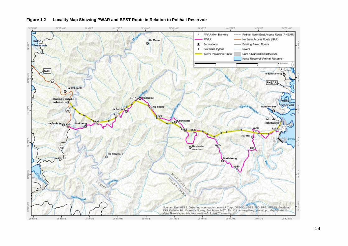
Figure 1.2 Locality Map Showing PWAR and BPST Route in Relation to Polihali Reservoir
1-4
Table 1.1 LHWP Phase II Project Components and Environmental Process (EMP or ESIA) Type of Infrastructure
PWAC ESIA (Covered in This Report)
PRAI (Separate ESIA)
Western Faciltiies EMP & Katse Upgrade EMP
PNEAR (Separate EMP)
NAR (Separate EMP)
Diversion Tunnels (Separate EMP)
Tunnel & Associated Works (Separate ESIA)
Road and Bridge Infrastructure
• 55 km tarred road (PWAR) between Ha Seshote to Polihali Dam
• 3 new bridges over Matsoku, Semenanyane and Makhoaba Rivers
• New culverts over streams; and • Paved junctions at intersections to
villages
• Realignment of existing A1 Road over Khubelu River • New major bridge across reservoir (Khubelu, Senqu)
Construction camp / works areas for PWAR (near Ha Seshote)
Polihali North East Access Road (PNEAR) (Mapholaneng to Masakong at Polihali Dam)
Upgrading of existing Northern Access Road (NAR) (A8: Pitseng - Ha Seshote)
Powerline Infrastructure
• New 34.5 km 132kV powerline from Matsoku substation (near Ha Seshote) to a new Polihali substation at Masakong
• Expansion of Matsoku substation to include two new turbines (to be moved from Ha Lejone substation)
• Upgrades at existing substations • Upgrade of existing 66kV lines
• New substation at Masakong, Polihali • New 33kV powerline from Tlokoeng substation across
reservoir to permanent Polihali camp /offices / lodge.
Construction camp / works areas for BPST (near Matsoku) substation
Telecommun -ications
• Telecommunications infrastructure on 132kV pylons
• New telecommunications mast near Polihali Dam site
Dam (and support) Infrastructure
• Coffer Dam, Main Dam and Saddle Dam walls • New Polihali village with lodge, offices, visitors centre • Eastern Facilities comprising the permanent (Polihali
village). Operations & Commercial Centres • Eastern Facilities also includes the required labour
camps at the dam wall and near Masakong for PWAR and BPST and Tunnel Contractors
• Quarries for aggregate supply for dam wall construction
• Spoil dumps
Tunnel Infrastructure
• Opening of tunnel intake at Polihali (lower Khubelu) • Spoil dump • Access roads to tunnel intake and spoil dumps • Tunnel boring machine assembly area • Tunnel works area and offices
• Upgrading of Katse Lodge area facilities for management staff.
• Dam Wall Diversion tunnels (two tunnels (9 m and 7 m wide);
• Spoil dumps; • Office, camp,
workshop; • Explosives
magazine
• Polihali to Katse tunnel construction and operation
• Labour camp • Spoil dumps • Access road
1-5
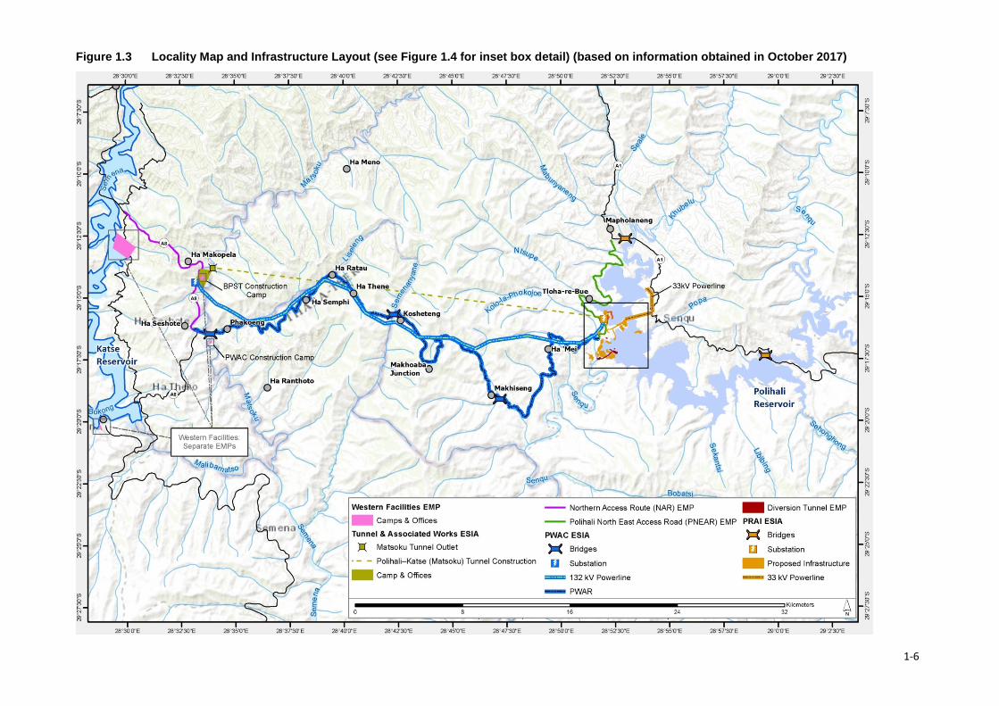
Figure 1.3 Locality Map and Infrastructure Layout (see Figure 1.4 for inset box detail) (based on information obtained in October 2017)
1-6
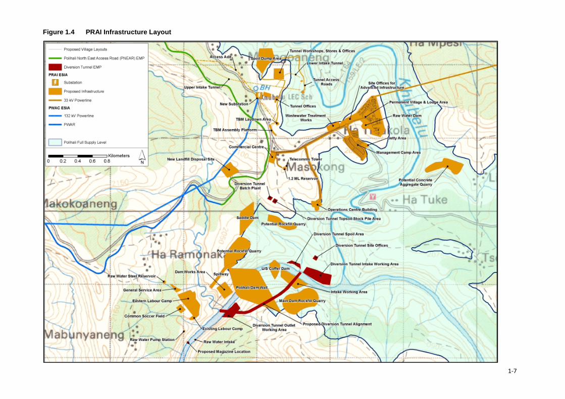
Figure 1.4 PRAI Infrastructure Layout
1-7
Section 1 • Introduction
1.1.5 Other LHWP Phase II Contracts Relevant to the PWAR and BPST 1.1.5.1 Resettlement and Compensation Plan (RAP) (LHDA Contract No. 6006) A separate RAP and implementation is being conducted under LHDA Contract 6006 by independent consultants. This will entail compilation of an asset register of all infrastructure and resources that will be impacted by the road and powerline and implementing the payment of compensation to affected households or organisations in accordance with LHDA’s Compensation Policy. The RAP contract will be ongoing for the full duration of road construction until all compensation is concluded.
1.1.5.2 Western Facilities EMP Infrastructure facilities, such as labour camps, offices and laydown areas, required for the construction of the western end of the PWAR and for the powerline will be assessed under a separate EMP. This includes a proposed construction camp for the PWAR that is proposed for a site adjacent to the Matsoku River near Ha Seshote and a camp for the BPST near the Matsoku substation, as well as upgrading of existing facilties at Katse Lodge for management staff.
1.1.5.3 Polihali Northern Access Road (NAR) EMP A separate EMP will be compiled under LHDA Contract No. 3004 to cover all activities involved in upgrading of the NAR, including quarries and borrow pits along the A8, and asphalt plants.
1.1.5.4 Heritage Management Plan (LHDA Contract No. 6025) A Heritage Management Plan contract has recently been awarded to consultants to develop and implement a strategy to protect cultural heritage in the Phase II project areas. This will include a detailed Chance Finds Procedure (CFP) that may be applicable to cultural heritage that may be found in the PWAR and BPST areas during construction.
1.1.5.5 Public Health Action Plan (PHAP) and Implementation (LHDA Contract No. 6018) The PHAP and implementation contract requires a Health Impact Assessment (HIA) and preparation of a PHAP, followed by its implementation jointly with the Ministry of Health (MoH) and local health authorities. The HIA is required to review available health baseline data and demographic health survey data; conduct meetings with health-related authorities, other stakeholders, and villages affected by the LHWP Phase II (including the western facilities); and, using this information, to assess short and long term impacts and identify mitigation. The PHAP is required to be prepared in close collaboration with LHDA, MoH, and local health authorities so that ownership remains with the responsible authorities. It is required to include: agreement on scope with MoH (i.e., villages partially or fully impacted by the project and health facilities providing services to these villages); describe comprehensive Primary Health Care in the Project Area especially reproductive, maternal, new born, child and adolescent health to ensure women and children receive needed services; monthly outreach health programme from existing health services; growth monitoring for children under 5 (including nutrition); nutritional assessments of the impacted populations (especially vulnerable groups); support existing national and district plans for HIV/AIDS and TB control programmes; health care for vulnerable individuals; and health education and awareness programmes for the project impacted populations.
1.1.6 Scope and Objectives The scope of work for the PWAC Project required the preparation and submission of an ESIA that meets Lesotho’s environmental legislation and guidelines (i.e., Environmental Act No. 10 of 2008; the Environmental Impact Assessment Guidelines of 2009); LHDA policies; relevant international treaties and agreements to which both Lesotho and South African are party, and to address international safeguards. A Project Brief was not required as part of the general scope of services, which is provided in Attachment A.
1-8
Section 1 • Introduction
The ESIS is required to be designed to meet the needs of decision makers to provide an informed and balanced presentation of findings, and be easily understood by stakeholders.
The Scope specifically required the following specialist studies to be conducted for the ESIA:
• Ecology • Birds • Wetlands • Cultural Heritage • Social, and • Public Consultation
The ecology study covered vegetation, mammals and herpetofauna. In addition, ERM included a fish study as the basis for assessing impacts of road and bridge construction at the river crossings.
The ESIS aims to provide a clear and user-friendly description of the proposed project activities, the alternatives considered, the affected environment of relevance to the project; assess impacts on environmental and social receptors and resources, and identify appropriate and realistic mitigation measures. Mitigation and monitoring requirements will be laid out and presented in a user-friendly, standalone Environmental Management Plan (EMP)1 that can be implemented by the Contractors.
The ESIA phase also includes a stakeholder engagement process (typically called ‘public participation process (PPP))2 to ensure that issues and concerns are captured and addressed and that transparent and regular communication is maintained throughout the ESIA process. Refer to Section 7 for a description of the stakeholder engagement process and issues raised.
This ESIA assesses the construction and operation of the PWAR and BPST (powerline) to support the construction of the Polihali Dam and water transfer tunnel. Construction equipment and materials will be transported from South African into Lesotho via the border posts of Caledon / Ficksburg, and along the Northern Access Route (NAR) (from Pitseng to Katse) to join the PWAR at Ha Seshote. However, this ESIA does not include the assessment of potential impacts of increased traffic at the border entry gates or along the existing NAR, and the associated traffic-related impacts on communities along the route or through the Bokong Nature Reserve. A separate EMP will be prepared to cover these aspects.
1.1.7 Consultant Team Environmental Resources Management Southern Africa (Pty) Ltd (ERM)
Environmental Resources Management Southern Africa (Pty) Ltd (ERM) was appointed by LHDA as the independent Environmental Assessment Practitioner (EAP) to undertake the ESIA process for the Project. ERM is a global environmental consulting organisation employing over 5000 people with 160 offices in 40 countries worldwide. Founded in 1971, ERM is a company based on the supply of a full range of environmental and social policy, scientific, technical, and regulatory expertise.
1 The Environmental Act refers to a Comprehensive Mitigation Plan (CMP) but this report uses the more commonly used Environmental Management Plan terminology (also referred to as Environmental and Social Management Plan (ESMP) in the IFC Performance Standards. 2 The term Public Participation Process is used by the Lesotho Environmental Guidelines (2009) which is equivalent to the Stakeholder Engagement Process referred to by IFC Standards and which requires a Stakeholder Engagement Plan.
1-9
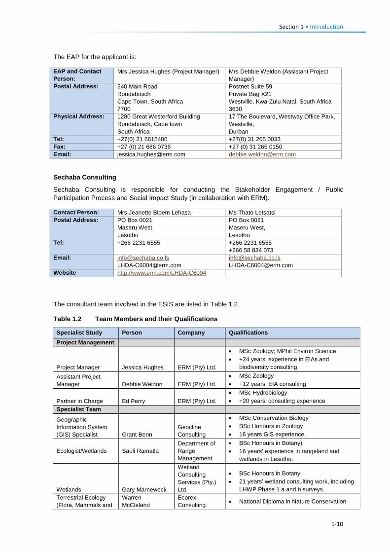
Section 1 • Introduction
The EAP for the applicant is:
EAP and Contact Person:
Mrs Jessica Hughes (Project Manager) Mrs Debbie Weldon (Assistant Project Manager)
Postal Address: 240 Main Road Rondebosch Cape Town, South Africa 7700
Postnet Suite 59 Private Bag X21 Westville, Kwa-Zulu Natal, South Africa 3630
Physical Address: 1280 Great Westerford Building Rondebosch, Cape town South Africa
17 The Boulevard, Westway Office Park, Westville, Durban
Tel: +27(0) 21 6815400 +27(0) 31 265 0033 Fax: +27 (0) 21 686 0736 +27 (0) 31 265 0150 Email: [email protected] [email protected]
Sechaba Consulting
Sechaba Consulting is responsible for conducting the Stakeholder Engagement / Public Participation Process and Social Impact Study (in collaboration with ERM).
The consultant team involved in the ESIS are listed in Table 1.2.
Table 1.2 Team Members and their Qualifications
Specialist Study Person Company Qualifications Project Management
Project Manager Jessica Hughes ERM (Pty) Ltd.
• MSc Zoology; MPhil Environ Science • +24 years’ experience in EIAs and
biodiversity consulting Assistant Project Manager Debbie Weldon ERM (Pty) Ltd.
• MSc Zoology • +12 years’ EIA consulting
Partner in Charge Ed Perry ERM (Pty) Ltd. • MSc Hydrobiology • +20 years’ consulting experience
Specialist Team
Geographic Information System (GIS) Specialist Grant Benn
Geocline Consulting
• MSc Conservation Biology • BSc Honours in Zoology • 16 years GIS experience.
Ecologist/Wetlands Sauli Ramatla Department of Range Management
• BSc Honours in Botany) • 16 years’ experience in rangeland and
wetlands in Lesotho.
Wetlands Gary Marneweck
Wetland Consulting Services (Pty.) Ltd.
• BSc Honours in Botany • 21 years’ wetland consulting work, including
LHWP Phase 1 a and b surveys. Terrestrial Ecology (Flora, Mammals and
Warren McCleland
Ecorex Consulting • National Diploma in Nature Conservation
Contact Person: Mrs Jeanette Bloem Lehasa Ms Thato Letsatsi Postal Address: PO Box 0021
Maseru West, Lesotho
PO Box 0021 Maseru West, Lesotho
Tel: +266 2231 6555 +266 2231 6555 +266 58 834 073
Email: [email protected] [email protected]
[email protected] [email protected]
Website http://www.erm.com/LHDA-C6004
1-10
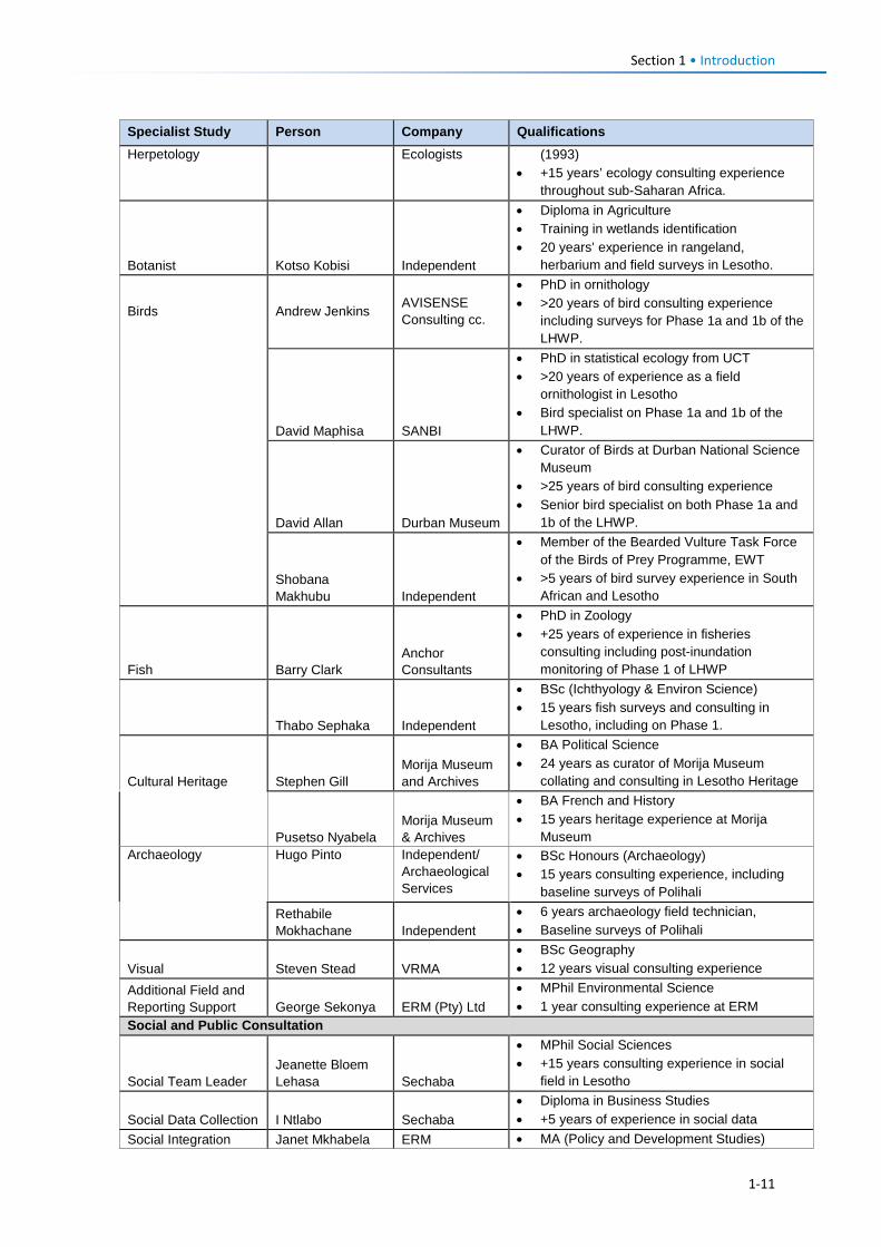
Section 1 • Introduction
Specialist Study Person Company Qualifications Herpetology Ecologists (1993)
• +15 years’ ecology consulting experience throughout sub-Saharan Africa.
Botanist Kotso Kobisi Independent
• Diploma in Agriculture • Training in wetlands identification • 20 years’ experience in rangeland,
herbarium and field surveys in Lesotho.
Birds Andrew Jenkins AVISENSE Consulting cc.
• PhD in ornithology • >20 years of bird consulting experience
including surveys for Phase 1a and 1b of the LHWP.
David Maphisa SANBI
• PhD in statistical ecology from UCT • >20 years of experience as a field
ornithologist in Lesotho • Bird specialist on Phase 1a and 1b of the
LHWP.
David Allan Durban Museum
• Curator of Birds at Durban National Science Museum
• >25 years of bird consulting experience • Senior bird specialist on both Phase 1a and
1b of the LHWP.
Shobana Makhubu Independent
• Member of the Bearded Vulture Task Force of the Birds of Prey Programme, EWT
• >5 years of bird survey experience in South African and Lesotho
Fish Barry Clark Anchor Consultants
• PhD in Zoology • +25 years of experience in fisheries
consulting including post-inundation monitoring of Phase 1 of LHWP
Thabo Sephaka Independent
• BSc (Ichthyology & Environ Science) • 15 years fish surveys and consulting in
Lesotho, including on Phase 1.
Cultural Heritage Stephen Gill Morija Museum and Archives
• BA Political Science • 24 years as curator of Morija Museum
collating and consulting in Lesotho Heritage
Pusetso Nyabela Morija Museum & Archives
• BA French and History • 15 years heritage experience at Morija
Museum Archaeology Hugo Pinto Independent/
Archaeological Services
• BSc Honours (Archaeology) • 15 years consulting experience, including
baseline surveys of Polihali
Rethabile Mokhachane Independent
• 6 years archaeology field technician, • Baseline surveys of Polihali
Visual Steven Stead VRMA • BSc Geography • 12 years visual consulting experience
Additional Field and Reporting Support George Sekonya ERM (Pty) Ltd
• MPhil Environmental Science • 1 year consulting experience at ERM
Social and Public Consultation
Social Team Leader Jeanette Bloem Lehasa Sechaba
• MPhil Social Sciences • +15 years consulting experience in social
field in Lesotho
Social Data Collection I Ntlabo Sechaba • Diploma in Business Studies • +5 years of experience in social data
Social Integration Janet Mkhabela ERM • MA (Policy and Development Studies)
1-11
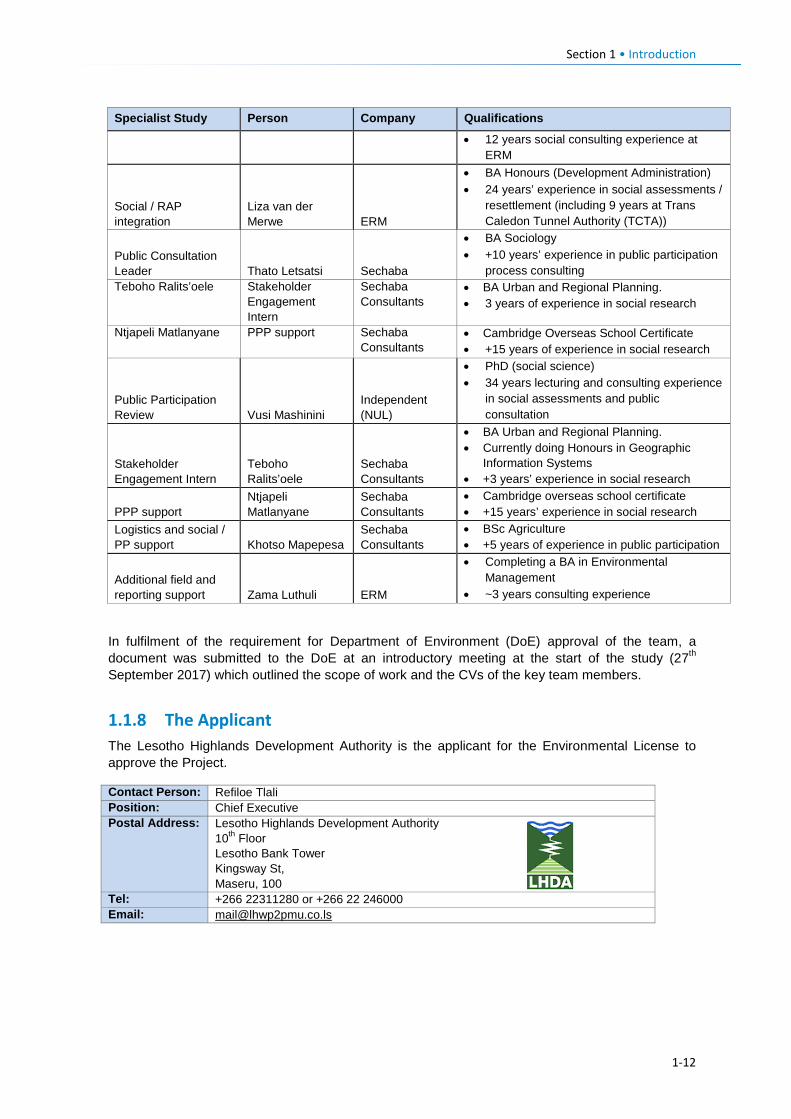
Section 1 • Introduction
1-12
Specialist Study Person Company Qualifications
• 12 years social consulting experience at ERM
Social / RAP integration
Liza van der Merwe ERM
• BA Honours (Development Administration) • 24 years’ experience in social assessments /
resettlement (including 9 years at Trans Caledon Tunnel Authority (TCTA))
Public Consultation Leader Thato Letsatsi Sechaba
• BA Sociology • +10 years’ experience in public participation
process consulting Teboho Ralits’oele Stakeholder
Engagement Intern
Sechaba Consultants
• BA Urban and Regional Planning. • 3 years of experience in social research
Ntjapeli Matlanyane PPP support Sechaba Consultants
• Cambridge Overseas School Certificate • +15 years of experience in social research
Public Participation Review Vusi Mashinini
Independent (NUL)
• PhD (social science) • 34 years lecturing and consulting experience
in social assessments and public consultation
Stakeholder Engagement Intern
Teboho Ralits’oele
Sechaba Consultants
• BA Urban and Regional Planning. • Currently doing Honours in Geographic
Information Systems • +3 years’ experience in social research
PPP support Ntjapeli Matlanyane
Sechaba Consultants
• Cambridge overseas school certificate • +15 years’ experience in social research
Logistics and social / PP support Khotso Mapepesa
Sechaba Consultants
• BSc Agriculture • +5 years of experience in public participation
Additional field and reporting support Zama Luthuli ERM
• Completing a BA in Environmental Management
• ~3 years consulting experience
In fulfilment of the requirement for Department of Environment (DoE) approval of the team, a document was submitted to the DoE at an introductory meeting at the start of the study (27th September 2017) which outlined the scope of work and the CVs of the key team members.
1.1.8 The Applicant The Lesotho Highlands Development Authority is the applicant for the Environmental License to approve the Project.
Contact Person: Refiloe Tlali Position: Chief Executive Postal Address: Lesotho Highlands Development Authority
10th Floor Lesotho Bank Tower Kingsway St, Maseru, 100
Tel: +266 22311280 or +266 22 246000 Email: [email protected]
Approach and Methodology Section 2
2.1 Overview of ESIA The scope of work for the PW AC ESIA was required to meet the requirements of the Lesotho Environment Act No. 10 of 2008, the national EIA Guidelines (MTEC, 2009) and other relevant national legislation. However, the scope also requested the study to address the requirements of International Safeguards, which are summarised in Section 3.6.
This section provides an overview of Lesotho’s EIA requirements, the ESIA process followed, and provides a high level overview of the specialist studies. Assumptions, limitations and exclusions of the ESIA are outlined in Section 2.4. The impact assessment methology for evaluating impact significance is provided in Section 9.
2.2 ESIA Process 2.2.1 Lesotho’s EIA Requirements Lesotho’s legal requirements for an EIA are outlined in Sections 28-30 of the Lesotho Environment Act 10 of 2008 and elaborated upon in the EIA Guidelines (MTEC, 2009).
The Environment Act of 2008 is the main legal framework for environment issues in Lesotho. It makes it mandatory to do EIAs for all major development projects which are specified in detail, and the stages that need to be followed. It gives the DoE the authority to oversee and monitor implementation of EIAs by developers, and to institute legal action against those that are non-compliant. It also sets out the grievance and conflict resolution mechanisms on environment issues. Specified requirements relating to Stakeholder Engagement are summarised in Section 2.2.2.
The first step in the application for an EIA Licence is the submission of a Project Brief that describes the nature of the project, feasible alternatives, the environmental and stakeholder issues of concern, and sets out the approach to the EIA, if required. This is equivalent to a Scoping Report that defines the Terms of Reference for the EIA. In addition, external consultants must be approved by the DoE prior to conducting the investigations.
Prior to the appointment of ERM, discussions were held between LHDA and the DoE in April 2016 which led to written confirmation from DoE in May 2016 that a Project Brief was not required to be submitted, and that a full ESIA was needed for the PWAC Project.
On appointment for the ESIA, ERM and LHDA held an introductory meeting with the DoE on 27th September 2017 to discuss the approach and to present the CVs of team members. Subsequent engagement with the DoE has included interim feedback of key findings and mitigation measures and submission of the impact assessment methodology (as per Section 9).
Although a Project Brief was not formally required by the DoE, the first two phases of this ESIA comprised the inception and route selection tasks, during which the approach and scope of work was described based on the selection and confirmation of the preferred road and powerline routes. These phases thereby fulfilled the scoping requirements and assessment of alternatives (as described in Section 5). The ESIS and its supporting reports have been cross-checked against the inception report to confirm it has fulfilled the approved scope of work.
Based on the Lesotho Environment Act, the required contents of the EIA (not necessarily in order), are summarised in Box 2.1.
2-1
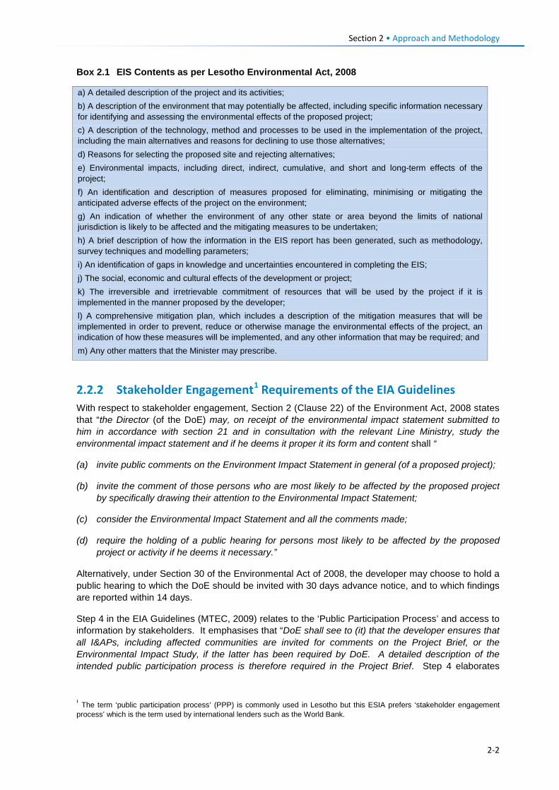
Section 2 • Approach and Methodology
Box 2.1 EIS Contents as per Lesotho Environmental Act, 2008
2.2.2 Stakeholder Engagement1 Requirements of the EIA Guidelines With respect to stakeholder engagement, Section 2 (Clause 22) of the Environment Act, 2008 states that “the Director (of the DoE) may, on receipt of the environmental impact statement submitted to him in accordance with section 21 and in consultation with the relevant Line Ministry, study the environmental impact statement and if he deems it proper it its form and content shall “
(a) invite public comments on the Environment Impact Statement in general (of a proposed project);
(b) invite the comment of those persons who are most likely to be affected by the proposed project by specifically drawing their attention to the Environmental Impact Statement;
(c) consider the Environmental Impact Statement and all the comments made;
(d) require the holding of a public hearing for persons most likely to be affected by the proposed project or activity if he deems it necessary.”
Alternatively, under Section 30 of the Environmental Act of 2008, the developer may choose to hold a public hearing to which the DoE should be invited with 30 days advance notice, and to which findings are reported within 14 days.
Step 4 in the EIA Guidelines (MTEC, 2009) relates to the ‘Public Participation Process’ and access to information by stakeholders. It emphasises that “DoE shall see to (it) that the developer ensures that all I&APs, including affected communities are invited for comments on the Project Brief, or the Environmental Impact Study, if the latter has been required by DoE. A detailed description of the intended public participation process is therefore required in the Project Brief. Step 4 elaborates
1 The term ‘public participation process’ (PPP) is commonly used in Lesotho but this ESIA prefers ‘stakeholder engagement process’ which is the term used by international lenders such as the World Bank.
a) A detailed description of the project and its activities; b) A description of the environment that may potentially be affected, including specific information necessary for identifying and assessing the environmental effects of the proposed project; c) A description of the technology, method and processes to be used in the implementation of the project, including the main alternatives and reasons for declining to use those alternatives; d) Reasons for selecting the proposed site and rejecting alternatives; e) Environmental impacts, including direct, indirect, cumulative, and short and long-term effects of the project; f) An identification and description of measures proposed for eliminating, minimising or mitigating the anticipated adverse effects of the project on the environment; g) An indication of whether the environment of any other state or area beyond the limits of national jurisdiction is likely to be affected and the mitigating measures to be undertaken; h) A brief description of how the information in the EIS report has been generated, such as methodology, survey techniques and modelling parameters; i) An identification of gaps in knowledge and uncertainties encountered in completing the EIS; j) The social, economic and cultural effects of the development or project; k) The irreversible and irretrievable commitment of resources that will be used by the project if it is implemented in the manner proposed by the developer; l) A comprehensive mitigation plan, which includes a description of the mitigation measures that will be implemented in order to prevent, reduce or otherwise manage the environmental effects of the project, an indication of how these measures will be implemented, and any other information that may be required; and m) Any other matters that the Minister may prescribe.
2-2
Section 2 • Approach and Methodology
further on the key principles of how to do the public participation process correctly. These include the use of appropriate methods and opportunities to engage rural and disadvantaged communities, and the need to inform a wide range of authorities, local councils and NGOs and seek their input on the development proposal. The consultation process is required to notify stakeholders of the project and availability of documents for review by means of advertisements in local newspapers and / or by means of public broadcasting. Neither the EIA guidelines nor the Environmental Act are specific on the timing of such engagement or the timing and need for ESIA or RoD disclosure to stakeholders.
Step 11 of the guidelines makes provision for appeal by interested and affected parties (I&APs) who feel aggrieved by a decision of the ministry to award an environmental license for a project. Any person (either the developer or an I&AP) may lodge an appeal within 30 days of being informed of a decision, and may request in writing a reconsideration of the decision.
In summary, while stakeholder engagement is a requirement for conducting an EIA in accordance with the Environmental Act No. 10 of 2008 and the Guidelines for EIA (MTEC, 2009), neither is prescriptive on the exact process and timelines for stakeholder engagement. It is, nonetheless, incumbent on the developer to demonstrate a reasonable and robust consultation process has been followed and stakeholder issues have been taken into account and documented in the EIS.
The stakeholder engagement process followed during the ESIA is documented in Section 7.
2-3
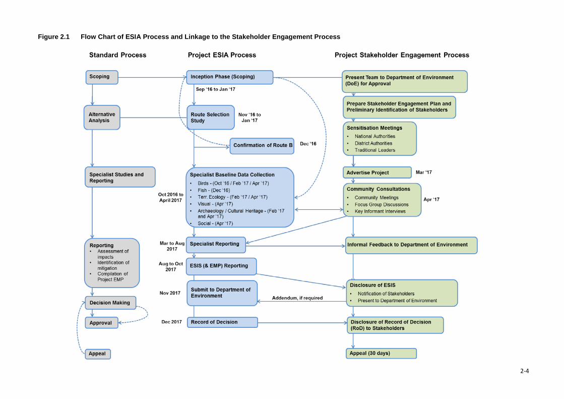
Figure 2.1 Flow Chart of ESIA Process and Linkage to the Stakeholder Engagement Process
2-4
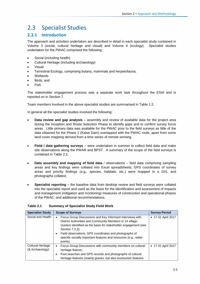
Section 2 • Approach and Methodology
2.3 Specialist Studies 2.3.1 Introduction The approach and activities undertaken are described in detail in each specialist study contained in Volume 3 (social, cultural heritage and visual) and Volume 4 (ecology). Specialist studies undertaken for the PWAC comprised the following:
• Social (including health) • Cultural Heritage (including archaeology) • Visual • Terrestrial Ecology, comprising botany, mammals and herpetofauna; • Wetlands • Birds, and • Fish.
The stakeholder engagement process was a separate work task throughout the ESIA and is reported on in Section 7.
Team members involved in the above specialist studies are summarised in Table 1.2.
In general all the specialist studies involved the following:
• Data review and gap analysis – assembly and review of available data for the project area during the Inception and Route Selection Phase to identify gaps and to confirm survey focus areas. Little primary data was available for the PWAC prior to the field surveys as little of the data obtained for the Phase 1 (Katse Dam) overlapped with the PWAC route, apart from some land cover mapping derived from a time series of remote sensing.
• Field / data gathering surveys – were undertaken in summer to collect field data and make site observations along the PWAR and BPST. A summary of the scope of the field surveys is contained in Table 2.1;
• Data assembly and mapping of field data / observations – field data comprising sampling areas and key findings were collated into Excel spreadsheets; GPS coordinates of survey areas and priority findings (e.g., species, habitats, etc.) were mapped in a GIS, and photographs collated;
• Specialist reporting – the baseline data from desktop review and field surveys were collated into the specialist report and used as the basis for the identification and assessment of impacts and management (mitigation and monitoring) measures of construction and operational phases of the PWAC, and additional recommendations.
Table 2.1 Summary of Specialist Study Field Work
Specialist Study Scope of Surveys Survey Period Social and Health • Focus Group Discussions and Key Informant Interviews with
District Authorities and Community Members in 14 village clusters identified as the basis for stakeholder engagement (see Section 7.3.3);
• Field observations, GPS coordinates and photographs of specific socially important features and resources (e.g., water points).
• 17-31 April 2017
Cultural Heritage (& Archaeology)
• Focus Group Discussions with community members on cultural heritage feature;
• Foot searches and GPS records and photographs of cultural heritage features (mainly graves, but also ecotourism features
• 17-31 April 2017
2-5
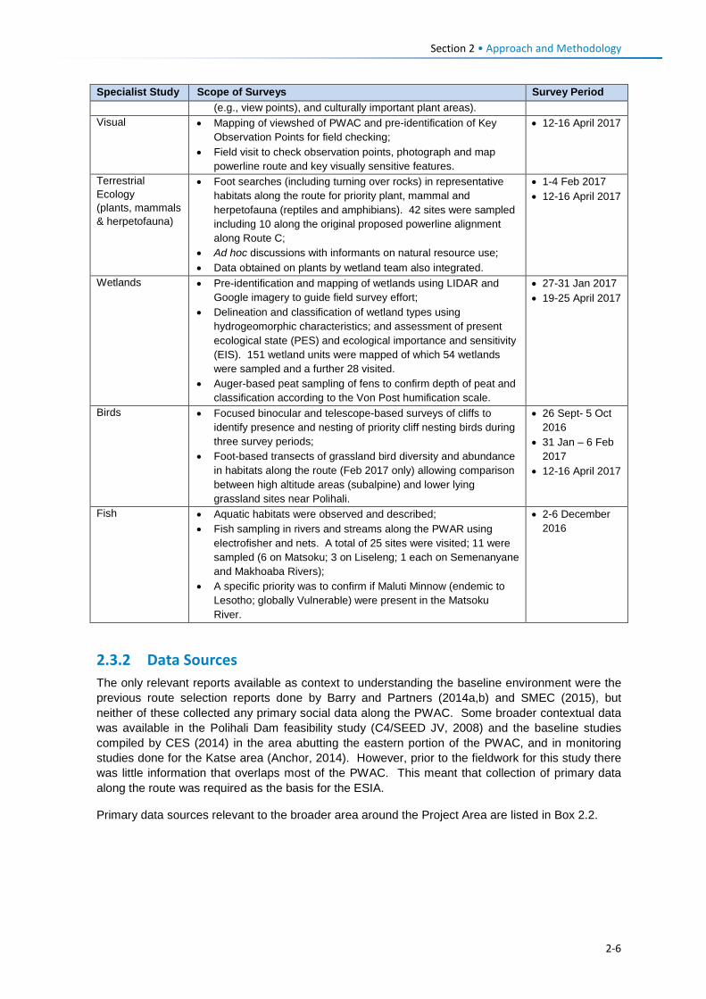
Section 2 • Approach and Methodology
Specialist Study Scope of Surveys Survey Period (e.g., view points), and culturally important plant areas).
Visual • Mapping of viewshed of PWAC and pre-identification of Key Observation Points for field checking;
• Field visit to check observation points, photograph and map powerline route and key visually sensitive features.
• 12-16 April 2017
Terrestrial Ecology (plants, mammals & herpetofauna)
• Foot searches (including turning over rocks) in representative habitats along the route for priority plant, mammal and herpetofauna (reptiles and amphibians). 42 sites were sampled including 10 along the original proposed powerline alignment along Route C;
• Ad hoc discussions with informants on natural resource use; • Data obtained on plants by wetland team also integrated.
• 1-4 Feb 2017 • 12-16 April 2017
Wetlands • Pre-identification and mapping of wetlands using LIDAR and Google imagery to guide field survey effort;
• Delineation and classification of wetland types using hydrogeomorphic characteristics; and assessment of present ecological state (PES) and ecological importance and sensitivity (EIS). 151 wetland units were mapped of which 54 wetlands were sampled and a further 28 visited.
• Auger-based peat sampling of fens to confirm depth of peat and classification according to the Von Post humification scale.
• 27-31 Jan 2017 • 19-25 April 2017
Birds • Focused binocular and telescope-based surveys of cliffs to identify presence and nesting of priority cliff nesting birds during three survey periods;
• Foot-based transects of grassland bird diversity and abundance in habitats along the route (Feb 2017 only) allowing comparison between high altitude areas (subalpine) and lower lying grassland sites near Polihali.
• 26 Sept- 5 Oct 2016
• 31 Jan – 6 Feb 2017
• 12-16 April 2017
Fish • Aquatic habitats were observed and described; • Fish sampling in rivers and streams along the PWAR using
electrofisher and nets. A total of 25 sites were visited; 11 were sampled (6 on Matsoku; 3 on Liseleng; 1 each on Semenanyane and Makhoaba Rivers);
• A specific priority was to confirm if Maluti Minnow (endemic to Lesotho; globally Vulnerable) were present in the Matsoku River.
• 2-6 December 2016
2.3.2 Data Sources The only relevant reports available as context to understanding the baseline environment were the previous route selection reports done by Barry and Partners (2014a,b) and SMEC (2015), but neither of these collected any primary social data along the PWAC. Some broader contextual data was available in the Polihali Dam feasibility study (C4/SEED JV, 2008) and the baseline studies compiled by CES (2014) in the area abutting the eastern portion of the PWAC, and in monitoring studies done for the Katse area (Anchor, 2014). However, prior to the fieldwork for this study there was little information that overlaps most of the PWAC. This meant that collection of primary data along the route was required as the basis for the ESIA.
Primary data sources relevant to the broader area around the Project Area are listed in Box 2.2.
2-6
Section 2 • Approach and Methodology
Box 2.2 List of Relevant Data Consulted for This Study
Note: multiple other references for the LHWP were consulted and are referenced in the relevant specialist reports.
2.4 Assumptions, Limitations and Exclusions Assumptions and limitations for each specialist study are described in more detail in the relevant specialist reports in Volumes 3 and 4. In summary these included:
1. Poor road access
Road access along the existing PWAR is poor and comprises dirt roads and tracks, some of which proved impassable during the early February survey period and required considerable
General Data Sources: Barry and Partners, 2014a. Polihali Western Access Road. Route Selection Report. LHDA. Ref: Y11503-
DOC-007. Jan 2014. Barry and Partners, 2014b. Polihali Western Access Road. Addendum to Route Selection Report. LHDA.
Ref: Y11503-DOC-008. Feb 2014. SMEC South Africa / FMA Joint Venture, February 2016. Professional Services for the Polihali North East
Access Road, Options Study Report: Task 2. Contract LHDA No. 3014. Report No. W3014-DFR-09-01.
Ecology Data Sources AfriDev. 1996-2000. Annual biological monitoring of Katse. LHDA Contract No. 615. Anchor, 2014. Phase I Biological Resource Monitoring Reports. LHDA Contract No. 1025, including: • Turpie et al., 2014. Katse Catchment Land Cover Change Analysis 1991-2013. • Barker et al. 2014. Flora of the Katse Dam Catchment. • Du Plessis et al. 2014. Mammals of the Katse Dam Catchment. • Harvey. 2014. Herpetofauna of the Katse Dam Catchment. • Wetland Consulting Services. 2014. Wetlands of the Katse Dam Catchment Arthington A H, Rall, J and Kennard N J: 1999: Fish Specialist Report for Consulting Services for the
Establishment of the Instream Flow Requirements for River Courses Downstream of LHWP Dams. Lesotho Water Project Contract 648. Report No. LHDA 648-F-18.
Brown C A, Pemberton C and Mogoba R. 2006. TASK 1: Preliminary Data Collection Evaluation and Monitoring Report. Implementation of the Instream Flow Requirements Biophysical Monitoring Procedures Downstream of Phase 1 Dams. Report No. LHDA 1237 -02.
CES. 2014a. LHWP Polihali Dam: Baseline Studies for LHDA Contract No. 6002. • CES. 2013. Baseline Botanical Survey. • CES. 2013. Baseline Fauna Survey. • Bok A. 2013. Baseline Fish Survey Report. MDTP. 2007. Spatial Assessment of Biodiversity Priorities in the Lesotho Highlands. Report for the Maluti
Drakensberg Transfrontier Project (Lesotho Highlands). Report by J Hughes, M Laros, G Benn. MDTP. 2007. Degradation Mapping and Veld Assessment Report. (Report by F de Wet) Social Data Sources • Bureau of Statistics (BoS) (Lesotho). 2013. Lesotho Demographic Survey, 2011, Vol 1. The Bureau of
Statistics, Maseru. • Ministry of Health (Lesotho) and ICF International, 2016. Lesotho Health and Demographic Survey
2014. Maseru, Lesotho: Ministry of Health and ICF International. • Coastal and Environmental Services (CES). 2015. Socio-Economic Baseline Study. LHDA Contract No.
6000. • Coastal and Environmental Services (CES). 2015. Baseline Income and Expenditure Report. LHDA
Contract No. 6000. • C4/SEED. 2008. Social Impact Assessment Supporting Report. Report for LHWC Contract 001:
Consulting Services for the Feasibility Study for Phase II-Stage 2. Authors: Molaoa, M, Hart, T, Mateka, B.
2-7
Section 2 • Approach and Methodology
time for travel. This reduced the available time for survey effort along the entire route. Some stretches of the road and powerline were not walked or fully surveyed, particularly the eastern portion of the powerline where there is no road access. These sections were viewed from a distance and verified using LIDAR and Google imagery. As a result some small seep zones may have been missed. Despite these access constraints, the surveys achieved sufficient coverage of representative areas of the road and powerline footprint for a robust assessment of the potential impacts.
2. River flow and aquatic habitat conditions
Most of the ephemeral streams crossed by the road and powerline were dry at the time when sampling was conducted in December 2016 as surveys were conducted early in what is normally after the onset of the rainy season. In addition, the streams in the study area were highly degraded and had high sediment loads and no fish were caught. Thus although it is possible that some of the more common indigenous fish (such as Smallmouth yellowfish Labeobarbus aeneus and Orange River mudfish Labeo capensis) do move upstream into some of these tributaries during the wet season, this is of little consequence for the overall fish study findings.
3. Drought conditions and overgrazing
Prevailing drought conditions over the last few years as a result of lower than normal rainfall has exacerbated land use pressures resulting in worsened degradation of rangelands, and reduced diversity and abundance of biodiversity. The results of the ecological surveys are not considered fully representative of conditions that may pertain during normal or high rainfall years, and therefore the baseline conditions recorded during the surveys are not considered a sufficient baseline against which future monitoring can be compared. Should future monitoring of biodiversity along the PWAC be considered, it will require additional baseline data to be gathered and this should be correlated with rainfall.
4. Plant species identification
Severe overgrazing by livestock has resulted in large areas of grassland having limited vegetation cover, particularly the lower lying parts of the route in the vicinity of villages. The easternmost portion of the PWAR (nearer Polihali) is particularly heavily grazed and degraded. In addition, the follow up surveys were conducted late in the summer season (in April 2017) and it is possible that some flowering species, particularly geophytes, were overlooked (either because of being browsed or having already flowered). Most geophytes can only be positively identified if in flower.
5. Mammals and herpetofauna
No pitfall trapping was undertaken for small mammals or reptiles or amphibians. It is believed that such intensive surveys are not warranted for the linear road and powerline corridors and because no localised threatened species are known or likely to occur along the route that would be at particular risk from the Project.
6. Quarries and borrow pits
Quarry and borrow pit locations had not been finalised at the time of the field surveys and will be confirmed following geotechnical surveys. However, a number of proposed locations along the PWAR were visited, most of which were in degraded areas of low biodiversity value. Once geotechnical surveys have been conducted and borrow pits and quarries confirmed, it is recommended a rapid botanical reconnaissance is done to confirm biodiversity sensitivities to their development with a focus on sites in more intact areas of the PWAR (e.g., Makhoaba Junction). This ESIA excludes consideration of potential quarries and borrow pits that may be located along the A8 route or Katse Dam, which will be undertaken under a separate EMP.
2-8
Section 2 • Approach and Methodology
7. Lack of design detail on powerline access roads
At the stage of undertaking the specialist studies, the location of intermediary pylon locations and routing of access tracks had not been identified (as this is a task for the detailed engineering design phase), and therefore could not be surveyed. It is not expected that these tracks will have significant impacts on sensitive features if the generic mitigation measures outlined in the EMP are applied, and if additional plant surveys are undertaken in focussed parts of the route (with search and rescue if needed).
8. Lack of primary social data for PWAC
Little social data or information for the Project Area is publically available, and in the few cases where secondary data was found it was outdated. The only available census data available at a village level was the 2006 Population and Household Census. It was assumed that the 2006 census data is relatively accurate for the purposes of the social impact assessment due to the general out-migration of adults in search of jobs.
Limited data or mapping on land use patterns and agriculture at district-level or at the scale of the PAWC exists, and the only publicly available information relates to general trends in land degradation, climate, and agricultural activities. As a result, the baseline provides limited information on the subject and is based primarily on field observations.
Reliance on anecdotal information from respondents during FGDs and KIIs can result in a tendency for some people to exaggerate their personal situation(s) when being interviewed, possibly in the hope of obtaining additional benefits from the project or compensation. This can skew or compromise the quality of data collected during one-to-one interviews as well as FGDs, requiring discretion as to whether to use the information obtained. In most cases it was not possible to verify the information obtained and therefore due caution is required when extrapolating or applying the information.
9. Increased traffic on transport corridors for dam construction
This ESIS is limited to the assessment of the construction and operation of the PWAR and BPST to support the construction of the Polihali Dam and water transfer tunnel. Most construction equipment and materials are expected to be transported from South Africa into Lesotho via the border posts of Caledon / Ficksburg, and along the NAR (from Pitseng to Katse) to join the PWAR at Ha Seshote. However, as summarised in Table 4.1, this ESIA does not include the assessment of potential impacts of increased traffic at the border entry gates or along the existing NAR, and the associated traffic-related impacts on communities along the route or through the Bokong Nature Reserve. It is expected that a separate EMP will be prepared to cover the impact of upgrading of the NARs. We have recommended that LHDA commission a separate Traffic Impact Study covering forecasting of all the traffic estimates for the entire LHWP Phase II components and an identification of traffic risks and management requirements.
10. Noise, Air and Water Quality
No noise, air and water quality baseline data were obtained during the ESIA which can be used for monitoring. The C3004 and C3008 Consultants are contractually required to undertake baseline noise, air and water quality monitoring on a monthly basis for at least a year prior to construction. This pre-construction data will be used to compare data collected during construction.
2-9
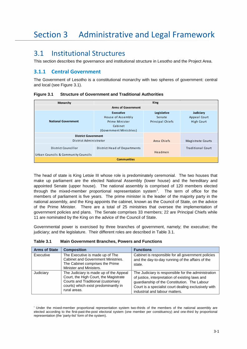
Administrative and Legal Framework Section 3
3.1 Institutional Structures This section describes the governance and institutional structure in Lesotho and the Project Area.
3.1.1 Central Government The Government of Lesotho is a constitutional monarchy with two spheres of government: central and local (see Figure 3.1).
Figure 3.1 Structure of Government and Traditional Authorities
The head of state is King Letsie III whose role is predominately ceremonial. The two houses that make up parliament are the elected National Assembly (lower house) and the hereditary and appointed Senate (upper house). The national assembly is comprised of 120 members elected through the mixed-member proportional representation system1. The term of office for the members of parliament is five years. The prime minister is the leader of the majority party in the national assembly, and the King appoints the cabinet, known as the Council of State, on the advice of the Prime Minister. There are a total of 25 ministries that oversee the implementation of government policies and plans. The Senate comprises 33 members; 22 are Principal Chiefs while 11 are nominated by the King on the advice of the Council of State.
Governmental power is exercised by three branches of government, namely; the executive; the judiciary; and the legislature. Their different roles are described in Table 3.1.
Table 3.1 Main Government Branches, Powers and Functions
Arms of State Composition Functions Executive The Executive is made up of The
Cabinet and Government Ministries. The Cabinet comprises the Prime Minister and Ministers.
Cabinet is responsible for all government policies and the day-to-day running of the affairs of the state.
Judiciary The Judiciary is made up of the Appeal Court, the High Court, the Magistrate Courts and Traditional (customary courts) which exist predominantly in rural areas.
The Judiciary is responsible for the administration of justice, interpretation of existing laws and guardianship of the Constitution. The Labour Court is a specialist court dealing exclusively with industrial and labour matters.
1 Under the mixed-member proportional representation system two-thirds of the members of the national assembly are elected according to the first-past-the-post electoral system (one member per constituency) and one-third by proportional representation (the 'party-list' form of the system).
Monarchy
Executive Legislative JudiciaryHouse of Assembly Senate Appeal Court
Prime Minis ter Principa l Chiefs High CourtCabinet
(Government Minis tries )
Area Chiefs Magis trate Courts
Dis trict Counci l lor Dis trict Head of Departments Tradi tional Court
Urban Counci l s & Community Counci l s
Arms of GovernmentKing
Communities
District Adminis trator
National Government
District Government
Headmen
3-1
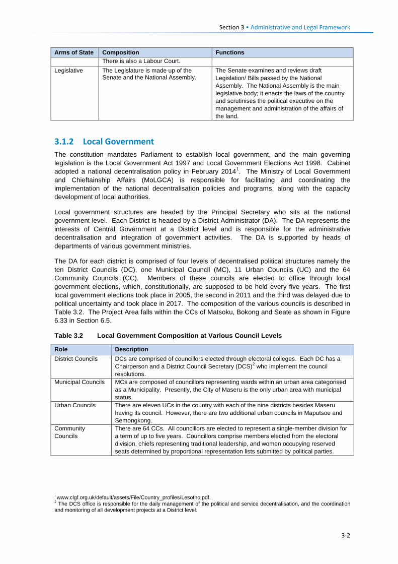
Section 3 • Administrative and Legal Framework
Arms of State Composition Functions There is also a Labour Court.
Legislative The Legislature is made up of the Senate and the National Assembly.
The Senate examines and reviews draft Legislation/ Bills passed by the National Assembly. The National Assembly is the main legislative body; it enacts the laws of the country and scrutinises the political executive on the management and administration of the affairs of the land.
3.1.2 Local Government The constitution mandates Parliament to establish local government, and the main governing legislation is the Local Government Act 1997 and Local Government Elections Act 1998. Cabinet adopted a national decentralisation policy in February 20141. The Ministry of Local Government and Chieftainship Affairs (MoLGCA) is responsible for facilitating and coordinating the implementation of the national decentralisation policies and programs, along with the capacity development of local authorities.
Local government structures are headed by the Principal Secretary who sits at the national government level. Each District is headed by a District Administrator (DA). The DA represents the interests of Central Government at a District level and is responsible for the administrative decentralisation and integration of government activities. The DA is supported by heads of departments of various government ministries.
The DA for each district is comprised of four levels of decentralised political structures namely the ten District Councils (DC), one Municipal Council (MC), 11 Urban Councils (UC) and the 64 Community Councils (CC). Members of these councils are elected to office through local government elections, which, constitutionally, are supposed to be held every five years. The first local government elections took place in 2005, the second in 2011 and the third was delayed due to political uncertainty and took place in 2017. The composition of the various councils is described in Table 3.2. The Project Area falls within the CCs of Matsoku, Bokong and Seate as shown in Figure 6.33 in Section 6.5.
Table 3.2 Local Government Composition at Various Council Levels
Role Description District Councils DCs are comprised of councillors elected through electoral colleges. Each DC has a
Chairperson and a District Council Secretary (DCS)2 who implement the council resolutions.
Municipal Councils MCs are composed of councillors representing wards within an urban area categorised as a Municipality. Presently, the City of Maseru is the only urban area with municipal status.
Urban Councils There are eleven UCs in the country with each of the nine districts besides Maseru having its council. However, there are two additional urban councils in Maputsoe and Semongkong.
Community Councils
There are 64 CCs. All councillors are elected to represent a single-member division for a term of up to five years. Councillors comprise members elected from the electoral division, chiefs representing traditional leadership, and women occupying reserved seats determined by proportional representation lists submitted by political parties.
1 www.clgf.org.uk/default/assets/File/Country_profiles/Lesotho.pdf. 2 The DCS office is responsible for the daily management of the political and service decentralisation, and the coordination and monitoring of all development projects at a District level.
3-2
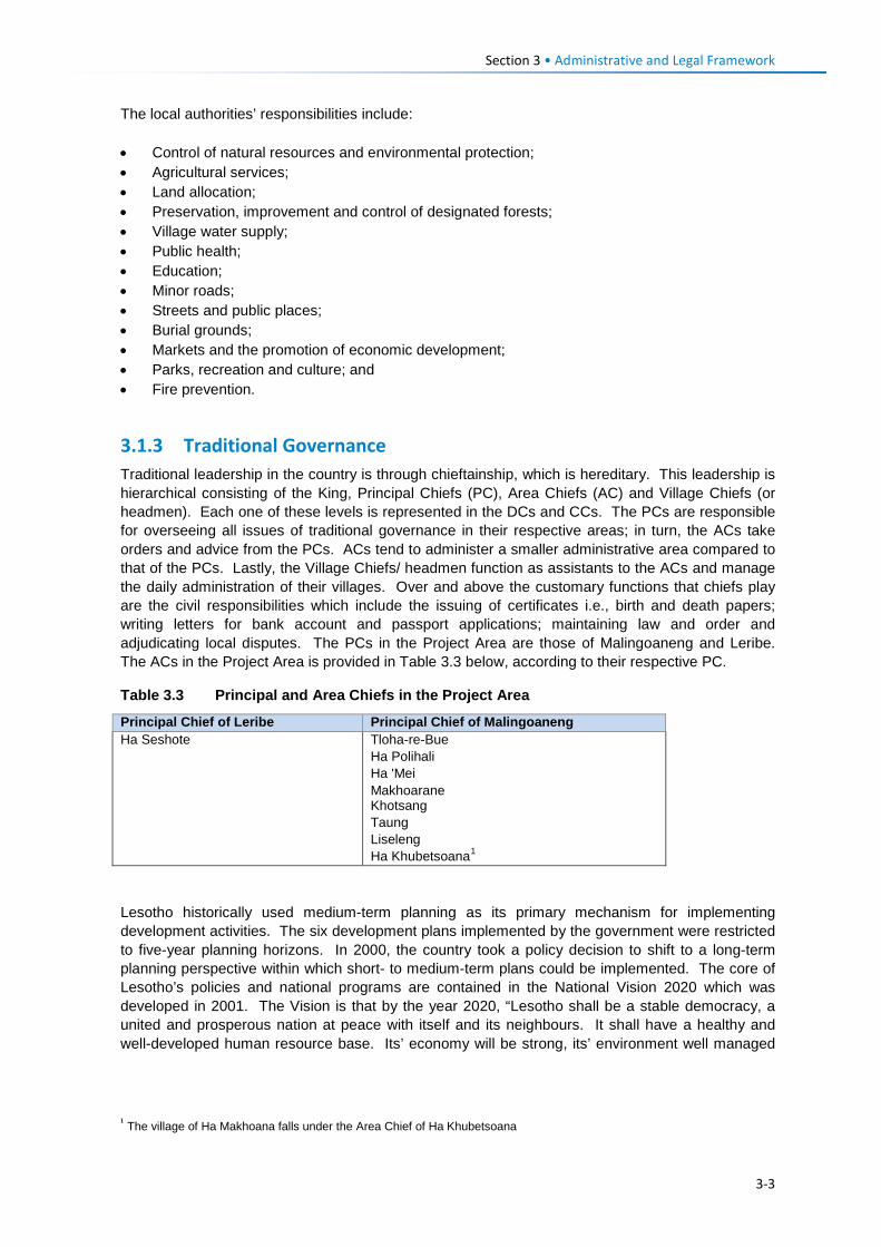
Section 3 • Administrative and Legal Framework
The local authorities’ responsibilities include: • Control of natural resources and environmental protection; • Agricultural services; • Land allocation; • Preservation, improvement and control of designated forests; • Village water supply; • Public health; • Education; • Minor roads; • Streets and public places; • Burial grounds; • Markets and the promotion of economic development; • Parks, recreation and culture; and • Fire prevention.
3.1.3 Traditional Governance Traditional leadership in the country is through chieftainship, which is hereditary. This leadership is hierarchical consisting of the King, Principal Chiefs (PC), Area Chiefs (AC) and Village Chiefs (or headmen). Each one of these levels is represented in the DCs and CCs. The PCs are responsible for overseeing all issues of traditional governance in their respective areas; in turn, the ACs take orders and advice from the PCs. ACs tend to administer a smaller administrative area compared to that of the PCs. Lastly, the Village Chiefs/ headmen function as assistants to the ACs and manage the daily administration of their villages. Over and above the customary functions that chiefs play are the civil responsibilities which include the issuing of certificates i.e., birth and death papers; writing letters for bank account and passport applications; maintaining law and order and adjudicating local disputes. The PCs in the Project Area are those of Malingoaneng and Leribe. The ACs in the Project Area is provided in Table 3.3 below, according to their respective PC.
Table 3.3 Principal and Area Chiefs in the Project Area
Principal Chief of Leribe Principal Chief of Malingoaneng Ha Seshote Tloha-re-Bue
Ha Polihali Ha 'Mei Makhoarane Khotsang Taung Liseleng Ha Khubetsoana1
Lesotho historically used medium-term planning as its primary mechanism for implementing development activities. The six development plans implemented by the government were restricted to five-year planning horizons. In 2000, the country took a policy decision to shift to a long-term planning perspective within which short- to medium-term plans could be implemented. The core of Lesotho’s policies and national programs are contained in the National Vision 2020 which was developed in 2001. The Vision is that by the year 2020, “Lesotho shall be a stable democracy, a united and prosperous nation at peace with itself and its neighbours. It shall have a healthy and well-developed human resource base. Its’ economy will be strong, its’ environment well managed
1 The village of Ha Makhoana falls under the Area Chief of Ha Khubetsoana
3-3
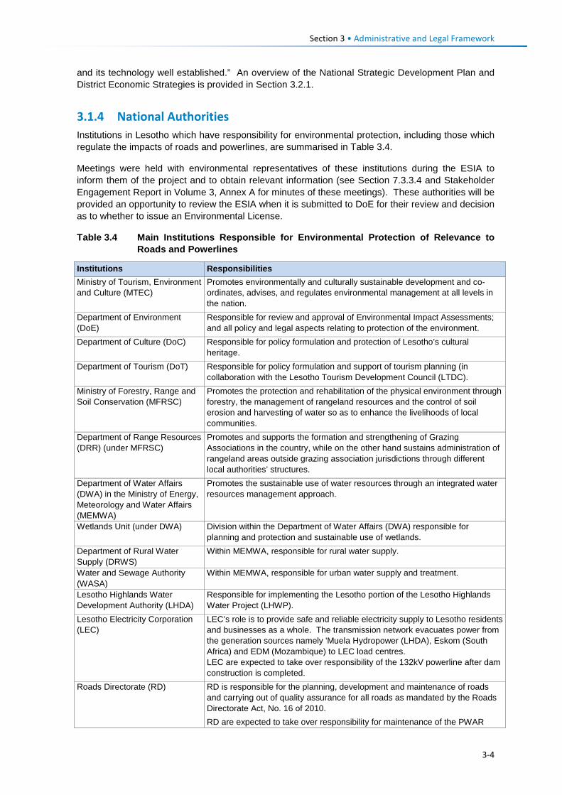
Section 3 • Administrative and Legal Framework
and its technology well established.” An overview of the National Strategic Development Plan and District Economic Strategies is provided in Section 3.2.1.
3.1.4 National Authorities Institutions in Lesotho which have responsibility for environmental protection, including those which regulate the impacts of roads and powerlines, are summarised in Table 3.4.
Meetings were held with environmental representatives of these institutions during the ESIA to inform them of the project and to obtain relevant information (see Section 7.3.3.4 and Stakeholder Engagement Report in Volume 3, Annex A for minutes of these meetings). These authorities will be provided an opportunity to review the ESIA when it is submitted to DoE for their review and decision as to whether to issue an Environmental License.
Table 3.4 Main Institutions Responsible for Environmental Protection of Relevance to Roads and Powerlines
Institutions Responsibilities Ministry of Tourism, Environment and Culture (MTEC)
Promotes environmentally and culturally sustainable development and co-ordinates, advises, and regulates environmental management at all levels in the nation.
Department of Environment (DoE)
Responsible for review and approval of Environmental Impact Assessments; and all policy and legal aspects relating to protection of the environment.
Department of Culture (DoC) Responsible for policy formulation and protection of Lesotho’s cultural heritage.
Department of Tourism (DoT) Responsible for policy formulation and support of tourism planning (in collaboration with the Lesotho Tourism Development Council (LTDC).
Ministry of Forestry, Range and Soil Conservation (MFRSC)
Promotes the protection and rehabilitation of the physical environment through forestry, the management of rangeland resources and the control of soil erosion and harvesting of water so as to enhance the livelihoods of local communities.
Department of Range Resources (DRR) (under MFRSC)
Promotes and supports the formation and strengthening of Grazing Associations in the country, while on the other hand sustains administration of rangeland areas outside grazing association jurisdictions through different local authorities’ structures.
Department of Water Affairs (DWA) in the Ministry of Energy, Meteorology and Water Affairs (MEMWA)
Promotes the sustainable use of water resources through an integrated water resources management approach.
Wetlands Unit (under DWA) Division within the Department of Water Affairs (DWA) responsible for planning and protection and sustainable use of wetlands.
Department of Rural Water Supply (DRWS)
Within MEMWA, responsible for rural water supply.
Water and Sewage Authority (WASA)
Within MEMWA, responsible for urban water supply and treatment.
Lesotho Highlands Water Development Authority (LHDA)
Responsible for implementing the Lesotho portion of the Lesotho Highlands Water Project (LHWP).
Lesotho Electricity Corporation (LEC)
LEC’s role is to provide safe and reliable electricity supply to Lesotho residents and businesses as a whole. The transmission network evacuates power from the generation sources namely 'Muela Hydropower (LHDA), Eskom (South Africa) and EDM (Mozambique) to LEC load centres. LEC are expected to take over responsibility of the 132kV powerline after dam construction is completed.
Roads Directorate (RD) RD is responsible for the planning, development and maintenance of roads and carrying out of quality assurance for all roads as mandated by the Roads Directorate Act, No. 16 of 2010. RD are expected to take over responsibility for maintenance of the PWAR
3-4
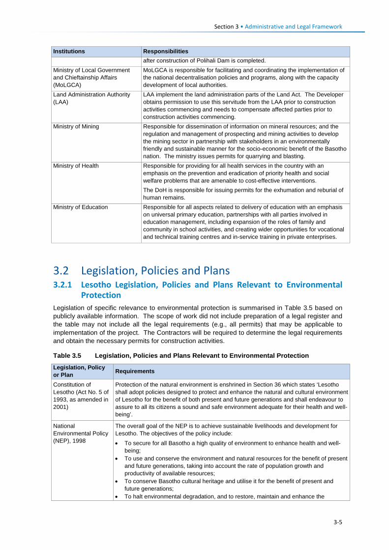
Section 3 • Administrative and Legal Framework
Institutions Responsibilities after construction of Polihali Dam is completed.
Ministry of Local Government and Chieftainship Affairs (MoLGCA)
MoLGCA is responsible for facilitating and coordinating the implementation of the national decentralisation policies and programs, along with the capacity development of local authorities.
Land Administration Authority (LAA)
LAA implement the land administration parts of the Land Act. The Developer obtains permission to use this servitude from the LAA prior to construction activities commencing and needs to compensate affected parties prior to construction activities commencing.
Ministry of Mining Responsible for dissemination of information on mineral resources; and the regulation and management of prospecting and mining activities to develop the mining sector in partnership with stakeholders in an environmentally friendly and sustainable manner for the socio-economic benefit of the Basotho nation. The ministry issues permits for quarrying and blasting.
Ministry of Health Responsible for providing for all health services in the country with an emphasis on the prevention and eradication of priority health and social welfare problems that are amenable to cost-effective interventions. The DoH is responsible for issuing permits for the exhumation and reburial of human remains.
Ministry of Education Responsible for all aspects related to delivery of education with an emphasis on universal primary education, partnerships with all parties involved in education management, including expansion of the roles of family and community in school activities, and creating wider opportunities for vocational and technical training centres and in-service training in private enterprises.
3.2 Legislation, Policies and Plans 3.2.1 Lesotho Legislation, Policies and Plans Relevant to Environmental
Protection Legislation of specific relevance to environmental protection is summarised in Table 3.5 based on publicly available information. The scope of work did not include preparation of a legal register and the table may not include all the legal requirements (e.g., all permits) that may be applicable to implementation of the project. The Contractors will be required to determine the legal requirements and obtain the necessary permits for construction activities.
Table 3.5 Legislation, Policies and Plans Relevant to Environmental Protection
Legislation, Policy or Plan Requirements
Constitution of Lesotho (Act No. 5 of 1993, as amended in 2001)
Protection of the natural environment is enshrined in Section 36 which states ‘Lesotho shall adopt policies designed to protect and enhance the natural and cultural environment of Lesotho for the benefit of both present and future generations and shall endeavour to assure to all its citizens a sound and safe environment adequate for their health and well-being’.
National Environmental Policy (NEP), 1998
The overall goal of the NEP is to achieve sustainable livelihoods and development for Lesotho. The objectives of the policy include: • To secure for all Basotho a high quality of environment to enhance health and well-
being; • To use and conserve the environment and natural resources for the benefit of present
and future generations, taking into account the rate of population growth and productivity of available resources;
• To conserve Basotho cultural heritage and utilise it for the benefit of present and future generations;
• To halt environmental degradation, and to restore, maintain and enhance the
3-5
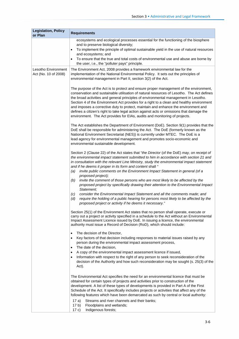
Section 3 • Administrative and Legal Framework
Legislation, Policy or Plan Requirements
ecosystems and ecological processes essential for the functioning of the biosphere and to preserve biological diversity;
• To implement the principle of optimal sustainable yield in the use of natural resources and ecosystems; and
• To ensure that the true and total costs of environmental use and abuse are borne by the user, i.e., the “polluter pays” principle.
Lesotho Environment Act (No. 10 of 2008)
The Environment Act, 2008 provides a framework environmental law for the implementation of the National Environmental Policy. It sets out the principles of environmental management in Part II, section 3(2) of the Act. The purpose of the Act is to protect and ensure proper management of the environment, conservation and sustainable utilisation of natural resources of Lesotho. The Act defines the broad activities and general principles of environmental management in Lesotho. Section 4 of the Environment Act provides for a right to a clean and healthy environment and imposes a corrective duty to protect, maintain and enhance the environment and defines a citizen’s right to take legal action against acts or omissions that damage the environment. The Act provides for EIAs, audits and monitoring of projects. The Act establishes the Department of Environment (DoE). Section 9(1) provides that the DoE shall be responsible for administering the Act. The DoE (formerly known as the National Environment Secretariat (NES)) is currently under MTEC. The DoE is a lead agency for environmental management and promotes socio-economic and environmental sustainable development. Section 2 (Clause 22) of the Act states that “the Director (of the DoE) may, on receipt of the environmental impact statement submitted to him in accordance with section 21 and in consultation with the relevant Line Ministry, study the environmental impact statement and if he deems it proper in its form and content shall “ (a) invite public comments on the Environment Impact Statement in general (of a
proposed project); (b) invite the comment of those persons who are most likely to be affected by the
proposed project by specifically drawing their attention to the Environmental Impact Statement;
(c) consider the Environmental Impact Statement and all the comments made; and (d) require the holding of a public hearing for persons most likely to be affected by the
proposed project or activity if he deems it necessary.” Section 25(1) of the Environment Act states that no person shall operate, execute or carry out a project or activity specified in a schedule to the Act without an Environmental Impact Assessment Licence issued by DoE. In issuing a licence, the environmental authority must issue a Record of Decision (RoD), which should include: • The decision of the Director, • Key factors of that decision including responses to material issues raised by any
person during the environmental impact assessment process, • The date of the decision, • A copy of the environmental impact assessment licence if issued, • Information with respect to the right of any person to seek reconsideration of the
decision of the Authority and how such reconsideration may be sought (s. 25(3) of the Act).
The Environmental Act specifies the need for an environmental licence that must be obtained for certain types of projects and activities prior to construction of the development. A list of these types of developments is provided in Part A of the First Schedule of the Act. It specifically includes projects or activities that affect any of the following features which have been demarcated as such by central or local authority: 17 a) Streams and river channels and their banks; 17 b) Floodplains and wetlands; 17 c) Indigenous forests;
3-6
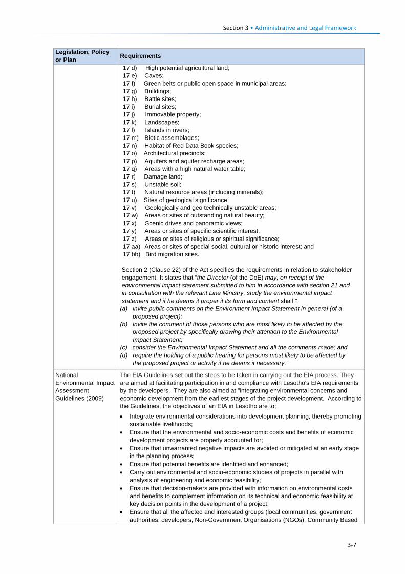
Section 3 • Administrative and Legal Framework
Legislation, Policy or Plan Requirements
17 d) High potential agricultural land; 17 e) Caves; 17 f) Green belts or public open space in municipal areas; 17 g) Buildings; 17 h) Battle sites; 17 i) Burial sites; 17 j) Immovable property; 17 k) Landscapes; 17 l) Islands in rivers; 17 m) Biotic assemblages; 17 n) Habitat of Red Data Book species; 17 o) Architectural precincts; 17 p) Aquifers and aquifer recharge areas; 17 q) Areas with a high natural water table; 17 r) Damage land; 17 s) Unstable soil; 17 t) Natural resource areas (including minerals); 17 u) Sites of geological significance; 17 v) Geologically and geo technically unstable areas; 17 w) Areas or sites of outstanding natural beauty; 17 x) Scenic drives and panoramic views; 17 y) Areas or sites of specific scientific interest; 17 z) Areas or sites of religious or spiritual significance; 17 aa) Areas or sites of special social, cultural or historic interest; and 17 bb) Bird migration sites. Section 2 (Clause 22) of the Act specifies the requirements in relation to stakeholder engagement. It states that “the Director (of the DoE) may, on receipt of the environmental impact statement submitted to him in accordance with section 21 and in consultation with the relevant Line Ministry, study the environmental impact statement and if he deems it proper it its form and content shall “
(a) invite public comments on the Environment Impact Statement in general (of a proposed project);
(b) invite the comment of those persons who are most likely to be affected by the proposed project by specifically drawing their attention to the Environmental Impact Statement;
(c) consider the Environmental Impact Statement and all the comments made; and (d) require the holding of a public hearing for persons most likely to be affected by
the proposed project or activity if he deems it necessary.”
National Environmental Impact Assessment Guidelines (2009)
The EIA Guidelines set out the steps to be taken in carrying out the EIA process. They are aimed at facilitating participation in and compliance with Lesotho's EIA requirements by the developers. They are also aimed at "integrating environmental concerns and economic development from the earliest stages of the project development. According to the Guidelines, the objectives of an EIA in Lesotho are to;
• Integrate environmental considerations into development planning, thereby promoting sustainable livelihoods;
• Ensure that the environmental and socio-economic costs and benefits of economic development projects are properly accounted for;
• Ensure that unwarranted negative impacts are avoided or mitigated at an early stage in the planning process;
• Ensure that potential benefits are identified and enhanced; • Carry out environmental and socio-economic studies of projects in parallel with
analysis of engineering and economic feasibility; • Ensure that decision-makers are provided with information on environmental costs
and benefits to complement information on its technical and economic feasibility at key decision points in the development of a project;
• Ensure that all the affected and interested groups (local communities, government authorities, developers, Non-Government Organisations (NGOs), Community Based
3-7
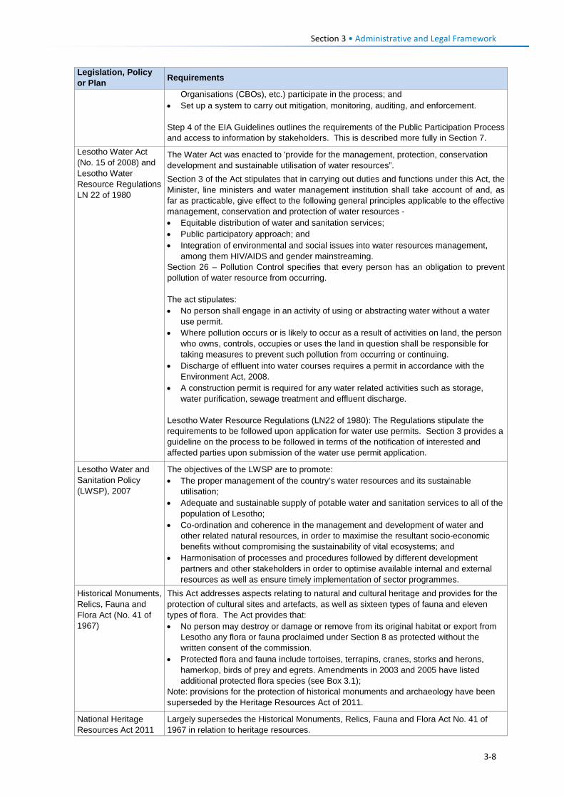
Section 3 • Administrative and Legal Framework
Legislation, Policy or Plan Requirements
Organisations (CBOs), etc.) participate in the process; and • Set up a system to carry out mitigation, monitoring, auditing, and enforcement. Step 4 of the EIA Guidelines outlines the requirements of the Public Participation Process and access to information by stakeholders. This is described more fully in Section 7.
Lesotho Water Act (No. 15 of 2008) and Lesotho Water Resource Regulations LN 22 of 1980
The Water Act was enacted to 'provide for the management, protection, conservation development and sustainable utilisation of water resources”. Section 3 of the Act stipulates that in carrying out duties and functions under this Act, the Minister, line ministers and water management institution shall take account of and, as far as practicable, give effect to the following general principles applicable to the effective management, conservation and protection of water resources - • Equitable distribution of water and sanitation services; • Public participatory approach; and • Integration of environmental and social issues into water resources management,
among them HIV/AIDS and gender mainstreaming. Section 26 – Pollution Control specifies that every person has an obligation to prevent pollution of water resource from occurring. The act stipulates: • No person shall engage in an activity of using or abstracting water without a water
use permit. • Where pollution occurs or is likely to occur as a result of activities on land, the person
who owns, controls, occupies or uses the land in question shall be responsible for taking measures to prevent such pollution from occurring or continuing.
• Discharge of effluent into water courses requires a permit in accordance with the Environment Act, 2008.
• A construction permit is required for any water related activities such as storage, water purification, sewage treatment and effluent discharge.
Lesotho Water Resource Regulations (LN22 of 1980): The Regulations stipulate the requirements to be followed upon application for water use permits. Section 3 provides a guideline on the process to be followed in terms of the notification of interested and affected parties upon submission of the water use permit application.
Lesotho Water and Sanitation Policy (LWSP), 2007
The objectives of the LWSP are to promote: • The proper management of the country’s water resources and its sustainable
utilisation; • Adequate and sustainable supply of potable water and sanitation services to all of the
population of Lesotho; • Co-ordination and coherence in the management and development of water and
other related natural resources, in order to maximise the resultant socio-economic benefits without compromising the sustainability of vital ecosystems; and
• Harmonisation of processes and procedures followed by different development partners and other stakeholders in order to optimise available internal and external resources as well as ensure timely implementation of sector programmes.
Historical Monuments, Relics, Fauna and Flora Act (No. 41 of 1967)
This Act addresses aspects relating to natural and cultural heritage and provides for the protection of cultural sites and artefacts, as well as sixteen types of fauna and eleven types of flora. The Act provides that: • No person may destroy or damage or remove from its original habitat or export from
Lesotho any flora or fauna proclaimed under Section 8 as protected without the written consent of the commission.
• Protected flora and fauna include tortoises, terrapins, cranes, storks and herons, hamerkop, birds of prey and egrets. Amendments in 2003 and 2005 have listed additional protected flora species (see Box 3.1);
Note: provisions for the protection of historical monuments and archaeology have been superseded by the Heritage Resources Act of 2011.
National Heritage Resources Act 2011
Largely supersedes the Historical Monuments, Relics, Fauna and Flora Act No. 41 of 1967 in relation to heritage resources.
3-8
Section 3 • Administrative and Legal Framework
Legislation, Policy or Plan Requirements
(No. 2 of 2012) The National Heritage Act provides for the preservation and protection of heritage sites such as graves, spiritual sites, or archaeological or palaeontological sites. It requires that no person shall: • Impact on all or any part of a heritage site; • Impact on a heritage object; or • Relocate or disturb the position of a fixed heritage object.
Any person who discovers any object which he reasonably believes has heritage significance shall immediately notify a heritage inspector or the District Administrator of the district where the object is discovered, and where possible, deliver the object to the heritage inspector or the District Administrator who shall acknowledge receipt of the object in writing.
The Act makes provision for the appointment of a Heritage Council which is tasked with developing a register of declared heritage sites, objects, buildings, monuments, and living heritage (intangible cultural heritage) which includes ‘cultural tradition, oral history, performance, ritual, popular memory, skill and technique, indigenous knowledge or approach to nature, society and social relationships’. The Heritage Council is to work through the Department of Culture, District Heritage Officers and Local Government structures in order to conserve, preserve, manage and present cultural heritage for the benefit of present and future generations.
Part V of the National Heritage Resources Act 2011 confers "General Heritage Protection" to structures, archaeology, burial grounds and graves (but the act does not clearly define what this means in practice, although the earlier Heritage Bill of 2006 was more explicit). Section 3 of the National Heritage Resources Act 2011 declares that all archaeological and paleontological sites / objects are vested in the State. It follows then that these are not to be demolished, damaged, excavated, altered or removed without a permit (Section 25). The Act specifies protection of all ‘declared’ heritage sites and objects, with various penalties to be imposed on those who disregard the law. (Note: if an object or site is not declared formally, it is not explicitly protected by the 2011 Act).
Public Health Order (No. 12 of 1970)
The Order stipulates that any exhumation of a body or other human remains from a cemetery or other burial site requires a permit and that such permit shall be obtained from the Department of Health by the legal representative or next of kin or other duly authorised agent. The permit may prescribe conditions and precautions under which such exhumation shall be conducted. Section 75 makes provision for the Minister of Health to permit essential exhumation of burial sites for any public, mining or infrastructure purpose. Removal of burial sites from an authorised cemetery requires a six-month notification period of the intention to relocate graves.
Range Management and Grazing Control Regulations (LN 39 of 1980)
The Regulations relate to the rights of access to grazing areas and related management aspects, and the protection of agricultural land. They provide, among other things, for setting aside of areas for the propagation of grass, reed beds, tree planting or rotational grazing (leboella), restriction of grazing by local chiefs, rights of access to grazing areas, organisation of rotational grazing, regulation of total number of stock in the country, and control of parasites.
National Range Resources Management Policy, 2014
Purpose: To provide guidance for the development of effective strategies that combat land and vegetation degradation and motivate for improved legislation and implementation thereof; Goal: To attain sustainable development and management of rangeland resources for an enhanced biodiversity, optimum productivity and improved livelihoods of the people of Lesotho. Sets out a legal precedence from which any guideline, development, regulatory mechanism, strategy, plan, activity intended for sustainable rangelands resources
3-9
Section 3 • Administrative and Legal Framework
Legislation, Policy or Plan Requirements
management in Lesotho shall emanate. The policy framework is premised on five key focus areas, namely: • Sustainable management of rangeland resources; • Conservation of biodiversity and maintenance of ecosystems; • Rangelands monitoring and research; • Maintenance and protection of wetland areas, and • Socio-economic dimensions. One of the key policy areas of the National Range Resources Management Policy includes the maintenance and protection of wetland areas. The objectives of the Policy relating to wetlands are: • To produce, maintain, and deliver current and historical geospatial wetland data and
information for the Nation, in partnership with others; • To analyse and report on status, trends, threats, and assessments of wetlands and
related habitats, with a focus on habitats that have experienced substantial wetland change or that are changing rapidly, and
• To promote sound decision making and policy formulation through the development and dissemination of wetlands data and information through a variety of media.
Land Act (No. 8 of 2010)
The purpose of the Land Act is to ‘repeal and replace the law relating to land, provide for the grant of titles to land, the conversion of titles to land, the better securing of titles to land, the administration of land, the expropriation of land for public purposes, the grant of servitudes, the creation of land courts and the settlement of disputes relating to land; systematic regularisation and adjudication; and for connected purposes.’
Land Regulations, (LN 15 of 1980)
These Regulations provide for the tasks and duties of: • Land Committees in relation to agricultural and residential land allocation; • Inheritance of allocated land; • Drawing up of deeds and registration; • Applications for public servitudes, boundaries, rents, fees and development charges; • Consent to leases of development areas, and • Limitations on areas of residential, commercial and industrial leases.
Land Administration Authority (LAA) Act (No. 9 of 2010)
The Act empowers LAA to administer land registration system and includes: • Granting consents for land transactions whenever necessary; • Registering all land transactions requiring registration; • Issuing leases to land; • Maintaining a record of all rights and interests in land; • Providing information regarding land holdings and other interests in land upon
request.
Land allocation is decentralised to municipal councils in urban areas and to community councils in rural areas, with councils comprising elected representatives and local chiefs.
The Land Husbandry Act (No. 22 of 1969)
The Act relates to the management and use of land, soil conservation, livestock management, water resources, irrigation and prevention of certain agricultural practices. It contains provisions on range management and grazing control for communities to manage range resources in a sustainable manner, guaranteeing equal access.
Mines and Minerals Act 1966. repealed by the Mines and Minerals Act (No. 4 of 2005)
The Act requires persons performing certain mining and quarry related activities to apply for a mineral right and mineral permit. Part IV relates to the application, rights, duties and restrictions of the holder of a Mineral Permit. Section 55 requires that holders of mineral concessions shall not create unprotected pits, hazardous waste dumps or other hazards that may endanger the stock, crops or other lawful activity of the owner or lawful occupier of the land covered by such mineral concession. Section 56 requires holders of mineral concessions to pay compensation for disturbance to owners of any crops, trees, buildings or works damaged during operations. Section 58 requires the holder of a mineral right to conduct operations in such a manner as to:
3-10
Section 3 • Administrative and Legal Framework
Legislation, Policy or Plan Requirements
• Preserve the natural environment; • Minimise and control waste or undue loss of or damage to natural and biological
resources; and • Prevent and where unavoidable, promptly treat pollution and contamination of the
environment. Applicants of a mining lease are required to prepare a comprehensive EIA and are required to rehabilitate and reclaim the mineral right area in ‘a manner acceptable to the Commissioner and the Authority’. This also includes the need to maintain and restore top soil and restore the ‘land substantially to the condition in which it was prior to the commencement of operations’.
Explosives Act (No. 15 of 2003) (South Africa)
Outlines the legal requirements for: • Storage and possession of explosives; • Storage and use of explosives, and transport to or from South Africa; and • Measures to prevent injury to persons or damage to property. Specifies the requirement for a permit to use, store and transport explosives.
Lesotho Noise Regulations (LN 137 of 1996)
Specifies the following requirements with respect to noise: • An employer shall, where an employee receives or is likely to receive noise above the
action level (a) provide the employee with a personal hearing protective equipment approved by the Minister of Labour and (b) display pro-safety signs regarding the wearing of the personal hearing protective equipment;
• An employer shall, where the noise that an employee is likely to receive is above the action level, prepare a noise report every six months;
• Where there is an increase of 5 dB or more in the peak noise level exposure received by an employee who was already receiving noise above the action level, the employer shall, within one month of noticing the increase, prepare a noise report, informing the Ministry of Labour of the increase.
• Noise data must be collected by a person approved by the Ministry of Labour. Lesotho Electricity Corporation (LEC) Act (No. 12 of 2002)
Established the Lesotho Electricity and Water Authority. The Lesotho Electricity Authority (LEA) was transformed into a multi-sector regulator through the enactment of the Lesotho Electricity Authority Amendment Act of 2011 by the Ministry of Natural Resources. The LEC facilitates the connection of new customers to the electricity grid and has the mandate to sustainably manage the grid and associated assets.
Telecommunications Act (No. 2 of 2000)
Regulates the planning and installation of telecommunication facilities and specifically outlines aspects relating to access to ‘public property’ which shall require obtaining prior approval of the relevant administrative authority with responsibility for entry, construction or installation of any facilities on property under the responsibility of that authority. It also requires compliance with applicable environmental laws and policies. ‘Public property’ includes roads, streets, Road Reserve, buildings, railways, footpaths, waterways and land reserved for public purposes.
Roads Act, (No. 24 of 1969) as amended by the Roads Directorate Act (No. 16 of 2010)
Places responsibility of all aspects of road planning, development and maintenance on RD including the need to ‘ensure mitigation of negative environmental impacts from road construction’ and to rehabilitate affected areas, in accordance with environmental guidelines’. RD shall also enforce the declaration of Road Reserves and enforcement of building restrictions.
Lesotho Roads and Bridge Standards, 1998
The standards (Guidelines for Environmental Control in Volume 9) specify the following environmental protection measures: • Ensure that contaminated water (e.g., oils, phosphates, cleaning substances,
herbicides or pesticides) are not released into sensitive areas of the natural environment;
• All fuel supplies and other potentially toxic or radioactive substances should be stored outside the 1:50 year floodline;
• Pumps adjacent to water sources should be located so they are not swept away in high rainfall periods;
• Sandbags or other geotextile materials should be used to prevent pollutants of any kind entering the waterway;
• Ensure site installations (including toilets) are located a safe distance away from
3-11
Section 3 • Administrative and Legal Framework
Legislation, Policy or Plan Requirements
sensitive areas (e.g., wells, dams, wetlands, streams, rivers). Calculation of the safe distance will be project-specific, but as a guide, installations should be at least 20 m (measured horizontally) away from sensitive areas;
• Water with high sediment concentrations should be retained in sediment dams to allow for settling before release;
• If construction activities affect any drinking or washing water supplies downstream of the work site due to accident or diversions, suitable alternative water supplies should be provided to the affected communities. In the event of an accident, communities downstream of the affected area must be informed immediately and steps taken to remedy the situation`.
With respect to rehabilitation, all areas affected by surveying and construction, including borrow areas, haul roads, spoil areas and construction camps shall be rehabilitated. Rehabilitation is required to be undertaken concurrently with construction. The Contractors are required to submit a rehabilitation plan for approval prior to commencing operations. Rehabilitation shall be part of the Contractors’ programme and that regular reports on progress shall be submitted. The standards outline rehabilitation measures for topsoil conservation; shaping and trimming of cut and fill slopes; slope stabilisation, revegetation (including hydroseeding); as well as measures required to use and close borrow pits and quarries.
Weeds Eradication Act (No. 18 of 1969)
Requires all persons occupying land to eradicate all weeds on that land and that custodians of the land are responsible for the eradication of weeds on unoccupied or unallocated land. This Act is also supported by requirements under the Environmental Act 10 of 2008. Spread of alien invasive plants along roadsides is common along most roads in Lesotho as a result of creation of disturbed areas and import of seeds in road building materials or equipment.
Labour Code Order of 1992 (No. 24 of 1992) and Amendment of 2006.
Part VII relating to Health Safety and Welfare at work deals with aspects such as the wearing of Protective Personal Equipment (PPE) and clothing, fire prevention and fire-fighting, removal of dust or fumes, etc. The Labour Code Order (Amendment) of 2006 states that an employer shall not discriminate against a job applicant on the basis of his or her HIV/AIDS status (refer to Section 235E (1) of the Labour Code (Amendment) Order, 2006). Part IX provides protection to women, young persons and children by stipulating the minimum age of employment, placing a restriction on night work and employment in mines and quarries and protects women from being dismissed whilst on maternity leave. Section 107 of the Code relates to an employee’s exposure to noise and states that: Where in any place of work persons are employed in any process involving exposure to noise or vibration which may constitute a danger to their health, effective means shall, so far as is reasonably practicable, be provided for the reduction of such noise or vibration within the place of work, as specified in regulations.
Lesotho Gender and Development Policy
The Gender and Development Policy is a government tool geared towards addressing the challenges of gender inequities and inequalities, poverty, increased spread of HIV/ AIDS, retrenchment and unemployment by adopting a rights-based approach to development. The policy is based on the realisation of human rights of all, women and men alike, holding principles of equal participation in development, non-discrimination and the empowerment of the marginalised women and men, boys and girls.
Workmen’s Compensation Act, 1977
The Act directs employers on how to deal with compensation issues in the event that an employee becomes injured or disabled in the line of duty, or in the event that an employee dies while in the employ of the employer.
Local Government Act, 1997 as Amended by Local Government
Schedule 2 of the Local Government Act, 1997 states that CCs’ functions include control of natural resources (e.g., sand, stones) and environmental protection (e.g., dongas, pollution, grazing control, control of natural resources, land/site allocation and physical planning, water resources, agriculture and forestry).
3-12
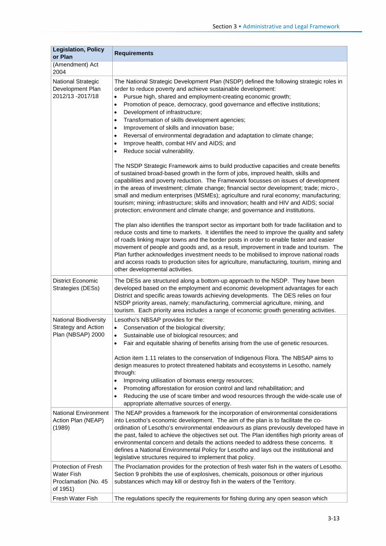
Section 3 • Administrative and Legal Framework
Legislation, Policy or Plan Requirements
(Amendment) Act 2004 National Strategic Development Plan 2012/13 -2017/18
The National Strategic Development Plan (NSDP) defined the following strategic roles in order to reduce poverty and achieve sustainable development: • Pursue high, shared and employment-creating economic growth; • Promotion of peace, democracy, good governance and effective institutions; • Development of infrastructure; • Transformation of skills development agencies; • Improvement of skills and innovation base; • Reversal of environmental degradation and adaptation to climate change; • Improve health, combat HIV and AIDS; and • Reduce social vulnerability. The NSDP Strategic Framework aims to build productive capacities and create benefits of sustained broad-based growth in the form of jobs, improved health, skills and capabilities and poverty reduction. The Framework focusses on issues of development in the areas of investment; climate change; financial sector development; trade; micro-, small and medium enterprises (MSMEs); agriculture and rural economy; manufacturing; tourism; mining; infrastructure; skills and innovation; health and HIV and AIDS; social protection; environment and climate change; and governance and institutions. The plan also identifies the transport sector as important both for trade facilitation and to reduce costs and time to markets. It identifies the need to improve the quality and safety of roads linking major towns and the border posts in order to enable faster and easier movement of people and goods and, as a result, improvement in trade and tourism. The Plan further acknowledges investment needs to be mobilised to improve national roads and access roads to production sites for agriculture, manufacturing, tourism, mining and other developmental activities.
District Economic Strategies (DESs)
The DESs are structured along a bottom-up approach to the NSDP. They have been developed based on the employment and economic development advantages for each District and specific areas towards achieving developments. The DES relies on four NSDP priority areas, namely; manufacturing, commercial agriculture, mining, and tourism. Each priority area includes a range of economic growth generating activities.
National Biodiversity Strategy and Action Plan (NBSAP) 2000
Lesotho’s NBSAP provides for the: • Conservation of the biological diversity; • Sustainable use of biological resources; and • Fair and equitable sharing of benefits arising from the use of genetic resources.
Action item 1.11 relates to the conservation of Indigenous Flora. The NBSAP aims to design measures to protect threatened habitats and ecosystems in Lesotho, namely through: • Improving utilisation of biomass energy resources; • Promoting afforestation for erosion control and land rehabilitation; and • Reducing the use of scare timber and wood resources through the wide-scale use of
appropriate alternative sources of energy. National Environment Action Plan (NEAP) (1989)
The NEAP provides a framework for the incorporation of environmental considerations into Lesotho’s economic development. The aim of the plan is to facilitate the co-ordination of Lesotho’s environmental endeavours as plans previously developed have in the past, failed to achieve the objectives set out. The Plan identifies high priority areas of environmental concern and details the actions needed to address these concerns. It defines a National Environmental Policy for Lesotho and lays out the institutional and legislative structures required to implement that policy.
Protection of Fresh Water Fish Proclamation (No. 45 of 1951)
The Proclamation provides for the protection of fresh water fish in the waters of Lesotho. Section 9 prohibits the use of explosives, chemicals, poisonous or other injurious substances which may kill or destroy fish in the waters of the Territory.
Fresh Water Fish The regulations specify the requirements for fishing during any open season which
3-13
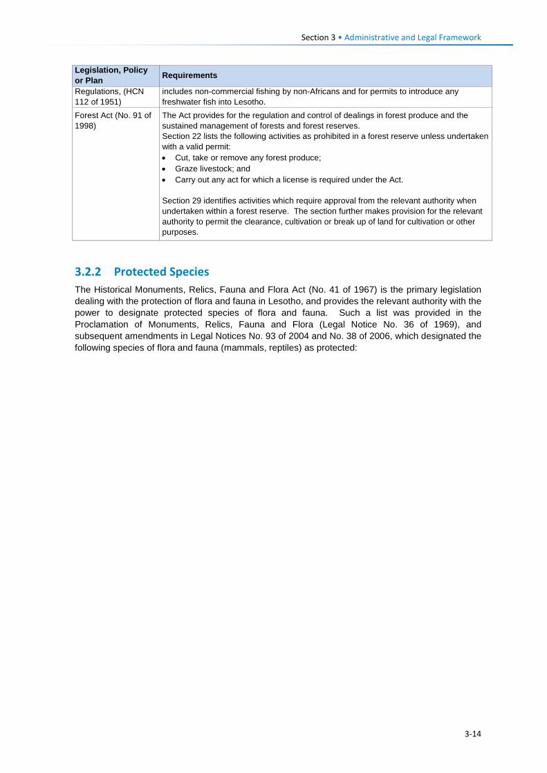
Section 3 • Administrative and Legal Framework
Legislation, Policy or Plan Requirements
Regulations, (HCN 112 of 1951)
includes non-commercial fishing by non-Africans and for permits to introduce any freshwater fish into Lesotho.
Forest Act (No. 91 of 1998)
The Act provides for the regulation and control of dealings in forest produce and the sustained management of forests and forest reserves. Section 22 lists the following activities as prohibited in a forest reserve unless undertaken with a valid permit: • Cut, take or remove any forest produce; • Graze livestock; and • Carry out any act for which a license is required under the Act.
Section 29 identifies activities which require approval from the relevant authority when undertaken within a forest reserve. The section further makes provision for the relevant authority to permit the clearance, cultivation or break up of land for cultivation or other purposes.
3.2.2 Protected Species The Historical Monuments, Relics, Fauna and Flora Act (No. 41 of 1967) is the primary legislation dealing with the protection of flora and fauna in Lesotho, and provides the relevant authority with the power to designate protected species of flora and fauna. Such a list was provided in the Proclamation of Monuments, Relics, Fauna and Flora (Legal Notice No. 36 of 1969), and subsequent amendments in Legal Notices No. 93 of 2004 and No. 38 of 2006, which designated the following species of flora and fauna (mammals, reptiles) as protected:
3-14
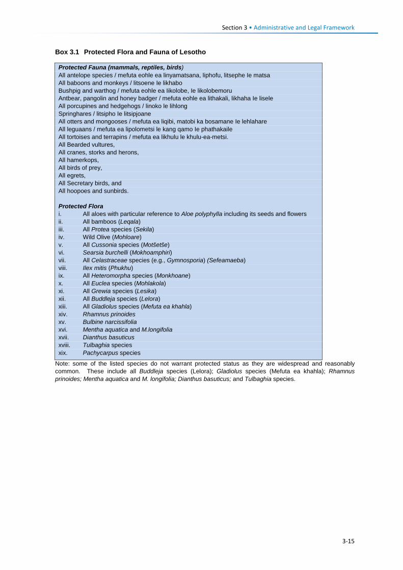
Section 3 • Administrative and Legal Framework
Box 3.1 Protected Flora and Fauna of Lesotho
Note: some of the listed species do not warrant protected status as they are widespread and reasonably common. These include all Buddleja species (Lelora); Gladiolus species (Mefuta ea khahla); Rhamnus prinoides; Mentha aquatica and M. longifolia; Dianthus basuticus; and Tulbaghia species.
Protected Fauna (mammals, reptiles, birds) All antelope species / mefuta eohle ea linyamatsana, liphofu, litsephe Ie matsa All baboons and monkeys / litsoene Ie likhabo Bushpig and warthog / mefuta eohle ea Iikolobe, Ie likolobemoru Antbear, pangolin and honey badger / mefuta eohle ea lithakali, likhaha Ie lisele All porcupines and hedgehogs / linoko le lihlong Springhares / litsipho Ie litsipjoane All otters and mongooses / mefuta ea liqibi, matobi ka bosamane Ie lehlahare All leguaans / mefuta ea lipolometsi le kang qamo Ie phathakaile All tortoises and terrapins / mefuta ea likhulu le khulu-ea-metsi. All Bearded vultures, All cranes, storks and herons, All hamerkops, All birds of prey, All egrets, All Secretary birds, and All hoopoes and sunbirds. Protected Flora i. All aloes with particular reference to Aloe polyphylla including its seeds and flowers ii. All bamboos (Leqala) iii. All Protea species (Sekila) iv. Wild Olive (Mohloare) v. All Cussonia species (Motšetše) vi. Searsia burchelli (Mokhoamphiri) vii. All Celastraceae species (e.g., Gymnosporia) (Sefeamaeba) viii. Ilex mitis (Phukhu) ix. All Heteromorpha species (Monkhoane) x. All Euclea species (Mohlakola) xi. All Grewia species (Lesika) xii. All Buddleja species (Lelora) xiii. All Gladiolus species (Mefuta ea khahla) xiv. Rhamnus prinoides xv. Bulbine narcissifolia xvi. Mentha aquatica and M.longifolia xvii. Dianthus basuticus xviii. Tulbaghia species xix. Pachycarpus species
3-15
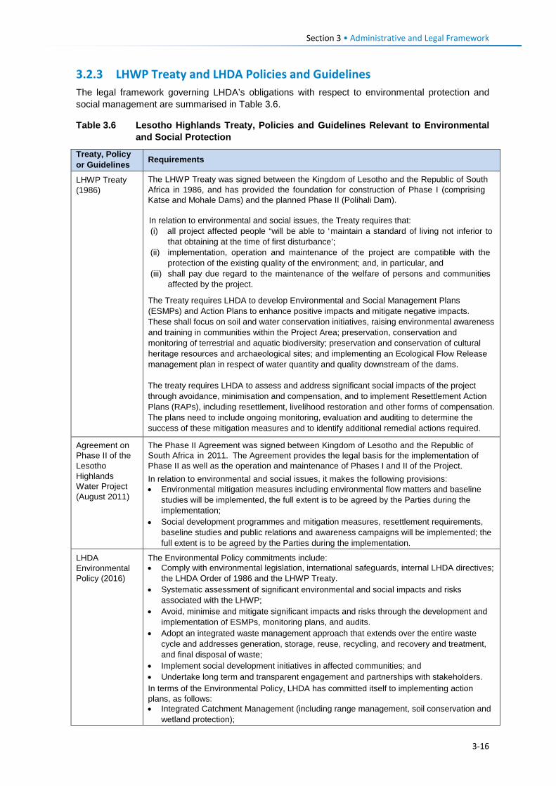
Section 3 • Administrative and Legal Framework
3.2.3 LHWP Treaty and LHDA Policies and Guidelines The legal framework governing LHDA’s obligations with respect to environmental protection and social management are summarised in Table 3.6.
Table 3.6 Lesotho Highlands Treaty, Policies and Guidelines Relevant to Environmental and Social Protection
Treaty, Policy or Guidelines Requirements
LHWP Treaty (1986)
The LHWP Treaty was signed between the Kingdom of Lesotho and the Republic of South Africa in 1986, and has provided the foundation for construction of Phase I (comprising Katse and Mohale Dams) and the planned Phase II (Polihali Dam). In relation to environmental and social issues, the Treaty requires that: (i) all project affected people “will be able to ‘maintain a standard of living not inferior to
that obtaining at the time of first disturbance’; (ii) implementation, operation and maintenance of the project are compatible with the
protection of the existing quality of the environment; and, in particular, and (iii) shall pay due regard to the maintenance of the welfare of persons and communities
affected by the project.
The Treaty requires LHDA to develop Environmental and Social Management Plans (ESMPs) and Action Plans to enhance positive impacts and mitigate negative impacts. These shall focus on soil and water conservation initiatives, raising environmental awareness and training in communities within the Project Area; preservation, conservation and monitoring of terrestrial and aquatic biodiversity; preservation and conservation of cultural heritage resources and archaeological sites; and implementing an Ecological Flow Release management plan in respect of water quantity and quality downstream of the dams. The treaty requires LHDA to assess and address significant social impacts of the project through avoidance, minimisation and compensation, and to implement Resettlement Action Plans (RAPs), including resettlement, livelihood restoration and other forms of compensation. The plans need to include ongoing monitoring, evaluation and auditing to determine the success of these mitigation measures and to identify additional remedial actions required.
Agreement on Phase II of the Lesotho Highlands Water Project (August 2011)
The Phase II Agreement was signed between Kingdom of Lesotho and the Republic of South Africa in 2011. The Agreement provides the legal basis for the implementation of Phase II as well as the operation and maintenance of Phases I and II of the Project. In relation to environmental and social issues, it makes the following provisions: • Environmental mitigation measures including environmental flow matters and baseline
studies will be implemented, the full extent is to be agreed by the Parties during the implementation;
• Social development programmes and mitigation measures, resettlement requirements, baseline studies and public relations and awareness campaigns will be implemented; the full extent is to be agreed by the Parties during the implementation.
LHDA Environmental Policy (2016)
The Environmental Policy commitments include: • Comply with environmental legislation, international safeguards, internal LHDA directives;
the LHDA Order of 1986 and the LHWP Treaty. • Systematic assessment of significant environmental and social impacts and risks
associated with the LHWP; • Avoid, minimise and mitigate significant impacts and risks through the development and
implementation of ESMPs, monitoring plans, and audits. • Adopt an integrated waste management approach that extends over the entire waste
cycle and addresses generation, storage, reuse, recycling, and recovery and treatment, and final disposal of waste;
• Implement social development initiatives in affected communities; and • Undertake long term and transparent engagement and partnerships with stakeholders. In terms of the Environmental Policy, LHDA has committed itself to implementing action plans, as follows: • Integrated Catchment Management (including range management, soil conservation and
wetland protection);
3-16
Section 3 • Administrative and Legal Framework
Treaty, Policy or Guidelines Requirements
• Biodiversity and Conservation Management Plans (focused on priority species such as Bearded Vulture, Maloti Minnow and Spiral Aloe;
• Water Quality and Quantity Monitoring; • Environmental Flow Monitoring Requirements; • Waste Management and Pollution Control Plans; • Cultural Heritage Management Plan; • Resettlement Action Plans, and • Social Development Plans. Additional commitments include Environmental Awareness training of LHDA employees, Contractor staff, and affected communities; environmental auditing of performance, and stakeholder engagement.
LHWP Phase II: Community Participation Strategy (September 2014)
LHDA’s Community Participation Strategy is aimed at ensuring the involvement and participation of the public in the project planning, implementation, monitoring and decision-making processes through the engagement of community structures and other project role-players. It sets out the establishment of community liaison structures which include area liaison committees and combined liaison committees in the Community Councils affected by the Project. Its main objectives are: • To develop and maintain on an ongoing basis the process of public participation to
ensure the continued involvement and participation of interested and affected parties in a meaningful way;
• To promote involvement and participation of community structures in decision making processes, planning and implementation of relevant LHWP activities;
• To co-ordinate current and planned LHDA community participation initiatives; and • To establish a two-way communication channel between the LHDA and the communities.
Area Liaison Committees (ALCs) have been set up to provide direct liaison between LHDA, its Contractors and the local communities within Phase II of the LHWP, and to serve as a forum for: • Community participation processes; • Mobilisation, sensitisation and awareness- raising of affected communities; • A two-way communication process between the affected people and the Project
authorities; • Participation and consultation on Project policies and strategies; • Exchange of views/information on the LHWP and LHDA activities and programmes; • Participation in data collection, project studies, information disclosure, programmes
implementation; • Participation and witness to land acquisition, asset inventory/ registration, ownership and
measurement of properties to be affected; • Participation and witness to consultations and agreements reached with individual
households and communities to be compensated; • Identification of development needs, and establishment of action plans for realisation of
development goals; • Receiving, adjudication and channeling of complaints and grievances from the affected
communities to the LHDA; • Identification of affected people for training on land-based, wage-based and enterprise-
based livelihoods; • Identification of the most vulnerable households e.g., orphans, aged and disabled for
special assistance by LHDA and / or Government Departments; • Management of unskilled labour; and • Projects and programmes reviews.
Labour Recruitment Guidelines (version 7.2;
The Labour Recruitment Guidelines aim to guide the hiring and employment of labour for Phase II of the LHWP. It requires Contractors to prioritise recruitment of local labour from Lesotho, particularly for unskilled positions. It specifies that all recruitment shall be done through a Project Labour Recruitment Desk (PLRD) to be established at Mapholaneng or
3-17
Section 3 • Administrative and Legal Framework
Treaty, Policy or Guidelines Requirements
February 2017) Tlokoeng with a satellite office at Ha Lejone. All potential work seekers will need to be registered at the PLRD in order to be considered for employment. The Guidelines set out principles regarding the recruitment of unskilled labour. In order to distribute employment opportunities unskilled jobs will aim to be assigned for a period of between 12 and 18 months, where technically feasible based on project duration, location and cost effectiveness and subject to motivation by the Contractor/s. Where a Contractor has trained and developed an individual to such an extent that the individual can be considered semi-skilled; then the individual may be re-employed.
LHWP Phase II Procurement Guidelines
The LHDA procurement guidelines for Phase II have the central objectives of the project procurement processes and procedures: • To comply with the spirit and objectives of Article 6 of the Treaty and Articles 10 and 11 of
the Phase II Agreement, as well as the provisions of the Lesotho Public Procurement Regulations of 2007, Part III (12), which are to foster competiveness and transparency while increasing participation of individuals from Lesotho, South Africa and SADC member states;
• To maximise procurement opportunities for Lesotho and South African suppliers; • To minimise the utilisation of imported goods, skills and labour, where applicable, within
the ambit of the laws governing Lesotho; and • To maximise skills and technology transfer through the training of individuals and
enterprise development opportunities for Lesotho-based companies and black owned companies in the Republic of South Africa.
Contractor Procurement Framework (Oct 2016)
The Contractor procurement framework sets out the key provisions for procurement of Contractors for the LHWP in such a way as to support the local and regional economies. This includes limiting the number of contracts and their cumulative value that can be awarded to any one consultant or Contractor in order to maximise participation by small and medium sized firms and adopting different contractual requirements fro smaller construction contracts. Consultants for each construction contract are required to develop procedures to implement the framework. A specific requirement is for Contractors to optimise use of labour-intensive construction methods with the aim of increasing the participation of local workers where appropriate, and provided no significant impacts on the project schedule are anticipated. The preference scoring system applied to tenderers aims to maximise procurement and employment opportunities for Lesotho and South African suppliers and individuals; skills and technology training transfer for Lesotho based companies and black owned companies in South Africa; and participation by women owned, small, medium-sized and micro enterprises and cooperatives.
LHWP Phase II Compensation Policy (version 8.1; August 2017)
The Policy applies to all losses of assets and income, and impacts on livelihoods suffered by people, households, communities and institutions as a result of the implementation of Phase II of the LHWP. According to the Policy all persons that experience these impacts as a result of Phase II will be entitled to equitable treatment as embodied in the Policy. The compensation policy sets out the framework for all compensation aspects and assets that may be affected by the project. The Policy objectives are to: • Minimise involuntary land take by investigating all possible Project design alternatives; • Ensure that affected people and communities, including host communities are
meaningfully consulted on Project designs, alternatives and impacts; • Promote affected people’s participation in the planning, implementation and monitoring of
compensation, resettlement, mitigation and development measures; • Ensure that relocation of households and businesses is undertaken in a participative,
systematic and beneficial manner, involving both displaced and host communities; • Ensure that affected people are promptly, fairly and fully compensated for their losses; • Ensure that direct compensation is accompanied by additional measures where
necessary to help restore livelihoods; and • Ensure that existing cultural and religious practices are respected, and preserved to the
maximum extent practical.
3-18
Section 3 • Administrative and Legal Framework
Treaty, Policy or Guidelines Requirements
Compensation Rates: Compensation rates for Phase II have been declared under compensation regulations for arable land, household structures, vegetable gardens, arable land and fruit trees etc. The rates are adjusted annually for price escalation using the Lesotho consumer price index (CPI) for primary residential dwellings and formal business structures will be based on the principle of replacement cost. People who are physically resettled will be paid a displacement allowance for three years. Consultations will occur with affected communities, their local authorities and district stakeholders to explain the rates and the basis for their calculations. Where urban land and property are acquired, valuation will be carried out according to the provisions of the Land Act of 2010 and the associated Regulations. All valuations will be certified by LAA.
Livelihood Restoration and Social Development Framework (LRSDF) (August 2017)
The Livelihood Restoration and Social Development Framework supplements the Phase II Compensation Policy, and serves to provide a context for the conceptualisation, planning and implementation of livelihood restoration measures and social development initiatives on Phase II. The focus areas of the LR&SD Framework are as follows • Livelihood restoration measures for households and communities directly affected
(physical and economic displacement) by implementation of Phase II. These initiatives will be planned and implemented with the full participation of affected households and communities and other stakeholders for effective sustainability, and
• Initiatives to support broad-based social and economic development in the Phase II areas. These could include water and sanitation initiatives, public health initiatives (to be implemented under the Phase II Public Health Action Plan), and other initiatives to be finalised in conjunction with the Phase II communities, government and other development partners.
The framework outlines LHDA’s proposed approach to addressing livelihood restoration and socio-economic development for LHWP Phase II. Livelihood restoration projects are proposed to be developed in agriculture, tourism, technical skills development, natural resource value addition and community based micro-finance as well as a number of awareness programmes on topics such as Governance, Social Development, Health, Occupation Health and Safety, and Integrated Catchment Management. Under the LRSDF, LHDA proposes to develop a Social Development Master Plan (SDMP) for Phase II in consultation with local communities, GoL and other development partners. The SDMP will describe the approved projects to be implemented in the Phase II area, the institutional arrangements for implementation of each SDMP component, provide a programme and timeframe; describe funding requirements and responsibilities, and monitoring and evaluation requirements. Approved projects in the SDMP will be implemented by appointed service providers according to the programme and timeframe established in the SDMP. Social development projects and programmes will be handed over, where applicable, to the relevant government agencies for ongoing support and oversight as shall be agreed and formalised through MoUs. A monitoring and evaluation programme will be developed to determine the outcomes/ impacts of social development programmes.
3-19
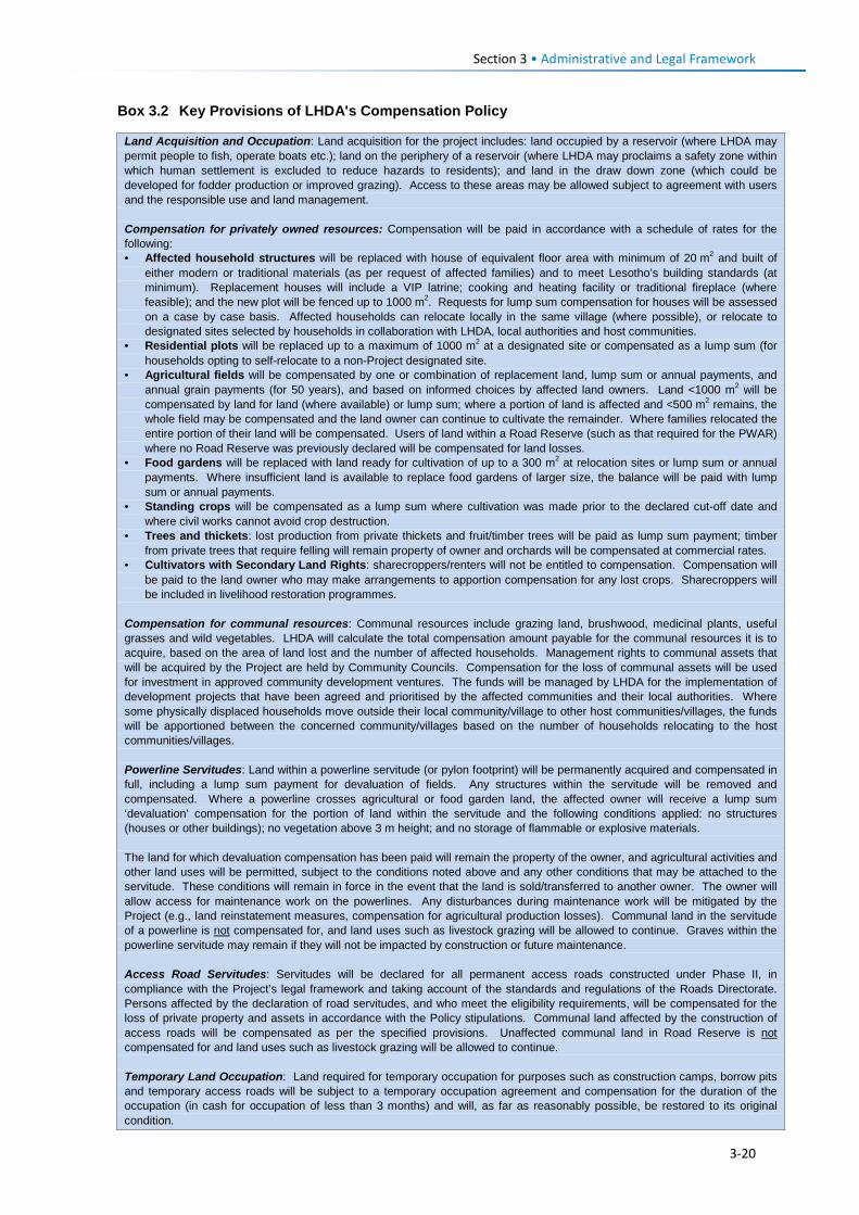
Section 3 • Administrative and Legal Framework
Box 3.2 Key Provisions of LHDA's Compensation Policy
Land Acquisition and Occupation: Land acquisition for the project includes: land occupied by a reservoir (where LHDA may permit people to fish, operate boats etc.); land on the periphery of a reservoir (where LHDA may proclaims a safety zone within which human settlement is excluded to reduce hazards to residents); and land in the draw down zone (which could be developed for fodder production or improved grazing). Access to these areas may be allowed subject to agreement with users and the responsible use and land management. Compensation for privately owned resources: Compensation will be paid in accordance with a schedule of rates for the following: • Affected household structures will be replaced with house of equivalent floor area with minimum of 20 m2 and built of
either modern or traditional materials (as per request of affected families) and to meet Lesotho’s building standards (at minimum). Replacement houses will include a VIP latrine; cooking and heating facility or traditional fireplace (where feasible); and the new plot will be fenced up to 1000 m2. Requests for lump sum compensation for houses will be assessed on a case by case basis. Affected households can relocate locally in the same village (where possible), or relocate to designated sites selected by households in collaboration with LHDA, local authorities and host communities.
• Residential plots will be replaced up to a maximum of 1000 m2 at a designated site or compensated as a lump sum (for households opting to self-relocate to a non-Project designated site.
• Agricultural fields will be compensated by one or combination of replacement land, lump sum or annual payments, and annual grain payments (for 50 years), and based on informed choices by affected land owners. Land <1000 m2 will be compensated by land for land (where available) or lump sum; where a portion of land is affected and <500 m2 remains, the whole field may be compensated and the land owner can continue to cultivate the remainder. Where families relocated the entire portion of their land will be compensated. Users of land within a Road Reserve (such as that required for the PWAR) where no Road Reserve was previously declared will be compensated for land losses.
• Food gardens will be replaced with land ready for cultivation of up to a 300 m2 at relocation sites or lump sum or annual payments. Where insufficient land is available to replace food gardens of larger size, the balance will be paid with lump sum or annual payments.
• Standing crops will be compensated as a lump sum where cultivation was made prior to the declared cut-off date and where civil works cannot avoid crop destruction.
• Trees and thickets: lost production from private thickets and fruit/timber trees will be paid as lump sum payment; timber from private trees that require felling will remain property of owner and orchards will be compensated at commercial rates.
• Cultivators with Secondary Land Rights: sharecroppers/renters will not be entitled to compensation. Compensation will be paid to the land owner who may make arrangements to apportion compensation for any lost crops. Sharecroppers will be included in livelihood restoration programmes.
Compensation for communal resources: Communal resources include grazing land, brushwood, medicinal plants, useful grasses and wild vegetables. LHDA will calculate the total compensation amount payable for the communal resources it is to acquire, based on the area of land lost and the number of affected households. Management rights to communal assets that will be acquired by the Project are held by Community Councils. Compensation for the loss of communal assets will be used for investment in approved community development ventures. The funds will be managed by LHDA for the implementation of development projects that have been agreed and prioritised by the affected communities and their local authorities. Where some physically displaced households move outside their local community/village to other host communities/villages, the funds will be apportioned between the concerned community/villages based on the number of households relocating to the host communities/villages. Powerline Servitudes: Land within a powerline servitude (or pylon footprint) will be permanently acquired and compensated in full, including a lump sum payment for devaluation of fields. Any structures within the servitude will be removed and compensated. Where a powerline crosses agricultural or food garden land, the affected owner will receive a lump sum ‘devaluation’ compensation for the portion of land within the servitude and the following conditions applied: no structures (houses or other buildings); no vegetation above 3 m height; and no storage of flammable or explosive materials. The land for which devaluation compensation has been paid will remain the property of the owner, and agricultural activities and other land uses will be permitted, subject to the conditions noted above and any other conditions that may be attached to the servitude. These conditions will remain in force in the event that the land is sold/transferred to another owner. The owner will allow access for maintenance work on the powerlines. Any disturbances during maintenance work will be mitigated by the Project (e.g., land reinstatement measures, compensation for agricultural production losses). Communal land in the servitude of a powerline is not compensated for, and land uses such as livestock grazing will be allowed to continue. Graves within the powerline servitude may remain if they will not be impacted by construction or future maintenance. Access Road Servitudes: Servitudes will be declared for all permanent access roads constructed under Phase II, in compliance with the Project’s legal framework and taking account of the standards and regulations of the Roads Directorate. Persons affected by the declaration of road servitudes, and who meet the eligibility requirements, will be compensated for the loss of private property and assets in accordance with the Policy stipulations. Communal land affected by the construction of access roads will be compensated as per the specified provisions. Unaffected communal land in Road Reserve is not compensated for and land uses such as livestock grazing will be allowed to continue. Temporary Land Occupation: Land required for temporary occupation for purposes such as construction camps, borrow pits and temporary access roads will be subject to a temporary occupation agreement and compensation for the duration of the occupation (in cash for occupation of less than 3 months) and will, as far as reasonably possible, be restored to its original condition.
3-20
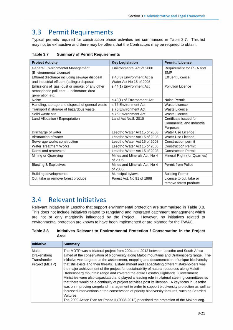
Section 3 • Administrative and Legal Framework
3.3 Permit Requirements Typical permits required for construction phase activities are summarised in Table 3.7. This list may not be exhaustive and there may be others that the Contractors may be required to obtain. Table 3.7 Summary of Permit Requirements
Project Activity Key Legislation Permit / License General Environmental Management (Environmental License)
Environmental Act of 2008 Requirement for ESIA and EMP
Effluent discharge including sewage disposal and industrial effluent (tailings) disposal
s.40(3) Environment Act & Water Act No 15 of 2008
Effluent Licence
Emissions of gas, dust or smoke, or any other atmospheric pollutant - Incinerator; dust generation etc.
s.44(1) Environment Act Pollution Licence
Noise s.48(1) of Environment Act Noise Permit Handling, storage and disposal of general waste s.76 Environment Act Waste Licence Transport & storage of hazardous waste s.76 Environment Act Waste Licence Solid waste site s.76 Environment Act Waste Licence Land Allocation / Expropriation Land Act No.8, 2010 Certificate issued for
Commercial and Industrial Purposes
Discharge of water Lesotho Water Act 15 of 2008 Water Use Licence Abstraction of water Lesotho Water Act 15 of 2008 Water Use Licence Sewerage works construction Lesotho Water Act 15 of 2008 Construction permit Water Treatment Works Lesotho Water Act 15 of 2008 Construction Permit Dams and reservoirs Lesotho Water Act 15 of 2008 Construction Permit Mining or Quarrying Mines and Minerals Act, No 4
of 2005 Mineral Right (for Quarries)
Blasting & Explosives Mines and Minerals Act, No 4 of 2005
Permit from Police
Building developments Municipal bylaws Building Permit Cut, take or remove forest produce Forest Act, No 91 of 1998 Licence to cut, take or
remove forest produce
3.4 Relevant Initiatives Relevant initiatives in Lesotho that support environmental protection are summarised in Table 3.8. This does not include initiatives related to rangeland and integrated catchment management which are not or only marginally influenced by the Project. However, no initiatives related to environmental protection are known to have been implemented or are planned for the PWAC.
Table 3.8 Initiatives Relevant to Environmental Protection / Conservation in the Project Area
Initiative Summary
Maloti Drakensberg Transfrontier Project (MDTP)
The MDTP was a bilateral project from 2004 and 2012 between Lesotho and South Africa aimed at the conservation of biodiversity along Maloti mountains and Drakensberg range. The initiative was targeted at the assessment, mapping and documentation of unique biodiversity that still exists and their threats. Establishment and capacitating different stakeholders was the major achievement of the project for sustainability of natural resources along Maloti - Drakensberg mountain range and covered the entire Lesotho Highlands. Government Ministries were also capacitated and played a leading role in bilateral steering committees so that there would be a continuity of project activities post its lifespan. A key focus in Lesotho was on improving rangeland management in order to support biodiversity protection as well as focussed interventions at the conservation of priority biodiversity features, such as Bearded Vultures. The 2009 Action Plan for Phase II (2008-2012) prioritised the protection of the Mokhotlong-
3-21
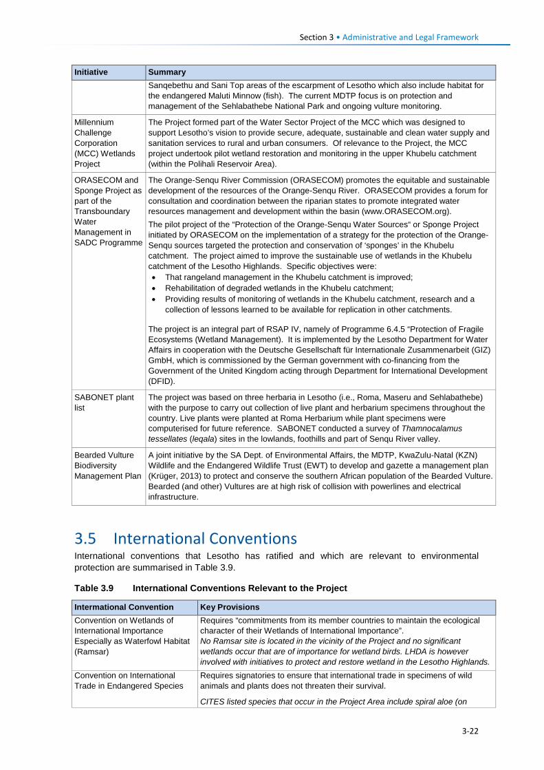
Section 3 • Administrative and Legal Framework
Initiative Summary Sanqebethu and Sani Top areas of the escarpment of Lesotho which also include habitat for the endangered Maluti Minnow (fish). The current MDTP focus is on protection and management of the Sehlabathebe National Park and ongoing vulture monitoring.
Millennium Challenge Corporation (MCC) Wetlands Project
The Project formed part of the Water Sector Project of the MCC which was designed to support Lesotho’s vision to provide secure, adequate, sustainable and clean water supply and sanitation services to rural and urban consumers. Of relevance to the Project, the MCC project undertook pilot wetland restoration and monitoring in the upper Khubelu catchment (within the Polihali Reservoir Area).
ORASECOM and Sponge Project as part of the Transboundary Water Management in SADC Programme
The Orange-Senqu River Commission (ORASECOM) promotes the equitable and sustainable development of the resources of the Orange-Senqu River. ORASECOM provides a forum for consultation and coordination between the riparian states to promote integrated water resources management and development within the basin (www.ORASECOM.org). The pilot project of the “Protection of the Orange-Senqu Water Sources“ or Sponge Project initiated by ORASECOM on the implementation of a strategy for the protection of the Orange-Senqu sources targeted the protection and conservation of ‘sponges’ in the Khubelu catchment. The project aimed to improve the sustainable use of wetlands in the Khubelu catchment of the Lesotho Highlands. Specific objectives were: • That rangeland management in the Khubelu catchment is improved; • Rehabilitation of degraded wetlands in the Khubelu catchment; • Providing results of monitoring of wetlands in the Khubelu catchment, research and a
collection of lessons learned to be available for replication in other catchments.
The project is an integral part of RSAP IV, namely of Programme 6.4.5 “Protection of Fragile Ecosystems (Wetland Management). It is implemented by the Lesotho Department for Water Affairs in cooperation with the Deutsche Gesellschaft für Internationale Zusammenarbeit (GIZ) GmbH, which is commissioned by the German government with co-financing from the Government of the United Kingdom acting through Department for International Development (DFID).
SABONET plant list
The project was based on three herbaria in Lesotho (i.e., Roma, Maseru and Sehlabathebe) with the purpose to carry out collection of live plant and herbarium specimens throughout the country. Live plants were planted at Roma Herbarium while plant specimens were computerised for future reference. SABONET conducted a survey of Thamnocalamus tessellates (leqala) sites in the lowlands, foothills and part of Senqu River valley.
Bearded Vulture Biodiversity Management Plan
A joint initiative by the SA Dept. of Environmental Affairs, the MDTP, KwaZulu-Natal (KZN) Wildlife and the Endangered Wildlife Trust (EWT) to develop and gazette a management plan (Krüger, 2013) to protect and conserve the southern African population of the Bearded Vulture. Bearded (and other) Vultures are at high risk of collision with powerlines and electrical infrastructure.
3.5 International Conventions International conventions that Lesotho has ratified and which are relevant to environmental protection are summarised in Table 3.9.
Table 3.9 International Conventions Relevant to the Project
Intermational Convention Key Provisions Convention on Wetlands of International Importance Especially as Waterfowl Habitat (Ramsar)
Requires “commitments from its member countries to maintain the ecological character of their Wetlands of International Importance”. No Ramsar site is located in the vicinity of the Project and no significant wetlands occur that are of importance for wetland birds. LHDA is however involved with initiatives to protect and restore wetland in the Lesotho Highlands.
Convention on International Trade in Endangered Species
Requires signatories to ensure that international trade in specimens of wild animals and plants does not threaten their survival.
CITES listed species that occur in the Project Area include spiral aloe (on
3-22
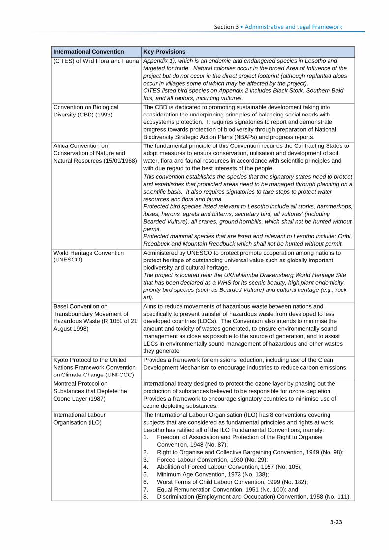
Section 3 • Administrative and Legal Framework
Intermational Convention Key Provisions (CITES) of Wild Flora and Fauna Appendix 1), which is an endemic and endangered species in Lesotho and
targeted for trade. Natural colonies occur in the broad Area of Influence of the project but do not occur in the direct project footprint (although replanted aloes occur in villages some of which may be affected by the project). CITES listed bird species on Appendix 2 includes Black Stork, Southern Bald Ibis, and all raptors, including vultures.
Convention on Biological Diversity (CBD) (1993)
The CBD is dedicated to promoting sustainable development taking into consideration the underpinning principles of balancing social needs with ecosystems protection. It requires signatories to report and demonstrate progress towards protection of biodiversity through preparation of National Biodiversity Strategic Action Plans (NBAPs) and progress reports.
Africa Convention on Conservation of Nature and Natural Resources (15/09/1968)
The fundamental principle of this Convention requires the Contracting States to adopt measures to ensure conservation, utilisation and development of soil, water, flora and faunal resources in accordance with scientific principles and with due regard to the best interests of the people. This convention establishes the species that the signatory states need to protect and establishes that protected areas need to be managed through planning on a scientific basis. It also requires signatories to take steps to protect water resources and flora and fauna. Protected bird species listed relevant to Lesotho include all storks, hammerkops, ibises, herons, egrets and bitterns, secretary bird, all vultures' (including Bearded Vulture), all cranes, ground hornbills, which shall not be hunted without permit. Protected mammal species that are listed and relevant to Lesotho include: Oribi, Reedbuck and Mountain Reedbuck which shall not be hunted without permit.
World Heritage Convention (UNESCO)
Administered by UNESCO to protect promote cooperation among nations to protect heritage of outstanding universal value such as globally important biodiversity and cultural heritage. The project is located near the UKhahlamba Drakensberg World Heritage Site that has been declared as a WHS for its scenic beauty, high plant endemicity, priority bird species (such as Bearded Vulture) and cultural heritage (e.g., rock art).
Basel Convention on Transboundary Movement of Hazardous Waste (R 1051 of 21 August 1998)
Aims to reduce movements of hazardous waste between nations and specifically to prevent transfer of hazardous waste from developed to less developed countries (LDCs). The Convention also intends to minimise the amount and toxicity of wastes generated, to ensure environmentally sound management as close as possible to the source of generation, and to assist LDCs in environmentally sound management of hazardous and other wastes they generate.
Kyoto Protocol to the United Nations Framework Convention on Climate Change (UNFCCC)
Provides a framework for emissions reduction, including use of the Clean Development Mechanism to encourage industries to reduce carbon emissions.
Montreal Protocol on Substances that Deplete the Ozone Layer (1987)
International treaty designed to protect the ozone layer by phasing out the production of substances believed to be responsible for ozone depletion. Provides a framework to encourage signatory countries to minimise use of ozone depleting substances.
International Labour Organisation (ILO)
The International Labour Organisation (ILO) has 8 conventions covering subjects that are considered as fundamental principles and rights at work. Lesotho has ratified all of the ILO Fundamental Conventions, namely: 1. Freedom of Association and Protection of the Right to Organise
Convention, 1948 (No. 87); 2. Right to Organise and Collective Bargaining Convention, 1949 (No. 98); 3. Forced Labour Convention, 1930 (No. 29); 4. Abolition of Forced Labour Convention, 1957 (No. 105); 5. Minimum Age Convention, 1973 (No. 138); 6. Worst Forms of Child Labour Convention, 1999 (No. 182); 7. Equal Remuneration Convention, 1951 (No. 100); and 8. Discrimination (Employment and Occupation) Convention, 1958 (No. 111).
3-23
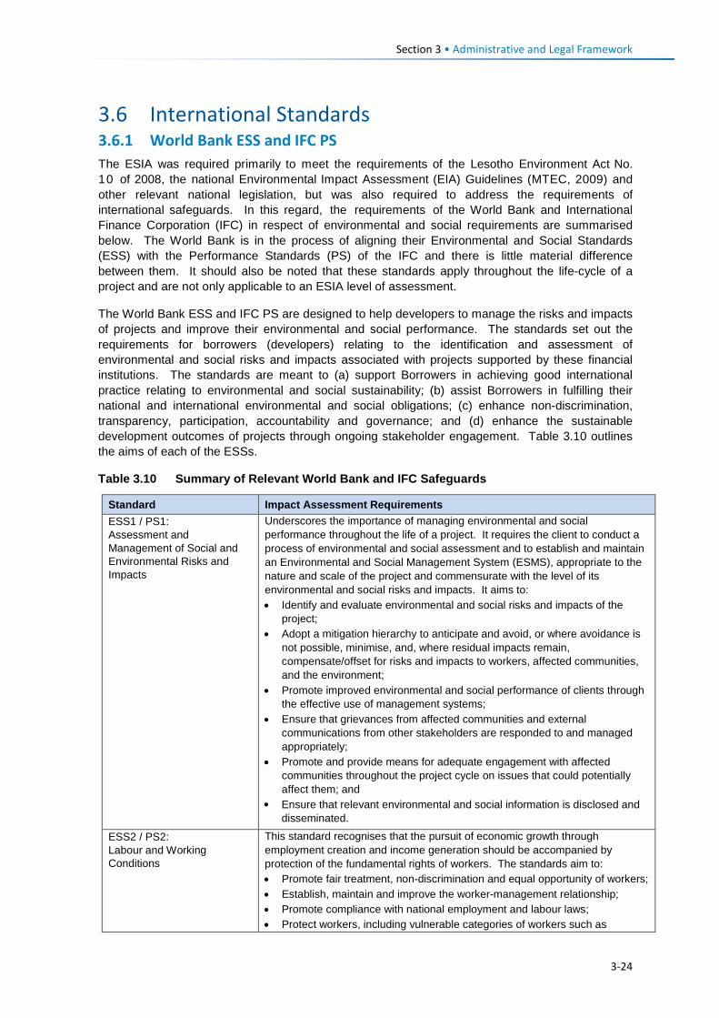
Section 3 • Administrative and Legal Framework
3.6 International Standards 3.6.1 World Bank ESS and IFC PS The ESIA was required primarily to meet the requirements of the Lesotho Environment Act No. 10 of 2008, the national Environmental Impact Assessment (EIA) Guidelines (MTEC, 2009) and other relevant national legislation, but was also required to address the requirements of international safeguards. In this regard, the requirements of the World Bank and International Finance Corporation (IFC) in respect of environmental and social requirements are summarised below. The World Bank is in the process of aligning their Environmental and Social Standards (ESS) with the Performance Standards (PS) of the IFC and there is little material difference between them. It should also be noted that these standards apply throughout the life-cycle of a project and are not only applicable to an ESIA level of assessment.
The World Bank ESS and IFC PS are designed to help developers to manage the risks and impacts of projects and improve their environmental and social performance. The standards set out the requirements for borrowers (developers) relating to the identification and assessment of environmental and social risks and impacts associated with projects supported by these financial institutions. The standards are meant to (a) support Borrowers in achieving good international practice relating to environmental and social sustainability; (b) assist Borrowers in fulfilling their national and international environmental and social obligations; (c) enhance non-discrimination, transparency, participation, accountability and governance; and (d) enhance the sustainable development outcomes of projects through ongoing stakeholder engagement. Table 3.10 outlines the aims of each of the ESSs.
Table 3.10 Summary of Relevant World Bank and IFC Safeguards
Standard Impact Assessment Requirements ESS1 / PS1: Assessment and Management of Social and Environmental Risks and Impacts
Underscores the importance of managing environmental and social performance throughout the life of a project. It requires the client to conduct a process of environmental and social assessment and to establish and maintain an Environmental and Social Management System (ESMS), appropriate to the nature and scale of the project and commensurate with the level of its environmental and social risks and impacts. It aims to: • Identify and evaluate environmental and social risks and impacts of the
project; • Adopt a mitigation hierarchy to anticipate and avoid, or where avoidance is
not possible, minimise, and, where residual impacts remain, compensate/offset for risks and impacts to workers, affected communities, and the environment;
• Promote improved environmental and social performance of clients through the effective use of management systems;
• Ensure that grievances from affected communities and external communications from other stakeholders are responded to and managed appropriately;
• Promote and provide means for adequate engagement with affected communities throughout the project cycle on issues that could potentially affect them; and
• Ensure that relevant environmental and social information is disclosed and disseminated.
ESS2 / PS2: Labour and Working Conditions
This standard recognises that the pursuit of economic growth through employment creation and income generation should be accompanied by protection of the fundamental rights of workers. The standards aim to: • Promote fair treatment, non-discrimination and equal opportunity of workers; • Establish, maintain and improve the worker-management relationship; • Promote compliance with national employment and labour laws; • Protect workers, including vulnerable categories of workers such as
3-24
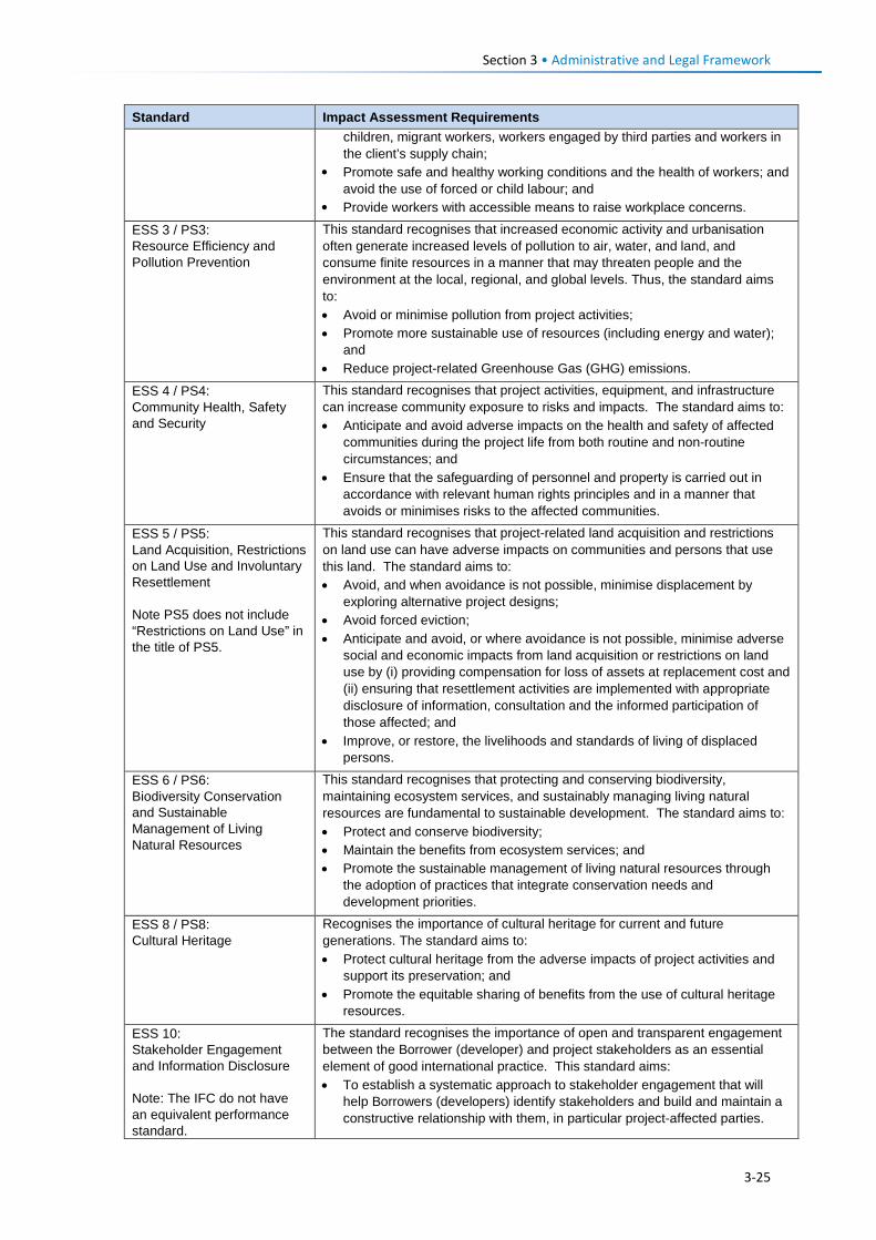
Section 3 • Administrative and Legal Framework
Standard Impact Assessment Requirements children, migrant workers, workers engaged by third parties and workers in the client’s supply chain;
• Promote safe and healthy working conditions and the health of workers; and avoid the use of forced or child labour; and
• Provide workers with accessible means to raise workplace concerns.
ESS 3 / PS3: Resource Efficiency and Pollution Prevention
This standard recognises that increased economic activity and urbanisation often generate increased levels of pollution to air, water, and land, and consume finite resources in a manner that may threaten people and the environment at the local, regional, and global levels. Thus, the standard aims to: • Avoid or minimise pollution from project activities; • Promote more sustainable use of resources (including energy and water);
and • Reduce project-related Greenhouse Gas (GHG) emissions.
ESS 4 / PS4: Community Health, Safety and Security
This standard recognises that project activities, equipment, and infrastructure can increase community exposure to risks and impacts. The standard aims to: • Anticipate and avoid adverse impacts on the health and safety of affected
communities during the project life from both routine and non-routine circumstances; and
• Ensure that the safeguarding of personnel and property is carried out in accordance with relevant human rights principles and in a manner that avoids or minimises risks to the affected communities.
ESS 5 / PS5: Land Acquisition, Restrictions on Land Use and Involuntary Resettlement Note PS5 does not include “Restrictions on Land Use” in the title of PS5.
This standard recognises that project-related land acquisition and restrictions on land use can have adverse impacts on communities and persons that use this land. The standard aims to: • Avoid, and when avoidance is not possible, minimise displacement by
exploring alternative project designs; • Avoid forced eviction; • Anticipate and avoid, or where avoidance is not possible, minimise adverse
social and economic impacts from land acquisition or restrictions on land use by (i) providing compensation for loss of assets at replacement cost and (ii) ensuring that resettlement activities are implemented with appropriate disclosure of information, consultation and the informed participation of those affected; and
• Improve, or restore, the livelihoods and standards of living of displaced persons.
ESS 6 / PS6: Biodiversity Conservation and Sustainable Management of Living Natural Resources
This standard recognises that protecting and conserving biodiversity, maintaining ecosystem services, and sustainably managing living natural resources are fundamental to sustainable development. The standard aims to: • Protect and conserve biodiversity; • Maintain the benefits from ecosystem services; and • Promote the sustainable management of living natural resources through
the adoption of practices that integrate conservation needs and development priorities.
ESS 8 / PS8: Cultural Heritage
Recognises the importance of cultural heritage for current and future generations. The standard aims to: • Protect cultural heritage from the adverse impacts of project activities and
support its preservation; and • Promote the equitable sharing of benefits from the use of cultural heritage
resources. ESS 10: Stakeholder Engagement and Information Disclosure Note: The IFC do not have an equivalent performance standard.
The standard recognises the importance of open and transparent engagement between the Borrower (developer) and project stakeholders as an essential element of good international practice. This standard aims: • To establish a systematic approach to stakeholder engagement that will
help Borrowers (developers) identify stakeholders and build and maintain a constructive relationship with them, in particular project-affected parties.
3-25
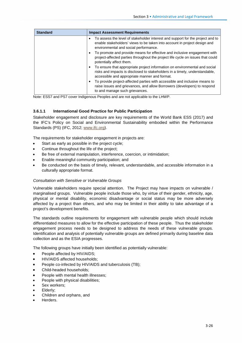
Section 3 • Administrative and Legal Framework
Standard Impact Assessment Requirements • To assess the level of stakeholder interest and support for the project and to
enable stakeholders’ views to be taken into account in project design and environmental and social performance.
• To promote and provide means for effective and inclusive engagement with project-affected parties throughout the project life cycle on issues that could potentially affect them.
• To ensure that appropriate project information on environmental and social risks and impacts is disclosed to stakeholders in a timely, understandable, accessible and appropriate manner and format.
• To provide project-affected parties with accessible and inclusive means to raise issues and grievances, and allow Borrowers (developers) to respond to and manage such grievances.
Note: ESS7 and PS7 cover Indigenous Peoples and are not applicable to the LHWP.
3.6.1.1 International Good Practice for Public Participation Stakeholder engagement and disclosure are key requirements of the World Bank ESS (2017) and the IFC’s Policy on Social and Environmental Sustainability embodied within the Performance Standards (PS) (IFC, 2012; www.ifc.org). The requirements for stakeholder engagement in projects are: • Start as early as possible in the project cycle; • Continue throughout the life of the project; • Be free of external manipulation, interference, coercion, or intimidation; • Enable meaningful community participation; and • Be conducted on the basis of timely, relevant, understandable, and accessible information in a
culturally appropriate format. Consultation with Sensitive or Vulnerable Groups
Vulnerable stakeholders require special attention. The Project may have impacts on vulnerable / marginalised groups. Vulnerable people include those who, by virtue of their gender, ethnicity, age, physical or mental disability, economic disadvantage or social status may be more adversely affected by a project than others, and who may be limited in their ability to take advantage of a project’s development benefits.
The standards outline requirements for engagement with vulnerable people which should include differentiated measures to allow for the effective participation of these people. Thus the stakeholder engagement process needs to be designed to address the needs of these vulnerable groups. Identification and analysis of potentially vulnerable groups are defined primarily during baseline data collection and as the ESIA progresses.
The following groups have initially been identified as potentially vulnerable: • People affected by HIV/AIDS; • HIV/AIDS affected households; • People co-infected by HIV/AIDS and tuberculosis (TB); • Child-headed households; • People with mental health illnesses; • People with physical disabilities; • Sex workers; • Elderly; • Children and orphans, and • Herders.
3-26
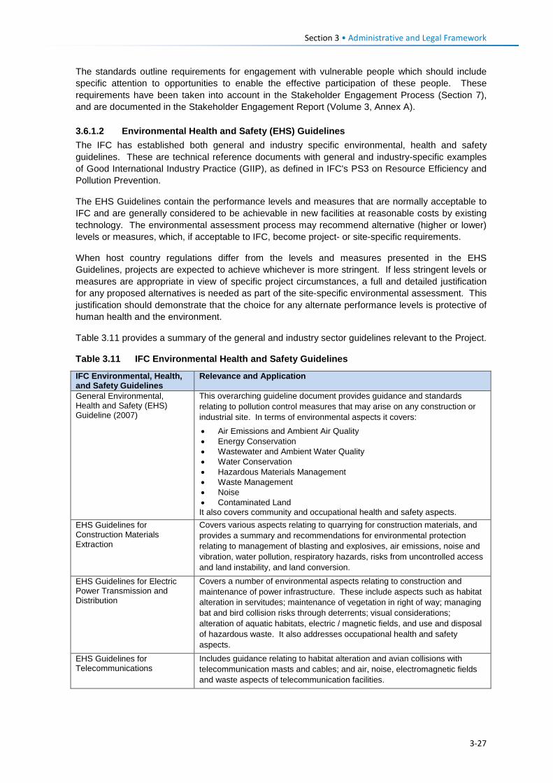
Section 3 • Administrative and Legal Framework
The standards outline requirements for engagement with vulnerable people which should include specific attention to opportunities to enable the effective participation of these people. These requirements have been taken into account in the Stakeholder Engagement Process (Section 7), and are documented in the Stakeholder Engagement Report (Volume 3, Annex A). 3.6.1.2 Environmental Health and Safety (EHS) Guidelines The IFC has established both general and industry specific environmental, health and safety guidelines. These are technical reference documents with general and industry-specific examples of Good International Industry Practice (GIIP), as defined in IFC's PS3 on Resource Efficiency and Pollution Prevention.
The EHS Guidelines contain the performance levels and measures that are normally acceptable to IFC and are generally considered to be achievable in new facilities at reasonable costs by existing technology. The environmental assessment process may recommend alternative (higher or lower) levels or measures, which, if acceptable to IFC, become project- or site-specific requirements.
When host country regulations differ from the levels and measures presented in the EHS Guidelines, projects are expected to achieve whichever is more stringent. If less stringent levels or measures are appropriate in view of specific project circumstances, a full and detailed justification for any proposed alternatives is needed as part of the site-specific environmental assessment. This justification should demonstrate that the choice for any alternate performance levels is protective of human health and the environment.
Table 3.11 provides a summary of the general and industry sector guidelines relevant to the Project.
Table 3.11 IFC Environmental Health and Safety Guidelines
IFC Environmental, Health, and Safety Guidelines
Relevance and Application
General Environmental, Health and Safety (EHS) Guideline (2007)
This overarching guideline document provides guidance and standards relating to pollution control measures that may arise on any construction or industrial site. In terms of environmental aspects it covers:
• Air Emissions and Ambient Air Quality • Energy Conservation • Wastewater and Ambient Water Quality • Water Conservation • Hazardous Materials Management • Waste Management • Noise • Contaminated Land It also covers community and occupational health and safety aspects.
EHS Guidelines for Construction Materials Extraction
Covers various aspects relating to quarrying for construction materials, and provides a summary and recommendations for environmental protection relating to management of blasting and explosives, air emissions, noise and vibration, water pollution, respiratory hazards, risks from uncontrolled access and land instability, and land conversion.
EHS Guidelines for Electric Power Transmission and Distribution
Covers a number of environmental aspects relating to construction and maintenance of power infrastructure. These include aspects such as habitat alteration in servitudes; maintenance of vegetation in right of way; managing bat and bird collision risks through deterrents; visual considerations; alteration of aquatic habitats, electric / magnetic fields, and use and disposal of hazardous waste. It also addresses occupational health and safety aspects.
EHS Guidelines for Telecommunications
Includes guidance relating to habitat alteration and avian collisions with telecommunication masts and cables; and air, noise, electromagnetic fields and waste aspects of telecommunication facilities.
3-27
Section 3 • Administrative and Legal Framework
3.6.2 Voluntary Principles on Security and Human Rights The voluntary principles on security and human rights (www.voluntaryprinciples.org) provide a framework to guide companies in maintaining the safety and security of their operations that ensures respect for human rights and fundamental freedoms.
The principles cover the following aspects: • The identification of security risks; • The deployment and conduct of security personnel; • Consultation between company, government, civil society and public security; and • Responses to human rights abuses.
3-28

Project Description Section 4
4.1 Introduction This section provides a description of the road, powerline and telecommunication components that are proposed for the PWAC between Katse and Polihali Dams (hereafter referred to as the Project).
The Project entails the following components (also refer to Figure 1.2):
• A new 54.3 km Class A all-weather tarred road (PWAR); • A new 35.4 km 132kV transmission line; and • Telecommunication facilities for voice and data.
The transmission line and telecommunications facilities are together referred to as the Bulk Power Supply and Telecommunications (BPST).
This project description does not aim to be a thorough account of all of the Project’s engineering design specifications, but instead provides the reader with an understanding of the Project with a focus on those activities that could generate potentially significant environmental (and social) impacts.
The information presented in this section was sourced from:
• The Preliminary Design Report (Volume 1) compiled by AECOM (August 2017); • Preliminary Design / Cost / Programme Report (Volume 1: Substation and Bulk Supplies)
compiled by Plantech (17 February 2017); • Preliminary Design / Cost / Programme Report (Volume 2: Transmission Lines) compiled by
Plantech (12 May 2017); • Preliminary Design / Cost / Programme Report (Volume 3: Telecommunications) compiled by
Plantech (12 May 2017).
In addition, LHDA, the road engineers (AECOM) and powerline engineers (Plantech) also provided separate written inputs in response to queries by ERM on various project design elements and activities.
Specialist studies were done in February and April 2017 by various team members leading to additional revisions of the road and powerline routes (Section 5). The project description (and mapping presented in this report) was based on revised alignments provided by AECOM and Plantech, as follows:
• PWAR route alignment dated 28 May 2017; and • BPST route alignment dated 23 May 2017.
No alignment changes have been made subsequent to these dates that would warrant an amendment to the ESIS. Some intermediate pylon locations and revised provisional access tracks were identified in June 2017 that will require pre-construction vegetation and wetland surveys, although none of these are likely to have substantive impacts that would change the findings of this report. The mapping has not been updated to include the intermediate pylon locations except for the avian sensitivity mapping in Section 6.3.4.3.
In October 2017, an amendment to the PWAR between kp 29.5 and 33.7 in the upper Makhoaba River valley was proposed for technical and social mitigatory requirements. On review of the realignment on imagery and cross-checking with the wetland data, the altered route does not warrant specific additional surveys for the ESIS, although pre-construction surveys in other focussed areas should be undertaken for wetland, flora and cultural heritage (graves) to identify
4-1
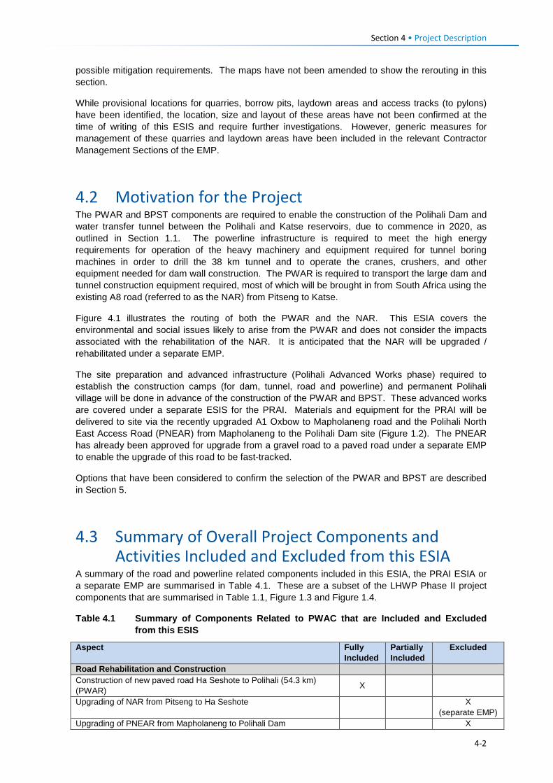
Section 4 • Project Description possible mitigation requirements. The maps have not been amended to show the rerouting in this section.
While provisional locations for quarries, borrow pits, laydown areas and access tracks (to pylons) have been identified, the location, size and layout of these areas have not been confirmed at the time of writing of this ESIS and require further investigations. However, generic measures for management of these quarries and laydown areas have been included in the relevant Contractor Management Sections of the EMP.
4.2 Motivation for the Project The PWAR and BPST components are required to enable the construction of the Polihali Dam and water transfer tunnel between the Polihali and Katse reservoirs, due to commence in 2020, as outlined in Section 1.1. The powerline infrastructure is required to meet the high energy requirements for operation of the heavy machinery and equipment required for tunnel boring machines in order to drill the 38 km tunnel and to operate the cranes, crushers, and other equipment needed for dam wall construction. The PWAR is required to transport the large dam and tunnel construction equipment required, most of which will be brought in from South Africa using the existing A8 road (referred to as the NAR) from Pitseng to Katse.
Figure 4.1 illustrates the routing of both the PWAR and the NAR. This ESIA covers the environmental and social issues likely to arise from the PWAR and does not consider the impacts associated with the rehabilitation of the NAR. It is anticipated that the NAR will be upgraded / rehabilitated under a separate EMP.
The site preparation and advanced infrastructure (Polihali Advanced Works phase) required to establish the construction camps (for dam, tunnel, road and powerline) and permanent Polihali village will be done in advance of the construction of the PWAR and BPST. These advanced works are covered under a separate ESIS for the PRAI. Materials and equipment for the PRAI will be delivered to site via the recently upgraded A1 Oxbow to Mapholaneng road and the Polihali North East Access Road (PNEAR) from Mapholaneng to the Polihali Dam site (Figure 1.2). The PNEAR has already been approved for upgrade from a gravel road to a paved road under a separate EMP to enable the upgrade of this road to be fast-tracked.
Options that have been considered to confirm the selection of the PWAR and BPST are described in Section 5.
4.3 Summary of Overall Project Components and Activities Included and Excluded from this ESIA
A summary of the road and powerline related components included in this ESIA, the PRAI ESIA or a separate EMP are summarised in Table 4.1. These are a subset of the LHWP Phase II project components that are summarised in Table 1.1, Figure 1.3 and Figure 1.4.
Table 4.1 Summary of Components Related to PWAC that are Included and Excluded from this ESIS
Aspect Fully Included
Partially Included
Excluded
Road Rehabilitation and Construction Construction of new paved road Ha Seshote to Polihali (54.3 km) (PWAR) X
Upgrading of NAR from Pitseng to Ha Seshote X (separate EMP)
Upgrading of PNEAR from Mapholaneng to Polihali Dam X
4-2
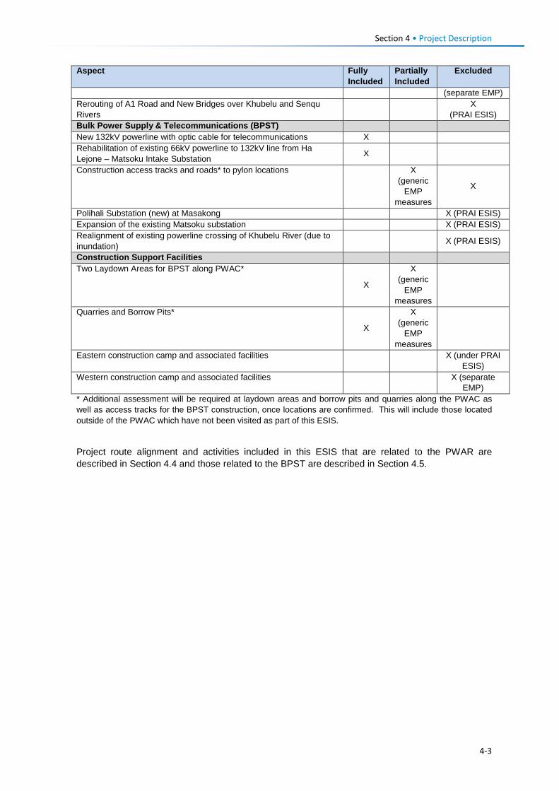
Section 4 • Project Description Aspect Fully
Included Partially Included
Excluded
(separate EMP) Rerouting of A1 Road and New Bridges over Khubelu and Senqu Rivers X
(PRAI ESIS) Bulk Power Supply & Telecommunications (BPST) New 132kV powerline with optic cable for telecommunications X Rehabilitation of existing 66kV powerline to 132kV line from Ha Lejone – Matsoku Intake Substation X
Construction access tracks and roads* to pylon locations
X (generic
EMP measures
X
Polihali Substation (new) at Masakong X (PRAI ESIS) Expansion of the existing Matsoku substation X (PRAI ESIS) Realignment of existing powerline crossing of Khubelu River (due to inundation) X (PRAI ESIS)
Construction Support Facilities Two Laydown Areas for BPST along PWAC*
X
X (generic
EMP measures
Quarries and Borrow Pits*
X
X (generic
EMP measures
Eastern construction camp and associated facilities X (under PRAI ESIS)
Western construction camp and associated facilities X (separate EMP)
* Additional assessment will be required at laydown areas and borrow pits and quarries along the PWAC as well as access tracks for the BPST construction, once locations are confirmed. This will include those located outside of the PWAC which have not been visited as part of this ESIS.
Project route alignment and activities included in this ESIS that are related to the PWAR are described in Section 4.4 and those related to the BPST are described in Section 4.5.
4-3
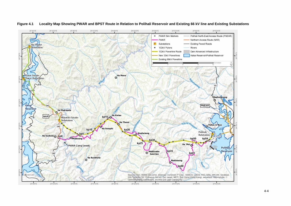
Figure 4.1 Locality Map Showing PWAR and BPST Route in Relation to Polihali Reservoir and Existing 66 kV line and Existing Substations
4-4
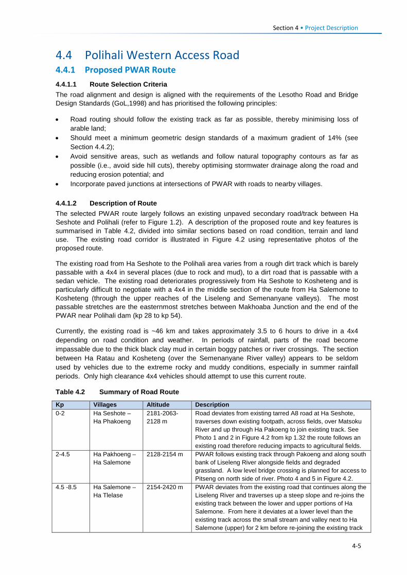
Section 4 • Project Description
4.4 Polihali Western Access Road 4.4.1 Proposed PWAR Route 4.4.1.1 Route Selection Criteria The road alignment and design is aligned with the requirements of the Lesotho Road and Bridge Design Standards (GoL,1998) and has prioritised the following principles:
• Road routing should follow the existing track as far as possible, thereby minimising loss of arable land;
• Should meet a minimum geometric design standards of a maximum gradient of 14% (see Section 4.4.2);
• Avoid sensitive areas, such as wetlands and follow natural topography contours as far as possible (i.e., avoid side hill cuts), thereby optimising stormwater drainage along the road and reducing erosion potential; and
• Incorporate paved junctions at intersections of PWAR with roads to nearby villages.
4.4.1.2 Description of Route The selected PWAR route largely follows an existing unpaved secondary road/track between Ha Seshote and Polihali (refer to Figure 1.2). A description of the proposed route and key features is summarised in Table 4.2, divided into similar sections based on road condition, terrain and land use. The existing road corridor is illustrated in Figure 4.2 using representative photos of the proposed route.
The existing road from Ha Seshote to the Polihali area varies from a rough dirt track which is barely passable with a 4x4 in several places (due to rock and mud), to a dirt road that is passable with a sedan vehicle. The existing road deteriorates progressively from Ha Seshote to Kosheteng and is particularly difficult to negotiate with a 4x4 in the middle section of the route from Ha Salemone to Kosheteng (through the upper reaches of the Liseleng and Semenanyane valleys). The most passable stretches are the easternmost stretches between Makhoaba Junction and the end of the PWAR near Polihali dam (kp 28 to kp 54).
Currently, the existing road is ~46 km and takes approximately 3.5 to 6 hours to drive in a 4x4 depending on road condition and weather. In periods of rainfall, parts of the road become impassable due to the thick black clay mud in certain boggy patches or river crossings. The section between Ha Ratau and Kosheteng (over the Semenanyane River valley) appears to be seldom used by vehicles due to the extreme rocky and muddy conditions, especially in summer rainfall periods. Only high clearance 4x4 vehicles should attempt to use this current route.
Table 4.2 Summary of Road Route
Kp Villages Altitude Description 0-2 Ha Seshote –
Ha Phakoeng 2181-2063-2128 m
Road deviates from existing tarred A8 road at Ha Seshote, traverses down existing footpath, across fields, over Matsoku River and up through Ha Pakoeng to join existing track. See Photo 1 and 2 in Figure 4.2 from kp 1.32 the route follows an existing road therefore reducing impacts to agricultural fields.
2-4.5 Ha Pakhoeng – Ha Salemone
2128-2154 m PWAR follows existing track through Pakoeng and along south bank of Liseleng River alongside fields and degraded grassland. A low level bridge crossing is planned for access to Pitseng on north side of river. Photo 4 and 5 in Figure 4.2.
4.5 -8.5 Ha Salemone – Ha Tlelase
2154-2420 m PWAR deviates from the existing road that continues along the Liseleng River and traverses up a steep slope and re-joins the existing track between the lower and upper portions of Ha Salemone. From here it deviates at a lower level than the existing track across the small stream and valley next to Ha Salemone (upper) for 2 km before re-joining the existing track
4-5
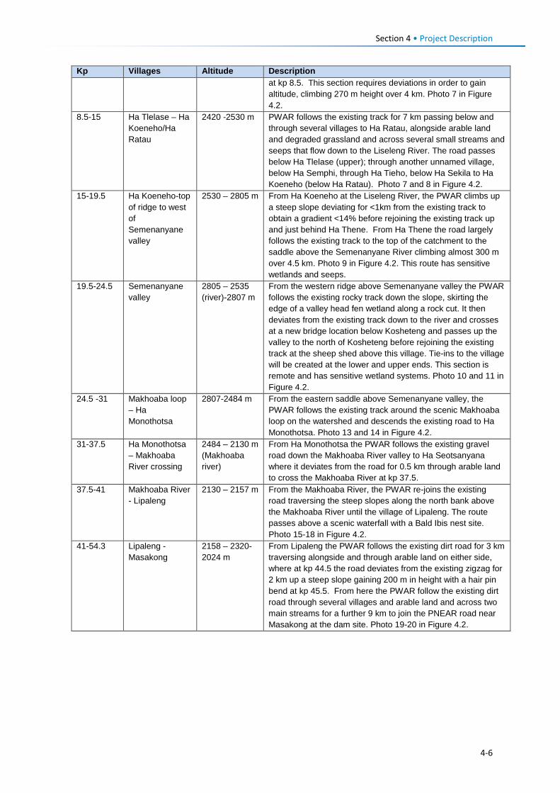
Section 4 • Project Description Kp Villages Altitude Description
at kp 8.5. This section requires deviations in order to gain altitude, climbing 270 m height over 4 km. Photo 7 in Figure 4.2.
8.5-15 Ha Tlelase – Ha Koeneho/Ha Ratau
2420 -2530 m PWAR follows the existing track for 7 km passing below and through several villages to Ha Ratau, alongside arable land and degraded grassland and across several small streams and seeps that flow down to the Liseleng River. The road passes below Ha Tlelase (upper); through another unnamed village, below Ha Semphi, through Ha Tieho, below Ha Sekila to Ha Koeneho (below Ha Ratau). Photo 7 and 8 in Figure 4.2.
15-19.5 Ha Koeneho-top of ridge to west of Semenanyane valley
2530 – 2805 m From Ha Koeneho at the Liseleng River, the PWAR climbs up a steep slope deviating for <1km from the existing track to obtain a gradient <14% before rejoining the existing track up and just behind Ha Thene. From Ha Thene the road largely follows the existing track to the top of the catchment to the saddle above the Semenanyane River climbing almost 300 m over 4.5 km. Photo 9 in Figure 4.2. This route has sensitive wetlands and seeps.
19.5-24.5 Semenanyane valley
2805 – 2535 (river)-2807 m
From the western ridge above Semenanyane valley the PWAR follows the existing rocky track down the slope, skirting the edge of a valley head fen wetland along a rock cut. It then deviates from the existing track down to the river and crosses at a new bridge location below Kosheteng and passes up the valley to the north of Kosheteng before rejoining the existing track at the sheep shed above this village. Tie-ins to the village will be created at the lower and upper ends. This section is remote and has sensitive wetland systems. Photo 10 and 11 in Figure 4.2.
24.5 -31 Makhoaba loop – Ha Monothotsa
2807-2484 m From the eastern saddle above Semenanyane valley, the PWAR follows the existing track around the scenic Makhoaba loop on the watershed and descends the existing road to Ha Monothotsa. Photo 13 and 14 in Figure 4.2.
31-37.5 Ha Monothotsa – Makhoaba River crossing
2484 – 2130 m (Makhoaba river)
From Ha Monothotsa the PWAR follows the existing gravel road down the Makhoaba River valley to Ha Seotsanyana where it deviates from the road for 0.5 km through arable land to cross the Makhoaba River at kp 37.5.
37.5-41 Makhoaba River - Lipaleng
2130 – 2157 m From the Makhoaba River, the PWAR re-joins the existing road traversing the steep slopes along the north bank above the Makhoaba River until the village of Lipaleng. The route passes above a scenic waterfall with a Bald Ibis nest site. Photo 15-18 in Figure 4.2.
41-54.3 Lipaleng - Masakong
2158 – 2320-2024 m
From Lipaleng the PWAR follows the existing dirt road for 3 km traversing alongside and through arable land on either side, where at kp 44.5 the road deviates from the existing zigzag for 2 km up a steep slope gaining 200 m in height with a hair pin bend at kp 45.5. From here the PWAR follow the existing dirt road through several villages and arable land and across two main streams for a further 9 km to join the PNEAR road near Masakong at the dam site. Photo 19-20 in Figure 4.2.
4-6
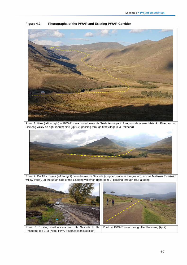
Section 4 • Project Description Figure 4.2 Photographs of the PWAR and Existing PWAR Corridor
Photo 1. View (left to right) of PWAR route down below Ha Seshote (slope in foreground), across Matsoku River and up Liseleng valley on right (south) side (kp 0-2) passing through first village (Ha Pakoeng)
Photo 2. PWAR crosses (left to right) down below Ha Seshote (cropped slope in foreground), across Matsoku River(with willow trees), up the south side of the Liseleng valley on right (kp 0-2) passing through Ha Pakoeng
Photo 3. Existing road access from Ha Seshote to Ha Phakoeng (kp 0-1) (Note: PWAR bypasses this section)
Photo 4. PWAR route through Ha Phakoeng (kp 2)
4-7
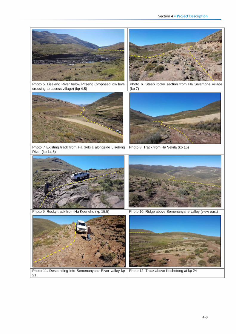
Section 4 • Project Description
Photo 5. Liseleng River below Pitseng (proposed low level crossing to access village) (kp 4.5)
Photo 6. Steep rocky section from Ha Salemone village (kp 7)
Photo 7 Existing track from Ha Sekila alongside Liseleng River (kp 14.5)
Photo 8. Track from Ha Sekila (kp 15)
Photo 9. Rocky track from Ha Koeneho (kp 15.5) Photo 10. Ridge above Semenanyane valley (view east)
Photo 11. Descending into Semenanyane River valley kp 21
Photo 12. Track above Kosheteng at kp 24
4-8
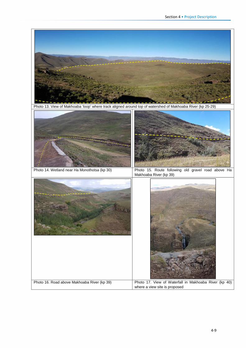
Section 4 • Project Description
Photo 13. View of Makhoaba ‘loop’ where track aligned around top of watershed of Makhoaba River (kp 25-29)
Photo 14. Wetland near Ha Monothotsa (kp 30) Photo 15. Route following old gravel road above Ha
Makhoaba River (kp 39)
Photo 16. Road above Makhoaba River (kp 39) Photo 17. View of Waterfall in Makhoaba River (kp 40)
where a view site is proposed
4-9
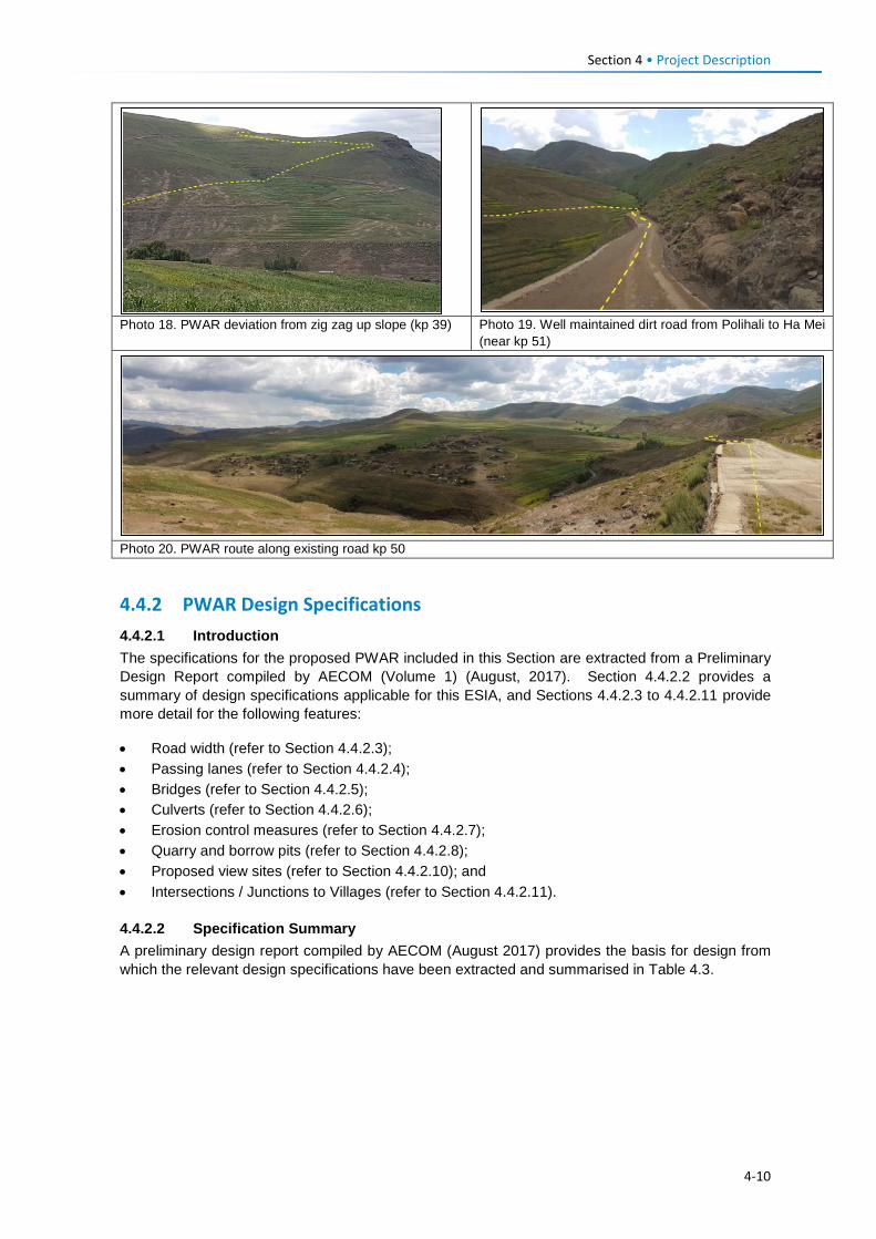
Section 4 • Project Description
Photo 18. PWAR deviation from zig zag up slope (kp 39) Photo 19. Well maintained dirt road from Polihali to Ha Mei
(near kp 51)
Photo 20. PWAR route along existing road kp 50
4.4.2 PWAR Design Specifications 4.4.2.1 Introduction The specifications for the proposed PWAR included in this Section are extracted from a Preliminary Design Report compiled by AECOM (Volume 1) (August, 2017). Section 4.4.2.2 provides a summary of design specifications applicable for this ESIA, and Sections 4.4.2.3 to 4.4.2.11 provide more detail for the following features:
• Road width (refer to Section 4.4.2.3); • Passing lanes (refer to Section 4.4.2.4); • Bridges (refer to Section 4.4.2.5); • Culverts (refer to Section 4.4.2.6); • Erosion control measures (refer to Section 4.4.2.7); • Quarry and borrow pits (refer to Section 4.4.2.8); • Proposed view sites (refer to Section 4.4.2.10); and • Intersections / Junctions to Villages (refer to Section 4.4.2.11).
4.4.2.2 Specification Summary A preliminary design report compiled by AECOM (August 2017) provides the basis for design from which the relevant design specifications have been extracted and summarised in Table 4.3.
4-10
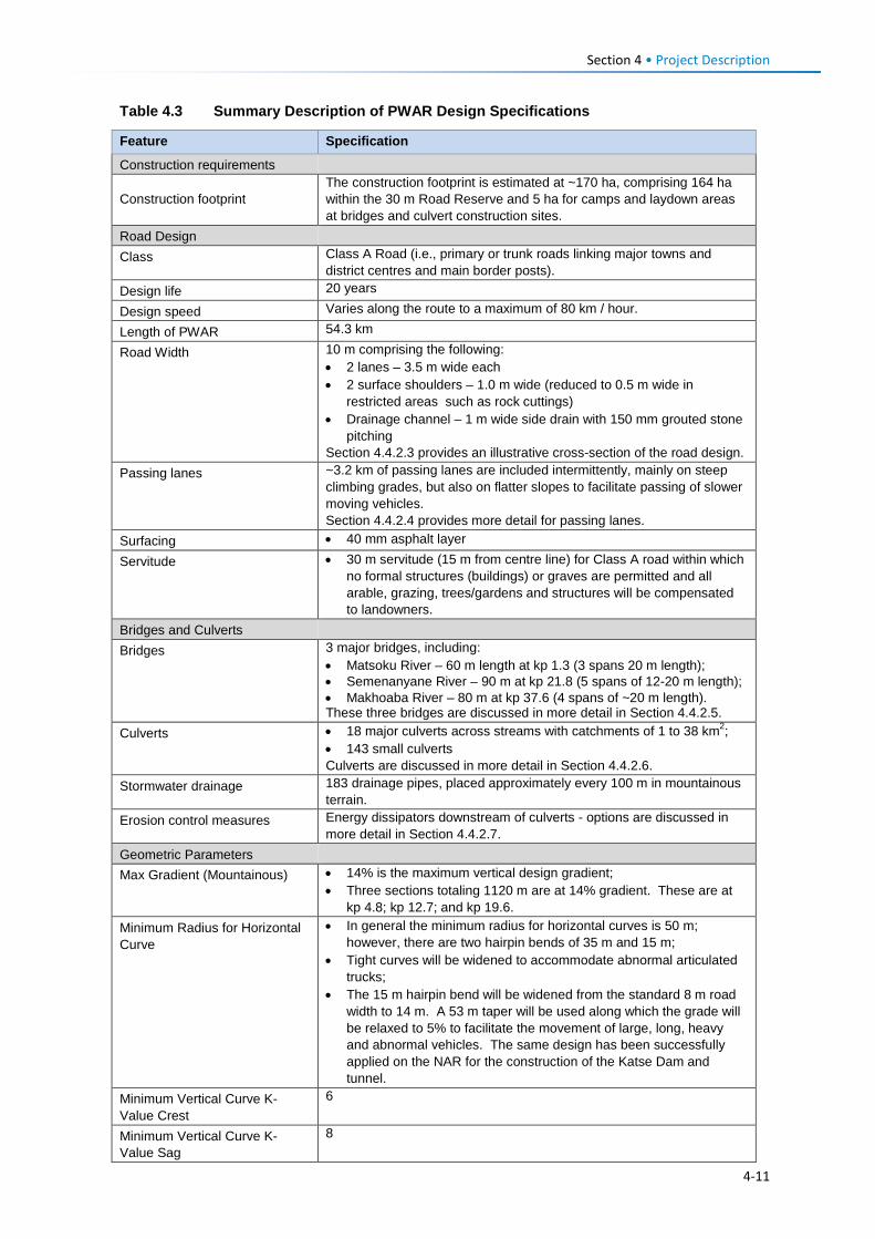
Section 4 • Project Description Table 4.3 Summary Description of PWAR Design Specifications
Feature Specification
Construction requirements
Construction footprint The construction footprint is estimated at ~170 ha, comprising 164 ha within the 30 m Road Reserve and 5 ha for camps and laydown areas at bridges and culvert construction sites.
Road Design Class Class A Road (i.e., primary or trunk roads linking major towns and
district centres and main border posts). Design life 20 years
Design speed Varies along the route to a maximum of 80 km / hour.
Length of PWAR 54.3 km
Road Width 10 m comprising the following: • 2 lanes – 3.5 m wide each • 2 surface shoulders – 1.0 m wide (reduced to 0.5 m wide in
restricted areas such as rock cuttings) • Drainage channel – 1 m wide side drain with 150 mm grouted stone
pitching Section 4.4.2.3 provides an illustrative cross-section of the road design.
Passing lanes ~3.2 km of passing lanes are included intermittently, mainly on steep climbing grades, but also on flatter slopes to facilitate passing of slower moving vehicles. Section 4.4.2.4 provides more detail for passing lanes.
Surfacing • 40 mm asphalt layer
Servitude • 30 m servitude (15 m from centre line) for Class A road within which no formal structures (buildings) or graves are permitted and all arable, grazing, trees/gardens and structures will be compensated to landowners.
Bridges and Culverts Bridges 3 major bridges, including:
• Matsoku River – 60 m length at kp 1.3 (3 spans 20 m length); • Semenanyane River – 90 m at kp 21.8 (5 spans of 12-20 m length); • Makhoaba River – 80 m at kp 37.6 (4 spans of ~20 m length). These three bridges are discussed in more detail in Section 4.4.2.5.
Culverts • 18 major culverts across streams with catchments of 1 to 38 km2; • 143 small culverts Culverts are discussed in more detail in Section 4.4.2.6.
Stormwater drainage 183 drainage pipes, placed approximately every 100 m in mountainous terrain.
Erosion control measures Energy dissipators downstream of culverts - options are discussed in more detail in Section 4.4.2.7.
Geometric Parameters Max Gradient (Mountainous) • 14% is the maximum vertical design gradient;
• Three sections totaling 1120 m are at 14% gradient. These are at kp 4.8; kp 12.7; and kp 19.6.
Minimum Radius for Horizontal Curve
• In general the minimum radius for horizontal curves is 50 m; however, there are two hairpin bends of 35 m and 15 m;
• Tight curves will be widened to accommodate abnormal articulated trucks;
• The 15 m hairpin bend will be widened from the standard 8 m road width to 14 m. A 53 m taper will be used along which the grade will be relaxed to 5% to facilitate the movement of large, long, heavy and abnormal vehicles. The same design has been successfully applied on the NAR for the construction of the Katse Dam and tunnel.
Minimum Vertical Curve K-Value Crest
6
Minimum Vertical Curve K-Value Sag
8
4-11
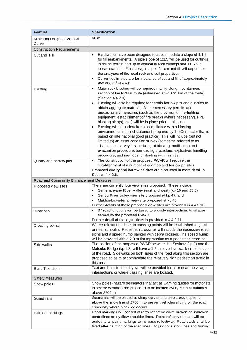
Section 4 • Project Description Feature Specification
Minimum Length of Vertical Curve
60 m
Construction Requirements Cut and Fill • Earthworks have been designed to accommodate a slope of 1:1.5
for fill embankments. A side slope of 1:1.5 will be used for cuttings in rolling terrain and up to vertical in rock cuttings and 1:0.75 in looser material. Final design slopes for cut and fill will depend on the analyses of the local rock and soil properties;
• Current estimates are for a balance of cut and fill of approximately 950 000 m3 of each.
Blasting • Major rock blasting will be required mainly along mountainous section of the PWAR route (estimated at ~10.31 km of the route) (Section 4.4.2.9).
• Blasting will also be required for certain borrow pits and quarries to obtain aggregate material. All the necessary permits and precautionary measures (such as the provision of fire-fighting equipment, establishment of fire breaks (where necessary), PPE, blasting plan(s), etc.) will be in place prior to blasting.
• Blasting will be undertaken in compliance with a blasting environmental method statement prepared by the Contractor that is based on international good practice). This will include (but not limited to) an asset condition survey (sometime referred to as ‘dilapidation survey’), scheduling of blasting, notification and evacuation procedure, barricading procedure, explosives handling procedure, and methods for dealing with misfires.
Quarry and borrow pits • The construction of the proposed PWAR will require the establishment of a number of quarries and borrow pit sites.
Proposed quarry and borrow pit sites are discussed in more detail in Section 4.4.2.8.
Road and Community Enhancement Measures Proposed view sites There are currently four view sites proposed. These include:
• Semenanyane River Valley (east and west) (kp 19 and 25.5) • Senqu River valley view site proposed at kp 47; and • Makhoaba waterfall view site proposed at kp 40. Further details of these proposed view sites are provided in 4.4.2.10.
Junctions • 37 road junctions will be tarred to provide intersections to villages served by the proposed PWAR.
Further detail of these junctions is provided in 4.4.2.11. Crossing points Where relevant pedestrian crossing points will be established (e.g., at
or near schools). Pedestrian crossings will include the necessary road signs and a speed hump painted with zebra crosses. The speed hump will be provided with a 2.0 m flat top section as a pedestrian crossing.
Side walks The section of the proposed PWAR between Ha Seshote (kp 0) and the Matsoku Bridge (kp 1.3) will have a 1.5 m paved sidewalk on both sides of the road. Sidewalks on both sides of the road along this section are proposed so as to accommodate the relatively high pedestrian traffic in this area.
Bus / Taxi stops Taxi and bus stops or laybys will be provided for at or near the village intersections or where passing lanes are located.
Safety Measures
Snow poles Snow poles (hazard delineators that act as warning guides for motorists in severe weather) are proposed to be located every 50 m at attitudes above 2700 m.
Guard rails Guardrails will be placed at sharp curves on steep cross slopes, or above the snow line of 2700 m to prevent vehicles sliding off the road, especially where black ice occurs.
Painted markings Road markings will consist of retro-reflective white broken or unbroken centrelines and yellow shoulder lines. Retro-reflective beads will be added to all paint markings to increase reflectivity. Road studs shall be fixed after painting of the road lines. At junctions stop lines and turning
4-12
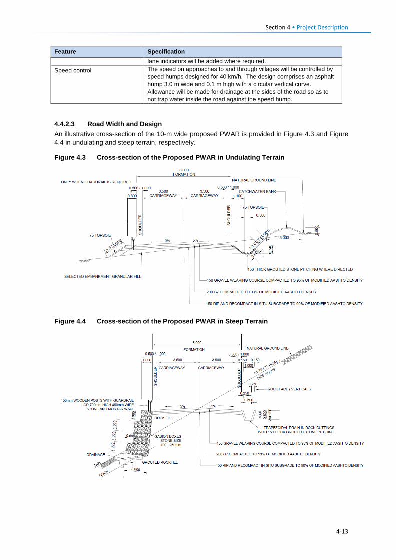
Section 4 • Project Description Feature Specification
lane indicators will be added where required. Speed control The speed on approaches to and through villages will be controlled by
speed humps designed for 40 km/h. The design comprises an asphalt hump 3.0 m wide and 0.1 m high with a circular vertical curve. Allowance will be made for drainage at the sides of the road so as to not trap water inside the road against the speed hump.
4.4.2.3 Road Width and Design An illustrative cross-section of the 10-m wide proposed PWAR is provided in Figure 4.3 and Figure 4.4 in undulating and steep terrain, respectively.
Figure 4.3 Cross-section of the Proposed PWAR in Undulating Terrain
Figure 4.4 Cross-section of the Proposed PWAR in Steep Terrain
4-13
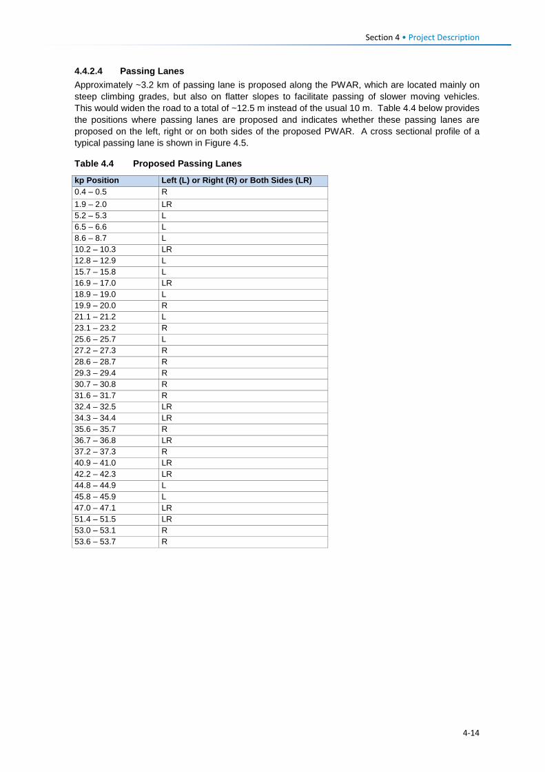
Section 4 • Project Description 4.4.2.4 Passing Lanes Approximately ~3.2 km of passing lane is proposed along the PWAR, which are located mainly on steep climbing grades, but also on flatter slopes to facilitate passing of slower moving vehicles. This would widen the road to a total of ~12.5 m instead of the usual 10 m. Table 4.4 below provides the positions where passing lanes are proposed and indicates whether these passing lanes are proposed on the left, right or on both sides of the proposed PWAR. A cross sectional profile of a typical passing lane is shown in Figure 4.5.
Table 4.4 Proposed Passing Lanes
kp Position Left (L) or Right (R) or Both Sides (LR) 0.4 – 0.5 R 1.9 – 2.0 LR 5.2 – 5.3 L 6.5 – 6.6 L 8.6 – 8.7 L 10.2 – 10.3 LR 12.8 – 12.9 L 15.7 – 15.8 L 16.9 – 17.0 LR 18.9 – 19.0 L 19.9 – 20.0 R 21.1 – 21.2 L 23.1 – 23.2 R 25.6 – 25.7 L 27.2 – 27.3 R 28.6 – 28.7 R 29.3 – 29.4 R 30.7 – 30.8 R 31.6 – 31.7 R 32.4 – 32.5 LR 34.3 – 34.4 LR 35.6 – 35.7 R 36.7 – 36.8 LR 37.2 – 37.3 R 40.9 – 41.0 LR 42.2 – 42.3 LR 44.8 – 44.9 L 45.8 – 45.9 L 47.0 – 47.1 LR 51.4 – 51.5 LR 53.0 – 53.1 R 53.6 – 53.7 R
4-14
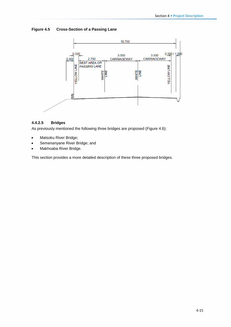
Section 4 • Project Description Figure 4.5 Cross-Section of a Passing Lane
4.4.2.5 Bridges As previously mentioned the following three bridges are proposed (Figure 4.6):
• Matsoku River Bridge; • Semenanyane River Bridge; and • Makhoaba River Bridge.
This section provides a more detailed description of these three proposed bridges.
4-15
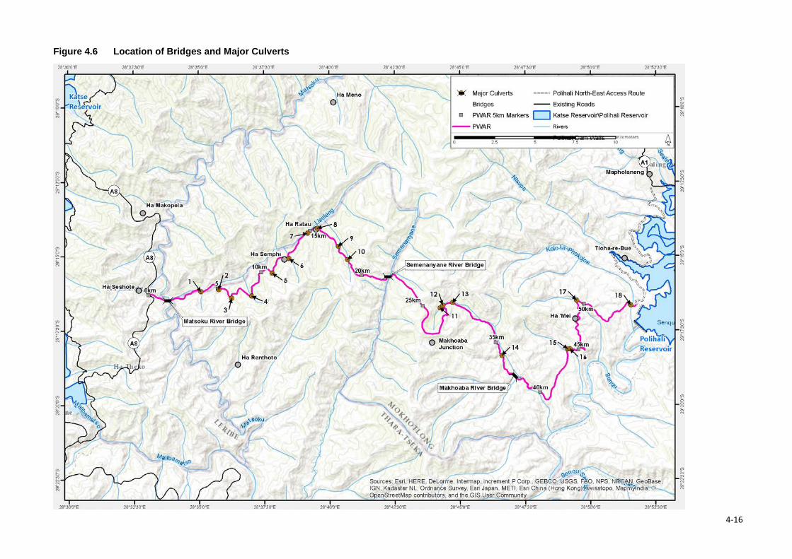
Figure 4.6 Location of Bridges and Major Culverts
4-16
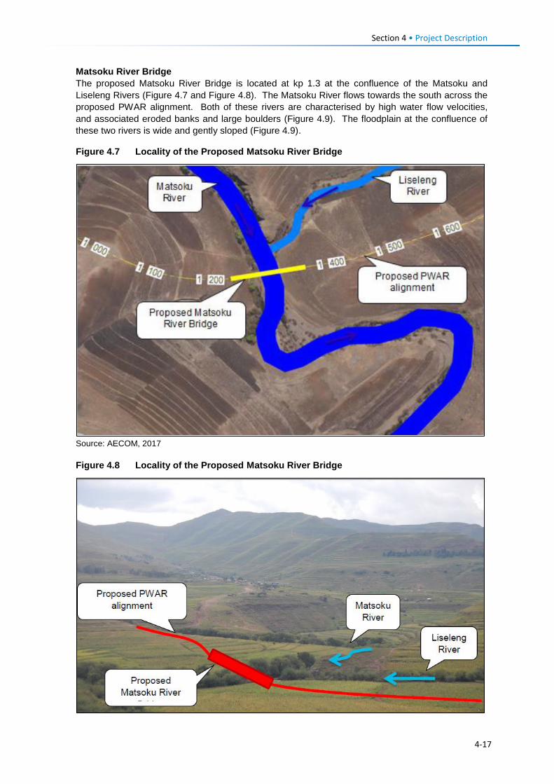
Section 4 • Project Description
Matsoku River Bridge The proposed Matsoku River Bridge is located at kp 1.3 at the confluence of the Matsoku and Liseleng Rivers (Figure 4.7 and Figure 4.8). The Matsoku River flows towards the south across the proposed PWAR alignment. Both of these rivers are characterised by high water flow velocities, and associated eroded banks and large boulders (Figure 4.9). The floodplain at the confluence of these two rivers is wide and gently sloped (Figure 4.9).
Figure 4.7 Locality of the Proposed Matsoku River Bridge
Source: AECOM, 2017 Figure 4.8 Locality of the Proposed Matsoku River Bridge
4-17
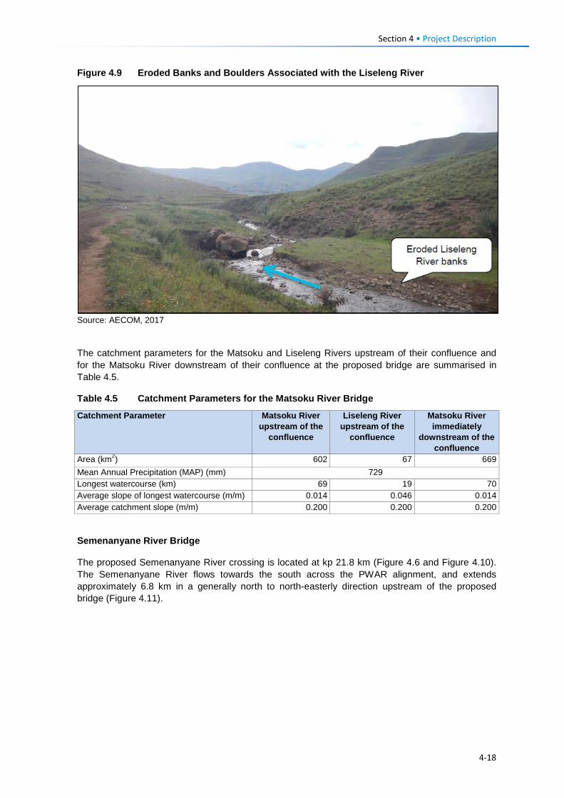
Section 4 • Project Description Figure 4.9 Eroded Banks and Boulders Associated with the Liseleng River
Source: AECOM, 2017
The catchment parameters for the Matsoku and Liseleng Rivers upstream of their confluence and for the Matsoku River downstream of their confluence at the proposed bridge are summarised in Table 4.5.
Table 4.5 Catchment Parameters for the Matsoku River Bridge
Catchment Parameter Matsoku River upstream of the
confluence
Liseleng River upstream of the
confluence
Matsoku River immediately
downstream of the confluence
Area (km2) 602 67 669 Mean Annual Precipitation (MAP) (mm) 729 Longest watercourse (km) 69 19 70 Average slope of longest watercourse (m/m) 0.014 0.046 0.014 Average catchment slope (m/m) 0.200 0.200 0.200
Semenanyane River Bridge
The proposed Semenanyane River crossing is located at kp 21.8 km (Figure 4.6 and Figure 4.10). The Semenanyane River flows towards the south across the PWAR alignment, and extends approximately 6.8 km in a generally north to north-easterly direction upstream of the proposed bridge (Figure 4.11).
4-18
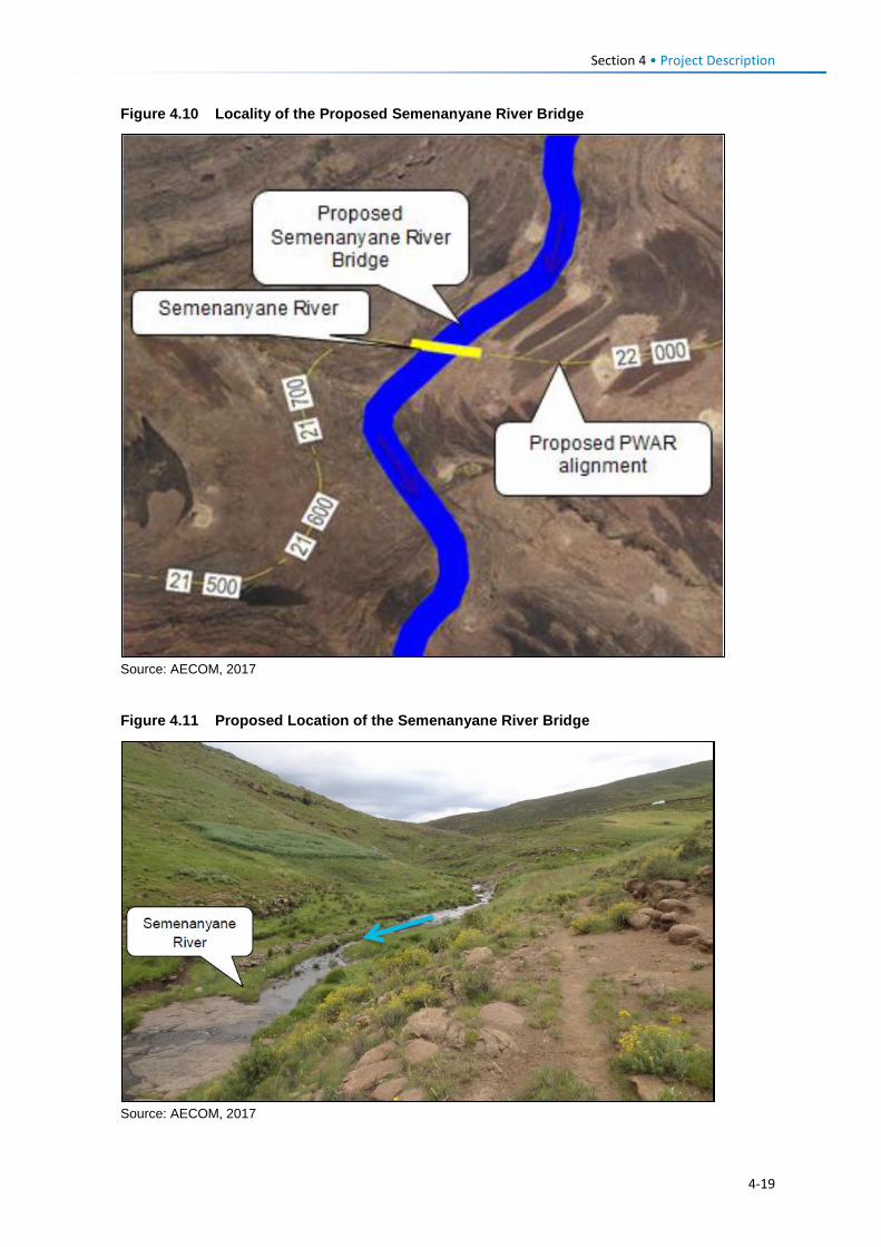
Section 4 • Project Description Figure 4.10 Locality of the Proposed Semenanyane River Bridge
Source: AECOM, 2017
Figure 4.11 Proposed Location of the Semenanyane River Bridge
Source: AECOM, 2017
4-19
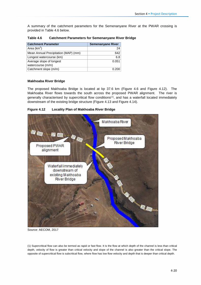
Section 4 • Project Description A summary of the catchment parameters for the Semenanyane River at the PWAR crossing is provided in Table 4.6 below.
Table 4.6 Catchment Parameters for Semenanyane River Bridge
Catchment Parameter Semenanyane River Area (km2) 24 Mean Annual Precipitation (MAP) (mm) 642 Longest watercourse (km) 6.8 Average slope of longest watercourse (m/m)
0.051
Catchment slope (m/m) 0.200
Makhoaba River Bridge
The proposed Makhoaba Bridge is located at kp 37.6 km (Figure 4.6 and Figure 4.12). The Makhoaba River flows towards the south across the proposed PWAR alignment. The river is generally characterised by supercritical flow conditions(1), and has a waterfall located immediately downstream of the existing bridge structure (Figure 4.13 and Figure 4.14).
Figure 4.12 Locality Plan of Makhoaba River Bridge
Source: AECOM, 2017
(1) Supercritical flow can also be termed as rapid or fast flow. It is the flow at which depth of the channel is less than critical depth, velocity of flow is greater than critical velocity and slope of the channel is also greater than the critical slope. The opposite of supercritical flow is subcritical flow, where flow has low flow velocity and depth that is deeper than critical depth.
4-20

Section 4 • Project Description Figure 4.13 Existing Makhoaba River Bridge from the Downstream End
Source: AECOM, 2017
Figure 4.14 Existing Makhoaba River Bridge from the Upstream End
Source: AECOM, 2017
A summary of the catchment parameters for the Makhoaba River at the PWAR crossing is provided in Table 4.7.
4-21
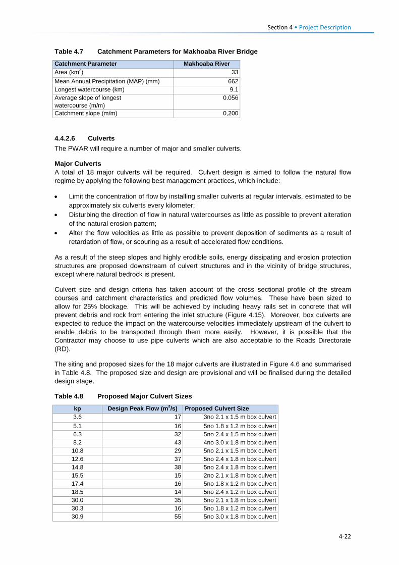
Section 4 • Project Description Table 4.7 Catchment Parameters for Makhoaba River Bridge
Catchment Parameter Makhoaba River Area (km2) 33 Mean Annual Precipitation (MAP) (mm) 662 Longest watercourse (km) 9.1 Average slope of longest watercourse (m/m)
0.056
Catchment slope (m/m) 0,200
4.4.2.6 Culverts The PWAR will require a number of major and smaller culverts.
Major Culverts A total of 18 major culverts will be required. Culvert design is aimed to follow the natural flow regime by applying the following best management practices, which include:
• Limit the concentration of flow by installing smaller culverts at regular intervals, estimated to be approximately six culverts every kilometer;
• Disturbing the direction of flow in natural watercourses as little as possible to prevent alteration of the natural erosion pattern;
• Alter the flow velocities as little as possible to prevent deposition of sediments as a result of retardation of flow, or scouring as a result of accelerated flow conditions.
As a result of the steep slopes and highly erodible soils, energy dissipating and erosion protection structures are proposed downstream of culvert structures and in the vicinity of bridge structures, except where natural bedrock is present.
Culvert size and design criteria has taken account of the cross sectional profile of the stream courses and catchment characteristics and predicted flow volumes. These have been sized to allow for 25% blockage. This will be achieved by including heavy rails set in concrete that will prevent debris and rock from entering the inlet structure (Figure 4.15). Moreover, box culverts are expected to reduce the impact on the watercourse velocities immediately upstream of the culvert to enable debris to be transported through them more easily. However, it is possible that the Contractor may choose to use pipe culverts which are also acceptable to the Roads Directorate (RD).
The siting and proposed sizes for the 18 major culverts are illustrated in Figure 4.6 and summarised in Table 4.8. The proposed size and design are provisional and will be finalised during the detailed design stage.
Table 4.8 Proposed Major Culvert Sizes
kp Design Peak Flow (m3/s) Proposed Culvert Size 3.6 17 3no 2.1 x 1.5 m box culvert 5.1 16 5no 1.8 x 1.2 m box culvert 6.3 32 5no 2.4 x 1.5 m box culvert 8.2 43 4no 3.0 x 1.8 m box culvert
10.8 29 5no 2.1 x 1.5 m box culvert 12.6 37 5no 2.4 x 1.8 m box culvert 14.8 38 5no 2.4 x 1.8 m box culvert 15.5 15 2no 2.1 x 1.8 m box culvert 17.4 16 5no 1.8 x 1.2 m box culvert 18.5 14 5no 2.4 x 1.2 m box culvert 30.0 35 5no 2.1 x 1.8 m box culvert 30.3 16 5no 1.8 x 1.2 m box culvert 30.9 55 5no 3.0 x 1.8 m box culvert
4-22
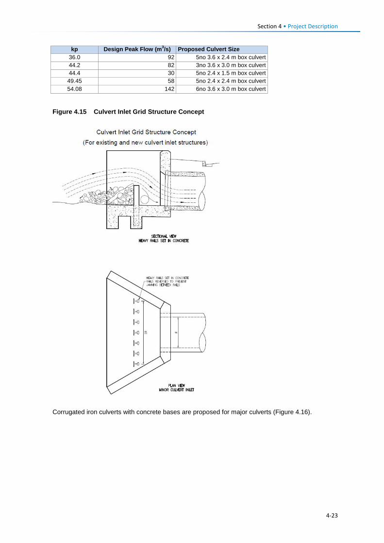
Section 4 • Project Description
kp Design Peak Flow (m3/s) Proposed Culvert Size 36.0 92 5no 3.6 x 2.4 m box culvert 44.2 82 3no 3.6 x 3.0 m box culvert 44.4 30 5no 2.4 x 1.5 m box culvert
49.45 58 5no 2.4 x 2.4 m box culvert 54.08 142 6no 3.6 x 3.0 m box culvert
Figure 4.15 Culvert Inlet Grid Structure Concept
Corrugated iron culverts with concrete bases are proposed for major culverts (Figure 4.16).
4-23
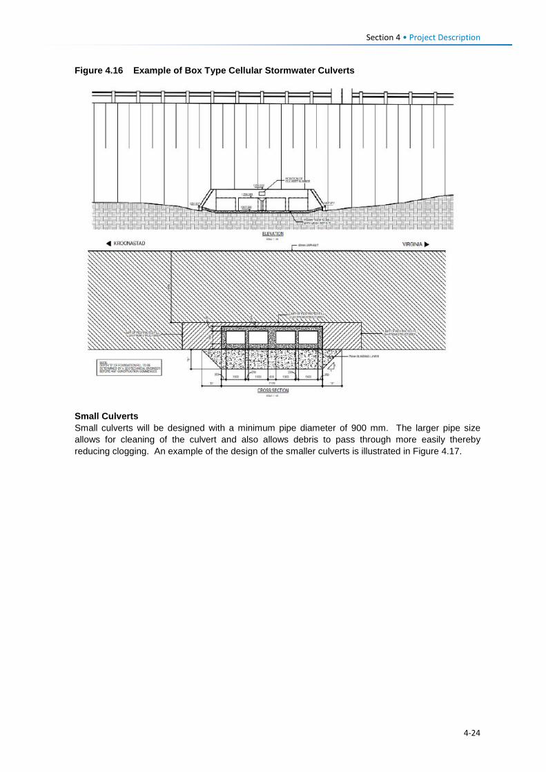
Section 4 • Project Description Figure 4.16 Example of Box Type Cellular Stormwater Culverts
Small Culverts Small culverts will be designed with a minimum pipe diameter of 900 mm. The larger pipe size allows for cleaning of the culvert and also allows debris to pass through more easily thereby reducing clogging. An example of the design of the smaller culverts is illustrated in Figure 4.17.
4-24
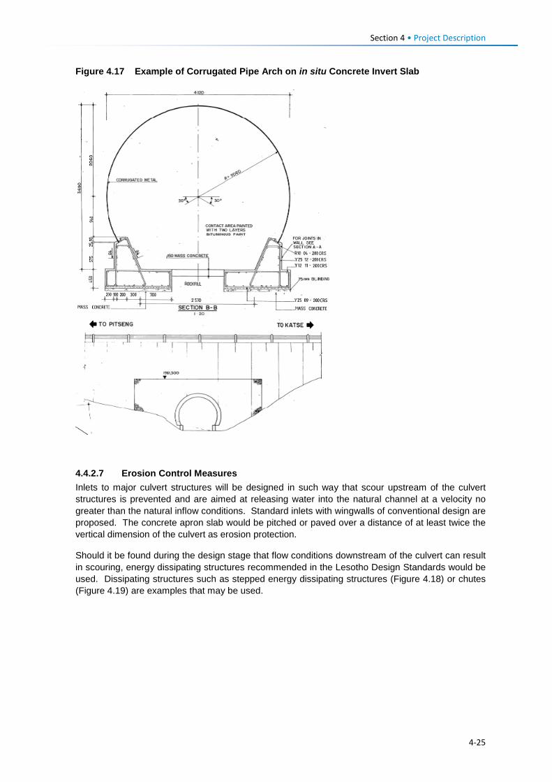
Section 4 • Project Description Figure 4.17 Example of Corrugated Pipe Arch on in situ Concrete Invert Slab
4.4.2.7 Erosion Control Measures Inlets to major culvert structures will be designed in such way that scour upstream of the culvert structures is prevented and are aimed at releasing water into the natural channel at a velocity no greater than the natural inflow conditions. Standard inlets with wingwalls of conventional design are proposed. The concrete apron slab would be pitched or paved over a distance of at least twice the vertical dimension of the culvert as erosion protection.
Should it be found during the design stage that flow conditions downstream of the culvert can result in scouring, energy dissipating structures recommended in the Lesotho Design Standards would be used. Dissipating structures such as stepped energy dissipating structures (Figure 4.18) or chutes (Figure 4.19) are examples that may be used.
4-25
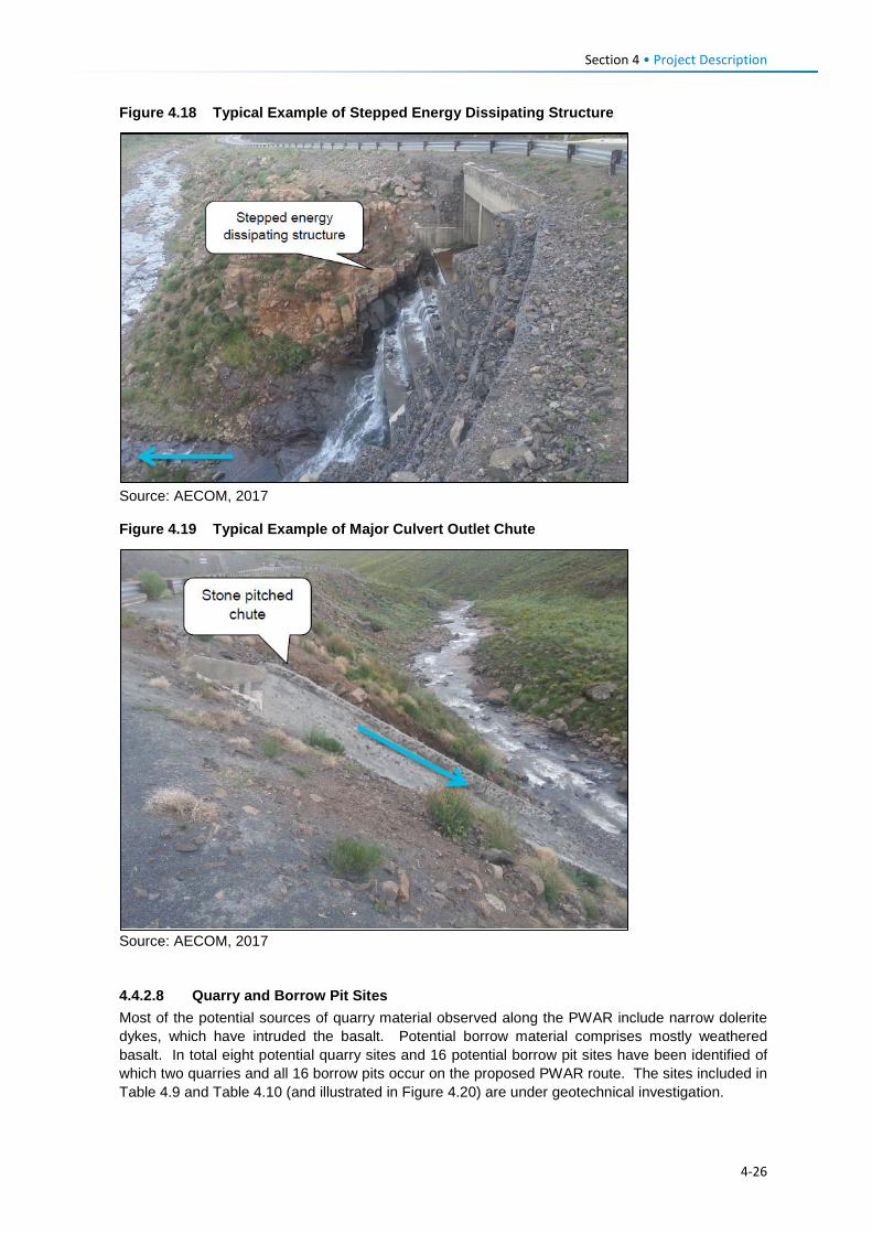
Section 4 • Project Description Figure 4.18 Typical Example of Stepped Energy Dissipating Structure
Source: AECOM, 2017
Figure 4.19 Typical Example of Major Culvert Outlet Chute
Source: AECOM, 2017
4.4.2.8 Quarry and Borrow Pit Sites Most of the potential sources of quarry material observed along the PWAR include narrow dolerite dykes, which have intruded the basalt. Potential borrow material comprises mostly weathered basalt. In total eight potential quarry sites and 16 potential borrow pit sites have been identified of which two quarries and all 16 borrow pits occur on the proposed PWAR route. The sites included in Table 4.9 and Table 4.10 (and illustrated in Figure 4.20) are under geotechnical investigation.
4-26
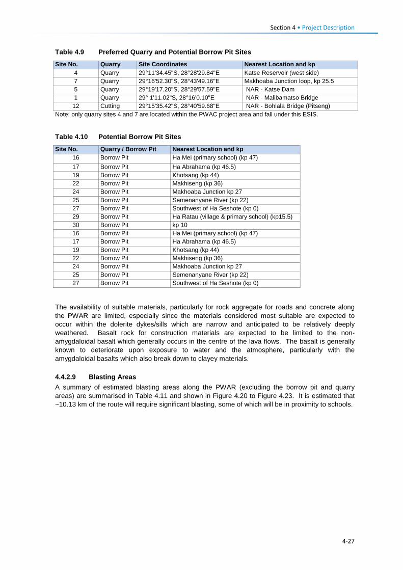
Section 4 • Project Description Table 4.9 Preferred Quarry and Potential Borrow Pit Sites
Site No. Quarry Site Coordinates Nearest Location and kp 4 Quarry 29°11'34.45"S, 28°28'29.84"E Katse Reservoir (west side) 7 Quarry 29°16'52.30"S, 28°43'49.16"E Makhoaba Junction loop, kp 25.5 5 Quarry 29°19'17.20"S, 28°29'57.59"E NAR - Katse Dam 1 Quarry 29° 1'11.02"S, 28°16'0.10"E NAR - Malibamatso Bridge
12 Cutting 29°15'35.42"S, 28°40'59.68"E NAR - Bohlala Bridge (Pitseng) Note: only quarry sites 4 and 7 are located within the PWAC project area and fall under this ESIS.
Table 4.10 Potential Borrow Pit Sites
Site No. Quarry / Borrow Pit Nearest Location and kp 16 Borrow Pit Ha Mei (primary school) (kp 47) 17 Borrow Pit Ha Abrahama (kp 46.5) 19 Borrow Pit Khotsang (kp 44) 22 Borrow Pit Makhiseng (kp 36) 24 Borrow Pit Makhoaba Junction kp 27 25 Borrow Pit Semenanyane River (kp 22) 27 Borrow Pit Southwest of Ha Seshote (kp 0) 29 Borrow Pit Ha Ratau (village & primary school) (kp15.5) 30 Borrow Pit kp 10 16 Borrow Pit Ha Mei (primary school) (kp 47) 17 Borrow Pit Ha Abrahama (kp 46.5) 19 Borrow Pit Khotsang (kp 44) 22 Borrow Pit Makhiseng (kp 36) 24 Borrow Pit Makhoaba Junction kp 27 25 Borrow Pit Semenanyane River (kp 22) 27 Borrow Pit Southwest of Ha Seshote (kp 0)
The availability of suitable materials, particularly for rock aggregate for roads and concrete along the PWAR are limited, especially since the materials considered most suitable are expected to occur within the dolerite dykes/sills which are narrow and anticipated to be relatively deeply weathered. Basalt rock for construction materials are expected to be limited to the non-amygdaloidal basalt which generally occurs in the centre of the lava flows. The basalt is generally known to deteriorate upon exposure to water and the atmosphere, particularly with the amygdaloidal basalts which also break down to clayey materials. 4.4.2.9 Blasting Areas A summary of estimated blasting areas along the PWAR (excluding the borrow pit and quarry areas) are summarised in Table 4.11 and shown in Figure 4.20 to Figure 4.23. It is estimated that ~10.13 km of the route will require significant blasting, some of which will be in proximity to schools.
4-27
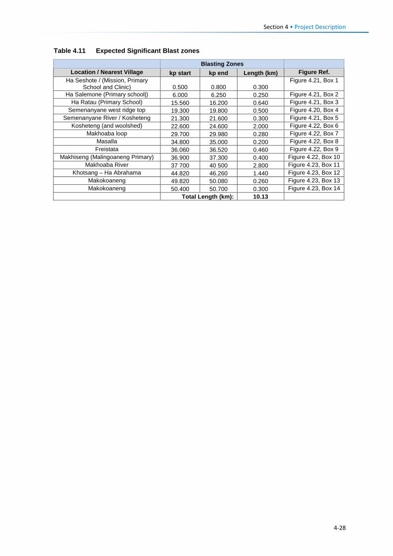
Section 4 • Project Description Table 4.11 Expected Significant Blast zones
Blasting Zones Location / Nearest Village kp start kp end Length (km) Figure Ref.
Ha Seshote / (Mission, Primary School and Clinic) 0.500 0.800 0.300
Figure 4.21, Box 1
Ha Salemone (Primary school|) 6.000 6.250 0.250 Figure 4.21, Box 2 Ha Ratau (Primary School) 15.560 16.200 0.640 Figure 4.21, Box 3
Semenanyane west ridge top 19.300 19.800 0.500 Figure 4.20, Box 4 Semenanyane River / Kosheteng 21.300 21.600 0.300 Figure 4.21, Box 5
Kosheteng (and woolshed) 22.600 24.600 2.000 Figure 4.22, Box 6 Makhoaba loop 29.700 29.980 0.280 Figure 4.22, Box 7
Masalla 34.800 35.000 0.200 Figure 4.22, Box 8 Freistata 36.060 36.520 0.460 Figure 4.22, Box 9
Makhiseng (Malingoaneng Primary) 36.900 37.300 0.400 Figure 4.22, Box 10 Makhoaba River 37 700 40 500 2.800 Figure 4.23, Box 11
Khotsang – Ha Abrahama 44.820 46.260 1.440 Figure 4.23, Box 12 Makokoaneng 49.820 50.080 0.260 Figure 4.23, Box 13 Makokoaneng 50.400 50.700 0.300 Figure 4.23, Box 14
Total Length (km): 10.13
4-28
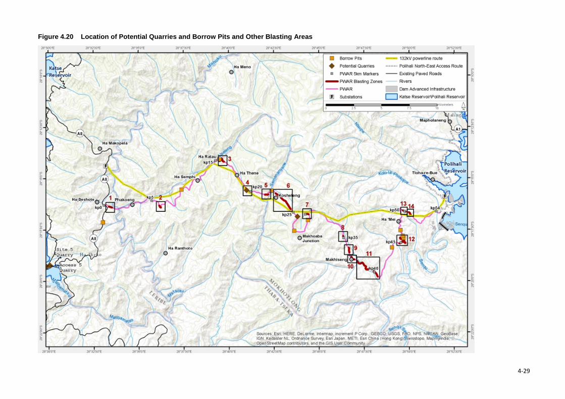
Figure 4.20 Location of Potential Quarries and Borrow Pits and Other Blasting Areas
4-29
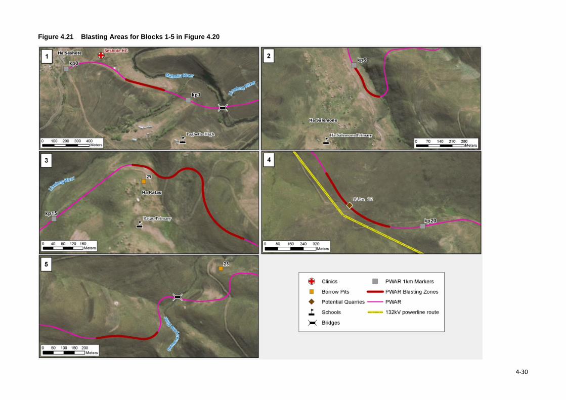
Figure 4.21 Blasting Areas for Blocks 1-5 in Figure 4.20
4-30
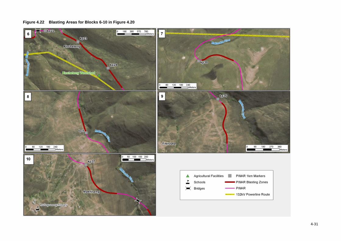
Figure 4.22 Blasting Areas for Blocks 6-10 in Figure 4.20
4-31
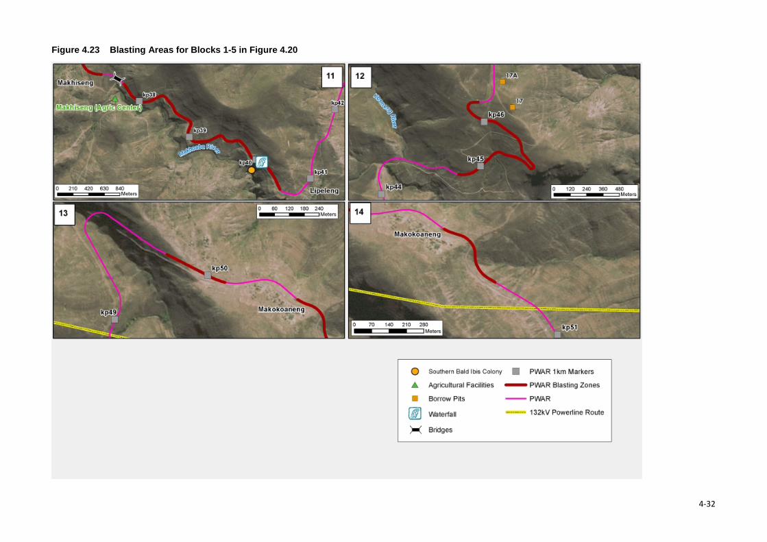
Figure 4.23 Blasting Areas for Blocks 1-5 in Figure 4.20
4-32

Section 4 • Project Description 4.4.2.10 Proposed View Sites Four view sites are proposed (Figure 4.24). These include the following:
• Top of Semenanyane Pass (west side) at kp 19.5 (possibly in a quarry if developed); • Top of Semenanyane (east side) above Kosheteng on west side of Makhoaba loop at kp 25. A
potential quarry site (site 7) has been identified in this vicinity and it is suggested that the quarry be rehabilitated and contoured to create a wind break for use as a view site and picnic area towards the east;
• Overlooking the waterfall on the Makhoaba River at kp 40 (if feasible) or at ~kp 37.6 of the Makhoaba Bridge waterfall, and
• Overlooking the Senqu River valley below the dam wall at kp 45.
These sites would provide stopping points for travellers to rest and admire the scenic views.
4-33
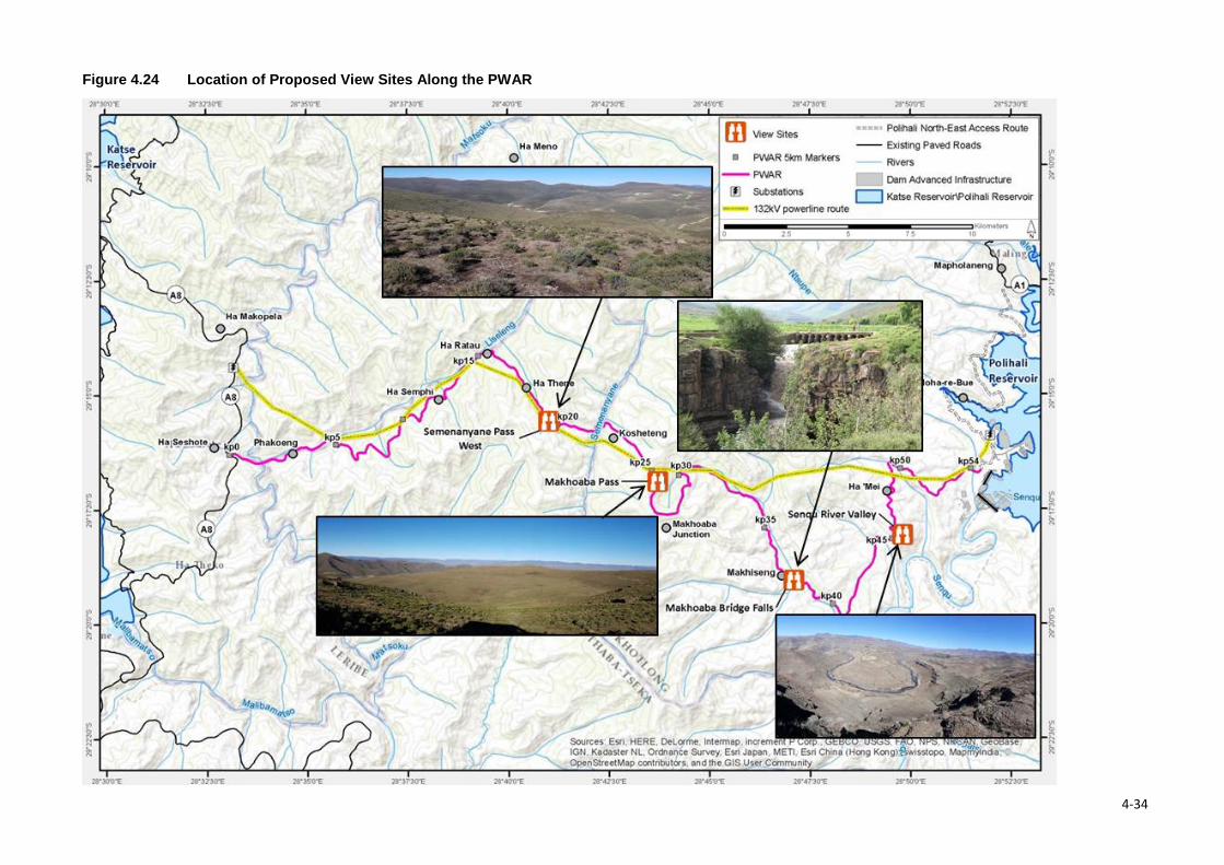
Figure 4.24 Location of Proposed View Sites Along the PWAR
4-34
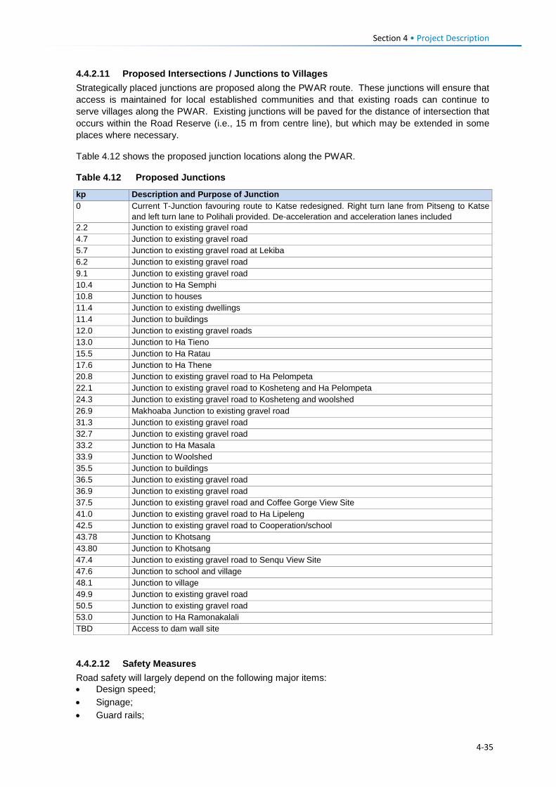
Section 4 • Project Description
4.4.2.11 Proposed Intersections / Junctions to Villages Strategically placed junctions are proposed along the PWAR route. These junctions will ensure that access is maintained for local established communities and that existing roads can continue to serve villages along the PWAR. Existing junctions will be paved for the distance of intersection that occurs within the Road Reserve (i.e., 15 m from centre line), but which may be extended in some places where necessary.
Table 4.12 shows the proposed junction locations along the PWAR.
Table 4.12 Proposed Junctions
kp Description and Purpose of Junction 0 Current T-Junction favouring route to Katse redesigned. Right turn lane from Pitseng to Katse
and left turn lane to Polihali provided. De-acceleration and acceleration lanes included 2.2 Junction to existing gravel road 4.7 Junction to existing gravel road 5.7 Junction to existing gravel road at Lekiba 6.2 Junction to existing gravel road 9.1 Junction to existing gravel road 10.4 Junction to Ha Semphi 10.8 Junction to houses 11.4 Junction to existing dwellings 11.4 Junction to buildings 12.0 Junction to existing gravel roads 13.0 Junction to Ha Tieno 15.5 Junction to Ha Ratau 17.6 Junction to Ha Thene 20.8 Junction to existing gravel road to Ha Pelompeta 22.1 Junction to existing gravel road to Kosheteng and Ha Pelompeta 24.3 Junction to existing gravel road to Kosheteng and woolshed 26.9 Makhoaba Junction to existing gravel road 31.3 Junction to existing gravel road 32.7 Junction to existing gravel road 33.2 Junction to Ha Masala 33.9 Junction to Woolshed 35.5 Junction to buildings 36.5 Junction to existing gravel road 36.9 Junction to existing gravel road 37.5 Junction to existing gravel road and Coffee Gorge View Site 41.0 Junction to existing gravel road to Ha Lipeleng 42.5 Junction to existing gravel road to Cooperation/school 43.78 Junction to Khotsang 43.80 Junction to Khotsang 47.4 Junction to existing gravel road to Senqu View Site 47.6 Junction to school and village 48.1 Junction to village 49.9 Junction to existing gravel road 50.5 Junction to existing gravel road 53.0 Junction to Ha Ramonakalali TBD Access to dam wall site
4.4.2.12 Safety Measures Road safety will largely depend on the following major items: • Design speed; • Signage; • Guard rails;
4-35
Section 4 • Project Description • Paint markings; • Speed control measures, and • Pedestrian sidewalks (in high pedestrian areas).
Design Speed: The PWAR comprises mostly mountain passes with a maximum design speed of 80 km/hr. Vehicle drivers will be required to adjust their vehicle speed to the type of terrain they are driving in, and this is based on the minimum geometric requirements and aspects such as sight distance for stopping and safe speed through curves. Signage: signs such as steep inclines, snow/ice on road, stay in low gear for next 10 km, slippery surface, information signs such as distance to destination, direction signs with chevrons at T-Junctions will be displayed where applicable. Snow poles will be placed at regular intervals of 50 m above the snow line (2700 mamsl and above). Guardrails: steel guardrails will be placed at sharp curves on steep cross slopes, or above the snow line of 2700 m where black ice can occur, causing vehicles to slide across the road. Steel guardrails have been used on the NAR (to Katse) as they are easy to repair, compared to stone and mortar walls which have to be rebuilt. Paint markings: Road paint markings will consist of retro-reflective paint white broken or unbroken centrelines and yellow shoulder lines. Retro-reflective beads will be added to all paint markings to increase reflectivity. Road studs shall be fixed after painting of the road lines. The existing NAR road studs will be replaced after resealing and road line painting is completed. At junctions stop lines and turning lane indicators will be added where required. Speed Control: The speed on approaches to and through villages will be controlled by speed humps designed for 40 km/h. The design comprises an asphalt hump 3.0 m wide and 0.1 m high with a circular vertical curve. Allowance will be made for drainage at the sides of the road so as to not trap water inside the road against the speed hump, e.g., where there are kerbs on the side of the road. Relevant road signs will be erected and the hump painted with zebra crosses. Where relevant the speed hump will be provided with a 2.0 m flat top section so as to provide a pedestrian crossing. Sidewalks: The section between Ha Seshote (kp 0.0) and the Matsoku Bridge at kp 1.3 will be provided with 1.5 m paved sidewalks on both sides of the road to accommodate the relative high pedestrian traffic in this area.
4.4.3 Ongoing Detailed Design Studies and Work The detailed design of the PWAR is ongoing in order to confirm the design and construction requirements, sources of material, logistics, etc. and include:
• Centreline: A centreline investigation along the PWAR which will involve the excavation of test pits with spacing of the test pits determined by geological and topographical conditions as well as the expected road design, but they are expected to be of the order of 200 m apart. The centreline investigation will be carried out to determine: • The nature of the underlying soils including road bed or subgrade; • Conditions where high fills are expected or deep cuttings; • The suitability of the materials for reuse in the road construction by means of laboratory
testing including grading analyses and compaction testing.
• Quarries: Drilling and laboratory testing of rock materials at four potential quarry sites identified as the most suitable for further testing. Drilling will be undertaken by a geotechnical drilling Subcontractor appointed by AECOM in order to prove the quality of material by means
4-36
Section 4 • Project Description
of testing recovered core material. These geotechnical surveys will confirm the sources and volumes of suitable borrow pit and quarry material;
• Bridges: limited drilling to 3-5 m depth is expected to be undertaken at the three major bridge structures at the Matsoku, Semenanyane and Makhoaba crossing points by the drilling Subcontractor once the route alignment has been approved and the final positioning of the bridges has been confirmed. Advance test pitting may be carried out in conjunction with the drilling to determine the number of boreholes needed if required.
• Culverts: major culverts will be investigated, where necessary, by means of test pitting during
the course of the centerline investigations to determine the ground conditions.
• Rock cuttings: material conditions at deep cutting will be investigated where necessary to confirm any stability issues by means of mapping and drilling if required. Test pit profiling and all borehole core logging will be undertaken by a geotechnical specialist in accordance with South African standards.
• Preparation of tender design documentation, including construction EMPs that incorporate the
provisions of the EMP compiled based on this ESIA in Volume 2.
The appointed Contractor will determine the specific details relating to phasing of construction, labour requirements and sources; water supply, specifics of laydown requirements, waste disposal and management etc.
4.5 Bulk Power Supply and Telecommunications 4.5.1 Overview A 132kV power supply must be provided to the Polihali dam development area prior to its construction. This requires the existing powerlines from Ha Lejone via Katse Tower Intake substation up to the Matsoku Diversion substation to be reinsulated and upgraded to the 132kV voltage level. The Katse Tower Intake substation must also be upgraded from an existing 66/11kV substation to a proposed 132/11kV substation. At the Matsoku Diversion substation, both a 132kV and a 66kV busbar (source of supply) must be created: the 132kV supply will service the construction of the Polihali Dam, and the 66kV will service the existing 66kV network at the existing Matsoku Diversion, Katse Dam and Mohale tunnel outlet substations. For this purpose, it is recommended to relocate the existing 132/66/11kV transformers presently in operation at Ha Lejone substation to the Matsoku Diversion extensions (if the remaining life expectancy of these transformers is confirmed to be in excess of 20 years).
In order to maintain the 11kV power supply loads at Ha Lejone, it is proposed that two new 10MVA, 132/11kV transformers be installed at Ha Lejone. Although one transformer can accommodate the 11kV load at Ha Lejone, the second transformer is recommended to serve as a spare transformer in the event of a transformer failure at Katse Tower Intake or at the new Polihali Dam substation.
The BPST construction Project will be separated into the following contracts covered by this ESIS:
• 132kV transmission line; • Upgrading of substations; and • Installation of telecommunications infrastructure.
A further contract will include the rerouting of the existing 33kV transmission line from Mapholaneng to Tlokoeng and over the Khubelu River (which falls under the PRAI ESIS).
4-37
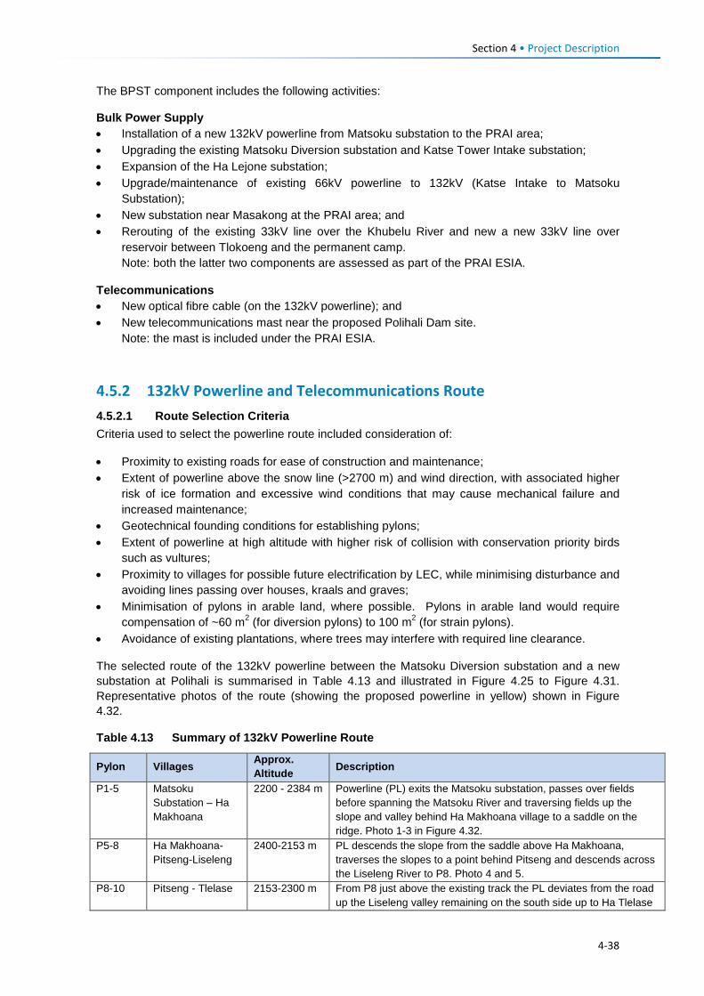
Section 4 • Project Description The BPST component includes the following activities:
Bulk Power Supply • Installation of a new 132kV powerline from Matsoku substation to the PRAI area; • Upgrading the existing Matsoku Diversion substation and Katse Tower Intake substation; • Expansion of the Ha Lejone substation; • Upgrade/maintenance of existing 66kV powerline to 132kV (Katse Intake to Matsoku
Substation); • New substation near Masakong at the PRAI area; and • Rerouting of the existing 33kV line over the Khubelu River and new a new 33kV line over
reservoir between Tlokoeng and the permanent camp. Note: both the latter two components are assessed as part of the PRAI ESIA.
Telecommunications • New optical fibre cable (on the 132kV powerline); and • New telecommunications mast near the proposed Polihali Dam site.
Note: the mast is included under the PRAI ESIA.
4.5.2 132kV Powerline and Telecommunications Route 4.5.2.1 Route Selection Criteria Criteria used to select the powerline route included consideration of:
• Proximity to existing roads for ease of construction and maintenance; • Extent of powerline above the snow line (>2700 m) and wind direction, with associated higher
risk of ice formation and excessive wind conditions that may cause mechanical failure and increased maintenance;
• Geotechnical founding conditions for establishing pylons; • Extent of powerline at high altitude with higher risk of collision with conservation priority birds
such as vultures; • Proximity to villages for possible future electrification by LEC, while minimising disturbance and
avoiding lines passing over houses, kraals and graves; • Minimisation of pylons in arable land, where possible. Pylons in arable land would require
compensation of ~60 m2 (for diversion pylons) to 100 m2 (for strain pylons). • Avoidance of existing plantations, where trees may interfere with required line clearance.
The selected route of the 132kV powerline between the Matsoku Diversion substation and a new substation at Polihali is summarised in Table 4.13 and illustrated in Figure 4.25 to Figure 4.31. Representative photos of the route (showing the proposed powerline in yellow) shown in Figure 4.32.
Table 4.13 Summary of 132kV Powerline Route
Pylon Villages Approx. Altitude Description
P1-5 Matsoku Substation – Ha Makhoana
2200 - 2384 m Powerline (PL) exits the Matsoku substation, passes over fields before spanning the Matsoku River and traversing fields up the slope and valley behind Ha Makhoana village to a saddle on the ridge. Photo 1-3 in Figure 4.32.
P5-8 Ha Makhoana-Pitseng-Liseleng
2400-2153 m PL descends the slope from the saddle above Ha Makhoana, traverses the slopes to a point behind Pitseng and descends across the Liseleng River to P8. Photo 4 and 5.
P8-10 Pitseng - Tlelase 2153-2300 m From P8 just above the existing track the PL deviates from the road up the Liseleng valley remaining on the south side up to Ha Tlelase
4-38
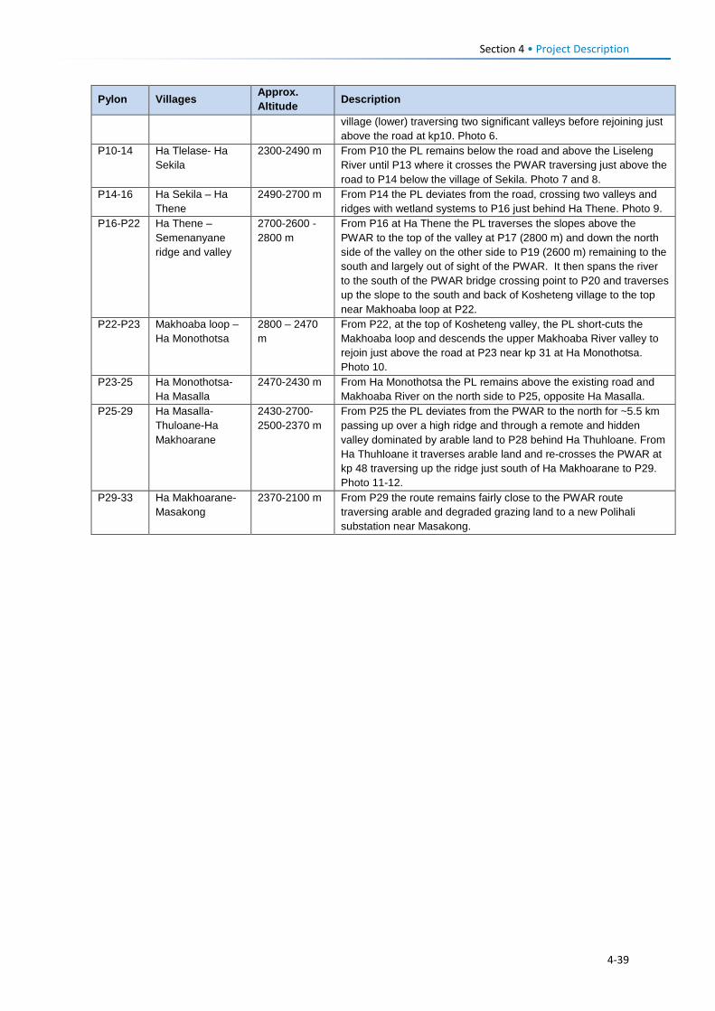
Section 4 • Project Description
Pylon Villages Approx. Altitude Description
village (lower) traversing two significant valleys before rejoining just above the road at kp10. Photo 6.
P10-14 Ha Tlelase- Ha Sekila
2300-2490 m From P10 the PL remains below the road and above the Liseleng River until P13 where it crosses the PWAR traversing just above the road to P14 below the village of Sekila. Photo 7 and 8.
P14-16 Ha Sekila – Ha Thene
2490-2700 m From P14 the PL deviates from the road, crossing two valleys and ridges with wetland systems to P16 just behind Ha Thene. Photo 9.
P16-P22 Ha Thene – Semenanyane ridge and valley
2700-2600 -2800 m
From P16 at Ha Thene the PL traverses the slopes above the PWAR to the top of the valley at P17 (2800 m) and down the north side of the valley on the other side to P19 (2600 m) remaining to the south and largely out of sight of the PWAR. It then spans the river to the south of the PWAR bridge crossing point to P20 and traverses up the slope to the south and back of Kosheteng village to the top near Makhoaba loop at P22.
P22-P23 Makhoaba loop – Ha Monothotsa
2800 – 2470 m
From P22, at the top of Kosheteng valley, the PL short-cuts the Makhoaba loop and descends the upper Makhoaba River valley to rejoin just above the road at P23 near kp 31 at Ha Monothotsa. Photo 10.
P23-25 Ha Monothotsa-Ha Masalla
2470-2430 m From Ha Monothotsa the PL remains above the existing road and Makhoaba River on the north side to P25, opposite Ha Masalla.
P25-29 Ha Masalla-Thuloane-Ha Makhoarane
2430-2700-2500-2370 m
From P25 the PL deviates from the PWAR to the north for ~5.5 km passing up over a high ridge and through a remote and hidden valley dominated by arable land to P28 behind Ha Thuhloane. From Ha Thuhloane it traverses arable land and re-crosses the PWAR at kp 48 traversing up the ridge just south of Ha Makhoarane to P29. Photo 11-12.
P29-33 Ha Makhoarane-Masakong
2370-2100 m From P29 the route remains fairly close to the PWAR route traversing arable and degraded grazing land to a new Polihali substation near Masakong.
4-39
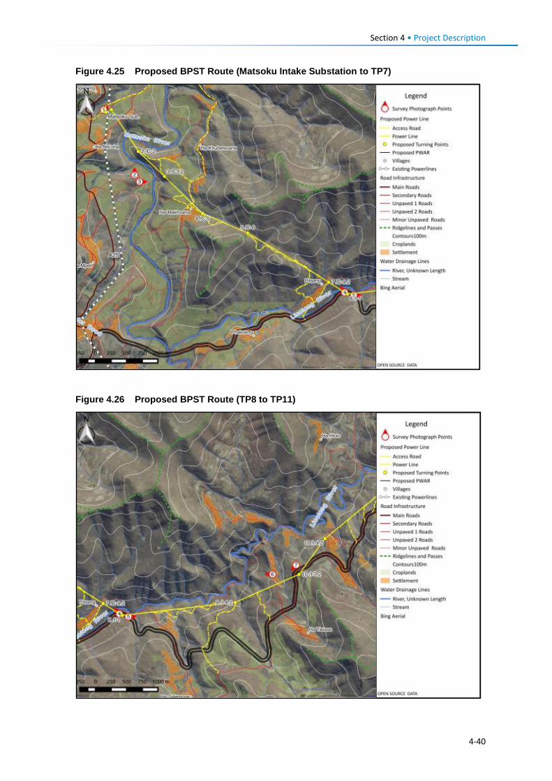
Section 4 • Project Description Figure 4.25 Proposed BPST Route (Matsoku Intake Substation to TP7)
Figure 4.26 Proposed BPST Route (TP8 to TP11)
4-40
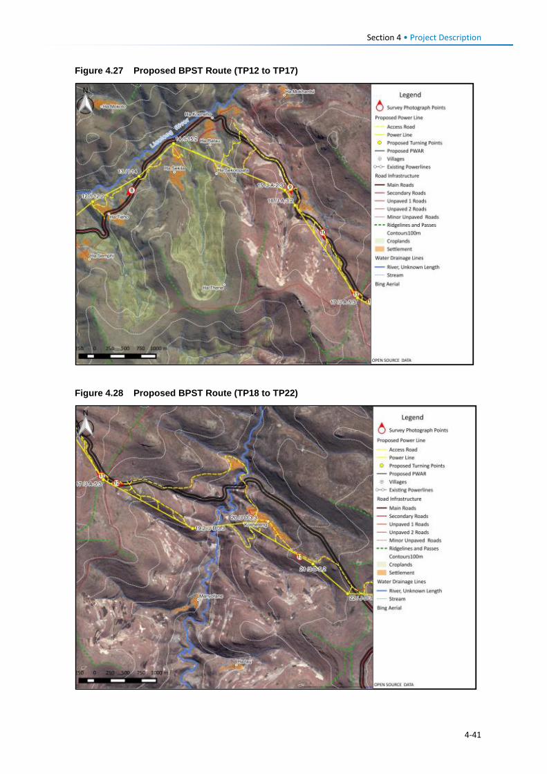
Section 4 • Project Description Figure 4.27 Proposed BPST Route (TP12 to TP17)
Figure 4.28 Proposed BPST Route (TP18 to TP22)
4-41
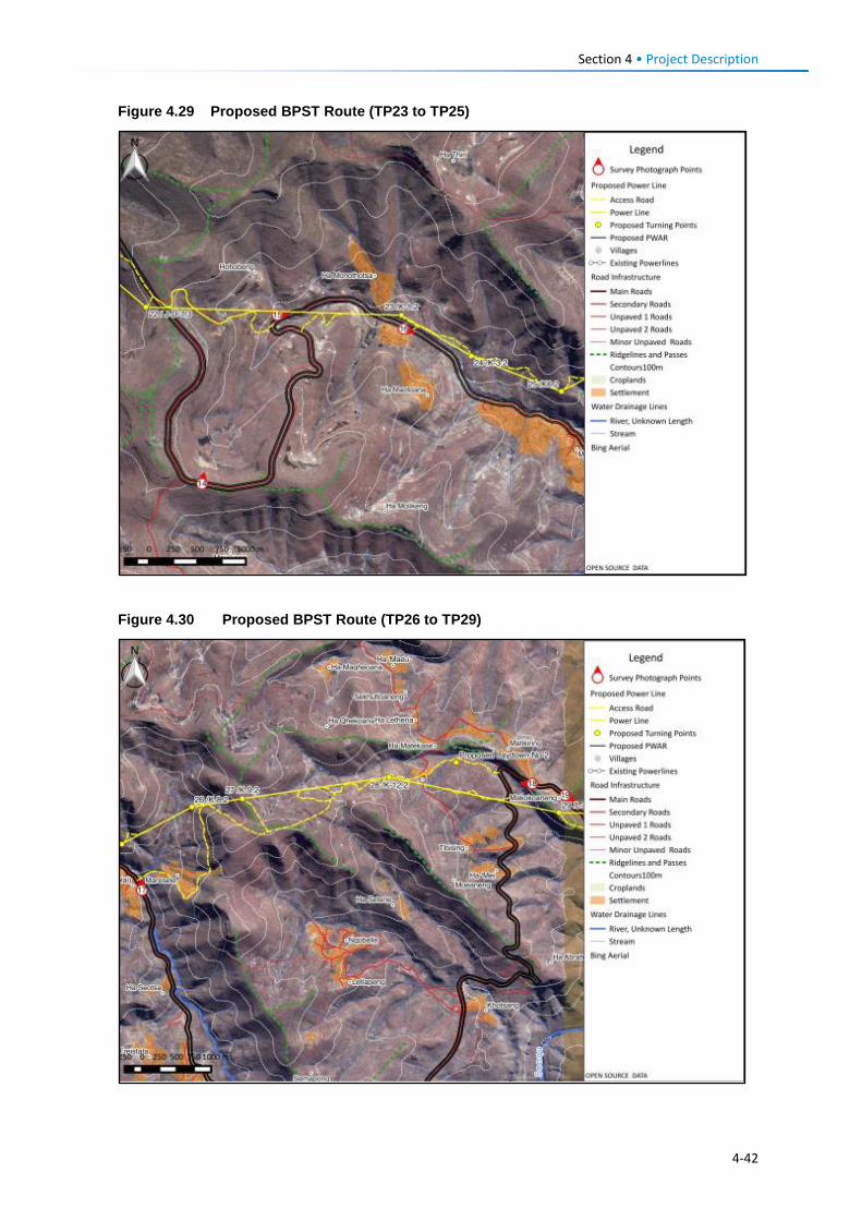
Section 4 • Project Description Figure 4.29 Proposed BPST Route (TP23 to TP25)
Figure 4.30 Proposed BPST Route (TP26 to TP29)
4-42
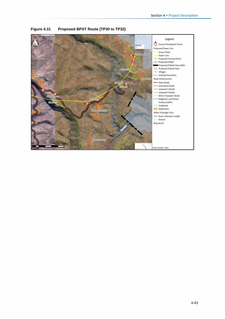
Section 4 • Project Description Figure 4.31 Proposed BPST Route (TP30 to TP32)
4-43
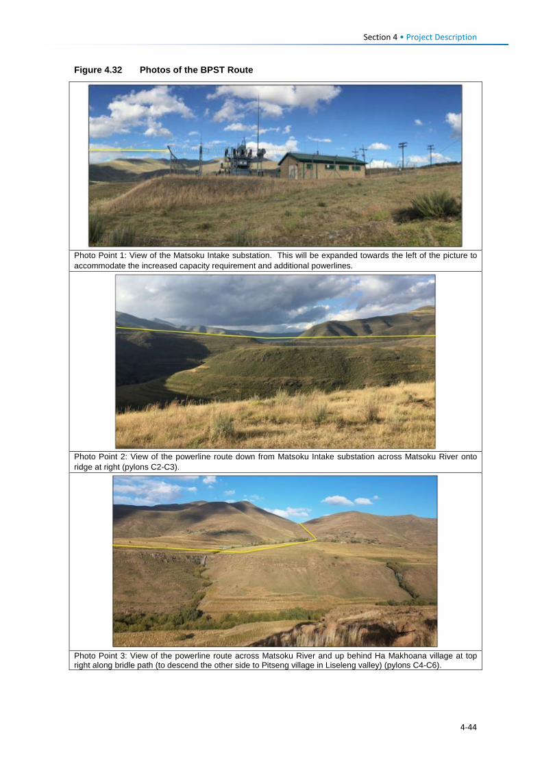
Section 4 • Project Description Figure 4.32 Photos of the BPST Route
Photo Point 1: View of the Matsoku Intake substation. This will be expanded towards the left of the picture to accommodate the increased capacity requirement and additional powerlines.
Photo Point 2: View of the powerline route down from Matsoku Intake substation across Matsoku River onto ridge at right (pylons C2-C3).
Photo Point 3: View of the powerline route across Matsoku River and up behind Ha Makhoana village at top right along bridle path (to descend the other side to Pitseng village in Liseleng valley) (pylons C4-C6).
4-44
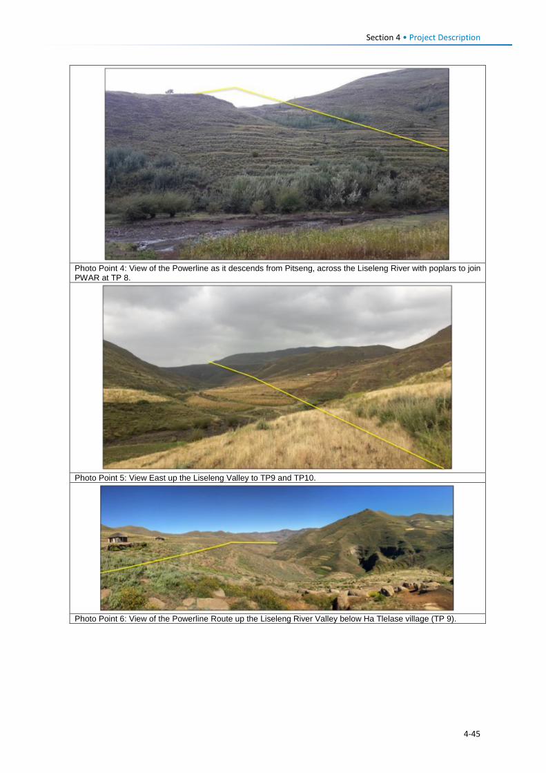
Section 4 • Project Description
Photo Point 4: View of the Powerline as it descends from Pitseng, across the Liseleng River with poplars to join PWAR at TP 8.
Photo Point 5: View East up the Liseleng Valley to TP9 and TP10.
Photo Point 6: View of the Powerline Route up the Liseleng River Valley below Ha Tlelase village (TP 9).
4-45
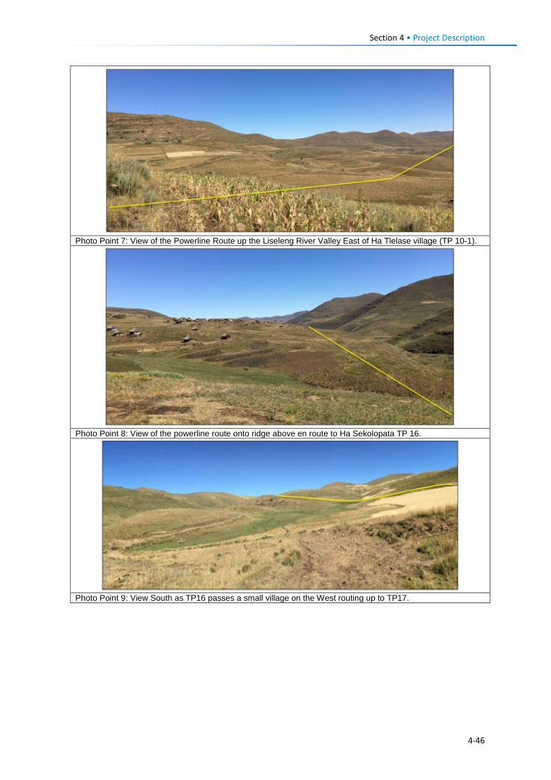
Section 4 • Project Description
Photo Point 7: View of the Powerline Route up the Liseleng River Valley East of Ha Tlelase village (TP 10-1).
Photo Point 8: View of the powerline route onto ridge above en route to Ha Sekolopata TP 16.
Photo Point 9: View South as TP16 passes a small village on the West routing up to TP17.
4-46
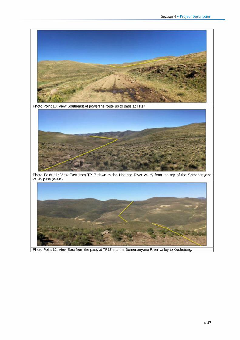
Section 4 • Project Description
Photo Point 10: View Southeast of powerline route up to pass at TP17.
Photo Point 11: View East from TP17 down to the Liseleng River valley from the top of the Semenanyane valley pass (West).
Photo Point 12: View East from the pass at TP17 into the Semenanyane River valley to Kosheteng.
4-47
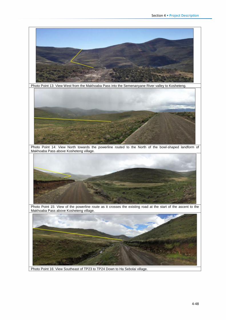
Section 4 • Project Description
Photo Point 13: View West from the Makhoaba Pass into the Semenanyane River valley to Kosheteng.
Photo Point 14: View North towards the powerline routed to the North of the bowl-shaped landform of Makhoaba Pass above Kosheteng village.
Photo Point 15: View of the powerline route as it crosses the existing road at the start of the ascent to the Makhoaba Pass above Kosheteng village.
Photo Point 16: View Southeast of TP23 to TP24 Down to Ha Sebolai village.
4-48
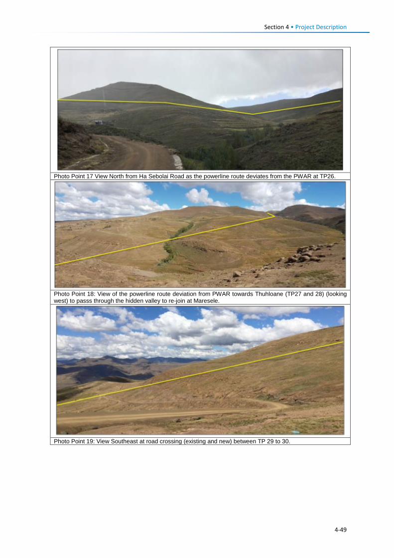
Section 4 • Project Description
Photo Point 17 View North from Ha Sebolai Road as the powerline route deviates from the PWAR at TP26.
Photo Point 18: View of the powerline route deviation from PWAR towards Thuhloane (TP27 and 28) (looking west) to passs through the hidden valley to re-join at Maresele.
Photo Point 19: View Southeast at road crossing (existing and new) between TP 29 to 30.
4-49
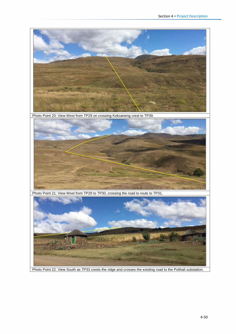
Section 4 • Project Description
Photo Point 20: View West from TP29 on crossing Kokoaneng crest to TP39.
Photo Point 21: View West from TP29 to TP30, crossing the road to route to TP31.
Photo Point 22: View South as TP33 crests the ridge and crosses the existing road to the Polihali substation.
4-50
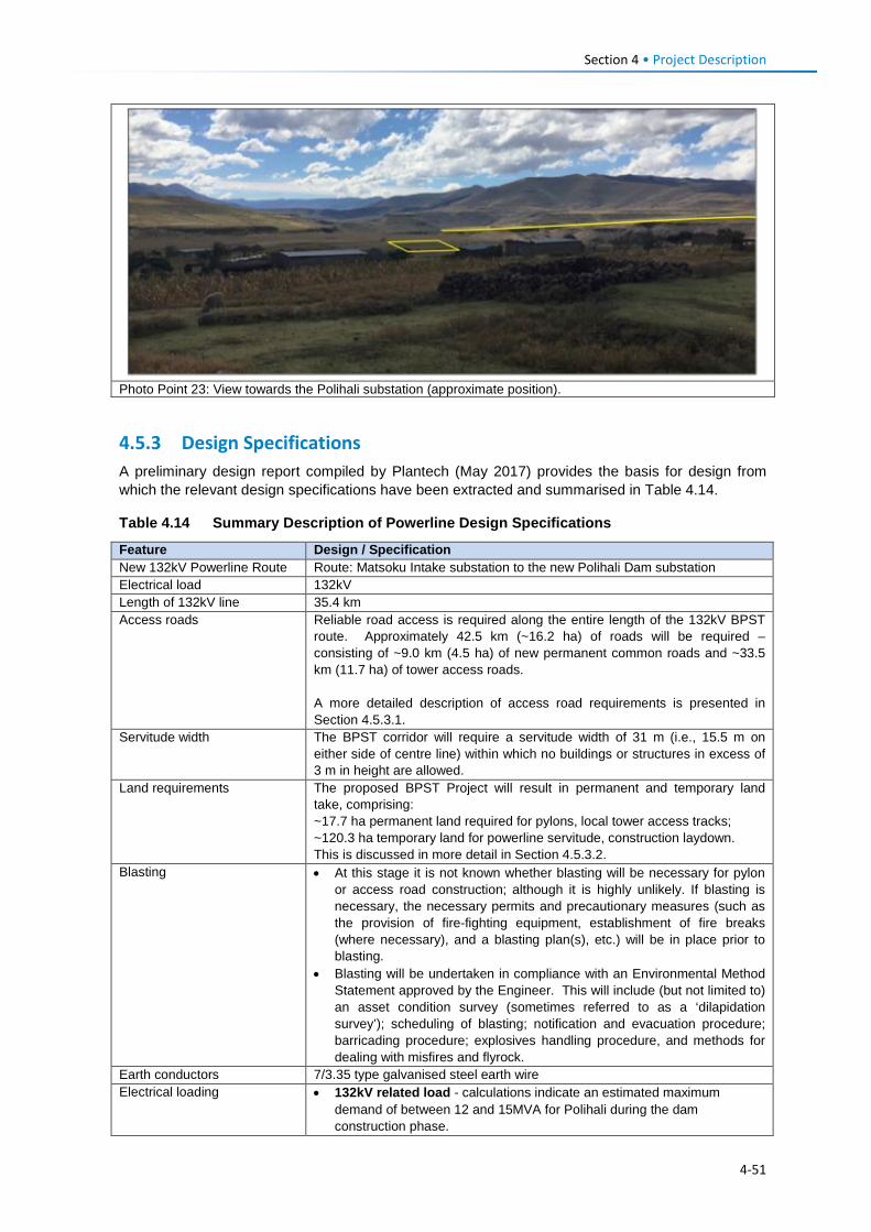
Section 4 • Project Description
Photo Point 23: View towards the Polihali substation (approximate position).
4.5.3 Design Specifications A preliminary design report compiled by Plantech (May 2017) provides the basis for design from which the relevant design specifications have been extracted and summarised in Table 4.14.
Table 4.14 Summary Description of Powerline Design Specifications
Feature Design / Specification New 132kV Powerline Route Route: Matsoku Intake substation to the new Polihali Dam substation Electrical load 132kV Length of 132kV line 35.4 km Access roads Reliable road access is required along the entire length of the 132kV BPST
route. Approximately 42.5 km (~16.2 ha) of roads will be required – consisting of ~9.0 km (4.5 ha) of new permanent common roads and ~33.5 km (11.7 ha) of tower access roads. A more detailed description of access road requirements is presented in Section 4.5.3.1.
Servitude width The BPST corridor will require a servitude width of 31 m (i.e., 15.5 m on either side of centre line) within which no buildings or structures in excess of 3 m in height are allowed.
Land requirements
The proposed BPST Project will result in permanent and temporary land take, comprising: ~17.7 ha permanent land required for pylons, local tower access tracks; ~120.3 ha temporary land for powerline servitude, construction laydown. This is discussed in more detail in Section 4.5.3.2.
Blasting • At this stage it is not known whether blasting will be necessary for pylon or access road construction; although it is highly unlikely. If blasting is necessary, the necessary permits and precautionary measures (such as the provision of fire-fighting equipment, establishment of fire breaks (where necessary), and a blasting plan(s), etc.) will be in place prior to blasting.
• Blasting will be undertaken in compliance with an Environmental Method Statement approved by the Engineer. This will include (but not limited to) an asset condition survey (sometimes referred to as a ‘dilapidation survey’); scheduling of blasting; notification and evacuation procedure; barricading procedure; explosives handling procedure, and methods for dealing with misfires and flyrock.
Earth conductors 7/3.35 type galvanised steel earth wire Electrical loading • 132kV related load - calculations indicate an estimated maximum
demand of between 12 and 15MVA for Polihali during the dam construction phase.
4-51
Section 4 • Project Description Feature Design / Specification Mounting Structures 132kV • Approximately 108 pylons required, including 33 deviation point pylons;
• Bolted lattice steel pylons will be used (e.g., Eskom type 247); • The type of foundations used to secure the pylons will be dependent on
the geotechnical conditions of the site. In hard basalt found at most of the bend point pylons (31 of 33 pylons): drilled root pile foundations into the underline rock will be used. For pylons in softer rock formations or where soil is encountered, concrete foundations will be constructed;
• For safety purposes, and to prevent the removal of strength members of the pylon, breakaway bolts and nuts will be used on all pylons up to a height of 6 m. Anti-climbing devices to prevent people from climbing the pylon will be installed;
• Some pylons in mountainous terrain where road access not feasible may be constructed by helicopter.
The type of lattice pylon proposed is illustrated in Section 4.5.3.3. Minimum Clearances 132kV Over roads and railway lines 7.5 m Over ground (outside townships) 6.3 m Over ground (within townships) 6.3 m To communication lines, other powerlines or between power lines and cradles
3.0 m
Buildings, poles and structures not forming part of the powerline
3.8 m
Clearances over final water level of the reservoir 12.8 m Minimum clearances to pylon steelwork due to swing under maximum wind conditions
Jumper swing (20o): 1,430 mm Insulator swing (60 o) 1,000 mm
Phase to phase earth clearance
1.8 to 2 m
Broken conductor clearances over roads
4.8 m
Avifauna clearances In order to allow for safe perching for raptors on 132kV pylon, a 2 m phase to phase or phase to earth clearance will be maintained (in accordance with the Eskom Guidelines) for all pylon positions at altitudes greater than 2600 m. In order to prevent flashovers from active conductors caused by the excretion of the perching avifauna, anti-perching devices will be positioned in strategic places on the cross arms directly above the vertical insulator strings of suspension structures, as well as jumper connections at strain structures.
Insulation Requirements 132kV Nominal system voltage 132kV Maximum system voltage 145 kV Power frequency withstand voltage 275 kV System BIL at sea level 650 kV Creepage distance required 2.90 mm Minimum clearances: (a) Phase to phase (b) Phase to ground
1.95 m 1.45 m
Minimum working clearance: (a) Vertical (b) Horizontal
3.9 m 2.5 m
Over open land 6.3 m Over roads 7.5 m Over final water level of Polihali Dam 12.8 m 132kV Insulator Sets Composite silicone rubber insulated type insulators:
132kV - minimum creepage distance of 2900 mm & minimum breaking strength of 120kN 33 kV - minimum creepage distance of 968mm, minimum breaking strength of 120kN
4-52
Section 4 • Project Description Feature Design / Specification Foundations Foundation design densities for 132kV pylons
• Re-compacted normal soils – 1600 kg/m2 • Loose cohesion-less materials and soft cohesive soils – 1400 kg/m2 • Water logged soils – 1000 kg/m2 • Concrete densities for foundations - 2000 kg/m2 The type of foundations adopted (drilled root pile foundations versus concrete foundations) will be dependent on the geotechnical conditions of the pylon site.
Substation Upgrades1 Substation (Ha Lejone) Expansion of existing by 6m on west side to accommodate a new 132kV
feeders switching bay for the control of upgraded 132kV powerline supply Katse Intake tower and Matsoku Diversion substations. Installation of two new 10MVA 132/11kV transformers and removal of two 132/66/11kV transformers to the Matsoku Diversion substation. Detailed in Section 4.5.4.
Substation (Katse Intake) Expansion of existing substation to convert it to a 132kV/11kV substation. This is discussed in further detail in Section 4.5.4.
Substation (Matsoku) Expansion of existing substation to accommodate two 132kV/66kV/ 11kV transformers. Detailed in Section 4.5.4.
Existing Line Upgrades Re-insulation of Existing Lines The re-insulation of existing lines will be limited to the insulator strings with a
continuous uniform silicone rubber sheath extruded onto the main glass fibre strength rod.
Bird Protection Measures Bird protection / diverters A number of bird protection and diversion measures will be put in place along
the 132kV line (described in more detailed in Section 4.5.3.4). These include: • Aviation Warning Devices • Bird Diverters, and • Anti-perching Devices.
4.5.3.1 Access Roads Road access is required to each pylon position along the BPST route for the construction of pylon foundations, pylon steelwork erection, stringing of conductors as well as for final inspections and hand-over. These activities will require multiple visits to each pylon, estimated as follows:
• Foundation construction – 14 visits; • Pylon steel work erection – 10 visits; • Stringing of conductors and shielding wires – 9 visits; • Final inspection and hand over – 5 visits.
Pylon access roads will be lower order roads (such as that illustrated in Figure 4.33) and will provide access for up to 10 tonne truck and 4x4 vehicle travelling at average speeds of 15 to 20 km/h. The main pylon access roads (single lane) (see upper road type shown in Figure 4.33) would however need to be in better condition and allow for average speeds of 30 to 50 km/h.
As the primary purpose of these roads is to provide access to the proposed BPST towers, the Lesotho Design Standards for Roads and Bridges (GoL, 1998) are not directly applicable. Access roads will include drainage infrastructure that is designed in such way that surface flows are not impeded or concentrated in order to avoid erosion. It will be the responsibility of the Contractor to maintain access roads throughout construction until they are decommissioned and suitably rehabilitated at the end of construction (if not required by LEC for long-term maintenance).
1 The new substation at Polihali that is required to step down the 132kV supply to 11kV is not included here as it falls part of the PRAI ESIA.
4-53
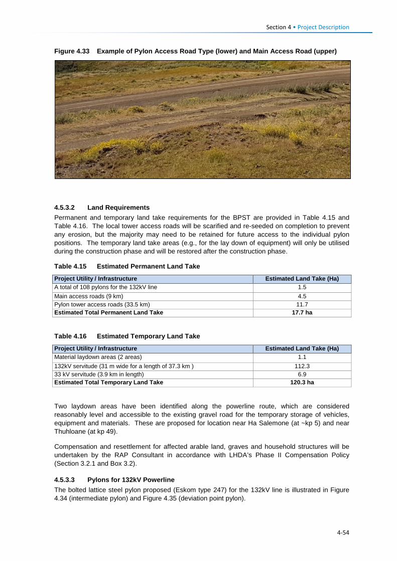
Section 4 • Project Description Figure 4.33 Example of Pylon Access Road Type (lower) and Main Access Road (upper)
4.5.3.2 Land Requirements Permanent and temporary land take requirements for the BPST are provided in Table 4.15 and Table 4.16. The local tower access roads will be scarified and re-seeded on completion to prevent any erosion, but the majority may need to be retained for future access to the individual pylon positions. The temporary land take areas (e.g., for the lay down of equipment) will only be utilised during the construction phase and will be restored after the construction phase.
Table 4.15 Estimated Permanent Land Take
Project Utility / Infrastructure Estimated Land Take (Ha) A total of 108 pylons for the 132kV line 1.5 Main access roads (9 km) 4.5 Pylon tower access roads (33.5 km) 11.7 Estimated Total Permanent Land Take 17.7 ha
Table 4.16 Estimated Temporary Land Take
Project Utility / Infrastructure Estimated Land Take (Ha) Material laydown areas (2 areas) 1.1 132kV servitude (31 m wide for a length of 37.3 km ) 112.3 33 kV servitude (3.9 km in length) 6.9 Estimated Total Temporary Land Take 120.3 ha
Two laydown areas have been identified along the powerline route, which are considered reasonably level and accessible to the existing gravel road for the temporary storage of vehicles, equipment and materials. These are proposed for location near Ha Salemone (at ~kp 5) and near Thuhloane (at kp 49).
Compensation and resettlement for affected arable land, graves and household structures will be undertaken by the RAP Consultant in accordance with LHDA’s Phase II Compensation Policy (Section 3.2.1 and Box 3.2).
4.5.3.3 Pylons for 132kV Powerline The bolted lattice steel pylon proposed (Eskom type 247) for the 132kV line is illustrated in Figure 4.34 (intermediate pylon) and Figure 4.35 (deviation point pylon).
4-54
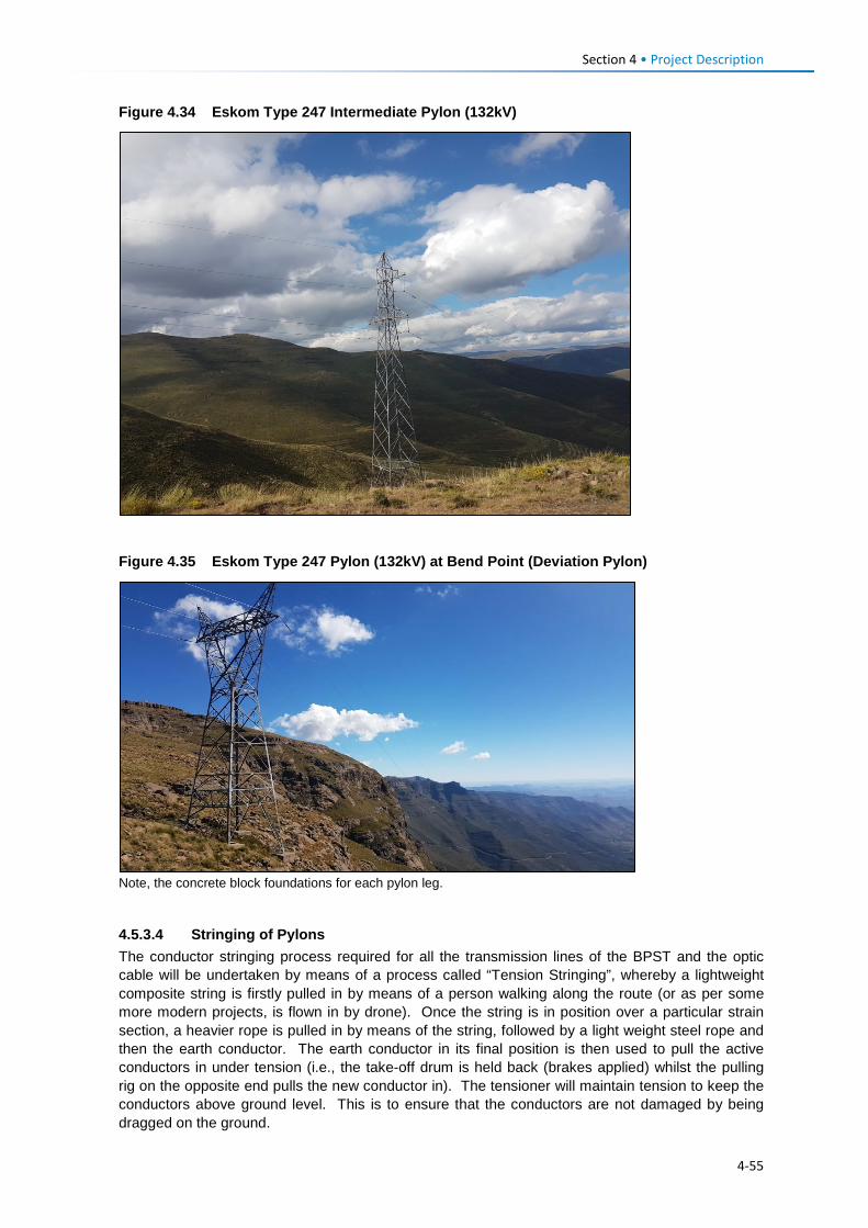
Section 4 • Project Description Figure 4.34 Eskom Type 247 Intermediate Pylon (132kV)
Figure 4.35 Eskom Type 247 Pylon (132kV) at Bend Point (Deviation Pylon)
Note, the concrete block foundations for each pylon leg.
4.5.3.4 Stringing of Pylons The conductor stringing process required for all the transmission lines of the BPST and the optic cable will be undertaken by means of a process called “Tension Stringing”, whereby a lightweight composite string is firstly pulled in by means of a person walking along the route (or as per some more modern projects, is flown in by drone). Once the string is in position over a particular strain section, a heavier rope is pulled in by means of the string, followed by a light weight steel rope and then the earth conductor. The earth conductor in its final position is then used to pull the active conductors in under tension (i.e., the take-off drum is held back (brakes applied) whilst the pulling rig on the opposite end pulls the new conductor in). The tensioner will maintain tension to keep the conductors above ground level. This is to ensure that the conductors are not damaged by being dragged on the ground.
4-55
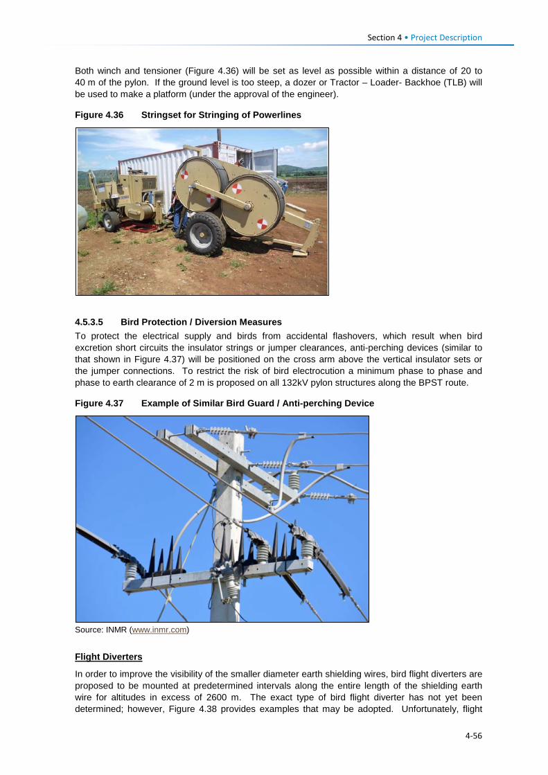
Section 4 • Project Description Both winch and tensioner (Figure 4.36) will be set as level as possible within a distance of 20 to 40 m of the pylon. If the ground level is too steep, a dozer or Tractor – Loader- Backhoe (TLB) will be used to make a platform (under the approval of the engineer).
Figure 4.36 Stringset for Stringing of Powerlines
4.5.3.5 Bird Protection / Diversion Measures To protect the electrical supply and birds from accidental flashovers, which result when bird excretion short circuits the insulator strings or jumper clearances, anti-perching devices (similar to that shown in Figure 4.37) will be positioned on the cross arm above the vertical insulator sets or the jumper connections. To restrict the risk of bird electrocution a minimum phase to phase and phase to earth clearance of 2 m is proposed on all 132kV pylon structures along the BPST route.
Figure 4.37 Example of Similar Bird Guard / Anti-perching Device
Source: INMR (www.inmr.com)
Flight Diverters
In order to improve the visibility of the smaller diameter earth shielding wires, bird flight diverters are proposed to be mounted at predetermined intervals along the entire length of the shielding earth wire for altitudes in excess of 2600 m. The exact type of bird flight diverter has not yet been determined; however, Figure 4.38 provides examples that may be adopted. Unfortunately, flight
4-56
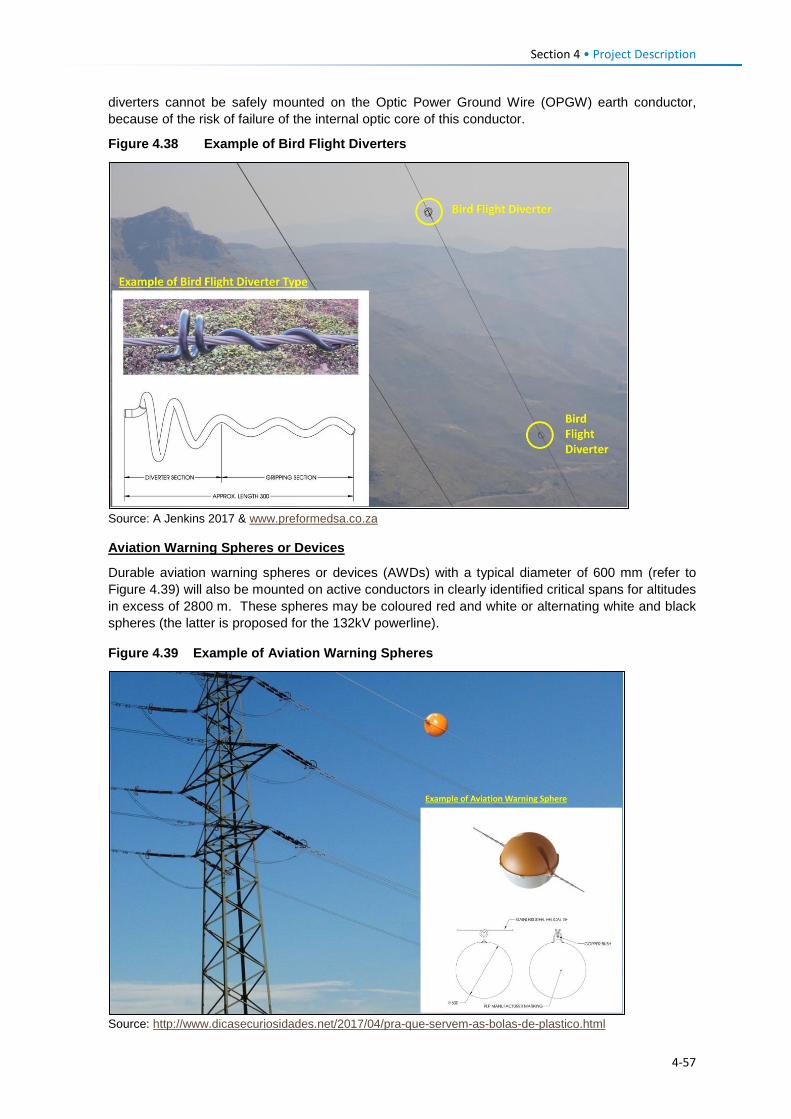
Section 4 • Project Description diverters cannot be safely mounted on the Optic Power Ground Wire (OPGW) earth conductor, because of the risk of failure of the internal optic core of this conductor.
Figure 4.38 Example of Bird Flight Diverters
Source: A Jenkins 2017 & www.preformedsa.co.za
Aviation Warning Spheres or Devices
Durable aviation warning spheres or devices (AWDs) with a typical diameter of 600 mm (refer to Figure 4.39) will also be mounted on active conductors in clearly identified critical spans for altitudes in excess of 2800 m. These spheres may be coloured red and white or alternating white and black spheres (the latter is proposed for the 132kV powerline).
Figure 4.39 Example of Aviation Warning Spheres
Source: http://www.dicasecuriosidades.net/2017/04/pra-que-servem-as-bolas-de-plastico.html
4-57
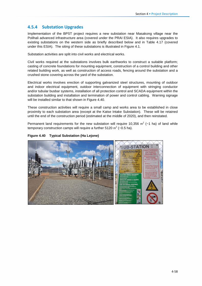
Section 4 • Project Description 4.5.4 Substation Upgrades Implementation of the BPST project requires a new substation near Masakong village near the Polihali advanced infrastructure area (covered under the PRAI ESIA). It also requires upgrades to existing substations on the western side as briefly described below and in Table 4.17 (covered under this ESIA). The siting of these substations is illustrated in Figure 4.1.
Substation activities are split into civil works and electrical works.
Civil works required at the substations involves bulk earthworks to construct a suitable platform; casting of concrete foundations for mounting equipment, construction of a control building and other related building work, as well as construction of access roads, fencing around the substation and a crushed stone covering across the yard of the substation.
Electrical works involves erection of supporting galvanized steel structures, mounting of outdoor and indoor electrical equipment, outdoor interconnection of equipment with stringing conductor and/or tubular busbar systems, installation of all protection control and SCADA equipment within the substation building and installation and termination of power and control cabling. Warning signage will be installed similar to that shown in Figure 4.40.
These construction activities will require a small camp and works area to be established in close proximity to each substation area (except at the Katse Intake Substation). These will be retained until the end of the construction period (estimated at the middle of 2020), and then reinstated.
Permanent land requirements for the new substation will require 10,356 m2 (~1 ha) of land while temporary construction camps will require a further 5120 m2 (~0.5 ha).
Figure 4.40 Typical Substation (Ha Lejone)
4-58
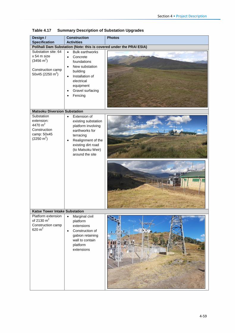
Section 4 • Project Description Table 4.17 Summary Description of Substation Upgrades
Design / Specification
Construction Activities
Photos
Polihali Dam Substation (Note: this is covered under the PRAI ESIA) Substation site: 64 x 54 m size (3456 m2) Construction camp 50x45 (2250 m2)
• Bulk earthworks • Concrete
foundations • New substation
building • Installation of
electrical equipment
• Gravel surfacing • Fencing
Matsoku Diversion Substation Substation extension: 4470 m2 Construction camp: 50x45 (2250 m2)
• Extension of existing substation platform involving earthworks for terracing
• Realignment of the existing dirt road (to Matsoku Weir) around the site
Katse Tower Intake Substation Platform extension of 2130 m2 Construction camp 620 m2
• Marginal civil platform extensions
• Construction of gabion retaining wall to contain platform extensions
4-59
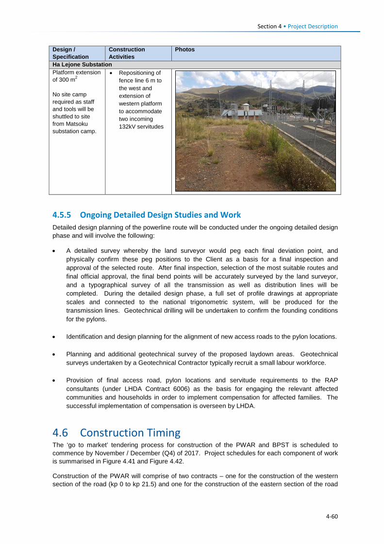
Section 4 • Project Description Design / Specification
Construction Activities
Photos
Ha Lejone Substation Platform extension of 300 m2 No site camp required as staff and tools will be shuttled to site from Matsoku substation camp.
• Repositioning of fence line 6 m to the west and extension of western platform to accommodate two incoming 132kV servitudes
4.5.5 Ongoing Detailed Design Studies and Work Detailed design planning of the powerline route will be conducted under the ongoing detailed design phase and will involve the following:
• A detailed survey whereby the land surveyor would peg each final deviation point, and physically confirm these peg positions to the Client as a basis for a final inspection and approval of the selected route. After final inspection, selection of the most suitable routes and final official approval, the final bend points will be accurately surveyed by the land surveyor, and a typographical survey of all the transmission as well as distribution lines will be completed. During the detailed design phase, a full set of profile drawings at appropriate scales and connected to the national trigonometric system, will be produced for the transmission lines. Geotechnical drilling will be undertaken to confirm the founding conditions for the pylons.
• Identification and design planning for the alignment of new access roads to the pylon locations.
• Planning and additional geotechnical survey of the proposed laydown areas. Geotechnical
surveys undertaken by a Geotechnical Contractor typically recruit a small labour workforce.
• Provision of final access road, pylon locations and servitude requirements to the RAP consultants (under LHDA Contract 6006) as the basis for engaging the relevant affected communities and households in order to implement compensation for affected families. The successful implementation of compensation is overseen by LHDA.
4.6 Construction Timing The ‘go to market’ tendering process for construction of the PWAR and BPST is scheduled to commence by November / December (Q4) of 2017. Project schedules for each component of work is summarised in Figure 4.41 and Figure 4.42.
Construction of the PWAR will comprise of two contracts – one for the construction of the western section of the road (kp 0 to kp 21.5) and one for the construction of the eastern section of the road
4-60
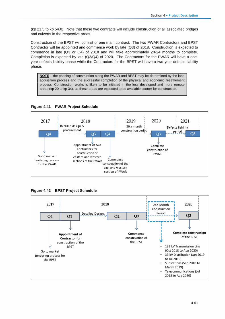
Section 4 • Project Description (kp 21.5 to kp 54.0). Note that these two contracts will include construction of all associated bridges and culverts in the respective areas.
Construction of the BPST will consist of one main contract. The two PWAR Contractors and BPST Contractor will be appointed and commence work by late (Q3) of 2018. Construction is expected to commence in late (Q3 or Q4) of 2018 and will take approximately 20-24 months to complete. Completion is expected by late (Q3/Q4) of 2020. The Contractors for the PWAR will have a one-year defects liability phase while the Contractors for the BPST will have a two year defects liability phase.
Figure 4.41 PWAR Project Schedule
Figure 4.42 BPST Project Schedule
Q1
Appointment of Contractor for
construction of the BPST
2017 2018 2020
Commence construction of
the BPST
Complete construction of the BPST
Q4
Go to market tendering process for
the BPST
24X Month Construction
PeriodDetailed DesignQ2 Q3 Q3
• 132 kV Transmission Line (Oct 2018 to Aug 2020)
• 33 kV Distribution (Jan 2019 to Jul 2019)
• Substations (Sep 2018 to March 2019)
• Telecommunications (Jul 2018 to Aug 2020)
NOTE – the phasing of construction along the PWAR and BPST may be determined by the land acquisition process and the successful completion of the physical and economic resettlement process. Construction works is likely to be initiated in the less developed and more remote areas (kp 20 to kp 34), as these areas are expected to be available sooner for construction.
4-61
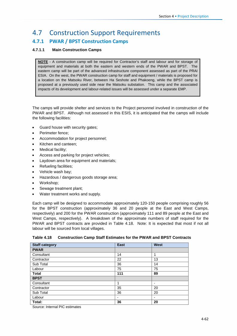
Section 4 • Project Description
4.7 Construction Support Requirements 4.7.1 PWAR / BPST Construction Camps 4.7.1.1 Main Construction Camps
The camps will provide shelter and services to the Project personnel involved in construction of the PWAR and BPST. Although not assessed in this ESIS, it is anticipated that the camps will include the following facilities:
• Guard house with security gates; • Perimeter fence; • Accommodation for project personnel; • Kitchen and canteen; • Medical facility; • Access and parking for project vehicles; • Laydown area for equipment and materials; • Refueling facilities; • Vehicle wash bay; • Hazardous / dangerous goods storage area; • Workshop; • Sewage treatment plant; • Water treatment works and supply.
Each camp will be designed to accommodate approximately 120-150 people comprising roughly 56 for the BPST construction (approximately 36 and 20 people at the East and West Camps, respectively) and 200 for the PWAR construction (approximately 111 and 89 people at the East and West Camps, respectively). A breakdown of the approximate numbers of staff required for the PWAR and BPST contracts are provided in Table 4.18. Note: It is expected that most if not all labour will be sourced from local villages.
Table 4.18 Construction Camp Staff Estimates for the PWAR and BPST Contracts
Staff category East West PWAR Consultant 14 1 Contractor 22 13 Sub Total 36 14 Labour 75 75 Total 111 89 BPST Consultant 1 - Contractor 35 20 Sub Total 36 20 Labour - - Total: 36 20 Source: Internal PIC estimates
NOTE - A construction camp will be required for Contractor’s staff and labour and for storage of equipment and materials at both the eastern and western ends of the PWAR and BPST. The eastern camp will be part of the advanced infrastructure component assessed as part of the PRAI ESIA. On the west, the PWAR construction camp for staff and equipment / materials is proposed for a location on the Matsoku River, between Ha Seshote and Phakoeng, while the BPST camp is proposed at a previously used side near the Matsoku substation. This camp and the associated impacts of its development and labour-related issues will be assessed under a separate EMP.
4-62
Section 4 • Project Description The construction camps will require water for the following purposes:
• Potable consumption (bottled or filtered water); • Food preparation, washing and sanitation (domestic) purposes; • Washing of vehicles and equipment; • Dust suppression, and • Emergency fire events.
Water for construction camp requirements has not been confirmed yet but is expected to be sourced from local river systems (Khubelu River for the eastern camp and Matsoku River for the western camp). Water for domestic (non-potable) use will be treated through a water treatment facility. Additional water will be required per day for domestic use (washing, cleaning, sanitation, etc.), vehicle cleaning, accommodation cleaning and contingency (fire-fighting water). The Contractors will apply for a Water Use License (WUL) from the DWA and will provide these volumes at the time of application.
Electricity for construction camps will be sourced by diesel-run generators.
4.7.1.2 Laydown Areas Both the PWAR and BPST Projects will require laydown areas for vehicles, machinery, equipment and construction materials. The siting and size of laydown areas have not been confirmed, although two sites for the BPST have been proposed: one site at kp 5.5 (near Ha Salemone) and one at kp 49 near Thuhloane).
4.7.2 Support Services for Construction (Water, Electricity and Waste) 4.7.2.1 Construction Water Water will be required for the construction of the PWAR and BPST for the following purposes:
• To make cement or concrete (if not imported ready-made); • General cleaning purposes; • Potable consumption (bottled water); • Dust suppression, and • Emergency fire events.
At this stage the exact water volumes required for construction of the PWAR and BPST are not known. The respective Contractors will apply for the necessary water use permits/licenses and will provide these volumes at the time of application. Water will likely be sourced from local river systems along the routes (e.g., Matsoku, Liseleng, Semenanyane, Makhoaba Rivers), and transported to active work sites in 20,000 litre (2 m3) tanker trucks. The Contractor will be responsible for securing water use permits required for water abstraction.
It is expected that drinking water for staff will be in the form of bottled or filtered water.
4.7.2.2 Electricity During the construction phase, electrical requirements at active work sites along the PWAR and BPST will be sourced from mobile diesel generators (generator specifications are still to be determined).
4.7.2.3 Waste Waste streams will be generated during construction of the PWAR and BPST. Generated wastes can be categorised as hazardous or non-hazardous according to their types and associated risks. The definitions of waste categories are as follows.
4-63
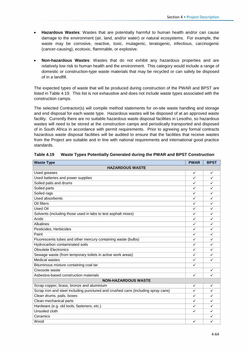
Section 4 • Project Description • Hazardous Wastes: Wastes that are potentially harmful to human health and/or can cause
damage to the environment (air, land, and/or water) or natural ecosystems. For example, the waste may be corrosive, reactive, toxic, mutagenic, teratogenic, infectious, carcinogenic (cancer-causing), ecotoxic, flammable, or explosive.
• Non-hazardous Wastes: Wastes that do not exhibit any hazardous properties and are relatively low risk to human health and the environment. This category would include a range of domestic or construction-type waste materials that may be recycled or can safely be disposed of in a landfill.
The expected types of waste that will be produced during construction of the PWAR and BPST are listed in Table 4.19. This list is not exhaustive and does not include waste types associated with the construction camps.
The selected Contractor(s) will compile method statements for on-site waste handling and storage and end disposal for each waste type. Hazardous wastes will be disposed of at an approved waste facility. Currently there are no suitable hazardous waste disposal facilities in Lesotho, so hazardous wastes will need to be stored at the construction camps and periodically transported and disposed of in South Africa in accordance with permit requirements. Prior to agreeing any formal contracts hazardous waste disposal facilities will be audited to ensure that the facilities that receive wastes from the Project are suitable and in line with national requirements and international good practice standards.
Table 4.19 Waste Types Potentially Generated during the PWAR and BPST Construction
Waste Type PWAR BPST HAZARDOUS WASTE
Used greases Used batteries and power supplies Soiled pails and drums Soiled parts Soiled rags Used absorbents Oil filters Used Oil Solvents (including those used in labs to test asphalt mixes) Acids Alkalines Pesticides, Herbicides Paint Fluorescents tubes and other mercury containing waste (bulbs) Hydrocarbon contaminated soils Obsolete Electronics Sewage waste (from temporary toilets in active work areas) Medical wastes Bituminous mixture containing coal tar Creosote waste Asbestos-based construction materials
NON-HAZARDOUS WASTE Scrap copper, brass, bronze and aluminium Scrap iron and steel including punctured and crushed cans (including spray cans) Clean drums, pails, boxes Clean mechanical parts Hardware (e.g. old tools, fasteners, etc.) Unsoiled cloth Ceramics Wood
4-64
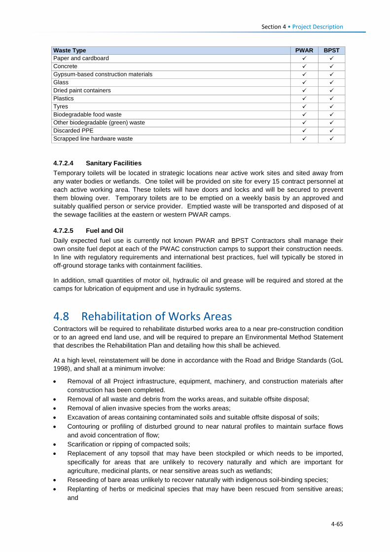
Section 4 • Project Description
4.7.2.4 Sanitary Facilities Temporary toilets will be located in strategic locations near active work sites and sited away from any water bodies or wetlands. One toilet will be provided on site for every 15 contract personnel at each active working area. These toilets will have doors and locks and will be secured to prevent them blowing over. Temporary toilets are to be emptied on a weekly basis by an approved and suitably qualified person or service provider. Emptied waste will be transported and disposed of at the sewage facilities at the eastern or western PWAR camps.
4.7.2.5 Fuel and Oil Daily expected fuel use is currently not known PWAR and BPST Contractors shall manage their own onsite fuel depot at each of the PWAC construction camps to support their construction needs. In line with regulatory requirements and international best practices, fuel will typically be stored in off-ground storage tanks with containment facilities.
In addition, small quantities of motor oil, hydraulic oil and grease will be required and stored at the camps for lubrication of equipment and use in hydraulic systems.
4.8 Rehabilitation of Works Areas Contractors will be required to rehabilitate disturbed works area to a near pre-construction condition or to an agreed end land use, and will be required to prepare an Environmental Method Statement that describes the Rehabilitation Plan and detailing how this shall be achieved.
At a high level, reinstatement will be done in accordance with the Road and Bridge Standards (GoL 1998), and shall at a minimum involve:
• Removal of all Project infrastructure, equipment, machinery, and construction materials after construction has been completed.
• Removal of all waste and debris from the works areas, and suitable offsite disposal; • Removal of alien invasive species from the works areas; • Excavation of areas containing contaminated soils and suitable offsite disposal of soils; • Contouring or profiling of disturbed ground to near natural profiles to maintain surface flows
and avoid concentration of flow; • Scarification or ripping of compacted soils; • Replacement of any topsoil that may have been stockpiled or which needs to be imported,
specifically for areas that are unlikely to recovery naturally and which are important for agriculture, medicinal plants, or near sensitive areas such as wetlands;
• Reseeding of bare areas unlikely to recover naturally with indigenous soil-binding species; • Replanting of herbs or medicinal species that may have been rescued from sensitive areas;
and
Waste Type PWAR BPST Paper and cardboard Concrete Gypsum-based construction materials Glass Dried paint containers Plastics Tyres Biodegradable food waste Other biodegradable (green) waste Discarded PPE Scrapped line hardware waste
4-65
Section 4 • Project Description • Monitoring and ongoing removal or remediation for alien species and erosion.
4.9 Recruitment 4.9.1 Introduction LHDA have published a set of Labour Recruitment Guidelines (version 7.2, February 2017), which provide specific requirements for Contractors around the recruitment of labour, including a need to prioritise the hire of labour in Lesotho. Unskilled labour can be drawn from any part of Lesotho, but priority shall be given to residents from the Project Area. Contractors will be required to demonstrate that satisfactory efforts have been made to source other types of labour such as semi-skilled, skilled, professional and technical support staff through advertising locally, nationally and regionally depending on experience and qualifications required.
4.9.2 Labour Requirements The proposed Project will require unskilled, semi-skilled and skilled personnel during construction of the PWAR and BPST. A breakdown of expected staffing estimates is provided in Table 4.18 in Section 4.7.1.1.
LHDA’s Labour Recruitment Guidelines requires that Contractors maximimise recruitment of unskilled labour locally. Moreover, the proposed project will aim to source most if not all unskilled labour force locally, estimated at ~150-200 unskilled workers in total. It is anticipated that local unskilled labour may be able to live in their home villages and be transported to the active work sites on a daily basis, while those who reside too far away will be accommodated in dormitory accommodation at the eastern or western construction camp. However, the extent to which this is possible will be confirmed by the selected Contractors and will depend on the logistical requirements.
4.9.3 Labour Recruitment Desk LHDA will secure a service provider to establish and implement a Project Labour Recruitment Desk (PLRD). It is proposed that the main office will be located on the eastern side of the Project either at Mapholaneng or Mokhotlong and a satellite office may be located at Katse or Ha Lejone to facilitate the recruitment of the unskilled labour on the western end of the Project.
The PLRD will maintain a database of unskilled labour that shall be based on information provided by ALCs representing the community participation structures, and from area chiefs and councillors (where these structures do not exist), as well as from the National Employment Services and district labour offices.
4.9.4 LHDA Responsibilities for Recruitment LHDA will be responsible for:
• Securing a service provider to manage the PLRD; • Engaging Contractors and issue them with the Labour Recruitment Guidelines to guide the
recruitment of labour; • Overseeing the implementation of the aforementioned guidelines; • Overseeing the recruitment processes as implemented by the PLRD and Contractors; • Observing the resolution of complaints related to the recruitment of labour; and • Ensuring that Contractors keep up-to-date lists of recruited personnel in terms of number, skills,
duration of hire, and that the lists are communicated to the affected communities for transparency.
4-66
Section 4 • Project Description 4.9.5 Contractor Responsibilities for Recruitment As part of overall recruitment of unskilled labour, the Contractors shall:
• Conform to all National Lesotho Laws associated with recruitment (e.g., Lesotho Constitution, Lesotho Labour Code, Workmen’s Compensation Act 37 etc.);
• Abide by the labour recruitment guidelines (version 7.2, February 2017 (or later if available)); • Refrain from employing labour at the construction sites and place signage at all construction
sites that there is no recruitment at the sites; • Refrain from recruiting and bringing unskilled labour from outside the Project area; • Advertise vacant positions requiring unskilled labour at least 20 days before they are required to
mobilise; • Allow successful candidates a maximum time of 14 days’ to mobilise from time of receiving
notice and failure to report to the point of employment will mean forfeiture of the opportunity; • Be responsible for the employment and induction process, including contracts of employment,
health screening, confirmation of fitness to work, and induction training. The contract will be allowed to take a larger number than required in the event that some candidates fail any of the above requirements;
• Provide written reasons for failure, in the case of health the detailed report will be confidential and will only be disclosed to the affected individual;
• Implement rotation of labour (as per Section 4.9.6); • Address recruitment complaints; and • Maintain good labour relations with employees.
4.9.6 Rotation of Unskilled Labour Rotation of labour will be encouraged to provide more opportunities for employment to a greater segment of the population without creating an untenable situation in terms of cost, skills training and disruption to construction activities. At the end of the employment period the worker will be replaced on a job rotation basis in order to distribute employment opportunities to others. Where the Contractor has acquired sufficient skills to be considered for semi-skilled or skilled work, the individual may be re-employed in that capacity.
Rotation of unskilled labour will take cognisance of employment requirements, distance to be travelled from and to the work place, cost-effectiveness and the creation of equal opportunities. Furthermore, rotation of labour will only be considered where it is feasible in terms of project duration and location.
Contractors will be required to declare in the tender submissions what their unskilled labour requirements will be and to suggest how the labour will be rotated in the various work packages, where feasible.
4.9.7 Working Hours Construction activities are proposed to be undertaken during the daytime only over a period of 20 months, although some activities involving concrete shuttering may require night time work.
4.9.8 Training and Skills Enhancement To ensure continuity of work, proper training and skills development, formal employment will typically be for period in excess of one month up to a year or more depending on the nature of the construction work, to allow for labour rotation. Rotation of labour will be encouraged to provide more opportunities for employment to a greater segment of the population without creating an untenable situation in terms of cost, skills training and disruption to construction activities.
4-67
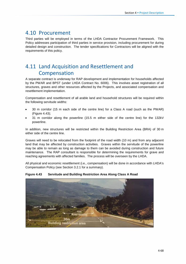
Section 4 • Project Description
4.10 Procurement Third parties will be employed in terms of the LHDA Contractor Procurement Framework. This Policy addresses participation of third parties in service provision, including procurement for during detailed design and construction. The tender specifications for Contractors will be aligned with the requirements of this policy.
4.11 Land Acquisition and Resettlement and Compensation
A separate contract is underway for RAP development and implementation for households affected by the PWAR and BPST (under LHDA Contract No. 6006). This involves asset registration of all structures, graves and other resources affected by the Projects, and associated compensation and resettlement implementation.
Compensation and resettlement of all arable land and household structures will be required within the following servitude widths:
• 30 m corridor (15 m each side of the centre line) for a Class A road (such as the PWAR) (Figure 4.43);
• 31 m corridor along the powerline (15.5 m either side of the centre line) for the 132kV powerline.
In addition, new structures will be restricted within the Building Restriction Area (BRA) of 30 m either side of the centre line.
Graves will need to be relocated from the footprint of the road width (10 m) and from any adjacent land that may be affected by construction activities. Graves within the servitude of the powerline may be able to remain as long as damage to them can be avoided during construction and future maintenance. The RAP consultant is responsible for determining the requirements for grave and reaching agreements with affected families. The process will be overseen by the LHDA.
All physical and economic resettlement (i.e., compensation) will be done in accordance with LHDA’s Compensation Policy (see Section 3.2.1 for a summary).
Figure 4.43 Servitude and Building Restriction Area Along Class A Road
4-68
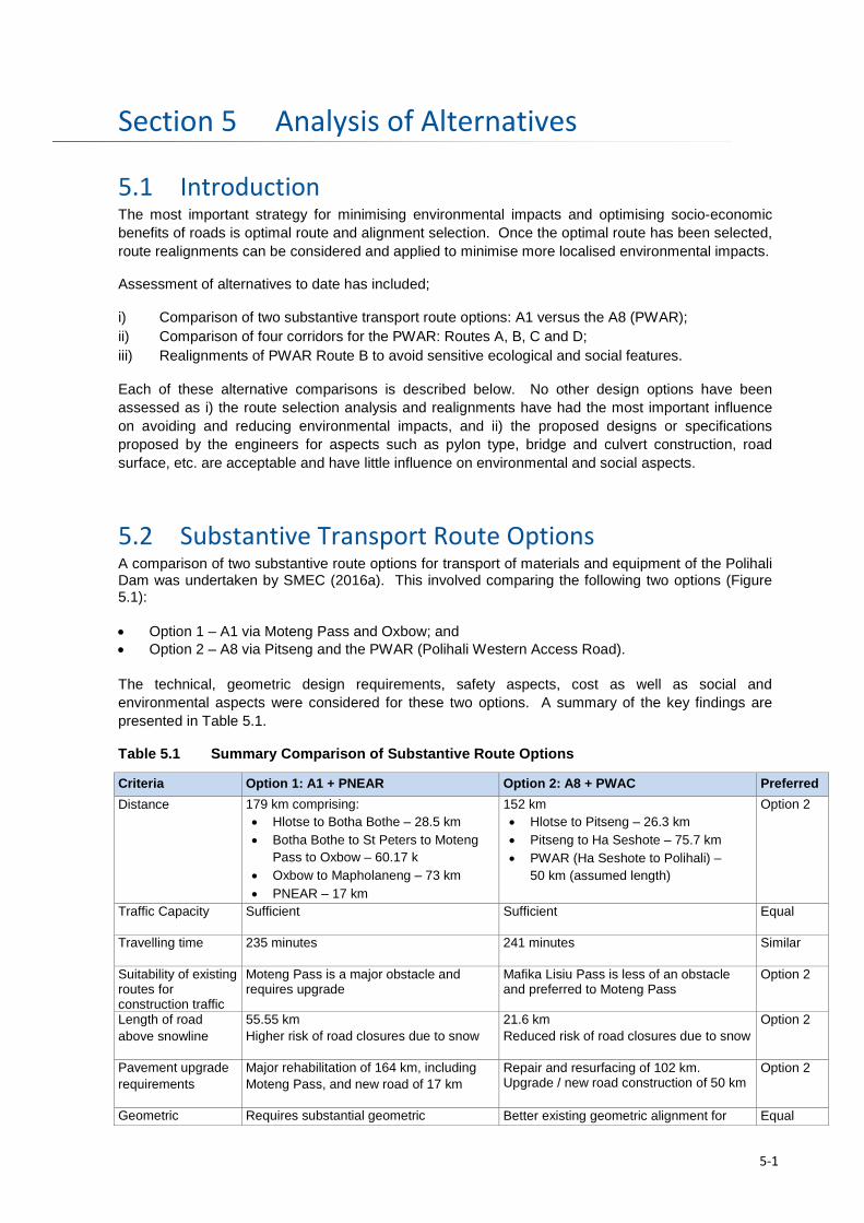
Analysis of Alternatives Section 5
5.1 Introduction The most important strategy for minimising environmental impacts and optimising socio-economic benefits of roads is optimal route and alignment selection. Once the optimal route has been selected, route realignments can be considered and applied to minimise more localised environmental impacts.
Assessment of alternatives to date has included;
i) Comparison of two substantive transport route options: A1 versus the A8 (PWAR); ii) Comparison of four corridors for the PWAR: Routes A, B, C and D; iii) Realignments of PWAR Route B to avoid sensitive ecological and social features.
Each of these alternative comparisons is described below. No other design options have been assessed as i) the route selection analysis and realignments have had the most important influence on avoiding and reducing environmental impacts, and ii) the proposed designs or specifications proposed by the engineers for aspects such as pylon type, bridge and culvert construction, road surface, etc. are acceptable and have little influence on environmental and social aspects.
5.2 Substantive Transport Route Options A comparison of two substantive route options for transport of materials and equipment of the Polihali Dam was undertaken by SMEC (2016a). This involved comparing the following two options (Figure 5.1): • Option 1 – A1 via Moteng Pass and Oxbow; and • Option 2 – A8 via Pitseng and the PWAR (Polihali Western Access Road). The technical, geometric design requirements, safety aspects, cost as well as social and environmental aspects were considered for these two options. A summary of the key findings are presented in Table 5.1.
Table 5.1 Summary Comparison of Substantive Route Options
Criteria Option 1: A1 + PNEAR Option 2: A8 + PWAC Preferred Distance 179 km comprising:
• Hlotse to Botha Bothe – 28.5 km • Botha Bothe to St Peters to Moteng
Pass to Oxbow – 60.17 k • Oxbow to Mapholaneng – 73 km • PNEAR – 17 km
152 km • Hlotse to Pitseng – 26.3 km • Pitseng to Ha Seshote – 75.7 km • PWAR (Ha Seshote to Polihali) –
50 km (assumed length)
Option 2
Traffic Capacity Sufficient Sufficient Equal
Travelling time 235 minutes 241 minutes Similar
Suitability of existing routes for construction traffic
Moteng Pass is a major obstacle and requires upgrade
Mafika Lisiu Pass is less of an obstacle and preferred to Moteng Pass
Option 2
Length of road above snowline
55.55 km Higher risk of road closures due to snow
21.6 km Reduced risk of road closures due to snow
Option 2
Pavement upgrade requirements
Major rehabilitation of 164 km, including Moteng Pass, and new road of 17 km
Repair and resurfacing of 102 km. Upgrade / new road construction of 50 km
Option 2
Geometric Requires substantial geometric Better existing geometric alignment for Equal
5-1
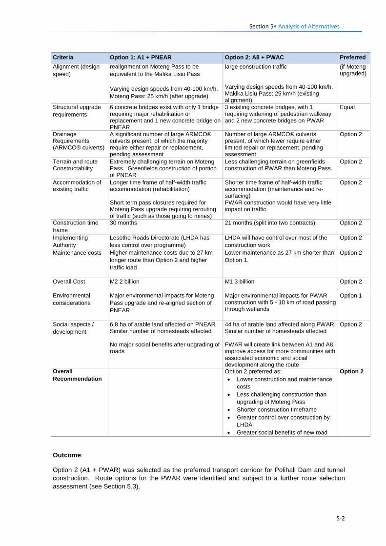
Section 5• Analysis of Alternatives
Criteria Option 1: A1 + PNEAR Option 2: A8 + PWAC Preferred Alignment (design speed)
realignment on Moteng Pass to be equivalent to the Mafika Lisiu Pass Varying design speeds from 40-100 km/h. Moteng Pass: 25 km/h (after upgrade)
large construction traffic Varying design speeds from 40-100 km/h. Makika Lisiu Pass: 25 km/h (existing alignment)
(if Moteng upgraded)
Structural upgrade requirements
6 concrete bridges exist with only 1 bridge requiring major rehabilitation or replacement and 1 new concrete bridge on PNEAR
3 existing concrete bridges, with 1 requiring widening of pedestrian walkway and 2 new concrete bridges on PWAR
Equal
Drainage Requirements (ARMCO® culverts)
A significant number of large ARMCO® culverts present, of which the majority require either repair or replacement, pending assessment
Number of large ARMCO® culverts present, of which fewer require either limited repair or replacement, pending assessment
Option 2
Terrain and route Constructability
Extremely challenging terrain on Moteng Pass. Greenfields construction of portion of PNEAR
Less challenging terrain on greenfields construction of PWAR than Moteng Pass.
Option 2
Accommodation of existing traffic
Longer time frame of half-width traffic accommodation (rehabilitation) Short term pass closures required for Moteng Pass upgrade requiring rerouting of traffic (such as those going to mines)
Shorter time frame of half-width traffic accommodation (maintenance and re-surfacing) PWAR construction would have very little impact on traffic
Option 2
Construction time frame
30 months 21 months (split into two contracts) Option 2
Implementing Authority
Lesotho Roads Directorate (LHDA has less control over programme)
LHDA will have control over most of the construction work
Option 2
Maintenance costs Higher maintenance costs due to 27 km longer route than Option 2 and higher traffic load
Lower maintenance as 27 km shorter than Option 1.
Option 2
Overall Cost M2 2 billion M1 3 billion Option 2
Environmental considerations
Major environmental impacts for Moteng Pass upgrade and re-aligned section of PNEAR
Major environmental impacts for PWAR construction with 5 - 10 km of road passing through wetlands
Option 1
Social aspects / development
6.8 ha of arable land affected on PNEAR Similar number of homesteads affected No major social benefits after upgrading of roads
44 ha of arable land affected along PWAR. Similar number of homesteads affected PWAR will create link between A1 and A8, improve access for more communities with associated economic and social development along the route
Option 2
Overall Recommendation
Option 2 preferred as: • Lower construction and maintenance
costs • Less challenging construction than
upgrading of Moteng Pass • Shorter construction timeframe • Greater control over construction by
LHDA • Greater social benefits of new road
Option 2
Outcome:
Option 2 (A1 + PWAR) was selected as the preferred transport corridor for Polihali Dam and tunnel construction. Route options for the PWAR were identified and subject to a further route selection assessment (see Section 5.3).
5-2
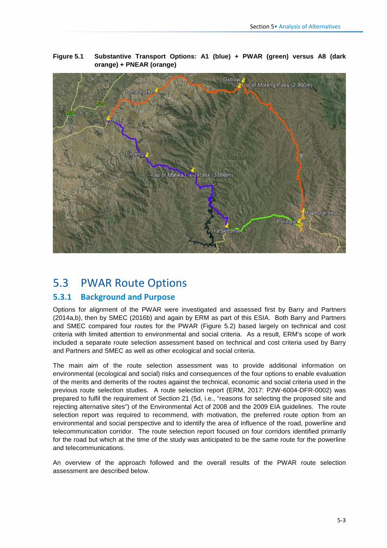
Section 5• Analysis of Alternatives
Figure 5.1 Substantive Transport Options: A1 (blue) + PWAR (green) versus A8 (dark orange) + PNEAR (orange)
5.3 PWAR Route Options 5.3.1 Background and Purpose Options for alignment of the PWAR were investigated and assessed first by Barry and Partners (2014a,b), then by SMEC (2016b) and again by ERM as part of this ESIA. Both Barry and Partners and SMEC compared four routes for the PWAR (Figure 5.2) based largely on technical and cost criteria with limited attention to environmental and social criteria. As a result, ERM’s scope of work included a separate route selection assessment based on technical and cost criteria used by Barry and Partners and SMEC as well as other ecological and social criteria.
The main aim of the route selection assessment was to provide additional information on environmental (ecological and social) risks and consequences of the four options to enable evaluation of the merits and demerits of the routes against the technical, economic and social criteria used in the previous route selection studies. A route selection report (ERM, 2017: P2W-6004-DFR-0002) was prepared to fulfil the requirement of Section 21 (5d, i.e., “reasons for selecting the proposed site and rejecting alternative sites”) of the Environmental Act of 2008 and the 2009 EIA guidelines. The route selection report was required to recommend, with motivation, the preferred route option from an environmental and social perspective and to identify the area of influence of the road, powerline and telecommunication corridor. The route selection report focused on four corridors identified primarily for the road but which at the time of the study was anticipated to be the same route for the powerline and telecommunications.
An overview of the approach followed and the overall results of the PWAR route selection assessment are described below.
5-3
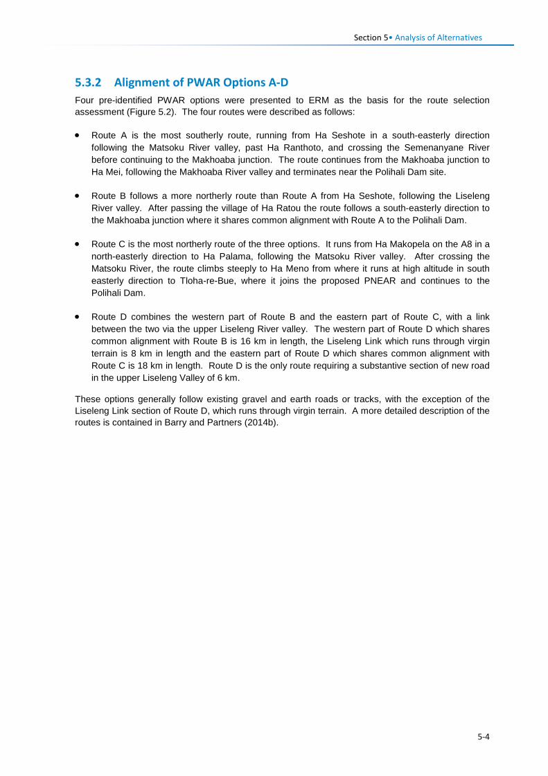
Section 5• Analysis of Alternatives
5.3.2 Alignment of PWAR Options A-D Four pre-identified PWAR options were presented to ERM as the basis for the route selection assessment (Figure 5.2). The four routes were described as follows:
• Route A is the most southerly route, running from Ha Seshote in a south-easterly direction following the Matsoku River valley, past Ha Ranthoto, and crossing the Semenanyane River before continuing to the Makhoaba junction. The route continues from the Makhoaba junction to Ha Mei, following the Makhoaba River valley and terminates near the Polihali Dam site.
• Route B follows a more northerly route than Route A from Ha Seshote, following the Liseleng River valley. After passing the village of Ha Ratou the route follows a south-easterly direction to the Makhoaba junction where it shares common alignment with Route A to the Polihali Dam.
• Route C is the most northerly route of the three options. It runs from Ha Makopela on the A8 in a north-easterly direction to Ha Palama, following the Matsoku River valley. After crossing the Matsoku River, the route climbs steeply to Ha Meno from where it runs at high altitude in south easterly direction to Tloha-re-Bue, where it joins the proposed PNEAR and continues to the Polihali Dam.
• Route D combines the western part of Route B and the eastern part of Route C, with a link between the two via the upper Liseleng River valley. The western part of Route D which shares common alignment with Route B is 16 km in length, the Liseleng Link which runs through virgin terrain is 8 km in length and the eastern part of Route D which shares common alignment with Route C is 18 km in length. Route D is the only route requiring a substantive section of new road in the upper Liseleng Valley of 6 km.
These options generally follow existing gravel and earth roads or tracks, with the exception of the Liseleng Link section of Route D, which runs through virgin terrain. A more detailed description of the routes is contained in Barry and Partners (2014b).
5-4

Figure 5.2 Powerline and Road Options Assessed During the Route Selection Study
5-5
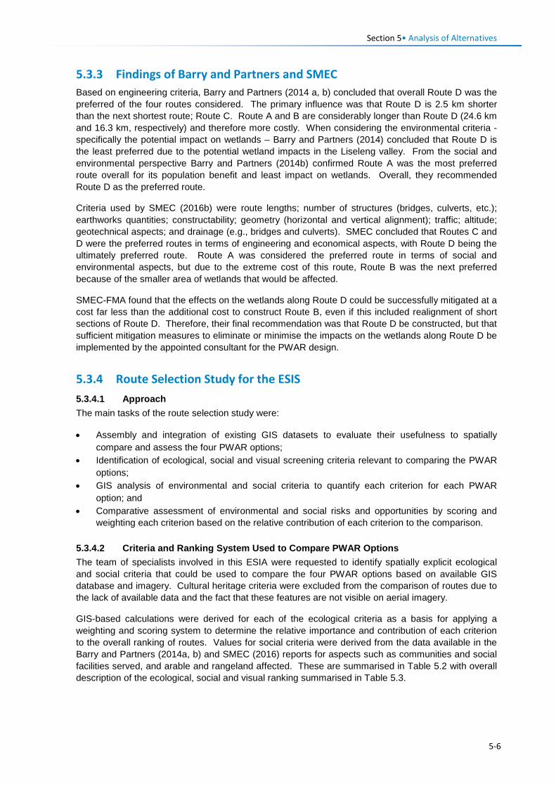
Section 5• Analysis of Alternatives 5.3.3 Findings of Barry and Partners and SMEC Based on engineering criteria, Barry and Partners (2014 a, b) concluded that overall Route D was the preferred of the four routes considered. The primary influence was that Route D is 2.5 km shorter than the next shortest route; Route C. Route A and B are considerably longer than Route D (24.6 km and 16.3 km, respectively) and therefore more costly. When considering the environmental criteria - specifically the potential impact on wetlands – Barry and Partners (2014) concluded that Route D is the least preferred due to the potential wetland impacts in the Liseleng valley. From the social and environmental perspective Barry and Partners (2014b) confirmed Route A was the most preferred route overall for its population benefit and least impact on wetlands. Overall, they recommended Route D as the preferred route.
Criteria used by SMEC (2016b) were route lengths; number of structures (bridges, culverts, etc.); earthworks quantities; constructability; geometry (horizontal and vertical alignment); traffic; altitude; geotechnical aspects; and drainage (e.g., bridges and culverts). SMEC concluded that Routes C and D were the preferred routes in terms of engineering and economical aspects, with Route D being the ultimately preferred route. Route A was considered the preferred route in terms of social and environmental aspects, but due to the extreme cost of this route, Route B was the next preferred because of the smaller area of wetlands that would be affected.
SMEC-FMA found that the effects on the wetlands along Route D could be successfully mitigated at a cost far less than the additional cost to construct Route B, even if this included realignment of short sections of Route D. Therefore, their final recommendation was that Route D be constructed, but that sufficient mitigation measures to eliminate or minimise the impacts on the wetlands along Route D be implemented by the appointed consultant for the PWAR design.
5.3.4 Route Selection Study for the ESIS 5.3.4.1 Approach The main tasks of the route selection study were:
• Assembly and integration of existing GIS datasets to evaluate their usefulness to spatially compare and assess the four PWAR options;
• Identification of ecological, social and visual screening criteria relevant to comparing the PWAR options;
• GIS analysis of environmental and social criteria to quantify each criterion for each PWAR option; and
• Comparative assessment of environmental and social risks and opportunities by scoring and weighting each criterion based on the relative contribution of each criterion to the comparison.
5.3.4.2 Criteria and Ranking System Used to Compare PWAR Options The team of specialists involved in this ESIA were requested to identify spatially explicit ecological and social criteria that could be used to compare the four PWAR options based on available GIS database and imagery. Cultural heritage criteria were excluded from the comparison of routes due to the lack of available data and the fact that these features are not visible on aerial imagery.
GIS-based calculations were derived for each of the ecological criteria as a basis for applying a weighting and scoring system to determine the relative importance and contribution of each criterion to the overall ranking of routes. Values for social criteria were derived from the data available in the Barry and Partners (2014a, b) and SMEC (2016) reports for aspects such as communities and social facilities served, and arable and rangeland affected. These are summarised in Table 5.2 with overall description of the ecological, social and visual ranking summarised in Table 5.3.
5-6
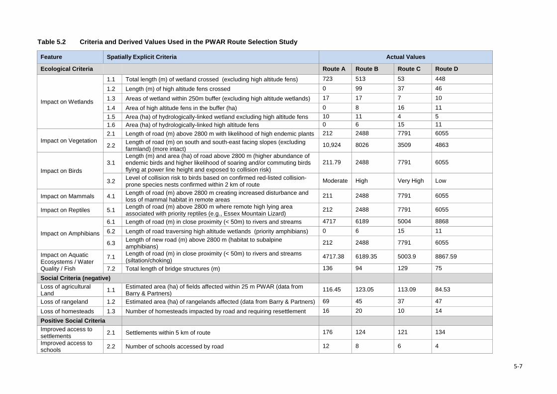
Table 5.2 Criteria and Derived Values Used in the PWAR Route Selection Study
Feature Spatially Explicit Criteria Actual Values
Ecological Criteria Route A Route B Route C Route D
Impact on Wetlands
1.1 Total length (m) of wetland crossed (excluding high altitude fens) 723 513 53 448
1.2 Length (m) of high altitude fens crossed 0 99 37 46
1.3 Areas of wetland within 250m buffer (excluding high altitude wetlands) 17 17 7 10
1.4 Area of high altitude fens in the buffer (ha) 0 8 16 11 1.5 Area (ha) of hydrologically-linked wetland excluding high altitude fens 10 11 4 5 1.6 Area (ha) of hydrologically-linked high altitude fens 0 6 15 11
Impact on Vegetation 2.1 Length of road (m) above 2800 m with likelihood of high endemic plants 212 2488 7791 6055
2.2 Length of road (m) on south and south-east facing slopes (excluding farmland) (more intact)
10,924 8026 3509 4863
Impact on Birds 3.1
Length (m) and area (ha) of road above 2800 m (higher abundance of endemic birds and higher likelihood of soaring and/or commuting birds flying at power line height and exposed to collision risk)
211.79 2488 7791 6055
3.2 Level of collision risk to birds based on confirmed red-listed collision-prone species nests confirmed within 2 km of route Moderate High Very High Low
Impact on Mammals 4.1 Length of road (m) above 2800 m creating increased disturbance and loss of mammal habitat in remote areas
211 2488 7791 6055
Impact on Reptiles 5.1 Length of road (m) above 2800 m where remote high lying area associated with priority reptiles (e.g., Essex Mountain Lizard)
212 2488 7791 6055
Impact on Amphibians
6.1 Length of road (m) in close proximity (< 50m) to rivers and streams 4717 6189 5004 8868
6.2 Length of road traversing high altitude wetlands (priority amphibians) 0 6 15 11
6.3 Length of new road (m) above 2800 m (habitat to subalpine amphibians)
212 2488 7791 6055
Impact on Aquatic Ecosystems / Water Quality / Fish
7.1 Length of road (m) in close proximity (< 50m) to rivers and streams (siltation/choking)
4717.38 6189.35 5003.9 8867.59
7.2 Total length of bridge structures (m) 136 94 129 75
Social Criteria (negative) Loss of agricultural Land 1.1 Estimated area (ha) of fields affected within 25 m PWAR (data from
Barry & Partners) 116.45 123.05 113.09 84.53
Loss of rangeland 1.2 Estimated area (ha) of rangelands affected (data from Barry & Partners) 69 45 37 47
Loss of homesteads 1.3 Number of homesteads impacted by road and requiring resettlement 16 20 10 14
Positive Social Criteria Improved access to settlements 2.1 Settlements within 5 km of route 176 124 121 134
Improved access to schools 2.2 Number of schools accessed by road 12 8 6 4
5-7
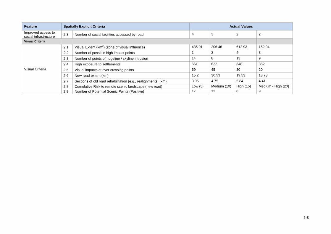
Feature Spatially Explicit Criteria Actual Values Improved access to social infrastructure 2.3 Number of social facilities accessed by road 4 3 2 2
Visual Criteria
Visual Criteria
2.1 Visual Extent (km2) (zone of visual influence) 435.91 206.46 612.93 152.04
2.2 Number of possible high impact points 1 2 4 3
2.3 Number of points of ridgeline / skyline intrusion 14 8 13 9
2.4 High exposure to settlements 551 622 348 352
2.5 Visual impacts at river crossing points 59 45 30 20
2.6 New road extent (km) 15.2 30.53 19.53 18.78
2.7 Sections of old road rehabilitation (e.g., realignments) (km) 3.05 4.75 5.84 4.41 2.8 Cumulative Risk to remote scenic landscape (new road) Low (5) Medium (10) High (15) Medium - High (20) 2.9 Number of Potential Scenic Points (Positive) 17 12 8 9
5-8
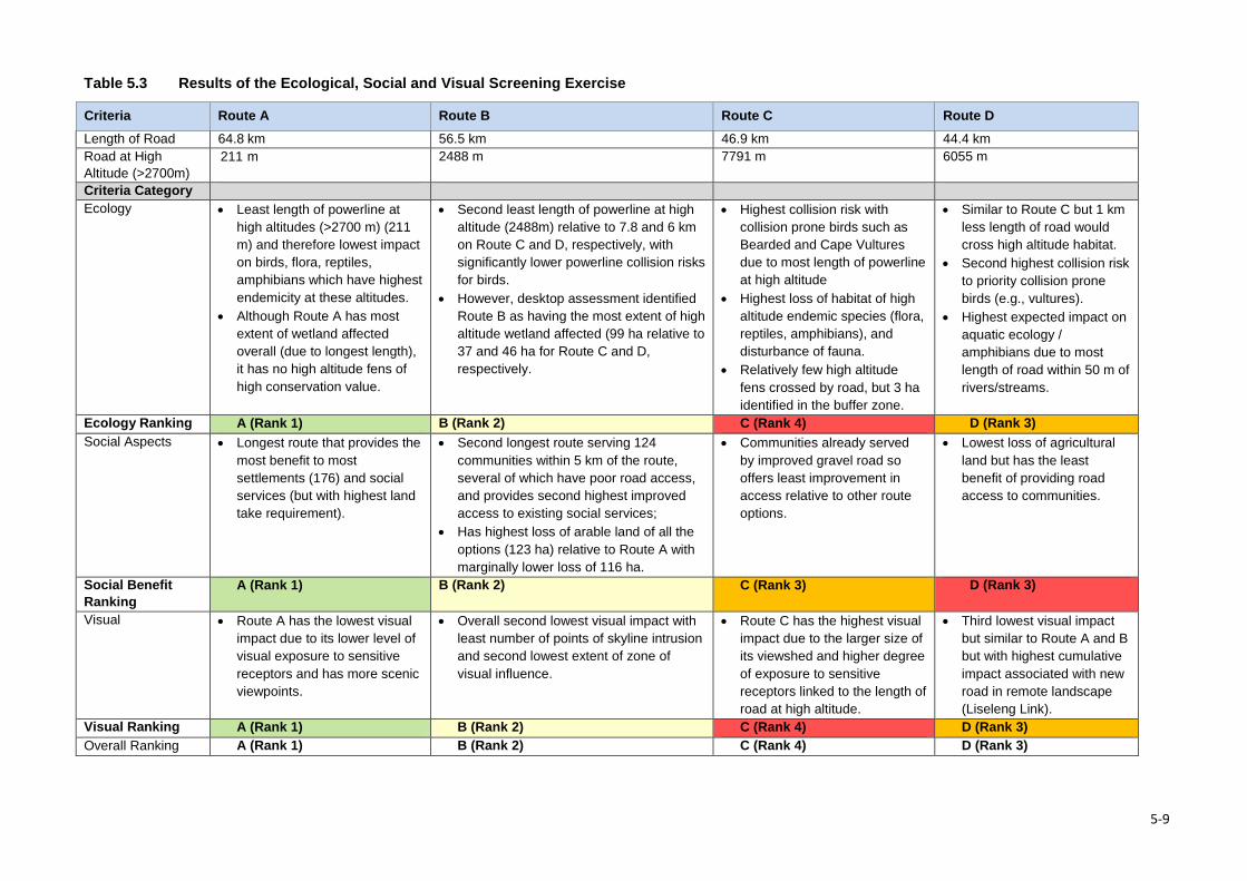
Table 5.3 Results of the Ecological, Social and Visual Screening Exercise
Criteria Route A Route B Route C Route D Length of Road 64.8 km 56.5 km 46.9 km 44.4 km Road at High Altitude (>2700m)
211 m 2488 m 7791 m 6055 m
Criteria Category Ecology • Least length of powerline at
high altitudes (>2700 m) (211 m) and therefore lowest impact on birds, flora, reptiles, amphibians which have highest endemicity at these altitudes.
• Although Route A has most extent of wetland affected overall (due to longest length), it has no high altitude fens of high conservation value.
• Second least length of powerline at high altitude (2488m) relative to 7.8 and 6 km on Route C and D, respectively, with significantly lower powerline collision risks for birds.
• However, desktop assessment identified Route B as having the most extent of high altitude wetland affected (99 ha relative to 37 and 46 ha for Route C and D, respectively.
• Highest collision risk with collision prone birds such as Bearded and Cape Vultures due to most length of powerline at high altitude
• Highest loss of habitat of high altitude endemic species (flora, reptiles, amphibians), and disturbance of fauna.
• Relatively few high altitude fens crossed by road, but 3 ha identified in the buffer zone.
• Similar to Route C but 1 km less length of road would cross high altitude habitat.
• Second highest collision risk to priority collision prone birds (e.g., vultures).
• Highest expected impact on aquatic ecology / amphibians due to most length of road within 50 m of rivers/streams.
Ecology Ranking A (Rank 1) B (Rank 2) C (Rank 4) D (Rank 3) Social Aspects • Longest route that provides the
most benefit to most settlements (176) and social services (but with highest land take requirement).
• Second longest route serving 124 communities within 5 km of the route, several of which have poor road access, and provides second highest improved access to existing social services;
• Has highest loss of arable land of all the options (123 ha) relative to Route A with marginally lower loss of 116 ha.
• Communities already served by improved gravel road so offers least improvement in access relative to other route options.
• Lowest loss of agricultural land but has the least benefit of providing road access to communities.
Social Benefit Ranking
A (Rank 1) B (Rank 2) C (Rank 3) D (Rank 3)
Visual • Route A has the lowest visual impact due to its lower level of visual exposure to sensitive receptors and has more scenic viewpoints.
• Overall second lowest visual impact with least number of points of skyline intrusion and second lowest extent of zone of visual influence.
• Route C has the highest visual impact due to the larger size of its viewshed and higher degree of exposure to sensitive receptors linked to the length of road at high altitude.
• Third lowest visual impact but similar to Route A and B but with highest cumulative impact associated with new road in remote landscape (Liseleng Link).
Visual Ranking A (Rank 1) B (Rank 2) C (Rank 4) D (Rank 3) Overall Ranking A (Rank 1) B (Rank 2) C (Rank 4) D (Rank 3)
5-9
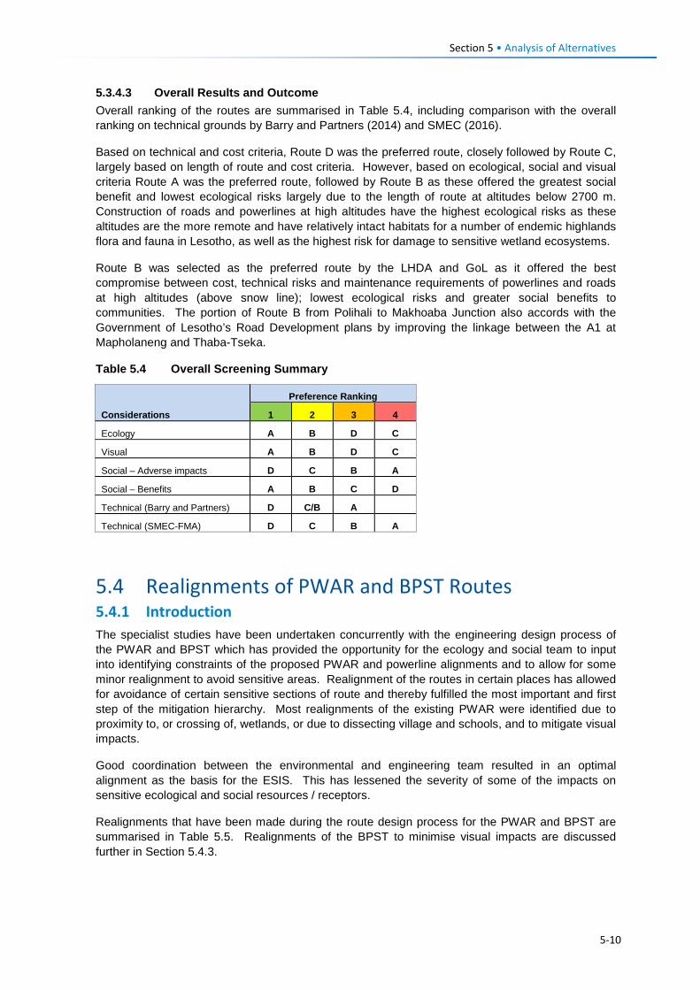
Section 5 • Analysis of Alternatives 5.3.4.3 Overall Results and Outcome Overall ranking of the routes are summarised in Table 5.4, including comparison with the overall ranking on technical grounds by Barry and Partners (2014) and SMEC (2016).
Based on technical and cost criteria, Route D was the preferred route, closely followed by Route C, largely based on length of route and cost criteria. However, based on ecological, social and visual criteria Route A was the preferred route, followed by Route B as these offered the greatest social benefit and lowest ecological risks largely due to the length of route at altitudes below 2700 m. Construction of roads and powerlines at high altitudes have the highest ecological risks as these altitudes are the more remote and have relatively intact habitats for a number of endemic highlands flora and fauna in Lesotho, as well as the highest risk for damage to sensitive wetland ecosystems.
Route B was selected as the preferred route by the LHDA and GoL as it offered the best compromise between cost, technical risks and maintenance requirements of powerlines and roads at high altitudes (above snow line); lowest ecological risks and greater social benefits to communities. The portion of Route B from Polihali to Makhoaba Junction also accords with the Government of Lesotho’s Road Development plans by improving the linkage between the A1 at Mapholaneng and Thaba-Tseka.
Table 5.4 Overall Screening Summary
Considerations
Preference Ranking
1 2 3 4
Ecology A B D C
Visual A B D C
Social – Adverse impacts D C B A
Social – Benefits A B C D
Technical (Barry and Partners) D C/B A
Technical (SMEC-FMA) D C B A
5.4 Realignments of PWAR and BPST Routes 5.4.1 Introduction The specialist studies have been undertaken concurrently with the engineering design process of the PWAR and BPST which has provided the opportunity for the ecology and social team to input into identifying constraints of the proposed PWAR and powerline alignments and to allow for some minor realignment to avoid sensitive areas. Realignment of the routes in certain places has allowed for avoidance of certain sensitive sections of route and thereby fulfilled the most important and first step of the mitigation hierarchy. Most realignments of the existing PWAR were identified due to proximity to, or crossing of, wetlands, or due to dissecting village and schools, and to mitigate visual impacts.
Good coordination between the environmental and engineering team resulted in an optimal alignment as the basis for the ESIS. This has lessened the severity of some of the impacts on sensitive ecological and social resources / receptors.
Realignments that have been made during the route design process for the PWAR and BPST are summarised in Table 5.5. Realignments of the BPST to minimise visual impacts are discussed further in Section 5.4.3.
5-10
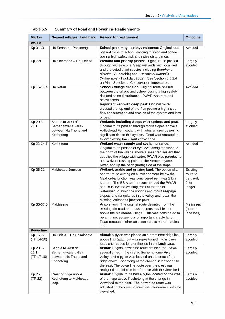
Section 5• Analysis of Alternatives
Table 5.5 Summary of Road and Powerline Realignments
Marker Nearest villages / landmark Reason for realignment Outcome PWAR Kp 0-1.3 Ha Seshote - Phakoeng School proximity - safety / nuisance: Original road
passed close to school, dividing mission and school, posing high safety risk and noise disturbance.
Avoided
Kp 7-9 Ha Salemone – Ha Tlelase Wetland and priority plants: Original route passed through two seasonal Seep wetlands with localised and protected plant species including Boophone disticha (Vulnerable) and Eucomis autumnalis (Vulnerable) (Talukdar, 2002). See Section 6.3.1.4 on Plant Species of Conservation Importance.
Largely avoided
Kp 15-17.4 Ha Ratau School / village division: Original route passed between the village and school posing a high safety risk and noise disturbance. PWAR was rerouted below school. Important Fen with deep peat: Original route crossed the top end of the Fen posing a high risk of flow concentration and erosion of the system and loss of peat.
Avoided
Kp 20.3-21.1
Saddle to west of Semenanyane valley between Ha Thene and Kosheteng
Wetlands including Seeps with springs and peat: Original route passed through moist slopes above a Valleyhead Fen wetland with artesian springs posing significant risk to this system. Road was rerouted to follow existing track south of wetland.
Largely avoided
Kp 22-24.7 Kosheteng Wetland water supply and social nuisance: Original route passed at eye level along the slope to the north of the village above a linear fen system that supplies the village with water. PWAR was rerouted to a new river crossing point on the Semenanyane River, and up the back (north) side of the slope.
Avoided
Kp 26-31 Makhoaba Junction Wetland, arable and grazing land: The option of a shorter route cutting on a lower contour below the Makhoaba junction was considered as it was 2 km shorter. The ESIA team recommended the PWAR should follow the existing track at the top of watershed to avoid the springs and moist seepage slopes, and rangelands in the valley and retain the existing Makhoaba junction point.
Existing route to be used, 2 km longer
Kp 36-37.6 Makhiseng Arable land: The original route deviated from the existing dirt road and passed across arable land above the Makhoaba village. This was considered to be an unnecessary loss of important arable land. Road rerouted higher up slope across more marginal land.
Minimised (arable land loss)
Powerline Kp 15-17 (TP 14-16)
Ha Sekila – Ha Sekolopata Visual: A pylon was placed on a prominent ridgeline above Ha Ratau, but was repositioned into a lower saddle to reduce its prominence in the landscape.
Largely avoided
Kp 20.3-21.1 (TP 17-19)
Saddle to west of Semenanyane valley between Ha Thene and Kosheteng
Visual: Original powerline route crossed the PWAR several times in the scenic Semenanyane River valley, and a pylon was located on the crest of the ridge above Kosheteng at the change in viewshed to the east. The powerline route over the crest was realigned to minimise interference with the viewshed.
Largely avoided
Kp 25 (TP 22)
Crest of ridge above Kosheteng to Makhoaba loop.
Visual: Original route had a pylon located on the crest of the ridge above Kosheteng at the change in viewshed to the east. The powerline route was adjusted on the crest to minimise interference with the viewshed.
Largely avoided
5-11
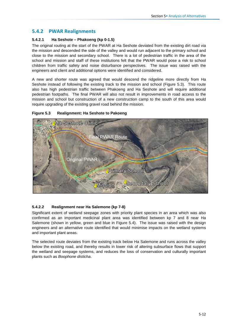
Section 5• Analysis of Alternatives
5.4.2 PWAR Realignments 5.4.2.1 Ha Seshote – Phakoeng (kp 0-1.5) The original routing at the start of the PWAR at Ha Seshote deviated from the existing dirt road via the mission and descended the side of the valley and would run adjacent to the primary school and close to the mission and secondary school. There is a lot of pedestrian traffic in the area of the school and mission and staff of these institutions felt that the PWAR would pose a risk to school children from traffic safety and noise disturbance perspectives. The issue was raised with the engineers and client and additional options were identified and considered.
A new and shorter route was agreed that would descend the ridgeline more directly from Ha Seshote instead of following the existing track to the mission and school (Figure 5.3). This route also has high pedestrian traffic between Phakoeng and Ha Seshote and will require additional pedestrian footpaths. The final PWAR will also not result in improvements in road access to the mission and school but construction of a new construction camp to the south of this area would require upgrading of the existing gravel road behind the mission.
Figure 5.3 Realignment: Ha Seshote to Pakoeng
5.4.2.2 Realignment near Ha Salemone (kp 7-8) Significant extent of wetland seepage zones with priority plant species in an area which was also confirmed as an important medicinal plant area was identified between kp 7 and 8 near Ha Salemone (shown in yellow, green and blue in Figure 5.4). The issue was raised with the design engineers and an alternative route identified that would minimise impacts on the wetland systems and important plant areas.
The selected route deviates from the existing track below Ha Salemone and runs across the valley below the existing road, and thereby results in lower risk of altering subsurface flows that support the wetland and seepage systems, and reduces the loss of conservation and culturally important plants such as Boophone disticha.
5-12
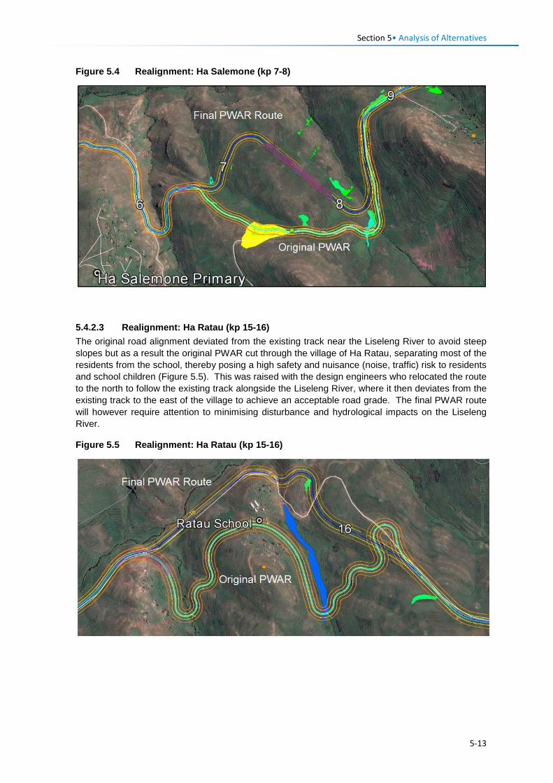
Section 5• Analysis of Alternatives
Figure 5.4 Realignment: Ha Salemone (kp 7-8)
5.4.2.3 Realignment: Ha Ratau (kp 15-16) The original road alignment deviated from the existing track near the Liseleng River to avoid steep slopes but as a result the original PWAR cut through the village of Ha Ratau, separating most of the residents from the school, thereby posing a high safety and nuisance (noise, traffic) risk to residents and school children (Figure 5.5). This was raised with the design engineers who relocated the route to the north to follow the existing track alongside the Liseleng River, where it then deviates from the existing track to the east of the village to achieve an acceptable road grade. The final PWAR route will however require attention to minimising disturbance and hydrological impacts on the Liseleng River.
Figure 5.5 Realignment: Ha Ratau (kp 15-16)
5-13
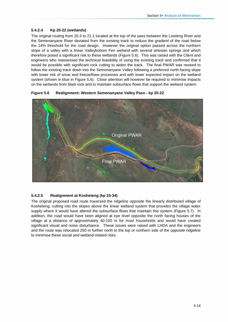
Section 5• Analysis of Alternatives
5.4.2.4 Kp 20-22 (wetlands) The original routing from 20.3 to 21.1 located at the top of the pass between the Liseleng River and the Semenanyane River deviated from the existing track to reduce the gradient of the road below the 14% threshold for the road design. However the original option passed across the northern slope of a valley with a linear Valleybottom Fen wetland with several artesian springs and which therefore posed a significant risk to these wetlands (Figure 5.6). This was raised with the Client and engineers who reassessed the technical feasibility of using the existing track and confirmed that it would be possible with significant rock cutting to widen the track. The final PWAR was revised to follow the existing track down into the Semenanyane Valley following a preferred north-facing slope with lower risk of snow and freeze/thaw processes and with lower expected impact on the wetland system (shown in blue in Figure 5.6). Close attention will however be required to minimise impacts on the wetlands from blast rock and to maintain subsurface flows that support the wetland system.
Figure 5.6 Realignment: Western Semenanyane Valley Pass - kp 20-22
5.4.2.5 Realignment at Kosheteng (kp 23-34) The original proposed road route traversed the ridgeline opposite the linearly distributed village of Kosheteng, cutting into the slopes above the linear wetland system that provides the village water supply where it would have altered the subsurface flows that maintain this system (Figure 5.7). In addition, the road would have been aligned at eye level opposite the north facing houses of the village at a distance of approximately 40-100 m for most households and would have created significant visual and noise disturbance. These issues were raised with LHDA and the engineers and the route was relocated 250 m further north to the top or northern side of the opposite ridgeline to minimise these social and wetland-related risks.
5-14
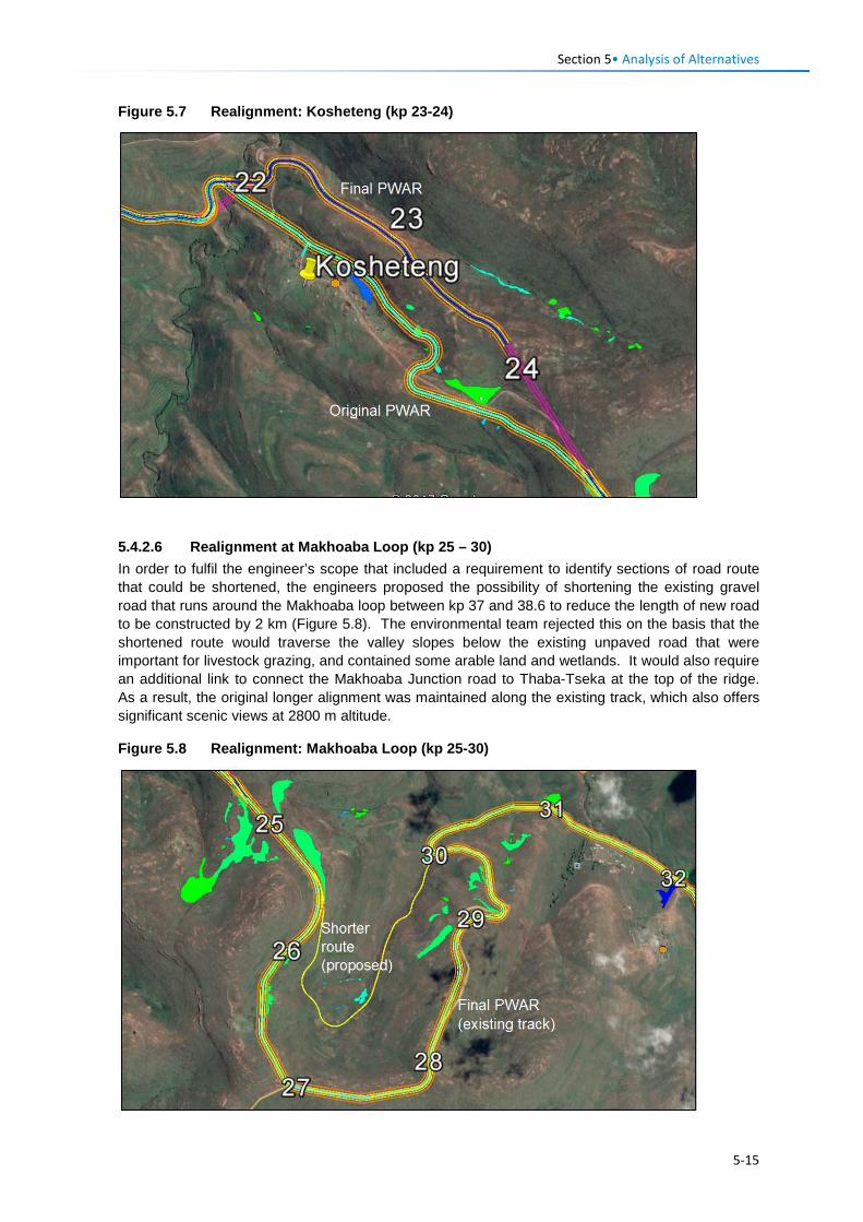
Section 5• Analysis of Alternatives
Figure 5.7 Realignment: Kosheteng (kp 23-24)
5.4.2.6 Realignment at Makhoaba Loop (kp 25 – 30) In order to fulfil the engineer’s scope that included a requirement to identify sections of road route that could be shortened, the engineers proposed the possibility of shortening the existing gravel road that runs around the Makhoaba loop between kp 37 and 38.6 to reduce the length of new road to be constructed by 2 km (Figure 5.8). The environmental team rejected this on the basis that the shortened route would traverse the valley slopes below the existing unpaved road that were important for livestock grazing, and contained some arable land and wetlands. It would also require an additional link to connect the Makhoaba Junction road to Thaba-Tseka at the top of the ridge. As a result, the original longer alignment was maintained along the existing track, which also offers significant scenic views at 2800 m altitude.
Figure 5.8 Realignment: Makhoaba Loop (kp 25-30)
5-15
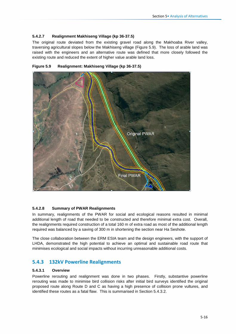
Section 5• Analysis of Alternatives
5.4.2.7 Realignment Makhiseng Village (kp 36-37.5) The original route deviated from the existing gravel road along the Makhoaba River valley, traversing agricultural slopes below the Makhiseng village (Figure 5.9). The loss of arable land was raised with the engineers and an alternative route was defined that more closely followed the existing route and reduced the extent of higher value arable land loss.
Figure 5.9 Realignment: Makhiseng Village (kp 36-37.5)
5.4.2.8 Summary of PWAR Realignments In summary, realignments of the PWAR for social and ecological reasons resulted in minimal additional length of road that needed to be constructed and therefore minimal extra cost. Overall, the realignments required construction of a total 160 m of extra road as most of the additional length required was balanced by a saving of 300 m in shortening the section near Ha Seshote.
The close collaboration between the ERM ESIA team and the design engineers, with the support of LHDA, demonstrated the high potential to achieve an optimal and sustainable road route that minimises ecological and social impacts without incurring unreasonable additional costs.
5.4.3 132kV Powerline Realignments 5.4.3.1 Overview Powerline rerouting and realignment was done in two phases. Firstly, substantive powerline rerouting was made to minimise bird collision risks after initial bird surveys identified the original proposed route along Route D and C as having a high presence of collision prone vultures, and identified these routes as a fatal flaw. This is summarised in Section 5.4.3.2.
5-16
Section 5• Analysis of Alternatives
Subsequently, following the ecology and visual field surveys, five additional realignments of the powerline were recommended to LHDA and the design engineers due to identified landscape and visual impacts and risks to wetlands of the proposed powerline route.
An iterative process took place as changes to the BPST were implemented after the field surveys, which influenced the final powerline routing and served mainly to reduce the severity of the visual intrusion of the powerline. In one instance a pylon was relocated to avoid an important seepage wetland system and to minimise the visual intrusion of this pylon. These changes resulted in a visually-optimised route as the basis for the Landscape and Visual Impact Assessment (LVIA) (contained in Volume 3, Annex D (VRMA, 2017: P2W-6004-DFR-0006) and an improved route as the basis for the Wetland assessment (contained in Volume 4, Annex F (WCS, 2017: P2W-6004-DFR-0007).
5.4.3.2 Substantive BPST Rerouting for Bird Collision Risks The first proposed powerline route (Option 1) presented as the basis for the ESIA was routed from Ha Seshote up to the top of the Liseleng River valley where it joined Route C and then closely followed the existing unpaved road eastwards to Polihali Dam area. Surveys in October 2016 confirmed the regular presence of threatened Bearded and Cape Vulture on the high altitude plateau areas at the top of the Liseleng valley. Option 1 had a ~10 km of powerline >2800 m. The team submitted a motivation to LHDA highlighting the high bird collision risk of this route and recommended that an alternative powerline route be identified.
As a result, the engineers identified a second option (Option 2) that would route the powerline further along Route B and up the Semenanyane River valley to join Route C further east in order to reduce the length of road at high altitude by 7 km. Further surveys in February 2017 again confirmed the high risk of the revised alignment (Option 2) to vultures after individuals of both Bearded and Cape Vultures were sighted circling and foraging over the plateau at the top of the Semenanyane River valley for an extended period of time. The route was also identified as likely to have high collision risks with other birds such as Black Stork, White Stork, Southern Bald Ibis and Lanner Falcon.
Bearded Vulture is assessed as Critically Endangered in South Africa (effectively including the core, Lesotho population – Taylor et al., 2015) and is globally Near Threatened (http://www.iucnredlist.org/search). There are only ~100 active pairs remaining in southern Africa (Reid et al., 2015) while Cape Vulture is listed as both nationally and globally Endangered. Numbers of both species have decreased markedly in recent years, with power line collision mortality a significant contributing factor to these sharp declines.
Vultures have poor forward peripheral vision, limiting their ability to see oncoming obstacles such as overhead lines as they fly over open country (Martin et al., 2012), and exposing them to collision risk, even on powerlines marked with bird flight diverters. This risk is further exacerbated by the prevalence of strong winds at higher altitudes that reduce the birds’ ability to make directional adjustments at short notice, and the regular occurrence of mist and cloudy conditions that limit general visibility.
On LHDA’s request, the team conducted a bird collision risk sensitivity analysis to support further motivation to find an alternative route that would avoid Route C.
A map of avian impact sensitivity in relation to the proposed powerline route options (see Figure 6.20 in Section 6.3.4) was developed primarily to reflect mortality risk by integrating the field data collected during this study with a digital elevation model (DEM), and a modelled dataset based on five years of satellite tracking data for 21 Bearded Vultures that describes the predicted density of Bearded Vultures present across the species’ southern African range (Reid et al., 2015). High sensitivity areas were deemed to be those within the nest site buffers of priority species and/or those above 2800 masl, while Very High sensitivity areas were those within the nest site buffers of Bearded Vulture nest sites, and/or those above 2800 masl and with slopes of <10º, and/or those with predicted Bearded Vulture density indices of >0.006.
5-17
Section 5• Analysis of Alternatives
The sensitivity mapping confirmed the initial findings that Route C presents a much higher risk of collision mortality for Bearded Vulture, Cape Vulture and other threatened species than the Route B option. Based on the sensitivity analysis results and field observations, the ERM team motivated that a powerline route along Route B would have a lower collision risk to birds, and recommended that an alternative route along this corridor should be identified as the basis for the ESIA.
With the support of LHDA, the powerline design engineers identified a new alignment along the PWAC Route B but with substantive deviations from the road corridor in two stretches. This routing was deemed the optimal route between Katse and Polihali to reduce bird collision risks. The engineers are commended for their diligence in taking on-board the environmental concerns and in finding and identifying a least impact powerline route.
The Route B powerline option was the basis for the field surveys conducted in April 2017 that resulted in some realignment to the route for visual and wetland reasons as described in Sections 5.4 and 5.4.3.3.
5.4.3.3 BPST Realignment for Visual Impacts The amendments to the powerline routing were based largely on the value that the PWAR will have as a future tourist route in the region and the need to minimise visual impacts of the powerline when viewed from the road, and to enhance the traveller experience of the Lesotho highlands. Consideration was also given to powerline routing in close proximity to human settlements.
Each of these amendments are briefly described and depicted below. The five routing amendments motivated for visual considerations were:
• Ha Sekila to Ha Sekolopata (TP 15-17); • Semenanyane Pass West (TP 17 to TP 18); • Semenanyane River crossing (TP 19); • Kosheteng Village (PWAR) (kp 22-26); • Kosheteng/Makhoaba Pass (TP 21 to TP 23).
5.4.3.4 Realignment: Ha Sekila to Ha Sekolopata (TP 15-17 & PWAR kp 14-15) Motivation to enhance the visual experience of future PWAR users was provided to shift the routing between kp 14 and kp 15 for pylons TP15-17. This initial routing would double cross over the proposed PWAR on a switchback, and would require a pylon on a prominent ridgeline adjacent to the road, increasing visual intrusion. Figure 5.10 indicates the initial road routing (which was subsequently amended to move the PWAR to below the school), the initial powerline routing in yellow, the proposed visually preferred routing in purple and the final powerline routing in red.
Figure 5.10 BPST Realignments Between kp 14 and kp 15
Original BPST
Final BPST
Proposed BPST
5-18
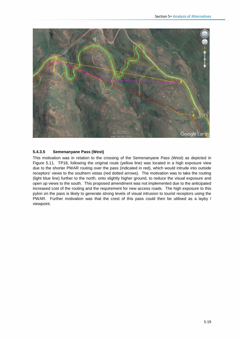
Section 5• Analysis of Alternatives
5.4.3.5 Semenanyane Pass (West) This motivation was in relation to the crossing of the Semenanyane Pass (West) as depicted in Figure 5.11. TP18, following the original route (yellow line) was located in a high exposure view due to the shorter PWAR routing over the pass (indicated in red), which would intrude into outside receptors’ views to the southern vistas (red dotted arrows). The motivation was to take the routing (light blue line) further to the north, onto slightly higher ground, to reduce the visual exposure and open up views to the south. This proposed amendment was not implemented due to the anticipated increased cost of the routing and the requirement for new access roads. The high exposure to this pylon on the pass is likely to generate strong levels of visual intrusion to tourist receptors using the PWAR. Further motivation was that the crest of this pass could then be utilised as a layby / viewpoint.
5-19
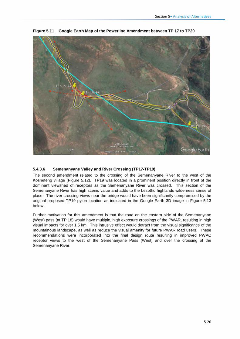
Section 5• Analysis of Alternatives
Figure 5.11 Google Earth Map of the Powerline Amendment between TP 17 to TP20
5.4.3.6 Semenanyane Valley and River Crossing (TP17-TP19) The second amendment related to the crossing of the Semenanyane River to the west of the Kosheteng village (Figure 5.12). TP19 was located in a prominent position directly in front of the dominant viewshed of receptors as the Semenanyane River was crossed. This section of the Semenanyane River has high scenic value and adds to the Lesotho highlands wilderness sense of place. The river crossing views near the bridge would have been significantly compromised by the original proposed TP19 pylon location as indicated in the Google Earth 3D image in Figure 5.13 below.
Further motivation for this amendment is that the road on the eastern side of the Semenanyane (West) pass (at TP 18) would have multiple, high exposure crossings of the PWAR, resulting in high visual impacts for over 1.5 km. This intrusive effect would detract from the visual significance of the mountainous landscape, as well as reduce the visual amenity for future PWAR road users. These recommendations were incorporated into the final design route resulting in improved PWAC receptor views to the west of the Semenanyane Pass (West) and over the crossing of the Semenanyane River.
5-20
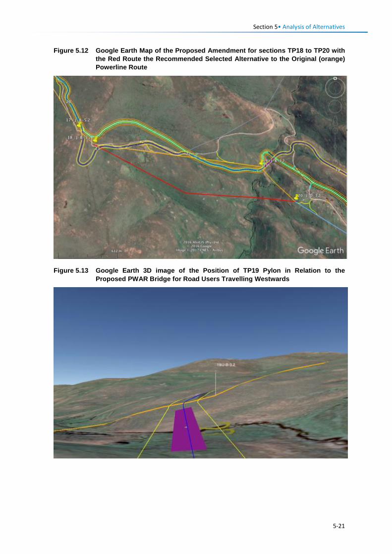
Section 5• Analysis of Alternatives
Figure 5.12 Google Earth Map of the Proposed Amendment for sections TP18 to TP20 with the Red Route the Recommended Selected Alternative to the Original (orange) Powerline Route
Figure 5.13 Google Earth 3D image of the Position of TP19 Pylon in Relation to the Proposed PWAR Bridge for Road Users Travelling Westwards
5-21
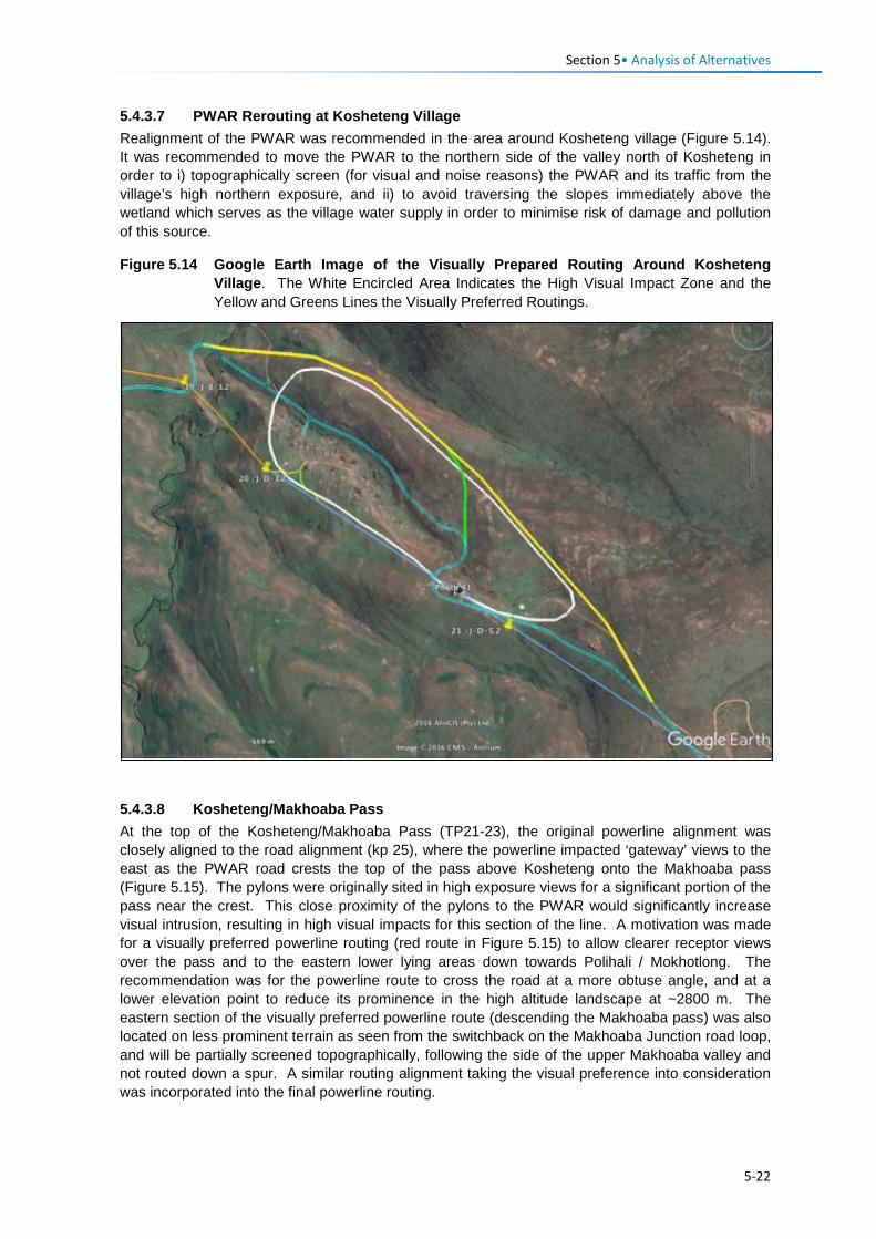
Section 5• Analysis of Alternatives
5.4.3.7 PWAR Rerouting at Kosheteng Village Realignment of the PWAR was recommended in the area around Kosheteng village (Figure 5.14). It was recommended to move the PWAR to the northern side of the valley north of Kosheteng in order to i) topographically screen (for visual and noise reasons) the PWAR and its traffic from the village’s high northern exposure, and ii) to avoid traversing the slopes immediately above the wetland which serves as the village water supply in order to minimise risk of damage and pollution of this source.
Figure 5.14 Google Earth Image of the Visually Prepared Routing Around Kosheteng Village. The White Encircled Area Indicates the High Visual Impact Zone and the Yellow and Greens Lines the Visually Preferred Routings.
5.4.3.8 Kosheteng/Makhoaba Pass At the top of the Kosheteng/Makhoaba Pass (TP21-23), the original powerline alignment was closely aligned to the road alignment (kp 25), where the powerline impacted ‘gateway’ views to the east as the PWAR road crests the top of the pass above Kosheteng onto the Makhoaba pass (Figure 5.15). The pylons were originally sited in high exposure views for a significant portion of the pass near the crest. This close proximity of the pylons to the PWAR would significantly increase visual intrusion, resulting in high visual impacts for this section of the line. A motivation was made for a visually preferred powerline routing (red route in Figure 5.15) to allow clearer receptor views over the pass and to the eastern lower lying areas down towards Polihali / Mokhotlong. The recommendation was for the powerline route to cross the road at a more obtuse angle, and at a lower elevation point to reduce its prominence in the high altitude landscape at ~2800 m. The eastern section of the visually preferred powerline route (descending the Makhoaba pass) was also located on less prominent terrain as seen from the switchback on the Makhoaba Junction road loop, and will be partially screened topographically, following the side of the upper Makhoaba valley and not routed down a spur. A similar routing alignment taking the visual preference into consideration was incorporated into the final powerline routing.
5-22
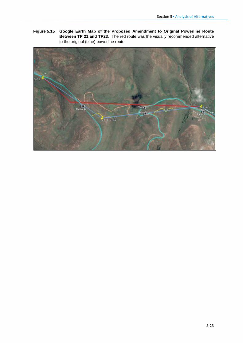
Section 5• Analysis of Alternatives
Figure 5.15 Google Earth Map of the Proposed Amendment to Original Powerline Route Between TP 21 and TP23. The red route was the visually recommended alternative to the original (blue) powerline route.
5-23

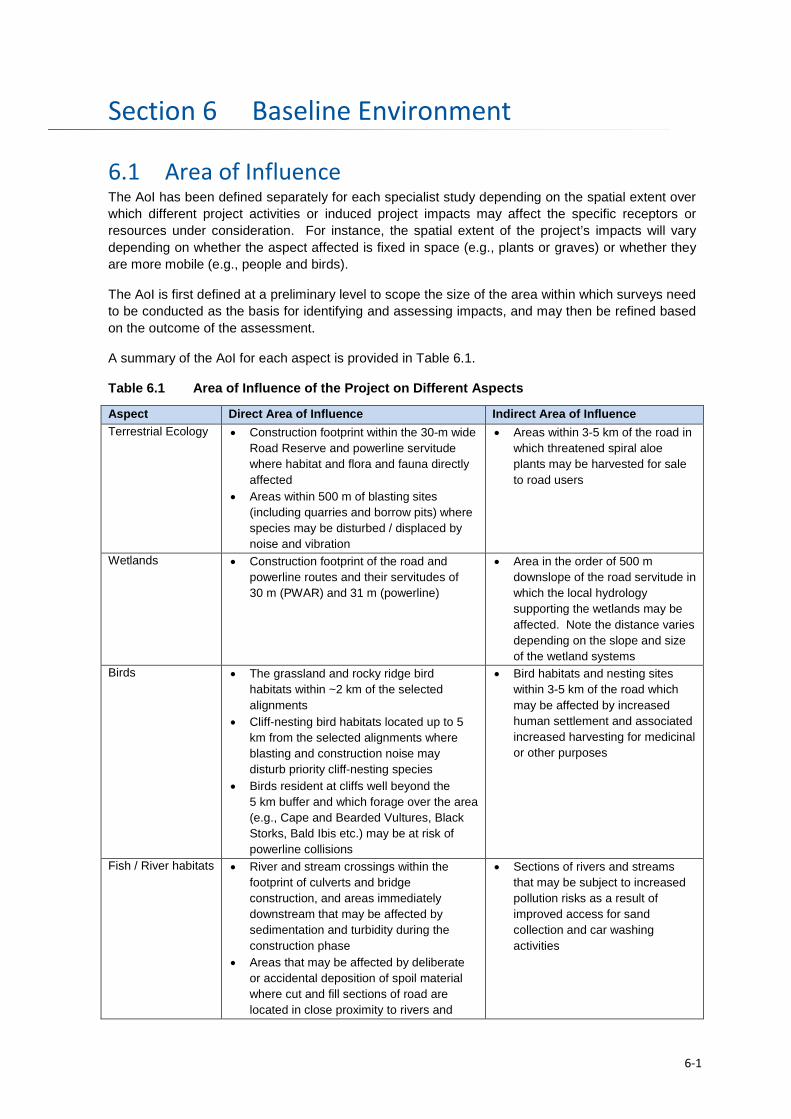
Baseline Environment Section 6
6.1 Area of Influence The AoI has been defined separately for each specialist study depending on the spatial extent over which different project activities or induced project impacts may affect the specific receptors or resources under consideration. For instance, the spatial extent of the project’s impacts will vary depending on whether the aspect affected is fixed in space (e.g., plants or graves) or whether they are more mobile (e.g., people and birds).
The AoI is first defined at a preliminary level to scope the size of the area within which surveys need to be conducted as the basis for identifying and assessing impacts, and may then be refined based on the outcome of the assessment.
A summary of the AoI for each aspect is provided in Table 6.1.
Table 6.1 Area of Influence of the Project on Different Aspects
Aspect Direct Area of Influence Indirect Area of Influence Terrestrial Ecology • Construction footprint within the 30-m wide
Road Reserve and powerline servitude where habitat and flora and fauna directly affected
• Areas within 500 m of blasting sites (including quarries and borrow pits) where species may be disturbed / displaced by noise and vibration
• Areas within 3-5 km of the road in which threatened spiral aloe plants may be harvested for sale to road users
Wetlands • Construction footprint of the road and powerline routes and their servitudes of 30 m (PWAR) and 31 m (powerline)
• Area in the order of 500 m downslope of the road servitude in which the local hydrology supporting the wetlands may be affected. Note the distance varies depending on the slope and size of the wetland systems
Birds • The grassland and rocky ridge bird habitats within ~2 km of the selected alignments
• Cliff-nesting bird habitats located up to 5 km from the selected alignments where blasting and construction noise may disturb priority cliff-nesting species
• Birds resident at cliffs well beyond the 5 km buffer and which forage over the area (e.g., Cape and Bearded Vultures, Black Storks, Bald Ibis etc.) may be at risk of powerline collisions
• Bird habitats and nesting sites within 3-5 km of the road which may be affected by increased human settlement and associated increased harvesting for medicinal or other purposes
Fish / River habitats • River and stream crossings within the footprint of culverts and bridge construction, and areas immediately downstream that may be affected by sedimentation and turbidity during the construction phase
• Areas that may be affected by deliberate or accidental deposition of spoil material where cut and fill sections of road are located in close proximity to rivers and
• Sections of rivers and streams that may be subject to increased pollution risks as a result of improved access for sand collection and car washing activities
6-1
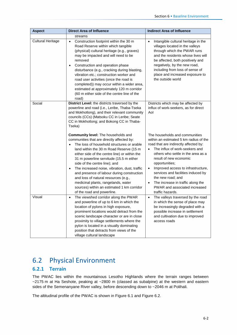
Section 6 • Baseline Environment
Aspect Direct Area of Influence Indirect Area of Influence streams
Cultural Heritage • Construction footprint within the 30 m Road Reserve within which tangible (physical) cultural heritage (e.g., graves) may be impacted and will need to be removed
• Construction and operation phase disturbance (e.g., cracking during blasting, vibration etc.; construction worker and road user activities (once the road is completed)) may occur within a wider area, estimated at approximately 120 m corridor (60 m either side of the centre line of the road)
• Intangible cultural heritage in the villages located in the valleys through which the PWAR runs and the residents whose lives will be affected, both positively and negatively, by the new road, including from loss of sense of place and increased exposure to the outside world
Social District Level: the districts traversed by the powerline and road (i.e., Leribe, Thaba-Tseka and Mokhotlong), and their relevant community councils (CCs) (Matsoku CC in Leribe; Seate CC in Mokhotlong; and Bokong CC in Thaba-Tseka) Community level: The households and communities that are directly affected by: • The loss of household structures or arable
land within the 30 m Road Reserve (15 m either side of the centre line) or within the 31 m powerline servitude (15.5 m either side of the centre line); and
• The increased noise, vibration, dust, traffic and presence of labour during construction and loss of natural resources (e.g., medicinal plants, rangelands, water sources) within an estimated 1 km corridor of the road and powerline.
Districts which may be affected by influx of work-seekers, as for direct AoI The households and communities within an estimated 5 km radius of the road that are indirectly affected by: • The influx of work-seekers and
others who settle in the area as a result of new economic opportunities;
• Improved access to infrastructure, services and facilities induced by the new road; and
• The increase in traffic along the PWAR and associated increased traffic hazards.
Visual • The viewshed corridor along the PWAR and powerline of up to 6 km in which the location of pylons in high exposure, prominent locations would detract from the scenic landscape character or are in close proximity to village settlements where the pylon is located in a visually dominating position that detracts from views of the village cultural landscape
• The valleys traversed by the road in which the sense of place may be increasingly degraded with a possible increase in settlement and cultivation due to improved access roads
6.2 Physical Environment 6.2.1 Terrain The PWAC lies within the mountainous Lesotho Highlands where the terrain ranges between ~2175 m at Ha Seshote, peaking at ~2800 m (classed as subalpine) at the western and eastern sides of the Semenanyane River valley, before descending down to ~2046 m at Polihali.
The altitudinal profile of the PWAC is shown in Figure 6.1 and Figure 6.2.
6-2
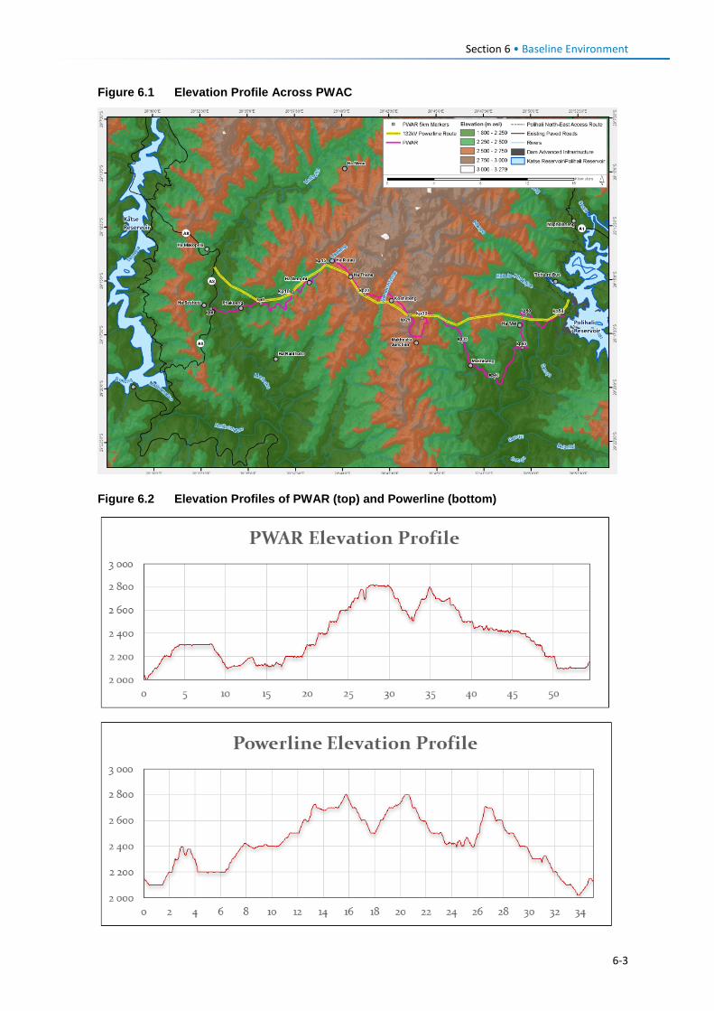
Section 6 • Baseline Environment
Figure 6.1 Elevation Profile Across PWAC
Figure 6.2 Elevation Profiles of PWAR (top) and Powerline (bottom)
6-3
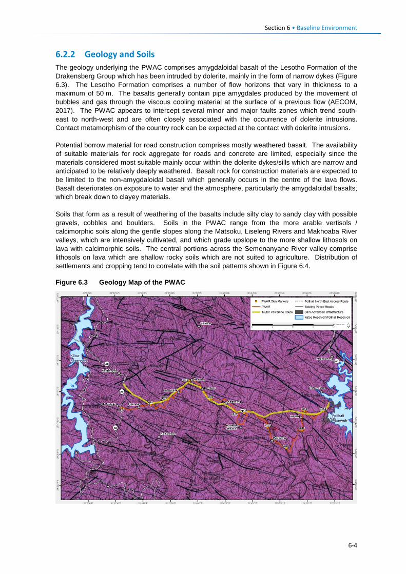
Section 6 • Baseline Environment
6.2.2 Geology and Soils The geology underlying the PWAC comprises amygdaloidal basalt of the Lesotho Formation of the Drakensberg Group which has been intruded by dolerite, mainly in the form of narrow dykes (Figure 6.3). The Lesotho Formation comprises a number of flow horizons that vary in thickness to a maximum of 50 m. The basalts generally contain pipe amygdales produced by the movement of bubbles and gas through the viscous cooling material at the surface of a previous flow (AECOM, 2017). The PWAC appears to intercept several minor and major faults zones which trend south-east to north-west and are often closely associated with the occurrence of dolerite intrusions. Contact metamorphism of the country rock can be expected at the contact with dolerite intrusions. Potential borrow material for road construction comprises mostly weathered basalt. The availability of suitable materials for rock aggregate for roads and concrete are limited, especially since the materials considered most suitable mainly occur within the dolerite dykes/sills which are narrow and anticipated to be relatively deeply weathered. Basalt rock for construction materials are expected to be limited to the non-amygdaloidal basalt which generally occurs in the centre of the lava flows. Basalt deteriorates on exposure to water and the atmosphere, particularly the amygdaloidal basalts, which break down to clayey materials. Soils that form as a result of weathering of the basalts include silty clay to sandy clay with possible gravels, cobbles and boulders. Soils in the PWAC range from the more arable vertisols / calcimorphic soils along the gentle slopes along the Matsoku, Liseleng Rivers and Makhoaba River valleys, which are intensively cultivated, and which grade upslope to the more shallow lithosols on lava with calcimorphic soils. The central portions across the Semenanyane River valley comprise lithosols on lava which are shallow rocky soils which are not suited to agriculture. Distribution of settlements and cropping tend to correlate with the soil patterns shown in Figure 6.4. Figure 6.3 Geology Map of the PWAC
6-4
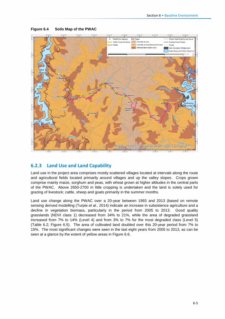
Section 6 • Baseline Environment
Figure 6.4 Soils Map of the PWAC
6.2.3 Land Use and Land Capability Land use in the project area comprises mostly scattered villages located at intervals along the route and agricultural fields located primarily around villages and up the valley slopes. Crops grown comprise mainly maize, sorghum and peas, with wheat grown at higher altitudes in the central parts of the PWAC. Above 2650-2700 m little cropping is undertaken and the land is solely used for grazing of livestock; cattle, sheep and goats primarily in the summer months.
Land use change along the PWAC over a 20-year between 1993 and 2013 (based on remote sensing derived modelling (Turpie et al., 2014) indicate an increase in subsistence agriculture and a decline in vegetation biomass, particularly in the period from 2005 to 2013. Good quality grasslands (NDVI class 1) decreased from 34% to 21%, while the area of degraded grassland increased from 7% to 14% (Level 4) and from 3% to 7% for the most degraded class (Level 5) (Table 6.2; Figure 6.5). The area of cultivated land doubled over this 20-year period from 7% to 15%. The most significant changes were seen in the last eight years from 2005 to 2013, as can be seen at a glance by the extent of yellow areas in Figure 6.6.
6-5
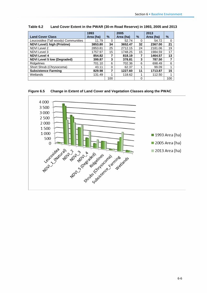
Section 6 • Baseline Environment
Table 6.2 Land Cover Extent in the PWAR (30-m Road Reserve) in 1993, 2005 and 2013
Land Cover Class 1993 Area (ha) %
2005 Area (ha) %
2013 Area (ha) %
Leucosidea (Tall woody) Communities 11.79 0 52.74 0 54.72 0 NDVI Level1 high (Pristine) 3853.80 34 3652.47 32 2367.00 21 NDVI Level 2 2853.81 25 2712.15 24 2181.06 19 NDVI Level 3 1757.97 15 1748.25 15 1984.59 17 NDVI Level 4 854.82 7 818.19 7 1464.57 13 NDVI Level 5 low (Degraded) 399.87 3 378.81 3 787.50 7 Ridgelines 701.10 6 702.36 6 698.49 6 Short Shrub (Chrysocoma) 43.11 0 62.37 1 99.09 1 Subsistence Farming 829.98 7 1227.60 11 1713.87 15 Wetlands 131.49 1 118.62 1 112.50 1 100 0 100
Figure 6.5 Change in Extent of Land Cover and Vegetation Classes along the PWAC
6-6
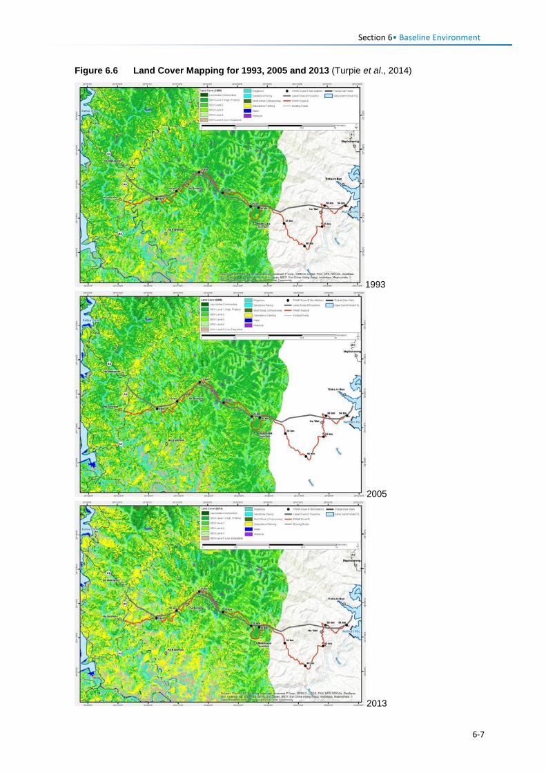
Section 6• Baseline Environment
Figure 6.6 Land Cover Mapping for 1993, 2005 and 2013 (Turpie et al., 2014)
1993
2005
2013
6-7
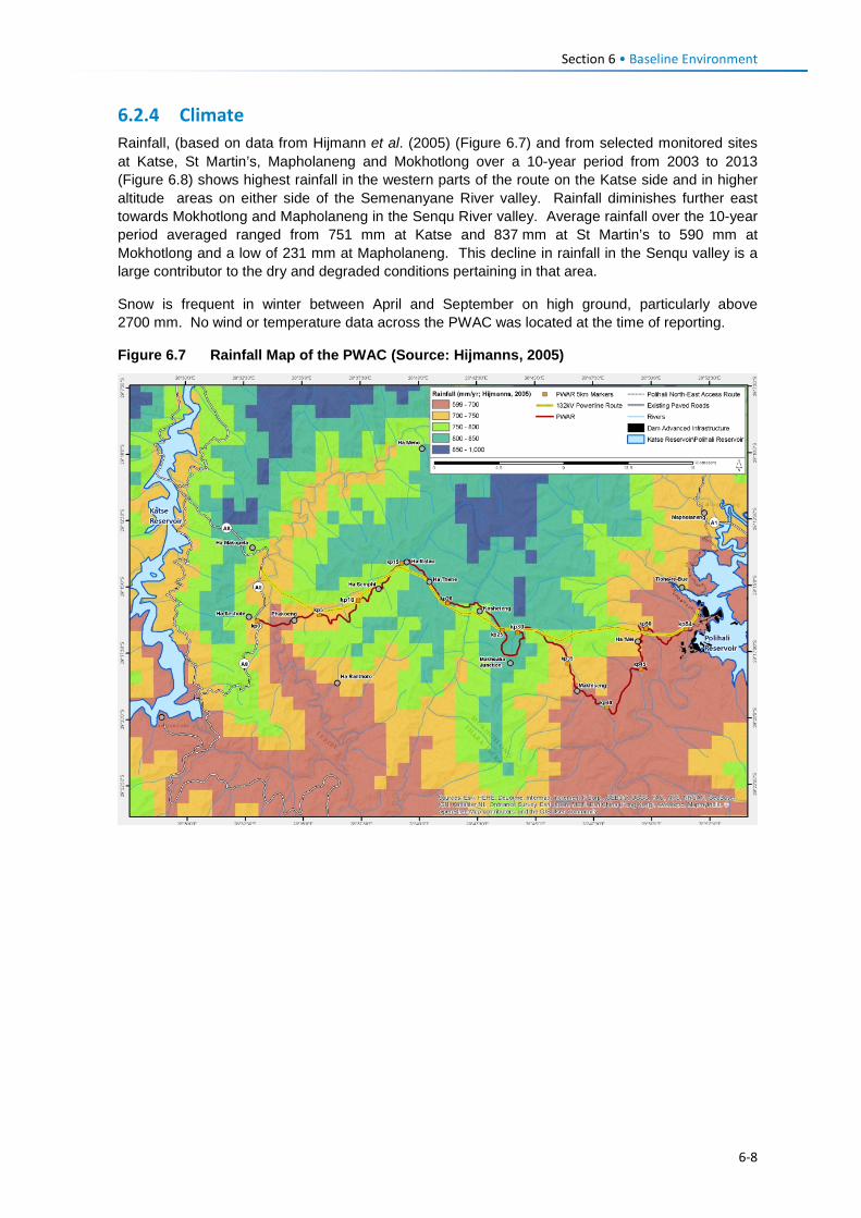
Section 6 • Baseline Environment
6.2.4 Climate Rainfall, (based on data from Hijmann et al. (2005) (Figure 6.7) and from selected monitored sites at Katse, St Martin’s, Mapholaneng and Mokhotlong over a 10-year period from 2003 to 2013 (Figure 6.8) shows highest rainfall in the western parts of the route on the Katse side and in higher altitude areas on either side of the Semenanyane River valley. Rainfall diminishes further east towards Mokhotlong and Mapholaneng in the Senqu River valley. Average rainfall over the 10-year period averaged ranged from 751 mm at Katse and 837 mm at St Martin’s to 590 mm at Mokhotlong and a low of 231 mm at Mapholaneng. This decline in rainfall in the Senqu valley is a large contributor to the dry and degraded conditions pertaining in that area.
Snow is frequent in winter between April and September on high ground, particularly above 2700 mm. No wind or temperature data across the PWAC was located at the time of reporting.
Figure 6.7 Rainfall Map of the PWAC (Source: Hijmanns, 2005)
6-8
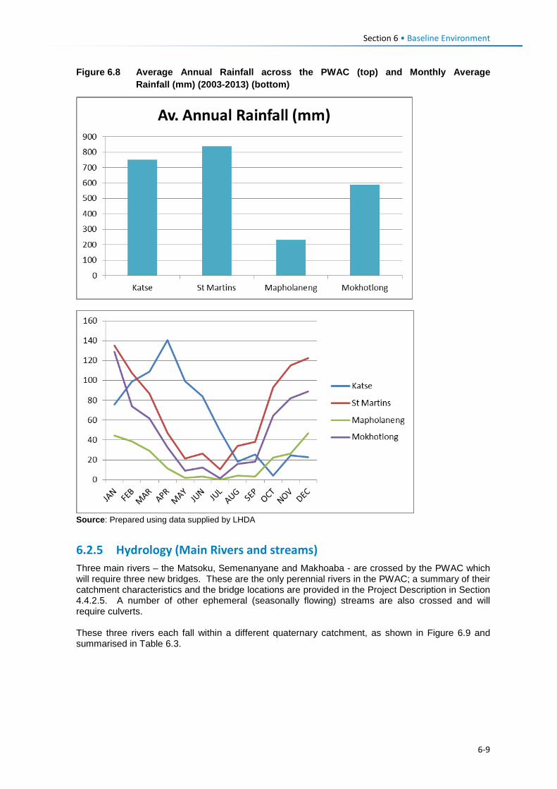
Section 6 • Baseline Environment
Figure 6.8 Average Annual Rainfall across the PWAC (top) and Monthly Average Rainfall (mm) (2003-2013) (bottom)
Source: Prepared using data supplied by LHDA
6.2.5 Hydrology (Main Rivers and streams) Three main rivers – the Matsoku, Semenanyane and Makhoaba - are crossed by the PWAC which will require three new bridges. These are the only perennial rivers in the PWAC; a summary of their catchment characteristics and the bridge locations are provided in the Project Description in Section 4.4.2.5. A number of other ephemeral (seasonally flowing) streams are also crossed and will require culverts. These three rivers each fall within a different quaternary catchment, as shown in Figure 6.9 and summarised in Table 6.3.
6-9
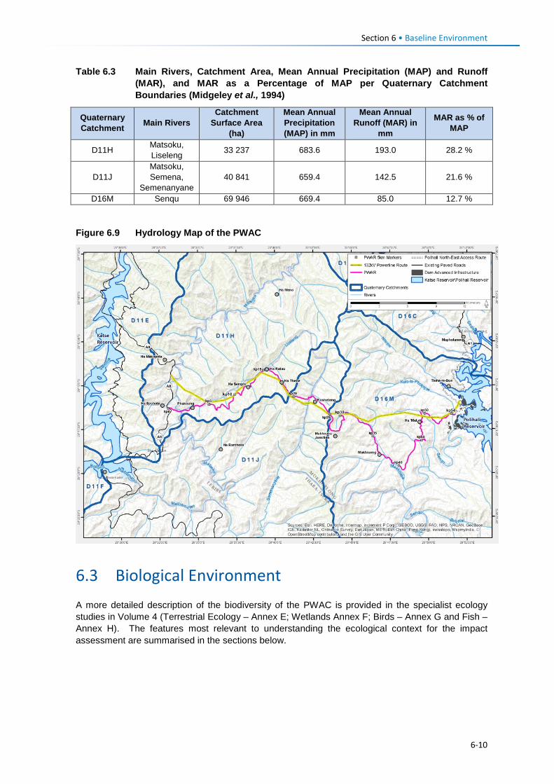
Section 6 • Baseline Environment
Table 6.3 Main Rivers, Catchment Area, Mean Annual Precipitation (MAP) and Runoff (MAR), and MAR as a Percentage of MAP per Quaternary Catchment Boundaries (Midgeley et al., 1994)
Quaternary Catchment Main Rivers
Catchment Surface Area
(ha)
Mean Annual Precipitation (MAP) in mm
Mean Annual Runoff (MAR) in
mm
MAR as % of MAP
D11H Matsoku, Liseleng 33 237 683.6 193.0 28.2 %
D11J Matsoku, Semena,
Semenanyane 40 841 659.4 142.5 21.6 %
D16M Senqu 69 946 669.4 85.0 12.7 % Figure 6.9 Hydrology Map of the PWAC
6.3 Biological Environment A more detailed description of the biodiversity of the PWAC is provided in the specialist ecology studies in Volume 4 (Terrestrial Ecology – Annex E; Wetlands Annex F; Birds – Annex G and Fish – Annex H). The features most relevant to understanding the ecological context for the impact assessment are summarised in the sections below.
6-10
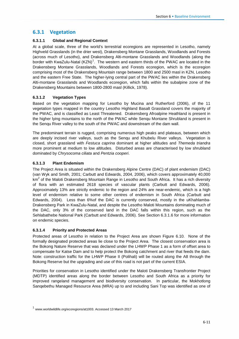
Section 6 • Baseline Environment
6.3.1 Vegetation 6.3.1.1 Global and Regional Context At a global scale, three of the world’s terrestrial ecoregions are represented in Lesotho, namely Highveld Grasslands (in the drier west), Drakensberg Montane Grasslands, Woodlands and Forests (across much of Lesotho), and Drakensberg Alti-montane Grasslands and Woodlands (along the border with KwaZulu-Natal (KZN)1. The western and eastern thirds of the PWAC are located in the Drakensberg Montane Grasslands, Woodlands and Forests ecoregion, which is the ecoregion comprising most of the Drakensberg Mountain range between 1800 and 2500 masl in KZN, Lesotho and the eastern Free State. The higher-lying central part of the PWAC lies within the Drakensberg Alti-montane Grasslands and Woodlands ecoregion, which falls within the subalpine zone of the Drakensberg Mountains between 1800-2800 masl (Killick, 1978).
6.3.1.2 Vegetation Types Based on the vegetation mapping for Lesotho by Mucina and Rutherford (2006), of the 11 vegetation types mapped in the country Lesotho Highland Basalt Grassland covers the majority of the PWAC, and is classified as Least Threatened. Drakensberg Afroalpine Heathland is present in the higher lying mountains to the north of the PWAC while Senqu Montane Shrubland is present in the Senqu River valley to the south of the PWAC and downstream of the dam wall.
The predominant terrain is rugged, comprising numerous high peaks and plateaus, between which are deeply incised river valleys, such as the Senqu and Khubelu River valleys. Vegetation is closed, short grassland with Festuca caprina dominant at higher altitudes and Themeda triandra more prominent at medium to low altitudes. Disturbed areas are characterised by low shrubland dominated by Chrysocoma ciliata and Pentzia cooperi.
6.3.1.3 Plant Endemism The Project Area is situated within the Drakensberg Alpine Centre (DAC) of plant endemism (DAC) (van Wyk and Smith, 2001; Carbutt and Edwards, 2004, 2006), which covers approximately 40,000 km2 of the Maloti Drakensberg Mountain Range in Lesotho and South Africa. It has a rich diversity of flora with an estimated 2618 species of vascular plants (Carbutt and Edwards, 2006). Approximately 13% are strictly endemic to the region and 24% are near-endemic, which is a high level of endemism relative to some other centres of endemism in South Africa (Carbutt and Edwards, 2004). Less than 6%of the DAC is currently conserved, mostly in the uKhahlamba-Drakensberg Park in KwaZulu-Natal, and despite the Lesotho Maloti Mountains dominating much of the DAC, only 3% of the conserved land in the DAC falls within this region, such as the Sehlabathebe National Park (Carbutt and Edwards, 2006). See Section 6.3.1.6 for more information on endemic species.
6.3.1.4 Priority and Protected Areas Protected areas of Lesotho in relation to the Project Area are shown Figure 6.10. None of the formally designated protected areas lie close to the Project Area. The closest conservation area is the Bokong Nature Reserve that was declared under the LHWP Phase 1 as a form of offset area to compensate for Katse Dam and to help protect the Bokong catchment and river that feeds the dam. Note: construction traffic for the LHWP Phase II (Polihali) will be routed along the A8 through the Bokong Reserve but the upgrading and use of this road is not part of the current ESIA.
Priorities for conservation in Lesotho identified under the Maloti Drakensberg Transfrontier Project (MDTP) identified areas along the border between Lesotho and South Africa as a priority for improved rangeland management and biodiversity conservation. In particular, the Mokhotlong Sanqebethu Managed Resource Area (MRA) up to and including Sani Top was identified as one of
1 www.worldwildlife.org/ecoregions/at1003. Accessed 13 March 2017
6-11
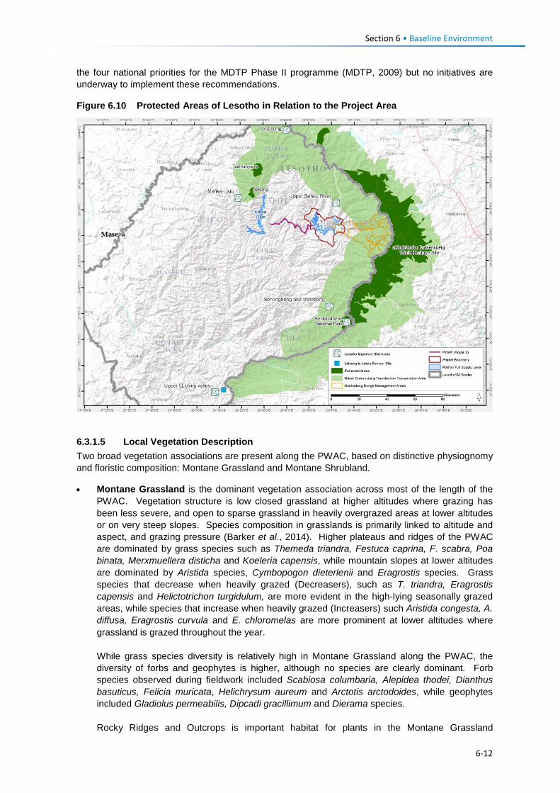
Section 6 • Baseline Environment
the four national priorities for the MDTP Phase II programme (MDTP, 2009) but no initiatives are underway to implement these recommendations.
Figure 6.10 Protected Areas of Lesotho in Relation to the Project Area
6.3.1.5 Local Vegetation Description Two broad vegetation associations are present along the PWAC, based on distinctive physiognomy and floristic composition: Montane Grassland and Montane Shrubland.
• Montane Grassland is the dominant vegetation association across most of the length of the PWAC. Vegetation structure is low closed grassland at higher altitudes where grazing has been less severe, and open to sparse grassland in heavily overgrazed areas at lower altitudes or on very steep slopes. Species composition in grasslands is primarily linked to altitude and aspect, and grazing pressure (Barker et al., 2014). Higher plateaus and ridges of the PWAC are dominated by grass species such as Themeda triandra, Festuca caprina, F. scabra, Poa binata, Merxmuellera disticha and Koeleria capensis, while mountain slopes at lower altitudes are dominated by Aristida species, Cymbopogon dieterlenii and Eragrostis species. Grass species that decrease when heavily grazed (Decreasers), such as T. triandra, Eragrostis capensis and Helictotrichon turgidulum, are more evident in the high-lying seasonally grazed areas, while species that increase when heavily grazed (Increasers) such Aristida congesta, A. diffusa, Eragrostis curvula and E. chloromelas are more prominent at lower altitudes where grassland is grazed throughout the year. While grass species diversity is relatively high in Montane Grassland along the PWAC, the diversity of forbs and geophytes is higher, although no species are clearly dominant. Forb species observed during fieldwork included Scabiosa columbaria, Alepidea thodei, Dianthus basuticus, Felicia muricata, Helichrysum aureum and Arctotis arctodoides, while geophytes included Gladiolus permeabilis, Dipcadi gracillimum and Dierama species. Rocky Ridges and Outcrops is important habitat for plants in the Montane Grassland
6-12
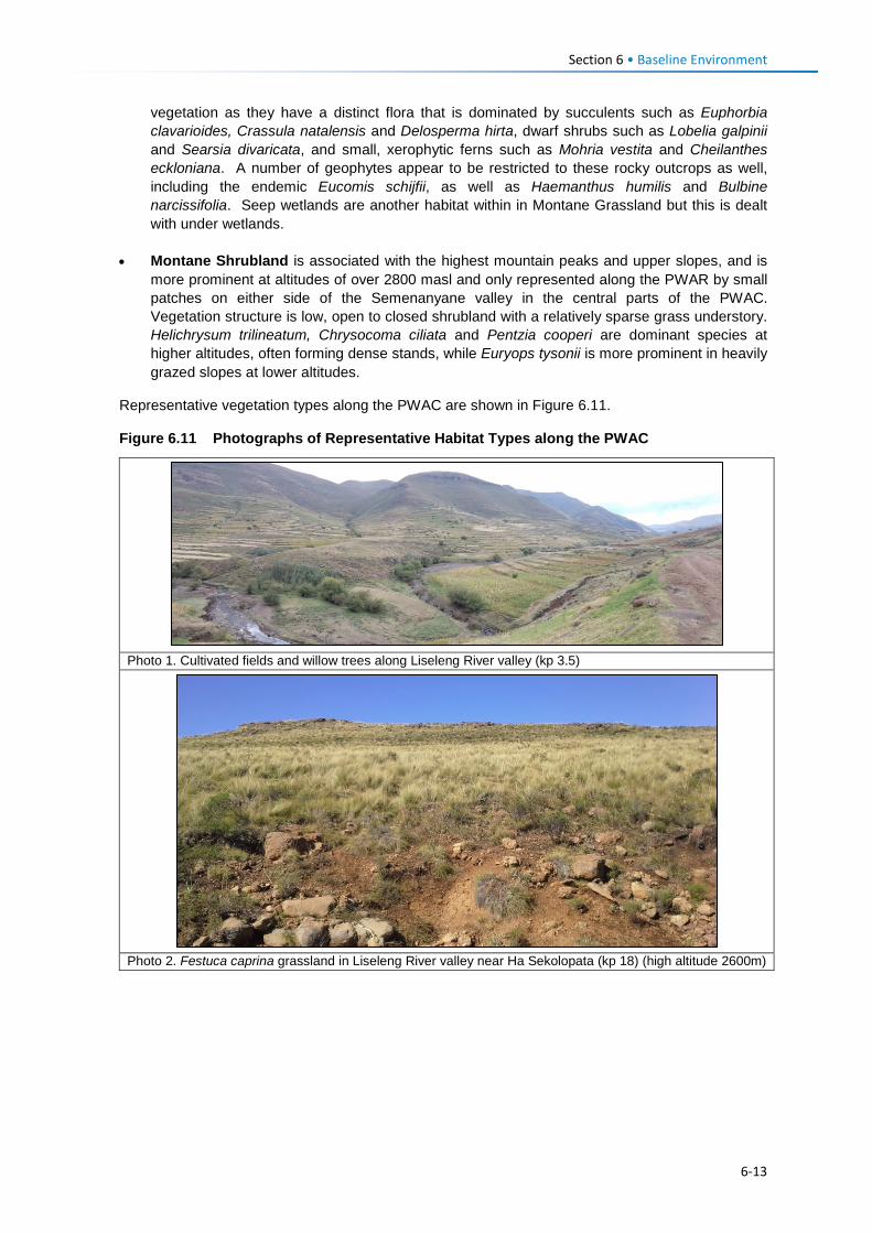
Section 6 • Baseline Environment
vegetation as they have a distinct flora that is dominated by succulents such as Euphorbia clavarioides, Crassula natalensis and Delosperma hirta, dwarf shrubs such as Lobelia galpinii and Searsia divaricata, and small, xerophytic ferns such as Mohria vestita and Cheilanthes eckloniana. A number of geophytes appear to be restricted to these rocky outcrops as well, including the endemic Eucomis schijfii, as well as Haemanthus humilis and Bulbine narcissifolia. Seep wetlands are another habitat within in Montane Grassland but this is dealt with under wetlands.
• Montane Shrubland is associated with the highest mountain peaks and upper slopes, and is more prominent at altitudes of over 2800 masl and only represented along the PWAR by small patches on either side of the Semenanyane valley in the central parts of the PWAC. Vegetation structure is low, open to closed shrubland with a relatively sparse grass understory. Helichrysum trilineatum, Chrysocoma ciliata and Pentzia cooperi are dominant species at higher altitudes, often forming dense stands, while Euryops tysonii is more prominent in heavily grazed slopes at lower altitudes.
Representative vegetation types along the PWAC are shown in Figure 6.11.
Figure 6.11 Photographs of Representative Habitat Types along the PWAC
Photo 1. Cultivated fields and willow trees along Liseleng River valley (kp 3.5)
Photo 2. Festuca caprina grassland in Liseleng River valley near Ha Sekolopata (kp 18) (high altitude 2600m)
6-13
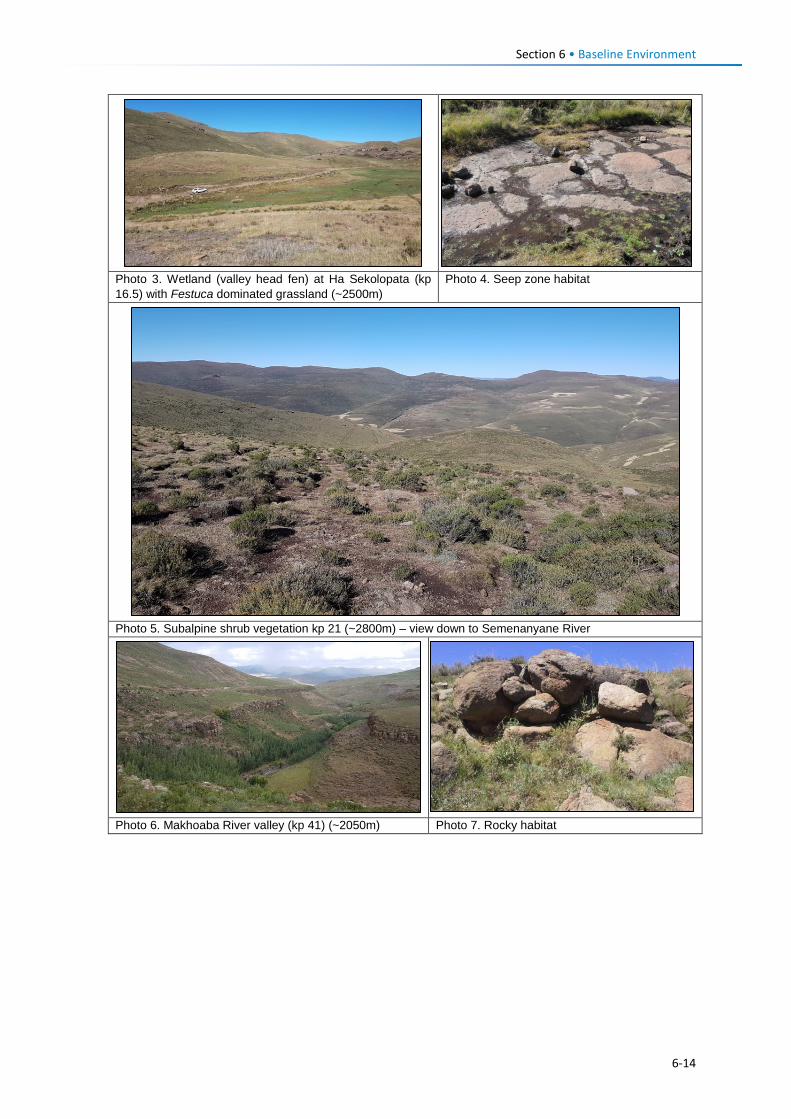
Section 6 • Baseline Environment
Photo 3. Wetland (valley head fen) at Ha Sekolopata (kp 16.5) with Festuca dominated grassland (~2500m)
Photo 4. Seep zone habitat
Photo 5. Subalpine shrub vegetation kp 21 (~2800m) – view down to Semenanyane River
Photo 6. Makhoaba River valley (kp 41) (~2050m) Photo 7. Rocky habitat
6-14
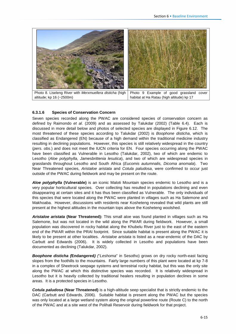
Section 6 • Baseline Environment
Photo 8. Liseleng River with Merxmuellera disticha (high altitude; kp 16 (~2500m)
Photo 9 Example of good grassland cover habitat at Ha Ratau (high altitude) kp 17
6.3.1.6 Species of Conservation Concern Seven species recorded along the PWAC are considered species of conservation concern as defined by Raimondo et al. (2009) and as assessed by Talukdar (2002) (Table 6.4). Each is discussed in more detail below and photos of selected species are displayed in Figure 6.12. The most threatened of these species according to Talukdar (2002) is Boophone disticha, which is classified as Endangered (EN) because of a high demand within the traditional medicine industry resulting in declining populations. However, this species is still relatively widespread in the country (pers. obs.) and does not meet the IUCN criteria for EN. Four species occurring along the PWAC have been classified as Vulnerable in Lesotho (Talukdar, 2002), two of which are endemic to Lesotho (Aloe polyphylla, Jamesbrittenia lesutica), and two of which are widespread species in grasslands throughout Lesotho and South Africa (Eucomis autumnalis, Dicoma anomala). Two Near Threatened species, Aristaloe aristata and Cotula paludosa, were confirmed to occur just outside of the PWAC during fieldwork and may be present on the route.
Aloe polyphylla (Vulnerable) is an iconic Maloti Mountain species endemic to Lesotho and is a very popular horticultural species. Over collecting has resulted in populations declining and even disappearing at certain sites and it has thus been classified as Vulnerable. The only individuals of this species that were located along the PWAC were planted in villages such as Ha Salemone and Makhoaba. However, discussions with residents near Kosheteng revealed that wild plants are still present at the highest altitudes in the mountain tops above the Kosheteng woolshed.
Aristaloe aristata (Near Threatened): This small aloe was found planted in villages such as Ha Salemone, but was not located in the wild along the PWAR during fieldwork. However, a small population was discovered in rocky habitat along the Khubelu River just to the east of the eastern end of the PWAR within the PRAI footprint. Since suitable habitat is present along the PWAC it is likely to be present at other localities. Aristaloe aristata is listed as a near-endemic of the DAC by Carbutt and Edwards (2006). It is widely collected in Lesotho and populations have been documented as declining (Talukdar, 2002).
Boophone disticha (Endangered) (“Leshoma” in Sesotho) grows on dry rocky north-east facing slopes from the foothills to the mountains. Fairly large numbers of this plant were located at kp 7-8 in a complex of Sheetrock seepage systems and terrestrial rocky habitat, but this was the only site along the PWAC at which this distinctive species was recorded. It is relatively widespread in Lesotho but it is heavily collected by traditional healers resulting in population declines in some areas. It is a protected species in Lesotho.
Cotula paludosa (Near Threatened) is a high-altitude seep specialist that is strictly endemic to the DAC (Carbutt and Edwards, 2006). Suitable habitat is present along the PWAC but the species was only located at a large wetland system along the original powerline route (Route C) to the north of the PWAC and at a site west of the Polihali Reservoir during fieldwork for that project.
6-15
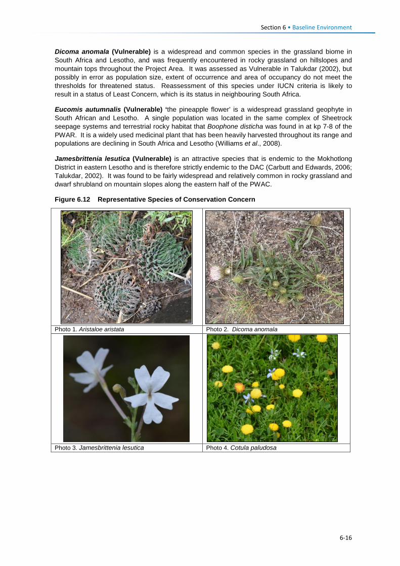
Section 6 • Baseline Environment
Dicoma anomala (Vulnerable) is a widespread and common species in the grassland biome in South Africa and Lesotho, and was frequently encountered in rocky grassland on hillslopes and mountain tops throughout the Project Area. It was assessed as Vulnerable in Talukdar (2002), but possibly in error as population size, extent of occurrence and area of occupancy do not meet the thresholds for threatened status. Reassessment of this species under IUCN criteria is likely to result in a status of Least Concern, which is its status in neighbouring South Africa.
Eucomis autumnalis (Vulnerable) ‘the pineapple flower’ is a widespread grassland geophyte in South African and Lesotho. A single population was located in the same complex of Sheetrock seepage systems and terrestrial rocky habitat that Boophone disticha was found in at kp 7-8 of the PWAR. It is a widely used medicinal plant that has been heavily harvested throughout its range and populations are declining in South Africa and Lesotho (Williams et al., 2008).
Jamesbrittenia lesutica (Vulnerable) is an attractive species that is endemic to the Mokhotlong District in eastern Lesotho and is therefore strictly endemic to the DAC (Carbutt and Edwards, 2006; Talukdar, 2002). It was found to be fairly widespread and relatively common in rocky grassland and dwarf shrubland on mountain slopes along the eastern half of the PWAC.
Figure 6.12 Representative Species of Conservation Concern
Photo 1. Aristaloe aristata Photo 2. Dicoma anomala
Photo 3. Jamesbrittenia lesutica Photo 4. Cotula paludosa
6-16
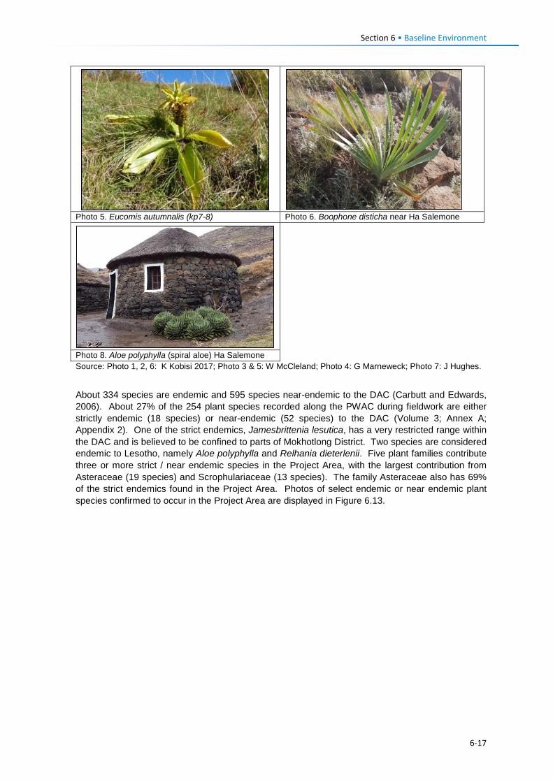
Section 6 • Baseline Environment
Photo 5. Eucomis autumnalis (kp7-8) Photo 6. Boophone disticha near Ha Salemone
Photo 8. Aloe polyphylla (spiral aloe) Ha Salemone Source: Photo 1, 2, 6: K Kobisi 2017; Photo 3 & 5: W McCleland; Photo 4: G Marneweck; Photo 7: J Hughes.
About 334 species are endemic and 595 species near-endemic to the DAC (Carbutt and Edwards, 2006). About 27% of the 254 plant species recorded along the PWAC during fieldwork are either strictly endemic (18 species) or near-endemic (52 species) to the DAC (Volume 3; Annex A; Appendix 2). One of the strict endemics, Jamesbrittenia lesutica, has a very restricted range within the DAC and is believed to be confined to parts of Mokhotlong District. Two species are considered endemic to Lesotho, namely Aloe polyphylla and Relhania dieterlenii. Five plant families contribute three or more strict / near endemic species in the Project Area, with the largest contribution from Asteraceae (19 species) and Scrophulariaceae (13 species). The family Asteraceae also has 69% of the strict endemics found in the Project Area. Photos of select endemic or near endemic plant species confirmed to occur in the Project Area are displayed in Figure 6.13.
6-17
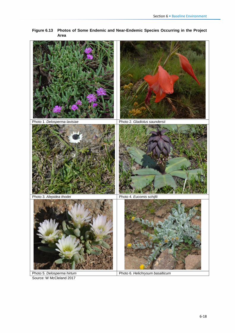
Section 6 • Baseline Environment
Figure 6.13 Photos of Some Endemic and Near-Endemic Species Occurring in the Project Area
Photo 1. Delosperma lavisiae Photo 2. Gladiolus saundersii
Photo 3. Alepidea thodei Photo 4. Eucomis schijfii
Photo 5. Delosperma hirtum Photo 6. Helichrysum basalticum Source: W McCleland 2017
6-18
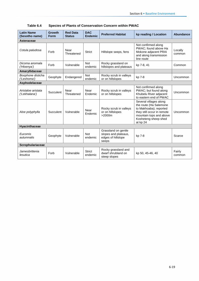
Section 6 • Baseline Environment
Table 6.4 Species of Plants of Conservation Concern within PWAC
Latin Name (Sesotho name)
Growth Form
Red Data Status
DAC Endemic Preferred Habitat kp reading / Location Abundance
Asteraceae
Cotula paludosa Forb Near
Threatened Strict Hillslope seeps, fens
Not confirmed along PWAC; found above Ha Mokone adjacent PRAI and along transmission line route
Locally common
Dicoma anomala ('Hloenya’) Forb Vulnerable Not
endemic Rocky grassland on hillslopes and plateaus kp 7-8, 41 Common
Amaryllidaceae Boophone disticha (‘Leshoma’) Geophyte Endangered Not
endemic Rocky scrub in valleys or on hillslopes kp 7-8 Uncommon
Asphodelaceae
Aristaloe aristata (‘Lekhalana’) Succulent Near
Threatened Near Endemic
Rocky scrub in valleys or on hillslopes
Not confirmed along PWAC; but found along Khubelu River adjacent to eastern end of PWAC
Uncommon
Aloe polyphylla Succulent Vulnerable Near Endemic
Rocky scrub in valleys or on hillslopes >2000m
Several villages along the route (Ha Salemone to Makhoaba); reported they still occur in remote mountain tops and above Kosheteng sheep shed at kp 24
Uncommon
Hyacinthaceae
Eucomis autumnalis Geophyte Vulnerable Not
endemic
Grassland on gentle slopes and plateaus, edges of hillslope seeps
kp 7-8 Scarce
Scrophulariaceae Jamesbrittenia lesutica Forb Vulnerable Strict
endemic
Rocky grassland and dwarf shrubland on steep slopes
kp 50, 45-46, 40 Fairly common
6-19
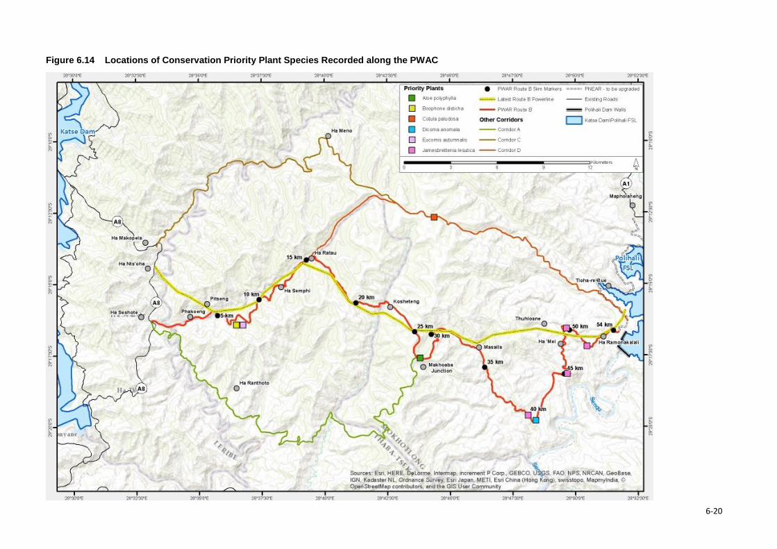
Figure 6.14 Locations of Conservation Priority Plant Species Recorded along the PWAC
6-20
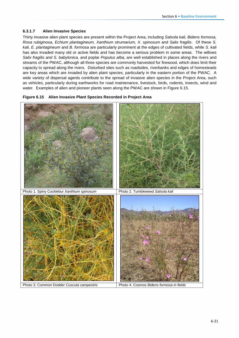
Section 6 • Baseline Environment 6.3.1.7 Alien Invasive Species Thirty invasive alien plant species are present within the Project Area, including Salsola kali, Bidens formosa, Rosa rubiginosa, Echium plantagineum, Xanthium strumarium, X. spinosum and Salix fragilis. Of these S. kali, E. plantagineum and B. formosa are particularly prominent at the edges of cultivated fields, while S. kali has also invaded many old or active fields and has become a serious problem in some areas. The willows Salix fragilis and S. babylonica, and poplar Populus alba, are well established in places along the rivers and streams of the PWAC, although all three species are commonly harvested for firewood, which does limit their capacity to spread along the rivers. Disturbed sites such as roadsides, riverbanks and edges of homesteads are key areas which are invaded by alien plant species, particularly in the eastern portion of the PWAC. A wide variety of dispersal agents contribute to the spread of invasive alien species in the Project Area, such as vehicles, particularly during earthworks for road maintenance, livestock, birds, rodents, insects, wind and water. Examples of alien and pioneer plants seen along the PWAC are shown in Figure 6.15.
Figure 6.15 Alien Invasive Plant Species Recorded in Project Area
Photo 1. Spiny Cocklebur Xanthium spinosum Photo 2. Tumbleweed Salsola kali
Photo 3. Common Dodder Cuscuta campestris Photo 4. Cosmos Bidens formosa in fields
6-21
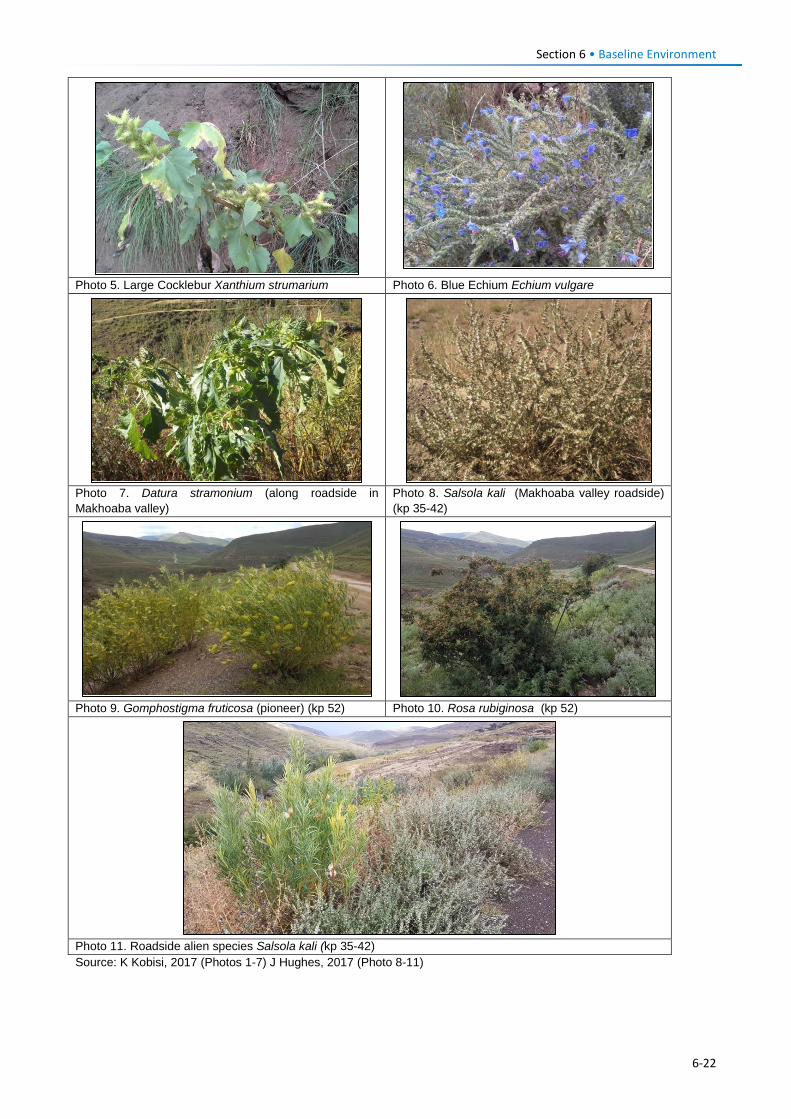
Section 6 • Baseline Environment
Photo 5. Large Cocklebur Xanthium strumarium Photo 6. Blue Echium Echium vulgare
Photo 7. Datura stramonium (along roadside in Makhoaba valley)
Photo 8. Salsola kali (Makhoaba valley roadside) (kp 35-42)
Photo 9. Gomphostigma fruticosa (pioneer) (kp 52) Photo 10. Rosa rubiginosa (kp 52)
Photo 11. Roadside alien species Salsola kali (kp 35-42) Source: K Kobisi, 2017 (Photos 1-7) J Hughes, 2017 (Photo 8-11)
6-22
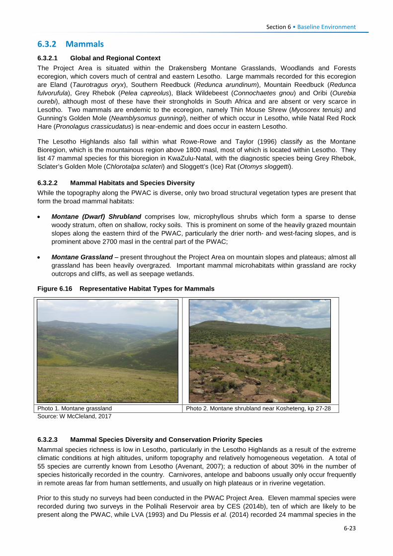
Section 6 • Baseline Environment 6.3.2 Mammals 6.3.2.1 Global and Regional Context The Project Area is situated within the Drakensberg Montane Grasslands, Woodlands and Forests ecoregion, which covers much of central and eastern Lesotho. Large mammals recorded for this ecoregion are Eland (Taurotragus oryx), Southern Reedbuck (Redunca arundinum), Mountain Reedbuck (Redunca fulvorufula), Grey Rhebok (Pelea capreolus), Black Wildebeest (Connochaetes gnou) and Oribi (Ourebia ourebi), although most of these have their strongholds in South Africa and are absent or very scarce in Lesotho. Two mammals are endemic to the ecoregion, namely Thin Mouse Shrew (Myosorex tenuis) and Gunning's Golden Mole (Neamblysomus gunningi), neither of which occur in Lesotho, while Natal Red Rock Hare (Pronolagus crassicudatus) is near-endemic and does occur in eastern Lesotho.
The Lesotho Highlands also fall within what Rowe-Rowe and Taylor (1996) classify as the Montane Bioregion, which is the mountainous region above 1800 masl, most of which is located within Lesotho. They list 47 mammal species for this bioregion in KwaZulu-Natal, with the diagnostic species being Grey Rhebok, Sclater’s Golden Mole (Chlorotalpa sclateri) and Sloggett’s (Ice) Rat (Otomys sloggetti).
6.3.2.2 Mammal Habitats and Species Diversity While the topography along the PWAC is diverse, only two broad structural vegetation types are present that form the broad mammal habitats:
• Montane (Dwarf) Shrubland comprises low, microphyllous shrubs which form a sparse to dense woody stratum, often on shallow, rocky soils. This is prominent on some of the heavily grazed mountain slopes along the eastern third of the PWAC, particularly the drier north- and west-facing slopes, and is prominent above 2700 masl in the central part of the PWAC;
• Montane Grassland – present throughout the Project Area on mountain slopes and plateaus; almost all grassland has been heavily overgrazed. Important mammal microhabitats within grassland are rocky outcrops and cliffs, as well as seepage wetlands.
Figure 6.16 Representative Habitat Types for Mammals
Photo 1. Montane grassland Photo 2. Montane shrubland near Kosheteng, kp 27-28 Source: W McCleland, 2017
6.3.2.3 Mammal Species Diversity and Conservation Priority Species Mammal species richness is low in Lesotho, particularly in the Lesotho Highlands as a result of the extreme climatic conditions at high altitudes, uniform topography and relatively homogeneous vegetation. A total of 55 species are currently known from Lesotho (Avenant, 2007); a reduction of about 30% in the number of species historically recorded in the country. Carnivores, antelope and baboons usually only occur frequently in remote areas far from human settlements, and usually on high plateaus or in riverine vegetation.
Prior to this study no surveys had been conducted in the PWAC Project Area. Eleven mammal species were recorded during two surveys in the Polihali Reservoir area by CES (2014b), ten of which are likely to be present along the PWAC, while LVA (1993) and Du Plessis et al. (2014) recorded 24 mammal species in the
6-23
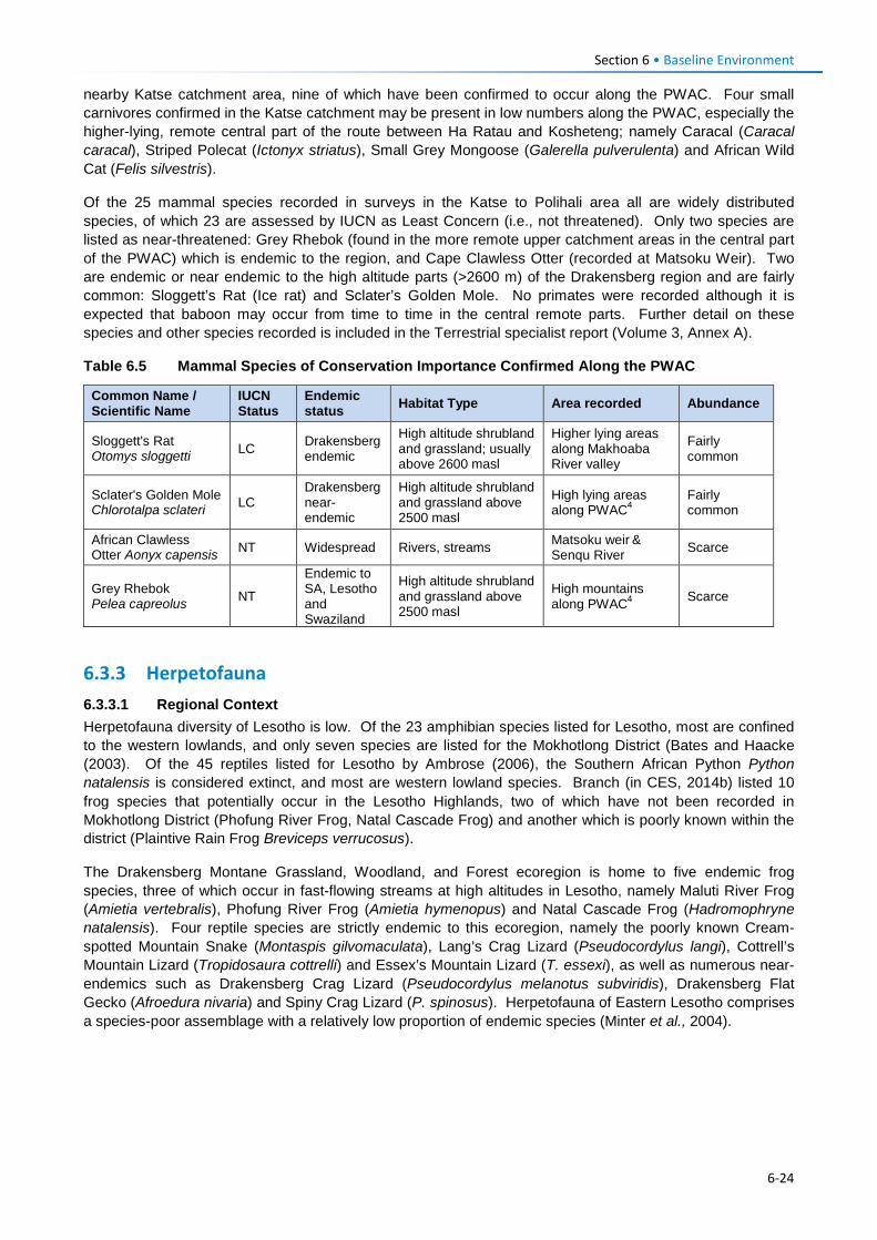
Section 6 • Baseline Environment nearby Katse catchment area, nine of which have been confirmed to occur along the PWAC. Four small carnivores confirmed in the Katse catchment may be present in low numbers along the PWAC, especially the higher-lying, remote central part of the route between Ha Ratau and Kosheteng; namely Caracal (Caracal caracal), Striped Polecat (Ictonyx striatus), Small Grey Mongoose (Galerella pulverulenta) and African Wild Cat (Felis silvestris).
Of the 25 mammal species recorded in surveys in the Katse to Polihali area all are widely distributed species, of which 23 are assessed by IUCN as Least Concern (i.e., not threatened). Only two species are listed as near-threatened: Grey Rhebok (found in the more remote upper catchment areas in the central part of the PWAC) which is endemic to the region, and Cape Clawless Otter (recorded at Matsoku Weir). Two are endemic or near endemic to the high altitude parts (>2600 m) of the Drakensberg region and are fairly common: Sloggett’s Rat (Ice rat) and Sclater’s Golden Mole. No primates were recorded although it is expected that baboon may occur from time to time in the central remote parts. Further detail on these species and other species recorded is included in the Terrestrial specialist report (Volume 3, Annex A).
Table 6.5 Mammal Species of Conservation Importance Confirmed Along the PWAC
Common Name / Scientific Name
IUCN Status
Endemic status Habitat Type Area recorded Abundance
Sloggett's Rat Otomys sloggetti LC Drakensberg
endemic
High altitude shrubland and grassland; usually above 2600 masl
Higher lying areas along Makhoaba River valley
Fairly common
Sclater's Golden Mole Chlorotalpa sclateri LC
Drakensberg near-endemic
High altitude shrubland and grassland above 2500 masl
High lying areas along PWAC4
Fairly common
African Clawless Otter Aonyx capensis NT Widespread Rivers, streams Matsoku weir &
Senqu River Scarce
Grey Rhebok Pelea capreolus NT
Endemic to SA, Lesotho and Swaziland
High altitude shrubland and grassland above 2500 masl
High mountains along PWAC4 Scarce
6.3.3 Herpetofauna 6.3.3.1 Regional Context Herpetofauna diversity of Lesotho is low. Of the 23 amphibian species listed for Lesotho, most are confined to the western lowlands, and only seven species are listed for the Mokhotlong District (Bates and Haacke (2003). Of the 45 reptiles listed for Lesotho by Ambrose (2006), the Southern African Python Python natalensis is considered extinct, and most are western lowland species. Branch (in CES, 2014b) listed 10 frog species that potentially occur in the Lesotho Highlands, two of which have not been recorded in Mokhotlong District (Phofung River Frog, Natal Cascade Frog) and another which is poorly known within the district (Plaintive Rain Frog Breviceps verrucosus).
The Drakensberg Montane Grassland, Woodland, and Forest ecoregion is home to five endemic frog species, three of which occur in fast-flowing streams at high altitudes in Lesotho, namely Maluti River Frog (Amietia vertebralis), Phofung River Frog (Amietia hymenopus) and Natal Cascade Frog (Hadromophryne natalensis). Four reptile species are strictly endemic to this ecoregion, namely the poorly known Cream-spotted Mountain Snake (Montaspis gilvomaculata), Lang’s Crag Lizard (Pseudocordylus langi), Cottrell’s Mountain Lizard (Tropidosaura cottrelli) and Essex’s Mountain Lizard (T. essexi), as well as numerous near-endemics such as Drakensberg Crag Lizard (Pseudocordylus melanotus subviridis), Drakensberg Flat Gecko (Afroedura nivaria) and Spiny Crag Lizard (P. spinosus). Herpetofauna of Eastern Lesotho comprises a species-poor assemblage with a relatively low proportion of endemic species (Minter et al., 2004).
6-24
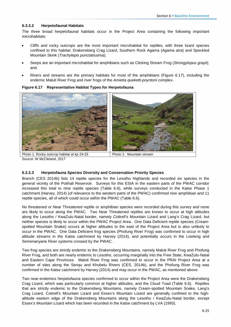
Section 6 • Baseline Environment 6.3.3.2 Herpetofaunal Habitats The three broad herpetofaunal habitats occur in the Project Area containing the following important microhabitats:
• Cliffs and rocky outcrops are the most important microhabitat for reptiles, with three lizard species confined to this habitat: Drakensberg Crag Lizard, Southern Rock Agama (Agama atra) and Speckled Mountain Skink (Trachylepis punctatissima);
• Seeps are an important microhabitat for amphibians such as Clicking Stream Frog (Strongylopus grayii); and
• Rivers and streams are the primary habitats for most of the amphibians (Figure 6.17), including the endemic Maluti River Frog and river frogs of the Amietia queketti-poyntoni complex.
Figure 6.17 Representative Habitat Types for Herpetofauna
Photo 1. Rocky outcrop habitat at kp 24-25 Photo 2. Mountain stream Source: W McCleland, 2017
6.3.3.3 Herpetofauna Species Diversity and Conservation Priority Species Branch (CES 2014b) lists 14 reptile species for the Lesotho Highlands and recorded six species in the general vicinity of the Polihali Reservoir. Surveys for this ESIA in the eastern parts of the PWAC corridor increased this total to nine reptile species (Table 6.6), while surveys conducted in the Katse Phase 1 catchment (Harvey, 2014) (of relevance to the western parts of the PWAC) confirmed nine amphibian and 11 reptile species, all of which could occur within the PWAC (Table 6.6).
No threatened or Near Threatened reptile or amphibian species were recorded during this survey and none are likely to occur along the PWAC. Two Near Threatened reptiles are known to occur at high altitudes along the Lesotho / KwaZulu-Natal border, namely Cottrell’s Mountain Lizard and Lang’s Crag Lizard, but neither species is likely to occur within the PWAC Project Area. One Data Deficient reptile species (Cream-spotted Mountain Snake) occurs at higher altitudes to the east of the Project Area but is also unlikely to occur in the PWAC. One Data Deficient frog species (Phofung River Frog) was confirmed to occur in high altitude streams in the Katse catchment by Harvey (2014), and potentially occurs in the Liseleng and Semenanyane River systems crossed by the PWAC.
Two frog species are strictly endemic to the Drakensberg Mountains, namely Maluti River Frog and Phofung River Frog, and both are nearly endemic to Lesotho, occurring marginally into the Free State, KwaZulu-Natal and Eastern Cape Provinces. Maluti River Frog was confirmed to occur in the PRAI Project Area at a number of sites along the Senqu and Khubelu Rivers (CES, 2014b), and the Phofung River Frog was confirmed in the Katse catchment by Harvey (2014) and may occur in the PWAC, as mentioned above.
Two near-endemics herpetofauna species confirmed to occur within the Project Area were the Drakensberg Crag Lizard, which was particularly common at higher altitudes, and the Cloud Toad (Table 6.6). Reptiles that are strictly endemic to the Drakensberg Mountains, namely Cream-spotted Mountain Snake, Lang’s Crag Lizard, Cottrell’s Mountain Lizard and Essex’s Mountain Lizard are generally confined to the high-altitude eastern edge of the Drakensberg Mountains along the Lesotho / KwaZulu-Natal border, except Essex’s Mountain Lizard which has been recorded in the Katse catchment by LVA (1993).
6-25
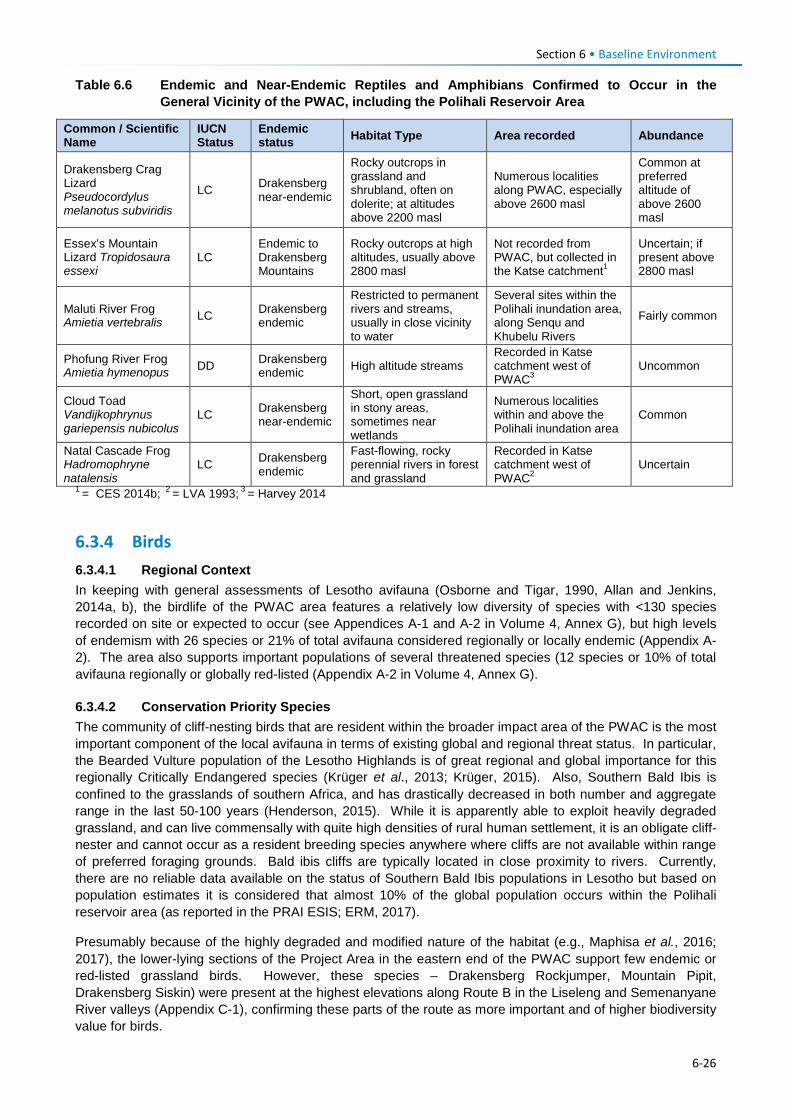
Section 6 • Baseline Environment Table 6.6 Endemic and Near-Endemic Reptiles and Amphibians Confirmed to Occur in the
General Vicinity of the PWAC, including the Polihali Reservoir Area
Common / Scientific Name
IUCN Status
Endemic status Habitat Type Area recorded Abundance
Drakensberg Crag Lizard Pseudocordylus melanotus subviridis
LC Drakensberg near-endemic
Rocky outcrops in grassland and shrubland, often on dolerite; at altitudes above 2200 masl
Numerous localities along PWAC, especially above 2600 masl
Common at preferred altitude of above 2600 masl
Essex’s Mountain Lizard Tropidosaura essexi
LC Endemic to Drakensberg Mountains
Rocky outcrops at high altitudes, usually above 2800 masl
Not recorded from PWAC, but collected in the Katse catchment1
Uncertain; if present above 2800 masl
Maluti River Frog Amietia vertebralis LC Drakensberg
endemic
Restricted to permanent rivers and streams, usually in close vicinity to water
Several sites within the Polihali inundation area, along Senqu and Khubelu Rivers
Fairly common
Phofung River Frog Amietia hymenopus DD Drakensberg
endemic High altitude streams Recorded in Katse catchment west of PWAC3
Uncommon
Cloud Toad Vandijkophrynus gariepensis nubicolus
LC Drakensberg near-endemic
Short, open grassland in stony areas, sometimes near wetlands
Numerous localities within and above the Polihali inundation area
Common
Natal Cascade Frog Hadromophryne natalensis
LC Drakensberg endemic
Fast-flowing, rocky perennial rivers in forest and grassland
Recorded in Katse catchment west of PWAC2
Uncertain
1 = CES 2014b; 2 = LVA 1993; 3 = Harvey 2014
6.3.4 Birds 6.3.4.1 Regional Context In keeping with general assessments of Lesotho avifauna (Osborne and Tigar, 1990, Allan and Jenkins, 2014a, b), the birdlife of the PWAC area features a relatively low diversity of species with <130 species recorded on site or expected to occur (see Appendices A-1 and A-2 in Volume 4, Annex G), but high levels of endemism with 26 species or 21% of total avifauna considered regionally or locally endemic (Appendix A-2). The area also supports important populations of several threatened species (12 species or 10% of total avifauna regionally or globally red-listed (Appendix A-2 in Volume 4, Annex G).
6.3.4.2 Conservation Priority Species The community of cliff-nesting birds that are resident within the broader impact area of the PWAC is the most important component of the local avifauna in terms of existing global and regional threat status. In particular, the Bearded Vulture population of the Lesotho Highlands is of great regional and global importance for this regionally Critically Endangered species (Krüger et al., 2013; Krüger, 2015). Also, Southern Bald Ibis is confined to the grasslands of southern Africa, and has drastically decreased in both number and aggregate range in the last 50-100 years (Henderson, 2015). While it is apparently able to exploit heavily degraded grassland, and can live commensally with quite high densities of rural human settlement, it is an obligate cliff-nester and cannot occur as a resident breeding species anywhere where cliffs are not available within range of preferred foraging grounds. Bald ibis cliffs are typically located in close proximity to rivers. Currently, there are no reliable data available on the status of Southern Bald Ibis populations in Lesotho but based on population estimates it is considered that almost 10% of the global population occurs within the Polihali reservoir area (as reported in the PRAI ESIS; ERM, 2017).
Presumably because of the highly degraded and modified nature of the habitat (e.g., Maphisa et al., 2016; 2017), the lower-lying sections of the Project Area in the eastern end of the PWAC support few endemic or red-listed grassland birds. However, these species – Drakensberg Rockjumper, Mountain Pipit, Drakensberg Siskin) were present at the highest elevations along Route B in the Liseleng and Semenanyane River valleys (Appendix C-1), confirming these parts of the route as more important and of higher biodiversity value for birds.
6-26
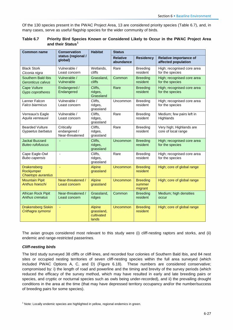
Section 6 • Baseline Environment Of the 130 species present in the PWAC Project Area, 13 are considered priority species (Table 6.7), and, in many cases, serve as useful flagship species for the wider community of birds.
Table 6.7 Priority Bird Species Known or Considered Likely to Occur in the PWAC Project Area and their Status1
Common name Conservation status (regional / global)
Habitat Status Relative abundance
Residency Relative importance of affected population
Black Stork Ciconia nigra
Vulnerable / Least concern
Wetlands, cliffs
Rare Breeding resident
High; recognised core area for the species
Southern Bald Ibis Geronticus calvus
Vulnerable / Vulnerable
Grassland, cliffs
Common Breeding resident
High; recognised core area for the species
Cape Vulture Gyps coprotheres
Endangered / Endangered
Cliffs, ridges, Grassland
Rare Breeding resident
High; recognised core area for the species
Lanner Falcon Falco biarmicus
Vulnerable / Least concern
Cliffs, ridges, grassland
Uncommon Breeding resident
High; recognised core area for the species
Verreaux's Eagle Aquila verreauxii
Vulnerable / Least concern
Cliffs, ridges, grassland
Rare Breeding resident
Medium; few pairs left in Highlands
Bearded Vulture Gypaetus barbatus
Critically endangered / Near-threatened
Cliffs, ridges, grassland
Rare Breeding resident
Very high; Highlands are core of local range
Jackal Buzzard Buteo rufofuscus
- Cliffs, ridges, grassland
Uncommon Breeding resident
High; recognised core area for the species
Cape Eagle-Owl Bubo capensis
- Cliffs, ridges, grassland
Rare Breeding resident
High; recognised core area for the species
Drakensberg Rockjumper Chaetops aurantius
- Alpine grassland
Uncommon Breeding resident
High; core of global range
Mountain Pipit Anthus hoeschi
Near-threatened / Least concern
Alpine grassland
Uncommon Breeding summer migrant
High; core of global range
African Rock Pipit Anthus crenatus
Near-threatened / Least concern
Grassland, ridges
Common Breeding resident
Medium; high densities occur
Drakensberg Siskin Crithagra symonsi
- Alpine grassland, cultivated lands
Uncommon Breeding resident
High; core of global range
The avian groups considered most relevant to this study were (i) cliff-nesting raptors and storks, and (ii) endemic and range-restricted passerines.
Cliff-nesting birds
The bird study surveyed 38 cliffs or cliff-lines, and recorded four colonies of Southern Bald Ibis, and 84 nest sites or occupied nesting territories of seven cliff-nesting species within the full area surveyed (which included PWAC Options A, C, and D) (Figure 6.18). These numbers are considered conservative; compromised by: i) the length of road and powerline and the timing and brevity of the survey periods (which reduced the efficacy of the survey method, which may have resulted in early and late breeding pairs or species, and cryptic or nocturnal species such as owls being under-recorded), and ii) the prevailing drought conditions in the area at the time (that may have depressed territory occupancy and/or the number/success of breeding pairs for some species).
1 Note: Locally endemic species are highlighted in yellow, regional endemics in green.
6-27
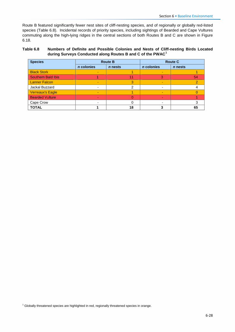
Section 6 • Baseline Environment Route B featured significantly fewer nest sites of cliff-nesting species, and of regionally or globally red-listed species (Table 6.8). Incidental records of priority species, including sightings of Bearded and Cape Vultures commuting along the high-lying ridges in the central sections of both Routes B and C are shown in Figure 6.18.
Table 6.8 Numbers of Definite and Possible Colonies and Nests of Cliff-nesting Birds Located during Surveys Conducted along Routes B and C of the PWAC1
Species Route B Route C n colonies n nests n colonies n nests
Black Stork - 1 - 1 Southern Bald Ibis 1 11 3 54 Lanner Falcon - 3 - 2 Jackal Buzzard - 2 - 4 Verreaux's Eagle - 1 - 0 Bearded Vulture - 0 - 1 Cape Crow - 0 - 3 TOTAL 1 18 3 65
1 Globally threatened species are highlighted in red, regionally threatened species in orange.
6-28
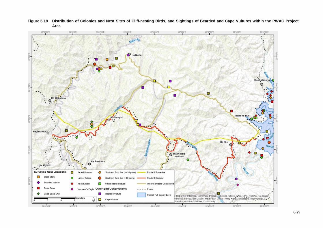
Figure 6.18 Distribution of Colonies and Nest Sites of Cliff-nesting Birds, and Sightings of Bearded and Cape Vultures within the PWAC Project Area
6-29
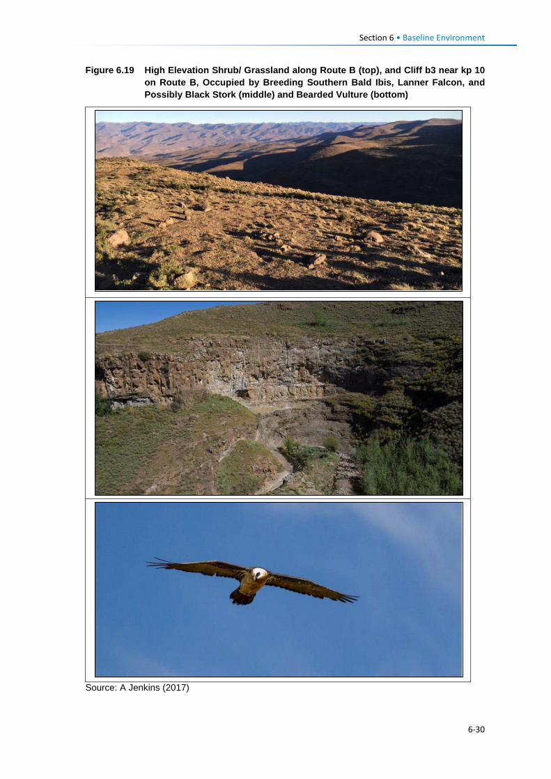
Section 6 • Baseline Environment
Figure 6.19 High Elevation Shrub/ Grassland along Route B (top), and Cliff b3 near kp 10 on Route B, Occupied by Breeding Southern Bald Ibis, Lanner Falcon, and Possibly Black Stork (middle) and Bearded Vulture (bottom)
Source: A Jenkins (2017)
6-30
Section 6 • Baseline Environment
Grassland (Passerine) Birds
Sampling of the general avifauna with an emphasis on the richness and structure of small passerine communities revealed that the diversity of the avifauna was essentially as expected, although numbers of most species seemed low and were very likely depressed by the drought conditions prevailing in the area (despite the reasonable late summer rains in January/February 2017).
Bird transect data was collected in the high lying, summer grazing, central portions of the PWAC (2750-2800 m) near Kosheteng / Liseleng and Semenanyane and in the lower lying, more degraded Polihali reservoir area. Vegetation type in the Kosheteng area varied according to slope and aspect with sheltered mountain slopes dominated by tall and less palatable Festuca caprina grass (Letsiri) while the warm, north to east-facing slopes were invaded by thick stands of woody shrubs: Chrysocoma ciliata and Asteraceae species. The Kosheteng sampling areas featured many more restricted-range, endemic species such as Large-billed Lark Galerida magnirostris, Drakensberg Rockjumper Chaetops aurantius, Mountain Pipit Anthus hoeschi and Sickled-winged Chats Cercomela sinuata, and supported a markedly higher avian species richness than the Polihali Reservoir area. Overall, the eastern end of the PWAC ending in the vicinity of the dam wall was characterised by low species richness and abundance, exacerbated by heavy grazing.
6.3.4.3 Avian Sensitivity Mapping A map of avian impact sensitivity in relation to the proposed PWAC (Figure 6.20) was developed primarily to reflect mortality risk by integrating the field data collected during this study with a DEM, and a dataset that describes the predicted density of Bearded Vultures present across the species’ southern African range (Reid et al., 2015). High Sensitivity areas were deemed to be those within the nest site buffers of priority species and/or those above 2800 masl, while Very High Sensitivity areas were those within the nest site buffers for Bearded Vulture, and/or those above 2800 masl and with slopes of <10º, and/or those with predicted Bearded Vulture density indices of >0.006. The sections of moderate, high and very high sensitivity are summarised in Table 12.20 to inform the assessment of avian collision risk and mitigation requirements.
This sensitivity mapping was used as a primary informant for guiding the selection of the final powerline route.
6-31
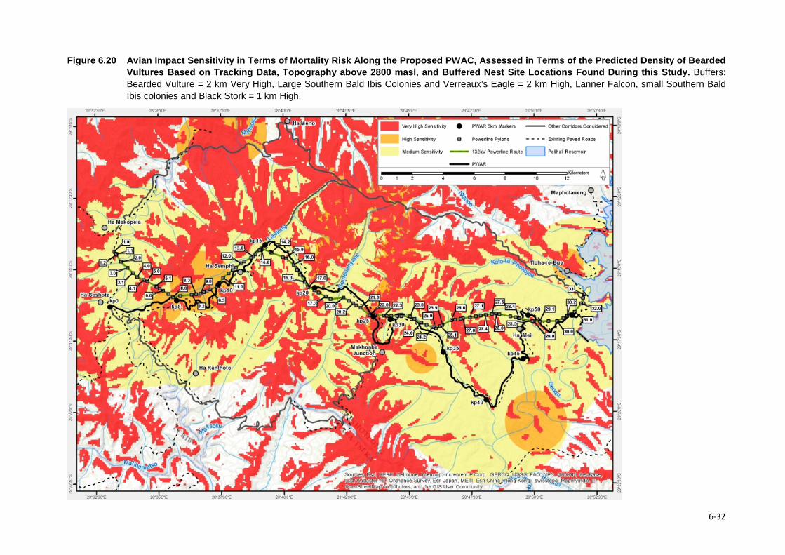
Figure 6.20 Avian Impact Sensitivity in Terms of Mortality Risk Along the Proposed PWAC, Assessed in Terms of the Predicted Density of Bearded
Vultures Based on Tracking Data, Topography above 2800 masl, and Buffered Nest Site Locations Found During this Study. Buffers: Bearded Vulture = 2 km Very High, Large Southern Bald Ibis Colonies and Verreaux’s Eagle = 2 km High, Lanner Falcon, small Southern Bald Ibis colonies and Black Stork = 1 km High.
6-32
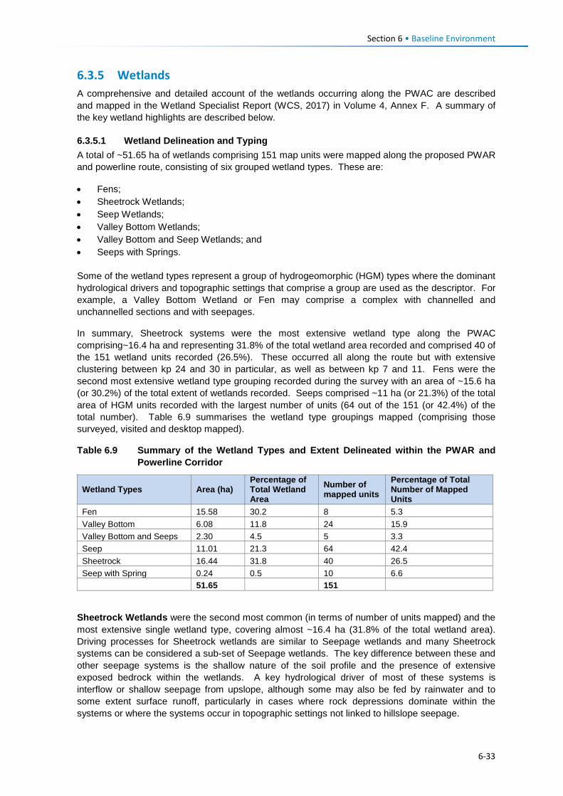
Section 6 • Baseline Environment
6.3.5 Wetlands A comprehensive and detailed account of the wetlands occurring along the PWAC are described and mapped in the Wetland Specialist Report (WCS, 2017) in Volume 4, Annex F. A summary of the key wetland highlights are described below.
6.3.5.1 Wetland Delineation and Typing A total of ~51.65 ha of wetlands comprising 151 map units were mapped along the proposed PWAR and powerline route, consisting of six grouped wetland types. These are:
• Fens; • Sheetrock Wetlands; • Seep Wetlands; • Valley Bottom Wetlands; • Valley Bottom and Seep Wetlands; and • Seeps with Springs.
Some of the wetland types represent a group of hydrogeomorphic (HGM) types where the dominant hydrological drivers and topographic settings that comprise a group are used as the descriptor. For example, a Valley Bottom Wetland or Fen may comprise a complex with channelled and unchannelled sections and with seepages.
In summary, Sheetrock systems were the most extensive wetland type along the PWAC comprising~16.4 ha and representing 31.8% of the total wetland area recorded and comprised 40 of the 151 wetland units recorded (26.5%). These occurred all along the route but with extensive clustering between kp 24 and 30 in particular, as well as between kp 7 and 11. Fens were the second most extensive wetland type grouping recorded during the survey with an area of ~15.6 ha (or 30.2%) of the total extent of wetlands recorded. Seeps comprised ~11 ha (or 21.3%) of the total area of HGM units recorded with the largest number of units (64 out of the 151 (or 42.4%) of the total number). Table 6.9 summarises the wetland type groupings mapped (comprising those surveyed, visited and desktop mapped).
Table 6.9 Summary of the Wetland Types and Extent Delineated within the PWAR and Powerline Corridor
Wetland Types Area (ha) Percentage of Total Wetland Area
Number of mapped units
Percentage of Total Number of Mapped Units
Fen 15.58 30.2 8 5.3 Valley Bottom 6.08 11.8 24 15.9 Valley Bottom and Seeps 2.30 4.5 5 3.3 Seep 11.01 21.3 64 42.4 Sheetrock 16.44 31.8 40 26.5 Seep with Spring 0.24 0.5 10 6.6 51.65 151
Sheetrock Wetlands were the second most common (in terms of number of units mapped) and the most extensive single wetland type, covering almost ~16.4 ha (31.8% of the total wetland area). Driving processes for Sheetrock wetlands are similar to Seepage wetlands and many Sheetrock systems can be considered a sub-set of Seepage wetlands. The key difference between these and other seepage systems is the shallow nature of the soil profile and the presence of extensive exposed bedrock within the wetlands. A key hydrological driver of most of these systems is interflow or shallow seepage from upslope, although some may also be fed by rainwater and to some extent surface runoff, particularly in cases where rock depressions dominate within the systems or where the systems occur in topographic settings not linked to hillslope seepage.
6-33

Section 6 • Baseline Environment
The shallow nature of the soil profile in the sheetrock systems generally means they are somewhat more ephemeral in nature compared to the other hillslope seepage systems as they dry out and re-wet quickly. There are however some exceptions to this general rule as some wetter systems have open water which either emerges as springs within parts of the system or immediately downslope of the system at the contact between more weathered rocks and the water table. Where these systems support springs, parts of the wetland can be considered seasonally to permanently saturated, depending on the extent and duration of the groundwater seepage. These extremes can result in the development of specialised assemblages of plant species; typical ones being short sedge meadows dominated by Haplocarpha scaposa and Isolepis species. Along the road corridor, most of these systems are heavily grazed. The shallow nature of the soil profile in these systems makes them extremely susceptible to erosion.
The most intact and important Sheetrock wetlands occurred between Kosheteng and the top of the Makhoaba Junction area between kp 24-26.5 associated with Wetlands 34, 36, 37, 38 and 39 in particular (Figure 6.21; Figure 6.22). Wetland 34 was particularly diverse from a botanical perspective and the vegetation was largely intact although there was evidence of disturbance from overgrazing and trampling by livestock. A number of priority plants species such as Eucomis schifferi and Corycium nigrescens (orchid) were recorded here (Figure 6.23).
Figure 6.21 Map Showing the Approximate Extent of the Sheetrock Wetlands 34 to 41 and 44 to 48 with Important Plants
6-34

Section 6 • Baseline Environment
Figure 6.22 Photos of Sheetrock Wetland 35
a: View of Wetland 35 in context of its catchment; Also indicated are the short grass/sedge meadows that occur on the shallow organic soils over the bedrock and the extensive shrub cover in the catchment; b: Photo of a temporarily inundated open water pool in a hollow on the sheetrock; and c: Photo of the old road that runs along the edge of the wetland.
Figure 6.23 Examples of Priority Plants of Conservation Concern in Sheetrock Wetlands
Photo 3. Eucomis schijffii recorded in some of the Sheetrock Wetlands 34 to 36.
Photo 4. Large populations of Euphorbia clavarioides were recorded in the Sheetrock wetlands concentrated in the areas shown in Figure 6.21.
Photo 3. Corycium nigrescens recorded in some of the Sheetrock Wetlands 34 to 36.
Seeps were the most abundant wetland type recorded (comprising 42.4% of the total number of units mapped) and covering ~11 ha (~21%) of the wetland area identified. The key driver of the seepage wetlands is interflow – the movement of water through the soil profile leading to saturation of the soil profile within the wetland. Interflow is derived from rainfall infiltrating the soils in the wetland catchment and moving laterally through the soil profile, typically along an aquitard, and expressing in the wetlands where the shallow water table supports the wetland habitat. The diffuse, subsurface nature of flows results in fairly low energy environments with limited alluvial sediment movement. Outflow from the seepage wetlands is typically channelled into adjacent wetlands or streams.
Activities which alter this process of rainfall infiltration and subsequent diffuse, subsurface flow will impact on the seepage wetlands and lead to habitat degradation. Agricultural activities, such as cultivation, heavy livestock grazing, and trampling lead to increased surface runoff and decreased infiltration. Water inputs to seepage wetlands change as a result, with increased surface flow input volumes and velocities, leading to increased erosive energy of flows, increased flood peaks and reduced hydroperiod.
Virtually all of the seepage wetlands observed along the route are impacted by agricultural activities and in many cases are fringed by cultivated fields, with cultivation often extending into the wetlands. All seepage wetlands were grazed and show signs of overutilisation. Many of the seepage wetlands support springs where water is collected for domestic use. In some cases, water points have been developed within the seepage systems to capture the groundwater that feeds them.
6-35
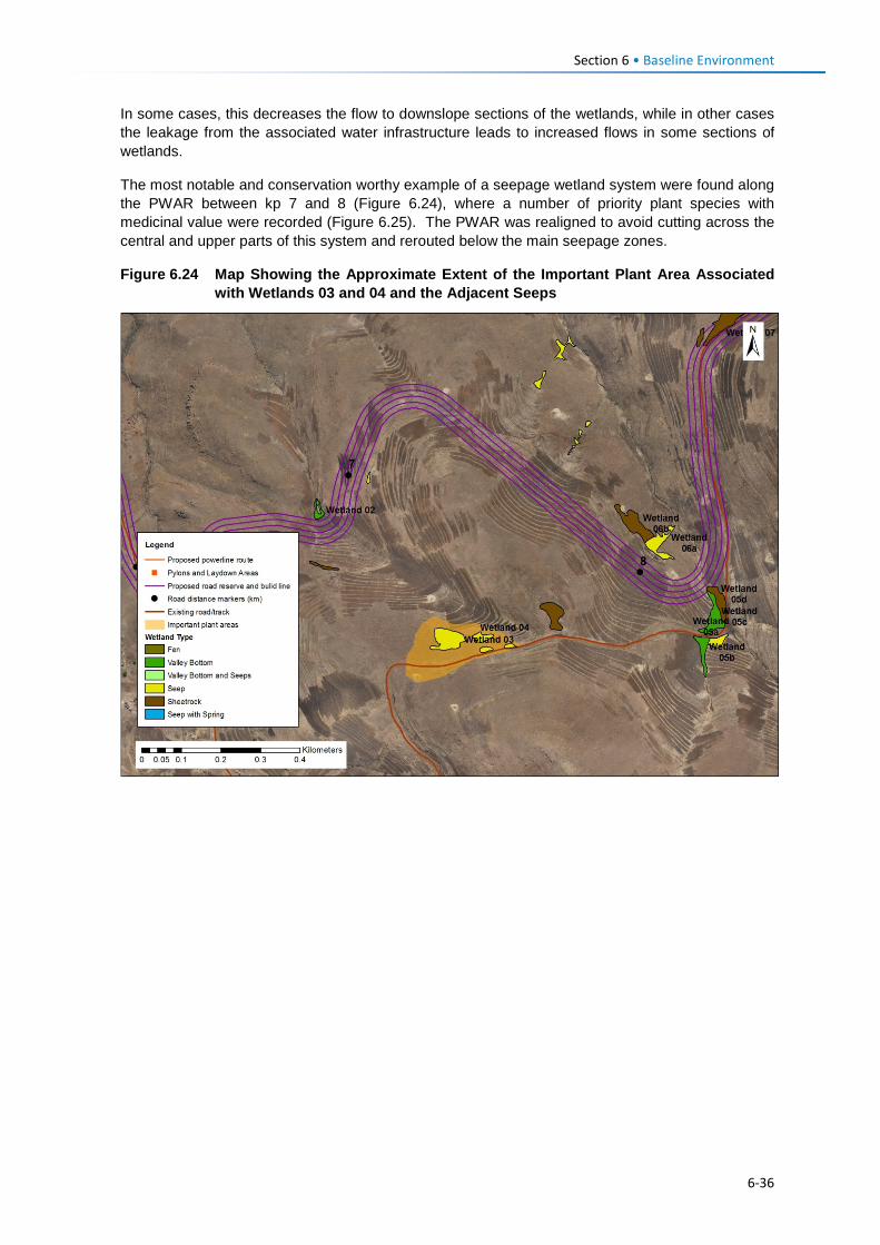
Section 6 • Baseline Environment
In some cases, this decreases the flow to downslope sections of the wetlands, while in other cases the leakage from the associated water infrastructure leads to increased flows in some sections of wetlands.
The most notable and conservation worthy example of a seepage wetland system were found along the PWAR between kp 7 and 8 (Figure 6.24), where a number of priority plant species with medicinal value were recorded (Figure 6.25). The PWAR was realigned to avoid cutting across the central and upper parts of this system and rerouted below the main seepage zones.
Figure 6.24 Map Showing the Approximate Extent of the Important Plant Area Associated with Wetlands 03 and 04 and the Adjacent Seeps
6-36
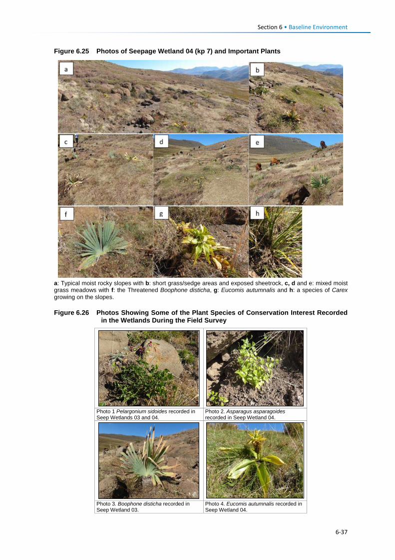
Section 6 • Baseline Environment
Figure 6.25 Photos of Seepage Wetland 04 (kp 7) and Important Plants
a: Typical moist rocky slopes with b: short grass/sedge areas and exposed sheetrock, c, d and e: mixed moist grass meadows with f: the Threatened Boophone disticha, g: Eucomis autumnalis and h: a species of Carex growing on the slopes. Figure 6.26 Photos Showing Some of the Plant Species of Conservation Interest Recorded
in the Wetlands During the Field Survey
Photo 1 Pelargonium sidoides recorded in Seep Wetlands 03 and 04.
Photo 2. Asparagus asparagoides recorded in Seep Wetland 04.
Photo 3. Boophone disticha recorded in Seep Wetland 03.
Photo 4. Eucomis autumnalis recorded in Seep Wetland 04.
6-37
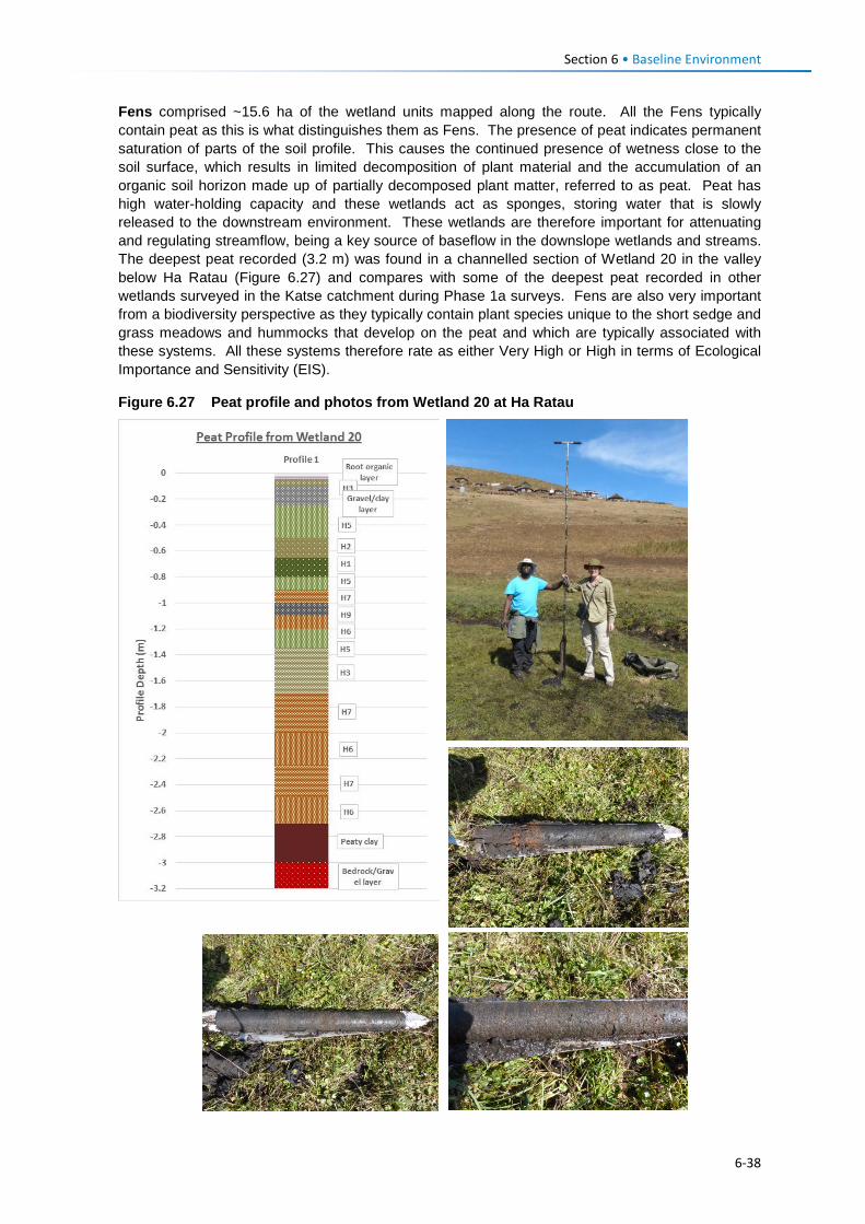
Section 6 • Baseline Environment
Fens comprised ~15.6 ha of the wetland units mapped along the route. All the Fens typically contain peat as this is what distinguishes them as Fens. The presence of peat indicates permanent saturation of parts of the soil profile. This causes the continued presence of wetness close to the soil surface, which results in limited decomposition of plant material and the accumulation of an organic soil horizon made up of partially decomposed plant matter, referred to as peat. Peat has high water-holding capacity and these wetlands act as sponges, storing water that is slowly released to the downstream environment. These wetlands are therefore important for attenuating and regulating streamflow, being a key source of baseflow in the downslope wetlands and streams. The deepest peat recorded (3.2 m) was found in a channelled section of Wetland 20 in the valley below Ha Ratau (Figure 6.27) and compares with some of the deepest peat recorded in other wetlands surveyed in the Katse catchment during Phase 1a surveys. Fens are also very important from a biodiversity perspective as they typically contain plant species unique to the short sedge and grass meadows and hummocks that develop on the peat and which are typically associated with these systems. All these systems therefore rate as either Very High or High in terms of Ecological Importance and Sensitivity (EIS).
Figure 6.27 Peat profile and photos from Wetland 20 at Ha Ratau
6-38
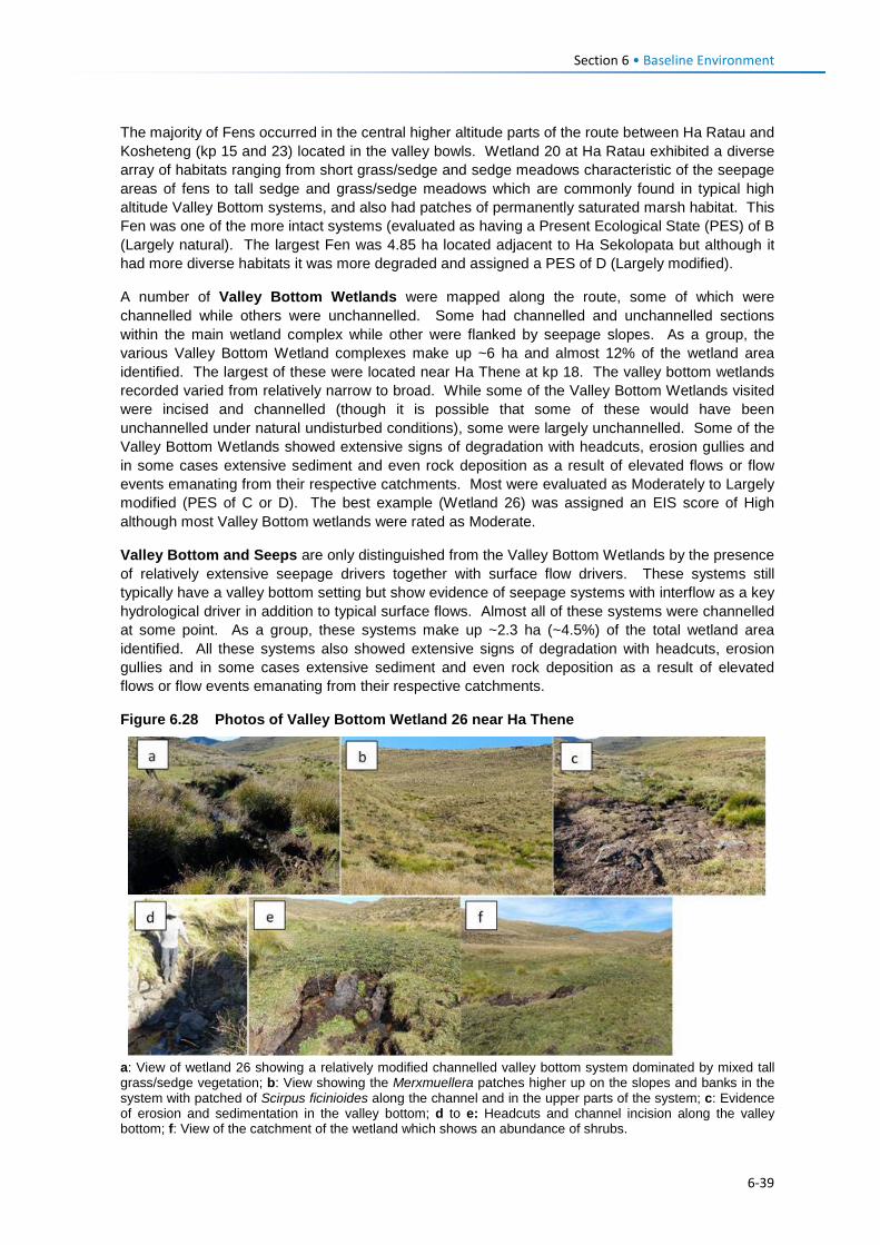
Section 6 • Baseline Environment
The majority of Fens occurred in the central higher altitude parts of the route between Ha Ratau and Kosheteng (kp 15 and 23) located in the valley bowls. Wetland 20 at Ha Ratau exhibited a diverse array of habitats ranging from short grass/sedge and sedge meadows characteristic of the seepage areas of fens to tall sedge and grass/sedge meadows which are commonly found in typical high altitude Valley Bottom systems, and also had patches of permanently saturated marsh habitat. This Fen was one of the more intact systems (evaluated as having a Present Ecological State (PES) of B (Largely natural). The largest Fen was 4.85 ha located adjacent to Ha Sekolopata but although it had more diverse habitats it was more degraded and assigned a PES of D (Largely modified).
A number of Valley Bottom Wetlands were mapped along the route, some of which were channelled while others were unchannelled. Some had channelled and unchannelled sections within the main wetland complex while other were flanked by seepage slopes. As a group, the various Valley Bottom Wetland complexes make up ~6 ha and almost 12% of the wetland area identified. The largest of these were located near Ha Thene at kp 18. The valley bottom wetlands recorded varied from relatively narrow to broad. While some of the Valley Bottom Wetlands visited were incised and channelled (though it is possible that some of these would have been unchannelled under natural undisturbed conditions), some were largely unchannelled. Some of the Valley Bottom Wetlands showed extensive signs of degradation with headcuts, erosion gullies and in some cases extensive sediment and even rock deposition as a result of elevated flows or flow events emanating from their respective catchments. Most were evaluated as Moderately to Largely modified (PES of C or D). The best example (Wetland 26) was assigned an EIS score of High although most Valley Bottom wetlands were rated as Moderate.
Valley Bottom and Seeps are only distinguished from the Valley Bottom Wetlands by the presence of relatively extensive seepage drivers together with surface flow drivers. These systems still typically have a valley bottom setting but show evidence of seepage systems with interflow as a key hydrological driver in addition to typical surface flows. Almost all of these systems were channelled at some point. As a group, these systems make up ~2.3 ha (~4.5%) of the total wetland area identified. All these systems also showed extensive signs of degradation with headcuts, erosion gullies and in some cases extensive sediment and even rock deposition as a result of elevated flows or flow events emanating from their respective catchments.
Figure 6.28 Photos of Valley Bottom Wetland 26 near Ha Thene
a: View of wetland 26 showing a relatively modified channelled valley bottom system dominated by mixed tall grass/sedge vegetation; b: View showing the Merxmuellera patches higher up on the slopes and banks in the system with patched of Scirpus ficinioides along the channel and in the upper parts of the system; c: Evidence of erosion and sedimentation in the valley bottom; d to e: Headcuts and channel incision along the valley bottom; f: View of the catchment of the wetland which shows an abundance of shrubs.
6-39
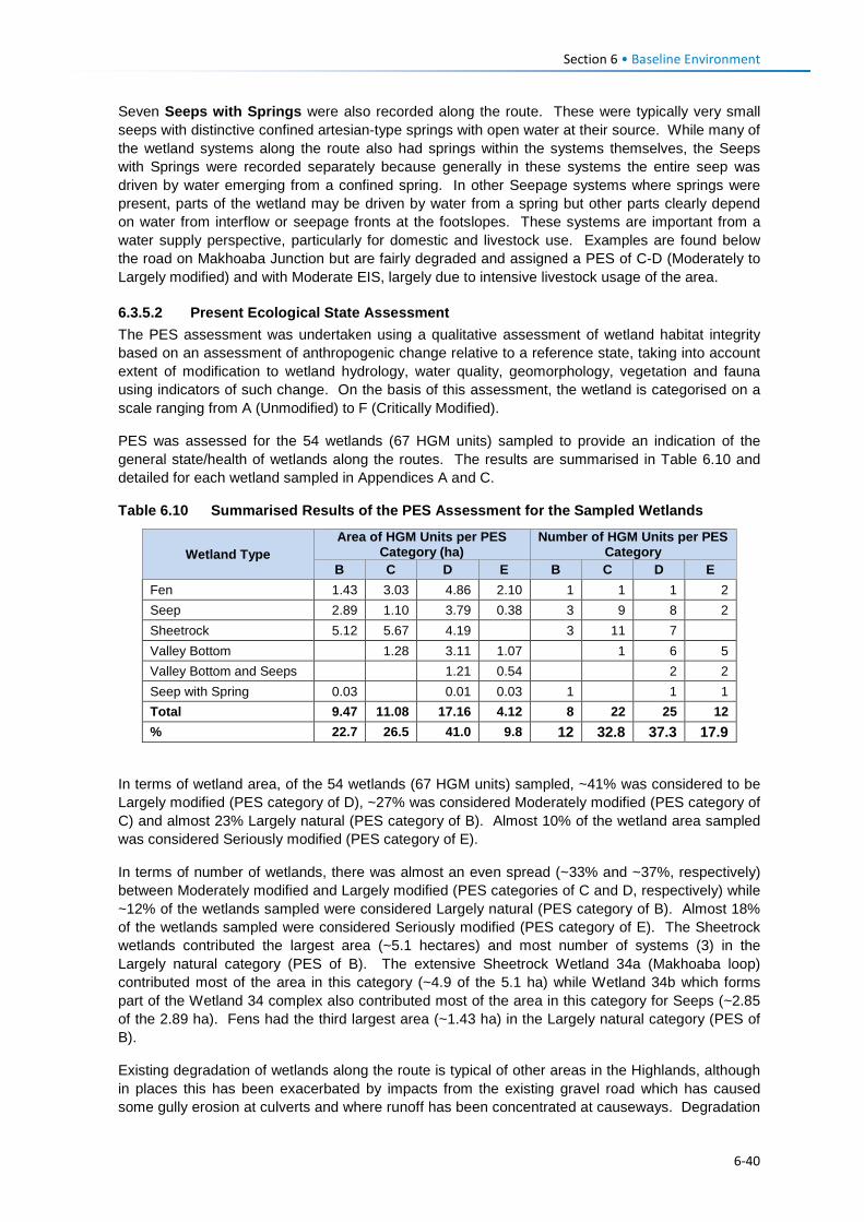
Section 6 • Baseline Environment
Seven Seeps with Springs were also recorded along the route. These were typically very small seeps with distinctive confined artesian-type springs with open water at their source. While many of the wetland systems along the route also had springs within the systems themselves, the Seeps with Springs were recorded separately because generally in these systems the entire seep was driven by water emerging from a confined spring. In other Seepage systems where springs were present, parts of the wetland may be driven by water from a spring but other parts clearly depend on water from interflow or seepage fronts at the footslopes. These systems are important from a water supply perspective, particularly for domestic and livestock use. Examples are found below the road on Makhoaba Junction but are fairly degraded and assigned a PES of C-D (Moderately to Largely modified) and with Moderate EIS, largely due to intensive livestock usage of the area.
6.3.5.2 Present Ecological State Assessment The PES assessment was undertaken using a qualitative assessment of wetland habitat integrity based on an assessment of anthropogenic change relative to a reference state, taking into account extent of modification to wetland hydrology, water quality, geomorphology, vegetation and fauna using indicators of such change. On the basis of this assessment, the wetland is categorised on a scale ranging from A (Unmodified) to F (Critically Modified).
PES was assessed for the 54 wetlands (67 HGM units) sampled to provide an indication of the general state/health of wetlands along the routes. The results are summarised in Table 6.10 and detailed for each wetland sampled in Appendices A and C.
Table 6.10 Summarised Results of the PES Assessment for the Sampled Wetlands
Wetland Type Area of HGM Units per PES
Category (ha) Number of HGM Units per PES
Category B C D E B C D E
Fen 1.43 3.03 4.86 2.10 1 1 1 2 Seep 2.89 1.10 3.79 0.38 3 9 8 2 Sheetrock 5.12 5.67 4.19 3 11 7 Valley Bottom 1.28 3.11 1.07 1 6 5 Valley Bottom and Seeps 1.21 0.54 2 2 Seep with Spring 0.03 0.01 0.03 1 1 1 Total 9.47 11.08 17.16 4.12 8 22 25 12 % 22.7 26.5 41.0 9.8 12 32.8 37.3 17.9
In terms of wetland area, of the 54 wetlands (67 HGM units) sampled, ~41% was considered to be Largely modified (PES category of D), ~27% was considered Moderately modified (PES category of C) and almost 23% Largely natural (PES category of B). Almost 10% of the wetland area sampled was considered Seriously modified (PES category of E).
In terms of number of wetlands, there was almost an even spread (~33% and ~37%, respectively) between Moderately modified and Largely modified (PES categories of C and D, respectively) while ~12% of the wetlands sampled were considered Largely natural (PES category of B). Almost 18% of the wetlands sampled were considered Seriously modified (PES category of E). The Sheetrock wetlands contributed the largest area (~5.1 hectares) and most number of systems (3) in the Largely natural category (PES of B). The extensive Sheetrock Wetland 34a (Makhoaba loop) contributed most of the area in this category (~4.9 of the 5.1 ha) while Wetland 34b which forms part of the Wetland 34 complex also contributed most of the area in this category for Seeps (~2.85 of the 2.89 ha). Fens had the third largest area (~1.43 ha) in the Largely natural category (PES of B).
Existing degradation of wetlands along the route is typical of other areas in the Highlands, although in places this has been exacerbated by impacts from the existing gravel road which has caused some gully erosion at culverts and where runoff has been concentrated at causeways. Degradation
6-40
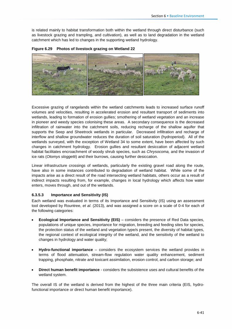
Section 6 • Baseline Environment
is related mainly to habitat transformation both within the wetland through direct disturbance (such as livestock grazing and trampling, and cultivation), as well as to land degradation in the wetland catchment which has led to changes in the supporting wetland hydrology.
Figure 6.29 Photos of livestock grazing on Wetland 22
Excessive grazing of rangelands within the wetland catchments leads to increased surface runoff volumes and velocities, resulting in accelerated erosion and resultant transport of sediments into wetlands, leading to formation of erosion gullies; smothering of wetland vegetation and an increase in pioneer and weedy species colonising these areas. A secondary consequence is the decreased infiltration of rainwater into the catchment soils, reducing recharge of the shallow aquifer that supports the Seep and Sheetrock wetlands in particular. Decreased infiltration and recharge of interflow and shallow groundwater reduces the duration of soil saturation (hydroperiod). All of the wetlands surveyed, with the exception of Wetland 34 to some extent, have been affected by such changes in catchment hydrology. Erosion gullies and resultant desiccation of adjacent wetland habitat facilitates encroachment of woody shrub species, such as Chrysocoma, and the invasion of ice rats (Otomys sloggetti) and their burrows, causing further desiccation.
Linear infrastructure crossings of wetlands, particularly the existing gravel road along the route, have also in some instances contributed to degradation of wetland habitat. While some of the impacts arise as a direct result of the road intersecting wetland habitats, others occur as a result of indirect impacts resulting from, for example, changes in local hydrology which affects how water enters, moves through, and out of the wetlands.
6.3.5.3 Importance and Sensitivity (IS) Each wetland was evaluated in terms of its Importance and Sensitivity (IS) using an assessment tool developed by Rountree, et al. (2013), and was assigned a score on a scale of 0-4 for each of the following categories:
• Ecological Importance and Sensitivity (EIS) – considers the presence of Red Data species, populations of unique species, importance for migration, breeding and feeding sites for species, the protection status of the wetland and vegetation type/s present, the diversity of habitat types, the regional context of ecological integrity of the wetland, and the sensitivity of the wetland to changes in hydrology and water quality;
• Hydro-functional importance – considers the ecosystem services the wetland provides in terms of flood attenuation, stream-flow regulation water quality enhancement, sediment trapping, phosphate, nitrate and toxicant assimilation, erosion control, and carbon storage; and
• Direct human benefit importance - considers the subsistence uses and cultural benefits of the wetland system.
The overall IS of the wetland is derived from the highest of the three main criteria (EIS, hydro-functional importance or direct human benefit importance).
6-41
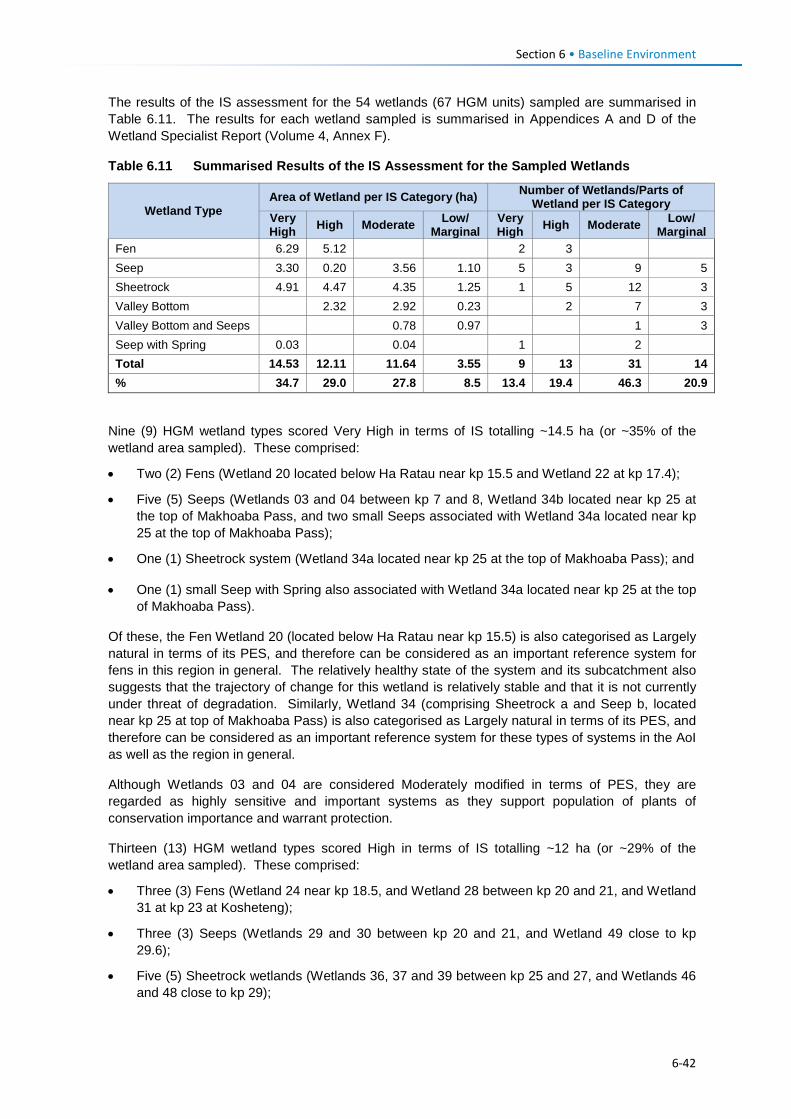
Section 6 • Baseline Environment
The results of the IS assessment for the 54 wetlands (67 HGM units) sampled are summarised in Table 6.11. The results for each wetland sampled is summarised in Appendices A and D of the Wetland Specialist Report (Volume 4, Annex F).
Table 6.11 Summarised Results of the IS Assessment for the Sampled Wetlands
Wetland Type Area of Wetland per IS Category (ha) Number of Wetlands/Parts of
Wetland per IS Category Very High High Moderate Low/
Marginal Very High High Moderate Low/
Marginal Fen 6.29 5.12 2 3 Seep 3.30 0.20 3.56 1.10 5 3 9 5 Sheetrock 4.91 4.47 4.35 1.25 1 5 12 3 Valley Bottom 2.32 2.92 0.23 2 7 3 Valley Bottom and Seeps 0.78 0.97 1 3 Seep with Spring 0.03 0.04 1 2 Total 14.53 12.11 11.64 3.55 9 13 31 14 % 34.7 29.0 27.8 8.5 13.4 19.4 46.3 20.9
Nine (9) HGM wetland types scored Very High in terms of IS totalling ~14.5 ha (or ~35% of the wetland area sampled). These comprised:
• Two (2) Fens (Wetland 20 located below Ha Ratau near kp 15.5 and Wetland 22 at kp 17.4);
• Five (5) Seeps (Wetlands 03 and 04 between kp 7 and 8, Wetland 34b located near kp 25 at the top of Makhoaba Pass, and two small Seeps associated with Wetland 34a located near kp 25 at the top of Makhoaba Pass);
• One (1) Sheetrock system (Wetland 34a located near kp 25 at the top of Makhoaba Pass); and
• One (1) small Seep with Spring also associated with Wetland 34a located near kp 25 at the top of Makhoaba Pass).
Of these, the Fen Wetland 20 (located below Ha Ratau near kp 15.5) is also categorised as Largely natural in terms of its PES, and therefore can be considered as an important reference system for fens in this region in general. The relatively healthy state of the system and its subcatchment also suggests that the trajectory of change for this wetland is relatively stable and that it is not currently under threat of degradation. Similarly, Wetland 34 (comprising Sheetrock a and Seep b, located near kp 25 at top of Makhoaba Pass) is also categorised as Largely natural in terms of its PES, and therefore can be considered as an important reference system for these types of systems in the AoI as well as the region in general.
Although Wetlands 03 and 04 are considered Moderately modified in terms of PES, they are regarded as highly sensitive and important systems as they support population of plants of conservation importance and warrant protection.
Thirteen (13) HGM wetland types scored High in terms of IS totalling ~12 ha (or ~29% of the wetland area sampled). These comprised:
• Three (3) Fens (Wetland 24 near kp 18.5, and Wetland 28 between kp 20 and 21, and Wetland 31 at kp 23 at Kosheteng);
• Three (3) Seeps (Wetlands 29 and 30 between kp 20 and 21, and Wetland 49 close to kp 29.6);
• Five (5) Sheetrock wetlands (Wetlands 36, 37 and 39 between kp 25 and 27, and Wetlands 46 and 48 close to kp 29);
6-42
Section 6 • Baseline Environment
• Two (2) Valley Bottom systems (Wetland 29 at kp 11.5 adjacent to the school and Wetland 26 west of kp 19).
6.3.5.4 Functional Assessment All of the wetlands are located within an area heavily utilised by local residents for livestock grazing and cultivation mainly, both of which also take place within the wetlands visited. As such many of the local residents are directly dependent on the wetlands for:
• Water provision, either for domestic or livestock use;
• Subsistence agriculture;
• Provision of natural harvestable resources such as medicinal plants, thatching and other materials; and
• Livestock grazing - wetlands play a very important role in providing forage for livestock especially during winter when grassland biomass has been depleted (Lewis et al., 2015).
The summarised results of the WET-EcoServices (Kotze et al., 2007) assessment are shown in Table 6.12 and illustrated in Figure 6.30, where scores refer to 0-1 Low / Marginal; 1-2 Moderate; 2-3 High and 3-4 Very High functional value.
Wetlands were grouped according to wetland type for the purpose of this assessment – similar wetlands in similar setting are expected to perform similar functions.
A number of important ecosystem services are highlighted by the results. These include:
Biodiversity maintenance – All of the wetlands play an important role in the maintenance of biodiversity with the Fens and Sheetrock systems scoring highest (3.5 and 3.3, respectively) followed by Seeps (3.0). In particular, Wetland 22 (fen at kp 17.4) and Wetland 34 (Sheetrock between kp 24.6 and 25.3) has a diversity of habitats and plant species. Wetlands 03 and 04 (between kp 7 and 8) - both Seeps - support plant species of conservation importance. They also provide feeding areas and surface water to species occurring in the surrounding landscape. Large numbers of the Southern Bald Ibis were observed feeding within the wetland areas on site, as well as migratory species such as the White Stork;
Sediment trapping – The high erosion rates observed within the area imply that significant volumes of sediment enter the wetlands on site. The increased vegetation cover of the wetlands and the generally lower energy environments allow these systems to trap sediments. Extensive sediment trapping was evident in the Valley Bottom wetland (Wetlands 12b and 13) at kp 11.5. However, the degradation of wetland habitat and changes to the supporting hydrology have also resulted in many wetlands in the AoI becoming sources of sediment;
Water quality maintenance – Seeps are ideally placed to play a role in water quality maintenance. The diffuse, subsurface nature of flows through the systems allows for extended contact time between incoming flows and wetland sediments and plants, providing ample opportunity for the trapping and breakdown of a range of contaminants, including nitrates and phosphates, contaminants potentially associated with villages, livestock kraals and cultivated fields that often occur in close proximity to wetlands; and
Streamflow regulation – This function is specifically attributed to the fens as well as many of the Seeps including those with Springs. Interflow plays an important role in the seasonality of flow, and in particular, contributes to baseflow in river systems and streams.
The wetlands of the area in general therefore play an important role in supporting ecosystem services and livelihoods. In addition, within a generally heavily degraded and ecologically impoverished landscape, the wetlands provide a different habitat within a mosaic of grassland communities that contribute to overall biodiversity.
6-43
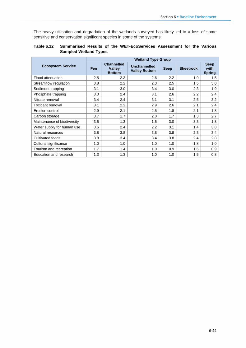
Section 6 • Baseline Environment
The heavy utilisation and degradation of the wetlands surveyed has likely led to a loss of some sensitive and conservation significant species in some of the systems.
Table 6.12 Summarised Results of the WET-EcoServices Assessment for the Various Sampled Wetland Types
Ecosystem Service
Wetland Type Group
Fen Channelled
Valley Bottom
Unchannelled Valley Bottom Seep Sheetrock
Seep with
Spring Flood attenuation 2.5 2.3 2.6 2.2 1.9 1.5 Streamflow regulation 3.8 2.2 2.3 2.5 1.5 3.0 Sediment trapping 3.1 3.0 3.4 3.0 2.3 1.9 Phosphate trapping 3.0 2.4 3.1 2.6 2.2 2.4 Nitrate removal 3.4 2.4 3.1 3.1 2.5 3.2 Toxicant removal 3.1 2.2 2.9 2.6 2.1 2.4 Erosion control 2.9 2.1 2.5 1.8 2.1 1.8 Carbon storage 3.7 1.7 2.0 1.7 1.3 2.7 Maintenance of biodiversity 3.5 1.3 1.5 3.0 3.3 1.8 Water supply for human use 3.6 2.4 2.2 3.1 1.4 3.8 Natural resources 3.8 3.8 3.8 3.8 2.8 3.4 Cultivated foods 3.8 3.4 3.4 3.8 2.4 2.8 Cultural significance 1.0 1.0 1.0 1.0 1.8 1.0 Tourism and recreation 1.7 1.4 1.0 0.9 1.6 0.9 Education and research 1.3 1.3 1.0 1.0 1.5 0.8
6-44
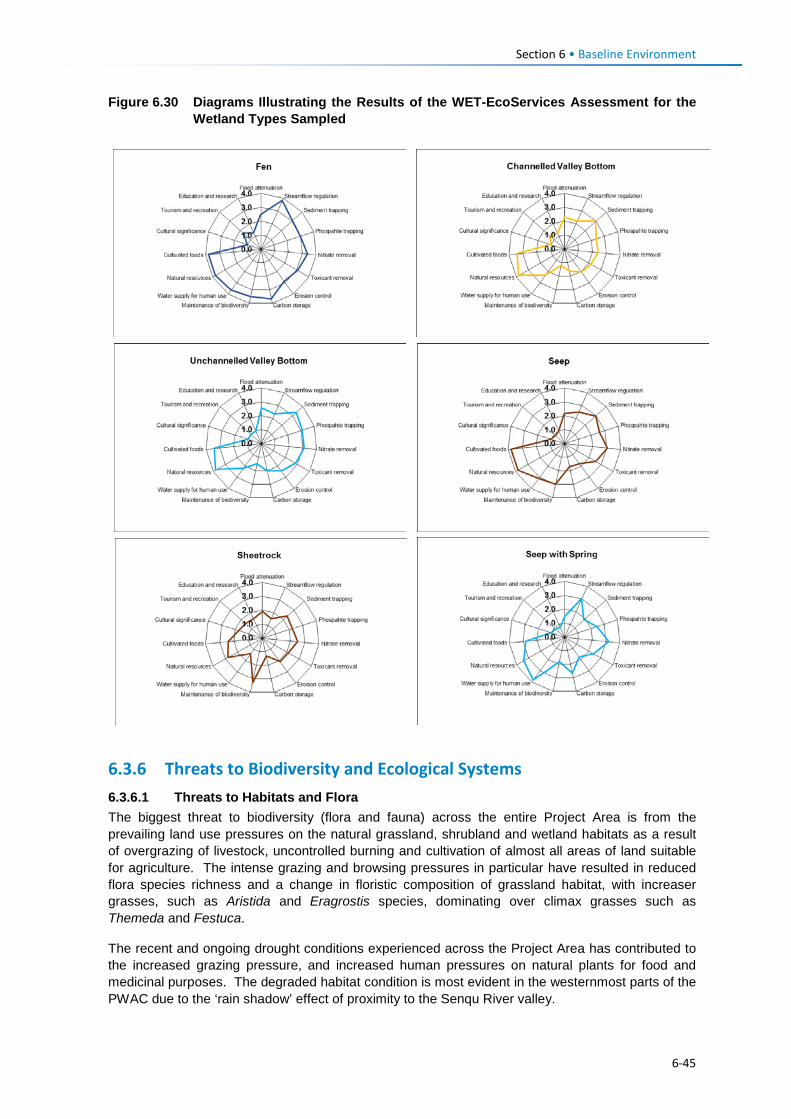
Section 6 • Baseline Environment
Figure 6.30 Diagrams Illustrating the Results of the WET-EcoServices Assessment for the Wetland Types Sampled
6.3.6 Threats to Biodiversity and Ecological Systems 6.3.6.1 Threats to Habitats and Flora The biggest threat to biodiversity (flora and fauna) across the entire Project Area is from the prevailing land use pressures on the natural grassland, shrubland and wetland habitats as a result of overgrazing of livestock, uncontrolled burning and cultivation of almost all areas of land suitable for agriculture. The intense grazing and browsing pressures in particular have resulted in reduced flora species richness and a change in floristic composition of grassland habitat, with increaser grasses, such as Aristida and Eragrostis species, dominating over climax grasses such as Themeda and Festuca.
The recent and ongoing drought conditions experienced across the Project Area has contributed to the increased grazing pressure, and increased human pressures on natural plants for food and medicinal purposes. The degraded habitat condition is most evident in the westernmost parts of the PWAC due to the ‘rain shadow’ effect of proximity to the Senqu River valley.
6-45
Section 6 • Baseline Environment
The rate of degradation across the Project Area is not easy to quantify, although remote sensing-based land cover analysis between 1993 and 2013 (Turpie et al., 2014) in the western two thirds of the route does provide an indication of background rates of change.
Additional threats to flora and faunal habitats stem from harvesting pressures of indigenous woody shrubs for firewood, particularly on the hillsides near villages. Main species targeted for fuel include Chrysocoma ciliata, Euryops tysonii, Artemisia afra, Inulanthera thodei, Searsia divaricata, Searsia erosa, Pentzia cooperi, Rhamnus prinoides, Felicia filifolia and other Searsia species.
6.3.6.2 Threats to Wetlands Threats to wetlands are described under Section 6.3.5.2 above. These included:
• Livestock grazing resulting in trampling, denudation of vegetation and formation of erosion nick points;
• Channelling of runoff through culverts from roads near wetlands causing erosion gullies to form;
• Cultivation of wetland habitat resulting in transformation of habitat and trampling. Erosion gullies, once they start, create a preferential flow path for water runoff from and through a wetland, lowering the water table and leading to desiccation of wetland substrate. This creates conditions for woody shrub invasion and ice rats to burrow into wetland margins, further reducing water retention in wetlands and increasing the rate of desiccation. These effects combine to reduce flow attenuation resulting in more rapid runoff of water and increased sedimentation to downstream aquatic ecosystems.
6.3.6.3 Threats to Fauna Habitat degradation is the biggest threat to fauna diversity and abundance in Lesotho, as indicated in Section 6.3.6.1.
Mammals Most indigenous mammals are considered to be under threat in Lesotho. Specific threats to mammals include hunting by livestock herders and their dogs (Du Plessis et al., 2014) for food or for body parts for medicinal or cultural purposes (Avenant, 2007). While it appears reptiles and amphibians are not targeted specifically for food or medicine, the diversity and abundance of snakes is low as they are considered dangerous and killed wherever possible (CES, 2014b).
Reptiles and Amphibians Discussions with locals concerning utilisation of reptiles and amphibians as food or for traditional medicine revealed that these were not utilised in any way, although all snakes were considered dangerous and were killed wherever possible (CES, 2014b). Dogs were regularly encountered, either in packs with livestock herders or singly, and it is likely that they hunt any small fauna that they find, but it is not certain how significant an impact or threat this is.
The greatest threat to herpetofauna along the PWAC is likely to be habitat loss or degradation, particularly degradation of grassland, wetland and stream habitats through severe overgrazing. Localised threats on herpetofauna habitat may arise from localised river pollution from point sources such as sheep dips which may have water quality impacts.
Birds The unique avifauna of the Lesotho Highlands generally, and of the PWAC development area more specifically, is threatened by a variety of anthropogenic factors:
• Bearded and Cape Vulture populations are severely affected by the scourge of poisoning (Allan, 2015; Krüger, 2015) and are likely to suffer mortality in collisions with existing powerlines;
6-46
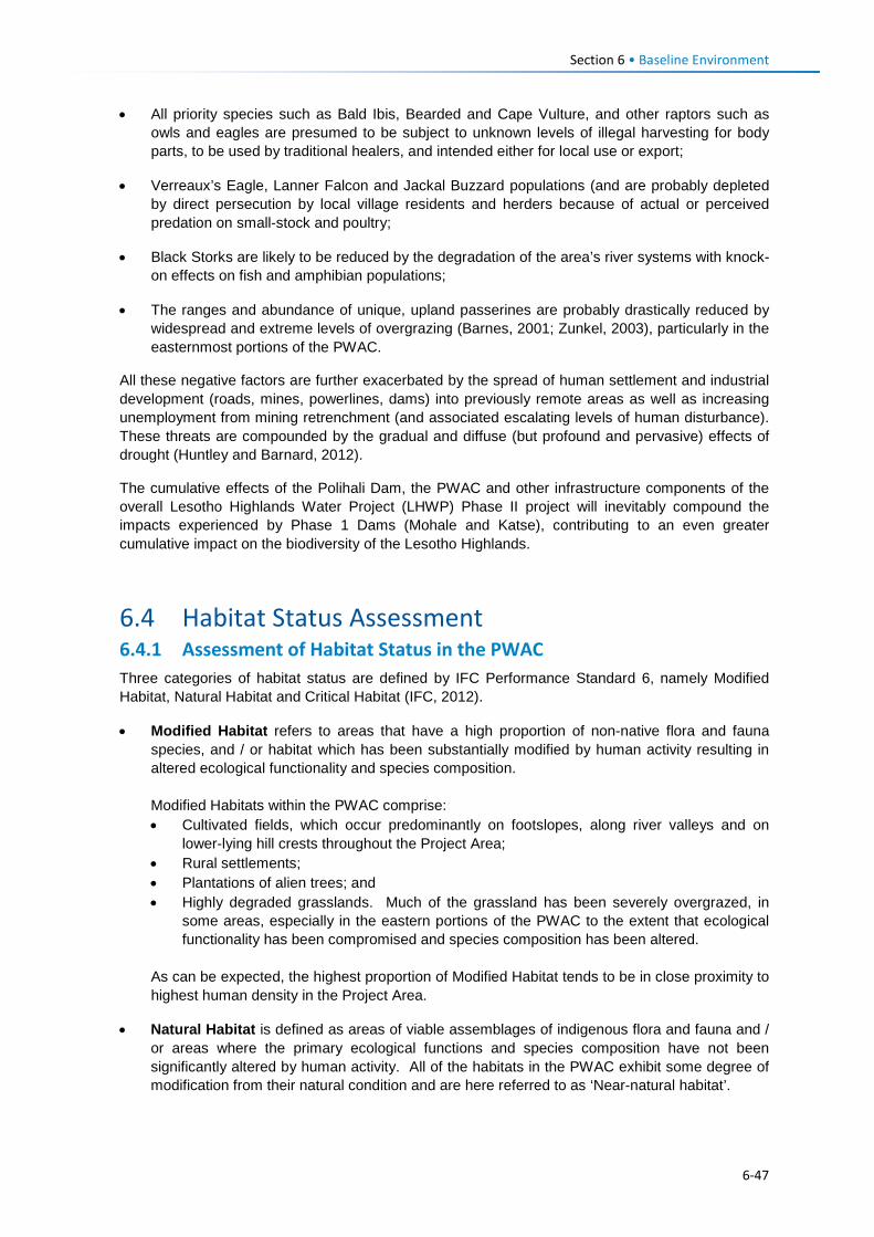
Section 6 • Baseline Environment
• All priority species such as Bald Ibis, Bearded and Cape Vulture, and other raptors such as owls and eagles are presumed to be subject to unknown levels of illegal harvesting for body parts, to be used by traditional healers, and intended either for local use or export;
• Verreaux’s Eagle, Lanner Falcon and Jackal Buzzard populations (and are probably depleted by direct persecution by local village residents and herders because of actual or perceived predation on small-stock and poultry;
• Black Storks are likely to be reduced by the degradation of the area’s river systems with knock-on effects on fish and amphibian populations;
• The ranges and abundance of unique, upland passerines are probably drastically reduced by widespread and extreme levels of overgrazing (Barnes, 2001; Zunkel, 2003), particularly in the easternmost portions of the PWAC.
All these negative factors are further exacerbated by the spread of human settlement and industrial development (roads, mines, powerlines, dams) into previously remote areas as well as increasing unemployment from mining retrenchment (and associated escalating levels of human disturbance). These threats are compounded by the gradual and diffuse (but profound and pervasive) effects of drought (Huntley and Barnard, 2012).
The cumulative effects of the Polihali Dam, the PWAC and other infrastructure components of the overall Lesotho Highlands Water Project (LHWP) Phase II project will inevitably compound the impacts experienced by Phase 1 Dams (Mohale and Katse), contributing to an even greater cumulative impact on the biodiversity of the Lesotho Highlands.
6.4 Habitat Status Assessment 6.4.1 Assessment of Habitat Status in the PWAC Three categories of habitat status are defined by IFC Performance Standard 6, namely Modified Habitat, Natural Habitat and Critical Habitat (IFC, 2012).
• Modified Habitat refers to areas that have a high proportion of non-native flora and fauna species, and / or habitat which has been substantially modified by human activity resulting in altered ecological functionality and species composition. Modified Habitats within the PWAC comprise: • Cultivated fields, which occur predominantly on footslopes, along river valleys and on
lower-lying hill crests throughout the Project Area; • Rural settlements; • Plantations of alien trees; and • Highly degraded grasslands. Much of the grassland has been severely overgrazed, in
some areas, especially in the eastern portions of the PWAC to the extent that ecological functionality has been compromised and species composition has been altered.
As can be expected, the highest proportion of Modified Habitat tends to be in close proximity to highest human density in the Project Area.
• Natural Habitat is defined as areas of viable assemblages of indigenous flora and fauna and / or areas where the primary ecological functions and species composition have not been significantly altered by human activity. All of the habitats in the PWAC exhibit some degree of modification from their natural condition and are here referred to as ‘Near-natural habitat’.
6-47
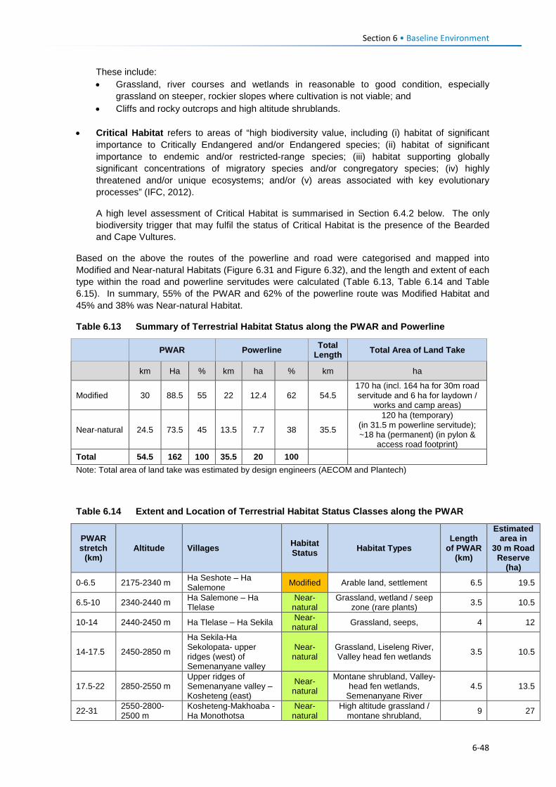
Section 6 • Baseline Environment
These include: • Grassland, river courses and wetlands in reasonable to good condition, especially
grassland on steeper, rockier slopes where cultivation is not viable; and • Cliffs and rocky outcrops and high altitude shrublands.
• Critical Habitat refers to areas of “high biodiversity value, including (i) habitat of significant
importance to Critically Endangered and/or Endangered species; (ii) habitat of significant importance to endemic and/or restricted-range species; (iii) habitat supporting globally significant concentrations of migratory species and/or congregatory species; (iv) highly threatened and/or unique ecosystems; and/or (v) areas associated with key evolutionary processes” (IFC, 2012).
A high level assessment of Critical Habitat is summarised in Section 6.4.2 below. The only biodiversity trigger that may fulfil the status of Critical Habitat is the presence of the Bearded and Cape Vultures.
Based on the above the routes of the powerline and road were categorised and mapped into Modified and Near-natural Habitats (Figure 6.31 and Figure 6.32), and the length and extent of each type within the road and powerline servitudes were calculated (Table 6.13, Table 6.14 and Table 6.15). In summary, 55% of the PWAR and 62% of the powerline route was Modified Habitat and 45% and 38% was Near-natural Habitat.
Table 6.13 Summary of Terrestrial Habitat Status along the PWAR and Powerline
PWAR Powerline Total Length Total Area of Land Take
km Ha % km ha % km ha
Modified 30 88.5 55 22 12.4 62 54.5 170 ha (incl. 164 ha for 30m road servitude and 6 ha for laydown /
works and camp areas)
Near-natural 24.5 73.5 45 13.5 7.7 38 35.5
120 ha (temporary) (in 31.5 m powerline servitude); ~18 ha (permanent) (in pylon &
access road footprint) Total 54.5 162 100 35.5 20 100 Note: Total area of land take was estimated by design engineers (AECOM and Plantech)
Table 6.14 Extent and Location of Terrestrial Habitat Status Classes along the PWAR
PWAR stretch
(km) Altitude Villages Habitat
Status Habitat Types Length
of PWAR (km)
Estimated area in
30 m Road Reserve
(ha)
0-6.5 2175-2340 m Ha Seshote – Ha Salemone Modified Arable land, settlement 6.5 19.5
6.5-10 2340-2440 m Ha Salemone – Ha Tlelase
Near-natural
Grassland, wetland / seep zone (rare plants) 3.5 10.5
10-14 2440-2450 m Ha Tlelase – Ha Sekila Near-natural Grassland, seeps, 4 12
14-17.5 2450-2850 m
Ha Sekila-Ha Sekolopata- upper ridges (west) of Semenanyane valley
Near-natural
Grassland, Liseleng River, Valley head fen wetlands 3.5 10.5
17.5-22 2850-2550 m Upper ridges of Semenanyane valley – Kosheteng (east)
Near-natural
Montane shrubland, Valley-head fen wetlands,
Semenanyane River 4.5 13.5
22-31 2550-2800-2500 m
Kosheteng-Makhoaba -Ha Monothotsa
Near-natural
High altitude grassland / montane shrubland, 9 27
6-48
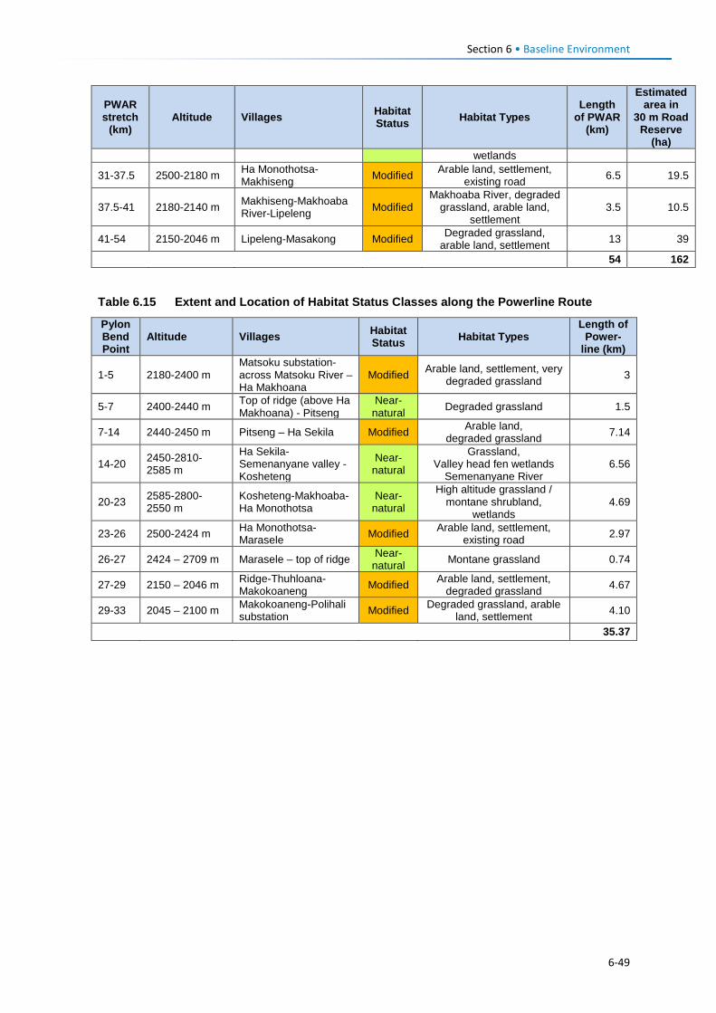
Section 6 • Baseline Environment
PWAR stretch
(km) Altitude Villages Habitat
Status Habitat Types Length
of PWAR (km)
Estimated area in
30 m Road Reserve
(ha) wetlands
31-37.5 2500-2180 m Ha Monothotsa- Makhiseng Modified Arable land, settlement,
existing road 6.5 19.5
37.5-41 2180-2140 m Makhiseng-Makhoaba River-Lipeleng Modified
Makhoaba River, degraded grassland, arable land,
settlement 3.5 10.5
41-54 2150-2046 m Lipeleng-Masakong Modified Degraded grassland, arable land, settlement 13 39
54 162
Table 6.15 Extent and Location of Habitat Status Classes along the Powerline Route
Pylon Bend Point
Altitude Villages Habitat Status Habitat Types
Length of Power-
line (km)
1-5 2180-2400 m Matsoku substation-across Matsoku River – Ha Makhoana
Modified Arable land, settlement, very degraded grassland 3
5-7 2400-2440 m Top of ridge (above Ha Makhoana) - Pitseng
Near-natural Degraded grassland 1.5
7-14 2440-2450 m Pitseng – Ha Sekila Modified Arable land, degraded grassland 7.14
14-20 2450-2810-2585 m
Ha Sekila-Semenanyane valley - Kosheteng
Near-natural
Grassland, Valley head fen wetlands
Semenanyane River 6.56
20-23 2585-2800-2550 m
Kosheteng-Makhoaba-Ha Monothotsa
Near-natural
High altitude grassland / montane shrubland,
wetlands 4.69
23-26 2500-2424 m Ha Monothotsa- Marasele Modified Arable land, settlement,
existing road 2.97
26-27 2424 – 2709 m Marasele – top of ridge Near-natural Montane grassland 0.74
27-29 2150 – 2046 m Ridge-Thuhloana- Makokoaneng Modified Arable land, settlement,
degraded grassland 4.67
29-33 2045 – 2100 m Makokoaneng-Polihali substation Modified Degraded grassland, arable
land, settlement 4.10
35.37
6-49
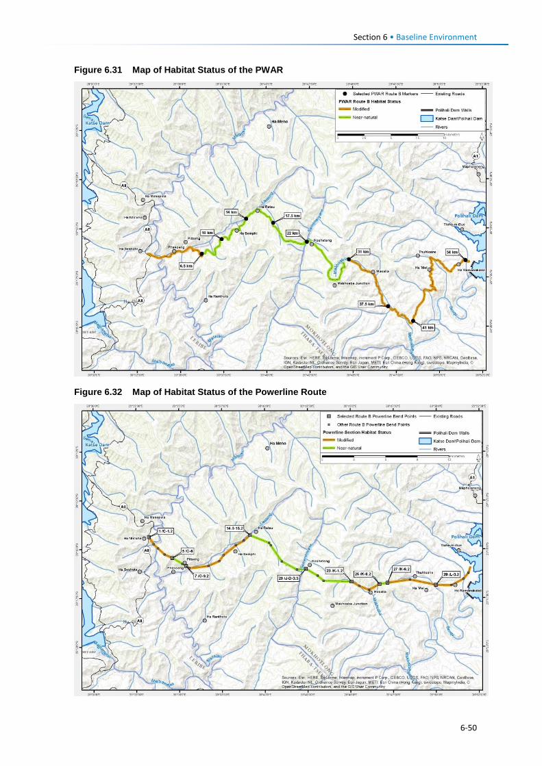
Section 6 • Baseline Environment
Figure 6.31 Map of Habitat Status of the PWAR
Figure 6.32 Map of Habitat Status of the Powerline Route
6-50
Section 6 • Baseline Environment 6.4.2 Designation of Critical Habitat 6.4.2.1 Introduction In order to trigger a classification as a Critical Habitat, IFC guidelines specify five criteria in paragraph 9 of PS6 (IFC, 2012). If a project is within an area triggered by any one of the following criteria it is designated as a Critical Habitat.
1. Critically Endangered and Endangered Species 2. Endemic and Restricted-range Species 3. Migratory and Congregatory Species 4. Highly Threatened or Unique Ecosystems 5. Key Evolutionary Processes The first three criteria have specific numerical thresholds to determine Critical Habitat status (Table 6.16) separated into Tier 1 or Tier 2 levels (where Tier 1 Critical Habitat is the highest priority for protection, in which projects may not be readily funded if high residual impacts may result). Criteria 4 and 5 are based on expert judgement taking into consideration the following aspects: Highly threatened or unique ecosystems are those (i) that are at risk of significantly decreasing in area or quality; (ii) with a small spatial extent; and/or (iii) containing unique assemblages of species including assemblages or concentrations of biome-restricted species. Areas determined to be irreplaceable or of high priority/significance based on systematic conservation planning techniques carried out at the landscape and/or regional scale by governmental bodies, recognised academic institutions and/or other relevant qualified organisations (including internationally-recognised NGOs) or that are recognised as such in existing regional or national plans, such as National Biodiversity Strategic Action Plans (NBSAPs), would qualify as Critical Habitat under Criterion 4. Critical Habitats defined by the Key Evolutionary Processes criterion are typically defined by: (i) the physical features of a landscape that might be associated with particular evolutionary processes; and/or (ii) subpopulations of species that are phylogenetically or morphogenetically distinct and may be of special conservation concern given their distinct evolutionary history. The latter includes Evolutionary Significant Units (ESUs) and Evolutionarily Distinct and Globally Endangered (EDGE) species. Examples of spatial features associated with evolutionary processes could include isolated areas (e.g., islands, mountaintops, lakes) that are associated with populations that are phylogenetically distinct; areas of high endemism often contain flora and/or fauna with unique evolutionary histories; areas on environmental gradients important for speciation with high species and genetic diversity; sites on edaphic interfaces (e.g., localised soil or geological deposits which have led to the formation of unique plant communities characterised by both rarity and endemism); sites important for connectivity to maintain species migration and gene flow in fragmented habitats and across altitudinal gradients, and sites of demonstrated importance to climate change adaptation for either species or ecosystems. The determination of Critical Habitat however is not necessarily limited to these criteria. Other recognised high biodiversity values might also support a Critical Habitat designation, and the appropriateness of this decision would be evaluated on a case-by-case basis. Examples are as follows: • Areas required for the reintroduction of CR and EN species and refuge sites for these species
(habitat used during periods of stress (e.g., flood, drought or fire));
• Ecosystems of known special significance to EN or CR species for climate adaptation purposes;
6-51
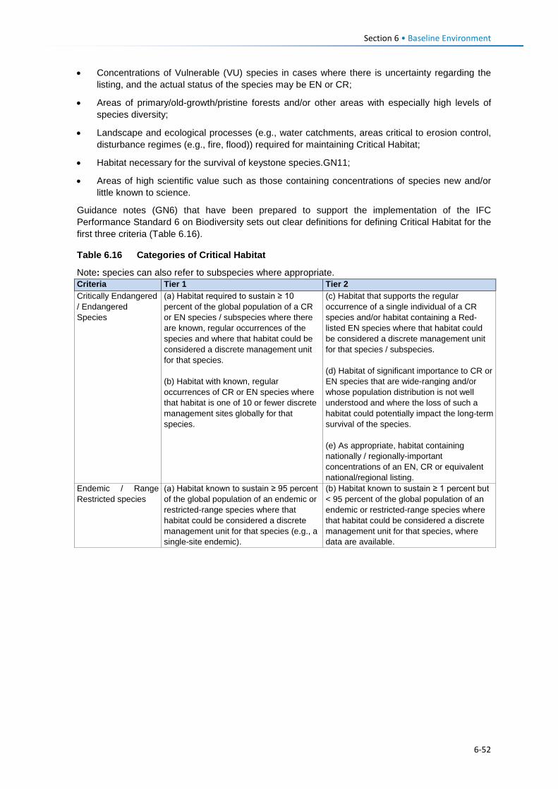
Section 6 • Baseline Environment
• Concentrations of Vulnerable (VU) species in cases where there is uncertainty regarding the listing, and the actual status of the species may be EN or CR;
• Areas of primary/old-growth/pristine forests and/or other areas with especially high levels of species diversity;
• Landscape and ecological processes (e.g., water catchments, areas critical to erosion control, disturbance regimes (e.g., fire, flood)) required for maintaining Critical Habitat;
• Habitat necessary for the survival of keystone species.GN11;
• Areas of high scientific value such as those containing concentrations of species new and/or little known to science.
Guidance notes (GN6) that have been prepared to support the implementation of the IFC Performance Standard 6 on Biodiversity sets out clear definitions for defining Critical Habitat for the first three criteria (Table 6.16).
Table 6.16 Categories of Critical Habitat
Note: species can also refer to subspecies where appropriate. Criteria Tier 1 Tier 2 Critically Endangered / Endangered Species
(a) Habitat required to sustain ≥ 10 percent of the global population of a CR or EN species / subspecies where there are known, regular occurrences of the species and where that habitat could be considered a discrete management unit for that species. (b) Habitat with known, regular occurrences of CR or EN species where that habitat is one of 10 or fewer discrete management sites globally for that species.
(c) Habitat that supports the regular occurrence of a single individual of a CR species and/or habitat containing a Red-listed EN species where that habitat could be considered a discrete management unit for that species / subspecies. (d) Habitat of significant importance to CR or EN species that are wide-ranging and/or whose population distribution is not well understood and where the loss of such a habitat could potentially impact the long-term survival of the species. (e) As appropriate, habitat containing nationally / regionally-important concentrations of an EN, CR or equivalent national/regional listing.
Endemic / Range Restricted species
(a) Habitat known to sustain ≥ 95 percent of the global population of an endemic or restricted-range species where that habitat could be considered a discrete management unit for that species (e.g., a single-site endemic).
(b) Habitat known to sustain ≥ 1 percent but < 95 percent of the global population of an endemic or restricted-range species where that habitat could be considered a discrete management unit for that species, where data are available.
6-52
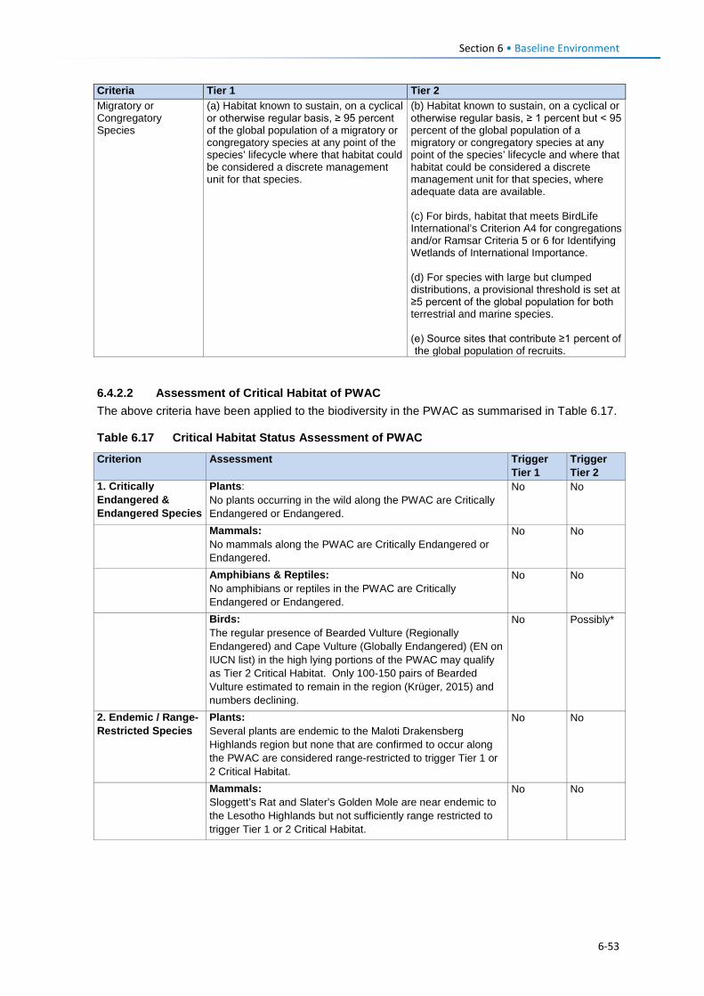
Section 6 • Baseline Environment
Criteria Tier 1 Tier 2 Migratory or Congregatory Species
(a) Habitat known to sustain, on a cyclical or otherwise regular basis, ≥ 95 percent of the global population of a migratory or congregatory species at any point of the species’ lifecycle where that habitat could be considered a discrete management unit for that species.
(b) Habitat known to sustain, on a cyclical or otherwise regular basis, ≥ 1 percent but < 95 percent of the global population of a migratory or congregatory species at any point of the species’ lifecycle and where that habitat could be considered a discrete management unit for that species, where adequate data are available. (c) For birds, habitat that meets BirdLife International’s Criterion A4 for congregations and/or Ramsar Criteria 5 or 6 for Identifying Wetlands of International Importance. (d) For species with large but clumped distributions, a provisional threshold is set at ≥5 percent of the global population for both terrestrial and marine species. (e) Source sites that contribute ≥1 percent of the global population of recruits.
6.4.2.2 Assessment of Critical Habitat of PWAC The above criteria have been applied to the biodiversity in the PWAC as summarised in Table 6.17.
Table 6.17 Critical Habitat Status Assessment of PWAC
Criterion Assessment Trigger Tier 1
Trigger Tier 2
1. Critically Endangered & Endangered Species
Plants: No plants occurring in the wild along the PWAC are Critically Endangered or Endangered.
No No
Mammals: No mammals along the PWAC are Critically Endangered or Endangered.
No No
Amphibians & Reptiles: No amphibians or reptiles in the PWAC are Critically Endangered or Endangered.
No No
Birds: The regular presence of Bearded Vulture (Regionally Endangered) and Cape Vulture (Globally Endangered) (EN on IUCN list) in the high lying portions of the PWAC may qualify as Tier 2 Critical Habitat. Only 100-150 pairs of Bearded Vulture estimated to remain in the region (Krüger, 2015) and numbers declining.
No Possibly*
2. Endemic / Range-Restricted Species
Plants: Several plants are endemic to the Maloti Drakensberg Highlands region but none that are confirmed to occur along the PWAC are considered range-restricted to trigger Tier 1 or 2 Critical Habitat.
No No
Mammals: Sloggett’s Rat and Slater’s Golden Mole are near endemic to the Lesotho Highlands but not sufficiently range restricted to trigger Tier 1 or 2 Critical Habitat.
No No
6-53
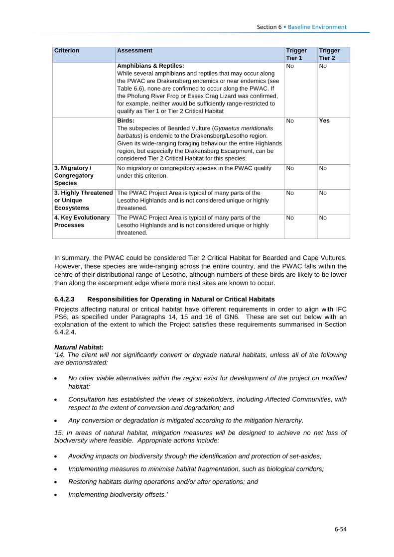
Section 6 • Baseline Environment
Criterion Assessment Trigger Tier 1
Trigger Tier 2
Amphibians & Reptiles: While several amphibians and reptiles that may occur along the PWAC are Drakensberg endemics or near endemics (see Table 6.6), none are confirmed to occur along the PWAC. If the Phofung River Frog or Essex Crag Lizard was confirmed, for example, neither would be sufficiently range-restricted to qualify as Tier 1 or Tier 2 Critical Habitat
No No
Birds: The subspecies of Bearded Vulture (Gypaetus meridionalis barbatus) is endemic to the Drakensberg/Lesotho region. Given its wide-ranging foraging behaviour the entire Highlands region, but especially the Drakensberg Escarpment, can be considered Tier 2 Critical Habitat for this species.
No Yes
3. Migratory / Congregatory Species
No migratory or congregatory species in the PWAC qualify under this criterion.
No No
3. Highly Threatened or Unique Ecosystems
The PWAC Project Area is typical of many parts of the Lesotho Highlands and is not considered unique or highly threatened.
No No
4. Key Evolutionary Processes
The PWAC Project Area is typical of many parts of the Lesotho Highlands and is not considered unique or highly threatened.
No No
In summary, the PWAC could be considered Tier 2 Critical Habitat for Bearded and Cape Vultures. However, these species are wide-ranging across the entire country, and the PWAC falls within the centre of their distributional range of Lesotho, although numbers of these birds are likely to be lower than along the escarpment edge where more nest sites are known to occur.
6.4.2.3 Responsibilities for Operating in Natural or Critical Habitats Projects affecting natural or critical habitat have different requirements in order to align with IFC PS6, as specified under Paragraphs 14, 15 and 16 of GN6. These are set out below with an explanation of the extent to which the Project satisfies these requirements summarised in Section 6.4.2.4. Natural Habitat: ‘14. The client will not significantly convert or degrade natural habitats, unless all of the following are demonstrated: • No other viable alternatives within the region exist for development of the project on modified
habitat;
• Consultation has established the views of stakeholders, including Affected Communities, with respect to the extent of conversion and degradation; and
• Any conversion or degradation is mitigated according to the mitigation hierarchy.
15. In areas of natural habitat, mitigation measures will be designed to achieve no net loss of biodiversity where feasible. Appropriate actions include: • Avoiding impacts on biodiversity through the identification and protection of set-asides;
• Implementing measures to minimise habitat fragmentation, such as biological corridors;
• Restoring habitats during operations and/or after operations; and
• Implementing biodiversity offsets.’
6-54
Section 6 • Baseline Environment
Critical Habitat: 17. In areas of critical habitat, the client will not implement any project activities unless all of the following are demonstrated:
• No other viable alternatives within the region exist for development of the project on modified or natural habitats that are not critical;
• The project does not lead to measurable adverse impacts on those biodiversity values for which the critical habitat was designated, and on the ecological processes supporting those biodiversity values;
• The project does not lead to a net reduction in the global and/or national/regional population of any Critically Endangered or Endangered species over a reasonable period of time; and
• A robust, appropriately designed, and long-term biodiversity monitoring and evaluation program is integrated into the client’s management program.
18. In such cases where a client is able to meet the requirements defined in paragraph 17, the project’s mitigation strategy will be described in a Biodiversity Action Plan and will be designed to achieve net gains of those biodiversity values for which the critical habitat was designated.
19. In instances where biodiversity offsets are proposed as part of the mitigation strategy, the client must demonstrate through an assessment that the project’s significant residual impacts on biodiversity will be adequately mitigated to meet the requirements of paragraph
6.4.2.4 Implications for the PWAC Project Natural Habitat In terms of natural habitat requirements, the PWAC will have impacts on a significant extent of ‘Near-natural Habitat’ in the central parts of the routes. However, significant rerouting of the alignments has been undertaken by the design engineers on the basis of inputs by the specialist ecology team (as described in Section 5.4.2) and which will successfully minimise potential impacts on important biodiversity features. As a result all ecological impacts of the Project are reduced to an acceptable level through the feasible mitigation measures that have been identified in this ESIS. Critical Habitat The first bullet under Paragraph 17 above requires developers to seek to avoid Critical Habitat as the first step in demonstrating compliance with the mitigation hierarchy.
In the case of the PWAC project, the presence of threatened Bearded and Cape Vultures as wide-ranging species that regularly occur across the Lesotho Highlands may trigger Critical Habitat. As described in Section 5, it can clearly be demonstrated that the developer (LHDA) has taken significant steps to minimise project risks to these species by rerouting the powerline to a least impact alignment due to the high bird risks posed by the original alignment along Route C and D. The impact of the current powerline route on bird collision risks is assessed in Section 12.3.4 and with additional mitigation is predicted to result in an acceptable level of risk (i.e., residual impact of moderate significance).
6-55
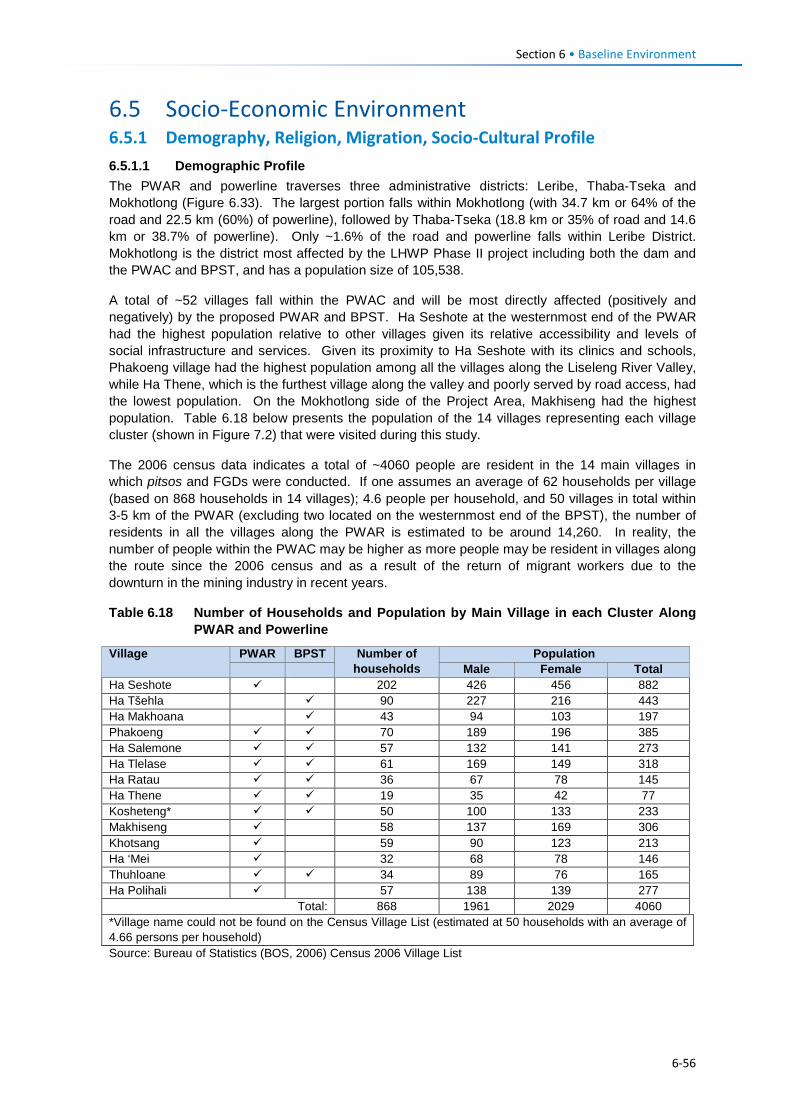
Section 6 • Baseline Environment
6.5 Socio-Economic Environment 6.5.1 Demography, Religion, Migration, Socio-Cultural Profile 6.5.1.1 Demographic Profile The PWAR and powerline traverses three administrative districts: Leribe, Thaba-Tseka and Mokhotlong (Figure 6.33). The largest portion falls within Mokhotlong (with 34.7 km or 64% of the road and 22.5 km (60%) of powerline), followed by Thaba-Tseka (18.8 km or 35% of road and 14.6 km or 38.7% of powerline). Only ~1.6% of the road and powerline falls within Leribe District. Mokhotlong is the district most affected by the LHWP Phase II project including both the dam and the PWAC and BPST, and has a population size of 105,538.
A total of ~52 villages fall within the PWAC and will be most directly affected (positively and negatively) by the proposed PWAR and BPST. Ha Seshote at the westernmost end of the PWAR had the highest population relative to other villages given its relative accessibility and levels of social infrastructure and services. Given its proximity to Ha Seshote with its clinics and schools, Phakoeng village had the highest population among all the villages along the Liseleng River Valley, while Ha Thene, which is the furthest village along the valley and poorly served by road access, had the lowest population. On the Mokhotlong side of the Project Area, Makhiseng had the highest population. Table 6.18 below presents the population of the 14 villages representing each village cluster (shown in Figure 7.2) that were visited during this study.
The 2006 census data indicates a total of ~4060 people are resident in the 14 main villages in which pitsos and FGDs were conducted. If one assumes an average of 62 households per village (based on 868 households in 14 villages); 4.6 people per household, and 50 villages in total within 3-5 km of the PWAR (excluding two located on the westernmost end of the BPST), the number of residents in all the villages along the PWAR is estimated to be around 14,260. In reality, the number of people within the PWAC may be higher as more people may be resident in villages along the route since the 2006 census and as a result of the return of migrant workers due to the downturn in the mining industry in recent years.
Table 6.18 Number of Households and Population by Main Village in each Cluster Along PWAR and Powerline
Village PWAR BPST Number of households
Population Male Female Total
Ha Seshote 202 426 456 882 Ha Tšehla 90 227 216 443 Ha Makhoana 43 94 103 197 Phakoeng 70 189 196 385 Ha Salemone 57 132 141 273 Ha Tlelase 61 169 149 318 Ha Ratau 36 67 78 145 Ha Thene 19 35 42 77 Kosheteng* 50 100 133 233 Makhiseng 58 137 169 306 Khotsang 59 90 123 213 Ha ‘Mei 32 68 78 146 Thuhloane 34 89 76 165 Ha Polihali 57 138 139 277
Total: 868 1961 2029 4060 *Village name could not be found on the Census Village List (estimated at 50 households with an average of 4.66 persons per household) Source: Bureau of Statistics (BOS, 2006) Census 2006 Village List
6-56
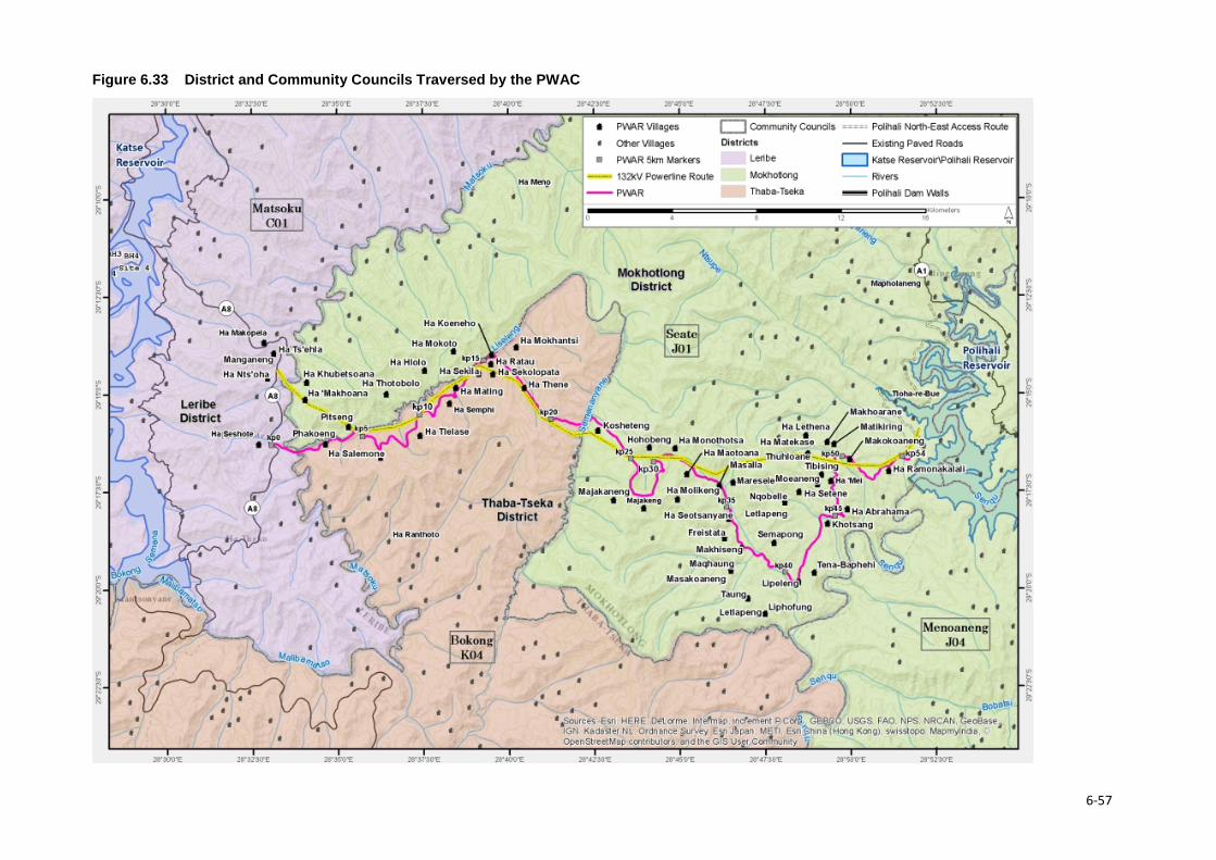
Figure 6.33 District and Community Councils Traversed by the PWAC
6-57
Section 6 • Baseline Environment 6.5.1.2 Ethnicity, Language and Religion The majority of the population in the Project Area are Basotho; who are subdivided into clans which include the Bakuena (Kuena), Bataung (Tau), Balefe, Bakhala and Matebele. Some Asian people also reside in Ha Seshote where they run businesses, such as shops. The official languages are Sesotho, which is spoken by the majority of the population, and English which is generally accepted as the language of business and taught in schools.
Christianity is the most widely practiced religion in the Project Area and most residents along the PWAC also follow traditional beliefs and customs (ancestral spirits). The main Christian denominations found are the Apostolic Faith Mission, Roman Catholic, Lesotho Evangelical and Anglican. Many church services include chanting, drumming and cultural costumes.
6.5.1.3 Migration Census data showed that most villages have slightly more women than men, which may reflect a tendency for more men to leave in search of work than women. Nonetheless, there is a general trend of out-migration to more distant locations (primarily the lowlands of Lesotho or South Africa) to find work and/or to be close to family members or for closer proximity to basic social infrastructure and services. There are more migrants living in Ha Seshote, where shops/ markets, schools, health facilities and good transport facilities are found. Women were reported to move to places such as Maputsoe and Maseru in search of work in the textile factories or as domestic workers. Men on the other hand were said to leave the communities to work in the mines in South Africa (both legal and illegal mining.
6.5.1.4 Socio-Cultural Practices The extended family system is widely practiced in Lesotho, especially in the rural areas. It is based on the concepts of collectivism and mutual assistance, where extended families typically share property such as livestock, and activities such as farming, the building of houses, rituals, feasts and arbitration of disputes among family members. In the more urban areas, the system is shifting as a result of changing world views (increased exposure to outside influences), education and mechanisation of agricultural activities. However, in the Project Area, extended networks are still critical as people are heavily reliant on each other for support and there is relatively little exposure to outside influences.
Besides, the extended family systems, the most prominent social networks in rural Lesotho and the Project Area are burial schemes, stokvels, matsema, Church associations, village police and Village Health Workers/ Community Health Workers (VHW or CHWs) to provide medical assistance. Burial schemes are based on members contributing into a fund to assist each other with the burials of family members or support to families on the death of a family relative. Stokvels are a form of savings scheme that take several forms and help members to fund specific requirements.
6.5.1.5 Vulnerability and Marginalisation The population living along the PWAC are all relatively vulnerable given their isolation, lack of income earning opportunities, harsh conditions for generating a reliable source of food throughout the year, and as a result of inadequate social infrastructure and services. The population are poorly educated, largely as a result of inadequate access to schooling, and the need to drop out of school early in order to participate in domestic and subsistence activities. Levels of health and access to healthcare are low, with widespread HIV/AIDS, STIs and other diseases arising as a result of poor socio-economic conditions. Within this already vulnerable population, there are groups of people that are considered to be more vulnerable. They include households that do not ‘own’ land or do not have the ability to farm (e.g., elderly and disabled people); and households that are headed by children or elderly who have been left to care for young children due to parental absence or incapacity.
6-58
Section 6 • Baseline Environment
Lesotho in general is also linked with human trafficking; it is a source, transit, and destination country for women and children subjected to forced labour and sex trafficking, and for men subjected to forced/ bonded labour. In Lesotho, Basotho children are known to be subjected to domestic servitude and forced labour in animal herding. Women and children are coerced into leaving their country to pursue income earning opportunities; these are often not real opportunities or are associated with poor conditions and no means to leave. Lesotho’s stance on human trafficking has been assessed by the US Department of State’s Office to Monitor and Combat Trafficking in Persons, and Lesotho is deemed not to be taking adequate steps to discourage or control human trafficking within, through and beyond its borders (https://www.state.gov/j/tip/rls/tiprpt/countries/2017/271226.htm). Vulnerable or disadvantage groups are defined by IFC as individuals or groups within the Project Area who could experience adverse impacts from the proposed Project more severely than others based on their vulnerable or disadvantaged status. This status may stem from an individual's or group's race, colour, sex, language, religion, political, or other opinion, national or social origin, property, birth or other status. In addition other factors should be considered such as gender, ethnicity, culture, sickness, physical or mental disability, poverty or economic disadvantage, and dependence on unique natural resources. In the Project Area, the broad categories of people who should be considered to have some level of vulnerability are:
• Women; • The elderly; • Youth; • Herders; • Orphaned children; and • Disabled or chronically ill persons.
6.5.2 Land Use, Settlement and Land Use 6.5.2.1 Land Use and Settlement The majority of people along the route live in small villages that tend to be clustered on ridgelines or slopes approximately half way up the Liseleng, Semenanyane or Makhoaba River valleys. Most of the houses, particularly in villages along the more remote sections between Phakoeng and Polihali are constructed of mud (often mixed with dung), stone and thatching grass (Figure 6.34). A few people who can afford to buy building materials may build concrete brick and corrugated iron roof houses, which often require less maintenance than traditional structures.
Most villages have some crop fields around the settlement but fields may extend far up the mountain slopes, well away from the villages. Grazing land for livestock is generally limited and of marginal quality close to villages, and livestock is often herded several kilometres away up mountain slopes to find grazing, spending considerable periods of time in the high mountains during summer.
6-59
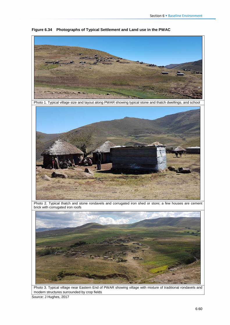
Section 6 • Baseline Environment
Figure 6.34 Photographs of Typical Settlement and Land use in the PWAC
Photo 1. Typical village size and layout along PWAR showing typical stone and thatch dwellings, and school
Photo 2. Typical thatch and stone rondavels and corrugated iron shed or store; a few houses are cement brick with corrugated iron roofs
Photo 3. Typical village near Eastern End of PWAR showing village with mixture of traditional rondavels and modern structures surrounded by crop fields
Source: J Hughes, 2017
6-60
Section 6 • Baseline Environment
6.5.2.2 Land Tenure Lesotho’s land tenure system recognises three types of title: leasehold, Form C and license. Some households occupy land without the appropriate title in place, i.e., through the traditional/ customary tenure system under which the land was allocated to citizens through chiefs and headmen on behalf of the King.
Leasehold acts as a check on private subdivision and allocation of land. Under the leasehold system, the leaseholder has the right to use and enjoy the property for the agreed period. A leaseholder may lease out their land under a sub-lease agreement. In practice the leasehold of land is inherited by the family of the leaseholder; in effect, the land is never returned to the state unless it has become apparent that it has been abandoned. Forms of leasehold comprise:
• Residential leases for a period of 90 years; • Commercial and industrial leases for periods of 30 and 60 years; • Agricultural leases for periods of 10-90 years; and • Others, including religious, educational and charitable leases for periods of 90 years.
Leasehold agreements are registered at the office of the Land Administration Authority (LAA). The Land Act entitles the leaseholder to transfer the title, sub-lease, or use their land as collateral for accessing credit from financial institutions; the title can also be passed on via inheritance to a named family member. Owners of leases for a primary place of residence are exempt from paying ground rent; however, those who have a lease on a second property or for commercial, industrial or agricultural land are required to pay annual ground rent to the LAA.
Form C was abolished by the Land Act (No. 17) of 1979, however, to date people in the rural areas are still issued with the Form C as proof of land tenure; it refers to land that is allotted by the chief. All forms issued before the 1979 Land Act remained valid. Form Cs and title deeds can be converted into leases.
License is a land tenure system used for agricultural land within the urban areas. The tenure right is called a license, and the land right is neither transferable, subject to inheritance nor negotiable. Licenses are held under customary law.
6.5.3 Agriculture 6.5.3.1 Agricultural Activities Typical of the rural areas of Lesotho, access to land is of primary importance to sustain the livelihoods of the local population in the PWAC. It is used for agriculture, livestock grazing, harvesting of other natural plant resources, and for housing / settlements. Almost all households along the PWAC have fields which they rely on for income and subsistence, and the majority graze livestock on the surrounding rangelands. Cropping is mainly for subsistence purposes and is characterised by rain-fed cereal production. Very little produce is sold given that there is limited surplus for bartering or sale. In Ha Seshote and adjacent lower-lying villages the population primarily grow maize and sorghum while further up the Liseleng and Semenanyane River valleys, people tend to grow more wheat and peas. Agriculture is marginal between Ha Thene and Kosheteng due to the high altitude and the stony nature of the ground.
Distances from homesteads to fields varied with the nearest fields being within a few minutes’ walk while some residents in the more remote central parts (e.g., near Kosheteng) reported that it takes up to three to four hours to get to their fields. The size of fields is measured in terraces, with some families having only one terrace while others had up to 10 terraces. Residents of Ha Polihali in the Senqu River valley in the eastern part of the PWAC indicated that they had small fields due to the steep and degraded terrain.
6-61
Section 6 • Baseline Environment
Hiring people to work on fields (matsema) is a common practice in all the communities visited and payment for such labour was either in cash (between M30 – M50/day) or in-kind (grain payments), according to FGD participants. In Kosheteng participants in FGDs indicated that there was no hired labour in their community. Share-cropping is widely practiced.
Despite Ha Seshote being the business node for most communities in the western portion of the Project Area, the FGD participants at Ha Seshote indicated that there was limited access to the local markets due to the rural nature of the area which resulted in a tendency to sell produce amongst themselves. Participants in all the other community FGDs indicated that they sold produce locally, with the exception of participants from Kosheteng, Ha Mating and Ha Polihali who indicated that they sold produce to people from South Africa. Produce sold to South Africans was mostly cash crops (some illegal); this was observed and raised primarily by villagers in the central parts of the PWAC (including the villages of Ha Tlelase, Ha Mating, Ha Semphi, Ha Ratau, Ha Thene, Kosheteng and Ha Polihali).
As with crop farming, livestock farming in the Project Area is also mainly for subsistence, with very few households reporting sales of livestock. Sheep and goats are reared mainly for wool and mohair production purposes. However, the number of livestock is said to have decreased due to the drought that has been experienced in the country over the past two years.
6.5.3.2 Agricultural Services and Infrastructure Each district has an Agriculture Resource Centre, which serve as reference points for farmers to get technical assistance and guidance for ways of improving production and productivity. The only one along the PWAC is the Makhiseng Agricultural Resource Centre which serves the villages along the Polihali to Makhoaba valley in the Mokhotlong District (Figure 6.35). Farmers in villages along the western portion of the PWAC receive little extension services due to the poor road access and inability for farmers to attend training sessions. According to the staff at this centre the extension services provided included crops, nutrition, irrigation and livestock. Some key informants indicated that while extension officers provide useful sources of information on farming methods and nutrition, they tend to focus more on cropping than livestock and there is a need for more veterinary support and assistance. Improved road access was predicted to enhance the ability of agricultural extension officers to reach the communities along the PWAR.
Two woolsheds occur in the PWAC; one at Ha Seshote which serves communities in the western half of the PWAC, and one at Kosheteng (Figure 6.35) which reportedly serves 15 villages from the Liseleng and Semenanyane valleys across to Ha Polihali. Kosheteng woolshed was said to be overloaded with thousands of sheep and goats shorn annually. It was reported that the Mokhotlong Wool and Mohair Growers Association (WMGA) produces more than 114 bales of wool per year, while another association from the Semenanyane area normally produces more than 130 bales per annum. It was reported that typically farmers herd and graze their animals around the area near the Kosheteng woolshed after winter so as to be close to the woolshed at the time of shearing. Shearing for WMGA members was said to start around the 20th September and extend to the 20th December, after this other farmers then shear their livestock. Members of the WMGA were said to have a truck of their own that transports the wool and mohair from the shed to Mokhotlong town where it is then loaded onto other trucks and exported to Port Elizabeth in South Africa.
While a number of NGOs run land restoration and food security projects to complement the work and mandate of the Ministry of Agriculture and Food Security (MAFS) most of these are located nearer Mokhotlong in the Polihali catchment, and none appear to be operating in the western portion of the PWAC.
6-62
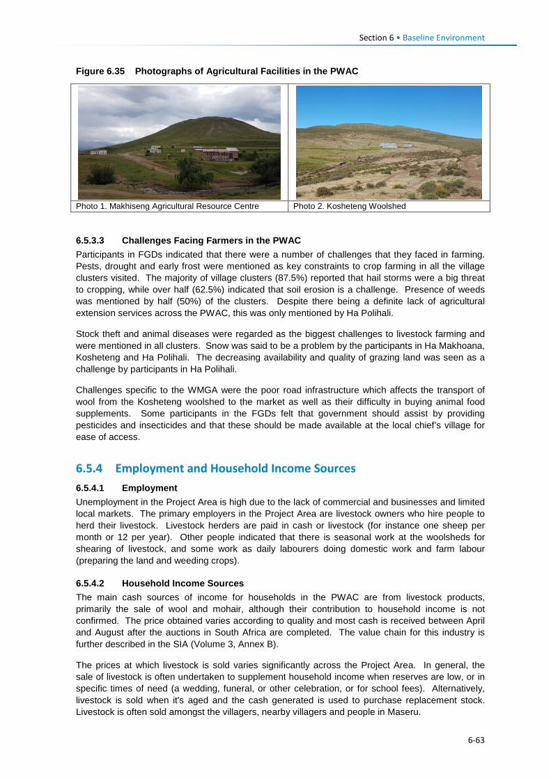
Section 6 • Baseline Environment
Figure 6.35 Photographs of Agricultural Facilities in the PWAC
Photo 1. Makhiseng Agricultural Resource Centre Photo 2. Kosheteng Woolshed
6.5.3.3 Challenges Facing Farmers in the PWAC Participants in FGDs indicated that there were a number of challenges that they faced in farming. Pests, drought and early frost were mentioned as key constraints to crop farming in all the village clusters visited. The majority of village clusters (87.5%) reported that hail storms were a big threat to cropping, while over half (62.5%) indicated that soil erosion is a challenge. Presence of weeds was mentioned by half (50%) of the clusters. Despite there being a definite lack of agricultural extension services across the PWAC, this was only mentioned by Ha Polihali.
Stock theft and animal diseases were regarded as the biggest challenges to livestock farming and were mentioned in all clusters. Snow was said to be a problem by the participants in Ha Makhoana, Kosheteng and Ha Polihali. The decreasing availability and quality of grazing land was seen as a challenge by participants in Ha Polihali.
Challenges specific to the WMGA were the poor road infrastructure which affects the transport of wool from the Kosheteng woolshed to the market as well as their difficulty in buying animal food supplements. Some participants in the FGDs felt that government should assist by providing pesticides and insecticides and that these should be made available at the local chief’s village for ease of access.
6.5.4 Employment and Household Income Sources 6.5.4.1 Employment Unemployment in the Project Area is high due to the lack of commercial and businesses and limited local markets. The primary employers in the Project Area are livestock owners who hire people to herd their livestock. Livestock herders are paid in cash or livestock (for instance one sheep per month or 12 per year). Other people indicated that there is seasonal work at the woolsheds for shearing of livestock, and some work as daily labourers doing domestic work and farm labour (preparing the land and weeding crops).
6.5.4.2 Household Income Sources The main cash sources of income for households in the PWAC are from livestock products, primarily the sale of wool and mohair, although their contribution to household income is not confirmed. The price obtained varies according to quality and most cash is received between April and August after the auctions in South Africa are completed. The value chain for this industry is further described in the SIA (Volume 3, Annex B).
The prices at which livestock is sold varies significantly across the Project Area. In general, the sale of livestock is often undertaken to supplement household income when reserves are low, or in specific times of need (a wedding, funeral, or other celebration, or for school fees). Alternatively, livestock is sold when it's aged and the cash generated is used to purchase replacement stock. Livestock is often sold amongst the villagers, nearby villagers and people in Maseru.
6-63
Section 6 • Baseline Environment
Secondary sources of income is generated through the sale of natural resources by both men and women, followed by construction work (construction of houses and other household structures), and brewing and sale of traditional beer. Natural resources which are sold include fuelwood, rosehip, stones, and grass for both roofing of houses and making of brooms. Ownership of small businesses and shops is limited; it was only mentioned in the Ha Salemone cluster. In some cases, women collect and sell stones to others which are used to build houses and kraals. Men also participate in the brewing and selling of traditional beer, which traditionally was a women's job.
Other income sources discussed with participants included hunting, fishing, pensions, grants and receipt of food aid. Pensions are paid to the elderly, 70 years and older. Other grants include the Child Grant Programme which is run by the Department of Social Development to support Orphans and Vulnerable Children (OVC). The dependence on natural resources such as hunting of small mammals and fisheries is discussed in Section 6.5.5.
Some participants in the FGDs (Ha Salemone, Phakoeng, Ha Makhoane, Ha Polihali and Kosheteng) indicated that they had received food aid from the government in the past through the Department of Social Development’s Pauper Fund which gives identified vulnerable households support in the form of food, cash or grain, or a combination thereof. Poor road condition along the PWAC restricts delivery of food to local primary school children that is sponsored by the United Nations World Food Programme elsewhere in the country.
6.5.4.3 Household Expenditure Household spending in the Project Area consists of purchases of food and non-food groceries, animals or livestock requirements, cropping expenses, and other ongoing monthly expenses. Households reportedly spent more on agricultural expenses between August and November, which are the months of intensive agricultural activity of the major crops, namely maize and sorghum. During this period, households with more than two cropping fields often hire farm labour to assist with the preparation of land and ploughing.
Similarly, to cropping, livestock spending increased in late winter from August when farmers receive their payments for the previous sale season of wool and mohair. Upon receipt of payment, some livestock farmers purchase new livestock either to replace old ones or to increase their herd. Other household expenses such as food are experienced monthly, and depending on the time of the year food expenditure can increase or decrease. During December when family members return home for the holidays, household spending tends to increase as there is more money (earned by the migrant workers) to be spent on groceries and other non-agricultural expenses.
6.5.4.4 Skills Availability The population of the Project Area has multiple skills which they have gained working in the South Africa mines and factories across Lesotho. Information provided during FGDs indicated that community members have a range of skills, including drivers of light and heavy vehicles and dump trucks; excavator / grader operators; mechanics; carpenters; builders; electricians; welders; drillers and plumbers. A few skilled technicians were mentioned including laboratory technicians, accountants, blasting and computer technicians.
6.5.5 Natural Resource Use Natural resources such as medicinal plants, firewood, springs, weaving grasses and sand are used by the community members or their livestock on a daily basis and most of them play a vital role in sustaining the livelihoods of most people. Examples are shown in Figure 6.36.
In Lesotho, control of natural resources and environmental protection are the mandate of Community Councils. Permission to use these resources is sought from councillors and chiefs in the villages; with first priority being given to residents of the villages where the resources are found.
6-64
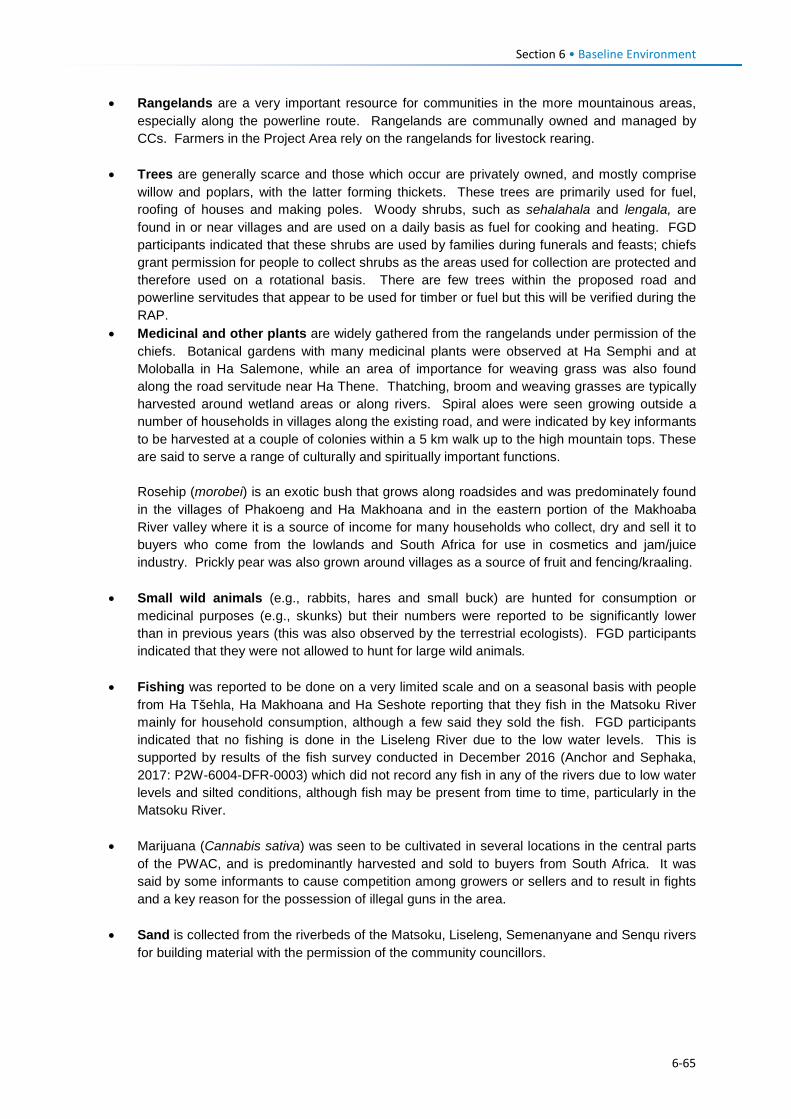
Section 6 • Baseline Environment
• Rangelands are a very important resource for communities in the more mountainous areas, especially along the powerline route. Rangelands are communally owned and managed by CCs. Farmers in the Project Area rely on the rangelands for livestock rearing.
• Trees are generally scarce and those which occur are privately owned, and mostly comprise willow and poplars, with the latter forming thickets. These trees are primarily used for fuel, roofing of houses and making poles. Woody shrubs, such as sehalahala and lengala, are found in or near villages and are used on a daily basis as fuel for cooking and heating. FGD participants indicated that these shrubs are used by families during funerals and feasts; chiefs grant permission for people to collect shrubs as the areas used for collection are protected and therefore used on a rotational basis. There are few trees within the proposed road and powerline servitudes that appear to be used for timber or fuel but this will be verified during the RAP.
• Medicinal and other plants are widely gathered from the rangelands under permission of the chiefs. Botanical gardens with many medicinal plants were observed at Ha Semphi and at Moloballa in Ha Salemone, while an area of importance for weaving grass was also found along the road servitude near Ha Thene. Thatching, broom and weaving grasses are typically harvested around wetland areas or along rivers. Spiral aloes were seen growing outside a number of households in villages along the existing road, and were indicated by key informants to be harvested at a couple of colonies within a 5 km walk up to the high mountain tops. These are said to serve a range of culturally and spiritually important functions. Rosehip (morobei) is an exotic bush that grows along roadsides and was predominately found in the villages of Phakoeng and Ha Makhoana and in the eastern portion of the Makhoaba River valley where it is a source of income for many households who collect, dry and sell it to buyers who come from the lowlands and South Africa for use in cosmetics and jam/juice industry. Prickly pear was also grown around villages as a source of fruit and fencing/kraaling.
• Small wild animals (e.g., rabbits, hares and small buck) are hunted for consumption or medicinal purposes (e.g., skunks) but their numbers were reported to be significantly lower than in previous years (this was also observed by the terrestrial ecologists). FGD participants indicated that they were not allowed to hunt for large wild animals.
• Fishing was reported to be done on a very limited scale and on a seasonal basis with people from Ha Tšehla, Ha Makhoana and Ha Seshote reporting that they fish in the Matsoku River mainly for household consumption, although a few said they sold the fish. FGD participants indicated that no fishing is done in the Liseleng River due to the low water levels. This is supported by results of the fish survey conducted in December 2016 (Anchor and Sephaka, 2017: P2W-6004-DFR-0003) which did not record any fish in any of the rivers due to low water levels and silted conditions, although fish may be present from time to time, particularly in the Matsoku River.
• Marijuana (Cannabis sativa) was seen to be cultivated in several locations in the central parts
of the PWAC, and is predominantly harvested and sold to buyers from South Africa. It was said by some informants to cause competition among growers or sellers and to result in fights and a key reason for the possession of illegal guns in the area.
• Sand is collected from the riverbeds of the Matsoku, Liseleng, Semenanyane and Senqu rivers
for building material with the permission of the community councillors.
6-65
Section 6 • Baseline Environment
Figure 6.36 Photographic Examples of Natural Resources Used along the PWAC
Photo 1. Rosehip Berries Photo 2. Prickly Pear (fruit)
Photo 3. Woody Shrubs / Sehalahala for fuel Photo 4. Medicinal Plant (Phate-ea-ngaka)
6.5.6 Health and Healthcare 6.5.6.1 Healthcare Services There are only two healthcare centres in the PWAC, located at Ha Seshote and St Martin’s Mission. There is also a health post building at Khotsang that is used for outreach services by the District Health Management Team (DHMT) in Mokhotlong although the services are not regularly provided. No outreach or mobile health services operate along the PWAC.
The Ha Seshote health centre (Figure 6.37) is found on the westernmost end of the PWAR at the junction with the A8 road, and falls within the Leribe District. It is a government-owned centre and serves 52 villages, including Ha Tšehla, Ha Makhoana and all the villages in the Liseleng valley as far as Ha Thene. If and when services are unavailable at the Ha Seshote health centre people are referred to a mission run hospital (i.e., Mamohau Hospital) in the village of Ha Poli, located ~16 km north of Ha Seshote. The Paray Hospital in Thaba-Tseka town is reportedly located too far away from the PWAC area; it is only used by the population of the PWAC when emergency healthcare is required.
St Martin’s health centre is found at Makhoaba on the eastern side of the PWAC, in the Mokhotlong District and is owned by the Christian Health Association of Lesotho (CHAL). The centre provides services to ~25 villages and these include all the villages in the Project Area on the Mokhotlong side from Kosheteng up to Ha Polihali. It was reported that patients from the furthest village i.e., Ha Polihali took up to six hours to get to this facility on foot. Patients who need services that are not offered at the health centre are referred to the Mokhotlong Hospital.
Ha Seshote and St Martin’s health centres are each staffed with two registered nurses and two trainees, and offer outpatient care, vaccinations/immunisations for children under five years, TB treatment and Anti-Retroviral Treatment on weekdays. The latter also provides antenatal care services and deliveries but not family planning services as it is a Roman Catholic facility.
6-66
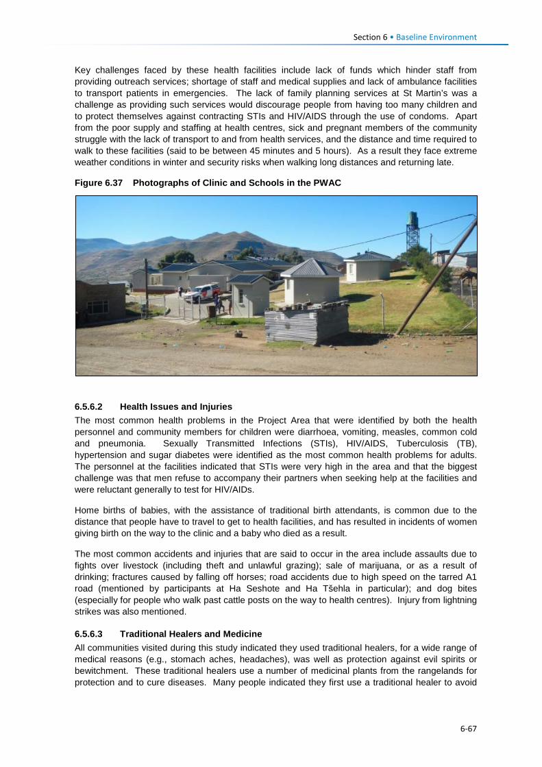
Section 6 • Baseline Environment
Key challenges faced by these health facilities include lack of funds which hinder staff from providing outreach services; shortage of staff and medical supplies and lack of ambulance facilities to transport patients in emergencies. The lack of family planning services at St Martin’s was a challenge as providing such services would discourage people from having too many children and to protect themselves against contracting STIs and HIV/AIDS through the use of condoms. Apart from the poor supply and staffing at health centres, sick and pregnant members of the community struggle with the lack of transport to and from health services, and the distance and time required to walk to these facilities (said to be between 45 minutes and 5 hours). As a result they face extreme weather conditions in winter and security risks when walking long distances and returning late.
Figure 6.37 Photographs of Clinic and Schools in the PWAC
6.5.6.2 Health Issues and Injuries The most common health problems in the Project Area that were identified by both the health personnel and community members for children were diarrhoea, vomiting, measles, common cold and pneumonia. Sexually Transmitted Infections (STIs), HIV/AIDS, Tuberculosis (TB), hypertension and sugar diabetes were identified as the most common health problems for adults. The personnel at the facilities indicated that STIs were very high in the area and that the biggest challenge was that men refuse to accompany their partners when seeking help at the facilities and were reluctant generally to test for HIV/AIDs.
Home births of babies, with the assistance of traditional birth attendants, is common due to the distance that people have to travel to get to health facilities, and has resulted in incidents of women giving birth on the way to the clinic and a baby who died as a result.
The most common accidents and injuries that are said to occur in the area include assaults due to fights over livestock (including theft and unlawful grazing); sale of marijuana, or as a result of drinking; fractures caused by falling off horses; road accidents due to high speed on the tarred A1 road (mentioned by participants at Ha Seshote and Ha Tšehla in particular); and dog bites (especially for people who walk past cattle posts on the way to health centres). Injury from lightning strikes was also mentioned.
6.5.6.3 Traditional Healers and Medicine All communities visited during this study indicated they used traditional healers, for a wide range of medical reasons (e.g., stomach aches, headaches), was well as protection against evil spirits or bewitchment. These traditional healers use a number of medicinal plants from the rangelands for protection and to cure diseases. Many people indicated they first use a traditional healer to avoid
6-67
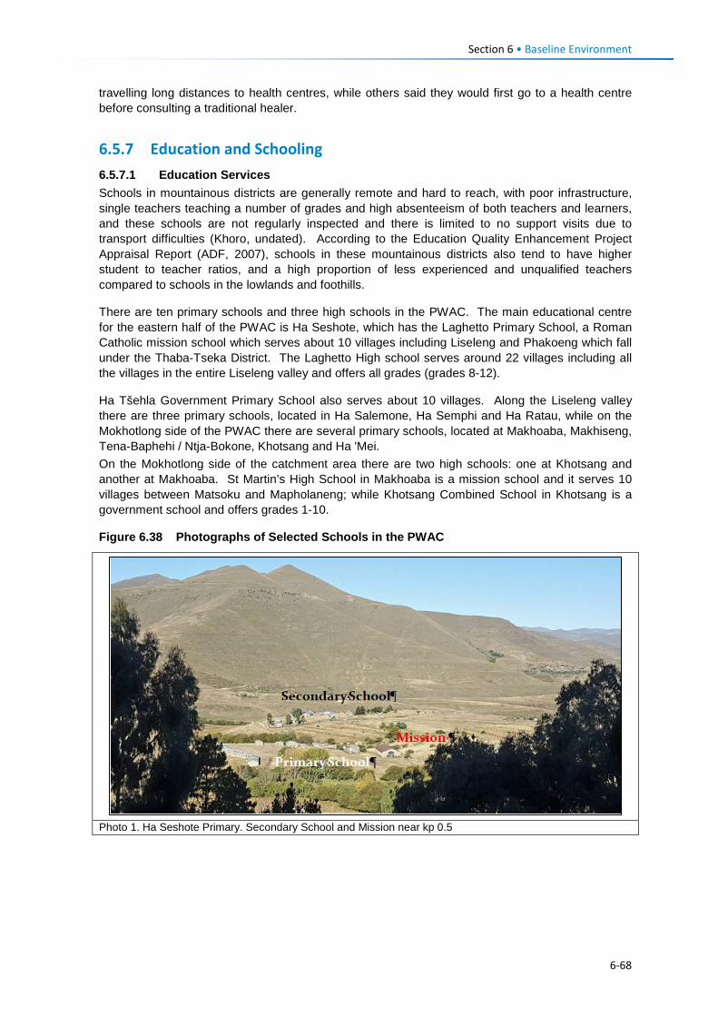
Section 6 • Baseline Environment
travelling long distances to health centres, while others said they would first go to a health centre before consulting a traditional healer.
6.5.7 Education and Schooling 6.5.7.1 Education Services Schools in mountainous districts are generally remote and hard to reach, with poor infrastructure, single teachers teaching a number of grades and high absenteeism of both teachers and learners, and these schools are not regularly inspected and there is limited to no support visits due to transport difficulties (Khoro, undated). According to the Education Quality Enhancement Project Appraisal Report (ADF, 2007), schools in these mountainous districts also tend to have higher student to teacher ratios, and a high proportion of less experienced and unqualified teachers compared to schools in the lowlands and foothills.
There are ten primary schools and three high schools in the PWAC. The main educational centre for the eastern half of the PWAC is Ha Seshote, which has the Laghetto Primary School, a Roman Catholic mission school which serves about 10 villages including Liseleng and Phakoeng which fall under the Thaba-Tseka District. The Laghetto High school serves around 22 villages including all the villages in the entire Liseleng valley and offers all grades (grades 8-12).
Ha Tšehla Government Primary School also serves about 10 villages. Along the Liseleng valley there are three primary schools, located in Ha Salemone, Ha Semphi and Ha Ratau, while on the Mokhotlong side of the PWAC there are several primary schools, located at Makhoaba, Makhiseng, Tena-Baphehi / Ntja-Bokone, Khotsang and Ha 'Mei. On the Mokhotlong side of the catchment area there are two high schools: one at Khotsang and another at Makhoaba. St Martin’s High School in Makhoaba is a mission school and it serves 10 villages between Matsoku and Mapholaneng; while Khotsang Combined School in Khotsang is a government school and offers grades 1-10.
Figure 6.38 Photographs of Selected Schools in the PWAC
Photo 1. Ha Seshote Primary. Secondary School and Mission near kp 0.5
6-68
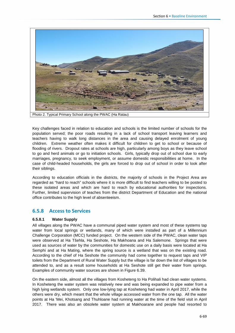
Section 6 • Baseline Environment
Photo 2. Typical Primary School along the PWAC (Ha Ratau)
Key challenges faced in relation to education and schools is the limited number of schools for the population served; the poor roads resulting in a lack of school transport leaving learners and teachers having to walk long distances in the area and causing delayed enrolment of young children. Extreme weather often makes it difficult for children to get to school or because of flooding of rivers. Dropout rates at schools are high, particularly among boys as they leave school to go and herd animals or go to initiation schools. Girls, typically drop out of school due to early marriages, pregnancy, to seek employment, or assume domestic responsibilities at home. In the case of child-headed households, the girls are forced to drop out of school in order to look after their siblings.
According to education officials in the districts, the majority of schools in the Project Area are regarded as “hard to reach” schools where it is more difficult to find teachers willing to be posted to these isolated areas and which are hard to reach by educational authorities for inspections. Further, limited supervision of teaches from the district Department of Education and the national office contributes to the high level of absenteeism.
6.5.8 Access to Services 6.5.8.1 Water Supply All villages along the PWAC have a communal piped water system and most of these systems tap water from local springs or wetlands, many of which were installed as part of a Millennium Challenge Corporation (MCC) funded project. On the western side of the PWAC, clean water taps were observed at Ha Tšehla, Ha Seshote, Ha Makhoana and Ha Salemone. Springs that were used as sources of water by the communities for domestic use on a daily basis were located at Ha Semphi and at Ha Mating, where the spring source is a wetland that was on the existing road. According to the chief of Ha Seshote the community had come together to request taps and VIP toilets from the Department of Rural Water Supply but the village is far down the list of villages to be attended to, and as a result some households at Ha Seshote still get their water from springs. Examples of community water sources are shown in Figure 6.39.
On the eastern side, almost all the villages from Kosheteng to Ha Polihali had clean water systems. In Kosheteng the water system was relatively new and was being expanded to pipe water from a high lying wetlands system. Only one low-lying tap at Kosheteng had water in April 2017, while the others were dry, which meant that the whole village accessed water from the one tap. All the water points at Ha 'Mei, Khotsang and Thuhloane had running water at the time of the field visit in April 2017. There was also an obsolete water system at Makhoarane and people had resorted to
6-69
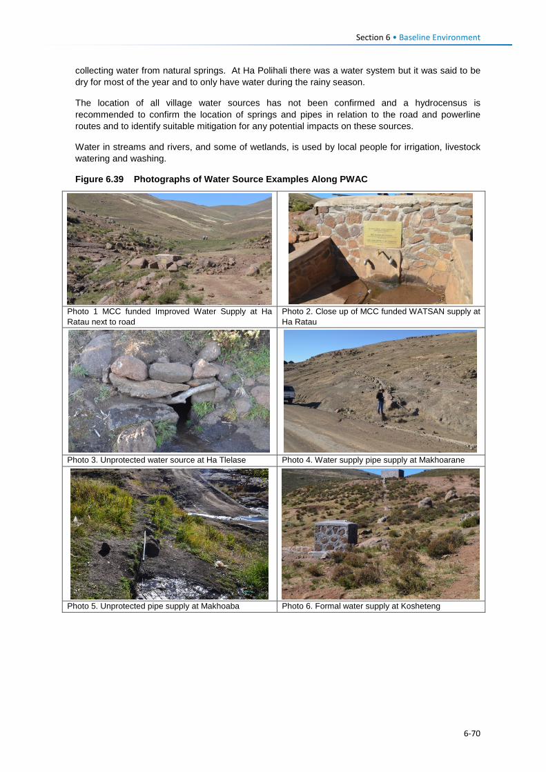
Section 6 • Baseline Environment
collecting water from natural springs. At Ha Polihali there was a water system but it was said to be dry for most of the year and to only have water during the rainy season.
The location of all village water sources has not been confirmed and a hydrocensus is recommended to confirm the location of springs and pipes in relation to the road and powerline routes and to identify suitable mitigation for any potential impacts on these sources.
Water in streams and rivers, and some of wetlands, is used by local people for irrigation, livestock watering and washing.
Figure 6.39 Photographs of Water Source Examples Along PWAC
Photo 1 MCC funded Improved Water Supply at Ha Ratau next to road
Photo 2. Close up of MCC funded WATSAN supply at Ha Ratau
Photo 3. Unprotected water source at Ha Tlelase Photo 4. Water supply pipe supply at Makhoarane
Photo 5. Unprotected pipe supply at Makhoaba Photo 6. Formal water supply at Kosheteng
6-70
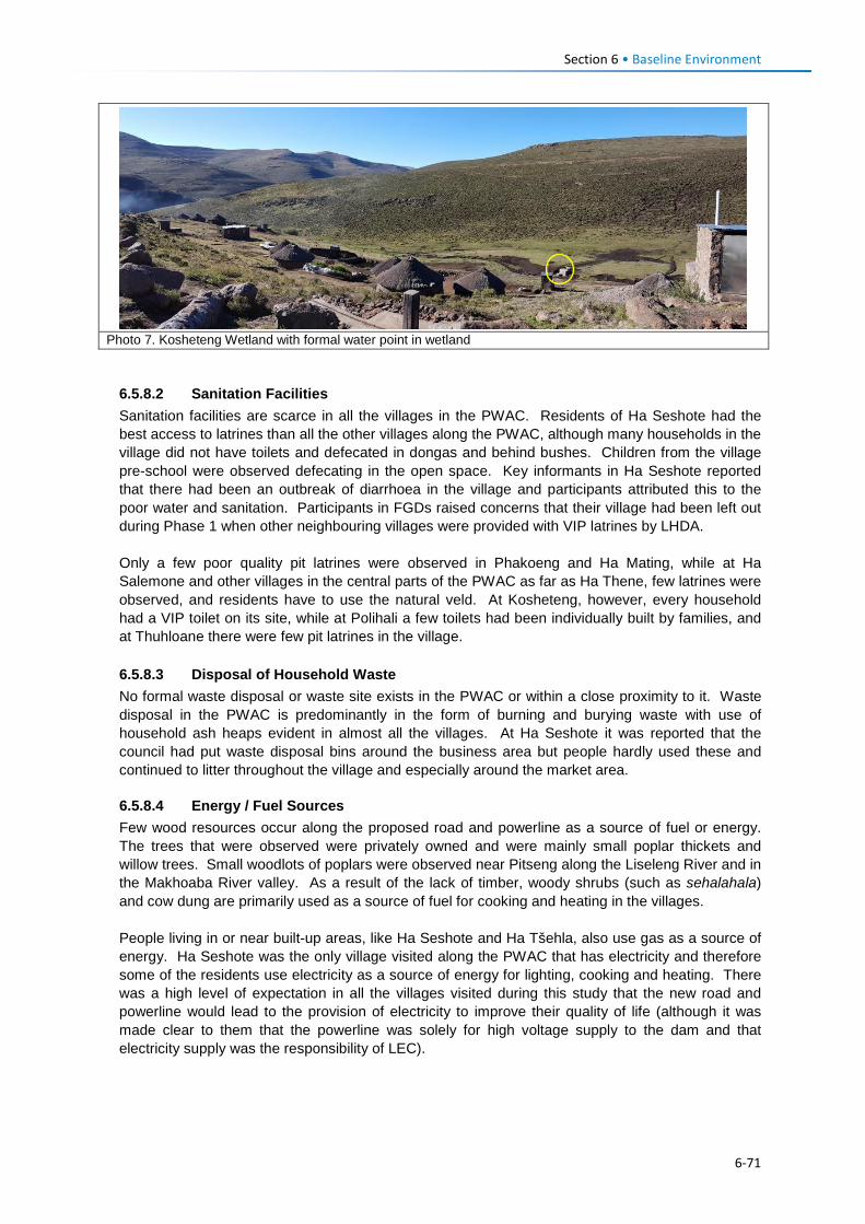
Section 6 • Baseline Environment
Photo 7. Kosheteng Wetland with formal water point in wetland
6.5.8.2 Sanitation Facilities Sanitation facilities are scarce in all the villages in the PWAC. Residents of Ha Seshote had the best access to latrines than all the other villages along the PWAC, although many households in the village did not have toilets and defecated in dongas and behind bushes. Children from the village pre-school were observed defecating in the open space. Key informants in Ha Seshote reported that there had been an outbreak of diarrhoea in the village and participants attributed this to the poor water and sanitation. Participants in FGDs raised concerns that their village had been left out during Phase 1 when other neighbouring villages were provided with VIP latrines by LHDA. Only a few poor quality pit latrines were observed in Phakoeng and Ha Mating, while at Ha Salemone and other villages in the central parts of the PWAC as far as Ha Thene, few latrines were observed, and residents have to use the natural veld. At Kosheteng, however, every household had a VIP toilet on its site, while at Polihali a few toilets had been individually built by families, and at Thuhloane there were few pit latrines in the village. 6.5.8.3 Disposal of Household Waste No formal waste disposal or waste site exists in the PWAC or within a close proximity to it. Waste disposal in the PWAC is predominantly in the form of burning and burying waste with use of household ash heaps evident in almost all the villages. At Ha Seshote it was reported that the council had put waste disposal bins around the business area but people hardly used these and continued to litter throughout the village and especially around the market area.
6.5.8.4 Energy / Fuel Sources Few wood resources occur along the proposed road and powerline as a source of fuel or energy. The trees that were observed were privately owned and were mainly small poplar thickets and willow trees. Small woodlots of poplars were observed near Pitseng along the Liseleng River and in the Makhoaba River valley. As a result of the lack of timber, woody shrubs (such as sehalahala) and cow dung are primarily used as a source of fuel for cooking and heating in the villages. People living in or near built-up areas, like Ha Seshote and Ha Tšehla, also use gas as a source of energy. Ha Seshote was the only village visited along the PWAC that has electricity and therefore some of the residents use electricity as a source of energy for lighting, cooking and heating. There was a high level of expectation in all the villages visited during this study that the new road and powerline would lead to the provision of electricity to improve their quality of life (although it was made clear to them that the powerline was solely for high voltage supply to the dam and that electricity supply was the responsibility of LEC).
6-71
Section 6 • Baseline Environment
6.5.8.5 Roads and Transportation Road infrastructure along the PWAC is very poor, particularly in the areas along the Liseleng Valley, where the dirt road becomes a rocky track that is seldom used by vehicles. The existing dirt road from Ha Seshote to Phakoeng over the Matsoku River is reasonably passable by vehicles, particularly in dry periods, but beyond Phakoeng it starts to deteriorate with large rocks, and steep eroded gullies in places (see Figure 4.2). People in the villages along the Liseleng Valley rely on walking or donkeys/horses as a mode of transport to get to shops, schools or health centres. The long distances mean that people are exposed to security risks when walking after dark. Residents of Ha Tšehla and Ha Seshote are served by a tarred road (the A8) with access to public transport but most people still rely on walking and the use of horses. Transportation in the Ha Seshote area has improved over the last three years, but there have been a number of road accidents due to the high speed of some vehicles. On the eastern side from Kosheteng to Makhoaba the road is passable but in poor condition and, while transportation has improved, walking and riding horses are still the main form of transport. People reported that it took about three hours to get to the schools and health facility at St Martin’s at Makhoaba. From Makhoaba to Ha Polihali the unpaved road is in better condition than the rest of the PWAC, and there is a taxi service. Donkeys were the primary means of transport for goods in all the villages located on the western half of the PWAC between Phakoeng and Ha Thene.
6.5.8.6 Telecommunications Communication via cellular phones was common throughout the Project Area, with almost all the villages that were visited during the SIA reporting that they had access to cellular networks. At Ha Seshote, Ha Tšehla, Ha Makhoana, Phakoeng and Ha Polihali people felt that communication means had improved due to the availability of the cellular networks, although some indicated that when the weather was overcast the signal disappeared. The central parts of the route from Ha Salemone / Ha Mating residents to Kosheteng has more erratic to poor network coverage.
6.5.8.7 Security, Commerce and Business Facilities Ha Seshote serves as a business/economic hub on the Leribe and Thaba-Tseka side of the PWAC with shops that sell groceries, household items and furniture; there are also taverns and clothing shops. However, there is no police station in the village; with the nearest one being at Katse or Ha Lejone. There is also no court, and all conflicts are dealt with at the chief's place of residence.
On the Mokhotlong side of the PWAC, Makhoaba is the most commercial settlement with some shops, a health centre, and a primary and a high school. Residents of smaller nearby communities on the eastern side of the PWAC tend to access services at Makhoaba.
6.5.9 Cultural Heritage 6.5.9.1 Regional Settlement History The mountainous areas of eastern Lesotho have been settled (at least on a seasonal basis) for many thousands of years by various successive hunter-gatherer societies until the last remnants of the most recent (and final) such society, that of the Bushmen (San), were driven out in the early 1870s by Basotho from the Lowlands of Basutoland (Lesotho). The population density of these various hunter-gatherer societies was quite low, but nonetheless their material remains can be found in many caves and certain open-air sites where they lived over long periods of time.
The eastern mountains were subsequently settled on a permanent basis by Basotho. These mixed farming communities, who had previously believed that the mountainous areas of eastern Lesotho were only suitable for grazing, and not permanent settlement, soon learned that this was actually not the case. As a result, a scramble took place from the mid-1870s as various groups competed occupy
6-72
Section 6 • Baseline Environment
the best agricultural areas. Over the next two generations, even the higher-lying and less attractive valleys were settled permanently.
A rich and varied cultural heritage has grown up within these mountain communities, based upon various older cultural practices as well as many newer influences and adaptations. Sites of cultural heritage tend to be focused around the villages of important chiefs, sites of community rituals / ceremonies, notable historical events, as well as old trading stations, churches and schools. This cultural heritage is both tangible (buildings, graves) as well as intangible (the stories, oral traditions, rituals, performance and knowledge which are linked to these sites). Communities also possess a wealth of indigenous skills and feel strongly about various plants, animals and mineral substances which are used for different medical and cultural purposes.
6.5.9.2 Cultural Heritage of the PWAC No Stone Age or Iron Age archaeological sites were recorded along the route of the PWAR or BPST. The only types of heritage resources identified were lron Age / Historical villages situated along the existing gravel road that will be upgraded for the PWAR, including cemetery sites that are associated with those settlements. A total of 60 cultural heritage sites were identified along the PWAC, connected with existing Basotho communities (Figure 6.40). These included 20 separate graveyards / cemeteries; 29 ash heaps (with unknown number of potential burials); four sets of ruins, one spiritual site, three areas for useful plant harvesting, and three sites for tourism enhancement.
Graves: The majority of graves and ash heaps recorded are located along the eastern half of the PWAR, mostly in villages such as Masalla (Ha Makhoaba) and Ha Makhiseng, although a couple of significant graveyards also occur near Phakoeng in the westernmost half of the road. The majority of graves comprised unmarked rocks located on grassy slopes that are not easily distinguished (Figure 6.41). Several of them are located close to the road or near streams. An understanding of death and burials relevant to understanding the context of graves and cultural attachments is provided in Section 6.5.9.3.
Ash Heaps: The ash-heaps (or middens) belonging to homesteads along the PWAR are of some archaeological importance as they may contain material that could be used to date the origins of the settlement, as well as provide information on the settlement's economy and its change through time. Ash heaps belonging to the older homesteads in any given village or if the village itself is known as an important early Iron Age centre are of more importance. However, the age of the ash heaps along the PWAR are unknown and would require further investigation to confirm their research value, but are considered to be of low research importance. The traditional practice of interring the bodies of stillbirths or very young infants within household ash heaps raises the potential for human remains being contained within these deposits. Typically the disturbance of human remains under Lesotho legislation would result in any such sites being of High importance. Further investigation is required to confirm the presence of human remains in ash heaps within the PWAR impact zone and any associated mitigation requirements.
Ruins: Two sites with ruins of old settlement structures (one at Hohobeng on Makhoaba Pass and one near Ha Semphi) occur close to the proposed road alignment. Three areas with useful medicinal and other culturally important plants may be impacted in close proximity to the road and require further surveys to confirm the project risks and area of coverage. Three viewsites are recommended to enhance scenic amenity value for tourism and should be considered by LDHA and the PWAR design engineers with the aim of including them in the road design plans, where appropriate.
6-73
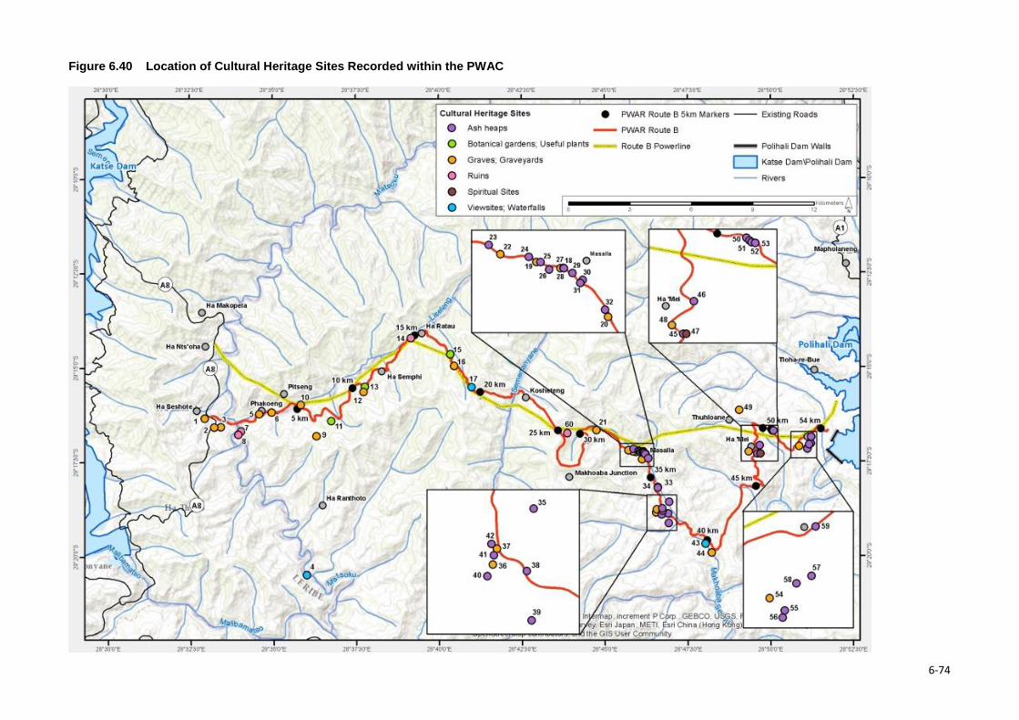
Figure 6.40 Location of Cultural Heritage Sites Recorded within the PWAC
6-74
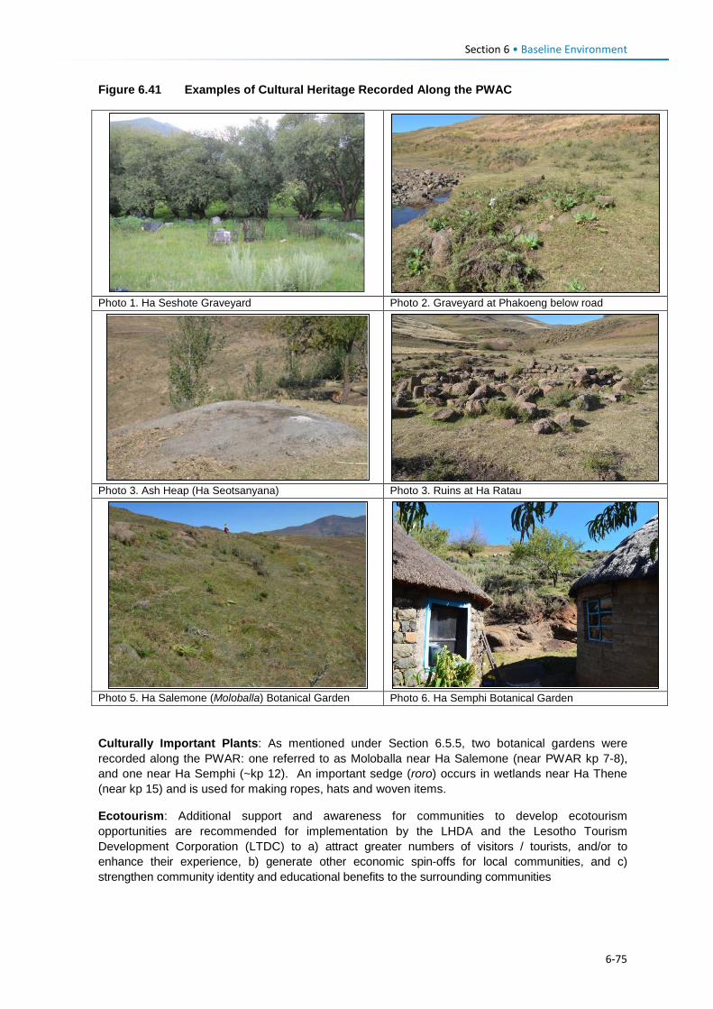
Section 6 • Baseline Environment
Figure 6.41 Examples of Cultural Heritage Recorded Along the PWAC
Photo 1. Ha Seshote Graveyard Photo 2. Graveyard at Phakoeng below road
Photo 3. Ash Heap (Ha Seotsanyana) Photo 3. Ruins at Ha Ratau
Photo 5. Ha Salemone (Moloballa) Botanical Garden Photo 6. Ha Semphi Botanical Garden Culturally Important Plants: As mentioned under Section 6.5.5, two botanical gardens were recorded along the PWAR: one referred to as Moloballa near Ha Salemone (near PWAR kp 7-8), and one near Ha Semphi (~kp 12). An important sedge (roro) occurs in wetlands near Ha Thene (near kp 15) and is used for making ropes, hats and woven items.
Ecotourism: Additional support and awareness for communities to develop ecotourism opportunities are recommended for implementation by the LHDA and the Lesotho Tourism Development Corporation (LTDC) to a) attract greater numbers of visitors / tourists, and/or to enhance their experience, b) generate other economic spin-offs for local communities, and c) strengthen community identity and educational benefits to the surrounding communities
6-75
Section 6 • Baseline Environment
6.5.9.3 Customary Beliefs on Death and Burials Ashton (1952) stated that ‘Basuto beliefs and doctrines regarding death and the after-life are far from being coherent, stable or uniform. Some of the old beliefs can still be found but, for the most part, they have been fused in varying degrees with Christian doctrines. Each clan or family or church to which the deceased belongs may approach matters of death differently. Whether ‘traditional’ or Christian, Basotho in general believe that death is not the end of the person, but a transition to another state of being, either to live with the family / clan ancestors somewhere under the earth or with the God / the saints in heaven (or in limbo awaiting the resurrection and day of judgment). In general, death is a transition that must be marked with proper ceremonies lest the spirit of the dead should become restless and return to trouble the living. Thus, funerals for adults are relatively elaborate and a beast should be slaughtered to provide a ‘blanket’ (kobo) so that the deceased may be warm and comfortable. If not, this ‘lack of proper respect’ may well lead to bad dreams, visitations or misfortune.
Burials of adults and older children used to take place in family graveyards next to their homes, or beneath the cattle kraal, or in the village or church cemetery, but now it is required that these only take place in designated village or church cemeteries. In older burials, the body was placed upright in a crouching position (foetal position) wrapped in a cattle skin looking towards the northeast or rising sun (Ntsoana-Tsatsi), which the Basotho understand as their place of origin). A hole for the grave was dug and the body was placed in a compartment cut into the side of the hole so that the soil was not thrown directly onto the head / body. Seed for new crops and a few personal items like beads and a snuff box were placed with the body so that he/she would be able to start the new life with these familiar items. This practice is now quite rare but in previous generations it was standard. Uncut stones were placed on top of the grave together with chime to mark its position and prevent animals (or sorcerers) from disturbing it.
In the modern tradition graves still generally face northeast but the deceased is buried lying down in a casket. Often, a cattle skin from the beast slain for the funeral is draped over the coffin as it is lowered into the ground. The grave may be marked by a stone at the head and foot, or only at the head, but in many older village graveyards many of these stones have disappeared, making the identification of individual graves quite problematic at times. Older villagers will say that so-and-so is buried there, but the exact location may not be known. As older people die off, it becomes difficult to even properly estimate the number of graves present.
In the case of children or infants, burial is often handled differently, with less expense involved. If the child is a still born or very young, they may be buried in the ash heap (thotobolo) or in the floor of the house or the family courtyard, often in a clay pot. Younger generations may no longer remember who has been buried in this manner. Traditionally, when women gave birth in their homes, the placenta was also buried in the ash heap.
Those killed by lightning or drowning were typically buried next to the river, because lightning was often associated with the ‘water-snake’ which moved across the sky and created storms and rain. Such victims were buried next to the river in order that the water-snake should be satisfied and not seek additional victims (Ashton, 1952).
Cremation has only begun recently on a very small scale because it was believed that burning a person’s body destroyed the spirit permanently, and this is why witches were often burned to death in order to destroy their evil influence forever.
When an extended family or village relocates to another place, they often perform a ceremony of ritually removing a small portion of the soil from the family graves and taking it to their new homestead / village in order that the ancestors should move with them and protect / guide them.
If through erosion or for other reasons a grave (bones) becomes exposed, ceremonies are carried out through the chief and family head to correct the situation. If graves have to be moved, then a beast must be slaughtered and rituals carried out.
6-76
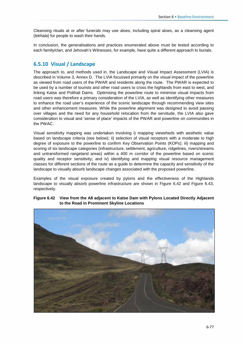
Section 6 • Baseline Environment
Cleansing rituals at or after funerals may use aloes, including spiral aloes, as a cleansing agent (lekhala) for people to wash their hands.
In conclusion, the generalisations and practices enumerated above must be tested according to each family/clan, and Jehovah’s Witnesses, for example, have quite a different approach to burials.
6.5.10 Visual / Landscape The approach to, and methods used in, the Landscape and Visual Impact Assessment (LVIA) is described in Volume 3, Annex D. The LVIA focussed primarily on the visual impact of the powerline as viewed from road users of the PWAR and residents along the route. The PWAR is expected to be used by a number of tourists and other road users to cross the highlands from east to west, and linking Katse and Polihali Dams. Optimising the powerline route to minimise visual impacts from road users was therefore a primary consideration of the LVIA, as well as identifying other measures to enhance the road user’s experience of the scenic landscape through recommending view sites and other enhancement measures. While the powerline alignment was designed to avoid passing over villages and the need for any household relocation from the servitude, the LVIA also gave consideration to visual and ‘sense of place’ impacts of the PWAR and powerline on communities in the PWAC.
Visual sensitivity mapping was undertaken involving i) mapping viewsheds with aesthetic value based on landscape criteria (see below); ii) selection of visual receptors with a moderate to high degree of exposure to the powerline to confirm Key Observation Points (KOPs); iii) mapping and scoring of six landscape categories (infrastructure, settlement, agriculture, ridgelines, rivers/streams and untransformed rangeland areas) within a 400 m corridor of the powerline based on scenic quality and receptor sensitivity; and iv) identifying and mapping visual resource management classes for different sections of the route as a guide to determine the capacity and sensitivity of the landscape to visually absorb landscape changes associated with the proposed powerline.
Examples of the visual exposure created by pylons and the effectiveness of the Highlands landscape to visually absorb powerline infrastructure are shown in Figure 6.42 and Figure 6.43, respectively.
Figure 6.42 View from the A8 adjacent to Katse Dam with Pylons Located Directly Adjacent to the Road in Prominent Skyline Locations
6-77
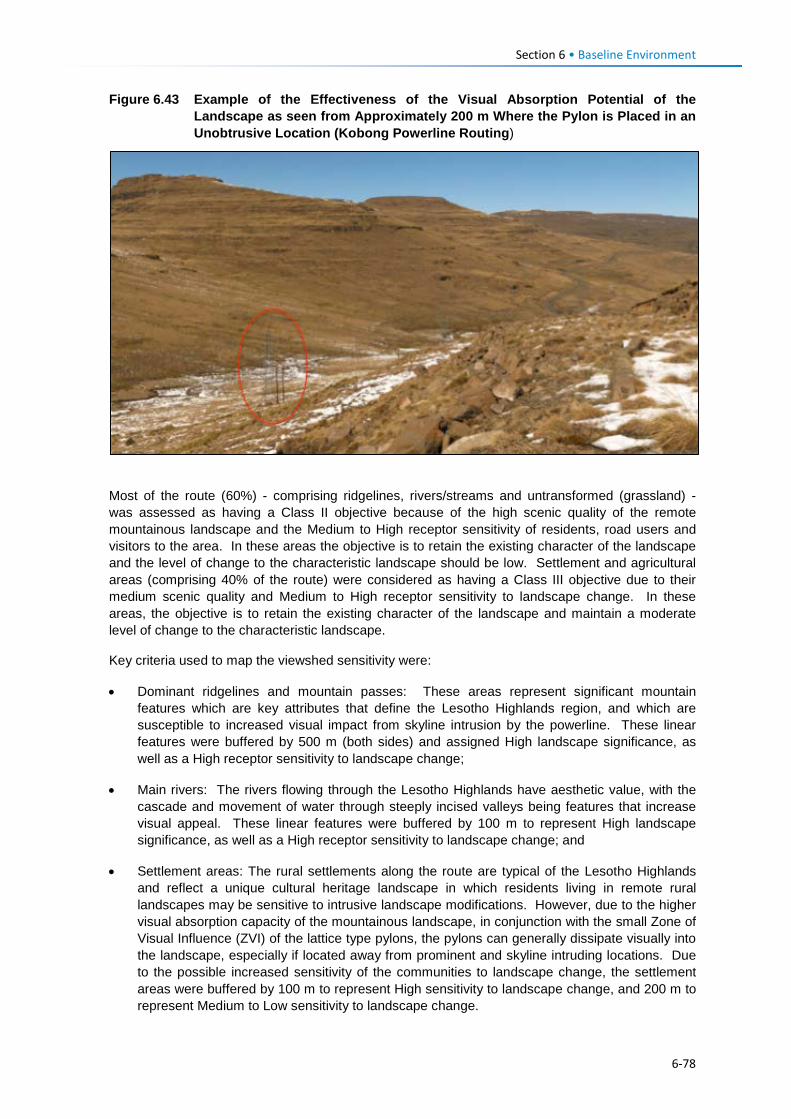
Section 6 • Baseline Environment
Figure 6.43 Example of the Effectiveness of the Visual Absorption Potential of the Landscape as seen from Approximately 200 m Where the Pylon is Placed in an Unobtrusive Location (Kobong Powerline Routing)
Most of the route (60%) - comprising ridgelines, rivers/streams and untransformed (grassland) - was assessed as having a Class II objective because of the high scenic quality of the remote mountainous landscape and the Medium to High receptor sensitivity of residents, road users and visitors to the area. In these areas the objective is to retain the existing character of the landscape and the level of change to the characteristic landscape should be low. Settlement and agricultural areas (comprising 40% of the route) were considered as having a Class III objective due to their medium scenic quality and Medium to High receptor sensitivity to landscape change. In these areas, the objective is to retain the existing character of the landscape and maintain a moderate level of change to the characteristic landscape.
Key criteria used to map the viewshed sensitivity were:
• Dominant ridgelines and mountain passes: These areas represent significant mountain features which are key attributes that define the Lesotho Highlands region, and which are susceptible to increased visual impact from skyline intrusion by the powerline. These linear features were buffered by 500 m (both sides) and assigned High landscape significance, as well as a High receptor sensitivity to landscape change;
• Main rivers: The rivers flowing through the Lesotho Highlands have aesthetic value, with the cascade and movement of water through steeply incised valleys being features that increase visual appeal. These linear features were buffered by 100 m to represent High landscape significance, as well as a High receptor sensitivity to landscape change; and
• Settlement areas: The rural settlements along the route are typical of the Lesotho Highlands and reflect a unique cultural heritage landscape in which residents living in remote rural landscapes may be sensitive to intrusive landscape modifications. However, due to the higher visual absorption capacity of the mountainous landscape, in conjunction with the small Zone of Visual Influence (ZVI) of the lattice type pylons, the pylons can generally dissipate visually into the landscape, especially if located away from prominent and skyline intruding locations. Due to the possible increased sensitivity of the communities to landscape change, the settlement areas were buffered by 100 m to represent High sensitivity to landscape change, and 200 m to represent Medium to Low sensitivity to landscape change.
6-78
Section 6 • Baseline Environment
The combination of the unmodified, riverine and mountain ridgeline areas emphasises the natural beauty of the Lesotho Highlands and together form a key component of this mountainous landscape and natural sense of place. This is particularly evident between powerline Turning Points (TP) 4 to 7, which cross over mountain features between the Matsoku and Liseleng Rivers, and between TP 17 and 22 in the central Semenanyane Valley / Kosheteng region. To the east there are smaller areas of similar characteristics in the vicinity of TP 26 and TP27, TP 29 as well as TP32. Although these areas are smaller in scale than the central and western areas, the combination of unmodified steep slopes, ridgelines and river features enhances the overall landscape character in these areas.
6.6 Ecosystem Services 6.6.1 Introduction Ecosystem services are the benefits that people derive from ecosystems, which are often underpinned by biodiversity and functional ecological processes. Ecosystem services are categorised into four main types, as defined by Millennium Ecosystem Assessment (2012).
Box 6.1 Ecosystem Services
Ecosystem services are benefits that ecosystems provide to people and are classified into four main categories:
• Provisioning services are the goods or products obtained from ecosystems, such as food, timber, medicines, fibres and freshwater.
• Regulating services are the benefits obtained from an ecosystem’s control of natural processes, such as climate regulation, disease control, erosion prevention, water flow regulation, and protection from natural hazards.
• Cultural services are the non-material benefits obtained from ecosystems, such as recreation, sacred sites and aesthetic enjoyment.
• Supporting services are the natural processes, such as soil formation, nutrient cycling and primary production that maintain the other services.
The Ecosystem Services guide and checklist developed by the International Petroleum Industry Environmental Conservation Association (IPIECA, 2011) helps to identify the categories of services on which road construction and operation activities are likely to have dependencies or impacts on ecosystem services.
6.6.1.1 Overview of Project Dependencies and Impacts on Ecosystem Services Road and powerline construction dependencies are expected to include use of water from rivers/streams; stone or rock from streams or rocky outcrops for gabions, bridges and culverts construction; and borrow pit / quarry material for aggregate. Dependence of road construction on regulating services are more indirect and include physical functions provided by vegetation or rock for slope stabilisation, erosion control, water filtration and flood control. Cultural services on which a road project depends are limited to the features of the natural environment which provides ecotourism benefits either through opportunities for activities such as bird watching, swimming, or photography of wilderness and rural landscapes.
Potential impacts of the road project may be negative or positive. In terms of impacts on provisioning services, road construction and operation provides improved access to resources that may currently be more remotely situated and inaccessible. These may include access to medicinal or wild food plants, which may be a positive benefit for the beneficiaries able to obtain these resources or for those who can benefit from selling them. However, the improved road access may have a negative impact on local residents through increased competition if outsiders are able to
6-79
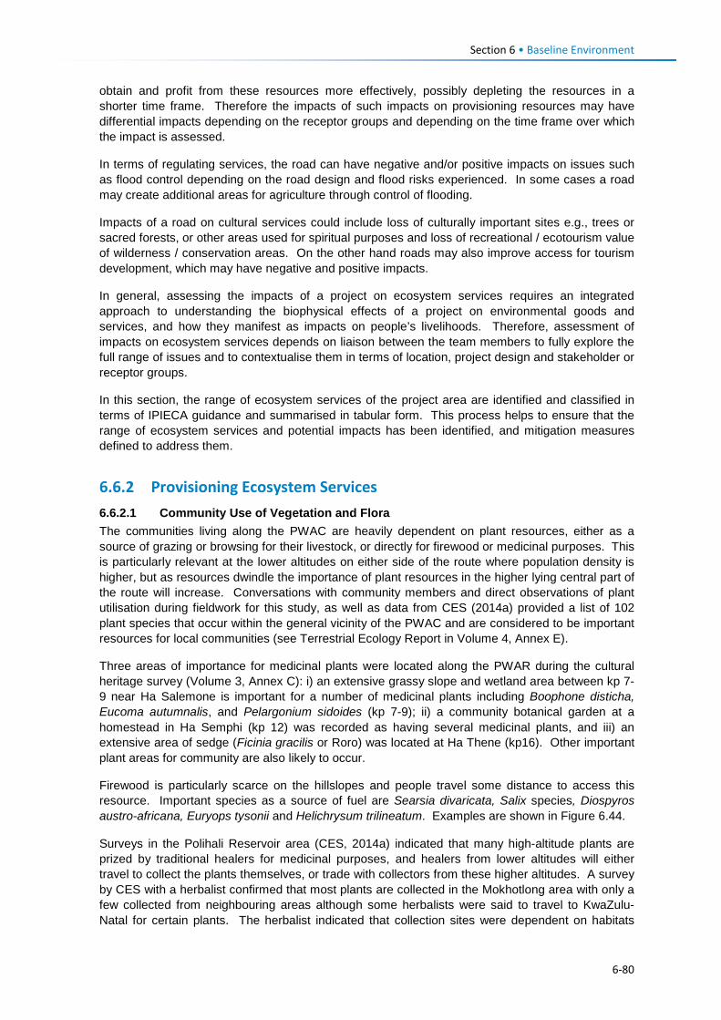
Section 6 • Baseline Environment
obtain and profit from these resources more effectively, possibly depleting the resources in a shorter time frame. Therefore the impacts of such impacts on provisioning resources may have differential impacts depending on the receptor groups and depending on the time frame over which the impact is assessed.
In terms of regulating services, the road can have negative and/or positive impacts on issues such as flood control depending on the road design and flood risks experienced. In some cases a road may create additional areas for agriculture through control of flooding.
Impacts of a road on cultural services could include loss of culturally important sites e.g., trees or sacred forests, or other areas used for spiritual purposes and loss of recreational / ecotourism value of wilderness / conservation areas. On the other hand roads may also improve access for tourism development, which may have negative and positive impacts.
In general, assessing the impacts of a project on ecosystem services requires an integrated approach to understanding the biophysical effects of a project on environmental goods and services, and how they manifest as impacts on people’s livelihoods. Therefore, assessment of impacts on ecosystem services depends on liaison between the team members to fully explore the full range of issues and to contextualise them in terms of location, project design and stakeholder or receptor groups.
In this section, the range of ecosystem services of the project area are identified and classified in terms of IPIECA guidance and summarised in tabular form. This process helps to ensure that the range of ecosystem services and potential impacts has been identified, and mitigation measures defined to address them.
6.6.2 Provisioning Ecosystem Services 6.6.2.1 Community Use of Vegetation and Flora The communities living along the PWAC are heavily dependent on plant resources, either as a source of grazing or browsing for their livestock, or directly for firewood or medicinal purposes. This is particularly relevant at the lower altitudes on either side of the route where population density is higher, but as resources dwindle the importance of plant resources in the higher lying central part of the route will increase. Conversations with community members and direct observations of plant utilisation during fieldwork for this study, as well as data from CES (2014a) provided a list of 102 plant species that occur within the general vicinity of the PWAC and are considered to be important resources for local communities (see Terrestrial Ecology Report in Volume 4, Annex E).
Three areas of importance for medicinal plants were located along the PWAR during the cultural heritage survey (Volume 3, Annex C): i) an extensive grassy slope and wetland area between kp 7-9 near Ha Salemone is important for a number of medicinal plants including Boophone disticha, Eucoma autumnalis, and Pelargonium sidoides (kp 7-9); ii) a community botanical garden at a homestead in Ha Semphi (kp 12) was recorded as having several medicinal plants, and iii) an extensive area of sedge (Ficinia gracilis or Roro) was located at Ha Thene (kp16). Other important plant areas for community are also likely to occur.
Firewood is particularly scarce on the hillslopes and people travel some distance to access this resource. Important species as a source of fuel are Searsia divaricata, Salix species, Diospyros austro-africana, Euryops tysonii and Helichrysum trilineatum. Examples are shown in Figure 6.44.
Surveys in the Polihali Reservoir area (CES, 2014a) indicated that many high-altitude plants are prized by traditional healers for medicinal purposes, and healers from lower altitudes will either travel to collect the plants themselves, or trade with collectors from these higher altitudes. A survey by CES with a herbalist confirmed that most plants are collected in the Mokhotlong area with only a few collected from neighbouring areas although some herbalists were said to travel to KwaZulu-Natal for certain plants. The herbalist indicated that collection sites were dependent on habitats
6-80
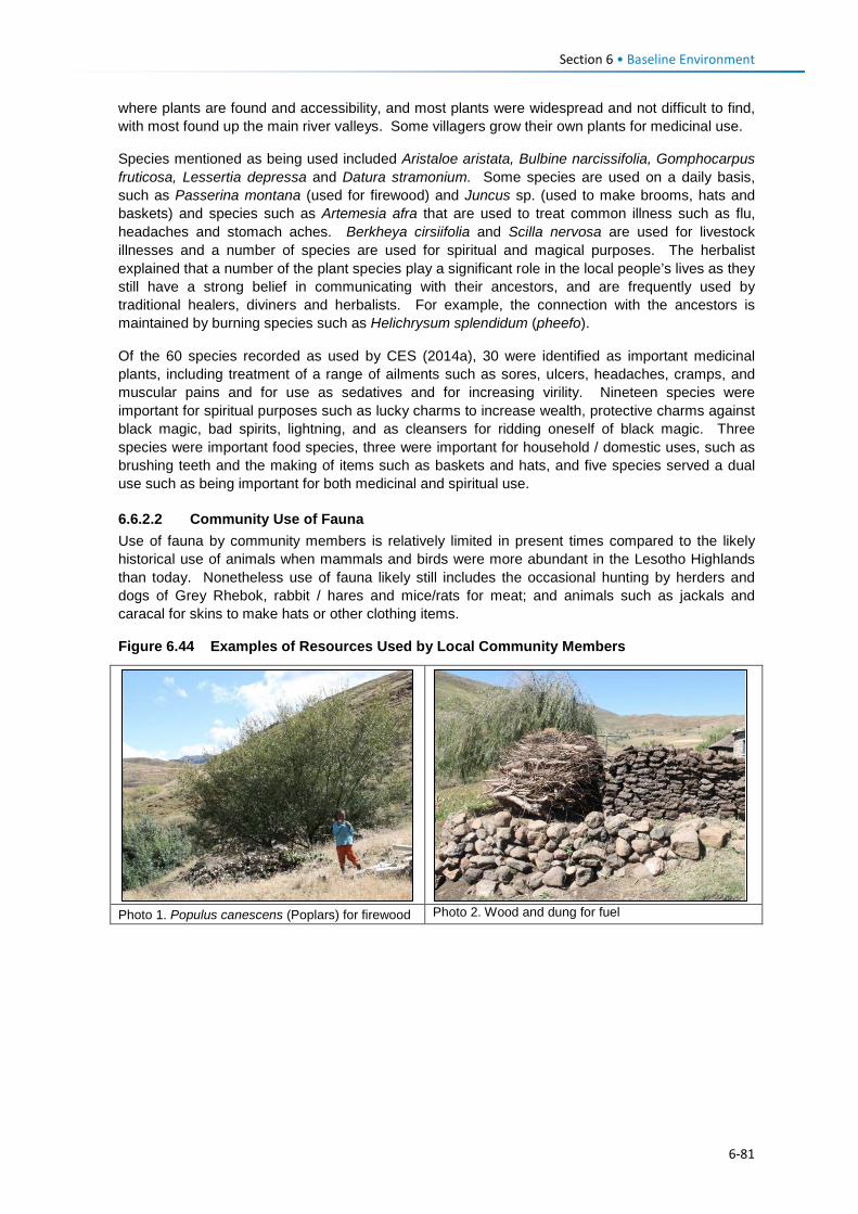
Section 6 • Baseline Environment
where plants are found and accessibility, and most plants were widespread and not difficult to find, with most found up the main river valleys. Some villagers grow their own plants for medicinal use.
Species mentioned as being used included Aristaloe aristata, Bulbine narcissifolia, Gomphocarpus fruticosa, Lessertia depressa and Datura stramonium. Some species are used on a daily basis, such as Passerina montana (used for firewood) and Juncus sp. (used to make brooms, hats and baskets) and species such as Artemesia afra that are used to treat common illness such as flu, headaches and stomach aches. Berkheya cirsiifolia and Scilla nervosa are used for livestock illnesses and a number of species are used for spiritual and magical purposes. The herbalist explained that a number of the plant species play a significant role in the local people’s lives as they still have a strong belief in communicating with their ancestors, and are frequently used by traditional healers, diviners and herbalists. For example, the connection with the ancestors is maintained by burning species such as Helichrysum splendidum (pheefo).
Of the 60 species recorded as used by CES (2014a), 30 were identified as important medicinal plants, including treatment of a range of ailments such as sores, ulcers, headaches, cramps, and muscular pains and for use as sedatives and for increasing virility. Nineteen species were important for spiritual purposes such as lucky charms to increase wealth, protective charms against black magic, bad spirits, lightning, and as cleansers for ridding oneself of black magic. Three species were important food species, three were important for household / domestic uses, such as brushing teeth and the making of items such as baskets and hats, and five species served a dual use such as being important for both medicinal and spiritual use.
6.6.2.2 Community Use of Fauna Use of fauna by community members is relatively limited in present times compared to the likely historical use of animals when mammals and birds were more abundant in the Lesotho Highlands than today. Nonetheless use of fauna likely still includes the occasional hunting by herders and dogs of Grey Rhebok, rabbit / hares and mice/rats for meat; and animals such as jackals and caracal for skins to make hats or other clothing items.
Figure 6.44 Examples of Resources Used by Local Community Members
Photo 1. Populus canescens (Poplars) for firewood Photo 2. Wood and dung for fuel
6-81
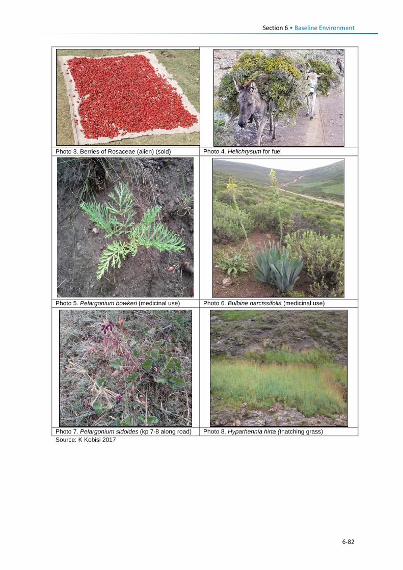
Section 6 • Baseline Environment
Photo 3. Berries of Rosaceae (alien) (sold) Photo 4. Helichrysum for fuel
Photo 5. Pelargonium bowkeri (medicinal use) Photo 6. Bulbine narcissifolia (medicinal use)
Photo 7. Pelargonium sidoides (kp 7-8 along road) Photo 8. Hyparhennia hirta (thatching grass) Source: K Kobisi 2017
6-82
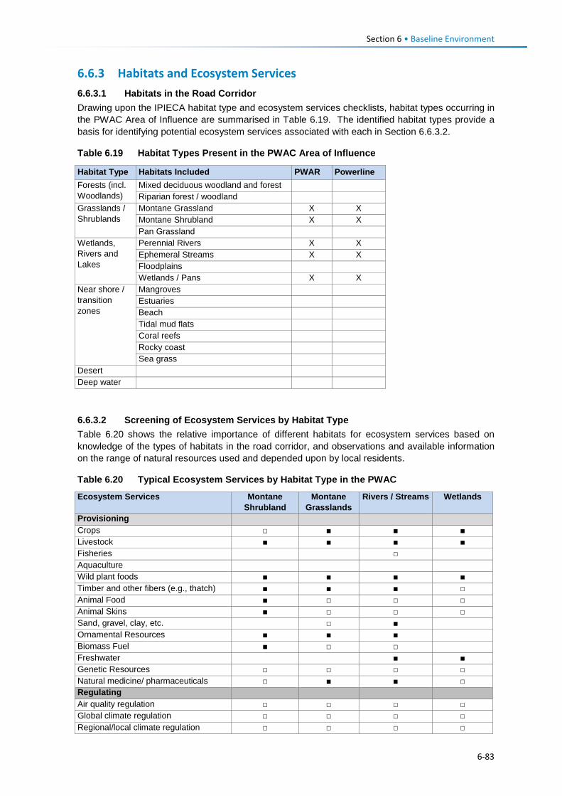
Section 6 • Baseline Environment
6.6.3 Habitats and Ecosystem Services 6.6.3.1 Habitats in the Road Corridor Drawing upon the IPIECA habitat type and ecosystem services checklists, habitat types occurring in the PWAC Area of Influence are summarised in Table 6.19. The identified habitat types provide a basis for identifying potential ecosystem services associated with each in Section 6.6.3.2.
Table 6.19 Habitat Types Present in the PWAC Area of Influence
Habitat Type Habitats Included PWAR Powerline Forests (incl. Woodlands)
Mixed deciduous woodland and forest Riparian forest / woodland
Grasslands / Shrublands
Montane Grassland X X Montane Shrubland X X Pan Grassland
Wetlands, Rivers and Lakes
Perennial Rivers X X Ephemeral Streams X X Floodplains Wetlands / Pans X X
Near shore / transition zones
Mangroves Estuaries Beach Tidal mud flats Coral reefs Rocky coast Sea grass
Desert Deep water 6.6.3.2 Screening of Ecosystem Services by Habitat Type Table 6.20 shows the relative importance of different habitats for ecosystem services based on knowledge of the types of habitats in the road corridor, and observations and available information on the range of natural resources used and depended upon by local residents.
Table 6.20 Typical Ecosystem Services by Habitat Type in the PWAC
Ecosystem Services Montane Shrubland
Montane Grasslands
Rivers / Streams Wetlands
Provisioning Crops □ ■ ■ ■ Livestock ■ ■ ■ ■ Fisheries □ Aquaculture Wild plant foods ■ ■ ■ ■ Timber and other fibers (e.g., thatch) ■ ■ ■ □ Animal Food ■ □ □ □ Animal Skins ■ □ □ □ Sand, gravel, clay, etc. □ ■ Ornamental Resources ■ ■ ■ Biomass Fuel ■ □ □ Freshwater ■ ■ Genetic Resources □ □ □ □ Natural medicine/ pharmaceuticals □ ■ ■ □ Regulating Air quality regulation □ □ □ □ Global climate regulation □ □ □ □ Regional/local climate regulation □ □ □ □
6-83
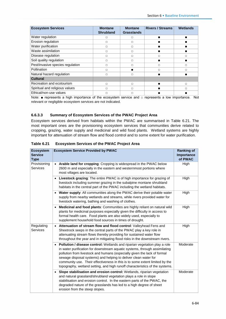
Section 6 • Baseline Environment
Ecosystem Services Montane Shrubland
Montane Grasslands
Rivers / Streams Wetlands
Water regulation □ □ ■ ■ Erosion regulation □ □ ■ ■ Water purification □ □ ■ ■ Waste assimilation □ □ ■ ■ Disease regulation □ □ □ □ Soil quality regulation □ □ ■ ■ Pest/invasive species regulation □ □ □ □ Pollination □ ■ □ □ Natural hazard regulation □ □ ■ ■ Cultural Recreation and ecotourism □ □ ■ □ Spiritual and religious values □ □ ■ □ Ethical/non-use values □ □ ■ ■ Note: ■ represents a high importance of the ecosystem service and □ represents a low importance. Not relevant or negligible ecosystem services are not indicated.
6.6.3.3 Summary of Ecosystem Services of the PWAC Project Area Ecosystem services derived from habitats within the PWAC are summarised in Table 6.21. The most important ones are the provisioning ecosystem services that communities derive related to cropping, grazing, water supply and medicinal and wild food plants. Wetland systems are highly important for attenuation of stream flow and flood control and to some extent for water purification.
Table 6.21 Ecosystem Services of the PWAC Project Area
Ecosystem Service Type
Ecosystem Service Provided by PWAC Ranking of Importance
of PWAC Provisioning Services
• Arable land for cropping: Cropping is widespread in the PWAC below 2600 m and especially in the eastern and westernmost portions where most villages are located.
High
• Livestock grazing: The entire PWAC is of high importance for grazing of livestock including summer grazing in the subalpine montane shrubland habitats in the central part of the PWAC including the wetland habitats.
High
• Water supply: All communities along the PWAC derive their potable water supply from nearby wetlands and streams, while rivers provided water for livestock watering, bathing and washing of clothes.
High
• Medicinal and food plants: Communities are highly reliant on natural wild plants for medicinal purposes especially given the difficulty in access to formal health care. Food plants are also widely used, especially to supplement household food sources in times of drought.
High
Regulating Services
• Attenuation of stream flow and flood control: Valleyhead Fens and Sheetrock seeps in the central parts of the PWAC play a key role in attenuating stream flows thereby providing for sustained water flow throughout the year and in mitigating flood risks in the downstream rivers.
High
• Pollution / disease control: Wetlands and riparian vegetation play a role in water purification for downstream aquatic systems, through assimilating pollution from livestock and humans (especially given the lack of formal sewage disposal systems) and helping to deliver clean water for community use. Their effectiveness in this is to some extent limited by the topography, wetland setting, and high runoff characteristics of the systems.
Moderate
• Slope stabilisation and erosion control: Wetlands, riparian vegetation and natural grassland/shrubland vegetation plays a role in slope stabilisation and erosion control. In the eastern parts of the PWAC, the degraded nature of the grasslands has led to a high degree of sheet erosion from the steep slopes.
Moderate
6-84
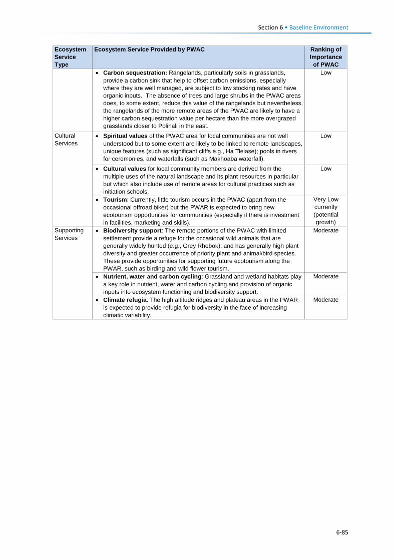
Section 6 • Baseline Environment
Ecosystem Service Type
Ecosystem Service Provided by PWAC Ranking of Importance
of PWAC • Carbon sequestration: Rangelands, particularly soils in grasslands,
provide a carbon sink that help to offset carbon emissions, especially where they are well managed, are subject to low stocking rates and have organic inputs. The absence of trees and large shrubs in the PWAC areas does, to some extent, reduce this value of the rangelands but nevertheless, the rangelands of the more remote areas of the PWAC are likely to have a higher carbon sequestration value per hectare than the more overgrazed grasslands closer to Polihali in the east.
Low
Cultural Services
• Spiritual values of the PWAC area for local communities are not well understood but to some extent are likely to be linked to remote landscapes, unique features (such as significant cliffs e.g., Ha Tlelase); pools in rivers for ceremonies, and waterfalls (such as Makhoaba waterfall).
Low
• Cultural values for local community members are derived from the multiple uses of the natural landscape and its plant resources in particular but which also include use of remote areas for cultural practices such as initiation schools.
Low
• Tourism: Currently, little tourism occurs in the PWAC (apart from the occasional offroad biker) but the PWAR is expected to bring new ecotourism opportunities for communities (especially if there is investment in facilities, marketing and skills).
Very Low currently (potential growth)
Supporting Services
• Biodiversity support: The remote portions of the PWAC with limited settlement provide a refuge for the occasional wild animals that are generally widely hunted (e.g., Grey Rhebok); and has generally high plant diversity and greater occurrence of priority plant and animal/bird species. These provide opportunities for supporting future ecotourism along the PWAR, such as birding and wild flower tourism.
Moderate
• Nutrient, water and carbon cycling: Grassland and wetland habitats play a key role in nutrient, water and carbon cycling and provision of organic inputs into ecosystem functioning and biodiversity support.
Moderate
• Climate refugia: The high altitude ridges and plateau areas in the PWAR is expected to provide refugia for biodiversity in the face of increasing climatic variability.
Moderate
6-85
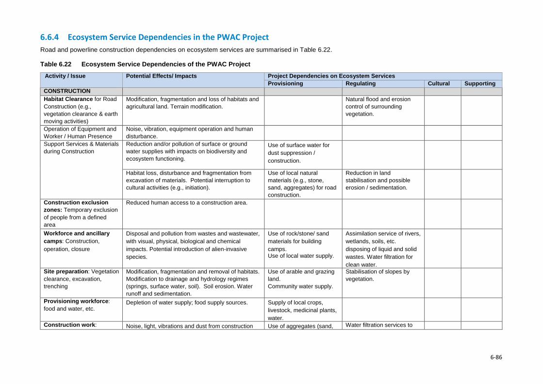
6.6.4 Ecosystem Service Dependencies in the PWAC Project Road and powerline construction dependencies on ecosystem services are summarised in Table 6.22.
Table 6.22 Ecosystem Service Dependencies of the PWAC Project
Activity / Issue Potential Effects/ Impacts Project Dependencies on Ecosystem Services Provisioning Regulating Cultural Supporting
CONSTRUCTION Habitat Clearance for Road Construction (e.g., vegetation clearance & earth moving activities)
Modification, fragmentation and loss of habitats and agricultural land. Terrain modification.
Natural flood and erosion control of surrounding vegetation.
Operation of Equipment and Worker / Human Presence
Noise, vibration, equipment operation and human disturbance.
Support Services & Materials during Construction
Reduction and/or pollution of surface or ground water supplies with impacts on biodiversity and ecosystem functioning.
Use of surface water for dust suppression / construction.
Habitat loss, disturbance and fragmentation from excavation of materials. Potential interruption to cultural activities (e.g., initiation).
Use of local natural materials (e.g., stone, sand, aggregates) for road construction.
Reduction in land stabilisation and possible erosion / sedimentation.
Construction exclusion zones: Temporary exclusion of people from a defined area
Reduced human access to a construction area.
Workforce and ancillary camps: Construction, operation, closure
Disposal and pollution from wastes and wastewater, with visual, physical, biological and chemical impacts. Potential introduction of alien-invasive species.
Use of rock/stone/ sand materials for building camps. Use of local water supply.
Assimilation service of rivers, wetlands, soils, etc. disposing of liquid and solid wastes. Water filtration for clean water.
Site preparation: Vegetation clearance, excavation, trenching
Modification, fragmentation and removal of habitats. Modification to drainage and hydrology regimes (springs, surface water, soil). Soil erosion. Water runoff and sedimentation.
Use of arable and grazing land. Community water supply.
Stabilisation of slopes by vegetation.
Provisioning workforce: food and water, etc.
Depletion of water supply; food supply sources. Supply of local crops, livestock, medicinal plants, water.
Construction work: Noise, light, vibrations and dust from construction Use of aggregates (sand, Water filtration services to
6-86
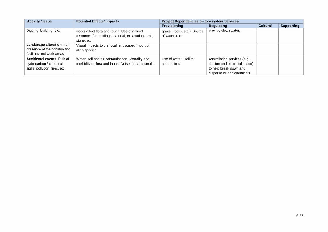
Activity / Issue Potential Effects/ Impacts Project Dependencies on Ecosystem Services Provisioning Regulating Cultural Supporting
Digging, building, etc. works affect flora and fauna. Use of natural resources for buildings material, excavating sand, stone, etc.
gravel, rocks, etc.). Source of water, etc.
provide clean water.
Landscape alteration: from presence of the construction facilities and work areas
Visual impacts to the local landscape. Import of alien species.
Accidental events: Risk of hydrocarbon / chemical spills, pollution, fires, etc.
Water, soil and air contamination. Mortality and morbidity to flora and fauna. Noise, fire and smoke.
Use of water / soil to control fires
Assimilation services (e.g., dilution and microbial action) to help break down and disperse oil and chemicals.
6-87

Stakeholder Engagement Section 7
7.1 Objectives The objectives of stakeholder engagement for the ESIA were to: 1. Ensure understanding through an open, inclusive and transparent process of culturally
appropriate engagement and communication to ensure that stakeholders are well informed about the proposed Project as early as possible;
2. Involve stakeholders in the assessment based on the important role stakeholders can play
in providing local knowledge and information to inform the impact assessment and the identification of culturally appropriate mitigation measures;
3. Build relationships through open dialogue and engagement processes that can help to establish and maintain a productive relationship between the ESIA team, LHDA and other stakeholders;
4. Engage vulnerable groups by adopting different strategies and approaches (such as Focus Group Discussions (FGDs)) to ensure that the perspectives of vulnerable stakeholders are heard and considered;
5. Manage stakeholder expectations to ensure that the Project benefits are understood and to avoid creation of unrealistic expectations about Project opportunities that local communities cannot access or do not have the human capital resources to qualify for (e.g., semi-skilled and skilled construction jobs; and other service provision). The engagement process should help to provide a mechanism for understanding and managing stakeholder and community expectations, and to share reliable project information in an accessible way; and
6. Meet legal and policy requirements by demonstrating compliance with local regulatory and policy requirements in Lesotho and that they address international good practice.
In an attempt to meet the stated objectives for stakeholder engagement, ERM prepared a Stakeholder Engagement Plan (SEP) that served to guide all engagement activities. The SEP aimed to ensure that stakeholders were actively engaged in the process from the start (inception) to the end (disclosure); this was achieved in the following ways: • Relevant Project information and specialist findings were shared with stakeholders in pitsos,
FGDs and key informant interviews (KIIs) at appropriate stages of the ESIA.
• Stakeholders were provided with opportunities to raise issues, concerns and suggestions, and obtain responses from the engagement team at the above-mentioned forums or via the established community committees.
• Feedback from the stakeholders was provided to the relevant specialists to enable more accurate identification, description and assessment of impacts, inform the development of enhancement and mitigation measures, and to enhance the baseline description by incorporating more first-hand observations and experiences of the environmental, social and economic context.
7-1
Section 7 •Stakeholder Engagement
7.2 Approach and Methods The approach and methods for stakeholder engagement aimed to meet the objectives listed in Section 7.1 and were defined and set out in a SEP during the Inception / Route Selection Phase. The process was designed to build upon and align with existing communication structures established by LHDA as part of Phase I (Katse western side) and Phase II (Polihali eastern side), as outlined in Section 7.2.1 and LHDA’s Community Participation Strategy (LHDA, 2014). A summary of the stakeholder engagement activities achieved to date are contained in Figure 7.1.
A full description of the activities undertaken and findings of the stakeholder engagement process is contained in the stakeholder engagement report in Volume 3, Annex A.
7.2.1 Consultation Context In the PWAC, LHDA is represented by the Katse Field Operations Branch (FOB) in the western portion, and the Polihali FOB based at Tlokoeng in the eastern portion.
The Katse FOB has played an active role working with communities in the Katse reservoir area, including the area around Matsoku weir and intake tunnel, since the early 1990s. Here, they established Community Area Liaison Committees (CALCs), which continue to function to represent the interests of communities affected by the Phase I (Katse) Dam. The existing ALC in the Matsoku weir area overlaps with the western end of the powerline (including Matsoku substation) and PWAR routes, and include Ha Seshote, Ha Tšehla, Phakoeng, Ha Mpeli and Liseleng.
On the Polihali (eastern) side of the PWAC, LHDA’s Tlokoeng FOB has assisted the villages within the Polihali Dam catchment area to form structures that act as liaison bodies between the Project and the community members. These structures are known as Area Liaison Committees (ALCs). According to the LHWP Phase II Community Participation Strategy (2014), ALCs are established in each electoral division which will be affected by the inundation of the Polihali Dam and other construction activities. They are made up of chiefs, community councillors, village representatives and members of Non-Governmental Organisations (NGOs). Also in place within the Polihali Dam catchment area is a Combined Liaison Committee (CLC), which is a committee made up of representatives from all of the ALCs. The CLCs coordinate the activities of the ALCs and makes general decisions on their behalf and represents all of the affected communities and individuals. In addition, there is also the Community Liaison Structure (CLS), which comprises of the whole structure of ALCs and CLC together and it participates in planning, implementation, monitoring and decision-making of the issues which affect the communities and individuals.
In April 2017, the village of Polihali (Ha Ramonakalali) was the only village along the PWAR that was represented by one of the Polihali Reservoir ALCs, which forms part of the ALC S1 (Malingoaneng/Khubelu). New ALCs covering the rest of the PWAC were established in June/July 2017 with the facilitation of the Tlokoeng FOB (after the stakeholder engagement process for this study). A total of 18 ALCs have been established for the PWAC and Katse Western Facilities areas (including Matsoku); 16 of these ALCs cover the PWAR. Similarly to the ALCs in the Polihali Dam catchment area, the ALCs are made up of chiefs, community councillors and village representatives. A CLC has also been set up for the PWAC and Western Facilities areas and is made up of 37 members drawn from 10 clusters of which eight cover the PWAR areas.
The approach to community engagement (Phase 3) for the PWAC ESIA was undertaken based on identification of village clusters aligned with the Area Chief and headmen boundaries; these clusters were determined in consultation with the LHDA Tlokoeng FOB. A total of 14 clusters were created and visited during the consultation process and have formed the basis for the recently defined ALCs for the PWAC. Table 7.4 summarises the ALCs in the PWAC and their overlap with the village clusters (Figure 7.2) consulted during the ESIS stakeholder engagement process.
7-1
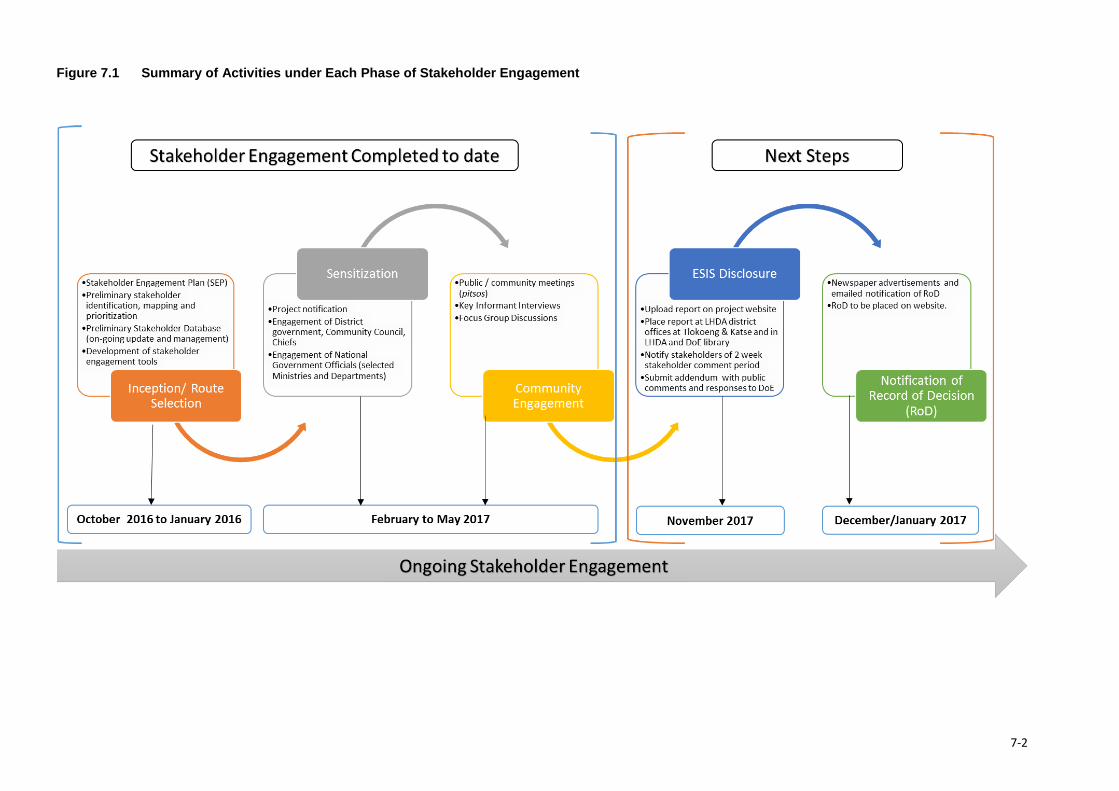
Figure 7.1 Summary of Activities under Each Phase of Stakeholder Engagement
7-2
Section 7•Stakeholder Engagement
7.2.1.1 Prior Consultation LHDA undertook community-level consultations in the Polihali Reservoir and PWAC Project Areas prior to the ESIA for which this stakeholder engagement study was undertaken. In December 2014, LHDA held a series of meetings in key villages to present the Phase II project at which the project components were presented and discussed, such as the construction of the Polihali Dam and associated infrastructure (assessed under the PRAI ESIA); the PNEAR; the four options for the PWAC and the western camps for the PWAC and the water transfer tunnel; and the tunnel outlet to Katse Dam. Of relevance to the PWAC, meetings were held in five electoral divisions. These included Liseleng and Phakoeng on the 17th and Ha Seshote and Ha Tšehla on the 18th of December 2014. A number of impacts and issues were raised, and were similar to the issues raised during the consultation process for this ESIS.
7.3 Consultation Methods and Activities 7.3.1 Phase 1: Inception / Route Selection Stakeholder engagement activities during this phase were focussed on understanding the nature and area of influence of the project and gaining an understanding of the relevant stakeholders. Activities undertaken during the Inception / Route Selection phase are described below, and included.
• Review of available information; • Stakeholder identification and mapping; • Development of a preliminary SEP for the ESIA; and • Compilation of a Background Information Document and Public Notice (radio announcements).
7.3.1.1 Review of Available Information Reports, data and maps were collected from LHDA and various government departments and from team members; these were reviewed to confirm available social and stakeholder information of relevance to the PWAC and to identify gaps. At the time of the Inception / Route Selection phase (which commenced in late October/November 2016), four options for the PWAC were under investigation through a route selection assessment. The preferred route was confirmed in December 2016 at which stage closer review of the alignment was undertaken and potentially affected community level stakeholders could be identified. Once the preferred road route was confirmed, Google imagery of the PWAC were examined to identify social features in the Project Area such as the location of villages, land use patterns, existing roads and tracks, and social infrastructure (such as schools, churches, health centres, etc.). This helped to confirm the physical footprint of the infrastructure and the area of potential influence on nearby communities living along the routes in order to aid stakeholder identification and planning of consultation. Secondary data available for the PWAC were limited to some technical reports commissioned by LHDA which overlapped to varying degrees with the road route. Of most relevance to the PWAC were the previous route screening studies by Barry and Partners (2014) and SMEC (2016); some Phase I monitoring studies by Anchor (Turpie et al., 2014) and the CES (2014) baseline studies for the Polihali Dam Project Area. These provided a broad-scale understanding of the terrain, land cover, and settlement patterns. Unfortunately, these reports did not assist in identifying the various stakeholder groups located along the selected PWAR.
7-3
Section 7•Stakeholder Engagement
7.3.1.2 Stakeholder Identification and Mapping The process of stakeholder identification involved four main steps: • Step 1. Definition of the Project AoI; • Step 2. Identification and mapping of stakeholder groups; • Step 3. Compilation of an SEP; and • Step 4. Compilation and approval of stakeholder engagement materials. Step 1. Definition of the PWAC Project AoI For the purpose of defining community and district level stakeholders that were to be included in the stakeholder engagement process, the AoI for the PWAC was defined as the area within which direct, indirect and induced impacts on communities may occur, including impacts on the natural resource base or cultural heritage. The potential AoI of the proposed PWAC (also referred to as the Project Area) was identified in order to define stakeholders at district and community level, as follows:
• District Level: the districts traversed by the powerline and road (i.e., Leribe, Thaba-Tseka and Mokhotlong), and their relevant community councils (CCs) (Matsoku CC in Leribe; Seate CC in Mokhotlong; and Bokong CC in Thaba-Tseka).
• Community Level: • Direct AoI: the households and communities that are directly affected by:
o the loss of household structures or arable land within the 30 m Road Reserve (15 m either side of the centre line) or within the 31 m powerline servitude (15.5 m either side of the centre line);
o the increased noise, vibration, dust, traffic and presence of labour during construction within an estimated 1 km corridor of the road and powerline; and
o the loss of natural resources (e.g., medicinal plants, rangelands, water sources).
• Indirect / Induced AoI: the households and communities within an estimated 5 km radius of the road that are indirectly affected by: o the influx of work-seekers and others who settle in the area as a result of new
economic opportunities (with associated negative and positive impacts); o improved access to infrastructure, services and facilities induced by the new road; and o the increase in traffic along the PWAR and associated increased traffic hazards.
The Indirect AoI (i.e., ~5 km radius of the road and ~1 km of the powerline and substations) was used to determine which villages should be included in the community-level engagements (see Section 7.3.3.1 on village clustering).
Step 2. Identification and Mapping of Stakeholder Groups The identification of stakeholders for the ESIA is an iterative process that commenced during the Inception / Route Selection Phase and the stakeholder database was updated throughout the ESIA as additional stakeholders were identified and consulted. The updated stakeholder database is contained in Appendix A (of Volume 2, Annex A).
During the early stage of the ESIA, an initial list of stakeholders was prepared based on review of the preferred route alignment and imagery review and taking into consideration the questions set out below:
7-4
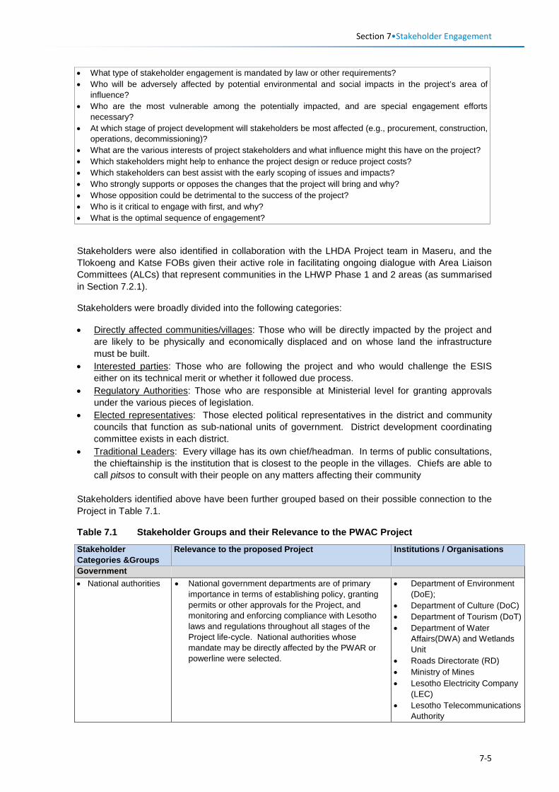
Section 7•Stakeholder Engagement
• What type of stakeholder engagement is mandated by law or other requirements? • Who will be adversely affected by potential environmental and social impacts in the project’s area of
influence? • Who are the most vulnerable among the potentially impacted, and are special engagement efforts
necessary? • At which stage of project development will stakeholders be most affected (e.g., procurement, construction,
operations, decommissioning)? • What are the various interests of project stakeholders and what influence might this have on the project? • Which stakeholders might help to enhance the project design or reduce project costs? • Which stakeholders can best assist with the early scoping of issues and impacts? • Who strongly supports or opposes the changes that the project will bring and why? • Whose opposition could be detrimental to the success of the project? • Who is it critical to engage with first, and why? • What is the optimal sequence of engagement?
Stakeholders were also identified in collaboration with the LHDA Project team in Maseru, and the Tlokoeng and Katse FOBs given their active role in facilitating ongoing dialogue with Area Liaison Committees (ALCs) that represent communities in the LHWP Phase 1 and 2 areas (as summarised in Section 7.2.1).
Stakeholders were broadly divided into the following categories:
• Directly affected communities/villages: Those who will be directly impacted by the project and are likely to be physically and economically displaced and on whose land the infrastructure must be built.
• Interested parties: Those who are following the project and who would challenge the ESIS either on its technical merit or whether it followed due process.
• Regulatory Authorities: Those who are responsible at Ministerial level for granting approvals under the various pieces of legislation.
• Elected representatives: Those elected political representatives in the district and community councils that function as sub-national units of government. District development coordinating committee exists in each district.
• Traditional Leaders: Every village has its own chief/headman. In terms of public consultations, the chieftainship is the institution that is closest to the people in the villages. Chiefs are able to call pitsos to consult with their people on any matters affecting their community
Stakeholders identified above have been further grouped based on their possible connection to the Project in Table 7.1.
Table 7.1 Stakeholder Groups and their Relevance to the PWAC Project
Stakeholder Categories &Groups
Relevance to the proposed Project Institutions / Organisations
Government • National authorities • National government departments are of primary
importance in terms of establishing policy, granting permits or other approvals for the Project, and monitoring and enforcing compliance with Lesotho laws and regulations throughout all stages of the Project life-cycle. National authorities whose mandate may be directly affected by the PWAR or powerline were selected.
• Department of Environment (DoE);
• Department of Culture (DoC) • Department of Tourism (DoT) • Department of Water
Affairs(DWA) and Wetlands Unit
• Roads Directorate (RD) • Ministry of Mines • Lesotho Electricity Company
(LEC) • Lesotho Telecommunications
Authority
7-5
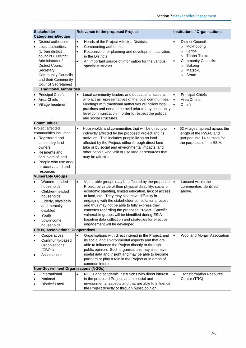
Section 7•Stakeholder Engagement
Stakeholder Categories &Groups
Relevance to the proposed Project Institutions / Organisations
• District authorities • Local authorities:
(Urban district councils / District Administrator / District Council Secretary, Community Councils and their Community Council Secretaries)
• Heads of the Project Affected Districts. • Commenting authorities. • Responsible for planning and development activities
in the Districts. • An important source of information for the various
specialist studies.
• District Council: o Mokhotlong o Leribe o Thaba-Tseka
• Community Councils: o Bokong o Matsoku o Seate
Traditional Authorities • Principal Chiefs • Area Chiefs • Village headmen
• Local community leaders and educational leaders, who act as representatives of the local communities. Meetings with traditional authorities will follow local practices and need to be held prior to any community level communication in order to respect the political and social structures.
• Principal Chiefs • Area Chiefs • Chiefs
Communities Project affected communities including: • Registered and
customary land owners
• Residents and occupiers of land
• People who use and/ or access land and resources
• Households and communities that will be directly or indirectly affected by the proposed Project and its activities. This includes people living on land affected by the Project, either through direct land take or by social and environmental impacts, and other people who visit or use land or resources that may be affected.
• 52 villages, spread across the length of the PWAC and grouped into 14 clusters for the purposes of the ESIA.
Vulnerable Groups • Women-headed
households • Children-headed
households • Elderly, physically
and mentally disabled
• Youth • Low-income
households
• Vulnerable groups may be affected by the proposed Project by virtue of their physical disability, social or economic standing, limited education, lack of access to land, etc. They may also have difficulty in engaging with the stakeholder consultation process and thus may not be able to fully express their concerns regarding the proposed Project. Specific vulnerable groups will be identified during ESIA baseline data collection and strategies for effective engagement will be developed.
• Located within the communities identified above.
CBOs, Associations, Cooperatives • Cooperatives • Community-based
Organisations (CBOs)
• Associations
• Organisations with direct interest in the Project, and its social and environmental aspects and that are able to influence the Project directly or through public opinion. Such organisations may also have useful data and insight and may be able to become partners or play a role in the Project or in areas of common interest.
• Wool and Mohair Association
Non-Government Organisations (NGOs) • International • National • District/ Local
• NGOs and academic institutions with direct interest in the proposed Project, and its social and environmental aspects and that are able to influence the Project directly or through public opinion.
• Transformation Resource Centre (TRC)
7-6
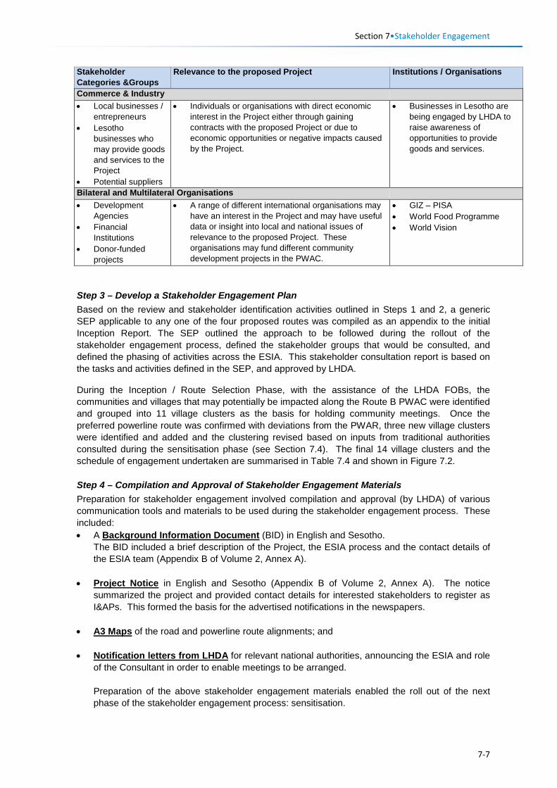
Section 7•Stakeholder Engagement
Stakeholder Categories &Groups
Relevance to the proposed Project Institutions / Organisations
Commerce & Industry • Local businesses /
entrepreneurs • Lesotho
businesses who may provide goods and services to the Project
• Potential suppliers
• Individuals or organisations with direct economic interest in the Project either through gaining contracts with the proposed Project or due to economic opportunities or negative impacts caused by the Project.
• Businesses in Lesotho are being engaged by LHDA to raise awareness of opportunities to provide goods and services.
Bilateral and Multilateral Organisations • Development
Agencies • Financial
Institutions • Donor-funded
projects
• A range of different international organisations may have an interest in the Project and may have useful data or insight into local and national issues of relevance to the proposed Project. These organisations may fund different community development projects in the PWAC.
• GIZ – PISA • World Food Programme • World Vision
Step 3 – Develop a Stakeholder Engagement Plan Based on the review and stakeholder identification activities outlined in Steps 1 and 2, a generic SEP applicable to any one of the four proposed routes was compiled as an appendix to the initial Inception Report. The SEP outlined the approach to be followed during the rollout of the stakeholder engagement process, defined the stakeholder groups that would be consulted, and defined the phasing of activities across the ESIA. This stakeholder consultation report is based on the tasks and activities defined in the SEP, and approved by LHDA.
During the Inception / Route Selection Phase, with the assistance of the LHDA FOBs, the communities and villages that may potentially be impacted along the Route B PWAC were identified and grouped into 11 village clusters as the basis for holding community meetings. Once the preferred powerline route was confirmed with deviations from the PWAR, three new village clusters were identified and added and the clustering revised based on inputs from traditional authorities consulted during the sensitisation phase (see Section 7.4). The final 14 village clusters and the schedule of engagement undertaken are summarised in Table 7.4 and shown in Figure 7.2. Step 4 – Compilation and Approval of Stakeholder Engagement Materials Preparation for stakeholder engagement involved compilation and approval (by LHDA) of various communication tools and materials to be used during the stakeholder engagement process. These included: • A Background Information Document (BID) in English and Sesotho.
The BID included a brief description of the Project, the ESIA process and the contact details of the ESIA team (Appendix B of Volume 2, Annex A).
• Project Notice in English and Sesotho (Appendix B of Volume 2, Annex A). The notice summarized the project and provided contact details for interested stakeholders to register as I&APs. This formed the basis for the advertised notifications in the newspapers.
• A3 Maps of the road and powerline route alignments; and
• Notification letters from LHDA for relevant national authorities, announcing the ESIA and role of the Consultant in order to enable meetings to be arranged. Preparation of the above stakeholder engagement materials enabled the roll out of the next phase of the stakeholder engagement process: sensitisation.
7-7
Section 7•Stakeholder Engagement
7.3.2 Phase II: Sensitisation of Government, Community Councils and Chiefs
The sensitisation1 phase is an important first step of a stakeholder engagement process to facilitate dialogue with district and community council stakeholders prior to arranging community meetings at village level. The objectives of the sensitisation phase were to: • Formally announcement the commencement of the ESIA and associated stakeholder
engagement process to district authorities, community councils and chiefs; • Inform and engage stakeholders of the proposed project and the ESIA process; • Introduce the project team including the Client and appointed ESIA Consultant; • Present the Project; and • Provide stakeholders with an opportunity to ask questions and make comments.
In the case of meetings with some traditional authorities, a further objective was to confirm the approach to community engagement at village level, including the grouping of the villages in clusters and the main village where meetings would be held.
The following sensitisation activities were undertaken: • Sensitisation meetings with government, community councils and chiefs; and • Project announcements following sensitisation with key stakeholders.
7.3.2.1 Engagement with Government Officials, Community Councils and Chiefs Sensitisation meetings with district and traditional authorities in Mokhotlong District were held in December 2016 and covered both the PRAI and PWAC projects. Sensitisation meetings with national, district and traditional authorities specifically for the PWAC began in February 2017 and ended in May 2017.
Sensitisation of the various authorities is separated into meetings with: • District officials, Community Councils, Chiefs and selected Heads of Departments; and • National Ministries/ Departments officials.
The activities conducted at these meetings are summarised below.
Consultation with District officials, Community Councils, and Chiefs Sensitisation meetings with District officials, Community Councils, and Chiefs took place between the 12th September and 14th December 2016 in Mokhotlong District, and the 13th February and 5th April 2017 in the Leribe and Thaba-Tseka Districts, as summarised in Table 7.2. The meetings at this level were in the form of group meetings with relevant representatives. Present at the meetings were representatives from the Tlokoeng and Katse FOBs, as relevant.
LHDA representatives in Tlokoeng and Katse FOBs assisted the consultants in setting up the meetings with the various government and traditional authorities; they attended selected meetings, as required.
The objectives of the meetings were: • To introduce the ESIA and RAP Consultants to the local authorities; • To formally introduce the proposed Project and the commencement of the ESIAs and
associated processes;
1 Sensitisation is a term typically used in Lesotho as a process of notification of district level authorities and chiefs, prior to engaging communities in a stakeholder engagement process.
7-8
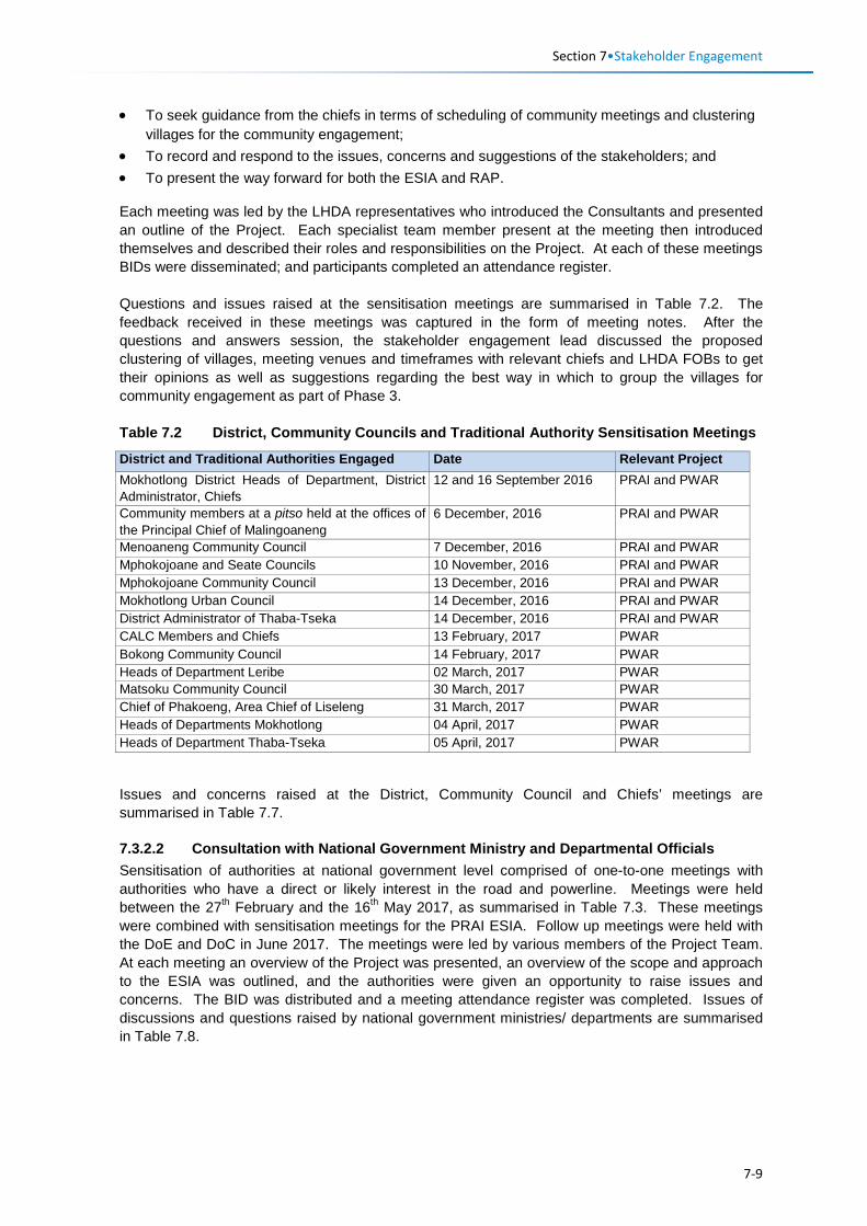
Section 7•Stakeholder Engagement
• To seek guidance from the chiefs in terms of scheduling of community meetings and clustering villages for the community engagement;
• To record and respond to the issues, concerns and suggestions of the stakeholders; and • To present the way forward for both the ESIA and RAP.
Each meeting was led by the LHDA representatives who introduced the Consultants and presented an outline of the Project. Each specialist team member present at the meeting then introduced themselves and described their roles and responsibilities on the Project. At each of these meetings BIDs were disseminated; and participants completed an attendance register. Questions and issues raised at the sensitisation meetings are summarised in Table 7.2. The feedback received in these meetings was captured in the form of meeting notes. After the questions and answers session, the stakeholder engagement lead discussed the proposed clustering of villages, meeting venues and timeframes with relevant chiefs and LHDA FOBs to get their opinions as well as suggestions regarding the best way in which to group the villages for community engagement as part of Phase 3. Table 7.2 District, Community Councils and Traditional Authority Sensitisation Meetings
District and Traditional Authorities Engaged Date Relevant Project Mokhotlong District Heads of Department, District Administrator, Chiefs
12 and 16 September 2016 PRAI and PWAR
Community members at a pitso held at the offices of the Principal Chief of Malingoaneng
6 December, 2016 PRAI and PWAR
Menoaneng Community Council 7 December, 2016 PRAI and PWAR Mphokojoane and Seate Councils 10 November, 2016 PRAI and PWAR Mphokojoane Community Council 13 December, 2016 PRAI and PWAR Mokhotlong Urban Council 14 December, 2016 PRAI and PWAR District Administrator of Thaba-Tseka 14 December, 2016 PRAI and PWAR CALC Members and Chiefs 13 February, 2017 PWAR Bokong Community Council 14 February, 2017 PWAR Heads of Department Leribe 02 March, 2017 PWAR Matsoku Community Council 30 March, 2017 PWAR Chief of Phakoeng, Area Chief of Liseleng 31 March, 2017 PWAR Heads of Departments Mokhotlong 04 April, 2017 PWAR Heads of Department Thaba-Tseka 05 April, 2017 PWAR
Issues and concerns raised at the District, Community Council and Chiefs’ meetings are summarised in Table 7.7.
7.3.2.2 Consultation with National Government Ministry and Departmental Officials Sensitisation of authorities at national government level comprised of one-to-one meetings with authorities who have a direct or likely interest in the road and powerline. Meetings were held between the 27th February and the 16th May 2017, as summarised in Table 7.3. These meetings were combined with sensitisation meetings for the PRAI ESIA. Follow up meetings were held with the DoE and DoC in June 2017. The meetings were led by various members of the Project Team. At each meeting an overview of the Project was presented, an overview of the scope and approach to the ESIA was outlined, and the authorities were given an opportunity to raise issues and concerns. The BID was distributed and a meeting attendance register was completed. Issues of discussions and questions raised by national government ministries/ departments are summarised in Table 7.8.
7-9
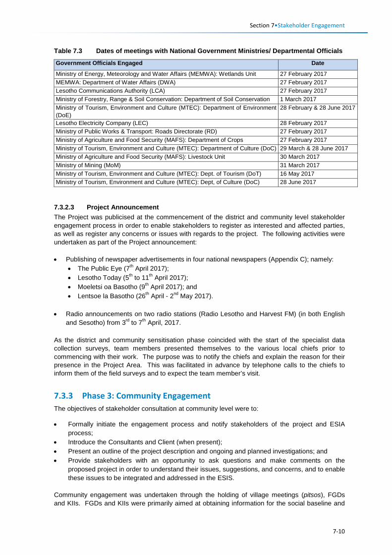
Section 7•Stakeholder Engagement
Table 7.3 Dates of meetings with National Government Ministries/ Departmental Officials
Government Officials Engaged Date
Ministry of Energy, Meteorology and Water Affairs (MEMWA): Wetlands Unit 27 February 2017 MEMWA: Department of Water Affairs (DWA) 27 February 2017 Lesotho Communications Authority (LCA) 27 February 2017 Ministry of Forestry, Range & Soil Conservation: Department of Soil Conservation 1 March 2017 Ministry of Tourism, Environment and Culture (MTEC): Department of Environment (DoE)
28 February & 28 June 2017
Lesotho Electricity Company (LEC) 28 February 2017 Ministry of Public Works & Transport: Roads Directorate (RD) 27 February 2017 Ministry of Agriculture and Food Security (MAFS): Department of Crops 27 February 2017 Ministry of Tourism, Environment and Culture (MTEC): Department of Culture (DoC) 29 March & 28 June 2017 Ministry of Agriculture and Food Security (MAFS): Livestock Unit 30 March 2017 Ministry of Mining (MoM) 31 March 2017 Ministry of Tourism, Environment and Culture (MTEC): Dept. of Tourism (DoT) 16 May 2017 Ministry of Tourism, Environment and Culture (MTEC): Dept, of Culture (DoC) 28 June 2017
7.3.2.3 Project Announcement The Project was publicised at the commencement of the district and community level stakeholder engagement process in order to enable stakeholders to register as interested and affected parties, as well as register any concerns or issues with regards to the project. The following activities were undertaken as part of the Project announcement: • Publishing of newspaper advertisements in four national newspapers (Appendix C); namely:
• The Public Eye (7th April 2017); • Lesotho Today (5th to 11th April 2017); • Moeletsi oa Basotho (9th April 2017); and • Lentsoe la Basotho (26th April - 2nd May 2017).
• Radio announcements on two radio stations (Radio Lesotho and Harvest FM) (in both English and Sesotho) from 3rd to 7th April, 2017.
As the district and community sensitisation phase coincided with the start of the specialist data collection surveys, team members presented themselves to the various local chiefs prior to commencing with their work. The purpose was to notify the chiefs and explain the reason for their presence in the Project Area. This was facilitated in advance by telephone calls to the chiefs to inform them of the field surveys and to expect the team member’s visit.
7.3.3 Phase 3: Community Engagement The objectives of stakeholder consultation at community level were to: • Formally initiate the engagement process and notify stakeholders of the project and ESIA
process; • Introduce the Consultants and Client (when present); • Present an outline of the project description and ongoing and planned investigations; and • Provide stakeholders with an opportunity to ask questions and make comments on the
proposed project in order to understand their issues, suggestions, and concerns, and to enable these issues to be integrated and addressed in the ESIS.
Community engagement was undertaken through the holding of village meetings (pitsos), FGDs and KIIs. FGDs and KIIs were primarily aimed at obtaining information for the social baseline and
7-10
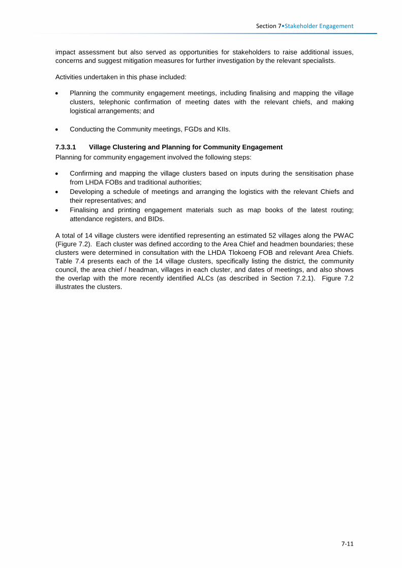
Section 7•Stakeholder Engagement
impact assessment but also served as opportunities for stakeholders to raise additional issues, concerns and suggest mitigation measures for further investigation by the relevant specialists. Activities undertaken in this phase included: • Planning the community engagement meetings, including finalising and mapping the village
clusters, telephonic confirmation of meeting dates with the relevant chiefs, and making logistical arrangements; and
• Conducting the Community meetings, FGDs and KIIs. 7.3.3.1 Village Clustering and Planning for Community Engagement Planning for community engagement involved the following steps: • Confirming and mapping the village clusters based on inputs during the sensitisation phase
from LHDA FOBs and traditional authorities; • Developing a schedule of meetings and arranging the logistics with the relevant Chiefs and
their representatives; and • Finalising and printing engagement materials such as map books of the latest routing;
attendance registers, and BIDs. A total of 14 village clusters were identified representing an estimated 52 villages along the PWAC (Figure 7.2). Each cluster was defined according to the Area Chief and headmen boundaries; these clusters were determined in consultation with the LHDA Tlokoeng FOB and relevant Area Chiefs. Table 7.4 presents each of the 14 village clusters, specifically listing the district, the community council, the area chief / headman, villages in each cluster, and dates of meetings, and also shows the overlap with the more recently identified ALCs (as described in Section 7.2.1). Figure 7.2 illustrates the clusters.
7-11
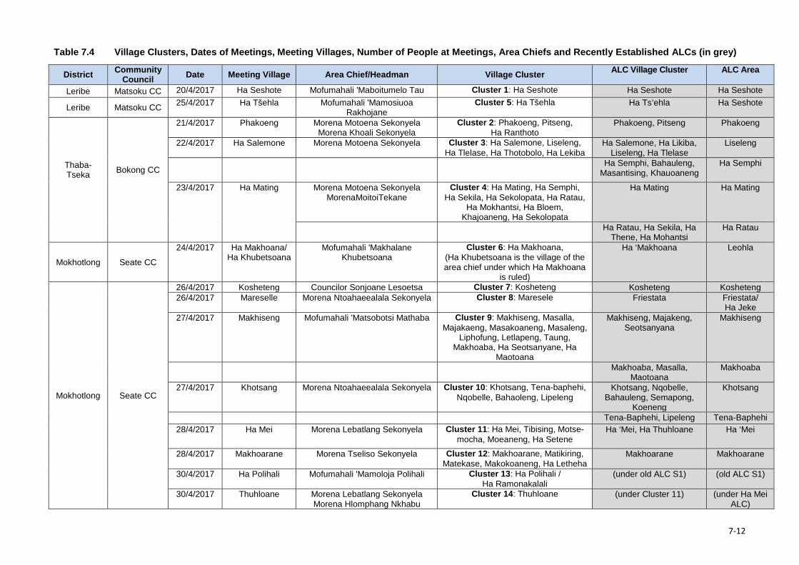
Table 7.4 Village Clusters, Dates of Meetings, Meeting Villages, Number of People at Meetings, Area Chiefs and Recently Established ALCs (in grey)
District Community Council Date Meeting Village Area Chief/Headman Village Cluster ALC Village Cluster ALC Area
Leribe Matsoku CC 20/4/2017 Ha Seshote Mofumahali 'Maboitumelo Tau Cluster 1: Ha Seshote Ha Seshote Ha Seshote
Leribe Matsoku CC 25/4/2017 Ha Tšehla Mofumahali 'Mamosiuoa Rakhojane
Cluster 5: Ha Tšehla Ha Ts’ehla Ha Seshote
Thaba-Tseka Bokong CC
21/4/2017 Phakoeng Morena Motoena Sekonyela Morena Khoali Sekonyela
Cluster 2: Phakoeng, Pitseng, Ha Ranthoto
Phakoeng, Pitseng Phakoeng
22/4/2017 Ha Salemone Morena Motoena Sekonyela Cluster 3: Ha Salemone, Liseleng, Ha Tlelase, Ha Thotobolo, Ha Lekiba
Ha Salemone, Ha Likiba, Liseleng, Ha Tlelase
Liseleng
Ha Semphi, Bahauleng, Masantising, Khauoaneng
Ha Semphi
23/4/2017 Ha Mating Morena Motoena Sekonyela MorenaMoitoiTekane
Cluster 4: Ha Mating, Ha Semphi, Ha Sekila, Ha Sekolopata, Ha Ratau,
Ha Mokhantsi, Ha Bloem, Khajoaneng, Ha Sekolopata
Ha Mating Ha Mating
Ha Ratau, Ha Sekila, Ha Thene, Ha Mohantsi
Ha Ratau
Mokhotlong Seate CC
24/4/2017 Ha Makhoana/ Ha Khubetsoana
Mofumahali 'Makhalane Khubetsoana
Cluster 6: Ha Makhoana, (Ha Khubetsoana is the village of the area chief under which Ha Makhoana
is ruled)
Ha ‘Makhoana Leohla
Mokhotlong Seate CC
26/4/2017 Kosheteng Councilor Sonjoane Lesoetsa Cluster 7: Kosheteng Kosheteng Kosheteng 26/4/2017 Mareselle Morena Ntoahaeealala Sekonyela Cluster 8: Maresele Friestata Friestata/
Ha Jeke 27/4/2017 Makhiseng Mofumahali 'Matsobotsi Mathaba Cluster 9: Makhiseng, Masalla,
Majakaeng, Masakoaneng, Masaleng, Liphofung, Letlapeng, Taung,
Makhoaba, Ha Seotsanyane, Ha Maotoana
Makhiseng, Majakeng, Seotsanyana
Makhiseng
Makhoaba, Masalla, Maotoana
Makhoaba
27/4/2017 Khotsang Morena Ntoahaeealala Sekonyela Cluster 10: Khotsang, Tena-baphehi, Nqobelle, Bahaoleng, Lipeleng
Khotsang, Nqobelle, Bahauleng, Semapong,
Koeneng
Khotsang
Tena-Baphehi, Lipeleng Tena-Baphehi 28/4/2017 Ha Mei Morena Lebatlang Sekonyela Cluster 11: Ha Mei, Tibising, Motse-
mocha, Moeaneng, Ha Setene Ha ‘Mei, Ha Thuhloane Ha ‘Mei
28/4/2017 Makhoarane Morena Tseliso Sekonyela Cluster 12: Makhoarane, Matikiring, Matekase, Makokoaneng, Ha Letheha
Makhoarane Makhoarane
30/4/2017 Ha Polihali Mofumahali 'Mamoloja Polihali Cluster 13: Ha Polihali / Ha Ramonakalali
(under old ALC S1) (old ALC S1)
30/4/2017 Thuhloane Morena Lebatlang Sekonyela Morena Hlomphang Nkhabu
Cluster 14: Thuhloane (under Cluster 11) (under Ha Mei ALC)
7-12
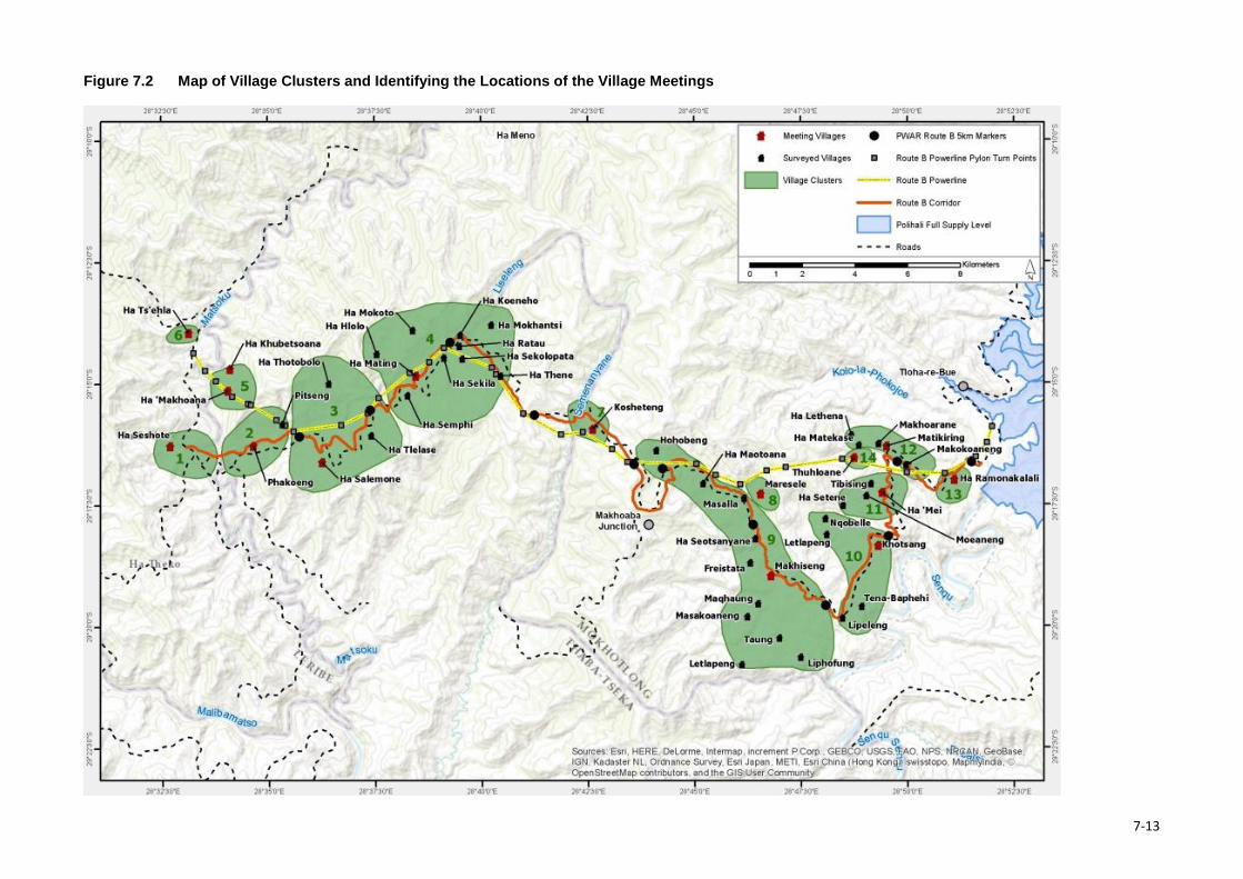
Figure 7.2 Map of Village Clusters and Identifying the Locations of the Village Meetings
7-13
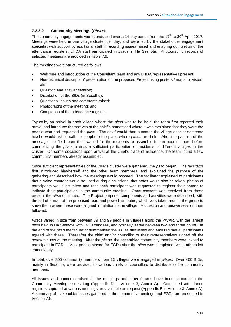
Section 7•Stakeholder Engagement
7.3.3.2 Community Meetings (Pitsos) The community engagements were conducted over a 14-day period from the 17th to 30th April 2017. Meetings were held in one village cluster per day, and were led by the stakeholder engagement specialist with support by additional staff in recording issues raised and ensuring completion of the attendance registers. LHDA staff participated in pitsos in Ha Seshote. Photographic records of selected meetings are provided in Table 7.9.
The meetings were structured as follows:
• Welcome and introduction of the Consultant team and any LHDA representatives present; • Non-technical description/ presentation of the proposed Project using posters / maps for visual
aid; • Question and answer session; • Distribution of the BIDs (in Sesotho); • Questions, issues and comments raised; • Photographs of the meeting; and • Completion of the attendance register.
Typically, on arrival in each village where the pitso was to be held, the team first reported their arrival and introduce themselves at the chief's homestead where it was explained that they were the people who had requested the pitso. The chief would then summon the village crier or someone he/she would ask to call the people to the place where pitsos are held. After the passing of the message, the field team then waited for the residents to assemble for an hour or more before commencing the pitso to ensure sufficient participation of residents of different villages in the cluster. On some occasions upon arrival at the chief’s place of residence, the team found a few community members already assembled. Once sufficient representatives of the village cluster were gathered, the pitso began. The facilitator first introduced him/herself and the other team members, and explained the purpose of the gathering and described how the meetings would proceed. The facilitator explained to participants that a voice recorder would be used during discussions, that notes would also be taken, photos of participants would be taken and that each participant was requested to register their names to indicate their participation in the community meeting. Once consent was received from those present the pitso continued. The Project purpose, components and activities were described, with the aid of a map of the proposed road and powerline routes, which was taken around the group to show them where these were aligned in relation to the village. A question and answer session then followed. Pitsos varied in size from between 39 and 99 people in villages along the PWAR, with the largest pitso held in Ha Seshote with 193 attendees, and typically lasted between two and three hours. At the end of the pitso the facilitator summarised the issues discussed and ensured that all participants agreed with these. Thereafter the chief and/or councillor or their representatives signed off the notes/minutes of the meeting. After the pitsos, the assembled community members were invited to participate in FGDs. Most people stayed for FGDs after the pitso was completed, while others left immediately. In total, over 800 community members from 33 villages were engaged in pitsos. Over 400 BIDs, mainly in Sesotho, were provided to various chiefs or councillors to distribute to the community members. All issues and concerns raised at the meetings and other forums have been captured in the Community Meeting Issues Log (Appendix D in Volume 3, Annex A). Completed attendance registers captured at various meetings are available on request (Appendix E in Volume 3, Annex A). A summary of stakeholder issues gathered in the community meetings and FGDs are presented in Section 7.5.
7-14
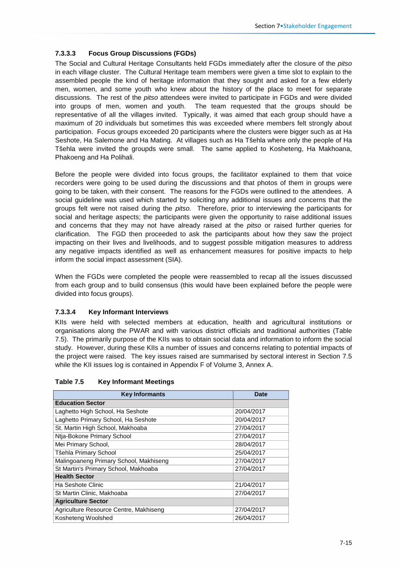
Section 7•Stakeholder Engagement
7.3.3.3 Focus Group Discussions (FGDs) The Social and Cultural Heritage Consultants held FGDs immediately after the closure of the pitso in each village cluster. The Cultural Heritage team members were given a time slot to explain to the assembled people the kind of heritage information that they sought and asked for a few elderly men, women, and some youth who knew about the history of the place to meet for separate discussions. The rest of the pitso attendees were invited to participate in FGDs and were divided into groups of men, women and youth. The team requested that the groups should be representative of all the villages invited. Typically, it was aimed that each group should have a maximum of 20 individuals but sometimes this was exceeded where members felt strongly about participation. Focus groups exceeded 20 participants where the clusters were bigger such as at Ha Seshote, Ha Salemone and Ha Mating. At villages such as Ha Tšehla where only the people of Ha Tšehla were invited the groupds were small. The same applied to Kosheteng, Ha Makhoana, Phakoeng and Ha Polihali. Before the people were divided into focus groups, the facilitator explained to them that voice recorders were going to be used during the discussions and that photos of them in groups were going to be taken, with their consent. The reasons for the FGDs were outlined to the attendees. A social guideline was used which started by soliciting any additional issues and concerns that the groups felt were not raised during the pitso. Therefore, prior to interviewing the participants for social and heritage aspects; the participants were given the opportunity to raise additional issues and concerns that they may not have already raised at the pitso or raised further queries for clarification. The FGD then proceeded to ask the participants about how they saw the project impacting on their lives and livelihoods, and to suggest possible mitigation measures to address any negative impacts identified as well as enhancement measures for positive impacts to help inform the social impact assessment (SIA). When the FGDs were completed the people were reassembled to recap all the issues discussed from each group and to build consensus (this would have been explained before the people were divided into focus groups). 7.3.3.4 Key Informant Interviews KIIs were held with selected members at education, health and agricultural institutions or organisations along the PWAR and with various district officials and traditional authorities (Table 7.5). The primarily purpose of the KIIs was to obtain social data and information to inform the social study. However, during these KIIs a number of issues and concerns relating to potential impacts of the project were raised. The key issues raised are summarised by sectoral interest in Section 7.5 while the KII issues log is contained in Appendix F of Volume 3, Annex A. Table 7.5 Key Informant Meetings
Key Informants Date Education Sector Laghetto High School, Ha Seshote 20/04/2017 Laghetto Primary School, Ha Seshote 20/04/2017 St. Martin High School, Makhoaba 27/04/2017 Ntja-Bokone Primary School 27/04/2017 Mei Primary School, 28/04/2017 Tšehla Primary School 25/04/2017 Malingoaneng Primary School, Makhiseng 27/04/2017 St Martin's Primary School, Makhoaba 27/04/2017 Health Sector Ha Seshote Clinic 21/04/2017 St Martin Clinic, Makhoaba 27/04/2017 Agriculture Sector Agriculture Resource Centre, Makhiseng 27/04/2017 Kosheteng Woolshed 26/04/2017
7-15
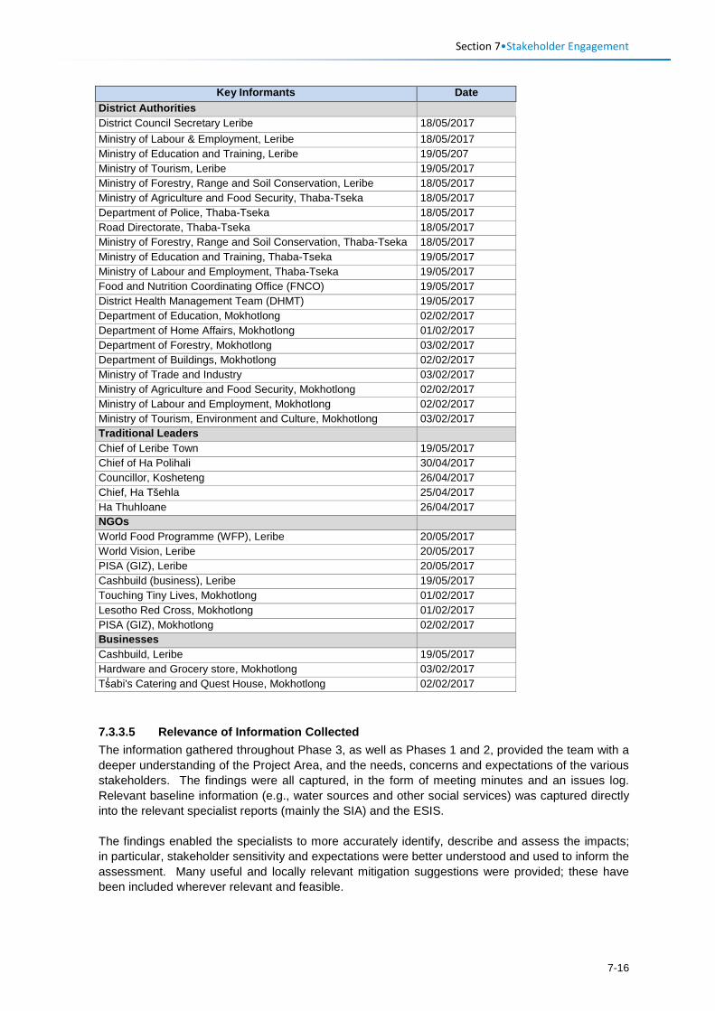
Section 7•Stakeholder Engagement
Key Informants Date District Authorities District Council Secretary Leribe 18/05/2017 Ministry of Labour & Employment, Leribe 18/05/2017 Ministry of Education and Training, Leribe 19/05/207 Ministry of Tourism, Leribe 19/05/2017 Ministry of Forestry, Range and Soil Conservation, Leribe 18/05/2017 Ministry of Agriculture and Food Security, Thaba-Tseka 18/05/2017 Department of Police, Thaba-Tseka 18/05/2017 Road Directorate, Thaba-Tseka 18/05/2017 Ministry of Forestry, Range and Soil Conservation, Thaba-Tseka 18/05/2017 Ministry of Education and Training, Thaba-Tseka 19/05/2017 Ministry of Labour and Employment, Thaba-Tseka 19/05/2017 Food and Nutrition Coordinating Office (FNCO) 19/05/2017 District Health Management Team (DHMT) 19/05/2017 Department of Education, Mokhotlong 02/02/2017 Department of Home Affairs, Mokhotlong 01/02/2017 Department of Forestry, Mokhotlong 03/02/2017 Department of Buildings, Mokhotlong 02/02/2017 Ministry of Trade and Industry 03/02/2017 Ministry of Agriculture and Food Security, Mokhotlong 02/02/2017 Ministry of Labour and Employment, Mokhotlong 02/02/2017 Ministry of Tourism, Environment and Culture, Mokhotlong 03/02/2017 Traditional Leaders Chief of Leribe Town 19/05/2017 Chief of Ha Polihali 30/04/2017 Councillor, Kosheteng 26/04/2017 Chief, Ha Tšehla 25/04/2017 Ha Thuhloane 26/04/2017 NGOs World Food Programme (WFP), Leribe 20/05/2017 World Vision, Leribe 20/05/2017 PISA (GIZ), Leribe 20/05/2017 Cashbuild (business), Leribe 19/05/2017 Touching Tiny Lives, Mokhotlong 01/02/2017 Lesotho Red Cross, Mokhotlong 01/02/2017 PISA (GIZ), Mokhotlong 02/02/2017 Businesses Cashbuild, Leribe 19/05/2017 Hardware and Grocery store, Mokhotlong 03/02/2017 Tṥabi's Catering and Quest House, Mokhotlong 02/02/2017 7.3.3.5 Relevance of Information Collected The information gathered throughout Phase 3, as well as Phases 1 and 2, provided the team with a deeper understanding of the Project Area, and the needs, concerns and expectations of the various stakeholders. The findings were all captured, in the form of meeting minutes and an issues log. Relevant baseline information (e.g., water sources and other social services) was captured directly into the relevant specialist reports (mainly the SIA) and the ESIS. The findings enabled the specialists to more accurately identify, describe and assess the impacts; in particular, stakeholder sensitivity and expectations were better understood and used to inform the assessment. Many useful and locally relevant mitigation suggestions were provided; these have been included wherever relevant and feasible.
7-16
Section 7•Stakeholder Engagement
Relevant concerns and suggestions have been presented to LHDA during meetings for their consideration or response.
7.3.4 Phase 4: Disclosure of ESIS for Stakeholder Review The aim of ESIS disclosure to national and district stakeholders during this phase will be: • To present the description of the project; • To provide the ESIA findings including potential project impacts and proposed mitigation and
enhancement measures identified by the specialists and project team; and • To provide an opportunity to provide comments and for these to be submitted to the DoE in the
form of an addendum to the Stakeholder Engagement Report. The approved ESIS will be uploaded to the Project website and stakeholders who have attended national and district authority or other meetings and who have supplied email addresses will be notified of its availability for review and comment over a two-week period. A copy of the ESIS and EMP will be made available at the LHDA and/or DoE library in Maseru. This period will be scheduled to coincide with submission of the ESIS to the DoE. In addition, many of the national authorities with whom meetings have been held in Maseru will be notified by the DoE of the availability of the ESIS for review (e.g., RD, DWA, and others) and will be invited to a presentation of the ESIS findings as part of the internal review and decision-making process. An addendum of comments and responses will be prepared of any additional comments received by stakeholders within the two week review period, and this will be supplied to DoE. Further, it is expected that LHDA, with the support of its environmental consultants, will coordinate a national stakeholder workshop to present the LHWP Phase II project components and the key findings of the ESISs of the PRAI and PWAC to national stakeholders (timing to be confirmed). It is recognised that many of the district and community level stakeholders do not have access to internet or email and will not be afforded an opportunity to review the full ESIS. Therefore, disclosure meetings will be held to present the ESIA findings at combined meetings to be held with the newly established ALCs, Community Councils and Heads of Department in the three districts. In addition, a hard copy of the ESIS (and EMP) will be made available at the Katse and Tlokoeng FOB offices for interested stakeholders to review copies there. Key findings of the PWAC ESIS will be included in a short Non-Technical Summary covering the PRAI ESIS findings.
7.3.5 Phase 5: Disclosure of ROD to Stakeholders On receipt of the RoD from the DoE, two newspaper advertisements will be published in English and Sesotho notifying the general public of the RoD, and commencement of the 30-day appeal process. Stakeholders with emails will also be notified of the RoD, which will be placed on the website.
7.3.6 Alignment of Stakeholder Engagement with International Good Practice
The requirements for international good practice for stakeholder engagement are described in Section 3.6.1.1 while the process followed for the PWAR ESIA is described in Section 7.2.1.1. Table 7.6 provides a summary that demonstrates how the stakeholder engagement process followed is aligned with international good practice.
7-17
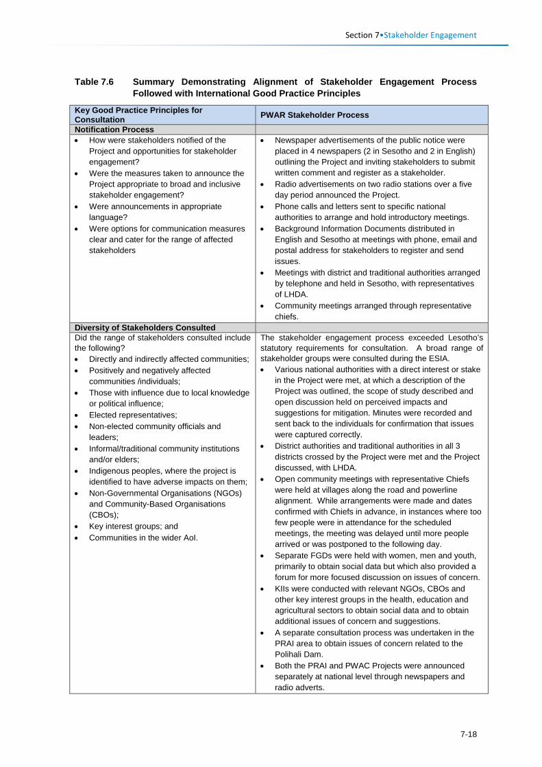
Section 7•Stakeholder Engagement
Table 7.6 Summary Demonstrating Alignment of Stakeholder Engagement Process
Followed with International Good Practice Principles
Key Good Practice Principles for Consultation PWAR Stakeholder Process
Notification Process • How were stakeholders notified of the
Project and opportunities for stakeholder engagement?
• Were the measures taken to announce the Project appropriate to broad and inclusive stakeholder engagement?
• Were announcements in appropriate language?
• Were options for communication measures clear and cater for the range of affected stakeholders
• Newspaper advertisements of the public notice were placed in 4 newspapers (2 in Sesotho and 2 in English) outlining the Project and inviting stakeholders to submit written comment and register as a stakeholder.
• Radio advertisements on two radio stations over a five day period announced the Project.
• Phone calls and letters sent to specific national authorities to arrange and hold introductory meetings.
• Background Information Documents distributed in English and Sesotho at meetings with phone, email and postal address for stakeholders to register and send issues.
• Meetings with district and traditional authorities arranged by telephone and held in Sesotho, with representatives of LHDA.
• Community meetings arranged through representative chiefs.
Diversity of Stakeholders Consulted Did the range of stakeholders consulted include the following? • Directly and indirectly affected communities; • Positively and negatively affected
communities /individuals; • Those with influence due to local knowledge
or political influence; • Elected representatives; • Non-elected community officials and
leaders; • Informal/traditional community institutions
and/or elders; • Indigenous peoples, where the project is
identified to have adverse impacts on them; • Non-Governmental Organisations (NGOs)
and Community-Based Organisations (CBOs);
• Key interest groups; and • Communities in the wider AoI.
The stakeholder engagement process exceeded Lesotho’s statutory requirements for consultation. A broad range of stakeholder groups were consulted during the ESIA. • Various national authorities with a direct interest or stake
in the Project were met, at which a description of the Project was outlined, the scope of study described and open discussion held on perceived impacts and suggestions for mitigation. Minutes were recorded and sent back to the individuals for confirmation that issues were captured correctly.
• District authorities and traditional authorities in all 3 districts crossed by the Project were met and the Project discussed, with LHDA.
• Open community meetings with representative Chiefs were held at villages along the road and powerline alignment. While arrangements were made and dates confirmed with Chiefs in advance, in instances where too few people were in attendance for the scheduled meetings, the meeting was delayed until more people arrived or was postponed to the following day.
• Separate FGDs were held with women, men and youth, primarily to obtain social data but which also provided a forum for more focused discussion on issues of concern.
• KIIs were conducted with relevant NGOs, CBOs and other key interest groups in the health, education and agricultural sectors to obtain social data and to obtain additional issues of concern and suggestions.
• A separate consultation process was undertaken in the PRAI area to obtain issues of concern related to the Polihali Dam.
• Both the PRAI and PWAC Projects were announced separately at national level through newspapers and radio adverts.
7-18
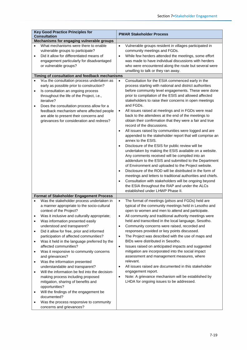
Section 7•Stakeholder Engagement
Key Good Practice Principles for Consultation PWAR Stakeholder Process
Mechanisms for engaging vulnerable groups • What mechanisms were there to enable
vulnerable groups to participate? • Did it allow for differentiated means of
engagement particularly for disadvantaged or vulnerable groups?
• Vulnerable groups resident in villages participated in community meetings and FGDs.
• While few herders attended the meetings, some effort was made to have individual discussions with herders who were encountered along the route but several were unwilling to talk or they ran away.
Timing of consultation and feedback mechanisms • Was the consultation process undertaken as
early as possible prior to construction? • Is consultation an ongoing process
throughout the life of the Project, i.e., iterative?
• Does the consultation process allow for a feedback mechanism where affected people are able to present their concerns and grievances for consideration and redress?
• Consultation for the ESIA commenced early in the process starting with national and district authorities before community level engagements. These were done prior to compilation of the ESIS and allowed affected stakeholders to raise their concerns in open meetings and FGDs.
• All issues raised at meetings and in FGDs were read back to the attendees at the end of the meetings to obtain their confirmation that they were a fair and true record of the discussions.
• All issues raised by communities were logged and are appended to the stakeholder report that will comprise an annex to the ESIS.
• Disclosure of the ESIS for public review will be undertaken by making the ESIS available on a website. Any comments received will be compiled into an addendum to the ESIS and submitted to the Department of Environment and uploaded to the Project website.
• Disclosure of the ROD will be distributed in the form of meetings and letters to traditional authorities and chiefs.
• Consultation with stakeholders will be ongoing beyond the ESIA throughout the RAP and under the ALCs established under LHWP Phase II.
Format of Stakeholder Engagement Process • Was the stakeholder process undertaken in
a manner appropriate to the socio-cultural context of the Project?
• Was it inclusive and culturally appropriate; • Was information presented easily
understood and transparent? • Did it allow for free, prior and informed
participation of affected communities? • Was it held in the language preferred by the
affected communities? • Was it responsive to community concerns
and grievances? • Was the information presented
understandable and transparent? • Will the information be fed into the decision-
making process including proposed mitigation, sharing of benefits and opportunities?
• Will the findings of the engagement be documented?
• Was the process responsive to community concerns and grievances?
• The format of meetings (pitsos and FGDs) held are typical of the community meetings held in Lesotho and open to women and men to attend and participate.
• All community and traditional authority meetings were held and transcribed in the local language, Sesotho.
• Community concerns were raised, recorded and responses provided or key points discussed.
• The Project was described with the use of maps and BIDs were distributed in Sesotho.
• Issues raised on anticipated impacts and suggested mitigation are incorporated into the social impact assessment and management measures, where relevant.
• All issues raised are documented in this stakeholder engagement report.
• Note: A grievance mechanism will be established by LHDA for ongoing issues to be addressed.
7-19
Section 7•Stakeholder Engagement
7.4 Sensitisation Issues 7.4.1 District and Traditional Authorities Issues raised at sensitisation meetings with district and traditional authorities are summarised in Table 7.7.
Issues mainly related to the following: • Employment and access to jobs; • Approach and form of compensation for damage to houses and fields; • Rehabilitation of quarries; • Electrification of houses; and • Potential impact on springs.
7.4.2 National Authorities Topics of discussion and issues raised at the national authority meetings that are of specific relevance to the PWAC are summarised in Table 7.8.
The full set of meeting minutes are contained in Appendix D (Volume 3, Annex A). Various issues were discussed that assisted the team to understand available contextual information for the ESIS, and the issues and challenges faced by government departments. The key issues discussed with national authorities that are of direct relevance to the PWAC included:
• Concern over the management of impacts of the road on wetlands, mainly as a result of concentration of flows from culverts;
• Increasing mineral rights to establish quarries in the highlands for sale of aggregate and community compensation requirements for quarries;
• Stock theft issues related to the road; • Road and powerline servitudes and building restrictions; • Siting of pylons to avoid problems relating to foundations and gully erosion.
7-20
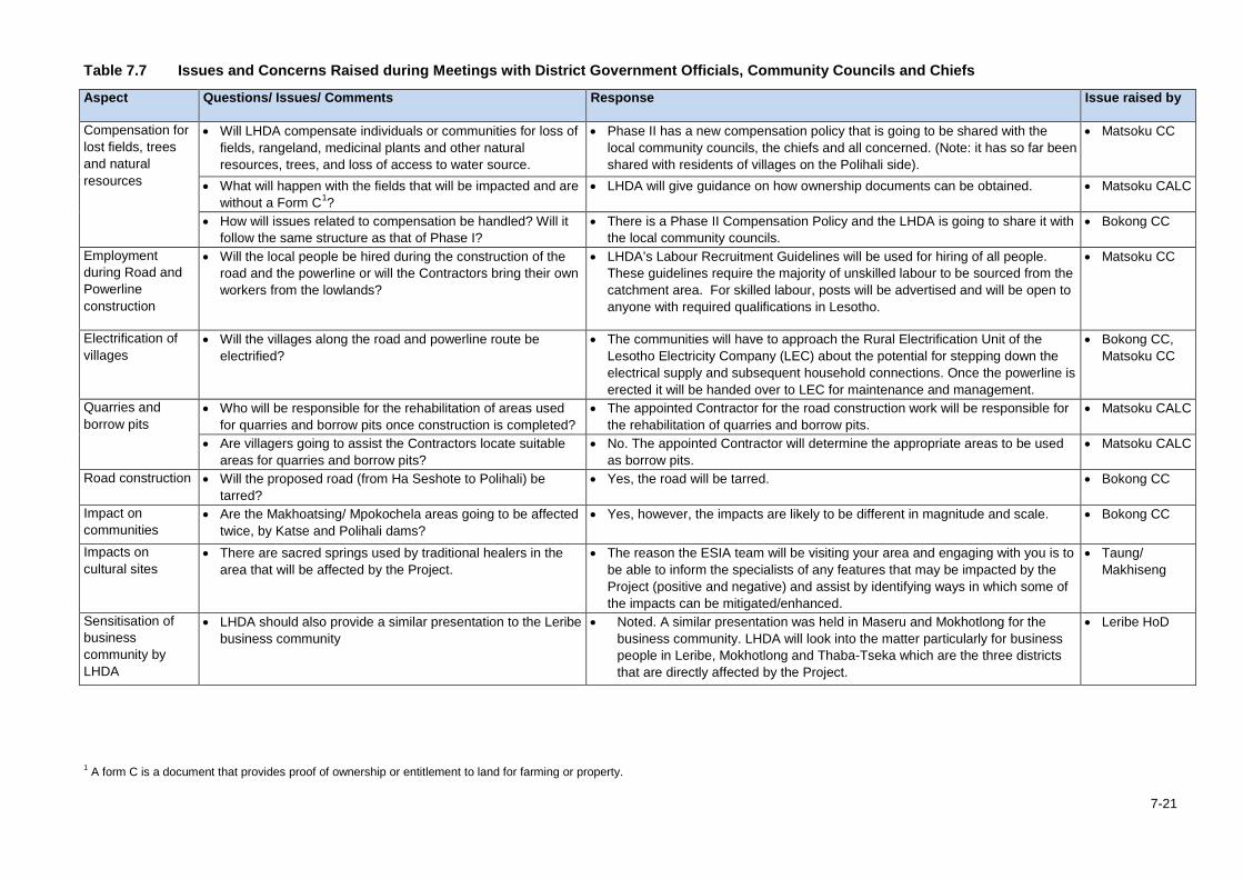
Table 7.7 Issues and Concerns Raised during Meetings with District Government Officials, Community Councils and Chiefs
Aspect Questions/ Issues/ Comments Response Issue raised by
Compensation for lost fields, trees and natural resources
• Will LHDA compensate individuals or communities for loss of fields, rangeland, medicinal plants and other natural resources, trees, and loss of access to water source.
• Phase II has a new compensation policy that is going to be shared with the local community councils, the chiefs and all concerned. (Note: it has so far been shared with residents of villages on the Polihali side).
• Matsoku CC
• What will happen with the fields that will be impacted and are without a Form C1?
• LHDA will give guidance on how ownership documents can be obtained. • Matsoku CALC
• How will issues related to compensation be handled? Will it follow the same structure as that of Phase I?
• There is a Phase II Compensation Policy and the LHDA is going to share it with the local community councils.
• Bokong CC
Employment during Road and Powerline construction
• Will the local people be hired during the construction of the road and the powerline or will the Contractors bring their own workers from the lowlands?
• LHDA’s Labour Recruitment Guidelines will be used for hiring of all people. These guidelines require the majority of unskilled labour to be sourced from the catchment area. For skilled labour, posts will be advertised and will be open to anyone with required qualifications in Lesotho.
• Matsoku CC
Electrification of villages
• Will the villages along the road and powerline route be electrified?
• The communities will have to approach the Rural Electrification Unit of the Lesotho Electricity Company (LEC) about the potential for stepping down the electrical supply and subsequent household connections. Once the powerline is erected it will be handed over to LEC for maintenance and management.
• Bokong CC, Matsoku CC
Quarries and borrow pits
• Who will be responsible for the rehabilitation of areas used for quarries and borrow pits once construction is completed?
• The appointed Contractor for the road construction work will be responsible for the rehabilitation of quarries and borrow pits.
• Matsoku CALC
• Are villagers going to assist the Contractors locate suitable areas for quarries and borrow pits?
• No. The appointed Contractor will determine the appropriate areas to be used as borrow pits.
• Matsoku CALC
Road construction • Will the proposed road (from Ha Seshote to Polihali) be tarred?
• Yes, the road will be tarred. • Bokong CC
Impact on communities
• Are the Makhoatsing/ Mpokochela areas going to be affected twice, by Katse and Polihali dams?
• Yes, however, the impacts are likely to be different in magnitude and scale. • Bokong CC
Impacts on cultural sites
• There are sacred springs used by traditional healers in the area that will be affected by the Project.
• The reason the ESIA team will be visiting your area and engaging with you is to be able to inform the specialists of any features that may be impacted by the Project (positive and negative) and assist by identifying ways in which some of the impacts can be mitigated/enhanced.
• Taung/ Makhiseng
Sensitisation of business community by LHDA
• LHDA should also provide a similar presentation to the Leribe business community
• Noted. A similar presentation was held in Maseru and Mokhotlong for the business community. LHDA will look into the matter particularly for business people in Leribe, Mokhotlong and Thaba-Tseka which are the three districts that are directly affected by the Project.
• Leribe HoD
1 A form C is a document that provides proof of ownership or entitlement to land for farming or property.
7-21
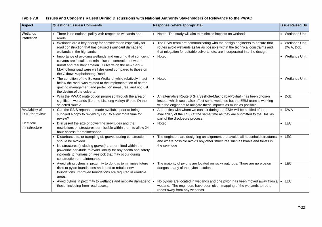
Table 7.8 Issues and Concerns Raised During Discussions with National Authority Stakeholders of Relevance to the PWAC
Aspect Questions/ Issues/ Comments Response (where appropriate) Issue Raised By
Wetlands Protection
• There is no national policy with respect to wetlands and roads.
• Noted. The study will aim to minimise impacts on wetlands • Wetlands Unit
• Wetlands are a key priority for consideration especially for road construction that has caused significant damage to wetlands in the highlands.
• The ESIA team are communicating with the design engineers to ensure that routes avoid wetlands as far as possible within the technical constraints and that mitigation for suitable culverts, etc. are incorporated into the design.
• Wetlands Unit, DWA, DoE
• Importance of avoiding wetlands and ensuring that sufficient culverts are installed to minimise concentration of water runoff and resultant erosion. Culverts on the new Sani – Mokhotlong road were well designed compared to those on the Oxbow-Mapholaneng Road.
• Noted • Wetlands Unit
• The condition of the Bokong Wetland, while relatively intact below the road, was related to the implementation of better grazing management and protection measures, and not just the design of the culverts.
• Noted • Wetlands Unit
• Was the PWAR route option proposed through the area of significant wetlands (i.e., the Liseleng valley) (Route D) the selected route?
• An alternative Route B (Ha Seshote-Makhoaba-Polihali) has been chosen instead which could also affect some wetlands but the ERM team is working with the engineers to mitigate these impacts as much as possible.
• DoE
Availability of ESIS for review
• Can the ESIS reports be made available prior to being supplied a copy to review by DoE to allow more time for review?
• Authorities with whom we consult during the ESIA will be notified of the availability of the ESIS at the same time as they are submitted to the DoE as part of the disclosure process.
• DWA
Electrical infrastructure
• Discussed the size of powerline servitudes and the restrictions on structures permissible within them to allow 24-hour access for maintenance.
• Noted • LEC
• Disturbance to, or trampling of, graves during construction should be avoided.
• No structures (including graves) are permitted within the powerline servitude to avoid liability for any health and safety incidents to humans or livestock that may occur during construction or maintenance.
• The engineers are designing an alignment that avoids all household structures and where possible avoids any other structures such as kraals and toilets in the servitude
• LEC
• Avoid siting pylons in proximity to dongas to minimise future risks to pylon foundations and need to rebuild new foundations. Improved foundations are required in erodible areas.
• The majority of pylons are located on rocky outcrops. There are no erosion dongas at any of the pylon locations.
• LEC
• Avoid pylons in proximity to wetlands and mitigate damage to these, including from road access.
• No pylons are located in wetlands and one pylon has been moved away from a wetland. The engineers have been given mapping of the wetlands to route roads away from any wetlands.
• LEC
7-22
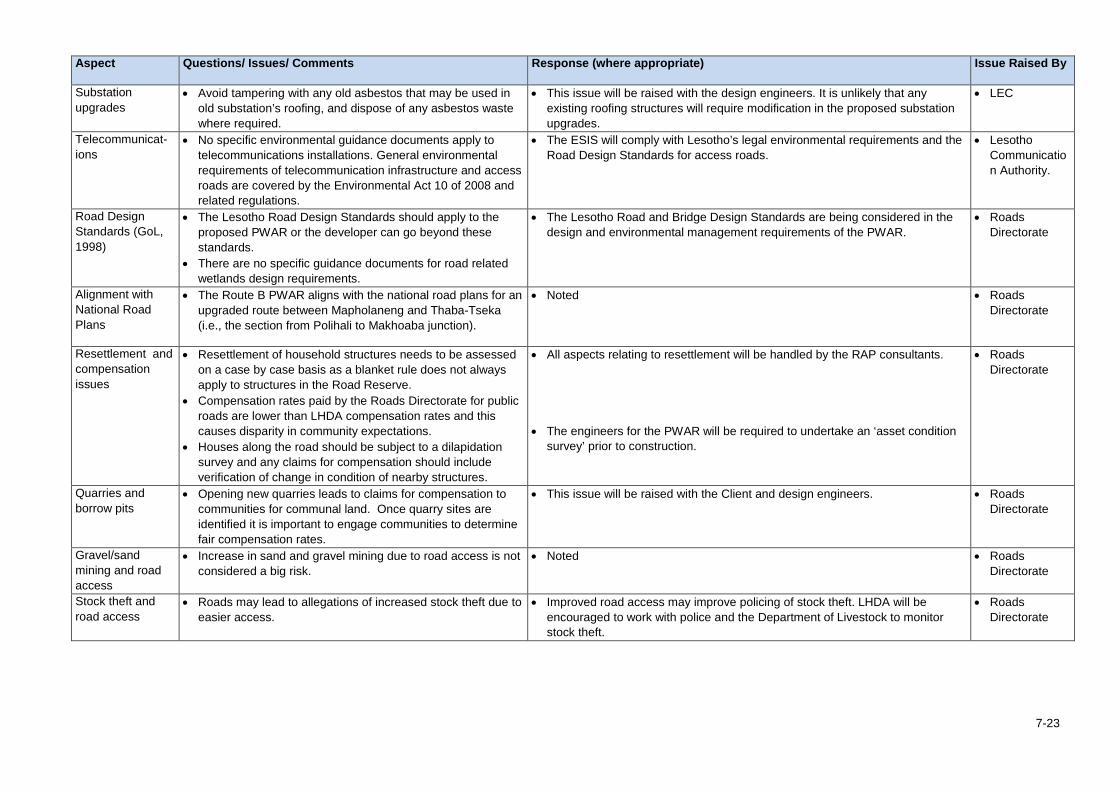
Aspect Questions/ Issues/ Comments Response (where appropriate) Issue Raised By
Substation upgrades
• Avoid tampering with any old asbestos that may be used in old substation’s roofing, and dispose of any asbestos waste where required.
• This issue will be raised with the design engineers. It is unlikely that any existing roofing structures will require modification in the proposed substation upgrades.
• LEC
Telecommunicat-ions
• No specific environmental guidance documents apply to telecommunications installations. General environmental requirements of telecommunication infrastructure and access roads are covered by the Environmental Act 10 of 2008 and related regulations.
• The ESIS will comply with Lesotho’s legal environmental requirements and the Road Design Standards for access roads.
• Lesotho Communication Authority.
Road Design Standards (GoL, 1998)
• The Lesotho Road Design Standards should apply to the proposed PWAR or the developer can go beyond these standards.
• There are no specific guidance documents for road related wetlands design requirements.
• The Lesotho Road and Bridge Design Standards are being considered in the design and environmental management requirements of the PWAR.
• Roads Directorate
Alignment with National Road Plans
• The Route B PWAR aligns with the national road plans for an upgraded route between Mapholaneng and Thaba-Tseka (i.e., the section from Polihali to Makhoaba junction).
• Noted • Roads Directorate
Resettlement and compensation issues
• Resettlement of household structures needs to be assessed on a case by case basis as a blanket rule does not always apply to structures in the Road Reserve.
• Compensation rates paid by the Roads Directorate for public roads are lower than LHDA compensation rates and this causes disparity in community expectations.
• Houses along the road should be subject to a dilapidation survey and any claims for compensation should include verification of change in condition of nearby structures.
• All aspects relating to resettlement will be handled by the RAP consultants.
• The engineers for the PWAR will be required to undertake an ‘asset condition survey’ prior to construction.
• Roads Directorate
Quarries and borrow pits
• Opening new quarries leads to claims for compensation to communities for communal land. Once quarry sites are identified it is important to engage communities to determine fair compensation rates.
• This issue will be raised with the Client and design engineers. • Roads Directorate
Gravel/sand mining and road access
• Increase in sand and gravel mining due to road access is not considered a big risk.
• Noted • Roads Directorate
Stock theft and road access
• Roads may lead to allegations of increased stock theft due to easier access.
• Improved road access may improve policing of stock theft. LHDA will be encouraged to work with police and the Department of Livestock to monitor stock theft.
• Roads Directorate
7-23
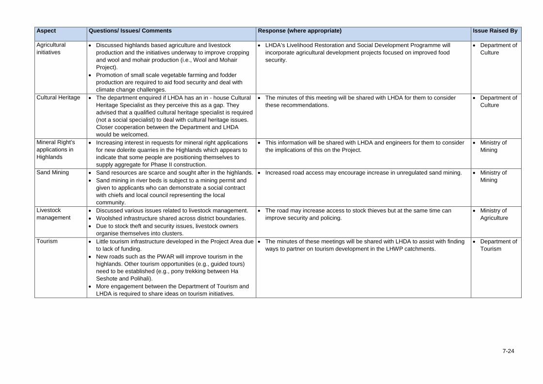
Aspect Questions/ Issues/ Comments Response (where appropriate) Issue Raised By
Agricultural initiatives
• Discussed highlands based agriculture and livestock production and the initiatives underway to improve cropping and wool and mohair production (i.e., Wool and Mohair Project).
• Promotion of small scale vegetable farming and fodder production are required to aid food security and deal with climate change challenges.
• LHDA’s Livelihood Restoration and Social Development Programme will incorporate agricultural development projects focused on improved food security.
• Department of Culture
Cultural Heritage • The department enquired if LHDA has an in - house Cultural Heritage Specialist as they perceive this as a gap. They advised that a qualified cultural heritage specialist is required (not a social specialist) to deal with cultural heritage issues. Closer cooperation between the Department and LHDA would be welcomed.
• The minutes of this meeting will be shared with LHDA for them to consider these recommendations.
• Department of Culture
Mineral Right’s applications in Highlands
• Increasing interest in requests for mineral right applications for new dolerite quarries in the Highlands which appears to indicate that some people are positioning themselves to supply aggregate for Phase II construction.
• This information will be shared with LHDA and engineers for them to consider the implications of this on the Project.
• Ministry of Mining
Sand Mining • Sand resources are scarce and sought after in the highlands. • Sand mining in river beds is subject to a mining permit and
given to applicants who can demonstrate a social contract with chiefs and local council representing the local community.
• Increased road access may encourage increase in unregulated sand mining. • Ministry of Mining
Livestock management
• Discussed various issues related to livestock management. • Woolshed infrastructure shared across district boundaries. • Due to stock theft and security issues, livestock owners
organise themselves into clusters.
• The road may increase access to stock thieves but at the same time can improve security and policing.
• Ministry of Agriculture
Tourism • Little tourism infrastructure developed in the Project Area due to lack of funding.
• New roads such as the PWAR will improve tourism in the highlands. Other tourism opportunities (e.g., guided tours) need to be established (e.g., pony trekking between Ha Seshote and Polihali).
• More engagement between the Department of Tourism and LHDA is required to share ideas on tourism initiatives.
• The minutes of these meetings will be shared with LHDA to assist with finding ways to partner on tourism development in the LHWP catchments.
• Department of Tourism
7-24
Section 7 • Stakeholder Engagement
7.5 Summary of Community and Key Informant Issues 7.5.1 Community Issues All issues raised by each village cluster at community meetings and FGDs are summarised in Appendix E of Volume 2, Annex A. The issues log was interrogated and similar issues grouped together into summary tables together with the relevant village cluster (based on the numbering provided in Table 7.4 above). There were no substantive differences raised during the community meetings and FGDs or between the different FGDs. Summary tables have been prepared for the anticipated positive impacts and the negative impacts raised by the community members in Table 7.10 and Table 7.11.
Overall, the community members in the majority of villages where discussions were held had high expectation that their quality of life would improve and that the road would provide more economic opportunities (jobs and access to markets to sell produce), and better access to social, health and agricultural extension services. There were also unrealistically high expectations that the powerline would provide household electrical connections in the villages (although it was made clear that the powerline was a high voltage supply for dam construction and that it was the responsibility of LEC to supply communities).
The main anticipated negative impacts raised by community members and key informants related to: • Loss of / damage to houses and arable land, including from rocks rolling into fields; • Loss of fuelwood, medicinal plants and other natural resources; • Increased risk of social ills (e.g., teenage pregnancy, and school absenteeism / dropouts)
during construction phase; • Construction disturbance from noise, dust, etc. and traffic safety risks, especially at schools; • Increased crime over sale of dagga and alcohol; • Increased stock theft due to improved access (although potentially counter-balanced by the
improved access to police enforcement); and • Interference with water supply sources, such as wetlands;
7-25
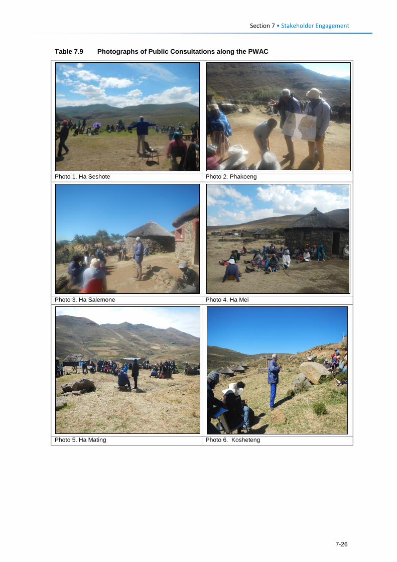
Section 7 • Stakeholder Engagement
Table 7.9 Photographs of Public Consultations along the PWAC
Photo 1. Ha Seshote Photo 2. Phakoeng
Photo 3. Ha Salemone Photo 4. Ha Mei
Photo 5. Ha Mating Photo 6. Kosheteng
7-26
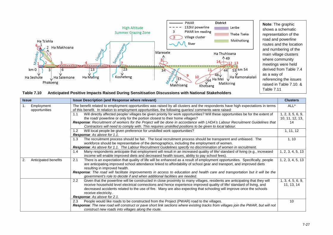
Table 7.10 Anticipated Positive Impacts Raised During Sensitisation Discussions with National Stakeholders
Issue Issue Description (and Response where relevant) Clusters 1. Employment
opportunities The benefit related to employment opportunities was raised by all clusters and the respondents have high expectations in terms of this benefit. In relation to employment opportunities, the following queries/ comments were raised:
ALL*
1.1 Will directly affected people/ villages be given priority for work opportunities? Will these opportunities be for the extent of the road/ powerline or only for the portion closest to their home villages?
Response: Recruitment of workers for the Project will be done in accordance with LHDA’s Labour Recruitment Guidelines that Contractors will need to comply with. This requires unskilled positions to be given to local labour.
1, 2, 3, 5, 6, 9, 10, 11, 12, 13,
14
1.2 Will local people be given preference for unskilled work opportunities? Response: As above for 1.1.
1, 11, 12
1.3 The recruitment process should be fair. The local recruitment process should be transparent and unbiased. The workforce should be representative of the demographics, including the employment of women.
Response: As above for 1.1. The Labour Recruitment Guidelines specify no discrimination of women in recruitment.
1, 10
1.4 Many respondents anticipate that employment will result in an increased quality of life/ standard of living (e.g., increased income will enable improved diets and decreased health issues, ability to pay school fees).
1, 2, 3, 4, 5, 13
2. Anticipated benefits 2.1 There is an expectation that quality of life will be enhanced as a result of employment opportunities. Specifically, people are anticipating improved school attendance linked to affordability of school gear and transport, and improved diets resulting in improved health.
Response: The road will facilitate improvements in access to education and health care and transportation but it will be the government’s role to decide if and when additional facilities are needed.
1, 2, 3, 4, 5, 13
2.2 Given that the powerline will be constructed in close proximity to many villages, residents are anticipating that they will receive household level electrical connections and hence experience improved quality of life/ standard of living, and decreased accidents related to the use of fire. Many are also expecting that schooling will improve once the schools receive electricity.
Response: As above for 2.1.
1, 3, 4, 5, 6, 9, 11, 13, 14
2.3 People would like roads to be constructed from the Project (PWAR) road to the villages. Response: The new road will construct or pave short link sections where existing tracks from villages join the PWAR, but will not
construct new roads into villages along the route.
10
Note: The graphic shows a schematic representation of the road and powerline routes and the location and numbering of the main village clusters where community meetings were held derived from Table 7.4 as a way of referencing the issues raised in Table 7.10. & Table 7.11
7-27
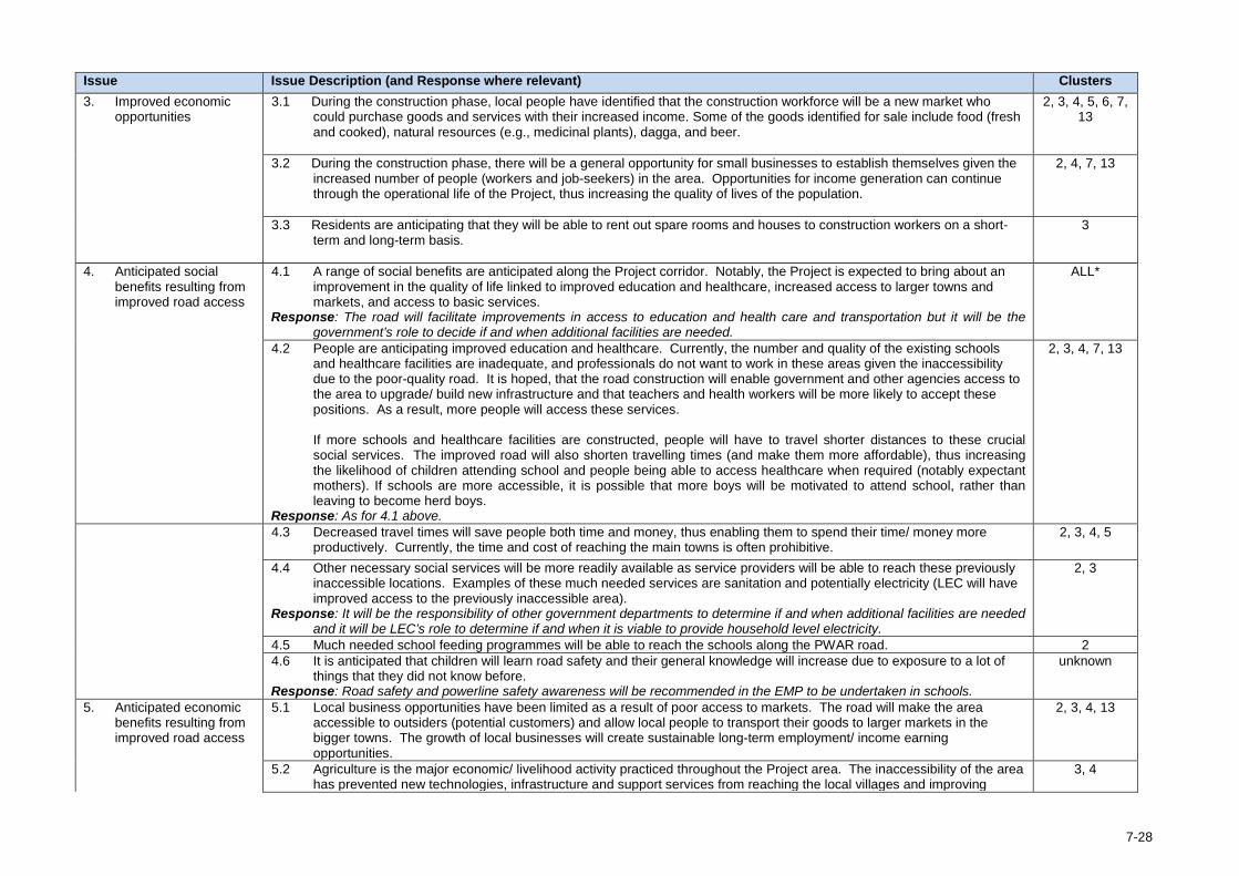
Issue Issue Description (and Response where relevant) Clusters 3. Improved economic
opportunities 3.1 During the construction phase, local people have identified that the construction workforce will be a new market who
could purchase goods and services with their increased income. Some of the goods identified for sale include food (fresh and cooked), natural resources (e.g., medicinal plants), dagga, and beer.
2, 3, 4, 5, 6, 7, 13
3.2 During the construction phase, there will be a general opportunity for small businesses to establish themselves given the increased number of people (workers and job-seekers) in the area. Opportunities for income generation can continue through the operational life of the Project, thus increasing the quality of lives of the population.
2, 4, 7, 13
3.3 Residents are anticipating that they will be able to rent out spare rooms and houses to construction workers on a short-term and long-term basis.
3
4. Anticipated social benefits resulting from improved road access
4.1 A range of social benefits are anticipated along the Project corridor. Notably, the Project is expected to bring about an improvement in the quality of life linked to improved education and healthcare, increased access to larger towns and markets, and access to basic services.
Response: The road will facilitate improvements in access to education and health care and transportation but it will be the government’s role to decide if and when additional facilities are needed.
ALL*
4.2 People are anticipating improved education and healthcare. Currently, the number and quality of the existing schools and healthcare facilities are inadequate, and professionals do not want to work in these areas given the inaccessibility due to the poor-quality road. It is hoped, that the road construction will enable government and other agencies access to the area to upgrade/ build new infrastructure and that teachers and health workers will be more likely to accept these positions. As a result, more people will access these services.
If more schools and healthcare facilities are constructed, people will have to travel shorter distances to these crucial social services. The improved road will also shorten travelling times (and make them more affordable), thus increasing the likelihood of children attending school and people being able to access healthcare when required (notably expectant mothers). If schools are more accessible, it is possible that more boys will be motivated to attend school, rather than leaving to become herd boys.
Response: As for 4.1 above.
2, 3, 4, 7, 13
4.3 Decreased travel times will save people both time and money, thus enabling them to spend their time/ money more productively. Currently, the time and cost of reaching the main towns is often prohibitive.
2, 3, 4, 5
4.4 Other necessary social services will be more readily available as service providers will be able to reach these previously inaccessible locations. Examples of these much needed services are sanitation and potentially electricity (LEC will have improved access to the previously inaccessible area).
Response: It will be the responsibility of other government departments to determine if and when additional facilities are needed and it will be LEC’s role to determine if and when it is viable to provide household level electricity.
2, 3
4.5 Much needed school feeding programmes will be able to reach the schools along the PWAR road. 2 4.6 It is anticipated that children will learn road safety and their general knowledge will increase due to exposure to a lot of
things that they did not know before. Response: Road safety and powerline safety awareness will be recommended in the EMP to be undertaken in schools.
unknown
5. Anticipated economic benefits resulting from improved road access
5.1 Local business opportunities have been limited as a result of poor access to markets. The road will make the area accessible to outsiders (potential customers) and allow local people to transport their goods to larger markets in the bigger towns. The growth of local businesses will create sustainable long-term employment/ income earning opportunities.
2, 3, 4, 13
5.2 Agriculture is the major economic/ livelihood activity practiced throughout the Project area. The inaccessibility of the area has prevented new technologies, infrastructure and support services from reaching the local villages and improving
3, 4
7-28
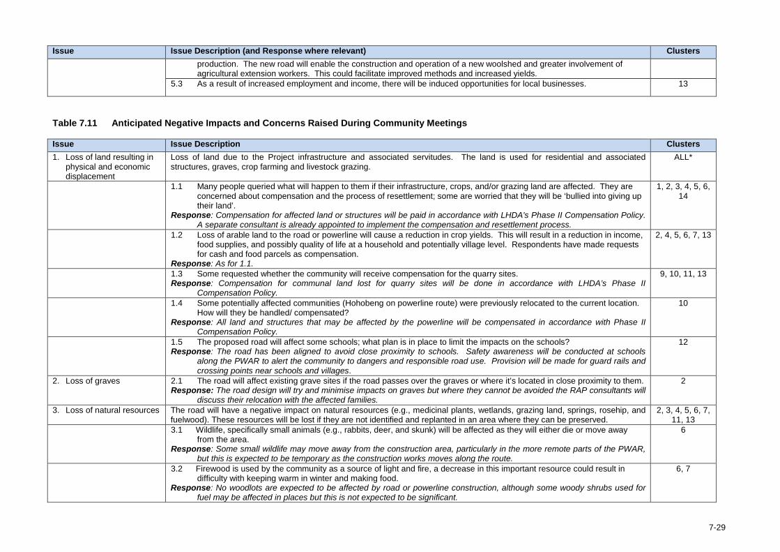
Issue Issue Description (and Response where relevant) Clusters
production. The new road will enable the construction and operation of a new woolshed and greater involvement of agricultural extension workers. This could facilitate improved methods and increased yields.
5.3 As a result of increased employment and income, there will be induced opportunities for local businesses. 13
Table 7.11 Anticipated Negative Impacts and Concerns Raised During Community Meetings
Issue Issue Description Clusters 1. Loss of land resulting in
physical and economic displacement
Loss of land due to the Project infrastructure and associated servitudes. The land is used for residential and associated structures, graves, crop farming and livestock grazing.
ALL*
1.1 Many people queried what will happen to them if their infrastructure, crops, and/or grazing land are affected. They are concerned about compensation and the process of resettlement; some are worried that they will be ‘bullied into giving up their land’.
Response: Compensation for affected land or structures will be paid in accordance with LHDA's Phase II Compensation Policy. A separate consultant is already appointed to implement the compensation and resettlement process.
1, 2, 3, 4, 5, 6, 14
1.2 Loss of arable land to the road or powerline will cause a reduction in crop yields. This will result in a reduction in income, food supplies, and possibly quality of life at a household and potentially village level. Respondents have made requests for cash and food parcels as compensation.
Response: As for 1.1.
2, 4, 5, 6, 7, 13
1.3 Some requested whether the community will receive compensation for the quarry sites. Response: Compensation for communal land lost for quarry sites will be done in accordance with LHDA’s Phase II
Compensation Policy.
9, 10, 11, 13
1.4 Some potentially affected communities (Hohobeng on powerline route) were previously relocated to the current location. How will they be handled/ compensated?
Response: All land and structures that may be affected by the powerline will be compensated in accordance with Phase II Compensation Policy.
10
1.5 The proposed road will affect some schools; what plan is in place to limit the impacts on the schools? Response: The road has been aligned to avoid close proximity to schools. Safety awareness will be conducted at schools
along the PWAR to alert the community to dangers and responsible road use. Provision will be made for guard rails and crossing points near schools and villages.
12
2. Loss of graves 2.1 The road will affect existing grave sites if the road passes over the graves or where it’s located in close proximity to them. Response: The road design will try and minimise impacts on graves but where they cannot be avoided the RAP consultants will
discuss their relocation with the affected families.
2
3. Loss of natural resources The road will have a negative impact on natural resources (e.g., medicinal plants, wetlands, grazing land, springs, rosehip, and fuelwood). These resources will be lost if they are not identified and replanted in an area where they can be preserved.
2, 3, 4, 5, 6, 7, 11, 13
3.1 Wildlife, specifically small animals (e.g., rabbits, deer, and skunk) will be affected as they will either die or move away from the area.
Response: Some small wildlife may move away from the construction area, particularly in the more remote parts of the PWAR, but this is expected to be temporary as the construction works moves along the route.
6
3.2 Firewood is used by the community as a source of light and fire, a decrease in this important resource could result in difficulty with keeping warm in winter and making food.
Response: No woodlots are expected to be affected by road or powerline construction, although some woody shrubs used for fuel may be affected in places but this is not expected to be significant.
6, 7
7-29
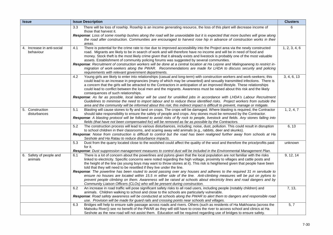
Issue Issue Description Clusters 3.3 There will be loss of rosehip. Rosehip is an income generating resource, the loss of this plant will decrease income of
those that harvest it. Response: Loss of some rosehip bushes along the road will be unavoidable but it is expected that more bushes will grow along
the road after construction. Communities are encouraged to harvest rose hip in advance of construction works in their areas.
6
4. Increase in anti-social behaviour
4.1 There is potential for the crime rate to rise due to improved accessibility into the Project area via the newly constructed road. Migrants are likely to be in search of work and will therefore have no income and will be in need of food and money. Stock theft is the most likely crime given that it already exists and livestock is probably one of the most valuable assets. Establishment of community policing forums was suggested by several communities.
Response: Recruitment of construction workers will be done at a central location at Ha Lejone and Malingoaneng to restrict in-migration of work-seekers along the PWAR. Recommendations are made for LHDA to discuss security and policing requirements with relevant government departments.
1, 2, 3, 4, 6
4.2 Young girls are likely to enter into relationships (casual and long-term) with construction workers and work-seekers; this could lead to an increase in pregnancies (many of which may be unwanted) and sexually transmitted infections. There is a concern that the girls will be attracted to the Contractors in anticipation of an improved lifestyle. These relationships could lead to conflict between the local men and the migrants. Awareness must be raised about this risk and the likely consequences of such relationships.
Response: As far as possible, local labour will be used for unskilled jobs in accordance with LHDA’s Labour Recruitment Guidelines to minimise the need to import labour and to reduce these identified risks. Project workers from outside the area and the community will be informed about this risk; this indirect impact is difficult to prevent, manage or mitigate.
3, 4, 6, 13
5. Construction disturbances
5.1 Blasting will cause stones to fly and land on crops. The crops will be damaged. Where blasting is required, the Contractor should take responsibility to ensure the safety of people and crops. Any stones must be removed by the Contractor.
Response: A blasting protocol will be followed to avoid risks of fly rock to people, livestock and fields. Any stones falling into fields (that have not been compensated for) will be removed as far as possible by the Contractors.
1, 2, 4, 7
5.2 The construction process will lead to various disturbances, including; noise, dust, pollution. This could result in disruption to school children in their classrooms, and scaring away wild animals (e.g., rabbits, deer and skunks).
Response: Noise from construction is difficult to control but the road has been realigned further away from schools at Ha Seshote and Ha Ratau to reduce disturbance impacts.
6, 13
5.3 Dust from the quarry located close to the woolshed could affect the quality of the wool and therefore the price/profits paid for it.
Response: Dust suppression management measures to control dust will be included in the Environmental Management Plan.
unknown
6. Safety of people and animals
6.1 There is a lot of concern about the powerlines and pylons given that the local population are not familiar with the risks linked to electricity. Specific concerns were noted regarding the high voltage, proximity to villages and cattle posts and the height of the line (as young boys may want to throw stones at it). This risk is heightened given that people have been told that they will need to be resettled if they live under the line.
Response: The powerline has been routed to avoid passing over any houses and adheres to the required 31 m servitude to ensure no houses are located within 15.5 m either side of the line. Anti-climbing measures will be put on pylons to prevent people climbing on them. Awareness will be raised at schools about electricity lines and road dangers and by Community Liaison Officers (CLOs) who will be present during construction.
9, 12, 14
6.2 An increase in road traffic will pose significant safety risks to all road users, including people (notably children) and animals. Children walking to school and close to the schools are particularly vulnerable.
Response: Road safety awareness will be conducted at schools along the PWAR to alert them to dangers and responsible road use. Provision will be made for guard rails and crossing points near schools and villages.
7, 13,
6.3 Bridges will help to ensure safe passage across roads and rivers. Others (such as residents of Ha Makhoana (across the Matsoku River)) see no benefit of the PWAR as they will still have to cross the river to access school and clinics at Ha Seshote as the new road will not assist them. Education will be required regarding use of bridges to ensure safety.
5, 7
7-30
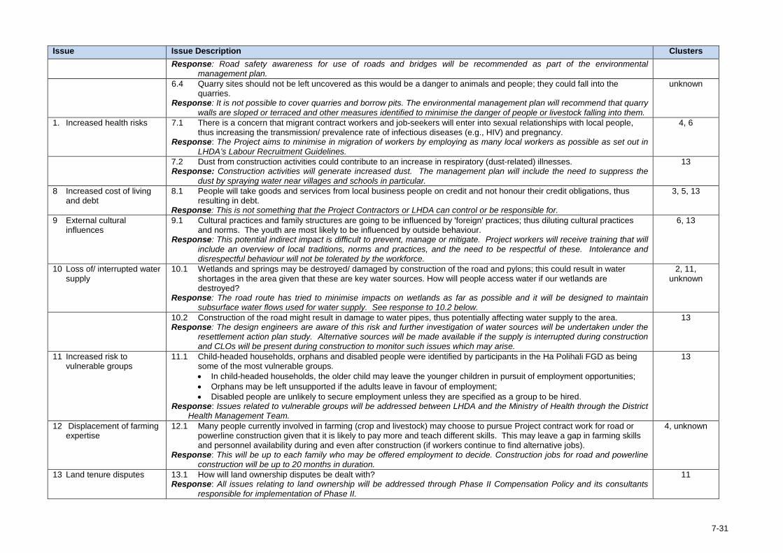
Issue Issue Description Clusters
Response: Road safety awareness for use of roads and bridges will be recommended as part of the environmental management plan.
6.4 Quarry sites should not be left uncovered as this would be a danger to animals and people; they could fall into the quarries.
Response: It is not possible to cover quarries and borrow pits. The environmental management plan will recommend that quarry walls are sloped or terraced and other measures identified to minimise the danger of people or livestock falling into them.
unknown
1. Increased health risks 7.1 There is a concern that migrant contract workers and job-seekers will enter into sexual relationships with local people, thus increasing the transmission/ prevalence rate of infectious diseases (e.g., HIV) and pregnancy.
Response: The Project aims to minimise in migration of workers by employing as many local workers as possible as set out in LHDA’s Labour Recruitment Guidelines.
4, 6
7.2 Dust from construction activities could contribute to an increase in respiratory (dust-related) illnesses. Response: Construction activities will generate increased dust. The management plan will include the need to suppress the
dust by spraying water near villages and schools in particular.
13
8 Increased cost of living and debt
8.1 People will take goods and services from local business people on credit and not honour their credit obligations, thus resulting in debt.
Response: This is not something that the Project Contractors or LHDA can control or be responsible for.
3, 5, 13
9 External cultural influences
9.1 Cultural practices and family structures are going to be influenced by 'foreign' practices; thus diluting cultural practices and norms. The youth are most likely to be influenced by outside behaviour.
Response: This potential indirect impact is difficult to prevent, manage or mitigate. Project workers will receive training that will include an overview of local traditions, norms and practices, and the need to be respectful of these. Intolerance and disrespectful behaviour will not be tolerated by the workforce.
6, 13
10 Loss of/ interrupted water supply
10.1 Wetlands and springs may be destroyed/ damaged by construction of the road and pylons; this could result in water shortages in the area given that these are key water sources. How will people access water if our wetlands are destroyed?
Response: The road route has tried to minimise impacts on wetlands as far as possible and it will be designed to maintain subsurface water flows used for water supply. See response to 10.2 below.
2, 11, unknown
10.2 Construction of the road might result in damage to water pipes, thus potentially affecting water supply to the area. Response: The design engineers are aware of this risk and further investigation of water sources will be undertaken under the
resettlement action plan study. Alternative sources will be made available if the supply is interrupted during construction and CLOs will be present during construction to monitor such issues which may arise.
13
11 Increased risk to vulnerable groups
11.1 Child-headed households, orphans and disabled people were identified by participants in the Ha Polihali FGD as being some of the most vulnerable groups. • In child-headed households, the older child may leave the younger children in pursuit of employment opportunities; • Orphans may be left unsupported if the adults leave in favour of employment; • Disabled people are unlikely to secure employment unless they are specified as a group to be hired.
Response: Issues related to vulnerable groups will be addressed between LHDA and the Ministry of Health through the District Health Management Team.
13
12 Displacement of farming expertise
12.1 Many people currently involved in farming (crop and livestock) may choose to pursue Project contract work for road or powerline construction given that it is likely to pay more and teach different skills. This may leave a gap in farming skills and personnel availability during and even after construction (if workers continue to find alternative jobs).
Response: This will be up to each family who may be offered employment to decide. Construction jobs for road and powerline construction will be up to 20 months in duration.
4, unknown
13 Land tenure disputes 13.1 How will land ownership disputes be dealt with? Response: All issues relating to land ownership will be addressed through Phase II Compensation Policy and its consultants
responsible for implementation of Phase II.
11
7-31
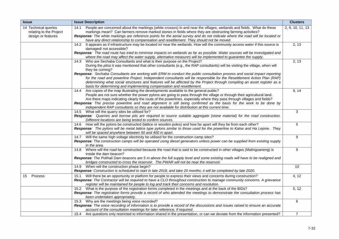
Issue Issue Description Clusters 14 Technical queries
relating to the Project design or features
14.1 People are concerned about the markings (white crosses) in and near the villages, wetlands and fields. What do these markings mean? Can farmers remove marked stones in fields where they are obstructing farming activities?
Response: The white markings are reference points for the aerial survey and do not indicate where the road will be located or have any direct relationship to compensation and resettlement. They should not be moved.
2, 9, 10, 11, 13
14.2 It appears as if infrastructure may be located in/ near the wetlands. How will the community access water if this source is damaged/ not accessible?
Response: The road route has tried to minimise impacts on wetlands as far as possible. Water sources will be investigated and where the road may affect the water supply, alternative measures will be implemented to guarantee the supply.
2, 13
14.3 Who are Sechaba Consultants and what is their purpose on the Project? During the pitso it was mentioned that other consultants (e.g., the RAP consultants) will be visiting the village, when will they be coming?
Response: Sechaba Consultants are working with ERM to conduct the public consultation process and social impact reporting for the road and powerline Project. Independent consultants will be responsible for the Resettlement Action Plan (RAP) determining what social structures and features will be affected by the Project through compiling an asset register as a basis for determining and implementing compensation and resettlement.
2, 13
14.4 Are copies of the map illustrating the developments available to the general public? People are not sure whether the power pylons are going to pass through the village or through their agricultural land. Are there maps indicating clearly the route of the powerlines, especially where they pass through villages and fields?
Response: The precise powerline and road alignment is still being confirmed as the basis for the work to be done by independent RAP consultants so they are not available for distribution at this current time.
9, 14
14.5 What will the quarry sites be utilised for? Response: Quarries and borrow pits are required to source suitable aggregate (stone material) for the road construction.
Different locations are being tested to confirm sources.
3
14.6 How will the pylons be constructed (lattice or wooden poles) and how far apart will they be from each other? Response: The pylons will be metal lattice type pylons similar to those used for the powerline to Katse and Ha Lejone. They
will be spaced anywhere between 50 and 400 m apart.
5
14.7 Will the same high voltage electricity be utilised for the construction camp sites? Response: The construction camps will be operated using diesel generators unless power can be supplied from existing supply
in the area.
9
14.8 Where will the road be constructed because the road that is said to be constructed in other villages (Malingoaneng) is inside the dam beacon?
Response: The Polihali Dam beacons are 5 m above the full supply level and some existing roads will have to be realigned and bridges constructed to cross the reservoir. The PWAR will not be near the reservoir.
9
14.9 When will the construction phase begin? Response: Construction is scheduled to start in late 2018, and take 20 months; it will be completed by late 2020.
10
15 Process 15.1 Will there be an opportunity or platform for people to express their views and concerns during construction? Response: The Contractor will be required to have a CLO throughout construction to manage community concerns. A grievance
register will be maintained for people to log and track their concerns and resolution.
4, 12
15.2 What is the purpose of the registration forms completed in the meetings and at the back of the BIDs? Response: The registration forms provide a record of who attended the meetings to demonstrate the consultation process has
been undertaken appropriately.
5, 12
15.3 Why are the meetings being voice recorded? Response: The voice recording of information is to provide a record of the discussions and issues raised to ensure an accurate
account of the consultation meetings for later reference, if required.
6
15.4 Are questions only restricted to information shared in the presentation, or can we deviate from the information presented? 7
7-32
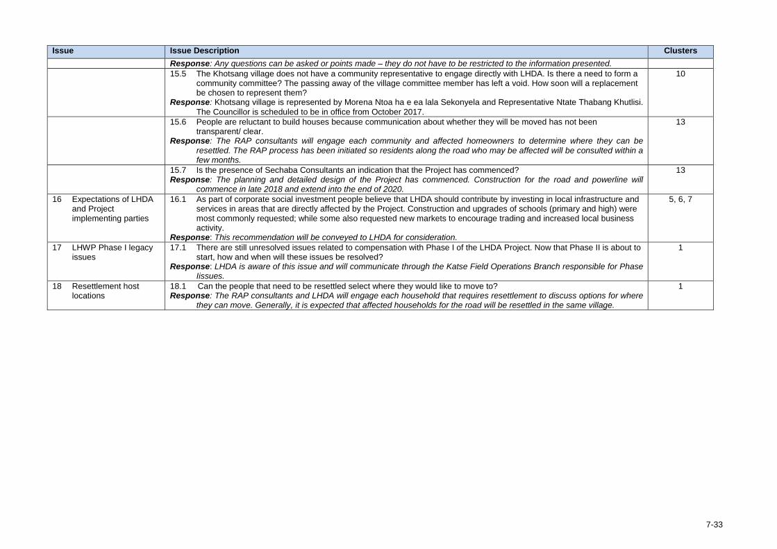
Issue Issue Description Clusters
Response: Any questions can be asked or points made – they do not have to be restricted to the information presented. 15.5 The Khotsang village does not have a community representative to engage directly with LHDA. Is there a need to form a
community committee? The passing away of the village committee member has left a void. How soon will a replacement be chosen to represent them?
Response: Khotsang village is represented by Morena Ntoa ha e ea lala Sekonyela and Representative Ntate Thabang Khutlisi. The Councillor is scheduled to be in office from October 2017.
10
15.6 People are reluctant to build houses because communication about whether they will be moved has not been transparent/ clear.
Response: The RAP consultants will engage each community and affected homeowners to determine where they can be resettled. The RAP process has been initiated so residents along the road who may be affected will be consulted within a few months.
13
15.7 Is the presence of Sechaba Consultants an indication that the Project has commenced? Response: The planning and detailed design of the Project has commenced. Construction for the road and powerline will
commence in late 2018 and extend into the end of 2020.
13
16 Expectations of LHDA and Project implementing parties
16.1 As part of corporate social investment people believe that LHDA should contribute by investing in local infrastructure and services in areas that are directly affected by the Project. Construction and upgrades of schools (primary and high) were most commonly requested; while some also requested new markets to encourage trading and increased local business activity.
Response: This recommendation will be conveyed to LHDA for consideration.
5, 6, 7
17 LHWP Phase I legacy issues
17.1 There are still unresolved issues related to compensation with Phase I of the LHDA Project. Now that Phase II is about to start, how and when will these issues be resolved?
Response: LHDA is aware of this issue and will communicate through the Katse Field Operations Branch responsible for Phase Iissues.
1
18 Resettlement host locations
18.1 Can the people that need to be resettled select where they would like to move to? Response: The RAP consultants and LHDA will engage each household that requires resettlement to discuss options for where
they can move. Generally, it is expected that affected households for the road will be resettled in the same village.
1
7-33
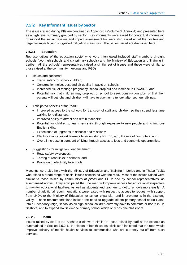
Section 7 • Stakeholder Engagement 7.5.2 Key Informant Issues by Sector The issues raised during KIIs are contained in Appendix F (Volume 3, Annex A) and presented here as a high level summary grouped by sector. Key informants were asked for contextual information to support the social baseline and impact assessment but were also asked about the positive and negative impacts, and suggested mitigation measures. The issues raised are discussed here. 7.5.2.1 Education Representatives of the education sector who were interviewed included staff members of eight schools (two high schools and six primary schools) and the Ministry of Education and Training in Leribe. All the schools’ representatives raised a similar set of issues and these were similar to those raised at the community meetings and FGDs.
• Issues and concerns: • Traffic safety for school children; • Construction noise, dust and air quality impacts on schools; • Increased risk of teenage pregnancy, school drop out and increase in HIV/AIDS; and • Potential risk that children may drop out of school to seek construction jobs, or that their
parents will get jobs and children will have to stay home to look after younger siblings.
• Anticipated benefits of the road: • Improved access to the schools for transport of staff and children so they spend less time
walking long distances; • Improved ability to attract and retain teachers; • Potential for children to learn new skills through exposure to new people and to improve
English skills; • Expectation of upgrades to schools and missions; • Electrification to assist learners broaden study horizon, e.g., the use of computers; and • Overall increase in standard of living through access to jobs and economic opportunities.
• Suggestions for mitigation / enhancement:
• Road safety awareness; • Tarring of road links to schools; and • Provision of electricity to schools.
Meetings were also held with the Ministry of Education and Training in Leribe and in Thaba-Tseka who raised a broad range of social issues associated with the road. Most of the issues raised were similar to those raised by communities at pitsos and FGDs and by school representatives, as summarised above. They anticipated that the road will improve access for educational inspectors to monitor educational facilities, as well as students and teachers to get to schools more easily. A number of additional recommendations were raised with respect to access to request with support from LHDA to the Ministry of Education for school expansion and improvements in the Liseleng valley. These recommendations include the need to upgrade Bloem primary school at Ha Ratau into a Secondary (high) school as all high school children currently have to commute or board in Ha Seshote, and to expand Ha Salemone primary school which only has one classroom. 7.5.2.2 Health Issues raised by staff at Ha Seshote clinic were similar to those raised by staff at the schools as summarised in Section 7.5.2.1. In relation to health issues, clinic staff indicated that the road would improve delivery of mobile health services to communities who are currently cut-off from such services.
7-34
Section 7 • Stakeholder Engagement The District Health Management Team (DHMT) made a number of recommendations to support health service delivery and community awareness of the risks of the Project. These included the establishment of a health post along the PWAR to reduce the distance that community members have to travel to Ha Seshote Clinic; installation of improved water and sanitation facilities such as VIP toilets and protected water systems through the district water and sanitation departments (WATSAN), and that LHDA should assist with hiring temporary staff to provide health services due to staff shortages. The DHMT, World Food Programme office and World Vision in Leribe also recommended additional sensitisation of residents along the road and people attending the health centres in relation to the potential impacts of an influx of people during construction and inform them of ways of managing these relationships.
The Food and Nutrition Coordinating Office (FNCO) raised concerns about potential impacts on fields and related reduction in food supply, and indicated that the Project may impact on the ability of field labourers to receive food in kind and to barter food for other needs which may affect their health status.
The GIZ-funded project (PISA) highlighted the potential for changes in the traditional social dynamics within families which may be altered by employment of men and women and by new relationships formed with migrants. Changed gender dynamics resulting from new roles, access to income and therefore increased independence (amongst other factors) could lead to increased levels of gender-based violence. It recommended new awareness raising projects that can empower community members to manage these risks, including sex education. 7.5.2.3 Agriculture Representatives of the agricultural sector who were interviewed included staff of the Agricultural Resource Centre at Makhiseng and at the Kosheteng woolshed. Their main issues of concern were the loss of fields and grazing to the road, and that those farmers who got jobs during construction would not be available to farm. However, it was also suggested that any farmers who did get jobs would employ labourers to work in their fields or look after animals instead. Since the residents of the area are mostly farmers and know little other lifestyle or skills, it was suggested that farmers receive support on how to use compensation money that is paid for affected fields and that the Ministry of Agriculture should be involved.
Staff at the woolshed believed the paved road would enable farmers to more easily access seeds and fertiliser; there would be opportunities to sell grains, crops and livestock to migrant workers, to the school feeding programme, or to LHDA (for them to pay compensation to Phase II affected households); and that livestock owners would be able to transport their wool and mohair more easily. They also indicated that stock theft could decrease as police can respond more promptly.
The representative of the Ministry of Agriculture and Food Security (MAFS) in Thaba-Tseka also raised the issue that partnerships between farmers and business owners / buyers would improve and expand due to the improved access, which is currently constrained as the poor road condition currently deters potential buyers. In addition, the easier access of the road would enable farmers to attend farmer training workshops and for extension officers to be deployed to advise farmers along the route. The role of potentially improved access to electricity once LEC can step down the supply will enable better communications for agricultural outreach (and crime prevention and management) due to the ability to charge batteries / phones. To date, there is no commitment or plan by LEC to provide electricity to social services or at household level.
Suggestions made by MAFS were for LHDA to assist with construction of accommodation for ministry field staff when working in the districts, a hall for training workshops, and to provide financial support for a trip by livestock farmers to observe a rotational grazing pilot programme in Mokhotlong to help them learn about range and livestock improvement measures.
7-35
Section 7 • Stakeholder Engagement 7.5.2.4 Other District Council and Traditional Authority Issues The District authorities interviewed are outlined below.
• Leribe District - the District Council; Ministry of Education and Training, Ministry of Tourism; Ministry of Forestry, Range and Soil Conservation, and the Chief of Leribe Town.
• Thaba-Tseka District – Ministry of Agriculture and Food Security, Department of Police, Roads Directorate, Ministry of Forestry, Range and Soil Conservation, Ministry of Education and Training, Ministry of Labour and Employment, Food and Nutrition Coordinating Office, and District Health Management Team
• Mokhotlong District – various administrative authority representatives were interviewed mainly under the LHDA Contract 6014 for the PRAI in relation to issues associated with the dam and infrastructure, which are of greater magnitude and importance for that area than the PWAC. While none of the interviews were specifically focused on the proposed road and powerline along the PWAC, the issues raised that are generic to both the PRAI and PWAC are summarised in Appendix F (Volume 3, Annex A).
The majority of issues raised by district officials were similar and overlapped with those already highlighted under the education and health sector issues in Sections 7.5.2.1 and 7.5.2.2 above.
Additional issues included: • Conflicts over compensation payments; • Expectation of a growth in tourism and opportunities for sale of community products and
provision of accommodation; • Increase in human trafficking1; • Increase in prostitution; • Decrease in women and child abuse / rape due to improved transport to home villages; • Improved police surveillance of marijuana growing and trade (with negative consequences for
growers); and • Change in socio-cultural dynamics within villages and households due to change in lifestyle
patterns and roles, and new relationships with migrant workers.
Key mitigation measures proposed by district authorities included: • Training and awareness on livelihood alternatives; • Regular workshops for community leaders facilitated by LHDA on compensation, labour, and
crime issues; • An integrated and coordinated approach is required to combating crime involving NGOs,
government and other stakeholders, which could include additional satellite police station; • Compensation should be determined/ agreed upon in consultation with the affected people,
relevant community leaders, specialists and LHDA; • Involvement of the Ministry of Labour and Department of National Employment Services
together with chiefs and councilors in labour supply and the resolution of conflict issues that may arise; and
• Awareness-raising of herders, and other community members, regarding responsible behaviour towards tourists and other road users.
1Human trafficking is a real issue in Lesotho whereby children are subjected to domestic servitude and forced labour; children and women who migrate to urban areas are subjected to sex trafficking; and men who seek work in South Africa are exploited in agriculture and mining as forced labour (https://www.state.gov/j/tip/rls/tiprpt/countries/2017/271226.htm). It is not clear however how the LHWP Phase II would affect the incidence of human trafficking.
7-36

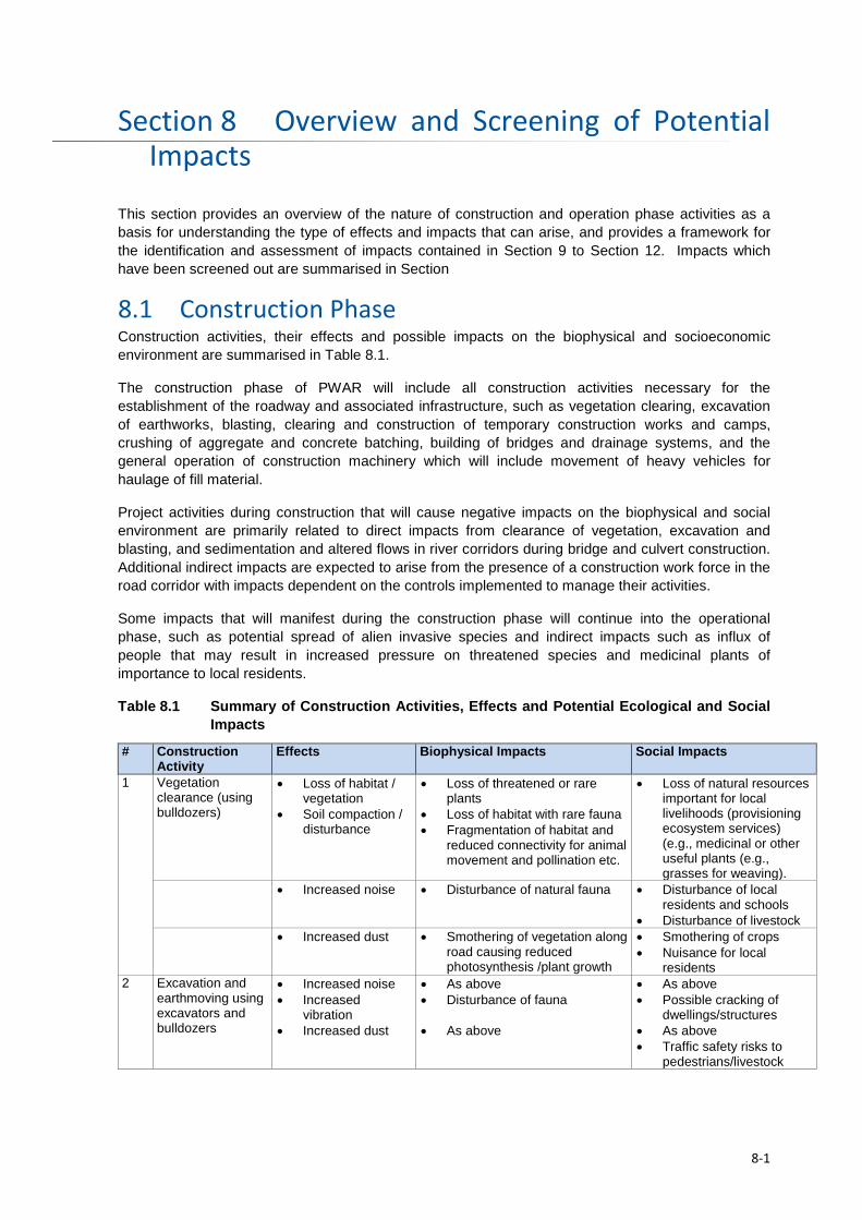
Overview and Screening of Potential Section 8Impacts
This section provides an overview of the nature of construction and operation phase activities as a basis for understanding the type of effects and impacts that can arise, and provides a framework for the identification and assessment of impacts contained in Section 9 to Section 12. Impacts which have been screened out are summarised in Section
8.1 Construction Phase Construction activities, their effects and possible impacts on the biophysical and socioeconomic environment are summarised in Table 8.1.
The construction phase of PWAR will include all construction activities necessary for the establishment of the roadway and associated infrastructure, such as vegetation clearing, excavation of earthworks, blasting, clearing and construction of temporary construction works and camps, crushing of aggregate and concrete batching, building of bridges and drainage systems, and the general operation of construction machinery which will include movement of heavy vehicles for haulage of fill material.
Project activities during construction that will cause negative impacts on the biophysical and social environment are primarily related to direct impacts from clearance of vegetation, excavation and blasting, and sedimentation and altered flows in river corridors during bridge and culvert construction. Additional indirect impacts are expected to arise from the presence of a construction work force in the road corridor with impacts dependent on the controls implemented to manage their activities.
Some impacts that will manifest during the construction phase will continue into the operational phase, such as potential spread of alien invasive species and indirect impacts such as influx of people that may result in increased pressure on threatened species and medicinal plants of importance to local residents.
Table 8.1 Summary of Construction Activities, Effects and Potential Ecological and Social Impacts
# Construction Activity
Effects Biophysical Impacts Social Impacts
1 Vegetation clearance (using bulldozers)
• Loss of habitat / vegetation
• Soil compaction / disturbance
• Loss of threatened or rare plants
• Loss of habitat with rare fauna • Fragmentation of habitat and
reduced connectivity for animal movement and pollination etc.
• Loss of natural resources important for local livelihoods (provisioning ecosystem services) (e.g., medicinal or other useful plants (e.g., grasses for weaving).
• Increased noise • Disturbance of natural fauna • Disturbance of local residents and schools
• Disturbance of livestock • Increased dust • Smothering of vegetation along
road causing reduced photosynthesis /plant growth
• Smothering of crops • Nuisance for local
residents 2 Excavation and
earthmoving using excavators and bulldozers
• Increased noise • Increased
vibration • Increased dust
• As above • Disturbance of fauna
• As above
• As above • Possible cracking of
dwellings/structures • As above • Traffic safety risks to
pedestrians/livestock
8-1
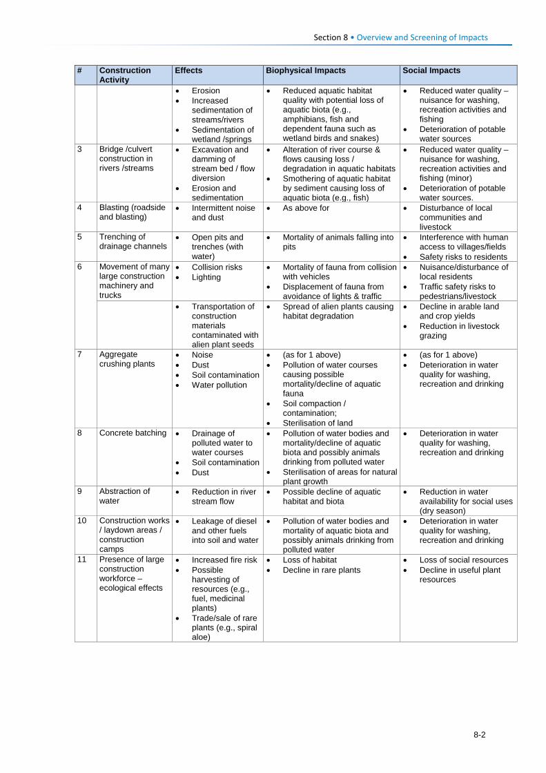
Section 8 • Overview and Screening of Impacts # Construction
Activity Effects Biophysical Impacts Social Impacts
• Erosion • Increased
sedimentation of streams/rivers
• Sedimentation of wetland /springs
• Reduced aquatic habitat quality with potential loss of aquatic biota (e.g., amphibians, fish and dependent fauna such as wetland birds and snakes)
• Reduced water quality – nuisance for washing, recreation activities and fishing
• Deterioration of potable water sources
3 Bridge /culvert construction in rivers /streams
• Excavation and damming of stream bed / flow diversion
• Erosion and sedimentation
• Alteration of river course & flows causing loss / degradation in aquatic habitats
• Smothering of aquatic habitat by sediment causing loss of aquatic biota (e.g., fish)
• Reduced water quality – nuisance for washing, recreation activities and fishing (minor)
• Deterioration of potable water sources.
4 Blasting (roadside and blasting)
• Intermittent noise and dust
• As above for • Disturbance of local communities and livestock
5 Trenching of drainage channels
• Open pits and trenches (with water)
• Mortality of animals falling into pits
• Interference with human access to villages/fields
• Safety risks to residents 6 Movement of many
large construction machinery and trucks
• Collision risks • Lighting
• Mortality of fauna from collision with vehicles
• Displacement of fauna from avoidance of lights & traffic
• Nuisance/disturbance of local residents
• Traffic safety risks to pedestrians/livestock
• Transportation of construction materials contaminated with alien plant seeds
• Spread of alien plants causing habitat degradation
• Decline in arable land and crop yields
• Reduction in livestock grazing
7 Aggregate crushing plants
• Noise • Dust • Soil contamination • Water pollution
• (as for 1 above) • Pollution of water courses
causing possible mortality/decline of aquatic fauna
• Soil compaction / contamination;
• Sterilisation of land
• (as for 1 above) • Deterioration in water
quality for washing, recreation and drinking
8 Concrete batching • Drainage of polluted water to water courses
• Soil contamination • Dust
• Pollution of water bodies and mortality/decline of aquatic biota and possibly animals drinking from polluted water
• Sterilisation of areas for natural plant growth
• Deterioration in water quality for washing, recreation and drinking
9 Abstraction of water
• Reduction in river stream flow
• Possible decline of aquatic habitat and biota
• Reduction in water availability for social uses (dry season)
10 Construction works / laydown areas / construction camps
• Leakage of diesel and other fuels into soil and water
• Pollution of water bodies and mortality of aquatic biota and possibly animals drinking from polluted water
• Deterioration in water quality for washing, recreation and drinking
11 Presence of large construction workforce – ecological effects
• Increased fire risk • Possible
harvesting of resources (e.g., fuel, medicinal plants)
• Trade/sale of rare plants (e.g., spiral aloe)
• Loss of habitat • Decline in rare plants
• Loss of social resources • Decline in useful plant
resources
8-2
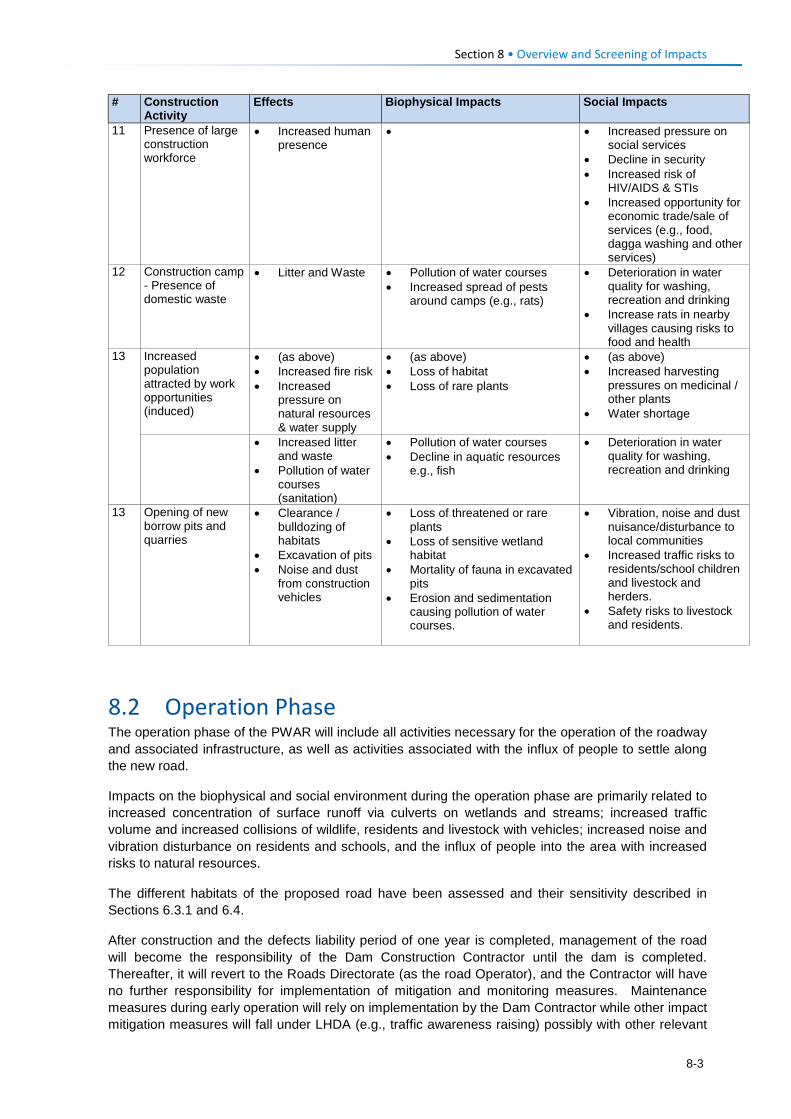
Section 8 • Overview and Screening of Impacts # Construction
Activity Effects Biophysical Impacts Social Impacts
11 Presence of large construction workforce
• Increased human presence
• • Increased pressure on social services
• Decline in security • Increased risk of
HIV/AIDS & STIs • Increased opportunity for
economic trade/sale of services (e.g., food, dagga washing and other services)
12 Construction camp - Presence of domestic waste
• Litter and Waste • Pollution of water courses • Increased spread of pests
around camps (e.g., rats)
• Deterioration in water quality for washing, recreation and drinking
• Increase rats in nearby villages causing risks to food and health
13 Increased population attracted by work opportunities (induced)
• (as above) • Increased fire risk • Increased
pressure on natural resources & water supply
• (as above) • Loss of habitat • Loss of rare plants
• (as above) • Increased harvesting
pressures on medicinal / other plants
• Water shortage
• Increased litter and waste
• Pollution of water courses (sanitation)
• Pollution of water courses • Decline in aquatic resources
e.g., fish
• Deterioration in water quality for washing, recreation and drinking
13 Opening of new borrow pits and quarries
• Clearance / bulldozing of habitats
• Excavation of pits • Noise and dust
from construction vehicles
• Loss of threatened or rare plants
• Loss of sensitive wetland habitat
• Mortality of fauna in excavated pits
• Erosion and sedimentation causing pollution of water courses.
• Vibration, noise and dust nuisance/disturbance to local communities
• Increased traffic risks to residents/school children and livestock and herders.
• Safety risks to livestock and residents.
8.2 Operation Phase The operation phase of the PWAR will include all activities necessary for the operation of the roadway and associated infrastructure, as well as activities associated with the influx of people to settle along the new road.
Impacts on the biophysical and social environment during the operation phase are primarily related to increased concentration of surface runoff via culverts on wetlands and streams; increased traffic volume and increased collisions of wildlife, residents and livestock with vehicles; increased noise and vibration disturbance on residents and schools, and the influx of people into the area with increased risks to natural resources.
The different habitats of the proposed road have been assessed and their sensitivity described in Sections 6.3.1 and 6.4.
After construction and the defects liability period of one year is completed, management of the road will become the responsibility of the Dam Construction Contractor until the dam is completed. Thereafter, it will revert to the Roads Directorate (as the road Operator), and the Contractor will have no further responsibility for implementation of mitigation and monitoring measures. Maintenance measures during early operation will rely on implementation by the Dam Contractor while other impact mitigation measures will fall under LHDA (e.g., traffic awareness raising) possibly with other relevant
8-3
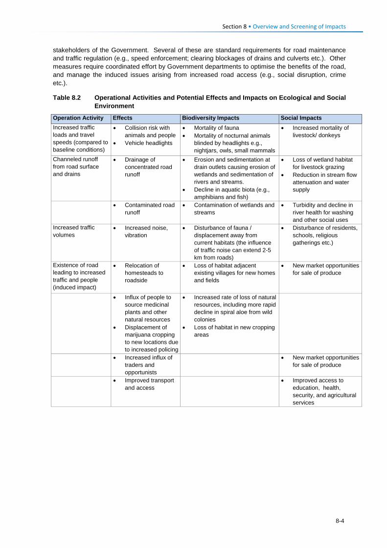
Section 8 • Overview and Screening of Impacts stakeholders of the Government. Several of these are standard requirements for road maintenance and traffic regulation (e.g., speed enforcement; clearing blockages of drains and culverts etc.). Other measures require coordinated effort by Government departments to optimise the benefits of the road, and manage the induced issues arising from increased road access (e.g., social disruption, crime etc.).
Table 8.2 Operational Activities and Potential Effects and Impacts on Ecological and Social Environment
Operation Activity Effects Biodiversity Impacts Social Impacts Increased traffic loads and travel speeds (compared to baseline conditions)
• Collision risk with animals and people
• Vehicle headlights
• Mortality of fauna • Mortality of nocturnal animals
blinded by headlights e.g., nightjars, owls, small mammals
• Increased mortality of livestock/ donkeys
Channeled runoff from road surface and drains
• Drainage of concentrated road runoff
• Erosion and sedimentation at drain outlets causing erosion of wetlands and sedimentation of rivers and streams.
• Decline in aquatic biota (e.g., amphibians and fish)
• Loss of wetland habitat for livestock grazing
• Reduction in stream flow attenuation and water supply
• Contaminated road runoff
• Contamination of wetlands and streams
• Turbidity and decline in river health for washing and other social uses
Increased traffic volumes
• Increased noise, vibration
• Disturbance of fauna / displacement away from current habitats (the influence of traffic noise can extend 2-5 km from roads)
• Disturbance of residents, schools, religious gatherings etc.)
Existence of road leading to increased traffic and people (induced impact)
• Relocation of homesteads to roadside
• Loss of habitat adjacent existing villages for new homes and fields
• New market opportunities for sale of produce
• Influx of people to source medicinal plants and other natural resources
• Displacement of marijuana cropping to new locations due to increased policing
• Increased rate of loss of natural resources, including more rapid decline in spiral aloe from wild colonies
• Loss of habitat in new cropping areas
• Increased influx of traders and opportunists
• New market opportunities for sale of produce
• Improved transport and access
• Improved access to education, health, security, and agricultural services
8-4
Section 8 • Overview and Screening of Impacts
8.3 Screened Out Impacts The majority of impacts of the road and powerline are assessed in Sections 9-12. However, a few potential activities will clearly have very minor or negligible environmental or social consequences, and have been screened out of the assessment as they do not warrant more detailed consideration.
These include:
• Maintenance of powerline, pylons, servitude and access roads
Powerline servitude and access road maintenance may include alien invasive plant removal, trimming of some trees in a few locations, and erosion protection, if required. In addition, Contractors or LEC may be required to access pylon locations to service pylon or electrical transmission components from time to time, which will require ongoing access to these sites. These activities do not warrant more detailed assessment.
• Maintenance of PWAR
Maintenance activities along the PWAR will include alien invasive plant removal; erosion protection at culvert outlets, and unblocking of drainage channels or culverts. In the longer term maintenance may require repairs to gabion, culvert and bridge structures and filling of potholes or even resurfacing in places. These activities are considered a routine activity and do not warrant more detailed assessment.
8-5

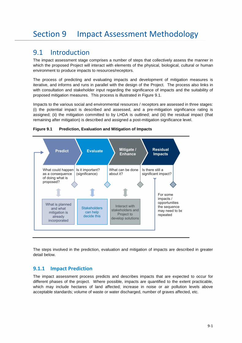
Impact Assessment Methodology Section 9
9.1 Introduction The impact assessment stage comprises a number of steps that collectively assess the manner in which the proposed Project will interact with elements of the physical, biological, cultural or human environment to produce impacts to resources/receptors.
The process of predicting and evaluating impacts and development of mitigation measures is iterative, and informs and runs in parallel with the design of the Project. The process also links in with consultation and stakeholder input regarding the significance of impacts and the suitability of proposed mitigation measures. This process is illustrated in Figure 9.1.
Impacts to the various social and environmental resources / receptors are assessed in three stages: (i) the potential impact is described and assessed, and a pre-mitigation significance rating is assigned; (ii) the mitigation committed to by LHDA is outlined; and (iii) the residual impact (that remaining after mitigation) is described and assigned a post-mitigation significance level.
Figure 9.1 Prediction, Evaluation and Mitigation of Impacts
The steps involved in the prediction, evaluation and mitigation of impacts are described in greater detail below.
9.1.1 Impact Prediction The impact assessment process predicts and describes impacts that are expected to occur for different phases of the project. Where possible, impacts are quantified to the extent practicable, which may include hectares of land affected; increase in noise or air pollution levels above acceptable standards; volume of waste or water discharged, number of graves affected, etc.
9-1
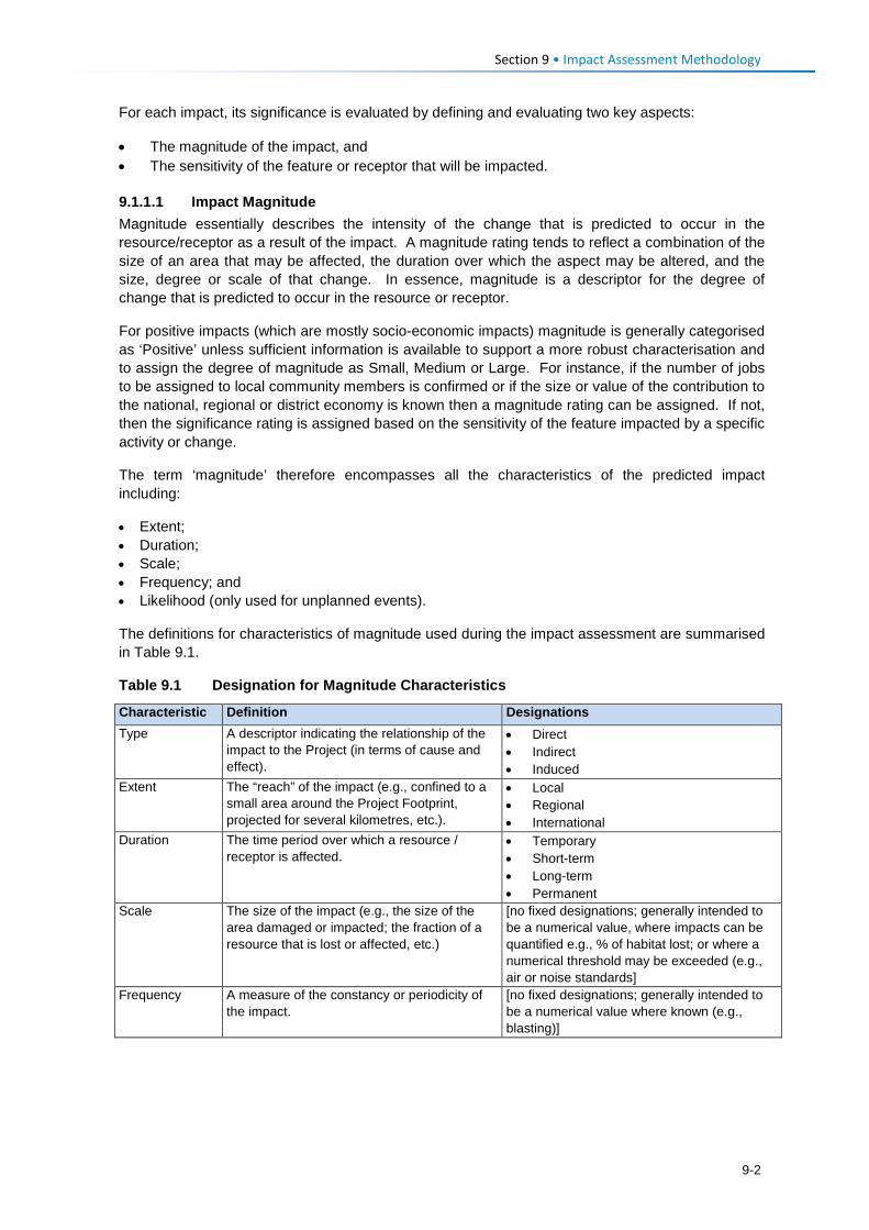
Section 9 • Impact Assessment Methodology For each impact, its significance is evaluated by defining and evaluating two key aspects:
• The magnitude of the impact, and • The sensitivity of the feature or receptor that will be impacted.
9.1.1.1 Impact Magnitude Magnitude essentially describes the intensity of the change that is predicted to occur in the resource/receptor as a result of the impact. A magnitude rating tends to reflect a combination of the size of an area that may be affected, the duration over which the aspect may be altered, and the size, degree or scale of that change. In essence, magnitude is a descriptor for the degree of change that is predicted to occur in the resource or receptor.
For positive impacts (which are mostly socio-economic impacts) magnitude is generally categorised as ‘Positive’ unless sufficient information is available to support a more robust characterisation and to assign the degree of magnitude as Small, Medium or Large. For instance, if the number of jobs to be assigned to local community members is confirmed or if the size or value of the contribution to the national, regional or district economy is known then a magnitude rating can be assigned. If not, then the significance rating is assigned based on the sensitivity of the feature impacted by a specific activity or change.
The term ‘magnitude’ therefore encompasses all the characteristics of the predicted impact including:
• Extent; • Duration; • Scale; • Frequency; and • Likelihood (only used for unplanned events).
The definitions for characteristics of magnitude used during the impact assessment are summarised in Table 9.1.
Table 9.1 Designation for Magnitude Characteristics
Characteristic Definition Designations Type A descriptor indicating the relationship of the
impact to the Project (in terms of cause and effect).
• Direct • Indirect • Induced
Extent The “reach” of the impact (e.g., confined to a small area around the Project Footprint, projected for several kilometres, etc.).
• Local • Regional • International
Duration The time period over which a resource / receptor is affected.
• Temporary • Short-term • Long-term • Permanent
Scale The size of the impact (e.g., the size of the area damaged or impacted; the fraction of a resource that is lost or affected, etc.)
[no fixed designations; generally intended to be a numerical value, where impacts can be quantified e.g., % of habitat lost; or where a numerical threshold may be exceeded (e.g., air or noise standards]
Frequency A measure of the constancy or periodicity of the impact.
[no fixed designations; generally intended to be a numerical value where known (e.g., blasting)]
9-2
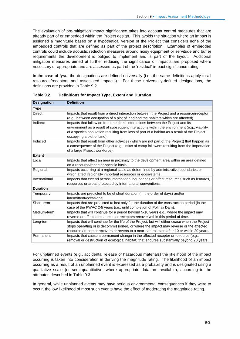
Section 9 • Impact Assessment Methodology The evaluation of pre-mitigation impact significance takes into account control measures that are already part of or embedded within the Project design. This avoids the situation where an impact is assigned a magnitude based on a hypothetical version of the Project that considers none of the embedded controls that are defined as part of the project description. Examples of embedded controls could include acoustic reduction measures around noisy equipment or servitude and buffer requirements the development is obliged to implement and is part of the layout. Additional mitigation measures aimed at further reducing the significance of impacts are proposed where necessary or appropriate and are assessed as part of the ‘residual’ impact significance rating.
In the case of type, the designations are defined universally (i.e., the same definitions apply to all resources/receptors and associated impacts). For these universally-defined designations, the definitions are provided in Table 9.2.
Table 9.2 Definitions for Impact Type, Extent and Duration
Designation Definition Type Direct Impacts that result from a direct interaction between the Project and a resource/receptor
(e.g., between occupation of a plot of land and the habitats which are affected). Indirect Impacts that follow on from the direct interactions between the Project and its
environment as a result of subsequent interactions within the environment (e.g., viability of a species population resulting from loss of part of a habitat as a result of the Project occupying a plot of land).
Induced Impacts that result from other activities (which are not part of the Project) that happen as a consequence of the Project (e.g., influx of camp followers resulting from the importation of a large Project workforce).
Extent Local Impacts that affect an area in proximity to the development area within an area defined
on a resource/receptor-specific basis. Regional Impacts occurring at a regional scale as determined by administrative boundaries or
which affect regionally important resources or ecosystems. International Impacts that extend across international boundaries or affect resources such as features,
resources or areas protected by international conventions. Duration Temporary Impacts are predicted to be of short duration (in the order of days) and/or
intermittent/occasional. Short-term Impacts that are predicted to last only for the duration of the construction period (in the
case of the PWAC 2-5 years (i.e., until completion of Polihali Dam). Medium-term Impacts that will continue for a period beyond 5-10 years e.g., where the impact may
reverse or affected resources or receptors recover within this period of time. Long-term Impacts that will continue for the life of the Project, but will either cease when the Project
stops operating or is decommissioned, or where the impact may reverse or the affected resource / receptor recovers or reverts to a near-natural state after 10 or within 20 years.
Permanent Impacts that cause a permanent change in the affected receptor or resource (e.g., removal or destruction of ecological habitat) that endures substantially beyond 20 years.
For unplanned events (e.g., accidental release of hazardous materials) the likelihood of the impact occurring is taken into consideration in deriving the magnitude rating. The likelihood of an impact occurring as a result of an unplanned event is expressed as a probability and is designated using a qualitative scale (or semi‐quantitative, where appropriate data are available), according to the attributes described in Table 9.3.
In general, while unplanned events may have serious environmental consequences if they were to occur, the low likelihood of most such events have the effect of moderating the magnitude rating.
9-3
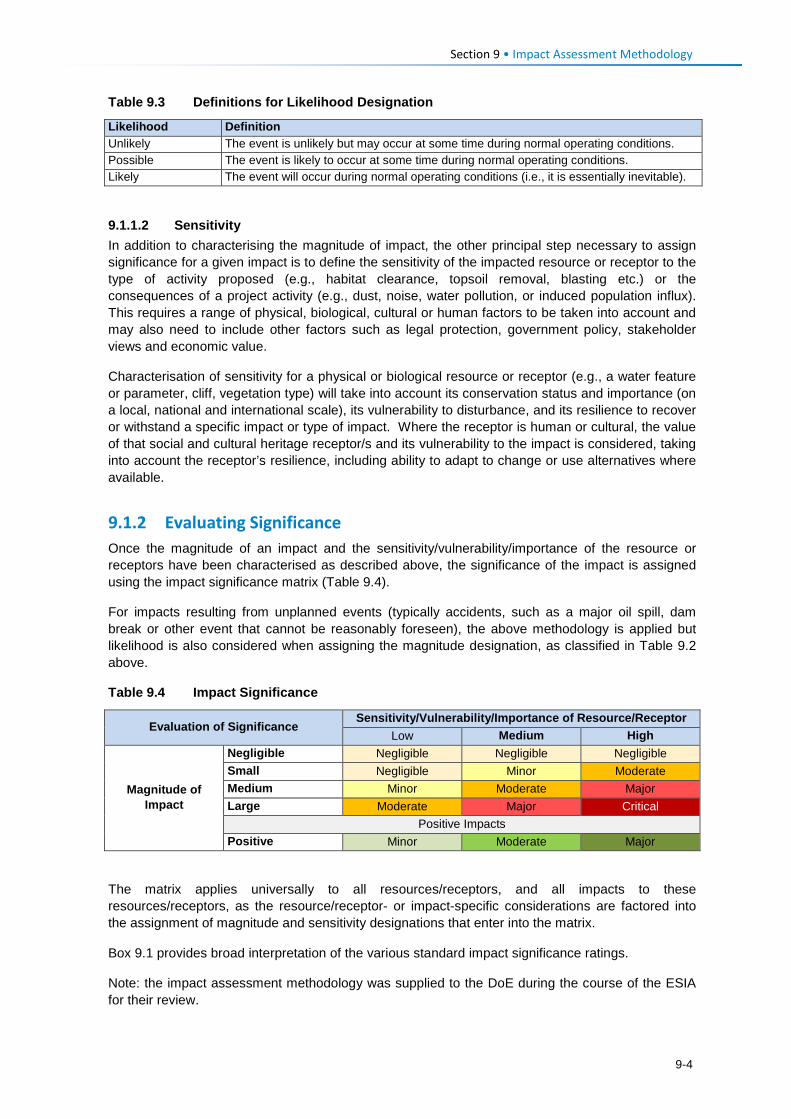
Section 9 • Impact Assessment Methodology Table 9.3 Definitions for Likelihood Designation
Likelihood Definition Unlikely The event is unlikely but may occur at some time during normal operating conditions. Possible The event is likely to occur at some time during normal operating conditions. Likely The event will occur during normal operating conditions (i.e., it is essentially inevitable).
9.1.1.2 Sensitivity In addition to characterising the magnitude of impact, the other principal step necessary to assign significance for a given impact is to define the sensitivity of the impacted resource or receptor to the type of activity proposed (e.g., habitat clearance, topsoil removal, blasting etc.) or the consequences of a project activity (e.g., dust, noise, water pollution, or induced population influx). This requires a range of physical, biological, cultural or human factors to be taken into account and may also need to include other factors such as legal protection, government policy, stakeholder views and economic value.
Characterisation of sensitivity for a physical or biological resource or receptor (e.g., a water feature or parameter, cliff, vegetation type) will take into account its conservation status and importance (on a local, national and international scale), its vulnerability to disturbance, and its resilience to recover or withstand a specific impact or type of impact. Where the receptor is human or cultural, the value of that social and cultural heritage receptor/s and its vulnerability to the impact is considered, taking into account the receptor’s resilience, including ability to adapt to change or use alternatives where available.
9.1.2 Evaluating Significance Once the magnitude of an impact and the sensitivity/vulnerability/importance of the resource or receptors have been characterised as described above, the significance of the impact is assigned using the impact significance matrix (Table 9.4).
For impacts resulting from unplanned events (typically accidents, such as a major oil spill, dam break or other event that cannot be reasonably foreseen), the above methodology is applied but likelihood is also considered when assigning the magnitude designation, as classified in Table 9.2 above.
Table 9.4 Impact Significance
Evaluation of Significance Sensitivity/Vulnerability/Importance of Resource/Receptor
Low Medium High
Magnitude of Impact
Negligible Negligible Negligible Negligible Small Negligible Minor Moderate Medium Minor Moderate Major Large Moderate Major Critical
Positive Impacts Positive Minor Moderate Major
The matrix applies universally to all resources/receptors, and all impacts to these resources/receptors, as the resource/receptor- or impact-specific considerations are factored into the assignment of magnitude and sensitivity designations that enter into the matrix.
Box 9.1 provides broad interpretation of the various standard impact significance ratings.
Note: the impact assessment methodology was supplied to the DoE during the course of the ESIA for their review.
9-4
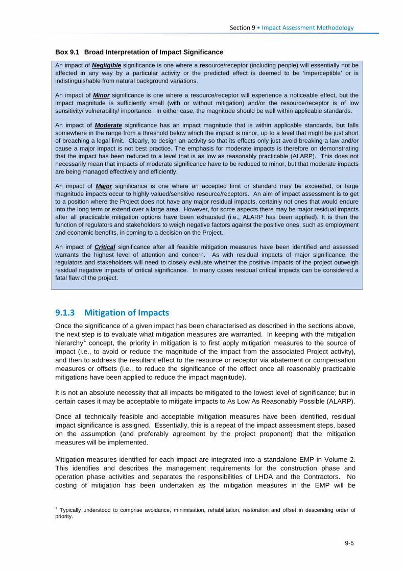
Section 9 • Impact Assessment Methodology Box 9.1 Broad Interpretation of Impact Significance
9.1.3 Mitigation of Impacts Once the significance of a given impact has been characterised as described in the sections above, the next step is to evaluate what mitigation measures are warranted. In keeping with the mitigation hierarchy1 concept, the priority in mitigation is to first apply mitigation measures to the source of impact (i.e., to avoid or reduce the magnitude of the impact from the associated Project activity), and then to address the resultant effect to the resource or receptor via abatement or compensation measures or offsets (i.e., to reduce the significance of the effect once all reasonably practicable mitigations have been applied to reduce the impact magnitude).
It is not an absolute necessity that all impacts be mitigated to the lowest level of significance; but in certain cases it may be acceptable to mitigate impacts to As Low As Reasonably Possible (ALARP).
Once all technically feasible and acceptable mitigation measures have been identified, residual impact significance is assigned. Essentially, this is a repeat of the impact assessment steps, based on the assumption (and preferably agreement by the project proponent) that the mitigation measures will be implemented. Mitigation measures identified for each impact are integrated into a standalone EMP in Volume 2. This identifies and describes the management requirements for the construction phase and operation phase activities and separates the responsibilities of LHDA and the Contractors. No costing of mitigation has been undertaken as the mitigation measures in the EMP will be
1 Typically understood to comprise avoidance, minimisation, rehabilitation, restoration and offset in descending order of priority.
An impact of Negligible significance is one where a resource/receptor (including people) will essentially not be affected in any way by a particular activity or the predicted effect is deemed to be ‘imperceptible’ or is indistinguishable from natural background variations.
An impact of Minor significance is one where a resource/receptor will experience a noticeable effect, but the impact magnitude is sufficiently small (with or without mitigation) and/or the resource/receptor is of low sensitivity/ vulnerability/ importance. In either case, the magnitude should be well within applicable standards.
An impact of Moderate significance has an impact magnitude that is within applicable standards, but falls somewhere in the range from a threshold below which the impact is minor, up to a level that might be just short of breaching a legal limit. Clearly, to design an activity so that its effects only just avoid breaking a law and/or cause a major impact is not best practice. The emphasis for moderate impacts is therefore on demonstrating that the impact has been reduced to a level that is as low as reasonably practicable (ALARP). This does not necessarily mean that impacts of moderate significance have to be reduced to minor, but that moderate impacts are being managed effectively and efficiently.
An impact of Major significance is one where an accepted limit or standard may be exceeded, or large magnitude impacts occur to highly valued/sensitive resource/receptors. An aim of impact assessment is to get to a position where the Project does not have any major residual impacts, certainly not ones that would endure into the long term or extend over a large area. However, for some aspects there may be major residual impacts after all practicable mitigation options have been exhausted (i.e., ALARP has been applied). It is then the function of regulators and stakeholders to weigh negative factors against the positive ones, such as employment and economic benefits, in coming to a decision on the Project.
An impact of Critical significance after all feasible mitigation measures have been identified and assessed warrants the highest level of attention and concern. As with residual impacts of major significance, the regulators and stakeholders will need to closely evaluate whether the positive impacts of the project outweigh residual negative impacts of critical significance. In many cases residual critical impacts can be considered a fatal flaw of the project.
9-5
Section 9 • Impact Assessment Methodology incorporated into the environmental specifications in the tender documents as the basis for Contractors to cost in their tender submissions. Mitigation for implementation by LHDA or its delegated consultants will be costed by LHDA once the allocation of responsibility and the approach to, and scope of, implementation has been confirmed.
9.1.4 Dealing with Uncertainty Even with a final design and an unchanging environment, impacts are difficult to predict with certainty. Where such uncertainties are material to the findings of the ESIS, they will be clearly stated and conservatively used (‘the precautionary approach’) in order to identify the broadest range of likely residual impacts and necessary mitigation measures.
Potential impacts may be assessed using tools and methods ranging from quantitative techniques such as modelling to qualitative approaches based on expert judgment and historical information. The accuracy of these assessment tools depends on the quality of the input data and available information, and the experience of the study team. Where assumptions have been made, the nature of any uncertainties associated with the assumptions is discussed. For qualitative predictions or assessments, some uncertainty may be removed through consultation with the client, its design team or other key informants.
9.1.5 Cumulative Impacts Cumulative impacts are those that arise as a result of an impact from the Project interacting with the impact of another activity to create an additional larger impact. The approach for assessing cumulative impacts is influenced by the availability of information about the impact of the other activity, and whether or not it already exists or is only proposed. Cumulative impacts of the Project are identified and briefly described in a qualitative manner in the context of other existing or planned development projects. The impact of ongoing land use pressures and climate changes on the environment are not assessed. In addition, it was not intended that cumulative impacts would be assessed using the impact assessment methodology described in Sections 9.1.1 and 9.1.2.
9.1.6 Management and Monitoring Management and monitoring measures are defined in the Environmental Management Plan (EMP) in order to identify whether:
• Impacts or their associated Project components remain in conformance with applicable standards or performance targets;
• Mitigation measures are effectively ameliorating impacts to the extent predicted or an acceptable level; and
• Additional mitigation or management measures or other investigations are required to further
ameliorate project impacts.
The EMP identifies the designated responsibility for implementing mitigation measures, the performance targets to be achieved, and the assurance mechanisms and protocols required to verify the proper implementation of the mitigation measures.
9-6
Social and Health Impacts Section 10
This section describes and assesses social and health impacts associated with the construction and operational phases of the PWAC Project.
Aspects related to loss of graves and other cultural heritage resources, and visual impacts are covered under Section 11, while impacts on natural resources of value to communities are addressed under Section 12.
10.1 Overview and Context This section assesses the construction and operation phase impacts identified for the proposed Project, including both the positive and negative impacts. It is stressed that while the number of negative impacts exceed the number of positive impacts, this is not a reflection of the road having a greater overall negative impact. It is expected that the Project (specifically the road component) could bring a range of positive impacts for those people who can embrace the opportunities that arise. This SIA does not cover the related social impacts associated with impacts on cultural heritage, including graves and culturally important plants, as well as community based tourism, which are covered under the Cultural Heritage study (Pinto & MM&A, 2017: P2W-6004-DFR-0005;) or the visual impacts covered under Landscape and Visual Impact Assessment (VRMA, 2017: P2W-6004-DFR-0006). Natural resource use and impacts on useful plants are also described and assessed in the Terrestrial Ecology Study (Ecorex & Kobisi; 2017: P2W-6004-DFR-0004). As further context to the social impacts and mitigation of the PWAC it is highlighted that the selected road and powerline corridor was chosen in order to optimise the number of communities it would benefit while minimising overall ecological impacts at a reasonable financial cost (as described in Section 5.3). Once the preferred route was confirmed, a number of refinements to the original routing of the road and powerline were subsequently made to avoid close proximity to important social resources; for example residential dwellings, schools, agricultural land, wetlands, and sensitive cultural / heritage features of the area. These adjustments served to avoid/ minimise negative impacts, and in some cases lessen the impact magnitude on certain sensitive receptors. As a result of this process, several significant environmental, social and cultural impacts were avoided.
10.1.1 Community Expectations of the Project LHDA and Other Authorities During the stakeholder engagement process along the PWAR (undertaken in April 2017), it was evident that the people living in the Project Area are in full support of the Project and are excited about many anticipated benefits (social and economic). They did register their concerns and questions, but the overwhelming feedback was of support. It is also evident that the community have exceedingly high expectations of the real and perceived benefits. The stakeholder engagement report documents the issues and expectations raised by all stakeholders consulted (Sechaba & ERM, 2017: P2W-6004-DFR-0010). As with any large-scale project, the surrounding communities immediately began to anticipate benefits; some are real and some are possible but will not arise as a direct result of this Project. During the stakeholder engagement and data gathering forums, people grabbed the opportunity to highlight their needs1 – many of these needs linked directly to the lack of social infrastructure and
1 Respondents were asked to identify potential positive and negative impacts that they expected to arise as a result of the Project; some of the positive impacts raised were perceived benefits/ needs that could potentially be delivered in the future
10-1
Section 10 • Social and Health Impacts
services in the Project Area. It was evident that the community members are hopeful that as a result of increased access resulting from the road, they anticipate that over time, relevant authorities and service providers will deliver much needed social infrastructure and services thus serving to improve their overall quality of life. Based on this feedback, it is clear that the community have unreasonably high expectations of LHDA, their appointed Contractors, and other government authorities (e.g., LEC) in terms of delivering benefits and addressing needs. While it is conceivable that over time social infrastructure and services could be delivered, this is not going to be as a direct result of this Project or the Project role-players. The anticipated benefits (high expectations) that were raised in the meetings include: • Provision of employment opportunities that will lead to an improved standard of living for all
those who are employed; • Creation of local business/ income generating opportunities; • Construction of new and/ or refurbishment of school infrastructure; • Construction of new healthcare infrastructure and provision of equipment; • More teachers and healthcare professionals who would be willing to relocate to the area; • Anticipation of household electrical connections to the villages and schools in the Project Area
resulting in decreased fire-related safety risks and improved quality of life; • Increased agricultural extension services and agricultural inputs; • Construction of a new woolshed; • New market opportunities to encourage trading and increased local business activity; • Satellite police stations; and • Branch roads from the PWAR to connect the villages along its route. The communities in the Matsoku area also registered their concerns related to the LHWP Phase I process. Notably, they are concerned that there are still unresolved compensation issues and fear that these same issues will arise as a result of the current Project activities. Despite the team’s efforts to inform the community members that their expectations will not materialise as a direct result of the Project, several participants asserted that they understood that while delivery of these infrastructure and services was not the role of LHDA and their Contractors, the road would make it possible for the relevant authorities and service providers to deliver in the future. It is possible that these high expectations, if not met, may lead to increased levels of dissatisfaction and the raising of future grievances. Recommendations to address the high expectations of the Project stakeholders are proposed below. 10.1.1.1 Recommended Mitigation Measures • LHDA will clearly communicate with communities the ambit of LHDA / Contractor
responsibilities, and government responsibilities, and shared responsibilities where formal MoUs exist.
• LHDA and the appointed Contractors will implement measures to maximise local employment
opportunities as outlined in Section 10.1.2.4. • Through the Combined Liaison Committees (CLCs), LHDA will increase awareness of the
Grievance Resolution Procedure amongst the communities and continuously monitor the use of the procedure.
by responsible parties’ due to improved access. They were informed that these benefits are not going to arise as a direct result of LHDA, the appointed Contractors or the authorities.
10-2
Section 10 • Social and Health Impacts
• Communities along the PWAC should be included within the Livelihood Restoration and Social Development initiatives as part of the Social Development Management Plan (SDMP) for LHWP Phase II, which will serve to address some of the expectations of the local communities. LHDA and the appointed Contractors will continue to work closely with the CLCs to ensure ongoing identification and management of stakeholder issues and concerns, where possible, and in accordance with the SDMP.
• LHDA will regularly communicate information updates about the Project activities as well as
SDMP projects and benefits, as required. 10.1.1.2 Project Area Context and Sense of Place The Project Area is rural in character. Villages are scattered along the existing road, which is extremely degraded to a point where it is still passable on the eastern and western extent and almost impassable for the majority of the central parts. As a result, the route currently does not provide a usable through route that connects the western and eastern sides for vehicles for daily use. Transport to and from villages is generally on foot, donkey or horse and most household supplies are transported on donkeys. The villages are each relatively small (mostly numbering between 20 and 100 homesteads) and comprise residential structures and out-buildings, the majority of which are largely constructed of locally sourced materials (stone, mud, and thatch). Most families use woody shrubs, cow dung and some firewood as their primary fuel source as none of the villages along the route (except parts of Ha Seshote) have electrical connections and the cost of other fuel sources is prohibitive for most households. There are no large-scale commercial or industrial developments along the route. The surrounding landscape is generally steep and sparsely vegetated with grass interspersed with rocky outcrops. Most of the lower lying portions of land of less steep gradient and land along the river and stream valleys are used for cropping of maize, sorghum, and wheat. Cropping and livestock farming is the mainstay of the majority of households. Noise and light levels are low. For most of the population, this rural environment and lifestyle is all they know. The families living throughout the area are reliant on the land and work very hard to sustain themselves. To them, this is a harsh environment that is isolated and remote, resulting in limited opportunities and a lack of much needed social infrastructure and essential services. To privileged outsiders, this may appeal given the peace and quiet; and ‘quaint’ traditional villages that are considered to be a desirable relief from high-paced city life. The physical landscape and remoteness of the project area is depicted and described in Section 6.5. Based on feedback during stakeholder engagement, the majority of the local people are looking forward to the construction and operation of the road. To most people, this appears to symbolise positive development that will bring much needed changes. The anticipated changes are directly related to meeting basic needs and improving quality of life; including schooling, healthcare, water, sanitation, electricity, shorter and more affordable transport options, and economic opportunities linked to improved access. People are also aware of some of the risks, many of these were raised and have been incorporated and assessed as part of this SIA. Sense of place is the unique value that is allocated to a specific place or area through the cognitive experience of the user or viewer. It is generated by varying combinations of a range of factors; including land use, character and quality of a landscape, as well as by the tangible and intangible value assigned thereto. As such, sense of place is a subjective matter that differs from person to person based on individual backgrounds, experiences, norms, values and aspirations. It is almost impossible to describe, let alone quantify the sense of place and the potential impacts thereon. One thing is for certain, this Project, and the associated Polihali Reservoir, will result in significant changes to the area. The road will enable access, which will lead to an influx of people bringing both positive and negative impacts, the potential for improved infrastructure and services, and increased opportunities to generate income.
10-3
Section 10 • Social and Health Impacts
While many factors influencing the sense of place are tangible (e.g., increased development, more people, noise, visual changes, dust), sense of place can also be significantly altered as a result of a change in intangible factors (e.g., socio-cultural norms and values). With an influx of people from outside the area, as well as work experience and increased disposable income, the local people will be exposed to differing world views, cultures, attitudes, norms and values. Naturally, people will begin to change based on these interactions. This change is likely to be experienced very gradually overtime as people slowly become influenced and affected by these external factors. Some residents (predominantly young and more educated people) will welcome these changes and opportunities and will be able to maximise the resultant benefits. Other people (predominantly the elderly, less educated and more traditional) may find it difficult to adapt to the inevitable changes and will therefore be more likely to experience the negative impacts more acutely. Either way, the sense of place will be altered and cannot be reversed. The positive and negative impacts described for the construction and operation phases of the Project can be mitigated, in part, thus hopefully reducing the negative impacts and enhancing the positive impacts. However, change is inevitable and cannot be fully controlled. The changed sense of place (including changed culture, norms and values) could give rise to increased levels of anxiety, tension and conflict. In response, the population may direct their dissatisfaction toward the Project. Impacts on sense of place and changed socio-cultural norms and values cannot be mitigated directly; they will be addressed indirectly through the mitigation measures proposed for the impacts detailed in Sections 10.1.2 to 10.2.6.
10.1.2 Construction Phase: Local Economic Benefits 10.1.2.1 Description of Impact This Project has the potential to deliver a range of local economic benefits during the construction phase. Employment and procurement of construction supplies and services (e.g., catering, construction materials) will generate the most significant economic benefits; many of which are likely to be experienced nationally or internationally. There will also be opportunities for local people to sell goods and services to construction workers and job-seekers who move to the area; some of whom will have increased disposable income. Employment It is proposed that there will be two construction Contractors appointed for the PWAR (one working from the east and the other from the west), and there will be one overall Contractor appointed to construct the BPST. It is anticipated that these Contractors will be appointed in early 2018, following which they will undertake the detailed designs and construction is expected to commence in late 2018 and to take approximately 20 months to complete. The road expected to open by the end of 2020. The Contractor will be appointed through a rigorous tender process and will be open to any company to apply. The origin of the company and its workers is therefore not yet known and the exact number of workers will depend on the approach to construction proposed by each Contractor. The construction work for the road requires a greater proportion of unskilled workers than the powerline, the latter requiring mostly highly technical skills, except for construction of access roads and pylon foundations. According to the LHDA Labour Recruitment Guidelines (February 2017), it is expected that there could be between two and three thousand unskilled people employed over the life of LHWP2 (including all phases and components). PWAR and BPST construction is estimated to require in the order of 150-200 unskilled workers for the more manual jobs of clearing and preparing the road route. Some of the semi-skilled workers that are required for the operation of machinery etc. may be sourced locally but others are likely to come from elsewhere in Lesotho or South Africa. It is expected that the majority of skilled workers are likely to be part of the Contractors’ permanent team of staff or may be subcontracted for specific tasks from other firms.
10-4
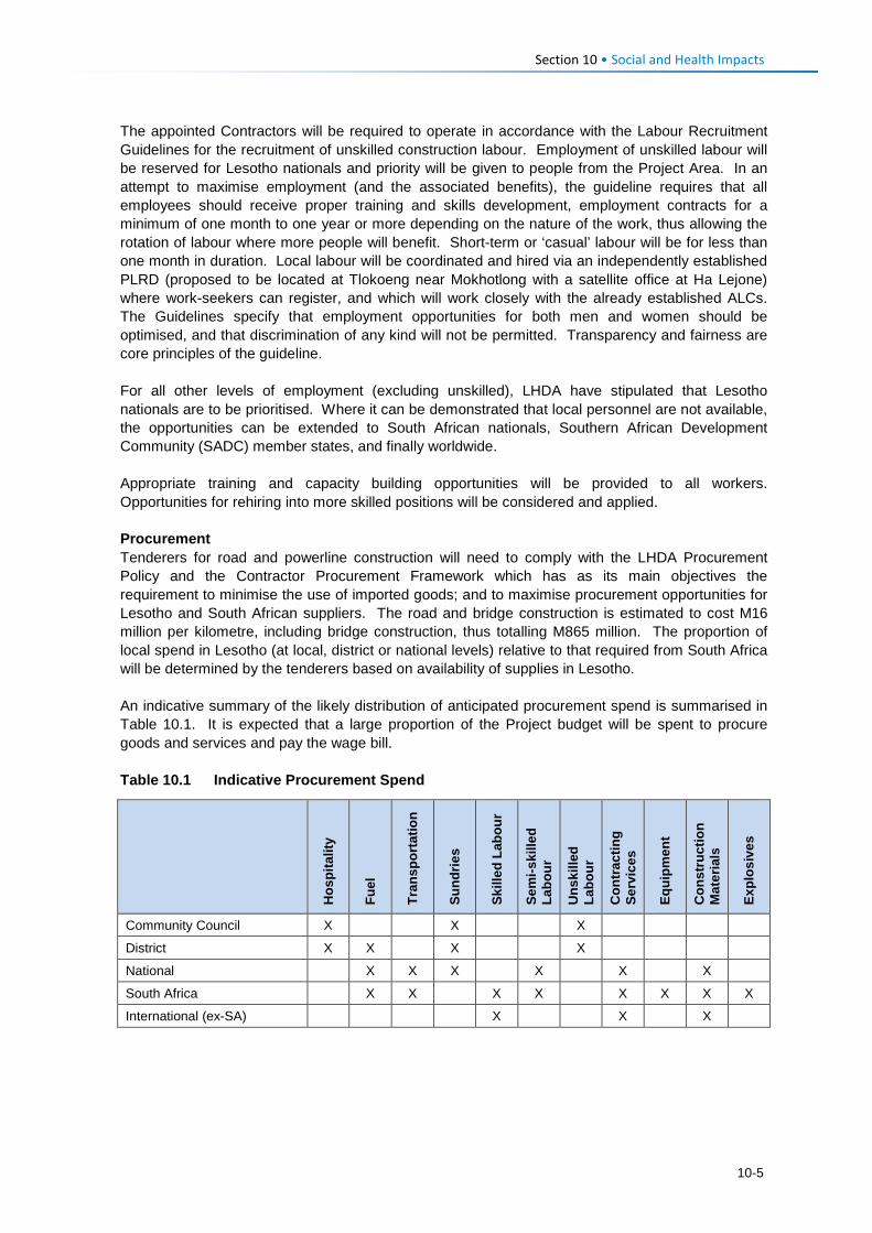
Section 10 • Social and Health Impacts
The appointed Contractors will be required to operate in accordance with the Labour Recruitment Guidelines for the recruitment of unskilled construction labour. Employment of unskilled labour will be reserved for Lesotho nationals and priority will be given to people from the Project Area. In an attempt to maximise employment (and the associated benefits), the guideline requires that all employees should receive proper training and skills development, employment contracts for a minimum of one month to one year or more depending on the nature of the work, thus allowing the rotation of labour where more people will benefit. Short-term or ‘casual’ labour will be for less than one month in duration. Local labour will be coordinated and hired via an independently established PLRD (proposed to be located at Tlokoeng near Mokhotlong with a satellite office at Ha Lejone) where work-seekers can register, and which will work closely with the already established ALCs. The Guidelines specify that employment opportunities for both men and women should be optimised, and that discrimination of any kind will not be permitted. Transparency and fairness are core principles of the guideline. For all other levels of employment (excluding unskilled), LHDA have stipulated that Lesotho nationals are to be prioritised. Where it can be demonstrated that local personnel are not available, the opportunities can be extended to South African nationals, Southern African Development Community (SADC) member states, and finally worldwide. Appropriate training and capacity building opportunities will be provided to all workers. Opportunities for rehiring into more skilled positions will be considered and applied. Procurement Tenderers for road and powerline construction will need to comply with the LHDA Procurement Policy and the Contractor Procurement Framework which has as its main objectives the requirement to minimise the use of imported goods; and to maximise procurement opportunities for Lesotho and South African suppliers. The road and bridge construction is estimated to cost M16 million per kilometre, including bridge construction, thus totalling M865 million. The proportion of local spend in Lesotho (at local, district or national levels) relative to that required from South Africa will be determined by the tenderers based on availability of supplies in Lesotho. An indicative summary of the likely distribution of anticipated procurement spend is summarised in Table 10.1. It is expected that a large proportion of the Project budget will be spent to procure goods and services and pay the wage bill. Table 10.1 Indicative Procurement Spend
Hos
pita
lity
Fuel
Tran
spor
tatio
n
Sund
ries
Skill
ed L
abou
r
Sem
i-ski
lled
Labo
ur
Uns
kille
d La
bour
Con
trac
ting
Serv
ices
Equi
pmen
t
Con
stru
ctio
n M
ater
ials
Expl
osiv
es
Community Council X X X
District X X X X
National X X X X X X
South Africa X X X X X X X X
International (ex-SA) X X X
10-5
Section 10 • Social and Health Impacts
Local Business Opportunities The Project Area is currently relatively isolated and there are not many people living there with disposable income. People largely support themselves based on a range of subsistence-based livelihood activities including crop and livestock farming, and harvesting of natural resources. Some households, although unquantified, obtain some cash income from remittances sent by family members who work on the mines in South Africa or Lesotho, although this may be decreasing with the economic downturn in industry and mining, and ongoing retrenchments. With the influx of construction companies and their workers, and the likely influx of job-seekers, there will be a new market for people to sell their goods to. People across the Project Area indicated that they would sell fresh produce or prepare food and beer to sell along the road or at small ‘restaurants’ and ‘bars’. In addition, there will be a demand for housing for migrants to the area. Many people have recognised this as an opportunity to build new residential structures or to add rooms onto their homes which could be rented out as a source of additional income. Other, less ‘acceptable’ but highly likely income earning activities may become more prevalent – prostitution and selling of marijuana. Prostitution is typically associated with projects of this nature that are located in isolated areas where workers stay far away from their home towns and families. Marijuana is grown, harvested and sold throughout the area; and this activity may expand due to increased demand, improved ease of transport, and new opportunities to sell to road users. This, however, will depend on the level of police enforcement that may increase due to the improved access. The recreational use of illegal substances by workers could generate health and safety risks on the Project site, potentially posing risks to other workers, residents and construction equipment / machinery. 10.1.2.2 Sensitivity of Receptors The population along the PWAC is extremely isolated largely as a result of limited road accessibility, particularly in the central parts of the route, and has poor access to economic opportunities leaving them largely reliant on a land-based economy. As a result of the limited job opportunities and cash income sources, local residents have expressed high expectations that the employment and business opportunities will bring about improvements in their standard of living.
The communities along the PWAC can be considered to have Medium sensitivity in that the majority is unlikely to qualify for any work other than roles as unskilled labour. In addition, they have high expectations of the potential changes these short-term opportunities will enable, and there will be a lot of competition amongst the residents of the area for the relatively few available opportunities. Many people are likely to choose short-term paid labour over their existing long-term agricultural activities given their need for income. 10.1.2.3 Assessment of the Impact The benefits to the local economy would be experienced as a positive impact that would deliver benefits in terms of direct employment and procurement, as well as indirect and induced opportunities via the supply chain and as a result of increased levels of disposable income and demand for goods and services. The impact will be experienced at the local level; however, many of the benefits of the Project will also be generated at the regional (national) and international levels given the semi-skilled and skilled labour, as well as most specialist construction materials and equipment are likely to be sourced in Maseru or South Africa. The local level impacts will predominantly be limited to the employment of unskilled personnel, purchasing of sundry items and basic services (e.g., cleaning), and the creation of local business opportunities for small-scale offerings to workers and job-seekers/ migrants. The construction phase is expected to last 20 months, as such the duration will be short-term (employment of unskilled labour will be limited to contracts of between 12 and 18 months). Given the duration of the economic benefits (i.e., job creation during road and powerline construction, and the increase in trade during dam construction) the magnitude of local economic benefits is expected to be Medium, which in the context of the
10-6
Section 10 • Social and Health Impacts
Medium sensitivity of the receptors (beneficiaries) results in an impact predicted to be of Moderate (positive) significance. The degree of confidence in this assessment is medium given the lack of information available on the extent of construction phase employment and procurement and the number of jobs created at local level. 10.1.2.4 Required Enhancement Measures
Employment and workforce management • Employment shall be undertaken in terms of LHDA’s Labour Recruitment Guidelines, national
legislation (notably the Labour Code Order of 1992), and the International Labour Organisations (ILO) Conventions and Standards.
• Contractors will comply with LHDA’s Labour Recruitment Guidelines (version 7.2; February
2017) to ensure that: • Local people are prioritised for unskilled labour on a rotational basis to maximise
opportunities for local employment and all this shall be arranged through the PLRD; • Unskilled staff who receive sufficient training are considered for promotion to semi-skilled
positions; • There is no discrimination in recruitment; the workforce should be comprised of men
women, disabled and people from different religious / cultural backgrounds, where feasible;
• Lesotho nationals shall be given preference for semi-skilled and skilled positions. If it can be demonstrated that people with suitable skills and experience are not available, then South Africans, people from SADC member states and other foreigners can be employed; in that order.
• LHDA will continue to inform communities within the broader Project Area of the Labour
Recruitment Guidelines and focus on employing local residents to discourage influx of job seekers
Procurement • Adhere to the procurement principles set out in the Phase II Agreement (Article 10 a, b, c) that
stipulate the following. • All procurement processes shall foster competitiveness, transparency cost effectiveness
and quality. • Preference shall be given to suppliers of goods and services from Lesotho, South Africa,
SADC member states and then internationally, in that order, provided that the above shall be satisfied.
• Consultants and Contractors registered in Lesotho and in South Africa shall share the value of all infrastructure works on equal monetary basis, taking into account amongst other things, their shareholder and operational experience.
• LHDA will continue to broadcast or create awareness of potential opportunities for local
suppliers to tender for provision of goods and services and to facilitate linkages with relevant organisations and institutions to support local suppliers.
• LHDA will closely monitor that prospective tenderers comply with the Contractor Procurement
Framework to maximise procurement of local goods and services prior to and during the contract implementation.
10-7
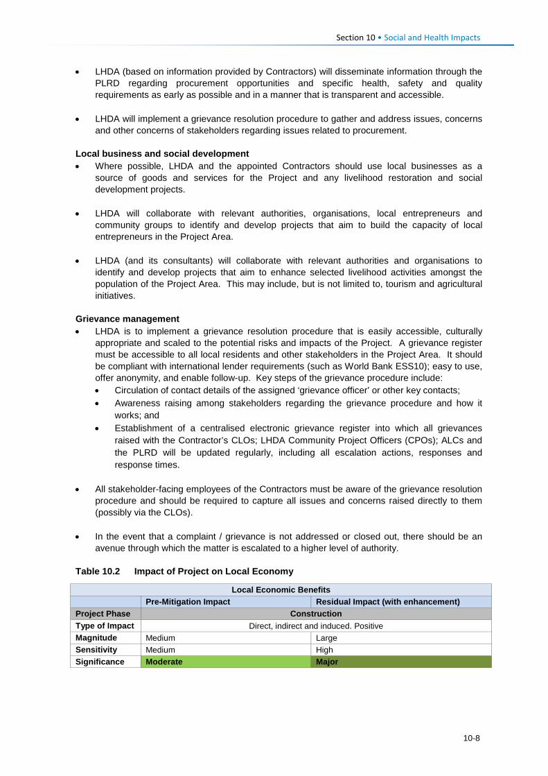
Section 10 • Social and Health Impacts
• LHDA (based on information provided by Contractors) will disseminate information through the PLRD regarding procurement opportunities and specific health, safety and quality requirements as early as possible and in a manner that is transparent and accessible.
• LHDA will implement a grievance resolution procedure to gather and address issues, concerns and other concerns of stakeholders regarding issues related to procurement.
Local business and social development • Where possible, LHDA and the appointed Contractors should use local businesses as a
source of goods and services for the Project and any livelihood restoration and social development projects.
• LHDA will collaborate with relevant authorities, organisations, local entrepreneurs and community groups to identify and develop projects that aim to build the capacity of local entrepreneurs in the Project Area.
• LHDA (and its consultants) will collaborate with relevant authorities and organisations to identify and develop projects that aim to enhance selected livelihood activities amongst the population of the Project Area. This may include, but is not limited to, tourism and agricultural initiatives.
Grievance management • LHDA is to implement a grievance resolution procedure that is easily accessible, culturally
appropriate and scaled to the potential risks and impacts of the Project. A grievance register must be accessible to all local residents and other stakeholders in the Project Area. It should be compliant with international lender requirements (such as World Bank ESS10); easy to use, offer anonymity, and enable follow-up. Key steps of the grievance procedure include: • Circulation of contact details of the assigned ‘grievance officer’ or other key contacts; • Awareness raising among stakeholders regarding the grievance procedure and how it
works; and • Establishment of a centralised electronic grievance register into which all grievances
raised with the Contractor’s CLOs; LHDA Community Project Officers (CPOs); ALCs and the PLRD will be updated regularly, including all escalation actions, responses and response times.
• All stakeholder-facing employees of the Contractors must be aware of the grievance resolution
procedure and should be required to capture all issues and concerns raised directly to them (possibly via the CLOs).
• In the event that a complaint / grievance is not addressed or closed out, there should be an avenue through which the matter is escalated to a higher level of authority.
Table 10.2 Impact of Project on Local Economy
Local Economic Benefits
Pre-Mitigation Impact Residual Impact (with enhancement) Project Phase Construction Type of Impact Direct, indirect and induced. Positive Magnitude Medium Large Sensitivity Medium High Significance Moderate Major
10-8
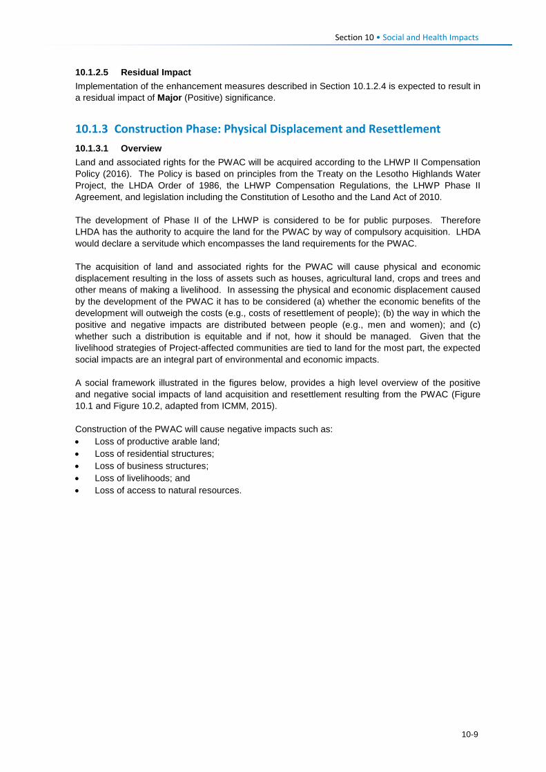
Section 10 • Social and Health Impacts
10.1.2.5 Residual Impact Implementation of the enhancement measures described in Section 10.1.2.4 is expected to result in a residual impact of Major (Positive) significance.
10.1.3 Construction Phase: Physical Displacement and Resettlement 10.1.3.1 Overview Land and associated rights for the PWAC will be acquired according to the LHWP II Compensation Policy (2016). The Policy is based on principles from the Treaty on the Lesotho Highlands Water Project, the LHDA Order of 1986, the LHWP Compensation Regulations, the LHWP Phase II Agreement, and legislation including the Constitution of Lesotho and the Land Act of 2010. The development of Phase II of the LHWP is considered to be for public purposes. Therefore LHDA has the authority to acquire the land for the PWAC by way of compulsory acquisition. LHDA would declare a servitude which encompasses the land requirements for the PWAC. The acquisition of land and associated rights for the PWAC will cause physical and economic displacement resulting in the loss of assets such as houses, agricultural land, crops and trees and other means of making a livelihood. In assessing the physical and economic displacement caused by the development of the PWAC it has to be considered (a) whether the economic benefits of the development will outweigh the costs (e.g., costs of resettlement of people); (b) the way in which the positive and negative impacts are distributed between people (e.g., men and women); and (c) whether such a distribution is equitable and if not, how it should be managed. Given that the livelihood strategies of Project-affected communities are tied to land for the most part, the expected social impacts are an integral part of environmental and economic impacts. A social framework illustrated in the figures below, provides a high level overview of the positive and negative social impacts of land acquisition and resettlement resulting from the PWAC (Figure 10.1 and Figure 10.2, adapted from ICMM, 2015). Construction of the PWAC will cause negative impacts such as: • Loss of productive arable land; • Loss of residential structures; • Loss of business structures; • Loss of livelihoods; and • Loss of access to natural resources.
10-9
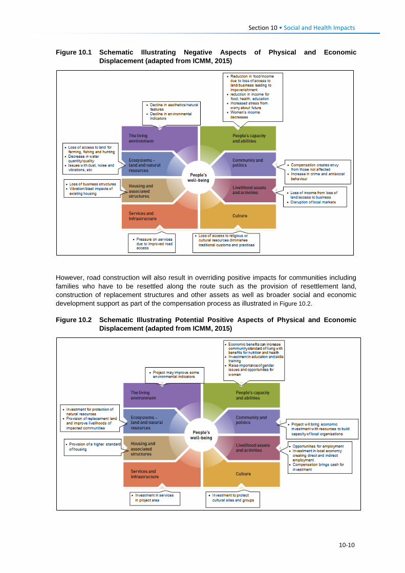
Section 10 • Social and Health Impacts
Figure 10.1 Schematic Illustrating Negative Aspects of Physical and Economic Displacement (adapted from ICMM, 2015)
However, road construction will also result in overriding positive impacts for communities including families who have to be resettled along the route such as the provision of resettlement land, construction of replacement structures and other assets as well as broader social and economic development support as part of the compensation process as illustrated in Figure 10.2. Figure 10.2 Schematic Illustrating Potential Positive Aspects of Physical and Economic
Displacement (adapted from ICMM, 2015)
10-10
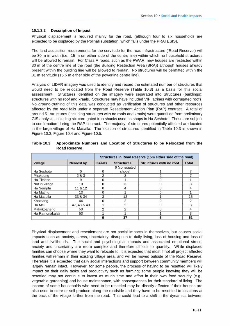
Section 10 • Social and Health Impacts
10.1.3.2 Description of Impact Physical displacement is required mainly for the road, (although four to six households are expected to be displaced by the Polihali substation, which falls under the PRAI ESIS). The land acquisition requirements for the servitude for the road infrastructure (‘Road Reserve’) will be 30 m in width (i.e., 15 m on either side of the centre line) within which no household structures will be allowed to remain. For Class A roads, such as the PWAR, new houses are restricted within 30 m of the centre line of the road (the Building Restriction Area (BRA)) although houses already present within the building line will be allowed to remain. No structures will be permitted within the 31 m servitude (15.5 m either side of the powerline centre line). Analysis of LIDAR imagery was used to identify and record the estimated number of structures that would need to be relocated from the Road Reserve (Table 10.3) as a basis for this social assessment. Structures identified on the imagery were separated into Structures (buildings); structures with no roof and kraals. Structures may have included VIP latrines with corrugated roofs. No ground-truthing of this data was conducted as verification of structures and other resources affected by the road falls under a separate Resettlement Action Plan (RAP) contract. A total of around 51 structures (including structures with no roofs and kraals) were quantified from preliminary GIS analysis, including six corrugated iron shacks used as shops in Ha Seshote. These are subject to confirmation during the RAP contract. The majority of structures potentially affected are located in the large village of Ha Masalla. The location of structures identified in Table 10.3 is shown in Figure 10.3, Figure 10.4 and Figure 10.5.
Table 10.3 Approximate Numbers and Location of Structures to be Relocated from the
Road Reserve
Structures in Road Reserve (15m either side of the road)
Village Nearest kp Kraals Structures Structures with no roof Total
Ha Seshote 0 0 6 (corrugated
shops) 1 7 Phakoeng 2 & 3 2 3 2 7 Ha Tlelase 9 0 1 0 1 Not in village 10 0 3 0 3 Ha Semphi 11 & 12 0 4 0 4 Ha Mating 13 0 1 0 1 Ha Masalla 33 & 34 3 12 1 16 Khotsang 44 0 2 0 2 Ha Mei 47, 48 & 49 1 2 0 3 Makokoaneng 50 2 2 0 4 Ha Ramonakalali 53 1 1 1 3
9 37 5 51
Physical displacement and resettlement are not social impacts in themselves, but causes social impacts such as anxiety, stress, uncertainty, disruption to daily living, loss of housing and loss of land and livelihoods. The social and psychological impacts and associated emotional stress, anxiety and uncertainty are more complex and therefore difficult to quantify. While displaced families can choose where they want to relocate to, it is expected that most if not all project affected families will remain in their existing village area, and will be moved outside of the Road Reserve. Therefore it is expected that daily social interactions and support between community members will largely remain intact. However, for some people, the process of having to be resettled will likely impact on their daily tasks and productivity such as farming; some people knowing they will be resettled may not continue to invest as much time and effort in their own food security (e.g., vegetable gardening) and house maintenance, with consequences for their standard of living. The income of some households who need to be resettled may be directly affected if their houses are also used to store or sell produce along the roadside and they have to be resettled to locations at the back of the village further from the road. This could lead to a shift in the dynamics between
10-11
Section 10 • Social and Health Impacts
villagers who may vie for roadside locations due to the improved business opportunities proximity to the road presents. The physical displacement and resettlement of people and their associated assets and structures will take place before construction commences in a given area. Due to the long time required to undertake asset registration, discuss and negotiate suitable sites for relocation; construct alternative houses, and remove the assets and belongings of families, road construction will likely commence in areas of communally-owned land and arable land while implementation of the RAP is undertaken in areas where household structures are affected. 10.1.3.3 Sensitivity of Receptors (Affected Households) The communities in the area are extremely poor and are geographically isolated because of poor road accessibility and telecommunication coverage. They are reliant on land-based livelihoods and because of poor linkages with urban areas there is limited flow of money and goods. There are vulnerable people in the local communities who, by virtue of their gender, age, physical or mental disability, economic disadvantage or social status would be more adversely affected by the PWAC, and who may be limited in their ability to take advantage of the Project’s development benefits and deal with the negative consequences. Vulnerable people require special attention and consultation, and include people affected by HIV/AIDS; HIV/AIDS-affected households; people co-infected by HIV/AIDS and tuberculosis (TB); child-headed households; people with mental health illnesses; people with physical disabilities; sex workers; elderly; children and orphans, and herders. Based on the above, households affected by physical displacement are considered to have High sensitivity to this impact. 10.1.3.4 Assessment of the Impact The magnitude of the unmitigated impact of the physical displacement and resettlement of ~40 household structures and their owners to new locations is considered Large as the impact can be expected to cause significant disruption and stress to the affected families in the long-term, extending into the operation phase (>5 years), particularly until they are able to settle into new houses and reestablish their livelihoods. Given the High sensitivity of these households (as described above), the overall significance of this impact (pre-mitigation) is rated Major.
10-12
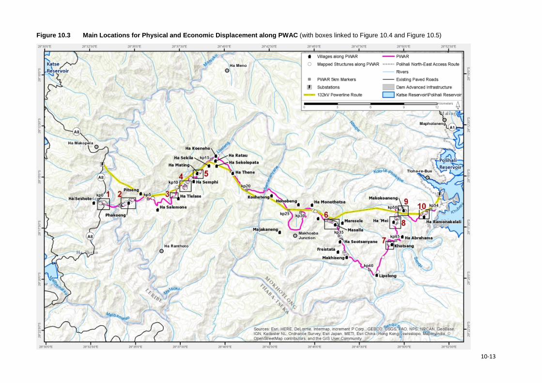
Figure 10.3 Main Locations for Physical and Economic Displacement along PWAC (with boxes linked to Figure 10.4 and Figure 10.5)
10-13
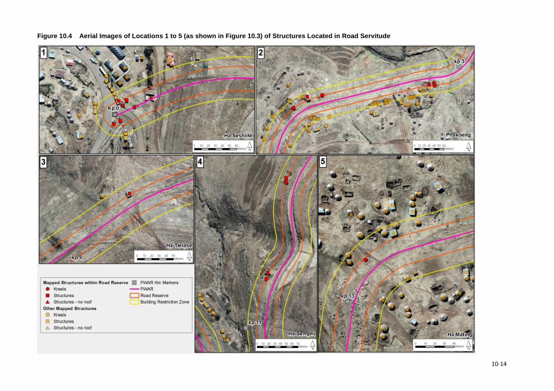
Figure 10.4 Aerial Images of Locations 1 to 5 (as shown in Figure 10.3) of Structures Located in Road Servitude
10-14
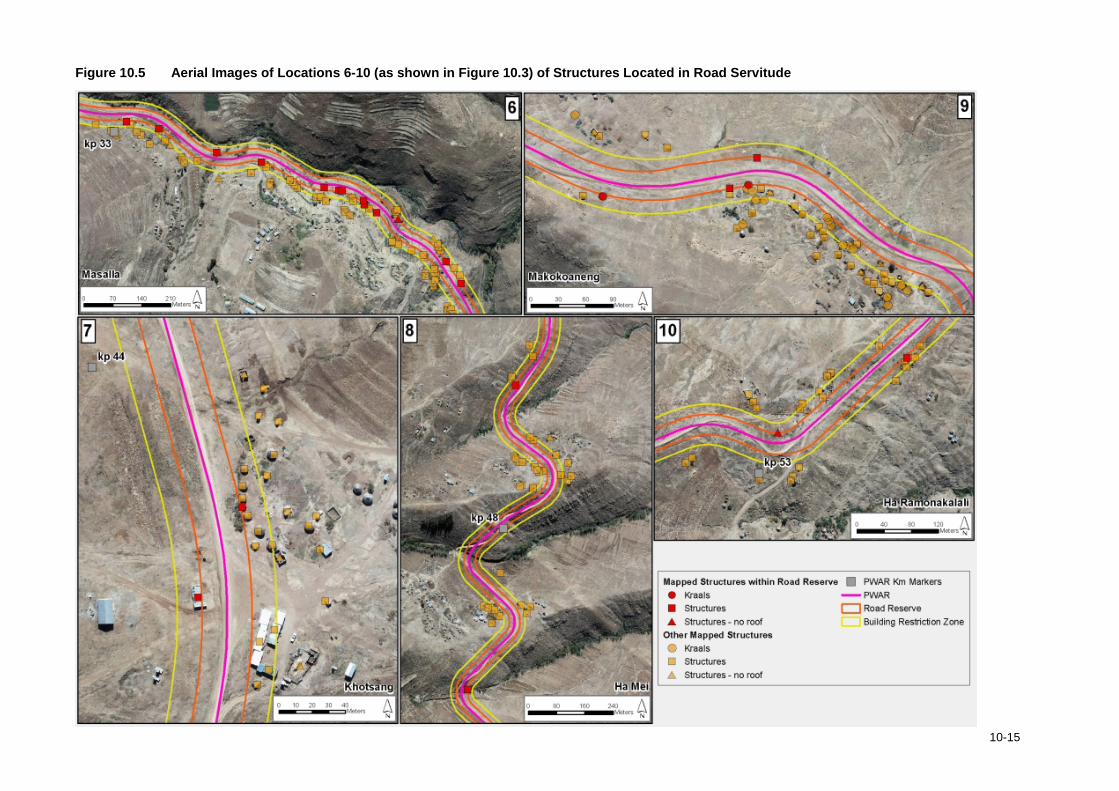
Figure 10.5 Aerial Images of Locations 6-10 (as shown in Figure 10.3) of Structures Located in Road Servitude
10-15
Section 10 • Social and Health Impacts 10.1.3.5 Mitigation Measures In accordance with the mitigation hierarchy, the road and powerline alignment been routed to avoid loss of household structures as far as possible, in the knowledge that resettlement is a highly significant social impact for affected families (as well as delaying implementation of the Project and increasing costs). Physical displacement requires a separate Resettlement Action Plan (RAP) (in accordance with international lender requirements (e.g., ESS 5 / IFC PS5) that must take cognisance of the land-based livelihoods, social networks and the wider community structures. Furthermore, many households are extremely poor and are therefore vulnerable to impacts of displacement. Apart from replacing houses and compensating for other assets affected by the road in accordance with the agreed LHWP Phase II Compensation Policy and rates schedule, affected households along the PWAC should be included in the development and implementation of alternative livelihood strategies in accordance with the LHWP Phase II LRSDF. • LHDA will ensure that the Resettlement Planning and Implementation (that forms part of a
separate contract (LHDA Contract No. 6006)) is compliant with all provisions of the LHWP Phase II Compensation Policy and the agreed rates schedule.
Activities to be undertaken under the RAP contract include. • Develop a stakeholder engagement programme that builds on the existing community
structures established by LHDA in the form of ALCs and is aligned with the requirements of the international lenders such as the World Bank.
• Asset registration of all community assets within the Road Reserve in accordance with LHDA’s Asset Registration Procedure (October 2017). Assets that will be recorded under the RAP include: • Houses and associated structures – dwellings, toilets, storerooms, kraals/stables,
perimeter walls, fencing and cattle posts; • Other private physical assets – non-moveable assets such as residential land, agricultural
fields, gardens, trees, thickets and graves; • Private enterprises such as shops and other business establishments; and • Any public amenities and structures that may be affected, e.g. communal water points.
Asset registration shall include confirming proof of ownership of affected assets, and proof of identity of affected owners.
• Socioeconomic Census of affected persons, assets and other entities along the PWAC to establish an accurate socio-economic profile that can be used as the basis for future monitoring.
• Compensation and Relocation planning by the appointed RAP consultant that shall include: • Confirm eligibility of households requiring resettlement and the relocation options with the
affected households and local authorities, with a preference for identifying relocation options on the same plot or village;
• Determine and record initial livelihood restoration preferences of affected households; • Identify and confirm relocation sites; and undertake surveys of relocation sites where
required; • Assist LHDA with formal acquisition of the relocation sites; • Undertake planning of relocation plots/sites, including land preparation requirements and
any required services/amenities and prepare physical layout plans for relocation plots/sites;
10-16
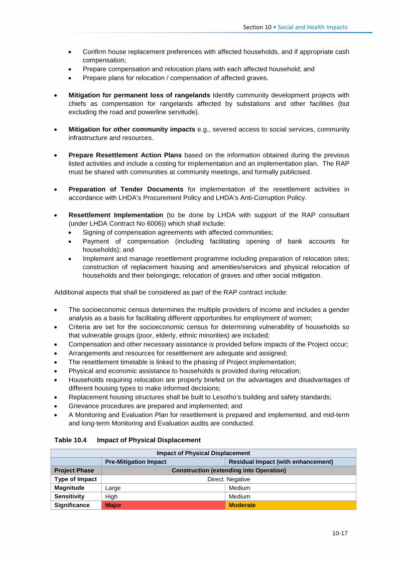
Section 10 • Social and Health Impacts
• Confirm house replacement preferences with affected households, and if appropriate cash compensation;
• Prepare compensation and relocation plans with each affected household; and • Prepare plans for relocation / compensation of affected graves.
• Mitigation for permanent loss of rangelands Identify community development projects with chiefs as compensation for rangelands affected by substations and other facilities (but excluding the road and powerline servitude).
• Mitigation for other community impacts e.g., severed access to social services, community infrastructure and resources.
• Prepare Resettlement Action Plans based on the information obtained during the previous listed activities and include a costing for implementation and an implementation plan. The RAP must be shared with communities at community meetings, and formally publicised.
• Preparation of Tender Documents for implementation of the resettlement activities in accordance with LHDA’s Procurement Policy and LHDA’s Anti-Corruption Policy.
• Resettlement Implementation (to be done by LHDA with support of the RAP consultant (under LHDA Contract No 6006)) which shall include: • Signing of compensation agreements with affected communities; • Payment of compensation (including facilitating opening of bank accounts for
households); and • Implement and manage resettlement programme including preparation of relocation sites;
construction of replacement housing and amenities/services and physical relocation of households and their belongings; relocation of graves and other social mitigation.
Additional aspects that shall be considered as part of the RAP contract include: • The socioeconomic census determines the multiple providers of income and includes a gender
analysis as a basis for facilitating different opportunities for employment of women; • Criteria are set for the socioeconomic census for determining vulnerability of households so
that vulnerable groups (poor, elderly, ethnic minorities) are included; • Compensation and other necessary assistance is provided before impacts of the Project occur; • Arrangements and resources for resettlement are adequate and assigned; • The resettlement timetable is linked to the phasing of Project implementation; • Physical and economic assistance to households is provided during relocation; • Households requiring relocation are properly briefed on the advantages and disadvantages of
different housing types to make informed decisions; • Replacement housing structures shall be built to Lesotho’s building and safety standards; • Grievance procedures are prepared and implemented; and • A Monitoring and Evaluation Plan for resettlement is prepared and implemented, and mid-term
and long-term Monitoring and Evaluation audits are conducted. Table 10.4 Impact of Physical Displacement
Impact of Physical Displacement
Pre-Mitigation Impact Residual Impact (with enhancement) Project Phase Construction (extending into Operation) Type of Impact Direct. Negative Magnitude Large Medium Sensitivity High Medium Significance Major Moderate
10-17
Section 10 • Social and Health Impacts Note: The residual rating of moderate is based on a precautionary judgement that takes into account the disruption and stress caused to affected households who have to relocate and the uncertainty as to how different households will respond to this. Some households may respond positively while others may adapt with difficulty. Based on the EIA definitions, an impact of Moderate has an impact magnitude that is within applicable standards, but falls somewhere in the range from a threshold below which the impact is minor, up to a level that might be just short of breaching a legal limit, and requires that impacts are managed effectively and efficiently. 10.1.3.6 Residual Impact Implementation of the RAP as stipulated under the mitigation measures in Section 10.1.3.5 above is predicted to reduce this impact to one of Moderate significance post-mitigation due to the long-term nature of the impact on affected households. Impacts of physical displacement will remain of Moderate significance, even with mitigation, due to their long-term to permanent nature. As such, livelihood restoration measures and monitoring should extend for a suitable period into operation in order to assess whether the quality of life of displaced persons is equal to or better than prior to displacement.
10.1.4 Construction Phase: Economic Displacement and Livelihoods 10.1.4.1 Description of Impact The Project Area is relatively isolated and there are not many people with disposable income. People largely support themselves on a range of subsistence-based livelihood options which include crop, livestock farming, harvesting of natural resources and shops (selling basic goods). Cannabis sativa (colloquially referred to as matekoane in Lesotho and as dagga in South Africa) is widely grown and harvested throughout the area and appears to be a significant cash crop (although the number of households benefitting from its sale has not been quantified). Arable land is scarce and basic natural resources such as fuel wood and water are in short supply and difficult to access. Efforts have therefore been made to keep land losses to the PWAC to the barest minimum by ensuring optimal route alignments and as far as possible following the existing road alignment. Economic displacement refers to the loss of income streams or means of livelihood resulting from land acquisition or obstructed access to resources (land, water, or forest) due to the construction and operation of LHWP Phase II. The economic impacts of LHDAs compulsory acquisition of land will include the loss of housing structures, business structures (shops) and the temporary loss of business income (see Section 10.1.3) as well as the loss of arable land. The size and value of these of specific types of structures as well as residential land in urban areas will be quantified by a Professional Valuer as part of the resettlement planning process. The communities and villages that reside along the PWAC are described in Section 6.5 (Baseline). A total of 52 villages located within 14 clusters (defined for the purposes of stakeholder consultation and social data gathering) occur along the route and will, to varying extents, be affected by economic displacement. The assessment of economic displacement for the road and powerline needs to be contextualised against the communities’ overriding positive expectations of the economic benefits that the road will bring (as summarised above in Section 10.1.1). On the one hand, the creation of the new road will have overriding benefits for the quality of life of the majority of residents in villages along the route, with most people expecting new economic opportunities to sell goods. But on the other, certain households will suffer more than others through the loss of arable land. Some communities and households will also face losing a certain proportion of medicinal plants that were specifically mentioned by residents of Ha Salemone which has a significant botanically rich area of medicinal plants between kp 7 and 9. The negative impact of economic displacement includes loss of assets, loss of access to land and resources, loss of income sources or loss of means of livelihoods.
10-18
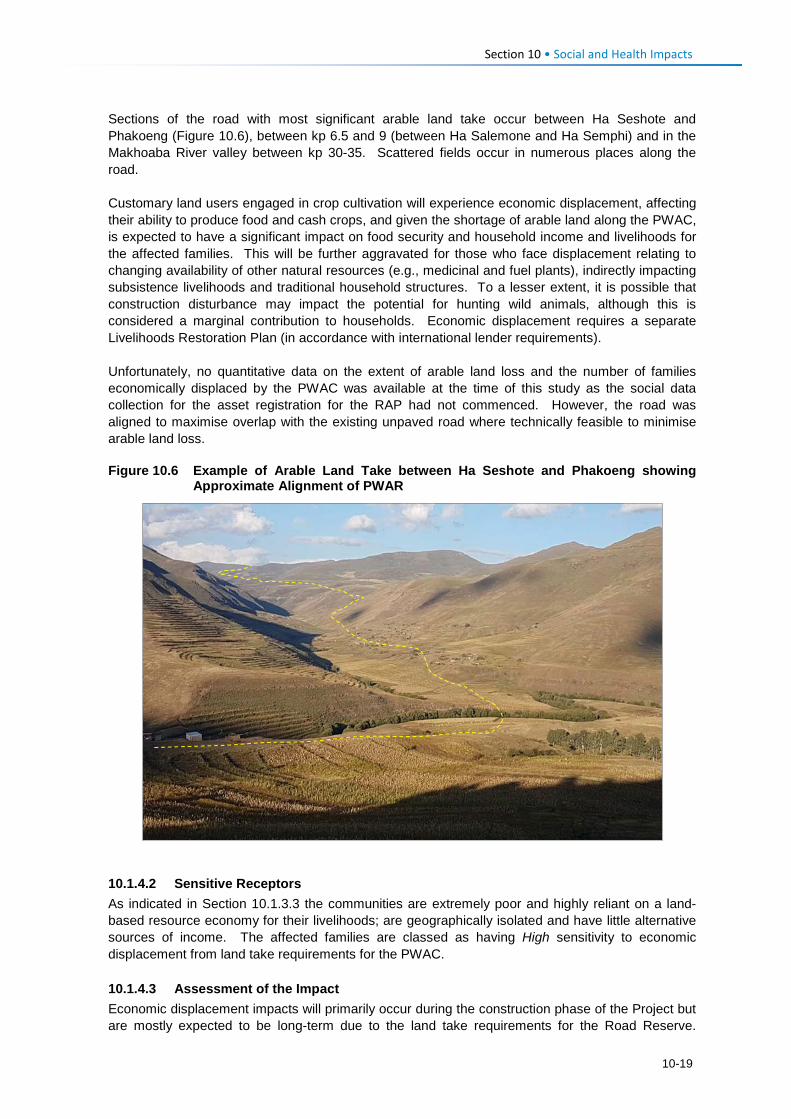
Section 10 • Social and Health Impacts Sections of the road with most significant arable land take occur between Ha Seshote and Phakoeng (Figure 10.6), between kp 6.5 and 9 (between Ha Salemone and Ha Semphi) and in the Makhoaba River valley between kp 30-35. Scattered fields occur in numerous places along the road. Customary land users engaged in crop cultivation will experience economic displacement, affecting their ability to produce food and cash crops, and given the shortage of arable land along the PWAC, is expected to have a significant impact on food security and household income and livelihoods for the affected families. This will be further aggravated for those who face displacement relating to changing availability of other natural resources (e.g., medicinal and fuel plants), indirectly impacting subsistence livelihoods and traditional household structures. To a lesser extent, it is possible that construction disturbance may impact the potential for hunting wild animals, although this is considered a marginal contribution to households. Economic displacement requires a separate Livelihoods Restoration Plan (in accordance with international lender requirements). Unfortunately, no quantitative data on the extent of arable land loss and the number of families economically displaced by the PWAC was available at the time of this study as the social data collection for the asset registration for the RAP had not commenced. However, the road was aligned to maximise overlap with the existing unpaved road where technically feasible to minimise arable land loss. Figure 10.6 Example of Arable Land Take between Ha Seshote and Phakoeng showing
Approximate Alignment of PWAR
10.1.4.2 Sensitive Receptors As indicated in Section 10.1.3.3 the communities are extremely poor and highly reliant on a land-based resource economy for their livelihoods; are geographically isolated and have little alternative sources of income. The affected families are classed as having High sensitivity to economic displacement from land take requirements for the PWAC. 10.1.4.3 Assessment of the Impact Economic displacement impacts will primarily occur during the construction phase of the Project but are mostly expected to be long-term due to the land take requirements for the Road Reserve.
10-19
Section 10 • Social and Health Impacts However, post-construction, households are likely to continue to cultivate crops along the road and within the powerline servitude at their own risk. The pre-mitigation magnitude of the economic displacement impact on households (primarily due to loss of arable land) is rated as Large, which given the High sensitivity rating, results in an impact predicted to be of Major significance. 10.1.4.4 Mitigation Measures In accordance with the mitigation hierarchy, the road and powerline alignment have been routed to avoid loss of arable land as far as possible in the knowledge that arable land is the mainstay of household food security and livelihoods across the PWAC and in general cannot be replaced with alternative land as virtually all arable land is already cultivated. One significant realignment of the initial proposed route (between kp 36-37.5) near Makhiseng in the Makhoaba valley was revised specifically to minimise the loss of high value arable land by moving the road higher up the slope further from the river where the land was more marginal for farming. Unavoidable acquisition of arable land will be compensated in accordance with the LHDA Phase II Compensation Policy and schedule of rates. Rangelands affected by roads and powerline servitudes are not compensated although permanent loss of rangelands for components such as substations will be quantified and compensated for community benefit in the form of identified projects. Mitigation for loss of arable land and any other livelihood-based resources such as woodlots, fruit trees or private bushes, will be compensated in accordance with LHDA’s Phase II Compensation Policy and schedule of rates. As part of the asset registration process for the RAP (LHDA Contract No 6006) (outlined in Section 10.1.3.5), the following information needs to be collected prior to Project construction in order to verify the extent of land acquisition and compensation required: • Size of arable land units, and improvements to land; and • Number of families and persons directly or indirectly affected by land acquisition through loss
of livelihood and / or loss of agricultural opportunity, including sharecroppers. LHDA will seek to ensure. • The RAP contract is implemented effectively to ensure Project affected people are not left
worse-off following displacement.
• Allocation of replacement land is prioritised over lump sum cash payments.
• The socioeconomic census conducted under the RAP contract is used to identify affected persons, especially vulnerable persons, and is used to inform targeted livelihood restoration for those most impacted by the Project.
• Displaced persons should be meaningfully consulted on decisions that affect their livelihoods
and well-being and shall be fully informed of their options and the compensation rates.
• Consultation and information disclosure is aligned to the Community Participation Strategy and the requirements of the international safeguards.
• Assistance is provided to affected people to improve, or at least restore, incomes and living standards to at least the equivalent level prior to construction, if not better.
10-20
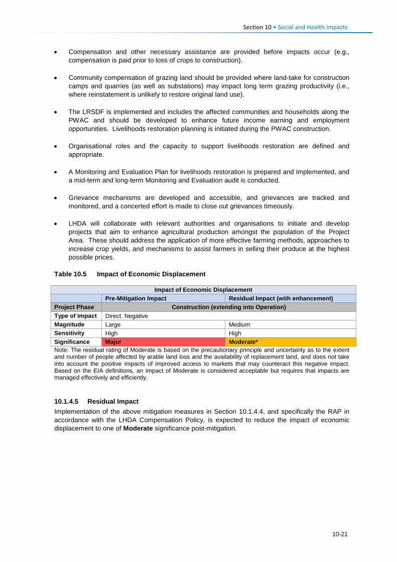
Section 10 • Social and Health Impacts • Compensation and other necessary assistance are provided before impacts occur (e.g.,
compensation is paid prior to loss of crops to construction).
• Community compensation of grazing land should be provided where land-take for construction camps and quarries (as well as substations) may impact long term grazing productivity (i.e., where reinstatement is unlikely to restore original land use).
• The LRSDF is implemented and includes the affected communities and households along the PWAC and should be developed to enhance future income earning and employment opportunities. Livelihoods restoration planning is initiated during the PWAC construction.
• Organisational roles and the capacity to support livelihoods restoration are defined and appropriate.
• A Monitoring and Evaluation Plan for livelihoods restoration is prepared and implemented, and a mid-term and long-term Monitoring and Evaluation audit is conducted.
• Grievance mechanisms are developed and accessible, and grievances are tracked and monitored, and a concerted effort is made to close out grievances timeously.
• LHDA will collaborate with relevant authorities and organisations to initiate and develop projects that aim to enhance agricultural production amongst the population of the Project Area. These should address the application of more effective farming methods, approaches to increase crop yields, and mechanisms to assist farmers in selling their produce at the highest possible prices.
Table 10.5 Impact of Economic Displacement
Impact of Economic Displacement
Pre-Mitigation Impact Residual Impact (with enhancement) Project Phase Construction (extending into Operation) Type of Impact Direct. Negative Magnitude Large Medium Sensitivity High High Significance Major Moderate* Note: The residual rating of Moderate is based on the precautionary principle and uncertainty as to the extent and number of people affected by arable land loss and the availability of replacement land, and does not take into account the positive impacts of improved access to markets that may counteract this negative impact. Based on the EIA definitions, an impact of Moderate is considered acceptable but requires that impacts are managed effectively and efficiently. 10.1.4.5 Residual Impact Implementation of the above mitigation measures in Section 10.1.4.4, and specifically the RAP in accordance with the LHDA Compensation Policy, is expected to reduce the impact of economic displacement to one of Moderate significance post-mitigation.
10-21
Section 10 • Social and Health Impacts 10.1.5 Construction Phase: Disturbance from Increased Nuisance Factors
during PWAR and BPST Construction 10.1.5.1 Description of Impact Given the isolated location and inaccessibility of the Project Area, it has retained a rural character that is free from development, traffic, loud machinery/ equipment, in-migration and all associated disturbances. Current livelihood activities are undertaken using human and domestic animal labour, there are almost no vehicles (with the exception of a few that travel at slow speeds for parts of the PWAC); most people commute by foot to school, work and to town. The Project Area is quiet and peaceful with dramatic topography. Construction activities will generate uncharacteristic disturbances from a range of nuisance factors. These will occur along the length of the route and for the duration of the PWAR and BPST construction timeframe (~20 months). There will be three construction Contractors operating at all times; the schedule and phasing of the construction process are not yet known, except that the PWAR Contractors will work at either end of the road and the BPST Contractor will construct the entire powerline (with telecommunications). Phasing is likely to be aligned with land acquisition and successful completion of the physical and economic resettlement process. The potential nuisance factors that will create disturbances in the Project Area are: • Construction vehicles and heavy machinery of different types (all diesel powered); • Use of mobile diesel generators; • The presence of construction workers and job-seekers; • Blasting at the quarry sites and at various points along the route; and • Exposed and disturbed bare ground. Physically, these nuisance factors will lead to noise, dust and potentially (for some people) an unwanted visual change in the landscape character. All proposed construction work will take place during daytime hours, seven days a week. Some people may experience emotional and psychological distress as a result of the disturbances; this is most likely to be the case near schools and healthcare facilities where learning and healing could be affected. Disturbance of schools was a concern raised at various community meetings. Churches and other sites of religious and cultural significance and social gatherings may also be negatively affected by some of the nuisance factors, especially on weekends (particularly Sundays). The majority of the construction related disturbances will occur at a local level and will affect the households, infrastructure, villages and road users in the immediate vicinity of the Project working area footprint in any given stretch. Nuisance factors may also be exacerbated by indirect in-migration of job-seekers into the Project Area; they will place additional pressure on the already strained social infrastructure and services (e.g. housing, sanitation, water, healthcare, schooling, policing) in the surrounding villages. As the road way is cleared, so migrants will move further into the more remote locations. Construction vehicles, machinery and generators (all diesel powered) will be used on an almost ongoing basis throughout construction and are likely to be the sources of most noise and dust disturbance (along with intermittent blasting). It is expected that construction workers will either be housed in the designated, access-controlled construction camps1, or they will be employed from the local villages and therefore reside in their own homes. During work hours, the presence of the workers can result in elevated noise levels linked to actual work activities, as well as loud conversations between the workers. Waste will be generated and could potentially be discarded in the area.
1 Assessment of the construction camps are excluded from the scope of this SIA as they are expected to be covered in a separate EMP.
10-22
Section 10 • Social and Health Impacts Blasting will be required at the quarry sites and at points along the route where rock needs to be removed. Blasting will result in intermittent loud noise and dust generation, which is expected to affect schools such as Laghetto primary at Ha Seshote; Ha Salemone primary and Bloem primary at Ha Ratau1. In addition, it is likely that there may be ‘flyrock’ associated with each blast, depending on how this is managed. Local residents (specifically farmers) are concerned that these rocks will cause damage to their crops, livestock, or to their properties and blasting may scare away animals (wild and domesticated). Arable land is scarce and crop yields are already relatively low and therefore further reduction in yield due to inability to plow fields due to rocks is not desirable and would require redress. Dust will largely be generated by the clearance of topsoil and exposure of loose sand or soil as the construction crew clear the footprint for the road and begin blasting and removing rock from the quarry sites. The exposed sand will be blown across the area during dry periods and as a result of the passage of construction vehicles back and forth along the route, especially during the dry winter periods between May and October. Increased levels of dust can be a nuisance in that it could dirty houses and the clean washing hung out to dry, it may aggravate those with existing respiratory conditions, and it could impact crops and the quality of wool / mohair. Residents and key informants are concerned about the impact the increased dust from quarries will have on the quality of wool at the woolshed near Kosheteng where thousands of sheep and goats are sheared annually during the summer months (roughly between September and March). It was reported that if the wool quality is negatively affected by the dust, the market value will be reduced, thus directly affecting the income of sheep farmers and traders. 10.1.5.2 Sensitivity of Receptors Local residents are accustomed to living in an environment free from the disturbances that can be expected from construction-related nuisance factors. As such, all residents will be affected; however, it is expected that most will adapt to or accept the disturbances which are short-term in nature (at each point along the route). The schools, healthcare facilities and sites of religious/ traditional and cultural significance located along the route are likely to be most sensitive to the nuisance factors – specifically noise and dust. Students are likely to find it difficult to concentrate on their classes when noise levels are elevated. In addition, the activities are going to be new and exciting and will captivate the attention of many students, thus distracting them and diverting their attention away from their lessons. The direct impacts of the road on two schools (Ha Seshote primary and Bloem primary) has already been mitigated to some extent by realigning the road further away from them although they both remain within earshot of the road. People with respiratory conditions could experience an exacerbation of the condition as a result of increased levels of dust in their environment.
Another sensitive sector of the population will be those people who have livelihood activities located alongside the directly affected footprint (e.g., crops, woolshed, grazing); there is a risk that the flyrock and dust could affect their produce. As such, it is expected that the sensitivity of most people will be Medium; however, some (particularly school children) will be more highly sensitive to this impact. 10.1.5.3 Assessment of the Impact The disturbances arising as a result of the construction phase nuisance factors will be negative and direct in nature. Some indirect impacts could be experienced as a result of the presence of job-seekers/ new-comers to the area resulting in pressure on social infrastructure and services. The impact will be experienced locally, largely at a site level. The direct construction related
1 Additional schools, such as at Makhoaba and Khotsang, could also be affected if blasting is required nearby, but this will need to be confirmed by the Contractors.
10-23
Section 10 • Social and Health Impacts disturbances are highly likely to occur and will persist for the duration of the 20-month construction phase (short-term) but will only be experienced at each point along the route for a far shorter duration. The magnitude of this impact is anticipated to be Small, specifically given the short duration that the impact will be experienced at each point along the route. For the most sensitive receptors such as school children, the impact is assessed as Moderate significance (negative), while for the majority it is considered to be of Minor significance. 10.1.5.4 Required Mitigation Measures Recruitment procedures to limit influx • Apply the LHDA Recruitment Guidelines and the mitigation measures described in Section
10.1.2.4 to enhance local employment. This will serve to reduce the number of general workers from outside the area, and discourage influx.
Workforce management • All construction staff will agree to a Code of Conduct (CoC) that outlines protocols and
standards for working in the Project Area as part of their contract. The CoC should address the following: • Respect for local residents, including being considerate about noise levels, privacy, and
local customs; • Respect for existing livelihood activities and the environment; • Respect for community water supplies (to prevent pollution and overuse); • No hunting, snaring or unauthorised taking of any property belonging to someone else,
including removal of natural resources; • Zero tolerance of illegal activities by construction personnel including: illegal sale or
purchase of alcohol; sale, purchase or consumption of drugs; illegal gambling or fighting; • Compliance with the Traffic Management Plan (to be developed by the Contractors) and
all associated regulations; • Disciplinary measures for not adhering to the CoC. Notably, stock theft and similar crimes
conducted by Contractor staff shall be managed as dismissible offences. • Workers found to be in contravention of the CoC will face disciplinary procedures that could
result in dismissal. Theft or purposeful damage to property should be dismissible offences. Ongoing engagement and grievance management • The schedule and approach to construction must be presented to the district authorities and
community leadership structures to enable their understanding of the Project roll out. • LHDA are to regularly review and update the Community Participation Strategy for relevance to
the PWAC and which shall be compliant with international best practice and agreed upon by local community structures through the ALCs.
• The Contractor shall appoint appropriately trained and experienced staff to implement
stakeholder engagement during the course of work and shall assign adequate resources. • Apply all mitigation measures as described in Section 10.1.2.4 regarding a Grievance
Resolution Procedure.
Generic construction phase management measures • Traffic management
• LHDA will develop a Traffic Management Policy including vehicle safety, driver and passenger behavior, use of drugs and alcohol, hours of operation, rest periods and accident reporting and investigation requirements.
10-24
Section 10 • Social and Health Impacts
• LHDA will undertake traffic safety awareness sessions at schools and in communities along the PWAC during construction and early operation (until completion of dam construction). This should be done in collaboration with the Roads Directorate and Ministry of Education, as appropriate.
• Contractors will compile a traffic management plan / method statement relevant to their activities, which shall include a protocol for handling accidents involving other vehicles, pedestrians, animals or property.
• Traffic management measures are to be implemented as specified in the EMP and in accordance with approved traffic management plan / method statement aimed at restricting travel speed of Contractor staff and their suppliers / staff and maintenance of vehicles; vehicle safety checks, and provisions for existing road users and pedestrians;
• Safe crossings are to be provided for pedestrian and animals during construction, and they are to be given right of way.
• The appointed Contractor/s will have the necessary insurance / contingency budget in place for costs incurred with accidents involving other vehicles, people, animals, agricultural land, or infrastructure.
• The Contractor will be required to compensate any affected farmer for injured animals in terms of agreed protocols.
• Dust suppression
• Dust suppression measures are to be implemented as specified in the EMP, which shall include wetting of roads during windy conditions and covering of soil mounds;
• Site clearance is to be minimised as far as possible to reduce the potential for dust, and other impacts;
• Measures to prevent damage to the quality of wool at the Kosheteng woolshed are to be devised, which shall consider scheduling of blasting to non-windy periods with specific precautions during sheep shearing seasons, and dust suppression. These measures are to be developed in collaboration with the WMGA.
• Noise management
• Noise management measures are to be implemented as specified in the EMP and shall include maintenance of vehicles and equipment to run quietly; and avoidance of leaving engines running unnecessarily;
• Workers are to be considerate regarding noise levels and associated disruption to local people; this is to be outlined in their CoC;
• Noisy activities (e.g. blasting) are not to be scheduled at critical times (e.g. school exams, religious services/ celebrations). LHDA will consult local leaders, school principals, healthcare workers and religious leaders regarding important events or occasions that may be negatively affected by construction noise in order to try to schedule these activities at different times.
• Blasting and Vibration
• Asset condition surveys will be undertaken prior to construction. • All safety measures related to blasting are to be implemented as specified in the EMP. • A communication protocol must be established. Leadership structures are to be informed
in advance of blasting, allowing them adequate time to notify communities, including herders. Other mechanisms, such as the use of loud speakers and sirens are to be used to inform communities of blasting events.
• Waste management and water source management
• Waste management measures are to be implemented as specified in the EMP. This is to include the use of portable toilets and rubbish bins (to avoid littering);
10-25
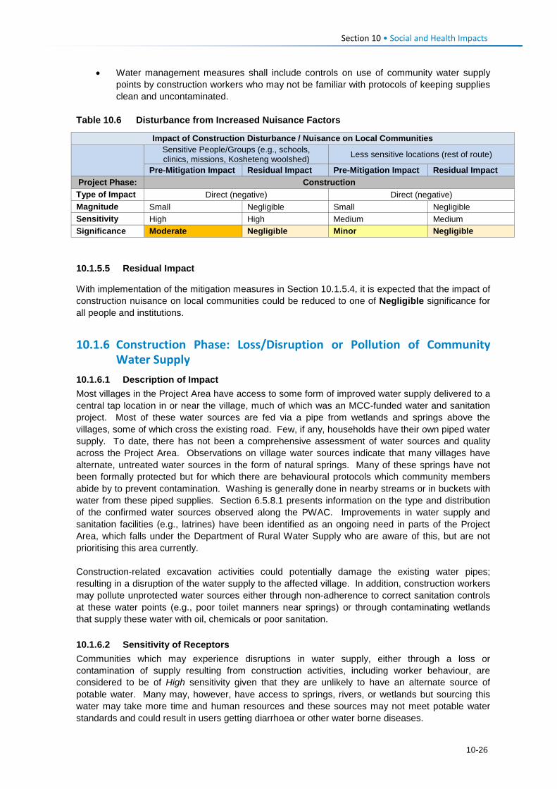
Section 10 • Social and Health Impacts
• Water management measures shall include controls on use of community water supply points by construction workers who may not be familiar with protocols of keeping supplies clean and uncontaminated.
Table 10.6 Disturbance from Increased Nuisance Factors
Impact of Construction Disturbance / Nuisance on Local Communities
Sensitive People/Groups (e.g., schools, clinics, missions, Kosheteng woolshed) Less sensitive locations (rest of route)
Pre-Mitigation Impact Residual Impact Pre-Mitigation Impact Residual Impact Project Phase: Construction Type of Impact Direct (negative) Direct (negative) Magnitude Small Negligible Small Negligible Sensitivity High High Medium Medium Significance Moderate Negligible Minor Negligible 10.1.5.5 Residual Impact
With implementation of the mitigation measures in Section 10.1.5.4, it is expected that the impact of construction nuisance on local communities could be reduced to one of Negligible significance for all people and institutions.
10.1.6 Construction Phase: Loss/Disruption or Pollution of Community Water Supply
10.1.6.1 Description of Impact Most villages in the Project Area have access to some form of improved water supply delivered to a central tap location in or near the village, much of which was an MCC-funded water and sanitation project. Most of these water sources are fed via a pipe from wetlands and springs above the villages, some of which cross the existing road. Few, if any, households have their own piped water supply. To date, there has not been a comprehensive assessment of water sources and quality across the Project Area. Observations on village water sources indicate that many villages have alternate, untreated water sources in the form of natural springs. Many of these springs have not been formally protected but for which there are behavioural protocols which community members abide by to prevent contamination. Washing is generally done in nearby streams or in buckets with water from these piped supplies. Section 6.5.8.1 presents information on the type and distribution of the confirmed water sources observed along the PWAC. Improvements in water supply and sanitation facilities (e.g., latrines) have been identified as an ongoing need in parts of the Project Area, which falls under the Department of Rural Water Supply who are aware of this, but are not prioritising this area currently. Construction-related excavation activities could potentially damage the existing water pipes; resulting in a disruption of the water supply to the affected village. In addition, construction workers may pollute unprotected water sources either through non-adherence to correct sanitation controls at these water points (e.g., poor toilet manners near springs) or through contaminating wetlands that supply these water with oil, chemicals or poor sanitation. 10.1.6.2 Sensitivity of Receptors Communities which may experience disruptions in water supply, either through a loss or contamination of supply resulting from construction activities, including worker behaviour, are considered to be of High sensitivity given that they are unlikely to have an alternate source of potable water. Many may, however, have access to springs, rivers, or wetlands but sourcing this water may take more time and human resources and these sources may not meet potable water standards and could result in users getting diarrhoea or other water borne diseases.
10-26
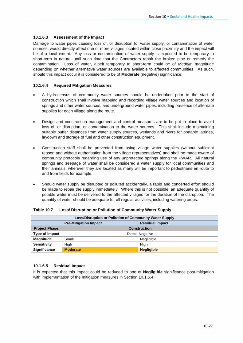
Section 10 • Social and Health Impacts 10.1.6.3 Assessment of the Impact Damage to water pipes causing loss of, or disruption to, water supply, or contamination of water sources, would directly affect one or more villages located within close proximity and the impact will be of a local extent. Any loss or contamination of water supply is expected to be temporary to short-term in nature, until such time that the Contractors repair the broken pipe or remedy the contamination. Loss of water, albeit temporary to short-term could be of Medium magnitude depending on whether alternative water sources are available to affected communities. As such, should this impact occur it is considered to be of Moderate (negative) significance. 10.1.6.4 Required Mitigation Measures
• A hydrocensus of community water sources should be undertaken prior to the start of construction which shall involve mapping and recording village water sources and location of springs and other water sources, and underground water pipes, including presence of alternate supplies for each village along the route.
• Design and construction management and control measures are to be put in place to avoid
loss of, or disruption, or contamination to the water sources. This shall include maintaining suitable buffer distances from water supply sources, wetlands and rivers for portable latrines, laydown and storage of fuel and other construction equipment.
• Construction staff shall be prevented from using village water supplies (without sufficient
reason and without authorisation from the village representatives) and shall be made aware of community protocols regarding use of any unprotected springs along the PWAR. All natural springs and seepage of water shall be considered a water supply for local communities and their animals, wherever they are located as many will be important to pedestrians en route to and from fields for example.
• Should water supply be disrupted or polluted accidentally, a rapid and concerted effort should
be made to repair the supply immediately. Where this is not possible, an adequate quantity of potable water must be delivered to the affected villages for the duration of the disruption. The quantity of water should be adequate for all regular activities, including watering crops.
Table 10.7 Loss/ Disruption or Pollution of Community Water Supply
Loss/Disruption or Pollution of Community Water Supply
Pre-Mitigation Impact Residual Impact Project Phase: Construction Type of Impact Direct. Negative Magnitude Small Negligible Sensitivity High High Significance Moderate Negligible 10.1.6.5 Residual Impact It is expected that this impact could be reduced to one of Negligible significance post-mitigation with implementation of the mitigation measures in Section 10.1.6.4.
10-27
Section 10 • Social and Health Impacts 10.1.7 Construction Phase: Increased Safety Risks to People and Animals 10.1.7.1 Description of Impact The construction activities will generate a range of safety risks that the population of the PWAC has not been exposed to, to date. Given that the road is in such a bad state, and there is very limited traffic through the area; the cars that do drive there are being forced to travel at extremely slow speeds. As such, increased traffic travelling at greater speeds is going to be one of the most prominent risks of the PWAR. Other safety risks will include the sites of construction (e.g., excavated areas / trenches, and cables and pipes temporarily laid along the routes), and quarry and borrow pit sites. The most common ‘road’ users are a combination of pedestrians and livestock. Many children walk to school or play on the ‘road’ unaccompanied by adults; there is generally a lot of activity on the road close to schools. People also walk to work, healthcare facilities, to fetch water/ wood/ other natural resources, and to the larger towns where markets are available for sale and purchase of goods. Herders are seen walking the livestock along these routes as it is the easiest footpath to and from the rangelands to village kraals. The slow speed of cars that currently travel along the existing road allows pedestrians and animals time to move out of the way and allow drivers time to avoid the other road users. Risks to safety, as related to traffic, will arise from the presence of many heavy construction vehicles and numerous smaller Project vehicles and trucks1. As the road is graded and paved, so the speed at which construction vehicles and road users will drive is expected to increase significantly. Through the construction phase, as the road becomes usable, so the number of cars that typically did not use the road previously will increase. Exposed construction sites will pose a number of risks. Excavation for trenches or borrow pits will result in relatively deep, steep-sided holes that road users (including livestock) could fall into. In many places there is unlikely to be much room alongside the construction corridor to enable safe passing of people, animals and cars. Construction equipment and materials (possibly including cables and pipes) will lie alongside the construction sites and many residents (notably children) will be inquisitive and may want to investigate these sites and the materials. A lack of lighting at night will result in these sites being hazardous during dark, and may result in people and animals falling into open trenches or pits. The quarry sites are going to be dangerous as a result of potential flyrock during blasting activities, and because the resultant quarry will be steep-sided and deep. Since people and animals move freely across the area, some residents are concerned that people or animals could fall into the unprotected quarry sites. Given many of the above-mentioned risks and the nature of the Project, security personnel are likely to be appointed to perform a range of security functions across the PWAC throughout the construction phase. This, in itself, poses an additional potential risk; untrained or poorly trained security personnel could exert unnecessary force, take advantage of their relative position of power, or misuse a weapon; such actions could result in physical harm or be construed as intimidation. Such force would infringe on the local community’s basic human rights regarding safety and security.
1 At this time, no information has been made available about the number or frequency of construction vehicles anticipated throughout the construction phase.
10-28
Section 10 • Social and Health Impacts 10.1.7.2 Sensitivity of Receptors
Initially, the sensitivity of the local population and animals to the increased traffic and other construction safety risks will be Medium to High given they will not be used to the risks that will arise during construction, as described above. Children, in particular, are going to be the most sensitive given that they are likely to want to investigate and explore the construction sites, equipment and materials. 10.1.7.3 Assessment of the Impact
This negative and direct impact will be experienced at the local level for the duration of the construction phase (short-term). Typically, people would get used to the activities and lose interest in them, however, in this case, the construction activities will proceed in a linear manner so there will be newly affected people at all times throughout the construction period. The magnitude is Small given the relatively short duration and local extent of the impact. It is likely that this impact will occur and it is rated as Moderate (negative) significance. 10.1.7.4 Required Mitigation Measures
• Implement all traffic management measures as specified in the EMP and in Section 10.1.5.4, including traffic calming measures and speed control enforcement of Subcontractors and other road users.
• All active construction areas which pose a safety risk (such as trenches and pits, including the
quarry sites) are to be adequately fenced off or protected and managed to ensure that people and animals cannot access the sites intentionally or unintentionally.
• Following completion of construction, measures to ensure human safety at quarry sites must be identified and implemented (as fencing is highly likely to be removed).
• Provision should be made for safe pedestrian access where construction activities block normal pedestrian routes.
• Implement all necessary precautions to prevent the risk of flyrock during blasting as per the
blasting protocols in the EMP and Section 10.1.5.4. • Communication and training about safety during the construction phase should be addressed
on a regular basis with relevant local Project stakeholders (e.g., school children, residents of villages closest to the road). Communication on safety awareness should take place at all public meetings (pitsos) and other public events. LHDA will ensure that the Contractor’s appointed CLOs receive training regarding all the risks and associated protocols.
• LHDA (or their designated consultants) will develop and roll out an education and awareness
campaign in the local schools to ensure that the children are aware of the risks linked to traffic, construction work and workers.
• Contractors will erect suitable signage to indicate danger and provide guidance to road users
and pedestrians. • Security and traffic personnel should be employed to actively manage high risk areas.
• All workplace health and safety concerns are to be identified and suitably mitigated by
Contractors to ensure the safety of the workers and local communities.
10-29
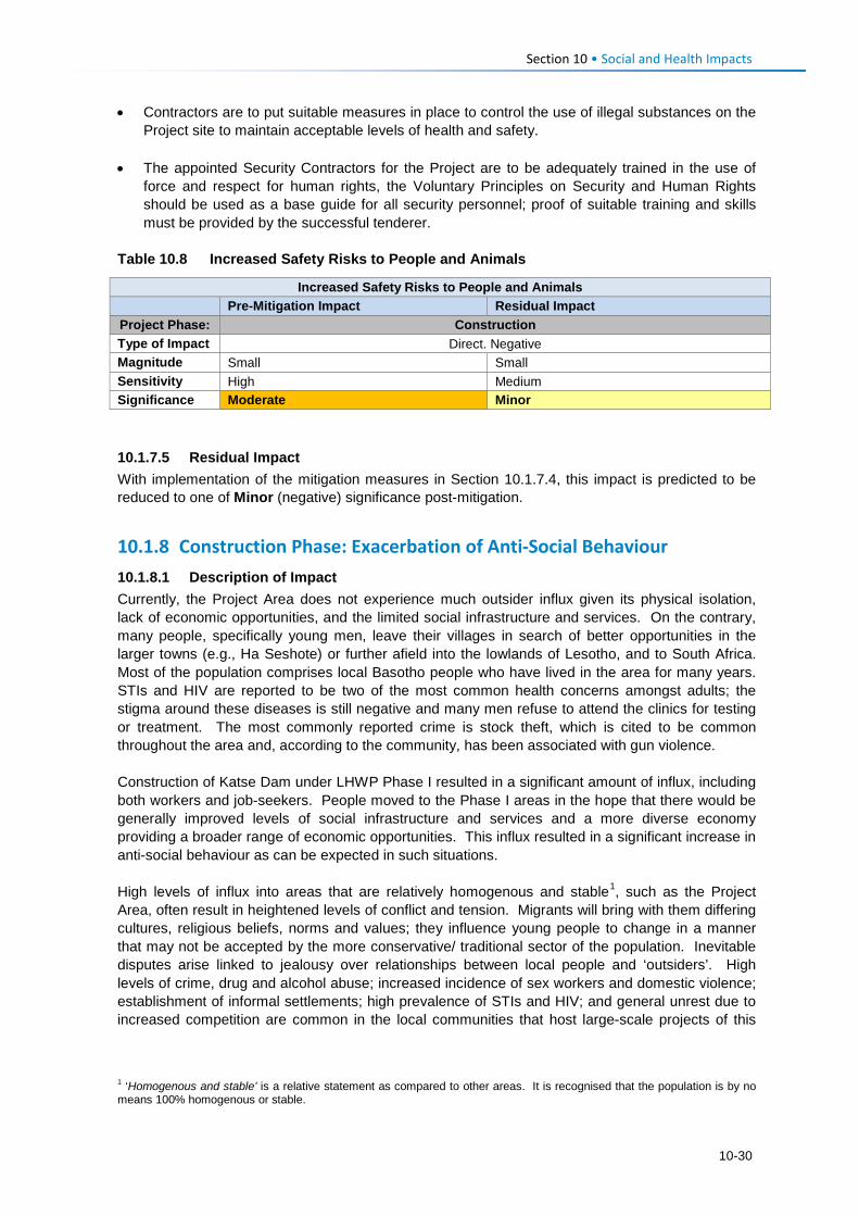
Section 10 • Social and Health Impacts • Contractors are to put suitable measures in place to control the use of illegal substances on the
Project site to maintain acceptable levels of health and safety. • The appointed Security Contractors for the Project are to be adequately trained in the use of
force and respect for human rights, the Voluntary Principles on Security and Human Rights should be used as a base guide for all security personnel; proof of suitable training and skills must be provided by the successful tenderer.
Table 10.8 Increased Safety Risks to People and Animals
Increased Safety Risks to People and Animals
Pre-Mitigation Impact Residual Impact Project Phase: Construction Type of Impact Direct. Negative Magnitude Small Small Sensitivity High Medium Significance Moderate Minor 10.1.7.5 Residual Impact With implementation of the mitigation measures in Section 10.1.7.4, this impact is predicted to be reduced to one of Minor (negative) significance post-mitigation.
10.1.8 Construction Phase: Exacerbation of Anti-Social Behaviour 10.1.8.1 Description of Impact Currently, the Project Area does not experience much outsider influx given its physical isolation, lack of economic opportunities, and the limited social infrastructure and services. On the contrary, many people, specifically young men, leave their villages in search of better opportunities in the larger towns (e.g., Ha Seshote) or further afield into the lowlands of Lesotho, and to South Africa. Most of the population comprises local Basotho people who have lived in the area for many years. STIs and HIV are reported to be two of the most common health concerns amongst adults; the stigma around these diseases is still negative and many men refuse to attend the clinics for testing or treatment. The most commonly reported crime is stock theft, which is cited to be common throughout the area and, according to the community, has been associated with gun violence. Construction of Katse Dam under LHWP Phase I resulted in a significant amount of influx, including both workers and job-seekers. People moved to the Phase I areas in the hope that there would be generally improved levels of social infrastructure and services and a more diverse economy providing a broader range of economic opportunities. This influx resulted in a significant increase in anti-social behaviour as can be expected in such situations. High levels of influx into areas that are relatively homogenous and stable1, such as the Project Area, often result in heightened levels of conflict and tension. Migrants will bring with them differing cultures, religious beliefs, norms and values; they influence young people to change in a manner that may not be accepted by the more conservative/ traditional sector of the population. Inevitable disputes arise linked to jealousy over relationships between local people and ‘outsiders’. High levels of crime, drug and alcohol abuse; increased incidence of sex workers and domestic violence; establishment of informal settlements; high prevalence of STIs and HIV; and general unrest due to increased competition are common in the local communities that host large-scale projects of this
1 ‘Homogenous and stable’ is a relative statement as compared to other areas. It is recognised that the population is by no means 100% homogenous or stable.
10-30
Section 10 • Social and Health Impacts nature. These impacts typically occur as a result of increased competition for jobs, limited access to basic resources and services, increased income, and different cultural backgrounds/ beliefs. Many of the respondents in the Project Area raised concerns around the above impacts based on their knowledge of LHWP Phase I. There were three most commonly raised concerns. • Crime levels will increase significantly given that many of the migrants to the area will not have
income or access to land to generate a livelihood. Stock theft is the most likely crime given that there is not much else of value to steal; livestock is extremely valuable and considered to be an indicator of wealth.
• Young girls will enter into relationships with migrant workers (and job-seekers) in the hope that
they will be able to leave the area and secure a ‘better’ lifestyle. However, they are likely to end up dropping out of school with unwanted pregnancies, STIs and HIV.
• There is also a general concern that levels of STIs and HIV will become more prevalent,
specifically because the existing rates are so high and many people still refuse testing and treatment.
As demonstrated on similar projects and at Katse under LHWP Phase I, it is likely that during the construction phase influx will commence and an increase in anti-social behaviour will arise. The most likely social ills that may occur during the construction phase are outlined below. These are likely to continue, albeit in an altered manner, throughout the operational life of the Project. • Petty theft may be exacerbated as a result of an increased number of people in the area who
will have no employment and therefore no source of income to support themselves. Stock theft is likely to experience the most notable increase, given that livestock are the most valuable asset in the PWAC and they can be stolen with relative ease.
• An increase in disposable income within the Project Area (among workers) could result in an
increase in alcohol and drug abuse, increased incidences of prostitution and casual sexual relations. These activities could lead to an increased incidence of STIs and HIV and increased numbers of teenage and unwanted pregnancies. The increased prevalence of diseases would affect Contractors, employees, local residents and the families/ sexual partners of anyone becoming infected in the Project Area.
• General unrest may arise as a result of increased pressure for resources, resentment towards
those who secure employment and procurement opportunities as well as benefits from other Projects (specifically if the beneficiaries are from outside the area).
10.1.8.2 Sensitivity of Receptors The population of the Project Area is going to be susceptible to the inevitable increase in anti-social behaviour as described above given the prevailing high levels of poverty and low levels of economic opportunity, and is therefore assessed as having High sensitivity to this impact. Increased crime/ stock theft are likely, and many hopeful local people will enter into relationships in anticipation of a better life with an employed partner. STIs and HIV levels will escalate given the current attitude and contraction rates, as will unwanted pregnancies. Conflict, drugs and alcohol abuse, and ultimately changed norms and values can be expected. 10.1.8.3 Assessment of the Impact This negative impact will arise as a direct result of construction workers, and indirectly via migrant job-seekers to the area. The impact will be experienced at a local level; however, STI and HIV infections will spread into the areas where the workers and job-seekers originate and migrate to at a later date. Given the consequences of the impact, the duration will be long-term as construction of
10-31
Section 10 • Social and Health Impacts the road will lead to ongoing migration in and out of the area, and diseases such as HIV/AIDS have long-term impacts on infected persons and their families. This impact will affect the individuals and families that are susceptible to engaging in such activities, while crime could affect anyone. The magnitude of the impact is rated Medium to Large. As such, the impact is assessed as having Major (negative) significance. 10.1.8.4 Required Mitigation Measures
Recruitment procedures to limit influx • Apply all mitigation measures as described in Section 10.1.2.4 (and as per LHDA Labour
Recruitment Strategy) to enhance local employment. This will serve to reduce the number of general workers from outside the area, and discourage influx.
Workforce management • Apply all mitigation measures as described in Section 10.1.5.4. Notably, stock theft and similar
crimes conducted by Contractor staff shall be managed as dismissible offences.
• Apply all mitigation and management measures proposed by the relevant EMPs regarding Contractor Camp Management1.
• Workers from outside the PWAC area are to work on a rotational basis, allowing them time to return home to visit their families and rest, with the cost of their return journey covered by the Contractor/s.
• The Contractor is required to prepare an HIV/AIDS awareness plan (in accordance with the Contractor Tender Requirements and to make provision for counselling and testing of staff.
• All Project employees are to receive HIV training as part of their induction and should be encouraged to be regularly tested for HIV. Information packs are to be distributed at the training, and posters are to be displayed in common areas.
• Contractors will provide health care facilities for their staff, including local labour. They are to be equipped with adequate medical staff and resources to handle common diseases (including STIs and HIV) and work related injuries.
• LHDA will appoint experienced professionals to develop and implement a Public Health Action Plan (see Section 3.2.3) which is expected to specify additional recommendations for improved health care provision for affected stakeholders.
Ongoing engagement and grievance management • Implement all measures as described in Section 10.1.5.4. 10.1.8.5 Recommended Mitigation Measures Socio-economic development • LHDA will collaborate with the relevant authorities, NGOs, CBOs, and other community groups
to identify and initiate interventions to alleviate the increase in anti-social impacts caused by an increase in job-seekers to the area. This may include, but is not limited to the need for: • Communication regarding Project benefits as a means of managing expectations and
reducing influx;
1 Note: assessment of impacts and mitigation requirements of the PWAC construction camps are not included in this ESIA but are expected to fall under a separate EMP.
10-32
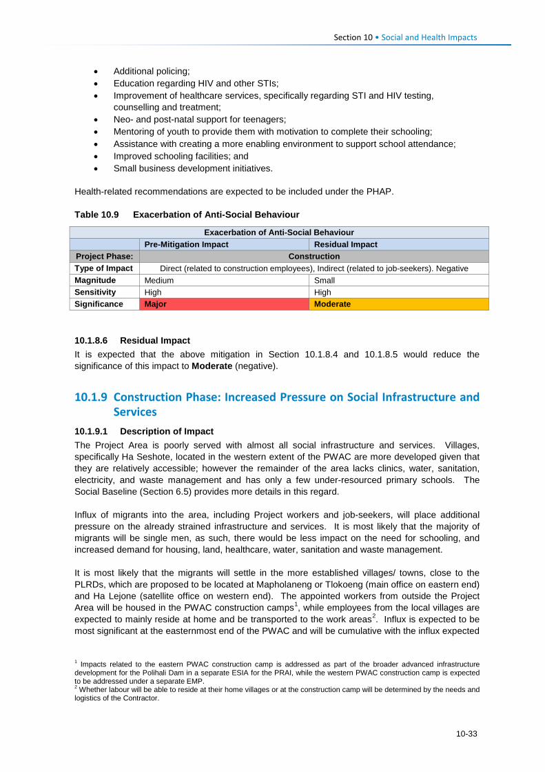
Section 10 • Social and Health Impacts
• Additional policing; • Education regarding HIV and other STIs; • Improvement of healthcare services, specifically regarding STI and HIV testing,
counselling and treatment; • Neo- and post-natal support for teenagers; • Mentoring of youth to provide them with motivation to complete their schooling; • Assistance with creating a more enabling environment to support school attendance; • Improved schooling facilities; and • Small business development initiatives.
Health-related recommendations are expected to be included under the PHAP. Table 10.9 Exacerbation of Anti-Social Behaviour
Exacerbation of Anti-Social Behaviour
Pre-Mitigation Impact Residual Impact Project Phase: Construction Type of Impact Direct (related to construction employees), Indirect (related to job-seekers). Negative Magnitude Medium Small Sensitivity High High Significance Major Moderate 10.1.8.6 Residual Impact It is expected that the above mitigation in Section 10.1.8.4 and 10.1.8.5 would reduce the significance of this impact to Moderate (negative).
10.1.9 Construction Phase: Increased Pressure on Social Infrastructure and Services
10.1.9.1 Description of Impact The Project Area is poorly served with almost all social infrastructure and services. Villages, specifically Ha Seshote, located in the western extent of the PWAC are more developed given that they are relatively accessible; however the remainder of the area lacks clinics, water, sanitation, electricity, and waste management and has only a few under-resourced primary schools. The Social Baseline (Section 6.5) provides more details in this regard. Influx of migrants into the area, including Project workers and job-seekers, will place additional pressure on the already strained infrastructure and services. It is most likely that the majority of migrants will be single men, as such, there would be less impact on the need for schooling, and increased demand for housing, land, healthcare, water, sanitation and waste management. It is most likely that the migrants will settle in the more established villages/ towns, close to the PLRDs, which are proposed to be located at Mapholaneng or Tlokoeng (main office on eastern end) and Ha Lejone (satellite office on western end). The appointed workers from outside the Project Area will be housed in the PWAC construction camps1, while employees from the local villages are expected to mainly reside at home and be transported to the work areas2. Influx is expected to be most significant at the easternmost end of the PWAC and will be cumulative with the influx expected
1 Impacts related to the eastern PWAC construction camp is addressed as part of the broader advanced infrastructure development for the Polihali Dam in a separate ESIA for the PRAI, while the western PWAC construction camp is expected to be addressed under a separate EMP. 2 Whether labour will be able to reside at their home villages or at the construction camp will be determined by the needs and logistics of the Contractor.
10-33
Section 10 • Social and Health Impacts to rise for the construction of the advanced infrastructure, and subsequent dam and tunnel construction, which can be expected to exceed the scale of influx anticipated for the road and powerline construction alone. Impacts relating to influx of work-seekers for the PRAI are covered under a separate ESIS (ERM, 2017: P2W-6014-DFR-0010). This impact is limited to assessing the impacts of the likely (but unquantified) numbers of people who may in-migrate to the PWAC in search of jobs on the road or powerline construction. Since the contract for road construction will be separated between the eastern and western halves of the PWAC, it is anticipated that each half of the road will require roughly 90-110 unskilled workers (~200 in total) and the powerline may require an estimated 50 unskilled workers, mainly for access road construction and preparation of foundations. In comparison, the PRAI will require approximately 3000-3500 workers. As a result of the relatively few jobs available for PWAC construction, it can be expected that the majority of work-seekers from outside the PWAC area will migrate to the Mokhotlong area to find work on the dam construction compared to Ha Lejone or Ha Seshote. 10.1.9.2 Sensitivity of the Resource Given the already strained social infrastructure and services in the PWAC Project Area, additional pressure from outsiders would further overload the existing services, such as clinics. The existing infrastructure and services are of High sensitivity to further pressure, as are the local population who require access to them. 10.1.9.3 Assessment of the Impact The influx of workers and work-seekers for the PWAC construction would have a direct and indirect impact on infrastructure and services, respectively. The impact will be experienced at the local level for a limited duration mainly during the early construction phase (short-term). Migrants who arrive in the Ha Lejone and Ha Seshote areas are likely to remain in the area for only as long as job opportunities may appear possible but the majority are likely to move on to the Mokhotlong area in anticipation of construction opportunities at the dam site (assessed in the PRAI ESIA). The magnitude of the impact related to road and powerline influx on social services during construction is expected to be Small which combined with the High sensitivity would result in an impact of Moderate (negative) significance. 10.1.9.4 Required Mitigation Measures
Recruitment procedures to limit influx • Apply all mitigation measures as specified in Section 10.1.2.4 (and as per LHDA Labour
Recruitment Guidelines) to enhance local employment. This will serve to reduce the number of general workers from outside the area, and discourage influx.
• Ensure communities along the PWAC are fully informed of the preferential labour policy for
recruiting workers from local villages and how they are required to register for work well in advance of construction in order that sourcing of local labour is maximised.
Workforce management • Apply all mitigation and management measures proposed by the relevant EMPs regarding
Contractor Camp Management1. • Apply the mitigation measures applicable to the workforce as specified in Section 10.1.8.4, to
ensure the basic needs of the appointed Project workers (migrants) are provided for.
1 Note: assessment of impacts and mitigation requirements of the PWAC construction camps are not included in this ESIA but are expected to fall under a separate EMP.
10-34
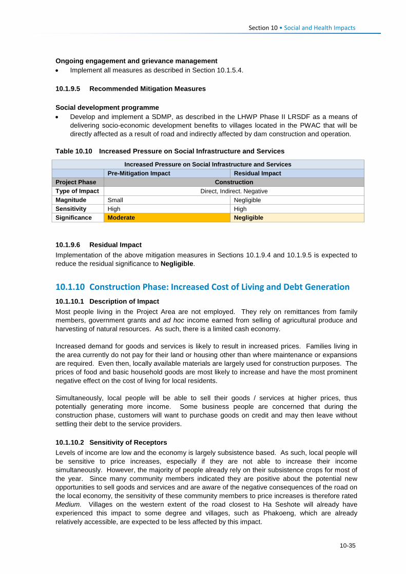
Section 10 • Social and Health Impacts Ongoing engagement and grievance management • Implement all measures as described in Section 10.1.5.4. 10.1.9.5 Recommended Mitigation Measures Social development programme • Develop and implement a SDMP, as described in the LHWP Phase II LRSDF as a means of
delivering socio-economic development benefits to villages located in the PWAC that will be directly affected as a result of road and indirectly affected by dam construction and operation.
Table 10.10 Increased Pressure on Social Infrastructure and Services
Increased Pressure on Social Infrastructure and Services
Pre-Mitigation Impact Residual Impact Project Phase Construction Type of Impact Direct, Indirect. Negative Magnitude Small Negligible Sensitivity High High Significance Moderate Negligible 10.1.9.6 Residual Impact Implementation of the above mitigation measures in Sections 10.1.9.4 and 10.1.9.5 is expected to reduce the residual significance to Negligible.
10.1.10 Construction Phase: Increased Cost of Living and Debt Generation 10.1.10.1 Description of Impact Most people living in the Project Area are not employed. They rely on remittances from family members, government grants and ad hoc income earned from selling of agricultural produce and harvesting of natural resources. As such, there is a limited cash economy. Increased demand for goods and services is likely to result in increased prices. Families living in the area currently do not pay for their land or housing other than where maintenance or expansions are required. Even then, locally available materials are largely used for construction purposes. The prices of food and basic household goods are most likely to increase and have the most prominent negative effect on the cost of living for local residents. Simultaneously, local people will be able to sell their goods / services at higher prices, thus potentially generating more income. Some business people are concerned that during the construction phase, customers will want to purchase goods on credit and may then leave without settling their debt to the service providers. 10.1.10.2 Sensitivity of Receptors Levels of income are low and the economy is largely subsistence based. As such, local people will be sensitive to price increases, especially if they are not able to increase their income simultaneously. However, the majority of people already rely on their subsistence crops for most of the year. Since many community members indicated they are positive about the potential new opportunities to sell goods and services and are aware of the negative consequences of the road on the local economy, the sensitivity of these community members to price increases is therefore rated Medium. Villages on the western extent of the road closest to Ha Seshote will already have experienced this impact to some degree and villages, such as Phakoeng, which are already relatively accessible, are expected to be less affected by this impact.
10-35
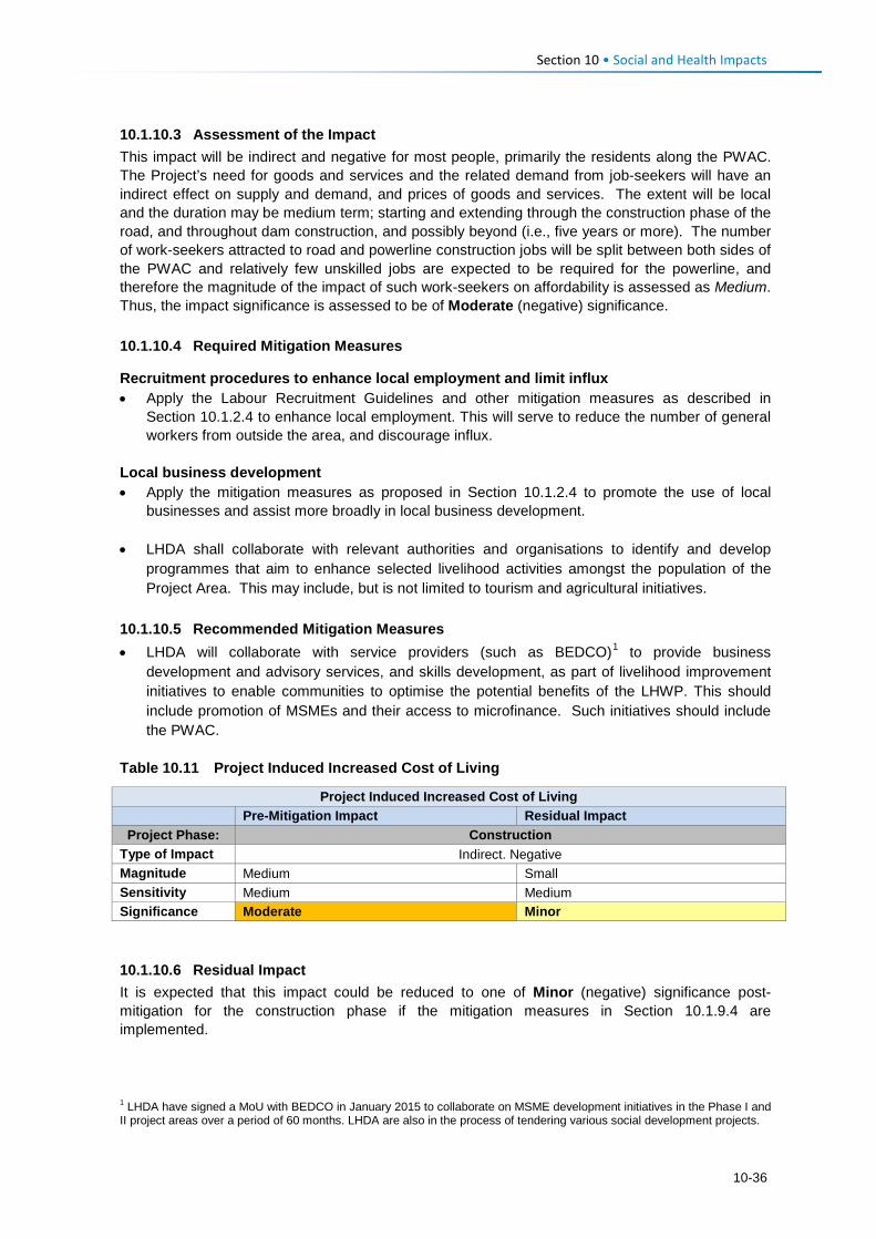
Section 10 • Social and Health Impacts 10.1.10.3 Assessment of the Impact This impact will be indirect and negative for most people, primarily the residents along the PWAC. The Project’s need for goods and services and the related demand from job-seekers will have an indirect effect on supply and demand, and prices of goods and services. The extent will be local and the duration may be medium term; starting and extending through the construction phase of the road, and throughout dam construction, and possibly beyond (i.e., five years or more). The number of work-seekers attracted to road and powerline construction jobs will be split between both sides of the PWAC and relatively few unskilled jobs are expected to be required for the powerline, and therefore the magnitude of the impact of such work-seekers on affordability is assessed as Medium. Thus, the impact significance is assessed to be of Moderate (negative) significance. 10.1.10.4 Required Mitigation Measures
Recruitment procedures to enhance local employment and limit influx • Apply the Labour Recruitment Guidelines and other mitigation measures as described in
Section 10.1.2.4 to enhance local employment. This will serve to reduce the number of general workers from outside the area, and discourage influx.
Local business development • Apply the mitigation measures as proposed in Section 10.1.2.4 to promote the use of local
businesses and assist more broadly in local business development. • LHDA shall collaborate with relevant authorities and organisations to identify and develop
programmes that aim to enhance selected livelihood activities amongst the population of the Project Area. This may include, but is not limited to tourism and agricultural initiatives.
10.1.10.5 Recommended Mitigation Measures • LHDA will collaborate with service providers (such as BEDCO)1 to provide business
development and advisory services, and skills development, as part of livelihood improvement initiatives to enable communities to optimise the potential benefits of the LHWP. This should include promotion of MSMEs and their access to microfinance. Such initiatives should include the PWAC.
Table 10.11 Project Induced Increased Cost of Living
Project Induced Increased Cost of Living
Pre-Mitigation Impact Residual Impact Project Phase: Construction
Type of Impact Indirect. Negative Magnitude Medium Small Sensitivity Medium Medium Significance Moderate Minor 10.1.10.6 Residual Impact It is expected that this impact could be reduced to one of Minor (negative) significance post-mitigation for the construction phase if the mitigation measures in Section 10.1.9.4 are implemented.
1 LHDA have signed a MoU with BEDCO in January 2015 to collaborate on MSME development initiatives in the Phase I and II project areas over a period of 60 months. LHDA are also in the process of tendering various social development projects.
10-36
Section 10 • Social and Health Impacts 10.1.11 Construction Phase: Loss/ Displacement of Farming Expertise 10.1.11.1 Description of Impact Crop and livestock farming are the most common livelihood activity within the Project Area. Farming expertise is passed through generations, where parents teach their children cropping and livestock raising skills. Ownership of cattle and sheep are the most important indicator of wealth and status. Young boys often leave school to pursue work in agriculture (e.g., as herders) with aspirations of accruing livestock of their own. Agricultural work is hard and does not generate much cash income; in fact, it is poorly paid at best and often unpaid, the produce is largely used for home consumption or for bartering. Employment opportunities (albeit relatively limited in duration) offered by the Project Contractors will provide income that is likely to be far beyond what is generated by agricultural work, and those who are employed will learn new skills that may enable them to secure construction work in the future. There are also high expectations that the employment opportunities will lead to an improved standard of living. As such, some people fear that young men and women who regularly work in the fields or manage livestock will reject their existing farming work in favour of paid employment in the construction sector, and that this may cause a shortage of available farming skills during road construction. Others, however, indicated that those who do get construction jobs will be able to pay others to harvest their crops or manage their livestock. For those who get construction work it is probable that they would aim to secure further work in the construction sector with their newly acquired skills and experience, leading to a longer term loss of agricultural labour availability. Further, community members and school staff fear that older school children may drop out of school to take on construction jobs or that parents who get jobs and who look after family members may force children to drop out of school to fulfil household obligations. Due to necessity, it is expected that most people will be required to return to their farming work after road and powerline construction is completed and if they are unable to secure further paid employment elsewhere. It is understandable that most households would prefer to continue earning the highest possible income to support themselves and their families. Many families do not even send their children to school as they cannot afford to pay for school uniforms, transport to school and for school stationary or for them to reside with families near schools. However, agriculture enables most families to meet their very basic needs by generating food and income for immediate consumption. Overtime, more and more people, especially the youth and younger men in particular who get construction jobs, may not wish to farm as their parents and forefathers have done, and availability of skills may diminish. However, for now, agriculture is critical and families must continue their farming activities in order to survive. With increased access to markets and transport, farming may become more lucrative in the future. It will remain a primary livelihood activity out of necessity for a relatively long time. 10.1.11.2 Sensitivity of Receptors The majority of the working population has farming expertise and since any abandoned farming jobs are likely to be filled by other suitably qualified people the sensitivity is considered to be Low. 10.1.11.3 Assessment of the Impact The Project will only offer a limited number of jobs for the short-term (construction phase). Following construction, it is conceivable that while some people will attempt to secure further paid employment outside the agricultural sector, most are likely to be forced to return to farming. This indirect impact will be experienced at the local level and given the short-term nature of the impact, the magnitude is considered to be Small. It is unlikely that the Project would result in a permanent loss of farming expertise to the extent that households will suffer greater food insecurity than at present. The impact significance is rated as Minor (negative).
10-37
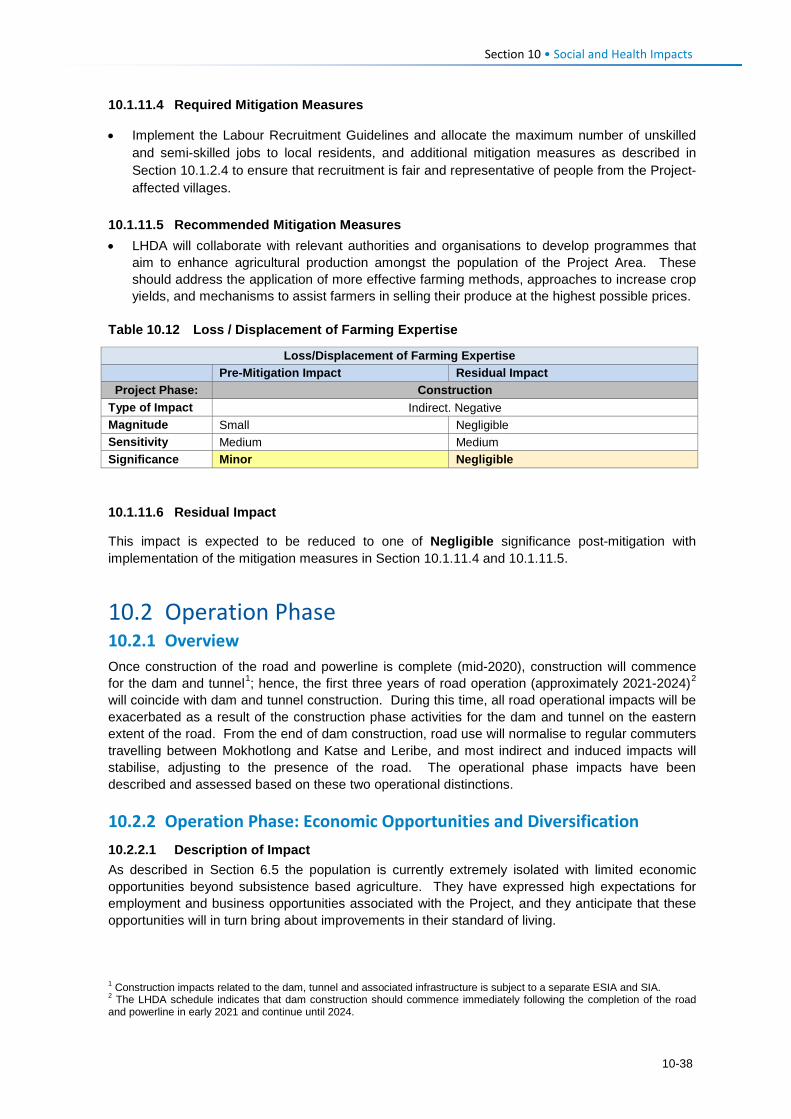
Section 10 • Social and Health Impacts 10.1.11.4 Required Mitigation Measures
• Implement the Labour Recruitment Guidelines and allocate the maximum number of unskilled and semi-skilled jobs to local residents, and additional mitigation measures as described in Section 10.1.2.4 to ensure that recruitment is fair and representative of people from the Project-affected villages.
10.1.11.5 Recommended Mitigation Measures • LHDA will collaborate with relevant authorities and organisations to develop programmes that
aim to enhance agricultural production amongst the population of the Project Area. These should address the application of more effective farming methods, approaches to increase crop yields, and mechanisms to assist farmers in selling their produce at the highest possible prices.
Table 10.12 Loss / Displacement of Farming Expertise
Loss/Displacement of Farming Expertise
Pre-Mitigation Impact Residual Impact Project Phase: Construction
Type of Impact Indirect. Negative Magnitude Small Negligible Sensitivity Medium Medium Significance Minor Negligible 10.1.11.6 Residual Impact
This impact is expected to be reduced to one of Negligible significance post-mitigation with implementation of the mitigation measures in Section 10.1.11.4 and 10.1.11.5.
10.2 Operation Phase 10.2.1 Overview Once construction of the road and powerline is complete (mid-2020), construction will commence for the dam and tunnel1; hence, the first three years of road operation (approximately 2021-2024)2 will coincide with dam and tunnel construction. During this time, all road operational impacts will be exacerbated as a result of the construction phase activities for the dam and tunnel on the eastern extent of the road. From the end of dam construction, road use will normalise to regular commuters travelling between Mokhotlong and Katse and Leribe, and most indirect and induced impacts will stabilise, adjusting to the presence of the road. The operational phase impacts have been described and assessed based on these two operational distinctions. 10.2.2 Operation Phase: Economic Opportunities and Diversification 10.2.2.1 Description of Impact As described in Section 6.5 the population is currently extremely isolated with limited economic opportunities beyond subsistence based agriculture. They have expressed high expectations for employment and business opportunities associated with the Project, and they anticipate that these opportunities will in turn bring about improvements in their standard of living.
1 Construction impacts related to the dam, tunnel and associated infrastructure is subject to a separate ESIA and SIA. 2 The LHDA schedule indicates that dam construction should commence immediately following the completion of the road and powerline in early 2021 and continue until 2024.
10-38
Section 10 • Social and Health Impacts During the operational phase, there will be very few employment opportunities associated with the PWAC. Employment is likely to be undertaken by core teams of employees or on an ad hoc basis by experienced Contractors when maintenance is required. These positions will predominantly require skilled personnel; there may be limited unskilled labour requirements on an ad hoc and casual basis. Similarly, there will be limited procurement requirements during the operational phase. The presence of a good quality road through the previously inaccessible Project Area, will promote increased movement throughout the area, and enable access to markets and associated economic opportunities that were previously not possible. During the three year dam/ tunnel construction phase, the road will be very busy due to the high numbers of construction vehicles and workers, and there will be many workers at the Polihali dam site who will create demand for goods and services. This demand will subside from 2025; however the road may remain a desirable transport link between Leribe, Katse and Mokhotlong. Once the LHWP Phase II is complete, the reservoir may also attract tourists to the area and the road will enable tourists seeking adventures in new locations to access the broader Project Area. The economy, which is solely focused on agriculture currently, could increasingly become more diversified through an influx of people with a diversity of skills and offerings. Agriculture is likely to remain the foundation of the economy for most households; however, the need to offer alternate goods and services (e.g., accommodation, meals, fresh produce, cleaning, curios etc.) to the newcomers could result in diversification of the economy. In the future, the population will be able to generate income from a range of activities beyond agriculture. While economic opportunities and the possibility for economic diversification will arise as a result of increased demand from workers on the dam/ tunnel construction site, general road users, and potentially tourists; the onus will remain on individuals to start-up/ enhance businesses to benefit from the increase in demand. It is likely that these opportunities could be taken by outsiders with the means to respond quickly to the demand. Locals may find it more difficult to set-up competitive businesses due to a lack of skill and financial resources. 10.2.2.2 Sensitivity of Receptors It is expected that the influx of migrants (potentially with more expertise and resources) will result in increased competition to establish businesses. The communities along the PWAR can be considered to have Medium sensitivity in that the economic opportunities will be available, but the majority of the population is unlikely to have the skills or capital to set-up businesses to meet the potential demand. They will be able to set-up small initiatives that will increase their ability to earn additional income. 10.2.2.3 Assessment of the Impact The benefits to the local economy would be experienced as a positive impact that would deliver indirect and induced opportunities. The impact will be experienced at the local level as a result of localised demand for goods and services through increased spending by workers on the dam project, commuters and tourists. The operational phase will be long-term to permanent, with greater levels of demand for goods and services anticipated in the short-term by road users while the dam and tunnel construction takes place1. The magnitude of this impact is expected to be Low-Medium, which in the context of the Medium sensitivity of the receptors results in an impact predicted to be of Minor-Moderate significance.
1 The economic benefits linked to construction of the dam and tunnel is assessed in a separate ESIS for the PRAI.
10-39
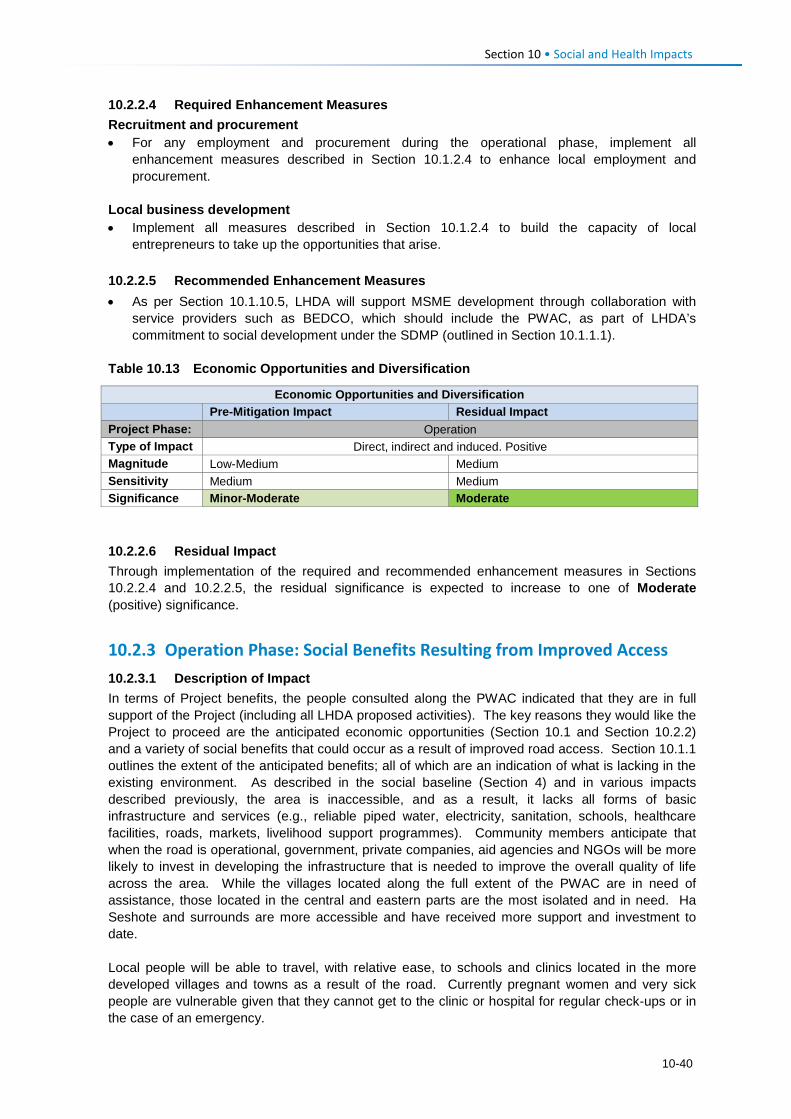
Section 10 • Social and Health Impacts 10.2.2.4 Required Enhancement Measures Recruitment and procurement • For any employment and procurement during the operational phase, implement all
enhancement measures described in Section 10.1.2.4 to enhance local employment and procurement.
Local business development • Implement all measures described in Section 10.1.2.4 to build the capacity of local
entrepreneurs to take up the opportunities that arise. 10.2.2.5 Recommended Enhancement Measures • As per Section 10.1.10.5, LHDA will support MSME development through collaboration with
service providers such as BEDCO, which should include the PWAC, as part of LHDA’s commitment to social development under the SDMP (outlined in Section 10.1.1.1).
Table 10.13 Economic Opportunities and Diversification
Economic Opportunities and Diversification
Pre-Mitigation Impact Residual Impact Project Phase: Operation Type of Impact Direct, indirect and induced. Positive Magnitude Low-Medium Medium Sensitivity Medium Medium Significance Minor-Moderate Moderate 10.2.2.6 Residual Impact Through implementation of the required and recommended enhancement measures in Sections 10.2.2.4 and 10.2.2.5, the residual significance is expected to increase to one of Moderate (positive) significance.
10.2.3 Operation Phase: Social Benefits Resulting from Improved Access 10.2.3.1 Description of Impact In terms of Project benefits, the people consulted along the PWAC indicated that they are in full support of the Project (including all LHDA proposed activities). The key reasons they would like the Project to proceed are the anticipated economic opportunities (Section 10.1 and Section 10.2.2) and a variety of social benefits that could occur as a result of improved road access. Section 10.1.1 outlines the extent of the anticipated benefits; all of which are an indication of what is lacking in the existing environment. As described in the social baseline (Section 4) and in various impacts described previously, the area is inaccessible, and as a result, it lacks all forms of basic infrastructure and services (e.g., reliable piped water, electricity, sanitation, schools, healthcare facilities, roads, markets, livelihood support programmes). Community members anticipate that when the road is operational, government, private companies, aid agencies and NGOs will be more likely to invest in developing the infrastructure that is needed to improve the overall quality of life across the area. While the villages located along the full extent of the PWAC are in need of assistance, those located in the central and eastern parts are the most isolated and in need. Ha Seshote and surrounds are more accessible and have received more support and investment to date. Local people will be able to travel, with relative ease, to schools and clinics located in the more developed villages and towns as a result of the road. Currently pregnant women and very sick people are vulnerable given that they cannot get to the clinic or hospital for regular check-ups or in the case of an emergency.
10-40
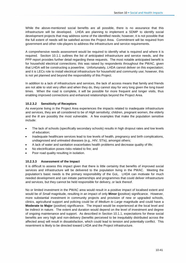
Section 10 • Social and Health Impacts While the above-mentioned social benefits are all possible, there is no assurance that this infrastructure will be developed. LHDA are planning to implement a SDMP to identify social development projects that may address some of the identified needs; however, it is not possible that the full extent of needs will be satisfied across the Project Area. Commitment will be required from government and other role-players to address the infrastructure and service requirements. A comprehensive needs assessment would be required to identify what is required and where it is required. Section 10.1.1 outlines the list of anticipated infrastructure and service needs, and the PPP report provides further detail regarding these requests. The most notable anticipated benefit is for household electrical connections; this was raised by respondents throughout the PWAC, given that LHDA will be constructing a powerline. Unfortunately, LHDA cannot deliver on this expectation; and it is LECs role to install electrical infrastructure for household and community use; however, this is not yet planned and beyond the responsibility of this Project. In addition to a lack of infrastructure and services, the lack of access means that family and friends are not able to visit very often and when they do, they cannot stay for very long given the long travel times. When the road is complete, it will be possible for more frequent and longer visits, thus enabling improved connections and enhanced relationships beyond the Project Area. 10.2.3.2 Sensitivity of Receptors As everyone living in the Project Area experiences the impacts related to inadequate infrastructure and services, they are all considered to be of High sensitivity; children, pregnant women, the elderly and the ill are possibly the most vulnerable. A few examples that make the population sensitive include: • The lack of schools (specifically secondary schools) results in high dropout rates and low levels
of education; • Inadequate healthcare services lead to low levels of health, pregnancy and birth complications,
undiagnosed and untreated diseases (e.g., HIV, STIs), amongst others; • A lack of water and sanitation exacerbates health problems and decrease quality of life; • No electrification poses risks related to fire; and • Poor road quality resulting in isolation. 10.2.3.3 Assessment of the Impact It is difficult to assess this impact given that there is little certainty that benefits of improved social services and infrastructure will be delivered to the population living in the PWAC. Meeting the population’s basic needs is the primary responsibility of the GoL. LHDA can motivate for much needed development and can initiate partnerships and programmes that could deliver infrastructure and services, but they cannot be held responsible for delivery, or lack thereof. No or limited investment in the PWAC area would result in a positive impact of localised extent and would be of Small magnitude, resulting in an impact of only Minor (positive) significance. However, more substantial investment in community projects and provision of new or upgraded schools, clinics, agricultural support and policing could be of Medium to Large magnitude and could have a Moderate to Major (positive) significance. The impact would be experienced at the local level and be indirect in nature. The extent and duration would depend on the level of investment and degree of ongoing maintenance and support. As described in Section 10.1.1, expectations for these social benefits are very high and non-delivery (benefits perceived to be inequitably distributed across the affected area) will result in dissatisfaction, which could lead to tension and potentially conflict. This resentment is likely to be directed toward LHDA and the Project infrastructure.
10-41
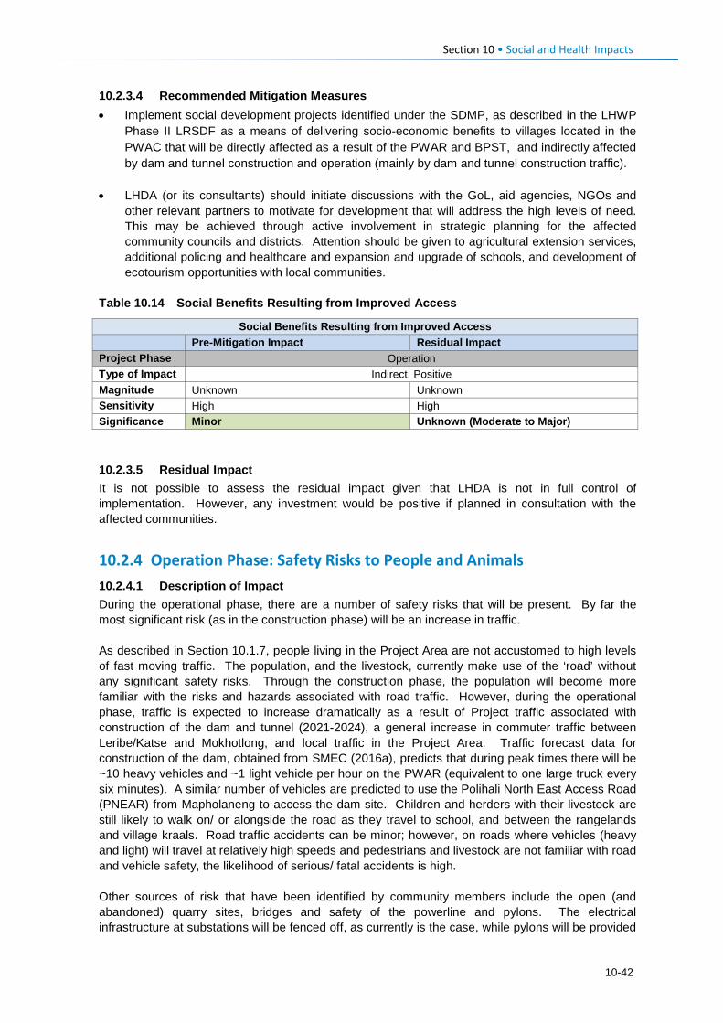
Section 10 • Social and Health Impacts 10.2.3.4 Recommended Mitigation Measures • Implement social development projects identified under the SDMP, as described in the LHWP
Phase II LRSDF as a means of delivering socio-economic benefits to villages located in the PWAC that will be directly affected as a result of the PWAR and BPST, and indirectly affected by dam and tunnel construction and operation (mainly by dam and tunnel construction traffic).
• LHDA (or its consultants) should initiate discussions with the GoL, aid agencies, NGOs and
other relevant partners to motivate for development that will address the high levels of need. This may be achieved through active involvement in strategic planning for the affected community councils and districts. Attention should be given to agricultural extension services, additional policing and healthcare and expansion and upgrade of schools, and development of ecotourism opportunities with local communities.
Table 10.14 Social Benefits Resulting from Improved Access
Social Benefits Resulting from Improved Access
Pre-Mitigation Impact Residual Impact Project Phase Operation Type of Impact Indirect. Positive Magnitude Unknown Unknown Sensitivity High High Significance Minor Unknown (Moderate to Major) 10.2.3.5 Residual Impact It is not possible to assess the residual impact given that LHDA is not in full control of implementation. However, any investment would be positive if planned in consultation with the affected communities.
10.2.4 Operation Phase: Safety Risks to People and Animals 10.2.4.1 Description of Impact During the operational phase, there are a number of safety risks that will be present. By far the most significant risk (as in the construction phase) will be an increase in traffic. As described in Section 10.1.7, people living in the Project Area are not accustomed to high levels of fast moving traffic. The population, and the livestock, currently make use of the ‘road’ without any significant safety risks. Through the construction phase, the population will become more familiar with the risks and hazards associated with road traffic. However, during the operational phase, traffic is expected to increase dramatically as a result of Project traffic associated with construction of the dam and tunnel (2021-2024), a general increase in commuter traffic between Leribe/Katse and Mokhotlong, and local traffic in the Project Area. Traffic forecast data for construction of the dam, obtained from SMEC (2016a), predicts that during peak times there will be ~10 heavy vehicles and ~1 light vehicle per hour on the PWAR (equivalent to one large truck every six minutes). A similar number of vehicles are predicted to use the Polihali North East Access Road (PNEAR) from Mapholaneng to access the dam site. Children and herders with their livestock are still likely to walk on/ or alongside the road as they travel to school, and between the rangelands and village kraals. Road traffic accidents can be minor; however, on roads where vehicles (heavy and light) will travel at relatively high speeds and pedestrians and livestock are not familiar with road and vehicle safety, the likelihood of serious/ fatal accidents is high. Other sources of risk that have been identified by community members include the open (and abandoned) quarry sites, bridges and safety of the powerline and pylons. The electrical infrastructure at substations will be fenced off, as currently is the case, while pylons will be provided
10-42
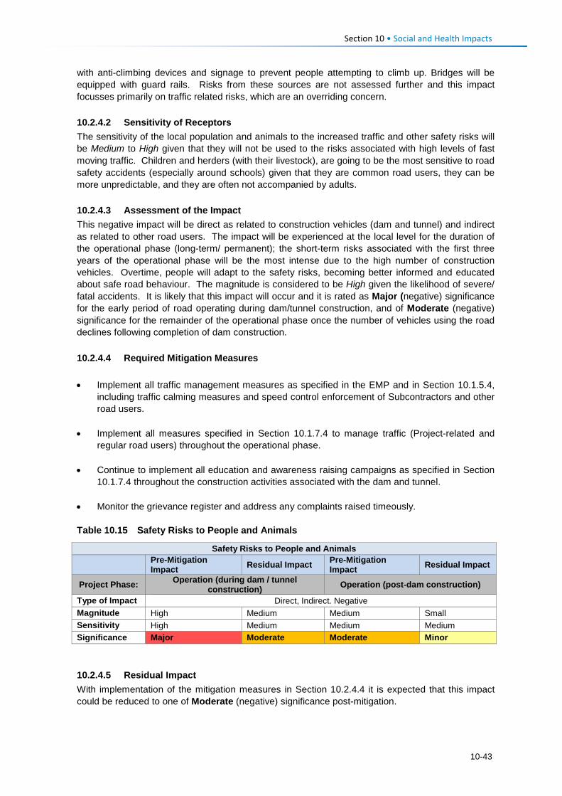
Section 10 • Social and Health Impacts with anti-climbing devices and signage to prevent people attempting to climb up. Bridges will be equipped with guard rails. Risks from these sources are not assessed further and this impact focusses primarily on traffic related risks, which are an overriding concern. 10.2.4.2 Sensitivity of Receptors The sensitivity of the local population and animals to the increased traffic and other safety risks will be Medium to High given that they will not be used to the risks associated with high levels of fast moving traffic. Children and herders (with their livestock), are going to be the most sensitive to road safety accidents (especially around schools) given that they are common road users, they can be more unpredictable, and they are often not accompanied by adults. 10.2.4.3 Assessment of the Impact This negative impact will be direct as related to construction vehicles (dam and tunnel) and indirect as related to other road users. The impact will be experienced at the local level for the duration of the operational phase (long-term/ permanent); the short-term risks associated with the first three years of the operational phase will be the most intense due to the high number of construction vehicles. Overtime, people will adapt to the safety risks, becoming better informed and educated about safe road behaviour. The magnitude is considered to be High given the likelihood of severe/ fatal accidents. It is likely that this impact will occur and it is rated as Major (negative) significance for the early period of road operating during dam/tunnel construction, and of Moderate (negative) significance for the remainder of the operational phase once the number of vehicles using the road declines following completion of dam construction. 10.2.4.4 Required Mitigation Measures • Implement all traffic management measures as specified in the EMP and in Section 10.1.5.4,
including traffic calming measures and speed control enforcement of Subcontractors and other road users.
• Implement all measures specified in Section 10.1.7.4 to manage traffic (Project-related and
regular road users) throughout the operational phase. • Continue to implement all education and awareness raising campaigns as specified in Section
10.1.7.4 throughout the construction activities associated with the dam and tunnel. • Monitor the grievance register and address any complaints raised timeously. Table 10.15 Safety Risks to People and Animals
Safety Risks to People and Animals
Pre-Mitigation Impact Residual Impact Pre-Mitigation
Impact Residual Impact
Project Phase: Operation (during dam / tunnel construction) Operation (post-dam construction)
Type of Impact Direct, Indirect. Negative Magnitude High Medium Medium Small Sensitivity High Medium Medium Medium Significance Major Moderate Moderate Minor 10.2.4.5 Residual Impact With implementation of the mitigation measures in Section 10.2.4.4 it is expected that this impact could be reduced to one of Moderate (negative) significance post-mitigation.
10-43
Section 10 • Social and Health Impacts 10.2.5 Operation Phase: Increase in Anti-Social Behaviour 10.2.5.1 Description of Impact
Anti-social behaviour, as described in detail in Section 10.1.8.1, will continue into and throughout the operational life of the road and dam. There will no longer be Project workers and most migrant job-seekers for the PWAC will likely move closer to the PRAI site for the dam and tunnel construction phase. The impacts related to anti-social behaviour linked to the dam construction and operation phase (notably the spread of HIV via truck drivers) are assessed as part of the PRAI ESIS. However, the road will enable free movement of any people (e.g., commuters, traders, long distance drivers, tourists) through the PWAC. As a result of increased accessibility and an inevitable flow of ‘outsiders’ through the area, norms, values and customs will continue to change; people will continue to be exposed to different views and ways of life. Migration in and out of the area will most likely be driven by economic / market reasons, as well as travel to schools and other social facilities that may be of a higher standard than those present in the Project Area. As with the construction phase impact, HIV and STIs, casual sexual relationships, prostitution, unwanted pregnancies, an increase in drug and alcohol abuse, and crime (e.g., theft of livestock) are likely to persist. Long distance truck drivers and migrants in search of work opportunities are likely to be the most significant contributors to the spread of HIV and STIs; it is expected they will create a demand for prostitution and lure local women to enter into relationships with them. Marijuana is grown in the area, and it is likely that improved access (and possibly increased policing) will cause the growers to move further into the hills, away from law enforcement. However, it is expected that the market for sale of this crop could expand as they will be able to transport it to market of find buyers with increased ease, although this may be balanced by an increased ease of policing with the new road. Stock theft will continue to be an issue, given that the road will enable easy access and ‘get away’. Once again, increased policing may serve to discourage this. 10.2.5.2 Sensitivity of Receptors By the time the road is operational, people would already have experienced an increase in the anti-social behaviour. While an increase in anti-social behaviour is not desirable, people will have adapted to the increased risks and exposure. Their levels of sensitivity will have reduced to Medium. 10.2.5.3 Assessment of the Impact This negative impact will arise as an indirect result of road users and migrant job-seekers in the area. The impact will be experienced at a local level; however, STI and HIV infections will spread into the areas where the road users and job-seekers originate and visit later. The duration will be permanent, specifically as related to diseases such as HIV/AIDS which will have permanent impacts on infected persons and their families. This impact will affect the individuals and families that are susceptible to engaging in such activities, while crime could affect anyone. The magnitude of the impact is rated Medium. As such, the impact is assessed as having Moderate (negative) significance. 10.2.5.4 Recommended Mitigation Measures During the operational phase there are limited interventions that can be implemented directly by LHDA. However, LHDA should assist by motivating and supporting relevant departments in the GoL in the following:
10-44
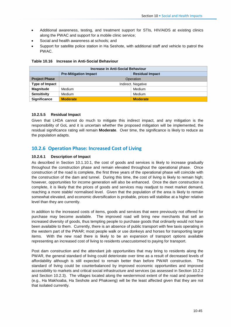
Section 10 • Social and Health Impacts • Additional awareness, testing, and treatment support for STIs, HIV/AIDS at existing clinics
along the PWAC and support for a mobile clinic service; • Social and health awareness at schools; and • Support for satellite police station in Ha Seshote, with additional staff and vehicle to patrol the
PWAC. Table 10.16 Increase in Anti-Social Behaviour
Increase in Anti-Social Behaviour
Pre-Mitigation Impact Residual Impact Project Phase Operation Type of Impact Indirect. Negative Magnitude Medium Medium Sensitivity Medium Medium Significance Moderate Moderate 10.2.5.5 Residual Impact Given that LHDA cannot do much to mitigate this indirect impact, and any mitigation is the responsibility of GoL and it is uncertain whether the proposed mitigation will be implemented, the residual significance rating will remain Moderate. Over time, the significance is likely to reduce as the population adapts.
10.2.6 Operation Phase: Increased Cost of Living 10.2.6.1 Description of Impact As described in Section 10.1.10.1, the cost of goods and services is likely to increase gradually throughout the construction phase and remain elevated throughout the operational phase. Once construction of the road is complete, the first three years of the operational phase will coincide with the construction of the dam and tunnel. During this time, the cost of living is likely to remain high; however, opportunities for income generation will also be enhanced. Once the dam construction is complete, it is likely that the prices of goods and services may readjust to meet market demand, reaching a more stable/ normalised level. Given that the population of the area is likely to remain somewhat elevated, and economic diversification is probable, prices will stabilise at a higher relative level than they are currently. In addition to the increased costs of items, goods and services that were previously not offered for purchase may become available. The improved road will bring new merchants that sell an increased diversity of goods, thus tempting people to purchase goods that ordinarily would not have been available to them. Currently, there is an absence of public transport with few taxis operating in the western part of the PWAR; most people walk or use donkeys and horses for transporting larger items. With the new road there is likely to be an expansion of transport options available representing an increased cost of living to residents unaccustomed to paying for transport. Post dam construction and the attendant job opportunities that may bring to residents along the PWAR, the general standard of living could deteriorate over time as a result of decreased levels of affordability although is still expected to remain better than before PWAR construction. The standard of living could be counterbalanced by improved economic opportunities and improved accessibility to markets and critical social infrastructure and services (as assessed in Section 10.2.2 and Section 10.2.3). The villages located along the westernmost extent of the road and powerline (e.g., Ha Makhoaba, Ha Seshote and Phakoeng) will be the least affected given that they are not that isolated currently.
10-45
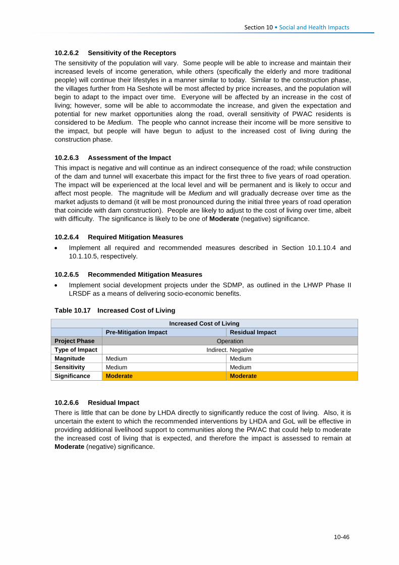
Section 10 • Social and Health Impacts 10.2.6.2 Sensitivity of the Receptors The sensitivity of the population will vary. Some people will be able to increase and maintain their increased levels of income generation, while others (specifically the elderly and more traditional people) will continue their lifestyles in a manner similar to today. Similar to the construction phase, the villages further from Ha Seshote will be most affected by price increases, and the population will begin to adapt to the impact over time. Everyone will be affected by an increase in the cost of living; however, some will be able to accommodate the increase, and given the expectation and potential for new market opportunities along the road, overall sensitivity of PWAC residents is considered to be Medium. The people who cannot increase their income will be more sensitive to the impact, but people will have begun to adjust to the increased cost of living during the construction phase. 10.2.6.3 Assessment of the Impact This impact is negative and will continue as an indirect consequence of the road; while construction of the dam and tunnel will exacerbate this impact for the first three to five years of road operation. The impact will be experienced at the local level and will be permanent and is likely to occur and affect most people. The magnitude will be Medium and will gradually decrease over time as the market adjusts to demand (it will be most pronounced during the initial three years of road operation that coincide with dam construction). People are likely to adjust to the cost of living over time, albeit with difficulty. The significance is likely to be one of Moderate (negative) significance. 10.2.6.4 Required Mitigation Measures • Implement all required and recommended measures described in Section 10.1.10.4 and
10.1.10.5, respectively. 10.2.6.5 Recommended Mitigation Measures • Implement social development projects under the SDMP, as outlined in the LHWP Phase II
LRSDF as a means of delivering socio-economic benefits. Table 10.17 Increased Cost of Living
Increased Cost of Living
Pre-Mitigation Impact Residual Impact Project Phase Operation Type of Impact Indirect. Negative Magnitude Medium Medium Sensitivity Medium Medium Significance Moderate Moderate 10.2.6.6 Residual Impact There is little that can be done by LHDA directly to significantly reduce the cost of living. Also, it is uncertain the extent to which the recommended interventions by LHDA and GoL will be effective in providing additional livelihood support to communities along the PWAC that could help to moderate the increased cost of living that is expected, and therefore the impact is assessed to remain at Moderate (negative) significance.
10-46
Section 10 • Social and Health Impacts
10.3 Summary of Social and Health Impacts The communities in the villages along the PWAR are positive and enthusiastic about the proposed paved road and the improvement in their quality of life that they expect it will bring in the form of new market opportunities to sell produce; and obtain easier access to essential services (education, health, policing and agriculture etc.). Many residents perceive the road will also lead to improved transportation and electricity provision, and additional education, clinic and agricultural facilities.
The most significant negative social impacts of the PWAC construction are listed below.
• Physical displacement for approximately 40 families who will have to be resettled to new homesteads, probably within their existing villages;
• Loss of arable land mainly for the widening of the PWAR and deviations from the existing track, as well as new access tracks for powerline construction;
• Noise and disturbance during the 20-month construction period, especially near schools, religious institutions and livestock centres (e.g., woolsheds);
• Loss or disruption of community water supply if pipelines are broken or water sources polluted or flow restricted;
• Increased safety risks caused by traffic collisions or from open pits and trenches, if left unprotected;
• Increase in anti-social behavior caused by presence of work force and influx of work seekers resulting in increased crime, prostitution, teenage pregnancy, school dropout and increase in HIV/AIDS and STIs; and
• Increase in pressure on existing social services/infrastructure and cost of living due to presence of work force with cash income. However, this is expected to be limited in the Ha Seshote area due to the relatively small workforce required for the road and powerline compared to the Polihali Dam on the eastern side.
The most significant negative operational phase impacts are outlined below. • Increased risk of traffic accidents with pedestrians and livestock due to the significantly
increased traffic and driving speed of road users on the PWAR, especially during dam construction (for the first three years of road operation) when it is estimated that on average one large truck will use the road every six minutes;
• Increase in anti-social behaviour due to the presence and use of the road by long-distance
drivers of delivery trucks, who may seek casual sexual relations with local women/girls leading to a shift in cultural norms; and increased prostitution, HIV/AIDS, teenage school dropout etc.; and
• Increased cost of living due to a combination of increased exposure of residents to a wider
variety of goods, and cumulative cost increases along the PWAR caused by the significant increase in workers employed in dam construction and paid cash income.
Overall, the road is expected to lead to a net positive gain in community health and well-being as long as construction and operational impacts are well managed and potential opportunities for communities optimised through implementation of livelihood support projects.
10-47

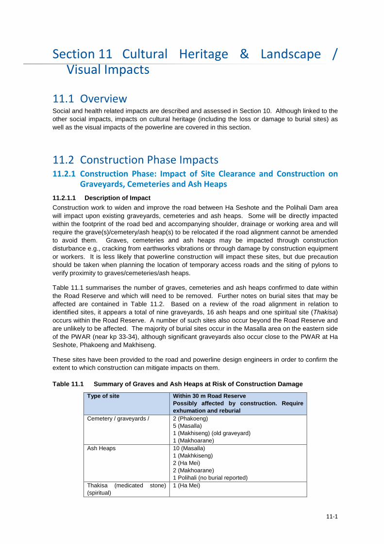
Cultural Heritage & Landscape / Section 11Visual Impacts
11.1 Overview Social and health related impacts are described and assessed in Section 10. Although linked to the other social impacts, impacts on cultural heritage (including the loss or damage to burial sites) as well as the visual impacts of the powerline are covered in this section.
11.2 Construction Phase Impacts 11.2.1 Construction Phase: Impact of Site Clearance and Construction on
Graveyards, Cemeteries and Ash Heaps 11.2.1.1 Description of Impact Construction work to widen and improve the road between Ha Seshote and the Polihali Dam area will impact upon existing graveyards, cemeteries and ash heaps. Some will be directly impacted within the footprint of the road bed and accompanying shoulder, drainage or working area and will require the grave(s)/cemetery/ash heap(s) to be relocated if the road alignment cannot be amended to avoid them. Graves, cemeteries and ash heaps may be impacted through construction disturbance e.g., cracking from earthworks vibrations or through damage by construction equipment or workers. It is less likely that powerline construction will impact these sites, but due precaution should be taken when planning the location of temporary access roads and the siting of pylons to verify proximity to graves/cemeteries/ash heaps.
Table 11.1 summarises the number of graves, cemeteries and ash heaps confirmed to date within the Road Reserve and which will need to be removed. Further notes on burial sites that may be affected are contained in Table 11.2. Based on a review of the road alignment in relation to identified sites, it appears a total of nine graveyards, 16 ash heaps and one spiritual site (Thakisa) occurs within the Road Reserve. A number of such sites also occur beyond the Road Reserve and are unlikely to be affected. The majority of burial sites occur in the Masalla area on the eastern side of the PWAR (near kp 33-34), although significant graveyards also occur close to the PWAR at Ha Seshote, Phakoeng and Makhiseng.
These sites have been provided to the road and powerline design engineers in order to confirm the extent to which construction can mitigate impacts on them. Table 11.1 Summary of Graves and Ash Heaps at Risk of Construction Damage
Type of site Within 30 m Road Reserve Possibly affected by construction. Require exhumation and reburial
Cemetery / graveyards / 2 (Phakoeng) 5 (Masalla) 1 (Makhiseng) (old graveyard) 1 (Makhoarane)
Ash Heaps 10 (Masalla) 1 (Makhkiseng) 2 (Ha Mei) 2 (Makhoarane) 1 Polihali (no burial reported)
Thakisa (medicated stone) (spiritual)
1 (Ha Mei)
11-1
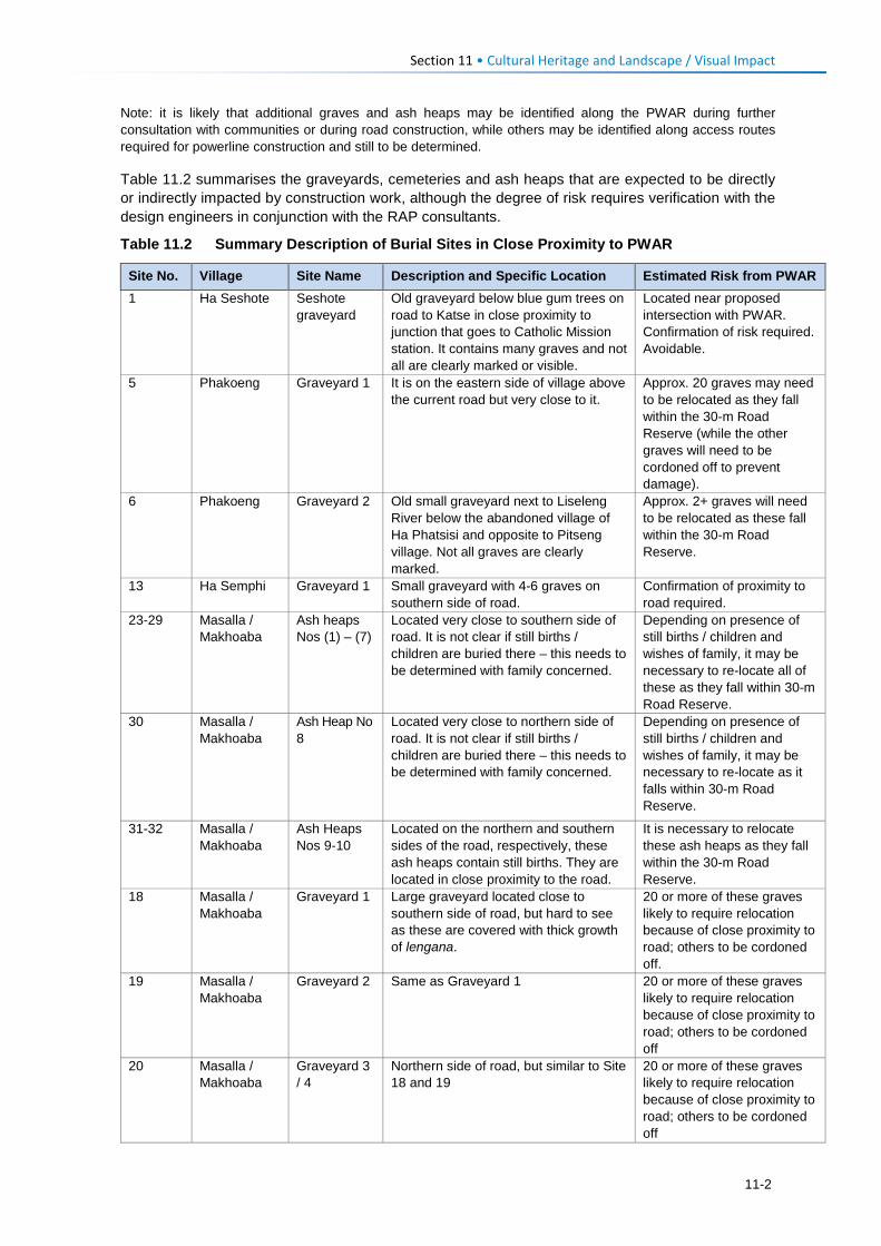
Section 11 • Cultural Heritage and Landscape / Visual Impact
Note: it is likely that additional graves and ash heaps may be identified along the PWAR during further consultation with communities or during road construction, while others may be identified along access routes required for powerline construction and still to be determined.
Table 11.2 summarises the graveyards, cemeteries and ash heaps that are expected to be directly or indirectly impacted by construction work, although the degree of risk requires verification with the design engineers in conjunction with the RAP consultants.
Table 11.2 Summary Description of Burial Sites in Close Proximity to PWAR
Site No. Village Site Name Description and Specific Location Estimated Risk from PWAR 1 Ha Seshote Seshote
graveyard Old graveyard below blue gum trees on road to Katse in close proximity to junction that goes to Catholic Mission station. It contains many graves and not all are clearly marked or visible.
Located near proposed intersection with PWAR. Confirmation of risk required. Avoidable.
5 Phakoeng Graveyard 1 It is on the eastern side of village above the current road but very close to it.
Approx. 20 graves may need to be relocated as they fall within the 30-m Road Reserve (while the other graves will need to be cordoned off to prevent damage).
6 Phakoeng Graveyard 2 Old small graveyard next to Liseleng River below the abandoned village of Ha Phatsisi and opposite to Pitseng village. Not all graves are clearly marked.
Approx. 2+ graves will need to be relocated as these fall within the 30-m Road Reserve.
13 Ha Semphi Graveyard 1 Small graveyard with 4-6 graves on southern side of road.
Confirmation of proximity to road required.
23-29 Masalla / Makhoaba
Ash heaps Nos (1) – (7)
Located very close to southern side of road. It is not clear if still births / children are buried there – this needs to be determined with family concerned.
Depending on presence of still births / children and wishes of family, it may be necessary to re-locate all of these as they fall within 30-m Road Reserve.
30 Masalla / Makhoaba
Ash Heap No 8
Located very close to northern side of road. It is not clear if still births / children are buried there – this needs to be determined with family concerned.
Depending on presence of still births / children and wishes of family, it may be necessary to re-locate as it falls within 30-m Road Reserve.
31-32 Masalla / Makhoaba
Ash Heaps Nos 9-10
Located on the northern and southern sides of the road, respectively, these ash heaps contain still births. They are located in close proximity to the road.
It is necessary to relocate these ash heaps as they fall within the 30-m Road Reserve.
18 Masalla / Makhoaba
Graveyard 1 Large graveyard located close to southern side of road, but hard to see as these are covered with thick growth of lengana.
20 or more of these graves likely to require relocation because of close proximity to road; others to be cordoned off.
19 Masalla / Makhoaba
Graveyard 2 Same as Graveyard 1 20 or more of these graves likely to require relocation because of close proximity to road; others to be cordoned off
20 Masalla / Makhoaba
Graveyard 3 / 4
Northern side of road, but similar to Site 18 and 19
20 or more of these graves likely to require relocation because of close proximity to road; others to be cordoned off
11-2
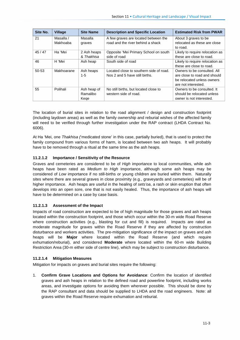
Section 11 • Cultural Heritage and Landscape / Visual Impact
Site No. Village Site Name Description and Specific Location Estimated Risk from PWAR 21 Masalla /
Makhoaba Masalla graves
A few graves are located between the road and the river behind a shack
About 3 graves to be relocated as these are close to road.
45 / 47 Ha ‘Mei 2 Ash heaps & Thakhisa
Opposite ‘Mei Primary School on south side of road
Likely to require relocation as these are close to road.
46 H ‘Mei Ash heap South side of road Likely to require relocation as these are close to road.
50-53 Makhoarane Ash heaps 1-5
Located close to southern side of road. Nos 2 and 5 have still births.
Owners to be consulted. All are close to road and should be relocated unless owners are not interested.
55 Polihali Ash heap of Ramalibo Keqe
No still births, but located close to western side of road.
Owners to be consulted. It should be relocated unless owner is not interested.
The location of burial sites in relation to the road alignment / design and construction footprint (including laydown areas) as well as the family ownership and reburial wishes of the affected family will need to be verified through further investigation under the RAP contract (LHDA Contract No. 6006).
At Ha ‘Mei, one Thakhisa (‘medicated stone’ in this case, partially buried), that is used to protect the family compound from various forms of harm, is located between two ash heaps. It will probably have to be removed through a ritual at the same time as the ash heaps. 11.2.1.2 Importance / Sensitivity of the Resource Graves and cemeteries are considered to be of High importance to local communities, while ash heaps have been rated as Medium to High importance, although some ash heaps may be considered of Low importance if no still-births or young children are buried within them. Naturally sites where there are several graves in close proximity (e.g., graveyards and cemeteries) will be of higher importance. Ash heaps are useful in the healing of sets’oa, a rash or skin eruption that often develops into an open sore, one that is not easily healed. Thus, the importance of ash heaps will have to be determined on a case by case basis. 11.2.1.3 Assessment of the Impact Impacts of road construction are expected to be of high magnitude for those graves and ash heaps located within the construction footprint, and those which occur within the 30-m wide Road Reserve where construction activities (e.g., blasting for cut and fill) is required. Impacts are rated as moderate magnitude for graves within the Road Reserve if they are affected by construction disturbance and workers activities. The pre-mitigation significance of the impact on graves and ash heaps will be Major where located within the Road Reserve (and which require exhumation/reburial), and considered Moderate where located within the 60-m wide Building Restriction Area (30-m either side of centre line), which may be subject to construction disturbance. 11.2.1.4 Mitigation Measures Mitigation for impacts on graves and burial sites require the following: 1. Confirm Grave Locations and Options for Avoidance: Confirm the location of identified
graves and ash heaps in relation to the defined road and powerline footprint, including works areas, and investigate options for avoiding them wherever possible. This should be done by the RAP consultant and data should be supplied to LHDA and the road engineers. Note: all graves within the Road Reserve require exhumation and reburial.
11-3
Section 11 • Cultural Heritage and Landscape / Visual Impact
2. Damage to Graves / Burial Sites: Comply with legal requirements with respect to planned loss or damage to graves and burial grounds through i) obtaining a permit from the Departments of Culture and Health prior to any alteration of burial sites; ii) making a concerted effort to contact and consult communities and individuals with an interest in the site, and iii) reaching agreements with communities and individuals on the future of graves, burial grounds.
It is of high priority that LHDA (and its designated consultants) consult with the local communities who have deceased family buried in project-affected graveyards or with an interest in those graves. The families of individuals buried at affected sites must be informed of the potential impact to graves from the construction activities and consulted with to make an informed decision·about their mitigation requirements.
Grave relocation may entail the actual exhumation of human remains for re-interment elsewhere, in which case an undertaker must be appointed to undertake the excavation and re-interment of human remains. This must be done with the full acknowledgement and consent of the families of the individuals whose remains are to be relocated and relevant authorities need to be notified (e.g., Police, Coroner, Department of Health, etc.). Alternatively, the community may decide upon a symbolic relocation of the graves, sometimes represented by removal of some soil from the grave site for transportation to the new grave site. Relocation of graves, whether symbolic or actual exhumation and re-interment, is underpinned by a traditional ceremony that usually comprises a feast to show respect for the ancestors. Provision for these ceremonies is the responsibility of the LHDA.
The RAP consultant (LHDA Contract No. 6006) and LHDA will be responsible for confirming compensation requirements for damage to graves and to agree mutually acceptable mitigation requirements. Grave relocation is primarily intended as a symbolic restoration to living communities of an intangible heritage resource, through which the community can demonstrate the required respect for their ancestors' memory and physical remains. Therefore exhumation or ceremonial reburial will reduce the magnitude of the impact on the intangible aspects of grave disturbance.
3. Grave demarcation: Demarcate all graves and middens within the Building Restriction Area
(including Road Reserve) with boulders and tape and delineate them on maps with the road alignment. Brief and provide maps to Contractors to ensure all construction staff is aware of their location and the need to avoid damage to these sites. Any damage caused to sites will require repairs after agreements are made with people concerned and in the presence of LHDA to ensure proper records are kept.
4. Monitoring of grave / ash heap disturbance: regular checks to ensure no damage to graves
and ash heaps occur and monitor any complaints raised by community members in event of damage.
5. Chance Finds Procedure (CFP): Implement a CFP which should be used as the basis for
detection of additional heritage resources during PWAR construction. The procedure should include an outline of the type, location of sites and type of evidence that could be encountered with examples and photographs, and instructions as to what to do in the event of a Chance Find.
11-4
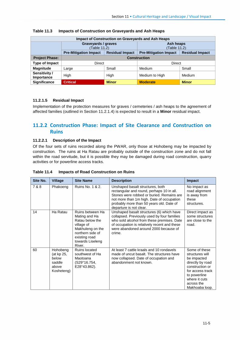
Section 11 • Cultural Heritage and Landscape / Visual Impact
Table 11.3 Impacts of Construction on Graveyards and Ash Heaps
Impact of Construction on Graveyards and Ash Heaps
Graveyards / graves
(Table 11.2) Ash heaps (Table 11.2)
Pre-Mitigation Impact Residual Impact Pre-Mitigation Impact Residual Impact Project Phase: Construction Type of Impact Direct Direct Magnitude Large Small Medium Small Sensitivity / Importance High High Medium to High Medium Significance Critical Minor Moderate Minor
11.2.1.5 Residual Impact Implementation of the protection measures for graves / cemeteries / ash heaps to the agreement of affected families (outlined in Section 11.2.1.4) is expected to result in a Minor residual impact.
11.2.2 Construction Phase: Impact of Site Clearance and Construction on Ruins
11.2.2.1 Description of the Impact Of the four sets of ruins recorded along the PWAR, only those at Hohobeng may be impacted by construction. The ruins at Ha Ratau are probably outside of the construction zone and do not fall within the road servitude, but it is possible they may be damaged during road construction, quarry activities or for powerline access tracks. Table 11.4 Impacts of Road Construction on Ruins
Site No. Village Site Name Description Impact 7 & 8 Phakoeng Ruins No. 1 & 2. Unshaped basalt structures, both
rectangular and round, perhaps 10 in all. Stones were robbed or buried. Remains are not more than 1m high. Date of occupation probably more than 50 years old. Date of departure is not clear.
No impact as road alignment is away from these structures.
14 Ha Ratau Ruins between Ha Mating and Ha Ratau below the village of Makhuleng on the northern side of existing road towards Liseleng River.
Unshaped basalt structures (6) which have collapsed. Previously used by four families who sold alcohol from these premises. Date of occupation is relatively recent and these were abandoned around 2000 because of crime.
Direct impact as some structures are close to the road.
60 Hohobeng (at kp 25, below saddle above Kosheteng)
Ruins located southwest of Ha Maotoana (S29°16.754, E28°43.862).
At least 7 cattle kraals and 10 rondavels made of uncut basalt. The structures have now collapsed. Date of occupation and abandonment not known.
Some of these structures will be impacted directly by road construction or for access track to powerline where it cuts across the Makhoaba loop.
11-5
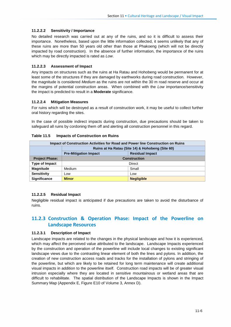
Section 11 • Cultural Heritage and Landscape / Visual Impact
11.2.2.2 Sensitivity / Importance No detailed research was carried out at any of the ruins, and so it is difficult to assess their importance. Nonetheless, based upon the little information collected, it seems unlikely that any of these ruins are more than 50 years old other than those at Phakoeng (which will not be directly impacted by road construction). In the absence of further information, the importance of the ruins which may be directly impacted is rated as Low. 11.2.2.3 Assessment of Impact Any impacts on structures such as the ruins at Ha Ratau and Hohobeng would be permanent for at least some of the structures if they are damaged by earthworks during road construction. However, the magnitude is considered Medium as the ruins are not within the 30 m road reserve and occur at the margins of potential construction areas. When combined with the Low importance/sensitivity the impact is predicted to result in a Moderate significance. 11.2.2.4 Mitigation Measures For ruins which will be destroyed as a result of construction work, it may be useful to collect further oral history regarding the sites.
In the case of possible indirect impacts during construction, due precautions should be taken to safeguard all ruins by cordoning them off and alerting all construction personnel in this regard. Table 11.5 Impacts of Construction on Ruins
Impact of Construction Activities for Road and Power line Construction on Ruins Ruins at Ha Ratau (Site 14) & Hohobeng (Site 60)
Pre-Mitigation Impact Residual Impact Project Phase: Construction
Type of Impact Direct Magnitude Medium Small Sensitivity Low Low Significance Minor Negligible 11.2.2.5 Residual Impact Negligible residual impact is anticipated if due precautions are taken to avoid the disturbance of ruins.
11.2.3 Construction & Operation Phase: Impact of the Powerline on Landscape Resources
11.2.3.1 Description of Impact Landscape impacts are related to the changes in the physical landscape and how it is experienced, which may affect the perceived value attributed to the landscape. Landscape Impacts experienced by the construction and operation of the powerline will include local changes to existing significant landscape views due to the contrasting linear element of both the lines and pylons. In addition, the creation of new construction access roads and tracks for the installation of pylons and stringing of the powerline, but which are likely to be retained for long term maintenance will create additional visual impacts in addition to the powerline itself. Construction road impacts will be of greater visual intrusion especially where they are located in sensitive mountainous or wetland areas that are difficult to rehabilitate. The spatial distribution of the Landscape Impacts is shown in the Impact Summary Map (Appendix E, Figure E10 of Volume 3, Annex D).
11-6
Section 11 • Cultural Heritage and Landscape / Visual Impact
11.2.3.2 Assessment of Landscape Impacts Landscape Impacts have been assessed separately for different sections of the route where pylons and their access roads are located on mountainous passes / ridgelines; in open valleys or riverine areas; and across undulating grasslands and cultivated fields.
Mountainous Passes and Ridgeline
The proposed powerline is routed over five mountain passes, which form dominant ridgelines in the mountain landscape.
• TP 5 passes over a mountain ridgeline located between the Matsoku and Liseleng Rivers, and for 2.2 km it traverses over currently un-modified areas on steep slopes. The routing is mainly through the valley, cresting the main ridgeline over a saddle between TP 5 and 7. Partial screening from local topography reduces visual intrusion but new road access could be potentially intrusive with threats from erosion as well as increased access to these remote areas;
• TP 17 passes over a mountain ridgeline between the Liseleng and Semenanyane River Valleys for approximately 0.5 km. There is an existing road over the pass that has resulted in some erosion on the crest, detracting from the sense of place to some degree. The pass is in the high altitude mountainous terrain and cultivation is limited, accentuating the natural landscape sense of place;
• At TP 22 the pass crossing is similar in context to TP 17, but with the road being more defined
due to closer proximity to the Kosheteng village. The powerline routing over the pass is likely to result in strong levels of line and texture contrast with the currently undulating grassed landscape and will negatively affect the landscape character;
• TP 27 is similar to TP 5 where the powerline is routed over currently remote mountain terrain that does not have an established access route. The potential visual intrusion is reduced to some degree as the routing is mainly through a valley, cresting the main ridgeline via a saddle. This topographic partial screening will reduce visual intrusion. However, improved access to these remote areas and the potential for erosion could create further potential visual impacts.
• TP 29 passes over a long and prominent ridgeline. The current natural landscape sense of
place is reduced to some degree due to the close proximity to the Makokoaneng village as well as a well-established road. Although not at high altitude, the ridgeline dominates the local landscape and the pylon located on top of the ridgeline will be clearly visible to the surrounding areas.
Overall, the negative visual impacts on the current landscape visual resources of mountain and ridgeline features are likely to be high, exacerbated by the high altitude remoteness and the visual prominence of the TP 29 pylon. The routing over the pass is likely to result in strong levels of line and texture contrast with the currently undulating grassed landscape and will negatively affect the landscape character. Impacts will be direct and of a permanent nature and hence are rated as having a Major significance for these mountain pass or prominent ridgeline sections (approximately 4.6 km or 13% of the route). It must be stressed that given the relatively short distance of high sensitivity areas traversed by the powerline, the major significance assigned to these sections does not constitute a fatal flaw for the project.
Open Valleys and Riverine Areas
The majority of the proposed powerline falls within the landscape type defined by open valleys and rivers.
11-7
Section 11 • Cultural Heritage and Landscape / Visual Impact
• TP 2 to TP 3 is routed over a section of the Matsoku River meander and valley where a lattice mast will be located on a prominent ridgeline in the centre of this area;
• TP 3 to TP 4 passes Ha Makhoaba village following a route up to the saddle to the east of the
village. The landscape is defined by villages and cultivated lands creating a scenic cultural landscape;
• The remainder of the route is similar to TP 3 to TP 4 in that the powerline is routed along undulating mountain terrain, usually in close proximity to a river feature, but with a village cultural landscape dominating the sense of place. The higher visual absorption capacity of a village and road landscape will reduce the potential visual intrusion to some degree.
Overall, the visual impact to areas of moderate value visual resources will be direct and permanent, but are assigned a magnitude of Medium. Given the Medium value of the visual resource, the impact is rated as Moderate significance for these sections of route. This landscape type covers the majority of the route, extending for ~27 km of the proposed powerline.
Undulating Grasslands, Cultivated Lands or Rural Settlement Landscapes
Three sections of the proposed powerline extended over landscapes that are mainly associated with undulating grassland and cultivated fields (without close proximity to a rural village cultural landscape).
• The Matsoku substation upgrade is to an existing small substation where the landscape is already modified and the proposed expansion is of a scale that is unlikely to change the small to medium sized substation sense of place;
• The proposed Polihali substation is located on a flat section of ground to the east of the Malingoaneng village which, although still rural in layout, has a higher density of development which increases the ability of the landscape to visually absorb the substation landscape change. Further developments associated with the Polihali Dam are also to take place in the area;
• In the area of TP 28 to west of TP 29, the landscape is predominantly undulating grasslands
outside of a village cultural landscape setting, where the landscape character is interesting but not exceptional. The proposed powerline follows undulating terrain that breaks up the massing effect created by a single long view of the powerline.
The overall impact of the powerline in these landscapes is rated Minor, due to the lower value of the existing visual resources as well as the reduced magnitude of the visual intrusion created by the powerline in these settings.
11.2.3.3 Mitigation Measures Few mitigation measures are possible in order to minimise the visual impacts of the powerline, apart from ensuring the restoration and clean-up of construction areas to enable regrowth of natural vegetation. Specific mitigation should include:
• Alignment of access tracks along contours to avoid cutting straight down steep slopes (to avoid erosion);
• Sufficient culverts and erosion control on access tracks, especially on steep slopes; • Rehabilitation of construction works areas to reinstate ground level to natural contours and
reseed or revegetate where necessary to ensure recovery; and • Control alien invasive plants.
11-8
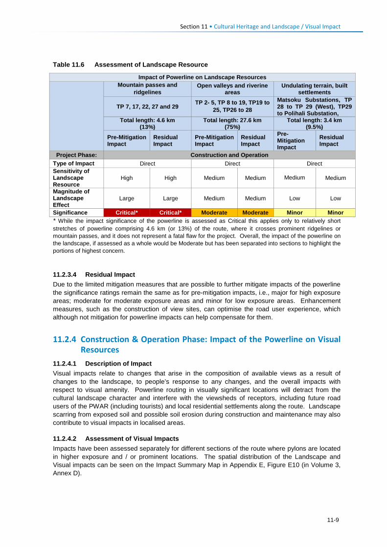
Section 11 • Cultural Heritage and Landscape / Visual Impact
Table 11.6 Assessment of Landscape Resource
Impact of Powerline on Landscape Resources
Mountain passes and ridgelines
Open valleys and riverine areas
Undulating terrain, built settlements
TP 7, 17, 22, 27 and 29 TP 2- 5, TP 8 to 19, TP19 to
25, TP26 to 28 Matsoku Substations, TP 28 to TP 29 (West), TP29 to Polihali Substation,
Total length: 4.6 km (13%)
Total length: 27.6 km (75%)
Total length: 3.4 km (9.5%)
Pre-Mitigation Impact
Residual Impact
Pre-Mitigation Impact
Residual Impact
Pre-Mitigation Impact
Residual Impact
Project Phase: Construction and Operation Type of Impact Direct Direct Direct Sensitivity of Landscape Resource
High High Medium Medium Medium Medium
Magnitude of Landscape Effect
Large Large Medium Medium Low Low
Significance Critical* Critical* Moderate Moderate Minor Minor * While the impact significance of the powerline is assessed as Critical this applies only to relatively short stretches of powerline comprising 4.6 km (or 13%) of the route, where it crosses prominent ridgelines or mountain passes, and it does not represent a fatal flaw for the project. Overall, the impact of the powerline on the landscape, if assessed as a whole would be Moderate but has been separated into sections to highlight the portions of highest concern.
11.2.3.4 Residual Impact Due to the limited mitigation measures that are possible to further mitigate impacts of the powerline the significance ratings remain the same as for pre-mitigation impacts, i.e., major for high exposure areas; moderate for moderate exposure areas and minor for low exposure areas. Enhancement measures, such as the construction of view sites, can optimise the road user experience, which although not mitigation for powerline impacts can help compensate for them.
11.2.4 Construction & Operation Phase: Impact of the Powerline on Visual Resources
11.2.4.1 Description of Impact Visual impacts relate to changes that arise in the composition of available views as a result of changes to the landscape, to people’s response to any changes, and the overall impacts with respect to visual amenity. Powerline routing in visually significant locations will detract from the cultural landscape character and interfere with the viewsheds of receptors, including future road users of the PWAR (including tourists) and local residential settlements along the route. Landscape scarring from exposed soil and possible soil erosion during construction and maintenance may also contribute to visual impacts in localised areas.
11.2.4.2 Assessment of Visual Impacts Impacts have been assessed separately for different sections of the route where pylons are located in higher exposure and / or prominent locations. The spatial distribution of the Landscape and Visual impacts can be seen on the Impact Summary Map in Appendix E, Figure E10 (in Volume 3, Annex D).
11-9
Section 11 • Cultural Heritage and Landscape / Visual Impact
Very High Exposure with High Sensitivity
Eight sections of the proposed powerline are considered to have high exposure to sensitive PWAR receptors by virtue of their close proximity to road users, taking into account the presence of aviation spheres and bird diverters, which would increase the visibility of the powerline to both birds and road users. These are:
• TP 4 is located in close proximity to the Ha Makhoana village, running through their north facing views, which is likely to result in high levels of visual intrusion;
• TP 8 is located at a turning point of the PWAR, where potential road users would be traveling east round a corner with views up the Liseleng River. The pylon located within this view point will generate high levels of visual intrusion;
• TP 10 is similar to TP 8 with the powerline crossing over the PWAR at a corner point, increasing visual intrusion;
• The Section TP 13 to TP 14 runs parallel to the PWAR in a high exposure position. Although the routing is suitably positioned on high ground allowing open views to the river below, the close proximity of the powerline to the PWAR (between 50-80 m) which will result in higher levels of visual intrusion;
• TP17 (top of Semenanyane Pass (west) is located adjacent to (~50 m) and on the outside
corner of the PWAR at kp 19.5 at the top of a mountain pass (2800 m) where it occupies a prominent position and intrudes into open mountain landscape views to the east and west. However the powerline then deviates from the road and is routed down into the Semenanyane valley away from the road and would quickly disappear from view, and thus is highly visible for a short stretch of approximately 800 m;
• TP22 at the top of Kosheteng/Makhoaba Pass (near PWAR kp 25) will be highly exposed to the road users as they top the crest at 2800 m. The pylon has already been repositioned to reduce viewshed obstruction (see Section 5.4.3.8) and crosses the road at a suitable angle to maintain the scenic value of the viewshed into and across the Makhoaba valley to the east. Although its location and alignment has been improved its revised technically feasible location remains fairly close (~100 m) to the PWAR and adjacent to a seep wetland;
• TP 23 crosses over the PWAR and then runs parallel to the road (at a distance of ~70-100 m)
for approximately 800 m where high levels of visual intrusion are likely to take place;
• TP29 is located on a prominent ridgeline near the PWAR at kp 49-51, where the powerline crosses the Thuhloane stream and valley up towards Thuhloane village to the west. The location of a pylon on a strong ridgeline at a prominent location will increase visible skyline intrusion experienced along the PWAR sections, which will pass alongside and then below the line, once the river has been crossed. An estimated 200 m length of powerline with associated pylons is likely to be strongly prominent in the landscape.
Overall, the visual impact to areas of high value visual resources are direct and of a permanent duration. However, due to the short stretch of the route that is affected (total ~6.3 km or 17.5% of the total 35.4 km powerline) the magnitude of the impact is Medium. Given the High sensitivity of the visual resource and high exposure to road users along the PWAR, the impact is rated as having Major significance for these sections of route. As for impacts on landscape sensitivity (in Section 11.2.3), this impact only applies to eight relatively short sections of the route and does not constitute a fatal flaw for the overall project. High visibility of the line over ridgelines and across valleys cannot be avoided in this terrain. It must be highlighted, however, that the realignments of sections of the
11-10
Section 11 • Cultural Heritage and Landscape / Visual Impact
powerline route (described in Section 5.4.3) have significant reduced the visual impact of the entire route.
Medium Exposure with Medium Sensitivity
The majority of the proposed powerline falls into the Medium Exposure to receptor category, with receptors likely to have medium to high sensitivity to landscape change. The receptors in this area are mainly people in the villages found along the route who would gain value from the development of the PWAR.
• TP2 to TP 3 is located on a river bend of the Makhoaba River which although of higher scenic value, has a lower visual exposure and moderate prominence value. The powerline will create a similar line to that of the flatter ridgeline, reducing line contrast;
• TP 4 to TP 7, between Ha Makhoaba and the small village of Pitseng, will pass over a prominent ridgeline and high steep slopes (~2.6 km). However, the potential impact is moderated due to TP 5-7 being routed below the skyline and located at some distance (~800 m - 1.3 km away) when viewed from the PWAR. This will provide partial screening and will reduce the level of visual intrusion. It is possible that any further construction of new access roads and any erosion along them could be visible from the PWAR;
• TP 8 to TP 9, and TP 11 to TP12 route through cultural landscapes and cultivated lands adjacent to the Liseleng River. Views from villages are likely to be in the close to mid-ground distance (varying between 30 m and 300 m from nearest homesteads);
• TP 16 and TP 17 (between Ha Sekila to Ha Thene, over a distance of 2.2 km) will be highly
exposed, crossing two ridgelines and valleys, with medium exposure to the PWAR for approximately 600 m. This routing has already been realigned (see Section 5.4.3.4) to reduce its prominence behind and above Ha Ratau, by crossing a lower saddle in the ridgeline. However, the route still results in eye-level views of the powerline and increased potential visual intrusion for PWAR users;
• TP 21 to TP 22 and sections of TP 22 to TP 23 are in remote, high altitude areas where there
are few receptors and less cultivated lands;
• Pylons TP 24 to TP 28 are located in a hidden valley, which is also relatively remote with fewer established villages and less cultivated lands. The routing is also mainly valley routed which reduces the visual intrusion;
• On either side of TP 30, settlement and cultivation are limited, with undulating terrain
potentially breaking up clear views of the powerline in some sections;
• The proposed Polihali Substation is located on a flat section of ground to the east of the Malingoaneng village which, although still rural in layout, has a higher density of development and increases the ability of the landscape to visually absorb the substation landscape change.
Overall, the visual impact to the areas of moderate value visual resources will be direct and permanent, but are assigned a magnitude of Medium. Mitigation has already been applied to TP 16 and 17, and TP 22, while TP 26-27 and TP 4-7 have low to no visibility from the PWAR. Given the Medium sensitivity of the visual resource, the impact is rated as having Moderate significance for these sections of route.
11-11
Section 11 • Cultural Heritage and Landscape / Visual Impact
Medium to Low Exposure and Low Sensitivity
Four sections of powerline and the substations fall within the low visual exposure category and comprise the remainder of the route. These sections include the following characteristics:
• Located in flatter landscapes of lower visual quality and with low prominence in the landscape, either because the powerline is aligned low in the valley or below ridgelines, across altered habitats (e.g., extensive arable land), or screened by a backdrop of a mountain or hillside;
• Out of view of road users on the PWAR; and
• Located behind villages or at a distance from nearby communities.
The following four sections of the powerline are applicable:
• Matsoku Substation, which has a higher visual absorption capacity due to the built nature of the site, which is already established, as a small substation. The expansion of the substation will not be of a scale that will significantly detract from the existing substation context;
• TP 17 to TP 20 is located in a remote area and is partially screened by topography;
• To the east of TP 28 the routing is located on moderately undulating open ground, not prominently exposed to sensitive receptors; and
• TP31 to TP 32 is routed through similar terrain to that of TP 28, which is interesting in its
setting but not unique and not highly exposed to sensitive receptors.
The existing and proposed substations are also ranked as potentially having Low Visual Exposure, either because they already exist and the additional expansion works will have limited additional visual intrusion (e.g., Matsoku substation), and/or because they are in areas of low scenic amenity (e.g., Ha Lejone and Katse Intake substations), or because the substation will be blended in or screened by other dam infrastructure development (e.g., new Polihali substation).
11.2.4.3 Mitigation Measures Few mitigation measures are possible to further minimise the visual impacts of the powerline, apart from ensuring the restoration and clean-up of construction areas to enable regrowth of natural vegetation. Specific mitigation measures include:
• The proposed lattice-type metal pylons should be galvanised in order to weather to a matt grey finish that will blend visually with the landform or sky;
• Alignment of access tracks along contours to avoid cutting straight down steep slopes (to avoid erosion cuts);
• Erosion control on access tracks, especially on steep slopes;
• Rehabilitation of construction works areas to reinstate ground level (including the top of cut and
fill slopes) to natural contours. and to reseed or revegetate where necessary to ensure recovery; and
• Control of alien invasive plants.
11-12
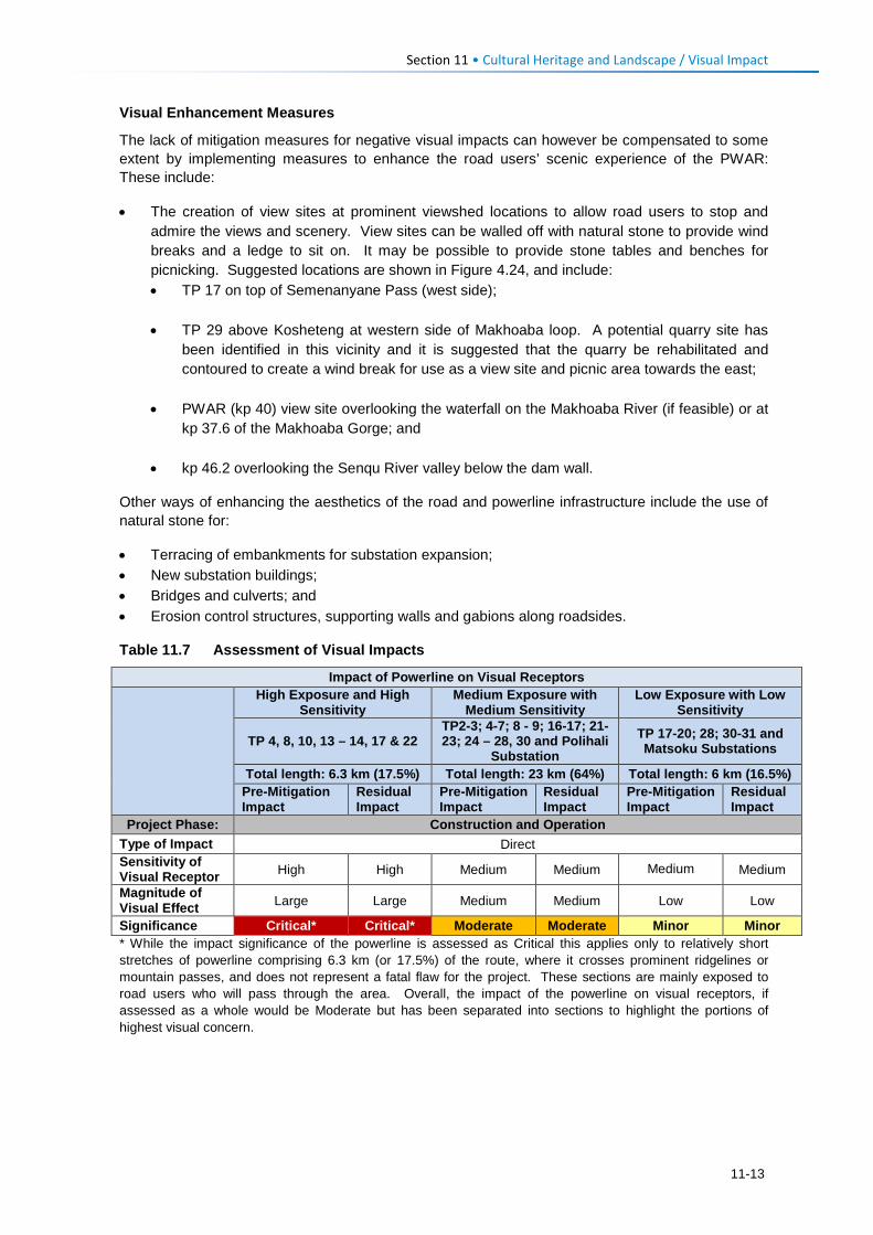
Section 11 • Cultural Heritage and Landscape / Visual Impact
Visual Enhancement Measures
The lack of mitigation measures for negative visual impacts can however be compensated to some extent by implementing measures to enhance the road users’ scenic experience of the PWAR: These include:
• The creation of view sites at prominent viewshed locations to allow road users to stop and admire the views and scenery. View sites can be walled off with natural stone to provide wind breaks and a ledge to sit on. It may be possible to provide stone tables and benches for picnicking. Suggested locations are shown in Figure 4.24, and include: • TP 17 on top of Semenanyane Pass (west side);
• TP 29 above Kosheteng at western side of Makhoaba loop. A potential quarry site has
been identified in this vicinity and it is suggested that the quarry be rehabilitated and contoured to create a wind break for use as a view site and picnic area towards the east;
• PWAR (kp 40) view site overlooking the waterfall on the Makhoaba River (if feasible) or at
kp 37.6 of the Makhoaba Gorge; and
• kp 46.2 overlooking the Senqu River valley below the dam wall.
Other ways of enhancing the aesthetics of the road and powerline infrastructure include the use of natural stone for:
• Terracing of embankments for substation expansion; • New substation buildings; • Bridges and culverts; and • Erosion control structures, supporting walls and gabions along roadsides.
Table 11.7 Assessment of Visual Impacts
Impact of Powerline on Visual Receptors
High Exposure and High Sensitivity
Medium Exposure with Medium Sensitivity
Low Exposure with Low Sensitivity
TP 4, 8, 10, 13 – 14, 17 & 22 TP2-3; 4-7; 8 - 9; 16-17; 21- 23; 24 – 28, 30 and Polihali
Substation TP 17-20; 28; 30-31 and Matsoku Substations
Total length: 6.3 km (17.5%) Total length: 23 km (64%) Total length: 6 km (16.5%) Pre-Mitigation Impact
Residual Impact
Pre-Mitigation Impact
Residual Impact
Pre-Mitigation Impact
Residual Impact
Project Phase: Construction and Operation Type of Impact Direct Sensitivity of Visual Receptor High High Medium Medium Medium Medium
Magnitude of Visual Effect Large Large Medium Medium Low Low
Significance Critical* Critical* Moderate Moderate Minor Minor * While the impact significance of the powerline is assessed as Critical this applies only to relatively short stretches of powerline comprising 6.3 km (or 17.5%) of the route, where it crosses prominent ridgelines or mountain passes, and does not represent a fatal flaw for the project. These sections are mainly exposed to road users who will pass through the area. Overall, the impact of the powerline on visual receptors, if assessed as a whole would be Moderate but has been separated into sections to highlight the portions of highest visual concern.
11-13

Section 11 • Cultural Heritage and Landscape / Visual Impact
11.2.4.4 Residual Impact Due to the limited mitigation measures that are possible to further mitigate visual impacts of the powerline, the significance ratings remain the same as for pre-mitigation impacts i.e., Major for high exposure areas; Moderate for moderate exposure areas and Minor for low exposure areas. Enhancement measures, such as view sites, can optimise the road user experience, although these are not considered as mitigation for the powerline.
11.3 Operation Phase Impacts 11.3.1 Operation Phase: Potential to Enhance the Value of Cultural
Heritage Resources 11.3.1.1 Description of Opportunities to Enhance Value of Cultural Heritage The road will present travelers with new options for seeing the beauty of the natural landscape and experiencing the wonders of the country, particularly as very few visitors utilise the current route at present. The new route is expected to open up an important new link between Katse and Mokhotlong which are poorly connected at present, including improved connection between visitors entering via Sani Pass or Oxbow to connect through to the centre of the country. Along the PWAR route there are a number of opportunities for scenic vistas both within the Liseleng and Semenanyane valleys, at the top of the Makhoaba loop and along the Makhoaba River valley.
A separate visual assessment for the PWAC focusing primarily on powerline impacts has been compiled by VRMA (VRMA, 2017: P2W-6004-DFR-0007) which has already optimised the powerline and road alignment to mitigate visual impacts of the powerline on road users.
11.3.1.2 Importance Spectacular scenery, waterfalls and birdlife are resources that improve the experience of visitors and tourists, and can contribute to economic development of the local community through creating opportunities for accommodation, guiding, and sale of crafts. As the scenic features are not unusual in the Highlands and there are no major tourist node development focus features (e.g., waterfalls of national significance such as Semongkong; hot water springs etc.), the overall importance of tourist resources is rated as Medium. Two notable waterfalls occur – one along the Makhoaba River (kp 40) and one south of Ha Seshote both of which are worthy of a view point or picnic site rather than serving as a destination for visitors. 11.3.1.3 Assessment of Opportunity Opportunities to optimise visitor value and experience from the scenic amenity value and potential for cultural engagement with communities are considered of potential medium magnitude. 11.3.1.4 Enhancement Measures A number of measures can be implemented to enhance the visitor experience of the PWAR:
1. Scenic Viewpoint Stops: Viewpoints are recommended at the following locations:
i) Top of catchment between Liseleng and Semenanyane River valleys at kp 17 at 2808 m which provides a scenic view down into the Semenanyane valley to the east and is in an area of subalpine shrub vegetation that is very different to the rest of the route at that point when travelling from the west side.
ii) Top of catchment divide above and to the east of Kosheteng at the top of the Makhoaba loop (kp 25) which marks the highest point between the Semenanyane River valley to the west and the Polihali side of the catchment at the source of the Makhoaba River (at kp 25). If a
11-14
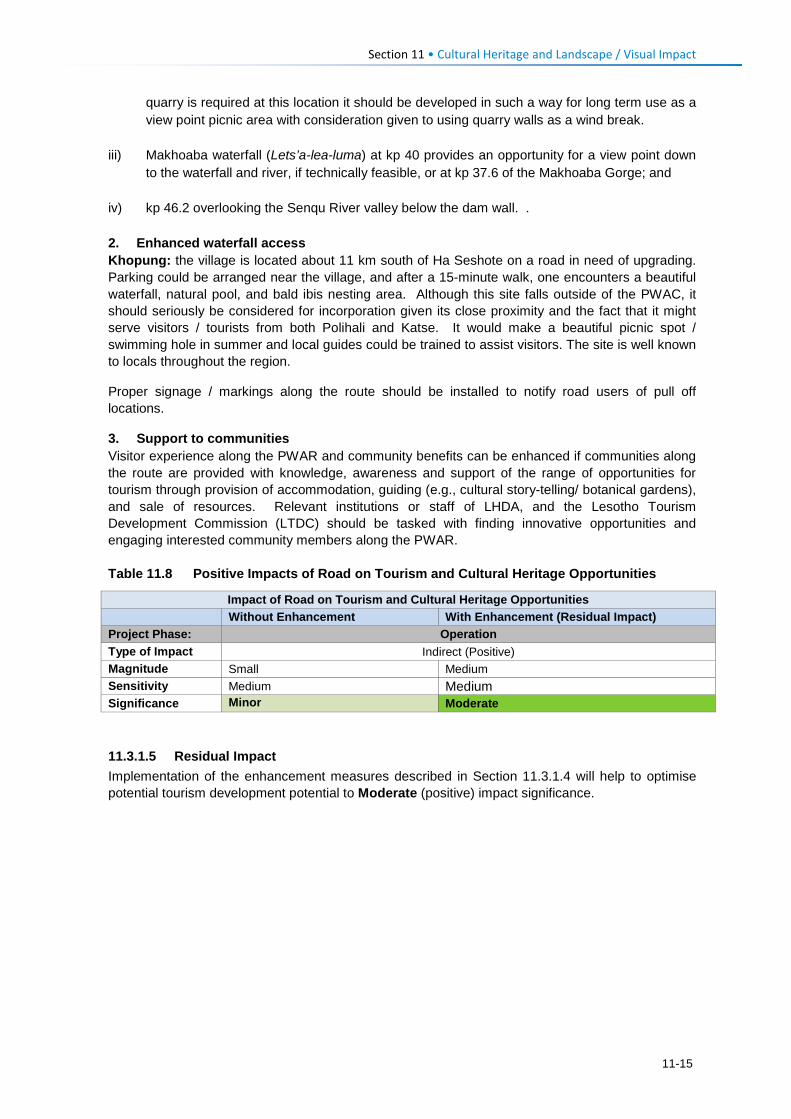
Section 11 • Cultural Heritage and Landscape / Visual Impact
quarry is required at this location it should be developed in such a way for long term use as a view point picnic area with consideration given to using quarry walls as a wind break.
iii) Makhoaba waterfall (Lets’a-lea-luma) at kp 40 provides an opportunity for a view point down to the waterfall and river, if technically feasible, or at kp 37.6 of the Makhoaba Gorge; and
iv) kp 46.2 overlooking the Senqu River valley below the dam wall. . 2. Enhanced waterfall access Khopung: the village is located about 11 km south of Ha Seshote on a road in need of upgrading. Parking could be arranged near the village, and after a 15-minute walk, one encounters a beautiful waterfall, natural pool, and bald ibis nesting area. Although this site falls outside of the PWAC, it should seriously be considered for incorporation given its close proximity and the fact that it might serve visitors / tourists from both Polihali and Katse. It would make a beautiful picnic spot / swimming hole in summer and local guides could be trained to assist visitors. The site is well known to locals throughout the region.
Proper signage / markings along the route should be installed to notify road users of pull off locations.
3. Support to communities Visitor experience along the PWAR and community benefits can be enhanced if communities along the route are provided with knowledge, awareness and support of the range of opportunities for tourism through provision of accommodation, guiding (e.g., cultural story-telling/ botanical gardens), and sale of resources. Relevant institutions or staff of LHDA, and the Lesotho Tourism Development Commission (LTDC) should be tasked with finding innovative opportunities and engaging interested community members along the PWAR. Table 11.8 Positive Impacts of Road on Tourism and Cultural Heritage Opportunities
Impact of Road on Tourism and Cultural Heritage Opportunities
Without Enhancement With Enhancement (Residual Impact) Project Phase: Operation Type of Impact Indirect (Positive) Magnitude Small Medium Sensitivity Medium Medium Significance Minor Moderate 11.3.1.5 Residual Impact Implementation of the enhancement measures described in Section 11.3.1.4 will help to optimise potential tourism development potential to Moderate (positive) impact significance.
11-15

Ecological Impacts Section 12
12.1 Terrestrial Ecology 12.1.1 Construction Phase: Impact of Site Clearance and Cut and Fill on
Vegetation and Flora 12.1.1.1 Description of Impact This impact will involve the clearance of vegetation associations and constituent flora and topsoil, and the cut and fill (including blasting) of rocky slopes to create the required road servitude and the pylon locations and access tracks for powerline construction. Road construction will require a working road servitude width of 30 m (including 10 m for the paved road, shoulders and stormwater drainage) along the 54.5 km length of the PWAR. The powerline of ~35.4 km length will require ~106 pylons, including 33 deviation (bend-point) pylons, and 42.5 km of local tower access tracks and new common roads. Estimated land take requirements are as follows:
• Road Construction Footprint: The area that will be impacted by site clearance in the road construction footprint will be approximately 164 ha (within the 30 m Road Reserve), allowing for construction access, rock spoil and dust impacts, and an additional ~6 ha for construction laydown of equipment and materials, making a total of 170 ha;
• Powerline Construction Footprint: The area impacted by the powerline may require in the order of 18 ha permanent land for 106 pylon locations; substation expansion, and 42.5 km of access roads, and 120 ha of temporary land for the 35 km powerline servitude and laydown and construction sites.
Based on these estimates, the total area of habitat permanently affected is estimated at 170 ha for the road and 20 ha for the road, totalling ~190 ha.
Habitats affected comprise mainly fields in the lower lying areas, interspersed with degraded grassland and rocky outcrops and - at high altitudes >2700 m - degraded subalpine shrubland / grassland mosaic. Impacts on wetland habitat are covered under a separate wetland specialist study (WCS, 2017: P2W-6004-DFR-0005).
Road and powerline construction activities will have a direct impact that will result in a loss of habitat and flora species in the footprint. Construction activities will also include the generation of dust from heavy vehicles, such as bulldozers and other light vehicle traffic, and blasting. Blasting to widen the road will create waste rock with the excess disposed of by dumping along the lower side of the cleared road servitude, and which will smother additional roadside vegetation.
12.1.1.2 Sensitivity of Resources The main vegetation type to be affected by this impact will be the widespread Montane Grassland / Rocky Outcrop mosaic along the road and powerline route. This vegetation mosaic has been heavily overgrazed within the PWAC and is in an ecologically degraded state with low to moderate biodiversity value along most of the route. Habitat between kp 25 and 29 has been heavily grazed but still supports high floristic diversity, including numerous DAC endemics, as well as several seep wetlands, and is considered to have high biodiversity value. Four plant species of conservation concern occur in the vicinity of the road and powerline. The most threatened of these is Boophone disticha, which has a national red data classification of Endangered (Talukdar, 2002), although this is a widespread species in Lesotho and South Africa that does not meet the IUCN threshold for EN status. A large population was located at kp 7-8 in a wetland / grassland / rocky outcrop mosaic but road realignment of the route between kp 7 and 9 has already largely mitigated this impact. Three Vulnerable species are present in the PWAC footprint, namely Jamesbrittenia lesutica, Eucomis autumnalis and Dicoma anomala. However, Dicoma anomala has been incorrectly assessed and is a widespread and common species that should not be considered to be of conservation concern.
12-1
Section 12 • Ecological Impacts
Jamesbrittenia lesutica is endemic to Lesotho and is a more accurate indication of conservation importance. This species occurs at moderate density on steep rocky slopes on the eastern third of the PWAC. A single population of Eucomis autumnalis was located at the same site as Boophone disticha, near kp 7-8.
Within the Montane Grassland / Rocky Outcrop Mosaic the habitats most vulnerable to degradation are grassland on crests or terraces and seeps, both of which are heavily targeted by grazing livestock. Habitat that cannot be cultivated or grazed, such as rocky ridges and cliffs, has low vulnerability to degradation. However, grassland has moderate resilience to disturbance, while rocky ridges / cliffs and seeps have low resilience. Overall the grassland and rocky ridge habitats are considered to have Medium sensitivity to site clearance.
12.1.1.3 Assessment of Impact The impact of site clearance on vegetation and flora will be long term to permanent and will have a high intensity in the PWAR and powerline footprint. However, the extent of the impact will be relatively small (limited to the ~170 ha of the PWAR and ~18 ha of the powerline footprint (including access roads) footprint, and the vegetation type is mostly ecologically degraded to varying extents, resulting in an impact magnitude of Medium. Prior to the implementation of any mitigation measures, the significance of this impact on terrestrial vegetation and flora in higher lying Near-natural Habitats of the PWAC is considered Moderate. Impact significance of habitat clearance and blasting in lower lying Modified Habitats is considered Minor.
12.1.1.4 Mitigation Measures The following mitigation measures are recommended for the impact of site clearance on vegetation and flora:
• Pre-construction plant surveys focussed on sensitive sections of the PWAR, powerline and access roads to identify species of conservation importance for relocation to safeguard sites or which can be avoided by minor deviations in access tracks;
• Identify suitable host areas for relocated plants, which could include community nurseries or the botanical garden at Katse Dam or for later use in landscaping or rehabilitation. Relocation of plants should be done under the supervision of the botanist and someone with horticultural experience of indigenous plant species. Plant relocation sites may need to be fenced-off to restrict access by livestock;
• Where possible, no borrow pits or quarries should be sited within the section of the road above 2700 masl, e.g., kp 18-31 between Ha Sekolopata and Makhoaba loop. Where necessary in this area, the footprint must be minimised and any excavations should be rehabilitated or modified for future use (e.g., as laybys or view points);
• Topsoil shall be removed during site clearance and stored separately for re-use in rehabilitation of disturbed areas, roadsides and on rock spoil heaps to aid natural revegetation.
• Minimise spread of alien invasive plants by cleaning all vehicles and equipment at designated vehicle washing bays, and avoiding import of contaminated plant material in borrow pit or topsoil material. Regular checks and removal of alien plants from construction areas. Contractors shall be required to prepare a method statement for management of alien invasive plants.
12-2
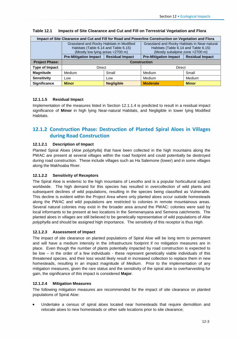
Section 12 • Ecological Impacts
Table 12.1 Impacts of Site Clearance and Cut and Fill on Terrestrial Vegetation and Flora
Impact of Site Clearance and Cut and Fill for Road and Powerline Construction on Vegetation and Flora
Grassland and Rocky Habitats in Modified Habitats (Table 6.14 and Table 6.15)
(Mostly low lying areas <2700 m)
Grassland and Rocky Habitats in Near-natural Habitats (Table 6.14 and Table 6.15)
(Mostly subalpine zone >2700 m) Pre-Mitigation Impact Residual Impact Pre-Mitigation Impact Residual Impact
Project Phase: Construction Type of Impact Direct Direct Magnitude Medium Small Medium Small Sensitivity Low Low Medium Medium Significance Minor Negligible Moderate Minor 12.1.1.5 Residual Impact Implementation of the measures listed in Section 12.1.1.4 is predicted to result in a residual impact significance of Minor in high lying Near-natural Habitats, and Negligible in lower lying Modified Habitats.
12.1.2 Construction Phase: Destruction of Planted Spiral Aloes in Villages during Road Construction
12.1.2.1 Description of Impact Planted Spiral Aloes (Aloe polyphylla) that have been collected in the high mountains along the PWAC are present at several villages within the road footprint and could potentially be destroyed during road construction. These include villages such as Ha Salemone (lower) and in some villages along the Makhoaba River.
12.1.2.2 Sensitivity of Receptors The Spiral Aloe is endemic to the high mountains of Lesotho and is a popular horticultural subject worldwide. The high demand for this species has resulted in overcollection of wild plants and subsequent declines of wild populations, resulting in the species being classified as Vulnerable. This decline is evident within the Project Area where only planted aloes occur outside homesteads along the PWAC and wild populations are restricted to colonies in remote mountainous areas. Several natural colonies may exist in the broader area around the PWAC: colonies were said by local informants to be present at two locations in the Semenanyana and Semena catchments. The planted aloes in villages are still believed to be genetically representative of wild populations of Aloe polyphylla and should be assigned high importance. The sensitivity of this receptor is thus High.
12.1.2.3 Assessment of Impact The impact of site clearance on planted populations of Spiral Aloe will be long term to permanent and will have a medium intensity in the infrastructure footprint if no mitigation measures are in place. Even though the number of plants potentially impacted by road construction is expected to be low – in the order of a few individuals - these represent genetically viable individuals of this threatened species, and their loss would likely result in increased collection to replace them in new homesteads, resulting in an impact magnitude of Medium. Prior to the implementation of any mitigation measures, given the rare status and the sensitivity of the spiral aloe to overharvesting for gain, the significance of this impact is considered Major.
12.1.2.4 Mitigation Measures The following mitigation measures are recommended for the impact of site clearance on planted populations of Spiral Aloe:
• Undertake a census of spiral aloes located near homesteads that require demolition and relocate aloes to new homesteads or other safe locations prior to site clearance;
12-3
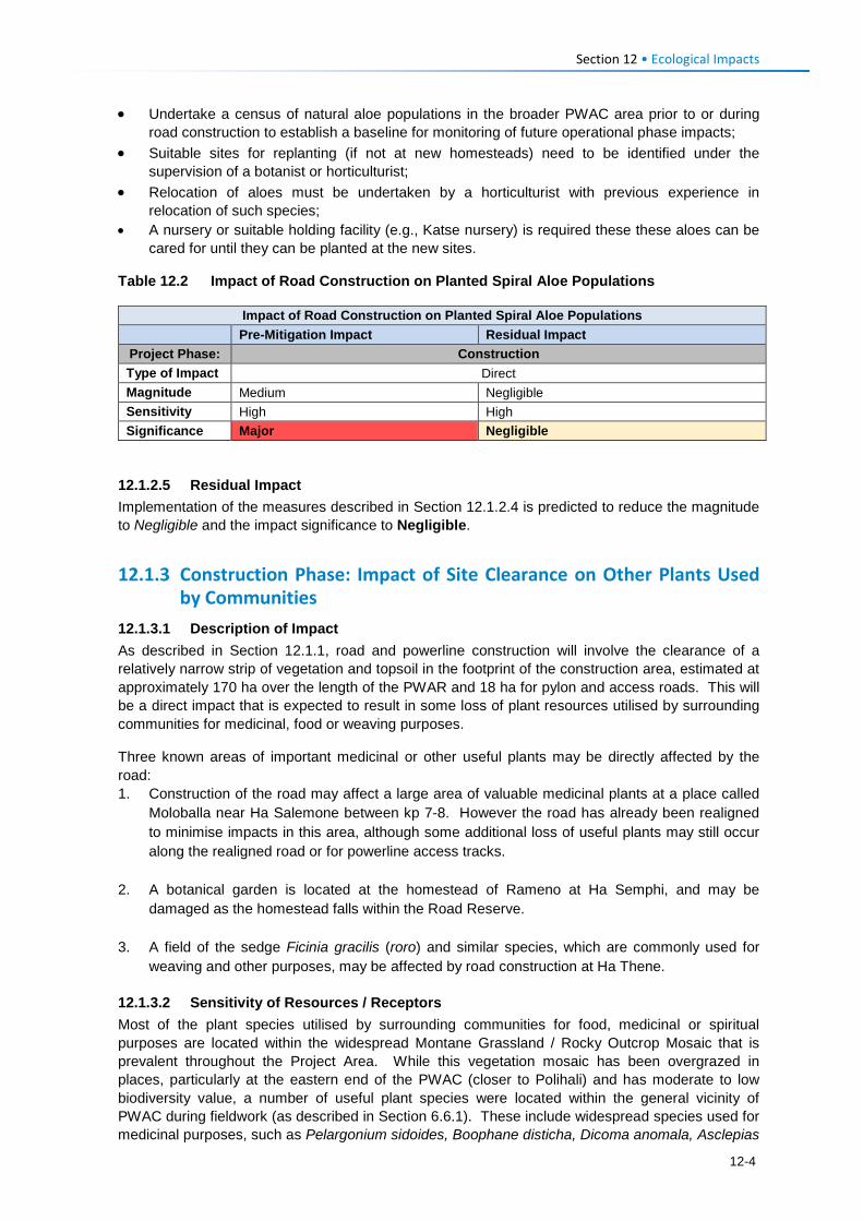
Section 12 • Ecological Impacts
• Undertake a census of natural aloe populations in the broader PWAC area prior to or during road construction to establish a baseline for monitoring of future operational phase impacts;
• Suitable sites for replanting (if not at new homesteads) need to be identified under the supervision of a botanist or horticulturist;
• Relocation of aloes must be undertaken by a horticulturist with previous experience in relocation of such species;
• A nursery or suitable holding facility (e.g., Katse nursery) is required these these aloes can be cared for until they can be planted at the new sites.
Table 12.2 Impact of Road Construction on Planted Spiral Aloe Populations
Impact of Road Construction on Planted Spiral Aloe Populations Pre-Mitigation Impact Residual Impact Project Phase: Construction Type of Impact Direct Magnitude Medium Negligible Sensitivity High High Significance Major Negligible
12.1.2.5 Residual Impact Implementation of the measures described in Section 12.1.2.4 is predicted to reduce the magnitude to Negligible and the impact significance to Negligible.
12.1.3 Construction Phase: Impact of Site Clearance on Other Plants Used by Communities
12.1.3.1 Description of Impact As described in Section 12.1.1, road and powerline construction will involve the clearance of a relatively narrow strip of vegetation and topsoil in the footprint of the construction area, estimated at approximately 170 ha over the length of the PWAR and 18 ha for pylon and access roads. This will be a direct impact that is expected to result in some loss of plant resources utilised by surrounding communities for medicinal, food or weaving purposes.
Three known areas of important medicinal or other useful plants may be directly affected by the road: 1. Construction of the road may affect a large area of valuable medicinal plants at a place called
Moloballa near Ha Salemone between kp 7-8. However the road has already been realigned to minimise impacts in this area, although some additional loss of useful plants may still occur along the realigned road or for powerline access tracks.
2. A botanical garden is located at the homestead of Rameno at Ha Semphi, and may be damaged as the homestead falls within the Road Reserve.
3. A field of the sedge Ficinia gracilis (roro) and similar species, which are commonly used for
weaving and other purposes, may be affected by road construction at Ha Thene.
12.1.3.2 Sensitivity of Resources / Receptors Most of the plant species utilised by surrounding communities for food, medicinal or spiritual purposes are located within the widespread Montane Grassland / Rocky Outcrop Mosaic that is prevalent throughout the Project Area. While this vegetation mosaic has been overgrazed in places, particularly at the eastern end of the PWAC (closer to Polihali) and has moderate to low biodiversity value, a number of useful plant species were located within the general vicinity of PWAC during fieldwork (as described in Section 6.6.1). These include widespread species used for medicinal purposes, such as Pelargonium sidoides, Boophane disticha, Dicoma anomala, Asclepias
12-4
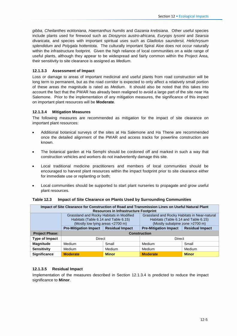
Section 12 • Ecological Impacts
gibba, Cheilanthes eckloniana, Haemanthus humilis and Gazania krebsiana. Other useful species include plants used for firewood such as Diospyros austro-africana, Euryops tysonii and Searsia divaricata, and species with important spiritual uses such as Gladiolus saundersii, Helichrysum splendidum and Polygala hottentota. The culturally important Spiral Aloe does not occur naturally within the infrastructure footprint. Given the high reliance of local communities on a wide range of useful plants, although they appear to be widespread and fairly common within the Project Area, their sensitivity to site clearance is assigned as Medium.
12.1.3.3 Assessment of Impact Loss or damage to areas of important medicinal and useful plants from road construction will be long term to permanent, but as the road corridor is expected to only affect a relatively small portion of these areas the magnitude is rated as Medium. It should also be noted that this takes into account the fact that the PWAR has already been realigned to avoid a large part of the site near Ha Salemone. Prior to the implementation of any mitigation measures, the significance of this impact on important plant resources will be Moderate.
12.1.3.4 Mitigation Measures The following measures are recommended as mitigation for the impact of site clearance on important plant resources:
• Additional botanical surveys of the sites at Ha Salemone and Ha Thene are recommended once the detailed alignment of the PWAR and access tracks for powerline construction are known.
• The botanical garden at Ha Semphi should be cordoned off and marked in such a way that construction vehicles and workers do not inadvertently damage this site.
• Local traditional medicine practitioners and members of local communities should be encouraged to harvest plant resources within the impact footprint prior to site clearance either for immediate use or replanting or both;
• Local communities should be supported to start plant nurseries to propagate and grow useful plant resources.
Table 12.3 Impact of Site Clearance on Plants Used by Surrounding Communities
Impact of Site Clearance for Construction of Road and Transmission Lines on Useful Natural Plant Resources in Infrastructure Footprint
Grassland and Rocky Habitats in Modified Habitats (Table 6.14 and Table 6.15)
(Mostly low lying areas <2700 m)
Grassland and Rocky Habitats in Near-natural Habitats (Table 6.14 and Table 6.15)
(Mostly subalpine zone >2700 m) Pre-Mitigation Impact Residual Impact Pre-Mitigation Impact Residual Impact
Project Phase: Construction Type of Impact Direct Direct Magnitude Medium Small Medium Small Sensitivity Medium Medium Medium Medium Significance Moderate Minor Moderate Minor
12.1.3.5 Residual Impact Implementation of the measures described in Section 12.1.3.4 is predicted to reduce the impact significance to Minor.
12-5
Section 12 • Ecological Impacts
12.1.4 Construction Phase: Impact of Site Clearance and Blasting on Mammals and Herpetofauna
12.1.4.1 Description of Impact As described in Section 12.1.1, this impact will involve the clearance of vegetation and topsoil in the infrastructure footprint over an area of ~190 ha (~170 ha for PWAR and ~18 ha powerline), and blasting of rocky areas to clear the servitude, particularly in the high lying areas along the PWAC. This will have a direct impact on mammal and herpetofauna through direct disturbance (noise and vibration), loss of habitat, particularly rocky outcrop habitat), as well as faunal mortalities as a result of blasting. This will particularly affect burrowing or crevice-dwelling fauna such as lizards, snakes, and rodents/moles. Fauna within the flyrock zone (where blast debris lands) may also be impacted by smothering of habitat.
12.1.4.2 Sensitivity of Receptors The main vegetation type to be affected by this impact will be the widespread Montane Grassland / Rocky Outcrop Mosaic that is prevalent throughout the Project Area, which includes two main faunal habitats, namely natural grassland and rocky outcrops. Some cropped fields also occur. These habitats have been heavily disturbed and overgrazed within the infrastructure footprint by livestock and settlement, and are in an ecologically degraded state, particularly at lower altitudes. Mammal and herpetofauna (reptiles and amphibians) species and abundance are low and no conservation priority species were recorded in the infrastructure footprint, although high altitude stream crossings may have two endemic frog species (Maluti River Frog, Phofung River Frog). Faunal habitats within the road footprint are considered to have low biodiversity value below 2700 masl and medium value above this altitude, with rocky habitats having higher value as refuge zones for reptiles and small mammals; overall the faunal habitats are considered to have Medium sensitivity to site clearance and blasting. Most mammal and herpetofauna in the Project Area are common and widespread species with few priority species found to occur in the infrastructure footprint area. None of the mammal or reptile species present in the Project Area is known to rely on verbal cues for establishing territory and / or finding suitable mates, so it is assumed that blasting noise will have limited short-term impacts on these fauna in the vicinity of the impact footprints. Territory establishment of frogs that do rely on such cues may be impacted for short-term periods only. Mammals such as water mongoose or African clawless otter could occur intermittently at larger stream crossings, mostly in the more remote central part of the PWAC.
12.1.4.3 Assessment of Impact The impact of site clearance on small mammal and herpetofaunal assemblages will be long term to permanent and will have a high intensity. However, the extent of the impact will be relatively small (limited to the impact footprint), and the faunal habitats are mostly ecologically degraded to some extent, resulting in an impact magnitude of Medium for the entire PWAR route. The impact of blasting on mammal and herpetofaunal assemblages will be localised to specific locations within the infrastructure footprint zone and will be short term and of high intensity, occurring intermittently during road construction. Prior to the implementation of any mitigation measures, the significance of this impact on mammals and herpetofauna will be Moderate across the entire PWAC.
12.1.4.4 Mitigation Measures The following measures are recommended as mitigation for the impact of site clearance and blasting on small mammal and herpetofaunal assemblages:
• At least one member of the construction staff should be trained in the handling of snakes and lizards in order that any such fauna found to occur in the infrastructure area can be removed and relocated to a safe location away from settlements.
• All construction staff should be made aware of the requirement to avoid killing of snakes and other fauna and shall be informed of the procedure to notify a designated snake-handler to remove and relocate any individuals encountered. Snakes should be released discretely in rocky areas out of eyesight of local residents (to avoid persecution).
12-6
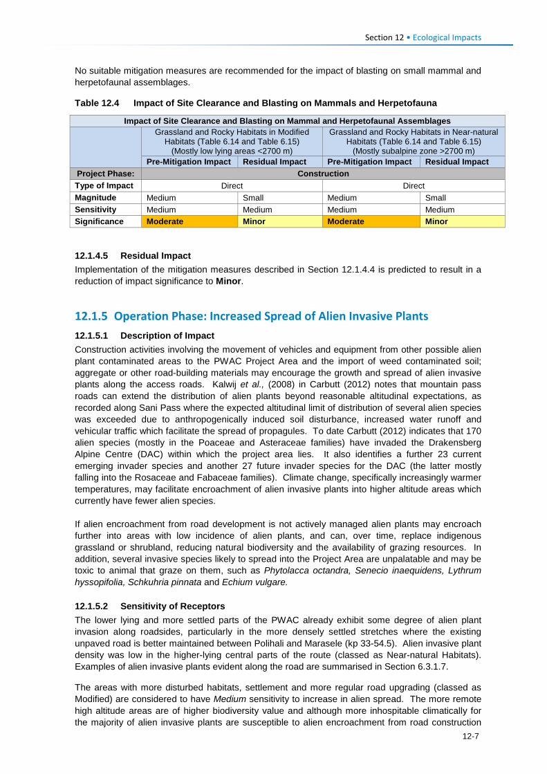
Section 12 • Ecological Impacts
No suitable mitigation measures are recommended for the impact of blasting on small mammal and herpetofaunal assemblages.
Table 12.4 Impact of Site Clearance and Blasting on Mammals and Herpetofauna
Impact of Site Clearance and Blasting on Mammal and Herpetofaunal Assemblages
Grassland and Rocky Habitats in Modified Habitats (Table 6.14 and Table 6.15)
(Mostly low lying areas <2700 m)
Grassland and Rocky Habitats in Near-natural Habitats (Table 6.14 and Table 6.15)
(Mostly subalpine zone >2700 m) Pre-Mitigation Impact Residual Impact Pre-Mitigation Impact Residual Impact
Project Phase: Construction Type of Impact Direct Direct Magnitude Medium Small Medium Small Sensitivity Medium Medium Medium Medium Significance Moderate Minor Moderate Minor
12.1.4.5 Residual Impact Implementation of the mitigation measures described in Section 12.1.4.4 is predicted to result in a reduction of impact significance to Minor.
12.1.5 Operation Phase: Increased Spread of Alien Invasive Plants 12.1.5.1 Description of Impact Construction activities involving the movement of vehicles and equipment from other possible alien plant contaminated areas to the PWAC Project Area and the import of weed contaminated soil; aggregate or other road-building materials may encourage the growth and spread of alien invasive plants along the access roads. Kalwij et al., (2008) in Carbutt (2012) notes that mountain pass roads can extend the distribution of alien plants beyond reasonable altitudinal expectations, as recorded along Sani Pass where the expected altitudinal limit of distribution of several alien species was exceeded due to anthropogenically induced soil disturbance, increased water runoff and vehicular traffic which facilitate the spread of propagules. To date Carbutt (2012) indicates that 170 alien species (mostly in the Poaceae and Asteraceae families) have invaded the Drakensberg Alpine Centre (DAC) within which the project area lies. It also identifies a further 23 current emerging invader species and another 27 future invader species for the DAC (the latter mostly falling into the Rosaceae and Fabaceae families). Climate change, specifically increasingly warmer temperatures, may facilitate encroachment of alien invasive plants into higher altitude areas which currently have fewer alien species. If alien encroachment from road development is not actively managed alien plants may encroach further into areas with low incidence of alien plants, and can, over time, replace indigenous grassland or shrubland, reducing natural biodiversity and the availability of grazing resources. In addition, several invasive species likely to spread into the Project Area are unpalatable and may be toxic to animal that graze on them, such as Phytolacca octandra, Senecio inaequidens, Lythrum hyssopifolia, Schkuhria pinnata and Echium vulgare. 12.1.5.2 Sensitivity of Receptors The lower lying and more settled parts of the PWAC already exhibit some degree of alien plant invasion along roadsides, particularly in the more densely settled stretches where the existing unpaved road is better maintained between Polihali and Marasele (kp 33-54.5). Alien invasive plant density was low in the higher-lying central parts of the route (classed as Near-natural Habitats). Examples of alien invasive plants evident along the road are summarised in Section 6.3.1.7.
The areas with more disturbed habitats, settlement and more regular road upgrading (classed as Modified) are considered to have Medium sensitivity to increase in alien spread. The more remote high altitude areas are of higher biodiversity value and although more inhospitable climatically for the majority of alien invasive plants are susceptible to alien encroachment from road construction
12-7
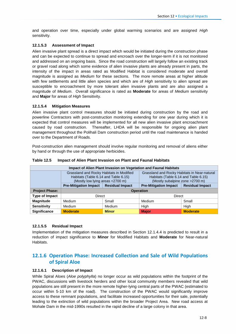
Section 12 • Ecological Impacts
and operation over time, especially under global warming scenarios and are assigned High sensitivity.
12.1.5.3 Assessment of Impact Alien invasive plant spread is a direct impact which would be initiated during the construction phase and can be expected to continue to spread and encroach over the longer-term if it is not monitored and addressed on an ongoing basis. Since the road construction will largely follow an existing track or gravel road along which some evidence of alien invasive plants are already present in parts, the intensity of the impact in areas rated as Modified Habitat is considered moderate and overall magnitude is assigned as Medium for these sections. The more remote areas at higher altitude with few settlements and little alien species and which are of High sensitivity to alien spread are susceptible to encroachment by more tolerant alien invasive plants and are also assigned a magnitude of Medium. Overall significance is rated as Moderate for areas of Medium sensitivity and Major for areas of High Sensitivity.
12.1.5.4 Mitigation Measures Alien invasive plant control measures should be initiated during construction by the road and powerline Contractors with post-construction monitoring extending for one year during which it is expected that control measures will be implemented for all new alien invasive plant encroachment caused by road construction. Thereafter, LHDA will be responsible for ongoing alien plant management throughout the Polihali Dam construction period until the road maintenance is handed over to the Department of Roads.
Post-construction alien management should involve regular monitoring and removal of aliens either by hand or through the use of appropriate herbicides.
Table 12.5 Impact of Alien Plant Invasion on Plant and Faunal Habitats
Impact of Alien Plant Invasion on Vegetation and Faunal Habitats
Grassland and Rocky Habitats in Modified Habitats (Table 6.14 and Table 6.15)
(Mostly low lying areas <2700 m)
Grassland and Rocky Habitats in Near-natural Habitats (Table 6.14 and Table 6.15)
(Mostly subalpine zone >2700 m) Pre-Mitigation Impact Residual Impact Pre-Mitigation Impact Residual Impact
Project Phase: Operation Type of Impact Direct Direct Magnitude Medium Small Medium Small Sensitivity Medium Medium High High Significance Moderate Minor Major Moderate
12.1.5.5 Residual Impact Implementation of the mitigation measures described in Section 12.1.4.4 is predicted to result in a reduction of impact significance to Minor for Modified Habitats and Moderate for Near-natural Habitats.
12.1.6 Operation Phase: Increased Collection and Sale of Wild Populations of Spiral Aloe
12.1.6.1 Description of Impact While Spiral Aloes (Aloe polyphylla) no longer occur as wild populations within the footprint of the PWAC, discussions with livestock herders and other local community members revealed that wild populations are still present in the more remote higher-lying central parts of the PWAC (estimated to occur within 5-10 km of the road). The construction of the PWAC would significantly improve access to these remnant populations, and facilitate increased opportunities for their sale, potentially leading to the extinction of wild populations within the broader Project Area. New road access at Mohale Dam in the mid-1990s resulted in the rapid decline of a large colony in that area.
12-8
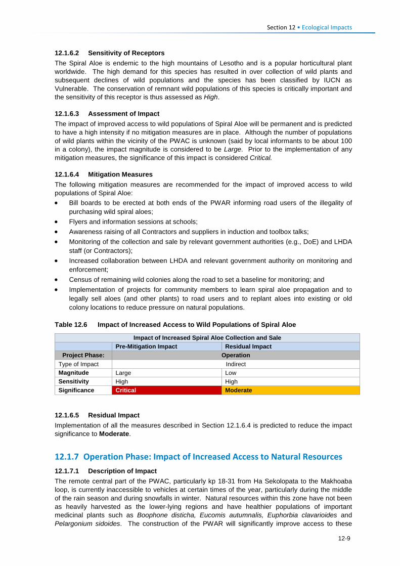
Section 12 • Ecological Impacts
12.1.6.2 Sensitivity of Receptors The Spiral Aloe is endemic to the high mountains of Lesotho and is a popular horticultural plant worldwide. The high demand for this species has resulted in over collection of wild plants and subsequent declines of wild populations and the species has been classified by IUCN as Vulnerable. The conservation of remnant wild populations of this species is critically important and the sensitivity of this receptor is thus assessed as High.
12.1.6.3 Assessment of Impact The impact of improved access to wild populations of Spiral Aloe will be permanent and is predicted to have a high intensity if no mitigation measures are in place. Although the number of populations of wild plants within the vicinity of the PWAC is unknown (said by local informants to be about 100 in a colony), the impact magnitude is considered to be Large. Prior to the implementation of any mitigation measures, the significance of this impact is considered Critical.
12.1.6.4 Mitigation Measures The following mitigation measures are recommended for the impact of improved access to wild populations of Spiral Aloe: • Bill boards to be erected at both ends of the PWAR informing road users of the illegality of
purchasing wild spiral aloes; • Flyers and information sessions at schools; • Awareness raising of all Contractors and suppliers in induction and toolbox talks; • Monitoring of the collection and sale by relevant government authorities (e.g., DoE) and LHDA
staff (or Contractors); • Increased collaboration between LHDA and relevant government authority on monitoring and
enforcement; • Census of remaining wild colonies along the road to set a baseline for monitoring; and • Implementation of projects for community members to learn spiral aloe propagation and to
legally sell aloes (and other plants) to road users and to replant aloes into existing or old colony locations to reduce pressure on natural populations.
Table 12.6 Impact of Increased Access to Wild Populations of Spiral Aloe
Impact of Increased Spiral Aloe Collection and Sale
Pre-Mitigation Impact Residual Impact Project Phase: Operation
Type of Impact Indirect Magnitude Large Low Sensitivity High High Significance Critical Moderate
12.1.6.5 Residual Impact Implementation of all the measures described in Section 12.1.6.4 is predicted to reduce the impact significance to Moderate.
12.1.7 Operation Phase: Impact of Increased Access to Natural Resources 12.1.7.1 Description of Impact The remote central part of the PWAC, particularly kp 18-31 from Ha Sekolopata to the Makhoaba loop, is currently inaccessible to vehicles at certain times of the year, particularly during the middle of the rain season and during snowfalls in winter. Natural resources within this zone have not been as heavily harvested as the lower-lying regions and have healthier populations of important medicinal plants such as Boophone disticha, Eucomis autumnalis, Euphorbia clavarioides and Pelargonium sidoides. The construction of the PWAR will significantly improve access to these
12-9
Section 12 • Ecological Impacts
areas and is likely to result in increased pressure on natural resources. It has been reported that people from outside the highlands come to harvest resources to sell at markets as far as South Africa (CES 2014a). This is an indirect / induced impact of unknown spatial extent.
12.1.7.2 Sensitivity of Receptors Most of the plant species utilised by surrounding communities for food, medicinal or spiritual purposes are located within the widespread Montane Grassland / Rocky Outcrop Mosaic that is prevalent throughout the Project Area. While this vegetation mosaic has been heavily overgrazed and the natural resources heavily utilised over much of the PWAC, the central higher-lying part of the route has viable populations of useful plant species that are likely to come under pressure once road construction is complete. Three areas were identified as ‘botanical gardens’ during the cultural heritage survey at Ha Salemone (kp 7-8); Ha Semphi (kp 11) and Ha Thene (kp 16), although there may be others. Given the high reliance of local communities on plant resources, although they appear to be widespread and fairly common within the Project Area, the sensitivity to increased utilisation pressure is considered Medium for the areas of Near-natural Habitat in higher lying areas and Low for the Modified Habitats (see Table 6.14 and Table 6.15).
12.1.7.3 Assessment of Impact The impact of increased access to natural resources by surrounding communities and their livestock will be permanent and is expected to be of high intensity particularly in the less accessible parts of the PWAC. The spatial extent of the impact is unknown but can be expected to occur within the entire Liseleng, Semenanyane and upper Makhoaba River valleys, with incremental effects over time as resources diminish. Although the affected vegetation types along the PWAC, particularly closer to the Senqu valley, are generally ecologically degraded with impoverished flora assemblages, important flora species still occur in places and the impact magnitude is assessed as Low in the Modified Habitats and Medium in the Near-natural habitats. Prior to the implementation of any mitigation measures, the significance of this impact on useful plant resources will be Moderate in Near-natural habitats and Low in Modified Habitats.
12.1.7.4 Mitigation Measures The following measures are recommended as mitigation for the impact of increased pressure on natural resources:
• Creation of indigenous plant nurseries – the idea of such nurseries would be to take pressure off the medicinal plants that are currently harvested in the area by providing access to these plants at no cost. In order for this to be viable, nurseries would have to be externally funded by LHDA or other sources. Community members interested in horticulture of such plants should be trained and supported. Such nursery initiatives could be linked to recommendations for a community gardens or other safeguarded areas near the Polihali infrastructure area to showcase the region’s indigenous biodiversity and to raise awareness for school groups and other visitors. Such initiatives should be undertaken under a broad Biodiversity Management Plan for Phase II of the LHWP.
• Integrated Catchment Management (ICM) strategy – ultimately a holistic and multi-disciplinary approach to integrated catchment management to improve livestock and grazing practices is critical to resolving the ongoing decline in range resources and to arrest the loss of biodiversity in the Polihali sub-catchment. Such a strategy is planned by LHDA and will require close coordination between all relevant ministries, LHDA staff and district and community stakeholders. It should be aligned with the national ICM strategy that has recently been initiated (end of 2016). Given the history of catchment management initiatives in Phase 1 areas and elsewhere in Lesotho over the recent decades, this strategy will require concerted effort and commitment by all relevant stakeholders involved with grazing, livestock, agriculture / food security, and biodiversity protection.
12-10
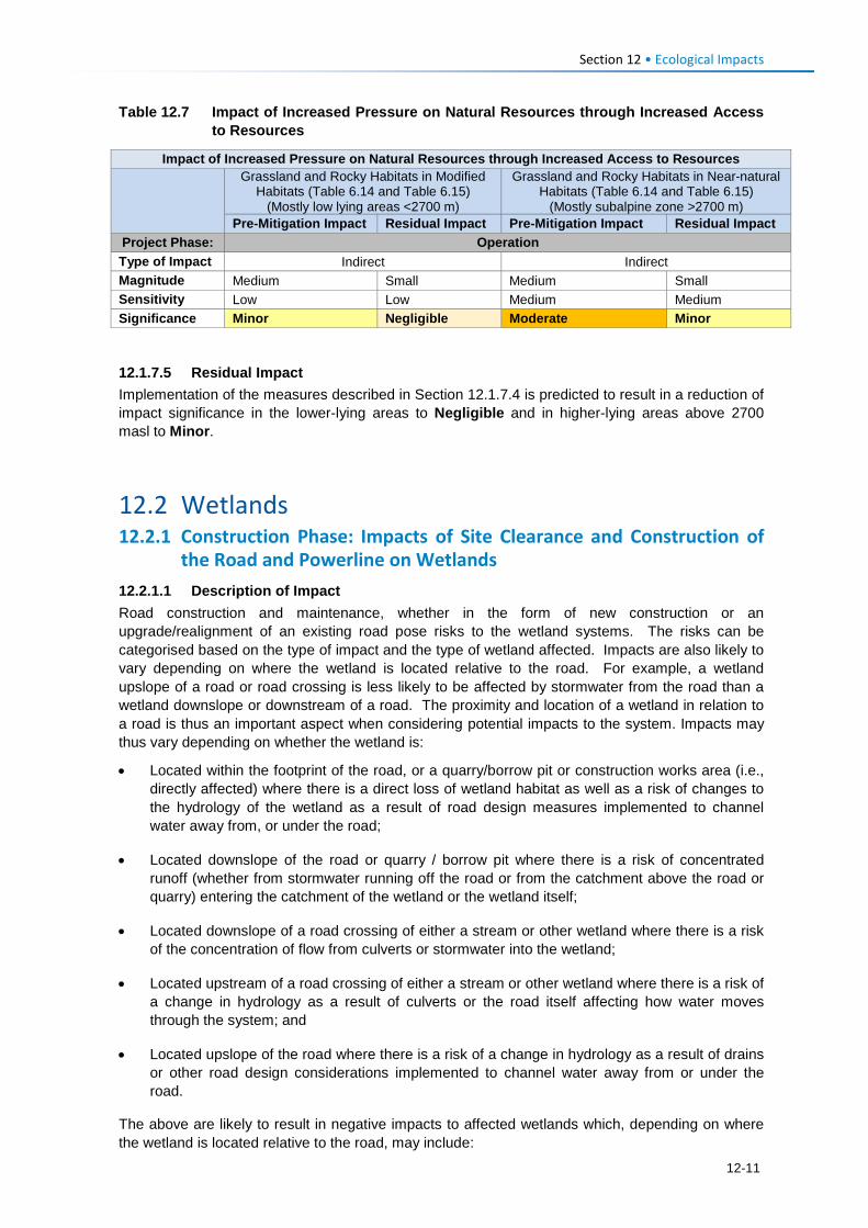
Section 12 • Ecological Impacts
Table 12.7 Impact of Increased Pressure on Natural Resources through Increased Access to Resources
Impact of Increased Pressure on Natural Resources through Increased Access to Resources
Grassland and Rocky Habitats in Modified Habitats (Table 6.14 and Table 6.15)
(Mostly low lying areas <2700 m)
Grassland and Rocky Habitats in Near-natural Habitats (Table 6.14 and Table 6.15)
(Mostly subalpine zone >2700 m) Pre-Mitigation Impact Residual Impact Pre-Mitigation Impact Residual Impact
Project Phase: Operation Type of Impact Indirect Indirect Magnitude Medium Small Medium Small Sensitivity Low Low Medium Medium Significance Minor Negligible Moderate Minor
12.1.7.5 Residual Impact Implementation of the measures described in Section 12.1.7.4 is predicted to result in a reduction of impact significance in the lower-lying areas to Negligible and in higher-lying areas above 2700 masl to Minor.
12.2 Wetlands 12.2.1 Construction Phase: Impacts of Site Clearance and Construction of
the Road and Powerline on Wetlands 12.2.1.1 Description of Impact Road construction and maintenance, whether in the form of new construction or an upgrade/realignment of an existing road pose risks to the wetland systems. The risks can be categorised based on the type of impact and the type of wetland affected. Impacts are also likely to vary depending on where the wetland is located relative to the road. For example, a wetland upslope of a road or road crossing is less likely to be affected by stormwater from the road than a wetland downslope or downstream of a road. The proximity and location of a wetland in relation to a road is thus an important aspect when considering potential impacts to the system. Impacts may thus vary depending on whether the wetland is:
• Located within the footprint of the road, or a quarry/borrow pit or construction works area (i.e., directly affected) where there is a direct loss of wetland habitat as well as a risk of changes to the hydrology of the wetland as a result of road design measures implemented to channel water away from, or under the road;
• Located downslope of the road or quarry / borrow pit where there is a risk of concentrated runoff (whether from stormwater running off the road or from the catchment above the road or quarry) entering the catchment of the wetland or the wetland itself;
• Located downslope of a road crossing of either a stream or other wetland where there is a risk of the concentration of flow from culverts or stormwater into the wetland;
• Located upstream of a road crossing of either a stream or other wetland where there is a risk of a change in hydrology as a result of culverts or the road itself affecting how water moves through the system; and
• Located upslope of the road where there is a risk of a change in hydrology as a result of drains or other road design considerations implemented to channel water away from or under the road.
The above are likely to result in negative impacts to affected wetlands which, depending on where the wetland is located relative to the road, may include:
12-11
Section 12 • Ecological Impacts
• The loss of wetland habitat and habitat fragmentation; and/or
• The concentration, interception and redirection of surface and subsurface flows, and a consequent increased risk of erosion, sedimentation, water quality deterioration and desiccation.
It is also important to note that these impacts already occur in places along the existing road, but are likely to worsen on the new road during construction and for the duration of the operational life of the road unless suitable mitigation is implemented to reduce/minimise the impacts on the wetlands.
A short description of the types of impacts on wetlands along the road alignment is provided below.
Loss of Wetland Habitat and Habitat Fragmentation
Further direct loss of wetland habitat is expected to occur with the widening of the footprint of the existing road and realignment of the road; from excavations for aggregate in or upslope of wetland systems, and from general construction traffic in close proximity to wetlands. Wetlands act as important ecological corridors. The widening of the footprint of the existing road and realignment of the road will also lead to habitat fragmentation as the road will pose an obstacle in terms of wetland habitat each side of the road. This also affects the movement of species associated with the wetlands. Blasting of quarries near wetland systems (e.g., Makhoaba Pass at kp 25) may also cause smothering of wetlands with rock material and dust.
There is also a high risk in this regard for the high altitude fens and sheetrock systems, in particular. Fens (being peatlands) generally have a very high ecological importance and sensitivity, and any impacts to these wetlands or large intact sheetrock systems are of concern.
Concentration, Interception and Redirection of Surface and Subsurface Flows, and the Consequent Increased Risk of Erosion and Sedimentation
One of the largest impacts typically associated with roads is concentration of flows. This is expected to worsen with the new road as many point source discharges of stormwater flows will be formalised with the conversion of the existing road from gravel to a hard paved surface. Where the new road crosses wetlands or even runs parallel to wetlands, flows within the wetlands (surface and sub-surface) as well as stormwater flows are likely to be conveyed underneath the road using culverts. This will lead to the concentration of naturally diffuse flows, as well as concentrated surface flows. Such concentration of flow will likely cause further erosion within the wetlands.
Erosion of gullies in wetlands, particularly in fens, causes the systems to dry out and degrade through soil loss, oxidation of peat, and the subsequent lowering of the local perched water table. This leads to changes in vegetation structure and composition. Eroded sediment will also be transported into downslope and downstream wetlands and water resources, leading to further impacts.
The crossing of the wetlands by the road will also result in the interception of sub-surface flow within the wetlands crossed and to wetland areas downslope of the road. Intercepted subsurface water is generally converted to concentrated surface water flow through the culverts conveying flows underneath the road. Sections of the affected wetlands downslope of the road are thus likely to receive reduced flows where subsurface flows are intercepted, resulting in partial desiccation of the wetland and resultant changes in plant species composition, with an increase in terrestrial species likely. In contrast, other sections of the affected wetlands downslope of the road are likely to receive increased surface flows from concentrated surface water flow through the culverts, resulting in erosion of sections of the wetland. The erosion of these sections of the wetland causes a drop in the local water table as the erosion channel acts as a drain. This further exacerbates the desiccation of the wetland and resultant changes in plant species composition and degradation of the system. These impacts extend into the operation phase and can be long-term if no mitigation is implemented.
12-12
Section 12 • Ecological Impacts
Disturbance of vegetation and soil during the construction process will further significantly increase the risk of erosion through creating areas of elevated surface flows. The compaction of soil surfaces will increase the volumes and velocities of surface runoff, further increasing erosion risk to areas downslope. Use of heavy machinery on site is also likely to result in the formation of well-worn tracks and ruts that act as preferential flow paths to surface runoff. Concentrated surface runoff will lead to erosion, with gully formation likely.
Altered runoff is also likely to arise as a result of excavation of aggregate material in certain locations where quarries or borrow pits are located upstream or close to wetland systems. This is a particular risk at the top of Makhoaba Pass near kp 25 where a quarry is proposed close to Wetland 36, a large Sheetrock system, and at kp 29 where a borrow pit is proposed which will potentially impact Wetlands 46 to 48, also Sheetrock systems.
As a consequence of the activities described above that cause erosion risks, increased sediment is likely to be transported into the downslope and adjacent wetlands. This will lead to increased turbidity within the receiving water and wetland resources, while deposited sediment may smother and degrade wetland vegetation and dependent biota.
Fens in particular require permanent saturation and are very sensitive to hydrological impacts, especially related to changes from subsurface to more surface flow inputs. Erosion in Fens poses a high risk, a consequence of which is oxidation of peat and desiccation of the associated peat habitats as a result of a dropping in the water table.
Water Quality and Other Impacts Associated with Road Construction
In addition to increased turbidity and suspended solid loads due to mobilisation of sediments during road construction and the use of hazardous materials (e.g., hydrocarbons, cement etc.) can lead to spills and/or leaks of these contaminants into streams or wetlands. Laydown areas, borrow pits, watering points, material stockpiles, temporary construction villages, support infrastructure and heavy machinery parking can also impact on wetlands if located in close proximity. However, it is assumed that these facilities will be located in degraded areas away from sensitive wetland systems, except where aggregate sources are required in specific areas.
Potential Impacts on Wetlands from Powerline Construction
Impacts to wetlands from powerline crossings are expected to be mostly limited to the construction phase and generally to occur in the short term, with the exception being where access roads cross or run alongside or near wetlands and can cause long-term degradation to these systems.
During the powerline construction phase, impacts to wetlands are typically related to the following:
• Disturbance of wetland habitat and associated biota around the pylon footprint, along access routes created to the pylon locations and within the servitude which may be disturbed through trampling or vehicle movement during stringing of pylons. Access routes and vehicular traffic to pylon locations and along the servitude (where required) can result in the formation of preferential flow paths into and through wetlands that may be intersected, leading to increased risk of erosion and sediment transport into the wetlands;
• While no pylons are currently located directly within wetlands, siting and construction of pylons in wetland hydrological support areas, can result in the obstruction and temporary diversion of flows, leading to flow concentration and increased risk of erosion in wetlands;
• Construction activities within the immediate surroundings of pylon locations or along the servitude during stringing can result in soil compaction, hampering the re-establishment of vegetation following completion of construction; and
• Water quality deterioration from increased turbidity and suspended solid loads due to mobilisation of sediments during construction, and leakage or spillage of hazardous materials (e.g., hydrocarbons, cement etc.) during construction.
12-13
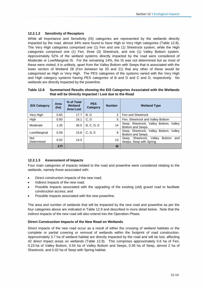
Section 12 • Ecological Impacts
12.2.1.2 Sensitivity of Receptors While all Importance and Sensitivity (IS) categories are represented by the wetlands directly impacted by the road, almost 34% were found to have High to Very High categories (Table 12.8). The Very High categories comprised one (1) Fen and one (1) Sheetrock system, while the High categories comprised one (1) Fen, three (3) Sheetrock, and one (1) Valley Bottom system. Approximately 52% of the wetland systems directly impacted by the road were considered of Moderate or Low/Marginal IS. For the remaining 14%, the IS was not determined but as most of these were visited, it is unlikely, apart from the Valley Bottom with Seeps that is associated with the lower section of Wetland 28 (Fen between kp 20 and 21) that any other of these would be categorised as High or Very High. The PES categories of the systems varied with the Very High and High category systems having PES categories of B and D and C and D, respectively. No wetlands are directly impacted by the powerline.
Table 12.8 Summarised Results showing the EIS Categories Associated with the Wetlands that will be Directly Impacted / Lost due to the Road
EIS Category Area (ha)
% of Total Wetland
Area Lost PES
Category Number Wetland Type
Very High 0.65 17.7 B, D 2 Fen and Sheetrock High 0.60 16.1 C, D 5 Fen, Sheetrock and Valley Bottom
Moderate 1.35 36.5 B, C, D, E 14 Seep, Sheetrock, Valley Bottom, Valley Bottom and Seeps
Low/Marginal 0.59 15.8 C, D, E 8 Seep, Sheetrock, Valley Bottom, Valley Bottom and Seeps
Not Determined 0.52 14.0 13 Seep, Sheetrock, Valley Bottom and
Seeps, Seep with Spring 3.71 42
12.2.1.3 Assessment of Impacts Four main categories of impacts related to the road and powerline were considered relating to the wetlands, namely those associated with:
• Direct construction impacts of the new road; • Indirect impacts of the new road; • Possible impacts associated with the upgrading of the existing (old) gravel road to facilitate
construction access; and • Possible impacts associated with the new powerline. The area and number of wetlands that will be impacted by the new road and powerline as per the four categories above are indicated in Table 12.9 and described in more detail below. Note that the indirect impacts of the new road will also extend into the Operation Phase.
Direct Construction Impacts of the New Road on Wetlands
Direct impacts of the new road occur as a result of either the crossing of wetland habitats or the complete or partial covering or removal of wetlands within the footprint of road construction. Approximately 3.7 ha of wetland habitat are directly impacted by the road and will be lost, affecting 42 direct impact areas on wetlands (Table 12.9). This comprises approximately 0.6 ha of Fen, 0.23 ha of Valley Bottom, 0.54 ha of Valley Bottom and Seeps, 0.36 ha of Seep, almost 2 ha of Sheetrock, and 0.02 ha of Seep with Spring habitat.
12-14
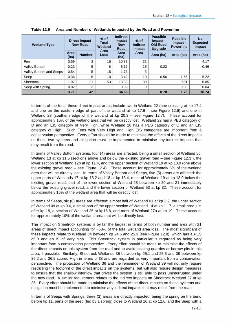
Section 12 • Ecological Impacts
Table 12.9 Area and Number of Wetlands Impacted by the Road and Powerline
Wetland Type
Direct Impact New Road
% of Total
Wetland Area Loss
Indirect Impact
New Road
% of Indirect Impact Area
Possible Impact -
Old Road Upgrade
Possible Impact -
Powerline
No Expected
Impact
Area (ha) Number Area
(ha) Area (ha) Area (ha) Area (ha)
Fen 0.59 2 16 10.83 31 4.17 Valley Bottom 0.23 5 6 5.17 15 0.22 0.46 Valley Bottom and Seeps 0.54 5 15 1.76 5 Seep 0.36 6 10 3.42 10 0.56 1.66 5.22 Sheetrock 1.97 21 53 13.39 39 0.01 0.85 Seep with Spring 0.02 3 1 0.09 0 0.08 0.04
3.71 42 34.66 0.78 1.76 10.74
In terms of the fens, these direct impact areas include two in Wetland 22 (one crossing at kp 17.4 and one on the eastern edge of part of the wetland at kp 17.6 – see Figure 12.6) and one in Wetland 28 (southern edge of the wetland at kp 20.3 – see Figure 12.7). These account for approximately 16% of the wetland area that will be directly lost. Wetland 22 has a PES category of D and an EIS category of Very High, while Wetland 28 has a PES category of C and an EIS category of High. Such Fens with Very High and High EIS categories are important from a conservation perspective. Every effort should be made to minimise the effects of the direct impacts on these two systems and mitigation must be implemented to minimise any indirect impacts that may result from the road.
In terms of Valley Bottom systems, four (4) areas are affected, being a small section of Wetland 5c, Wetland 13 at kp 11.5 (sections above and below the existing gravel road – see Figure 12.3 ), the lower section of Wetland 12b at kp 11.4, and the upper section of Wetland 19 at kp 13.9 (one above the existing gravel road – see Figure 12.4). These account for approximately 6% of the wetland area that will be directly lost. In terms of Valley Bottom and Seeps, five (5) areas are affected: the upper parts of Wetlands 17 at kp 13.2 and 18 at kp 13.4, most of Wetland 19 at kp 13.9 below the existing gravel road, part of the lower section of Wetland 28 between kp 20 and 21 immediately below the existing gravel road, and the lower section of Wetland 53 at kp 32. These account for approximately 15% of the wetland area that will be directly lost.
In terms of Seeps, six (6) areas are affected: almost half of Wetland 01 at kp 2.2, the upper section of Wetland 09 at kp 9.6, a small part of the upper section of Wetland 14 at kp 11.7, a small area just after kp 18, a section of Wetland 25 at kp18.8, and most of Wetland 27a at kp 19. These account for approximately 10% of the wetland area that will be directly lost.
The impact on Sheetrock systems is by far the largest in terms of both number and area with 21 areas of direct impact accounting for ~53% of the total wetland area loss. The most significant of these impacts relate to Wetland 34 between kp 24.6 and 25.3 (see Figure 12.8), which has a PES of B and an IS of Very high. This Sheetrock system in particular is regarded as being very important from a conservation perspective. Every effort should be made to minimise the effects of the direct impacts on this system from the road and to avoid locating quarries or borrow pits in this area, if possible. Similarly, Sheetrock Wetlands 36 between kp 25.1 and 25.6 and 39 between kp 36.2 and 36.5 scored High in terms of IS and are regarded as very important from a conservation perspective. The protection of Wetland 36 and the remainder of Wetland 39 will not only require restricting the footprint of the direct impacts on the systems, but will also require design measures to ensure that the shallow interflow that drives the system is still able to pass uninterrupted under the new road. A similar requirement relates to the indirect impacts on Sheetrock Wetland 37 at kp 36. Every effort should be made to minimise the effects of the direct impacts on these systems and mitigation must be implemented to minimise any indirect impacts that may result from the road.
In terms of Seeps with Springs, three (3) areas are directly impacted, being the spring on the bend before kp 11, parts of the seep (fed by a spring) close to Wetland 16 at kp 12.6, and the Seep with a
12-15
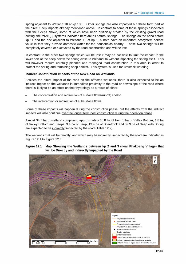
Section 12 • Ecological Impacts
spring adjacent to Wetland 18 at kp 13.5. Other springs are also impacted but these form part of the direct Seep impacts already mentioned above. In contrast to some of those springs associated with the Seeps above, some of which have been artificially created by the existing gravel road cutting, the three (3) systems indicated here are all natural springs. The springs on the bend before kp 11 and the one adjacent to Wetland 18 at kp 13.5 both have an important ecosystem service value in that they provide domestic water for the households nearby. These two springs will be completely covered or excavated by the road construction and will be lost.
In contrast to the other two springs which will be lost it may be possible to limit the impact to the lower part of the seep below the spring close to Wetland 16 without impacting the spring itself. This will however require carefully planned and managed road construction in this area in order to protect the spring and remaining seep habitat. This system is used for livestock watering.
Indirect Construction Impacts of the New Road on Wetlands
Besides the direct impact of the road on the affected wetlands, there is also expected to be an indirect impact on the wetlands in immediate proximity to the road or downslope of the road where there is likely to be an effect on their hydrology as a result of either:
• The concentration and redirection of surface flows/runoff; and/or
• The interception or redirection of subsurface flows.
Some of these impacts will happen during the construction phase, but the effects from the indirect impacts will also continue over the longer term post construction during the operation phase.
Almost 34.7 ha of wetland comprising approximately 10.8 ha of Fen, 5 ha of Valley Bottom, 1.8 ha of Valley Bottom and Seeps, 3.4 ha of Seep, 13.4 ha of Sheetrock and 0.09 ha of Seep with Spring are expected to be indirectly impacted by the road (Table 12.9).
The wetlands that will be directly, and which may be indirectly, impacted by the road are indicated in Figure 12.1 to Figure 12.8.
Figure 12.1 Map Showing the Wetlands between kp 2 and 3 (near Phakoeng Village) that will be Directly and Indirectly Impacted by the Road
12-16
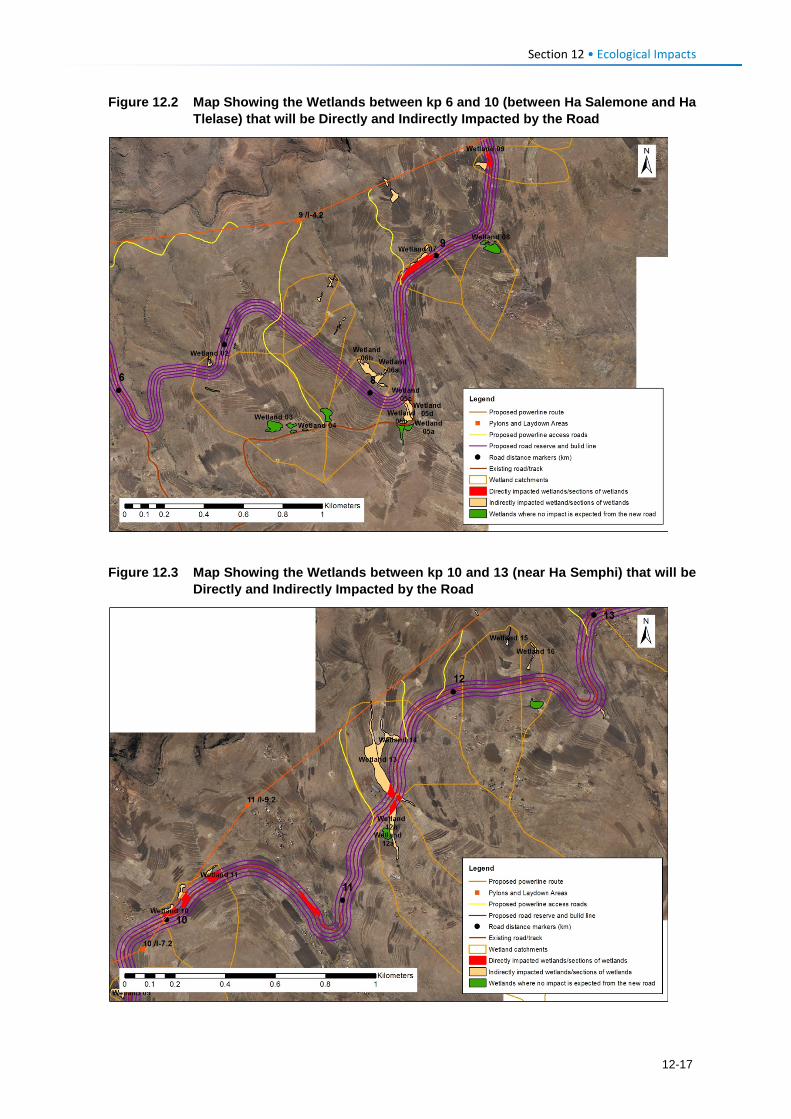
Section 12 • Ecological Impacts
Figure 12.2 Map Showing the Wetlands between kp 6 and 10 (between Ha Salemone and Ha Tlelase) that will be Directly and Indirectly Impacted by the Road
Figure 12.3 Map Showing the Wetlands between kp 10 and 13 (near Ha Semphi) that will be
Directly and Indirectly Impacted by the Road
12-17
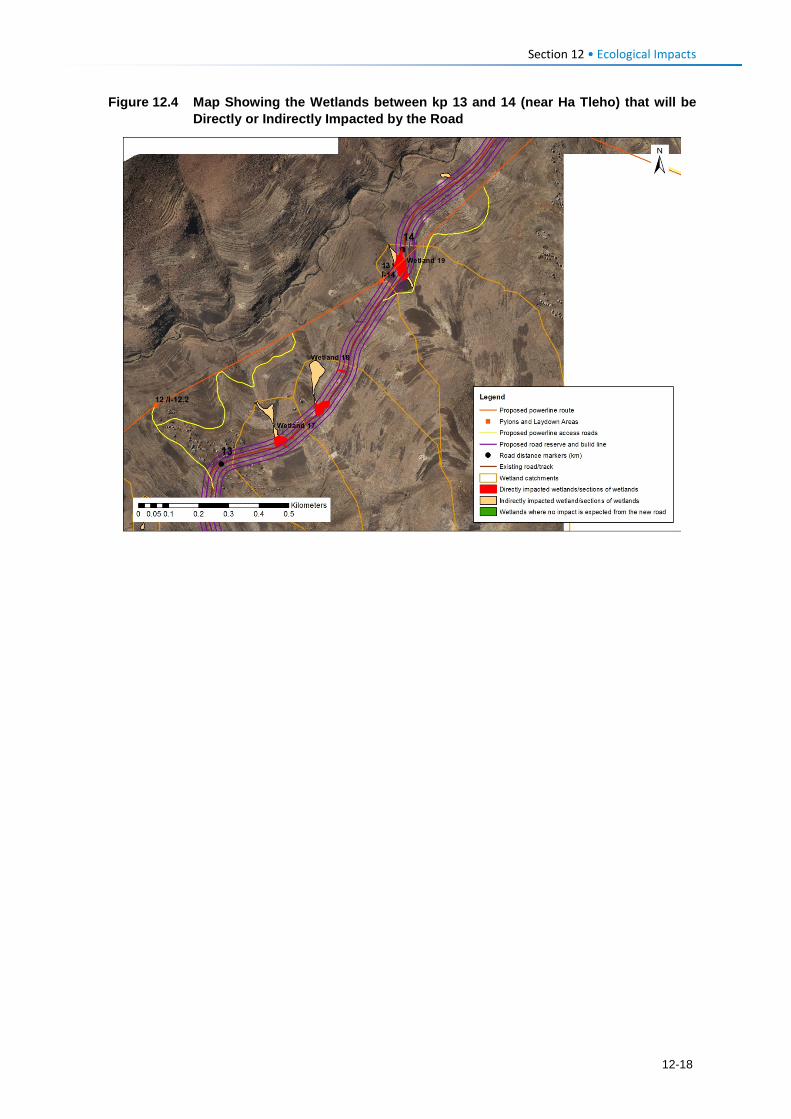
Section 12 • Ecological Impacts
Figure 12.4 Map Showing the Wetlands between kp 13 and 14 (near Ha Tleho) that will be Directly or Indirectly Impacted by the Road
12-18
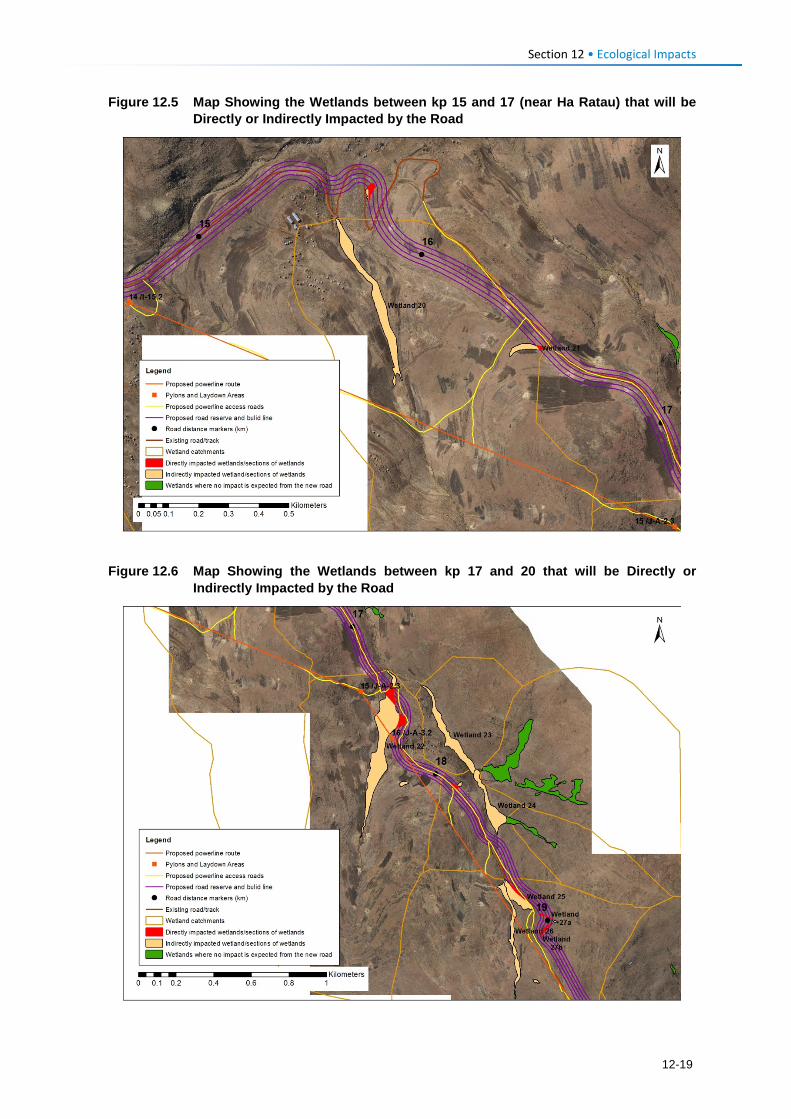
Section 12 • Ecological Impacts
Figure 12.5 Map Showing the Wetlands between kp 15 and 17 (near Ha Ratau) that will be Directly or Indirectly Impacted by the Road
Figure 12.6 Map Showing the Wetlands between kp 17 and 20 that will be Directly or
Indirectly Impacted by the Road
12-19
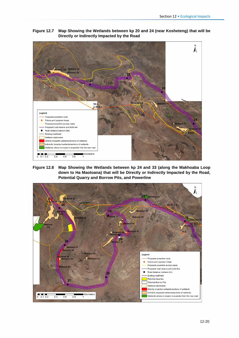
Section 12 • Ecological Impacts
Figure 12.7 Map Showing the Wetlands between kp 20 and 24 (near Kosheteng) that will be Directly or Indirectly Impacted by the Road
Figure 12.8 Map Showing the Wetlands between kp 24 and 33 (along the Makhoaba Loop down to Ha Maotoana) that will be Directly or Indirectly Impacted by the Road, Potential Quarry and Borrow Pits, and Powerline
12-20
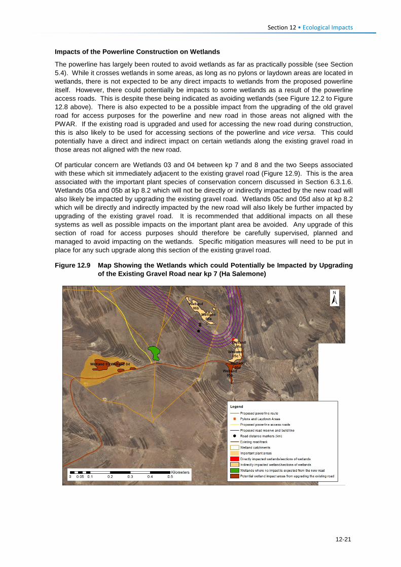
Section 12 • Ecological Impacts
Impacts of the Powerline Construction on Wetlands
The powerline has largely been routed to avoid wetlands as far as practically possible (see Section 5.4). While it crosses wetlands in some areas, as long as no pylons or laydown areas are located in wetlands, there is not expected to be any direct impacts to wetlands from the proposed powerline itself. However, there could potentially be impacts to some wetlands as a result of the powerline access roads. This is despite these being indicated as avoiding wetlands (see Figure 12.2 to Figure 12.8 above). There is also expected to be a possible impact from the upgrading of the old gravel road for access purposes for the powerline and new road in those areas not aligned with the PWAR. If the existing road is upgraded and used for accessing the new road during construction, this is also likely to be used for accessing sections of the powerline and vice versa. This could potentially have a direct and indirect impact on certain wetlands along the existing gravel road in those areas not aligned with the new road.
Of particular concern are Wetlands 03 and 04 between kp 7 and 8 and the two Seeps associated with these which sit immediately adjacent to the existing gravel road (Figure 12.9). This is the area associated with the important plant species of conservation concern discussed in Section 6.3.1.6. Wetlands 05a and 05b at kp 8.2 which will not be directly or indirectly impacted by the new road will also likely be impacted by upgrading the existing gravel road. Wetlands 05c and 05d also at kp 8.2 which will be directly and indirectly impacted by the new road will also likely be further impacted by upgrading of the existing gravel road. It is recommended that additional impacts on all these systems as well as possible impacts on the important plant area be avoided. Any upgrade of this section of road for access purposes should therefore be carefully supervised, planned and managed to avoid impacting on the wetlands. Specific mitigation measures will need to be put in place for any such upgrade along this section of the existing gravel road.
Figure 12.9 Map Showing the Wetlands which could Potentially be Impacted by Upgrading of the Existing Gravel Road near kp 7 (Ha Salemone)
12-21
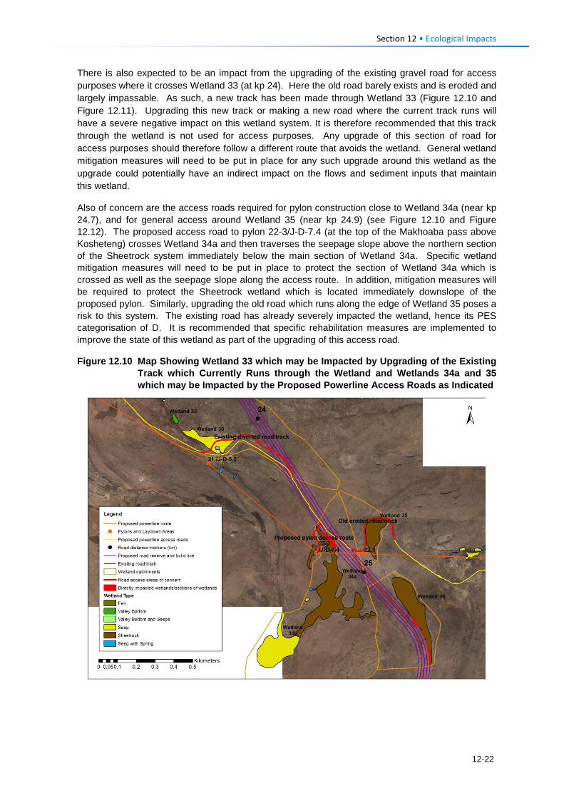
Section 12 • Ecological Impacts
There is also expected to be an impact from the upgrading of the existing gravel road for access purposes where it crosses Wetland 33 (at kp 24). Here the old road barely exists and is eroded and largely impassable. As such, a new track has been made through Wetland 33 (Figure 12.10 and Figure 12.11). Upgrading this new track or making a new road where the current track runs will have a severe negative impact on this wetland system. It is therefore recommended that this track through the wetland is not used for access purposes. Any upgrade of this section of road for access purposes should therefore follow a different route that avoids the wetland. General wetland mitigation measures will need to be put in place for any such upgrade around this wetland as the upgrade could potentially have an indirect impact on the flows and sediment inputs that maintain this wetland.
Also of concern are the access roads required for pylon construction close to Wetland 34a (near kp 24.7), and for general access around Wetland 35 (near kp 24.9) (see Figure 12.10 and Figure 12.12). The proposed access road to pylon 22-3/J-D-7.4 (at the top of the Makhoaba pass above Kosheteng) crosses Wetland 34a and then traverses the seepage slope above the northern section of the Sheetrock system immediately below the main section of Wetland 34a. Specific wetland mitigation measures will need to be put in place to protect the section of Wetland 34a which is crossed as well as the seepage slope along the access route. In addition, mitigation measures will be required to protect the Sheetrock wetland which is located immediately downslope of the proposed pylon. Similarly, upgrading the old road which runs along the edge of Wetland 35 poses a risk to this system. The existing road has already severely impacted the wetland, hence its PES categorisation of D. It is recommended that specific rehabilitation measures are implemented to improve the state of this wetland as part of the upgrading of this access road.
Figure 12.10 Map Showing Wetland 33 which may be Impacted by Upgrading of the Existing Track which Currently Runs through the Wetland and Wetlands 34a and 35 which may be Impacted by the Proposed Powerline Access Roads as Indicated
12-22
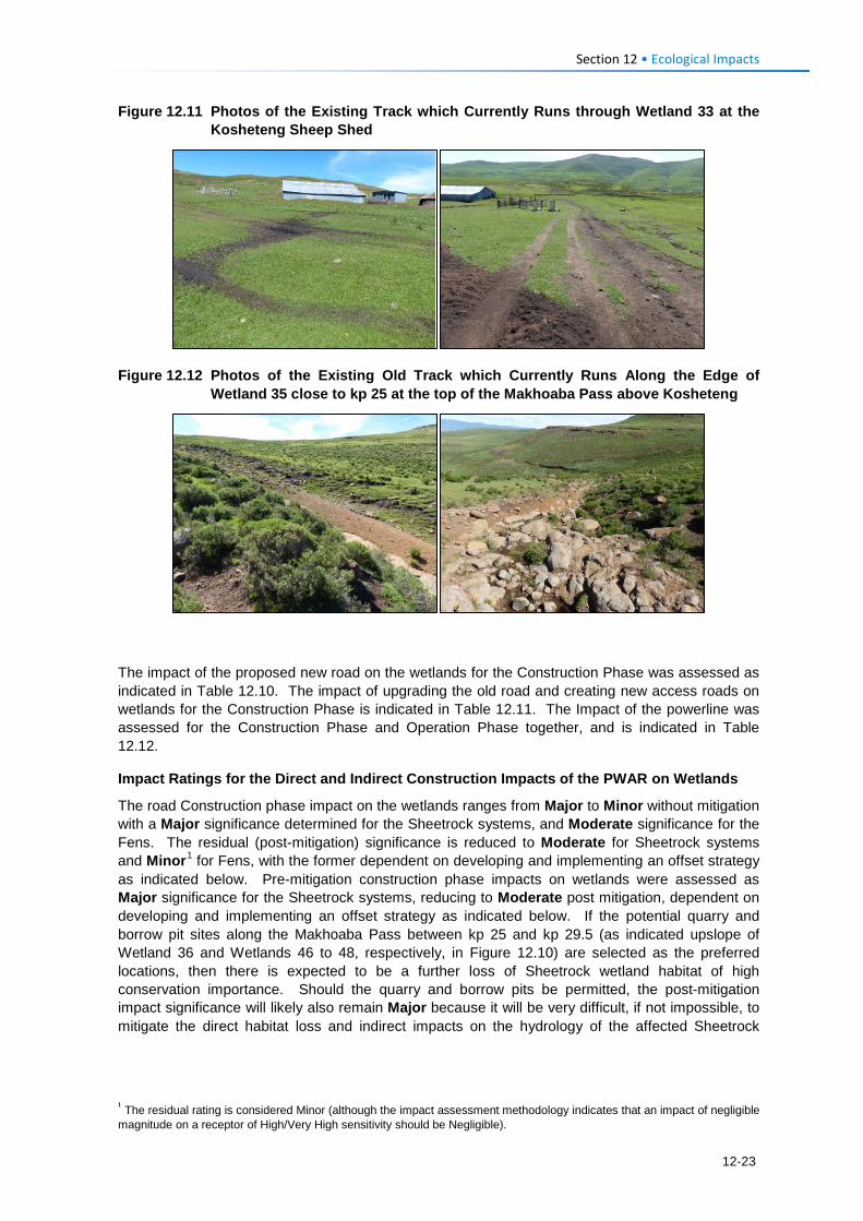
Section 12 • Ecological Impacts
Figure 12.11 Photos of the Existing Track which Currently Runs through Wetland 33 at the Kosheteng Sheep Shed
Figure 12.12 Photos of the Existing Old Track which Currently Runs Along the Edge of Wetland 35 close to kp 25 at the top of the Makhoaba Pass above Kosheteng
The impact of the proposed new road on the wetlands for the Construction Phase was assessed as indicated in Table 12.10. The impact of upgrading the old road and creating new access roads on wetlands for the Construction Phase is indicated in Table 12.11. The Impact of the powerline was assessed for the Construction Phase and Operation Phase together, and is indicated in Table 12.12.
Impact Ratings for the Direct and Indirect Construction Impacts of the PWAR on Wetlands
The road Construction phase impact on the wetlands ranges from Major to Minor without mitigation with a Major significance determined for the Sheetrock systems, and Moderate significance for the Fens. The residual (post-mitigation) significance is reduced to Moderate for Sheetrock systems and Minor1 for Fens, with the former dependent on developing and implementing an offset strategy as indicated below. Pre-mitigation construction phase impacts on wetlands were assessed as Major significance for the Sheetrock systems, reducing to Moderate post mitigation, dependent on developing and implementing an offset strategy as indicated below. If the potential quarry and borrow pit sites along the Makhoaba Pass between kp 25 and kp 29.5 (as indicated upslope of Wetland 36 and Wetlands 46 to 48, respectively, in Figure 12.10) are selected as the preferred locations, then there is expected to be a further loss of Sheetrock wetland habitat of high conservation importance. Should the quarry and borrow pits be permitted, the post-mitigation impact significance will likely also remain Major because it will be very difficult, if not impossible, to mitigate the direct habitat loss and indirect impacts on the hydrology of the affected Sheetrock
1 The residual rating is considered Minor (although the impact assessment methodology indicates that an impact of negligible magnitude on a receptor of High/Very High sensitivity should be Negligible).
12-23
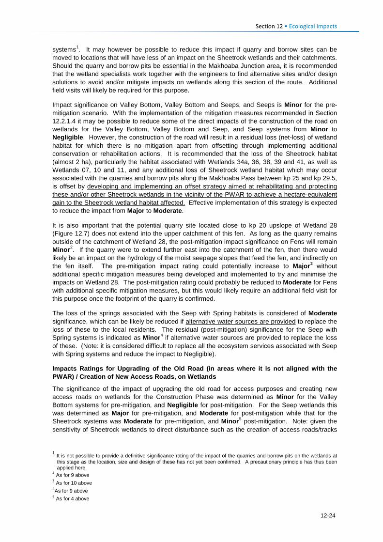
Section 12 • Ecological Impacts
systems1. It may however be possible to reduce this impact if quarry and borrow sites can be moved to locations that will have less of an impact on the Sheetrock wetlands and their catchments. Should the quarry and borrow pits be essential in the Makhoaba Junction area, it is recommended that the wetland specialists work together with the engineers to find alternative sites and/or design solutions to avoid and/or mitigate impacts on wetlands along this section of the route. Additional field visits will likely be required for this purpose.
Impact significance on Valley Bottom, Valley Bottom and Seeps, and Seeps is Minor for the pre-mitigation scenario. With the implementation of the mitigation measures recommended in Section 12.2.1.4 it may be possible to reduce some of the direct impacts of the construction of the road on wetlands for the Valley Bottom, Valley Bottom and Seep, and Seep systems from Minor to Negligible. However, the construction of the road will result in a residual loss (net-loss) of wetland habitat for which there is no mitigation apart from offsetting through implementing additional conservation or rehabilitation actions. It is recommended that the loss of the Sheetrock habitat (almost 2 ha), particularly the habitat associated with Wetlands 34a, 36, 38, 39 and 41, as well as Wetlands 07, 10 and 11, and any additional loss of Sheetrock wetland habitat which may occur associated with the quarries and borrow pits along the Makhoaba Pass between kp 25 and kp 29.5, is offset by developing and implementing an offset strategy aimed at rehabilitating and protecting these and/or other Sheetrock wetlands in the vicinity of the PWAR to achieve a hectare-equivalent gain to the Sheetrock wetland habitat affected. Effective implementation of this strategy is expected to reduce the impact from Major to Moderate.
It is also important that the potential quarry site located close to kp 20 upslope of Wetland 28 (Figure 12.7) does not extend into the upper catchment of this fen. As long as the quarry remains outside of the catchment of Wetland 28, the post-mitigation impact significance on Fens will remain Minor2. If the quarry were to extend further east into the catchment of the fen, then there would likely be an impact on the hydrology of the moist seepage slopes that feed the fen, and indirectly on the fen itself. The pre-mitigation impact rating could potentially increase to Major3 without additional specific mitigation measures being developed and implemented to try and minimise the impacts on Wetland 28. The post-mitigation rating could probably be reduced to Moderate for Fens with additional specific mitigation measures, but this would likely require an additional field visit for this purpose once the footprint of the quarry is confirmed.
The loss of the springs associated with the Seep with Spring habitats is considered of Moderate significance, which can be likely be reduced if alternative water sources are provided to replace the loss of these to the local residents. The residual (post-mitigation) significance for the Seep with Spring systems is indicated as Minor4 if alternative water sources are provided to replace the loss of these. (Note: it is considered difficult to replace all the ecosystem services associated with Seep with Spring systems and reduce the impact to Negligible).
Impacts Ratings for Upgrading of the Old Road (in areas where it is not aligned with the PWAR) / Creation of New Access Roads, on Wetlands
The significance of the impact of upgrading the old road for access purposes and creating new access roads on wetlands for the Construction Phase was determined as Minor for the Valley Bottom systems for pre-mitigation, and Negligible for post-mitigation. For the Seep wetlands this was determined as Major for pre-mitigation, and Moderate for post-mitigation while that for the Sheetrock systems was Moderate for pre-mitigation, and Minor5 post-mitigation. Note: given the sensitivity of Sheetrock wetlands to direct disturbance such as the creation of access roads/tracks
1 It is not possible to provide a definitive significance rating of the impact of the quarries and borrow pits on the wetlands at this stage as the location, size and design of these has not yet been confirmed. A precautionary principle has thus been applied here.
2 As for 9 above 3 As for 10 above 4As for 9 above 5 As for 4 above
12-24
Section 12 • Ecological Impacts
over them (which will impact on the shallow organic soils and may impact on sensitive habitat), it will be difficult with mitigation to reduce the significance of the impact to Negligible where there are direct access road/track impacts on these systems.
In order to bring down the significance for the affected wetland systems, it will be important that the specific mitigation measures, as indicated in Section 12.2.1.4 for each of the areas where impacts are expected to occur, is implemented. It will be essential that upgrading of the old road does not impact on the important plant area associated with Wetlands 03 and 04, avoids crossing Wetland 33, and is carefully planned and routed for the crossing of Wetland 34a and along the edge of Wetland 35.
Impacts Ratings of Powerline Construction and Operation on Wetlands
The powerline has largely been routed to avoid wetlands as far as practically possible and while it crosses wetlands in some areas, as long as no pylons or laydown areas are located in wetlands, there is not expected to be any direct impacts to wetlands. As already mentioned above, there are expected to be impacts to some wetlands as a result of the creation of powerline access roads. There is also expected to be a possible impact from the upgrading of the old gravel road for access purposes for the powerline in those areas not aligned with the new road.
The Impact of the powerline for both the Construction and Operation Phases therefore ranges from Moderate to Negligible in the absence of mitigation, and is indicated as Negligible post-mitigation for most wetland types except Seep and Sheetrock systems which are rated as Minor1 significance after mitigation. Given the sensitivity of Seep and Sheetrock wetlands to direct disturbance, such as the creation of access roads/tracks over them (which will impact on the shallow organic soils and may impact on sensitive habitat), it is unlikely that the magnitude of this impact can be reduced to Negligible post-mitigation.
As indicated above, in order to bring down the significance of these impacts for the Seep and Sheetrock systems from Moderate to Minor, it will be important that the specific mitigation measures, as indicated in Section 12.2.1.4 for each of the areas where impacts are expected to occur, be implemented.
12.2.1.4 Mitigation Measures Road Construction Mitigation for Wetlands
Direct impacts of the new road on wetlands within the road footprint cannot be mitigated and the affected sections of the wetlands will be lost. However, other mitigation to minimise the extent of further wetland loss include:
• Construction activities should be carefully supervised and controlled in areas where the road crosses or is aligned close to wetlands;
• Clearly demarcate the boundary of the minimum and necessary width for construction works, and prevent encroachment into wetland areas beyond this defined boundary. Any requirement to intrude on adjacent areas must be specifically authorised by the EM on the advice of the ECO or wetland specialist. In addition, it is also important to clearly demarcate the edge/boundary of the wetlands in areas where the road servitude or build line extends close to wetlands especially closest to the road edge to prevent/limit disturbance of these wetlands during construction. This should be done with the assistance of a wetland specialist; and
• No borrow pits or quarries should be allowed in or near wetlands or which could affect flow into these wetlands. It is further recommended that any new sites for borrow pits, and even re-use of existing sites along the route, are investigated and reviewed by the wetland specialist prior to finalisation of their location, size, design and use.
1 As for 4 above
12-25
Section 12 • Ecological Impacts
For wetland crossings including areas where the road crossing runs perpendicular or parallel to wetlands, the road design and stormwater management should ensure that:
There is no concentration of flow downslope of the crossing or road. Stormwater design and management over the sections of road indicated in the EMP (Volume 2, Appendix C) (i.e., the Wetland Figures 6.1-6.14 of the wetland report) must include measures to prevent the concentrated discharge of surface runoff from the road surface, or from pipes or culverts under the road, into the wetlands. The design should also be such that it minimises flow velocities across the width of the wetland crossings;
• The design should include ways to ensure that both sub-surface and surface flows are spread laterally under the road across the full width of the crossing so that the flows are as diffuse as possible and that the wetlands will still receive wetting across the original entire wetness front.
• Road design allows interflow (sub-surface seepage) to pass under the road so as to maintain the wetlands, and in cases where there are water points or springs, to maintain the water supply to these as well (specifically for sections shown in Figure 6.1-6.14 of EMP (Volume 2).
• Any culvert discharge points are suitably protected against erosion and measures should be put in place to protect the outlets and spread surface flow. Culverts should avoid high velocity discharges, and flows under regular return events should ideally not differ significantly from natural flows within the wetland. Energy dissipaters should include rock packed mattresses radiating out from the culverts at 45 degrees. Innovative design measures will be required to disperse sub-surface flow across the seep fronts at the road crossings and it is recommended that detailed method statements are developed together with a wetland specialist for the purpose of achieving this. The design engineers and environmental team will need to work closely to achieve this;
• Protection measures for the springs located within the build line are implemented by restricting the construction footprint to the road servitude only, and by allowing the sub-surface flows that supply the springs to move under the road;
• For the Sheetrock systems directly impacted, including the system located between kp 15.67 and 15.76, botanical assessments are undertaken and if deemed necessary by the botanical specialist, a plant recovery programme is undertaken prior to the start of construction of the road;
• No construction activities, laydown areas, borrow pits or any other related disturbance be allowed in any of the areas indicated as Important Plant Areas (the areas around Wetlands 03 and 04 between kp 7 and 8 and around Wetlands 34 to 48 between kp 24 kp 30) including the moist grassland slopes and flats that lie adjacent to these important wetlands. It is important in these areas to prevent disturbance of the remaining wetland habitats, and erosion and sedimentation must be prevented during all phases of the construction and maintenance of the road across these sections;
• Sediment protection measures are implemented at all wetland and stream crossings during construction (such as the use and placement of hay bales along the edge of the systems immediately below the construction disturbance fronts);
• The road verges are landscaped following the completion of construction activities to ensure that no preferential flow paths exist that might lead to the concentration of flows. Where such areas are encountered, the installation of regular low level grassed swales to slow down flows should be considered;
• Any wetland areas disturbed during construction are rehabilitated to a suitable level that must be approved by a wetland specialist;
• No subsoil material is left on the surface of wetlands or the slopes adjacent to the wetlands following completion of construction activities. Remaining subsoil material is to be removed out of all the wetland areas.
12-26
Section 12 • Ecological Impacts
• Surface flow runoff protection measures to prevent erosion of the wetlands immediately below the road crossings. This should include the implementation of rehabilitation measures such as gabions to stabilise headcuts in wetlands immediately below the road crossings.
• A follow-up focused botanical survey of key sections of the PWAR alignment and quarry and borrow pit sites must be undertaken once the route is demarcated to confirm the presence of additional threatened or conservation important plant species.
General Measures for Mitigating Impacts on Wetlands Associated with the Powerline
The following general mitigation measures apply to impacts on wetlands associated with the powerline and pylon construction phases:
• Prior to the commencement of any activities on site, the required disturbance footprint and construction servitude should be clearly demarcated on a site plan and in the field (e.g., using stakes and marking tape) and all activities should be located within the demarcated area;
• Wetland habitat in close proximity to pylon locations should be clearly demarcated prior to the commencement of construction activities;
• Existing access routes and disturbed areas should be utilised as far as possible to access pylon locations. Where no existing tracks are available, a single access track to each pylon location should be used;
• No driving through wetland/stream channels should be allowed unless existing crossings are utilised;
• Access tracks through wetland areas should ideally run parallel to the contour to limit the formation of preferential flow paths that could lead to erosion. Accessing pylon locations along routes perpendicular to the contour should be avoided, unless along existing tracks.
• Surface runoff along the access routes must not lead to erosion. Where ruts have formed and remain following completion of construction activities, these should be plugged with regular shallow soil berms to prevent preferential flow paths forming along the vehicle ruts and vegetation cover re-established as soon as possible;
• Vegetation clearing around pylon locations must be kept to the absolute minimum servitude required for construction;
• No vegetation clearing should take place under the powerline unless absolutely required for the safe operation of the powerline. Where such activities are required, they must be reviewed by a suitably qualified environmental specialist prior to the activity taking place and suitable mitigation must be implemented to minimise any negative impacts related to such activities. Similarly, if any such activities are required in close proximity to, or within a wetland, they must be reviewed by a suitably qualified wetland specialist prior to the activity taking place and suitable mitigation must be implemented to minimise any negative impacts related to such activities. Vegetation clearing should be limited to the mowing of vegetation or trimming of trees where required;
• Where appropriate, certain alien invasive tree species such as wattle should be removed from the powerline servitude, with follow-up treatment/clearing to ensure clearing is successful;
• On completion of construction at each pylon, the site should be left clean and free from all debris, hydrocarbons and waste, and all excavations filled appropriately;
• All excavations on site must be fully backfilled. Soil material is to be replaced in excavation in the correct order, i.e., material excavated from the bottom of the excavation must be placed at the bottom and topsoil must be placed on surface. No subsoil is to be placed on the surface; and
• All disturbance footprints associated with the pylon footings and access roads on site must be fully rehabilitated following decommissioning. This should include removal of all waste and
12-27
Section 12 • Ecological Impacts
contaminated material from site. Soil compaction must be alleviated and the footprint landscaped to the surrounding landscape profile, and re-vegetated or reseeded with locally occurring indigenous grass species.
It is further recommended that a follow-up focused botanical survey of the proposed powerline access tracks be undertaken once the routes are demarcated to confirm the presence of additional threatened or conservation important plant species or wetland systems.
General Measures for Mitigating Impacts on Wetlands Associated with Construction Camps and Laydown Areas
Mitigation measures specific to construction camps and laydown areas include the following:
• All construction camps should be located outside wetland areas and a minimum distance of 100 m from the edge of any wetland areas, ideally on previously disturbed areas. Where possible, strips or portions of grass cover should be maintained within and around the construction camp/camps to assist with recovery post-construction.
• A stormwater management plan which incorporates sediment controls should be developed and implemented for construction camps and laydown areas. Stormwater is to be discharged in an environmentally sensitive manner, ideally into a well-vegetated terrestrial area and not directly into a drainage line or wetland;
• All potential contaminants and hazardous substances (e.g., hydrocarbons, cement, waste collection and storage areas etc.) should be located on bunded areas to capture spills and leaks. This should include bunding of vehicles, equipment or machinery where required to be located close to watercourses, springs or wetlands to avoid contamination; and
• The construction camp footprint must be rehabilitated following completion of construction activities. All waste and contaminated material must be removed from site, soil compaction must be alleviated and the footprint re-vegetated with locally occurring indigenous grass species.
Specific Measures for Mitigating Impacts on Wetlands Associated with the Upgrading of the Old Road and for Creating New Access Roads
Mitigation measures for upgrading of the old road and creating new access roads for the construction phase shall ensure that:
• Upgrading of the old road does not impact on the important plant area associated with Wetlands 03 and 04 between kp 7 and 8, avoids crossing Wetland 33 at kp 24, and is carefully planned and routed for the crossing of Wetland 34a at kp 24.7 and along the edge of Wetland 35 at kp 24.9.
• The Contractors are made aware of the important plant area around Wetlands 03 and 04 between kp 7 and 8 and that the area is clearly demarcated and avoided. Any upgrade of the old road for access purposes in these areas should not extend outside of the footprint of the existing gravel road. Sediment barriers should be erected along the downslope edge of the upgraded section where it traverses the important plant area;
• The upgrade must also ensure that there are no point discharges of stormwater or surface flow into the seeps which abut the road, or down the slopes into Wetlands 03 and 04. The whole slope across this section should be protected from stormwater and point source discharges of surface flow from the road;
• This upgrade should be monitored throughout the construction phase by the Environmental Control Officer (ECO) to make sure that there are no direct or indirect impacts to the Seep wetlands and that slopes and the area in general is protected;
• The plants on these slopes must be protected and the Contractor must ensure that there is no collecting or disturbance of any plant material from this area; and
• The road across this section should be rehabilitated to an acceptable environmental standard following construction of the relevant pylon and powerline section that the road services.
12-28
Section 12 • Ecological Impacts
Powerline access roads to Pylons 22.1 and 22.3:
• New access roads for powerline construction in the vicinity of pylons 22.1 and 22.3 must not impact on important Sheetrock wetland systems in this area. The access road alignment to the pylon at 22-3/J-D-7.4 should be advised by a wetland specialist and on-site mitigation measures should be developed in consultation with the ECO responsible for this aspect of the project; The access route should be walked and marked prior to being cleared;
• Pylon footprint and turning area for vehicles as well as any working areas must be clearly demarcated so as to prevent disturbance outside of these areas. All no-go areas must also be clearly demarcated and made known to Contractors;
• No vehicles, equipment, or materials should be allowed outside of the demarcated areas and once construction is completed, the access road, vehicle turning area as well as any working areas must be suitably rehabilitated to a level acceptable to the wetland specialist.
Similar recommendations apply to the upgrading of the access road around Wetland 35. On-site mitigation measures will need to be developed in consultation with the ECO and the Contractor, and as part of the mitigation, the deep gully that has formed along the old road around Wetland 35 must be rehabilitated to an acceptable environmental standard following construction of the powerline.
12.2.1.5 Residual/Post Mitigation Impact To reduce the significance of the PWAR construction impact on the Sheetrock systems (loss of almost 2 ha), particularly associated with Wetlands 34a, 36, 38, 39, 40 and 41 (between kp 24.6 and 26.5) as well as Wetlands 07, 10 and 11 (between kp 8.5 and 11), from Major to Moderate, it is recommended that a wetland offset strategy is developed and implemented for the Sheetrock wetlands. This should include developing and implementing a strategy aimed at rehabilitating and protecting these and/or other Sheetrock wetlands in the vicinity of the PWAR to achieve no net loss of these wetlands. This should be based on a hectare-equivalent gain at least equal to the hectare-equivalents of Sheetrock wetland habitat being lost.
To reduce the significance of the impact related to the Seep with Spring systems, alternative water sources must be provided to the local residents to replace the loss of the springs associated with these systems.
In order to reduce the significance of the impacts associated with access roads including the upgrading of the old road where it is not aligned with the PWAR and the creation of new access roads for the powerline construction, it is important that the specific mitigation measures, as indicated in Section 12.2.1.4 for each of the areas where impacts are expected to occur, is implemented. It will be essential that upgrading the old road does not impact on the important plant area associated with Wetlands 03 and 04, avoids crossing Wetland 33, and is carefully planned and routed for the crossing of Wetland 34a and along the edge of Wetland 35.
For all other impacts related to the wetlands that will be directly or indirectly impacted by the construction of the PWAR and powerline, it is recommended that the mitigation and monitoring as recommended in Section 12.2.1.4 are implemented.
12.2.2 Operation Phase: Impacts of Road and Powerline Maintenance on Wetlands
12.2.2.1 Description of Impact During operation of the road, wetlands located within the road footprint or downslope of the road may still be at risk from the concentration of flow from culverts or stormwater or from changes in hydrology as a result of drains or other road design considerations implemented to channel water away from or under the road. The long-term interception and redirection of surface and subsurface flows may result in the further loss of wetland habitat and habitat fragmentation over time. Similarly, erosion or sedimentation caused by changes in hydrology as a result of the road may also result in the further loss of wetland habitat over time.
12-29
Section 12 • Ecological Impacts
The lack of general road maintenance including of culverts and stormwater discharge structures, might also pose a long-term risk to the wetlands along and below the road. In addition, hydrocarbon spills and leaks from vehicles are also likely pose a water quality risk to the wetlands and associated streams over time.
12.2.2.2 Sensitivity of Receptors The IS categories represented by the wetlands that will be indirectly impacted by the road range from Very High to Low/Marginal. The PES categories also range from B to E. The individual wetland descriptions are contained in Appendix A, and the PES and IS tables in Appendices C and D, respectively, of the Wetland report in Volume 4, Annex F.
12.2.2.3 Assessment of Impacts and Significance Ratings As already discussed above in Section 12.2.1.3, almost 34.7 ha of wetland comprising ~10.8 ha of Fen, ~5 ha of Valley Bottom, ~1.8 ha of Valley Bottom and Seeps, ~3.4 ha of Seep, ~13.4 ha of Sheetrock and ~0.09 ha of Seep with Spring are expected to be indirectly impacted by the road (Table 12.9). Without suitable mitigation to prevent indirect impacts on these systems there is expected to be further loss of wetland habitat and habitat fragmentation in these systems over time.
The impact of the proposed new road on the wetlands for the Operation Phase was assessed as indicated in Table 12.13. The indirect impact of the road on the wetlands during the Operation Phase ranges from Major to Minor without the mitigation measures recommended to be implemented during the Construction Phase. A Major significance was determined for the Fens and Sheetrock systems, while that for Valley Bottom, Valley Bottom and Seeps and Seeps was determined as Moderate for the pre-mitigation scenario. For the Fen and Sheetrock systems this could be reduced to Moderate with mitigation, while for the Valley Bottom, Valley Bottom and Seeps and Seeps, this could be reduced to Minor with mitigation. For Seep with Spring systems the pre-mitigation significance was determined as Minor and for post-mitigation as Negligible.
Powerline-related impacts to wetlands during the Operation phase are associated with maintenance activities for the powerline and access roads. These are expected to be largely limited to vegetation management activities under the powerline (e.g., should any trees have to be cut) and at the pylons. However, given the extent of grazing in the area and the relatively low vegetation cover in places, this is likely to be limited.
To achieve the predicted residual impact significance ratings, it is essential that the mitigation measures indicated in Section 12.2.1.4, and relevant specific mitigation measures referred to in the EMP (Volume 2) for individual wetlands are implemented for both the road and powerline.
12.2.2.4 Residual/Post Mitigation Impact With the implementation of mitigation, it would be expected that the further loss of wetland habitat as a result of the road would be kept to a minimum. In order to achieve the lower significance throughout it is essential that the general mitigation measures as indicated in Section 12.2.1.4 are implemented. However, if additional wetland areas were to be lost as a result of the indirect impacts from the road, then there would be an additional residual impact. Under this scenario, it would be recommended that an offset strategy focusing on rehabilitation to gain back any hectare equivalent losses of wetland habitat is developed and implemented for any additional losses expected or measured following monitoring.
12-30
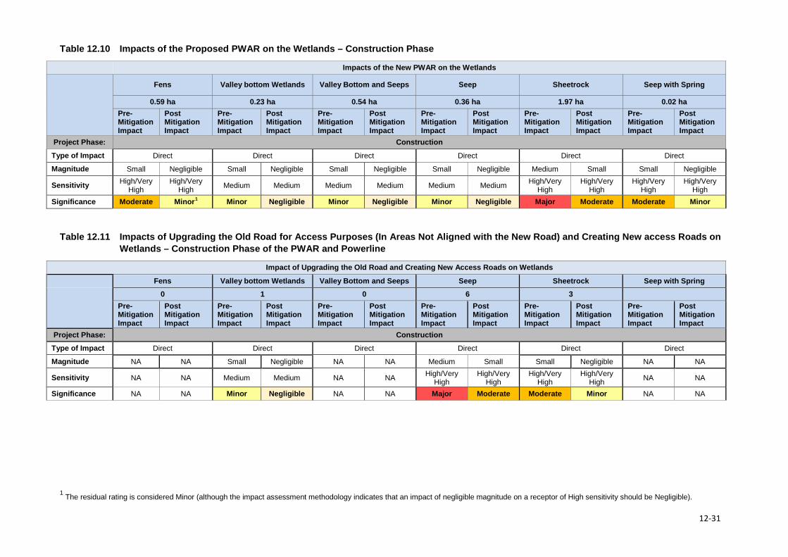
Table 12.10 Impacts of the Proposed PWAR on the Wetlands – Construction Phase
Impacts of the New PWAR on the Wetlands
Fens Valley bottom Wetlands Valley Bottom and Seeps Seep Sheetrock Seep with Spring
0.59 ha 0.23 ha 0.54 ha 0.36 ha 1.97 ha 0.02 ha Pre-Mitigation Impact
Post Mitigation Impact
Pre-Mitigation Impact
Post Mitigation Impact
Pre-Mitigation Impact
Post Mitigation Impact
Pre-Mitigation Impact
Post Mitigation Impact
Pre-Mitigation Impact
Post Mitigation Impact
Pre-Mitigation Impact
Post Mitigation Impact
Project Phase: Construction
Type of Impact Direct Direct Direct Direct Direct Direct
Magnitude Small Negligible Small Negligible Small Negligible Small Negligible Medium Small Small Negligible
Sensitivity High/Very High
High/Very High Medium Medium Medium Medium Medium Medium High/Very
High High/Very
High High/Very
High High/Very
High Significance Moderate Minor1 Minor Negligible Minor Negligible Minor Negligible Major Moderate Moderate Minor
Table 12.11 Impacts of Upgrading the Old Road for Access Purposes (In Areas Not Aligned with the New Road) and Creating New access Roads on
Wetlands – Construction Phase of the PWAR and Powerline
Impact of Upgrading the Old Road and Creating New Access Roads on Wetlands
Fens Valley bottom Wetlands Valley Bottom and Seeps Seep Sheetrock Seep with Spring
0 1 0 6 3 Pre-Mitigation Impact
Post Mitigation Impact
Pre-Mitigation Impact
Post Mitigation Impact
Pre-Mitigation Impact
Post Mitigation Impact
Pre-Mitigation Impact
Post Mitigation Impact
Pre-Mitigation Impact
Post Mitigation Impact
Pre-Mitigation Impact
Post Mitigation Impact
Project Phase: Construction
Type of Impact Direct Direct Direct Direct Direct Direct
Magnitude NA NA Small Negligible NA NA Medium Small Small Negligible NA NA
Sensitivity NA NA Medium Medium NA NA High/Very High
High/Very High
High/Very High
High/Very High NA NA
Significance NA NA Minor Negligible NA NA Major Moderate Moderate Minor NA NA
1 The residual rating is considered Minor (although the impact assessment methodology indicates that an impact of negligible magnitude on a receptor of High sensitivity should be Negligible).
12-31
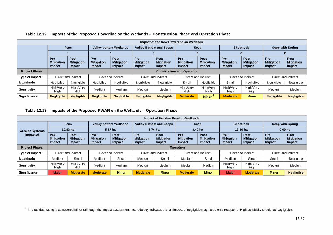
Table 12.12 Impacts of the Proposed Powerline on the Wetlands – Construction Phase and Operation Phase
Impact of the New Powerline on Wetlands
Fens Valley bottom Wetlands Valley Bottom and Seeps Seep Sheetrock Seep with Spring
1 2 1 8 6 2 Pre-Mitigation Impact
Post Mitigation Impact
Pre-Mitigation Impact
Post Mitigation Impact
Pre-Mitigation Impact
Post Mitigation Impact
Pre-Mitigation Impact
Post Mitigation Impact
Pre-Mitigation Impact
Post Mitigation Impact
Pre-Mitigation Impact
Post Mitigation Impact
Project Phase: Construction and Operation
Type of Impact Direct and Indirect Direct and Indirect Direct and Indirect Direct and Indirect Direct and Indirect Direct and Indirect
Magnitude Negligible Negligible Negligible Negligible Negligible Negligible Small Negligible Small Negligible Negligible Negligible
Sensitivity High/Very High
High/Very High Medium Medium Medium Medium High/Very
High High/Very
High High/Very
High High/Very
High Medium Medium
Significance Negligible Negligible Negligible Negligible Negligible Negligible Moderate Minor 1 Moderate Minor Negligible Negligible
Table 12.13 Impacts of the Proposed PWAR on the Wetlands – Operation Phase
Impact of the New Road on Wetlands
Area of Systems Impacted
Fens Valley bottom Wetlands Valley Bottom and Seeps Seep Sheetrock Seep with Spring
10.83 ha 5.17 ha 1.76 ha 3.42 ha 13.39 ha 0.09 ha Pre-Mitigation Impact
Post Mitigation Impact
Pre-Mitigation Impact
Post Mitigation Impact
Pre-Mitigation Impact
Post Mitigation Impact
Pre-Mitigation Impact
Post Mitigation Impact
Pre-Mitigation Impact
Post Mitigation Impact
Pre-Mitigation Impact
Post Mitigation Impact
Project Phase: Operation
Type of Impact Direct and Indirect Direct and Indirect Direct and Indirect Direct and Indirect Direct and Indirect Direct and Indirect
Magnitude Medium Small Medium Small Medium Small Medium Small Medium Small Small Negligible
Sensitivity High/Very High
High/Very High Medium Medium Medium Medium Medium Medium High/Very
High High/Very
High Medium Medium
Significance Major Moderate Moderate Minor Moderate Minor Moderate Minor Major Moderate Minor Negligible
1 The residual rating is considered Minor (although the impact assessment methodology indicates that an impact of negligible magnitude on a receptor of High sensitivity should be Negligible).
12-32
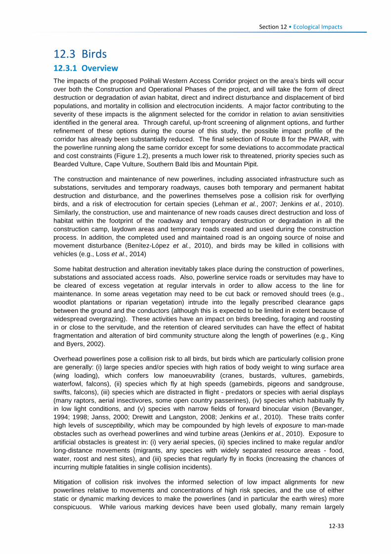
Section 12 • Ecological Impacts
12.3 Birds 12.3.1 Overview The impacts of the proposed Polihali Western Access Corridor project on the area’s birds will occur over both the Construction and Operational Phases of the project, and will take the form of direct destruction or degradation of avian habitat, direct and indirect disturbance and displacement of bird populations, and mortality in collision and electrocution incidents. A major factor contributing to the severity of these impacts is the alignment selected for the corridor in relation to avian sensitivities identified in the general area. Through careful, up-front screening of alignment options, and further refinement of these options during the course of this study, the possible impact profile of the corridor has already been substantially reduced. The final selection of Route B for the PWAR, with the powerline running along the same corridor except for some deviations to accommodate practical and cost constraints (Figure 1.2), presents a much lower risk to threatened, priority species such as Bearded Vulture, Cape Vulture, Southern Bald Ibis and Mountain Pipit.
The construction and maintenance of new powerlines, including associated infrastructure such as substations, servitudes and temporary roadways, causes both temporary and permanent habitat destruction and disturbance, and the powerlines themselves pose a collision risk for overflying birds, and a risk of electrocution for certain species (Lehman et al., 2007; Jenkins et al., 2010). Similarly, the construction, use and maintenance of new roads causes direct destruction and loss of habitat within the footprint of the roadway and temporary destruction or degradation in all the construction camp, laydown areas and temporary roads created and used during the construction process. In addition, the completed used and maintained road is an ongoing source of noise and movement disturbance (Benítez-López et al., 2010), and birds may be killed in collisions with vehicles (e.g., Loss et al., 2014)
Some habitat destruction and alteration inevitably takes place during the construction of powerlines, substations and associated access roads. Also, powerline service roads or servitudes may have to be cleared of excess vegetation at regular intervals in order to allow access to the line for maintenance. In some areas vegetation may need to be cut back or removed should trees (e.g., woodlot plantations or riparian vegetation) intrude into the legally prescribed clearance gaps between the ground and the conductors (although this is expected to be limited in extent because of widespread overgrazing). These activities have an impact on birds breeding, foraging and roosting in or close to the servitude, and the retention of cleared servitudes can have the effect of habitat fragmentation and alteration of bird community structure along the length of powerlines (e.g., King and Byers, 2002).
Overhead powerlines pose a collision risk to all birds, but birds which are particularly collision prone are generally: (i) large species and/or species with high ratios of body weight to wing surface area (wing loading), which confers low manoeuvrability (cranes, bustards, vultures, gamebirds, waterfowl, falcons), (ii) species which fly at high speeds (gamebirds, pigeons and sandgrouse, swifts, falcons), (iii) species which are distracted in flight - predators or species with aerial displays (many raptors, aerial insectivores, some open country passerines), (iv) species which habitually fly in low light conditions, and (v) species with narrow fields of forward binocular vision (Bevanger, 1994; 1998; Janss, 2000; Drewitt and Langston, 2008; Jenkins et al., 2010). These traits confer high levels of susceptibility, which may be compounded by high levels of exposure to man-made obstacles such as overhead powerlines and wind turbine areas (Jenkins et al., 2010). Exposure to artificial obstacles is greatest in: (i) very aerial species, (ii) species inclined to make regular and/or long-distance movements (migrants, any species with widely separated resource areas - food, water, roost and nest sites), and (iii) species that regularly fly in flocks (increasing the chances of incurring multiple fatalities in single collision incidents).
Mitigation of collision risk involves the informed selection of low impact alignments for new powerlines relative to movements and concentrations of high risk species, and the use of either static or dynamic marking devices to make the powerlines (and in particular the earth wires) more conspicuous. While various marking devices have been used globally, many remain largely
12-33
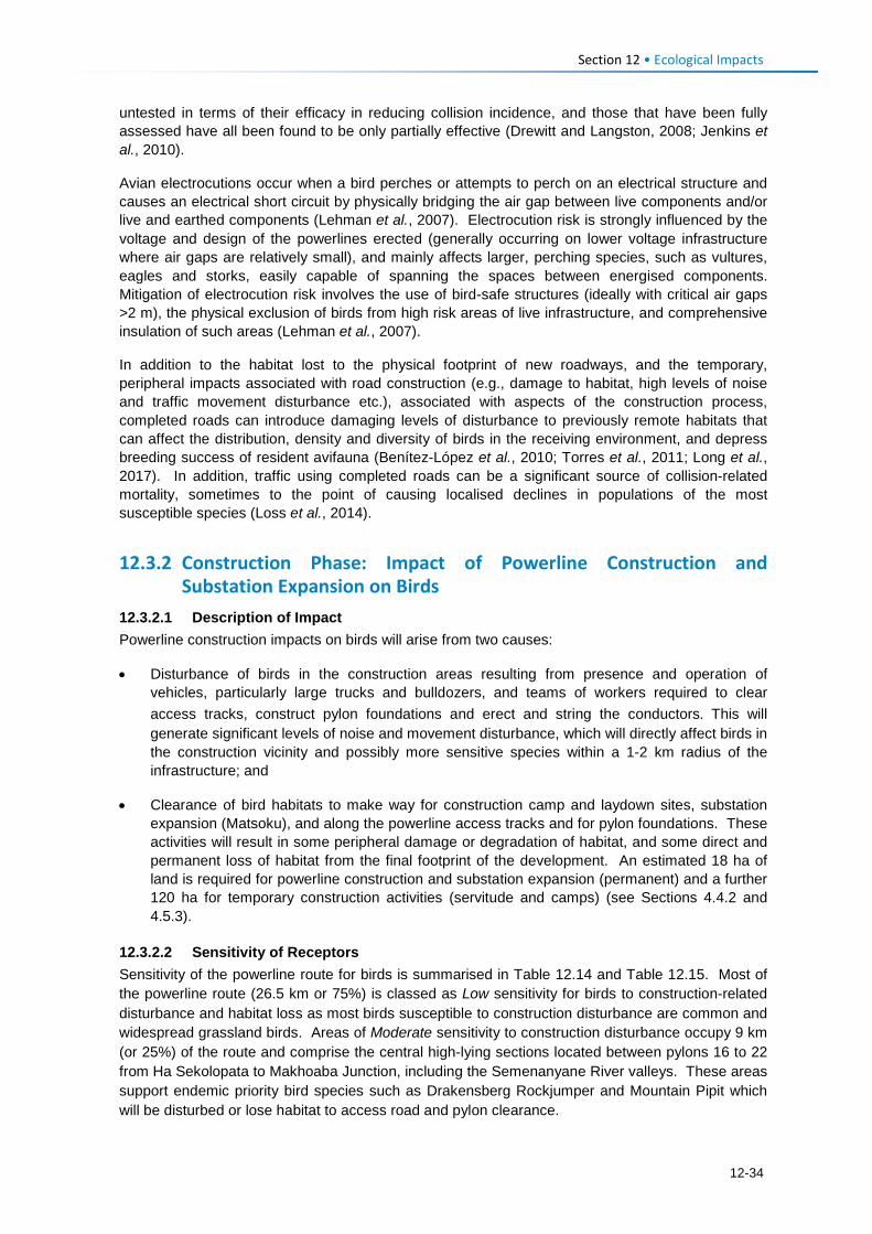
Section 12 • Ecological Impacts
untested in terms of their efficacy in reducing collision incidence, and those that have been fully assessed have all been found to be only partially effective (Drewitt and Langston, 2008; Jenkins et al., 2010).
Avian electrocutions occur when a bird perches or attempts to perch on an electrical structure and causes an electrical short circuit by physically bridging the air gap between live components and/or live and earthed components (Lehman et al., 2007). Electrocution risk is strongly influenced by the voltage and design of the powerlines erected (generally occurring on lower voltage infrastructure where air gaps are relatively small), and mainly affects larger, perching species, such as vultures, eagles and storks, easily capable of spanning the spaces between energised components. Mitigation of electrocution risk involves the use of bird-safe structures (ideally with critical air gaps >2 m), the physical exclusion of birds from high risk areas of live infrastructure, and comprehensive insulation of such areas (Lehman et al., 2007).
In addition to the habitat lost to the physical footprint of new roadways, and the temporary, peripheral impacts associated with road construction (e.g., damage to habitat, high levels of noise and traffic movement disturbance etc.), associated with aspects of the construction process, completed roads can introduce damaging levels of disturbance to previously remote habitats that can affect the distribution, density and diversity of birds in the receiving environment, and depress breeding success of resident avifauna (Benítez-López et al., 2010; Torres et al., 2011; Long et al., 2017). In addition, traffic using completed roads can be a significant source of collision-related mortality, sometimes to the point of causing localised declines in populations of the most susceptible species (Loss et al., 2014).
12.3.2 Construction Phase: Impact of Powerline Construction and Substation Expansion on Birds
12.3.2.1 Description of Impact Powerline construction impacts on birds will arise from two causes:
• Disturbance of birds in the construction areas resulting from presence and operation of vehicles, particularly large trucks and bulldozers, and teams of workers required to clear access tracks, construct pylon foundations and erect and string the conductors. This will generate significant levels of noise and movement disturbance, which will directly affect birds in the construction vicinity and possibly more sensitive species within a 1-2 km radius of the infrastructure; and
• Clearance of bird habitats to make way for construction camp and laydown sites, substation expansion (Matsoku), and along the powerline access tracks and for pylon foundations. These activities will result in some peripheral damage or degradation of habitat, and some direct and permanent loss of habitat from the final footprint of the development. An estimated 18 ha of land is required for powerline construction and substation expansion (permanent) and a further 120 ha for temporary construction activities (servitude and camps) (see Sections 4.4.2 and 4.5.3).
12.3.2.2 Sensitivity of Receptors Sensitivity of the powerline route for birds is summarised in Table 12.14 and Table 12.15. Most of the powerline route (26.5 km or 75%) is classed as Low sensitivity for birds to construction-related disturbance and habitat loss as most birds susceptible to construction disturbance are common and widespread grassland birds. Areas of Moderate sensitivity to construction disturbance occupy 9 km (or 25%) of the route and comprise the central high-lying sections located between pylons 16 to 22 from Ha Sekolopata to Makhoaba Junction, including the Semenanyane River valleys. These areas support endemic priority bird species such as Drakensberg Rockjumper and Mountain Pipit which will be disturbed or lose habitat to access road and pylon clearance.
12-34
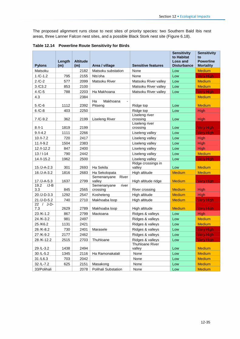
Section 12 • Ecological Impacts
The proposed alignment runs close to nest sites of priority species: two Southern Bald Ibis nest areas, three Lanner Falcon nest sites, and a possible Black Stork nest site (Figure 6.18).
Table 12.14 Powerline Route Sensitivity for Birds
Pylons Length (m)
Altitude (m) Area / village Sensitive features
Sensitivity to Habitat Loss and Disturbance
Sensitivity to Powerline Mortality
Matsoku 2182 Matsoku substation None Low Medium 1 /C-1.2 795 2155 Nts'oha None Low Very High 2 /C-2 577 2099 Matsoku River Matsoku River valley Low Medium 3 /C3.2 853 2100 Matsoku River valley Low Medium 4 /C-5 788 2203 Ha Makhoana Matsoku River valley Low Very High 4.3 2384 Medium
5 /C-6 1112 2392 Ha Makhoana - Pitseng Ridge top Low Medium
6 /C-8 403 2250 Ridge top Low High
7 /C-9.2 362 2199 Liseleng River Liseleng river crossing Low High
8 /I-1 1819 2199 Liseleng river crossing Low Very High
9 /I-4.2 1111 2266 Liseleng valley Low Very High 10 /I-7.2 720 2417 Liseleng valley Low High 11 /I-9.2 1504 2383 Liseleng valley Low High 12 /I-12.2 847 2400 Liseleng valley Low High 13 / I-14 790 2442 Liseleng valley Low Medium 14 /I-15.2 1962 2500 Liseleng valley Low Very High
15 /J-A-2.3 301 2693 Ha Sekila Ridge crossings in valley Low Medium
16 /J-A-3.2 1816 2683 Ha Sekolopata High altitude Medium Medium
17 /J-A-5.3 1637 2799 Semenanyane River valley High altitude ridge Medium Very High
19.2 /J-B 3.3 845 2565
Semenanyane river crossing River crossing Medium High
20 /J-D-3.3 1292 2547 Kosheteng High altitude Medium High 21 /J-D-5.2 740 2710 Makhoaba loop High altitude Medium Very High 22 / J-D-7.3 2629 2789 Makhoaba loop High altitude Medium Very High 23 /K-1.2 867 2799 Maotoana Ridges & valleys Low High 24 /K-3.2 981 2497 Ridges & valleys Low Medium 25 /K6.2 1131 2421 Ridges & valleys Low Medium 26 /K-8.2 730 2401 Marasele Ridges & valleys Low Very High 27 /K-9.2 2177 2462 Ridges & valleys Low Very High 28 /K-12.2 2515 2703 Thuhloane Ridges & valleys Low Very High
29 /L-3.2 1438 2494 Thuhloane River valley Low Medium
30 /L-5.2 1345 2116 Ha Ramonakalali None Low Medium 31 /L6.3 703 2042 None Low Medium 32 /L-7.2 625 2151 Masakong None Low Medium 33/Polihali
2078 Polihali Substation None Low Medium
12-35
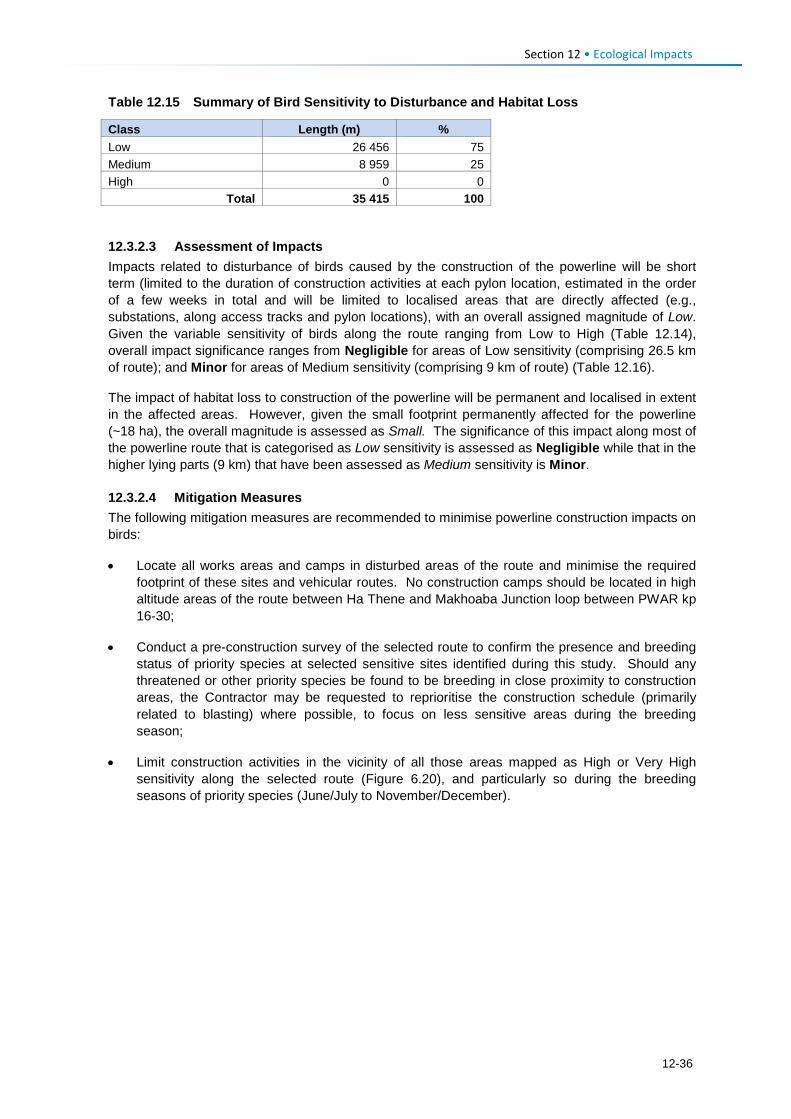
Section 12 • Ecological Impacts
Table 12.15 Summary of Bird Sensitivity to Disturbance and Habitat Loss
Class Length (m) % Low 26 456 75 Medium 8 959 25 High 0 0
Total 35 415 100
12.3.2.3 Assessment of Impacts Impacts related to disturbance of birds caused by the construction of the powerline will be short term (limited to the duration of construction activities at each pylon location, estimated in the order of a few weeks in total and will be limited to localised areas that are directly affected (e.g., substations, along access tracks and pylon locations), with an overall assigned magnitude of Low. Given the variable sensitivity of birds along the route ranging from Low to High (Table 12.14), overall impact significance ranges from Negligible for areas of Low sensitivity (comprising 26.5 km of route); and Minor for areas of Medium sensitivity (comprising 9 km of route) (Table 12.16).
The impact of habitat loss to construction of the powerline will be permanent and localised in extent in the affected areas. However, given the small footprint permanently affected for the powerline (~18 ha), the overall magnitude is assessed as Small. The significance of this impact along most of the powerline route that is categorised as Low sensitivity is assessed as Negligible while that in the higher lying parts (9 km) that have been assessed as Medium sensitivity is Minor.
12.3.2.4 Mitigation Measures The following mitigation measures are recommended to minimise powerline construction impacts on birds:
• Locate all works areas and camps in disturbed areas of the route and minimise the required footprint of these sites and vehicular routes. No construction camps should be located in high altitude areas of the route between Ha Thene and Makhoaba Junction loop between PWAR kp 16-30;
• Conduct a pre-construction survey of the selected route to confirm the presence and breeding status of priority species at selected sensitive sites identified during this study. Should any threatened or other priority species be found to be breeding in close proximity to construction areas, the Contractor may be requested to reprioritise the construction schedule (primarily related to blasting) where possible, to focus on less sensitive areas during the breeding season;
• Limit construction activities in the vicinity of all those areas mapped as High or Very High sensitivity along the selected route (Figure 6.20), and particularly so during the breeding seasons of priority species (June/July to November/December).
12-36
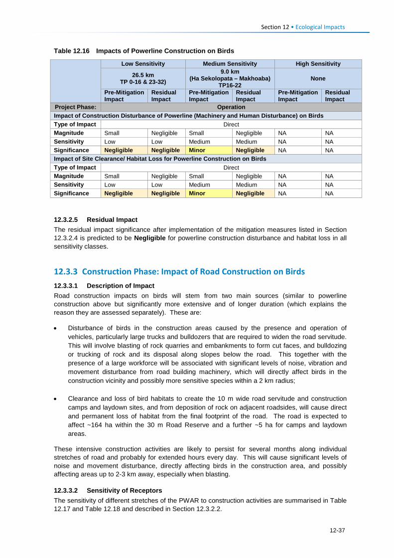
Section 12 • Ecological Impacts
Table 12.16 Impacts of Powerline Construction on Birds
Low Sensitivity Medium Sensitivity High Sensitivity
26.5 km TP 0-16 & 23-32)
9.0 km (Ha Sekolopata – Makhoaba)
TP16-22 None
Pre-Mitigation Impact
Residual Impact
Pre-Mitigation Impact
Residual Impact
Pre-Mitigation Impact
Residual Impact
Project Phase: Operation Impact of Construction Disturbance of Powerline (Machinery and Human Disturbance) on Birds Type of Impact Direct Magnitude Small Negligible Small Negligible NA NA Sensitivity Low Low Medium Medium NA NA Significance Negligible Negligible Minor Negligible NA NA Impact of Site Clearance/ Habitat Loss for Powerline Construction on Birds Type of Impact Direct Magnitude Small Negligible Small Negligible NA NA Sensitivity Low Low Medium Medium NA NA Significance Negligible Negligible Minor Negligible NA NA 12.3.2.5 Residual Impact The residual impact significance after implementation of the mitigation measures listed in Section 12.3.2.4 is predicted to be Negligible for powerline construction disturbance and habitat loss in all sensitivity classes.
12.3.3 Construction Phase: Impact of Road Construction on Birds 12.3.3.1 Description of Impact Road construction impacts on birds will stem from two main sources (similar to powerline construction above but significantly more extensive and of longer duration (which explains the reason they are assessed separately). These are:
• Disturbance of birds in the construction areas caused by the presence and operation of vehicles, particularly large trucks and bulldozers that are required to widen the road servitude. This will involve blasting of rock quarries and embankments to form cut faces, and bulldozing or trucking of rock and its disposal along slopes below the road. This together with the presence of a large workforce will be associated with significant levels of noise, vibration and movement disturbance from road building machinery, which will directly affect birds in the construction vicinity and possibly more sensitive species within a 2 km radius;
• Clearance and loss of bird habitats to create the 10 m wide road servitude and construction camps and laydown sites, and from deposition of rock on adjacent roadsides, will cause direct and permanent loss of habitat from the final footprint of the road. The road is expected to affect ~164 ha within the 30 m Road Reserve and a further ~5 ha for camps and laydown areas.
These intensive construction activities are likely to persist for several months along individual stretches of road and probably for extended hours every day. This will cause significant levels of noise and movement disturbance, directly affecting birds in the construction area, and possibly affecting areas up to 2-3 km away, especially when blasting.
12.3.3.2 Sensitivity of Receptors The sensitivity of different stretches of the PWAR to construction activities are summarised in Table 12.17 and Table 12.18 and described in Section 12.3.2.2.
12-37
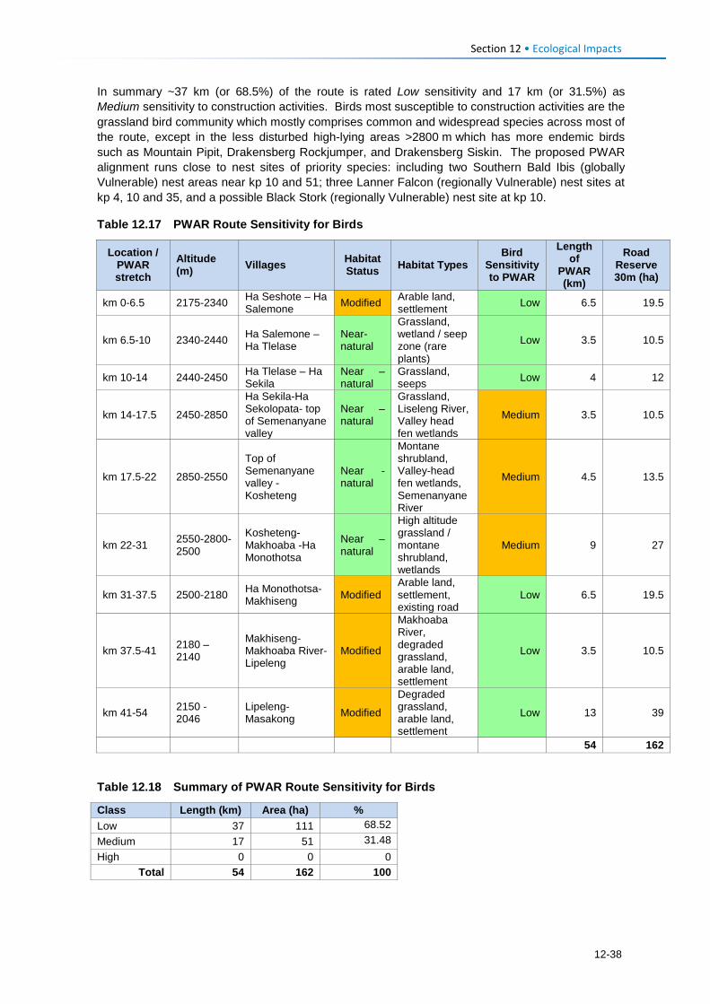
Section 12 • Ecological Impacts
In summary ~37 km (or 68.5%) of the route is rated Low sensitivity and 17 km (or 31.5%) as Medium sensitivity to construction activities. Birds most susceptible to construction activities are the grassland bird community which mostly comprises common and widespread species across most of the route, except in the less disturbed high-lying areas >2800 m which has more endemic birds such as Mountain Pipit, Drakensberg Rockjumper, and Drakensberg Siskin. The proposed PWAR alignment runs close to nest sites of priority species: including two Southern Bald Ibis (globally Vulnerable) nest areas near kp 10 and 51; three Lanner Falcon (regionally Vulnerable) nest sites at kp 4, 10 and 35, and a possible Black Stork (regionally Vulnerable) nest site at kp 10.
Table 12.17 PWAR Route Sensitivity for Birds
Location / PWAR stretch
Altitude (m) Villages Habitat
Status Habitat Types Bird
Sensitivity to PWAR
Length of
PWAR (km)
Road Reserve 30m (ha)
km 0-6.5 2175-2340 Ha Seshote – Ha Salemone Modified Arable land,
settlement Low 6.5 19.5
km 6.5-10 2340-2440 Ha Salemone – Ha Tlelase
Near-natural
Grassland, wetland / seep zone (rare plants)
Low 3.5 10.5
km 10-14 2440-2450 Ha Tlelase – Ha Sekila
Near – natural
Grassland, seeps Low 4 12
km 14-17.5 2450-2850
Ha Sekila-Ha Sekolopata- top of Semenanyane valley
Near – natural
Grassland, Liseleng River, Valley head fen wetlands
Medium 3.5 10.5
km 17.5-22 2850-2550
Top of Semenanyane valley - Kosheteng
Near - natural
Montane shrubland, Valley-head fen wetlands, Semenanyane River
Medium 4.5 13.5
km 22-31 2550-2800-2500
Kosheteng-Makhoaba -Ha Monothotsa
Near – natural
High altitude grassland / montane shrubland, wetlands
Medium 9 27
km 31-37.5 2500-2180 Ha Monothotsa- Makhiseng Modified
Arable land, settlement, existing road
Low 6.5 19.5
km 37.5-41 2180 – 2140
Makhiseng-Makhoaba River-Lipeleng
Modified
Makhoaba River, degraded grassland, arable land, settlement
Low 3.5 10.5
km 41-54 2150 - 2046
Lipeleng-Masakong Modified
Degraded grassland, arable land, settlement
Low 13 39
54 162
Table 12.18 Summary of PWAR Route Sensitivity for Birds
Class Length (km) Area (ha) % Low 37 111 68.52 Medium 17 51 31.48 High 0 0 0
Total 54 162 100
12-38
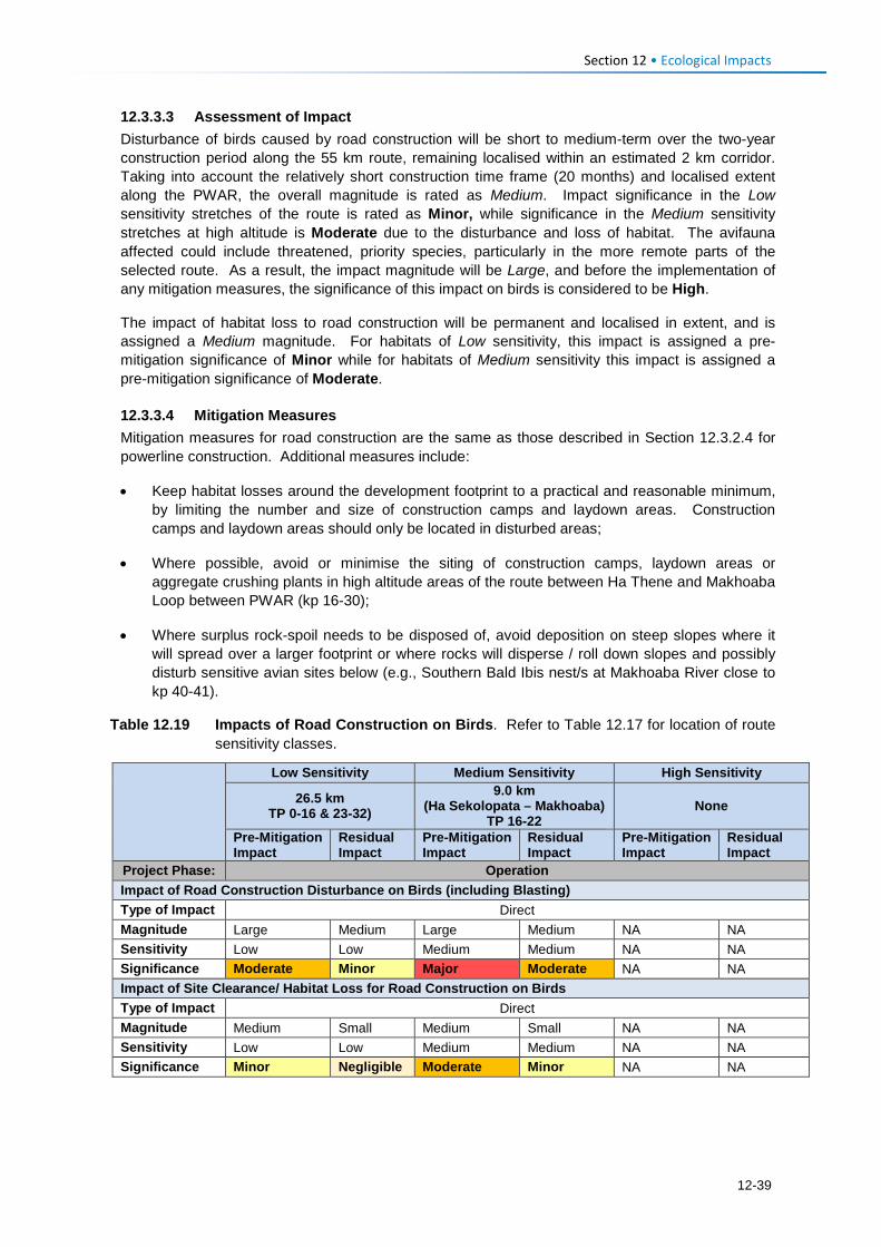
Section 12 • Ecological Impacts
12.3.3.3 Assessment of Impact Disturbance of birds caused by road construction will be short to medium-term over the two-year construction period along the 55 km route, remaining localised within an estimated 2 km corridor. Taking into account the relatively short construction time frame (20 months) and localised extent along the PWAR, the overall magnitude is rated as Medium. Impact significance in the Low sensitivity stretches of the route is rated as Minor, while significance in the Medium sensitivity stretches at high altitude is Moderate due to the disturbance and loss of habitat. The avifauna affected could include threatened, priority species, particularly in the more remote parts of the selected route. As a result, the impact magnitude will be Large, and before the implementation of any mitigation measures, the significance of this impact on birds is considered to be High.
The impact of habitat loss to road construction will be permanent and localised in extent, and is assigned a Medium magnitude. For habitats of Low sensitivity, this impact is assigned a pre-mitigation significance of Minor while for habitats of Medium sensitivity this impact is assigned a pre-mitigation significance of Moderate.
12.3.3.4 Mitigation Measures Mitigation measures for road construction are the same as those described in Section 12.3.2.4 for powerline construction. Additional measures include:
• Keep habitat losses around the development footprint to a practical and reasonable minimum, by limiting the number and size of construction camps and laydown areas. Construction camps and laydown areas should only be located in disturbed areas;
• Where possible, avoid or minimise the siting of construction camps, laydown areas or aggregate crushing plants in high altitude areas of the route between Ha Thene and Makhoaba Loop between PWAR (kp 16-30);
• Where surplus rock-spoil needs to be disposed of, avoid deposition on steep slopes where it will spread over a larger footprint or where rocks will disperse / roll down slopes and possibly disturb sensitive avian sites below (e.g., Southern Bald Ibis nest/s at Makhoaba River close to kp 40-41).
Table 12.19 Impacts of Road Construction on Birds. Refer to Table 12.17 for location of route sensitivity classes.
Low Sensitivity Medium Sensitivity High Sensitivity
26.5 km TP 0-16 & 23-32)
9.0 km (Ha Sekolopata – Makhoaba)
TP 16-22 None
Pre-Mitigation Impact
Residual Impact
Pre-Mitigation Impact
Residual Impact
Pre-Mitigation Impact
Residual Impact
Project Phase: Operation Impact of Road Construction Disturbance on Birds (including Blasting) Type of Impact Direct Magnitude Large Medium Large Medium NA NA Sensitivity Low Low Medium Medium NA NA Significance Moderate Minor Major Moderate NA NA Impact of Site Clearance/ Habitat Loss for Road Construction on Birds Type of Impact Direct Magnitude Medium Small Medium Small NA NA Sensitivity Low Low Medium Medium NA NA Significance Minor Negligible Moderate Minor NA NA
12-39
Section 12 • Ecological Impacts
12.3.3.5 Residual Impact Implementation of the measures described in Section 12.3.3.4 is predicted to reduce the impact significance of bird disturbance impacts to Minor in areas of Low sensitivity and Moderate in areas of Medium sensitivity, while residual impacts of habitat loss on birds are Negligible for Low sensitivity areas and Minor in areas of Medium sensitivity.
12.3.4 Operation Phase: Impact of Powerline Collisions on Birds 12.3.4.1 Description of Impact Factors that lend birds to being collision or electrocution prone are highlighted in Section 12.3.1. The completed powerline and its associated infrastructure will present a significant mortality risk for many birds, including priority species such as Bearded Vulture, Cape Vulture, Southern Bald Ibis, Black Stork, Verreaux’s Eagle and Lanner Falcon, all of which are likely to regularly fly in the vicinity of the powerline. All of these species are known or reasonably suspected to be prone to collision with overhead lines (Jenkins et al., 2010). In particular, powerline-related fatalities have been listed as a significant source of anthropogenic mortality for both vulture species present in the area, contributing to the escalating regional and global threat status of both Bearded Vulture and Cape Vulture (Allan, 2015; Krüger, 2015).
Cape Vultures and other medium-sized and large birds that habitually perch on utility structures – e.g., Jackal Buzzard, Cape Eagle-Owl Bubo capensis, Southern Bald Ibis, may also be susceptible to electrocution. This problem applies mainly to lower voltage lines (e.g., 33kV or 66kV) where air-gaps between live elements are smaller and can be bridged more easily by perching birds, and is easily prevented by using well-insulated, bird-friendly pylon configurations.
The life histories of many large, scarce birds (typically long-lived and slow reproducing) make them particularly vulnerable to the population-level effects of new sources on unnatural mortality. For example, the localised extinction of the Cape Vulture in the western reaches of the Eastern Cape Province, South Africa is thought to be directly the result of mainly electrocution mortality of these birds on poorly designed and unmitigated powerlines (Boshoff et al., 2011).
In addition to the risk of electrocution, large birds perching on power structures can cause power outages or flashovers when they defecate, which affects the quality of electricity supply. This applies especially to situations where birds are inclined to perch directly above the conductors, and it is sometimes advisable to install bird guards or perch deterrents at such points to prevent or mitigate this problem (e.g., Jenkins et al., 2013).
The preliminary design report for the PWAC powerline (Plantech, 2017) includes the use of bird flight diverters, aviation spheres and bird guards to address bird issues, as summarised in Section 4.5.3.4. This acknowledgement of the risks posed by the line to the local avifauna, and the design team’s preparedness to introduce pre-emptive mitigation is welcomed. However, the assessment of the pre-mitigation impact of bird collision with powerlines has assumed no collision or mitigation devices are incorporated into the design and construction of the powerline, while the residual impact significance is based on the installation of such devices as specified below.
Avian sensitivity to collision mortality along the route is summarised in Section 6.3.4.3 and Table 12.21 with areas of highest sensitivity shown in Figure 6.20. Areas of Very High sensitivity and High sensitivity account for 4578 m (13%) and 4240 m (12%) of the line, respectively. These are areas that intersect with medium-high predicted densities of Bearded Vulture (Reid et al., 2015), and/or are within buffer areas of known nest sites of priority cliff-nesting birds and where cliffs are modelled. Areas of highest risk occur along 1513 m of the powerline and are typically areas with relatively flat, ridge-tops or plateaux above 2800 masl and have slopes of <10o.
Given that the entire area supports populations of scarce, threatened, collision-prone birds that could collide with the line at any point along its length, the remainder of the AoI (26.5 km or 75%) is considered of Medium sensitivity, and there are no areas of Low sensitivity.
12-40
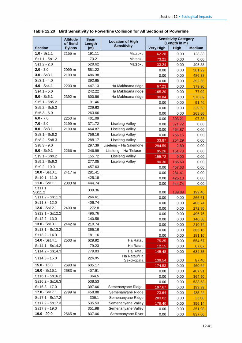
Section 12 • Ecological Impacts
Table 12.20 Bird Sensitivity to Powerline Collision for All Sections of Powerline
Altitude of Bend Pylons
Span Length
(m) Location of High
Sensitivity
Sensitivity Category (Length in m)
Section Very High High Medium 1.0 - Ss1.1 2155 m 191.11 Matsoku 62.28 0.00 128.83 Ss1.1 - Ss1.2 73.21 Matsoku 73.21 0.00 0.00 Ss1.2 - 2.0 528.62 Matsoku 33.24 0.00 495.38 2.0 - 3.0 2099 m 581.22 0.00 0.00 581.22 3.0 - Ss3.1 2100 m 486.38 0.00 0.00 486.38 Ss3.1 - 4.0 392.65 0.00 0.00 392.65 4.0 - Ss4.1 2203 m 447.13 Ha Makhoana ridge 67.23 0.00 379.90 Ss4.1 - 5.0 242.22 Ha Makhoana ridge 165.20 0.00 77.02 5.0 - Ss5.1 2392 m 600.86 Ha Makhoana ridge 30.84 0.00 570.02 Ss5.1 - Ss5.2 91.46 0.00 0.00 91.46 Ss5.2 - Ss5.3 229.63 0.00 0.00 229.63 Ss5.3 - 6.0 263.66 0.00 0.00 263.66 6.0 - 7.0 2250 m 401.09 0.00 303.21 97.88 7.0 - 8.0 2199 m 371.72 Liseleng Valley 0.00 371.72 0.00 8.0 - Ss8.1 2199 m 464.87 Liseleng Valley 0.00 464.87 0.00 Ss8.1 - Sc8.2 756.16 Liseleng Valley 0.00 756.16 0.00 Sc8.2 - Ss8.3 288.17 Liseleng Valley 33.87 254.29 0.00 Ss8.3 - 9.0 297.39 Liseleng – Ha Salemone 294.59 2.80 0.00 9.0 - Ss9.1 2266 m 246.99 Liseleng – Ha Tlelase 95.26 151.73 0.00 Ss9.1 - Ss9.2 155.72 Liseleng Valley 155.72 0.00 0.00 Ss9.2 - Ss9.3 277.05 Liseleng Valley 90.36 186.69 0.00 Ss9.2 - 10.0 457.63 0.00 457.63 0.00 10.0 - Ss10.1 2417 m 281.41 0.00 281.41 0.00 Ss10.1 - 11.0 425.18 0.00 425.18 0.00 11.0 - Ss11.1 2383 m 444.74 0.00 444.74 0.00 Ss11.1 -
SS11.2 339.36 0.00 139.89 199.46 Ss11.2 - Ss11.3 266.61 0.00 0.00 266.61 Ss11.3 - 12.0 406.74 0.00 0.00 406.74 12.0 - Ss12.1 2400 m 272.8 0.00 0.00 272.80 Ss12.1 - Ss12.2 496.76 0.00 0.00 496.76 Ss12.2 - 13.0 140.58 0.00 0.00 140.58 13.0 - Ss13.1 2442 m 210.74 0.00 0.00 210.74 Ss13.1 - Ss13.2 365.16 0.00 0.00 365.16 Ss13.2 - 14.0 181.16 0.00 0.00 181.16 14.0 - Ss14.1 2500 m 629.92 Ha Ratau 75.25 0.00 554.67 Ss14.1 - Ss14.2 79.23 Ha Ratau 12.15 0.00 67.07 Ss14.2 - Ss14.3 779.83 Ha Ratau 145.48 0.00 634.35
Ss14.3 - 15.0 226.95 Ha Ratau/Ha Sekokopata 139.54 0.00 87.40
15.0 - 16.0 2693 m 635.17 174.53 0.00 460.64 16.0 - Ss16.1 2683 m 407.91 0.00 0.00 407.91 Ss16.1 - Ss16.2 364.5 0.00 0.00 364.50 Ss16.2 - Ss16.3 538.53 0.00 0.00 538.53 Ss16.3 - 17.0 397.66 Semenanyane Ridge 197.67 0.00 199.99 17.0 - Ss17.1 2799 m 458.88 Semenanyane Ridge 23.64 0.00 435.24 Ss17.1 - Ss17.2 306.1 Semenanyane Ridge 283.02 0.00 23.08 Ss17.2 - Ss17.3 535.53 Semenanyane Valley 179.40 0.00 356.14 Ss17.3 - 19.0 351.98 Semenanyane Valley 0.00 0.00 351.98 19.0 - 20.0 2565 m 837.06 Semenanyane River 0.00 0.00 837.06
12-41
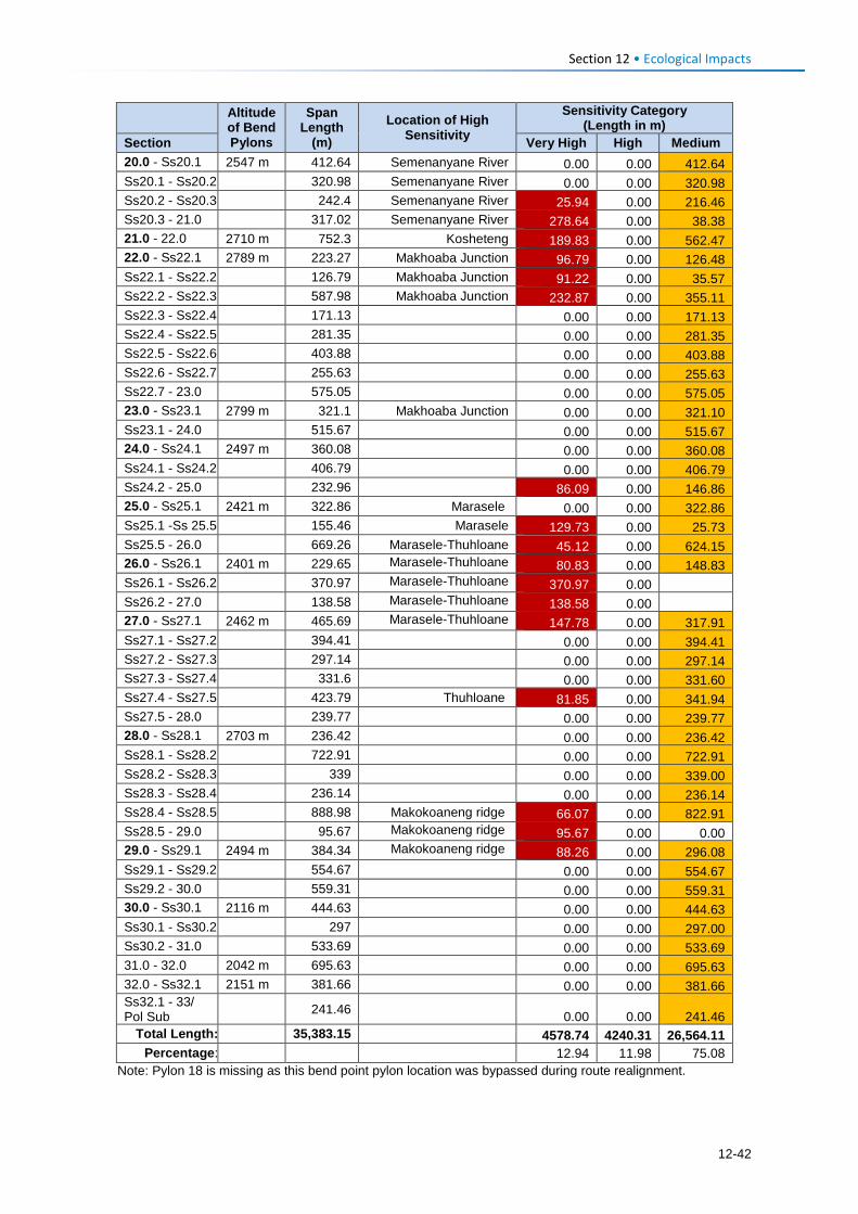
Section 12 • Ecological Impacts
Altitude of Bend Pylons
Span Length
(m) Location of High
Sensitivity
Sensitivity Category (Length in m)
Section Very High High Medium 20.0 - Ss20.1 2547 m 412.64 Semenanyane River 0.00 0.00 412.64 Ss20.1 - Ss20.2 320.98 Semenanyane River 0.00 0.00 320.98 Ss20.2 - Ss20.3 242.4 Semenanyane River 25.94 0.00 216.46 Ss20.3 - 21.0 317.02 Semenanyane River 278.64 0.00 38.38 21.0 - 22.0 2710 m 752.3 Kosheteng 189.83 0.00 562.47 22.0 - Ss22.1 2789 m 223.27 Makhoaba Junction 96.79 0.00 126.48 Ss22.1 - Ss22.2 126.79 Makhoaba Junction 91.22 0.00 35.57 Ss22.2 - Ss22.3 587.98 Makhoaba Junction 232.87 0.00 355.11 Ss22.3 - Ss22.4 171.13 0.00 0.00 171.13 Ss22.4 - Ss22.5 281.35 0.00 0.00 281.35 Ss22.5 - Ss22.6 403.88 0.00 0.00 403.88 Ss22.6 - Ss22.7 255.63 0.00 0.00 255.63 Ss22.7 - 23.0 575.05 0.00 0.00 575.05 23.0 - Ss23.1 2799 m 321.1 Makhoaba Junction 0.00 0.00 321.10 Ss23.1 - 24.0 515.67 0.00 0.00 515.67 24.0 - Ss24.1 2497 m 360.08 0.00 0.00 360.08 Ss24.1 - Ss24.2 406.79 0.00 0.00 406.79 Ss24.2 - 25.0 232.96 86.09 0.00 146.86 25.0 - Ss25.1 2421 m 322.86 Marasele 0.00 0.00 322.86 Ss25.1 -Ss 25.5 155.46 Marasele 129.73 0.00 25.73 Ss25.5 - 26.0 669.26 Marasele-Thuhloane 45.12 0.00 624.15 26.0 - Ss26.1 2401 m 229.65 Marasele-Thuhloane 80.83 0.00 148.83 Ss26.1 - Ss26.2 370.97 Marasele-Thuhloane 370.97 0.00 Ss26.2 - 27.0 138.58 Marasele-Thuhloane 138.58 0.00 27.0 - Ss27.1 2462 m 465.69 Marasele-Thuhloane 147.78 0.00 317.91 Ss27.1 - Ss27.2 394.41 0.00 0.00 394.41 Ss27.2 - Ss27.3 297.14 0.00 0.00 297.14 Ss27.3 - Ss27.4 331.6 0.00 0.00 331.60 Ss27.4 - Ss27.5 423.79 Thuhloane 81.85 0.00 341.94 Ss27.5 - 28.0 239.77 0.00 0.00 239.77 28.0 - Ss28.1 2703 m 236.42 0.00 0.00 236.42 Ss28.1 - Ss28.2 722.91 0.00 0.00 722.91 Ss28.2 - Ss28.3 339 0.00 0.00 339.00 Ss28.3 - Ss28.4 236.14 0.00 0.00 236.14 Ss28.4 - Ss28.5 888.98 Makokoaneng ridge 66.07 0.00 822.91 Ss28.5 - 29.0 95.67 Makokoaneng ridge 95.67 0.00 0.00 29.0 - Ss29.1 2494 m 384.34 Makokoaneng ridge 88.26 0.00 296.08 Ss29.1 - Ss29.2 554.67 0.00 0.00 554.67 Ss29.2 - 30.0 559.31 0.00 0.00 559.31 30.0 - Ss30.1 2116 m 444.63 0.00 0.00 444.63 Ss30.1 - Ss30.2 297 0.00 0.00 297.00 Ss30.2 - 31.0 533.69 0.00 0.00 533.69 31.0 - 32.0 2042 m 695.63 0.00 0.00 695.63 32.0 - Ss32.1 2151 m 381.66 0.00 0.00 381.66 Ss32.1 - 33/ Pol Sub 241.46 0.00 0.00 241.46
Total Length: 35,383.15 4578.74 4240.31 26,564.11 Percentage: 12.94 11.98 75.08
Note: Pylon 18 is missing as this bend point pylon location was bypassed during route realignment.
12-42
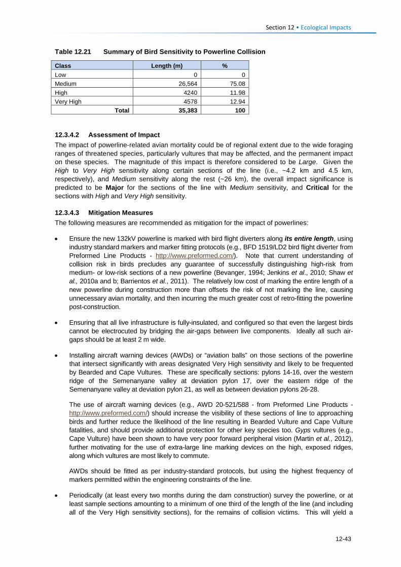
Section 12 • Ecological Impacts
Table 12.21 Summary of Bird Sensitivity to Powerline Collision
Class Length (m) % Low 0 0 Medium 26,564 75.08 High 4240 11.98 Very High 4578 12.94
Total 35,383 100
12.3.4.2 Assessment of Impact The impact of powerline-related avian mortality could be of regional extent due to the wide foraging ranges of threatened species, particularly vultures that may be affected, and the permanent impact on these species. The magnitude of this impact is therefore considered to be Large. Given the High to Very High sensitivity along certain sections of the line (i.e., ~4.2 km and 4.5 km, respectively), and Medium sensitivity along the rest (~26 km), the overall impact significance is predicted to be Major for the sections of the line with Medium sensitivity, and Critical for the sections with High and Very High sensitivity.
12.3.4.3 Mitigation Measures The following measures are recommended as mitigation for the impact of powerlines:
• Ensure the new 132kV powerline is marked with bird flight diverters along its entire length, using industry standard markers and marker fitting protocols (e.g., BFD 1519/LD2 bird flight diverter from Preformed Line Products - http://www.preformed.com/). Note that current understanding of collision risk in birds precludes any guarantee of successfully distinguishing high-risk from medium- or low-risk sections of a new powerline (Bevanger, 1994; Jenkins et al., 2010; Shaw et al., 2010a and b; Barrientos et al., 2011). The relatively low cost of marking the entire length of a new powerline during construction more than offsets the risk of not marking the line, causing unnecessary avian mortality, and then incurring the much greater cost of retro-fitting the powerline post-construction.
• Ensuring that all live infrastructure is fully-insulated, and configured so that even the largest birds cannot be electrocuted by bridging the air-gaps between live components. Ideally all such air-gaps should be at least 2 m wide.
• Installing aircraft warning devices (AWDs) or “aviation balls” on those sections of the powerline that intersect significantly with areas designated Very High sensitivity and likely to be frequented by Bearded and Cape Vultures. These are specifically sections: pylons 14-16, over the western ridge of the Semenanyane valley at deviation pylon 17, over the eastern ridge of the Semenanyane valley at deviation pylon 21, as well as between deviation pylons 26-28.
The use of aircraft warning devices (e.g., AWD 20-521/588 - from Preformed Line Products - http://www.preformed.com/) should increase the visibility of these sections of line to approaching birds and further reduce the likelihood of the line resulting in Bearded Vulture and Cape Vulture fatalities, and should provide additional protection for other key species too. Gyps vultures (e.g., Cape Vulture) have been shown to have very poor forward peripheral vision (Martin et al., 2012), further motivating for the use of extra-large line marking devices on the high, exposed ridges, along which vultures are most likely to commute.
AWDs should be fitted as per industry-standard protocols, but using the highest frequency of markers permitted within the engineering constraints of the line.
• Periodically (at least every two months during the dam construction) survey the powerline, or at least sample sections amounting to a minimum of one third of the length of the line (and including all of the Very High sensitivity sections), for the remains of collision victims. This will yield a
12-43
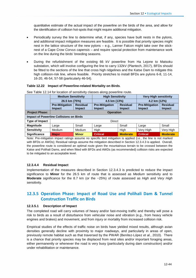
Section 12 • Ecological Impacts
quantitative estimate of the actual impact of the powerline on the birds of the area, and allow for the identification of collision hot-spots that might require additional mitigation.
• Periodically survey the line to determine what, if any, species have built nests in the pylons, and additional impact mitigation measures are feasible. It is possible that priority species might nest in the lattice structure of the new pylons – e.g., Lanner Falcon might take over the stick-nest of a Cape Crow Corvus capensis – and require special protection from maintenance work on the line during the birds’ breeding seasons.
• During the refurbishment of the existing 66 kV powerline from Ha Lejone to Matsoku substation, which will involve configuring the line to carry 132kV (Plantech, 2017), BFDs should be fitted to the sections of the line that cross high ridgelines and the Katse Dam to mitigate this high collision-risk line, where feasible. Priority stretches to install BFDs are pylons 6-8, 11-14, 16-20, 46-54, 57-58 (particularly 46-54).
Table 12.22 Impact of Powerline-related Mortality on Birds.
See Table 12.14 for location of sensitivity classes along powerline route.
Medium Sensitivity High Sensitivity Very High sensitivity 26.5 km (75%) 4.5 km (13%) 4.2 km (12%)
Pre-Mitigation Impact
Residual Impact
Pre-Mitigation Impact
Residual Impact
Pre-Mitigation Impact
Residual Impact
Project Phase: Operation Impact of Powerline Collisions on Birds Type of Impact Direct Magnitude Large Small Large Small Large Small Sensitivity Medium Medium High High Very High Very High Significance Major Minor Critical Moderate Critical Moderate Note: Pre-mitigation impact ratings assume no specific bird mitigation is applied (i.e., the line is not marked with BFDs or AWDs); Residual ratings assume the mitigation described in Section 12.3.4.3 is applied. Overall, the powerline route is considered an optimal route given the mountainous terrain to be crossed between the Katse and Polihali Dams, and when fitted with BFDs and AWDs (as recommended) collision risks are expected to be mitigated to an acceptable level.
12.3.4.4 Residual Impact Implementation of the measures described in Section 12.3.4.3 is predicted to reduce the impact significance to Minor for the 26.5 km of route that is assessed as Medium sensitivity and to Moderate significance for the 8.7 km (or the ~25%) of route assessed as High and Very High sensitivity.
12.3.5 Operation Phase: Impact of Road Use and Polihali Dam & Tunnel Construction Traffic on Birds
12.3.5.1 Description of Impact The completed road will carry volumes of heavy and/or fast-moving traffic and thereby will pose a risk to birds as a result of disturbance from vehicular noise and vibration (e.g., from heavy vehicle engines and brakes) and movement, and from injury or mortality from increased collision risk.
Empirical studies of the effects of traffic noise on birds have yielded mixed results, although avian densities generally decline with proximity to major roadways, and particularly in areas of open, previously remote habitat such as that traversed by the PWAR (Benítez-López et al., 2010). There is a chance that priority species may be displaced from nest sites and/or important foraging areas, either permanently or whenever the road is very busy (particularly during dam construction) and/or under rehabilitation or maintenance.
12-44
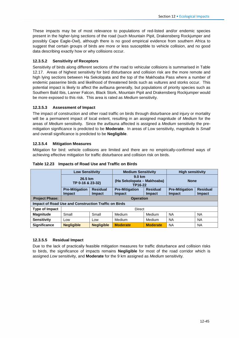
Section 12 • Ecological Impacts
These impacts may be of most relevance to populations of red-listed and/or endemic species present in the higher-lying sections of the road (such Mountain Pipit, Drakensberg Rockjumper and possibly Cape Eagle-Owl), although there is no good empirical evidence from southern Africa to suggest that certain groups of birds are more or less susceptible to vehicle collision, and no good data describing exactly how or why collisions occur.
12.3.5.2 Sensitivity of Receptors Sensitivity of birds along different sections of the road to vehicular collisions is summarised in Table 12.17. Areas of highest sensitivity for bird disturbance and collision risk are the more remote and high lying sections between Ha Sekolopata and the top of the Makhoaba Pass where a number of endemic passerine birds and likelihood of threatened birds such as vultures and storks occur. This potential impact is likely to affect the avifauna generally, but populations of priority species such as Southern Bald Ibis, Lanner Falcon, Black Stork, Mountain Pipit and Drakensberg Rockjumper would be more exposed to this risk. This area is rated as Medium sensitivity.
12.3.5.3 Assessment of Impact The impact of construction and other road traffic on birds through disturbance and injury or mortality will be a permanent impact of local extent, resulting in an assigned magnitude of Medium for the areas of Medium sensitivity. Since the avifauna affected is assigned a Medium sensitivity the pre-mitigation significance is predicted to be Moderate. In areas of Low sensitivity, magnitude is Small and overall significance is predicted to be Negligible.
12.3.5.4 Mitigation Measures Mitigation for bird: vehicle collisions are limited and there are no empirically-confirmed ways of achieving effective mitigation for traffic disturbance and collision risk on birds.
Table 12.23 Impacts of Road Use and Traffic on Birds
Low Sensitivity Medium Sensitivity High sensitivity
26.5 km TP 0-16 & 23-32)
9.0 km (Ha Sekolopata – Makhoaba)
TP16-22 None
Pre-Mitigation Impact
Residual Impact
Pre-Mitigation Impact
Residual Impact
Pre-Mitigation Impact
Residual Impact
Project Phase: Operation Impact of Road Use and Construction Traffic on Birds Type of Impact Direct Magnitude Small Small Medium Medium NA NA Sensitivity Low Low Medium Medium NA NA Significance Negligible Negligible Moderate Moderate NA NA
12.3.5.5 Residual Impact Due to the lack of practically feasible mitigation measures for traffic disturbance and collision risks to birds, the significance of impacts remains Negligible for most of the road corridor which is assigned Low sensitivity, and Moderate for the 9 km assigned as Medium sensitivity.
12-45
Section 12 • Ecological Impacts
12.4 Fish 12.4.1 Construction Phase: Impact of the PWAR and related Infrastructure
on Fish and Fish Habitats 12.4.1.1 Description of Impact The project requires the construction of a road linking the A8 in the vicinity of Ha Seshote to the Polihali Reservoir in the vicinity of Tloha-re-Bue as well as three large bridges on the Matsoku, Liseleng and Semenanyane Rivers and several culverts on smaller feeder streams and rivers crossed by the road.
Road and bridge construction activities in the study area could potentially affect fish and fish habitat in three ways:
• Destruction and modification of fish habitat; • Modification of flow (which would indirectly affect fish and fish habitat); and • Pollution (which would directly affect fish and fish habitat).
Road and bridge construction in the study area will likely affect aquatic ecosystems, potentially causing mortality of aquatic fauna, in the following ways;
• Clearing of riparian vegetation at river crossing points and in stretches where the road is aligned in close proximity to river channels;
• Physical modification and re-shaping of the bed and banks of affected rivers for construction of bridge piers, and the infilling of such riverine habitat for the establishment of bridge embankments.
• Secondary consequences of direct physical disturbance impacts could include: • Reduced bank stability and erosion of exposed banks, • Sedimentation or smothering of in-stream and riparian habitat downslope and
downstream, • Burying of aquatic habitat by spoil material, and • Increased water turbidity (increased suspended solid load).
Ultimately, the potential direct and indirect impacts on freshwater habitat will include
deterioration in local freshwater ecosystem ecological condition downstream at affected sites, particularly increased turbidity and sedimentation in downstream pool habitats. This will result in a local reduction in the availability of intact natural habitat, particularly if mitigation measures are not implemented effectively.
The establishment of in-stream piers for bridge crossings and culverts for wetland crossings may require temporary flow diversion to prepare the channel bed prior to culvert placement. In-channel construction activities including coffer dams, diversions, dewatering activities around work areas and the installation of instream culverts may result in a temporary change in local flow regimes. This may result in localised impoundment of flows upstream of the construction areas and concentrated flow releases downstream, with temporary flow reductions also experienced downstream due to flow impediment during construction.
Resultant impacts of flow alterations include increased sedimentation upstream of construction site crossings, increased bed and bank scour and sedimentation downstream, and temporary discharge reductions downstream. The consequences of such impacts include habitat smothering / burying, increased turbidity, and temporary alteration of flow volume and variability, which all ultimately affect fish habitat. Examples of the nature of river bed and bank disturbance are shown in Figure 12.13 and Figure 12.14.
12-46
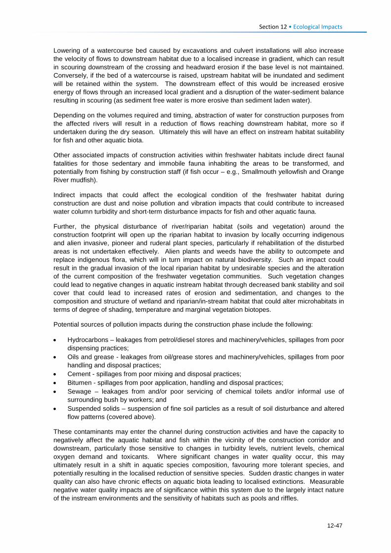
Section 12 • Ecological Impacts
Lowering of a watercourse bed caused by excavations and culvert installations will also increase the velocity of flows to downstream habitat due to a localised increase in gradient, which can result in scouring downstream of the crossing and headward erosion if the base level is not maintained. Conversely, if the bed of a watercourse is raised, upstream habitat will be inundated and sediment will be retained within the system. The downstream effect of this would be increased erosive energy of flows through an increased local gradient and a disruption of the water-sediment balance resulting in scouring (as sediment free water is more erosive than sediment laden water).
Depending on the volumes required and timing, abstraction of water for construction purposes from the affected rivers will result in a reduction of flows reaching downstream habitat, more so if undertaken during the dry season. Ultimately this will have an effect on instream habitat suitability for fish and other aquatic biota.
Other associated impacts of construction activities within freshwater habitats include direct faunal fatalities for those sedentary and immobile fauna inhabiting the areas to be transformed, and potentially from fishing by construction staff (if fish occur – e.g., Smallmouth yellowfish and Orange River mudfish).
Indirect impacts that could affect the ecological condition of the freshwater habitat during construction are dust and noise pollution and vibration impacts that could contribute to increased water column turbidity and short-term disturbance impacts for fish and other aquatic fauna.
Further, the physical disturbance of river/riparian habitat (soils and vegetation) around the construction footprint will open up the riparian habitat to invasion by locally occurring indigenous and alien invasive, pioneer and ruderal plant species, particularly if rehabilitation of the disturbed areas is not undertaken effectively. Alien plants and weeds have the ability to outcompete and replace indigenous flora, which will in turn impact on natural biodiversity. Such an impact could result in the gradual invasion of the local riparian habitat by undesirable species and the alteration of the current composition of the freshwater vegetation communities. Such vegetation changes could lead to negative changes in aquatic instream habitat through decreased bank stability and soil cover that could lead to increased rates of erosion and sedimentation, and changes to the composition and structure of wetland and riparian/in-stream habitat that could alter microhabitats in terms of degree of shading, temperature and marginal vegetation biotopes.
Potential sources of pollution impacts during the construction phase include the following:
• Hydrocarbons – leakages from petrol/diesel stores and machinery/vehicles, spillages from poor dispensing practices;
• Oils and grease - leakages from oil/grease stores and machinery/vehicles, spillages from poor handling and disposal practices;
• Cement - spillages from poor mixing and disposal practices; • Bitumen - spillages from poor application, handling and disposal practices; • Sewage – leakages from and/or poor servicing of chemical toilets and/or informal use of
surrounding bush by workers; and • Suspended solids – suspension of fine soil particles as a result of soil disturbance and altered
flow patterns (covered above).
These contaminants may enter the channel during construction activities and have the capacity to negatively affect the aquatic habitat and fish within the vicinity of the construction corridor and downstream, particularly those sensitive to changes in turbidity levels, nutrient levels, chemical oxygen demand and toxicants. Where significant changes in water quality occur, this may ultimately result in a shift in aquatic species composition, favouring more tolerant species, and potentially resulting in the localised reduction of sensitive species. Sudden drastic changes in water quality can also have chronic effects on aquatic biota leading to localised extinctions. Measurable negative water quality impacts are of significance within this system due to the largely intact nature of the instream environments and the sensitivity of habitats such as pools and riffles.
12-47
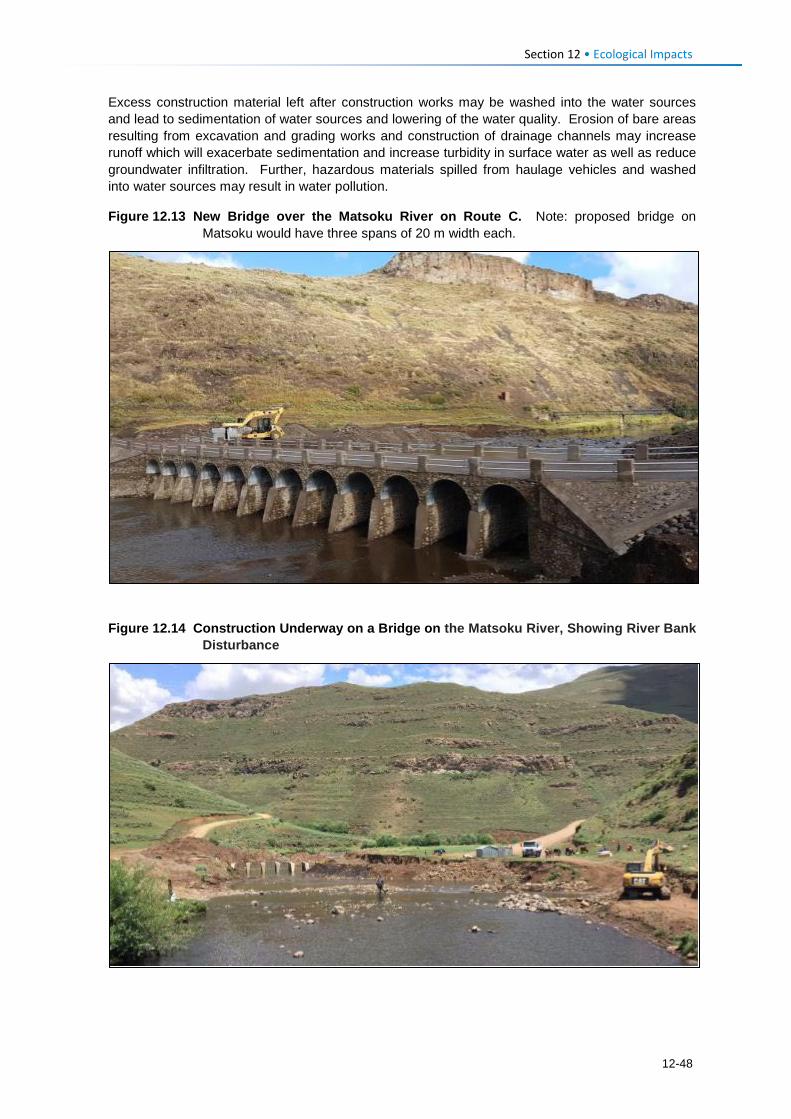
Section 12 • Ecological Impacts
Excess construction material left after construction works may be washed into the water sources and lead to sedimentation of water sources and lowering of the water quality. Erosion of bare areas resulting from excavation and grading works and construction of drainage channels may increase runoff which will exacerbate sedimentation and increase turbidity in surface water as well as reduce groundwater infiltration. Further, hazardous materials spilled from haulage vehicles and washed into water sources may result in water pollution.
Figure 12.13 New Bridge over the Matsoku River on Route C. Note: proposed bridge on Matsoku would have three spans of 20 m width each.
Figure 12.14 Construction Underway on a Bridge on the Matsoku River, Showing River Bank
Disturbance
12-48
Section 12 • Ecological Impacts
12.4.1.2 Sensitivity of Receptors No fish were recorded in any of the rivers in the Project Area during the December 2016 field survey undertaken for this study, potentially due to the fact that the survey was undertaken in the low flow season when water levels were very low, and as a result of high sediment levels in the Matsoku River. A number of fish species have been recorded in the Matsoku River near the proposed bridge crossing previously, and based on the occurrence at sites upstream or downstream, could potentially move into the study area during periods of higher flow. At least one of these species (the Maloti minnow Pseudobarbus quathlambae) is listed as Endangered (www.iucnredlist.org) and one other is listed as Near Threatened (NT) (Largemouth yellowfish Labeobarbus kimberleyensis). However, it is considered unlikely that Maloti minnow occur any longer in the Matsoku River below the weir and any occurrence of Largemouth yellowfish are unlikely to persist in the area for long periods given the poor quality of riverine habitat in the Project Area.
Despite the lack of fish caught during the surveys, and the presence of exotic fringing riparian vegetation in places along the Matsoku and Makhoaba Rivers, in particular, the aquatic ecosystems are assigned a sensitivity of Medium. This is because the rivers and streams (e.g., the Liseleng and Semenanyane Rivers) are relatively intact; have diverse and functional aquatic habitats, and water quality appears unpolluted despite periods of high turbidity. Indigenous fish such as small and largemouth yellowfish are likely to occur in these rivers during their upstream migration for spawning in higher flow periods.
12.4.1.3 Assessment of Impact In the absence of any mitigation, the magnitude of potential impacts of road and bridge construction on fish and fish habitat in the Project Area are considered to be Medium, and based on the Medium sensitivity of the rivers and streams, overall significance is assessed as Moderate (Table 12.24)
Table 12.24 Impact of Road and Bridge Construction on Fish and Fish Habitats
Impact of Road and Bridge Construction on Fish and Fish Habitats Pre-Mitigation Impact Residual Impact Project Phase: Construction Type of Impact Direct Direct Magnitude Medium Small Sensitivity Medium Medium Significance Moderate Minor
12.4.1.4 Mitigation Measures Specific mitigation measures to be applied during the design, planning and construction phases include the following:
Design planning • Ensure all relevant requirements of the Lesotho Roads and Bridge standards (GoL, 1998) are
implemented. • As far as possible, river crossings should make use of spanned bridge structures with minimal
instream piers rather than a box culvert type crossings; • All bridges should be constructed to accommodate 1:100 year flood events; • Bridge abutments should allow for natural channel migration/adjustments over time. Ideally
these should not be located within 10 m of the edge of the riparian zone; • Where necessary, box culverts should be installed within abutments/embankments to allow for
the natural spreading out of flood flows, and to minimise the blocking of flood flows and the deactivation of flood terraces;
• As far as possible, bridge crossings must be aligned along existing corridors of disturbance i.e., where river bed and banks have already been modified;
12-49
Section 12 • Ecological Impacts
• Temporary access routes must avoid all water resources not being crossed by the preferred route;
• Temporary access roads must not be aligned perpendicular to the slopes for long stretches to avoid the road acting as a preferential flow path for runoff;
• Stormwater runoff and erosion control measures must be installed on all roads (including temporary roads) and should include the establishment of many small shallow chute type drains and/or berms/cut-off drains at regular intervals along slopes that direct surface runoff from the road into adjacent grassland to avoid rill erosion and gully formation. Many small outlets must be favoured over a few large and these outlets must be armoured against erosion using dump rock/rip-rap;
• Erosion/sediment control measures such as silt fences, low soil berms or wooden shutter boards must be employed to limit sediment runoff from construction sites;
• The natural flow of rivers or streams shall not be permanently diverted or blocked; • Water abstraction shall be sited appropriately to minimise reduction of flow to shallow riffle
habitats and preferably in already disturbed areas; • Adequate through flows to downstream aquatic ecosystems must be maintained at all times to
protect aquatic life, and prevent the interruption of existing downstream users. Pollution control
• Develop a method statement on management of bridge construction and all pollution control measures, including prevention and remediation;
• Regular toolbox talks on pollution control measures, involving all staff; • No cleaning of vehicles or equipment in the rivers or streams; • No refueling, servicing nor chemical storage should occur within 50 m of river/stream banks,
and wetlands, or within the 100-year flood line, whichever is applicable; • Hazardous storage and refueling areas must be bunded prior to their use on site during the
construction period; and • Mixing and/or decanting of all chemicals and hazardous substances must take place on a tray,
shutter boards or on an impermeable surface and must be protected from the ingress and egress of stormwater. Rehabilitation
• Topsoil and plant sods shall be removed from works are prior to construction and stored appropriately for use in rehabilitation;
• Disturbed areas alongside streams and rivers must be rehabilitated by ripping compacted soils, restoring topsoil and levelling soil profiles to natural landforms. Where revegetation is unlikely to occur naturally, larger disturbed areas should be revegetated using plant sods rescued during site preparation and supplemented with transplants from adjoining like habitats if required. Alternatively, reseeding via broadcasting using an indigenous seed mix reflecting the general species composition of the area should also be used where necessary.
12.4.1.5 Residual Impact With appropriate mitigation (requirements for which are outlined above), the magnitude of road and bridge construction impacts on fish and fish habitat in the study area, can be reduced to Small and thus of Minor significance.
12.4.2 Operation Phase: Impacts of the PWAR and Fish and Fish Habitats 12.4.2.1 Description of Impact Operational impacts on fish and fish habitat in the Project Area associated with road and bridge construction include the following:
12-50
Section 12 • Ecological Impacts
• Changes in catchment land cover and surface runoff; • Modification of surface flows; and • Improved access to river channel habitats which may facilitate illegal sand mining.
Roads increase the extent of hardened surfaces in the catchment and will result in increased point source surface water discharges associated with the stormwater management system. Road networks intercept, direct and concentrate flow and change (increase) the volume and velocity of surface flow entering watercourses. Increased hardened surfaces within the catchment will result in a small increase in surface water runoff but more importantly it will result in increased runoff velocities at discharge points that will become areas at risk from erosion. Stormwater discharges from formal rural roads in steep and erodible settings are known to pose serious gully erosion risks and such impacts are already evident within the local catchment as a result of poor road alignment and stormwater management. If road stormwater is collected and discharged at few outlet points at low points in the road and limited erosion protection is installed, it is highly likely that erosion will occur below the stormwater discharge points. This could lead to further erosion downslope and ultimately the sedimentation and/or erosion of riverine and wetland habitat, particularly in the tributary systems, and ultimately increased transportation of sediment to the affected rivers.
Piers and encroaching embankments on bridges at river crossing points will alter river flows through the creation of turbulence and eddies around the in-stream pier structures and the confinement of large floods by embankments (>1:10 year) resulting in localised scouring and sedimentation around the piers. The river and stream crossing points will also fix the channel banks at the crossing points while raised road embankments may impede large floods. Rivers in particular are highly dynamic systems and are continually reshaping their bed and banks through erosional and depositional processes in order to maintain a dynamic equilibrium. The beds of most of the rivers in the study area are comprised of bedrock and boulders that are resistant to scouring erosion; thus the river banks and floodplain terrace would be key energy dissipaters under high / flood flows. Fixing the bank may lead to increased erosional forces being exerted along other portions of the river banks that will result in increased bank scour immediately upstream and downstream of the crossings, and a resultant increase in channel cross sectional areas. Over time, there may be a shift in the structure and composition of the river habitat, including biotope types and overall habitat diversity at points where the road intersects the river.
Rivers by nature are largely linear features which provide key linkages between important habitats including feeding and breeding habitats for aquatic biota. This is of particular importance for migrating fish species that rely on habitat connectivity to complete their life-cycle. River crossings that use culverts may present a barrier by creating higher velocities, shallow flow depths, length of run with no resting areas, or excessive drop height for aquatic species. This is compounded by noise and light disturbances which will limit to some degree the natural patterns of species movement within water courses at various spatial scales, depending on species life stage, feeding and breeding requirements.
Indirect impacts of new roads and river crossings in the study area include facilitation of increased access to river channel areas for sand mining, which can cause severe degradation of rivers. Instream mining causes destruction of aquatic and riparian habitat through large changes in the channel morphology, and lowers the stream bed possibly leading to bank erosion and sedimentation. Impacts include bed degradation, bed coarsening, lowered water tables near the streambed, and channel instability. The use of vehicles for sand excavation and collection also poses pollution risks to rivers. Physical impacts from sand-mining will cause degradation of riparian and aquatic biota and may lead to the undermining of bridges and other structures.
Additional pollution risks to river systems may occur from accidental release of hydrocarbons should an accident arise on the road, e.g., fuel tanker overturn.
12-51
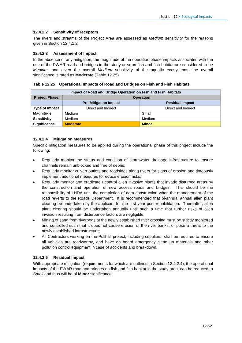
Section 12 • Ecological Impacts
12.4.2.2 Sensitivity of receptors The rivers and streams of the Project Area are assessed as Medium sensitivity for the reasons given in Section 12.4.1.2.
12.4.2.3 Assessment of Impact In the absence of any mitigation, the magnitude of the operation phase impacts associated with the use of the PWAR road and bridges in the study area on fish and fish habitat are considered to be Medium; and given the overall Medium sensitivity of the aquatic ecosystems, the overall significance is rated as Moderate (Table 12.25).
Table 12.25 Operational Impacts of Road and Bridges on Fish and Fish Habitats
Impact of Road and Bridge Operation on Fish and Fish Habitats Project Phase: Operation Pre-Mitigation Impact Residual Impact Type of Impact Direct and Indirect Direct and Indirect Magnitude Medium Small Sensitivity Medium Medium Significance Moderate Minor
12.4.2.4 Mitigation Measures Specific mitigation measures to be applied during the operational phase of this project include the following:
• Regularly monitor the status and condition of stormwater drainage infrastructure to ensure channels remain unblocked and free of debris;
• Regularly monitor culvert outlets and roadsides along rivers for signs of erosion and timeously implement additional measures to reduce erosion risks;
• Regularly monitor and eradicate / control alien invasive plants that invade disturbed areas by the construction and operation of new access roads and bridges. This should be the responsibility of LHDA until the completion of dam construction when the management of the road reverts to the Roads Department. It is recommended that bi-annual annual alien plant clearing be undertaken by the applicant for the first year post-rehabilitation. Thereafter, alien plant clearing should be undertaken annually until such a time that further risks of alien invasion resulting from disturbance factors are negligible;
• Mining of sand from riverbeds at the newly established river crossing must be strictly monitored and controlled such that it does not cause erosion of the river banks, or pose a threat to the newly established infrastructure;
• All Contractors working on the Polihali project, including suppliers, shall be required to ensure all vehicles are roadworthy, and have on board emergency clean up materials and other pollution control equipment in case of accidents and breakdown.
12.4.2.5 Residual Impact With appropriate mitigation (requirements for which are outlined in Section 12.4.2.4), the operational impacts of the PWAR road and bridges on fish and fish habitat in the study area, can be reduced to Small and thus will be of Minor significance.
12-52
Cumulative Impacts Section 13
13.1 Introduction Cumulative impacts of the PWAR and BPST in the context of other known or planned projects are broadly described here. It is not intended as a comprehensive assessment of cumulative impacts of the LHWP Phase I infrastructure development and the LHWP Phase II planned development. It is recommended that LHDA commission a separate, overarching Cumulative Impact Assessment (CIA) for all LHWP project components to inform further decision making and the identification of broad mitigation and initiatives that are not assessed at a project-specific level.
The impacts assessed in Sections 10-12 are based on a contextual understanding of the impacts that have arisen on biodiversity features and social receptors as a consequence of similar LHWP Phase I project infrastructure (i.e., roads and powerlines). It does not attempt to quantify or describe the cumulative impacts on the environment of the Phase I a and b dams (including reservoir inundation) in combination with the Phase II reservoir footrpint, which are of a more massive scale than that arising from roads and powerlines for both LHWP phases.
The PRAI ESIA describes the nature of cumulative impacts of the Phase II Polihali Dam in the context of Phase I impacts and in recognition of the ongoing degradation in catchment condition.
13.2 Description of Cumulative Impacts Cumulative impacts of roads and powerlines of the current PWAC project in combination with the expected impacts of other road and powerline developments in the country are summarised in Table 13.1.
The description of cumulative impacts takes into consideration the impacts that have arisen from construction of new roads and powerlines to and around Katse and Mohale Dams for LHWP Phase I.
It must be recognised that the catchments traversed by the PWAC have exhibited and continue to manifest alteration and deterioration in the condition of grassland, shrubland and wetland habitats as a result of ongoing land use pressures and which are exacerbated by the drought conditions that have been experienced in recent years. This trend is particularly severe in the easternmost parts of the PWAC, closer to the Senqu Valley which falls within a rainshadow.
Table 13.1 Cumulative Impacts of the PWAC with Other Related Projects
No. Aspect Cumulative Impact
1 Wetlands Construction of new roads and the upgrade of existing roads in the highlands of Lesotho are responsible for significant damage to sensitive wetland features. Direct impacts to wetlands from roads occur as a result of construction roads across wetland systems; through interference with the subsurface hydrology that supports wetlands in their catchment and through concentrating flows at culverts resulting in erosion gullies (see WCS, 2017 in Volume 4, Annex F for more information). Road construction for Phase I dams as well as to existing and new mines in the Malimbatso, Kao and Khubelu catchments and upgrading of roads such as Sani Pass and the A1 (Oxbow – Mapholaneng) are all contributing to an ongoing degradation of wetlands in the highlands.
2 Flora Road construction expansion in the highlands has led to a direct loss of grassland habitat within the road footprint and from cut and fill, and more importantly to the spread of alien invasive plants along roadsides, which encroach into the adjacent habitat and fields, displacing natural biodiversity. Further, road development has increased human
13-1
Section 13•Cumulative Impacts
No. Aspect Cumulative Impact access to remote highland areas causing increased harvesting of spiral aloes, which has contributed to the depletion of naturally occurring wild colonies of this threatened species. Notable colonies have been depleted at Mohale as a result of feeder road construction. Increased access has also resulted in more intensive harvesting of medicinal plants that are widely used and traded, and sold in South Africa, and which is increasing the scarcity of certain species.
3 Birds Impacts on birds from road construction in the highlands occur from the direct loss of grassland habitat; disturbance and displacement from nests caused by blasting; and collision with vehicles. However, the most significant impact on birds is linked to mortality of priority cliff-nesting bird species as a result of collision with powerlines, especially those located at high altitudes and across ridgelines. Extensive lengths of high voltage powerlines have been constructed across the highlands to supply different components of the LHWP Phase I project, most of which has not been marked with bird diverters. It is unknown how many priority birds such as Bearded and Cape Vultures, Black Stork, Verreaux’s Eagle, and other storks and ibis may have perished from collisions with electrical infrastructure.
4 Cultural heritage
Road and powerline construction have direct impacts on cultural heritage such as graves and archaeological features, but also present an opportunity to locate and identify these resources for research and to expand human knowledge and understanding of Basotho culture and history. In some cases, infrastructure development projects have exposed new cultural heritage and contributed to the development of opportunities for cultural heritage tourism, such as Metolong Dam and Liphofung cave. Improved and expanded road networks create a means of access to these features and a visitor market by tourists, school children and others, with benefits for local communities.
5 Social Road construction is of overriding importance for the majority of residents of the Lesotho highlands in order to access social goods and services (e.g., school, clinics, shops, market opportunities etc.). Roads create and facilitate improved transport links and better delivery of education, health, water and sanitation, and policing services, and an increased likelihood of electrification by LEC. It also facilitates access by tourists and creates related opportunities for residents to sell crafts and other goods and services. To communities, the positive benefits of road access far outweigh the negative construction impacts they face.
13-2
Mitigation and Recommendations Section 14
14.1 Introduction The mitigation measures presented for each impact in Sections 9 to 11 have been compiled into a separate standalone EMP, as Volume 2 to this ESIS report. These have been reviewed and agreed by LHDA and are therefore commitments made by the applicant to ensure a high standard of environmental and social management for implementation of the PWAR and BPST components of the project. In so doing, it is anticipated that all the impacts can be successfully reduced to an acceptable residual significance.
The EMP covers construction phase mitigation requirements that are the responsibility of the Contractors for the PWAR and BPST, as well as measures that are the responsibility of LHDA, some of which require collaboration with other government ministries. It is anticipated that the RoD that will be issued by the DoE to grant an environmental license for the project will be conditional on the implementation of the EMP.
The mitigation measures of relevance to the Contractors during construction and the post-construction defects liability phase will be incorporated into tender documents for inclusion in their contractual documentation. Contractors are also required to compile a number of method statements for various activities that are expected to require approval by the DoE (or its’ delegated consultants).
The EMP also outlines the roles and responsibilities of various staff designated with environmental and social management tasks; and summarises various permit requirements that need to be obtained prior to construction.
14.2 Mitigation for Construction Phase The majority of mitigation measures for the construction phase range from the incorporation of certain design measures for the PWAR and BPST through to adherence of good practice construction methods.
14.2.1 Pre-Construction Measures Pre-construction measures cover aspects such as:
• Installing bird protection measures on powerlines; • Incorporating sufficient appropriately designed culverts to minimise concentration of runoff to
minimise erosion risks; and • Using suitable materials and design for road construction to maximise subsurface flows to
maintain wetlands in specific areas; • Undertaking additional bird, flora and wetland surveys in specific locations that are confirmed
for borrow pits, quarries, access tracks and laydown areas to identify additional mitigation requirements, and as basis for future monitoring;
• Conducting a hydrocensus of community water sources; • Conducting additional investigations of burial sites and relocate them and/or hold ceremonies
prior to construction disturbance; • Pre-construction monitoring of air, noise and water quality to provide a baseline for comparison
with construction phase monitoring; • Compiling various method statements and plans listed in the EMP, including:
• Method statements for environmental / social protection from various construction activities
14-1
Section 14•Mitigation and Recommendations
• Compile a concept development plans for quarries and borrow pits; • Develop a rehabilitation plan based on concurrent rehabilitation with road construction to
maximise opportunity for recovery and monitoring prior to the termination of the post-construction liability phase.
• Sourcing and recruiting local labour from villages in the PWAC to minimise social disruption and health related risks (e.g., HIV/AIDS, STIs) of outside workforce.
14.2.2 Construction Measures for Contractors The majority of measures to mitigate environmental and social impacts by Contractors are standard good practice measures and behaviour.
These include:
• Minimising the extent of land required for clearance, deposition of rock and top soil, and other construction activities;
• Minimising disturbance to natural habitats from vehicular access, especially near wetlands; • Maintaining specified buffer distances from sensitive ecosystems, such as rivers and wetlands;
for polluting activities (e.g., latrines, fuel stores, laydown areas etc.); • Adhering to blasting protocols to minimise disturbance and safety risks to local residents; • Managing pollution sources (e.g., from vehicles, machinery, fuel stores); especially near rivers
and wetlands; • Implementing controls to restrict spread of alien invasive plants (e.g., through top soil
management, import of fill material from quarries/borrow pits, and rehabilitation materials; and monitoring, etc.
• Rehabiliation of disturbed construction areas; and • Social management measures to minimise disturbance and social disruption, including:
• Scheduling noisy activities (e.g., blasting, excavations) near schools and religious institutions outside of specific times (e.g., exams);
• Code of Conduct for construction workers and security personnel; • HIV/AIDS awareness and management; • Traffic safety controls e.g., driving speed, access for local residents; signage and marking
of excavations etc.; and • Careful management of construction activities near community water sources and controls
on use by construction staff.
14.2.3 Construction Phase Measures for LHDA LHDA is responsible for the oversight of Contractors and their adherence to the provisions of the EMP. A number of other mitigation and management measures is assigned to LHDA, such as:
• Liaison with community liaison committees on issues related to resettlement/compensation, employment, relocation of graves, and to inform them of construction scheduling;
• Awareness raising and education at schools, clinics and community pitsos on traffic hazards, HIV/AIDS, and other social nuisances and risks related to the construction activities and workforce;
• Awareness raising of biodiversity protection mesures (e.g., spiral aloes) and assistance with
developing community nurseries for medicinal and other useful plants;
• Liaison with other government departments to collaborate on issues of mutual concern (e.g., with DoE on measures to protect spiral aloes) and to build close working relationships on
14-2
Section 14•Mitigation and Recommendations
aspects such as livelihood restoration and social development; training / skills development, and access to services.
14.3 Mitigation for the Operation Phase Mitigation for impacts during road operation is largely the responsibility of LHDA during the dam construction phase (until 2025) when significant construction traffic will use the PWAR. Thereafter primary responsibility for the road and powerline maintenance and management reverts to the Roads Directorate and LEC, respectively.
Mitigation during operation is largely related to
• Monitoring and remedial measures to manage ongoing wetland impacts and alien plant species spread that may arise over the longer term;
• Biodiversity monitoring surveys of spiral aloe colonies and incidence of collection and sale by local residents (and ongoing management of this through awareness raising);
• Monitoring and evaluation of resettlement and compensation process and livelihood restoration
and social development projects against the social baseline established under the RAP.
14.4 Other Recommendations A summary of additional recommendations are described below.
• Traffic Impact Study for Phase II: LHDA should commission a separate Traffic Impact Study that covers traffic forecasts and phasing for the entire LHWP Phase II components and identifies specific traffic risks and management requirements. This should include consideration of the sources of equipment and material and supply routes between South African and Lesotho, and to the Polihali Dam site.
• Legal Register: LHDA is encouraged to commission a legal register covering all components and activities of LHWP Phase II in the context of Lesotho and South African legislative requirements and international conventions to which either of the two countries are a signatory.
• Cumulative Impact Assessment: LHDA is encouraged to commission a CIA as a separate, overarching study of the positive and negative environmental and social impacts of all LHWP Phase I and II components as a basis for improved understanding and quantification (where possible) of the range of impacts experienced to date and the foreseeable predicted impacts of Polihali Dam. Such a CIA would provide a basis to inform further decision making and identification of broad mitigation and initiatives that cannot be assessed at a project-specific level.
• Biodiversity Offset: the option of increasing protection of rangelands and wetlands in the upper Liseleng and Semenanyane River valleys should be considered as part of a broader ICM strategy for the LHWP Phase II. Initiatives in this area should include working with livestock herders to improve livestock management to enhance rangeland quality and wetland status. Consideration should also be given to implementing active remedial interventions to restore wetlands.
• Wetland Offset: Initiatives should be implemented to explore ways of improving wetland
protection in the PWAC through working with local livestock herders and the WMGA at
14-3

Section 14•Mitigation and Recommendations
Kosheteng. Specific attention will need to be given to protection measures for the Sheetrock wetland system on Makhoaba Pass, especially if the proposed quarry 7 cannot avoid damage to this wetland. This could be undertaken as a separate focused initiative or as part of a wider biodiversity offset, indicated above.
14-4
Summary and Conclusions Section 15
The Route Selection study leading to the selection of Route B as the preferred route for the PWAR and BPST (as described in Section 5.3), followed by a number of subsequent realignments of the road and powerline (described in Section 5.4), have resulted in an optimal routing for the proposed infrastructure. This has been achieved through close collaboration between the engineering and environmental team, facilitated by LHDA. Earlier preferred alternatives for the PWAC (Route C and D) traversed more extensive distance at high altitude, posing a significantly higher risk to biodiversity in particular.
The key sensitivities along the proposed road and powerline route along Route B include specific sections located mainly in the more remote and higher lying central parts of the alignments, where there are more wetlands and habitats with priority plant species and a higher presence of priority birds, including vultures, which are prone to powerline collisions. These remote, higher altitude sections of route (up to 2800 m) are also the most scenic parts, offering broad vistas of the mountainous landscape. For the most part, realignments of the road and powerline have avoided and minimised the risks to wetlands, plants, birds, and the social and visual impacts.
Many of the rural communities along the PWAC are poorly served by the existing dirt track along the PWAR, which is impassable for most of the year and does not properly connect through the Semenanyane River valley in the centre. Residents of these villages are forced to walk long distances to access health care, schools, shops, and other services. As a result, all residents at community meetings (representing 32 of the estimated 50 villages along the PWAR) are positive and enthusiastic about the proposed paved road and the improvement in their quality of life that they expect it will bring in the form of new market opportunities to sell produce; and obtain easier access to essential services (education, health, policing and agriculture etc.). Many residents perceive the road will also lead to improved transportation and electricity provision, and additional education, clinic and agricultural facilities. Despite the overriding positive social impacts, a number of negative impacts have been identified, many of which were raised and acknowledged by the community members during the stakeholder engagement meetings.
The most significant negative social impacts of the PWAC construction identified during the ESIA are the: • Physical displacement of approximately 40 families who will have to be resettled to new
homesteads, probably within their existing villages;
• Loss of arable land mainly for the widening of the PWAR and deviations from the existing track, as well as new access tracks for powerline construction;
• Noise disturbance and dust nuisances during the 20-month construction period, especially near schools, religious institutions and livestock centres (e.g., woolsheds);
• Loss or disruption of community water supply if pipelines are broken or water sources polluted or flow restricted;
• Increased safety risks caused by traffic collisions or from open pits and trenches, if left unprotected;
• Increase in anti-social behaviour caused by the presence of work force and influx of work seekers resulting in increased crime, prostitution, teenage pregnancy, school dropout and increase in HIV/AIDS and STIs; and
15-1
Section 15•Summary and Conclusions
• Some degree of potential increase in pressure on existing social services/infrastructure and cost of living due to the presence of the work force with cash income. However, this is expected to be limited in the Ha Seshote area due to the relatively small workforce required for the road and powerline compared to the Polihali Dam on the eastern side.
During the operation phase, the most significant negative social impacts identified are the: • Increased risk of traffic accidents with pedestrians and livestock due to the significantly
increased traffic and driving speed of road users on the PWAR, especially during dam construction (for the first three years of road operation) when it is estimated that on average one large truck will use the road every six minutes;
• Increase in anti-social behaviour due to the presence and use of the road by long-distance
drivers of delivery trucks, who may seek casual sexual relations with local women/girls expected to lead to a shift in cultural norms; and an increase in prostitution, HIV/AIDS, teenage school dropout etc.; and
• Increased cost of living due to a combination of increased exposure of residents to a wider
variety of goods, and cumulative cost increases along the PWAR caused by the significant increase in workers employed in dam construction and paid cash income.
Overall, the road is expected to lead to a net positive gain in community health and well-being as long as construction and operational impacts are well managed and potential opportunities for communities optimised through implementation of livelihood support projects.
In terms of ecological impacts, the road and powerline is expected to result in the following impacts:
• Clearance of ~190 ha of grassland and shrubland habitat, including some portions of wetlands, for road and powerline construction, which will affect the known locations of four threatened species: Boophone disticha, Jamesbrittenia lesutica, Eucomis autumnalis and Dicoma anomala. However, these are fairly widespread species and the road alignment was rerouted around an important site at kp 7-9.
• Road construction will cause the direct loss of approximately 3.7 ha of wetland habitat and is expected to result in changes to hydrological functioning that support and maintain the Fens, Sheetrock and Seep wetland types along the route, potentially resulting in erosion and desiccation of wetlands. Wetlands of specific importance were recorded mainly in the central parts of the route (between kp 7-9 and kp 15-27). Sheetrock wetlands of particular importance and worthy of additional conservation effort were recorded at Makhoaba pass, above Kosheteng at kp 25, near a proposed quarry, and will require careful consideration to avoid damage.
• Some spiral aloes planted at homesteads in villages alongside the existing gravel road may be affected by road widening or realignment. These should be censused and relocated before construction. Increased road access is expected to facilitate the increased harvesting and sale of wild spiral aloes to road users; wild colonies are reported to occur in the higher mountains along the PWAC which may become rapidly depleted. This will require monitoring and awareness raising to road users and communities.
• Some medicinal and other plants used by communities occur within the Road Reserve and will be affected to some degree by vegetation clearance for construction. Once operational, the new road is also expected to increase pressure on these natural resources through influx of outsiders who may come to the area to collect or purchase medicinal or other plants, possibly resulting in a decline in availability for local residents.
15-2
Section 15•Summary and Conclusions
Specific sites with important resources are located between kp 7-9, a thatching / weaving grass site near Ha Thene (kp 16), and a community botanical garden at Ha Semphi (kp 12).
• Site clearance and blasting will have localised impacts on fauna, particularly snakes, lizards and small burrowing animals that live in rock crevices that will suffer mortality during construction. However, all the species recorded and likely to occur along the PWAC are common and widely distributed.
• Loss of habitat for birds due to site clearance for the road is of higher significance in the central
parts of the route where more endemic grassland bird species occur than in the more cultivated and settled sections on either side. Similarly, construction phase activities of the road (including blasting, trucking and moving of rock, and associated noise and vibration) will have more significant impacts for cliff-nesting birds and endemic grassland bird communities in the more remote, high lying central sections of the route on either side of the Semenanyane River valley.
• Spread of alien invasive plant species that are introduced during construction activities is predicted to encroach along the road and into adjacent habitats where they may outcompete indigenous vegetation, decrease faunal habitat quality and reduce grazing availability. These will require controls during construction and regular monitoring and removal until stabilised.
• Operation phase impacts of the powerline on birds are primarily related to increased risk of bird
mortality from collisions with the powerlines, and possibly by electrocution on live elements of the infrastructure. This impact is of higher significance in the central high lying portions of the powerline route, but this impact is predicted to be reduced to an acceptable level with full marking of the powerlines with bird diverters, and installation of aviation spheres in the highest risk sections.
• Operation phase impacts of the road are related to bird disturbance from traffic noise, vibration
and movement, and mortality from collision with traffic. This impact is of moderate significance for the higher lying 9 km section of the road where conservation priority endemic and threatened birds are most likely to occur. No feasible mitigation is possible to reduce this risk.
The ESIA has identified a number of mitigation measures that can minimise the residual impacts to an acceptable level. The most important mitigation requirements for ecological impacts are aimed at minimising the risks of long term damage to wetlands and downslope habitats from erosion, through installing sufficient and appropriately designed culverts to reduce the concentration of flows and velocity of runoff, and from alteration of subsurface flows that maintain the hydrology of wetlands systems, through use of appropriate road construction materials that permit dispersed throughflow of water. The installation of bird flight diverters along the entire 132kV powerline and aviation warning devices on specific high lying sections are an important mitigation to reduce bird collision risks, which has been included in the powerline design. Additional surveys in specific areas of the route are required for birds, flora and wetlands to confirm impacts of access tracks, quarries and borrow pits and to identify additional mitigation, including search and rescue of important flora to community or household gardens or other plant safeguard areas.
All mitigation measures identified by the environmental (and social) team list are consolidated in a standalone EMP (Volume 2) that is expected to provide the basis for approval of the project. Measures relevant to Contractors for construction and the post-construction defects liability phase will be incorporated into tender design and contract documentation for the appointed Contractors.
Overall, the findings of this ESIS indicate that the impacts of the project can be successfully mitigated to an acceptable level through adherence to the provisions of the EMP, and the project can be developed to achieve an overall positive outcome for the residents of the PWAC.
15-3

References Section 16
AECOM, 2017. Preliminary Design Report. Contract LHDA No.: 3004. Contract Name: Professional Services for the Polihali Western Access Road (Document Ref: P2W-3004-DFR-0004_01), August 2017.
Allan D G. 2015. Cape Vulture. In: Taylor, M R, Peacock, F, and Wanless, R M (Eds) The 2015 Eskom Red Data Book of Birds of South Africa, Lesotho and Swaziland. BirdLife South Africa, Johannesburg. Pp 174-178.
Allan D G and Jenkins A R. 2014a. Biological Resources Monitoring within Phase 1 of the LHWP Catchments 2013-14 – Birds of the Katse Dam catchment. LHDA Contract 1273. Anchor Environmental.
Allan D G and Jenkins A R (2014b) LHDA Contract 1273: Biological Resources Monitoring within Phase 1 of the LHWP Catchments 2013-14 – Birds of the Mohale Dam catchment. Anchor Environmental.
Ambrose D P. 1999. Lesotho Annotated Bibliography, Institute of Education (National University of Lesotho).
Ambrose D. 2006. Reptiles including annotated species checklist. In: Lesotho Annotated Bibliography Section 166. House 9 Publications, National University of Lesotho 3rd Edition, Roma, Lesotho.
Avenant N. 2007. Review of the Status of and Threats of Priority Mammals in the Lesotho Highlands. Unpublished report.
Barnes K N. 2001. Lesotho. In: Fishpool, L D C and Evans M I (Eds.) Important Bird Areas in Africa and associated islands: priority sites for conservation. Pisces Publications and BirdLife International, BirdLife Conservation Series 11.
Barker N, Forsythe K, Clark V R, Ramatla S, Kheekhe M, Dold A, Kobisi K, Norman Y and Turpie J K. 2014. Flora of the KatseDam catchment. Specialist report for Contract 1273: Biological Resources Monitoring within Phase 1 of the LHWP Catchments 2013-14. Report no. AEC/14/12 submitted by Anchor Environmental Consultants to the Lesotho Highlands Development Authority.
Barrientos R, Alonso J C, Ponce C and Palacín C. 2011. Meta-analysis of the effectiveness of marked wire in reducing avian collisions with powerlines. Conservation Biology 25: 893-903.
Barry and Partners. 2014a. Polihali Western Access Road: Route Selection Report Lesotho Highlands Development Authority. Ref: Y11503-DOC-007. Jan 2014.
Barry and Partners. 2014b. Polihali Western Access Road: Addendum to Route Selection Report. Lesotho Highlands Development Authority. Ref: Y11503-DOC-008. Feb 2014.
Bates M F and Haacke W O. 2003. The frogs of Lesotho: Diversity and distribution. Navors. nas. Mus., Bloemfontein 19(6): 101-158.
Benítez-López A, Alkemade R and Verweij P A. 2010. The impacts of roads and other infrastructure on mammal and bird populations: a meta-analysis. Biological Conservation 143: 1307-1316.
Bevanger K. 1994. Bird interactions with utility structures: collision and electrocution, causes and mitigating measures. Ibis 136: 412-425.
Bevanger K. 1998. Biological and conservation aspects of bird mortality caused by electric powerlines. Biological Conservation 86: 67-76.
16-1
Section 16•References
Boshoff A, Minnie J, Tambling C and Michael M. 2011. The impact of powerline-related mortality on the Cape Griffon Gyps coprotheres in a part of its range. Bird Conservation International, Published online July 2011.
Carbutt C and Edwards T J. 2004. The flora of the Drakensberg Alpine Centre. Edinburgh Journal of Botany. 60(3) 581-607.
Carbutt C and Edwards T J. 2006. The endemic and near-endemic angiosperms of the Drakensberg Alpine Centre. South African Journal of Botany. 72 105-132.
Carbutt C. 2012. The emerging invasive alien plants of the Drakensberg Alpine Centre, southern Africa. Bothalia 42(2): 71-85.
CES. 2014a. Final Report: Baseline Botanical Survey. Lesotho Highlands Polihali Dam Project. Report by Coastal and Environmental Services, Grahamstown.
CES. 2014b. Final Report: Terrestrial Fauna. Lesotho Highlands Polihali Dam Project. Report by Coastal and Environmental Services, Grahamstown.
Drewitt A L and Langston R H W. 2008. Collision effects of wind-power generators and other obstacles on birds. Annals of the New York Academy of Science 1134: 233-266.
Du Plessis J, Avenant N and Putsane T. 2014. Mammals of the Katse Dam catchment. Specialist report for Contract 1273: Biological Resources Monitoring within Phase 1 of the LHWP Catchments 2013-14. Report no. AEC/14/12 submitted by Anchor Environmental Consultants to the Lesotho Highlands Development Authority.
ERM, 2017. Route Selection Report for the Polihali Western Access Corridor. LHDA Contract No. 6004. Ref: P2W-6004-DFR-0002.
Fichtner, 2013. Lesotho Water Sector Improvement Project – Phase II. Development of Water Quality Guidelines and Standards. Project No. 610.1213.
GoL. 1998. Design Standards for Roads and Bridges. Volume 9. Environmental Control.
Harvey J. 2014. Herpetofauna of the Katse Dam catchment. Specialist report for Contract 1273: Biological Resources Monitoring within Phase 1 of the LHWP Catchments 2013-14. Report no. AEC/14/12 submitted by Anchor Environmental Consultants to the Lesotho Highlands Development Authority.
Henderson K L. 2015. In: Taylor M R, Peacock F, and Wanless R M (Eds.) The 2015 Eskom Red Data Book of Birds of South Africa, Lesotho and Swaziland. BirdLife South Africa, Johannesburg. Pp 225-226.
Hijmans, R J, Cameron SE, Parra J L, Jones P G and Jarvis A. 2005. Very high resolution interpolated climate surfaces for global land areas. International Journal of Climatology 25: 1965-1978. (www.worldclim.org).
IUCN. 2007. IUCN Red List of Threatened Species. Available at: www.iucnredlist.org. (Accessed: 10th May 2017).
IFC, 2007. Environmental Health and Safety Guidelines: • General EHS Guideline • EHS Guidelines for Construction Materials Extraction (IFC, 2007) • EHS Guidelines for Electric Power Transmission and Distribution (IFC, 2007) • EHS Guidelines for Telecommunications (IFC, 2007)
IFC. 2012. Performance Standards (www.ifc.org).
16-2
Section 16•References
Janss G F E. 2000. Avian mortality from powerlines: a morphologic approach of a species-specific mortality. Biological Conservation 95: 353-359.
Jenkins A R, Smallie J J and Diamond M. 2010. Avian collisions with powerlines: a global review of causes and mitigation with a South African perspective. Bird Conservation International 20:263-278.
Jenkins A R, de Goede J H, Sebele L and Diamond M. 2013. Brokering a settlement between eagles and industry: sustainable management of large raptors nesting on power infrastructure. Bird Conservation International 23: 232-246.
Killick D J B. 1978. The Afro-alpine Region. In: M.J.A. Werger (Ed.), Biogeography and Ecology of Southern Africa, pp. 515-560, Junk, The Hague.
King D I and Byers B E. 2002. An evaluation of powerline rights-of-way as habitat for early-successional shrubland birds. Wildlife Society Bulletin 30: 868-874.
Kotze, D., Marneweck, G., Batchelor, A., Lindley, D. and Collins, N. 2007. WET-EcoServices: A technique for rapidly assessing ecosystem services supplied by wetlands. Wetland Management Series. Water Research Commission Report TT339/08, Water Research Commission, Pretoria, South Africa.
Krüger S C. 2015. Bearded Vulture. In: Taylor M R, Peacock F, and Wanless R M (Eds.) The 2015 Eskom Red Data Book of Birds of South Africa, Lesotho and Swaziland. BirdLife South Africa, Johannesburg. Pp 55-57.
Krüger S C, Allan D G, Jenkins A R and Amar A. 2013. Trends in territory occupancy, distribution and density of the Bearded Vulture Gypaetus barbatus meridionalis in Southern Africa. Bird Conservation International 24(2): 162-177.
Lehman R N, Kennedy P L and Savidge J A. 2007. The state of the art in raptor electrocution research: a global review. Biological Conservation 136: 159-174.
Lewis, F., Browne, M., Quayle, L., Oosthuizen, S., and Peerbay, K. 2015. Mapping Climate Change Vulnerability and Potential Economic Impacts in Lesotho: A Case Study of the Katse Dam Catchment. Institute of Natural Resources NPC. Pietermaritzburg.
Long A M, Colón M R, Bosman J L, Robinson D H, Pruett H L, McFarland T M, Methewson H A, Szewak J M, Newman J C and Morrison M L. 2017. A before-after control-impact assessment to understand the potential impacts of highway construction noise and activity on an endangered songbird. Ecology and Evolution 7: 379-389.
Loss S R, Will T and Marra P P. 2014. Estimation of bird-vehicle collision mortality on U.S. roads. The Journal of Wildlife Management 78: 763-771.LHDA, 2007, LHWP Phase II Public Procurement Regulations, Part III (12)
LHDA, 2011: Agreement on Phase II of the Lesotho Highlands Water Project Between the Government of the Kingdom of Lesotho and the Government of the Republic of South Africa, Maseru.
LHDA, 2014. LHWP Phase II Community Participation Strategy.
LHDA, 2014. LHWP Phase II Community Participation Strategy, 29 September 2014.
LHDA, 2016. LHWP Phase II Compensation Policy, 25 August 2016.
LHDA, 2016. LHWP Phase II Labour Recruitment Guidelines, 25 August 2016 (version 7.2, February 2017).
16-3
Section 16•References
LHDA, 2017. LHWP Phase II Livelihood Restoration and Social Development Framework, August January 2017.
Loxton Venn and Associates. 1993. Baseline biological survey, fauna and flora Lesotho Highlands Water Project Phase 1A. Contract No. 75. Volume 7: Birds. Lesotho Highlands Development Authority.
Maphisa D H, Smit-Robinson H, Underhill L G, and Altwegg R. 2016. Drivers of bird species richness within moist high-altitude grasslands in eastern South Africa. Plos One 11: DOI: 10. 1371/journal.pone.0162609.
Martin G R, Portugal S J, Murn C P. 2012. Visual fields, foraging and collision vulnerability in Gyps vultures. Ibis 154: 626-631.
Midgley D C, Pitman W V and Middelton B J. 1994. Surface Water Resources of South Africa 1990 Book of Maps: Volume 1. Water Research Commission. WRC 298/3.2/94.
Minter L R, Burger M, Harrison J A, Braack H H, Bishop PJ, and Kloepfer D. 2004. Atlas and Red Data Book of the Frogs of South Africa, Lesotho and Swaziland. SI/MAB Series No.9. Smithsonian Institution, Washington, DC.
MTEC. 2009. Lesotho EIA Guidelines.
Mucina, L and Rutherford, M C. 2006. The vegetation of South Africa, Lesotho and Swaziland. 808 pp. Strelitzia 19. South African National Biodiversity Institute, Pretoria Otieno, 1998. Proposed Wastewater or Industrial Effluent Discharge Standards (Second Draft).
Ollis, D.J., Snaddon, C.D., Job, N.M. & Mbona, N. 2013. Classification System for Wetlands and other Aquatic Ecosystems in South Africa. User Manual: Inland Systems. SANBI Biodiversity Series 22. South African National Biodiversity Institute, Pretoria.
Osborne P E and Tigar B J. 1990. The status and distribution of birds in Lesotho. Alexander Library, Department of Zoology, Oxford University, Oxford (unpublished manuscript).
Plantech, 2017. Preliminary Design Report. Contract LHDA No.: 3008. Contract Name: Professional Services for the Professional Services for the Bulk Power Supply and Telecommunications (Document Ref: P2W-3008-DFR-0004_01). May 2017. • Volume 1: Substations and Bulk Supplies • Volume 2: Transmission Lines • Volume 3: Telecommunications
Raimondo D, Von Staden L, Foden W, Victor J E, Helme N A, Turner R C, Kamundi D A and Manyama P A (Eds.). 2009. Red List of South African Plants 2009. Strelitzia 25. South African National Biodiversity Institute (SANBI), Pretoria.
Reid T, Krüger S, Whitfield D P and Amar A. 2015. Using spatial analyses of Bearded Vulture movements in southern Africa to inform wind turbine placement. Journal of Applied Ecology 52: 881-892.
Rountree M.W., Malan H.L. and Weston B.C. (Eds.) 2013. Manual for the Rapid Ecological Reserve Determination of Inland Wetlands (Version 2.0). Report to the Water Research Commission and Department of Water Affairs. Report No. 1788/1/12. Water Research Commission, Pretoria, South Africa.
Rowe-Rowe D T and Taylor P J. 1996. Distribution patterns of terrestrial mammals in KwaZulu-Natal. South African Journal of Zoology 31:131-144.
Shaw J, Jenkins A R and Ryan P G. 2010a. Modelling powerline collision risk in the Blue Crane Anthropoides paradiseus in South Africa. Ibis 152: 590-599.
16-4
Section 16•References
Shaw J, Jenkins A R, Ryan P G and Smallie J. 2010b. A preliminary survey of avian mortality on powerlines in the Overberg, South Africa. Ostrich 81: 109-113.
SMEC. 2016a. February 2016. Professional Services for the Polihali North East Access Road, Options Study Report: Task 1. Contract LHDA No. 3014. Report No. W3014-DFR-08-01. Compiled by SMEC, South Africa / FMA Joint Venture.
SMEC. 2016b February 2016. Professional Services for the Polihali North East Access Road, Options Study Report: Task 2. Contract LHDA No. 3014. Report No. W3014-DFR-09-01. Compiled by SMEC, South Africa / FMA Joint Venture.
Talukdar S. 2002. Lesotho. In: Golding, J S (Ed.) Southern African plant Red Data Lists. Southern African Botanical Diversity Network Report 14. SABONET, Pretoria.
Shaw J, Jenkins A R and Ryan P G. 2010a. Modelling powerline collision risk in the Blue Crane Anthropoides paradiseus in South Africa. Ibis 152: 590-599.
Shaw J, Jenkins A R, Ryan P G and Smallie J. 2010b. A preliminary survey of avian mortality on powerlines in the Overberg, South Africa. Ostrich 81: 109-113.
Taylor M R, Peacock F, and Wanless R M (Eds.). 2015. The 2015 Eskom Red Data Book of Birds of South Africa, Lesotho and Swaziland. BirdLife South Africa, Johannesburg.
Torres A, Palacín C, Seoane J and Alsonso J C. 2011. Assessing the effects of a highway on a threatened species using before-during-after and before-during after-control-impact designs. Biological Conservation 144: 2223-2232.
Turpie J, Forsythe K, Benn G, and Thomson M. 2014. Katse catchment land cover change analysis 1991- 2013. Specialist report for Contract 1273: Biological Resources Monitoring within Phase 1 of the LHWP Catchments 2013- 14. Report no. AEC/14/12 submitted by Anchor Environmental Consultants to the Lesotho Highlands Development Authority.
Van Wyk A E and Smith G F. 2001. Regions of floristic endemism in Southern Africa. 467 pp. Umdaus Press, Pretoria.
VRMA, 2017. Landscape and Visual Impact Assessment of Polihali Western Access Road. Report for ESIA. LHDA Contract No 6004. Ref: P2W-6004-DFR-0007.
Williams V L, Raimondo D, Crouch N R, Cunningham A B, Scott-Shaw C R, Lötter M and Ngwenya A M. 2008. Eucomis autumnalis (Mill.) Chitt. National Assessment: Red List of South African Plants version 2015.1. Accessed on 2017/03/08.
Zunkel K. 2003. Managing and conserving Southern African grasslands with high endemism. Mountain Research and Development 23: 113-118.
World Bank. 2017. World Bank Environmental and Social Framework. (www.worldbank.org/safeguards).
16-5

List of Volumes and Annexures Section 17
Volume 1: ESIS Volume 2: Environmental Management Plan Volume 3: Specialist Studies (Social)
Annex A Stakeholder Engagement Report Annex B Social Report Annex C Cultural Heritage (including Archaeology) Annex D Landscape and Visual Impact Assessment
Volume 4: Specialist Studies (Ecology)
Annex E Terrestrial Ecology Report Annex F Wetland Specialist Report Annex G Bird Specialist Report Annex H Fish Specialist Report
17-1


Appendix A: Scope of Services (from Request for Proposal)

KINGDOM OF LESOTHO
LESOTHO HIGHLANDS WATER PROJECT
THE LESOTHO HIGHLANDS DEVELOPMENT AUTHORITY
LESOTHO HIGHLANDS WATER PROJECT – PHASE II
REQUEST FOR PROPOSALS FOR
CONTRACT LHDA NO. 6004
PROFESSIONAL SERVICES FOR THE ENVIRONMENTAL AND SOCIAL IMPACT ASSESSMENT (ESIA) FOR THE POLIHALI
WESTERN ACCESS CORRIDOR
SECTION 3 – TERMS OF REFERENCE
LHDA
10th Floor
Lesotho Bank Tower
Kingsway
Maseru, Lesotho
February 2015

SECTION 3 – TERMS OF REFERENCE
3-1 (version 05)
Lesotho Highlands Water Project – Phase II Contract LHDA No. 6004 Contract Name: Professional Services for the Environmental and Social Impact Assessment
(ESIA) for the Polihali Western Access Corridor
TABLE OF CONTENTS
3.1 BACKGROUND .......................................................................................................................... 3
3.2 PROJECT OVERVIEW ................................................................................................................ 3
3.2.1 This Assignment ................................................................................................................ 3
3.2.2 Description of the Polihali Western Access Corridor Components .................................. 4
3.2.3 Other Studies .................................................................................................................... 5
3.3 INSTITUTIONAL ARRANGEMENTS ............................................................................................ 5
3.3.1 Overview of Project Implementation ............................................................................... 5
3.3.2 Financing of Consultancy Services .................................................................................... 7
3.4 GENERAL SCOPE OF SERVICES TO BE PROVIDED ..................................................................... 7
3.5 SPECIFIC SCOPE OF SERVICES AND DELIVERABLES .................................................................. 8
3.5.1 Task 1 – Inception Report and Work Programme ............................................................ 8
3.5.2 Task 2 – Route Selection ................................................................................................... 8
3.5.3 Task 3 – Specialist Studies ................................................................................................ 8
3.5.4 Task 4 - Public Participation Process ................................................................................ 9
3.5.5 Task 5 - Environmental and Social Impact Statement ...................................................... 9
3.5.6 Project Management ...................................................................................................... 10
3.5.6.1 Contract Administration ................................................................................................. 10
3.5.6.2 Risk Management ........................................................................................................... 10
3.5.6.3 Quality Management ...................................................................................................... 10
3.5.6.4 Occupational Health & Safety Management .................................................................. 10
3.5.6.5 Time Management ......................................................................................................... 10
3.5.6.6 Cost Control .................................................................................................................... 11
3.5.6.7 Resource Management................................................................................................... 11
3.5.6.8 Reporting ........................................................................................................................ 11
3.5.6.9 Assistance to the Client .................................................................................................. 11
3.5.7 Summary of Reports and Deliverables ........................................................................... 11
3.6 PROGRAMME ......................................................................................................................... 12
3.7 COORDINATION ..................................................................................................................... 13
3.8 INFORMATION AND FACILITIES TO BE MADE AVAILABLE BY THE CLIENT............................. 14
LESOTHO HIGHLANDS DEVELOPMENT AUTHORITY LESOTHO HIGHLANDS WATER PROJECT – PHASE II
CONTRACT LHDA NO. 6004 – PROFESSIONAL SERVICES FOR THE ENVIRONMENTAL AND SOCIAL IMPACT ASSESSMENT (ESIA) FOR THE POLIHALI
WESTERN ACCESS CORRIDOR
3-2 (version 05)
3.9 FACILITIES TO BE PROVIDED BY THE CONSULTANT ............................................................... 14
3.10 TEAM COMPOSITION AND QUALIFICATION REQUIREMENTS FOR KEY STAFF ...................... 14
3.10.1 ESIA Project Manager/Team Leader ............................................................................... 15
3.10.2 Key Specialists ................................................................................................................. 16
3.11 LHDA YOUNG PROFESSIONAL-IN-TRAINING PROGRAMME AND CONTRACTOR SKILLS DEVELOPMENT ...................................................................................................................... 16
3.12 ASSESSMENT OF CONSULTANT’S PERFORMANCE ................................................................ 17
APPENDICES
APPENDIX A: Indicative Master Schedule APPENDIX B: Study Area and Polihali Western Access Route Corridors
LESOTHO HIGHLANDS DEVELOPMENT AUTHORITY LESOTHO HIGHLANDS WATER PROJECT – PHASE II
CONTRACT LHDA NO. 6004 – PROFESSIONAL SERVICES FOR THE ENVIRONMENTAL AND SOCIAL IMPACT ASSESSMENT (ESIA) FOR THE POLIHALI
WESTERN ACCESS CORRIDOR
3-3 (version 05)
3.1 BACKGROUND
The Lesotho Highlands Water Project (LHWP) is a multi-billion Maloti/Rand bi-national project which was established by the treaty of 1986 signed between the governments of the Kingdom of Lesotho and the Republic of South Africa. The LHWP includes large scale civil engineering, socio-economic and environmental components. The LHWP will harness the water resources of the highlands of Lesotho through the construction of a series of dams and tunnels for the mutual benefit of Lesotho and the Republic of South Africa. The first phase (Phase I) of the four-phased project was completed in 2003, and the second phase (Phase II) is currently underway.
Phase IA of the LHWP comprised the construction of Katse Dam; the concrete-lined Transfer Tunnel through which water flows under gravity to the ‘Muela Hydro-Power Station; the ‘Muela Dam and the Delivery Tunnel through which the water discharges into the Ash River, north of Clarens in South Africa. Phase IB comprised the construction of Mohale Dam and a concrete-lined Gravity Tunnel connecting the Mohale Reservoir with the Katse Reservoir. An additional component of Phase IB was the 19 metre (m) high Matsoku Diversion Weir and interconnecting tunnel to transfer water from the Matsoku valley to the Katse Reservoir.
The Water Transfer component of Phase II will comprise a concrete-faced Rockfill Dam at Polihali, downstream of the confluence of Khubelu and Senqu (Orange) Rivers, and a Gravity Tunnel that will connect Polihali Reservoir to the Katse Reservoir. Other Phase II activities include the establishment of advance infrastructure (roads, camps, power line, telecommunication system, etc.), feeder roads and the implementation of environmental and social impact mitigation measures. The second phase of the LHWP also includes the construction of a hydroelectric Pumped Storage Scheme at Kobong. The feasibility study for this component is in progress.
LHDA has engaged the services of a Project Management Unit (PMU) to undertake the day-to-day management of the project on behalf of, and under the direction of, the LHDA. The PMU is a consortium of consultants with expertise in the fields of engineering, environmental management, social development, financial management, and public relations. This consortium is being led by CDM International Inc., with specialist input from Burson-Marsteller, ARQ, Cardno-EM, and Mafube. Members and employees of the PMU parent firms are excluded from participating in any of the contracts to be let under Phase II.
3.2 PROJECT OVERVIEW
3.2.1 This Assignment
The main objective of this consultancy is to undertake an Environmental and Social Impact Assessment (ESIA) for the Polihali Western Access Corridor (PWAC) comprising the access road, including quarries and borrow pits, and bulk power supply and telecommunications infrastructure, that meets the requirements of the Environment Act No. 10 of 2008, national Environmental Impact Assessment (EIA) Guidelines and other relevant national legislation. The ESIA shall address as a minimum, the aspects outlined in Section 21(5) and in Section 21(6) of the Act. The Consultant shall also address the requirements of International Safeguards.
A further objective of the PWAC ESIAs is to inform route selection and alignment; designs for all components, construction specifications; and environmental and social monitoring requirements.
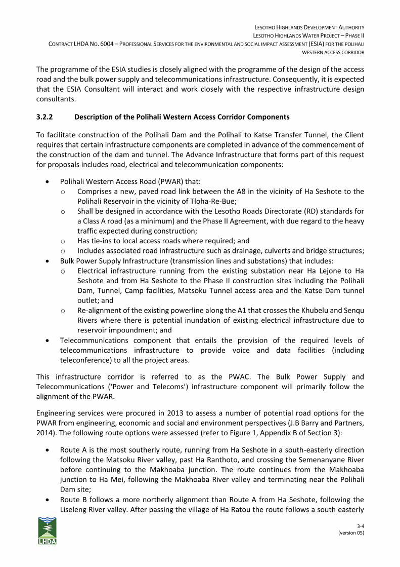
LESOTHO HIGHLANDS DEVELOPMENT AUTHORITY LESOTHO HIGHLANDS WATER PROJECT – PHASE II
CONTRACT LHDA NO. 6004 – PROFESSIONAL SERVICES FOR THE ENVIRONMENTAL AND SOCIAL IMPACT ASSESSMENT (ESIA) FOR THE POLIHALI
WESTERN ACCESS CORRIDOR
3-4 (version 05)
The programme of the ESIA studies is closely aligned with the programme of the design of the access road and the bulk power supply and telecommunications infrastructure. Consequently, it is expected that the ESIA Consultant will interact and work closely with the respective infrastructure design consultants.
3.2.2 Description of the Polihali Western Access Corridor Components
To facilitate construction of the Polihali Dam and the Polihali to Katse Transfer Tunnel, the Client requires that certain infrastructure components are completed in advance of the commencement of the construction of the dam and tunnel. The Advance Infrastructure that forms part of this request for proposals includes road, electrical and telecommunication components:
Polihali Western Access Road (PWAR) that: o Comprises a new, paved road link between the A8 in the vicinity of Ha Seshote to the
Polihali Reservoir in the vicinity of Tloha-Re-Bue; o Shall be designed in accordance with the Lesotho Roads Directorate (RD) standards for
a Class A road (as a minimum) and the Phase II Agreement, with due regard to the heavy traffic expected during construction;
o Has tie-ins to local access roads where required; and o Includes associated road infrastructure such as drainage, culverts and bridge structures;
Bulk Power Supply Infrastructure (transmission lines and substations) that includes: o Electrical infrastructure running from the existing substation near Ha Lejone to Ha
Seshote and from Ha Seshote to the Phase II construction sites including the Polihali Dam, Tunnel, Camp facilities, Matsoku Tunnel access area and the Katse Dam tunnel outlet; and
o Re-alignment of the existing powerline along the A1 that crosses the Khubelu and Senqu Rivers where there is potential inundation of existing electrical infrastructure due to reservoir impoundment; and
Telecommunications component that entails the provision of the required levels of telecommunications infrastructure to provide voice and data facilities (including teleconference) to all the project areas.
This infrastructure corridor is referred to as the PWAC. The Bulk Power Supply and Telecommunications (‘Power and Telecoms’) infrastructure component will primarily follow the alignment of the PWAR.
Engineering services were procured in 2013 to assess a number of potential road options for the PWAR from engineering, economic and social and environment perspectives (J.B Barry and Partners, 2014). The following route options were assessed (refer to Figure 1, Appendix B of Section 3):
Route A is the most southerly route, running from Ha Seshote in a south-easterly direction following the Matsoku River valley, past Ha Ranthoto, and crossing the Semenanyane River before continuing to the Makhoaba junction. The route continues from the Makhoaba junction to Ha Mei, following the Makhoaba River valley and terminating near the Polihali Dam site;
Route B follows a more northerly alignment than Route A from Ha Seshote, following the Liseleng River valley. After passing the village of Ha Ratou the route follows a south easterly
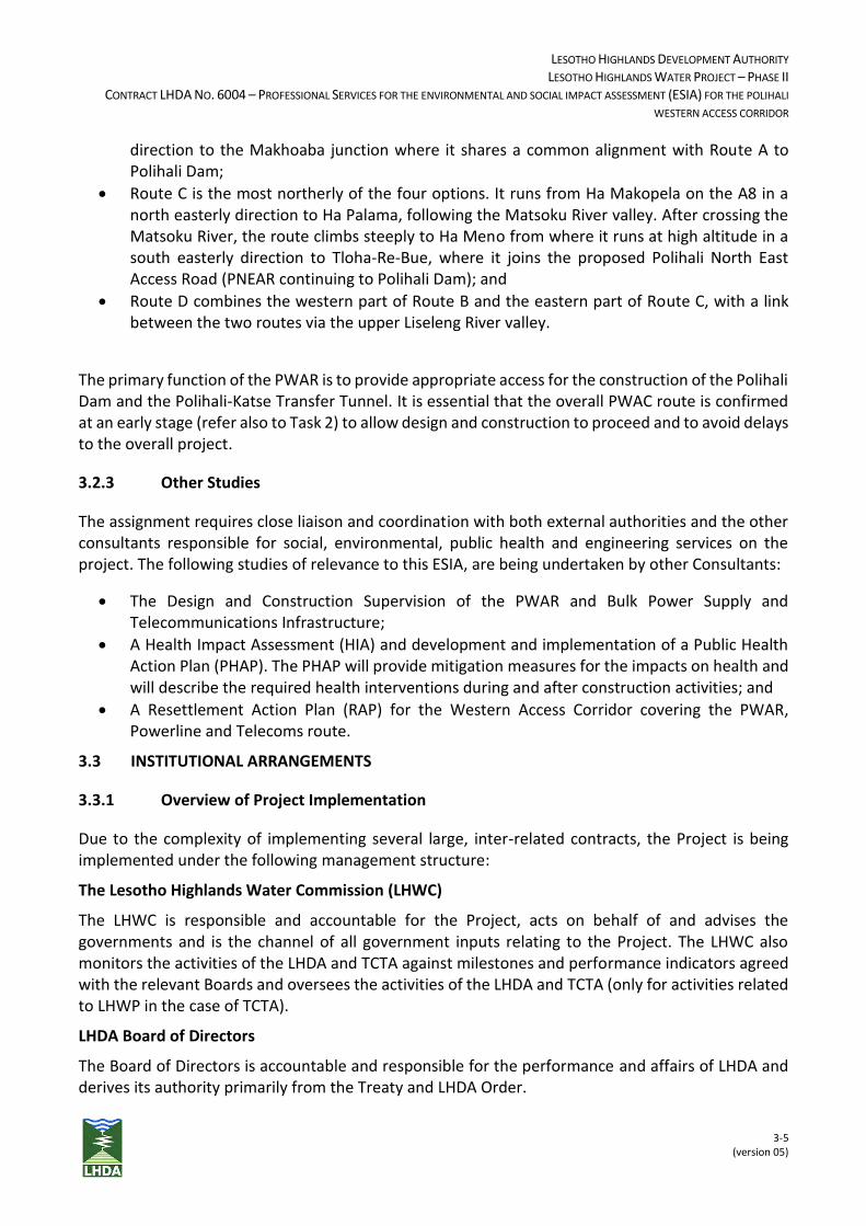
LESOTHO HIGHLANDS DEVELOPMENT AUTHORITY LESOTHO HIGHLANDS WATER PROJECT – PHASE II
CONTRACT LHDA NO. 6004 – PROFESSIONAL SERVICES FOR THE ENVIRONMENTAL AND SOCIAL IMPACT ASSESSMENT (ESIA) FOR THE POLIHALI
WESTERN ACCESS CORRIDOR
3-5 (version 05)
direction to the Makhoaba junction where it shares a common alignment with Route A to Polihali Dam;
Route C is the most northerly of the four options. It runs from Ha Makopela on the A8 in a north easterly direction to Ha Palama, following the Matsoku River valley. After crossing the Matsoku River, the route climbs steeply to Ha Meno from where it runs at high altitude in a south easterly direction to Tloha-Re-Bue, where it joins the proposed Polihali North East Access Road (PNEAR continuing to Polihali Dam); and
Route D combines the western part of Route B and the eastern part of Route C, with a link between the two routes via the upper Liseleng River valley.
The primary function of the PWAR is to provide appropriate access for the construction of the Polihali Dam and the Polihali-Katse Transfer Tunnel. It is essential that the overall PWAC route is confirmed at an early stage (refer also to Task 2) to allow design and construction to proceed and to avoid delays to the overall project.
3.2.3 Other Studies
The assignment requires close liaison and coordination with both external authorities and the other consultants responsible for social, environmental, public health and engineering services on the project. The following studies of relevance to this ESIA, are being undertaken by other Consultants:
The Design and Construction Supervision of the PWAR and Bulk Power Supply and Telecommunications Infrastructure;
A Health Impact Assessment (HIA) and development and implementation of a Public Health Action Plan (PHAP). The PHAP will provide mitigation measures for the impacts on health and will describe the required health interventions during and after construction activities; and
A Resettlement Action Plan (RAP) for the Western Access Corridor covering the PWAR, Powerline and Telecoms route.
3.3 INSTITUTIONAL ARRANGEMENTS
3.3.1 Overview of Project Implementation
Due to the complexity of implementing several large, inter-related contracts, the Project is being implemented under the following management structure:
The Lesotho Highlands Water Commission (LHWC)
The LHWC is responsible and accountable for the Project, acts on behalf of and advises the governments and is the channel of all government inputs relating to the Project. The LHWC also monitors the activities of the LHDA and TCTA against milestones and performance indicators agreed with the relevant Boards and oversees the activities of the LHDA and TCTA (only for activities related to LHWP in the case of TCTA).
LHDA Board of Directors
The Board of Directors is accountable and responsible for the performance and affairs of LHDA and derives its authority primarily from the Treaty and LHDA Order.
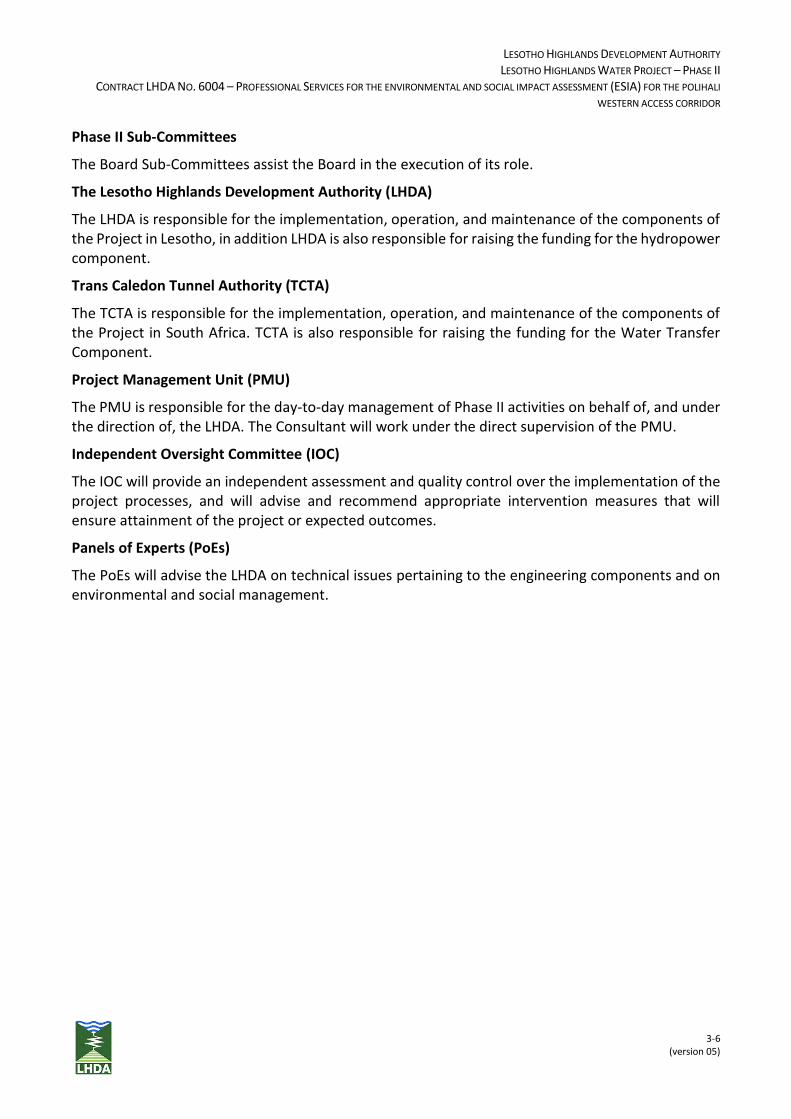
LESOTHO HIGHLANDS DEVELOPMENT AUTHORITY LESOTHO HIGHLANDS WATER PROJECT – PHASE II
CONTRACT LHDA NO. 6004 – PROFESSIONAL SERVICES FOR THE ENVIRONMENTAL AND SOCIAL IMPACT ASSESSMENT (ESIA) FOR THE POLIHALI
WESTERN ACCESS CORRIDOR
3-6 (version 05)
Phase II Sub-Committees
The Board Sub-Committees assist the Board in the execution of its role.
The Lesotho Highlands Development Authority (LHDA)
The LHDA is responsible for the implementation, operation, and maintenance of the components of the Project in Lesotho, in addition LHDA is also responsible for raising the funding for the hydropower component.
Trans Caledon Tunnel Authority (TCTA)
The TCTA is responsible for the implementation, operation, and maintenance of the components of the Project in South Africa. TCTA is also responsible for raising the funding for the Water Transfer Component.
Project Management Unit (PMU)
The PMU is responsible for the day-to-day management of Phase II activities on behalf of, and under the direction of, the LHDA. The Consultant will work under the direct supervision of the PMU.
Independent Oversight Committee (IOC)
The IOC will provide an independent assessment and quality control over the implementation of the project processes, and will advise and recommend appropriate intervention measures that will ensure attainment of the project or expected outcomes.
Panels of Experts (PoEs)
The PoEs will advise the LHDA on technical issues pertaining to the engineering components and on environmental and social management.
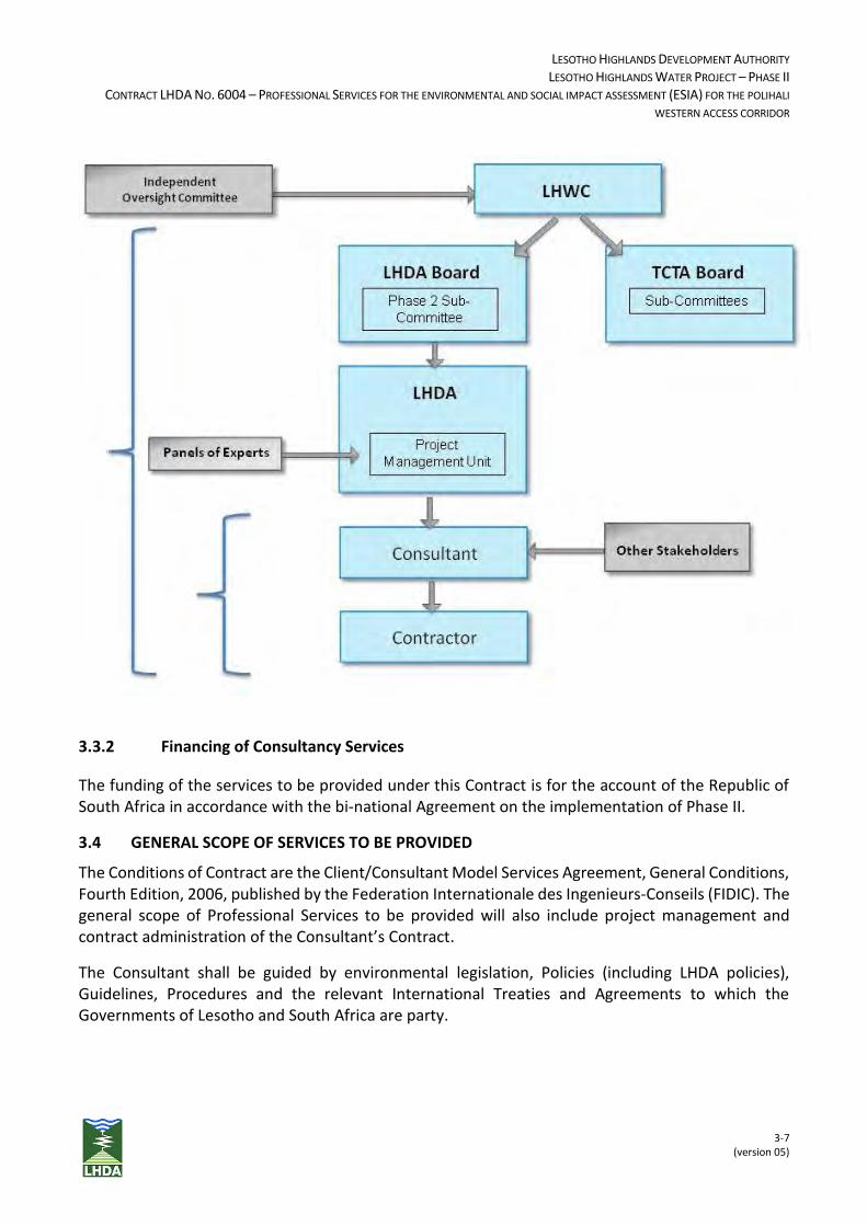
LESOTHO HIGHLANDS DEVELOPMENT AUTHORITY LESOTHO HIGHLANDS WATER PROJECT – PHASE II
CONTRACT LHDA NO. 6004 – PROFESSIONAL SERVICES FOR THE ENVIRONMENTAL AND SOCIAL IMPACT ASSESSMENT (ESIA) FOR THE POLIHALI
WESTERN ACCESS CORRIDOR
3-7 (version 05)
3.3.2 Financing of Consultancy Services
The funding of the services to be provided under this Contract is for the account of the Republic of South Africa in accordance with the bi-national Agreement on the implementation of Phase II.
3.4 GENERAL SCOPE OF SERVICES TO BE PROVIDED
The Conditions of Contract are the Client/Consultant Model Services Agreement, General Conditions, Fourth Edition, 2006, published by the Federation Internationale des Ingenieurs-Conseils (FIDIC). The general scope of Professional Services to be provided will also include project management and contract administration of the Consultant’s Contract.
The Consultant shall be guided by environmental legislation, Policies (including LHDA policies), Guidelines, Procedures and the relevant International Treaties and Agreements to which the Governments of Lesotho and South Africa are party.
LESOTHO HIGHLANDS DEVELOPMENT AUTHORITY LESOTHO HIGHLANDS WATER PROJECT – PHASE II
CONTRACT LHDA NO. 6004 – PROFESSIONAL SERVICES FOR THE ENVIRONMENTAL AND SOCIAL IMPACT ASSESSMENT (ESIA) FOR THE POLIHALI
WESTERN ACCESS CORRIDOR
3-8 (version 05)
3.5 SPECIFIC SCOPE OF SERVICES AND DELIVERABLES
In terms of Part V, Section 19(1) of the Lesotho Environment Act No. 10 of 2008, an Environmental and Social Impact Assessment (ESIA)1 shall be undertaken on projects and activities specified in Part A of the First Schedule. This Request for Proposals is for ESIA consulting services for the construction and establishment of the Advance Infrastructure components listed in Section 3.2.1. The ESIA Consultant shall assign appropriate human resources, budget and time to each of the following Tasks (and sub-Tasks where indicated) to undertake the Services.
3.5.1 Task 1 – Inception Report and Work Programme
During the initial or Inception Phase of the consultancy, the Consultant shall undertake a desktop study to review all relevant documentation and analyse information to inform how the study would be approached. The Consultant shall refer to lessons learned from the previous Phase I studies.
Deliverables
An Inception Report that provides a detailed description of the project tasks; confirms or proposes revisions to the methods contained in the proposal; resource allocation; work programme; and budget.
3.5.2 Task 2 – Route Selection
In line with the requirements of Section 21(5d) of the Environment Act of 2008 and the EIA Guidelines (2002), the Consultant shall undertake a comparative analysis of all the PWAR route options identified in the Barry (2014) report using existing data and additional information that will be collected to demonstrate the merits and demerits of all route options. The Consultant shall produce a Report which considers socio-economic, environmental, economic viability, engineering and Phase II project impacts in determining the optimum route. This task requires close collaboration with the Engineering consultants.
Deliverables
Report recommending, with motivation, the preferred route option and the area of influence of the road, powerline and telecommunication corridor for the Client’s approval.
3.5.3 Task 3 – Specialist Studies
The Consultant shall undertake specialist studies to document the biophysical and socio-economic baseline conditions within the study area. The Client considers the following specialists to be key:
Ecologist/Biologist;
Wetland;
Bird;
Visual Impact;
1 It should be noted that the Environmental and Social Impact Assessment (ESIA) is referred to as an Environmental Impact Assessment (EIA) in the Lesotho Environment Act No. 10 of 2008.
LESOTHO HIGHLANDS DEVELOPMENT AUTHORITY LESOTHO HIGHLANDS WATER PROJECT – PHASE II
CONTRACT LHDA NO. 6004 – PROFESSIONAL SERVICES FOR THE ENVIRONMENTAL AND SOCIAL IMPACT ASSESSMENT (ESIA) FOR THE POLIHALI
WESTERN ACCESS CORRIDOR
3-9 (version 05)
Cultural/Heritage;
Social; and
Public Participation.
However, the Consultant may suggest additional specialist studies with motivation.
Deliverables
Specialist studies that comply with the national EIA Guidelines (2002).
3.5.4 Task 4 - Public Participation Process
A public participation process as required by the national environmental legislation and that is suitable for the remote rural environment in which the project is located, and also meets national and international public participation needs for this assignment. The findings of the public participation process shall be incorporated in the Environmental and Social Impact Statement (ESIS) and in the EMP. Proposed methods and techniques are to be included in the Inception Report.
Deliverables
A report detailing the public participation process undertaken.
3.5.5 Task 5 - Environmental and Social Impact Statement
An ESIS that includes an Environmental Management Plan (EMP) and Specialist Reports as annexures shall be prepared for the PWAC infrastructure components in accordance with the requirements of the Lesotho Environment Act, specifically Section 21(5), and the Lesotho EIA Guidelines (2002).
In terms of Section 21(6) of the Environment Act of 2008, an ESIS requires a full description of mitigation measures or controls that will be implemented to prevent, reduce, or otherwise manage the environmental effects of the project. The EMP shall describe how these measures will be implemented. The Consultant shall therefore prepare a stand-alone EMP that contains environmental management objectives and targets that can be audited and that are repeatable.
The Consultant shall liaise closely with the Road Design Consultants and the Bulk Power and Telecommunications Design Consultants during the development of the EMP as the EMP shall be included in the tender documents these Consultants will issue to Contractors.
The Consultant and key specialists shall be required to present the findings of the ESIS, EMP and specialist studies to the Client in Maseru.
Deliverables
ESIS for PWAC components including EMP and Specialist Studies that meets the requirements of the Environment Act of 2008 and EIA Guidelines (2002). ESIS shall be prepared for review and acceptance by the Client prior to submission to the Department of Environment (DoE) who shall issue a Record of Decision (RoD).
LESOTHO HIGHLANDS DEVELOPMENT AUTHORITY LESOTHO HIGHLANDS WATER PROJECT – PHASE II
CONTRACT LHDA NO. 6004 – PROFESSIONAL SERVICES FOR THE ENVIRONMENTAL AND SOCIAL IMPACT ASSESSMENT (ESIA) FOR THE POLIHALI
WESTERN ACCESS CORRIDOR
3-10 (version 05)
3.5.6 Project Management
The Consultant will document the establishment and implementation of appropriate project controls and procedures for accurate reporting, tracking of progress and costs, risk management, contract management, change control and quality control.
3.5.6.1 Contract Administration
The Consultant shall implement document management, archives and communication protocols and procedures to ensure accurate retention of all project records and financial information.
3.5.6.2 Risk Management
The Consultant shall undertake an initial risk assessment and review and update this on a quarterly basis. The Risk Register shall be monitored on an ongoing basis and be included in the monthly reports.
3.5.6.3 Quality Management
The Consultant shall establish and implement an approved Quality Management System (QMS) for all contract documentation that, as a minimum, meets the requirements of ISO 9001. The QMS shall include a change control procedure, to manage all scope changes through the life of the project.
3.5.6.4 Occupational Health & Safety Management
The Consultant shall develop an Occupational Health and Safety (OHS) monitoring system to monitor, record and report on incidents, severity and frequency ratings such that proactive steps can be taken to minimize unsafe activities. A zero tolerance standard for non-compliance should be implemented.
3.5.6.5 Time Management
The Consultant shall prepare a comprehensive Work Programme for the Consultancy Contract with milestones and key dates for important milestones and for completion of all work activities to be carried out during all the stages of preparing the ESIA. The programme, including all milestones, will be subject to the approval of the Client and other authorities where required.
This Work Programme shall be based on the Programme which was included in the proposal submitted by the Consultant. The programme should refer to specific times when interaction with Heritage, Public Health, RAP, Engineering and Planning consultants will take place to ensure environmental issues inform the site form and layout. Once accepted by the Client, the Programme shall form the Baseline Programme against which progress with work on the project will be monitored and will be referred to as the Approved Programme. Any deviations from or changes to the Approved Programme shall require the approval of the Client. The Approved Programme shall be included in the Inception Report.
LESOTHO HIGHLANDS DEVELOPMENT AUTHORITY LESOTHO HIGHLANDS WATER PROJECT – PHASE II
CONTRACT LHDA NO. 6004 – PROFESSIONAL SERVICES FOR THE ENVIRONMENTAL AND SOCIAL IMPACT ASSESSMENT (ESIA) FOR THE POLIHALI
WESTERN ACCESS CORRIDOR
3-11 (version 05)
3.5.6.6 Cost Control
The Consultant shall be responsible for monitoring costs incurred in carrying out the consultancy contract relative to the contract budget. To this end, the Consultant shall, each month, prepare an updated estimate of the final cost of the contract, incorporating costs of variation orders, escalation and projected expenditure from provisional sums and on disbursements.
3.5.6.7 Resource Management
The Consultant shall provide adequately qualified and competent staff to carry out all of the Services required in this Contract. The structure of the organization in the project team shall be graphically represented in an organisation chart, which shall be updated to reflect any and all staff changes, and shall be submitted in the Consultant’s monthly progress reports.
3.5.6.8 Reporting
The Consultant shall prepare monthly progress reports covering all aspects of the consultancy contract in a format to be approved by the Client, giving concise details of the status of the Services, projected cash flow versus project budget, progress against the Approved Programme, and details of claims and variation orders, and their impact on the Contract Price and Time for Completion. Monthly Reports shall contain a schedule of total monthly and accumulative Fees for Lesotho Nationals, RSA Black Individuals and Total Fees (including Sub-Consultants).
3.5.6.9 Assistance to the Client
The Consultant shall cooperate with the Client's Engineering and Environmental Panels of Experts (PoE) and other persons visiting the Project for official review and appraisal purposes. The Consultant shall attend meetings with such persons as required in Maseru and on site, and make technical presentations to highlight issues, difficulties and proposed solutions, and the cost and programme implications thereof.
Such presentations will take place at intervals of approximately 4 to 6 months and will span a period of 1 to 2 weeks for each of the Panels, during which time the Panels will visit all project sites, including the tunnel sites. The technical presentations should include slides, overheads and formal handouts as best serves the need. Other official Project visits normally involve the Consultant for one day.
3.5.7 Summary of Reports and Deliverables
The Consultant shall produce any other reports as required by the Client. All reports shall be in the English language and submitted with all supporting documentation in a format that is acceptable to the Client. In general, two (2) hardcopies and an electronic copy of these reports will be required. Where appropriate for incorporation in PMU reporting, native file copies shall also be submitted. Technical reports shall be submitted in draft for review and comment by the client, followed by the final report incorporating these comments. Draft documents are not required for progress reports. It should be noted that in addition to the number of report copies required by the Client, the Consultant shall prepare fifteen (15) hard copies of the ESIS including annexures (Specialist Reports and EMP) as required by the DoE.
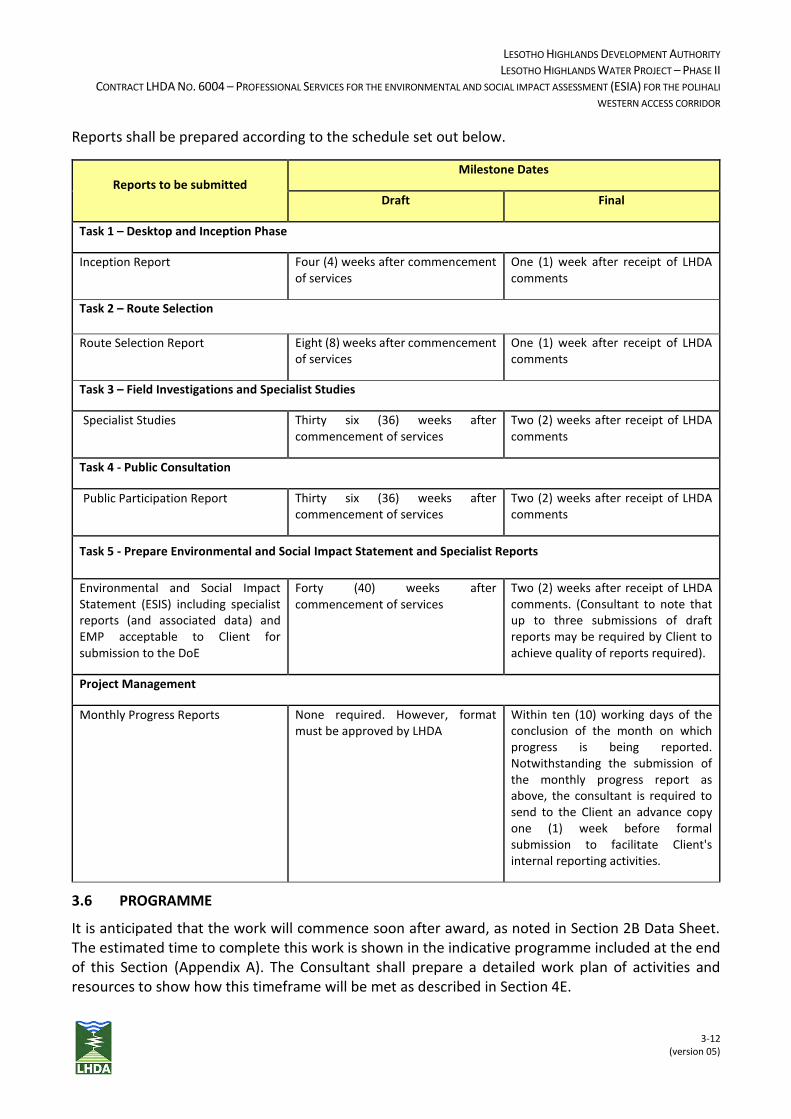
LESOTHO HIGHLANDS DEVELOPMENT AUTHORITY LESOTHO HIGHLANDS WATER PROJECT – PHASE II
CONTRACT LHDA NO. 6004 – PROFESSIONAL SERVICES FOR THE ENVIRONMENTAL AND SOCIAL IMPACT ASSESSMENT (ESIA) FOR THE POLIHALI
WESTERN ACCESS CORRIDOR
3-12 (version 05)
Reports shall be prepared according to the schedule set out below.
Reports to be submitted Milestone Dates
Draft Final
Task 1 – Desktop and Inception Phase
Inception Report Four (4) weeks after commencement of services
One (1) week after receipt of LHDA comments
Task 2 – Route Selection
Route Selection Report Eight (8) weeks after commencement of services
One (1) week after receipt of LHDA comments
Task 3 – Field Investigations and Specialist Studies
Specialist Studies Thirty six (36) weeks after commencement of services
Two (2) weeks after receipt of LHDA comments
Task 4 - Public Consultation
Public Participation Report Thirty six (36) weeks after commencement of services
Two (2) weeks after receipt of LHDA comments
Task 5 - Prepare Environmental and Social Impact Statement and Specialist Reports
Environmental and Social Impact Statement (ESIS) including specialist reports (and associated data) and EMP acceptable to Client for submission to the DoE
Forty (40) weeks after commencement of services
Two (2) weeks after receipt of LHDA comments. (Consultant to note that up to three submissions of draft reports may be required by Client to achieve quality of reports required).
Project Management
Monthly Progress Reports None required. However, format must be approved by LHDA
Within ten (10) working days of the conclusion of the month on which progress is being reported. Notwithstanding the submission of the monthly progress report as above, the consultant is required to send to the Client an advance copy one (1) week before formal submission to facilitate Client's internal reporting activities.
3.6 PROGRAMME
It is anticipated that the work will commence soon after award, as noted in Section 2B Data Sheet. The estimated time to complete this work is shown in the indicative programme included at the end of this Section (Appendix A). The Consultant shall prepare a detailed work plan of activities and resources to show how this timeframe will be met as described in Section 4E.
LESOTHO HIGHLANDS DEVELOPMENT AUTHORITY LESOTHO HIGHLANDS WATER PROJECT – PHASE II
CONTRACT LHDA NO. 6004 – PROFESSIONAL SERVICES FOR THE ENVIRONMENTAL AND SOCIAL IMPACT ASSESSMENT (ESIA) FOR THE POLIHALI
WESTERN ACCESS CORRIDOR
3-13 (version 05)
The Programme shall reference interdependencies between tasks/sub-tasks. All tasks and sub-tasks shall be allotted a fixed duration. There shall be no “open-ended” tasks.
Personnel input in person-days (months) for each task/sub-task must be included in the Technical Proposal (See Section 4F).
3.7 COORDINATION
The programme of the ESIA studies is closely aligned with the programme of the Road Design Consultants and the Bulk Power and Telecommunications Design Consultants. It is therefore anticipated that the ESIA Consultants will interact and work closely with the respective Design Consultants.
Similarly, the ESIA Consultants will be expected to interact and work closely with the RAP Consultants who will be addressing resettlement issues along the PWAC. Resettlement references should include (a) anticipated magnitude of asset losses, and economic and physical displacement, (b) reference to the Compensation Policy, (c) outline of the resettlement programme (detailed information will be provided by Resettlement Action Plan (RAP) Consultant) and (d) an outline of a RAP based on information provided by the RAP Consultant.
A separate Health Impact Assessment (HIA) and Public Health Action Plan (PHAP) will be undertaken for Phase II. The ESIA Consultant shall also work closely with the HIA and PHAP Consultant.
The Consultant will be required to liaise and coordinate with the following entities, as appropriate:
Infrastructure (Road and Bulk Power Supply and Telecommunications) Consulting Engineers;
Lesotho Roads Directorate – Environmental Manager;
Lesotho Electricity Company – Environmental Manager;
Telecomm Lesotho – Environmental Manager or Representative;
Department of Environment
Department of Culture;
Department of Water Affairs – Wetland Unit and others;
LHDA Polihali Operations Branch Manager and staff;
District Government Line Ministries;
Non-Governmental Organisations (NGOs);
Affected Communities through relevant leadership structures (District and Community Councils, District Administrators, Community Councillors Chiefs, etc); and
Other Phase II Consultants such as the Consulting Engineers, RAP Consultant and Public Health Impact Assessment Consultants (to be appointed under separate contracts).
The PMU has implemented Oracle Primavera Unifier for managing design-, planning-, and construction-related work processes including correspondence routing; document submission, review, and approvals; and processing of requests for payment. The Consultant shall use this system for all formal communications related to the Services. The PMU will provide training and support to the Consultant’s personnel.
LESOTHO HIGHLANDS DEVELOPMENT AUTHORITY LESOTHO HIGHLANDS WATER PROJECT – PHASE II
CONTRACT LHDA NO. 6004 – PROFESSIONAL SERVICES FOR THE ENVIRONMENTAL AND SOCIAL IMPACT ASSESSMENT (ESIA) FOR THE POLIHALI
WESTERN ACCESS CORRIDOR
3-14 (version 05)
All Consultant activities shall be performed in accordance with project policies and procedures as outlined in the LHWP2 Project Procedures for Professional Service Consultants to be appended to the contract for professional services.
Consultant shall document meetings with other agencies or stakeholders and provide copies of same. Each professional services consultant on the project is dependent on information from other consultants (Social, Public Health, Resettlement Action Plan, Environmental and Engineering) and each provides information to the other consultants. Hence the Consultant shall provide information to the project as soon as it is available, if necessary in preliminary form, and shall accept a progressive development of the deliverables as information becomes available and is confirmed.
The Consultant shall conduct regular coordination and monthly progress meetings with the PMU and other interested parties. The Consultant shall prepare and distribute the agenda one (1) week in advance, prepare draft minutes within three (3) working days and distribute after review by the PMU. The Consultant shall document meetings with other agencies or stakeholders and provide copies of same.
3.8 INFORMATION AND FACILITIES TO BE MADE AVAILABLE BY THE CLIENT
After award, the Client will provide LHDA-generated documentation and information related to the LHWP that may be required by the Consultant in pursuing the tasks under these Terms of Reference. Specific documents to be provided include:
Phase II Feasibility Report (SEED, 2008);
Phase II Social and Biological Baseline Study reports (CES, 2014); and
Polihali Western Access Road Route Selection Study Report and Drawings and Addendum to Route Selection Report (JB Barry and Partners, Consulting Engineers, 2014).
The Client will provide written confirmation of Consultant’s participation in the Project (e.g. letters of introduction) for the purposes of obtaining work, residence, and other permits as required by the laws of Lesotho for this consultancy assignment. While the Client may provide assistance where possible, it is solely the Consultant’s responsibility to comply with the laws of Lesotho.
3.9 FACILITIES TO BE PROVIDED BY THE CONSULTANT
The Consultant shall be responsible for providing office space for its team either in Lesotho or in South Africa, as appropriate. The Consultant will be solely responsible for the provision of all office equipment, tools, computers, printers, supplies, stationery, and communications and transport that may be required for the execution of the work. Costs for the production of reports shall be covered under the pay items for disbursements. Consultant shall also provide computers and required software for Consultant’s personnel.
3.10 TEAM COMPOSITION AND QUALIFICATION REQUIREMENTS FOR KEY STAFF
The Consultant shall assign sufficient suitably-qualified staff with adequate experience for the execution of the tasks involved. Considerable weight will be given to the qualifications and experience of senior staff assigned to the project as described in the Bidder’s proposal during evaluation. While the key posts and specialists nominated are considered by the Client to be of particular importance to the success of the proposed consultancy, a competent team comprises

LESOTHO HIGHLANDS DEVELOPMENT AUTHORITY LESOTHO HIGHLANDS WATER PROJECT – PHASE II
CONTRACT LHDA NO. 6004 – PROFESSIONAL SERVICES FOR THE ENVIRONMENTAL AND SOCIAL IMPACT ASSESSMENT (ESIA) FOR THE POLIHALI
WESTERN ACCESS CORRIDOR
3-15 (version 05)
many levels of expertise and cannot function without effectively skilled and experienced support staff. All staff shall be proficient in the English language.
The following paragraphs are brief descriptions of the experience, qualifications and duties that the Client considers will be required of the Consultant's key staff members for the team. Bids will be assessed against the desired minimum experience and qualification requirements in accordance with Section 7.1.
3.10.1 ESIA Project Manager/Team Leader
The ESIA Team Leader shall have a post graduate qualification in Natural/Environmental Science or other environmental-related discipline and at least 15 years of experience of managing and coordinating similar infrastructure ESIAs. The Team Leader shall also have specific experience in managing teams of specialists for studies associated with similar infrastructure projects (preferably in southern Africa and Lesotho). The CV of the ESIA Team Leader shall demonstrate the following competencies:
Ability to think holistically about the structure, functioning and performance of the environmental system and the ESIA procedure in Lesotho;
Ability to analyse the effects and impacts on the environment, so as to identify significant issues, problems and characteristics, and to distinguish between causes and symptoms;
Proficiency in integrating and co-ordinating the significant components of both the socio-economic and biophysical environments in such a way as to evaluate options and trade-offs, and facilitate sound decision-making;
Ability to make balanced judgements and to objectively evaluate alternatives;
A thorough understanding of the concept of sustainable development, ecological sustainability, social sustainability, equity and environmental justice, as well as economic efficiency;
Sound working knowledge of environmental policy and local legislation;
Ability to competently manage a multidisciplinary team;
Ability to involve specialists and draw terms of reference for the team of specialists needed to address particular aspects of the project, if necessary; and
Proficiency in interpersonal and communication skills, both in verbal and written form.
The Team Leader will be responsible for the collating of the various elements of the final ESIS. The team leader shall act as the interface between the Client, various specialists and the stakeholders. The team leader shall also be responsible for the interchange of data between their team and the Project Engineers and the Engineer’s Environmental Manager. The Team Leader shall be responsible for quality control of all project deliverables.
Specific Tasks to include: o Manage the Specialists, including the Public Consultation Process; o Collate Specialist Reports; o Attend progress meetings and report back on technical and financial matters; o Prepare Inception and Environmental and Social Impact Statements Reports; and o Liaise with Client, Engineers and other stakeholders.
LESOTHO HIGHLANDS DEVELOPMENT AUTHORITY LESOTHO HIGHLANDS WATER PROJECT – PHASE II
CONTRACT LHDA NO. 6004 – PROFESSIONAL SERVICES FOR THE ENVIRONMENTAL AND SOCIAL IMPACT ASSESSMENT (ESIA) FOR THE POLIHALI
WESTERN ACCESS CORRIDOR
3-16 (version 05)
3.10.2 Key Specialists
The key specialists on the Project Team shall include but not be limited to, the following fields:
Ecologist/Biologist;
Wetland Specialist;
Bird Specialist;
Visual Impact Specialist;
Cultural/Heritage Specialist;
Social Specialist; and
Public Participation Specialist.
Each Specialist shall have a relevant degree/qualification in their field of expertise and shall be able to demonstrate a minimum of five years’ appropriate experience in their fields. Specialist work experience in southern Africa in similar conditions on similar infrastructure projects will be an added advantage. Knowledge and previous application of the Lesotho Environment Act will also be an advantage.
3.11 LHDA YOUNG PROFESSIONAL-IN-TRAINING PROGRAMME AND CONTRACTOR SKILLS DEVELOPMENT
The LHDA intends to engage a number of entry-level, graduate professionals to be trained throughout the Project in several disciplines. Much of this training will be achieved via secondment to various consultants and contractors implementing the Project.
The Consultant is advised that entry-level graduates may be assigned by the LHDA to work with and under the direction and control of, the Consultant’s experienced staff. Remuneration (salary) will be at LHDA’s expense. The Consultant shall be responsible for site transportation, office facilities, equipment and consumables for LHDA young professionals.
The specific requirements for this Contract are as follows:
Number of Young-Professionals-in-Training:
Two (2) entry-level professionals will be assigned to this contract.
Accommodation and facilities
The Consultant shall provide housing and office accommodation and services commensurate with those provided to its own skilled junior-level staff.
The Consultant shall assign entry-level LHDA professionals to active positions on the team and shall assign them specific duties such that they obtain as broad a grasp as possible of the work required for executing a contract of this type. The Bidder shall include in the Proposal the roles and responsibilities to be assigned to the LHDA young professionals-in-training working under this Contract.
In addition, current students may be assigned to this contract for short-term experience (typically during academic holidays). These students will be assigned to gain experience alongside the permanent members of the Consultant’s team. Remuneration will be at LHDA’s expense. No more than four students will be allocated to the Consultant at any one time.
LESOTHO HIGHLANDS DEVELOPMENT AUTHORITY LESOTHO HIGHLANDS WATER PROJECT – PHASE II
CONTRACT LHDA NO. 6004 – PROFESSIONAL SERVICES FOR THE ENVIRONMENTAL AND SOCIAL IMPACT ASSESSMENT (ESIA) FOR THE POLIHALI
WESTERN ACCESS CORRIDOR
3-17 (version 05)
3.12 ASSESSMENT OF CONSULTANT’S PERFORMANCE
Bidders are advised that the LHDA will conduct periodic and end-of-contract reviews to assess performance under the contract. This assessment will include an appraisal of performance by the lead consultant, joint venture members, subsidiaries and sub-consultants. The Consultant’s performance will be rated based on criteria that have been mutually agreed upon by the LHDA and the Consultant at contract start-up.
The LHDA will have final say on the Consultant’s Performance Assessment Score. However, the Consultant will be provided the opportunity to add comments to the assessment form.
Consultant performance evaluations will be retained for the duration of the contract and then archived. Performance assessments may be used for future evaluation of a firm, including individual members of a joint venture and sub-consultants, in other short-listing or RFP processes for contracts of similar scope. The LHDA reserves the right to refuse to engage the Consultant, or member firms including sub-consultants, for services to be provided under future Phase II contracts if performance under the current contract has been deemed unsatisfactory.
SECTION 3 – TERMS OF REFERENCE
3-18 (version 05)
APPENDIX A
INDICATIVE MASTER SCHEDULE
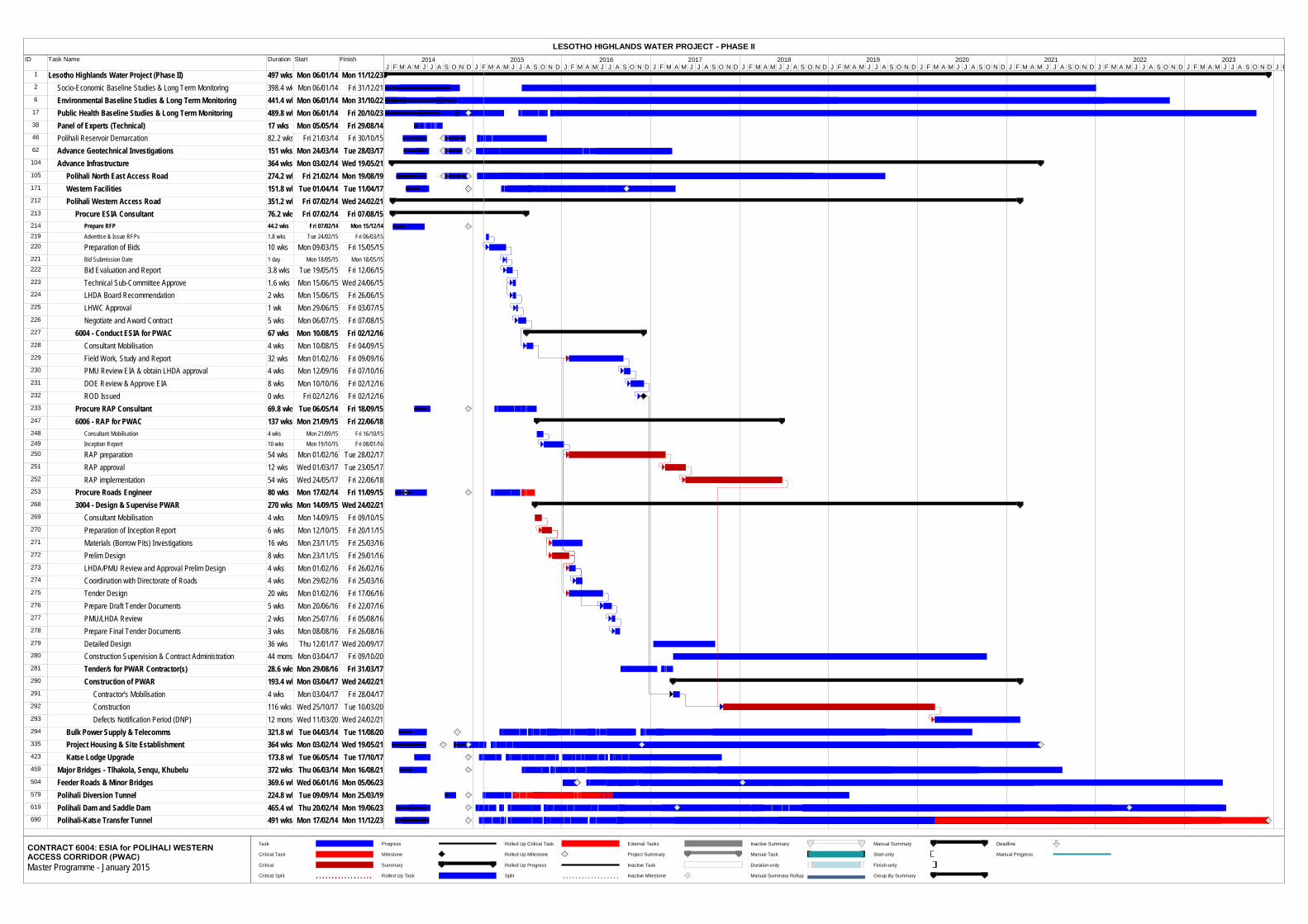
ID Task Name Duration Start Finish
1 Lesotho Highlands Water Project (Phase II) 497 wks Mon 06/01/14 Mon 11/12/232 Socio-Economic Baseline Studies & Long Term Monitoring 398.4 wksMon 06/01/14 Fri 31/12/216 Environmental Baseline Studies & Long Term Monitoring 441.4 wksMon 06/01/14 Mon 31/10/22
17 Public Health Baseline Studies & Long Term Monitoring 489.8 wksMon 06/01/14 Fri 20/10/2338 Panel of Experts (Technical) 17 wks Mon 05/05/14 Fri 29/08/1446 Polihali Reservoir Demarcation 82.2 wks Fri 21/03/14 Fri 30/10/1562 Advance Geotechnical Investigations 151 wks Mon 24/03/14 Tue 28/03/17104 Advance Infrastructure 364 wks Mon 03/02/14 Wed 19/05/21105 Polihali North East Access Road 274.2 wks Fri 21/02/14 Mon 19/08/19171 Western Facilities 151.8 wksTue 01/04/14 Tue 11/04/17212 Polihali Western Access Road 351.2 wks Fri 07/02/14 Wed 24/02/21213 Procure ESIA Consultant 76.2 wks Fri 07/02/14 Fri 07/08/15214 Prepare RFP 44.2 wks Fri 07/02/14 Mon 15/12/14219 Advertise & Issue RFPs 1.8 wks Tue 24/02/15 Fri 06/03/15220 Preparation of Bids 10 wks Mon 09/03/15 Fri 15/05/15221 Bid Submission Date 1 day Mon 18/05/15 Mon 18/05/15222 Bid Evaluation and Report 3.8 wks Tue 19/05/15 Fri 12/06/15223 Technical Sub-Committee Approve 1.6 wks Mon 15/06/15 Wed 24/06/15224 LHDA Board Recommendation 2 wks Mon 15/06/15 Fri 26/06/15225 LHWC Approval 1 wk Mon 29/06/15 Fri 03/07/15226 Negotiate and Award Contract 5 wks Mon 06/07/15 Fri 07/08/15227 6004 - Conduct ESIA for PWAC 67 wks Mon 10/08/15 Fri 02/12/16228 Consultant Mobilisation 4 wks Mon 10/08/15 Fri 04/09/15229 Field Work, Study and Report 32 wks Mon 01/02/16 Fri 09/09/16230 PMU Review EIA & obtain LHDA approval 4 wks Mon 12/09/16 Fri 07/10/16231 DOE Review & Approve EIA 8 wks Mon 10/10/16 Fri 02/12/16232 ROD Issued 0 wks Fri 02/12/16 Fri 02/12/16233 Procure RAP Consultant 69.8 wks Tue 06/05/14 Fri 18/09/15247 6006 - RAP for PWAC 137 wks Mon 21/09/15 Fri 22/06/18248 Consultant Mobilisation 4 wks Mon 21/09/15 Fri 16/10/15249 Inception Report 10 wks Mon 19/10/15 Fri 08/01/16250 RAP preparation 54 wks Mon 01/02/16 Tue 28/02/17251 RAP approval 12 wks Wed 01/03/17 Tue 23/05/17252 RAP implementation 54 wks Wed 24/05/17 Fri 22/06/18253 Procure Roads Engineer 80 wks Mon 17/02/14 Fri 11/09/15268 3004 - Design & Supervise PWAR 270 wks Mon 14/09/15 Wed 24/02/21269 Consultant Mobilisation 4 wks Mon 14/09/15 Fri 09/10/15270 Preparation of Inception Report 6 wks Mon 12/10/15 Fri 20/11/15271 Materials (Borrow Pits) Investigations 16 wks Mon 23/11/15 Fri 25/03/16272 Prelim Design 8 wks Mon 23/11/15 Fri 29/01/16273 LHDA/PMU Review and Approval Prelim Design 4 wks Mon 01/02/16 Fri 26/02/16274 Coordination with Directorate of Roads 4 wks Mon 29/02/16 Fri 25/03/16275 Tender Design 20 wks Mon 01/02/16 Fri 17/06/16276 Prepare Draft Tender Documents 5 wks Mon 20/06/16 Fri 22/07/16277 PMU/LHDA Review 2 wks Mon 25/07/16 Fri 05/08/16278 Prepare Final Tender Documents 3 wks Mon 08/08/16 Fri 26/08/16279 Detailed Design 36 wks Thu 12/01/17 Wed 20/09/17280 Construction Supervision & Contract Administration 44 mons Mon 03/04/17 Fri 09/10/20281 Tender/s for PWAR Contractor(s) 28.6 wks Mon 29/08/16 Fri 31/03/17290 Construction of PWAR 193.4 wksMon 03/04/17 Wed 24/02/21291 Contractor's Mobilisation 4 wks Mon 03/04/17 Fri 28/04/17292 Construction 116 wks Wed 25/10/17 Tue 10/03/20293 Defects Notification Period (DNP) 12 mons Wed 11/03/20 Wed 24/02/21294 Bulk Power Supply & Telecomms 321.8 wksTue 04/03/14 Tue 11/08/20335 Project Housing & Site Establishment 364 wks Mon 03/02/14 Wed 19/05/21423 Katse Lodge Upgrade 173.8 wksTue 06/05/14 Tue 17/10/17459 Major Bridges - Tlhakola, Senqu, Khubelu 372 wks Thu 06/03/14 Mon 16/08/21504 Feeder Roads & Minor Bridges 369.6 wksWed 06/01/16 Mon 05/06/23579 Polihali Diversion Tunnel 224.8 wksTue 09/09/14 Mon 25/03/19619 Polihali Dam and Saddle Dam 465.4 wksThu 20/02/14 Mon 19/06/23690 Polihali-Katse Transfer Tunnel 491 wks Mon 17/02/14 Mon 11/12/23
J F M A M J J A S O N D J F M A M J J A S O N D J F M A M J J A S O N D J F M A M J J A S O N D J F M A M J J A S O N D J F M A M J J A S O N D J F M A M J J A S O N D J F M A M J J A S O N D J F M A M J J A S O N D J F M A M J J A S O N D J F2014 2015 2016 2017 2018 2019 2020 2021 2022 2023
Task
Critical Task
Critical
Critical Split
Progress
Milestone
Summary
Rolled Up Task
Rolled Up Critical Task
Rolled Up Milestone
Rolled Up Progress
Split
External Tasks
Project Summary
Inactive Task
Inactive Milestone
Inactive Summary
Manual Task
Duration-only
Manual Summary Rollup
Manual Summary
Start-only
Finish-only
Group By Summary
Deadline
Manual Progress
LESOTHO HIGHLANDS WATER PROJECT - PHASE II
CONTRACT 6004: ESIA for POLIHALI WESTERNACCESS CORRIDOR (PWAC)Master Programme - January 2015
SECTION 3 – TERMS OF REFERENCE
3-19 (version 05)
APPENDIX B
STUDY AREA AND POLIHALI WESTERN ACCESS ROUTE CORRIDORS
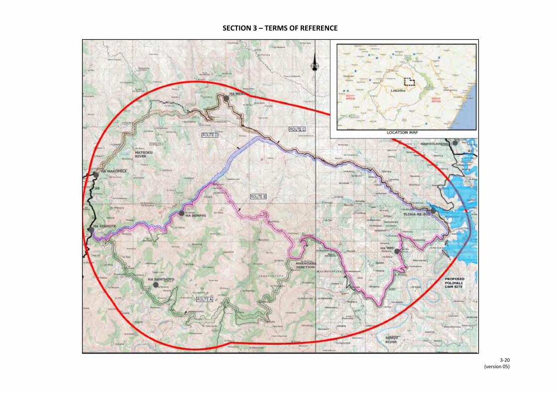
SECTION 3 – TERMS OF REFERENCE
3-20 (version 05)
Related Documents