Mike Buschermohle Precision Ag Specialist UT Extension Enhancing the Value of Precision Ag Data with Unmanned Aerial Systems (UASs)

Welcome message from author
This document is posted to help you gain knowledge. Please leave a comment to let me know what you think about it! Share it to your friends and learn new things together.
Transcript

Mike Buschermohle
Precision Ag Specialist
UT Extension
Enhancing the Value of Precision Ag Data with Unmanned Aerial Systems (UASs)
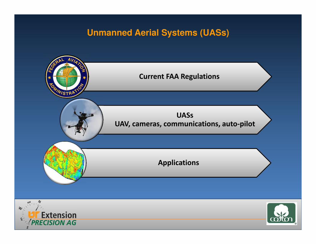
Unmanned Aerial Systems (UASs)
Current FAA Regulations
UASsUAV, cameras, communications, auto-pilot
Applications
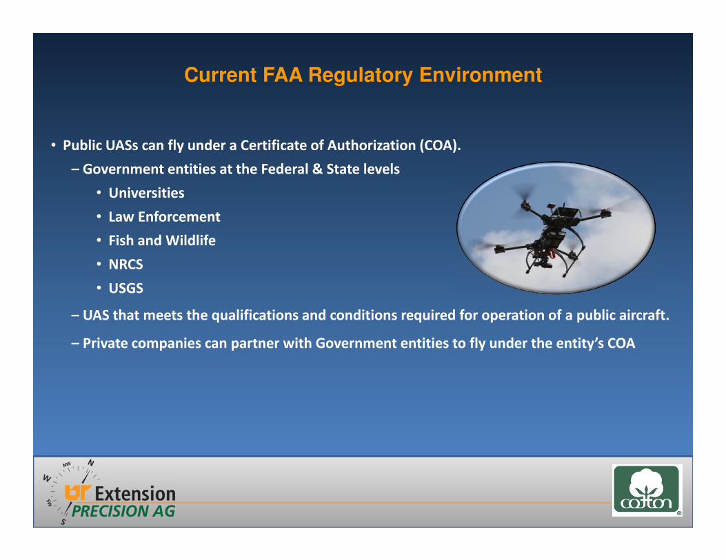
Current FAA Regulatory Environment
• Public UASs can fly under a Certificate of Authorization (COA).
– Government entities at the Federal & State levels
• Universities
• Law Enforcement
• Fish and Wildlife
• NRCS
• USGS
– UAS that meets the qualifications and conditions required for operation of a public aircraft.
– Private companies can partner with Government entities to fly under the entity’s COA
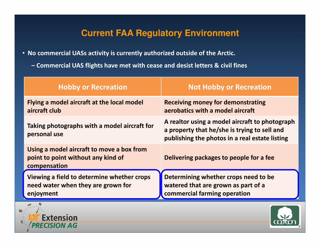
Current FAA Regulatory Environment
• No commercial UASs activity is currently authorized outside of the Arctic.
– Commercial UAS flights have met with cease and desist letters & civil fines
Hobby or Recreation Not Hobby or Recreation
Flying a model aircraft at the local model
aircraft club
Receiving money for demonstrating
aerobatics with a model aircraft
Taking photographs with a model aircraft for
personal use
A realtor using a model aircraft to photograph
a property that he/she is trying to sell and
publishing the photos in a real estate listing
Using a model aircraft to move a box from
point to point without any kind of
compensation
Delivering packages to people for a fee
Viewing a field to determine whether crops
need water when they are grown for
enjoyment
Determining whether crops need to be
watered that are grown as part of a
commercial farming operation

Current FAA Regulatory Environment
• Section 333 - Regulatory Exemptions that would allow UAS to operate commercially with FAA
approval before an UASs rule is adopted.
– Industries that have sought exemptions
� Motion Pictures (MPPA) - Granted September 25th 2014
� Precision agriculture
� Electric power line and pipeline inspection
� Oil and gas flare stack inspection
FAA mandated to develop a 5 year roadmap for “safe integration”
of UASs by September 30, 2015.
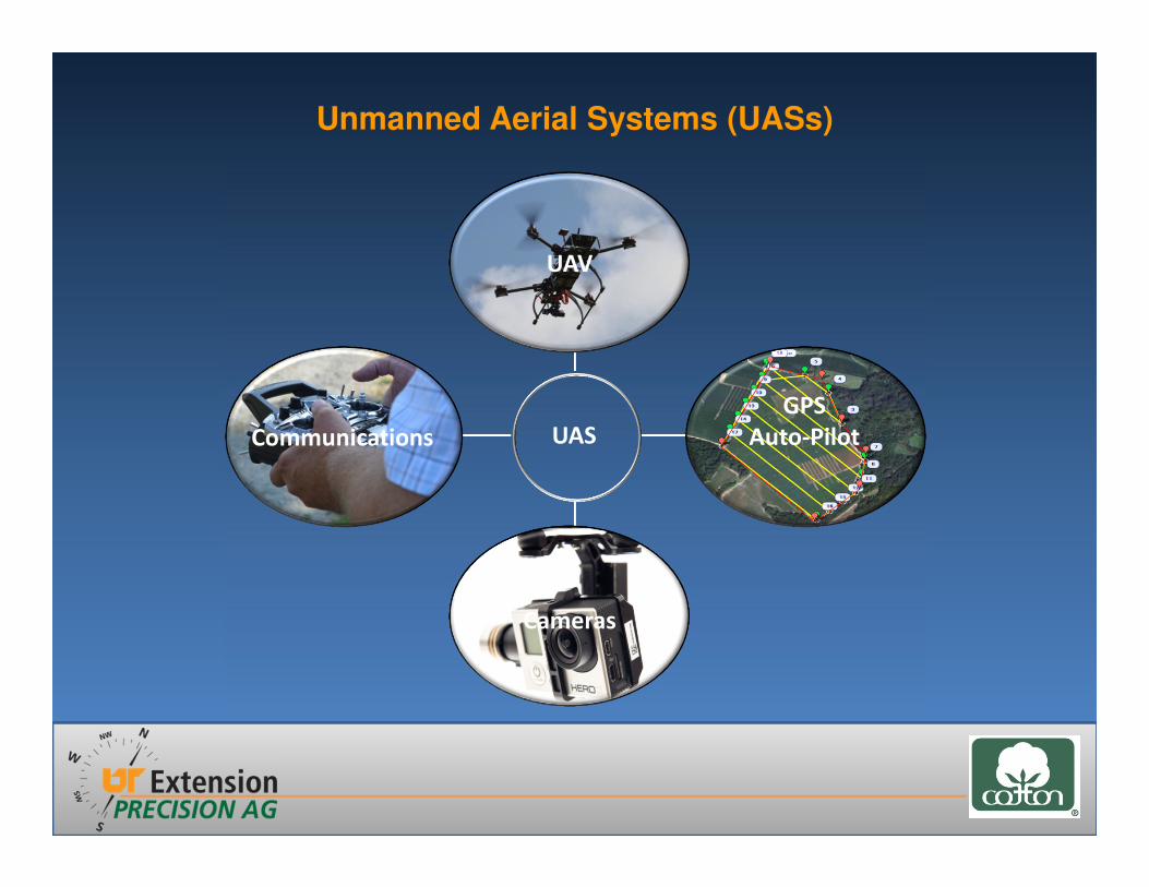
Unmanned Aerial Systems (UASs)
Communications
GPS
Auto-Pilot
UAV
Cameras
UAS

Unmanned Aerial Vehicles (UAVs)
Multirotor UASs
− Vertical takeoff and landings
− Ability to hover
− Limited flight time
− Difficult to fly if not fully automated
− Requires fully automated flight features for full usability
Fixed-Wing UASs
– Hand/catapult launched
– Longer flight time, can cover a lot of area
– Difficult to fly if not fully automated
– Requires fully automated flight features for full usability
– Minimal maintenance, modest expenses
AgriEye
senseFly
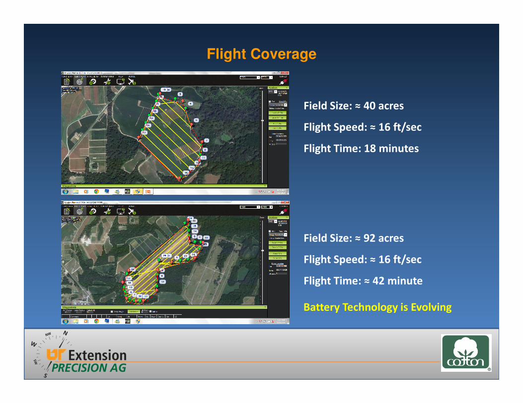
Flight Coverage
Field Size: ≈ 40 acres
Flight Speed: ≈ 16 ft/sec
Flight Time: 18 minutes
Field Size: ≈ 92 acres
Flight Speed: ≈ 16 ft/sec
Flight Time: ≈ 42 minute
Battery Technology is Evolving

Communications
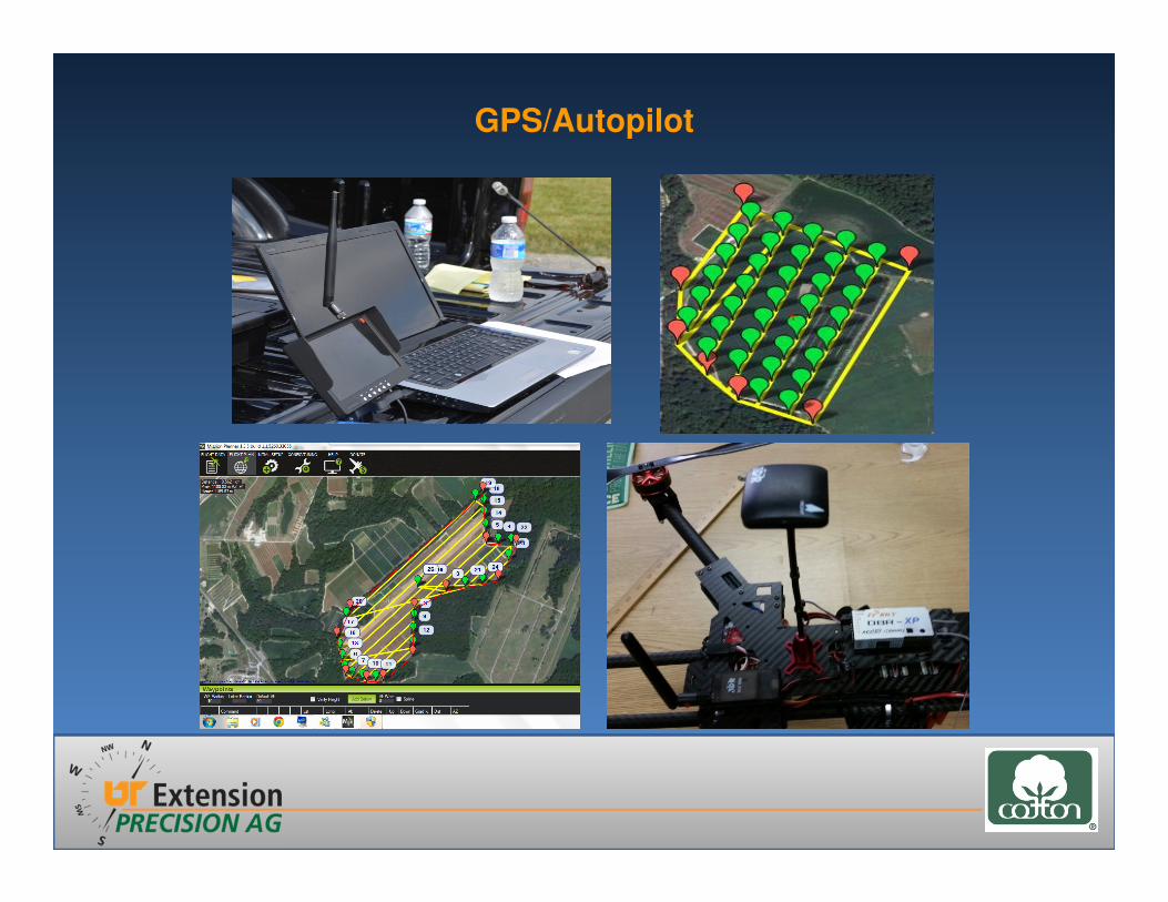
GPS/Autopilot
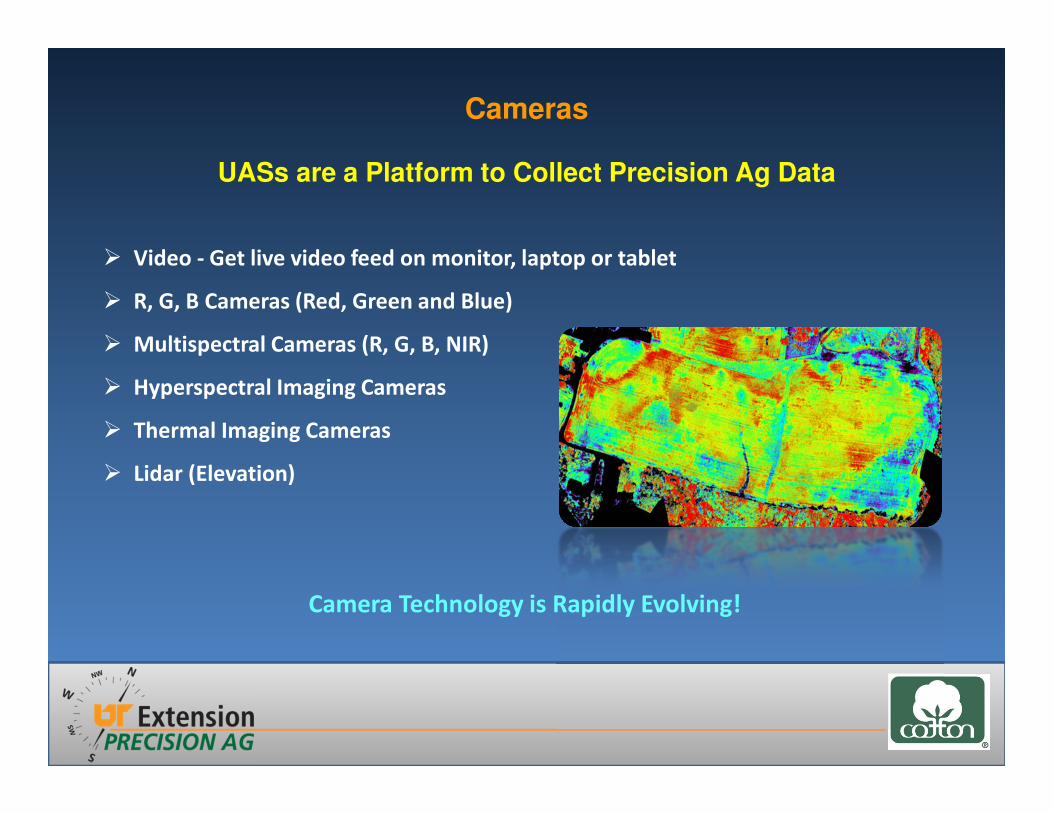
Cameras
� Video - Get live video feed on monitor, laptop or tablet
� R, G, B Cameras (Red, Green and Blue)
� Multispectral Cameras (R, G, B, NIR)
� Hyperspectral Imaging Cameras
� Thermal Imaging Cameras
� Lidar (Elevation)
UASs are a Platform to Collect Precision Ag Data
Camera Technology is Rapidly Evolving!
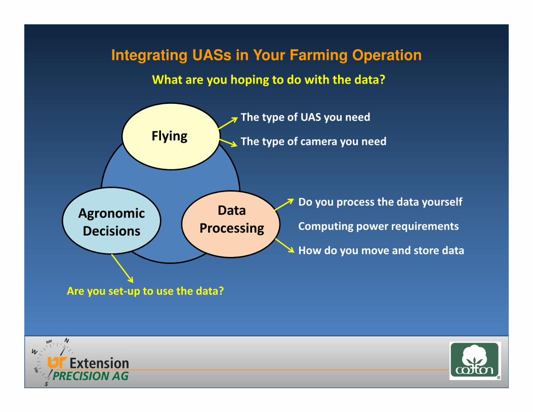
Are you set-up to use the data?
What are you hoping to do with the data?
Flying
Data
ProcessingAgronomic
Decisions
The type of UAS you need
The type of camera you need
Do you process the data yourself
Computing power requirements
How do you move and store data
Integrating UASs in Your Farming Operation
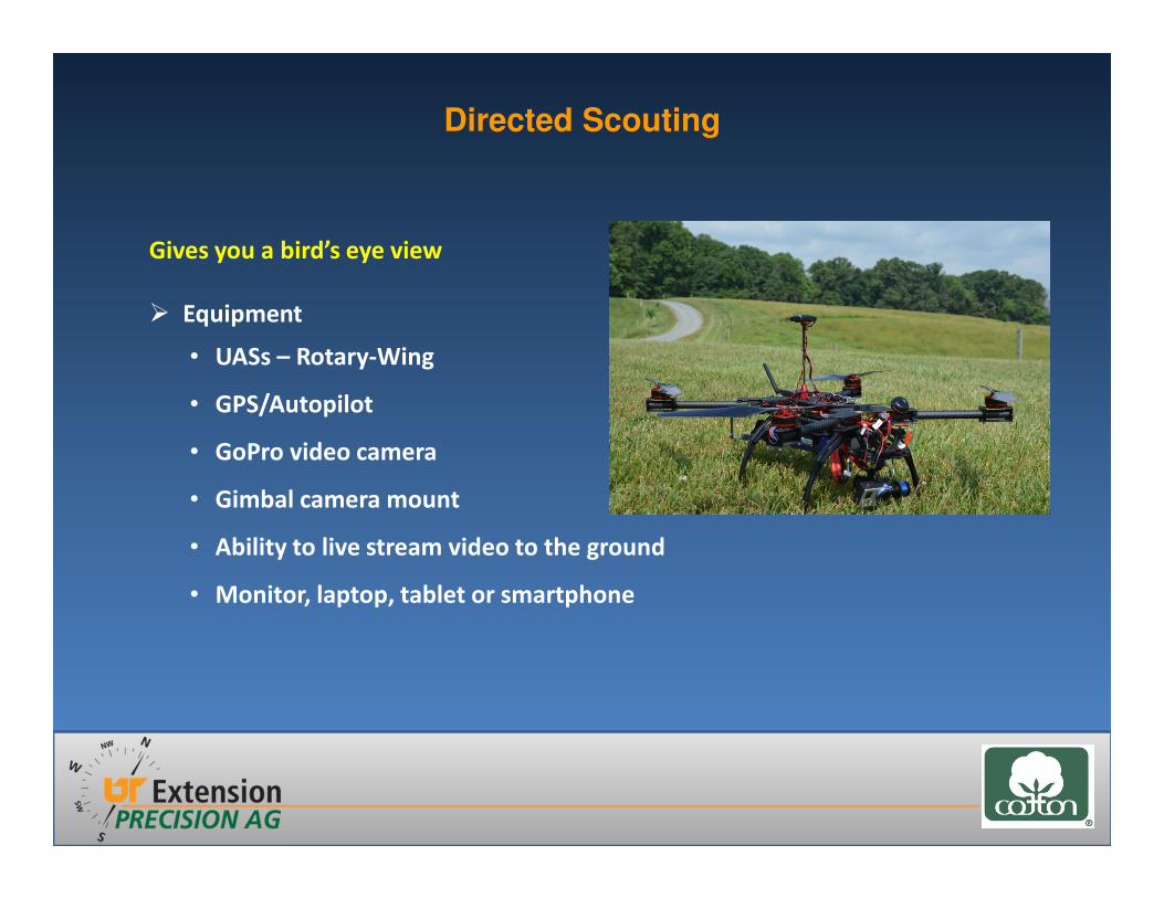
Gives you a bird’s eye view
� Equipment
• UASs – Rotary-Wing
• GPS/Autopilot
• GoPro video camera
• Gimbal camera mount
• Ability to live stream video to the ground
• Monitor, laptop, tablet or smartphone
Directed Scouting

� Directed Scouting
• Diseases
• Insects
• Weeds
• Crop Progress
• Crop Stress
Weeds
Crop Progress
Diseases
Directed Scouting

Directed Scouting

Mapping
� Equipment
• UAS – Fixed-Wing or Multicopter
• GPS/Autopilot
• Camera
• Laptop, tablet
• Internet access
AgriEye Trimble
UX5
Precision Drone
Precision Scout
Altavian
NOVA F6500

� Mapping
• Replanting Decisions
• Drainage Issues
• Crop Insurance Claims
• VRA Crop Inputs
• Yield Estimation
• Soil/Vegetation Moisture Monitoring
Integrating UASs in Your Farming Operation

PGRs and Defoliants
Vegetative Indices
Variable Rate Application of Crop Inputs
Zone Management
Factors Influencing the Data
• Sunlight Intensity
• Sun Angle
• Time of Day
The Technology is Evolving!
Mapping
Fertilizer, Varieties, Seeding Rate
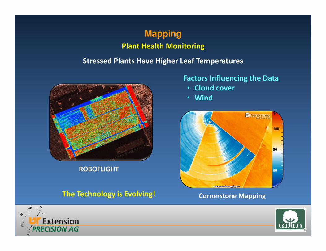
Stressed Plants Have Higher Leaf Temperatures
Factors Influencing the Data
• Cloud cover
• Wind
Mapping
The Technology is Evolving!
Plant Health Monitoring
Cornerstone Mapping
ROBOFLIGHT
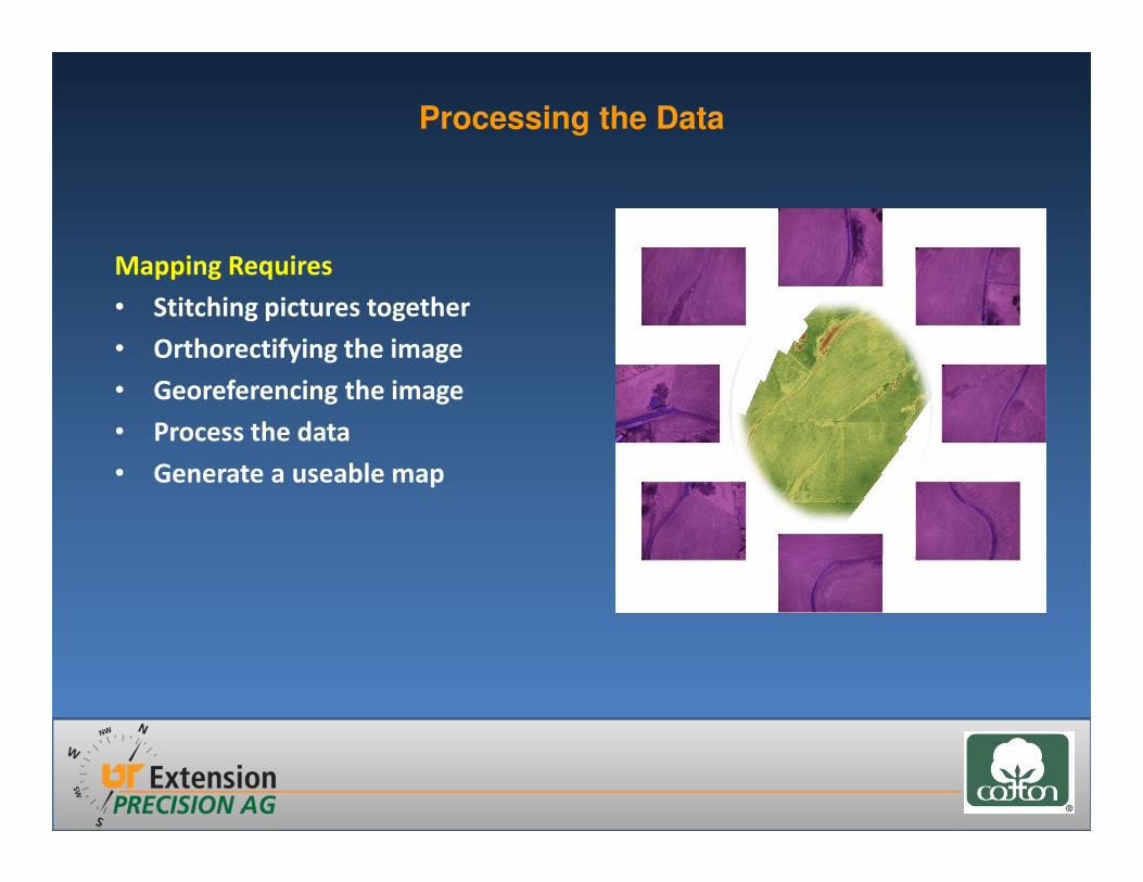
Mapping Requires
• Stitching pictures together
• Orthorectifying the image
• Georeferencing the image
• Process the data
• Generate a useable map
Processing the Data
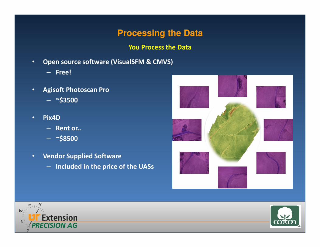
• Open source software (VisualSFM & CMVS)
– Free!
• Agisoft Photoscan Pro
– ~$3500
• Pix4D
– Rent or..
– ~$8500
• Vendor Supplied Software
– Included in the price of the UASs
Processing the Data
You Process the Data
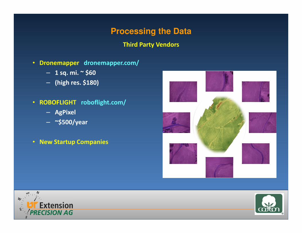
• Dronemapper dronemapper.com/
– 1 sq. mi. ~ $60
– (high res. $180)
• ROBOFLIGHT roboflight.com/
– AgPixel
– ~$500/year
• New Startup Companies
Processing the Data
Third Party Vendors

Flight Coverage
Field Size: ≈ 40 acres
Flight Speed: ≈ 16 ft/sec
Flight Time: 18 minutes
Number of Pictures: 37
File Size: ≈ 111 MB
Field Size: ≈ 92 acres
Flight Speed: ≈ 16 ft/sec
Flight Time: ≈ 42 minutes
Number of Pictures: 152
File Size: ≈ 450 MB

• Moving data around
– What kind of internet speed do you have
– Consumer grade internets are built for download
not upload
– Companies may throttle your internet with too
much use
Questions to Think About
The Industry is Evolving!
Processing the Data
Take Home Message
• UASs have the potential to make your farming operation more sustainable
• Know what you want to do with a UAS before buying one
• Directed scouting is the easiest application
• Mapping brings about data processing challenges
• Potential for inaccurate data without proper data capture and processing
• While UASs maybe fun to fly, don’t consider them toys

Questions
Related Documents


![FY18 RWDC State Unmanned Aerial System Challenge ... · Unmanned Aerial System Challenge: Practical Solutions to ... , Real World Design Challenge ... , unmanned aerial vehicle [UAV])](https://static.cupdf.com/doc/110x72/5ae85cfb7f8b9a8b2b8fe5e5/fy18-rwdc-state-unmanned-aerial-system-challenge-aerial-system-challenge-practical.jpg)


