EMPOWERMENT STUDY WITH POTENTIAL FOR WATERSHED MODELING OF INTEGRATED WATER RESOURCES MANAGEMENT (Case Study: Upper Citarum Watershed) Oleh: Odih Supratman dan Sukadi Staff Pengajar Jurusan Pendidikan Teknik Sipil FPTK UPI ABSTRAK STUDI PEMBERDAYAAN POTENSI DAERAH ALIRAN SUNGAI DENGAN PEMODELAN MANAJEMEN SUMBER DAYA AIR TERPADU (Studi Kasus: Daerah Aliran Sungai Citarum Hulu) Pengelolaan sumberdaya air merupakan sistem yang kompleks dengan banyak melibatkan pihak yang saling berkepentingan. Apabila dapat dikelola dengan prinsip saling kerjasama antar pemerintah daerah, dinas dan pengguna air akan dapat meminimalisasi konflik kepentingan dan bencana yang ditimbulkan akibat eksploitasi sumberdaya air. Sehingga tujuan dari penelitian ini adalah untuk mencari model pengelolaan sumberdaya air melalui pemodelan manajemen secara terpadu dengan sistem satu sungai, satu rencana yang terpadu dan satu sistem pengelolaan yang terpadu yang berbasis pada pemberdayaan potensi daerah. Metoda pengumpulan data dan analisis data digunakan teknik observasi, analisis keruangan dan pemodelan pengelolaan. Observasi digunakan dengan tujuan untuk memperoleh data eksisting daerah aliran sungai Citarum hulu. Sedangkan analisis keruangan digunakan dengan tujuan untuk menganalisis tata guna lahan eksisting dan perkembangan alih fungsi sampai saat ini. Data yang dikumpulkan adalah hasil pemetaan tata guna lahan. Perubahan luasan kawasan konservasi sangat terlihat dan signifikan hingga tahun 2010, perubahan tersebut nampak bahwa yang semula luasan ada sekitar 50,05% menjadi hanya sekitar 32,20% saja atau ada sekitar 56.310,37 ha. Penurunan luasan kawasan konservasi yang dominan nampak pada berkurangnya hutan sekunder. Diperoleh bahwa pada tahun 1997 penggunaan lahan yang berpotensi untuk daya guna air sejumlah luasan sekitar 78,98% (33.687,13 ha) dari luasan keseluruhan lahan yang ada (42.652,76 ha). Kawasan lahan berpotensi menjadi bencana akibat daya rusak air pada 1

Welcome message from author
This document is posted to help you gain knowledge. Please leave a comment to let me know what you think about it! Share it to your friends and learn new things together.
Transcript

EMPOWERMENT STUDY WITH POTENTIAL FOR WATERSHED MODELING OFINTEGRATED WATER RESOURCES MANAGEMENT(Case Study: Upper Citarum Watershed)
Oleh:Odih Supratman dan Sukadi
Staff Pengajar Jurusan Pendidikan Teknik Sipil FPTK UPI
ABSTRAK
STUDI PEMBERDAYAAN POTENSI DAERAH ALIRAN SUNGAI DENGANPEMODELAN MANAJEMEN SUMBER DAYA AIR TERPADU
(Studi Kasus: Daerah Aliran Sungai Citarum Hulu)Pengelolaan sumberdaya air merupakan sistem yang
kompleks dengan banyak melibatkan pihak yang salingberkepentingan. Apabila dapat dikelola dengan prinsipsaling kerjasama antar pemerintah daerah, dinas danpengguna air akan dapat meminimalisasi konflik kepentingandan bencana yang ditimbulkan akibat eksploitasi sumberdayaair. Sehingga tujuan dari penelitian ini adalah untukmencari model pengelolaan sumberdaya air melalui pemodelanmanajemen secara terpadu dengan sistem satu sungai, saturencana yang terpadu dan satu sistem pengelolaan yangterpadu yang berbasis pada pemberdayaan potensi daerah.
Metoda pengumpulan data dan analisis data digunakanteknik observasi, analisis keruangan dan pemodelanpengelolaan. Observasi digunakan dengan tujuan untukmemperoleh data eksisting daerah aliran sungai Citarumhulu. Sedangkan analisis keruangan digunakan dengan tujuanuntuk menganalisis tata guna lahan eksisting danperkembangan alih fungsi sampai saat ini. Data yangdikumpulkan adalah hasil pemetaan tata guna lahan.
Perubahan luasan kawasan konservasi sangat terlihat dansignifikan hingga tahun 2010, perubahan tersebut nampakbahwa yang semula luasan ada sekitar 50,05% menjadi hanyasekitar 32,20% saja atau ada sekitar 56.310,37 ha.Penurunan luasan kawasan konservasi yang dominan nampakpada berkurangnya hutan sekunder. Diperoleh bahwa padatahun 1997 penggunaan lahan yang berpotensi untuk daya gunaair sejumlah luasan sekitar 78,98% (33.687,13 ha) dariluasan keseluruhan lahan yang ada (42.652,76 ha). Kawasanlahan berpotensi menjadi bencana akibat daya rusak air pada
1
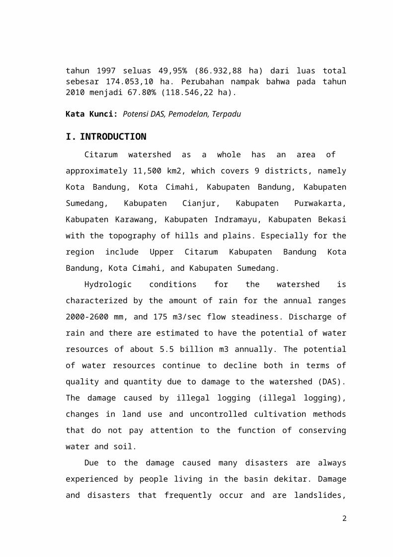
tahun 1997 seluas 49,95% (86.932,88 ha) dari luas totalsebesar 174.053,10 ha. Perubahan nampak bahwa pada tahun2010 menjadi 67.80% (118.546,22 ha).
Kata Kunci: Potensi DAS, Pemodelan, Terpadu
I. INTRODUCTIONCitarum watershed as a whole has an area of
approximately 11,500 km2, which covers 9 districts, namely
Kota Bandung, Kota Cimahi, Kabupaten Bandung, Kabupaten
Sumedang, Kabupaten Cianjur, Kabupaten Purwakarta,
Kabupaten Karawang, Kabupaten Indramayu, Kabupaten Bekasi
with the topography of hills and plains. Especially for the
region include Upper Citarum Kabupaten Bandung Kota
Bandung, Kota Cimahi, and Kabupaten Sumedang.
Hydrologic conditions for the watershed is
characterized by the amount of rain for the annual ranges
2000-2600 mm, and 175 m3/sec flow steadiness. Discharge of
rain and there are estimated to have the potential of water
resources of about 5.5 billion m3 annually. The potential
of water resources continue to decline both in terms of
quality and quantity due to damage to the watershed (DAS).
The damage caused by illegal logging (illegal logging),
changes in land use and uncontrolled cultivation methods
that do not pay attention to the function of conserving
water and soil.
Due to the damage caused many disasters are always
experienced by people living in the basin dekitar. Damage
and disasters that frequently occur and are landslides,
2

flash floods, erosion and sedimentation and reduced water
infiltration function that causes the discharge of the
river in the dry season tends to decrease.
To solve the problem in the usefulness of natural
resources management needs to be comprehensive, integrated
and environmentally sound, include: conservation,
utilization and control of the destructive force of water.
Necessary action is water resources sector reforms and new
management paradigm (good governance, transparency,
democratization, public accountability and local autonomy),
demand: empowerment and community participation, the
allocation to all sectors (holistic), must be managed in an
efficient, fair, and sustainable for the maximum prosperity
of the people.
As for the initial assessment is to conduct research
studies in the area of the observed changes in land use in
watershed Sub Citarum Hulu. From the pattern of land use by
communities in the watershed will dub berbampak on existing
water resources. Thus, in this initial study, the problem
will be formulated as follows:
1. How land use patterns both land area and percentage of
land area that is potentially as conservation of water
resources existing in Upper Citarum Hulu watershed?
2. How land use patterns both land area and percentage of
land area that is potentially as utilization of water
resources in the Upper Citarum watershed?
3

3. How land use patterns both land area and percentage of
land area that could potentially cause damage to the
existing water resources in the Upper Citarum watershed?
II. THEORY STUDYTo facilitate the identification of all the problems
that exist in the basin, the basin is divided into three
zones, namely region:
Zone Upper Citarum : Hulu streams in Mount Wayang - End
Saguling
Citarum Central Zone : Saguling - Cirata - Jatiluhur
Citarum Zone Downstream : Downstream Citarum - Muara
Citarum
1. Upper Citarum River Conditions
Upstream Citarum river include springs to Saguling
(Figure 1) with an area of approximately 1,771 km2, as part
of the Citarum River Basin is one of the largest in West
Java. For management purposes, the Upper Citarum divided
into five sub-watersheds namely: Cikapundung, Citarik,
Cisarea, Cisangkuy and Ciwidey (Housing Authority
Jatiluhur, 1990). Monthly rainfall average measured in 2001
ranged from 45 to 352 mm with a total value of annual
rainfall of 2,200 mm. The topography is dominated by the
mountains along the boundary of the watershed and the vast
plains in the middle of the watershed. Land use is
dominated by agriculture and forests. During the seven-year
4

period (1994-2001) the forest area decreased by almost 60%,
whereas the agricultural land area increased by 40%.
Figur 1. Sub DAS conditions in the Upper Citarum (Source: BP DAS Citarum, 2009)
2. Issues Upper Citarum River
Problems in the Upper Citarum caused by reduced
function of protected areas (forest and non-forest),
development of settlements without proper planning, and
agricultural cultivation is not in accordance with
conservation principles that led to many critical areas,
higher levels of erosion resulting in sedimentation in
trough rivers, reservoirs, and even went into the water
infrastructure network.
Another major problem in the upper basin include
degradation of water resources conservation function as
critical land reached 26,022.47 ha, which resulted in run-
off of surface runoff 3,632.50 million m3/year and
sedimentation 7,898.59 tons / ha.
3. Resource Potential Upper Citarum Watershed5

According to Law no. 7 of 2004 on Water Resources
described some potential, both in terms of protection,
utilization and the level of damage caused by Water
Resources. These potentials are the subject of analysis for
water resource development policies in order to take both
at the central and local levels. Especially for Watershed
(DAS) Citarum, these potentials are described as follows.
a. Potential Water Resources Conservation1) Critical Land Conservation2) Coordination and Synergy Program3) Setting and Groundwater Withdrawal Restrictions
b. Potential Utilization of Water Resources1) Water Allocation Model schematization2) Improvement of Water Resource Potential3) Increased Potential Water Bearer Channels4) Increased Use of Water Efficiency to reduce Needs
c. Water Damage Potential of Power Control1) Flood Management2) Crisis Management Water / Drought3) Landslide Disaster
d. Potential Water Resource Information System1) Integration of Information Systems2) Decision Support System
e. Empowerment and Improved Potency and the Role of theBusiness Community1)Partnership2)Stakeholder Coordination and Case Management of WaterResources
f. Potential Spatial1)Zoning2)Java Spatial Model3)Sustainable Agricultural Land Protection
4. Resource Potential Upper Citarum Watershed
According to the Global Water Partnership (as quoted
Citarum Fact Sheet 2010:2) Integrated Water Resources
6

Management (Integrated Water Resources Management) can be
defined as a process that promotes the function of
coordination and management of water, land and related
resources, in order to maximize the economic and welfare
outcomes social pattern that does not compromise the
sustainability of vital ecosystems.
Components of the program in the Citarum Roadmap to
achieve a vision of "government and community working
together for the creation of clean rivers, healthy and
productive and bring sustainable benefits for the whole
community in the Citarum river basin", which is described
as a building, is as follows:
a. The principle and the concept of Integrated WaterResources Management
b. Institutional Planning and Integrated Water ResourcesManagement (IWRM)
c. Development and Management of Water Resourcesd. Use and Distribution of Watere. Environmental protectionf. Disaster managementg. Community Empowermenth. Data, Information and Support Policyi. Program Management
III.RESEARCH METHODSData collection methods and data analysis techniques
used observation, spatial analysis and modeling management.
Observations used in order to obtain existing data Citarum
watershed upstream. While the use of spatial analysis with
the aim of analyzing the existing land use and development
7

control functions to date. While modeling is performed to
find the management guidelines for the management of local
governments, related agencies and fellow water users in the
basin.
IV. RESEARCH RESULTSCitarum watershed area upstream of the identified
springs Situ Cisanti up with Nanjung (Jompong waterfall),
composed of 5 (five) Sub Watershed. The sub-watershed are
as follows:
a. Sub DAS Cirasea
b. Sub DAS Cisangkuy
c. Sub DAS Citarik
d. Sub DAS Ciwidey
e. Sub DAS Cikapundung
8
Start
Library Studies
Data Collection
Primary Data
Secondary data
FieldSurvey

Figur 2. Flowcart Empowerment Potential Watershed
1. Identification of Land Use Sub Upper Citarum
From the observation of secondary data obtained from
Bappeda and BPLHDs West Java Province obtained the data of
land use and land cover data of 5 (five) Sub-watershed
which is the object of research. Below are presented the
results of observations / development of land use changes
from year 1997 to 2010. Described below and the land use
map of each sub-watershed in the form of figures and
tables.
9
RBIMap
LU & LCMap
DAS System
Land Use
Potential Watershed: Conservation, WaterTo Power, Power Water Damage, information
Analysis of Results andDiscussion
Preparation ofReports
Finish

(1997) (2001)
(2005) (2010)
Figur 3. Land Use Map of the Upper Citarum Watershed years
1997 - 2010
Table 1. Use of Land Upper Citarum Watershed
1997 2001 2005 20101 Hutan Prim er 22,785.24 23,724.41 20,802.28 19,653.36 2 Hutan Sekunder 25,464.43 19,773.35 4,361.69 4,563.26 3 Kawasan Pertam bangan / G alian 179.64 179.64 214.29 198.72 4 Kawasan dan Zona Industri 1,910.82 1,924.32 1,969.19 2,924.16 5 Kebun Cam puran 16,712.67 16,961.64 22,538.34 22,746.24 6 Ladang / Tegalan 17,589.71 18,988.63 18,642.53 19,492.22 7 Padang Rum put/Ilalang 3,012.47 3,012.47 3,012.47 4,530.93 8 Perkebunan 21,024.06 22,115.88 38,724.83 37,811.36 9 Perm ukim an 26,273.71 27,015.39 28,495.76 29,217.42 10 Sawah 38,587.42 39,590.42 34,696.27 32,083.93 11 Sem ak Belukar 229.79 962.37 302.59 1,367.23 12 Sungai/Tubuh Air/Danau/W aduk/Situ 283.13 21.68 9.82 9.82 13 Tanah Kosong / Terbuka 283.13 283.13 257.93
No. Jenis Penggunaan Lahan Tahun (Ha)
2. Identification of Potential Sub Upper Citarum Watershed
Upstream Citarum watershed consisting of 5 (five) sub-
watershed area experienced a decline compared to the
conservation area. Primary forest as a buffer and storage
10

of water resources increasingly are reduced. Changes in the
extent of protected areas are highly visible and
significant until 2010. In development at a period of
around 4 years, these changes appears that the original
area there are about 50.05% in 1997 to only about 32.20% or
there are only about 56310.37 ha in 1010. The decrease in
the extent of protected areas appear dominant in the
secondary forest loss. Overview of trends that have the
potential reduction in land area as a conservation area are
presented in the following table.
Table 2. Percentage of Land Area of Potential as aConservation Area Upper Citarum Watershed
1997 2001 2005 20101 Hutan Prim er 13.09 13.59 11.95 11.24 2 Hutan Sekunder 14.63 11.33 2.51 2.61 3 Sawah 22.17 22.68 19.93 18.35 4 Sungai/Tubuh Air/Danau/W aduk/Situ 0.16 0.01 0.01 0.01
50.05 47.61 34.40 32.20
No. Jenis Penggunaan Lahan Tahun (% )
Changes in land use efficiency potential water views
from industrial areas, gardens, fields, plantations,
settlements and fields. In 1997 this land use is industrial
area 1.10% (1910.82 ha), mixed plantation of 9.60%
(16712.67 ha), field / moor 10.11% (17589.71 ha),
plantation 12 08% (21024.06 ha), settlement 15.10%
(26273.71 ha) and rice 22.17% (38587.42 ha). For the
following years until 2010, there was clear increase in the
land-use changes. Particularly striking is the change from
the plantation area of 12.08% (21024.06 ha) in 1997 to
21.62% (37811.36 ha) in 2010. As for the rice region
experienced a reduction in the extent of 22.17% (38587.42
ha) in 1997 to 18.35% (32083.93 ha) in 2010.11

Table 3. The area percentage of Potential Land asUtilization of Water Resources in the Upper CitarumWatershed
1997 2001 2005 20101 Kawasan dan Zona Industri 1.10 1.10 1.13 1.67 2 Kebun Cam puran 9.60 9.72 12.95 13.01 3 Ladang / Tegalan 10.11 10.88 10.71 11.15 4 Perkebunan 12.08 12.67 22.25 21.62 5 Perm ukim an 15.10 15.48 16.37 16.71 6 Sawah 22.17 22.68 19.93 18.35
70.15 72.53 83.35 82.51
No. Jenis Penggunaan Lahan Tahun (% )
As for the data changes in land use that Upstream
Citarum area that could potentially be a disaster due to
the destructive force of the water in 1997 covering an area
of 49.95% (86932.88 ha) of the total area of 174,053.10 ha.
Appears that changes in 2010 to 67.80% (118,546.22 ha). So
the total change in the existing land approximately 17.85%
(31613.33 ha) over a period of 13 years. Below we present
the percentage change in land use that have the potential
to power the water damaged from years 1997 to 2010.
Table 4. The area percentage of Potential Land as DamagedWater Resources in the Upper Citarum Watershed.
1997 2001 2005 20101 Kawasan Pertam bangan / G alian 0.10 0.10 0.12 0.11 2 Kawasan dan Zona Industri 1.10 1.10 1.13 1.67 3 Kebun Cam puran 9.60 9.72 12.95 13.01 4 Ladang / Tegalan 10.11 10.88 10.71 11.15 5 Padang Rum put/Ilalang 1.73 1.73 1.73 2.59 6 Perkebunan 12.08 12.67 22.25 21.62 7 Perm ukim an 15.10 15.48 16.37 16.71 8 Sem ak Belukar 0.13 0.55 0.17 0.78 9 Tanah Kosong / Terbuka - 0.16 0.16 0.15
49.95 52.39 65.60 67.80
No. Jenis Penggunaan Lahan Tahun (% )
3. Discussion of Results
Changes in land use potential as a conservation area is
very visible in the sub-watershed Cisangkuy, over a period
of 13 years (1997-2010) has been reduced drastically. Even
12

the secondary forest is not there anymore, everything is
turned into plantations and other land uses. Changes in
land area that has potential as a conservation area can be
seen in the image below.
-10.00 20.00 30.00 40.00 50.00 60.00 70.00 80.00
1997 2001 2005 2010
(%) Luasan
W aktu (tahun)
Konservasi SDACiraseaCisangkuyCitarikCiwideyCikapundungCitarum Hulu
Figue 4. Trend of Land Use Potential as a Conservation Area
Impact it will have the power of absorbing water is
reduced and rainwater runoff will be greater. The amount of
runoff likely to impact the scour (erosion) of land along
the water flow is bypassed. Then the resulting material
erosion sediment will enter the river channel also affect
the reduced capacity of the river. Eventually spills into
the flooding that occurred along the river channel is not
unbearable.
Utilization of water demand due to high water, it
should be anticipated that the availability should be
sufficient to meet these needs. For that need to be
analyzed further allocation of its water needs. The
assumption has often appeared in the analysis of the water
balance is water demand will always increase while cendeung
13

water availability will be reduced both in quantity and
quality. The following are the results of the analysis of
the percentage of land use changes as a result of increased
use of land for water efficiency from year 1997 to 2010.
-10.00 20.00 30.00 40.00 50.00 60.00 70.00 80.00 90.00 100.00
1997 2001 2005 2010
(%) Luasan
W aktu (tahun)
Pendayagunaan SDACiraseaCisangkuyCitarikCiwideyCikapundungCitarum Hulu
Figur 5. Trend of Land Use Potential as SDA Region
Usability
The highest sub-watershed land area change resulting
potential force of water is very high in sub-watershed
Cisangkuy. Sub-watershed Cisangkuy the data obtained from
land-use change land use map shows that the area that could
potentially be a disaster due to the destructive force of
the water in 1997 covering an area of 30.47% (9018.23 ha)
of the total area of 29596.40 ha. Appears that changes in
2010 to 65.64% (19549.79 ha). So the total change in the
existing land approximately 35.17% (10531.56 ha) over a
period of 13 years. Below we present the percentage change
in land use that have the potential to power the water
damaged from years 1997 to 2010.
14

-10.00 20.00 30.00 40.00 50.00 60.00 70.00 80.00
1997 2001 2005 2010
(%) L
uasan
W aktu (tahun)
Daya Rusak SDACiraseaCisangkuyCitarikCiwideyCikapundungCitarum Hulu
Figur 6. Trend of Land Use Potential as an Area DamagedPower SDA
V. CONCLUSION1. Changes in the extent of protected areas are highly
visible and significant until 2010. In development with
a period of about 4 years, it appears that these changes
are initially area there are about 50.05% to 32.20% just
about any or no about 56310.37 ha. The decrease in the
extent of protected areas appear dominant in the
secondary forest loss.
2. Changes in land area as the potential for water power in
2010, there was clear increase in the land-use changes.
Particularly striking is the change from the plantation
area of 12.08% (21024.06 ha) in 1997 to 21.62% (37811.36
ha) in 2010. As for the rice region experienced a
reduction in the extent of 22.17% (38587.42 ha) in 1997
to 18.35% (32083.93 ha) in 2010.
3. Changes in land use upstream Citarum potentially be a
disaster due to the destructive force of the water in
1997 covering an area of 49.95% (86932.88 ha) of the
15

total area of 174,053.10 ha. Appears that changes in
2010 to 67.80% (118,546.22 ha). So the total change in
the existing land approximately 17.85% (31613.33 ha)
over a period of 13 years.
VI. REFERENCESAnik Sarminingsih, (2007), Evaluasi Kekritisan Lahan Daerah
Aliran Sungai (Das) Dan Mendesaknya Langkah-LangkahKonservasi Air, Jurnal Pretisipasi, PS TeknikLingkungan FT UNDIP, Semarang.
Bappeda, (2012), Peta Tata Guna Lahan Wilayah Citarum,Bappeda Jawa Barat, Bandung.
Bakosurtanal, (2013), Peta Rupa Bumi Lembar Citarum Hulu,Bakosurtanal, Bogor.
BPLHD, (2012), Peta Tutupan Lahan Wilayah Citarum, BPLHDJawa Barat, Bandung.
Dirjen SDA, (2011), Rencana Penanganan Terpadu WilayahSungai Citarum 2010 – 2025, Kemen PU, Jakarta.
Dirjen SDA, (2012), Pengelolaan Sumber Daya Air WilayahSungai Cidanau-Ciujung-Cidurian-Cisadaneciliwung-Citarum, Kemen PU, Jakarta.
Direktur Pengairan dan Irigasi Bappenas, (2010), Roadmapuntuk Pengelolaan Sumber Daya Air Terpadu WilayahSungai Citarum, Bappenas, Jakarta.
Direktur Pengairan dan Irigasi Bappenas, (2013), AliranKehidupan di Sungai Citarum, Bappenas, Jakarta.
Edi TH, dkk., (2005), Perubahan Bentuk Penggunaan Lahan DanImplikasinya Terhadap Koefisien Air Larian DAS CitarumHulu Jawa-Barat, UNPAD, Bandung
16

Herman Idrus, dkk., (2011), Pengembangan Sistem InformasiSumber Daya Air Untuk Pengelolaan Wilayah SungaiCitarum, Kolokium Hasil Penelitian dan PengembanganSumber Daya Air, PUS AIR, Bandung.
Indriatmoko RH, dkk., (2004), Evaluasi Lingkungan Air Tanahdi DAS Citarum Hulu, Jurnal Teknik Lingkungan, P3TL-BPPT, Jakarta.
Mahastuti, (2007), Gambaran Umum Wilayah Citarum, ITB,Bandung.
Poerbandono, dkk., (2006), Evaluasi Perubahan PerilakuErosi Daerah Aliran Sungai Citarum Hulu denganPemodelan Spasial, Jurnal Infrastruktur Lingkungan danBinaan, ITB, Bandung.
Siti Halimatusadiah, dkk., (2012), Efektivitas KelembagaanPartisipatoris Di Hulu Daerah Aliran Sungai Citarum,Jurnal Sosiologi Pedesaan IPB, Bogor.
Sukadi, (2012), Modul: Pengelolaan Sumber Daya Air, JPTSFPTK UPI, Bandung.
Undang-undang SDA No. 7, (2004), Sumber Daya Air, DirjenSDA, Jakarta.
Yadi Suryadi, (2007), Penerapan Model pada Studi Kasus DASCitarum Hulu, ITB, Bandung.
17

VII.LAMPIRAN
18

19

20
Related Documents