EcoAtlas and the California Aquatic Resources Inventory (CARI) Update from the California Wetland Monitoring Workgroup Eric Stein, Meredith Williams, Josh Collins, Cristina Grosso, Steve Steinberg

Welcome message from author
This document is posted to help you gain knowledge. Please leave a comment to let me know what you think about it! Share it to your friends and learn new things together.
Transcript

EcoAtlas and the California Aquatic
Resources Inventory (CARI)
Update from the California Wetland Monitoring
Workgroup
Eric Stein, Meredith Williams, Josh Collins, Cristina
Grosso, Steve Steinberg
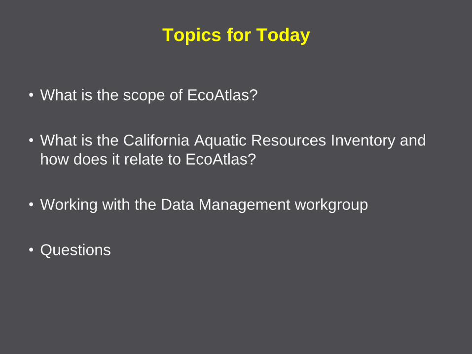
Topics for Today
• What is the scope of EcoAtlas?
• What is the California Aquatic Resources Inventory and
how does it relate to EcoAtlas?
• Working with the Data Management workgroup
• Questions

Background on EcoAtlas
• Feb 2010 Monitoring Council endorsed WRAMP and
advised CWMW to begin implementation
• Q: What does that mean? A: Apply WRAMP tools
– Mapping
– Assessment
– Coordinate among programs
• Q: How do we do that? A: EcoAtlas (info mgmt)
• EcoAtlas release for CWMW review in September
– Basemap (CARI) + assessment data + information management
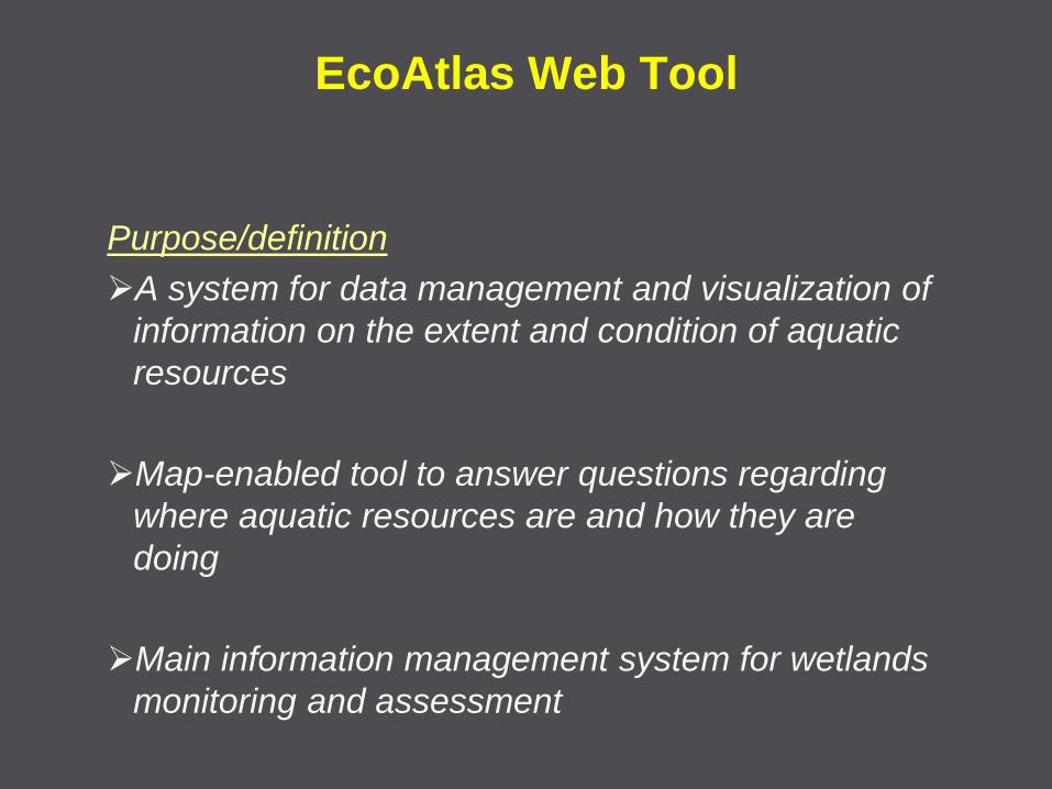
EcoAtlas Web Tool
Purpose/definition
A system for data management and visualization of
information on the extent and condition of aquatic
resources
Map-enabled tool to answer questions regarding
where aquatic resources are and how they are
doing
Main information management system for wetlands
monitoring and assessment

What is the Intent of the EcoAtlas?
Different policies dictate
different approaches …
• State of State’s Wetlands
– Wetland status/trends
• CWA 401/WDR
– project monitoring in
ambient context
• CWA 305(b)
– Integrated assessment
Based on a standard
tool kit …
And data and
information
management …
EcoAtlas serves as the User Interface for WRAMP
WRAMP
• CARI
• Project Tracking
• eCRAM
• web query tools
• watershed
profiles
• data summaries
EcoAtlas

Projects list
page Interactive map page
EcoAtlas
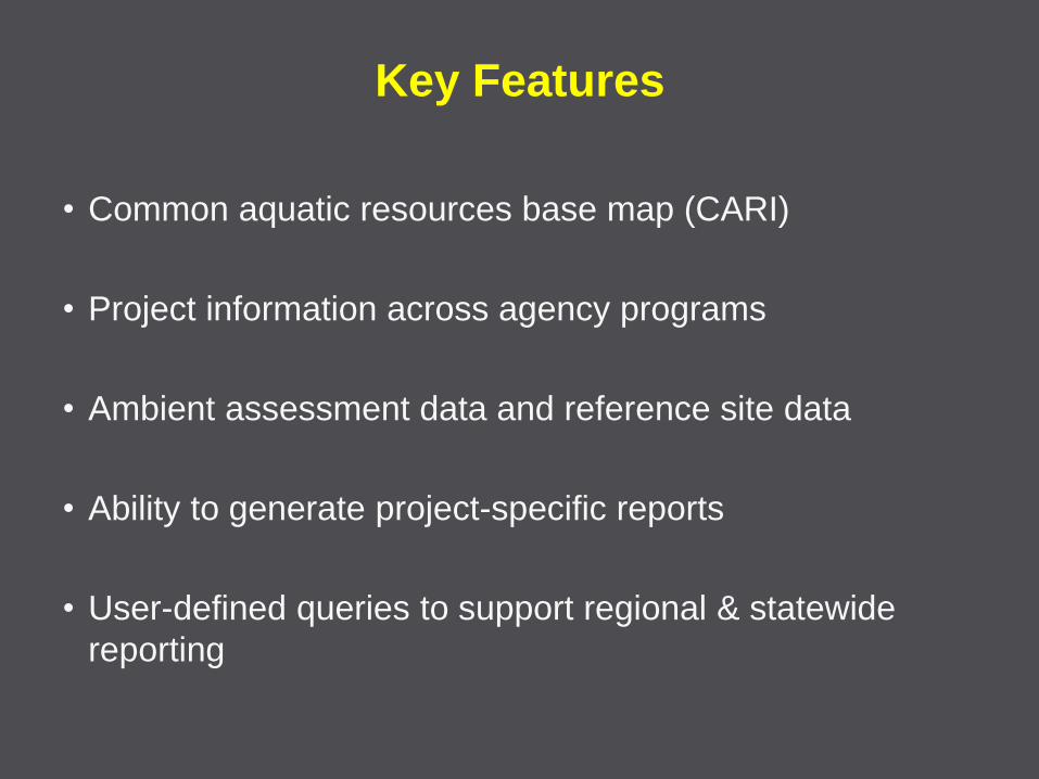
Key Features
• Common aquatic resources base map (CARI)
• Project information across agency programs
• Ambient assessment data and reference site data
• Ability to generate project-specific reports
• User-defined queries to support regional & statewide
reporting
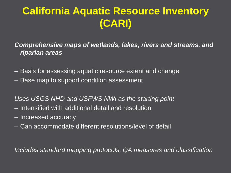
California Aquatic Resource Inventory
(CARI)
Comprehensive maps of wetlands, lakes, rivers and streams, and
riparian areas
– Basis for assessing aquatic resource extent and change
– Base map to support condition assessment
Uses USGS NHD and USFWS NWI as the starting point
– Intensified with additional detail and resolution
– Increased accuracy
– Can accommodate different resolutions/level of detail
Includes standard mapping protocols, QA measures and classification
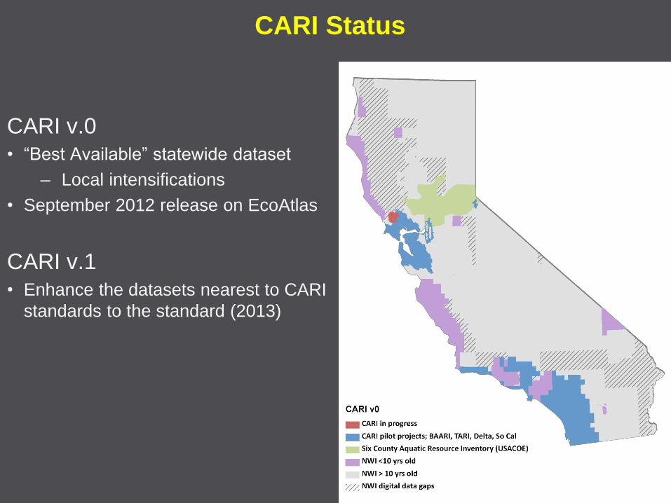
CARI Status
CARI v.0
• “Best Available” statewide dataset
– Local intensifications
• September 2012 release on EcoAtlas
CARI v.1
• Enhance the datasets nearest to CARI
standards to the standard (2013)

CARI Technical Advisory Team
• Began work in mid-2011
• Standards completed
• Classification completed
• Alignment with Wetlands S&T work
• Representatives from local, regional, state and federal agencies – USGS, National Hydrography Dataset
– USGS, Interagency Watershed Mapping Committee
– USFWS, National Wetland Inventory
– State Water Quality Control Board
– State Coastal Commission
– CA Dept of Fish and Game
– CA Dept of Water Resources
– Bay Conservation and Development Commission
– So Cal Coastal Watershed Research Program
– San Francisco Estuary Institute
– Marin County Planning Department
– CSU Northridge
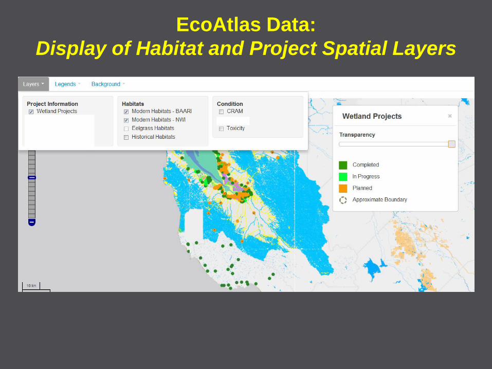
EcoAtlas Data:
Display of Habitat and Project Spatial Layers
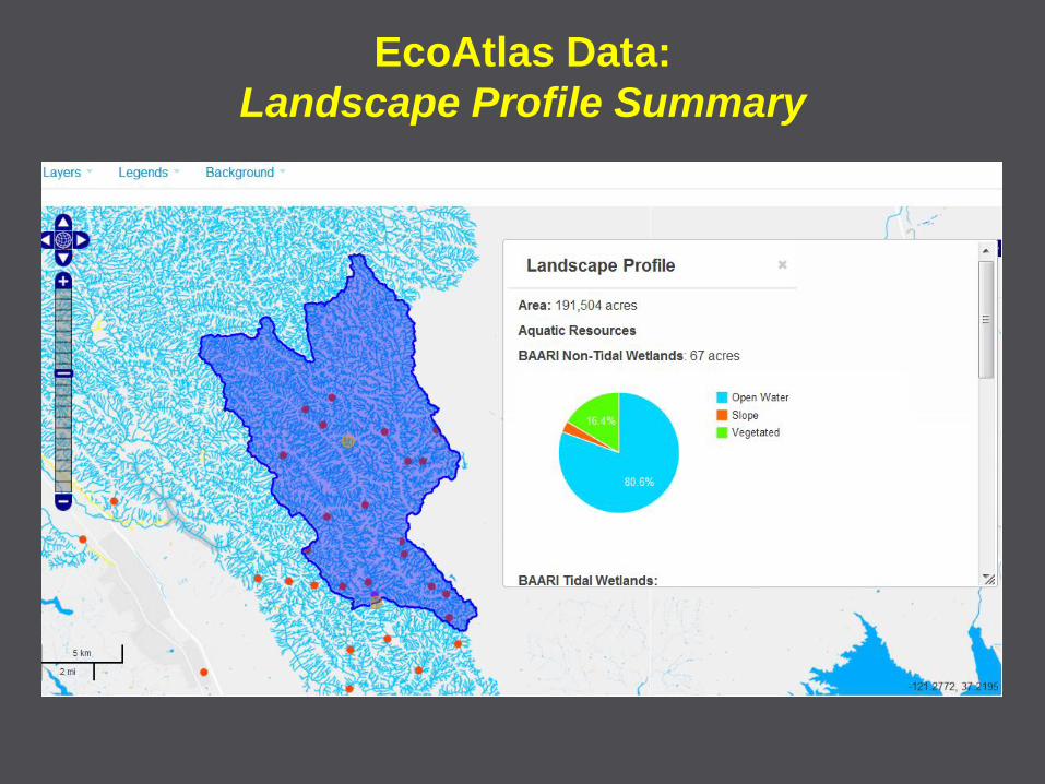
EcoAtlas Data:
Landscape Profile Summary
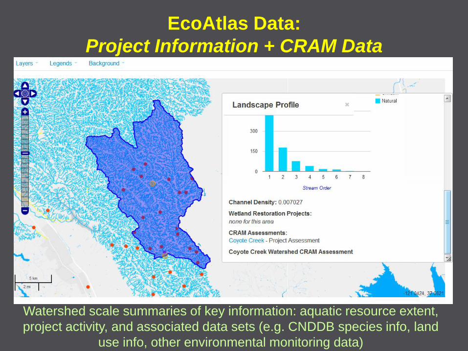
EcoAtlas Data:
Project Information + CRAM Data
Watershed scale summaries of key information: aquatic resource extent,
project activity, and associated data sets (e.g. CNDDB species info, land
use info, other environmental monitoring data)
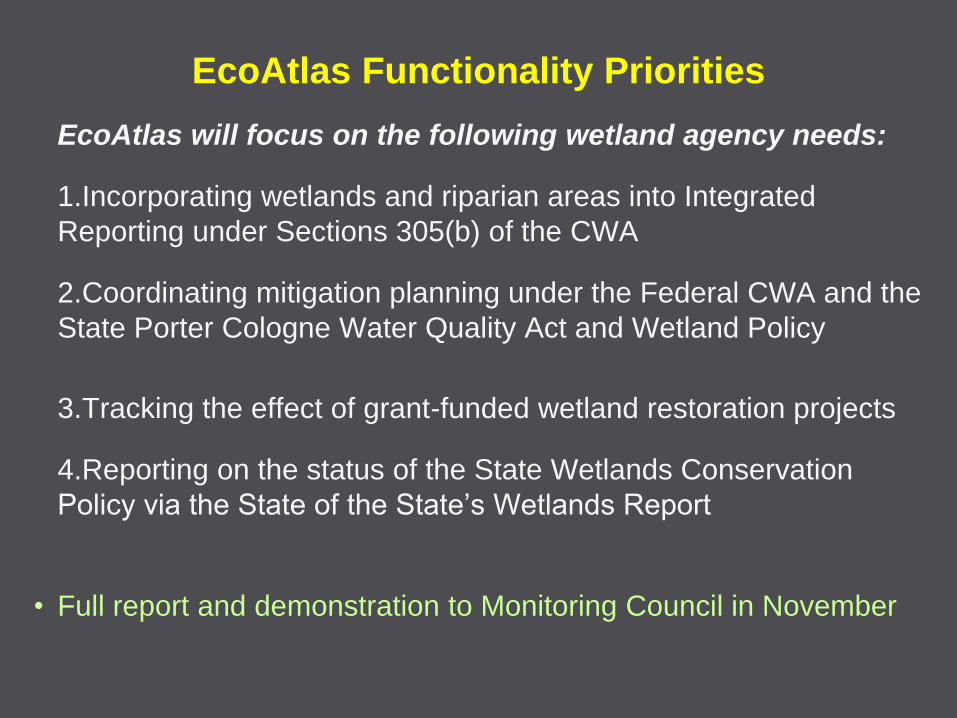
EcoAtlas Functionality Priorities
EcoAtlas will focus on the following wetland agency needs:
1.Incorporating wetlands and riparian areas into Integrated
Reporting under Sections 305(b) of the CWA
2.Coordinating mitigation planning under the Federal CWA and the
State Porter Cologne Water Quality Act and Wetland Policy
3.Tracking the effect of grant-funded wetland restoration projects
4.Reporting on the status of the State Wetlands Conservation
Policy via the State of the State’s Wetlands Report
• Full report and demonstration to Monitoring Council in November
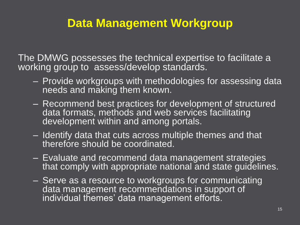
Data Management Workgroup
The DMWG possesses the technical expertise to facilitate a working group to assess/develop standards.
– Provide workgroups with methodologies for assessing data needs and making them known.
– Recommend best practices for development of structured data formats, methods and web services facilitating development within and among portals.
– Identify data that cuts across multiple themes and that therefore should be coordinated.
– Evaluate and recommend data management strategies that comply with appropriate national and state guidelines.
– Serve as a resource to workgroups for communicating data management recommendations in support of individual themes’ data management efforts.
15
DMWG response to memo
• The DMWG received and reviewed the May 24th memo
from the Wetland Workgroup.
– Meredith Williams gave presentation to the DMWG at the June
6th meeting.
– Additional discussion was conducted at the August 1st meeting.
• Given a lack of a specific question or direction from the
Council on what sort of response was desired, the
DMWG saw its role as being to evaluate the data needs
and technological approaches of the Wetland Workgroup.
– There was general agreement that the Wetland Workgroup has
selected standards-based technologies appropriate to their
objectives and compatible with other workgroups.
16
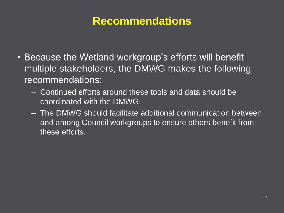
Recommendations
• Because the Wetland workgroup’s efforts will benefit
multiple stakeholders, the DMWG makes the following
recommendations:
– Continued efforts around these tools and data should be
coordinated with the DMWG.
– The DMWG should facilitate additional communication between
and among Council workgroups to ensure others benefit from
these efforts.
17
Related Documents