Welcome message from author
This document is posted to help you gain knowledge. Please leave a comment to let me know what you think about it! Share it to your friends and learn new things together.
Transcript
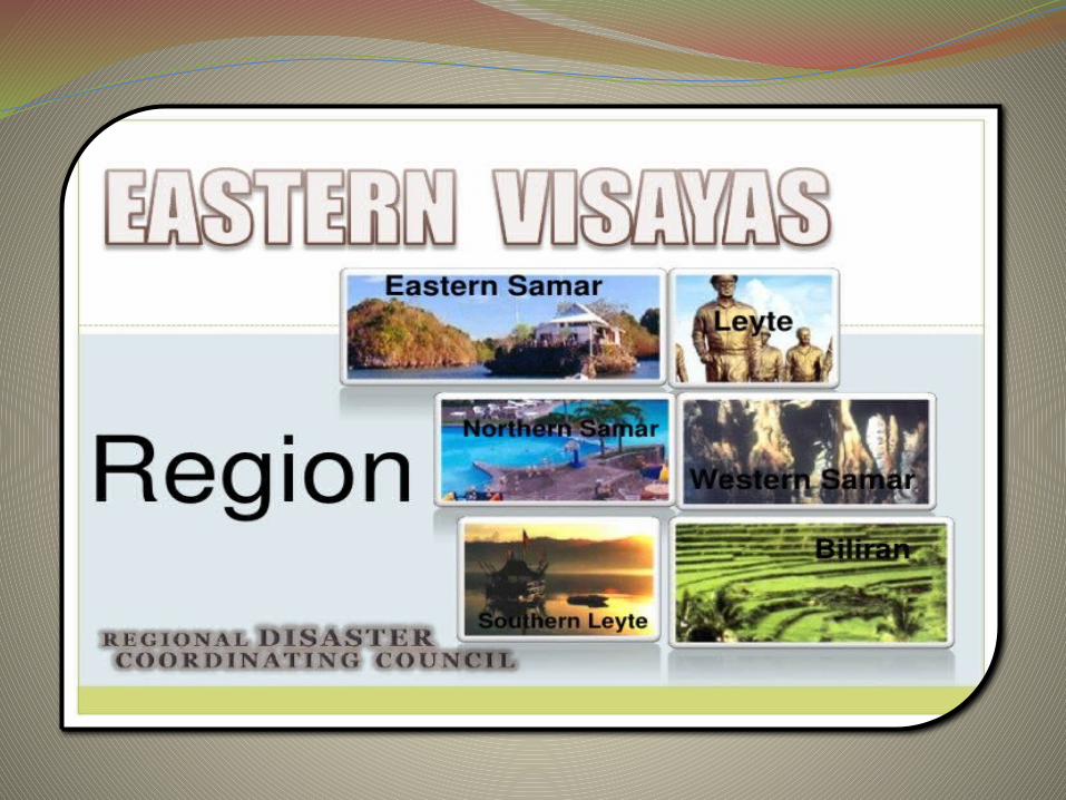

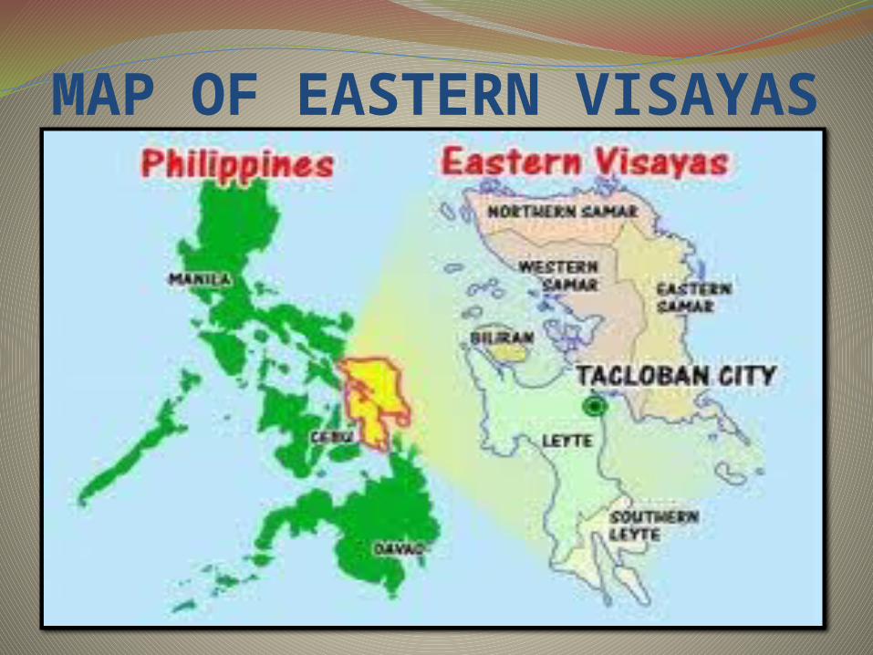
EASTERN VISAYASIs one of the 17 regions of the Philippines,
designated as Region VIII. It is composed of two main islands, Leyte
and Samar, connected by the San Juanico Bridge, as well as Biliran Island.
It is one of only two regions having no land border with another region, MIMAROPA being the other.
Composed of six provinces and seven cities.Tacloban City is their regional center.
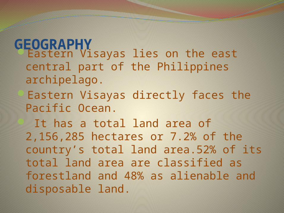
GEOGRAPHYEastern Visayas lies on the east central part of the Philippines archipelago.
Eastern Visayas directly faces the Pacific Ocean.
It has a total land area of 2,156,285 hectares or 7.2% of the country’s total land area.52% of its total land area are classified as forestland and 48% as alienable and disposable land.
MAP OF EASTERN VISAYAS

CLIMATEThere are two types of climate prevailing
in the region under the Corona system of classification: Type II and Type IV.
Type II climate is characterizes by having no dry season but a pronounced maximum rainfall from November to January.
Type IV on the other hand has an even distribution of rainfall the year round and a short period of dry season that can be observed starting February up to May.
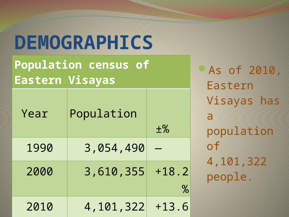
DEMOGRAPHICSPopulation census of Eastern Visayas Year Population ±
%
1990 3,054,490 —
2000 3,610,355 +18.2%
2010 4,101,322 +13.6%
As of 2010, Eastern Visayas has a population of 4,101,322 people.
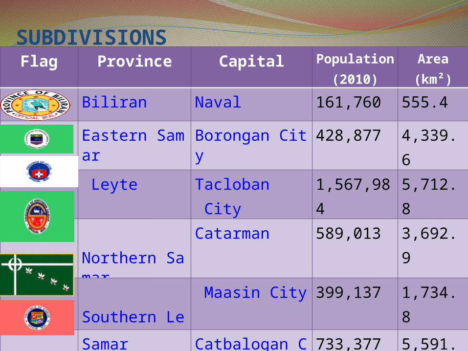
SUBDIVISIONSFlag Province Capital Populatio
n(2010)
Area(km²)
Biliran Naval 161,760 555.4
Eastern Samar
Borongan City
428,877 4,339.6
Leyte Tacloban City 1,567,984
5,712.8
Northern Samar
Catarman 589,013 3,692.9
Southern Leyte
Maasin City 399,137 1,734.8
Samar Catbalogan City
733,377 5,591.0

CITIES
Tacloban City- Highly-Urbanized City
Ormoc City, Leyte- Independent City
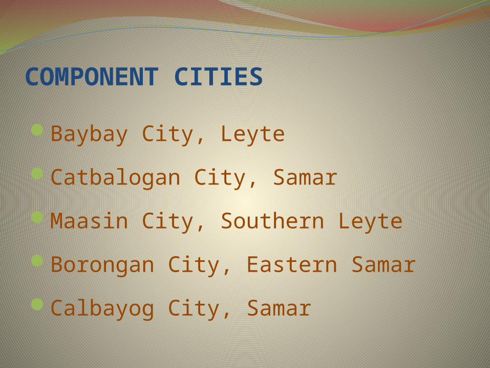
COMPONENT CITIES
Baybay City, Leyte
Catbalogan City, Samar
Maasin City, Southern Leyte
Borongan City, Eastern Samar
Calbayog City, Samar

LANGUAGESWaray-Waray is spoken on the island
of Samar, Biliran and north-eastern Leyte.
A Sama language, distantly related to the
languages of the region, called Abaknon is
spoken in the island of Capul in Northern
Samar. Cebuano is spoken in western, central,
and southern parts of Leyte and in Southern
Leyte.

ECONOMY Eastern Visayas is primarily an agricultural region with rice, corn, coconut, sugarcane and banana as its major crops.
Primary sources of revenue are manufacturing, wholesale and retail trade and services. Mining, farming, fishing and tourism contribute significantly to the economy.
Float exhibiting products of Eastern Visayas.
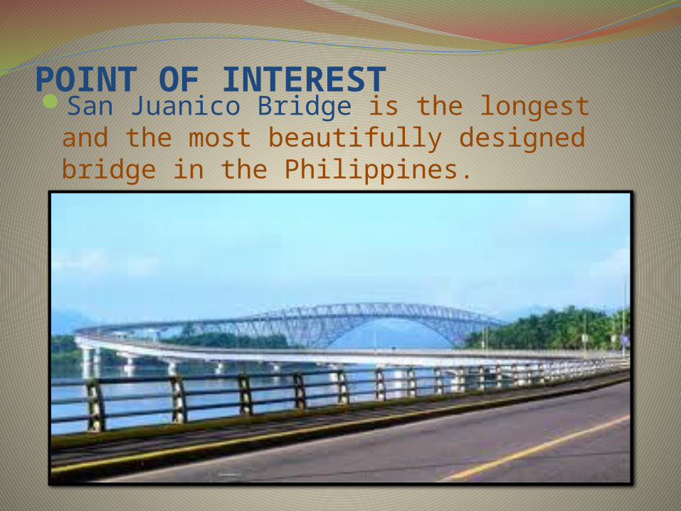
POINT OF INTERESTSan Juanico Bridge is the longest and the
most beautifully designed bridge in the Philippines.

Agas-Agas Bridgethe highest bridge in the country, located
at Southern Leyte as part of the Maharlika Highway.
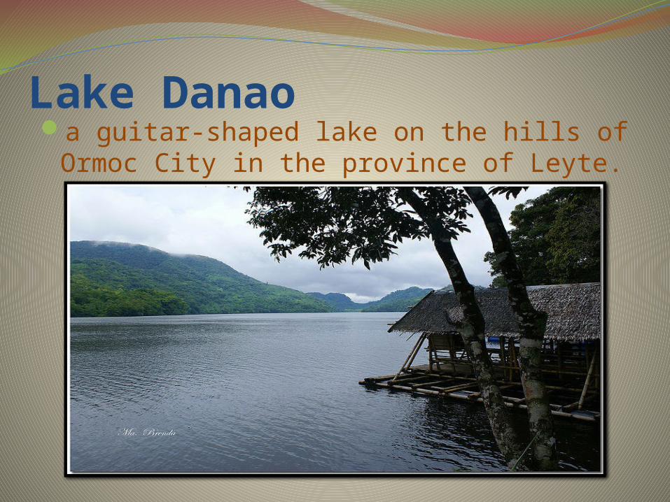
Lake Danaoa guitar-shaped lake on the hills of Ormoc
City in the province of Leyte.

Sto. Nino ShrineIt displays the fortune and previous properties
of the first dictator of the Philippines Ferdinand Marcos.
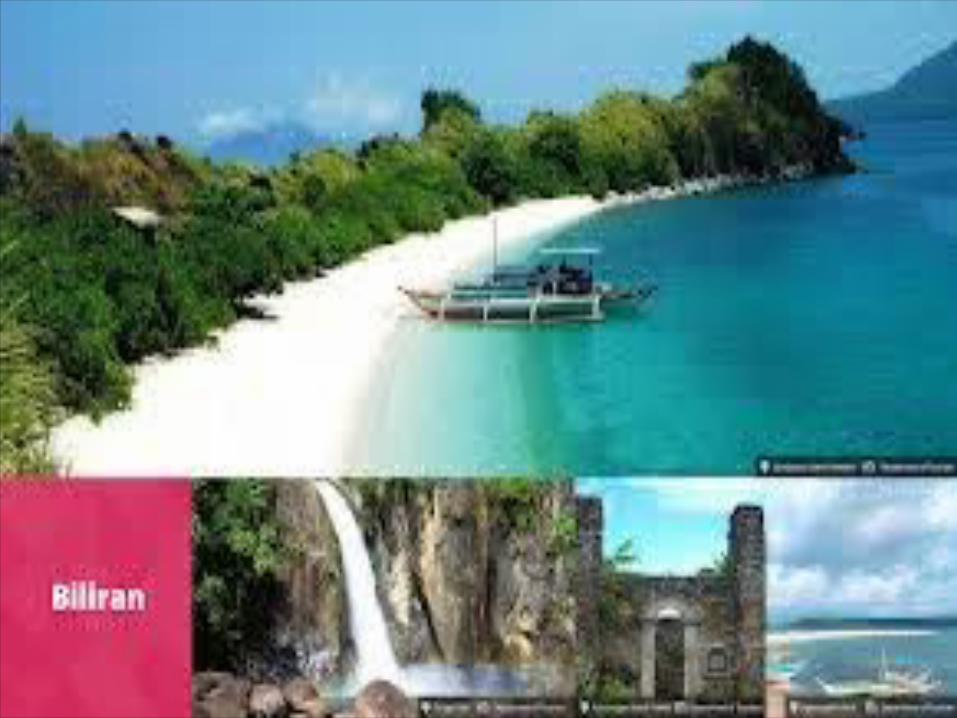

BILIRANis an island province in the Philippines located in the Eastern Visayas region.
Biliran lies just a few kilometers north of Leyte Island.
Its capital is Naval. Biliran is one of the country's smallest and
newest provinces, being formerly a part (sub-province) of Leyte until achieving full-fledged province hood in 1992.
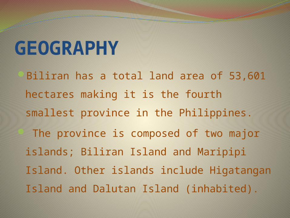
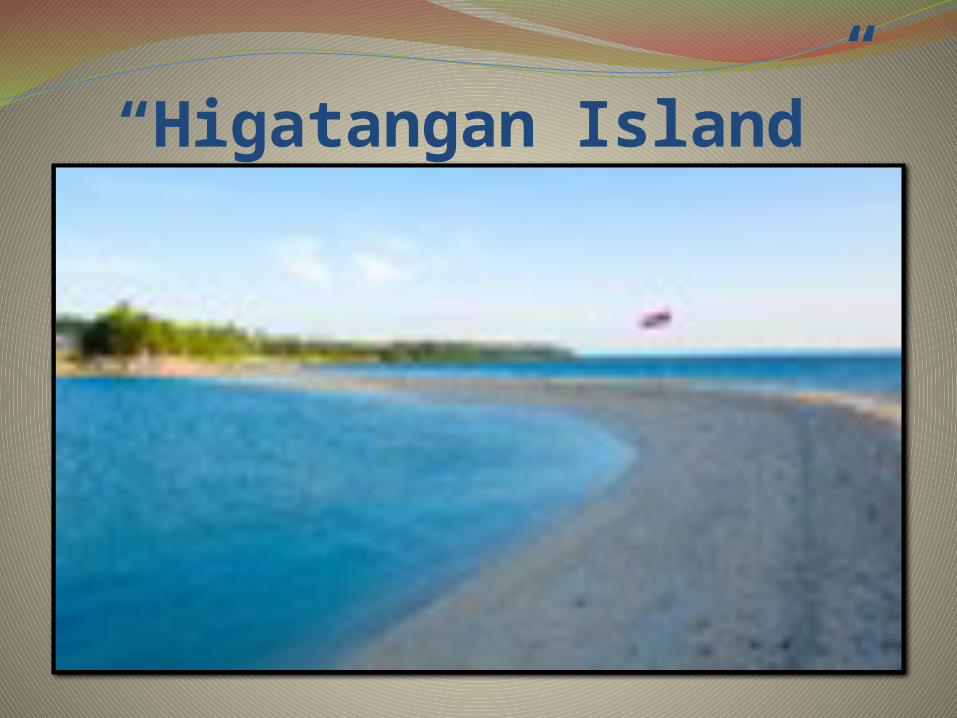
GEOGRAPHYBiliran has a total land area of 53,601
hectares making it is the fourth smallest
province in the Philippines.
The province is composed of two major
islands; Biliran Island and Maripipi Island.
Other islands include Higatangan Island and
Dalutan Island (inhabited).

SUBDIVISIONSBiliran is subdivided into 8 municipalities,
with a total of 132 barangays. All the
municipalities except Maripipi are located on
Biliran Island while Maripipi is an island
municipality located to the northwest.
The largest among the towns is Naval which
is the capital of the province while the
smallest is Maripipi.
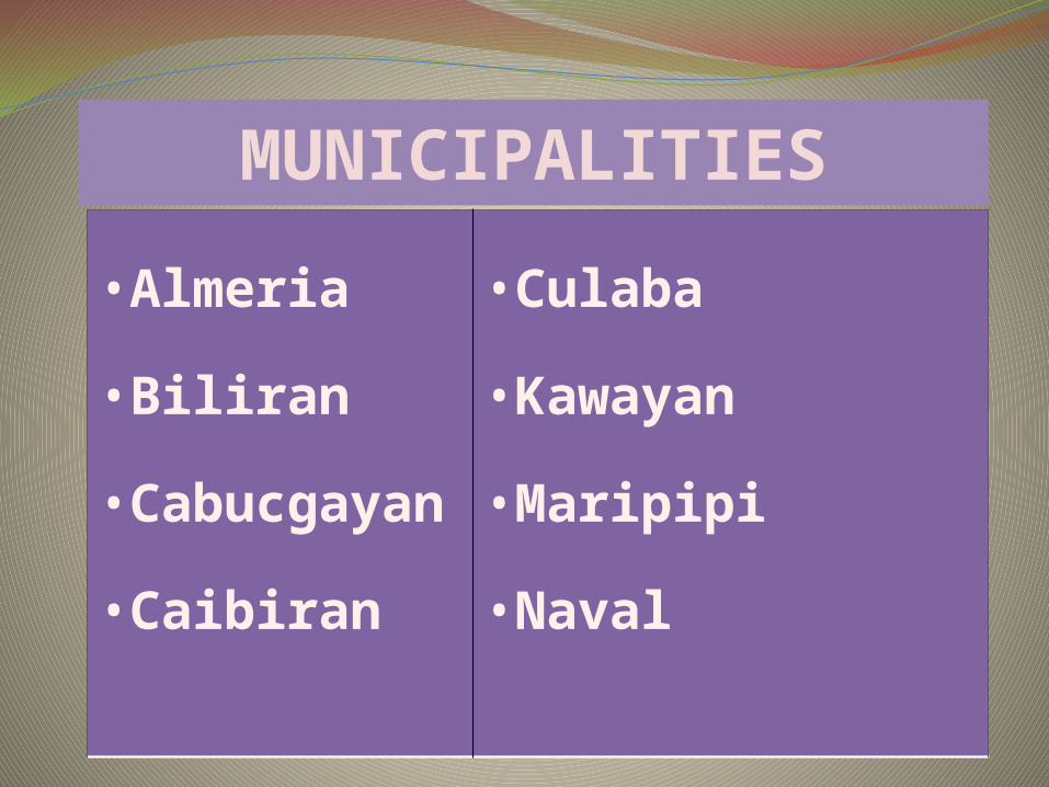
•Almeria
•Biliran
•Cabucgaya
n
•Caibiran
•Culaba
•Kawayan
•Maripipi
•Naval
MUNICIPALITIES
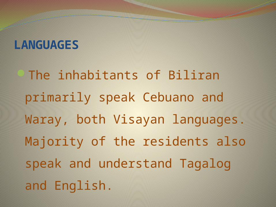
LANGUAGES
The inhabitants of Biliran primarily
speak Cebuano and Waray, both
Visayan languages. Majority of the
residents also speak and understand
Tagalog and English.

DEMOGRAPHICSPopulation census of Biliran
Year Pop. ±% p.a.
2000 140,274 1.19%
2007 150,031 0.97%
2010 161,760 2.54%
Based on the May 2000 census, Biliran had a total population of 140,274, which made it the fifth least populous province in the country, and the smallest in the region. In the 2010 census, the population had increased to 161,760 persons.
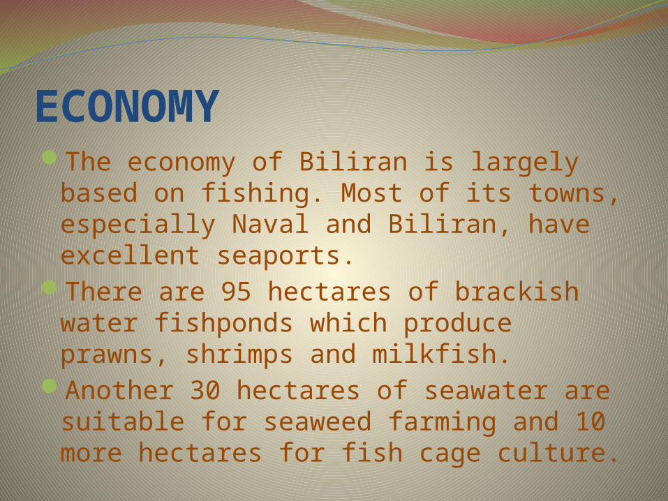
ECONOMYThe economy of Biliran is largely based on
fishing. Most of its towns, especially Naval and Biliran, have excellent seaports.
There are 95 hectares of brackish water fishponds which produce prawns, shrimps and milkfish.
Another 30 hectares of seawater are suitable for seaweed farming and 10 more hectares for fish cage culture.

DELICACIES“SUMAN BILIRAN” “PAPAYA PICKLES”


“Kinaraha Cascades”


FESTIVALS“Gapnod Festival”

“Bagasumbul Festival”

Provincial Governor: ESPINA, GERRYBOY
Vice- Governor: TUBIS, BOBOY


Eastern SamarIs a province of the Philippines located in
the Eastern Visayas region . Its capital is the city of Borongan. Eastern Samar occupies the eastern
portion of the island of Samar. Bordering the province to the north is the province of Northern Samar and to the west is Samar province and to the east is the vast Pacific Ocean. Off the coast of Leyte Gulf, the province faces the province of Leyte.
The province occupies a total land area of 466,047 hectares (1,151,630 acres).

SUBDIVISIONSEastern Samar is subdivided into 22
municipalities and one city.
City: Borongan City
Eastern Samar has 597 barangays.

MUNICIPALITIES Arteche Balangiga Balangkayan Can-avid Dolores General
MacArthur Giporlos Guiuan Hernani Jipapad Lawaan
Llorente Maslog Maydolong Mercedes Oras Quinapondan Salcedo San Julian San Policarpo Sulat Taft
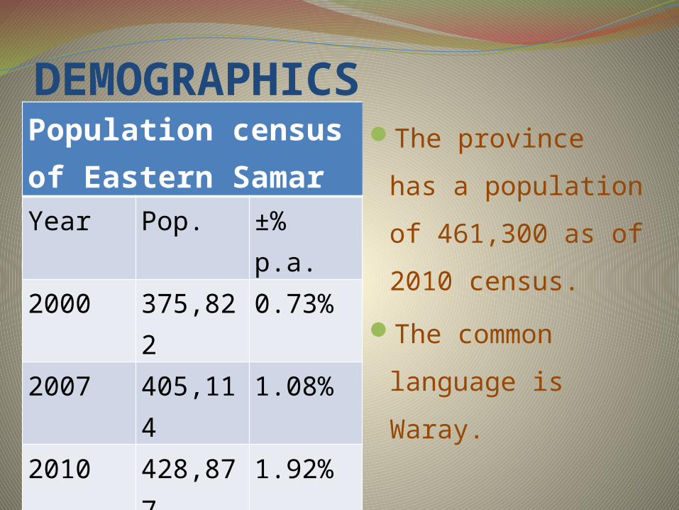
DEMOGRAPHICSPopulation census of Eastern SamarYear Pop. ±% p.a.
2000 375,822 0.73%
2007 405,114 1.08%
2010 428,877 1.92%
The province has
a population of
461,300 as of
2010 census.
The common
language is Waray.

ECONOMYCommercial activities in the province are
centered on the provincial capital of Borongan City while tourism activities are centered in Guiuan town where Calicoan Island and the historical Homonhon Island are located. Generally, the province's major economic resource is fishery and agriculture which include production of copra, corn, rice, sugar, and vegetables. Tourism potential is untapped on the northern part of the province.

DELICACIES“Binagol”

“Sasima”
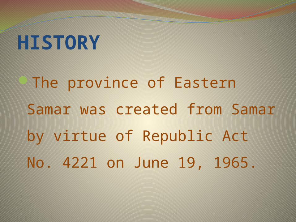
HISTORY
The province of Eastern Samar
was created from Samar by
virtue of Republic Act No. 4221
on June 19, 1965.

Provincial Governor: Conrado B. Nicart Jr.
Vice- Governor: Marcelo Picardal

FESTIVALSKarayapan Festival

Padul-Ong Festival

TOURIST ATTRACTION“Homonhon Island”
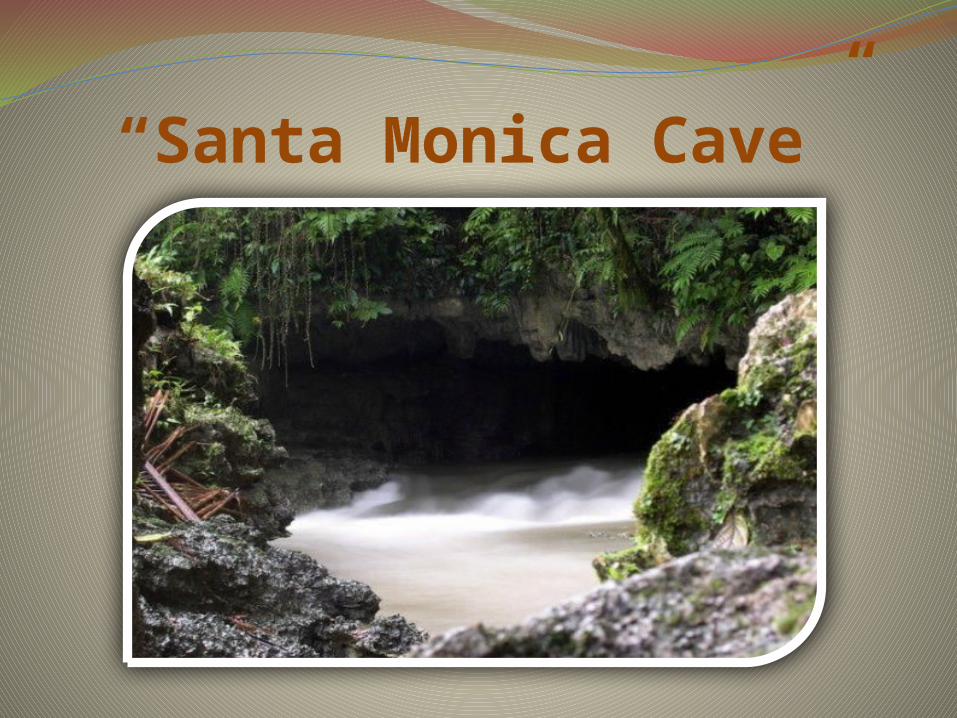
“Santa Monica Cave”

“Suluan Island”
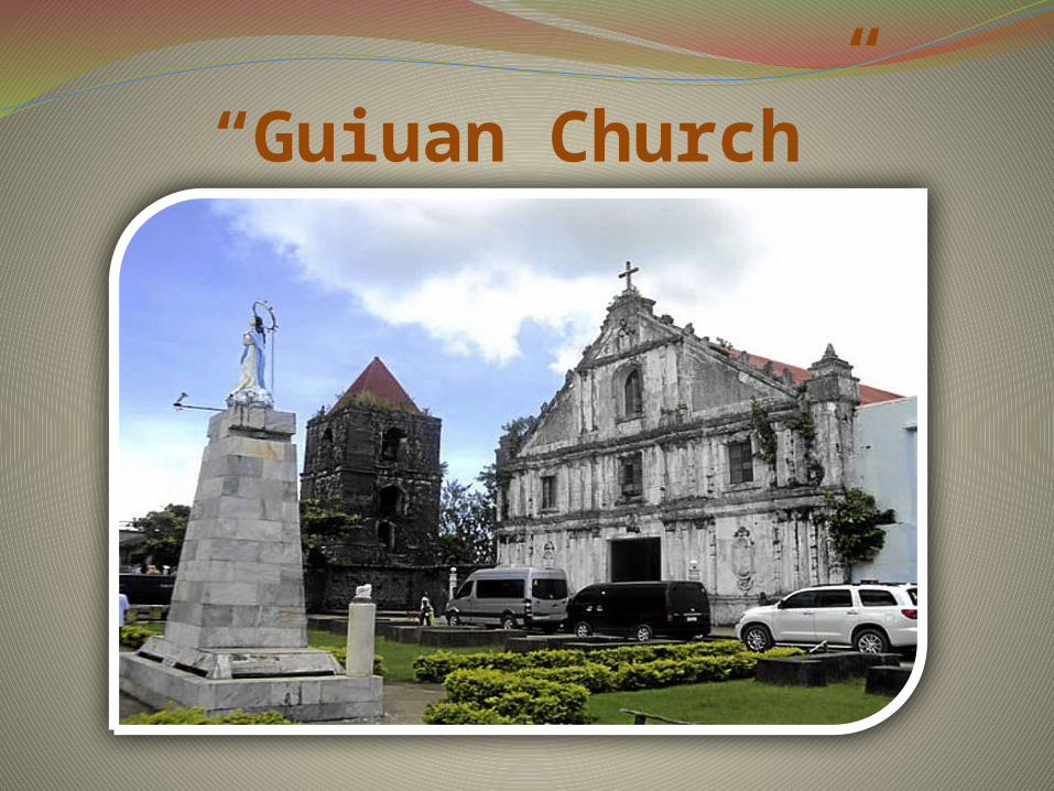
“Guiuan Church”


SAMARAlso known as Western Samar.Its capital is Catbalogan City and covers the
western portion of Samar Island as well as several islands in the Samar Sea located west of the mainland.
The province is bordered to the north by Northern Samar and Eastern Samar to the east.
Samar is connected to island and province of Leyte via the San Juanico Bridge, which spans the San Juanico Strait, the narrowest strait in the world. To its south is Leyte Gulf.

GEOGRAPHYSamar island occupies the eastern portion
of the Philippines. It lies southeast of Luzon and occupies the northernmost section of Eastern Visayas.
It is separated from Luzon on the north by San Bernardino Strait and from Leyte on the southwest by the narrow San Juanico Strait. It is bounded on the east by the Pacific Ocean, on the south by Leyte Gulf and on the west by the Samar Sea.
TOPOGRAPHYSamar province is hilly, with mountain peaks
ranging from 660 to 2,600 ft high and narrow
strips of lowlands, which tend to lie in the
alluvial plains and deltas accompanying large
rivers. The largest lowlands are located along
the northern coast extending up to the
valleys of Catubig and Catarman rivers.
Smaller lowlands in Samar are to be found in
the Calbayog area.

SUBDIVISIONS
The province of Samar is composed of two
congressional districts, 24 municipalities
and two cities (Catbalogan and Calbayog).
It has a total of 952 barangays.
CITIES: Calbayog
Catbalogan
MUNICIPALITIES Almagro Basey Calbiga Daram Gandara Hinabangan Jiabong Marabut Matuguinao Motiong Pagsanghan Paranas (Wright)
Pinabacdao San Jorge San Jose de Buan San Sebastian Santa Margarita Santa Rita Santo Niño Tagapul-an Talalora Tarangnan Villareal Zumarraga
DEMOGRAPHICSPopulation Census
of SamarYear Pop. ±
% p.a. 2000 641,124 1.70%
2007 695,149 1.16%
2010 733,377 1.80%
As of 2010, samar has a population of 733,377 people.

DIALECTSResidents of Samar are mostly Waray, the sixth largest cultural-linguistic group in the country.
There are two types of Waray spoken in the province, Waray Lineyte-Samarnon which is spoken from the southernmost tip of the province up to the municipality of Gandara and Waray Calbayog, an intermediary between the Waray of Northern Samar and the Waray of Samar, spoken in Calbayog City, Santa Margarita, and in some parts of Tagapul-an, Santo Niño and Almagro.

DELICACIES “Pinato”

“Pastillas”
FESTIVALS“Bagolan Festivals”

“Patiklos Festival”

“Mayaw-mayaw Festival”
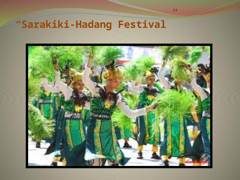
“Sarakiki-Hadang Festival”

TOURIST ATTRACTION“Burabod Caves”

“Pinipisakan Falls”

“Tarangban Falls”

“Tooth Rock Formation”

Provincial Governor: SHAREE ANN T. TAN
Vice –Governor: STEPHEN JAMES T. TAN
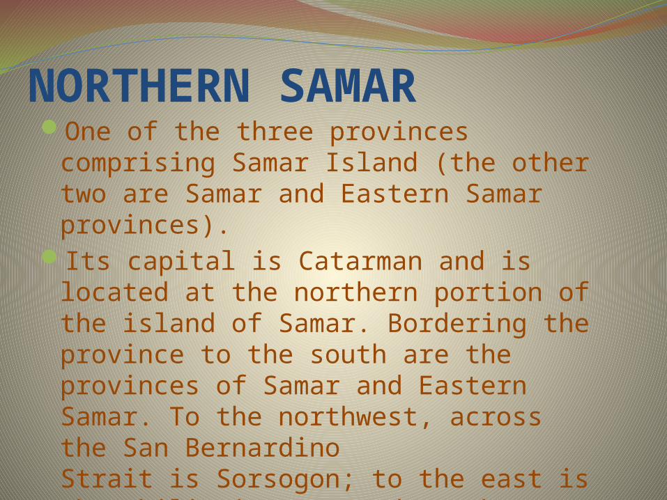
NORTHERN SAMAROne of the three provinces comprising
Samar Island (the other two are Samar and Eastern Samar provinces).
Its capital is Catarman and is located at the northern portion of the island of Samar. Bordering the province to the south are the provinces of Samar and Eastern Samar. To the northwest, across the San Bernardino Strait is Sorsogon; to the east is the Philippine Sea and to the west is Samar Sea.

GEOGRAPHYIt is located at the eastern edge of the
Archipelago with an area of 369,293 hectares.
About 52 percent of the total land area is
covered by forest and 42 percent is classified
as alienable and disposable.
It is bounded by the Pacific Ocean on the east,
the San Bernardino Strait on the north, Samar
Sea on the west, and the Samar and Eastern
Samar provinces on the south.

Socio-Demographic SituationNorthern Samar is classified as second
class province. Based on the 2010 National Census, the province has a total population of 589,013.
Catarman is the capital town of the province where most political and economic activities take place. It is the seat of administration and the center of trade and commerce as well as industry.

CLIMATENorthern Samar falls under the
intermediate type climate, which has
no distinct dry and wet seasons. The
rainiest months are October to
January, while the driest is the month
of May.
LANGUAGESMajority of the people in the province of
Northern Samar speak the Norte
Samarnon, a variation of Waray-Waray.
Tagalog and English are also widely used
and understood in Northern Samar.

SUBDIVISIONSNorthern Samar is divided into three (3)
major geographical areas, namely:
Balicuatro area, Central area, and Pacific
area including Catubig Valley – the
province’s rice granary.
It comprises 24 towns or municipalities
with 569 registered barangays.
MUNICIPALITIESAllenBiriBobonCapulCatarmanCatubigGamayLaoangLapinigLas NavasLavezaresLope de Vega
MapanasMondragonPalapagPambujanRosarioSan AntonioSan IsidroSan JoseSan RoqueSan VicenteSilvino LobosVictoria
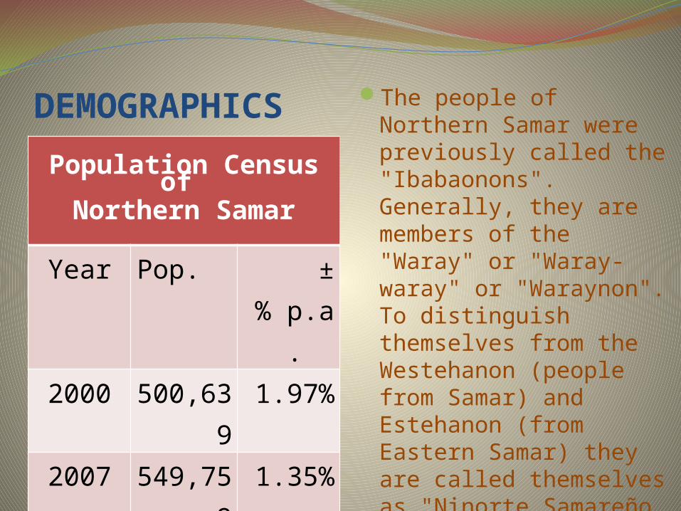
DEMOGRAPHICS
Population Census of
Northern Samar
Year Pop. ±% p.a.
2000 500,63
91.97%
2007 549,759
1.35%
2010 589,013
2.33%
The people of Northern Samar were previously called the "Ibabaonons". Generally, they are members of the "Waray" or "Waray-waray" or "Waraynon". To distinguish themselves from the Westehanon (people from Samar) and Estehanon (from Eastern Samar) they are called themselves as "Ninorte Samareño or Nortehanon".

DELICACIES“Moron” “Sumarungsong”

FESTIVALS“Pahoy-pahoy Festivals”
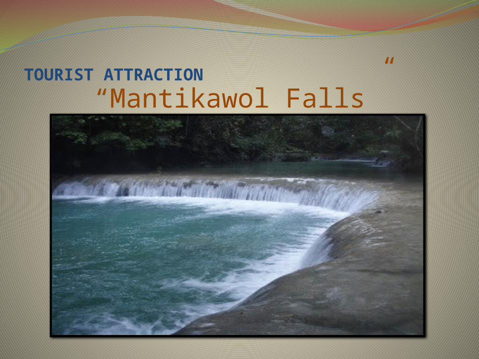
TOURIST ATTRACTION
“Mantikawol Falls”

“Pinipisakan Falls”

“The Marine Sanctuary”
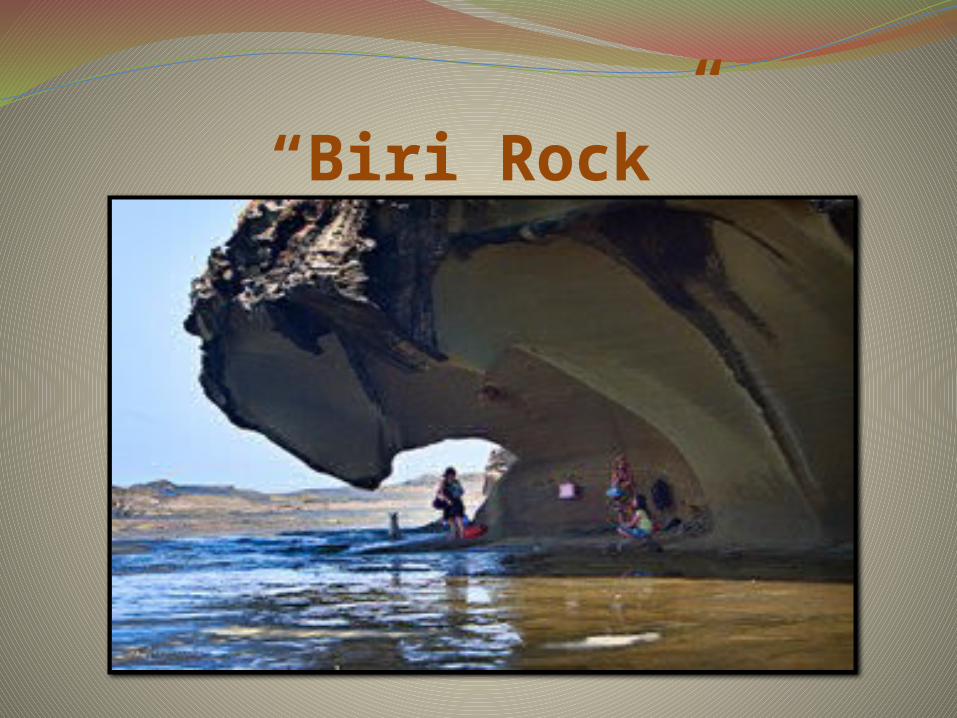
“Biri Rock”
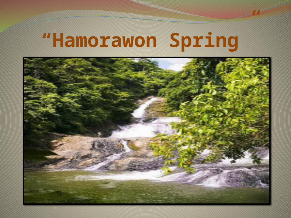
“Hamorawon Spring”

“Onay Beach”

Provincial Governor: JOSE L. ONG Jr.
Vice Governor: GARY M. LAVIN


LEYTEis a province of the Philippines located
in the Eastern Visayas region. Its capital is Tacloban City and occupies
the northern three-quarters of the Leyte Island.
Leyte is located west of Samar Island, north of Southern Leyte and south of Biliran. To the west of Leyte across the Camotes Sea is Cebu Province.

AREALeyte has an area of 5,712.8 square
kilometers. About 73% of Leyte's land
resources is alienable and disposable
while 27% is classified as forest land.

TOPOGRAPHYThe terrain of the province is relatively flat
to gently rolling and becoming
mountainous and rough towards the center
where a mountain range begins. This
cordillera divides the province into its
eastern and western plains. Peaks of
approximately 2,295 to 3,280 feet high
extend from north to south.

CLIMATEThe province's eastern portion has a
type II climate. It has no distinct wet or
dry season but with pronounced
rainfall from November to January
while the western portion has a type
IV climate with rainfall evenly
distributed throughout the year.
DISCOVERYThe explorer Ruy López de Villalobos,
first came to the island in 1543 and
named it Las Islas Felipinas.

Provincial Governor:
DOMINICO PETILLA
Vice Governor:
CARLO LORETO

SUBDIVISIONLeyte is subdivided into 41 municipalities
and three cities.
CITIES:Tacloban City- Highly urbanized cityBaybay City- component cityOrmoc City- Independent component city

MUNICIPALITIESAbuyogAlangalangAlbueraBabatngonBarugoBatoBurauenCalubianCapoocanKananga
CarigaraDagamiDulagHilongosHindangInopacanIsabelJaroJavierJulita
MUNICIPALITIESKanangaLa PazLeyteMacArthurMahaplagMatag-obMatalomMayorgaMeridaPaloPalompon
PaloPalomponPastranaSan IsidroSan MiguelSanta FeTabangoTabontabonTanauanTolosaTunga
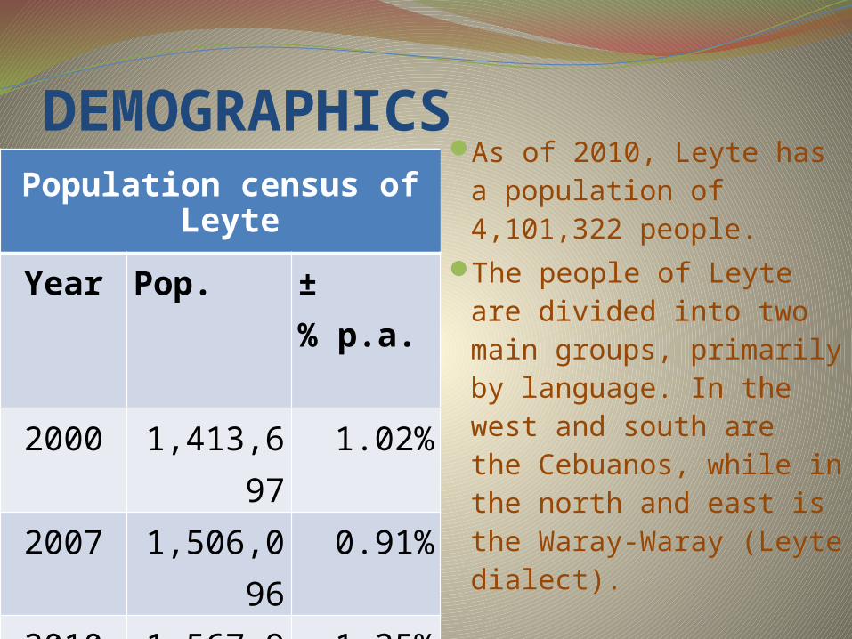
DEMOGRAPHICSPopulation census of
Leyte
Year Pop. ±% p.a.
2000 1,413,697
1.02%
2007 1,506,096
0.91%
2010 1,567,984
1.35%
As of 2010, Leyte has a population of 4,101,322 people.
The people of Leyte are divided into two main groups, primarily by language. In the west and south are the Cebuanos, while in the north and east is the Waray-Waray (Leyte dialect).

ECONOMYThe economy of Leyte is a mixed agriculture,
fishing, industrial, energy and mining. Rice is
farmed in the lowland plains areas specifically
those around Tacloban, while coconut farming, is
the main cash crop in upland and mountainous
areas. Sugarcane plantation is no. 1 produce in
Ormoc City. Since Leyte is an island province,
fishing is a major source of livelihood among
coastal residents.

DELICACIES“Puto” “Bibingka”

FESTIVALS “Pintados Kasadyaan Festival”

“Sangyaw Festival”

TOURIST ATTRACTIONLeyte Landing Memorial
Memorial of former Philippine president Osmeña and then Pacific Theatre World War II commander, Gen. MacArthur, and their staff
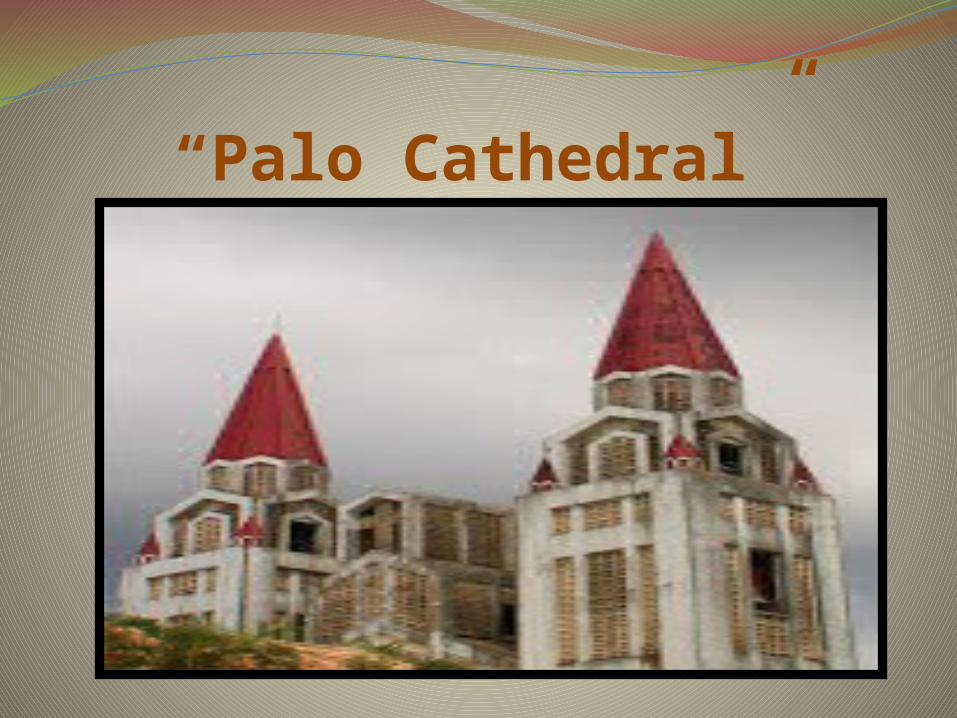
“Palo Cathedral”

“Tangkaan Beach”
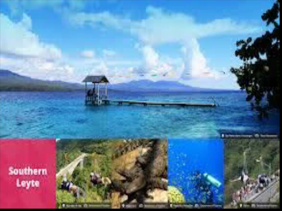
SOUTHERN LEYTE Southern Leyte was once a sub-province of Leyte
before it was divided from the latter. Limasawa, an island to the south is part of the province where the first Christian Mass was held and is said to be the birthplace of Christianity in the Philippines.
The province ranks as the second least populated in the region. According to the 2010 census, the province has a population of 399,137
Southern Leyte's geological features created several issues in the province after the flooding of the Subangdaku River and the awful mudslide in Guinsaugon. Organizations warned the province it was susceptible to natural occurrences like landslides and floodings.
Maasin City is the capital of the province.

ECONOMYSouthern Leyte contributes to the economy
of the country. It forms an important part of
the inter-island transportation system of the
country, with ferries transporting people
and goods between Liloan and Surigao del
Norte in Mindanao. The province is well
known for its quality abaca products and is
the country's major producer of abaca fiber.
TOPOGRAPHY Southern Leyte occupies the southern
quarter of the island of Leyte. It is bounded by the province of Leyte to the north, by Surigao Strait to the east, Bohol Sea to the south, and Canigao Channel, across from Bohol, to the west. Its total land area is 179,861 hectares.
The province is characterized by relatively flat lands along the coastal areas where population centers lie, but rugged mountains towards the interior.
LANGUAGE
The native language is Cebuano language.
However, the Waray-Waray is also spoken
and understood in Southern Leyte. Natives
also speak English and very few of them
speaks Spanish.

POLITICAL DIVISIONS
Southern Leyte was originally consisting of
16 municipalities and 349 barangays. It
was composed of four islands
namely: Panaon Island, Limasawa Island,
San Pedro Island and San Pablo Island.
CITY: Maasin City

MUNICIPALITIESAnahawanBontocHinunanganHinundayanLibagonLiloanLimasawaMacrohonMalitbog
Padre BurgosPintuyanSaint BernardSan FranciscoSan JuanSan RicardoSilagoSogodTomas Oppus

Provincial Governor: ROGER MERCADO
Vice Governor: BERTING LAGUMBAY

DELICACIES“Dyambol” “Pili Nuts”

TOURIST ATTRACTION“Cambaro Cave”

“Kuting Reef”

“Subterranean River”
Related Documents