Welcome to EasternVi sayas REGION VIII

Welcome message from author
This document is posted to help you gain knowledge. Please leave a comment to let me know what you think about it! Share it to your friends and learn new things together.
Transcript

Welcome to
EasternVisayas
REGION VIII
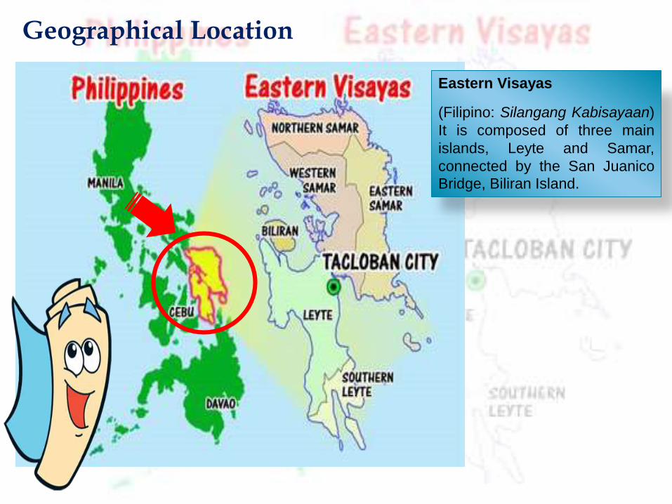
Geographical Location
Eastern Visayas
(Filipino: Silangang Kabisayaan)
It is composed of three main
islands, Leyte and Samar,
connected by the San Juanico
Bridge, Biliran Island.

East: Philippine Sea
North: San Bernardino Strait
South: Bohol Sea and Surigao Strait
West: Camotes Sea and Visayas Sea
Total land area:
2,156,285 hectares or
7.2% of the country’s
total land area.
52% of its total land area
are classified as
forestland and 48% as
alienable and disposable
land.
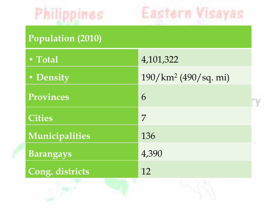
Population (2010)
• Total 4,101,322
• Density 190/km2 (490/sq. mi)
Provinces 6
Cities 7
Municipalities 136
Barangays 4,390
Cong. districts 12
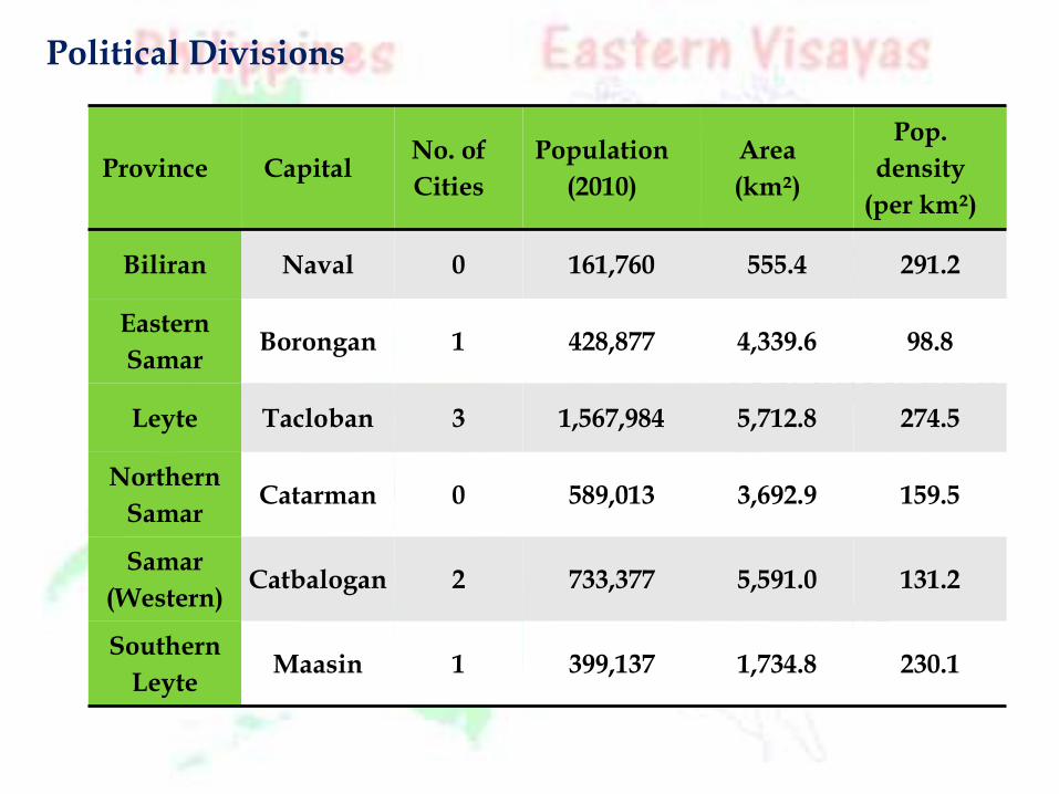
Province CapitalNo. of
Cities
Population
(2010)
Area
(km²)
Pop.
density
(per km²)
Biliran Naval 0 161,760 555.4 291.2
Eastern
SamarBorongan 1 428,877 4,339.6 98.8
Leyte Tacloban 3 1,567,984 5,712.8 274.5
Northern
SamarCatarman 0 589,013 3,692.9 159.5
Samar
(Western)Catbalogan 2 733,377 5,591.0 131.2
Southern
LeyteMaasin 1 399,137 1,734.8 230.1
Political Divisions
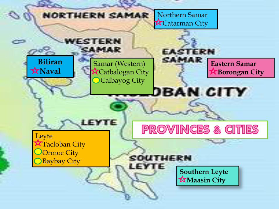
Southern LeyteMaasin City
Eastern SamarBorongan City
BiliranNaval
Northern SamarCatarman City
Samar (Western)Catbalogan CityCalbayog City
LeyteTacloban CityOrmoc CityBaybay City
CLIMATE
Type II climate is characterizes by having no dry season but a pronounced maximumrainfall from November to January. Samar Island and the eastern part of Leyte Islandfall under this type of climate.
Type IV on the other hand has an even distribution of rainfall the year round and ashort period of dry season that can be observed starting February up to May. Thistype of climate is well exhibited the western half of Leyte island and some portion ofSamar which covers the municipality of Motiong up to San Isidro of Northern Samar.
In November 2013, the region was hit with the highest death toll in thecountry by Typhoon Haiyan (Yolanda), the second deadliest typhoon ever to hit thePhilippines.
LANGUAGES
Waray-Waray is spoken on the island of Samar, Biliran and north-eastern Leyte. A Samar language, distantly related to the languages of the region,
called Abaknon is spoken in the island of Capul in Northern Samar. Cebuano is spoken in western, central, and southern parts of Leyte and in Southern
Leyte.
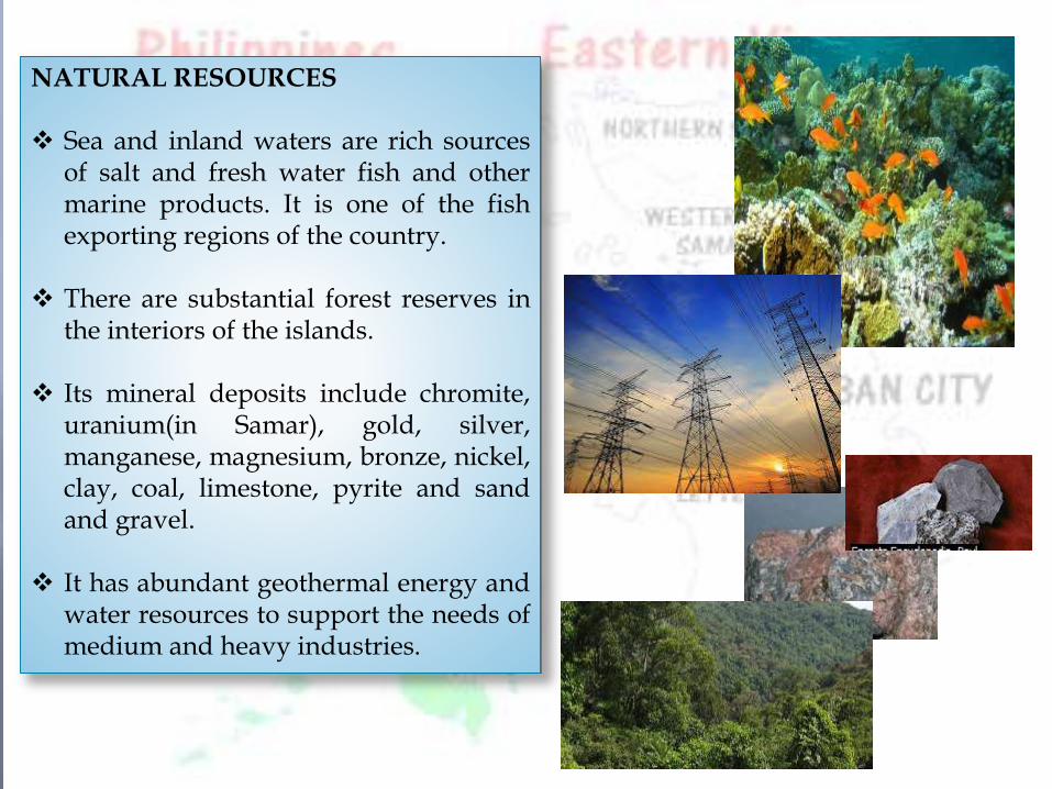
NATURAL RESOURCES
Sea and inland waters are rich sourcesof salt and fresh water fish and othermarine products. It is one of the fishexporting regions of the country.
There are substantial forest reserves inthe interiors of the islands.
Its mineral deposits include chromite,uranium(in Samar), gold, silver,manganese, magnesium, bronze, nickel,clay, coal, limestone, pyrite and sandand gravel.
It has abundant geothermal energy andwater resources to support the needs ofmedium and heavy industries.
EDUCATION
University of the Philippines Visayas (UPV Tacloban College)
University of Eastern Philippines (UEP), located in Catarman, Northern
Samar.
Zonal Agricultural University for the Visayas under the National
Agriculture Education System
Visayas State University (VSU) is also in the region, located in Baybay City.
Palompon Institute of Technology, a maritime school in the Philippines
providing deck and engine cadet.
Eastern Visayas State University is Leyte's state university with five
extension campuses
Southern Leyte State University with five extension campuses.
In Biliran, Naval State University is the province state university.
For Eastern Samar, the Eastern Samar State University is the only state
university of the province with a single extension campus while
Samar State University is Western university specializes in education
courses.
INFRASTRUCTURE
Transportation
The region's Leyte and Samar islands serve as main link between Luzonand Mindanao by land transport. A total of nine airports, are strategicallylocated in different parts of the six provinces that define the region. Daniel Z.Romualdez Airport in Tacloban City is the main gateway by air to the region.There are seaports in Tacloban, Catbalogan, Calbayog, Borongan,Ormoc, Bato,Maasin, Sogod and Naval.
Power and Energy
The region is the top producer of geothermal energy supply in thecountry. The province of Leyte hosts the biggest geothermal plant in thePhilippines. Still, geothermal exploration is ongoing in the nearby province ofBiliran. With abundance of river system, the region has potential in hydroelectricproduction. Being coastal facing Pacific Ocean, the region have location beingeyed for wind power generation. The strait of San Juanico between Leyte andSamar islands has been declared as potential source for water current and tidalenergy sources.
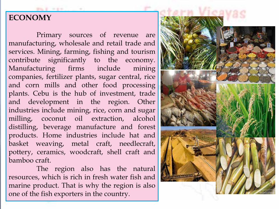
ECONOMY
Primary sources of revenue aremanufacturing, wholesale and retail trade andservices. Mining, farming, fishing and tourismcontribute significantly to the economy.Manufacturing firms include miningcompanies, fertilizer plants, sugar central, riceand corn mills and other food processingplants. Cebu is the hub of investment, tradeand development in the region. Otherindustries include mining, rice, corn and sugarmilling, coconut oil extraction, alcoholdistilling, beverage manufacture and forestproducts. Home industries include hat andbasket weaving, metal craft, needlecraft,pottery, ceramics, woodcraft, shell craft andbamboo craft.
The region also has the naturalresources, which is rich in fresh water fish andmarine product. That is why the region is alsoone of the fish exporters in the country.
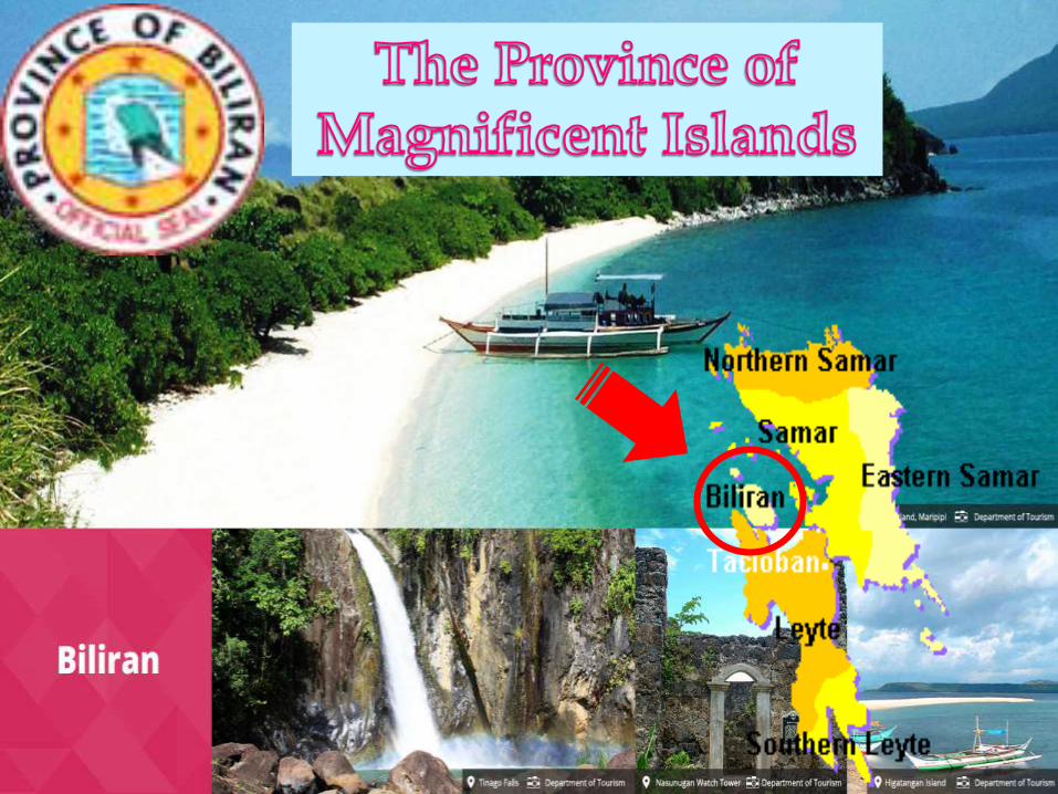
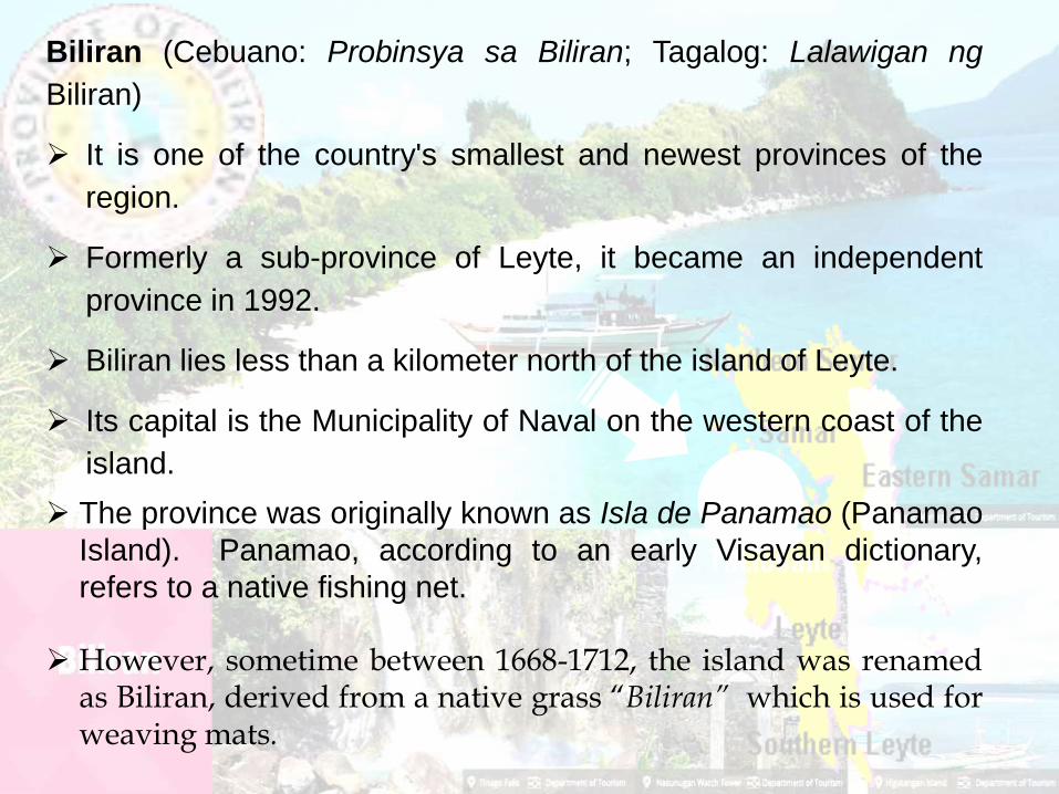
Biliran (Cebuano: Probinsya sa Biliran; Tagalog: Lalawigan ng
Biliran)
It is one of the country's smallest and newest provinces of the
region.
Formerly a sub-province of Leyte, it became an independent
province in 1992.
Biliran lies less than a kilometer north of the island of Leyte.
Its capital is the Municipality of Naval on the western coast of the
island.
The province was originally known as Isla de Panamao (Panamao
Island). Panamao, according to an early Visayan dictionary,
refers to a native fishing net.
However, sometime between 1668-1712, the island was renamedas Biliran, derived from a native grass “Biliran” which is used forweaving mats.
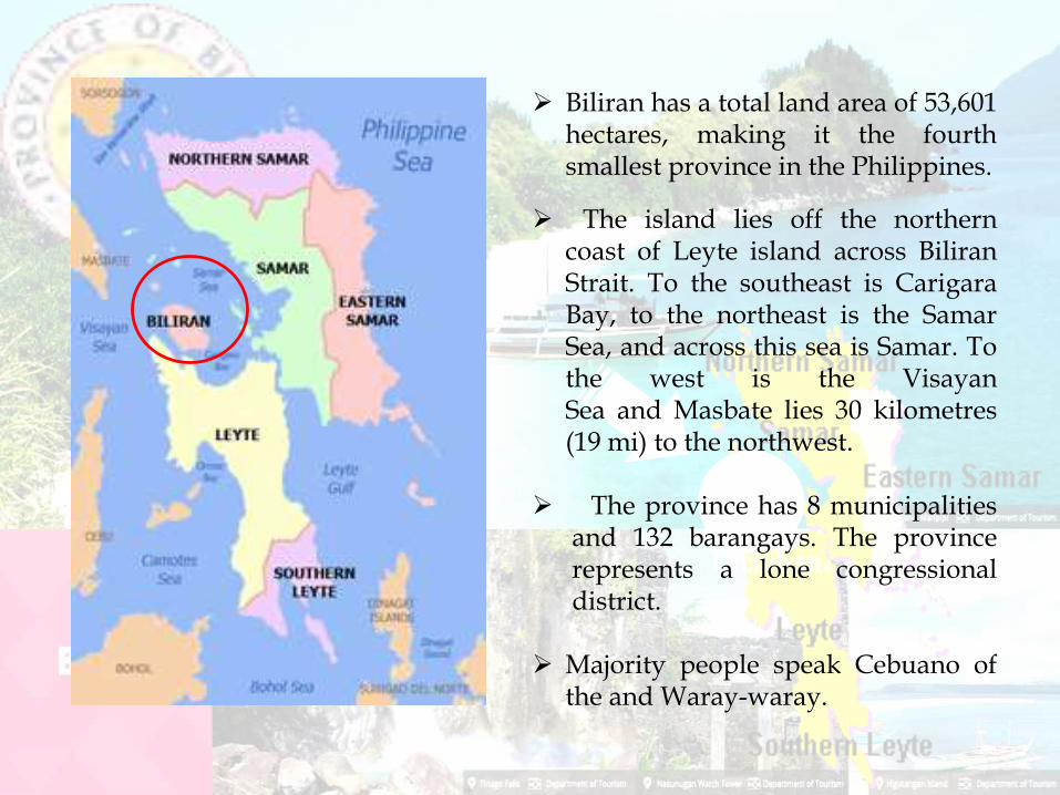
Biliran has a total land area of 53,601hectares, making it the fourthsmallest province in the Philippines.
The island lies off the northerncoast of Leyte island across BiliranStrait. To the southeast is CarigaraBay, to the northeast is the SamarSea, and across this sea is Samar. Tothe west is the VisayanSea and Masbate lies 30 kilometres(19 mi) to the northwest.
The province has 8 municipalitiesand 132 barangays. The provincerepresents a lone congressionaldistrict.
Majority people speak Cebuano ofthe and Waray-waray.

Climate
Biliran has a combination of warm and cool climatic zones, thus theprevailing climate is ideal for the cultivation of a wide range ofagricultural crops. There is no distinct dry season but the heavywet season generally occurs in December.
Political subdivision
Biliran is subdivided into 8 municipalities, with a total of 132
barangays. All the municipalities except Maripipi are located on
Biliran Island while Maripipi is an island municipality located to the
northwest. The largest among the towns is Naval, the capital of the
province, while the smallest is Maripipi.
Almeria Biliran
Cabucgaya Caibiran
Culaba Kawayan
Maripipi Naval
ECONOMY
Agricultural
Major Agricultural Products
• palay
• coconut.
• With the potential of major fruits such as banana, mango and citrus grown in
the area
the province is aiming to be the fruit basket in Eastern Visayas.
Aquaculture
Biliran is largely based on fishing. Most of its towns,especially Naval and Biliran,
have excellent seaports. There are 95 hectares of brackish water fishponds.
• prawns
• shrimps
• milkfish.
Another 30 hectares of seawater are suitable for seaweed farming and 10 more
hectares for fish cage culture.
The cool highlands are favorable to high-value crops such as cut flowers and
varieties of vegetables traditionally grown in Baguio City or Tagaytay City.
The inhabitants also engage in
*hunting *lumber *manufacturing
Raw material
*copra *coconut oil
Processed goods
*white clay ceramics *dried fish *raw gulaman *citronella oil
Untapped natural resources
*geothermal power *sulfur *gypsum
Biliran is richly endowed with natural attractions that lure both local and
foreign tourists.
• coral reef gardens
• scenic waterways
• white sand beaches
• natural hot and cold water springs
• clear and sweet-tasting water that flows from the Tomalistis Falls in
Caibiran which is believed to be one of the best in the world
with these natural wonders, the province is developing eco-tourism in the area.
Major industries
*fashion bags *Romblon bags *shell crafts *placemats
*hot pads *baskets *beverage coasters *trays

Tourist Attractions
(Undiscovered Paradise)
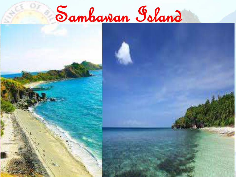
Sambawan Island
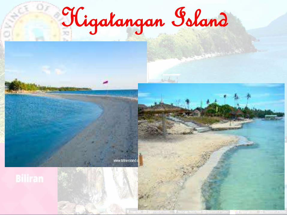
Higatangan Island
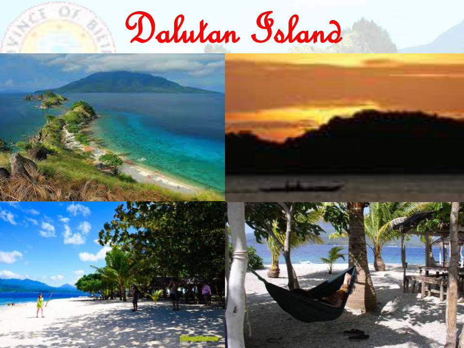
Dalutan Island
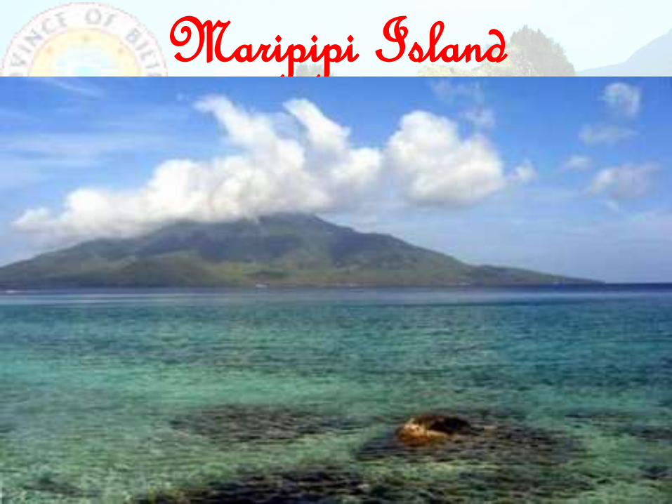
Maripipi Island
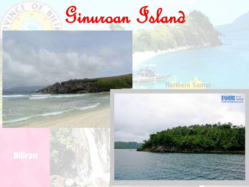
Ginuroan Island
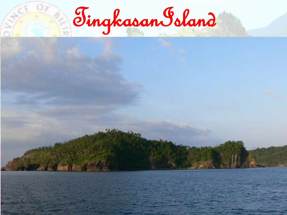
TingkasanIsland

Capinahan Island

Agta Beach

Banderahan Beach

Cogon Beach

Looc White Beach

Libtong Hot Spring

Mainit Hot Spring
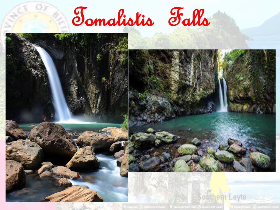
Tomalistis Falls

Bagongbong Falls

Casiawan Falls

Kasabangan Falls

Kinaraha Falls

Pondol Falls

Togawi Falls

Tinago Falls

Ulan-ulan Falls

Busai Falls

Masagongsong Swimming Pool

San Bernardo Swimming Pool

Iyusan Rice Terraces

Padre Gaspar Shrine

Nasunugan Watchtower

Festivals

Hudyaka Festival

Bagasumbol Festival

Ibid Festival

Ginalutan Festival

Bucgay Festival

Gapnod Festival

Subingsubing Festival

Thank you!!!
REGION VIII
Related Documents