Earthquake location http://www-rohan.sdsu.edu/~kbolsen/ geol600_nhe_location_groundmotion.ppt

Earthquake location rohan.sdsu.edu/~kbolsen/geol600_nhe_location_groundmotion.ppt.
Dec 19, 2015
Welcome message from author
This document is posted to help you gain knowledge. Please leave a comment to let me know what you think about it! Share it to your friends and learn new things together.
Transcript
Earthquake location
http://www-rohan.sdsu.edu/~kbolsen/geol600_nhe_location_groundmotion.ppt

S-P times
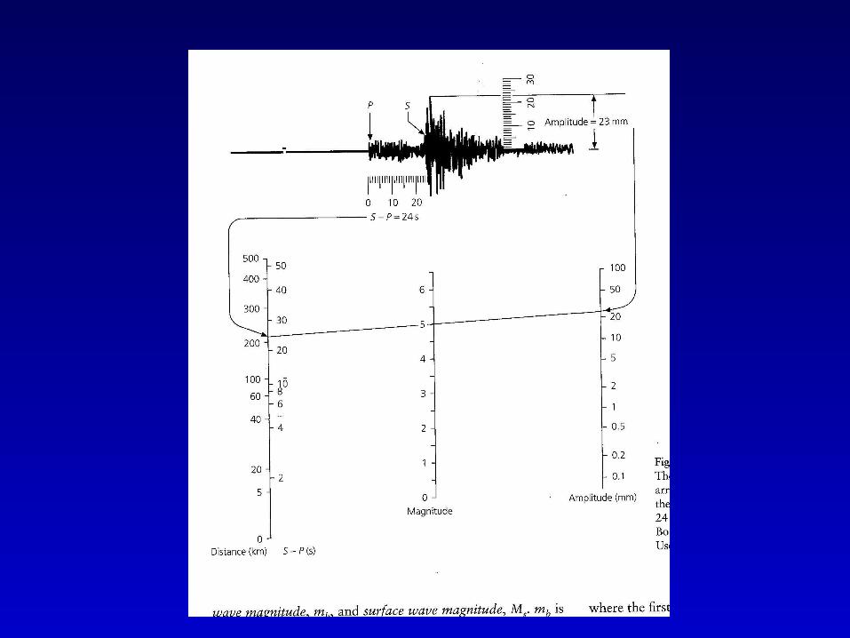
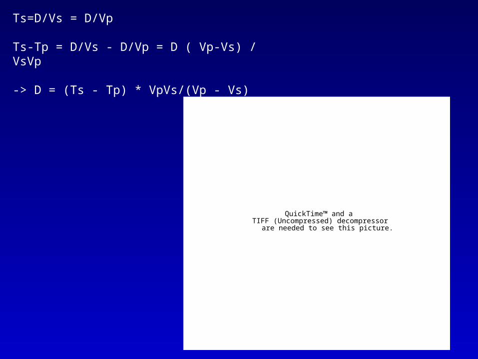
Ts=D/Vs = D/Vp
Ts-Tp = D/Vs - D/Vp = D ( Vp-Vs) / VsVp
-> D = (Ts - Tp) * VpVs/(Vp - Vs)
QuickTime™ and aTIFF (Uncompressed) decompressor
are needed to see this picture.

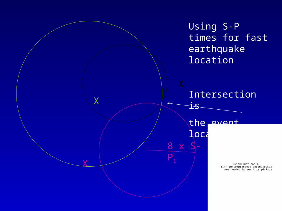
S-P times: D(km) ~ 8 x S-P(s)
S-P
X
X
X8 x S-P1
Using S-P times for fast earthquake location
Intersection is
the event location
QuickTime™ and aTIFF (Uncompressed) decompressor
are needed to see this picture.
Grid search method
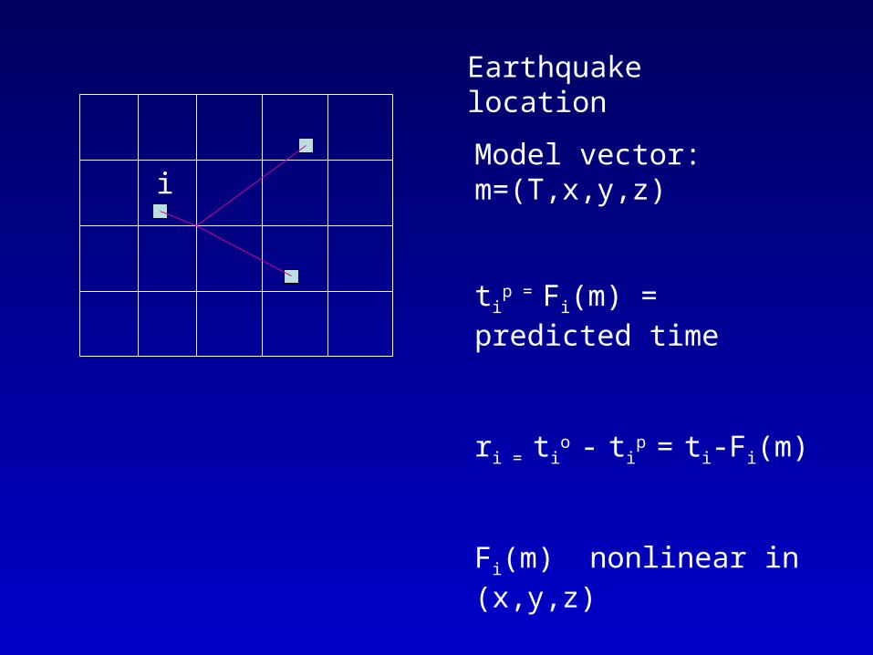
Model vector: m=(T,x,y,z)
tip = Fi(m) = predicted time
ri = tio
- tip
= ti-Fi(m)
Fi(m) nonlinear in (x,y,z)
e.g. ti=[(x-xi)2+(y-yi)2]1/2/v
Earthquake location
i
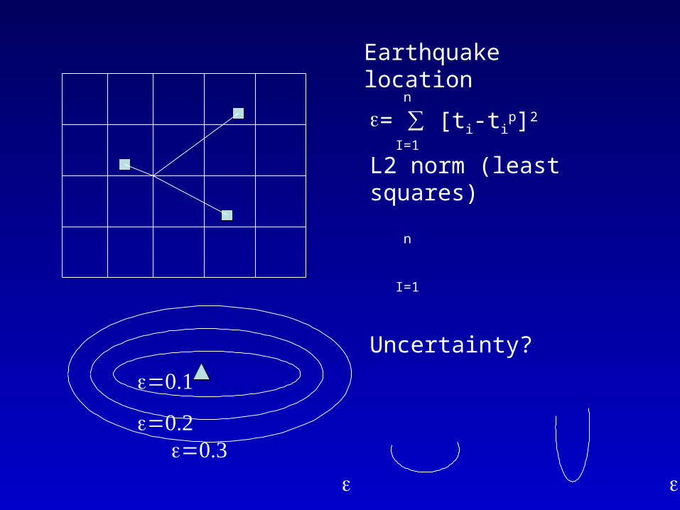
= ∑ [ti-tip]2
L2 norm (least squares)
Earthquake location
n
I=1
Uncertainty?
n
I=1
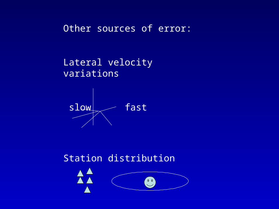
Other sources of error:
Lateral velocity variations
slow fast
Station distribution
When no seismograms are available for location…

Ground motions, site effects, and earthquake engineering
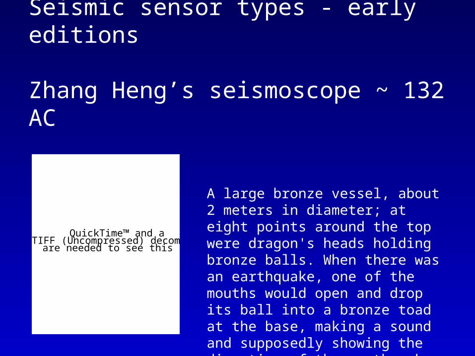
Seismic sensor types - early editions
Zhang Heng’s seismoscope ~ 132 AC
QuickTime™ and aTIFF (Uncompressed) decompressor
are needed to see this picture.
A large bronze vessel, about 2 meters in diameter; at eight points around the top were dragon's heads holding bronze balls. When there was an earthquake, one of the mouths would open and drop its ball into a bronze toad at the base, making a sound and supposedly showing the direction of the earthquake.
Seismic sensor types:
Modern instruments use electronics. In some systems, the mass is held nearly motionless relative to the frame by an electronic loop. The motion of the mass relative to the frame is measured, and the feedback loop applies a magnetic or electrostatic force to keep the mass nearly motionless. The voltage needed to produce this force is the output of the seismometer, which is recorded digitally. In other systems the mass is allowed to move, and its motion produces a voltage in a coil attached to the mass and moving through the magnetic field of a magnet attached to the frame.
Professional seismic observatories usually have instruments measuring three axes: north-south, east-west, and up-down. If only one axis can be measured, this is usually the vertical because it is less noisy and gives better records of some seismic waves.
QuickTime™ and aTIFF (Uncompressed) decompressor
are needed to see this picture.
QuickTime™ and aTIFF (Uncompressed) decompressor
are needed to see this picture.

Seismic sensor types:
Broadband:flat instrument response from 50 Hz-30 seconds.
Strong-motion:flat instrument response in acceleration and on scale recording up to 2 g

Instrument responseSeismometers are usually designed to record signals over a specified range of frequencies (or periods) so it is convenient to discuss instruments based on the range of vibration frequencies that they can detect. Thus one way to characterize seismometers is to describe the range of vibration frequencies that they can detect. A plot of the amplification as a versus frequency is called an instrument response.
QuickTime™ and aTIFF (Uncompressed) decompressor
are needed to see this picture.

Wavelength and Period
Wavelength = wave speed x period
QuickTime™ and aTIFF (Uncompressed) decompressor
are needed to see this picture.
Acceleration, Velocity and Displacement
QuickTime™ and aTIFF (Uncompressed) decompressor
are needed to see this picture.
ShakeMap:
A representation of ground shaking produced by an earthquake, i.e., a range of ground shaking levels at sites throughout a region depending on distance from the earthquake, the rock and soil conditions at sites, and variations in the propagation of seismic waves from the earthquake due to complexities in the Earth’s crust.
USGS ShakeMap:
Using a series of measures of the spatially variable shaking:
Peak Ground Acceleration (PGA)
Peak Ground Velocity (PGV)
Spectral Acceleration at 0.3s, 1.0s, 3.0s
Rapid Instrumental Intensity Map

Peak Ground Acceleration (PGA)
Complicated pattern, extreme variability over a few km, due to small-scale geological differences near the sites that can change the high-frequency ground motion
PGA represents low-moderate levels of damage
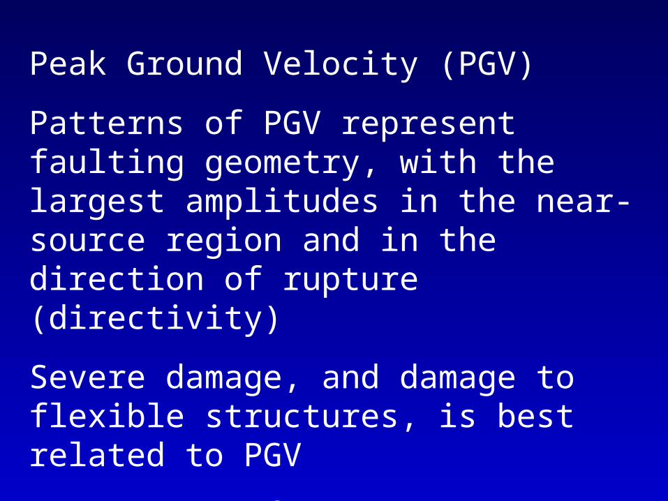
Peak Ground Velocity (PGV)
Patterns of PGV represent faulting geometry, with the largest amplitudes in the near-source region and in the direction of rupture (directivity)
Severe damage, and damage to flexible structures, is best related to PGV
Largest PGV from M6.7 NR 183 cm/s

Spectral Acceleration @ 0.3s, 1s, 3s
Peak response of a damped, single-degree-of-freedom oscillator to the recorded ground motion
Useful to determine how a structure will react to ground motions
QuickTime™ and aTIFF (Uncompressed) decompressor
are needed to see this picture.

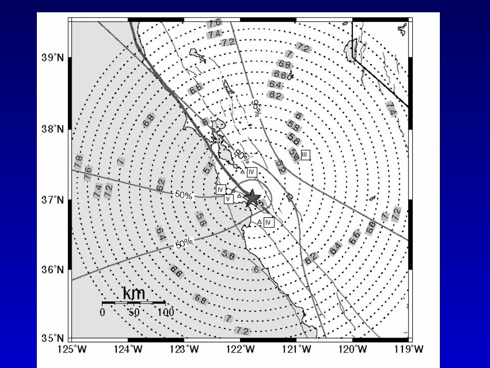
In gaps of seismic information, attenuation relations (ground motion prediction equations) are used
Based on regression of many strong-motion records
SCSN = Southern California Seismic Network
QuickTime™ and aTIFF (Uncompressed) decompressor
are needed to see this picture.

Rapid Instrumental Intensity Map:Based on instrumental ground motion records
Combined regression of PGAs and PGVs from data for 8 significant CA events: 1971 San Fernando, 1979 Imperial Valley, 1986 North Palm Springs, 1987 Whitties, 1989 Loma Prieta, 1991 Sierra Madra, 1992 Landers, 1994 Northridge
QuickTime™ and aTIFF (Uncompressed) decompressor
are needed to see this picture.
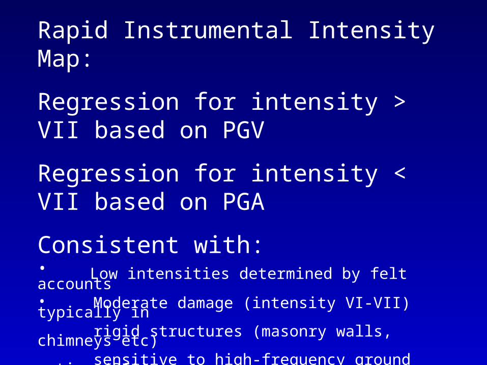
Rapid Instrumental Intensity Map:
Regression for intensity > VII based on PGV
Regression for intensity < VII based on PGA
Consistent with:• Low intensities determined by felt accounts• Moderate damage (intensity VI-VII) typically in rigid structures (masonry walls, chimneys etc) sensitive to high-frequency ground motion (PGA)• Strong damage (intensity > VII) damage also occurs in flexible structures, sensitive to PGV

USGS ShakeMap:
Conveying rapid-response ground motion maps to a general audience, including scientists, businesses, emergency agencies, media, and the general public. A representation of ground shaking produced by an earthquake
QuickTime™ and aTIFF (Uncompressed) decompressor
are needed to see this picture.
1994 M6.7 Northridge
1994 M6.7 Northridge
QuickTime™ and aTIFF (Uncompressed) decompressor
are needed to see this picture.
1994 M6.7 Northridge
QuickTime™ and aTIFF (Uncompressed) decompressor
are needed to see this picture.
1994 M6.7 Northridge
QuickTime™ and aTIFF (Uncompressed) decompressor
are needed to see this picture.

1994 M6.7 Northridge
QuickTime™ and aTIFF (Uncompressed) decompressor
are needed to see this picture.
1994 M6.7 Northridge
QuickTime™ and aTIFF (Uncompressed) decompressor
are needed to see this picture.
Related Documents