10/10/22 Asrat Worku, Associate professor, AAU 1 An Overview of Earthquake Hazards

Welcome message from author
This document is posted to help you gain knowledge. Please leave a comment to let me know what you think about it! Share it to your friends and learn new things together.
Transcript
10/10/22 Asrat Worku, Associate professor, AAU
1
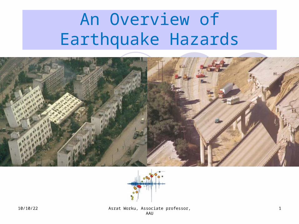
An Overview of Earthquake Hazards
10/10/22 Asrat Worku, Associate professor, AAU
2
Introduction:Some statistics An average of 10,000 people die of EQs each year
A UNESCO study shows, from 1926 to 1950 alone, average annual damage of $400,000,000
Hundreds of villages and tens of towns and cities are damaged and destroyed annually
10/10/22 Asrat Worku, Associate professor, AAU
3
Some Statistics…
Richter Magnitude
Class Description Annual Average
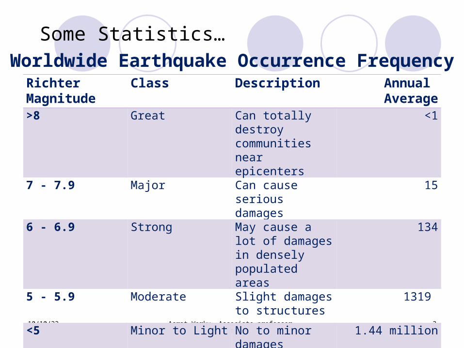
>8 Great Can totally destroy communities near epicenters
<1
7 - 7.9 Major Can cause serious damages
15
6 - 6.9 Strong May cause a lot of damages in densely populated areas
134
5 - 5.9 Moderate Slight damages to structures
1319
<5 Minor to Light No to minor damages
1.44 million
Worldwide Earthquake Occurrence Frequency
10/10/22 Asrat Worku, Associate professor, AAU
4
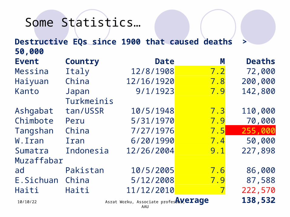
Some Statistics… Destructive EQs since 1900 that caused deaths > 50,000Event Country Date M DeathsMessina Italy 12/8/1908 7.2 72,000Haiyuan China 12/16/1920 7.8 200,000Kanto Japan 9/1/1923 7.9 142,800
AshgabatTurkmeinistan/USSR 10/5/1948 7.3 110,000
Chimbote Peru 5/31/1970 7.9 70,000Tangshan China 7/27/1976 7.5 255,000W.Iran Iran 6/20/1990 7.4 50,000Sumatra Indonesia 12/26/2004 9.1 227,898Muzaffabarad Pakistan 10/5/2005 7.6 86,000E.Sichuan China 5/12/2008 7.9 87,588Haiti Haiti 11/12/2010 7 222,570
Average 138,532
5
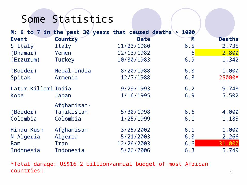
Some Statistics M: 6 to 7 in the past 30 years that caused deaths > 1000Event Country Date M DeathsS Italy Italy 11/23/1980 6.5 2,735(Dhamar) Yemen 12/13/1982 6 2,800(Erzurum) Turkey 10/30/1983 6.9 1,342(Border) Nepal-India 8/20/1988 6.8 1,000Spitak Armenia 12/7/1988 6.8 25000*Latur-Killari India 9/29/1993 6.2 9,748Kobe Japan 1/16/1995 6.9 5,502
(Border)Afghanisan-Tajikistan 5/30/1998 6.6 4,000
Colombia Colombia 1/25/1999 6.1 1,185Hindu Kush Afghanisan 3/25/2002 6.1 1,000N Algeria Algeria 5/21/2003 6.8 2,266Bam Iran 12/26/2003 6.6 31,000Indonesia Indonesia 5/26/2006 6.3 5,749
*Total damage: US$16.2 billion>annual budget of most African countries!
6
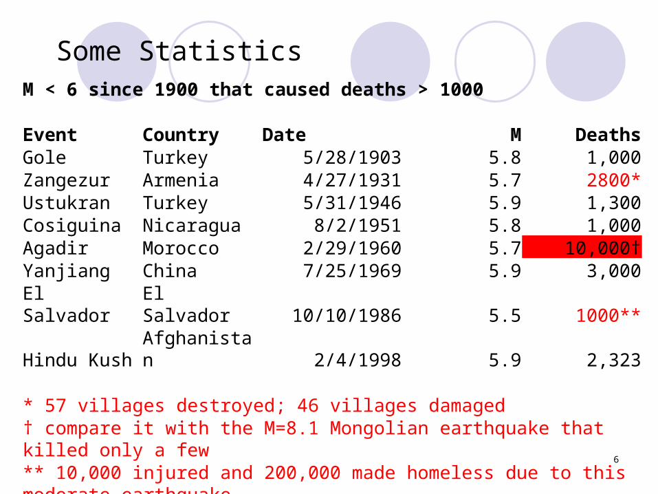
Some Statistics M < 6 since 1900 that caused deaths > 1000
Event Country Date M DeathsGole Turkey 5/28/1903 5.8 1,000Zangezur Armenia 4/27/1931 5.7 2800*Ustukran Turkey 5/31/1946 5.9 1,300Cosiguina Nicaragua 8/2/1951 5.8 1,000Agadir Morocco 2/29/1960 5.7 10,000†Yanjiang China 7/25/1969 5.9 3,000El Salvador
El Salvador 10/10/1986 5.5 1000**
Hindu KushAfghanistan 2/4/1998 5.9 2,323
* 57 villages destroyed; 46 villages damaged† compare it with the M=8.1 Mongolian earthquake that killed only a few** 10,000 injured and 200,000 made homeless due to this moderate earthquake
7
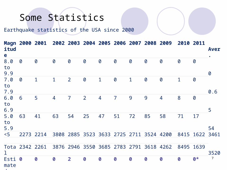
Some Statistics Earthquake statistics of the USA since 2000
Magnitude
2000 2001 2002 2003 2004 2005 2006 2007 2008 2009 2010 2011Aver.
8.0 to 9.9
0 0 0 0 0 0 0 0 0 0 0 0
07.0 to 7.9
0 1 1 2 0 1 0 1 0 0 1 0
0.66.0 to 6.9
6 5 4 7 2 4 7 9 9 4 8 0
55.0 to 5.9
63 41 63 54 25 47 51 72 85 58 71 17
54<5 2273 2214 3808 2885 3523 3633 2725 2711 3524 4200 8415 1622 3461 Total
2342 2261 3876 2946 3550 3685 2783 2791 3618 4262 8495 16393520
Estimated
0 0 0 2 0 0 0 0 0 0 0 0*
Deaths* The practically zero number of deaths is quite instructive (compare with previous tables)
10/10/22 Asrat Worku, Associate professor, AAU
8
Introduction The intensity of EQ shaking is best measured
using seismographs
First seismographs installed in 1932 in California after the 1925 Santa Barbara, CA, EQ
The first significant ground motion record was made in 1933, Long Beach, CA
Basic scientific works on strong-motion EQs started at around the mid 20th Century
By 2000, about 1000 seismographs have been installed in California alone
10/10/22 Asrat Worku, Associate professor, AAU
9
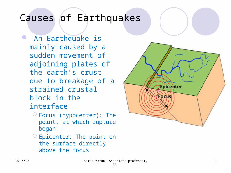
Causes of Earthquakes An Earthquake is mainly caused by a sudden movement of adjoining plates of the earth’s crust due to breakage of a strained crustal block in the interface Focus (hypocenter): The point, at which rupture began
Epicenter: The point on the surface directly above the focus
10/10/22 Asrat Worku, Associate professor, AAU
10
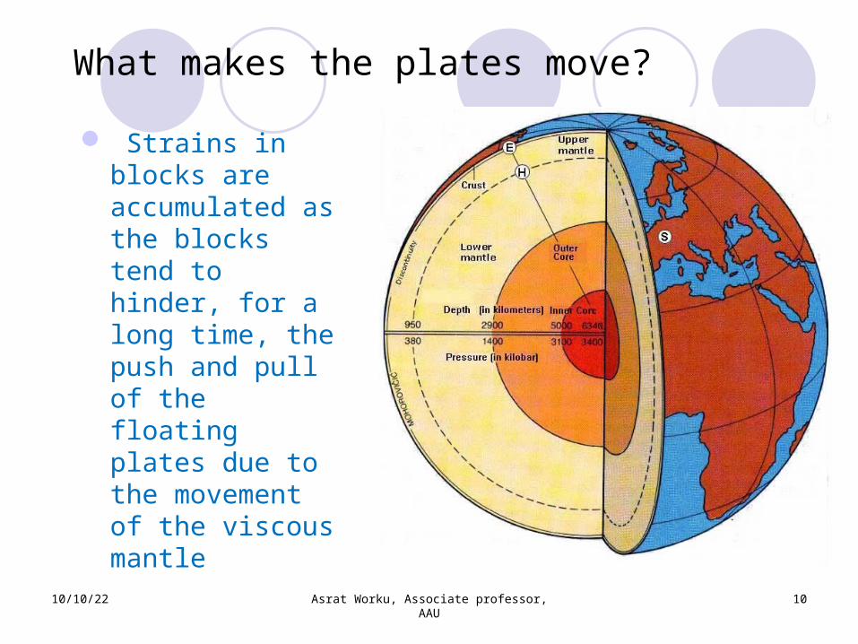
What makes the plates move?
Strains in blocks are accumulated as the blocks tend to hinder, for a long time, the push and pull of the floating plates due to the movement of the viscous mantle
10/10/22 Asrat Worku, Associate professor, AAU
11
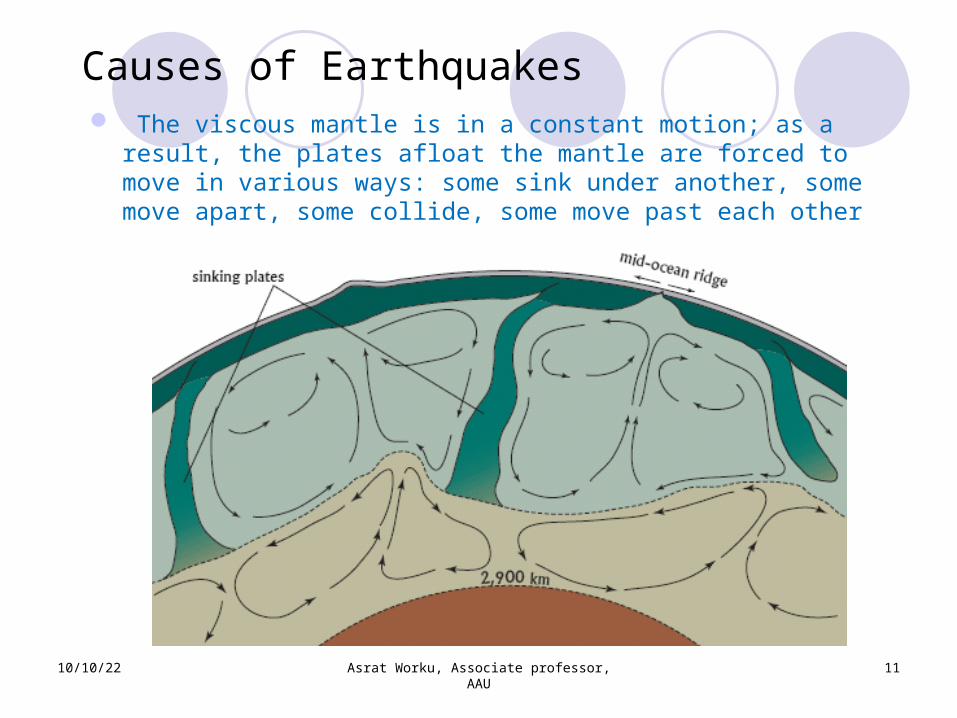
Causes of Earthquakes The viscous mantle is in a constant motion; as a
result, the plates afloat the mantle are forced to move in various ways: some sink under another, some move apart, some collide, some move past each other
10/10/22 Asrat Worku, Associate professor, AAU
12
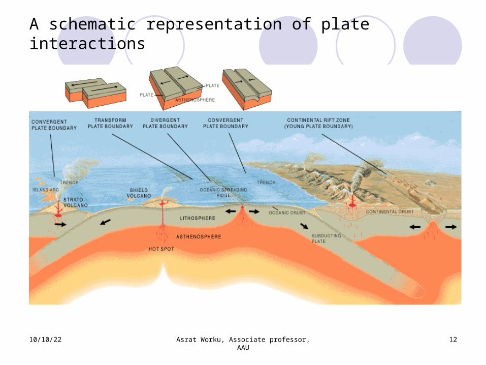
A schematic representation of plate interactions

10/10/22 Asrat Worku, Associate professor, AAU
13
Early Hypothesis: About 300 million years ago, there was a single land called Pangea (= “all the earth” in Greek)
10/10/22 Asrat Worku, Associate professor, AAU
14
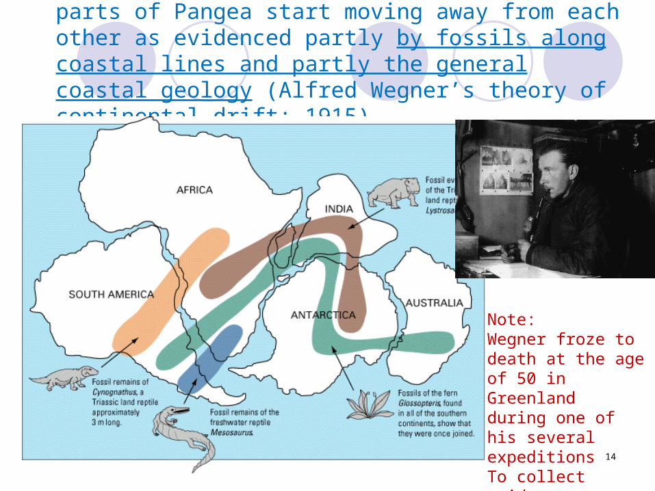
parts of Pangea start moving away from each other as evidenced partly by fossils along coastal lines and partly the general coastal geology (Alfred Wegner’s theory of continental drift: 1915)
Note:Wegner froze to death at the age of 50 in Greenland during one of his several expeditions To collect evidences
10/10/22 Asrat Worku, Associate professor, AAU
15
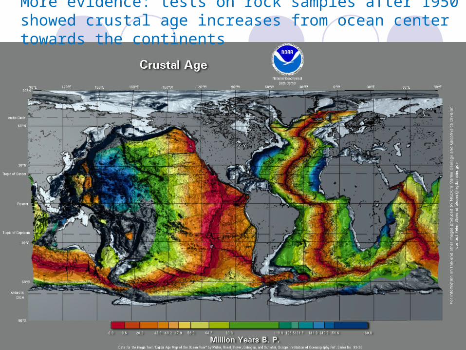
More evidence: tests on rock samples after 1950 showed crustal age increases from ocean center towards the continents
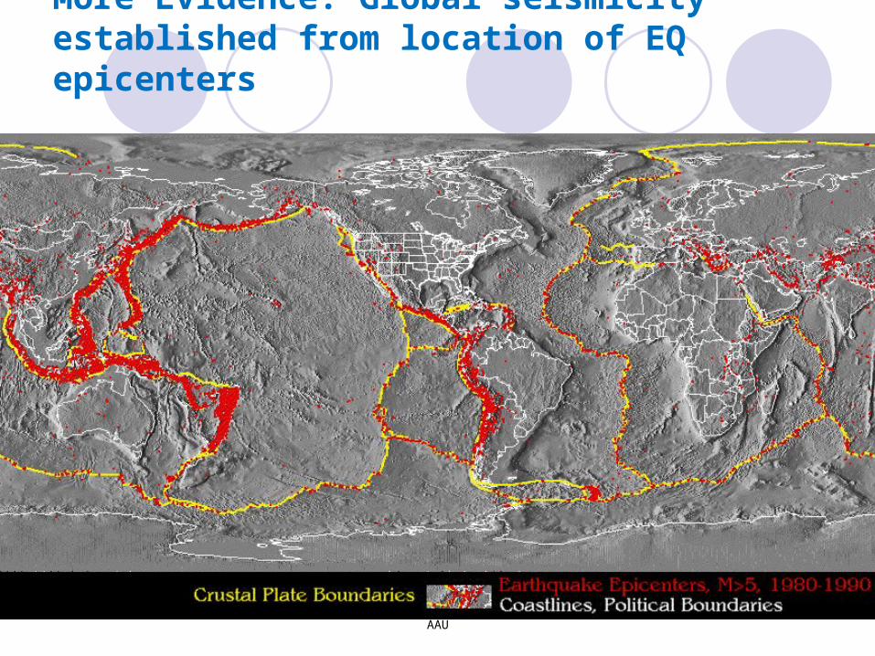
More Evidence: Global seismicity established from location of EQ epicenters
10/10/22 Asrat Worku, Associate professor, AAU
16
10/10/22 17
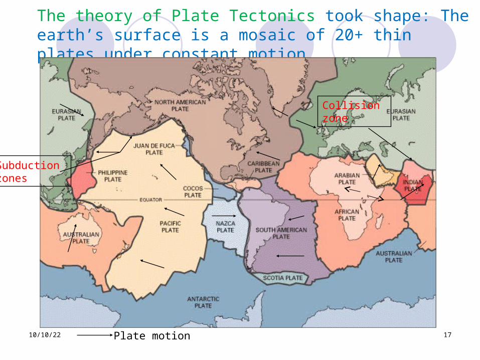
The theory of Plate Tectonics took shape: The earth’s surface is a mosaic of 20+ thin plates under constant motion
Plate motion
Subduction zones
Collision zone
10/10/22 Asrat Worku, Associate professor, AAU
18
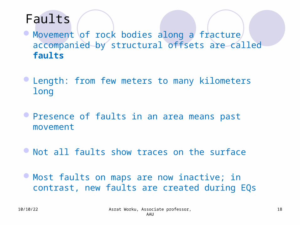
FaultsMovement of rock bodies along a fracture accompanied by structural offsets are called faults
Length: from few meters to many kilometers long
Presence of faults in an area means past movement
Not all faults show traces on the surface
Most faults on maps are now inactive; in contrast, new faults are created during EQs
10/10/22 Asrat Worku, Associate professor, AAU
19
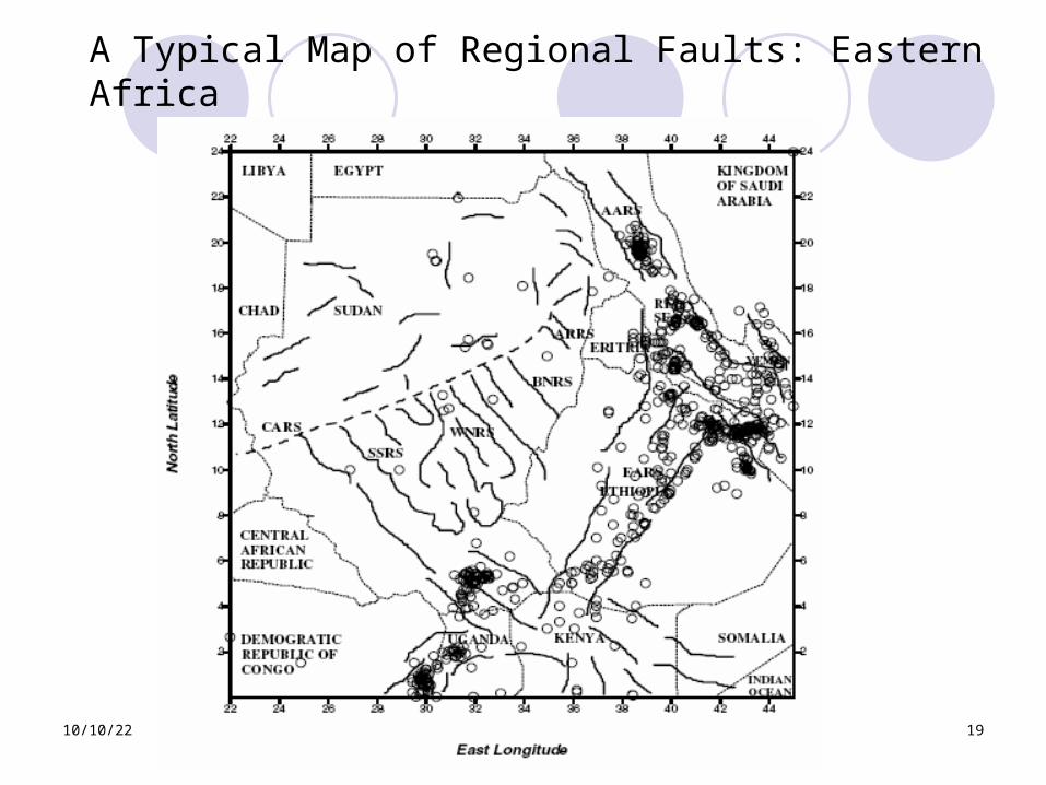
A Typical Map of Regional Faults: Eastern Africa
10/10/22 Asrat Worku, Associate professor, AAU
20
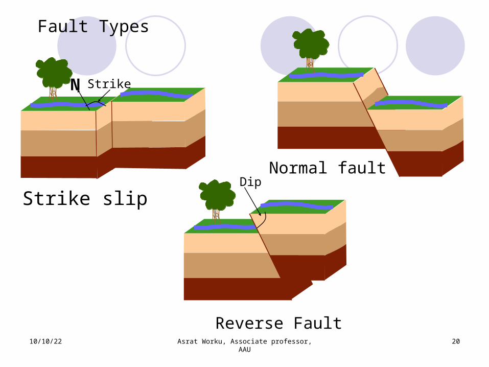
Fault Types
Strike slipDip
Reverse Fault
StrikeN
Normal fault
10/10/22 Asrat Worku, Associate professor, AAU
21
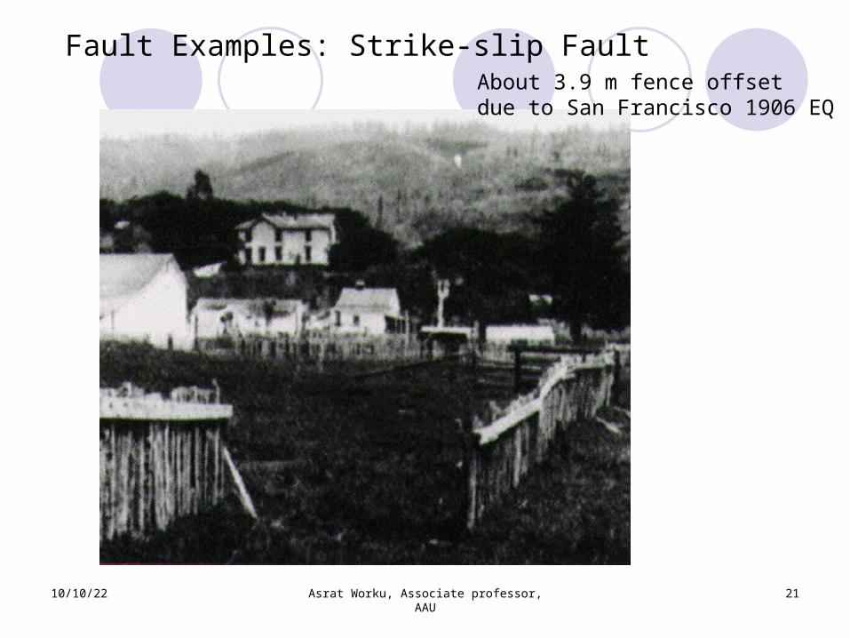
Fault Examples: Strike-slip FaultAbout 3.9 m fence offset due to San Francisco 1906 EQ
10/10/22 Asrat Worku, Associate professor, AAU
22
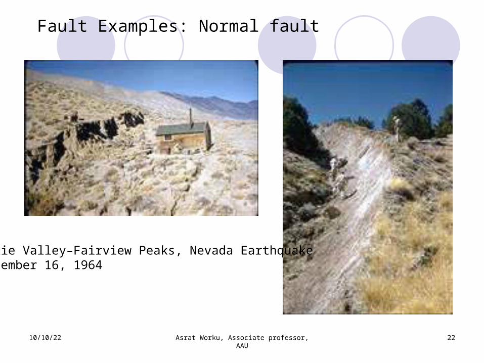
Fault Examples: Normal fault
Dixie Valley–Fairview Peaks, Nevada EarthquakeDecember 16, 1964
10/10/22 Asrat Worku, Associate professor, AAU
23
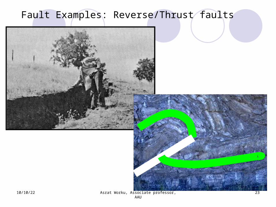
Fault Examples: Reverse/Thrust faults
10/10/22 Asrat Worku, Associate professor, AAU
24
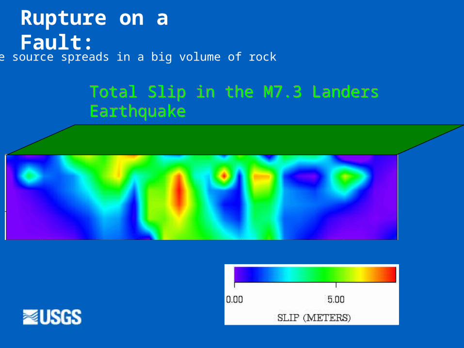
Total Slip in the M7.3 Landers Earthquake
Rupture on a Fault:
The source spreads in a big volume of rock
10/10/22 Asrat Worku, Associate professor, AAU
25
Dept
hInto theeart
h
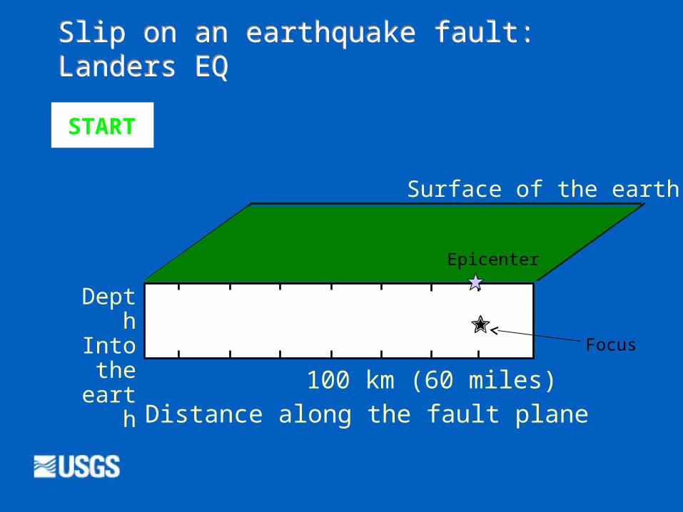
Surface of the earth
Distance along the fault plane 100 km (60 miles)
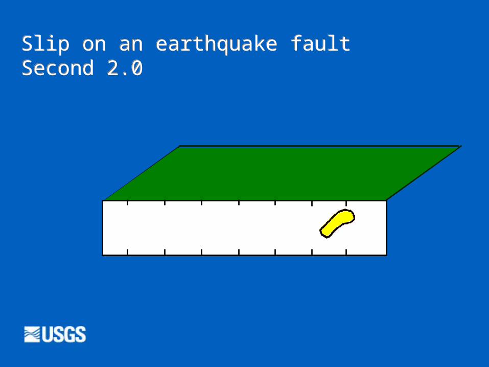
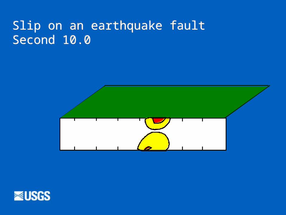
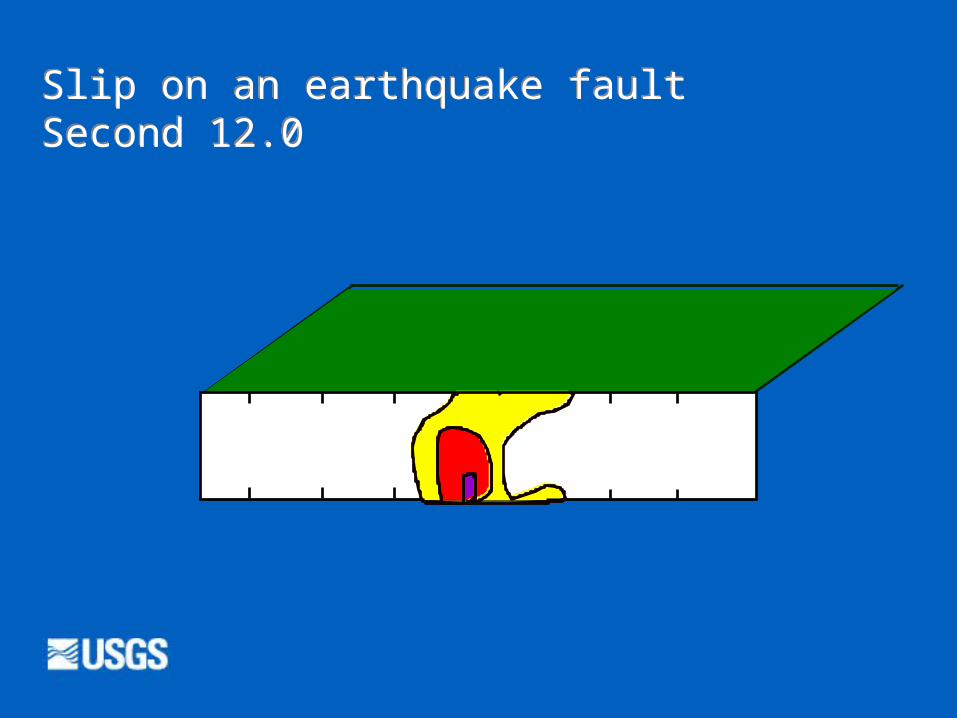
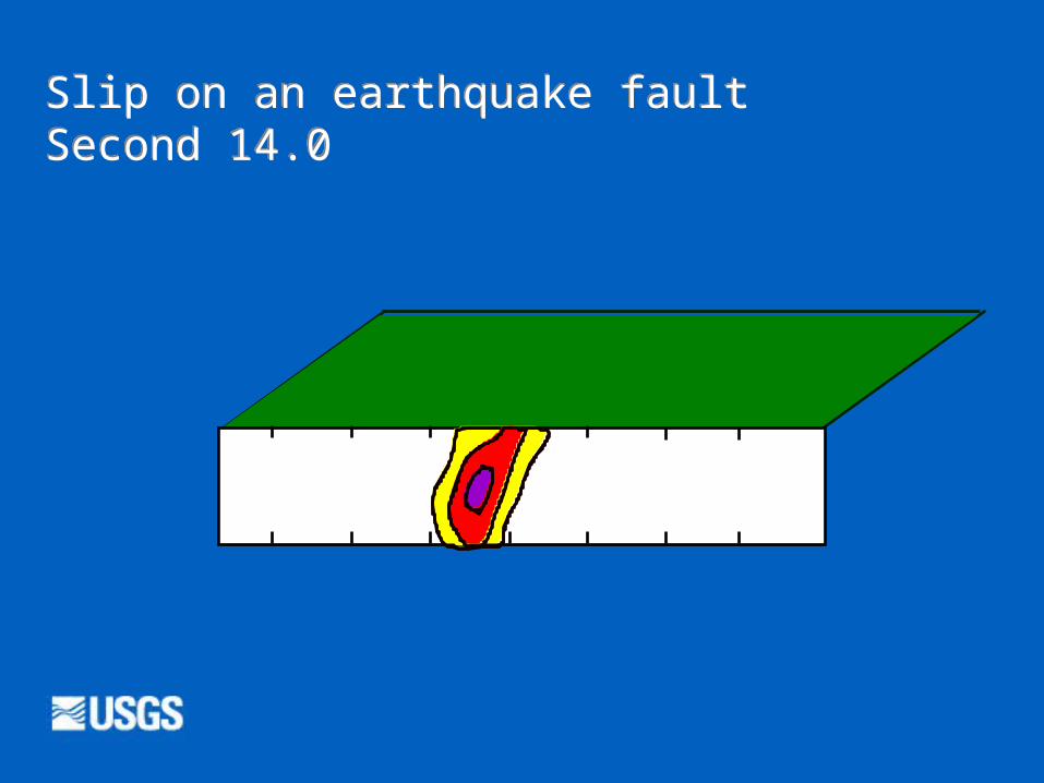
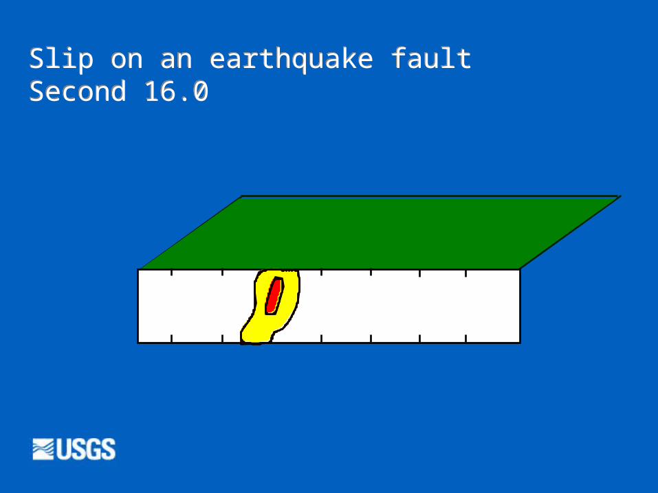
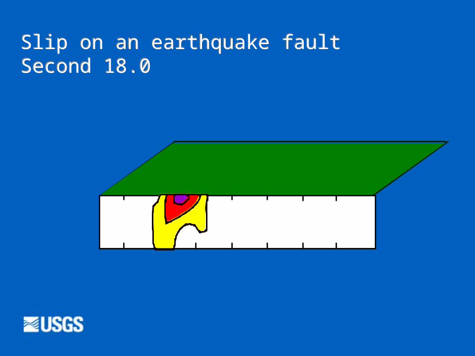
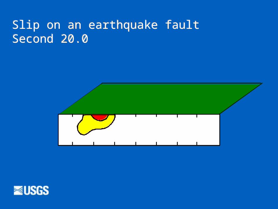
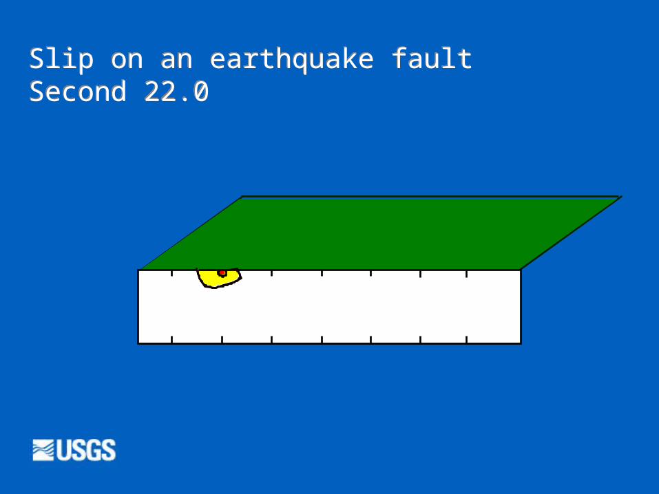
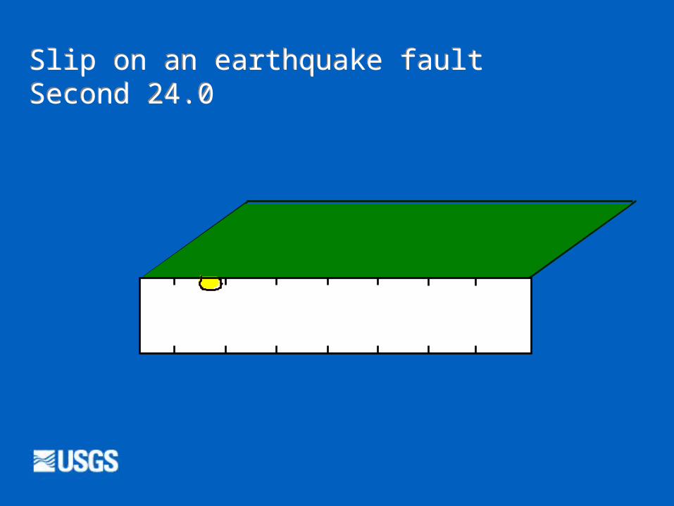
Slip on an earthquake fault: Landers EQ
START
Focus
Epicenter
10/10/22 Asrat Worku, Associate professor, AAU
26
Slip on an earthquake faultSecond 2.0
10/10/22 Asrat Worku, Associate professor, AAU
27
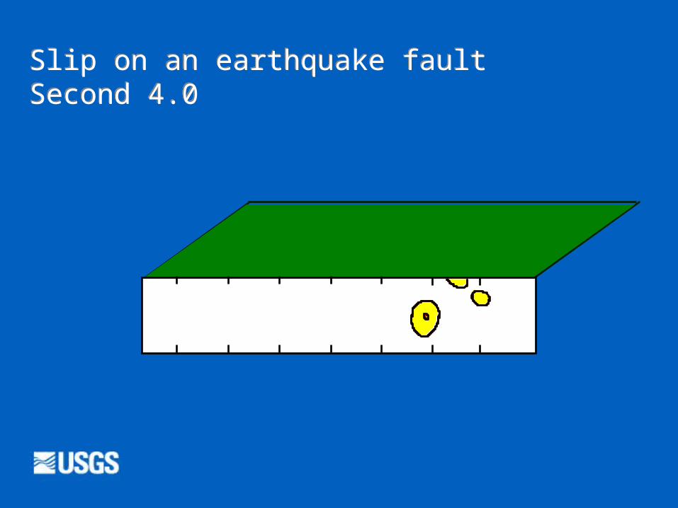
Slip on an earthquake faultSecond 4.0
10/10/22 Asrat Worku, Associate professor, AAU
28
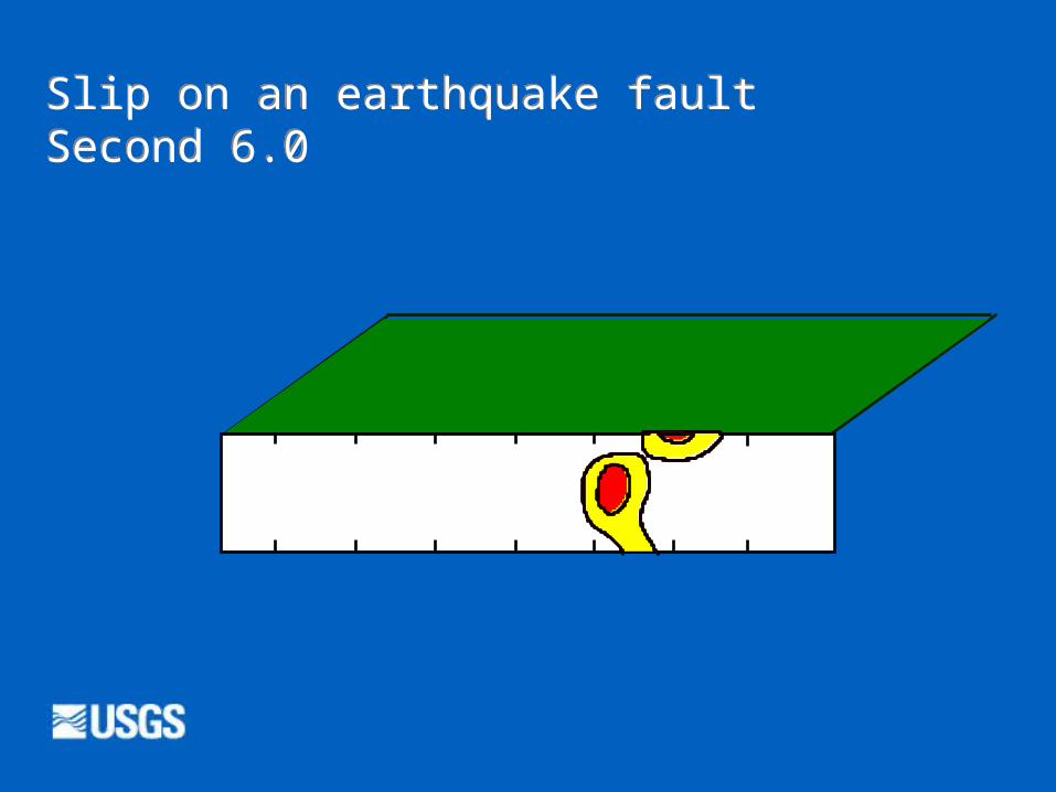
Slip on an earthquake faultSecond 6.0
10/10/22 Asrat Worku, Associate professor, AAU
29
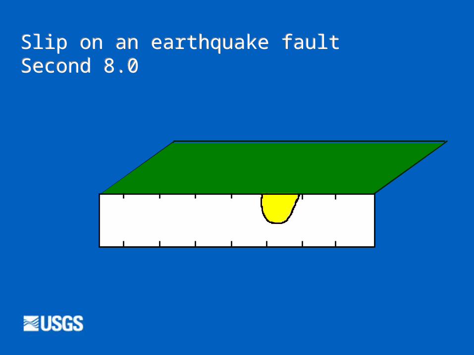
Slip on an earthquake faultSecond 8.0
10/10/22 Asrat Worku, Associate professor, AAU
30
Slip on an earthquake faultSecond 10.0
10/10/22 Asrat Worku, Associate professor, AAU
31
Slip on an earthquake faultSecond 12.0
10/10/22 Asrat Worku, Associate professor, AAU
32
Slip on an earthquake faultSecond 14.0
10/10/22 Asrat Worku, Associate professor, AAU
33
Slip on an earthquake faultSecond 16.0
10/10/22 Asrat Worku, Associate professor, AAU
34
Slip on an earthquake faultSecond 18.0
10/10/22 Asrat Worku, Associate professor, AAU
35
Slip on an earthquake faultSecond 20.0
10/10/22 Asrat Worku, Associate professor, AAU
36
Slip on an earthquake faultSecond 22.0
10/10/22 Asrat Worku, Associate professor, AAU
37
Slip on an earthquake faultSecond 24.0
10/10/22 Asrat Worku, Associate professor, AAU
38
Basic DefinitionsThe imaginary point from which the first waves start is called focus or hypocenter.
The projection on the ground surface is called epicenter.
About 75% of the total EQ energy is released from shallow-foci EQ (<70 km); they wreak the most devastation
Most EQ are accompanied by numerous smaller aftershocks and foreshocks
10/10/22 Asrat Worku, Associate professor, AAU
39
Seismic WavesDuring EQs, seismic waves radiate from a source as opposite sides of a slipping fault rebound in opposite directions
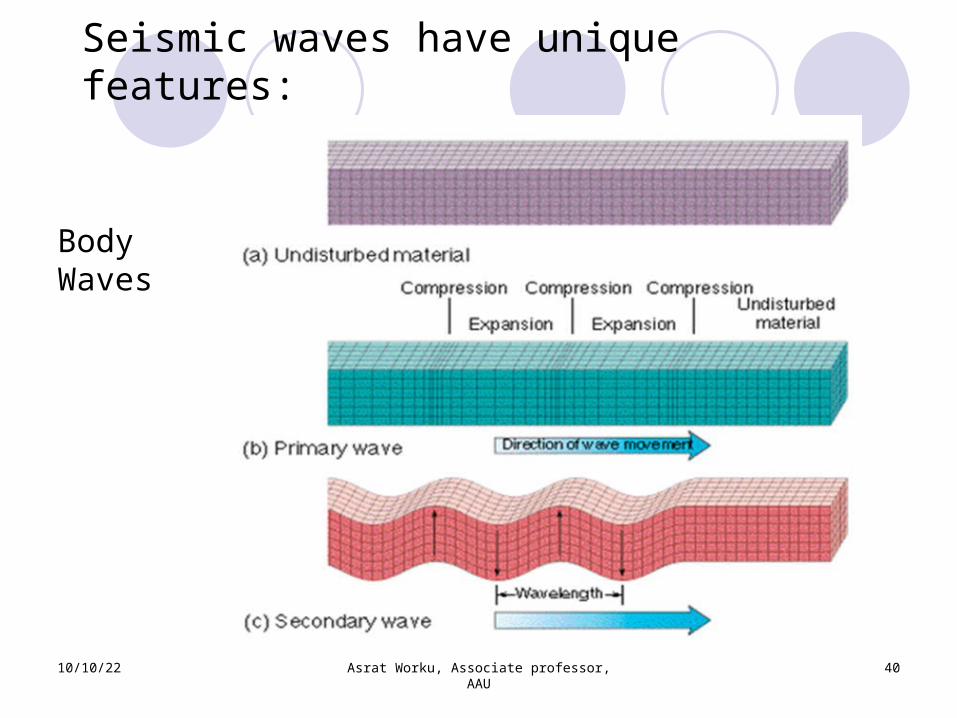
Body waves: P- and S- waves (primary and secondary waves)
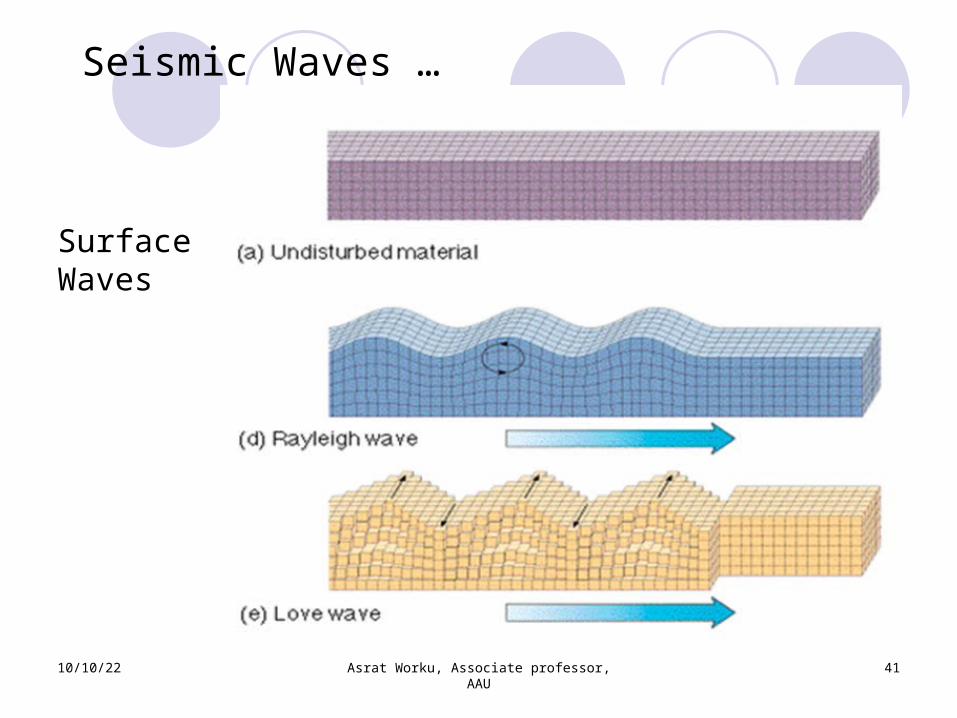
Surface Waves Rayleigh waves: surface waves with movement like rolling ocean waves; move slower than body waves
Love waves: surface waves similar to S-waves, but without vertical movement; faster than Rayleigh waves, but slower than body waves
10/10/22 Asrat Worku, Associate professor, AAU
40
Seismic waves have unique features:
Body Waves
10/10/22 Asrat Worku, Associate professor, AAU
41
Seismic Waves …
Surface Waves
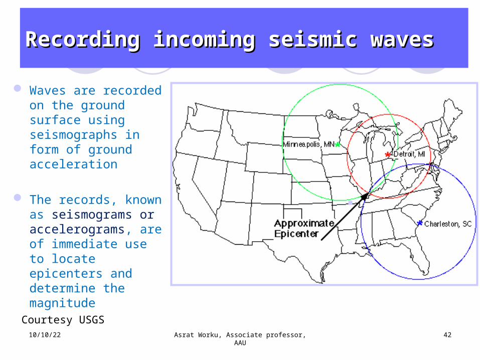
Waves are recorded on the ground surface using seismographs in form of ground acceleration
The records, known as seismograms or accelerograms, are of immediate use to locate epicenters and determine the magnitude
10/10/22 Asrat Worku, Associate professor, AAU
42
Recording incoming seismic wavesRecording incoming seismic waves
Courtesy USGS
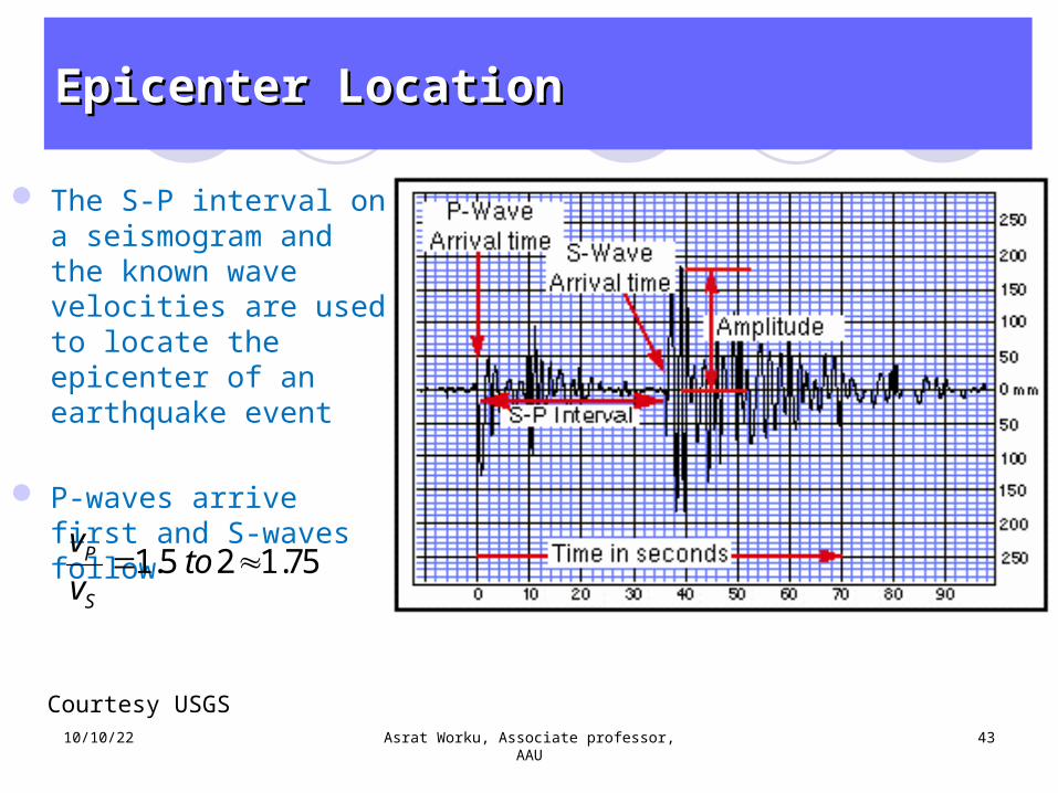
The S-P interval on a seismogram and the known wave velocities are used to locate the epicenter of an earthquake event
P-waves arrive first and S-waves follow
10/10/22 Asrat Worku, Associate professor, AAU
43
Epicenter LocationEpicenter Location
Courtesy USGS
1.5 2 1.75P
S
v tov
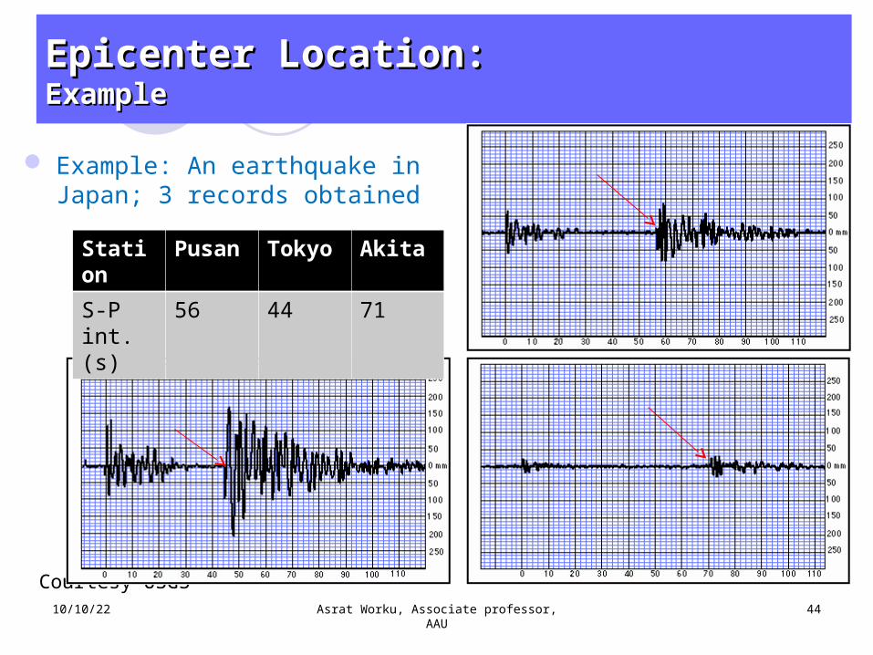
Example: An earthquake in Japan; 3 records obtained
10/10/22 Asrat Worku, Associate professor, AAU
44
Epicenter Location:Epicenter Location:ExampleExample
Courtesy USGS
Station
Pusan Tokyo Akita
S-P int. (s)
56 44 71
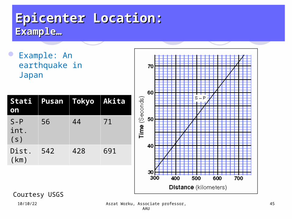
Example: An earthquake in Japan
10/10/22 Asrat Worku, Associate professor, AAU
45
Epicenter Location:Epicenter Location:Example…Example…
Courtesy USGS
Station
Pusan Tokyo Akita
S-P int. (s)
56 44 71
Dist. (km)
542 428 691
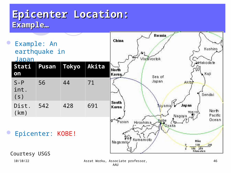
Example: An earthquake in Japan
Epicenter: KOBE!
10/10/22 Asrat Worku, Associate professor, AAU
46
Epicenter Location:Epicenter Location:Example…Example…
Courtesy USGS
Station
Pusan Tokyo Akita
S-P int. (s)
56 44 71
Dist. (km)
542 428 691
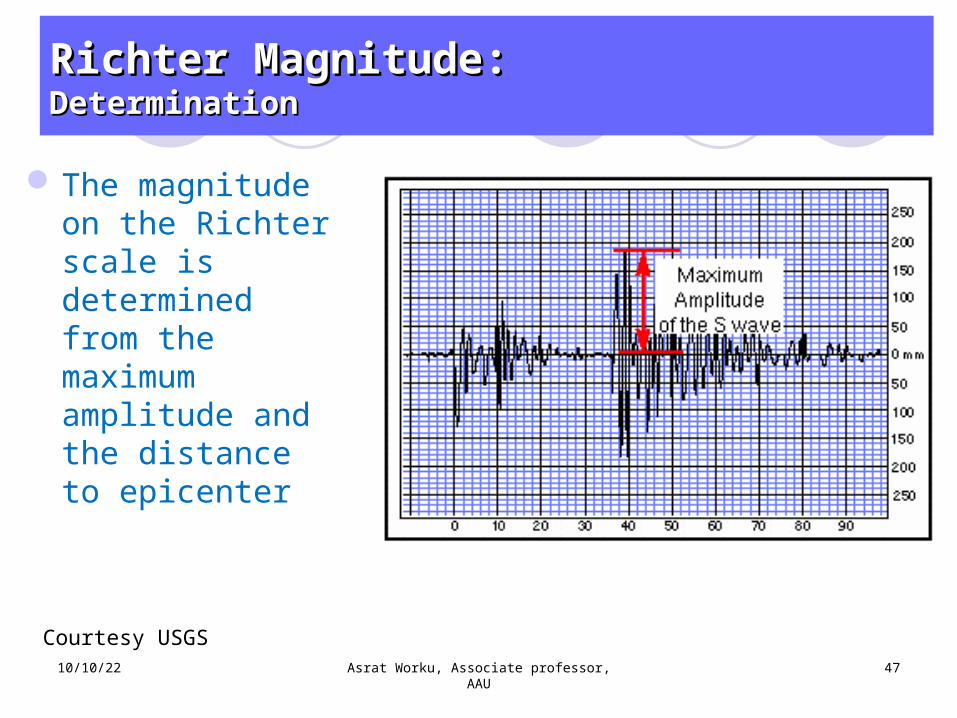
The magnitude on the Richter scale is determined from the maximum amplitude and the distance to epicenter
10/10/22 Asrat Worku, Associate professor, AAU
47
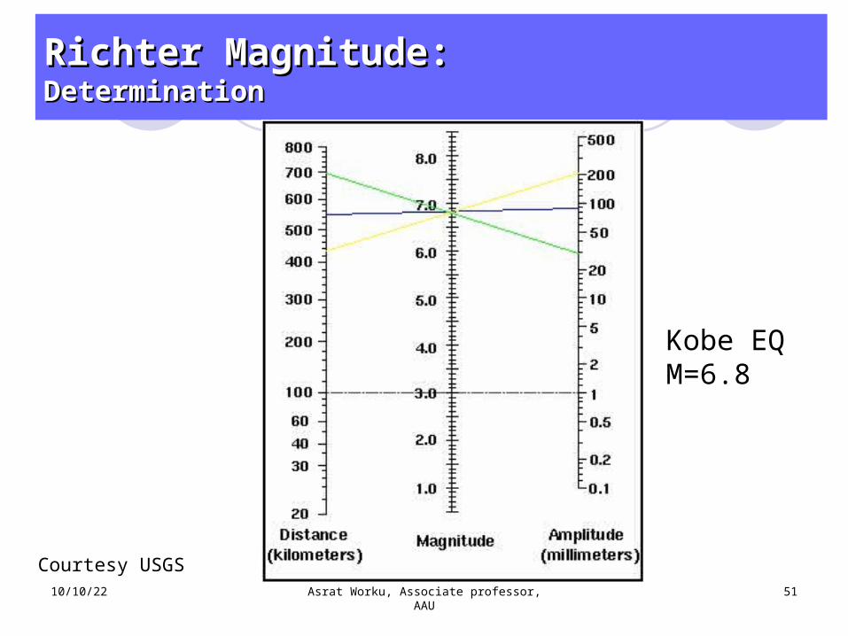
Richter Magnitude:Richter Magnitude:DeterminationDetermination
Courtesy USGS

The Richter magnitude is defined below and can be represented in a form of a monograph as shown
Dashed line: standard earthquake of magnitude 3
Blue lines: M of 4 and 5
A difference of unity in magnitude corresponds to tenfold difference in amplitude and 32 fold of energy release10/10/22 Asrat Worku, Associate professor,
AAU48
Richter Magnitude:Richter Magnitude:DeterminationDetermination
10 max maxlog ( ); ( )LM A D A m
10/10/22 Asrat Worku, Associate professor, AAU
49
Richter Magnitude:Richter Magnitude:DeterminationDetermination
Courtesy USGS
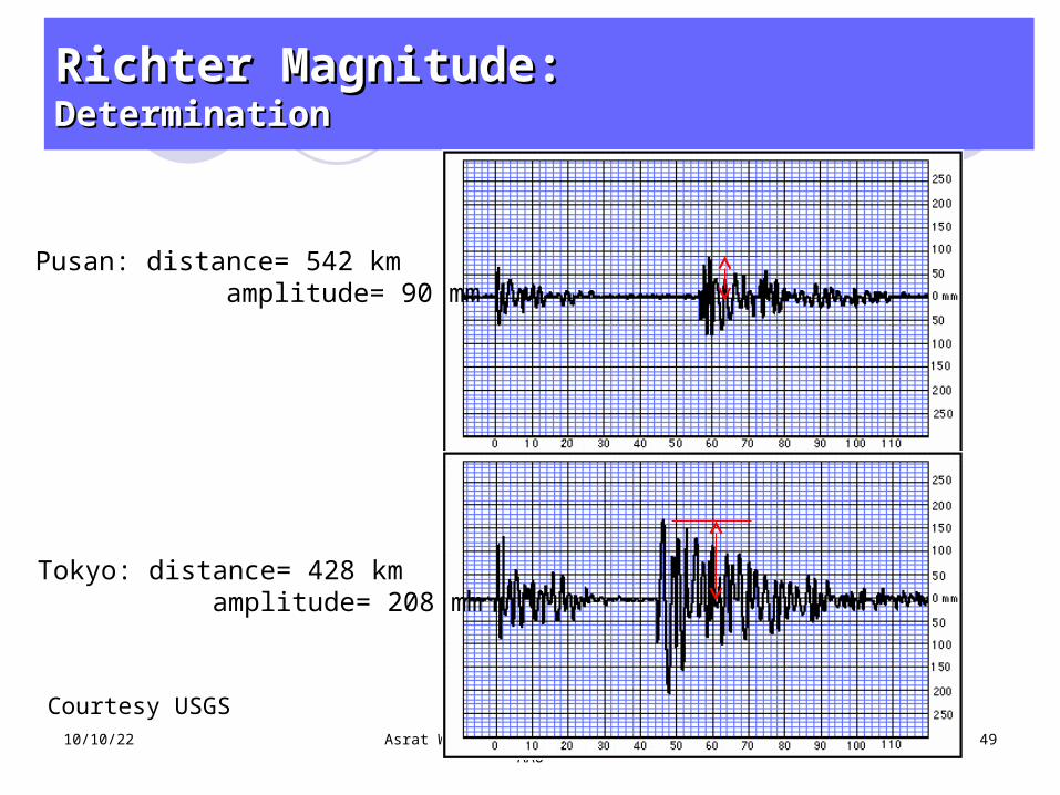
Pusan: distance= 542 km amplitude= 90 mm
Tokyo: distance= 428 km amplitude= 208 mm
10/10/22 Asrat Worku, Associate professor, AAU
50
Richter Magnitude:Richter Magnitude:DeterminationDetermination
Courtesy USGS
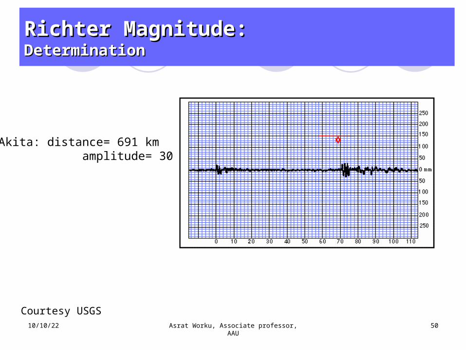
Akita: distance= 691 km amplitude= 30 mm
10/10/22 Asrat Worku, Associate professor, AAU
51
Richter Magnitude:Richter Magnitude:DeterminationDetermination
Courtesy USGS
Kobe EQM=6.8
10/10/22 Asrat Worku, Associate professor, AAU
52
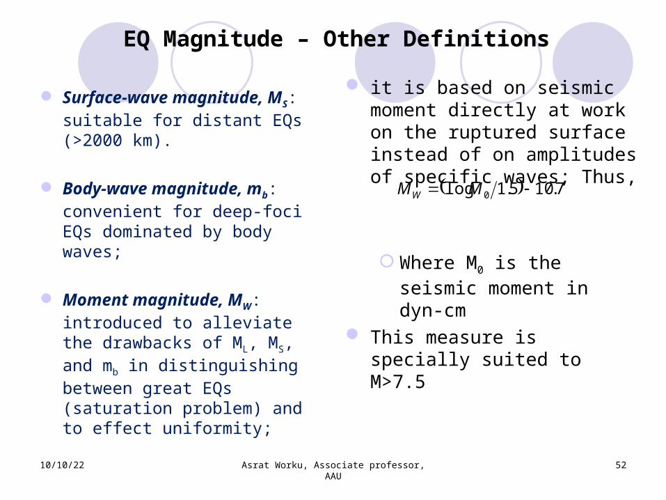
EQ Magnitude – Other Definitions
Surface-wave magnitude, MS: suitable for distant EQs (>2000 km).
Body-wave magnitude, mb: convenient for deep-foci EQs dominated by body waves;
Moment magnitude, MW: introduced to alleviate the drawbacks of ML, MS, and mb in distinguishing between great EQs (saturation problem) and to effect uniformity;
it is based on seismic moment directly at work on the ruptured surface instead of on amplitudes of specific waves; Thus,
Where M0 is the seismic moment in dyn-cm
This measure is specially suited to M>7.5
7.105.1log 0 MMW
10/10/22 Asrat Worku, Associate professor, AAU
53
Another Measure of EQ: Intensity
Intensity is the oldest yardstick
Based on damage to structures, ground surface, and human reactions
Can be assigned to historical EQs: useful in areas of data scarcity
Highly subjective; need updating
10/10/22 Asrat Worku, Associate professor, AAU
54
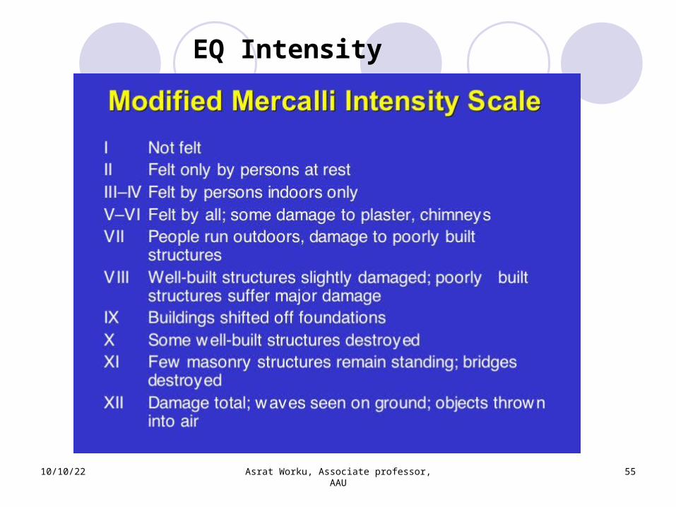
EQ Intensity
1st scale developed by Rossi (Italy) and Forel (Switzerland) in 1880
A refined, 12-degree scale was devised in 1902 by Mercalli
A version is later modified by Wood and Neumann to fit CA conditions
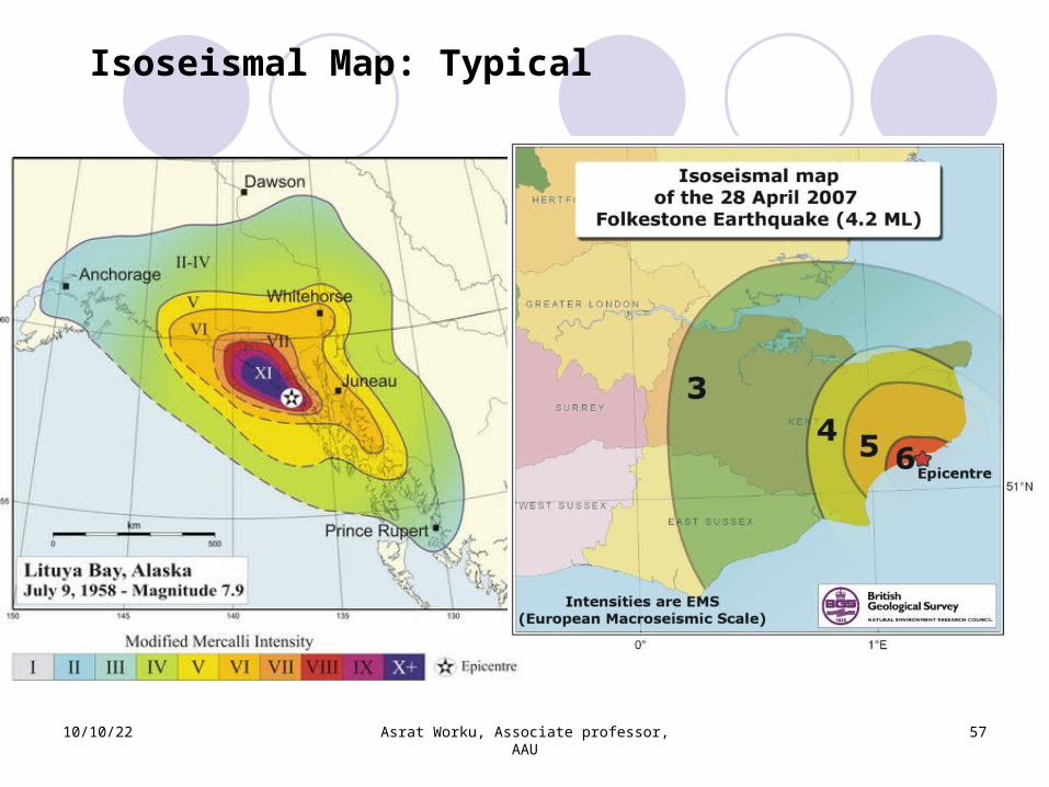
Isoseismal map can be prepared for a given EQ using the numerical rates
10/10/22 Asrat Worku, Associate professor, AAU
55
EQ Intensity
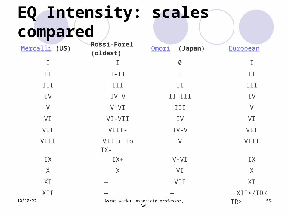
EQ Intensity: scales compared
Mercalli (US) Rossi-Forel (oldest) Omori (Japan) European
I I 0 I II I–II I II III III II III IV IV–V II–III IV V V–VI III V VI VI–VII IV VI VII VIII- IV–V VII VIII VIII+ to
IX- V VIII
IX IX+ V–VI IX X X VI X XI — VII XI XII — — XII</TD<
TR> 10/10/22 Asrat Worku, Associate professor, AAU
56
10/10/22 Asrat Worku, Associate professor, AAU
57
Isoseismal Map: Typical
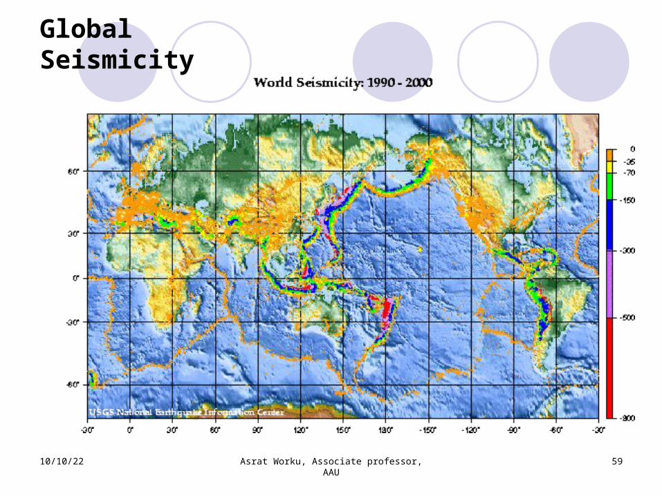
Global Seismicity
• By plotting epicenters on a map, the seismicity of any region can be studied including that of the world
• Clear belts of EQ swarms of the world are identifiable
• 95% of all EQs occur on the plate boundaries
• Active areas include: western Americas, South Europe, South and East Asia
10/10/22 Asrat Worku, Associate professor, AAU
58
Global Seismicity
10/10/22 Asrat Worku, Associate professor, AAU
59
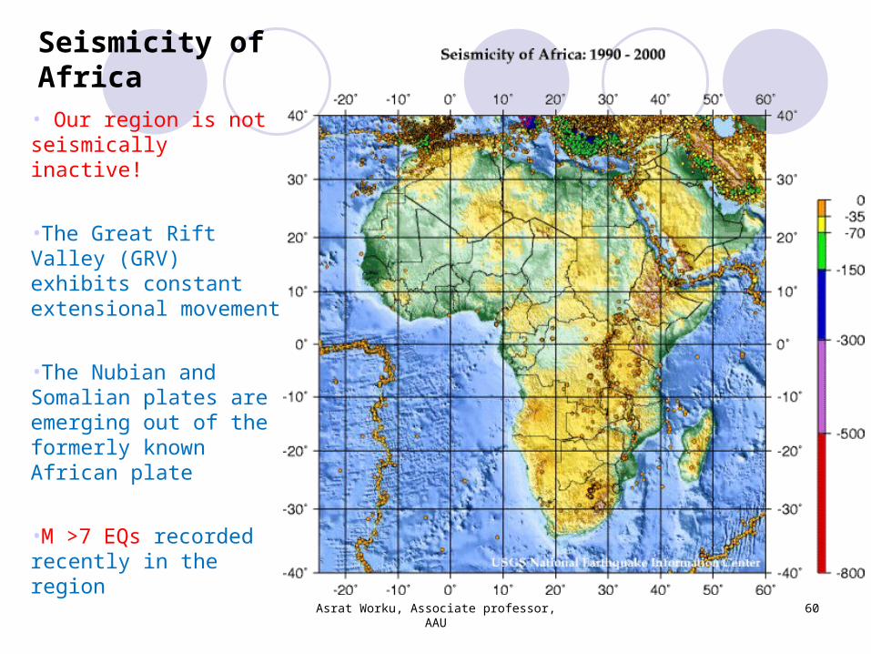
Seismicity of Africa• Our region is not seismically inactive!
•The Great Rift Valley (GRV) exhibits constant extensional movement
•The Nubian and Somalian plates are emerging out of the formerly known African plate
•M >7 EQs recorded recently in the region
Asrat Worku, Associate professor, AAU
60
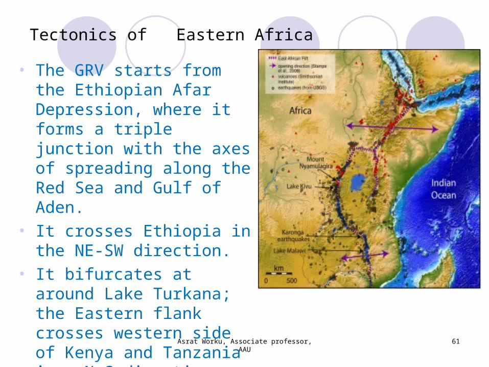
Tectonics of Eastern Africa
Asrat Worku, Associate professor, AAU
61
• The GRV starts from the Ethiopian Afar Depression, where it forms a triple junction with the axes of spreading along the Red Sea and Gulf of Aden.
• It crosses Ethiopia in the NE-SW direction.
• It bifurcates at around Lake Turkana; the Eastern flank crosses western side of Kenya and Tanzania in a N-S direction.
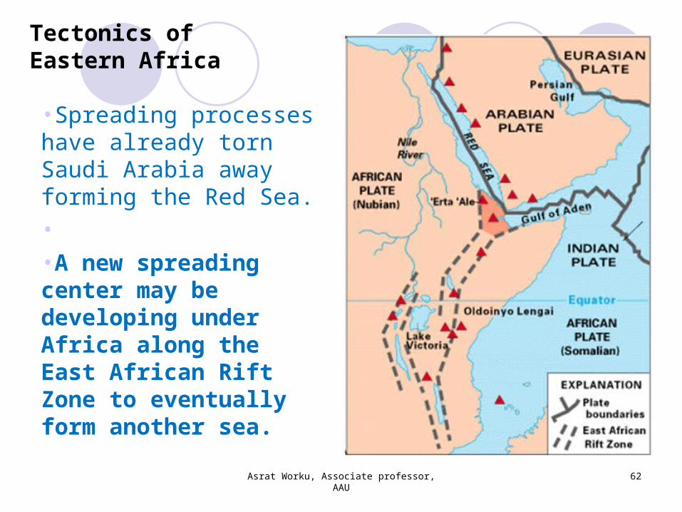
Tectonics of Eastern Africa
Asrat Worku, Associate professor, AAU
62
•Spreading processes have already torn Saudi Arabia away forming the Red Sea.• •A new spreading center may be developing under Africa along the East African Rift Zone to eventually form another sea.
Tectonics of Eastern Africa
Asrat Worku, Associate professor, AAU
63
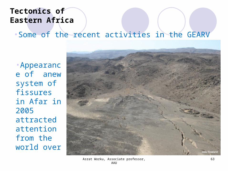
•Some of the recent activities in the GEARV
•Appearance of anew system of fissures in Afar in 2005 attracted attention from the world over
Tectonics of Eastern Africa
Asrat Worku, Associate professor, AAU
64
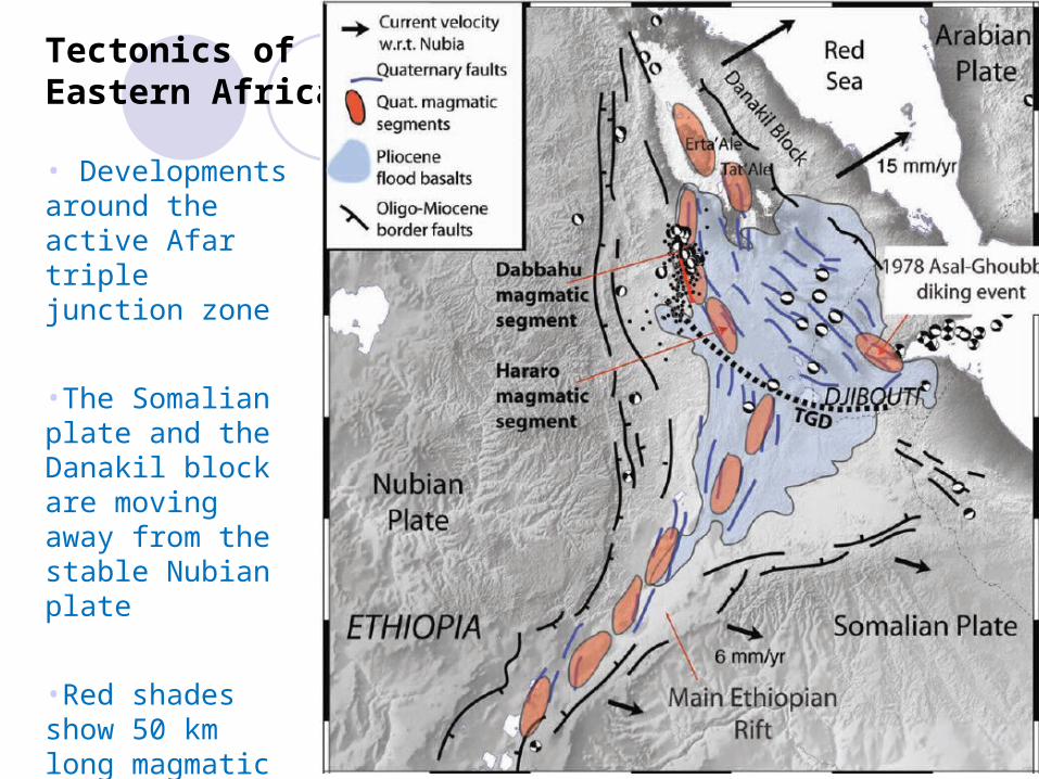
• Developments around the active Afar triple junction zone
•The Somalian plate and the Danakil block are moving away from the stable Nubian plate
•Red shades show 50 km long magmatic segments;
Tectonics of Eastern Africa
Asrat Worku, Associate professor, AAU
65
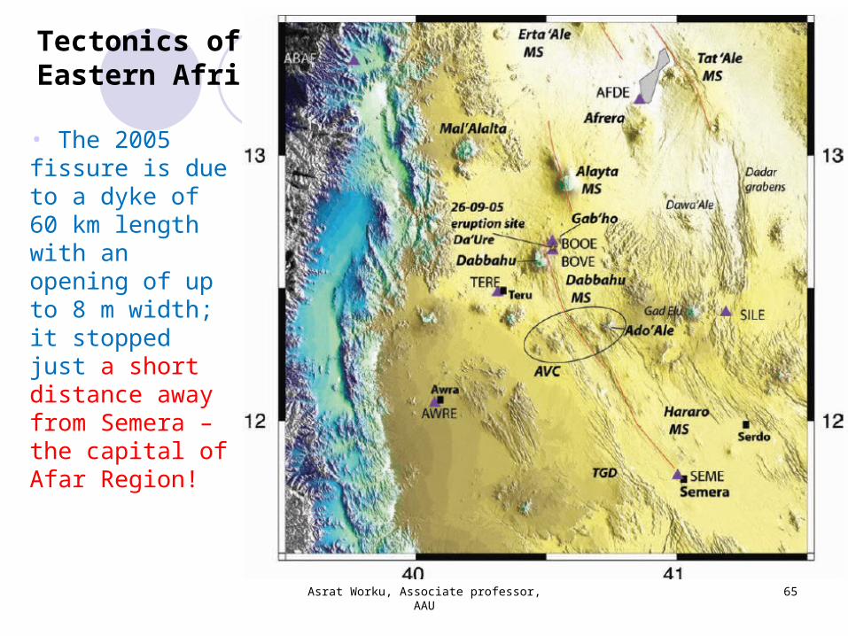
• The 2005 fissure is due to a dyke of 60 km length with an opening of up to 8 m width; it stopped just a short distance away from Semera – the capital of Afar Region!
Tectonics of Eastern Africa
Asrat Worku, Associate professor, AAU
66
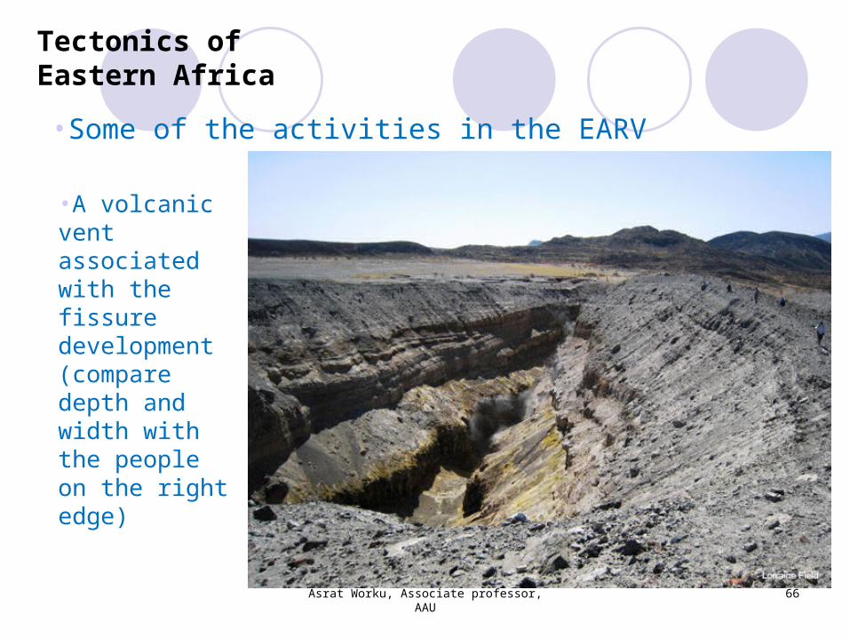
•Some of the activities in the EARV
•A volcanic vent associated with the fissure development (compare depth and width with the people on the right edge)
Tectonics of Eastern Africa
Asrat Worku, Associate professor, AAU
67
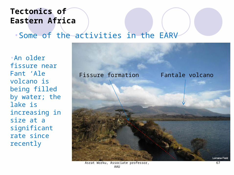
•Some of the activities in the EARV
•An older fissure near Fant ‘Ale volcano is being filled by water; the lake is increasing in size at a significant rate since recently
Fantale volcanoFissure formation
Tectonics of Eastern Africa
Asrat Worku, Associate professor, AAU
68
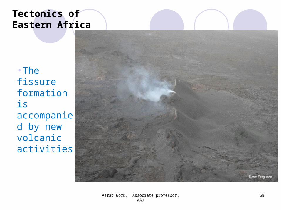
•The fissure formation is accompanied by new volcanic activities
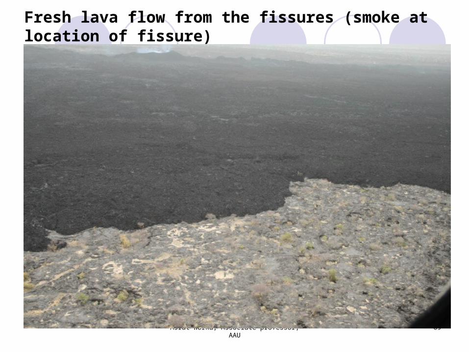
Fresh lava flow from the fissures (smoke at location of fissure)
Asrat Worku, Associate professor, AAU
69
Tectonics of Eastern Africa
Asrat Worku, Associate professor, AAU
70
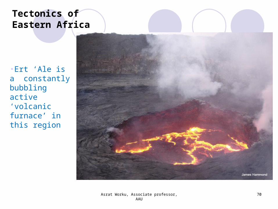
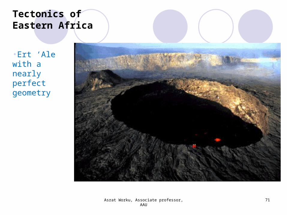
•Ert ‘Ale is a constantly bubbling active ‘volcanic furnace’ in this region
Tectonics of Eastern Africa
Asrat Worku, Associate professor, AAU
71
•Ert ‘Ale with a nearly perfect geometry
Tectonics of Eastern Africa
Asrat Worku, Associate professor, AAU
72
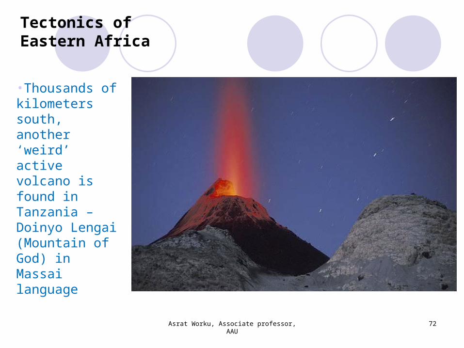
•Thousands of kilometers south, another ‘weird’ active volcano is found in Tanzania – Doinyo Lengai (Mountain of God) in Massai language
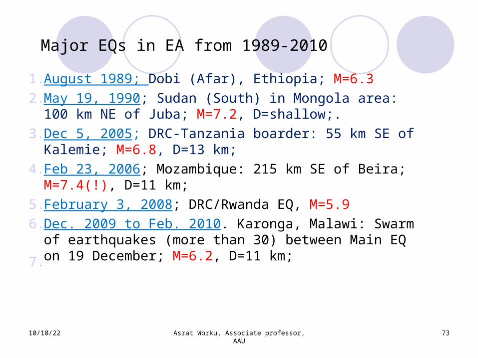
Major EQs in EA from 1989-2010
10/10/22 Asrat Worku, Associate professor, AAU
73
1.August 1989; Dobi (Afar), Ethiopia; M=6.32.May 19, 1990; Sudan (South) in Mongola area: 100 km NE of Juba; M=7.2, D=shallow;.
3.Dec 5, 2005; DRC-Tanzania boarder: 55 km SE of Kalemie; M=6.8, D=13 km;
4.Feb 23, 2006; Mozambique: 215 km SE of Beira; M=7.4(!), D=11 km;
5.February 3, 2008; DRC/Rwanda EQ, M=5.96.Dec. 2009 to Feb. 2010. Karonga, Malawi: Swarm of earthquakes (more than 30) between Main EQ on 19 December; M=6.2, D=11 km; 7.

Some recent EQs in East Africa
DRC-Tanzania: 55 km SE of Kalemie; Dec 5, 2005; M=6.8, D=13 km; 2 deaths
Office workers in Nairobi panicked and rushed to safety from high buildings; cracked buildings in Nairobi reported!
10/10/22 Asrat Worku, Associate professor, AAU
74
Source: BBC
10/10/22 Asrat Worku, Associate professor, AAU
75
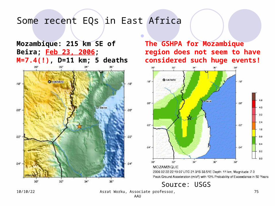
Some recent EQs in East Africa
Mozambique: 215 km SE of Beira; Feb 23, 2006; M=7.4(!), D=11 km; 5 deaths
Source: USGS
The GSHPA for Mozambique region does not seem to have considered such huge events!
Mozambique: 215 km SE of Beira; Feb 23, 2006; M=7.4, D=11 km
10/10/22 Asrat Worku, Associate professor, AAU
76
Andrzej Kijko, the head of the seismology department at the Council for Geoscience in Pretoria, South Africa, said: “seismologists expect events in the magnitude-7 range to occur about every 50 years in this area. In fact, an earthquake similar in size and location to Thursday's event occurred in 1940.”
This is a stern warning not well reflected by the GSHPA map (previous slide)
Some recent EQs in East Africa
Source: Geotimes
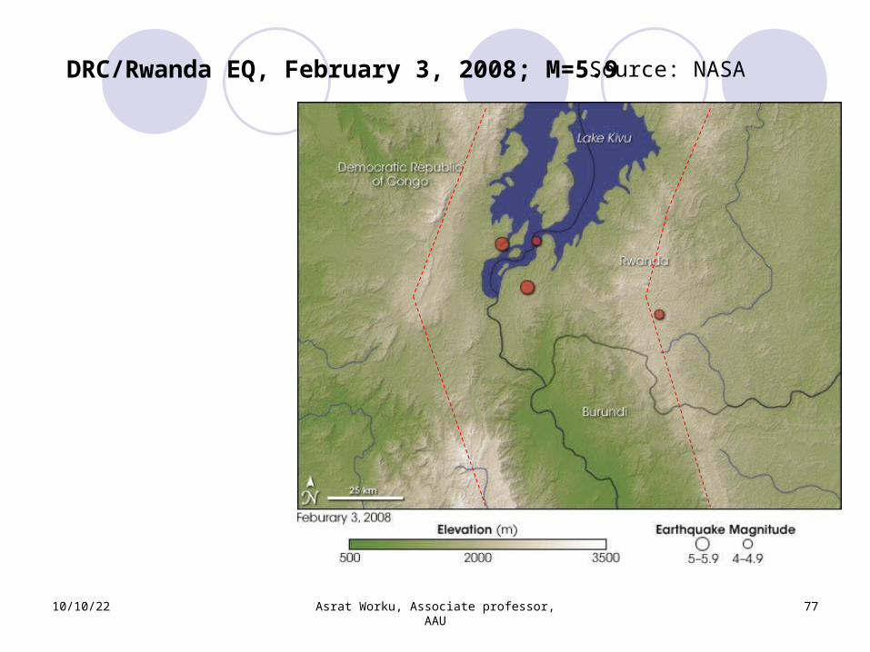
DRC/Rwanda EQ, February 3, 2008; M=5.9
10/10/22 Asrat Worku, Associate professor, AAU
77
Source: NASA
Some Recent East-African EQs
10/10/22 Asrat Worku, Associate professor, AAU
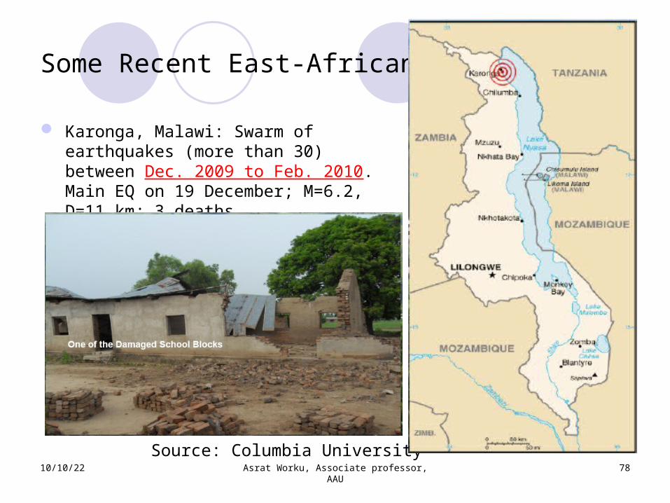
78Source: Columbia University
Karonga, Malawi: Swarm of earthquakes (more than 30) between Dec. 2009 to Feb. 2010. Main EQ on 19 December; M=6.2, D=11 km; 3 deaths
Some Recent East-African EQs
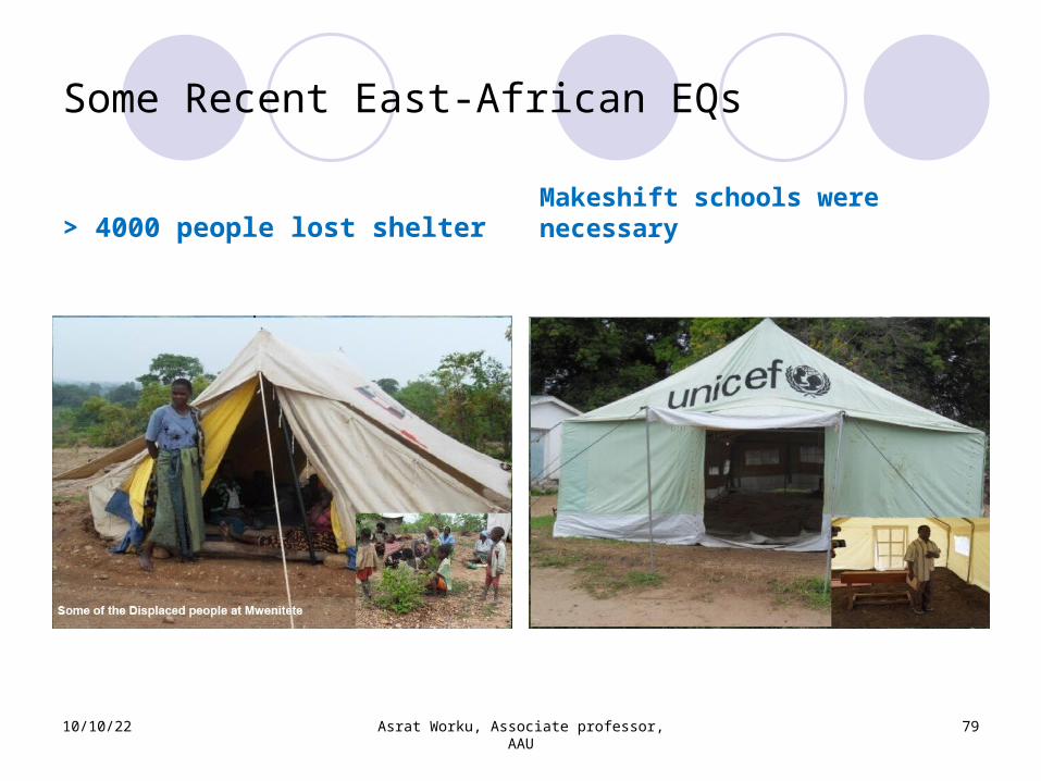
> 4000 people lost shelter Makeshift schools were necessary
10/10/22 Asrat Worku, Associate professor, AAU
79
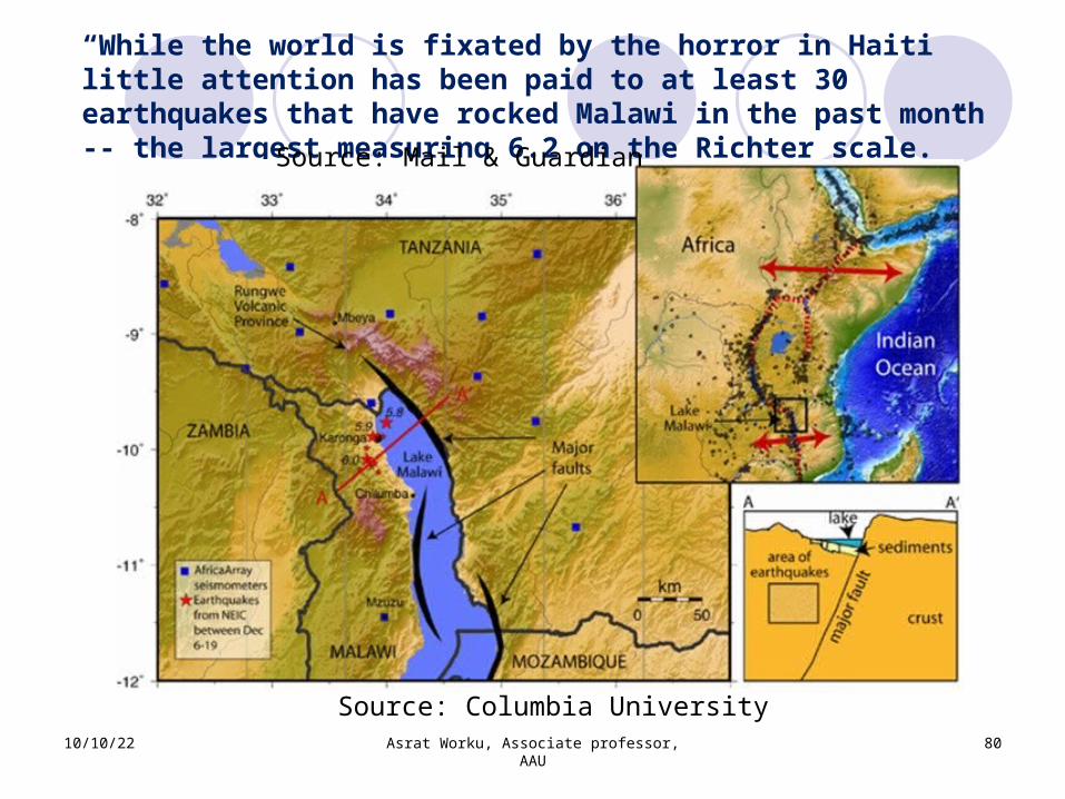
“While the world is fixated by the horror in Haiti little attention has been paid to at least 30 earthquakes that have rocked Malawi in the past month -- the largest measuring 6.2 on the Richter scale.”
10/10/22 Asrat Worku, Associate professor, AAU
80
Source: Columbia University
Source: Mail & Guardian
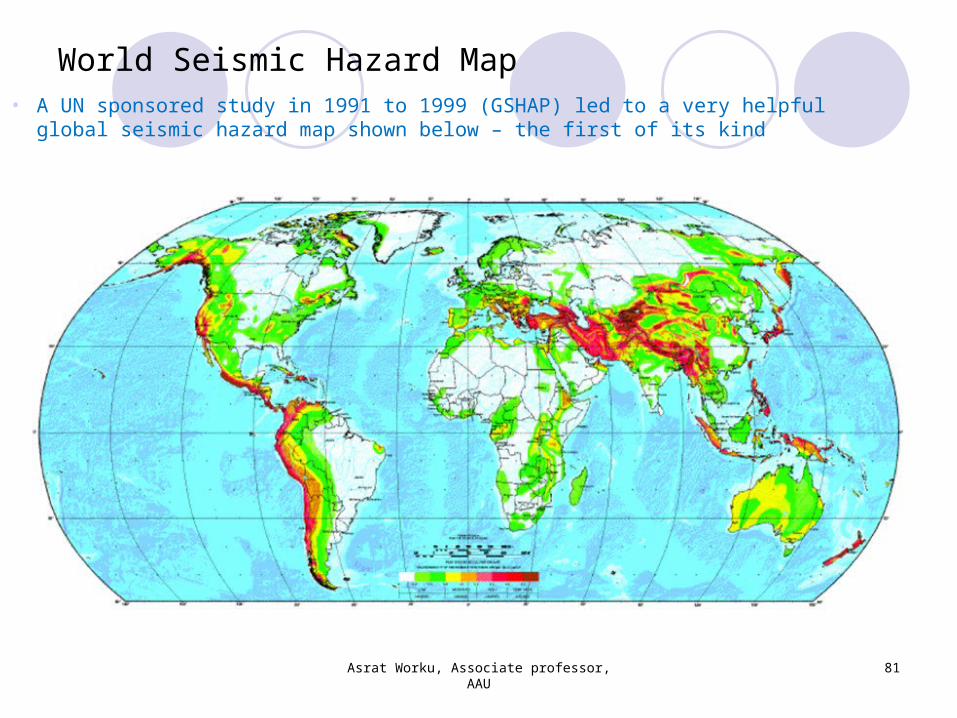
World Seismic Hazard Map
Asrat Worku, Associate professor, AAU
81
• A UN sponsored study in 1991 to 1999 (GSHAP) led to a very helpful global seismic hazard map shown below – the first of its kind
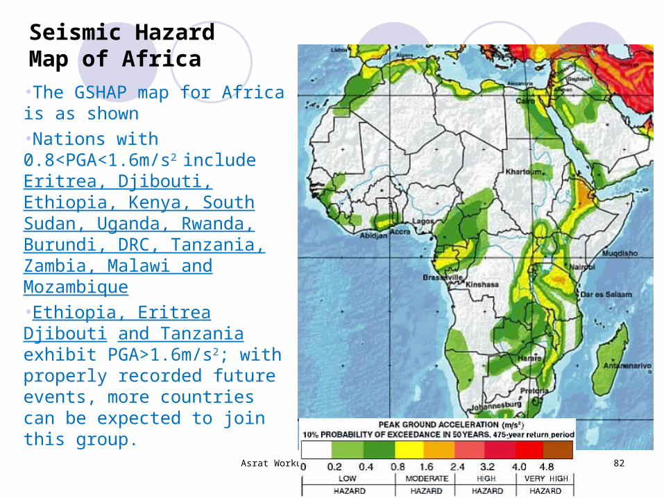
Seismic Hazard Map of Africa•The GSHAP map for Africa is as shown•Nations with 0.8<PGA<1.6m/s2 include Eritrea, Djibouti, Ethiopia, Kenya, South Sudan, Uganda, Rwanda, Burundi, DRC, Tanzania, Zambia, Malawi and Mozambique•Ethiopia, Eritrea Djibouti and Tanzania exhibit PGA>1.6m/s2; with properly recorded future events, more countries can be expected to join this group.
Asrat Worku, Associate professor, AAU
82
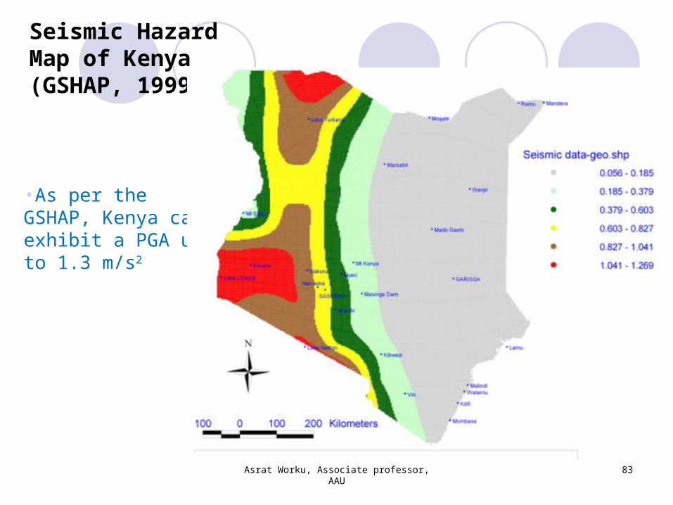
Seismic Hazard Map of Kenya (GSHAP, 1999)
•As per the GSHAP, Kenya can exhibit a PGA up to 1.3 m/s2
Asrat Worku, Associate professor, AAU
83
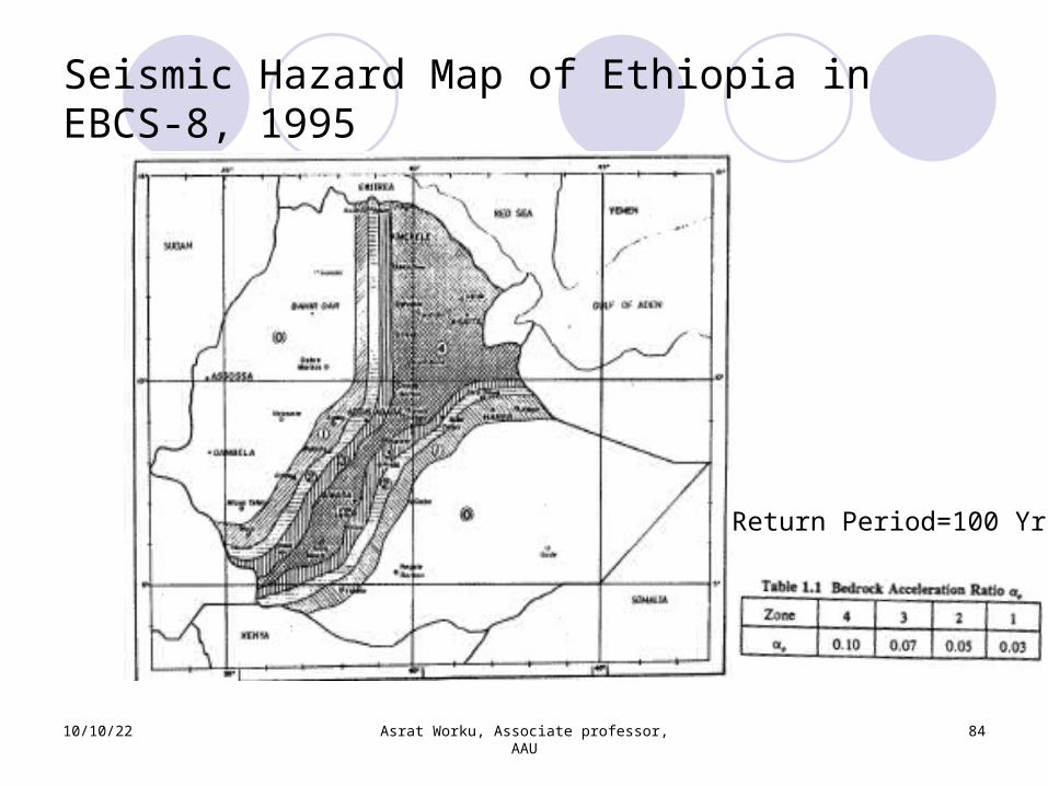
Seismic Hazard Map of Ethiopia in EBCS-8, 1995
10/10/22 Asrat Worku, Associate professor, AAU
84
Return Period=100 Yrs
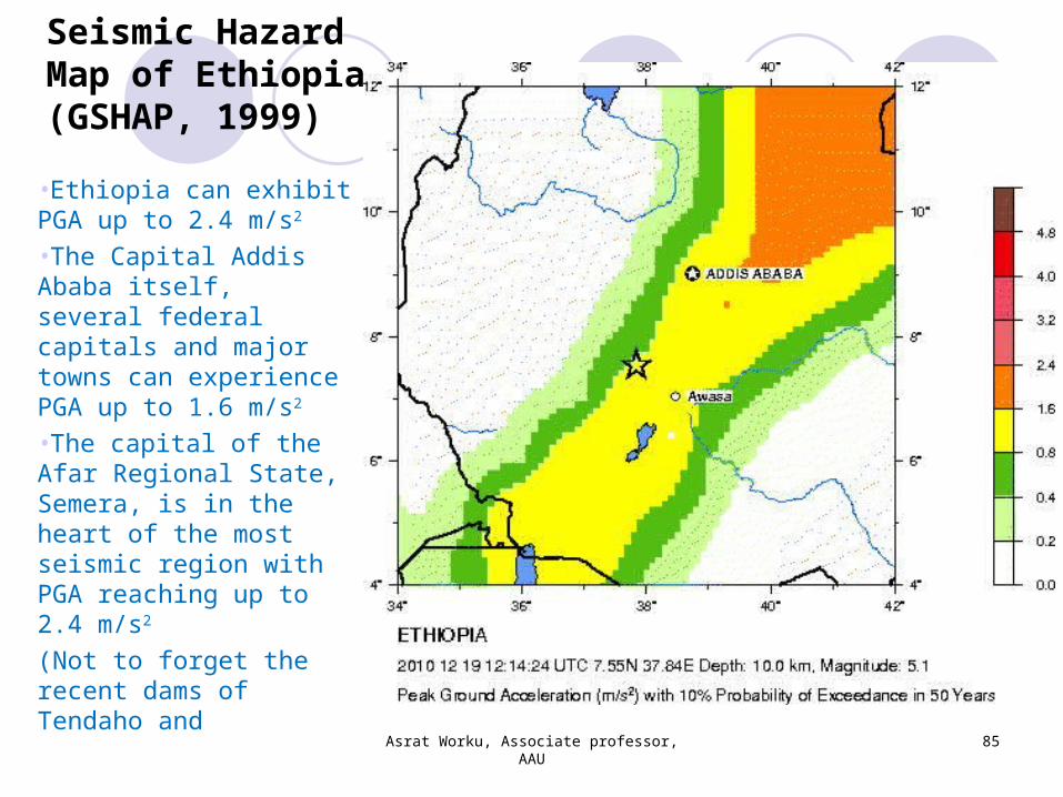
Seismic Hazard Map of Ethiopia (GSHAP, 1999)•Ethiopia can exhibit PGA up to 2.4 m/s2
•The Capital Addis Ababa itself, several federal capitals and major towns can experience PGA up to 1.6 m/s2
•The capital of the Afar Regional State, Semera, is in the heart of the most seismic region with PGA reaching up to 2.4 m/s2
(Not to forget the recent dams of Tendaho and
Asrat Worku, Associate professor, AAU
85
10/10/22 Asrat Worku, Associate professor, AAU
86
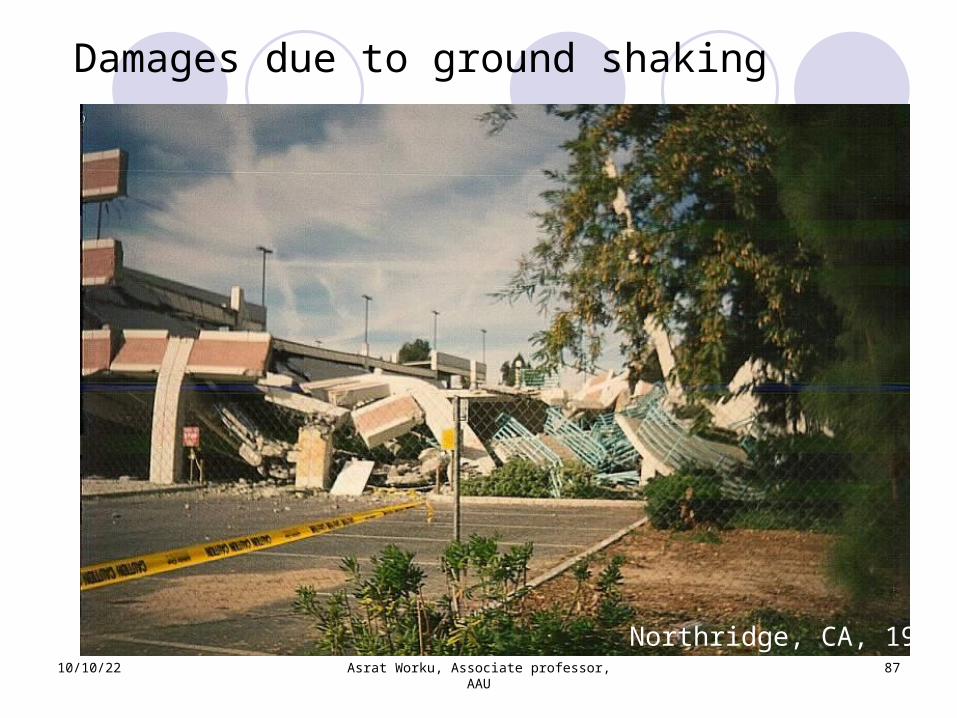
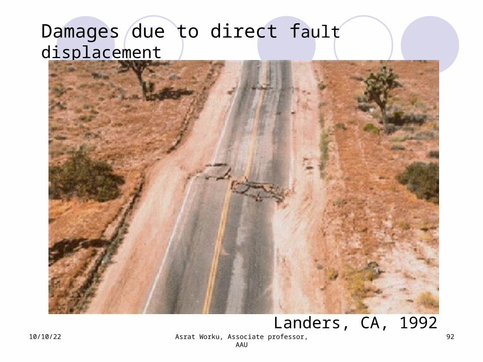
Earthquake damage mechanismsEQ can directly affect life in various ways such as throughGround shaking: serious and widespreadChange in physical properties of foundation soils: settlement, liquefaction
Direct fault displacement Landslides and other surface movementsEQ induced firesWater waves: tsunamis and seiches; they can be devastating (E.g.: 2004 Indonesia; 2011 Japan)
10/10/22 Asrat Worku, Associate professor, AAU
87
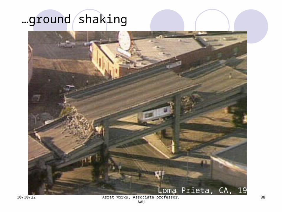
Damages due to ground shaking
Northridge, CA, 1994
10/10/22 Asrat Worku, Associate professor, AAU
88
…ground shaking
Loma Prieta, CA, 1989
10/10/22 Asrat Worku, Associate professor, AAU
89
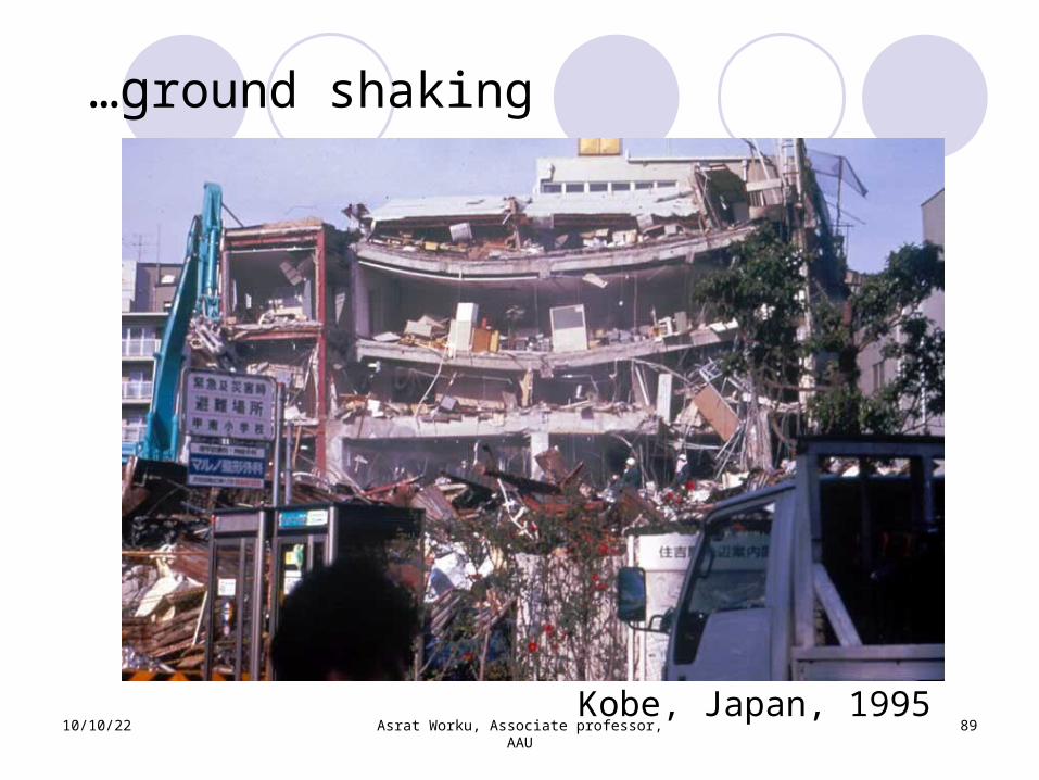
…ground shaking
Kobe, Japan, 1995
10/10/22 Asrat Worku, Associate professor, AAU
90
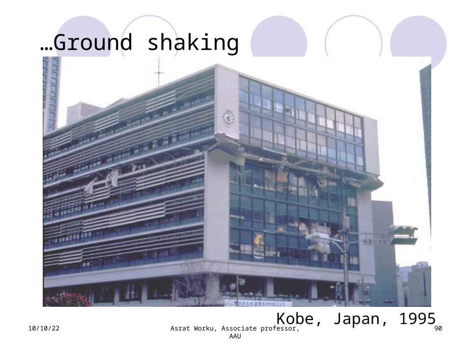
…Ground shaking
Kobe, Japan, 1995
10/10/22 Asrat Worku, Associate professor, AAU
91
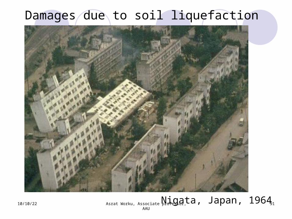
Damages due to soil liquefaction
Nigata, Japan, 1964
10/10/22 Asrat Worku, Associate professor, AAU
92
Damages due to direct fault displacement
Landers, CA, 1992
10/10/22 Asrat Worku, Associate professor, AAU
93
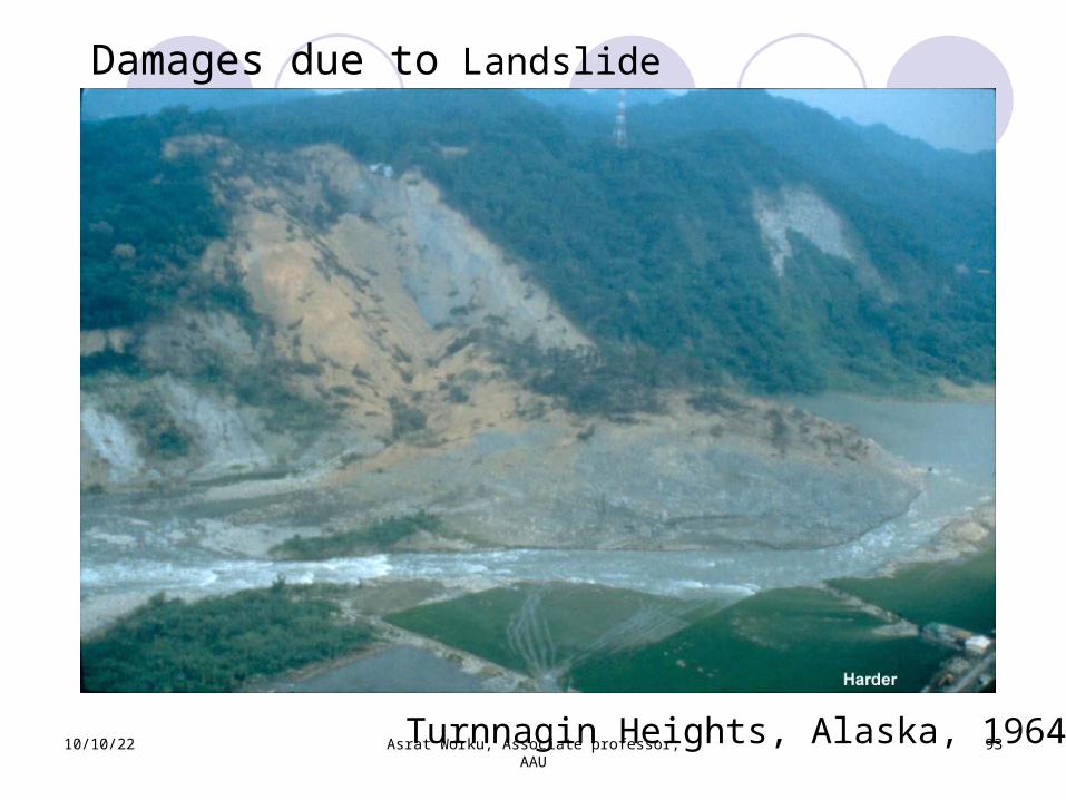
Damages due to Landslide
Turnnagin Heights, Alaska, 1964
10/10/22 Asrat Worku, Associate professor, AAU
94
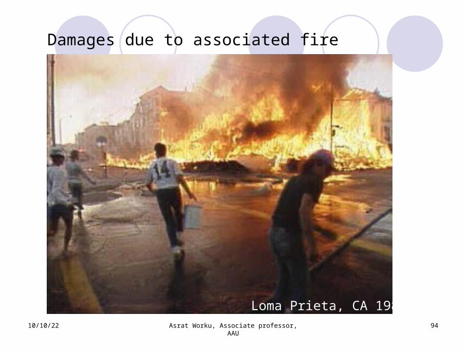
Damages due to associated fire
Loma Prieta, CA 1989
10/10/22 Asrat Worku, Associate professor, AAU
95
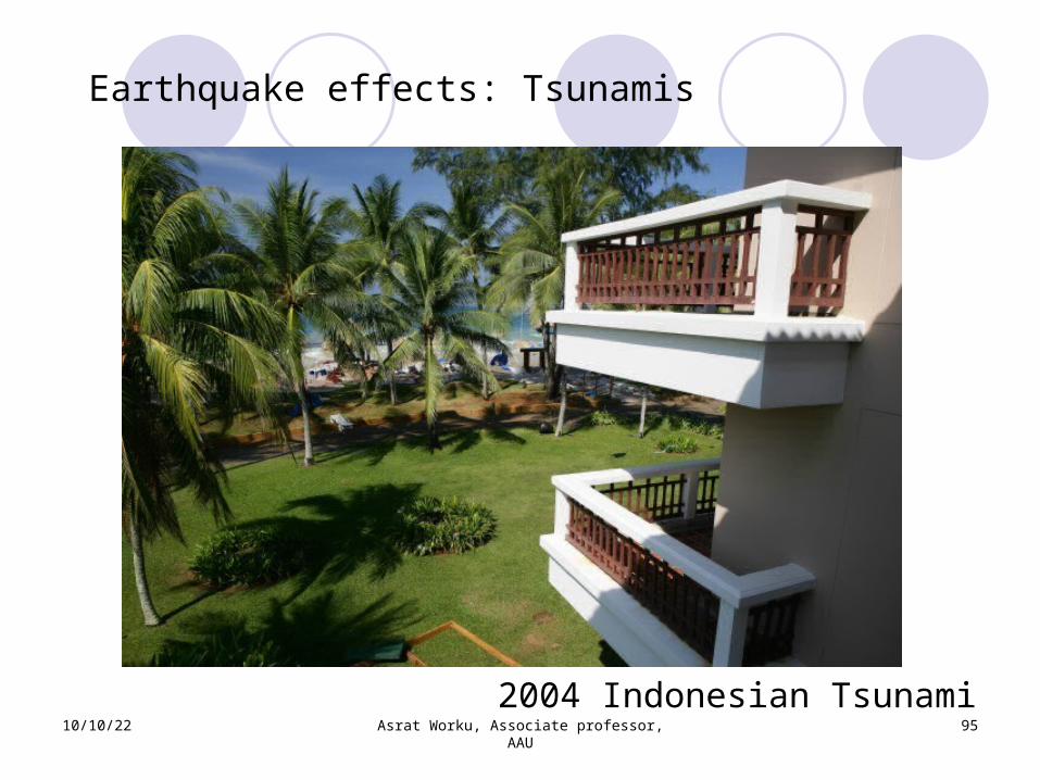
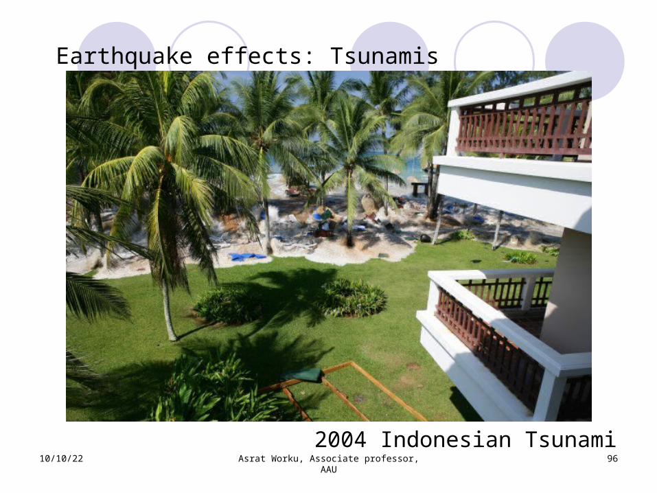
Earthquake effects: Tsunamis
2004 Indonesian Tsunami
10/10/22 Asrat Worku, Associate professor, AAU
96
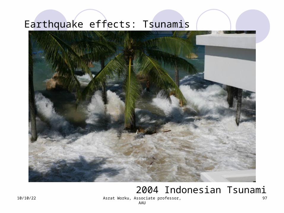
Earthquake effects: Tsunamis
2004 Indonesian Tsunami
10/10/22 Asrat Worku, Associate professor, AAU
97
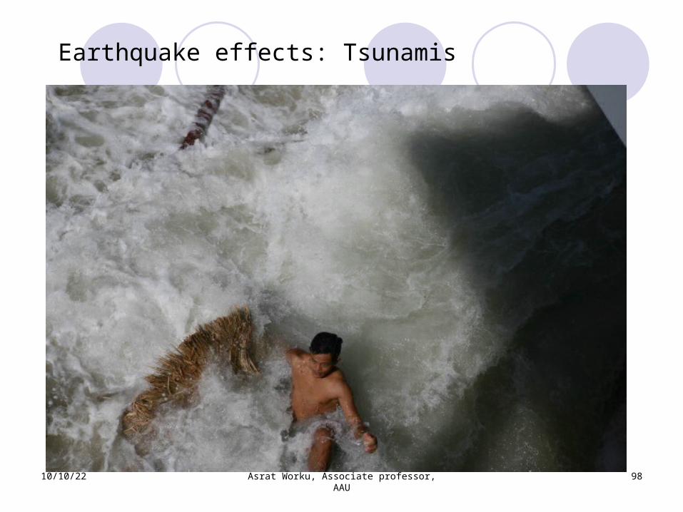
Earthquake effects: Tsunamis
2004 Indonesian Tsunami
10/10/22 Asrat Worku, Associate professor, AAU
98
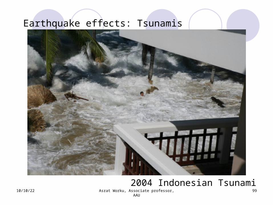
Earthquake effects: Tsunamis
10/10/22 Asrat Worku, Associate professor, AAU
99
Earthquake effects: Tsunamis
2004 Indonesian Tsunami
10/10/22 Asrat Worku, Associate professor, AAU
100
Earthquake effects: TsunamisJapan Tsunami
http://www.youtube.com/watch?v=w3AdFjklR50
Codes of Practice Seismic provisions in the rest of the world
are revised every 3 to 5 years: e.g. American, European, Japanese, Chinese, Indian, etc.
A few local codes have seismic provisions in the seismic region of E. AfricaKenyan (1973)Ethiopian (1978, 1983, 1995)Others ?
Significant growth of knowledge exists Urban settlement growing fast To work with old codes is unacceptable Revision is mandatory
10/10/22 Asrat Worku, Associate professor, AAU
101
Codes of Practice
10/10/22 Asrat Worku, Associate professor, AAU
102
“Vice-Chairperson of the East and Southern Africa Region Seismological Working Group Gladys Kianji, cites the 1928 Subukia quake as the ‘most significant in Kenya’. The magnitude 6.8-quake is said to have rolled cars off the roads in Nairobi, about 200km away.”
“Chair of the Architects Chapter of the Architectural Association of Kenya, Waweru Gathecha, says buildings are designed in accordance with a whole range of standards including those on structural design. "Kenya falls within an earthquake zone, for which there exists an Earthquake Design Code, which has existed since the early 1970s," he says.”
The Standard (13/03/2010)
10/10/22 Asrat Worku, Associate professor, AAU
103
THE END
MANY THANKS
Related Documents