Cody Benkelman, Nico Bonnafoux, Mark Buie, Mark Barker, & Chris Patterson Drone Imagery: Creating Orthomosaics, DEMs, and 3D Mesh

Welcome message from author
This document is posted to help you gain knowledge. Please leave a comment to let me know what you think about it! Share it to your friends and learn new things together.
Transcript
Cody Benkelman, Nico Bonnafoux, Mark Buie,
Mark Barker, & Chris Patterson
Drone Imagery: Creating Orthomosaics,
DEMs, and 3D Mesh
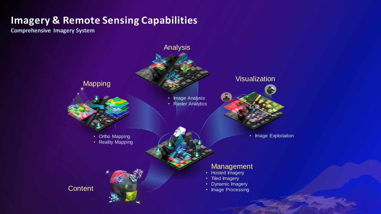
Imagery & Remote Sensing CapabilitiesComprehensive Imagery System
Management
Mapping
Analysis
Visualization
Content
• Hosted Imagery
• Tiled Imagery
• Dynamic Imagery
• Image Processing
• Image Analysis
• Raster Analytics
• Ortho Mapping
• Reality Mapping
• Image Exploitation
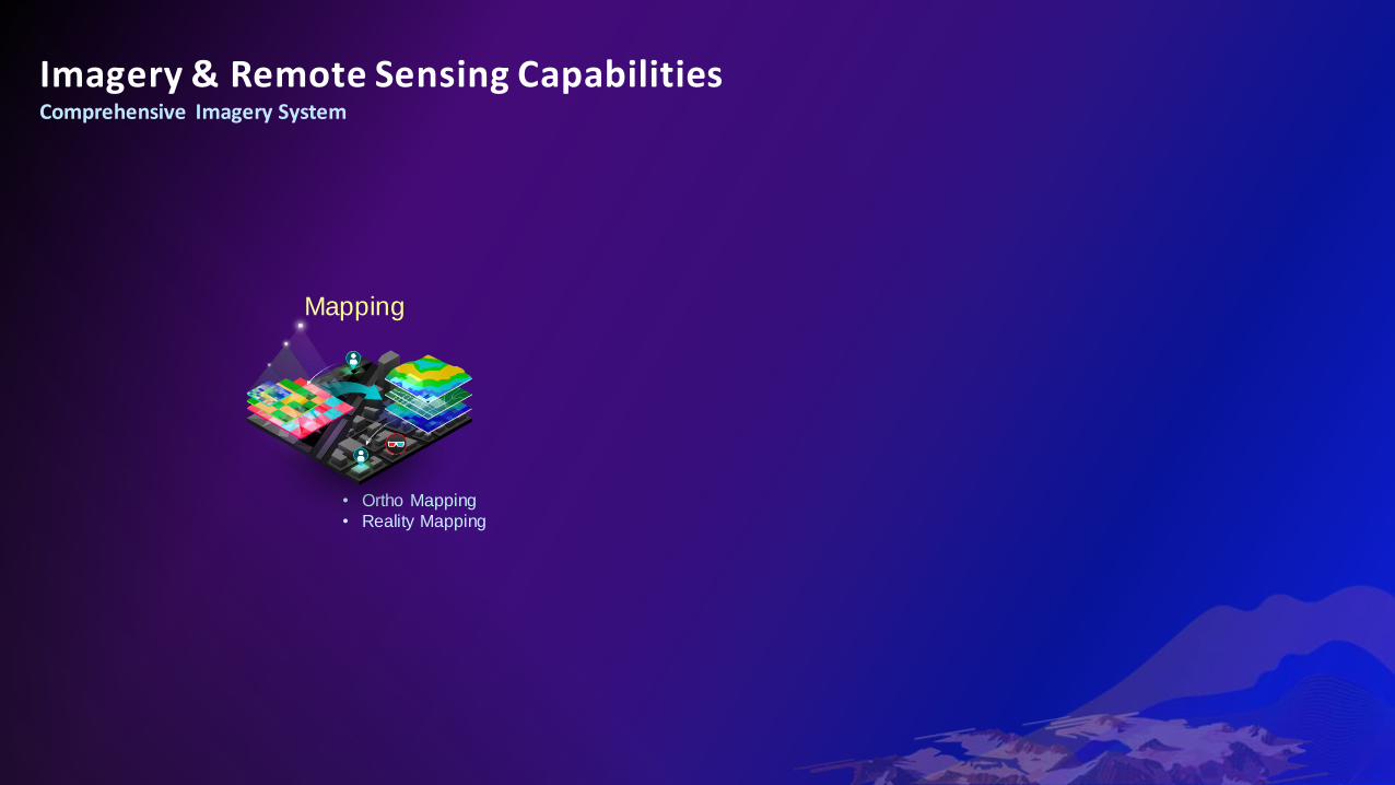
Imagery & Remote Sensing CapabilitiesComprehensive Imagery System
Mapping
• Ortho Mapping
• Reality Mapping
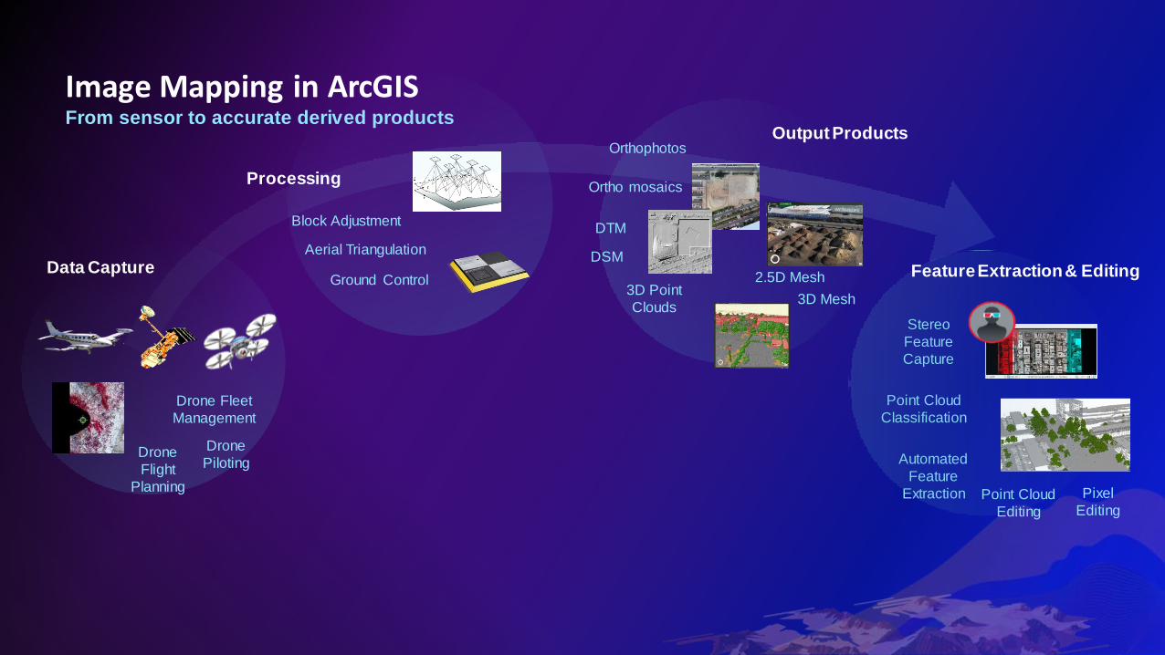
Image Mapping in ArcGISFrom sensor to accurate derived products
Data Capture
Processing
Output Products
Drone
Piloting
Drone Fleet
Management
Drone
Flight
Planning
Aerial Triangulation
Block Adjustment
DSM
2.5D Mesh
Orthophotos
3D Point
Clouds
DTM
Ortho mosaics
3D Mesh
Ground Control
Stereo
Feature
Capture
Automated
Feature
Extraction Point Cloud
Editing
Pixel
Editing
Point Cloud
Classification
Feature Extraction & Editing
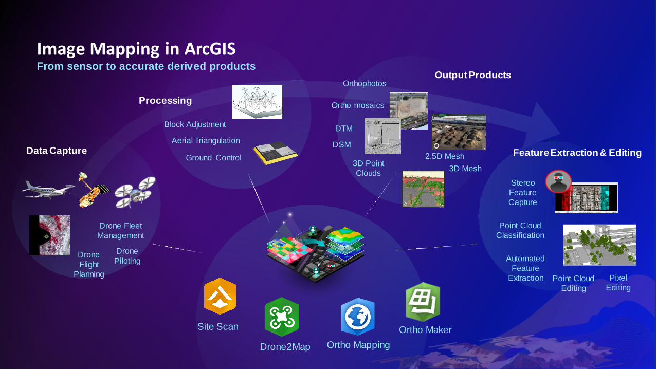
Image Mapping in ArcGISFrom sensor to accurate derived products
Data Capture
Processing
Output Products
Drone
Piloting
Drone Fleet
Management
Drone
Flight
Planning
Aerial Triangulation
Block Adjustment
DSM
Orthophotos
3D Point
Clouds
DTM
Ortho mosaics
3D Mesh
Ground Control
Stereo
Feature
Capture
Automated
Feature
Extraction Point Cloud
Editing
Pixel
Editing
Point Cloud
Classification
2.5D Mesh Feature Extraction & Editing
Site Scan
Ortho Mapping
Ortho Maker
Drone2Map
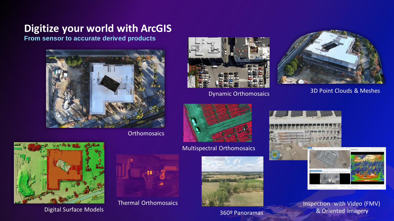
Digitize your world with ArcGIS
Orthomosaics
Digital Surface Models
3D Point Clouds & Meshes
Inspection with Video (FMV) & Oriented Imagery
From sensor to accurate derived products
Thermal Orthomosaics
360º Panoramas
Multispectral Orthomosaics
Dynamic Orthomosaics
Drone processing options in ArcGIS
Web / CloudDesktop
(office/field)Desktop
Web (ArcGIS Enterprise)
Site Scan Flight Site Scan LE Site Scan LE Site Scan LE
Drone Drone
Drone, Satellite,
Scanned Film, Digital Camera
Drone
✓ ✓ ✓ ✓
✓ ✓
✓
✓
Some focused tools; Connect with
ArcGIS for advanced analysisExtensive
(part of ArcGIS Pro)
Some focused tools + ArcGIS
Enterprise
Site Scan Drone2Map ArcGIS Pro *(Ortho Mapping)
Enterprise + Image Server (Ortho Maker)
Processing Environment
Drone Flight app included
Input data
Data Products
2D (orthomosaic, DSM, DTM)
3D (point cloud, mesh)
Cloud connection from flight app
Drone Fleet Management
Analysis Capabilities
* Advanced license
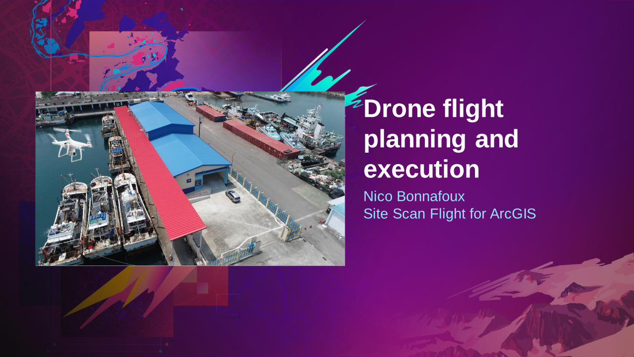
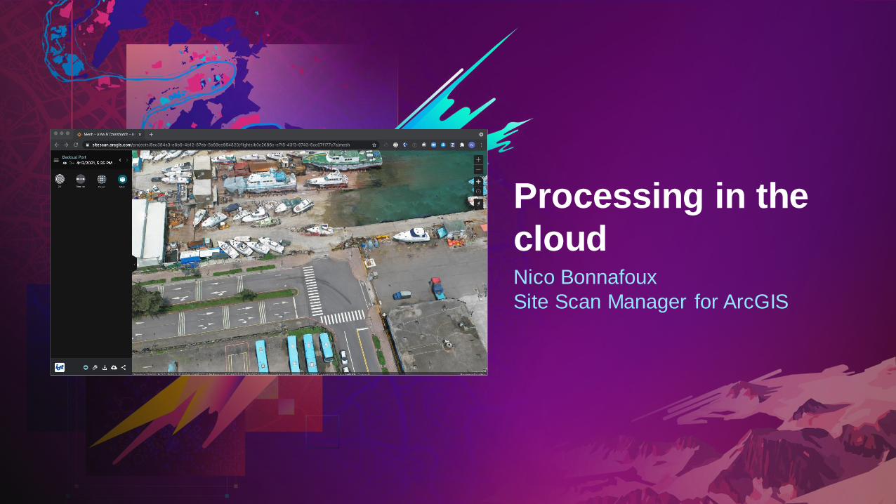
Nico Bonnafoux
Site Scan Flight for ArcGIS
Drone flight
planning and
execution

Site Scan Flight for ArcGIS App
Drone Data Capture
Badouzi Port, Taiwan
&Credits and thanks to
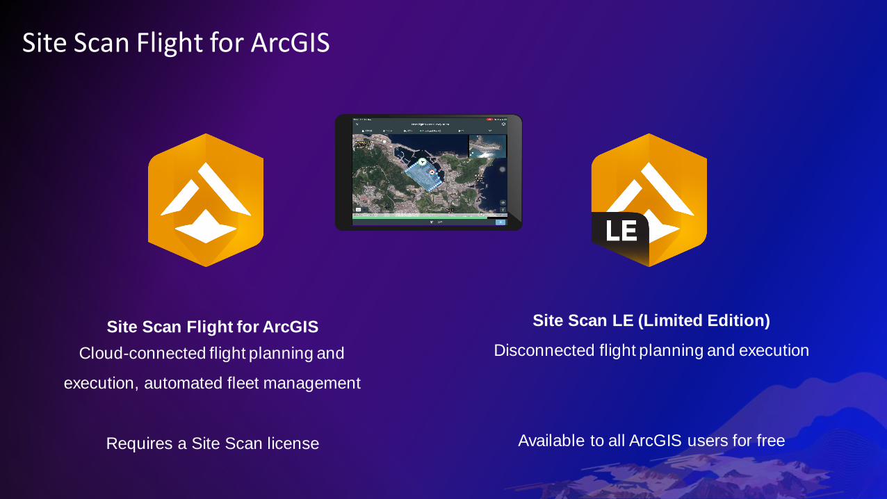
Site Scan Flight for ArcGIS
Site Scan Flight for ArcGIS
Cloud-connected flight planning and
execution, automated fleet management
Requires a Site Scan license
Site Scan LE (Limited Edition)
Disconnected flight planning and execution
Available to all ArcGIS users for free

Site Scan Flight and LE
﹅ iPadOS application
﹅ Plan automated mapping &
inspection flights in 2D & 3D
﹅ Geospatial Video Log recording
﹅ Terrain Follow capability
﹅ Offline basemap download
﹅ Display 2D & 3D data from ArcGIS
Online or Enterprise
﹅ QuickMap offline photo-mosaic stitching
﹅ Field data management
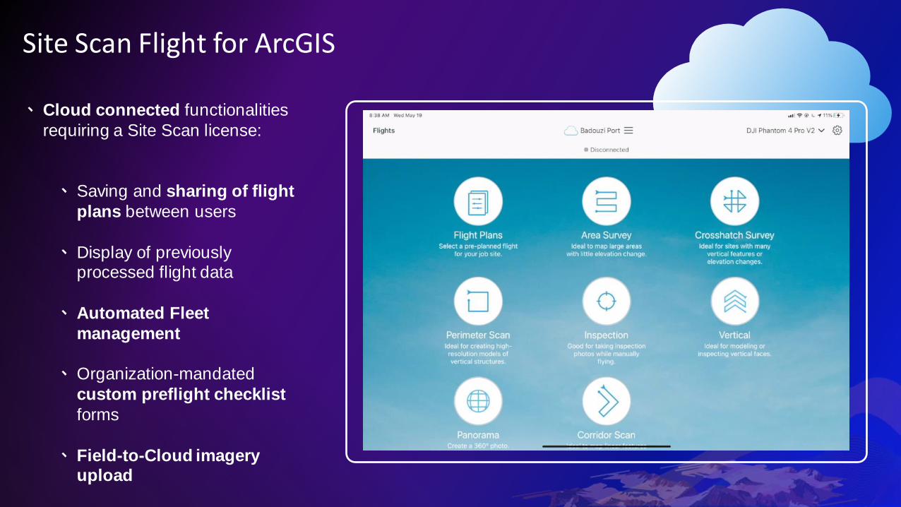
Site Scan Flight for ArcGIS
﹅ Cloud connected functionalities
requiring a Site Scan license:
﹅ Saving and sharing of flight
plans between users
﹅ Display of previously processed flight data
﹅ Automated Fleet
management
﹅ Organization-mandated
custom preflight checklist
forms
﹅ Field-to-Cloud imagery upload
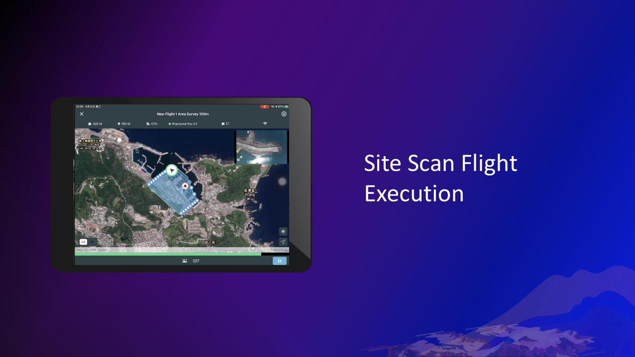
Site Scan Flight Execution

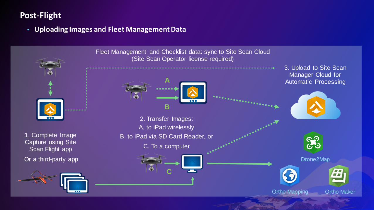
Post-Flight
• Uploading Images and Fleet Management Data
1. Complete Image Capture using Site
Scan Flight app
2. Transfer Images:
A. to iPad wirelessly
A
3. Upload to Site Scan Manager Cloud for
Automatic Processing
Fleet Management and Checklist data: sync to Site Scan Cloud (Site Scan Operator license required)
C
B. to iPad via SD Card Reader, or
C. To a computer
B
Ortho Mapping Ortho Maker
Drone2MapOr a third-party app

Drone Data Processing

Site Scan Manager for ArcGIS
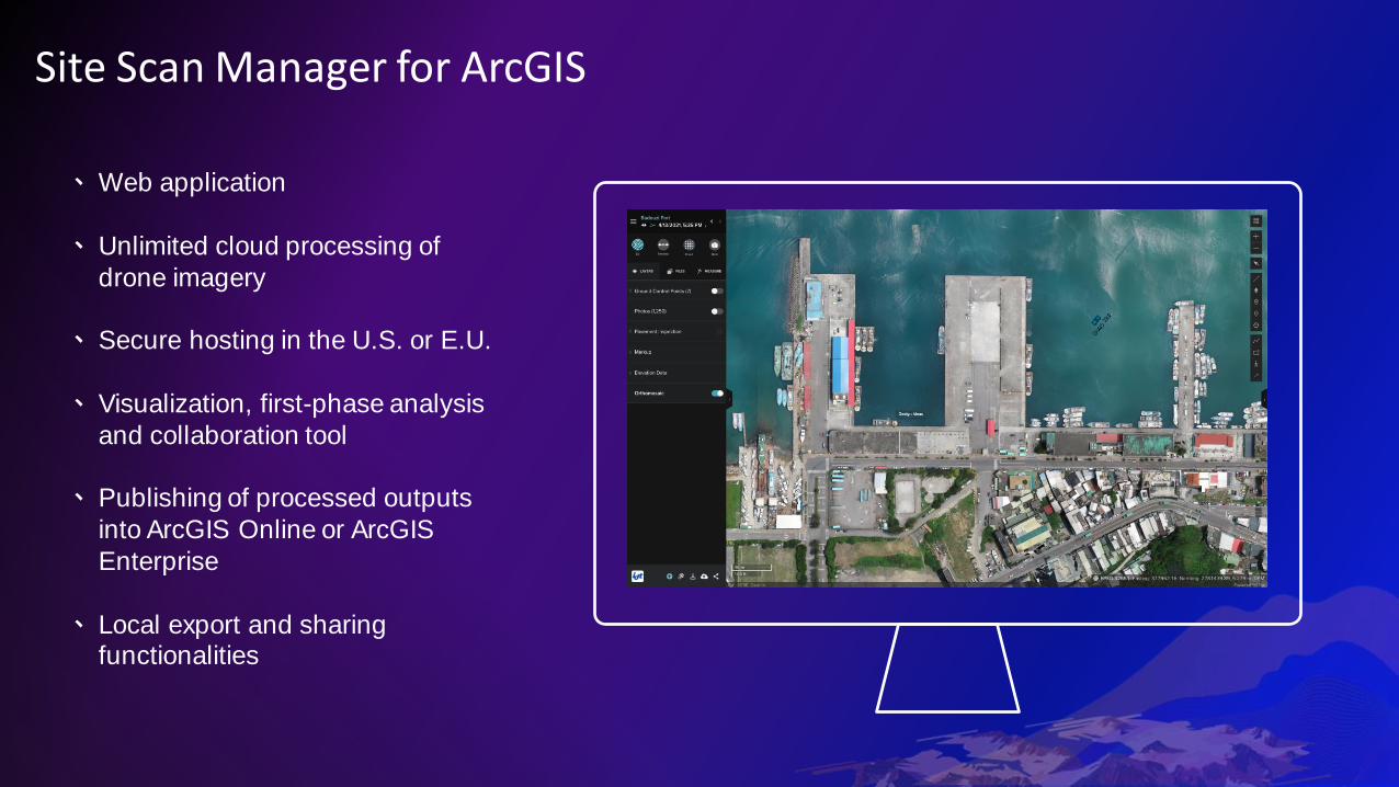
Site Scan Manager for ArcGIS
﹅Web application
﹅ Unlimited cloud processing of
drone imagery
﹅ Secure hosting in the U.S. or E.U.
﹅ Visualization, first-phase analysis
and collaboration tool
﹅ Publishing of processed outputs
into ArcGIS Online or ArcGIS
Enterprise
﹅ Local export and sharing functionalities
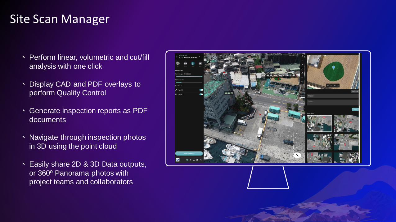
Site Scan Manager
﹅ Perform linear, volumetric and cut/fill
analysis with one click
﹅ Display CAD and PDF overlays to perform Quality Control
﹅ Generate inspection reports as PDF
documents
﹅ Navigate through inspection photos
in 3D using the point cloud
﹅ Easily share 2D & 3D Data outputs,
or 360º Panorama photos with project teams and collaborators

Site Scan Manager
﹅ Computer vision Ground Control
Point detection
﹅ Accuracy validation through checkpoints
﹅ Processing & accuracy reports
﹅ RTK and PPK support

Site Scan Manager - Fleet Management
﹅ Automatic recording of all flights conducted with
the Site Scan Flight app & manual flight logging:
﹅ Pilot
﹅ Aircraft﹅ Batteries
﹅Weather…
﹅ Dynamic operations dashboard
﹅Maintenance scheduling and tracking
﹅ Data exports for reporting
﹅ Pilot certificate and aircraft document tracking
﹅ Incident tracking and administrator notifications
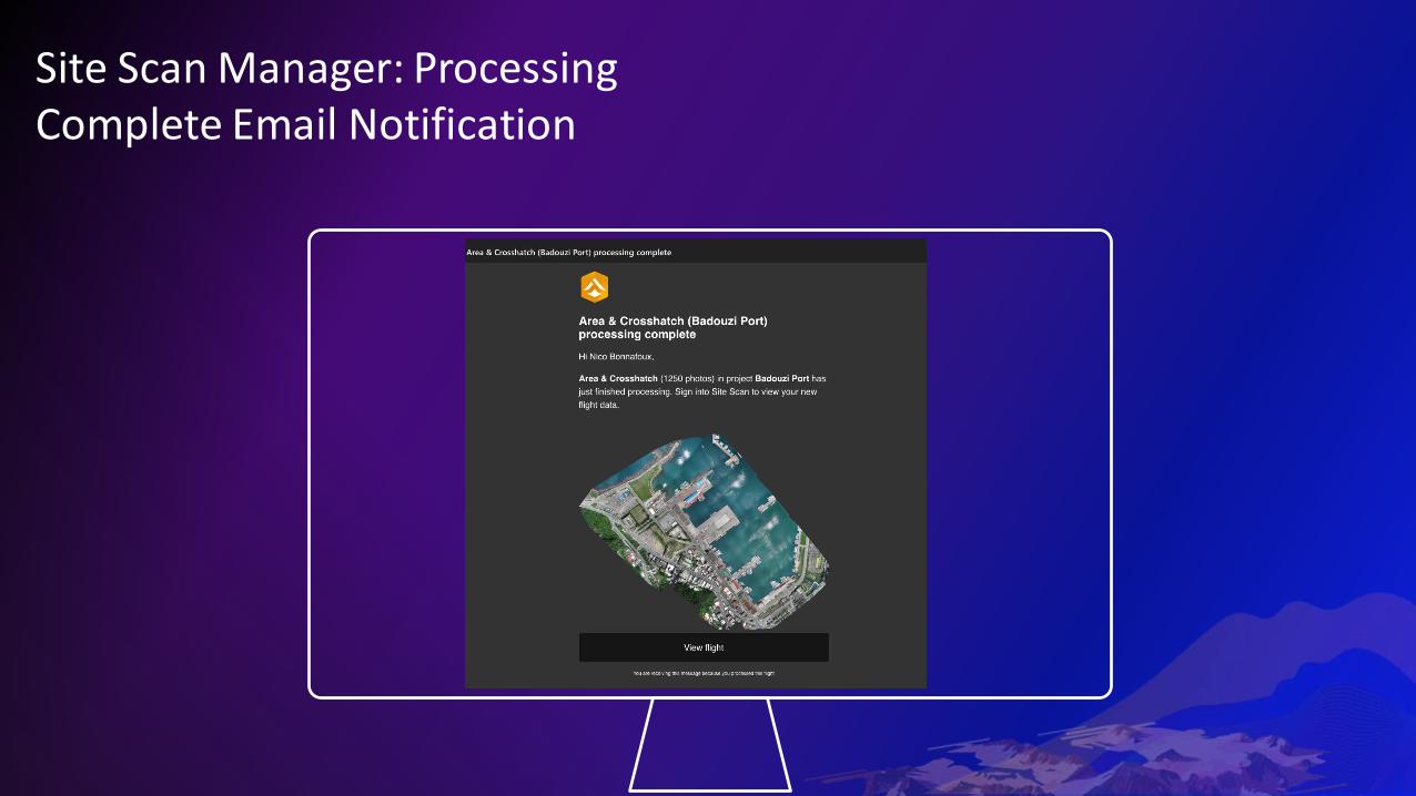
Site Scan Manager: Processing Complete Email Notification
Nico Bonnafoux
Site Scan Manager for ArcGIS
Processing in the
cloud
Mark Buie
ArcGIS Drone2Map
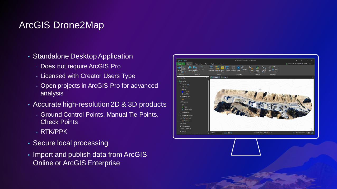
ArcGIS Drone2Map
• Standalone Desktop Application
- Does not require ArcGIS Pro
- Licensed with Creator Users Type
- Open projects in ArcGIS Pro for advanced
analysis
• Accurate high-resolution 2D & 3D products
- Ground Control Points, Manual Tie Points, Check Points
- RTK/PPK
• Secure local processing
• Import and publish data from ArcGIS
Online or ArcGIS Enterprise
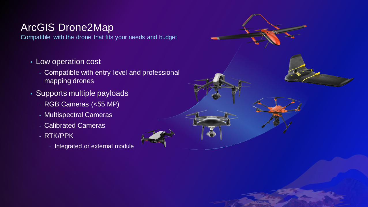
ArcGIS Drone2MapCompatible with the drone that fits your needs and budget
• Low operation cost
- Compatible with entry-level and professional
mapping drones
• Supports multiple payloads
- RGB Cameras (<55 MP)
- Multispectral Cameras
- Calibrated Cameras
- RTK/PPK
- Integrated or external module

ArcGIS Drone2MapProcess geolocated images from any source
Optimized for Site Scan LE
Compatible with third-party
flight planning apps
X
Y
Z
• Image Metadata
• Geolocation File
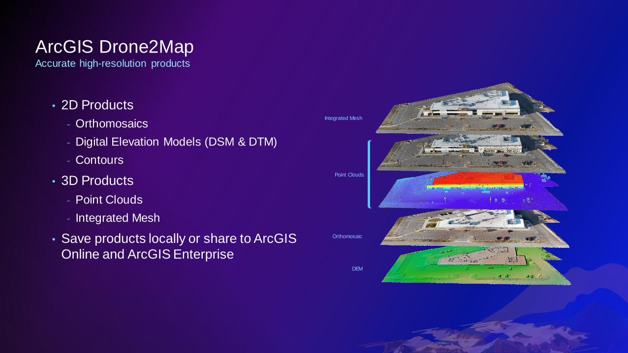
ArcGIS Drone2MapAccurate high-resolution products
• 2D Products
- Orthomosaics
- Digital Elevation Models (DSM & DTM)
- Contours
• 3D Products
- Point Clouds
- Integrated Mesh
• Save products locally or share to ArcGIS
Online and ArcGIS Enterprise
Integrated Mesh
Point Clouds
Orthomosaic
DEM
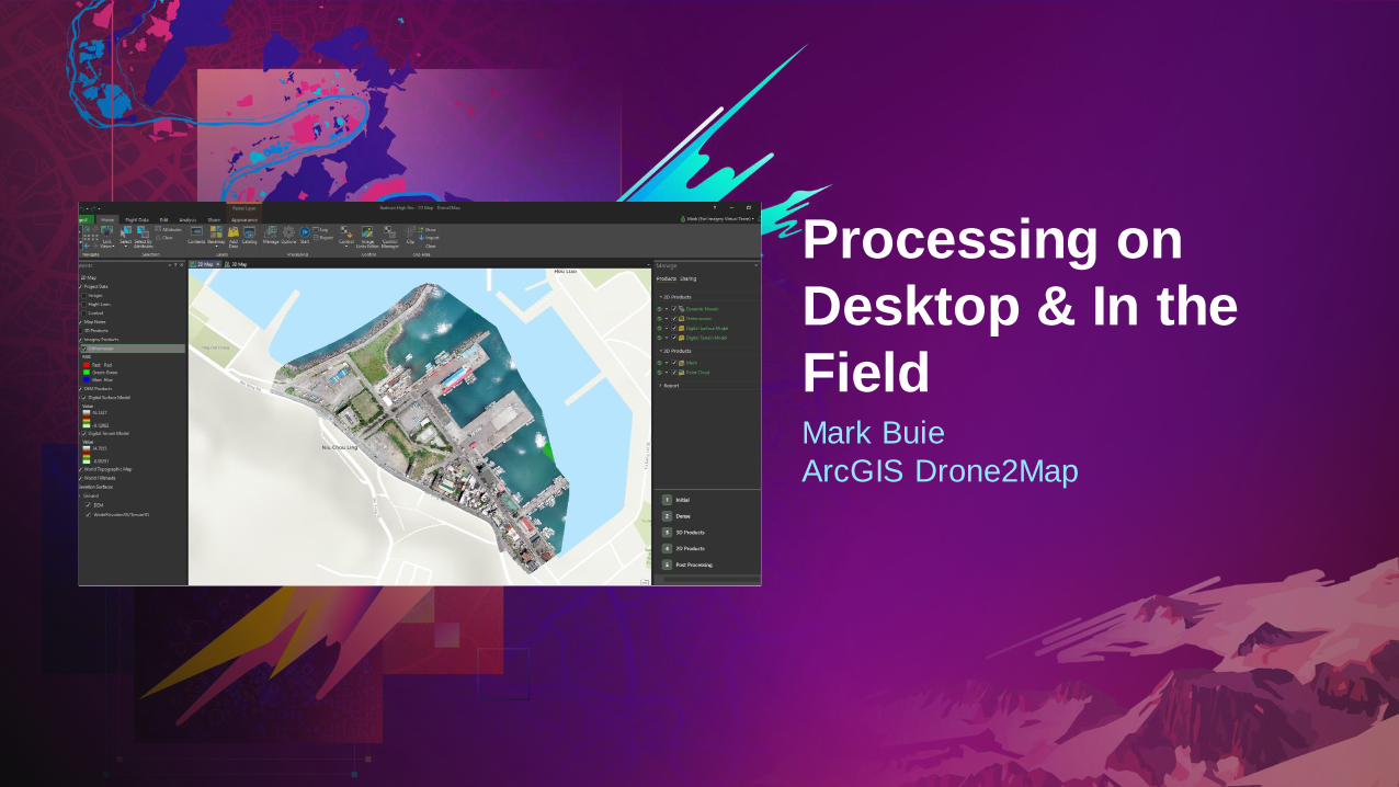
Mark Buie
ArcGIS Drone2Map
Processing on
Desktop & In the
Field

Chris Patterson & Cody Benkelman
ArcGIS Pro Advanced
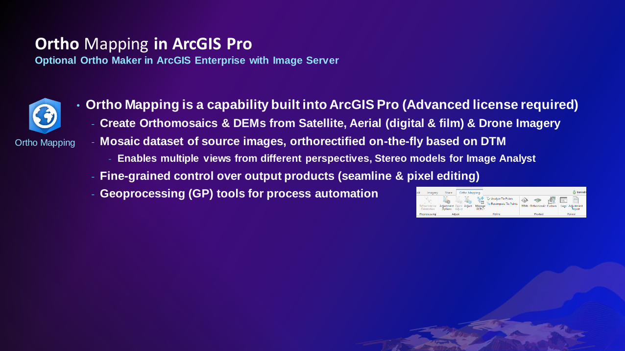
Ortho Mapping in ArcGIS ProOptional Ortho Maker in ArcGIS Enterprise with Image Server
• Ortho Mapping is a capability built into ArcGIS Pro (Advanced license required)
- Create Orthomosaics & DEMs from Satellite, Aerial (digital & film) & Drone Imagery
- Mosaic dataset of source images, orthorectified on-the-fly based on DTM
- Enables multiple views from different perspectives, Stereo models for Image Analyst
- Fine-grained control over output products (seamline & pixel editing)
- Geoprocessing (GP) tools for process automation
Ortho Mapping

Ortho Mapping in ArcGIS ProOptional Ortho Maker in ArcGIS Enterprise with Image Server
• Ortho Mapping is a capability built into ArcGIS Pro (Advanced license required)
- Create Orthomosaics & DEMs from Satellite, Aerial (digital & film) & Drone Imagery
- Mosaic dataset of source images, orthorectified on-the-fly based on DTM
- Enables multiple views from different perspectives, Stereo models for Image Analyst
- Fine-grained control over output products (seamline & pixel editing)
- Geoprocessing (GP) tools for process automation
• Ortho Maker is a web-based user interface for uploading and processing drone
imagery through Ortho Mapping on Enterprise with Image Server
- Output data products appear as web layers
ArcGIS
Image Server
ArcGIS
Enterprise
Ortho Mapping
Ortho Maker
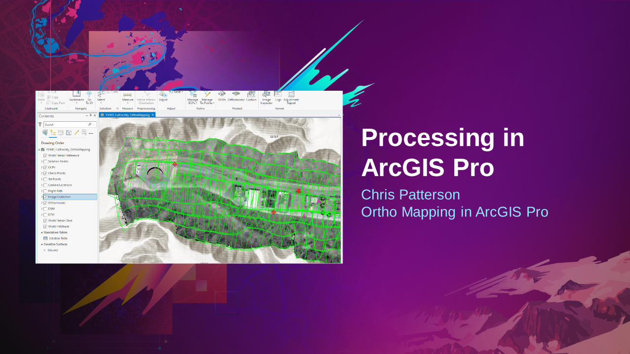
Chris Patterson
Ortho Mapping in ArcGIS Pro
Processing in
ArcGIS Pro
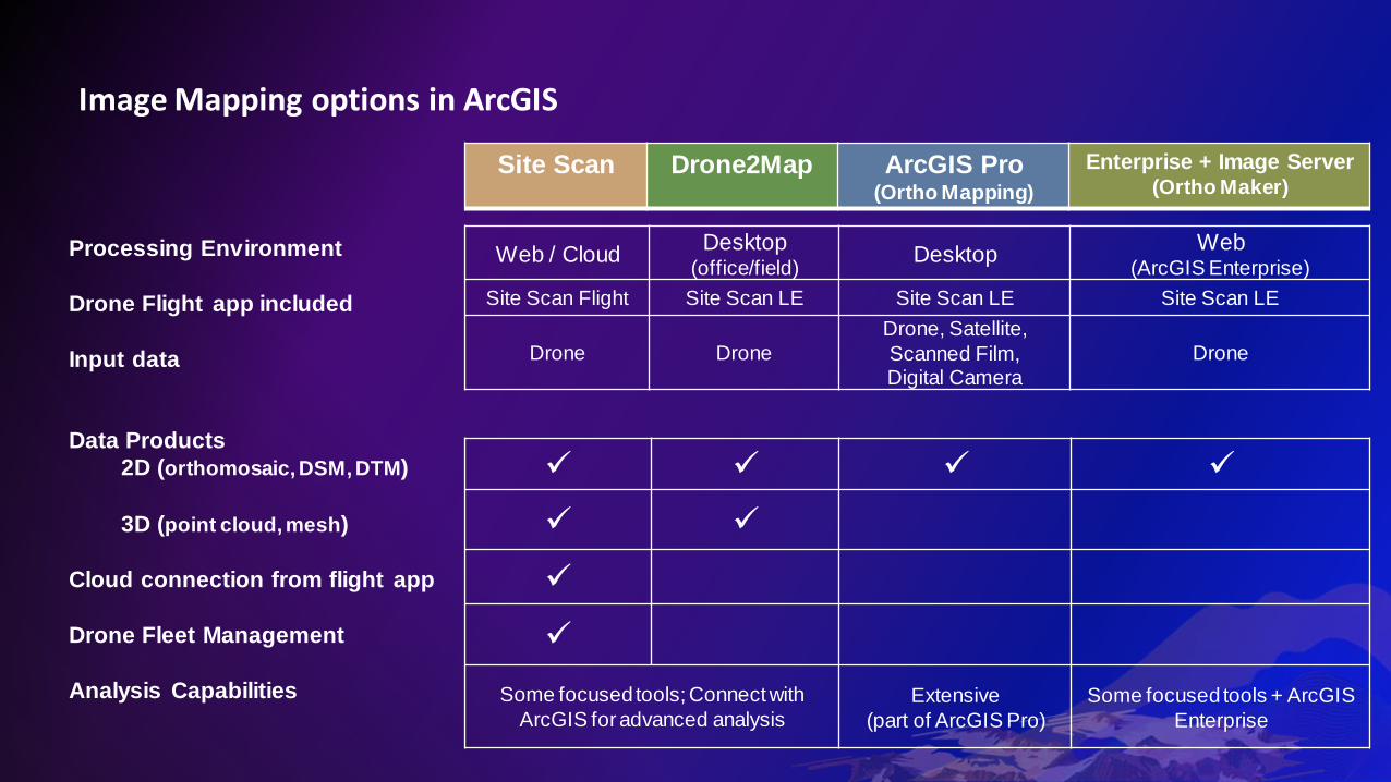
Image Mapping options in ArcGIS
Web / CloudDesktop
(office/field)Desktop
Web (ArcGIS Enterprise)
Site Scan Flight Site Scan LE Site Scan LE Site Scan LE
Drone Drone
Drone, Satellite,
Scanned Film, Digital Camera
Drone
✓ ✓ ✓ ✓
✓ ✓
✓
✓
Some focused tools; Connect with
ArcGIS for advanced analysisExtensive
(part of ArcGIS Pro)
Some focused tools + ArcGIS
Enterprise
Site Scan Drone2Map ArcGIS Pro (Ortho Mapping)
Enterprise + Image Server (Ortho Maker)
Processing Environment
Drone Flight app included
Input data
Data Products
2D (orthomosaic, DSM, DTM)
3D (point cloud, mesh)
Cloud connection from flight app
Drone Fleet Management
Analysis Capabilities
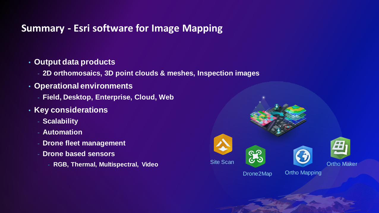
• Output data products
- 2D orthomosaics, 3D point clouds & meshes, Inspection images
• Operational environments
- Field, Desktop, Enterprise, Cloud, Web
• Key considerations
- Scalability
- Automation
- Drone fleet management
- Drone based sensors
- RGB, Thermal, Multispectral, Video
Summary - Esri software for Image Mapping
Site Scan
Ortho Mapping
Ortho Maker
Drone2Map

We want your feedback
Click on the Session Survey link below this video window

MONDAY
Getting Started with Imagery (12:30 – 1:30 PM)
ArcGIS Image for ArcGIS Online: An Introduction (1:45 – 2:45 PM)
ArcGIS Image Analyst: An Introduction (3:00 – 4:00 PM)
TUESDAY
ArcGIS Image Server: Image Management & Analysis at Scale (7:15 – 8:15 AM)
Imagery in ArcGIS: What’s New (11:45 AM – 12:45 PM)
Living Atlas: Imagery and Elevation (11:45 AM – 12:45 PM)
Imagery in ArcGIS: Working with Time Series Data (2:15 – 3:15 PM)
WEDNESDAY
Drone Imagery: Creating Orthomosaics, DEMs & 3D Mesh (10:00 – 11:00 AM)
ArcGIS: Introduction to Deep Learning (7:30 – 8:30 AM)
Geospatial Deep Learning Using the ArcGIS API for Python (1:45 – 2:45 PM)
Learn more
Find resources about this topic
go.esri.com/UC2021_ImageryResources
Imagery Tech Sessions

Related Documents