DRAFT SCOTTSDALE CITY COUNCIL REGULAR/GENERAL PLAN AMENDMENT MEETING MINUTES TUESDAY, NOVEMBER 19, 2013 CITY HALL KIVA 3939 N. DRINKWATER BOULEVARD SCOTTSDALE, AZ 85251 CALL TO ORDER Mayor W.J. "Jim" Lane called to order a Regular/General Plan Amendment Meeting of the Scottsdale City Council at 5:07 P.M. on Tuesday, November 19, 2013, in the City Hall Kiva. ROLL CALL Present: Mayor W.J. "Jim" Lane Vice Mayor Virginia L. Korte Councilmembers Suzanne Klapp, Robert W. Littlefield, Linda Milhaven (participated telephonically), Guy Phillips, and Dennis E. Robbins Also Present: City Manager Fritz Behring City Attorney Bruce Washburn City Treasurer Jeff Nichols City Auditor Sharron Walker City Clerk Carolyn Jagger PLEDGE OF ALLEGIANCE - Brownie Troop 587, Troop Leader Stephanie La Loggia MAYOR'S REPORT Mayor Lane requested a moment of silence for the storm victims in the Midwest. Mayor Lane announced that the City will celebrate Small Business Saturday on November 30, from 11 a.m. to 1 p.m., on the canal in downtown Scottsdale. Citizens were encouraged to join in the festivities and support small businesses. CITY MANAGER'S REPORT Community Services Executive Director Bill Murphy gave a PowerPoint presentation (attached) on the Scottsdale Employee Charitable Choices campaign, which raised $98,765. Employee contributions were the largest in more than a dozen years. PRESENTATIONS/INFORMATION UPDATES - None NOTE: MINUTES OF CITY COUNCIL MEETINGS AND WORK STUDY SESSIONS ARE PREPARED IN ACCORDANCE WITH THE PROVISIONS OF ARIZONA REVISED STATUTES. THESE MINUTES ARE INTENDED TO BE AN ACCURATE REFLECTION OF ACTION TAKEN AND DIRECTION GIVEN BY THE CITY COUNCIL AND ARE NOT VERBATIM TRANSCRIPTS. DIGITAL RECORDINGS AND CLOSED CAPTION TRANSCRIPTS OF SCOTTSDALE CITY COUNCIL MEETINGS ARE AVAILABLE ONLINE AND ARE ON FILE IN THE CITY CLERK'S OFFICE.

Welcome message from author
This document is posted to help you gain knowledge. Please leave a comment to let me know what you think about it! Share it to your friends and learn new things together.
Transcript
DRAFT SCOTTSDALE CITY COUNCIL
REGULAR/GENERAL PLAN AMENDMENT MEETING MINUTES TUESDAY, NOVEMBER 19, 2013
CITY HALL KIVA 3939 N. DRINKWATER BOULEVARD
SCOTTSDALE, AZ 85251
CALL TO ORDER
Mayor W.J. "Jim" Lane called to order a Regular/General Plan Amendment Meeting of the Scottsdale City Council at 5:07 P.M. on Tuesday, November 19, 2013, in the City Hall Kiva.
ROLL CALL
Present: Mayor W.J. "Jim" Lane Vice Mayor Virginia L. Korte Councilmembers Suzanne Klapp, Robert W. Littlefield, Linda Milhaven (participated telephonically), Guy Phillips, and Dennis E. Robbins
Also Present: City Manager Fritz Behring City Attorney Bruce Washburn City Treasurer Jeff Nichols City Auditor Sharron Walker City Clerk Carolyn Jagger
PLEDGE OF ALLEGIANCE - Brownie Troop 587, Troop Leader Stephanie La Loggia
MAYOR'S REPORT
Mayor Lane requested a moment of silence for the storm victims in the Midwest. Mayor Lane announced that the City will celebrate Small Business Saturday on November 30, from 11 a.m. to 1 p.m., on the canal in downtown Scottsdale. Citizens were encouraged to join in the festivities and support small businesses.
CITY MANAGER'S REPORT
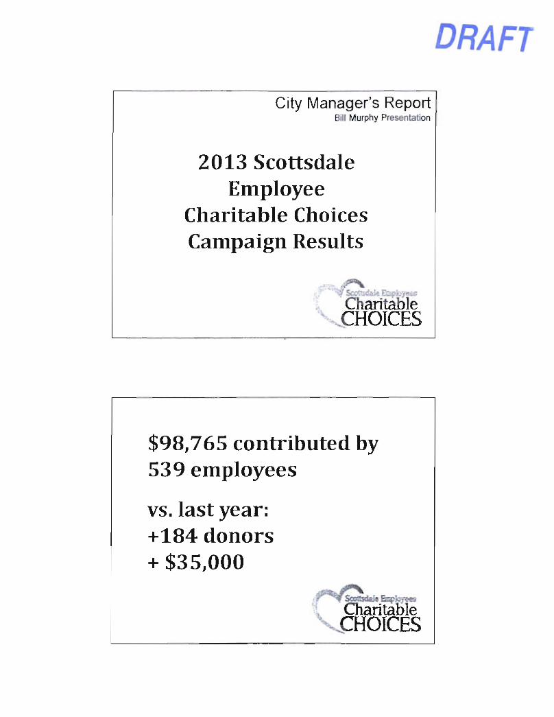
Community Services Executive Director Bill Murphy gave a PowerPoint presentation (attached) on the Scottsdale Employee Charitable Choices campaign, which raised $98,765. Employee contributions were the largest in more than a dozen years.
PRESENTATIONS/INFORMATION UPDATES - None
NOTE: MINUTES OF CITY COUNCIL MEETINGS AND WORK STUDY SESSIONS ARE PREPARED IN ACCORDANCE WITH THE PROVISIONS OF ARIZONA REVISED STATUTES. THESE MINUTES ARE INTENDED TO BE AN ACCURATE REFLECTION OF ACTION TAKEN AND DIRECTION GIVEN BY THE CITY COUNCIL AND ARE NOT VERBATIM TRANSCRIPTS. DIGITAL RECORDINGS AND CLOSED CAPTION TRANSCRIPTS OF SCOTTSDALE CITY COUNCIL MEETINGS ARE AVAILABLE ONLINE AND ARE ON FILE IN THE CITY CLERK'S OFFICE.
DRAFT Scottsdale City Council Regular/General Plan Amendment Meeting Minutes
Tuesday, Novemt)er 19, 2013 Page 2 of 10
PUBLIC COMMENT • Dana Close, Scottsdale Gateway Alliance, commented on the clean-up efforts along
McDowell Road.
ADDED ITEMS
A1. Added Items The supporting materials for Item No. 10 will be added to the agenda less than ten days prior to the meeting and will require a separate vote to remain on the agenda. Request: Vote to accept the agenda as presented or to continue the added item to the December 9. 2013 Council meeting.
MOTION AND VOTE - ADDED ITEMS
Councilman Littlefield made a motion to accept the agenda as presented. Councilwoman Klapp seconded the motion, which carried 7/0.
CONSENT AGENDA
1. Birreria Italia Liquor License (99-LL-2013) Request: Consider forwarding a recommendation of approval to the Arizona Department of Liquor Licenses and Control for a series 3 (microbrewery) State liquor license for an existing location and owner, new series. Location: 15444 N. Greenway Hayden Loop Staff Contact(s): Tim Curtis, Current Planning Director, 480-312-4210, tcurtis(a)scottsdaleaz.qov
2. Salty Senorita Liquor License (100-LL-2013) Request: Consider forwarding a recommendation of approval to the Arizona Department of Liquor Licenses and Control for a series 12 (restaurant) State liquor license for an existing location with a new owner. Location: 3748 N. Scottsdale Road Staff Contact(s): Tim Curtis, Current Planning Director, 480-312-4210, [email protected]
3. Vivo Liquor License (101-LL-2013) Request: Consider forwarding a recommendation of approval to the Arizona Department of Liquor Licenses and Control for a series 12 (restaurant) State liquor license for a new location and owner. Location: 6560 N. Scottsdale Road, Suite 105 Staff Contact(s): Tim Curtis, Current Planning Director, 480-312-4210, [email protected]
4. Archstone Apartments at DC Ranch Abandonment (3-AB-2012) Request: Adopt Resolution No. 9556 extending the time to fulfill the conditions for abandoning 2,083± square-feet of remnant public right-of-way, located on the south side of East Legacy Boulevard, approximately 360 feet west of North 91^^ Street, adjacent to 18245 North Pima Road with Planned Neighborhood Center, Planned Community District (PNC PCD) zoning. Location: 9009 E. Legacy Boulevard Staff Contact(s): Randy Grant, Planning, Neighborhood, and Transportation Administrator, 480-312-2664, [email protected]
DRAFT Scottsdale City Council Regular/General Plan Amendment Meeting Minutes Tuesday, November 19. 2013 Page 3 of 10
5. Downtown Text Amendment Pertaining to the Downtown and Related Citywide Requirements (6-TA-2009#4)
Item 5 was moved to the Regular Agenda for a separate vote (see Page 4).
6. Adaptive Recreation Building Remodel Construction Bid Award Request: Adopt Resolution No. 9542 authorizing Construction Bid Award No. 13PB041 to Providence Builders, the lowest responsive bidder, at their unit price bid of $295,535, for construction of the Adaptive Recreation Building Remodel Project. Staff Contact(s): Daniel Worth, Public Works Executive Director, 480-312-5555, [email protected]
7. Water Booster Station 42B and Site 71 Well Site and Water Booster Station Improvements Engineering Services Contract Request: Adopt Resolution No. 9562 authorizing Engineering Services Contract Modification No. 2013-031-C0S-A1 with GHD, Inc.. in the amount of $277,487, for design services for the Water Booster Pump Station 42B and Site 71 Well Site and Water Booster Pump Station Project. Staff Contact(s): Daniel Worth, Public Works Executive Director, 480-312-5555, [email protected]
8. Site 71 Well and Water Booster Station Well Drilling Improvements Construction Services Contract Request: Adopt Resolution No. 9568 authorizing CM@Risk Contract No. 2013-178-COS with MGC Contractors, Inc., in the amount of $1.558,680, for well drilling improvements at the Site 71 Well and Booster Pump Station. Staff Contact(s): Daniel Worth, Public Works Executive Director, 480-312-5555, [email protected]
9. Sewer Condition Assessment Program Engineering Services Contract Request: Adopt Resolution No. 9571 authorizing Engineering Services Contract No. 2013-179-COS with Project Engineering Consultants, Ltd., at a cost not to exceed $160,000, to provide technical expertise, assistance, and review for the sewer condition assessment program. Staff Contact(s): Brian Biesemeyer, Water Resources Executive Director, 480-312-5683. [email protected]
10. WestWorld Event Agreement Request: Adopt Resolution No. 9577 authorizing Contract No. 2013-182-COS with Valley of the Sun Arabian Horse Association and East Valley Arabian Horse Association to utilize WestWorld Equestrian event facilities to produce the Saguaro Classic All Arabian Horse Show. Staff Contact(s): Paul Katsenes, Community and Economic Development Executive Director, 480-312-2890, [email protected]
11. Peace Officer In-service Training Assistance Agreement Request: Adopt Resolution No. 9561 authorizing Agreement No. 2013-177-COS with the Arizona Peace Officer Standards and Training Board for the provision of a Scottsdale police officer to assist with in-service training. Staff Contact(s): Alan Rodbell, Public Safety Executive Director, 480-312-1900, [email protected]
DRAFT Scottsdale City Council Regular/General Plan Amendment Meeting Minutes Tuesday, November 19, 2013 Page 4 of 10
12. Fire Department Clinical Modalities Training and Clinical Enhancements Budget Transfer Request: Adopt Resolution No. 9553 authorizing a budget transfer in the amount of $120,000 from the FY 2013/14 Adopted General Fund Operating Contingency to the Fire Department's General Fund Operating budget for the costs associated with providing new clinical modalities training and clinical enhancements ($70,000 and $50,000, respectively). Staff Contact(s): Tom Shannon, Fire Chief, 480-312-1821, [email protected]
13. Fiscal Year 2013/14 Event Venue Fee Program Request: Adopt Resolution No. 9559 authorizing $20,000 in bed tax funding to be used for development of events to be identified, per the FY 2013/14 Event Venue Fee Program; and authorizing the Mayor to execute individual agreements with each event producer. Staff Contact(s): Danielle Casey, Economic Development Director, 480-312-7601, [email protected]
MOTION AND VOTE - CONSENT AGENDA
Vice Mayor Korte made a motion to approve Consent Items 1 through 13, absent Item 5. Councilman Phillips seconded the motion, which carried 7/0.
REGULAR AGENDA
5. Downtown Text Amendment Pertaining to the Downtown and Related Citywide Requirements (6-TA-2009#4) Requests: 1. Adopt Resolution No. 9563 declaring the document entitled "6-TA-2009#4, Text
Amendment Pertaining to the Downtown and Related City-wide Requirements" to be a public record.
2. Adopt Ordinance No. 4117 approving a text amendment to the City of Scottsdale Zoning Ordinance No. 455 to amend Article I (Administration and Procedures), Article III (Definitions), Article IV (Districts and Boundaries Thereof), Article V (District Regulations), Article VI (Supplementary Districts), Article VII (General Provisions), Article VIII (Sign Requirements), and Article IX (Parking and Loading Requirements) pertaining to the Downtown and Citywide; and determining that the proposed zoning ordinance text amendment is consistent and conforms with the adopted General Plan and Downtown Plan.
Staff Contact(s): Randy Grant, Planning, Neighborhood, and Transportation Administrator, 480-312-2664, [email protected]
Senior Planner Dan Symer gave a PowerPoint presentation on the proposed downtown text amendment.
MOTION AND VOTE - ITEM 5
Vice Mayor Korte made a motion to approve agenda Item 5. Councilwoman Klapp seconded the motion, which carried 5/2, with Councilmembers Littlefield and Phillips dissenting.
DRAFT Scottsdale City Council Regular/General Plan Amendment Meeting Minutes Tuesday. November 19, 2013 Page 5 of 10
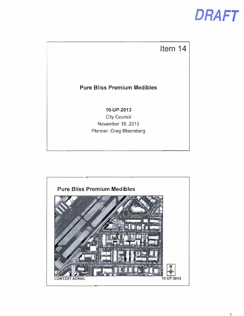
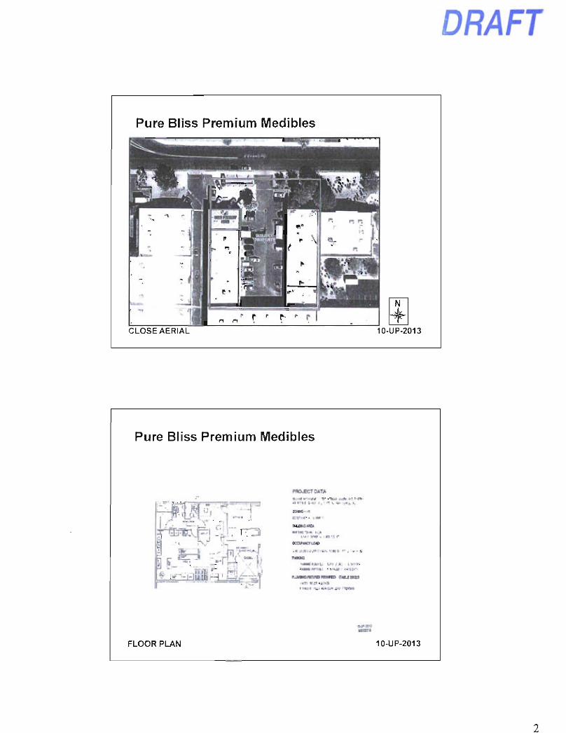
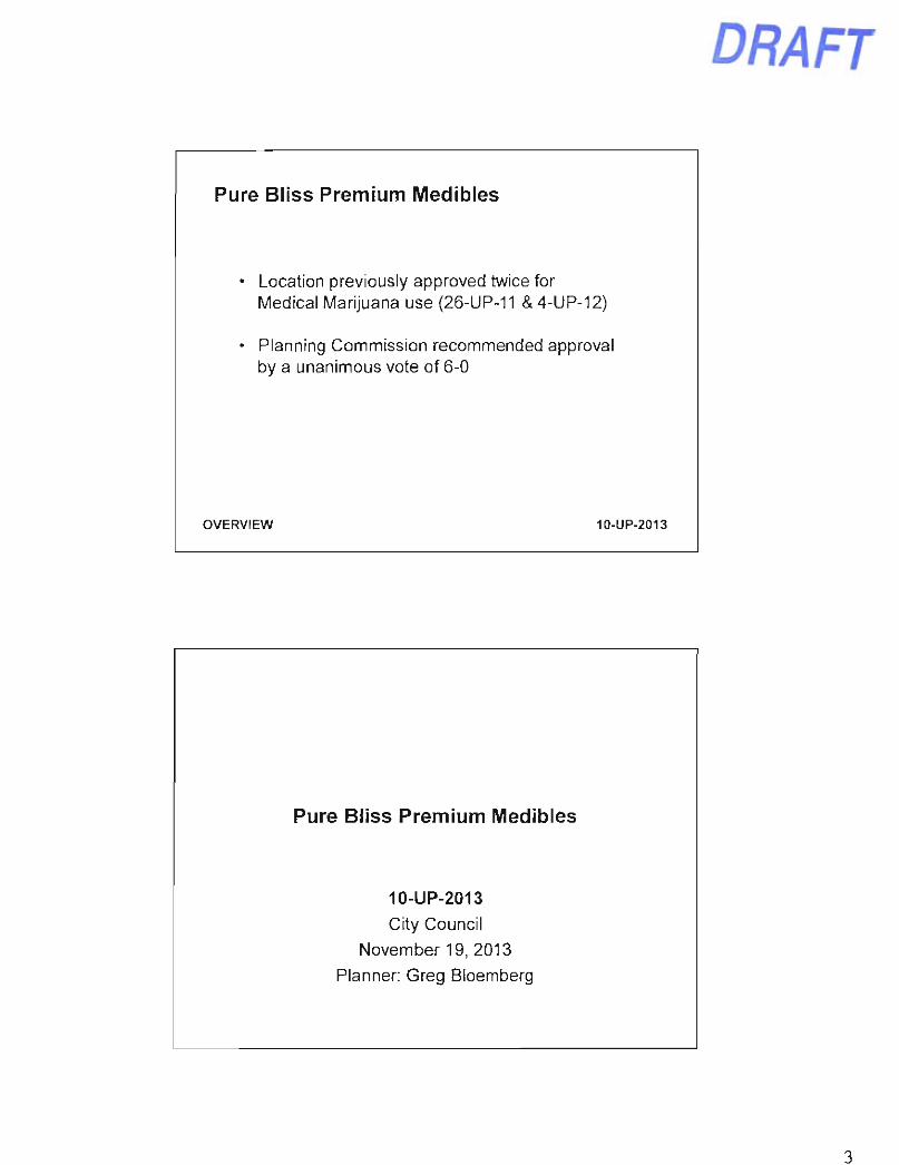
14. Pure Bliss Premium Medibles Conditional Use Permit (10-UP-2013) Request: Adopt Resolution No. 9554 approving a Conditional Use Permit for a Medical Marijuana Use (Infusion Bakery) in a 1,385± square-foot space with Industrial Park District (1-1) zoning; and finding that the conditional use permit criteria have been met. Location: 7655 E. Evans Road, Suite 5 Presenter(s): Greg Bloemberg, Planner Staff Contact(s): Randy Grant, Planning, Neighborhood, and Transportation Administrator, 480-312-2664, [email protected]
Planner Greg Bloemberg gave a PowerPoint presentation (attached) on the reguest from Pure Bliss Premium Medibles for a Conditional Use Permit (CUP) for a medical marijuana infusion bakery.
Mayor Lane opened public testimony.
• David Dow, applicant representative, spoke in support of the applicant's request for a CUP. He explained that Pure Bliss Premium Medibles will be a wholesale bakery that sells exclusively to retailers by appointment only.
Mayor Lane closed public testimony.
MOTION AND VOTE - ITEM 14
Vice Mayor Korte made a motion to adopt Resolution No. 9554 approving a Conditional Use Permit for a Medical Marijuana Use and finding that the conditional use permit criteria have been met. Councilwoman Klapp seconded the motion, which failed 3/4, with Mayor Lane and Councilmembers Littlefield, Phillips, and Robbins dissenting.
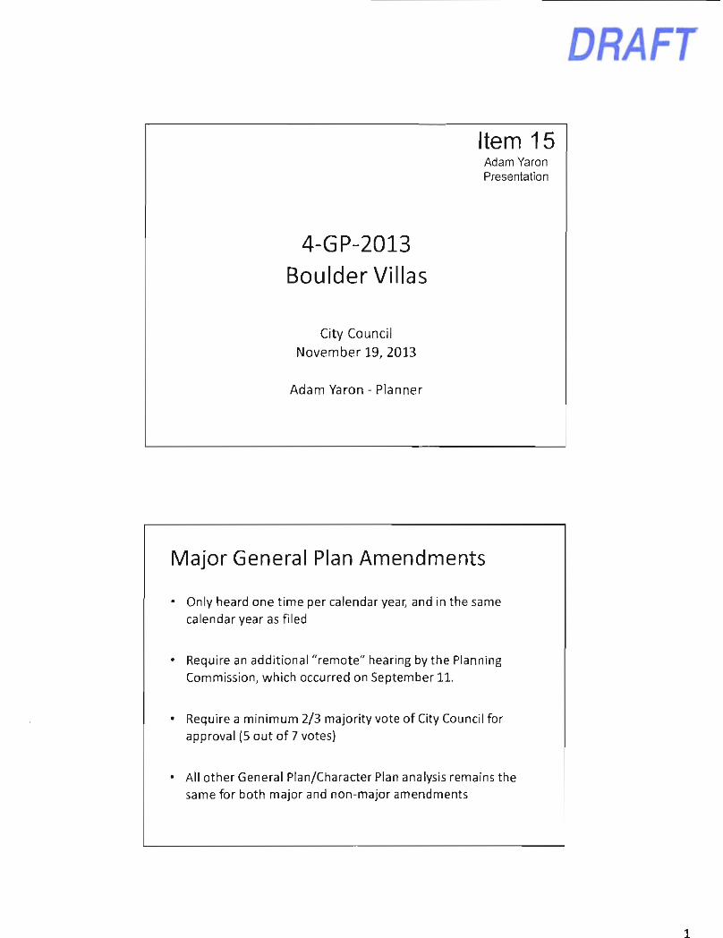
15. Boulders Villas Major General Plan Amendment and Rezoning (4-GP-2013 and 11-ZN-2013) Requests: 1. Adopt Resolution No. 9557 approving a Major General Plan Amendment to the City
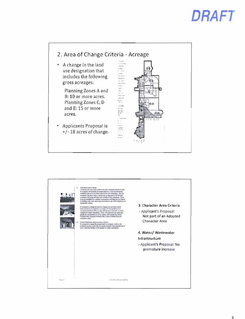
of Scottsdale 2001 General Plan to change the land use designation from Commercial to Suburban Neighborhoods on an 18± acre site for Case No. 4-GP-2013.
2. Adopt Ordinance No. 4115 approving a Zoning District Map Amendment to amend Planned Community (P-C) zoning from a comparable Planned Neighborhood Center, Environmentally Sensitive Lands (PNC ESL) and a comparable Central Business District, Environmentally Sensitive Lands (C-2 ESL) to a comparable Townhouse Residential, Environmentally Sensitive Lands (R-4 ESL) zoning in a Planned Community (P-C) District, including the following: (A) amend the amended R-4 P-C ESL development standards for the proposed development; (B) amend the approved C-2 P-C ESL Development Plan for the El Pedregal development at the southeast corner of North Scottsdale Road and East Carefree Highway; (C) amend the Development Plan for the Boulder's Master Development by approving a new Development Plan; and finding that the Planned Community (P-C) District criteria have been met for an approximate 18± acre site, for Case No. 11-ZN-2013.
DRAFT Scottsdale City Council Regular/General Plan Amendment Meeting Minutes Tuesday, November 19, 2013 Page 6 of 10
3. Adopt Resolution No. 9564 declaring the document entitled "Villas at the Boulders-Development Plan" as a public record.
Location: Northeast corner of East Westland Drive and North Scottsdale Road Presenter(s): Adam Yaron, Planner; Keith Niederer, Senior Planner Staff Contact(s): Randy Grant, Planning, Neighborhood, and Transportation Administrator, 480-312-2664, rgrant(a)scottsdaleaz.qov
^'Planner Adam Yaron gave a PowerPoint presentation (attached) on the proposed Boulders Villas Major General Plan Amendment.
Senior Planner Keith Niederer gave a PowerPoint presentation (attached) on the proposed Boulders Villas Zoning District Map Amendment.
John Berry, applicant representative, gave a brief overview of the applicant's requests.
Mayor Lane opened public testimony.
• Bob Cappel, Scottsdale citizen, spoke in support of the project.
Mayor Lane closed public testimony.
MOTION AND VOTE - ITEM 15
Councilman Robbins made a motion to: (1) Adopt Resolution No. 9557 approving a Major General Plan Amendment; (2) adopt Ordinance No. 4115 approving a Zoning District Map Amendment to amend the Planned Community (P-C) zoning; and (3) adopt Resolution No. 9564 declahng the document entitled "Villas at the Boulders-Development Plan" as a public record. Vice Mayor Korte seconded the motion, which carried 7/0.
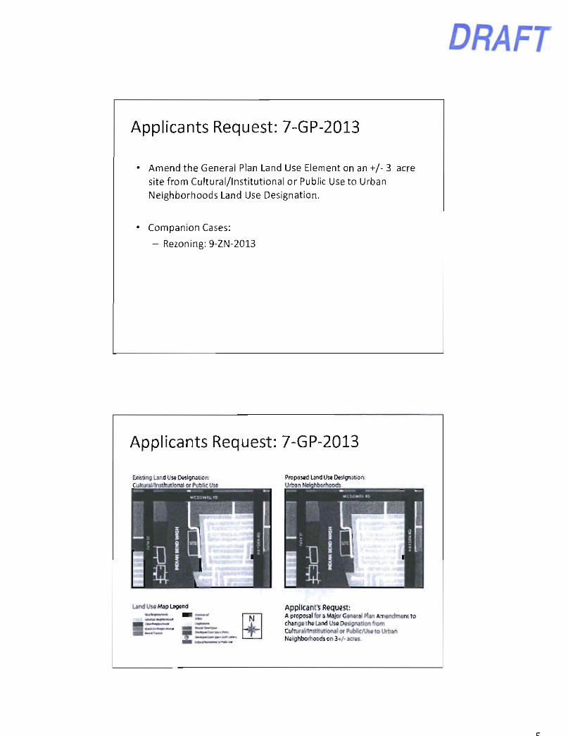
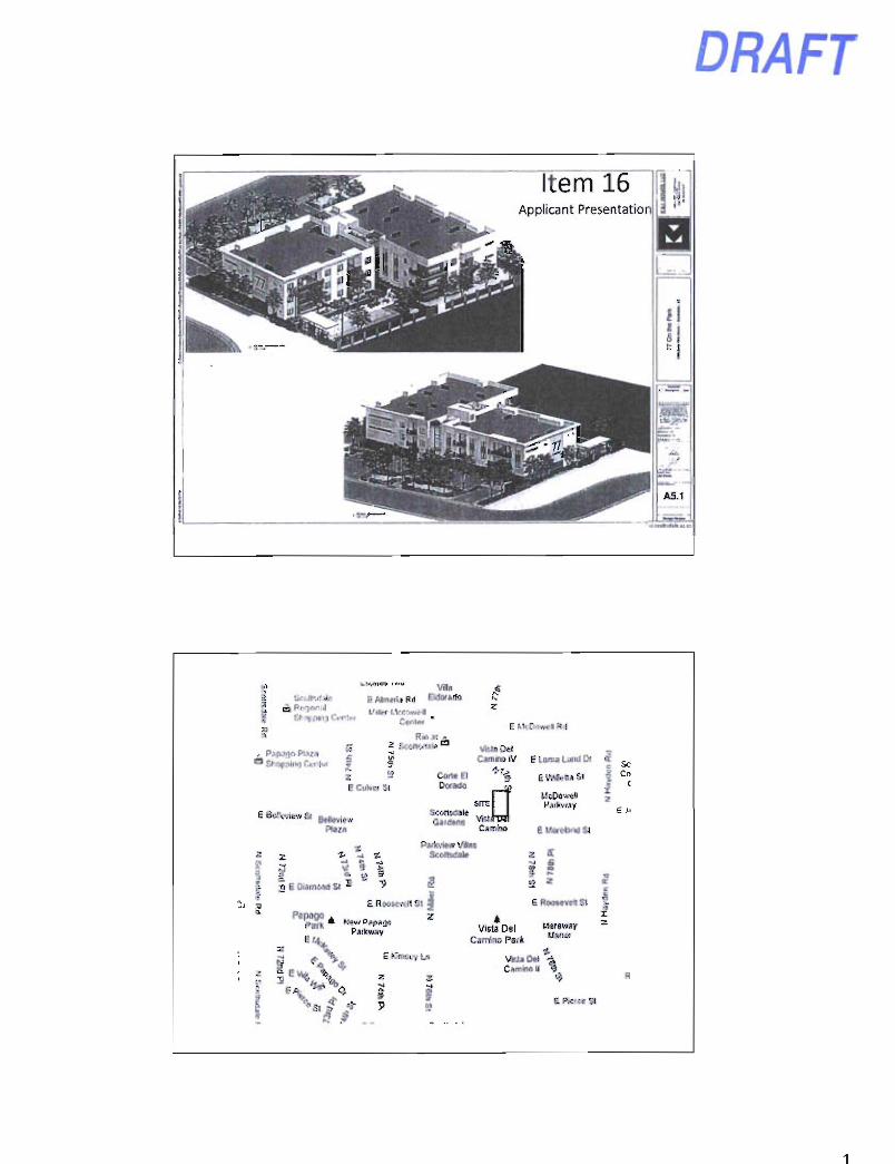
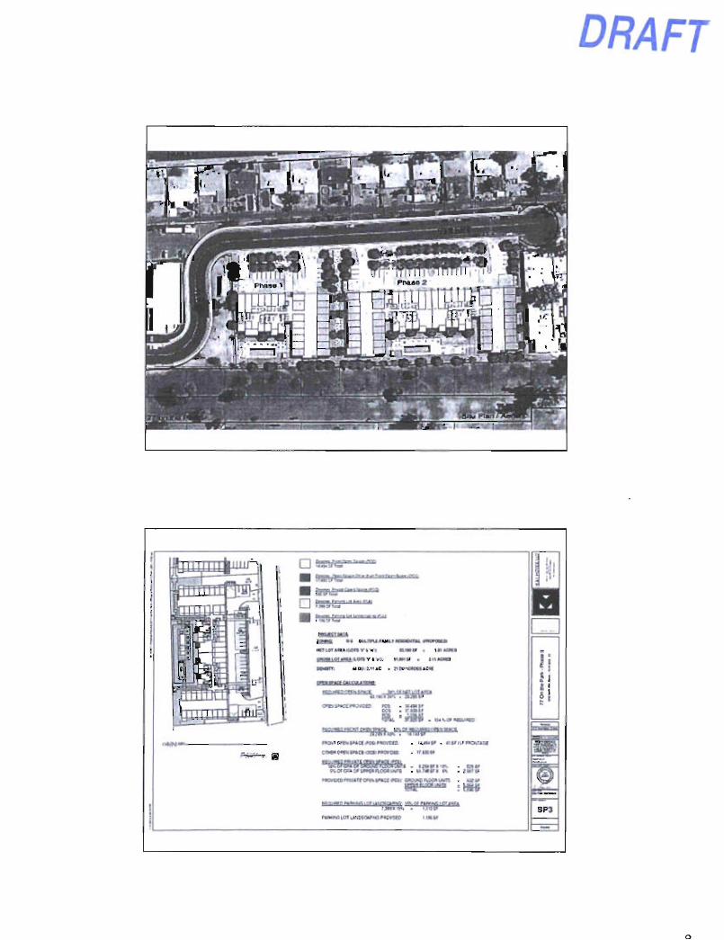
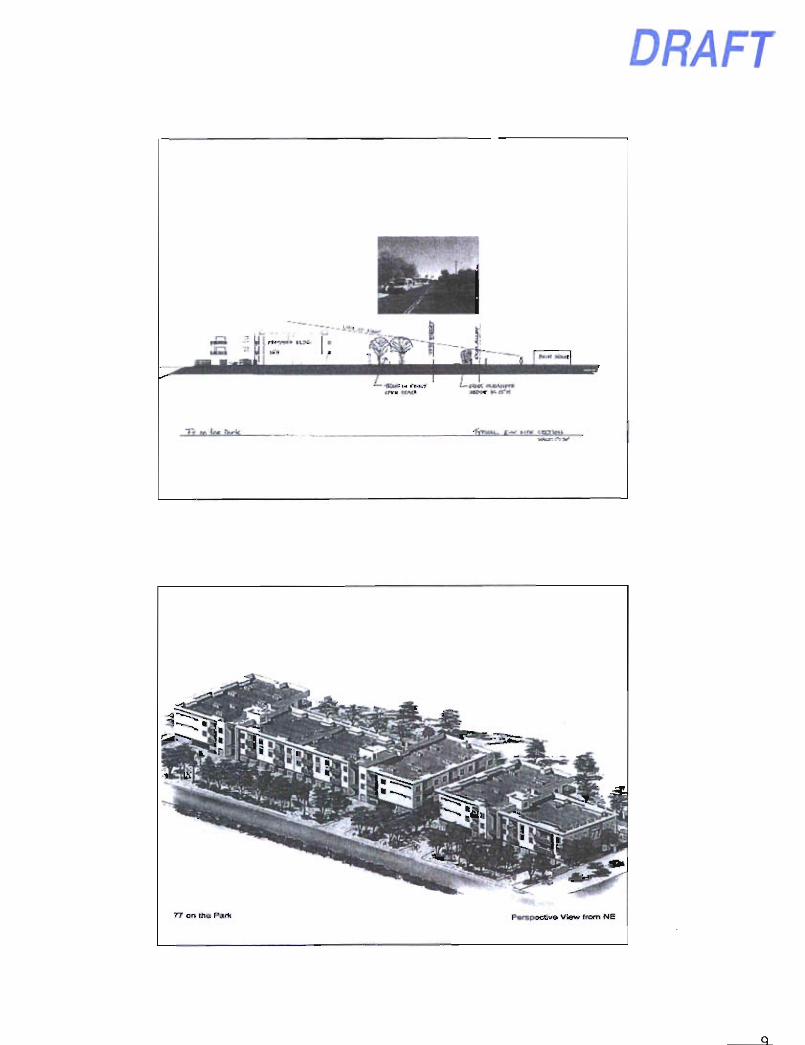
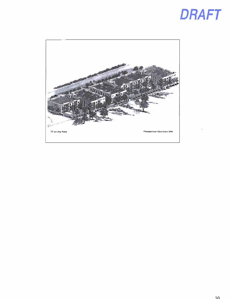
16. 77 on the Park Major General Plan Amendment and Rezoning (7-GP-2013 and 9-ZN-2013) Requests: 1. Adopt Resolution No. 9558 approving a Major General Plan Amendment to the City
of Scottsdale 2001 General Plan to change the land use designation from Cultural/Institutional or Public/Use to Urban Neighborhoods on 3± acres located at 1250, 1300, and 1350 North 77'^ Street for Case No. 7-GP-2013.
2. Adopt Ordinance No. 4116 approving the zoning map amendment to rezone from Service Residential (S-R) to Multiple-Family Residential (R-5) zoning; and finding that the proposed zoning map amendment is consistent and conforms with the adopted General Plan on approximately 1.9± acres located at 1250 and 1300 North 77* Street for Case No. 9-ZN-2013.
Location: 1250 North 77^ Street. 1300 North 77 ^ Street, and 1350 North 77'^ Street Presenter(s): Adam Yaron, Planner; Dan Symer, Senior Planner Staff Contact(s): Randy Grant, Planning, Neighborhood, and Transportation Administrator, 480-312-2664, [email protected]
Planner Adam Yaron gave a PowerPoint presentation (attached) on the Major General Plan Amendment request to change the land use designation from Cultural/Institutional or Public/Use to Urban Neighborhoods.
Senior Planner Dan Symer gave a PowerPoint presentation (attached) on the request for a Zoning Map Amendment to rezone from Service Residential (S-R) to Multiple-Family Residential (R-5) zoning.
DRAFT Scottsdale City Council Regular/General Plan Amendment Meeting Minutes Tuesday, November 19, 2013 Page 7 of 10
Kristjan Sigurdsson, applicant representative, gave a PowerPoint presentation (attached) outlining the applicant's requests.
Tom Frenkel, applicant, addressed the concerns that had been expressed by New Foundation School. Mr. Frenkel said other comments received regarding the rezoning were positive.
Mayor Lane opened public testimony.
• Nancy Cantor, Scottsdale citizen, asked the Council to consider the concerns that had been expressed by New Foundation School.
Mayor Lane closed public testimony.
MOTION AND VOTE - ITEM 16
Vice Mayor Korte made a motion to: (1) Adopt Resolution No. 9558 approving a Major General Plan Amendment to the City of Scottsdale 2001 General Plan; and (2) adopt Ordinance No. 4116 approving the zoning map amendment to rezone from Service Residential (S-R) to Multiple-Family Residential (R-5) zoning and finding that the proposed zoning map amendment is consistent and conforms with the adopted General Plan on approximately 1.9± acres located at 1250 and 1300 North 77' Street for Case No. 9-ZN-2013. Councilman Phillips seconded the motion, which carried 7/0.
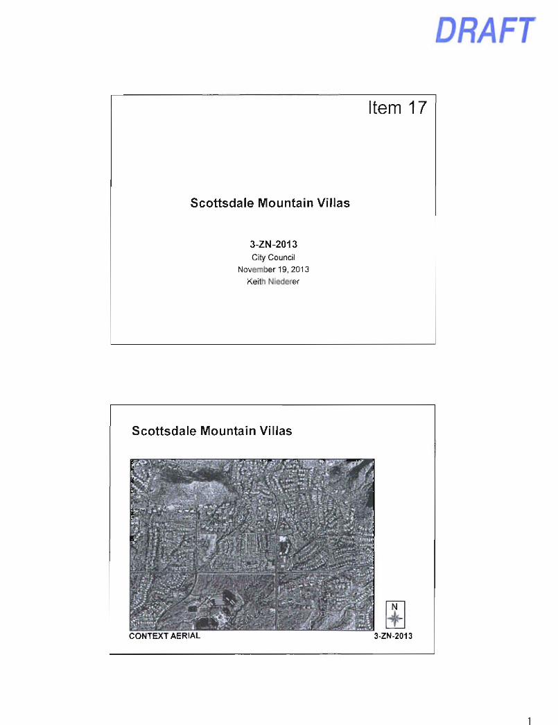
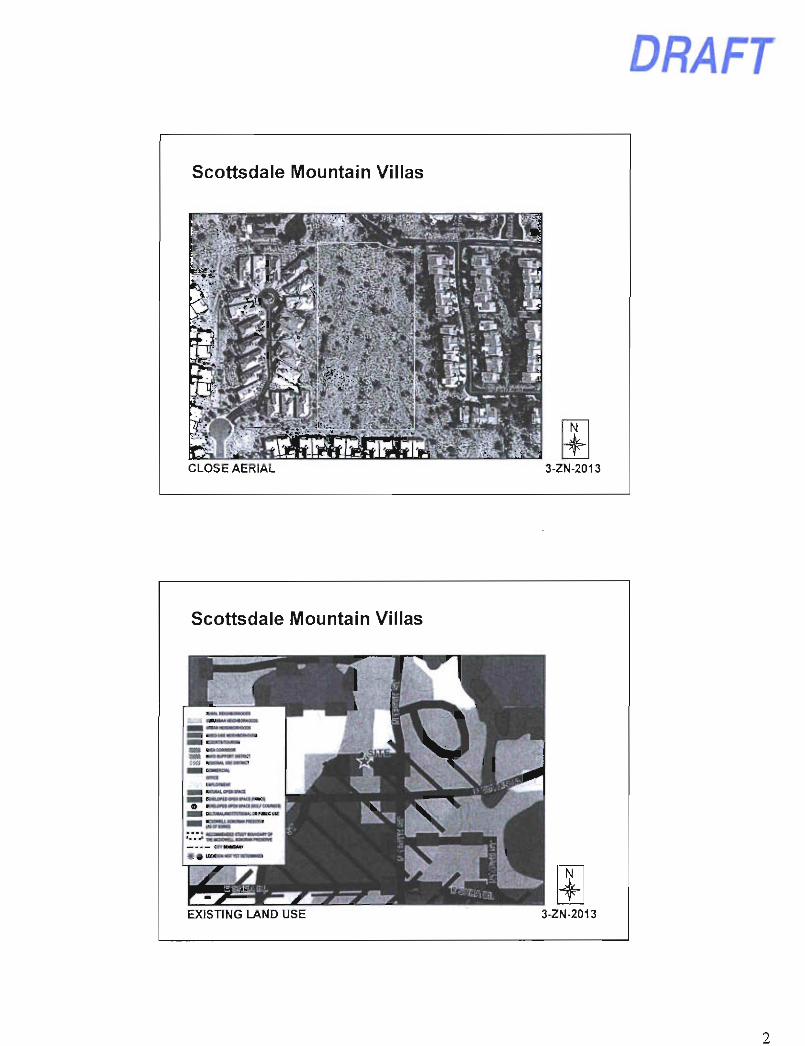
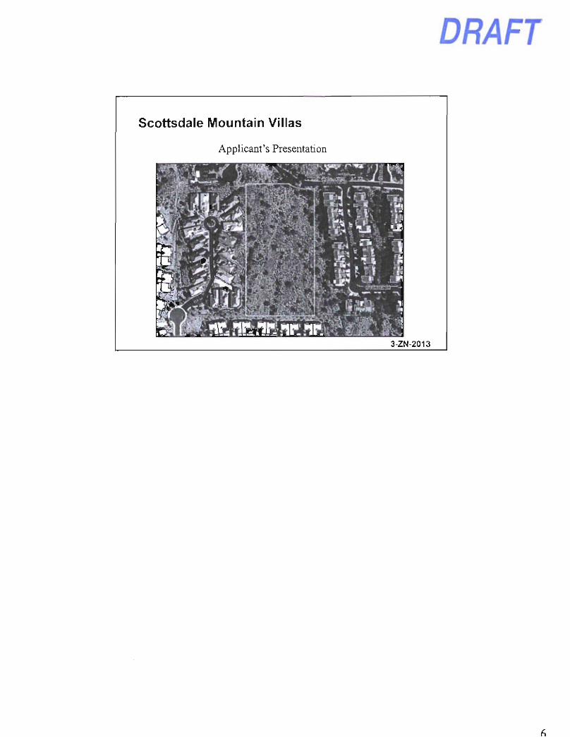
17. Scottsdale Mountain Villas Rezoning (3-ZN-2013) Request: Adopt Ordinance No. 4097 approving a zoning district map amendment from Single-Family Residential, Environmentally Sensitive Lands (R1-43 ESL) to Single-Family Residential, Environmentally Sensitive Lands (R1-5 ESL) zoning; and finding that the proposed zoning district map amendment is consistent and conforms with the adopted General Plan on approximately 5± acres. Location: South side of East Coyote Road, West of North 135' Place Presenter(s): Keith Niederer, Senior Planner Staff Contact(s): Randy Grant, Planning, Neighborhood, and Transportation Administrator, 480-312-2664, [email protected]
Senior Planner Keith Niederer gave a PowerPoint presentation (attached) on the Scottsdale Mountain Villas rezoning request.
Stephen Eart, applicant, gave a presentation outlining the added stipulations, which he said have addressed many of the concerns raised by adjoining property owners.
Mayor Lane opened public testimony.
The following individuals spoke in support of the Scottsdale Mountain Villas rezoning request:
• Scott McCoy, Scottsdale citizen • Martin Lieberman, Scottsdale citizen • Bick Smith, Scottsdale citizen • Bruce Meyer, Scottsdale citizen
Mayor Lane closed public testimony.
DRAFT Scottsdale City Council Regular/General Plan Amendment Meeting Minutes Tuesday, November 19, 2013 Page 8 of 10
MOTION AND VOTE - ITEM 17
Councilwoman Klapp made a motion to: (1) Adopt Ordinance No. 4097 approving a zoning district map amendment from Single-Family Residential, Environmentally Sensitive Lands (R1-43 ESL) to Single-Family Residential, Environmentally Sensitive Lands (R1-5 ESL) zoning, and finding that the proposed zoning district map amendment is consistent and conforms with the adopted General Plan on approximately 5± acres South side of East Coyote Road, West of North 135* Place; and (2) amend Exhibit 1 to Ordinance No. 4097, to add "except for Lot 1, which shall not exceed 20.5 feet above the finished floor" to the end of Stipulation 5. Councilman Littlefield seconded the motion, which carried 7/0.
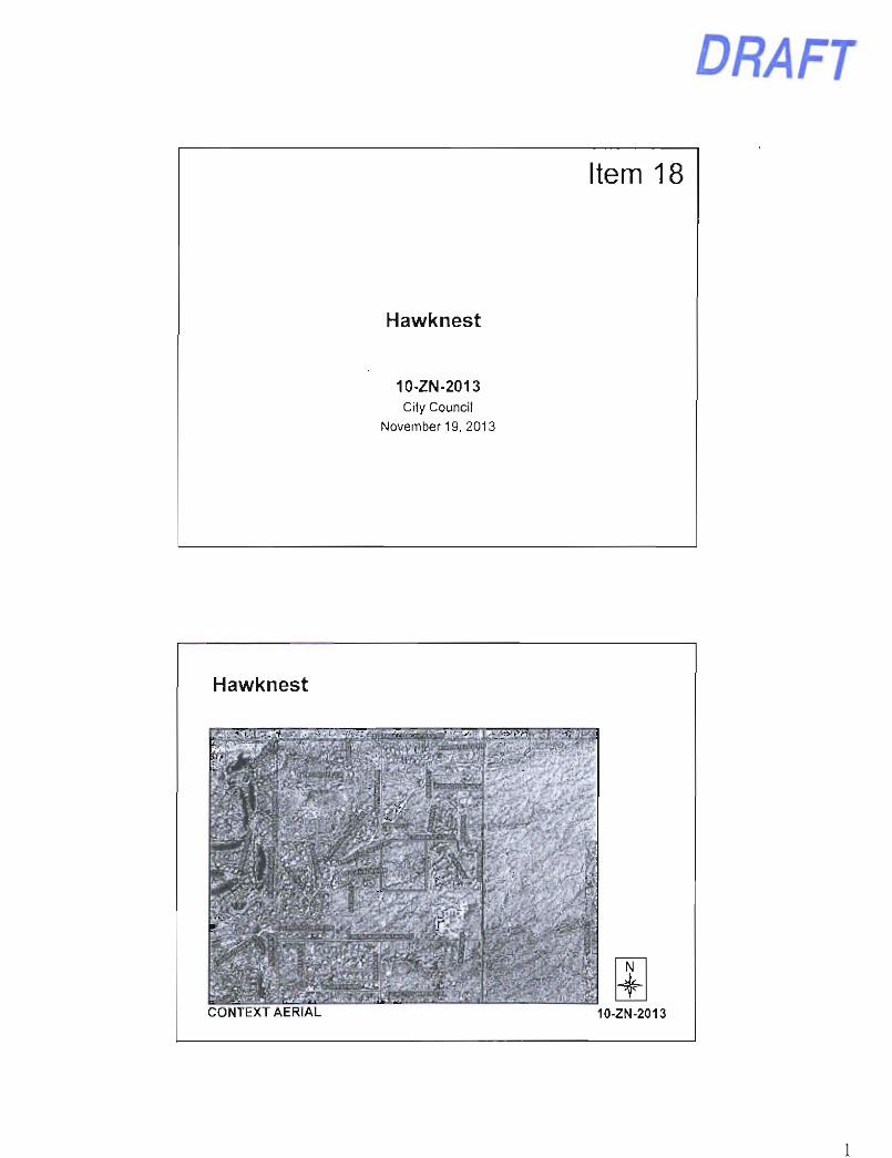
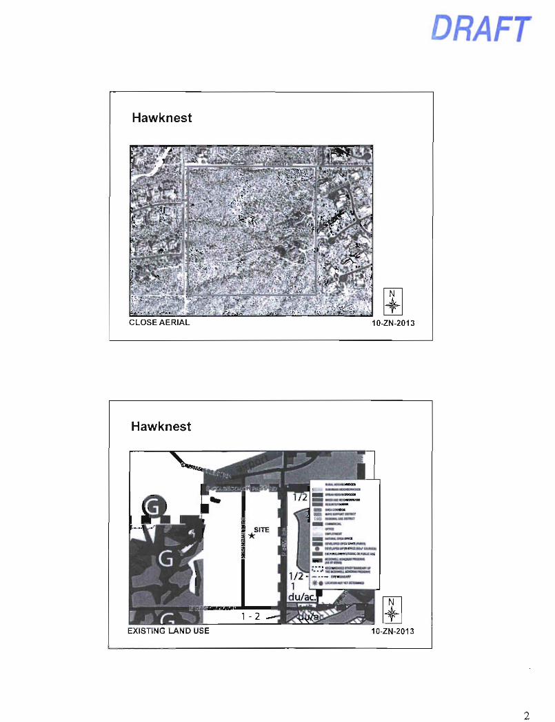
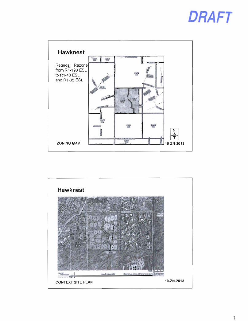
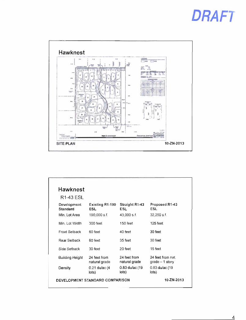
18. Hawknest Rezoning (10-ZN-2013) Request: Adopt Ordinance No. 4114 approving a zoning map amendment from Single-Family Residential Environmentally Sensitive Lands (R1-190 ESL) to Single-Family Residential Environmentally Sensitive Lands (R1-43 ESL) on 22.90± acres and to Single-Family Residential Environmentally Sensitive Lands (R1-35 ESL) on 13.46± acres; and finding that the proposed zoning map amendment is consistent and conforms with the adopted General Plan. Location: Southeast corner of North 84 ^ Street and East Hawknest Road (8595 E. Hawknest Road and 35025 N. 84'^ Street) Presenter(s): Keith Niederer, Senior Planner Staff Contact(s): Randy Grant, Planning, Neighborhood, and Transportation Administrator, 480-312-2664, rqrant(a)scottsdaleaz.qov
Senior Planner Keith Neiderer gave a PowerPoint presentation (attached) regarding the Hawknest rezoning request.
John Berry, applicant representative, gave a presentation on the applicant's rezoning request.
Mayor Lane opened public testimony.
• Bob Cappel, Scottsdale citizen, spoke in support of the Hawknest rezoning request.
Mayor Lane closed public testimony.
MOTION AND VOTE - ITEM 18
Councilman Robbins made a motion to adopt Ordinance No. 4114 approving a zoning map amendment from Single-Family Residential Environmentally Sensitive Lands (R1-190 ESL) to Single-Family Residential Environmentally Sensitive Lands (R1-43 ESL) on 22.90± acres and to Single-Family Residential Environmentally Sensitive Lands (R1-35 ESL) on 13.46± acres and finding that the proposed zoning map amendment is consistent and conforms with the adopted General Plan. Councilwoman Klapp seconded the motion, which carried 7/0.
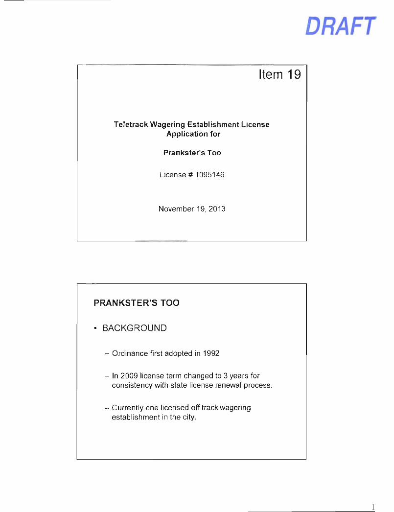
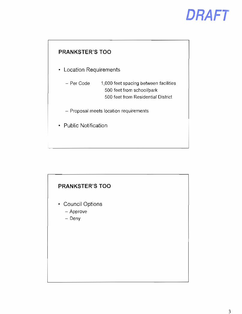
19. Prankster's Too Teletrack Wagering Establishment License (Application No. 1095146) Request: Consider approval of an application for a new teletracking (off track betting) license for Prankster's Too. Location: 7919 E. Thomas Road, Suite 101 Presenter(s): Terry Hoglund, Business Services Manager Staff Contact(s): Dennis Enriquez, Business Services Director, 480-312-5925, [email protected]
DRAFT Scottsdale City Council Regular/General Plan Amendment Meeting Minutes Tuesday, November 19, 2013 Page 9 of 10
Business Services Manager Terry Hoglund gave a PowerPoint presentation (attached) on the Prankster's Too request for a teletrack wagering license.
MOTION AND VOTE - ITEM 19
Councilman Littlefield made a motion to approve the application for a new teletrack wagering license for Prankster's Too. Councilman Phillips seconded the motion, which carried 7/0.
PUBLIC COMMENT - None
CITIZEN PETITIONS
20. Receipt of Citizen Petitions Request: Accept and acknowledge receipt of citizen petitions. Any member of the Council may make a motion, to be voted on by the Council, to: (1) Direct the City Manager to agendize the petition for further discussion; (2) direct the City Manager to investigate the matter and prepare a written response to the Council, with a copy to the petitioner; or (3) take no action.
Staff Contact(s): Carolyn Jagger, City Clerk, 480-312-2411, ciaqqer(a)scottsdaleaz.qov
No citizen petitions were received.
MAYOR AND COUNCIL ITEMS - None
ADJOURNMENT With no further business to discuss, the Regular/General Plan Amendment Meeting adjourned at 7:11 P.M.
SUBMITTED BY:
Carolyn Jagger City Clerk "
Officially approved by the City Council on
DRAFT Scottsdale City Council Regular/General Plan Amendment Meeting Minutes Tuesday, November 19. 2013 Page 10 of 10
C E R T I F I C A T E
I hereby certify that the foregoing Minutes are a true and correct copy of the Minutes of the Regular/General Plan Amendment Meeting of the City Council of Scottsdale, Arizona held on the 19 ^ day of November 2013.
I further certify that the meeting was duly called and held, and that a quorum was present.
DATED this 14' day of January 2014.
Carolyn Jagger, City Clerk
DRAFT
City Manager's Report Bill Murphy Presentation
2013 Scottsdale Employee
Charitable Choices Campaign Results
Charitable CHOICES
$98,765 contributed by 539 employees
vs. last year: +184 donors + $35,000
ScottsdaJe &r??'rt fees
Charitable CHOICES
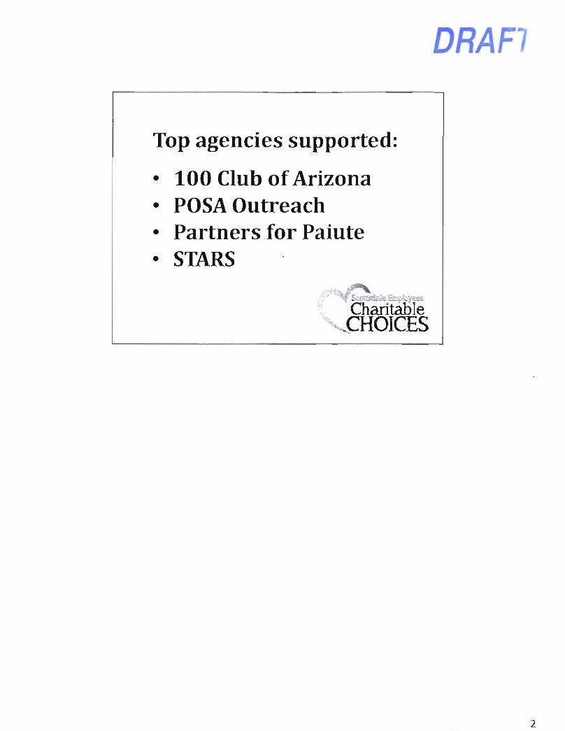
Top agencies supported:
• 100 Club of Arizona • POSA Outreach • Partners for Paiute • STARS
DRAFl
Charitable CHOICES
DRAFT
Item 14
Pure Bliss Premium Medibles
10-UP-2013 City Council
November 19, 2013 Planner: Greg Bloemberg
Pure Bliss Premium Medibles
N
4-CONTEXT AERIAL 10-UP-2013
DRAFT
Pure Bliss Premium Medibles
CLOSE AERIAL
N
10-UP-2013
Pure Bliss Premium Medibles
• «. • ^ - r ^ J
PnOJECT DATA
OCOJPiWCTLOO
'. K J iWi , . ' /»• • v i » » . - B
FLOOR PLAN 10-UP-2013
DRAFT
Pure B l iss Premium Medibles
Location previously approved twice for Medical Marijuana use (26-UP-11 &4-UP-12)
Planning Commission recommended approval by a unanimous vote of 6-0
OVERVIEW 10-UP-2013
Pure Bl iss Premium Medibles
10-UP-2013 City Council
November 19, 2013 Planner: Greg Bloemberg
DRAFT
Item 15 Adam Yaron Presentation
4-GP-2013 Boulder Villas
City Council November 19, 2013
Adam Yaron - Planner
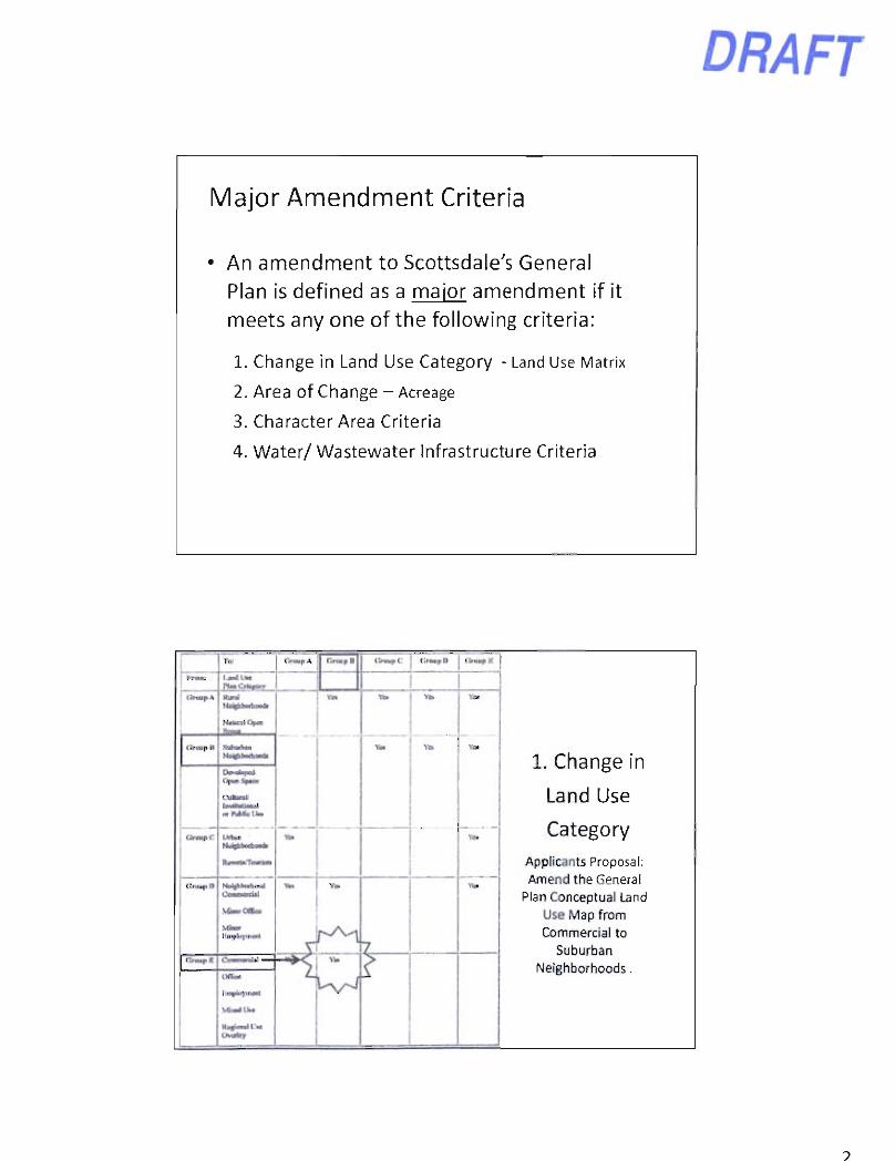
Major General Plan Amendments
• Only heard one time per calendar year, and in the same calendar year as filed
• Require an additional "remote" hearing by the Planning Commission, which occurred on September 11.
• Require a minimum 2/3 majority vote of City Council for approval (5 out of 7 votes)
• All other General Plan/Character Plan analysis remains the same for both major and non-major amendments
DRAFT
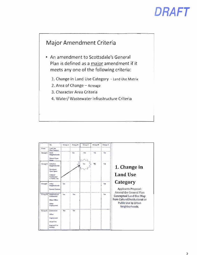
Major Amendment Criteria
• An amendment to Scottsdale's General Plan is defined as a maior amendment if it meets any one of the following criteria:
1. Change in Land Use Category - Land Use Matrix
2. Area of Change - Acreage
3. Character Area Criteria
4. Water/ Wastewater Infrastructure Criteria
C r a u p A r.nwp n <>«.pC j CrMpD v.
1. Change in
Land Use
Category Applicants Proposal: Amend the General
Plan Conceptual Land Use Map from Commercial to
Suburban Neighborhoods.
t
1. Change in
Land Use
Category Applicants Proposal: Amend the General
Plan Conceptual Land Use Map from Commercial to
Suburban Neighborhoods.
Rural
NaUusI Open
Vo» Yea
Yoi
Y«t
Y d
\et
YC.
1. Change in
Land Use
Category Applicants Proposal: Amend the General
Plan Conceptual Land Use Map from Commercial to
Suburban Neighborhoods.
C f o a p II
Vo» Yea
Yoi
Y«t
Y d
\et
YC.
1. Change in
Land Use
Category Applicants Proposal: Amend the General
Plan Conceptual Land Use Map from Commercial to
Suburban Neighborhoods.
Dovslupcd
(M lk i r a l InvMiH.onnl
Vo» Yea
Yoi
Y«t
Y d
\et
YC.
1. Change in
Land Use
Category Applicants Proposal: Amend the General
Plan Conceptual Land Use Map from Commercial to
Suburban Neighborhoods. !><••
Y M Ye.
1. Change in
Land Use
Category Applicants Proposal: Amend the General
Plan Conceptual Land Use Map from Commercial to
Suburban Neighborhoods.
R « « U T o u n u i i
Y M Ye.
1. Change in
Land Use
Category Applicants Proposal: Amend the General
Plan Conceptual Land Use Map from Commercial to
Suburban Neighborhoods.
V C o o r O O c e
• •iTi|»l«i)-inail
Ym
1. Change in
Land Use
Category Applicants Proposal: Amend the General
Plan Conceptual Land Use Map from Commercial to
Suburban Neighborhoods.
( I r m i p K Cun i i i t v ibu l
z'
1. Change in
Land Use
Category Applicants Proposal: Amend the General
Plan Conceptual Land Use Map from Commercial to
Suburban Neighborhoods.
l i U p t i H i i i o i t
z'
1. Change in
Land Use
Category Applicants Proposal: Amend the General
Plan Conceptual Land Use Map from Commercial to
Suburban Neighborhoods.
DRAFT
2. Area of Change Criteria - Acreage
A change in the land use designation that includes the following gross acreages:
Planning Zones A and B: 10 or more acres. Planning Zones C, D and E: 15 or more acres.
Applicants Proposal is
+ / - 18 acres of change.
I I ! > I
roMltiM, : v or.-.- ., a„ iu- l . ••o. , . , . .n , i . " ,7 ; l an fM l f i * • h n t k m • n m t t- j i H upotuci ic <ht t b t r j u . • i««ai>«»dltea«aidhi«lnnrt<l«l l lT«f l t turai i i iu lT n.tH • n . n i M I M t ; a rate a< p n M M n b d l « ^ W M M M I . h m f $ •«»•.•»« » a l a t m t « rfar.-Jwa ra<
• l l l l I l><aia n a i k n M a a r a l a n t n f a M r i i c a » i « i n * « i » a r S a c x a t a Z M a K M l k f P i n r m l k Tiaa D)ii«aM raailiilk Ptaw CaiTa CnMMr T i n « <
If 1 parari M ciaa(i IM flaaM< ksl aw aaafoy. nalb k Ikr p.aaMhvt UK rtM la IM Un af • Brnlir Haaaad wiMr (nawKUn f iaiactc*i«M fccln. II^aJJ, « • ate I mtimm
3. Character Area Criteria -Applicant's Proposal:
Not part of an Adopted Character Area
4. Water/ Wastewater Infrastructure
-Applicant's Proposal: No premature increase
I. • M . »*i ^ a . « f»a
Boulder Villas: 4-GP-2013
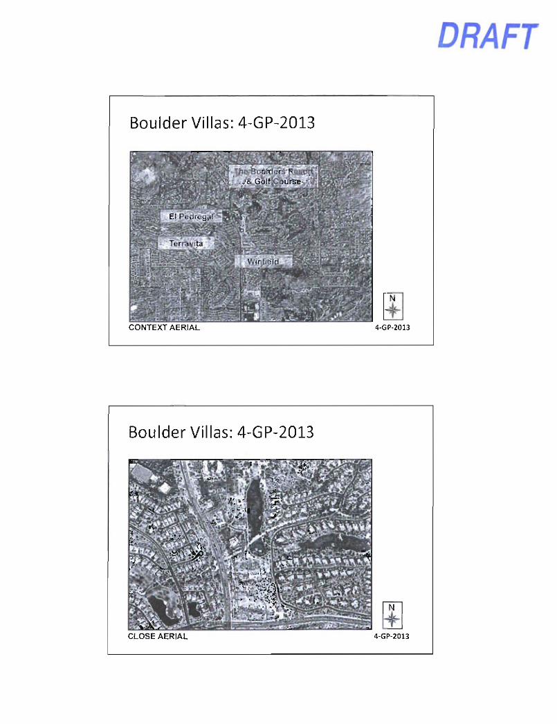
DRAFT
CONTEXT AERIAL 4-GP-2013
Boulder Villas: 4-GP-2013
CLOSE AERIAL 4-GP-2013
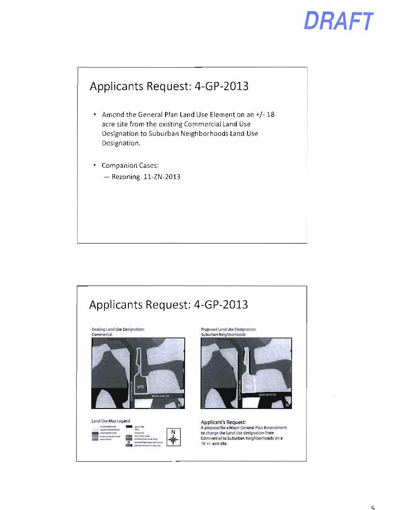
Applicants Request: 4-GP-2013
Amend the General Plan Land Use Element on an +/-18 acre site from the existing Commercial Land Use Designation to Suburban Neighborhoods Land Use Designation.
Companion Cases:
- Rezoning: ll-ZN-2013
DRAFT
Applicants Request: 4-GP-2013
Commercul
W ^ W ^
Land Use Map Legend fc»awi|.aa"i»<i
Proposed Land Use Designation: Suburban Neighborhoods
Applicant's Request: A proposal for a Major General Plan Amendment to change the Land Use designation from Commercial to Suburban Neighborhoods on a 18+A acre site.
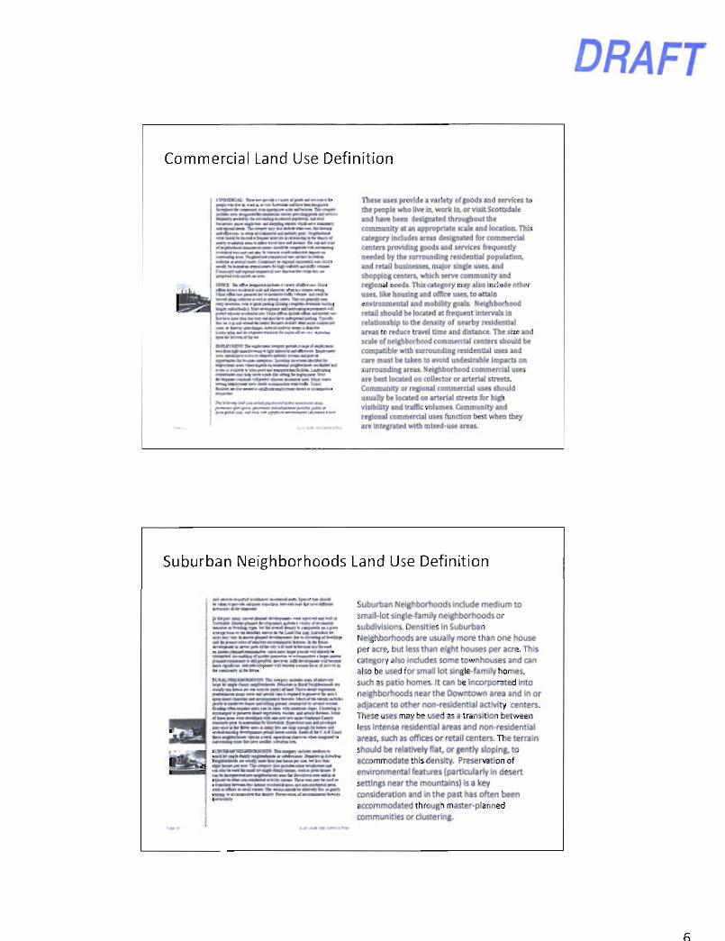
Commercial Land Use Definition
DRAFT
o m a IW*..iWa|Dn™«><>.«..iia.».rfi«nu«. fl^ai • MiMlirf a * a i Aa««« i f a i a • aa«Hi a«a«
U n < i k i | i > a m > > a l a a « a > l > n > « » n a t ( a n l i a a iMvjan^un »ia w-yi* | f toa t f e « a . I'nwa I li'wa 1 w.>*p<
q p a » > m M a f « a a i
EtVlV^Ktar n> a ia lnax o a i m pan* I la«i . (
These uses provide a variety of goods and services to the people who live in, work In. or visit Scottsdale and have been designated throughout the community at an appropriate scale and locatioa This category includes areas designated for commercial centers providing goods and services frequently needed by the surrounding residential population, and retail businesses, major single uses, and shopping centers, which serve community and regional needs. This category may also Include ofhpr uses, like housing and office uses, to attain environmental and mobility goals Neighborhood retail should be located at frequent Intervals in relationship to the density of nearby residential areas to reduce travel time and distance. The size and scale of neighborhood commercial centers should be compatible with surrounding residential uses and care must be taken to avoid undesirable impacts on surrounding areas. Neighborhood commercial uses are best located on collector or arterial streets. Community or regional commercial uses should usually be located on arterial streets for high visibility and traffic volumes. Community and regional commercial uses function best when they are integrated with mixed-use areas.
Suburban Neighborhoods Land Use Definition
• I f * iwy my • • ! > • • pimM »f*ttrmmti — » » l i m * l W »» lg i f
; M < r « a a a i . i a * a " a a a l ^ r a i M >
i « i a — i i a i — I I I I I a M s M
Suburban Neighborhoods include medium to small-lot single-family neighborhoods or subdivisions. Densities in Suburban Neighborhoods are usually more than one house per acre, but less than eight houses per acre. This category also includes some townhouses and can also be used for small lot single-family homes, such as patio homes. It can be incorporated Into neighborhoods near the Downtown area and in or adjacent to other non-residential activity centers. These uses may be used as a transition between less intense residential areas and non-residential areas, such as offices or retail centers. The terrain should be relatively flat, or gently sloping, to accommodate this density. Preservation of environmental features (particularly in desert settings near the mountains) is a key consideration and in the past has often been accommodated through master-planned communities or clustering.
DRAFT
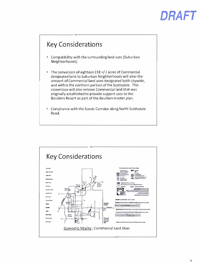
Key Considerations
Compatibility with the surrounding land uses (Suburban Neighborhoods).
The conversion of eighteen (18 +/-) acres of Commercial designated land to Suburban Neighborhoods will alter the amount of Commercial land uses designated both citywide, and within the northern portion of the Scottsdale. This conversion will also remove Commercial land that was originally established to provide support uses to the Boulders Resort as part of the Boulders master plan.
Compliance with the Scenic Corridor along North Scottsdale Road.
Key Considerations
Conceptual Land U&* Mip
UN0U4! U I M i m
klaikaat r r f f i CanwUal la lataitaa WuMmliaa* l»<f-1
l ^ n — O M t t l i C I I > » M « t i a » a « > t m |
j MaanaM
Hmti A M C a M w M MS*A K m OlmrfCnyaiMa Eniawti<
I 'tlimm Cliarf a> IWnli aiaa CaaaancUb an
Economic Vitality; Commercial Land Uses
Key Considerations JOY RANCH RO
.- - - - rK- l V.a~< C a a t o
O m a t a a n a " ! V " a < I> . | .v
I r m a C r r i M a
l i ' l t ' t a i r » M > l ' # r t a » .
• - ' i ' 4 m i M a a i
• M k a a l l a - a - j a h i u
• c a i M ^ t f a i
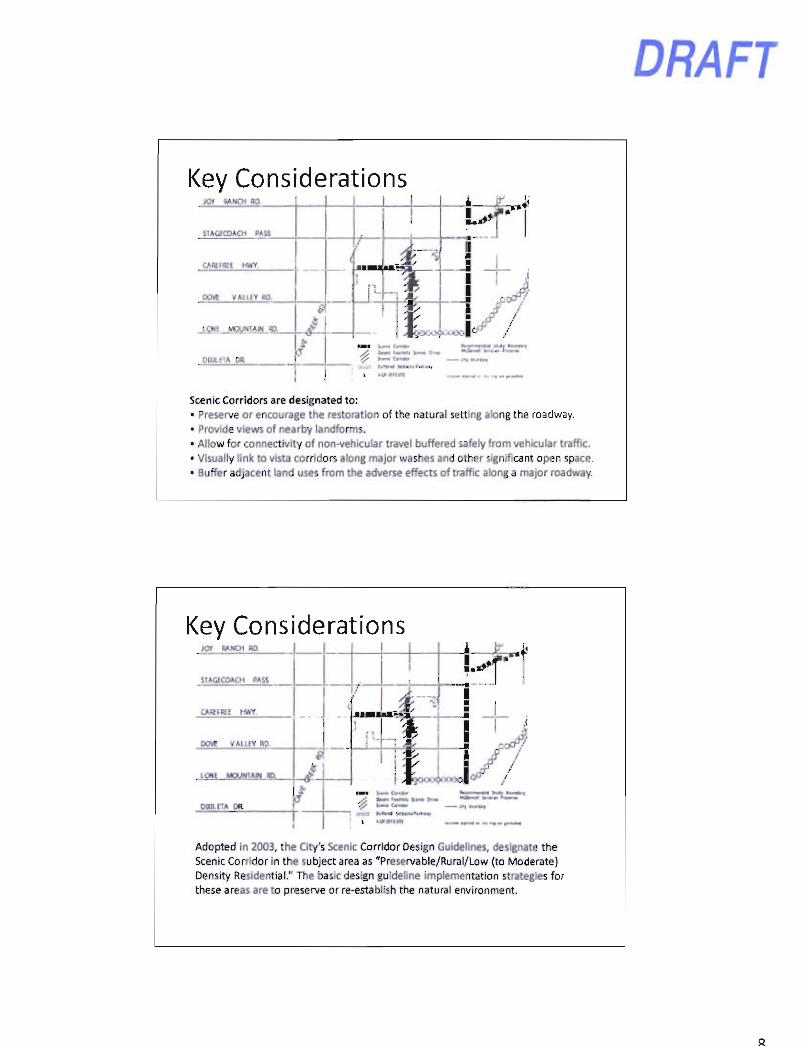
Scenic Corridors are designated to: • Preserve or encourage the restoration of the natural setting along the roadway. • Provide views of nearby landforms. • Allow for connectivity of non-vehicular travel buffered safely from vehicular traffic. • Visually link to vista corridors along major washes and other significant open space. • Buffer adjacent land uses from the adverse effects of traffic along a major roadway.
Key Considerations JOT RA.NCH HO
Adopted in 2003, the City's Scenic Corridor Design Guidelines, designate the Scenic Corridor in the subject area as "Preservable/Rural/Low (to Moderate) Density Residential." The basic design guideline implementation strategies for these areas are to preserve or re-establish the natural environment.
DRAFT
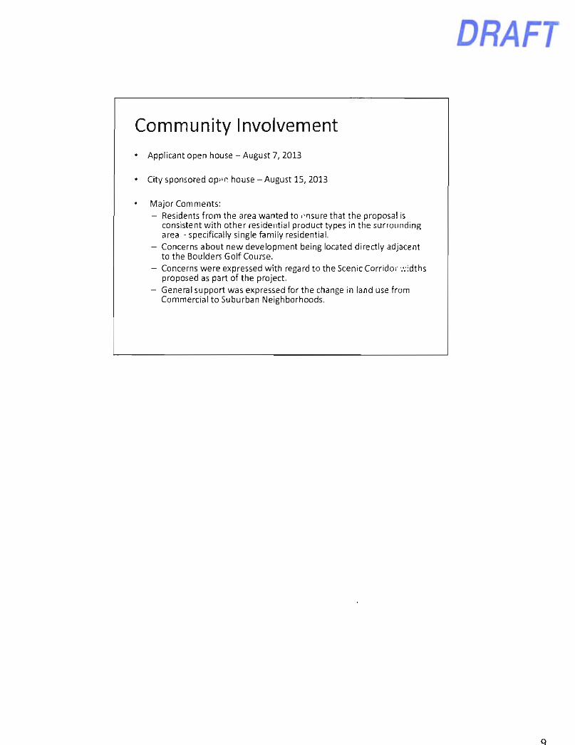
Community Involvement Applicant open house - August 7, 2013
City sponsored open house - August 15, 2013
Major Comments: - Residents from the area wanted to ensure that the proposal is
consistent with other residential product types in the surrounding area - specifically single family residential.
- Concerns about new development being located directly adjacent to the Boulders Golf Course.
- Concerns were expressed with regard to the Scenic Corridor widths proposed as part of the project.
- General support was expressed for the change in land use from Commercial to Suburban Neighborhoods.
DRAFT
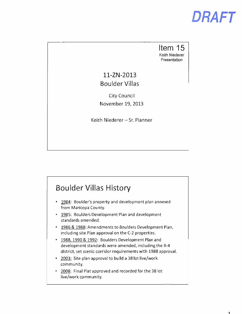
Item 15 Keith Niederer Presentation
ll-ZN-2013 Boulder Villas
City Council
November 19, 2013
Keith Niederer-Sr Planner
Boulder Villas History
1984: Boulder's property and development plan annexed from Maricopa County.
1985: Boulders Development Plan and development standards amended.
1986 & 1988: Amendments to Boulders Development Plan, including site Plan approval on the C-2 properties.
1988.1990 & 1992: Boulders Development Plan and development standards were amended, including the R-4 district, set scenic corridor requirements with 1988 approval
2003: Site plan approval to build a 38 lot live/work community.
2008: Final Plat approved and recorded for the 38 lot live/work community.
DRAFT
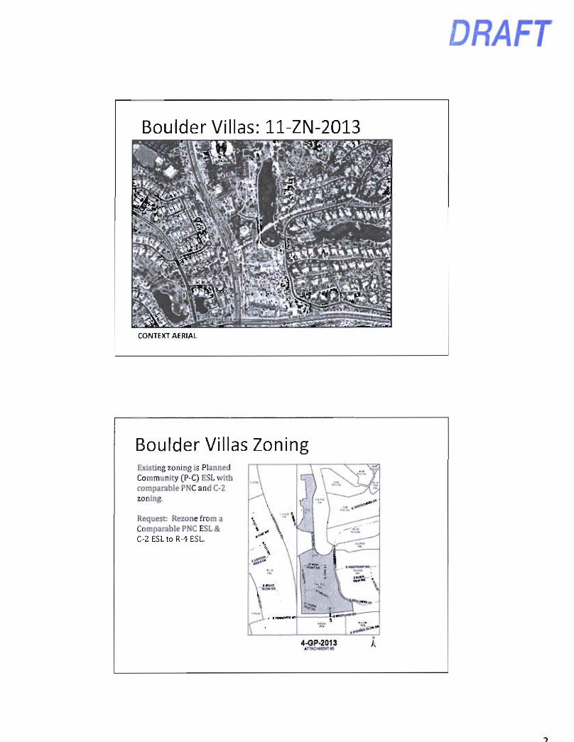
Boulder Villas: ll-ZN-2013
CONTEXT AERIAL
Boulder Villas Zoning Existmg zonmg is Planned Community (P-C) ESL with comparable PNC and C-2 zoning.
Request: Rezone from a Comparable PNC ESL& r -7 tn R-4 FSI > \
1
\ \
f \ \
f m \
s
4-OP-2013 An*CMueKT»»
A
DRAFT
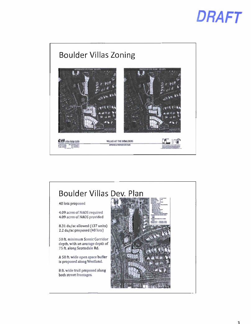
Boulder Villas Zoning
>ta> M j i A;fe VILUS AT niE BOUU)EIS
.~.-ST^:~~it.:..
Boulder Villas Dev. Plan 40 lots proposed ^
4.09 acres of NAOS required 4.09 acres of NAOS provided
8.31 du/ac allowed (137 units) 2.2 du/ac proposed (40 lots)
50 f t minimum Scenic Corridor depth, with an average depth of 75 f t along Scottsdale Rd.
A 50 f t wide open space buffer is proposed along Westland.
8 f t wide trail proposed along both street frontages.
DRAFl
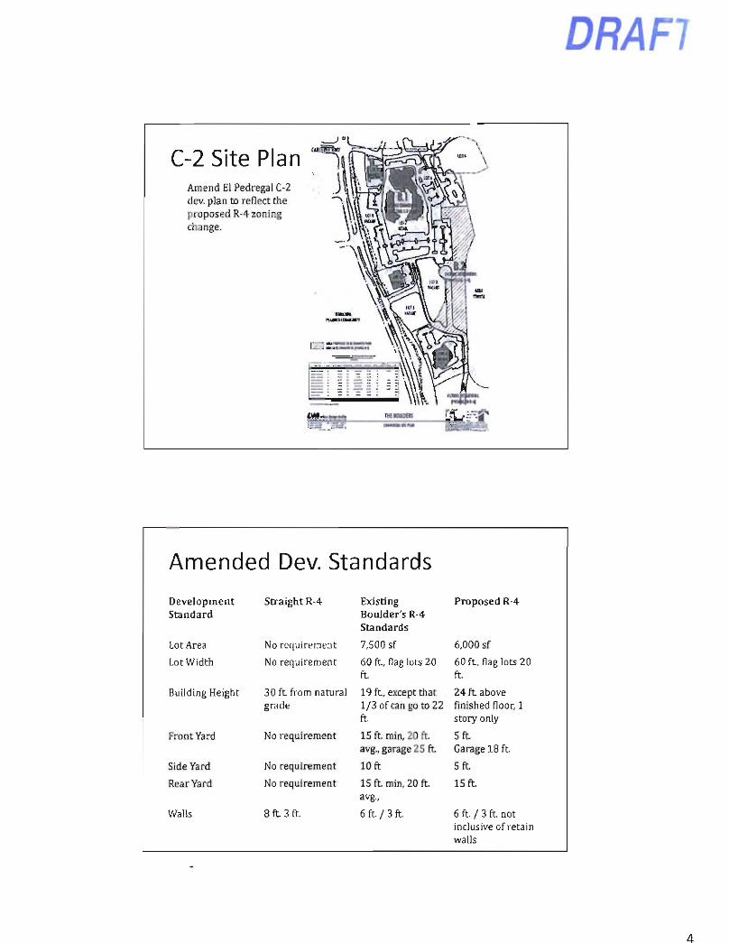
C-2 Site Plan ^ . n Amend El Pedregal C-2 dev. plan to reflect the proposed R-4 zoning change.
Amended Dev. Standards Development Straight R-4 Existing Proposed R-4 Standard Boulder's R-4
Standards
Lot Area No requirement 7.500 sf 6,000 sf
Lot Width No requirement 60 f t , flag lots 20 f t
60 f t . flag lots 20 f t
Building Height 30 ft. from natural 19 f t , except that 24 f t above grade 1/3 of can go to 22
ft. finished floor, 1 story only
Front Yard No requirement 15 ft. min, 20 f t avg., garage 25 f t
5 f t Garage 18 f t
Side Yard No requirement 10 ft 5 f t
Rear Yard No requirement 15 ft. min, 20 f t avg..
15 f t
Walls 8 ft. 3 ft. 6 f L / 3 f L 6 f t / 3 f t not inclusive of retain walls
DRAFT
Boulder Villas
Applicant's Presentation
SUPPLEMENTAL SLIDES
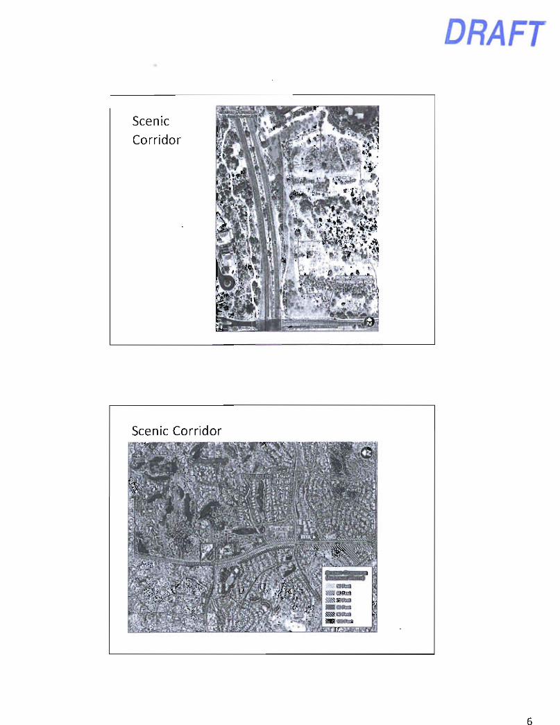
Scenic Corridor
DRAFT
Scenic Corridor
DRAFT
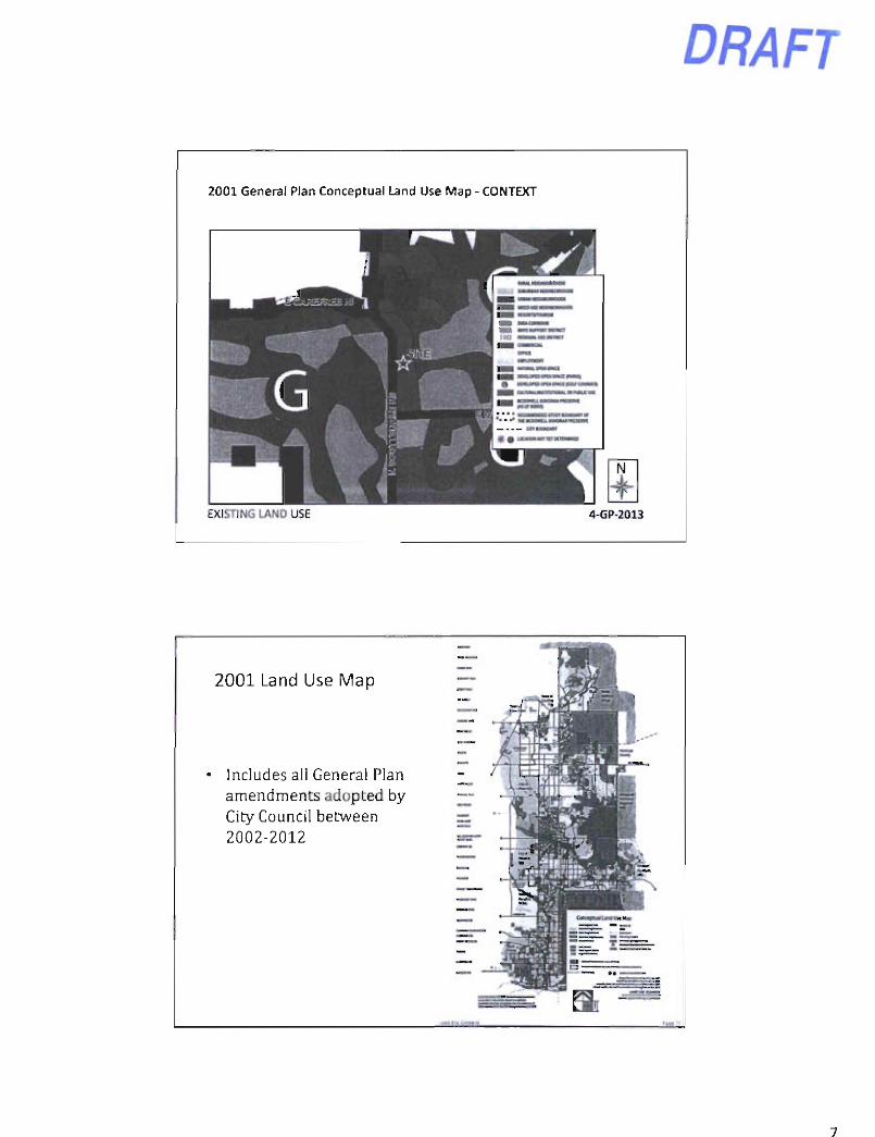
2001 General Plan Conceptual Land Use Map - CONTEXT
EXISTING LAND USE 4-GP-2013
2001 Land Use Map
Includes all General Plan amendments adopted by City Council between 2002-2012
DRAFT
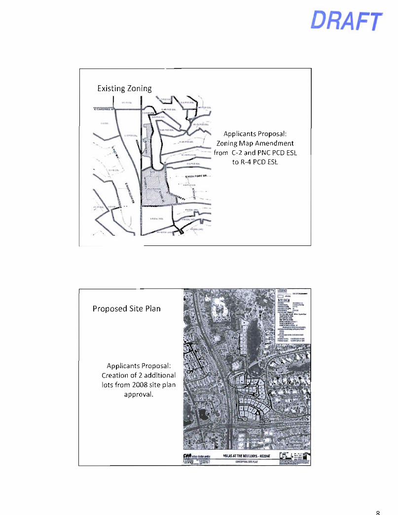
Existing Zoning
Applicants Proposal: Zoning Map Amendment
from C-2 and PNC PCD ESL to R-4 PCD ESL
Proposed Site Plan
Applicants Proposal: Creation of 2 additional lots from 2008 site plan
approval.
caNcamnLMiui
8
DRAFT
l:Gfh3
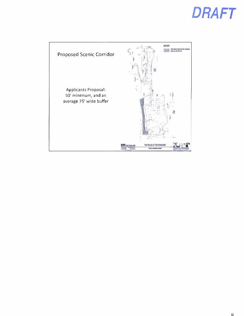
Proposed Scenic Corridor
Applicants Proposal: 50' minimum, and an
average 75' wide buffer
DRAFT
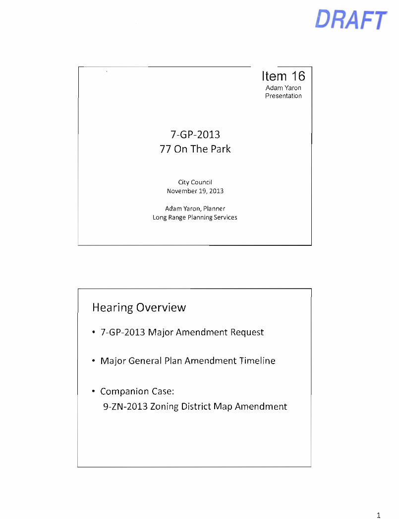
Item 16 Adam Yaron Presentation
7-GP-2013 77 On The Park
City Council November 19, 2013
Adam Yaron, Planner Long Range Planning Services
Hearing Overview
• 7-GP-2013 Major Amendment Request
• Major General Plan Amendment Timeline
• Companion Case:
9-ZN-2013 Zoning District Map Amendment
1
DRAFT
Major Amendment Criteria
• An amendment to Scottsdale's General Plan is defined as a major amendment if it meets any one of the following criteria:
1. Change in Land Use Category - Land Use Matrix
2. Area of Change - Acreage
3. Character Area Criteria
4. Water/ Wastewater Infrastructure Criteria
1 ¥nm:
TW C n w p A r . rn t ip n ( > i i u p < :
1. Change in
Land Use
Category Applicants Proposal:
Amend the General Plan Conceptual Land Use Map
from Cultural/Institutional or Public Use to Urban
Neighborhoods.
1 ¥nm:
1. Change in
Land Use
Category Applicants Proposal:
Amend the General Plan Conceptual Land Use Map
from Cultural/Institutional or Public Use to Urban
Neighborhoods.
( , t „ u | . V K u n I
N i k n l O p o i
i H W t ,
Y«t Y M Yai Y M
1. Change in
Land Use
Category Applicants Proposal:
Amend the General Plan Conceptual Land Use Map
from Cultural/Institutional or Public Use to Urban
Neighborhoods.
<;ru<|> I I .• J^J.l.....
( I p a i . S p M .
(.•U»ural'
l a t H W u x u l
<» P a k K e t U
Y » ^ Y M
1. Change in
Land Use
Category Applicants Proposal:
Amend the General Plan Conceptual Land Use Map
from Cultural/Institutional or Public Use to Urban
Neighborhoods.
C^oup ( '
Rtf<n1«.rDun>in
Y M
1. Change in
Land Use
Category Applicants Proposal:
Amend the General Plan Conceptual Land Use Map
from Cultural/Institutional or Public Use to Urban
Neighborhoods.
< : r a u p l >
Commc tc i i l
.Mhor
I !npln)inan4
Y . . Y M
1. Change in
Land Use
Category Applicants Proposal:
Amend the General Plan Conceptual Land Use Map
from Cultural/Institutional or Public Use to Urban
Neighborhoods.
C n m p E Ci i inm<«l« l
M > « « M I I . ' H
YW
1. Change in
Land Use
Category Applicants Proposal:
Amend the General Plan Conceptual Land Use Map
from Cultural/Institutional or Public Use to Urban
Neighborhoods.

DRAFT
2. Area of Change Criteria - Acreage
• A change in the land use designation that includes -the following gross acreages:
Planning Zones A and B: 10 or more acres. Planning Zones C, D and E: 15 or more acres.
• Applicants Proposal is +/-3 acres of change.
I'.
i i n
• x M » * • cdqri p l H M p w m • a M Mt t *MM«P*rM*L H M J «M ftaKi»»M*
raadlilaMlMwniruArtU.laivMicTMiCltnaiMBliT. T U c t f :9p tm tel Af w (bra $ c m m h j ivonicl lo ikr HfrXylt.
i m i m r f i l l l i t t T ' — • g ' f I" o t M b l t " — l i kvAAlf Kak. vf m l y n m i y f t i . i fc of dr. .iapnc^ f
ir • pMfoM •• n a i f i M k M M cafory b< M i t M cMH;
comWmil a llMttir rmaUmm. Ch*w«: 71» ebrnxm uu. f U l i f r i Tal i f t hriaaiMciiABi alNti-aabcr X M IpdaK lk< Poo l
I f I | n f « i < W cauf t Ikl l l uaM kiM M> M t t n j r , iiMK la Iki > M I I B l l 11 I 'I • ' I ' l l f >cm c a t M M I M C M I M l Ta4if) a> • I
3. Character Area Criteria -Applicant's Proposal:
Conforms to the Southern Scottsdale Character Area Plan.
4. Water/ Wastewater Infrastructure
-Applicant's Proposal: No premature increase
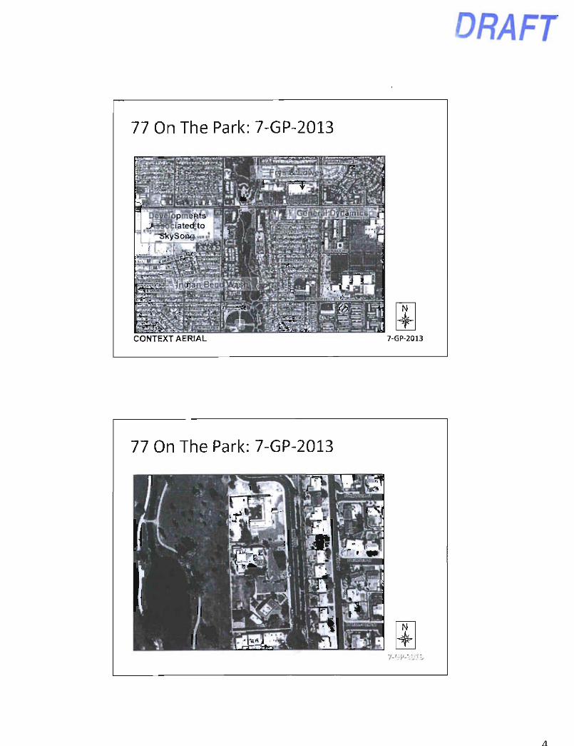
77 On The Park: 7-GP-2013
DRAFT
CONTEXT AERIAL
rrri 7-GP-2013
DRAFT
Applicants Request: 7-GP-2013
Amend the General Plan Land Use Element on an +/- 3 acre site from Cultural/Institutional or Public Use to Urban Neighborhoods Land Use Designation.
Companion Cases:
- Rezoning: 9-ZN-2013
Applicants Request: 7-GP-2013
Existing Land Use Designation: Culturol/lnstrtotiorul of Public Use
Land Use Map Legend
S:
Proposed Land Use Designation; Urban Neighborhoods
Tl •
• + -
Applicant's Request: A proposal for a Major General Plan Amendment to change the Land Use Designation from Cultural/lnstitutiofial or PublicAJse to Urban Neighborhoods on 3+/- acres.
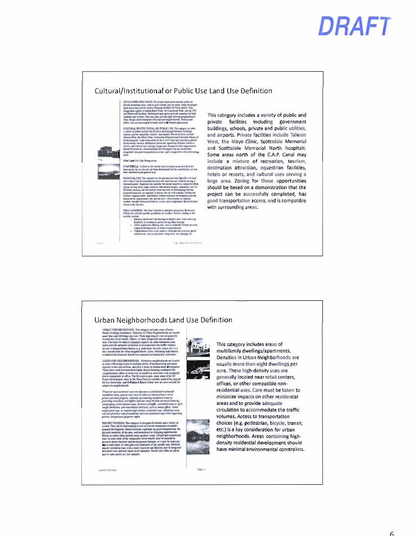
Cultural/Institutional or Public Use Land Use Definition
DRAFT
i pa ifK« w * kik* br Mrt H bcOM* ftr aM« M M Thi
feMpMk S«H m i< Ar CA e C M MJ> BcMi a uMtfiK
A M utMr Ua« DC*..!!..*.
l » a a « l i l i i i i M . | a > r a n I rbitm wi« i w t e . M a Hit
This category includes a variety of public and private facilities including government buildings, schools, private and public utilities, and airports. Private facilities include Taliesin West, the fvlayo Clinic, Scottsdale Memorial and Scottsdale fvlemorial North hospitals. Some areas north of the C.A.P. Canal may include a mixture of recreation, tourism, destination attraction, equestrian facilities, hotels or resorts, and cultural uses serving a large area. Zoning for these opportunities should be based on a demonstration that the project can be successfully completed, has good transportation access, and is compatible with surrounding areas.
Urban Neighborhoods Land Use Definition VWJ.S SnOiaORHOODS. Va\ ov fv r . lail-on • , T « t l t r j - , fkaul' l^tOmi. t t M K n Dmum a V i t u ^ , f i t c M a m mu. U' awT to n l V ••TiJur pm m Tiim k l t - l ru i -y a m n (Rutilh l i i i i l i l i M u m i — i - i B g i i i ^ i i i l * • • m » i « i i l
aatf« panM aM^um cunUhoc tOKtoaaMOM Ohrnflr AccaH •oOHipwnDaadmca | pvdnvia bvjxlff. mnuf nt l l u toyinidwilM (M uit«aMnli>oil«)o<li Anu (M.'oauit lufh.taki> i t i i l M I tntlnaaco! i l » M )>ivr a n i K l n v n o M a ! e
x m i M I R N D C a K I U I O O H l l w f i l i m t l H l i i i « » r l » * i «
R p i u l K o n lOl uiTttn. m i kmt • toca. m b a n arU t r t i r r a ^ '
l i k x I V D n a » a » >aa> n s << a t DT Kuct K p t l i f i a n ' m • ibi Puu F i n > n lonlor lora i< ar A i pc l « f L n A i m a u u ) VkTonlad. Raact Coci m mt a m aaliltic fci aiOri^uwa
L ^ A t f Mir W la in « M
ir.-a-fW W M O . « -»»a<f» ( ( l r . n M M a w ar n j«
c . ^ ' - r a i n i U l a ' -Wla. .a«iJMWln»^<n<W«>aMia»atfan>
a<n i« W M M n O t rUMiiUr l e a w t — r a a y W l n i i i l a f r T u r a t m B O M i f j B i i l i i M a i l i i M i H nainun M K UK Uq» n «IM ;l>n>3l C M w W » n a d h a n ^ M a a <<ai«> m i t a i u l a>« «i a I men <lun< w ar i IUM>tt g > r t i i M i n M UtamM<a«iaagi»ib ic iaw<iara«a> i - » aSu «< piKa
l a i r i twUnaK
em
This category includes areas of multifemily dwellings/apartments. Densities in Urban Neighborhoods are usually more than eight dwellings per acre. These high-density uses are generally located near retail centers, offices, or other compatible nonresidential uses. Care must be taken to minimize impacts on other residential areas and to provide adequate circulation to accommodate the traffic volumes. Access to transportation choices (e.g. pedestrian, bicycle, transit, etc.) is a key consideration for urban neighborhoods. Areas containing high-density residential development should have minimal environmental constraints.
Key Considerations
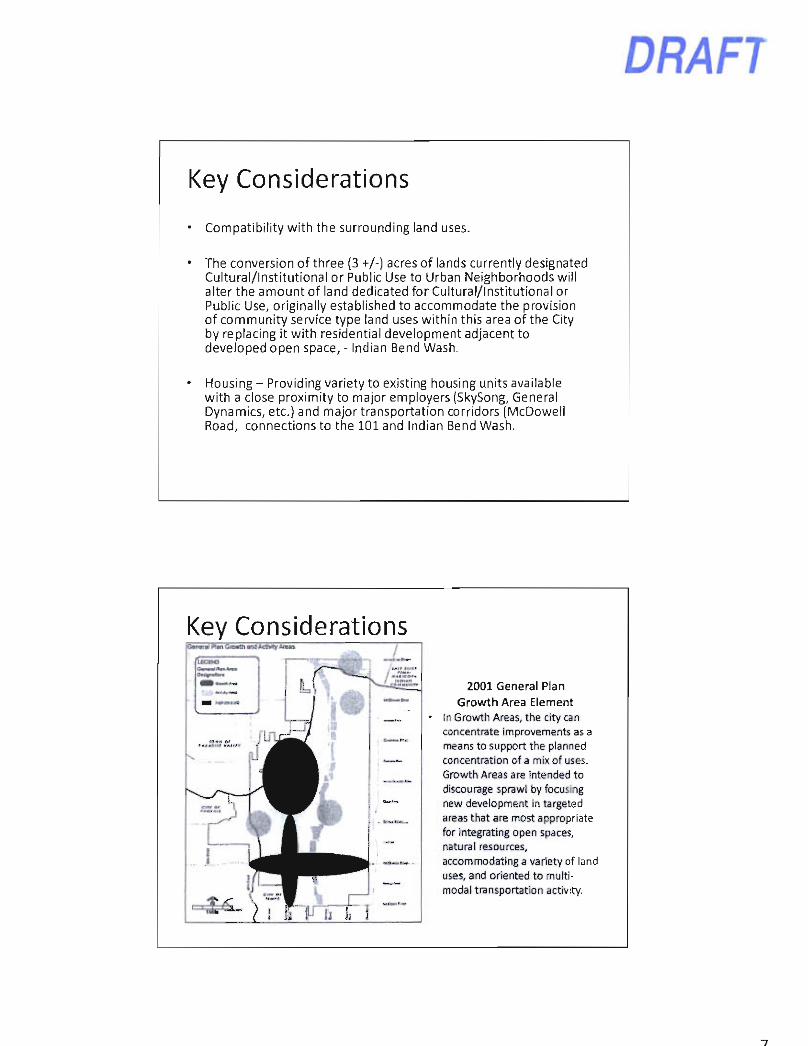
Compatibility with the surrounding land uses.
The conversion of three (3 +/-) acres of lands currently designated Cultural/Institutional or Public Use to Urban Neighborhoods will alter the amount of land dedicated for Cultural/Institutional or Public Use, originally established to accommodate the provision of community service type land uses within this area of the City by replacing it with residential development adjacent to developed open space, - Indian Bend Wash.
Housing - Providing variety to existing housing units available with a close proximity to major employers (SkySong, General Dynamics, etc.) and major transportation corridors (McDowell Road, connections to the 101 and Indian Bend Wash.
DRAFT
Key Considerations Goi>9f ol R«n Groann ond AcBwty Areas
LEGtNO Ommtl»mntrmm
2001 General Plan Growth Area Element
in Growth Areas, the city can concentrate improvements as a means to support the planned concentration of a mix of uses. Growth Areas are intended to discourage sprawl by focusing new development in targeted areas that are most appropriate for integrating open spaces, natural resources, accommodating a variety of land uses, and oriented to multimodal transportation activity.
DRAFT
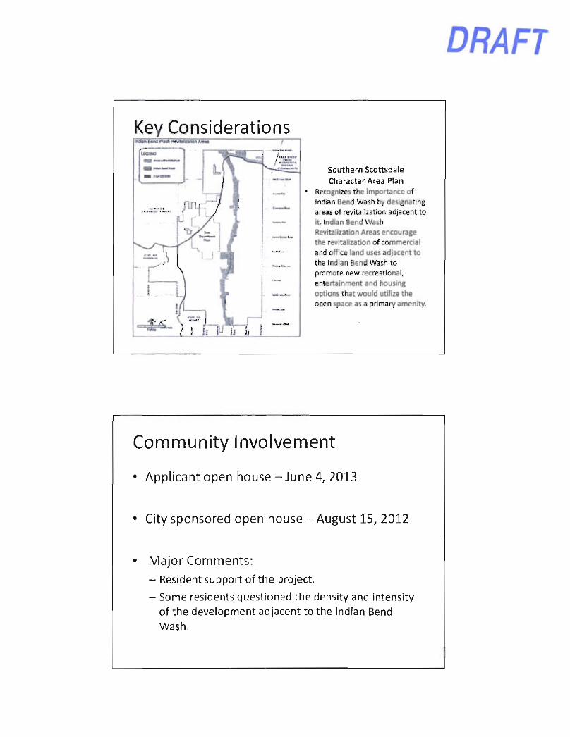
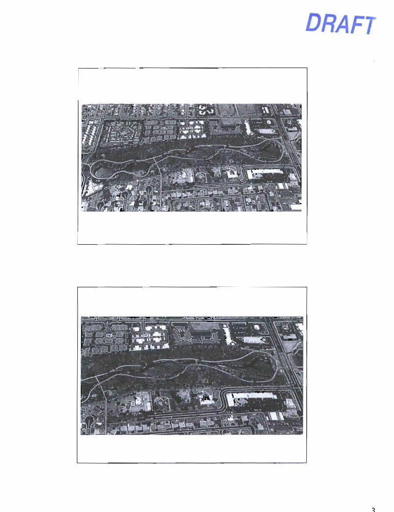
Key Considerations IndanBantWuhRmiMtallenAraM
Southern Scottsdale
Character Area Plan Recognizes the importance of Indian Bend Wash by designating areas of revitalization adjacent to it. Indian Bend Wash Revitalization Areas encourage the revitalization of commercial and office land uses adjacent to the Indian Bend Wash to promote new recreational, entertainment and housing options that would utilize the open space as a primary amenity.
Community Involvement
• Applicant open house-June 4, 2013
• City sponsored open house - August 15, 2012
Major Comments:
— Resident support of the project.
- Some residents questioned the density and intensity of the development adjacent to the Indian Bend Wash.
DRAFT
Next Steps City Council Hearing
- November 19th, 2013 at 5:00 PM
- City Hall, Kiva
- Companion zoning case: 9-ZN-2013
Item 16 Dan Symer
Presentation
9-ZN-2013 77 On The Park
City Council November 19, 2013
Dan Symer, AlCP, Senior Planner Current Planning Services
DRAFT
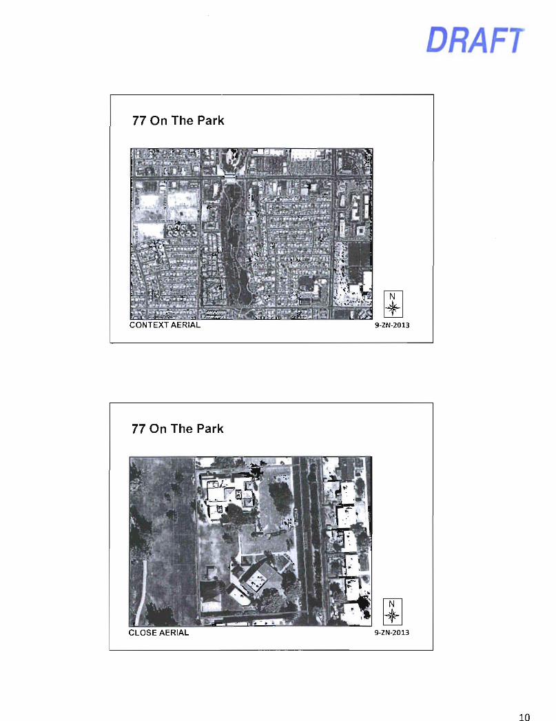
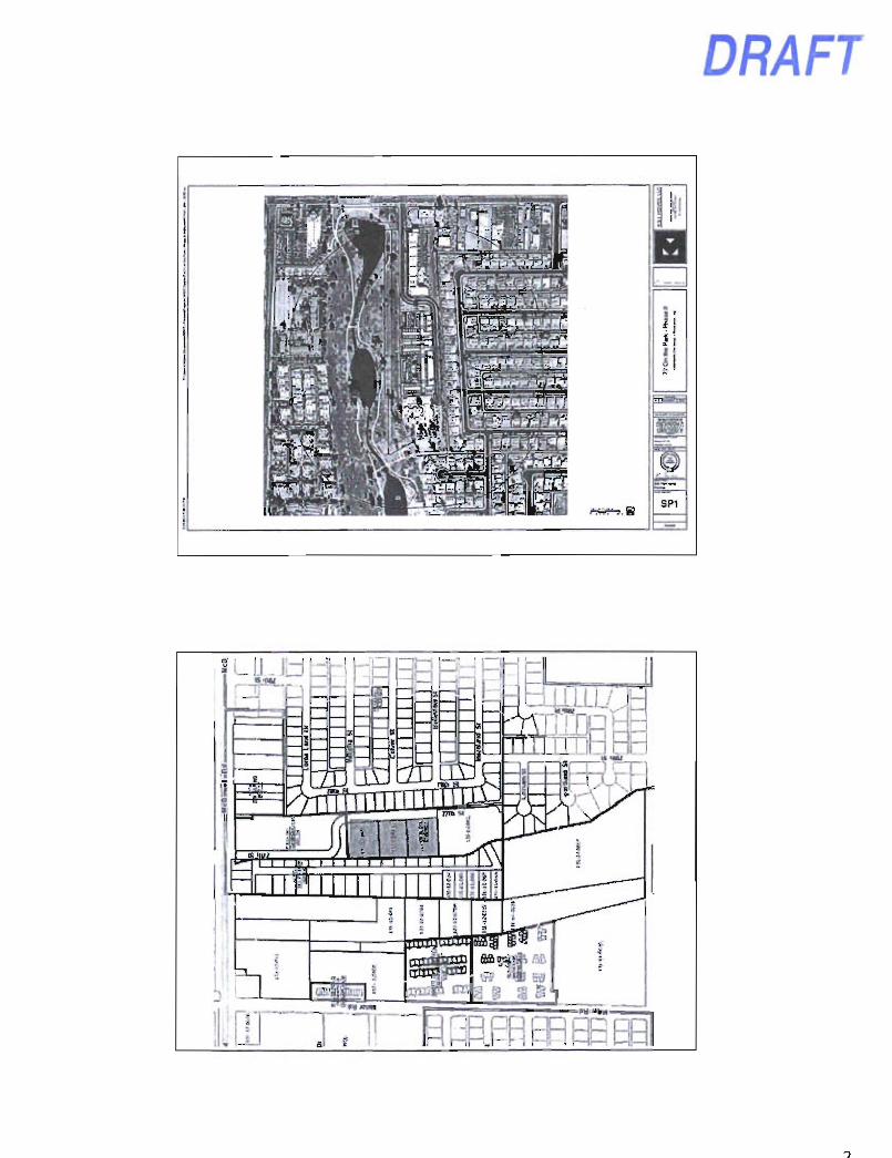
77 On The Park
mm
N
CONTEXT AERIAL 9-ZN-2013
77 On The Park
CLOSE AERIAL 9-ZN-2013
10
DRAFT
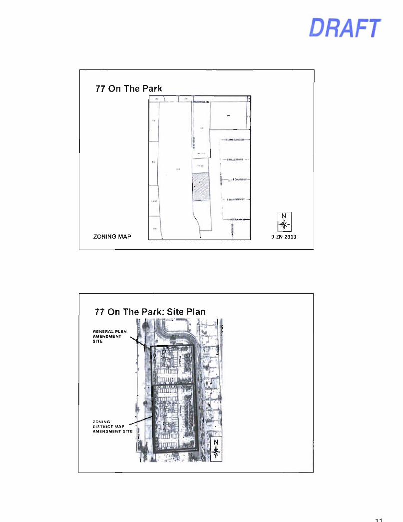
77 On The Park
ZONING MAP
icsoama
I-., •3
rrri
± 9-ZN-2013
77 On The Park: Site Plan
GENERAL PLAN AMENDMENT SITE
ZONING DISTRICT MAP AMENDMENT SITE
1 1
DRAFT
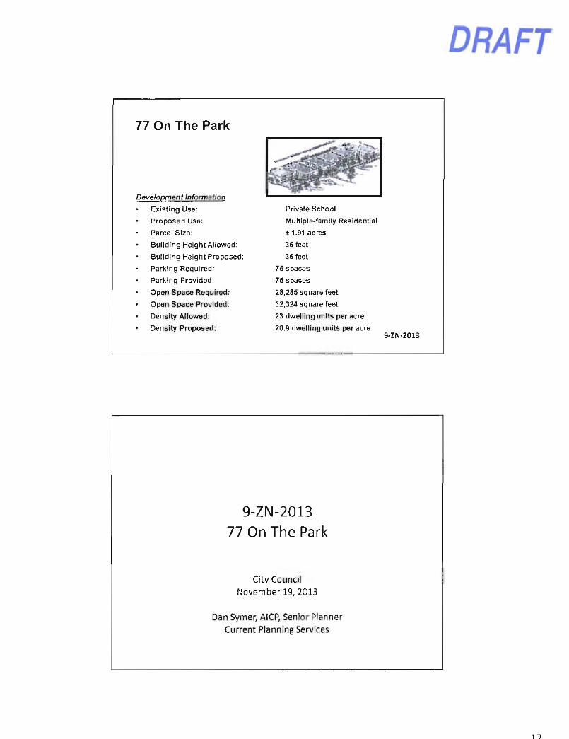
77 On The Park
Development Information
• Existing Use:
Proposed Use:
Parcel Size:
Building Height Allowed:
Building Height Proposed:
Parking Required:
Parking Provided:
Open Space Required:
Open Space Provided:
• Density Allowed:
• Density Proposed:
Private School
Multiple-family Residential
± 1.91 acres
36 feet
36 feet
75 spaces
75 spaces
28,285 square feet
32,324 square feet
23 dwelling units per acre
20.9 dwelling units per acre 9-ZN-2013
9-ZN-2013 77 On The Park
City Council November 19, 2013
Dan Symer, AlCP, Senior Planner Current Planning Services
11
DRAFT
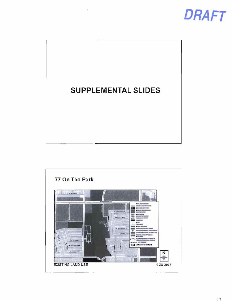
SUPPLEMENTAL SLIDES
77 On The Park
EXISTING LAND USE 9-ZN-2013
1^
DRAFT
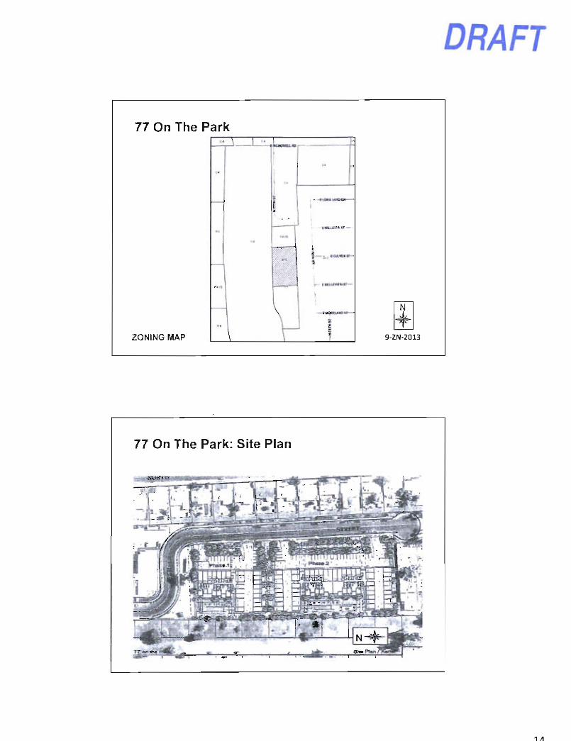
77 On The Park
ZONING MAP
'9 r-- iMiuvrnmi—
4-9-ZN-2013
77 On The Park: Site Plan
1/1
DRAFT
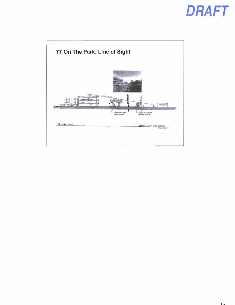
77 On The Park: Line of Sight
DRAFT
S :>|:, il. Ci
= Alm«iaRd Bdorarfo
I'ldrf UV-flr.v-rll z
C Cul»c( 51
E6o.?t..-iev«£i B^tev,e,^ Pters
C«i1e El Ow*Jo
sfiiin Del Camino IV
2 2
3. i
^ ^ §
SITE I Sccnsoalt .1 Ga.dsns '^«''V
Cimno
ScoHsdal*
I 3 E Oiamcna Si -•2
Pepago . ParK
E Ro«*c-.t:H SI I
P.4il(v/Ay
B loma LJIKI DI
E WiHrtlA SI
P.MkvMy
E Worc-to'W SI
2 5
I S £ RooicveH SI
ViEta Del CaminD Perk
* VWjDeJ Camino II 4
Uerevtav Uanw
t
E Pjcrcc St
DRAFT
r-TT*— I r - t -
DRAFT
DRAFT
i t 1 MSIiiptRoad
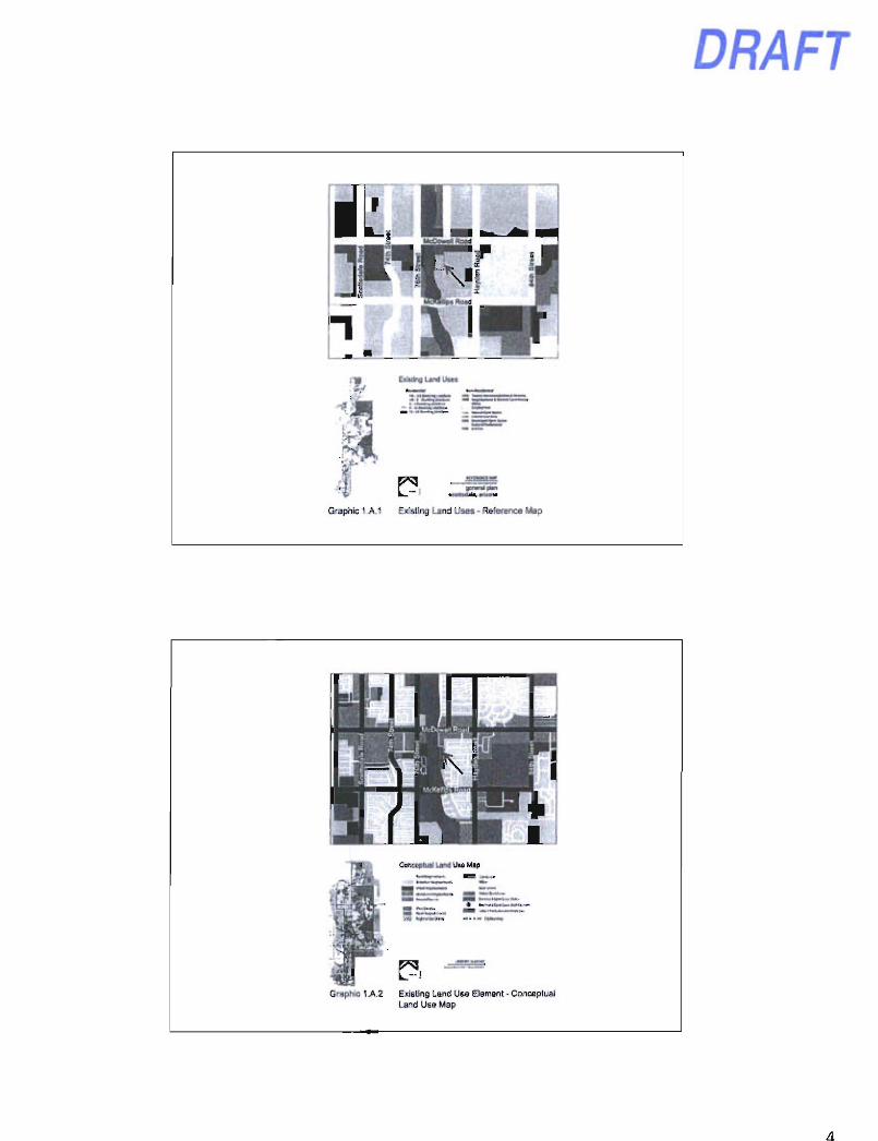
Graphic 1 A.1
ExiMlng Land Uses
Existing Land Uses - Reference Map
Graphic 1A 2 Existing Land Use Element - Conceptual Land Use Map
DRAFT
4 ^
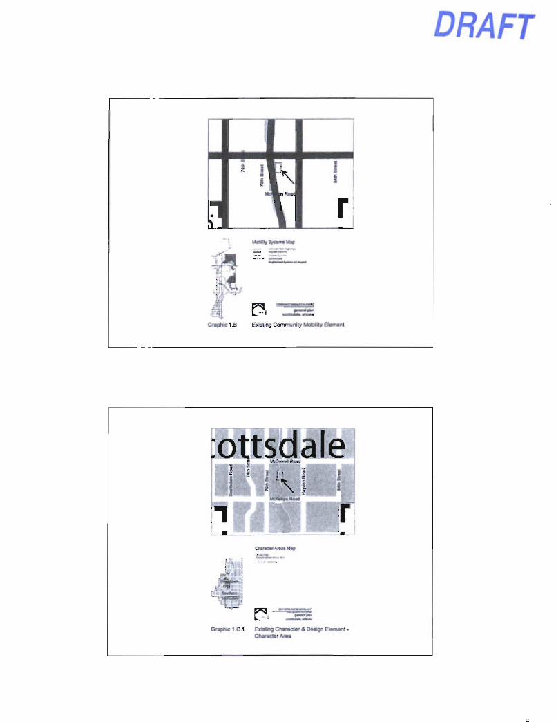
Graphic 1 .B Existing Community Mobility Element
:ottsdale McOowvlRaad ^^^^^^
1 1 1 1 i
1 \ 1 ' McKaApiRow)
Curactw V u t Map
up 11- • ;
Gn«>hic 1 C 1 Existing Character & Design Element -Character Area
•
gfrpen!j?.Qre
McKellDS Road
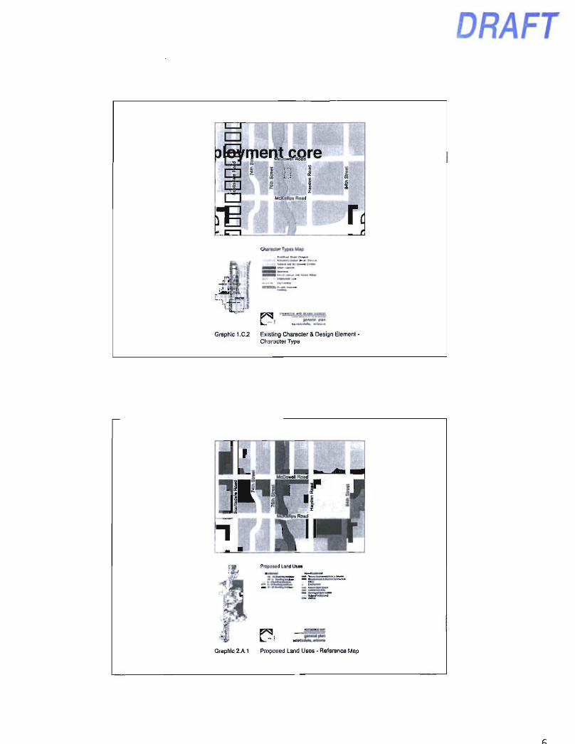
r Charader T/pet Map
f ^ , B««e«r pan
Graphic 1.0.2 Existing Character & Design Element -Character Type
DRAFT
r ^ 1 I McOowAlRoad
•Sn iEa tod
NT
PropoMd Land Uses
Graphic 2.A.1 Proposed Land Uses - Reference Map
Propo«e opowd Land Ute Map
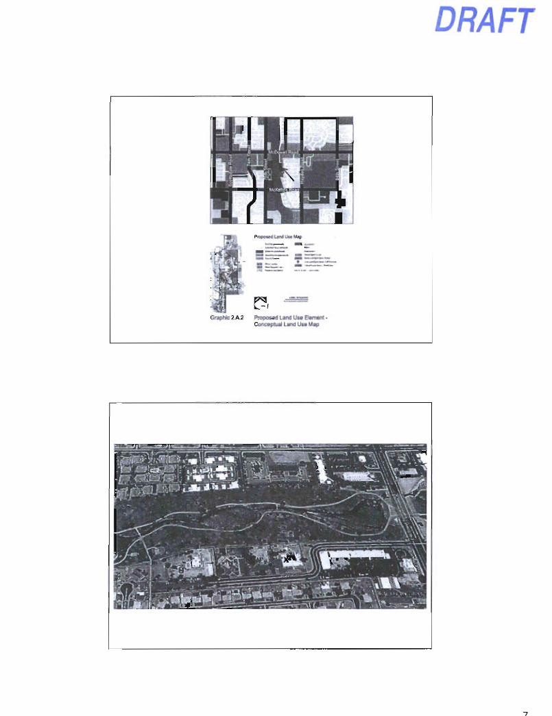
Graphfc 2A 2 Proposed Land Use Element • Conceptual Land Use Map
DRAFT
DRAFT
• t n f j ' r n . i v t i i ^ i a i
•moTAiKjtiiorevtVh n w v • i w u M i
«acaau>t«wB»aoTiYf»i U M I * . i i iacaa
octoTY. uou i i i»c . poii eaouACV
— » « " ^ t c u i j i n o M
crifnccrv^i'irfp rot . U<M>> C d • r i B i r
mrm HTM aayjm^^p. g'.jj^ffli '-n-i HKX
cTt<«mN't>aci'3a('>«civtiic . iruoM
IgglfUailllB :
PIMTir. lOT lAMWOa NO MCVMP I IK (r
11 li
SP3
DRAFT
DRAFT
77 on irio Park Persoeclivo View frofii NW
in
DRAFT
Item 17
Scottsdale Mountain Villas
3-ZN-2013 City Council
November 19, 2013 Keith Niederer
Scottsdale Mountain Villas
N
CONTEXT AERIAL 3-ZN-2013
DRAFT
Scottsdale Mountain Villas
CLOSE AERIAL 3-ZN-2013
Scottsdale Mountain Villas
HvTuMDomiMarMm O maupnoaiMCiaa/numi
uiomaorni i
^ ^ ^ H p . ^ ^ ^ ^ ^
r ^
N
EXISTING LAND USE 3-ZN-2013
DRAFT
Scottsdale Mountain Villas
Request: Rezone from Rl-43 ESL to Rl-5 ESL.
ZONING MAP 3-ZN-2013
Scottsdale Mountain Villas
i;:iftf;!v::i« |f-' > 1 l^gl^ Vi /*v I^T^
• ' Ifnlhiiliory SuMMtalon mem
SITE PLAN AS OF 7/1/2013
• . r j= |CVL
3-ZN-2013
DRAFT
Scottsdale Mountain Villas
, ,-"..r.™'|CVL
CURRENT PROPOSED SITE PLAN 3-ZN-2013
Scottsdale Mountain Villas
P n l l n l n a r y S u k d U l u a n
. . . .
L L-ri^;:.iCVL
LANDSCAPE ENHANCEMENTS 3-ZN-2013
DRAFT
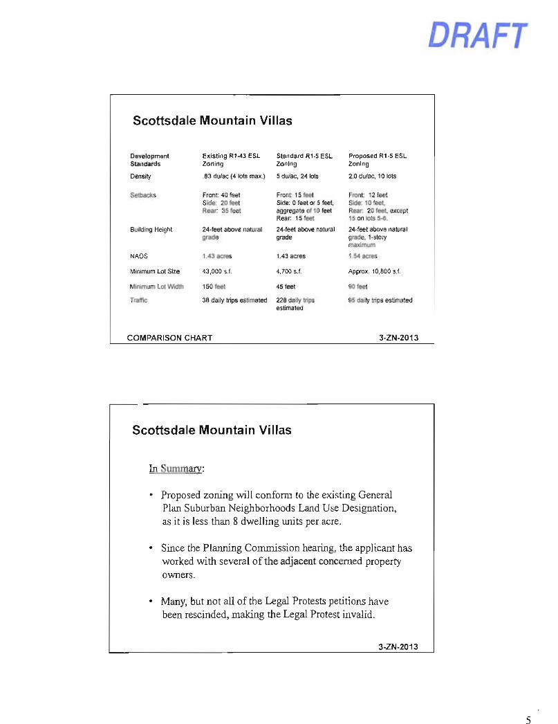
Scottsdale Mountain Villas
Development Standards
Existing R1-43 ESL Zoning
Standard Rl-5 ESL Zoning
Proposed Rl-5 ESL Zoning
Density .83 du/ac (4 lots max.) 5 du/ac, 24 lots 2.0 du/ac. 10 lots
Setbacks Front: 40 feet Side; 20 feet Rear: 35 feet
Front: 15 feet Side: 0 feet or 5 feet, aggregate of 10 feet Rear 15 feet
Front: 12 feet Side: 10 feet. Rear 20 feet except 15 on lots 5-6.
Building Height 24-feet above natural grade
24-feet above natural grade
24-feet above natural grade, 1-story maximum
NAOS 1.43 acres 1.43 aaes 1.54 acres
Minimum Lot Size 43,000 s f. 4.700 S.f. Approx. 10,800 s.f.
Minimum Lot Width 150 feet 45 feet 90 feet
TrafTic 38 daily trips estimated 228 daily trips estimated
95 daily trips estimated
COMPARISON CHART 3-ZN-2013
Scottsdale Mountain Villas
In Summary:
• Proposed zoning will conform to the existing General Plan Suburban Neighborhoods Land Use Designation, as it is less than 8 dwelling units per acre.
• Since the Planning Commission hearing, the applicant has worked with several of the adjacent concerned property owners.
• Many, but not all of the Legal Protests petitions have been rescinded, making the Legal Protest invalid.
3-ZN-2013
DRAFT
Scottsdale Mountain Villas
Applicant's Presentation
3-ZN-2013
DRAFT
Item 18
Hawknest
10-ZN-2013 City Council
November 19. 2013
Hawknest
' - '•'•"r,i': -:.'iria^^H^
CONTEXT AERIAL
N
10-ZN-2013
Hawknest
DRAFT
N
CLOSE AERIAL 10-ZN-2013
Hawknest
EXISTING LAND USE 10-ZN-2013
DRAFT
Hawknest
Request: Rezone from R1-190 ESL to Rl-43 ESL and R1-35 ESL
ZONING MAP 4-
10-ZN-2013
Hawknest
TlOfrcjOfi , , ,
m CONTEXT SITE PLAN 10-ZN-2013
DRAFT
Hawknest
SITE PLAN
J . 1 .
10-ZN-2013
Hawknest R1-43 ESL
Development Standard
Existing R1-190 ESL
Straight Rl-43 ESL
Proposed R1 -43 ESL
Min. Lot Area 190,000 S.f. 43.000 s.f. 32.250 s.f.
Min. Lot Width 300 feet 150 feet 125 feet
Front Setback 60 feet 40 feet 30 feet
Rear Setback 60 feet 35 feet 30 feet
Side Setback 30 feet 20 feet 15 feet
Building Height 24 feet from natural grade
24 feet from natural grade
24 feet from nat. grade - 1 story
Density 0.21 du/ac (4 lots)
0.83 du/ac (19 lots)
0.83 du/ac (19 lots)
DEVELOPMENT STANDARD COMPARISON 10-ZN-2013
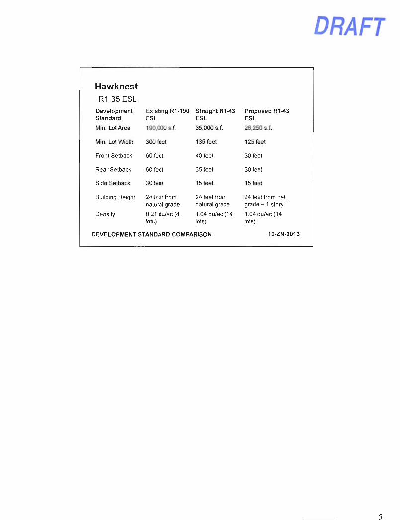
Hawknest R1-35 ESL
Development Standard
Existing R1-190 ESL
Straight R1-43 ESL
Proposed R1-43 ESL
Min. Lot Area 190.000 s.f. 35,000 s.f. 26.250 s.f.
Min. Lot Width 300 feet 135 feet 125 feet
Front Setback 60 feet 40 feet 30 feet
Rear Setback 60 feet 35 feet 30 feet
Side Setback 30 feet 15 feet 15 feet
Building Height 24 feet from natural grade
24 feet from natural grade
24 feet from nat. grade - 1 story
Density 0.21 du/ac (4 lots)
1.04 du/ac (14 lots)
1.04 du/ac (14 lots)
DEVELOPMENT STANDARD COMPARISON 10-ZN-2013
DRAFT
DRAFT
Item 19
Teletrack Wagering Establishment License Application for
Prankster's Too
License # 1095146
November 19. 2013
PRANKSTER'S TOO
BACKGROUND
- Ordinance first adopted in 1992
- In 2009 license term changed to 3 years for consistency with state license renewal process.
Currently one licensed off track wagering establishment in the city.
DRAFT
PRANKSTER'S TOO
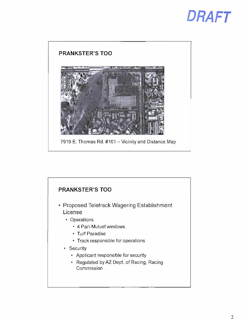
7919 E. Thomas Rd. #101 - Vicinity and Distance Map
PRANKSTER'S TOO
Proposed Teletrack Wagering Establishment License • Operations
• 4 Pari-Mutuel windows • Turf Paradise • Track responsible for operations
• Security • Applicant responsible for security • Regulated by AZ Dept. of Racing, Racing
Commission
DRAFT
P R A N K S T E R ' S TOO
• Location Requirements
- Per Code 1,000 feet spacing between facilities 500 feet from school/park 500 feet from Residential District
- Proposal meets location requirements
• Public Notification
PRANKSTER'S TOO
Council Options - Approve - Deny
Related Documents