Welcome message from author
This document is posted to help you gain knowledge. Please leave a comment to let me know what you think about it! Share it to your friends and learn new things together.
Transcript
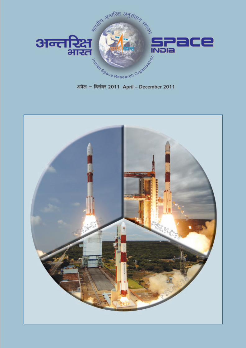
Space activities in the country were initiated with the setting up
of Indian National Committee for Space Research
(INCOSPAR) in 1962. In the same year, work on Thumba
Equatorial Rocket Launching Station (TERLS), near
Thiruvananthapuram, was also started. The Indian space
programme was institutionalised in November 1969 with the
formation of Indian Space Research Organisation (ISRO).
Government of India constituted the Space Commission and
established the Department of Space (DOS) in
June 1972 and brought ISRO under DOS in September 1972.
Department of Space (DOS) has the primary responsibility
of promoting development of space science, technology and
applications towards achieving self reliance and assisting in all
round development of the nation. Towards this, DOS has
evolved the following programmes:
• Indian National Satellite (INSAT) programme for
telecommunications, TV broadcasting, meteorology,
developmental education, etc.
• Remote Sensing programme for the application of
satellite imagery for various developmental purposes.
• Indigenous capability for design and development
of spacecraft and associated technologies for
communications, resources survey and space sciences.
• Design and development of launch vehicles with
indigenous technology for access to space and orbiting
INSAT, IRS spacecraft and space science missions.
• Research and development in space sciences and
technologies as well as application programme for
national development.
The Space Commission formulates the policies and oversees
the implementation of the Indian space programme to
promote the development and application of space science
and technology for the socio-economic benefit of the country.
DOS implements these programmes through, mainly, Indian
Space Research Organisation (ISRO), Physical Research
Laboratory (PRL), National Atmospheric Research Laboratory
(NARL), North Eastern-Space Applications Centre
(NE-SAC) and Semi-Conductor Laboratory (SCL).
Antrix Corporation, established in 1992 as a government
owned company, markets space products and services.
Both the DOS and ISRO Headquarters are located at
Bengaluru. The developmental activities are carried out at
the Centres and Units spread over the country.
So far, 65 Indian Satellite Missions and 35 Launches from
Sriharikota have been conducted.
The Indian Space Programme
Editors
S Satish
A S Padmavathy
B R Guruprasad
‘SPACE INDIA’ is published by the Indian Space Research Organisation for limited circulation. Articles appearing in
SPACE INDIA may be reproduced, accompanied by the credit line “Reprinted from SPACE INDIA” along with the date of issue.
Editorial / Circulation Office
Publications & Public Relations Unit, ISRO Headquarters, Antariksh Bhavan, New BEL Road, Bengaluru - 560 231, India.
www.isro.gov.in Designed by Imagic Creatives and Printed at Executive Print Group, Bengaluru
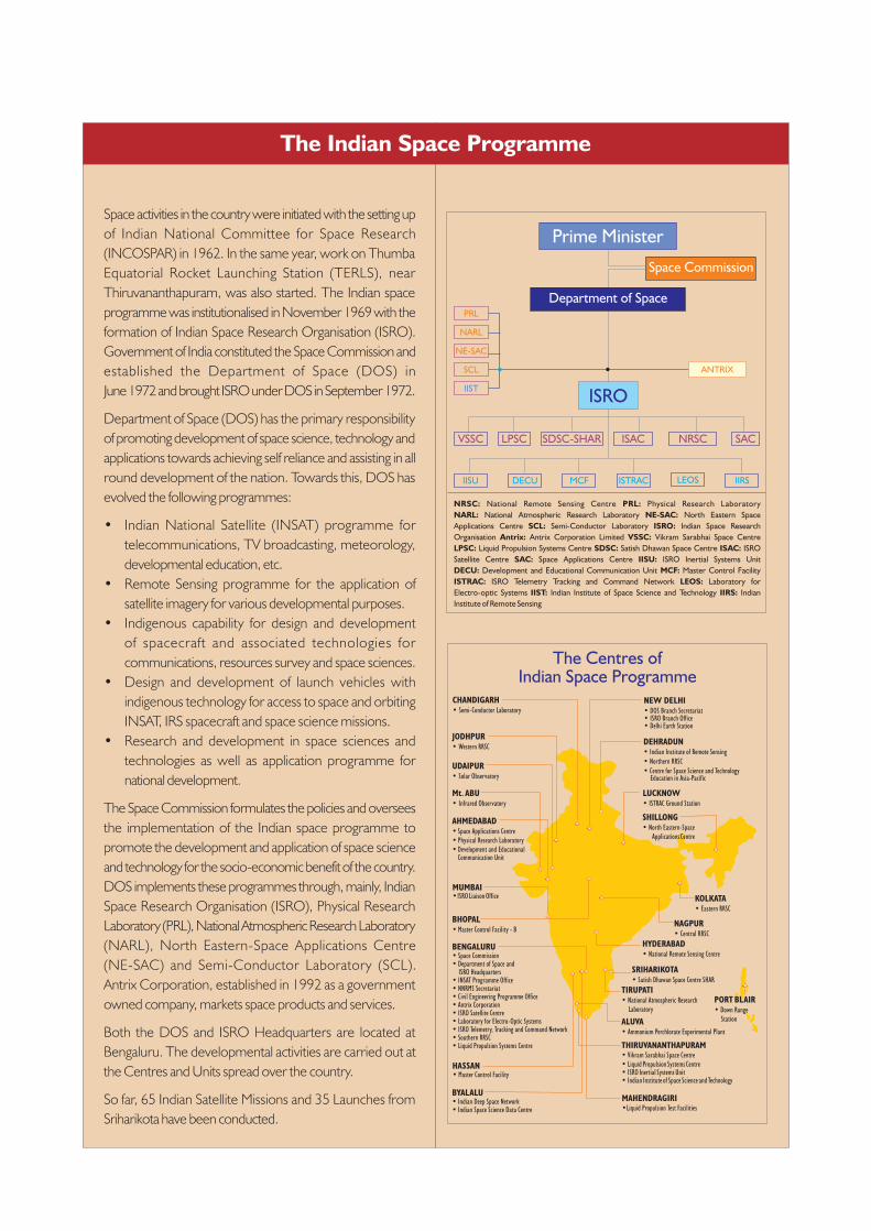
Cover Page: Three
successes in a row for PSLV
in 2011
PSLV-C16 Successfully Launches RESOURCESAT-2, 2YOUTHSAT and X-SAT Satellites
Reorganisation of Indian Institute of 5Remote Sensing as a unit of ISRO
ISRO Builds India's Fastest Supercomputer 6
India's Advanced Communication Satellite 7GSAT-8 Launched Successfully
PSLV-C17 Successfully Launches GSAT-12 Satellite 9
Second Static Testing of Solid Propellant Booster 11Rocket Stage S200 for GSLV Mk IIISuccessfully Conducted
PSLV-C18 Successfully Launches 12MEGHA-TROPIQUES Mission
National Conference on Space Transportation Systems 14
Interview with Dr V Jayaraman 16Former Director, NRSC, ISRO
Parliamentary Standing Committee on 20Science and Technology, Environment andForests visits ISRO, Bangalore
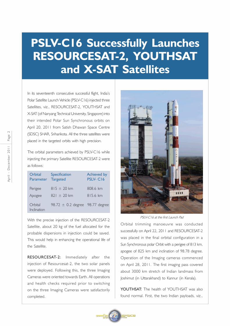
In its seventeenth consecutive successful flight, India’s
Polar Satellite Launch Vehicle (PSLV-C16) injected three
Satellites, viz., RESOURCESAT-2, YOUTHSAT and
X-SAT (of Nanyang Technical University, Singapore) into
their intended Polar Sun Synchronous orbits on
April 20, 2011 from Satish Dhawan Space Centre
(SDSC) SHAR, Sriharikota. All the three satellites were
placed in the targeted orbits with high precision.
The orbital parameters achieved by PSLV-C16 while
injecting the primary Satellite RESOURCESAT-2 were
as follows:
Orbital Specification Achieved by
Parameter Targeted PSLV- C16
Perigee 815 ± 20 km 808.6 km
Apogee 821 ± 20 km 815.6 km
Orbital 98.72 ± 0.2 degree 98.77 degree
Inclination
With the precise injection of the RESOURCESAT-2
Satellite, about 20 kg of the fuel allocated for the
probable dispersions in injection could be saved.
This would help in enhancing the operational life of
the Satellite.
RESOURCESAT-2: Immediately after the
injection of Resourcesat-2, the two solar panels
were deployed. Following this, the three Imaging
Cameras were oriented towards Earth. All operations
and health checks required prior to switching
on the three Imaging Cameras were satisfactorily
completed.
Orbital trimming manoeuvre was conducted
successfully on April 22, 2011 and RESOURCESAT-2
was placed in the final orbital configuration in a
Sun Synchronous polar Orbit with a perigee of 813 km,
apogee of 825 km and inclination of 98.78 degree.
Operation of the Imaging cameras commenced
on April 28, 2011. The first imaging pass covered
about 3000 km stretch of Indian landmass from
Joshimut (in Uttarakhand) to Kannur (in Kerala).
YOUTHSAT: The health of YOUTHSAT was also
found normal. First, the two Indian payloads, viz.,
PSLV-C16 Successfully LaunchesRESOURCESAT-2, YOUTHSAT
and X-SAT Satellites
Ap
ril
- D
ec
em
be
r 2
01
1 P
ag
e 2
PSLV-C16 at the first Launch Pad
Limb Viewing Hyperspectral Imager (LiVHySI) and
Radio Beacon for Ionospheric Tomography (RaBIT)
and later the Russian payload, Solar Radiation
Experiment (SOLRAD), were switched on. Their
performance was found satisfactory.
Payload data from YOUTHSAT is processed at the
Indian Space Science Data Centre at Byalalu,
(near Bangalore).
X-SAT: The health of the X-SAT and the
performance of the various on-board sub-systems
was also normal.
The Tracking, Control and Commanding operations
for RESOURCESAT-2 and YOUTHSAT satellites are
carried out from ISROs Telemetry Tracking and
Command Network Centre (ISTRAC) located at
Bangalore, connected to a network of ground stations
at Lucknow, Mauritius, Biak (Indonesia) and Svalbard
(near North Pole).
RESOURCESAT-2
RESOURCESAT-2 is the eighteenth Remote Sensing
satellite built by ISRO and is a follow on mission to
RESOURCESAT-1 (launched in 2003).
Ap
ril
- D
ec
em
be
r 2
01
1 P
ag
e 3
RESOURCESAT-2 is intended to continue the remote
sensing data services to global users provided by
RESOURCESAT-1, that has far
outlived its designed mission
life. Also it provides
data with
e n h a n c e d
multispectral
and spatial coverage as well.
RESOURCESAT-2 carries Three cameras which are
similar to those of RESOURCESAT-1. They are:
a) A high resolution Linear Imaging Self Scanner
(LISS-4) operating in three spectral bands in the
Visible and Near Infrared Region (VNIR) with
5.8 m spatial resolution and steerable up to
± 26 deg across track to achieve a five day revisit
capability
b) A medium resolution LISS-3 operating in
three-spectral bands in VNIR and one in Short
Wave Infrared (SWIR) band with 23.5 metre
spatial resolution
c) A coarse resolution Advanced Wide Field Sensor
(AWiFS) operating in three spectral bands in
VNIR and one band in SWIR with 56 metre
spatial resolution
Important changes in
RESOURCESAT-2 compared to
RESOURCESAT-1 are:
Enhancement of LISS-4
multispectral swath from 23 km
to 70 km and improved
Radiometric accuracy from 7
bits to 10 bits for LISS-3 and
LISS-4 and 10 bits to 12 bits for
AWIFS. Besides, suitable
changes, including miniaturisation
in payload electronics, were
made in RESOURCESAT-2.Resourcesat-2 undergoing Pre-launch tests
RESOURCESAT-2 also carries an additional payload
known as Automatic Identification System (AIS) from
COMDEV, Canada as an experimental payload for
ship surveillance in VHF band to derive position, speed
and other information about ships.
RESOURCESAT-2 carries two Solid State Recorders
with a capacity of 200 Giga Bytes each to store the
images taken by its cameras which can be read out
later to ground stations.
YOUTHSAT
YOUTHSAT is a joint Indo-Russian satellite for stellar
and atmospheric studies with the participation of
students from Universities at graduate and post
graduate level. With a
lift-off mass of 92 kg,
Youthsat intends to
investigate the
relationship between
solar variability and
t h e r m o s p h e r e -
lonosphere changes. The satellite
carries three payloads, of which two
are Indian and one Russian. Together,
they form a unique and
comprehensive package of
experiments for the investigation of the
composition, energetics and dynamics
of earth's upper atmosphere.
The Indian payloads are:
1. RaBIT (Radio Beacon for
Ionospheric Tomography), which is a
dual frequency beacon payload for
mapping Total Electron Content (TEC)
of the Ionosphere
2. LiVHySI (Limb Viewing Hyper
Spectral Imager) is designed to perform
airglow measurements of the Earth's
upper atmosphere (100- 1100 km)
The Russian payload SOLRAD monitors the solar X-
and γ ray fluxes and helps to study solar cosmic ray
flux parameters and conditions of their penetration in
the Earth's magnetosphere.
Ap
ril
- D
ec
em
be
r 2
01
1 P
ag
e 4
Youthsat undergoing vibration test at ISRO Satellite Centre
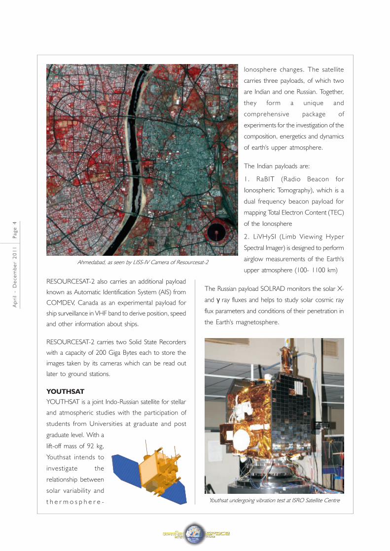
Ahmedabad, as seen by LISS-IV Camera of Resourcesat-2
X-SAT
X-SAT, the third payload of
PSLV-C16, is Singapore's first
satellite. Weighing 106 kg at
lift-off, X-SAT is a Mini Satellite
with a multispectral camera
IRIS as its primary payload. X-SAT mission mainly
intends to demonstrate technologies related to satellite
based remote sensing and onboard image processing.
PSLV-C16
PSLV-C16 was the eighteenth flight of ISRO's
Polar Satellite Launch Vehicle PSLV. In this flight, the
standard version of PSLV with six solid strap-on motors
was used.
PSLV-C16 placed three satellites with a total payload
mass of 1404 kg - RESOURCESAT-2 weighing
1206 kg, the Indo-Russian YOUTHSAT weighing
92 kg and Singapore's X-SAT weighing 106 kg – into an
812 km polar Sun Synchronous Orbit (SSO).
PSLV-C16 was launched from the First Launch Pad (FLP)
at Satish Dhawan Space Centre SHAR, Sriharikota.
The major changes made in PSLV since its first launch
include changes in strap-on motors ignition sequence,
increase in the propellant loading of the first stage
and strap-on solid propellant motors as well as the
second and fourth stage liquid propellant motors,
improvement in the performance of the third stage
motor by optimising motor case and enhanced
propellant loading and employing a carbon composite
payload adapter.
PSLV has become a versatile vehicle for launching
multiple satellites in polar SSOs as well as Low Earth
Orbits (LEO) and Geosynchronous Transfer Orbit
(GTO). With sixteen successful launches, PSLV has
emerged as the workhorse launch vehicle of
ISRO and is offered for launching satellites for
international customers also. During October1994-
April 2011 period, PSLV launched a total of 47 satellites
(including RESOURCESAT-2, YOUTHSAT and
X-SAT), of which 26 satellites are from abroad and
21 are Indian satellites.
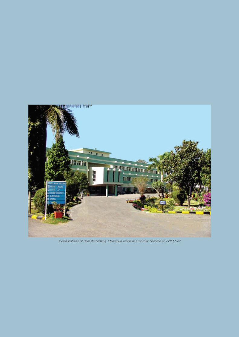
Indian Institute of Remote Sensing, Dehradun under
NRSC has been responsible for capacity building in
the country in Remote Sensing and GIS applications
through specialised education and training. Since its
inception, IIRS has grown many folds and established
itself as an institute of repute, both nationally and
internationally, in the areas of remote sensing training
and education.
The Earth Observation Systems have to set to grow
in the years to come with several thematic satellites
in the areas of Natural Resource Survey, Earth and
Atmospheric Sciences and Oceanography. Enhanced
EO capabilities with microwave remote sensing and
Reorganisation of Indian Institute ofRemote Sensing as a unit of ISRO
hyperspectral imaging are also planned. Efficient
utilisation of these systems requires focused efforts
in Training and Education in diverse thematic areas.
Considering this imminent need, IIRS was made a
Unit of ISRO with effect from April 30, 2011.
The activities of IIRS will be guided by a Management
Council, headed by Director, Space Application
Centre (SAC).
The Management Council will review the
IIRS programmes (ongoing and new initiatives), the
annual budget proposals, manpower requirements
and provide overall direction for the development
of the Institute.
Ap
ril
- D
ec
em
be
r 2
01
1 P
ag
e 5
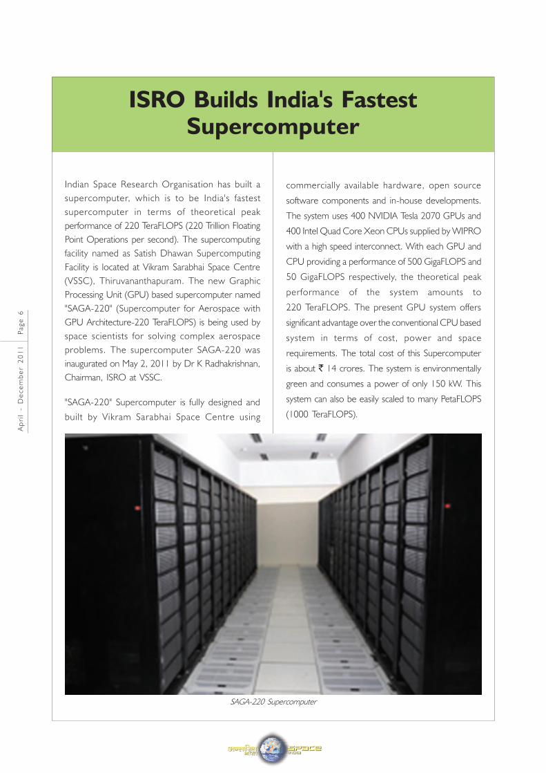
Indian Space Research Organisation has built a
supercomputer, which is to be India's fastest
supercomputer in terms of theoretical peak
performance of 220 TeraFLOPS (220 Trillion Floating
Point Operations per second). The supercomputing
facility named as Satish Dhawan Supercomputing
Facility is located at Vikram Sarabhai Space Centre
(VSSC), Thiruvananthapuram. The new Graphic
Processing Unit (GPU) based supercomputer named
"SAGA-220" (Supercomputer for Aerospace with
GPU Architecture-220 TeraFLOPS) is being used by
space scientists for solving complex aerospace
problems. The supercomputer SAGA-220 was
inaugurated on May 2, 2011 by Dr K Radhakrishnan,
Chairman, ISRO at VSSC.
"SAGA-220" Supercomputer is fully designed and
built by Vikram Sarabhai Space Centre using
ISRO Builds India's FastestSupercomputer
commercially available hardware, open source
software components and in-house developments.
The system uses 400 NVIDIA Tesla 2070 GPUs and
400 Intel Quad Core Xeon CPUs supplied by WIPRO
with a high speed interconnect. With each GPU and
CPU providing a performance of 500 GigaFLOPS and
50 GigaFLOPS respectively, the theoretical peak
performance of the system amounts to
220 TeraFLOPS. The present GPU system offers
significant advantage over the conventional CPU based
system in terms of cost, power and space
requirements. The total cost of this Supercomputer
is about ` 14 crores. The system is environmentally
green and consumes a power of only 150 kW. This
system can also be easily scaled to many PetaFLOPS
(1000 TeraFLOPS).
Ap
ril
- D
ec
em
be
r 2
01
1 P
ag
e 6
SAGA-220 Supercomputer
Ap
ril
- D
ec
em
be
r 2
01
1 P
ag
e 7
India's advanced communication satellite, GSAT-8, was
successfully launched at 02:08 hrs IST on May 21,
2011 by the Ariane-V launch vehicle of Arianespace
from Kourou. French Guiana. Ariane V (VA 202)
placed GSAT-8 into the intended Geosynchronous
Transfer Orbit (GTO) of 35,861 km apogee (farthest
point to earth) and 258 km perigee (closest point to
earth), with an orbital inclination of 2.503 deg with
respect to equator.
ISRO's Master Control Facility (MCF) at Hassan in
Karnataka acquired the signals from GSAT-8 satellite
India's Advanced CommunicationSatellite GSAT-8 Launched
Successfully
immediately after the injection. Initial checks on the
satellite indicated normal health of the satellite. The
satellite was captured in three-axis stabilisation mode.
The first critical orbit-raising manoeuvre of GSAT-8
was successfully conducted on May 22, 2011 with
the firing of the 440 Newton Liquid Apogee Motor
(LAM) on board GSAT-8 for 95 minutes by
commanding the satellite from ISRO's MCF at Hassan,
Karnataka. The satellite was oriented suitably before
the start of LAM operations prior to this critical
manoeuvre. With this LAM operation, GSAT-8
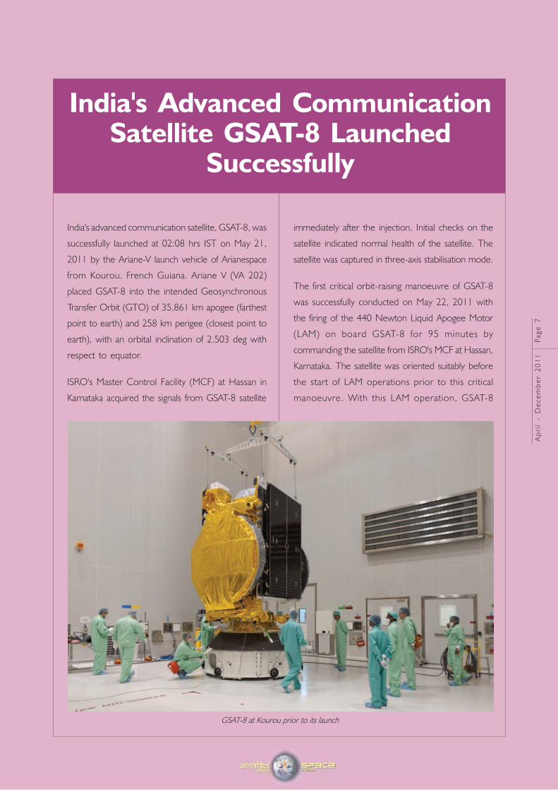
GSAT-8 at Kourou prior to its launch
perigee was raised to 15,786 km. The apogee
remained at 35,768 km and the inclination of the
orbit with respect to the equatorial plane was reduced
from 2.5 deg at the time of entering into orbit to
0.5 deg. The orbital period became 15 hours
56 minutes. All systems onboard the satellite were
functioning normally.
GSAT-8
GSAT-8, India’s advanced communication satellite, is
a high power communication satellite which is being
inducted in the INSAT system. Weighing about
3100 Kg at lift-off, GSAT-8 carries 24 high power
transponders in Ku-band and a two-channel
GPS Aided Geo Augmented Navigation (GAGAN)
payload operating in L1 and L5 bands.
The 24 Ku band transponders are augmenting the
capacity in the INSAT system. The GAGAN payload
provides the Satellite Based Augmentation System
(SBAS), through which the accuracy of the positioning
information obtained
from GPS Satellites is
improved by a
network of ground
based receivers and
made available to
the users in the
country through the
g e o s t a t i o n a r y
satellites.
GSAT-8 has reached
Geosynchronous
orbit on May 21,
2011 with an orbital
period of 23 hours
45 minutes. The
satellite's orbit had
a perigee of
35,543 km, apogee of 35,770 km and an orbital
inclination of 0.04 deg with respect to the equatorial
plane. The solar arrays on both sides of the satellite
were deployed and they started tracking the Sun
and generating electrical power. The solar arrays of
GSAT-8 are designed to generate 6,240 W of
electrical power. Two large dual grid Ku-band
antennae were opened and pointed towards
the Earth.
Following this, the satellite was put into the final
orbital configuration pointing towards the
Earth continuously. After reaching Geostationary orbit,
GSAT-8 was moved towards its final orbital position
of 55 deg East where it is now co-located with I
NSAT-3E satellite.
In Orbit Testing (IOT) of 24 Ku-band transponders
of GSAT-8 followed. Testing of the GAGAN
navigational payload was conducted from the new
Navigation Control Centre at Kundanahalli near
Bangalore.
Ap
ril
- D
ec
em
be
r 2
01
1 P
ag
e 8
Ap
ril
- D
ec
em
be
r 2
01
1 P
ag
e 9
PSLV-C17 Successfully LaunchesGSAT-12 Satellite
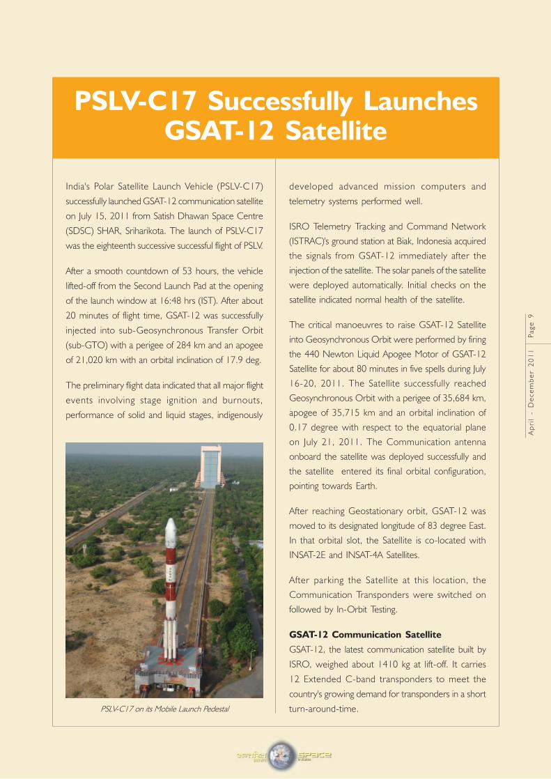
India's Polar Satellite Launch Vehicle (PSLV-C17)
successfully launched GSAT-12 communication satellite
on July 15, 2011 from Satish Dhawan Space Centre
(SDSC) SHAR, Sriharikota. The launch of PSLV-C17
was the eighteenth successive successful flight of PSLV.
After a smooth countdown of 53 hours, the vehicle
lifted-off from the Second Launch Pad at the opening
of the launch window at 16:48 hrs (IST). After about
20 minutes of flight time, GSAT-12 was successfully
injected into sub-Geosynchronous Transfer Orbit
(sub-GTO) with a perigee of 284 km and an apogee
of 21,020 km with an orbital inclination of 17.9 deg.
The preliminary flight data indicated that all major flight
events involving stage ignition and burnouts,
performance of solid and liquid stages, indigenously
developed advanced mission computers and
telemetry systems performed well.
ISRO Telemetry Tracking and Command Network
(ISTRAC)'s ground station at Biak, Indonesia acquired
the signals from GSAT-12 immediately after the
injection of the satellite. The solar panels of the satellite
were deployed automatically. Initial checks on the
satellite indicated normal health of the satellite.
The critical manoeuvres to raise GSAT-12 Satellite
into Geosynchronous Orbit were performed by firing
the 440 Newton Liquid Apogee Motor of GSAT-12
Satellite for about 80 minutes in five spells during July
16-20, 2011. The Satellite successfully reached
Geosynchronous Orbit with a perigee of 35,684 km,
apogee of 35,715 km and an orbital inclination of
0.17 degree with respect to the equatorial plane
on July 21, 2011. The Communication antenna
onboard the satellite was deployed successfully and
the satellite entered its final orbital configuration,
pointing towards Earth.
After reaching Geostationary orbit, GSAT-12 was
moved to its designated longitude of 83 degree East.
In that orbital slot, the Satellite is co-located with
INSAT-2E and INSAT-4A Satellites.
After parking the Satellite at this location, the
Communication Transponders were switched on
followed by In-Orbit Testing.
GSAT-12 Communication Satellite
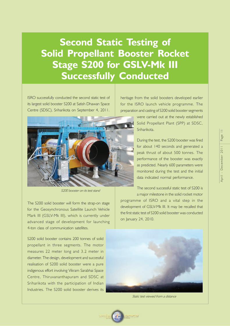
GSAT-12, the latest communication satellite built by
ISRO, weighed about 1410 kg at lift-off. It carries
12 Extended C-band transponders to meet the
country's growing demand for transponders in a short
turn-around-time.PSLV-C17 on its Mobile Launch Pedestal
• Five burn strategy (2 perigee burn and 3 apogee
burn) for taking the GSAT-12 satellite from its
sub-GTO to Geostationary Orbit
Ap
ril
- D
ec
em
be
r 2
01
1 P
ag
e 1
0
The 12 Extended C-band transponders of
GSAT-12 are augmenting the capacity in the INSAT
system for various communication services like
Tele-education, Telemedicine and for Village Resource
Centres (VRC).
Polar Satellite Launch Vehicle PSLV-C17
Polar Satellite Launch Vehicle (PSLV-C17), which was
the XL version of PSLV and launched India's
communication satellite GSAT-12, measured 44.5 m
height, with a lift off weight of 320 tonnes with four
stages of solid and liquid propulsion systems alternately.
In its XL Version, PSLV-XL uses six extended
solid strap-on motors wherein each strap-on carries
12 tonnes of solid propellant. This was the second
time such a configuration was flown, earlier one being
the PSLV-C11/Chandrayaan-I mission.
Salient features of PSLV-C17/GSAT-12 Mission:
• For the first time, use of indigenously designed
and developed On-Board computer (OBC) with
Vikram 1601 processor in both primary and
redundant chains of the vehicle. The OBC
performed the functions of Navigation, Guidance
and Control processing for the vehicle.
• Use of extended solid strap-on configuration
• Satellite injection in a sub-Geosynchronous
Transfer Orbit (GTO)
GSAT-12 Salient features
Mission Communication
Weight 1410 kg (Mass at Lift–off)
559 kg (Dry Mass)
Power Solar array providing 1430 Watts
and one 64 Ah Li-Ion battery
Physical 1.485 x 1.480 x 1.446 m cuboid
Dimensions
Propulsion 440 Newton Liquid Apogee
Motors (LAM) with Mono Methyl
Hydrazine (MMH) as fuel and
Mixed oxides of Nitrogen
(MON-3) as oxidiser for orbit
raising.
Attitude 3-axis body stabilised in orbit
Orbit Control using Earth Sensors, Sun Sensors,
Momentum and Reaction Wheels,
Magnetic Torquers and eight
10 Newton and eight 22 Newton
bipropellant thrusters
Antennae One 0.7 m diameter body
mounted parabolic receive
antenna and one 1.2 m diameter
polarisation sensitive deployable
antenna
Mission life About 8 Years
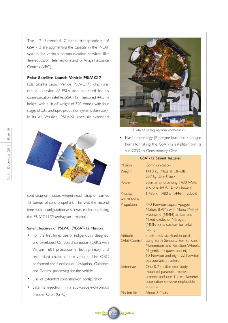
GSAT-12 undergoing tests at cleanroom
Ap
ril
- D
ec
em
be
r 2
01
1 P
ag
e 1
1
Second Static Testing ofSolid Propellant Booster Rocket
Stage S200 for GSLV-Mk IIISuccessfully Conducted
ISRO successfully conducted the second static test of
its largest solid booster S200 at Satish Dhawan Space
Centre (SDSC), Sriharikota on September 4, 2011.
The S200 solid booster will form the strap-on stage
for the Geosynchronous Satellite Launch Vehicle
Mark III (GSLV-Mk III), which is currently under
advanced stage of development for launching
4-ton class of communication satellites.
S200 solid booster contains 200 tonnes of solid
propellant in three segments. The motor
measures 22 meter long and 3.2 meter in
diameter. The design, development and successful
realisation of S200 solid booster were a pure
indigenous effort involving Vikram Sarabhai Space
Centre, Thiruvananthapuram and SDSC at
Sriharikota with the participation of Indian
Industries. The S200 solid booster derives its
heritage from the solid boosters developed earlier
for the ISRO launch vehicle programme. The
preparation and casting of S200 solid booster segments
were carried out at the newly established
Solid Propellant Plant (SPP) at SDSC,
Sriharikota.
During the test, the S200 booster was fired
for about 140 seconds and generated a
peak thrust of about 500 tonnes. The
performance of the booster was exactly
as predicted. Nearly 600 parameters were
monitored during the test and the initial
data indicated normal performance.
The second successful static test of S200 is
a major milestone in the solid rocket motor
programme of ISRO and a vital step in the
development of GSLV-Mk III. It may be recalled that
the first static test of S200 solid booster was conducted
on January 24, 2010.
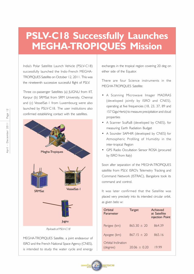
S200 booster on its test stand
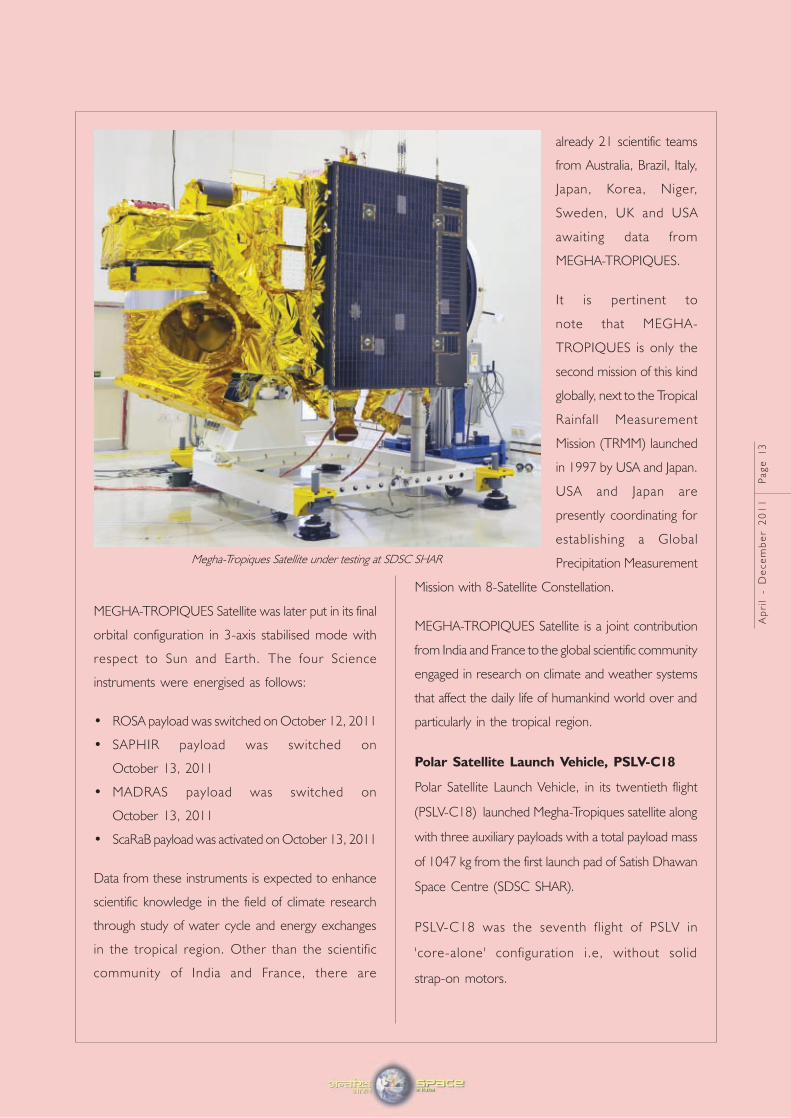
Static test viewed from a distance
India's Polar Satellite Launch Vehicle (PSLV-C18)
successfully launched the Indo-French MEGHA-
TROPIQUES Satellite on October 12, 2011. This was
the nineteenth successive successful flight of PSLV.
Three co-passenger Satellites (a) JUGNU from IIT,
Kanpur (b) SRMSat from SRM University, Chennai
and (c) VesselSat-1 from Luxembourg were also
launched by PSLV-C18. The user institutions also
confirmed establishing contact with the satellites.
MEGHA-TROPIQUES Satellite, a joint endeavour of
ISRO and the French National Space Agency (CNES),
is intended to study the water cycle and energy
PSLV-C18 Successfully LaunchesMEGHA-TROPIQUES Mission
exchanges in the tropical region covering 20 deg on
either side of the Equator.
There are four Science instruments in the
MEGHA-TROPIQUES Satellite:
• A Scanning Microwave Imager MADRAS
(developed jointly by ISRO and CNES),
operating at five frequencies (18, 23, 37, 89 and
157 Giga Hertz) to measure precipitation and cloud
properties
• A Scanner ScaRaB (developed by CNES), for
measuring Earth Radiation Budget
• A Sounder SAPHIR (developed by CNES) for
Atmospheric Profiling of Humidity in the
inter-tropical Region
• GPS Radio Occultation Sensor ROSA (procured
by ISRO from Italy)
Soon after separation of the MEGHA-TROPIQUES
satellite from PSLV, ISRO's Telemetry Tracking and
Command Network (ISTRAC), Bangalore took its
command and control.
It was later confirmed that the Satellite was
placed very precisely into its intended circular orbit,
as given belo w:
Orbital Target AchievedParameter at Satellite
injection Point
Perigee (km) 865.30 ± 20 864.39
Apogee (km) 867.15 ± 20 865.16
Orbital Inclination
(degree) 20.06 ± 0.20 19.99
Ap
ril
- D
ec
em
be
r 2
01
1 P
ag
e 1
2
Payloads of PSLV-C18
SRMSatVesselSat-1
Jugnu
Megha-Tropiques
MEGHA-TROPIQUES Satellite was later put in its final
orbital configuration in 3-axis stabilised mode with
respect to Sun and Earth. The four Science
instruments were energised as follows:
• ROSA payload was switched on October 12, 2011
• SAPHIR payload was switched on
October 13, 2011
• MADRAS payload was switched on
October 13, 2011
• ScaRaB payload was activated on October 13, 2011
Data from these instruments is expected to enhance
scientific knowledge in the field of climate research
through study of water cycle and energy exchanges
in the tropical region. Other than the scientific
community of India and France, there are
Ap
ril
- D
ec
em
be
r 2
01
1 P
ag
e 1
3
already 21 scientific teams
from Australia, Brazil, Italy,
Japan, Korea, Niger,
Sweden, UK and USA
awaiting data from
MEGHA-TROPIQUES.
It is pertinent to
note that MEGHA-
TROPIQUES is only the
second mission of this kind
globally, next to the Tropical
Rainfall Measurement
Mission (TRMM) launched
in 1997 by USA and Japan.
USA and Japan are
presently coordinating for
establishing a Global
Precipitation Measurement
Mission with 8-Satellite Constellation.
MEGHA-TROPIQUES Satellite is a joint contribution
from India and France to the global scientific community
engaged in research on climate and weather systems
that affect the daily life of humankind world over and
particularly in the tropical region.
Polar Satellite Launch Vehicle, PSLV-C18
Polar Satellite Launch Vehicle, in its twentieth flight
(PSLV-C18) launched Megha-Tropiques satellite along
with three auxiliary payloads with a total payload mass
of 1047 kg from the first launch pad of Satish Dhawan
Space Centre (SDSC SHAR).
PSLV-C18 was the seventh flight of PSLV in
'core-alone' configuration i.e, without solid
strap-on motors.
Megha-Tropiques Satellite under testing at SDSC SHAR
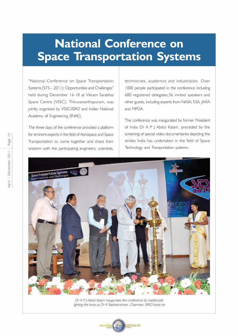
“National Conference on Space Transportation
Systems (STS – 2011): Opportunities and Challenges”
held during December 16-18 at Vikram Sarabhai
Space Centre (VSSC), Thiruvananthapuram, was
jointly organised by VSSC/ISRO and Indian National
Academy of Engineering (INAE).
The three days of the conference provided a platform
for eminent experts in the field of Aerospace and Space
Transportation to come together and share their
wisdom with the participating engineers, scientists,
technocrats, academics and industrialists. Over
1000 people participated in the conference including
680 registered delegates,36 invited speakers and
other guests, including experts from NASA, ESA, JAXA
and MPDA.
The conference was inaugurated by former President
of India Dr A P J Abdul Kalam, preceded by the
screening of special video documentaries depicting the
strides India has undertaken in the field of Space
Technology and Transportation systems.
National Conference onSpace Transportation Systems
Ap
ril
- D
ec
em
be
r 2
01
1 P
ag
e 1
4
Dr A P J Abdul Kalam inaugurates the conference by traditionally
lighting the lamp as Dr K Radhakrishnan, Chairman, ISRO looks on
Ap
ril
- D
ec
em
be
r 2
01
1 P
ag
e 1
5
Mr P S Veeraraghavan, Director, VSSC and
Chairman, Organising Committee welcomed the
delegates and guests who thronged the venue of the
inaugural function. Dr Baldev Raj, President, INAE
made the presidential address. Dr K Radhakrishnan,
Chairman, ISRO delivered a special address.
Mr S Ramakrishnan, Director, Liquid Propulsion
Systems Centre introduced the conference theme
and the keynote speaker.
Dr Kalam, in his keynote address, elaborated on
World Space Vision 2050, the challenges facing the
space community in the decades ahead as well as on
the use of space to mitigate the impending global
energy crisis. The conference publications were
released during the inaugural ceremony by
Dr T K Alex, Director, ISRO Satellite Centre. The
publications included a souvenir which contained the
abstracts of all technical papers selected for the
conference, a CD containing the proceedings and
anexhibitors’ directory. Shri MC Dattan, Director,
Satish Dhawan Space Centre offered felicitations.
Mrs J Geetha, Organising Secretary, offered a vote
of thanks to all the participants.
A host of sessions on wide ranging topics related to
Space Transportation Systems were began after the
inaugural function. Eleven plenary sessions were
organised featuring national and international experts
in the field elaborating on the state of the art as well as
the challenges and highlighting opportunities in the
road ahead.
95 papers were presented in 22 technical sessions
organised on specific areas covering the entire gamut
of Space Transportation Systems and Technology.
Six parallel sessions were conducted at different venues
and the best paper in each session was awarded a
cash prize and a certificate of merit. Each technical
session featured invited talks by eminent experts in
the field elaborating on key topics, followed by
the presentation of papers. In addition, 75 papers
were presented as posters, which were evaluated
under five categories and the best posters were also
awarded prizes.
Some of the areas focused upon in the technical
sessions include Expendable and Reusable Launch
Vehicles, Advanced Propulsion Concepts for Launch
Vehicles, Spacecraft systems and Planetary Sciences.
Emerging technologies in different areas were
highlighted including Navigation, Guidance, Control,
Space Materials, Avionics Systems, Power Systems,
Fabrication, Aerospace Structures, etc. Papers were
presented on Human Presence in Space, Launch
Space Environment, Life Support Systems, Sensors and
Mission Planning. Discussions on Commercialisation of
Space and Space Medicine also featured in the sessions.
A major exhibition showcasing the great strides made
by the nation in the field of Aeronautics and Space
Transportation was also organised at the venue.
The three day Conference was concluded with a panel
discussion. The panel was chaired by
Dr S C Gupta and the panelists comprised of
distinguished experts in different areas of Space
Transportation Systems including many of plenary
session speakers.
STS-2011 had a rich content in terms of participation,
the breadth and depth of discussions and the response
from the delegates. The Conference was concluded
with the hope that more such events would be
organised yearly or biennially to provide a platform for
experts in the field of Space Transportation Systems
and Space Technology to come together and serve as
a catalyst for further advances in the field.s
Q.1 As the first Director of National Remote
Sensing Centre (NRSC), ISRO, what were your
priorities and what was your Vision for NRSC?
Over the years, NRSA, the earlier avatar of NRSC,
has served the remote sensing community in the
country and abroad in a most distinguished way and
has been recognised for its operational delivery of
data products and services. With the conversion into
a full-fledged Centre under ISRO, NRSC has a well
cut responsibility to integrate fully with other ISRO
Centres to develop innovative solutions and public
good services to the users in a more concerted
manner without compromising on efficiency and
efficacy. Hence, I envisioned NRSC to strive to
position itself as a globally leading knowledge institution
towards developing and efficiently delivering
affordable, actionable, “niche” geospatial products and
services involving industry and academia; and meeting
the ever growing public good, strategic and commercial
needs of the nation by continuously harnessing the
advances in Earth Observation science and
technologies.
Accordingly, the priorities were set in defining a mission
oriented approach with definite timelines for the
following activities:
• Developing a warehouse of accessible, affordable
and actionable knowledge products and services.
Thus, the immediate step of reducing the
prices of IRS satellites’ data products by
30-50% earmarked this intention.
• Ensuring a streamlined demand-supply chain with
effective delivery mechanisms through real time,
web-based services; populating free-ware tools
for access to data products and services.
BHUVAN, BHOOSAMPADA, and WRIS initiatives
exemplified this process.
• Fusing knowledge management and business
process re-engineering through operationalisation
of Integrated Multi-mission Ground segment for
Earth Observation Satellites (IMGEOS) with
efficient multi-mission data acquisition and
processing mechanism for improved turn-around-
time for products delivery.
• Working towards NRSC-ANTRIX axis for coping
with global competition and global outreach
• Regenerative skills development and breeding
NextGen leaders; Manpower auditing and
recruiting bright youngsters in multi-disciplines and
training the middle-managers emphasised this
approach.
• R&D Initiatives in newer areas, Interface with
Academia and Industry, Initiatives in climate change
adaptation, early warning of disasters, and
• Capacity building and awareness programmes
Interview with Dr V JayaramanFormer Director, NRSC, ISRO
Ap
ril
- D
ec
em
be
r 2
01
1 P
ag
e 1
6
Dr V Jayaraman
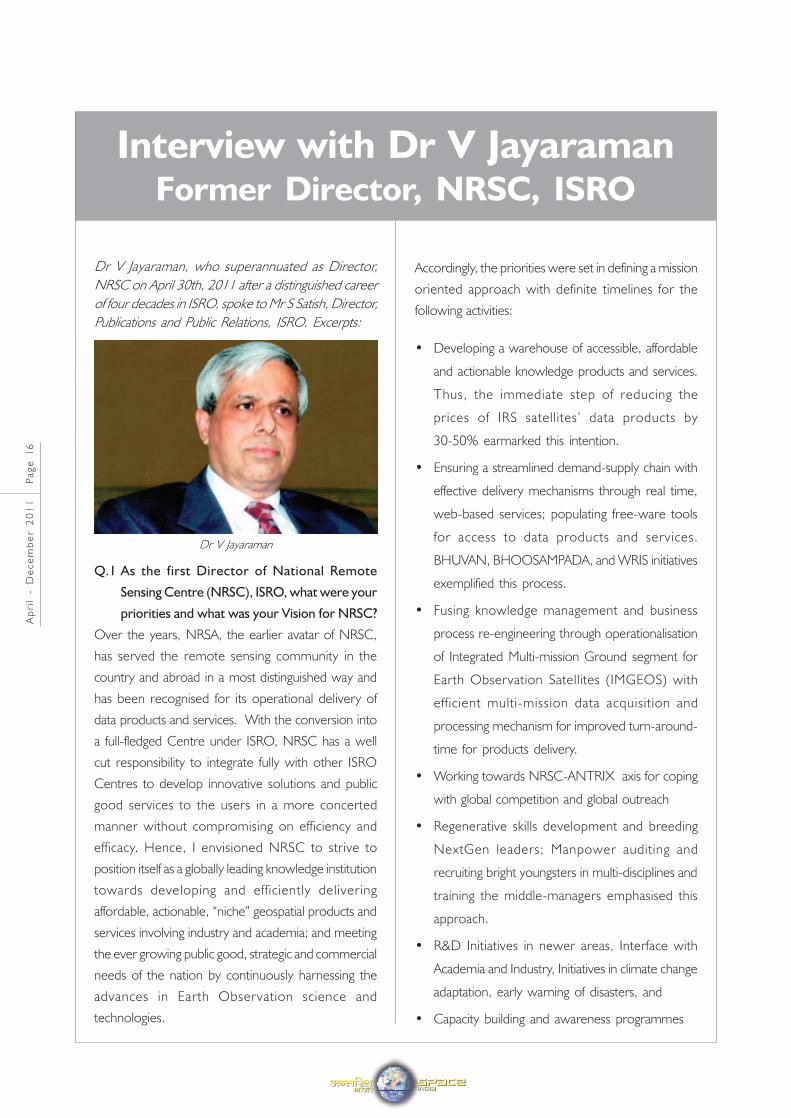
Dr V Jayaraman, who superannuated as Director,
NRSC on April 30th, 2011 after a distinguished career
of four decades in ISRO, spoke to Mr S Satish, Director,
Publications and Public Relations, ISRO. Excerpts:
Ap
ril
- D
ec
em
be
r 2
01
1 P
ag
e 1
7
Apart from the above, NRSC had immediate
challenges of adopting changed governmental
accounting procedures and also had to take
immediate steps to ensure continued pension for the
retirees. Also, operationalisation of COWAA was one
more focus in tune with the other ISRO/DOS centres.
The merger into ISRO has facilitated NRSC to
effectively deal with various user departments in the
Government sector as a full partner towards realising
the fullest potential by expanding the public good
services both from satellite and aerial platforms.
Further, amalgamation of the Regional Remote Sensing
Service Centres (RRSSCs) into NRSC was envisaged
a system towards strengthening the above efforts to
address the specific needs of the respective States
and the region in a more focused manner. Finally,
this process of Governmentalisation was a win-win
situation for all the stake-holders, and I enjoyed every
moment of my stay in NRSC.
Q.2 You have all along been associated with Remote
Sensing programme such as development of
satellite systems and their use under NNRMS.
How did you see yourself in the role of a service
provider from NRSC?
In my opinion, it was just an extension of the job I
was carrying out earlier. With experience in
concurrently handling three major programmes as
Director of Earth Observations Programme; Director,
NNRMS-RRSSC; and Programme Director,
ISRO-Geosphere Biosphere Programme (ISRO GBP),
I had necessary exposure, be it in the science,
technology and application domains, in dealing with
the expectations of the user community, covering areas
from cartography to climate, both at national and at
international levels. I was also closely associated with
NRSA through its Governing Society, Governing
Board, and Finance Sub-committee activities for more
than a decade, besides working closely with the
ground segment development of IRS satellites at NRSA
as well as in defining the archival and pricing policies.
I was also part of many NNRMS user projects and
missions as well as capacity building exercises. In fact,
my association with NRSA spans over more than
25 years from IRS-1A onwards in various capacities.
So when I moved over to NRSC, I found that it was
just a logical other side of the table. It enabled me to
further understand the nuances of user interactions
more closely.
Q.3 Could you tell us something about BHUVAN
and the user feedback on the same?
Over the past two decades, ISRO has spearheaded
myriad unique applications from a rich repository of
images collected from a versatile thematic series of
IRS satellites and they have been successfully
institutionalised in many important areas of policy
making, natural resources management, and disaster
support towards enhancing the quality of life across
all sections of the society. BHUVAN is an initiative to
showcase these distinctive features of Indian imaging
capabilities including the thematic information derived
thereon in the geospatial domain providing 2D and
3D visualisation products and services through a web
portal for easy access. BHUVAN strives to provide
the geospatial information on basic natural resources,
enabling real time fusion and streaming of massive
satellite data and thematic map information on the
“fly”. Thus, BHUVAN is essentially envisaged as a
window to ingress into different services ISRO has
been providing to the users.
It was a matter of great satisfaction for me when we
launched BHUVAN within a few months after NRSC
became an ISRO Centre. Yes, there were brickbats
in the initial days and I should congratulate the young
inter-centre team which withstood the tremendous
societal pressure to bring out a world class product
ultimately. Later, we have been receiving very
encouraging feedback from the users even as
BHUVAN portal started adding more and more
features such as map navigation, panning and adding
various developers’ tools incorporating the features
of interoperability as per Open Geospatial Consortium
(OGC) Standards. The robust and open API with
rich capabilities provided by BHUVAN can be utilised
in a wide range of applications by the users. Thus, it
was a moment of glory when BHUVAN was found
as one of the top-10 most popular Google searched
subjects in India during 2009. The crowning glory
was when BHUVAN was chosen as the ‘Website of
the Month’ by the Open Geospatial Consortium
(OGC) in December 2010.
BHUVAN is constantly getting updated and I am sure,
with the recent RSDP 2011, it will have much more
focused geospatial contents in the coming days
competing with the contemporary services anywhere
in the world.
Q.4 Can you elaborate on the new initiative of
NRSC namely, the Integrated Multi-mission
Ground Segment for Earth Observation
Satellites (IMGEOS), and in what way it will be
beneficial to the users?
The essential feature of IMGEOS is towards process
re-engineering of all the related activities to have an
improved near-real time data delivery mechanism in
tune with the expectation of the users. It calls for a
network-centric approach with a multi-tier storage
system and automated processes to clear the data
products within a few hours after data reception.
As mentioned earlier, ISRO has been planning a
thematic series of satellites for land and water resources
management; large scale cartographic applications;
and weather and climate applications. IMGEOS aims
to have a unified system addressing the needs of the
new sensors in terms of varying data rates and
formats, and when in place, IMGEOS is expected to
revolutionise the data delivery services from NRSC
in a very significant manner. Obviously, such a unified
system should provide a better turn-around-time for
the products benefiting the end users. We are planning
to process more than 1000 data products per day,
and particularly in disaster scenario, the data supply
should be within a few hours.
Q.5 Can you briefly tell about the ambitious Master
Plan in NRSC Shadnagar Campus initiated by
you?
You are aware that NRSC Earth Station is located at
Shadnagar around 65 Kms from Hyderabad wherein
we have more than 300 acres of land. The current
Balanagar Campus is highly congested and located in
an industrial area which will not allow any further
expansion commensurate with the growing needs of
the user community. Even as NRSC is planning to
have a dedicated IMGEOS activity and associated
infrastructure, it has been considered essential to have
a Master Plan for the whole campus, both at Balanagar
and Shadnagar, looking ahead towards meeting the
needs of the next 20 years including the upcoming
infrastructure for National Database for Emergency
Management (NDEM) and many other national and
international initiatives. The Master Plan envisages
developing the total area at Shadnagar into 5 zones –
Technical area, Technical support systems area,
facilities area, residential area and bio-consideration
area. The elevated high-bay area of the campus in
the northern part has been identified for locating the
antenna terminals and technical activities with the
residential and other facilities located at the southern
part. The redeeming feature of the Master Plan is
the use of Green Technology for building the
infrastructure, ensuring all environment friendly
technologies. NRSC is aiming to achieve Platinum LEED
rating and I hope they succeed as it would be once
again a first-of-its-kind effort in ISRO. Towards this,
NRSC is planning to have a solar power station
providing of 200 KWP, a huge effort, meeting almost
7.5% of the total power from solar energy. I think it
is yet another major initiative by NRSC, which will
also serve as a bench-mark for taking up similar such
projects elsewhere in ISRO.
Ap
ril
- D
ec
em
be
r 2
01
1 P
ag
e 1
8
Ap
ril
- D
ec
em
be
r 2
01
1 P
ag
e 1
9
Q.6 In your long tenure of nearly four decades in
ISRO, how do you see the evolution of remote
sensing programme in the country?
I have been fortunate to be associated with the Indian
Remote Sensing programme starting from the
Bhaskara-I and II days till the recent Resourcesat-2
mission in various capacities and have seen a quantum
jump in terms of technological capabilities both in the
space and ground systems, thanks mainly to the
development of high quality electro-optics systems
and very high volume data handling capability, essentially
due to increasing computing power and broadband
networking capability. It is really mind boggling to note
the quantum jump we have made just in 20 odd
years in terms of spatial resolution from the 1 km in
BHASKARA missions to better than 1 metre in TES
and Cartosat 2 missions, not to speak of 100 kbps
data rate then to near Giga bit now. The advent of
multi-frequency, multi-polarisation microwave remote
sensing and the emerging advances in hyperspectral
imaging, and development of many quantitative
products and modelling aspects is yet another facet
of remote sensing programme around the world.
Meanwhile, remote sensing itself has moved from an
era of awe to a common man forte with Google Earth
and the like services exploding the myth and reaching
larger populace with ease. The world has also seen
the concerns for global warming and climate change
adaptation, calling for more concerted international
cooperation in the Earth Observation initiatives to
monitor the Essential Climate Variables (ECVs).
ISRO has also emerged as one of the leading players
in the world, contributing to its might to the virtual
constellation of EO Satellites in the CEOS and GEOSS
domains. Correspondingly, there have been
enhanced capabilities in image processing, GIS and
GPS, once again enabled by convergence of pervasive
digital technologies. There have been corresponding
developments on the ground segment with emphasis
moving towards generating knowledge products and
services, and delivering them in real time for many
researchers working on modelling, be it on weather
or in climate applications. This convergence of
technologies in miniaturised devices and instruments,
and shrinking of satellite sizes will lead to developments
such as sensor web, formation flying, and event
triggered missions providing the geospatial information
in 3D and 4D domains more operationally not so far
in the future. In short, the future will be much more
exiting for the remote sensing community, and I am
sure, ISRO and NRSC will have a major role in shaping
that future.
Parliamentary Standing Committee onScience and Technology, Environment and
Forests visits ISRO, Bangalore
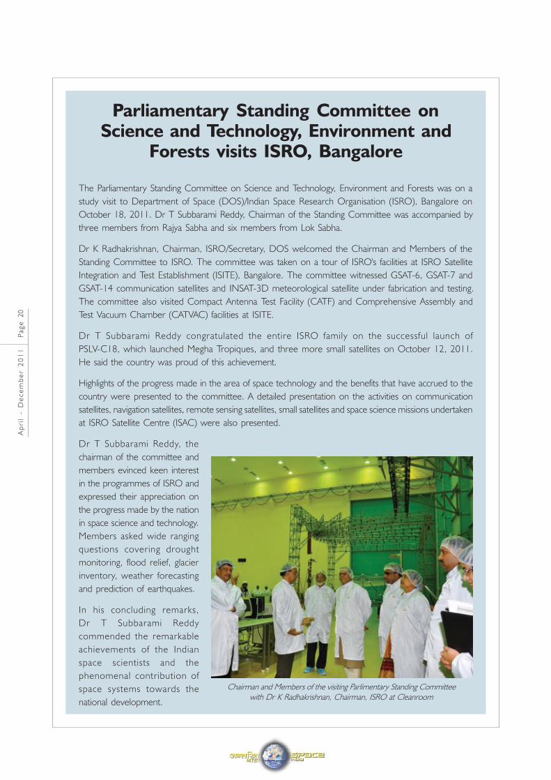
The Parliamentary Standing Committee on Science and Technology, Environment and Forests was on a
study visit to Department of Space (DOS)/Indian Space Research Organisation (ISRO), Bangalore on
October 18, 2011. Dr T Subbarami Reddy, Chairman of the Standing Committee was accompanied by
three members from Rajya Sabha and six members from Lok Sabha.
Dr K Radhakrishnan, Chairman, ISRO/Secretary, DOS welcomed the Chairman and Members of the
Standing Committee to ISRO. The committee was taken on a tour of ISRO's facilities at ISRO Satellite
Integration and Test Establishment (ISITE), Bangalore. The committee witnessed GSAT-6, GSAT-7 and
GSAT-14 communication satellites and INSAT-3D meteorological satellite under fabrication and testing.
The committee also visited Compact Antenna Test Facility (CATF) and Comprehensive Assembly and
Test Vacuum Chamber (CATVAC) facilities at ISITE.
Dr T Subbarami Reddy congratulated the entire ISRO family on the successful launch of
PSLV-C18, which launched Megha Tropiques, and three more small satellites on October 12, 2011.
He said the country was proud of this achievement.
Highlights of the progress made in the area of space technology and the benefits that have accrued to the
country were presented to the committee. A detailed presentation on the activities on communication
satellites, navigation satellites, remote sensing satellites, small satellites and space science missions undertaken
at ISRO Satellite Centre (ISAC) were also presented.
Dr T Subbarami Reddy, the
chairman of the committee and
members evinced keen interest
in the programmes of ISRO and
expressed their appreciation on
the progress made by the nation
in space science and technology.
Members asked wide ranging
questions covering drought
monitoring, flood relief, glacier
inventory, weather forecasting
and prediction of earthquakes.
In his concluding remarks,
Dr T Subbarami Reddy
commended the remarkable
achievements of the Indian
space scientists and the
phenomenal contribution of
space systems towards the
national development.
Ap
ril
- D
ec
em
be
r 2
01
1 P
ag
e 2
0
Chairman and Members of the visiting Parlimentary Standing Committee
with Dr K Radhakrishnan, Chairman, ISRO at Cleanroom
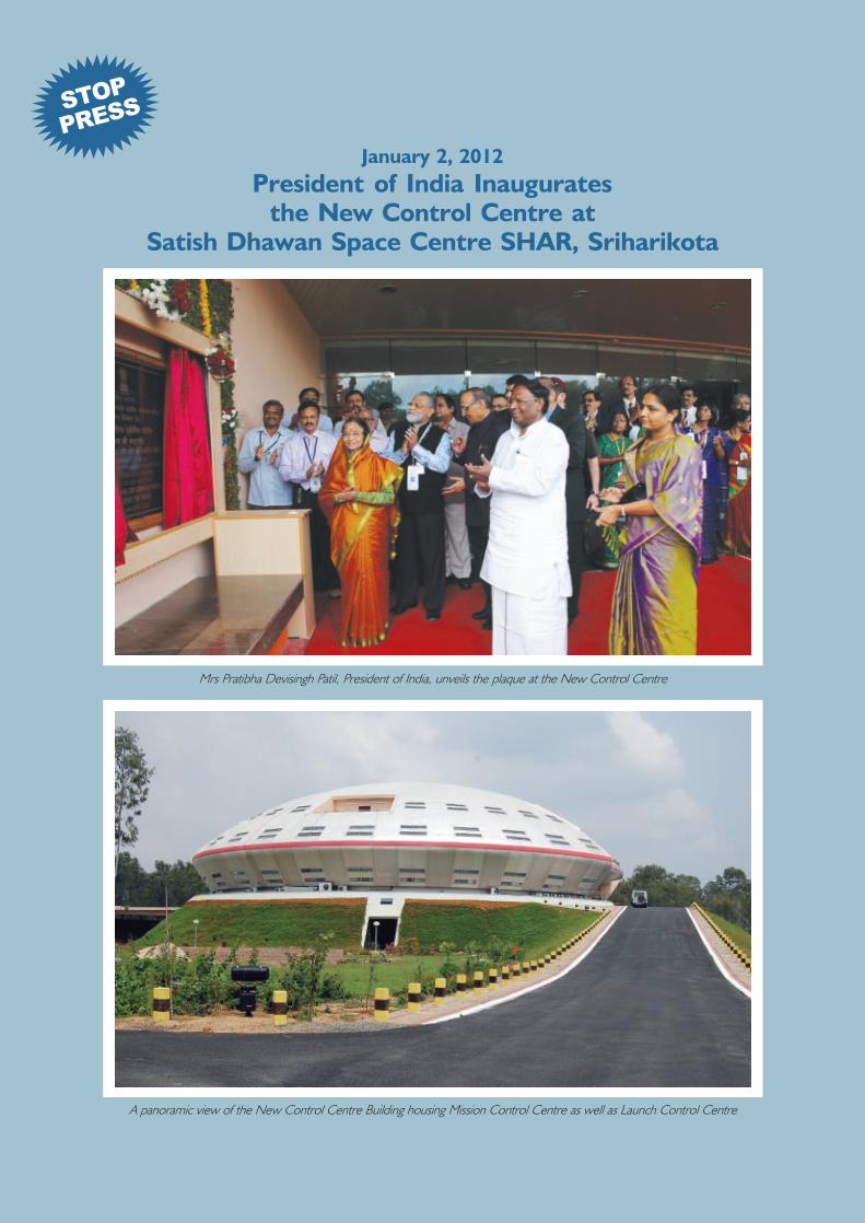
January 2, 2012
President of India Inauguratesthe New Control Centre at
Satish Dhawan Space Centre SHAR, Sriharikota
Mrs Pratibha Devisingh Patil, President of India, unveils the plaque at the New Control Centre
A panoramic view of the New Control Centre Building housing Mission Control Centre as well as Launch Control Centre
STOP
PRESS
Indian Institute of Remote Sensing, Dehradun which has recently become an ISRO Unit
Related Documents