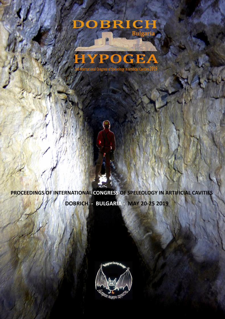
PROCEEDINGS OF INTERNATIONAL CONGRESS OF SPELEOLOGY IN ARTIFICIAL CAVITIES DOBRICH - BULGARIA - MAY 20-25 2019

Welcome message from author
This document is posted to help you gain knowledge. Please leave a comment to let me know what you think about it! Share it to your friends and learn new things together.
Transcript
PROCEEDINGS OF INTERNATIONAL CONGRESS OF SPELEOLOGY IN ARTIFICIAL CAVITIES
DOBRICH - BULGARIA - MAY 20-25 2019
PROCEEDINGS OF INTERNATIONAL CONGRESS
OF SPELEOLOGY IN ARTIFICIAL CAVITIES
HYPOGEA2019
Dobrich, Bulgaria, 20-25 May 2019
RNATIONAL CONGRESS OF SPELEOLOGY IN ARTIFICIAL CAVITIES
DOBRICH - BULGARIA - MAY 20-25 2019

Proceedings of International Congress of Speleology in Artificial Caves
HYPOGEA2019
Dobrich , Bulgaria , 20/25 May 2019
Editors
Alexey Zhalov, Vanyo Gyorev, Peter Delchev
Scientific Committee
Mario Parise, Boaz Zissu,Carla Galeazzi, Alexey Gunko, Bogdan Ridush ,Carlo Germani ,
Kamen Bonev, Laurent Triolet ,Magdalena Stamenova , Nodar Bakhtaze , Valeri Kinov
Organization Committee
Alexey Zhalov,Yordan Yordanov, Carla Galeazzi, Mario Parise,
Dobri Dobrev , Kamen Bonev, Valentin Pletnyov , Valeri Kinov , Vanyo Gyorev
Graphic Design
Alexey Zhalov, Vanyo Gyorev, Peter Delchev
Photos
Front Cover: Konstantinos Bakolitsas , Qanat of Bulgarain Monastery, Athos, Greece
Back Cover: Alexey Zhalov, Millstone Quarry , Varna, Bulgaria
Patronages and Sponsors
UIS, International Union of Speleology
FSE, European Speleological Federation
Hypogea Federation - Italy
Municipality of Dobrich
Bulgarian Caving Society
Regional Museum of History - Dobrich
Varna Archaeological Museum
Rousse Regional Museum of History
ISBN 978-619-7526-01-1
HYPOGEA 2019 - PROCEEDINGS OF INTERNATIONAL CONGRESS OF SPELEOLOGY IN ARTIFICIAL CAVITIES – DOBRICH , MAY 20-25 2019
Table of Contents
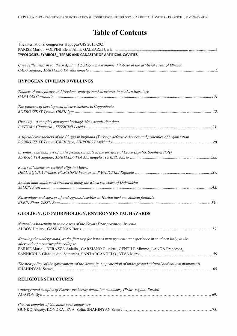
The international congresses Hypogea/UIS 2015-2021
PARISE Mario , VOLPINI Elena Alma, GALEAZZI Carla ........................................................................ .……………………….І
TYPOLOGIES, SYMBOLS_ TERMS AND CADASTRE OF ARTIFICIAL CAVITIES
Cave settlements in southern Apulia. DDACO – the dynamic database of the artificial caves of Otranto
CALO Stefano, MARTELLOTA Mariangela ………………………………………………………………………………………..…….…………………. …. .1
HYPOGEAN CIVILIAN DWELLINGS
Tunnels of awe, justice and freedom: underground structures in modern literature
CANAVAS Constantin …………………………………………………………………………………………………………………………..……………………... 7.
The patterns of development of cave shelters in Cappadocia
BOBROVSKYY Tymur, GREK Igor …………………………………………………………………………………………………………. …………………….. 12.
Orte (vt) – a complex hypogean heritage. New acquisition data
PASTURA Giancarlo , TESSICINI Letizia …………………………………………………………………………………………… ……………………...21.
Artificial cave shelters of the Phrygian highland (Turkey): defensive devices and principles of organisation
BOBROVSKYY Tymur, GREK Igor, SHIROKOV Mykhailo ……………………………………………………………………. ………………………. 28.
Inventory and analysis of underground oil mills in the territory of Lecce (Apulia, Southern Italy)
MARGIOTTA Stefano, MARTELLOTTA Mariangela , PARISE Mario ………………………………………………….. ……………………...33.
Rock settlements on vertical cliffs in Matera
DELL’AQUILA Franco, FOSCHINO Francesco, PAOLICELLI Raffaele …………………………………………..… ……………………....39.
Ancient man-made rock structures along the Black sea coast of Dobrudzha
SALKIN Asen …………………………………………………………………………………………………………………………………….. ………………..…….45.
Excavations and surveys of underground cavities at Hurbat husham, Judean foothills
KLEIN Eitan, ZISSU Boaz…………………………………………………………………………………………………………………… ………………….….51.
GEOLOGY, GEOMORPHOLOGY, ENVIRONMENTAL HAZARDS
Natural radioactivity in some caves of the Vayots Dzor province, Armenia
ALBOV Dmitry , GASPARYAN Boris …………………………………………………………………… ………………. 57.
Knowing the underground, as the first step for hazard management: an experience in southern Italy, in the
aftermath of a catastrophic collapse
PARISE Mario , DERAZZA Aniello , GARZIANO Giuditta , GENTILE Mimmo, LANGA Francesca,
SANNICOLA Gianclaudio, Samantha, SANTARCANGELO , VIVA Marco ……………………………………………. . 59.
The new policy of the government of the Armenia on protection of underground cultural and natural monuments
SHAHINYAN Samvel …..…………………………………………………………………………………. ………………..65.
RELIGIOUS STRUCTURES
Underground complex of Pskovo-pechersky dormition monastery (Pskov region, Russia)
AGAPOV Ilya ………………………………………………………………………………………………………………. 69.
Central complex of Gochants cave monastery
GUNKO Alexey, KONDRATEVA Sofia, SHAHINYAN Samvel ……………………………………….. ……………….75.
Rock-cut caves of medieval Orhei (Republic of Moldova)
RIDUSH Bogdan, BOBROVSKI Timur, GHEORGHE Postica …………………………………………...…………………. 83.
Hypogea of San Pietro in Vincoli at Sant’Angelo in grotte
CARNEVALI Laura, CARPICECI Marco , ANGELINI Andrea ………………………………………… ………………….88.
Crypta Neapolitana (Naples, Italy) A multidisciplinary underground heritage site
FERRARI Graziano , LAMAGNA Raffaella, ROGNONI Elena ………………………………………….. ………………….94.
Cave complex in Valuiki
GUNKO Alexey, KONDRATEVA Sofia , GUNKO Alexander ………………………………………... ………………….100.
Creation of new map documentation of the rock cloisters on the periphery of Shumen’s plateau 2012 - 2019
STOICHKOV Konstantin ………………………………………………………………………………… ………………….106.
Via Crucis in the caves of Divnogorsky monastery in Voronezh region, Russia
STEPKIN Vitaly ………………………………………………………………………………………….. ………………….110.
Architectural peculiarities of religious cavities complex in the Ihlara valley (Cappadocia)
IANOVSKAIA Ekaterina ………………………………………………………………………………… ………………….116.
Cave necropolis in the vicinity of Kizilin village, Adiyaman province, Turkey
ZHALOV Alexey , STOICHKOV Konstantin …………………………………………………………… ……………… .121.
Underground explorations at Horvat Qasra, southern Judean foothills, Israel
ZISSU Boaz, KLONER Amos …………………………………………………………………………….…………………. 125.
New considerations on the architectural structure of the Vardzia rock-cut ensemble and peculiarities of t
he ongoing monastic life
BAKHTADZE Nodar …………………………………………………………………………………….. ………………….131.
HYDRAULIC UNDERGROUND WORKS
The resurgence near Yarimburgaz cave
Şengül G. AYDINGÜN, Haldun AYDINGÜN, Metin ALBUKREK, Gülşen ÜSTÜN, Berk ÜSTÜN…..………………….139.
The artificial drainage system of Gabii (or Castiglione) lake in Latium, Italy. A comparison among the I
nvestigations of the '90s and a recent study aiming at a possible restoration of the Old lake basin
CALOI Vittoria , GERMAN Carlo, GALEAZZI Carla ………………………………………………… …………………...143.
Water itakes and sewrage facilities of Bulgarian St.George the Zograf monastery in Mount Athos, Greece
ZHALOV Alexey, STOICHKOV Konstantin ……………………………………………………………..………………….149.
MINING WORKS
Iron hearth: the re-exploration of the old mine “Manina” (Italy)
BELVEDERI Giovanni, GARBERI Maria Luisa ………………………………………………………… ………………….154.
Sasso rancio: an iron mine on Lake Como (Italy)
FERRARI Graziano, ROGNONI Elena, BELVEDERI Giovanni, GARBERI Maria Luisa…………………………………. 160.
Underground limestone quarries in Tula region, Venyov district (Russia)
GARSHIN Dmitry, GARSHINA Yulia, STRUKOV Stanislav, DOLOTOV Yury…………………………………………. 166.
Limestone mines nearby village Maleevo Ryazan region
LEONTEV Michael ………………………………………………………………………………………. ………………….178.
The geosite of Tabuna and Streppenosa asphalt mines (Ragusa, South-east Sicily)
RUGGIERI Rosario , TRICOMI Salvatore …………………………………………………………………………………. 181.
The problem of abandoned mines – only hazards? A case study from the Nízký jeseník upland (Czech)
SCHUCHOVÁ Kristina , LENART J., FALTEISEK L., BÍLÁ J., KUPKA J. ………………………….. ………………….186.
MILITARY AND WAR WORKS (DEFENSIVE)
Second world war air-raid shelters in genoa (Italy): knowledge, protection and use of an underground historical
and cultural heritage in urban environment
BIXIO Roberto, FACCINI F., PERASSO L, PIANA P., SAJ Stefano., TRAVERSO M… ……………. ………………….191.
Underground Military Objects in Serbia
MILOSAVLJEVIC Nemanja ………………………………………………………….………………………….. ………………….197.
***
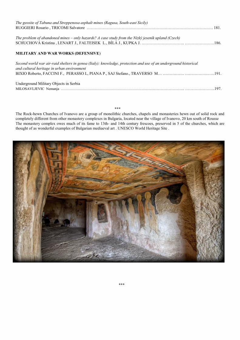
The Rock-hewn Churches of Ivanovo are a group of monolithic churches, chapels and monasteries hewn out of solid rock and
completely different from other monastery complexes in Bulgaria, located near the village of Ivanovo, 20 km south of Rousse
The monastery complex owes much of its fame to 13th- and 14th century frescoes, preserved in 5 of the churches, which are
thought of as wonderful examples of Bulgarian mediaeval art . UNESCO World Heritage Site .
***
HYPOGEA 2019 - PROCEEDINGS OF INTERNATIONAL CONGRESS OF SPELEOLOGY IN ARTIFICIAL CAVITIES – DOBRICH , MAY 20-25 2019
AS A FOREWORD
THE INTERNATIONAL CONGRESSES
HYPOGEA/UIS 2015-2021
Mario PARISE*, Elena Alma VOLPINI**, Carla GALEAZZI***
* President of UIS Commission of Speleology on Artificial Cavities
** President of HYPOGEA
*** Secretary of UIS Commission of Speleology on Artificial Cavities
UIS International Union of Speleology is the world reference organization for the scientific speleological activities,
formed in 1965, counting members from all continents, represented by a delegate from each country (this delegate
acts as the representative of all the country's cavers and speleologists). An elected Bureau runs the affairs of the UIS
between the once-every-four-years General Assembly meetings held at the International Congresses. The actual spe-
leological work of the UIS is done by the members of its Commissions and Working Groups, which are open to eve-
ryone who is interested.
The Commission on Artificial Cavities is a part of the Department of Scientific research at UIS. The updated mem-
bers of the Commission belong from the following countries: Australia, Belgium, France, Great Britain, Ireland, Isra-
el, Italy, Netherlands, Portugal, Russia, Turkey and United States of America.
HYPOGEA Research and valorization artificial cavities is a Federation of Associations: ASSO, Egeria Centro Ri-
cerche Sotterranee e Roma Sotterranea. The three organizations joined together to combine and integrate their re-
spective areas of expertise in the knowledge, preservation, management and protection of the Italian underground
cultural heritage.
Cooperation between UIS Commission on Artificial Cavities and Hypogea Federation was very useful for sharing
studies in artificial cavities at the international level. Hypogea2015, the first International Congress of Speleology in
Artificial cavities took place in Rome (Italy); Hypogea2017, born of the same collaboration, was held in Cappadocia
(Turkey) and today, in Bulgaria, we are celebrating the third international appointment: Hypogea2019.
The main goal of the Hypogea/UIS Congresses is to continue the exchange of experiences acquired at the interna-
tional level in the field of artificial cavities, also in conjunction with the other activities of the UIS Commissions.
So, the story does not stop here… which destination will host the next Hypogea2021 congress?
CADASTRE OF ARTIFICIAL CAVITIES
HYPOGEA 2019 - PROCEEDINGS OF INTERNATIONAL CONGRESS OF SPELEOLOGY IN ARTIFICIAL CAVITIES – DOBRICH , MAY 20-25 2019
1
CAVE SETTLEMENTS IN SOUTHERN APULIA.
DDACO – the DYNAMIC DATABASE of the ARTIFICIAL CAVES of OTRANTO
Stefano Calò 1, Mariangela Martellotta 2
1 Gruppo Speleologico Leccese ‘Ndronico, Via Regina Isabella, 1, 73100 Lecce (LE)/Federazione Speleologica
Pugliese, c/o Museo F. Anelli 70013- Castellana Grotte (BA), [email protected], 2 Gruppo Speleologico Leccese
‘Ndronico, Via Regina Isabella, 1, 73100 Lecce (LE)/Federazione Speleologica Pugliese, c/o Museo F. Anelli 70013-
Castellana Grotte (BA), [email protected]
Absrtact
The cave settlements phenomenon in Southern Italy show cultural similarities with those present in several other
Mediterranean countries. In Salento (Apulia, Southern Italy), there are several types of cave settlements: from small
villages (composed by few units), to underground churches, to complex rupestrian villages, many of them showing
common features with the sub-divo settlements. The inhabited areas in cliff of the sub-region of Salento develop him
with some meaningful cultural expressions that are noticed both in the zone of “SerreSalentine” that in the oriental
areas. The spectacular Italian rocky landscape which best testifies the ancient relationship between man and nature of
southern Italy, Otranto, cultural heart of the East Salento, has been object of an analytical and systematic investigation
that has brought to the census of the numerous rupestrian hypogea and it has contributed besides to define the civil
character of an ample settlement revealed him partly similar, in the organization and in the structure, to the urban
inhabited areas. The gotten data are also inserted in an useful database for the realization of projects related to the
guardianship and to the exploitation of the territory through the creation of forms of sustainable eco-tourism.
Aim of this paper is to study the rupestrian landscape of Otranto, Eastern Salento, where a systematic analysis has
contributed to construct a register of all cave units. To this day has been registered in the regional cadastre of caves over
140 hypogea of which a part has become object of study for close examinations, seen their peculiar characteristics.
Besides the single caves, during the exploratory and documentation step, edited by speleo-archaeologists, are picked up
data in field relative also to characterizing elements of the rupestrian landscape, traces of anthropization to unearth
through the involvement of experts of geology, archaeology etc., actual natural phenomena and signs of the
environmental conditions and the landscape changes (today above all agrarian). We have realized there that just with a
work documentation could be aspire to something that was not a job "static" but a project "dynamic": first of all
something that could involve the same city of Otranto and to widen its tourist perspectives on one side and to guarantee
its preservation of the historical identity from the other.
Keywords
Cave settlements, Apulia, Otranto, eco – tourism, database
1. Introduction
DDACO project – "DYNAMIC DATABASE of the
ARTIFICIALS CAVES of OTRANTO", coordinated by
two speleologists that in the life they respectively deal him
withArchaeology and of Architecture, he has taken the
movements from a job undertaken in 2012 on the study of
some rocky installations of Southern Apulia.
Before it spoke of villages and rocky settlements in
Apulia, the scientific interest for this phenomenon it was
focused on the analysis of the church-crypts.
Those that was evaluated mostly worthy from the artistic
and architecturalpoint of view, they were object of a study
and an academic orientation extremely shallowand end an
ends to in themselves that, beginning from the end of the
Nineteenth Century, it saw the diffusion of the vision
"panmonastica" according to which all the demonstrations
of Byzantine art in rocky environmentother they were not
that the consequence of the cultural importation operated
by the italo-Greek monks, come in italic territory during
the persecutions iconoclasts.
According to this orientation all the caves and the hypogea
were considered unquelyas“hemitagecrypts”and monastic
installationsand it were begun to define them
indiscriminately and wrongly "basiliani" (Gabrieli, 1936;
Medea, 1939).
Among the years Sixty and Seventy of the 20th
Centuryit
were begun to speak of rocky settlementswith civil
characteristics, moving in this way the attention from the
religious sphere to that laic and showing as these
settlementswere the expression of a housing tendency not
necessarily tied up to the monastic phenomenon.(Fonseca,
1970-1975).
Despite the meaningful goalsreached , the searches on
these rocky settlements don't use yetcomplete and
systematicinvestigationsneither topographical neither
archaeological. In accordance of this was initiated an
analytical study that has allowed to analyze the already
known system in cliff of Otranto (Lecce). (Fonseca et al.,
1979).
A systematic investigation in the valleys of Otranto, that
lasted 6 years, hehas allowed to survey a rocky habitat
made up of 154 caves, for the 90% of artificial origin and

HYPOGEA 2019 - PROCEEDINGS OF INTERNATIONAL CONGRESS OF SPELEOLOGY IN ARTIFICIAL CAVITIES – DOBRICH , MAY 20-25 2019
2
Figure 1. The territorial area of study.To the left, the Hydro Valley; to the right, Memories Valley.
only in least part of natural origin, but with important
anthropic tampering.(Calò 2018).
In the wake of the debates on the sense of the territorial
history and about his formalities of study and sharing risen
then within the constituting multidisciplinaregroup of
job(that during the years has given the contribution for
some publications and stackings of the hypogea of these
places)a project has been formulated, first of all, to
individualize and to surveythe available historical sources
on and in the territory of Otranto; then to elaborate a
system of cataloguing and search that it connected these
sources among them.
Gives the necessity to work, at least for a first phase, on a
circumscribedcase study, treating itself of a project-pilot,
DDACO is geographically limited to the zones of the
rocky settlement between Otranto and Uggiano la Chiesa,
also being adoptablein any other territorial context.
The product of this idea, in progress of development and
improvement, it is a multi-informative webGIS that he
will go to illustrate in its essential lines.
2. General lines of the structure of the rocky landscape in the Hydro Valleyand in the Memories Valley
The Memories Valley, circumscribed from three small
hilly areas, does not show obvious complexities and has
an extension of 1,5 Km2, with an elevatrion of 50-60
metres above sea level. The rupestrian units appear
already to the limits of the city area, and earlier studies
had also show the existence of other hyopogea and caves
destroyed frome the urbanizations phases. (Gianfreda
1989, pp. 138-139).
Despite the morphological affinities of these little
hypogeain the Momories Valley 46 artificial caves are
been identified; shed on more levels and with various
morphology among which it has been possible to
recognize residences, factories, service’s areas and
religious places. The various hypogea are homogeneously
distributed along the slopes of the valley.
The Hydro Valley has developed in South-Ouest direction
than that the city and its morphology is marked by the
homonym river; its extension overcomes of few the 3 km2
and the greatest elevation, of around 50 metres above sea
level, it’s reached on the zone of Saint Angelo Mount, in
the area of Uggiano la Chiesa.
In this whole area 108 rupestrian unities have been
currently identified, organized on more levels again. Also
in the Hydro Valley, as for that of the Memories, the
morphology of the caves is various and we finds again
underground spaces used both as residences and as
factories or with other destinations to which systems are
added for the water catchment and transformation and
production of the resources. The only place of
worshipidentified in this zone is set on the western side of
S. Angel Mountain and it is the homonym rupestrian
church (currently listed with n. 45 – Fig. 1).
Despite the morphological affinities of these little
hypgeawith those of the Memories Valley, in that of the
Hydro Valley we don't find again the same homogeneity
in the displacement. Along the two slopes borderingthe
river the various caves they find themselves in small
cluster, and it is difficult to say, at the moment, if
everybody these groups of caves are inhabited clustersor if
indeed belongs to an only settlement.The whole system of
the artificial caves can be defined a settlement articulated
and inhabited in different moments. The most recurrent
type is the hypogea with one single cell having
quadrangular, rectangular, elliptic or semicircular layout.
HYPOGEA 2019 - PROCEEDINGS OF INTERNATIONAL CONGRESS OF SPELEOLOGY IN ARTIFICIAL CAVITIES – DOBRICH , MAY 20-25 2019
3
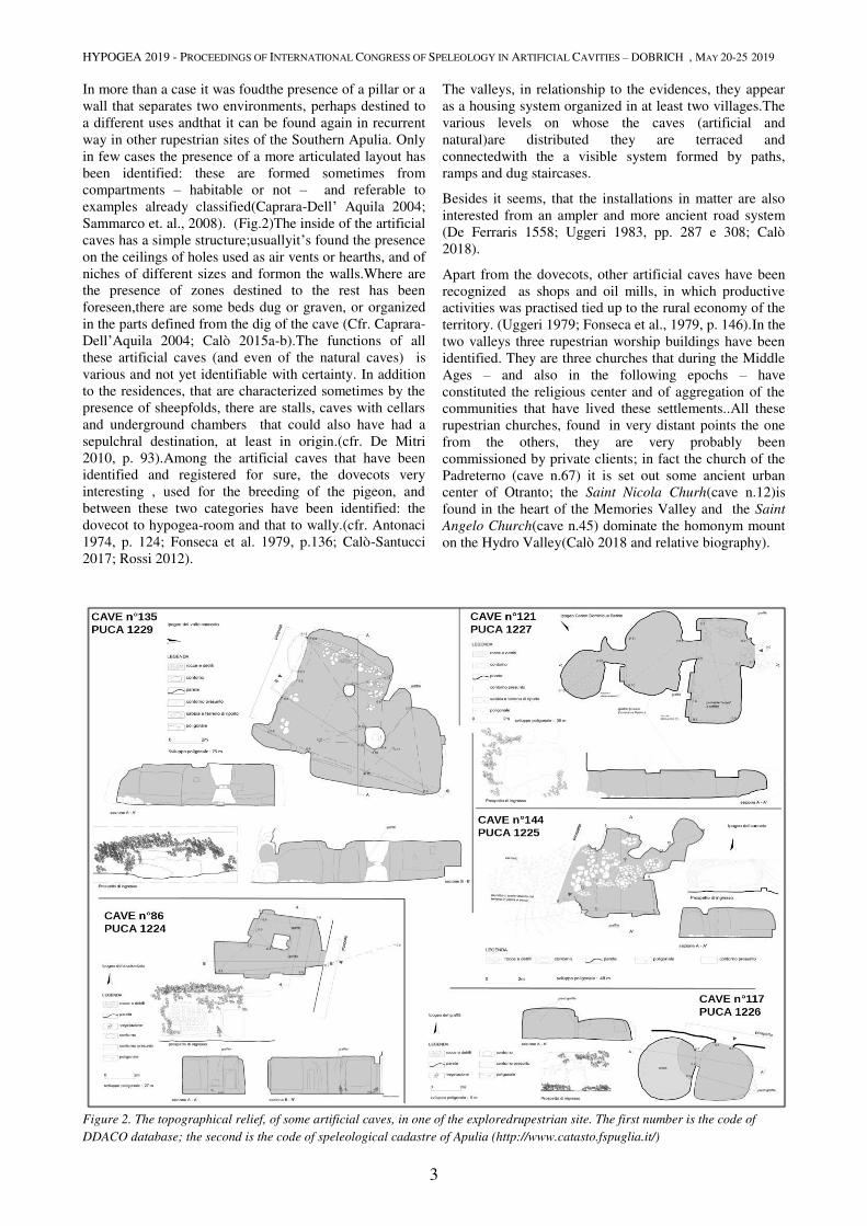
In more than a case it was foudthe presence of a pillar or a
wall that separates two environments, perhaps destined to
a different uses andthat it can be found again in recurrent
way in other rupestrian sites of the Southern Apulia. Only
in few cases the presence of a more articulated layout has
been identified: these are formed sometimes from
compartments – habitable or not – and referable to
examples already classified(Caprara-Dell’ Aquila 2004;
Sammarco et. al., 2008). (Fig.2)The inside of the artificial
caves has a simple structure;usuallyit’s found the presence
on the ceilings of holes used as air vents or hearths, and of
niches of different sizes and formon the walls.Where are
the presence of zones destined to the rest has been
foreseen,there are some beds dug or graven, or organized
in the parts defined from the dig of the cave (Cfr. Caprara-
Dell’Aquila 2004; Calò 2015a-b).The functions of all
these artificial caves (and even of the natural caves) is
various and not yet identifiable with certainty. In addition
to the residences, that are characterized sometimes by the
presence of sheepfolds, there are stalls, caves with cellars
and underground chambers that could also have had a
sepulchral destination, at least in origin.(cfr. De Mitri
2010, p. 93).Among the artificial caves that have been
identified and registered for sure, the dovecots very
interesting , used for the breeding of the pigeon, and
between these two categories have been identified: the
dovecot to hypogea-room and that to wally.(cfr. Antonaci
1974, p. 124; Fonseca et al. 1979, p.136; Calò-Santucci
2017; Rossi 2012).
The valleys, in relationship to the evidences, they appear
as a housing system organized in at least two villages.The
various levels on whose the caves (artificial and
natural)are distributed they are terraced and
connectedwith the a visible system formed by paths,
ramps and dug staircases.
Besides it seems, that the installations in matter are also
interested from an ampler and more ancient road system
(De Ferraris 1558; Uggeri 1983, pp. 287 e 308; Calò
2018).
Apart from the dovecots, other artificial caves have been
recognized as shops and oil mills, in which productive
activities was practised tied up to the rural economy of the
territory. (Uggeri 1979; Fonseca et al., 1979, p. 146).In the
two valleys three rupestrian worship buildings have been
identified. They are three churches that during the Middle
Ages – and also in the following epochs – have
constituted the religious center and of aggregation of the
communities that have lived these settlements..All these
rupestrian churches, found in very distant points the one
from the others, they are very probably been
commissioned by private clients; in fact the church of the
Padreterno (cave n.67) it is set out some ancient urban
center of Otranto; the Saint Nicola Churh(cave n.12)is
found in the heart of the Memories Valley and the Saint
Angelo Church(cave n.45) dominate the homonym mount
on the Hydro Valley(Calò 2018 and relative biography).
The systematic investigation, despite has contributed to
Figure 2. The topographical relief, of some artificial caves, in one of the exploredrupestrian site. The first number is the code of
DDACO database; the second is the code of speleological cadastre of Apulia (http://www.catasto.fspuglia.it/)
HYPOGEA 2019 - PROCEEDINGS OF INTERNATIONAL CONGRESS OF SPELEOLOGY IN ARTIFICIAL CAVITIES – DOBRICH , MAY 20-25 2019
4
understand the density of the investigated rupestrian
settlements, unfortunately it has not furnished enough
chronological data:above all because of the lack of
superficial anthropic material (ex. ceramic relics) on
around the 80% of the investigated areas.
The sampling of the picked material allows only to have
some circumstantial evidencearound the possible
acquaintances of the various caves that cover an arc of
very ample time that goes from the late Roman age (IV-V
sec.) to the full Middle Ages(IX-XIII sec.), up to the
centuries XV-XVIII (Arthur 1992 a-b: D’ Andria 1996;
De Mitri 2005-2010; Leo Imperiale 2001; Tinelli 2006).
3. General nature of DDACO system
The typologies of sources merged in the database are
seven: bibliographical, archival, historical-cultural,
photographic, speleo-archaeological, topographical,
environmental (comprehensive the geology). In order to
wield its massive structure potentially endless, it has been
chosen an approach which provide a progressive
individualization from the general to the particular, and
what therefore it considers the understood sources both
singly and as a part of data sets and subsets.The general
architecture of the database reflects this criterion of
individualization through three levels of close
examination, to each of which it corresponds a specific
cataloguing. The form of first level picks up the relative
information to all sources typical of the cadastre of the
caves (cartography data, geological informations,
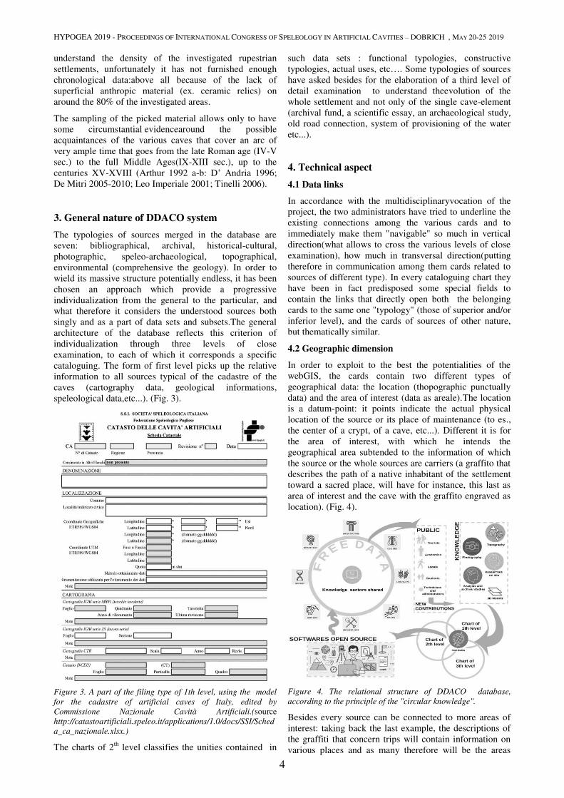
speleological data,etc...). (Fig. 3).
Figure 3. A part of the filing type of 1th level, using the model
for the cadastre of artificial caves of Italy, edited by
Commissione Nazionale Cavità Artificiali.(source
http://catastoartificiali.speleo.it/applications/1.0/docs/SSI/Sched
a_ca_nazionale.xlsx.)
The charts of 2th
level classifies the unities contained in
such data sets : functional typologies, constructive
typologies, actual uses, etc…. Some typologies of sources
have asked besides for the elaboration of a third level of
detail examination to understand theevolution of the
whole settlement and not only of the single cave-element
(archival fund, a scientific essay, an archaeological study,
old road connection, system of provisioning of the water
etc...).
4. Technical aspect
4.1 Data links
In accordance with the multidisciplinaryvocation of the
project, the two administrators have tried to underline the
existing connections among the various cards and to
immediately make them "navigable" so much in vertical
direction(what allows to cross the various levels of close
examination), how much in transversal direction(putting
therefore in communication among them cards related to
sources of different type). In every cataloguing chart they
have been in fact predisposed some special fields to
contain the links that directly open both the belonging
cards to the same one "typology" (those of superior and/or
inferior level), and the cards of sources of other nature,
but thematically similar.
4.2 Geographic dimension
In order to exploit to the best the potentialities of the
webGIS, the cards contain two different types of
geographical data: the location (thopographic punctually
data) and the area of interest (data as areale).The location
is a datum-point: it points indicate the actual physical
location of the source or its place of maintenance (to es.,
the center of a crypt, of a cave, etc...). Different it is for
the area of interest, with which he intends the
geographical area subtended to the information of which
the source or the whole sources are carriers (a graffito that
describes the path of a native inhabitant of the settlement
toward a sacred place, will have for instance, this last as
area of interest and the cave with the graffito engraved as
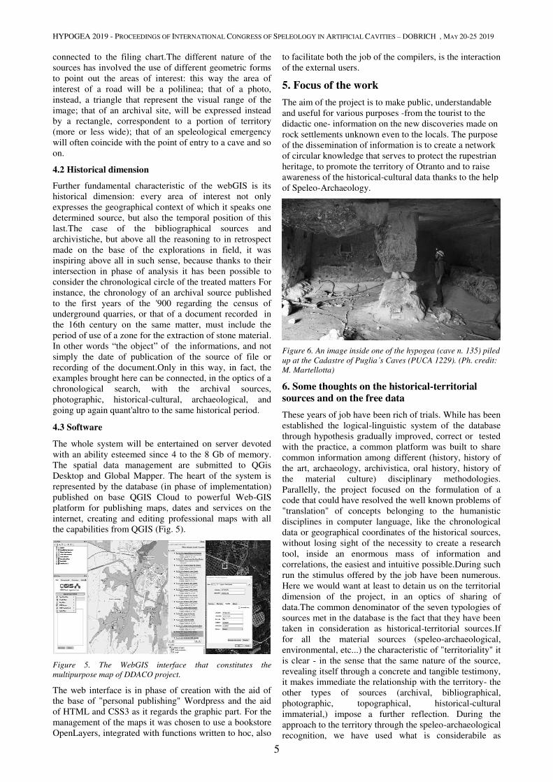
location). (Fig. 4).
Figure 4. The relational structure of DDACO database,
according to the principle of the "circular knowledge".
Besides every source can be connected to more areas of
interest: taking back the last example, the descriptions of
the graffiti that concern trips will contain information on
various places and as many therefore will be the areas
HYPOGEA 2019 - PROCEEDINGS OF INTERNATIONAL CONGRESS OF SPELEOLOGY IN ARTIFICIAL CAVITIES – DOBRICH , MAY 20-25 2019
5
connected to the filing chart.The different nature of the
sources has involved the use of different geometric forms
to point out the areas of interest: this way the area of
interest of a road will be a polilinea; that of a photo,
instead, a triangle that represent the visual range of the
image; that of an archival site, will be expressed instead
by a rectangle, correspondent to a portion of territory
(more or less wide); that of an speleological emergency
will often coincide with the point of entry to a cave and so
on.
4.2 Historical dimension
Further fundamental characteristic of the webGIS is its
historical dimension: every area of interest not only
expresses the geographical context of which it speaks one
determined source, but also the temporal position of this
last.The case of the bibliographical sources and
archivistiche, but above all the reasoning to in retrospect
made on the base of the explorations in field, it was
inspiring above all in such sense, because thanks to their
intersection in phase of analysis it has been possible to
consider the chronological circle of the treated matters For
instance, the chronology of an archival source published
to the first years of the '900 regarding the census of
underground quarries, or that of a document recorded in
the 16th century on the same matter, must include the
period of use of a zone for the extraction of stone material.
In other words “the object” of the informations, and not
simply the date of publication of the source of file or
recording of the document.Only in this way, in fact, the
examples brought here can be connected, in the optics of a
chronological search, with the archival sources,
photographic, historical-cultural, archaeological, and
going up again quant'altro to the same historical period.
4.3 Software
The whole system will be entertained on server devoted
with an ability esteemed since 4 to the 8 Gb of memory.
The spatial data management are submitted to QGis
Desktop and Global Mapper. The heart of the system is
represented by the database (in phase of implementation)
published on base QGIS Cloud to powerful Web-GIS
platform for publishing maps, dates and services on the
internet, creating and editing professional maps with all
the capabilities from QGIS (Fig. 5).
Figure 5. The WebGIS interface that constitutes the
multipurpose map of DDACO project.
The web interface is in phase of creation with the aid of
the base of "personal publishing" Wordpress and the aid
of HTML and CSS3 as it regards the graphic part. For the
management of the maps it was chosen to use a bookstore
OpenLayers, integrated with functions written to hoc, also
to facilitate both the job of the compilers, is the interaction
of the external users.
5. Focus of the work
The aim of the project is to make public, understandable
and useful for various purposes -from the tourist to the
didactic one- information on the new discoveries made on
rock settlements unknown even to the locals. The purpose
of the dissemination of information is to create a network
of circular knowledge that serves to protect the rupestrian
heritage, to promote the territory of Otranto and to raise
awareness of the historical-cultural data thanks to the help
of Speleo-Archaeology.
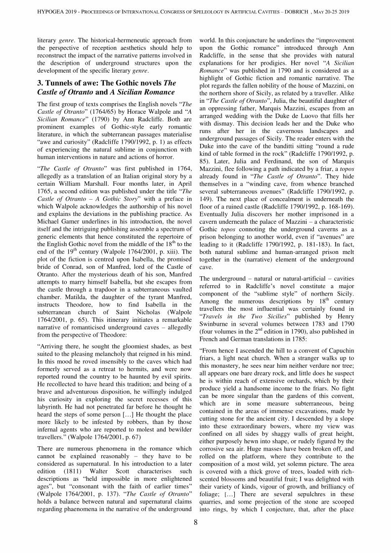
Figure 6. An image inside one of the hypogea (cave n. 135) piled
up at the Cadastre of Puglia’s Caves (PUCA 1229). (Ph. credit:
M. Martellotta)
6. Some thoughts on the historical-territorial sources and on the free data
These years of job have been rich of trials. While has been
established the logical-linguistic system of the database
through hypothesis gradually improved, correct or tested
with the practice, a common platform was built to share
common information among different (history, history of
the art, archaeology, archivistica, oral history, history of
the material culture) disciplinary methodologies.
Parallelly, the project focused on the formulation of a
code that could have resolved the well known problems of
"translation" of concepts belonging to the humanistic
disciplines in computer language, like the chronological
data or geographical coordinates of the historical sources,
without losing sight of the necessity to create a research
tool, inside an enormous mass of information and
correlations, the easiest and intuitive possible.During such
run the stimulus offered by the job have been numerous.
Here we would want at least to detain us on the territorial
dimension of the project, in an optics of sharing of
data.The common denominator of the seven typologies of
sources met in the database is the fact that they have been
taken in consideration as historical-territorial sources.If
for all the material sources (speleo-archaeological,
environmental, etc...) the characteristic of "territoriality" it
is clear - in the sense that the same nature of the source,
revealing itself through a concrete and tangible testimony,
it makes immediate the relationship with the territory- the
other types of sources (archival, bibliographical,
photographic, topographical, historical-cultural
immaterial,) impose a further reflection. During the
approach to the territory through the speleo-archaeological
recognition, we have used what is considerabile as

HYPOGEA 2019 - PROCEEDINGS OF INTERNATIONAL CONGRESS OF SPELEOLOGY IN ARTIFICIAL CAVITIES – DOBRICH , MAY 20-25 2019
6
"residual materiality of that that we are observing": an
useful piece to represent a disappeared element and
therefore material. In other words it has been
reconstructed "an image" of a reality on a territory. The
meaning is really in this trace: for how much our data
could be material, the relationship that they establish with
the territory is related to a representation of the same.
From this perspective, the sources of any other nature they
can be bearers of historical-territorial information: also a
story, a missive, a notarial action – just like the
archaeological find – they compete to draw an image of a
territory as it has been once.Unlike the majority of the
present free data online (often drawn by the simple
reading of a tool: one thinks for instance, to the
meteorological data), the historical data must be interpret
firstly. It must be kept therefore in mind that a project of
census as "DDACO" it implies some operations: the
selection, the reading, the description of the filed sources.
They all are also it departs of a process of mediation and
interpretation.
7. Conclusions
The most important results emerged by the systematic
investigation have shown and confirmed the civil and
secular character of the whole area rocky settlement, often
considered wrongly center of a monastic community.
Besides, on the base of the structure and the diffusion of
all the caves, these installations appear very similar in the
establishment to the installations sub-divo.The publication
of these data, is directed to satisfy a triplex requirement:
on one side, the respect of the methodology and the
criterions of filing system elaborated by every of the
involved disciplines; from the other side, the necessity to
make sure that a free datum is always able, in general, to
have dialogue - to be related in other words - with other
free data; and last but certainly not least, the possibility of
updating and implementation of the information contained
in the database
Acknowledgments
A special thanks to all the members of “GSLN -
GruppoSpeleologicoLeccese 'Ndronico” that they have
taken part to the explorations and the speleological
activities in this years. Sincere thanks also to all the
owners of the funds, met during these years, that have
allowed us the investigation in their estate.
References
Antonaci A. 1974. Otranto, cuore del Salento, Galatina.
Arthur P. 1992. La produzione di anfore Bizantine, in Arthur P. et
al., Fornaci altomedievali ad Otranto. Nota preliminare, in Arch.
Med., XIX, pp. 103-110.
Arthur P. 1992b. Amphorae for Bulk transport, in D’andria F.,
Whitehouse D. (a cura di), Excavations at Otranto. Volume II: The
Finds, , Lecce, p. 199-217.
Calò S. 2018. Gli insediamenti rupestri nelle valli di Otranto, in
Sogliani F., Gargiulo B., Annunziata E., Vitale V. (a cura di),
VIII Congresso Nazionae di Archeologia Medievale, chiesa del
Cristo Flagellato 8ex Ospedale di san Rocco), Matera, 12-15
settembre 2018, vol. 3, sez. V, pp. 247-252.
Calò S. 2015a. Cave settlements in southern Apulia. Rupestrian
evidence in the valleys of Otranto, in Proceedings of Hypogea
2015, Int. Congress of Speleology in Artificial Cavities -Rome
(Italy), March 11-17, pp. 30-40.
Calò S. 2015b. Paesaggio di pietra. Gli insediamenti rupestri delle
serre salentine, Roma.
Calò S., Santucci E. 2017. Hypogea with niches of southern Apulia.
Examples of rural economy in medieval cave settlements of
Salento, in Proceedings of Hypogea 2017, Int. Congress of
Speleology in Artificial Cavities - Cappadocia (Turkey), March
6/8 2017, pp. 20-29.
Caprara R., Dell’ Aquila F. 2004. Per una tipologia delle abitazioni
rupestri medievali, in Arch. Med. XXXI, pp. 457-472.
D’ Andria F. 1996. La casa in Messapia, in D’ Andria F., Mannino
K. (acura di), Ricerche sulla casa in Magna Grecia. Atti del
colloquio (Lecce 23-24 giugno 1992), Galatina, pp. 403-438.
De Ferraris A. 1558. De situ Japigiae, Biffi N. (trad. di), Galatina
2004.
De Mitri C. 2005. Otranto, anfore da trasporto di età tardo romana
(IV-VI sec. d. C.), in LRCW I, pp. 413- 424.
De Mitri C. 2010. Inanissima Pars Italiae. Dinamiche insediative
nella penisola salentina in età romana, Oxford.
Fonseca C. D., 1970, Civiltà rupestre in Terra Jonica, Milano -
Roma.
Fonseca C. D., 1975, La civiltà rupestre medievale nel
Mezzogiorno d’Italia. Ricerche e problemi. Atti I Convegno
Internazionale di Studi sulla Civiltà Rupestre Medioevale nel
Mezzogiorno d’Italia (Mottola-Casalrotto 1971), Genova.
Fonseca et al. 1979= Fonseca C.D, Bruno A.R., Ingrosso V.
Marotta A.. Gli Insediamenti Rupestri Medievali Nel Basso
Salento, Galatina.
Gabrieli G., 1936, Inventario topografico e bibliografico delle cripte
eremitiche casigliane di Puglia, Roma.
Gianfreda G. 1989. Otranto nascosta, Lecce.
Leo Imperiale M. 2001. Otranto, cantiere Mitello: un centro
produttivo nel Mediterraneo bizantino. Note attorno ad alcune
forme ceramiche di fabbricazione locale in S. Patitucci Uggieri
(a cura di), La ceramica altomedievale in Italia, Quaderni di
Archeologia Medievale VI, atti del V Congresso di Archeologia
medievale (Roma, CNR, 26-27 novembre 2001), pp. 327-342.
Medea A., 1939, Gli affreschi delle cripte eremitiche pugliesi,
Roma.
Sammarco et al. 2008= Sammarco M., Parise M., Donno G.P.,
Inguscio S., Rossi E.. Il sistema rupestre di località Macurano
presso Montesardo (Lecce, Puglia), in Atti VI Convegno
Nazionale di Speleologia in Cavità Artificiali - Napoli, 30
maggio - 2 giugno 2008 OPERA IPOGEA 1/2.
Rossi G. 2012. Le colombaie del Salento meridionale. Rilevi e
documenti, Roma.
Rossi D. 1979. Note illustrative della carta geologica d’ Italia.
foglio 2015 Otranto, Napoli.
Tinelli M. 2006. Evoluzioni e trasformazioni dell’ anfora dipinta
dal Medioevo al Rinascimento. Osservazioni dal Salento, in
Francovich R., Valenti M. (a cura di), IV Congresso nazionale
di Archeologia Medievale, Abazia di San Gallo (Chiusdino-
Siena), 26-30 settembre 2006, pp. 485-489.
Uggeri G. 1979. Otranto paleocristiana: Itinerari (Contributi alla
Storia dell’ Arte in memoria di Maria Luisa Ferrari) vol. I,
Firenze, pp. 37-46.
Uggeri G. 1983. La viabilità romana nel Salento, Fasano

HYPOGEAN CIVILIAN DWELLINGS

HYPOGEA 2019 - PROCEEDINGS OF INTERNATIONAL CONGRESS OF SPELEOLOGY IN ARTIFICIAL CAVITIES – DOBRICH , MAY 20-25 2019
7
TUNNELS OF AWE, JUSTICE AND FREEDOM:
UNDERGROUND STRUCTURES IN MODERN LITERATURE
Constantin Canavas
Faculty of Life Sciences, Hamburg University of Applied Sciences,
Ulmenliet 20, 21033 Hamburg, Germany, [email protected]
Abstract
Going underground has been a literary topos with several symbolic connotations since ancient times. The present study
focuses on man-made or man-extended underground structures as they are reflected in modern literature. A major goal
of the study is to trace possible correspondence between specific narrative patterns and the specific topos of
underground tunnel in its regional and historical context.
The first category includes the English novels The Castle of Otranto (1764/65) by Horace Walpole and A Sicilian
Romance (1790) by Ann Radcliffe. Both are prominent examples of Gothic-style early romantic literature, in which the
subterranean passages materialize awe and curiosity as effects of experiencing the natural sublime in conjunction with
human interventions in nature and actions of horror. The patterns engendered in the narrative inscribe the human actions
and feelings in an underground environment inspired by the “underground ruins and gardens” of Syracuse, presumably
a re-use of an ancient quarry, as described by Henry Swinburne in his Travels in the Two Sicilies in the Years 1777,
1778, 1779 and 1780, published in London from 1783 to 1790.
The second case also refers to Sicily. In Luigi Natoli’s popular (historical) novel “I Beati Paoli” the underground caves
of Palermo (ngruttatu) – a system of overlapping Etruscan-Roman cunicoli, Christian catacombs of the 4th
-5th
centuries,
and Arab-Norman qanāt of the 12th
century – is used as a network of secret passages for the action stage of the
historical performance, in which the main role is attributed to the famous secret group (sect) of the Beati (Blessed) Paoli
at the beginning of the 18th
century, just before the occupation of Sicily by the Spanish crone. The Italian novel –
published by Natoli in serial form since 1909, as a book in 1921, and, then, again in 1949 – can be regarded as a literary
written form of the oral Palermitan societal reception of a tumultuous historical period with its obscure and ambivalent
actors. The Arab-Norman qanāt systems are interwoven with earlier historical layers linked with the Etruscan-Roman
ancestors and the early history of Christendom, and serve as stage and refuge for an underground activist movement in
its actions related to popular perceptions of social justice and revenge. It is significant to remark that some Palermitan
cunicoli are considered as a major issue of Palermo’s tangible heritage and are nowadays accessible through guided
visits which are promoted with reference to the legend of the Beati Paoli as presented in Natoli’s novel.
The third case is Puslu kitalar atlasι (The Atlas of Misty Continents) (1995) by the Turkish author İhsan Oktay Anar. In this post-modern explosive narrative Bünyamin, son of the Long İhsan and nephew of the Black İhsan, the two central
figures of the novel, is engaged in a tunnel-digging troop during an operation of liberating Zülfiyar, a spy of the
Ottoman Sultan, imprisoned in a castle in today Bulgaria. The mise-en-scène of the whole operation is embodied in an
oneiric narrative – a dominant pattern of the novel – in which the liberating action can only be accomplished on the
condition of destroying the tunnel – the most effective way of letting the fugitive spy escape from his capturers by
letting them perish in the collapsing tunnel.
Keywords
Underground tunnel, modern literature, narrative patterns.
1. Introduction
The division between a visible and a not directly
accessible underground world has been a literary topos
with several symbolic connotations since ancient times.
The present study focuses on man-made or man-extended
underground structures as these are reflected and
described in modern literature. Such descriptions are
mostly provided from the perspective of persons going
underground – even if it is the auctorial narrator who
undertakes the task of describing the experience of the
figures. A major goal of the study is to showcase
descriptions of underground structures in literary texts and
to analyse their function(s). Such structure can be tunnels,
passages, caves and other geological forms, found in
nature and re-arranged by man, or constructed entirely by
man. The texts are chosen out from the English Gothic
novel, the Italian popular historical romance, and the post-
modern Turkish novel. A further questioning regards
possible correspondence between specific narrative
patterns and the specific topos of underground tunnel or
similar structure in its regional and historical context.
2. Methods
The method of approaching the topos of underground
structures will be a structural analysis of its function in the
specific narrative. The understanding of this function,
however, will be embedded into the historical frame of the
reception of the texts in the tradition of the specific
HYPOGEA 2019 - PROCEEDINGS OF INTERNATIONAL CONGRESS OF SPELEOLOGY IN ARTIFICIAL CAVITIES – DOBRICH , MAY 20-25 2019
8
literary genre. The historical-hermeneutic approach from
the perspective of reception aesthetics should help to
reconstruct the impact of the narrative patterns involved in
the description of underground structures upon the
development of the specific literary genre.
3. Tunnels of awe: The Gothic novels The
Castle of Otranto and A Sicilian Romance
The first group of texts comprises the English novels “The
Castle of Otranto” (1764/65) by Horace Walpole and “A
Sicilian Romance” (1790) by Ann Radcliffe. Both are
prominent examples of Gothic-style early romantic
literature, in which the subterranean passages materialise
“awe and curiosity” (Radcliffe 1790/1992, p. 1) as effects
of experiencing the natural sublime in conjunction with
human interventions in nature and actions of horror.
“The Castle of Otranto” was first published in 1764,
allegedly as a translation of an Italian original story by a
certain William Marshall. Four months later, in April
1765, a second edition was published under the title “The
Castle of Otranto – A Gothic Story” with a preface in
which Walpole acknowledges the authorship of his novel
and explains the deviations in the publishing practice. As
Michael Gamer underlines in his introduction, the novel
itself and the intriguing publishing assemble a spectrum of
generic elements that hence constituted the repertoire of
the English Gothic novel from the middle of the 18th
to the
end of the 19th
century (Walpole 1764/2001, p. xiii). The
plot of the fiction is centred upon Isabella, the promised
bride of Conrad, son of Manfred, lord of the Castle of
Otranto. After the mysterious death of his son, Manfred
attempts to marry himself Isabella, but she escapes from
the castle through a trapdoor in a subterraneous vaulted
chamber. Matilda, the daughter of the tyrant Manfred,
instructs Theodore, how to find Isabella in the
subterranean church of Saint Nicholas (Walpole
1764/2001, p. 65). This itinerary initiates a remarkable
narrative of romanticised underground caves – allegedly
from the perspective of Theodore:
“Arriving there, he sought the gloomiest shades, as best
suited to the pleasing melancholy that reigned in his mind.
In this mood he roved insensibly to the caves which had
formerly served as a retreat to hermits, and were now
reported round the country to be haunted by evil spirits.
He recollected to have heard this tradition; and being of a
brave and adventurous disposition, he willingly indulged
his curiosity in exploring the secret recesses of this
labyrinth. He had not penetrated far before he thought he
heard the steps of some person […] He thought the place
more likely to be infested by robbers, than by those
infernal agents who are reported to molest and bewilder
travellers.” (Walpole 1764/2001, p. 67)
There are numerous phenomena in the romance which
cannot be explained reasonably – they have to be
considered as supernatural. In his introduction to a later
edition (1811) Walter Scott characterises such
descriptions as “held impossible in more enlightened
ages”, but “consonant with the faith of earlier times”
(Walpole 1764/2001, p. 137). “The Castle of Otranto”
holds a balance between natural and supernatural claims
regarding phaenomena in the narrative of the underground
world. In this conjuncture he underlines the “improvement
upon the Gothic romance” introduced through Ann
Radcliffe, in the sense that she provides with natural
explanations for her prodigies. Her novel “A Sicilian
Romance” was published in 1790 and is considered as a
highlight of Gothic fiction and romantic narrative. The
plot regards the fallen nobility of the house of Mazzini, on
the northern shore of Sicily, as related by a traveller. Alike
in “The Castle of Otranto”, Julia, the beautiful daughter of
an oppressing father, Marquis Mazzini, escapes from an
arranged wedding with the Duke de Luovo that fills her
with dismay. This decision leads her and the Duke who
runs after her in the cavernous landscapes and
underground passages of Sicily. The reader enters with the
Duke into the cave of the banditti sitting “round a rude
kind of table formed in the rock” (Radcliffe 1790/1992, p.
85). Later, Julia and Ferdinand, the son of Marquis
Mazzini, flee following a path indicated by a friar, a topos
already found in “The Castle of Otranto”. They hide
themselves in a “winding cave, from whence branched
several subterraneous avenues” (Radcliffe 1790/1992, p.
149). The next place of concealment is underneath the
floor of a ruined castle (Radcliffe 1790/1992, p. 168-169).
Eventually Julia discovers her mother imprisoned in a
cavern underneath the palace of Mazzini – a characteristic
Gothic topos connoting the underground caverns as a
prison belonging to another world, even if “avenues” are
leading to it (Radcliffe 1790/1992, p. 181-183). In fact,
both natural sublime and human-arranged prison melt
together in the (narrative) element of the underground
cave.
The underground – natural or natural-artificial – cavities
referred to in Radcliffe’s novel constitute a major
component of the “sublime style” of northern Sicily.
Among the numerous descriptions by 18th
century
travellers the most influential was certainly found in
“Travels in the Two Sicilies” published by Henry
Swinburne in several volumes between 1783 and 1790
(four volumes in the 2nd
edition in 1790), also published in
French and German translations in 1785:
“From hence I ascended the hill to a convent of Capuchin
friars, a light neat church. When a stranger walks up to
this monastery, he sees near him neither verdure nor tree;
all appears one bare dreary rock, and little does he suspect
he is within reach of extensive orchards, which by their
produce yield a handsome income to the friars. No fight
can be more singular than the gardens of this convent,
which are in some measure subterraneous, being
contained in the areas of immense excavations, made by
cutting stone for the ancient city. I descended by a slope
into these extraordinary bowers, where my view was
confined on all sides by shaggy walls of great height,
either purposely hewn into shape, or rudely figured by the
corrosive sea air. Huge masses have been broken off, and
rolled on the platform, where they contribute to the
composition of a most wild, yet solemn picture. The area
is covered with a thick grove of trees, loaded with rich-
scented blossoms and beautiful fruit; I was delighted with
their variety of kinds, vigour of growth, and brilliancy of
foliage; […] There are several sepulchres in these
quarries, and some projection of the stone are scooped
into rings, by which I conjecture, that, after the place
HYPOGEA 2019 - PROCEEDINGS OF INTERNATIONAL CONGRESS OF SPELEOLOGY IN ARTIFICIAL CAVITIES – DOBRICH , MAY 20-25 2019
9
ceased to be used as a quarry, it was converted into a
prison.
The vaults of this convent have the property of drying the
bodies of the dead in a very short space of time; after
which they are dressed in religious habits, and placed as
statues in niches on each side of subterraneous alleys.
I passed on the sea side, where no traces of antiquity
subsist, except some steps and a few courses of stones; not
a vestige of house, temple, or monument, is to be seen on
this extensive plain, once the most crowded best-built
quarter of Syracuse.” (Swinburne H, 1790).
A comparison between the passage quoted above from
“Travels in the Two Sicilies” and the two Gothic novels
considered here shows that many of the underground
structures described by Swinburne (vaults, quarry
transformed into prison, shaggy walls) appear in the
novels – however in a much shorter form, serving as
accelerators of coming and fleeing underground, or as
narrative patterns inducing “awe and horror” – not only in
the eyes of the acting figures, but also upon the reader.
4. Tunnels of justice: Natoli’s Beati Paoli
The other literary example of the present study is Luigi
Natoli’s popular (historical) novel “I Beati Paoli”. Natoli
(1857-1941) published the story about the secret order
(from the perspective of their adversaries: the sect) of the
Beati (i.e. the Blessed) Paoli in serial form from May
1909 to January 1910 under the pseudonym William Galt
in the newspaper “Giornale di Sicilia”. Natoli’s novel was
published in book form in Italy in 1921, and then again,
after the fascist period, posthumously in 1949 and 1955
(Castiglione 1987/2010, p. 18). A later edition with a
foreword by Umberto Eco appeared in 1971 – the novel is
currently accessible in a commented edition by Sellerio in
two volumes (Natoli 2016).
The Beati Paoli issue constitutes at the present the most
important and most popular subject of modern Sicilian
folklore (Renda 1998). Presumably the narrative traditions
go back to references to the activities of the sect of the
Vendicosi in Norman Sicily around 1185. In several
additions later historical figures, such as the 15th
century
bandit Antonio di Blasco, were incorporated in the
narrative, and romanticising transformations should have
shaped the narrative during the 19th
century (Castiglione
1987, p. 15). Eventually the legend was worked out in
1841 by Vincenzo Linares in his “Racconti Popolari”
(Castiglione 1987/2010, p. 9-11). Linares’ Beati Paoli are
rather urban bandits and confidential contract killers –
whereas Natoli’s figures appear in a glamorous light of
informal justice servants and public heroes. What is
important for the present study is the link between the
Beati Paoli and the Palermitan underground tunnel
network; precisely this link seems to exist in the public
perception already in the middle of the 19th
century with a
square named after the group on the basis of their
underground tribunal supposed to be just underneath that
place (Castiglione 1987/2010, p. 28-29). Natoli has
organized the material in form of a trilogy. In the first
part, “I Beati Paoli”, the plot is placed mostly in Palermo
between 1698 and 1719, just before the occupation of
Sicily by the Spanish crone. The events are cast in stories
about power abuse by the nobles and operations
conducted by the secret group of the Beati Paoli who try
to avenge unpunished crimes and injustice exercised by
the mighty nobles. The second part, “Coriolano della
Floresta”, stretches over the period 1720-1773, whereas
the last one, “Calvello il bastardo”, refers to the last
decade of the 18th
century in Sicily (Montemagno 2017, p.
79-98). The focus of the present study is placed upon the
first part.
Interestingly, some of the major judgment and punishment
scenes set by the Beati Paoli take place in underground
caves of Palermo called in local speech ngruttatu (literally
“in the grotto/cave”) – a system of overlapping Etruscan-
Roman cunicoli (water transport channels), Christian
catacombs of the 4th
-5th
centuries, and Arab-Norman
qanāt (water transport channels) of the 12th
-13th
centuries,
as these components can be identified on the basis of
ceramic finds (Todaro 2002, 40). The technological issue
of the qanāt is attributed to an Arab-Norman cultural
syncretism: the oldest existing tunnel (at least in its
present form) should not date earlier than to the 12th
-13th
century. The underground network of caves of Palermo is
described in detail by Todaro (Todaro 1988; Todaro
2000). The term ngruttatu was used, presumably for the
first time, at the beginning of the 19th
century in a treatise
on hydraulics (Todaro 2002, p. 41). The terms used in
Natoli’s novel for the underground locations are grotta
(cave) and cavo/passaggio sotterraneo (underground
cave/passage) or qualifiers such as sotterraneo misterioso,
however the connections between the several underground
spaces correspond to the cunicoli-ngruttatu-qanāt formations described above.
Natoli’s novel follows the tradition of the 19th
century
Italian popular romance with distinct separation limits
between morally “good” and “bad” figures. The plot is
based on oral traditions concerning the obscure activities
of the secret order, as well as on written sources, such as
Antonio Mognitore’s “Diario Palermitiano” and Marquis
de Villabianca’s “Opuscula Palermitiani”, vol. XIV
(1790). Some of the figures can be traced historically,
others are fictional. The locations correspond to real
places in Palermo, such as the quarter Capo and the
Palazzo Chiaramonte-Steri, as well as the legendary
underground caves and channels with entrances, some of
which still exist. The general motif of the novel is the
struggle for justice carried out by brave figures such as
Blasco Da Castiglione against intriguing and power-
abusing villains such as Don Raimondo della Motta, in
which struggle leading figures of the Beati Paoli such as
Coriolano della Floresta and Girolamo Ammirata
intervene imposing their own agenda.
The underground passages are described in a short way,
mostly from the perspective of a central figure of the
scene – e.g. the kidnapped Andrea Lo Bianco with the
eyes bound can only smell and feel the moisture of the
stone walls when he is brought to the tribunal cave (Natoli
2016, p. 211-220). When Blasco da Castiglione is brought
– again with bound eyes – to the underground tribunal
cave of the Beati Paoli, only the visible details of the room
(rotunda) after the unbinding of his eyes are given:
HYPOGEA 2019 - PROCEEDINGS OF INTERNATIONAL CONGRESS OF SPELEOLOGY IN ARTIFICIAL CAVITIES – DOBRICH , MAY 20-25 2019
10
“Riaperti gli occhi vide che era in una specie di rotunda,
evidentemente una antica cripta scavata nella roccia dalla
quale si dipartivano due corridoi, perdentisi nell’infinito
delle tenebre. […] In mezzo era una specie di piccolo altare di pietra.” (Natoli 2016, p. 677-678)
An act of great significance in the novel is the court held
twice by the Beati Paoli against Don Raimondo della
Motta accused for injustice, abuses, usurpation of power
etc. In the first occasion Don Raimondo is kidnapped by
the Beati Paoli and brought to an underground catacomb-
cave where he is forced to write a letter recommending the
release of Girolamo Ammirata (Natoli 2016, p. 321-326).
On the second occasion a court against Don Raimondo is
held by the Beati Paoli in an old catacomb in order to
judge and eventually punish him – apparently to death – at
the presence of Blasco (Natoli 2016, p. 871-880). The
location is described in details – including the secret
rescue exits used by the Beati Paoli when they are
assaulted by the guardians of the state. The place
resembles to an underground well or cistern – which still
today is called “the cave (grotta) of the Beati Paoli”. The
association with an underground cistern or aqueduct is
supported by the presence of water and the narrow width
of the side caves and tunnels – used as secret passages and
rescue ways. A more detailed description is provided in
the scene where Blasco tries to return to the place where
Don Raimondo was punished– an underground formation
shaped by the infiltrating water (Natoli 1998, p. 886).
Perhaps the only description given as an overview and
orientation by the narrtaor (Natoli) regards the location of
the underground cave of the Beati Paoli near the
catacombs of Porta d’Ossuna (Natoli 2016, p. 940) – a
detail known only to the leading figures of the sect,
Girolamo and Coriolano, that explains ex post the
successful escape of the Beati Paoli on the occasion of the
assault of the guardians just after the punishment of Don
Raimondo.
5. Tunnels of dreems and freedom: Puslu
kitalar atlasι (The Atlas of Misty Continents)
The third case is Puslu kitalar atlasι (The Atlas of Misty
Continents), a post-modern historical novel published in
1995 by the Turkish author İhsan Oktay Anar. The plot
begins in Kostantinye (present Istanbul) in 1681. In one of
the numerous episodes of an explosive narrative between
dream and reality Bünyamin, son of the “Long” İhsan and nephew of the “Black” İhsan (Arab İhsan Efendi), the two
central figures of the novel, is engaged in a tunnel-digging
troop (lağιmcι) during an operation of liberating Zülfiyar,
a spy of the Ottoman Sultan, imprisoned in a castle in
today Bulgaria (Anar 1995, p. 64). The adventures of the
tunnel-digging troop are described in the chapter named
“Underground (yeraltι)” from the perspective of the
auctorial narrator (Anar 1995, p. 67-91). The work itself is
described along the experience of older members as
extremely dangerous. Even if the goal of the digging
action is achieved and the explosion at the end of the
excavated tunnel is successful, no gesture of recognition is
waiting for the lağιmcι, who are always working beyond
perception horizon of the public and the ruler’. In this
sense the setting of the underground activities in Anar’s
novel corresponds to the backside of a stele which in its
front side bears an inscription exalting glorious deeds. In
Puslu kitalar atlasι the narrative of the underground world
is the medial denial of the sublime positive connotations
of the Gothic underground landscape. Moreover, it is a
temporary space that will be destroyed upon fulfilment of
its “goal”.
The mise-en-scène of the whole operation is embodied in
a fulminant narrative in which the liberating action can
only be accomplished on the condition of destroying the
tunnel – the most effective way of letting the fugitive spy
escape from his capturers by letting them perish in the
collapsing tunnel. In mirroring the fiction on an oneiric
narrative – a dominant pattern of the novel – Bünyamin
dreams of the (possible) end of his life during the
underground digging operation (Anar 1995, p. 84-86).
6. The role of the underground tunnels in the
narrative strategy
6.1. A comparative approach
In the Gothic novels the description of the natural sublime
possesses a central value and occupies a large part of the
narrative. In Natoli’s novel the underground landscape
turns up only as (an underlining of the astonishing actions
of the Beati Paoli and their movements in the underground
network of Palermo – their appearing and disappearing
according to the needs of the justice-delivering sect.
Common element in both cases is the functional
relationship between ground buildings and underground
landscape – like both sides of a coin. Both in the Gothic
novels as well as in the popular Italian romance virtuous
figures flee under the pressure of an usurping tyrant in a
network of subterranean passages and caves.
Natoli’s novel can be regarded, to a certain extent, as a
literary form of the Palermitan societal reception of a
tumultuous historical period – the beginning of the 18th
century – with its obscure and ambivalent actors. The
underground of Palermo, a multilayer-sediment of Arab-
Norman qanāt systems and later aqueducts, interwoven
with earlier historical layers linked with the
Etruscan/Roman ancestors and the early history of
Christendom, serves as stage and refuge for an
underground activist movement in its actions related to
popular perceptions of social justice and revenge. In
Natoli’s narrative, the underground cave network – once
in the service of water transfer – functions as a symbol of
invisible movements, unpredictable actions, and occult
ceremonies. In this sense the Palermitan underground
tunnel network is itself an actor of the narrative, however
in a different way than in the English Gothic novel.
Instead of being a natural (or nature-like technological)
Gothic sublime, the Palermitan underground tunnel and
cave network is an actor who intervenes unexpectedly in
the plot and interacts with both the Beati Paoli and their
adversaries.
The atmosphere of the underground narrative in Puslu
kitalar atlasι is of quite different quality. The close
description of adventurous actions underground is as risky
as the actions themselves: small details suffice reto kip the
HYPOGEA 2019 - PROCEEDINGS OF INTERNATIONAL CONGRESS OF SPELEOLOGY IN ARTIFICIAL CAVITIES – DOBRICH , MAY 20-25 2019
11
suspense of the description of adventures into a parody of
suspense. When the fulminous event description of the
underground digging operation is interrupted by the
lağιmcι master Verdapest because he contemplates on the
obverse of a coin, the explosion in the tunnel interrupts
mortally this interruption. Even if Bünyamin survives
from the explosion, he is so badly wounded that he does
not recognise not even his own face in the mirror. Heroic
descriptions would omit such details – the novel Puslu
kitalar atlas is full of them.
The specific issue of tunnel-digging in Anar’s novel is
itself a realistic parody of any idealisation of artificial
underground constructions. Instead of the glorious and
spectacular hit-and-go actions of the Beati Paoli, the
lağιmcι often inflict themselves severe wounds. One of the
suspense (albeit comic) scenes of the Anar’s narrative
regards the mutual tunnel-digging (contra-digging) of
adversary lağιmcι groups (Anar 1995, p. 77). The parody
accompanies Bünyamin’s dreams showcasing the search
for underground hidden treasures. Indeed, parody is a
typical narrative pattern of post-modern fiction.
6.2. Repercussion of narratives of historical heritage
and social struggles
The topos of underground structures became eventually
generic for the genre of Gothic novel. In fact, the narrative
pattern of underground structures was linked with that of
ruined buildings to form common topoi in the romantic
fiction – even without the link of awe and horror.
In the case of Natoli’s narrative the Palermitan
underground network of cunicoli/qanāt and early
Christian catacombs became the material linkage between
historical heritage and the imaginary of social solidarity.
Natoli describes scenes of initiation as well as scenes of
revenge taking place in the underground tunnels and
caves. The actions of the secret order of the Beati Paoli
follow the moral goal of re-establishing respect to
honourable families. As in the Gothic novels, the Beati
Paoli in Natoli’s novel are covered mostly with legends.
Natoli provides the reader with links between the scret
eorder and historical persons, historical events, as well as
real locations and still existing buildings. Natoli’s novel,
however, is not a scholar product – it belongs to a long
tradition of living legends and popular novels, of public
puppet performances based on the Beati Paoli legends,
and on popular artistic representations of the legendary
figures. Its publication since 1909 owes much to the
already circulating material, but it has itself largely
contributed to the increase of popularity and actuality of
the links between the Beati Paoli and modern Palermo. It
is under the influence of the novel and its touristic impact
that some streets and places in Old Palermo bear
references to the activities of the Beati Paoli, such as the
quartier of Capo, Piazza Marina and the church Santa
Maruzza, under which the cave Camera dello Scirocco has
been found, which – according to Natoli’s descriptions –
should have been the place in which the Beati Paoli held
their legendary court (e.g. against Don Raimondo della
Motta). Thus the underground and the urban network of
Natoli’s novel were projected on existing underground
formations as well as on several places in the modern
town of Palermo. In consequence, many of these places,
including underground ones, became since 2010 sites of
special guided tours and touristic visiting programmes. In
this sense it can be claimed that Natoli’s novel, by
inheriting popular legends and linking them to locations of
Palermo, including the underground caves, has largely
contributed to the revitalisation of public awareness and
the enhancement of touristic promotion in respect with the
Palermitan ngruttatu.
7. Conclusions
The tracing of the topos of man-made or man-extended
underground structures in fiction yields several effect
patterns. From the awe-and-horror pattern of the Gothic
novels to the glorifying narrative of justice in Natoli’s
version of the legend of the Beati Paoli the issue of
underground structures retains the adventure feature while
accompanying different cultural and political settings – up
to the parody of this feature in post-modern fiction.
References
Anar İO, 1995. Puslu kιtalar atlasι. İtelişim, İstanbul (in Turkish).
Castiglione FP, 1987/2010. Indagine sui Beati Paoli. Sellerio,
Palermo (in Italian).
Montemagno G, 2017. L’uomo que inventò i Beati Paoli.
Sellerio, Palermo (in Italian).
Natoli L, 1949/1971-1993 (Flaccovio)/2016. I Beati Paoli (2
vol). Sellerio, Palermo (in Italian).
Radcliffe A, 1790/1992. A Sicilian Romance. Oxford University
Press, Oxford.
Renda F, 1988/1991(2nd rev. ed.)/1998. I Beati Paoli. Storia ,
letteratura e leggenda. Sellerio, Palermo (in Italian).
Swinburne H, 1790 (2nd ed.). Travels in the Two Sicilies in the
Years 1777, 1778, 1779 and 1780. P. Elmsly, London, vol. IV, p.
93-96.
Todaro P, 1988. Il sottosuolo di Palermo. Flaccovio, Palermo (in
Italian).
Todaro P, 2000. The ingruttati of the plain of Palermo.
Proceedings of the 1st International Symposium on Qanat. Yazd,
Iran , vol. 4, p. 44-70.
Todaro P, 2002. Guida di Palermo sotterranea. L’Epos, Palermo
(in Italian).
Walpole H, 1764/2001. The Castle of Otranto. Penguin, London.
HYPOGEA 2019 - PROCEEDINGS OF INTERNATIONAL CONGRESS OF SPELEOLOGY IN ARTIFICIAL CAVITIES – DOBRICH , MAY 20-25 2019
16
THE PATTERNS OF DEVELOPMENT OF CAVE SHELTERS IN
CAPPADOCIA
Tymur Bobrovskyy1, Igor Grek2
1Saint Sophia National Preserve, Volodymyrskaya str. 24, 01001 Kyiv, Ukraine,[email protected]
2Speleoclub “Poisk”, Rabina str.47 ap.112, 65072 Odessa, Ukraine, [email protected]
Abstract
Rock and underground shelters make up a considerable part of the cave monuments of Cappadocia. A large
number of complexes have been inspected by us in recent years, and certain patterns in their development have
been determined.
Simple layouts of the shelters designed for defense of certain families characterized the initial stages of the
development of the cave complexes. The creation of labyrinth systems indicates a transition to collective forms
of defense, perhaps, long term ones. For this purpose, they created necessary infrastructure that included wells,
churches, toilets, and passages to move manpower inside the complex as well as emergency ways. In a number
of cave complexes the period of utility use, proceeding the time of creation of shelters, is fixed. Also in most
cave complexes the stage of destruction of shelters is well documented. During this period defensive devices,
mainly moving millstone doors and loopholes, were destroyed. Finally, for most cave shelters in Cappadocia, a
period of subsequent utility use is observed. At this time cave premises were used mainly as dovecotes or stalls
for domestic animals. These patterns are typical for both "underground cities" and "rock settlements".
Keywords
Cappadocia, underground cities, rock settlements, shelters, defensive devices.
Introduction
Historical region Cappadocia locates in central
Turkey and is known for its remarkable landscapes,
medieval Christian frescoes and monuments of rock
cut architecture. The appearance of grandiose
complexes of artificial caves in the territory of
Cappadocia is obviously connected with a unique
combination of climatic, geological and historical
factors in the life of this region.
The rock architecture of Cappadocia is represented
by artificial caves of various types: dwelling and
monastic complexes, waterways tunnels and storages,
tombs and churches, stalls for domestic animals,
shelters and quarries.
The significance of the cave shelters in the rocky
architecture of Cappadocia is very great. They are the
most extensive and most remote from the surface
undergrounds cavities. Cave shelters exist both
separately from other caves, and as part of more
extensive complexes.
Therefore, the study of shelters is of paramount
importance for understanding the nature of large
(combined in purpose) complexes of artificial caves,
better known as "underground cities" and "rock
settlements".
Initially, analyzing the sequence of creating large
underground complexes of artificial caves, we
noticed that these structures were not connected by a
single design, and were not created simultaneously1.
We selected a variety of objects for the subsequent
analysis its structure, located in the provinces of
Nevsehir and Aksaray in Cappadocia, both
underground and rock-cut2. For these cave complexes
we made the relative chronology of their formation.
(Grek et al 2010; Grek and Kolchin 2013;
Bobrovskyy et al 2015; Bobrovskyy and Grek 2015,
2016,2017).
We used several approaches. First, to understand the
structure of artificial cave complexes, we have done
mapping and description of objects, mainly with the
help of a liquid compass and a measuring tape3.
1 Similar conclusions regarding non-simultaneity of the creation of some cave complexes in Cappadocia can be seen, for example, in the works of R. Osterhout [Osterhout 2005] 2Cave shelters can be conditionally divided into two types - rock and underground complexes [Gülyaz and Yenipınar2007]. By the first we mean caves cut in rock cliffs, mainly in the natural light zone, and protected, first of all, by their location at some height above the surface. Underground shelters, often called "underground cities", on the contrary, are located outside the natural light zone and protected, first of all, by their location at some height above the surface. Underground shelters, often called "underground cities", on the contrary, are located outside the natural light zone at some depth below the surface. 3 This method in speleology is most often used for horizontal caves. For objects located on several levels, we created floor plans. In some cases, we combined our method with the conventional method of mapping using the compass "Suunto Tandem".
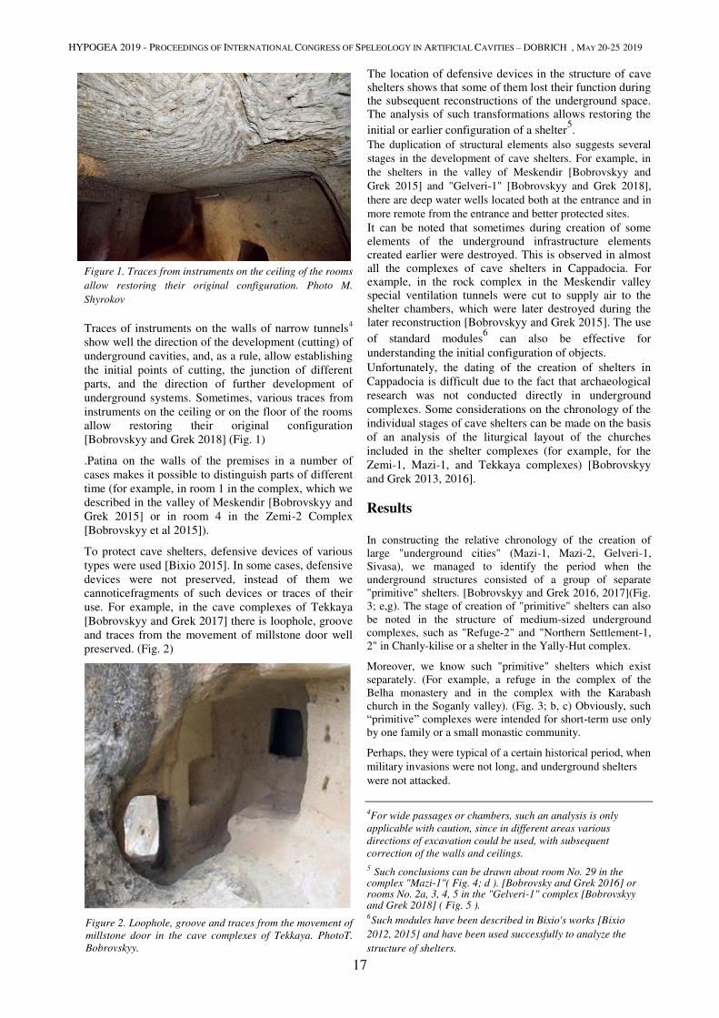
HYPOGEA 2019 - PROCEEDINGS OF INTERNATIONAL CONGRESS OF SPELEOLOGY IN ARTIFICIAL CAVITIES – DOBRICH , MAY 20-25 2019
17
Figure 1. Traces from instruments on the ceiling of the rooms
allow restoring their original configuration. Photo M.
Shyrokov
Traces of instruments on the walls of narrow tunnels4
show well the direction of the development (cutting) of
underground cavities, and, as a rule, allow establishing
the initial points of cutting, the junction of different
parts, and the direction of further development of
underground systems. Sometimes, various traces from
instruments on the ceiling or on the floor of the rooms
allow restoring their original configuration
[Bobrovskyy and Grek 2018] (Fig. 1)
.Patina on the walls of the premises in a number of
cases makes it possible to distinguish parts of different
time (for example, in room 1 in the complex, which we
described in the valley of Meskendir [Bobrovskyy and
Grek 2015] or in room 4 in the Zemi-2 Complex
[Bobrovskyy et al 2015]).
To protect cave shelters, defensive devices of various
types were used [Bixio 2015]. In some cases, defensive
devices were not preserved, instead of them we
cannoticefragments of such devices or traces of their
use. For example, in the cave complexes of Tekkaya
[Bobrovskyy and Grek 2017] there is loophole, groove
and traces from the movement of millstone door well
preserved. (Fig. 2)
Figure 2. Loophole, groove and traces from the movement of
millstone door in the cave complexes of Tekkaya. PhotoT.
Bobrovskyy.
The location of defensive devices in the structure of cave shelters shows that some of them lost their function during the subsequent reconstructions of the underground space. The analysis of such transformations allows restoring the
initial or earlier configuration of a shelter5.
The duplication of structural elements also suggests several
stages in the development of cave shelters. For example, in
the shelters in the valley of Meskendir [Bobrovskyy and
Grek 2015] and "Gelveri-1" [Bobrovskyy and Grek 2018],
there are deep water wells located both at the entrance and in
more remote from the entrance and better protected sites. It can be noted that sometimes during creation of some elements of the underground infrastructure elements created earlier were destroyed. This is observed in almost all the complexes of cave shelters in Cappadocia. For example, in the rock complex in the Meskendir valley special ventilation tunnels were cut to supply air to the shelter chambers, which were later destroyed during the later reconstruction [Bobrovskyy and Grek 2015]. The use
of standard modules6 can also be effective for
understanding the initial configuration of objects. Unfortunately, the dating of the creation of shelters in
Cappadocia is difficult due to the fact that archaeological
research was not conducted directly in underground
complexes. Some considerations on the chronology of the
individual stages of cave shelters can be made on the basis
of an analysis of the liturgical layout of the churches
included in the shelter complexes (for example, for the
Zemi-1, Mazi-1, and Tekkaya complexes) [Bobrovskyy
and Grek 2013, 2016].
Results
In constructing the relative chronology of the creation of
large "underground cities" (Mazi-1, Mazi-2, Gelveri-1,
Sivasa), we managed to identify the period when the
underground structures consisted of a group of separate
"primitive" shelters. [Bobrovskyy and Grek 2016, 2017](Fig.
3; e,g). The stage of creation of "primitive" shelters can also
be noted in the structure of medium-sized underground
complexes, such as "Refuge-2" and "Northern Settlement-1,
2" in Chanly-kilise or a shelter in the Yally-Hut complex.
Moreover, we know such "primitive" shelters which exist
separately. (For example, a refuge in the complex of the
Belha monastery and in the complex with the Karabash
church in the Soganly valley). (Fig. 3; b, c) Obviously, such
“primitive” complexes were intended for short-term use only
by one family or a small monastic community.
Perhaps, they were typical of a certain historical period, when
military invasions were not long, and underground shelters
were not attacked.
4For wide passages or chambers, such an analysis is only
applicable with caution, since in different areas various
directions of excavation could be used, with subsequent
correction of the walls and ceilings.
5 Such conclusions can be drawn about room No. 29 in the
complex "Mazi-1"( Fig. 4; d ). [Bobrovsky and Grek 2016] or rooms No. 2a, 3, 4, 5 in the "Gelveri-1" complex [Bobrovskyy and Grek 2018] ( Fig. 5 ).
6 Such modules have been described in Bixio's works [Bixio
2012, 2015] and have been used successfully to analyze the
structure of shelters.
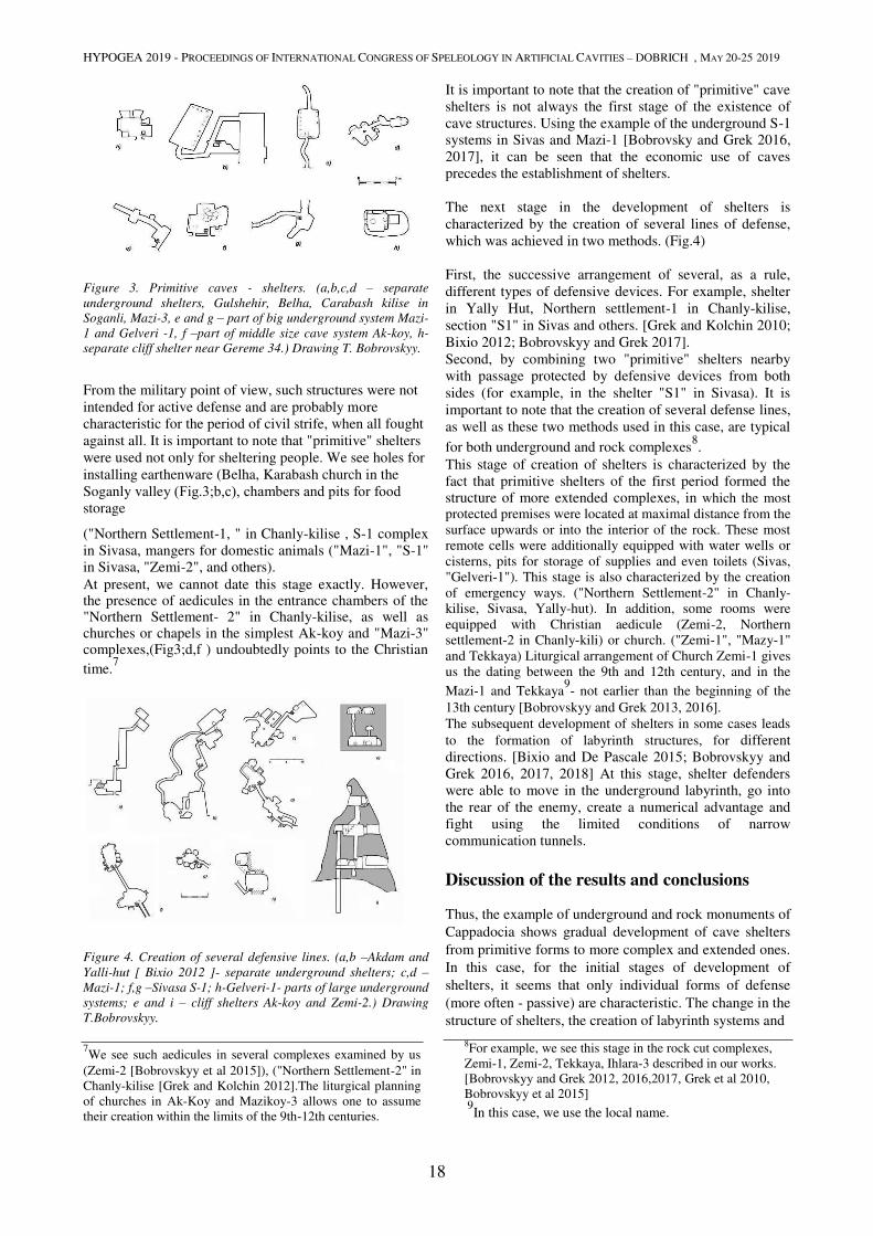
HYPOGEA 2019 - PROCEEDINGS OF INTERNATIONAL CONGRESS OF SPELEOLOGY IN ARTIFICIAL CAVITIES – DOBRICH , MAY 20-25 2019
18
Figure 3. Primitive caves - shelters. (a,b,c,d – separate
underground shelters, Gulshehir, Belha, Carabash kilise in
Soganli, Mazi-3, e and g – part of big underground system Mazi-
1 and Gelveri -1, f –part of middle size cave system Ak-koy, h-
separate cliff shelter near Gereme 34.) Drawing T. Bobrovskyy.
From the military point of view, such structures were not
intended for active defense and are probably more
characteristic for the period of civil strife, when all fought
against all. It is important to note that "primitive" shelters
were used not only for sheltering people. We see holes for
installing earthenware (Belha, Karabash church in the
Soganly valley (Fig.3;b,с), chambers and pits for food storage
("Northern Settlement-1, " in Chanly-kilise , S-1 complex
in Sivasa, mangers for domestic animals ("Mazi-1", "S-1" in Sivasa, "Zemi-2", and others). At present, we cannot date this stage exactly. However, the presence of aedicules in the entrance chambers of the "Northern Settlement- 2" in Chanly-kilise, as well as churches or chapels in the simplest Ak-koy and "Mazi-3" complexes,(Fig3;d,f ) undoubtedly points to the Christian
time.7
Figure 4. Creation of several defensive lines. (a,b –Akdam and
Yalli-hut [ Bixio 2012 ]- separate underground shelters; c,d –Mazi-1; f,g –Sivasa S-1; h-Gelveri-1- parts of large underground
systems; e and i – cliff shelters Ak-koy and Zemi-2.) Drawing
T.Bobrovskyy. 7We see such aedicules in several complexes examined by us
(Zemi-2 [Bobrovskyy et al 2015]), ("Northern Settlement-2" in
Chanly-kilise [Grek and Kolchin 2012].The liturgical planning
of churches in Ak-Koy and Mazikoy-3 allows one to assume
their creation within the limits of the 9th-12th centuries.
It is important to note that the creation of "primitive" cave
shelters is not always the first stage of the existence of
cave structures. Using the example of the underground S-1
systems in Sivas and Mazi-1 [Bobrovsky and Grek 2016,
2017], it can be seen that the economic use of caves
precedes the establishment of shelters.
The next stage in the development of shelters is
characterized by the creation of several lines of defense,
which was achieved in two methods. (Fig.4)
First, the successive arrangement of several, as a rule,
different types of defensive devices. For example, shelter
in Yally Hut, Northern settlement-1 in Chanly-kilise,
section "S1" in Sivas and others. [Grek and Kolchin 2010;
Bixio 2012; Bobrovskyy and Grek 2017].
Second, by combining two "primitive" shelters nearby
with passage protected by defensive devices from both
sides (for example, in the shelter "S1" in Sivasa). It is
important to note that the creation of several defense lines,
as well as these two methods used in this case, are typical
for both underground and rock complexes8.
This stage of creation of shelters is characterized by the
fact that primitive shelters of the first period formed the structure of more extended complexes, in which the most
protected premises were located at maximal distance from the
surface upwards or into the interior of the rock. These most remote cells were additionally equipped with water wells or
cisterns, pits for storage of supplies and even toilets (Sivas, "Gelveri-1"). This stage is also characterized by the creation
of emergency ways. ("Northern Settlement-2" in Chanly-kilise, Sivasa, Yally-hut). In addition, some rooms were
equipped with Christian aedicule (Zemi-2, Northern settlement-2 in Chanly-kili) or church. ("Zemi-1", "Mazy-1"
and Tekkaya) Liturgical arrangement of Church Zemi-1 gives us the dating between the 9th and 12th century, and in the
Mazi-1 and Tekkaya9- not earlier than the beginning of the
13th century [Bobrovskyy and Grek 2013, 2016]. The subsequent development of shelters in some cases leads
to the formation of labyrinth structures, for different
directions. [Bixio and De Pascale 2015; Bobrovskyy and
Grek 2016, 2017, 2018] At this stage, shelter defenders
were able to move in the underground labyrinth, go into
the rear of the enemy, create a numerical advantage and
fight using the limited conditions of narrow
communication tunnels.
Discussion of the results and conclusions
Thus, the example of underground and rock monuments of
Cappadocia shows gradual development of cave shelters
from primitive forms to more complex and extended ones.
In this case, for the initial stages of development of
shelters, it seems that only individual forms of defense
(more often - passive) are characteristic. The change in the
structure of shelters, the creation of labyrinth systems and
8For example, we see this stage in the rock cut complexes,
Zemi-1, Zemi-2, Tekkaya, Ihlara-3 described in our works.
[Bobrovskyy and Grek 2012, 2016,2017, Grek et al 2010,
Bobrovskyy et al 2015] 9
In this case, we use the local name.
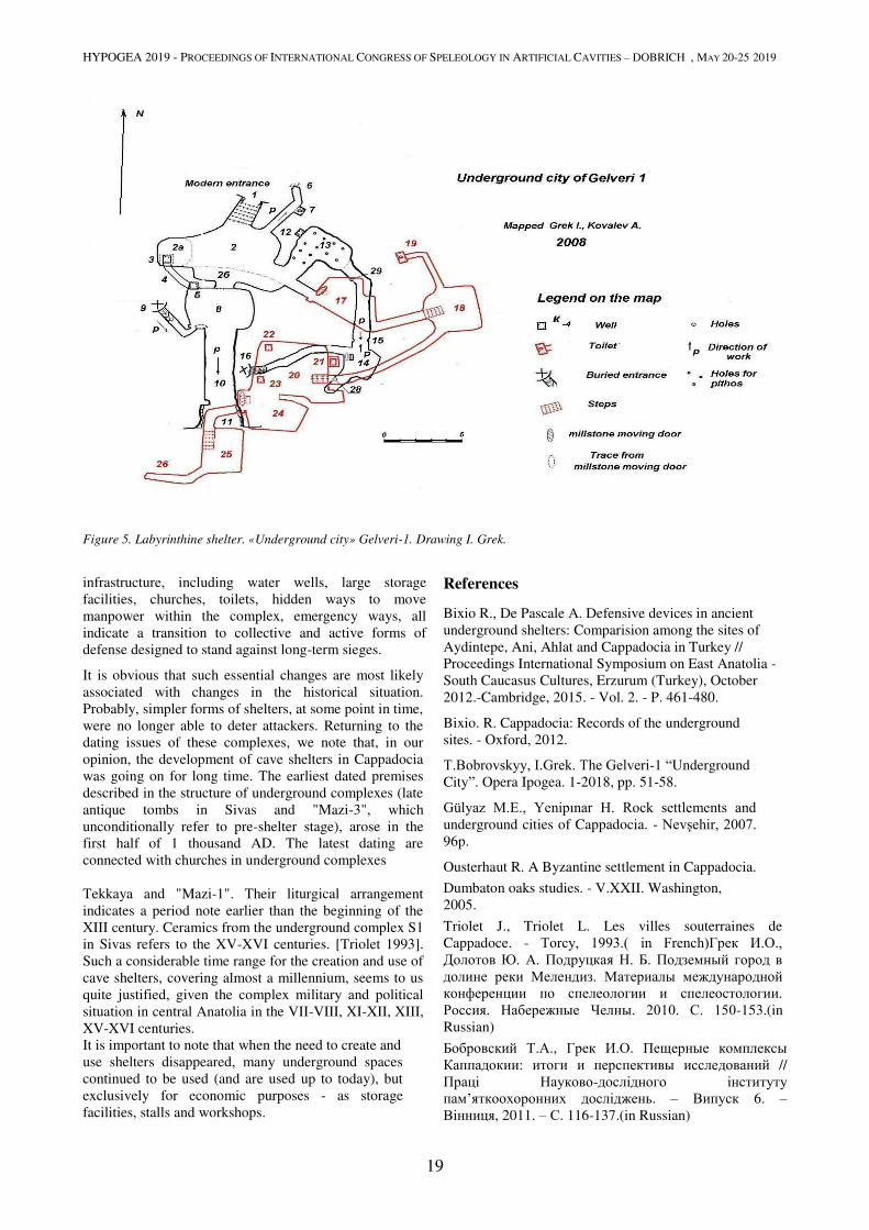
HYPOGEA 2019 - PROCEEDINGS OF INTERNATIONAL CONGRESS OF SPELEOLOGY IN ARTIFICIAL CAVITIES – DOBRICH , MAY 20-25 2019
19
Figure 5. Labyrinthine shelter. «Underground city» Gelveri-1. Drawing I. Grek.
infrastructure, including water wells, large storage
facilities, churches, toilets, hidden ways to move
manpower within the complex, emergency ways, all
indicate a transition to collective and active forms of
defense designed to stand against long-term sieges.
It is obvious that such essential changes are most likely
associated with changes in the historical situation.
Probably, simpler forms of shelters, at some point in time,
were no longer able to deter attackers. Returning to the
dating issues of these complexes, we note that, in our
opinion, the development of cave shelters in Cappadocia
was going on for long time. The earliest dated premises
described in the structure of underground complexes (late
antique tombs in Sivas and "Mazi-3", which
unconditionally refer to pre-shelter stage), arose in the
first half of 1 thousand AD. The latest dating are
connected with churches in underground complexes
Tekkaya and "Mazi-1". Their liturgical arrangement
indicates a period note earlier than the beginning of the
XIII century. Ceramics from the underground complex S1
in Sivas refers to the XV-XVI centuries. [Triolet 1993].
Such a considerable time range for the creation and use of
cave shelters, covering almost a millennium, seems to us
quite justified, given the complex military and political
situation in central Anatolia in the VII-VIII, XI-XII, XIII,
XV-XVI centuries.
It is important to note that when the need to create and
use shelters disappeared, many underground spaces
continued to be used (and are used up to today), but
exclusively for economic purposes - as storage
facilities, stalls and workshops.
References Bixio R., De Pascale A. Defensive devices in ancient
underground shelters: Comparision among the sites of
Aydintepe, Ani, Ahlat and Cappadocia in Turkey //
Proceedings International Symposium on East Anatolia -
South Caucasus Cultures, Erzurum (Turkey), October
2012.-Cambridge, 2015. - Vol. 2. - P. 461-480.
Bixio. R. Cappadocia: Records of the underground
sites. - Oxford, 2012.
Т.Bobrovskyy, I.Grek. The Gelveri-1 “Underground
City”. Opera Ipogea. 1-2018, pp. 51-58.
Gülyaz M.E., Yenipınar H. Rock settlements and underground cities of Cappadocia. - Nevşehir, 2007. 96p.
Ousterhaut R. A Byzantine settlement in Cappadocia.
Dumbaton oaks studies. - V.XXII. Washington,
2005.
Triolet J., Triolet L. Les villes souterraines de
Cappadoce. - Torcy, 1993.( in French)Грек И.О., Долотов Ю. А. Подруцкая Н. Б. Подземный город в долине реки Мелендиз. Материалы международной конференции по спелеологии и спелеостологии. Россия. Набережные Челны. 2010. С. 150-153.(in
Russian)
Бобровский Т.А., Грек И.О. Пещерные комплексы
Каппадокии: итоги и перспективы исследований //
Праці Науково-дослідного інституту
пам’яткоохоронних досліджень. – Випуск 6. –
Вінниця, 2011. – С. 116-137.(in Russian)
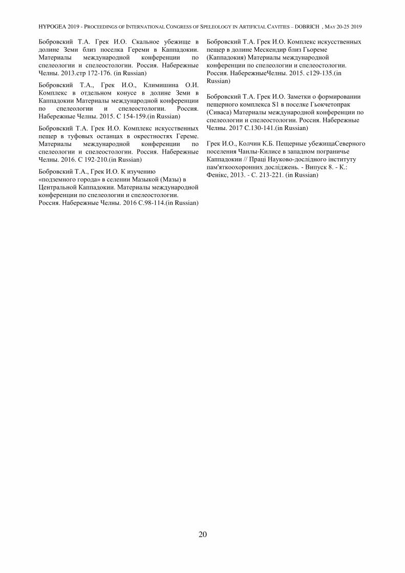
HYPOGEA 2019 - PROCEEDINGS OF INTERNATIONAL CONGRESS OF SPELEOLOGY IN ARTIFICIAL CAVITIES – DOBRICH , MAY 20-25 2019
20
Бобровский Т.А. Грек И.О. Скальное убежище в долине Земи близ поселка Гереми в Каппадокии. Материалы международной конференции по спелеологии и спелеостологии. Россия. Набережные Челны. 2013.стр 172-176. (in Russian)
Бобровский Т.А., Грек И.О., Климишина О.И. Комплекс в отдельном конусе в долине Земи в Каппадокии Материалы международной конференции по спелеологии и спелеостологии. Россия. Набережные Челны. 2015. С 154-159.(in Russian)
Бобровский Т.А. Грек И.О. Комплекс искусственных пещер в туфовых останцах в окрестностях Гереме. Материалы международной конференции по спелеологии и спелеостологии. Россия. Набережные Челны. 2016. С 192-210.(in Russian)
Бобровский Т.А., Грек И.О. К изучению «подземного города» в селении Мазыкой (Мазы) в Центральной Каппадокии. Материалы международной конференции по спелеологии и спелеостологии. Россия. Набережные Челны. 2016 С.98-114.(in Russian)
Бобровский Т.А. Грек И.О. Комплекс искусственных пещер в долине Мескендир близ Гьореме (Каппадокия) Материалы международной конференции по спелеологии и спелеостологии. Россия. НабережныеЧелны. 2015. c129-135.(in
Russian)
Бобровский Т.А. Грек И.О. Заметки о формировании пещерного комплекса S1 в поселке Гьокчетопрак (Сиваса) Материалы международной конференции по спелеологии и спелеостологии. Россия. Набережные Челны. 2017 C.130-141.(in Russian)
Грек И.О., Колчин К.Б. Пещерные убежищаСеверного поселения Чанлы-Килисе в западном пограничье Каппадокии // Праці Науково-дослідного інституту
пам'яткоохоронних досліджень. - Випуск 8. - К.: Фенікс, 2013. - С. 213-221. (in Russian)
HYPOGEA 2019 - PROCEEDINGS OF INTERNATIONAL CONGRESS OF SPELEOLOGY IN ARTIFICIAL CAVITIES – DOBRICH , MAY 20-25 2019
21
ORTE (VT) – A COMPLEX HYPOGEAN HERITAGE. NEW ACQUISITION
DATA
Giancarlo Pastura1, Letizia Tessicini
2
1Tuscia University, L.go dell’Università snc, 01100 Viterbo, [email protected]
2Orte Sotterranea, Via Matteotti, 57 01028 Orte (Viterbo), [email protected]
Situated in connection between the territories of Umbria and Lazio, the city of Orte has been continuously inhabited
since the 6th century b.C.. Inside the tufo plateau the underground aqueducts (tunnels, cisterns and wells), storage
rooms, dovecotes and nymphaeums have been excavated during 2500 years of life. The complex of all these structures
determines a wide and articulated hypogean landscape, generated by continuous transformations along the centuries.
The mapping of the underground aqueducts, of the hypogean dovecotes and of all the accessible cavities, high lightened
the privileged relationship developed between the solid morphology and humans, that since the origins have been able
to deploy its properties to guarantee water and food supply, amusement places and services, fundamental for the
development of a city that had a central role in the Middle Tiber Valley.
Through a mapping of the modifications and transformations of the cavities, the present contribution wants to underline
how the Etruscan and Roman cavities have been reused during the centuries to adapt to the socio-economic and political
growth of Orte. Moreover the research brought to light the continued exploitation of the underground in the Middle
Age, time of the maximum expansion of the city.
Keywords
hypogean structures, cisterns, nymphaeum, water system, snow well, Middle Age, decovetes
1. Introduction
The historical village of Orte develops on a tufaceous rock
that rests on clay deposits, formed on the seabed up to
about a million years ago, when intense volcanic activity
begins. The cliff is oriented east-west, with a
characteristic globular shape and an increasingly
pronounced thinning going west, while a rounded top
floor favors the occupation1.
Located in a strategic position, in control of the middle
Tiber valley and of the main communication routes, Orte
is certainly founded by the Etruscans of Volsinii (Orvieto)
and has been inhabited since at least the VI century BC, as
documented by the excavation of the necropolis of Le
Piane and San Bernardino. It is in this territory that Rome
wins over the Etruscans with the two battles of Lake
Vadimone (309 and 283 BC), and Orte is given the status
of municipium at the beginning of the 1st century BC. In
this period the territory is dotted with villas, which benefit
from the transit of the via Amerina and from the important
river port of Seripola The importance of the town will be
augmented in the Augustan age, concurrently with a
monumental redefinition of the town.
Since the emergence of Christianity in the Early Middle
Ages, the growing importance of Orte in the Tiber Valley
can be followed through different facts, as the foundation
of the monastery of San Giovenale by the Byzantine
General Belisario and the recognition of the bishop's seat
already in the middle of the seventh century. After being
disputed by the Lombards for the control of the main
1 Fatucci 2013.
roads connecting Rome and Ravenna, Orte experienced
further development in the mid-ninth century, with the
foundation of a second cathedral (Pastura 2017). Occupied
by the Arabs and reconquered in 914, it intensified its
control over the river in the 10th and 11th centuries,
contending its primacy with Amelia, Narni and with the
great Roman monasteries, such the Abbey of Farfa. It this
phase begins the most prosperous period of the city, which
increases its inhabitants with the development of suburban
villages and with the definitive control over the bridge on
the Tiber.
Within the cliff that houses the town, benefiting from a
favorable geological conformation, the excavation of
services such as the water supply network (tunnels,
cisterns, wells) and waste water evacuation system,
warehouses, depots, cellars, stalls, dovecotes, dwellings
and places of delights took place during Orte's whole
history. The set of these activities is today partially visible
to visitors thanks to the complex of "Orte Sotterranea", a
journey through the centuries, which winds for hundreds
of meters in the heart of the cliff.
2. Methods
Given the variety of underground works, research in urban
areas undoubtedly has a strong interest, as cities must be
considered as organisms in constant movement and their
understanding cannot be limited to emerging volumes.
The subsoil of Orte has been used since the early stages of
occupation of the plateau, a layered use over the centuries
that has led to the reuse and adaptation of artificial
cavities to different purposes. The strong need for

HYPOGEA 2019 - PROCEEDINGS OF INTERNATIONAL CONGRESS OF SPELEOLOGY IN ARTIFICIAL CAVITIES – DOBRICH , MAY 20-25 2019
22
development and raw materials that the city has known
over the centuries has meant that many of the cavities
were destroyed or that we lost track of them, being
incorporated into large building complexes or covered
under layers of asphalt (De Minicis, Pastura 2015).
In consideration of this, several cavities and about two
kilometers of underground network were surveyed,
allowing a reorganization of knowledge and a specific
protection plan for the buried heritage.
It was decided to organize the research by homogeneous
fields. On the basis of the acquired knowledge, the study
initially focused the attention on the underground
hydraulic network, which presents a greater number of
archival information and archaeological data and could
give more information on the production activities carried
out in the subsoil.
The bibliography was checked to verify its reliability and
obtain further insights, for example particular attention
was paid to an important contribution by Angela
Napoletano and Marina Marcelli2that surveyed in detail
the subsoil for the realization of a general planimetry in
conjunction with the methane works of the historic center
started in 1991.
At this point, undisputed was the need for new research, a
"carpet" survey of the subsoil, with the aim to increase the
amount of data; in fact activities like the building
development and restoration can bring to light new
ancient elements, previously unknown.
In recent years. the studies on artificial cavities have
intensified and methodologically specialized, allowing, in
addition to the global understanding of the formation and
development of the hypogeal complexes, also the
diachronic analysis of the individual units3.
In the case treated, attention was given to the relations
between the hypogean cavities and the inhabited area in
order to clarify the diachronic temporal development of
the complexes.
A fundamental tool for the knowledge of hypogeum
structures is the realization of planimetric surveys
performed with extreme scientific rigor, to capture the
organization of the space and record useful information
for the realization of a reference polygonal for the correct
functional interpretation, although the morphological
roughness in some cases complicates the operations, and
to realize a complete tracking of the accessible hypogea
and the reporting of those difficult to access.
We then moved on to the direct survey of the hypogean
cavities which, after the scanning and tracing operation
performed using a vector graphics software, were placed
inside an integral relief and then superimposed on the
cadastral map by means of known georeferenced points.
For the definition of the relative chronologies we used the
survey methods established by recent research, paying
particular attention to the analysis of architectural
planimetric anomalies and to the analysis of traces of
2 Napoletano, Marcelli 2006.
3 De Minicis, Pastura 2015.
excavation4, while it was not possible to carry out,
especially in the cunicular network, morphological
typologies.
With regard to the tunnels, it was therefore not possible to
extrapolate a typological classification based on the
intrinsic characteristics of the artifacts and they were
classified only according to their function and the
chronological terms, unlike other cavities such as the
dovecote of Via Solferino or the Pozzo di Neve, are
always relative. The indirect methods have been used
exclusively for the understanding of the development of
the single unit as the archive sources offer an absolute
dating.
For planimetric-architectural anomalies we mean the
elements that betray the continuity of the excavation: folds
of the walls, steps on pavements, vaults, changes of
direction and shape variations; all elements able to
provide fundamental data for the understanding of the
development of the hypogeal complexes. The same
potential is offered by the analysis of the traces of
excavation, that in the undergrounds of Orte benefit from
the "lucky" condition of a very soft geological substratum
that allowed the formation of very evident traces,
highlightened also by the granulometry of the tuff that
facilitates their measurement.
The reading and identification of the development phases
is certainly the central moment of the research, for the
interpretation of a primary function and of possible
transformations. The traces of the pointed excavation tools
left on the walls are essential information in the reading of
the directions in which the excavation proceeded, above
all in the points of intersection between originally
independent tunnels or rooms.
As for the instruments used, Riera summarizes for the
hydraulic works in this way "according to the testimonies
we don't go further than the use of the gravina, the
hammer, the wedge, the chisel, the perch, the shovel, the
harpoon and the bucket in their most varied forms5. Some
of the tools used are direct percussion (pickaxe, adze, etc.)
and others with indirect percussion (chisels, wedges,
irons, etc.). The latter are mainly used for finishing.
Among the best documented instruments there is the two-
pointed pickaxe, whose traces have been identified in all
the cavities inspected, even if there are variations in the
dimensions of the tips, probably attributable to the
different functions that were to perform during the
excavation operations as already emerged from the
analysis of the Sienese “Bottini”6.
The detailed analysis of the tracks, based on the
elaboration of digital images, highlighted a particular
accuracy in the original plant of the hydraulic works with
the tufaceous walls worked with extreme care by means of
a pick and verticalized in correspondence of the
accessional wells by means of a flat-blade tool similar to
an adze. The most coarse interventions in the water
network, realized with tools with a much wider blade,
4 Pastura 2013.
5 De Minicis, Pastura 2015.
6 Bargagli Petrucci 1992.
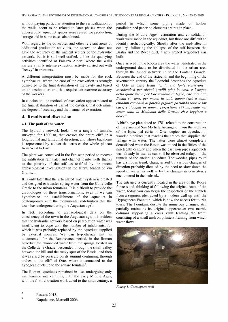
HYPOGEA 2019 - PROCEEDINGS OF INTERNATIONAL CONGRESS OF SPELEOLOGY IN ARTIFICIAL CAVITIES – DOBRICH , MAY 20-25 2019
23
without paying particular attention to the verticalization of
the walls, seem to be related to later phases when the
underground aqueduct spaces were reused for production,
storage and in some cases abandoned.
With regard to the dovecotes and other relevant areas of
additional production activities, the excavation does not
have the accuracy of the ancient sectors of the hydraulic
network, but it is still well crafted, unlike the quarrying
activities identified at Palazzo Alberti where the walls
narrate a fairly intense extraction activity carried out with
"heavy" instruments.
A different interpretation must be made for the rock
nymphaeum, where the care of the excavation is strongly
connected to the final destination of the cavity and based
on an aesthetic criteria that requires an extreme accuracy
of the workers.
In conclusion, the methods of excavation appear related to
the final destination of use of the cavities, that determine
the degree of accuracy and the manner of execution.
4. Results and discussion
4.1. The path of the water
The hydraulic network looks like a tangle of tunnels,
surveyed for 1800 m, that crosses the entire cliff, in a
longitudinal and latitudinal direction, and whose backbone
is represented by a duct that crosses the whole plateau
from West to East.
The plant was conceived in the Etruscan period to recover
the infiltration rainwater and channel it into wells thanks
to the porosity of the tuff, as testified by the recent
archaeological investigations in the lateral branch of Via
Gramsci.
It is only later that the articulated water system is created
and designed to transfer spring water from the Colle delle
Grazie to the urban fountains. It is difficult to provide the
chronologies of these transformations, even if we can
hypothesize the establishment of the aqueduct in
contemporary with the monumental redefinition that the
town has undergone during the Augustan age7.
In fact, according to archaeological data on the
consistency of the town in the Augustan age, it is evident
that the hydraulic network based on percolation water was
insufficient to cope with the number of inhabitants, for
which it was probably replaced by the aqueduct supplied
by external sources. We can hypothesize that, as
documented for the Renaissance period, in the Roman
aqueduct the channeled water from the springs located on
the Colle delle Grazie, descended through the small valley
between the hill and the rocky spur of the Bastia, and then
it was rised by pressure on its summit continuing through
arches to the cliff of Orte, where it connected to the
hypogean ducts up to the square fountain8.
The Roman aqueducts remained in use, undergoing only
maintenance interventions, until the early Middle Ages,
with the first renovation work dated to the ninth century, a
7 Pastura 2013.
8 Napoletano, Marcelli 2006.
period in which some piping made of hollow
parallelepiped peperino elements are put in place.
During the Middle Ages restoration and consolidation
work were made in the aqueduct, but those are difficult to
identify archeologically. Shortly after the mid-fifteenth
century, following the collapse of the tuff between the
Bastia and the Rocca cliff, a new arched acqueduct was
built.
Once arrived in the Rocca area the water penetrated in the
underground ducts to be distributed in the urban area
through the tunnel network up to the Fontana Grande.
Between the end of the sixteenth and the beginning of the
seventeenth century the Leoncini describes the aqueduct
of Orte in these terms “.. la sua fonte sotterranea,
scendendosi per alcuni gradili (sic) in essa, e l’acqua
della quale viene per l’acquedotto di legno, che sale alla
Bastia et viensi per mezzo la città, danno (sic) a molti
cittadini comodità di poterla pigliare passando sotto le lor
case, è l’acqua in somma perfectione (?) nascendo nel
sasso sotto la Madonna delle Grazie, ch’è leggiera e
dolce”.
A bird's eye plan dated to 1781 related to the construction
of the parish of San Michele Arcangelo, from the archives
of the Episcopal curia of Orte, depicts an aqueduct in
wooden pipelines that reaches the arches that supplied the
village with water. The latter were almost completely
demolished when the Bastia was mined in the fifties of the
nineteenth century and when the cast iron pipes aqueducts
was already in use, as can still be observed todays in the
tunnels of the ancient aqueduct. The wooden pipes route
has a sinuous trend, characterized by various changes of
direction probably dictated by the need to slow down the
speed of water, as well as by the changes in consistency
encountered in the bedrock.
The entrance is currently located in the area of the Rocca
fortress and, thinking of following the original route of the
water, today you can begin the inspection of the tunnels
from a segment obstructed by a modern wall up until the
Hypogenean Fountain, which is now the access for tourist
tours. The Fountain, despite the numerous changes, still
partially maintains its original appearance: two marble
columns supporting a cross vault framing the front,
consisting of a small arch on pilasters framing from which
water flows.
Fiureg.1: Cocciopesto well
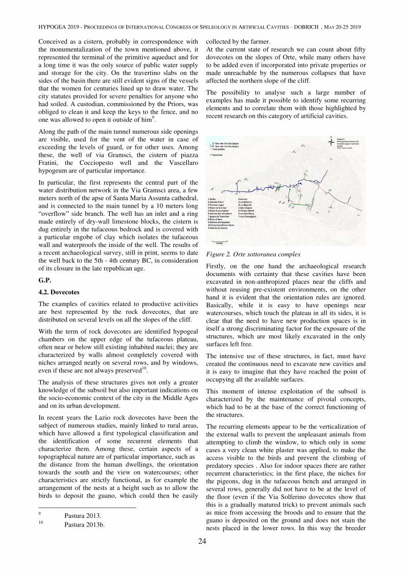
HYPOGEA 2019 - PROCEEDINGS OF INTERNATIONAL CONGRESS OF SPELEOLOGY IN ARTIFICIAL CAVITIES – DOBRICH , MAY 20-25 2019
24
Conceived as a cistern, probably in correspondence with
the monumentalization of the town mentioned above, it
represented the terminal of the primitive aqueduct and for
a long time it was the only source of public water supply
and storage for the city. On the travertino slabs on the
sides of the basin there are still evident signs of the vessels
that the women for centuries lined up to draw water. The
city statutes provided for severe penalties for anyone who
had soiled. A custodian, commissioned by the Priors, was
obliged to clean it and keep the keys to the fence, and no
one was allowed to open it outside of him9.
Along the path of the main tunnel numerous side openings
are visible, used for the vent of the water in case of
exceeding the levels of guard, or for other uses. Among
these, the well of via Gramsci, the cistern of piazza
Fratini, the Cocciopesto well and the Vascellaro
hypogeum are of particular importance.
In particular, the first represents the central part of the
water distribution network in the Via Gramsci area, a few
meters north of the apse of Santa Maria Assunta cathedral,
and is connected to the main tunnel by a 10 meters long
“overflow” side branch. The well has an inlet and a ring
made entirely of dry-wall limestone blocks, the cistern is
dug entirely in the tufaceous bedrock and is covered with
a particular engobe of clay which isolates the tufaceous
wall and waterproofs the inside of the well. The results of
a recent archaeological survey, still in print, seems to date
the well back to the 5th - 4th century BC, in consideration
of its closure in the late republican age.
G.P.
4.2. Dovecotes
The examples of cavities related to productive activities
are best represented by the rock dovecotes, that are
distributed on several levels on all the slopes of the cliff.
With the term of rock dovecotes are identified hypogeal
chambers on the upper edge of the tufaceous plateau,
often near or below still existing inhabited nuclei; they are
characterized by walls almost completely covered with
niches arranged neatly on several rows, and by windows,
even if these are not always preserved10
.
The analysis of these structures gives not only a greater
knowledge of the subsoil but also important indications on
the socio-economic context of the city in the Middle Ages
and on its urban development.
In recent years the Lazio rock dovecotes have been the
subject of numerous studies, mainly linked to rural areas,
which have allowed a first typological classification and
the identification of some recurrent elements that
characterize them. Among these, certain aspects of a
topographical nature are of particular importance, such as
the distance from the human dwellings, the orientation
towards the south and the view on watercourses; other
characteristics are strictly functional, as for example the
arrangement of the nests at a height such as to allow the
birds to deposit the guano, which could then be easily
9 Pastura 2013.
10 Pastura 2013b.
collected by the farmer.
At the current state of research we can count about fifty
dovecotes on the slopes of Orte, while many others have
to be added even if incorporated into private properties or
made unreachable by the numerous collapses that have
affected the northern slope of the cliff.
The possibility to analyse such a large number of
examples has made it possible to identify some recurring
elements and to correlate them with those highlighted by
recent research on this category of artificial cavities.
Figure 2. Orte sottoranea complex
Firstly, on the one hand the archaeological research
documents with certainty that these cavities have been
excavated in non-anthropized places near the cliffs and
without reusing pre-existent environments, on the other
hand it is evident that the orientation rules are ignored.
Basically, while it is easy to have openings near
watercourses, which touch the plateau in all its sides, it is
clear that the need to have new production spaces is in
itself a strong discriminating factor for the exposure of the
structures, which are most likely excavated in the only
surfaces left free.
The intensive use of these structures, in fact, must have
created the continuous need to excavate new cavities and
it is easy to imagine that they have reached the point of
occupying all the available surfaces.
This moment of intense exploitation of the subsoil is
characterized by the maintenance of pivotal concepts,
which had to be at the base of the correct functioning of
the structures.
The recurring elements appear to be the verticalization of
the external walls to prevent the unpleasant animals from
attempting to climb the window, to which only in some
cases a very clean white plaster was applied, to make the
access visible to the birds and prevent the climbing of
predatory species . Also for indoor spaces there are rather
recurrent characteristics; in the first place, the niches for
the pigeons, dug in the tufaceous bench and arranged in
several rows, generally did not have to be at the level of
the floor (even if the Via Solferino dovecotes show that
this is a gradually matured trick) to prevent animals such
as mice from accessing the broods and to ensure that the
guano is deposited on the ground and does not stain the
nests placed in the lower rows. In this way the breeder
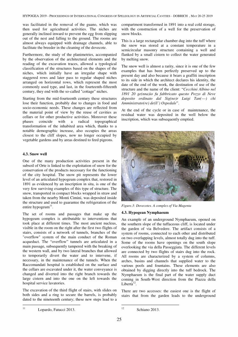
HYPOGEA 2019 - PROCEEDINGS OF INTERNATIONAL CONGRESS OF SPELEOLOGY IN ARTIFICIAL CAVITIES – DOBRICH , MAY 20-25 2019
25
was facilitated in the removal of the guano, which was
then used for agricultural activities. The niches are
generally inclined inward to prevent the egg from slipping
out of the nest and falling to the ground. The rooms are
almost always equipped with drainage channels, able to
facilitate the breeder in the cleaning of the dovecote.
Furthermore, the study of the planimetries, accompanied
by the observation of the architectural elements and the
reading of the excavation traces, allowed a typological
classification of the structures based on the shapes of the
niches, which initially have an irregular shape with
staggered rows and later pass to regular shaped niches
arranged on horizontal rows, which represent the most
commonly used type, and last, in the fourteenth-fifteenth
century, they end with the so-called "cottage" niches.
Starting from the mid-fourteenth century these structures
lose their function, probably due to changes in food and
socio-economic needs. These changes are reflected from
the material point of view by the reuse of cavities as
cellars or for other productive activities. Moreover these
phases coincide with a radical topographical
transformation of the inhabited area which, thanks to a
notable demographic increase, also occupies the areas
closest to the cliff slopes, now no longer occupied by
vegetable gardens and by areas destined to feed pigeons.
4.3. Snow well
One of the many production activities present in the
subsoil of Orte is linked to the exploitation of snow for the
conservation of the products necessary for the functioning
of the city hospital. The snow pit represents the lower
level of an articulated hypogeum complex that, restored in
1891 as evidenced by an inscription in situ, is one of the
very few surviving examples of this type of structure. The
snow, transported in compact blocks wrapped in straw and
taken from the nearby Monti Cimini, was deposited inside
the structure and used to guarantee the refrigeration of the
entire hypogeum11
.
The set of rooms and passages that make up the
hypogeum complex is attributable to interventions that
took place at different times. The most ancient nucleus,
visible in the room on the right after the first two flights of
stairs, consists of a network of tunnels, branches of the
"overflow" system of the main conduct of the Roman
acqueduct. The “overflow” tunnels are articulated in a
main passage, subsequently tampered with the breaking of
the western wall, and by two lateral branches that allowed
to temporarily divert the water and to intervene, if
necessary, in the maintenance of the tunnels. When the
Raccomandati hospital is established on the surface and
the cellars are escavated under it, the water conveyance is
changed and diverted into the right branch towards the
large cistern and into the one on the left towards the
hospital service lavatories.
The excavation of the third flight of stairs, with slides on
both sides and a ring to secure the barrels, is probably
dated to the nineteenth century; these new steps lead to a
11
Lopardo, Fatucci 2013.
compartment transformed in 1891 into a real cold storage,
with the construction of a well for the preservation of
snow blocks.
This is a large rectangular chamber dug into the tuff where
the snow was stored at a constant temperature in a
semicircular masonry structure containing a well and
flanked by a small cistern to collect the water generated
by melting snow.
The snow well is almost a rarity, since it is one of the few
examples that has been perfectly preserved up to the
present day and also because it bears a graffiti inscription
to its side in which the architect declares his identity, the
date of the end of the work, the destination of use of the
structure and the name of the client: “Cecchini Albino nel
1891 20 ge(nna)io fu fabbricato questo Pozzo di Neve
deposito ordinato dal Sig(no)r Luigi Tan(---) chi
Amministrato(re) de(ll’) Ospedale”.
At the end of the cycle or in case of maintenance, the
residual water was deposited in the well below the
inscription, which was subsequently emptied.
Figure.3: Dovecotes. A complex of Via Magenta
4.3. Hypogean Nymphaeum
An example of an underground Nymphaeum, opened on
the southern slope of the tuffaceous cliff, is located under
the garden of via Belvedere. The artifact consists of a
system of rooms, connected to each other and distributed
on two overlapping levels, almost totally dug into the tuff.
Some of the rooms have openings on the south slope
overlooking the via della Passeggiata. The different levels
are connected by two flights of stairs dug into the rock.
All rooms are characterized by a system of columns,
arches, basins and channels that supplied water to the
various pools and fountains. These elements are also
obtained by digging directly into the tuff bedrock. The
Nymphaeum is the final part of the water supply duct
coming in South-West direction from the Piazza della
Libertà12
.
There are two accesses: the easiest one is the flight of
stairs that from the garden leads to the underground
12
Schiano 2013.
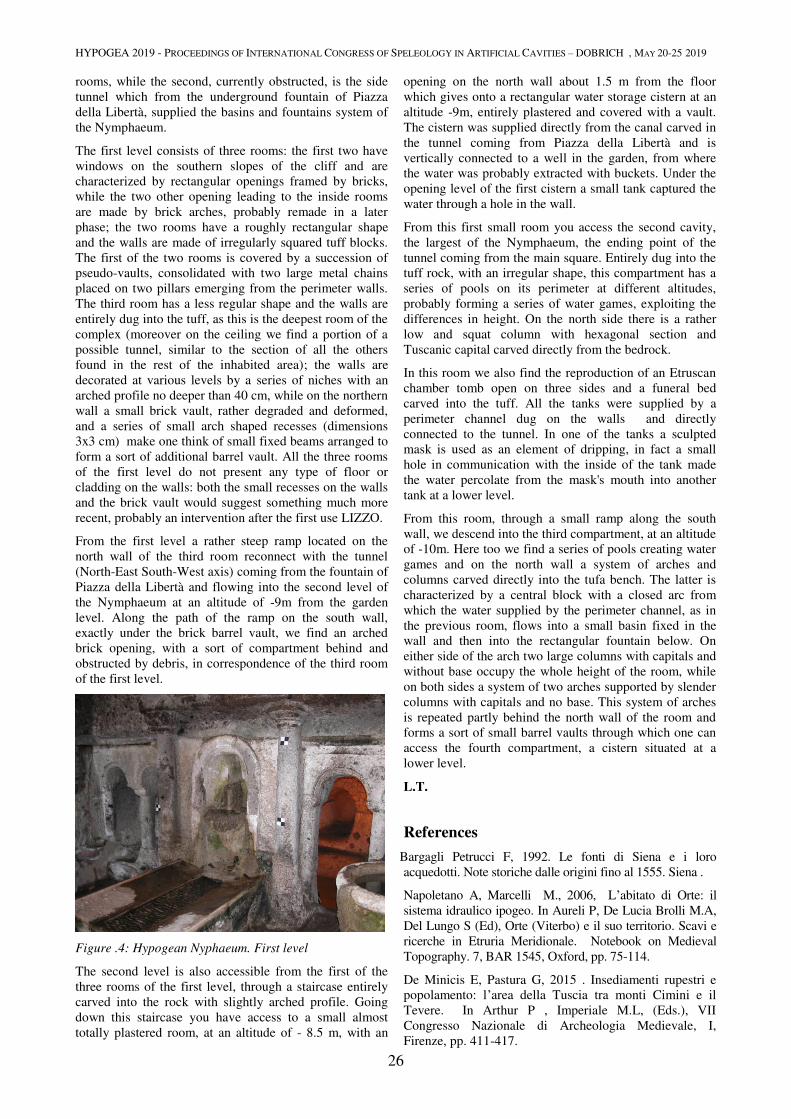
HYPOGEA 2019 - PROCEEDINGS OF INTERNATIONAL CONGRESS OF SPELEOLOGY IN ARTIFICIAL CAVITIES – DOBRICH , MAY 20-25 2019
26
rooms, while the second, currently obstructed, is the side
tunnel which from the underground fountain of Piazza
della Libertà, supplied the basins and fountains system of
the Nymphaeum.
The first level consists of three rooms: the first two have
windows on the southern slopes of the cliff and are
characterized by rectangular openings framed by bricks,
while the two other opening leading to the inside rooms
are made by brick arches, probably remade in a later
phase; the two rooms have a roughly rectangular shape
and the walls are made of irregularly squared tuff blocks.
The first of the two rooms is covered by a succession of
pseudo-vaults, consolidated with two large metal chains
placed on two pillars emerging from the perimeter walls.
The third room has a less regular shape and the walls are
entirely dug into the tuff, as this is the deepest room of the
complex (moreover on the ceiling we find a portion of a
possible tunnel, similar to the section of all the others
found in the rest of the inhabited area); the walls are
decorated at various levels by a series of niches with an
arched profile no deeper than 40 cm, while on the northern
wall a small brick vault, rather degraded and deformed,
and a series of small arch shaped recesses (dimensions
3x3 cm) make one think of small fixed beams arranged to
form a sort of additional barrel vault. All the three rooms
of the first level do not present any type of floor or
cladding on the walls: both the small recesses on the walls
and the brick vault would suggest something much more
recent, probably an intervention after the first use LIZZO.
From the first level a rather steep ramp located on the
north wall of the third room reconnect with the tunnel
(North-East South-West axis) coming from the fountain of
Piazza della Libertà and flowing into the second level of
the Nymphaeum at an altitude of -9m from the garden
level. Along the path of the ramp on the south wall,
exactly under the brick barrel vault, we find an arched
brick opening, with a sort of compartment behind and
obstructed by debris, in correspondence of the third room
of the first level.
Figure .4: Hypogean Nyphaeum. First level
The second level is also accessible from the first of the
three rooms of the first level, through a staircase entirely
carved into the rock with slightly arched profile. Going
down this staircase you have access to a small almost
totally plastered room, at an altitude of - 8.5 m, with an
opening on the north wall about 1.5 m from the floor
which gives onto a rectangular water storage cistern at an
altitude -9m, entirely plastered and covered with a vault.
The cistern was supplied directly from the canal carved in
the tunnel coming from Piazza della Libertà and is
vertically connected to a well in the garden, from where
the water was probably extracted with buckets. Under the
opening level of the first cistern a small tank captured the
water through a hole in the wall.
From this first small room you access the second cavity,
the largest of the Nymphaeum, the ending point of the
tunnel coming from the main square. Entirely dug into the
tuff rock, with an irregular shape, this compartment has a
series of pools on its perimeter at different altitudes,
probably forming a series of water games, exploiting the
differences in height. On the north side there is a rather
low and squat column with hexagonal section and
Tuscanic capital carved directly from the bedrock.
In this room we also find the reproduction of an Etruscan
chamber tomb open on three sides and a funeral bed
carved into the tuff. All the tanks were supplied by a
perimeter channel dug on the walls and directly
connected to the tunnel. In one of the tanks a sculpted
mask is used as an element of dripping, in fact a small
hole in communication with the inside of the tank made
the water percolate from the mask's mouth into another
tank at a lower level.
From this room, through a small ramp along the south
wall, we descend into the third compartment, at an altitude
of -10m. Here too we find a series of pools creating water
games and on the north wall a system of arches and
columns carved directly into the tufa bench. The latter is
characterized by a central block with a closed arc from
which the water supplied by the perimeter channel, as in
the previous room, flows into a small basin fixed in the
wall and then into the rectangular fountain below. On
either side of the arch two large columns with capitals and
without base occupy the whole height of the room, while
on both sides a system of two arches supported by slender
columns with capitals and no base. This system of arches
is repeated partly behind the north wall of the room and
forms a sort of small barrel vaults through which one can
access the fourth compartment, a cistern situated at a
lower level.
L.T.
References
Bargagli Petrucci F, 1992. Le fonti di Siena e i loro
acquedotti. Note storiche dalle origini fino al 1555. Siena .
Napoletano A, Marcelli M., 2006, L’abitato di Orte: il
sistema idraulico ipogeo. In Aureli P, De Lucia Brolli M.A,
Del Lungo S (Ed), Orte (Viterbo) e il suo territorio. Scavi e
ricerche in Etruria Meridionale. Notebook on Medieval
Topography. 7, BAR 1545, Oxford, pp. 75-114.
De Minicis E, Pastura G, 2015 . Insediamenti rupestri e
popolamento: l’area della Tuscia tra monti Cimini e il
Tevere. In Arthur P , Imperiale M.L, (Eds.), VII
Congresso Nazionale di Archeologia Medievale, I,
Firenze, pp. 411-417.

HYPOGEA 2019 - PROCEEDINGS OF INTERNATIONAL CONGRESS OF SPELEOLOGY IN ARTIFICIAL CAVITIES – DOBRICH , MAY 20-25 2019
27
Fatucci M, 2013. Inquadramento storico. In Pastura G
(Ed.) La città sotto la città:Analisi e ricerche nella parte
sepolta dell’abitato di Orte. In Quaderni del Museo
Civico Archeologico di Orte, I, Acquapendente, pp. 17-
25.
Leoncini : Fabbrica d’Orta, handwritten,vol. IV, f. 51.
Lopardo S, Fatucci M, 2013, Conserve e pozzi di neve. In
Pastura G (Ed.) La città sotto la città:Analisi e ricerche nella
parte sepolta dell’abitato di Orte. In Quaderni del Museo
Civico Archeologico di Orte, I, Acquapendente, pp.95-113.
Pastura G, 2013. La città sotto la città: Analisi e ricerche
nella parte sepolta dell’abitato di Orte.- In Quaderni del
Museo Civico Archeologico di Orte, I, Acquapendente.
Pastura G, 2013b. Le colombaie rupestri. In Pastura G
(Ed.), La città sotto la città: Analisi e ricerche nella parte
sepolta dell’abitato di Orte.- In Quaderni del Museo
Civico Archeologico di Orte, I, Acquapendente, pp. 77-95
Pastura G, 2017. Tra Monti Cimini e Tevere. Forme
dell’insediamento tra VI e XII secolo. Dadidalos. Studi e
ricerche di Archeologia e Antichità, Università degli Studi
della Tuscia, Viterbo.
Schiano P,2013. Il ninfeo. In Pastura G (Ed.), La città
sotto la città: Analisi e ricerche nella parte sepolta
dell’abitato di Orte. In Quaderni del Museo Civico
Archeologico di Orte, I, Acquapendente, pp.61-76.
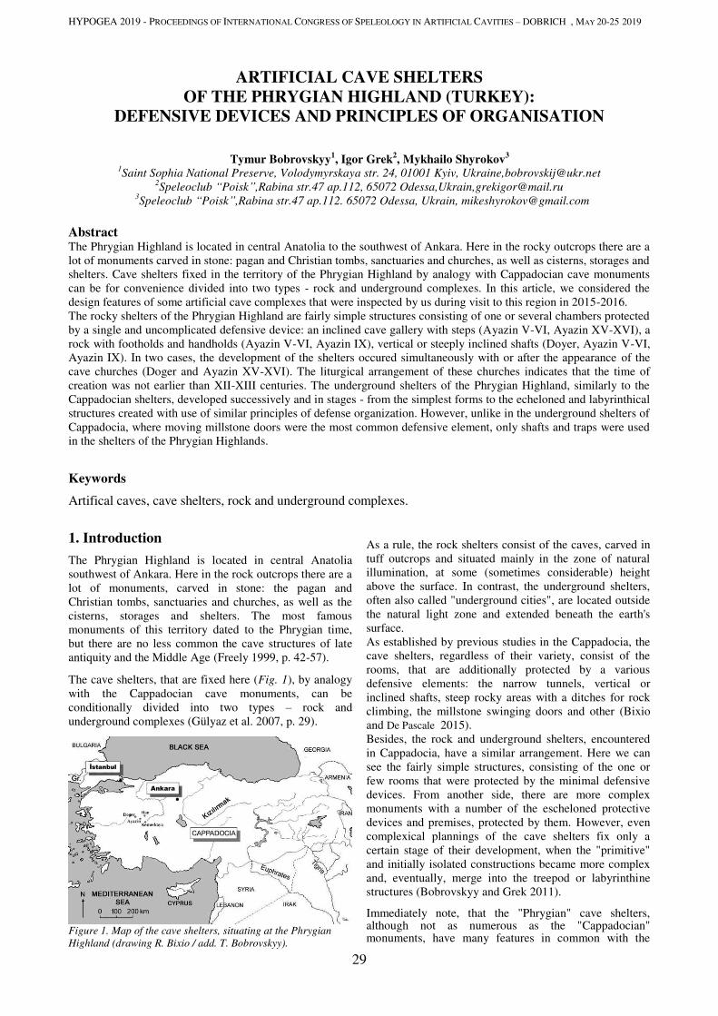
HYPOGEA 2019 - PROCEEDINGS OF INTERNATIONAL CONGRESS OF SPELEOLOGY IN ARTIFICIAL CAVITIES – DOBRICH , MAY 20-25 2019
29
ARTIFICIAL CAVE SHELTERS
OF THE PHRYGIAN HIGHLAND (TURKEY):
DEFENSIVE DEVICES AND PRINCIPLES OF ORGANISATION
Tymur Bobrovskyy1, Igor Grek
2, Mykhailo Shyrokov
3
1Saint Sophia National Preserve, Volodymyrskaya str. 24, 01001 Kyiv, Ukraine,[email protected]
2Speleoclub “Poisk”,Rabina str.47 ap.112, 65072 Odessa,Ukrain,[email protected]
3Speleoclub “Poisk”,Rabina str.47 ap.112. 65072 Odessa, Ukrain, [email protected]
Abstract The Phrygian Highland is located in central Anatolia to the southwest of Ankara. Here in the rocky outcrops there are a
lot of monuments carved in stone: pagan and Christian tombs, sanctuaries and churches, as well as cisterns, storages and
shelters. Cave shelters fixed in the territory of the Phrygian Highland by analogy with Cappadocian cave monuments
can be for convenience divided into two types - rock and underground complexes. In this article, we considered the
design features of some artificial cave complexes that were inspected by us during visit to this region in 2015-2016.
The rocky shelters of the Phrygian Highland are fairly simple structures consisting of one or several chambers protected
by a single and uncomplicated defensive device: an inclined cave gallery with steps (Ayazin V-VI, Ayazin XV-XVI), a
rock with footholds and handholds (Ayazin V-VI, Ayazin IX), vertical or steeply inclined shafts (Doyer, Ayazin V-VI,
Ayazin IX). In two cases, the development of the shelters occured simultaneously with or after the appearance of the
cave churches (Doger and Ayazin XV-XVI). The liturgical arrangement of these churches indicates that the time of
creation was not earlier than XII-XIII centuries. The underground shelters of the Phrygian Highland, similarly to the
Cappadocian shelters, developed successively and in stages - from the simplest forms to the echeloned and labyrinthical
structures created with use of similar principles of defense organization. However, unlike in the underground shelters of
Cappadocia, where moving millstone doors were the most common defensive element, only shafts and traps were used
in the shelters of the Phrygian Highlands.
Keywords
Artifical caves, cave shelters, rock and underground complexes.
1. Introduction
The Phrygian Highland is located in central Anatolia
southwest of Ankara. Here in the rock outcrops there are a
lot of monuments, carved in stone: the pagan and
Christian tombs, sanctuaries and churches, as well as the
cisterns, storages and shelters. The most famous
monuments of this territory dated to the Phrygian time,
but there are no less common the cave structures of late
antiquity and the Middle Age (Freely 1999, p. 42-57).
The cave shelters, that are fixed here (Fig. 1), by analogy
with the Cappadocian cave monuments, can be
conditionally divided into two types – rock and
underground complexes (Gülyaz et al. 2007, p. 29).
Figure 1. Map of the cave shelters, situating at the Phrygian
Highland (drawing R. Bixio / add. T. Bobrovskyy).
As a rule, the rock shelters consist of the caves, carved in
tuff outcrops and situated mainly in the zone of natural
illumination, at some (sometimes considerable) height
above the surface. In contrast, the underground shelters,
often also called "underground cities", are located outside
the natural light zone and extended beneath the earth's
surface.
As established by previous studies in the Cappadocia, the
cave shelters, regardless of their variety, consist of the
rooms, that are additionally protected by a various
defensive elements: the narrow tunnels, vertical or
inclined shafts, steep rocky areas with a ditches for rock
climbing, the millstone swinging doors and other (Bixio
and De Pascale 2015).
Besides, the rock and underground shelters, encountered
in Cappadocia, have a similar arrangement. Here we can
see the fairly simple structures, consisting of the one or
few rooms that were protected by the minimal defensive
devices. From another side, there are more complex
monuments with a number of the escheloned protective
devices and premises, protected by them. However, even
complexical plannings of the cave shelters fix only a
certain stage of their development, when the "primitive"
and initially isolated constructions became more complex
and, eventually, merge into the treepod or labyrinthine
structures (Bobrovskyy and Grek 2011).
Immediately note, that the "Phrygian" cave shelters, although not as numerous as the "Cappadocian" monuments, have many features in common with the
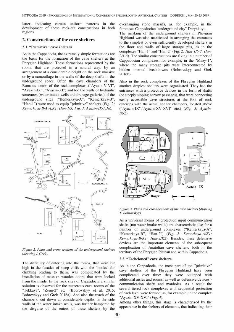
HYPOGEA 2019 - PROCEEDINGS OF INTERNATIONAL CONGRESS OF SPELEOLOGY IN ARTIFICIAL CAVITIES – DOBRICH , MAY 20-25 2019
30
latter, indicating certain uniform patterns in the development of these rock-cut constructions in both regions.
2. Constructions of the cave shelters
2.1. “Primrtive” cave shelters
As in the Cappadocia, the extremely simple formations are
the basis for the formation of the cave shelters at the
Phrygian Highland. These formations represented by the
rooms that are protected in a natural way: by an
arrangement at a considerable height on the rock massive
or by a camouflage in the walls of the deep shafts in the
underground space. Often the cave chambers of the
Roman's tombs of the rock complexes (“Ayazin-V-VΙ”,
“Ayazin-IX”, “Ayazin-XI”) and too the walls of hydraulic
structures (water intake wells and drenage galleries) of the
underground sites (“Kemerkaya-A”, “Kemerkaya-B”,
“Han-1”) were used to equip "primitive" shelters (Fig. 2:
Kemerkaya-B/A-A,K1; Han-1/3; Fig. 3: Ayazin-IX/1,3a).
Figure 2. Plans and cross-sections of the underground shelters
(drawing I. Grek).
The difficulty of entering into the tombs, that were cut
high in the facades of steep cliffs with the "hooks" for
climbing leading to them, was complicated by the
installation of massive wooden doors, that were locked
from the inside. In the rock sites of Cappadocia a similar
solution is observed for the numerous cave rooms of the
"Tekkaya", "Zemi-2" etc. (Bobrovskyy et al. 2015;
Bobrovskyy and Grek 2016a). And also the reach of the
chambers, cut down at considerable depths in the side
walls of the water intake wells, was further hampered by
the disguise of the enters of these shelters by the
overhanging stone massifs, as, for example, in the
famouses Cappadocian "underground city" Derynkuyu.
The masking of the underground shelters in Phrygian
Highland was also manifested in arranging the entrances
to the simplest or even sufficiently developed shelters in
the floor and walls of large storage pits, as in the
complexes "Han-1" and "Han-2" (Fig. 2: Han-1/6-7, Han-
2/1-3). The similar constructions are fixing in a number of
Cappadocian complexes, for example, in the "Mazy-1",
where the many storage pits were interconnected by
hidden internal breakdowns (Bobrovskyy and Grek
2016b).
Also in the rock complexes of the Phrygian Highland
another simplest shelters were organisated. They had the
entrances with a protective devices in the form of shafts
(or steeply sloping narrow passages), that were connecting
easily accessible cave structures at the foot of rock
outcrops with the actual shelter chambers, located above
("Ayazin-IX","Ayazin-XV-XVΙ" etc.) (Fig. 3: Ayazin-
IX/2).
Figure 3. Plans and cross-sections of the rock shelters (drawing
T. Bobrovskyy).
As a universal means of protection input communication
shafts (not water intake wells) are characteristic also for a
number of underground complexes (“Kemerkaya-A”,
“Kemerkaya-B”, “Han-2”) (Fig. 2: Kemerkaya-A/K1;
Kemerkaya-B/K1; Han-2/K2). Besides, these defensive
devices are the important elements of the subsequent
complication of Anatolian cave shelters, both in the
territory of the Phrygian Plateau and within Cappadocia.
2.2. “Escheloned” cave shelters
As in the Cappadocia, the most part of the "primitive"
cave shelters of the Phrygian Highland have been
complicated over time: they were equipped with
additional aisles and rooms, as well as defensive devices -
communication shafts and manholes. As a result the
several-tiered rock complexes with sequential protection
of each level were formed, as, for example, in the complex
"Ayazin-XV-XVI" (Fig. 4).
Among other things, this stage is characterized by the
appearance in the shelters of elements, that indicating their
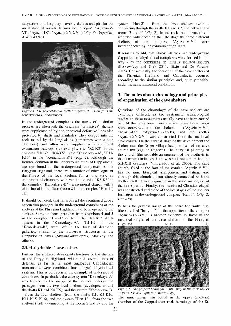
HYPOGEA 2019 - PROCEEDINGS OF INTERNATIONAL CONGRESS OF SPELEOLOGY IN ARTIFICIAL CAVITIES – DOBRICH , MAY 20-25 2019
31
adaptation to a long stay - ovens, shelves and pits for the
installation of vessels, latrines etc. ("Doger", "Ayazin-V-
VI", "Ayazin-IX", "Ayazin-XV-XVI") (Fig. 3: Doger/4b;
Ayazin-IX/4b).
Figure 4. The several-tiered shelter “Ayazin-IX” (view from the
souht)(photo T. Bobrovskyy).
In the underground complexes the traces of a similar
process are observed: the originals "primitives" shelters
were supplemented by one or several defensive lines also
protected by shafts and manholes. They deeped into the
rock massif by the long aisles (sometimes with a side
chambers) and often were supplied with additional
evacuation outcrops (for example, site "K2-K3" in the
complex "Han-2", "K4-K5" in the "Kemerkaya-A", "K11-
K15" in the "Kemerkaya-B") (Fig. 2). Although the
latrines, common in the underground cities of Cappadocia,
are not found in the underground complexes of the
Phrygian Highland, there are a number of other signs of
the fitness of the local shelters for a long stay: an
equipment of chambers with ventilation (site "K3-K5" in
the complex "Kemerkaya-B"), a memorial chapel with a
child burial in the floor (room 8 in the complex "Han-1")
etc.
It should be noted, that far from all the mentioned above
evacuation passages in the underground complexes of the
shelters of the Phrygian Highland have been opened to the
surface. Some of them (branches from chambers 4 and 5
in the complex "Han-1" or from the "K1-K3" shafts
system in the "Kemerkaya-A", "K1-K2" in the
"Kemerkaya-B") were left in the form of dead-end
galleries, similar to the numerous structures in the
Cappadocian caves (Sivasa-Gokcetoprak, Mazikoy and
others).
2.3. “Labyrinthical” cave shelters
Further, the scattered developed structures of the shelters
of the Phrygian Highland, which had several lines of
defense, as far as in most analogous Cappadocian
monuments, were combined into integral labyrinthical
systems. This is best seen in the example of underground
complexes. In particular, the cave system "Kemerkaya-A"
was formed by the merge of the counter underground
passages from the two local shelters (developed around
the shafts K1 and K4-K5), and the system "Kemerkaya-B"
- from the four shelters (from the shafts K1, K4-K10,
K11-K15, K16), and the system "Han-1" - from the two
shelters (with a connecting at the rooms 2 and 3), and the
system "Han-2" - from the three shelters (with a
connecting through the shafts K1 and K2, and between the
rooms 3 and 4) (Fig. 2). In the rock monuments this is
recorded only once: on the late stage the three different
shelters of the complex "Ayazin-V-VI" were
interconnected by the communication shaft.
It remains to add, that almost all rock and underground
Cappadocian labyrinthical complexes were formed in this
way - by the combining an initially isolated shelters
(Bobrovskyy and Grek 2011; Bixio and De Pascale.
2015). Consequently, the formation of the cave shelters of
the Phrygian Highland and Cappadocia occurred
according to the similar principles and, quite probably,
under the same historical conditions.
3. The notes about chronology and principles
of organisation of the cave shelters
Questions of the chronology of the cave shelters are
extremely difficult, as the systematic archaeological
studies on these monuments usually have not been carried
out. At the same time, there are few late-antique tombs
were converted into the shelters ("Ayazin-V-VI",
"Ayazin-IX", "Ayazin-XV-XVI"), and the shelter
"Ayazin-XV-XVI" was constructed from the medieval
cave church. On the earliest stage of the development the
shelter near the Doger village had premises of the cave
church too (Fig. 3: Doger/3). The liturgical planning of
this church (the probable arrangement of the prothesis in
the altar part) indicates that it was built not earlier than the
XII-XIII centuries (Vinogradov et al. 2005). The cave
church, fixed at the foot of the comlex "Ayazin-V-VI",
has the same liturgical arrangement and dating. And
although this church do not directly connected with the
shelter itself, it was originated in the same manor, i.e. at
the same period. Finally, the mentioned Christian chapel
was constructed at the one of the late stages of the shelters
formation in the underground complex "Han-1". (Fig. 2:
Han-1/8).
Perhaps the grafical image of the board for "mill" play
(the so-called "babylon") in the upper tier of the complex
"Ayazin-XV-XVI" is another evidence in favor of the
medieval origin of the cave shelters of the Phrygian
Highland (Fig. 5).
Figure 5. The grafical board for “mill” play in the rock shelter
“Ayazin-XV-XVI” (photo T. Bobrovskyy).
The same image was found in the upper (shelters)
chamber of the Cappadocian rock hermitage of the St.
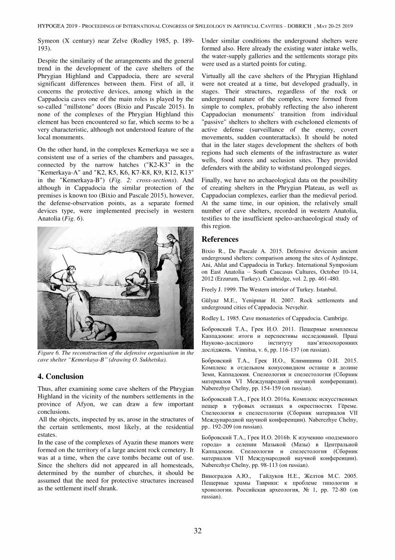
HYPOGEA 2019 - PROCEEDINGS OF INTERNATIONAL CONGRESS OF SPELEOLOGY IN ARTIFICIAL CAVITIES – DOBRICH , MAY 20-25 2019
32
Symeon (X century) near Zelve (Rodley 1985, p. 189-
193).
Despite the similarity of the arrangements and the general
trend in the development of the cave shelters of the
Phrygian Highland and Cappadocia, there are several
significant differences between them. First of all, it
concerns the protective devices, among which in the
Cappadocia caves one of the main roles is played by the
so-called "millstone" doors (Bixio and Pascale 2015). In
none of the complexes of the Phrygian Highland this
element has been encountered so far, which seems to be a
very characteristic, although not understood feature of the
local monuments.
On the other hand, in the complexes Kemerkaya we see a
consistent use of a series of the chambers and passages,
connected by the narrow hatches ("K2-K3" in the
"Kemerkaya-A" and "K2, K5, K6, K7-K8, K9, K12, K13"
in the "Kemerkaya-B") (Fig. 2: cross-sections). And
although in Cappadocia the similar protection of the
premises is known too (Bixio and Pascale 2015), however,
the defense-observation points, as a separate formed
devices type, were implemented precisely in western
Anatolia (Fig. 6).
Figure 6. The reconstruction of the defensive organisation in the
cave shelter “Kemerkaya-B” (drawing O. Sukhetska).
4. Conclusion
Thus, after examining some cave shelters of the Phrygian
Highland in the vicinity of the numbers settlements in the
province of Afyon, we can draw a few important
conclusions.
All the objects, inspected by us, arose in the structures of
the certain settlements, most likely, at the residential
estates.
In the case of the complexes of Ayazin these manors were
formed on the territory of a large ancient rock cemetery. It
was at a time, when the cave tombs became out of use.
Since the shelters did not appeared in all homesteads,
determined by the number of churches, it should be
assumed that the need for protective structures increased
as the settlement itself shrank.
Under similar conditions the underground shelters were
formed also. Here already the existing water intake wells,
the water-supply galleries and the settlements storage pits
were used as a started points for cuting.
Virtually all the cave shelters of the Phrygian Highland
were not created at a time, but developed gradually, in
stages. Their structures, regardless of the rock or
underground nature of the complex, were formed from
simple to complex, probably reflecting the also inherent
Cappadocian monuments' transition from individual
"passive" shelters to shelters with escheloned elements of
active defense (surveillance of the enemy, covert
movements, sudden counterattacks). It should be noted
that in the later stages development the shelters of both
regions had such elements of the infrastructure as water
wells, food stores and seclusion sites. They provided
defenders with the ability to withstand prolonged sieges.
Finally, we have no archaeological data on the possibility
of creating shelters in the Phrygian Plateau, as well as
Cappadocian complexes, earlier than the medieval period.
At the same time, in our opinion, the relatively small
number of cave shelters, recorded in western Anatolia,
testifies to the insufficient speleo-archaeological study of
this region.
References
Bixio R., De Pascale A. 2015. Defensive devicesin ancient
underground shelters: comparison among the sites of Aydintepe,
Ani, Ahlat and Cappadocia in Turkey. International Symposium
on East Anatolia – South Caucasus Cultures, October 10-14,
2012 (Erzurum, Turkey). Cambridge, vol. 2, pp. 461-480.
Freely J. 1999. The Western interior of Turkey. Istanbul.
Gülyaz M.E., Yenipınar H. 2007. Rock settlements and underground cities of Cappadocia. Nevşehir.
Rodley L. 1985. Cave monasteries of Cappadocia. Cambrige.
Бобровский Т.А., Грек И.О. 2011. Пещерные комплексы Каппадокии: итоги и перспективы исследований. Праці Науково-дослідного інституту пам’яткоохоронних досліджень. Vinnitsa, v. 6, pp. 116-137 (on russian).
Бобровский Т.А., Грек И.О., Климишина О.И. 2015. Комплекс в отдельном конусовидном останце в долине Земи, Каппадокия. Спелеология и спелестология (Сборник материалов VI Международной научной конференции). Naberezhye Chelny, pp. 154-159 (on russian).
Бобровский Т.А., Грек И.О. 2016a. Комплекс искусственных пещер в туфовых останцах в окрестностях Гёреме. Спелеология и спелестология (Сборник материалов VII Международной научной конференции). Naberezhye Chelny, pp.. 192-209 (on russian).
Бобровский Т.А., Грек И.О. 2016b. К изучению «подземного города» в селении Мазыкой (Мазы) в Центральной Каппадокии. Спелеология и спелестология (Сборник материалов VII Международной научной конференции). Naberezhye Chelny, pp. 98-113 (on russian).
Виноградов А.Ю., Гайдуков Н.Е., Желтов М.С. 2005. Пещерные храмы Таврики: к проблеме типологии и хронологии. Российская археология, № 1, pp. 72-80 (on
russian).
HYPOGEA 2019 - PROCEEDINGS OF INTERNATIONAL CONGRESS OF SPELEOLOGY IN ARTIFICIAL CAVITIES – DOBRICH , MAY 20-25 2019
33
INVENTORY AND ANALYSIS OF UNDERGROUND OIL MILLS IN THE
TERRITORY OF LECCE (APULIA, SOUTHERN ITALY)
Stefano Margiotta1, Mariangela Martellotta
2, Mario Parise
3,4
1 Geologist, Lecce, Italy
2 Gruppo Speleologico Leccese ‘Ndronico, Lecce, Italy; [email protected]
3 Università Aldo Moro, Bari, Italy; [email protected]
4 Centro Altamurano Ricerche Speleologiche, Altamura, Italy
Abstract
The production of olive oil is known as one of the main agricultural activities in many Italian regions. This fame comes
from a long history, and a complex chain of working phases as well, which at some locations occurred mostly
underground. In Apulia, southern Italy, and particularly in its southeasternmost sector, Salento, oil mills were typically
realized as subterranean spaces, due to a number of reasons, the main ones being lower expenses (when compared to the
cost of building up an over-surface structure), and the easy workability of the outcropping rocks. These latters consist of
soft rocks, represented by Miocene to Plio-Pleistocene calcarenites.
In the territory of Lecce, the most important town in Salento, the historical documentation reports about 40 oil mills
(locally called trappeti) during the second half of the 18th
century. These were underground structures related to rural
houses (locally called masserie), north of the town. From the structural standpoint, they belong to the typology of
“cavities dug in the subsoil”, being underground structures in the strict sense: that is, rooms obtained by removing and
digging rocks under the surface level. In the classification of artificial cavities by the Commission of the International
Union of Speleology, underground oil mills belong to Type B: Hypogean civilian dwellings, and specifically they are
classified as B.3 – Underground plants or factories. They were actually real working places, where workers often used
also to sleep, especially during the hot season. The underground spaces could be very large, with a high number of
rooms dedicated to collection and work of the olives, but also as storing places, stables for the animals, and sleeping
rooms for the workers. In a few cases, water wells or sites to collect and preserve the ice were excavated in the same
underground structure, too. Working underground had, on the other hand, negative outcomes for the overall quality of
the oil, due to lack of air and light, heating due to presence of workers and animals, and the process of fermentation of
the olives stored in the rooms. All of this resulted in low quality of the oil, so that it was typically used for industrial
purposes (i.e., lighting) rather than for food.
Starting from the beginning of the 19th
century, a transformation was registered in the rural setting, since olive farming
was not convenient anymore, and the passage to intensive vineyards occurred. This had as a consequence the
progressive abandonment of underground oil mills, for many and many of which a loss of memory had to be recorded.
In this contribution we present the results of recent geological and topographic surveys that allowed us to find 17
underground oil mills, not included in the Cadastre of Artificial Cavities of Apulia Region. Six out of them have been
restored by the owners, and are presently used for different types of tourist activities; the remaining 11 are generally in
bad conditions, abandoned, and often have been used as illegal waste disposal. In addition to illustrating their main
characters, some considerations about the stability of the underground structures will also be presented, by describing
the main situations where instability features have been observed and mapped.
Keywords
artificial cavity, oil mills, inventory, Apulia.
1. Introduction
The production of olive oil is known as one of the main
agricultural activities in many Italian regions. This fame
comes from a long history, and a complex chain of
working phases as well, which at some locations were
mostly occurring underground. In Apulia, southern Italy,
and particularly in its southeasternmost sector, Salento,
oil mills were typically realized as subterranean spaces,
due to a number of reasons, the main ones being lower
expenses (when compared to the cost of building up an
over-surface structure), and the easy workability of the
outcropping rocks. These latters consist of soft rocks,
essentially represented by Miocene (Pietra Leccese) to
Plio-Pleistocene calcarenites (Gravina Calcarenites).
In the territory of Lecce, the most important town in
Salento, the historical documentation reports about 40 oil
mills (locally called trappeti) during the second half of
the 18th
century. These were underground structures
related to country houses (locally called masserie), north
of the town. From the structural standpoint, they belong to
the typology of “cavities dug in the subsoil”, being
underground structures in the strict sense: that is, rooms
obtained by removing and digging rocks under the surface
level (Galeazzi, 2013; Parise et al., 2013). In the
classification of artificial cavities by the Commission of
the International Union of Speleology, underground oil
mills belong to Type B: Hypogean civilian dwellings, and
specifically they are classified as B.3 – Underground
plants or factories (Parise et al., 2013, 2015). They were
actually real working places, where workers often used
also to sleep, especially during the hot season. The

HYPOGEA 2019 - PROCEEDINGS OF INTERNATIONAL CONGRESS OF SPELEOLOGY IN ARTIFICIAL CAVITIES – DOBRICH , MAY 20-25 2019
34
underground spaces could be very large, with a high
number of rooms dedicated to collection and work of the
olives, but also as storing places, stables for the animals,
and sleeping rooms for the workers. In a few cases, water
wells or sites to collect and preserve the ice were
excavated in the same underground structure, too.
Working underground had, on the other hand, negative
outcomes for the overall quality of the oil, due to lack of
air and light, heating due to presence of workers and
animals, and the process of fermentation of the olives
stored in the rooms. All of this resulted in low quality of
the oil, so that it was typically used for industrial purposes
(i.e., lighting) rather than for food.
Starting from the beginning of the 19th
century, a
transformation was registered in the rural setting, since
olive farming was not convenient anymore, and the
passage to intensive vineyards had to be registered in
wide sectors of Salento. As a consequence, there was a
progressive abandonment of underground oil mills, for
many and many of which a loss of memory had to be
recorded.
In this contribution we present the results of recent
geological and topographic surveys that allowed us to
find 17 underground oil mills, not included so far in the
Cadastre of Artificial Cavities of Apulia Region. Six out
of them have been restored by the owners, and are
presently used for different types of tourist activities; the
remaining 11 are generally in bad conditions, abandoned,
and often have been used as illegal waste disposal. In
addition to illustrating their main characters and the local
geology, some considerations about the stability of the
underground structures will also be presented, by
describing the main situations where instability features
have been observed and mapped.
2. Oil production in Salento
Apulia region, the heel of the Italian boot, has an
economy strongly based on agriculture, with some
products such as vines and olive oil representing the main
field of activity of farmers. In particular, cultivation of
olive trees, and production of olive oil, has always played
a significant role in many sectors of the region. Oil
industries were, in Salento (the southernmost peninsula)
as elsewhere, the last evidences of a significant rural
culture (Monte, 2003).
Figure 1. Inner view of an underground oil mill in the rural area
around Lecce.
Together with pasture and cereals, oil production was in
fact part of the main system of work for the Apulian
agriculture, especially during the time of greatest
development, in the 16th
century (Costantini, 2017). In
this setting the underground oil mills (known as trappeti
in the local dialect) transformed not only working spaces,
but rather real factories where the human and animal
activities were continuous, typically covering the period
from November to May (Monte, 1992, 1995; De Marco &
Sannicola, 2007; Fornaro et al., 2008).
Safeguarding and exploiting sites such as the underground
oil mills in the Lecce area represents an effort toward
discovering those values that were in the past economic
and working activities, and that nowadays are a
significant testimony of the past working places, and of
the relationships between man and the natural setting as
well.
Access to the underground oil mills (Figure 1) typically
occurs through a steep stairway excavated in the rock
mass, which had to be wide enough to allow the passage
of a donkey. This animal served as the labor force to let
spin the stone mechanism needed for the press. Once
transported underground, the donkey was destined not to
see the light anymore since, at the end of its life cycle, it
was consumed as food by the same workers.
From the stairway it was possible to have access to the
underground space, reaching the main room, where the
millstones and the presses were present, together with the
wells for the collection and the decantation of the oil
(Figure 1). Size of the room changed in function of the
importance of the oil mill, and of the surrounding lands as
well. The main element of the room was the mill tank
(also called “the spring”), shaped as a bowl, about 3 m
wide, and where the millstone was placed (Figure 2). This
latter, with a diameter of at least 2 m and some 0.6 m
thick, was obtained from a single block of rock, typically
in the Mesozoic limestones cropping out in the area.
Locally, millstones in calcareous breccia have also been
found. In connection with the main room, there were the
so-called sciave, sciaie or sciaghe, depending upon the
local dialects, that is smaller rooms with the function of
storage rooms, often with an opening toward the ground
to allow the direct discharge of the olives, directly from
the carriages. In many oil mills there were also further
spaces, dedicated to stable for the animals, sleeping sites
for the workers, and a site where the meals were
consumed.
Figure 2. Stone mill.
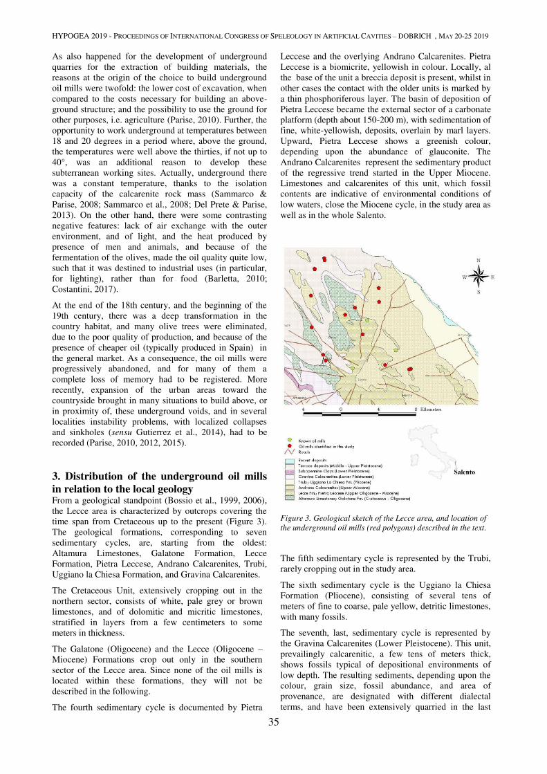
HYPOGEA 2019 - PROCEEDINGS OF INTERNATIONAL CONGRESS OF SPELEOLOGY IN ARTIFICIAL CAVITIES – DOBRICH , MAY 20-25 2019
35
As also happened for the development of underground
quarries for the extraction of building materials, the
reasons at the origin of the choice to build underground
oil mills were twofold: the lower cost of excavation, when
compared to the costs necessary for building an above-
ground structure; and the possibility to use the ground for
other purposes, i.e. agriculture (Parise, 2010). Further, the
opportunity to work underground at temperatures between
18 and 20 degrees in a period where, above the ground,
the temperatures were well above the thirties, if not up to
40°, was an additional reason to develop these
subterranean working sites. Actually, underground there
was a constant temperature, thanks to the isolation
capacity of the calcarenite rock mass (Sammarco &
Parise, 2008; Sammarco et al., 2008; Del Prete & Parise,
2013). On the other hand, there were some contrasting
negative features: lack of air exchange with the outer
environment, and of light, and the heat produced by
presence of men and animals, and because of the
fermentation of the olives, made the oil quality quite low,
such that it was destined to industrial uses (in particular,
for lighting), rather than for food (Barletta, 2010;
Costantini, 2017).
At the end of the 18th century, and the beginning of the
19th century, there was a deep transformation in the
country habitat, and many olive trees were eliminated,
due to the poor quality of production, and because of the
presence of cheaper oil (typically produced in Spain) in
the general market. As a consequence, the oil mills were
progressively abandoned, and for many of them a
complete loss of memory had to be registered. More
recently, expansion of the urban areas toward the
countryside brought in many situations to build above, or
in proximity of, these underground voids, and in several
localities instability problems, with localized collapses
and sinkholes (sensu Gutierrez et al., 2014), had to be
recorded (Parise, 2010, 2012, 2015).
3. Distribution of the underground oil mills
in relation to the local geology From a geological standpoint (Bossio et al., 1999, 2006),
the Lecce area is characterized by outcrops covering the
time span from Cretaceous up to the present (Figure 3).
The geological formations, corresponding to seven
sedimentary cycles, are, starting from the oldest:
Altamura Limestones, Galatone Formation, Lecce
Formation, Pietra Leccese, Andrano Calcarenites, Trubi,
Uggiano la Chiesa Formation, and Gravina Calcarenites.
The Cretaceous Unit, extensively cropping out in the
northern sector, consists of white, pale grey or brown
limestones, and of dolomitic and micritic limestones,
stratified in layers from a few centimeters to some
meters in thickness.
The Galatone (Oligocene) and the Lecce (Oligocene –
Miocene) Formations crop out only in the southern
sector of the Lecce area. Since none of the oil mills is
located within these formations, they will not be
described in the following.
The fourth sedimentary cycle is documented by Pietra
Leccese and the overlying Andrano Calcarenites. Pietra
Leccese is a biomicrite, yellowish in colour. Locally, al
the base of the unit a breccia deposit is present, whilst in
other cases the contact with the older units is marked by
a thin phosphoriferous layer. The basin of deposition of
Pietra Leccese became the external sector of a carbonate
platform (depth about 150-200 m), with sedimentation of
fine, white-yellowish, deposits, overlain by marl layers.
Upward, Pietra Leccese shows a greenish colour,
depending upon the abundance of glauconite. The
Andrano Calcarenites represent the sedimentary product
of the regressive trend started in the Upper Miocene.
Limestones and calcarenites of this unit, which fossil
contents are indicative of environmental conditions of
low waters, close the Miocene cycle, in the study area as
well as in the whole Salento.
Figure 3. Geological sketch of the Lecce area, and location of
the underground oil mills (red polygons) described in the text.
The fifth sedimentary cycle is represented by the Trubi,
rarely cropping out in the study area.
The sixth sedimentary cycle is the Uggiano la Chiesa
Formation (Pliocene), consisting of several tens of
meters of fine to coarse, pale yellow, detritic limestones,
with many fossils.
The seventh, last, sedimentary cycle is represented by
the Gravina Calcarenites (Lower Pleistocene). This unit,
prevailingly calcarenitic, a few tens of meters thick,
shows fossils typical of depositional environments of
low depth. The resulting sediments, depending upon the
colour, grain size, fossil abundance, and area of
provenance, are designated with different dialectal
terms, and have been extensively quarried in the last

HYPOGEA 2019 - PROCEEDINGS OF INTERNATIONAL CONGRESS OF SPELEOLOGY IN ARTIFICIAL CAVITIES – DOBRICH , MAY 20-25 2019
36
centuries for building purposes (Parise, 2010).
The underground oil mills were excavated in the soft
Apulian calcarenites, namely in the Miocene Pietra
Leccese and in the Pleistocene Gravina Calcarenites
(Figure 3, Table 1). The voids excavated in the fine
calcarenites of Miocene age are generally in good stability
conditions, except where some marl intervals are present.
In these cases, such intervals are strongly affected by
selective erosion; when they are part of the pillars
sustaining the underground void, the erosion may be so
intense to cause them to loose the sustaining function. As
concerns stability issues, others problems are related to
presence of discontinuities such as joints and fractures,
later widened by karst processes attacting the soluble
rocks. Such widening in several cases has been then filled
with residual deposits (terre rosse).
Two underground oil mills were excavated in the
Miocene sediments, and are located within properties of
the Lecce Municipality. The first, partly recovered, is
within a public park, at the Belloluogo Tower, in the
northern outskirts of town. The tower is a remarkable
example of French architecture (Angevin domination),
and was built during the 14th century by the Brienne
family. Nearby the tower, a beautiful underground oil mill
was excavated in the Pietra Leccese, which at the site
shows a typical pale yellow colour.
Figure 4. General view of the main room in the oil mill at the
eastern outskirts of Lecce.
Figure 5. Map of the underground oil mill at the eastern
outskirts of Lecce.
The second oil mill, still within municipal land, is in the
eastern part of town, not far from several civil buildings,
and in proximity of two schools. Entirely covered by
debris in the last decades, this underground oil mill was
brought again to light in consequence of some local
collapses that interested the soil cover (Figures 4 and 5).
The oil mill is prevailingly excavated in the Pietra
Leccese, with presence of glauconitic levels, but in its
upper portion it shows calcarenitic marls, rich in anellids
and small fossils, belonging to the unit of the Andrano
Calcarenites. This top interval has a lower resistance to
weathering than the rest of the structure, and shows
localized erosional features that, nevertheless, do not
compromise the overall stability of the underground
space. The discontinuities are quite rare, with the
exception of a joint oriented N 20, open some decimeters,
enlarging toward the base of the void, and filled with
reddish clay residual deposits. The filling material was
excavated from the discontinuity, which lower part thus
began a site for discharging liquid wastes by the workers.
Such a practice was very common in the past, and many
cavities of karst origin were used at this aim (named, in
the local dialect, “capuientu”; see Parise et al., 2003).
The underground oil mill at the eastern outskirts of Lecce
has been recently included in the register of artificial
cavities of Apulia region, managed by the Apulian
Speleological Federation.
Lack of attention toward hygiene of the workers is also
testified by another underground oil mill, located toward
the Adriatic coast, at Torre Chianca. This oil mill, again
excavated in the Miocene sediments, has a similar site for
discharge of liquid waste, but also, in the same room, a
well from where the workers were used to take water,
from a depth of some 10 meters from the base of the
artificial cavity.
As concerns stability issues, the oil mills realized in the
Pleistocene coarse-grained calcarenite rock mass are
typically in better conditions than those excavated in the
Miocene rocks, due to greater homogeneity of the rock
mass. These are the oil mills located in the northernmost
portion of the municipality, nearby the coastal areas
between Torre Rinalda and Torre Chianca. In this sector,
some problems of instability are only related to presence
of intervals particularly rich in fossils, thus representing
areas of higher weakness in the rock masses.
The two oil mills in the Cerrate Abbey belong to this type
of category. According to the legend, the abbey was
founded by the Norman king Tancredi di Altavilla, after a
vision where he saw the Virgin Mary following a fawn in
a cave; more realistically, the abbey was built between the
end of the 11th and the beginning of the 12th century by
Boemondo d’Altavilla, who established at the site a Greek
monastery, following the rule by San Basilio Magno,
looking for sites where to refuge in Salento in order to
escape the iconoclastic persecutions from Bisanzio. The
Cerrate Abbey, in proximity of the road linking Brindisi
to Lecce and Otranto, became one of the most remarkable
monastic sites in southern Italy, and in 1531 it passed
under the control of the Ospedale degli Incurabili of
Naples. Importance of the activities at the place is pointed
HYPOGEA 2019 - PROCEEDINGS OF INTERNATIONAL CONGRESS OF SPELEOLOGY IN ARTIFICIAL CAVITIES – DOBRICH , MAY 20-25 2019
37
out by presence, in addition to the two underground oil
mills, of the church, the stables, settlements for the
farmers, a well, and a water mill. In 1711 the abbey
complex was plundered by the Saracens, and following
this event the site was abandoned for more than two
centuries and a half. Nowadays, after it became property
of the Lecce Province, the Abbey and its heritage have
been recovered and are managed by the Italian
Emvironmental Fund (Fondo Ambiente Italiano - FAI).
Table 1. List of the underground oil mills identified in this study
within the territory of the Lecce Municipality.
no. name lithology
1 Zona 167, Lecce Pietra Leccese
2 Via Fondone – Via Lecce
San Cataldo Pietra Leccese –
Andrano Calcarenites 3 Casino San Giuseppe Miocene calcarenites 4 Masseria Giampaolo Pleistocene calcarenites
5 Masseria Ghietta Pleistocene calcarenites
6 Masseria Mosco Pleistocene calcarenites
7 Masseria Cerrate 1 Pleistocene calcarenites
8 Masseria Cerrate 2 Pleistocene calcarenites
9 Masseria Tracasci Pleistocene calcarenites
10 near road Lecce-Trepuzzi
11 Masseria Mosca
12 Masseria Santoni Pietra Leccese
13 Masseria Barba ai Monti
14 Masseria Monacelli Pleistocene calcarenites
15 Masseria Vadacca Pietra Leccese
16 Masseria La Grotta Pleistocene calcarenites
17
Masseria between Via
Fondone – Via Lecce San
Cataldo
4. Conclusions
Before the present study, only three underground oil mills
were included in the register of artificial cavities of
Apulia Region. This was a quite contrasting data with
regard to the diffuse presence of olive trees in the
territory, especially as concerns the northern sector of the
area under study. Looking at historical documents dating
back to the second half of the 18th century, the land
around Lecce counted at least 40 underground oil mills,
mostly related to the main country houses (masserie)
located north of the town.
Starting from the information contained in these
documents, and through detailed bibliographic research
and field work, seventeen, previously unknown, oil mills
have been found (Table 1). Six of them have been
reworked by land owners and used for a variety of
purposes, mainly related to tourist activities, whilst eleven
oil mills are at present abandoned. In many cases the
underground oil mills have become sites where to
discharge illegally solid wastes, following a practice
which, unfortunately, characterizes many sites of karst
landforms in rural Apulia (Parise and Pascali, 2003).
If properly valorized, and once their stability conditions
have been ascertained, the underground spaces could
represent remarkable examples of the interactions
between the anthropogenic activities of industrial
archaeology and the local geology. In this sense,
recovering the oil mill of municipal property, located
within the boundaries of the town, should be the priority,
and contribute to point out the importance of this cultural
and historical heritage, as a testimony of the past
activities of rural Salento.
References
Barletta R., 2010. Architettura contadina del Salento. Capone
Editore, Lecce
Bossio A., Foresi L., Margiotta S., Mazzei R., Monteforti B.,
Salvatorini G., 1998. Carta geologica del settore nord orientale
della Provincia di Lecce; scala 1:25000; settore 7,8,10 scala
1:10000. Università di Siena
Bossio A., Foresi L., Margiotta S., Mazzei R., Salvatorini G.,
Donia F., 2006. Stratigrafia neogenico-quaternaria del settore
nord - orientale della provincia di Lecce (con rilevamento
geologico alla scala 1:25000). Geologica Romana.
Costantini A., 2017. Guida all’architettura contadina del
Salento. Congedo Editore, Lecce.
Del Prete S., Parise M., 2013. An overview of the geological
and morphological constraints in the excavation of artificial
cavities. In: Filippi M., Bosak P. (Eds.), Proceedings 16th
International Congress of Speleology, Brno, 21-28 July 2013, 2,
236-241.
De Marco M., Sannicola G.C., 2007. Aspetti e caratteri dei
trappeti ipogei in Puglia. Speleo Club Cryptae Aliae, Grottaglie.
Fornaro A., Greco A.V., Marangella A., Maranò P., Nuzzo A.,
Parise M., Sannicola G.C., 2008. Studi e ricerche speleologiche
sul sistema degli ipogei di Masseria Lonoce in agro di Grottaglie
(Taranto, Puglia). Proc. 6th National Congress of Speleology in
Artificial Cavities, Napoli, 30 May – 2 June 2008, Opera
Ipogea, 1-2, pp. 283-294.
Galeazzi C., 2013. The typological tree of artiicial cavities: a
contribution by the Commission of the Italian Speleological
Society. Opera Ipogea, 1, 9–18.
Gutiérrez F., Parise M., De Waele J., Jourde H.,.2014. A review
on natural and human-induced geohazards and impacts in karst.
Earth Science Reviews, 138, 61–88.
Monte A., 1992. I frantoi ipogei di Terra d’Otranto. Lu
Lampiune, 8, 3, 65-75.
Monte A., 1995. Frantoi ipogei del Salento. Edizioni del Grifo,
Lecce.
Monte A., 2003. L’antica industria dell’olio. Itinerari di
archeologia industriale nel Salento, Edizioni del Grifo, Lecce.
Parise M., 2010. The impacts of quarrying in the Apulian Karst.
In: Carrasco F., La Moreaux J.W., Duran Valsero J.J., Andreo
B. (Eds.), Advances in Research in Karst Media. Berlin,
Heidelberg, Springer, pp. 441–447.
Parise, M., 2012. A present risk from past activities: sinkhole
occurrence above underground quarries. Carbonates and
Evaporites, 27 (2), 109–118.
Parise M., 2015. A procedure for evaluating the susceptibility to
natural and anthropogenic sinkholes. Georisk, 9, 272-285.
Parise M., Pascali V., 2003. Surface and subsurface
environmental degradation in the karst of Apulia (southern
Italy). Environmental Geology, 44 (3), 247-256.
Parise M., Federico A., Delle Rose M., Sammarco M., 2003.
Karst terminology in Apulia (southern Italy). Acta Carsologica,
32 (2), 65-82.

HYPOGEA 2019 - PROCEEDINGS OF INTERNATIONAL CONGRESS OF SPELEOLOGY IN ARTIFICIAL CAVITIES – DOBRICH , MAY 20-25 2019
38
Parise M., Galeazzi C., Bixio R., Dixon M., 2013. Classification
of artiicial cavities: a first contribution by the UIS Commission.
In: Filippi M., Bosak P. (Eds.), Proceedings 16th International
Congress of Speleology, Brno, 21-28 July 2013, 2, pp. 230-235.
Parise M., Galeazzi C., Bixio R., Germani C., (Eds.) 2015.
Proceedings of the International Congress in Artiicial Cavities
“Hypogea 2015”. Rome, March 11-17, 2015, ISBN 978-
8889731-79-6, 543 pp.
Sammarco M., Parise M., 2008. Cavità artificiali per uno studio
di storia salentina: il caso dell’ipogeo di Leuca Piccola a
Barbarano. Proc. XX National Congress of Speleology,
Iglesias, 27-30 April 2007, Memorie dell’Istituto Italiano di
Speleologia, s. II, 21, pp. 389-393.
Sammarco M., Parise M., Donno G., Inguscio S., Rossi E.,
2008. Il sistema rupestre di località Macurano presso
Montesardo (Lecce, Puglia). Proc. 6th National Congress of
Speleology in Artificial Cavities, Napoli, 30 May – 2 June 2008,
Opera Ipogea, 1-2. pp. 273-282.
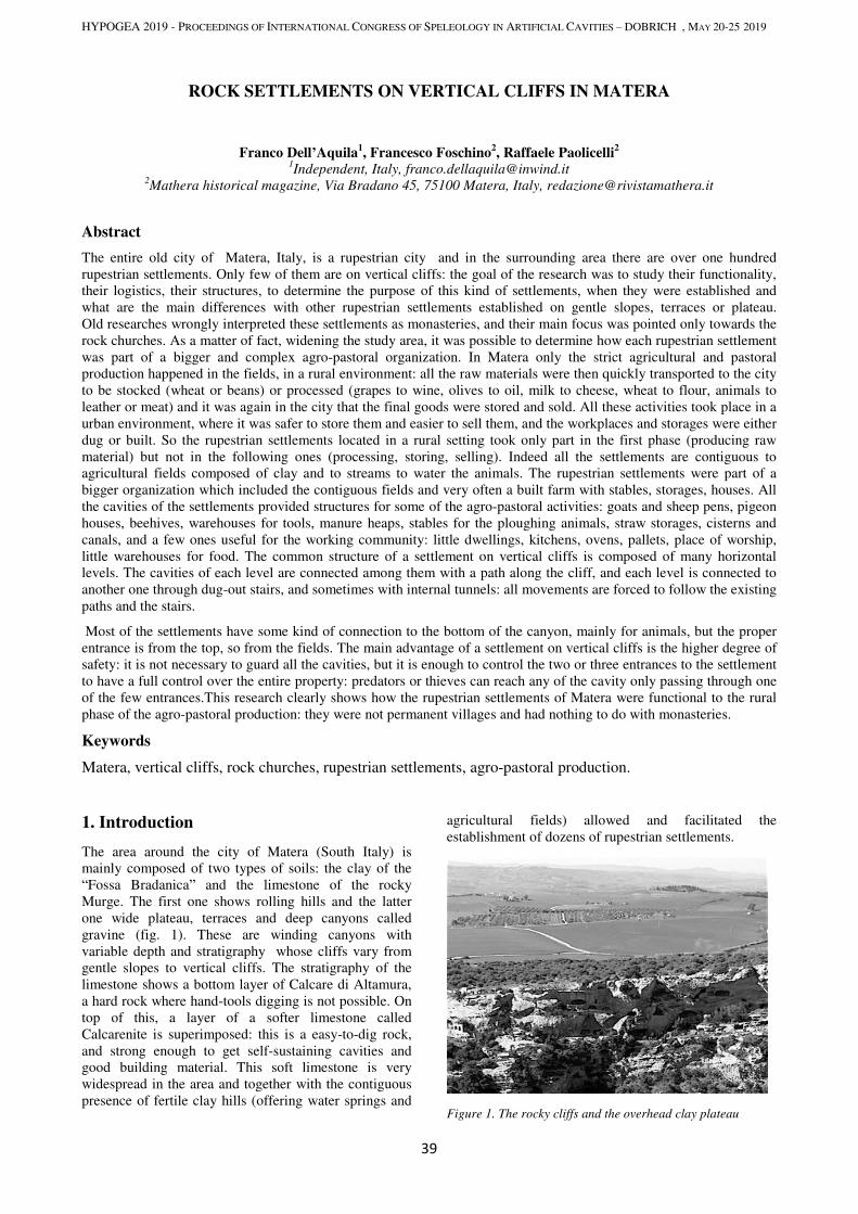
HYPOGEA 2019 - PROCEEDINGS OF INTERNATIONAL CONGRESS OF SPELEOLOGY IN ARTIFICIAL CAVITIES – DOBRICH , MAY 20-25 2019
39
ROCK SETTLEMENTS ON VERTICAL CLIFFS IN MATERA
Franco Dell’Aquila1, Francesco Foschino
2, Raffaele Paolicelli
2
1Independent, Italy, [email protected]
2Mathera historical magazine, Via Bradano 45, 75100 Matera, Italy, [email protected]
Abstract
The entire old city of Matera, Italy, is a rupestrian city and in the surrounding area there are over one hundred
rupestrian settlements. Only few of them are on vertical cliffs: the goal of the research was to study their functionality,
their logistics, their structures, to determine the purpose of this kind of settlements, when they were established and
what are the main differences with other rupestrian settlements established on gentle slopes, terraces or plateau.
Old researches wrongly interpreted these settlements as monasteries, and their main focus was pointed only towards the
rock churches. As a matter of fact, widening the study area, it was possible to determine how each rupestrian settlement
was part of a bigger and complex agro-pastoral organization. In Matera only the strict agricultural and pastoral
production happened in the fields, in a rural environment: all the raw materials were then quickly transported to the city
to be stocked (wheat or beans) or processed (grapes to wine, olives to oil, milk to cheese, wheat to flour, animals to
leather or meat) and it was again in the city that the final goods were stored and sold. All these activities took place in a
urban environment, where it was safer to store them and easier to sell them, and the workplaces and storages were either
dug or built. So the rupestrian settlements located in a rural setting took only part in the first phase (producing raw
material) but not in the following ones (processing, storing, selling). Indeed all the settlements are contiguous to
agricultural fields composed of clay and to streams to water the animals. The rupestrian settlements were part of a
bigger organization which included the contiguous fields and very often a built farm with stables, storages, houses. All
the cavities of the settlements provided structures for some of the agro-pastoral activities: goats and sheep pens, pigeon
houses, beehives, warehouses for tools, manure heaps, stables for the ploughing animals, straw storages, cisterns and
canals, and a few ones useful for the working community: little dwellings, kitchens, ovens, pallets, place of worship,
little warehouses for food. The common structure of a settlement on vertical cliffs is composed of many horizontal
levels. The cavities of each level are connected among them with a path along the cliff, and each level is connected to
another one through dug-out stairs, and sometimes with internal tunnels: all movements are forced to follow the existing
paths and the stairs.
Most of the settlements have some kind of connection to the bottom of the canyon, mainly for animals, but the proper
entrance is from the top, so from the fields. The main advantage of a settlement on vertical cliffs is the higher degree of
safety: it is not necessary to guard all the cavities, but it is enough to control the two or three entrances to the settlement
to have a full control over the entire property: predators or thieves can reach any of the cavity only passing through one
of the few entrances.This research clearly shows how the rupestrian settlements of Matera were functional to the rural
phase of the agro-pastoral production: they were not permanent villages and had nothing to do with monasteries.
Keywords
Matera, vertical cliffs, rock churches, rupestrian settlements, agro-pastoral production.
1. Introduction
The area around the city of Matera (South Italy) is
mainly composed of two types of soils: the clay of the
“Fossa Bradanica” and the limestone of the rocky
Murge. The first one shows rolling hills and the latter
one wide plateau, terraces and deep canyons called
gravine (fig. 1). These are winding canyons with
variable depth and stratigraphy whose cliffs vary from
gentle slopes to vertical cliffs. The stratigraphy of the
limestone shows a bottom layer of Calcare di Altamura,
a hard rock where hand-tools digging is not possible. On
top of this, a layer of a softer limestone called
Calcarenite is superimposed: this is a easy-to-dig rock,
and strong enough to get self-sustaining cavities and
good building material. This soft limestone is very
widespread in the area and together with the contiguous
presence of fertile clay hills (offering water springs and
agricultural fields) allowed and facilitated the
establishment of dozens of rupestrian settlements.
Figure 1. The rocky cliffs and the overhead clay plateau
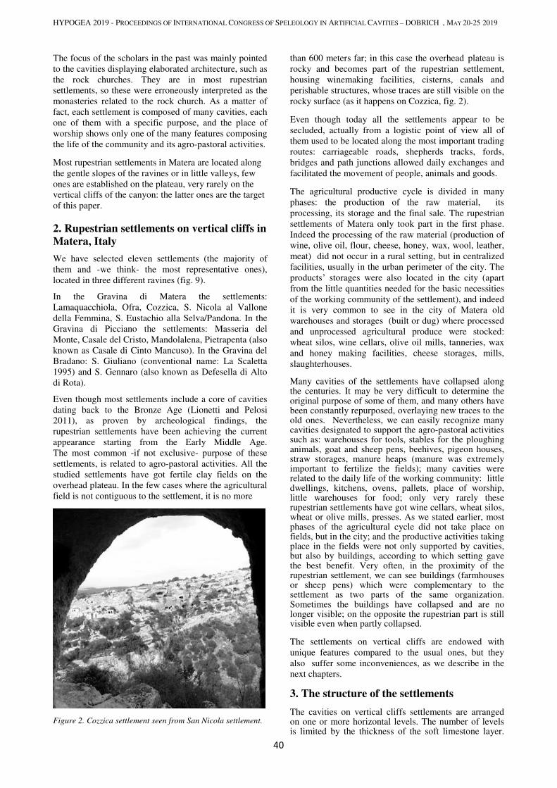
HYPOGEA 2019 - PROCEEDINGS OF INTERNATIONAL CONGRESS OF SPELEOLOGY IN ARTIFICIAL CAVITIES – DOBRICH , MAY 20-25 2019
40
The focus of the scholars in the past was mainly pointed
to the cavities displaying elaborated architecture, such as
the rock churches. They are in most rupestrian
settlements, so these were erroneously interpreted as the
monasteries related to the rock church. As a matter of
fact, each settlement is composed of many cavities, each
one of them with a specific purpose, and the place of
worship shows only one of the many features composing
the life of the community and its agro-pastoral activities.
Most rupestrian settlements in Matera are located along
the gentle slopes of the ravines or in little valleys, few
ones are established on the plateau, very rarely on the
vertical cliffs of the canyon: the latter ones are the target
of this paper.
2. Rupestrian settlements on vertical cliffs in
Matera, Italy
We have selected eleven settlements (the majority of
them and -we think- the most representative ones),
located in three different ravines (fig. 9).
In the Gravina di Matera the settlements:
Lamaquacchiola, Ofra, Cozzica, S. Nicola al Vallone
della Femmina, S. Eustachio alla Selva/Pandona. In the
Gravina di Picciano the settlements: Masseria del
Monte, Casale del Cristo, Mandolalena, Pietrapenta (also
known as Casale di Cinto Mancuso). In the Gravina del
Bradano: S. Giuliano (conventional name: La Scaletta
1995) and S. Gennaro (also known as Defesella di Alto
di Rota).
Even though most settlements include a core of cavities
dating back to the Bronze Age (Lionetti and Pelosi
2011), as proven by archeological findings, the
rupestrian settlements have been achieving the current
appearance starting from the Early Middle Age.
The most common -if not exclusive- purpose of these
settlements, is related to agro-pastoral activities. All the
studied settlements have got fertile clay fields on the
overhead plateau. In the few cases where the agricultural
field is not contiguous to the settlement, it is no more
Figure 2. Cozzica settlement seen from San Nicola settlement.
than 600 meters far; in this case the overhead plateau is
rocky and becomes part of the rupestrian settlement,
housing winemaking facilities, cisterns, canals and
perishable structures, whose traces are still visible on the
rocky surface (as it happens on Cozzica, fig. 2).
Even though today all the settlements appear to be
secluded, actually from a logistic point of view all of
them used to be located along the most important trading
routes: carriageable roads, shepherds tracks, fords,
bridges and path junctions allowed daily exchanges and
facilitated the movement of people, animals and goods.
The agricultural productive cycle is divided in many
phases: the production of the raw material, its
processing, its storage and the final sale. The rupestrian
settlements of Matera only took part in the first phase.
Indeed the processing of the raw material (production of
wine, olive oil, flour, cheese, honey, wax, wool, leather,
meat) did not occur in a rural setting, but in centralized
facilities, usually in the urban perimeter of the city. The
products’ storages were also located in the city (apart
from the little quantities needed for the basic necessities
of the working community of the settlement), and indeed
it is very common to see in the city of Matera old
warehouses and storages (built or dug) where processed
and unprocessed agricultural produce were stocked:
wheat silos, wine cellars, olive oil mills, tanneries, wax
and honey making facilities, cheese storages, mills,
slaughterhouses.
Many cavities of the settlements have collapsed along the centuries. It may be very difficult to determine the original purpose of some of them, and many others have been constantly repurposed, overlaying new traces to the old ones. Nevertheless, we can easily recognize many cavities designated to support the agro-pastoral activities such as: warehouses for tools, stables for the ploughing animals, goat and sheep pens, beehives, pigeon houses, straw storages, manure heaps (manure was extremely important to fertilize the fields); many cavities were related to the daily life of the working community: little dwellings, kitchens, ovens, pallets, place of worship, little warehouses for food; only very rarely these rupestrian settlements have got wine cellars, wheat silos, wheat or olive mills, presses. As we stated earlier, most phases of the agricultural cycle did not take place on fields, but in the city; and the productive activities taking place in the fields were not only supported by cavities, but also by buildings, according to which setting gave the best benefit. Very often, in the proximity of the rupestrian settlement, we can see buildings (farmhouses or sheep pens) which were complementary to the settlement as two parts of the same organization. Sometimes the buildings have collapsed and are no longer visible; on the opposite the rupestrian part is still visible even when partly collapsed.
The settlements on vertical cliffs are endowed with
unique features compared to the usual ones, but they
also suffer some inconveniences, as we describe in the
next chapters.
3. The structure of the settlements
The cavities on vertical cliffs settlements are arranged on one or more horizontal levels. The number of levels is limited by the thickness of the soft limestone layer.
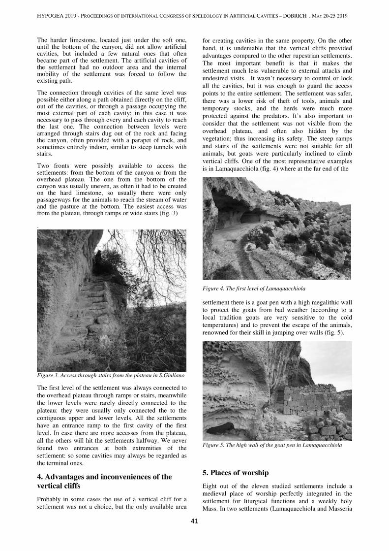
HYPOGEA 2019 - PROCEEDINGS OF INTERNATIONAL CONGRESS OF SPELEOLOGY IN ARTIFICIAL CAVITIES – DOBRICH , MAY 20-25 2019
41
The harder limestone, located just under the soft one, until the bottom of the canyon, did not allow artificial cavities, but included a few natural ones that often became part of the settlement. The artificial cavities of the settlement had no outdoor area and the internal mobility of the settlement was forced to follow the existing path.
The connection through cavities of the same level was possible either along a path obtained directly on the cliff, out of the cavities, or through a passage occupying the most external part of each cavity: in this case it was necessary to pass through every and each cavity to reach the last one. The connection between levels were arranged through stairs dug out of the rock and facing the canyon, often provided with a parapet of rock, and sometimes entirely indoor, similar to steep tunnels with stairs.
Two fronts were possibly available to access the settlements: from the bottom of the canyon or from the overhead plateau. The one from the bottom of the canyon was usually uneven, as often it had to be created on the hard limestone, so usually there were only passageways for the animals to reach the stream of water and the pasture at the bottom. The easiest access was from the plateau, through ramps or wide stairs (fig. 3)
.
Figure 3. Access through stairs from the plateau in S.Giuliano
The first level of the settlement was always connected to
the overhead plateau through ramps or stairs, meanwhile
the lower levels were rarely directly connected to the
plateau: they were usually only connected the to the
contiguous upper and lower levels. All the settlements
have an entrance ramp to the first cavity of the first
level. In case there are more accesses from the plateau,
all the others will hit the settlements halfway. We never
found two entrances at both extremities of the
settlement: so some cavities may always be regarded as
the terminal ones.
4. Advantages and inconveniences of the
vertical cliffs
Probably in some cases the use of a vertical cliff for a
settlement was not a choice, but the only available area
for creating cavities in the same property. On the other
hand, it is undeniable that the vertical cliffs provided
advantages compared to the other rupestrian settlements.
The most important benefit is that it makes the
settlement much less vulnerable to external attacks and
undesired visits. It wasn’t necessary to control or lock
all the cavities, but it was enough to guard the access
points to the entire settlement. The settlement was safer,
there was a lower risk of theft of tools, animals and
temporary stocks, and the herds were much more
protected against the predators. It’s also important to
consider that the settlement was not visible from the
overhead plateau, and often also hidden by the
vegetation; thus increasing its safety. The steep ramps
and stairs of the settlements were not suitable for all
animals, but goats were particularly inclined to climb
vertical cliffs. One of the most representative examples
is in Lamaquacchiola (fig. 4) where at the far end of the
Figure 4. The first level of Lamaquacchiola
settlement there is a goat pen with a high megalithic wall
to protect the goats from bad weather (according to a
local tradition goats are very sensitive to the cold
temperatures) and to prevent the escape of the animals,
renowned for their skill in jumping over walls (fig. 5).
Figure 5. The high wall of the goat pen in Lamaquacchiola
5. Places of worship
Eight out of the eleven studied settlements include a
medieval place of worship perfectly integrated in the
settlement for liturgical functions and a weekly holy
Mass. In two settlements (Lamaquacchiola and Masseria
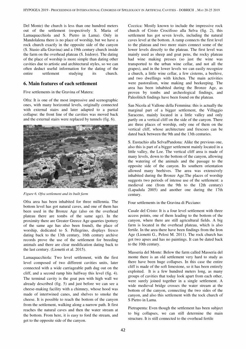
HYPOGEA 2019 - PROCEEDINGS OF INTERNATIONAL CONGRESS OF SPELEOLOGY IN ARTIFICIAL CAVITIES – DOBRICH , MAY 20-25 2019
42
Del Monte) the church is less than one hundred meters
out of the settlement (respectively S. Maria of
Lamaquacchiola and S. Pietro in Lama). Only in
Mandolalena there is no place of worship, but we have a
rock church exactly in the opposite side of the canyon
(S. Stasio alla Gravina) and a 19th century church inside
the farm on the overhead plateau (S. Isidoro). The dating
of the place of worship is more simple than dating other
cavities due to artistic and architectural styles, so we can
often deduct useful information for the dating of the
entire settlement studying its church.
6. Main features of each settlement
Five settlements in the Gravina of Matera:
Ofra: It is one of the most impressive and scenographic
ones, with many horizontal levels, originally connected
with external stairs and later adapted to a partial
collapse: the front line of the cavities was moved back
and the external stairs were replaced by tunnels (fig. 6).
Figure 6. Ofra settlement and its built farm
Ofra area has been inhabited for three millennia. The
bottom level has got natural caves, and one of them has
been used in the Bronze Age (also on the overhead
plateau there are tombs of the same age). In the
proximity there are Greater Greece Age quarries (pottery
of the same age has also been found), the place of
worship, dedicated to S. Pellegrino, displays fresco
dating back to the 13th century, 16th century archive
records prove the use of the settlement for breeding
animals and there are clear modification dating back to
the last century. (Lionetti et al. 2015).
Lamaquacchiola: Two level settlement, with the first
level composed of two different cavities units, later
connected with a wide carriageable path dug out on the
cliff, and a second ramp hits halfway this level (fig. 4).
The terminal cavity is the goat pen with high wall we
already described (fig. 5) and just before we can see a
cheese-making facility with a chimney, whose hood was
made of intertwined canes, and shelves to smoke the
cheese. It is possible to reach the bottom of the canyon
from the settlement, walking along a narrow path. It first
reaches the natural caves and then the water stream at
the bottom. From here, it is easy to ford the stream, and
get to the opposite side of the canyon.
Cozzica: Mostly known to include the impressive rock
church of Cristo Crocifisso alla Selva (fig. 2), this
settlement has got seven levels, including the natural
caves level at the bottom. A ramp connects the first level
to the plateau and two more stairs connect some of the
lower levels directly to the plateau. The first level was
mainly used as sheep and goat pens, the rocky plateau
had wine making presses (so just the wine was
transported to the urban wine cellar, and not all the
grapes), and in the lower levels we can easily recognize
a church, a little wine cellar, a few cisterns, a beehive,
and two dwellings with kitchen. The main activities
were pastoralism, wine making and beekeeping. The
area has been inhabited during the Bronze Age, as
proven by tombs and archeological findings, and
Paleolitich findings have been found on the plateau.
San Nicola al Vallone della Femmina: this is actually the
marginal part of a bigger settlement, the Villaggio
Saraceno, mainly located in a little valley and only
partly on a vertical cliff on the side of the canyon. There
are three places of worship, only one of them on the
vertical cliff, whose architecture and frescoes can be
dated back between the 9th and the 13th centuries.
S. Eustachio alla Selva/Pandona: Alike the previous one,
also this is part of a bigger settlement mainly located in a
little valley, the Loe. The vertical cliff area is made of
many levels, down to the bottom of the canyon, allowing
the watering of the animals and the passage to the
opposite side of the canyon. Its southern orientation
allowed many beehives. The area was extensively
inhabited during the Bronze Age.The places of worship
suggests two periods of intense use of the settlement: a
medieval one (from the 9th to the 12th century)
(Lapadula 2005) and another one during the 17th
century.
Four settlements in the Gravina di Picciano:
Casale del Cristo: It is a four level settlement with three
access points, one of them leading to the bottom of the
canyon, where there are still agricultural fields. A big
farm is located in the overhead plateau, which is also
fertile. In the area there have been findings from the Iron
Age (Lionetti G., Pelosi M. 2011). The rock church has
got two apses and has no paintings. It can be dated back
to the 10th century.
Masseria del Monte: Below the farm called Masseria del
monte there is an old settlement very hard to study as
there have been huge collapses. In this case the entire
cliff is made of the soft limestone, so it has been entirely
exploited. It is a few hundred meters long, as many
groups of cavities that today look apart from each other,
were surely joined together in a single settlement. A
wide medieval bridge crosses the water stream at the
bottom of the canyon, connecting the two sides of the
canyon, and also this settlement with the tock church of
S Pietro in Lama.
Pietrapenta: Even though the settlement has been subject
to big collapses, we can still determine the main
structure. It is still connected to the overhead fertile
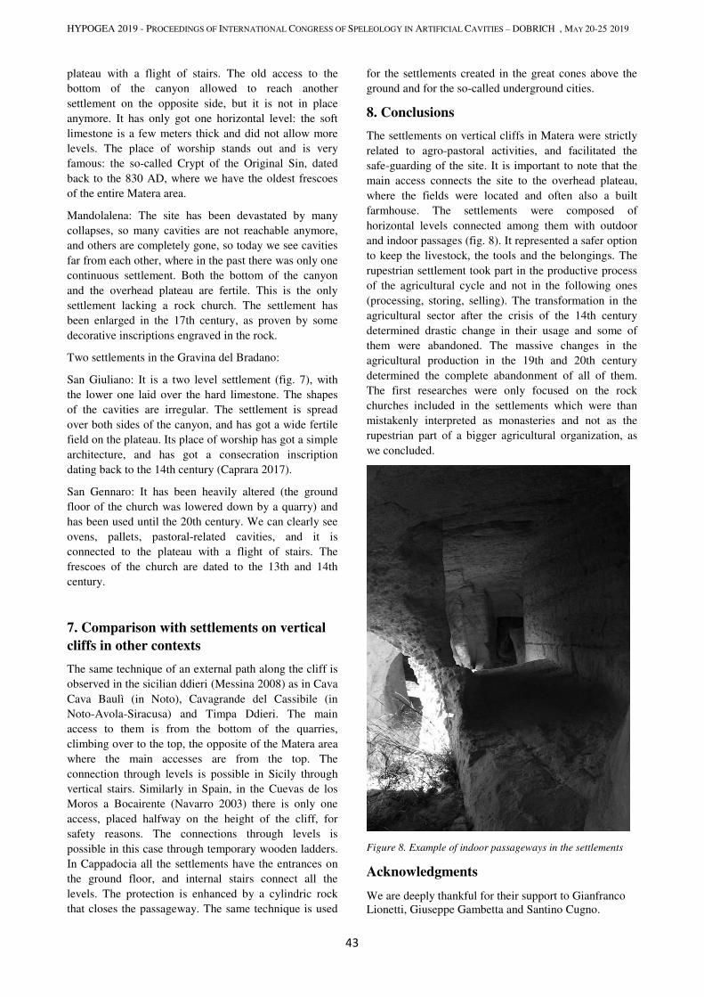
HYPOGEA 2019 - PROCEEDINGS OF INTERNATIONAL CONGRESS OF SPELEOLOGY IN ARTIFICIAL CAVITIES – DOBRICH , MAY 20-25 2019
43
plateau with a flight of stairs. The old access to the
bottom of the canyon allowed to reach another
settlement on the opposite side, but it is not in place
anymore. It has only got one horizontal level: the soft
limestone is a few meters thick and did not allow more
levels. The place of worship stands out and is very
famous: the so-called Crypt of the Original Sin, dated
back to the 830 AD, where we have the oldest frescoes
of the entire Matera area.
Mandolalena: The site has been devastated by many
collapses, so many cavities are not reachable anymore,
and others are completely gone, so today we see cavities
far from each other, where in the past there was only one
continuous settlement. Both the bottom of the canyon
and the overhead plateau are fertile. This is the only
settlement lacking a rock church. The settlement has
been enlarged in the 17th century, as proven by some
decorative inscriptions engraved in the rock.
Two settlements in the Gravina del Bradano:
San Giuliano: It is a two level settlement (fig. 7), with
the lower one laid over the hard limestone. The shapes
of the cavities are irregular. The settlement is spread
over both sides of the canyon, and has got a wide fertile
field on the plateau. Its place of worship has got a simple
architecture, and has got a consecration inscription
dating back to the 14th century (Caprara 2017).
San Gennaro: It has been heavily altered (the ground
floor of the church was lowered down by a quarry) and
has been used until the 20th century. We can clearly see
ovens, pallets, pastoral-related cavities, and it is
connected to the plateau with a flight of stairs. The
frescoes of the church are dated to the 13th and 14th
century.
7. Comparison with settlements on vertical
cliffs in other contexts
The same technique of an external path along the cliff is
observed in the sicilian ddieri (Messina 2008) as in Cava
Cava Baulì (in Noto), Cavagrande del Cassibile (in
Noto-Avola-Siracusa) and Timpa Ddieri. The main
access to them is from the bottom of the quarries,
climbing over to the top, the opposite of the Matera area
where the main accesses are from the top. The
connection through levels is possible in Sicily through
vertical stairs. Similarly in Spain, in the Cuevas de los
Moros a Bocairente (Navarro 2003) there is only one
access, placed halfway on the height of the cliff, for
safety reasons. The connections through levels is
possible in this case through temporary wooden ladders.
In Cappadocia all the settlements have the entrances on
the ground floor, and internal stairs connect all the
levels. The protection is enhanced by a cylindric rock
that closes the passageway. The same technique is used
for the settlements created in the great cones above the
ground and for the so-called underground cities.
8. Conclusions
The settlements on vertical cliffs in Matera were strictly
related to agro-pastoral activities, and facilitated the
safe-guarding of the site. It is important to note that the
main access connects the site to the overhead plateau,
where the fields were located and often also a built
farmhouse. The settlements were composed of
horizontal levels connected among them with outdoor
and indoor passages (fig. 8). It represented a safer option
to keep the livestock, the tools and the belongings. The
rupestrian settlement took part in the productive process
of the agricultural cycle and not in the following ones
(processing, storing, selling). The transformation in the
agricultural sector after the crisis of the 14th century
determined drastic change in their usage and some of
them were abandoned. The massive changes in the
agricultural production in the 19th and 20th century
determined the complete abandonment of all of them.
The first researches were only focused on the rock
churches included in the settlements which were than
mistakenly interpreted as monasteries and not as the
rupestrian part of a bigger agricultural organization, as
we concluded.
Figure 8. Example of indoor passageways in the settlements
Acknowledgments
We are deeply thankful for their support to Gianfranco
Lionetti, Giuseppe Gambetta and Santino Cugno.

HYPOGEA 2019 - PROCEEDINGS OF INTERNATIONAL CONGRESS OF SPELEOLOGY IN ARTIFICIAL CAVITIES – DOBRICH , MAY 20-25 2019
44
References
Caprara R., 2017. L’inedita iscrizione di San Giuliano al
Bradano, (in italian) in Mathera, Anno I n. 1, Matera, 2017.
Giordano D, 1992. Il comprensorio rupestre appulo-lucano (in
italian), Bari.
Lapadula E, 2008. Il villaggio della Loe nella Murgia materana
in Insediamenti rupestri di Età medievale (in italian), Cisam,
Spoleto.
La Scaletta, 1995. Chiese e asceteri rupestri di Matera (in
italian), Roma.
Lionetti G. et alii, 2015. The San Pellegrino rock-hewn
complex at Matera (in italian), in Hypogea 2015 – Rome.
Lionetti G, Pelosi M, 2011. Considerazioni sui complessi
rupestri artefatti preellenici della murgia materana, in Le aree
rupestri dell’ Italia centro-meridionale nell’ambito delle civiltà
italiche (in italian), Cisam, Spoleto.
Messina A, 2008. Sicilia rupestre (in italian), Salvatore
Sciascia Editore, Caltanisetta/Roma.
Navarro F, 2003. Materia prima. Arquitectura subterrànea
excavada en Levante, (in spanish), Valencia.
Figure 7. S.Giuliano settlement
Figure 9. Map of the rupestrian settlements on vertical cliffs in the Matera studied in this research
HYPOGEA 2019 - PROCEEDINGS OF INTERNATIONAL CONGRESS OF SPELEOLOGY IN ARTIFICIAL CAVITIES – DOBRICH , MAY 20-25 2019
45
ANCIENT MAN-MADE ROCK STRUCTURES
ALONG THE BLACK SEA COAST OF DOBRUDZHA
Asen Salkin
Historical Museum Velingrad, Vlado Chernosemski 2, 4600 Velingrad , Bulgaria, [email protected]
Abstract
On the rocky Dobruzha Black Sea coast as a result of the human activity there were excavated in the various in form
and purpose artificial cavities , functioning in chronological limits of the V millennium BC until the Late Middle Ages
- XVII century. There were studied four complexes of cave dwellings known in the literature as Dobruzha cave
colonies determined in chronological range of residing V mill. BC to - XVII Century AD, four necropolis of rock
tombs functioned II to V century AD, sacrificial stones and stone wineries from the Ancient age. In the port of Kavarna
- the ancient Bisone, in the rock massif partially were studied and documented over 30 caves, warehouses for grain /
antique silos, damp and many other rock cut structures some of them unexplored. All of this outlines Dobruzha as a
contact zone of cultural interaction, cultural elements and preserved traditions of the local population during the various
historical eras.
Keywords
Rock stuctures, sancturies, tombs, Dobrudza, Bulgaria
1. Introduction
The Black sea coast in the region of Dobrudzha has a
unique geomorphology (Мишев, Попов 1974), which has also pre-determined the main stages of its paleo-
geographic development through the Holocene (Орачев 1990). Its strategic location favored the formation of
Northeast Bulgaria as a contact zone for different cultures
and various influences (Шкорпил 1894: 48-78). The port
system of the rocky Dobrudzha coastline creates
conditions for sea contacts and trade with the Black Sea
and the Mediterranean world (Салкин 1986; Орачев, Русинов 1988; Salkin 2007). I offer in the present work, a
study of some rocky facilities that I have discovered along
the 20 km coastal strip between Shabla and the port of
Kavarna, where the shore rises up to 110 m in height (Fig.
1). I conditionally accept the time from V millennium BC
until XVII century AD as chronological boundaries of
their using.
Figure 1. Map of the seashore from Cape Shabla to Balchik
2. Cave colony-towns in Dobrudzha
In the contact area between Shabla and Kaliakra three complexes are located, which are known in the science as
Dobroudza cave colony-towns. They are grouped as follows: near Tyulenovo village (on the coastal cliff); in
the archaeological reserve Yailata near the village of Kamen Bryag; in the valley of Bolata where 30 caves were found on the steep bank, as well as some smaller
groups in the Taukliman and Cape Kaliakra.
2.1. Complex of caves near Tyulenovo village
Near the village of Tyulenovo, the Dobrudzha plateau has
an altitude of about 10 m. Right next to the sea there,
several groups of interconnected caves have been carved
in the steep rock massif. They have small rooms of
irregular shapes and have been constructed so that their
occupants could communicate with each other (Fig. 2).
The access to them is either through openings from the
side of the plateau or by ladders from the seashore. The
height of the chambers reaches up to 2.50 m, and Karel
Shkorpil, when describing them at the end of the XIX
century, was so impressed by what he saw that called
them Cave Colony-Towns (Шкорпил 1894: 53).
Apparently, those caves had been used for housing, but
the lack of serious research still does not allow us to
accept that this was their only function, and also to specify
the date of their further upgrading so that they got their
present form.
One of these caves – the so-called Kotelna Cave (Kazan
Maara), meaning the Cauldron Cave – which directs us to
another function of the caves, deserves particular
attention. Karel Shkorpil described it so (Шкорпил 1894: 53): The cave consists of four high compartments, open to
the sea. In front of the entrance there are cavities in 15
places in the cave, having the form of large cauldrons,
which seemingly accommodated up to 10 people. Those
dents were called cauldrons or barns. People say they
found bones when they did excavations at those places. Those funerals indicate that when people stopped using
the barns for grain storage, the grain pits (the siruses) were
reused for graves. Similar cases with found human bones
in cave pits are also known from the Yailata cave

HYPOGEA 2019 - PROCEEDINGS OF INTERNATIONAL CONGRESS OF SPELEOLOGY IN ARTIFICIAL CAVITIES – DOBRICH , MAY 20-25 2019
46
complex.
Figure 2. Plan of staircase cave near the village of
Tyulenovo (according to Шкорпил 1894: 53, Figure 5).
2.2 Cave-dwellings in Yailata Archeological
Reserve
One kilometer south-west of the village of Kamen Bryag,
the archaeological reserve Yailata is located. It is a three-
level seashore terrace, 250 m wide and 1200 m long, with
traces of intensive landslide-collapsing processes (Попов, Мишев 1974). Several hundred cave dwellings (Салкин, Топтанов 1988; see Делев 1985) were documented along
the rocky coast and on the two older and higher-level
positioned sea terraces. They are similar to those of
Tyulenovo, but their number is greater and they had been
better worked, having a right rectangular shape. Among
them, scattered in three groups in the upper two terraces,
at the base of the vertical rocky slope, the entrances of
robbed rock cave-tombs were discovered. The pottery
found there dates back to the Roman era and the Late
Antiquity, indicating a safe human habitation during I –
VI century AD. In some of the cave-dwellings funerals
from the Roman era were found, performed in shallow
pits, and the crosses cut on the walls suggest that they had
also been used during the early Christian period. The so-called Cave-church is located on the highest
terrace (under the plateau of Dobrudzha). It consists of
three compartments, one of which is equipped with an
opening (vent) on the ceiling (Fig. 3).
Figure 3. The Church-cave at the Yailata
Archeological Reserve (after Шкорпил 1894) There are crosses, cut out on the walls of the western
compartment and an Ypsilon with two hastas (IYI) (Fig.
4) was carved on the entrance wall. When pictures were
taken by using powerful halogen lighting, numerous lines
of Cyrillic and other inscriptions were also documented
(Orachev, Handjiyski 2008). They probably date back to
the Early Christian era, and here it should be noted that an
Early Byzantine fortress from V – VI century AD was
explored on the lower terrace. Its ruins contained traces of
a Bulgarian settlement that had existed until the XI
century AD (Салкин, Топтанов 1987). Here the entrance of the gallery was converted into a chapel, which had
probably been also used in parallel with the Cave-Church
during the early middle Ages.
Figure 4. Ypsilon with two hastas
Three wells were documented in the lower southern part
of the Yailata Plateau, and stone tools of labor were found
near them, which proved that the beginning of life dates as
early as from the V millennium BC.
2.3 Complex of Cave-dwellings in the locality of
Bolata
The locality of Bolata is 1 km north of Cape Kaliakra and
is a small valley with a river flowing through it. Thirty
cave-dwellings were found on its two bank slopes. They
are similar to the others from the rock complexes along
the Dobrudzha coast, but are more roughly made (Fig. 5).
Specifying of their definite date is hindered by the reuse
of the caves as livestock stalls, which has continued until
nowadays, but the earliest materials from the valley date
back both to the early and to the late Iron Age.
3. Rock tombs along the Dobroudzha Black
Sea coast
Along the Dobroudzha sea coast, on the six-kilometer
stretch from Cape Kaliakra to the village of Kamen Bryag,
130 rock tombs have been studied in the last years, from
the following necropolis: near the seashore of Kamen
Bryag; in the Yailata Archeological Reserve; and at Cape
Kaliakra. The rock massif in these areas protrudes right to
the surface and the burial facilities were cut into a variety
of forms that can be defined in the following groups:
3.1. Rock tombs with shaft-like antechambers
The burial chamber of that kind of tombs had been entered
through a rectangular opening which was surrounded by a
groove for closing and sealing the tomb. The tomb
chamber itself has a square or rectangular shape about
2.00 x 1.50 m in size. Some of the chambers have an
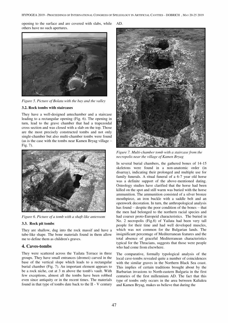
HYPOGEA 2019 - PROCEEDINGS OF INTERNATIONAL CONGRESS OF SPELEOLOGY IN ARTIFICIAL CAVITIES – DOBRICH , MAY 20-25 2019
47
opening to the surface and are covered with slabs, while
others have no such apertures.
Figure 5. Picture of Bolata with the bay and the valley
3.2. Rock tombs with staircases
They have a well-designed antechamber and a staircase
leading to a rectangular opening (Fig. 6). The opening in
turn, lead to the grave chamber that had a trapezoidal
cross section and was closed with a slab on the top. Those
are the most precisely constructed tombs and not only
single-chamber but also multi-chamber tombs were found
(as is the case with the tombs near Kamen Bryag village –
Fig. 7).
Figure 6. Picture of a tomb with a shaft-like anteroom
3.3. Rock pit tombs
They are shallow, dug into the rock massif and have a
tube-like shape. The bone materials found in them allow
me to define them as children's graves.
4. Caves-tombs
They were scattered across the Yailata Terrace in three
groups. They have small entrances (dromoi) carved in the
base of the vertical slope which leads to a rectangular
burial chamber (Fig. 7). An important element appears to
be a rock niche, cut at 3 m above the tomb's vault. With
few exceptions, almost all the tombs have been robbed
even since antiquity or in the recent times. The materials
found in that type of tombs date back to the II - V century
AD.
Figure 7. Multi-chamber tomb with a staircase from the
necropolis near the village of Kamen Bryag
In several burial chambers, the gathered bones of 14-15
skeletons were found in a non-anatomic order (in
disarray), indicating their prolonged and multiple use for
family funerals. A ritual funeral of a 6-7 year old horse
was a definite support of the above-mentioned dating.
Osteology studies have clarified that the horse had been
killed on the spot and still warm was buried with the horse
ammunition. The ammunition consisted of a silver bronze
mouthpiece, an iron buckle with a saddle belt and an
openwork decoration. In turn, the anthropological analysis
has found – despite the poor condition of the bones – that
the men had belonged to the northern racial species and
had coarser proto-Europeid characteristics. The buried in
No. 2 necropolis (Fig.8) of Yailata had been very tall
people for their time and had well developed muscles,
which was not common for the Bulgarian lands. The
insignificant percentage of Mediterranean features and the
total absence of graceful Mediterranean characteristics
typical for the Thracians, suggests that those were people
who had come from elsewhere.
The comparative, formally typological analysis of the
local cave-tombs revealed quite a number of coincidences
with the similar graves in the Northern Black Sea coast.
This implies of certain traditions brought about by the
Barbarian invasions to North-eastern Bulgaria in the first
centuries of the first millennium AD. The fact that this
type of tombs only occurs in the area between Kaliakra
and Kamen Bryag, makes us believe that during the
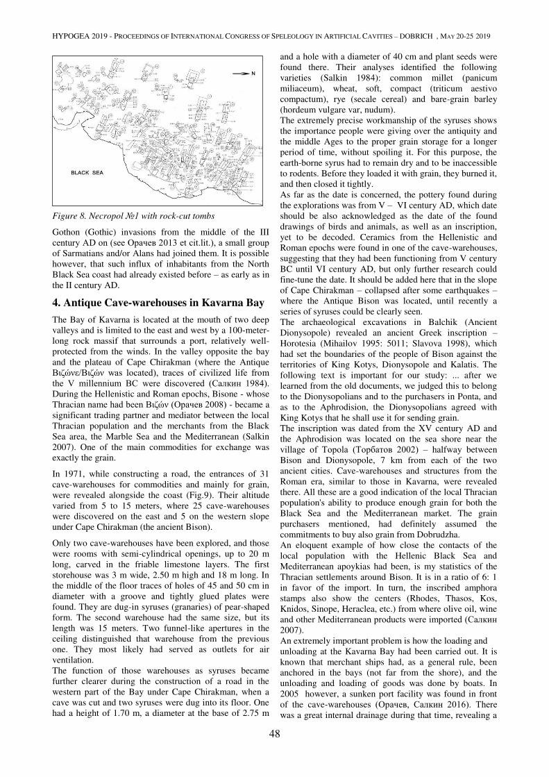
HYPOGEA 2019 - PROCEEDINGS OF INTERNATIONAL CONGRESS OF SPELEOLOGY IN ARTIFICIAL CAVITIES – DOBRICH , MAY 20-25 2019
48
Figure 8. Necropol №1 with rock-cut tombs
Gothon (Gothic) invasions from the middle of the III
century AD on (see Орачев 2013 et cit.lit.), a small group of Sarmatians and/or Alans had joined them. It is possible
however, that such influx of inhabitants from the North
Black Sea coast had already existed before – as early as in
the II century AD.
4. Antique Cave-warehouses in Kavarna Bay
The Bay of Kavarna is located at the mouth of two deep
valleys and is limited to the east and west by a 100-meter-
long rock massif that surrounds a port, relatively well-
protected from the winds. In the valley opposite the bay
and the plateau of Cape Chirakman (where the Antique
Βιζώνε/Βιζών was located), traces of civilized life from the V millennium BC were discovered (Салкин 1984). During the Hellenistic and Roman epochs, Bisone - whose
Thracian name had been Βιζών (Орачев 2008) - became a
significant trading partner and mediator between the local
Thracian population and the merchants from the Black
Sea area, the Marble Sea and the Mediterranean (Salkin
2007). One of the main commodities for exchange was
exactly the grain.
In 1971, while constructing a road, the entrances of 31
cave-warehouses for commodities and mainly for grain,
were revealed alongside the coast (Fig.9). Their altitude
varied from 5 to 15 meters, where 25 cave-warehouses
were discovered on the east and 5 on the western slope
under Cape Chirakman (the ancient Bison).
Only two cave-warehouses have been explored, and those
were rooms with semi-cylindrical openings, up to 20 m
long, carved in the friable limestone layers. The first
storehouse was 3 m wide, 2.50 m high and 18 m long. In
the middle of the floor traces of holes of 45 and 50 cm in
diameter with a groove and tightly glued plates were
found. They are dug-in syruses (granaries) of pear-shaped
form. The second warehouse had the same size, but its
length was 15 meters. Two funnel-like apertures in the
ceiling distinguished that warehouse from the previous
one. They most likely had served as outlets for air
ventilation.
The function of those warehouses as syruses became
further clearer during the construction of a road in the
western part of the Bay under Cape Chirakman, when a
cave was cut and two syruses were dug into its floor. One
had a height of 1.70 m, a diameter at the base of 2.75 m
and a hole with a diameter of 40 cm and plant seeds were
found there. Their analyses identified the following
varieties (Salkin 1984): common millet (panicum
miliaceum), wheat, soft, compact (triticum aestivo
compactum), rye (secale cereal) and bare-grain barley
(hordeum vulgare var, nudum).
The extremely precise workmanship of the syruses shows
the importance people were giving over the antiquity and
the middle Ages to the proper grain storage for a longer
period of time, without spoiling it. For this purpose, the
earth-borne syrus had to remain dry and to be inaccessible
to rodents. Before they loaded it with grain, they burned it,
and then closed it tightly.
As far as the date is concerned, the pottery found during
the explorations was from V – VI century AD, which date
should be also acknowledged as the date of the found
drawings of birds and animals, as well as an inscription,
yet to be decoded. Ceramics from the Hellenistic and
Roman epochs were found in one of the cave-warehouses,
suggesting that they had been functioning from V century
BC until VI century AD, but only further research could
fine-tune the date. It should be added here that in the slope
of Cape Chirakman – collapsed after some earthquakes –
where the Antique Bison was located, until recently a
series of syruses could be clearly seen.
The archaeological excavations in Balchik (Ancient
Dionysopole) revealed an ancient Greek inscription –
Horotesia (Mihailov 1995: 5011; Slavova 1998), which
had set the boundaries of the people of Bison against the
territories of King Kotys, Dionysopole and Kalatis. The
following text is important for our study: ... after we
learned from the old documents, we judged this to belong
to the Dionysopolians and to the purchasers in Ponta, and
as to the Aphrodision, the Dionysopolians agreed with
King Kotys that he shall use it for sending grain.
The inscription was dated from the XV century AD and
the Aphrodision was located on the sea shore near the
village of Topola (Торбатов 2002) – halfway between
Bison and Dionysopole, 7 km from each of the two
ancient cities. Cave-warehouses and structures from the
Roman era, similar to those in Kavarna, were revealed
there. All these are a good indication of the local Thracian
population's ability to produce enough grain for both the
Black Sea and the Mediterranean market. The grain
purchasers mentioned, had definitely assumed the
commitments to buy also grain from Dobrudzha.
An eloquent example of how close the contacts of the
local population with the Hellenic Black Sea and
Mediterranean apoykias had been, is my statistics of the
Thracian settlements around Bison. It is in a ratio of 6: 1
in favor of the import. In turn, the inscribed amphora
stamps also show the centers (Rhodes, Thasos, Kos,
Knidos, Sinope, Heraclea, etc.) from where olive oil, wine
and other Mediterranean products were imported (Салкин 2007).
An extremely important problem is how the loading and
unloading at the Kavarna Bay had been carried out. It is
known that merchant ships had, as a general rule, been
anchored in the bays (not far from the shore), and the
unloading and loading of goods was done by boats. In
2005 however, a sunken port facility was found in front
of the cave-warehouses (Орачев, Салкин 2016). There was a great internal drainage during that time, revealing a
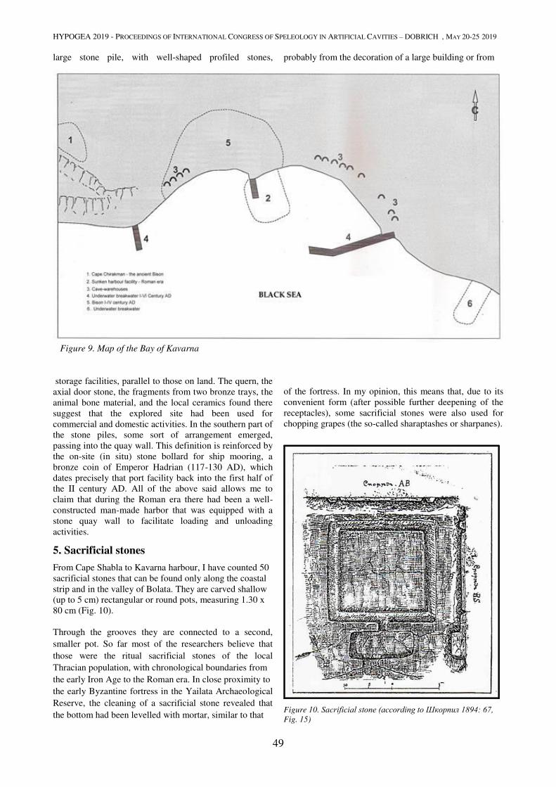
HYPOGEA 2019 - PROCEEDINGS OF INTERNATIONAL CONGRESS OF SPELEOLOGY IN ARTIFICIAL CAVITIES – DOBRICH , MAY 20-25 2019
49
large stone pile, with well-shaped profiled stones, probably from the decoration of a large building or from
Figure 9. Map of the Bay of Kavarna
storage facilities, parallel to those on land. The quern, the
axial door stone, the fragments from two bronze trays, the
animal bone material, and the local ceramics found there
suggest that the explored site had been used for
commercial and domestic activities. In the southern part of
the stone piles, some sort of arrangement emerged,
passing into the quay wall. This definition is reinforced by
the on-site (in situ) stone bollard for ship mooring, a
bronze coin of Emperor Hadrian (117-130 AD), which
dates precisely that port facility back into the first half of
the II century AD. All of the above said allows me to
claim that during the Roman era there had been a well-
constructed man-made harbor that was equipped with a
stone quay wall to facilitate loading and unloading
activities.
5. Sacrificial stones
From Cape Shabla to Kavarna harbour, I have counted 50
sacrificial stones that can be found only along the coastal strip and in the valley of Bolata. They are carved shallow
(up to 5 cm) rectangular or round pots, measuring 1.30 x
80 cm (Fig. 10).
Through the grooves they are connected to a second,
smaller pot. So far most of the researchers believe that
those were the ritual sacrificial stones of the local
Thracian population, with chronological boundaries from
the early Iron Age to the Roman era. In close proximity to
the early Byzantine fortress in the Yailata Archaeological
Reserve, the cleaning of a sacrificial stone revealed that
the bottom had been levelled with mortar, similar to that
of the fortress. In my opinion, this means that, due to its
convenient form (after possible further deepening of the
receptacles), some sacrificial stones were also used for
chopping grapes (the so-called sharaptashes or sharpanes).
Figure 10. Sacrificial stone (according to Шкорпил 1894: 67, Fig. 15)
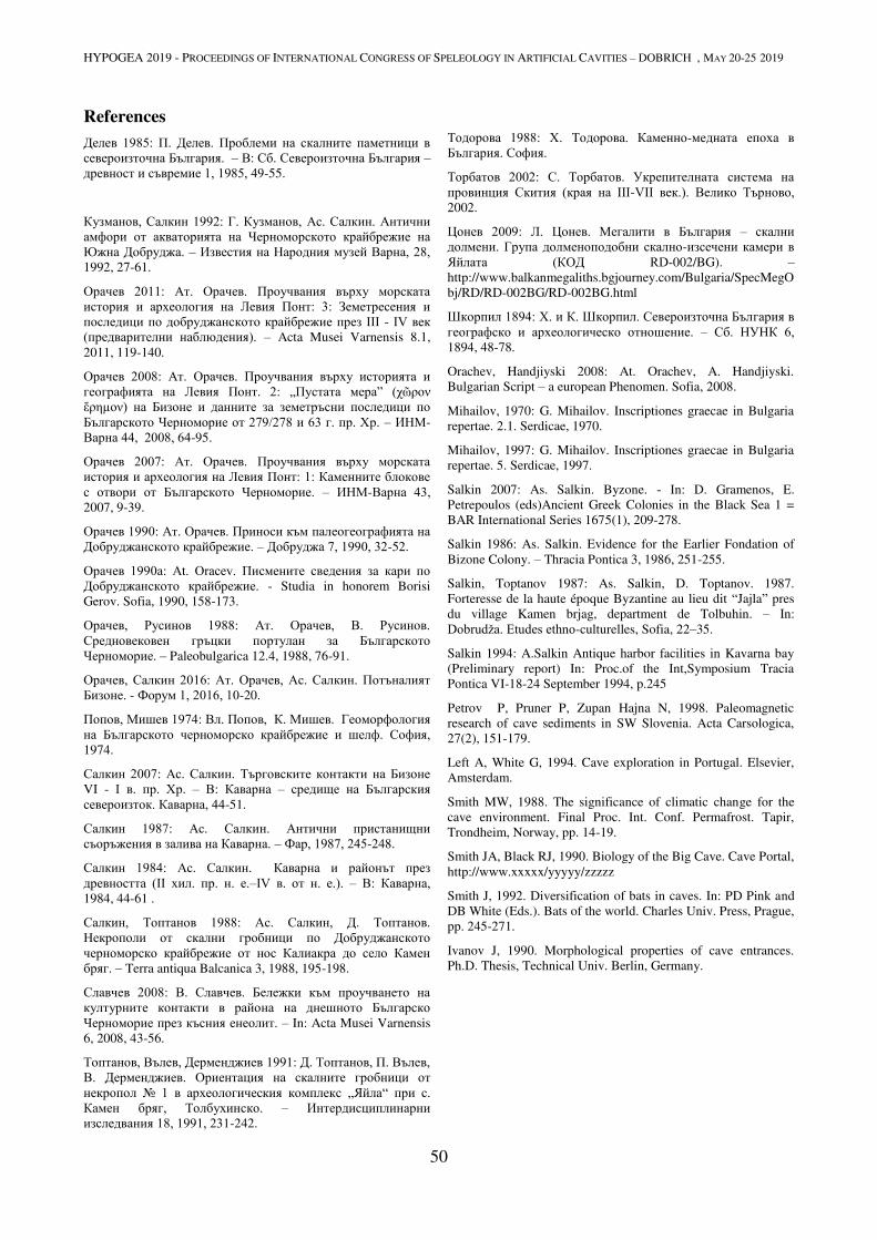
HYPOGEA 2019 - PROCEEDINGS OF INTERNATIONAL CONGRESS OF SPELEOLOGY IN ARTIFICIAL CAVITIES – DOBRICH , MAY 20-25 2019
50
References
Делев 1985: П. Делев. Проблеми на скалните паметници в североизточна България. – В: Сб. Североизточна България –
древност и съвремие 1, 1985, 49-55.
Кузманов, Салкин 1992: Г. Кузманов, Ас. Салкин. Антични амфори от акваторията на Черноморското крайбрежие на Южна Добруджа. – Известия на Народния музей Варна, 28, 1992, 27-61.
Орачев 2011: Ат. Орачев. Проучвания върху морската история и археология на Левия Понт: 3: Земетресения и последици по добруджанското крайбрежие през III - IV век (предварителни наблюдения). – Acta Musei Varnensis 8.1,
2011, 119-140.
Орачев 2008: Ат. Орачев. Проучвания върху историята и географията на Левия Понт. 2: „Пустата мера” (χῶρον ἔρηµον) на Бизоне и данните за земетръсни последици по Българското Черноморие от 279/278 и 63 г. пр. Хр. – ИНМ-
Варна 44, 2008, 64-95.
Орачев 2007: Ат. Орачев. Проучвания върху морската история и археология на Левия Понт: 1: Каменните блокове с отвори от Българското Черноморие. – ИНМ-Варна 43, 2007, 9-39.
Орачев 1990: Ат. Орачев. Приноси към палеогеографията на Добруджанското крайбрежие. – Добруджа 7, 1990, 32-52.
Орачев 1990а: At. Oracev. Писмените сведения за кари по Добруджанското крайбрежие. - Studia in honorem Borisi
Gerov. Sofia, 1990, 158-173.
Орачев, Русинов 1988: Ат. Орачев, В. Русинов. Средновековен гръцки портулан за Българското Черноморие. – Paleobulgarica 12.4, 1988, 76-91.
Орачев, Салкин 2016: Ат. Орачев, Ас. Салкин. Потъналият Бизоне. - Форум 1, 2016, 10-20.
Попов, Мишев 1974: Вл. Попов, К. Мишев. Геоморфология на Българското черноморско крайбрежие и шелф. София, 1974.
Салкин 2007: Ас. Салкин. Търговските контакти на Бизоне VI - I в. пр. Хр. – В: Каварна – средище на Българския североизток. Каварна, 44-51.
Салкин 1987: Ас. Салкин. Антични пристанищни съоръжения в залива на Каварна. – Фар, 1987, 245-248.
Салкин 1984: Ас. Салкин. Каварна и районът през древността (II хил. пр. н. е.–IV в. от н. е.). – В: Каварна, 1984, 44-61 .
Салкин, Топтанов 1988: Ас. Салкин, Д. Топтанов. Некрополи от скални гробници по Добруджанското черноморско крайбрежие от нос Калиакра до село Камен бряг. – Terra antiqua Balcanica 3, 1988, 195-198.
Славчев 2008: В. Славчев. Бележки към проучването на културните контакти в района на днешното Българско Черноморие през късния енеолит. – In: Acta Musei Varnensis
6, 2008, 43-56.
Топтанов, Вълев, Дерменджиев 1991: Д. Топтанов, П. Вълев, В. Дерменджиев. Ориентация на скалните гробници от некропол № 1 в археологическия комплекс „Яйла“ при с. Камен бряг, Толбухинско. – Интердисциплинарни изследвания 18, 1991, 231-242.
Тодорова 1988: Х. Тодорова. Каменно-медната епоха в България. София.
Торбатов 2002: С. Торбатов. Укрепителната система на провинция Скития (края на III-VII век.). Велико Търново, 2002.
Цонев 2009: Л. Цонев. Мегалити в България – скални долмени. Група долменоподобни скално-изсечени камери в Яйлата (КОД RD-002/BG). –
http://www.balkanmegaliths.bgjourney.com/Bulgaria/SpecMegO
bj/RD/RD-002BG/RD-002BG.html
Шкорпил 1894: Х. и К. Шкорпил. Североизточна България в географско и археологическо отношение. – Сб. НУНК 6, 1894, 48-78.
Orachev, Handjiyski 2008: At. Orachev, A. Handjiyski.
Bulgarian Script – a european Phenomen. Sofia, 2008.
Mihailov, 1970: G. Mihailov. Inscriptiones graecae in Bulgaria
repertae. 2.1. Serdicae, 1970.
Mihailov, 1997: G. Mihailov. Inscriptiones graecae in Bulgaria
repertae. 5. Serdicae, 1997.
Salkin 2007: As. Salkin. Byzone. - In: D. Gramenos, E.
Petrepoulos (eds)Ancient Greek Colonies in the Black Sea 1 =
BAR International Series 1675(1), 209-278.
Salkin 1986: As. Salkin. Evidence for the Earlier Fondation of
Bizone Colony. – Thracia Pontica 3, 1986, 251-255.
Salkin, Toptanov 1987: As. Salkin, D. Toptanov. 1987.
Forteresse de la haute époque Byzantine au lieu dit “Jajla” pres
du village Kamen brjag, department de Tolbuhin. – In:
Dobrudža. Etudes ethno-culturelles, Sofia, 22–35.
Salkin 1994: A.Salkin Antique harbor facilities in Kavarna bay
(Preliminary report) In: Proc.of the Int,Symposium Tracia
Pontica VI-18-24 September 1994, p.245
Petrov P, Pruner P, Zupan Hajna N, 1998. Paleomagnetic
research of cave sediments in SW Slovenia. Acta Carsologica,
27(2), 151-179.
Left A, White G, 1994. Cave exploration in Portugal. Elsevier,
Amsterdam.
Smith MW, 1988. The significance of climatic change for the
cave environment. Final Proc. Int. Conf. Permafrost. Tapir,
Trondheim, Norway, pp. 14-19.
Smith JA, Black RJ, 1990. Biology of the Big Cave. Cave Portal,
http://www.xxxxx/yyyyy/zzzzz
Smith J, 1992. Diversification of bats in caves. In: PD Pink and
DB White (Eds.). Bats of the world. Charles Univ. Press, Prague,
pp. 245-271.
Ivanov J, 1990. Morphological properties of cave entrances.
Ph.D. Thesis, Technical Univ. Berlin, Germany.

HYPOGEA 2019 - PROCEEDINGS OF INTERNATIONAL CONGRESS OF SPELEOLOGY IN ARTIFICIAL CAVITIES – DOBRICH , MAY 20-25 2019
51
EXCAVATIONS AND SURVEYS OF UNDERGROUND CAVITIES AT
HURBAT HUSHAM, JUDEAN FOOTHILLS
Eitan Klein1, Boaz Zissu
2
1 Israel Antiquities Authority, P.O. Box 586, Jerusalem, Israel, [email protected]
2 Martin (Szusz) Land of Israel Studies and Archaeology Department, Bar-Ilan University, Ramat-Gan, Israel,
Abstract
Hurbat Husham is situated in the Judean Foothills at the summit of a hill that overtops its surroundings (elev. 380 m
above sea level). It is located in the northern section of a ridge that is part of the High Shephelah, between the Nahal
Soreq and Nahal Elah basins. The ruin covers some 50 dunams at the top and along the slopes of the knoll. It affords a
view in all directions, including towards the coastal plain, the Shephelah, the Soreq valley, and extensive stretches of
the Judean Hills as far as the Beit El Hills. The name of the site, Hurbat Husham, or, in Arabic, Kh. el Kheishum (i.e.,
“nose”) reflects the fact that it towers prominently over its surroundings.
Beginning in the late 1990s, the authors documented and mapped underground cavities and other archaeological
features there, in the wake of intensive illegal excavations carried out by antiquities looters. We documented a variety
of elements, including mikvaʾot (ritual immersion baths), underground storage cavities, a hiding complex, agricultural
facilities, a small fortress at the top of the hill, and burial caves. A large underground cistern similar in its layout and
design to others that have been found on the slopes of Hasmonean/Herodian fortresses throughout Judea were also
documented at the site. These findings bear witness to a large Jewish settlement from the Second Temple period until
the Bar Kokhba Revolt. The site’s unique topography, the name, the existence of a long rectangular cistern from the
Second Temple era, and pottery from the second century BCE all suggest the existence of a Hasmonean/Herodian
fortress intended to guard the western approach and one of the major access routes (the Soreq valley) to Judea in the late
Second Temple period.
Keywords
Judea, Second Temple Period, Bar-Kokhba Revolt, Judean Foothills, Mikvaʾot, Hasmonean-Herodian
Fortress.
1. Introduction
Hurbat Husham is located in the Judean Foothills at the
summit of a hill that overtops its surroundings (elev. 380
m above sea level). It is situated in the northern section of
a ridge that is part of the High Shephelah, between the
Nahal Sorek and Nahal Elah basins. The ruin covers some
50 dunams at the top and along the slopes of the knoll,
approximately 3.5 km north of Tel Azeka and
approximately 2 km west of the Beit Jamal Monastery. It
affords a view in all directions, including of the Judean
coastal plain – from Jaffa in the north, through Yavneh,
Gedera, and Ashdod, all the way to Ashqelon and Gaza in
the south – as well as of large areas of the Judean Hills
and the Beit-El Hills. The name of the site, Hurbat
Husham, or, in Arabic, Kh. el Kheishum (i.e., “nose,
spur”) reflects the fact that it towers prominently over its
surroundings (Vilnay 1976, 2531).
During the nineteenth century, the site was visited by
Victor Guérin (1969) and the members of the British
survey (Conder and Kitchener 1883, 118). Though Felix
M. Abel once proposed identifying this site with the
Biblical Makedah, this identification is not accepted today
(Abel 1967, 378; Broshi 1968). Yehuda Dagan reported
the existence of a square fortress-like structure at the top
of the site, as well as caves, cisterns, a winepress, and
agricultural installations. He also reported the presence of
potshards from various periods, including Iron II and the
Roman and Byzantine periods. Dagan proposed
identifying the site with Enam, one of the Biblical cities of
the Judean Shephela, mentioned in the book of Joshua
(Joshua 15:34; Dagan 1992, 86; Dagan 1996, 138). Boaz
Zissu documented the existence of a plastered ritual bath
on the summit, adjacent to the fortress (see below), and
reported finding some pottery and a base of a chalk vessel
as well as the existence of a network of underground
tunnels, detected by IAA inspectors (Zissu 1999; Zissu
2001, 148-149).
This article presents the results of the authors’ documentation, survey, and excavation work at the site
and its immediate environs, beginning in the late 1990s.
The finds attest to the presence of a large Jewish
settlement at the site from the Second Temple period until
the Bar Kokhba revolt and suggest the existence of a
Hasmonean/Herodian fortress. Some of these finds will be
described below, based on their geographic location
within the ruin.
2. The Finds from the Survey
2.1. A Small Fortress, Storehouse, and Ritual Bath
atop the Site
The remains of a square building were detected at the
summit of the site. It is preserved to a height of
approximately four courses and is built of large hewn
stones. The building measures approximately 9 × 9 m; the
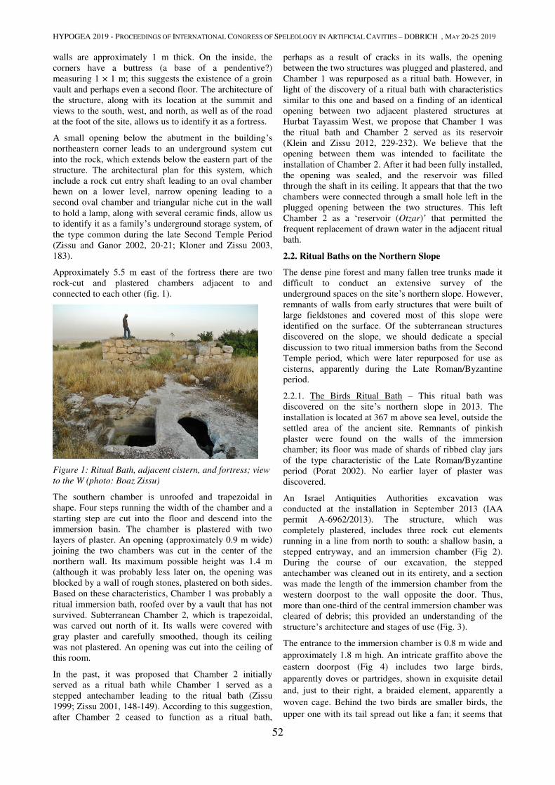
HYPOGEA 2019 - PROCEEDINGS OF INTERNATIONAL CONGRESS OF SPELEOLOGY IN ARTIFICIAL CAVITIES – DOBRICH , MAY 20-25 2019
52
walls are approximately 1 m thick. On the inside, the
corners have a buttress (a base of a pendentive?)
measuring 1 × 1 m; this suggests the existence of a groin
vault and perhaps even a second floor. The architecture of
the structure, along with its location at the summit and
views to the south, west, and north, as well as of the road
at the foot of the site, allows us to identify it as a fortress.
A small opening below the abutment in the building’s
northeastern corner leads to an underground system cut
into the rock, which extends below the eastern part of the
structure. The architectural plan for this system, which
include a rock cut entry shaft leading to an oval chamber
hewn on a lower level, narrow opening leading to a
second oval chamber and triangular niche cut in the wall
to hold a lamp, along with several ceramic finds, allow us
to identify it as a family’s underground storage system, of
the type common during the late Second Temple Period
(Zissu and Ganor 2002, 20-21; Kloner and Zissu 2003,
183).
Approximately 5.5 m east of the fortress there are two
rock-cut and plastered chambers adjacent to and
connected to each other (fig. 1).
Figure 1: Ritual Bath, adjacent cistern, and fortress; view
to the W (photo: Boaz Zissu)
The southern chamber is unroofed and trapezoidal in
shape. Four steps running the width of the chamber and a
starting step are cut into the floor and descend into the
immersion basin. The chamber is plastered with two
layers of plaster. An opening (approximately 0.9 m wide)
joining the two chambers was cut in the center of the
northern wall. Its maximum possible height was 1.4 m
(although it was probably less later on, the opening was
blocked by a wall of rough stones, plastered on both sides.
Based on these characteristics, Chamber 1 was probably a
ritual immersion bath, roofed over by a vault that has not
survived. Subterranean Chamber 2, which is trapezoidal,
was carved out north of it. Its walls were covered with
gray plaster and carefully smoothed, though its ceiling
was not plastered. An opening was cut into the ceiling of
this room.
In the past, it was proposed that Chamber 2 initially
served as a ritual bath while Chamber 1 served as a
stepped antechamber leading to the ritual bath (Zissu
1999; Zissu 2001, 148-149). According to this suggestion,
after Chamber 2 ceased to function as a ritual bath,
perhaps as a result of cracks in its walls, the opening
between the two structures was plugged and plastered, and
Chamber 1 was repurposed as a ritual bath. However, in
light of the discovery of a ritual bath with characteristics
similar to this one and based on a finding of an identical
opening between two adjacent plastered structures at
Hurbat Tayassim West, we propose that Chamber 1 was
the ritual bath and Chamber 2 served as its reservoir
(Klein and Zissu 2012, 229-232). We believe that the
opening between them was intended to facilitate the
installation of Chamber 2. After it had been fully installed,
the opening was sealed, and the reservoir was filled
through the shaft in its ceiling. It appears that that the two
chambers were connected through a small hole left in the
plugged opening between the two structures. This left
Chamber 2 as a ‘reservoir (Otzar)’ that permitted the
frequent replacement of drawn water in the adjacent ritual
bath.
2.2. Ritual Baths on the Northern Slope
The dense pine forest and many fallen tree trunks made it
difficult to conduct an extensive survey of the
underground spaces on the site’s northern slope. However,
remnants of walls from early structures that were built of
large fieldstones and covered most of this slope were
identified on the surface. Of the subterranean structures
discovered on the slope, we should dedicate a special
discussion to two ritual immersion baths from the Second
Temple period, which were later repurposed for use as
cisterns, apparently during the Late Roman/Byzantine
period.
2.2.1. The Birds Ritual Bath – This ritual bath was
discovered on the site’s northern slope in 2013. The
installation is located at 367 m above sea level, outside the
settled area of the ancient site. Remnants of pinkish
plaster were found on the walls of the immersion
chamber; its floor was made of shards of ribbed clay jars
of the type characteristic of the Late Roman/Byzantine
period (Porat 2002). No earlier layer of plaster was
discovered.
An Israel Antiquities Authorities excavation was
conducted at the installation in September 2013 (IAA
permit A-6962/2013). The structure, which was
completely plastered, includes three rock cut elements
running in a line from north to south: a shallow basin, a
stepped entryway, and an immersion chamber (Fig 2).
During the course of our excavation, the stepped
antechamber was cleaned out in its entirety, and a section
was made the length of the immersion chamber from the
western doorpost to the wall opposite the door. Thus,
more than one-third of the central immersion chamber was
cleared of debris; this provided an understanding of the
structure’s architecture and stages of use (Fig. 3).
The entrance to the immersion chamber is 0.8 m wide and
approximately 1.8 m high. An intricate graffito above the
eastern doorpost (Fig 4) includes two large birds,
apparently doves or partridges, shown in exquisite detail
and, just to their right, a braided element, apparently a
woven cage. Behind the two birds are smaller birds, the
upper one with its tail spread out like a fan; it seems that
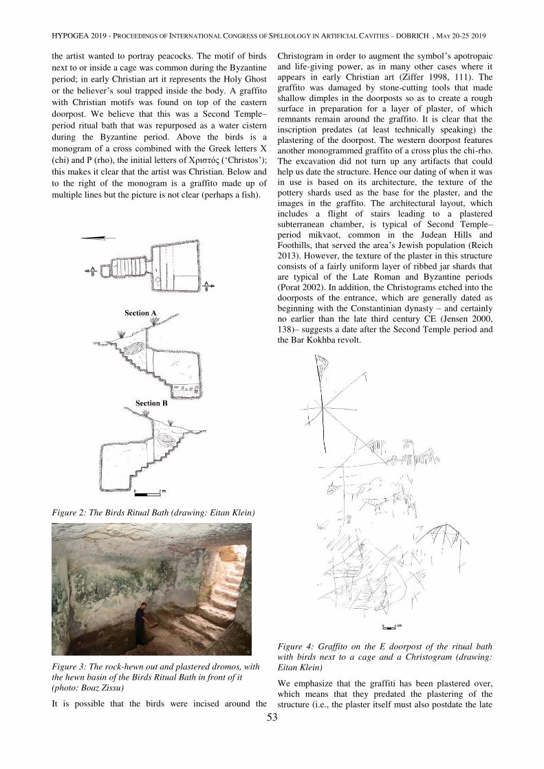
HYPOGEA 2019 - PROCEEDINGS OF INTERNATIONAL CONGRESS OF SPELEOLOGY IN ARTIFICIAL CAVITIES – DOBRICH , MAY 20-25 2019
53
the artist wanted to portray peacocks. The motif of birds
next to or inside a cage was common during the Byzantine
period; in early Christian art it represents the Holy Ghost
or the believer’s soul trapped inside the body. A graffito
with Christian motifs was found on top of the eastern
doorpost. We believe that this was a Second Temple–period ritual bath that was repurposed as a water cistern
during the Byzantine period. Above the birds is a
monogram of a cross combined with the Greek letters Χ (chi) and Ρ (rho), the initial letters of Χριστός (‘Christos’); this makes it clear that the artist was Christian. Below and
to the right of the monogram is a graffito made up of
multiple lines but the picture is not clear (perhaps a fish).
Figure 2: The Birds Ritual Bath (drawing: Eitan Klein)
Figure 3: The rock-hewn out and plastered dromos, with
the hewn basin of the Birds Ritual Bath in front of it
(photo: Boaz Zissu)
It is possible that the birds were incised around the
Christogram in order to augment the symbol’s apotropaic
and life-giving power, as in many other cases where it
appears in early Christian art (Ziffer 1998, 111). The
graffito was damaged by stone-cutting tools that made
shallow dimples in the doorposts so as to create a rough
surface in preparation for a layer of plaster, of which
remnants remain around the graffito. It is clear that the
inscription predates (at least technically speaking) the
plastering of the doorpost. The western doorpost features
another monogrammed graffito of a cross plus the chi-rho.
The excavation did not turn up any artifacts that could
help us date the structure. Hence our dating of when it was
in use is based on its architecture, the texture of the
pottery shards used as the base for the plaster, and the
images in the graffito. The architectural layout, which
includes a flight of stairs leading to a plastered
subterranean chamber, is typical of Second Temple–period mikvaot, common in the Judean Hills and
Foothills, that served the area’s Jewish population (Reich
2013). However, the texture of the plaster in this structure
consists of a fairly uniform layer of ribbed jar shards that
are typical of the Late Roman and Byzantine periods
(Porat 2002). In addition, the Christograms etched into the
doorposts of the entrance, which are generally dated as
beginning with the Constantinian dynasty – and certainly
no earlier than the late third century CE (Jensen 2000,
138)– suggests a date after the Second Temple period and
the Bar Kokhba revolt.
Figure 4: Graffito on the E doorpost of the ritual bath
with birds next to a cage and a Christogram (drawing:
Eitan Klein)
We emphasize that the graffiti has been plastered over,
which means that they predated the plastering of the
structure (i.e., the plaster itself must also postdate the late
HYPOGEA 2019 - PROCEEDINGS OF INTERNATIONAL CONGRESS OF SPELEOLOGY IN ARTIFICIAL CAVITIES – DOBRICH , MAY 20-25 2019
54
third century CE and it should apparently be assigned to
the Byzantine Period). It is clear that the graffiti were not
visible at the time the structure was last used. This
suggests that the focus of the structure when it was used
was not related to the graffiti, because these were covered
by plaster and would not have been visible to users.
Therefore, it is probably that during the Byzantine period
and certainly not earlier than the late third century CE the
ritual bath was converted into a cistern and maybe by one
of the workers who plastered the installation sketched the
graffiti on it’s walls.
2.2.2. A ritual bath repurposed for use as a cistern
Another hewn-out and plastered underground structure
(Fig 5) is located approximately 25 m north of the Birds
Ritual Bath, on the slope of the ridge and outside the
boundaries of the ancient settlement. Entrance to the
structure is currently possible through a rectangular shaft
whose southern, eastern, and western walls are hewn out
of the rock, whereas its northern wall is built of
fieldstones (the shaft is 1.4 m long and approx. 1 m wide).
All of the walls were covered with a uniform layer of gray
plaster, without gravel (this may be of a later date). In
some areas, it is possible to see an additional layer of
pinkish plaster underneath the gray plaster, on a base of
shards of ribbed pottery.
Figure 5: Immersion chamber in ritual bath. Note the
plastered steps running widthwise and the blocked dromos
leading to the structure; view to the N (photo: Boaz Zissu)
The features of this structure, which contains a stepped
dromos leading towards a hewn underground chamber
with widthwise stairs at its bottom, indicate that it was
used as a ritual bath by the Jewish residents of the
settlement during the late Second Temple period. At some
stage, the easy access to the installation was blocked by
the construction of a fieldstone wall atop the stepped
entrance hallway (dromos); a vertical shaft was installed
to serve as the entrance to the structure. At the same time,
the stairs to the ritual bath were cut out, the floor was
deepened, and the structure was covered in an additional
layer of plaster, which, on the basis of the pottery shards
mixed in with it, can be dated roughly to the Late
Roman/Byzantine period (Porat 2002). The changes were
so that the ritual bath could be repurposed as a cistern,
with an increased capacity, and with the possibility of fill
it all the way up to the mouth of the shaft; when
completely full, the structure could then hold at least 80
cubic meters of water.
2.3. The underground Hiding Complex (Fig 6)
At the summit, some 30 meters northeast of the fortress
and within the ancient settlement, a winepress was found,
which includes a crushing floor and a collection vat lined
with orange-colored plaster on a foundation of ribbed
pottery shards. This type of plaster is typical of the Late
Roman/Byzantine period (Porat 2002). A shaft located in
the middle of the crushing floor (Fig 16–shaft i1; length:
approximately 1.2 m, width: 7 m) is sealed with a
rectangular stone cut with extreme precision to fit its
dimensions. The cracks in the shaft were sealed with
cement, so that the crushing floor could be used without
leakage. Next to one wall of the crushing floor, but
outside the winepress, we found another shaft (Shaft i2;
height approximately 2 m). It is not sealed and serves as
the mouth of a cistern that is lined with gray hydraulic
plaster (Cistern I). The shaft that lies in the center of this
cistern’s roof (Shaft i1) is, as noted, sealed with a
rectangular stone. It is clear that the closure of the shaft
and installation of the crushing floor are later than the
installation of the cistern located directly under the
crushing floor. It thus seems that the people who built the
winepress also cut out Shaft i2 so that they would be able
to use the pre-existing chambers located underneath the
crushing floor while the winepress was in operation.
Figure 6: Plan and cross-section of underground hiding
system into which a ritual bath was incorporated
(drawing: Eitan Klein)
At some stage, the eastern wall of Cistern I was breached
and it was linked to Chamber H, which is elliptical in
shape (approx. 8 m long and 5 m wide). A narrow tunnel
(c-h) was dug in the eastern wall of Chamber H, about 5 m
long (approx. 0.7–1.1 m wide with an average height of
approx. 0.8 m). It leads to Chamber C, which is irregular
in shape (approx. 6.5 m long, 3 m wide, and 1.2 m high).
During the eastward extension of Chamber C, the western
wall of the adjacent rectangular chamber (Chamber D;

HYPOGEA 2019 - PROCEEDINGS OF INTERNATIONAL CONGRESS OF SPELEOLOGY IN ARTIFICIAL CAVITIES – DOBRICH , MAY 20-25 2019
55
approx. 4 m long, 2.2 m wide, and 1.8–2 m high) was
removed. All the walls of this space were covered with
gray hydraulic plaster; in some areas, beneath the plaster
one can discern repairs to cracks in the walls, by means of
medium-sized fieldstones and cement. This chamber has
an entrance approximately 1 m wide, which affords easy
access to the structure. Today, the entrance has been
blocked by rock fall from the surface. Two plastered steps
have been discovered running the width of the structure.
The structure’s plan indicates that it served as a ritual bath
for the Jewish residents, from the late Second Temple
period until the Bar Kokhba revolt.
A narrow tunnel approximately 2.5 m long was dug in the
southern wall of Chamber C, leading towards room E. The
tunnel continues southward from Room E; after about six
meters it reaches the irregularly shaped Chamber G, which
has an access shaft in its ceiling that is currently sealed.
This tunnel has a layout and cross-section typical of a
burrow of a hiding complex (Fig 7); several recesses were
cut out along its length to hold lamps. We surmise that
Chamber G served as an underground storehouse and was
built under a residential building, and that the tunnel
leading from it towards Chamber C and Room E was built
when the system was repurposed for hiding.
Figure 7: Tunnel e-g in the refuge system; view to the N
(photo: Eitan Klein)
A wide opening (approximately 2.2 m) in the northern
wall of Chamber C breached the ceiling of a large
underground chamber (Chamber B). This chamber is
about 4–5 m high. It is not clear what use this chamber
served in the past. It is linked via an opening 3.8 m wide
to another large chamber (Chamber A). An opening in its
northeastern wall, approximately 2 m long, 1 m wide, and
1.6 m high, leads to the surface of the eastern slope,
outside the settlement, via a rock-hewn dromos.
The pottery shards collected from this system indicate the
periods of settlement on the site. The underground hiding
system consists of a series of earlier underground
chambers that were used for various purposes and were
connected by burows, creating a complex underground
system. Because it is cut within soft and brittle chalk of
Adullam formation (Sneh 2009), most of the tunnels do
not have the cross-section typical of a hiding system
(Tepper 1987; Kloner and Zissu 2003, 182-183). The
system began at the top of the site, inside the boundaries
of the ancient settlement and ended on the northern slope,
apparently outside the bounds of the settlement as it
existed in the period between the two revolts against the
Romans. This allowed the people who took refuge in this
system to flee the settlement in times of danger.
Underground hiding systems from that period, with exits
outside the settlement, are known from several nearby
locations, such as Hurbat Lavnin and (Zissu 2001, 164)
Tel Socho (Zissu 2000), and they have been classified as
escape systems, enabling residents fast escape from the
settled areas (Kloner and Zissu 2003, 185).
2.4. A Large and Elongated Cistern on the
Northeastern Slope
On the northeastern slope of the site, in a dense pine forest
approximately 200 m from the summit, we discovered the
opening of a hewn-out and plastered underground cistern
(Fig 8) that had been broken into by antiquities looters.
The cistern, which is located outside the boundaries of the
ancient settlement, is reached by steps cut out of the rock.
Today, one can enter the structure through a 3 m shaft that
reaches the bottom of a hewn entrance 1.7 m wide, which
is mostly blocked by large boulders. The façade is
partially roofed over by a large slab.
Figure 8: Plan and cross-section of the rectangular
cistern (drawing: Eitan Klein)
The structure (Fig 9) is approximately 17.5 m long from the opening in the north to its southern end. The structure has a trapezoidal cross-section. From the rock ceiling down to the floor, which is covered by silt and fallen boulders, is approximately 5 m; however, it is clear that the original floor of the cistern was located even deeper. The walls were covered with a thick layer of gray plaster mixed with gravel and small stones, of the type typical to the Second Temple period (Porat 2002). Where the plaster was damaged or peeled, it was repaired with pinkish plaster on a ground of broken ribbed pottery; this is typical of the Late Roman/Byzantine periods (Porat 2002) and indicates continued use of the cistern then. A shaft for drawing water was cut in the center of the roof. We believe that this shaft was not original but was created when the structure was plastered and repaired and repurposed as a cistern. We propose dating it to the late Second Temple period based on the type of plaster, which is typical of that period. In addition, its design – an elongated cavity with plastered walls and the original entrance at the narrow end – is typologically identical to
HYPOGEA 2019 - PROCEEDINGS OF INTERNATIONAL CONGRESS OF SPELEOLOGY IN ARTIFICIAL CAVITIES – DOBRICH , MAY 20-25 2019
56
the cisterns previously discovered on the slopes of the royal fortresses in Judea that date from the Hasmonean-Herodian period. The royal fortresses built by the Hasmoneans and Herod have specific features, including large cisterns; they were built on elevated sites that dominate their surroundings and are surrounded by steep slopes. These sites were first identified and studied in the Judean Desert (Tsafrir 1975, Shatzman 1991, 36-52, 227-233). In recent years, fortified sites dating to the Second Temple period have been identified in settled areas (mostly in Judea), with the same features as those in the Judean Desert: they dominate their surroundings and have cisterns on their slopes (see for instance the cisterns of the fortress at Horvat Tura: Zissu 2008).
Figure 9: Rectangular enlongated cistern; view to south (photo: Boaz Zissu)
The cistern’s location on the slope outside the boundaries of the settlement, the site’s physical characteristics (i.e., its elevation, which allows it to control over a wide area) and the appropriate pottery finds allow us to propose, with a high degree of certainty, that the ruin served as a royal fortress built during the Hasmonean or Herodian period. If Hurbat Husham was indeed a Hasmonean-Herodian fortress (it would be the first in the Judean Foothills to be so identified), its role was to defend the western approaches and one of the main routes (through Nahal Soreq and Nahal Elah) to Judea during the late Second Temple Period.
3. Conclusions
The findings from our surveys and excavation presented above point to activity at Hurbat Husham beginning in the Hellenistic period, in the third and second centuries BCE. The large number of mikvaot and the pottery shards appropriate to this period allow us to identify a Jewish settlement, active from the late Second Temple period until the Bar Kokhba revolt. Like other Jewish settlements in the region, it seems to have been abandoned after the Bar Kokhba revolt. Thereafter, apparently in the Late Roman or early Byzantine period, the site was resettled by a Christian community, as indicated by the graffito with crosses etched into the walls of the ritual bath at the site. At this stage, the cisterns at the site were renovated; this included repurposing the mikvaot for water storage. The summary of the data we have provided, and especially the name of this site, its topography, the elongated cistern from the Second Temple period, and the pottery finds from the second century BCE through the Bar Kokhba revolt are the basis of our suggestion that Hurbat Husham was the site of a Hasmonean-Herodian fortress meant to protect the western approaches and one of the major
routes (via Nahal Soreq and Nahal Elah) to Judea during
the late Second Temple period.
References
Abel F.M, 1967. Géographie de la Palestine II. Gabalda, Paris.
Broshi M, 1968. Maqeda. In: H Beinart and M Haran (Eds.). Encyclopaedia Biblica V. Institute Bialik Jerusalem, pp. 303–304 (Heb).
Conder C.R, Kitchener H.H, 1883. The Survey of Western Palestine: Memoirs of the Topography, Orography, Hydrography, and Archaeology, Vol. III. Palestine Exploration Committee, London.
Dagan Y, 1992. The Shephela During the Period of the Monarchy in Light of Archaeological Excavations and Survey. M.A Thesis, Tel-Aviv, Tel-Aviv University (Heb).
Dagan Y, 1996. Cities of the Judean Shephelah and their Division into Districts Based on Joshua 15’. Eretz-Israel, 25, 136–146 (Heb).
Guérin M.V, 1969. Description Géographique, Historique et Archéologique de la Palestine: Judée Tome II. Oriental Press, Amsterdam.
Jensen R.M, 2000. Understanding Early Christian Art. Routledge, London.
Klein E, Zissu B, 2012. Ritual Immersion Baths (Miqwa’ot) with Double Entrances in the Jerusalem Hills. In: E Baruch, Y Levin and A Levy-Reifer (Eds.). New Studies on Jerusalem: Volume 18. Ingeborg Rennert Center, Ramat-Gan, pp. 225–245 (Heb).
Kloner A, Zissu B, 2003. Hiding Complexes in Judaea: An Archaeological and Geographical Update on the Area of the Bar-Kokhba Revolt. In: P Schäfer (Ed.). The Bar-Kokhba War Reconsidered. Mohr Siebeck, Tübingen, pp. 181–216.
Porat Y, 2002. Hydraulic Plaster in Aqueducts as a Chronological Indicator. In: D Amit, J Patrich and Y Hirschfeld (Eds.), The Aqueducts of Israel (JRA Supplementary Series 46). RI, Portsmouth, pp. 25–36.
Reich R, 2013. Ritual Baths during the Second Temple Period and in the Mishnah and Talmud Periods. Yad Izhak Ben-Zvi and Israel Exploration Society, Jerusalem (Heb).
Shatzman I, 1991. The Armies of the Hasmonaeans and Herod. Mohr Siebeck, Tübingen.
Sneh A, 2009. Geological Map of Israel 1:50,000: Beit Shemesh, Sheet 11:I. Israel Geological Survey, Jerusalem.
Tepper Y, 1987. Present Research of the Hiding Complexes. In: A Kloner and Y Tepper (Eds.). The Hiding Complexes in the Judean Shephelah. Ha-Kibbutz Hameuchad Publishing House and the Israel Exploration Society, Tel-Aviv, pp. 37–75 (Heb).
Tsafrir Y, 1975. The Desert Forts of Judea in Second Temple Times. Qadmoniot, 30–31, 41–53 (Heb).
Vilnay Z, 1976. Khushem. Ariel Encyclopedia, 3, 2531 (Heb).
Ziffer I, 1998. O my Dove, that Art in the Clefts of the Rock: The Dove-Allegory in Antiquity. Eretz Israel Museum, Tel-Aviv.
Zissu B, 1999. Ḥorbat Ḥushsham. Ḥadashot Arkheologiyot, 109, 81.
Zissu B, 2000. The Ossuary of “Imma, Daughter of Hanania”, and the Second Temple Period Jewish Settlement at Sokho, Judaean Foothills. In: A Faust and E Baruch (Eds.). New Studies on Jerusalem: Proceedings of the Sixth Conference. Ingeborg Rennert Center for Jerusalem Studies, Ramat-Gan, pp. 64–74 (Heb).
Zissu B, 2001. Rural Settlement in the Judaean Hills and Foothills from the Late Second Temple Period to the Bar-Kokhba Revolt. Ph.D. diss, Jerusalem, Hebrew University (Heb).
Zissu B, 2008. The Hellenistic Fortress at Horvat Tura and the Identification of Tur Shimon. IEJ, 58, 171–194.
Zissu B, Ganor A, 2002. Ḥorvat ʿEtri – The Ruins of a Second Temple Period Jewish Village on the Coastal Plain. Qadmoniot, 123, 18–27 (Heb).

GEOLOGY, GEOMORPHOLOGY,
ENVIRONMENTAL HAZARDS
HYPOGEA 2019 - PROCEEDINGS OF INTERNATIONAL CONGRESS OF SPELEOLOGY IN ARTIFICIAL CAVITIES – DOBRICH , MAY 20-25 2019
57
NATURAL RADIOACTIVITY IN SOME CAVES OF THE VAYOTS DZOR
PROVINCE, ARMENIA
Dmitry Albov1,2
, Boris Gasparyan3
1Lomonosov Moscow State University, Chemistry Department, Leninskiye Gory 1-3, Moscow, 119991 Russia
2Czech Speleological Society ZO 3-05,Vítězná 414/72, Karlovy Vary, 36009 Czech Republic, [email protected]
3Institute of Archaeology and Ethnography, Charents st. 15, Yerevan, 0025 Armenia, [email protected]
Abstract
During the international expedition in Armenia in 2017 levels of gamma radiation were measured in four caves in
Vayots Dzor province. Background radiation levels in the Archeri, Mozrov and Magel caves show no difference with
the medium level in the district, but in one hall of the Areni-1 cave gamma radiation level is up to 3 times higher. This
hall contains archaeological layers with the cultural material of Chalcolithic period. The results of gamma spectral
measurements of samples from this cave are presented in this article.
Keywords
Radioactivity, gamma radiation, archaeology, cave
To find a suitable location for radon monitoring, levels of
gamma radiation were measured in four caves in the area
of Noravank monastery, Vayots Dzor province, Armenia.
Radon is known as an important earthquake predictor
(Riggio & Santulin, 2015), its isotopes are formed by the
radioactive decay of the uranium and thorium traces in the
most rocks. Radon is released during rock fracture and can
be easily detected due to its radioactivity. Its very short
half-life makes radon levels sensitive to short-term
geological processes. Radon concentrates in underground
structures such as natural and artificial caves, mines and
cellars. Radon is a pure alpha emitter, but its daughter
isotopes yield strong gamma radiation, so there is a
reasonable correlation between radon concentration and
gamma radiation level suitable for a preliminary search of
radon.
Measurements were carried out in the caves Archeri,
Mozrov, Magel and Areni-1 using a SRP-68 scintillating
exploration radiometer. Background radiation levels in
three of them show no difference with the medium level in
the district, they are in the range of 7-11 µR/h. An
interesting anomaly was found on the floor in one of the
galleries of the Areni-1 cave, where gamma radiation level
reached 21 µR/h, up to 3 times exceeding levels on the
surface and in other caves. However, this cave is perfectly
ventilated through several entrances, so radon hardly
concentrates there and we could suppose that it should not
be the main reason of radiation.
The Areni-1 cave is a noticeable archaeological site, it is
situated at 1 km from the Areni village on a bank of the
Arpa river. Archaeological excavations were carried out
from 2007 to 2014. Several strata were found dating since
the Late Chalcolithic to Medieval time. Excavations
showed that different parts of the cave were used by
inhabitants for different purposes such as storage, living
and ritual purposes. Soil in the cave consists of sand-rich
silts of unknown genesis, probably by weathering of the
cave enclosing rock and cultural activities took place
inside of the cave.
Figure 1. Plan of Areni-1.
In the remote hall (Fig. 1) the Trench 1 was excavated,
revealing four archaeological layers of late Chalcolithic
period with thickness of 4.5 m (units 1002-1005,
Wilkinson et al., 2012). Unit 1005 contained scattered
ceramics and animal bones (mainly of sheeps and goats).
Units 1003 and 1004 contained whole ceramic vessels,
pottery fragments, animal bones and obsidian artefacts.
Two of the pots contained sub-adult human crania and an
adult femoral shaft. Six large ceramit storage vessels
contained plant remains and were set within clay basins,
which in turn formed part of a more extensive baked clay
surface. A 14
C date on charcoal from Unit 1004 suggests
that deposition occurred around 4230–3970 Cal B.C.
HYPOGEA 2019 - PROCEEDINGS OF INTERNATIONAL CONGRESS OF SPELEOLOGY IN ARTIFICIAL CAVITIES – DOBRICH , MAY 20-25 2019
58
In the entrance of the cave the Trench 2 was excavated.
Several units of the Chalcolithic period also contained
crania in ceramic vessels, storage vessels, bones of
animals and remains of plants. Units in the Trench 2
containing storage and ritual vessels dated by 3970-3800
B.C. are contemporary with the units 1002 and 1003 in the
Trench 1.
Unusual gamma radiation level was found only in the
Trench 1 and at the soil surface around it (Fig. 1). The
Trench 2 snows no radiation anomaly as well as the rest of
the cave.
Table 1. Activities of major nuclides.
Nuclide Decay
chain
Sample 1
Bq/kg
Sample 2
Bq/kg
235U
235U 0.82 0.66
211Bi
235U 36.11 32.43
238U (calculated)
238U 17.51 14.19
234Th
238U 11.12 10.40
214Pb
238U 13.47 12.83
214Bi
238U 12.30 11.54
232Th (calculated)
232Th 33.66 2.30
228Th
232Th 77.41 5.30
228Ac
232Th 12.87 0.91
212Pb
232Th 14.91 1.05
Activities of nuclides belonging to the 235
U and 238
U decay
chains are a little bit more in the sample 1. However,
activities of nuclides belonging to the 232
Th decay chain is
about 14 times higher in the sample 1.
We assume that higher content of thorium and its dauther
isotopes is a result of human activity in the Areni-1 cave.
For example, thorium may present in a peculiar type of
pottery made from thorium-rich clay. Also the source of
thorium could be bones of animals and humans who lived
in the area with high thorium content. Also we can not
exclude the role of geological processes in thorium
accumulation. In order to locate thorium containing
material it might be possible to use alpha radiation meter
in the cave and namely in the Trench 1, followed by
gamma spectrometry of some artefacts.
References
Riggio A, Santulin M, 2015. Earthquake forecasting: a
review of radon as seismic precursor. Bollettino di
Geofisica Teorica ed Applicata, 56(2), 95-114.
Wilkinson K, Gasparian B, Pinhasi R, Avetisyan P,
Hovsepyan R, Zardaryan D, Areshian G, Bar-Oz G, Smith
A, 2012. Areni-1 Cave, Armenia: A Chalcolithic–Early
Bronze Age settlement and ritual site in the southern
Caucasus. Journal of Field Archaeology, 37(1), 20-33.
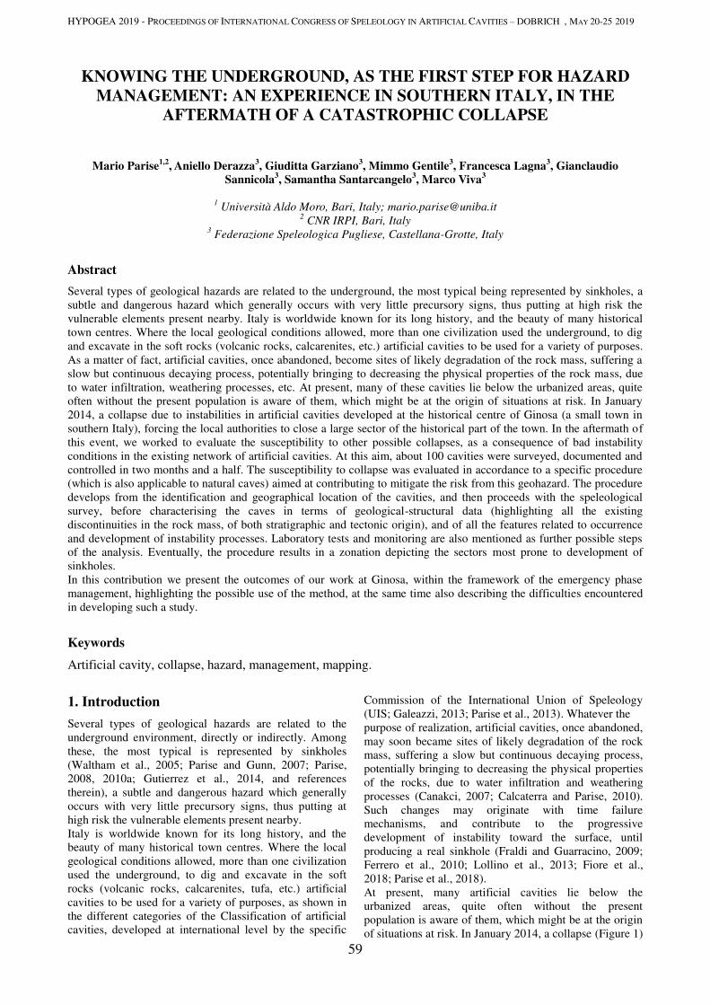
HYPOGEA 2019 - PROCEEDINGS OF INTERNATIONAL CONGRESS OF SPELEOLOGY IN ARTIFICIAL CAVITIES – DOBRICH , MAY 20-25 2019
59
KNOWING THE UNDERGROUND, AS THE FIRST STEP FOR HAZARD
MANAGEMENT: AN EXPERIENCE IN SOUTHERN ITALY, IN THE
AFTERMATH OF A CATASTROPHIC COLLAPSE
Mario Parise1,2
, Aniello Derazza3, Giuditta Garziano
3, Mimmo Gentile
3, Francesca Lagna
3, Gianclaudio
Sannicola3, Samantha Santarcangelo
3, Marco Viva
3
1 Università Aldo Moro, Bari, Italy; [email protected]
2 CNR IRPI, Bari, Italy
3 Federazione Speleologica Pugliese, Castellana-Grotte, Italy
Abstract
Several types of geological hazards are related to the underground, the most typical being represented by sinkholes, a
subtle and dangerous hazard which generally occurs with very little precursory signs, thus putting at high risk the
vulnerable elements present nearby. Italy is worldwide known for its long history, and the beauty of many historical
town centres. Where the local geological conditions allowed, more than one civilization used the underground, to dig
and excavate in the soft rocks (volcanic rocks, calcarenites, etc.) artificial cavities to be used for a variety of purposes.
As a matter of fact, artificial cavities, once abandoned, become sites of likely degradation of the rock mass, suffering a
slow but continuous decaying process, potentially bringing to decreasing the physical properties of the rock mass, due
to water infiltration, weathering processes, etc. At present, many of these cavities lie below the urbanized areas, quite
often without the present population is aware of them, which might be at the origin of situations at risk. In January
2014, a collapse due to instabilities in artificial cavities developed at the historical centre of Ginosa (a small town in
southern Italy), forcing the local authorities to close a large sector of the historical part of the town. In the aftermath of
this event, we worked to evaluate the susceptibility to other possible collapses, as a consequence of bad instability
conditions in the existing network of artificial cavities. At this aim, about 100 cavities were surveyed, documented and
controlled in two months and a half. The susceptibility to collapse was evaluated in accordance to a specific procedure
(which is also applicable to natural caves) aimed at contributing to mitigate the risk from this geohazard. The procedure
develops from the identification and geographical location of the cavities, and then proceeds with the speleological
survey, before characterising the caves in terms of geological-structural data (highlighting all the existing
discontinuities in the rock mass, of both stratigraphic and tectonic origin), and of all the features related to occurrence
and development of instability processes. Laboratory tests and monitoring are also mentioned as further possible steps
of the analysis. Eventually, the procedure results in a zonation depicting the sectors most prone to development of
sinkholes.
In this contribution we present the outcomes of our work at Ginosa, within the framework of the emergency phase
management, highlighting the possible use of the method, at the same time also describing the difficulties encountered
in developing such a study.
Keywords
Artificial cavity, collapse, hazard, management, mapping.
1. Introduction
Several types of geological hazards are related to the
underground environment, directly or indirectly. Among
these, the most typical is represented by sinkholes
(Waltham et al., 2005; Parise and Gunn, 2007; Parise,
2008, 2010a; Gutierrez et al., 2014, and references
therein), a subtle and dangerous hazard which generally
occurs with very little precursory signs, thus putting at
high risk the vulnerable elements present nearby.
Italy is worldwide known for its long history, and the
beauty of many historical town centres. Where the local
geological conditions allowed, more than one civilization
used the underground, to dig and excavate in the soft
rocks (volcanic rocks, calcarenites, tufa, etc.) artificial
cavities to be used for a variety of purposes, as shown in
the different categories of the Classification of artificial
cavities, developed at international level by the specific
Commission of the International Union of Speleology
(UIS; Galeazzi, 2013; Parise et al., 2013). Whatever the
purpose of realization, artificial cavities, once abandoned,
may soon became sites of likely degradation of the rock
mass, suffering a slow but continuous decaying process,
potentially bringing to decreasing the physical properties
of the rocks, due to water infiltration and weathering
processes (Canakci, 2007; Calcaterra and Parise, 2010).
Such changes may originate with time failure
mechanisms, and contribute to the progressive
development of instability toward the surface, until
producing a real sinkhole (Fraldi and Guarracino, 2009;
Ferrero et al., 2010; Lollino et al., 2013; Fiore et al.,
2018; Parise et al., 2018).
At present, many artificial cavities lie below the
urbanized areas, quite often without the present
population is aware of them, which might be at the origin
of situations at risk. In January 2014, a collapse (Figure 1)
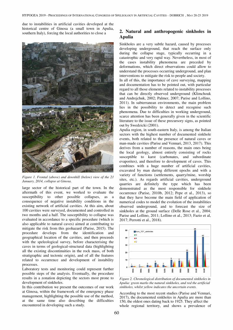
HYPOGEA 2019 - PROCEEDINGS OF INTERNATIONAL CONGRESS OF SPELEOLOGY IN ARTIFICIAL CAVITIES – DOBRICH , MAY 20-25 2019
60
due to instabilities in artificial cavities developed at the
historical centre of Ginosa (a small town in Apulia,
southern Italy), forcing the local authorities to close a
Figure 1. Frontal (above) and downhill (below) view of the 21
January, 2014, collapse at Ginosa.
large sector of the historical part of the town. In the
aftermath of this event, we worked to evaluate the
susceptibility to other possible collapses, as a
consequence of negative instability conditions in the
existing network of artificial cavities. At this aim, about
100 cavities were surveyed, documented and controlled in
two months and a half. The susceptibility to collapse was
evaluated in accordance to a specific procedure (which is
also applicable to natural caves) aimed at contributing to
mitigate the risk from this geohazard (Parise, 2015). The
procedure develops from the identification and
geographical location of the cavities, and then proceeds
with the speleological survey, before characterising the
caves in terms of geological-structural data (highlighting
all the existing discontinuities in the rock mass, of both
stratigraphic and tectonic origin), and of all the features
related to occurrence and development of instability
processes.
Laboratory tests and monitoring could represent further
possible steps of the analysis. Eventually, the procedure
results in a zonation depicting the sectors most prone to
development of sinkholes.
In this contribution we present the outcomes of our work
at Ginosa, within the framework of the emergency phase
management, highlighting the possible use of the method,
at the same time also describing the difficulties
encountered in developing such a study.
2. Natural and anthropogenic sinkholes in
Apulia
Sinkholes are a very subtle hazard, caused by processes
developing underground, that reach the surface only
during the collapse stage, typically occurring in a
catastrophic and very rapid way. Nevertheless, in most of
the cases instability phenomena are preceded by
deformations, which direct observations could allow to
understand the processes occurring underground, and plan
interventions to mitigate the risk to people and society.
In all of this, the importance of cave surveying, mapping
and documentation has to be pointed out, with particular
regard to all those elements related to instability processes
that can be directly observed underground (Klimchouk
and Andrejchuk, 2002; Palmer, 2007; Parise and Lollino,
2011). In subterranean environments, the main problem
lies in the possibility to detect and recognise such
phenomena. Due to difficulties in working underground,
scarce attention has been generally given in the scientific
literature to the issue of these precursory signs, as pointed
out by Swedzicki (2001). Apulia region, in south-eastern Italy, is among the Italian
sectors with the highest number of documented sinkhole
events, both related to the presence of natural caves or
man-made cavities (Parise and Vennari, 2013, 2017). This
derives from a number of reasons, the main ones being
the local geology, almost entirely consisting of rocks
susceptible to karst (carbonates, and subordinate
evaporites), and therefore to development of caves. This
combines with a huge number of artificial cavities,
excavated by man during different epochs and with a
variety of functions (settlements, quarry/mine, worship
sites, etc.). As regards artificial cavities, underground
quarries are definitely the type which has been
demonstrated as the most responsible for sinkhole
occurrence (Parise, 2010b, 2012; Pepe et al., 2013), so
that they have become the main field of application of
numerical codes to model the evolution of the instabilities
observed underground, and to forecast the size of
sinkholes at the ground surface (Delle Rose et al., 2004;
Parise and Lollino, 2011; Lollino et al., 2013; Fazio et al,
2017; Perrotti et al., 2018).
Figure 2. Chronological distribution of documented sinkholes in
Apulia: green marks the natural sinkholes, and red the artificial
sinkholes, whilst yellow indicates the uncertain events.
According to the most recent studies (Parise and Vennari, 2017), the documented sinkholes in Apulia are more than 150, the oldest ones dating back to 1925. They affect the whole regional territory, and shows a prevalence of
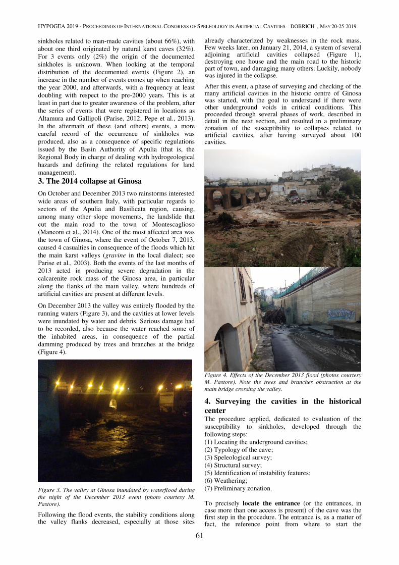
HYPOGEA 2019 - PROCEEDINGS OF INTERNATIONAL CONGRESS OF SPELEOLOGY IN ARTIFICIAL CAVITIES – DOBRICH , MAY 20-25 2019
61
sinkholes related to man-made cavities (about 66%), with
about one third originated by natural karst caves (32%).
For 3 events only (2%) the origin of the documented
sinkholes is unknown. When looking at the temporal
distribution of the documented events (Figure 2), an
increase in the number of events comes up when reaching
the year 2000, and afterwards, with a frequency at least
doubling with respect to the pre-2000 years. This is at
least in part due to greater awareness of the problem, after
the series of events that were registered in locations as
Altamura and Gallipoli (Parise, 2012; Pepe et al., 2013).
In the aftermath of these (and others) events, a more
careful record of the occurrence of sinkholes was
produced, also as a consequence of specific regulations
issued by the Basin Authority of Apulia (that is, the
Regional Body in charge of dealing with hydrogeological
hazards and defining the related regulations for land
management).
3. The 2014 collapse at Ginosa
On October and December 2013 two rainstorms interested
wide areas of southern Italy, with particular regards to
sectors of the Apulia and Basilicata region, causing,
among many other slope movements, the landslide that
cut the main road to the town of Montescaglioso
(Manconi et al., 2014). One of the most affected area was
the town of Ginosa, where the event of October 7, 2013,
caused 4 casualties in consequence of the floods which hit
the main karst valleys (gravine in the local dialect; see
Parise et al., 2003). Both the events of the last months of
2013 acted in producing severe degradation in the
calcarenite rock mass of the Ginosa area, in particular
along the flanks of the main valley, where hundreds of
artificial cavities are present at different levels.
On December 2013 the valley was entirely flooded by the
running waters (Figure 3), and the cavities at lower levels
were inundated by water and debris. Serious damage had
to be recorded, also because the water reached some of
the inhabited areas, in consequence of the partial
damming produced by trees and branches at the bridge
(Figure 4).
Figure 3. The valley at Ginosa inundated by waterflood during
the night of the December 2013 event (photo courtesy M.
Pastore).
Following the flood events, the stability conditions along the valley flanks decreased, especially at those sites
already characterized by weaknesses in the rock mass. Few weeks later, on January 21, 2014, a system of several adjoining artificial cavities collapsed (Figure 1), destroying one house and the main road to the historic part of town, and damaging many others. Luckily, nobody was injured in the collapse.
After this event, a phase of surveying and checking of the many artificial cavities in the historic centre of Ginosa was started, with the goal to understand if there were other underground voids in critical conditions. This proceeded through several phases of work, described in detail in the next section, and resulted in a preliminary zonation of the susceptibility to collapses related to artificial cavities, after having surveyed about 100 cavities.
Figure 4. Effects of the December 2013 flood (photos courtesy
M. Pastore). Note the trees and branches obstruction at the
main bridge crossing the valley.
4. Surveying the cavities in the historical
center The procedure applied, dedicated to evaluation of the
susceptibility to sinkholes, developed through the
following steps: (1) Locating the underground cavities;
(2) Typology of the cave;
(3) Speleological survey;
(4) Structural survey;
(5) Identification of instability features;
(6) Weathering;
(7) Preliminary zonation.
To precisely locate the entrance (or the entrances, in case more than one access is present) of the cave was the first step in the procedure. The entrance is, as a matter of fact, the reference point from where to start the
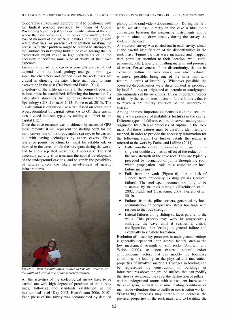
HYPOGEA 2019 - PROCEEDINGS OF INTERNATIONAL CONGRESS OF SPELEOLOGY IN ARTIFICIAL CAVITIES – DOBRICH , MAY 20-25 2019
62
topographic survey, and therefore must be positioned with the highest possible precision, by means of Global Positioning Systems (GPS) tools. Identification of the site where the cave opens might not be a simple matter, due to loss of memory of old artificial cavities, or clogging with waste materials, or presence of vegetation masking the access. A further problem might be related to attempts by the landowners in keeping hidden the cave, fearing that its exploration might result in legal constraints or in the necessity to perform some kind of works at their own expenses. Location of an artificial cavity is generally not casual, but
depends upon the local geology and geomorphology,
since the characters and properties of the rock mass are
crucial in choicing the sites where man used to start
excavating in the past (Del Prete and Parise, 2013). Typology of the artificial cavity at the origin of possible
failures must be established, following the internationally
established standards by the International Union of
Speleology (UIS; Galeazzi 2013; Parise et al. 2013). The
classification is organised like a tree, based on seven main
types, identified by capital letters (A to G); these are in
turn divided into sub-types, by adding a number to the
capital letter. Once the cave entrance was positioned by means of GPS
measurements, it will represent the starting point for the
main survey line of the topographic survey, to be carried
out with caving techniques by expert cavers. Fixed
reference points (benchmarks) must be established, or
marked in the cave, to help the surveyors during the work,
and to allow repeated measures, if necessary. The first
necessary activity is to ascertain the spatial development
of the underground cavities, and to verify the possibility
of failures and/or the likely involvement of nearby
infrastructures.
Figure 5. Open discontinuities, related to tensional release, on
the vault and wall of one of the surveyed cavities.
All the activities of the speleological survey have to be
carried out with high degree of precision of the survey
lines, following the standards established at the
international level (Day 2002; Häuselmann 2006, 2010).
Each phase of the survey was accompanied by detailed
photographic (and video) documentation. During the field
work, we also used directly in the cave a blue tooth
connection between the measuring instruments and a
palmtop, aimed to draw directly during the survey the
sketch of the cave. A structural survey was carried out in each cavity, aimed
at the careful identification of the discontinuities in the
rock mass (Figure 5), that were measured and mapped,
with particular attention to their location (wall, vault,
pavement, pillar), aperture, infilling material and presence
of water. Pervasiveness of the discontinuity, that is its
extension within the rock mass, was also evaluated
whenever possible, being one of the most important
feature in terms of instability. Whenever possible, the
observed discontinuities were discriminated as produced
by local failures, or originated as tectonic or stratigraphic
discontinuities in the rock mass. This is important in order
to identify the sectors most prone to future failures, that is
to reach a preliminary zonation of the underground
spaces. Among the most important elements to take into account,
there is the presence of instability features in the cavity.
Different types of failures can be observed underground,
originated by different processes of rupture in the rock
mass. All these features must be carefully identified and
mapped, in order to provide the necessary information for
the following steps. For further details the reader is
referred to the work by Parise and Lollino (2011). Falls from the vault often develop the formation of a
single or double arch, as an effect of the reduction in
the rock strength of the cave roof. They are typically
preceded by formation of joints through the roof,
which propagation leads to a complete or local
failure mechanism.
Falls from the vault (Figure 6), due to lack of
support from previously existing pillars (induced
failure). The roof span becomes too long to be
sustained by the rock strength (Hutchinson et al.,
2002; Fraldi and Guarracino, 2009; Ferrero et al.,
2010).
Failures from the pillar corners, generated by local
accumulation of compressive stress too high with
respect to the rock strength. Lateral failures along sliding surfaces parallel to the
walls. This process may work in progressively
enlarging the cave until it reaches a critical
configuration, then leading to general failure and
eventually to sinkhole formation. Evolution of instability processes in underground settings
is generally dependent upon internal factors, such as the
low mechanical strength of soft rocks (Andriani and
Walsh, 2002), or upon external natural and/or
anthropogenic factors that can modify the boundary
conditions, the loading, or the physical and mechanical
properties of involved materials. Changes in loading can
be represented by construction of buildings or
infrastructures above the ground surface, that can modify
the stress state around the cave, the destruction of pillars
within underground rooms with consequent increase in
the cave span, as well as seismic loading conditions or
man-made vibrations due to traffic or construction works. Weathering processes may contribute to decrease the
physical properties of the rock mass, and to facilitate the
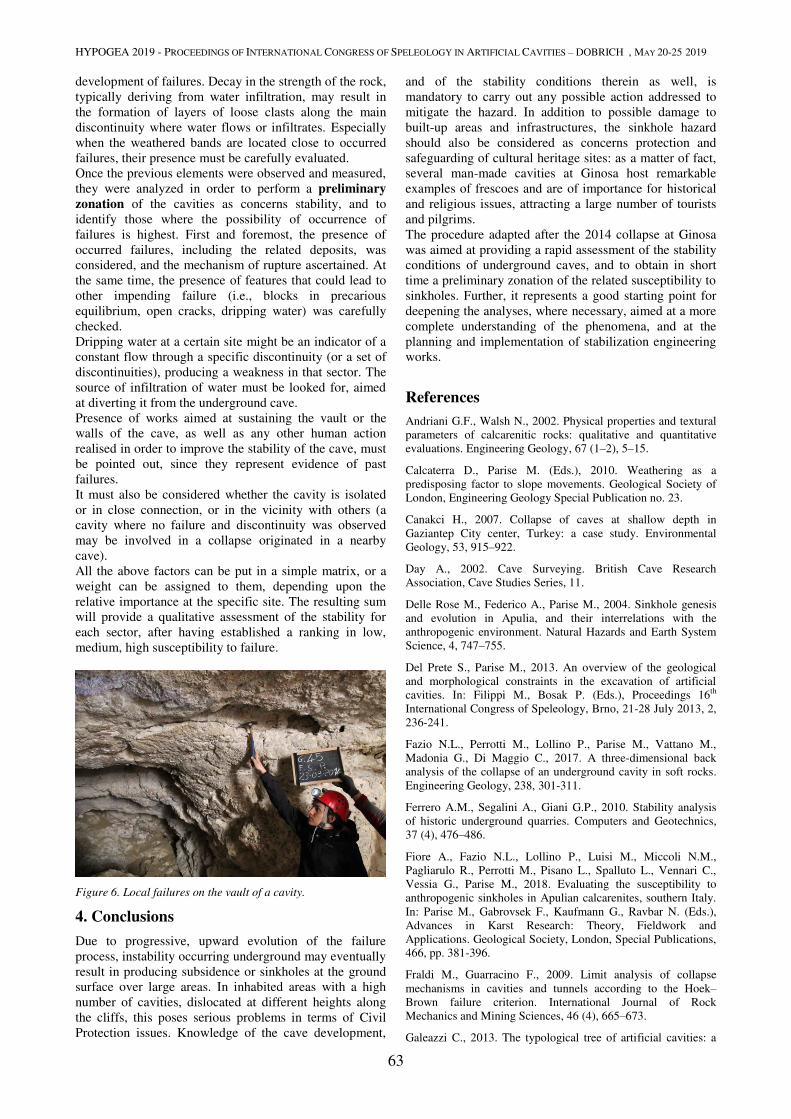
HYPOGEA 2019 - PROCEEDINGS OF INTERNATIONAL CONGRESS OF SPELEOLOGY IN ARTIFICIAL CAVITIES – DOBRICH , MAY 20-25 2019
63
development of failures. Decay in the strength of the rock,
typically deriving from water infiltration, may result in
the formation of layers of loose clasts along the main
discontinuity where water flows or infiltrates. Especially
when the weathered bands are located close to occurred
failures, their presence must be carefully evaluated. Once the previous elements were observed and measured,
they were analyzed in order to perform a preliminary
zonation of the cavities as concerns stability, and to
identify those where the possibility of occurrence of
failures is highest. First and foremost, the presence of
occurred failures, including the related deposits, was
considered, and the mechanism of rupture ascertained. At
the same time, the presence of features that could lead to
other impending failure (i.e., blocks in precarious
equilibrium, open cracks, dripping water) was carefully
checked. Dripping water at a certain site might be an indicator of a
constant flow through a specific discontinuity (or a set of
discontinuities), producing a weakness in that sector. The
source of infiltration of water must be looked for, aimed
at diverting it from the underground cave. Presence of works aimed at sustaining the vault or the
walls of the cave, as well as any other human action
realised in order to improve the stability of the cave, must
be pointed out, since they represent evidence of past
failures. It must also be considered whether the cavity is isolated
or in close connection, or in the vicinity with others (a
cavity where no failure and discontinuity was observed
may be involved in a collapse originated in a nearby
cave).
All the above factors can be put in a simple matrix, or a
weight can be assigned to them, depending upon the
relative importance at the specific site. The resulting sum
will provide a qualitative assessment of the stability for
each sector, after having established a ranking in low,
medium, high susceptibility to failure.
Figure 6. Local failures on the vault of a cavity.
4. Conclusions
Due to progressive, upward evolution of the failure
process, instability occurring underground may eventually
result in producing subsidence or sinkholes at the ground
surface over large areas. In inhabited areas with a high
number of cavities, dislocated at different heights along
the cliffs, this poses serious problems in terms of Civil
Protection issues. Knowledge of the cave development,
and of the stability conditions therein as well, is
mandatory to carry out any possible action addressed to
mitigate the hazard. In addition to possible damage to
built-up areas and infrastructures, the sinkhole hazard
should also be considered as concerns protection and
safeguarding of cultural heritage sites: as a matter of fact,
several man-made cavities at Ginosa host remarkable
examples of frescoes and are of importance for historical
and religious issues, attracting a large number of tourists
and pilgrims. The procedure adapted after the 2014 collapse at Ginosa
was aimed at providing a rapid assessment of the stability
conditions of underground caves, and to obtain in short
time a preliminary zonation of the related susceptibility to
sinkholes. Further, it represents a good starting point for
deepening the analyses, where necessary, aimed at a more
complete understanding of the phenomena, and at the
planning and implementation of stabilization engineering
works.
References
Andriani G.F., Walsh N., 2002. Physical properties and textural
parameters of calcarenitic rocks: qualitative and quantitative
evaluations. Engineering Geology, 67 (1–2), 5–15.
Calcaterra D., Parise M. (Eds.), 2010. Weathering as a
predisposing factor to slope movements. Geological Society of
London, Engineering Geology Special Publication no. 23.
Canakci H., 2007. Collapse of caves at shallow depth in
Gaziantep City center, Turkey: a case study. Environmental
Geology, 53, 915–922.
Day A., 2002. Cave Surveying. British Cave Research
Association, Cave Studies Series, 11.
Delle Rose M., Federico A., Parise M., 2004. Sinkhole genesis
and evolution in Apulia, and their interrelations with the
anthropogenic environment. Natural Hazards and Earth System
Science, 4, 747–755.
Del Prete S., Parise M., 2013. An overview of the geological
and morphological constraints in the excavation of artificial
cavities. In: Filippi M., Bosak P. (Eds.), Proceedings 16th
International Congress of Speleology, Brno, 21-28 July 2013, 2,
236-241.
Fazio N.L., Perrotti M., Lollino P., Parise M., Vattano M.,
Madonia G., Di Maggio C., 2017. A three-dimensional back
analysis of the collapse of an underground cavity in soft rocks.
Engineering Geology, 238, 301-311.
Ferrero A.M., Segalini A., Giani G.P., 2010. Stability analysis
of historic underground quarries. Computers and Geotechnics,
37 (4), 476–486.
Fiore A., Fazio N.L., Lollino P., Luisi M., Miccoli N.M.,
Pagliarulo R., Perrotti M., Pisano L., Spalluto L., Vennari C.,
Vessia G., Parise M., 2018. Evaluating the susceptibility to
anthropogenic sinkholes in Apulian calcarenites, southern Italy.
In: Parise M., Gabrovsek F., Kaufmann G., Ravbar N. (Eds.),
Advances in Karst Research: Theory, Fieldwork and
Applications. Geological Society, London, Special Publications,
466, pp. 381-396.
Fraldi M., Guarracino F., 2009. Limit analysis of collapse
mechanisms in cavities and tunnels according to the Hoek–Brown failure criterion. International Journal of Rock
Mechanics and Mining Sciences, 46 (4), 665–673.
Galeazzi C., 2013. The typological tree of artificial cavities: a
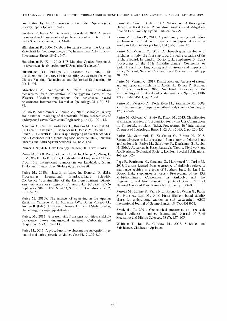
HYPOGEA 2019 - PROCEEDINGS OF INTERNATIONAL CONGRESS OF SPELEOLOGY IN ARTIFICIAL CAVITIES – DOBRICH , MAY 20-25 2019
64
contribution by the Commission of the Italian Speleological
Society. Opera Ipogea, 1, 9–18.
Gutiérrez F., Parise M., De Waele J., Jourde H.,.2014. A review
on natural and human-induced geohazards and impacts in karst.
Earth Science Reviews, 138, 61–88.
Häuselmann P., 2006. Symbols for karst surfaces: the UIS list.
Zeitschrift fur Geomorphologie 147, International Atlas of Karst
Phenomena, Sheets 18–21, 3–7.
Häuselmann P. (Ed.), 2010. UIS Mapping Grades. Version 2.
http://www.uisic.uis-speleo.org/UISmappingGrades.pdf.
Hutchinson D.J., Phillips C., Cascante G., 2002. Risk
Considerations for Crown Pillar Stability Assessment for Mine
Closure Planning. Geotechnical and Geological Engineering, 20
(1), 41–64.
Klimchouk A., Andrejchuk V., 2002. Karst breakdown
mechanisms from observation in the gypsum caves of the
Western Ukraine: implications for subsidence hazard
Assessment. International Journal of Speleology, 31 (1/4), 55–88.
Lollino P., Martimucci V., Parise M., 2013. Geological survey
and numerical modeling of the potential failure mechanisms of
underground caves. Geosystem Engineering, 16 (1), 100–112.
Manconi A., Casu F., Ardizzone F., Bonano M., Cardinali M.,
De Luca C., Gueguen E., Marchesini I., Parise M., Vennari C.,
Lanari R., Guzzetti F., 2014, Rapid mapping of event landslides:
the 3 December 2013 Montescaglioso landslide (Italy). Natural
Hazards and Earth System Sciences, 14, 1835-1841.
Palmer A.N., 2007. Cave Geology. Dayton, OH: Cave Books.
Parise M., 2008. Rock failures in karst. In: Cheng Z., Zhang J.,
Li Z., Wu F., Ho K. (Eds.), Landslides and Engineered Slopes.
Proc. 10th International Symposium on Landslides, Xi’an:
Taylor and Francis, June 30–July 4, pp. 275–280.
Parise M., 2010a. Hazards in karst. In: Bonacci O. (Ed.),
Proceedings International Interdisciplinary Scientific
Conference “Sustainability of the karst environment. Dinaric
karst and other karst regions”, Plitvice Lakes (Croatia), 23-26
September 2009, IHP-UNESCO, Series on Groundwater no. 2,
pp. 155-162.
Parise M., 2010b. The impacts of quarrying in the Apulian
Karst. In: Carrasco F., La Moreaux J.W., Duran Valsero J.J.,
Andreo B. (Eds.), Advances in Research in Karst Media. Berlin,
Heidelberg, Springer, pp. 441–447.
Parise, M., 2012. A present risk from past activities: sinkhole
occurrence above underground quarries. Carbonates and
Evaporites, 27 (2), 109–118.
Parise M., 2015. A procedure for evaluating the susceptibility to
natural and anthropogenic sinkholes. Georisk, 9, 272-285.
Parise M., Gunn J. (Eds.), 2007. Natural and Anthropogenic
Hazards in Karst Areas: Recognition, Analysis and Mitigation.
London Geol. Society, Special Publication 279.
Parise M., Lollino P., 2011. A preliminary analysis of failure
mechanisms in karst and man-made underground caves in
Southern Italy. Geomorphology, 134 (1–2), 132–143.
Parise M., Vennari C., 2013. A chronological catalogue of
sinkholes in Italy: the first step toward a real evaluation of the
sinkhole hazard. In: Land L., Doctor L.H., Stephenson B. (Eds.),
Proceedings of the 13th Multidisciplinary. Conference on
Sinkholes and the. Engineering and Environmental Impacts of
Karst, Carlsbad, National Cave and Karst Research Institute, pp.
383–392.
Parise M., Vennari C., 2017. Distribution and features of natural
and anthropogenic sinkholes in Apulia. In: Renard P., Bertrand
C. (Eds.), EuroKarst 2016, Neuchatel. Advances in the
hydrogeology of karst and carbonate reservoirs. Springer, ISBN
978-3-319-45464-1, pp. 27-34.
Parise M., Federico A., Delle Rose M., Sammarco M., 2003.
Karst terminology in Apulia (southern Italy). Acta Carsologica,
32 (2), 65-82.
Parise M., Galeazzi C., Bixio R., Dixon M., 2013. Classification
of artificial cavities: a first contribution by the UIS Commission.
In: Filippi M., Bosak P. (Eds.), Proceedings 16th International
Congress of Speleology, Brno, 21-28 July 2013, 2, pp. 230-235.
Parise M., Gabrovsek F., Kaufmann G., Ravbar N., 2018,
Recent advances in karst research: from theory to fieldwork and applications. In: Parise M., Gabrovsek F., Kaufmann G., Ravbar
N. (Eds.), Advances in Karst Research: Theory, Fieldwork and
Applications. Geological Society, London, Special Publications,
466, pp. 1-24.
Pepe P., Pentimone N., Garziano G., Martimucci V., Parise M.,
2013. Lessons learned from occurrence of sinkholes related to
man-made cavities in a town of Southern Italy. In: Land L.,
Doctor L.H., Stephenson B. (Eds.), Proceedings of the 13th
Multidisciplinary. Conference on Sinkholes and the.
Engineering and Environmental Impacts of Karst, Carlsbad,
National Cave and Karst Research Institute, pp. 393–401.
Perrotti M., Lollino P., Fazio N.L., Pisano L., Vessia G., Parise
M., Fiore A., Luisi M., 2018, Finite Element–based stability
charts for underground cavities in soft calcarenites. ASCE
International Journal of Geomechanics, 18 (7), 04018071.
Swedzicki T., 2001. Geotechnical precursors to large-scale
ground collapse in mines. International Journal of Rock
Mechanics and Mining Sciences, 38 (7), 957–965.
Waltham T., Bell F., Culshaw M., 2005. Sinkholes and
Subsidence. Chichester, Springer.
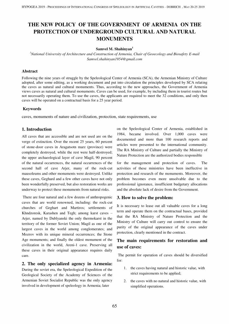
HYPOGEA 2019 - PROCEEDINGS OF INTERNATIONAL CONGRESS OF SPELEOLOGY IN ARTIFICIAL CAVITIES – DOBRICH , MAY 20-25 2019
65
THE NEW POLICY OF THE GOVERNMENT OF ARMENIA ON THE
PROTECTION OF UNDERGROUND CULTURAL AND NATURAL
MONUMENTS
Samvel M. Shahinyan1
1National University of Architecture and Construction of Armenia, Chair of Geoecology and Biosafety E-mail
Abstract
Following the nine years of struggle by the Speleological Center of Armenia (SCA), the Armenian Ministry of Culture
adopted, after some editing, as a working document and put into circulation the principles developed by SCA relating
the caves as natural and cultural monuments. Thus, according to the new approaches, the Government of Armenia
views caves as natural and cultural monuments. Caves can be used, for example, by including them in tourist routes but
not necessarily operating them. To use the caves, the applicants are required to meet the 32 conditions, and only then
caves will be operated on a contractual basis for a 25 year period.
Keywords
caves, monuments of nature and civilization, protection, state requirements, use
1. Introduction
All caves that are accessible and are not used are on the
verge of extinction. Over the recent 25 years, 60 percent
of stone-door caves in Aragatsotn marz (province) were
completely destroyed, while the rest were half-destroyed;
the upper archaeological layer of cave Magil, 90 percent
of the natural occurrences, the natural occurrences of the
second hall of cave Arjer, many of the rock-cut
mausoleums and other monuments were destroyed. Unlike
these caves, Geghard and a few other caves have not only
been wonderfully preserved, but also restoration works are
underway to protect these monuments from natural risks.
There are four natural and a few dozens of anthropogenic
caves that are world renowned, including: the rock-cut
churches of Geghart and Martiros; settlements of
Khndzoresk, Karashen and Tegh; among karst caves –
Arjer, named by Dublyanski the only thermokarst in the
territory of the former Soviet Union; Magil as one of the
largest caves in the world among conglomerates; and
Mozrov with its unique mineral occurrences; the Stone
Age monuments; and finally the oldest monument of the
civilization in the world, Areni-1 cave. Preserving all
these caves in their original appearance requires daily
care.
2. The only specialized agency in Armenia:
During the soviet era, the Speleological Expedition of the
Geological Society of the Academy of Sciences of the
Armenian Soviet Socialist Republic was the only agency
involved in development of speleology in Armenia; later
on the Speleological Center of Armenia, established in
1984, became involved. Over 1,000 caves were
documented and more than 100 research reports and
articles were presented to the international community.
The RA Ministry of Culture and partially the Ministry of
Nature Protection are the authorized bodies responsible
for the management and protection of caves. The
activities of these ministries have been ineffective in
protection and research of the monuments. Moreover, the
problem becomes even more unsolvable due to the
professional ignorance, insufficient budgetary allocations
and the absolute lack of desire from the Government.
3. How to solve the problem:
It is necessary to lease out all valuable caves for a long
term and operate them on the contractual bases, provided
that the RA Ministry of Nature Protection and the
Ministry of Culture will carry out control to ensure the
purity of the original appearance of the caves under
protection, clearly mentioned in the contract.
The main requirements for restoration and
use of caves:
The permit for operation of caves should be diversified
for:
1. the caves having natural and historic value, with
strict requirements to be applied;
2. the caves with no natural and historic value, with
simplified operations.
HYPOGEA 2019 - PROCEEDINGS OF INTERNATIONAL CONGRESS OF SPELEOLOGY IN ARTIFICIAL CAVITIES – DOBRICH , MAY 20-25 2019
66
The geological component of natural
caves:
1. The geological component. The description of
the general geological and geotectonic structure
is needed;
2. Availability of the cave’s geochemistry,
hydrogeology and geophysics in the Project;
3. The seismic stability;
4. The microclimate.
Figure 1.Hochants Anapat. During nearly the entire 18th century
and early 19th century, Hochants has been a spiritual and
cultural center; it was blown and destroyed during the Soviet
rule.
Figure 2. Gegard Monastery. The cave itself and the outer
sections are well preserved due to the fact that it has been
permanently used.
The ecological component of the natural
caves:
1. The fauna. Animals that use the cave as a temporary
housing or shelter – birds, bats, wolves, bears, leopards,
bezoar goats, mouflons, mice, etc. Organisms that use the
cave as housing – spiders, worms, bacteria, etc.
2. The flora: mushrooms, moss, etc.
3. The impact on the environment due to the
restoration works and stream of people
Archaeological and Paleontological
components of natural caves:
1. Initial information about the availability of a
cultural layer. The Project will contain the results
of archaeological and paleontological
excavations.
The tourism component of natural caves:
1. The Ministry shall make a decision on and
confirm the areas, passes and paths designed for
tourism, marking them on the particular cave’s
plan. Further changes will be made according to
the logic of the grounding behind the decision.
2. The number of people entering the caves and the
periodicity of entrance is determined depending
on the volumes of the caves and the safety issues
of the natural and cultural monuments.
3. During the cave improvement works, exclude the
use of wood and building materials that
contribute to occurrence and propagation of
fungi, mold and moss.
4. The benefits: The monuments will be under
continuous control. 90 new jobs will be created in 12
communities of Aragatsotn and Vayots Dzor marzes
only. Tourism will become a new source of income for
those communities. The population will become aware
of the history of its own biotope.
Community involvement or an investment
project in adjacent communities using the income received:
1) Ensuring possible involvement of international
investors in the initial or further phases of the
project;
2) A plan/schedule of financial investment and
documents grounding the possible involvement
of assets;
3) Information on the number of jobs to be created
within the scope of the project and the average
salaries of the employees;
4) Activity plan for the first 5 years and for the next
20 years of lease.
Program of tourist safety measures;
The program on creation of additional
facilities/infrastructures intended for the convenience of

HYPOGEA 2019 - PROCEEDINGS OF INTERNATIONAL CONGRESS OF SPELEOLOGY IN ARTIFICIAL CAVITIES – DOBRICH , MAY 20-25 2019
67
the visitors (public toilets, garbage disposal, parking,
information, etc.). The program of treatment and
operation of the toilet.
4. Summary: In the Republic of Armenia, as well as in
many countries in Europe, there is no law on caves.
There are also no common standards for operation of
caves. This hinders the process of finding more efficient
ways for the protection of caves, including making them
touristic sites and transforming them into museums,
which has become a necessity today.
References:
IUCN Guidelines for Cave and Karst protection;
ISCA management guidelines
Agreement on the Conservation of Populations of European Bats, EUROBATS, 1991
A. J. Mitchell-Jones, Z. Bihari, M. Masing, L. Rodrigues “Protecting and managing underground sites for bats” Eurobats Publication Series No. 2 (English version). UNEP/EUROBATS Secretariat, Bonn, Germany. 2007/
ISCA management guidelines
www.showcaves.com; www.i-s-c-a.com, etc
Figure 3. Examples of stone-door caves depicted 30 years ago
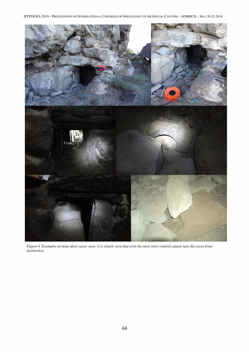
HYPOGEA 2019 - PROCEEDINGS OF INTERNATIONAL CONGRESS OF SPELEOLOGY IN ARTIFICIAL CAVITIES – DOBRICH , MAY 20-25 2019
68
Figure 4. Examples of stone-door caves now; it is clearly seen that even the most strict control cannot save the caves from
destruction.

RELIGIOUS STRUCTURES
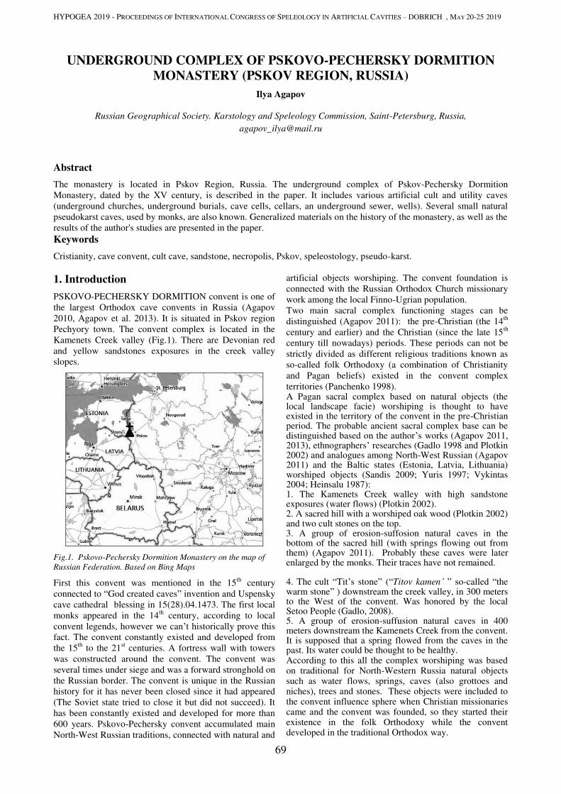
HYPOGEA 2019 - PROCEEDINGS OF INTERNATIONAL CONGRESS OF SPELEOLOGY IN ARTIFICIAL CAVITIES – DOBRICH , MAY 20-25 2019
69
UNDERGROUND COMPLEX OF PSKOVO-PECHERSKY DORMITION
MONASTERY (PSKOV REGION, RUSSIA)
Ilya Agapov
Russian Geographical Society. Karstology and Speleology Commission, Saint-Petersburg, Russia,
Abstract
The monastery is located in Pskov Region, Russia. The underground complex of Pskov-Pechersky Dormition Monastery, dated by the XV century, is described in the paper. It includes various artificial cult and utility caves (underground churches, underground burials, cave cells, cellars, an underground sewer, wells). Several small natural pseudokarst caves, used by monks, are also known. Generalized materials on the history of the monastery, as well as the results of the author's studies are presented in the paper. Keywords
Cristianity, cave convent, cult cave, sandstone, necropolis, Pskov, speleostology, pseudo-karst.
1. Introduction
PSKOVO-PECHERSKY DORMITION convent is one of the largest Orthodox cave convents in Russia (Agapov 2010, Agapov et al. 2013). It is situated in Pskov region Pechyory town. The convent complex is located in the Kamenets Creek valley (Fig.1). There are Devonian red and yellow sandstones exposures in the creek valley slopes.
Fig.1. Pskovo-Pechersky Dormition Monastery on the map of
Russian Federation. Based on Bing Maps
First this convent was mentioned in the 15th century connected to “God created caves” invention and Uspensky cave cathedral blessing in 15(28).04.1473. The first local monks appeared in the 14th century, according to local convent legends, however we can’t historically prove this fact. The convent constantly existed and developed from the 15th to the 21st centuries. A fortress wall with towers was constructed around the convent. The convent was several times under siege and was a forward stronghold on the Russian border. The convent is unique in the Russian history for it has never been closed since it had appeared (The Soviet state tried to close it but did not succeed). It has been constantly existed and developed for more than 600 years. Pskovo-Pechersky convent accumulated main North-West Russian traditions, connected with natural and
artificial objects worshiping. The convent foundation is connected with the Russian Orthodox Church missionary work among the local Finno-Ugrian population. Two main sacral complex functioning stages can be distinguished (Agapov 2011): the pre-Christian (the 14th century and earlier) and the Christian (since the late 15th century till nowadays) periods. These periods can not be strictly divided as different religious traditions known as so-called folk Orthodoxy (a combination of Christianity and Pagan beliefs) existed in the convent complex territories (Panchenko 1998). A Pagan sacral complex based on natural objects (the local landscape facie) worshiping is thought to have existed in the territory of the convent in the pre-Christian period. The probable ancient sacral complex base can be distinguished based on the author’s works (Agapov 2011, 2013), ethnographers’ researches (Gadlo 1998 and Plotkin 2002) and analogues among North-West Russian (Agapov 2011) and the Baltic states (Estonia, Latvia, Lithuania) worshiped objects (Sandis 2009; Yuris 1997; Vykintas 2004; Heinsalu 1987): 1. The Kamenets Creek walley with high sandstone exposures (water flows) (Plotkin 2002). 2. A sacred hill with a worshiped oak wood (Plotkin 2002) and two cult stones on the top. 3. A group of erosion-suffosion natural caves in the bottom of the sacred hill (with springs flowing out from them) (Agapov 2011). Probably these caves were later enlarged by the monks. Their traces have not remained.
4. The cult “Tit’s stone” (“Titov kamen’ ” so-called “the warm stone” ) downstream the creek valley, in 300 meters to the West of the convent. Was honored by the local Setoo People (Gadlo, 2008). 5. A group of erosion-suffusion natural caves in 400 meters downstream the Kamenets Creek from the convent. It is supposed that a spring flowed from the caves in the past. Its water could be thought to be healthy. According to this all the complex worshiping was based on traditional for North-Western Russia natural objects such as water flows, springs, caves (also grottoes and niches), trees and stones. These objects were included to the convent influence sphere when Christian missionaries came and the convent was founded, so they started their existence in the folk Orthodoxy while the convent developed in the traditional Orthodox way.
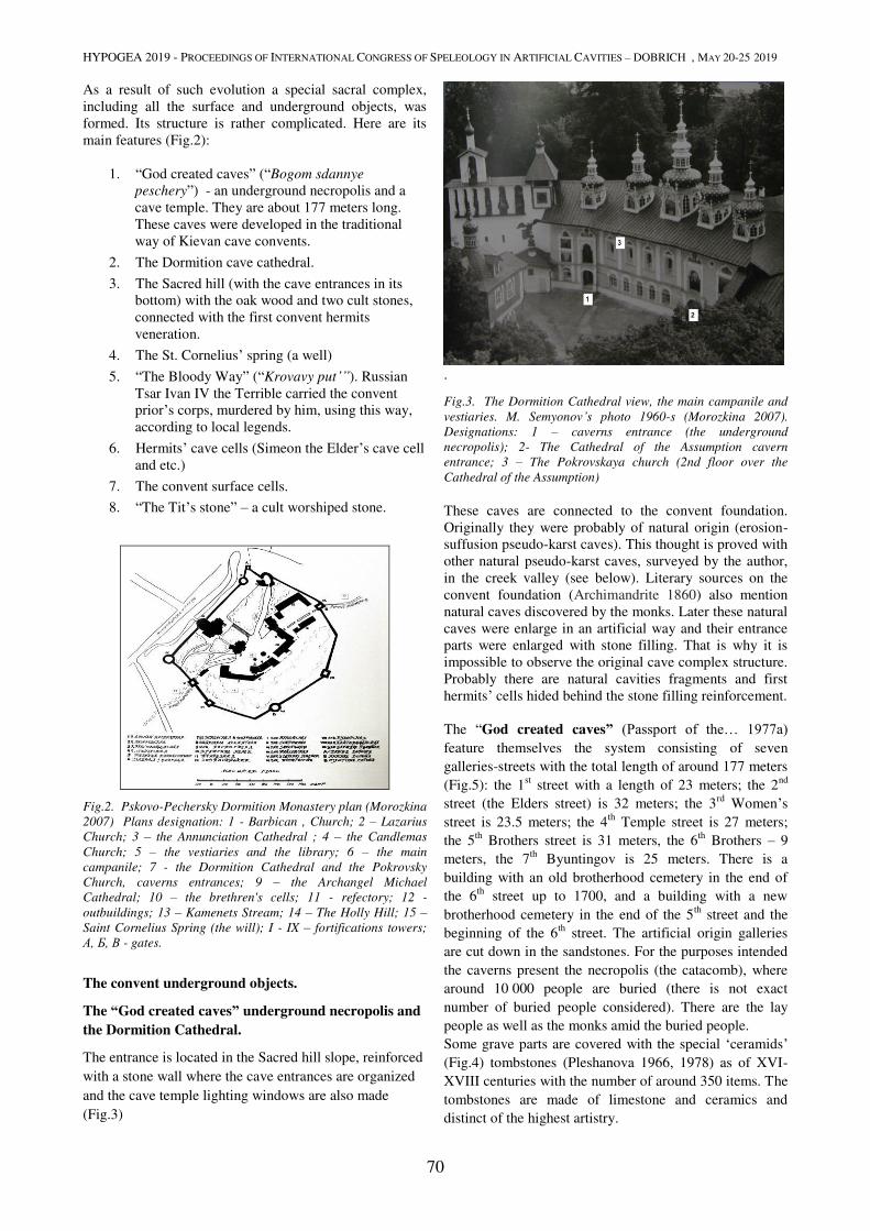
HYPOGEA 2019 - PROCEEDINGS OF INTERNATIONAL CONGRESS OF SPELEOLOGY IN ARTIFICIAL CAVITIES – DOBRICH , MAY 20-25 2019
70
As a result of such evolution a special sacral complex, including all the surface and underground objects, was formed. Its structure is rather complicated. Here are its main features (Fig.2):
1. “God created caves” (“Bogom sdannye
peschery”) - an underground necropolis and a cave temple. They are about 177 meters long. These caves were developed in the traditional way of Kievan cave convents.
2. The Dormition cave cathedral.
3. The Sacred hill (with the cave entrances in its bottom) with the oak wood and two cult stones, connected with the first convent hermits veneration.
4. The St. Cornelius’ spring (a well)
5. “The Bloody Way” (“Krovavy put’”). Russian Tsar Ivan IV the Terrible carried the convent prior’s corps, murdered by him, using this way, according to local legends.
6. Hermits’ cave cells (Simeon the Elder’s cave cell and etc.)
7. The convent surface cells.
8. “The Tit’s stone” – a cult worshiped stone.
Fig.2. Pskovo-Pechersky Dormition Monastery plan (Morozkina
2007) Plans designation: 1 - Barbican , Church; 2 – Lazarius
Church; 3 – the Annunciation Cathedral ; 4 – the Candlemas
Church; 5 – the vestiaries and the library; 6 – the main
campanile; 7 - the Dormition Cathedral and the Pokrovsky
Church, caverns entrances; 9 – the Archangel Michael
Cathedral; 10 – the brethren's cells; 11 - refectory; 12 -
outbuildings; 13 – Kamenets Stream; 14 – The Holly Hill; 15 –
Saint Cornelius Spring (the will); I - IX – fortifications towers;
A, Б, В - gates.
The convent underground objects.
The “God created caves” underground necropolis and
the Dormition Cathedral.
The entrance is located in the Sacred hill slope, reinforced with a stone wall where the cave entrances are organized and the cave temple lighting windows are also made (Fig.3)
.
Fig.3. The Dormition Cathedral view, the main campanile and
vestiaries. M. Semyonov’s photo 1960-s (Morozkina 2007).
Designations: 1 – caverns entrance (the underground
necropolis); 2- The Cathedral of the Assumption cavern
entrance; 3 – The Pokrovskaya church (2nd floor over the
Cathedral of the Assumption)
These caves are connected to the convent foundation. Originally they were probably of natural origin (erosion-suffusion pseudo-karst caves). This thought is proved with other natural pseudo-karst caves, surveyed by the author, in the creek valley (see below). Literary sources on the convent foundation (Archimandrite 1860) also mention natural caves discovered by the monks. Later these natural caves were enlarge in an artificial way and their entrance parts were enlarged with stone filling. That is why it is impossible to observe the original cave complex structure. Probably there are natural cavities fragments and first hermits’ cells hided behind the stone filling reinforcement. The “God created caves” (Passport of the… 1977a) feature themselves the system consisting of seven galleries-streets with the total length of around 177 meters (Fig.5): the 1st street with a length of 23 meters; the 2nd street (the Elders street) is 32 meters; the 3rd Women’s street is 23.5 meters; the 4th Temple street is 27 meters; the 5th Brothers street is 31 meters, the 6th Brothers – 9 meters, the 7th Byuntingov is 25 meters. There is a building with an old brotherhood cemetery in the end of the 6th street up to 1700, and a building with a new brotherhood cemetery in the end of the 5th street and the beginning of the 6th street. The artificial origin galleries are cut down in the sandstones. For the purposes intended the caverns present the necropolis (the catacomb), where around 10 000 people are buried (there is not exact number of buried people considered). There are the lay people as well as the monks amid the buried people. Some grave parts are covered with the special ‘ceramids’ (Fig.4) tombstones (Pleshanova 1966, 1978) as of XVI-XVIII centuries with the number of around 350 items. The tombstones are made of limestone and ceramics and distinct of the highest artistry.

HYPOGEA 2019 - PROCEEDINGS OF INTERNATIONAL CONGRESS OF SPELEOLOGY IN ARTIFICIAL CAVITIES – DOBRICH , MAY 20-25 2019
71
Figure 4. The ceramic tombstone (‘ceramid’) number 2 –
Chebatayeva D.G. 1559 (Pleshanova 1966)
The Dormition Cathedral (Fig.6) of XV-XVIII centuries (Passport of the... 1977b) is located near the underground necropolis and presents itself a separate underground system consisting of two floors. The cathedral’s length is 18 meters; the width (depth) is 20 meters. The cathedral’s vaults are based upon 10 massive sandstones pillars, set by bricks. The fresco paintings of XVI century have been discovered by the instaurations in 1971. The cathedral had been redeveloped and expanded several times. There was a passage from the western gallery of the Dormition cathedral in a new brotherhood cemetery upward of 1710. It’s been embedded after the plague epidemics. Presumably, it’s been used for the round pass nearby the Dormition Cathedral at the Cross Procession. The northern cathedral foreside is situated on the ground surface and carries on the lines of the Ukrainian Baroque.
Figure 6. The Dormition Cathedral. 1472. The measurement -
Mikhailov S.P., Semyonov M.I., 1975. Drafted out by Mikhailov
S.P (Passport of the... 1977b)
Pokrovskaya Church (Fig.7) built in 1758 (styled as the baroque) is situated on the second floor under the Uspensky church (Passport of the... 1977c). Built in a triangle form. Apparently, it’s been digged partially into the ground. 25 meters by length and 9 meters by breadth. The convent roof is situated on the surface and decorated by the 5th domes. The church has an entrance from the cave necropolis (left in the plan on fig.7) onto the special gallery stairs (right in the plan on fig.7). Alternatively, there is an exit to the highest point of the Holly Hill, 15 meters by length outside the church and the gallery.
Figure. 5. Underground complex plan of the Pskovo-Pechersky
Dormition Monastery . Computer processing – I. Agapov. 2013.
The scheme is based on the plans from the archives of the
Institute “Spetsproektrestavratsiya” (Special Project of
Restoration): Mikhail Semyonov 1966. Drawing by Mikhailov
S.P. 1977, Semenov M.I., Mikhailov S.P. 1975. Drawing by –
Mikhailov SP (Passport of the… 1977a; Passport of the...
1977b). Legend: 1 – entrance to the Assumption Cathedral of the
XV–XVIII centuries; 2 – entrance to the underground necropolis
of the XV– XXI centuries. (‘The God created caves‘); 3 – the rise
to the second (upper) layer in the Church of the Protection, of
the XVIII century; 4 – the Church of the Resurrection; 5 – the
old common cemetery before 1700; 6 – new common cemetery
after 1700; 7 - 1st Bratskaya Street; 8 – 2nd Startsev Street; 9 –
3rd Zhesnkaya Street; 10 – 4th Khramovaya Street; 11 – 5th
Bratskaya Street; 12 – 6th Bratskaya Street; 13 – 7th Byuntingov
Street.
Figure .7. The Pokrovskaya Church - XVIII century. The
measurement - Mikhailov S.P., Semyonov M.I., 1973. Drafted
out by Mikhailov S.P., 1977 (Passport of the... 1977c).
The analogies of the underground necropolis are traced in the cavern convents in Kiev (Bobrovsky 2007) where you may also find the gallery-streets with the cemeteries. The distinction, worth to say, is the plan solution. There are the closed-loop systems in Kiev cavern monasteries whereas we keep a fan system in our case. Besides, the underground gallery cross-cut sections in the Pskov
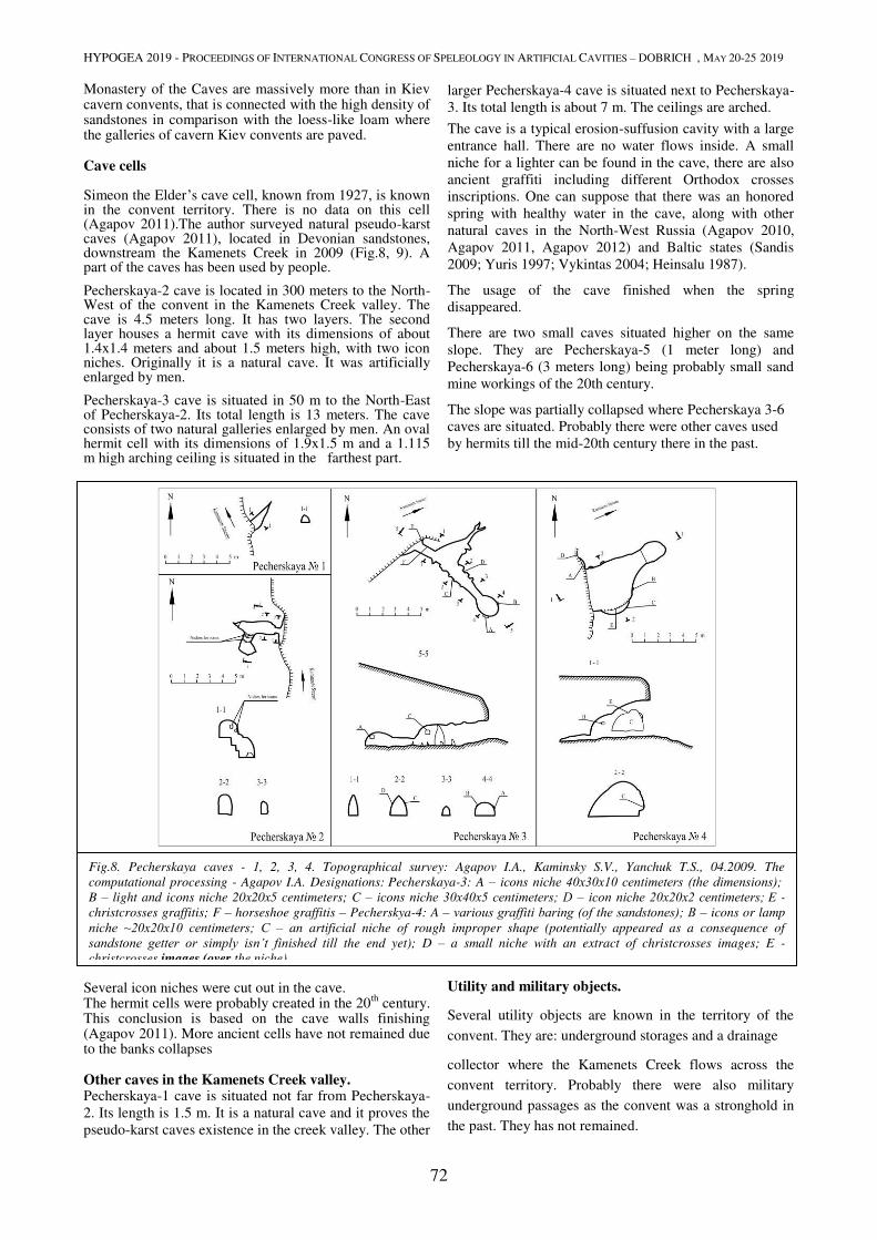
HYPOGEA 2019 - PROCEEDINGS OF INTERNATIONAL CONGRESS OF SPELEOLOGY IN ARTIFICIAL CAVITIES – DOBRICH , MAY 20-25 2019
72
Monastery of the Caves are massively more than in Kiev cavern convents, that is connected with the high density of sandstones in comparison with the loess-like loam where the galleries of cavern Kiev convents are paved. Cave cells Simeon the Elder’s cave cell, known from 1927, is known in the convent territory. There is no data on this cell (Agapov 2011).The author surveyed natural pseudo-karst caves (Agapov 2011), located in Devonian sandstones, downstream the Kamenets Creek in 2009 (Fig.8, 9). A part of the caves has been used by people.
Pecherskaya-2 cave is located in 300 meters to the North-West of the convent in the Kamenets Creek valley. The cave is 4.5 meters long. It has two layers. The second layer houses a hermit cave with its dimensions of about 1.4x1.4 meters and about 1.5 meters high, with two icon niches. Originally it is a natural cave. It was artificially enlarged by men.
Pecherskaya-3 cave is situated in 50 m to the North-East of Pecherskaya-2. Its total length is 13 meters. The cave consists of two natural galleries enlarged by men. An oval hermit cell with its dimensions of 1.9x1.5 m and a 1.115 m high arching ceiling is situated in the farthest part.
.
Several icon niches were cut out in the cave. The hermit cells were probably created in the 20th century. This conclusion is based on the cave walls finishing (Agapov 2011). More ancient cells have not remained due to the banks collapses Other caves in the Kamenets Creek valley. Pecherskaya-1 cave is situated not far from Pecherskaya-2. Its length is 1.5 m. It is a natural cave and it proves the pseudo-karst caves existence in the creek valley. The other
larger Pecherskaya-4 cave is situated next to Pecherskaya-3. Its total length is about 7 m. The ceilings are arched.
The cave is a typical erosion-suffusion cavity with a large entrance hall. There are no water flows inside. A small niche for a lighter can be found in the cave, there are also ancient graffiti including different Orthodox crosses inscriptions. One can suppose that there was an honored spring with healthy water in the cave, along with other natural caves in the North-West Russia (Agapov 2010, Agapov 2011, Agapov 2012) and Baltic states (Sandis 2009; Yuris 1997; Vykintas 2004; Heinsalu 1987).
The usage of the cave finished when the spring disappeared.
There are two small caves situated higher on the same slope. They are Pecherskaya-5 (1 meter long) and Pecherskaya-6 (3 meters long) being probably small sand mine workings of the 20th century.
The slope was partially collapsed where Pecherskaya 3-6 caves are situated. Probably there were other caves used by hermits till the mid-20th century there in the past.
There is a photo of 1958 where a cave entrance can be seen (Morozkina 2007). This cave has not remained.
Utility and military objects.
Several utility objects are known in the territory of the
convent. They are: underground storages and a drainage
collector where the Kamenets Creek flows across the
convent territory. Probably there were also military
underground passages as the convent was a stronghold in
the past. They has not remained.
Fig.8. Pecherskaya caves - 1, 2, 3, 4. Topographical survey: Agapov I.A., Kaminsky S.V., Yanchuk T.S., 04.2009. The
computational processing - Agapov I.A. Designations: Pecherskaya-3: A – icons niche 40х30х10 centimeters (the dimensions); B – light and icons niche 20x20x5 centimeters; C – icons niche 30х40х5 centimeters; D – icon niche 20х20х2 centimeters; E -
christcrosses graffitis; F – horseshoe graffitis – Pecherskya-4: A – various graffiti baring (of the sandstones); В – icons or lamp
niche ~20x20x10 centimeters; С – an artificial niche of rough improper shape (potentially appeared as a consequence of
sandstone getter or simply isn’t finished till the end yet); D – a small niche with an extract of christcrosses images; E -
christcrosses images (over the niche).
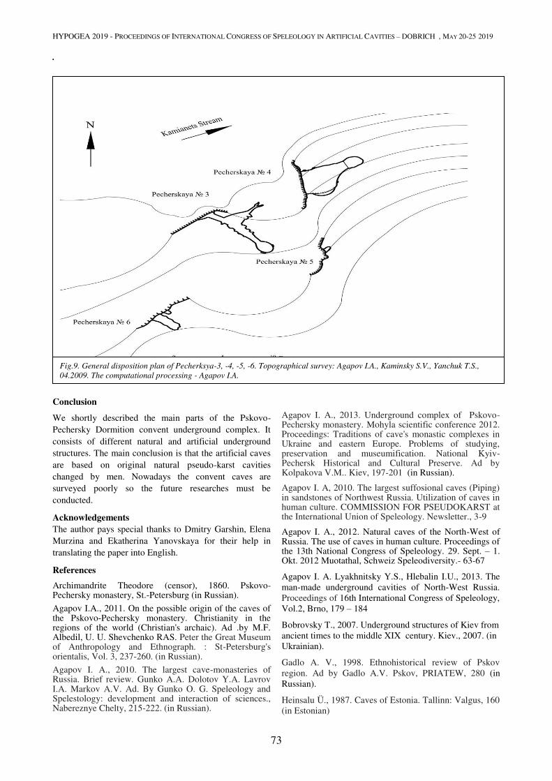
HYPOGEA 2019 - PROCEEDINGS OF INTERNATIONAL CONGRESS OF SPELEOLOGY IN ARTIFICIAL CAVITIES – DOBRICH , MAY 20-25 2019
73
.
Conclusion
We shortly described the main parts of the Pskovo-Pechersky Dormition convent underground complex. It consists of different natural and artificial underground structures. The main conclusion is that the artificial caves are based on original natural pseudo-karst cavities changed by men. Nowadays the convent caves are surveyed poorly so the future researches must be conducted.
Acknowledgements
The author pays special thanks to Dmitry Garshin, Elena Murzina and Ekatherina Yanovskaya for their help in translating the paper into English.
References
Archimandrite Theodore (censor), 1860. Pskovo-Pechersky monastery, St.-Petersburg (in Russian).
Agapov I.A., 2011. On the possible origin of the caves of the Pskovo-Pechersky monastery. Christianity in the regions of the world (Christian's archaic). Ad .by M.F. Albedil, U. U. Shevchenko RAS. Peter the Great Museum of Anthropology and Ethnograph. : St-Petersburg's orientalis, Vol. 3, 237-260. (in Russian).
Agapov I. A., 2010. The largest cave-monasteries of Russia. Brief review. Gunko A.A. Dolotov Y.A. Lavrov I.A. Markov A.V. Ad. By Gunko O. G. Speleology and Spelestology: development and interaction of sciences., Nabereznye Chelty, 215-222. (in Russian).
Agapov I. A., 2013. Underground complex of Pskovo-Pechersky monastery. Mohyla scientific conference 2012. Proceedings: Traditions of cave's monastic complexes in Ukraine and eastern Europe. Problems of studying, preservation and museumification. National Kyiv-Pechersk Historical and Cultural Preserve. Ad by Kolpakova V.M.. Kiev, 197-201 (in Russian).
Agapov I. A, 2010. The largest suffosional caves (Piping) in sandstones of Northwest Russia. Utilization of caves in human culture. COMMISSION FOR PSEUDOKARST at the International Union of Speleology. Newsletter., 3-9
Agapov I. A., 2012. Natural caves of the North-West of Russia. The use of caves in human culture. Proceedings of the 13th National Congress of Speleology. 29. Sept. – 1. Okt. 2012 Muotathal, Schweiz Speleodiversity.- 63-67
Agapov I. A. Lyakhnitsky Y.S., Hlebalin I.U., 2013. The man-made underground cavities of North-West Russia. Proceedings of 16th International Congress of Speleology, Vol.2, Brno, 179 – 184
Bobrovsky T., 2007. Underground structures of Kiev from ancient times to the middle XIX century. Kiev., 2007. (in Ukrainian).
Gadlo A. V., 1998. Ethnohistorical review of Pskov region. Ad by Gadlo A.V. Pskov, PRIATEW, 280 (in Russian).
Heinsalu Ü., 1987. Caves of Estonia. Tallinn: Valgus, 160 (in Estonian)
Fig.9. General disposition plan of Pecherksya-3, -4, -5, -6. Topographical survey: Agapov I.A., Kaminsky S.V., Yanchuk T.S.,
04.2009. The computational processing - Agapov I.A.
HYPOGEA 2019 - PROCEEDINGS OF INTERNATIONAL CONGRESS OF SPELEOLOGY IN ARTIFICIAL CAVITIES – DOBRICH , MAY 20-25 2019
74
Morozkina E.N., 2007. Ecclesiastical architecture of ancient Pskov, Vol. 2 Northern pilgrim., 107 (in Russian).
Panchenko A.A., 1998. Research in folk orthodoxy. Rustic relics of North-west of Russia. St. Petersburg, “Science”, 319 (in Russian).
Passport of the... 1977c. Passport of the archaeological site «Pokrovskaya church of Pskovo-Pechersky monastery». Archive of Pskov department of institute "Spechproektrestavrachia", 1977 (in Russian).
Passport of the... 1977b. Passport of the archaeological site «Uspensky Cathedral of Pskovo-Pechersky monastery». Archive of Pskov department of institute "Spechproektrestavrachia", 1977 (in Russian).
Passport of the... 1977a. Passport of the archaeological site «Caves of Pskovo-Pechersky monastery». Archive of Pskov department of institute "Spechproektrestavrachia", 1977 (in Russian).
Pleshanova I.I., 1966. Ceramic gravestones of the Pskovo-Pechersky monastery. Numismatology and epigraphies. Vol. 6, Moscow, “Science”, 149-206 (in Russian).
Pleshanova I.I. 1978. Ceramic gravestones of the Pskovo-Pechersky monastery. Numismatology and epigraphies. Vol. 12, Moscow, “Science”, 63-185 (in Russian).
Plotkin K.M., 2002. Setu area: sacrifice and border. Finno-Ugrians and their neighbours. Ethnocultural relationship in Baltic and Barents regions. Proceedings. St. Petersburg, 197-209 (in Russian).
Sandis Laime., 2009. The sacred underworld. Cave folklore in Latvia. Riga. (in Latvian)
Yuris Urtans., 1997. Cult cave of Latvia. The human use of caves. BAR international series 667., 90-100
Vykintas Vaitkeviius., 2004. Studies into the Balts' Sacred Places. BAR international series 1228. 47
HYPOGEA 2019 - PROCEEDINGS OF INTERNATIONAL CONGRESS OF SPELEOLOGY IN ARTIFICIAL CAVITIES – DOBRICH , MAY 20-25 2019
75
CENTRAL COMPLEX OF GOCHANTS CAVE MONASTERY
Alexey Gunko1, Sofia Kondrateva
2, Samvel Shahinyan
3
1 Naberezhnye Сhelny State Pedagogical University, Naberezhnye Chelny, Russia, [email protected]
2 Natural, architectural and archaeological museum-reserve «Divnogorye», Voronezh, Russia, [email protected]
3 National University of Architecture and Construction, Yerevan, Armenia [email protected]
Abstract
Gochants cave monastery is in the Kashatagh region of Artsakh (Nagorno-Karabakh) in Gochants gorge. Reliabl
information about the existence of Gochants monastery relates only to the first half of the XVII century. The exact date
of appearance of cave complex is unknown. Complex consists of several rooms including cave temple. Unfortunately,
the front part of the complex is ruined. Entrance to complex could be in gallery, leading to the room №8. From the base of the outcrop to the entrance could lead wooden ladder retractable in case of siege. Cells could be the place of
residence for senior priest of the oldest members of the brotherhood. Church is carved as single-nave basilica, but it is
asymmetrical and not typical. There are a lot of extraordinary elements. Perhaps it has not been completed.
Modernization of the church for daily purpose could go not only horizontally, but also vertically and necessary elements
were added.
Keywords
Cave monastery, cave church, Christianity, Gochants gorge, Transcaucasia.
Gochants cave monastery (Ochants, Hochintse) is located
in the territory of the Kashatagsky district of Artsakh
(Nagorno-Karabakh) within the Gochansky gorge.
Gonchank village was already mentioned in the 13th
century as a large settlement. (Орбелян, 1986: 399]. A few centuries later, a historian of the 17th century Arakel
Davrizhetsi, who was Archimandrite of the Etchmiadzin
Monastery, writes about the hermitage in Gochants in his
chronicles.
The appearance (revival?) of the monastery relates to the
Christian ascetics who came here. It became one of the
most significant event that took place in the spiritual life
of Armenia in the first half of the XVII century. It began
in Jerusalem, where bishop Sargis and father Kirakos met.
Sargis Amberdtsi was originally from the village of
Abeni, Ararat region. He settled in the famous monastery
of Sagmosovank, where he became the abbot of the
monastery. He sought solitude and spiritual life, that’s
why he went to worship in Jerusalem. Kirakos Trapezonzi
was originally from Trabizond (now Trabzon, Turkey). A
few days after the marriage, he lost his wife, then retired
from the world. Having given part of the property to the
poor, and the house and the land to the Trabizond church,
he went in search of Sargis, of whom he had heard
(Даврижеци, 1973). When they met there were no hermitages and people who know rules of life of the
clergy in Armenia (Даврижеци, 1973: 208). Together they began to wander along the banks of the
river Jordan and the Greek monasteries searching for a
place for their hermitage until they met vardapet (educated
monk) Movses Tatevatsi (well-known preacher who
turned into a monk from the age of 15, the future
Catholicos (1629-1632) of the Armenian church). He was
born in Syunik province and told them that there were a
lot of places such as they were looking for in the eastern
countries, and especially in the Syunik region – an
indigenous Armenia with Christian population. He also
promised that he himself will join them later, because
fully shared their views. Inspired by his words, Sargis and
Kirakos immediately went to Syunik with the hope of
finding the ancient "hermitages, the tracks of which are
still visible there." First, they arrived in Tatev Monastery,
one of the important spiritual centers of Armenia. Then
they went to Dzoroyvan, and from there to the monastery
of Tanahat. Finally, they founded a Big hermitage in
"safe, quiet and secure place". They "built a church and
cells…- very small, gloomy and dark" (Даврижеци, 1973: 209). Since that moment, Sargis and Kirakos, together
with bishop from Tatev Tuma and the arrived vardapets
Nerses, Pogos and Movses, have begun the process of
reviving traditional monastic life. It should be mentioned
that reading books has become an integral part of their
lives. It was the rare case when such educated men
gathered in one place, sincerely worrying about saving
Armenia and praying for its spiritual revival. People from
the Big hermitage went to all corners of Armenia. By
spreading forgotten knowledge and preaching godliness,
they founded many monasteries that survived to the
present day. After many years of joint residence, it was
time for the founding fathers to go further. Sargis was
headed Big hermitage. "Father Kirakos and bishop Tuma
went to the country of Kshtakh (lands of the Kashatag
melikstvo (Armenian principality)) built near the village
of Ochanz and settled there" (Даврижеци, 1973: 215). Unfortunately, the details of the life of the new monastery
have not been preserved. Arakel Davrizhetsi notes only
the date of the death of father Kirakos, who lived for a
year longer then Sargis. Kirakos, who lived the rest of his
life in the same monastic stricture, was buried in his
hermitage near the village of Ochants in 1621. Tuma
became vardapet and went to the Shamakhi region.
Thus, in written sources, only one period of existence of
the monastery Gochants, belonging to the first half of the
17th century, was authentically recorded. Modern studies
of the cave complex took place during three expeditions,
including an international one, organized by the Armenian
Speleological Center under the guidance of S.M.
Shaginyan (2001, 2002, 2010). In the gorge, a large
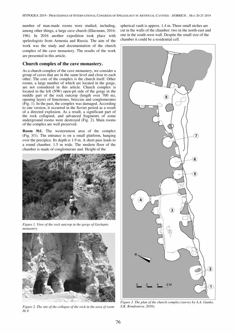
HYPOGEA 2019 - PROCEEDINGS OF INTERNATIONAL CONGRESS OF SPELEOLOGY IN ARTIFICIAL CAVITIES – DOBRICH , MAY 20-25 2019
76
number of man-made rooms were studied, including,
among other things, a large cave church (Шагинян, 2016: 196). In 2016 another expedition took place with
speleologists from Armenia and Russia. The aim of the
work was the study and documentation of the church
complex of the cave monastery. The results of the work
are presented in this article.
Church complex of the cave monastery.
As a church complex of the cave monastery, we consider a group of caves that are in the same level and close to each other. The core of the complex is the church itself. Other rooms, a large number of which are located in the gorge, are not considered in this article. Church complex is located in the left (NW) open-pit side of the gorge in the middle part of the rock outcrop (length over 700 m), opening layers of limestones, breccias and conglomerates (Fig. 1). In the past, the complex was damaged. According to one version, it occurred in the Soviet period as a result of a directed explosion. As a result, a significant part of the rock collapsed, and advanced fragments of some underground rooms were destroyed (Fig. 2). Main rooms of the complex are well preserved.
Room №1. The westernmost area of the complex
(Fig. 3/1). The entrance is on a small platform, hanging
over the precipice. Its depth is 1.9 m. A short pass leads to
a round chamber, 1.5 m wide. The modern floor of the
chamber is made of conglomerate and. Height of the
Figure 1. View of the rock outcrop in the gorge of Gochants
monastery
Figure 2. The site of the collapse of the rock in the area of room
№ 8.
spherical vault is approx. 1.4 m. Three small niches are
cut in the walls of the chamber: two in the north-east and
one in the south-west wall. Despite the small size of the
chamber it could be a residential cell.
Figure 3. The plan of the church complex (survey by A.A. Gunko,
S.K. Kondrateva, 2016).
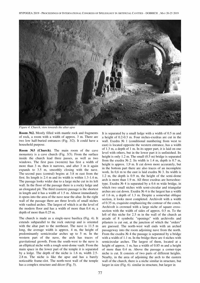
HYPOGEA 2019 - PROCEEDINGS OF INTERNATIONAL CONGRESS OF SPELEOLOGY IN ARTIFICIAL CAVITIES – DOBRICH , MAY 20-25 2019
77
Figure 4. Church, view towards the altar apse
Room №2. Mostly filled with mantle rock and fragments
of rock, a room with a width of approx. 3 m. There are
two low half-buried entrances (Fig. 3/2). It could have a
household purpose.
Room №3 (Church). The main room of the cave
monastery is a cave church (Fig. 3/3). From the surface
inside the church lead three passes, as well as two
windows. The first pass (western) has first a width of
more than 3 m, then it narrows, and after 3 m it again
expands to 3.5 m, smoothly closing with the nave.
The second pass (central) begins at 3.8 m east from the
first. Its length is 2.4 m and its width is within 1.3-1.4 m.
The passage looks wider due to a large niche cut in its left
wall. In the floor of the passage there is a rocky ledge and
an elongated pit. The third (eastern) passage is the shortest
in length and it has a width of 1.5 m. Almost immediately
it opens into the area of the nave near the altar. In the right
wall of the passage there are three levels of small niches
with vaulted arches. The largest of which is at the level of
the modern floor and has a width of more than 0.4 m, a
depth of more than 0.25 m.
The church is made as a single-nave basilica (Fig. 4). It
extends subparallel to the rock outcrop and is oriented
with the altar part to the northeast. The nave is 11.5 m
long, the average width is approx. 4 m, the height of
predominantly semicircular arches up to 5 m. In the
western part of the nave, the arch has traces of
gravitational growth. From the south-west to the nave is
an elliptical niche with a rough semi-dome vault. From the
main space in the lower part of the temple it is separated
by a ledge. The depth of the niche is 1.6 m, width 2.5-
2.8 m. The niche is like the apse and has a barely
noticeable frame-slot. The north-west wall of the temple
has a complex structure and décor (Fig. 5).
It is separated by a small ledge with a width of 0.5 m and
a height of 0.2-0.3 m. Four niches-exedras are cut in the
wall. Exedra № 1 (conditional numbering from west to east) is located opposite the western entrance, has a width
of 1.3 m, a depth of 1 m. In its upper part, it is laid on one
level with others, but in the lower part it is unfinished. Its
height is only 1.2 m. The small (0.5 m) bridge is separated
from the exedra № 2. Its width is 1.4 m, depth is 0.7 m, height is approx. 1,9 m. It cut down more accurately, but
in the bottom part there are also traces of an incomplete
work. In 0,6 m to the east is laid exedra № 3. Its width is 1.2 m, the depth is 0.9 m, the height of the semi-dome
arch is more than 1.9 m. All three exedras are horseshoe-
type. Exedra № 4 is separated by a 0.6 m wide bridge, in which two small niches with semi-circular and triangular
arches are cut down. Exedra № 4 is the largest has a width of 1.6 m, a depth of 1.3 m. Despite a somewhat oblique
section, it looks most completed. Archivolt with a width
of 0.35 m, exquisite emphasizing the contour of the conch.
Archivolt is crowned with a large niche of square cross-
section with the width of sides of approx. 0.5 m. To the
left of this niche for 2.5 m in the wall of the church an
arcade of 8 symbolic "openings" with archivolts and
pilasters is cut out, at the junction of which the "orders"
are guessed. The north-west wall ends with an arched
passageway into the room adjoining nave from the north.
From the exedra № 4 the passage is separated by a bridge with a width of 1.1 m. In the bridge there are 4 niches with
semicircular arches. The largest of them, located at a
height of approx. 1 m, has a width of 0.85 m and a height
of more than 0.4 m. Above the passage a corner-type
niche is cut. It consists of two parts of different heights.
Nearby, in the area of adjoining the arch to the eastern
wall of the church, there is a niche similar in structure, but
larger in size (Fig. 6). similar in structure, but larger in
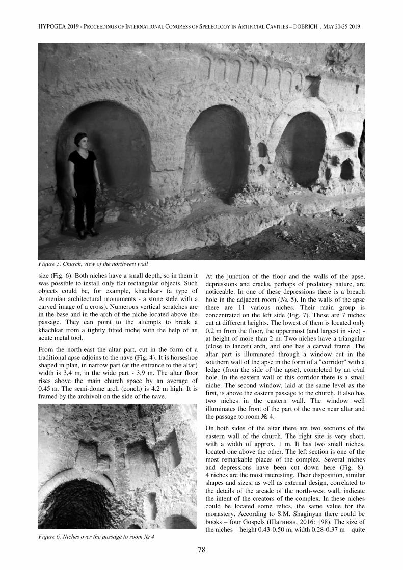
HYPOGEA 2019 - PROCEEDINGS OF INTERNATIONAL CONGRESS OF SPELEOLOGY IN ARTIFICIAL CAVITIES – DOBRICH , MAY 20-25 2019
78
Figure 5. Church, view of the northwest wall
size (Fig. 6). Both niches have a small depth, so in them it
was possible to install only flat rectangular objects. Such
objects could be, for example, khachkars (a type of
Armenian architectural monuments - a stone stele with a
carved image of a cross). Numerous vertical scratches are
in the base and in the arch of the niche located above the
passage. They can point to the attempts to break a
khachkar from a tightly fitted niche with the help of an
acute metal tool.
From the north-east the altar part, cut in the form of a
traditional apse adjoins to the nave (Fig. 4). It is horseshoe
shaped in plan, in narrow part (at the entrance to the altar)
width is 3,4 m, in the wide part - 3,9 m. The altar floor
rises above the main church space by an average of
0.45 m. The semi-dome arch (conch) is 4.2 m high. It is
framed by the archivolt on the side of the nave.
Figure 6. Niches over the passage to room № 4
At the junction of the floor and the walls of the apse,
depressions and cracks, perhaps of predatory nature, are
noticeable. In one of these depressions there is a breach
hole in the adjacent room (№. 5). In the walls of the apse
there are 11 various niches. Their main group is
concentrated on the left side (Fig. 7). These are 7 niches
cut at different heights. The lowest of them is located only
0.2 m from the floor, the uppermost (and largest in size) -
at height of more than 2 m. Two niches have a triangular
(close to lancet) arch, and one has a carved frame. The
altar part is illuminated through a window cut in the
southern wall of the apse in the form of a "corridor" with a
ledge (from the side of the apse), completed by an oval
hole. In the eastern wall of this corridor there is a small
niche. The second window, laid at the same level as the
first, is above the eastern passage to the church. It also has
two niches in the eastern wall. The window well
illuminates the front of the part of the nave near altar and
the passage to room № 4.
On both sides of the altar there are two sections of the
eastern wall of the church. The right site is very short,
with a width of approx. 1 m. It has two small niches,
located one above the other. The left section is one of the
most remarkable places of the complex. Several niches
and depressions have been cut down here (Fig. 8).
4 niches are the most interesting. Their disposition, similar
shapes and sizes, as well as external design, correlated to
the details of the arcade of the north-west wall, indicate
the intent of the creators of the complex. In these niches
could be located some relics, the same value for the
monastery. According to S.M. Shaginyan there could be
books – four Gospels (Шагинян, 2016: 198). The size of the niches – height 0.43-0.50 m, width 0.28-0.37 m – quite
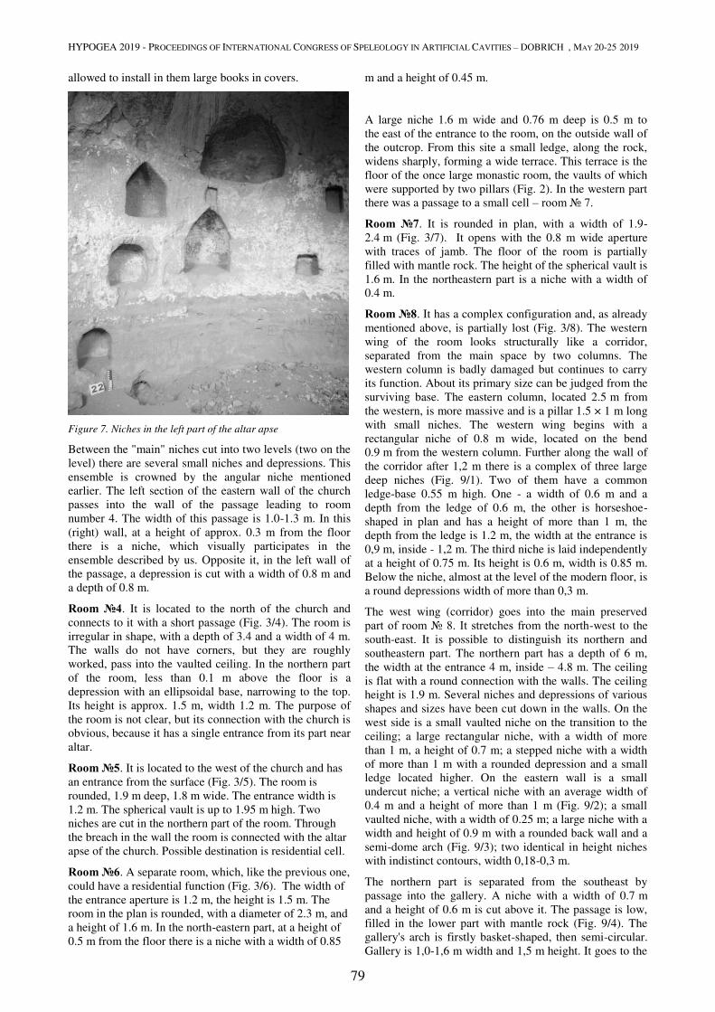
HYPOGEA 2019 - PROCEEDINGS OF INTERNATIONAL CONGRESS OF SPELEOLOGY IN ARTIFICIAL CAVITIES – DOBRICH , MAY 20-25 2019
79
allowed to install in them large books in covers.
Figure 7. Niches in the left part of the altar apse
Between the "main" niches cut into two levels (two on the
level) there are several small niches and depressions. This
ensemble is crowned by the angular niche mentioned
earlier. The left section of the eastern wall of the church
passes into the wall of the passage leading to room
number 4. The width of this passage is 1.0-1.3 m. In this
(right) wall, at a height of approx. 0.3 m from the floor
there is a niche, which visually participates in the
ensemble described by us. Opposite it, in the left wall of
the passage, a depression is cut with a width of 0.8 m and
a depth of 0.8 m.
Room №4. It is located to the north of the church and
connects to it with a short passage (Fig. 3/4). The room is
irregular in shape, with a depth of 3.4 and a width of 4 m.
The walls do not have corners, but they are roughly
worked, pass into the vaulted ceiling. In the northern part
of the room, less than 0.1 m above the floor is a
depression with an ellipsoidal base, narrowing to the top.
Its height is approx. 1.5 m, width 1.2 m. The purpose of
the room is not clear, but its connection with the church is
obvious, because it has a single entrance from its part near
altar.
Room №5. It is located to the west of the church and has
an entrance from the surface (Fig. 3/5). The room is
rounded, 1.9 m deep, 1.8 m wide. The entrance width is
1.2 m. The spherical vault is up to 1.95 m high. Two
niches are cut in the northern part of the room. Through
the breach in the wall the room is connected with the altar
apse of the church. Possible destination is residential cell.
Room №6. A separate room, which, like the previous one,
could have a residential function (Fig. 3/6). The width of
the entrance aperture is 1.2 m, the height is 1.5 m. The
room in the plan is rounded, with a diameter of 2.3 m, and
a height of 1.6 m. In the north-eastern part, at a height of
0.5 m from the floor there is a niche with a width of 0.85
m and a height of 0.45 m.
A large niche 1.6 m wide and 0.76 m deep is 0.5 m to
the east of the entrance to the room, on the outside wall of
the outcrop. From this site a small ledge, along the rock,
widens sharply, forming a wide terrace. This terrace is the
floor of the once large monastic room, the vaults of which
were supported by two pillars (Fig. 2). In the western part
there was a passage to a small cell – room № 7.
Room №7. It is rounded in plan, with a width of 1.9-
2.4 m (Fig. 3/7). It opens with the 0.8 m wide aperture
with traces of jamb. The floor of the room is partially
filled with mantle rock. The height of the spherical vault is
1.6 m. In the northeastern part is a niche with a width of
0.4 m.
Room №8. It has a complex configuration and, as already
mentioned above, is partially lost (Fig. 3/8). The western
wing of the room looks structurally like a corridor,
separated from the main space by two columns. The
western column is badly damaged but continues to carry
its function. About its primary size can be judged from the
surviving base. The eastern column, located 2.5 m from
the western, is more massive and is a pillar 1.5 × 1 m long
with small niches. The western wing begins with a
rectangular niche of 0.8 m wide, located on the bend
0.9 m from the western column. Further along the wall of
the corridor after 1,2 m there is a complex of three large
deep niches (Fig. 9/1). Two of them have a common
ledge-base 0.55 m high. One - a width of 0.6 m and a
depth from the ledge of 0.6 m, the other is horseshoe-
shaped in plan and has a height of more than 1 m, the
depth from the ledge is 1.2 m, the width at the entrance is
0,9 m, inside - 1,2 m. The third niche is laid independently
at a height of 0.75 m. Its height is 0.6 m, width is 0.85 m.
Below the niche, almost at the level of the modern floor, is
a round depressions width of more than 0,3 m.
The west wing (corridor) goes into the main preserved
part of room № 8. It stretches from the north-west to the
south-east. It is possible to distinguish its northern and
southeastern part. The northern part has a depth of 6 m,
the width at the entrance 4 m, inside – 4.8 m. The ceiling
is flat with a round connection with the walls. The ceiling
height is 1.9 m. Several niches and depressions of various
shapes and sizes have been cut down in the walls. On the
west side is a small vaulted niche on the transition to the
ceiling; a large rectangular niche, with a width of more
than 1 m, a height of 0.7 m; a stepped niche with a width
of more than 1 m with a rounded depression and a small
ledge located higher. On the eastern wall is a small
undercut niche; a vertical niche with an average width of
0.4 m and a height of more than 1 m (Fig. 9/2); a small
vaulted niche, with a width of 0.25 m; a large niche with a
width and height of 0.9 m with a rounded back wall and a
semi-dome arch (Fig. 9/3); two identical in height niches
with indistinct contours, width 0,18-0,3 m.
The northern part is separated from the southeast by
passage into the gallery. A niche with a width of 0.7 m
and a height of 0.6 m is cut above it. The passage is low,
filled in the lower part with mantle rock (Fig. 9/4). The
gallery's arch is firstly basket-shaped, then semi-circular.
Gallery is 1,0-1,6 m width and 1,5 m height. It goes to the

HYPOGEA 2019 - PROCEEDINGS OF INTERNATIONAL CONGRESS OF SPELEOLOGY IN ARTIFICIAL CAVITIES – DOBRICH , MAY 20-25 2019
80
northeast, where after 6 m it goes to the cliff in the middle
part of the rock outcrop.
Figure 8. Niches and depressions to the left of the altar apse
The south-eastern part of the room faces the terrace,
formed by rockfall. It consists of two depressions cut
down by the type of exedra. The first with a width of
1.6 m and a depth of 1.3 m is divided into two parts - the
left one is ф rising ground with the remains of a small partition wall, the right one is a horseshoe-shaped base
lowered to the floor level (Fig. 9/5). A small partition of
0.2 m the first "exedra" is separated from the second one.
Its width is 0.9 m, and the depth is 0.5 m. Further, the
room wall bends to the south-west and breaks off. On this
precipice, the "shelf" is clearly visible. It could be part of
the window through which the light spread to the room
№ 8 (Fig. 9/6).
Under the level of the complex described above, which
can be taken as the upper one, several large rooms with a
width of up to 4 m are located. In addition, entrances to
other similar rooms can be filled up with collapsed rock
fragments.
Discussion
The main question is the dating of the monastery.
Z.I. Yampolsky with reference to the field materials of
1931-1961 mentions Gochants caves in the context of
their potential pagan origin. He notes that Christian cave
church built there is not orientated to the east by the altar,
as was customary, but is orientated to the north
(Ямпольский, 1962: 200). There was an error in the interpretation of the rooms (the church) during the
collection of materials, Yampolsky's preliminary
conclusions should be considered erroneous. Moreover,
the Gochants caves, due to a completely anthropogenic
nature, could not refer to the caves-sanctuaries, which are
discussed in his book.
From written sources, we know about the foundation of
the hermitage by the father Kirakos at the beginning of the
17th century. However, it seems very strange that Kirakos,
who sought seclusion, chose a for the creation of a new
hermitage the gorge, located very close to the large for
that time Ochants village. This apparent contradiction, in
our opinion, is explained by the fact that the Gochants
hermitage existed before, and father Kirakos, who moved
here in the declining years, settled with his monks in the
already existing complex of caves. How this complex was
looking like we do not know, nor is the amount of work
carried out by new settlers to improve the hermitage left
by someone.
The architecture of the complex and the church could
contribute to solving the issue of dating. According to its
structure, the church belongs to the one-nave basilicas,
which dominated in Byzantium until the end of the 5th
century. In Armenia, this type of basilicas became
widespread immediately after the adoption of Christianity.
The spread of Christianity in Armenia was mainly through
Syria. That fact determined congeniality of the Armenian
religious architecture with the Syrian (Токарский, 1946). Nevertheless, at the base of their early Christian churches
was the same Byzantine basilica. Later, Armenia began to
form its own architectural style and approach to the
construction of churches, of course, while maintaining the
relationship with the Byzantine (Якубсон, 1973). From the V century basilicas are replaced by domed churches,
but one-nave basilicas continued to be constructed
throughout the Christian Transcaucasia until the XVII-
XVIII century. A large number of them are preserved, for
example, in the form of small rural churches (Беридзе, 1948: 48). In Gochants village there is also a small rural
one-nave church of untreated stone, dated according to
various data to the16th-17th centuries. Their construction
as a whole did not change, except, perhaps, the creation in
the XII-XIV centuries the original two-sided basilica
(Всеобщая.., 1966: 260–261). Considering the possible
evolution of the church in Gochants (during the period of
the monastery's existence), we can be sure only that it
never went beyond the traditional basilica. So, it is
impossible to date objectively it according to the type of
composition. At the same time, we do not have the right
to talk about the church of the Gochants monastery as a
"typical" architecture, because there are many
extraordinary elements. The church, unlike many well-
known one-nave basilicas of early Christian Armenia, is
asymmetric. Of course, its southern is mostly in ruins, but
even preserved fragments indicate that the sides of the
nave were very different from each other. In the
composition of the north-west wall 4 niches-exedra
participate, while the composition of the southern wall
looks unformed. The modern appearance of the wall is
formed under the influence of destruction. In addition, in
the past, before the destruction of the monument, the
number of entrance openings could be smaller (most
likely there were 2).
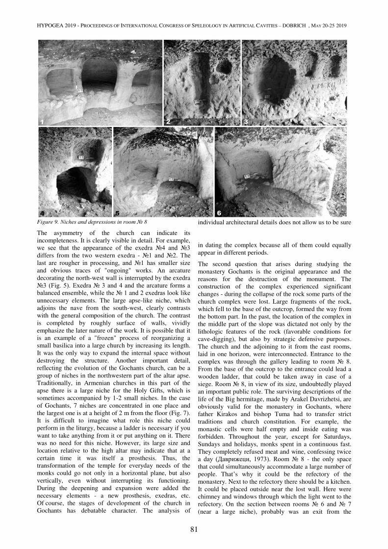
HYPOGEA 2019 - PROCEEDINGS OF INTERNATIONAL CONGRESS OF SPELEOLOGY IN ARTIFICIAL CAVITIES – DOBRICH , MAY 20-25 2019
81
Figure 9. Niches and depressions in room № 8
The asymmetry of the church can indicate its
incompleteness. It is clearly visible in detail. For example,
we see that the appearance of the exedra №4 and №3 differs from the two western exedra - №1 and №2. The last are rougher in processing, and №1 has smaller size and obvious traces of "ongoing" works. An arcature
decorating the north-west wall is interrupted by the exedra
№3 (Fig. 5). Exedra № 3 and 4 and the arcature forms a balanced ensemble, while the № 1 and 2 exedras look like unnecessary elements. The large apse-like niche, which
adjoins the nave from the south-west, clearly contrasts
with the general composition of the church. The contrast
is completed by roughly surface of walls, vividly
emphasize the later nature of the work. It is possible that it
is an example of a "frozen" process of reorganizing a
small basilica into a large church by increasing its length.
It was the only way to expand the internal space without
destroying the structure. Another important detail,
reflecting the evolution of the Gochants church, can be a
group of niches in the northwestern part of the altar apse.
Traditionally, in Armenian churches in this part of the
apse there is a large niche for the Holy Gifts, which is
sometimes accompanied by 1-2 small niches. In the case
of Gochants, 7 niches are concentrated in one place and
the largest one is at a height of 2 m from the floor (Fig. 7).
It is difficult to imagine what role this niche could
perform in the liturgy, because a ladder is necessary if you
want to take anything from it or put anything on it. There
was no need for this niche. However, its large size and
location relative to the high altar may indicate that at a
certain time it was itself a prosthesis. Thus, the
transformation of the temple for everyday needs of the
monks could go not only in a horizontal plane, but also
vertically, even without interrupting its functioning.
During the deepening and expansion were added the
necessary elements - a new prosthesis, exedras, etc.
Of course, the stages of development of the church in
Gochants has debatable character. The analysis of
individual architectural details does not allow us to be sure
in dating the complex because all of them could equally
appear in different periods.
The second question that arises during studying the
monastery Gochants is the original appearance and the
reasons for the destruction of the monument. The
construction of the complex experienced significant
changes - during the collapse of the rock some parts of the
church complex were lost. Large fragments of the rock,
which fell to the base of the outcrop, formed the way from
the bottom part. In the past, the location of the complex in
the middle part of the slope was dictated not only by the
lithologic features of the rock (favorable conditions for
cave-digging), but also by strategic defensive purposes.
The church and the adjoining to it from the east rooms,
laid in one horizon, were interconnected. Entrance to the
complex was through the gallery leading to room № 8. From the base of the outcrop to the entrance could lead a
wooden ladder, that could be taken away in case of a
siege. Room № 8, in view of its size, undoubtedly played an important public role. The surviving descriptions of the
life of the Big hermitage, made by Arakel Davrizhetsi, are
obviously valid for the monastery in Gochants, where
father Kirakos and bishop Tuma had to transfer strict
traditions and church constitution. For example, the
monastic cells were half empty and inside eating was
forbidden. Throughout the year, except for Saturdays,
Sundays and holidays, monks spent in a continuous fast.
They completely refused meat and wine, confessing twice
a day (Даврижеци, 1973). Room № 8 - the only space
that could simultaneously accommodate a large number of
people. That’s why it could be the refectory of the
monastery. Next to the refectory there should be a kitchen.
It could be placed outside near the lost wall. Here were
chimney and windows through which the light went to the
refectory. On the section between rooms № 6 and № 7 (near a large niche), probably was an exit from the
HYPOGEA 2019 - PROCEEDINGS OF INTERNATIONAL CONGRESS OF SPELEOLOGY IN ARTIFICIAL CAVITIES – DOBRICH , MAY 20-25 2019
82
refectory. Using a narrow cornice, equipped with a
wooden platform and a parapet, near two cells you could
go to the cave church and two rooms to the west of it. The
cells within the church complex described by us are
similar in morphology and size. Most likely, they served
as the residence for the archpriest and the oldest members
of the fratry. In case of danger, the rest of the monastery's
monks left their cells in the gorge and climbed to this
well-protected level.
No matter how good this defense was, it did not save the
monument from physical destruction. Information about
the last days of the monastery Gochants has not been
preserved. We can find them only in indirect historical
sources. In the XVII century in order to weaken the
connection of Nagorno-Karabakh with Armenia, the
Persians populate this region with Kurds (Шнирельман, 2003). At the end of the XVII century the village was
already under their control. Probably by this time the
brothers left the hermitage. In the following three
centuries, the monastery was first plundered, then partially
destroyed. The plundering continued during the Soviet
period. Parochial church in Gochants villadge was used
first as a warehouse for feed, and then as a bakery. On the
territory of the cave complex there are numerous traces of
already punctured robber pits, the Christian symbols on
the walls have been completely destroyed. The rocky
facade of the complex, apparently, was exploded using
explosive substance. This is indicated by the numerous
traces of cleavage face, as well as the damage of part of
the interior.
Conclusions
When was the Christian complex in Gochants founded? It
is known that in this part of the highlands Christianity
came at the earliest stage. For example, 6 km from
Gochants located the famous monastery of the IV-VI
centuries Tsitserovank. Since then, the Armenian culture,
which experienced considerable external pressure in these
lands, has adapted in every possible way, experiencing
periods of prosperity and decline. By the periods of
recovery, which manifested itself in the cult architecture,
it is possible to attribute the IX-XI, XII-XIII centuries
(Всеобщая.., 1966). Gochants monastery could be founded in any of these centuries. An exact answer to this
question can be given after additional studies, including
archaeological excavations, which have never been
organized here.
Regardless of when the monastery was founded, it belongs
to the most important Christian monuments of
Transcaucasia. Hermitage Gochants was a link in a whole
series of events related to the spiritual revival of Armenia
at the turn of the 16th-17th centuries. One of the most
famous preachers - father Kirakos was buried here, but his
grave still must be found.
References
Беридзе В.В., 1948. Архитектура Грузии (IV-XIX вв.). Изд-во Академии архитектуры СССР, Москва. (in Russian).
Всеобщая история архитектуры, 1966ю Т.3 «Архитектура Восточной Европы, Средние века», Л-М. (in Russian).
Даврижеци А., 1973. Книга историй (пер. с армян. Л.А. Ханларян), сер. «Памятники письменности Востока» т. XXXVII, Москва: Наука (in Russian).
Орбелян С., 1986. История Сюника, «Советакан Грох», Ереван (in Russian).
Токарский Н.М., 1946. Архитектура древней Армении. Изд-во АН Армянской ССР, Ереван (in Russian).
Шагинян С.М., 2016. Монастырь Очанц // Пещеры как объекты истории и культуры. Сборник материалов Международного научного форума (19–22 апреля 2016 г., Воронеж-Дивногорье, Россия). – Воронеж: ИПЦ «Научная книга» (in Russian).
Шнирельман В.А., 2003. Войны памяти: мифы, идентичность и политика в Закавказье М.: Академкнига (in Russian).
Якобсон, А. Л., 1973. Взаимоотношения раннесредневековой архитектуры Армении и Византии // Историко филоглогический журнал № 4. С. 33-42. (in Russian).
Ямпольский З.И., 1962. Древняя Албания III–I вв. до н.э. Изд-
во АН Азербайджанской ССР, Баку. (in Russian).
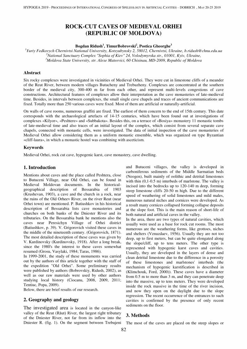
HYPOGEA 2019 - PROCEEDINGS OF INTERNATIONAL CONGRESS OF SPELEOLOGY IN ARTIFICIAL CAVITIES – DOBRICH , MAY 20-25 2019
82
ROCK-CUT CAVES OF MEDIEVAL ORHEI
(REPUBLIC OF MOLDOVA)
Bogdan Ridush1, TimurBobrovski
2, Postica Gheorghe
3
1Yuriy Fedkovych Chernivtsi National University, Kotsyubynsky 2, 58012, Chernivtsi, Ukraine, [email protected]
2National Sanctuary Complex "Sophia of Kiev" 24, Volodymyrska str., 01001, Kyiv, Ukraine,
3Moldova State University, str. Alexe Mateevici, 60 Chisinau, MD-2009, Republic of Moldova
Abstract
Six rocky complexes were investigated in vicinities of Medieval Orhei. They were cut in limestone cliffs of a meander
of the Reut River, between modern villages Butucheny and Trebuzheny. Complexes are concentrated at the southern
border of the medieval city, 300-400 m far from each other, and represent multi-levels congestions of cave
constructions. Architectural features of complexes allow their interpretation as the cave monasteries of late-medieval
time. Besides, in intervals between complexes, the small single cave chapels and traces of ancient communications are
fixed. Totally more than 250 various caves were fixed. Most of them are artificial or naturally-artificial.
On walls of cave rooms, numerous graffiti are fixed. The earliest of them concern to the end of 15th century. This date
corresponds with the archaeological artefacts of 14-15 centuries, which have been found out at investigations of
complexes «Kilyor», «Peshtere» and «Subbakota». Besides this, on a terrace of «Bosiya» monastery 11 monastic tombs
of late-medieval time and also traces of an initial layout of the complex, which consist from several separate cave
chapels, connected with monastic cells, were investigated. The data of initial inspection of the cave monasteries of
Medieval Orhei allow considering them as a uniform monastic ensemble, which was organized on type Byzantian
«cliff-laura», in which a monastic hostel was combining with asceticism.
Keywords
Medieval Orhei, rock cut cave, hypogenic karst, cave monastery, cave dwelling.
1. Introduction
Mentions about caves and the place called Peshtera, close
to Butuceni Village, near Old Orhei, can be found in
Medieval Moldovan documents. In the historical-
geographical description of Bessarabia of 1903
(Krushevan, 1903), a cave and the church in a rock, near
the ruins of the Old Orheev River, on the river Reut (near
Orhei town) are mentioned. P. Batiushkov in his historical
description of Bessarabia lists cave monasteries and
churches on both banks of the Dniester River and its
tributaries. On the Bessarabia bank he mentions also the
caves near Peresichyn Village of Orhei district
(Batiushkov, p. 39). V. Grigorovich visited these caves in
the middle of the nineteenth century. (Grigorovich, 1871).
The most detailed description of these caves was given by
V. Kurdinovsky (Kurdinovsky, 1918). After a long break,
since the 1980's the interest to these caves somewhat
resumed (Grosu, Vasylaki, 1984; Taras, 1986).
In 1999-2001, the study of these monuments was carried
out by the authors of this article together with the staff of
the expedition "Old Orhei". Some preliminary results
were published by authors (Bobrovskiy, Ridush, 2002), as
well as our raw materials were used by other authors
studying local history (Ciocanu, 2008, 2009, 2011;
Tentiuc, Popa, 2009).
Below, there are brief results of our research.
2. Geography and geology
The investigated area is located in the canyon-like
valley of the Reut (Răut) River, the largest right tributary of the Dniester River, not far from its inflow into the
Dniester R. (fig. 1). On the segment between Trebujeni
and Butuceni villages, the valley is developed in
carboniferous sediments of the Middle Sarmatian beds
(Neogen), built mainly of oolithic and detrital limestones
with thin (0,1-0.5 m) interbeds of marlstone. The valley is
incised into the bedrocks up to 120-140 m deep, forming
steep limestone cliffs 20-50 m high. Due to the different
speed of weathering of solid limestones and mild males,
numerous natural niches and cornices were developed. As
a result many cornices collapsed forming collapse deposits
at the slope foot. This is the main reason of short-life of
both natural and artificial caves in the valley.
In the area, there are two types of natural cavities, which
usually were used as a base for rock cut rooms. The most
numerous are the weathering forms, like grottoes, niches
and shelters (Vznuzdaev, 1956). Usually they are not too
deep, up to first meters, but can be quite elongated along
the slope/cliff, up to tens meters. The other type is
represented with hypogenic karst caves and cavities.
Usually, they are developed in the layers of dense and
clean detrital limestone due to the difference in a porosity
of these limestones and marlstones' interbeds (the
mechanism of hypogenic karstification is described in
(Klimchouk, Ford, 2000)). These caves have a diameter
from 0.5 m to more than 3 m, and they can penetrate deep
into the massive, up to tens meters. They were developed
inside the rock massive in the time of the river incision,
and now they open on the daylight due to the slope
regression. The recent occurrence of the entrances to such
cavities is confirmed by the presence of only recent
sediments on the floor.
3. Methods
The most of the caves are placed on the steep slopes or
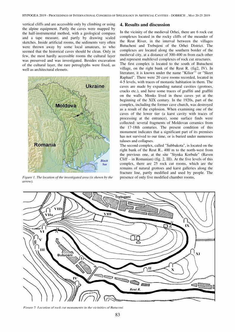
HYPOGEA 2019 - PROCEEDINGS OF INTERNATIONAL CONGRESS OF SPELEOLOGY IN ARTIFICIAL CAVITIES – DOBRICH , MAY 20-25 2019
83
vertical cliffs and are accessible only by climbing or using
the alpine equipment. Partly the caves were mapped by
the half-instrumental method, with a geological compass
and a tape measure, and partly by drawing scaled
sketches. Inside artificial rooms, the sediments very often
were thrown away by some local amateurs, to who
seemed that the historical caves should be clean. Only in
few, the most hardly accessible rooms the cultural layer
was preserved and was investigated. Besides excavation
of the cultural layer, the rare petroglyphs were fixed, as
well as architectural elemets.
Figure 1. The location of the investigated area (is shown by the
arrow).
4. Results and discussion
In the vicinity of the medieval Orhei, there are 6 rock cut
complexes located in the rocky cliffs of the meander of
the Reut River, in the interval between the villages
Butucheni and Trebujeni of the Orhei District. The
complexes are located along the southern border of the
medieval city, at a distance of 300-400 m from each other
and represent multilevel complexes of rock cut structures.
The first complex is located to the south of Butucheni
village, on the right bank of the Reut R. (fig2, IV). In
literature, it is known under the name "Kilior’" or "Skeet
Raphael". There were 20 cave rooms recorded, located in
4-5 levels, with traces of monastic habitation in them. The
caves are made by expanding natural cavities (grottoes,
cracks etc.), and have some traces of graffiti and graffiti
on the walls. Monks lived in these caves yet at the
beginning of the XIX century. In the 1920s, part of the
complex, including the former cave church, was destroyed
as a result of the explosion. When examining one of the
caves of the lower tier (a karst cavity with traces of
processing at the entrance), some surface finds were
collected: several fragments of Moldovan ceramics from
the 17-18th centuries. The present condition of this
monument indicates that a significant part of its premises
has not survived to our time, or is buried under numerous
taluses and collapses.
The second complex, called "Subbakota", is located on the
right bank of the Reut R., 400 m to the north-west from
the previous one, at the site "Stynka Korbule" (Raven
Cliff – in Romanian) (fig. 2, III). At the five levels of this
complex, there are 25 rock cut rooms, which are the
remains of natural grottoes and karst galleries along the
fracture line, partly modified and used by people. The
presence of only five modified chamber rooms,
Figure 2. Location of rock cut monuments in the vicinities of Butuceni.
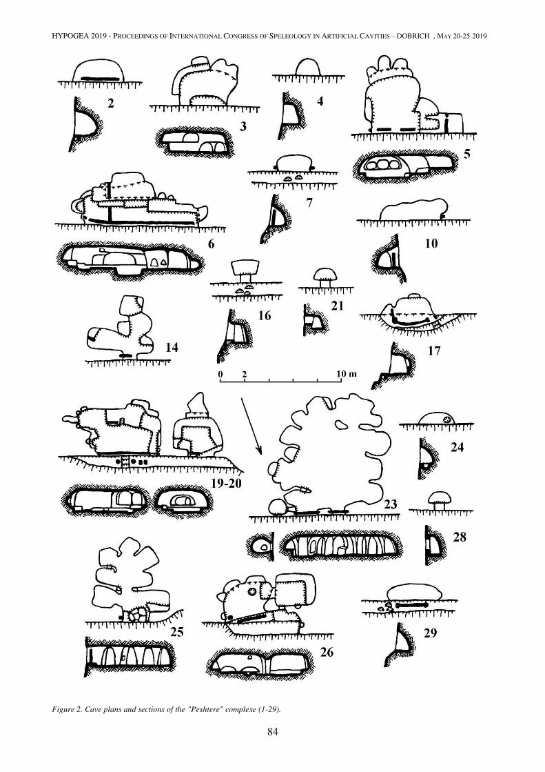
HYPOGEA 2019 - PROCEEDINGS OF INTERNATIONAL CONGRESS OF SPELEOLOGY IN ARTIFICIAL CAVITIES – DOBRICH , MAY 20-25 2019
84
Figure 2. Cave plans and sections of the "Peshtere" complexe (1-29).

HYPOGEA 2019 - PROCEEDINGS OF INTERNATIONAL CONGRESS OF SPELEOLOGY IN ARTIFICIAL CAVITIES – DOBRICH , MAY 20-25 2019
85
Figure 3. Cave plans and sections of the "Peshtere" complexe (30-53, 56-57).
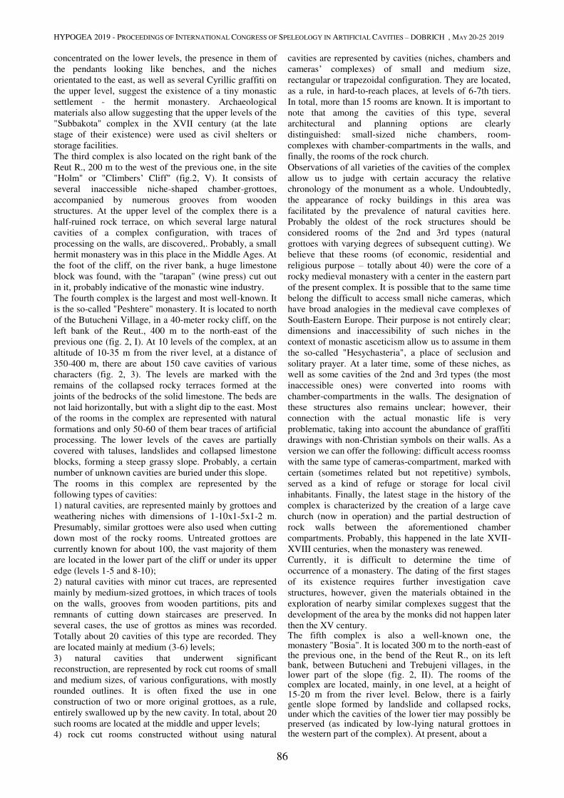
HYPOGEA 2019 - PROCEEDINGS OF INTERNATIONAL CONGRESS OF SPELEOLOGY IN ARTIFICIAL CAVITIES – DOBRICH , MAY 20-25 2019
86
concentrated on the lower levels, the presence in them of
the pendants looking like benches, and the niches
orientated to the east, as well as several Cyrillic graffiti on
the upper level, suggest the existence of a tiny monastic
settlement - the hermit monastery. Archaeological
materials also allow suggesting that the upper levels of the
"Subbakota" complex in the XVII century (at the late
stage of their existence) were used as civil shelters or
storage facilities.
The third complex is also located on the right bank of the
Reut R., 200 m to the west of the previous one, in the site
"Holm" or "Climbers’ Cliff" (fig.2, V). It consists of
several inaccessible niche-shaped chamber-grottoes,
accompanied by numerous grooves from wooden
structures. At the upper level of the complex there is a
half-ruined rock terrace, on which several large natural
cavities of a complex configuration, with traces of
processing on the walls, are discovered,. Probably, a small
hermit monastery was in this place in the Middle Ages. At
the foot of the cliff, on the river bank, a huge limestone
block was found, with the "tarapan" (wine press) cut out
in it, probably indicative of the monastic wine industry.
The fourth complex is the largest and most well-known. It
is the so-called "Peshtere" monastery. It is located to north
of the Butucheni Village, in a 40-meter rocky cliff, on the
left bank of the Reut., 400 m to the north-east of the
previous one (fig. 2, I). At 10 levels of the complex, at an
altitude of 10-35 m from the river level, at a distance of
350-400 m, there are about 150 cave cavities of various
characters (fig. 2, 3). The levels are marked with the
remains of the collapsed rocky terraces formed at the
joints of the bedrocks of the solid limestone. The beds are
not laid horizontally, but with a slight dip to the east. Most
of the rooms in the complex are represented with natural
formations and only 50-60 of them bear traces of artificial
processing. The lower levels of the caves are partially
covered with taluses, landslides and collapsed limestone
blocks, forming a steep grassy slope. Probably, a certain
number of unknown cavities are buried under this slope.
The rooms in this complex are represented by the
following types of cavities:
1) natural cavities, are represented mainly by grottoes and
weathering niches with dimensions of 1-10x1-5x1-2 m.
Presumably, similar grottoes were also used when cutting
down most of the rocky rooms. Untreated grottoes are
currently known for about 100, the vast majority of them
are located in the lower part of the cliff or under its upper
edge (levels 1-5 and 8-10);
2) natural cavities with minor cut traces, are represented
mainly by medium-sized grottoes, in which traces of tools
on the walls, grooves from wooden partitions, pits and
remnants of cutting down staircases are preserved. In
several cases, the use of grottos as mines was recorded.
Totally about 20 cavities of this type are recorded. They
are located mainly at medium (3-6) levels;
3) natural cavities that underwent significant
reconstruction, are represented by rock cut rooms of small
and medium sizes, of various configurations, with mostly
rounded outlines. It is often fixed the use in one
construction of two or more original grottoes, as a rule,
entirely swallowed up by the new cavity. In total, about 20
such rooms are located at the middle and upper levels;
4) rock cut rooms constructed without using natural
cavities are represented by cavities (niches, chambers and
cameras’ complexes) of small and medium size,
rectangular or trapezoidal configuration. They are located,
as a rule, in hard-to-reach places, at levels of 6-7th tiers.
In total, more than 15 rooms are known. It is important to
note that among the cavities of this type, several
architectural and planning options are clearly
distinguished: small-sized niche chambers, room-
complexes with chamber-compartments in the walls, and
finally, the rooms of the rock church.
Observations of all varieties of the cavities of the complex
allow us to judge with certain accuracy the relative
chronology of the monument as a whole. Undoubtedly,
the appearance of rocky buildings in this area was
facilitated by the prevalence of natural cavities here.
Probably the oldest of the rock structures should be
considered rooms of the 2nd and 3rd types (natural
grottoes with varying degrees of subsequent cutting). We
believe that these rooms (of economic, residential and
religious purpose – totally about 40) were the core of a
rocky medieval monastery with a center in the eastern part
of the present complex. It is possible that to the same time
belong the difficult to access small niche cameras, which
have broad analogies in the medieval cave complexes of
South-Eastern Europe. Their purpose is not entirely clear;
dimensions and inaccessibility of such niches in the
context of monastic asceticism allow us to assume in them
the so-called "Hesychasteria", a place of seclusion and
solitary prayer. At a later time, some of these niches, as
well as some cavities of the 2nd and 3rd types (the most
inaccessible ones) were converted into rooms with
chamber-compartments in the walls. The designation of
these structures also remains unclear; however, their
connection with the actual monastic life is very
problematic, taking into account the abundance of graffiti
drawings with non-Christian symbols on their walls. As a
version we can offer the following: difficult access roomss
with the same type of cameras-compartment, marked with
certain (sometimes related but not repetitive) symbols,
served as a kind of refuge or storage for local civil
inhabitants. Finally, the latest stage in the history of the
complex is characterized by the creation of a large cave
church (now in operation) and the partial destruction of
rock walls between the aforementioned chamber
compartments. Probably, this happened in the late XVII-
XVIII centuries, when the monastery was renewed.
Currently, it is difficult to determine the time of
occurrence of a monastery. The dating of the first stages
of its existence requires further investigation cave
structures, however, given the materials obtained in the
exploration of nearby similar complexes suggest that the
development of the area by the monks did not happen later
then the XV century. The fifth complex is also a well-known one, the monastery "Bosia". It is located 300 m to the north-east of the previous one, in the bend of the Reut R., on its left bank, between Butucheni and Trebujeni villages, in the lower part of the slope (fig. 2, II). The rooms of the complex are located, mainly, in one level, at a height of 15-20 m from the river level. Below, there is a fairly gentle slope formed by landslide and collapsed rocks, under which the cavities of the lower tier may possibly be preserved (as indicated by low-lying natural grottoes in the western part of the complex). At present, about a
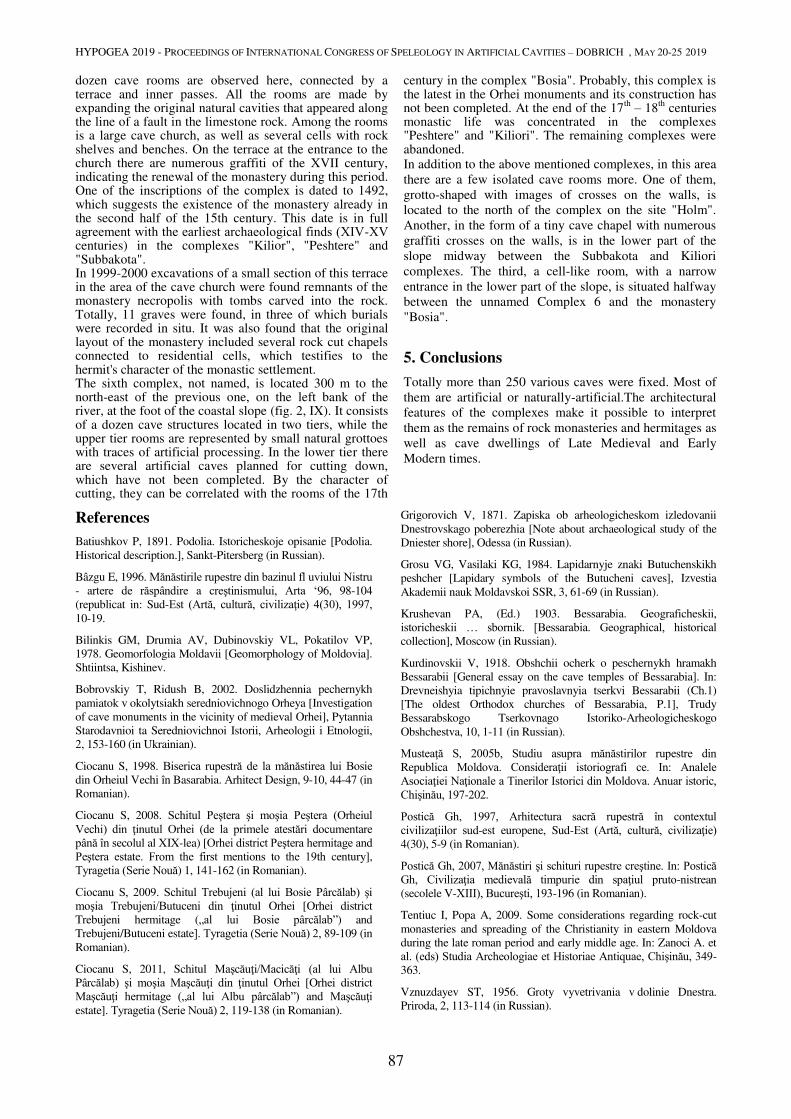
HYPOGEA 2019 - PROCEEDINGS OF INTERNATIONAL CONGRESS OF SPELEOLOGY IN ARTIFICIAL CAVITIES – DOBRICH , MAY 20-25 2019
87
dozen cave rooms are observed here, connected by a terrace and inner passes. All the rooms are made by expanding the original natural cavities that appeared along the line of a fault in the limestone rock. Among the rooms is a large cave church, as well as several cells with rock shelves and benches. On the terrace at the entrance to the church there are numerous graffiti of the XVII century, indicating the renewal of the monastery during this period. One of the inscriptions of the complex is dated to 1492, which suggests the existence of the monastery already in the second half of the 15th century. This date is in full agreement with the earliest archaeological finds (ХІV-ХV centuries) in the complexes "Kilior", "Peshtere" and "Subbakota". In 1999-2000 excavations of a small section of this terrace in the area of the cave church were found remnants of the monastery necropolis with tombs carved into the rock. Totally, 11 graves were found, in three of which burials were recorded in situ. It was also found that the original layout of the monastery included several rock cut chapels connected to residential cells, which testifies to the hermit's character of the monastic settlement. The sixth complex, not named, is located 300 m to the north-east of the previous one, on the left bank of the river, at the foot of the coastal slope (fig. 2, IX). It consists of a dozen cave structures located in two tiers, while the upper tier rooms are represented by small natural grottoes with traces of artificial processing. In the lower tier there are several artificial caves planned for cutting down, which have not been completed. By the character of cutting, they can be correlated with the rooms of the 17th
century in the complex "Bosia". Probably, this complex is the latest in the Orhei monuments and its construction has not been completed. At the end of the 17
th – 18
th centuries
monastic life was concentrated in the complexes "Peshtere" and "Kiliori". The remaining complexes were abandoned. In addition to the above mentioned complexes, in this area
there are a few isolated cave rooms more. One of them,
grotto-shaped with images of crosses on the walls, is
located to the north of the complex on the site "Holm".
Another, in the form of a tiny cave chapel with numerous
graffiti crosses on the walls, is in the lower part of the
slope midway between the Subbakota and Kiliori
complexes. The third, a cell-like room, with a narrow
entrance in the lower part of the slope, is situated halfway
between the unnamed Complex 6 and the monastery
"Bosia".
5. Conclusions
Totally more than 250 various caves were fixed. Most of
them are artificial or naturally-artificial.The architectural
features of the complexes make it possible to interpret
them as the remains of rock monasteries and hermitages as
well as cave dwellings of Late Medieval and Early
Modern times.
References
Batiushkov P, 1891. Podolia. Istoricheskoje opisanie [Podolia.
Historical description.], Sankt-Pitersberg (in Russian).
Bâzgu E, 1996. Mănăstirile rupestre din bazinul fl uviului Nistru - artere de răspândire a creştinismului, Arta ‘96, 98-104
(republicat in: Sud-Est (Artă, cultură, civilizaţie) 4(30), 1997, 10-19.
Bilinkis GM, Drumia AV, Dubinovskiy VL, Pokatilov VP,
1978. Geomorfologia Moldavii [Geomorphology of Moldovia].
Shtiintsa, Kishinev.
Bobrovskiy T, Ridush B, 2002. Doslidzhennia pechernykh
pamiatok v okolytsiakh seredniovichnogo Orheya [Investigation
of cave monuments in the vicinity of medieval Orhei], Pytannia
Starodavnioi ta Seredniovichnoi Istorii, Arheologii i Etnologii,
2, 153-160 (in Ukrainian).
Ciocanu S, 1998. Biserica rupestră de la mănăstirea lui Bosie din Orheiul Vechi în Basarabia. Arhitect Design, 9-10, 44-47 (in
Romanian).
Ciocanu S, 2008. Schitul Peştera şi moşia Peştera (Orheiul Vechi) din ţinutul Orhei (de la primele atestări documentare până în secolul al XIX-lea) [Orhei district Peştera hermitage and Peştera estate. From the first mentions to the 19th century],
Tyragetia (Serie Nouă) 1, 141-162 (in Romanian).
Ciocanu S, 2009. Schitul Trebujeni (al lui Bosie Pârcălab) şi moşia Trebujeni/Butuceni din ţinutul Orhei [Orhei district
Trebujeni hermitage („al lui Bosie pârcălab”) and
Trebujeni/Butuceni estate]. Tyragetia (Serie Nouă) 2, 89-109 (in
Romanian).
Ciocanu S, 2011, Schitul Maşcăuţi/Macicăţi (al lui Albu Pârcălab) şi moşia Maşcăuţi din ţinutul Orhei [Orhei district
Maşcăuţi hermitage („al lui Albu pârcălab”) and Maşcăuţi estate]. Tyragetia (Serie Nouă) 2, 119-138 (in Romanian).
Grigorovich V, 1871. Zapiska ob arheologicheskom izledovanii
Dnestrovskago poberezhia [Note about archaeological study of the
Dniester shore], Odessa (in Russian).
Grosu VG, Vasilaki KG, 1984. Lapidarnyje znaki Butuchenskikh
peshcher [Lapidary symbols of the Butucheni caves], Izvestia
Akademii nauk Moldavskoi SSR, 3, 61-69 (in Russian).
Krushevan PA, (Ed.) 1903. Bessarabia. Geograficheskii,
istoricheskii … sbornik. [Bessarabia. Geographical, historical collection], Moscow (in Russian).
Kurdinovskii V, 1918. Obshchii ocherk o peschernykh hramakh
Bessarabii [General essay on the cave temples of Bessarabia]. In:
Drevneishyia tipichnyie pravoslavnyia tserkvi Bessarabii (Ch.1)
[The oldest Orthodox churches of Bessarabia, P.1], Trudy
Bessarabskogo Tserkovnago Istoriko-Arheologicheskogo
Obshchestva, 10, 1-11 (in Russian).
Musteaţă S, 2005b, Studiu asupra mănăstirilor rupestre din Republica Moldova. Consideraţii istoriografi ce. In: Analele Asociaţiei Naţionale a Tinerilor Istorici din Moldova. Anuar istoric, Chişinău, 197-202.
Postică Gh, 1997, Arhitectura sacră rupestră în contextul civilizaţiilor sud-est europene, Sud-Est (Artă, cultură, civilizaţie) 4(30), 5-9 (in Romanian).
Postică Gh, 2007, Mănăstiri şi schituri rupestre creştine. In: Postică Gh, Civilizaţia medievală timpurie din spaţiul pruto-nistrean
(secolele V-XIII), Bucureşti, 193-196 (in Romanian).
Tentiuc I, Popa A, 2009. Some considerations regarding rock-cut
monasteries and spreading of the Christianity in eastern Moldova
during the late roman period and early middle age. In: Zanoci A. et
al. (eds) Studia Archeologiae et Historiae Antiquae, Chişinău, 349-
363.
Vznuzdayev ST, 1956. Groty vyvetrivania v dolinie Dnestra.
Priroda, 2, 113-114 (in Russian).

HYPOGEA 2019 - PROCEEDINGS OF INTERNATIONAL CONGRESS OF SPELEOLOGY IN ARTIFICIAL CAVITIES – DOBRICH , MAY 20-25 2019
88
HYPOGEA OF SAN PIETRO IN VINCOLI AT SANT’ANGELO IN GROTTE
Laura Carnevali1, Marco Carpiceci
1, Andrea Angelini
2
1SAPIENZA University of Rome, Department of History, Representation and Restoration of Architecture;
laura [email protected], [email protected] 2 National Research Council of Italy - Institute for Technology Applied to Cultural Heritage;
Abstract
Since many years the research unit of the Sapienza University of Rome has dealt with the cataloging and surveying of
several examples of rupestrian architectures in Italy and Cappadocia. In 2017 hypogea of the nineteenth-century church
of San Pietro in Vincoli in the village of Sant'Angelo in Grotte (Italy) have been surveyed. For the first time in 1954,
during pavement removal work were discovered hidden and forgotten cavities. A small chapel with a rectangular plan
covered by a barrel vault was found. The surfaces of the chapel were completely painted with representation of the
spiritual works of mercy, the Celeste Jerusalem and the Sun. The paintings were stylistically attributed to the Sienese
school and placed temporally at the end of the XIVth
century. In another room a pictorial trace remained near the area of
the vault. Unfortunately the vault and the entire pictorial cycle have been completely lost, probably due to the intense
earthquakes in 1456 and 1805 that have tragically marked the life of this village. Between the two seismic events,
probably took place the “covering” of the ruins and the construction of a new place of worship for the community. After
1883 the archpriest Federico Taddei rebuilt the main church as it is now. A phase-based laser scanner was used for
surveying the entire hypogea systems. The scans were performed completely in the dark for registering the
morphological data and favouring an homogeneous acquisition of the painted surfaces through the reflectance
information. With a high definition reflex camera, a fixed optic lens and a color checker several images of the main
chapel were taken in order to control the chromatic appearance of the paintings and the homogeneity of the lighting
sources. The entire numerical model was processed with different procedures. The surface reconstruction was
performed with algorithms able to reduce the points, maintaining however a good quality of the morphology. In
particular the mesh model of the chapel was mapped with the high resolution images. Some specific tools were applied
for the texture mapping of the vault. The result has been a navigable 3D virtual model with realistic images.
Further elaborations were performed for the canonic representation of plans and sections through the method of the
“contour lines”. Experimented in different projects in Italy and Cappadocia the method allows to exploit the classic
representation method and the use of multiple sections for the shape analysis of the rupestrian architecture.
A detailed study concerned the surfaces of the chapel that belong mainly to planar and striped surfaces. The surfaces
have been unrolled for observing the paintings in the real shapes out of the morphological context.
Keywords
hypogea architecture; laser scanner; digital photography, chromatic survey.
1. Preamble
In 1954 the parish church of San Pietro in Vincoli, in the
ancient village of Sant'Angelo in grotte (currently in the
municipality of Santa Maria del Molise in the province of
Isernia) decided to renovate the old paving of the
nineteenth-century. During the demolition work on the old
paving and the foundation, the cavities below were
discovered.
Between the various environments a small rectangular
chapel, entirely painted, was brought to light. The pictorial
cycle represents a rare representation of the Corporal
Works of Mercy, currently attributed to a period between
the 14th
and 15th
centuries. This little jewel of medieval
Molise painting was inexplicably erased from the local
culture between the late seventies and early eighties of the
twentieth century.
Considering the good condition of the chapel and the
singularity of the theme represented, the research group
decided to include the entire structure (church and
hypogea) in the project on the Italian rupestrian
architecture; the aim of the project is to improve those
episodes that, despite not having had a great (or
sometimes minimal) critical fortune, show noteworthy
reasons of cultural interest (Valente 2003).
2. Historical events
The village of Sant'Angelo in Grotte develops along the road axis (North-Sud) that leads from the Castle to the church; the town is characterized by a classic form, tipycal of the of early medieval settlements. It is still possible to individuate the axial delimitation marked by the entrance tower, in front of the parish church, and the probable one of the castle, today almost totally destroyed. In the church, the chapel of the works of mercy remains the oldest witness.The dating of the paintings can be placed between the end of the 14th and the beginning of the 15th century (Marino 2013, Marino 2013a). In that period the presence of two feudal lords, Filippo and Angelo (of Santangelo) related to the ruling family of the d'Angiò, is testified.

HYPOGEA 2019 - PROCEEDINGS OF INTERNATIONAL CONGRESS OF SPELEOLOGY IN ARTIFICIAL CAVITIES – DOBRICH , MAY 20-25 2019
89
The catastrophic earthquake of December 1456 led to a general renewal of the small city.
It is therefore reasonable to suppose that the mother church was also subjected to transformations between the 16
th and 18
th centuries. However, this is a period not yet
defined and on which it is necessary to investigate both at documentary and archaeological level.
In 1805 another disastrous earthquake defined the need for further reconstruction. Some souvenir-signatures testify how the chapel of the works of mercy was still accessible in 1829. After this date there are no more news regarding the chapel, which probably suffered a lasting abandonment that in 1878 led the Town Hall to rebuild the collapsed building, works that lasted for five years.
On the church’s facade the inscription recalls the reconstruction on the ruins of the previous church: TEMPLUM HOC / PENITUS COLLAPSUM / MUNICIPII SUMPTIBUS / ARCHIPRESBJTER / FEDERICUS TADDEI / AB IMO / ERIGENDUM CURAVIT / MDCCCLXXXIII / Nazarius Frantiello fecit. Fortunately, in 1954 it was decided to redo the floor in an evident state of decay. During the demolition of the background the hypogeal environments were discovered again, conserved and restored in their current appearance.
The pictorial cycle was restorated twice, in 1974 and 1996, and the current state of conservation seems to be good and stable.
3. The survey
The church of San Pietro in Vincoli consists of a single-aisle structure and a straight line termination. The hypogeal part is characterized by a series of environments connected to each other in an annular form at different
levels.
The scanning operations began precisely from the chapel of the Works of Mercy, a small rectangular room covered with a barrel vault oriented East-West. The scans were carried out in the dark, in order to have a good reflectance value with a final B&W image, not influenced by uneven natural or artificial lighting. This was applied for those environments in which total obscuration could be achieved, not being able to do all the scans at night (Sgrenzaroli and Vassena 2007).
For the small painted chapel, a series of high-definition photographs were taken (50 MB in Full Frame with sensor without Low Pass Filter) and with a fixed focal length lents of 28 mm, sufficiently wide as a field angle and with little radial distortion. The shots were taken in manual exposure, aperture f/8 with fixed focus, in order to have a sufficient depth of field and constancy of optical deformation for all the photos.
Obviously all the focusing and stabilization automatisms have been turned off, which introduce constant changes to the geometry of the optics. With the camera on a tripod and flexible snap, any vibrations were avoided. For the lighting, considering the general good level of homogeneity of the artificial light, it has been decided to increase the colour consistency with an indirect flash. Five scans allowed to obtain the right density of points and the almost total coverage of the surfaces, avoiding areas of shade (Fig.1).
The scans continued anticlockwise until reaching another room apparently similar to the first chapel. This also has a rectangular barrel-vault shape, larger in size than the first but orthogonally oriented. The shape of the cover is still visible in a small portion that has small pieces of paint; the rest of the vault is now cut from the pavement of the upper church (Fig.2). For the scan registrations, the use of targets was excluded due to the open polygonal sequence, and it was decided to use special spheres, able to provide the geometric centre, independently of the direction of their observation (Fig.3; Besl and McKay 1992, Angelini and Portarena 2017).
In total 28 scans were carried out, covering as much as possible the entire church and its urban context, employing only an entire day (Fig.4; Boehler et al. 2003). Further scans could have covered the undercuts, the external North (in a very narrow alley) and West (towards the valley) walls.
The roofing would require a photogrammetric coverage by means of a drone, but the wind is almost always present and the instability of the UAV under these conditions would compromise the result.
Figure 1. Numerical model of the chapel of the works of mercy
performed with a phase-based laser scanner.
Figure 2. Small fragments of fresco in the second chapel with rectangular barrel-vault shape.
Figure 3. The hypogean rooms were registered through the use of spherical target in order to improve the general accuracy of the scan project.
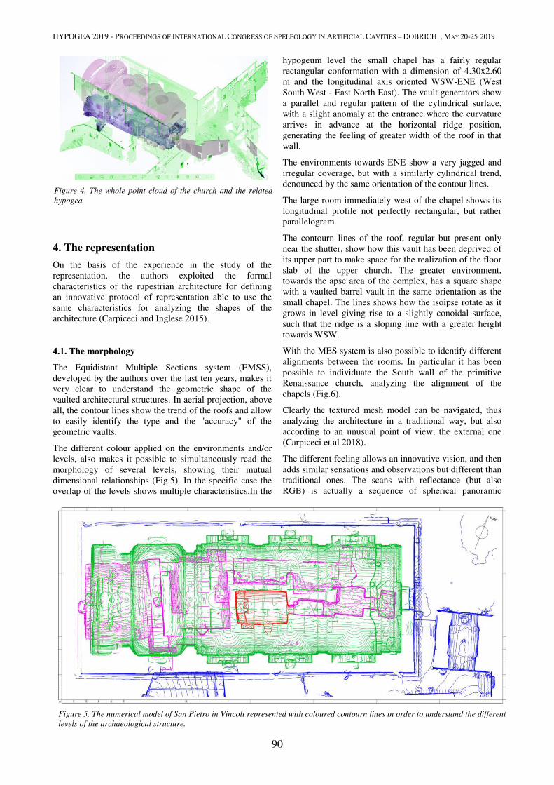
HYPOGEA 2019 - PROCEEDINGS OF INTERNATIONAL CONGRESS OF SPELEOLOGY IN ARTIFICIAL CAVITIES – DOBRICH , MAY 20-25 2019
90
4. The representation
On the basis of the experience in the study of the
representation, the authors exploited the formal
characteristics of the rupestrian architecture for defining
an innovative protocol of representation able to use the
same characteristics for analyzing the shapes of the
architecture (Carpiceci and Inglese 2015).
4.1. The morphology
The Equidistant Multiple Sections system (EMSS),
developed by the authors over the last ten years, makes it
very clear to understand the geometric shape of the
vaulted architectural structures. In aerial projection, above
all, the contour lines show the trend of the roofs and allow
to easily identify the type and the "accuracy" of the
geometric vaults.
The different colour applied on the environments and/or
levels, also makes it possible to simultaneously read the
morphology of several levels, showing their mutual
dimensional relationships (Fig.5). In the specific case the
overlap of the levels shows multiple characteristics.In the
hypogeum level the small chapel has a fairly regular
rectangular conformation with a dimension of 4.30x2.60
m and the longitudinal axis oriented WSW-ENE (West
South West - East North East). The vault generators show
a parallel and regular pattern of the cylindrical surface,
with a slight anomaly at the entrance where the curvature
arrives in advance at the horizontal ridge position,
generating the feeling of greater width of the roof in that
wall.
The environments towards ENE show a very jagged and
irregular coverage, but with a similarly cylindrical trend,
denounced by the same orientation of the contour lines.
The large room immediately west of the chapel shows its
longitudinal profile not perfectly rectangular, but rather
parallelogram.
The contourn lines of the roof, regular but present only
near the shutter, show how this vault has been deprived of
its upper part to make space for the realization of the floor
slab of the upper church. The greater environment,
towards the apse area of the complex, has a square shape
with a vaulted barrel vault in the same orientation as the
small chapel. The lines shows how the isoipse rotate as it
grows in level giving rise to a slightly conoidal surface,
such that the ridge is a sloping line with a greater height
towards WSW.
With the MES system is also possible to identify different
alignments between the rooms. In particular it has been
possible to individuate the South wall of the primitive
Renaissance church, analyzing the alignment of the
chapels (Fig.6).
Clearly the textured mesh model can be navigated, thus
analyzing the architecture in a traditional way, but also
according to an unusual point of view, the external one
(Carpiceci et al 2018).
The different feeling allows an innovative vision, and then
adds similar sensations and observations but different than
traditional ones. The scans with reflectance (but also
RGB) is actually a sequence of spherical panoramic
Figure 4. The whole point cloud of the church and the related
hypogea
Figure 5. The numerical model of San Pietro in Vincoli represented with coloured contourn lines in order to understand the different
levels of the archaeological structure.

HYPOGEA 2019 - PROCEEDINGS OF INTERNATIONAL CONGRESS OF SPELEOLOGY IN ARTIFICIAL CAVITIES – DOBRICH , MAY 20-25 2019
91
photographs, which makes them available for the creation
of a Virtual Tour through mutual calls and thus allowing a
visit to the monument from the same points of view of the
laser survey.
4.2. The painted surfaces
Photographic shooting of the painted surfaces always
requires extreme care in order to make a chromatically
correct recording and an image geometrically free of
radial distortion.
Good chances of success are there for the rough surfaces,
as for frescos and wall paintings in general. The more the
surface is shiny and reflective the more its homogeneous
illumination will be difficult. In the case study, the
presence of a discrete artificial lighting required only the
contribution of an indirect flash source to improve the
general light spectrum.
The use of a color checker (standard and calibrated) in an
initial frame allowed the chromatic correction of all the
frames taken with that same lighting condition (Devebec
and Malik 1997). The optics used for this kind of chromatic
survey are a 28mm and a 50 mm (on Full Frame) whose
slight radial distortion can be almost eliminated already in
the recording by the camera or later in the digital
development process from RAW files.
The images can be rectified by projective deformation
operations based on the knowledge of the spatial location
of four points sufficiently distant from each other and
present in the frame in peripheral areas. From a metric
point of view, the best result is the image projection on the
point cloud, using an orthogonal projection of the entire
wall. This system was applied for the two vertical
entrance and bottom walls of the chapel and for the lower
part of the longitudinal walls.
The cylindrical surface of the vault is within the
developing surfaces and can therefore be treated by two
operations. The first is achieved by shooting with the
camera positioned (approximately) with the Anterior
Nodal point along the geometric axis and the optical axis
perpendicular to the painted surface (Fig.7); however, the
tripod must have a panoramic head for the nodal
acquisition. In this way, each series of photos can be
processed with a software for panoramas that can perform
a cylindrical view and then automatically provide the
developed cylindrical surface (Marks and Fuller 1960; Van
Wijk 2008).
A second operation can be made by projecting the images
Figure 6. The hypogean rooms with the medieval structures
evidenced.
Figure 7. The barrel vault of the chapel was completely unfolded for observing the real shapes of the pictorial decorations.
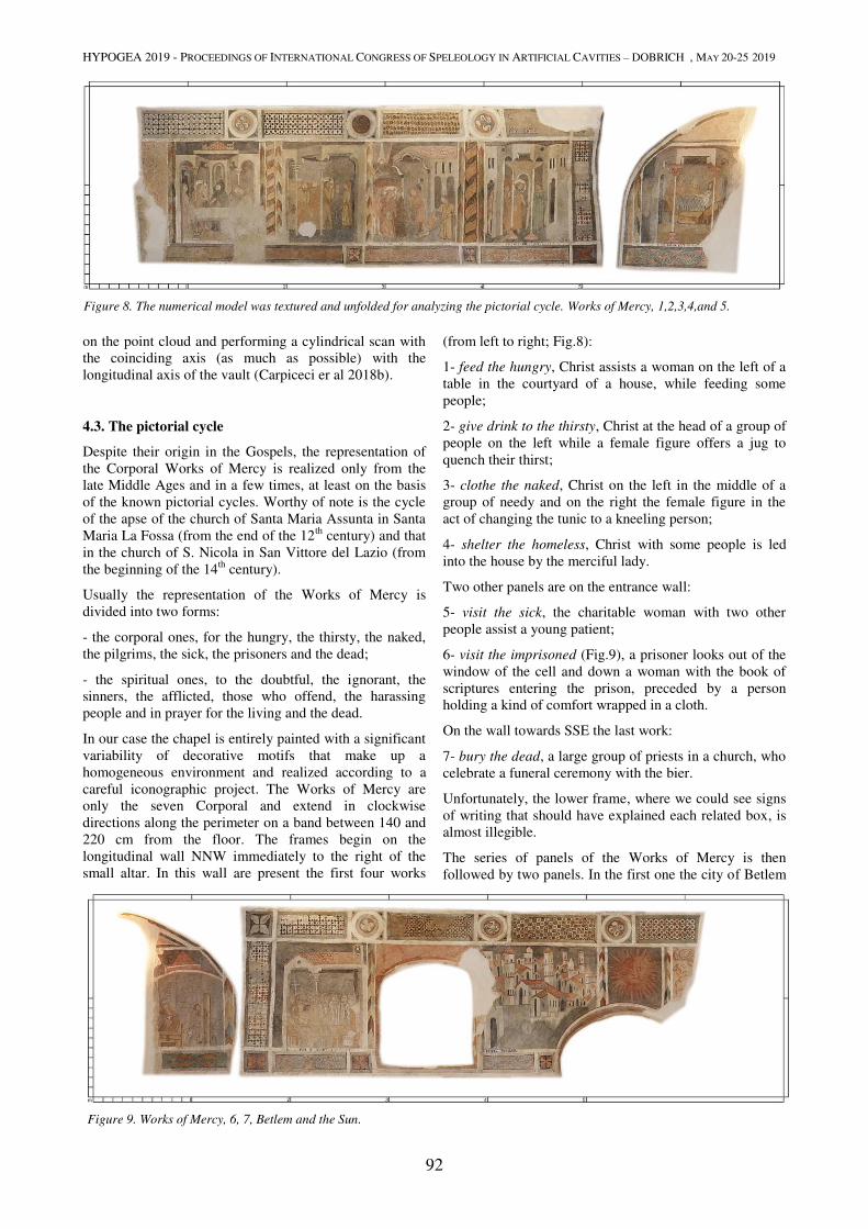
HYPOGEA 2019 - PROCEEDINGS OF INTERNATIONAL CONGRESS OF SPELEOLOGY IN ARTIFICIAL CAVITIES – DOBRICH , MAY 20-25 2019
92
on the point cloud and performing a cylindrical scan with
the coinciding axis (as much as possible) with the
longitudinal axis of the vault (Carpiceci er al 2018b).
4.3. The pictorial cycle
Despite their origin in the Gospels, the representation of
the Corporal Works of Mercy is realized only from the
late Middle Ages and in a few times, at least on the basis
of the known pictorial cycles. Worthy of note is the cycle
of the apse of the church of Santa Maria Assunta in Santa
Maria La Fossa (from the end of the 12th
century) and that
in the church of S. Nicola in San Vittore del Lazio (from
the beginning of the 14th
century).
Usually the representation of the Works of Mercy is
divided into two forms:
- the corporal ones, for the hungry, the thirsty, the naked,
the pilgrims, the sick, the prisoners and the dead;
- the spiritual ones, to the doubtful, the ignorant, the
sinners, the afflicted, those who offend, the harassing
people and in prayer for the living and the dead.
In our case the chapel is entirely painted with a significant
variability of decorative motifs that make up a
homogeneous environment and realized according to a
careful iconographic project. The Works of Mercy are
only the seven Corporal and extend in clockwise
directions along the perimeter on a band between 140 and
220 cm from the floor. The frames begin on the
longitudinal wall NNW immediately to the right of the
small altar. In this wall are present the first four works
(from left to right; Fig.8):
1- feed the hungry, Christ assists a woman on the left of a
table in the courtyard of a house, while feeding some
people;
2- give drink to the thirsty, Christ at the head of a group of
people on the left while a female figure offers a jug to
quench their thirst;
3- clothe the naked, Christ on the left in the middle of a
group of needy and on the right the female figure in the
act of changing the tunic to a kneeling person;
4- shelter the homeless, Christ with some people is led
into the house by the merciful lady.
Two other panels are on the entrance wall:
5- visit the sick, the charitable woman with two other
people assist a young patient;
6- visit the imprisoned (Fig.9), a prisoner looks out of the
window of the cell and down a woman with the book of
scriptures entering the prison, preceded by a person
holding a kind of comfort wrapped in a cloth.
On the wall towards SSE the last work:
7- bury the dead, a large group of priests in a church, who
celebrate a funeral ceremony with the bier.
Unfortunately, the lower frame, where we could see signs
of writing that should have explained each related box, is
almost illegible.
The series of panels of the Works of Mercy is then
followed by two panels. In the first one the city of Betlem
Figure 8. The numerical model was textured and unfolded for analyzing the pictorial cycle. Works of Mercy, 1,2,3,4,and 5.
Figure 9. Works of Mercy, 6, 7, Betlem and the Sun.
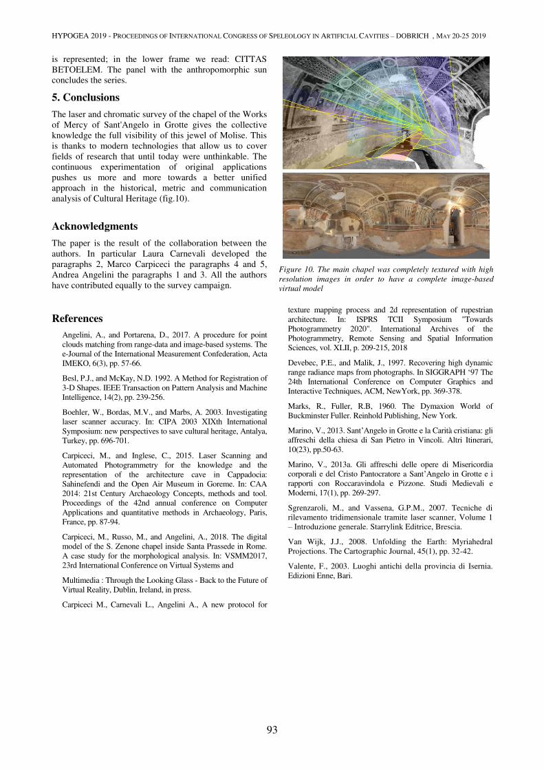
HYPOGEA 2019 - PROCEEDINGS OF INTERNATIONAL CONGRESS OF SPELEOLOGY IN ARTIFICIAL CAVITIES – DOBRICH , MAY 20-25 2019
93
is represented; in the lower frame we read: CITTAS
BETOELEM. The panel with the anthropomorphic sun
concludes the series.
5. Conclusions
The laser and chromatic survey of the chapel of the Works
of Mercy of Sant'Angelo in Grotte gives the collective
knowledge the full visibility of this jewel of Molise. This
is thanks to modern technologies that allow us to cover
fields of research that until today were unthinkable. The
continuous experimentation of original applications
pushes us more and more towards a better unified
approach in the historical, metric and communication
analysis of Cultural Heritage (fig.10).
Acknowledgments
The paper is the result of the collaboration between the
authors. In particular Laura Carnevali developed the
paragraphs 2, Marco Carpiceci the paragraphs 4 and 5,
Andrea Angelini the paragraphs 1 and 3. All the authors
have contributed equally to the survey campaign.
References
Angelini, A., and Portarena, D., 2017. A procedure for point
clouds matching from range-data and image-based systems. The
e-Journal of the International Measurement Confederation, Acta
IMEKO, 6(3), pp. 57-66.
Besl, P.J., and McKay, N.D. 1992. A Method for Registration of
3-D Shapes. IEEE Transaction on Pattern Analysis and Machine
Intelligence, 14(2), pp. 239-256.
Boehler, W., Bordas, M.V., and Marbs, A. 2003. Investigating
laser scanner accuracy. In: CIPA 2003 XIXth International
Symposium: new perspectives to save cultural heritage, Antalya,
Turkey, pp. 696-701.
Carpiceci, M., and Inglese, C., 2015. Laser Scanning and
Automated Photogrammetry for the knowledge and the
representation of the architecture cave in Cappadocia:
Sahinefendi and the Open Air Museum in Goreme. In: CAA
2014: 21st Century Archaeology Concepts, methods and tool.
Proceedings of the 42nd annual conference on Computer
Applications and quantitative methods in Archaeology, Paris,
France, pp. 87-94.
Carpiceci, M., Russo, M., and Angelini, A., 2018. The digital
model of the S. Zenone chapel inside Santa Prassede in Rome.
A case study for the morphological analysis. In: VSMM2017,
23rd International Conference on Virtual Systems and
Multimedia : Through the Looking Glass - Back to the Future of
Virtual Reality, Dublin, Ireland, in press.
Carpiceci M., Carnevali L., Angelini A., A new protocol for
texture mapping process and 2d representation of rupestrian
architecture. In: ISPRS TCII Symposium "Towards
Photogrammetry 2020". International Archives of the
Photogrammetry, Remote Sensing and Spatial Information
Sciences, vol. XLII, p. 209-215, 2018
Devebec, P.E., and Malik, J., 1997. Recovering high dynamic
range radiance maps from photographs. In SIGGRAPH ‘97 The
24th International Conference on Computer Graphics and
Interactive Techniques, ACM, NewYork, pp. 369-378.
Marks, R., Fuller, R.B, 1960. The Dymaxion World of
Buckminster Fuller. Reinhold Publishing, New York.
Marino, V., 2013. Sant’Angelo in Grotte e la Carità cristiana: gli
affreschi della chiesa di San Pietro in Vincoli. Altri Itinerari,
10(23), pp.50-63.
Marino, V., 2013a. Gli affreschi delle opere di Misericordia
corporali e del Cristo Pantocratore a Sant’Angelo in Grotte e i
rapporti con Roccaravindola e Pizzone. Studi Medievali e
Moderni, 17(1), pp. 269-297.
Sgrenzaroli, M., and Vassena, G.P.M., 2007. Tecniche di
rilevamento tridimensionale tramite laser scanner, Volume 1
– Introduzione generale. Starrylink Editrice, Brescia.
Van Wijk, J.J., 2008. Unfolding the Earth: Myriahedral
Projections. The Cartographic Journal, 45(1), pp. 32-42.
Valente, F., 2003. Luoghi antichi della provincia di Isernia.
Edizioni Enne, Bari.
Figure 10. The main chapel was completely textured with high
resolution images in order to have a complete image-based
virtual model
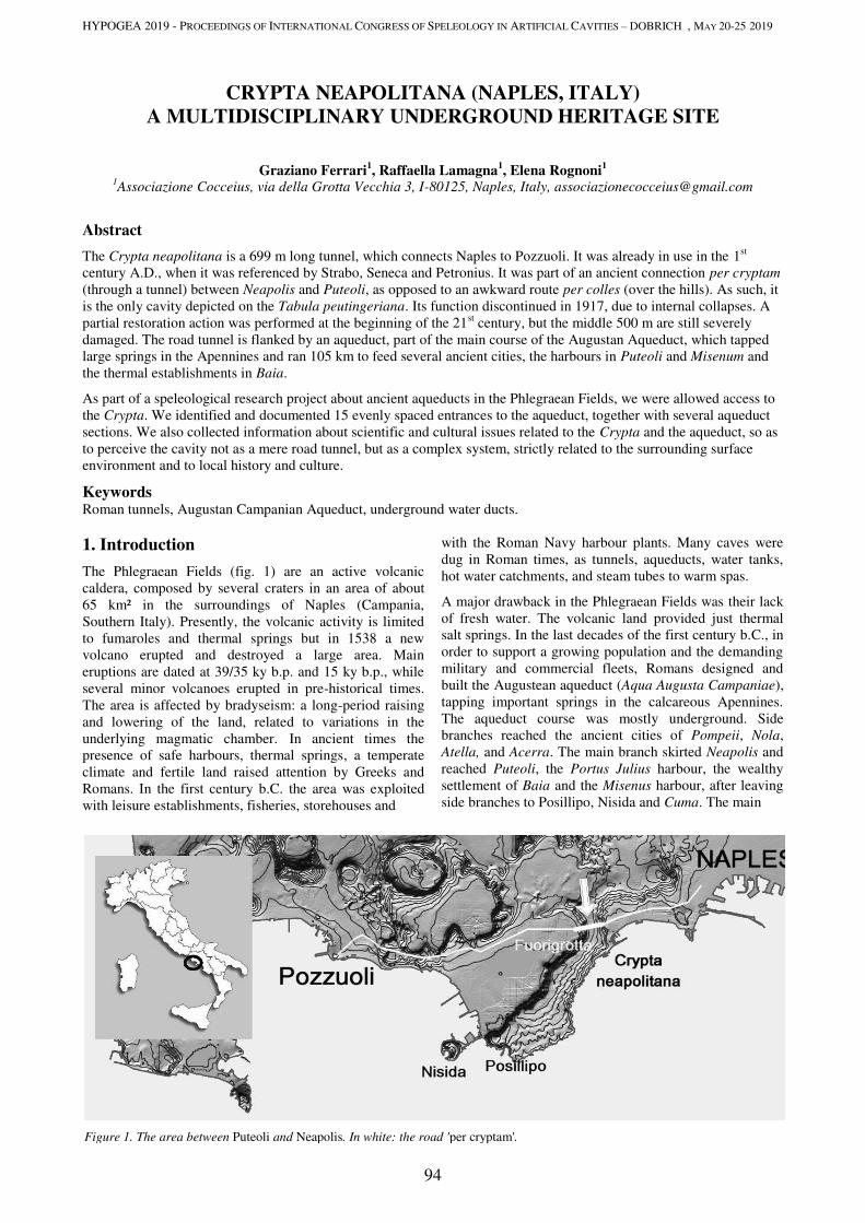
HYPOGEA 2019 - PROCEEDINGS OF INTERNATIONAL CONGRESS OF SPELEOLOGY IN ARTIFICIAL CAVITIES – DOBRICH , MAY 20-25 2019
94
CRYPTA NEAPOLITANA (NAPLES, ITALY)
A MULTIDISCIPLINARY UNDERGROUND HERITAGE SITE
Graziano Ferrari1, Raffaella Lamagna
1, Elena Rognoni
1
1Associazione Cocceius, via della Grotta Vecchia 3, I-80125, Naples, Italy, [email protected]
Abstract
The Crypta neapolitana is a 699 m long tunnel, which connects Naples to Pozzuoli. It was already in use in the 1st
century A.D., when it was referenced by Strabo, Seneca and Petronius. It was part of an ancient connection per cryptam
(through a tunnel) between Neapolis and Puteoli, as opposed to an awkward route per colles (over the hills). As such, it
is the only cavity depicted on the Tabula peutingeriana. Its function discontinued in 1917, due to internal collapses. A
partial restoration action was performed at the beginning of the 21st century, but the middle 500 m are still severely
damaged. The road tunnel is flanked by an aqueduct, part of the main course of the Augustan Aqueduct, which tapped
large springs in the Apennines and ran 105 km to feed several ancient cities, the harbours in Puteoli and Misenum and
the thermal establishments in Baia.
As part of a speleological research project about ancient aqueducts in the Phlegraean Fields, we were allowed access to
the Crypta. We identified and documented 15 evenly spaced entrances to the aqueduct, together with several aqueduct
sections. We also collected information about scientific and cultural issues related to the Crypta and the aqueduct, so as
to perceive the cavity not as a mere road tunnel, but as a complex system, strictly related to the surrounding surface
environment and to local history and culture.
Keywords Roman tunnels, Augustan Campanian Aqueduct, underground water ducts.
1. Introduction
The Phlegraean Fields (fig. 1) are an active volcanic
caldera, composed by several craters in an area of about
65 km² in the surroundings of Naples (Campania,
Southern Italy). Presently, the volcanic activity is limited
to fumaroles and thermal springs but in 1538 a new
volcano erupted and destroyed a large area. Main
eruptions are dated at 39/35 ky b.p. and 15 ky b.p., while
several minor volcanoes erupted in pre-historical times.
The area is affected by bradyseism: a long-period raising
and lowering of the land, related to variations in the
underlying magmatic chamber. In ancient times the
presence of safe harbours, thermal springs, a temperate
climate and fertile land raised attention by Greeks and
Romans. In the first century b.C. the area was exploited
with leisure establishments, fisheries, storehouses and
with the Roman Navy harbour plants. Many caves were
dug in Roman times, as tunnels, aqueducts, water tanks,
hot water catchments, and steam tubes to warm spas.
A major drawback in the Phlegraean Fields was their lack
of fresh water. The volcanic land provided just thermal
salt springs. In the last decades of the first century b.C., in
order to support a growing population and the demanding
military and commercial fleets, Romans designed and
built the Augustean aqueduct (Aqua Augusta Campaniae),
tapping important springs in the calcareous Apennines.
The aqueduct course was mostly underground. Side
branches reached the ancient cities of Pompeii, Nola,
Atella, and Acerra. The main branch skirted Neapolis and
reached Puteoli, the Portus Julius harbour, the wealthy
settlement of Baia and the Misenus harbour, after leaving
side branches to Posillipo, Nisida and Cuma. The main
Figure 1. The area between Puteoli and Neapolis. In white: the road 'per cryptam'.
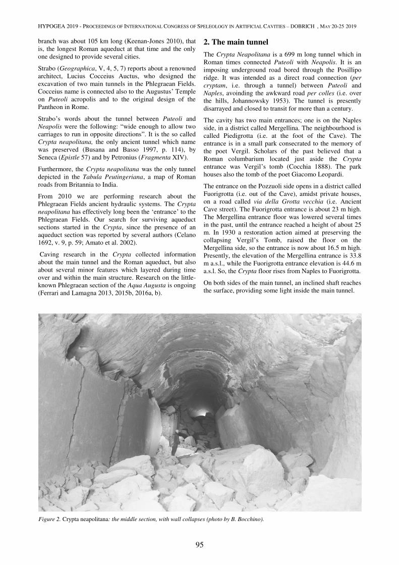
HYPOGEA 2019 - PROCEEDINGS OF INTERNATIONAL CONGRESS OF SPELEOLOGY IN ARTIFICIAL CAVITIES – DOBRICH , MAY 20-25 2019
95
branch was about 105 km long (Keenan-Jones 2010), that
is, the longest Roman aqueduct at that time and the only
one designed to provide several cities.
Strabo (Geographica, V, 4, 5, 7) reports about a renowned
architect, Lucius Cocceius Auctus, who designed the
excavation of two main tunnels in the Phlegraean Fields.
Cocceius name is connected also to the Augustus’ Temple
on Puteoli acropolis and to the original design of the
Pantheon in Rome.
Strabo’s words about the tunnel between Puteoli and
Neapolis were the following: “wide enough to allow two
carriages to run in opposite directions”. It is the so called
Crypta neapolitana, the only ancient tunnel which name
was preserved (Busana and Basso 1997, p. 114), by
Seneca (Epistle 57) and by Petronius (Fragmenta XIV).
Furthermore, the Crypta neapolitana was the only tunnel
depicted in the Tabula Peutingeriana, a map of Roman
roads from Britannia to India.
From 2010 we are performing research about the
Phlegraean Fields ancient hydraulic systems. The Crypta
neapolitana has effectively long been the ‘entrance’ to the
Phlegraean Fields. Our search for surviving aqueduct
sections started in the Crypta, since the presence of an
aqueduct section was reported by several authors (Celano
1692, v. 9, p. 59; Amato et al. 2002).
Caving research in the Crypta collected information
about the main tunnel and the Roman aqueduct, but also
about several minor features which layered during time
over and within the main structure. Research on the little-
known Phlegraean section of the Aqua Augusta is ongoing
(Ferrari and Lamagna 2013, 2015b, 2016a, b).
2. The main tunnel
The Crypta Neapolitana is a 699 m long tunnel which in
Roman times connected Puteoli with Neapolis. It is an
imposing underground road bored through the Posillipo
ridge. It was intended as a direct road connection (per
cryptam, i.e. through a tunnel) between Puteoli and
Naples, avoinding the awkward road per colles (i.e. over
the hills, Johannowsky 1953). The tunnel is presently
disarrayed and closed to transit for more than a century.
The cavity has two main entrances; one is on the Naples
side, in a district called Mergellina. The neighbourhood is
called Piedigrotta (i.e. at the foot of the Cave). The
entrance is in a small park consecrated to the memory of
the poet Vergil. Scholars of the past believed that a
Roman columbarium located just aside the Crypta
entrance was Vergil’s tomb (Cocchia 1888). The park
houses also the tomb of the poet Giacomo Leopardi.
The entrance on the Pozzuoli side opens in a district called
Fuorigrotta (i.e. out of the Cave), amidst private houses,
on a road called via della Grotta vecchia (i.e. Ancient
Cave street). The Fuorigrotta entrance is about 23 m high.
The Mergellina entrance floor was lowered several times
in the past, until the entrance reached a height of about 25
m. In 1930 a restoration action aimed at preserving the
collapsing Vergil’s Tomb, raised the floor on the
Mergellina side, so the entrance is now about 16.5 m high.
Presently, the elevation of the Mergellina entrance is 33.8
m a.s.l., while the Fuorigrotta entrance elevation is 44.6 m
a.s.l. So, the Crypta floor rises from Naples to Fuorigrotta.
On both sides of the main tunnel, an inclined shaft reaches
the surface, providing some light inside the main tunnel.
Figure 2. Crypta neapolitana: the middle section, with wall collapses (photo by B. Bocchino).
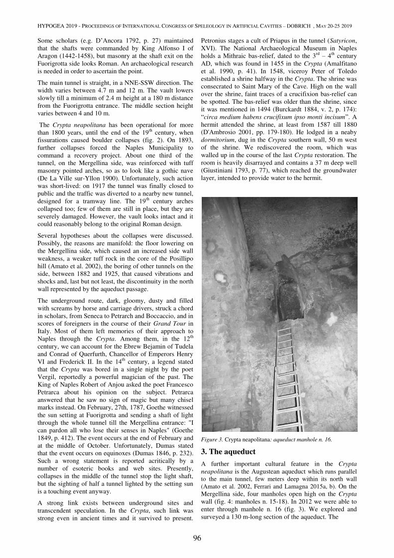
HYPOGEA 2019 - PROCEEDINGS OF INTERNATIONAL CONGRESS OF SPELEOLOGY IN ARTIFICIAL CAVITIES – DOBRICH , MAY 20-25 2019
96
Some scholars (e.g. D’Ancora 1792, p. 27) maintained
that the shafts were commanded by King Alfonso I of
Aragon (1442-1458), but masonry at the shaft exit on the
Fuorigrotta side looks Roman. An archaeological research
is needed in order to ascertain the point.
The main tunnel is straight, in a NNE-SSW direction. The
width varies between 4.7 m and 12 m. The vault lowers
slowly till a minimum of 2.4 m height at a 180 m distance
from the Fuorigrotta entrance. The middle section height
varies between 4 and 10 m.
The Crypta neapolitana has been operational for more
than 1800 years, until the end of the 19th
century, when
fissurations caused boulder collapses (fig. 2). On 1893,
further collapses forced the Naples Municipality to
command a recovery project. About one third of the
tunnel, on the Mergellina side, was reinforced with tuff
masonry pointed arches, so as to look like a gothic nave
(De La Ville sur-Yllon 1900). Unfortunately, such action
was short-lived: on 1917 the tunnel was finally closed to
public and the traffic was diverted to a nearby new tunnel,
designed for a tramway line. The 19th
century arches
collapsed too; few of them are still in place, but they are
severely damaged. However, the vault looks intact and it
could reasonably belong to the original Roman design.
Several hypotheses about the collapses were discussed.
Possibly, the reasons are manifold: the floor lowering on
the Mergellina side, which caused an increased side wall
weakness, a weaker tuff rock in the core of the Posillipo
hill (Amato et al. 2002), the boring of other tunnels on the
side, between 1882 and 1925, that caused vibrations and
shocks and, last but not least, the discontinuity in the north
wall represented by the aqueduct passage.
The underground route, dark, gloomy, dusty and filled
with screams by horse and carriage drivers, struck a chord
in scholars, from Seneca to Petrarch and Boccaccio, and in
scores of foreigners in the course of their Grand Tour in
Italy. Most of them left memories of their approach to
Naples through the Crypta. Among them, in the 12th
century, we can account for the Ebrew Bejamin of Tudela
and Conrad of Querfurth, Chancellor of Emperors Henry
VI and Frederick II. In the 14th
century, a legend stated
that the Crypta was bored in a single night by the poet
Vergil, reportedly a powerful magician of the past. The
King of Naples Robert of Anjou asked the poet Francesco
Petrarca about his opinion on the subject. Petrarca
answered that he saw no sign of magic but many chisel
marks instead. On February, 27th, 1787, Goethe witnessed
the sun setting at Fuorigrotta and sending a shaft of light
through the whole tunnel till the Mergellina entrance: "I
can pardon all who lose their senses in Naples" (Goethe
1849, p. 412). The event occurs at the end of February and
at the middle of October. Unfortunately, Dumas stated
that the event occurs on equinoxes (Dumas 1846, p. 232).
Such a wrong statement is reported acritically by a
number of esoteric books and web sites. Presently,
collapses in the middle of the tunnel stop the light shaft,
but the sighting of half a tunnel lighted by the setting sun
is a touching event anyway.
A strong link exists between underground sites and
transcendent speculation. In the Crypta, such link was
strong even in ancient times and it survived to present.
Petronius stages a cult of Priapus in the tunnel (Satyricon,
XVI). The National Archaeological Museum in Naples
holds a Mithraic bas-relief, dated to the 3rd
– 4th
century
AD, which was found in 1455 in the Crypta (Amalfitano
et al. 1990, p. 41). In 1548, viceroy Peter of Toledo
established a shrine halfway in the Crypta. The shrine was
consecrated to Saint Mary of the Cave. High on the wall
over the shrine, faint traces of a crucifixion bas-relief can
be spotted. The bas-relief was older than the shrine, since
it was mentioned in 1494 (Burckardt 1884, v. 2, p. 174):
“circa medium habens crucifixum ipso monti incisum”. A
hermit attended the shrine, at least from 1587 till 1880
(D'Ambrosio 2001, pp. 179-180). He lodged in a neaby
dormitorium, dug in the Crypta southern wall, 50 m west
of the shrine. We rediscovered the room, which was
walled up in the course of the last Crypta restoration. The
room is heavily disarrayed and contains a 37 m deep well
(Giustiniani 1793, p. 77), which reached the groundwater
layer, intended to provide water to the hermit.
Figure 3. Crypta neapolitana: aqueduct manhole n. 16.
3. The aqueduct
A further important cultural feature in the Crypta
neapolitana is the Augustean aqueduct which runs parallel
to the main tunnel, few meters deep within its north wall
(Amato et al. 2002, Ferrari and Lamagna 2015a, b). On the
Mergellina side, four manholes open high on the Crypta
wall (fig. 4: manholes n. 15-18). In 2012 we were able to
enter through manhole n. 16 (fig. 3). We explored and
surveyed a 130 m-long section of the aqueduct. The
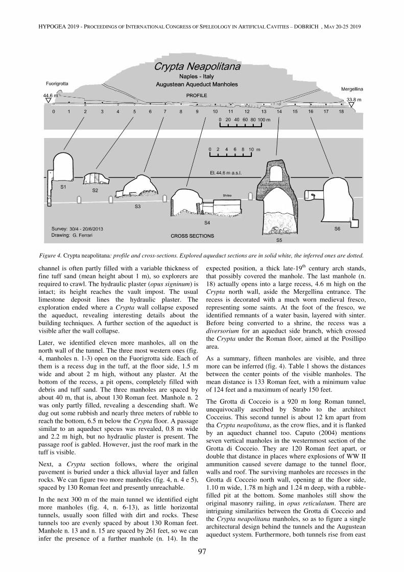
HYPOGEA 2019 - PROCEEDINGS OF INTERNATIONAL CONGRESS OF SPELEOLOGY IN ARTIFICIAL CAVITIES – DOBRICH , MAY 20-25 2019
97
channel is often partly filled with a variable thickness of
fine tuff sand (mean height about 1 m), so explorers are
required to crawl. The hydraulic plaster (opus signinum) is
intact; its height reaches the vault impost. The usual
limestone deposit lines the hydraulic plaster. The
exploration ended where a Crypta wall collapse exposed
the aqueduct, revealing interesting details about the
building techniques. A further section of the aqueduct is
visible after the wall collapse.
Later, we identified eleven more manholes, all on the
north wall of the tunnel. The three most western ones (fig.
4, manholes n. 1-3) open on the Fuorigrotta side. Each of
them is a recess dug in the tuff, at the floor side, 1.5 m
wide and about 2 m high, without any plaster. At the
bottom of the recess, a pit opens, completely filled with
debris and tuff sand. The three manholes are spaced by
about 40 m, that is, about 130 Roman feet. Manhole n. 2
was only partly filled, revealing a descending shaft. We
dug out some rubbish and nearly three meters of rubble to
reach the bottom, 6.5 m below the Crypta floor. A passage
similar to an aqueduct specus was revealed, 0.8 m wide
and 2.2 m high, but no hydraulic plaster is present. The
passage roof is gabled. However, just the roof mark in the
tuff is visible.
Next, a Crypta section follows, where the original
pavement is buried under a thick alluvial layer and fallen
rocks. We can figure two more manholes (fig. 4, n. 4 e 5),
spaced by 130 Roman feet and presently unreachable.
In the next 300 m of the main tunnel we identified eight
more manholes (fig. 4, n. 6-13), as little horizontal
tunnels, usually soon filled with dirt and rocks. These
tunnels too are evenly spaced by about 130 Roman feet.
Manhole n. 13 and n. 15 are spaced by 261 feet, so we can
infer the presence of a further manhole (n. 14). In the
expected position, a thick late-19th
century arch stands,
that possibly covered the manhole. The last manhole (n.
18) actually opens into a large recess, 4.6 m high on the
Crypta north wall, aside the Mergellina entrance. The
recess is decorated with a much worn medieval fresco,
representing some saints. At the foot of the fresco, we
identified remnants of a water basin, layered with sinter.
Before being converted to a shrine, the recess was a
diversorium for an aqueduct side branch, which crossed
the Crypta under the Roman floor, aimed at the Posillipo
area.
As a summary, fifteen manholes are visible, and three
more can be inferred (fig. 4). Table 1 shows the distances
between the center points of the visible manholes. The
mean distance is 133 Roman feet, with a minimum value
of 124 feet and a maximum of nearly 150 feet.
The Grotta di Cocceio is a 920 m long Roman tunnel,
unequivocally ascribed by Strabo to the architect
Cocceius. This second tunnel is about 12 km apart from
tha Crypta neapolitana, as the crow flies, and it is flanked
by an aqueduct channel too. Caputo (2004) mentions
seven vertical manholes in the westernmost section of the
Grotta di Cocceio. They are 120 Roman feet apart, or
double that distance in places where explosions of WW II
ammunition caused severe damage to the tunnel floor,
walls and roof. The surviving manholes are recesses in the
Grotta di Cocceio north wall, opening at the floor side,
1.10 m wide, 1.78 m high and 1.24 m deep, with a rubble-
filled pit at the bottom. Some manholes still show the
original masonry railing, in opus reticulatum. There are
intriguing similarities between the Grotta di Cocceio and
the Crypta neapolitana manholes, so as to figure a single
architectural design behind the tunnels and the Augustean
aqueduct system. Furthermore, both tunnels rise from east
Figure 4. Crypta neapolitana: profile and cross-sections. Explored aqueduct sections are in solid white, the inferred ones are dotted.
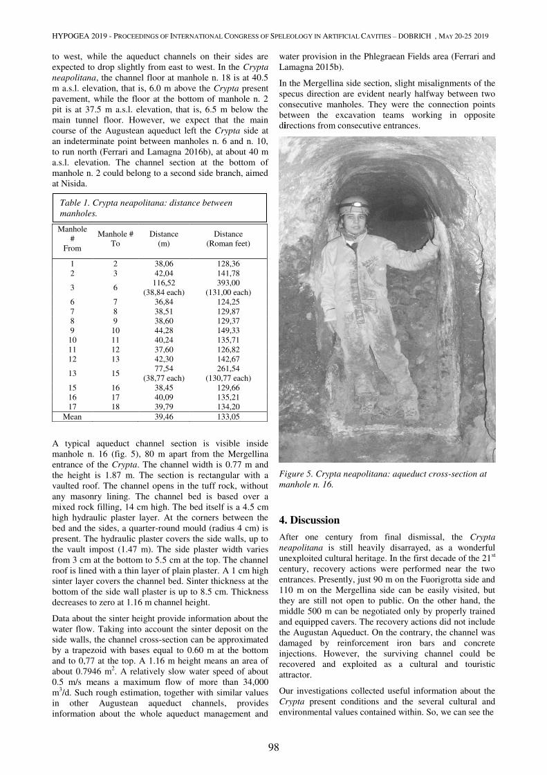
HYPOGEA 2019 - PROCEEDINGS OF INTERNATIONAL CONGRESS OF SPELEOLOGY IN ARTIFICIAL CAVITIES – DOBRICH , MAY 20-25 2019
98
to west, while the aqueduct channels on their sides are
expected to drop slightly from east to west. In the Crypta
neapolitana, the channel floor at manhole n. 18 is at 40.5
m a.s.l. elevation, that is, 6.0 m above the Crypta present
pavement, while the floor at the bottom of manhole n. 2
pit is at 37.5 m a.s.l. elevation, that is, 6.5 m below the
main tunnel floor. However, we expect that the main
course of the Augustean aqueduct left the Crypta side at
an indeterminate point between manholes n. 6 and n. 10,
to run north (Ferrari and Lamagna 2016b), at about 40 m
a.s.l. elevation. The channel section at the bottom of
manhole n. 2 could belong to a second side branch, aimed
at Nisida.
A typical aqueduct channel section is visible inside
manhole n. 16 (fig. 5), 80 m apart from the Mergellina
entrance of the Crypta. The channel width is 0.77 m and
the height is 1.87 m. The section is rectangular with a
vaulted roof. The channel opens in the tuff rock, without
any masonry lining. The channel bed is based over a
mixed rock filling, 14 cm high. The bed itself is a 4.5 cm
high hydraulic plaster layer. At the corners between the
bed and the sides, a quarter-round mould (radius 4 cm) is
present. The hydraulic plaster covers the side walls, up to
the vault impost (1.47 m). The side plaster width varies
from 3 cm at the bottom to 5.5 cm at the top. The channel
roof is lined with a thin layer of plain plaster. A 1 cm high
sinter layer covers the channel bed. Sinter thickness at the
bottom of the side wall plaster is up to 8.5 cm. Thickness
decreases to zero at 1.16 m channel height.
Data about the sinter height provide information about the
water flow. Taking into account the sinter deposit on the
side walls, the channel cross-section can be approximated
by a trapezoid with bases equal to 0.60 m at the bottom
and to 0,77 at the top. A 1.16 m height means an area of
about 0.7946 m2. A relatively slow water speed of about
0.5 m/s means a maximum flow of more than 34,000
m3/d. Such rough estimation, together with similar values
in other Augustean aqueduct channels, provides
information about the whole aqueduct management and
water provision in the Phlegraean Fields area (Ferrari and
Lamagna 2015b).
In the Mergellina side section, slight misalignments of the
specus direction are evident nearly halfway between two
consecutive manholes. They were the connection points
between the excavation teams working in opposite
directions from consecutive entrances.
Figure 5. Crypta neapolitana: aqueduct cross-section at
manhole n. 16.
4. Discussion
After one century from final dismissal, the Crypta
neapolitana is still heavily disarrayed, as a wonderful
unexploited cultural heritage. In the first decade of the 21st
century, recovery actions were performed near the two
entrances. Presently, just 90 m on the Fuorigrotta side and
110 m on the Mergellina side can be easily visited, but
they are still not open to public. On the other hand, the
middle 500 m can be negotiated only by properly trained
and equipped cavers. The recovery actions did not include
the Augustan Aqueduct. On the contrary, the channel was
damaged by reinforcement iron bars and concrete
injections. However, the surviving channel could be
recovered and exploited as a cultural and touristic
attractor.
Our investigations collected useful information about the
Crypta present conditions and the several cultural and
environmental values contained within. So, we can see the
Manhole
#
From
Manhole #
To Distance
(m) Distance
(Roman feet)
1 2 38,06 128,36 2 3 42,04 141,78
3 6 116,52
(38,84 each) 393,00
(131,00 each) 6 7 36,84 124,25 7 8 38,51 129,87 8 9 38,60 129,37 9 10 44,28 149,33
10 11 40,24 135,71 11 12 37,60 126,82 12 13 42,30 142,67
13 15 77,54
(38,77 each) 261,54
(130,77 each) 15 16 38,45 129,66 16 17 40,09 135,21 17 18 39,79 134,20
Mean 39,46 133,05
Table 1. Crypta neapolitana: distance between
manholes.
HYPOGEA 2019 - PROCEEDINGS OF INTERNATIONAL CONGRESS OF SPELEOLOGY IN ARTIFICIAL CAVITIES – DOBRICH , MAY 20-25 2019
99
cavity not only as a gloomy ancient tunnel but as a multi-
disciplinary cultural heritage, full of historical layers and
of scientific and cultural issues, in close relation with the
surface and the surrounding city.
So we wish that the exploration, research and recovery
actions could be completed and that they would care for
the monument integrity and protection as a whole. A
critical preliminary step is represented by an engineering
and environmental monitoring plan, as dictated by
International Show Caves Association et al. (2014). This
is needed in order to avoid dangerous or short-lived
actions, as it happened in the near past.
About future actions, the most promising idea is the
recovery of the Crypta as a pedestrian and cycling route.
Such project would restore the Crypta traditional purpose,
as a protected road, far from motor exhaust emissions. The
City management would restore an extremely important
cultural and touristic route, similarly to the traditional
Neapolitan and Phlegraean Grand Tour of the past.
Acknowledgments
We are grateful to the Superintendency for Cultural Heritage
of Naples, especially to the Heads of the local office in
Naples (Mr. Vecchio, Mr. Stanco) and their staff.
Furthermore, Mr. Sirano and Ms. Casule allowed access to
the Grotta di Cocceio. The Municipality of Naples, Direction
for Cultural Heritage (Ms. Dello Russo, Mr. Pascapé) and the
Campanian Museums Headquarter (Ms. Capobianco)
allowed access to the areas they manage. The Diocesan
Library and Archives in Pozzuoli (Ms. Lenci, Mr. Cutolo)
provided information about the shrine and the hermits. Last
but not least, we are indebted with the caving friends who
shared dust, sweat and emotions with us, especially with
Berardino and Rossana, who performed the levelling among
the manholes and with Mauro Palumbo, who reached the
Mergellina shaft.
References
Amalfitano P, Camodeca G, Medri M, 1990. I Campi Flegrei.
Un itinerario archeologico. Marsilio, Venezia (in Italian).
Amato L, Evangelista A, Nicotera MV, Viggiani C, 2002. The
Crypta Neapolitana; a Roman tunnel of the early imperial age.
Proceedings of Archi2000: Paris, 10-12/09/2001.
Burckard J, 1884. Johannis Burchardi Argentinensis Capelle
pontificie sacrorum rituum magistri diarium, sive Rerum
urbanarum commentarii (1483-1506). Leroux, Paris (in Latin).
Busana MS, Basso P, 1997. Le strade in galleria nell'Italia
romana. In: MS Busana (Ed.), Via per montes excisa: strade in
galleria e passaggi sotterranei nell'Italia romana. L'Erma di
Bretschneider, Roma, pp. 81-250 (in Italian).
Caputo P, 2004. La Grotta di Cocceio a Cuma: nuovi dati da
ricerche e saggi di scavo. In: L Quilici, S Quilici Gigli (Eds.).
Viabilità e insediamenti nell'Italia antica. L'Erma di
Breitschneider, Roma, pp. 309-330 (in Italian).
Celano C, 1692. Notizie del bello e dell'antico della città di
Napoli, per le signore e i forestieri. Raillard, Napoli (in Italian).
Cocchia E, 1888. La tomba di Virgilio: contributo alla topografia
dell'antica città di Napoli. Archivio storico per le province
napoletane, 13, 511-568, 631-744 (in Italian).
D'Ambrosio A, 2001. Eremiti nella Diocesi di Pozzuoli nei
secoli XVI-XX. Campania sacra, Napoli, 32 (1-2), 173-196 (in
Italian).
D'Ancora G, 1792. Gvida ragionata per le antichità e le curiosità
naturali di Pozzuoli e dei luoghi circonvicini. Zambraia, Napoli
(in Italian).
De La Ville sur Yllon L, 1900. La grotta di Pozzuoli. Napoli
Nobilissima, 9 (2), 19-22 (in Italian).
Dumas A (père), 1846. Le corricolo. Boulé, Paris (in French).
Ferrari G, Lamagna R, 2013. The Augustean aqueduct in the
Phlegraean Fields (Naples, Southern Italy). Proceedings of the
16th International Congress of Speleology, Brno, vol. 2, 200-205.
Ferrari G, Lamagna R, 2015a. Crypta neapolitana: non solo un
tunnel. Trasporti e Cultura, 40, 88-93 (in Italian).
Ferrari G, Lamagna R, 2015b, Aqua Augusta Campaniae:
considerazioni sulle morfologie degli spechi in area flegrea. Atti
del 22° Congresso nazionale di speleologia “Condividere i dati”,
Pertosa-Auletta (SA), 435-440 (in Italian).
Ferrari G, Lamagna R, 2016a. L’Acquedotto Augusteo della
Campania nei Campi Flegrei (Napoli). Archeologia Sotterranea,
13, 24-33 (in Italian).
Ferrari G, Lamagna R, 2016b. Aqua Augusta Campaniae: lo
speco di Macrinus. Puteoli, studi di storia e archeologia dei
Campi Flegrei, 1, 273-296 (in Italian).
Giustiniani L, 1793. La Biblioteca storica, e topografica del
Regno di Napoli. Orsini, Napoli (in Italian).
Goethe JW, 1849. The auto-biography of Goethe. Bohn, London.
International Show Caves Association (I.S.C.A.), International
Union for the Conservation of Nature (I.U.C.N.), International
Union of Speleology (U.I.S.), 2014. Recommended International
Guidelines For The Development And Management Of Show
Caves. At: http://www.uis-
speleo.org/documents/Recommended_International_Guidelines_
published_version.pdf
Johannowsky W, 1953. Contributi alla topografia della
Campania antica. I. La «Via Puteolis – Neapolim». Rendiconti
della Accademia di Archeologia, Lettere e Belle Arti, Napoli, 27,
83-146 (in Italian).
Keenan-Jones D, 2010. The Aqua Augusta. Regional water
supply in Roman and late antique Campania. Unpublished PhD
dissertation, Macquarie University, Australia.
Petronius Arbiter, Fragmenta (in Latin).
Petronius Arbiter, Satyricon (in Latin).
Seneca, LA, Epistulae morales ad Lucilium (in Latin).
Strabo, Geographica (in Latin).
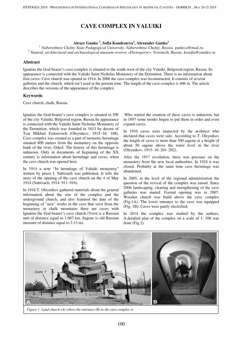
HYPOGEA 2019 - PROCEEDINGS OF INTERNATIONAL CONGRESS OF SPELEOLOGY IN ARTIFICIAL CAVITIES – DOBRICH , MAY 20-25 2019
100
CAVE COMPLEX IN VALUIKI
Alexey Gunko 1, Sofia Kondrateva
2, Alexander Gunko
1
1 Naberezhnye Сhelny State Pedagogical University, Naberezhnye Chelny, Russia, [email protected]
2 Natural, architectural and archaeological museum-reserve «Divnogorye», Voronezh, Russia, [email protected]
Abstract
Ignatius the God-bearer’s cave complex is situated to the south-west of the city Valuiki, Belgorod region, Russia. Its
appearance is connected with the Valuiki Saint Nicholas Monastery of the Dormition. There is no information about
first caves. Cave church was opened in 1914. In 2006 the cave complex was reconstructed. It consists of several
galleries and the church, which isn’t used at the present time. The length of the cave complex is 406 m. The article
describes the versions of the appearance of the complex.
Keywords
Cave church, chalk, Russia.
Ignatius the God-bearer’s cave complex is situated to SW
of the city Valuiki, Belgorod region, Russia Its appearance
is connected with the Valuiki Saint Nicholas Monastery of
the Dormition, which was founded in 1613 by decree of
Tsar Mikhail Fedorovich (Oleynikov, 1915–16: 188).
Cave complex was created as a part of monastic hermitage
situated 800 meters from the monastery on the opposite
bank of the river. Oskol. The history of this hermitage is
unknown. Only in documents of beginning of the XX
century is information about hermitage and caves, when
the cave church was opened here.
In 1914 a note “In hermitage of Valuiki monastery”
written by priest I. Nabivach was published. It tells the
story of the opening of the cave church on the 4 of May
1914 (Nabivach, 1914: 911–916).
In 1916 T. Oleynikov gathered materials about the general
information about the size of the complex and the
underground church, and also featured the date of the
beginning of "new" works in the cave that verst from the
monastery in chalk mountains there are caves with
Ignatius the God-bearer’s cave church (Verst is a Russian
unit of distance equal to 1.067 km. Sagene is old Russian
measure of distance equal to 2.13 m).
Who started the creation of these caves is unknown, but
in 1897 some monks begun to put them in order and even
expand caves.
In 1910 caves were inspected by the architect who
declared that caves were safe. According to T. Oleynikov
the length of caves is more than 300 sagene at a height of
about 50 sagene above the water level in the river
(Oleynikov, 1915–16: 201–202).
After the 1917 revolution, there was pressure on the
monastery from the new local authorities. In 1924 it was
closed. Probably at the same time cave hermitage was
abandoned.
In 2005, at the level of the regional administration the
question of the revival of the complex was raised. Since
2006 landscaping, clearing and strengthening of the cave
galleries was started. Formal opening was in 2007.
Wooden church was build above the cave complex
(Fig.1A). The lower entrance to the cave was equipped
(Fig. 1B). Caves were partly electrified.
In 2014 the complex was studied by the authors.
A detailed plan of the complex on a scale of 1: 100 was
done (Fig.2).
Figure 1. Land church (А) where the entrance (B) to the cave complex is.
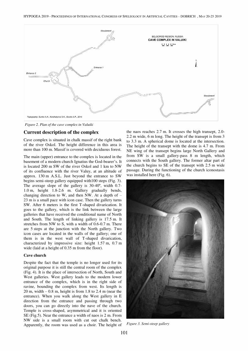
HYPOGEA 2019 - PROCEEDINGS OF INTERNATIONAL CONGRESS OF SPELEOLOGY IN ARTIFICIAL CAVITIES – DOBRICH , MAY 20-25 2019
101
Figure 2. Plan of the cave complex in Valuiki
Current description of the complex
Cave complex is situated in chalk massif of the right bank
of the river Oskol. The height difference in this area is
more than 100 m. Massif is covered with deciduous forest.
The main (upper) entrance to the complex is located in the
basement of a modern church Ignatius the God-bearer’s. It
is located 200 m SW of the river Oskol and 1 km to NW
of its confluence with the river Valuy, at an altitude of
approx. 130 m A.S.L. Just beyond the entrance to SW
begins semi-steep gallery equipped with100 steps (Fig. 3).
The average slope of the gallery is 30-40º, width 0.7-
1.0 m, height 1.8-2.6 m. Gallery gradually bends,
changing direction to W, and then NW. At a depth of –
23 m is a small pace with icon case. Then the gallery turns
SW. After 6 meters is the first T-shaped divarication. It
goes to the gallery, which is the link between the large
galleries that have received the conditional name of North
and South. The length of linking gallery is 17.5 m. It
stretches from NW to S, with a width of 0.6-0.7 m. There
are 5 steps at the junction with the North gallery. Two
icon cases are located in the walls of the gallery; one of
them is in the west wall of T-shaped divarication,
characterized by impressive size: height 1.57 m, 0.7 m
wide (laid at a height of 0.35 m from the floor).
Cave church
Despite the fact that the temple is no longer used for its
original purpose it is still the central room of the complex
(Fig. 4). It is the place of intersection of North, South and
West galleries. West gallery leads to the modern lower
entrance of the complex, which is in the right side of
ravine, bounding the complex from west. Its length is
20 m, width – 0.8 m, height is from 1.8 to 2.4 m (near the
entrance). When you walk along the West gallery in E
direction from the entrance and passing through two
doors, you can go directly into the nave of the church.
Temple is cross-shaped, asymmetrical and it is oriented
SE (Fig.5). Near the entrance a width of naos is 2 m. From
NW side is a small room with cut out chalk bench.
Apparently, the room was used as a choir. The height of
the naos reaches 2.7 m. It crosses the high transept, 2.0-
2.2 m wide, 6 m long. The height of the transept is from 3
to 3.3 m. A spherical dome is located at the intersection.
The height of the transept with the dome is 4.7 m. From
NE wing of the transept begins large North Gallery and
from SW is a small gallery-pass 8 m length, which
connects with the South gallery. The former altar part of
the church begins to SE of the transept with 2.5 m wide
passage. During the functioning of the church iconostasis
was installed here (Fig. 6).
Figure 3. Semi-steep gallery

HYPOGEA 2019 - PROCEEDINGS OF INTERNATIONAL CONGRESS OF SPELEOLOGY IN ARTIFICIAL CAVITIES – DOBRICH , MAY 20-25 2019
102
Figure 4. Modern view of the former church: А – view on the naos of the church; B – alter part; С – SW part
Before the modern reconstruction small passage extended
from the altar part to NE wing of the transept. It is obvious
that the entrance to it played the role of the Northern Gate
and small bending pillar – the role of the supporting
column. Currently, the passage is walled up. The height of
the altar part is 2.5-2.8 m, length - 3.5 m. Two icon cases
depth of 0.4 m are on the right side in the wall at a height
of 0.8 m. They were here before reconstruction, but now
they are modernized. Alter apse has wrong “angular
shape”. Here begins South gallery. Icon case in the east
wall of apse apparently is in place of Prothesis
North gallery
From NE wing of the transept across the pass width of
0.8 m is the North Gallery. In 1.5 m in NW direction a
small gallery branches off. It bends the church from the
north and connects with the West gallery. From this
branch Northern gallery slightly bent and in 8 m leads to
the next branch – connecting gallery which is described
above. Opposite its steps in the left wall cut out icon case
width of 0.6 m and 1 m in height. After another 4 m in the
right wall a narrow passage 0.45 m wide is. It is followed
by pass length of about 6 m, ending by eboulement. Its
arch is near sloping gallery from the surface. Brickwork
which bonds them is visible. Pass is tooled roughly and
has an unfinished appearance. Further gallery, making
small bends, stretches in NE direction. Width of the
gallery is 0.7-0.8 m; height is from 1.9 to 3.0 m.
Figure 5. The central part of the complex with the section drawings of the cave church
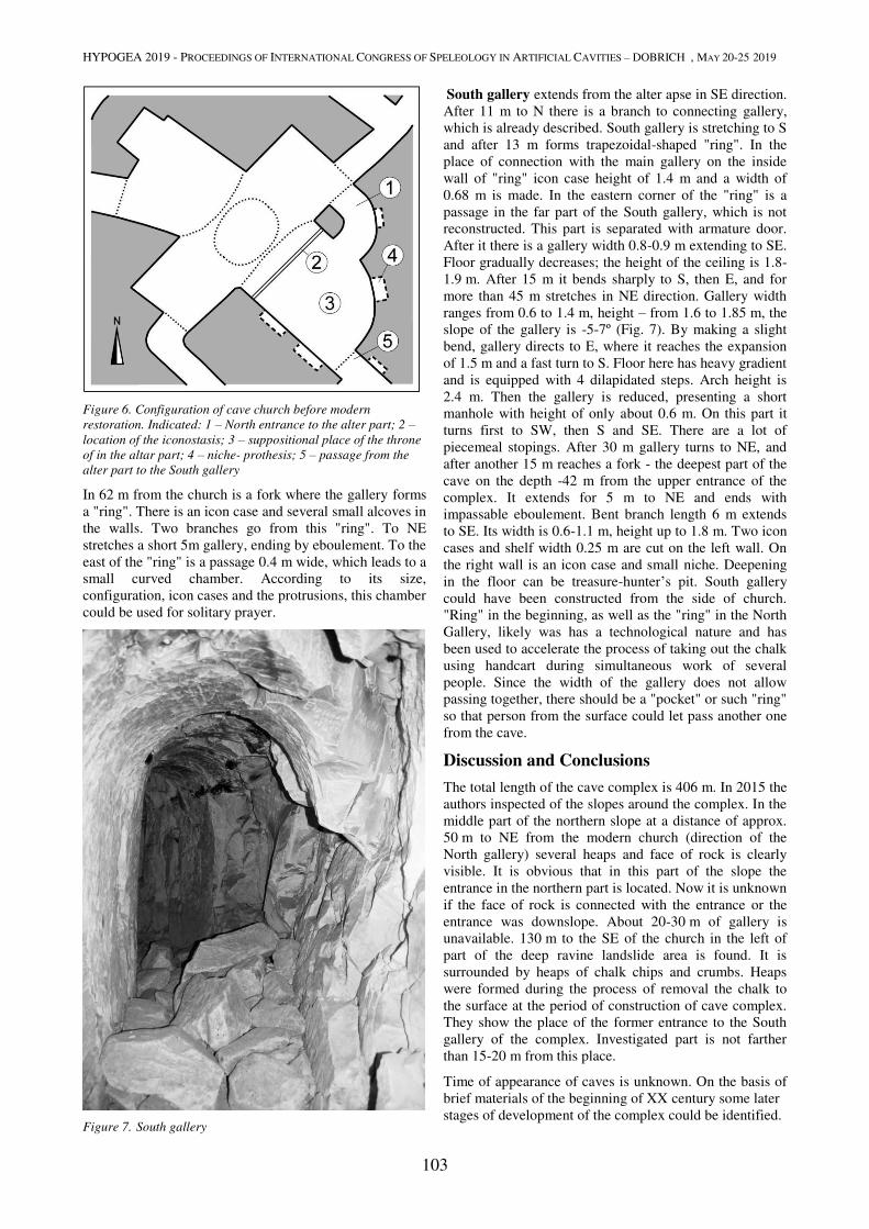
HYPOGEA 2019 - PROCEEDINGS OF INTERNATIONAL CONGRESS OF SPELEOLOGY IN ARTIFICIAL CAVITIES – DOBRICH , MAY 20-25 2019
103
Figure 6. Configuration of cave church before modern
restoration. Indicated: 1 – North entrance to the alter part; 2 –
location of the iconostasis; 3 – suppositional place of the throne
of in the altar part; 4 – niche- prothesis; 5 – passage from the
alter part to the South gallery
In 62 m from the church is a fork where the gallery forms
a "ring". There is an icon case and several small alcoves in
the walls. Two branches go from this "ring". To NE
stretches a short 5m gallery, ending by eboulement. To the
east of the "ring" is a passage 0.4 m wide, which leads to a
small curved chamber. According to its size,
configuration, icon cases and the protrusions, this chamber
could be used for solitary prayer.
Figure 7. South gallery
South gallery extends from the alter apse in SE direction.
After 11 m to N there is a branch to connecting gallery,
which is already described. South gallery is stretching to S
and after 13 m forms trapezoidal-shaped "ring". In the
place of connection with the main gallery on the inside
wall of "ring" icon case height of 1.4 m and a width of
0.68 m is made. In the eastern corner of the "ring" is a
passage in the far part of the South gallery, which is not
reconstructed. This part is separated with armature door.
After it there is a gallery width 0.8-0.9 m extending to SE.
Floor gradually decreases; the height of the ceiling is 1.8-
1.9 m. After 15 m it bends sharply to S, then E, and for
more than 45 m stretches in NE direction. Gallery width
ranges from 0.6 to 1.4 m, height – from 1.6 to 1.85 m, the
slope of the gallery is -5-7º (Fig. 7). By making a slight
bend, gallery directs to E, where it reaches the expansion
of 1.5 m and a fast turn to S. Floor here has heavy gradient
and is equipped with 4 dilapidated steps. Arch height is
2.4 m. Then the gallery is reduced, presenting a short
manhole with height of only about 0.6 m. On this part it
turns first to SW, then S and SE. There are a lot of
piecemeal stopings. After 30 m gallery turns to NE, and
after another 15 m reaches a fork - the deepest part of the
cave on the depth -42 m from the upper entrance of the
complex. It extends for 5 m to NE and ends with
impassable eboulement. Bent branch length 6 m extends
to SE. Its width is 0.6-1.1 m, height up to 1.8 m. Two icon
cases and shelf width 0.25 m are cut on the left wall. On
the right wall is an icon case and small niche. Deepening
in the floor can be treasure-hunter’s pit. South gallery
could have been constructed from the side of church.
"Ring" in the beginning, as well as the "ring" in the North
Gallery, likely was has a technological nature and has
been used to accelerate the process of taking out the chalk
using handcart during simultaneous work of several
people. Since the width of the gallery does not allow
passing together, there should be a "pocket" or such "ring"
so that person from the surface could let pass another one
from the cave.
Discussion and Conclusions
The total length of the cave complex is 406 m. In 2015 the
authors inspected of the slopes around the complex. In the
middle part of the northern slope at a distance of approx.
50 m to NE from the modern church (direction of the
North gallery) several heaps and face of rock is clearly
visible. It is obvious that in this part of the slope the
entrance in the northern part is located. Now it is unknown
if the face of rock is connected with the entrance or the
entrance was downslope. About 20-30 m of gallery is
unavailable. 130 m to the SE of the church in the left of
part of the deep ravine landslide area is found. It is
surrounded by heaps of chalk chips and crumbs. Heaps
were formed during the process of removal the chalk to
the surface at the period of construction of cave complex.
They show the place of the former entrance to the South
gallery of the complex. Investigated part is not farther
than 15-20 m from this place.
Time of appearance of caves is unknown. On the basis of
brief materials of the beginning of XX century some later
stages of development of the complex could be identified.
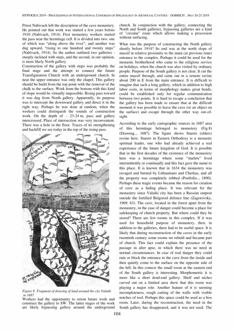
HYPOGEA 2019 - PROCEEDINGS OF INTERNATIONAL CONGRESS OF SPELEOLOGY IN ARTIFICIAL CAVITIES – DOBRICH , MAY 20-25 2019
104
Priest Nabivach left the description of the cave monastery.
He pointed out that work was started a few years before
1910 (Nabivach, 1914). First monastery workers started
the pass near the hermitage cell. It is divided into two: one
of which was “along above the river”, and another was
dug upward, “rising to one hundred and twenty steps”
(Nabivach, 1914). So the author outlined two galleries -
steeply inclined with steps, and the second, in our opinion,
is more likely North gallery.
Construction of the gallery with steps was probably the
final stage and the attempt to connect the future
Transfiguration Church with an underground church. In
near the upper entrance was only the chapel. This gallery
should be build from the top point with the removal of the
chalk to the surface. Work from the bottom with this kind
of slope would be virtually impossible. Rising pass toward
it was dug from North gallery. Apparently, its purpose
was to intercept the downward gallery and direct it in the
right way. Perhaps he was done at random, when the
workers could distinguish the sounds of construction
work. On the depth of – 23-24 m, pass and gallery
intercrossed. Place of intersection was very inconvenient.
There was a hole in the floor. Traces of its strengthening
and backfill we see today in the top of the rising pass.
Figure 8. Fragment of drawing of land around the city Valuiki
in 1687
Workers had the opportunity to orient future work and construct the gallery to SW. The latter stages of the work are likely bypassing gallery around the underground
church. In conjunction with the gallery, connecting the North and South galleries, bypassing galleries are a kind of "circular" route which allows making a procession without surfacing.
What was the purpose of constructing the North gallery
shortly before 1914? Its end was at the north slope of
massif in relative proximity to the main (at previous time)
entrance to the complex. Perhaps it could be used for the
monastic brotherhood who came to the religious service
on holidays, when the church was also visited by ordinary
people. Purpose of the South gallery is not clear. It cut the
entire massif through, and came out in a remote ravine
about 200 m E from the main entrance. It is difficult to
imagine that such a long gallery, which in addition to high
labor costs, in terms of morphology makes great bends,
could be established only for regular communication
between two points. It is hard to escape a conclusion that
the gallery has been made to ensure that at the difficult
moment it was possible to leave the cave (or an object on
the surface) and escape through the other way out-of-
sight.
According to the early cartographic sources in 1687 area
of this hermitage belonged to monastery (Fig.8)
(Drawing.., 1687). The figure shows Starets (elders)
ravine here. Starets in Eastern Orthodoxy is a monastic
spiritual leader, one who had already achieved a real
experience of the future kingdom of God. It is possible
that in the first decades of the existence of the monastery
here was a hermitage where some “starlets” lived
intermittently or continually and this fact gave the name to
this place. It is known that in 1634 the monastery was
ravaged and burned by Lithuanians and Cherkas, and all
the property was completely robbed (Portfolio.., 1890).
Perhaps these tragic events became the reason for creation
of cave as a hiding place. It was relevant for the
monastery since Valuiki city has been a Russian outpost
outside the fortified Belgorod defence line (Zagorovsky,
1969: 63). The cave, located in the forest apart from the
monastery, in the case of danger could become a place for
safekeeping of church property. But where could they be
stored? There are few rooms in this complex. If it was
used for household purpose of monastery, then, in
addition to the galleries, there had to be useful space. It is
likely that during reconstruction of the caves in the early
twentieth century some rooms we rebuilt and became part
of church. This fact could explain the presence of the
passage in alter apse, in which there was no need in
normal circumstances. In case of real danger they could
ruin or block the entrance to the cave from the inside and
then quietly come to the surface on the opposite side of
the hill. In this context the small room at the eastern end
of the South gallery is interesting. Morphometric it is
more like a short dead-end gallery. Shelf and niches
carved out on a limited area show that this room was
playing a major role. Another feature of it is seeming
incompleteness, rough cutting of the walls with visible
notches of tool. Perhaps this space could be used as a box
room. Later, during the reconstruction, the need in the
South gallery has disappeared, and it was not used. The
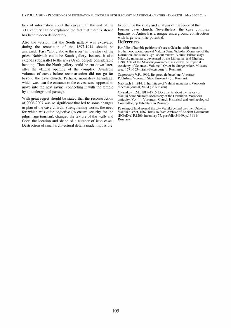
HYPOGEA 2019 - PROCEEDINGS OF INTERNATIONAL CONGRESS OF SPELEOLOGY IN ARTIFICIAL CAVITIES – DOBRICH , MAY 20-25 2019
105
lack of information about the caves until the end of the
XIX century can be explained the fact that their existence
has been hidden deliberately.
Also the version that the South gallery was excavated
during the renovation of the 1897-1914 should be
analyzed. Pass “along above the river” in the story of the
priest Nabivach could be South gallery, because it also
extends subparallel to the river Oskol despite considerable
bending. Then the North gallery could be cut down later,
after the official opening of the complex. Available
volumes of caves before reconstruction did not go far
beyond the cave church. Perhaps, monastery hermitage,
which was near the entrance to the caves, was supposed to
move into the next ravine, connecting it with the temple
by an underground passage.
With great regret should be stated that the reconstruction
of 2006-2007 was so significant that led to some changes
in plan of the cave church. Strengthening works, the need
for which was quite objective (to ensure security for the
pilgrimage tourism), changed the texture of the walls and
floor, the location and shape of a number of icon cases.
Destruction of small architectural details made impossible
to continue the study and analysis of the space of the Former cave church. Nevertheless, the cave complex Ignatius of Antioch is a unique underground construction with large scientific potential.
References
Portfolio of humble petitions of starets Gelasius with monastic brotherhood about renewal Valuiki Saint Nicholas Monastery of the Dormition. and starets Cyril about renewal Voluiki Pristanskaya Nikolsky monastery, devastated by the Lithuanian and Cherkas, 1890. Acts of the Moscow government issued by the Imperial Academy of Sciences. Volume I. Order-in-charge prikaz. Moscow area. 1571-1634. Saint-Petersburg (in Russian).
Zagorovsky V.P., 1969. Belgorod defence line. Voronezh: Publishing Voronezh State University ( in Russian).
Nabivach I., 1914. In hermitage of Valuiki monastery. Voronezh diocesan journal, № 34 ( in Russian).
Oleynikov T.M., 1915–1916. Documents about the history of Valuiki Saint Nicholas Monastery of the Dormition. Voronezh antiquity. Vol. 14. Voronezh: Church Historical and Archaeological Committee, pp.186–262 ( in Russian).
Drawing of land around the city Valuiki behind the river Oskol in Valuiki district, 1687 Russian State Archive of Ancient Documents (RGADA) F.1209, inventory 77, portfolio 34699, p.161 ( in Russian).
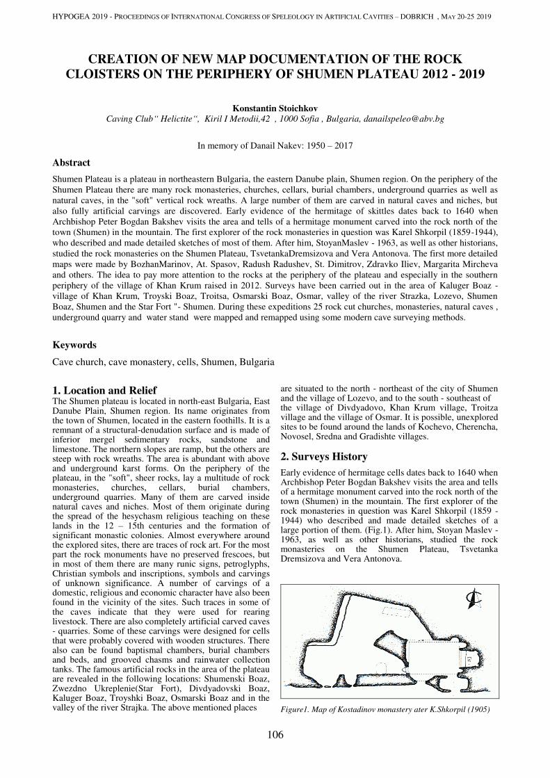
HYPOGEA 2019 - PROCEEDINGS OF INTERNATIONAL CONGRESS OF SPELEOLOGY IN ARTIFICIAL CAVITIES – DOBRICH , MAY 20-25 2019
106
CREATION OF NEW MAP DOCUMENTATION OF THE ROCK
CLOISTERS ON THE PERIPHERY OF SHUMEN PLATEAU 2012 - 2019
Konstantin Stoichkov Caving Club“ Helictite“, Kiril I Metodii,42 , 1000 Sofia , Bulgaria, [email protected]
In memory of Danail Nakev: 1950 – 2017
Abstract
Shumen Plateau is a plateau in northeastern Bulgaria, the eastern Danube plain, Shumen region. On the periphery of the
Shumen Plateau there are many rock monasteries, churches, cellars, burial chambers, underground quarries as well as
natural caves, in the "soft" vertical rock wreaths. A large number of them are carved in natural caves and niches, but
also fully artificial carvings are discovered. Early evidence of the hermitage of skittles dates back to 1640 when
Archbishop Peter Bogdan Bakshev visits the area and tells of a hermitage monument carved into the rock north of the
town (Shumen) in the mountain. The first explorer of the rock monasteries in question was Karel Shkorpil (1859-1944),
who described and made detailed sketches of most of them. After him, StoyanMaslev - 1963, as well as other historians,
studied the rock monasteries on the Shumen Plateau, TsvetankaDremsizova and Vera Antonova. The first more detailed
maps were made by BozhanMarinov, At. Spasov, Radush Radushev, St. Dimitrov, Zdravko Iliev, Margarita Mircheva
and others. The idea to pay more attention to the rocks at the periphery of the plateau and especially in the southern
periphery of the village of Khan Krum raised in 2012. Surveys have been carried out in the area of Kaluger Boaz -
village of Khan Krum, Troyski Boaz, Troitsa, Osmarski Boaz, Osmar, valley of the river Strazka, Lozevo, Shumen
Boaz, Shumen and the Star Fort "- Shumen. During these expeditions 25 rock cut churches, monasteries, natural caves ,
underground quarry and water stand were mapped and remapped using some modern cave surveying methods.
Keywords
Cave church, cave monastery, cells, Shumen, Bulgaria
1. Location and Relief The Shumen plateau is located in north-east Bulgaria, East Danube Plain, Shumen region. Its name originates from the town of Shumen, located in the eastern foothills. It is a remnant of a structural-denudation surface and is made of inferior mergel sedimentary rocks, sandstone and limestone. The northern slopes are ramp, but the others are steep with rock wreaths. The area is abundant with above and underground karst forms. On the periphery of the plateau, in the "soft", sheer rocks, lay a multitude of rock monasteries, churches, cellars, burial chambers, underground quarries. Many of them are carved inside natural caves and niches. Most of them originate during the spread of the hesychasm religious teaching on these lands in the 12 – 15th centuries and the formation of significant monastic colonies. Almost everywhere around the explored sites, there are traces of rock art. For the most part the rock monuments have no preserved frescoes, but in most of them there are many runic signs, petroglyphs, Christian symbols and inscriptions, symbols and carvings of unknown significance. A number of carvings of a domestic, religious and economic character have also been found in the vicinity of the sites. Such traces in some of the caves indicate that they were used for rearing livestock. There are also completely artificial carved caves - quarries. Some of these carvings were designed for cells that were probably covered with wooden structures. There also can be found baptismal chambers, burial chambers and beds, and grooved chasms and rainwater collection tanks. The famous artificial rocks in the area of the plateau are revealed in the following locations: Shumenski Boaz, Zwezdno Ukreplenie(Star Fort), Divdyadovski Boaz, Kaluger Boaz, Troyshki Boaz, Osmarski Boaz and in the valley of the river Strajka. The above mentioned places
are situated to the north - northeast of the city of Shumen and the village of Lozevo, and to the south - southeast of the village of Divdyadovo, Khan Krum village, Troitza village and the village of Osmar. It is possible, unexplored sites to be found around the lands of Kochevo, Cherencha, Novosel, Sredna and Gradishte villages.
2. Surveys History
Early evidence of hermitage cells dates back to 1640 when Archbishop Peter Bogdan Bakshev visits the area and tells of a hermitage monument carved into the rock north of the town (Shumen) in the mountain. The first explorer of the rock monasteries in question was Karel Shkorpil (1859 - 1944) who described and made detailed sketches of a large portion of them. (Fig.1). After him, Stoyan Maslev - 1963, as well as other historians, studied the rock monasteries on the Shumen Plateau, Tsvetanka Dremsizova and Vera Antonova.
Figure1. Map of Kostadinov monastery ater K.Shkorpil (1905)
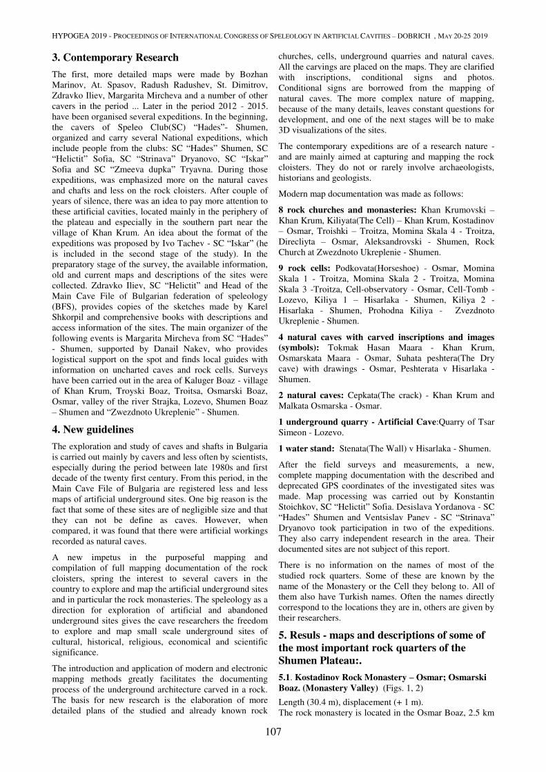
HYPOGEA 2019 - PROCEEDINGS OF INTERNATIONAL CONGRESS OF SPELEOLOGY IN ARTIFICIAL CAVITIES – DOBRICH , MAY 20-25 2019
107
3. Contemporary Research
The first, more detailed maps were made by Bozhan
Marinov, At. Spasov, Radush Radushev, St. Dimitrov,
Zdravko Iliev, Margarita Mircheva and a number of other
cavers in the period ... Later in the period 2012 - 2015.
have been organised several expeditions. In the beginning,
the cavers of Speleo Club(SC) “Hades”- Shumen,
organized and carry several National expeditions, which
include people from the clubs: SC “Hades” Shumen, SC
“Helictit” Sofia, SC “Strinava” Dryanovo, SC “Iskar”
Sofia and SC “Zmeeva dupka” Tryavna. During those
expeditions, was emphasized more on the natural caves
and chafts and less on the rock cloisters. After couple of
years of silence, there was an idea to pay more attention to
these artificial cavities, located mainly in the periphery of
the plateau and especially in the southern part near the
village of Khan Krum. An idea about the format of the
expeditions was proposed by Ivo Tachev - SC “Iskar” (he
is included in the second stage of the study). In the
preparatory stage of the survey, the available information,
old and current maps and descriptions of the sites were
collected. Zdravko Iliev, SC “Helictit” and Head of the
Main Cave File of Bulgarian federation of speleology
(BFS), provides copies of the sketches made by Karel
Shkorpil and comprehensive books with descriptions and
access information of the sites. The main organizer of the
following events is Margarita Mircheva from SC “Hades”
- Shumen, supported by Danail Nakev, who provides
logistical support on the spot and finds local guides with
information on uncharted caves and rock cells. Surveys
have been carried out in the area of Kaluger Boaz - village
of Khan Krum, Troyski Boaz, Troitsa, Osmarski Boaz,
Osmar, valley of the river Strajka, Lozevo, Shumen Boaz
– Shumen and “Zwezdnoto Ukreplenie” - Shumen.
4. New guidelines
The exploration and study of caves and shafts in Bulgaria
is carried out mainly by cavers and less often by scientists,
especially during the period between late 1980s and first
decade of the twenty first century. From this period, in the
Main Cave File of Bulgaria are registered less and less
maps of artificial underground sites. One big reason is the
fact that some of these sites are of negligible size and that
they can not be define as caves. However, when
compared, it was found that there were artificial workings
recorded as natural caves.
A new impetus in the purposeful mapping and
compilation of full mapping documentation of the rock
cloisters, spring the interest to several cavers in the
country to explore and map the artificial underground sites
and in particular the rock monasteries. The speleology as a
direction for exploration of artificial and abandoned
underground sites gives the cave researchers the freedom
to explore and map small scale underground sites of
cultural, historical, religious, economical and scientific
significance.
The introduction and application of modern and electronic
mapping methods greatly facilitates the documenting
process of the underground architecture carved in a rock.
The basis for new research is the elaboration of more
detailed plans of the studied and already known rock
churches, cells, underground quarries and natural caves.
All the carvings are placed on the maps. They are clarified
with inscriptions, conditional signs and photos.
Conditional signs are borrowed from the mapping of
natural caves. The more complex nature of mapping,
because of the many details, leaves constant questions for
development, and one of the next stages will be to make
3D visualizations of the sites.
The contemporary expeditions are of a research nature -
and are mainly aimed at capturing and mapping the rock
cloisters. They do not or rarely involve archaeologists,
historians and geologists.
Modern map documentation was made as follows:
8 rock churches and monasteries: Khan Krumovski –
Khan Krum, Kiliyata(The Cell) – Khan Krum, Kostadinov
– Osmar, Troishki – Troitza, Momina Skala 4 - Troitza,
Direcliyta – Osmar, Aleksandrovski - Shumen, Rock
Church at Zwezdnoto Ukreplenie - Shumen.
9 rock cells: Podkovata(Horseshoe) - Osmar, Momina
Skala 1 - Troitza, Momina Skala 2 - Troitza, Momina
Skala 3 -Troitza, Cell-observatory - Osmar, Cell-Tomb -
Lozevo, Kiliya 1 – Hisarlaka - Shumen, Kiliya 2 -
Hisarlaka - Shumen, Prohodna Kiliya - Zvezdnoto
Ukreplenie - Shumen.
4 natural caves with carved inscriptions and images
(symbols): Tokmak Hasan Maara - Khan Krum,
Osmarskata Maara - Osmar, Suhata peshtera(The Dry
cave) with drawings - Osmar, Peshterata v Hisarlaka -
Shumen.
2 natural caves: Cepkata(The crack) - Khan Krum and
Malkata Osmarska - Osmar.
1 underground quarry - Artificial Cave:Quarry of Tsar
Simeon - Lozevo.
1 water stand: Stenata(The Wall) v Hisarlaka - Shumen.
After the field surveys and measurements, a new,
complete mapping documentation with the described and
deprecated GPS coordinates of the investigated sites was
made. Map processing was carried out by Konstantin
Stoichkov, SC “Helictit” Sofia. Desislava Yordanova - SC
“Hades” Shumen and Ventsislav Panev - SC “Strinava”
Dryanovo took participation in two of the expeditions.
They also carry independent research in the area. Their
documented sites are not subject of this report.
There is no information on the names of most of the
studied rock quarters. Some of these are known by the
name of the Monastery or the Cell they belong to. All of
them also have Turkish names. Often the names directly
correspond to the locations they are in, others are given by
their researchers.
5. Resuls - maps and descriptions of some of
the most important rock quarters of the
Shumen Plateau:.
5.1. Kostadinov Rock Monastery – Osmar; Osmarski
Boaz. (Monastery Valley) (Figs. 1, 2)
Length (30.4 m), displacement (+ 1 m).
The rock monastery is located in the Osmar Boaz, 2.5 km
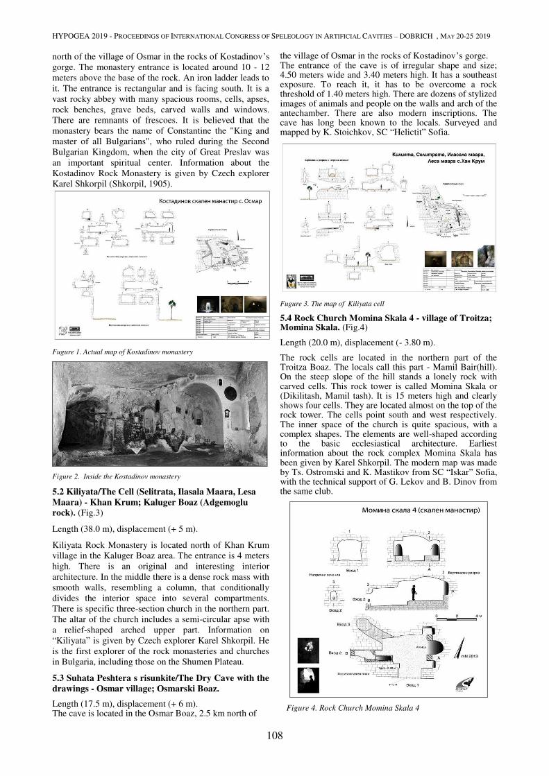
HYPOGEA 2019 - PROCEEDINGS OF INTERNATIONAL CONGRESS OF SPELEOLOGY IN ARTIFICIAL CAVITIES – DOBRICH , MAY 20-25 2019
108
north of the village of Osmar in the rocks of Kostadinov’s
gorge. The monastery entrance is located around 10 - 12
meters above the base of the rock. An iron ladder leads to
it. The entrance is rectangular and is facing south. It is a
vast rocky abbey with many spacious rooms, cells, apses,
rock benches, grave beds, carved walls and windows.
There are remnants of frescoes. It is believed that the
monastery bears the name of Constantine the "King and
master of all Bulgarians", who ruled during the Second
Bulgarian Kingdom, when the city of Great Preslav was
an important spiritual center. Information about the
Kostadinov Rock Monastery is given by Czech explorer
Karel Shkorpil (Shkorpil, 1905).
Fugure 1. Actual map of Kostadinov monastery
Figure 2. Inside the Kostadinov monastery
5.2 Kiliyata/The Cell (Selitrata, Ilasala Maara, Lesa
Maara) - Khan Krum; Kaluger Boaz (Adgemoglu
rock). (Fig.3)
Length (38.0 m), displacement (+ 5 m).
Kiliyata Rock Monastery is located north of Khan Krum
village in the Kaluger Boaz area. The entrance is 4 meters
high. There is an original and interesting interior
architecture. In the middle there is a dense rock mass with
smooth walls, resembling a column, that conditionally
divides the interior space into several compartments.
There is specific three-section church in the northern part.
The altar of the church includes a semi-circular apse with
a relief-shaped arched upper part. Information on
“Kiliyata” is given by Czech explorer Karel Shkorpil. He
is the first explorer of the rock monasteries and churches
in Bulgaria, including those on the Shumen Plateau.
5.3 Suhata Peshtera s risunkite/The Dry Cave with the
drawings - Osmar village; Osmarski Boaz.
Length (17.5 m), displacement (+ 6 m). The cave is located in the Osmar Boaz, 2.5 km north of
the village of Osmar in the rocks of Kostadinov’s gorge. The entrance of the cave is of irregular shape and size; 4.50 meters wide and 3.40 meters high. It has a southeast exposure. To reach it, it has to be overcome a rock threshold of 1.40 meters high. There are dozens of stylized images of animals and people on the walls and arch of the antechamber. There are also modern inscriptions. The cave has long been known to the locals. Surveyed and mapped by K. Stoichkov, SC “Helictit” Sofia.
Fugure 3. The map of Kiliyata cell
5.4 Rock Church Momina Skala 4 - village of Troitza; Momina Skala. (Fig.4)
Length (20.0 m), displacement (- 3.80 m).
The rock cells are located in the northern part of the Troitza Boaz. The locals call this part - Mamil Bair(hill). On the steep slope of the hill stands a lonely rock with carved cells. This rock tower is called Momina Skala or (Dikilitash, Mamil tash). It is 15 meters high and clearly shows four cells. They are located almost on the top of the rock tower. The cells point south and west respectively. The inner space of the church is quite spacious, with a complex shapes. The elements are well-shaped according to the basic ecclesiastical architecture. Earliest information about the rock complex Momina Skala has been given by Karel Shkorpil. The modern map was made by Ts. Ostromski and K. Mastikov from SC “Iskar” Sofia, with the technical support of G. Lekov and B. Dinov from the same club.
Figure 4. Rock Church Momina Skala 4

HYPOGEA 2019 - PROCEEDINGS OF INTERNATIONAL CONGRESS OF SPELEOLOGY IN ARTIFICIAL CAVITIES – DOBRICH , MAY 20-25 2019
109
References
Angelova D, Stefanov, P., Benderev. A, 1999 Rock Monasteries
on the Shumen Plateau. National Park Directorate "Shumen
Plateau". Shumen, Bulgaria
Neotectonics and Geodynamic Development of the Shumen
Plateau - Collection of summaries from the Jubilee Scientific
Conference "50 Years of Systemic and Condensed Geological
Charging" Bulgaria -25-26.1999, Sofia, 5-7.
Yolchechev, H. 1989. Stratigraphy of the epicontinental type of
upper chalk, Bulgaria. Ed. SofUni. "St. Kl. Ohridski", Sofia
Mircheva , Iliev, Z. Iliev - 40 years cave club in Shumen. 1961-
2001, Shumen, Bulgaria
Mircheva , Iliev, Z. Iliev , Stoichkov, K, 2013, Rock Hermits of
Shumen, Book 1, Shumen, Bulgaria
Mircheva , M, Stoichkov, K. ,2014, Rock Hermits of Shumen,
book 2, Shumen, Bulgaria
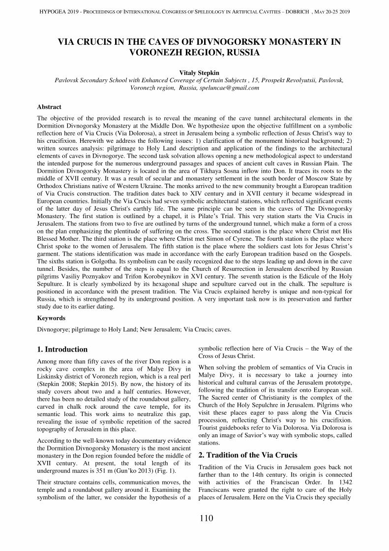
HYPOGEA 2019 - PROCEEDINGS OF INTERNATIONAL CONGRESS OF SPELEOLOGY IN ARTIFICIAL CAVITIES – DOBRICH , MAY 20-25 2019
110
VIA CRUCIS IN THE CAVES OF DIVNOGORSKY MONASTERY IN
VORONEZH REGION, RUSSIA
Vitaly Stepkin Pavlovsk Secondary School with Enhanced Coverage of Certain Subjects , 15, Prospekt Revolyutsii, Pavlovsk,
Voronezh region, Russia, [email protected]
Abstract
The objective of the provided research is to reveal the meaning of the cave tunnel architectural elements in the
Dormition Divnogorsky Monastery at the Middle Don. We hypothesize upon the objective fulfillment on a symbolic
reflection here of Via Crucis (Via Dolorosa), a street in Jerusalem being a symbolic reflection of Jesus Christ's way to
his crucifixion. Herewith we address the following issues: 1) clarification of the monument historical background; 2)
written sources analysis: pilgrimage to Holy Land description and application of the findings to the architectural
elements of caves in Divnogorye. The second task solvation allows opening a new methodological aspect to understand
the intended purpose for the numerous underground passages and spaces of ancient cult caves in Russian Plain. The
Dormition Divnogorsky Monastery is located in the area of Tikhaya Sosna inflow into Don. It traces its roots to the
middle of XVII century. It was a result of secular and monastery settlement in the south border of Moscow State by
Orthodox Christians native of Western Ukraine. The monks arrived to the new community brought a European tradition
of Via Crucis construction. The tradition dates back to XIV century and in XVII century it became widespread in
European countries. Initially the Via Crucis had seven symbolic architectural stations, which reflected significant events
of the latter day of Jesus Christ's earthly life. The same principle can be seen in the caves of The Divnogorsky
Monastery. The first station is outlined by a chapel, it is Pilate’s Trial. This very station starts the Via Crucis in
Jerusalem. The stations from two to five are outlined by turns of the underground tunnel, which make a form of a cross
on the plan emphasizing the plentitude of suffering on the cross. The second station is the place where Christ met His
Blessed Mother. The third station is the place where Christ met Simon of Cyrene. The fourth station is the place where
Christ spoke to the women of Jerusalem. The fifth station is the place where the soldiers cast lots for Jesus Christ’s
garment. The stations identification was made in accordance with the early European tradition based on the Gospels.
The sixths station is Golgotha. Its symbolism can be easily recognized due to the steps leading up and down in the cave
tunnel. Besides, the number of the steps is equal to the Church of Resurrection in Jerusalem described by Russian
pilgrims Vasiliy Poznyakov and Trifon Korobeynikov in XVI century. The seventh station is the Edicule of the Holy
Sepulture. It is clearly symbolized by its hexagonal shape and sepulture carved out in the chalk. The sepulture is
positioned in accordance with the present tradition. The Via Crucis explained hereby is unique and non-typical for
Russia, which is strengthened by its underground position. A very important task now is its preservation and further
study due to its earlier dating.
Keywords
Divnogorye; pilgrimage to Holy Land; New Jerusalem; Via Crucis; caves.
1. Introduction
Among more than fifty caves of the river Don region is a
rocky cave complex in the area of Malye Divy in
Liskinsky district of Voronezh region, which is a real perl
(Stepkin 2008; Stepkin 2015). By now, the history of its
study covers about two and a half centuries. However,
there has been no detailed study of the roundabout gallery,
carved in chalk rock around the cave temple, for its
semantic load. This work aims to neutralize this gap,
revealing the issue of symbolic repetition of the sacred
topography of Jerusalem in this place.
According to the well-known today documentary evidence
the Dormition Divnogorsky Monastery is the most ancient
monastery in the Don region founded before the middle of
XVII century. At present, the total length of its
underground mazes is 351 m (Gun’ko 2013) (Fig. 1).
Their structure contains cells, communication moves, the
temple and a roundabout gallery around it. Examining the
symbolism of the latter, we consider the hypothesis of a
symbolic reflection here of Via Crucis – the Way of the
Cross of Jesus Christ.
When solving the problem of semantics of Via Crucis in
Malye Divy, it is necessary to take a journey into
historical and cultural canvas of the Jerusalem prototype,
following the tradition of its transfer onto European soil.
The Sacred center of Christianity is the complex of the
Church of the Holy Sepulchre in Jerusalem. Pilgrims who
visit these places eager to pass along the Via Crucis
procession, reflecting Christ's way to his crucifixion.
Tourist guidebooks refer to Via Dolorosa. Via Dolorosa is
only an image of Savior’s way with symbolic stops, called
stations.
2. Tradition of the Via Crucis
Tradition of the Via Crucis in Jerusalem goes back not
farther than to the 14th century. Its origin is connected
with activities of the Franciscan Order. In 1342
Franciscans were granted the right to care of the Holy
places of Jerusalem. Here on the Via Crucis they specially
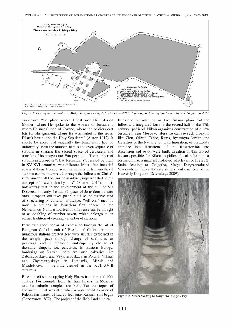
HYPOGEA 2019 - PROCEEDINGS OF INTERNATIONAL CONGRESS OF SPELEOLOGY IN ARTIFICIAL CAVITIES – DOBRICH , MAY 20-25 2019
111
emphasize “the place where Christ met His Blessed
Mother, where He spoke to the women of Jerusalem,
where He met Simon of Cyrene, where the soldiers cast
lots for His garment, where He was nailed to the cross,
Pilate's house, and the Holy Sepulchre” (Alston 1912). It
should be noted that originally the Franciscans had no
uniformity about the number, names and even sequence of
stations in shaping the sacred space of Jerusalem and
transfer of its image onto European soil. The number of
stations in European “New Jerusalem’s”, created by them
in XV-XVI centuries, was different. Most often included
seven of them. Number seven in number of later-medieval
stations can be interpreted through the fullness of Christ's
suffering for all the sins of mankind, impersonated in the
concept of “seven deadly sins” (Rickert 2014). It is
noteworthy that in the development of the cult of Via
Dolorosa not only the sacred space of Jerusalem transfer
onto European soil takes place, but also the reverse kind
of structuring of cultural landscape. Well-confirmed by
now 14 stations in Jerusalem first appear in the
Netherlands. Number fourteen in this sense can be thought
of as doubling of number seven, which belongs to an
earlier tradition of creating a number of stations.
If we talk about forms of expression through the art of
European Catholic cult of Passion of Christ, then the
numerous stations created here were usually expressed in
the temple space through change of sculptures or
paintings, and in monastic landscape by change of
thematic chapels, i.e. calvarias. In Eastern Europe,
bordering on Russia, there are such calvaries like
Zebzhidovskaya and Veykherovskaya in Poland, Vilnius
and Zhyamaitiyskaya in Lithuania, Minsk and
Myadelskaya in Belarus, created in the XVII-XVIII
centuries.
Russia itself starts copying Holy Places from the mid 16th
century. For example, from that time forward in Moscow
and its suburbs temples are built like the topos of
Jerusalem. That was also when a widespread transfer of
Palestinian names of sacred loci onto Russian soil began
(Ponomarev 1877). The project of the Holy land cultural
landscape reproduction on the Russian plain had the
fullest and integrated form in the second half of the 17th
century: patriarch Nikon organizes construction of a new
Jerusalem near Moscow. Here we can see such oronyms
like Zion, Olivet, Tabor, Rama, hydronym Jordan; the
Churches of the Nativity, of Transfiguration, of the Lord's
entrance into Jerusalem, of the Resurrection and
Ascension and so on were built. Creation of this project
became possible for Nikon to philosophical reflection of
Jerusalem like a material prototype which can be Figure 2.
Stairs leading to Golgotha, Malye Divyreproduced
“everywhere”, since the city itself is only an icon of the
Heavenly Kingdom (Zelenskaya 2009).
Figure 2. Stairs leading to Golgotha, Malye Divy
Figure 1. Plan of cave complex in Malye Divy drawn by A.A. Gunko in 2011, depicting stations of Via Crucis by V.V. Stepkin in 2017
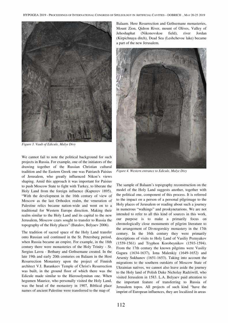
HYPOGEA 2019 - PROCEEDINGS OF INTERNATIONAL CONGRESS OF SPELEOLOGY IN ARTIFICIAL CAVITIES – DOBRICH , MAY 20-25 2019
112
Figure 3. Vault of Edicule, Malye Divy
We cannot fail to note the political background for such
projects in Russia. For example, one of the initiators of the
drawing together of the Russian Christian cultural
tradition and the Eastern Greek one was Patriarch Paisius
of Jerusalem, who greatly influenced Nikon’s views
shaping. Amid this approach it was important for Paisius
to push Moscow State to fight with Turkey, to liberate the
Holy Land from the foreign influence (Kapterev 1895).
“With the development in the 16th century of view of
Moscow as the last Orthodox realm, the veneration of
Palestine relics became nation-wide and went on to a
traditional for Western Europe direction. Making their
realm similar to the Holy Land and its capital to the new
Jerusalem, Moscow czars sought to transfer to Russia the
topography of the Holy places” (Batalov, Belyaev 2006).
The tradition of sacred space of the Holy Land transfer
onto Russian soil continued in the St. Petersburg period,
when Russia became an empire. For example, in the 18th
century there were monasteries of the Holy Trinity - St.
Sergius Lavra - Bethany and Gethsemane created. In the
late 19th and early 20th centuries on Balaam in the Host
Resurrection Monastery upon the project of Finnish
architect V.I. Barankeev Temple of Christ's Resurrection
was built, in the ground floor of which there was the
Edicule made similar to the Hierosolymitan one. When
hegumen Maurice, who personally visited the Holy Land,
was the head of the monastery in 1907, Biblical place
names of ancient Palestine were transferred to the map of
Balaam. Here Resurrection and Gethsemane monasteries,
Mount Zion, Qidron River, mount of Olives, Valley of
Jehoshaphat (Nikonovskoe field), river Jordan
(Kirpichnaya ditch), Dead Sea (Leshchevoe lake) became
a part of the new Jerusalem.
Figure 4. Western entrance to Edicule, Malye Divy
The sample of Balaam’s topography reconstruction on the
model of the Holy Land suggests another, together with
the political one, component of this process. It is referred
to the impact on a person of a personal pilgrimage to the
Holy places of Jerusalem or reading about such a journey
in numerous “walkings” and proskynetarions. We are not
intended to refer to all this kind of sources in this work,
our purpose is to make a primarily focus on
chronologically close monuments of pilgrim literature to
the arrangement of Divnogorskiy monastery in the 17th
century. In the 16th century they were primarily
descriptions of visits to Holy Land of Vasiliy Poznyakov
(1559-1561) and Tryphon Korobeynikov (1593-1594).
From the 17th century the known pilgrims were Vasiliy
Gagara (1634-1637), Iona Malenkiy (1649-1652) and
Arseniy Sukhanov (1651-1653). Taking into account the
migrations to the southern outskirts of Moscow State of
Ukrainian natives, we cannot also leave aside the journey
to the Holy land of Polish Duke Nicholay Radziwill, who
visited Jerusalem in 1583. L.A. Belyaev paid attention to
the important feature of transferring to Russia of
Jerusalem topos. All projects of such kind “have the
imprint of European influences, they are localized in areas
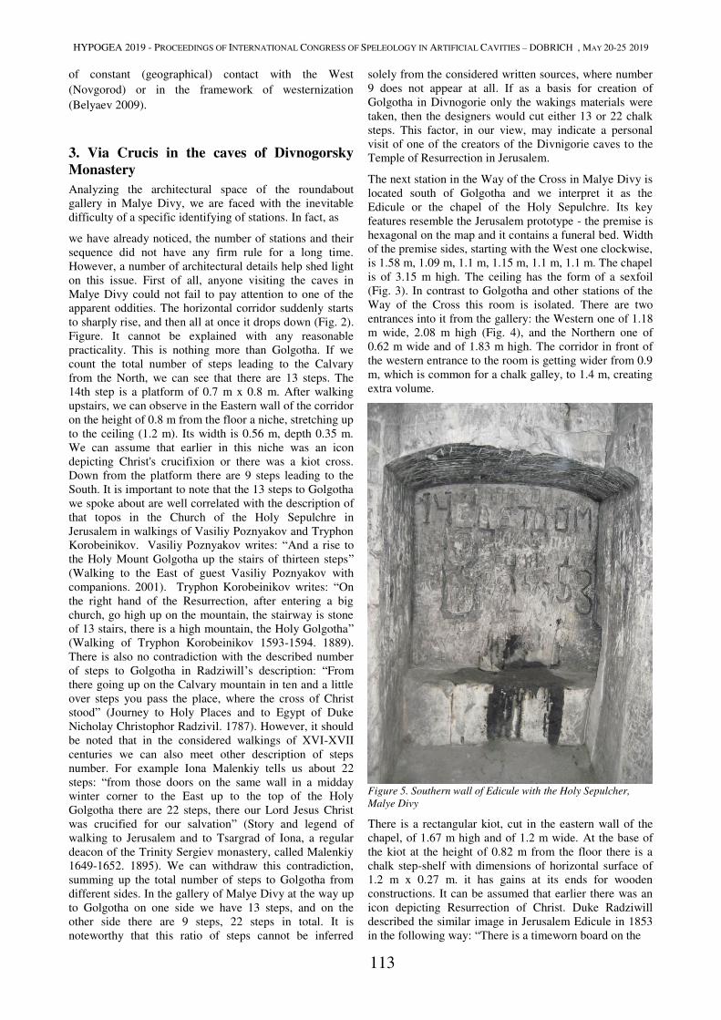
HYPOGEA 2019 - PROCEEDINGS OF INTERNATIONAL CONGRESS OF SPELEOLOGY IN ARTIFICIAL CAVITIES – DOBRICH , MAY 20-25 2019
113
of constant (geographical) contact with the West
(Novgorod) or in the framework of westernization
(Belyaev 2009).
3. Via Crucis in the caves of Divnogorsky
Monastery
Analyzing the architectural space of the roundabout
gallery in Malye Divy, we are faced with the inevitable
difficulty of a specific identifying of stations. In fact, as
we have already noticed, the number of stations and their
sequence did not have any firm rule for a long time.
However, a number of architectural details help shed light
on this issue. First of all, anyone visiting the caves in
Malye Divy could not fail to pay attention to one of the
apparent oddities. The horizontal corridor suddenly starts
to sharply rise, and then all at once it drops down (Fig. 2).
Figure. It cannot be explained with any reasonable
practicality. This is nothing more than Golgotha. If we
count the total number of steps leading to the Calvary
from the North, we can see that there are 13 steps. The
14th step is a platform of 0.7 m x 0.8 m. After walking
upstairs, we can observe in the Eastern wall of the corridor
on the height of 0.8 m from the floor a niche, stretching up
to the ceiling (1.2 m). Its width is 0.56 m, depth 0.35 m.
We can assume that earlier in this niche was an icon
depicting Christ's crucifixion or there was a kiot cross.
Down from the platform there are 9 steps leading to the
South. It is important to note that the 13 steps to Golgotha
we spoke about are well correlated with the description of
that topos in the Church of the Holy Sepulchre in
Jerusalem in walkings of Vasiliy Poznyakov and Tryphon
Korobeinikov. Vasiliy Poznyakov writes: “And a rise to
the Holy Mount Golgotha up the stairs of thirteen steps”
(Walking to the East of guest Vasiliy Poznyakov with
companions. 2001). Tryphon Korobeinikov writes: “On
the right hand of the Resurrection, after entering a big
church, go high up on the mountain, the stairway is stone
of 13 stairs, there is a high mountain, the Holy Golgotha”
(Walking of Tryphon Korobeinikov 1593-1594. 1889).
There is also no contradiction with the described number
of steps to Golgotha in Radziwill’s description: “From
there going up on the Calvary mountain in ten and a little
over steps you pass the place, where the cross of Christ
stood” (Journey to Holy Places and to Egypt of Duke
Nicholay Christophor Radzivil. 1787). However, it should
be noted that in the considered walkings of XVI-XVII
centuries we can also meet other description of steps
number. For example Iona Malenkiy tells us about 22
steps: “from those doors on the same wall in a midday
winter corner to the East up to the top of the Holy
Golgotha there are 22 steps, there our Lord Jesus Christ
was crucified for our salvation” (Story and legend of
walking to Jerusalem and to Tsargrad of Iona, a regular
deacon of the Trinity Sergiev monastery, called Malenkiy
1649-1652. 1895). We can withdraw this contradiction,
summing up the total number of steps to Golgotha from
different sides. In the gallery of Malye Divy at the way up
to Golgotha on one side we have 13 steps, and on the
other side there are 9 steps, 22 steps in total. It is
noteworthy that this ratio of steps cannot be inferred
solely from the considered written sources, where number
9 does not appear at all. If as a basis for creation of
Golgotha in Divnogorie only the wakings materials were
taken, then the designers would cut either 13 or 22 chalk
steps. This factor, in our view, may indicate a personal
visit of one of the creators of the Divnigorie caves to the
Temple of Resurrection in Jerusalem.
The next station in the Way of the Cross in Malye Divy is
located south of Golgotha and we interpret it as the
Edicule or the chapel of the Holy Sepulchre. Its key
features resemble the Jerusalem prototype - the premise is
hexagonal on the map and it contains a funeral bed. Width
of the premise sides, starting with the West one clockwise,
is 1.58 m, 1.09 m, 1.1 m, 1.15 m, 1.1 m, 1.1 m. The chapel
is of 3.15 m high. The ceiling has the form of a sexfoil
(Fig. 3). In contrast to Golgotha and other stations of the
Way of the Cross this room is isolated. There are two
entrances into it from the gallery: the Western one of 1.18
m wide, 2.08 m high (Fig. 4), and the Northern one of
0.62 m wide and of 1.83 m high. The corridor in front of
the western entrance to the room is getting wider from 0.9
m, which is common for a chalk galley, to 1.4 m, creating
extra volume.
Figure 5. Southern wall of Edicule with the Holy Sepulcher,
Malye Divy
There is a rectangular kiot, cut in the eastern wall of the
chapel, of 1.67 m high and of 1.2 m wide. At the base of
the kiot at the height of 0.82 m from the floor there is a
chalk step-shelf with dimensions of horizontal surface of
1.2 m x 0.27 m. it has gains at its ends for wooden
constructions. It can be assumed that earlier there was an
icon depicting Resurrection of Christ. Duke Radziwill
described the similar image in Jerusalem Edicule in 1853
in the following way: “There is a timeworn board on the
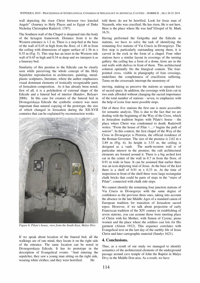
HYPOGEA 2019 - PROCEEDINGS OF INTERNATIONAL CONGRESS OF SPELEOLOGY IN ARTIFICIAL CAVITIES – DOBRICH , MAY 20-25 2019
114
wall depicting the risen Christ between two kneeled
Angels” (Journey to Holy Places and to Egypt of Duke
Nicholay Christophor Radzivil. 1787).
The Southern wall of the Chapel is deepened into the body
of the hexagon framework. Distance from it to the
Western entrance is 1.2 m. There is a step-bed at the base
of the wall of 0.45 m high from the floor, of 1.48 m from
the ceiling with dimensions of upper surface of 1.36 m x
0.35 m (Fig. 5). This step has an inset in the Western side
wall of 0.45 m high and 0.34 m deep and we interpret it as
a funerary bed.
Similarity of this premise to the Edicule can be clearly
seen while perceiving the whole concept of the Holy
Sepulchre reproduction in architecture, painting, metal-
plastic sculptures, literature, where the author emphasizes
visual dominant elements of ironically recognizable parts
of Jerusalem composition. As it has already been noted,
first of all, it is a polyhedron of external shape of the
Edicule and a funeral bed of interior (Batalov, Belyaev
2006). In this case for creators of the funeral bed in
Divnogorskaya Edicule the symbolic context was more
important than natural copying of the prototype, the size
of which changed in Jerusalem during the XII-XVII
centuries that can be explained by reconstruction works.
Figure 6. Pilate's house, view from the South-East, Malye Divy
If we speak about location of the funeral bed, all the
walkings are of one mind, they locate it on the right side
of the entrance. The same location can be noted in
Divnogorskaya Edicule. It has its prototype in the
description of Evangelical events: “And entering the
sepulchre, they saw a young man sitting on the right side,
wearing white clothes; and they were horrified. He
told them: do not be horrified. Look for Jesus man of
Nazareth, who was crucified; He has risen, He is not here.
Here is the place where He was laid”(Gospel of St. Mark
16.5).
Having performed the Golgotha and the Edicule as
stations, we have to solve the task of identifying the
remaining five stations of Via Crucis in Divnogorye. The
first stop is particularly outstanding among them, it is
carved in the rock in the form of a chapel. Four other
stations have a similar layout in crossings of the turning
gallery: the ceiling has a form of a dome, kiots are in the
end walls with shelves in front of them. This architectural
solution optimally fits the liturgical content. The four-
pointed cross, visible in planigraphy of four crossings,
underlines the completeness of crucifixion suffering.
Turns on the crossroads interrupt the monotony of
moving, making us perceive the stations as separate loci
of sacred space. In addition, the crossings with kiots cut in
two ends afforded without changing the sacred importance
of the total number of stations - seven, to emphasize with
the help of icons four more possible stops.
Out of these five stations the first one is more accessible
for semantic analysis. This is due to the fact that we are
dealing with the beginning of the Way of the Cross, which
in Jerusalem tradition begins with Pilate's house - the
place where Christ was condemned to death. Radziwill
writes: “From the house of Pilat <…> begins the path of sorrow”. In this context, the first chapel of the Way of the
Cross in Divnogorye is Pretoria, the official residence of
the Roman Governor. The size of the premise is 2.62 m x
2.89 m (Fig. 6). Its height is 3.53 m, the ceiling is
designed as a vault. The north-western wall is of
particular interest in the premise, the cult architectural
elements are formed around it. There is a big arched kiot
cut in the center of the wall in 0.7 m from the floor, of
0.91 m wide in base. It can be assumed that earlier there
was an icon depicting trial of Jesus. At the base of the kiot
there is a shelf of 0.91 m x 0.33 m. At the time of
inspection in front of the shelf there were large rectangular
chalk bricks that could be parts of steps in the “stairs of
Pilate”, connected with chalk side steps.
We cannot identify the remaining four junction stations of
Via Crucis in Divnogorye with the same degree of
confidence as the previous three ones, taking into account
the absence in the late Middle Ages of a standard canon of
European tradition for transition of Jerusalem sacred
topos. However, if we talk about projection of early
Franciscan tradition of the XIV century in establishing of
seven stations, you can assume those were meeting place
of Christ with his Mother, with Simon of Cyrene, pious
women and the place where the soldiers cast lots for His
garment (Alston 1912). This sequence correlates with
Evangelical text on the last day of the earthly life of Jesus
Christ and later cartographic material (Sandys 1621).
4. Conclusions.
Thus, as a result of our study we managed to identify
semantics of the architectural elements of the underground
passage around cave temple of John the Baptist in Malye
Divy in the Middle Don area. As a result, we have
HYPOGEA 2019 - PROCEEDINGS OF INTERNATIONAL CONGRESS OF SPELEOLOGY IN ARTIFICIAL CAVITIES – DOBRICH , MAY 20-25 2019
115
confirmed our hypothesis about symbolic reflection here
of Via Dolorosa - the image of the Way of the Cross of
Jesus Christ in the Christian cultural tradition. The
sequence of stations in Divnogorye in our interpretation is
as follows: 1) Pilate's house, 2) Meeting place of Christ
with His Mother, 3) Meeting place of Christ with Simon
of Cyrene, 4) Meeting place of Christ with pious women,
5) The place where the soldiers cast lots for His garment,
6) Golgotha, 7) The Edicule with the Holy Sepulcher.
Construction of the Via Crucis on the Don land vividly
depicts the influence of the Western Christian tradition. If
Via Dolorosa was constructed in Malye Divy in the
second half of the 17th century, this could happen after the
monks learnt the tradition of calvary building at their
former home and in cross-border regions. It should be
noted that the interpenetration of Catholicism and
Orthodoxy at the level of creation and use of objects of
worship was not an exceptional case in the ascetic
tradition of cave living in the Don region. For example, in
2007 in the cave of Belogorye a kiot cross and a pendant
were found which had been made according to Western
Christian tradition, dating back to the end of the 18th
century. (Stepkin 2014). However, the influence of
Western Christianity did not concern issues of dogmatic
theology, as defending it pushed the colonizational flows
of monks from Western Ukraine to the southern outskirts
of Moscow State in the 17th century. At the same time, a
number of architectural elements of Via Dolorosa
(hexahedron Edicule with two entrances into it) and the
total number of stations - seven, suggest an earlier
creation of the monument, which is the subject of a
separate study.
References
Alston, George Cyprian, 1912. Way of the Cross. The
Catholic Encyclopedia. Vol. 15. New York: Robert
Appleton Company,
http://www.newadvent.org/cathen/15569a.htm
A. P. Batalov, L. A. Belyaev 2006. Veneration of the Holy
Sepulchre in Russia. Orthodox encyclopedia. Volume
XIII. Moscow, pp. 145–148, (in Russian).
L. A. Belyaev 2009. Visible and invisible Jerusalem: on
typology of visual reflections of the Holy Land in ancient
Russian culture. New Jerusalems. Hierotopy and
iconography of sacred spaces. Moscow, pp. 202–220, (in
Russian).
Gunko A.A. 2013. Morphometric studies of caves in
Divnogorye, Kostomarovo and Kolybelka (Voronezh
region). Speleology and spelestology. Naberezhnye
Chelny, pp. 163–168, (in Russian).
G.M. Zelenskaya 2009. New Jerusalem near Moscow.
Aspects of design and new discoveries. New Jerusalems.
Hierotopy and iconography of sacred spaces. Moscow, pp.
745–773, (in Russian).
N. F. Kapterev, 1895. Relations of Jerusalem Patriarchs
with Russian Government from the middle of the 16th to
the end of the 18th century. St. Petersburg, (in Russian).
Story and legend of walking to Jerusalem and to Tsargrad
of Iona, a regular deacon of the Trinity Sergiev
Monastery, called Malenkiy 1649-1652. 1895 Orthodox
Palestinian collection. Volume XIII. Third Edition. St.
Petersburg, (in Russian).
C. Ponomarev, 1877. Jerusalem and Palestine in Russian
literature, science, art and translations (materials for
bibliography). St. Petersburg, (in Russian).
Journey to Holy Places and to Egypt of Duke Nicholay
Christophor Radzivil. 1787. St. Petersburg, (in Russian).
Rickert, John. 2014. Stations of the Cross: An imitative
devotional exercise conducted at Lamb of God Lutheran
Church Spartanburg, South Carolina,
http://digitalcommons.gardner-
webb.edu/cgi/viewcontent.cgi?article=1006&context=divi
nity_etd
Sandys G. 1621. Relation of a journey begun an Dom:
1610. London.
V. V. Stepkin, 2008. Cave digging as a kind of Christian
asceticism in the forest-steppe Don region. Herald of
church history. No 3(11). Moscow, pp. 141–150, (in
Russian).
Stepkin V. V. 2015. Caves in Divnogorye and Belogorye:
monastic and folk tradition in the river Don caves
construction//Proceedings of International Congress of
Speleology in Artificial Cavities Hypogea 2015, Italy,
Rome, March 11/17, 2015. Rome, pp. 351–354.
V. V. Stepkin, 2014. Material and spiritual culture of a
cave digger in Don steppe in late 18th century (based on
materials of Belogorsky Monastery complex). Bulletin of
Voronezh State University. Series: History. Politology.
Sociology. No 3. pp. 118-122, (in Russian).
Walking to the East of guest Vasiliy Poznyakov with
companions. 2001. Novels and tales of Ancient Russia.
Literature monuments of XI-XVII centuries in featured
translations. Izbornik. St. Petersburg, pp. 464–487, 999–1012, (in Russian).
Walking of Tryphon Korobeinikov 1593-1594. 1889.
Orthodox Palestinian collection. Volume IX. Third
Edition. St. Petersburg, (in Russian).
HYPOGEA 2019 - PROCEEDINGS OF INTERNATIONAL CONGRESS OF SPELEOLOGY IN ARTIFICIAL CAVITIES – DOBRICH , MAY 20-25 2019
116
ARCHITECTURAL PECULIARITIES OF RELIGIOUS CAVITIES
COMPLEX IN THE IHLARA VALLEY (CAPPADOCIA)
Ekaterina Ianovskaia
MSU, Faculty of History, [email protected]
Abstract
During the exploration of the western slope of the Ihlara Valley (Cappadocia) in early 2017 two rock-cut artificial
cavities were found. Presumably, they form one complex of buildings destroyed by an earthquake. The upper building
presents rectangular hall with two small rooms behind the back wall. The lower building presents two rooms - narthex
and cross-in-square main temple. Both cavities have graffiti brushed on a red paint on the stone surface. This graffiti
represents not only the Christian symbols - crosses, ceiling rose - but also the architectural details comparable with
architectural elements of the surface constructions. It is stone masonry, piers, archivolts. All these elements are made as
anaglyphs and painted. Taking into account underground conditions of building it is absolutely clear that these elements
doesn’t have any constructional purposes but only decorative. We can suggest that a builder (or a workshop of builders)
previously took part in the building of the similar construction on the surface.
Key words
Aarchitecture, cut rock church, Cappadocia, basilica, baptistery.
Peristrema valley it is a place with cut-rock buildings domination. Narrow canyon with sheer cliffs and stormy shallow
river on the bottom, it was one of the safest and comfortable places in the Cappadocia, which several times became
border province of Byzantine Empire.
Cappadocia wasn't the region of cities. Most settlements were agricultural villages. Volcanic soil allowed locals to grow
unique sorts of grapes and other farm products. All they needed was water.
Peristrema was safe and fertile place thus it lured numerous settlers. Length of the settlement here was more than 10
kilometers. All dwellings, cut in the rock cliffs, had several floors and, of course, were either the shelters. Usually, it
was equipped with the system of wells and round doors which let to hide in the stone labyrinths and wait out the siege.
Christianity appeared in Cappadocia very early. In the 4th century, Julian The Apostate, who tried to return paganism in
the Empire, wrote to philosopher Aristoksen (unknown person) "..- I beg you to come. For Zeus, keeper of the
friendship, meet us in Theana and show us in Cappadocia the true Hellenent (mean pagan). Until now I see that nobody
wants to bring sacrifices to the gods. And few of them who wants do not remember how to do it." (Furman, 1970). First
monasteries were established here also in the 4th century (Niewöhner, 2017).
Numerous sanctuaries in Peristrema valley demonstrate the great importance of religion for the local population. In total
there are several dozens of churches. And a lot of them still aren’t discovered.
From the beginning of Christian architecture appeared two main types of churches - crossed-dome (or cross-in-square)
and basilica. Basilica temple was the first type, but exactly crossed-dome type become the dominating in the Byzantine
architecture. Basilica is more typical for western Christian churches.
Baptistery (gr. βαπτιστήριον) - room or part of the room with tank or pool for the sacrament of baptism. As a separate
space or building, it appeared when numerous people desired to become Christians and to baptize. Separate building
with huge basin was necessary for baptizing adult people. Lateran Baptistery (4-5 century C. E.) became the first stands
apart from the main temple (Basilica di San Giovanni in Laterano, Rome). Greek Orthodox Cathedral of Hagia Sophia
also had separate baptistery (so-called Small Baptistery, built in the 6 century, not preserved). (Great Russian
Encyclopedia, 2005)
During the later centuries when custom of baptizing newborn extended, necessity to use large pools disappeared, as well
as the tradition to construct of the standalone structures.
The rock-cut ecclesiastical architecture of Cappadocia in general and Peristrema valley in specifically followed the
canons of the surface churches. Despite the features of the building process (or better to say digging) of rock churches
master-builder often tried to repeat main constructional details of surface temples. Thus we see columns, ceilings,
spandrels - parts of an architectural construction made not for functional purposes but according to canons. Ceilings of
numerous temples were decorated by imitation of masonry.
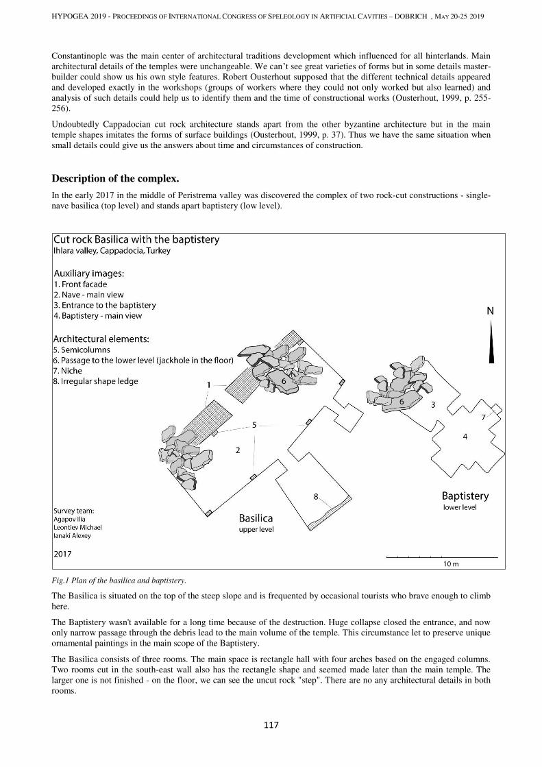
HYPOGEA 2019 - PROCEEDINGS OF INTERNATIONAL CONGRESS OF SPELEOLOGY IN ARTIFICIAL CAVITIES – DOBRICH , MAY 20-25 2019
117
Constantinople was the main center of architectural traditions development which influenced for all hinterlands. Main
architectural details of the temples were unchangeable. We can’t see great varieties of forms but in some details master-
builder could show us his own style features. Robert Ousterhout supposed that the different technical details appeared
and developed exactly in the workshops (groups of workers where they could not only worked but also learned) and
analysis of such details could help us to identify them and the time of constructional works (Ousterhout, 1999, p. 255-
256).
Undoubtedly Cappadocian cut rock architecture stands apart from the other byzantine architecture but in the main
temple shapes imitates the forms of surface buildings (Ousterhout, 1999, p. 37). Thus we have the same situation when
small details could give us the answers about time and circumstances of construction.
Description of the complex.
In the early 2017 in the middle of Peristrema valley was discovered the complex of two rock-cut constructions - single-
nave basilica (top level) and stands apart baptistery (low level).
Fig.1 Plan of the basilica and baptistery.
The Basilica is situated on the top of the steep slope and is frequented by occasional tourists who brave enough to climb
here.
The Baptistery wasn't available for a long time because of the destruction. Huge collapse closed the entrance, and now
only narrow passage through the debris lead to the main volume of the temple. This circumstance let to preserve unique
ornamental paintings in the main scope of the Baptistery.
The Basilica consists of three rooms. The main space is rectangle hall with four arches based on the engaged columns.
Two rooms cut in the south-east wall also has the rectangle shape and seemed made later than the main temple. The
larger one is not finished - on the floor, we can see the uncut rock "step". There are no any architectural details in both
rooms.
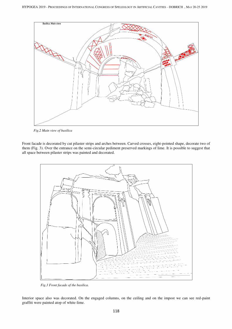
HYPOGEA 2019 - PROCEEDINGS OF INTERNATIONAL CONGRESS OF SPELEOLOGY IN ARTIFICIAL CAVITIES – DOBRICH , MAY 20-25 2019
118
Fig.2 Main view of basilica
Front facade is decorated by cut pilaster strips and arches between. Carved crosses, eight-pointed shape, decorate two of
them (Fig. 3). Over the entrance on the semi-circular pediment preserved markings of lime. It is possible to suggest that
all space between pilaster strips was painted and decorated.
Fig.3 Front facade of the basilica.
Interior space also was decorated. On the engaged columns, on the ceiling and on the impost we can see red-paint
graffiti were painted atop of white-lime.
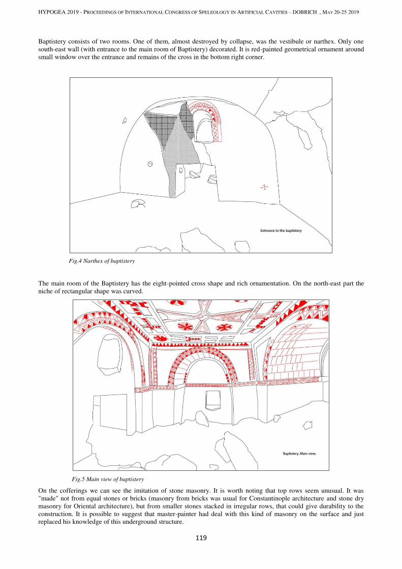
HYPOGEA 2019 - PROCEEDINGS OF INTERNATIONAL CONGRESS OF SPELEOLOGY IN ARTIFICIAL CAVITIES – DOBRICH , MAY 20-25 2019
119
Baptistery consists of two rooms. One of them, almost destroyed by collapse, was the vestibule or narthex. Only one
south-east wall (with entrance to the main room of Baptistery) decorated. It is red-painted geometrical ornament around
small window over the entrance and remains of the cross in the bottom right corner.
Fig.4 Narthex of baptistery
The main room of the Baptistery has the eight-pointed cross shape and rich ornamentation. On the north-east part the
niche of rectangular shape was curved.
Fig.5 Main view of baptistery
On the cofferings we can see the imitation of stone masonry. It is worth noting that top rows seem unusual. It was
"made" not from equal stones or bricks (masonry from bricks was usual for Constantinople architecture and stone dry
masonry for Oriental architecture), but from smaller stones stacked in irregular rows, that could give durability to the
construction. It is possible to suggest that master-painter had deal with this kind of masonry on the surface and just
replaced his knowledge of this underground structure.
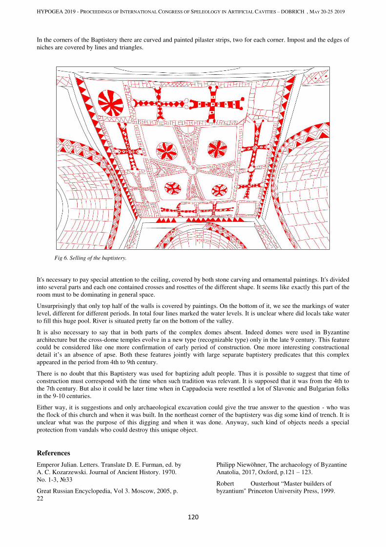
HYPOGEA 2019 - PROCEEDINGS OF INTERNATIONAL CONGRESS OF SPELEOLOGY IN ARTIFICIAL CAVITIES – DOBRICH , MAY 20-25 2019
120
In the corners of the Baptistery there are curved and painted pilaster strips, two for each corner. Impost and the edges of
niches are covered by lines and triangles.
Fig 6. Selling of the baptistery.
It's necessary to pay special attention to the ceiling, covered by both stone carving and ornamental paintings. It's divided
into several parts and each one contained crosses and rosettes of the different shape. It seems like exactly this part of the
room must to be dominating in general space.
Unsurprisingly that only top half of the walls is covered by paintings. On the bottom of it, we see the markings of water
level, different for different periods. In total four lines marked the water levels. It is unclear where did locals take water
to fill this huge pool. River is situated pretty far on the bottom of the valley.
It is also necessary to say that in both parts of the complex domes absent. Indeed domes were used in Byzantine
architecture but the cross-dome temples evolve in a new type (recognizable type) only in the late 9 century. This feature
could be considered like one more confirmation of early period of construction. One more interesting constructional
detail it’s an absence of apse. Both these features jointly with large separate baptistery predicates that this complex
appeared in the period from 4th to 9th century.
There is no doubt that this Baptistery was used for baptizing adult people. Thus it is possible to suggest that time of
construction must correspond with the time when such tradition was relevant. It is supposed that it was from the 4th to
the 7th century. But also it could be later time when in Cappadocia were resettled a lot of Slavonic and Bulgarian folks
in the 9-10 centuries.
Either way, it is suggestions and only archaeological excavation could give the true answer to the question - who was
the flock of this church and when it was built. In the northeast corner of the baptistery was dig some kind of trench. It is
unclear what was the purpose of this digging and when it was done. Anyway, such kind of objects needs a special
protection from vandals who could destroy this unique object.
References
Emperor Julian. Letters. Translate D. E. Furman, ed. by
A. C. Kozarzewski. Journal of Ancient History. 1970.
No. 1-3, №33
Great Russian Encyclopedia, Vol 3. Moscow, 2005, p.
22
Philipp Niewöhner, The archaeology of Byzantine
Anatolia, 2017, Oxford, p.121 – 123.
Robert Ousterhout “Master builders of
byzantium" Princeton University Press, 1999.

HYPOGEA 2019 - PROCEEDINGS OF INTERNATIONAL CONGRESS OF SPELEOLOGY IN ARTIFICIAL CAVITIES – DOBRICH , MAY 20-25 2019
121
CAVE NECROPOLIS IN THE VICINITY OF KIZILIN VILLAGE,
ADIYAMAN PROVINCE, TURKEY
Alexey Zhalov1, Konstantin Stoichkov
2
1 Bulgarian Caving Society, Christo Belchev 45, 1000 Sofia, [email protected]
2 Caving Club “Helictite”, Kiril I Metodii, 43, 1202, Sofia, Bulgaria, [email protected]
Abstract
The rock cut cave tombs are situated on the boundary of Adiyaman province 3.6 km NE from Kizilin vill. on the right
side of Göksu (Blue water) the river (influent river of Euphrates) close to the famous Göksu Roman Bridge. On both
sides of the river there are natural and artificial caves. The most interesting discovery of the place was the unknown
necropolis, consisting 4 rock cut cave tombs. All they are elaborate funeral chambers, carved directly into the rock
face. (The basic plan of the tomb consists of dromos (corridor), leading down to the chamber. The burial chambers have
square or rectangular shape. They are buried more than one human body and have three or more stone couches inside.
The tombs have no decoration, however the interiors are very well preserved and one can see the funerary beds
(benches). The explored tombs were without relief carving or paintings so probably they belong to poor persons. No
artifacts were discovered in the tombs neither bone remains. Such burial structures have been found in other places in
Turkey and specially in Shunliufra and Aidyaman provinces as in Zeugma, Perrin (Perre), Söğütlü etc. all recognized as monuments belonged to the kingdom of Commagene.
Keywords
Cave tombs, necropols, Turkey, Kizilin
1. Introduction
The river Euphrates emerges close to the town of Keban,
Southeast Turkey. The river flows for about 1.230 km in
Turkish territory, before entering Syria. Five dams have
been built on the river since 1975. The Birecik Dam is
situated 8 km upstream of Birecik town and ends 60 km
upstream to Atatürk Dam. In this part, the river flows
through two Turkish provinces - Şanlıurfa and Adıyaman, both in the Southeast Anatolian Region of Turkey. The
area extending northwest from Sanliurfa city is built of
limestone, whose thickness is more than 400 m. The river
Euphrates were inscribed on the limestone rock and
modeled canyon in which vertical walls there are many
natural caves and artificial cavities with different
functions, carved the soft limestone. The study of the
cavities on the territory of Şanlıurfa province started in 2013 and was carried out from the OBRUK Cave
Research Group – Turkey. During the first stage of the
exploration were discovered and studied 73 rock
settlements on both banks of the river. There were
localized tens other rock cut structures, but due to the lack
of time, they were not studied and mapped [Yamaç, 2015.
P.83-85]
Figure 1. Area of exploration
The exploration continued in 2015 during International
expedition, organised by Ali Yamac from OBRUK
Society. The expedition was held from 5 until 13 June
2015. The team was composed by 8 Turkish cavers from
different clubs, the Bulgarians A. Zhalov and K.
Stoichkov – members of Bulgarian Caving Society and
the Caving Club “Helictit” Sofia and L. Makrostergios
from the Speleological group of Karditsa – Greece.
During the expedition were explored in total 28 artificial
caves and complexes – upon 15 of them were located in
the territory of Adıyaman province.
2. Geology
The Euphrates basin is situated in a region having a very
complex geology and also a very active seismicity. The
younger units are mainly composed of sedimentary rocks
including marl, mudstone and limestone, and shale
alternation. At his work [Yamaç, 2015. P.83-85] reported
that the area is buid by horisonally bedded, netric, Eocene
limestones which thickness is more than 400 m. Мiocene -
Lower Miocene netrick limestones, overlying this
formation and observed on the northern and southern part
of the region, are placed as discordant within this main
structure. The North Anatolian Fault and East Anatolian
Fault Zone are the common structural features in the
basin. (Bokzut,2001)
2. Caves explored in Adiyaman province
The caves on the boundary of Adiyaman province are situated 3.6 km NE from Kizilin vill. on the right side of Göksu (Blue water) the river (influent river of Euphrates) close to the famous Göksu Roman Bridge (probably built by soldiers of the Legio XVI Flavia Firma during the reign of Emperor Septimius Severus about 212 AD.) (fig.1)
The riversides are steep, but in some places they became vertical, so the passage looks like a canyon. On both sides
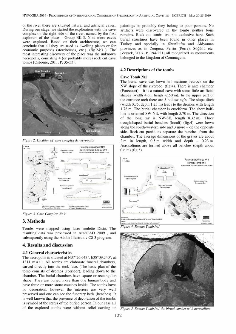
HYPOGEA 2019 - PROCEEDINGS OF INTERNATIONAL CONGRESS OF SPELEOLOGY IN ARTIFICIAL CAVITIES – DOBRICH , MAY 20-25 2019
122
of the river there are situated natural and artificial caves. During our stage, we started the exploration with the cave complex on the right side of the river, named by the first explorers of the place – Group EK-3. Nine more caves were explored. Based on their architecture, we can conclude that all they are used as dwelling places or for economic purposes (storehouses, etc.). (fig.2&3 ). The most interesting discovery of the place was the unknown necropolis, consisting 4 (or probably more) rock cut cave tombs [Osborne, 2011. P. 35-53].
Figure 2. Locdtion of cave complex & necropolis
Figure 3. Cave Complex № 9
3. Methods
Tombs were mapped using laser roulette Disto. The
resulting data was processed in AutoCAD 2009 , and
subsequently using the Adobe Illustratov CS 3 program.
4. Results and discussion
4.1 General characteristics The necropolis is situated at N37°26.643’, E38°09.740’, at
1311 m.a.s.l. All tombs are elaborate funeral chambers,
carved directly into the rock face. (The basic plan of the
tomb consists of dromos (corridor), leading down to the
chamber. The burial chambers have square or rectangular
shape. They are buried more than one human body and
have three or more stone couches inside. The tombs have
no decoration, however the interiors are very well
preserved and one can see the funerary beds (benches). It
is well known that the presence of decoration of the tombs
is symbol of the status of the buried person. In our case all
of the explored tombs were without relief carving or
paintings so probably they belong to poor persons. No
artifacts were discovered in the tombs neither bone
remains. Rock-cut tombs are not exclusive here. Such
burial structures have been found in other places in
Turkey and specially in Shunliufra and Aidyaman
provinces as in Zeugma, Perrin (Perre), Söğütlü etc. [Zeyrek, 2007. P. 194-221] all recognized as monuments
belonged to the kingdom of Commagene.
4.2 Descriptions of the tombs
Cave Tomb №1
The burial cave was hewn in limestone bedrock on the
NW slope of the riverbed. (fig.4). There is ante chamber
(Forecourt) – it is a natural cave with some little artificial
shapes (width 4.63, heigh -2.50 m). In the upper part of
the entrance arch there are 5 hollowing’s. The slope ditch
(width 0,75, depth 1.25 m) leads to the dromos with length
1.78 m. The burial chamber is cruciform. The short half-
line is oriented SW-NE, with length 5.70 m. The direction
of the long ray is NW-SE, length 8.32 m). Three
troughshaped burial benches (loculi) (fig.4) were hewn
along the south-western side and 3 more – on the opposite
side. Rock-cut partitions separate the benches from the
chamber. The average dimensions of the graves are about
2 m in length, 0.5 m width and depth – 0.23 m.
Acrosoliums are formed above all benches (depth about
0.6 m) (fig.5).
Figure 4. Roman Tomb №1
Figure 5. Roman Tomb №1 the birual camber with acrosolium

HYPOGEA 2019 - PROCEEDINGS OF INTERNATIONAL CONGRESS OF SPELEOLOGY IN ARTIFICIAL CAVITIES – DOBRICH , MAY 20-25 2019
123
Cave Tomb №2
The tomb is placed few meters north-eastern from the first
one. (fig.6).
The entrance is pentagonal (0.7 wide, height -1.15 m)
(fig.7) and leads to a dromos (0.86 m). Three niches
(loculi) were carved into the bedrock inside the tomb: one
on each side and one at the back. The bench along
northern side rises above at 0.62 m from the floor. Its
length is 1.95, width 0.7 and depth 0.2 m. The south grave
Figure 6. Plan of the Roman Tomb №2
is 1.9 m long, 0.72 m wide and 0.22 m deep. Its
disposition is 0.65 m up from the floor. On the western
side is placed the largest of the three burial benches
2.1×0.5,depth 0.2 m. Acrosoliums were carved above all
benches high about 1.2 and depth 0.92 m. Surface of the
tomb is about 12 m2
Cave Tomb №3
The next tomb is semi-artificial and semi-natural. It
consists of 5 burial niches (fig.7).
Figure 7. Plan of the Roman Tomb №3
The dromos of 0.4 m leads to a asymmetric chamber with
long axis of 11 m and short one - 7.5 m. The total surface
is about 56 m2. In the eastern side of the cave was hewn
arc-form niche with two graves - each 0.5 m above the
floor, 2 m long, 0.7 m wide and 0.26–0.28 m deep. The
grave at the western side of the chamber is located 0.6 m
above the ground and under acrosolium. The length of the
burial place is 2.1 m, width 0.8 m, depth 0.3 m. Two more
graves are located on the right natural branch of the tomb.
It is visible that it the past, this part was longer and
consisted more graves, but the passage leading to this
sector is not penetrable and needs enlarging.
Cave Tomb №4
Probably this is the most interesting underground
structure, we have explored (fig.8). It comes from its
absolutely cruciform architecture. The entrance has
elliptic shape. A short dromos (0.4 m) leads to the burial
chamber with two perpendicular each to other rock cut
galleries. The heading of the galleries are approximately
North-South and East-West! In each part of the chamber
there are 3 burial niches so the total number of the graves
in the tomb are 9! The benches are about 0.3 m above the
floor and have an acrosoliums above. The height of the
acrosolium’s arc from the basis of the niches is 1.5 m. The
depth of the graves varies from 0.1 to 0.15 m. Surface -
35.5 m2. It is important to note that the architecture of
Tomb N4 is absolutely the same as the KB-Mezar 1 (fig.9)
reported by Turgut H. Zeyrek [Zeyrek, 2007. P. 207].
Having in mind this fact we could presume that
architecture of the tombs in the region and time of
Commagene was standardised.
Figure 8. Plan of the Roman Tomb №4
Figure 9. Tomb BK-Mezar (after Turgut H. Zeyrek, 2007)

HYPOGEA 2019 - PROCEEDINGS OF INTERNATIONAL CONGRESS OF SPELEOLOGY IN ARTIFICIAL CAVITIES – DOBRICH , MAY 20-25 2019
124
5. Discussion and Conclusions
The general questions are when all this underground structures was made. If we could conclude that they are done from Commagene then the time of their hewing should have wide boundaries – from late Hellenistic to Roman period. The most precise answer about the time of we could obtain after specialized archaeological studies and probably excavations in the area.
References
Osborne James F. Secondary Mortuary Practice and the Bench
Tomb: Structure and Practice in Iron Age Judah// Journal of Near
Eastern Studies, Vol. 70, No. 1 (April 2011). – P. 35-53.
Yamac A. Cave dwellings of Halfety – Ufra (Southeastern Turkey)
// Hypogea 2015 Proceedings of International Congress of
Speleology in Artificial Cavities Italy, Rome, March 11/17, 2015.
Zeyrek, Turgut H. Yukarı Söğütlü Nekropollerinden Kaya Mezarları Gaziantep // Üniversitesi Sosyal Bilimler Dergisi, 6(2), 2007. – P. 194-221 [Web resource]. – URL:
http://unchartedruins.blogspot.bg/2012_07_01_archive.html.
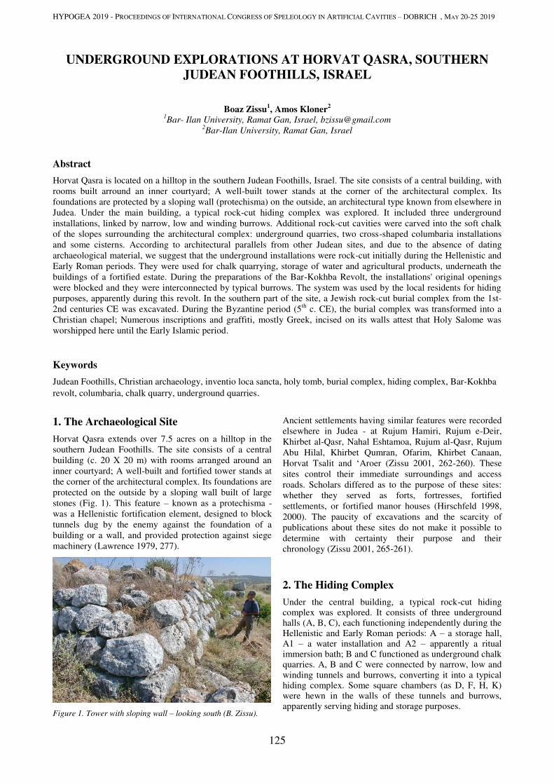
HYPOGEA 2019 - PROCEEDINGS OF INTERNATIONAL CONGRESS OF SPELEOLOGY IN ARTIFICIAL CAVITIES – DOBRICH , MAY 20-25 2019
125
UNDERGROUND EXPLORATIONS AT HORVAT QASRA, SOUTHERN
JUDEAN FOOTHILLS, ISRAEL
Boaz Zissu1, Amos Kloner
2
1Bar- Ilan University, Ramat Gan, Israel, [email protected]
2Bar-Ilan University, Ramat Gan, Israel
Abstract
Horvat Qasra is located on a hilltop in the southern Judean Foothills, Israel. The site consists of a central building, with rooms built arround an inner courtyard; A well-built tower stands at the corner of the architectural complex. Its foundations are protected by a sloping wall (protechisma) on the outside, an architectural type known from elsewhere in Judea. Under the main building, a typical rock-cut hiding complex was explored. It included three underground installations, linked by narrow, low and winding burrows. Additional rock-cut cavities were carved into the soft chalk of the slopes surrounding the architectural complex: underground quarries, two cross-shaped columbaria installations and some cisterns. According to architectural parallels from other Judean sites, and due to the absence of dating archaeological material, we suggest that the underground installations were rock-cut initially during the Hellenistic and Early Roman periods. They were used for chalk quarrying, storage of water and agricultural products, underneath the buildings of a fortified estate. During the preparations of the Bar-Kokhba Revolt, the installations' original openings were blocked and they were interconnected by typical burrows. The system was used by the local residents for hiding purposes, apparently during this revolt. In the southern part of the site, a Jewish rock-cut burial complex from the 1st-2nd centuries CE was excavated. During the Byzantine period (5th c. CE), the burial complex was transformed into a Christian chapel; Numerous inscriptions and graffiti, mostly Greek, incised on its walls attest that Holy Salome was worshipped here until the Early Islamic period.
Keywords
Judean Foothills, Christian archaeology, inventio loca sancta, holy tomb, burial complex, hiding complex, Bar-Kokhba revolt, columbaria, chalk quarry, underground quarries.
1. The Archaeological Site
Horvat Qasra extends over 7.5 acres on a hilltop in the southern Judean Foothills. The site consists of a central building (c. 20 X 20 m) with rooms arranged around an inner courtyard; A well-built and fortified tower stands at the corner of the architectural complex. Its foundations are protected on the outside by a sloping wall built of large stones (Fig. 1). This feature – known as a protechisma - was a Hellenistic fortification element, designed to block tunnels dug by the enemy against the foundation of a building or a wall, and provided protection against siege machinery (Lawrence 1979, 277).
Figure 1. Tower with sloping wall – looking south (B. Zissu).
Ancient settlements having similar features were recorded elsewhere in Judea - at Rujum Hamiri, Rujum e-Deir, Khirbet al-Qasr, Nahal Eshtamoa, Rujum al-Qasr, Rujum Abu Hilal, Khirbet Qumran, Ofarim, Khirbet Canaan, Horvat Tsalit and ‘Aroer (Zissu 2001, 262-260). These sites control their immediate surroundings and access roads. Scholars differed as to the purpose of these sites: whether they served as forts, fortresses, fortified settlements, or fortified manor houses (Hirschfeld 1998, 2000). The paucity of excavations and the scarcity of publications about these sites do not make it possible to determine with certainty their purpose and their chronology (Zissu 2001, 265-261).
2. The Hiding Complex
Under the central building, a typical rock-cut hiding complex was explored. It consists of three underground halls (A, B, C), each functioning independently during the Hellenistic and Early Roman periods: A – a storage hall, A1 – a water installation and A2 – apparently a ritual immersion bath; B and C functioned as underground chalk quarries. A, B and C were connected by narrow, low and winding tunnels and burrows, converting it into a typical hiding complex. Some square chambers (as D, F, H, K) were hewn in the walls of these tunnels and burrows, apparently serving hiding and storage purposes.
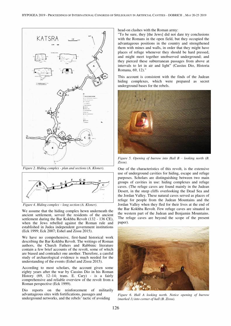
HYPOGEA 2019 - PROCEEDINGS OF INTERNATIONAL CONGRESS OF SPELEOLOGY IN ARTIFICIAL CAVITIES – DOBRICH , MAY 20-25 2019
126
Figure 2. Hiding complex - plan and sections (A. Kloner).
Figure 4. Hiding complex – long section (A. Kloner).
We assume that the hiding complex hewn underneath the ancient settlement, served the residents of the ancient settlement during the Bar Kokhba Revolt (132 - 136 CE), when the Jews rebelled against the Roman rule and established in Judea independent government institutions (Eck 1999; Eck 2007; Eshel and Zissu 2015).
We have no comprehensive, first-hand historical work describing the Bar Kokhba Revolt. The writings of Roman authors, the Church Fathers and Rabbinic literature contain a few brief accounts of the revolt, some of which are biased and contradict one another. Therefore, a careful study of archaeological evidence is much needed for the understanding of the events (Eshel and Zissu 2015).
According to most scholars, the account given some eighty years after the war by Cassius Dio in his Roman History (69, 12–14; trans. E. Cary) - is a fairly comprehensive and reliable overview of the revolt from a Roman perspective (Eck 1999).
Dio reports on the reinforcement of militarily advantageous sites with fortifications, passages and underground networks, and the rebels’ tactic of avoiding
head-on clashes with the Roman army: "To be sure, they [the Jews] did not dare try conclusions with the Romans in the open field, but they occupied the advantageous positions in the country and strengthened them with mines and walls, in order that they might have places of refuge whenever they should be hard pressed, and might meet together unobserved underground; and they pierced these subterranean passages from above at intervals to let in air and light” (Cassius Dio, Historia Romana, 69, 12)."
This account is consistent with the finds of the Judean hiding complexes, which were prepared as secret underground bases for the rebels.
Figure 5. Opening of burrow into Hall B – looking north (B.
Zissu).
One of the characteristics of this revolt, is the extensive use of underground cavities for hiding, escape and refuge purposes. Scholars are distinguishing between two main groups of cavities in use: hiding complexes and refuge caves. (The refuge caves are found mainly in the Judean Desert, in the steep cliffs overlooking the Dead Sea and the Jordan Valley. These natural caves served as places of refuge for people from the Judean Mountains and the Jordan Valley when they fled for their lives at the end of the Bar Kokhba Revolt. Few refuge caves are situated in the western part of the Judean and Benjamin Mountains. The refuge caves are beyond the scope of the present paper).
Figure 6. Hall A looking north. Notice opening of burrow
(marked 1) into corner of hall (B. Zissu).

HYPOGEA 2019 - PROCEEDINGS OF INTERNATIONAL CONGRESS OF SPELEOLOGY IN ARTIFICIAL CAVITIES – DOBRICH , MAY 20-25 2019
127
The complex at Horvat Qasra, has similar characteristics in common with other hiding complexes found in the Judean Foothills. These complexes were hewn artificially under or near residential buildings in ancient settlements. They include several rock-cut chambers connected to each other by a maze of low, narrow and winding burrows. Passage through the burrows requires one to kneel down, crawl and sometimes even to creep. The burrows are the typical feature that identifies a rock-cut system of underground cavities as a hiding complex. The openings into chambers are always small and low, and require one to kneel down in order to enter. Underground chambers, storerooms, halls and burrows could be sealed from the inside. Thus, the complexes were designed so that the occupants could defend themselves from within, against an enemy attempting to enter. Rock-cut cavities and installations, which clearly antedate the revolt were connected by burrows and created an underground system. Burrows covertly connected various parts of the upper settlement. They descended to the tunnels by means of shafts carved into the floors and courtyards of the houses. The shafts were most probably blocked with stone slabs that could be camouflaged. The edges of the system sometimes led to escape openings located outside the settled area (Kloner and Zissu 2003; 2009; Zissu and Kloner 2014).
Figure 7. Opening of chamber F, looking west (Y. Zissu).
According to architectural and typological parallels from other Judean sites, and due to the absence of dating
archaeological material, we suggest that the underground installations at Horvat Qasra were hewn initially during the Hellenistic and Early Roman periods. They were used for stone quarrying, storage of water and agricultural products, underneath the buildings of a fortified estate.
During the preparations of the Bar-Kokhba Revolt, the installations' original entrances were blocked and they were interconnected by typical burrows. The complex was used by the local residents for hiding purposes, apparently during this revolt.
2. Columbaria and Additional Rock-Cut
Cavities
Additional rock-cut cavities were carved into the soft chalk of the slopes surrounding the architectural complex: underground quarries and water cisterns, and two cross-shaped columbaria installations (or dovecotes).
Figure 8. Columbarium no. 2, looking east (B. Zissu).
Pigeon-raising in ancient Israel, particularly in the area of the Judean Foothills, dates back as far as the third century BCE; it flourished during the Hellenistic, Roman, Byzantine and Early Islamic periods.
Figure 9. Columbarium no. 2; Section (B. Zissu).
Hundreds of rock-cut, underground columbaria have been found in Israel; Most of them are located in the Judean foothills. The number and technological sophistication of

HYPOGEA 2019 - PROCEEDINGS OF INTERNATIONAL CONGRESS OF SPELEOLOGY IN ARTIFICIAL CAVITIES – DOBRICH , MAY 20-25 2019
128
underground columbaria reached their peak this region. This large number may be due to the ease of hewing the soft limestone and the structures’ durability even when subjected to secondary use in later periods. The built columbaria, on the other hand, generally did not survive, and archaeological excavations conducted in Israel have uncovered only few built dovecotes (Zissu 1995).
A great deal of research has been devoted to ascertaining the purpose of the columbaria, and numerous explanations have been offered. Today, most researchers tend to agree that the structures in question were used to raise pigeons for the production of fertilizer and meat (Zissu and Rokach 1999; Kloner 2001; 2003).
Archaeological and artistic evidence, ancient classical and rabbinic sources, and the practice of pigeon-raising today, all attest to the crucial role played by pigeon-raising in ancient farming and societies.
3. A Rock-Cut Jewish Burial Complex and
Christian Underground Chapel
A monumental burial complex situated on the southern outskirts of the ancient site was explored. It was initially breeched into and looted and subsequently excavated by the second author.
Figure 10. Plan and sections of the tomb (A. Kloner and IAA).
Two major periods of use were observed. In the first phase
- the first and second centuries CE - the cave was used for
burial – and apparently served the Jewish residents of the site. It consisted of a rectangular antechamber (I) probably blocked with a round blocking-stone, which led to three inner chambers (II-IV). Rooms II and III contained seven arched kokhim (elongated burial niches) while Room IV, which underwent extensive alterations in the later phase, appears to have served for storage of ossuaries. Finds of the first period of use include fragments of four ossuaries, red painted and decorated in geometric patterns, first and second century CE oil-lamps, and a limestone 'measuring cup' of a similar date.
Figure 11. Unaltered chamber III – looking west (B. Zissu).
Figure 12. Chamber IV was converted into a chapel – looking
east (B. Zissu).
In the second phase - the Byzantine (from c. the 5th century CE), and Early Islamic periods - the cave became a subterranean Christian chapel complex. Within this complex, Rooms I-III retained their original function of antechamber and burial place. Modifications included the widening of the passage into Room II and the carving of an inscription on its right doorpost, the installation of iron lamp hooks in the ceiling of Room I, and the carving of a cross over kokh No. 6. Rooms IV and V constituted the center of the chapel. The entrance from Room I was remodeled as an archway, adorned with Greek inscriptions on the soffit (Di Segni and Patrich, 1990), as well as

HYPOGEA 2019 - PROCEEDINGS OF INTERNATIONAL CONGRESS OF SPELEOLOGY IN ARTIFICIAL CAVITIES – DOBRICH , MAY 20-25 2019
129
Arabic and Syriac grafitti on the doorpost.
Figure 13. Greek inscription – dedicated to Holy Salome, on the
soffit (B. Zissu).
Room IV was also adorned with various grafitti and inscriptions, and was further modified by the excavation of a cist tomb in the floor, and the addition of an apsed chancel (V) to the east. The entrance to the chancel was flanked by columns and a chancel screen; these too bore inscriptions in Greek and Arabic, as well as crosses and other grafitti.
Figure 14. Greek and Arabic inscription – dedicated to Holy
Salome (B. Zissu).
A semi-detached stone slab at the center of the apse served as an altar, and two similar slabs along the south and north walls were apparently used as benches. Inscriptions in Greek and Arabic were carved in the apse, and the remaining walls of the chancel also bore inscriptions in Greek, Arabic and Syriac. Room VI was originally furnished with a small apse in the east and an elongated niche in the northern wall, above which lay a smaller niche. In the center of the apse an encircled cross was carved in relief in its center, and was flanked by two smaller Maltese crosses. The three crosses were all painted red. A ledge at the base of the apse may originally have extended to the end of the wall. The elongated niche
in the north wall was probably used to accommodate oil-lamps, as testified by the thick layer of soot on the wall. At a later phase, a deep recess was cut into the northern part of the east wall. The walls of this chamber carried Greek inscriptions and grafitti.
Figure 14. Crosses and Arabic inscription (B. Zissu).
Finds from the second period of use include many ceramic fragments of Byzantine and Early Islamic date, including a great number of lamp fragments.
4. Discussion and Conclusions.
Numerous inscriptions and graffiti, mostly Greek, but also Arabic and Syriac incised on the walls indicate that the previous Jewish tomb was venerated during the Byzantine and Early Islamic periods - as the Tomb of a certain Holy Salome. This Salome was perhaps the follower of Jesus who is mentioned in the canonical gospels and in some apocryphal writings. She is sometimes identified as the wife of Zabedee and the mother of the Apostles James and John.
Early Byzantine sources afford a number of reports of inventiones—miraculous discoveries of tombs of biblical figures or Christian saints. This phenomenon was not restricted to the Holy Land; it is also recorded throughout the Christianized Roman Empire. In other parts of the Empire, inventiones pertained almost exclusively to Christian martyrs, whereas in the Holy Land the focus was on biblical figures. Only obviously ancient tombs, it would seem, could be identified with a personage from Scripture; these were usually tombs or other rock-cut features of the Second Temple period and sometimes even of the Iron Age (Di Segni 2007).
L. Di Segni summed up this phenomenon as follows:
“It is clear that the “archaeological” process of discovery of ancient tombs had a particular effect in Byzantine Palestine, namely the foundation of memorial churches, some of them in a very early phase of the Christianization of the country. These churches were not erected to serve a community but as pilgrim sites, to focus the Christian cult on potentially non-Christian holy places throughout the country.”
Interestingly, the cult of Holy Salome continued during

HYPOGEA 2019 - PROCEEDINGS OF INTERNATIONAL CONGRESS OF SPELEOLOGY IN ARTIFICIAL CAVITIES – DOBRICH , MAY 20-25 2019
130
the Early Islamic period (on this phenomenon see Patrich 2011).
To sum up, the H. Qasra tomb complex of the first-second centuries CE was converted into a chapel complex during the Byzantine period, (Kloner 1990; Di Segni and Patrich 1990). The evidence for the early Islamic utilization of the complex suggests that the Arabic inscriptions, which employ Christian phraseology, were carved by Arabic-speaking Christians of the Early Islamic period, rather than Christian Arabs of the Byzantine times. It appears that these inscriptions are evidence of the Arabization in Palestine in the early phase of Arab rule, which preceded by a few generations the processes of Islamization.
Acknowledgments
The exploration was directed by the authors, with the participation of archaeology students from the Martin (Szusz) Department of Land of Israel and Archaeology at Bar-Ilan University, and the support of Nili Graicer, Yotam and Gilad Zissu and Yehuda Mizrachi. Research has been made possible by the assistance of the Krauthammer Cathedra and the Jeselsohn Epigraphic
Center of Jewish History at the Bar-Ilan University.
References
Cassius Dio, Historia Romana, ed. E. Cary [Loeb Classical Library, 8], London, 1968.
Di Segni L, 2007. On the Development of Christian Cult Sites on Tombs of the Second Temple Period, ARAM 18-19, 381-401.
Di Segni L, Patrich J, 1990. The Greek Inscriptions in the Cave Chapel of Horvat Qasra, 'Atiqot 10, 141-154 (Hebrew).
Eck W, 1999.The Bar Kokhba Revolt: The Roman Point of View, Journal of Roman Studies 89, 76-89.
Eck W, 2007. Rom herausfordern: Bar Kochba im Kampf gegen das Imperium Romanum, Das Bild des Bar Kochba-Aufstandes im Spiegel der neuen epigraphischen Überlieferung, Roma, Unione internazionale degli istituti di archeologia, storia e storia dell'arte.
Eshel H, Zissu B, 2015. The Bar Kokhba Revolt, The Archaeological Evidence, Jerusalem, Israel Exploration Society and Yad Izhak Ben-Zvi 2015 (Hebrew)
Hirschfeld Y, 1998. Early Roman Manor Houses in Judea and the Site of Khirbet Qumran, Journal of Near Eastern Studies 57/3, 161-189.
Hirschfeld Y, 2000. General Discussion: Ramat Hanadiv in Context, in: Y. Hirschfeld (ed), Ramat Hanadiv Excavations, Final Report of the 1984-1998 Excavations, Jerusalem, Israel Exploration Society, 679-735
Kloner A, 1990, The Cave Chapel of Horvat Qasra, 'Atiqot 10. 129-137 (Hebrew).
Kloner A, 2001. The Economy of Hellenistic Maresha, in ZH Archibald, J Davis, V Gabrielsen and GJ Oliver (eds.) Hellenistic Economies. London-New York, 103-131.
Kloner A, 2003. Maresha Excavations Final Report I: Subterranean Complexes 21, 44, 70 (IAA Reports 17), Jerusalem.
Kloner A, Zissu B, 2003. Hiding Complexes in Judaea: An Archaeological and Geographical Update on the Area of the Bar Kokhba Revolt, in: P Schäfer (ed.), The Bar Kokhba War Reconsidered, New Perspectives on the Second Jewish Revolt against Rome, Tübingen, 181–216.
Kloner A, Zissu B., 2009, Underground Hiding Complexes in Israel and the Bar Kokhba Revolt, Opera Ipogea 1/2009, 9-28.
Kloner A, Zissu B, 2013. The Subterranean Complexes of Maresha: An Urban Center from the Hellenistic Period in the Judean Foothills, Israel, Opera Ipogea, Journal of Speleology in Artificial Caves 2/2013, 45-62.
Kloner A, Zissu B, and Graicer N, 2015. The Hiding Complexes at Horvat Qasra, Southern Judean Foothills. in: A. Tavger, Z. Amar and M. Billig (eds.), In the Highland's Depth, Ephraim Range and Binyamin Research Studies 5. Ariel-Talmon. 151-163 (Hebrew).
Lawrence, AW, 1979, Greek Aims in Fortifications, Oxford.
Patrich J. 2011. The Impact of the Muslim Conquest on Monasticism in the Desert of Jerusalem, Continuités de l’occupation entre les periodes byzantine et abbasside au Proche-Orient, viie-ixe siècles [Colloque Intrenationale Proche-Orient, Paris, 18-20 Octobre 2007], Turnhout 205-218.
Zissu B, 1995. Kh. Aleq and Kh. Abu Haf - Two Herodian Columbaria Towers. in: J. Humphrey (ed.). Roman and Byzantine Near East, Journal of Roman Archaeology, Supplementary Series 14. Ann Arbor. Michigan, 56-69.
Zissu B, 2002. Rural Settlement in the Judaean Hills and Foothills from the Late Second Temple Period to the Bar Kokhba Revolt, Ph.D. Dissertation, Jerusalem, The Hebrew University, (Heb)
Zissu B, Kloner A, 2014, Rock-Cut Hiding Complexes from the Roman Period in Israel, Der Erdstall, Beitraege zur Erforschung kuenstlicher Hoehlen 40, 96-119.
Zissu B, Rokach S, 1999. A Hellenistic Columbarium at Ziqim. ‘Atiqot 38, 65-73.
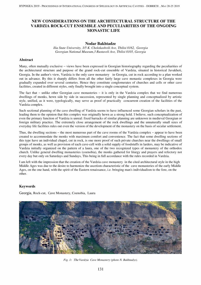
HYPOGEA 2019 - PROCEEDINGS OF INTERNATIONAL CONGRESS OF SPELEOLOGY IN ARTIFICIAL CAVITIES – DOBRICH , MAY 20-25 2019
131
NEW CONSIDERATIONS ON THE ARCHITECTURAL STRUCTURE OF THE
VARDZIA ROCK-CUT ENSEMBLE AND PECULIARITIES OF THE ONGOING
MONASTIC LIFE
Nodar Bakhtadze
Ilia State University, 3/5 K. Cholokashvili Ave, Tbilisi 0162, Georgia
Georgian National Museum,3 Rustaveli Ave, Tbilisi 0105, Georgia
Abstract
Many, often mutually exclusive – views have been expressed in Georgian historiography regarding the peculiarities of
the architectural structure and purpose of the grand rock-cut ensemble of Vardzia, situated in historical Javakheti,
Georgia. In the author's view, Vardzia is the only cave monastery in Georgia, cut in rock according to a plan worked
out in advance. By this it sharply differs from all the other fairly large cave monastic complexes in Georgia were
gradually expanded over several centuries. Hence they constitute conglomerates of churches and cells or other cave
facilities, created in different styles, only finally brought into a single conceptual system.
The fact that – unlike other Georgian cave monasteries – it is only in the Vardzia complex that we find numerous
dwellings of monks, hewn side by side in succession, represented by single planning and conceptualized by artistic
style, unified, as it were, typologically, may serve as proof of practically concurrent creation of the facilities of the
Vardzia complex.
Such sectional planning of the cave dwelling of Vardzia seems to have influenced some Georgian scholars in the past,
leading them to the opinion that this complex was originally hewn as a strong hold. I believe, such conceptualization of
even the primary function of Vardzia is unreal: fixed barracks of similar planning are unknown in medieval Georgian or
foreign military practice. The extremely close arrangement of the rock dwellings and the unnaturally small sizes of
everyday life facilities rules out even the version of the development of the monastery on the basis of secular settlement.
Thus, the dwelling sections – the most numerous part of the cave rooms of the Vardzia complex – appear to have been
created to accommodate the monks with maximum comfort and convenience. The fact that some dwelling sections of
this type have an individual chapel, cut in rock, is one more proof of such private churches near the dwellings of small
groups of monks, as well as provision of each cave-cell with a solid supply of foodstuffs in larders, may be indicative of
Vardzia initially organized on the pattern of a laura, one of the two recognized types of monastery of the orthodox
church. Unlike general dwelling monasteries (coenobia), the monks gathered for liturgy and prayers and refectory not
every day but only on Saturdays and Sundays, This being in full accordance with the rules recorded in Vardzia.
I am left with the impression that the creation of the Vardzia cave monastery in the cited architectural style in the high
Middle Ages was due to the desire to harmonize the ascetism characteristic of the cave monasteries of the early Middle
Ages, on the one hand, with the spirit of the Eastern renaissance, i.e. bringing man's individualism to the fore, on the
other.
Keywords
Georgia, Rock-cut, Cave Monastery, Coenobia, Laura
Fig. 1: The Vardzia Cave Monastery (photo N. Bakhtadze).
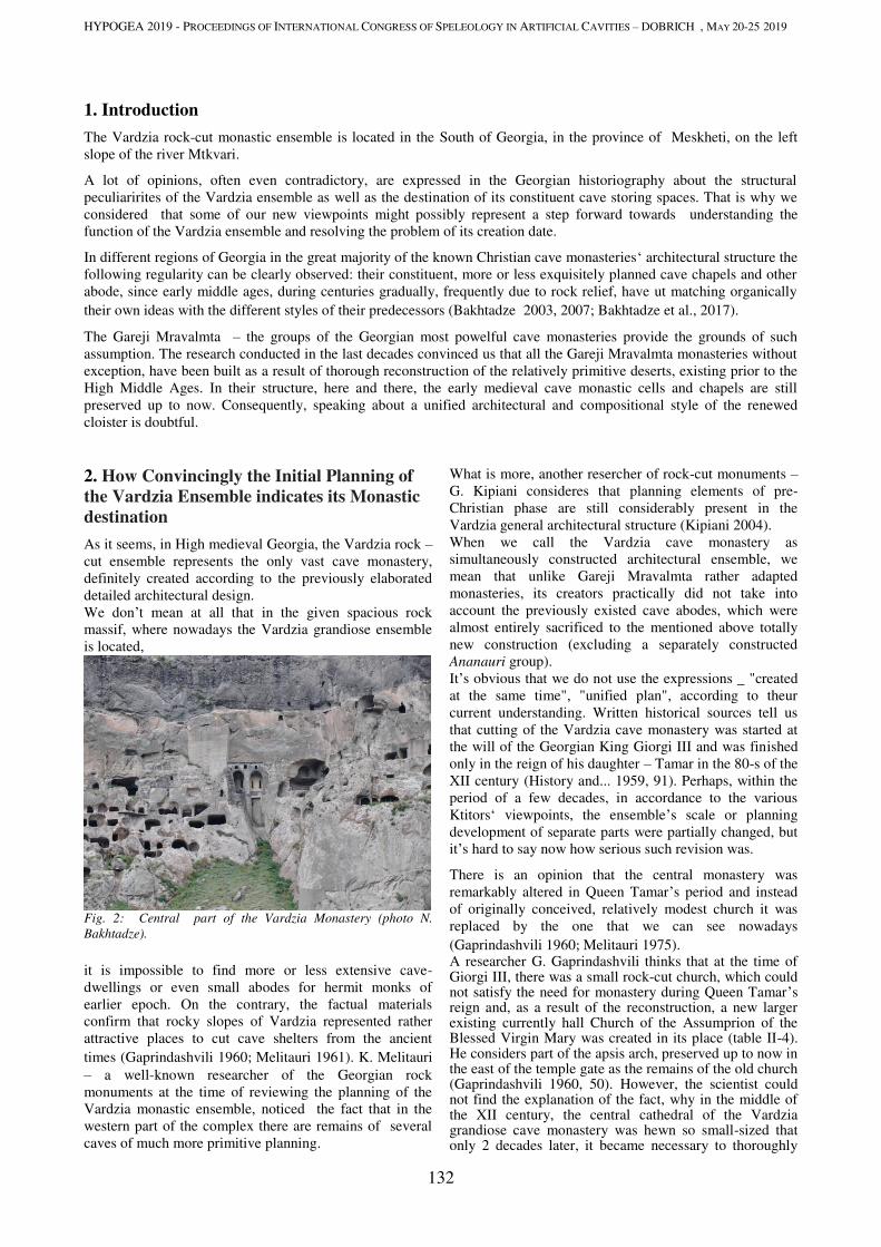
HYPOGEA 2019 - PROCEEDINGS OF INTERNATIONAL CONGRESS OF SPELEOLOGY IN ARTIFICIAL CAVITIES – DOBRICH , MAY 20-25 2019
132
1. Introduction
The Vardzia rock-cut monastic ensemble is located in the South of Georgia, in the province of Meskheti, on the left
slope of the river Mtkvari.
A lot of opinions, often even contradictory, are expressed in the Georgian historiography about the structural
peculiarirites of the Vardzia ensemble as well as the destination of its constituent cave storing spaces. That is why we
considered that some of our new viewpoints might possibly represent a step forward towards understanding the
function of the Vardzia ensemble and resolving the problem of its creation date.
In different regions of Georgia in the great majority of the known Christian cave monasteries‘ architectural structure the
following regularity can be clearly observed: their constituent, more or less exquisitely planned cave chapels and other
abode, since early middle ages, during centuries gradually, frequently due to rock relief, have ut matching organically
their own ideas with the different styles of their predecessors (Bakhtadze 2003, 2007; Bakhtadze et al., 2017).
The Gareji Mravalmta – the groups of the Georgian most powelful cave monasteries provide the grounds of such
assumption. The research conducted in the last decades convinced us that all the Gareji Mravalmta monasteries without
exception, have been built as a result of thorough reconstruction of the relatively primitive deserts, existing prior to the
High Middle Ages. In their structure, here and there, the early medieval cave monastic cells and chapels are still
preserved up to now. Consequently, speaking about a unified architectural and compositional style of the renewed
cloister is doubtful.
2. How Convincingly the Initial Planning of
the Vardzia Ensemble indicates its Monastic
destination
As it seems, in High medieval Georgia, the Vardzia rock –
cut ensemble represents the only vast cave monastery,
definitely created according to the previously elaborated
detailed architectural design.
We don’t mean at all that in the given spacious rock
massif, where nowadays the Vardzia grandiose ensemble
is located,
Fig. 2: Central part of the Vardzia Monastery (photo N.
Bakhtadze).
it is impossible to find more or less extensive cave-
dwellings or even small abodes for hermit monks of
earlier epoch. On the contrary, the factual materials
confirm that rocky slopes of Vardzia represented rather
attractive places to cut cave shelters from the ancient
times (Gaprindashvili 1960; Melitauri 1961). K. Melitauri
– a well-known researcher of the Georgian rock
monuments at the time of reviewing the planning of the
Vardzia monastic ensemble, noticed the fact that in the
western part of the complex there are remains of several
caves of much more primitive planning.
What is more, another resercher of rock-cut monuments –
G. Kipiani consideres that planning elements of pre-
Christian phase are still considerably present in the
Vardzia general architectural structure (Kipiani 2004).
When we call the Vardzia cave monastery as
simultaneously constructed architectural ensemble, we
mean that unlike Gareji Mravalmta rather adapted
monasteries, its creators practically did not take into
account the previously existed cave abodes, which were
almost entirely sacrificed to the mentioned above totally
new construction (excluding a separately constructed
Ananauri group).
It’s obvious that we do not use the expressions _ "created
at the same time", "unified plan", according to theur
current understanding. Written historical sources tell us
that cutting of the Vardzia cave monastery was started at
the will of the Georgian King Giorgi III and was finished
only in the reign of his daughter – Tamar in the 80-s of the
XII century (History and... 1959, 91). Perhaps, within the
period of a few decades, in accordance to the various
Ktitors‘ viewpoints, the ensemble’s scale or planning
development of separate parts were partially changed, but
it’s hard to say now how serious such revision was.
There is an opinion that the central monastery was
remarkably altered in Queen Tamar’s period and instead
of originally conceived, relatively modest church it was
replaced by the one that we can see nowadays
(Gaprindashvili 1960; Melitauri 1975). A researcher G. Gaprindashvili thinks that at the time of Giorgi III, there was a small rock-cut church, which could not satisfy the need for monastery during Queen Tamar’s reign and, as a result of the reconstruction, a new larger existing currently hall Church of the Assumprion of the Blessed Virgin Mary was created in its place (table II-4). He considers part of the apsis arch, preserved up to now in the east of the temple gate as the remains of the old church (Gaprindashvili 1960, 50). However, the scientist could not find the explanation of the fact, why in the middle of the XII century, the central cathedral of the Vardzia grandiose cave monastery was hewn so small-sized that only 2 decades later, it became necessary to thoroughly

HYPOGEA 2019 - PROCEEDINGS OF INTERNATIONAL CONGRESS OF SPELEOLOGY IN ARTIFICIAL CAVITIES – DOBRICH , MAY 20-25 2019
133
reconstruct it and create practically new, much larger temple.
Fig. 3: Main Church of the Vardzia Monastery (photo N. Bakhtadze)
Fig. 4: Fresco Portraits of Georgi III and Queen Tamar from the Main Church of Vardzia (photo N. Bakhtadze).
K. Melitauri imagined the replacement of Vardzia old church with the new main temple in the exactly same way; however, we think his position in relation with the mentioned above issue can be explained in a simpler manner due to the following circumstances: he believed that Vardzia was intended by Giorgi III not as monastery, but as strategically conveniently located rock-cut fortress (Melitauri 1975, 11), where permanent Royal military post (garrison) should have been situated. This hypothesis was taken into consideration by several well-known Georgian scientists (Zaqaraia 1986; Privalova 1986). According to the researcher, planning and architectural peculiarities of most cave dwellings and spaces in Vardzia indicate the given functional load: from the porticos, passing through each other that at the same time create longitudinal "girders", the entrances into soldiers‘ cave dwellings were arranged; these entrances with their spaces and planning complexity (single or several-cave spaces), beautifications and some artistic elements, corresponded to their dwellers‘ military rank differentiation (Melitauri 1975, 16).
Fig. 5: Plan of Main Church of the Vardzia Monastery (drawing
K. Melitauri).
Perhaps, this situation helped to develop the version,
according to which a small church at the given site during
Queen Tamar’s reign, was replaced by today’s central
temple after the transformation of the Vadzia fortification
complex into monastery.
Such interpretation of the first phase of Vardzia
construction seems to us rather unconvincing. Indeed,
among the medieval fortresses, preserved in Georgia and
adjacent regions, there is no proven precedent that the
army dwelling barraks represent individual, isolatied from
each other clusters of accommodation, equiped with
autonomous subsidiary utility spaces, storages and devices
(storerooms, larders and closets, wine cellars, wine
presses and etc.) and beautified with artistic elements.
Fig. 6: Interior of typical cell from the Vardzia Monastery
(photo M. Vakhromeyeva).
Moreover, it is unlikely the small, individual chapels to be
hewn in the rock for small groups of warriors (regardless
of their military rank) together with separated dwelling
spaces.
The general scheme of Vardzia caves and dwellings, at a
glance finds some common signs with ethnographically
and archeologically confirmed traditional Georgian
medieval communal (common) dwellings: here a
„corridor“, main room and subsidiary spaces (wine cellar,
storerooms) were located along a longitudinal axis (in this
case, in the direction to the rock depth). Nevertheless, the
planning and spatial proportion of each rock dweling
element in Vardzia differs significantly from stone
architecture samples: here we can clearly see the tendency
– their narrowing and elongation toward the rock depth.
The main difference between these two dwelling types is
as follows: unlike the dwelling houses of households, the
Vardzia rock dwellings are situated unnaturally close to
each other, side by side (they are often separated from
each other only by the narrow wall of rock); at the same
time, their small-size subsidiary storage spaces (larders)
can only be used to store semi-prepared food products and
not for producing and processing agricultural crops (it is
especially true about arable farming and livestock
products).
Therefore, it’s obvious that in the form of rock dwelling
clusters, we have to do with some kind of shared dwelling
system, the community members of which did not practice
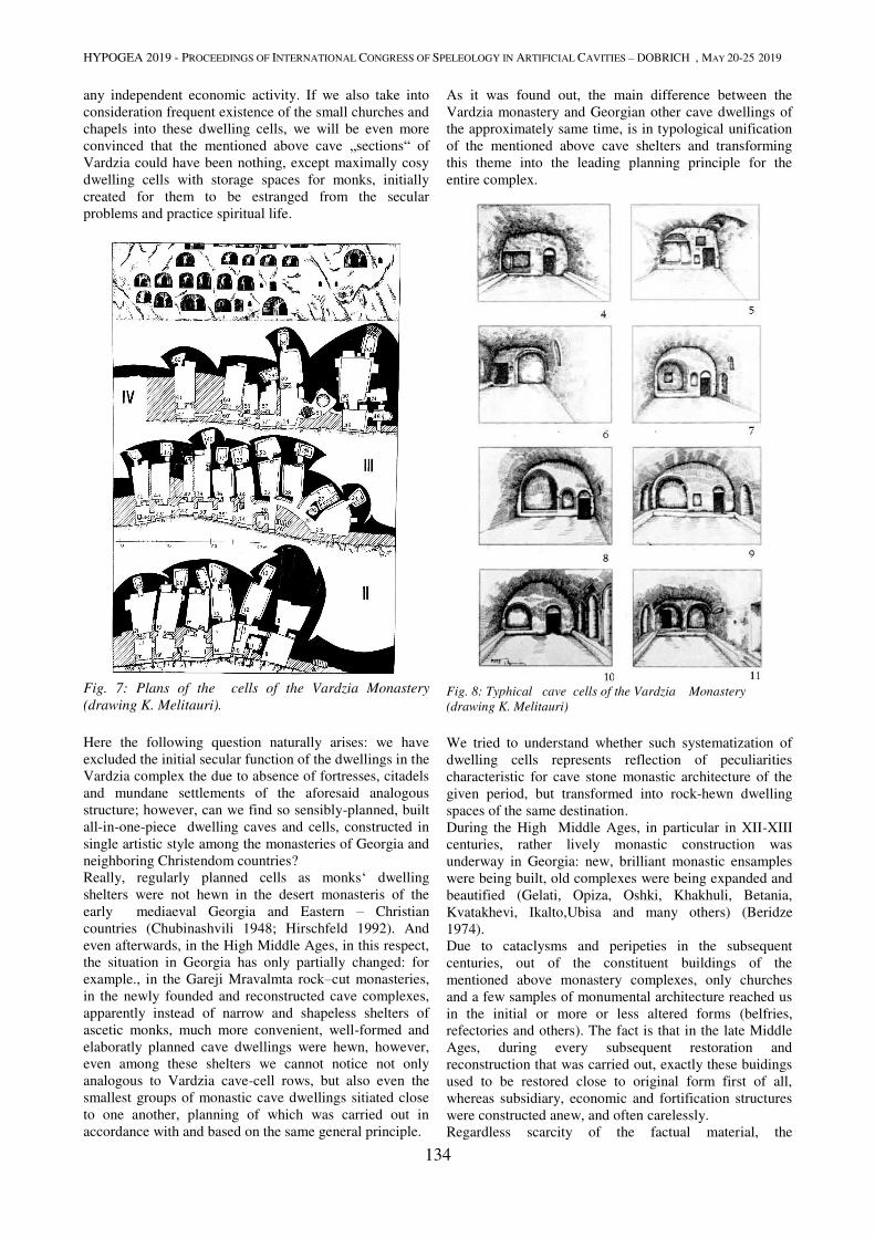
HYPOGEA 2019 - PROCEEDINGS OF INTERNATIONAL CONGRESS OF SPELEOLOGY IN ARTIFICIAL CAVITIES – DOBRICH , MAY 20-25 2019
134
any independent economic activity. If we also take into
consideration frequent existence of the small churches and
chapels into these dwelling cells, we will be even more
convinced that the mentioned above cave „sections“ of
Vardzia could have been nothing, except maximally cosy
dwelling cells with storage spaces for monks, initially
created for them to be estranged from the secular
problems and practice spiritual life.
Fig. 7: Plans of the cells of the Vardzia Monastery
(drawing K. Melitauri).
Here the following question naturally arises: we have
excluded the initial secular function of the dwellings in the
Vardzia complex the due to absence of fortresses, citadels
and mundane settlements of the aforesaid analogous
structure; however, can we find so sensibly-planned, built
all-in-one-piece dwelling caves and cells, constructed in
single artistic style among the monasteries of Georgia and
neighboring Christendom countries?
Really, regularly planned cells as monks‘ dwelling
shelters were not hewn in the desert monasteris of the
early mediaeval Georgia and Eastern – Christian
countries (Chubinashvili 1948; Hirschfeld 1992). And
even afterwards, in the High Middle Ages, in this respect,
the situation in Georgia has only partially changed: for
example., in the Gareji Mravalmta rock–cut monasteries,
in the newly founded and reconstructed cave complexes,
apparently instead of narrow and shapeless shelters of
ascetic monks, much more convenient, well-formed and
elaboratly planned cave dwellings were hewn, however,
even among these shelters we cannot notice not only
analogous to Vardzia cave-cell rows, but also even the
smallest groups of monastic cave dwellings sitiated close
to one another, planning of which was carried out in
accordance with and based on the same general principle.
As it was found out, the main difference between the
Vardzia monastery and Georgian other cave dwellings of
the approximately same time, is in typological unification
of the mentioned above cave shelters and transforming
this theme into the leading planning principle for the
entire complex.
Fig. 8: Typhical cave cells of the Vardzia Monastery
(drawing K. Melitauri)
We tried to understand whether such systematization of
dwelling cells represents reflection of peculiarities
characteristic for cave stone monastic architecture of the
given period, but transformed into rock-hewn dwelling
spaces of the same destination.
During the High Middle Ages, in particular in XII-XIII
centuries, rather lively monastic construction was
underway in Georgia: new, brilliant monastic ensamples
were being built, old complexes were being expanded and
beautified (Gelati, Opiza, Oshki, Khakhuli, Betania,
Kvatakhevi, Ikalto,Ubisa and many others) (Beridze
1974).
Due to cataclysms and peripeties in the subsequent
centuries, out of the constituent buildings of the
mentioned above monastery complexes, only churches
and a few samples of monumental architecture reached us
in the initial or more or less altered forms (belfries,
refectories and others). The fact is that in the late Middle
Ages, during every subsequent restoration and
reconstruction that was carried out, exactly these buidings
used to be restored close to original form first of all,
whereas subsidiary, economic and fortification structures
were constructed anew, and often carelessly.
Regardless scarcity of the factual material, the

HYPOGEA 2019 - PROCEEDINGS OF INTERNATIONAL CONGRESS OF SPELEOLOGY IN ARTIFICIAL CAVITIES – DOBRICH , MAY 20-25 2019
135
compositional integrity and careful elaboration of the
structures, preserved on the premises of these outstanding
monasteries, still make us think that in thier general plans,
even dwelling cells would have definite places there, and
we do not believe that they could bring discord into this
brilliant ensemble with their occasional forms and
inappropriate facelessness.
Architectural structure of monastic complexes, built in the
mentioned above period of time throughout the Byzantine
world countries, represents the basis for such proof.
Apparently, in the subsequent centuries the monasteries in
these countries also underwent destruction and
reconstruction, however, due to special political status or
simply thanks to their numerousness, some of the
monastic complexes are still preserved in the given
regions; unlike the Georgian abodes, the mentioned above
monasteries have retained the High Medieval structure
almost intact.
Familiarization with a number of Byzantine monasteries
of the aforesaid epoch (for example., St. Luke’s Church
and St. Daphni Monastery on the Mount of Athos and
others) has convinced us (Kondakov 1902) that dwelling
sections for monks are built within the complexes,
arranged as a rule side by side and following one another
successively, located in section-style, with approximately
equal–size rooms, constructed along the monastery wall.
These dwellings with dead wall, or illuminated by small
windows, are situated with their back to the fence, they
can be entered directly from the monastery yard or
elongated, the open gallery arranged on the same side. In
places, such „common dwellings“ for monks are found
around the several walls, stretched towards the fortress
yard, sometimes in 2 floors. Not rarely these „typical“
residential accommodations have additional utility spaces
at one side of the cells or another.
Similarly planned cell systems have been also preserved
in some of the High Medieval Armenian monastery
complexes (Geghardi, Tatevi and etc.). According to the
Armenian scientists‘ argumentation, these dwellings are
also contemporary with the main buildings of the
monasteries (Khalpakhchian 1971, 36, 42).
We do not have any information about wide prevalence of
the cave cell systems with analogical structure (i.e. Vadzia
type) among the X-XIV c.c. cave monasteries of the
Byzantine world. As it seems, in the cave monasteries of
Cappadocia and some other regions, similarly to the
Gareji deserts, shifting the tradition of hewing out the
cave dwellings into the background was practiced during
the given period and all the attention was again focused on
„sculpturing“ churches and other public facilities (Rodley
1985; Kostof 1989).
While discussing the origins and genesis of the Christian
cave monateries‘ sectional structure we cannot avoid one
more circumstance. The fact is that if rock hewn Christian
monasteries of such planning are rare, compositionally
similar to them complexes (obviously, with other kinds of
temples), are very characteristic of the Buddhist
monasticism of central and South Asia.
Rock-cut Buddhist monateries were spread in IV-X c.c.
AD, successively first of all in Western India, then in
Balkh (Afganistan), Eastern Turkistan and North China
(Litvinski; Pichikjan 1986). Separate chapels and abodes
of such monasteries, were characterized by straight
geometric shapes and monumentality from the early
stages, however, initially they were hewn in the rocky
massifs in more or less scattered groups and only later
gained the shape of a compactly planned cluster. The
monastic cells – constituent components of the latest
phase (approximately VIII-X c.c.) of the Buddhist
monasteries, are distinguished with regularly repeated
structure. For example, the formed and typically planned
dwellings of the Buddhist monastery „Tuiuk-Mazari“,
located in Eastern Turkestan, were hewn side by side
(Litvinski; Pichikjan 1986, pic. 15). Each of these cave
dwelling sections consists of 3 elongated towards the rock
depth and passing through each other storing spaces, out
of which the latest small-sized one represents a larder.
In the Buddhist monasteries of this category and rank, the
cave-cells of the described structure are hewn in the
vertical rock masifs in several tiers and it calls up an
association with the Vardzia monastery from the
viewpoint of planning as well as visually. It is noteworthy
that some of the monastery cave cells with arched ceilings
and decorated interiors (for example, Shikshini Abbey)
are similar to the Vardzia rock houses (Litvinski;
Pichikjan 1986, pic. 3, 4).
Obviously, we are far from the idea to look for direct
prototypes of the Christian monasteries (including
Vardzia), created according to regular planning in the
High Middle Ages among Buddhist monasteries of
Central Asia, but the mentioned above similarity, is
probably not completely accidental.
In our opinion, identity of the dwelling cells for the monks
representing different religions, first of all, indicates their
inhabitants‘ same social status and is the consequence for
the development of organized monasticism. We should
also take into consideration that separate elements of the
Christian as well as Buddhist cave abodes were probably
taken from the common residental spaces, built with
ordinary materials; and resemblance to these cave
dwelligns may represent the reflection of the stony
residential houses, typologically identical for the
mentioned above region.
On the other hand, in Georgia – the country located at the
confluence of Eastern and Western cultures, in the XII-
XIII centuries, out of the other fields of art, enriched from
aforesaid cultural flows, it would be improper to consider
only rock architecture (even cult architecture) as a
phenomenon formed owing to only local art, or thrived
under the influence of the western civilization. We should
suppose that the architects – creators of Vardzia would be
very much aware of secular or cult construction art,
characteristic for western as well as eastern civilizations
and existence of rock-cut Buddhist monasteries
widespread in central regions of Asia would not be
unknown for them either.
Naturally, while planning and compositional solution of
the Vardzia monastic ensemble, the Georgian craftsmen
would combined local, centuries-old traditions of rock
architecture with Oriental and Western world architectural
achievements as it was happening in any field of
Georgian culture of the mentioned above epoch (for
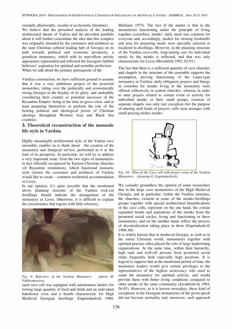
HYPOGEA 2019 - PROCEEDINGS OF INTERNATIONAL CONGRESS OF SPELEOLOGY IN ARTIFICIAL CAVITIES – DOBRICH , MAY 20-25 2019
136
example, phylosophy, secular or ecclesiastic literature).
We believe that the presented analysis of the leading
atchitectural theme of Vadzia and the provided parallels
about it will further consolidate the idea that this complex
was originally intended by the customers and architects as
the state Christian cultural leading hub of Georgia on its
path towards political and economic prosperity, a
grandiose monastery, which with its marvellous artistic
appearance represented and reflected the Georgian faithful
believers’ aspiration for spiritual and aestethic perfection.
When we talk about the primary prerequisite of the
Vardzia construction, we have sufficient ground to assume
that it was a very ambitious project of the powerful
monarches, ruling over the politically and economically
strong Georgia in the heyday of its glory, and undoubtly
considering their country as potential successor of the
Byzantine Empire, being at the time in grave crisis, and at
least preparing themselves to perform the role of the
bearing political and ideological power of Christian
ideology throughout Western Asia and Black Sea
countries.
3. Theoretical reconstruction of the monastic
life style in Vardzia Highly meaningful architectural style of the Vadzia cave
ensemble, enables us to think about the creation of the
monastery and liturgical service, performed in it at the
time of its prosperity. In particular, we will try to address
a very important issue: from the two types of monasteries
in fact officially recognized by Eastern Christian churches
(of Byzantine orientation), which functional monastic
style cloister the customers and architects of Vardzia
would like to create – common residential accommodation
or Lavra.
In our opinion, it’s quite possible that the mentioned
above planning structure of the Vardzia rock-cut
dwellings should indicate the arrangement of the
monastery as Lavra. Otherwise, it is difficult to explain
the circumstance that togeter with little refectory,
Fig. 9: Refectory of the Vardzia Monastery (photo M.
Vakhromeyeva).
each cave cell was equipped with autonomous larders for
storing large quantity of food and drink and an individual
bakehouse oven and a hearth characteristic for High
Medieval Georgian dwellings (Gaprindashvili 1960;
Melitauri 1975). The fact of the matter is that in the
monasteries functioning under the principle of living
together (coenobia), monks‘ daily meal was common for
everyone and, accordingly, larders for stroring foodstuffs
and area for preparing meals were specially selected or
localized in dwellings. However, in the planning structure
of the Vardzia cave-cells, long-lasting care for individual
meals by the monks is reflected, and that was only
characteristic for Lavra (Hirschfeld 1992, 82-91).
The fact that there is a sufficient quantity of cave churches
and chapels in the structure of the ensemble supports the
assumption, proving functioning of the Laura-type
monastery in Vardzia: daily obligatory prayers and liturgy
in coenobia for monks living in the monastery were
offered collectively in central churches, whereas in order
to utter prayers related to certain event or activity for
individual monks or their small groups, creation of
separate chapels was only rare exception (for the purpose
of uttering such kinds of prayers, cells were arranges with
small praying niches inside).
Fig. 10: Plan of the Cave cell with prayer room of the Vardzia
Monastery (drawing G. Gaprindashvili).
We consider groundless the opinion of some researchers
that in the large cave monasteries of the High Medieval
Georgia, and in particular, within the Vardzia structure,
the churches, existent at some of the monks‘dwellings
groups together with special architectural beautifications
of the cave cells, represent on the one hand, the certain
separatist trends and aspirations of the monks from the
promoted social circles, living and functioning in these
monasteries, and on the another hand, reflect the process
of decentralization taking place in them (Gaprindashvili
1960, 68).
It is widely known that in medieval Georgia, as well as in
the entire Christian world, monasteries together with
spiritual practice often played the role of large landowning
organizations. At the same time, within their hierarchy,
high rank and well-off persons from promoted social
strata frequently held especially high positions. It is
logical to suppose that at the mentioned period of time, the
monastery leaders would give certain privileges to the
representatives of the highest aristocracy who used to
come the monastery for spiritual activity, and would
provide them with better living conditions compared to
other monks of the same community (Javakhishvili 1984,
56-85). However, as it is known nowadays, these kind of
exceptions in the Georgian monasteries of the given epoch
did not become normality and, moreover, such approach
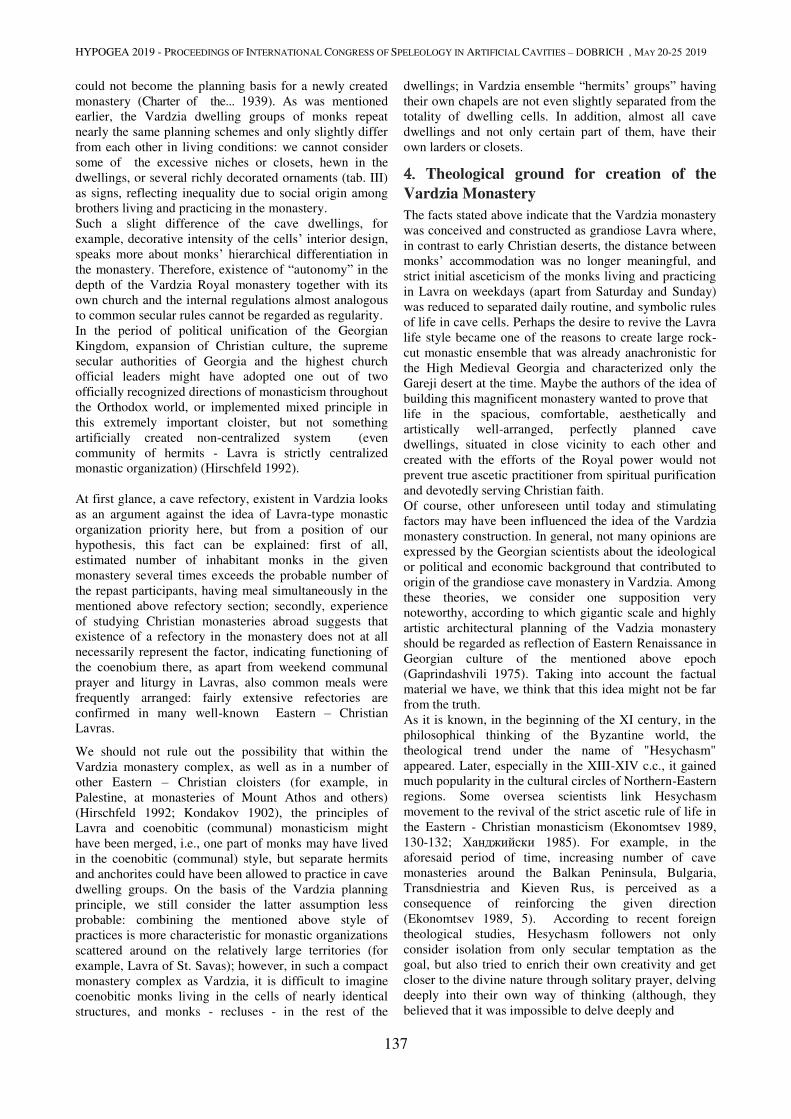
HYPOGEA 2019 - PROCEEDINGS OF INTERNATIONAL CONGRESS OF SPELEOLOGY IN ARTIFICIAL CAVITIES – DOBRICH , MAY 20-25 2019
137
could not become the planning basis for a newly created
monastery (Charter of the... 1939). As was mentioned
earlier, the Vardzia dwelling groups of monks repeat
nearly the same planning schemes and only slightly differ
from each other in living conditions: we cannot consider
some of the excessive niches or closets, hewn in the
dwellings, or several richly decorated ornaments (tab. III)
as signs, reflecting inequality due to social origin among
brothers living and practicing in the monastery.
Such a slight difference of the cave dwellings, for
example, decorative intensity of the cells’ interior design,
speaks more about monks’ hierarchical differentiation in
the monastery. Therefore, existence of “autonomy” in the
depth of the Vardzia Royal monastery together with its
own church and the internal regulations almost analogous
to common secular rules cannot be regarded as regularity.
In the period of political unification of the Georgian
Kingdom, expansion of Christian culture, the supreme
secular authorities of Georgia and the highest church
official leaders might have adopted one out of two
officially recognized directions of monasticism throughout
the Orthodox world, or implemented mixed principle in
this extremely important cloister, but not something
artificially created non-centralized system (even
community of hermits - Lavra is strictly centralized
monastic organization) (Hirschfeld 1992).
At first glance, a cave refectory, existent in Vardzia looks
as an argument against the idea of Lavra-type monastic
organization priority here, but from a position of our
hypothesis, this fact can be explained: first of all,
estimated number of inhabitant monks in the given
monastery several times exceeds the probable number of
the repast participants, having meal simultaneously in the
mentioned above refectory section; secondly, experience
of studying Christian monasteries abroad suggests that
existence of a refectory in the monastery does not at all
necessarily represent the factor, indicating functioning of
the coenobium there, as apart from weekend communal
prayer and liturgy in Lavras, also common meals were
frequently arranged: fairly extensive refectories are
confirmed in many well-known Eastern – Christian
Lavras.
We should not rule out the possibility that within the
Vardzia monastery complex, as well as in a number of
other Eastern – Christian cloisters (for example, in
Palestine, at monasteries of Mount Athos and others)
(Hirschfeld 1992; Kondakov 1902), the principles of
Lavra and coenobitic (communal) monasticism might
have been merged, i.e., one part of monks may have lived
in the coenobitic (communal) style, but separate hermits
and anchorites could have been allowed to practice in cave
dwelling groups. On the basis of the Vardzia planning
principle, we still consider the latter assumption less
probable: combining the mentioned above style of
practices is more characteristic for monastic organizations
scattered around on the relatively large territories (for
example, Lavra of St. Savas); however, in such a compact
monastery complex as Vardzia, it is difficult to imagine
coenobitic monks living in the cells of nearly identical
structures, and monks - recluses - in the rest of the
dwellings; in Vardzia ensemble “hermits’ groups” having
their own chapels are not even slightly separated from the
totality of dwelling cells. In addition, almost all cave
dwellings and not only certain part of them, have their
own larders or closets.
4. Theological ground for creation of the
Vardzia Monastery
The facts stated above indicate that the Vardzia monastery
was conceived and constructed as grandiose Lavra where,
in contrast to early Christian deserts, the distance between
monks’ accommodation was no longer meaningful, and
strict initial asceticism of the monks living and practicing
in Lavra on weekdays (apart from Saturday and Sunday)
was reduced to separated daily routine, and symbolic rules
of life in cave cells. Perhaps the desire to revive the Lavra
life style became one of the reasons to create large rock-
cut monastic ensemble that was already anachronistic for
the High Medieval Georgia and characterized only the
Gareji desert at the time. Maybe the authors of the idea of
building this magnificent monastery wanted to prove that
life in the spacious, comfortable, aesthetically and
artistically well-arranged, perfectly planned cave
dwellings, situated in close vicinity to each other and
created with the efforts of the Royal power would not
prevent true ascetic practitioner from spiritual purification
and devotedly serving Christian faith.
Of course, other unforeseen until today and stimulating
factors may have been influenced the idea of the Vardzia
monastery construction. In general, not many opinions are
expressed by the Georgian scientists about the ideological
or political and economic background that contributed to
origin of the grandiose cave monastery in Vardzia. Among
these theories, we consider one supposition very
noteworthy, according to which gigantic scale and highly
artistic architectural planning of the Vadzia monastery
should be regarded as reflection of Eastern Renaissance in
Georgian culture of the mentioned above epoch
(Gaprindashvili 1975). Taking into account the factual
material we have, we think that this idea might not be far
from the truth.
As it is known, in the beginning of the XI century, in the
philosophical thinking of the Byzantine world, the
theological trend under the name of "Hesychasm"
appeared. Later, especially in the XIII-XIV c.c., it gained
much popularity in the cultural circles of Northern-Eastern
regions. Some oversea scientists link Hesychasm
movement to the revival of the strict ascetic rule of life in
the Eastern - Christian monasticism (Ekonomtsev 1989,
130-132; Ханджийски 1985). For example, in the
aforesaid period of time, increasing number of cave
monasteries around the Balkan Peninsula, Bulgaria,
Transdniestria and Kieven Rus, is perceived as a
consequence of reinforcing the given direction
(Ekonomtsev 1989, 5). According to recent foreign
theological studies, Hesychasm followers not only
consider isolation from only secular temptation as the
goal, but also tried to enrich their own creativity and get
closer to the divine nature through solitary prayer, delving
deeply into their own way of thinking (although, they
believed that it was impossible to delve deeply and
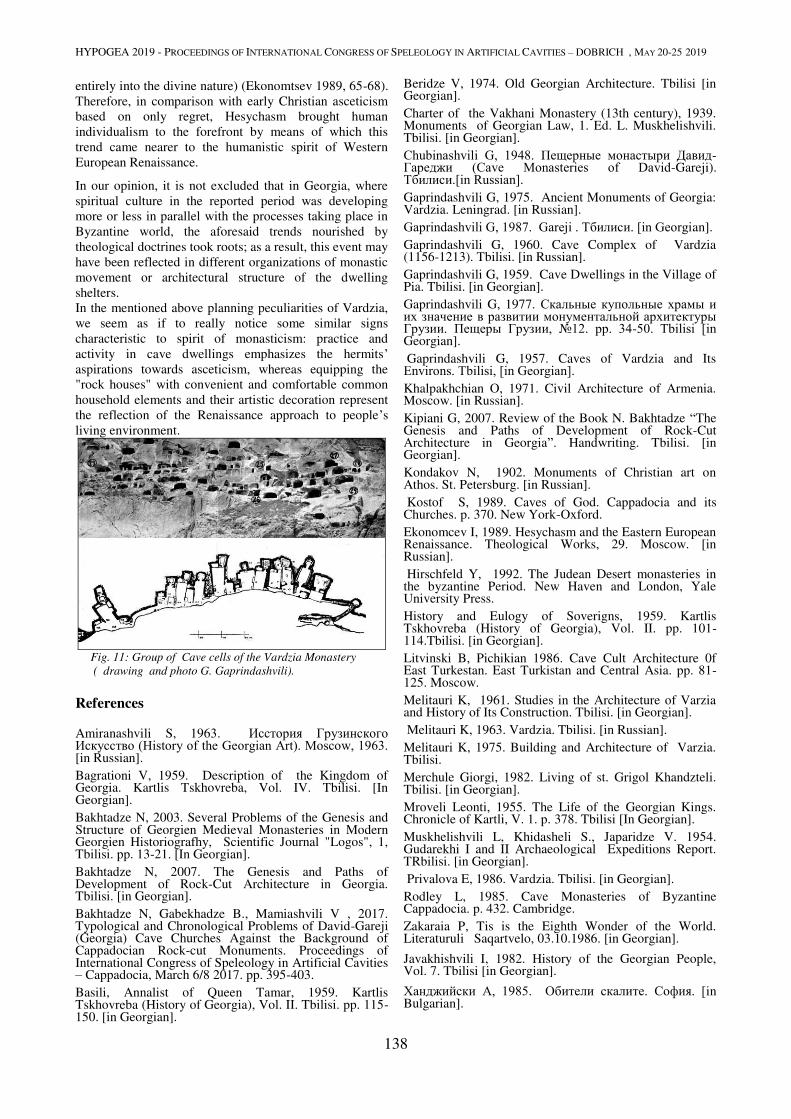
HYPOGEA 2019 - PROCEEDINGS OF INTERNATIONAL CONGRESS OF SPELEOLOGY IN ARTIFICIAL CAVITIES – DOBRICH , MAY 20-25 2019
138
entirely into the divine nature) (Ekonomtsev 1989, 65-68).
Therefore, in comparison with early Christian asceticism
based on only regret, Hesychasm brought human
individualism to the forefront by means of which this
trend came nearer to the humanistic spirit of Western
European Renaissance.
In our opinion, it is not excluded that in Georgia, where
spiritual culture in the reported period was developing
more or less in parallel with the processes taking place in
Byzantine world, the aforesaid trends nourished by
theological doctrines took roots; as a result, this event may
have been reflected in different organizations of monastic
movement or architectural structure of the dwelling
shelters. In the mentioned above planning peculiarities of Vardzia,
we seem as if to really notice some similar signs
characteristic to spirit of monasticism: practice and
activity in cave dwellings emphasizes the hermits’ aspirations towards asceticism, whereas equipping the
"rock houses" with convenient and comfortable common
household elements and their artistic decoration represent
the reflection of the Renaissance approach to people’s
living environment.
Fig. 11: Group of Cave cells of the Vardzia Monastery
( drawing and photo G. Gaprindashvili).
References
Amiranashvili S, 1963. Исстория Грузинского Искусство (History of the Georgian Art). Moscow, 1963. [in Russian].
Bagrationi V, 1959. Description of the Kingdom of Georgia. Kartlis Tskhovreba, Vol. IV. Tbilisi. [In Georgian].
Bakhtadze N, 2003. Several Problems of the Genesis and Structure of Georgien Medieval Monasteries in Modern Georgien Historiografhy, Scientific Journal "Logos", 1, Tbilisi. pp. 13-21. [In Georgian].
Bakhtadze N, 2007. The Genesis and Paths of Development of Rock-Cut Architecture in Georgia. Tbilisi. [in Georgian].
Bakhtadze N, Gabekhadze B., Mamiashvili V , 2017. Typological and Chronological Problems of David-Gareji (Georgia) Cave Churches Against the Background of Cappadocian Rock-cut Monuments. Proceedings of International Congress of Speleology in Artificial Cavities – Cappadocia, March 6/8 2017. pp. 395-403.
Basili, Annalist of Queen Tamar, 1959. Kartlis Tskhovreba (History of Georgia), Vol. II. Tbilisi. pp. 115-150. [in Georgian].
Beridze V, 1974. Old Georgian Architecture. Tbilisi [in Georgian].
Charter of the Vakhani Monastery (13th century), 1939. Monuments of Georgian Law, 1. Ed. L. Muskhelishvili. Tbilisi. [in Georgian].
Chubinashvili G, 1948. Пещерные монастыри Давид-Гареджи (Cave Monasteries of David-Gareji). Тбилиси.[in Russian]. Gaprindashvili G, 1975. Ancient Monuments of Georgia: Vardzia. Leningrad. [in Russian].
Gaprindashvili G, 1987. Gareji . Тбилиси. [in Georgian].
Gaprindashvili G, 1960. Cave Complex of Vardzia (1156-1213). Tbilisi. [in Russian].
Gaprindashvili G, 1959. Cave Dwellings in the Village of Pia. Tbilisi. [in Georgian].
Gaprindashvili G, 1977. Скальные купольные храмы и их значение в развитии монументальной архитектуры Грузии. Пещеры Грузии, №12. pp. 34-50. Тbilisi [in Georgian].
Gaprindashvili G, 1957. Caves of Vardzia and Its Environs. Тbilisi, [in Georgian]. Khalpakhchian O, 1971. Civil Architecture of Armenia. Moscow. [in Russian].
Kipiani G, 2007. Review of the Book N. Bakhtadze “The Genesis and Paths of Development of Rock-Cut Architecture in Georgia”. Handwriting. Tbilisi. [in Georgian].
Kondakov N, 1902. Monuments of Christian art on Athos. St. Petersburg. [in Russian].
Kostof S, 1989. Caves of God. Cappadocia and its Churches. p. 370. New York-Oxford.
Ekonomcev I, 1989. Hesychasm and the Eastern European Renaissance. Theological Works, 29. Moscow. [in Russian].
Hirschfeld Y, 1992. The Judean Desert monasteries in the byzantine Period. New Haven and London, Yale University Press.
History and Eulogy of Soverigns, 1959. Kartlis Tskhovreba (History of Georgia), Vol. II. pp. 101-114.Tbilisi. [in Georgian].
Litvinski B, Pichikian 1986. Cave Cult Architecture 0f East Turkestan. East Turkistan and Central Asia. pp. 81-125. Moscow.
Melitauri K, 1961. Studies in the Architecture of Varzia and History of Its Construction. Tbilisi. [in Georgian].
Melitauri K, 1963. Vardzia. Tbilisi. [in Russian].
Melitauri K, 1975. Building and Architecture of Varzia. Tbilisi.
Merchule Giorgi, 1982. Living of st. Grigol Khandzteli. Tbilisi. [in Georgian].
Mroveli Leonti, 1955. The Life of the Georgian Kings. Chronicle of Kartli, V. 1. p. 378. Tbilisi [In Georgian].
Muskhelishvili L, Khidasheli S., Japaridze V. 1954. Gudarekhi I and II Archaeological Expeditions Report. TRbilisi. [in Georgian].
Privalova E, 1986. Vardzia. Tbilisi. [in Georgian].
Rodley L, 1985. Cave Monasteries of Byzantine Cappadocia. p. 432. Cambridge.
Zakaraia P, Tis is the Eighth Wonder of the World. Literaturuli Saqartvelo, 03.10.1986. [in Georgian].
Javakhishvili I, 1982. History of the Georgian People, Vol. 7. Tbilisi [in Georgian].
Ханджийски А, 1985. Обители скалите. София. [in Bulgarian].

HYDRAULIC UNDERGROUND WORKS
HYPOGEA 2019 - PROCEEDINGS OF INTERNATIONAL CONGRESS OF SPELEOLOGY IN ARTIFICIAL CAVITIES – DOBRICH , MAY 20-25 2019
139
THE RESURGENCE NEAR YARIMBURGAZ CAVE
Şengül G. Aydıngün1, Haldun Aydıngün2, Metin Albukrek3, Gülşen Küçükali Üstün4, Berk Üstün5 1 Faculty of Arts and Sciences, Kocaeli Unversity, Kocaeli, Turkey, [email protected] 2 Çanakkale Onsekiz Mart University, İstanbul, Turkey, [email protected]
3 Galeri Cave Research Group, İstanbul, Turkey, [email protected] 4 Galeri Cave Research Group, İstanbul, Turkey, [email protected] 5 Galeri Cave Research Group, İstanbul, Turkey, [email protected]
Abstract
Yarımburgaz cave is situated on the european part of Turkey, approximately 22 km west of the city of Istanbul
Bosphorus, ca. 1.5 km north of Küçükçekmece lagoon, on the northeastern side of the Sazlıdere stream. Yarımburgaz cave is a globally important fossil cave, which contains many traces of the earliest humans. Modern excavations in this
cave between 1963 and 1990 unearthed evidence for occupation in Paleolithic, Neolithic, Chalcolithic and Roman-
Byzantine periods.
A water resurgence is situated about 200 meters southeast of Yarımburgaz cave. Lots of archeological reseaches and publications have been done about Yarımburgaz cave. However, this nearby water resurgence has only been mentioned shortly in very few publications. This resurgenge, providing clean water, should
have played a vital role during the whole archaeological history of Yarımburgaz cave. Moreover, this nearby
underground stream could be the stream, which could have initially formed Yarımburgaz cave, when the Sazlıdere riverbed was at a higher level than today.
Until a few years ago, this resurgence was being used by municipality to pump out water for the city use. During this
time, entrance into it was not possible. However, in the last years, due to extensive underground water abstraction from
the surrounding area, the resurgence totally dried out and man-made galleries were discovered.
Keywords
Yarımburgaz Cave, early humans, resurgence, drinking water, homo erectus, prehistoric
1. History and importance of the area
Yarımburgaz cave is situated on the european part of Turkey, approximately 22 km west of the city of Istanbul
Bosphorus, ca. 1.5 km north of Küçükçekmece lagoon, on
the northeastern side of the Sazlıdere stream. This natural
cave, located at Altınşehir, within the borders of the
Başakşehir district of İstanbul, has a special place in
World’s cultural history because it has the oldest traces of
humanity in Europe. The cave was a shelter and a good
settlement site thanks to its proximity to the
Küçükçekmece Lagoon Lake and Sazlıdere (Antique Bathynias River) passing in front of it. The cave has two
entrances. The higher one leads to a single large chamber
52 meters long with a ceiling 15 meters high and it is
connected to the lower one which opens to a 700 meters
long branching galleries system. This latter, starting with a
narrow single gallery, leads to a wide chamber with
stalactites and stalagmites.
Yarımburgaz Cave is very important for the researches of
prehistoric ages. But the first scientific papers appearing
one and a half centuries ago concentrated mainly on its
geologic featutes, (Abdullah bey 1869,1870,1874), Rabius
Bousquet (1900/1901: 295-302), Harun Reşit Kocacan (1921: 12-18), Raymond Hovasse (1927: 1-19, 396-422)
and GE Hubbard (1932: 321-328). Hovasse is the first
person to draw attention to the prehistoric settlement of
this cave. The first archaeological investigations in the
cave were carried out by Şevket Aziz Kansu in 1959
(Kansu 1966; 1972). Further information was obtained
when the soundings opened by Ismail Kılıç Kökten (1963: 277-278) in 1963 and Şevket Aziz Kansu-Necati Dolunay
(Kansu 1966: 491-492) in 1964-1965.
Two decades later, in 1986, Istanbul Archaeological
Museums carried out excavations under the scientific
supervision of Istanbul University’s Prof. Dr. Mehmet
Özdoğan who concluded that the first human presence in
the cave belongs to Lower Paleolithic (Özdoğan 1988: 323-335).
It is understood that the prehistoric chronology of the cave
covers the period from 600,000 BC up to Late
Chalcolithic, 3200 BC.
In the Byzantine period, Yarımburgaz was organized as a large monastery complex.
The excavations resumed in the scientific supervision of
Prof. Dr. Güven Arsebük during the seasons of 1988-90
(Arsebük and Özbaşaran 1994: 17-27; Özbaşaran 1995).
More recent archaeological fieldwork in the basin of the
Küçükçekmece lake was initiated in 2007 as part of the
Istanbul Prehistoric Research Project, under the
directorship of Assoc. Prof. Dr. Şengül Aydıngün of
Kocaeli University. The project has been carried out by an
international team of researchers in conjunction with the
Turkish Ministry of Culture and Tourism. Within the
scope of these researches (Aydıngün 2016: 217-230).
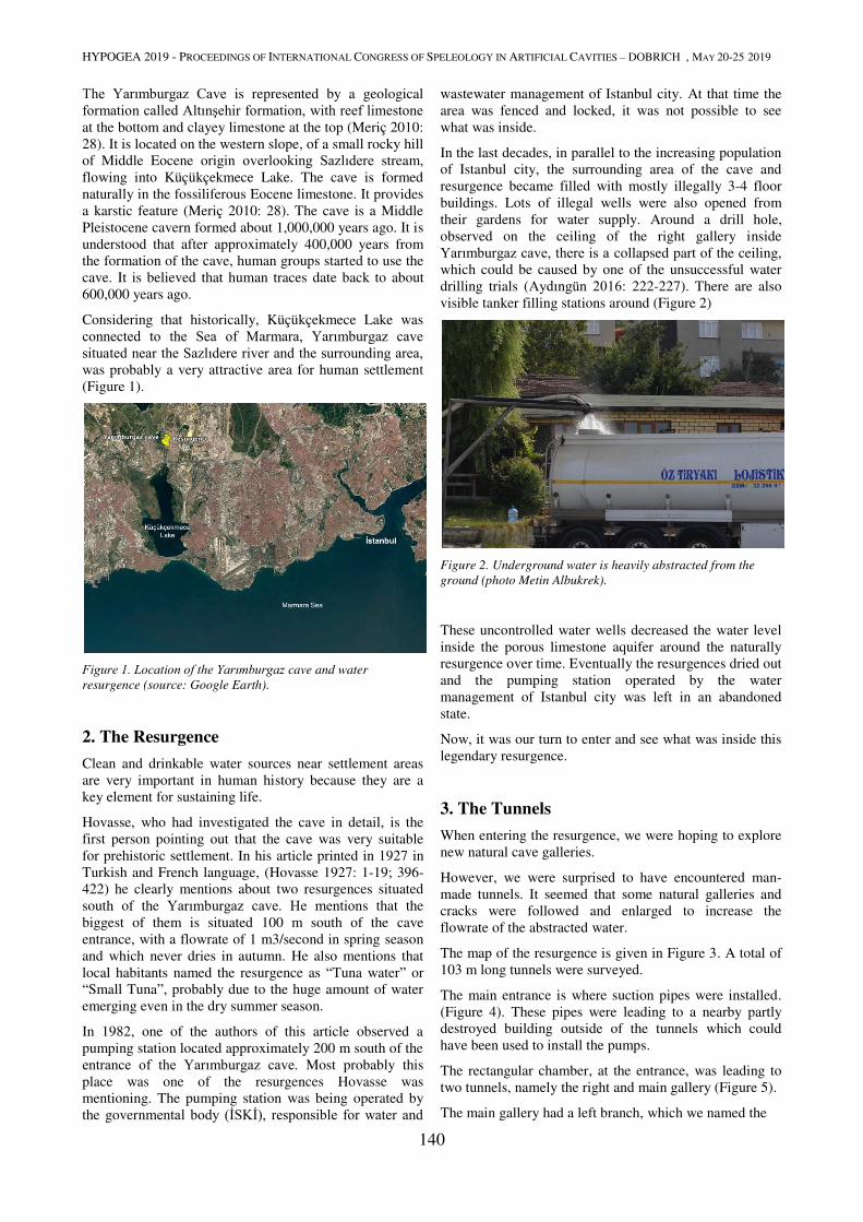
HYPOGEA 2019 - PROCEEDINGS OF INTERNATIONAL CONGRESS OF SPELEOLOGY IN ARTIFICIAL CAVITIES – DOBRICH , MAY 20-25 2019
140
The Yarımburgaz Cave is represented by a geological
formation called Altınşehir formation, with reef limestone at the bottom and clayey limestone at the top (Meriç 2010:
28). It is located on the western slope, of a small rocky hill
of Middle Eocene origin overlooking Sazlıdere stream,
flowing into Küçükçekmece Lake. The cave is formed
naturally in the fossiliferous Eocene limestone. It provides
a karstic feature (Meriç 2010: 28). The cave is a Middle
Pleistocene cavern formed about 1,000,000 years ago. It is
understood that after approximately 400,000 years from
the formation of the cave, human groups started to use the
cave. It is believed that human traces date back to about
600,000 years ago.
Considering that historically, Küçükçekmece Lake was
connected to the Sea of Marmara, Yarımburgaz cave situated near the Sazlıdere river and the surrounding area, was probably a very attractive area for human settlement
(Figure 1).
Figure 1. Location of the Yarımburgaz cave and water
resurgence (source: Google Earth).
2. The Resurgence
Clean and drinkable water sources near settlement areas
are very important in human history because they are a
key element for sustaining life.
Hovasse, who had investigated the cave in detail, is the
first person pointing out that the cave was very suitable
for prehistoric settlement. In his article printed in 1927 in
Turkish and French language, (Hovasse 1927: 1-19; 396-
422) he clearly mentions about two resurgences situated
south of the Yarımburgaz cave. He mentions that the
biggest of them is situated 100 m south of the cave
entrance, with a flowrate of 1 m3/second in spring season
and which never dries in autumn. He also mentions that
local habitants named the resurgence as “Tuna water” or
“Small Tuna”, probably due to the huge amount of water
emerging even in the dry summer season.
In 1982, one of the authors of this article observed a
pumping station located approximately 200 m south of the
entrance of the Yarımburgaz cave. Most probably this
place was one of the resurgences Hovasse was
mentioning. The pumping station was being operated by
the governmental body (İSKİ), responsible for water and
wastewater management of Istanbul city. At that time the
area was fenced and locked, it was not possible to see
what was inside.
In the last decades, in parallel to the increasing population
of Istanbul city, the surrounding area of the cave and
resurgence became filled with mostly illegally 3-4 floor
buildings. Lots of illegal wells were also opened from
their gardens for water supply. Around a drill hole,
observed on the ceiling of the right gallery inside
Yarımburgaz cave, there is a collapsed part of the ceiling,
which could be caused by one of the unsuccessful water
drilling trials (Aydıngün 2016: 222-227). There are also
visible tanker filling stations around (Figure 2)
Figure 2. Underground water is heavily abstracted from the
ground (photo Metin Albukrek).
These uncontrolled water wells decreased the water level
inside the porous limestone aquifer around the naturally
resurgence over time. Eventually the resurgences dried out
and the pumping station operated by the water
management of Istanbul city was left in an abandoned
state.
Now, it was our turn to enter and see what was inside this
legendary resurgence.
3. The Tunnels
When entering the resurgence, we were hoping to explore
new natural cave galleries.
However, we were surprised to have encountered man-
made tunnels. It seemed that some natural galleries and
cracks were followed and enlarged to increase the
flowrate of the abstracted water.
The map of the resurgence is given in Figure 3. A total of
103 m long tunnels were surveyed.
The main entrance is where suction pipes were installed.
(Figure 4). These pipes were leading to a nearby partly
destroyed building outside of the tunnels which could
have been used to install the pumps.
The rectangular chamber, at the entrance, was leading to
two tunnels, namely the right and main gallery (Figure 5).
The main gallery had a left branch, which we named the

HYPOGEA 2019 - PROCEEDINGS OF INTERNATIONAL CONGRESS OF SPELEOLOGY IN ARTIFICIAL CAVITIES – DOBRICH , MAY 20-25 2019
141
“left gallery” on the map (Figure 6).
Figure 4. Main entrance where suction pipes are located (photo
Metin Albukrek).
To our surprise the “left gallery”, and its new branch,
which we named as “wet gallery”, were both leading
outside. The exit of these were initially closed by bricks,
but now were broken by treasure hunters or had collapsed.
All galleries had 60-80 cm wide and 40-60 cm deep
trenches on the ground, through which underground water
was led to flow freely towards the main entrance. It could
be observed that in many places, at the bottom of the
trenches, there were natural cracks, through which
underground water was emerging. These trenches were
originally covered with concrete slabs. These covers were
Figure 5. Entrance to right and main galleries (photo Metin
Albukrek).
most probably opened to check and clean the sediments
accumulating over time.
In the “wet gallery” we encountered a natural part of the
cave and descended down a 3 meter deep crack. There
was a small lake below. Here was the only place we
encountered water. The exit of this gallery to outside was
not man-made and was seemingly a natural entrance.
This natural entrance, being closer to Yarımburgaz cave, most probably was the biggest resurgence mentioned by
Hovasse, having a flowrate of 1 m3/second in spring
Figure 3. Map of the resurgence
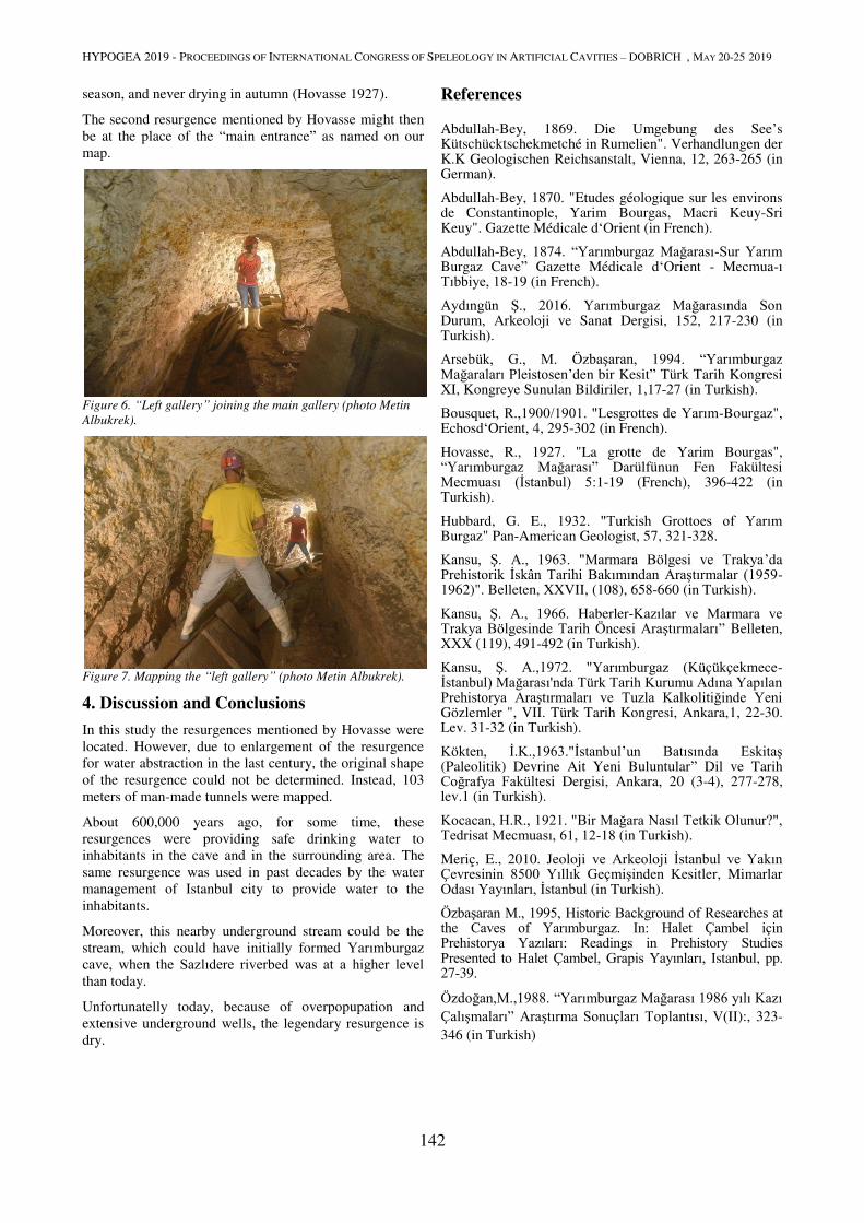
HYPOGEA 2019 - PROCEEDINGS OF INTERNATIONAL CONGRESS OF SPELEOLOGY IN ARTIFICIAL CAVITIES – DOBRICH , MAY 20-25 2019
142
season, and never drying in autumn (Hovasse 1927).
The second resurgence mentioned by Hovasse might then
be at the place of the “main entrance” as named on our
map.
Figure 6. “Left gallery” joining the main gallery (photo Metin
Albukrek).
Figure 7. Mapping the “left gallery” (photo Metin Albukrek).
4. Discussion and Conclusions
In this study the resurgences mentioned by Hovasse were
located. However, due to enlargement of the resurgence
for water abstraction in the last century, the original shape
of the resurgence could not be determined. Instead, 103
meters of man-made tunnels were mapped.
About 600,000 years ago, for some time, these
resurgences were providing safe drinking water to
inhabitants in the cave and in the surrounding area. The
same resurgence was used in past decades by the water
management of Istanbul city to provide water to the
inhabitants.
Moreover, this nearby underground stream could be the
stream, which could have initially formed Yarımburgaz cave, when the Sazlıdere riverbed was at a higher level than today.
Unfortunatelly today, because of overpopupation and
extensive underground wells, the legendary resurgence is
dry.
References Abdullah-Bey, 1869. Die Umgebung des See’s Kütschücktschekmetché in Rumelien". Verhandlungen der K.K Geologischen Reichsanstalt, Vienna, 12, 263-265 (in German).
Abdullah-Bey, 1870. "Etudes géologique sur les environs de Constantinople, Yarim Bourgas, Macri Keuy-Sri Keuy". Gazette Médicale d‘Orient (in French).
Abdullah-Bey, 1874. “Yarımburgaz Mağarası-Sur Yarım Burgaz Cave” Gazette Médicale d‘Orient - Mecmua-ı Tıbbiye, 18-19 (in French).
Aydıngün Ş., 2016. Yarımburgaz Mağarasında Son Durum, Arkeoloji ve Sanat Dergisi, 152, 217-230 (in Turkish).
Arsebük, G., M. Özbaşaran, 1994. “Yarımburgaz Mağaraları Pleistosen’den bir Kesit” Türk Tarih Kongresi XI, Kongreye Sunulan Bildiriler, 1,17-27 (in Turkish).
Bousquet, R.,1900/1901. "Lesgrottes de Yarım-Bourgaz", Echosd‘Orient, 4, 295-302 (in French).
Hovasse, R., 1927. "La grotte de Yarim Bourgas", “Yarımburgaz Mağarası” Darülfünun Fen Fakültesi Mecmuası (İstanbul) 5:1-19 (French), 396-422 (in Turkish).
Hubbard, G. E., 1932. "Turkish Grottoes of Yarım Burgaz" Pan-American Geologist, 57, 321-328.
Kansu, Ş. A., 1963. "Marmara Bölgesi ve Trakya’da Prehistorik İskân Tarihi Bakımından Araştırmalar (1959-1962)". Belleten, XXVII, (108), 658-660 (in Turkish).
Kansu, Ş. A., 1966. Haberler-Kazılar ve Marmara ve Trakya Bölgesinde Tarih Öncesi Araştırmaları” Belleten, XXX (119), 491-492 (in Turkish).
Kansu, Ş. A.,1972. "Yarımburgaz (Küçükçekmece-İstanbul) Mağarası'nda Türk Tarih Kurumu Adına Yapılan Prehistorya Araştırmaları ve Tuzla Kalkolitiğinde Yeni Gözlemler ", VII. Türk Tarih Kongresi, Ankara,1, 22-30. Lev. 31-32 (in Turkish).
Kökten, İ.K.,1963."İstanbul’un Batısında Eskitaş (Paleolitik) Devrine Ait Yeni Buluntular” Dil ve Tarih Coğrafya Fakültesi Dergisi, Ankara, 20 (3-4), 277-278, lev.1 (in Turkish).
Kocacan, H.R., 1921. "Bir Mağara Nasıl Tetkik Olunur?", Tedrisat Mecmuası, 61, 12-18 (in Turkish).
Meriç, E., 2010. Jeoloji ve Arkeoloji İstanbul ve Yakın Çevresinin 8500 Yıllık Geçmişinden Kesitler, Mimarlar Odası Yayınları, İstanbul (in Turkish).
Özbaşaran M., 1995, Historic Background of Researches at the Caves of Yarımburgaz. In: Halet Çambel için Prehistorya Yazıları: Readings in Prehistory Studies Presented to Halet Çambel, Grapis Yayınları, Istanbul, pp. 27-39.
Özdoğan,M.,1988. “Yarımburgaz Mağarası 1986 yılı Kazı Çalışmaları” Araştırma Sonuçları Toplantısı, V(II):, 323-
346 (in Turkish)
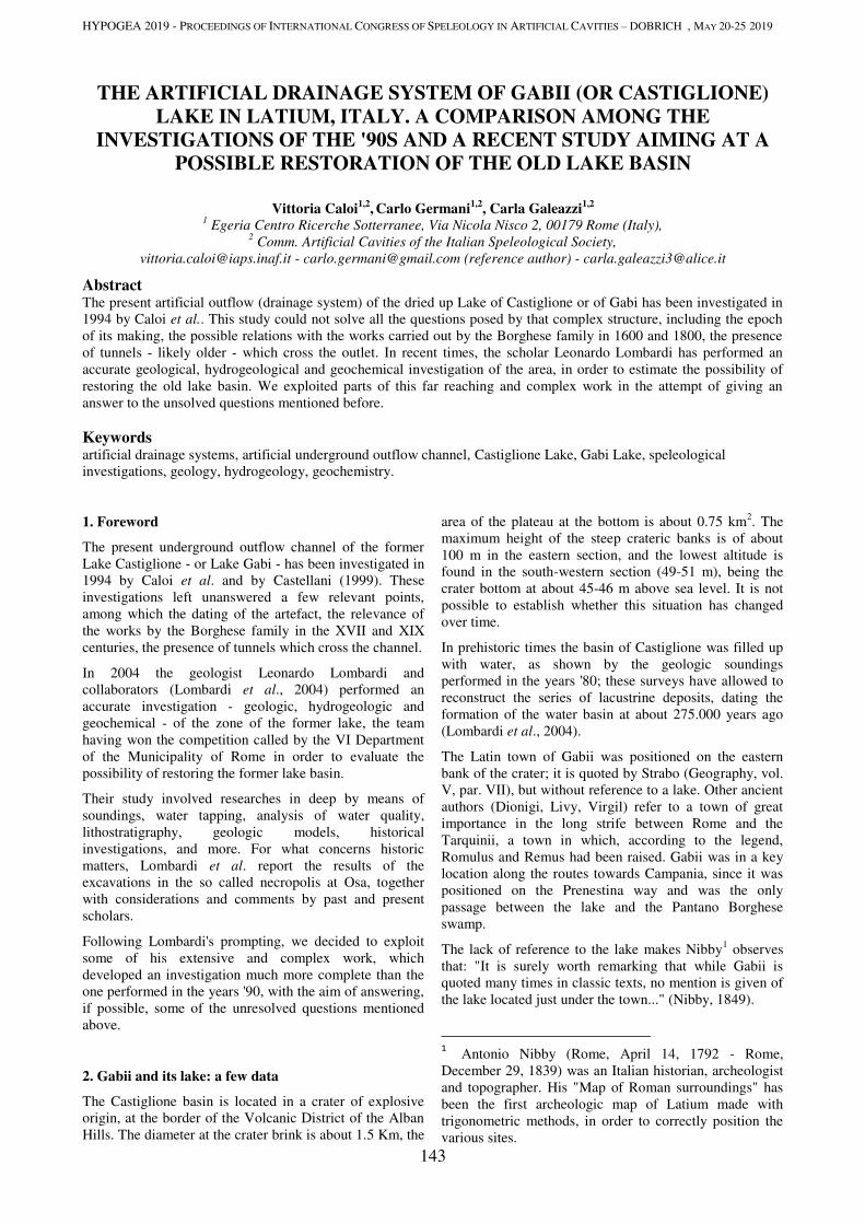
HYPOGEA 2019 - PROCEEDINGS OF INTERNATIONAL CONGRESS OF SPELEOLOGY IN ARTIFICIAL CAVITIES – DOBRICH , MAY 20-25 2019
143
THE ARTIFICIAL DRAINAGE SYSTEM OF GABII (OR CASTIGLIONE)
LAKE IN LATIUM, ITALY. A COMPARISON AMONG THE
INVESTIGATIONS OF THE '90S AND A RECENT STUDY AIMING AT A
POSSIBLE RESTORATION OF THE OLD LAKE BASIN
Vittoria Caloi1,2
, Carlo Germani
1,2, Carla Galeazzi
1,2
1 Egeria Centro Ricerche Sotterranee, Via Nicola Nisco 2, 00179 Rome (Italy),
2 Comm. Artificial Cavities of the Italian Speleological Society,
[email protected] - [email protected] (reference author) - [email protected]
Abstract The present artificial outflow (drainage system) of the dried up Lake of Castiglione or of Gabi has been investigated in
1994 by Caloi et al.. This study could not solve all the questions posed by that complex structure, including the epoch
of its making, the possible relations with the works carried out by the Borghese family in 1600 and 1800, the presence
of tunnels - likely older - which cross the outlet. In recent times, the scholar Leonardo Lombardi has performed an
accurate geological, hydrogeological and geochemical investigation of the area, in order to estimate the possibility of
restoring the old lake basin. We exploited parts of this far reaching and complex work in the attempt of giving an
answer to the unsolved questions mentioned before.
Keywords artificial drainage systems, artificial underground outflow channel, Castiglione Lake, Gabi Lake, speleological
investigations, geology, hydrogeology, geochemistry.
1. Foreword
The present underground outflow channel of the former
Lake Castiglione - or Lake Gabi - has been investigated in
1994 by Caloi et al. and by Castellani (1999). These
investigations left unanswered a few relevant points,
among which the dating of the artefact, the relevance of
the works by the Borghese family in the XVII and XIX
centuries, the presence of tunnels which cross the channel.
In 2004 the geologist Leonardo Lombardi and
collaborators (Lombardi et al., 2004) performed an
accurate investigation - geologic, hydrogeologic and
geochemical - of the zone of the former lake, the team
having won the competition called by the VI Department
of the Municipality of Rome in order to evaluate the
possibility of restoring the former lake basin.
Their study involved researches in deep by means of
soundings, water tapping, analysis of water quality,
lithostratigraphy, geologic models, historical
investigations, and more. For what concerns historic
matters, Lombardi et al. report the results of the
excavations in the so called necropolis at Osa, together
with considerations and comments by past and present
scholars.
Following Lombardi's prompting, we decided to exploit
some of his extensive and complex work, which
developed an investigation much more complete than the
one performed in the years '90, with the aim of answering,
if possible, some of the unresolved questions mentioned
above.
2. Gabii and its lake: a few data
The Castiglione basin is located in a crater of explosive
origin, at the border of the Volcanic District of the Alban
Hills. The diameter at the crater brink is about 1.5 Km, the
area of the plateau at the bottom is about 0.75 km2. The
maximum height of the steep crateric banks is of about
100 m in the eastern section, and the lowest altitude is
found in the south-western section (49-51 m), being the
crater bottom at about 45-46 m above sea level. It is not
possible to establish whether this situation has changed
over time.
In prehistoric times the basin of Castiglione was filled up
with water, as shown by the geologic soundings
performed in the years '80; these surveys have allowed to
reconstruct the series of lacustrine deposits, dating the
formation of the water basin at about 275.000 years ago
(Lombardi et al., 2004).
The Latin town of Gabii was positioned on the eastern
bank of the crater; it is quoted by Strabo (Geography, vol.
V, par. VII), but without reference to a lake. Other ancient
authors (Dionigi, Livy, Virgil) refer to a town of great
importance in the long strife between Rome and the
Tarquinii, a town in which, according to the legend,
Romulus and Remus had been raised. Gabii was in a key
location along the routes towards Campania, since it was
positioned on the Prenestina way and was the only
passage between the lake and the Pantano Borghese
swamp.
The lack of reference to the lake makes Nibby1 observes
that: "It is surely worth remarking that while Gabii is
quoted many times in classic texts, no mention is given of
the lake located just under the town..." (Nibby, 1849).
1 Antonio Nibby (Rome, April 14, 1792 - Rome,
December 29, 1839) was an Italian historian, archeologist
and topographer. His "Map of Roman surroundings" has
been the first archeologic map of Latium made with
trigonometric methods, in order to correctly position the
various sites.
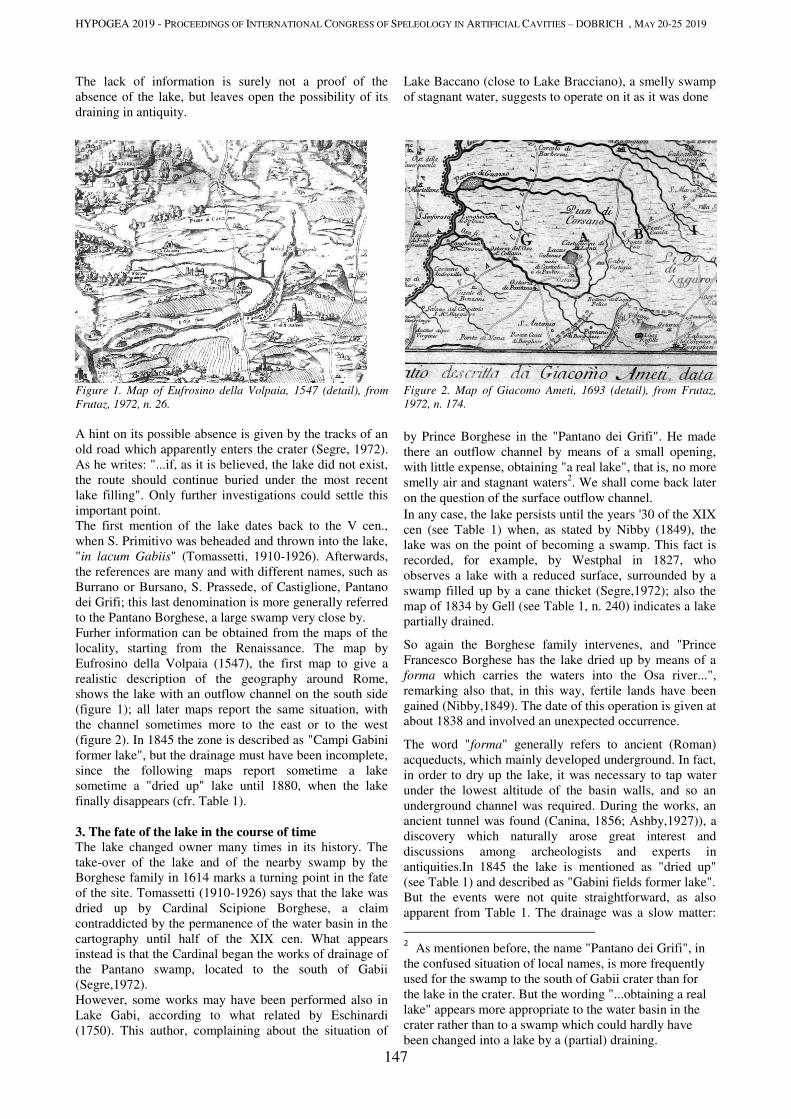
HYPOGEA 2019 - PROCEEDINGS OF INTERNATIONAL CONGRESS OF SPELEOLOGY IN ARTIFICIAL CAVITIES – DOBRICH , MAY 20-25 2019
147
The lack of information is surely not a proof of the
absence of the lake, but leaves open the possibility of its
draining in antiquity.
Figure 1. Map of Eufrosino della Volpaia, 1547 (detail), from
Frutaz, 1972, n. 26.
A hint on its possible absence is given by the tracks of an
old road which apparently enters the crater (Segre, 1972).
As he writes: "...if, as it is believed, the lake did not exist,
the route should continue buried under the most recent
lake filling". Only further investigations could settle this
important point.
The first mention of the lake dates back to the V cen.,
when S. Primitivo was beheaded and thrown into the lake,
"in lacum Gabiis" (Tomassetti, 1910-1926). Afterwards,
the references are many and with different names, such as
Burrano or Bursano, S. Prassede, of Castiglione, Pantano
dei Grifi; this last denomination is more generally referred
to the Pantano Borghese, a large swamp very close by.
Furher information can be obtained from the maps of the
locality, starting from the Renaissance. The map by
Eufrosino della Volpaia (1547), the first map to give a
realistic description of the geography around Rome,
shows the lake with an outflow channel on the south side
(figure 1); all later maps report the same situation, with
the channel sometimes more to the east or to the west
(figure 2). In 1845 the zone is described as "Campi Gabini
former lake", but the drainage must have been incomplete,
since the following maps report sometime a lake
sometime a "dried up" lake until 1880, when the lake
finally disappears (cfr. Table 1).
3. The fate of the lake in the course of time
The lake changed owner many times in its history. The
take-over of the lake and of the nearby swamp by the
Borghese family in 1614 marks a turning point in the fate
of the site. Tomassetti (1910-1926) says that the lake was
dried up by Cardinal Scipione Borghese, a claim
contraddicted by the permanence of the water basin in the
cartography until half of the XIX cen. What appears
instead is that the Cardinal began the works of drainage of
the Pantano swamp, located to the south of Gabii
(Segre,1972).
However, some works may have been performed also in
Lake Gabi, according to what related by Eschinardi
(1750). This author, complaining about the situation of
Lake Baccano (close to Lake Bracciano), a smelly swamp
of stagnant water, suggests to operate on it as it was done
Figure 2. Map of Giacomo Ameti, 1693 (detail), from Frutaz,
1972, n. 174.
by Prince Borghese in the "Pantano dei Grifi". He made
there an outflow channel by means of a small opening,
with little expense, obtaining "a real lake", that is, no more
smelly air and stagnant waters2. We shall come back later
on the question of the surface outflow channel.
In any case, the lake persists until the years '30 of the XIX
cen (see Table 1) when, as stated by Nibby (1849), the
lake was on the point of becoming a swamp. This fact is
recorded, for example, by Westphal in 1827, who
observes a lake with a reduced surface, surrounded by a
swamp filled up by a cane thicket (Segre,1972); also the
map of 1834 by Gell (see Table 1, n. 240) indicates a lake
partially drained.
So again the Borghese family intervenes, and "Prince
Francesco Borghese has the lake dried up by means of a
forma which carries the waters into the Osa river...",
remarking also that, in this way, fertile lands have been
gained (Nibby,1849). The date of this operation is given at
about 1838 and involved an unexpected occurrence.
The word "forma" generally refers to ancient (Roman)
acqueducts, which mainly developed underground. In fact,
in order to dry up the lake, it was necessary to tap water
under the lowest altitude of the basin walls, and so an
underground channel was required. During the works, an
ancient tunnel was found (Canina, 1856; Ashby,1927)), a
discovery which naturally arose great interest and
discussions among archeologists and experts in
antiquities.In 1845 the lake is mentioned as "dried up"
(see Table 1) and described as "Gabini fields former lake".
But the events were not quite straightforward, as also
apparent from Table 1. The drainage was a slow matter:
2 As mentionen before, the name "Pantano dei Grifi", in
the confused situation of local names, is more frequently
used for the swamp to the south of Gabii crater than for
the lake in the crater. But the wording "...obtaining a real
lake" appears more appropriate to the water basin in the
crater rather than to a swamp which could hardly have
been changed into a lake by a (partial) draining.
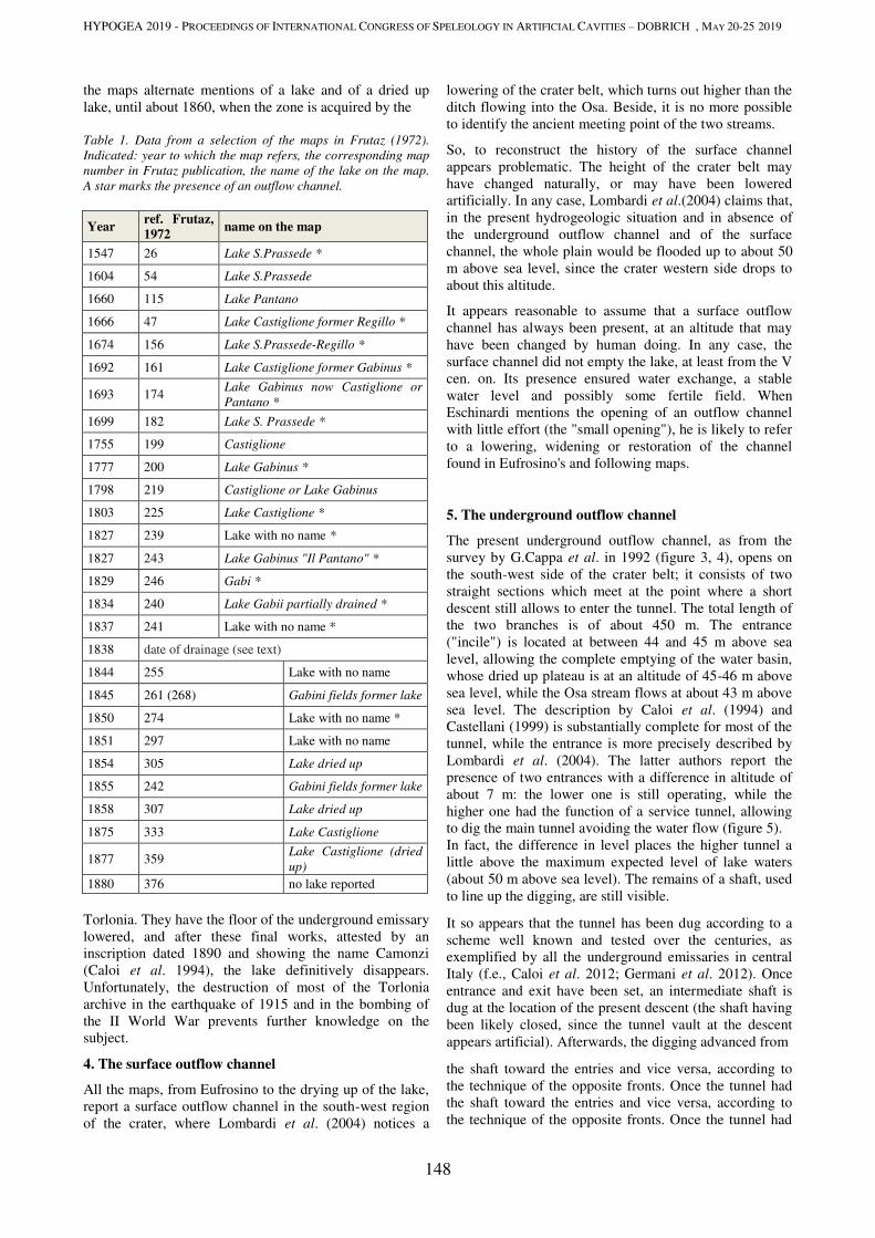
HYPOGEA 2019 - PROCEEDINGS OF INTERNATIONAL CONGRESS OF SPELEOLOGY IN ARTIFICIAL CAVITIES – DOBRICH , MAY 20-25 2019
148
the maps alternate mentions of a lake and of a dried up
lake, until about 1860, when the zone is acquired by the
Table 1. Data from a selection of the maps in Frutaz (1972).
Indicated: year to which the map refers, the corresponding map
number in Frutaz publication, the name of the lake on the map.
A star marks the presence of an outflow channel.
Year ref. Frutaz,
1972 name on the map
1547 26 Lake S.Prassede *
1604 54 Lake S.Prassede
1660 115 Lake Pantano
1666 47 Lake Castiglione former Regillo *
1674 156 Lake S.Prassede-Regillo *
1692 161 Lake Castiglione former Gabinus *
1693 174 Lake Gabinus now Castiglione or
Pantano *
1699 182 Lake S. Prassede *
1755 199 Castiglione
1777 200 Lake Gabinus *
1798 219 Castiglione or Lake Gabinus
1803 225 Lake Castiglione *
1827 239 Lake with no name *
1827 243 Lake Gabinus "Il Pantano" *
1829 246 Gabi *
1834 240 Lake Gabii partially drained *
1837 241 Lake with no name *
1838 date of drainage (see text)
1844 255 Lake with no name
1845 261 (268) Gabini fields former lake
1850 274 Lake with no name *
1851 297 Lake with no name
1854 305 Lake dried up
1855 242 Gabini fields former lake
1858 307 Lake dried up
1875 333 Lake Castiglione
1877 359 Lake Castiglione (dried
up)
1880 376 no lake reported
Torlonia. They have the floor of the underground emissary
lowered, and after these final works, attested by an
inscription dated 1890 and showing the name Camonzi
(Caloi et al. 1994), the lake definitively disappears.
Unfortunately, the destruction of most of the Torlonia
archive in the earthquake of 1915 and in the bombing of
the II World War prevents further knowledge on the
subject.
4. The surface outflow channel
All the maps, from Eufrosino to the drying up of the lake,
report a surface outflow channel in the south-west region
of the crater, where Lombardi et al. (2004) notices a
lowering of the crater belt, which turns out higher than the
ditch flowing into the Osa. Beside, it is no more possible
to identify the ancient meeting point of the two streams.
So, to reconstruct the history of the surface channel
appears problematic. The height of the crater belt may
have changed naturally, or may have been lowered
artificially. In any case, Lombardi et al.(2004) claims that,
in the present hydrogeologic situation and in absence of
the underground outflow channel and of the surface
channel, the whole plain would be flooded up to about 50
m above sea level, since the crater western side drops to
about this altitude.
It appears reasonable to assume that a surface outflow
channel has always been present, at an altitude that may
have been changed by human doing. In any case, the
surface channel did not empty the lake, at least from the V
cen. on. Its presence ensured water exchange, a stable
water level and possibly some fertile field. When
Eschinardi mentions the opening of an outflow channel
with little effort (the "small opening"), he is likely to refer
to a lowering, widening or restoration of the channel
found in Eufrosino's and following maps.
5. The underground outflow channel
The present underground outflow channel, as from the
survey by G.Cappa et al. in 1992 (figure 3, 4), opens on
the south-west side of the crater belt; it consists of two
straight sections which meet at the point where a short
descent still allows to enter the tunnel. The total length of
the two branches is of about 450 m. The entrance
("incile") is located at between 44 and 45 m above sea
level, allowing the complete emptying of the water basin,
whose dried up plateau is at an altitude of 45-46 m above
sea level, while the Osa stream flows at about 43 m above
sea level. The description by Caloi et al. (1994) and
Castellani (1999) is substantially complete for most of the
tunnel, while the entrance is more precisely described by
Lombardi et al. (2004). The latter authors report the
presence of two entrances with a difference in altitude of
about 7 m: the lower one is still operating, while the
higher one had the function of a service tunnel, allowing
to dig the main tunnel avoiding the water flow (figure 5).
In fact, the difference in level places the higher tunnel a
little above the maximum expected level of lake waters
(about 50 m above sea level). The remains of a shaft, used
to line up the digging, are still visible.
It so appears that the tunnel has been dug according to a
scheme well known and tested over the centuries, as
exemplified by all the underground emissaries in central
Italy (f.e., Caloi et al. 2012; Germani et al. 2012). Once
entrance and exit have been set, an intermediate shaft is
dug at the location of the present descent (the shaft having
been likely closed, since the tunnel vault at the descent
appears artificial). Afterwards, the digging advanced from
the shaft toward the entries and vice versa, according to
the technique of the opposite fronts. Once the tunnel had
the shaft toward the entries and vice versa, according to
the technique of the opposite fronts. Once the tunnel had
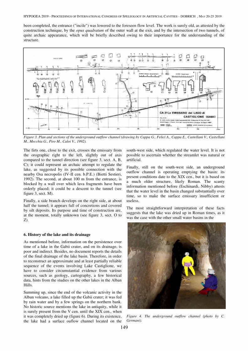
HYPOGEA 2019 - PROCEEDINGS OF INTERNATIONAL CONGRESS OF SPELEOLOGY IN ARTIFICIAL CAVITIES – DOBRICH , MAY 20-25 2019
149
been completed, the entrance ("incile") was lowered to the foreseen flow level. The work is surely old, as attested by the
construction technique, by the opus quadratum of the outer wall at the exit, and by the intersection of two tunnels, of
quite archaic appearance, which will be briefly described owing to their importance for the understanding of the
structure.
Figure 3. Plan and sections of the underground outflow channel (drawing by Cappa G., Felici A., Cappa E., Castellani V., Castellani
M., Mecchia G., Piro M., Caloi V., 1992).
The firts one, close to the exit, crosses the emissary from
the orographic right to the left, slightly out of axis
compared to the tunnel direction (see figure 3, sect. A, B,
C); it could represent an archaic attempt to regulate the
lake, as suggested by its possible connection with the
nearby Osa necropolis (IV-II cen. b.P.E.) (Bietti Sestieri,
1992). The second, at about 100 m from the entrance, is
blocked by a wall over which lava fragments have been
orderly placed; it could be a descent to the tunnel (see
figure 3, sect. M).
Finally, a side branch develops on the right side, at about
half the tunnel; it appears full of concretions and covered
by silt deposits. Its purpose and time of construction are,
at the moment, totally unknown (see figure 3, sect. O to
Z).
6. History of the lake and its drainage
As mentioned before, information on the persistence over
time of a lake in the Gabii crater, and on its drainage, is
poor and indirect. Besides, no document reports the details
of the final drainage of the lake basin. Therefore, in order
to reconstruct an approximate and at least partially reliable
sequence of the events involving Lake Castiglione, we
have to consider circumstantial evidence from various
sources, such as geology, cartography, a few historical
data, hints from the studies on the other lakes in the Alban
Hills.
Summing up, since the end of the volcanic activity in the
Alban volcano, a lake filled up the Gabii crater; it was fed
by rain water and by a few springs on the northern bank.
No historic source mentions the lake in antiquity, while it
is surely present from the V cen. until the XIX cen., when
it was completely dried up (figure 6). During its existence,
the lake had a surface ouflow channel located on the
south-west side, which regulated the water level. It is not
possible to ascertain whether the streamlet was natural or
artificial.
Finally, still on the south-west side, an underground
outflow channel is operating emptying the basin: its
present conditions date to the XIX cen., but it is based on
a much older structure, likely Roman. The scanty
information mentioned before (Eschinardi, Nibby) attests
that the water level in the basin changed substantially over
time, so to make the surface emissary insufficient or
useless.
The most straightforward interpretation of these facts
suggests that the lake was dried up in Roman times, as it
was the case with the other small water basins in the
Figure 4. The underground outflow channel (photo by C.
Germani).
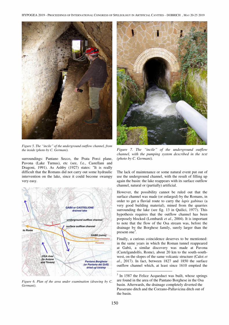
HYPOGEA 2019 - PROCEEDINGS OF INTERNATIONAL CONGRESS OF SPELEOLOGY IN ARTIFICIAL CAVITIES – DOBRICH , MAY 20-25 2019
150
Figure 5. The “incile” of the underground outflow channel, from
the inside (photo by C. Germani).
surroundings: Pantano Secco, the Prata Porci plane,
Pavona (Lake Turnus), etc (see, f.e., Castellani and
Dragoni, 1991). As Ashby (1927) states: "It is really
difficult that the Romans did not carry out some hydraulic
intervention on the lake, since it could become swampy
very easy.
Figure 6. Plan of the area under examination (drawing by C.
Germani).
Figure 7. The “incile” of the underground outflow
channel, with the pumping system described in the text
(photo by C. Germani).
The lack of maintenance or some natural event put out of
use the underground channel, with the result of filling up
again the basin: the lake reappears with its surface outflow
channel, natural or (partially) artificial.
However, the possibility cannot be ruled out that the
surface channel was made (or enlarged) by the Romans, in
order to get a fluvial route to carry the lapis gabinus (a
very good building material), mined from the quarries
surrounding the lake (see fig. 13 in Quilici, 1977). This
hypothesis requires that the outflow channel has been
porposely blocked (Lombardi et al., 2004). It is important
to note that the flow of the Osa stream was, before the
drainage by the Borghese family, surely larger than the
present one3.
Finally, a curious coincidence deserves to be mentioned:
in the same years in which the Roman tunnel reappeared
at Gabii, a similar discovery was made at Pavona
(Castelgandolfo, Rome), about 20 km to the south-south-
west, on the slopes of the same volcanic structure (Caloi et
al., 2017). In fact, between 1827 and 1850 the surface
outflow channel which, at least since 1610 emptied the
3 In 1587 the Felice Acqueduct was built, whose springs
are found in the area of the Pantano Borghese in the Osa
basin. Afterwards, the drainage completely diverted the
Passerano ditch and the Corzano-Pallavicina ditch out of
the basin.

HYPOGEA 2019 - PROCEEDINGS OF INTERNATIONAL CONGRESS OF SPELEOLOGY IN ARTIFICIAL CAVITIES – DOBRICH , MAY 20-25 2019
151
ancient Lake Turnus, disappears from geographic maps; it
seems that the function of regulating the basin water level
has been shifted to an underground outflow channel surely
of Roman times, still in operation. At variance with the
case of Gabii, up to now we have not been able to find
some historic report on the change from the surface to the
underground channel.
7. Conclusions
Two outflow channels appear related to Lake Castiglione
or Lake Gabii: an underground one able of completely
emptying the basin, and a surface one which could set the
water level at about 50 m above sea level.
The curious fact is that the first turns out clearly to
precede the latter.
On the basis of the scanty historic documents it may be
supposed that the lake, of volcanic origin and perhaps
provided with a natural outflow channel at the lowest side
of the crater belt, has been at first dried up at the same
time with the nearby lakes of Turnus, Pantano Secco, etc
(between the IV and II cen. b.p.E.).
Afterwards (I-IV cen. p.E.?) the channel is blocked by a
natural event or, perhaps purposely, in order to have again
a lake (possibly a smaller one) drained by a surface
outflow channel.
Since the fall of the Roman Empire until 1600 the lake
basin seems always present with a surface channel; the
lake appears subject to substantial changes in the water
level, both for climatic causes and for the absence of
maintenance.
In 1614 the Borghese family acquires the area and at first
restores the maintenance of the surface outflow channel;
afterwards, in 1838, dries up completely the basin, likely
reshaping the ancient underground channel just
discovered. About 1860 the property is trasferred to the
Torlonia family, that makes further interventions in the
underground outflow channel, lowering the floor.
At present the area retains a rural appearance, with its
wide cultivated fields and the drainage in operation. But
the antropic pressure is strong: the urban settlements of
Ponte di Nona and other, more or less unlawful townships
are unfortunately very close by.
The underground outflow channel preserves its XIX cen.
appearance (figure 7), but the lack of maintenance
between the channel exit and the Osa river has forced the
owners to install a pumping system to raise the level of the
water from the drainage channels, in order to make the
outflow easier.
References
Ashby T., 1927. The Roman Campagna in classical times.
Ernest Benn Ltd., London 1927, La campagna romana
nell'età classica, Longanesi ed., Milano 1982.
Bietti Sestieri A.M., 1992. La necropoli laziale di Osteria
dell'Osa. Ed. Quasar, Roma.
Caloi V., Cappa G., Castellani V., 1994. Antichi emissari
nei Colli Albani. Atti XVII Congresso Naz. di
Speleologia, Castelnuovo Garfagnana, pp. 299-307.
Caloi V., Galeazzi C., Germani C., 2012, Gli emissari
maggiori dei Colli Albani. Opera Ipogea 1-2012, pp. 29-
40.
Caloi V., Germani C., Galeazzi C., 2017. Emissario del
lago di Turno o di Pavona. Indagini speleologiche ed
analisi delle antiche fonti iconografiche finalizzate alla
ricerca di un possibile collegamento con l'emissario
Albano. In Atti del III Convegno Regionale di Speleologia
- Campania Speleologica 2017, 2-4 giugno 2017, Napoli,
pp. 203-210.
Canina L., 1856. Gli edifizj di Roma antica : cogniti per
alcune importanti reliquie / descritti e dimostrati
nell'intera loro architettura dal commendatore Luigi
Canina, vol.V. Bertinelli Ed., Roma.
Castellani V., Dragoni W., 1991, Opere arcaiche per il
controllo del territorio: gli emissari sotterranei artificiali
dei laghi albani. Gli Etruschi maestri di idraulica, Ed.
Electa, Perugia.
Castellani V., 1999, Civiltà dell’acqua. Editorial Service
System, Roma.
Eschinardi F., 1750. Descrizione di Roma e dell’agro
romano fatta già ad uso della carta topografica del
Cingolani, edizione riveduta e corretta da R. Venuti,
Roma.
Frutaz A.P., 1972. Le carte del Lazio, Voll. II e III,
Istituto di Studi Romani, Roma.
Germani C., Galeazzi C., Caloi V., Dobosz T., 2012. Gli
emissari minori dell'edificio vulcanico Albano: laghetto di
Monte Compatri, Pantano Secco, Pavona, Giulianello.
Opera Ipogea 1-2012, pp. 29-40.
Lombardi L., Vitali A., Di Giusto P., 2004. Indagini
geologiche, idrogeologiche e geochimiche con
indicazioni sulla f attibilità tecnica relativa al ripristino
dell’ex bacino lacustre di Gabii-Castiglione. Comune di
Roma, Dipartimento VI – Politiche della
Programmazione del Territorio.
Nibby A., 1849. Analisi storico-topografica-antiquaria
della carta dei contorni di Roma, II edizione, Tipografia
delle Belle Arti, Roma.
Quilici L., 1977. La via Prenestina, Bulzoni Ed., Roma.
Segre A.G., 1972. Morfologia e Quaternario della zona
Osa-Castiglione, Bullettino di Paletnologia Italiana,
XXIII, pp. 259-275.
Strabone. Della Geografia di Strabone, Volume 3.
Sonzogno, 1833, on books.google.it (access February
2018).
Tomassetti, G. 1910-1926. La campagna romana antica,
medievale e moderna, Vol.III, p.497, note 2 (1976, Forni
Ed.)

HYPOGEA 2019 - PROCEEDINGS OF INTERNATIONAL CONGRESS OF SPELEOLOGY IN ARTIFICIAL CAVITIES – DOBRICH , MAY 20-25 2019
149
WATER ITAKES AND SEWRAGE FACILITIES OF BULGARIAN
ST.GEORGE THE ZOGRAF MONASTERY IN MOUNT ATHOS, GREECE
Alexey Zhalov1, Konstantin Stoichkov
2
1 Bulgarian Caving Society, Christo Belchev 45, 1000 Sofia, [email protected]
2 Caving Club “Helictite”, Kiril I Metodii, 43, 1202, Sofia, Bulgaria, [email protected]
Abstract
During the researches on the artificial cavities during 2016-2018, in the region of the Bulgarian Saint George the
Zograf Monastery a total of 32 artificial cavities (caves) were surveyed . From a functional point of view, they can be
divided into 4 categories: Water intake galleries and karizes (qanats), drainage channels and galleries for sewerage
water, fountains with attached karizes, reservoirs. The work describes the construction and architecture of the artificial
cavities and analyze some of the most representative of them
Keywords
Water tanks,drainage galleries, reservoirs, Mount Athos, Greece
1. Introduction
In 2007 Bulgarian speleologists initiated a long-term
international research project entitled “Exploration of the
caves of Mount Athos as an integral part of the natural and
cultural-historical heritage of Mount Athos”. For the
period 2007 - April 2017, 8 expeditions took place under
our leadership and major participation. The research was
carried out by speleologists from Bulgaria, Greece,
Russia, Romania, Serbia, Turkey. A total of 209
underground sites were discovered, surveyed, mapped and
described during that period. The achieved interim results
have been referred to in more than 25 publications in
collections of congress and conference materials, and in
the specialized periodicals - mainly outside the country.
2. Resuls / Results and discussion
In the period 2016 - 2018 the researches focused mainly
on the artificial cavities in the region of the Bulgarian
Saint George the Zograf Monastery.
A total of 32 artificial cavities (caves) were surveyed and
documented (mapped) during that period.
From a functional point of view, they can be divided into
4 categories: (Agapov, et al., 2016: 129-141)
1. Water intake galleries and karizes (qanats);
2. Drainage channels and galleries for sewerage water;
3. Fountains with attached karizes;
4. Reservoirs.
In this development we will try to make a brief review of
the results achieved. Above all, however, we would like to
clarify the meaning of the term “qanat”.
Qanat/s (in Arabic: تانق – qanat, in Persian: زیراک –
kariz) are artificial underground water supply channels. In
the absence of springs and deepwater rivers, only
groundwater can be used for water supply for drinking and
irrigation purposes. Qanats are the facilities that make all
the above possible. Their main advantage is that they
maintain a continuous, albeit volatile flow of water. They
are constructed with a gentle slope to provide a steady
water flow. In most cases, they are a cross-sectional
gallery allowing free passage of people (Fig.1)
Figure 1. Principle scheme of Qanats
According to Polybius, the first underground irrigation
channels originated in ancient Persia during the
Achaemenid Empire (550-330 BC). Gradually, this type
of water supply spread across the Iranian Plateau, to the
west through Mesopotamia to the shores of the
Mediterranean, to the east - through Afghanistan and the
settlements along the Silk Road - to India and China. The
Arabs spread this technology to Algeria, Morocco, from
where they enter Spain, and through the Spanish
colonizers they also enter to the Americas. (Fig.2)
Figure 2. Qanat technology diffusion model
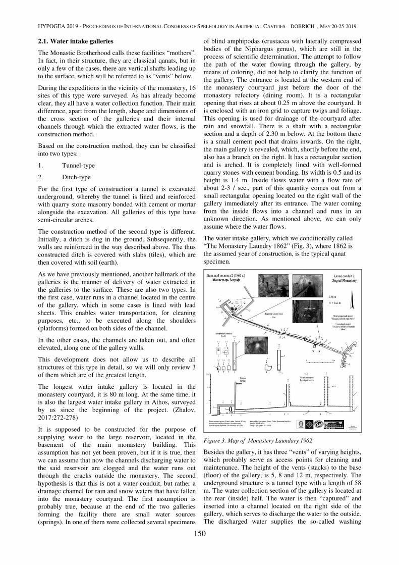
HYPOGEA 2019 - PROCEEDINGS OF INTERNATIONAL CONGRESS OF SPELEOLOGY IN ARTIFICIAL CAVITIES – DOBRICH , MAY 20-25 2019
150
2.1. Water intake galleries
The Monastic Brotherhood calls these facilities “mothers”.
In fact, in their structure, they are classical qanats, but in
only a few of the cases, there are vertical shafts leading up
to the surface, which will be referred to as “vents” below.
During the expeditions in the vicinity of the monastery, 16
sites of this type were surveyed. As has already become
clear, they all have a water collection function. Their main
difference, apart from the length, shape and dimensions of
the cross section of the galleries and their internal
channels through which the extracted water flows, is the
construction method.
Based on the construction method, they can be classified
into two types:
1. Tunnel-type
2. Ditch-type
For the first type of construction a tunnel is excavated
underground, whereby the tunnel is lined and reinforced
with quarry stone masonry bonded with cement or mortar
alongside the excavation. All galleries of this type have
semi-circular arches.
The construction method of the second type is different.
Initially, a ditch is dug in the ground. Subsequently, the
walls are reinforced in the way described above. The thus
constructed ditch is covered with slabs (tiles), which are
then covered with soil (earth).
As we have previously mentioned, another hallmark of the
galleries is the manner of delivery of water extracted in
the galleries to the surface. These are also two types. In
the first case, water runs in a channel located in the centre
of the gallery, which in some cases is lined with lead
sheets. This enables water transportation, for cleaning
purposes, etc., to be executed along the shoulders
(platforms) formed on both sides of the channel.
In the other cases, the channels are taken out, and often
elevated, along one of the gallery walls.
This development does not allow us to describe all
structures of this type in detail, so we will only review 3
of them which are of the greatest length.
The longest water intake gallery is located in the
monastery courtyard, it is 80 m long. At the same time, it
is also the largest water intake gallery in Athos, surveyed
by us since the beginning of the project. (Zhalov,
2017:272-278)
It is supposed to be constructed for the purpose of
supplying water to the large reservoir, located in the
basement of the main monastery building. This
assumption has not yet been proven, but if it is true, then
we can assume that now the channels discharging water to
the said reservoir are clogged and the water runs out
through the cracks outside the monastery. The second
hypothesis is that this is not a water conduit, but rather a
drainage channel for rain and snow waters that have fallen
into the monastery courtyard. The first assumption is
probably true, because at the end of the two galleries
forming the facility there are small water sources
(springs). In one of them were collected several specimens
of blind amphipodas (crustacea with laterally compressed
bodies of the Niphargus genus), which are still in the
process of scientific determination. The attempt to follow
the path of the water flowing through the gallery, by
means of coloring, did not help to clarify the function of
the gallery. The entrance is located at the western end of
the monastery courtyard just before the door of the
monastery refectory (dining room). It is a rectangular
opening that rises at about 0.25 m above the courtyard. It
is enclosed with an iron grid to capture twigs and foliage.
This opening is used for drainage of the courtyard after
rain and snowfall. There is a shaft with a rectangular
section and a depth of 2.30 m below. At the bottom there
is a small cement pool that drains inwards. On the right,
the main gallery is revealed, which, shortly before the end,
also has a branch on the right. It has a rectangular section
and is arched. It is completely lined with well-formed
quarry stones with cement bonding. Its width is 0.5 and its
height is 1.4 m. Inside flows water with a flow rate of
about 2-3 / sec., part of this quantity comes out from a
small rectangular opening located on the right wall of the
gallery immediately after its entrance. The water coming
from the inside flows into a channel and runs in an
unknown direction. As mentioned above, we can only
assume where the water flows.
The water intake gallery, which we conditionally called
“The Monastery Laundry 1862” (Fig. 3), where 1862 is
the assumed year of construction, is the typical qanat
specimen.
Figure 3. Map of Мonastery Laundary 1962
Besides the gallery, it has three “vents” of varying heights,
which probably serve as access points for cleaning and
maintenance. The height of the vents (stacks) to the base
(floor) of the gallery, is 5, 8 and 12 m, respectively. The
underground structure is a tunnel type with a length of 58
m. The water collection section of the gallery is located at
the rear (inside) half. The water is then “captured” and
inserted into a channel located on the right side of the
gallery, which serves to discharge the water to the outside.
The discharged water supplies the so-called washing
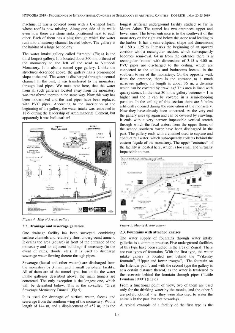
HYPOGEA 2019 - PROCEEDINGS OF INTERNATIONAL CONGRESS OF SPELEOLOGY IN ARTIFICIAL CAVITIES – DOBRICH , MAY 20-25 2019
151
machine. It was a covered room with a U-shaped form,
whose roof is now missing. Along one side of its walls
even now there are stone sinks positioned next to each
other. Each of them has a plug through which the water
runs into a masonry channel located below. The gallery is
the habitat of a large bat colony.
The water intake gallery called “Areoto” (Fig.4) is the
third longest gallery. It is located about 360 m northeast of
the monastery to the left of the road to Vatopedi
Monastery. It is also a tunnel type gallery. Unlike the
structures described above, the gallery has a pronounced
slope at the end. The water is discharged through a central
channel. In the past, it was transferred to the monastery
through lead pipes. We must note here, that the water
from all such galleries located away from the monastery
was transferred thereto in the same way. Now this way has
been modernized and the lead pipes have been replaced
with PVC pipes. According to the inscription at the
beginning of the gallery, the water intake was renovated in
1879 during the leadership of Archimandrite Clement, but
apparently it was built earlier!
Figure 4. Map of Areoto gallery
2.2. Drainage and sewerage galleries
One drainage facility has been surveyed, combining
surface channels and relatively short underground tunnels.
It drains the area (square) in front of the entrance of the
monastery and its adjacent buildings if necessary (in the
event of rains, floods, etc.). It is used to discharge
sewerage water flowing thereto through pipes.
Sewerage (faecal and other waters) are discharged from
the monastery by 3 main and 1 small peripheral facility.
All of them are of the tunnel type, but unlike the water
intake galleries described above, the main tunnels are
concreted. The only exception is the longest one, which
will be described below. This is the so-called “Great
Sewerage Monastery Tunnel” (Fig.5).
It is used for drainage of surface water, faeces and
sewerage from the southern wing of the monastery. With a
length of 144 m, and a displacement of +57 m, it is the
longest artificial underground facility studied so far in
Mount Athos. The tunnel has two entrances, upper and
lower ones. The lower entrance is to the southwest of the
monastery on the right and below the stone road leading to
the harbor. It has a semi-elliptical shape and dimensions
of 1.80 x 1.25 m. It marks the beginning of an upward
corridor with a rectangular section, which subsequently
becomes semi-oval. 64 m from the entrance there is a
rectangular “room” with dimensions of 3.15 x 4.00 m.
PVC pipes are discharged to the ceiling, which are
connected to the toilets and bathrooms located in the
southern tower of the monastery. On the opposite wall,
from the entrance, there is the entrance to a much
narrower gallery. Its length is about 36 m, a distance
which can be covered by crawling! This area is lined with
quarry stones. In the next 30 m the gallery becomes ~ 1 m
higher and the it can be covered in a semi-stooping
position. In the ceiling of this section there are 3 holes
artificially opened during the renovation of the monastery.
Now they have already been concreted. At the very end
the gallery rises up again and can be covered by crawling.
It ends with a very narrow impassable vertical stretch
through which the fecal waters from the upper floors of
the second southern tower have been discharged in the
past. The gallery ends with a channel used to capture and
conduct rainwater, which subsequently collects behind the
eastern façade of the monastery. The upper “entrance” of
the facility is located here, which is too small and virtually
impassable to man.
Figure 5. Map of Areoto gallery
2.3. Fountains with attached karizes
The water supply of fountains through water intake
galleries is a common practice. Five underground facilities
of this type have been studied in the area of Zograf. There
are two types of fountains. With the first type, the water
intake gallery is located just behind the “Vikentiy
fountain”, “Upper and lower troughs”, “The fountain on
the Hilendar path”, and with the second type the gallery is
at a certain distance thereof, as the water is trasferred to
the reservoir behind the fountain through pipes (“Little
Fountain 1900”) (Fig.6)
From a functional point of view, two of them are used
only for the drinking water by the monks, and the other 3
are polyfunctional - ie. they were also used to water the
animals in the past, but not nowadays.
A typical example of a facility of the first type is the
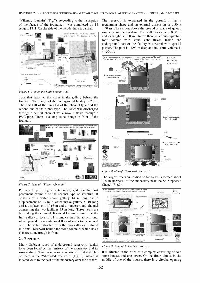
HYPOGEA 2019 - PROCEEDINGS OF INTERNATIONAL CONGRESS OF SPELEOLOGY IN ARTIFICIAL CAVITIES – DOBRICH , MAY 20-25 2019
152
“Vikentiy fountain” (Fig.7). According to the inscription
of the façade of the fountain, it was completed on 18
August 1841. On the side of the façade there is a small
Figure 6. Map of the Little Fontain 1900
door that leads to the water intake gallery behind the
fountain. The length of the underground facility is 28 m.
The first half of the tunnel is of the channel type and the
second one of the tunnel type. The water was discharged
through a central channel while now it flows through a
PVC pipe. There is a long stone trough in front of the
fountain.
Figure 7. Map of “Vikentiy fountain”
Perhaps “Upper troughs” water supply system is the most
prominent example of the second type of structure. It
consists of a water intake gallery 14 m long and a
displacement of +3 m, a water intake gallery 51 m long
and a displacement of +6 m and an underground channel
connecting the two facilities 33 m long. Three vents are
built along the channel. It should be emphasized that the
first gallery is located 11 m higher than the second one,
which provides a gravitational flow of water to the second
one. The water extracted from the two galleries is stored
in a small reservoir behind the stone fountain, which has a
6-metre stone trough in front.
2.4 Reservoirs
Many different types of underground reservoirs (tanks)
have been found on the territory of the monastery and its
surroundings. Three reservoirs were studied in detail. One
of them is the “Shrouded reservoir” (Fig. 8), which is
located 70 m to the east of the monastery over the orchard.
The reservoir is excavated in the gorund. It has a
rectangular shape and an external dimension of 6.30 x
4.50 m. The section above the ground is made of quarry
stones of mortar bonding. The wall thickness is 0.50 m
and its height is 1.60 m. On top there is a double-pitched
roof covered with stone slabs (tiles). Inside, the
underground part of the facility is covered with special
plaster. The pool is -2.93 m deep and its useful volume is
44.30 m3.
Figure 8. Map of “Shrouded reservoir”
The largest reservoir studied so far by us is located about
700 m northeast of the monastery near the St. Stephen’s
Chapel (Fig.9).
Figure 9. Map of St.Stephen reservoir
It is situated in the ruins of a complex consisting of two
stone houses and one tower. On the floor, almost in the
middle of one of the houses, there is a circular opening
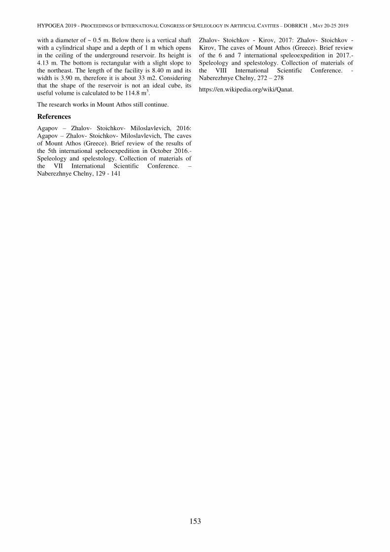
HYPOGEA 2019 - PROCEEDINGS OF INTERNATIONAL CONGRESS OF SPELEOLOGY IN ARTIFICIAL CAVITIES – DOBRICH , MAY 20-25 2019
153
with a diameter of ~ 0.5 m. Below there is a vertical shaft
with a cylindrical shape and a depth of 1 m which opens
in the ceiling of the underground reservoir. Its height is
4.13 m. The bottom is rectangular with a slight slope to
the northeast. The length of the facility is 8.40 m and its
width is 3.90 m, therefore it is about 33 m2. Considering
that the shape of the reservoir is not an ideal cube, its
useful volume is calculated to be 114.8 m3.
The research works in Mount Athos still continue.
References
Agapov – Zhalov- Stoichkov- Miloslavlevich, 2016:
Agapov – Zhalov- Stoichkov- Miloslavlevich, The caves
of Mount Athos (Greece). Brief review of the results of
the 5th international speleoexpedition in October 2016.-
Speleology and spelestology. Collection of materials of
the VII International Scientific Conference. –
Naberezhnye Chelny, 129 - 141
Zhalov- Stoichkov - Kirov, 2017: Zhalov- Stoichkov -
Kirov, The caves of Mount Athos (Greece). Brief review
of the 6 and 7 international speleoexpedition in 2017.-
Speleology and spelestology. Collection of materials of
the VIII International Scientific Conference. -
Naberezhnye Chelny, 272 – 278
https://en.wikipedia.org/wiki/Qanat.
MINING WORKS
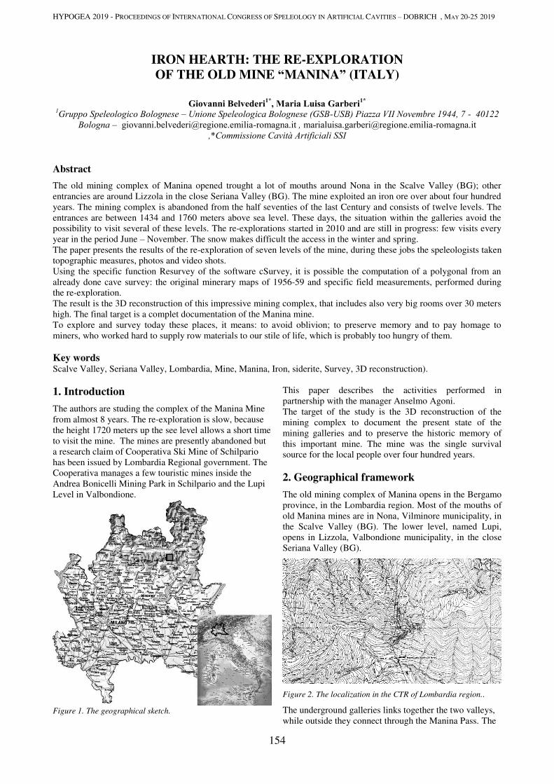
HYPOGEA 2019 - PROCEEDINGS OF INTERNATIONAL CONGRESS OF SPELEOLOGY IN ARTIFICIAL CAVITIES – DOBRICH , MAY 20-25 2019
154
IRON HEARTH: THE RE-EXPLORATION
OF THE OLD MINE “MANINA” (ITALY)
Giovanni Belvederi1*
, Maria Luisa Garberi1*
1Gruppo Speleologico Bolognese – Unione Speleologica Bolognese (GSB-USB) Piazza VII Novembre 1944, 7 - 40122
Bologna – [email protected] , [email protected]
,*Commissione Cavità Artificiali SSI
Abstract
The old mining complex of Manina opened trought a lot of mouths around Nona in the Scalve Valley (BG); other
entrancies are around Lizzola in the close Seriana Valley (BG). The mine exploited an iron ore over about four hundred
years. The mining complex is abandoned from the half seventies of the last Century and consists of twelve levels. The
entrances are between 1434 and 1760 meters above sea level. These days, the situation within the galleries avoid the
possibility to visit several of these levels. The re-explorations started in 2010 and are still in progress: few visits every
year in the period June – November. The snow makes difficult the access in the winter and spring.
The paper presents the results of the re-exploration of seven levels of the mine, during these jobs the speleologists taken
topographic measures, photos and video shots.
Using the specific function Resurvey of the software cSurvey, it is possible the computation of a polygonal from an
already done cave survey: the original minerary maps of 1956-59 and specific field measurements, performed during
the re-exploration.
The result is the 3D reconstruction of this impressive mining complex, that includes also very big rooms over 30 meters
high. The final target is a complet documentation of the Manina mine.
To explore and survey today these places, it means: to avoid oblivion; to preserve memory and to pay homage to
miners, who worked hard to supply row materials to our stile of life, which is probably too hungry of them.
Key words Scalve Valley, Seriana Valley, Lombardia, Mine, Manina, Iron, siderite, Survey, 3D reconstruction).
1. Introduction
The authors are studing the complex of the Manina Mine
from almost 8 years. The re-exploration is slow, because
the height 1720 meters up the see level allows a short time
to visit the mine. The mines are presently abandoned but
a research claim of Cooperativa Ski Mine of Schilpario
has been issued by Lombardia Regional government. The
Cooperativa manages a few touristic mines inside the
Andrea Bonicelli Mining Park in Schilpario and the Lupi
Level in Valbondione.
Figure 1. The geographical sketch.
This paper describes the activities performed in
partnership with the manager Anselmo Agoni.
The target of the study is the 3D reconstruction of the
mining complex to document the present state of the
mining galleries and to preserve the historic memory of
this important mine. The mine was the single survival
source for the local people over four hundred years.
2. Geographical framework
The old mining complex of Manina opens in the Bergamo
province, in the Lombardia region. Most of the mouths of
old Manina mines are in Nona, Vilminore municipality, in
the Scalve Valley (BG). The lower level, named Lupi,
opens in Lizzola, Valbondione municipality, in the close
Seriana Valley (BG).
Figure 2. The localization in the CTR of Lombardia region..
The underground galleries links together the two valleys,
while outside they connect through the Manina Pass. The
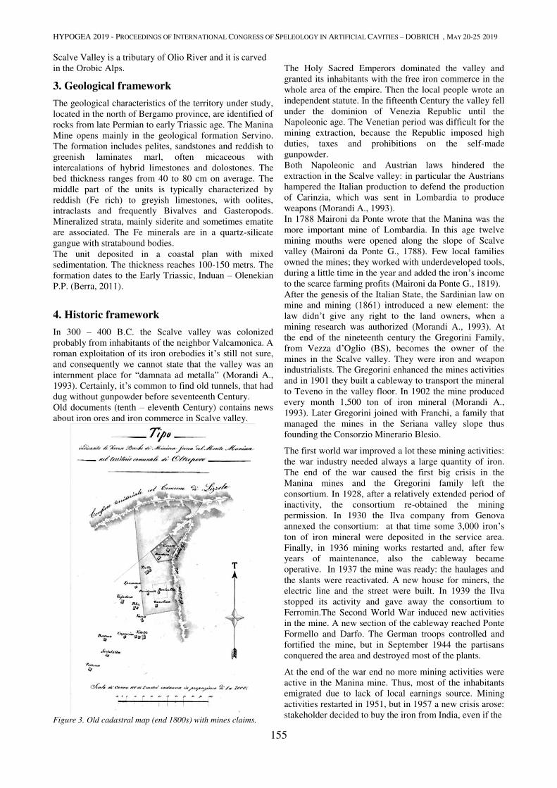
HYPOGEA 2019 - PROCEEDINGS OF INTERNATIONAL CONGRESS OF SPELEOLOGY IN ARTIFICIAL CAVITIES – DOBRICH , MAY 20-25 2019
155
Scalve Valley is a tributary of Olio River and it is carved
in the Orobic Alps.
3. Geological framework
The geological characteristics of the territory under study,
located in the north of Bergamo province, are identified of
rocks from late Permian to early Triassic age. The Manina
Mine opens mainly in the geological formation Servino.
The formation includes pelites, sandstones and reddish to
greenish laminates marl, often micaceous with
intercalations of hybrid limestones and dolostones. The
bed thickness ranges from 40 to 80 cm on average. The
middle part of the units is typically characterized by
reddish (Fe rich) to greyish limestones, with oolites,
intraclasts and frequently Bivalves and Gasteropods.
Mineralized strata, mainly siderite and sometimes ematite
are associated. The Fe minerals are in a quartz-silicate
gangue with stratabound bodies.
The unit deposited in a coastal plan with mixed
sedimentation. The thickness reaches 100-150 metrs. The
formation dates to the Early Triassic, Induan – Olenekian
P.P. (Berra, 2011).
4. Historic framework
In 300 – 400 B.C. the Scalve valley was colonized
probably from inhabitants of the neighbor Valcamonica. A
roman exploitation of its iron orebodies it’s still not sure,
and consequently we cannot state that the valley was an
internment place for “damnata ad metalla” (Morandi A.,
1993). Certainly, it’s common to find old tunnels, that had
dug without gunpowder before seventeenth Century.
Old documents (tenth – eleventh Century) contains news
about iron ores and iron commerce in Scalve valley.
Figure 3. Old cadastral map (end 1800s) with mines claims.
The Holy Sacred Emperors dominated the valley and
granted its inhabitants with the free iron commerce in the
whole area of the empire. Then the local people wrote an
independent statute. In the fifteenth Century the valley fell
under the dominion of Venezia Republic until the
Napoleonic age. The Venetian period was difficult for the
mining extraction, because the Republic imposed high
duties, taxes and prohibitions on the self-made
gunpowder.
Both Napoleonic and Austrian laws hindered the
extraction in the Scalve valley: in particular the Austrians
hampered the Italian production to defend the production
of Carinzia, which was sent in Lombardia to produce
weapons (Morandi A., 1993).
In 1788 Maironi da Ponte wrote that the Manina was the
more important mine of Lombardia. In this age twelve
mining mouths were opened along the slope of Scalve
valley (Maironi da Ponte G., 1788). Few local families
owned the mines; they worked with underdeveloped tools,
during a little time in the year and added the iron’s income
to the scarce farming profits (Maironi da Ponte G., 1819).
After the genesis of the Italian State, the Sardinian law on
mine and mining (1861) introduced a new element: the
law didn’t give any right to the land owners, when a
mining research was authorized (Morandi A., 1993). At
the end of the nineteenth century the Gregorini Family,
from Vezza d’Oglio (BS), becomes the owner of the
mines in the Scalve valley. They were iron and weapon
industrialists. The Gregorini enhanced the mines activities
and in 1901 they built a cableway to transport the mineral
to Teveno in the valley floor. In 1902 the mine produced
every month 1,500 ton of iron mineral (Morandi A.,
1993). Later Gregorini joined with Franchi, a family that
managed the mines in the Seriana valley slope thus
founding the Consorzio Minerario Blesio.
The first world war improved a lot these mining activities:
the war industry needed always a large quantity of iron.
The end of the war caused the first big crisis in the
Manina mines and the Gregorini family left the
consortium. In 1928, after a relatively extended period of
inactivity, the consortium re-obtained the mining
permission. In 1930 the Ilva company from Genova
annexed the consortium: at that time some 3,000 iron’s
ton of iron mineral were deposited in the service area.
Finally, in 1936 mining works restarted and, after few
years of maintenance, also the cableway became
operative. In 1937 the mine was ready: the haulages and
the slants were reactivated. A new house for miners, the
electric line and the street were built. In 1939 the Ilva
stopped its activity and gave away the consortium to
Ferromin.The Second World War induced new activities
in the mine. A new section of the cableway reached Ponte
Formello and Darfo. The German troops controlled and
fortified the mine, but in September 1944 the partisans
conquered the area and destroyed most of the plants.
At the end of the war end no more mining activities were
active in the Manina mine. Thus, most of the inhabitants
emigrated due to lack of local earnings source. Mining
activities restarted in 1951, but in 1957 a new crisis arose:
stakeholder decided to buy the iron from India, even if the
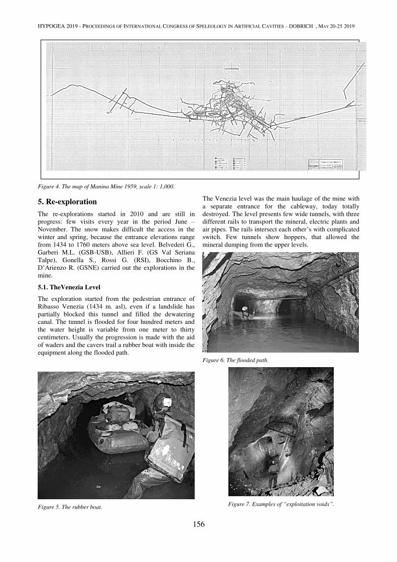
HYPOGEA 2019 - PROCEEDINGS OF INTERNATIONAL CONGRESS OF SPELEOLOGY IN ARTIFICIAL CAVITIES – DOBRICH , MAY 20-25 2019
156
Indian iron price was of 20,000 liras while that from
Manina only 6,000. Moreover, an enrichment plant will
have enhanced the Manina iron quality with a lower price
and will have brought money to local people. In 1972 the
mining claim returned to mining district” (Morandi A.,
1993).
Figure 4. The map of Manina Mine 1959, scale 1: 1,000.
5. Re-exploration
The re-explorations started in 2010 and are still in
progress: few visits every year in the period June –
November. The snow makes difficult the access in the
winter and spring, because the entrance elevations range
from 1434 to 1760 meters above sea level. Belvederi G.,
Garberi M.L. (GSB-USB), Allieri F. (GS Val Seriana
Talpe), Gonella S., Rossi G. (RSI), Bocchino B.,
D’Arienzo R. (GSNE) carried out the explorations in the
mine.
5.1. TheVenezia Level
The exploration started from the pedestrian entrance of
Ribasso Venezia (1434 m. asl), even if a landslide has
partially blocked this tunnel and filled the dewatering
canal. The tunnel is flooded for four hundred meters and
the water height is variable from one meter to thirty
centimeters. Usually the progression is made with the aid
of waders and the cavers trail a rubber boat with inside the
equipment along the flooded path.
Figure 5. The rubber boat.
The Venezia level was the main haulage of the mine with
a separate entrance for the cableway, today totally
destroyed. The level presents few wide tunnels, with three
different rails to transport the mineral, electric plants and
air pipes. The rails intersect each other’s with complicated
switch. Few tunnels show hoppers, that allowed the
mineral dumping from the upper levels.
Figure 6. The flooded path.
Figure 7. Examples of “exploitation voids”.
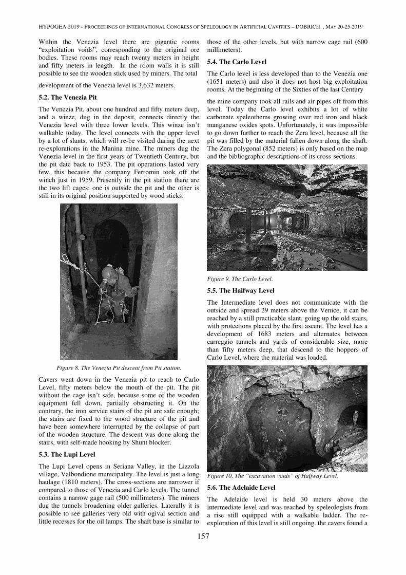
HYPOGEA 2019 - PROCEEDINGS OF INTERNATIONAL CONGRESS OF SPELEOLOGY IN ARTIFICIAL CAVITIES – DOBRICH , MAY 20-25 2019
157
Within the Venezia level there are gigantic rooms
“exploitation voids”, corresponding to the original ore
bodies. These rooms may reach twenty meters in height
and fifty meters in length. In the room walls it is still
possible to see the wooden stick used by miners. The total
development of the Venezia level is 3,632 meters.
5.2. The Venezia Pit
The Venezia Pit, about one hundred and fifty meters deep,
and a winze, dug in the deposit, connects directly the
Venezia level with three lower levels. This winze isn’t walkable today. The level connects with the upper level
by a lot of slants, which will re-be visited during the next
re-explorations in the Manina mine. The miners dug the
Venezia level in the first years of Twentieth Century, but
the pit date back to 1953. The pit operations lasted very
few, this because the company Ferromin took off the
winch just in 1959. Presently in the pit station there are
the two lift cages: one is outside the pit and the other is
still in its original position supported by wood sticks.
Figure 8. The Venezia Pit descent from Pit station.
Cavers went down in the Venezia pit to reach to Carlo
Level, fifty meters below the mouth of the pit. The pit
without the cage isn’t safe, because some of the wooden
equipment fell down, partially obstructing it. On the
contrary, the iron service stairs of the pit are safe enough;
the stairs are fixed to the wood structure of the pit and
have been somewhere interrupted by the collapse of part
of the wooden structure. The descent was done along the
stairs, with self-made hooking by Shunt blocker.
5.3. The Lupi Level
The Lupi Level opens in Seriana Valley, in the Lizzola
village, Valbondione municipality. The level is just a long
haulage (1810 meters). The cross-sections are narrower if
compared to those of Venezia and Carlo levels. The tunnel
contains a narrow gage rail (500 millimeters). The miners
dug the tunnels broadening older galleries. Laterally it is
possible to see galleries very old with ogival section and
little recesses for the oil lamps. The shaft base is similar to
those of the other levels, but with narrow cage rail (600
millimeters).
5.4. The Carlo Level
The Carlo level is less developed than to the Venezia one
(1651 meters) and also it does not host big exploitation
rooms. At the beginning of the Sixties of the last Century
the mine company took all rails and air pipes off from this
level. Today the Carlo level exhibits a lot of white
carbonate speleothems growing over red iron and black
manganese oxides spots. Unfortunately, it was impossible
to go down further to reach the Zera level, because all the
pit was filled by the material fallen down along the shaft.
The Zera polygonal (852 meters) is only based on the map
and the bibliographic descriptions of its cross-sections.
Figure 9. The Carlo Level.
5.5. The Halfway Level
The Intermediate level does not communicate with the
outside and spread 29 meters above the Venice, it can be
reached by a still practicable slant, going up the old stairs,
with protections placed by the first ascent. The level has a
development of 1683 meters and alternates between
carreggio tunnels and yards of considerable size, more
than fifty meters deep, that descend to the hoppers of
Carlo Level, where the material was loaded.
Figure 10. The “excavation voids” of Halfway Level.
5.6. The Adelaide Level
The Adelaide level is held 30 meters above the
intermediate level and was reached by speleologists from
a rise still equipped with a walkable ladder. The re-
exploration of this level is still ongoing. the cavers found a
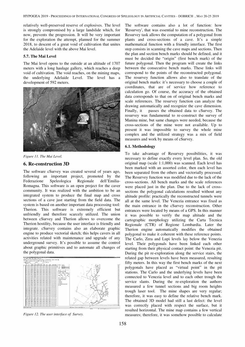
HYPOGEA 2019 - PROCEEDINGS OF INTERNATIONAL CONGRESS OF SPELEOLOGY IN ARTIFICIAL CAVITIES – DOBRICH , MAY 20-25 2019
158
relatively well-preserved reserve of explosives. The level
is strongly compromised by a large landslide which, for
now, prevents the progression. It will be very important
for the exploration the attempt, planned for the summer
2018, to descent of a great void of cultivation that unites
the Adelaide level with the above Mai level.
5.7. The Mai Level
The Mai level opens to the outside at an altitude of 1707
meters with a long haulage gallery, which reaches a deep
void of cultivation. The void reaches, on the mining maps,
the underlying Adelaide Level. The level has a
development of 592 meters.
Figure 11. The Mai Level.
6. Re-construction 3D
The software cSurvey was created several of years ago,
following an important project, promoted by the
Federazione Speleologica Regionale dell’Emilia-
Romagna. This software is an open project for the caver
community. It was realized with the ambition to be an
integrated system to produce the final map and cross
sections of a cave just starting from the field data. The
system is based on another important data processing tool:
Therion. This software is extremely efficient but
unfriendly and therefore scarcely utilized. The union
between cSurvey and Therion allows to overcome the
Therion hostility, because the user interface is friendly and
integrate. cSurvey contains also an elaborate graphic
engine to produce vectorial sketch; this helps cavers in all
activities related with maintenance and upgrade of any
underground survey. It’s possible to assume the control
about graphic primitives and to automate all changes of
the polygonal data.
Figure 12. The user interface of Survey.
The software contains also a lot of function: how
'Resurvey', that was essential to mine reconstruction. The
Resurvey task allows the computation of a polygonal from
plants and cross-sections of a cave. It’s a simple
mathematical function with a friendly interface. The first
step consists in scanning the cave maps and sections. Then
the plan and section bench marks should be defined, and it
must be decided the “origin” (first bench mark) of the
future polygonal. Then the program will create the links
between the consecutive bench marks. These links will
correspond to the points of the reconstructed polygonal.
The resurvey function allows also to translate of the
original bench marks: it’s necessary to choose a couple of
coordinates, that are of service how reference to
calculation go. Of course, the accuracy of the obtained
data corresponds to that on of original bench marks and
scale references. The resurvey function can analyze the
drawing automatically and recognize the cave dimension.
Finally, it passes the obtained data to cSurvey. The
resurvey was fundamental to re-construct the survey of
Manina mine, but same changes were needed, because the
cross-sections of the mine were not available. Up to
present it was impossible to survey the whole mine
complex and the utilized strategy was a mix of field
measures and work by means of cSurvey.
6.1. Methodology
To take advantage of Resurvey possibilities, it was
necessary to define exactly every level plan. So, the old
original map (scale 1:1,000) was scanned. Each level has
been marked with an assorted color, then each level has
been separated from the others and vectorially processed.
The Resurvey function was modified due to the lack of the
cross-sections. All bench marks and the scale references
were placed just in the plan. Due to the lack of cross-
sections the polygonal calculations resulted without any
altitude profile: practically the reconstructed tunnels were
all at the same level. The Venezia entrance was fixed as
the main entrance in the cSurvey reconstruction. Other
entrances were located by means of a GPS. In this manner
it was possible to verify the map altitude and the
cartographic morphology utilizing the Carta Tecnica
Regionale (CTR) of Regione Lombardia. Later the
Therion engine automatically modifies the obtained
polygonal to make it coherent with these reference points.
The Carlo, Zera and Lupi levels lay below the Venezia
level. Their polygonals have been linked each other
starting from their physical contact point: the Venezia pit.
During the pit re-exploration along the service stairs, the
related gap between levels have been measured, resulting
fifty meters. In this way the first bench marks of the next
polygonals have placed as “virtual point” in the pit
stations. The Carlo and the underlying levels have been
connected to Venezia level and to each other trough the
service slants. During the re-exploration the authors
measured a few tunnel sections and big room heights
trough laser tool. The mine shapes are very regular;
therefore, it was easy to define the relative bench mark.
The obtained 3D model had still a last defect: the level
was correctly placed with respect the surface, but it
resulted horizontal. The mine map contains a few vertical
measures; therefore, it was somehow possible to calculate

HYPOGEA 2019 - PROCEEDINGS OF INTERNATIONAL CONGRESS OF SPELEOLOGY IN ARTIFICIAL CAVITIES – DOBRICH , MAY 20-25 2019
159
the estimated altimetry. Once defined the geographic
coordinates for these points, it was possible to assign a
very real 3D aspect at the mine.
7. Results
The present paper presents a result of 3D re-construction
of the mine, which will be completed, when all the upper
Figure 13. The user interface of cSurvey.
levels will be explored. The artificial gallery re-
construction is easier compared to that of a natural cave.
Anyway, at least theoretically, this method may be applied
also to natural caves. The function Resurvey allows to
reconstruct the polygonal, starting only from the single
map with cross sections. The availability of the field book
will improve the accuracy of the process and increase the
details of the polygonal. The 3D geo-referred re-
construction supports the study of mine structures; in this
case permits: to evaluate the actual preservation of the
mine; to document clearly the dimensions of the mine
voids and to document the large efforts needed to create
such giant underground artificial voids. The giant
“exploitation vacuums”: originally were filled by and iron
ore body, which was totally extracted by miners.
8. Conclusions
This research wants be a test for the applicability of
cSurvey to complex artificial cave. Above all it’s also a
“Dark Memories” contribution: these memories don’t contain only the galleries, the equipment, the cars, the
lifts, but also the exploitation history from the scarce
number of mining company if compared to the thousands
of men, which worked and died there. The mining job was
the main source to survive for people living inside the
valley and it strictly controlled their culture and way of
life. For example, Valbondione was named the “widows
valley”, the males mortality was very rated due to
silicosis. To explore and survey today these places, it
means: to avoid oblivion; to preserve memory and to pay
homage to miners, who worked hard to supply row
materials to our stile of life, which is probably too hungry
of them.
Acknowledgment
The authors thank Anselmo Agoni, manager of Ski Mine
for his support and competence.
References
Berra F, 2012. Successione triassica delle alpi meridionali. In
Note illustrative della carta Geologica d’Italia, Foglio 57
Malonno, pp. 66-67.
Cendron F, 2012. Il Progetto cSurvey, in: Federazione Speleologica
Regionale dell’Emilia-Romagna, Speleologia Emiliana n°3, Anno
XXIII, Serie V. Ed., pp. 36-45.
Ferromin 1956. Miniera di Manina, piano dei lavori interni, scala
1:500, Genova.
Ferromin,1959. Miniera di Manina, piano dei lavori interni, scala
1:1.000, Genova.
Forti P, Lucci P, 2010. Il progetto Stella-Basino, Società
Speleologica Italiana, pp. 29-34.
Maironi da Ponte G, 1788. Memoria orografico-mineralogica delle
montagne spettanti LLW Valli di Scalve e Bondione, in: Memorie
di matematica e fisica della società italiana Tomo IV, Verona.
Maironi da Ponte G,1819 Dizionario odeporico o sia storico –
politico – naturale della provincia bergamasca, Stamperia
Mazzoleni ,Bergamo.
Maironi da Ponte G, 1825. Sulla geologia della provincia
bergamasca, Stamperia Mazzoleni, Bergamo.
Morandi A, 1993. “Il traffico di cavar la vena”. Le miniere di
Manina, in Havvi gente buona et laboriosa, Vilminore nel
novecento, Il filo di Arianna, Bergamo.
Morandi A, 2002. A 1750 metri sul livello del livello del mare. Le
miniere della Manina , Il filo di Arianna, calendario 11, Bergamo.
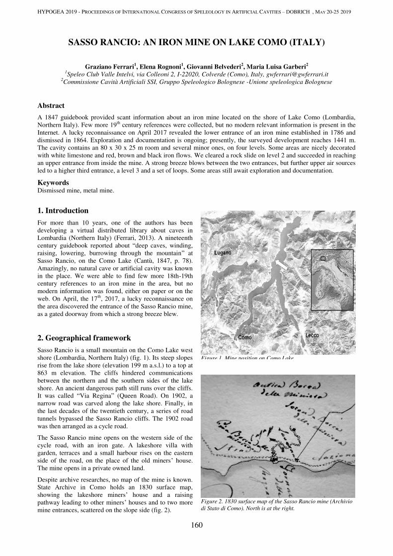
HYPOGEA 2019 - PROCEEDINGS OF INTERNATIONAL CONGRESS OF SPELEOLOGY IN ARTIFICIAL CAVITIES – DOBRICH , MAY 20-25 2019
160
SASSO RANCIO: AN IRON MINE ON LAKE COMO (ITALY)
Graziano Ferrari1, Elena Rognoni
1, Giovanni Belvederi
2, Maria Luisa Garberi
2
1Speleo Club Valle Intelvi, via Colleoni 2, I-22020, Colverde (Como), Italy, [email protected]
2Commissione Cavità Artificiali SSI, Gruppo Speleologico Bolognese -Unione speleologica Bolognese
Abstract
A 1847 guidebook provided scant information about an iron mine located on the shore of Lake Como (Lombardia,
Northern Italy). Few more 19th
century references were collected, but no modern relevant information is present in the
Internet. A lucky reconnaissance on April 2017 revealed the lower entrance of an iron mine established in 1786 and
dismissed in 1864. Exploration and documentation is ongoing; presently, the surveyed development reaches 1441 m.
The cavity contains an 80 x 30 x 25 m room and several minor ones, on four levels. Some areas are nicely decorated
with white limestone and red, brown and black iron flows. We cleared a rock slide on level 2 and succeeded in reaching
an upper entrance from inside the mine. A strong breeze blows between the two entrances, but further upper air sources
led to a higher third entrance, a level 3 and a set of loops. Some areas still await exploration and documentation.
Keywords Dismissed mine, metal mine.
1. Introduction
For more than 10 years, one of the authors has been
developing a virtual distributed library about caves in
Lombardia (Northern Italy) (Ferrari, 2013). A nineteenth
century guidebook reported about “deep caves, winding,
raising, lowering, burrowing through the mountain” at
Sasso Rancio, on the Como Lake (Cantù, 1847, p. 78).
Amazingly, no natural cave or artificial cavity was known
in the place. We were able to find few more 18th-19th
century references to an iron mine in the area, but no
modern information was found, either on paper or on the
web. On April, the 17th
, 2017, a lucky reconnaissance on
the area discovered the entrance of the Sasso Rancio mine,
as a gated doorway from which a strong breeze blew.
2. Geographical framework
Sasso Rancio is a small mountain on the Como Lake west
shore (Lombardia, Northern Italy) (fig. 1). Its steep slopes
rise from the lake shore (elevation 199 m a.s.l.) to a top at
863 m elevation. The cliffs hindered communications
between the northern and the southern sides of the lake
shore. An ancient dangerous path still runs over the cliffs.
It was called “Via Regina” (Queen Road). On 1902, a
narrow road was carved along the lake shore. Finally, in
the last decades of the twentieth century, a series of road
tunnels bypassed the Sasso Rancio cliffs. The 1902 road
was then arranged as a cycle road.
The Sasso Rancio mine opens on the western side of the
cycle road, with an iron gate. A lakeshore villa with
garden, terraces and a small harbour rises on the eastern
side of the road, on the place of the old miners’ house.
The mine opens in a private owned land.
Despite archive researches, no map of the mine is known.
State Archive in Como holds an 1830 surface map,
showing the lakeshore miners’ house and a raising
pathway leading to other miners’ houses and to two more
mine entrances, scattered on the slope side (fig. 2).
Figure 1. Mine position on Como Lake.
Figure 2. 1830 surface map of the Sasso Rancio mine (Archivio
di Stato di Como). North is at the right.
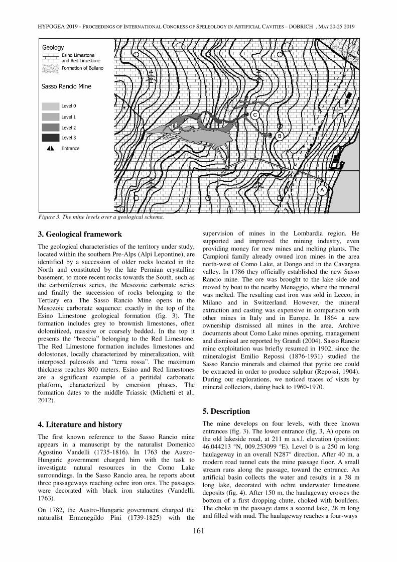
HYPOGEA 2019 - PROCEEDINGS OF INTERNATIONAL CONGRESS OF SPELEOLOGY IN ARTIFICIAL CAVITIES – DOBRICH , MAY 20-25 2019
161
3. Geological framework
The geological characteristics of the territory under study,
located within the southern Pre-Alps (Alpi Lepontine), are
identified by a succession of older rocks located in the
North and constituted by the late Permian crystalline
basement, to more recent rocks towards the South, such as
the carboniferous series, the Mesozoic carbonate series
and finally the succession of rocks belonging to the
Tertiary era. The Sasso Rancio Mine opens in the
Mesozoic carbonate sequence: exactly in the top of the
Esino Limestone geological formation (fig. 3). The
formation includes grey to brownish limestones, often
dolomitized, massive or coarsely bedded. In the top it
presents the “breccia” belonging to the Red Limestone.
The Red Limestone formation includes limestones and
dolostones, locally characterized by mineralization, with
interposed paleosols and “terra rossa”. The maximum
thickness reaches 800 meters. Esino and Red limestones
are a significant example of a peritidal carbonatic
platform, characterized by emersion phases. The
formation dates to the middle Triassic (Michetti et al.,
2012).
4. Literature and history
The first known reference to the Sasso Rancio mine
appears in a manuscript by the naturalist Domenico
Agostino Vandelli (1735-1816). In 1763 the Austro-
Hungaric government charged him with the task to
investigate natural resources in the Como Lake
surroundings. In the Sasso Rancio area, he reports about
three passageways reaching ochre iron ores. The passages
were decorated with black iron stalactites (Vandelli,
1763).
On 1782, the Austro-Hungaric government charged the
naturalist Ermenegildo Pini (1739-1825) with the
supervision of mines in the Lombardia region. He
supported and improved the mining industry, even
providing money for new mines and melting plants. The
Campioni family already owned iron mines in the area
north-west of Como Lake, at Dongo and in the Cavargna
valley. In 1786 they officially established the new Sasso
Rancio mine. The ore was brought to the lake side and
moved by boat to the nearby Menaggio, where the mineral
was melted. The resulting cast iron was sold in Lecco, in
Milano and in Switzerland. However, the mineral
extraction and casting was expensive in comparison with
other mines in Italy and in Europe. In 1864 a new
ownership dismissed all mines in the area. Archive
documents about Como Lake mines opening, management
and dismissal are reported by Grandi (2004). Sasso Rancio
mine exploitation was briefly resumed in 1902, since the
mineralogist Emilio Repossi (1876-1931) studied the
Sasso Rancio minerals and claimed that pyrite ore could
be extracted in order to produce sulphur (Repossi, 1904).
During our explorations, we noticed traces of visits by
mineral collectors, dating back to 1960-1970.
5. Description
The mine develops on four levels, with three known
entrances (fig. 3). The lower entrance (fig. 3, A) opens on
the old lakeside road, at 211 m a.s.l. elevation (position:
46.044213 °N, 009.253099 °E). Level 0 is a 250 m long
haulageway in an overall N287° direction. After 40 m, a
modern road tunnel cuts the mine passage floor. A small
stream runs along the passage, toward the entrance. An
artificial basin collects the water and results in a 38 m
long lake, decorated with ochre underwater limestone
deposits (fig. 4). After 150 m, the haulageway crosses the
bottom of a first dropping chute, choked with boulders.
The choke in the passage dams a second lake, 28 m long
and filled with mud. The haulageway reaches a four-ways
Figure 3. The mine levels over a geological schema.
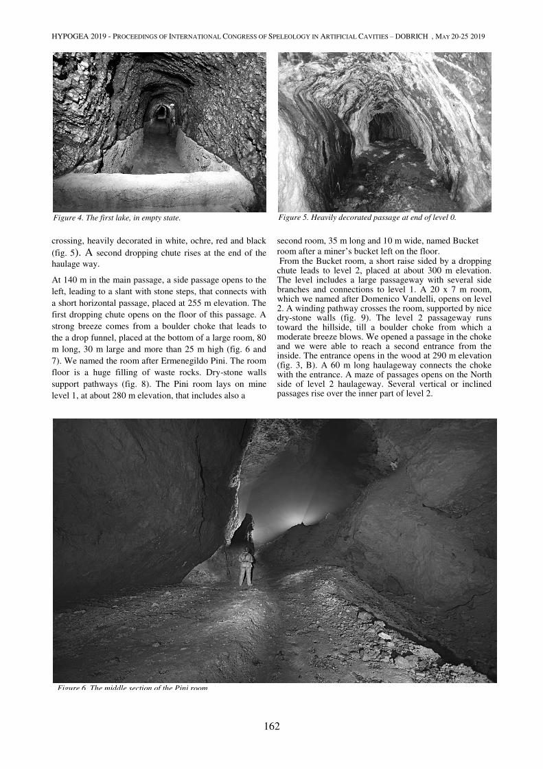
HYPOGEA 2019 - PROCEEDINGS OF INTERNATIONAL CONGRESS OF SPELEOLOGY IN ARTIFICIAL CAVITIES – DOBRICH , MAY 20-25 2019
162
crossing, heavily decorated in white, ochre, red and black
(fig. 5). A second dropping chute rises at the end of the
haulage way.
At 140 m in the main passage, a side passage opens to the
left, leading to a slant with stone steps, that connects with
a short horizontal passage, placed at 255 m elevation. The
first dropping chute opens on the floor of this passage. A
strong breeze comes from a boulder choke that leads to
the a drop funnel, placed at the bottom of a large room, 80
m long, 30 m large and more than 25 m high (fig. 6 and
7). We named the room after Ermenegildo Pini. The room
floor is a huge filling of waste rocks. Dry-stone walls
support pathways (fig. 8). The Pini room lays on mine
level 1, at about 280 m elevation, that includes also a
second room, 35 m long and 10 m wide, named Bucket
room after a miner’s bucket left on the floor. From the Bucket room, a short raise sided by a dropping chute leads to level 2, placed at about 300 m elevation. The level includes a large passageway with several side branches and connections to level 1. A 20 x 7 m room, which we named after Domenico Vandelli, opens on level 2. A winding pathway crosses the room, supported by nice dry-stone walls (fig. 9). The level 2 passageway runs toward the hillside, till a boulder choke from which a moderate breeze blows. We opened a passage in the choke and we were able to reach a second entrance from the inside. The entrance opens in the wood at 290 m elevation (fig. 3, B). A 60 m long haulageway connects the choke with the entrance. A maze of passages opens on the North side of level 2 haulageway. Several vertical or inclined passages rise over the inner part of level 2.
Figure 6. The middle section of the Pini room.
Figure 4. The first lake, in empty state. Figure 5. Heavily decorated passage at end of level 0.
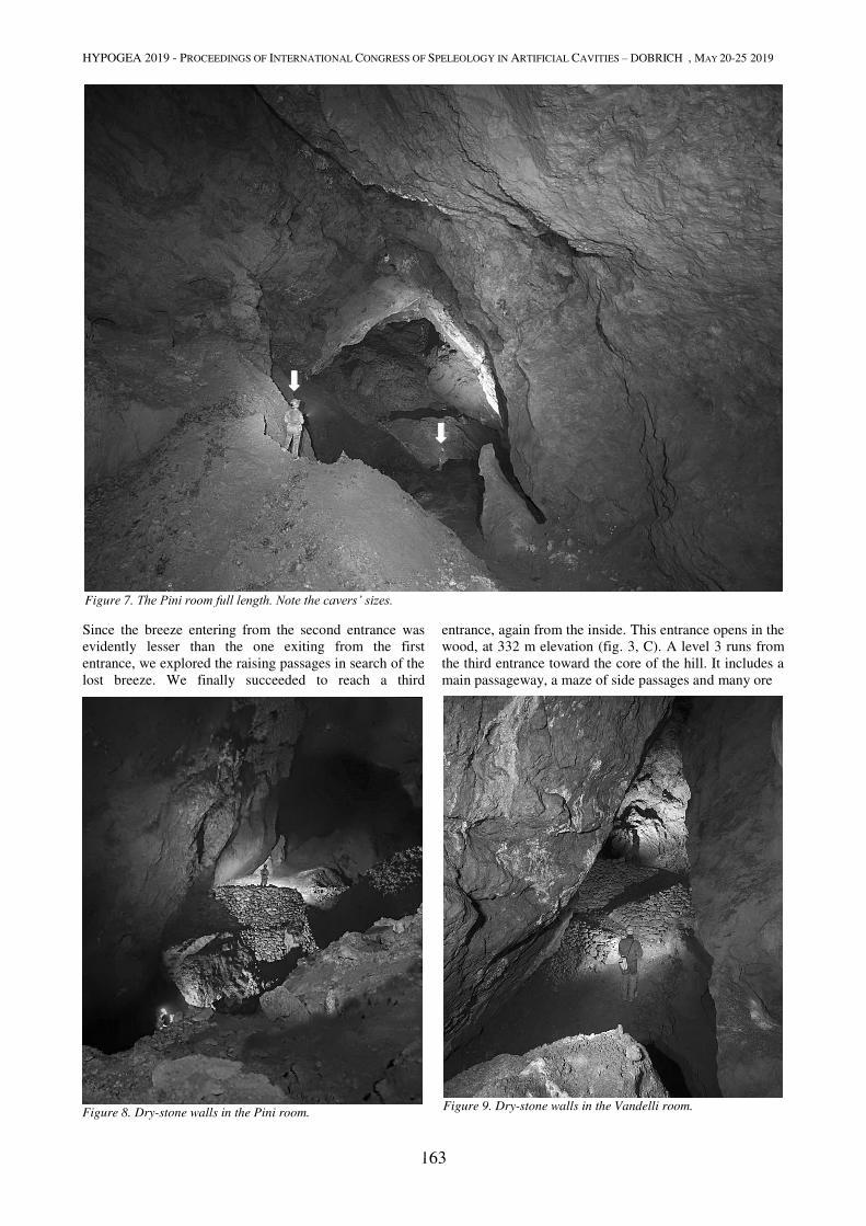
HYPOGEA 2019 - PROCEEDINGS OF INTERNATIONAL CONGRESS OF SPELEOLOGY IN ARTIFICIAL CAVITIES – DOBRICH , MAY 20-25 2019
163
Since the breeze entering from the second entrance was
evidently lesser than the one exiting from the first
entrance, we explored the raising passages in search of the
lost breeze. We finally succeeded to reach a third
entrance, again from the inside. This entrance opens in the
wood, at 332 m elevation (fig. 3, C). A level 3 runs from
the third entrance toward the core of the hill. It includes a
main passageway, a maze of side passages and many ore
Figure 7. The Pini room full length. Note the cavers’ sizes.
Figure 9. Dry-stone walls in the Vandelli room.
Figure 8. Dry-stone walls in the Pini room.
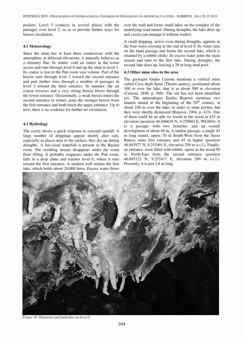
HYPOGEA 2019 - PROCEEDINGS OF INTERNATIONAL CONGRESS OF SPELEOLOGY IN ARTIFICIAL CAVITIES – DOBRICH , MAY 20-25 2019
164
pockets. Level 3 connects in several places with the
passages over level 2, so as to provide further ways for
breeze circulation.
4.1 Meteorology
Since the mine has at least three connections with the
atmosphere at different elevations, it naturally behaves as
a chimney flue. In winter, cold air enters in the lower
access and runs through level 0 and up the slant to level 1.
Its course is lost in the Pini room vast volume. Part of the
breeze runs through level 2 toward the second entrance
and part further rises through a number of passages in
level 3 toward the third entrance. In summer, the air
course reverses and a very strong breeze blows through
the lower entrance. Occasionally, a weak breeze enters the
second entrance in winter, joins the stronger breeze from
the first entrance and both reach the upper entrance. Up to
now, there is no evidence for further air circulation.
4.2 Hydrology
The cavity shows a quick response to external rainfall. A
large number of drippings appear shortly after rain,
especially in places near to the surface; they dry up during
droughts. A fair-sized waterfall is present in the Bucket
room. The resulting stream disappears under the room
floor filling. It probably reappears under the Pini room,
falls in a drop chute and reaches level 0, where it runs
toward the first entrance. A modern wall retains the first
lake, which holds about 20,000 litres. Excess water flows
over the wall and forms small lakes on the extrados of the
underlying road tunnel. During droughts, the lake dries up
and cavers can manage it without waders.
A small dripping, active even during droughts, appears in
the four-ways crossing at the end of level 0. Its water runs
on the main passage and forms the second lake, which is
retained by a rubble choke. Its excess water joins the main
stream and runs to the first lake. During droughts, the
second lake dries up, leaving a 28 m long mud pool.
4.3 Other mine sites in the area
The geologist Giulio Curioni mentions a vertical mine
called Cava degli Spini (Thorns quarry), positioned about
300 m over the lake, that is at about 500 m elevation
(Curioni, 1840, p. 500). The site has not been identified
yet. The mineralogist Emilio Repossi mentions two
tunnels mined at the beginning of the 20th
century, at
about 250 m over the lake, in order to mine pyrites, but
they were shortly dismissed (Repossi, 1904, p. 423). One
of them could be an adit we found in the wood at 425 m
elevation (position 46.046638 N, 9.250683 E, WGS84). It
is a passage with two branches and an overall
development of about 40 m. A similar passage, a single 43
m long tunnel, opens 70 m South-West from the Sasso
Rancio mine first entrance and 45 m higher (position
46.043977 N, 9.252401 E, elevation 256 m a.s.l.). Finally,
an entrance, soon filled with rubble, opens in the wood 50
m North-East from the second entrance (position
46.045122 N, 9.252417 E, elevation 289 m a.s.l.).
Presently, it is just 2,8 m long.
Figure 10. Draperies and helictites on level 0.
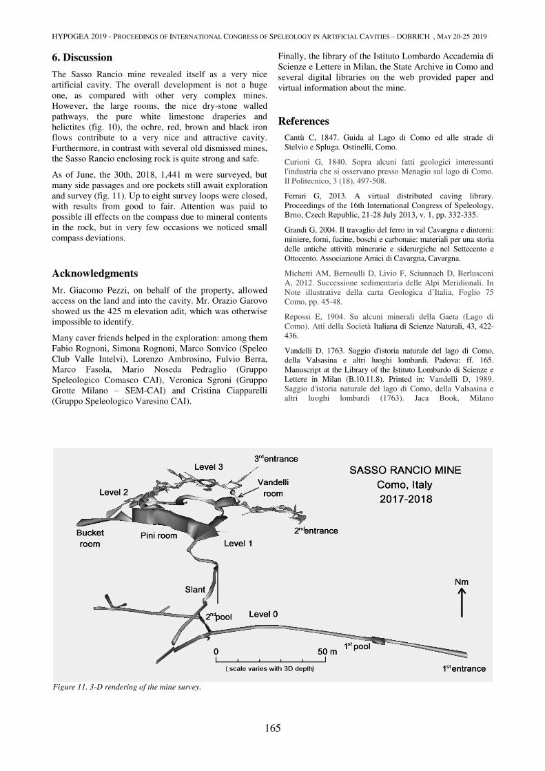
HYPOGEA 2019 - PROCEEDINGS OF INTERNATIONAL CONGRESS OF SPELEOLOGY IN ARTIFICIAL CAVITIES – DOBRICH , MAY 20-25 2019
165
6. Discussion
The Sasso Rancio mine revealed itself as a very nice
artificial cavity. The overall development is not a huge
one, as compared with other very complex mines.
However, the large rooms, the nice dry-stone walled
pathways, the pure white limestone draperies and
helictites (fig. 10), the ochre, red, brown and black iron
flows contribute to a very nice and attractive cavity.
Furthermore, in contrast with several old dismissed mines,
the Sasso Rancio enclosing rock is quite strong and safe.
As of June, the 30th, 2018, 1,441 m were surveyed, but
many side passages and ore pockets still await exploration
and survey (fig. 11). Up to eight survey loops were closed,
with results from good to fair. Attention was paid to
possible ill effects on the compass due to mineral contents
in the rock, but in very few occasions we noticed small
compass deviations.
Acknowledgments
Mr. Giacomo Pezzi, on behalf of the property, allowed
access on the land and into the cavity. Mr. Orazio Garovo
showed us the 425 m elevation adit, which was otherwise
impossible to identify.
Many caver friends helped in the exploration: among them
Fabio Rognoni, Simona Rognoni, Marco Sonvico (Speleo
Club Valle Intelvi), Lorenzo Ambrosino, Fulvio Berra,
Marco Fasola, Mario Noseda Pedraglio (Gruppo
Speleologico Comasco CAI), Veronica Sgroni (Gruppo
Grotte Milano – SEM-CAI) and Cristina Ciapparelli
(Gruppo Speleologico Varesino CAI).
Finally, the library of the Istituto Lombardo Accademia di
Scienze e Lettere in Milan, the State Archive in Como and
several digital libraries on the web provided paper and
virtual information about the mine.
References
Cantù C, 1847. Guida al Lago di Como ed alle strade di
Stelvio e Spluga. Ostinelli, Como.
Curioni G, 1840. Sopra alcuni fatti geologici interessanti
l'industria che si osservano presso Menagio sul lago di Como.
Il Politecnico, 3 (18), 497-508.
Ferrari G, 2013. A virtual distributed caving library.
Proceedings of the 16th International Congress of Speleology,
Brno, Czech Republic, 21-28 July 2013, v. 1, pp. 332-335.
Grandi G, 2004. Il travaglio del ferro in val Cavargna e dintorni:
miniere, forni, fucine, boschi e carbonaie: materiali per una storia
delle antiche attività minerarie e siderurgiche nel Settecento e
Ottocento. Associazione Amici di Cavargna, Cavargna.
Michetti AM, Bernoulli D, Livio F, Sciunnach D, Berlusconi
A, 2012. Successione sedimentaria delle Alpi Meridionali. In
Note illustrative della carta Geologica d’Italia, Foglio 75
Como, pp. 45-48.
Repossi E, 1904. Su alcuni minerali della Gaeta (Lago di
Como). Atti della Società Italiana di Scienze Naturali, 43, 422-
436.
Vandelli D, 1763. Saggio d'istoria naturale del lago di Como,
della Valsasina e altri luoghi lombardi. Padova: ff. 165.
Manuscript at the Library of the Istituto Lombardo di Scienze e
Lettere in Milan (B.10.11.8). Printed in: Vandelli D, 1989.
Saggio d'istoria naturale del lago di Como, della Valsasina e
altri luoghi lombardi (1763). Jaca Book, Milano
Figure 11. 3-D rendering of the mine survey.
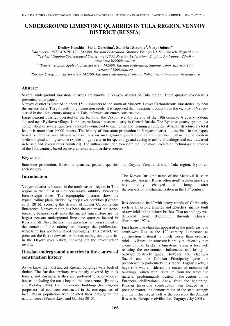
HYPOGEA 2019 - PROCEEDINGS OF INTERNATIONAL CONGRESS OF SPELEOLOGY IN ARTIFICIAL CAVITIES – DOBRICH , MAY 20-25 2019
166
UNDERGROUND LIMESTONE QUARRIES IN TULA REGION, VENYOV
DISTRICT (RUSSIA)
Dmitry Garshin1, Yulia Garshina
2, Stanislav Strukov
3, Yury Dolotov
4
1Mosenergo PJSC/CHPP-17 – 142800, Russian Federation, Stupino, Frunze-3-1-56 – [email protected]
2“Tethys” Stupino Speleological Society – 142800, Russian Federation, Stupino, Andropova-23n-9 –
[email protected], 3“Tethys” Stupino Speleological Society – 142800, Russian Federation, Stupino, Timiryazeva-9-18 –
[email protected] 4Russian Geographical Society – 142280, Russian Federation, Protvino, Pobedy-2a-70 – [email protected]
Abstract
Several underground limestone quarries are known in Venyov district of Tula region. These quarries overview is
presented in the paper.
Venyov district is situated in about 150 kilometers to the south of Moscow. Lower Carboniferous limestones lay near
the surface there. They fit well for construction needs. It is supposed that limestone production in the vicinity of Venyov
started in the 16th century along with Tula defensive structures construction.
Large peasant quarries operated on the banks of the Osyotr river by the end of the 19th century. A quarry system,
situated near Byakovo village, is the largest known peasant quarry in Central Russia. The Byakovo quarry system is a
combination of several quarries, randomly connected to each other and forming a complex labyrinth structure. Its total
length is more than 40000 meters. The history of limestone production in Venyov district is described in the paper,
based on archive and literary sources. Known underground quarry cavities are described following the modern
spelestological zoning scheme (Spelestology is a term for speleology and caving in artificial underground cavities, used
in Russia and several other countries). The authors also tried to restore the limestone production technological process
of the 19th century, based on several remains and archive sources
.
Keywords:
limestone production, limestone quarries, peasant quarries, the Osyotr, Venyov district, Tula region, Byakovo,
spelestology
Introduction
Venyov district is located in the north-eastern region in Tula
region in the midst of Srednerusskaya sublitity, bordering
forest-steppe zones. The topographic pictures show the
typical rolling plain, divided by deep river corridors [Garshin
et al. 2016], scouring the stratum of Lower Carboniferous
limestones. Venyov region has been the center of the stone-
breaking business craft since the ancient times. Here are the
largest peasant underground limestone quarries located in
Russia in all. Nevertheless, the region has not been studied in
the context of the mining art history; the publications
witnessing has not been saved thoroughly. This extract, we
point out the first review of the famous underground quarries
in the Osyotr river valley, showing off the investigation
results.
Russian underground quarries in the context of
construction history
As we know the most ancient Russian buildings were built of
timber. The Russian territory was mostly covered by thick
forests, and Russians, as they are, preferred to build wooden
houses, including the areas beyond the forest zones (Bromley
and Podolny 1984). The monumental buildings (for religious
purposes) had not been constructed in the consequences of
local Pagan population who devoted their praying to the
natural forces (Yanovskaya and Garshin 2015).
The Kieven Rus (the name of the Medieval Russian
state, also Ancient Rus is often used) architecture style
has totally changed its image after
the conversion to Christianization in the 10th
century.
Rus decorated itself with heavy trends of Christianity
such as limestone temples and churches, mainly built
of raw bricks (plinthiform bricks). That technology was
delivered from Byzantium through Khazaria
(Formozov 1974).
First limestone churches appeared in the north-east and
south-west Rus in the 12th
century. Limestone as
construction material is much worse than ordinary
bricks. A limestone structure is pretty much costly than
a one built of bricks: a limestone laying is less well
resisting the environment influences, and losing its
outward relatively quick. However, the Vladimir-
Suzdal and the Galician Principality gave the
precedence to particularly this fabric. Highly likely, a
huge role was considered the matter of monumental
buildings, which were risen up from the limestone
material, predominantly located in the centers of the
European civilizations. Anew from the beginning,
Russian limestone construction was headed as a
prestige matter, the demonstration of the state strength
and the influence, as well as the accessory the Ancient
Rus to the European civilization (Zagrayevsky 2001).
HYPOGEA 2019 - PROCEEDINGS OF INTERNATIONAL CONGRESS OF SPELEOLOGY IN ARTIFICIAL CAVITIES – DOBRICH , MAY 20-25 2019
167
It is supposed that the first Russian architects were taught the
lithology in Europe, the similarity of structural engineering is
proving that fact (the Russian churches were risen up using
stone-faced rubble masonry method with the wooden
connections) as well as the style choice connecting close to
romanticism and the early Gothic. Well known are the facts
of inviting the Italian architects to the most important objects
construction (Zagrayevsky 2008).
In the late 15th
– early 16th
centuries there happened a quick,
ubiquitous pass to the brick construction (Zagrayevsky 2001).
However, this only increased the demand of quarry output.
The lime demand was respectively high in the brick
constructioning and the decoration works. Quite often the
lime, rubble and ballast were the main products of Russian
quarries. The brick constructions demanded the stone
foundations up to the invention of the cheap cement that
produced the steady demand on hearth and mounting bases.
Consequently, it is conceivable that the first specialized
Ancient Rus limestone quarries appeared not earlier than 11th
century (The stone production in the quarries near Moscow
not later than 12th century is proved by the architecturally-
lithological researches [Florensky, 1984].
Apparently, the original stone developments were quite little,
being conducted in the surface of the limestone’s exposures.
And right after the production of the most accessible stone
deposits, there happened a pass to getting the stones by the
tunnels. Subsequently, the huge open pits are excavated in the
same deposits in the 19th
-20th
centuries, which partially broke
up the oldest underworkings. There are not much historical
evidence of the ancient quarries saved. The first authentic
description of the underground limestone workings near
Moscow as well as the technological processes of stone
production process are listed in the 18th
century (Zuyev
1787).
By the mid-19th
century the wooden era of the construction
has stopped its existence; cheap brick construction took place
widely, which demanded a huge amount of limestone for lime
calcination, foundations construction and decorative
architectural elements production (Dolotov 2010).
By the end of the 19th
century the fashion on limestone
architectural details has spread over – ladders, window-sills,
frontal sculpture, decorative insertions, etc. Limestone also
suited well for burial monuments production. This led to the
widening of the quarry business, first of all, on the private
conditions, which was mostly in the occupation of peasants,
as well as the merchant class. Most of the limestone produced
in the underground quarries was mined exactly by the
peasants (Viktorov and Zvyagintsev 1989).
Appearingly, all famous and well-known quarries in Moscow
and Tula regions were operated particularly in this time
period.
Limestone quarrying is becoming the most important peasants
craft business, particularly, in winter time. The industrial
quarries have been working the whole year around
(Azancheyev 1894).
In 1920-1930 almost all underground quarries stopped
production in the central region of Russia. The technical
progress and the labor mechanization have discovered the
open-pit quarryind methods in a more safe and cheap
way, rather than the underground quarrying.
The History of Venyov District
There is no much information known about the ancient
history of Tula region, for the reason there are few
written and published archaeological sources.
This territory was the Pagan Vyatichs tribe union place
of settlement in the 9th
-10th
centuries. By the 11th
century the lands on the Osyotr and Venyovka rivers
were included to Chernigov Principality and later to
Ryazan Principality.
Considering the fact of the remained literary sources,
the region has suffered a lot in the 13th
-15th
centuries
from the nomad raids, and was depopulated. The
population partly is coming back in the 14th
century; a
lot of cities and villages are appearing, including
Venyov itself. The next stage of the region
repopulation is happening in the end of the 15th
– the
beginning of the 16th
centuries (Fomin 1997).
Due to the aggressive actions of Crimean Tatars and
Nogais, tree entanglements and fortification
construction started in the 16th
century, including the
strong Tula Kremlin (fortress) construction, finished up
in 1520.
This fortress was built partially of limestone, as well as
the Zaraysk Kremlin downstream of the Osyotr. The
construction material choice is likely explained by the
usage of local stuff and the architects, managing with
this method, presence, as the factors, speeding up the
construction.
The Time of Troubles period started in the 17th
century,
and the Tula region became one of the main theatres of
the peasant wars (a series of rebellions). Tatars
invasion have continued as well. That time Venyov
was a war-constructed town, primarily, despite of the
fact that its military value had decreased due to the
shift of the borders of the Moscovian state to Kursk,
Kharkov and Voronezh.
Merely with Peter the First enthronement, the economic growth has begun. However, by the end of the 18
th century Venyov was still a hick town. (Atlasov
1959).
In the 20th
century the district was industrialized, which included coal and limestone mining development.
Limestone quarrying in Tula and Kaluga regions along the Oka river and its tributaries is considered start the 16
th century (Leonenko and Grokhovskiy 1974). The
exact date of limestone quarrying start is unknown and was estimated on the base of the potential use of the white stone in the building construction in this region. Based on the assumption of history reality, it is worthwhile to note, that the permanent military tension could not promote the underground quarrying and limestone construction.
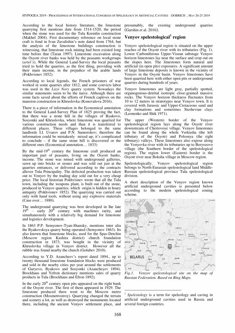
HYPOGEA 2019 - PROCEEDINGS OF INTERNATIONAL CONGRESS OF SPELEOLOGY IN ARTIFICIAL CAVITIES – DOBRICH , MAY 20-25 2019
168
According to the local history literature, the limestone quarrying first mentions date from 1514-1520, the period when the stone was used for the Tula Kremlin construction (Makhel 2004). First documentary reference on local stone craft is fond in Ivan Zavalishin’s note dated from 1764, but the analysis of the limestone buildings construction is witnessing, that limestone rock mining had been existed long time before that (Taran 1997). Limestone excavation along the Osyotr river banks was held by the peasants workgroups (artel’s). While the General Land-Survey the local peasants tried to hold the quarries, as the first thing, providing with their main income, in the prejudice of the arable lands (Pokhvisnev 1852).
According to local legends, the French prisoners of war worked in some quarries after 1812, and some convicts labor was used in the Lisyi Nory quarry system. Nowadays the similar statements seem to be the naive. Although there are some facts saved about the efforts of French captives on the mansion construction in Khruslovka (Konovalova 2016).
There is a piece of information in the Economical annotation to the General Land-Survey Plan of 1825 proving the fact, that there was a stone hill in the villages of Byakovo, Sosyonki and Khruslovka, where limestone was quarried for various construction needs and than it is transferred to different places. These villages belonged to the same landlords I.I. Uvarov and P.N. Sumorokov; therefore the information could be mistakenly mixed up; it’s complicated to conclude – if the same stone hill is discovered or the different ones (Economical annotation… 1833)
By the mid-19th
century the limestone craft produced an important part of peasants, living on the Osyotr banks, income. The stone was mined with underground galleries, sawn up into bricks or stones and was sold out just at the quarries entrances, or delivered according to the contracts allover Tula Principality. The defected production was taken out to Venyov by the trading day sold out for a very cheap price. The local historian Pokhvisnev wrote that all the Tula town, including the weapons plant, is built out of the stone, produced in Venyov quarries, which origin is hidden in hoary antiquity (Pokhvisnev 1852). The quarrying was carried out only with hand tools, without using any explosive materials (Case over… 1880). The underground quarrying was best developed in lhe late 19
th – early 20
th century with machines rarity, and
simultaneously with a relatively big demand for limestone and logistics development.
In 1863 P.P. Semyonov-Tyan-Shansky, mentions inter alia the Byakovsksya quarry being operated (Semyonov 1863). Its also known that limestone blocks, used for the Spas-Detchin (Moscow region Kashira district) church foundation construction in 1873, was bought in the vicinity of Khruslovka village in Venyov district. However all the rubble was found nearby the church (Golubev 2010).
According to Y.D. Azancheev’s report dated 1894., up to twenty thousand limestone foundation blocks were produced and sold in the nearby cities per year around the settlements of Guryevo, Byakovo and Sosyonki (Azancheyev 1894). Brockhaus and Yefron dictionary mentions sales of quarry products in Tula (Brockhaus and Efron 1892).
In the early 20th
century open pits appeared on the right bank of the Osyotr river. The first of them appeared in 1929. The limestone produced there went to the Moscow metro construction (Mosmetrostroy). Quarrying changed the terrain and scenery a lot, as well as destroyed the monuments located there, including the ancient Venyov settlement place, and
presumably, the existing underground quarries
(Garshin et al. 2016).
Venyov spelestological1 region
Venyov spelestological region is situated on the upper reaches of the Osyotr river with its tributaries (Fig. 1). Lower Carboniferous Upper-Visean substage Venyov horizon limestones lay near the surface and crop out on the slopes here. The limestones form natural and artificial (in open pits) exposures. A significant amount of large limestone deposits is known in the vicinity of Venyov in the Osyotr basin. Venyov limestones have been quarried here with either open pits or underground quarries during hundreds of years.
Venyov limestones are light gray, partially spotted, organogenous-detrital isotropic close-grained massive rocks. The Venyov horizon thickness fluctuates from 10 to 12 meters in stratotypes near Venyov town. It is covered with Jurassic and Upper-Cretaceous sand and clay formations and sometimes Steshevian clays (Leonenko and Shik 1971).
The upper (Western) border of the Venyov spelestological region lays along the Osyotr river downstream of Chertovoye village. Venyov limestones can be found along the whole Verkusha (the left tributary of the Osyotr) and Polosnya (the right tributary) valleys. These limestones also expose along the Venyovka river with its tributaries up to Beryozovo village (the Southern border of the spelestological region). The region lower (Eastern) border is the Osyotr river near Boksha village in Moscow region.
Spelestologically, Venyov spelestological region belongs to North-Eurasian spelestological land Middle-Russian spelestological province Tula spelestological division.
A short description of the Venyov region known artificial underground cavities is presented below according to the modern spelestological zoning scheme.
Fig.1. Venyov spelestological site on the map of
Russian Federation. Based on Bing Maps.
1 Spelestology is a term for speleology and caving in
artificial underground cavities used in Russia and
several foreign countries.
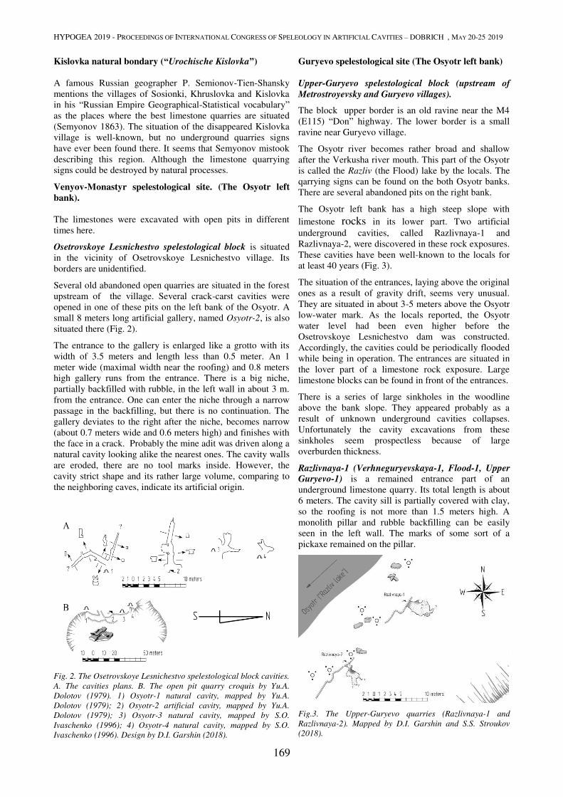
HYPOGEA 2019 - PROCEEDINGS OF INTERNATIONAL CONGRESS OF SPELEOLOGY IN ARTIFICIAL CAVITIES – DOBRICH , MAY 20-25 2019
169
Kislovka natural bondary (“Urochische Kislovka”)
A famous Russian geographer P. Semionov-Tien-Shansky
mentions the villages of Sosionki, Khruslovka and Kislovka
in his “Russian Empire Geographical-Statistical vocabulary”
as the places where the best limestone quarries are situated
(Semyonov 1863). The situation of the disappeared Kislovka
village is well-known, but no underground quarries signs
have ever been found there. It seems that Semyonov mistook
describing this region. Although the limestone quarrying
signs could be destroyed by natural processes.
Venyov-Monastyr spelestological site. (The Osyotr left
bank).
The limestones were excavated with open pits in different
times here.
Osetrovskoye Lesnichestvo spelestological block is situated
in the vicinity of Osetrovskoye Lesnichestvo village. Its
borders are unidentified.
Several old abandoned open quarries are situated in the forest
upstream of the village. Several crack-carst cavities were
opened in one of these pits on the left bank of the Osyotr. A
small 8 meters long artificial gallery, named Osyotr-2, is also
situated there (Fig. 2).
The entrance to the gallery is enlarged like a grotto with its
width of 3.5 meters and length less than 0.5 meter. An 1
meter wide (maximal width near the roofing) and 0.8 meters
high gallery runs from the entrance. There is a big niche,
partially backfilled with rubble, in the left wall in about 3 m.
from the entrance. One can enter the niche through a narrow
passage in the backfilling, but there is no continuation. The
gallery deviates to the right after the niche, becomes narrow
(about 0.7 meters wide and 0.6 meters high) and finishes with
the face in a crack. Probably the mine adit was driven along a
natural cavity looking alike the nearest ones. The cavity walls
are eroded, there are no tool marks inside. However, the
cavity strict shape and its rather large volume, comparing to
the neighboring caves, indicate its artificial origin.
Fig. 2. The Osetrovskoye Lesnichestvo spelestological block cavities.
A. The cavities plans. B. The open pit quarry croquis by Yu.A.
Dolotov (1979). 1) Osyotr-1 natural cavity, mapped by Yu.A.
Dolotov (1979); 2) Osyotr-2 artificial cavity, mapped by Yu.A.
Dolotov (1979); 3) Osyotr-3 natural cavity, mapped by S.O.
Ivaschenko (1996); 4) Osyotr-4 natural cavity, mapped by S.O.
Ivaschenko (1996). Design by D.I. Garshin (2018).
Guryevo spelestological site (The Osyotr left bank)
Upper-Guryevo spelestological block (upstream of
Metrostroyevsky and Guryevo villages).
The block upper border is an old ravine near the M4
(E115) “Don” highway. The lower border is a small
ravine near Guryevo village.
The Osyotr river becomes rather broad and shallow
after the Verkusha river mouth. This part of the Osyotr
is called the Razliv (the Flood) lake by the locals. The
qarrying signs can be found on the both Osyotr banks.
There are several abandoned pits on the right bank.
The Osyotr left bank has a high steep slope with
limestone rocks in its lower part. Two artificial
underground cavities, called Razlivnaya-1 and
Razlivnaya-2, were discovered in these rock exposures.
These cavities have been well-known to the locals for
at least 40 years (Fig. 3).
The situation of the entrances, laying above the original
ones as a result of gravity drift, seems very unusual.
They are situated in about 3-5 meters above the Osyotr
low-water mark. As the locals reported, the Osyotr
water level had been even higher before the
Osetrovskoye Lesnichestvo dam was constructed.
Accordingly, the cavities could be periodically flooded
while being in operation. The entrances are situated in
the lover part of a limestone rock exposure. Large
limestone blocks can be found in front of the entrances.
There is a series of large sinkholes in the woodline
above the bank slope. They appeared probably as a
result of unknown underground cavities collapses.
Unfortunately the cavity excavations from these
sinkholes seem prospectless because of large
overburden thickness.
Razlivnaya-1 (Verhneguryevskaya-1, Flood-1, Upper
Guryevo-1) is a remained entrance part of an
underground limestone quarry. Its total length is about
6 meters. The cavity sill is partially covered with clay,
so the roofing is not more than 1.5 meters high. A
monolith pillar and rubble backfilling can be easily
seen in the left wall. The marks of some sort of a
pickaxe remained on the pillar.
Fig.3. The Upper-Guryevo quarries (Razlivnaya-1 and
Razlivnaya-2). Mapped by D.I. Garshin and S.S. Stroukov
(2018).
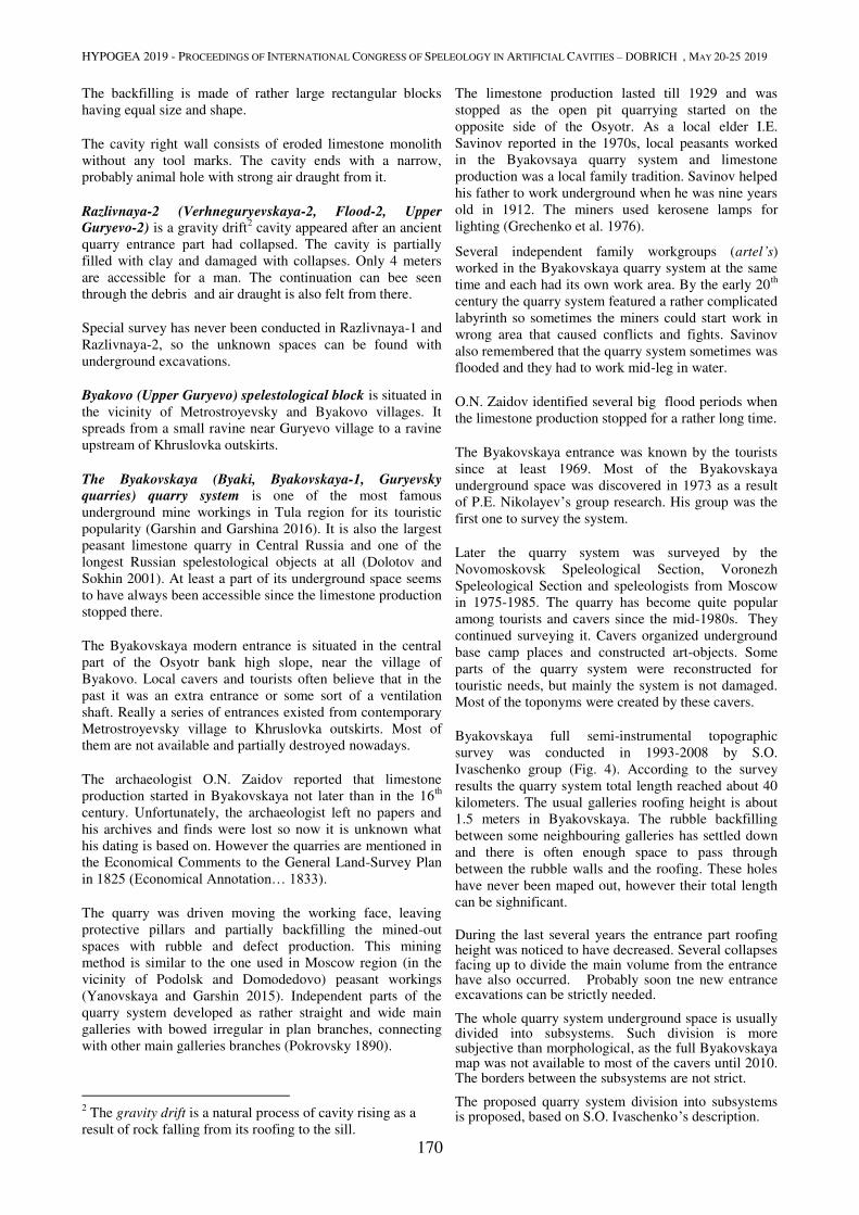
HYPOGEA 2019 - PROCEEDINGS OF INTERNATIONAL CONGRESS OF SPELEOLOGY IN ARTIFICIAL CAVITIES – DOBRICH , MAY 20-25 2019
170
The backfilling is made of rather large rectangular blocks
having equal size and shape.
The cavity right wall consists of eroded limestone monolith
without any tool marks. The cavity ends with a narrow,
probably animal hole with strong air draught from it.
Razlivnaya-2 (Verhneguryevskaya-2, Flood-2, Upper
Guryevo-2) is a gravity drift2 cavity appeared after an ancient
quarry entrance part had collapsed. The cavity is partially
filled with clay and damaged with collapses. Only 4 meters
are accessible for a man. The continuation can bee seen
through the debris and air draught is also felt from there.
Special survey has never been conducted in Razlivnaya-1 and
Razlivnaya-2, so the unknown spaces can be found with
underground excavations.
Byakovo (Upper Guryevo) spelestological block is situated in
the vicinity of Metrostroyevsky and Byakovo villages. It
spreads from a small ravine near Guryevo village to a ravine
upstream of Khruslovka outskirts.
The Byakovskaya (Byaki, Byakovskaya-1, Guryevsky
quarries) quarry system is one of the most famous
underground mine workings in Tula region for its touristic
popularity (Garshin and Garshina 2016). It is also the largest
peasant limestone quarry in Central Russia and one of the
longest Russian spelestological objects at all (Dolotov and
Sokhin 2001). At least a part of its underground space seems
to have always been accessible since the limestone production
stopped there.
The Byakovskaya modern entrance is situated in the central
part of the Osyotr bank high slope, near the village of
Byakovo. Local cavers and tourists often believe that in the
past it was an extra entrance or some sort of a ventilation
shaft. Really a series of entrances existed from contemporary
Metrostroyevsky village to Khruslovka outskirts. Most of
them are not available and partially destroyed nowadays.
The archaeologist O.N. Zaidov reported that limestone
production started in Byakovskaya not later than in the 16th
century. Unfortunately, the archaeologist left no papers and
his archives and finds were lost so now it is unknown what
his dating is based on. However the quarries are mentioned in
the Economical Comments to the General Land-Survey Plan
in 1825 (Economical Annotation… 1833).
The quarry was driven moving the working face, leaving
protective pillars and partially backfilling the mined-out
spaces with rubble and defect production. This mining
method is similar to the one used in Moscow region (in the
vicinity of Podolsk and Domodedovo) peasant workings
(Yanovskaya and Garshin 2015). Independent parts of the
quarry system developed as rather straight and wide main
galleries with bowed irregular in plan branches, connecting
with other main galleries branches (Pokrovsky 1890).
2 The gravity drift is a natural process of cavity rising as a
result of rock falling from its roofing to the sill.
The limestone production lasted till 1929 and was
stopped as the open pit quarrying started on the
opposite side of the Osyotr. As a local elder I.E.
Savinov reported in the 1970s, local peasants worked
in the Byakovsaya quarry system and limestone
production was a local family tradition. Savinov helped
his father to work underground when he was nine years
old in 1912. The miners used kerosene lamps for
lighting (Grechenko et al. 1976).
Several independent family workgroups (artel’s)
worked in the Byakovskaya quarry system at the same
time and each had its own work area. By the early 20th
century the quarry system featured a rather complicated
labyrinth so sometimes the miners could start work in
wrong area that caused conflicts and fights. Savinov
also remembered that the quarry system sometimes was
flooded and they had to work mid-leg in water.
O.N. Zaidov identified several big flood periods when
the limestone production stopped for a rather long time.
The Byakovskaya entrance was known by the tourists
since at least 1969. Most of the Byakovskaya
underground space was discovered in 1973 as a result
of P.E. Nikolayev’s group research. His group was the
first one to survey the system.
Later the quarry system was surveyed by the
Novomoskovsk Speleological Section, Voronezh
Speleological Section and speleologists from Moscow
in 1975-1985. The quarry has become quite popular
among tourists and cavers since the mid-1980s. They
continued surveying it. Cavers organized underground
base camp places and constructed art-objects. Some
parts of the quarry system were reconstructed for
touristic needs, but mainly the system is not damaged.
Most of the toponyms were created by these cavers.
Byakovskaya full semi-instrumental topographic
survey was conducted in 1993-2008 by S.O.
Ivaschenko group (Fig. 4). According to the survey
results the quarry system total length reached about 40
kilometers. The usual galleries roofing height is about
1.5 meters in Byakovskaya. The rubble backfilling
between some neighbouring galleries has settled down
and there is often enough space to pass through
between the rubble walls and the roofing. These holes
have never been maped out, however their total length
can be sighnificant.
During the last several years the entrance part roofing height was noticed to have decreased. Several collapses facing up to divide the main volume from the entrance have also occurred. Probably soon tne new entrance excavations can be strictly needed.
The whole quarry system underground space is usually divided into subsystems. Such division is more subjective than morphological, as the full Byakovskaya map was not available to most of the cavers until 2010. The borders between the subsystems are not strict.
The proposed quarry system division into subsystems is proposed, based on S.O. Ivaschenko’s description.
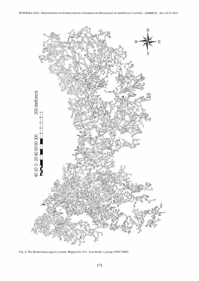
HYPOGEA 2019 - PROCEEDINGS OF INTERNATIONAL CONGRESS OF SPELEOLOGY IN ARTIFICIAL CAVITIES – DOBRICH , MAY 20-25 2019
171
Fig. 4. The Byakovskaya quarry system. Mapped by S.O . Ivaschenko’s group (1993-2008)
.
HYPOGEA 2019 - PROCEEDINGS OF INTERNATIONAL CONGRESS OF SPELEOLOGY IN ARTIFICIAL CAVITIES – DOBRICH , MAY 20-25 2019
172
The Byakovskaya Southern part
The Red Dog (Krasnaya Sobaka)
This subsystem was named after the “Red Dog” (in English)
inscription on a limestone block in its central gallery. It is a
large dendritic gallery system with its total length of more
than 7 kilometers. The Red Dog is connected to the other part
of the whole quarry system with only one passage. This part
of Byakovskaya is heavily damaged with collapses.
Speleothems can be found in this subsystem. Red Dog is
considered to be the most ancient part of Byakovskaya for its
condition. Morphologically this subsystem consists of a
winding main gallery with multiple branches, crossing with
each other, and differently directed working faces.
The Byakovskaya part to the East of its entrance.
This part of Byakovskaya is usually assumed as some sort of
transit area by the cavers (except the White subsystem, which
is a popular point of interest) as there are very few organized
base camp places there, so the division of this part is not
strict.
The Central Rhombus (Tsentral’ny romb) is approximately
the center of the announced part. The subsystem developed
around one main gallery from which multiple branches were
driven. Branch galleries intersect at acute angles there so the
subsystem features a very complicated labyrinth. The most
dense galleries network is situated in the Central Rhombus.
The Strange Spot (Mutnoye Pyatno)
This subsystem was distinguished during the topographic
survey. This area located near the Central Rhombus is a very
complicated passage crossing very hard to be mapped out.
The Refridgerator (Kholodil’nik) system is located between
the Central Rhombus and the White System. Strong air
draught from the White System is felt here, so the air
temperature is quite low.
The “Caesar” system consists of two separated groups of
galleries. This is the most Eastern part from the modern
Byakovskaya entrance. It is called for the graffiti by a caver
nicknamed Caesar, that can be often found there.
The Belaya (White) system is an independent quarry (a
quarry system), connected to the entire Byakovskaya system.
The Belaya system entrances were located to the South-East
of Byakovo village. Their collapsed portals can be easily seen
along the Osyotr bank from Byakovo to Khruslovka even
nowadays. The walls and roofing of the system are wite, they
are not covered with lamp black. Belaya is heavily damaged
with collapses, most of the passages are very tight and low.
This system is a series of main galleries connected in their
faces line. The system may spread to Khruslovka but this part
is now unavailable.
The Byakovskaya central part
The Pillared Hall (Kolonny Zal, Kolonnik) is situated in the
Byakovskaya central part near its main historical entrance. It
seems that a part of rubble backfilling (wall enforcement) was
brought to the surface during the last stage of limestone
production. As a result of this process a group of halls with
monolith protective pillars. Also there could be no backfilling
at all as the halls are not too large. Several significant
production pieces have remained in this subsystem.
They are limestone circles about 1.5-2 meters in
diameter. Probably they are millstones or pillar foots.
The most used entrances leaded to the Pillared Hall
subsystem.
The Stupino Base/The Cat’s house (Stupinskaya
baza/Koshkin dom) is a long stand-alone gallery with
its branches developed to the East from Byakovskaya
center and finishing with working faces. It is partially
damaged with collapses and crosses clay lenses in
several places. It was named as tourists from Stupino
town liked to base there.
The Byakovskaya Northern part seems to be the most
modern part of the entire system. It was impossible to
organize new entrances while mining in this part of the
limestone deposit due to the Osyotr bank shape. Miners
had to start their new galleries from the Pillared Hall,
deviating them to the North. Mainly the Northern
galleries are more strict than the Southern ones, there
are less crossings and rubble walls are made more
carefully.
Glinyanaya/ Shokoladka (The Clay system/ The Chocolate system). This subsystem develops to the
North from the Pillared Hall. It is located near the river
so it was often flooded. Constant water drip is noticed
in Glinyanaya. The subsystem is partially filled with
black and brown clay. Its entrance was situated in the
Pillared Hall and some of the working faces direct to
the Osyotr.
The Chyornaya System (Black) is the North-Eastern
part of Byakovskaya. It is named for widespread dark
bloom on the walls and roofing. It is thought to be lamp
black of poor quality oil lamps and splinters. However
this subsystem galleries are typical for the
Byakovskaya Northern part.
The Shtany (Trousers): Levaya Shtanina and
Pravaya Shtanina (Left Trouser Leg, Right Trouser
Leg). Te Shtany is a vast area in the Byakovskaya
Northern part. It developed in two main directions,
deviating and turning back to the center: from the
center to the North and from the center to the North-
East. Two main galleries with their outgoing
interconnected branches with working faces develop in
these directions. The distance from some of the farthest
faces to the main entrance in the Pillared Hall reaches 1
kilometer, what is not typical for the 19th
century
peasant quarries (it is believed that transporting
something including produced limestone underground
for the distance of more than 300 meters was
economically unadvisable before transfer mechanisms
became widespread). The North-Western part of
Shtany is partially flooded. This area is called Ozero
(the Lake). It is one of the most famous Byakovo point
of view and the main drink water source underground.
Some black organic layer looking like lamp black can
be found on the roofing near Ozero.
Large (up to 20 meters long) carst and tectonic cavities
were crossed by the quarry galleries. The largest of
them became popular touristic points of interest. While
HYPOGEA 2019 - PROCEEDINGS OF INTERNATIONAL CONGRESS OF SPELEOLOGY IN ARTIFICIAL CAVITIES – DOBRICH , MAY 20-25 2019
173
surveying Byakovskaya multiple artifacts were found. These
are tool marks, cut out and sawn limestone blocks and round
stone elements, multiple splinter remains and their coal,
splinter marks on the walls, pottery fragments, horse traces on
the floor. When Belaya System was discovered a lot of tin
kerosene lamps without glasses looking like small cups with
wicks in their conic caps were found there. A 4-meter long
iron saw blade without teeth for limestone sawing was found
in the Byakovskaya south-eastern part. There were also
multiple finds of round and (rarely) rectangular wine bottles
underground.
O.N. Zaidov reported that he had found a leather hat which
was similar to Dutch miners’ hats of the 16th
century.
Timber support was used very rarely in Byakovskaya and
there are few remains of it.
Paskhalnaya (Easter cave, Byakovskaya-2)
Special relief forms looking like abandoned pits and
collapsed quarry entrances can be found along the Osyotr
bank from Byakovo to Khruslovka. Sinkholes and limestone
exposures witness of underground quarries existence.
Different groups of surveyors tried to conduct excavations
here in different times, looking for unknown quarries or the
continuation of the Byakovskaya quarry system but nobody
succeeded. Nowadays only one small cavity named
Paskhalnaya is known there. This cavity is about 10 meters
long. It is situated approximately on the opposite side of the
Osyotr from the Khruslovka estate (Fon Mekk’s estate).
Paskhalnaya is a gravity drift cavity. Its entrance is placed
under a limestone rock which is also situated in the left wall
of a small ravine. It is thought to be a destroyed quarry
entrance as heaps of rubble and ground lie near this ravine.
The cavity consists of a single passage deviating to the right
and finishing in the collapsed dead-end. The excavations in
the collapse seem too dangerous. It is considered that due to
its situation the cavity has no concern with the closed quarry
and is an occasional cavity in the rubble heaps, which was
enlarged by research excavations.
Byakovskaya-3 (Zashkol’naya / Behind the School) quarry
system.
A quarry system called Zashkol’naya was discovered by
P.Nikolayev’s group in 1970-1971. Its entrance was opened
in a trench situated in a ravine near the Metrostroyevsky
village school. Nowadays the entrance is lost and the quarry
system situation is forgotten and unknown even to the locals.
The quarry system has never been mapped out.
Some spelestologists doubt the quarry system existence as all
the information on it is got from P.Nikovayev’s private
messages. P.Nikolayev described this cavity as a small
underground quarry consisted of a single gallery with several
offshoots. The quarry total length is about 300-1500 meters.
Its roofing is rather low.
Several unremoved sawn limestone blocks and timber remains were found inside. The residents interrogation provided by P.Nikolayev resulted the quarry had been operated till the early 20
th century. Limestone blocks were
sawn underground with special hand-made saws with small teeth. The production was sold near the quarry entrance, in the marketplace near the modern school building.
Sosyonki spelestological site (the Osyotr right
bank). A series of small open pits is located on the right bank upstream of the Metrostroyevsky pit.
Karpovo (Metrostroyevsky) spelestological block (in the vicinity of Karpovo village)
The large Metrostroyevsky open pit is situated in this block. The block borders can’t be identified as the relief has been changed greatly by limestone production. The upper border can be marked upstream of the pit. The lower one should go across the Lesnoi pond. The locals and the pit workers reported ancient quarries galleries were sometimes opened by the Metrostroyevsky pit. Unfortunately spelestologists and other surveyors could not observe these discoveries and nowadays they are completely lost.
Sosyonki spelestological block (in the vicinity of Sosyonki village).
The upper border is not clear due to a strong landscape changing at the pit excavation, it should be possibly drawn in the Lesnoi pond area. It is limited in the bottom with a ravine Sosyonki village is standing on.
This territory above the high right bank of the Osyotr river features abundant funnels, cavings and destroyed entrance portals indicating large underground workings were present here. The block landscape has been significantly changed with pits and railways laying in the first half - middle of the 20th century.
Five underground cavities are known to exist now at the block territory (Fig. 5).
Limestone open excavation was started in 2017 near the caves. All Sosyonki block stone quarries are likely to be lost soon.
Sosyonkovskaya-1 (Lisyi Nory, the Fox Holes, Lisya cave, the Fox cave).
Lisyi Nory stone quarries system is the remaining north-western part of a larger working destroyed by collapses and later open excavations. According to some findings and mentions in literature sources limestone mining was commenced here in the 19th century. A horseshoe, a 1829 coin, a pickaxe and
Fig. 5. The Sosyonkovsky spelestological block limestone
quarries in 2016. Underground surveying by D.Albov, D.
Garshin, Yu. Garshina. Surface surveying by D.Garshin, S.
Stroukov, A. Shepelkov, Yu. Garshina, Yu. Ershov. Design by
D. Garshin, V. Bulatov, D. Albov (2016). On the plan: A)
Sosyonkovskaya-1 (Lisyi Nory); B) Sosyonkovskaya-2
(Ledyanoy Grot); C) Sosyonkovskaya-3 (Obvalnaya); D)
HYPOGEA 2019 - PROCEEDINGS OF INTERNATIONAL CONGRESS OF SPELEOLOGY IN ARTIFICIAL CAVITIES – DOBRICH , MAY 20-25 2019
174
Sosyonkovskaya-4 (Parovozyi Nory); Sosyonkovskaya-5
(Myshinaya).
numerous iron tools chippings and horseshoe nails were
found here in the hoisted material - typical findings for the
Moscow region limestone quarries.
The quarry is well known to tourists and locals. The local
placename Lisyi Nory or Lisya cave exists at least since
1970s. The entrance to it was uncovered by P.E. Nikolayev’s
group in 1968-1969 in the lower part of limestone ledge rock.
Morphologically the stone quarry is a combination of
galleries and pillared halls (rings). Galleries in the quarry are
low, not exceeding 1.6-1.7 m in the highest places (except
domes formed above large collapses). The average height of
the stone quarry galleries in its modern state can be estimated
as less than 1.5 m.
In the north the stone quarry is limited with a shallow ravine.
All galleries aimed this way end with faces. The southern part
is limited with cavings and collapsed areas.
The layer in which the stone quarry is driven is dissected with
a series of large cracks with karst holes developed along some
of them. Apparently development here was started from
cracks and was somewhat chaotic: the direction was changing
towards the best or most simply mined limestones. The
mining process was dangerous and accompanied with roof
collapses. This is indicated by the remaining thick columns
made of quarry stone loaded by the roof. The quarry volume
is now mostly filled with rbble and quarry stone used by
workers to support the roof. Judging by the preserved remains
wooden support was used rarely in a form of individual
supports. No remains of T- or U-shaped supports were found.
Quarry stone filling is virtually absent in the area of the
quarry modern entrance. Most likely this is due to the latest
quarry stone mining. Due to this the entrance part is a pillared
hall with a complex layout strongly damaged by collapses.
The next part of the system is separated from the entrance
part by a collapse dome. Quarry stone is present here, the
central gallery is well-seen with side branches leading to
pillared halls near faces and to the non-extant part of the
system.
The central part of the quarries system is damaged with
cavings, a large dome is located close to its geometrical
center. This part of the cavity is invaded with sand. Another
part of Lisyi Nory is located beyond the dome with relatively
well-preserved galleries. This part is also a chamber and pillar
working with the free space filling with quarry stone. Here
most driven galleries forks are aimed away from the modern
entrance at sharp angles which indirectly indicates the
presence of an unknown part of the stone quarry in the south.
The left (northern) part ends with faces. The right (southern)
part is mainly limited with cavings.
The stone quarry main products were bas wall blocks with
about 30x7x70 cm dimensions. Judging by distinctive tool
markings in faces and on pillars breaking was performed
using steel wedges driven to pre-cut sockets. In haulage
galleries ceilings could have been snubbed with pikeaxes.
Judging by rejected slabs with cutting marks found in
backfilling slabs cutting, sawing and possibly rough grinding
was performed underground. Products haulage was
performed by horses using slushers (volokooshas).
The stone quarry used wicker lighting. This is indicated
by numerous signs of soot on walls and ceilings,
wickers remains and their cutting marks in a form of
chaotic
streaking. Wickers were inserted directly to convenient
cracks in walls or to quarry stonework crevices without
specialized holders. Wicker ash was also used to mark
up cutting sockets preserved in a part of faces.
The stone quarry is often visited by foxes. Also it is
inhabited by a colony of bats (Garshin et al. 2016).
Sosyonkovskaya-2 (Ledyanoy Grot, Ice Grotto) - a
small gravity drift cavity (occasional cave) about 5 m
long formed by a collapse of Lisyi Nory stone quarry
hall below.
The entrance to the cavity is inclined and is located in a
sinkhole in about 20 m to the south from Lisyi Nory
entrance. The cavity walls are vertical. A relatively
smooth floor of the entrance part is covered with
washed up clay. The ceiling consists of large rocks in
balance.
Sosyonkovskaya-2 floor is 6 m above Lisyi Nory level
5 m from the entrance the cavity is blocked with large
limestone chunks followed by a riser washed through
clay and impassable for a human.
Sosyonkovskaya-2 is located in the upper part of the
crack which is well-detected in the entrance part of
Lisyi Nory stone quarry (Garshin et al. 2016).
Sosyonkovskaya-3 (Obvalnaya, Collapsed Cave)
A series of grinding ditches is located downstream
Lisyi Nory along the Osyotr river with dumps traces.
The first one has an entrance to Sosyonkovskaya-3
cavity under the limestone exposure, this entrance has
been known for a long period of time. The limestone
rock housing the cavity is dissected with a series of
cracks and has funnels directly above it. There are two
more funnels in the field about 20 m away from the
entrance, one of them had an active sink hole, the
funnels partially continue to grow. All this allowed to
suggest a large stone quarry existence to the east from
Lisyi Nory.
After passages clearing the cavity length was about 10
m. Sosenkovskaya-3 is a gravity drift cavity limited
with collapses.
Sosyonkovskaya-4 (Parovozyi Nory, Locomotive’s Holes).
A small cavity - Sosyonkovskaya-4 (Parovozyi Nory)
was uncovered in a vast depression to the west from
Lisyi Nory entrance in a small sinkhole with an active
water flow. It was named due to narrow gauge railway
parts found in the sinkhole.
Sosyonkovskaya-4 is a small hall created as a result of
a gravity drift. The entrance part is presented with a

HYPOGEA 2019 - PROCEEDINGS OF INTERNATIONAL CONGRESS OF SPELEOLOGY IN ARTIFICIAL CAVITIES – DOBRICH , MAY 20-25 2019
175
small creephole going through a large-chunk heap along the
water flow. A small dome is located to the right from the
entrance creephole in a chunk heap in which the 2nd water
flow hole can be seen.
The cavity main hall ceiling is formed by a large slab
dissected with a crack.
Due to this its northern part closest to the entrance is inclined
and touches the floor.
The sink holes water flow is well-traced in the western part of
the cavity. Water was going down to a crack in the wall. The
crack has a strong air draft. Sosyonkovskaya-4 floor is
strongly washed-up with clay, further works on its clearing
require arrangement of an entrance sufficiently wide for the
dump removal.
The collapsed space was probably a part of Lisyi Nory stone
quarry.
In 2017 the sinkhole housing the cavity entrance was
completely filled with a dump from the new pit.
Sosyonkovskaya-5 (Myshinaya, Bat Microcavity).
A hole was driven in 2017 along the rock sediment near the
large cavings line to the east from Lisyi Nory entrance. The
hole uncovered a gravitational drift cavity less than 3 m long
filled at the further hole driving. Distinctive features suggest
availability if a strongly collapsed gallery in this location
however it could not be accessed (Garshin et al. 2016).
Malo-Khruslovskiy spelestological block (across Khruslovka
village, near Malaya Khruslovka village).
It is limited on top with a ravine Sosyonki village is standing
on, it obviously flattens out to the bottom. Stone mining was
performed at the sides of the modern railway bridge.
According to local old residents reports mining was
performed in the first half of the 20th century using
exclusively open method there.
Khruslovka historical estate is also located here with
preserved underground household facilities.
Venyov spelestological site (the Osyotr right bank and the
Venyevka lower reaches)
There is fragmentary information on limestone mining using
underground method at the territory of present Venyov town
and in its close area. However no stone quarries or positive
signs of their existence have been found here.
Schukino spelestological site (The Osyotr left bank)
Kamennaya Gorka spelestological block (upstream Prichel
village).
It is limited on top with the Tulubeika creek and in the bottom
with a ravine entering the Osyotr valley across Prichel
village. A limestone rock stands near the Tulubeika mouth
with an ancient settlement on top and a cave driven in the
rock massif.
Kamennaya Gorka 1. It is mentioned in literature and tourist reports under names Kharinskaya cave, Sokolovka, Schuchyinskaya, Kamennaya Gorka, Prichelskaya, Shyuchye Gorodishe Cave (Schuchye hillfort cave), Starets cave (The Elder One’s Cave) (Fig. 6).
The material culture history institute (IIMK) records
have information on inspection of a cave near
Schuchye village: "The entrance hole to the cave is in
the south-western corner of the mountain among huge
chunks of stone hiding the entrance very well. Stones
weighing up to 1600-2400 kg fallen from above are
scattered near this hole at the Osyotr river bank level,
these very probably were previously used to close the
cave entrance. The hole is about 440 mm wide and up
to 0.7 m high. A sort of a corridor starts here and goes
to the right among piled up rocks. This entrance is
about 2.8 m long, it ends with a cave about 1.75 m
high, about 2.8 m wide and of the same length <…> A
careful probing of this sedimentation with an iron bar
indicated it is at least 1.05 m thick.
The cave is with light coming through the entrance
hole. Independent entrances to other adjacent caves go
from this first cave" (IIMK f.1 d.91 1904). The
explorers created a rather detailed description of the
cave volume and mistakenly made a conclusion it was
used as a shelter by stone age humans.
The cave was further visited and studied by various
spelestological groups.
The cavity is undoubtedly a stone quarry. This is
indicated both by the working configuration and
distinctive marks of tools used for stone mining. The
cavity is a volume of about 4x10 m dimensions and up
to 2 m high separated with columns and stone heaps
into several parts usually perceived by visitors as
independent chambers. According to I.Yu. Prokofiev's
suggestion particularly based on locals' beliefs the
stone quarry was later used as a chapel or a hermit's
cell.
The cave does have two icon arcs (a poorly preserved
one on the wall to the right from the entrance and a
well-preserved one in the "left" chamber), also there
are signs of a door installation in the entrance aperture
and the second entrance hole which could be used as a
skylight. However icons could be installed during the
stone quarry mining period (Dolotov 2011).
A large abandoned open pit is located directly below
Kamennaya Gorka 1 cave (Prichelskiye stone quarries).
It obviously mined out a large underground stone
quarry as remains of destroyed galleries are still visible
in its slopes located away from the river.
Kamennaya Gorka 2. It is a fragment of a gallery
about 6 m long, 1.5-2 m wide subparallel to the pit
slope. In the south-east the gallery opens into the
Osyotr river valley with a rather wide aperture overlaid
with debris several meters from it. The second exit is
formed near debris to the left (Fig. 6).
A small natural cavity named Kamennaya Gorka-3 has
also been found in the described block (Fig. 6).
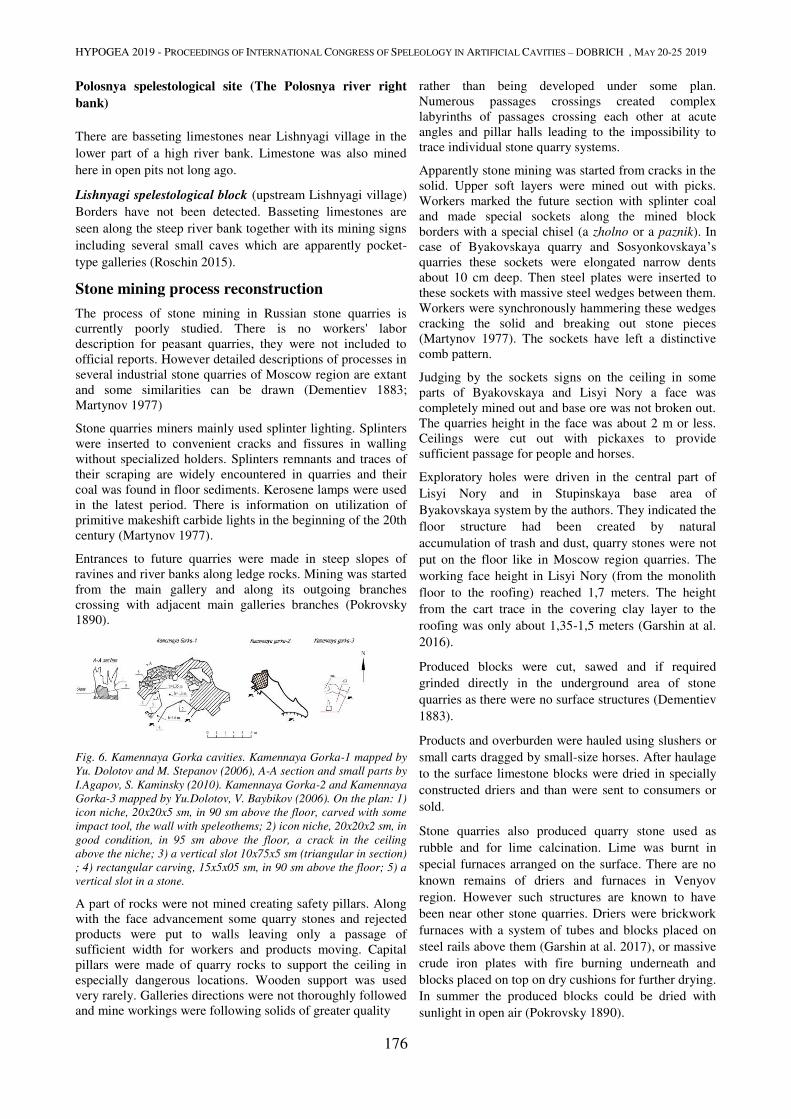
HYPOGEA 2019 - PROCEEDINGS OF INTERNATIONAL CONGRESS OF SPELEOLOGY IN ARTIFICIAL CAVITIES – DOBRICH , MAY 20-25 2019
176
Polosnya spelestological site (The Polosnya river right
bank)
There are basseting limestones near Lishnyagi village in the
lower part of a high river bank. Limestone was also mined
here in open pits not long ago.
Lishnyagi spelestological block (upstream Lishnyagi village)
Borders have not been detected. Basseting limestones are
seen along the steep river bank together with its mining signs
including several small caves which are apparently pocket-
type galleries (Roschin 2015).
Stone mining process reconstruction
The process of stone mining in Russian stone quarries is
currently poorly studied. There is no workers' labor
description for peasant quarries, they were not included to
official reports. However detailed descriptions of processes in
several industrial stone quarries of Moscow region are extant
and some similarities can be drawn (Dementiev 1883;
Martynov 1977)
Stone quarries miners mainly used splinter lighting. Splinters
were inserted to convenient cracks and fissures in walling
without specialized holders. Splinters remnants and traces of
their scraping are widely encountered in quarries and their
coal was found in floor sediments. Kerosene lamps were used
in the latest period. There is information on utilization of
primitive makeshift carbide lights in the beginning of the 20th
century (Martynov 1977).
Entrances to future quarries were made in steep slopes of
ravines and river banks along ledge rocks. Mining was started
from the main gallery and along its outgoing branches
crossing with adjacent main galleries branches (Pokrovsky
1890).
Fig. 6. Kamennaya Gorka cavities. Kamennaya Gorka-1 mapped by
Yu. Dolotov and M. Stepanov (2006), A-A section and small parts by
I.Agapov, S. Kaminsky (2010). Kamennaya Gorka-2 and Kamennaya
Gorka-3 mapped by Yu.Dolotov, V. Baybikov (2006). On the plan: 1)
icon niche, 20x20x5 sm, in 90 sm above the floor, carved with some
impact tool, the wall with speleothems; 2) icon niche, 20x20x2 sm, in
good condition, in 95 sm above the floor, a crack in the ceiling
above the niche; 3) a vertical slot 10x75x5 sm (triangular in section)
; 4) rectangular carving, 15x5x05 sm, in 90 sm above the floor; 5) a
vertical slot in a stone.
A part of rocks were not mined creating safety pillars. Along
with the face advancement some quarry stones and rejected
products were put to walls leaving only a passage of
sufficient width for workers and products moving. Capital
pillars were made of quarry rocks to support the ceiling in
especially dangerous locations. Wooden support was used
very rarely. Galleries directions were not thoroughly followed
and mine workings were following solids of greater quality
rather than being developed under some plan.
Numerous passages crossings created complex
labyrinths of passages crossing each other at acute
angles and pillar halls leading to the impossibility to
trace individual stone quarry systems.
Apparently stone mining was started from cracks in the
solid. Upper soft layers were mined out with picks.
Workers marked the future section with splinter coal
and made special sockets along the mined block
borders with a special chisel (a zholno or a paznik). In
case of Byakovskaya quarry and Sosyonkovskaya’s
quarries these sockets were elongated narrow dents
about 10 cm deep. Then steel plates were inserted to
these sockets with massive steel wedges between them.
Workers were synchronously hammering these wedges
cracking the solid and breaking out stone pieces
(Martynov 1977). The sockets have left a distinctive
comb pattern.
Judging by the sockets signs on the ceiling in some
parts of Byakovskaya and Lisyi Nory a face was
completely mined out and base ore was not broken out.
The quarries height in the face was about 2 m or less.
Ceilings were cut out with pickaxes to provide
sufficient passage for people and horses.
Exploratory holes were driven in the central part of
Lisyi Nory and in Stupinskaya base area of
Byakovskaya system by the authors. They indicated the
floor structure had been created by natural
accumulation of trash and dust, quarry stones were not
put on the floor like in Moscow region quarries. The
working face height in Lisyi Nory (from the monolith
floor to the roofing) reached 1,7 meters. The height
from the cart trace in the covering clay layer to the
roofing was only about 1,35-1,5 meters (Garshin at al.
2016).
Produced blocks were cut, sawed and if required
grinded directly in the underground area of stone
quarries as there were no surface structures (Dementiev
1883).
Products and overburden were hauled using slushers or
small carts dragged by small-size horses. After haulage
to the surface limestone blocks were dried in specially
constructed driers and than were sent to consumers or
sold.
Stone quarries also produced quarry stone used as
rubble and for lime calcination. Lime was burnt in
special furnaces arranged on the surface. There are no
known remains of driers and furnaces in Venyov
region. However such structures are known to have
been near other stone quarries. Driers were brickwork
furnaces with a system of tubes and blocks placed on
steel rails above them (Garshin at al. 2017), or massive
crude iron plates with fire burning underneath and
blocks placed on top on dry cushions for further drying.
In summer the produced blocks could be dried with
sunlight in open air (Pokrovsky 1890).
HYPOGEA 2019 - PROCEEDINGS OF INTERNATIONAL CONGRESS OF SPELEOLOGY IN ARTIFICIAL CAVITIES – DOBRICH , MAY 20-25 2019
177
Kilns for lime calcination were laid with limestone near
entrances as needed and were usually completely
disassembled after the process (Pokrovsky, 1890).
Conclusion Despite a poor spelestological exploration degree Venyov
region is one of the key areas for understanding of a history
and technology of Russian traditional stone mining process.
Further wide studies of this region are required.
Acknowledgements The authors are very thankful to Igor Chizhov (Moscow) and
Elena Murzina (Stupino) for their help in translating this
paper.
References Atlasov A., 1959. Venyov. The historical-economical overview. Tula book publishing house, Tula (in Russian).
Azancheyev Yu.D., 1894 Quarries and mining of simple minerals in Russia. Mining department, St.Petersburg. (in russian)
Brockhaus F.A., Efron I.A., 1892. F.A. Brockhaus and I.A. Efron Encyclopedic Dictionary. Vol. 5A. I.A. Efron’s typo-lithography, St.-Petersburg. (in Russian).
Bromley Yu.V., Podolny R.G., 1984. Created by the Humanity. Politizdat, Moscow (in Russian).
Case over information provision by district police officers on explosives utilization at stone mining in Tula Province, 1880. /a fragment of/ GATO F.90 op.1 t.41 d. 33969 (in Russian)
Dementiev E.M., 1883. The collection of statistical information about Moscow province. Medical statistics section. Vol.3. Publication 8. Podolsk uyezd factory works medical survey by E.M. Dementiev. Published by Moscow gubernskoye zemstvo. A.Kartsev and D. Egorov’s typography, Moscow (in Russian).
Dolotov Yu.A., Sokhin M.Yu., 2001. The problems of Spelestology. In: The Caves. The interacademic collection of studies. Perm University, Perm, pp. 83-97 (in Russian).
Dolotov Yu.A., 2010. Principles of spelestological zoning. Speleology and spelestology: development and interaction of sciences. Proceedings of the international scientifical and practical conference. NGPI, Naberezhnye Chelny, Russia, pp. 272-286 (in Russian).
Dolotov Yu.A., 2011. The Moscow region underground cult structures overview. In: Christianity in the regions of the world (The Christian antiquity). Asian studies in St.-Petersburg, St.-Petersburg, pp. 197-214 (in Russian).
Economical annotation to the General Land-Survey Plan of 1825, 1833. RGADA f.1355 d.1833 (in Russian).
Florensky P.F., 1984. Living stone of the monuments. Priroda, 5, pp. 85-98 (in Russian)
Fomin N.K., 1997 Contribution to the settling of Tula territory in the 16th century. The materials of the historical-archaeological local conference in memory of Troitsky N.I., Tula, Russia (in Russian).
Formozov A.A., 1974. Archaeological travelling. Nauka, Moscow (in Russian).
Garshin D.I., Garshina Yu.V., Strukov S.S, 2016. Underground quarries of the Sosyonki spelestological block, Tula region, Venyov district (According to research data of 2015-2016). Speleology and spelestology: Proceedings of the VII International Scientific Correspondence Conference. NGPU, Naberezhnye Chelny, Russia, pp. 210-216 (in Russian).
Garshin D.I., Garshina Yu.V., 2016. Uncontrolled caving in Moscow region. Tourism in the remotest parts of Russia. Proceedings of the
4th All-Russian Scientific Seminar (24-28.07.2016). Perm, Russia, pp. 135-150 (in Russian).
Garshin D.I., Garshina Yu.V., Laskin V.А., Besstrashnov D.O., 2016. Kaznacheyevsky quarry: underground workings and “Tarussa marbles” production process. Speleology and spelestology: Proceedings of the VIII International Scientific Correspondence Conference. - NGPU, Naberezhnye Chelny,Russia, pp. 332-341 (in Russian).
Grechenko A., Prokhorov V., Dolotov Yu., 1976. One more time about Arapovsky caves. Novomoskovskaya Pravda, 5.01.1976 (in Russian)
Golubev A.A., 2010. Kashira territory and Znamenskoye village settlement history from ancient times to the early 20th century. Knizhny mir, Moscow (in Russian)
IIMK f.1 d.91, 1904 (in Russian)
Konovalova E.V., 2016. Osyotr the forbidden. Borus-press LLC, Tula (in Russian).
Leonenko I.N., Shik S.M. /edited by/, 1971. USSR Geology. Vol. 4. The USSR European part center. The geological description. Nedra, Moscow (in Russian).
Leonenko I.N., Grokhovsky L.M. /edited by/, 1974. USSR Geology. Vol. 4. The USSR European part center. Mineral deposits. Nedra, Moscow (in Russian).
Makhel D., 2004. Byakovo village. The guide for the Venyov district points of interest. Venyovsky uezd, http://www.veneva.ru/bykovo.html (in Russian)
Martynov M.P., 1977. To know and love your own local territory. Municipal budget institution of culture “Aleksin Art and Culture Museum” f.1 op.1 d.39 l.4-24 (in Russian)
Pokhvisnev D.V., 1852. Venyovsky uezd from the geographical, agricultural and all other industrial points of view. University typography, Moscow.
Pokrovsky E.T., 1890. About Podolsk construction materials production and processing. In: A journal of Emperor's Society of Devotees of Science, Anthropology and Ethnography at the University of Moscow. Vol. 62. Publication 1. The Moscow Museum of Application Knowledge. Sunday Explanations. The collection of the Polytechnic Museum (the 12th year). 1888-1889. Moscow (in Russian)
Roschin A., 2015. The Osyotr river: sights, natural landmarks and other objects. Posmotrel.net, http://posmotrel.net/osyotr/osyotr.html
Semyonov P.P., 1863. Russian Empire Geographical-Statistical vocabulary. Vol. 1. V. Bezobrazov & co typography, St.-Petersburg (in Russian).
Taran M.I., 1997. The white stone of Venyov (based on Byakovo quarries materials). The materials of the historical-archaeological local conference in memory of Troitsky N.I., Tula, Russia, pp.30-32 (in Russian).
Viktorov A.M., Zvyagintsev L.I., 1989. White stone of Moscow region. Nedra, Moscow. (in russian).
Yanovskaya E., Garshin D., 2015. Underground history of Domodedovo district. Hypogea 2015. Proceeding of International Congress of Speleology in Artificial Cavities. March 11/17 – 2015. Rome, Italy, pp. 85-96
Zagrayevsky S.V., 2001. Yury Dolgoruky and the ancient Russian limestone construction. ALEF-V, Moscow (in Russian).
Zagrayevsky S.V., 2008. The new research of Vladimir-Suzdal reserve museum architecture monuments. ALEF-V, Moscow (in Russian).
Zuyev V., 1787. Travel notes from St.Petersburg to Kherson in 1781 and 1782. The Emperor’s Academy of Sciences, St.Petersburg. (in Russian)
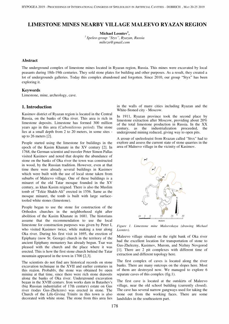
HYPOGEA 2019 - PROCEEDINGS OF INTERNATIONAL CONGRESS OF SPELEOLOGY IN ARTIFICIAL CAVITIES – DOBRICH , MAY 20-25 2019
178
LIMESTONE MINES NEARBY VILLAGE MALEEVO RYAZAN REGION
Michael Leontev1,
1 Speleo-group “Styx”, Ryazan, Russia
Abstract
The underground complex of limestone mines located in Ryazan region, Russia. This mines were excavated by local
peasants during 18th-19th centuries. They sold stone plates for building and other purposes. As a result, they created a
lot of undergrounds galleries. Today this complex abandoned and forgotten. Since 2010, our group “Styx” has been
exploring it.
Keywords
Limestone, mine, archeology, cave.
1. Introduction
Kasimov district of Ryazan region is located in the Central
Russia, on the banks of Oka river. This area is rich in
limestone deposits. Limestone has formed 300 million
years ago in this area (Carboniferous period). The stone
lies at a small depth from 2 to 20 meters, in some sites -
up to 26 meters [2].
People started using the limestone for buildings in the
epoch of the Kasim Khanate in the XV century [2]. In
1768, the German scientist and traveler Peter Simon Pallas
visited Kasimov and noted that despite the abundance of
stone on the banks of Oka river the town was constructed
in wood, by the Russian tradition. However, even at that
time there were already several buildings in Kasimov
which were built with the use of local stone taken from
suburbs of Maleevo village. One of these buildings is a
minaret of the old Tatar mosque founded in the XV
century, as khan Kasim reigned. There is also the Muslim
tomb of "Tekie Shakh-Ali" erected in 1556. Same as the
mosque minaret, the tomb is built with large surface-
tooled white stones (limestone).
People began to use the stone for construction of the
Orthodox churches in the neighborhood right after
abolition of the Kasim Khanate in 1681. The historians
assume that the recommendation to use the local
limestone for construction purposes was given by Peter I,
who visited Kasimov twice, while making a tour along
Oka river. During his first visit in 1695, the erection of
Epiphany (now St. George) church in the territory of the
ancient Epiphany monastery has already begun. Tsar was
pleased with the church and the place where it was
erected. This is how the first stone church behind the Tatar
mountain appeared in the town in 1700 [2,3].
The scientists do not find any historical records on stone excavation technique in the XVII and earlier centuries in this region. Probably, the stone was obtained by open mining at that time, since there were rich stone deposits along the banks of Oka river. Underground excavation began in the XVIII century. Iron works dam in Batashev's (big Russian industrialist of 17th century) estate on Gus river (today Gus-Zhelezny) was erected in stone. The Church of the Life-Giving Trinity in this town is also decorated with white stone. The stone from this area lies
in the walls of many cities including Ryazan and the White-Stoned city - Moscow.
In 1911, Ryazan province took the second place by limestone extraction after Moscow, providing about 20% of the total limestone production in Russia. In the XX century, as the industrialization proceeded, the underground mining reduced, giving way to open pits.
A group of speleologist from Ryazan called "Styx" had to explore and assess the current state of stone quarries in the area of Maleevo village in the vicinity of Kasimov.
Figure 1. Limestone mine Maleevskaya (drawing Michael
Leontev).
Maleevo village situated on the right bank of Oka river
had the excellent location for transportation of stone to
Gus-Zhelezny, Kasimov, Murom, and Nizhny Novgorod
[1]. There are 2 pit complexes with different time of
extraction and different topology here.
The first complex of caves is located along the river
banks. There are many outcrops on the slopes here. Most
of them are destroyed now. We managed to explore 6
separate caves of this complex (fig.1).
The first cave is located at the outskirts of Maleevo
village, near the old school building (currently closed).
The cave has several narrow gangways used for taking the
stone out from the working faces. There are some
landslides in the southeastern part.
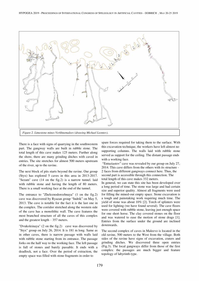
HYPOGEA 2019 - PROCEEDINGS OF INTERNATIONAL CONGRESS OF SPELEOLOGY IN ARTIFICIAL CAVITIES – DOBRICH , MAY 20-25 2019
179
There is a face with signs of quarrying in the southwestern
part. The gangway walls are built in rubble stone. The
total length of this cave makes 125 meters. Further along
the shore, there are many grinding ditches with caved in
entries. The site stretches for almost 500 meters upstream
of the river, up to the ravine.
The next block of pits starts beyond the ravine. Our group
(Styx) has explored 5 caves in this area in 2013-2017.
"Sezam" cave (14 on the fig.2) is a narrow tunnel. laid
with rubble stone and having the length of 80 meters.
There is a small working face at the end of the tunnel.
The entrance to "Zheleznodorozhnaya" (1 on the fig.2)
cave was discovered by Ryazan group “Indrik” on May 5,
2013. The cave is notable for the fact it is the last one in
the complex. The corridor stretched along the western side
of the cave has a monolithic wall. The cave features the
most branched structure of all the caves of this complex
and the greatest length – 357 meters.
"Dvukoleinaya" (2 on the fig.2) cave was discovered by
"Styx" group on July 26, 2014. It is 181 m long. Same as
in other caves, there is narrow passage with walls laid
with rubble stone starting from its entrance. The passage
forks on the half way to the working face. The left passage
is full of stones and barely passable. It ends with a
deadlock, not a face. Over the period of extraction, the
empty space was filled with stone fragments in order to
spare forces required for taking them to the surface. With
this excavation technique, the workers have left almost no
supporting columns. The walls laid with rubble stone
served as support for the ceiling. The distant passage ends
with a working face.
“Entuziastov” cave was revealed by our group on July 27,
2014. This cave differs from the others with its structure -
2 faces from different gangways connect here. Thus, the
second part is accessible through this connection. The
total length of this cave makes 332 meters.
In general, we can state this site has been developed over
a long period of time. The stone was large and had certain
size and superior quality. Almost all fragments were used
for filling the mined-out empty space. Stone excavation is
a tough and painstaking work requiring much time. The
yield of stone was about 10% [2]. Torch of splinters were
used for lighting (we have found several). The cave floors
were covered with rubble stone, leaving just enough space
for one short horse. The clay covered stones on the floor
and was watered to ease the motion of stone drags [1].
Entries from the surface under the ground are inclined
downwards.
The second complex of caves in Maleevo is located in the
old ravine, 500 meters to the West from the village. Both
sides of the ravine have signs of excavation, craters and
grinding ditches. We discovered three open entries
(Fig.3). The local gangways differ from those of the first
complex: the passages are much bigger and feature
topology of labyrinth type.
Figure 2. Limestone mines Verkhnemaleev (drawing Michael Leontev).
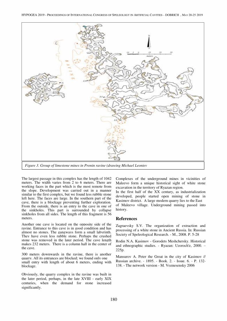
HYPOGEA 2019 - PROCEEDINGS OF INTERNATIONAL CONGRESS OF SPELEOLOGY IN ARTIFICIAL CAVITIES – DOBRICH , MAY 20-25 2019
180
The largest passage in this complex has the length of 1042 meters. The width varies from 2 to 6 meters. There are working faces in the part which is the most remote from the slope. Development was carried out in a manner similar to the first complex, but we found less rubble stone left here. The faces are large. In the southern part of the cave, there is a blockage preventing further exploration. From the outside, there is an entry to the cave in one of the sinkholes. This part is surrounded by collapse sinkholes from all sides. The length of this fragment is 56 meters.
Another one cave is located on the opposite side of the ravine. Entrance to this cave is in good condition and has almost no stones. The gangways form a small labyrinth. They have even less rubble stone. Perhaps the crushed stone was removed in the later period. The cave length makes 232 meters. There is a column hall in the center of the cave.
300 meters downwards in the ravine, there is another quarry. All its entrances are blocked; we found only one small entry with length of about 6 meters, ending with blockage. Obviously, the quarry complex in the ravine was built in
the later period, perhaps, in the late XVIII - early XIX
centuries, when the demand for stone increased
significantly.
Complexes of the underground mines in vicinities of
Maleevo form a unique historical sight of white stone
excavation in the territory of Ryazan region.
In the first half of the XX century, as industrialization
developed, people started open mining of stone in
Kasimov district. A large modern quarry lies to the East
of Maleevo village. Underground mining passed into
history.
References
Zagraevsky S.V. The organization of extraction and
processing of a white stone in Ancient Russia. In: Russian
Society of Speleological Research. - M., 2008. P. 5-28
Rodin N.A. Kasimov - Gorodets Meshchersky. Historical
and ethnographic studies. - Ryazan: Uzoroch'e, 2000. –
225p.
Mansurov A. Peter the Great in the city of Kasimov //
Russian archive. - 1895. - Book. 2. - Issue. 6. - P. 132-
138. - The network version - M. Voznesensky 2006
Figure 3. Group of limestone mines in Pronin ravine (drawing Michael Leontev
HYPOGEA 2019 - PROCEEDINGS OF INTERNATIONAL CONGRESS OF SPELEOLOGY IN ARTIFICIAL CAVITIES – DOBRICH , MAY 20-25 2019
181
THE GEOSITE OF TABUNA AND STREPPENOSA ASPHALT MINES
(RAGUSA, SOUTH-EAST SICILY)
Rosario Ruggieri1 , Salvatore Tricomi
2
1Hyblean Center of Speleo-Hydrogeological Research, Scientific Commission of Gosites, Sicily Region
via Torrenuova 87, 97100 Ragusa, Italy, [email protected] 2Register of the industrial experts in the Province of Enna, via Generale Ciancio, 47, 94015 Piazza Armerina, Italy,
Abstract
With the Law n° 25 of 2012 the Sicilian Region has instituted the “Geosite Register”, a regulatory instrument aimed at
the census, the knowledge, the awareness, the protection and development for tourism of geological, geomorphological
and geo-anthropological singularities. In this context the Hyblean Center of Speleo-Hydrogeological Research of
Ragusa has proposed the institution of the Geosite "Tabuna and Streppenosa Asphalt mines” located in the Ragusa
mining area in south-east Sicily. The aforementioned sites are fully included in the context of the mining history of
Sicily and therefore of Italy, with production of sulfur, bituminous rocks and salt in nineteenth century Sicily. The first
quarries for the extraction of asphalt as a building material in Ragusa date back to 1767, but only in 1868 did real
exploitation begin. These mines managed mainly by foreign companies, provided an enormous quantity of asphalt
mainly used as road surfacing. For example, in 1900 the city of Berlin had one million square meters of asphalt paved
road, mostly coming from the territory of Ragusa. From a geological point of view, the geosite is characterized by the
lower levels of the Irminio Member of the Ragusa Formation, consisting of calcarenites and calcirudites of the lower
Aquitanian-Burdigalian age, impregnated with bitumen. The mines of Tabuna, partly open pit, are located south-east of
the town of Ragusa, and occupied an area of about 2 km2. The mine of Streppenosa, is instead located on the left bank
of the Irminio River; it is completely underground, and consists of a series of high galleries, with a total development of
about 1600 m, carved into the black asphaltic limestone, with castings and singular stalactites of solidified pitch on the
walls and ceilings. These evocative black environments in places are brightened by calcite flowstones and stalactites of
various colors, calcite crusts and rimstone pools full of pisolites, which make these galleries look like a large and
captivating karst cave. On some walls fossils can be observed impregnated with bitumen and whitish silty-clay deposits
like moonmilk. A large sector of the mine is taken up by a black lake feed by the infiltration of rainwater. These mines
have certainly played a leading role in the supply of building stones after the disastrous earthquake of 11 January 1693,
which caused thousands of deaths and destroyed many towns of south-east Sicily. The geosite of “Tabuna and
Streppenosa Asphalt mines” is of particular importance for the study of the genesis of bituminous rocks, the genesis of
oil and for the paleontological aspects, given the wealth of fossils that it continues to give. Finally, it offers significant
insights into an example of mining industrial archeology and as a site of high tourist importance in the context of the
Hyblean Baroque, the latter a UNESCO World Heritage Site.
Keywords
Sicily, Ragusa, Tabuna, Streppenosa, asphalt mines.
1.Introduction
The first quarries for the extraction of asphalt as a building material in Ragusa date back to 1767, but only in 1868 did the real exploitation begin. The mines of Ragusa, managed mainly by foreign companies, provided a large quantity of this material mainly used as road surfacing. As an example, in 1900 the city of Berlin exceeded one million square meters of asphalt- paved road, mostly coming from the territory of Ragusa. After the interruption during the last war, the mines given in concession to the English companies “Limner and Val de Travres” were seized, the concessions were transferred to the Italian company A.B.C.D., then returned to them in 1945, after the Allied landing in Sicily. In 1951 the British will definitely go in favor of the Italian company by decision of the Regional Council of mines, that in 1956 will allow A.B.C.D. to build the cement factory (Spadola 1977; Ancione and Varani 2002; Giavarini et al. 2003).
In the Ragusa basin, the mining of the asphalt was
undertaken mainly in the open pit, even if there were
examples of extraction in tunnels, as in the case of the
Tabuna and Streppenosa mines, described below.
2. Geographical, geological and climatic
framing
The geominerary asphalt basin of Ragusa is located in
south-eastern of Sicily, and is part of the more general
geographical context of the central-southern sector of the
Hyblean Plateau, bordered to the north by the northern
watershed of the Irminio River basin and the southern
slopes of Mount Lauro volcano, to the west by the
structural depression of the Comiso-Vittoria plain, to the
south by the Mediterranean sea and to the east by the
valley of the Tellaro River (fig. 1).

HYPOGEA 2019 - PROCEEDINGS OF INTERNATIONAL CONGRESS OF SPELEOLOGY IN ARTIFICIAL CAVITIES – DOBRICH , MAY 20-25 2019
182
Figure 1. Map of the south-east Sicily where is located (in the
box) the mining area of Ragusa.
The aforesaid territory is characterized by a slightly hilly
morphology in the summit areas, generally flat in the
sector bordering the coast, all dissected from north to
south by a dendritic network of deep valleys. The
stratigraphic sequences in this Plateau, consist mostly of
carbonatic and carbonatic-marly sediments ranging from
the Late Cretaceous to the Pleistocene (fig. 2). The
subsoil data gives direct information up to the middle-
upper Trias, reached through the AGIP Vizzini 1 well at a
maximum depth of 6,000 meters.
Geophysical data indicate the presence of a magnetic base
with high susceptibility at an average depth of 10 km, in
the central areas of the Plateau. High susceptibility
suggests an essentially basic
Figure. 2. Geostructural map of the Hyblean Plateau.
constitution of the basement but there is still no direct
information either on the rocks that form the basement or
on the sedimentary succession underlying the dolomites
of the upper-middle Trias (Lentini et al. 1987; Grasso et
al. 2000).
From the climatic point of view, according to the climatic
classification index of Thornwaite (1948), the province of
Ragusa is characterized by a dry sub-humid climate in the
mountain-hill sector and by a semi-arid climate in the
coastal plain, with an average annual rainfall of 513 mm
and an average annual temperature of 16 ° C (Sicilian
Region, 1998).
3. The mines of asphalt
3.1 Tabuna mine
The site of the Tabuna Mine occupies an area of about 2
km2, south-east of the built-up area of Ragusa, included
approximately in the range of longitude E WGS 84
475440- 476440 E and latitude N 4083810-4085810. The
aforementioned area faces the right bank of the Irminio
River.
From the geological point of view, the site in particular is
affected by the lower levels of the Irminio Member of
Ragusa Formation, consisting of calcarenites and
calcirudites white-greyish or white-yellowish of medium
hardness in layers of variable thickness up to 10 meters,
separated by thin sandy-marly levels. Locally it presents
cross stratification with herringbone or hummochy
structures. The maximum thickness in outcrop does not
exceed 75 meters. It contains, above all in the upper part,
a phosphatiferous hard-ground with a thickness of a few
centimeters up to a few decimeters, of a brownish yellow
color.
From a paleontological point of view, it contains scarce
non-determinable microfaunas except for Miogypsina sp.
and Amphystegina sp. and rare echinoids (Schizaster
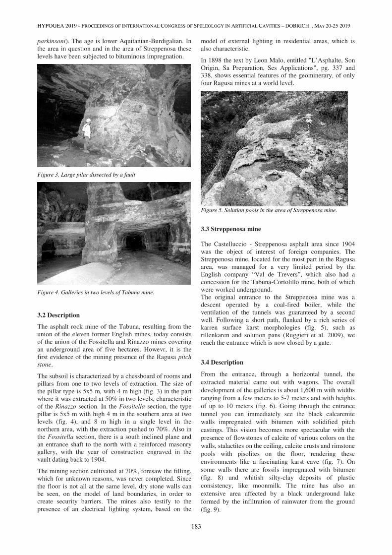
HYPOGEA 2019 - PROCEEDINGS OF INTERNATIONAL CONGRESS OF SPELEOLOGY IN ARTIFICIAL CAVITIES – DOBRICH , MAY 20-25 2019
183
parkinsoni). The age is lower Aquitanian-Burdigalian. In
the area in question and in the area of Streppenosa these levels have been subjected to bituminous impregnation.
Figure 3. Large pilar dissected by a fault
Figure 4. Galleries in two levels of Tabuna mine.
3.2 Description
The asphalt rock mine of the Tabuna, resulting from the
union of the eleven former English mines, today consists
of the union of the Fossitella and Rinazzo mines covering
an underground area of five hectares. Howevr, it is the
first evidence of the mining presence of the Ragusa pitch
stone.
The subsoil is characterized by a chessboard of rooms and
pillars from one to two levels of extraction. The size of
the pillar type is 5x5 m, with 4 m high (fig. 3) in the part
where it was extracted at 50% in two levels, characteristic
of the Rinazzo section. In the Fossitella section, the type
pillar is 5x5 m with high 4 m in the southern area at two
levels (fig. 4), and 8 m high in a single level in the
northern area, with the extraction pushed to 70%. Also in
the Fossitella section, there is a south inclined plane and
an entrance shaft to the north with a reinforced masonry
gallery, with the year of construction engraved in the
vault dating back to 1904.
The mining section cultivated at 70%, foresaw the filling,
which for unknown reasons, was never completed. Since
the floor is not all at the same level, dry stone walls can
be seen, on the model of land boundaries, in order to
create security barriers. The mines also testify to the
presence of an electrical lighting system, based on the
model of external lighting in residential areas, which is
also characteristic.
In 1898 the text by Leon Malo, entitled "L’Asphalte, Son
Origin, Sa Preparation, Ses Applications", pg. 337 and
338, shows essential features of the geominerary, of only
four Ragusa mines at a world level.
Figure 5. Solution pools in the area of Streppenosa mine.
3.3 Streppenosa mine
The Castelluccio - Streppenosa asphalt area since 1904
was the object of interest of foreign companies. The
Streppenosa mine, located for the most part in the Ragusa
area, was managed for a very limited period by the
English company “Val de Trevers”, which also had a
concession for the Tabuna-Cortolillo mine, both of which
were worked underground.
The original entrance to the Streppenosa mine was a
descent operated by a coal-fired boiler, while the
ventilation of the tunnels was guaranteed by a second
well. Following a short path, flanked by a rich series of
karren surface karst morphologies (fig. 5), such as
rillenkaren and solution pans (Ruggieri et al. 2009), we
reach the entrance which is now closed by a gate.
3.4 Description
From the entrance, through a horizontal tunnel, the
extracted material came out with wagons. The overall
development of the galleries is about 1,600 m with widths
ranging from a few meters to 5-7 meters and with heights
of up to 10 meters (fig. 6). Going through the entrance
tunnel you can immediately see the black calcarenite
walls impregnated with bitumen with solidified pitch
castings. This vision becomes more spectacular with the
presence of flowstones of calcite of various colors on the
walls, stalactites on the ceiling, calcite crusts and rimstone
pools with pisolites on the floor, rendering these
environments like a fascinating karst cave (fig. 7). On
some walls there are fossils impregnated with bitumen
(fig. 8) and whitish silty-clay deposits of plastic
consistency, like moonmilk. The mine has also an
extensive area affected by a black underground lake
formed by the infiltration of rainwater from the ground
(fig. 9).
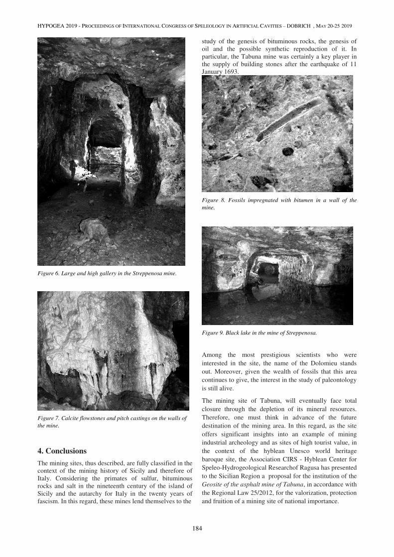
HYPOGEA 2019 - PROCEEDINGS OF INTERNATIONAL CONGRESS OF SPELEOLOGY IN ARTIFICIAL CAVITIES – DOBRICH , MAY 20-25 2019
184
Figure 6. Large and high gallery in the Streppenosa mine.
Figure 7. Calcite flowstones and pitch castings on the walls of
the mine.
4. Conclusions
The mining sites, thus described, are fully classified in the
context of the mining history of Sicily and therefore of
Italy. Considering the primates of sulfur, bituminous
rocks and salt in the nineteenth century of the island of
Sicily and the autarchy for Italy in the twenty years of
fascism. In this regard, these mines lend themselves to the
study of the genesis of bituminous rocks, the genesis of
oil and the possible synthetic reproduction of it. In
particular, the Tabuna mine was certainly a key player in
the supply of building stones after the earthquake of 11
January 1693.
Figure 8. Fossils impregnated with bitumen in a wall of the
mine.
Figure 9. Black lake in the mine of Streppenosa.
Among the most prestigious scientists who were
interested in the site, the name of the Dolomieu stands
out. Moreover, given the wealth of fossils that this area
continues to give, the interest in the study of paleontology
is still alive.
The mining site of Tabuna, will eventually face total
closure through the depletion of its mineral resources.
Therefore, one must think in advance of the future
destination of the mining area. In this regard, as the site
offers significant insights into an example of mining
industrial archeology and as sites of high tourist value, in
the context of the hyblean Unesco world heritage
baroque site, the Association CIRS - Hyblean Center for
Speleo-Hydrogeological Researchof Ragusa has presented
to the Sicilian Region a proposal for the institution of the
Geosite of the asphalt mine of Tabuna, in accordance with
the Regional Law 25/2012, for the valorization, protection
and fruition of a mining site of national importance.
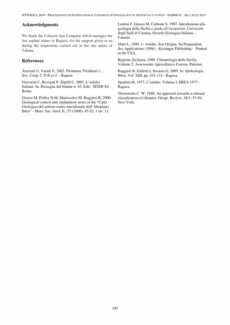
HYPOGEA 2019 - PROCEEDINGS OF INTERNATIONAL CONGRESS OF SPELEOLOGY IN ARTIFICIAL CAVITIES – DOBRICH , MAY 20-25 2019
185
Acknowledgments
We thank the Colacem Spa Company which manages the
last asphalt mines in Ragusa, for the support given to us
during the inspections carried out in the site mines of
Tabuna.
References
Ancione G, Varani E, 2002. Pirriatura, Picialuori e … Soc. Coop. C D B a.r.l. - Ragusa.
Giavarini C, Rovigati P, Zipelli C, 2003. L’asfalto
italiano. In: Rassegna del bitume n. 45, Edit. SITEB Srl -
Roma.
Grasso M, Pedley H.M, Maniscalco M, Ruggieri R, 2000.
Geological context and explanatory notes of the “Carta
Geologica del settore centro-meridionale dell’Altopiano
Ibleo” - Mem. Soc. Geol. It., 55 (2000), 45-52, 1 tav. f.t.
Lentini F, Grasso M, Carbone S, 1987. Introduzione alla
geologia della Sicilia e guida all’escursione. Università
degli Sudi di Catania, Società Geologica Italiana -
Catania.
Malo L, 1898. L' Asfalte, Son Origine, Sa Preparation,
Ses Applications (1898) - Kessinger Publishing - Printed
in the USA.
Regione Siciliana, 1998. Climatologia della Sicilia,
Volume 2, Assessorato Agricoltura e Foreste, Palermo.
Ruggieri R, Galletti I, Savasta G, 2009. In: Speleologia
Iblea, Vol. XIII, pp. 101-114 - Ragusa.
Spadola M, 1977. L’asfalto. Volume I, EREA 1977 -
Ragusa.
Thornwaite C. W, 1948. An approach towards a rational
classification of climates. Geogr. Review, 38/1; 55-94,
New York.

HYPOGEA 2019 - PROCEEDINGS OF INTERNATIONAL CONGRESS OF SPELEOLOGY IN ARTIFICIAL CAVITIES – DOBRICH , MAY 20-25 2019
186
THE PROBLEM OF ABANDONED MINES – ONLY HAZARDS? A CASE STUDY FROM THE NÍZKÝ JESENÍK UPLAND (CZECHIA)
Kristina Schuchová1, Jan Lenart1, L. Falteisek3, J. Bílá1, J. Kupka2
1 Department of Physical Geography and Geoecology Faculty of Science, University of Ostrava, Ostrava, Czech
Republic, [email protected], [email protected], [email protected]
2 Department of Environmental Engineering, Faculty of Mining and Geology, VŠB – Technical University of Ostrava,
Ostrava, Czech Republic, [email protected] of Ecology, Faculty of Science, Charles University, Prague,
Czech Republic, [email protected]
Abstract
Abandoned and derelict historical mines may present future geohazards for the landscape, urban residences, and other
buildings. On the other hand, they could have potential use as tourism objects, science laboratories, museums, historical
monuments, etc. The Nízký Jeseník Upland in the Czech Republic (Europe) is an area well known for historical clayey
slate processing (mainly between the 18th and 20th centuries). In this case, we present a study from Odry, where the
abandoned Flaschar's slate mine is situated. This mine is one of the largest slate mines in the Nízký Jeseník Upland.
Geologically, the slate has been greatly affected by tectonic forces, as can be proven by the existence of folds and
hydrothermal mineralization (Q-veins with Pb-Ag mineralization) within the mine. The dip direction and dip angle of
the unfolded beds are generally 304/32. Within Flaschar's mine, various processes have been revealed, such as
weathering and gravitational processes including exfoliation of the walls, rockfall, subsidence, collapse, and
degradation of the pillars. Therefore, we can document results from long-term geologic processes and from short-term
geomorphic processes. The mine provides information, as well. Flaschar's mine reveals rich geo-diversity and more or
less bio-diversity. There are phenomena such as karstification and deposit formation (dripstones or sinters), secondary
mineralization (pyrite, gypsum, calcite, etc.) and Fe oxide (limonite) formation occurring in the mine; these phenomena
might have a biogenic origin. Due to the air circulation within the mine, a dynamic microclimate developed. Flaschar's
mine provides a shelter for various types of overwintering bats. It is a suitable habitat for a population of insects, fungi
and microbial life. In Flashar's mine, it is possible to observe an example of the processes and changes that could occur
in an abandoned mine without human influence. This research was carried out before the locality was open to tourists.
In addition to its scientific importance, the mine may also serve as an instrument through which visitors can be educated
about the emerging bio- and geo-diversity in a previously unknown part of the biosphere.
Keywords abandoned mines, slate mine, microclimate, geodiversity, biodiversity, petrography, Nízký Jeseník Upland
1. Introduction In many cases, abandoned mines present increasing
environmental risk known as geohazards. Geohazards
include natural or anthropogenic processes that have the
potential to cause slope deformation, landslide,
subsidence, collapse and environmental damage and to
impact urban areas and nature (Jordan et al., 2017;
Moréno-Martínez et al., 2016; Waltham et al., 2011;
Culshaw et al., 2000). Unknown and unmapped mines do
not represent the only hazard and dangerous element in
the landscape. The subterranean environment, including
abandoned mines, adits, shafts, tunnels or bunkers, could
have similar environmental conditions (microclimates) as
natural caves; these conditions include light deficiency,
constant high relative humidity or thermic stability (Isaia
et al., 2011; Masing et al., 2009; Brack, 2007; Tuttle and
Taylor, 1998). The abandoned mines are used by various
species of cave bats, during critical times in their lives,
such as during hibernation and for roosting or
reproducing. These abandoned mines begin to function as
refuges or shelters (Angel et al., 2015; Kurta and Smith,
2014; Ingersoll et al., 2010; González and Morales, 2004;
Whitaker and John, 1996).
The article is focused on an abandoned slate mine
(Flaschar's mine), which is located near Odry (Nízký
Jeseník Upland, Czech Republic). In Flaschar's,
multidisciplinary research was conducted that included
mapping underground spaces, monitoring relative
temperature and humidity, petrography, and
biodiversity research. The results of the research provide a
reason to avoid damaging technical interventions. The
products of tectonic forces, mineralogical and
biogeochemical processes and increasing biodiversity
have a significance for scientific purposes and the
expansion of tourist tours.
Figure 1. Geology of the Nízký Jeseník Upland
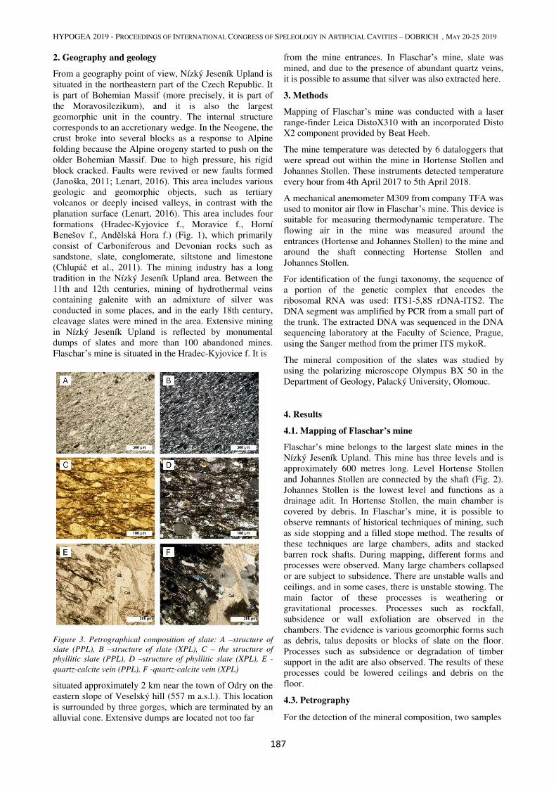
HYPOGEA 2019 - PROCEEDINGS OF INTERNATIONAL CONGRESS OF SPELEOLOGY IN ARTIFICIAL CAVITIES – DOBRICH , MAY 20-25 2019
187
2. Geography and geology
From a geography point of view, Nízký Jeseník Upland is
situated in the northeastern part of the Czech Republic. It
is part of Bohemian Massif (more precisely, it is part of
the Moravosilezikum), and it is also the largest
geomorphic unit in the country. The internal structure
corresponds to an accretionary wedge. In the Neogene, the
crust broke into several blocks as a response to Alpine
folding because the Alpine orogeny started to push on the
older Bohemian Massif. Due to high pressure, his rigid
block cracked. Faults were revived or new faults formed
(Janoška, 2011; Lenart, 2016). This area includes various
geologic and geomorphic objects, such as tertiary
volcanos or deeply incised valleys, in contrast with the
planation surface (Lenart, 2016). This area includes four
formations (Hradec-Kyjovice f., Moravice f., Horní
Benešov f., Andělská Hora f.) (Fig. 1), which primarily
consist of Carboniferous and Devonian rocks such as
sandstone, slate, conglomerate, siltstone and limestone
(Chlupáč et al., 2011). The mining industry has a long
tradition in the Nízký Jeseník Upland area. Between the
11th and 12th centuries, mining of hydrothermal veins
containing galenite with an admixture of silver was
conducted in some places, and in the early 18th century,
cleavage slates were mined in the area. Extensive mining
in Nízký Jeseník Upland is reflected by monumental
dumps of slates and more than 100 abandoned mines.
Flaschar’s mine is situated in the Hradec-Kyjovice f. It is
Figure 3. Petrographical composition of slate: A –structure of
slate (PPL), B –structure of slate (XPL), C – the structure of
phyllitic slate (PPL), D –structure of phyllitic slate (XPL), E -
quartz-calcite vein (PPL), F -quartz-calcite vein (XPL)
situated approximately 2 km near the town of Odry on the
eastern slope of Veselský hill (557 m a.s.l.). This location
is surrounded by three gorges, which are terminated by an
alluvial cone. Extensive dumps are located not too far
from the mine entrances. In Flaschar’s mine, slate was
mined, and due to the presence of abundant quartz veins,
it is possible to assume that silver was also extracted here.
3. Methods
Mapping of Flaschar’s mine was conducted with a laser
range-finder Leica DistoX310 with an incorporated Disto
X2 component provided by Beat Heeb.
The mine temperature was detected by 6 dataloggers that
were spread out within the mine in Hortense Stollen and
Johannes Stollen. These instruments detected temperature
every hour from 4th April 2017 to 5th April 2018.
A mechanical anemometer M309 from company TFA was
used to monitor air flow in Flaschar’s mine. This device is
suitable for measuring thermodynamic temperature. The
flowing air in the mine was measured around the
entrances (Hortense and Johannes Stollen) to the mine and
around the shaft connecting Hortense Stollen and
Johannes Stollen.
For identification of the fungi taxonomy, the sequence of
a portion of the genetic complex that encodes the
ribosomal RNA was used: ITS1-5,8S rDNA-ITS2. The
DNA segment was amplified by PCR from a small part of
the trunk. The extracted DNA was sequenced in the DNA
sequencing laboratory at the Faculty of Science, Prague,
using the Sanger method from the primer ITS mykoR.
The mineral composition of the slates was studied by
using the polarizing microscope Olympus BX 50 in the
Department of Geology, Palacký University, Olomouc.
4. Results
4.1. Mapping of Flaschar’s mine
Flaschar’s mine belongs to the largest slate mines in the
Nízký Jeseník Upland. This mine has three levels and is
approximately 600 metres long. Level Hortense Stollen
and Johannes Stollen are connected by the shaft (Fig. 2).
Johannes Stollen is the lowest level and functions as a
drainage adit. In Hortense Stollen, the main chamber is
covered by debris. In Flaschar’s mine, it is possible to
observe remnants of historical techniques of mining, such
as side stopping and a filled stope method. The results of
these techniques are large chambers, adits and stacked
barren rock shafts. During mapping, different forms and
processes were observed. Many large chambers collapsed
or are subject to subsidence. There are unstable walls and
ceilings, and in some cases, there is unstable stowing. The
main factor of these processes is weathering or
gravitational processes. Processes such as rockfall,
subsidence or wall exfoliation are observed in the
chambers. The evidence is various geomorphic forms such
as debris, talus deposits or blocks of slate on the floor.
Processes such as subsidence or degradation of timber
support in the adit are also observed. The results of these
processes could be lowered ceilings and debris on the
floor.
4.3. Petrography
For the detection of the mineral composition, two samples
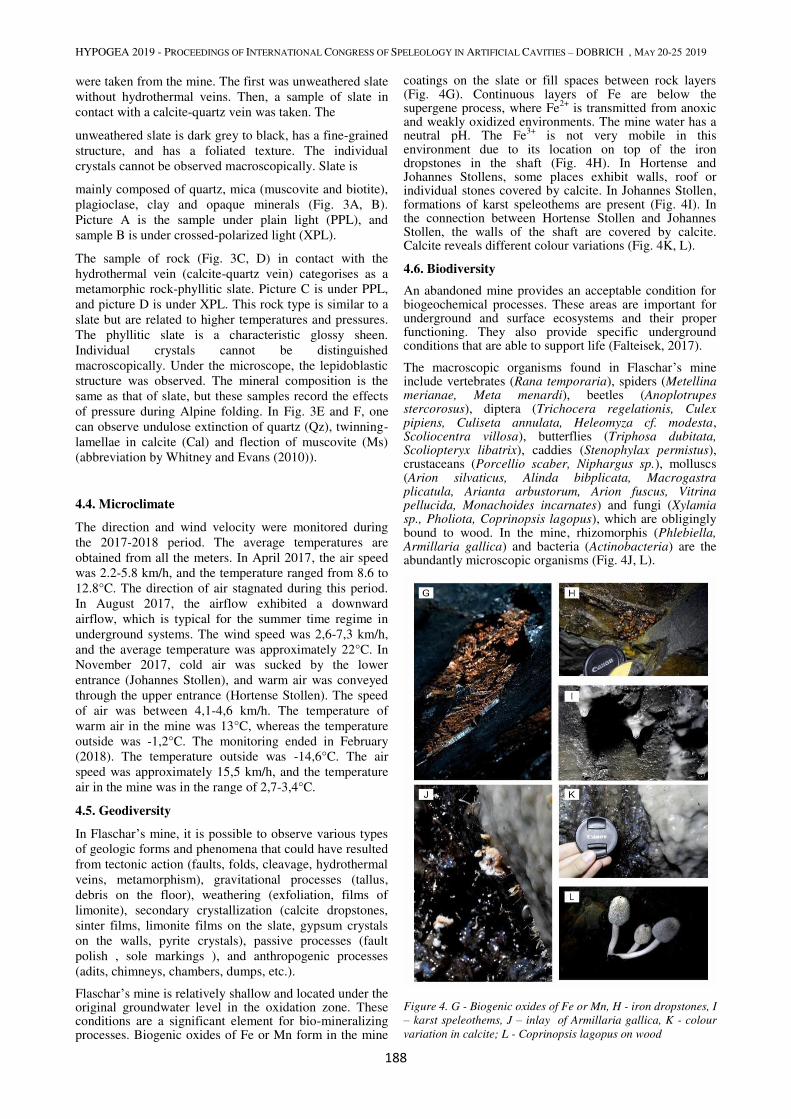
HYPOGEA 2019 - PROCEEDINGS OF INTERNATIONAL CONGRESS OF SPELEOLOGY IN ARTIFICIAL CAVITIES – DOBRICH , MAY 20-25 2019
188
were taken from the mine. The first was unweathered slate
without hydrothermal veins. Then, a sample of slate in
contact with a calcite-quartz vein was taken. The
unweathered slate is dark grey to black, has a fine-grained
structure, and has a foliated texture. The individual
crystals cannot be observed macroscopically. Slate is
mainly composed of quartz, mica (muscovite and biotite),
plagioclase, clay and opaque minerals (Fig. 3A, B).
Picture A is the sample under plain light (PPL), and
sample B is under crossed-polarized light (XPL).
The sample of rock (Fig. 3C, D) in contact with the
hydrothermal vein (calcite-quartz vein) categorises as a
metamorphic rock-phyllitic slate. Picture C is under PPL,
and picture D is under XPL. This rock type is similar to a
slate but are related to higher temperatures and pressures.
The phyllitic slate is a characteristic glossy sheen.
Individual crystals cannot be distinguished
macroscopically. Under the microscope, the lepidoblastic
structure was observed. The mineral composition is the
same as that of slate, but these samples record the effects
of pressure during Alpine folding. In Fig. 3E and F, one
can observe undulose extinction of quartz (Qz), twinning-
lamellae in calcite (Cal) and flection of muscovite (Ms)
(abbreviation by Whitney and Evans (2010)).
4.4. Microclimate
The direction and wind velocity were monitored during
the 2017-2018 period. The average temperatures are
obtained from all the meters. In April 2017, the air speed
was 2.2-5.8 km/h, and the temperature ranged from 8.6 to
12.8°C. The direction of air stagnated during this period.
In August 2017, the airflow exhibited a downward
airflow, which is typical for the summer time regime in
underground systems. The wind speed was 2,6-7,3 km/h,
and the average temperature was approximately 22°C. In
November 2017, cold air was sucked by the lower
entrance (Johannes Stollen), and warm air was conveyed
through the upper entrance (Hortense Stollen). The speed
of air was between 4,1-4,6 km/h. The temperature of
warm air in the mine was 13°C, whereas the temperature
outside was -1,2°C. The monitoring ended in February
(2018). The temperature outside was -14,6°C. The air
speed was approximately 15,5 km/h, and the temperature
air in the mine was in the range of 2,7-3,4°C.
4.5. Geodiversity
In Flaschar’s mine, it is possible to observe various types
of geologic forms and phenomena that could have resulted
from tectonic action (faults, folds, cleavage, hydrothermal
veins, metamorphism), gravitational processes (tallus,
debris on the floor), weathering (exfoliation, films of
limonite), secondary crystallization (calcite dropstones,
sinter films, limonite films on the slate, gypsum crystals
on the walls, pyrite crystals), passive processes (fault
polish , sole markings ), and anthropogenic processes
(adits, chimneys, chambers, dumps, etc.).
Flaschar’s mine is relatively shallow and located under the original groundwater level in the oxidation zone. These conditions are a significant element for bio-mineralizing processes. Biogenic oxides of Fe or Mn form in the mine
coatings on the slate or fill spaces between rock layers (Fig. 4G). Continuous layers of Fe are below the supergene process, where Fe
2+ is transmitted from anoxic
and weakly oxidized environments. The mine water has a neutral pH. The Fe
3+ is not very mobile in this
environment due to its location on top of the iron dropstones in the shaft (Fig. 4H). In Hortense and Johannes Stollens, some places exhibit walls, roof or individual stones covered by calcite. In Johannes Stollen, formations of karst speleothems are present (Fig. 4I). In the connection between Hortense Stollen and Johannes Stollen, the walls of the shaft are covered by calcite. Calcite reveals different colour variations (Fig. 4K, L).
4.6. Biodiversity
An abandoned mine provides an acceptable condition for biogeochemical processes. These areas are important for underground and surface ecosystems and their proper functioning. They also provide specific underground conditions that are able to support life (Falteisek, 2017).
The macroscopic organisms found in Flaschar’s mine include vertebrates (Rana temporaria), spiders (Metellina merianae, Meta menardi), beetles (Anoplotrupes stercorosus), diptera (Trichocera regelationis, Culex pipiens, Culiseta annulata, Heleomyza cf. modesta, Scoliocentra villosa), butterflies (Triphosa dubitata, Scoliopteryx libatrix), caddies (Stenophylax permistus), crustaceans (Porcellio scaber, Niphargus sp.), molluscs (Arion silvaticus, Alinda bibplicata, Macrogastra plicatula, Arianta arbustorum, Arion fuscus, Vitrina pellucida, Monachoides incarnates) and fungi (Xylamia sp., Pholiota, Coprinopsis lagopus), which are obligingly bound to wood. In the mine, rhizomorphis (Phlebiella, Armillaria gallica) and bacteria (Actinobacteria) are the abundantly microscopic organisms (Fig. 4J, L).
Figure 4. G - Biogenic oxides of Fe or Mn, H - iron dropstones, I
– karst speleothems, J – inlay of Armillaria gallica, K - colour
variation in calcite; L - Coprinopsis lagopus on wood
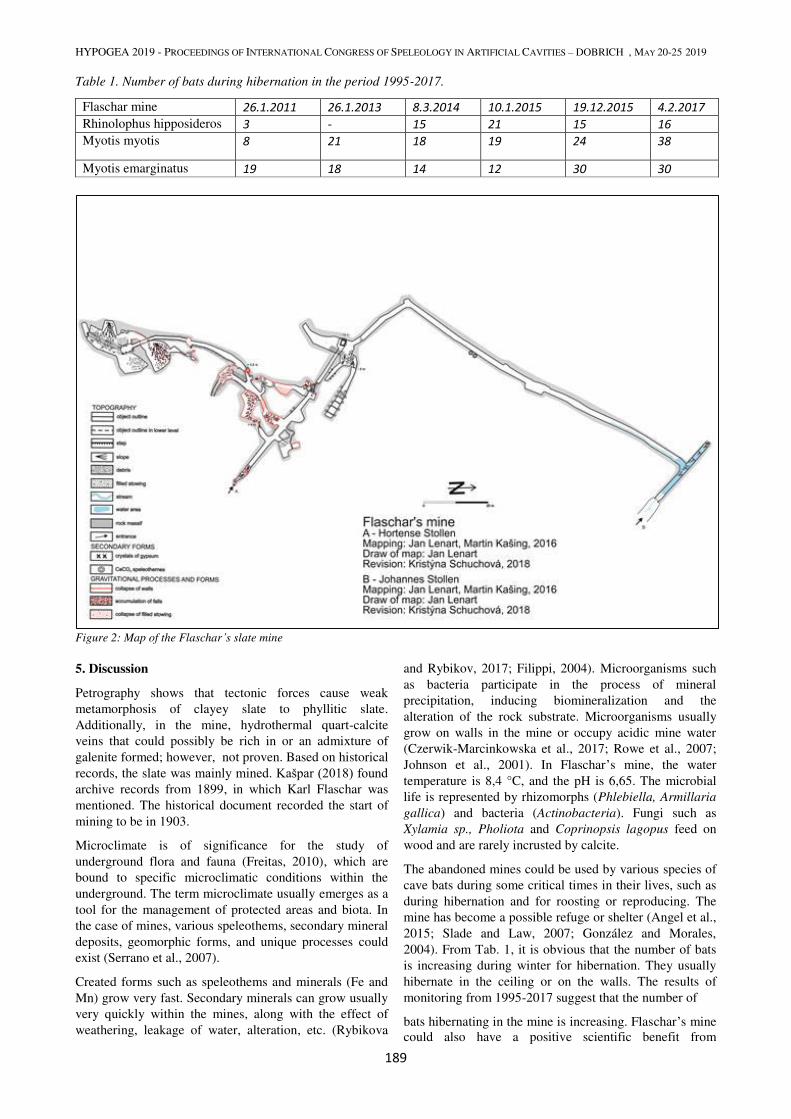
HYPOGEA 2019 - PROCEEDINGS OF INTERNATIONAL CONGRESS OF SPELEOLOGY IN ARTIFICIAL CAVITIES – DOBRICH , MAY 20-25 2019
189
Table 1. Number of bats during hibernation in the period 1995-2017.
Flaschar mine 26.1.2011 26.1.2013 8.3.2014 10.1.2015 19.12.2015 4.2.2017
Rhinolophus hipposideros 3 - 15 21 15 16
Myotis myotis 8 21 18 19 24 38
Myotis emarginatus 19 18 14 12 30 30
Figure 2: Map of the Flaschar’s slate mine
5. Discussion
Petrography shows that tectonic forces cause weak
metamorphosis of clayey slate to phyllitic slate.
Additionally, in the mine, hydrothermal quart-calcite
veins that could possibly be rich in or an admixture of
galenite formed; however, not proven. Based on historical
records, the slate was mainly mined. Kašpar (2018) found archive records from 1899, in which Karl Flaschar was
mentioned. The historical document recorded the start of
mining to be in 1903.
Microclimate is of significance for the study of
underground flora and fauna (Freitas, 2010), which are
bound to specific microclimatic conditions within the
underground. The term microclimate usually emerges as a
tool for the management of protected areas and biota. In
the case of mines, various speleothems, secondary mineral
deposits, geomorphic forms, and unique processes could
exist (Serrano et al., 2007).
Created forms such as speleothems and minerals (Fe and
Mn) grow very fast. Secondary minerals can grow usually
very quickly within the mines, along with the effect of
weathering, leakage of water, alteration, etc. (Rybikova
and Rybikov, 2017; Filippi, 2004). Microorganisms such
as bacteria participate in the process of mineral
precipitation, inducing biomineralization and the
alteration of the rock substrate. Microorganisms usually
grow on walls in the mine or occupy acidic mine water
(Czerwik-Marcinkowska et al., 2017; Rowe et al., 2007;
Johnson et al., 2001). In Flaschar’s mine, the water
temperature is 8,4 °C, and the pH is 6,65. The microbial
life is represented by rhizomorphs (Phlebiella, Armillaria
gallica) and bacteria (Actinobacteria). Fungi such as
Xylamia sp., Pholiota and Coprinopsis lagopus feed on
wood and are rarely incrusted by calcite.
The abandoned mines could be used by various species of
cave bats during some critical times in their lives, such as
during hibernation and for roosting or reproducing. The
mine has become a possible refuge or shelter (Angel et al.,
2015; Slade and Law, 2007; González and Morales,
2004). From Tab. 1, it is obvious that the number of bats
is increasing during winter for hibernation. They usually
hibernate in the ceiling or on the walls. The results of
monitoring from 1995-2017 suggest that the number of
bats hibernating in the mine is increasing. Flaschar’s mine
could also have a positive scientific benefit from
HYPOGEA 2019 - PROCEEDINGS OF INTERNATIONAL CONGRESS OF SPELEOLOGY IN ARTIFICIAL CAVITIES – DOBRICH , MAY 20-25 2019
190
geodiversity, for which there are various processes and
forms.
6. Summary
Multidisciplinary research proves that abandoned mines do not represent only hazards and dangers. It is important to view the mine as a self-contained system. There is not necessarily a way to secure or dispose of an abandoned mine. We observe various processes and forms within the mine. There is evidence of processes such as weathering, erosion (collapses, exfoliation of walls, scraping of debris), and formation and crystallization of secondary minerals or diverse organisms (bacteria, fungi or bats). We observe exposed fold and faults, hydrothermal veins, excavations from historical mining (adits, shafts, stopes, stowings and chambers), karst, Fe and Mn rock coatings, and other forms such as debris on the floor. The results from this research could provide protection for the mine. The mine provides long-term refuge and a place for hibernation for various types of organisms. It could have a positive significance for scientific research and for touristic utilization, diversifying the tourism in this area.
Acknowledgments
This research was supported by SGS05/PřF/2017-2018
project.
References
Angel MGL, Ahiezer TR, Sulim JEC, Samantha BLG, Manuel LChG, Lissette AL, 2015. Abandoned Mines Used as Roosts for Reproduction by Townsend´s Big-Eared Bats (Corynorhinus townsendii) in a Protected Area in the Central Highlands of Mexico. Animal and Veterinary Sciences, 3, pp. 13-21.
Brack V, 2007. Temperatures and Locations Used by Hibernating Bats, Including Myotis sodalist (Indiana Bat), in a Limestone Mine: Implication for Conservation and Management. Environmental Management, 40, pp. 739-746.
Culshaw GM, McCann MD, Donnelly JL, 2000. Impacts of abandoned mine workings on aspects of urban development. Mining Technology, 109, pp. 132-139.
Czerwik-Marcinkowska CJ, Pusz W, Zagoždžon P, 2017. Cyanobacteria and Algae in an Old Mine Adit (Marcinków, Sudety Mountains, Southwestern Poland). Journal of Cave and Karst Studies, 79, pp. 122-130.
Falteisek L, 2017. Zpráva za geomikrobiologický průzkum Flascharova dolu u Oder (Czech)
Filippi M, 2004. Oxidation of the arsenic-rich concentrate at the Přebuz abandoned mine (Erzgebirge Mts., CZ): mineralogical evolution. Science of the Total Environment, 322, pp. 271-282.
Freitas D. Ch, 2010. The role and importance of cave microclimate in the sustainable use and management of show caves. Acta Carsologia, 39 (3), pp. 477-489.
González LC, Morales TL, 2004. Use of abandoned mines by long-eared bats, Genus Corynorhinus (Chiroptera: Vespertilionidae) in Durango, Mexico. Journal of Mammalogy, 85, pp. 989-994.
Chlupáč I, Brzobohatý R, Kovanda J, Stráník Z, 2011. Geologická minulost České republiky (Czech). Academia, Prague, 436 p.
Isaia M, Giachino MP, Emanuele S, Casele A, Badion G, 2011. Conservation value of vartificial subterranean systems: A case study in an abandoned mines in Italy. Journal of Nature Conservation, 19, pp. 24-33.
Janoška M, 2001. Nízký Jeseník očima geologa (Czech). Palacky university Olomouc, 64 p.
Johnson BD, Rolfe S, Hallberg BK, Iversen E, 2001. Isolation and phylogenetic characterization of acidophilic microorganism indigenous to acidic drainage waters at an abandoned Norwegian copper mine. Environmental Microbiology, 3, pp. 630-637.
Jordan H, Cigna F, Bateson L, 2017. Identifying natural and anthropogenically-induced geohazards from satellite ground motion and geospatial data: Stoke-on-Trent, UK. International Journal of Applied Earth Observation and Geoinformation, vol. 63, pp. 90-103.
Kašpar, Gold P. and K, 2018. Příspěvek k historii zaniklé těžby břidlice na oderském katastru v lokalitě Odry - Nový svět (Czech): Záznam z bádání pro OKŠ Odry. Odry.
Lenart J, 2016. Nízký Jeseník – Highland with Abandoned Deep Mines. Landscapes and Landforms of the Czech Republic, pp. 305-314.
Masing M, Baranauskas K, Siivonen Y, Wermundsen T, 2009. Bats hibernating in Kaunas Fortress, Lithuania. Estonian Journal of Ecology, 58, pp. 192–204.
Moréno-Martínez JF, Zaldívar-Galindo J, Castillo-Gonzáles L, Azañón MJ, 2016. Collapse susceptibility map in abandoned mining areas by microgravity survey: A case study in Candado hill (Málaga, souther Spain). Journal of Applied Geophysics, 130, pp. 101-109.
Rowe FO, España-Sánchez J, Hallberg BK, Johnson BD, 2007. Microbial communities and geochemical dynamics in an extremely acidic, metal-rich stream at an abandoned sulphide mine (Huelva, Spain) underpinned by two functional production systems. Environmental Microbiology, 9, pp. 1761-1771.
Rybnikova SL, Rybnikov A. P. 2017. Hydrogeochemistry of the abandoned sulphide mines. Procedia Earth and Planetary Science, 17, pp. 849–852.
Serrano E, Flaño-Ruiz P, Valladolid, 2007. Geodiversity. A theoretical and applied concept. Geographica Helvetica, 62, pp. 140-147
Slade Ch, Law B, 2007. Seasonal changes in bats at a derelict mine in southern New South Wales. Zoologist, 34, pp. 173-180.
Tuttle DM, Taylor RAD, 1998. Bats and Mines. Bats Conservation International, Inc. 3, 50 p.
Waltham T, Park HD, Suh J, Yu MH, Kwon HH, Bang KM, (2011). Collapses of old mines in Korea. Engineering Geology 118, pp. 29-36.
Whitaker JO, Stacy O, 1996. Bats of Abandoned Coal Mines in Southwestern Indiana. Proceeding of the Indiana Academy Science, 105, pp. 277-280.
Whitney LD, Evans WB, 2010. Abbreviations for names of rock-forming minerals. American Mineralogist, vol. 95, pp. 185–187.

MILITARY AND WAR WORKS (DEFENSIVE)
HYPOGEA 2019 - PROCEEDINGS OF INTERNATIONAL CONGRESS OF SPELEOLOGY IN ARTIFICIAL CAVITIES – DOBRICH , MAY 20-25 2019
191
SECOND WORLD WAR AIR-RAID SHELTERS IN GENOA (ITALY):
KNOWLEDGE, PROTECTION AND USE OF AN UNDERGROUND
HISTORICAL AND CULTURAL HERITAGE IN URBAN ENVIRONMENT
R. Bixio1, F. Faccini
1, L. Perasso
1, P. Piana
2, S. Saj
1, M. Traverso
1
1 Centro Studi Sotterranei, Corso Magenta 29/2, 16125 Genoa, Italy, [email protected]
2 University of Nottingham, School of Geography, Clive Granger Building, UK, [email protected]
Abstract During the Second World War several air-raid shelters were built for civilians and military purposes; their construction
was conditioned by the geological and geomorphological features of Genoa.
Since the end of the war only a minor part of these artificial cavities has been partially reused; many of them are still
abandoned and almost forgotten in the Genoese urban fabric.
This paper presents an overview of air raid shelters in Genoa through archival research and speleological surveys.
Over 150 artificial cavities have been identified; these are mainly concentrated in the historical ‘morphological
amphitheatre’ of the city
This first database provides new insights into specific urban planning interventions aimed at the conservation and
management of air-raid shelters, which represent a cultural and landscape value.
These artificial cavities can be classified either in terms of potential impact determined by building activities, or for the
associated geological risk due to underground instability.
Keywords Air – raid shelters, protection, urban environment, Genoa
1. Introduction
Due to the overlap of urban periods, particularly since the
medieval age, regional planning in Mediterranean cities is
complex. In the underground there are many artificial
cavities as aqueducts, tanks, canals, quarries, places of
worship, etc, which represent important elements of
cultural heritage. In general, their distribution and
characteristics are hardly known, but their knowledge is
essential for regional planning. Artificial hypogea offer a
double interpretation in terms of risk: they are a
vulnerable element for construction activities, but at the
same time they represent a potential risk for settlements
and infrastructures above them (Beck, 1984).
In Italy dangers connected to artificial cavities are often
underrated, but they can cause significant economic
damages. In the last years, many underground cavities’ vault collapsed with consequent damages. According to
the Società Speleologica Italiana database
(http://catastoartificiali.speleo.it), Liguria has more than
400 artificial cavities, of which 200 are in Genova
Municipality: these are hydraulic works, civil, worship
and military buildings, extractive settlements and
infrastructures. In Genova around 60 war settlements have
been listed, including defensive constructions, galleries
and walkways, mine and countermine galleries, shooting
posts, and shelters (Brandolini et al. 2018).
This work presents an overview of air-raid shelters built in
Genova during the Second World War, when air-naval
incursions damaged a part of the city. Through archival
research and original surveys, more than 150 artificial
cavities have been registered, mainly located in Genoa’s
morphologic amphitheatre and in the surrounding areas.
Their construction was conditioned by geological and
morphological conditions. Since the 1960s, the territory
has undergone great urban transformations. Today several
air-raid shelters are used as public lifts, parking garages
and galleries, but many are of difficult access and often no
more visible, hidden by the urbanisation.
2. Geography and geology
The municipality of Genoa is a 240 km2 wide and 42 km
long strip of land which stretches along the coast: 580.000
inhabitants are concentrated in the urban area, which
measures 7.5 km2. The natural amphitheater where the old
port and the historical center lie, is surrounded by a
mountain ridge that peaks with Monte Sperone (489 m).
The two main streams are located at the E and at the W of
the historical amphitheater: these are the Bisagno (E) and
the Polcevera (W). Several secondary streams cross the
districts of Genoa: they are short and characterized by
high steepness, with small and intensively urbanized
coastal plains, often exposed to risk of flooding. Coastal
plains, except the major river axes, have a width which is
rarely greater than 1 km, while the steep mountain belt
behind reaches its highest elevation at Bric del Dente
(1109 m a.s.l.).
Along the slopes there are many landslides with different
kinematisms and state of activity, often triggered by short
and intense rainfall events that increasingly characterize
this territory. The municipality of Genoa has a particular
geological structure: it is crossed by the Sestri-Voltaggio
tectonic line, identified as the separation between the Alps
and the Apennines, and it is characterized by high
lithological variety and exceptional geodiversity.
Calcareous-marly or argillitic sedimentary formations are
found in contact with igneous rocks belonging to the
oceanic crust, to the continental margin or to the mantle,
with different degrees of metamorphism. The slopes and
the coastal and alluvial plains are characterized by
quaternary deposits, now largely obliterated by anthropic
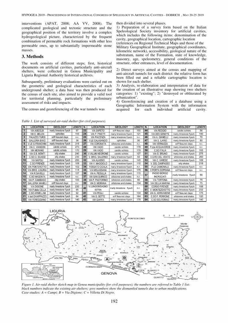
HYPOGEA 2019 - PROCEEDINGS OF INTERNATIONAL CONGRESS OF SPELEOLOGY IN ARTIFICIAL CAVITIES – DOBRICH , MAY 20-25 2019
192
interventions (APAT, 2008; AA VV, 2008). The
complicated geological and tectonic structure and the
geographical position of the territory involve a complex
hydrogeological picture, characterized by the frequent
combination of permeable rock formations with other less
permeable ones, up to substantially impermeable stone
masses.
3. Methods
The work consists of different steps; first, historical documents on artificial cavities, particularly anti-aircraft shelters, were collected in Genoa Municipality and Liguria Regional Authority historical archives.
Subsequently, preliminary evaluations were carried out on the geometric and geological characteristics of each underground shelter; a data base was then produced for the census of each site, also aimed to provide a valid tool for territorial planning, particularly the preliminary assessment of risks and impacts.
The census and georeferencing of the war tunnels was
then divided into several phases. 1) Preparation of a survey form based on the Italian Speleological Society inventory for artificial cavities, which includes the following items: denomination of the cavity, geographical location, cartographic location (references on Regional Technical Maps and those of the Military Geographical Institute, geographical coordinates, kilometric network), accessibility, geological nature of the substratum, name of the Formation, state of knowledge, masonry, age, speleometry, general conditions of the structure, other entrances, level of documentation.
2) Direct surveys aimed at the census and mapping of anti-aircraft tunnels for each district: the relative form has been filled out and a reliable cartographic location is shown for each shelter. 3) Analysis, re-elaboration and interpretation of data for the creation of an illustrative map showing two shelters categories: 1) "existing"; 2) "destroyed or obliterated by urbanization". 4) Georeferencing and creation of a database using a Geographic Information System with the information acquired for each individual artificial cavity.
Table 1. List of surveyed air-raid shelter (for civil purposes).
Figure 1. Air-raid shelter sketch map in Genoa municipality (for civil purposes); the numbers are referred to Table 1 list:
black numbers indicate the existing air-shelters; grey numbers show the dismantled tunnels due to urban modifications.
Case-studies: A = Campi; B = Via Digione; C = Villetta Di Negro.

HYPOGEA 2019 - PROCEEDINGS OF INTERNATIONAL CONGRESS OF SPELEOLOGY IN ARTIFICIAL CAVITIES – DOBRICH , MAY 20-25 2019
193
Figure 4. Stationary bicycle which, in an emergency, operated
the forced ventilation system of the purified air (photo: M.
Traverso).
Figure 3 (above). Anti-gas sealed security doors (photo: M.
Traverso).
Figure 2 (left). Overlap of current toponymy on the hypogea map
(in black). Location of the 17th century bastions (in grey) and
buildings (in cross-hatching) on the surface (elaboration T.
Bonassi, S. Saj – base drawing R. Bixio, 1999).
Figure 5. Detail of filtering of the underground shelter. In the
event of the gas throwing, it went into operation (photo: M.
Traverso).
4. Results
Between 1941 and 1943 several institutions, including the
Municipality of Genoa, the German Todt Organization
(O.T.) and the Fire Brigade, designed and built over 150
air-raid. At that time, Genoa had a population of c.
600,000 inhabitants. The shelters were built/excavated in
the city and in the historical centers of the borough, once
autonomous municipalities, annexed to the 'Great Genoa'
in 1926. Many air-raid shelters were designed according
to specific uses, close to schools, barracks and industries.
Their total surface covered an area of c. 120,000 m2
distributed over more than 30 km of tunnels that could
exceptionally accommodate over 100,000 people. Sixty-
four shelters are registered for civil use for the protection
of the population (tab.1, fig.1).
Many war industries and the related underground shelters
for workers were located in the Polcevera Valley; these
were tunnels that could accommodate over 4000 people.
Galleria delle Grazie was built as a railway connection
between Calata delle Grazie, in the harbor, and Brignole
railway station; during the conflict it was used as an air-
raid shelter with several accesses along a 5 km long
tunnel. A stairway from S. Andrea's external floor
reached the tunnel, more than 20 meters underneath the
surface: during one of the frequent air alarms, more than
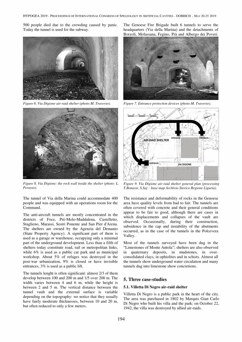
HYPOGEA 2019 - PROCEEDINGS OF INTERNATIONAL CONGRESS OF SPELEOLOGY IN ARTIFICIAL CAVITIES – DOBRICH , MAY 20-25 2019
194
500 people died due to the crowding caused by panic.
Today the tunnel is used for the subway.
The Genoese Fire Brigade built 6 tunnels to serve the
headquarters (Via della Marina) and the detachments of
Borzoli, Molassana, Fegino, Prà and Albergo dei Poveri.
Figure 6. Via Digione air-raid shelter (photo:M. Traverso).
Figure 8. Via Digione: the rock wall inside the shelter (photo: L.
Perasso).
Figure 7. Entrance protection devices (photo:M. Traverso).
Figure 9. Via Digione air-raid shelter general plan (processing
T.Bonassi, S.Saj – base map Archivio Storico Regione Liguria).
The tunnel of Via della Marina could accommodate 400
people and was equipped with an operations room for the
Command.
The anti-aircraft tunnels are mostly concentrated in the
districts of Foce, Prè-Molo-Maddalena, Castelletto,
Staglieno, Marassi, Sestri Ponente and San Pier d'Arena.
The shelters are owned by the Agenzia del Demanio
(State Property Agency). A significant part of them is
used as a garage or warehouse, occupying only a minimal
part of the underground development. Less than a fifth of
shelters today constitute road, rail or metropolitan links,
while 6% is used as a public car park and as municipal
workshop. About 5% of refuges was destroyed in the
post-war urbanization, 9% is closed or have invisible
entrances, 3% is used as a public lift.
The tunnels lenght is often significant: almost 2/3 of them
develop between 100 and 200 m and 1/5 over 200 m. The
width varies between 4 and 6 m, while the height is
between 2 and 5 m. The vertical distance between the
tunnel vault and the external surface is variable
depending on the topography: we notice that they usually
have fairly moderate thicknesses, between 10 and 20 m,
but often reduced to only a few meters.
The resistance and deformability of rocks in the Genoese
area have quality levels from bad to fair. The tunnels are
often covered with concrete and their general conditions
appear to be fair to good, although there are cases in
which displacements and collapses of the vault are
observed. Occasionally, during their construction,
subsidence in the cap and instability of the abutments
occurred, as in the case of the tunnels in the Polcevera
Valley.
Most of the tunnels surveyed have been dug in the
“Limestones of Monte Antola”; shelters are also observed
in quaternary deposits, in mudstones, in over-
consolidated clays, in ophiolites and in schists. Almost all
the tunnels show underground water circulation and many
tunnels dug into limestone show concretions.
5. Three case-studies
5.1. Villetta Di Negro air-raid shelter
Villetta Di Negro is a public park in the heart of the city.
The area was purchased in 1802 by Marquis Gian Carlo
Di Negro who built his villa and the park: on October 22,
1942, the villa was destroyed by allied air-raids.
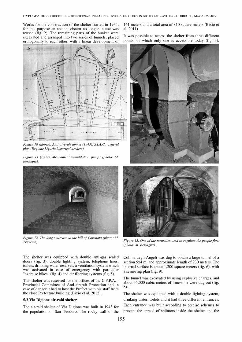
HYPOGEA 2019 - PROCEEDINGS OF INTERNATIONAL CONGRESS OF SPELEOLOGY IN ARTIFICIAL CAVITIES – DOBRICH , MAY 20-25 2019
195
Works for the construction of the shelter started in 1934; for this purpose an ancient cistern no longer in use was reused (fig. 2). The remaining parts of the bunker were excavated and arranged into two series of tunnels, placed orthogonally to each other, with a linear development of
161 meters and a total area of 810 square meters (Bixio et al. 2011).
It was possible to access the shelter from three different
points, of which only one is accessible today (fig. 3).
Figure 10 (above). Anti-aircraft tunnel (1943), S.I.A.C., general
plan (Regione Liguria historical archive).
Figure 11 (right). Mechanical vemntilation pumps (photo: M.
Bertagna).
Figure 12. The long staircase to the hill of Coronata (photo: M.
Traverso).
Figure 13. One of the turnstiles used to regulate the people flow
(photo: M. Bertagna).
The shelter was equipped with double anti-gas sealed doors (fig. 3), double lighting system, telephone lines, toilets, drinking water reserves, a ventilation system which was activated in case of emergency with particular "exercise bikes" (fig. 4) and air filtering systems (fig. 5).
This shelter was reserved for the offices of the C.P.P.A. - Provincial Committee of Anti-aircraft Protection and in case of danger it had to host the Prefect with his staff from the close Prefecture building (Bixio et al. 2012).
5.2 Via Digione air-raid shelter
The air-raid shelter of Via Digione was built in 1943 for
the population of San Teodoro. The rocky wall of the
Collina degli Angeli was dug to obtain a large tunnel of a
section 5x4 m, and approximate length of 230 meters. The
internal surface is about 1,200 square meters (fig. 6), with
a semi-ring plan (fig. 9).
The tunnel was excavated by using explosive charges, and about 35,000 cubic meters of limestone were dug out (fig. 8).
The shelter was equipped with a double lighting system,
drinking water, toilets and it had three different entrances.
Each entrance was built according to precise schemes to
prevent the spread of splinters inside the shelter and the
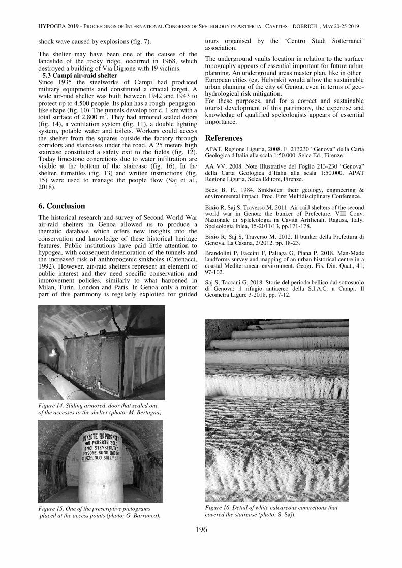
HYPOGEA 2019 - PROCEEDINGS OF INTERNATIONAL CONGRESS OF SPELEOLOGY IN ARTIFICIAL CAVITIES – DOBRICH , MAY 20-25 2019
196
shock wave caused by explosions (fig. 7).
The shelter may have been one of the causes of the landslide of the rocky ridge, occurred in 1968, which destroyed a building of Via Digione with 19 victims. 5.3 Campi air-raid shelter Since 1935 the steelworks of Campi had produced military equipments and constituted a crucial target. A wide air-raid shelter was built between 1942 and 1943 to protect up to 4.500 people. Its plan has a rough pengagon-like shape (fig. 10). The tunnels develop for c. 1 km with a total surface of 2,800 m
2. They had armored sealed doors
(fig. 14), a ventilation system (fig. 11), a double lighting system, potable water and toilets. Workers could access the shelter from the squares outside the factory through corridors and staircases under the road. A 25 meters high staircase constituted a safety exit to the fields (fig. 12). Today limestone concretions due to water infiltration are visible at the bottom of the staircase (fig. 16). In the shelter, turnstiles (fig. 13) and written instructions (fig. 15) were used to manage the people flow (Saj et al., 2018).
6. Conclusion
The historical research and survey of Second World War air-raid shelters in Genoa allowed us to produce a thematic database which offers new insights into the conservation and knowledge of these historical heritage features. Public institutions have paid little attention to hypogea, with consequent deterioration of the tunnels and the increased risk of anthropogenic sinkholes (Catenacci, 1992). However, air-raid shelters represent an element of public interest and they need specific conservation and improvement policies, similarly to what happened in Milan, Turin, London and Paris. In Genoa only a minor part of this patrimony is regularly exploited for guided
tours organised by the ‘Centro Studi Sotterranei’ association.
The underground vaults location in relation to the surface topography appears of essential important for future urban planning. An underground areas master plan, like in other European cities (eg. Helsinki) would allow the sustainable urban planning of the city of Genoa, even in terms of geo-hydrological risk mitigation. For these purposes, and for a correct and sustainable tourist development of this patrimony, the expertise and knowledge of qualified speleologists appears of essential importance.
References
APAT, Regione Liguria, 2008. F. 213230 “Genova” della Carta Geologica d'Italia alla scala 1:50.000. Selca Ed., Firenze.
AA VV, 2008. Note Illustrative del Foglio 213-230 “Genova” della Carta Geologica d’Italia alla scala 1:50.000. APAT Regione Liguria, Selca Editore, Firenze.
Beck B. F., 1984. Sinkholes: their geology, engineering & environmental impact. Proc. First Multidisciplinary Conference.
Bixio R, Saj S, Traverso M, 2011. Air-raid shelters of the second world war in Genoa: the bunker of Prefecture. VIII Conv. Nazionale di Spleleologia in Cavità Artificiali, Ragusa, Italy, Speleologia Iblea, 15-2011/13, pp.171-178.
Bixio R, Saj S, Traverso M, 2012. Il bunker della Prefettura di Genova. La Casana, 2/2012, pp. 18-23.
Brandolini P, Faccini F, Paliaga G, Piana P, 2018. Man-Made landforms survey and mapping of an urban historical centre in a coastal Mediterranean environment. Geogr. Fis. Din. Quat., 41, 97-102.
Saj S, Taccani G, 2018. Storie del periodo bellico dal sottosuolo di Genova: il rifugio antiaereo della S.I.A.C. a Campi. Il Geometra Ligure 3-2018, pp. 7-12.
Figure 14. Sliding armored door that sealed one
of the accesses to the shelter (photo: M. Bertagna).
Figure 15. One of the prescriptive pictograms
placed at the access points (photo: G. Barranco).
Figure 16. Detail of white calcareous concretions that
covered the staircase (photo: S. Saj).
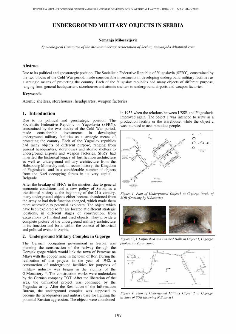
HYPOGEA 2019 - PROCEEDINGS OF INTERNATIONAL CONGRESS OF SPELEOLOGY IN ARTIFICIAL CAVITIES – DOBRICH , MAY 20-25 2019
197
UNDERGROUND MILITARY OBJECTS IN SERBIA
Nemanja Milosavljevic
Speleological Commitee of the Mountaineering Association of Serbia, [email protected]
Abstract
Due to its political and geostrategic position, The Socialistic Federative Republic of Yugoslavia (SFRY), constrained by
the two blocks of the Cold War period, made considerable investments in developing underground military facilities as
a strategic means of protecting the country. Each of the Yugoslav republics had many objects of different purpose,
ranging from general headquarters, storehouses and atomic shelters to underground airports and weapon factories.
Keywords
Atomic shelters, storehouses, headquartes, weapon factories
1. Introduction
Due to its political and geostrategic position, The Socialistic Federative Republic of Yugoslavia (SFRY), constrained by the two blocks of the Cold War period, made considerable investments in developing underground military facilities as a strategic means of protecting the country. Each of the Yugoslav republics had many objects of different purpose, ranging from general headquarters, storehouses and atomic shelters to underground airports and weapon factories. SFRY had inherited the historical legacy of fortification architecture as well as underground military architecture from the Habsbourg Monarchy and, in recent history, the Kingdom of Yugoslavia, and in a considerable number of objects from the Nazi occupying forces in its very capital – Belgrade.
After the breakup of SFRY in the nineties, due to general economic conditions and a new policy of Serbia as a transitional society at the beginning of the 21st century, many underground objects either became abandoned from the army or had their function changed, which made them more accessible to potential explorers. The object which have been explored so far are located at different strategic locations, in different stages of construction, from excavations to finished and used objects. They provide a complete picture of the underground military architecture in its function and form within the context of historical and political events in Serbia.
2. Underground Military Complex in G.gorge
The German occupation government in Serbia was planning the construction of the railway through the Gornjak gorge which would link the town of Petrovac na Mlavi with the copper mine in the town of Bor. During the realization of that project, in the year of 1942, a construction of underground facilities for purposes of military industry was begun in the vicinity of the G.Monastery *. The construction works were undertaken by the German company TOT. After the liberation of the area, the unfinished project was continued by the Yugoslav army. After the Resolution of the Information Bureau, the underground complex was supposed to become the headquarters and military base for fighting the potential Russian aggression. The objects were abandoned
in 1953 when the relations between USSR and Yugoslavia improved again. The object 1 was intended to serve as a production facility or the warehouse, while the object 2 was intended to accommodate people.
Figure 1. Plan of Underground Object1 at G.gorge (arch. of
SOB (Drawing by N.Bozovic)
Figures 2,3. Unfineshed and Finshed Halls in Object 1, G.gorge,
photoes by Zoran Simic
Figure 4. Plan of Undergound Military Object 2 at G.gorge,
archive of SOB (drawing N.Bozovic)
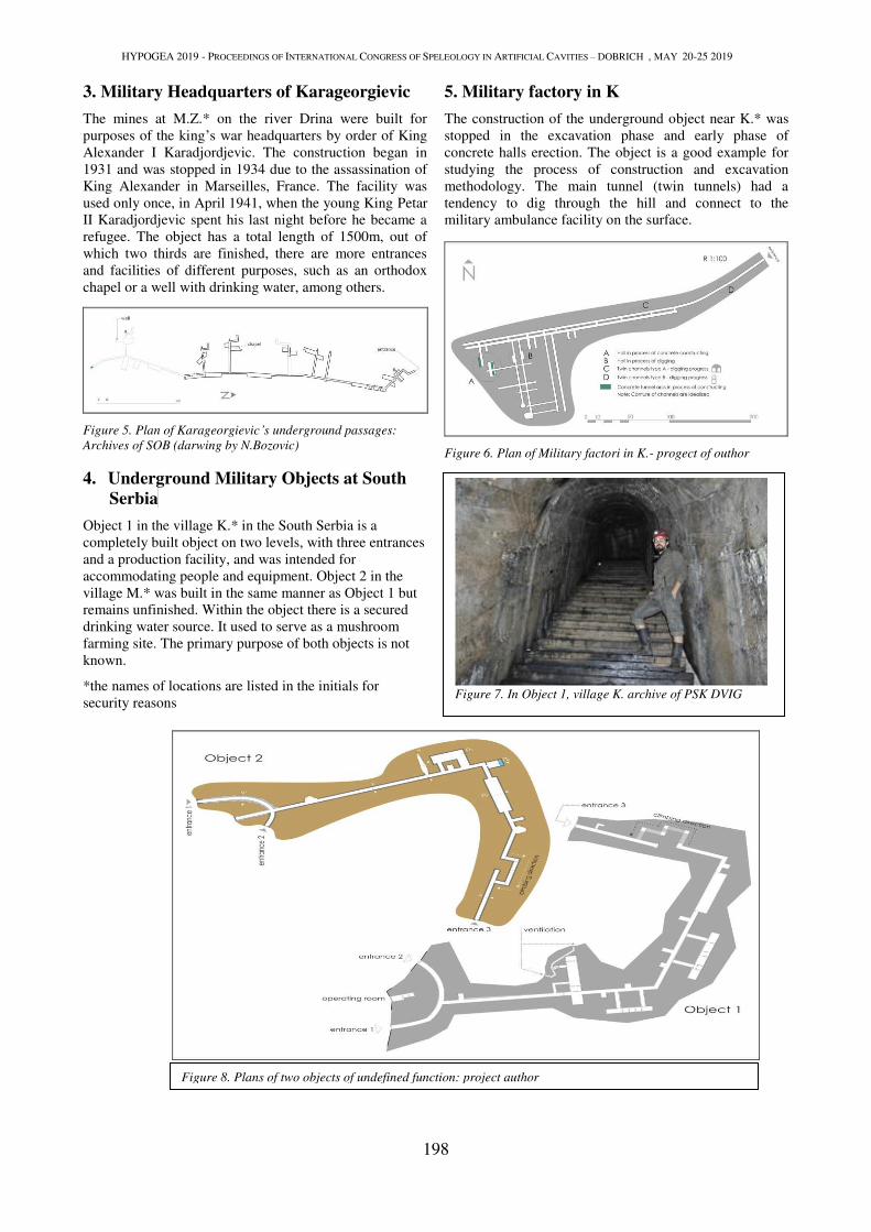
HYPOGEA 2019 - PROCEEDINGS OF INTERNATIONAL CONGRESS OF SPELEOLOGY IN ARTIFICIAL CAVITIES – DOBRICH , MAY 20-25 2019
198
3. Military Headquarters of Karageorgievic
The mines at M.Z.* on the river Drina were built for
purposes of the king’s war headquarters by order of King
Alexander I Karadjordjevic. The construction began in
1931 and was stopped in 1934 due to the assassination of
King Alexander in Marseilles, France. The facility was
used only once, in April 1941, when the young King Petar
II Karadjordjevic spent his last night before he became a
refugee. The object has a total length of 1500m, out of
which two thirds are finished, there are more entrances
and facilities of different purposes, such as an orthodox
chapel or a well with drinking water, among others.
Figure 5. Plan of Karageorgievic’s underground passages:
Archives of SOB (darwing by N.Bozovic)
4. Underground Military Objects at South
Serbia
Object 1 in the village K.* in the South Serbia is a
completely built object on two levels, with three entrances
and a production facility, and was intended for
accommodating people and equipment. Object 2 in the
village M.* was built in the same manner as Object 1 but
remains unfinished. Within the object there is a secured
drinking water source. It used to serve as a mushroom
farming site. The primary purpose of both objects is not
known.
*the names of locations are listed in the initials for
security reasons
5. Military factory in K
The construction of the underground object near K.* was
stopped in the excavation phase and early phase of
concrete halls erection. The object is a good example for
studying the process of construction and excavation
methodology. The main tunnel (twin tunnels) had a
tendency to dig through the hill and connect to the
military ambulance facility on the surface.
Figure 6. Plan of Military factori in K.- progect of outhor
Figure 7. In Object 1, village K. archive of PSK DVIG
Figure 8. Plans of two objects of undefined function: project author
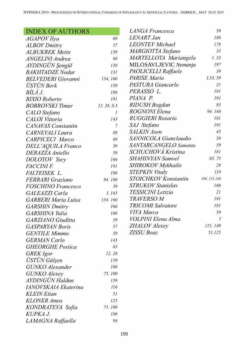
HYPOGEA 2019 - PROCEEDINGS OF INTERNATIONAL CONGRESS OF SPELEOLOGY IN ARTIFICIAL CAVITIES – DOBRICH , MAY 20-25 2019
199
INDEX OF AUTHORS
AGAPOV Ilya 69
ALBOV Dmitry 57
ALBUKREK Metin 139
ANGELINI Andrea 88
AYDINGÜN Şengül 139
BAKHTADZE Nodar 131
BELVEDERI Giovanni 154, 160
ÜSTÜN Berk 139
BÍLÁ J. 186
BIXIO Roberto 191
BOBROVSKI Timur 12. 28. 8.3
CALO Stefano 1
CALOI Vittoria 143
CANAVAS Constantin 7
CARNEVALI Laura 88
CARPICECI Marco 88
DELL’AQUILA Franco 39
DERAZZA Aniello 59
DOLOTOV Yury 166
FACCINI F. 191
FALTEISEK L. 186
FERRARI Graziano 94. 160
FOSCHINO Francesco 39
GALEAZZI Carla І. 143
GARBERI Maria Luisa 154. 160
GARSHIN Dmitry 166
GARSHINA Yulia 166
GARZIANO Giuditta 59
GASPARYAN Boris 57
GENTILE Mimmo 59
GERMAN Carlo 143
GHEORGHE Postica 83
GREK Igor 12. 28
ÜSTÜN Gülşen 139
GUNKO Alexander 100
GUNKO Alexey 75. 100
AYDINGÜN Haldun 139
IANOVSKAIA Ekaterina 116
KLEIN Eitan 51
KLONER Amos 125
KONDRATEVA Sofia 75. 100
KUPKA J. 186
LAMAGNA Raffaella 94
LANGA Francesca 59
LENART Jan 186
LEONTEV Michael 178
MARGIOTTA Stefano 33
MARTELLOTA Mariangela 1. 33
MILOSAVLJEVIC Nemanja 197
PAOLICELLI Raffaele 39
PARISE Mario І.33. 59
PASTURA Giancarlo 21
PERASSO L. 191
PIANA P. 191
RIDUSH Bogdan 83
ROGNONI Elena 94. 160
RUGGIERI Rosario 181
SAJ Stefano 191
SALKIN Asen 45
SANNICOLA Gianclaudio 59
SANTARCANGELO Samanta 59
SCHUCHOVÁ Kristina 181
SHAHINYAN Samvel 65. 75
SHIROKOV Mykhailo 28
STEPKIN Vitaly 110
STOICHKOV Konstantin 106. 121.149
STRUKOV Stanislav 166
TESSICINI Letizia 21
TRAVERSO M 191
TRICOMI Salvatore 181
VIVA Marco 59
VOLPINI Elena Alma І ZHALOV Alexey 121. 149
ZISSU Boaz 51.125
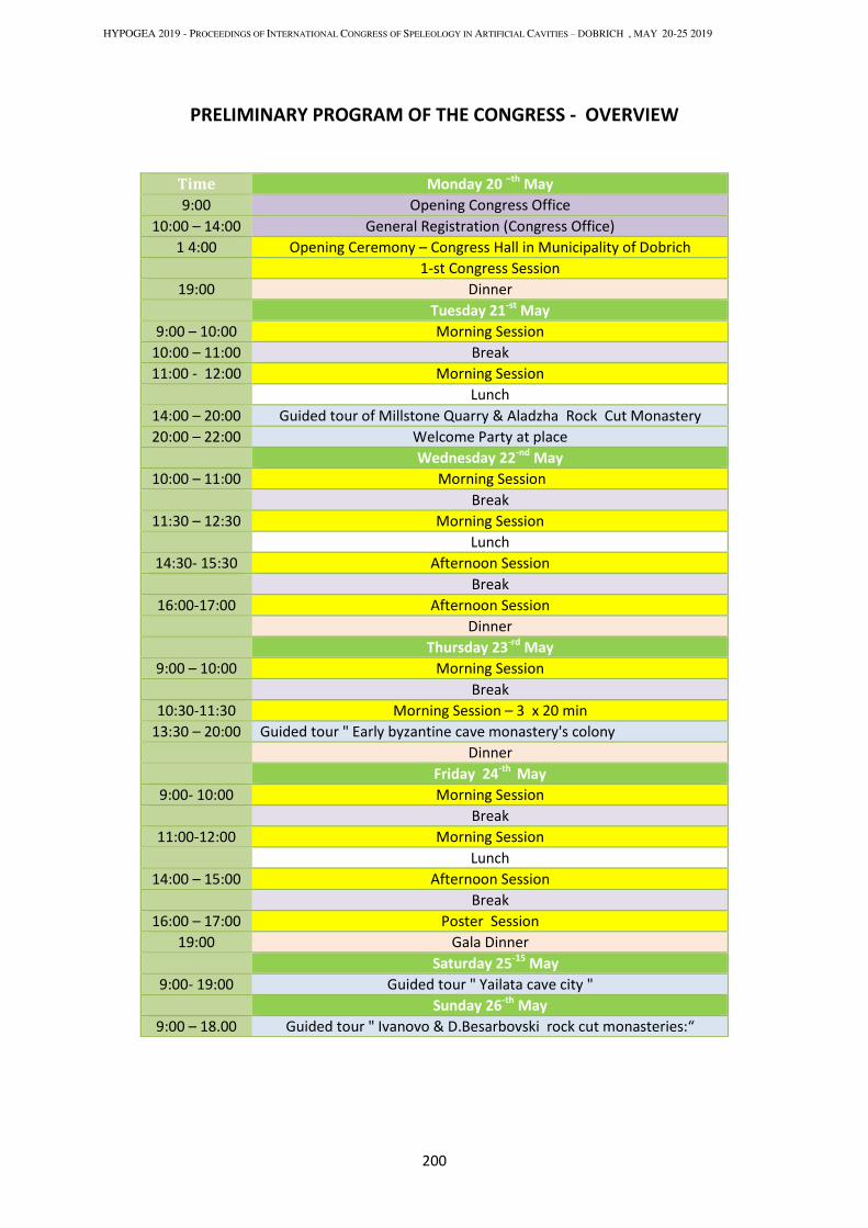
HYPOGEA 2019 - PROCEEDINGS OF INTERNATIONAL CONGRESS OF SPELEOLOGY IN ARTIFICIAL CAVITIES – DOBRICH , MAY 20-25 2019
200
PRELIMINARY PROGRAM ОF THE CONGRESS - OVERVIEW
Time Monday 20 –th
May
9:00 Opening Congress Office
10:00 – 14:00 General Registration (Congress Office)
1 4:00 Opening Ceremony – Congress Hall in Municipality of Dobrich
1-st Congress Session
19:00 Dinner
Tuesday 21-st
May
9:00 – 10:00 Morning Session
10:00 – 11:00 Break
11:00 - 12:00 Morning Session
Lunch
14:00 – 20:00 Guided tour of Millstone Quarry & Aladzha Rock Cut Monastery
20:00 – 22:00 Welcome Party at place
Wednesday 22-nd
May
10:00 – 11:00 Morning Session
Break
11:30 – 12:30 Morning Session
Lunch
14:30- 15:30 Afternoon Session
Break
16:00-17:00 Afternoon Session
Dinner
Thursday 23-rd
May
9:00 – 10:00 Morning Session
Break
10:30-11:30 Morning Session – 3 x 20 min
13:30 – 20:00 Guided tour " Early byzantine cave monastery's colony
Dinner
Friday 24-th
May
9:00- 10:00 Morning Session
Break
11:00-12:00 Morning Session
Lunch
14:00 – 15:00 Afternoon Session
Break
16:00 – 17:00 Poster Session
19:00 Gala Dinner
Saturday 25-15
May
9:00- 19:00 Guided tour " Yailata cave city "
Sunday 26-th
May
9:00 – 18.00 Guided tour " Ivanovo & D.Besarbovski rock cut monasteries:“
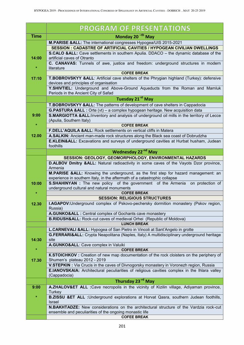
HYPOGEA 2019 - PROCEEDINGS OF INTERNATIONAL CONGRESS OF SPELEOLOGY IN ARTIFICIAL CAVITIES – DOBRICH , MAY 20-25 2019
201
Time Monday 20 –th
May
14:00 *
17:10
M.PARISE &ALL: The international congresses Hypogea/UIS 2015-2021
SESSION : CADASTRE OF ARTIFICIAL CAVITIES / HYPOGEAN CIVILIAN DWELLINGS S.CALO &ALL: Cave settlements in southern Apulia. DDACO – the dynamic database of the
artificial caves of Otranto
C. CANAVAS: Tunnels of awe, justice and freedom: underground structures in modern
literature
COFEE BREAK Т.BOBROVSKYY &ALL: Artificial cave shelters of the Phrygian highland (Turkey): defensive
devices and principles of organisation
Y.SHIVTIEL: Underground and Above-Ground Aqueducts from the Roman and Mamluk
Periods in the Ancient City of Safad Tuesday 21
-st May
9:00 *
12.00
Т.BOBROVSKYY &ALL: The patterns of development of cave shelters in Cappadocia
G.PASTURA &ALL : Orte (vt) – a complex hypogean heritage. New acquisition data
S.MARGIOTTA &ALL:Inventory and analysis of underground oil mills in the territory of Lecce
(Apulia, Southern Italy)
COFEE BREAK F.DELL’AQUILA &ALL: Rock settlements on vertical cliffs in Matera
A.SALKIN: Ancient man-made rock structures along the Black sea coast of Dobrudzha
Е.KLEIN&ALL: Excavations and surveys of underground cavities at Hurbat husham, Judean
foothills
Wednesday 22-nd
May
10:00 *
12.30
SESSION: GEOLOGY, GEOMORPHOLOGY, ENVIRONMENTAL HAZARDS D.ALBOV Dmitry &ALL: Natural radioactivity in some caves of the Vayots Dzor province,
Armenia
M.PARISE &ALL: Knowing the underground, as the first step for hazard management: an
experience in southern Italy, in the aftermath of a catastrophic collapse
S.SHAHINYAN : The new policy of the government of the Armenia on protection of
underground cultural and natural monuments
COFEE BREAK SESSION: RELIGIOUS STRUCTURES
I.AGAPOV:Underground complex of Pskovo-pechersky dormition monastery (Pskov region, Russia)
А.GUNKO&ALL : Central complex of Gochants cave monastery
B.RIDUSH&ALL: Rock-cut caves of medieval Orhei (Republic of Moldova)
LUNCH BREAK
14:30 *
17.30
L.CARNEVALI &ALL: Hypogea of San Pietro in Vincoli at Sant’Angelo in grotte
G.FERRARI&ALL: Crypta Neapolitana (Naples, Italy) A multidisciplinary underground heritage
site
А.GUNKO&ALL: Cave complex in Valuiki
COFEE BREAK К.STOICHKOV : Creation of new map documentation of the rock cloisters on the periphery of
Shumen’s plateau 2012 - 2019
V.STEPKIN : Via Crucis in the caves of Divnogorsky monastery in Voronezh region, Russia
Е.IANOVSKAIA: Architectural peculiarities of religious cavities complex in the Ihlara valley (Cappadocia)
Thursday 23-rd
May
9:00 *
A.ZHALOV&ET ALL :Cave necropolis in the vicinity of Kizilin village, Adiyaman province,
Turkey
B.ZISSU &ET ALL :Underground explorations at Horvat Qasra, southern Judean foothills, Israel
N.BAKHTADZE: New considerations on the architectural structure of the Vardzia rock-cut
ensemble and peculiarities of the ongoing monastic life
COFEE BREAK
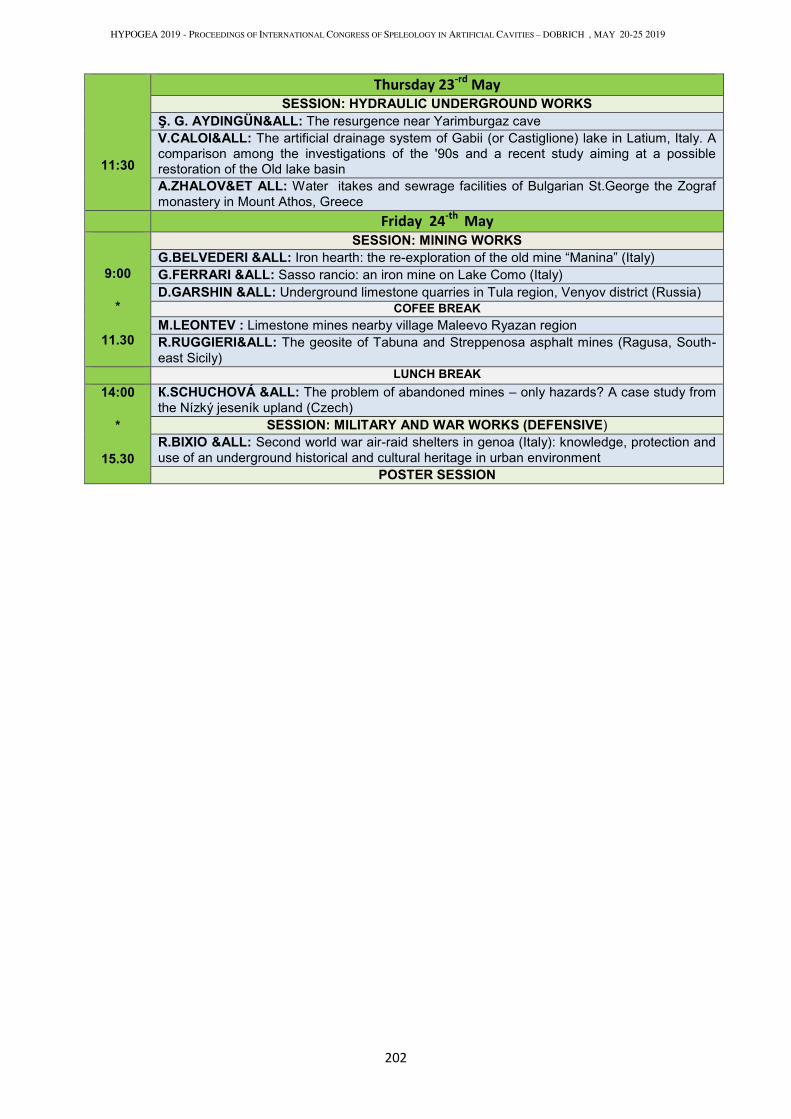
HYPOGEA 2019 - PROCEEDINGS OF INTERNATIONAL CONGRESS OF SPELEOLOGY IN ARTIFICIAL CAVITIES – DOBRICH , MAY 20-25 2019
202
11:30
Thursday 23-rd
May
SESSION: HYDRAULIC UNDERGROUND WORKS Ş. G. AYDINGÜN&ALL: The resurgence near Yarimburgaz cave
V.CALOI&ALL: The artificial drainage system of Gabii (or Castiglione) lake in Latium, Italy. A comparison among the investigations of the '90s and a recent study aiming at a possible restoration of the Old lake basin
A.ZHALOV&ET ALL: Water itakes and sewrage facilities of Bulgarian St.George the Zograf
monastery in Mount Athos, Greece
Friday 24-th
May
9:00 *
11.30
SESSION: MINING WORKS G.BELVEDERI &ALL: Iron hearth: the re-exploration of the old mine “Manina” (Italy)
G.FERRARI &ALL: Sasso rancio: an iron mine on Lake Como (Italy)
D.GARSHIN &ALL: Underground limestone quarries in Tula region, Venyov district (Russia)
COFEE BREAK M.LEONTEV : Limestone mines nearby village Maleevo Ryazan region
R.RUGGIERI&ALL: The geosite of Tabuna and Streppenosa asphalt mines (Ragusa, South-
east Sicily)
LUNCH BREAK
14:00 *
15.30
К.SCHUCHOVÁ &ALL: The problem of abandoned mines – only hazards? A case study from
the Nízký jeseník upland (Czech)
SESSION: MILITARY AND WAR WORKS (DEFENSIVE)
R.BIXIO &ALL: Second world war air-raid shelters in genoa (Italy): knowledge, protection and
use of an underground historical and cultural heritage in urban environment
POSTER SESSION
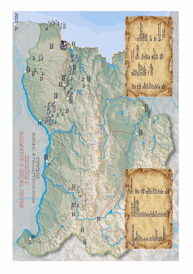
Related Documents