Do Now for Monday, Nov. 12 th . • Look at this graph carefully. Calculate the 50% relative humidity at 30 degrees C.

Do Now for Monday, Nov. 12 th. Look at this graph carefully. Calculate the 50% relative humidity at 30 degrees C.
Dec 26, 2015
Welcome message from author
This document is posted to help you gain knowledge. Please leave a comment to let me know what you think about it! Share it to your friends and learn new things together.
Transcript
Do Now for Monday, Nov. 12th.
• Look at this graph carefully. Calculate the 50% relative humidity at 30 degrees C.
Do Now Part II
• Explain Fog!

Do Now for Wednesday, November 14th!
• Our demonstration yesterday involved the behavior of water at different temperatures and densities. Can you think of any other substances that would behave in a similar way. (Hint: Current Science Topic)
Air Masses and Fronts

Changes in weather are caused by the movement and interaction of air masses. An air mass is a large body of air where temperature and moisture content are similar throughout.
The moisture content and temperature of an air mass are determined by the area over which the air mass forms. These areas are called source regions. (example: Gulf of Mexico)
* represented by a two-letter symbol * first letter = moisture content* second letter = temperature

A source region can have one of four temperature attributes:
equatorial, tropical, polar or arctic.
maritime (m)forms over water; wet
continental (c)forms over land; dry
polar (P)forms over polar regions; cold
tropical (T)develops over the Tropics; warm

Four main types of air masses influence weather in the US: MARITIME TROPICAL, CONTINENTAL TROPICAL, MARITIME POLAR, CONTINENTAL POLAR.

Cold Air Masses
continental polar (cP): air mass forms over northern Canada, which brings extremely cold winter weather to the U.S. In the summer, a cP air mass generally brings cool, dry weather.
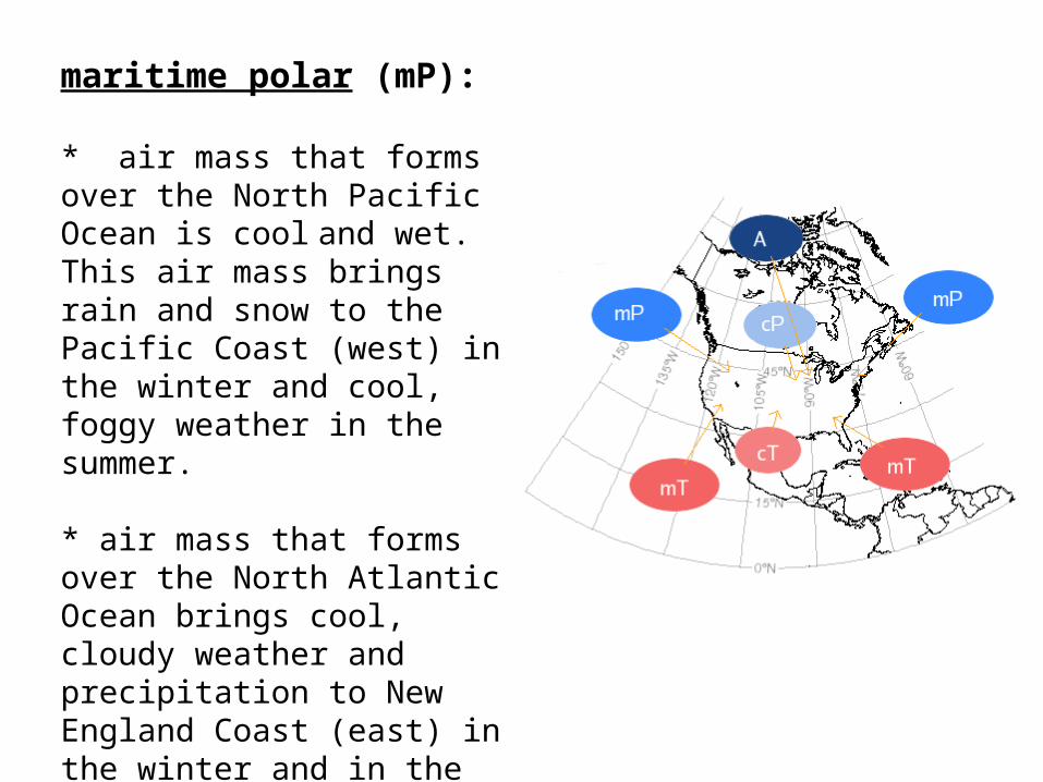
maritime polar (mP):
* air mass that forms over the North Pacific Ocean is cool and wet. This air mass brings rain and snow to the Pacific Coast (west) in the winter and cool, foggy weather in the summer.
* air mass that forms over the North Atlantic Ocean brings cool, cloudy weather and precipitation to New England Coast (east) in the winter and in the summer cool weather and fog.

Warm Air Masses
Warm air masses that influence the weather in the United States:
maritime tropical (mT)
•If it develops over warm areas in the Pacific Ocean it is milder than the maritime polar air mass that forms over the Pacific Ocean.
•Other maritime tropical air masses develop over the warm waters of the Gulf of Mexico and the Atlantic Ocean. These air masses move north across the East Coast and into the Midwest. In the summer, they bring hot and humid weather, hurricanes and thunderstorms. In the winter, they bring mild, often cloudy weather.
Warm Air Masses
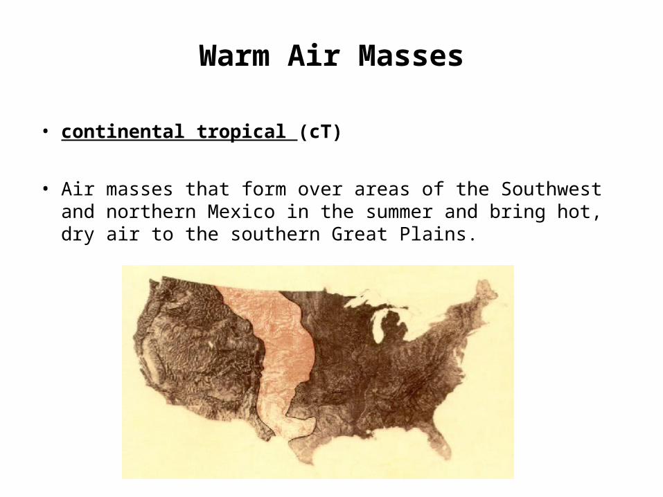
• continental tropical (cT)
• Air masses that form over areas of the Southwest and northern Mexico in the summer and bring hot, dry air to the southern Great Plains.
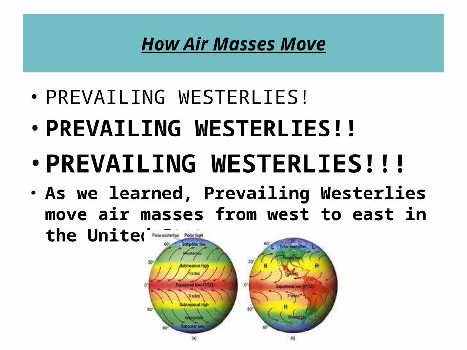
How Air Masses Move
• PREVAILING WESTERLIES!
• PREVAILING WESTERLIES!!
• PREVAILING WESTERLIES!!!• As we learned, Prevailing Westerlies move
air masses from west to east in the United States.

Do Now For Friday, Nov. 16th
• Use your 2 column notes or your textbooks to describe how a cold front forms.

Thank You Matteo!

FrontsAir masses that form from different areas
often do not mix. The reason is that the air masses have different densities.
When two types of air masses meet, warm air generally rises. The area in
which the two types of air masses meet is called a front.
4 kinds of fronts:cold frontswarm fronts
stationary frontsoccluded fronts
Fronts are associated with weather in the middle latitudes.
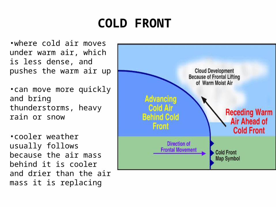
COLD FRONT
•where cold air moves under warm air, which is less dense, and pushes the warm air up
•can move more quickly and bring thunderstorms, heavy rain or snow
•cooler weather usually follows because the air mass behind it is cooler and drier than the air mass it is replacing

WARM FRONT
•forms where warm air moves over cold, denser air
•warm air gradually replaces the cold air
•generally bring drizzling rain and are followed by clear and warm weather

The building of clouds from cirrus to cirrostratus to stratus to nimbostratus signifies……….
•A WARM FRONT!!!!!
Please write this on your guided note sheet.
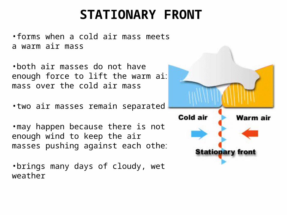
STATIONARY FRONT
•forms when a cold air mass meets a warm air mass
•both air masses do not have enough force to lift the warm air mass over the cold air mass
•two air masses remain separated
•may happen because there is not enough wind to keep the air masses pushing against each other
•brings many days of cloudy, wet weather
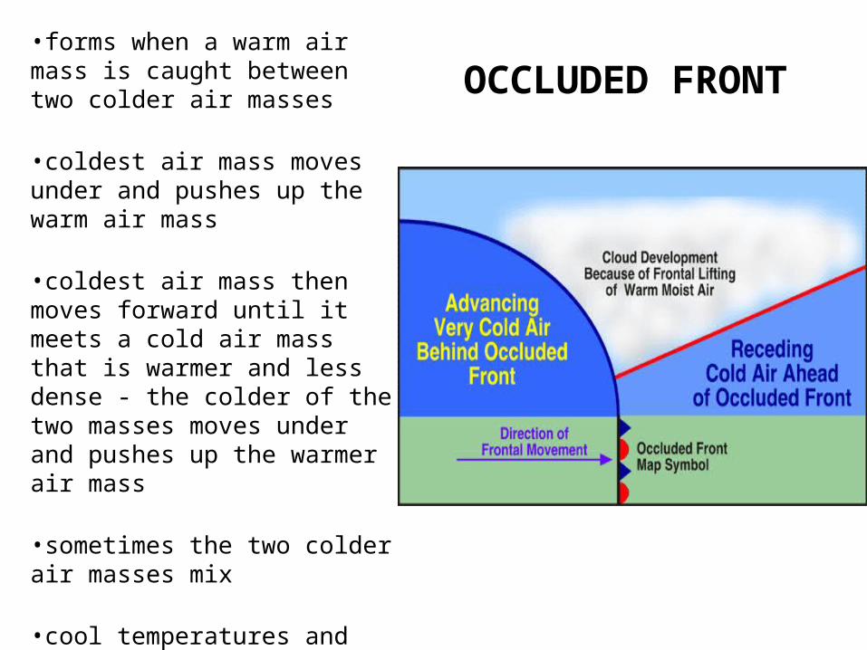
OCCLUDED FRONT•forms when a warm air mass is caught between two colder air masses
•coldest air mass moves under and pushes up the warm air mass
•coldest air mass then moves forward until it meets a cold air mass that is warmer and less dense - the colder of the two masses moves under and pushes up the warmer air mass
•sometimes the two colder air masses mix
•cool temperatures and large amounts of rain and snow
Cool Interactive Fronts
•http://www.phschool.com/atschool/phsciexp/active_art/weather_fronts/weather_fronts.swf

CYCLONES•areas that have lower pressure than the surrounding areas and has winds that spiral toward the center•causes stormy weather. Write this in your guided notes.•LOW PRESSURE = OVERCAST SKIES & PRECIPITATION!

LOW PRESSURE = OVERCAST SKIES & PRECIPITATION!

ANTICYCLONES•the rotation of air around a high pressure center in the direction opposite of Earth’s rotation•brings dry, clear weather
Anticyclones: high pressure over the U.K and northern Europe (left) brings settled weather
with clear, bright skies.
HIGH PRESSURE SYSTEMS BRING CLEAR SKIES & NO (RAIN) PRECIPITATION!
Related Documents