CENSUS OF INDIA 2001 SERIES-09 'r r DISTRICT CENSUS HAr\ioBOOK Part XII -A & B ALWAR DISTRICT VILLAGE & TOWN DIRECTORY VILLAGE AND TOWNWISE PRIMARY CENSUS ABSTRACT PEOPLE ORIENTED ANAND NIGAM '. Deputy Director Directorate of Census Operations, Rajasthan

Welcome message from author
This document is posted to help you gain knowledge. Please leave a comment to let me know what you think about it! Share it to your friends and learn new things together.
Transcript
CENSUS OF INDIA 2001
SERIES-09 R~JASTHAN 'r r ~f.'\.
DISTRICT CENSUS HAr\ioBOOK
Part XII - A & B
ALWAR DISTRICT
VILLAGE & TOWN DIRECTORY
~
VILLAGE AND TOWNWISE PRIMARY CENSUS ABSTRACT
~.,~
~ ~ PEOPLE ORIENTED
ANAND NIGAM '. Deputy Director
Directorate of Census Operations, Rajasthan

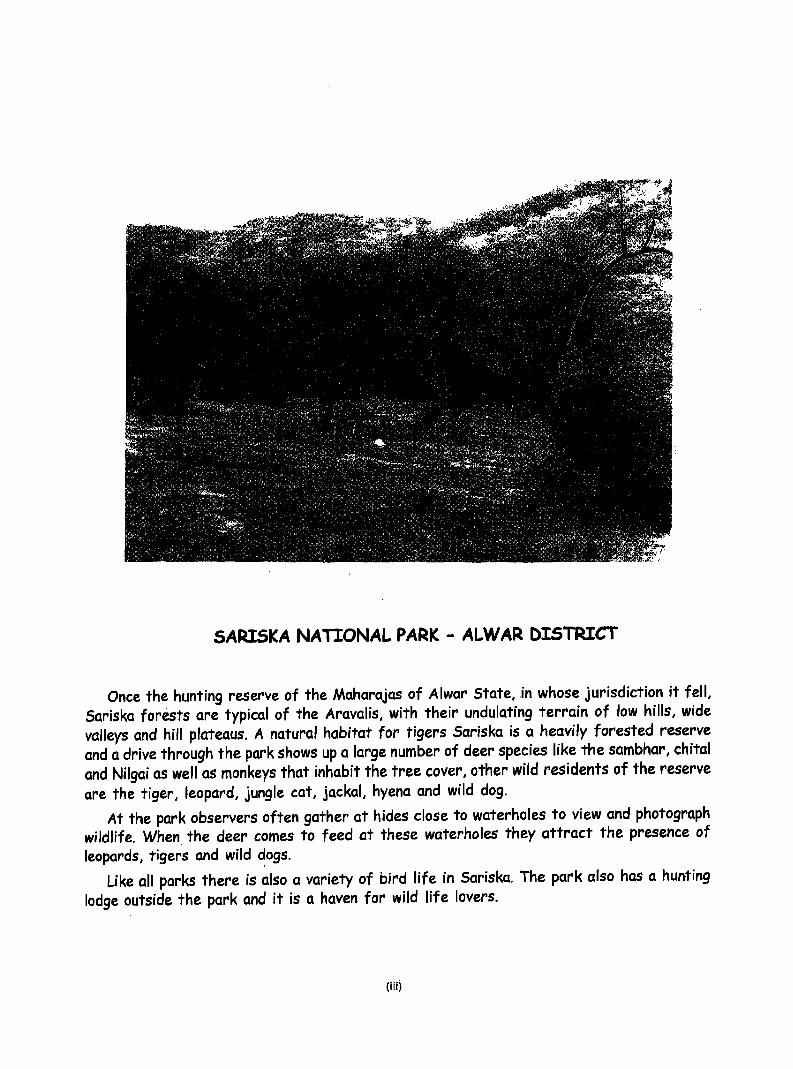
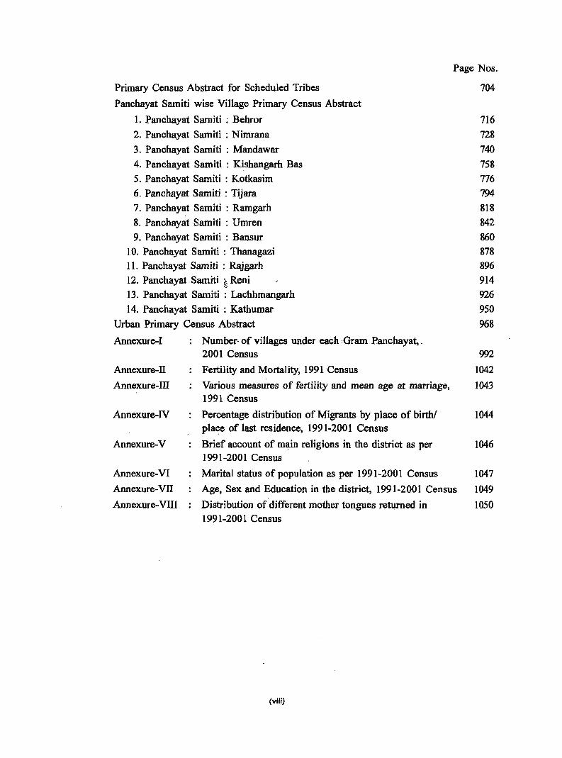
SARISKA NATIONAL PARK - ALWAR DISTRICT
Once the hunting reserve of the Maharajas of Alwar State, .in whose jurisdiction it fell, Sariska forests are typical of the Aravalis, with their undulating terrain of low hills, wide valleys and hill plateaus. A natural habitat for tigers Sariska is a heavily forested reserve and a drive through the park shows up a large number of deer species like the sambhar, chital and Nilgai as well as monkeys that inhabit the tree cover, other wild residents of the reserve are the tiger, leopard, jungle cat, jackal, hyena and wild dog.
At the park observers often gather at hides close to waterholes to view and photograph wildlife. When. the deer comes to feed at these waterholes they attract the presence of leopards, tigers and wild dogs. ,.
Like all parks there is also a variety of bird life in Sariska. The park also has a hunting lodge outside the park and it is a haven for wild life lovers.
(iii)

~
:::>
(1..
.....
<t:;
.."
E-<
-
.......... '
D
R
.mJlllI' •
,.."'t. i! ,
,l \,1' , "
s '1'
Aftl:A .~ARK.:[) AT ® 81;I.OIIU9 TO TEHllII, 1.A<:HHIIAKGARH. AREA lIAIIKIlD "'r QlI BELOIIDS TO D1S1I11C1' BIlAUATI'UR. AREA IIARKED AT 0(1) ~ ® BELOIIGS TO DISrIllC! DAIlSA
aoUNDARY. STATE DISTIIIC1' TElfSlL
P.\KCHAYAT SAWTI
HBADQIWl1'BRS: DlSTRlr:J', TEIfSlI., PANCIlAYAT SAMITI
1 c 'f D
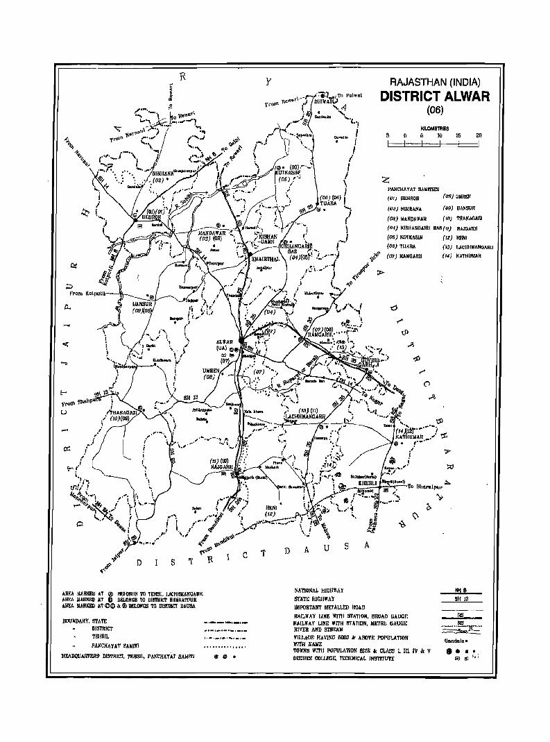
RAJASTHAN (INDIA)
DISTRICT ALWAR (06)
GUWflljt'l ! KILOMETRES 6 10 16 20 . ,
{ I i
j \ I
(06) (114) I' ... TIJARA
9.' .• " @ • ....j
Z J>ANCH~ YA1' SANITIES
(01) DEHROn
(02) NIMRANA
(o.!) MAKD,\ WAR
(08) UJlR~
(09) DANSUR
(In) 1'IIAIIAIlA'1.l ( i
-.I (04) KIR!lAKGARIl n"'~(1/) RAIGARH
(05) KO'lI(AlllM (12) Rr.til
A u
IiATIONAL HIGHWAY
S'l'''T~ HIGHWAY
(06) TIJARA
<t-~ (07) KANOARll
"'~ 4,~Jl >
..,0
S A
IMPORT MIT METALLED ROAD RAll,WAY J.lNE WITIi STATION, BROAn GAUGE I!AILIIAY LINE WI1'H STATION, ~1t."rRt GAUGI: Rl\'ER AND Sl'REAJI
VII.I,AGE HAVING ollllO lit ABOVF: POPU~A'I'ION 1I'ITII JiAlIE TOWNS WITH POPUJ.ATION SIZE ~ CLASS 1. III, IV « V IIECREI1! COLLECl£, l'E'CIINICJlL INSTITUTE
(13) LACllllJ.lANGARli
(14) KATHUMAR
SH J3
RS
(land,da'
•••• iii f!] ~ ~- ;

Foreword
Preface
Acknowledgements
Contents
District Highlights-2001 Census
Important Statistics and ranking of tehsils in the district
Statements 1-9 Statement-!
Statement-2
Statement-3
Statement-4
Statement-5
Statement-6
Statement-7
Statement-8
Statement-9
Name of the Headquarter of the DistrictlTehsil, their Rural-Urban status and Distan~e from District Headquarter, 2001
Name of the Headquarter of the DistrictlPanchayat Samiti, their Rural-Urban status and Distance from District Headquarter, 2001
Population of the District at each Census from 1901 to 2001
Area, Number of VillageslTowns and population in District and Tehsil, 2001
Panchayat Sarniti-wise number of villages and rural population, 2001
Population of Urban AgglomerationslTowns, 2001
Villages with population of 5,000 and above at Panchayat Samiti level as per 200 I Census and amenities available
Statutory Towns with population less than 5,000 as per 2001 Census and amenities available
Houseless and Institutional Population of Tehsils, . Rural and Urban, 2001
Page Nos.
IX
xi
xiii
xv
xvii
XXI
XXI
xxii
xxiii
xxiv
xxiv
xxv
XXVI
xxvii
Summary Statement: Jurisdiction of Panchayat Samities in each Tehsil, 2001 XXIX
Analytical Note (i) History and scope of the District Census Handbook 3
(ii) Brief History of the District 6
(iii) Administrative set-up 7 (iv) Physical Features: (1) Location and size (2) Physiography (3) Drainage
(4) Climate (5) Natural economic resources 7
(v) Census Concepts 12
(v)
(vi)
(vii)
(viii)
(ix)
(x)
(xi)
(xii)
(xiii)
(xiv)
Non Census Concepts
200 I Census findings-Population, its distribution
Brief analysis of PCA data based on inset tables I to 36
Brief analysis of the Village Directory and Town pirectory data based on inset tables 37 to 47 Brief analysis of the data on houses and household amenities, Houselisting Operations, Census of India 2001 based on inset tables 48 to 52 Other Developmental activities
Brief description of places of religious, historical or archaeological importance in villages and places of tourist interest in the towns of the district
Maj or characteristics of the district, contribution of the district in the form of any historical figure associated with the district Scope of Village and Town Directory - column heading
. wise explanation and coverage of data
PART-A: VILLAGE AND TOWN DIRECTORY
Section-I: Village Directory
Page Nos.
19
23
24
50
57
65
66
67
67
(a) Note explaining the abbreviations used in Village Directory 75
(b) List of Villages merged in Towns and Outgrowths at 2001 Census . 79
(c) Panchayat Samiti-wise presentation of Village Directory Data (i) Panchayat Samiti Maps showing Tehsil boundary (ii) Alphabetical List of Villages alongwith Location Code 1991 and 2001 (iii) Presentation of Village Directory data in prescribed format
1. Panchayat Samiti : Behror 83
2. Pancliayat Samiti : Nimrana
3. Panchayat Samiti : M~dawar
4. Panchayat Samiti : Kishangarh Bas
5. Panchayat Samiti : Kotk:asi~ 6. Panchayat Samiti : Tijara
7. Panchayat Samiti : Ramgarh 8. Panchayat Samiti : Umren 9. Panchayat Samiti : Bansur
10. Panchayat Samiti : Thanagazi 11. Panchayat Samiti : Rajgarh 12. Panchayat Samiti : Reni 13. Panchayat Samiti : Lachhmangarh 14. Panchayat Samiti : Kathumar
(d) Appendix to Village Directory . Appendix-I Abstract of Educational, Medical and Other Amenities
in Villages - Panchayat Sami~ level
Appendix-IA Villages by number of Primary Schools
(vi)
107
129
161
193
221 267 307
345
377 415 451 477
521
556
560
Appendix-IB
Appendix-Ie
Appendix-II
Villages by Primary, Middle and Secondary Schools
Villages with different sources of drinking water facilities available
Villages with 5,000 and above popUlation which do not have one or more amenities available
Page Nos.
560
561
561 Appendix-IIA: Census Towns which do not have one or more amenities 563
Appendix-ill : Land utilisation data in respect of Census TownslNon Municipal Towns 563
Appendix-N : Panchayat Samitiwise list of inhabited villages where no amenity other than drinking water facility is available 563
Appendix-V : Summary showing number of villages not having Scheduled Castes popUlation 566
Append ix-VI : Summary showing number of villages not having Scheduled Tribes population
g Append ix-VilA: List of villages according to the proportion of the
Scheduled Castes to the total population by ranges
Appendix-VUB : List of villages according to the proportion of the Scheduled Tribes to the total population by ranges
Appendix-VIn : Number of villages. under each Gram Panchayat (Panchayat 8amiti wise)
Appendix-IX : Statement showing number of girls schools in the villages
Section~n : Town Directory
Note explaining the abbreviations used in Town Directory Town Directory Statements (I to VII)
Statement-I
Statement-II
Statement-III
Statement-IV Statement-V
Statement-VI
Statement-VII
Status and Growth History
Physical Aspect and location of Towns
Municipal Finance
Civic and other Amenities Medical, Educational, Recreational and Cultural Facilities
Trade, Commerce, Industry and Banking
Civic and other Amenities in Slums
Appendix to Town Directory - Town showing their outgrowth with population
PART-B : PRIMARY CENSUS ABSTRACT .. (a) Brief Note on Primary Census Abstract
(b) District Primary Census Abstract (General)
(c) Appendix to District Primary Census Abstract: Urban Block Wise Total, Scheduled Castes and Scheduled Tribes Population
Primary Census Abstract for Scheduled Castes
(vii)
566
567
584
594
640
641 644 646 648 650 652
654 656
658
661 664
676
692
Page Nos.
Primary Census Abstract for Scheduled Tribes
Panchayat Samiti wise Village Primary Census Abstract
1. Panchayat Samiti : Behror
2. Panchayat Samiti : Nimrana
3. Panchayat Samiti : Mandawar
4. Panchayat Samiti : Kishangarh Bas 5. Panchayat Samiti : Kotkasim
6. Panchayat Samiti : Tijara 7. Panchayat Samiti : Ramgarh
8. Panchayat Samiti : Umren
9. Panchayat Samiti : Bansur 10. Panchayat Samiti : Thanagazi 11. Panchayat Samiti : Rajgarh 12. Panchayat Samiti :." Reni
" 13. Panchayat Samiti : Lachhmangarh
14. Panchayat Samiti : Kathumar
Urban Primary Census Abstract
Annexure-I
Annexure-II
Annexure-III
Annexure-IV
Annexure-V
Annexure-VI
Annexure-VII
Annexure-VIII
Number- of villages under each Gram· Panchayat, _ 2001 Census
Fertility and Mortality, 1991 Census
Various measures of fertility and mean age at marriage, 1991 Census
Percentage distribution of Migrants by place of birth! place of last residence, 1991-2001 Census
Brief account of main religions in the district as per 1991-2001 Census
Marital status of population as per 1991-2001 Census
Age, Sex and Education in the district, 1991-2001 Census
Distribution of different mother tongues returned in 1991-2001 Census
(viii)
704
716
728
740 758 776 794 818 842 860 878 896 914 926
950 968
992
1042
1043
1044
1046
1047
1049
1050
Foreword
The District Census Handbook (DCHB) published by Census Organization since 1951 census, is one
of the important publications in the context of planning and development at grass-root level. The
publication, which is brought out for each district, contains several demographic and socio-economic
characteristics village-wise and town-wise of the district alongwith the status of availability of civic amenities,
infrastructural facilities, etc.
The scope of the DCHB was initially confined to a few Census Tables and Primary Census Abstract
(PCA) of each village and town within the district. Thereafter, at successive censuses, its scope and
coverage has been enlarged. The DCHB published at the 1961 census provided a descriptive account ofthe
district, administrative statistics, census tables and a village and town directory including PCA. The 1971
census-DCHB series was in three parts: Part-A related to village and town directory, Part-B to village and
town PCA and Part-C comprised analytical repon, administrative statistics, district census tables and certain
analytical tables based on PCA and amenity data in respect of.villages. The 1981 census DCHB was in two
parts: Part-A contained village and town directory and Part-B the PCA of village and town including the SCs
and STs PCA up to tehsil/town levels. New features alongwith restructuring of the formats ofv;illage,and
town directory were added into it. In Village Directory, all amenities except electricity were brought together
and if any amenity was not available in the referent village, the distance in broad ranges from the nearest
place having such an amenity, was given. Information on new items such as adult literacy centres, primary
health sub-centres and community health workers in the village were provided so as to meet the requirements
of some of the Revised Minimum Needs Programme, Information on approach to the village was provided
for the first time in the Village Directory so as to give the details on number of inaccessible villages in each
district. In the Town Directory, a statement (IV-A) on slums was introduced to provide the details on civic
and other amenities in the notified slums of Class I and Class II towns.
The 1991 census DCHB, by and large, followed the pattern of presentation of 1981 census, except
the format of PC A was restructured. Nine-fold industrial classification of main workers was given against
the four-fold industrial classification presented in the 1981 census. In addition, sex-wise population in 0-6 age
group was included in the PCA for the first time with a view to enable the data users to compile more
realistic literacy rate as all children below 7 years of age had been treated as illiterate at the time of 1991
census. One of the important innovations in the 1991 census was the Community Development Block (CD
block) level presentation of village directory and PCA data instead of the traditional tehsil/talukIPS . level
presentation. It was expected that the presentation of village directory and PCA data at CD block level will
help the planners in formulation of micro level development plans, CD block being lowest administrative unit.
The present series of 200 I census DCHBs have been made more informative and exhaustive in
terms of coverage and content. The Village Directory has been enlarged in scope by including a number of
other facilities like banking, recreational and cultural facilities, newspapers and magazines and 'most important
commodity' manufactured in village. Income and expenditure of gram panchayat, wherever possible, has
been provided. Apart from these, more details on distance(s) at which basic amenities are available (if
medical facilities (viz. Allopathic Hospital, Maternity & Child Welfare Centre and Primary Health Centre),
(ix)
drinking water, post & telegraph (post office and phone), communication, bank, credit societies and recreational facilities. In Town Directory, the statement on Slums has been modified and its coverage enlarged by including details on all slums instead of' notified slums'. The information is given in case of all statutory towns irrespective of their class, against only Class·r and Class II towns in the 1981 and 1991 censuses. The basic amenities available in the villages and towns are analyzed in depth with the help of a number of cross-classified inset tables and statements. Two other significant additions in the publication are inclusion of 'motif' highlighting significant characteristic of the district and analytical notes as annexure. The analytical notes on (i) fertility and mortality and (ii) various measures offertility and mean age at marriage are prepared based on 1991 Census. Whereas, in the notes relating to (i) percentage distribution of migrants by place of birth/place of last resid~nce, (ii) main religions, (iii) marital status of population, (iv) age, sex and education, and (v) distribution of spectrum of mother tongue, nature and extent of changes occurred in the district in its basic socio-demographic features during the decade 1991-2001 are analyzed. The eight digits permanent location code (PLCN) to all t~e villages and towns have been assigned keeping in view the future needs.
The village and town level amenity data have been collected, compiled and computerized in prescribed record structure under the supervision of Shri J.L.Modi, Director of Census Operations, Rajasthan. Thereafter, efforts have been made to ensure comparability of the information with that of 1991 census data and the information brought out by the respective state governments in their annual reports and statistical handbooks for various years after 1991. The task of planning, designing and coordination of this publication ~fis carried out by Shri R.o. Mitra, Deputy Registrar General (C&T) and Dr. I.C. Agrawal, Senior Research Officer of Social Studies Division. Dr. R.P. Singh, Deputy Registrar General (Map) provided the technical guidarice· in the preparation of maps. Whereas, Shri Anil Kumar Arora, Deputy Directory of Data Processing Division who worked under the overall supervision of Shri Himakar, Add], Director (EDP) helped in preparation of record structure for computerization of village and town directory data and the programme for the generation of Village Directory and Town Directory statements including analytical inset tables. The draft DCHB manuscripts received from the Census Directorates have been scrut!nized iri the Social Studies Division under the guidance of Shri S.L. Jain, Deputy Director and Shri R.K. Mehta, Assistant Director. I am thankful to all of them and others who have contributed to make this publication possible.
New Delhi Dated: 17.1 0.2006
(x)
D.K.Sikri Additional Secretary &
Census Commissioner, India
Preface
I am deeply indebted to the State Government of Rajasthan for their unstinted support and cooperation despite all odds and adversaries like famine etc. at all stages of Census Operations of 2001. I am grateful
to Shri Inderjit Khanna, the then Chief Secretary of Government of Rajasthan for his prompt response, guidance and cooperation given to the Census Organization. He infused a sense of urgency and seriousness in the minds of District Collectors and Officers of the District Administration, which geared up the entire administrative machinery. The Supervisors and Enumerators, the basic census functionaries worked ceaselessly in the entire period of fieldwork to make Census 2001 successful.
Sarvashri Ashok Pandey and Vi nod . Zutshi, the then Secretaries in the Department of Cabinet Secretariat and General Administration have been instrumental in making Census 2001 a successful one. I owe my thanks to both of them. I am also thankful to other Departments like Education, Finance, Revenue, Economics and Statistics, Public Relations, Printing and Stationery, Local Self-government and Personnel Department for extending their full cooperation. .,
I am deeply grateful to Shri J.K. Banthia, Ex-Registrar Generil and Census Commissioner of India for his unstinted support and spontaneous, unfailing guidance throughout our endeavours. At the outset I would like to thank Shri D.K. Sikri, Registrar General and Census Commissioner, India for guiding us in bringing out this report. My grateful thanks to Shri K.N. Unni, Ex-DRG (C&T), Shri R.o. Mitra, Ex-DRG (C&T), Shri R.P. Singh, Consultant (Map), Shri Himakar, Additional Director (EDP), Dr. I.C. Agrawal, A.R.G.(SS), Shri S.L. Jain, Deputy Director (SS), Shri C. Chakravorty, Joint Director (DDU) and their colleagues at the headquarter for their ever willing, helping hand and thoughtful suggestions for putting together and shaping the volumes in their present form.
The Director of Census Operations, Rajasthan, Shri J. L. Modi under whose guidance the entire operations were carried out deserves all credit for its success, but he was repatriated to the State Government for taking up some other important assignment before this volume could be made available for the press. I am deeply gr~atful to Sh~i H.S. Meena, Ex-Joint Director of Census Operations, Rajasthan for its success.
It may be mentioned a few annexures have been added to this volume with a view to provide an insight into the 1991 and 2001 data on the suggestion of Social Studies Division ofthe Office of the Registrar General, India. In this connection the contribution of Shri V.K. Gupta, Senior Compiler can not be ignored.
Shri H.C Sharma, Assistant Director in charge of District Census Handbooks and Primary Census Abstract, who was ably assisted by his team of dedicated workers deserve all praise for their perseverance -and dedication in preparing Village and Town Directories and in finalization of PCAs and other inset tables. I would like to thank Shri G. Fernandes, Assistant Director who not only coordinated the work but also contributed immensely to the cause of Village and Town Directories.
In view of the increasing demand of the publications in electronic format, it has been decided to publish the DCHB also on CD. I highly appreciate the efforts put in by Smt. Jyoti Luhadiya, DD(EDP) and her team to compile in the electronic format. The efforts put in by Shri Divesh Chawla, DEO Gr-'B' is highly commendable.
Shri K.S. Bhatnagar, D.D.e.O. has taken pains in drafting the District Profile and the Analytical Note fo~ the district. The members ofthe staff in the Map Section did a commendable job under the guidance of Shri Panna Lal, R.O.(Map), ably assisted by Shri R.S. 7yagi, Sr. Geographer in bringing out various maps.
Jaipur January, 2007
(xi)
A:_nand Nigam Deputy Director of Census Operations,
Rajasthan

Acknowledgements
Task Force for Quality Assurance Sh. J .L. Modi Sh. H.S. Meena Sh. K.S .Bhatnagar Sh. H.C. Sharma Sh.A.K.Rai Sh. Mukesh Bhargava Sh. K.C.Gupta Sh. K.B. Sharma-l Sh. H.K. Saxena
Village and Town Directory
Sh. G. Fernandes Sh. R.A. Agrawal Sh. C.S. Sharma Sh. P.L. Meena Sh. GL. Meena-ll Sh. M.L. Gupta Sh. D.P. Sharma Late Sh. B.P. Sharma Sh. S.K. Chaturvedi Sh. V.P. Singhal Sh. S.M. Tak Sh. V.M. Mathur Sh. V.K. Gupta. Sh. R.K. Nagar Sh. J.P. Verma
Primary Census Abstract
Sh. S.R. Singhal Sh.A.K. Rai Sh. Mukesh Bhargava Sh. K.C.Gupta Sh. S.N. Mishra Sh. K.B. Sharma-I Smt. Santosh Malakar Sh. Bhupendra Goyal Sh. A.K. Srivastava Smt. Cham Mathur Sh. Gokul ChandVenna Sh. R.K. Mittal Sh. Arun Jain Sh. H.L. Gupta Smt. Kamlesh Sharma Sh. Manikant Sharma Sh. Babu Lal Verma-I Sh. Rahul Garg Sh. J.P. Verma
(xiii)
Director (Chairman) Joint Director Deputy Director Assistant Director S.l. Grade-I S.I. Grade-I S.I. Grade-I S.1. Grade-II(Retd.) Junior Supervisor
Assistant Director S.1. Grade-I(Retd.) S.l. Grade-II(Retd.) S.I. Grade-II S.I. Grade-II S.I. Grade-III(Retd.) S.l. Grade-III S.l. Grade-III Senior Compiler Compiler Compiler Compiler Compiler Senior Compiler D.E.O. Grade-B
Assistant Director S.l. Grade-I S.I. Grade-I S.l. Grade-I S.l. Grade-II(Retd.) S.l. Grade-II(Retd.) S.I. Grade-II(Retd.} S.I. Grade-n S.l. Grade-III S.I. Grade-In Senior Compiler Senior Compiler Senior Compiler Compiler Senior Compiler Compiler Compiler Compiler D.E.D. Gtade-B
Concept, Editing and Support
Sh. Anand Nigam Sh. H.C. Sharma Sh. G. Fernandes Sh.A.K. Rai Sh. Ashok Srivastava Sh. Arun Jain Sh. H.L. Gupta
Preparation of Camera Ready Copy (CRC)
Sh. Divesh Chawla Sh. J.P. Verma Sh. V.K. Gupta
Data Entry System
Smt.Jyoti Luhadiya Sh. D.K. Surana Sh. A.K. Pareek Sh. P.N. Mathur Sh. H.K. Saxena Sh. S.C. Verma Sh. H.K. Pareek Sh. P.K. Jain Sh. Deepak Srivastava Sh. S.N. Kumawat Sh. B.P. Singh
Map
Sh. Autar Singh Sh. R.S. Tyagi Sh. Sardul Singh Sh. P.K. Sharm~ Sh.BabuLal Sh. Nand Lal Sh. Deepak Sood
Sh. S.K. Ajmera Sh. Satish Basandani
Printing and ProofReading
Sh. K.L. Palawat Sh. R.K.Nagar
(xiv)
Deputy Director Assistant Director Assistant Director S.l. Grade-I S.l. Grade-ill Senior Compiler Compiler
D.E.D. Grade-B D.E.D. Grade-B Compiler
Deputy Director(EDP) Assistant Director . Senior Supervisor Senior Supervisor Junior Supervisor Junior Supervisor Junior Supervisor Junior Supervisor D.E.O. Grade-B D;E.O. Grade-B D.E.O: Grade-B
Research Officer (Map) Senior Geographer Senior Drawing Assistant Senior Draughtsman Senior Draughtsman Senior Draughtsman Senior Draughtsman
Compiler Compiler
Proof Reader Senior Compiler
District Highlights - 2001 Census
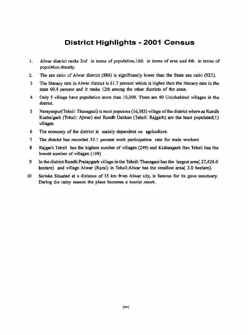
1. Alwar district ranks 2nd in terms of population, 16th in terms of area and 4th in terms of population density.
2. The sex ratio of Alwar district (886) is significantly [ower than the State sex ratio (921).
3 The literacy rate in Alwar district is 61.7 percent which is higher than the I iteracy rate in the state 60.4 percent and it ranks 12th among the other districts of the state.
4 Only S village have population more than 10,000. There are 40 Uninhabited villages in the district.
5 Narayanpur(Tehsil: Thanagazi) is most popuious (16,383) village of the district where as Rundh Kushalgarh (Tehsil: AJwar) and Rundh Dabkan (Tehsil: Rajgarh) are the least populated(1) villages.
6 The economy of the district is mainly dependent on agriculture.
7 The district has recorded S3.1 percent work participation rate for male workers
8 Rajgarh Tehsil has the highest number of villages (249) and Kishangarh Bas Tehsil has the lowest number of villages (109)
9 In the district Rundh Pratapgarh village in the Tehsil: Thanagazi has the largest area( 27,426.0 hectare) and village Alwar (Rural) in Tehsil:Alwar has the smallest area( 3.0 hectare).
10 Sariska Situated at a distance of 3S km fmm Alwar city, is famous for its gave sanctuary. During the rainy season the place becomes a tourist resort.
(xv)

.,
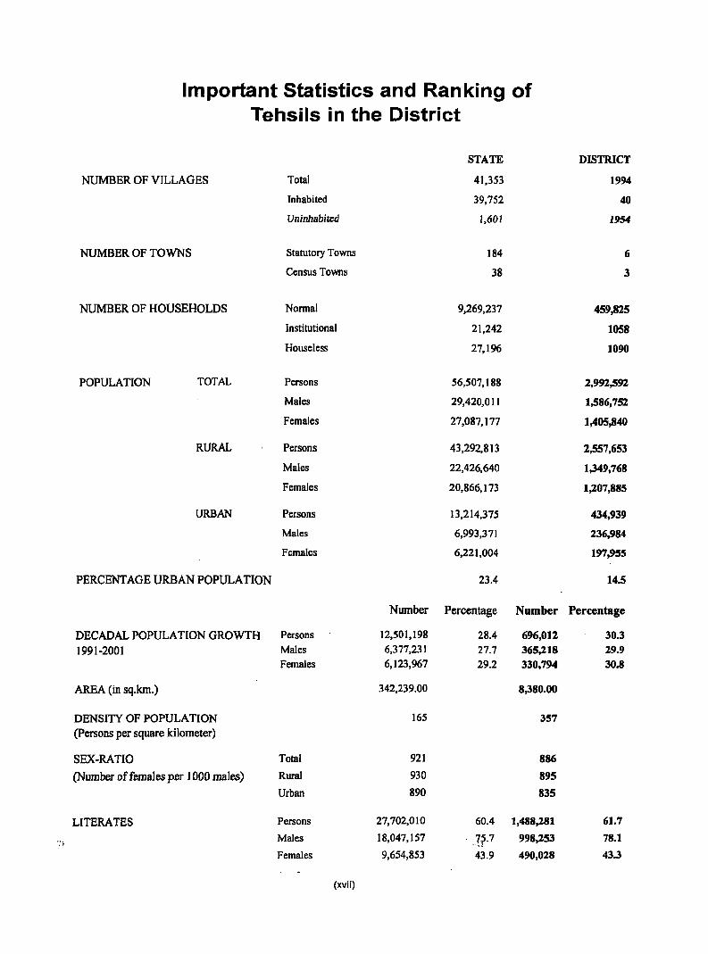
Important Statistics and Ranking of Tehsils in the District
STATE
NUMBER OF VILLAGES Total 41,353
Inhabited 39,752
Uninhabited 1,601
NUMBER OF TOWNS Statutory Towns 184
Census Towns 38
NUMBER OF HOUSEHOLDS Normal 9,269,237
Institutional 21,242
Houseless 27,196
POPULATION TOTAL Persons 56,507,188
Males 29,420,011
Females 27,087,177
RURAL Persons 43,292,813
Males 22,426,640
Females 20,866,173
URBAN Persons 13,214,375
Males 6,993,371
Females 6,221,004
PERCENTAGE URBAN POPULATION 23.4
Number Percentage Number
DECADAL POPULATION GROWTH Persons 12,501,198 28.4 696,012
1991-2001 Males 6,377,231 27.7 365,218 Females 6,123,967 29.2 330,794
AREA (in sq.km.) 342,239.00 8,380.00
DENSITY OF POPULATION 165 357
(Persons per square kilometer)
SEX-RATIO Total 921 886
(Number offemaJes per J 000 maJes) Rural 930 895
Urban 890 835
LITERATES Persons 27,702,010 60.4 1,488,181
Males 18,047,157 7~.7 998,253 '".,;
Females 9,654,853 43.9 490,028
(xvii)
DISTRICT
1994
40
1954
6
3
459,825
1058
1090
2,991,591
1,586,751
1,405-,840
1,557,653
1,349,768
1,207,885
434,939
236,984
197,955
14.5
Percentage
30.3 19.9
30.8
61.7
78.1
43.3
Number Percentage Number Percentage
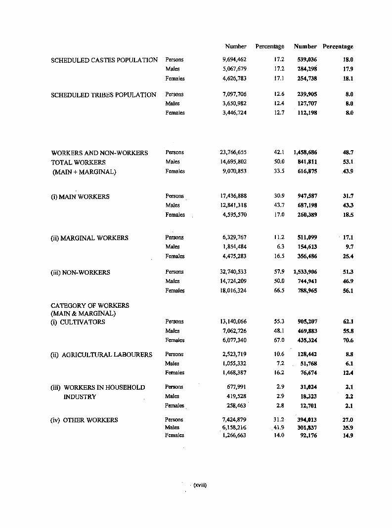
SCHEDULED CASTES POPULATION Persons 9,694,462 17.2 539,036 18.0
Males 5,067,679 17.2 284,298 17.9
Females 4,626,783 17.1 254,738 18.1
SCHEDULED TRIBES POPULATION Persons 7,097,706 12.6 239,905 8.0
Males 3,650,982 12.4 127,707 8.0
Females 3,446,724 12.7 112,198 8.0
WORKERS AND NON-WORKERS Persons 23,766,655 42.1 1,458,686 48.7
TOTAL WORKERS Males 14,695,802 50.0 841,811 53.1
(MAIN + MARGINAL) Females 9,070,853 33.5 616,875 43.9
(i) MAIN WORKERS Persons 17,436,888 30.9 947,587 31.7
Males 12,841,318 43.7 687,198 43.3
Females 4,595,570 17.0 260,389 18.5
(ii) MARGINAL WORKERS Persons 6,329,767 11.2 511,099 . 17.1
Males 1,854,484 6.3 154,613 9.7
Females 4,475,283 16.5 356,486 25.4
(iii) NON-WORKERS Persons 32,740,533 57.9 1,533,906 51.3
Males 14,724,209 50.0 744,941 46.9
Females 18,016,324 66.5 788,965 56.1
CATEGORY OF WORKERS (MAIN & MARGINAL) (i) CULTIVATORS Persons 13,140,066 55.3 905,207 62.1
Males 7,062,726 48.1 469,883 55.8
Females 6,077,340 67.0 435,324 70.6
(ii) AGRICULTURAL LABOURERS Persons 2,523.,719 10.6 118,442 8.8
Males 1,055,332 7.2 51,768 6.1
Females 1,468,387 16.2 76,674 12.4
(iii) WORKERS IN HOUSEHOLD Persons 677,991 2.9 31,024 2.1
INDUSTRY Males 419,528 2.9 18,323 2.2
Females 258,463 2.8 12,701 2.1
(iv) OTHER WORKERS Persons 7,424,879 31.2 394,013 27.0 Males 6,158,21-6 41.9 301,837 35:9 Females 1,266,663 14.0 92,176 14.9
. (xviii)
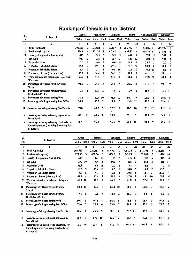
Ranking of Tehsils in the District SI. No.
In Term of
2
I Total Population 2 Total area (in sq.km.) 3 Density of popUlation (per sq.km). 4 Sex Ratio 5 Proportion Urban 6 Proportion Scheduled Castes 7 Proportion Scheduled Tribes 8 Proportion Literate (Literacy Rate) 9 Work participation rate (Main + Marginal
Workers) 10 Percentage of villages having Primary
School II Percentage of villages having Primary
Health Sub-Centre 12 Percentage of villages having Well 13 Percentage of villages having Post Office
14 Percentage of villages having Bus Facility
15 Percentage of villages having approach by PuccaRoad
16 Percentage of villages having Electricity for domestic purpose (Including Electricity for all purpose)
SI. No.
Total Population
In Termor
2
2 Total area (in sq.km.) 3 Density of population (per sq.km).
4 Sex Ratio
5 Proportion Urban 6 Proportion Scheduled Castes 7 Proportion Scheduled Tribes 8 Proportion Literate (Literacy Rate) 9 Work participation rate (Main + Marginal
Workers) 10 Percentage of villages having Primary
School II Percentage of villages having Primary
Health Sub-Centre 12 Percentage of villages having Well 13 Percentage of villages having Post Office
14 Percentage of villages having Bus Facility
15 Percentage of villages having approach by PuccaRoad
16 Percentage of villages having Electricity for domestic purpose (Including Electricity for all purpose)
Behror Mandawar Kotkasim Tijara Kishangarh Bas Ramgarh
Value Rank Value Rank Value Rank Value Rank Value Rank Value Rank
3
305,688
729.8
4
3
4 419 3 917 2
7.5 6 15.6 9
1.4 9
73.9 I
53.3 4
. 94.9 6
10.9 4
80.6 II
34.9
52.0
70.3 2
98.9
5
i97,582
573.24
6 9
9 345 8 918 I
0.0 8 19.4 4 3.1 8
68.6 3
61.3
97.9 4
11.3 3
82.4 10
30.3 2
41.5 3
60.6 8·
96.5 3
7 8 9 10
117,687 12 280,772
342.98 12 635.55 4
6 343 9 907 3 0.0 9
19.3
0.8 10
69.1 2 51.1 6
97.4 5
3.5 12
71.3 12 18.3 10
25.2 7
53.9 II
96.5 2
442 2 824 12
19.2 3
13.6 12 0.2 12
58.2 7 54.0 3
89.6 9
6.9 10
94.1 9 13.9 12
20.3 10
67.3 3
92.1 10
II 12
161,629 II 404.77 II
399 5 902 6
25.7 2 20.9 2
0.2 II 61.2 5 43.2 10
91.4 8
10.5 6
100.0 I
20.0 9
20.0 12
52.4 12
94.3 7
13
201,757
581.55
14
8 8
347 7 904 4 0.0 10
17.4 8 3.2 7
52.0 II 44.5 9
92.1 7
5.5 II
98.8 5
13.9 II
25.5 6
64.8 6
96.4 4
Alwar Bansur Thanagazi Rajgarh Lachhmangarh Kathumar
Value Rank Value Rank Value Rank Value Rank Value Rank Value Rank
IS 16
568,530 I
923.83 3
615
870 to 46.8 19.6 3
4.8 5 67.9 4 41.3 12
88.4 10
19.6
99.5 2
23.6 6
20.6 8
70.9
93.0 9
17 18
214,351 6
662.76 5
323 to 904 5
0.0 II 15.4 10
4.3 6
57.6 8 47.8 8
99.2
9.2 7
99.2 4
26.0 4
46.6 2
57.3 10
95.4 5
(xix)
19 20
189,977 10
1066.3 2
178 12
902 7
0.0 12 14.5 II
19.1 2
47.5 12 49.0 7
81.8 12
12.2 2
96.6 8 23.0 7
38.5 4
62.2 7
72.3 12
21 22 23 24
306,226 2 241,708 5
1426.3 625.05 7
215 II 387 6
885 9 888 8 8.2 4 4.2 7
18.8 6
30.8 I 57.0 9 41.8 II
88.0 II
10.7 5
98.8 6 24.4 5
20.2 II
66.9 4
91.3 II
18.5 7
12.1 3
55.1 10 57.4 2
98.4 3
8.8 8
98.4 7 21.8 8
36.3 5
59.6 9
94.8 6
25 26
206,685 7 498 10
415 4 868 II 7.5 5
23.7
.11.9 4 60.9 6 51.2 5
98.5 2
8.0 9
99.3 3 27.7 3
20.4 9
65.7 5
94.2 8

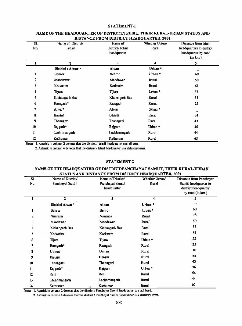
ST A TEMENT-l
NAME OF THE HEADQUARTER OF DISTRJ~TrrEHSIL, THEIR RURAL-URBAN STATUS AND DISTANCE FROM DISTRICT HEADQUARTER, 2001 .
Sl. Name of District! Name of Whether UrbanI Distance from tehsil No. Tehsil DistrictlTehsii Rural headquarters to district
headquarter headquarter by road (inkm.)
2 3 4 5 District : Alwar '" Alwar Urban *
1 Behror Behror Urban '" 60
2 Mandawar Mandawar Rural 50
3 Kotkasim Kotkasim Rural 61
4 Tijara Tijara Urban '" 55
5 Kishangarh Bas Kishl\ngarh Bas Rural 35
6 Ramgarh'" Ramgarh Rural 25
7 Alwar* Alwar Urban '"
8 Bansur Bansur Rural 54
9 Thanagazi Thanagazi Rural 43 10 Rajgarh* Rajgarh Urban * 36 11 Lachhmangarh Lachhmangarh Rural 44
12 Kathumar Kathumar Rural 65 Note: I. Asterisk in column 2 denotes that the district I tehsil headquarter is a rail head.
2. Asterisk in column 4 denotes that the district I tehsil headquarter is a statutory town.
STATEMENT -2
NAME OF THE HEADQUARTER OF DISTRICTIPANCHAY AT SAMm, THEIR RURAL-URBAN STATUS AND DISTANCE FROM DISTRICT HEADQUARTER, 200]
Sl. Name of District! Name of District! Whether UrbanI Distance from Panchayat No. Panchayat Samiti Panchayat Samiti Rural Samiti headquarter to
headquarter district headquarter by road (in km.)
2 3 4 5
District Alwar* Alwar Urban *
Behror Behror Urban '" 60
2 Nimrana Nimrana Rural' 78
3 Mandawar Mandawar Rural 50
4 Kishangarh Bas Kishangarh Bas Rural 35
5 Kotkasim Kotkasim Rural 61
6 Tijara Tijara Urban '" 55
7 Ramgarh* Ramgarh Rural 25
8 Umren Umren Rural 10
9 Bansur Bansur Rural 54
10 Thanagazi Thanagazi Rural 43
11 Raj garh '" Rajgarh Urban '" 36
12 Reni Reni Rural 54
13 Lachhmangarh Lachhmangarh Rural 44
14 Kathumar Kathumar Rural 65 . ,.~!.
Note: 1. Asterisk in column 2 denotes that the district I Panchayat Samiti headquarter is a rail head. 2. Asterisk in column 4 denotes that the district I Panchayat Samiti headquarter is a statutory town.
(xxi)
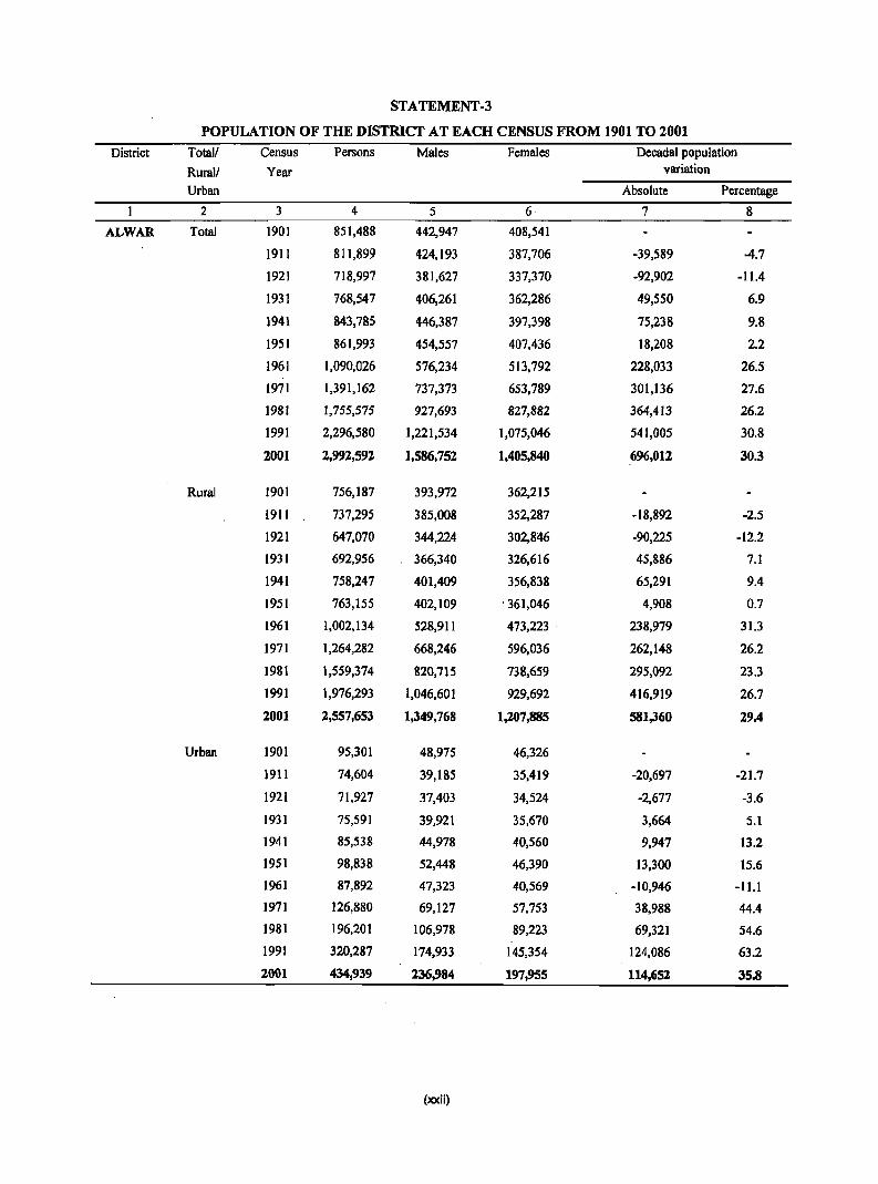
STATEMENT-3
POPULATION OF THE DISTRICT AT EACH CENSUS FROM 1901 TO 2001
District Totall Census Persons Males Females Decada1 population
Rurall Year variation
Urban Absolute Percentage
2 3 4 5 6 7 8
ALWAR Total 1901 851,488 442,947 408,541
1911 811,899 424,193 387,706 -39,589 -4.7
1921 718,997 381,627 337,370 -92,902 -11.4
1931 768,547 406,261 362,286 49,550 6.9
1941 843,785 446,387 397,398 75,238 9.8
1951 861,993 454,557 407,436 18,208 2.2
1961 1,090,026 576,234 513,792 228,033 26.5
1971 1,391,162 737,373 653,789 301,136 27.6
1981 1,755,575 927,693 827,882 364,413 26.2
1991 2,296,580 1,221,534 1,075,046 541,005 30.8
2001 2,992,592 1,586,752 1,405,840 696,012 30.3
Rural 1901 756,187 393,972 362,215
1911 737,295 385,008 352,287 -18,892 -2.5
1921 647,070 344,224 302,846 ·90,225 -12.2
1931 692,956 366,340 326,616 45,886 7.1
1941 758,247 401,409 356,838 65,291 9.4
1951 763,155 402,109 . 361,046 4,908 0.7
1961 1,002,134 528,911 473,223 238,979 31.3
1971 1,264,282 668,246 596,036 262,148 26.2
1981 1,559,374 820,715 738,659 295,092 23.3
1991 1,976,293 1,046,601 929,692 416,919 26.7
2001 2,557,653 1,349,768 1,207,885 581,360 29.4
Urban 1901 95,301 48,975 46,326
1911 74,604 39,185 35,419 -20,697 -21.7
1921 71,927 37,403 34,524 -2,677 -3.6
1931 75,591 39,921 35,670 3,664 5.1
1941 85,538 44,978 40,560 9,947 13.2
1951 98,838 52,448 46,390 13,300 15.6
1961 87,892 47,323 40,569 -10,946 -11.1
1971 126,880 69,127 57,753 38,988 44.4
1981 196,201 106,978 89,223 69,321 54.6
1991 320,287 174,933 145,354 124,086 63.2
2001 434,939 236,984 197,955 114,652 35.8
(xxii)
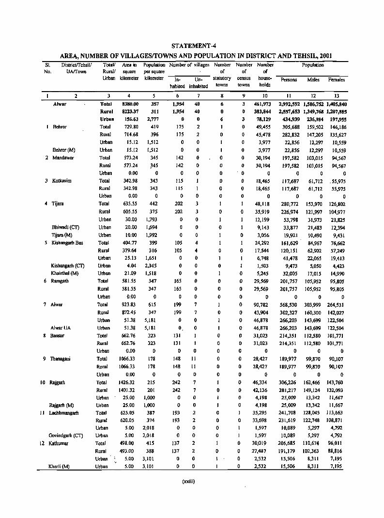
STATEMENT -4
AREA, NUMBER OF VILLAGESrrOWNS AND POPULATION IN DISTRICT AND TEHSIL, 2001 SI. No.
Districtffehsill UAffown
2
Alwar
I Behror
Bchror(M)
2 Mandawar
3 Kotkasim
4 Tijara
Bhiwadi (CT)
Tijara(M}
5 Kishangarh Bas
Kishangarh (CT)
Khairthal (M)
6 Ramgarh
7 Alwar
AlwarUA
8 Bansur
9 Thanagazi
10 Rajgarh
Rajgarh (M)
I 1 Lacbhmangarh
Govindgarh (CT)
12 Kathumar
Kherli (M)
TOla11 Area in Rural! square Urban kilometer
Populalion Number of villages Number Number Number
3
Total Rural
Urban Total
Rural Urban
Urban
Total Rural
Urban Total Rural Urban
Total
Rural
Urban
Urban
Urban
Total
Rural Urban
Urban Urban Total
Rural
Urban
Total
Rural
Urban Urban
Tolal Rural
Urban
Total
Rural
Urban
Total Rural
Urban Urban
Total Rural Urban Urban
Total
Rural
Urban .,
~~~ ~ ~ ~ kilometer In- Un- statutory census house-
4
8380.00 8223.37
156.63
729.80
714.68
15.12
15.[2
573.24
573.24
0.00
342.98 342.98
0.00
635.55
605.55
30.00
20.00
10.00
404.77
379.64
25.13
4.04
21.09
581.55
581.55
0.00
923.83
5
357
311
2,777
419
396 1,512
[,512
345
~45
o 343 343
o 442
375
1,793
1,694
1,992
399
316 1,651
2,345
1,518
347
347
o 615
872.45 347
51.38 5,[81
51.38
662.76 662.76
0.00
1066.33
1066.33
0.00
1426.32
1401.32
25.00
25.00
625.05 620.05
5.00
S.OO
498.00
493.00
5.00
5,[81
323 323
o 178
178
o 215
201
1,000 1,000
387
374 2,018
2,018
415
388
3,101
habited inhabited towns towns holds
6
1,954
1,954
o 175
175
o o
[42
142
o 115 [15
o 202
202
o o o
105
105 o o o
165
165
o 199
199
o o
131
131
o 148
148
o 242
242
o o
193
193 o o
137
137
o
7
40
40
o 2
2
o o o o o
1
o 3
3
o o o 4
4
o o o o o o 7
7
o o
1
o 11
11
o
8
6
o 6
1
o
I
o o o o o o I
o
o
1
o 1
o
o o o
o
I
o o o o o o
o
o o o o I
o
9
3
o 3
o o o o o o o o o o I
o
o I
o
I
o o o o o o o o o o o o o o o o o o
10
461,973 383,844
78,129
49,455
45,478
3,977
3,977
30,194
30,194
o 18,465 18,465
o 48,118
35,919
12,199
9,143
3,056
24,292
17,544
6,748
1,503
5,245
29,569
29,569
o 90,782
43,904
46,878
46,878
31,023
31,023
o 28,427
28,427
o 46,334
42,136 4,198
4,198
35,295
33,698 1,597
1,597
30,019
27,487
2,532
Urban 5.00 3,101 o
7 7
o o 2
2 o o 2
2
o o
o I
1
o o o o 2,532
(xxiii)
Population
Persons Males Females
II 12 13
2,992,592 1,586,752 1,405,840
2,557,653 1,349,768 1,207,885
434,939 236,984 197,955
305,688 159,502 146,186
282,832 147,205 135,627
22,856
22,856
197,582
197,582
o 117,687 117,687
o 280,772
226,974
53,798
33,877
19,921
161,629 120,151
41,478
9,413
32,005
201,757
201,757
o 568,530
12,297
12,291
103,015
103,015
o 61,712 61,712
o 153,970
121,997
31,973
21,483
10,490
84,967 62,902
22,065
5,050
11,015
105,952
105,952
o
10,559
10,559
94,567
94,567
o .55,975 55,915
o 126,802
104,977
21,825
12,394
9,431
76,662
57,249
19,413
4,423
14,990
95,805
95,805
o 303,999 264,531
302,327 160,300 142,027
266,203 143,699 122,504
266,203
214,351
214,351
o 189,977
189,977
o 306,226
281,217 25,009
25,009
241,708
231,619 10,089
10,089
206,685
191,179 15,506
15,506
143,699
112,580
I 12,S80
o 99,870
99,870
o 162,466
149,124 13,342
13,342
128,045
122,748
5,297
5,297
110,674
102,363 8,311
8,311
122,504
101,771
101,771
o 90,107
90,107
o 143,760
132,093 11,667
11,667
113,663
108,811
4,792
4,792
96,011
88,816 7,195
7,195
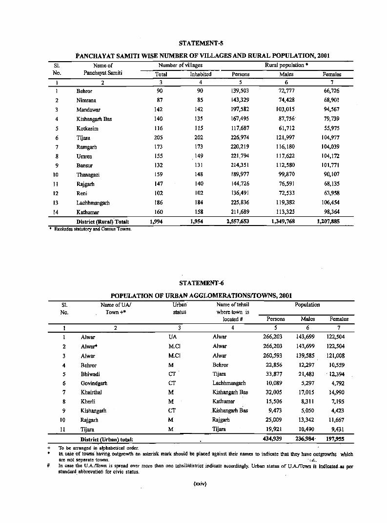
STATEMENT -5
PANCHAY AT SAMITI WISE NUMBER OF VILLAGES AND RURAL POPULATION, 2001
Sl. Name of Number of villages Rural population '" No. Panchayat Samiti Total Inhabited Persons Males Females
2 3 4 5 6 7
Behror 90 90 139,503 72,777 66,726
2 Nimrana 87 85 143,329 74,428 68,901
3 Mandawar 142 142 197,582 103,015 94,567
4 Kishangarh Bas 140 135 167,495 87,756' 79,739
5 Kotkasim 116 115 117,687 61,712 55,975
6 Tijara 205 202 226,974 121,997 104,977
7 Ramgarh 173 173 220,219 116,180 104,039
8 Umren 155 149 221,794 117,622 104,172
9 Bansur 132 131 214,351 112,580 101,771
10 Thanagazi 159 148 189,977 99,870 90,107
11 Rajgarh 147 140 144,726 76,591 68,135
12 Reni 102 102 136,491 72,533 63,958
13 Lachhmangarh 186 184 225,836 II 9,382 106,454
14 Kathumar 160 158 211,689 113,325 98,364
District (Rural) Total: 1,994 1,954 2,557,653 1,349,768 1,207,885 • Excludes statutory and Census Towns.
STATEMENT-6
POPULATION OF URBAN AGGLOMERATIONSITOWNS, 2001
Sl. NameofUAI Urban Name oftehsil Population No. Town+'" status where town is
located # Persons Males Females
2 3 4 5 6 7
1 Alwar UA Alwar 266,203 143,699 122,504
2 Alwar· M.C! Alwar 266,203 143,699 122,504
3 Alwar M.Cl Alwar 260,593 139,585 121,008
4 Behror M Behror 22,856 12,297 10,559
5 Bhiwadi CT Tijara 33,877 21,483 . 12,394
6 Govindgarh CT Lachhmangarh 10,089 5,297 4,792
7 KhairthaJ M Kishangarh Bas 32,005 17,015 14,990
8 Kherii M Kathumar 15,506 8,311 7,195
9 Kishangarh CT . Kishangarh Bas 9,473 5,050 4,423
10 Rajgarh M Rajgarh 25,009 13,342 11,667
11 Tijara M Tijara 19,921 10,490 9,431
Distric~ (Urbanl total: 434,939 236,984' 197,955
+ To be arranged ill alphabetical order. • In. caSe' of towns having outgrowth an· asterisk mark should be placed against their names to indicate that they have outgrowths which
are not separate ·towns. ·,.if .....
# In case the U.A.trown is sprc:ad over more than one tehsil/district indicate accordingly. Urban status of u.A.rrown is indicated·as per standard abbrevatioii for civic status.
(xxiv)
STATEMENT -7
VILLAGES WITH POPULATION OF 5,000 AND ABOVE AT PANCHA Y AT SAMITI SI
No. Name of
Panchayat Samiti
2 1
2 3 4
5
Nimrana Behror Behror Mandawar Mandawar
6 Mandawar 7 Kotkasim 8 Kotkasim 9 Tijara
10 Tijara 11 Tijara 12 Kishangarh Bas 13 Ramgarh 14 Ramgarh 15 Ramgarh 16 Ramgarh 17 Umcen 18 Kishangarh Bas 19 Umren 20 Umcen 21 Umcen 22 Umcen 23 Umcen 24 Umcen 2S Umcen 26 Bansur 27 Bansur 28 Bansur 29 Bansur 30 Bansur 31 Thanagozi 32 Thanagazi 33 Thanagozi 34 Thanagozi 35 Rajgarh 36 Rajgarh 37 Reni 38 Reni 39 Reni 40 Reni 41 Lachhmangarh 42 Lachhmangarh 43 Lachhmangarh 44 Lachhmangarh 45 Kathumar 46 Kathumar 47 Kathumar 48 Kathumar 49 Kathumar 50 Kathumar
Name of village
3 Shahjahanpur Gandala Bardod Mundawar Pehal Tatarpur Kotkasim HarsoH Santhalka Guwalda Tapookra Ismalpur Mubarikpur Naugawan Ramgarh AlaW1lra Chandoli Bahadurpur Patti Meeran Bhoogar Diwakari Prithvipura Beejawar Baleta Mala Khera Barkhera Harsora Hameerpur Hajipur Kasba Bansur Rampur Garhi Mundawara Narayanpur ThBnagozi Sakat Rajgarh (Rural) Machari Pinan Reni Garhi Sawairam BarodaMeo Lachhmangarh Mojpur Harsana Tasai Kathoomar Garoo Samoochi Sonkhar ( Rural ). Kherli Rei (Rural)
Amenities available
Educational Medical Drinking Communi- Banking
Senior College Primary Primary Tap Railway Commercial Co-Secondary Health Health water Station Bank operative
School Centre Sub-centre
8 1
2 2 I
o
2
2 o o
o 1
o 2 o o I
o o o o o I
o I
o o 2
o o
I
o
2
o I o 2 o o o o
9 o o o o o o o o o o o o o o o o o o o o o o o o o o o o o o o o o o o o o o o o o o o o o o o o o o
(xxv)
10
o I
o
1
o o o 1 o
o o o
o o o o o 1
o o
o
o 1
o 1 o 1
o 1 o
1
o o 1
o o o o
11 o 1 o
12 Yes Yes Yes Yes Yes Yes
I Yes DYes o No o Yes o Yes
Yes o Yes I Yes o Yes
Yes o Yes I Yes o Yes 1 Yes
No Yes Yes Yes Yes
o Yes o Yes
Yes Yes Yes Yes Yes Yes Yes
o Yes DYes I Yes o Yes o Yes
Yes Yes Yes
o Yes Yes Yes
1 • Yes
o No o Yes o I:; No
No
I3 No No No No No No No Yes No No No No No No No No No No No No No No No Yes No No No No No No No No No No No No No No No No No No No No No No No No No Yes
14
I o
o o 3
3
o o o o I I
o
1
o
1 o o 1
2 o o
2
1 o 1 1
o 1 o
Bank
IS o o o 1 o
1 o o o o
o
1 o o
o o o o o o o o o o
o o o o 1 o o o I 1
o o 2
o o
1 o o o
STATEMENT -8
STATUTORY TOWNS WITH POPULATION LESS THAN 5000 AS PER 2001 CENSUS AND AMENITIES AVAILABLE
Sl. Name Location Population Whether Whether Amenities available No. of Code it is itis Educational Medical Improved Communi- Banking
Town Number Tehsil • Panchayat drinking cation headq- Samiti water uarter headq- Senior· College Hospital Health Tap water Railway Bank
uarter Secondary Centre Station School
2 3 4 5 6 7 8 9 10 11 12 13
Nil
(xxvi)
SI No.
2
'3
4
5
6
7
8
9
STATEMENT -9
HOUSELESS AND INSTITUTIONAL POPULATION OF TEHSILS, RURAL AND URBAN, 2001
Districtffehsilffown
2
Alwar
Behrar
Behror(M)
Mandawar
Kotkasim
Tijara
Bhiwadi (CT)
Tijara(M)
Kishangarh Bas
Kishangarh (eT)
Khairthal (M)
Ramgarh
Alwar
Alwar(UA)
Bansur
Thanagazi
Total/ Houseless population Institutional population Rural/ ""':':'---:~-:--=-__ ~-:---=_-:--:-:~:----::--::-__ --:-':""':"'_-=---:'_ Urban Number of Persons Males Females Number of Persons Males Females
3
Total
Rural
Urban
Total
Rural
Urban
Urban
Total
Rural
Urban
Total
Rural
Urban
Total
Rural
Urban
Urban
Urban
Total
Rural
Urban
Urban
Urban
Total
Rural
Urban
Total
Rural
Urban
Urban
Total
Rural
Urban
Total
Rural
Urban
households households
4
1,090
739
351
142
92
50
50
73
73
o
17
17
o
282
121
161
150
11
50
28
22
6
]6
38
38
o
159
56
103
103
56
56
o
68
68
o
5 6 7
5,488 3,031 2,457
3,726 2,026 1,700
1,762 1,005 757
837 436
510 253
327 183
327 183
292
292
o
102
102
o
171
171
o
52
52
o
1,247 720
509 294
738 426
676 384
62 42
286 ]54
160 83
126 71
37 21
89 50
170 96
]70 96
o 0
817 440
299 518
155
285
518 285
313 188
313 188
o 0
396 208
396 208
o o
(xxvii)
401
257
144
144
121
121
o
50
50
o
527
215
312
292
20
132
77
55
16
39
74
74
o
377
144 233
233
125
125
o
188
188
o
8
1,058
682
376
102
85
17
17
61
61
o
14
14
o
86
54
32
25
7
90 6]
29
6
23
74
74
o
380
104
276
276
50
50
o
36
36 o
9 10 11
13,607 9,798 3,809
6,510 4,061 2,449
7,097 5,737 1,360
810
661
149
149
495
495
o
119
119
o
1,092
700
392
303
89
456
365
91
91
282
282
o
72
72
o
852
516
336
258
78
354
296
58
58
213
213
o
47
47
o
240
184
56
45
11
1,389 1,038 351
681 508 173
708 530 178
68 53 15
640 477 ]63
649 376 273
649 376 273
o 0 0
6,466 5,199 1,267
1,026 646
5,440 4,553
5,440 4,553
491
49]
o
396
396
o
324
324
o
243
243 o
380
887
887
167
167
o
153
153
o
STATEMENT -9
HOUSELESS AND INSTITUTIONAL POPULATION OF TEHSILS, RURAL AND URBAN, 200t
Sl Districvrehsilrrown Totall Houseless pop'ulation Institutional population No. Rurall
Urban Number of Persons Males Females Number of Persons Males Females households households
2 3 4 5 6 7 8 9 10 11
10 Rajgarh Total 65 339 177 162 62 801 403 398 Rural 53 303 148 155 51 542 292 250 Urban 12 36 29 7 11 259 III 148
Rajgarh (M) Urban 12 36 29 7 II 259 III 148
II Lachhmangarh Total 105 483 281 202 66 602 386 216 Rural 105 483 281 202 58 491 297 194 Urban 0 0 0 0 8 111 89 22
Govindgarh (CT) Urban 0 0 0 0 8 III 89 22
12 Kathumar Total 35 206 108 98 37 297 167 130 Rural 32 189 97 92 34 259 140 119 Urban 3 17 11 6 3 38 27 II
Kherli (M) Urban 3 17 11 6 3 38 27 'II
(xxviii)
SUMMARY STATEMENT
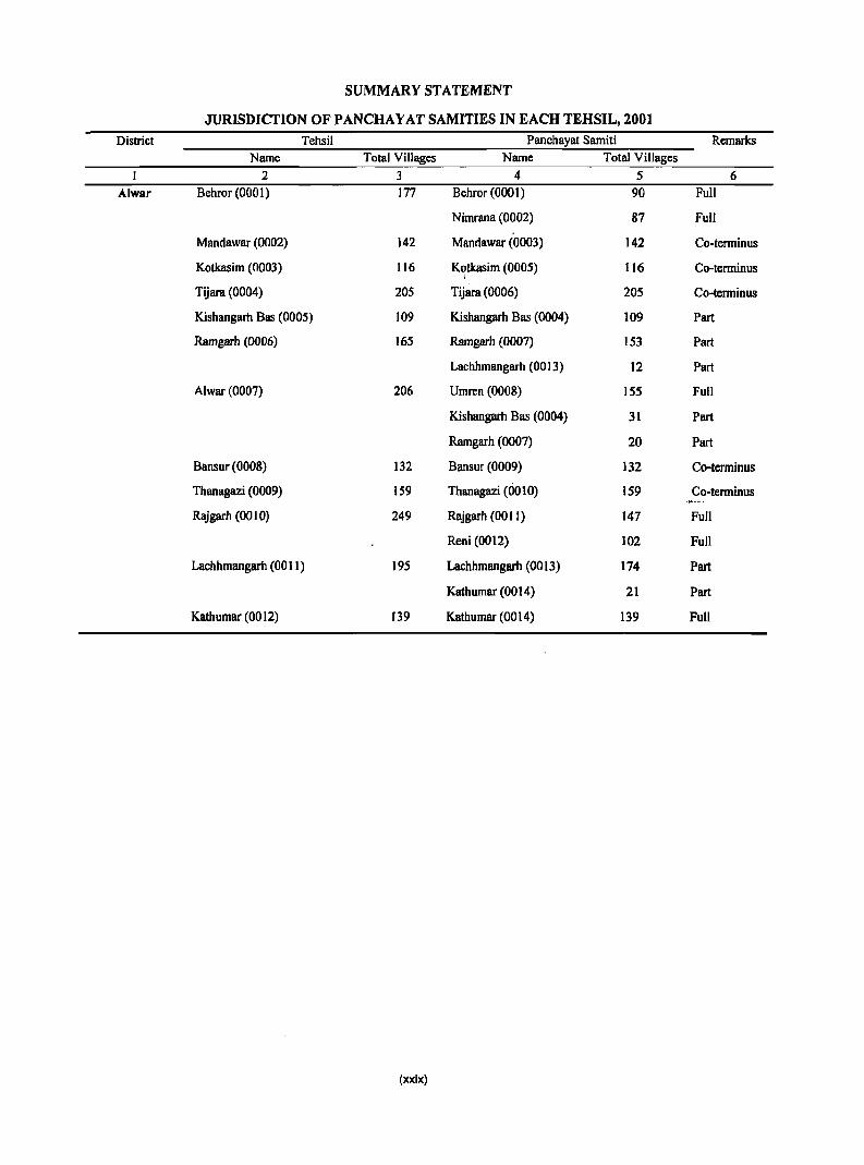
JURISDICTION OF PANCHA Y AT SAMITIES IN EACH TEHSIL, 2001
District Tehsil Panchayat Samiti Remarks Name Total Villages Name Total Villages
2 3 4 5 6 AlwBr Behror (000 I) 177 Behror (0001) 90 Full
Nimrana (0002) 87 Full
Mandawar (0002) 142 Mandawar (0003) 142 Co-terminus
Kotkasim (0003) 116 Kotkasim (0005) 116 Co-terminus I
Tijara (0004) 205 Tijara (0006) 205 Co-terminus
Kishangarh Bas (0005) 109 Kishangarh Bas (0004) 109 Part
Ramgarh (0006) J65 Ramgarh (0007) 153 Part
Lachhmangarh (0013) J2 Part
Alwar (0007) 206 Umren (0008) 155 Full
Kishangarh Bas (0004) 31 Part
Ramgarh (0007) 20 Part
Bansur (0008) 132 Bansur (0009) 132 Co-terminus
Thanagazi (0009) 159 Thanagazi (0010) 159 Co-terminus
Rajgarh (00 I 0) 249 Rajgarh (00 II ) 147 Full
Reni (0012) 102 Full
Lachhmangarh (001 I) 195 Lachhmangarh (0013) 174 Part
Kathumar (0014) 21 Part
Kathumar (0012) 139 Kathumar (0014) 139 Full
(xXix)

ANALYTICAL NOTE

Analytical Note
(i) History and scope of the District Census Handbook:
The series of District Census Handbooks has been prepared after scanning and processing of data collected through Houselist Schedule and Household Schedule. Several new innovations have been introduced at almost all the stages of the Census of India, 2001, right from the preparatory efforts to the data processing and dissemination stage. This includes certain fundamental changes in the form and contents of the Houselist and Household schedules, while maintaining the continuity and comparability of the basic housing and population characteristics with the earlier census. For the Census of India 2001, a system of Permanent Location Code Numbers (PLCN) has been adopted by assigning to each village within the StatelUT a continuous series from 1 to N. Each village has been assigned an eight digit code. The first six digits represent the code of the village; as existing at the present census. The last two digits being '00' are kept for accommodating future changes in case of split of an existing viJIage or creation of new villages etc. Since the permanent Location Codes have been assigned to each village, theoretically tracing the precise location of vi llage on account of future jurisdictional changes in the boundaries of various administrative areas within the state should not pose a problem. It is imperative that under this scheme, the PLCN assigned to villages at the Census ofIndia, 200 I, are adopted in future censuses also to ensure the comparability of the data at the village and other administrative levels over a long time series.
The responses for almost all the questions in the Houselisting Schedule had pre-coded options. This not only helped the enumerators to record the response easily but at a later stage would hopefully facilitate quicker data processing. Apart from the improvements made in the format of the Houselisting Schedule, the scope of House listing was considerably expanded with the inclusion of new questions based on requirements of various data users and planners.
The new features of the Houselisting Schedule are listed below.
• For the first time, different uses of census houses have been standardized and grouped into ten main uses and assigned code numbers.
• Plastic has been added in the list of material of wall and roof of a census house, as it is often used for shelter in slums and shanties.
• In the previous census,. the location of drinking water source was categorized into two locations viz. 'within premises' and 'outside premises'. In the Census of India, 2001, the source 'outside premises' was split into two categories namely 'near the premises' and 'away from the premises'.
• The scope of question of availability of electricity was expanded to include six sources of lighting. Besides no lighting, this included sources like electricity, kerosene, solar, other oil and any other source.
• In 1991 Census, a question on availability of toilet facilities to the household was canvassed while in Census of India, 2001, specific information on availability of latrine within the house by the type of latrine was sought.
In addition to expending the scope of the questions canvassed during the Houselisting Operations in the 1991 Census, the following new questions were added in the Houselist Schedule for Normal Households at the Census of India, 2001.
• If the Census house was used for residential or partly residential purposes, the condition of the census house was categorized as good, livable or dilapidated based on the perception and response of the respondent.
• A question on number of married couple(s) living in the household was canvassed.
• Information was sought on the number of married . couple(s) having independent room for sleeping.
• Information as to whether the waste-water outlet of the house is connected to 'closed drainage' or 'open drainage' or has not drainage was collected.
• A question on availability of bathroom within the house was included.
• Information on availability of kitchen within the house was also sought.
• Availability of certain assets to the households namely radio/transistor, television, telephone, bicycle, scooter/motor cycle! moped, car/jeep/van were also included.
• It was also enquired whether any banking service was being availed by the household.
The Household, Schedule adopted for the Population Enumeration also primarily had pre-coded options for majority of the questions. The questions for each data item were made as self-explanatory as far.lls possible fo.r easy understanding. The comprehensive Household Schedule had three parts and two sides A and B. Part I contains the Location Particulars; Part n relates to Individual Particulars and P~ ill contains questions for Household engaged in CtiltivationlPlalitation. To facilitate quick tabulation for bringing out Provisional Population Totals, provisions of page totaling were made in the schedule itself for a few items namely population, males, females, population aged 0-6 years by sex, literates and workers and their categories by sex. Most of the questions canvassed during the 1991 Census, were retained for the 2001 Census, except the question on ex-serviceman, which was dropped during the Census of India, 2001. However, a number of new questions were added in the Household Schedule in view of the suggestions from policy makers, data users and researchers, while the scope of certain existing questions was enhanced.
These modifications are:
• Age at marriage was collected for males also, while it was collected for only ever-inarried females until the 1991 Census.
• . The type of educational institution attended by a person :Was enlarged to include school, college, vocational institute, other institute· and literacy center.
• The scope of the definition of 'work' was
4
DISTRICT CENSUS HANDBOOK: ALWAR
expanded in the Census ofIndia, 2001, to include production of milk for domestic consumption. In the 1991 Census, cultivation of certain crops even for self-consumption was treated as economic activity. The scope of the term 'Cultivation' was expanded in this Census to include certain other crops such as tobacco, fruits, all types of flowers, roots and tubers, potatoes, chilies and turmeric,
pepper, cardamom, all types of vegetables and
fodder crops etc. This meant that activities related to production of all the above mentioned crops
for domestic consumption has been treated as
work. Only five crops viz. tea, coffee, rubber, coconut and betel nuts have been classified under 'Plantation' in the Census of India, 200l.
• At the 1991 Census, the question on seeking! available for work was canvassed for only non
workers. At the Census of India, 2001, this question is asl{tid from the MargInal Workers also. A question to elicit information on secondary work
canvassed at the 1991 Census is dropped.
• From among the categories of non-workers adopted at the 1991 Census, the category 'Inmates of institutions' has been dropped and 'Retired Persons and Rentiers' has been replaced by the category 'Pensioners'.
• A new response category 'Moved after birth' was included in the question on 'reasons for migration' to bring out additional migration patterns. Natural calamities or distress migration as a reason for migration for last.residence migrants included in the 1991 Census, is covered under category of 'Other'.
• Number of children born alive to currently married women during last one year was collected for male and female children separately.
Besides the above modifications, the following new questions were canvassed at the 2001 Census.
• A question on total disability was canvassed in the 1981 Census. In the 1991 Census, no question· on disability was included. At the Census of India, 2001, a questiol'l'to eliC"it information on total or partial disability was 'canvassed. The five types of disability on which information ·is collected are

ANALYTICAL NOTE
- in seeing, in hearing, in speech, in movement and mental.
• A new question on 'Travel to place of work' is canvassed mainly for workers engaged in nonagricultural activities. Information on distance from the residence to place of work and mode of travel to place of work is collected under this section.
• The Household Schedule has a new set of questions for Household engaged in cultivation/ plantation- i) Net area of land under cultivation! plantation, ii) Net area of land irrigated and iii) Tenure status. This question was not canvassed at the 1991 Census but was canvassed in the 1981 Census in a slightly different form.
• The signature or thump impression of the respondent has been taken on the Household Schedule for the first time in the history of census. This was not only aimed at obtaining correct and complete information but also for giving an opportunity to the respondents to authenticate the information provided by thenl. The relationship of the respondent with the head of the household was also obtained. This new feature will pave way in carrying out a methodological study in future on the respondent profile in the census.
In 1981 Census, for the first time, an attempt was made in the series to bring out demographic and other data in diglot, Hindi and English, for a more beneficial use by data user of all categories. Hindi being the official language of the State, a Hindi version of the analytical notes was also added with a view to caters to the needs of all sections of readers. The manner of presentation of the District Census Handbooks for the 1991 Census is by and large the same.
As a necessary corollary to the Handbooks, Panchayat Samities, the basic administrativ~ units of development, administration and planning, were listed out separately for the first time in 1981 Census in relation to those districts wherein they were not coterminous with their tehsils. As an additional attempt, informations relating to population figures as well as amenities available in each village located in the jurisdiction of each Panchayat Samiti were also presented in a separate volume under the title
5
"Supplement to District Census Handbook". However, for reference in the main District Census Handbook, a list of villages forming part of each non-coterminous Panchayat Samiti was provided along with the abstracts of popUlation and amenities for such Panchayat Samities as a whole in the form of Special Annexures.
In order to cater to the over-all needs of the datausers and to facilitate the task of administrators and planners it has now been decided to present the Village Directory and Primary Census data at the Panchayat Samiti level instead of the traditional Tehsil level presentation. It is expected that the presentation of Village Directory and Primary Census Abstract data at Panchayat Samiti level will help the planners in formation of micro-level developmental plans, as the Panchayat Samiti is now the lowest administrative unit for development planning. However, for the convenience of the data users and for the sake of comparability of data at Tehsil level, the Primary Census Abstract has also been presented, at the.Tehsill Town level in the form of an Appendix.
A general note on each district covering information of general interest regarding its history, topography, physiography, administrative set-up and places of tourist and historic importance etc. has also been included with a view to provide comprehensive and more purposeful information about the district as a whole. Population figures of Scheduled Castes and Scheduled Tribes constituting the core of 'Weaker Section' have also been presented at district, panchayat samiti and town level so as to facilitate planning for their welfare both at micro and ,macro levels.
It is earnestly hoped that this publication will serve its purpose for planners and administrators of welfare schemes and other data users in general.
Prior to 1951, Census Reports were printed for the whole province/state. The idea of preparing the District Census Handbooks separately for each district
. was conceived during 1951 Census as a part of a plan intended to secure an effective method of preserving the Census data below the district level. The idea was that all the district.census tables would be bound together in a single volume called the District Census Handbooks. Since then the.District ., Census Handbooks are being published regularly.
The 1951 Census series of District Census Handbooks was printed in two parts. Part I contained five General Population Tables (A Series), three Economic Tables (B Series), five Household and Age Tables (C Series) and seven Social and Cultural Tables (D Series). In Part II of District Census Handbook "Primary Census Abstract and Village Directory" which showed the basic population figures for each village or town classified by livelihood classes, were included along with some information of general nature.
The 1961 Census series of District Census Handbooks Were printed in single volume in which Primary Census Abstract upto village and town/ward level and Village Directory upto village level were given. Besides, some official statistics collected from various state departments, four General Population Tables (A Series), sixteen Economic and Household Tables (B Series), seven Social and Cultural Tables (e'Sefies);~foilr'Hotising Tables (E'Seties)~a:nd 'eight Special Tables for Scheduled Castes/Scheduled Tribes were also provided in District Census Handbooks. F ()r the first. ti~e in 1961 Census the maps for the district andtehsil were also included in the District Census Handbooks.
In 1971 Census series of District Census Handbooks village-wise 'Village Directory' giving services, facilities or amenities available in the village was given. 'Town Directory' was introduced for the first fime giving useful information in respect of every town of the district. Rural Primary Census Abstract upto village level and Urban Primary Census Abstract upto eriumeration block level were given in District Census Handbooks. While the District, Tehsil and Town maps were included; the inclusion of Census Tables was dispensed with in the District Census Handbooks in 1971 Census.
The scope of 1981 series of District Census Handb~~ks, was enlarged specially in relation to amenities and land-use pattern. Apart from new items like uses of electrici!;y, details of communication points,
.,...... -lII\> .• ~'''~i!. t:. ".. .' f'l" '.,~ .... ~': • ~ ~,{"., .• ~'" , ..... ,~,... . information for ~1iich was not collected in 1971
'';'.,
Census, a note on each district covering general information on its history, topogr~hy. flora, fauna and ~iIiini,straiive's~{up".,~tc. was aUh aqCieo. The forniat ofthe"PriIilliiY:Ceristi~:¥."straci w~ also restructured in the light t>f changes' in economic and 'other questiQns canvassea In tne '198-1 Census but at the 'same time,
6
DISTRICT CENSUS HANDBOOK: N...WAR
all efforts were made to retain comparability with 1971 Census data. The inclusion of Special Primary Census Abstract for Scheduled Castes and Tribes at the Tehsi1lTown level was another innovation introduced in 1981 Census series.
The manner of presentation of the District Census Handbooks for the 1991 Census was by and large the same as followed in 1981. However, the format of Primary Census Abstract was restructured slightly in the 1991 Census for the benefit of data users. Nine-fold industriaJ classification of main workers was given as against four-fold industrial, classification presented in the 1981 Census. In addition to this, the sex-wise population in the 0-6 age-group was included in Primary Census Abstract for the first time with a view to enabling data users to compute more realistic literacy rate as all children below 7 years of age were treated as illiterate at the time of the 1991 Census.
One of the ~o~ imR.?~t !';W~,:ations in the 1991 Census was the Pancbayat Samiti level presentation of data in the Village Directocy apd Primary Census Abstract instead of the traditional Te'hsil level presentation.
Deviating from 1991 Census, like 1981 Census four fold industrial classification of main and margin~ 'workers has been presented in 2001 as against nine_ fold given in 1991.
The mode of presentation ofDCHB in 2001 will by and large be same as that of in 1991. The uniqueness of Census 2001 is that single record (Household Schedule) has been processed as against two records viz. Individual Slip and Household Schedule in the previous Censuses. Apart from this some deviation has been made this time by incorporating anaJytical notes on migration, fertility & mortality, education, marital status, age, structure etc pertaining to 1991 Census of the respective district in the DCHB in the form of Annexures II to VIII. Similarly Tables based on Houselist data pertaining to Censlls 2001 has also been included in DCIIB.
(ii) Brief Hist~ry of tbe District:
In 1775 A.D., Maharaja Pratap Singh, won back
this beautiful and historical city based on Aravali hills,
fromMugha]s, Acc~rAjng.to .Cunningham"the<city ,of A1war derived :its name -from the Salwa1ribe~and 'Was
originally Salwapur, 'latefon'lmown as SaIwa:r, Halwar and eventually Alwar. Some researcher cOllducted
ANALYTICAL NOTE
during the regime of Maharaja Jai Singh of Alwar
revealed that Maharaja Kakil of Amber ruled the area
in the eleventh century and his territory extended up to present city of Alwar. He founded the city of AJpur in 1049 A.D., which eventually become Alwar. Formerly it was spelt as Ulwar but in the region of Jai Singh the home was changed as Alwar.
(iii) Administrative set-up:
During the period 1991-2001, there has been administratively change in the district, two new Subdivisions was formed with two tehsils. At present the district has the following Sub-divisions, Tehsils and Towns:
Sl.No. Sub- Division Tehsil Town 1 Alwar Alwar Alwar(MCL)
,( Ramgarh
Thanagazi
2 Bebror Bebror Bebror(M)
Bansur
3 Rajgarh Rajgarh Rajgarh(M)
4 Kishangarh Kishangarh Bas Kishangarh(CT) Khairthal(M)
Mandawar 5. Tijara Tijara Bhiwadi(CT)
Tijara(M)
Kotkasim
6 Lachhmangarh Lachhmangarh Govindgarh(CT)
Kathumar Kherli(M)
Alwar district comes under the administrative
control of the Divisional Commissioner, Jaipur. The
Collector is the head of the head of the administration
of the district and also the District Magistrate, each
Sub-division is under the charge of a Sub-divisional
Officer and each Tehsil is under a Tehsildar who is
also vested with the powers of an executive
magistrate.
There are 14 Panchayat Samities in the district responsible for developmental activities under the supervision of the Collector who is also ex-officio district Development Officer.
(iv) Physical Features:
(1) Location and size , ~'f.'
The district is situated~in the north east of Rajasthan 27°.4' and 28°.4' north latitudes and 76°.7'
7
and 77°.13' east longitudes. It is banded on the north and northeast by Gurgaon district of Haryana State and Bharatpur district, on the north-west by Jaipur district and on the south by Sawai Madhopur and Jaipur districts. The total area of the district is 8380.05 sq. km. as against the total area of 3,42,329.73 sq. km. of the state. It's rank 15th among the districts in respect of area.
(2) Physiography
The central part of the district is covered by the Aravali hills, which run north -south ranging in height from 456 metres to 700 metres. The region has more or less flat top hills, which h become more prominent in the south-western parts of the district. They enclose between them fertile valleys, which have provided Sanctuary to the Wild Life of the region in the forest of Sariska.
(3) Drainage
There is no perennial flow river in the district. However, two seasonal rivers in the .district are ~uparel and the Sabi. River Ruparel rises from the hills ofThanagazi and finally terminates in Bharatpur district. River Sabi rises from Jaipur district and it enters bansur Tehsil of the district. Sabi River then flows through Behror, Mandawar, Kishangarh Bas and Tijara tehsils and then it enters Gurgaon district of harayana State. .
There is no natural lake in the district. There are two important bands namely Siliserh and Jaisamand situated at a distance of about 13 km. and 6 km. from Alwar respectively.
(4) Climate
The climate of the district is very hot in summer and cold in winter. The monsoon season is of a very short duration. The south-west monsoon season continues from July to mid September. Highest temperature of the .district has been 47°C and the lowest temperature is up to frozen point. Average rainfall is 657.3 m.m. in the district; however, annual rainfall recorded during the year 2000 was 473.00 m.m.
(5) Natural economic resources
Soil
The soil of the district is sandy loam. Water is available at'a depth ranging between 45.6 metres t6:' 24.6 metres.
Forest, Flora and Fauna
About hectares was reported, as under forest during the year 1999-2000.There was forest ranges in the district one each at Alwar, Rajgarh and sariska. The forests of this district fall under category of dry deciduous forest of Rajasthan Region.
A game sanctuary has been created at Sariska in 1955-56, which is at a distance of about 34. km. from Alwar City. Within the eclosure, there are number of vall~ys viz., Kalighati, Siliberi and sariska. The
. topography of the sanctuary presents a picturesque setting. There are a number of watchtowers in the sanctuary from which tourists can watch the game. There are various varieties of big and small games in the sanctuary in addition to a variety of colourful birds, In addition, it contains the hermitage of well known sages like Bharathari, Talbraksh and Pandavpol and a shiva Temple. These are the places where one can sit for hours in meditation.
All the mammals found in Indian plains are found in the district. Alwar forests have been famous for the wilH life 'from 'anCient fikes and were a favourite resort of the· Mughals. In the plains, antelope, ravine deer antthe usual sma11 animals are found while tigers, hyaenas and sambhar are found in the hiIJy parts and leopards everywhere. While the wolves are occasionally met, wild hogs are numerous.
The natural surroundings and abudance of lakes and bandhs creatre a suitabl habitat for the different species of fishes and other acquatic fauna. Besides the fishes, goh, measuring up to 3.6m. are also found in siliserh, jhaisamand, Mangiansar 4, Ihaisagar. Among the raptiles of squamate order found in the district are lizards and snakes. There are many species of birds in the district.
Mineral and mining
From the point of view of minerals, Alwar is a rich district. These minerals contribute a large revenue to the state annually. The major minerals found in the district are barites, building stones and copper. The district leads in the production of~ese minerals. The rocks consIst' of schists and quartizites with intrusions of granite. These are one of the oldest rook .formations dating baok to nearly 2500 million years. The barite deposits are lJ1i?led about two thousand tones annually. The production of copper
8
DISTRICT CENSUS HANDBOOK: AIJ/VAR
concentrate from Kno Dariba mines is in several <tones. Important barite deposits ·are at Sahanpuri, Basli, lamdoli and Khora-Makroda. The mineral is used in the paint, paper and chemical industries and in drilling mud. The quartz-rich phyllites schists and sericitic quartizites, popularly known as slate stones, provide excellent building material. Marble from various horizons is also used for lime burning.
Alwar district is the second richest in Rajasthan where copper-ore is found. The deposits of copperore are found at Bhagoni and Kho Dariba. Other mineral deposits in the district are asbestos, china clay, feldspar, fire clay, soapstone and quartz.
Land use pattern
The total area of the district was 782897 hectares during the year 1999-2000. The classification of the land use in the district the period was as under: r
S1. Classification of the Area in Percentage to No. land use Hectares total area
1 Area under forest 69,697 . 8.9 2 Land not available for 136,001 17.37
cultivation 3 Permanent Pastures 24,179 3.09
and other _grazing land 4 Land and 118 0.02
miscellaneous trees crops and groves not included in the net 'areasown
5 Cultivable waste land 36,300 4~64
included fallow land 6 Net area sown 516,602 65.98
Total 782,897 100.00
Crop patte~n
The area tinder some major crops ac cording to statistics available for the year 1999-2000 in the district is given below:
SI.No. Name of crop
1 Ba,ira 2 Jowar 3 Wheat 4 Maize 5 Barley 6 Rice 7 Gram 8 Tur 9 Other Kharif Pulses
10 Other Rabi Pulses 11 Rape;and Mustard
Area in hectares 182,632 24,108
193,916 11,863 12,435
605 53,820 4,3?5.
118 856
209.198
ANALYTICAL NOTE
Kharif and Rabi are the two important, crop seasons in the district. Among the Kharif crop mainly Bajra, Jowar, Maize, Tur and other pulses are grown while Rabi crops include wheat, Barley, Gram etc. Some other cereals and millets are also grown in the district. Sesamum is cultivated throughout the district. Among oilseeds, rape and mustard account for the largest area and is the most important crops in the district.
Tenancy
Tenancy in the State is governed by the Rajasthan Tenancy Act, 1955. It is one of the most important and progressive laws relating to agrarian reforms. The provisions of the Act apply in respect of land held by tenants as if the State Government were the land holder acting through the Tehsildars. In relation to the land held: by him, every cultivator is either a tenant or a sub-tenant or an allottee or a trespasser. A tenant is one who is required to pay some rent on account of use and occupation of land let out to him for agricultural or allied purposes. Grantee with a favourable rate of rent, ijardar, thekedar or trespasser is not considered a tenant.
There are following classes of tenants:
a) Khatedar tenants,
b) Maliks,
c) Tenant of Khudkasht, and
d) Gair-Khatedar tenants.
A Khatedar tenant is entitled to all the rights conferred and subject to all the liabilities imposed on Khatedar tenant by the Rajasthan Tenancy Act. On the date of coming into force of Rajasthan Tenancy Act, a Zamindar or a Biswedar holding Khudkasht was treated as a Khatedar tenant irrespective of whether he was or not in occupation on the date of vesting.
Malik is a Zamindar or Biswedar who has become Malik or Khudkasht land held by him on abolition of Zamindari and Biswedari in 1959. The word "Malik" was also added to section 14 of the Rajasthan Tenancy Act to classify it as a class of tenant. Section 13 of the Act provides that a Malik is entitled to all the rights conferred and is subject to all the liabilities imposed on Khatetlar tenant and so in substance this class of tenancy is nothing but a Khatedar tenant.
9
As Zamindars and Biswedars holding Khudkasht were treated as Khatedar tenants. A tenant of khudkasht is essentially a sub-tenant in view of the fact that a sub-tenant is also eligjble for protectio.n of his cultivatory rights even against Khatedar tenant. Every tenant of land other than a Khatedar tenant, a tenant of Khudkasht or a .sub-tenant is a GairKhatedar tenant.
A trespasser is a person who takes or retains possession of land without authority or who prevents another person from occupying land duly let out to him by the State. After regularisation, the trespasser becomes an allottee. An allottee is treated as a GhairKhatedar tenant on whom Sub-Divisional Officer shall suo-mota confer khatedari rights after ten years ~f allotment provided that the allottee fulfils all the terms and conditions of allotment duri~g this period. Similar is the case of those allottees who were otherwise allotted land by the State Government.
Irrigation
The total net irrigated area during 1999-2000 was 401,196 hectares, which constituted percent of total net, are sown inn the district. The different sources of irrigation during the same period is distributed as follows:
SI.No. Source of irrigation Area in hectares
WeUfTube wells 397,140
2 Tanks 33
3 Canals 3,782
4 Other sources 241
Total 401,196
Irrigation through Wellffube _is the most important and the canals are the next most important source of irrigation in the district. The remaining irrigated are comes under others sources and tanks are negligible percent with comparison the above source of irrigation.
-The following data shown the area (in hectares) of the main crops sown in the irrigated area:
Year Kharif Rabi Jayad Rabi
1995-1996 19,031 348,415 3,320
1996-1997 28,213 376,547 3,079
1997-1998 20,964 272,55~ 3,428
1998-1999 23,240 342,715 '-'-S 3,896
1999-2000 32,708 396,440 2,674
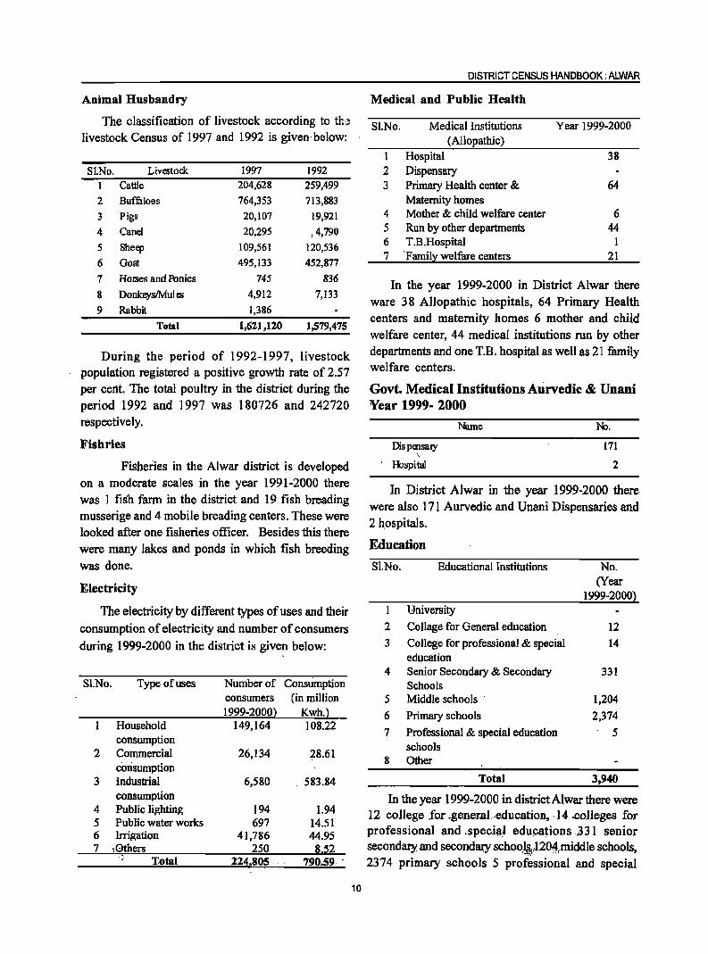
Animal Husbandry
The classification of livestock according to tb livestock Census of 1997 and 1992 is given· below:
SI.No. LivC'Stock 1997 1992 1 Cattle 204,628 259,499
2 Buffaloes 764,353 713,883
3 Pigs 20,107 19,921
4 Canel 20,295 ,4,790
5 Sheep 109,561 120,536
6 Goat 495,133 452,877
7 Horses and Ponies 745 836
8 DonkeyslMul C'S 4,912 7,133
9 Rabbit 1,386
Total 1,611,120 1,579,475
During the period of 1992-1997, livestock population registered a positive growth rate of 2.57 per cent. The total poultry in the district during the period 1992 and 1997 was 180726 and 242720 respectively.
Fisbries
Fi.Shedes in the Alwar district is developed on a moderate scales in the year 1991-2000 there was 1 fish farm in the district and 19 fish breading musserige and 4 mobile breading centers. These were looked after one fisheries officer. Besides this there were many lakes and ponds in which fish breeding was done.
Electricity
The electricity by different types of uses and their
consumption of electricity and number of consumers
during 1999-2000 in the district is given below:
Sl.No. Type of uses Number of Consumption consumers (in million I 999-2000} Kwh.}
Household 149,164 10822 consumption
2 Commercial 26,134 28.61 consumption
3 Industrial 6,580 583.84 consumption
4 Public lighting 194 1.94 5 Public water works 697 14.51 6 Irrigation 41,786 44.95 7 \·Qthers 250 8.52 .,
Total 224~805 . 790.59
10
DISTRICT CENSUS HANDBOOK: ALWAR
Medical and Public Health
SI.No. Medical Institutions Year 1999-2000 (Allopathic)
1 Hospital 38
2 Dispensary 3 Primary Health center & 64
Maternity homes 4 Mother & child welfare center 6 5 Run by other departments 44 6 T.B.Hospital 1 7 'Famil~ welfare centers 21
In the year 1999-2000 in District Alwar there ware 38 Allopathic hospitals, 64 Primary Health centers and maternity homes 6 mother and child welfare center, 44 medical institutions run by other departments and one T.R hospital as well as 21 family welfare centers.
Govt. Medical Institutions Aurvedic & Dnani Year 1999- 2000
Dis pensal)' , Hospital
Name No.
171
2
In District AJwar in the year 1999-2000 there were also 171 Aurvedic and Unani Dispensaries and 2 hospitals.
Education
S1.No. Educational Institutions No. (Year
1999-2OOOl University
2 Collage for General education 12
3 College for professional & special 14 education
4 Senior Secondary & Secondary 331 Schools
5 Middle schools . 1,204
6 Primary schools 2,374
7 Professional & special education 5 schools
8 Other
Total 3,940
In the year 1999-2000 in district Alwar there were 12 col1ege .for ..gener.aj.,education, ·14 .colleges for professional and .spe.ci~~ educations .331 senior secondaty and secondalY schoo.]~)20,~tmiddle schools, 2374 primary schools 5 professional and special
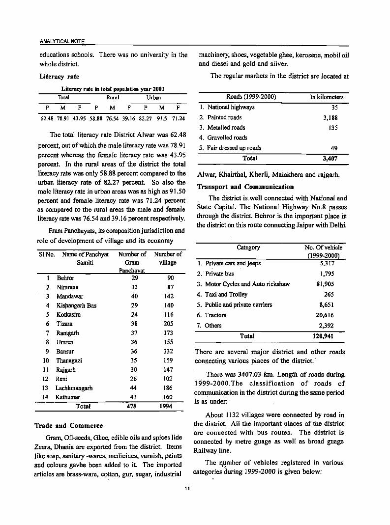
ANALYTICAL NOTE
educations schools. There was no university in the whole district.
Literacy rate
Literacy rate in total populafim year 200]
Total Rural Urban
p M F p M F p M F
62.48 78.91 43.95 58.88 76.54 39.16 82.27 91.5 71.24
The total literacy rate District Alwar was 62.48
percent, out of which the male literacy rate was 78.91
percent whereas the female literacy rate was 43.95 percent. In the rural areas of the district the total literacy rate was only 58.88 percent compared to the urban literacy rate of 82.27 percent. So also the male literacy rate in urban areas was as high as 91.50 percent and female literacy rate was 71.24 percent as compared to the rural areas the male and female literacy rate was 76.54 and 39.16 percent respectively.
Fram Panchayats, its composition jurisdiction and
role of development of village and its economy
SI.No. Name ofPanchyat Number of Number of Samiti Gram village
Panchal:at Behror 29 90
2 Nimrana 33 87 3 Mandawar 40 142
4 K.i$angarh Bas 29 140
5 Kotkasim 24 116
6 Tizara 38 205
7 Ramgarh 37 173
8 Umren 36 155
9 Bansur 36 132
10 Thanagazi 35 159
11 Rajgarh 30 147
12 Reni 26 102 13 Lachhmangarh 44 186
14 Kathumar 41 160
Total 478 1994
Trade and Commerce
Gram, Oil-seeds, Ghee, edible oils and spices lide Zeera, Dhania are exported from the district. Items like soap, sanitary -wares, medicines, varnish, paints and colours gavbe been added to it. The imported articles are brass-ware, cotton, gur, sugar, industrial
11
machinery, shoes, vegetable ghee, kerosene, mobil oil and diesel and gold and silver.
The regular markets in the district are located at
Roads (1999-2000)
1. National highways
2. Painted roads
3. Metalled roads
4. Gravelled roads
5. Fair dressed up roads
Total
In kilometers
35
3,188
135
49
3,407
Alwar, Khairthal, Kherli, Malakhera and rajgarh.
Transport and Communication
The district is.well connected with National and . -State Capital. The National Highway No.8 passes through the district. Behror is the important place in the district on this route connecting Jaipur with Delhi.
Category
1. Private cars andjeeps " "
2. Private bus
3. Motor Cycles and Auto rickshaw
4. Taxi and Trolley
5. Public and private carriers
6. Tractors
7. Others
Total
No. Of vehicle (I 999-2000)
5,317
1,795
81,905
265
8,651
20,616
2,392
120,941
There are several major district and other roads connecting various places of the district.""
There was 3407.03 km. Length of roads during 1999-2000.The classification of roads of communication in the district during the same period is as under: .
About 1132 villages were connected by road in the district. All the important places of the district are connected with bus routes. The district is connected by metre guage as well as broad guage Railway line.
The I\~mber of vehicles registered in various categories ~uring 1999-2000 is given below:
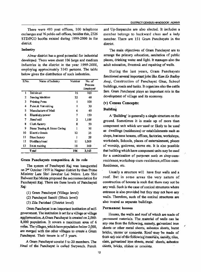
There were 493 post offices, 100 telephone exchanges and 76 public call offices, besides this, 2326 STDIPCO booths existed during 1999-2000 in the district.
Industry
Alwar district has a good potential for industrial developed. There were about 106 large and medium industries in the district in the year 1999-2000, employing approximately 3143 persons. The table below gives the distribution of such industries.
S.No. Name ofIndustry Number No. of PelSons
Employed
Edible oil 16 160 2 Sawing Machine 22 48 3 Printing Press 1 100 4 P aint& Varnishi ng 1 30 5 Manufacture of Medi 6 40 6 Electri city power 7 ISO 7 lhred mill 2 1,100 g C loth factory g SO 9 Stone Tracing & Stone Casing SO
10 El ectri c Goods 12 3S II Shoe factory I 20 12 Dis tillary local 11 1,000 13 Brick making 18 360
Total lOCi 3,143
Gram Panchayats composition & its role
The system of Panchayati Raj was inaugurated on 2nd October 1959 in Nagaur district by than Prime Minister Late Shri Jawahar Lal Nehru. Late Shri Balwant Rai Mehta proposed the recommendation for Panchayati Raj. There are three levels ofPanchayati ~:
(1) Gram Panchayat (Village level) (2) Panchayat Samiti (Block level)
(3) Zila Parishad (District level)
Gram Panchayat is an important institution of selfgovernment. The institution is set for a village or village agg~~eration .. A-Gram Panchayat is created on 2,000-8,0~~ pOPl:llation. _It _ covers a maximum area of 6 llliles. The ~iIlages? ,.which have population below 2,900, are merged with the other villages to create a Gram Panchayat. Their tenure -is of 5 yea.rs~ ..
A Gram Panchayat consist 5 to 20 members. The Head of th.e Panchayat is called Sarpanch. Panch
12
DISTRICT CENSUS HANDBOOK: ALWAR
and Up-Sarpanchs are also elected. It includes a member belongs to backward class and a lady member. There are 151 Gram Panchayats in the
district.
The main objectives of Gram Panchayat are to arrange the primary education, ,sanitation of public
places, drinking water and light. It manages also the adult education, livestock and repairing of wells.
During the last years, Gram Panchayats
functioned several important jobs like Kam Ke Badley Ana}, Construction of Panchayat Ghar, School
buildings, roads and tanks. It organizes also the cattle
fare. Gram Panchayat plays an important role in the development of village and its economy.
(v) Census Concepts:
Building
A 'Building' is generally a single structure on the
ground. Sometimes it is made up of more than component unit which ·are··used- or -likely to be -used·
as dwellings (residences) or establishments such as
shops, business houses, offices, factories, workshops,
worksheds, Schools, places of entertainment, places of worship, godowns, stores etc. It is also possible
that building which have component units may be used
for a combination of purposes such as shop-cum
residence, workshop-cum-residence,office-cumResidence, etc.
Usually a structure will have four walls and a
roof. But in some areas the very nature of
construction of houses is such that there may not be
any wall. Such is the case of conical structures where
entrance is also provided but they may not have any walls. Therefore, such of the conical structures are
also treated as separate buildings.
Permanent houses
Houses, the walls and roof of which are made of permanent materials. The. material of walls can be anyone from the following, namely, galvanized iron sheets or other metal sheets, asbestos sheets, burnt bricks, '*tortes·'or concrete. Roof 1Ilay 'be 'made of from liriy one; of tHe'tollowirig~inateriats; riain.i:i1Y, tiles, siate, galvanized' ii,,on ·sheets, metal' sheets; asbestos sheets,' bricks, stones 'or concrete.
ANALYTICAL NOTE
Semi-permanent houses
Houses in which either the wall or the roof is made of permanent material and the other is made of temporary material.
Temporary houses
Houses in which both walls and roof ate made of materials, which have to be replaced frequently. Walls may be made from anyone of the following temporary materials, namely, grass, thatch, bamboo, plastic, polythene, mud, unburnt bricks or wood. Roof may be made from anyone of the following temporary materials, namely, grass, thatch, bamboo, wood, mud, plastic or polythene.
Room
A room should have four walls with a doorway with a roof over head and should be wide and long enough for a person to sleep in, i.e., it should have a length of not less than 2 metres and a breadth of at least 1.5 metres and 2 metres in height. A room, however, which is used in common for sleeping, sitting, dining, storing and cooking, etc., should be regarded as a room. An unenclosed verandah, kitchen, store, garage, cattle-shed and latrine and rooms in which a household industry such as a hand loom is located, which are not ~ormally used for living or sleeping are excluded from the definition of a living room for the purpose of this question.
One is likely to come across conical shaped hut or tent in which human beings reside. In such improvised accommodation, there will be no four walls to a room and therefore, the above definition would not strictly apply to such types of accommodation. In such cases, the tent or conical hut etc., have been construed to be a room. In certain parts of the country, particularly in rural areas, the pattern of housing' may present some problems. For example, a household may be in occupation of several huts put to different uses such as main residence, sitting room, store and even for sleeping at night. By strict application of the definition each one will be reckoned as a census house, but this does not reflect the real situation. While huts used as store or cattle shed pose no problems, those used as sleeping rooms beyond the main residence, should be counled as rooms rather than separate census houses.lf a garage is used by a servant and
13
he lives in it as a separate household, it should be reckoned as a room available to the servant's household. If the servant is considered as a member of the household then the garage room should be reckoned as an additional room of the household.
Dwelling Room
A room is treated as a dwelling room if it has walls with a doorway and a roof and should be wide and long enough for a person to sleep in, Le. it should have a length of not less than 2 meters and a breadth of at least I.S meters and a height of 2 meters. A dwelling room would include living room, bedroom, dining room, drawing room, study room, servant's room and other habitable rooms. Kitchen, bathroom, latrine, store room, passageway and verandah which are not normally usable for living are not considered as dwelling rooms. A room, used for multipurpose such as sleeping, sitting, dining, storing, coo~ing, etc., is regarded as a dwelling room. In a situation where a census houses is used as a shop or office., etc., and the household also stays in it then the room. is not considered as a dwelling room. But if a garage or servant quarter is used by a servant and if she/he also lives in it as a separate household then this has been considered as a dwelling room available to the servant's household. Tent or conical shaped hut if used for living by any household is also considered as dwelling room. A dwelling room, which is shared by more than one household, has not been counted for any of them. If two households have a dwelling room each but in addition also share a common dwelling room, then the common room has not been counted for either of the households.
Census house
A 'census house' is a building or part of a building
used or recognised as a separate unit because of
having a separate main entrance from the road or common courtyard or staircase, etc. It may be occupied or vacant. It may be used for residential or non- residential purpose or both.
In certain peculiar situations, the manner in which
buildings and census houses were identified for
numbering in the field by the enumerators is described
~lereunder. ,"
Sometimes a series of different buildings are found
along a street which are joined with one another by common walls on either side looking like a continuous structure. These different units are practically independent of one another and are likely to have been built at different times and owned by different persons. In such cases, though the whole structure with all the adjoining units apparently appears to be one building, each portion was treated as a separate building and its constituent units as separate census houses.
On the other hand, one may come across c.ases, particularly in large cities of multi-storeyed ownership flats. In these cases while the structure looks like one building, different persons own the flats. In case of such multi-storeyed structures, having a number of flats owned by different persons, the entire structure was treated as one building and eacn flat as a separate census house. .
,If·within'.R.large enclosed area,there'are separate buildings owned by different persons then each such building is treated as a separate bUilding. There can be a situation. Where within an enclosed compound there are separate buildings owned by an undertaking or company .or· even government that are actually in occupation of ~ifferent persons. For example, Indian Oil Corporation colony where the buildings are owned by the Corporation but these are in occupation of their employees. Each such building was treated as a separate building. But if in anyone of these buildings there were flats in occupation of different households, each such flat was reckoned as a separate census house.
Sometimes if becomes difficult to apply the definition of census house strictly in certain cases. For example, in an urban area, if a flat has five rooms, each room having direct entrance' from the common staircase or courtyard. By definition, this has to be treated as five census houses. If all these five rooms are occupied by a single household it was not realistic to tr~at them as five census houses. In such a case, 'singleness' of use of these.-rooms along with the main house should be considered and the entire flat' was treated as one census house. On the other J:iarid~'iitvv"(; indepe~dent households occupy these five r~ori1~:' th~ ;fi;~t'i1~usehoJd Jiving in 3 rooms and' the second household occupying 2 rooms, then con~dering
the use, the first three' rooms together were treated
14
DISTRICT CENSUS HANDBOOK: ALWAR
as one census house and the remaining rooms as
another census house. But if each room was occupied
by an independent household, then each such room
was treated as a separate census house.
In case of hostels, hotels, etc., even if the door of e~ch room in which an inmate lives opens to a common verandah, staircase, courtyard or a common room, as it happens almost invariably, the entire hosteV
Hotel building was treated as one census house, but if such hostels/ hotels have out- houses or other' structures used for different purposes or the same purpose, then each such structure attached to the main
hostel/hotel was treated as a separate census house.
In some parts of the country, in rural areas, the pattern of habitation is such that a group of huts, located in a compound~ whether enclosed or unenclosed, is occupied,by one household. While the main residence may be;lociited'in one hut, other huts may be used for sleeping, as a kitchen, bath room,
baithak, etc. Though each of the huts was a separates structure, they form a single housing unit and therefore, have to be treated collectively as one building and one census house. If some .of the huts are used by one household and the others by a second household as residence, then the two groups of huts were treated as separate census houses. However, if there were also other huts in the compound used for other purposes and not as part of the household's residence such as, cattle shed, workshed, etc., these were treated as separate census houses.
On the other hand, in urban areas, where more
than one structure within an enclosed or open
compound (premises) belonging to the same person, e.g., the main house, the,servant's quarter, the garage,
etc., only one building number was given for this group
and each of the constituent a separate census house number.
Only cases where a'structure with roof and pillars has come up was treated as a building. _., V:iIlag~ \t., . ,"
. " The 'basic unit for rum1 areas is the revenue village, which has definite surveyed. boundaries. The revenue village inay comprise of one or more hamlets but the
ANALYTICAL NOTE
entire village is treated as one unit for presentation of data. In unsurveyed areas, like villages within forest areas, each habitation area with locally recognized boundaries is treated as one village.
Rural-Urban area
The data in tables on Houses, Household Amenities and Assets are presented separately for rural and urban areas. The unit of classification in this regard is 'town' for urban areas and 'viJIage' for rural areas. In the Census of India 200 I, the definition of urban area adopted is as follows:
a) All places with a municipality, corporation, cantonment board or notified town area committee, etc.
b) A place satisfying the following three criteria simultaneous.)y:
i) a minimum .population of 5,000;
iI) at least 75 per cent of male working population engaged in non-agricultural pursuits; and
iiI) a density of population of at least 400 per sq. km.(1,OOO per sq.mile)
For identification of places which would qualify to be classified as 'urban' all villages, which, as per the 1991 Census had a popUlation of 4,000 and above, a population density of 400 persons per sq. km. and having at least 75 per cent of male working populati9n engaged in non-agricultural activity were considered. To work out the proportion of male working population referred to above against b) (ii), the data relating to main workers were taken into account.
Apart from these, the outgrowths(OGs) of cities and towns have also been treated as urban under 'Urban Agglomerations'. Examples of out-growths are railway colonies, university campuses, port areas, military camps, etc., that may have come up near a statutory town or city but within the revenue limits of a village or villages contiguous to the town or city. Each such individual area by itself may not satisfy the demographic criteria laid down at (b) above to qualify it to be treated as an independent urban unit , but may deserve to be clubbed with the towns as a continuous urban spread. Thus, the town level data, wherever presented, al~~ includes the data for outgrowths of such towns.
15
City
Towns with population of 1,00,000 and above are called cities.
Urban Agglomeration
An Urban Agglomeration is a continuous urban spread constituting a town and its adjoining urban outgrowths (OGs) or two or more physically contiguous towns together and any adjoining urban outgrowths of such towns. In some cases railway colonies, university campuses, port areas, etc., may come up near a city or statutory town outside its statutory limits but within the revenue limits of a village or villages contiguous to the town or city. Each such individual area by itself may not satisfy the minimum population limit to qualify it to be treated as an independent urban unit but may deserve to be clubbed with the town as a continuous urban ;pread.
For the purpose of delineation of Urban Agglomerations during Census of India 2001, following criteria are taken as pre-requisites:
(a) The core town or at least one of the constituent towns of an urban agglomeration should necessarily be a statutory town;· and
(b) The total population of all the constituents (i.e., towns and outgrowths) of an Urban Agglomeration should not be less than 20,000 (as per the 1991 Census).
With these two basic criteria having been met, the following are the possible different situations in which Urban Agglomerations would be constituted:
i) a city or town with one or more contiguous outgrowths;
ii) two or more adjoining towns with their outgrowths; and
iii) A city and one or more adjoining towns with their outgrowths all of which form a continuous spread.
Household
A 'household' is usually a group of persons who normally live together and take their meals frolll a common kitchen unless the exigencies of wo'rk prevent any of them from doing so. Persons in a household may be related or unrelated or a mixtiof both. However, if a group of unrelated persons live
in a census house but do not take their meals from. the common kitchen, then they are not constituent of a common household. Each such person was to be treated as a separate household. The important link in finding out whether it was a household or not was a common kitchen. There may be one member households, two member households or multi-member
households.
Institutional household
A group of unrelated persons who live in an institution and take their meals from a common kitchen is called an Institutional Household. Examples of Institutional Households are boarding houses, messes, hostels, hotels, rescue homes, jails, ashrams, orphanages, etc. To make the definition more clearly perceptible to the enumerators at the Census 2001, it was specific~l!.y meritioned that this category or households would cover only those households where a 'grouih>filnrelateil persons live in an institution and share a common kitchen.
Houseless household
Households who do not live in buildings or census
houses but live in the open on roadside, pavements, in hume pipes, under fly-overs and staircases, or in the open in places of worship, mandaps, railway platforms, etc., are treated as Houseless Households.
Scheduled Caste and Scheduled Tribe
Article 341 of the Constitution provides that the President may, with respect to any State or Union territory, specify the castes, races or tribes or parts of or groups within castes, races or tribes which shall for the purposes of the Constitution be deemed to be Scheduled Castes in relation to that State or Union territory. Article 342 similarly provides for specification of tribes or tribal 'communities or parts of or groups within tribes or tribal communities which are to be deemed for the purposes of the Constitution to be Scheduled Tribes in relation to the various States and Union territories. In pursuance of these 'provisions, the list of Scheduled Castes and I or Scheduled Tribes
are notified for each State and Union territory and are .valid.,(}n!y w)thin.;the jurisdiction .of that State or Union ter.ritoryimdnqt ,outside .. '
It is important 10 mention lf~re that under the Constitution (Scheduled 'Cas.tes) Order, 1950, no
16
DISTRICT CENSUS HANDBOOK :ALWAR
person who professed a religion different from Hinduism was deemed to be a member of a Scheduled Caste in addition to every member of the Ramdasi, Kabirpanthi, Majhabi or Sikligar caste resident in Punjab or Patiala and East Punjab States Union were in relation to that State whether they professed the Hindu or the Sikh religion. Subsequently, in September 1956, by an amendment, the Presidential Order of 1950 and in all subsequent Presidential Orders relating to Scheduled Castes, the Hindu and the Sikh religions were placed on the same footing with regard to the specification of Scheduled Castes. Later on, as per the amendment made in the Constitution (Scheduled Castes) Order 1990, the Hindu, the Sikh and the Buddhist were placed on the same footing with regard to the recognition of the Scheduled Castes. The lists containing the names of the Scheduled' Castes and the Scheduled Tribes applicable for the Census of India 2001 in the State are given below:
Scheduled Castes
1. Adi Dharmi
2. Aheri
3. Badi
4. Bagri, Bagdi
5. Bairwa, Berwa
6. Bajgar
7. Balai
8. Bansphor, Bansphod
9. Baori
10. Bargi, Vargi, Birgi
I]. Bawaria
12 .. Bedia, Beria
13. Bhand
14. Bhangi, Chura, Mehtar, Olgana, Rukhi Malkana, Halalkhor, Lalbegi, Balmiki, Valmiki, Korar, Zadmalli
15. Bidakia
16. Bola
17. Chamar, Bhambhi, Bambhi, Bhambi Jatia, Jatav,
Jatava,Mochi, Raidas, Rohidas, Regar, Raigar,
Ramdasia, Asadaru, A:SGdi, 'Chamadia, -Chambhar,
Ohamgar, HaralayYil, Hara1i; Knalpa, Mac'higar,
Mochigar, Madar, Madig, Telegu Mochi, Karilati Mochi, Ranigar, Rohit, Samgar ..
ANALYTICAL NOTE
18. Chandal
19. Dabgar
20. Dhanak, Dhanuk
21. Dhankia
22. Dhobi
23. Dholi
24. Dome, Dam
25. Gandia
26. Garancna, Gancha
27. Garo, Garura, Gurda, Garoda
28. Gavaria
29. Godhi
30. Jingar
31. Kalbelia, Sapera
32. Kamad, Kamadia
33. KAnjar, Kunja~ 34. Kapadia, Sansi
35. Khangar
36. Khatik
37. Koli, Kori
38. Kooch Band, Kuchband
39. Koria
40. Madari, Bazigar
41. Mahar, Taral, Dhegumegu
42. Mahyavanshi, Dhed, Dheda, Vankar, Maru,
Vankar
43. Majbabi
44. Mang, Matang, Minimadig
45. Mang, Garodi, Mang Garudi
46. Megh, Meghval, Meghwal, Menghvar
47. Mehar
48. Nat, Nut
49. Pasi
SO. Rawal
51. Salvi
52. Sansi
53. Santia, Satia
54. Sarbhangi
55. Sargara
56. Singiwala
57. Thori, Nayak
58. Tirgar, Tirb1~da 59. Twi
17
Scheduled Tribes
1. Bhil, Bhil Garasia, Dholi Bhil, Dungri EhB, Dungri
Garasia, Mewasi Bhil, Rawal Bhil, Tadvi Bhil, Bhagalia, Bhilala, Pawara, Vasava, Vasave
2. Bhi! Mina
3. Damar, Damaria
4. Dhanka, Tadvi, Tataria, Valvi
5. Garasia (excluding Rajput Garasia)
6. Kathodi, Katkari, Dhor Kathodi, Dhor, Katkari Son Kathodi, Son Katkari
7. Kokna, Kokni, Kukna
8. Koli Dhor, Tokre Koli, Kolcha, Kolgha
9. Mina
10. Naikda, Nayaka, Cholivala Nayaka, Kapadia Nayaka, Mota Nayaka, Nana Nayaka
11. Patelia
12. Seharia, Sehria, Sahariya
Language and Mother tongue
As per the census concept, each language is a
group of mother tongues. The census questionnaire
collects information on the mother tongue of each
person and mother tongue is defined as the language
spoken in childhood by the person's mother to the
person. If the mother ~ied in infancy, the language mainly spoken in the person's home in childhood will
be the mother tongue. In the case of infants and deaf
mutes, the language usually spoken by the mother is considered as mother tongue. It is not necessary that
the language spoken as mother tongue should have
a script. The mother tongues returned by the
respondents in census are classified and grouped under appropriate languages according to their linguistic
characteristics.
Literate
A person age 7 years and above who can both read and write with understanding in any language is taken as literate. A person who can only read but cannot write is not literate. It is not necessary that
to be considered as literate, a person should have received any formal education or passed any minimum
educational standard. Literacy could also have been achieved through adult literacy classes or through any non-formal educational system. People"~ho are blind and can read in Braille are treated as literates.
Literacy rate
Literacy rate of the population is defined as the percentage of literates in the age group seven years and above. For different age groups the percentage of literates in that age group gives the literacy rate.
Educational level
The highest level of education a person has completed.
Work
Work is defined as participation in any economically productive activity with or without compensation, wages or profit. Such participation may be physical andlor mental in nature. Work involves not only actual work but also includes effective supervision and direction of work. It even includes part time help or unpaid work on farm, family enterprise or in any other economic activity. All persons engaged in 'work' as defined above are workers. Persons who are engaged in cultivation or milk production even solely for domestic consumption are also treated as workers.
Reference period for determining a person as worker anti non-worker is one year preceding the date of enumeration.
Main-worker
A person who has worked for major part of the reference period ( i.e. six months or more during the last one year preceding the date of enumeration) in any economically productive activity is termed as 'Main worker'.
Marginal worker -
A person who worked for less than six months of the reference period ( i.e. in the last one year preceding the date of enumeration). in any economic activity is termed as 'Marginal worker' .
Non-worker
A person who has not worked at all in any econom ically productive activity during the reference period (i.e. last one year precedi'ng the date of enumeration) is termed as 'Non worker'.
Cultivator
For purposes oftne Census a person is classified as cultivator if he or she is engaged iIi cultivation on ,land 'oWned or"hdld fionigovernmerit or'held from priyate persons or 'instltufions- fot payment in money, ki~tf'Or slui.re. Cultivation inCludes effective-supervision or direction in cultivation.
18
DISTRICT CENSUS HANDBOOK: ALWAR
A person, who has given out her/his land to another person or persons or institution(s) for cultivation for money, kind or share of crop and who does not even supervise or direct cultivation in exchange ofland, is not treated as cultivator. Similarly, a person working on another person's land for wages in cash or kind or a combination of both (agricultural labourer) is not treated as cultivator.
Cultivation involves ploughing, sowing, harvesting
and production of cereals and millet crops such as wheat, paddy, jowar, bajra, ragi, etc., and other crops such as sugarcane, tobacco, ground-nuts, tapioca, etc., and pulses, raw jute and kindred fiber crop, cotton, cinchona and other medicinal plants, fruit growing, vegetable growing or keeping orchards or groves, etc.
Cultivation does;,Ilot include the following plantation . crops-tea, coffee, rubber, coconut and betel nuts (areca).
Agricultural labourer
A person who works on another person's land for
wages in money or kind or share is regarded as an agricultural labourer. She/he has no risk in the cultivation, but merely works on another person's land
for wages. An agricultural labourer has no right of lease or contract on land on which shelhe works.
Household industry worker
Household industry is defined as an industry conducted by the head of the household herselflhimself and or by the members of the household at home or
within the village in rural areas and only within the precincts of the house where the household lives in urban areas. The larger proportion of workers in household industry should consist of members of the . household including the head. The industry should not be run on the scale of a registered factory which would qualify or has to be registered under the Indian ,FaCtories Act and should be engaged in manufacturing, processing, servicing and repairs of goods.
It does not include professions such as a pleader, Doctor, Musician, Dancer:,Waterman, Astrologer, Dhabi, Barber, etc. or merely trade 'or busiriess~ even if such professions, trade tir, services are run at home by members of the ho~sehold.
ANALYTICAL NOTE
Other worker
A person who has been engaged in some economic activity during the reference period but not as a cultivator or agricultural labourer or in Household Industry is termed as a 'Other Worker (OW)'. The type of workers that come under this category of 'OW' include all government servants, municipal employees, teachers, ,factory workers, plantation workers, those engaged in trade, commerce, business, transport, banking, mining, construction, political or social work, priests, entertainment artists, etc. In effect, all those workers other than cu ltivators or agricultural labourers or household industry workers, are 'Other Workers'.
Work participation rate
Percentage of workers ,(main + marginal) to total population.
Population density
Population density is the number of persons inhabited per square kilometre of the area.
Age
Age is measured in terms of the completed number of years
Sex-ratio
Number offemales per 1000 males in a population.
(vi) Non Census Concepts:
Improved drinking water
If the household had access to drinking water supplied from a tap, hand pump, tube well or well (protected or covered) situated within or outside the premises, it is considered as having access to improved drinking water.
It may be mentioned that such uniform definition may not be valid across all states.
System of Sewerage
Generally, a sewerage system would mean a network of mains and branches of underground conduits for the conveyance of sewerage to the point of disposal. Sewers that carry only household and industrial wastage are called separate sewers; those that carry storm water from roofs, streets and other surfaces are known as storm water drains, while those carrying both sewage and storm water are called
19
combined sewers. However, in some towns which are not provided with such underground sewerage system, it is served by open surface drain, box drain, sylk pattern drain, etc., in these towns.
Type of latrine and Method of disposal of night soil
There are three prevalent systems of disposal of human wastes, viz.(i) underground sewerage, (ii) sanitary water flush latrines with individual disposal systems, like septic tank, leaching cess pool and collecting well, and (iii) dry type oflatrines with manual scavenging.
The system of underground sewerage provides for the street sewerage with which are connected the sanitary latrines constructed in the houses having water closets and fitted with flushing cistern (or hand flushing). Through this sewer the faecal matter is transported without the need for scavenging. This system generally exists in cities and big towns.
Where the streets sewer does not exist these sanitary water flush latrines are connected to a local septic tank with a sub-s,oil dispersion system or a leaching pit. Here the liquid wastes from the water closet is disposed of locally in leaching pit, a septic tank with a soil dispersion system is constructed. This dispersion requires an optimum travel through the pores of the soil which renders the harmful liquid bacterially innocuous by the slow process offilteration through the soil traversed.
Where the soil is impermeable, collecting wells are constructed and the sanitary water flush latrines are connected with them .. These wells are cleaned at periodic intervals by a suitable device. The dry type of latrines are of service type latrines from where human excreta is removed by scavengers from house to house, in most cases carrying it on their heads or shoulders or in baskets with handle or wheel barrows. These are then collected in bullock carts or trucks or tractors and trolleys for being carried to the dumping grounds. Where the streets sewer does not exist these sanitary vyater flush latrines are connected to a local septic tank with a sub-soil dispersion system or a leaching pit. Here the liquid wastes from the water closet is''tnsposed of locally in leaching pit, a septic
tank with a soil dispersion system is constructed. This
dispersion requires an optimum travel· through the
pores of the soil which renders the harmful liquid
bacterially innocuous by the slow process of filteration
through the soil traversed.
Fertility
In demography, the word fertility is used in relation
to the actual production of children or occurrence of
births specially live births. Fertility is a measure of rate
at which population adds to itself by births and normally
assessed by relating the number of births to a full or
part of the population, such as number of married
women or number of women of child bearing age.
The definitions of the terminology used in computing
different fertility rates are mentioned below:
Crude birth rate (CDR)
Ratio of the number of live births in a year to the mid year population, normally expressed per 1,000 population.
Number of live births during the year CBR= x 1000
Mid-year Population
Crude death rate (CDR)
Ratio of the number of deaths in a year to the mid
year population, normally expressed per 1,000
population.
Number of deaths during the year CDR x 1000
Mid-year Population
Natural growth rate
Growth rate is obtained as the difference between crude birth rate and crude death rate in the absence of migration.
Age specific fertility rate (ASFR)
Number oflive births in a year to female population I '.. ~ ').. ." . .' '~- , ".' '. • •
10 any specified age group normally expressed per 1,000 women.
Numb.er-of live births in a particular age-group
ASFR = x 1000 Mid-year fefmile popUlation
of the -same age~group
20
DISTRICT CENSUS HANDBOOK: ALWAR
Age specific marital fertility rate (ASMFR)
Number of live births in a year to married female
population in any specified age group normally
expressed per 1,000 married women.
Number of live births in a particular age-group
ASMFR= -----------x 1000 Mid-year married female
population of the same age-group
General fertility rate (GFR)
Number of live births per 1,000 women in the
reproductive age-group (15-49) years in a given year.
Number of live births in a year GFR= x 1000
Mid-year female population . in the age-group (15-49) years
General marital -fertility rate (GMFR)
Number of live births per 1,000 married women in
reproductive age-group (15-49) years in a given year.
GMFR Number of live births in a year ------------ x 1000 Mid-year married female population
in the age-group (15-49) years
Total fertility rate (TFR)
It is obtained as the total of the age specific fertility
rates (number of children born per woman of the
particular age) for the entire reproductive age span. It
provides the average number of children that will be
born to a woman under the fertility levels indicated by
the age specific fertility rates assuming that there is
no mortality of women till the completion of
reproductive period.
45-49 5 x LASFR
15-19 TFR =------
1000
Total marital-fertility rate (TMFR)
Average number of children that would be born to
a married woman if she experiences the current fertility .~'!:' ."::"l~ '-":! .... -. \'~ L -,!";'._ ", '. ';,'.- !.:.~'_" ~ ~ ''!',. '.,
pat_!:em thro.ugJ;l~ut her reproductive sPanJ1S-49) ye~
assthing that t4l?,re is no mortality of women till the - --..:t .
completion of reproductive period.
ANALYTICAL NOTE
45-49 5 x L ASMFR
15-19 TMFR = ------
1000
Age-specific mortality rate (ASMR)
Number of deaths in a particular age and sex group
per 1,000 population of the same age group.
ASMR
ql
Number of deaths in a particular age-group
--------- x 1000 Mid-year population of the same age-group
Probability of dying between birth and age 1. This
can be used as approximate value oflnfant Mortality
Rate (IMR) which gives the ratio ofnumber of deaths
in a year of children aged less than one year to the
number of births in that year.
q2
Probability of dying between birth and age 2.
q5
Probability of dying between birth and age 5. This
indicator is also known as Under Five Mortality Rate
(U5MR).
Infant mortality rate (IMR)
Ratio of the number of infant deaths (deaths of children below one year) in a year to the number of
live births in that year.
Number of infant deaths during the year
IMR =----------x 1000 Number of live births
during the year
Infant mortality rate comprises of two parts, viz.,
Neo-natal mortality rate and Post neo-natal mortality
rate. The neo-natal mortality rate also comprises of
two parts viz., Early neo-natal mortality rate and late
neo-natal mortality rate. These are defined as:
Neo-Datal mortality rate (NMR)
Number of infant deaths aged 28 days or under during the year
NMR= x 1000 Number of live births
during the year
Early neo-natal mortality rate
Number of infant deaths of less than 7 days during the year
----------- x 1000 Number of live births
during the year
Late neo-natal mortality rate
Number of infant deaths of 7 days to less than 29 days during the year
---------------xIOOO Number of live births
during the year
Post neo-natal mortality rate (PNMR.)
Number of deaths of 29 days to less than one year during the year
------------- x 1000 Number of live births
during the year
Peri-natal mortality rate (PMR)
Numberofsti1l births plus deaths within 1st week
of delivery per 1,000 births in a year.
Number of still births and infant deaths of less than 7 days during the year
PMR= x 1000 Number of live births and still
births during the year
Still birth rate (SBR)
Number of still births during the year ---------------xIOOO
Number of live births and still births during the year
Maternal mortality rate (MMR)
Number of deaths of women in the age group
15-49 while pregnant or within 42 days oftennination
of pregnancy from any cause related to pregnancy
and child birth per 100,000 live births in a given year.
Number of maternal deaths to women in the agegroup 15-49
MMR = ------------ x 100,000 Number of live birth
Number of infants dying within the first month of Eligible couple (Couples per 1000 PopUlation)
life (28 days or under) in a year per 1,000 live births· Number of currently married females in the age ,1 of the same year. group 15-44 years per 1000 persons of all ages .
. 21
Child woman ratio (0-4)
Number of children in the age group 0-4 years per
1000 women in the age group 15-49 years.
Child woman ratio (5-9)
Number of children in the age group 5-9 years per
1000 women in the age group 15-49 years.
Migration
Migration is the third component of population
change, the other two being mortality and fertility.
A person is considered as a migrant by place of
birth if the place in which he/she is enumerated during
the census is other than the place of hislher birth.
Similarly a person is considered as a migrant by
place of last residence if the pla~e in which he/she is
enumerated during the census is other than his/her
place of immediate lasf residence outside the village
or town and not simply in another house or locality in
the same village or town.
Certain aspects concerning temporary movement!
migration of people has b~en explained below as these
are important components concerning migration:
(i) Migration of persons in search of job is high in
the country. In many cases such migrants are only
seasonal in nature. People migrate to other places for
. work in a particular season and come back again to
their usual place of residence after three or four
months. All such workers are treated as migrants.
Similarly, if a person moved to an;y other place for
attending shorfterm vocational or educational course
that lasted for only few months of a year, she/he too
were considered as a migrant.
(ii) Where a person had merely gone out to
another place or)ta~ been shifting from one place to
another purely on tour, pilgrimage, visit to hospital for
treatment or for .temporary business purposes, such ~.,
persons:,a,te '.nmt de~med to have ,had ,anQther
residence different-from the place whereJhelhe or ~.~,.
her/his family normal-Iy resides. She/he is not
22
DISTRICT CENSUS HANDBOOK: AUNAR
considered as migrant.
(iii) A woman temporarily moves into a hospital
or to her parents or other relative's house for delivery
and if the hospital or the parents/relatives houses is
in a place different from usual place of residence,
the place where the hospital or parents/relative's
house is the place of last residence of the child but
not of the mother.
A new response category 'Moved after birth' was
added in Census of India 2001 in the question on
'reasons for migration' to, bring out additional
migration patterns. Natural calamities or distress
migration as a reason for migration for last residence
migrants included in 1991 Census, is covered under
category of 'Others'. The reason for migration has
been determined as applicable at the time of migration
and not in reference to any point of time after that.
For example, if a person had moved from the place
of herlhis last residence for the purpose of education
and subsequently at some point of time got
employment there only, the reason for migration would
be 'educati~n' and not 'work/employment'.
Internal and International migration
The migrational movements are of three types-
_ (i) Migra~ion within the state ,itself with its components
(a) Migration within the district of enumeration (intra
district migration), (b) Migration from one district of
state to another district of state (inter district migration)
(ii) Migration from one state to another State of the
country (inter-state migration), (iii) Migration from one
country to another country. The first two streams
together constitute internal migration, while the last
type of movement is called international migration.
The,present-nameofthe .. pountry, state or. district and
not the name by which they were known at the time
of her/his birth or last residence were' recorded.

ANALYTICAL NOTE
Rural-Urban components of migration
Rural or Urban status in respect of migrants have
been determined as applicable at the time of migration
and not with reference to any point of time after'that.'
The flow of migrants consists of four streams
viz, rural to rural, rural to urban, urban to rural and
urban to urban.
Civic status of urban units
Civic Status of a town/city is determined on the
basis of Civic Administrative authority of the town
e.g., Municipal Corporation/Corporation, Municipal
CommitteelMunicipal council, Municipality etc.
Size class of VA I town . .
Size-class ofUAlTown is based on the population
size of the UAiCityrrown UAs.lTowns with 1,00,000
and above population are classified as Class I UAs.
I towns. These Class I UAs.ltowns are now further
sub classified in to seven sub classes namely M 1 to
M7 depending on the population size of UAiCityl
Town. These are M7(5,000,000 and above);
M6(2,000,000 to 4,999,999); M5 (1,000,000-1,999,999)
M4 (500,000-999,999); M3(300,000-499,999), M2
(200,000-299,999) & Ml (100,000-199,999). Towns
with, 50,000 to 99,999 population are classified as
Class II towns, 20,000 to 49,999 population are Class
III towns, population with 10,000-19,999 are Class
IV towns, population with 5000 and 9999 are Class
V towns and towns with less than 5000 population
are Class VI towns.
Slum area
The Slum Areas (Improvement and Clearance)
Act, 1956 which was enacted by the Central Govt.
defined slums as a) Areas where buildings are in any
respect unfit for human habitation; or b) are by reasons
of dilapidation, overcrowding, fault arrangement and
design of such build~ngs, narrowness or faulty
arrangement of streets, Jack of ventilation, light or
sanitation facilities, or any combination of these '~.
factors, are detrimental to safety, health or morals.
23
Mega city
The concept of 'Mega city' is a recent pheno
menon in the Urban Sociology and is defined in term
of metropolitan city in the form of large size, problem
of management of civic amenities and capacity to
absorb the relatively high growth of population. Indian
Census in 1991 treated the popula~ion size of 5 million
and above as the cut off point to identify a place as
the mega city. Whereas, for the purpose of inclusion
in Centrally Sponsored Scheme for Infrastructure
Development in Mega cities the Ministry of Urban
Affairs and employment, Department of Urban
Oevelopment adopted the criteria of 4 million and
above population as per 1991 Census for Mega Cities.
In 2001 Census, cities with 10 millions and above
population have been treated as Mega cities.
(vii) 2001 Census finding - Population, its distribution:
According to the 2001 census, the tatal population
of Alwar district is 2,992,592 comprising 1,586,752
males and 1,405,840 females and constituting 5.3
percent of State population and area spread over 2.4
per cent in the 12 tehsils of the district, Alwar tehsil
is most populous tehsil having population 568,530 while
Kotkasim is the smallest tehsils having a population
of 117,687 persons. Other tehsils in order of their
population size are Rajgarh (306,226), Behror
(305,688), Tijara (280,772), Lachhmangarh (241,708),
Bansur (214,351), Kathumar (206,685), Ramgarh
(201,757), Mandawar(197,582), Thanagazi (189,977)
and Kishangarh Bas (161,629).
Out of the total population of the district 85.5 per
cent lives in rural areas while 14.5 per cent lives in
urban areas. The corresponding proportions in.rural
and urban areas of the State are 76.6 per c~p.t and . , 23.4 per cent respectively.
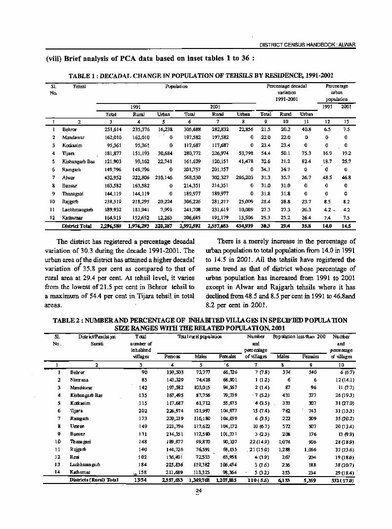
DISTRICT CENSUS HANDBOOK: ALWAR
(viii) Brief analysis of peA data based on inset tables 1 to 36 :
TABLE 1 : DECADAL CHANGE IN POPULATION OF TEHSILS BY RESIDENCE, 1991·2001
Sl. No.
Tehsil
2
Behror
2 Mandawar
3 Kotkasim
4 Tijara
5 Kishangarh Bas
6 Ramgarh
7 AlwlIr
8 Bansur
9 Thanagazi
10 Rajgarh
II Lachhmangarh
12 Kathumar
District Total
Total 3
251,614
162,010
95,361
181,877
121,903
149,796
432,952
163.582
144.119
238.519
1,89.932
16~;915
2,296;580
Population
1991
Rural 4
235,376
162,010
95,361
Urban
5 16,238
o o
151,H)3 30,684
99,162 22,741
149.796 0
222,806 210,146
163.582
144,119
218,295
181,941
152,652
1,976,293
o o
20,224
7,991
12,263
320,287
Total
6
305,688
197,582
117,687
280,772
161,629
201,757
568,530
214.351
189.977
306,226
241,708
206,685
2,!)!)2,592
2001
Rural
7
282,832
197,582
117,687
226,974
120,151
201,757
302.327
214.351
189,977
28I,:?17
231,619
191,179
2,557,653
Urban
8
22,856
o o
53,798
41,478
'0
266,203
o o
25.009
10,089
15.506
434;939
Percentage decadal variation
1991-2001
Total
9
21.5
22.0
23.4
54.4
32.6
34.7
31.3
31.0
31.8
28.4
27.3
25.3
30.3
Rural
10
20.2
22.0
23.4
50.1
21.2
34.7
35.7
31.0
31.8
28.8
27.3
25.2
29:4
Urban
11
40.8
o o
75.3
82.4
o 26.7
o o
23.7
26.3
26.4
35.8
Percentage urban
popUlation
1991 2001
12
6.5
o o
16.9
18.7
o 48.5
o o 8.5
4.2 ..
7.4
14.0
13
7.5
o o
19.2
25.7
o 46.8
o o 8.2
4.2
7.5
14.5
The district has registered a percen.tage decadal variation of 30.3 during the decade 1991-2001. The urban area of the district has attained a higher decadal
".
There is a merely increase in the percentage of urban population to total population from 14.0 in 1991 to 14.5 in 2001. All the tehsils have registered the same trend as that of district whose percentage of urban popUlation has increased from 1991 to 2001 except in Alwar and Rajgarh tehsils where it has declined from 48.5 and 8.5 per cent in 1991 to 46.8and 8.2 per cent in 2001.
variation elf 35.'8 per cent as compared to that of rural area at 29.4 per c.ent. At tehsi1level, it varies from the lowest of 21.5 per cent in Behror tehsil to a maximum of 54.4 per cent in Tijara tehsil in total areas.
TABLE 2 : NUMBERAND PERCENfAGE OF INHABITED VILlAGES IN SPECIFIED POPULA nON SIZE RANGES WITH THE RELATED POPULATION, 2001
Sl. No.
DistrictfPancilayat Samiti
2 BehrOJ'
2 Nimrana
3 Mandawar
4 Kisbangam Bas
S K<Xkasim
6
7
8 !}
10 11
12
13
14
Tijara
Ramgam
Umren
Bansur
Thanagazi
Rajgam
Reni
Lacbhman gam
KathlDIlar
Districts (Rural) Total
Total number of inhabited villages
3 90
85
142
135
115
202
173
149
131
148
140
1(l2
184
",.158
Total rural populatiro Number fbpulation less than 200 Number and and .
pereentage peroentage -"::'Pers-o-ns--~Ma~I:-es---::F:-em'""":'ales- of villages --:M~a1"':'es---=F:-emal--:"es-- of villages
4 5 '6 7 8 9 10 139,503 72,777 66,726 7 (7.8) 374 340 6 (6.7)
143,329 74,428
197 ,582 103,015
101,495 87,756
117,687 61,712
226,974
220,219
221,794
214,351
189.977
144.726
136)191
225.836
121,997
116,180
.117.622
112,580
99.870
76,591
72,'533
119.382
211.689 113,325
2,557,&53 -1,349,768
24
68,901 1 (12) 6 6 12 (14.1)
94,567 2 (1.4) 87 96 11 (I J)
79,739 . 7 (52) 431 '577 26 (193)
55,975 4(35) 333 307 31(27.0)
104,977 15 (1.4) 782 743 31 (153)
104,W9 6 (35) 222 209 35(202)
104,172 10 -(6.7) 572 507 20 (13.4)
101.771 3 (23) 208 176 13 (9.9)
90,107 22(149) 1.074 906 28(18.9)
68.135 .21 (15.0) 1.288 1.(X;6 33 (23.6)
63,958 4 (39) 201 204 19 (lIi:6)
100,454 3 (1 Ji) 236 188 38 (20:7)
98,364 5 (32) 253 234 29 (18.4) --
1,207;1185 no( 5(6) - 6,133 5,359 33'2(1"'7.0)
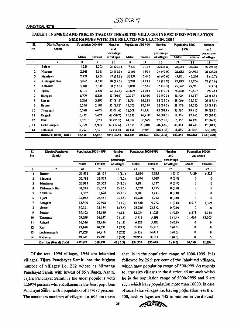
ANALYTICAL NOTE
TABLE 2 : NUMBER AND PERCENTAGE OF INHABITED VILLAGES IN SPECIFIED POPULA nON SIZE RANGES WITH mE RELATED POPULATION, 2001
SI. No.
2
3
4
5
6
7
8 9
10
11
12
... 13 . 14
SI. No.
I
2
3 4
5 6
7
8
9
10
11
12
13
14
Disr ictIPan em yat
Samiti
2
Belror
Nimrana
Mandawar
Kisbangarh Bas
Kotkasim
Tijara
Ramgarh
Umren
Bansur
lbanagazi
Rajgarh
Reni
Lachhmangam
Kathumar
Distriets (Rural) TolBl
District/Panchayat Samiti
2 Behror
Nimrana
Mandawar Kishangarh Bas
Kotkasim
Tijara
Ramgarh
Umren
Bansur
lbanagazi
Rajgarh
Reni
Lachhmangarh
Kathumar
Districts (Rural) Total
Population 200-499 Number Population 500-999 Number Pop uI a tion 1000-1999
Number and
~~_~~..,...._ pen:entage _:-:-:-_--::---:--_ percentage --:-:-:-_"""'"::--~ pen:entage and a~
Males Females ofviIJages Males Females ofvillages Males Females ofviJIages
II 12 13 14 15 16 17 18 -I9
1,225 1,203 21 (23.3) 7,730 7,114 32(35.6) 22,354 20,589 22 (24.4)
2,241 2,091 13 (15.3) 5,166 4,954 34 (40.0) 26,633 24,935 24 (28.2)
2,222 1,966 47(33.1) 18,857 17,440 61(43.0) 45,911 42,216 18(12.7)
5,045 4,630 40 (29.6) 15,710 14,248 39(28.9) 29,893 27,256 21 (15.6)
5,884 5,340 38 (33.0) 14,890 13,546 35 (30.4) 25,162 22,961 5(4.3)
6,116 5,421 72 (35.6) 27,639 25,043 62(30.7) 45,150 40,537 19(9.4)
6,779 6,234 53 (30.6) 20,317 18,460 52(30.1) 38,424 34,587 23 (13.3)
3,816 3,296 47 (31.5) 18,561 16,638 38 (255) 28,566 25,195 26 (17.4)
2,376 2,105 33 (25.2) 13,503 12,059 52(39.7) 38,479 34,710 25 (19.1)
5,548 4,675 32 (21.6) 12,008 11,151 42(28.4) 31,565 28,217 20 (13.5)
6,222 5,455 43 (30.7) 16,773 14,918 26(18.6) 19,739 17,460 15 (10.7)
3,761' 3,265 36 (35.3) 14,007 12,245 22(21.6) 16,166 14,198 17 (16.7)
7,799 6,979 60 (326) 23,576 21,008 60(32.6) 43,384 38,946 19 (10.3)
6,292 5,371 49 (31.0) 20,151 17,703 50(31.6,.' 35,830 31,046 19 (12.0)
65,Jlfj 58,031 584 (29,9) 228,888 206,527 605 (31.0) 447,256 402,853 273 (14.0)
Population 2000-4999 Number Population 5000-9999 and
Number and
Population 10000 and above
_____ -~-__ - percentage _-:-:--:--_--=_-:--_ percentage _-:-:--:--_--=_~_ Males Females of villages Males Females of villages Males Females
20 21 22 23 24 25 26 27 30,631 28,117 I (1.1) 3,034 2,835 I (1.1) 7,429 6,528
35,788 32,827 1(1.2) 4,594 4,088 0 (0.0) 0 0
26,917 24,572 3 (2.1) 9,021 8,277 0 (0.0) 0 0
31,348 28,353 2 (1.5) 5,329 4,875 0 (0.0) 0 0
7,362 6,678 2 (1.7) 8,081 7,143 0 (0.0) 0 0
32,042 25,481 3 (1.5) 10,268 7,752 0 (0.0) 0 0
33,900 29,948 3 (1.7) 10,520 9,272 I (0.6) 6,018 5,329
39,371 35,164 8 (~.4) 26,736 23,372 0 (0.0) 0 0
39,102 35,559 4 (3.1) 12,034 11,028 I (0.8) 6,878 6,134
29,299 26,657 2 (1.4) 5,911 5,198 2 (1.4) 14,465 13,303
26,246 23,456 2 (1.4) 6,323 5,780 0 (0.0) 0 0
23,140 20,531 4(3.9) 15,192 13,515 0(0.0) 0 0
27,829 24,916 4(2.2) 16,558 14,417 0(0.0) 0 0
29,847 25,893 6 (3.8) 20,952 18,117 0 (0.0) 0 0
412,8%2 368,15% 45 (2.3) 154,553 135,669 5 ( 0.3) 34,790 31,%94
Of the total 1994 vi Ilages, 1954 are inhabited
villages. Tijara Panchayat Sarniti has the highest
number of villages' i.e_ 202 where as Nimrana
Panchayat Samiti with lowest of 85 villages. Again,
Tijara Panchayat Samiti is the most populous with
226974 persons while Kotkasim is the least populous
Panchayat Sifuiti with a population of 117687 persons.
that lie in the population range of 1000-1999. It is
followed by 29.9 per cent of the inhabited villages,
which have population range of 500-999. As regards
to large size villages in the district, 45 are such which
lie in the popUlation range of 5000-9999 and 5 are
such which have population more than lOOOO. In case
of small size villages i.e. having pdfiUlation less than
The maximum numbers of villages i.e. 605 are those 500, such villages are 442 in number in the district.
25 ~
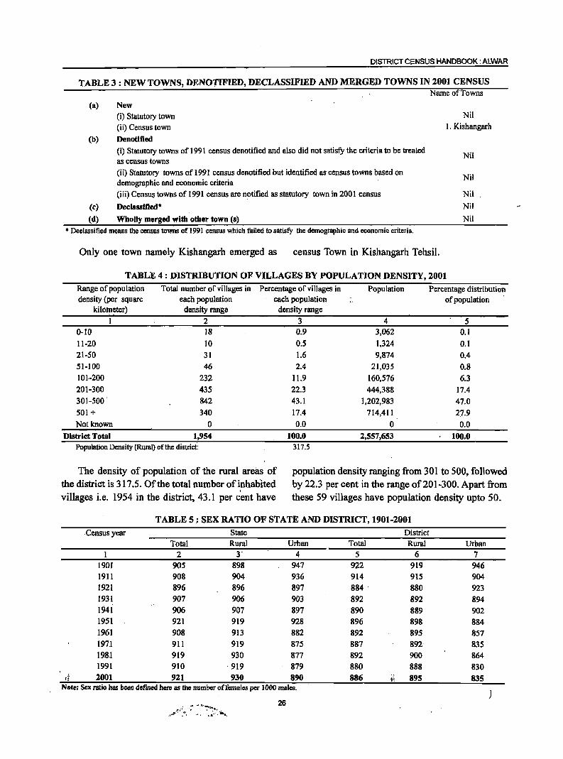
DISTRICT CENSUS HANDBOOK: ALWAR
TABLE 3 : NEW TOWNS, DENO'J'IFIED, DECLASSIFIED AND MERGED TOWNS IN 2001 CENSUS
(a)
(b)
(c)
(d)
New
(i) Statutory town
(ii) Census town
Denotified
(i) Statutory towns of 1991 census denotified and also did not satisfy the criteria to be treated as census towns
(ii) Statutory towns of 1991 census denotified but identified as census towns based on demographic and economic criteria
(iii) Census towns of 1991 census are notified as statutory town in 2001 census
Declassified * Wholly merged with other town (s)
Name of Towns
Nil
I. Kishangarh
Nil
Nil
Nil
Nil
Nil
• Declassified means the census towns of 1991 census which failed to satisi)' the demographic and economic criteria.
Only one town namely Kishangarh emerged as census Town in Kishangarh Tehsil.
TABLE 4 : DISTRIBUTION OF VILLAGES BY POPULATION DENSITY, 2001 Range of population Total number of villages in Percentage of villages in Population Percentage distribution density (per square each population each population of population
kilometer) density range
1 2 0-10 18
11-20 10
21-50 31
51-100 46
101-200 232
201-300 435'
301-500 842
501 + 340
Not known 0
District Total 1,954 Population Density (Rural) of the district:
The density of population of the rural areas of the district is 317.5. Of the total number of inhabited villages i.e. 1954 in the district, 43.1 per cent have
density range
3 4 5 0.9 3,062 0.1
O.S 1,324 0.1
1.6 '9,874 0.4 2.4 21,035 0.8
11.9 160,576 6.3
22.3 444,388 17.4
43.1 1,202,983 47.0
17.4 714,411 27.9
0.0 0 0.0
100.0 2,557,653 100.0 317.5
population density ranging from 301 to 500, followed by 22.3 per cent in the range of201-300. Apart from these 59 villages have popUlation density upto 50.
TABLE 5.: SEX RATIO OF STATE AND DISTRICT~ 1901-2001
Census year State District
Total Rural Urban Total Rural Urban 2 3' 4 5 6 7
1901 905 898 947 922 919 946 1911 908 904 936 914 915 904 1921 896 896 897 884 880 923 1931 907 906 903 892 892 894 1941 906 907 897 890 889 902 1951 921 919 928 896 898 884
1961 908 913 882 892 895 857 1971 911 919 875 887 892' 835 1981 919 930 877 892 900 864 1991 910 ·919 879 880 888 830
d 2001 921 930 890 886 I'; 895 835 Note: Sex ratio has been defined here as the number of females per 1000 males.
"",,-::"~'a\';: ~"·'~.~<':iat'll. 26
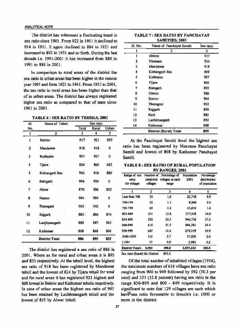
ANAL YTleAL NOTE
The district has witnessed a fluctuating trend in sex ratio since 1901. From 922 in 1901 it declined to 914 in 1911. It again declined to 884 in 1921 and increased to 892 in 1931 and so forth. During the last decade i.e. 1991-2001 it has increased from 880 in 1991 to 886 in 2001.
In comparison to rural areas of the district the sex ratio in urban areas has been higher in the census year 1901 and form 1921 to 1941. From 1951 to 2001, the sex ratio in rural areas has been higher than that of in urban areas. The district has always registered higher sex ratio as compared to that of state since 1901 to 2001.
TABLE 6 : SEX RATIO BY TEHSILS, 2001
Sl. No.
2
3
4
5
6
7
8
9
10
11
12
Name of Tehsil
2
Behror
Mandawar
Kotkasim
Tijara
Kishangarh Bas
Ramgarh
A1war
Bansur
Thanagazi
Rajgarh
Lac~hmangarh
Kathumar
District Total
Total 3
917
918
907
824
902
904
870
904
902
885
888
868
886
Sex ratio Rural Urban
4 5
921 859
918 0
907 0
860 683
910 880
904 0
886 853
904 0
902 0
886 874
887 905
868 866
895 835
The district has registered a sex ratio of 886 in 2001. Where as for rural and urban areas it is 895 and 835 respectively. At the tehsillevel, the highest sex ratio of 918 has been registered by Mandawar tehsil and the lowest of 824 by Tijara tehsil for total and for rural areas it has registered 921 highest and 868 lowest in Behror and Kathumar tehsils respctively. In case of urban areas the highest sex ratio of 905 has been attained by Lachhmangarh tehsil and the lowest of 853 by Alwar tehsil.
27
TABLE 7: SEX RATIO BY PANCHAYAT SAMITIES, 2001
SI.No. Name of Panchayat Samiti Sex ratio I 2 3 I Behror 917 2 Nimrana 926 3 Mandawar 918 4 Kishangarh Bas 909 5 Kotkasim 907 6 Tijara 860 7 Ramgarh 895 8 Umren 886 9 Bansur 904
10 Thanagazi 902 11 Rajgarh 890
12 Reni 882 13 Lachhmangarh 892 14 Kathumar 868
District (Rural) Total 895
At the Panchayat Samiti level the 'highest sex ratio has been registered by Nimrana Panchayat Samiti and lowest of 868 by Kathumar Panchayat Samiti.
TABLE 8: SEX RATIO OF RURAL POPULATION BY RANGES, 2001
Range of sex Number of Percentage of Population ratio inhabited villages in each 200 I
for villages villages range
2 3 4
Less than 700 32 1.6 22,758
700-749 22 1.1 9,846
750-799 65 3.3 45,810
800-849 251 12.8 277,938
850-899 592 30.3 946,730
900-949 616 31.5 904,281
950-999 247 12.6 279,359
1000-1099 112 5.7 67,028
II 00+ 17 0.9 3,903
District Total: 1,954 100.0 2,557,653
Sex ratio (Rural) for District 895.0
Percentage distribution
of population
5
0.9
0.4
1.8
10.9
37.0
35.4
10.9
2.6
0.2
100.0
Of the total number of inhabited villages (1954), the maximum numbers of 616 villages have sex ratio ranging from 900 to 949 followed by 592 (30.3 per cent) and 251 (12.8 percent) having sex ratio in the range. 850-899 and 800 - 849 respectively. It is significant to note that 129 villages are such which
.... 1-hav~sex ratio favourable to female's i.e. 1000 or more in the district.
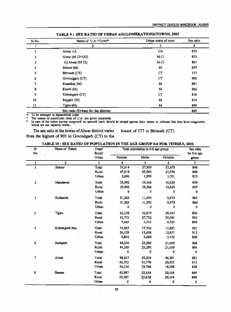
DISTRICT CENSUS HANDBOOK: ALWAR
TABLE 9: SEX RATIO OF URBAN AGGLOMERATIONSrrOWNS, 2001
SI.No. Name of U.A."ffown'" Urban status of town Sex ratio
I 2 3 4
1 AlwarUA UA 853
2 Alwar (M CI+OG) M.CI 853
3 (i) Alwar (M CI) ·M.Cl 867
4 Behror(M) M 859
5 Bhiwadi (CT) CT 577
6 Govindgarh (CT) CT 905
7 Khairthal (M) M 881
8 Kherli (M) M 866
9 Kishangarh (CT) CT 876
10 Rajgarh (M). M 874
II Tijara (M) M 899
Sex ratio (Urban) for the district: 835 + To be arranged in alphabetical order " The names of constituent units of U.A. are given separately. • In case of the towns having outgrowth an asterisk mark should be plal;~d against their names to indicate that they have outgrowths
which are not separate' towns. .. .
The sex ratio .in the. to~ps of.t\lwar district varies from the highest of 905 in Govindgarh (CT) to the
lowest of 577 in Bhiwadi (CT).
TABLE 10: SEX RATIO OFPOPULA'foION IN THE AGE GROUP 0-6 FOR TEHSILS, 2001 81. Name of Tehsil Totall Total population in 0-6 age group Sex ratio No. Rurall for 0-6 age
Urban Persons Males Females group
2 3 4 5 6 7 Behror Total 51,614 27,959 23,655 846
Rural 47,918 .25,964 21,954 846 Urban 3,696 1,995 1,701 853
2 Mandawar . Total 35,992 19,366 16,626 859 Rural 35,992 19,366 16,626 859 Urban 0 0 0 0
3 Kotkasim Total 21,563 11,593 9,970 860 Rural 21,563 11,593 9,970 860 Urban 0 Q 0 Q
4 Tijara Total 62,238 32,875 29,363 89<3 Rural 52,773 27,732 25,041 903 .
Urban 9,465 5,143 4,322 840
5 Kishangarh Bas Total 32,965 17,342 15,623 901 Rural 26,129 13,658 12,471 913 Urban 6,836 3,684 3,152 856
6 . Ramgarh Total 44,349 23,290 21,059 904 Rural 44,349 23,290 21,059 904 Urban 0 0 0 0
7 Alwar Total 98,837 52,536 46,301 881 Rural 62,703 32,770 29,933 913 Urban 36,l.34 19,766. 16,368 828
8 Bansur Total 42;987 22;638 20,349 899 Rural 42,987 ·2,2,638 20,349 899 Urban 0 0 0 0
28
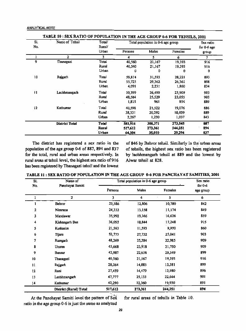
ANALYTICAL NOTE
TABLE 10 : SEX RATIO OF POPULATION IN THE AGE GROUP 0-6 FOR TEHSILS, 2001 81. Name of Tehsil Total{
No. Rurall Urban
1 2 3 9 Thanagazi Total
Rural Urban
10 Rajgarh Total Rural Urban
11 Lachhmangarh Total Rural Urban
12 Kathumar Total Rural Urban
District Total Total Rural Urban
The district has registered a sex ratio in the population of the age group 0-6 of 887, 894 and 837 for the total, rural and urban areas respectively. In rural areas at tehsillevel, the highest sex ratio of916 has been registered by Thanagazi tehsil and the lowest
Total population in 0-6 age group Sex ratio for 0-6 age
Persons Males Females group
4 5 6 7 40,560 21,167 19,393 916 40,560 21,167 19,393 916
0 0 0 0
59,814 31,593 28,221 893 55,723 29,362 26,361 898 4,091 2,231 1,860 834
50,399 26,490 23,909 903 48,584 25,529 23,055 903
1,815 961 854 889
40,598 21,522 19,076 886 38,331 20,292 18,039 889 2,267 1,230 1,037 843
581,916 308,371 173,545 887 517,612 273,361 144,251 894
64,304 35,010 29,294 837
of 846 by Bahror tehsil. Similarly in th~' urban areas of tehsils, the highest sex ratio has been registered by lachhmangarh tehsil at 889 and the lowest by Alwar tehsil at 828.
TABLE 11 : SEX RATIO OF POPULATION IN THE AGE GROUP 0-6 FOR PANCHA Y AT SAMITIES, 2001
SI. Name of Total population in 0-6 age group Sex ratio No. Panchayat Samiti for 0-6
Persons Males Females age group
2 3 4 5 6
Behror 23,586 12,806 10,780 842
2 Nimrana 24,332 13,158 11,174 849
3 Mandawar 35,992 19,366 16,626 859
4 Kishangarh Bas 36,092 18,844 17,248 915
5 Kotkasim 21.,563 11,593 9,970 860
6 Tijara 52,773 27,732 25,041 903
7 Ramgarh 48,269 25,284 22,985 909
8 Umren 45,668 23,918 21,750 909
9 Bansur 42,987 22,638 20,349 899
10 Thanagazi 40,560 21,167 19,393 916
11 Rajgarh 28,264 14,883 13,381 899
12 Reni 27,459 14,479 12,980 896
13 Lachhmangarh 47,777 25,133 22,644 901
14 Kathumar 42,290 22,360 19,930 891
District (Rural) Total 517,612 273,361 244,251 894 "
At the Panchayat Sarniti level the pattern of S'~t for rural areas of tehsils in Table 10. ratio in the age group 0-6 is just the same as analyzed
29
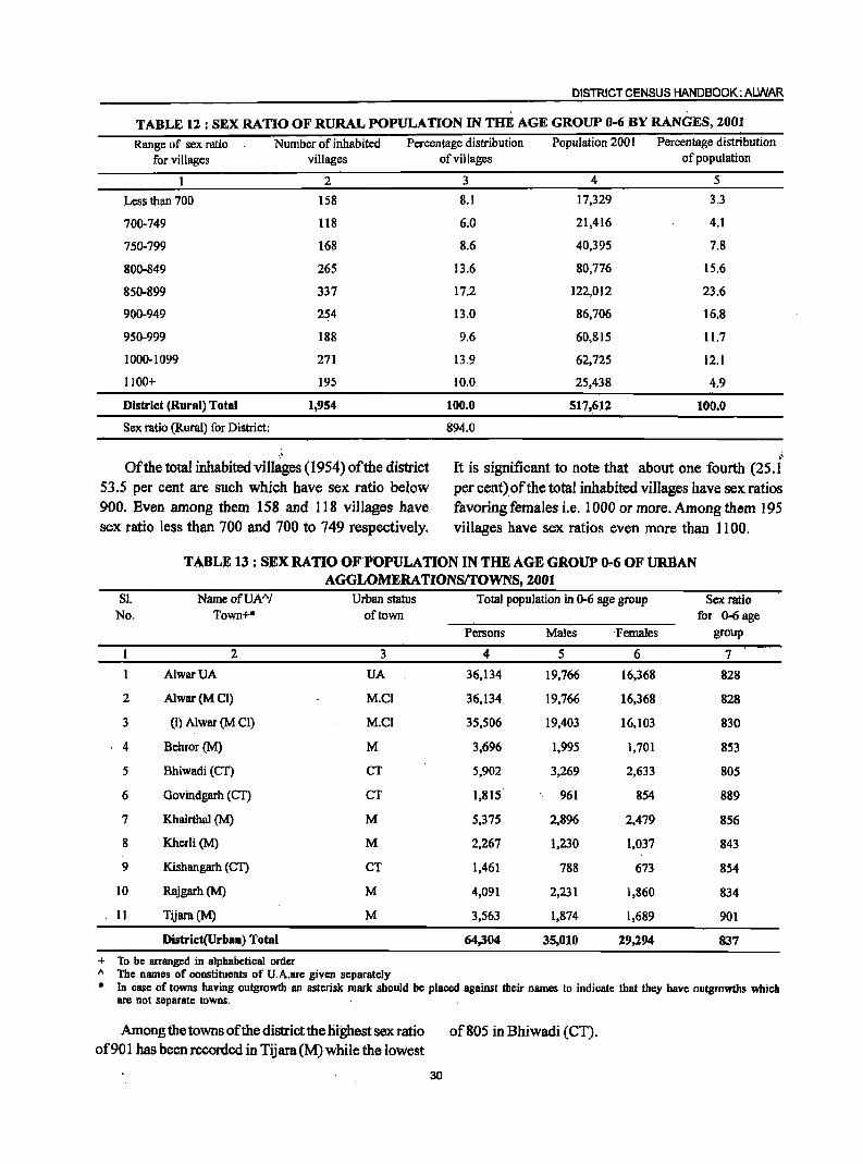
DISTRICT CENSUS HANDBOOK: ALWAR . .
TABLE 12 : SEX RATIO OF RURAL POPULATION IN THE AGE GROUP 0-6 BY RANGES, 2001
Range of sex ratio Number of inhabited Percentage distribution Population 200 I Percentage distribution
for villages villages
2
Less than 700 158
700-749 1I8
750-799 168
800-849 265
850-899 337
900-949 254
950-999 188
1000-1099 271
1100+ 195
District (Rural) Total 1,954
Sex ratio (Rural) for District:
.,
Of the total inhabited villages (1954) of the district 53.5 per cent are such which have sex ratio below 900. Even among them 158 and 118 villages have sex ratio less than 700 and 700 to 749 respectively.
of villages of population
3 4 5
8.1 17,329 3.3
6.0 21,416 4.1
8.6 40,395 7.8
13.6 80,776 15.6
17.2 122,012 23.6
13.0 86,706 16.8
9.6 60,815 11.7
13.9 62,725 12.1
10.0 25,438 4.9
100.0 517,612 100.0
894.0
I.rr..
It is significant to note that about one fourth (25.1 per cent) of the total inhabited villages have sex ratios favoring females i.e. 1000 or more. Among them 195 villages have sex ratios even more than 1100.
TABLE 13 : SEX RATIO OF POPULATION IN THE AGE GROUP 0-6 OF URBAN AGGLOMERA TIONS!I'OWNS, 2001
SI. Name ofUA"! Urban status Total population in 0-6 age group Sex ratio No. Town+· of town for 0-6 age
Persons Males Females group
2 3 4 5 6 7
AlwarUA UA 36,134 19,766 16,368 828
2 Alwar(MCI) M.CI 36,134 19,766 16,368 828
3 (i) Alwar (M CI) M.CI 35,506 19,403 16,103 830
4 Behror (M) M 3,696 1,995 1,701 853
5 Bhiwadi(Cn CT 5,902 3,269 2,633 80S
6 Govindgarh (Cn CT 1,815 961 854 889
7 Khairthal (M) M 5,375 2,896 2,479 856
8 Kherli (M) M 2,267 1,230 1,037 843
9 Kishangarh (en CT 1,461 788 673 854
10 Rajgarh(M) M 4,091 2,231 1,860 834
11 Tijara(M) M 3,563 1,874 1,689 901
District(Urban) Total 64,304 35,010 29,294 837
+ To be arranged in alphabetical order A The names of constituents of U.A.are given separately * In case of towns having outgrowth an asterisk mark should be placed against their names to indicate that they have outgrowths which
are not separate towns.
Among the towns of the district the highest sex ratio of901 has been recorded in Tijara(M) while the lowest
of 805 in Bhiwadi (CT).
30
ANALYTICAL NOTE
TABLE 14: NUMBER AND PERCENTAGE OF SCHEDULED CASTES AND SCHEDUlED TRIBES POPULATION IN 1EHSILS, 2001
S1. Name of Tehsil Totall Total Total Total Percentage of Percentage of No. Rurall population Scheduled Scheduled Schedul ed Castes Scheduled Tribes
Urban Castes Tribes popul ati on to total popul atio n to total population population population population
1 2 3 4 5 6 7 8 I Behror Total 305,688 47,834 4,335 15.6 1.4
Rural 282,832 44,259 3,916 15.6 1.4 Uman 22,856 3,575 419 15.6 1.8
2 Mandawar Total 197,582 38,233 6,137 19.4 3.1 Rural 197,582 38,233 6,137 19.4 3.1 Umn 0 0 0 0.0 0.0
3 Kotkasim Total 117,687 22,73 I 887 19.3 0.8 Rural 117,687 22,731 887 19.3 0.8 Uman 0 0 0 0.0 0.0
4 Tiiara Total 280,772 38,163 595 13.6 0.2 Rural 226,974 31,677 363 14.0 0.2 Uman 53,798 6,486 232 12.1 0.4
5 Kishangarh Bas Total 161,629 33,718 355 20.9 0.2 Rural 120,151 24,457 85 20.4 0.1 Umn 41,478 9,261 270 22.3 0.7
6 Ramgam Total 201,757 35,087 6,456 17.4 3.2 Rural 201,757 35,087 6,456 17.4 3.2 Uman 0 0 0 0.0 0.0,
7 Alwar Total 568,530 111,497 27,324 ]9.6 4.8 Rural 302,327 69,554 19,129 23.0 6.3 Uman 266,203 41,943 8,195 15.8 3.1
8 Bansur Total 214,351 32,954 9,186 15.4 4.3 Rural 214,351 32,954 9,186 15.4 4.3 Uman' 0 0 0 0.0 0.0
9 Thanagazi Total ]89,977 27,465 36,249 14.5 19.1 Rural 189,977 27,465 36,249 14.5 19.1 Umn 0 0 0 0.0 0.0
10 Rl!igam Total 306,226 57,686 94,335 1~.8 30.8 Rural 281,217 52,863 93,185 18.8 33.1 Uman 25,009 4,823 1,150 19.3 4.6
1 ] Lachhmangarh Total 241,708 44,714 29,353 18.5 12.1 Rural 231,619 43,16 ] 28,965 ]8.6 12.5 Uman 10,089 1,553 388 15.4 3.8
12 Kathumar Total 206,685 48,954 24,693 23.7 11.9 Rural 191,179 47,986 24,295 25.1 12.7 Uman 15,506 968 398 6.2 2.6
District Total Total 2,992,592 539,036 239,905 18.0 8.0 Rural 2,557,653 470,427 228,853 18.4 8.9 Umm' 434,939 68,609 11,052 15.8 2.5
The proportion of scheduled castes and scheduled population is found to be 15.8 and 2.5 respectively.
tribes population to the total population of the district is As tehsillevel, the proportion of scheduled castes found to be 18.0 per cent and 8.0 per cent respectively. to total population varies for 23.7 per cent in Kathumar For rural areas the re~pective proportions for scheduled tehsil to 13.6 per cent in Tijara tehsil. Ip. case of castes and scheduled,tribes comes out to be 18.4 per scheduled tribes this proportion varies from 30.8 per cent and 8.9 per cent. Similarly in urban areas of the cent in Rajgarh tehsil to 0.2 per cent ~n Tijara and district,the percentilie of scheduled castes population Kishallgarh Bas tehsils respectively. ':~ .' .. '
.~
and the sched,uled tribes popUlation to the total
31
DISTRICT CENSUS HANDBOOK: ALWAR
TABLE 15 : NUMBER AND PERCFNTAGE OF SCHEDULED CAS1ES AND SCHEDULED mmES POPULATIONINPANCHAYATSAMITIES,2001
81. Name of Total Total Total Percentage of Percentage of No. Panchayat Samiti population Scheduled Castes Schedu led Tribes Scheduled Castes Scheduled Tribes
population population population to total population to total population population
2 3 4 5 6 7 I Behror 139,503 21,100 1,678 15.1 1.2
2 Nirruana 143,329. 23,159 2,238. 16.2 1.6
3 Mandawar 197,582 38,233 6,137 19.4 3.1
4 Kishangarn Bas 167,495 34,824 100 20.8 0.1
5 Kotkll'lim 117,687 22,731 887 19.3 0.8
6 Tljam 226,974 31,677 363 14.0 0.2
7 Ramgarh 220,219 41,796 7,587 19.0 3.4
8 Umren 221,794 50,093 17,983 22.6 8.1
9 Bansur 214,351 32,954 9,186 15.4 4.3 10 Thanagazi 189,977 27,465 36,249 14.5 19.1 II Rajgarb 144,726 26,843 42,660 18.5 29.5
12 Reni 136,491 26,020 50,525 19.1 37.0
13 Lachhmangarn 225,836 42,508 25,803 18.8 11.4 14 Kathumar 211,689 51,024 27,457 24.1 13.0
District {Rural} Total 21557,653 470,427 2281853 18.4 8.9
The percentage of scheduled castes population tribes the highest proportion of 29.5 has been to total population at Panchayat Samiti level varies recorded in Rajgarh Panchayat Samiti. While· the from 24.1 in Kathumar Panchayat Samiti to 14.0 lowest percent 0.1 in Kishangarh Bas Panchayat in Tijara Panchayat Samiti. In case of scheduled Samiti.
TABLE 16: PROPORTION OF SCHEDULED CASTES POPULATION TO TOTAL POPULATION IN VILLAGES, 2001
Percentage range of Scheduled Number Castes population to of
total population villages
. I 2
Nil 331
Less than 5 178
5-10 290
11-20 535
21-30 334
31-40 142
41-50 72
51-75 59
76 and above 13
Distri~t Total 1,954
Of the total.l9.54 inhabited villages in the district, 331 villages·are 'such' where no· sch"eauled castes population exists. The'maximuni nuniber· of villages i.e.535 which account 27'l'~ per cent of the total inhabited vi11ages have ~cheduled ~ste population in
32
Percentage Scheduled Percentage Castes
Population
3 4 5
16.9 0 0.0
9.1 4,448 0.9
14.8 31,737 6.7
27.4 154,240 32.8
17.1 130,377 27.7
7.3 69,746 14.8
3.7 40,123 8.5
3.0 34,1I4 7.3
0.7 5,642 1.2
-100;0 470,427 100.0
the range of 1.1 to 20 per ·cent to their total ,population followed'by'334 villages in the:range;of21 ,to-gOper .'cent. ·On 'the 'higher Side, S9 and 13 villages .have scheduled castes 'Population ranging from 51 to "%i? and 76 and above respectively.
ANALYTICAL NOTE
TABLE 17 : PROPORTION OF SCHEDULED TRIBES POPULATION TO TOTAL POPULATION IN VILLAGES, 2001
Percentage range of Scheduled Number Percentage Scheduled Percentage Tribes population to of Tribes
total population villages Population
2 l 4 5
Nil 1,136 58.! 0 0.0
Less than 5 272 13.9 10,487 4.6
5-10 138 7.1 18,426 8.1
11-20 103 5.3 27,272 11.9
21-30 56 2.9 27,821 12.2
31-40 28 1.4 12,220 5.3
41-50 42 2.1 28,240 12.3
51-75 89 4.6 56,672 24.8
76 and above 90 4.6 47,715 20.8
District Total 1,954 100.0 228,853 100.0
It is significant to note that majority of the these, l3.9 per cent of the inhabited villages (272)
inhabited villages i.e. 1136 (58.1 per cent) have no are such where proportion of scheduled tribes scheduled tribes population in the district. Apart from population to their total population is less than 5.
TABLE 18: NUMBER AND PERCENTAGE OF SCHEDULED CASTES AND SCHEDULED TRIBES POPULATION IN URBAN AGGLOMERATIONSII'OWNS, 2001
SI. Name ofUAA/ Total Total Total Percentage of Percentage of No. Town·+ population Scheduled Castes Scheduled Tribes Scheduled Castes Scheduled Tribes
population population population to total population to total population population
2 3 4 5 6 7
1 AlwarUA 266,203 41,943 8,195 15.8 3.1
2 Alwar(MCI) 266,203 41,943 8,195 15.8 3.1
3 (i) Alwar (M Cl) 260,593 41,729 8,091 16.0 3.1
4 Behror(M) 22,856 3,575 419 15.6 1.8
5 Bhiwadi (CT) 33,877 2,839 152 8.4 0.4
6 Govindgarh (CT) 10,089 1,553 388 15.4 3.8
7 Khairthal (M) 32,005 7,657 133 23.9 0.4
8 Kherli (M) 15,506 968 398 6.2 2.6
9 Kishangarh (CT) 9,473 1,604 137 16.9 1.4
10 Rajgarh (M) 25,009 4,823 1,150 19.3 4.6
II Tijara(M) 19,921 3,647 80 18.3 0.4
District (Urban) Total 434,939 68,609 11,052 15.8 2.S
+ To be arranged in alphabetical order A The names of constituent units of U.A. are given separately • In case of towns having outgrowth an asterisk mark should be placed against their names to indicate that they have outgrowths which
are not separate towns.
The ,highest percentage of scheduled castes population to the total population of respective townsl city of the district has been found at 23.9 in Khairthal (M) fol16:wed by 19.3 in Rajgarh (M), while the lowest of 6.2 per cent has been recorded at Kherli (M). As
33
regards to scheduled tribes' poPl.llation, Rajgarh (M) has recorded the highest percentage of 4.6 to its total population while Bhiwadi (CT), Tijara (M) and Khairthal (M) have recorded tb,e lowest percentage of 0.4.
DISTRICT CENSUS HANDBOOK: ALWAR
TABLE 19: SEX RATIO AMONG SCHEDULED TABLE 20 : SEX RATIO AMONG SCHEDULED CASTES AND SCHEDULED TRIBES IN CASTES AND SCHEDULED TRIBES IN URBAN
PANCHAYAT SAMITIES, 2001 AGGLOMERA TIONSrrOWNS, 2001
Sl. Name of Scheduled Scheduled Sl. Name OfU.A.AI Scheduled Scheduled No, Panchayat Samiti Castes Tribes No. Town+* Castes Tribes
sex ratio sex ratio sex ratio sex ratio
2 3 4 2 3 4
Behror 935 898 AlwarUA 877 812
2 Nimrana 913 998 2 Alwar (M.CI) 877 812
3 Mandawar 922 951 3 (i) Alwar (MD) 876 820 4 Kishangarh Bas 900 667
4 Behror(M) 876 846 5 Kotkasim 927 810
6 Tijara 877 843 5 Bhiwadi (CT) 686 634
7 Ramgarh 897 860 6 Govindgarh (CT) 924 805
8 Umren 886 869 7 Khairthal (M) 871 209
9 Bansur 918 918 8 Kherli (M) 840 730
10 Thanagazi 907 885 9 Kishangarh (eT) 894 575
II Rajgarh 907 879 10 Rajgarh (M) 852 724
12 Reni 888 877 11 Tijara (M) 971 702
13 Lachhmangarh 888 890
14 Kathumar 877 878 Sex rat.o (UrbaD) for the district 871 783
District (Rural).Total 883 + To,bcf'arranged In alphabetical order
900, " The names of constituent units of U.A, are given separately • In case of towns having outgrowth an asterisk mark should be
Among scheduled castes the sex ratio varies from placed against their names to indicate that they have
a highest of 935 in Behror Panchayat Samiti to a outgrowths which are not separate to~s.
lowest of 877 in Tijara and Kathumar Panchayat In the urban areas, the sex ratio of scheduled Samities respectively. Similarly it varies from a castes varies from 971 in Tijara (M) to 686 in Bhiwadi highest of 998 in Nimrana Panchayat Samiti to a (CT). In comparison to scheduled castes, the lowest of merely 667 in Kishangarh Bas Panchayat scheduled tribes have recorded higher sex ratios. It Samiti among scheduled tribes. varies from 846 in Behror to 209 in Khairthal (M).
TABLE 21 : NUMBER AND PERCENTAGE OF LITERATES AN:» ILLITERATES BY TEHSILS,2001
SI. Name of Totall Number of literates and illiterates Percentage of Gap in male-No. Tehsil Rurall ' Number of literates Number of illiterates Ilterates female
Urb~ Persons Males Females Persons Males Females Persons Males Females literacy rate
1 2 3 4 5 6 7 8 9 10 11 12 13
1 Behror Total 187,667 116,265 71,40~ 118,021 43,237 74,784 73,9 88.4 58.3 30.1
Rural 171,908 106,792 65,116 1l0,924 40,413 70,511 73.2 88.1 57.3 30.8
Urban 15,759 9,473 6,286 7,097 2,824 4,273 82.3 92.0 71.0 21.0
2 Mandawar Total 1I0,905 70,595 40,310 86,677 32,420 54,257 68.6 84.4 51.7 32.7
Rural 110,905 70,595 40,310 86,677 32,420 . 54,257 68.6 84.4 51.7 32.7
Urban 0 0 0 0 0 0 0.0 0.0 0.0 0.0
3 Kotkasim Total 66,440 42,425 24,015 51,247 19,287' 31,960 69.1 84.7 52.2 32.5 f":
Rural 66,440 42,425 24,015 51,247 19.287 31,960 69.1, 84.7 52.2 32.5
Urban 0 0 0 ~~"fi .
0 0 0' 0.0 0.0 0,0 0.0
34
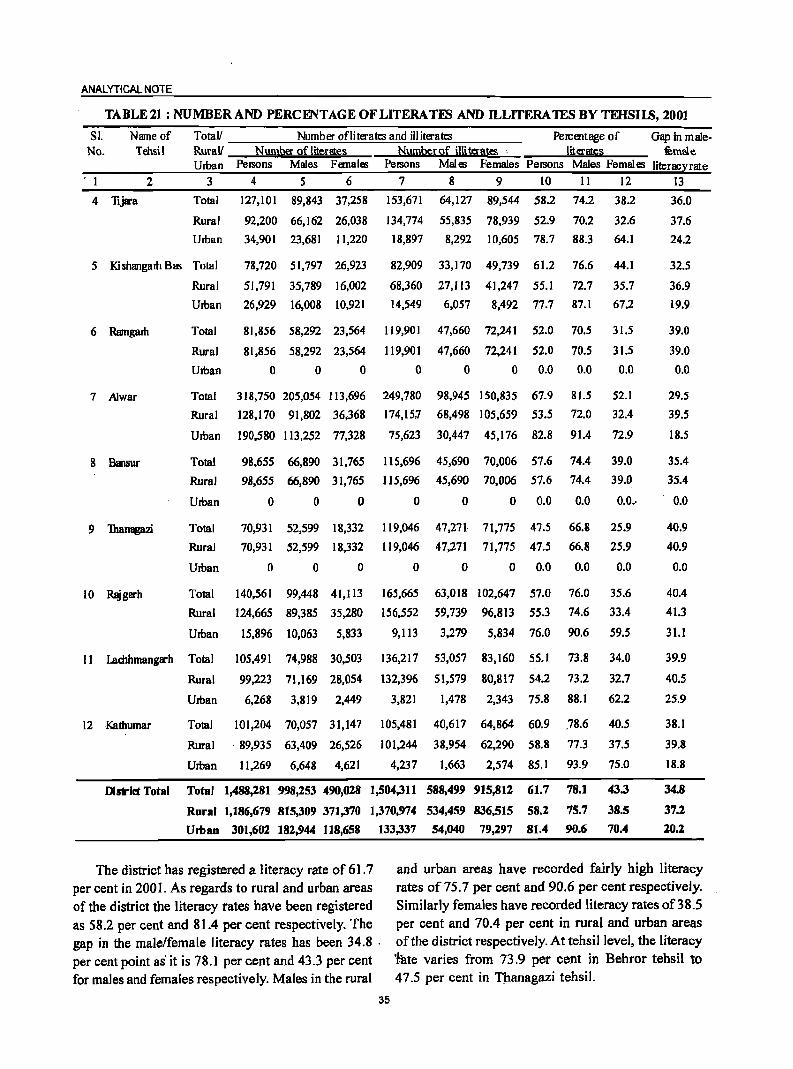
ANALYTICAL NOTE
TABLE 21 : NUMBER AND PERCENTAGE OF LITERA TEN AND ILLITERA 1ES BY TEHSILS, 2001
Sl. Name of Totall Number ofliterates and illiterates Percentage of Gap in male· No. Tehsil RuraV Number ofliterat.es Numberof illiterates· literates fumBle
Uman PelSOns Males Females Persons Males Females Persons Males Females literacy rate
. 1 2 3 4 5 6 7 8 9 to 11 12 13
4 lijara Total
Rural
Uman
127,101 89,843 37,258
92,200 66,162 26,038
34,901 23,681 11,220
5 Kishangam BIi'! Total
Rural
78,720 51,797 26,923
51,791 35,789 16,002
6 Ramgarh
7 A1war
8 Hansur
9 Thanagazi
10 Rlggarh
Uman 26,929 16,008 10,921
Total
Rural
Uman
81,856 58,292 23,564
81,856 58,292 23,564
o 0 0
Total 318,750 205,054 113,696
Rural 128,170 91,802 36,368
Uman 190,580 113,252 77,328
Total
Rural
Uman
Total
Rural
Uman
Total
Rural
Uman
98,655 66,890 31,765
98,655 66,890 31,765
o 0 0
70,931 52,599 18,332
70,931 52,599 18,332
o o o
140,561 99,448 41,113
124,665 89,385 35,280
15,896 10,063 5,833
153,671
134,774
18,897
64,127 89,544 58.2
55,835 78,939 52.9
8,292 10,605 78.7
74.2
70.2
88.3
38.2
32.6
64.1
82,909 33,170 49,739 61.2 76.6 44.1
68,360 27,113 41,247 55.1 72.7 35.7
14,549 6,057 8,492 77.7 87.1 67.2
119,901
119,901
o
47,660 72,241 52.0
47,660 72,241 52.0
o 0 0.0
249,780 98,945 150,835 67.9
174,15.7 68,498 105,659 53.5
75,623 30,447 45,176 82.8
70.5
70.5
0.0
81.5
72.0
91.4
115,696 45,690 70,006 57.6 74.4
115,696 45,690 70,006 57.6 74.4
o 0 0 0.0 0.0
119,046 47,271 71,775 47.5 66.8
119,046 47,271 71,775 47.5 66.8
o 0 0 0.0 0.0
165,665
156,552
9,113
63,018 102,647 57.0
59,739 96,813 55.3
3,279 5,834 76.0
76.0
74.6
90.6
31.5
31.5
0.0
52.1
32.4
72.9
39.0
39.0
0.0 .. ·
25.9
25.9
0.0
35.6
33.4
59.5
36.0
37.6
24.2
32.5
36.9
19.9
39.0
39.0
0.0
29.5
39.5
18.5
35.4
35.4
0.0
40.9
40.9
0.0
40.4
41.3
31.1
II I..achhmangarh Total 105,491 74,988 30,503 136,217 53,057 83,160 55.1 73.8 34.0 39.9
Rural 99,223 71,169 28,054 132,396 51,579 80,817 54.2 73.2 32.7 40.5
Uman 6,268 3,819 2,449
12 Kathumar Total 101,204 70,057 31,147
Rural . 89,935 63,409 26,526
Urban 11,269 6,648 4,621
3,821 1,478 2,343 75.8 88.1 62.2
105,481 40,617 64,864 60.9 .78.6
101,244 38,954 62,290 58.8 77.3
4,237 1,663 2,574 85. I 93.9
40.5
37.5
75.0
25.9
38.1
39.8
18.8
District Total Total 1,488,181 998,253 490,028 1,504,311 588,499 915,812 61.7 78.1 43.3 34.8
Rural 1,186,679 815,309 371,370 1,370,974 534,459 836,515 58.2 75.7 38.5 37.2
Umao 301,602 182,944 118,658 133,337 54,040 79,n7 81.4 90.6 70.4 20.2
The district has registered a I iteracy rate of 61.7 per cent in 2001. As regards to rural and urban areas of the district the literacy rates have been registered as 58.2 per cent and 81.4 per cent respectively. The gap in the male/female literacy rates has been 34.8 . per cent point as' it is 78.1 per cent and 43.3 per cent for males and females respectively. Males in the rural
35
and urban areas have recorded fairly high literacy rates of75.7 per cent and 90.6 per cent respectively. Similarly females have recorded literacy rates of38.5 per cent and 70.4 per cent in rural and urban areas of the district respectively. At tehsillevel, the literacy 'fate varies from 73.9 per cent in Behror tehsil to 47.5 per cent in Thanagazi tehsil.
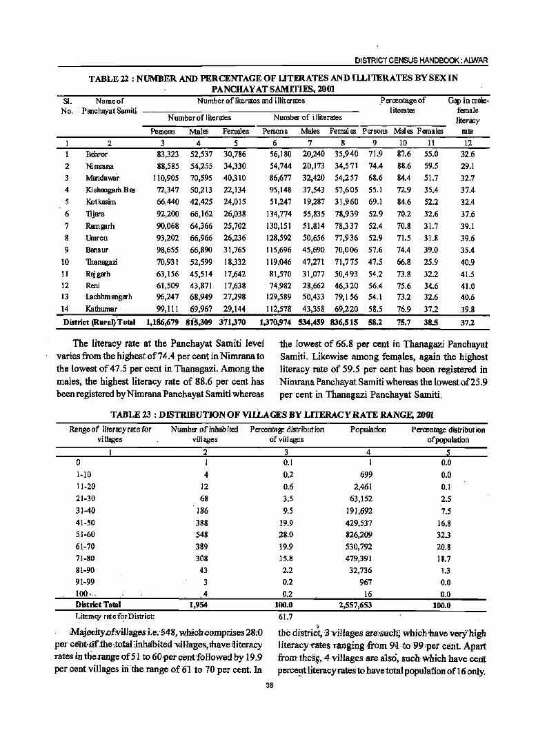
DISTRICT CENSUS HANDBOOK: ALWAR
TABLE 22 : NUMBER AND PERCENTAGE OF UTFRATES AND IlLI1ERATES BY SEX IN PANCHAY AT SAMITlES, 2001
SI. Nameof N umber of literates and illiterates Percentage of Gap in male-No. Panchayat Samiti litemtes female
N umber of literates Number-of illiterates literacy PelSons Males Females PelSOns Males Females Persons Males Females mte
2 3 4 5 6 7 8 9 10 11 12
Brhror 83,323 52,537 30,786 56,180 20,240 35,940 71.9 87.6 55.0 32.6
2 Nirruana 88,585 54,255 34,330 54,744 20,173 34,571 74.4 88.6 59.5 29.1
3 Mandawa'r 110,905 70,595 40,310 86,677 32,420 54,257 68.6 84.4 51.7 32.7
4 I<i shangam Bas 72,347 50,213 22,134 95,148 37,543 57,605 55.1 72.9 35.4 37.4
5 Kotkasim 66,440 42,425 24,015 51,247 19,287 31,960 69.1 84.6 52.2 32.4
6 TIjara 92,200 66,162 26,038 134,774 55,835 78,939 52.9 70.2 32.6 37.6
7 Rmn81rh 90,068 64,366 25,702 130,151 51,814 78,337 52.4 70.8 31.7 39.1
8 Unren 93,202 66,966 26,236 128,592 50,656 77,936 52.9 71.5 31.8 39.6
9 Bansur 98,655 66,890 31,765 115,696 45,690 70,006 57.6 74.4 39.0 35.4
10 Thanagazi 70,931 52,599 18,332 119,046 47,271 71,775 47.5 66.8 25.9 40.9
11 Raj garb 63,156 45,514 17,642 81,570 31,077 50,493 54.2 73.8 32.2 41.5
12 Reni 61,509 43,871 17,638 74,982 28,662 46,320 56.4 75.6 34.6 41.0 13 Lachhm angarb 96,247 68,949 27,298 129,589 50,433 79,156 54.1 73.2 32.6 40.6
14 Kathumar 99,111 69,967 29,144 112,578 43,358 69,220 58.5 76.9 37.2 39.8
District (Rural)'Total 1,186,679 SlS,309 371,370 1,370,974 534,459 836,515 58.2 75.7 38.5 37.2
The literacy rate at the Panchayat Samiti level the lowest of 66.8 per cent in Thanagazi Panchayat varies from the highest of74.4 per cent in Nimrana to Samiti. Likewise among fem~les, again the highest the lowest of 47.5 per cent in Thanagazi. Among the literacy rate of 59.5 per cent has been registered in males, the highest literacy rate of 88.6 per cent has Nimrana Panchayat Samiti whereas the lowest of25.9 been registered by Nimrana Panchayat Samiti whereas per cent in Thanagazi Panchayat Samiti.
TABLE 23 : DISTRIBUTION OF VIlLAGES BY LITERACY RATE RANGE, 2001
Range of literacy rate for villages
Number of inhab ited Percenta~ distribution Population Percentage distribution
o 1-10
11-20
21-30
31-40
41-50
51-60
61-70
71-80
81-90
91-99
,100" . District Total
Litemcy rate for District:
villages
2 I
4 12
68
186
388
548
389
308
43
3
4 1,954
Maj.arJty.of:vilJages j,e;S48, which~amprises 28:0 per ceht"m.the:total1nha:bitec;l 'V..inages,~hav.e Uiteracy rates in tlie.r-ange of 51 to 60 per centfoHowed by 19.9 per cent villages irnhe range of61 to 70 per cent. In
of viii ages ofpopulation
36
3 4 5 0.1 I 0.0
0.2 699 0.0
0.6 2,461 0.1
3.5 63,152 2.5
9.5 191,692 7.5
19.9 429,537 16.8
28.0 826,209 32.3
19.9 530,792 20.8
15.8 479,391 18.7
2.2 32,736 1.3
0.2 967 0.0
0.2 16 0.0 100.0 2,557,653 100.0
61.7 f
the district, ,a"'villages ar.e-~sucl1; which'have verjlhigh literacY'rates ranging from 9,Ho ,99 'per cent. Apart
from the§~~ 4 villages a:r:e also~ such Which have cent perce~t literacy ,rates to have total population of 16 only.
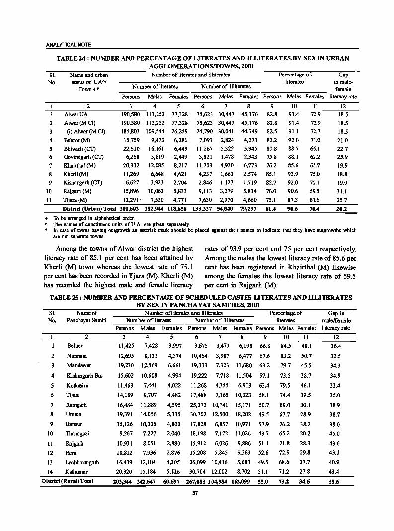
ANALYTICAL NOTE
TABLE 24: NUMBER AND PERCENTAGE OF LITERATES AND ILLITERATES. BY SEX IN URBAN AGGLOMERA TIONSrrOWNS, 2001
Sl. No.
Name and urban status of UA''!
Town+*
Number of literates and illiterates
Number of literates Number of illiterates
Percentage of literates
Gap in malefemale
Persons Males Females Persons Males Females Persons Males Females literacy rate
2
3
4
5
6
7
8
9
10
II
2 AlwarUA
Alwar(M CI)
(i) Alwar (M CI)
Behror(M)
Bhiwadi (CT)
Govindgarh (CT)
Khairthal (M)
Kherli (M)
Kishangarh (CT)
Rajgarh (M)
Tijara(M)
3 4 5 190,580 113,252 77,328
190,580 113,252 77,328
185,803 109,544 76,259
15,759 9,473 6,286
22,610
6,268
20,302
11,269
6,627
15,896
12,291'
16,161
3;819
12,085
6,648
3,923
10,063
7,520
6,449
2,449
8,217
4,621
2,704
5,833
4,771
6 7 8 75,623 30,447 45,176
75,623 30,447 45,176
74,790 30,041 44,749
7,097 2,824 4,273
11,267 5,322 5,945
3,821 1,478 2,343
11,703 4,930· 6,773
4,237
2,846
9,113
7,630
1,663
1,127
3,279
2,970
2,574
1,719
5,834
4,660
9 82.8
82.8
82.5
82.2
80.8
75.8
76.2
85.1
82.7
76.0
75.1
10 91.4
91.4
91.1
92.0
88.7
88.1
85.6
93.9
92.0
90.6
87.3
District (Urban) Total 301,602 182,944 118,658 133,337 54,040 79,297 81.4 90.6
+ To be arranged in alphabetical order. 1\ The names of constituens units of U.A. are given separately.
II 72.9
72.9
72.7
71.0
66.1
62.2
65.7
75.0
72.1
59.5
61.6
70.4
12 18.5
18.5
18.5
21.0
22.7
25.9
19.9
18.8
19.9
31.1
25.7
20.2
• In case of towns hlwing outgrowth an asterisk mark should be placed against their names to indicate that they have outgrowths which are not separate towns.
Among the towns of Alwar district the highest rates of 93.9 per cent and 75 per cent respectively. literacy rate of 85.1 per cent has been attained by Among the males the lowest literacy rate of 85.6 per Kherti (M) town whereas the lowest rate of 75.1 cent has been registered in Khairthal (M) likewise per cent has been recorded in Tjara (M). Kherli (M) among the females the lowest literacy rate of 59.5 has recorded the highest male and female literacy per cent in Rajgarh (M);
TABLElS: NUMBER AND PERCENTAGE OF SC HID ULED CASTES UTERATESANDIll..IlERATES BY SEX IN PANCHA YAT SAMI1IES, 2001
Sl. Name of Numba ofliteratcs and illiterates PelCentageof Gap in' JIb. Panchayat Samiti Num ba oni taates Number 0 f illiterates literates malelfemale
Persons Males Females Persons Males Females Pasons Males Females I iteracy rate
2 3 4 5 6 7 8 9 10 II 12
2
3
4
5
6
7
8
9
10
II
12
13
14
Behror
Nimrana
Mandawar
Kishangarh Bas
Kotkasim
Tijam
Ramgarh
Umren
Bansur
Thanagazi
Rajgarh
Reni
Lachhmangatb
Kathumar
District (Rural) Total
1l,425 7,428 3,997
12,695
19,230
15,602
11,463
14,189
16,484
19,391
15,126
9,267
10,931
10,812
16,409
20,320
8,121
12,569
10,608
7,441
9,707
11,889
14,056
10,326
7,227
8,051
7,936
12,104
15,184
4,574
6,661
4,994
4,022
4,482
4,595
5,335
4,800
2,040
2,880
2,87~
4,305
5,1~;6
9,675 3,477 6,198 66.8 84.5 48.1
10,464
19,003
19,222
11,268
17,488
25,312
30,702
17,828
18,198
15,912
3,987
7,323
7,718
4,355
7,165
10,141
12,500.
6,857
7,172
6,026
15,208 5,845
26,099 10,416
30,704 12,002
6,477 67.6
11,680 63.2
11,504 57.1
6,913 63.4
10,323 58.1
15,171 50.7
18,202 49.5
10,971 57.9
11,026 43.7
9,886 51.1
9,363 52.6
15,683 49.5
18,702 51.1
83.2
79.7
73.5
79.5
74.4
69.0
67.7
76.2
65.2
71.8
72.9
68.6
71.2
50.7
45.5
38.7
46.1
39.5
30.1
28.9
38.2
20.2
28.3
29.8
27.7
27.8
203,344 142,647 60,697 267,083 104,984 162,099 55.0 73.2 34.6
37
36.4
32.5
34.3
34.9
33.4
35.0
38.9
38.7
38.0
45.0
43.6
43.1
40.9
43.4
38.6
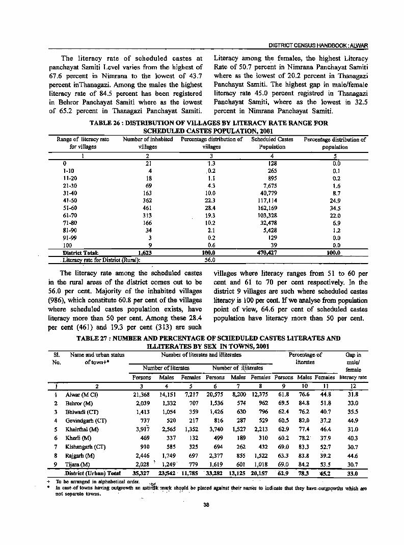
The literacy rate of scheduled castes at panchayat Samiti Level varies from the highest of 67.6 percent in Nirnrana to the lowest of 43.7 percent inThanagazi. Among the males the highest literacy rate of 84.5 percent has been registered in Behror Panchayat Samiti where as the lowest of 65.2 percent in Thanagazi Panchayat Samiti.
DISTRICT CENSUS HANDBOOK: ALWAR
Literacy among th,e females, the highest Literacy Rate of 50.7 percent in Nimrana Panchayat Samiti where as the lowest of 20.2 percent in Thanagazi Panchayat Samiti. The highest gap in male/female literacy rate 45.0 percent registred in Thanagazi Panchayat Samiti, where as the lowest in 32.5 percent in Nirnrana Panchayat Samiti.
TABLE 26 : DISTRIBUTION OF VILLAGES BY LITERACY RATE RANGE FOR SCHEDULED CASTES POPULATION, 2001
Range of literacy rate Number of inhabited Percentage distribution of Scheduled Castes Percentage distribution of for villages villages
1 2 0 21 1-10 4 ll-20 18 21-30 69 31-40 163 41-50 362 51-60 461 61-70 313 71-80 166 81-90 34 91-99 3 100 9 District Total: 1,623
. Literacy rate for District (Rural):
The literacy. rate among the scheduled castes in the rural areas of the ·district comes out to be 56.0 per cent. Majority of the inhabited villages (986), which constitute 60.8 per cent of the villages where scheduled castes population exists, have literacy more than SO per cent. Among these 28.4 per cent (461) and 19.3 per cent (313) are such
villages Population population
3 4 5 '1.3 128 0.0 0.2 265 0.1 1.1 895 0.2 4.3 7,675 1.6
10.0 40,779 8.7 22.3 117,114 24.9 28.4 162,169 34.5 19.3 103,328 22.0 10.2 32,478 6.9 2:1 5,428 1.2 0.2 129 0.0 0.6 39 0,0
100.0 470,427 100.0 56.0
villages where literacy ranges from 51 to 60 per cent and 61 to 70 per cent respectively. In the district 9 villages are such where scheduled castes literacy is 100 per cent. If we analyse from population point of view, 64.6 per cent of scheduled castes population have literacy more than SO per cent.
TABLE 27: NUMBER AND PERCENTAGE OF SCHEDULED CASTES LITERATES AND ILLITERATES BY SEX IN TOWNS, 2001
81. Name and urban status Number of literates and illiterates Percentage of Gap in No. oftown+* literates male!
Number of literates Number of iI,literates female Persons Males Females Persons Males Females Persons Males Females literacy rate
1 2 3 4 5 6 7 8 9 10 11 12
I Alwar(M CI) 21,368 14,151 7,217 20,575 8,200 12,375 61.8 76.6 44.8 31.8
2 Behror(M) 2,039 1,332 707 1,536 574 962 69.5 84.8 51.8 33.0
3 Bhiwadi (CT) 1,413 1,054 359 1,426 630 796 62.4 76.2 40.7 35.5
4 Govindgarh (eT) 737 520 217 816 287 529 60.5 82.0 37.2 44.9
5 Khairthal (M) 3,917 2,565 1,352 3,740 1,527 2,213 62.9 77.4 46.4 31.0
6 Khcrli (M) 469 337 132 499 189 310 60.2 78.2' 37.9 40.3
7 Kishangarh (CT) 910 585 325 694 262 432 69.0 83.3 52.7 30.7
8 Rajgarh (M) 2,446 1,749 697 2,377 855 1,522 63.3 83.8 39.2 44.6
9 Tijara(M) 2,028 :.
1,249' 779 1,619 601 1,018 69.0 84.2 53.5 30.7
.District (Urban) Total 35,327 23,'542 11,785 . 33,182 13,125 10,157 ·62.9 78.3 '45.1 33.0 + To be arranged in alphabetical order, '<:t. . . . • In case .of towns having outgrowth an astin!k'mar!, sho!,1d be placed against their rianies to indicate that they have .outgr~wths which are
not separate towns, . , '.
38
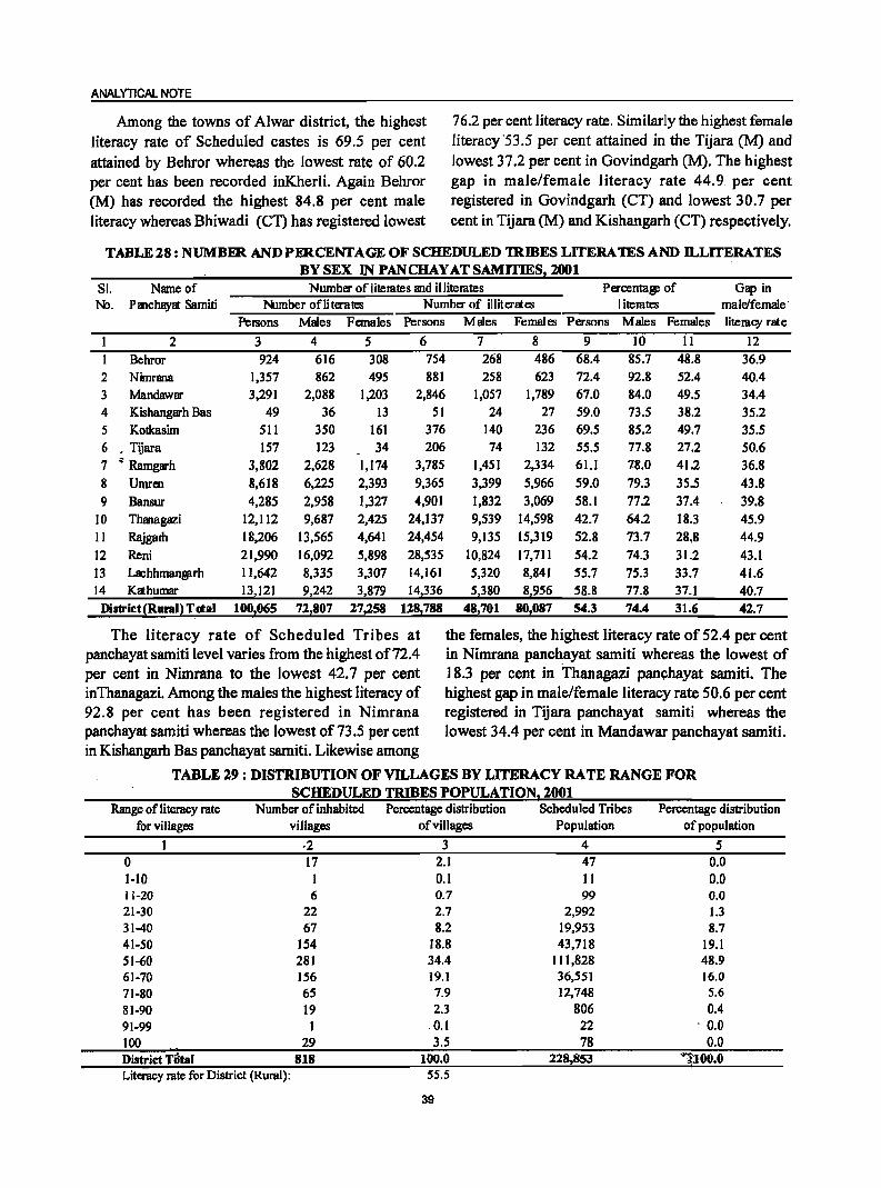
ANALYTICAL NOTE
Among the towns of Alwar district, the highest literacy rate of Scheduled castes is 69.5 per cent attained by Behror whereas the lowest rate of 60.2 per cent has been recorded inKherli. Again Behror (M) has recorded the highest 84.8 per cent male literacy whereas Bhiwadi (CT) has registered lowest
76.2 per cent literacy rate. Similarly the highest female literacy '53.5 per cent attained in the Tijara eM) and lowest 37.2 per cent in Govindgarh eM). The highest gap in male/female literacy rate 44.9. per cent registered in Govindgarh (CT) and lowest 30.7 per cent in Tijara (M) and Kishangarh (CT) respectively.
TABLE 28: NUMBER AND PERCENTAGE OF SCHEDULED mmES LITERA 1ES AND ll..LITERATES BY SEX IN PANCHAY AT SAMITIES, 2001
81. Name of Number of literates and illiterates Peroentag: of Gap in No. Panchayat Samiti Number ofliterates Number of illiterates literates male/female·
PelSOns Males Females Persons Males Females Persons Males Females literacy rat e
2 3 4 5 6 7 8 9 10 11 12 Behror 924 616 308 754 268 486 68.4 85.7 48.8 36.9
2 Nimrana 1,357 862 495 881 258 623 72.4 92.8 52.4 40.4 3 Mandawar 3,291 2,088 1,203 2,846 1,057 1,789 67.0 84.0 49.5 34.4 4 Kishangarh Bas 49 36 13 51 24 27 59.0 73.5 38.2 35.2 5 Kotkasim 511 350 161 376 140 236 69.5 85.2 49.7 35.5 6 • Tijara 157 123 34 206 74 132 55.5 77.8 27.2 50.6 7 q Ramgarh 3,802 2,628 1,174 3,785 1,451 2,334 61.1 78.0 41.2 36.8 8 Umrc:n 8,618 6,225 2,393 9,365 3,399 5,966 59.0 79.3 35.5 43.8 9 Bansur 4,285 2,958 1,327 4,901 1,832 3,069 58.1 77.2 37.4 39.8
10 Thanagazi 12,112 9,687 2,425 24,137 9,539 14,598 42.7 64.2 18.3 45.9 11 Rajgam 18,206 13,565 4,641 24,454 9,135 15,319 52.8 73.7 28,8 44.9 12 Reni 2],990 16,092 5,898 28,535 10,824 17,711 54.2 74.3 31.2 43.1 13 Lachhman81rh 11,642 8,335 3,307 14,161 5,320 8,841 55.7 75.3 33.7 41.6 14 Kathumar 13,121 9,242 3,879 14,336 5,380 8,956 58.8 77.8 37.1 40.7 District{Runl} Td:al 100z065 72z807 27z258 128z788 48,701 80z087 54.3 74.4 31.6 42.7
The literacy rate of Scheduled Tribes at the females, the highest literacy rate of 52.4 per cent panchayat samiti level varies from the highest of 72.4 in Nimrana panchayat samiti whereas the lowest of per cent in Nimrana to the lowest 42.7 per cent 18.3 per cent in Thanagazi panchayat samiti. The inThanagazi. Among the males the highest literacy of highest gap in male/female literacy rate 50.6 per cent 92.8 per cent has been registered in Nimrana registered in Tijara panchayat samiti whereas the panchayat samiti whereas the lowest of73.5 per cent lowest 34.4 per cent in Mandawar panchayat samiti. in Kishangarh Bas panchayat samiti. Likewise among
TABLE 29: DISTRIBUTION OF VILLAGES BY LITERACY RATE RANGE FOR SCHEDULED TRIBES POPULATION1 2001
Range of literacy rate Number of inhabited Percentage distribution Scheduled Tribes Percentage distribution for villages villages of villages Population of population
1 ·2 3 4 5 0 17 2.1 47 0.0 1-10 I 0.1 II 0.0 11-20 6 0.7 99 0.0 21-30 22 2.7 2,992 1.3 31-40 67 8.2 19,953 8.7 41-50 154 18.8 43,718 19.1 51-60 281 34.4 111,828 48.9 61-70 156 19.1 36,551 16.0 71-80 65 7.9 12,748 5.6 81-90 19 2.3 806 0.4 91-99 1 0.1 22 . 0.0 100 29 3.5 78 0.0 District Tatal 818 100.0 228.853 '1100•0 Literacy rate for District (Rural): 55.5
39
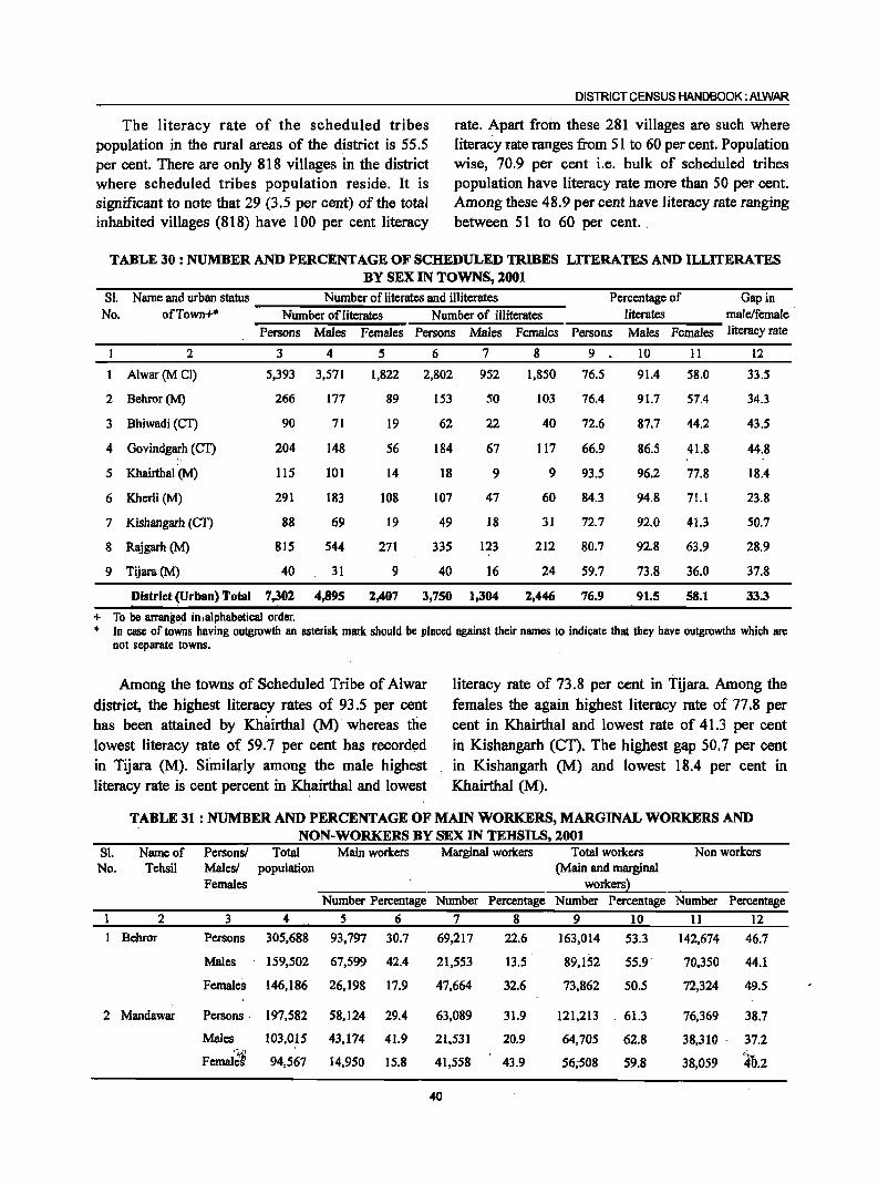
DISTRICT CENSUS HANDBOOK: ALWAR
The literacy rate of the scheduled tribes rate. Apart froin these 281 villages are such where population in the rural areas of the district is 55.S literacy rate ranges from 51 to 60 per cent. Population per cent. There are only 818 villages in the district wise, 70.9 per cent i.e. bulk of scheduled tribes where scheduled tribes population reside. It is population have literacy rate more than 50 per cent. significant to note that 29 (3.5 per cent) of the total Among these 48.9 per cent have literacy rate ranging inhabited villages (818) have 100 per cent literacy between 51 to 60 per cent ..
TABLE 30: NUMBER AND PERCENTAGE OF SCHEDULED TRIBES LITERATES AND ILLITERATES BY SEX IN TOWNS, 2001
Sl. Name and urban status Number of literates and illiterates Percentage of Gap in No. of Town+* Number of literates Number of illiterates literates male/female
Persons Males Females Persons Males Females Persons Males Females literacy rate
2 3 4 5 6 7 8 9 10 11 12
Alwar(MCI) 5,393 3,571 1,822 2,802 952 1,850 76.5 91.4 58.0 33.5
2 Behror(M) 266 177 89 153 50 103 76.4 91.7 57.4 34.3
3 Bhiwadi (CT) 90 71 19 62 22 40 72.6 87.7 44.2 43.5
4 Govindgarh (CT) 204 148 56 184 67 117 66.9 86.5 41.S 44.S
5 Khairthal (M) 115 101 14 18 9 9 93.5 96.2 77.S IS.4
6 Kherli (M) 291 183 lOS 107 47 60 84.3 94.8 71.1 23.S
7 Kishangarh (CI') 88 69 19 49 18 3] 72.7 92.0 41.3 50.7
8 Rajgarh (M) 815 544 271 335 123 212 80.7 92.8 63.9 28.9
9 Tijara(M) 40 31 9 40 16 24 59.7 73.8 36.0 37.8
District (Urban) Total 7,301 4,895 2,407 3;750 1,304 2,446 76.9 91.5 58.1 33.3
+ To be arranged in,olphabeticol order. • In case of toWns having outgrowth an asterisk mark should be placed against their names to indicate that they have outgrowths which are
not separate towns.
Among the towns of Scheduled Tribe of Alwar district, the highest literacy rates of 93.5 per cent has been attained by Khairthal (M)' whereas the lowest literacy rate of 59.7 per cent has record~d in Tijara (M). Similarly among the male highest literacy rate is cent percent in Khairthal and lowest
literacy rate of 73.8 per cent in Tijara. Among the females the again highest literacy rate of 77.8 per cent in Khairthal and lowest rate of 41.3 per cent in Kishangarh (CT). The highest gap 50.1 per cent in Kishangarh (M) and lowest 18.4 per cent in Khairthal (M).
TABLE 31 : NUMBER AND PERCENTAGE OF MAIN WORKERS, MARGINAL WORKERS AND NON-WORKERS BY SEX IN TEHSILS, 2001
81. Name of Personsl Total Main workers Marginal workers Total workers Non workers No. Tehsil Malesl population (Main and marginal
Females workers} Number Percentage Number Percentage Number Percentage Number Percentage
2 3 4 5 6 7 8 9 10 11 12
Behror Persons 305,688 93,797 30.7 69,217 22.6 163,014 53.3 142,674 46.7
Males 159,502 67,599 42.4 21,553 13.5 89,152 55.9 70,350 44.1
Females 146,186 26;198 17.9 47,664 32.6 73,862 50.5 72,324 49.5
2 Mandawar Persons . 197,582 58,124 29.4 63,089 31.9 121,213 61.3 76,369 3S.7
Males 103,015 43,174 41.9 21,531 20.9 64,705 62.8 38,310 ' 37.2
Femal'~~ 94,567 14,950 15.8 41,558 43.9 56;508 59.8 38,059 lb.2
40
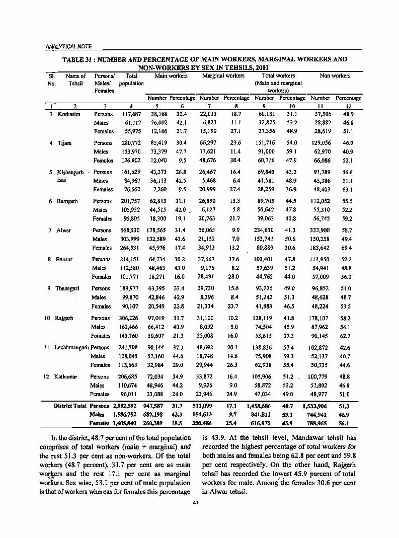
ANALYTICAL NOTE
TABLE 31 : NUMBER AND PERCENTAGE OF MAIN WORKERS, MARGINAL WORKERS AND NON-WORKERS BY SEX IN TEHSILS, 2001
SI. Name of No. Tehsil
Personsl Malesl Females
Total population
Main workers Marginal workers Total workers Non workers (Main and marginal
workers) .
Number Percentage Number Percentage Number Percentage Number Percentage
2 3 4 5 6 7 8 9 10 11 12 3 Kotkasim
4 Tijara
Persons
Males
Females
117,687
61,712
55,975
Persons 280,772
Males 153,970
Females 126,802
38,168 32.4
26,002 42.1
12,166 21.7
85,419 30.4
73,~79 47.7
12,040 9.5
5 Kishangarh - Persons 161,629
84,967
76,662
43,373
36,113
7,260
26.8
42.5
9.5
Bas Males
Females
6 Ramgarh Persons 201,757 62,815 31.1
Males 105,952 44,515 42.0
Females 95,805 18,300 19.1
7 Alwar Persons 568,530 178,565 31.4
Males 303,999 132,589 43.6
Females 264,531 45,976 17.4
8 Bansur Persons 214,351 64,734 30.2
Males 112,580 48,463 43.0
Females 101,771 16,271 16.0
9 Thanagazi Persons 189,977 63,395 33.4
Males 99,870 42,846 42.9
Females 90,107 20,549 22.8
10 Rajgarh Persons 306,226 97,019 31.7
Males 162,466 66,412 40.9
Females
11 Lachhmangarh Persons
Males
Females
.143,760
241,708
128,045
113,663
30,607
90,144
57,160
32,984
21.3
37.3
44.6
29.0
12 Kathumar Persons 206,685 72,034 34.9
Males 110,674 48,946 44.2
Females 96,011 23,088 24.0
District Total Persons 2,992,592 947,587 31.7
Males 1,586,752 687,198 43.3
Females 1,405,840 260,389 18.5
In the district, 48.7 per cent of the total popUlation comprises. of total workers (main + marginal) and the rest 51.3 per cent as non-workers. Of the total workers (48.7 percent), 31.7 per cent are as main wor,~ers and the rest 17.1 per cent as marginal workers. Sex wise, 53.1 per cent of male population is that of workers whereas for females this percentage
22,013
6,823
15,190
66,297
17,621
48,676
26,467
5,468
20,999
26,890
6,127
20,763
56,065
21,152
34,913
37,667
9,176
28,491
29,730
8,396
21,334
31,100
8,092
23,008
48,692
18,748
29,944
33,872
9,926
23,946
511,099
154,613
356,486
18.7
11.1
27.1
23.6
11.4
38.4
16.4
6.4
27.4
13.3
5.8
21.7
9.9
7.0
13.2
17.6
8.2
28.0
15.6
8.4
23.7
10.2
5.0
16.0
20.1
14.6
26.3
16.4
9.0
24.9
17.1
9.7
25.4
60,181 51.1
32,825 53.2
27,356 48.9
151,716
91,000
60,716
69,840
41,581
28,259
89,705
~0,642
39,063
54.0
59.1
47.9
43.2
48.9
36.9
44.5
47.8
40.8
234,630 41.3
153,741 50.6
80,889 30.6
102,401
57,639
44,762
93,125
51,242
41,883
128,119
74,504
53,615
138,836
75,908
62,928
47.8
51.2
44.0
49.0
51.3
46.5
41.8
45.9
37.3
57.4
59.3
55.4
105,906 51.2
58,872 53.2
47,034 49.0
1,458,686
841,811
616,87S
48.7
53.1
43.9
57,506 48.9
28,887 46.8
28,619 51.1
129,056
62,970
66,086
91,789
43,386
48,403
112,052
55,310
56,742
333,900
150,258
183,642
111,950
54,941
57,009
96,852
48,628
48,224
178,107
87,962
90,145
102,872
52,137
50,735
100,779
51,802
48,977
1,533,906
744,941
788,965
46.0
40.9
52.1
56.8
51.1
63.1
55.5
52.2
59.2
58.7
49.4
69.4
52.2
48.8
56.0
51.0
48.7
53.5
58.2
54.1
62.7
42.6
40.7
44.6
48.8
46.8
51.0
51.3
46.9
56.1
is 43.9. At the tehsil level, Mandawar tehsil has recorded the highest percentage of total workers for both males and females bein~ 62.8 per cent and 59.8 per cent respectively. On the other hand, Rajgarh tehsil has recorded the lowest 45.9 percent of total workers for male. Among'the females 30.6 per cent in Alwar tehsil.
41
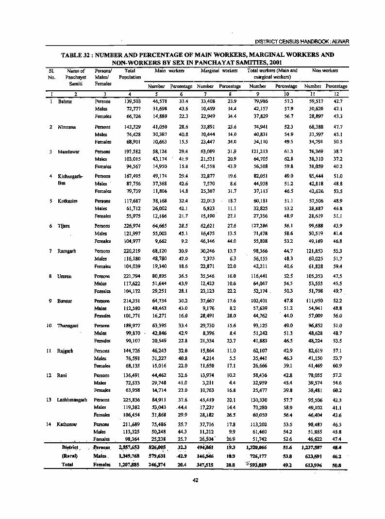
DISTRICT CENSUS HANDBOOK: ALWAR
TABLE 32 : NUMBER AND PERCENTAGE OF MAIN WORKERS, MARGINAL WORKERS AND NON-WORKERS BY SEX IN PANCHAYAT SAMITIES, 2001
SI. No.
Name of Panchayat
Samiti
2 Behror
2 Nimrana
3 Mandawar
4 Kishangarh-Bas
5 Kotkasim
6 Tijara
7 Ramgarh
8 Umrcn
9 Bansur
10 1banagazi
II Rajgarh
12 Reni
Persons/ MalcsJ Females
3 Persons
Males
Females
Persons
Males
Females
Persons
Males
Females
Persons
Males .
Females
Persons
Males
Females
Persons
Males
Females
Persons
Males
Females
Persons
Males
Females
Persons
Males
Females
Persons
Males
Females
Persons
Males
Females
Persons
Males
Females
13 Lachhmangarh Persons
Males
Females
14 Kathumar Persons
Males .Females
D'~trie_t _, . ,p,eI"ll0,ll8
(Rural) Malea .
Total Females
Total Main workers Marginal workers Total workers (Main and Nonworkers Population marginal workers)
--~--------------------------~~---------------------
4 139,503
72,777
66,726
143,329
74,428
68,901
197,582
103,015
94,567
167,495
87,756
79,739
117,687
61,712
55,975
226,974
121,997
104,977
220,219
116,180
104,039
221,794
117,622
104,172
214,351
112,S80
101,771
189,977
99,870
90,107
144,726
76,591
68,135
136,491
72,S33
63,958
225,836
119,382
106,454
211,689
113,325
98,364
2,~~7,6~3
1,349,768
1,207,885
Number Percentage Number Percentage
5 6 7 8 46,578
31,698
14,880
41,050
30,387
10,663
58,124
43,174
14,950
49,174
37,368
11,806
38,168
26,002
12,166
64,665
55,003
9,662
68,120
48,780
19,340
80,895
51,644
29,251
64,734
48,463
16,271
63,395
42,846
20,549
46,243
31,227
15,016
44,462
29,748
14,714
84,911
53,043
31,868
75,486
50,248
25,238
826,005 . i.. ~
579,631
246,374
33.4
43.6
22.3
28.6
40.8.
15.5
29.4
41.9
15.8
29.4
42.6
14.8
32.4
42.1
21.7
28.5
45.1
9.2
30.9
42.0
18.6
36.S
43.9
28.1
30.2
43.0
16.0
33.4
42.9
22.8
32.0
40.8
22.0
32.6
41.0
23.0
37.6
.44.4
29.9
35.7
44.3
25.7
32.3
.42.9
20.4
33,408
10,459
22,949
33,891
10,444
23,447
63,089
21,531
41,558
32,877
7,570
25,307
22,013
6,823
15,190
62,621
16,475
46,146
30,246
7,375
22,871
35,546
12,423
23,123
37,667
9,176
28,491
29,730
8,396
21,334
15,864
4,214
11,650
13,974
3,21I
10,763
45,419
17,237
28,182
37,716
11,212
26,504'
494;061
146~46 347,515
42
23.9
14.4
34.4
23.6
14.0
34.0
31,9
20.9
43.9
19.6
8.6
31.7
18.7
11.1
27.1
27.6
13.5
44.0
13.7
6:3 22.0
16.0
10.6
22.2
17.6
8.2 28.0
15.6
8.4
23.7
11.0
5.5
17.1
10.2
4.4
16.8
20.1
14.4
26.5
17.8
9.9
26.9
19.3 10.9
28.8
Number Percentage
9 10 79,986
42,157
37,829
74,941
40,831
34,110
121,213
64,705
56,508
82,OSI
44,938
37,113
60,181
32,825
27,356
127,286
71,478
55,808
98,366
56,155
42,211
116,441
64,067
52,374.
102,401
57,639
44,762
93,125
51,242
41,883
62,107
35,441
26,666
58,436
32;959
25,477
130,330
70,280
60,050
113,202
61,460
51,742
1,320,066
726,177
<1:593,889
57.3
57.9
56.7
52.3
54.9
49.5
61.3
62.8
59.8
49.0
51.2
46.5
51.1
53.2
48.9
56.1
58.6
53.2
44.7
48.3
40.6
52.5
54.5
50.3
47.8
51.2
44.0
49.0
51.3
46.5
42.9
46.3
39.1
42.8
45.4
39.8
57.7
58.9
56.4
53.5 54.2
52.6
51.6
53.8
49.2
Number Percentage
II 12
59,517 42.7
30,620 42.1
28,897 43.3
68,388 47.7
33,597 45.1
34,791 50.5
76,369 38.7
38,310 37.2
38,059 40.2
85,444 51.0
42,818 48.8
42,626 53.5
57,506 48.9
28,887 46.8
28,619 51.1
99,688 43.9
50,519 41.4
49,169 46.8
121,853 55.3
60,025 51.7
61,828 59.4
105,353 47.5
53,555 45.5
51,798 49.7
111,950 52.2
54,941 48.8
57,009 56.0
96,852 51.0
48,628 48.7
48,224 53.5
82,619 57.1
41,150 53.7
41,469 60.9
78,055 57.2
39,574 54.6
38,481
95,506
49,102
46,404
98,487
51,865
46,622
1,237,587
623,591
613,996
60.2
42.3
41.1
43.6
46.5
45.8
47.4
48.4
46.2
SO.8
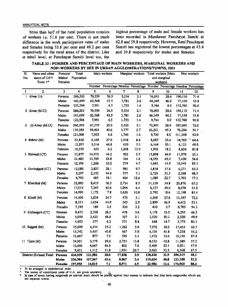
ANALYTICAL NOTE
More than half of the rural population consists highest percentage of male and female workers has of workers i.e. 51.6 per cent. There is not much been recorded in Mandawar Panchayat Samiti at difference in the work participation rates of males 62.8 and 59.8 respectively. However, Reni Panchayat and females being 53.8 per cent and 49.2 per cent Samiti has registered the lowest percentages at 45.4 respectively for the rural areas of the district. Like and 39.8 respectively for males and females. at tehsil level, at Panchayat Samiti level too, the
TABLE 33 : NUMBER AND PERCENTAGE OF MAIN WORKERS, MARGINAL WORKERS AND NON-WORKERS BY SEX IN URBAN AGGLOMERA TIONSrrOWNS, 2001
SI. Name and urban PersonsJ Total Main workers Marginal workers Total workers (Main Non workers No. status ofUAA
/ MalesJ Population and marginal Town+* Females workers)
Number Percentage Number Percentage Number Percentage Number Percentage
2 3 4 5 6 7 8 9 10 11 12
AlwarUA Persons 266,203 70,559 26.5 5,534 2.1 76,093 28.6 190,110 71.4 Males 143,699 62,568 43.5 3,781 2.6 66,349 46.2 77,350 53.8 Females 122,504 7,991 6.5 1,753 1.4 9,744 8.0 112,760 92.0
2 Alwar (M.CI) Persons 266,203 70,559 26.5 5,534 2.1 76,093 28.6 190,110 71.4 Males 143,699 62,568 43.5 3,781 2.6 66,349 46.2 77,350 53.8 Females 122,504 7;991 6.5 1,753 1.4 9,7~4 8.0 112,760 92.0
3 (i) Alwar (M.C!) Persons 260,593 67,379 25.9 5,522 2.) 72,90) 28.0 187,692. 72.0 Males 139,585 59,424 42.6 3,777 2.7 63,201 45.3 76,384 54.7 Females 121,008 7,955 6.6 1,745 1.4 9,700 8.0 111,308 92.0
4 Behror(M) Persons 22,856 6,169 27.0 1,918 8.4 8,087 35.4 14;769 -. '64.6 Males 12,297 5,514 44.8 650 5.3 6,164 so.) 6,133 49.9 Females 10,559 655 6.2 1,268 12.0 1,923 18.2 8,636 81.8
5 Bhiwadi (Cn Persons 33,877 14,975 44.2 923 2.7 15,898 46.9 17,979 53.1 Males 21,483 13,709 63.8 344 1.6 14,053 65.4 7,430 34.6 Females 12,394 1,266 10.2 579 4.7 1,845 14.9 10,549 85.1
6 Govindgarh (en Persons 10,089 2,837 28.1 981 9.7 3,818 37.8 6,271 62.2 Males 5,297 2,352 44.4 377 7.1 2,729 51.5 2,568 48.5 Females 4,792 485 10.1 604 12.6 1,089 22.7 3,703 77.3
7 Khairthal (M) Persons 32,005 8,415 26.3 2,714 8.5 11,129 34.8 20,876 65.2 Males 17,015 7,243 42.6 1;094 6.4 8,337 49.0 8,678 51.0 Females 14,990 1,172 7.8 1,620 10.8 2,792 18.6 12,198 81.4
8 Kherli (M) Persons 15,506 3,834 24.7 475 3.1 4,309 27.8 11 .. 197 72.2 Males 8,311 3,654 44.0 245 2.9 3,899 46.9 4,412 53.1 Females 7,195 180 2.5 230 3.2 410 5.7 6,785 94.3
9 Kishangarh (en Persons 9,473 2,700 28.5 478 5.0 3,178 33.5 6,295 66.5 Males 5,050 2,423 48.0 107 2.1 2,530 50.1 2,520 49.9 Females 4,423 277 6.3 371 8.4 648 14.7 3,775 85.3
10 Rajgarh (M) Persons 25,009 6,314 25.2 ·1,262 5.0 7,576 30.3 17,433 69.7 Males 13,342 5,437 40.8 667 5.0 6,104 45.8 7,238 54.2 Females 11,667 877 7.5 595 5.1 1,472 12.6 10,195 87.4
11 Tijara (M) Persons 19,921 5,779 29.0 2,753 13.8 8,532 42.8 11,389 57.2 Males 10,490 4,667 44.5 802 7.6 5.469 52.1 5,021 47.9
Females 9,431 1,112 11.8 1,951 20.7 3,063 32.5 6,368 67.5 District (Urban) Total Persons 434,939 111,582 18.0 17,038 3.9 138,610 31.9 196,319 68.1
Males 236,984 107,567 45.4, 8,067 3.4 115,634 48.8 111,350 51.1 Females 197,955 14,015 7.1 8,971 4.5 22,986 11.6 174,969 88.4
+ To be arranged in alphabetical order. " The names of constituent units of U.A. are given seprately. .;;, • In case of towns having outgrowth an astrrisk mark should be plad~d against their names to indicate that they have outgrowths which are
not separate towns.
43
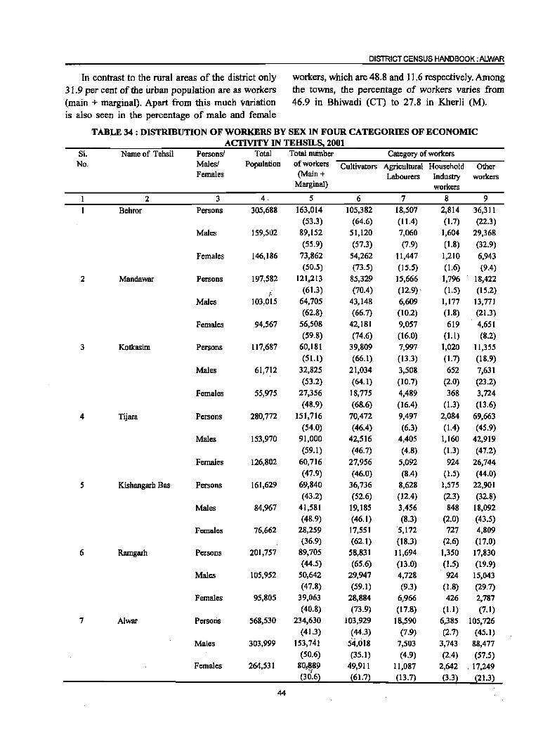
DISTRICT CENSUS HANDBOOK: ALWAR
In contrast to the rural areas of the district only workers, which are 48.8 and 11.6 respectively. Among 31.9 per cent of the urban population are as workers the towns, the percentage of workers varies from (main + marginal). Apart from this much variation 46.9 in Bhiwadi (CT) to 27.8 in Kherli (M). is also seen in the percentage of male and female
TABLE 34 : DISTRIBUTION OF WORKERS BY SEX IN FOUR CATEGORIES OF ECONOMIC ACTIVITY IN TEHSILS. 2001
81. Name of Tehsil Persons! Total Total number Category of workers No. Males! Population of workers Cultivators Agricultural Household Other
Females (Main + Labourers Industry workers Marginal) workers
2 3 4. 5 6 7 8 9
Behror Persons 305,688 163,014 105,382 18,507 2,814 36,311 (53.3) (64.6) (11.4) (1.7) (22.3)
Males 159,S02 89,152 51,120 7,060 1,604 29,368
(55.9) (57.3) (7.9) (1.8) (32.9)
Females 146,186 73,862 54,262 11,447 1,210 6,943 (50.5) (73.5) (15.5) (1.6) (9.4)
2 Mandawar Persons 197,582 121.,213 85,329 15,666 1,796 18,422
1· (61.3) (7004) (12.9) , (1.5) (15.2)
Males 103,015 64,705 43,148 6,609 1,177 13,771 (62.8) (66.7) (10.2) (1.8) (21.3)
Females 94,567 56,508 42,181 9,057 619 4,651 (59.8) (74.6) (16.0) (1.1) (8,2)
3 Kotkasim Persons 117,687 60,181 39,809 7,997 1,020 11,355 (51.1) (66,1) (13.3) (1.7) (18.9)
Males 61,712 32,825 21,034 3,508 652 7,631
(53.2) (64.1) (10.7) (2.0) (23.2)
Females 55,975 27,356 18,775 4,489 368 3,724
(48.9) (68.6) (16.4) (1.3) (13.6)
4 Tijara Persons 280,772 151,716 70,472 9,497 2,084 69,663
(54.0) (46.4) (6.3) (1.4) (45.9)
Males 153,970 91,000 42,516 4,405 1,160 42,919
(59.1) (46.7) (4.8) (1.3) ·(47.2)
Females 126,802 60,716 27,956 5,092 924 26,744 (47.9) (46.0) (8.4) (1.5) (44.0)
5 Kishangarh Bas Persons 161,629 69,840 36,736 8,628 1,575 22,901 (43.2) (52.6) (12.4) (2.3) (32.8)
Males 84,967 41,581 19,185 3,456 848 18,092 (48.9) (46.1) (8.3) (2.0) (43.5)
Females 76,662 28,259 17,551 '5,172 727 4,809 (36.9) (62.1) (18.3) (2.6) (17.0)
6 Ramgarh Persons 201,757 89,705 58,831 11,694 1,350 17,830 (44.5) (65.6) (13.0) (1.5) (19.9)
Males 105,952 50,642 29,947 4,728 924 15,043 (47.8) (59.1) (9.3) (1.8) (29.7)
Females 95,805 39,063 28,884 6,966 426 2,787 (40.8) (73.9) (17.8) (1.1) (7.1)
7 A1war Persoris 568,530 234,630 103,929 18,590 6,385 105,726 (41.3) (44.3) (7.9) (2.7) (45.1)
Males 303,999 153,141 54,01B 7,503 3,743 88,477 (50.6) (35.1) (4.9) (2.4) (57.5)
Females 264,531 8'0:869 , ":~j; 49,911 11,087 2,642 . 17,249 (30.6) (61.7) (13.7) (3.3~ (21.3)
44
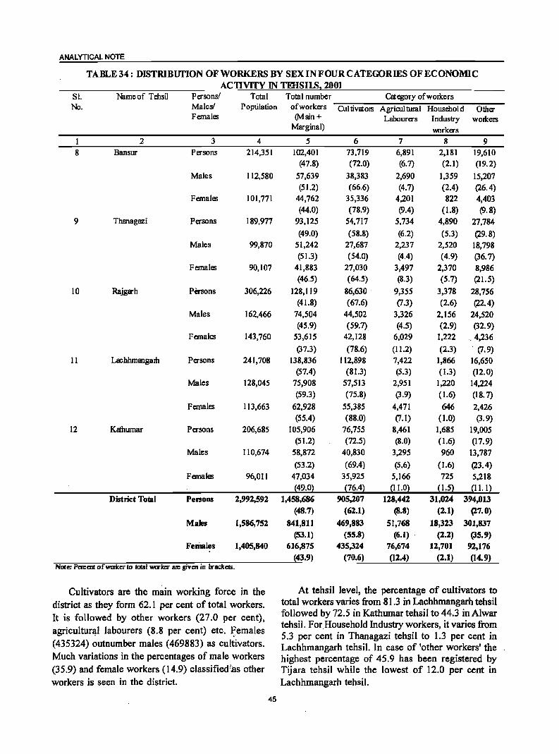
ANALYTICAL NOTE
TABLE 34: DISTRIBUTION OF WORKERS BY SEX INFOUR CATEGORIES OF ECONOMIC ACTIVITY IN TEHSIIB2 2001
Sl. Nameof Tehsil Persons! Total Total number Category ofworlcers No. Males! Population of workers Cui tivators Agricul tural Household Other
Females (Main + Labourers Industry wolkers Marginal) 1Mlrkers
1 2 3 4 5 6 7 8 9 8 Bansur Persons 214,351 102,401 73,719 6,891 2,181 19,610
(47.8) (72.0) (6.7) (2.1) (19.2)
Males 112,580 57,639 38,383 2,690 1,359 15,207 (51.2) (66.6) (4.7) (2.4) (26.4)
Females 101,771 44,762 35,336 4,201 822 4,403 (44.0) (78.9) (9.4) (1.8) (9.8)
9 Thanagazi Persons 189,977 93,125 54,717 5,734 4,890 27,784
(49.0) (58.8) (6.2) (5.3) (29.8) Males 99,870 51,242 27,687 2,237 2,520 18,798
(51.3) (54.0) (4.4) (4.9) (36.7) Females 90,107 41,883 27,030 3,497 2,370 8,986
(46.5) (64.5) (8.3) (5.7) (21. 5)
10 Rajgarh Pa-sons 306,226 128,119 86,630 9,355 3,378 28,756 (41.8) (67.6) (7.3) (2.6) (22.4)
Males 162,466 74,504 44,502 3,326 2,156 24,520 (45.9) (59.7) (4.5) (2.9) (32.9)
Females 143,760 53,615 42,128 6,029 1,222 ,.4,236
(37.3) (78.6) (11.2) (2.3) . (7.9)
11 Lachhmangam Persons 241,708 138,836 112,898 7,422 1,866 16,650 (57.4) (81.3) (5.3) (1.3) (12.0)
Males 128,045 75,908 57,513 2,951 1,220 14,224 (59.3) (75.8) (3.9) (1.6) (18.7)
Females 113,663 62,928 55,385 4,471 646 2,426 (55.4) (88.0) (7.1) (1.0) (3.9)
12 Kathumar Persons 206,685 105,906 76,755 8,461 1,685 19,005 (51.2) (72.5) (8.0) (1.6) (17.9)
Males 110,674 58,872 40,830 3,295 960 13,787
(53.2) (69.4) (5.6) (1.6) (23.4) Females 96,011 47,034 35,925 5,166 725 5,218
~49.0l p6.4l ~11.°l ~1.5l ~1l.1l District TODd Persons 2,992,591 1,458,686 905,207 118,442 31,024 394,013
(48.7) (62.1) (8.8) (2.1) (27.0)
Males 1,586,752 841,811 469,883 51,768 18,313 301,837 (53.1) (55.8) (6.1) . (2.2) (35.9)
Females 1,405,840 616,875 435,324 76,674 lZ,701 92,176 (43.9) (70.6) (12.4) (2.1) (14.9)
Note: Percent ofwmlc:er to total worker are given in brackelS.
Cultivators are the main working force in the At tehsil level, the percentage of cultivators to
district as they form 62. 1 per cent of total workers. total workers varies from 81.3 in Lachhmangarh tehsil
It is followed by other workers (27.0 per cent), followed by 72.5 in Kathumar tehsil to 44.3 in Alwar
agricultural labourers (8.8 per cent) etc. Females tehsil. For.Household Industry workers, it varies from
- ,. 5.3 per cent in Thanagazi tehsil to 1.3 per cent in (435324) outnumber males (469883) as cultivators. Lachhmangarh tehsil. In case of 'other workers' the Much variations in the percentages of male workers highest percentage of 45.9 has been registered by (35.9) and female workers (14.9) classified/,a.s other Tijara tehsil while the lowest of 12.0 per cent in workers is seen in the district. Lachhmangarh tehsil.
45
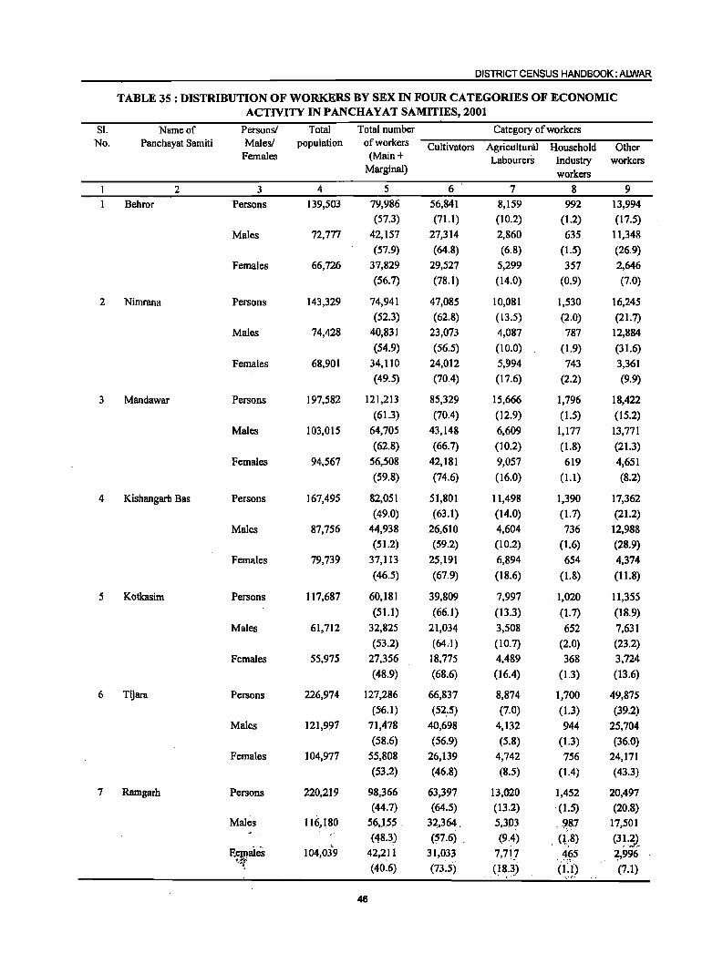
DISTRICT CENSUS HANDBOOK: ALWAR
TABLE 35 : DISTRIBUTION OF WORKERS BY SEX IN FOUR CATEGORIES OF ECONOMIC ACTIVITY IN PANCHA YAT SAMITIES, 2001
SI. Name of Persons! Total Total number Category of workers No. Panchayat Samiti Males! population of workers Cultivators Agricultural Household Other
Females (Main + Labourers Industry workers Marginal) workers
2 3 4 5 6 7 8 9
Behror Persons 139,503 79,986 56,841 8,159 992 13,994
(57.3) (71.1) (10.2) (1.2) (17.5)
Males 72,777 42,157 27,314 2,860 635 11,348
(57.9) (64.8) (6.8) (1.5) (26.9)
Females 66,726 37,829 29,527 5,299 357 2,646
(56.7) (78.1) (14.0) (0.9) (7.0)
2 Nimrana Persons 143,329 74,941 47,085 10,081 1,530 16,245
(52.3) (62.8) (13.5) (2.0) (21.7)
Males 74,428 40,831 23,073 4,087 787 12,884
(54.9) (56.5) (10.0) (1.9) (31.6)
Females 68,901 34,110 24,012 5,994 743 3,361
(49.5) (70.4) (17.6) (2.2) (9.9)
3 Mandawar Persons 197,582 121,213 85,329 15,666 1,796 18,422
(61.3) (70.4) (12.9) (1.5) (15.2)
Males 103,015 64,705 43,148 6,609 1,177 13,771
(62.8) (66.7) (10.2) (1.8) (21.3)
Females 94,567 56,508 42,181 9,057 619 4,651
(59.8) (74.6) (16.0) (1.1) (8.2)
4 Kishangarb Bas Persons 167,495 82,051 51,801 11,498 1,390 17,362
(49.0) (63.1) (14.0) (1.7) (21.2)
Males 87,756 44,938 .26,610 4,604 736 12,988
(51.2) (59.2) (10.2) (1.6) (28.9)
Females 79,739 37,113 25,191 6,894 654 4,374
(46.5) (67.9) (18.6) (1.8) (11.8)
5 Kotkasim Persons 117,687 60,181 39,809 7,997 1,020 11,355
(51.1) (66.1) (13.3) (1.7) (IS.9)
Males 61,712 32,825 21,034 3,508 652 7,631
(53.2) (64..!) (10.7) (2.0) (23.2)
Females 55,975 27,356 18,775 4,489 368 3,724
(48.9) (68.6) (16.4) (1.3) (13.6)
6 Tijara Persons 226,974 127,286 66,837 8,874 1,700 49,875 (56.1) (52:5) (7.0) (1.3) (39.2)
Males 121,997 71,478 40,698 4,132 944 25,704
(58.6) (56.9) (5.8) (1.3) (36.0)
Females 104,977 55,808 26,139 4,742 756 24,171 (53.2) (46.8) (8.5) (1.4) (43.3)
7 Ramgarh Persons 220,219 98,366 63,397 13,020 1,452 20,497
(44.7) (64.5) (13.2) . (1.5) (20.8)
Males 116,180 56,l5S .. 3~,364 . 5,303 o. ~81 17,501
(48.3) (57.6) . (9.4) . (1.;8) (3~~3)" F{~aies 104,03"9 42,211 31,033 7,7F 465 2,996
(40.6) (73.5) (18.~) (~':'p (7.1)
46
ANALYTICAL NOTE
TABLE 35 : DISTRIBUTION OF WORKERS BY SEX IN FOUR CATEGORIES OF ECONOMIC ACTIVITY IN PANCHAY AT SAMITIES, 2001
81. Name of Persons! Total Total number CategOly of \\Urkers No. Panchayat Samiti Males! population of workers Culti vators Agricultural Household Other
Females (Main + Labourers Industry oorkers Malginal) workers
1 2 3 4 5 6 7 8 9 8 Umrm Persons 221,794 116,441 76,885 12,445 3,034 24,077
(52.5) (66.0) (10.7) (2.6) (20.7) Males 117,622 64,067 40,124 4,980 1,604 17,359
. (54.5) (62.6) (7.8) (2.5) (27.1) Females 104,172 52,374 36,761 7,465 1,430 6,718
(50.3) (70.2) (14.3) (2.7) (12.8)
9 Bansur Persons 214,351 102,401 73,719 6,891 2,181 19,610 (47.8) (72.0) (6.7) (2.1) (19.2)
Males 112,580 57,639 38,383 2,690 1,359 15,207 (51.2) (66.6) (4.7) (2.4) (26.4)
Females 101,771 44,762 35,336 4,201 822 4,403 (44.0) (78.9) (9.4) (1.8) (9.8)
,;10 Thanagazi Persons 189,977· 93,125 54,717 5,734 4,890 27.784 (49.0) (58.8) (6.2) (5.3) (29.8)
Males 99,870 51,242 27,687 2,237 2,520 18,798 (51.3) (54.0) (4.4) (4.9) (36.7)
Females 90,107 41,883 27,030 3,497 2,370 8,986 (46.5) (64.5) (8.3) (5.7) (21.5)
11 Rl!igam Persons 144,726 62,107 41,001 5,434 1,588 14,084 (42.9) (66.0) (8.7) (2.6) (22.7)
Males 76,591 35,441 20,438 1,788 988 12,227 (46.3) (57.7) (5.0) (2.8) (34.5)
Females 68,135 26,666 20,563 3,646 600 1,857 (39.1) (77.1) (13.7) (2.3) (7.0)
12 Rmi Persons 136,491 58,436 45,081 3,770 1,466 8,119 (42.8) (77.1) (6.5) (2.5) ( 13.9)
Males 72,533 32,959 23,876 1,478 987 6,618 (45.4) (72.4) (4.5) (3.0) (20.1)
Females 63,958 25,477 21,205 2,292 479 1,501 (39.8) (83.2) (9.0) (1.9) (5.9)
13 Lacbhman3U'h Persons 225,836 130,330 106,883 7,462 1,606 14,37.9 (57.7) (82.0) (5.7) (1.2) (11.0)
Males 119,382 70,280 53,908 2,947 1,058 12,367 (58.9) (76.7) (4.2) (1.5) (17.6)
Females 106,454 60,050 52,975 4,515 548 2,012 (56.4) (88.2) (7.5) (0.9) (3.4)
14 Kathumar Persons 211,689 113,202 86,160 9,278 1,654 16,110 (53.5) (76.1) (8.2) (1.5) (14.2)
Males 113,325 61,460 45,875 3,609 969 11,007 (54.2) (74.6) (5.9) (1.6) (17.9)
Females 98,364 51,742 40,285 5,669 685 5,103 ~52.6l ~77.9l Q 1.0l !I.3l !9.9l
Distrid (Rural) Total Persons 2,557,653 1,320,066 895,545 126,309 26,299 271,913 (51.6) (67.8) (9.6) (l.0) (20.6)
Males 1,349,768 726,177 464,532 50,832 15,403 195,410 (53.8) (64.0) (7.0) (l.I) (26.9)
Females 1,207,885 593,889 431,013 75,477 10,896 76,503 .i: !49.21 !72.61 !12·Zl !:!.81 (12.91
Note: Percent of Worker to total worker are given in brackets.
47
DISTRICT CENSUS HANDBOOK: ALWAR
More than half i.e. 51.6 per cent of the total rural Almost similar trend has been observed in all the population of the district is engaged in economic parichayat samities. activities being workers. Of the total workers, most Sex wise percentage of male workers is higher are engaged in agricultural activities i.e. 67.8 per cent in Household Industry and other workers except are as cultivators and 9.6 per cent as agricultural Cultivator and Agricultural labors. When their laborers. Only 2.0 per cent of the workers are percentages are 64.0 and 7.0 respectively. engaged in household industries whereas the significantly 20.6 per cent in other works.
TABLE 36: DISTRIBUTION OF WORKERS BY SEX IN FOUR CATEGORIES OF ECONOMIC ACTIVITY OF URBAN AGGLOMERATIONSrrOWNS, 2001
Sl. Name and urban Persons! Total Total number Category of workers No. status ofUA"/ Males! popUlation of workers Cultivators Agricultural Household Other
Town*+ Females (Main + Labourers Industry workers Marginal) workers
2 3 4 5 6 7 8 9
AlwarUA Persons 266,203 76,093 1,077 386 2,762 71,868 (28.6) (1.4) (0.5) (3.6) (94.4)
Males 143,699 66,349 790 262 '1,856 63,441
(46.2) (1.2) (0.4) (2.8) (95.6)
Females 122,504 9,744 287 124 906 8,427 (8.0) (2.9) (1.3) (9.3) (86.5)
2 Alwar(MC1) Persons 266,203 76,093 J,077 386 2,762 71,868
(28.6) (1.4) (0.5) (3.6) (94.4) .
Males 143,699 66,349 790 262 1,856 63,441
(46.2) (1.2) (0.4) (2.8) (95.6)
Females 122,504 9,744 287 124 906 8,427 (8.0) (2.9) (1.3) (9.3) (86.5)
3 (i) Alwar (M Cl) Persons 260,593 72,901 1,059 386 2.757 68,699
(28.0) (1.5) (0.5) (3.8) (94.2)
Males 139,585 63,201 774 262 1,853 60,312
(45.3) (1.2) (0.4) (2.9) (95.4)
Females 121,008 9,700 285 124 904 8,387
(8.0) (2.9) (1.3) (9.3) (86.5)
4 Behror (M) Persons 22,856 8,087 1,456 267 292 6,072
(35.4) (18.0) (3.3) (3.6) (75.1)
Males 12,297 6,164 733 113 182 5,136
(50.1) (11.9) (1.8) (3.0) (83.3)
Females 10,559 1,923 723 154 110 936 (18.2) (37.6) (8.0) (5.7) (48.7)
5 Bhiwadi (CT) Persons 33,877 15,898 336 117 163 15,282 (46.9) (2.1) (0.7) (1.0) (96.1)
Males 21,483 14,053 181 51 104 13,717 (65.4) (1.3) (0.4) (0.7) (97.6)
Females 12,394 1,845 155 66 59 1,565 (14.9) (8.4) (3.6) (3.2) (84.8)
6 Govindgarb (CT) Persons 10,089 3,818 1,066 231 161 2,360 (37.8) (27.9) (6.1) (4.2) ., (61.8)
Males 5,297 2,729 592 49 94' 1,994 (51.5) (21. 7) (1.8) (3.4) (73.1)
Females 4,792 1,089 474 182 67 ',:;'i' 366 (22.7) (43.5) (16.1) (6.2) '. (33.6)-
48
ANALYTICAL NOTE
TABLE 36: DISTRIBUTION OF WORKERS BY SEX IN FOUR CATEGORIES OF ECONOMIC
ACTIVITY OF URBAN AGGLOMERATIONSITOWNS, 2001
SI. Name and urban Persons/ Total Total number Category of workers No. status ofUA"/ Males! population of workers Cultivators Agricultural Household Other
Town·+ Females (Main + Labourers Industry workers Marginal) workers
2 3 4 5 6 7 8 9
7 Khairthal (M) Persons 32,005 11,129 1,120 341 526 9,142 (34:8) (10.1) (3.1) (4.7) (82.1)
Males 17,015 8,337 755 108 221 7,253 (49.0) (9.1) (1.3) (2.7) (87.0)
Females 14,990 2,792 365 233 305 1,889 (18.6) (13.1) (8.3) (10.9) (67.7)
8 Kherli (M) Persons 15,506 4,309 195 37 164 3,913 (27.8) (4.5) (0.9) (3.8) (90.8)
Males 8,311 3,899 144 32 81 3,642 (46.9) (3.7) (0.8) (2.1) (93.4)
Females 7,195 410 51 5 83 271 (5.7) (12.4) (1.2) (20.2) (66.1)
9 Kisbangarb (CT) Persons 9,473 3,178 565' 97 112 2,404 (33.5) (17.8) (3.1) (3.5) (75.6)
Males 5,050 2,530 331 39 89 2,071 (50.1) (13.1) (1.5) (3.5) (81.9)
Females 4,423 648 234 58 23 ~ 333 "
(14.7) (36.1) (9.0) (3.5) (51.4)
10 Rajgarh (M) Persons 25,009 7,576 548 lSI 324 6,553
(30.3) (7.2) (2.0) . (4.3) (86.5)
Males 13,342 6,104 188 60 181 5,675 (45.8) (3.1) (1.0) (3.0) (93.0)
Females 11,667 1,472 360 91 143 878 (12.6) (24.5) (6.2) (9.7) (59.6)
11 Tijara(M) Persons 19,921 8,532 3,299 506 221 4,506
(42.8) (38.7) (5.9) (2.6) (52.8)
Males 10,490 5,469 1,637 222 112 3,498
(52.1 ) (29.9) (4.1) (2.0) (64.0)
Females 9,431 3,063 1,662 284 109 1,008 (32.5) (54.3) (9.3) (3.6) (32.9)
District (Urban) Total Persons 434,939 138,620 9,662 2,133 4,725 122,100 (31.9) (7.0) (1.5) (3.4) (88.1)
Males 236,984 115,634 5,351 936 2,920 106,427 (48.8) (4.6) (0.8) (2.5) (92.0)
Females 197,955 22,986 4,311 1,197 1,805 15,673
~1l.6! ~18.8! (S.2! {7.91 {68.2)
+ To be arranged in alphabetical order.
" The names of constituent units of U.A.are given separately. • In case of towns having outgrowth an asterisk mark should be placed against their names to indicate that they have outgrowths which are
not separate towns.
The percentage of workers to total population of majority i.e. 88.1 per cent of the total urban workers urban a,reas is significantly quite low being only 31.9 are as 'other workers' followed by 7.0 and 3.4 per per" cent as compared to that of rural areas of the cent as cultivators and household industry workers district being 51.6 per cent. Here too, the percentage respectively. of5}Yorkers engaged in four economic categories is Almost similar trend l§;Yisible in all the municipal just the reverse as compared to rural workers where towns except in Tijara (M), Govindgarh (CT) where
49
DISTRICT CENSUS HANDBOOK: AIJIVAR
the percentage of household industry workers is higher than that of agricultural laborers.
the females it is 68.2 per cent . On the other hand, percentage of female cultivators (18.8 per cent) is much higher than that of male cultivator's (4.6) at the district level for urban areas.
Sex wise percentage of male workers as other workers is recorded as 92.0 percent like wise among
(ix) Brief analysis of the Village Directory and Town Directory data based on inset tables 37 to 47:
TABLE 37 : DISTRIBUTION OF VILLAGES ACCORDING TO AV All..ABll..ITY OF DIFFERENT AMENITIES, 2001
Sl. No.
Name of
Panchayat Samiti
2
Bchror
2 Nimrana
3 Mandawar
4 Kishangarh Bas
5 Kotkasim
6 Tijara
7 Ramgarh
8 Umren
9 Bansur
10 Thanagazi
II Rajgarh
12 Reni
13 Lachhmangarh
14 Kathumar
District Total
Number Type of amenity available m ~~~--~~~~--~------~~--~----~~--~~~~--~--~---Education Medical Improved Post Tele- Transport Banks Agricul- Approach Power
inhabited . drinking Office # phone communi- tural by pucca supply villages water. cations $ Credit road
3
90
(100)
85
(100)
142
(100)
135
(100)
115
(100)
202
(100)
173
(100)
149
(100)
131
(100)
148
(100)
140
(100)
102
(100)
184
(100)
ISS
(100)
1954
(100)
4
82
(9I.J )
84
5
36
(40.0)
41
(98.8) (48.2)
139 50
(97.9) (35.2)
124
(91.9)
112
(97.4)
182
(90.1)
162
(93.6)
129
(86.6)
26
(19.3)
22
(19.1)
42
(20.8)
43
(24.9)
47
(31.5)
130 39
(99.2) (29.8)
122 43
(82.4) (29.1)
116 27
(82.9) (19.3)
97 32
(95.1) (31.4)
180
(97.8)
156
(98.7)
1815
(92.9)
57
(31.0)
48
(30.4)
553
(28.3)
6
88
(97.8)
83
7
26
(28.9)
35
8
54
(60.0)
35
(97.6) (41.2) (41.2)
142 43 84
(100.0) (30.3) (59.2)
131
(97.0)
115
(100.0)
199
(98.5)
171
(98.8)
143
(96.0)
31
(23.0)
21
(18.3)
28
(13.9)
24
(1.3.9)
33
(22.1)
89
(65.9)
46
(40.0)
74
(36.6)
78
(45.1)
88
(59.1)
129 34 59
(98.5) (26.0) (45.0)
143 34 75
(96.6) (23.0) (SO.7)
127 30 40
(90.7) (21.4) (28.6)
99 29 42
(97.1) (28.4) (41.2)
184
(100.0)
151
(95.6)
1905
(97.5)
38
(20.7)
45
(28.5)
451
(23.1)
95
(51.6)
92
(58.2)
951
(48.7)
9
48
(53.3)
43
10
7
(7.8)
10
Societies
II
(50.6) (11.8)
9
(10.0)
9
(10.6)
27 59
(41.5)
32
(23.7)
29
(25.2)
41
(20.3)
38
(22.0)
32
(21.5)
61
(46.6)
57
(38.5)
34
(24.3)
18
(17.6)
59
(32.1)
45
(28.5)
596
(30.5)
10
(7.0) (19.0)
6
(4.4)
8
(7.0)
11
(5.4)
8
(4.6)
8
(5.4)
7
(5.3)
7
(4.7)
6
(4.3)
13
(9.6)
18
(15.7)
14
(6.9)
23
(13.3)
30
(20.1)
8
(6.1)
10
(6.8)
6
(4.3)
8 17
(7.8) (16.7)
6
(3.3)
12
(7.6)
114
(5.8)
46
(25.0)
23
(14.6)
253
(12.9)
12
61
(67.8)
62
13
89
(98.9)
84
(72.9) (98.8)
86 138
(60.6) (97.2)
77
(57.0)
62
(53.9)
136
(67.3)
112
(64.1)
106
(71.1)
131
(97.0)
114
(99.1)
191
(94.6)
169
(91.7)
136
(91.3)
75 131
(57.3) (100.0)
92 112
(62.2) (75.7)
96 119
(68.6) (85.0)
66 102
(64.7) (100.0)
103
(56.0)
110
(69.6)
1244
(63.7)
176
(95.1)
151
(95.6)
1843
(94.3) Note: Percentages are given in brackets. , • Based oit the .improved 'dr,hiking water source, drinking water'supply has been classified as 'Improved' or otherwise. If the household has
access to drinking water supplied from a tap or .a hand punw!tube well .sitl,lated within or outside the premises it is considered as having access to 'Improved drinking water source'. However, the concept of improved drinking· water is state specific and this is to be considered accordingly.
# Post office includes Post office, telegraph office and Post and telegraph office. :., $ Transport communication includes bus service, rail facility and navigable waterways.
50
ANALYTICAL NOTE
Of the total (1954) inhabited villages, 1815 (92.9 At tehsillevel, Bansur Panchayat samiti have the per cent) have educational facilities. In case of higher percentage i.e. 99.2 of villages having medical ameniti~ only 28.3 per cent of inhabited educational facilities. For medical amenities it is villages have such amenities. A significant number Nimrana Panchayat samiti, which have highest i.e.1905 (97.5 per cent) villages have improved drinking percentage of 48.2. Much variation is seen among water amenities. In the communication field only 23.1 the Panchayat samiti having telephone facilities. per cent of villages have post office facilities while Kishangarh Bas Panchayat samiti has the highest 48.7 percent have telephone facilities. In the banking percentage of villages i.e. 65.9, which have telephone field the picture is gloomy as only 114 (5.8 per cent) facilities whereas Rajgarh has the minimum villages have banks. More than 60 percent i.e. (1244) percentage of28.6 for such facility. Bansur and Reni are linked with pucca approach roads whereas 94.3 Panchayat samiti has the distinction of cent percent per cent have power supply. villages having power supply.
TABLE 38: NUMBER AND PERCENT OF RURAL POPULATION SERVED 'BY DIFFERENT AMENITIES, 2001
Total Type of amenity available 81. No
NBmeof Panchayat
Samiti population ~~-:--~~~~--~~---=-=---~--~~--~-~-~-~--
of Education Medical Improved Post Tele- Transport Banks Agri- Approach Power
inhabited drinking Office # phone communi- cultural by pucca supply
villages water· cations $ Credit road
2
Behror
2 Nimrana
3 Mandawar
4 Kishangarh Bas
5 Kotkasim
6 Tijara
7 Ramgarh
8 Umren
9 Bansur
10 Tbanagazi
II Rajgarh
12 Reni
lJ . Lachhmangarh
14 Kathumar
3
139,503 (100)
143,329 (100)
197,582 (100)
167,495 (100)
117,687 (100)
226,974 (100)
220,219 (100)
221,794 (100)
214,351 (100)
189,977 (100)
144,726 (100)
136,491 (100)
225,836 (100)
211,689 (100)
4
138,589 (99.3)
143,317 (100.0)
196,621 (99.5)
164,996 (98.5)
117,161 (99.6)
218,448 (96.2)
5
93,871 (67.3)
97,532 (68.0)
103,037 (52.1)
60,617 (36.2)
47,392 (40.3)
83,081 (36.6)
216,724 102,201 (98.4) (46.4)
215,762 121,247 (97.3) (54.7)
214,114 (99.9)
109,001 (50.9)
186,754 115,921 (98.3) (61.0)
138,745 (95.9)
134,869 (98.8)
66,650 (46.1)
79,942 (58.6)
224,734 122,487 (99.5) (54.2)
211,660 108,753 (100.0) (51.4)
6
139,297 (99.9)
143,066 (99.8)
197,582 (100.0)
166,879 (99.6)
117,687 (100.0)
226,674 (99.9)
220,151 (100.0)
7 8
79,093 109,367 (56.7) (78.4)
86,029 (60.0)
81,727 (57.0)
99,561 143,444 (50.4) (72.6)
70,401 131,201 (42.0) (78.3)
46,171 (39.2)
68,999 (58.6)
63,955 127,896 (28.2) (56.3)
75,070 151,188 (34.1) (68.7)
219,659 103,734 173,791 (99.0) (46.8) (78.4)
214,038 107,417 136,240 (99.9) (50.1) (63.6)
189,491 (99.7)
138.854 (95.9)
134,514 (98.6)
225,836 (100.0)
104,741 (55.1)
76,075 (52.6)
74,555 (54.6)
147,197 .(77.5)
77,525 (53.6)
88,323 (64.7)
99,374 158,637 (44.0) (70.2)
207,701 113,576 153,196 (98.1) (53.7) (72.4)
9
98,136 (70.3)
92,493 (64.5)
106,521 (53.9)
58,722 (35.1)
48,571 (41.3)
69,217 (30.5)
88,766 (40.3)
76,820 (34.6)
146,453 (68.3)
120,363 (63.4)
55,444 (38.3)
49,521 (36.3)
110,389 (48.9)
84,448 (39.9)
10
33,598 (24.1)
32,694 (22.8)
31,595 (16.0)
21,080 (12.6)
28,740 (24.4)
35,564 (15.7)
39,397 (17.9)
36,482 (16.4)
41,668 (19.4)
42,483 (22.4)
19,867 (13.7)
35,886 (26.3)
35,228 (15.6)
44,177 (20.9)
Societies
11
33,619 (24.1)
17,689 (12.3)
59,956. (30.3)
28,605 (17.1)
38,089 (32.4)
40,423 (17.8)
67,978 (30.9)
84,396 (38.1)
37,048 (17.3)
56,359 (29.7)
20,705 (14.3)
43,173 (31.6)
97,238 (43.1)
62,042 (29.3)
12
113,627, (81.5)
13
139,416 (99.9)
126,519 143,317 (88.3) .i, (100.0)
150,779 (76.3)
122,746 (73.3)
85,429 (72.6)
180,544 (79.5)
179,109 (81.3)
193,953 (87.4)
163,940 (76.5)
159,437 (83.9)
125,687 (86.8)
112,040 (82.1)
169,403 (7S.0)
174,818 (82.6)
193,901 (98.1)
164,447 (98.2)
116,430 (98.9)
222,100 (97.9)
219,558 (99.7)
218,295 (98.4)
214,351 (100.0)
181,499 (95.5)
137,542 (95.0)
136,491 (100.0)
222,029 (98.3)
208,692 (98.6)
Distric:tTotal: 2,557,653 2,521,494 1,311,731 2,541,429 1,199,7521,748,731 1,205,864 478,459 687,320 2,058,031 2,518,068 (100) (9S.6) (51.3) (99.4) (46.9) (6S.4) (47.1) (lS.7) (26.9) (SO.S) (9S.S)
Note: Percentages are given in brackets. ., * Based on the improved drinking water source, drinking water supply has been classified as 'Improved' or otherwise. If the household has
access to drinking water supplied ftom a tap or a hand pump/tube well situated within or outside the premises it is considered as having access to 'Improved drinking water source'. However, the concept of improved drinking water is state specific and this is to be considered accordingly. '~.,.
# Post office includes Post office, telegraph office and Post and telegraph office. S Transport communication includes bus service, rail facility and navigable waterways.
51
Almost entire (98.6 per cent) rural population of the district is being served by educational amenities. It varies from cent percent in Nimrana and Kathumar Panchayat
Samities to 95.9 per cent in Rajgarh Panchayat Samiti. The highest percentage (68.0) of population availing medical amenities has been found in Nimrana Panchayat Samiti while lowest of 36.6 in Tijara Panchayat Samiti. Cent percent of the population has accoss to improved drinking water in the Mandawar, Kotkasim, Ramgarh and Lachhmangarh Panchayat
DISTRICT CENSUS HANDBOOK: ALWAR
Samities. While Rajgarh Panchayat Samities is at the bottom with 95.9 percent. Bansur and Umren Panchayat Samities are in the forefront in the field by telephone facilities where 78.4 per cent of the population each has been served by this facility while Rajgarh Panchayat Samiti is at bottom with 53.6 per cent. Only 18.7 per cent of the rural population is being served with banking facilities whereas 98.5 per cent have access to power supply. Hundred percent of the population of Bansur and Reni Panchayat Samities are being served with power supply.
TABLE 39 : DISTRmUTION OF VILLAGES NOT HAVING CERTAIN AMENITIES, ARRANGED BY DISTANCE RANGES FROM THE PLACES WHERE THESE ARE AVAILABLE, 2001
Village not having the amenity of Distance range of place .from the villages where the amenity is available
Less than 5 5-10 10+ Total kilometres kilometres kilometres (Col. 2 - 4)
2
1. Education
(a) Primary School 128
(b) Middle School 1,019
(c) Degree College 88
2. Medical
(a) Hospital 89
(b)PHC' 337
3. Post Office 1,070
4. Telephone 54]
5. Bus Service 829
6. Banks
(a) Commercial Bank 709
(b) Cooperative Bank 313
7. Agricultural Credit Societies 759
There are only 143 villages in the district, which do not have primary schools, of these in 128 villages this amenity is available in less than 5 kilometers. In case of middle schools, 1218 villages do not have this amenity. Of these, for 1019 villages this amenity is available at a distance ofless than 5 km, for 174 villages
ata distan®.of 5-10 km. No~e_.of$~.y~_llag~~ in.!he district have- a degree college. For most of the villages i.e'. 1624, the degiee colleges are available at a distance beyond 10 km.
Likev,;i;~, none of the villages have ho·spitals. For this in most of the .villages i.e. 1611 one has to go for more than 10 km. Similarly post office amenity is not
52
3 4 5
15 0 143
174 25 1,218
242 1,624 1,954
252 1,61 I 1,952
. 607 955 1,899
359 74 1,503
266 196 1,003
428 ]08 1,365
760 383 1,852
517 1,08] 1,911
442 500 1,701
available to 1503 villages. Ofthese, for 1070 villages, this amenity is available at a distance less than 5 km. Of the total 1954 villages, Bus services are not available in 1365 villages. Among these, this facility is available at a distance of less than 5 km and 5 to 10 km for 829 and 428 villages respectively.
As regards to banking seryices, 1852 and 1911 villages do not have commercial banks and cooperative banks respectively. For most of the villages i.e. 383 and,108.1 one ,has to go,for more .than 10 km for commercial batiks and co6perative banks respectively.
ANALYTICAL NOTE
TABLE 40 : DISTRIBUTION OF VILLAGES ACCORDING TO THE DISTANCE FROM THE NEAREST STATUTORY TOWN AND AVAILABILITY OF DIFFERENT AMENITIES, 2001
Distance range from the nearest statutory town (in kilometres)
less than 5
5 -15
16 - 50
51+
Unspecified
District total
Number of inhabited villages in each range
2 98
(100.0)
764 (100.0)
1,075 (100.0)
13 (100.0)
4 (100.0)
1,954 (100.0)
Education
3 87
(88.8)
721
(94.4)
991 (92.2)
12 (92.3)
4 (100.0)
1,815 (92.9)
Medical
4 15
(25.5)
204 (26.7)
321 (29.9)
2 (15.4)
I (25.0)
553 (28.3)
Post Office #
5 22
(22.4)
170 (22.3)
255 (23.7)
3 (23.1)
I (25.0)
451 (23.1)
Type of amenity available
Telephone Transport communi-cations $
6 7 54 28
(55.1) (28.6)
390 229 (51.0) (30.0)
499 336 (46.4) (31.3)
5 2 (38.5) (15.4)
3 I (75.0) (25.0)
951 596 (48.7) (30.5)
Banks Agricultural Credit
Societies 8 9
3 9 (3.1) (9.2)
43 81 (5.6) (10.6)
67 161 (6.2) (15.0)
o 0 (0.0) (0.0)
I 2 (25.0) (50.0)
114 253 (5.8) (12.9)
Approach bypucca
road 10
74 (75.5)
502 (65.7)
663 (61.7)
2 (15.4)
3 (75.0)
1244 (63.7)
Post office includes Post office, Telegraph office and Post and telegraph officc. Transport communication includes bus service, rail facility and navigable waterways.
Majority of the inhabited villages i.e. 1075 have any nearest statutory town at a distance of 16 to 50 km. followed by 764 villages at a distance of 5 to 15 km. Amenities like education, medical, post office,
telephone, transport & communication, banks etc. are available to majority of the villages (outside village) which are at a distance from any of statutory town of disttrict from 16 to 50 km.
TABLE 41 : DISTRIBUTION OF VILLAGES ACCORDING TO POPULATION RANGE AND AMENITIES AVAILABLE, 2001
Population Number of Type of amenity available --~~-----~~~----------~~~~--~~~~------------~----------~---------------~-----------range inhabited Education Medical Improved Post Telephone Transport Banks . Agri- Approach Power
villages in drinking Office # commun- cultural by Pucca supply each range water. ications $ Credit road
1-499
500-999
1000-1999
2000-4,999
5000-9999
10000 +
2
442 (100.0)
584 (100.0)
605
(100.0)
273 (100.0)
45 (100.0)
5 (100.0)
District Total 1954 (100.0)
3
316
(71.5)
574 (98.3)
603 (99.7)
272 (99.6)
45 (100.0)
4
17 (3.8)
84 (14.4)
204 (33.7)
·,200
(73.3)
43 (95.6)
5 5 (100.0) :100.0)
1815 (92.9)
553 (28.3)
5
404 (91.4)
579 (99.1)
600 (99.2)
272 (99.6)
45 (100.0)
6
14 (3.2)
37 (6.3)
151
(25.0)
201 (73.6)
43 (95.6)
5 5 (100.0) (100.0)
1905 (97.5)
451 (23.1)
7
92
(20.8)
219 (37.5)
357 (59.0)
234 (8S.7)
44 (97.8)
5 (100.0)
951 (48.7)
# Post office includes Post office, Telegraph office and Post and telegraph office.
8
60 (13.6)
126
(21.,6)
200 (33.1)
169 (61.9)
36 (80.0)
Societie
9 10
3 19 (0.7) (4.3)
4 28 (0.7) (4.8)
20 87 (3.3) (14.4)
53 (19.4)
29 (64.4)
82 (30.0)
32 (71.1)
5 5 5 (100.0) (100.0) (100.0)
596 (30.5)
114 (5.8)
253 (12.9)
S· Transport communication includes bus service, rail facility and navigable waterways.
II
170 (38.5)
311 (53.3)
447 (73.9)
12
353 (79.9)
570 (97.6)
597 (98.7)
266 273 (97.4) {I 00.0)
45 45 (100.0) (100.0)
5 5 (100.0) (100.0)
1244 (63.7)
1843 (94.3)
• Based on the improved drinking water source, drjnking water supply has been classified as 'Improved' or otherwise. If the household has • access to drinking water supplied from a tap or a b'li1\d pump I tube well situated within or outside the· premises it is considered as having
access to 'Improved drinking water source'. However, the concept of improved drinking water is state specific and this is to be considered accordingly.
53
Of the total inhabited village's (1954), majority (605) of them have population range of 1000-1999. 584 villages in the range of 500-999 follow it. There
DISTRICT CENSUS HANDBOOK: ALWAR
are 45 and 5 such villages, which have population range of 5000-9999 and 10000+ respectively.
TABLE 42: DISTRIBUTION OF VILlAGES ACCORDING 10 lAND USE, 2001
Sl. Name of NumbfT ofinhabited Total area PfTrenta~ of wlti vable area Pc:rrentage of irrigated area to No. Pancha)at 8amiti villages (in hectares) to total area total cultivable area
2 3 4 I Bdlror 90 33,546 2 Nimrana 85 37,839 3 Mandawar 142 57,353
4 Kishangarh Bas 135 46,381 5 Kotkasim 115 34,251 6 Tijara 202 61,057 7 Ramgarh 173 61,553
8 Umren 149 94,647 9 Bansur 131 ,66,673 10 Thanagazi 148 77,241 11 Rlligam 140 80,319
12 Reni 102 39,345 13 Loohhmanglrh 184 59,280
14 Kathumlr 158 56,083 District Total 1,954 805,568
Note: Cultivable area - ittigated·area + unirrigated area
Of the total rural area of the district (of inhabited
villages) 64.5 per cent is cultivable. Apart from this only 64.2 per cent ofthe total cultivable area is being irrigated. At the panchayat samiti level the highest
percentage of cultivable area to total area is found at 90.4 per cent in Kotkasim Panchayat Samiti followed
5 6 78.4 65.4 79.2 45.4 78.1 73.8 73.6 59.3 90.4 86.7 72.1 74.1 74.6 61.9 41.6 57.1 68.8 60.5 36.0 46.3 27.4 56.1 71.0 54.5 85.1 65.5 89.7 75.1 64.5 64.2
by 89.7 per cent in Kathumar and the lowest of 27.4
per cent in Rajgarh Panchayat Samiti. As regards to irrigated area, the highest percentage of 86.7 is found in Kotkasim Panchayat Samiti whereas 45.4 in
Nimrana Panchayat Samiti.
TABLE 43: PER CAPITA RECEIPT AND EXPENDITURE IN STATUTORY TOWNS
8!. Class, name and urban Per capita receipt Per capita expenditure No. status of the Town Total Through From all Total General Public health Public Public Other(s)
taxes other Administration and works institutions sources conveniences
1 2 3 4 5 6 - 7 8 9 10 11
I I Alwar (M,e!.) 335.0 56.0 279.0 321.0 0.0 132.0 95.0 0.0 95.0
2 III Behror (M) 561.0 385.0 176.0 530.0 121.0 159.0 16.0 0.0 234.0
3 III Khairthal (M) 324.0 59,0 266,0 52.0 40,0 9,0 2,0 0.0 0:0
4 IV Kherli (M) 505.0 303.0 201.0 461.0 65.0 106.0 58.0 43.0 189.0
5 III Rajgarh (M) 344.0 57.0 287.0 387.0 56.0 119.0 12.0 0.0 200.0
6" :IV Tijara eM) 262.0 39.0 224.0 299.0 192.0 4.0 93.0. 0.0 9.0
District Total 352.0 85.0 266.0 320.0 27;0 115.0 75.0 2.0 102.0
The per capita receipt by the statutocy,.,towns, ,capita of Rs.561.0 ihas, ~een' attained ·,by Behror" of the district amoqnt!fto Rs.352.0. Ofthi~.":RS.85,!O" " ,(Mr'follb\ivfljjy , R;s~56.s~i>, :6~ ',~e~li :(M). t The is being 'received through uyc.es and the remaining lowest 'per capita: 'receipt' of 'Rs.262;0 has beel1_i Rs.266.0 from all' oilier so~rces~ Th~ higli~st per ,registered by Tijara (M). "
54
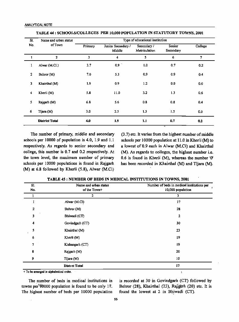
ANALYTICAL NOTE
TABLE 44: SCHOOLS/COLLEGES PER 10,000 POPULATION IN STATUTORY TOWNS, 2001
S!. Name and urban status Type of educational institution No. of Town Primary Junior Secondary / Secondary / Senior College
Middle Matriculation Secondary
2 3 4 5 6 7
Alwar (M.e!.) 3.7 0.9 1.0 0.7 0.2
2 Behror (M) 7.0 5.3 0.9 0.9 0.4
3 Khairthal (M) 1.9 0.9 1.2 0.0 0.0
4 Kherli (M) 5.8 11.0 3.2 1.3 0.6
5 Rajgarh (M) 6.8
6 Tijara(M) 3.0
District Total 4.0
The number of primary, middle and secondary
schools per 10000 of population is 4.0, 1.9 and 1.1
respectively. As regards to senior secondary and
college, this number is 0.7 and 0.2 respectively. At the town level, the maximum number of primary schools per 10000 populations is found in Rajgarh
(M) at 6.8 followed by Kherli (5.8), Alwar (M.Cl)
5.6
2.5
1.9
0.8 0.8 0.4
1.5 1.5 0.0
1.1 0.7 0.2
(3.7) etc. It varies from the highest number of middle
schools per 10000 population at 11.0 in Kherli (M) to a lowest of 0.9 each in Alwar (M.CI) and Khairthal
(M). As regards to colleges, the highest number i.e. 0.6 is found in Kherli (M), whereas the number '0' has been recorded in Khairthal (M) and Tijara (M).
TABLE 45 : NUMBER OF BEDS IN MEDICAL INSTITUTIONS IN TOWNS, 2001
Sl. No.
2
3
4
5
6
7
8
9
Name and urban status of the Town+
Alwar (M.el)
8ehror(M)
Bhiwadi (CT)
Govindgarh (eT)
Khairthal (M)
Kherli (M)
Kishangarh (en
Rajgarh (M)
Tijara(M)
Distrct Total
2
+ To be arranged in alphabetical order.
The number of beds in medical institutions in towns per"iroooo population is found to be only 11. The highest number of beds per 10000 population
55
Number of beds in medical institutions per 10,000 population
3
17
28
2
30
23
19
19
20
10
17
is recorded at 30 in Govindgarh (CT) followed by Behror (28), Khairthal (23), RaJ~h (20) etc. It is found the lowest at 2 in Bhiwadi (CT).
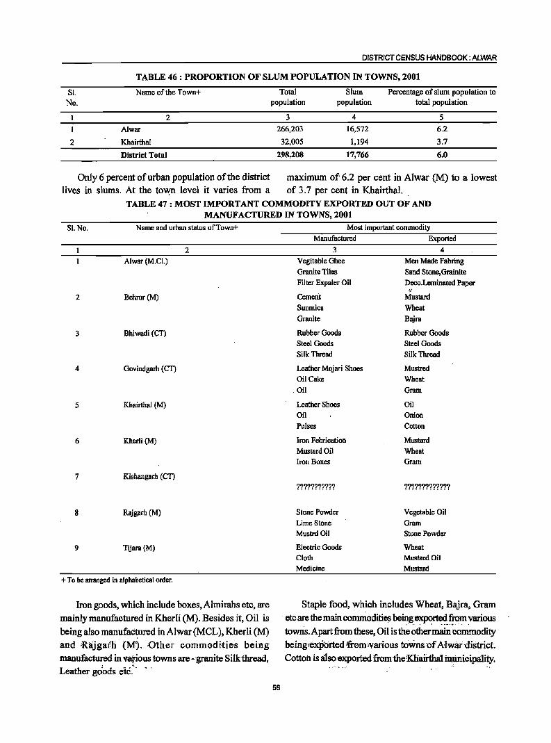
DISTRICT CENSUS HANDBOOK: ALWAR
TABLE 46: PROPORTION OF SLUM POPULATION IN TOWNS, 2001
Sl. Name of the Town+ Total Slum Percentage of slum population to No. population population total population
1 2 3 4 5
1 Alwar 266,203 16,572 6.2
2 Khairthal 32,005 1,194 3.7
District Total 298,208 17,766 6.0
Only 6 percent of urban population of the district maximum of 6.2 per cent in Alwar (M) to a lowest lives in slums. At the tovvn level it varies from a of 3.7 per cent in Khairthal.
TABLE 47: MOST IMPORTANT COMMODITY EXPORTED OUT OF AND MANUFACTURED IN TOWNS, 2001
SI.No. Name and urban status ofTown+
2 Alwar (M.Cl.)
2 Behror(M)
3 Bhiwadi (CT)
4 Govindgarh (CT)
5 Khairthal (M)
6 Kherli (M)
7 Kishangarh (CT)
8 Rajgarh (M)
9 Tijara(M)
+ To be arranged in alphabetical order.
Iron goods, which include boxes, Almirahs etc, are mainly manufactured in Kherii (M). Besides it, Oil is being also manufac~ured in Alwar (MCL), Kherli (M) and 'Rajgath· (M). ;Other commodities being manufactured in various towns are - granite Silk thread, Leather goods etc>
56
Most important commodity Manufactured Exported
3 4 Vegitable Ghee Men Made Fabring Granite Tiles Sand Stone,Grainite Filter Expaler Oil Deco.Leminated Paper
Cement Mustard Sunmica Wheat Granite Bajra
Rubber Goods Rubber Goods Steel Goods Steel Goods Silk Thread Silk Thread
Leather Mojari Shoes Mustred Oil Cake Wheat Oil Gram
Leather Shoes Oil Oil Onion Pulses Cotton
Iron Febrication Mustard MusterdOil Wheat Iron Boxes Gram
??????????? ?????????????
Stone Powder Vegetable Oil LimeStone Gram Mustrd Oil Stone Powder
Electric Goods Wheat Cloth Mustard Oil Medicine Mustard
Staple food, which includes Wheat, Bajra, Gram
etc are the main commodities be~g.CXJlC!~f!om various towns. Apart from these, Oil is the other main Commodity being;exp'orted Tremlvarious toWns ofA:lwaf·district. Cotton is Iilso exported from 1heKhairtha1 ~icipa1ity.

ANALYTICAL NOTE
(X) Brief analysis of the data on houses and household amenities, Houselisting Operations, Census of India 2001 based on inset tables 48 to 52:
TABLE 48: HOUSEHOLDS BY TENURE STATUS AND NUMBER OF ROOMS
OCCUPIED IN THE DISTRICT, 2001
Tenure Number of Number of Household
Status Dwelling Rooms Total Scheduled Castes Scheduled Tribes
Total Rural Urban Total Rural Urban Total Rural Urban
2 3 4 5 6 7 8 9 10 11
DISTRICT TOTAL 461,080 386,044 75,036 89,584 78,663 10,921 37,981 35,267 2,714
Owned No Exclusive Room 3,942 3,603 339 1,002 924 78 544 533 II
One Room 120,472 109,449 ll,023 36,240 32,848 3,392 9,771 9,276 495
Two Rooms 138,766 121,494 17,272 30,245 26,976 3,269 13,118 12,477 641
Three Rooms 73,822 61,580 12,242 10,911 9,481 1,430 5,908 5,523 385
3+ Rooms 96,815 79,177 17,638 8,285 6,952 1,333 7,591 7,027 564
Median Number of Rooms 2 2 3 2 2 2 2 2 2
Rented No Exclusive Room 420 124 296 46 18 28 9 5 4
One Room 15,078 6,035 9,043 1,533 653 880 485 168 317
Two Rooms 5,001 1,297 3,704 342 150 192 241 100 141
Three Rooms 1,603 400 1,203 87 33 54 71 23 48
3+ Rooms 869 347 522 57 32 25 41 24 17
Median Number of Rooms
Others No Exclusive Room 206 107 99 37 32 5 13 9 4
One Room 2,183 1,378 805 559 395 164 95 41 54
Two Rooms 1,060 567 493 151 105 46 58 38 20
Three Rooms 471 236 235 56 37 19 25 12 13
3+ Rooms 372 250 122 33 27 6 I I II 0
Median Number of Rooms 2
Data Source; Census of India 200I.H-Series: "Tables on Houses, Household Amenities and Assests".
Of the total households (461,080) of the district, whereas in urban areas this percentage is 77.98. The majorities i.e. 433,817 (94.09 per cent) are living in median number of rooms in owned, renteq and others their owned houses whereas only 22,971 households categories are the same for rural and urban areas of (4.98 per cent) have rented houses. In the owned the district. The households belonging to scheduled category, the median number of rooms a household castes has higher percentage (96.76) having owned possess is 2 while in case of rented it is also 2. As dwellings as compared to scheduled tribe households 'f~gards to rural areas of the district, 97.22 per cent (87.00). of tlie households are living in their owned dwellings
57
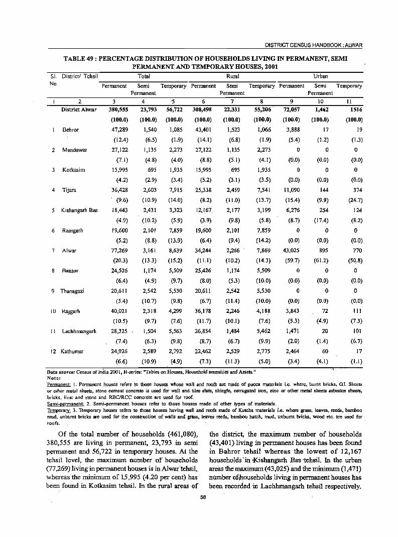
DISTRICT CENSUS HANDBOOK: ALWAR
TABLE 49 : PERCENTAGE DISTRIBUTION OF HOUSEHOLDS LIVING IN PERMANENT, SEMI
PERMANENT AND TEMPORARY HOUSES, 2001
SI. Districtl Tehsil Total Rural Urban No, Permanent Semi Temporary Permanent Semi Temporary Permanent Semi Temporary
Permanent Permanent . Permanent
2 3 4 '5 6 7 8 9 10 11
District Alwar 380,555 23,793 56,722 308,498 22,331 55,206 72,057 1,462 1516
(100.0) (100.0) (100.0) (100.0) (100.0) (100.0) (100.0) (100.0) (100.0)
Behror 47,289 1,540 1,085 43,401 1,523 1,066 3,888 17 19
(12.4) (6.5) (1.9) (14.1) (6.8) (1.9) (5.4) . (1.2) (1.3)
2 Mandawar 27,122 1,135 2,273 27,122 1,135 2,273 0 0 0
(7.1) (4.8) (4.0) (8,8) (5.1) (4.1) (0.0) (0.0) (0.0)
3 Kotkasim 15,995 695 1,935 15,995 695 1,935 0 0 0
(4.2) (2.9) (3.4) (5.2) (3.1) (3.5) (0.0) (0.0) (0.0)
4 Tijara 36,428 2,603 7,915 25,338 2,459 7,541 11,090 144 374
, (9.6) (10.9) (14.0) (8.2) (11.0) (13.7) (15.4) (9.9) (24.7)
5 Kishangarh Bas 18,443 2,431 3,323 12,167: 2,177 3,199 6,276 254 124
(4.9) (10.2) (5.9) (3.9) (9.8) (5.8) (8.7) (17.4) (8.2)
6 Ramgarh 19,600 2,101 7,859 19,600 2,101 7,859 0 a 0
(5.2) (8.8) (13.9) (6.4) (9.4) (14.2) (0.0) (0.0) (0.0)
7 Alwar 77,269 3,161 8,639 34,244 2,266 7,869 43,025 895 770
(20.3) (13.3) (15.2) (11.1 ) (10.2) (14.3) (59.7) (61.2) (50..8)
8 Bansul" 24,526 1,174 5,509 25,426 1,174 5,509 0 0 0
(6.4) (4.9) (9.7) (8.0) (5.3) (10.0) (0.0) (0.0) (0.0)
9 Thanagazi 20,611 2,542 5,530 20,611 2,542 5,530 0 0 0
(5.4) (10.7) (9.8) (6.7) (11.4) (10.0) (0.0) (0.0) (0.0)
10 Rajgarh 40,021 2,318 4,299 36,178 2,246 4,188 3,843 72 III
(10.5) (9.7) (7.6) (11.7) (10.1) (7.6) (5.3) (4.9) (7.3)
II Lachhmangarh 28;325 1,504 5,563 26,854 1,484 5,462 1,471 20 101
(7.4) (6.3) (9.8) (8.7) (6.7) (9.9) (2.0) (1.4) (6.7)
12 Kathumar 24,926 2,589 2,792 22,462 2,529 2,775 2,464 60 17
(6.6) (10.9) (4.9) (7.3) (11.3) (5.0) (3.4) (4.1) (1.1 )
Data source: Census of India 2001, H-series: "Tables on HOllses, Household amenities and Assets." Note: 'Permanent: I. Permanent houses refers to those houses whose wall and roofs are made of pucca materials i.e, where, burnt bricks, GI. Sheets or other metal sheets, stone cement concrete is used fOI" wall and, tiles slate, shingle, corrugated iron, zinc or other metal sheets asbestos sheets, bricks, lime and stone and RBC/RCC concrete are used for roof. Semi-permanent: 2. Semi-permanent houses refer to those houses made of other types of materials. Temporary: 3. Temporary houses refers to those houses having wall and roofs made of Kutcha materials i.e. where grass, leaves, reeds, bamboo mud, unbumt bricks are used for the construction of walls and grass, leaves reeds, bamboo hatch, mud, unbumt bricks, wood etc. are used for roofs.
Of the total number of households (461,080), the district, the maximum number of households 380,555 are living in permanent, 23,793 in semi (43,401) living in pennanent houses has been found permanent and 56,722 in temporary houses. At the in Bahror tehsil whereas the lowest of 12,167 tehsil level, the maximum number of households households' in Kishangarh Bas tehsil. In the urban (77 ,269) living in permanent houses is in Alwar'tehsil, areas the maximum (43,025).and the minimum (1,471) whereas the minimum of 1,5,995 (4.20 per cent) has nlimber df~ouseholds living in permanent houses has been found in Kotkasim tehsil. In the rural areas of been recorded in Lachhmangarh tehsil respectively.
58
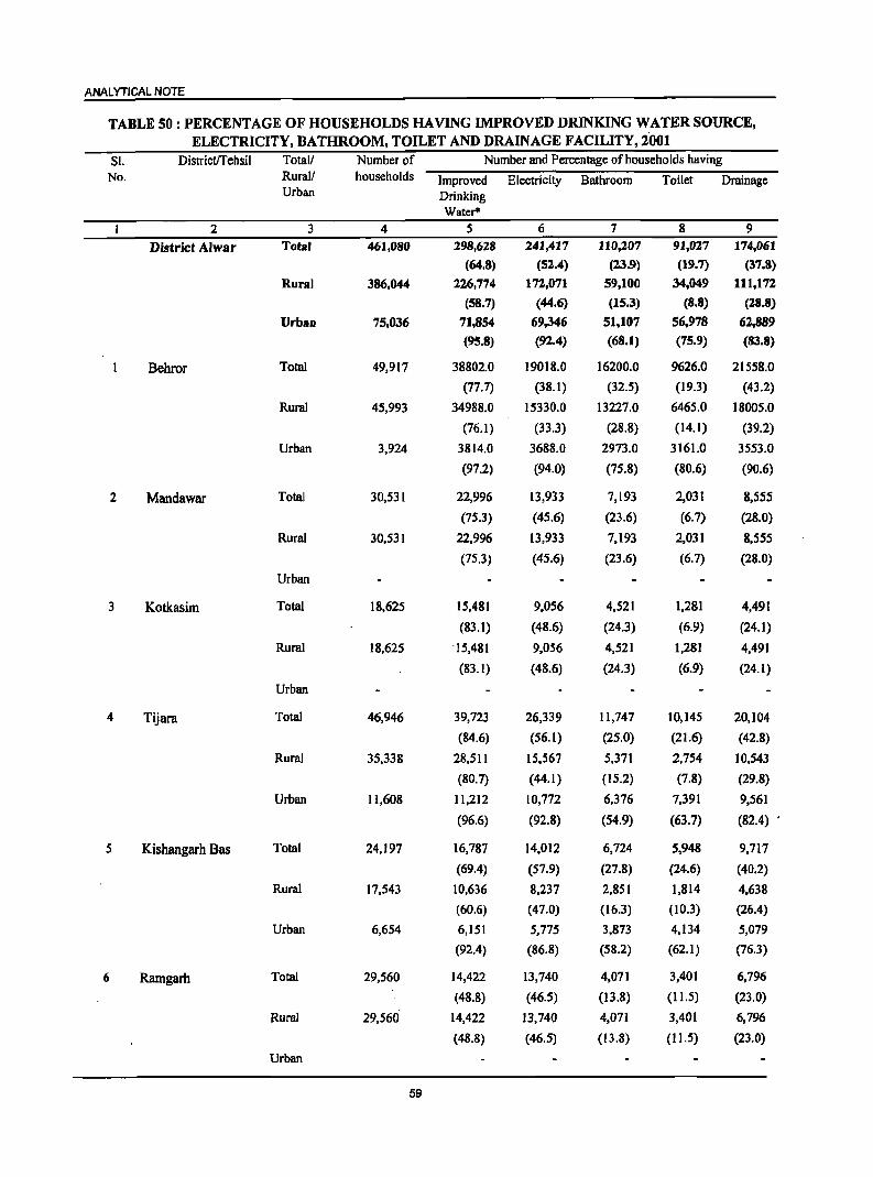
ANALYTICAL NOTE
TABLE SO : PERCENTAGE OF HOUSEHOLDS HAVING IMPROVED DRINKING WATER SOURCE, ELECTRICITY, BATHROOM, TOILET AND DRAINAGE FACILITY,200t
Sl. Districtffebsil TotaU Number of Number and Percentage of households baving No. Rural! households Improved Electricity Bathroom Toilet Drainage
Urban Drinking Water'"
2 3 4 5 6 7 8 9
District Alwar Tota' 461,080 298,618 241,417 110,207 91,027 174,061
(64.8) (52.4) (23.9) (19.7) (37.8)
Rural 386,044 226,774 172,071 59,100 34,049 111,172
(58.7) (44.6) (15.3) (8.8) (18.8)
Urban 75,036 71,854 69,346 51,107 56,978 6.2,889
(95.8) (92.4) (68.1) (75.9) (83.8)
Bebror Total 49,917 38802.0 19018.0 16200.0 9626.0 21558.0
(77.7) (38.1) (32.5) (19.3) (43.2)
Rural 45,993 34988.0 15330.0 13227.0 6465.0 18005.0
(76.1) (33.3) (28.8) (14.1) (39.2)
Urban 3,924 3814.0 3688.0 2973.0 3161.0 3553.0
(97.2) (94.0) (75.8) (80.6) (90.6)
2 Mandawar Total 30,531 22,996 13,933 7,193 2,031 8,555
(75.3) (45.6) (23.6) (6.7) (28.0)
Rural 30,531 22,996 13,933 7,193 2,031 8,555
(75.3) (45.6) (23.6) (6.7) (28.0)
Urban
3 Kotkasim Total 18,625 15,481 9,056 4,521 1,281 4,491
(83.1) (48.6) (24.3) (6.9) (24.1)
Rural 18,625 ·15,481 9,056 4,521 1,281 4,491
(83.1) (48.6) (24.3) (6.9) (24.1)
Urban
4 Tijara Total 46,946 39,723 26,339 11,747 10,145 20,104
(84.6) (56.1) (25.0) (21.6) (42.8)
Rural 35,338 28,511 15,567 5,371 2,754 10,543
(80.7) (44.1) (15.2) (7.8) (29.8)
Urban 11,608 11,212 10,772 6,376 7,391 9,561
(96.6) (92.8) (54.9) (63.7) (82.4)
5 Kisbangarh Bas Total 24,197 16,787 14,012 6,724 5,948 9,717
(69.4) (57.9) (27.8) (24.6) (40.2)
Rural 17,543 10,636 8,237 2,851 1,814 4,638
(60.6) (47.0) (16.3) (10.3) (26.4)
Urban 6,654 6,151 5,775 3,873 4,134 5,079
(92.4) (86.8) (58.2) (62.1) (76.3)
6 Ramgarh Total 29,560 14,422 13,740 4,071 3,401 6,796
(48.8) (46.5) (13.8) (11.5) (23.0)
Rural 29,560 14,422 13,740 4,071 3,401 6,796
(48.8) (46.5) (13.8) (11.5) (23.0)
Urban
59
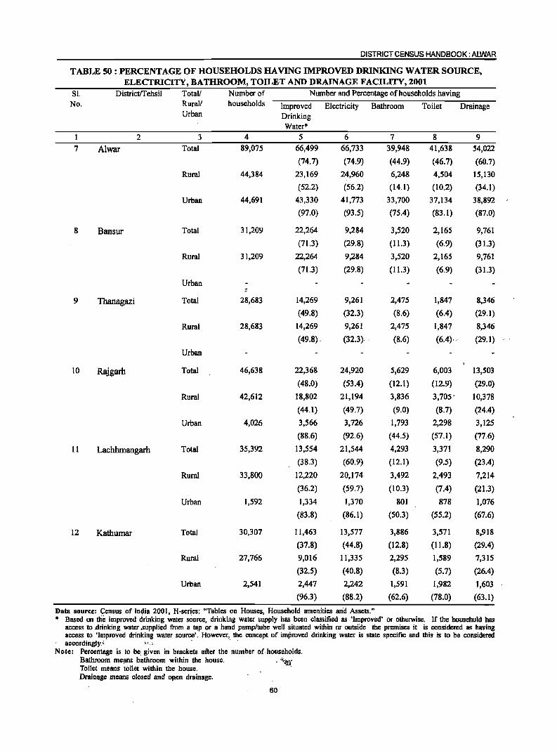
DISTRICT CENSUS HANDBOOK: ALWAR
TABLE 50 : PERCENTAGE OF HOUSEHOLDS HAVING IMPROVED DRINKING WATER SOURCE, ELECTRICITY, BATHROOM, TOILET AND DRAINAGE FACILITY, 2001
Sl. DistrictlTehsil Total! Number of Number and Percentage of households having
No. Rurall households Improved Electricity Bathroom Toilet Drainage Urban Drinking
Water*
1 2 3 4 5 6 7 8 9
7 Alwar Total 89,075 66,499 66,733 39,948 41,638 54,022
(74.7) (74.9) (44.9) (46.7) (60.7)
Rural 44,384 23,169 24,960 6,248 4,504 15,130
(52.2) (56.2) (14.1) (10.2) (34.1)
Urban 44,691 43,330 41,773 33,700 37,134 38,892
(97.0) (93.5) (75.4) (83.1) (87.0)
8 Bansur Total 31,209 22,264 9,284 3,520 2,165 9,761
(71.3) (29.8) (11.3) (6.9) (31.3)
Rural 31,209 22,264 9,284 3,520 2,165 9,761
(71.3) (29.8) (11.3) (6.9) (31.3)
Urban
9 Thanagazi Total 28,683 14,269 9,261 2,475 1,847 8,346
(49.8) (32.3) (8.6) (6.4) (29.1)
Rural 28,683 14,269 9,261 2,475 1,847 8,346
(49.8) . (32.3) .' (8.6) (6.4)· .' (29.1)
Urban
to Rajgarh Total 46,638 22,368 24,920 5,629 6,003 13,503
(48.0) (53.4) (12.1) (12.9) (29.0)
Rural 42,612 18,802 21,194 3,836 3,705' 10,378
(44.1) (49.7) (9.0) (8.7) (24.4)
Urban 4,026 3,566 3,726 1,793 2,298 3,125
(88.6) (92.6) (44.5) (57.1) (77.6)
11 Lachhmangarh Total 35,392 13,554 21,544 4,293 3,371 8,290
(38.3) (60.9) (12.1) (9.5) (23.4)
Rural 33,800 12,220 20,174 3,492 2,493 7,214
(36.2) (59.7) (10.3) (7.4) (21.3)
Urban 1,592 1,334 1,370 801 878 1,076
(83.8) (86.1) (50.3) (55.2) (67.6)
12 Kathumar Total 30,307 11,463 13,577 3,886 3,571 8,918
(37.8) (44.8) (12.8) (11.8) (29.4)
Rural 27,766 9,016 11,335 2,295 1,589 7,315
(32.5) (40.8) (8.3) (5.7) (26.4)
Urban 2,541 2,447 2,242 1,591 1,982 1,603
(96.3) (88.2) (62.6) (78.0) (63.1)
Data source: Census of India 2001, H-series: "Tables on Houses, Household amenities an'd Assets." • Based on the improved drinking water source, drinking water supply has been classified as 'Improved' or otherwise. If the household has
access to .drinking water .supplied from a tap or a hand ·pump/tube well situated within or outside the premises it is considered as having access to 'Improved drinking water source'. However, the concept of improved drinking water is state specific and this is to be considered accordingly. < '.',:'
Note: Percentage is to be. given in brackets after the number of· households. Bathroom means bathroom within the house.
o '~«l: Toilet means toilet within the house. DraiDl~ge means closed and opem drainage.
60
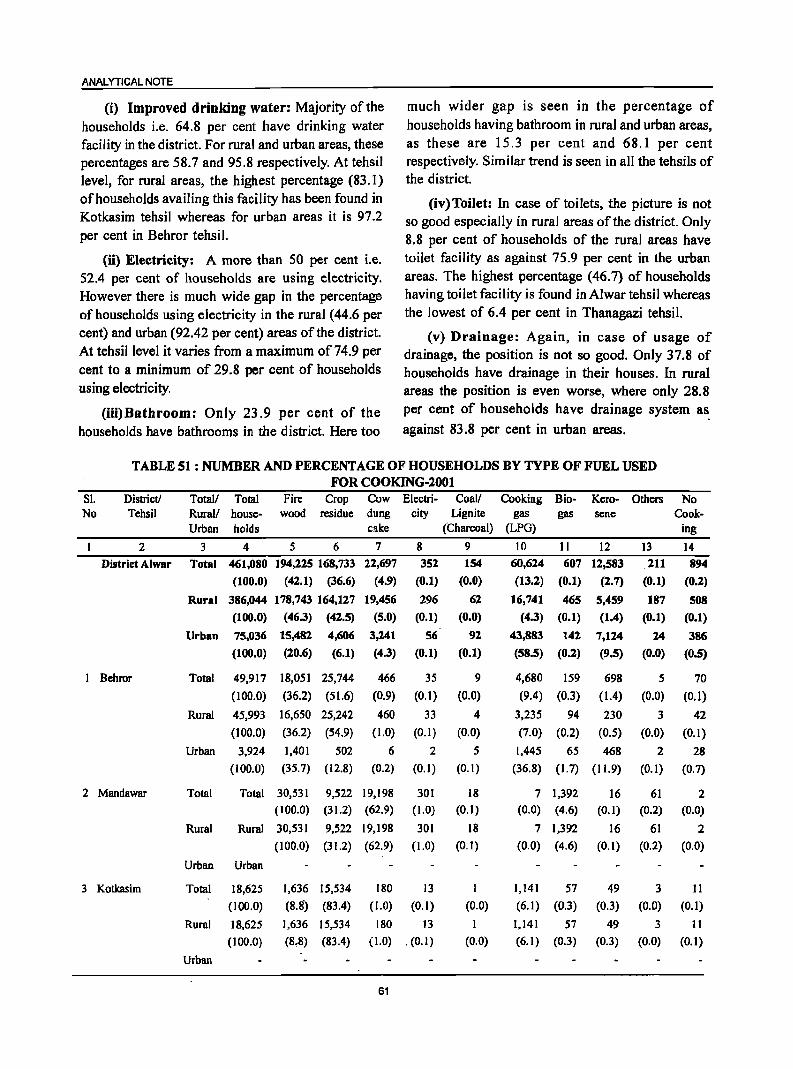
ANALYTICAL NOTE
(i) Improved drinking water: Majority of the households i.e. 64.8 per cent have drinking water facility in the district. For rural and urban areas, these percentages are 58.7 and 95.8 respectively. At tehsil level, for rural areas, the highest percentage (83.1) of households availing this facility has been found in Kotkasim tehsil whereas for urban areas it is 97.2 per cent in Behror tehsil.
much wider gap is seen in the percentage of households having bathroom in rural and urban areas, as these are 15.3 per cent and 68.1 per cent respectively. Similar trend is seen in all the tehsils of the district.
(iv)Toilet: In case of toilets, the picture is not so good especially in rural areas of the district. Only 8.8 per cent of households of the rural areas have toilet facility as against 75.9 per cent in the urban areas. The highest percentage (46.7) of households having toilet facility is found in Alwar tehsil whereas the lowest of 6.4 per cent in Thanagazi tehsil.
(n) Electricity: A more than 50 per cent i.e. 52.4 per cent of households are using electricity. However there is much wide gap in the percentage of households using electricity in the rural (44.6 per cent) and urban (92.42 per cent) areas of the district. At tehsillevel it varies from a maximum of 74.9 per cent to a minimum of 29.8 per cent of households using electricity.
(iii)Bathroom: Only 23.9 per cent of the households have bathrooms in the district. Here too
(v) Drainage: Again, in case of usage of drainage, the position is not so good. Only 37.8 of households have drainage in their houses. In rural areas the position is even worse, where only 28.8 per cent of households have drainage system a~ against 83.8 per cent in urban areas.
TABLE 51 : NUMBER AND PERCENTAGE OF HOUSEHOLDS BY TYPE OF FUEL USED FOR COOKING-2001
SI. No
Districtl Tehsil
2
Total/ Total Rural/ houseUrban holds
3 4
Fire Crop Cow Electri- Coall Cooking Bio- Kero- Others No wood residue dung city Lignite gas gas sene Cook-
cake (Charcoal) (LPG) ing
5 6 7 8 9 10 11 12 13 14
District Alwar Total 461,080 194,225 168,733 22,697 352 154
(O.O)
60,624 607 12,583 211 894
I Behror
2 Mandawar
3 Kotkasim
(100.0) (42.1) (36.6) (4.9) (0.1)
Rural 386,044 178,743 164,127 19,456 296 62
(IOO.O) (46.3) (42.5) (5.0) (0.1) (0.0)
Urban 75,036 15,482
(100.0) (20.6)
4,606
(6.1)
3,241
(4.3)
56
(0.1)
92
(0.1)
Total 49,917 18,051 25,744 466 35 9
(100.0) (36.2) (51.6) (0.9) (0.1) (0.0)
Rural 45,993 16,650 25,242
(100.0) (36.2) (54.9)
460 33
(1.0) (0.1)
Urban 3,924
(100.0)
1,401 502
(35.7) (12.8)
6
(0.2)
2
(0.1)
Total Total 30,531 9,522 19,198 301 (100.0) (31.2) (62.9) (1.0)
Rural Rural 30,531 9,522 19,198 301
Urban Urban
Total 18,625
(100.0)
Rural 18,625
(100.0)
Urban
(100.0) (31.2) (62.9) (1.0)
1,636 15,534 180 13
(8.8) (83.4) (1.0) (0.1)
1,636 15,534
(8.8) (83.4)
180 13
(1.0) . (0.1)
61
4
(0.0)
5
(0.1)
18 (0.1)
18
(0.1)
I
(0.0)
I
(0.0)
(13.2) (O.I) (2.7) {D. I) (O.2)
16,741 465 5,459 187 508
(4.3) (0.1) (1.4) (O.l) (O.l)
43,883 142
(58.5) (0.2)
7,124
(9.5)
24
(O.O)
386
(0.5)
4,680 159 698 5 70
(9.4) (0.3) (1.4) (0.0) (0.1)
3,235 94
(7.0) (0.2)
230 3 42
(0.5) (0.0) (0.1)
1,445 65 468
(36.8) (1.7) (11.9)
2
(0.1)
7 1,392 (0.0) (4.6)
7 1,392
(0.0) (4.6)
1,141 57
(6.1) (0.3)
1,141 57
(6.1) (0.3)
16 61 (0.1) (0.2)
16 61
(0.1) (0.2)
49 3
(0.3) (0.0)
49
(0.3)
3
(0.0)
28
(0.7)
2 (0.0)
2
(0.0)
11
(0.1)
11
(0.1)
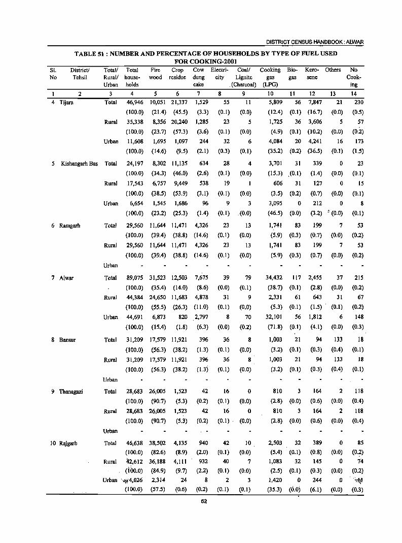
DISTRICT CENSUS HANDBOOK: ALWAR
TABLE 51 : NUMBER AND PERCENTAGE OF HOUSEHOLDS BY TYPE OF FUEL USED FOR COOKING-20Ot
Sl. District/ No Tehsil
1 2
4 Tijara
Total/ Rural/ Urban
3
Total
Total Fire Crop house- wood residue holds
4 5 6
46,946 10,051 21,337
(100.0) (21.4) (45.5)
Cow dung cake
7
1,529
(3.3)
Electri- Coal/ Cooking Bio- Kero-city Lignite gas gas sene
. (Charcoal) (LPG)
8 9 10 11 12
55 11
(0.1) (0.0)
5,809 56 7,847
(12.4) (0.1) (16.7)
Others
13 21
(0.0)
No Cook-
ing
14
230
(0.5)
Rural 35,338 8,356 20,240 1,285 23 5 1,725 36 3,606 5 57
(100.0) (23.7) (57.3) (3.6) (0.1) (0.0) (4.9) (0.1) (10.2) (0.0) (0.2)
Urban 11,608 1,695 1,097 244 32 6 4,084 20 4,241 16 173
(100.0) (14.6) (9.5) (2.1) (0.3) (0.1) (35.2) (0.2) (36.5) (0.1) (1.5)
5 Kishangarh Bas Total 24,197 8,302 11,135 634 28 4
(0.0)
1
(0.0)
3,701 31
(15.3) .(0.1)
339 0 23
6 Ramgarh
7 Alwar
8 Bansur
9 Thanagazi
10 Rajgarb
(100.0) (34.3) (46.0) (2.6) (0.1)
Rural 17,543 6,757 9,449 538 19
(100.0) (38.5) (53.9) (3.1) (0.1)
Urban 6,654 1,545 1,686 96 9 3
(100.0) (23.2) (25.3) (1.4) (0.1) (0.0)
Total 29,560 11,644 11,471 4,326 23
(.100.0) (39.4) (38.8) (14.6) (0.1)
13
(0.0)
Rural 29,560 11,644 11,471 4,326 23 13
(100.0) (39.4) (38.8) (14.6) (0.1) (0.0)
Urban
Total 89,075 31,523 12,503 7,675 39 79
(100.0) (35.4) (14.0) (8.6) (0.0) (0.1)
Rural 44,384 24,650 11,683 4,878
(100.0) (55.5) (26.3) (11.0)
31
(0.1)
9
(0.0)
Urban 44,691 6,873 820 2,797 8 70
(100.0) (15.4) (1.8) (6.3) (0.0) (0.2)
Total 31,209 17,579 11,921 396 36 8
(100.0) (56.3) (38.2) (1.3) (0.1) (0.0)
Rural 31,209 17,579 1l,921 396 36 8
(100.0) (56.3) (38.2) (1.3) (0.1) (0.0)
Urban
Total 28,683 26,005 1,523
(100.0) (90.7) (5.3)
42
(0.2)
16
(0.1)
o (0.0)
Rural 28,683 26,005 1,523 42 16 a (100.0) (90.7) (5.3) (0.2) (0.1)· (0.0)
Urban
Total 46,638 38,502 4,]35 940 42
(]OO.O) (82.6) (8.9) (2.0) (0.])
Rural Zi.2,612 36,188 4,111 932
(ioo.O) (84.9) (9.7) (2.2)
40
(0.])
Urban ·· .. #4,026 2,3]4
(100.0) (57.5)
24 8 2
(0.6) (0.2) (0.1)
62
10
(0.0)
7
(0.0)
3
(0.1)
606 31
(3.5) (0.2)
3,095 0
(46.5) (0.0)
1,741 83
(5.9) (0.3)
(1.4) (0.0) (0.1)
127 0 15
(0.7) (0.0) (0.1)
212 0
(3.2) -:; (0.0)
8
(0.1)
199 7 53
(0.7) (0.0) (0.2)
),741 83 199 7 53
(5.9) (0.3) (0.7) (0.0) (0.2)
34,432 117 2,455 37 215
(38.7) (0.1) (2.8) (0.0) (0.2)
2,331 61
(5.3) (0.1)
643 31
(1.5) . (0.1)
67
(0.2)
32,101 56 1,812 6 148
(71.8) (0.1) (4.1) (0.0) (0.3)
1,003 21 94 133 18
(3.2) (0.1) (0.3) (0.4) (0.1)
1,003 21 94 133 18
(3.2) (0.1) (0.3) (0.4) (0.1)
810 3
(2.8) (0.0)
810 3
(2.8) (0.0)
164
(0.6)
164
(0.6)
2
(0.0)
2
(0.0)
118
(0.4)
118
(0.4)
2,503 32 389 0 85
(5.4) (0.1) (0.8) (0.0) (0.2)
1,083 32 145 o 74 (2.5) (0.1) (0.3) (0.0) (0.2)
1,420 0 244 0 ry:1r1
(35.3) (0.0). (6.1) (0.0) (0.3)
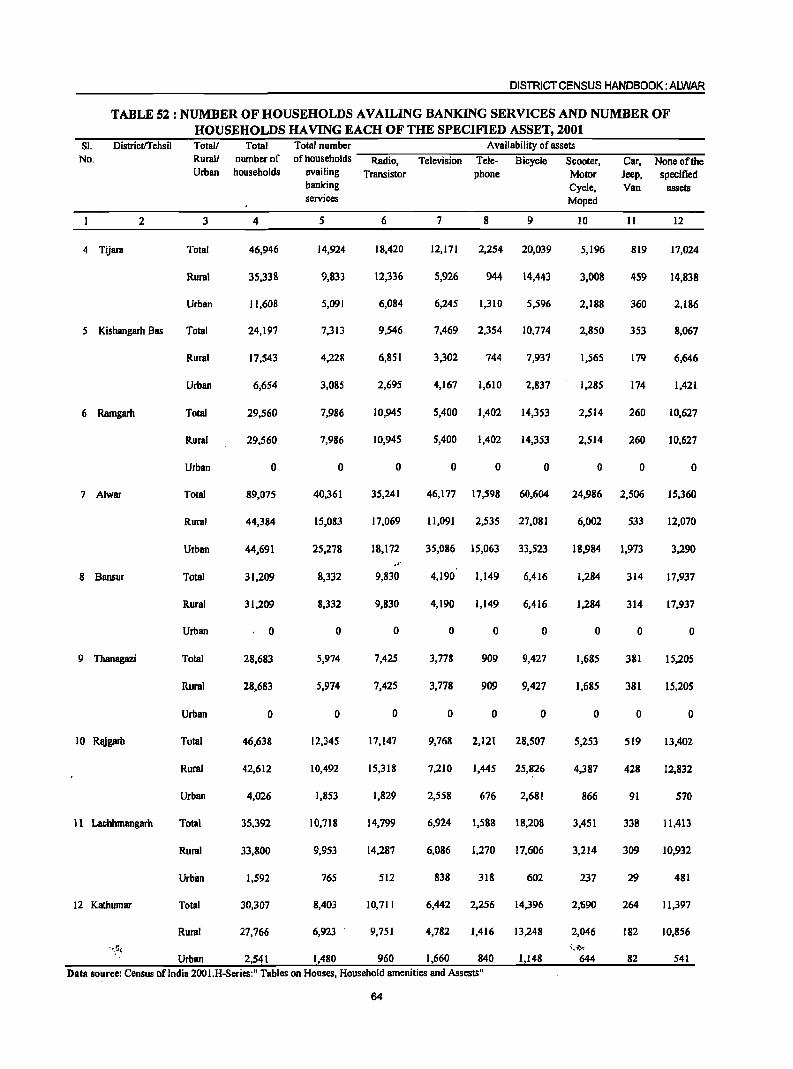
DISTRICT CENSUS HANDBOOK: AlWAR
TABLE 52 : NUMBER OF HOUSEHOLDS AVAILING BANKING SERVICES AND NUMBER OF HOUSEHOLDS HAVING EACH OF THE SPECIFIED ASSET, 2001
SI. No.
Districtrrehsil
2
4 Tijara
5 Kishangarh Bas
6 Ramgarh
7 Alwar
8 Bansur
9 Thanagazi
10 Rajgarh
11 Lachhmangarh
12 Kathumar
Totall Rural! Urban
3
Total
Rural
Urban
Total
Rural
Urban
Total
Rural
Urban
Total
Rural
Urban
Total
Rural
Urban
Total
Rural
Urban
Total
Rural
Urban
Total
Rural
Urbim
Total
Rural
Urban
Total number of households
4
46,946
35,338
11,608
24,197
17,543
6,654
29,560
29,560
o
89,075
44,384
44,691
31,209
31,209
, 0
28,683
28,683
o
46,638
42,612
4,026
35,392
33,800
1,592
30,307
27,766
2,541
Total number Availability of assets of households -R~a-d::-io-, --;:T::"'el;-ev-:i-:sio-n--::T~el:-e---:B~i"":cy;_c;-Ie--;S;-c-oo-:-te-r,---;C::"'a-r, --:N":"o-n-e ~of;:-th:--e
availing Transistor phone Motor Jeep, specified banking Cycle, Van assets services Moped
5 6 7 8 9 10 11 12
14,924 18,420 12,171 2,254 20,039 5,1% 819 17,024
9,833 12,336 5,926 944 14,443 3,008 459 14,838
5,091 6,084 6,245 1,310 5,596 2,188 360 2,186
7,313 9,546 7,469 2,354 10,774 2,850 353 8,067
4,228 6,851 3,302 744 7,931 1,565 179 6,646
3,085 2,695 4,167 1,610 2,831 1,285 174 1,421
7,986 10,945 5,400 1,402 ]4,353 2,514 260 ]0,627
7,986 10,945 5,400 1,402 14,353 2,514 260 ]0,627
o o o o 0 o o o
40,361 35,241 46,177 17,598 60,604 24,986 2,506 15,360
15,083 17,069 ] 1,091 2,535 27,08] 6,002 533 12,070
25,278 18,172 35,086 15,063 33,523 18,984 1,973 3,290
." 8,332 9,830 4,190 1,149 6,416 1,284 314 17,937
8,332 9,830 4,190 1,149 6,4]6 1,284 314 17,937
o o o 0 o o o o
5,974 7,425 3,778 909 9,427 1,685 381 15,205
5,974 7,425 3,778 909 9,427 1,685 381 15,205
o o o o o o o o
12,345 17,147 9,768 2,121 28,507 5,253 519 13,402
10,492 15,318 7,210 1,445 25,826 4,387 428 12,832
1,853 1,829 2,558 676 2,681 866 91 570
10,718 14,799 6,924 1,588 18,208 3,451 338 11,413
9,953 14,287 6,086 1,270 17,606 3,214 309 10,932
765 512 838 318 602 237 29 481
8,403 10,711 6,442 2,256 14,396 2,690 264 11,397
6,923 9,751 4,782 1,416 13,248 2,046 182 10,856
1,480 960 1,660 840 1,148 82 541
Data source: Census of India 200I.H-Series:" Tables on Houses, Household amenities and Assests"
64
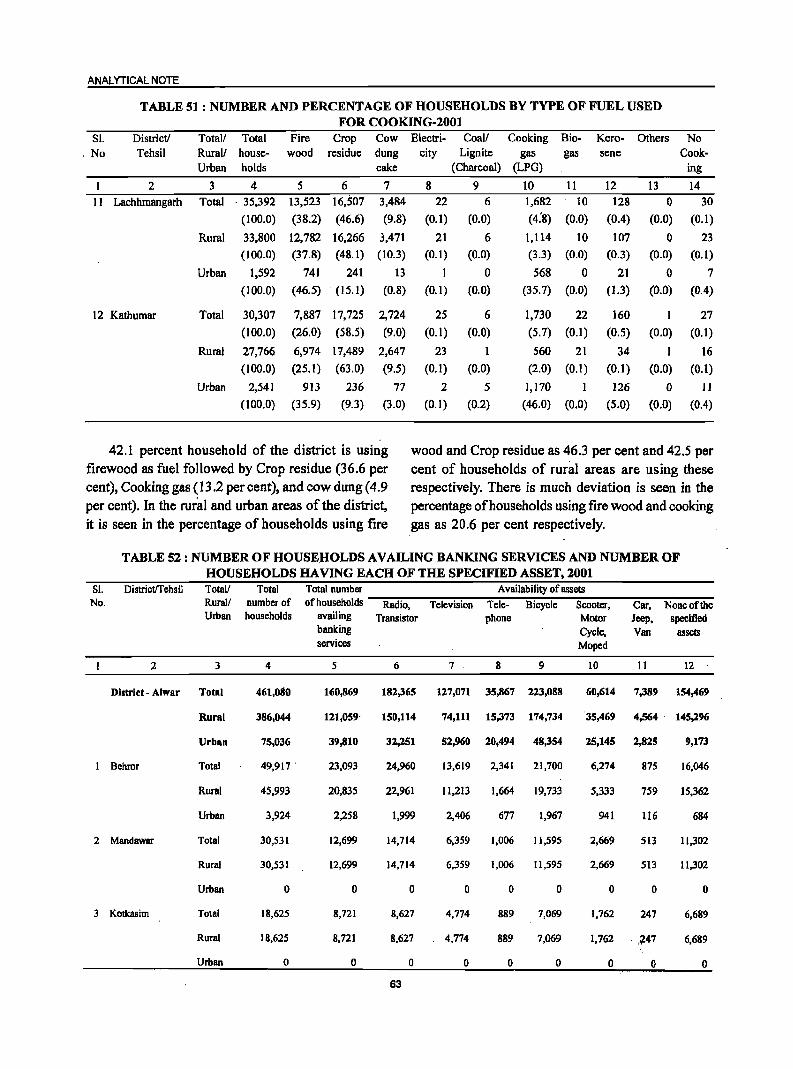
ANALYTICAL NOTE
TABLE 51 : NUMBER AND PERCENTAGE OF HOUSEHOLDS BY TYPE OF FUEL USED FOR COOKING-200l
81. District! , No Tehsil
2 11 Lachhmangarh
12 Kathumar
Total! Total Rural! houseUrban holds
3 4
Fire Crop Cow wood residue dung
cake
5 6 7 Total ,35,392 13,523 16,507 3,484
(100.0) (38.2) (46.6) (9.8)
Electricity
8 22
(0.1)
Rural 33,800 12,782 16,266 3,471 21
(100.0) (37.8) (48.1) (10.3) (0.1)
Urban 1,592
Total
Rural
(100.0)
30,307
(100.0)
27,766
(100.0)
Urban 2,541
(100.0)
741 241
(46.5) (15.1)
7,887 17,725
(26.0) (58.5)
6,974 17,489
(25.1) (63.0)
913
(35.9)
236
(9.3)
13
(0.8)
2,724
(9.0)
2,647
(9.5)
77 (3.0)
I
(0.1)
25
(0.1)
23
(0.1)
2 (0.1)
Coall Cooking Bio-Lignite gas gas
(Charcoal) (LPG)
9 10 11
6 1,682 10
(0.0) (4:8) (0.0)
Kerosene
12
128
(0.4)
6 (0.0)
o (0.0)
1,114 10 107
6
(0.0)
1
(0.0)
5
(0.2)
(3.3) (0.0) (0.3)
568 0
(35.7) (0.0)
1,730 22 (5.7) (0.1)
560 21
(2.0) (0.1)
1,170 I
(46.0) (0.0)
21
(1.3)
160
(O.S)
34
(0.1)
126
(5.0)
Others
13 o
(0.0)
No Cook
ing
14
30
(0.1)
o 23
(0.0) (0.1)
o (0.0)
I
(0.0)
1 (0.0)
o (0.0)
7 (0.4)
27
(0.1)
16
(0.1)
II
(0.4)
42.1 percent household of the district is using firewood as fuel followed by Crop residue (36.6 per cent), Cooking gas (13.2 per cent), and cow dung (4.9 per cent). In the rural and urban areas of the district, it is seen in the percentage of households using fire
wood and Crop residue as 46.3 per cent and 42.5 per cent of households of rural areas are using these respectively. There is much deviation is seen in the percentage of households using fire wood and cooking gas as 20.6 per cent respectively.
TABLE 52 : NUMBER OF HOUSE,HOLDS AVAILING BANKING SERVICES AND NUMBER OF HOUSEHOLDS HAVING EACH OF THE SPECIFIED ASSET, 2001
SI. No.
Districtrrehsil Totall Rural! Urban
2 3
Distritt - Alwar Total
Rural
Urban
I Behror Total
Rural
Urban
2 Mandawar Total
Rural
Urban
3 Kotkasim Total
Rural
Urban
Total number of households
4
461,080
386,044
75,036
49,917 '
45,993
3,924
30,531
30,531
o
18,625
18,625
o
Total number Availability of assets ~~~~~~----~~~~~----~--------~~~----~~ of households Radio, Television Tele- Bicycle Scooter, Car, None of the
availing Transistor phone Motor Jeep, specified banking Cycle, Van assets services Moped
5 6 7 8 9 10 II 12
160,869 182,365 127,071 35,867 223,088 60,614 7,389 154,469
121,059' 150,114 74,111 15,373 174,734 35,469 4,564' 145,296
39,810
23,093
20,835
2,258
12,699
12,699
o
8,721
8,721
o
32,251
24,960
22,961
1,999
14,714
14,714
o
8,627
8,627
o 63
52,960 20,494 48,354
13,619 2,341 21,700
11,213 1,664 19,733
2,406 677 1,967
6,359 1,006 11,595
6,359 1,006 11,595
o 0 0
4,774 889 7,069
4,774 889 7,069
o o o
25,145 2,825
6,274
5,333
941
2,669
2,669
o
1,762
875
759
116
513
513
o
247
1,762 . ,747
o 0
9,173
16,046
15,362
684
11,302
11,302
o
6,689
6,689
o
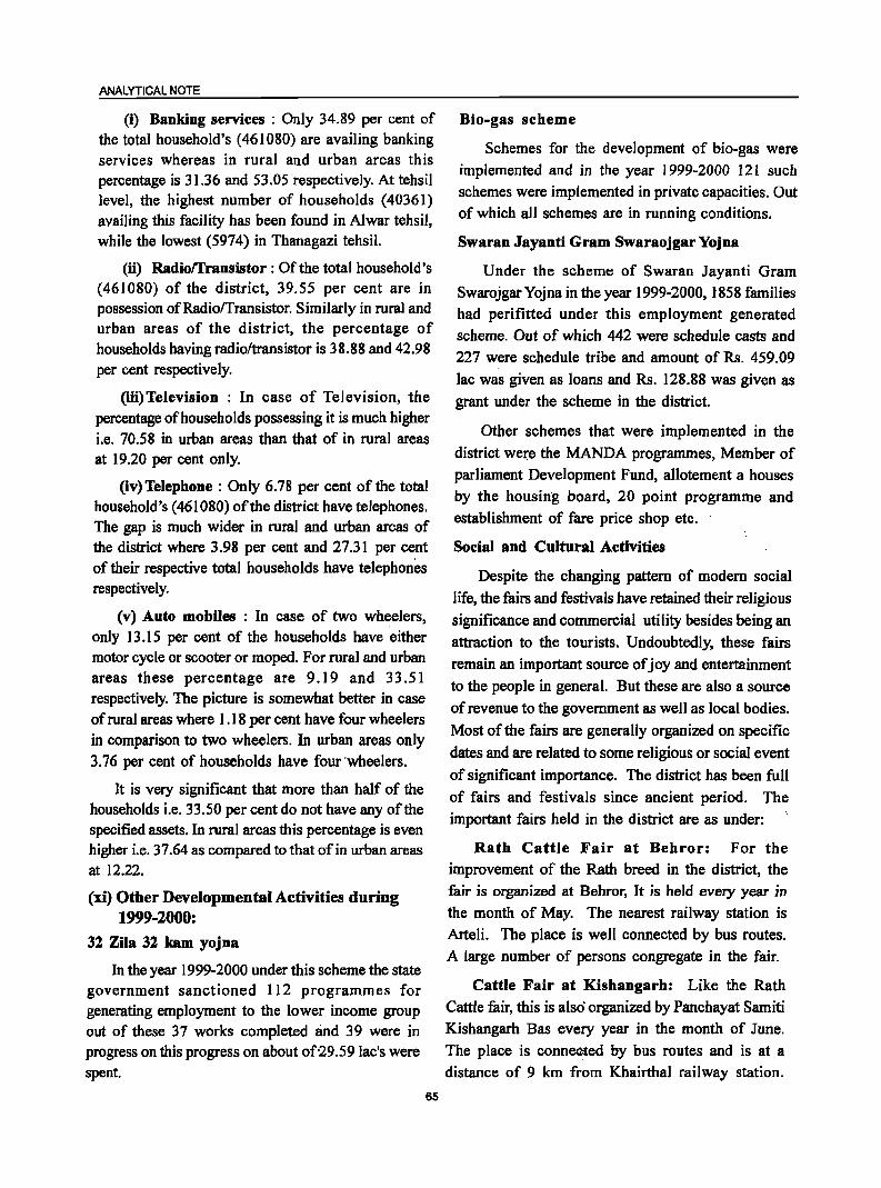
ANALYTICAL NOTE
(i) Banking services : Only 34.89 per cent of the total household's (461080) are availing banking services whereas in rural and urban areas this percentage is 31.36 and 53.05 respectively. At tehsil level, the highest number of households (40361) availing this facility has been found in Alwar tehsil, while the lowest (5974) in Thanagazi tehsil.
(ii) Radiorrransistor: Of the total household's (461080) of the district, 39.55 per cent are in possession ofRadiorrransistor. Similarly in rural and urban areas of the district, the percentage of households having radio/transistor is 38.88 and 42.98 per cent respectively.
(iii)Television : In case of Television, the percentage of households possessing it is much higher i.e. 70.58 in urban areas than that of in rural areas at 19.20 per cent only.
(iv) Telephone : Only 6.78 per cent of the total household's (461080) of the district have telephones. The gap is much wider in rural and urban areas of the district where 3.98 per cent and 27.31 per cent of their respective total households have telephones respectively.
(v) Auto mobiles : In case of two wheelers, only 13.15 per cent of the households have either motor cycle or scooter or moped. For rural and urban areas these percentage are 9.19 and 33.51 respectively. The picture is somewhat better in case of rural areas where 1.18 per cent have four wheelers in comparison to two wheelers. In urban areas only 3.76 per cent of households have four ·wheelers.
It is very significant that more than half of the households i.e. 33.50 per cent do not have any of the specified assets. In rural areas this percentage is even higher i.e. 37.64 as compared to that of in urban areas at 12.22.
(xi) Other Developmental Activities during 1999-2000:
32 Zila 32 kam yojna
In the year 1999-2000 under this scheme the state government sanctioned 112 programmes for generating employment to the lower income group out of these 37 works completed and 39 were in progress on this progress on about of29.59 lac's were spent.
65
Bio-gas scheme
Schemes for the development of bio-gas were implemented and in the year 1999-2000 121 such
schemes were implemented in private capacities. Out of which all schemes are in running conditions.
Swaran .Jayanti Gram Swaraojgar Yojna
Under the scheme of Swaran Jayanti Gram Swarojgar Yojna in the year 1999-2000, 1858 families had perifitted under this employment generated
scheme. Out of which 442 were schedule casts and 227 were schedule tribe and amount of Rs. 459.09
lac was given as loans and Rs. 128.88 was given as
grant under the scheme in the district.
Other schemes that were implemented in the
district weI:e the MANDA programmes, Member of parliament Development Fund, allotement a houses by the housing board, 20 point programme and
establishment of fare price shop etc.
Social and Cultural Activities
Despite the changing pattern of modem social
life, the fairs and festivals have retained their religious
significance and commercial utility besides being an
attraction to the tourists. Undoubtedly, these fairs remain an important source of joy and entertainment
to the people in general. But these are also a source
of revenue to the government as well as local bodies.
Most of the fairs are generally organized on specific
dates and are related to some religious or social event
of significant importance. The district has been full of fairs and festivals since ancient period. The
important fairs held in the district are as under:
Rath Cattle Fair at Behror: For the improvement of the Rath breed in the district, the fair is organized at Behror, It is held every year in the month of May. The nearest railway station is
Arteli. The place is well connected by bus routes. A large number of persons congregate in the fair.
Cattle Fair at Kishangarh: Like the Rath
Cattle fair, this is also organized by Panchayat Samiti Kishangarh Bas every year in the month of June.
The place is conn~ed by bus routes and is at a distance of 9 km from Khairthal railway station.
Principal species and livestock breeds from Mewat region are brought to the fair.
Cattle Fair at Kherli: This Cattle fair is
organized by the Municipal Board, Kherli and is held
every year in September. The place is connected by
rail and also falls on the bus route. Principal species
and livestock breeds from Mewat are brought in the
fair. A large number of cattle are brought and sold
here.
Jagdisbji Ka Mela: This is the biggest religious
fair in the district and is held every year from asadha
Sudi 9 to 11 near ,village Roopbas, 6km. From Alwar
City. This place falls on the main bus route from
Alwar to Jaipur. People in large number assemble
in the fair to pay homage to Jagdishji'
Bharat~ariji Ka M~~: This fair is held every
year on Bhadra,.pada Badi,,8 in bvillage Indokh which
is 32 Km. From Alwar City. About ten thousand
people assemble in the fair to pay homage to
Bharathariji. Visitors come 'here from far and remote
places. It is said to be a very ancient place amidst
hills where Shri Bharathariji Maharaja spent the
closing years of his life. There is a perennial flow of
water.
Hanumanji Ka Mela: This is also a religious
fair of the district and is held every year at a place
called PandaV'pol on the first Tuesday ofBhadrapada
Sudi. It is situated at about 67 km. From Alwar City.
The nearest railway stations to this place are Alwar
and Malakhera.
Dahmi Mata 1m Mela: The fair is held twice
in a year on Aswina Sudi 7 and Chaitra Sudi 7 near
village Dahmi and is called Dahmi Mata-ka-Mela.
The fair is religious one and thousands of people
assemble in eacD of these fairs. Visitors from other
states whose fore-fathers have lived in the
nelgh'b6uring 'areas of this 'place also come here for
performing the Mundan Ceremony ofltheir children
and Gathjora for every marria,ge. The place is
.approachable ;by ; bus and· is at· distance of about· 5
km. From tehsil headquartes, Behror, a bus station
on Delhi-Jaipur route. The-nearest railway station is
66
DISTRICT CENSUS HANDBOOK: ALWAR
Ateli. In the month of January, the Panchayat Samiti
also organizes a cattle fair here in which Mewati breed
is brought and sold.
The other fairs held in the district are Ram Navmi
at Vijai Mandir, Teej, Gangaur, Shitlasthmi and Barai
at Alwar, Bilali fair in Bansur tehsil,Charandas fair at
Dehra(Alwar,tehsil),Mataju fair at Dholagarh and
Humanj i fair at Harsora(Bansur tehsil).
The main festivals amongst Hindus are Diwali,
Holi,MahashiV'artriii, Raksha-Bandhan, Ianmasthmi
and dashera while Muslims observe Idul-fitar, Idul
Zuha, Mohrrum,Barawafat and Shab~I-Barat.
(xii) Brief description of places of religious,
historical or arcbaeological importance in
village and places of tourist interest in the towns of the district:
The district of Alwar has many religious plac,es,
of historical archeaeological and tourist interest around
it
Alwar: Alwar City is situated mid-way on Delhi
Jaipur line of Western railway and is connected by
road with Jaipur and Delhi. A fort crowns a scarped
hill. A steep ascent leads to the fort behind which
stands~the 'Chhatri'of Maharana Pratap Singh. The
city palace separated from the bvase of hilols by
Sagar, a picturesque tank,consists of a group ob
buildings in different styles. The beautiful water
reserviou (known as Sagar) is located behind the city
palace but below the fort. There is a museum in a
portion of this palace where a collection of
manuscripts and paintings are available. One of the
outstanding manuscripts is an 80 feet ling illustrated
one of the Bhagwat and an illustrilted one of the
Bhagwat and an illuminated copy of the Quran in Arabic with 'Persian trarislation in ted ·letters. A matchless copy of Sheikh Sadi's Gulistan decorated with miniature paintings is also 'available here. The museum gallery has a valuable collection of Mughal and rajasthani paintings. The City Palace also lco~tains lil;Jrary,and armoury. In;thep,ast, there were five. ,gates in" the city. A market known, as Hope Circus baving shops in circular fashion is well developed: .
ANALYTICAL NOTE
Rajgarh: Situated at a distance of about 33 km. From Alwar City, is famous for its old fort known as 'kankwari' fort. It is said that Dara, son of Shahjahan was kept as a prisoner in this fort. It has a shrine of the deity Shri Chaturbhuj. Near Tehla village of this tehsil is a Nilkantha temple.
Sariska: Situated at a distance of about 35 km. From Alwar City, is famous for its game sanctuary. During the rainy season the place becomes a tourist resort.
Siliserh: It is a well known bund of the district and is situated at a distance of 12 km from Alwar City. A temple of Sheetla Devi exists at this place, where a fair is held every year on chaitra Badi 8. A tourist rest house has been established here. Boating facilities are also available.
Pandavpol: The place is famous from religious and historical point of view located about 72 km. Away from Alwar City in the Sstidks Valley. There is a temple ofHanumanji where a fair is held every year. It is supposed that the Pandavas had spent the period of their Agyatwas there. There is a natural gate(Pol) in the hills after which the place is named as' Pandavpol'.
The other places of tourist and archeaeological interest are Vijai Mandir, Jaisamand Bund, . Naldeshwar, Pratapgarh fort, Moti Doongri,Ajabgarh Bhangarh forts, Naraini-ka-Mandir, Talvraksha and jain temple at Tijara.
(xiii) Major characteristics of the district contribution of the district in the form of any historical figure associated with the district: '
The founder ofthecity Alwar was Maharaja Kakil of Amer whose, territory extended upto the present city of Alwar which was latter under the Maharaja Jai Singh. The district of Alwar is famous for the cattle /. Fair and Melas which is organized in different part of the district. Sariska in Alwar is also a famous game sanctuary and a resort.
(xiv) Scope of Village and Town Directory:
In Part-A of the District Census Handbook, entitled as Village and Town Directory, an attempt has been made to present information regarding
67
various amenities/facilities available in every rurall urban unit of the State. The unit of the rural areas is village and that of urban area is town/urban agglomeration. Information regarding rural areas and Census Towns has been gathered through Patwaries while that in respect of urban areas other than Census Towns has been collected through the concerned municipali,ty/Cantonment Board/Notified Area Committee. In order to have the aforesaid information authenticated the concerned departments and agencies were also contacted to furnish information available with them. All the information gathered about amenities relate to year 1999 and those pertaining to land-use pattern pertain to Samvat Year 2055 i.e. the agricultural year ending on the 30th June, 1999.
Village Directory
It will be helpful at the outset to have an idea of the items for which information has been included in the Village Directory. Information in respect of each village has been presented through a twenty three column format in which villages have been presented in order of their names and Permanent Location code Number (PLCN) at State level. The first four columns (2-5) give general information i.e. Name of village and Permanent location code number, area in hectares, population and number of households residing in villages as per Census 2001.The amenities available in the village have been shown in columns 6-18. The information regarding land-use pattern has been given in columns 19-23. As a special feature for Census-2001 some new columns 10-12 and 17-18 are first time incorporated viz. commercial and cooperative Bank, Agricultural/non Agricultural and other credit societies, Recreational and cultural facilities, News Paper/Magazine and most important commodity manufactured in the village. In case of uninhabited villages, the information has been given relating to columns 1-3 and 19-23 only and in the remaining columns the word 'uninhabited' has been mentioned. At the end of entries of each Panchayat Samiti the totals relating to columns 3-11,13-14, 16-17,19 and 2-1-23 (total area, amenities and land-use break-up) have also been given.
Various amenities like drinking water, communieation, post and telegraphs etc. have been shown against the name of the referent village if they
are available within the village with the help of various codes. The Code Structure relating to various columns has been given in the beginning of Section-I to PartA of this book. The number of each type of amenity has been indicated in parentheses after the suitabie code in case of educational, medical and post & telegraph facilities.
If any amenity is not available within the village a dash (-) has been shown in the relevant column and next to it, the distance of the nearest place from the referent village where the facility is available has been given in broad distance ranges viz. <5 km, 5-10 km & 10+ km.
The following pattern has been adopted for indicating the educational institutions:
(i) Schools up to Class V have been treated as prima.J1' schools. They inclOde Nurser{Schools, Kindegarten -Schools,' iPre-basic and Pre-primary Schools'and Junior'Basic Schools upto Class V.
(ii) All schools having:Classes VI to VIII have been treated as Middle ·Schools.
(iii) AI!-scnodls tilviiigJC:lasses rx and X have been treated as SeCondary -Schools.
(iv) All ~schools having Classes XI and XII have been treated as Higher Secondary Schools. They inClude Senior'Cambridge Schools, Schools under 10+2 scheme, Intermediate, Pre-University and Junior College etc.
In case of composite schools relevant groups of classes have been treated separately, e.g. a school having "classes I to XII, has been shown as having one primary, one middle, one secondary and one higher sec~ndary school. ,The terJP. 'College' includes all types of colleges whether Arts!Science!Commerce! ~~callEngineeriogi Agriculture and others imparting education at Graduate or Post-Graduate level. ~;ti~tjons . other than industrial schools, training sc~ools and adult literacy classes! centres have been shown llnder 'others'..
, . ~"'~. -' .~ ...... ~.
In case of Medical institutions, Hospitals and Dispensaries, AtJopathic, Ayurvedic, Unani and Homeopathy have been shown separately. Otber
inJ~it~tio~~)p.plu~e ~R:type:~,pf:~~Lc, N;~turopathy, HospitalslD~spens~~~sJ -~pwsy_ gentres etc.
;In case there, 'are'-more than' one' source of
68
DISTRICT CENSUS HANDBOOK: ALWAR
drinking water facility available in the village all such sources have been shown separately. Postal amenities include Post Office, Telegraph Office and Telephone, which are shown separately.
In case there are more than one communication facilities these have been indicated separately by relevant codes. Approach to the village refers to the state of roads etc. leading to the village from the communication centres i.e. bus-stand!railway station etc. This is to give an idea whether the village is easily approachable in all types of weather or becomes inaccessible for sometime in the year. Where there are more than one approach roads these have been indicated separately by relevant codes.
Information r.egarding-the nearest town indicates the name of such town along with the distance from the referent village irrespective of the fact whether
such town is located within Rajasthan or in some other
adjoining states. In case of town situated in states
other than Rajasthan, the concerned ,state has been
mentioned against its name in parentheses with the help of abbreviations~ The term 'town': here refers to one of those urban centres, which have been treated,
as towns in the concerned state during 2001 Census.
In order to give an idea about the uses which electricity is put to, the information has been given under the head "power supply" if it is available in the village.
Land-Use' Pattern
The land-u,se pattern has been presented under the following five headings:
I. Forest
It denotes those lands, which have been termed as 'forest' by the competent authority.
II. Irrigated land r·-
It relates to land, which has actually been irrigated in the referent year. The source-wise break-up has
,," . .' '. ,. '. ~. " , ':. '. ~ : " ;. . ~" . not been presented, as rio 'such 'information was available in respect of the net irrigated area.
III. Uiiirngated land
'Phe'telm covers-all'the imiftlgated land cultivated during th,e' referent year and land lying fallow upto four -yeats. -
ANALYTICAL NOTE
Iv. Culturable waste
It includ'es Gaucher i.e. pasture and grazing land and tree-groves.
V. Area not available for cultivation
It refers to land, which has not been classified ih any of the above mentioned types and also includes house sites, roads, rivers, nallahs, hillocks etc.
The following nine appendices have also been provided to present the position obtaining in Panchayat Samiti and district as a whole regarding various Amenities available in,rural areas, villages classified by characteristics of the population and land-use pattern in Census Town in connection with the Village Directory:
(i) Panchayat Samiti wise Abstract of educational, medical and other amenities in villages.
(a) Villages by number of Primary schools.
(b) Villages by number of Primary, Middle and Secondary schools.
(c) Villages with different sources of drinking water facilities available.
(ii) Villages with 5000 and above population, which do not have one or more amenities.
(a) Census towns which do not have one or more amenities.
(iii) Land utilisation data in respect of Census Town.
(iv) Panchayat Samiti wise lists of inhabited villages where no amenity other than drinking water facility is available.
(v)- Summary showing number of villages not having Scheduled Castes population.
(vi) Summary showing number of villages not having Scheduled Tribes population.
(vii) Panchayat Samiti wise list of villages according to the proportion of Scheduled Castes! Scheduled Tribes population to total population by ranges. It consists of two parts: Part-A relates to Scheduled Castes and Part-B to Scheduled Tribes.
(viii) Panchayat Samiti wise number of villages under each Gram Panchayat.
Town Directory
Particulars about each town have been presented in the form of seven statements. In towns where there are slums Statement-VII has also been given in which information regarding civic and other amenities available in the slums have been shown. In each statement towns have been arranged in alphabetical order.
As has been explained earlier, urban agglomerations are of two types: first those constituted by two or more independent towns and second those where the urban characteristics have developed in the adjoining rural areas, which have developed as outgrowth of the referent town.
Where an urban agglomeration includes two or more independent towns, the names of towns constituting the agglomeration have been indicated in the alphabetical arrangement but their names have also been repeated in the alphabetical order under the name of the agglomeration after the name; of the main or core town and information relating to·these has been shown here. The particulars of the constituent units of the agglomerations have not been repeated wherever they occur separately in the alphabetical order and a note "See referent agglomeration" has been given against such names. The lines relating to the information regarding urban agglomeration as a whole have not been numbered but the constituent units as and when they occur in the alphabetical order have been numbered so that the last number agrees with the total number oftowns in the district concerned. In respect of Statements n, IH and VI in the lines relating to agglomeration a note "See constituent units" has been shown and information has been provided separately in respect of all the constituents below it.
In case of towns having out growths, an asterisk mark has been placed against their names. Information in respect of out growths has been included in the concerned town and has not been shown separately.
The amenities and other data have been indicated by codes. A list of column wise code structure and other abbreviations used in each statement has been provided at the beginning of Section-II of Part-A of
(ix) Statement· showing number of girl's schools in ',jHhis book. We may now discuss the various Town the villages. Directory statements.
69
Statement I
It deals with the status and growth history of the town. Columns 2 to 7 give information regarding class, name and civic status of the town, its location code number, name of the tehsil/panchayat samiti in which it is situated, its area in sq. km and number of households including houseless households residing in the town as per 2001 Census. The class of the town has been determined on the basis of its population as per Census 2001 and the civic administration status relates to the year 2000. Columns 8 to 18 show the population of the town in different decennial censuses beginning from 1901 upto 2001. The growth rate in terms of percentage in resp~ct of previous censuses has been shown below the population figures pertaining to each Census beginning from Column 9 onwards.
A 'dash' under these columns indicates that the re(erenttown did notrllav.e an urban status in the ,refer.ent!Censuses.tDensity of Population per sq. km as per Census 2001 has been shown in column 19 and sex ratio (number of females per 1,000 males) have ,been indicated for'three censuses viz. 1981 to 2001 in columns 20 to 22.
Statement n This statement gives information about the
physical aspects and locations particulars of the town in 1999. First two columns give the serial number, class, name and civic status of the town. Columns 13 to 13 deal with the physical aspects viz. rainfall and temperature. Rainfall figures are the average of the
rainfall for the last one year ending 1999-2000. If the
information in respect of rainfall is not available for any town it has been given for the nearest place for which it is available. Rainfall has been shown in millimeters per annum. Maximum and minimum temperatures' hav.e been' given in centigrade. If the information regarding temperature is not available in respect of any town it has been giYen for the nearest place lor which;at ;is ,available and the name of the centre has been shown in footnote.
The location of the town with respect to various adniintt,stta~ive headqu~Ftel's and 'nearest .. 'Ciey- iis indicated in ;coltiinns' 6: 10:'10. 'Wnile"showiilg'the location"ofthe referentt?wn with respect to various administrative headquarters, names ifiartheii distance
70
DISTRICT CENSUS HANDBOOK: ALWAR
from the referent town in kilometer have been given in parentheses below the name of the place where it is situated. In case the referent town itself happens to be the seat of the administrative headquarters, this distance has been shown zero. Information regarding the nearest city of population one Lac or more and population 5 Lacs or more have been given in respect of its situation within the State or even if this city may be situated in other State. In case the nearest city happens to be situated in other State, the name of the concerned State has been shown against the name of the city in parentheses. How the referent town is approachable is given in columns 11 to 13 which indicate the availability of communication facilities viz. railway station, bus facilities and navigable river/canal within 10 km.
Statement III
It gives information about the finances of the civic body controlling the local civil administration and it has been presented in '000 rupees. A 'dash' in this Statement indicates that no receipt or expenditure has occurred under the particular head and 'N' represents negligible amount. Fir.st two columns give general information, COhlrnDS 3 to 9 present receipt under broad categories and total receipt and columns 10 to 16 present expenditure under broad categories and total expenditure. The receipt and expenditure has been presented under six broad categories each. While receipt through taxes implies all receipts from taxes obligatory or others and revenue derived from· municipal properties and power apart from taxation, it also includes income derived from" holding of fairs and exhibitions, supply of milk, license fee, cattleponds, fines and penalties, transport services, places of entertainment, ,allotment/sale/lease of land and rent etc. Government grants i~clude per capita grant, grant from Public Works Department and grant from the Social Welfare and other departments. Other sources of receipts have been specified, wherever possible but generally they are of miscellaneous nature.
Expe~~iture .' o~ ge!leral adm~nistration covers salary and wages of staff, contingent expenditure on staff, gt~ts ioansC"and advances i~' th~ staff etc. Expenditure on public safJty'C;6~er ~figbting,"light, water and lease facilities; regUlating the" dangdi'ous/
r hazardous trades/works/occupation; 'water siipply,
ANALYTICAL NOTE
registration of births and deaths, disposal of garbage, rubbish and night-soil. Public health and conveniences cover all types of medical aid and maintenance of the destitute etc. Public works include maintenance and construction of roads and buildings and relief works in times of famine and scarcity. Expenditure in public institutions covers all types of social, cultural, educational, religious institutions etc. Which are run or patronised by the municipality. Other sources of expenditure have been specified where possible but mostly these are of miscellaneous nature.
Statement IV
This statement deals with the civic and other type of public amenities and provides information about total population, scheduled castes and scheduled tribes population, road length, system of sewerage, number and types of latrines, method of disposal of night-soil, water supply, availability of fire-fighting service and electrification besides general information. In case of water supply the source of water as also the system of its storage have been shown. The storage capacity has been shown in Kiloliters. In case of disposal of night soil and protected water supply particulars have been given in respect of two methods! sources in order of their importance if more than one exist in the town. In case fire-fighting service is not available in the town the name of the nearest place if in the same district or the name of the nearest district if in the same state or other state where available along with distance from the referent town has been mentioned.
Statement V
Particulars of medical, educational, recreational and cultural facilities available in the town have been given in this statement and the number of each type of these facilities has also been shown in parentheses is along with the appropriate code.
In case of medical facilities the number of beds wherever available has also been shown Allopathic, Ayurvedic, Unani and Homeopathic hospitals! dispensaries have been shown separateJy. No code has been provided for a{lopathic institutions and the numbers have been shown only in figures. Thus beside H, code for hospital means an Allopathic Hospital. Separate codes;have been provided for other three systems of medicine.
71
If a medical or educational facility is not available
in the town, the name of the nearest place, if the
same district or the name of the nearest district in the same State or other State where available and ·its distance (in km) from the referent town has been mentioned. Details of medical institutions shown under 'Others' have also been explained.
Arts, Science and Commerce Colleges have been shown separately. While showing the educational iristitutions upto Higher Secondary level the same procedure as adopted in case of Village Directory, has been followed. In case of composed schools relevant classes have been treated separately e.g. a school having classes I to XII has been treated as
being composed of one Primary, one Middle, one Secondary and one Higher Secondary School.
f All other types of educational institution which
are not covered in column 6 to 14 have been shown in column 15 under 'Others' and include technicall vocational and training institutions like Applied Art Painting College, Pharmacy College, Agricultural College, Teacher's Tmining College/Institution, Music! Dance School etc. Ianchetna Kendra is also included in others.
Statement VI
This statement contains particulars regarding trade, commerce, industry and banking. It gives names of three most important commodities, exported and manufactured in the town besides the number of banks, agricultuml and non-agricultuml credit societies functioning in the town. A list of the outgrowths, if any, along with their population and name of the core town has also been provided at the end of the Town Directory as an Appendix.
Statement VII
Information about all slums whether notified or not and for all towns has been shown in this statement in order to give an idea about the amenities available to the slum dwellers. Particulars about paved roads,
systems of sewerage, number and types of latrines, method of disposal of night soil, number of tap pOints! public hydrants for supply of protected water and electrification have been provided in respect of<~very slum in each town, if there are any.

PART-A : VILLAGE AND TOWN DIRECTORY

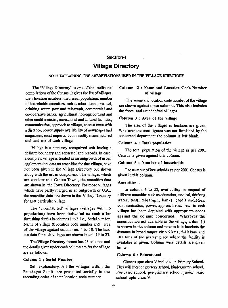
Section-I
Village Di rectory
NOTE EXPLAINING THE ABBREVIATIONS USED IN THE VILLAGE DIRECTORY
The "Village Directory" is one of the traditional compilations of the Census. It gives the list of villages, their location numbers, their area, population, number of households, amenities such as educational, medical, drinking water, post and telegraph, commercial and co-operative banks, agricultural non-agricultural and other credit societies, recreational and cultural facilities, communication, approach to village, nearest town with a distance, power supply availability of newspaper and magazines, most important commodity manufactured and land use of each Village.
Village is a statutory recognized unit having a definite boundary and separate land records. In case, a complete village is treated as an outgrowth of urban agglomeration, data on amenities for that village, have not been given in the Village Directory but shown along with the urban component. The villages which are consider as a Census Town , the amenities data are shown in the Town Directory. For those villages which have partly merged in an outgrowth of U .A., the amenities data are shown in the Village Directory for that particular village.
The 'un-inhabited' villages (villages with no population) have been indicated as such after furnishing details in columns 1 to 3 i.e., Serial number, Name of village & location code number and area of the village against column no. 4 to 18. The land use data for such villages are shown in col. 19 to 23.
The Village Directory format has 23 columns and the details given under each column are for the village are as follows:
Column 1 : Serial Number
Self explanatory. All the villages within the Panchayat Samiti are presented serially in the ascending order of their location code number.
75
Column 2: Name and Location Code Number of village
The name and location code number of the village are shown against these columns. This also includes the forest and uninhabited villages.
Column 3 : Area of the village
The area of the villages in hectares are given. Wherever the area figures was not furnished by the concerned department the column is left blank.
Column 4 : Total population
The total population of the village as per 200 I Census is given against this column.
Column 5 : Number of households
The number of households as per 200 I Census is given in this column.
Amenities:
In column 6 to 23, availability in respect of different amenities such as education, medical, ~nking water, post, telegraph, banks, credit societies, communication, power, approach road etc. in each village has been depicted with appropriate codes against the column concerned. Wherever the amenities are not available in the village, a dash (-) is shown in the column and next to it in brackets the distance in broad ranges viz. < 5 kms., 5-10 kms. and 10+ kms of the nearest place where the facility is available is given. Column wise details are given below:
Column 6 : Educational
Classes upto class V included in Primary School. This will include nursery school, kindergarten school. Pre':pasic school, pre-primary school, junior basic school upto class V.
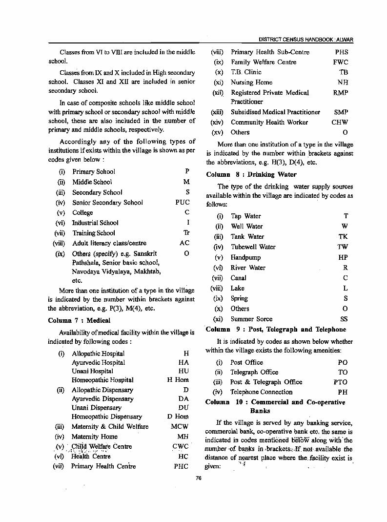
Classes from VI to VIII are included in the middle school.
Classes from IX and X included in High secondary school. Classes XI and XII are included in senior secondary school.
In case of composite schools like middle school with primary school or secondary school with middle school, these are also included in the number of primary and middle schools, respectively.
Accordingly any of the following types of institutions if exists within the village is shown as per codes given below :
(i) Primary School P
(ii) Middle School M
(iii) Secondary School S
(iv) Senior Secondary School
(v) College
(vi) 'Industria:I School
PUC
C
I
(vii) Training School Tr
(viii) Adult literacy class/centre AC
(ix) Others (specify) e.g. Sanskrit 0 Pathshala, Senior basic school, Navodaya Vidyalaya, M3khtab, etc.
More than one institution of a type in the village is indicated by the number within brackets against the abbreviation, e.g. P(3), M( 4), etc.
Column 7 : Medical
Availability of medical facility within the village is indicated by following codes :
(i) Allopathic Hospital Ayurvedic Hospital Unani Hospital Homeopathic Hospital
(ii) Allopathic Dispensary Ayurvedic Dispensary Unani Dispensary Homeopathic Dispensary
(iii) Maternity & Child Welfare
(iv) Maternity Home
(v) . C;ni:i~ We1fare Centre ~ ; ,,·1 ". <~ !f.:".'";< .• !" ';, .
(vi) Health Centre
(vii) Primary Health Centre
H HA HU
H Hom
D DA DU
DHom
Mew MH
CWC'
HC
PRC
76
DISTRICT CENSUS HANDBOOK: ALWAR
(viii) Primary Health Sub-Centre PHS
(ix) Family Welfare Centre FWC
(x) T.B. Clinic TB
(xi) Nursing Home NH
(xii) Registered Private Medical RMP Practitioner
(xiii) Subsidised Medical Practitioner SMP
(xiv) Community Health Worker CHW
(xv) Others 0
More than one institution of a type in the village is indicated by the number within .brackets against the abbreviations, e.g. H(3), D(4), etc.
Column 8: Dr-inking Water
The type of the drinking water supply sources available within the village are indicate~ by codes as follows:
(i) Tap Water T
(ii) Well Water W
(iii) Tank Water TK (iv) Tubewell Water TW
(v) Handpump HP
(vi) River Water R
(vii) Canal C
(viii) Lake L
(ix) Spring S
(x) Others 0
(xi) Summer Sorce SS
'Column 9: Post, Telegraph and Telephone
It is indicated by codes as shown below whether within the village exists the following amenities:
(i) Post Office PO (ii) Telegraph Office TO
(iii) Post & Telegraph Office PTa
(iv) Telephone Connection PH
Column 10: Commercial and Co-operative Banks
If the village is served by any banking service, commercial bank, co-operative bank etc. the same is indicated in codes menfioned Delow along with· the .number 'of banks in ,brackets;"If nQt· available the distance of n~arest pJace where the.facility exist is
~4 . given:
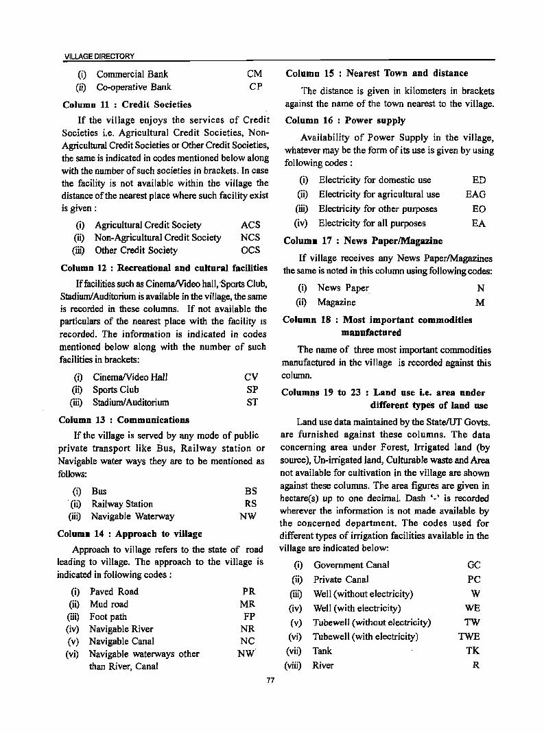
VILLAGE DIRECTORY
(i) Commercial Bank (ii) Co-operative Bank
Column 11 : Credit Societies
CM CP
If the village enjoys the services of Credit Societies i.e. Agricultural Credit Societies, NonAgricultural Credit Societies or Other Credit Societies, the same is indicated in codes mentioned below along with the number of such societies in brackets. In case the facility is not available within the village the distance of the nearest place where such facility exist is given:
(i) Agricultural Credit Society ACS (ii) Non-Agricultural Credit Society NCS (ill) Other Credit Society OCS
Column 12 : Recreational and cultural facilities
Iffacilities such as CinemalVideo hall,'Sports Club, Stadium!Auditorium is available in the village, the same is recorded in these columns. If not available the particulars of the nearest place with the facility IS
recorded. The information is indicated in codes mentioned below along with the number of such facilities in brackets:
(i) Cinema/Video Hall (ii) Sports Club (iii) Stadium! Auditorium
Column 13 : Communications
CV SP ST
If the village is served by any mode of public private transport like Bus, Railway station or Navigable water ways they are to be mentioned as follows:
(i) Bus . (ii) Railway Station (iii) Navigable Waterway
Column 14 : Approach to village
BS RS
NW
Approach to village refers to the state of road leading to village. The approach to the village is indicated in following codes:
(i) Paved Road PR (ii) Mud road MR (iii) Foot path FP (iv) Navigable River NR (v) Navigable Canal NC (vi) Navigable waterways other NW
than River, Canal
77
Column 15 : Nearest Town and distance
The distance is given in kilometers in brackets against the name of the town nearest to the Village.
Column 16 : Power supply
Availability of Power Supply in the village, whatever may be the form of its use is given by using following codes :
(i) Electricity for domestic use ED
(ii) Electricity for agricultural use EAG
(iii) Electricity for other purposes EO
(iv) Electricity for all purposes EA
Column 17 : News PaperlMagazine
If village receives any News Paper/Magazines the same is noted in this column using following codes:
(i) News Paper
(ii) Magazine
N M
Column 18 : Most important commodities manufactured
The name of three most important commodities manufactured in the village is recorded against this column.
Columns 19 to 23 : Land use i.e. area under different types of land use
Land use data maintained by the State/UT Govts. are furnished against these columns. The data concerning area under Forest; Irrigated land (by source), Un-irrigated land, Culturable waste and Area not available for cultivation in the village are shown against these columns. The area figures are given in hectare(s) up to one decimal. Dash ,_, is recorded wherever the information is not made available by the concerned department. The codes used for different types of irrigation facilities available in the village are indicated below:
(i) Government Canal GC
(ii) Private Canal PC
(iii) Well (without electricity) W (iv) VVell (with electricity) WE
(v) Tubewell (without electricity) TW
(vi) Tubewell (with electricity) TWE
(vii) Tank TK
(viii) River R
(ix) Lake
(x) Waterfall
(xi) Others
(xii) Total
L
WF o T
The village directory also carries the following appendices.
Appendix-I It gives the abstract of educational, medical and other amenities available in villages Panchayat Samiti wise of the district.
Appendix-I-A Indicates number of villages Panchayat Samiti wise having one or more primary schools.
Appendix-I-B Indicates number of villages Panchayat Samiti wise having primary, middle and secondary schools.
Appendix-I-C Shows: number of villages Panchayat Samiti wise with different sources of drinking water facilities.
Appendix-II Indicates the list of villages with 5,000 and above population which do not have one or more important amenities.
78
DISTRICT CENSUS HANDBOOK: ALWAR
Appendix-II-A Indicates list of Census Towns
which do not have one or more amenities.
Appendix-III It gives the land utilization data in
respect of Census Towns/non-municipal Towns.
Appendix-IV Panchayat Samiti wise list of inhabited villages where no amenity other than drinking water facility is available.
Appendix-V Summary showing number of villages not having Scheduled Castes population.
Appendix-VI Summary showing number of
villages not having Scheduled Tribes population.
Appendix-VII The appendix· shows the list of
villages according to proportion of the A, VII B Scheduled castes and Scheduled Tribes to the total population by ranges.
Appendix-VIII. Indicates Panchay.at Samiti wise
number of villages under each Gram Panchayat.-
Appendix-IX Shows number of different types of girls school in a village.
VILLAGE DIRECTORY
LIST OF VILLAGES MERGED IN TOWNS AND OUTGROWTHS AT 2001 CENSUS
SI. No.
Name of Towns
2
Name of villages merged in town(s)
3
Name of villages identified for outgrowth
4
Nil
79
Location Code Number 1991
Census
5
Location Code No. 2001 Census (in
case of partly OG)
6

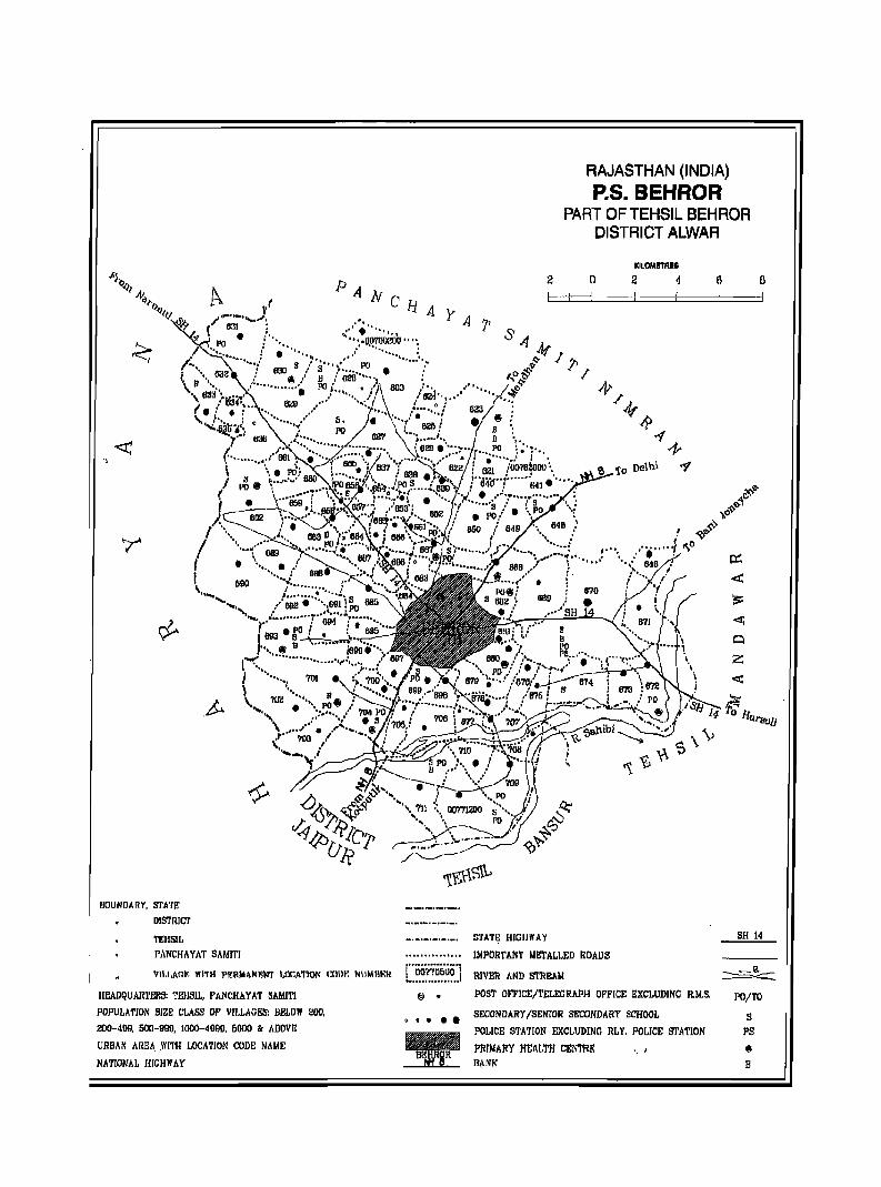
RAJASTHAN (INDIA) P.S. BEHROR
PART OF TEHSIL BEHROR DISTRICT ALWAR
KILOMETRES
2 0 2 1 6 0 PANe
..•... HAYA7' .:: • '.1 1 "
IlOUNDARY. STA'rE
DISTRICT
TEHSIL PANCHAYAT SAMITI
··.:.o.~~ou" ": ,I ..... , ...... : ••
VlI,LAGF, WITH PERMANENT I.,(lCA1'IOl\ CODY. NUMBER i"iiiino~oo'i
HEAVQUAR1'ERS: TEHSIL, PANCHAYAT SAMIT!
POPULATION SIZE: CI,ASS OP V[I,LAGES: BELOW ~OO,
200-499, 500-990, 1000-4000, 6000 & ADovre
URBAN AREA .WITH LOCATION CODE NAME
NATIONAL HIGHWAY
.................. @ •
•••••
STATE HIGHWAY SH 14
!MPOIlTAMT ME'rALLED ROADS
RIVER AND STREAM ~ POST OFFICE/TELECRAPH OFFICE EXCLUDINC R,M.S. PO/TO
SECONDARY ISENIOR SECONDARY SCHOOL S
POLlCE STATION EXCLUDING RLY, POLICE STATION PS
PRIMARY HEAL'I'H CEN'l'RE " ' 8 RANK B

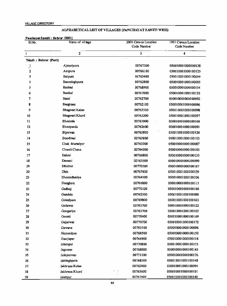
VILLAGE DIRECTORY
ALPHABETICAL LIST OF VILLAGES (PANCHAY AT SAMm WISE)
PanchayatSamiti: Behror (0001) SI.N:>. Name of village 2001 Census lncation 1991 Census Location
Code Number Code Number
2 3 4
Tehsil : Behror (Part)
Ajmeripura 00767300 050010001000100138
2 Antpura 00766100 050010001000100125
3 Balpura 00763400 050010001000100099
4 Banesinghpura 00762800 050010001000100093
5 Banhad 00768900 050010001000100154
6 Bardod 00767000 050010001000100135
7 Basai 00762700 050010001000100092
8 Beeghana 00762100 050010001000100086
9 Bhagwari Kalan 00763300 050010001000100098
10 Bhagwari Khurd 00763200 050010001000100097
11 Bheeteda 00763900 050010001000100104
12 Bhoopseda 00762600 050010001000100091
13 Bijorwas 00765800 050010001000100128
14 Boorhwal 00763800 050010001000100103
15 Chak Muradpur 00762200 050010001000100087
16 Chandi Chana 00764000 050010001000100105
17 Dahmi 00766800 050010001000100133
18 Dawani 00762500 050010001000100090
19 Dhidhor 00770200 050010001000100167
20 Dhis 00767400 050010001000100139
21 Dhoondhariya 00764100 050010001000100106
22 Dooghera 00764800 050010001000100113
23 Gadhoj 00770100 050010001000100166
24 GandaJa 00762300 050010001000100088
25 Gokalpura 00769800 050010001000100163
26 Golawas 00765100 050010001000100122
27 Googariya 00763100 050010001000100102
28 Goonti 00770400 050010001000100169
29 Gujarwas 00710100 050010001000100112
30 Guwana 00763100 050010001000100096
31 Hameedpur 00768500 050010001000100150
32 Hamjapur 00764900 050010001000100114
33 Islampur 00110800 050010001000100113
34 Jaguwas 00768000 050010001000100145
35 Jainpurwas 00771100 050010001000100176
36 Jaisinghpura 00768300 050010001000100148
37 Jakhrana Kalan 00762900 050010001000100094
38 Jakhrana Khurd 00163600 050010001000100101
39 Jalalpur 00767500 050010001000100140
83
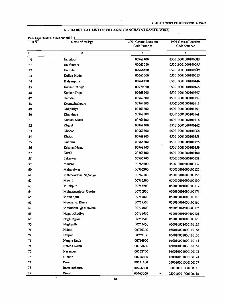
DISTRICT CENSUS HANDBOOK: ALWAR
ALPHABETICAL LIST OF VILLAGES (PANCHAYAT SAMm WISE)
PanebayatSamiti: Bebror (0001) SI.No. N!me of village 2001 Cens us iDcat ion 1991 Census Location
Code Number Code Number
2 3 4-
40 Jamalpur 00762400 050010001000100089
41 Jat Gaonra 00763000 050010001000100095
42 Jharoda 00768400 0500100010001001~9
43 Kaliya Hoda 00762000 050010001000100085
44 Kalyanpura 00768100 050010001000100146
45 Kankar Chhaja 00770000 0.50010001000100165
46 Kankar Dopa 00768200 050010001000100147
47 Karoda 00767200 050010001000100137
48 Keeratsinghpura 00764600 050010001000100111
49 Khapariya 00769200 050010001000100157
50 Kharkhara 00769600 050010001000100161
51 Khatan Khera 00765100 050010001000100116
52 Kherki 00769700 050010001000100162
53 Khohar 00760300 050010001000100068
54 Khohri 00768800 050010001000100153
55 Kohrana 00766200 050010001000100126
56 Krishan Nagar 00769400 050010001000100159
57 KureH 00763500 050010001000100100
58 Laksiwas 00765900 050010001000100123
59 Machal 00766700 050010001000100132
60 Maharajwas 00766300 050010001000100127
61 Mahmoodpur Nagaliya 00769100 050010001000100156
62 Mawri 00766500 050010001000100130
63 Milakpur 00765200 050010001000100117
64 Mohammadpur Goojar 00770900 050010001000100174
65 Momanpur 00767800 050010001000100143
66 Moondiya Khera 00769500 050010001000100160
67 Mosampur @ Kankara 00771000 05001 000 10001 00 175
68 Nagai Khodiya 00765600 050010001000100121
69 NagH Jageer 00765500 050010001000100120
70 Naglisadh 00765400 050010001000100119
71 Nalota 00770300 050010001000100168
72 Nalpur 00767100 050010001000100136
73 NanglaRudh 00766900 050010001000100134
74 Nareda Kalan 00768600 050010001000100151
75 Nasarpur 00768700 050010001000100152
76 Nibhor 00766000 050010001000100124 77 Pahari 00771200 050010001000100177
78 Ramsinghpura 00766600 050010001000100131 79 Riwali 00765000 050010001000100115
84
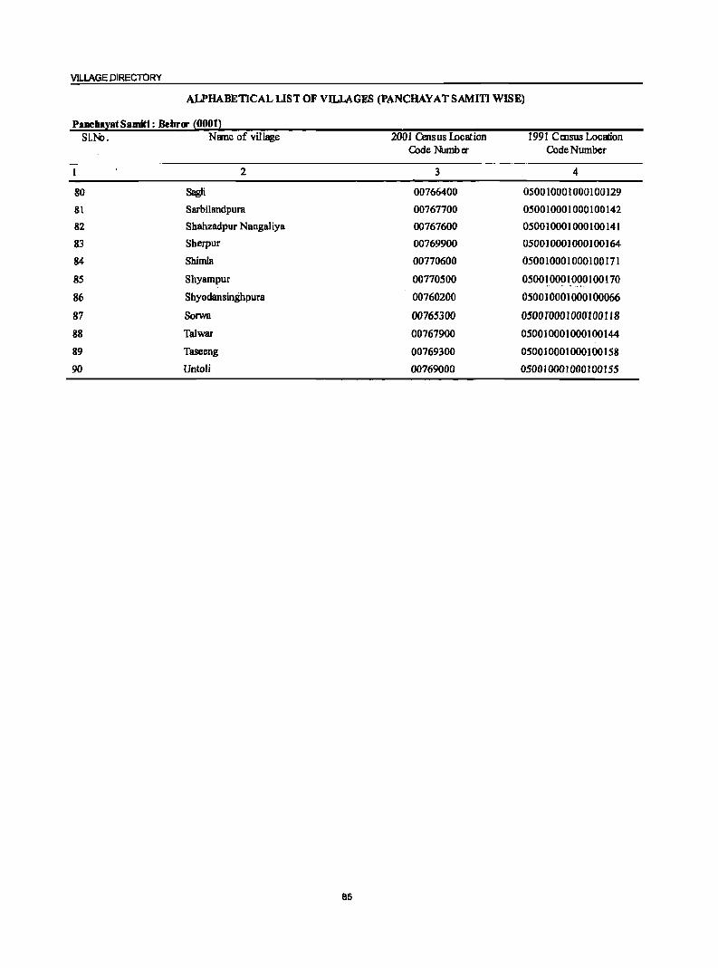
VILLAGE DIRECTORY
AlPHABETICAL LIST OF VILLAGES (PANCHAY AT SAMITI WISE)
PanehayatSamitl: Behrcr (0001) SI.N:>. Name of village .2001 Census Location 1991 Census Location
Code Number Code Number
2 3 4
80 Sagli 00766400 050010001000100129
81 Sarbilandpura 00767700 050010001000100142
82 Shahzadpur Nangaliya 00767600 050010001000100141
83 Sherpur 00769900 050010001000100164
84 ShimJa 00770600 050010001000100171
85 Shyampur 00770500 050010001000100170
86 Shyodansinghpura 00760200 050010001000]00066
87 Sorwa 00765300 05001'0001000100118
88 Talwar 00767900 050010001000100144
89 Taseeng 00769300 050010001000100158
90 Untoli 00769000 050010001000100155
85
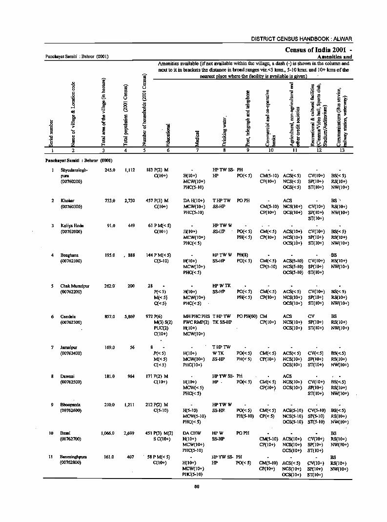
DISTRICT CENSUS HANDBOOK: ALWAR
Census of India 2001 -Panchayat Samiti : Behror (000 I ) Amenities and
Amenities available (if not available within the village, a dash (-) is shown in the column and next to it in brackets the distance in brolldranges vizc<5 kms., 5-10 kms: and 10+ kms of the
-;;;- nearest ~IBce where the facili!X is available is given l I
:s
.g J
rl 1 :J .0" u u ;S-5 .~ u J! 2! .,
] c;: (5 ;>
.~ e co _g .~ .- e ~,... t:!. .. 13 eM c
M f <> j (5 '" II) t 1!~,... j co I 1i .~ .2 .a _" § !9 !! cI!I ~ ~ 1 e:.~ <> g .2 11 ]'c
i .s s;: "0 .~ 6" c 6 I J fii c: g cI!I g . .e! D 'ij
~ 'a .c
:5 ]~ -e:9"B '" ._ .;;: .. '! 'a 1 .S! ~i
<> l§ .... ~ .S! ~ f:! '8 ., c D
I .,
'l3 ~ c: c .. ., .0 N ~ E' .. ~ ~ .- S f "iI "3 "3 ~ l 'i u ·c i ~ ·c ~l u .5 ]I ~1 u ~ ~ :$~ Sl ~ra Ul 20 9 2 3 4 5 6 7 8 9 lO lJ 12 13
Panchayat Samiti : Behror (0001)
Shyodansingh- 245.0 1,112 183 P(2) M HPTWSS- PH pura C(10+) H(IO+) HP PO« S) CM(5-10) ACS«S) CV(IO+) BS«S) (00760200) MCW(IO+) CP(IO+) NCS«S) SP(IO+) RS(IO+)
PHC(5-IO) OCS«5) ST(IO+) NW(IO+)
2 Khohar 733.0 2,730 457 P(3) M DAH(lO+) THPTW PO PH ACS BS "
(00760300) C(IO+) MCW(IO+) SS-HP CM(S-IO) NCS(IO+) CV(IO+) RS(IO+) PHC(5-10) CP(IO+) OCS(IO+) Sp(IO+) NW(IO+)
ST(IO+)
3 KaliyaHoda 91.0 449 6IPMC<5) HPTWW (00762000) C(IO+) H(IO+) SS-HP PO« 5) CM«5) ACS(IO+) CV(IO+) BS« 5)
MCW(IO+) PH« S) CP(IO+) NCS(IO+) SP(IO+) RS(IO+) PHC« 5) OCS(IO+) ST(IO+) NW(IO+)
4 Beeghana 19S.0 • 8S8 144 P M«5) HPTWW PH(S) ·BS (00762100) C(S-IO) H(IO+) S8-HP PO(,;: S) CM«S) ACS(S-IO) CV(IO+) RS(IO+)
MCW(IO+) CP(5-1O) NCS(5-10) SP(IO+) NW(IO+) PHC«5) . OCS(S-IO) ST(IO+)
S Chak Muradpur 262.0 200 2S HPWTK (00762200) P«S) H(IO+) S8-HP PO«5) CM«5) ACS«S) CV(IO+) BS«S)
M«S) MCW(IO+) PH«5) CP(IO+) NCS(JO+) SP(IO+) RS(JO+) C«S) PHC«5) OCS(JO+) ST(IO+) NW(IO+)
6 Gandala 857.0 5,S69 972 P(6) MH PHC PHS T HP TW POPH(60) CM ACS CV BS (00762300) M(3) S(2) FWC RMP(2) TK SS-HP CP(IO+) NCS(IO+) SP(1O+) RS(10+)
PUC(2) H(IO+) OCS(IO+) ST(IO+) NW(IO+) C(JO+) MCW(JO+)
7 Jamalpur 169.0 56 S THPTW (00762400) P«5) H(JO+) WTK PO« 5) CM«5) ACS«5) CV«5) BS«S)
M«S) MCW(IO+) SS-HP PH« S) CP(IO+) NCS(IO+) SP(IO+) RS(IO+) C«5) PHC(IO+) OCS(IO+) ST(IO+) NW(IO+)
S Dawani ISI.O 964 17t P(2) M HPTWSS- PH ACS (00762S00) C(IO+) H(IO+) HP . PO« S) CM«S) NCS(IO+) CV(IO+) BS«S)
MCW«5) CP(IO+) OCS(IO+) Sp(IO+) RS(JO+) PHC«S) ST(IO+) NW(IO+)
9 Bhoopseda 210.0 1,211 212P(2) M HPTWW (00762600) C(S-IO) H(S-IO) SS-HP. PO«S) CM«S) ACS(S-IO) CV(5-10) BS«S)
MCW(S-IO) PH(S-IO) CP« 5) NCS(S-IO) SP(S-IO) RS(lO+) PHC«S) OCS(5-IO) ST(5-10) NW(1O+)
10 Basai 1,066.0 2,699 451 P(3) M(2) DACHW HPW PO PH BS (00762700) S C(IO+) H{IO+) SS-HP CM(S-IO) ACS(IO+) CV(IO+) RS(IO+)
MCW(IO+) CP(IO+) NCS(tO+) SP(IO+) NW(tO+) PHC(5-10) OCS(tO+) ST(10+)
11 Banesinghpura 161.0 407 5SPM«5) HPTWSS- PH BS (00762800) C(IO+) H(IO+) HP PO«S) CM(S-IO) ACS«S) ~(10+) RS(IO+)
MCW(IO+) CP(tO+) NCS(tO+) Sp(IO+) NW(JO+) PHqS-IO) OCS(IO+) ST(IO+)
86
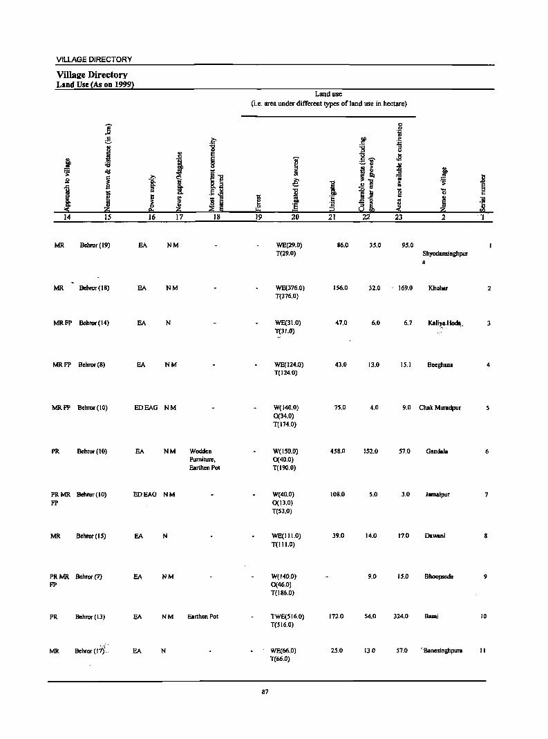
VILLAGE DIRECTORY
ViIlsu;e Directory Land Use {As on 1999}
Land use (i.e. area under different types of land use in hectare)
]' c 0 .~
~ 2;- DO ·fi e ... '8 :;:; "3 u ::l u
~ .,
E c:; ... c
! J IS 'Qj' c ~ .g ._ !II
:;:; ~ - u ~ u ::l
j~ j .;; ollI ~~ ~
~ ..... :; ..8 g c. e: :s;
1 g CI. 1 &.~ J 2 a l:i § iil 'il ~ iii '5 .... -;; .§ 4! 0 c
i 1 ~ _ :s
1;; i "..., c ... iii ~ a ~ - " ..
~ ·5 8' !! ·5 :s ~ .~ ~ Iii = Cl -< ~ u.l
14 15 16 17 18 19 20 21 22 23 2 ·1
MR Behror (19) EA NM WE(29.0) 86.0 35.0 95.0 T(29.0) Shyodansinghpur
8
MR Bchror(IB) EA NM WE(376.0) 156.0 32.0 - 169.0 Khoher 2 T(376.0)
MRFP Bchror(14) EA N WE(31.0) 47.0 6.0 6.7 Kelir8.~. 3 T(31.0)
MRFP Bchror(B) EA NM WE(l24.0) 43.0 13.0 15.1 Beeghana 4 T(124.0)
MRFP Behror (10) EDEAG NM W(140.0) 75.0 4.0 9.0 Chat Muradpur 5 0(34.0) T(174.0)
PR Bchror(IO) EA NM Wodden W(l50.0) 458.0 152.0 57.0 Gandal. 6 Furniture, 0(40.0) Earthen Pot T(190.0)
PRMR Behror(IO) EDEAG NM W(40.0) 108.0 5.0 3.0 Jamalpur 7
FP 0(13.0) T(53.0)
MR Behror(15) EA N WE(III.O) 39.0 14.0 17.0 Dawani 8 T(lII.O)
PRMR Bchror(7) EA NM W{140.0) 9.0 15.0 Bhoopseda 9 FP 0(46.0)
T(lB6.0)
PR Behror (13) EA NM Earthen Pot TWE(516.0) 172.0 54.0 324.0 Basei 10 T(SI6.0)
,.,:';" ,
WE(66.0) 25.0 13.0 57.0 ' ·B~nesinghpura II MR Behror (17) .. EA N T(66.0)
87

DISTRICT CENSUS HANDBOOK: ALWAR
Census of India 2001 -PanchByat Samiti : Behror (000 I) Amenities and
Amenities available (if not available within the village, a dash (-) is shown in the column and next to it in brackets the distance in broad ranges viz. <5 kms., 5-10 kms. and 10+ kms of the
I I nearest I!lace where the facili~ is available is givenl .,
1 "0
] ~ .,
~.D 8 u 0'::: .E .~ c
., § '"
., 1 :=:: u c c .~ -
'" e ., '" i! :M~ i::~ 'iiI u t::!. & ~ f ~
., "3 &. u
~ '" C>- o ]rn~ '" "0 II ~ l~ ...l
~ ~ .. ...:-6 ~j lid 1 "8 ~.~ j
., c 1 .,s '" ::s
I 1 c 8 lid 3·_ .. ~ s~ J ·ti '" .... ..c:
l~ 1:2'"8 ~ 0 g_ .... "iii ]! l'l . .,
~ B 0 c ~ .2 ~ i ._ t1 ....
&. b .~ till '" § t 0 "iii .5 II
_ e I 5 o-J:> • Sol ~i
:l u iii ~ ]I ]I
~ .g ~ "Ii .~~ ~-'5 {!. {!. ~ ·c ~
HiJ] ~~~ 512 a:; .... !::! 9 ~·rB· :S .0 eI:.:512 j 2 3 4 5 6 7 8 9 10 11 12 13
12 Jakhlllna Kalan 752.0 4,301 721 P(8) M(2) DA PHC FWC HP TW W POPH(20) CM BS (00762900) S(2)C(IO+) RMP(4)CHW S5-HP CP(IO+) ACS(IO+) CV(lO-r) RS(10-r)
H(IO+) NCS(IO+) SP(lO+) NW(IO+) MCW(lO+) OCS(IO+) ST(IO+)
13 JatOaonlll 413.0 2,140 388 P(3) M(2) S PHS H(IO+) HPTWW (00763000) C(IO+) MCW(IO+) S5-HP PO« 5) CM«5) ACS(IO+) CV(lO+) BS«5)
PHC(IO+) PH(W+) CP« 5) NCS(IO+) SP(IO+) RS(IO+) OCS(IO+) ST(lO+) NW(lO-r)
14 Guwana 434.0 1,561 274 P(2) M( < 5) HPTWSS- PO (00763100) C(IO+) H(IO+) HP PH(IO+) CM«5) ACS(IO+) CV(lO+) BS«5)
MCW(IO+) CP« 5) NCS(IO+) SP(1O+) RS(IO+) PHC(IO+) OCS(IO+) ST(IO+) NW(IO-r)
15 Bhagwari Khurd 335.0 1,489 242 P(2) M HPTWW (00763200) C(IO+) H(IO+) S5-HP PO«5) CM« 5) ACS(IO+) CV(IO+) BS«5)
MCW(lO+) PH(IO+) CP(IO+) NCS(IO+) SP(IO+) RS(IO+) PHC(IO+) OCS(IO+) ST(IO+) NW(IO+)
16 Bhagwari Kalan 325.0 1,204 201 P M C(IO+) HPTKR PH CM BS (00763300) H(IO+) SS-HP PO« 5) CP(IO+) ACS(IO+) CV(1O+) RS(IO+)
MCW(IO+) NCS(IO+) SP(IO+) NW(IO+) PHC(1O+) OCS(IO+) ST(lO+)
17 BalpulIl 162.0 634 103 P M C(IO+) HPWRSS-(00763400) H(IO+) liP PO« 5) CM«5) ACS(IO-r) CV(lO+) BS«5)
MCW(lO+) PH(IO+) CP(lO+) NCS(1O+) SP(lO-r) RS(IO+) PHC(IO+) OCS(10-r) ST(IO+) NW(IO+)
18 Kureli 190.0 550 84 P M("", 5) HPSS-HP (00763500) C(lO+) H(IO+) PO« 5) CM«S) ACS(1O+) CV(IO+) BS«5)
MCW(IO+) PH(IO+) CP(IO+) NCS(IO-r) SP(IO+) RS(IO+) PHC(IO+) OCS(IO-r) STOO+) NW(lO+)
19 Jakhrana Khurd 483.0 119 20 WSS-W BS (00763600) P«5) H(IO+) PO«S) CM«S) ACS(IO+) CV(lO+) RS(IO+)
M«S) MCW(IO+) PH«5) CP(IO+) NCS(IO+) SP(IO+) NW(1O+) C(IO+) PHC(IO+) OCS(IO+) ST(lO+)
20 Ooollllriya 368.0 1,146 177 P M C(IO+) HPW PH BS (00763700) H(IO+) SS-HP PO«5) CM« S) ACS(IO-r) CV(lO+) RS(IO+)
MCW(IO+) CP(IO+) NCS(JO+) Sp(IO+) NW(IO+) PHC(S-IO} OCS(IO+) STOO+)
21 Boorhwal 255.0 1,983 330 P(3) M(2) S DAH(S-IO) THPTW PO (00763800) C(5-10) MCW(5-IO) WIT PH(5-10) CM«S) ACS(5-10) CV(lO+) BS«S}
'PHC« S) SS-HP CP(5-10) NCS(S-IO) SP(lO+) RS(IO+) OCS(S-IO) ST(IO+) NW(IO+}
22 Bheeteda 177.0 1,144 189 P(4) M(2) PHCCHW HPTWW PH BS , '(00763900'- C(S-IO) H(lO+) . SS-HP PO« S) CM(5-IO) ACS(5-10) CV(S-IQ) RS(IO+)
MCW(IO+) CP(S-IO) NCS(5-IO) SP(IO+) NW(lO+}
'.- OCS(5-10) ST(IO+)_ ..
.88
VILLAGE DIRECTORY
. ViIlaee Directory Land Use (As on 1999)
]' e J j :.c
:os: ~
~ s ~ til
j ~ II.)
.j1;j 14 15
PRMR Behror(13) EA FP
PR Behror(I S) EA
MRFP BChror(17) EA
PR Behror(l6) EA
PRFP Behror(15) EA
PR Bchror(18) EA
PRFP Bchror(18) EA
PRMR Behror(l3) EA FP
MR Bchror(l2) EA
PRMR Bebror(8) EA FP
PRMR Bebror(8) EA FP
&;-:.c 0
2l E
'i E 0 u
I ~.., ~ Q. o~ go Ct.., ., .5 <t! .. ~ ~ ~ ~ ~ j1;j ~ E 16 17 18
NM Earthen Pot, Leather Shoes
NM
NM
N
NM Leather Shoes,
Stone Tiles
N
NM
NM
NM Mawa, Fum.iture
Land use
(i.e. area under different types ofland use in hectare)
c 0 .~
DC > C .:=
~ "3 u
U .a ~
c ...... ._ ., ._. ., II.)
j! ~ ~ 0 ., ~ .8 € I ~
.:; ..2 a §
} ~ til os .... 0 c
~ c 'E a-5 ~
.. iii '2 - " ~ '5 0 8~ !!:I i2 < 2:; <I)
19 20 21 22 23 2 1
WE(12.0) 419.0 321.0 Jakhrana 12 T(12.0) Kalan
TWE(91.0) 2B4.0 4.0 34.0 JatGaonra 13 T(91.0)
TWE(I 5 1.0) 26B.0 5.0 10.0 Guwana 14 T(ISI.O)
WE(IBO.O) 119.0 10.0 2S.7 Bhagwari IS T(180.0) Khurd
TWE(192.0) 102.0 10.0 21.0 Bhagwari 16 T(l92.0) Kalan
WE(118.0) 28.0 B.O B.3 Balpura 17 T(1I8.0)
WE(BO.O) 104.0 3.0 3.4 Kurtli IB T(80.0)
WE(193.7) 263.0 26.0 Jakhrana 19 T(193.7) Khurd
WE(198.0) 34.0 14.0 1'22.0 Googariya 20 T(198.0)
WE(ISO.O) 41.0 4.0 29.0 Boorhwal 21 0{31.0) T(181.0)
W(22.0) 10.0 3S.0,.~ 6.0 Bheetcda 22 WE(I 04.0) T(126.0)
89
DISTRICT CENSUS HANDBOOK: AL.WAR
Census of India 2001 -Panchayat Samiti : Behror (0001) Amenities and
Amenities available (if not available within the village, a dash (-) is shown in the column and
next to it in brackets the distance in broad ranges viz. <5 kms., 5-10 kms .. and 10+ kms of the -;;- nearest I!lace where the facilill;: is available is siven}
I :s
1 :£ "'" ~ '" fli rJ.o u
~~ 8 c: '" c: § .,
f! .§,
c: .~ ._ t!
.~ ~ 0 ., 0 .a Oil u t:!- -a ~ 0
~ '" 13 !I f 8 c: '"
., r:>. <> ;~~
...:I 0 ~ i 0
l~ <It! S t:!- .c "Cl 8 - _" § 6i ... 51 fa B~'t:
j ~ c: "'" § d' 0 :s
o ._ -'IS ~ .~ ... 'iI ..8 J .c fa c: g
.8 'S ~ . "' ~:E1l .~ ·il
~ ~ g I 'a 1 ]I ]~ .f::! ~ 'a ~ ..!:! ~
o~~ U '-;; 'iI B '8 I:l ._ §
~ f 'iI ., .0
~ ~ ~ 5._ '5 i ~ ~ ~
g 1 .~j .~~ ~ .S 'E 8". . w. ...... ~ ... l- I- ~ t§ e;; ~!a s.1.g
2 3 4 5 6 7 8 9 10 11 12 13
23 Chandi Chana 219.0 1,086 170P M HPTWW PH BS (00764000) C(S-IO) H(S-IO) SS-1iP PO« S) CM«S) ACS(S-IO) CY« S) RS(IO+)
MCW(IO+) CP{S-to) NCS(S-IO) SP(IO+) NW{IO+) PHC« S) OCS{S-IO) ST{IO+)
24 DhoondhBriya 446.0 1,907 288 P(2) M DA H(IO+) HPTWW PH BS (00764100) C{to+) MCW{IO+) TKSS-1iP PO« 5) CM« 5) ACS(IO+) CV{IO+) RS(IO+)
PHC«S) CP(IO+) NCS{IO+) SP(IO+) NW(IO+) OCS(IO+) ST{IO+)
2S Keeratsinghpura 194.0 1,018 ISS P M{< S) HPTWW BS (00764600) C(IO+) H(IO+) SS-1iP PO«S) CM«S) ACS(IO+) CV(IO+) RS(IO+)
MCW(IO+) PH«S) CP«S) NCS(IO+) SP(IO+) NW(IO+) PHC(IO+) OCS(IO+) ST(IO+)
26 Dooghcra 489.0 1,783 289 P(3) M(2) S IiPTWW PO PH BS (00764800) C(S-IO) H(S-IO) TKSS-HP CM(S-IO) ACS(S-IO) CV(S-IO) RS(IO+)
MCW(IO+) CP(S-IO) NCS(S.IO) 8P(10+) NW(IO+) PHC(IO+) OCS(S-IO) 8T(10+)
27 HBmjapur 6S0.0 I,S27 230 P(2) M{ < S) HPTWW PH BS (00764900) C(S-IO) H(5-10) S8-HP PO« 5) CM(5-10) AC8« 5) CV(S-IO) R8(10+)
MCW(S-IO) CP(5-10) NCS(IO+) SP{IO+) NW(lO+) PHC{S-IO) OCS{IO+) ST{IO+)
28 Riwali 510.0 2,664 381 peS) M 8 DAHCRMP HPTWW POPH(S) ACS BS (00765000) PUC C{S-IO) CHW H(S-lO) SS-HP CM(S-IO) NCS(S-IO) CV(S-IO) R8(10+)
MCW(IO+) CP(S-IO) OCS{S-IO) SP{IO+) NW(IO+) PHC« S) 8T(IO+)
29 Khatan Khera 18S.0 967 156 P M C(IO+) DAH«5) HPTWW POPH(2) (0076S I 00) MCW«S) SS-1iP CM«S) ACS« 5) CV{<S) BS« S)
PHC« 5) Cp« S) NCS{<5) SP{IO+) RS(IO+) OCS« S) ST(IO+) NW(IO+)
30 Milakpur 290.0 1,136 173 P(2) M« 5) THPTW PH(2) ACS CV BS (00765200) C(S-IO) H(S-IO) WTi< PO«S) CM(S-IO) NCS(S-IO) SP(S-IO) RS(IO+)
MCW(S-IO) SS-HP CP(S-IO) OCS(S-IO) S1{S-IO) NW(IO+) PHC«S)
31 Sorwa 120.0 568 92 P(2) M( < 5) HPTWW PH (00765300) C(S-IO) H(IO+) SS-HP PO«S) CM(S-IO) ACS(S-IO) CV«5) BS«S)
MCW(IO+) .CP(S-IO) NCS(S-IO) SP(IO+) RS(IO+) PHC{S"IO) OCS(S-IO) 8T(10+) NW(IO+)
32 Naglisadh 19.0 123 17 TWW (00765400) P«5) H«S) SS-TW PO«S) CM(5-10) ACS(S-I.O) CV(S-IO) BS(5-10)
M«S) MCW(S-IO) PH«S) CP(S-IO) NCS(S-IO) SP(IO+) R8() 0+) C(S-)O) PHC«5) OCS(S-IO) ST{IO+) NW(IO+)
33 NBgli Jageer 243.0 52) 78 P M«5) HPTWW (0076SS00) C(S-IO) H(5-JO) SS-1iP PO(S-IO)! CM{5-10) CV(S-IOr
.. ACS(S-IO) BS(S-IO)
-MCW(S-IO) PH(S-IO)· CP(S-IO) NCS(5-10) SP(JO+) RS(IO+) PHC(S-IO) OCS(S-IO) 8T(10+) NW(IO+)
90
VILLAGE DIRECTORY
Vmaee Directory Land Use {As on 19992
]' c
~ ;,:.
i :g u e
j . , E 06 0
" ~ old
~ 11 i >. s. 1 ,c. ~ "'"tl
~. I ..
"'" .54l! ~ ~ S ::s CI.
CI. OJ ~ ~ .::s;- 2::i e. 2::i 14 15 16 17 18
MRFP Behror(7) EA NM
PRMR Behror(13) EA NM
FP
PRFP Bchror(12) EA
PRMR Bchror(9) EA NM FP
MRFP Bebror(6) EA NM
PRFP Behror(5) EA NM
PRMR Behror (5) EA NM
MRFP Behror(6) EA N
MRFP Behror(7) EA NM Wooden Furniture
PR Behror(IO) EA
PR Behror(8) EA
Land use
(i.e. area under different types of land use in hectare)
~. 0
!:!= 19
91
~ ::J
51 e: I 'E = 20
WE(141.0) T(141.0)
WE(2S5.0) T(255.0)
W(20.0) WE(57.0) T(77.0)
WE(246.0) T(246.0)
8 WE(391.0)
T(391.0)
W(91.0) WE(20S.0) T(299.0)
WE(159.8) T(IS9.8)
WE(200.0) 0(29.0) T(229.0)
WE(83.0) T(83.0)
WE(14.0) T(14.0)
WE(172.0) T(172.0)
.., i 'E
~ 21
45.0
145.0
40.0
57.0
204.0
150.0
7.0
31.0
18.0
4.0
39.0
6 oil 00 > c ~ ~ u u .... c ~ .e .- '" ~ .. .. j ~ ii
'ii .!!1 11;
~ l;i 0 c .eg ~ a IL ::s; 22 23
IS.O 14.6
23.0 22.9
42.0 35.3
67.0 119.0
46.0 1.0
42.0 19.0
5.0 16.0
5.0 25.0
2.0 17.0
1.0
10.0 22.0
j ... .. ~ .D
.... Ii 0 c OJ ]I ~ ~
2::i '" 2
Chandi Chana 23
Dhoondhariya 24
25 Keeratsinghpura
Dooghera 26
Hamjapur 27
Riwali 28
Khatan Khera 29
Milakpur 30
Sorwa 31
Naglisadh 32
Nagli Jageer 33
DISTRICT CENSUS HANDBOOK: AJ..WAR
Census of India 2001 -Panchayal Samili : Behror (000 1 ) Amenities and
Amenities available (if not available within the village, a dash (.) is shown in the column and next to it in brackets the distance in broad ranges viz.<5 kms., 5-10 kms. and 10+ kms of the
I 9 nearest elace where the facili~ is available is given} .. 2 ...,
~~ ...,
I u Iii 0 u oJ" <> u
'" !1 1 '" .c ;; '" .!:!
0 :5- u
~ _g ''f! '0 f! ~~ 'il u <Ill 0
~ t " j ;; ~ fro 8- <> ri~~ 0
0 1l ~ l~ ..:I t!. ] B _" § ej old '5: ...,
u Iii 11 ]I ·c
f .£l 15 !!l ...,
old g.g .~ § U .c Iii " g
i ..... 'i _g ~ ~ ]I l~ ]:9""g os ._
0
I ... -a .!:! S .. 0
.~ ~ .g ~ i .... ~ .. .~ u "3~ " .,
0 ..8
~ 1l E II> ~ f -a ~ l 1iI E !:l ~ ~ ~l ~J
! lL_ '5 ~ " ...,
~ i!.5 ] 0=
sa li :z: 101 e. e; ~<Il ~ C I 2 3 4 5 6 7 8 9 10 II 12 13
34 Nagai Khodiya 249.0 2,586 424 p(2) M(2) DACHW HPTWW PO PH (00765600) S PUC H(5-10) TKSS-HP CM(5.10) ACS(5.10) CV(S.IO) BS(5.10)
C(S-IO) MCW(S-IO) CP(5-10) NCS(5-10) SP(IO+) RS(IO+) PHC(5-10) OCS(5-10) ST(IO+) NW(IO+)
35 Golawas 127.0 681 104 P M«5) HPTWW PH (00765700) C(S-IO) H(S-IO) SS-HP PO« 5) CM«5) ACS(5-10) CV(5-IO) BS«5)
MCW(S-IO) CP(IO+) NCS(5-10) Sp(IO+) RS(IO+) PHC(5-IO) OCS(5-10) ST(IO+) NW(lO+)
36 Bijorwas 270.0 1,132 184 p(3) M RMP HPTWW PH(3) BS (00765800) C(S-IO) H(5-10) SS-HP PO« 5) CM«5) ACS(5-10) CV(S·10) RS(IO+)
MCW(5-IO) CP(5-10) NCS(5-10) Sp(IO+) NW(IO+) PHC(S-IO) OCS(S-IO) ST(IO+)
37 Laksiwas 156.0 494 '78 PM« S) CHWH(IO+) HPW (00765900) C(IO+) MCW(IO+) SS-HP PO« 5) CM«5) ACS(IO+) CV(lO+) BS«5)
PHC(IO+) PH« 5) CP(IO+) NCS(IO+) Sp(IO+) RS(IO+) OCS«5) ST(ID+) NW(IO+)
38 Nibhor 421.0 1,088 145 P(2) M HPTWW PH BS (00766000) C(5-10) H(5-10) SS-HP PO« 5) CM(S-IO) ACS(S-IO) CV(5-10) RS(IO+)
MCW(S-IO) CP(5-10) NCS(5-IO) SP(IO+) NW(IO+) PHC(5-10) OCS(5-IO) ST(IO+)
39 Antpura 186.0 1,345 223 P(2) M CHWH(IO+) HPTWSS- PO BS (00766100) C(5.10) MCW(5-IO) HP PH(5-1O) CM«5) ACS(5-IO) CV(5-10) RS(5-10)
PHC(IO+) CP(IO+) NCS(5-10) SP(IO+) NW(IO+) OCS(S-IO) ST(IO+)
40 Kohrana 882.0 3,126 490 P(4) M(3) HCPHS HPW SS·POPH BS (00766200) S PUC CHW HP CM«5) ACS(IO+) CV(lO+) RS(tO+)
C(S-1O) H(5-10) CP(tO+) NCS(lO+) SP(lO+) NW(lO+) MCW(10+) OCS(IO+) ST(IO+) PHC(IO+)
41 Mahamjwas 387.0 2,382 380P(3) M DACHW THPTW POPH(2) CM. as (00766300) C(5-ID) H(S-IO) WSS-HP Cp(5-JO) ACS(5-10) CV(S-IO) RS(IO+)
MCW(S-IO) NCS(S-IO) SP(IO+) NW(IO+) PHC(5·10) OCS(S-IO) ST(IO+)
42 Sagli 148.0 130 16 THPTW BS (00766400) p«5) H(5·10) WSS-TW PO« S) CM(S-10) ACS(S-IO) CV(S-tO) RS(5-tO)
M«S) MCW(S-IO) PH(5-10) Cp(S·10) NCS(S-IO) SP(S-IO) NW(IO+) C(S-IO) PHC(S·tO) OCS(S-ID) ST(S-tO)
43 Mawri 106.0 703 102 P(2) HPTWW (00766500) M«5) H(S-IO) SS-HP PO« 5) CM(S-IO) ACS(S-IO) CV(S-IO) BS«S)
C(5-10) MCWeS-IO) PH(S-IO) CP(S-IO) NCS(5-10) SP(5-10) RS(tO+) PHC(5-10) OCS(S-IO) ST(tO+) NW(IO+)
44 Ramsinghpum 178.0 557 82 P(2) M DAH«5) HPTWW PH as (00766600) C«5) MCW«5) ~li-HP PO«S) CM«5) ACS« 5) CV«5) RS(S-IO)
PHC«S) Cp«5) NCS« 5) SP(IO+) NW(IO+) OCS« 5) ST(IO+)
92
VILLAGE DIRECTORY
Villa2e Directory Land Use {As on 1999)
j e .1 j ."
.:;:: 0lil
~ -a: s
1 ~ 1;;
~ 8: j « e. 14 IS 16
PR Behoor(7) EA
MRFP Behoor(9) EA
PRMR Behoor(7) EA FP
MRFP Behoor(IO) EA
PR Behoor(8) EA
PRMR Behoor(12) EDEAG
PRMR Behror(13)
PR MR Behror (9) FP
PRFP Behoor(7)
FP Behoor(7)
PRMR Behoor(5) FP
EA
EA
EA
EA
EA
.~
." ., 0
. , E E 0 u
~ ~." 8.~ §.
"- .5 oM ~ 1;; ::>
o a ~ E z
17 18
NM Wooden Furniture, Earthen POI
N
NM
N
NM
NM
N Earthen POI, Leather Shoes
NM Earthen Pot
NM
NM Wooden Furniture •. Leather Slioes
NM -:.'
Land use (i.e. area under different types of land use in hectare)
;; ~ 0
"" 19
I ., e: ii ~ ·s = 20
WE(188.0) T(188.0)
WE(101.0} T(IOI.O}
WE(202.0) T(202.0)
W(40.0) T(40.0}
93 WE(25.0)
93
T(25.0)
WE(23.0} T(23.0)
WE(SOI.O) T(SOI.O)
WE(200.0) T(200.0)
WE(90.1) T(90.1)
WE(80.9) T(80.9)
WE(90.0) T(90.0)
I .5 c t:1 21
21.0
7.0
14.0
82.0
167.0
112.0
308.0
130.0
42.0
13.0
56.0
'" 0 'i
"" > '"
. ., ::;; "3 ::> u
]~ ..
cE ._. ., ... .!! > ~ f ~ :; ~] 1:;
e la (;
'" B-fi '" "3 i ~ u 22 23
5.0 35.0
2.0 17.0
20.0 34.0
'10.0 24.0
115.0 21.0
27.0 23.8
38.0 3S.0
8.0 49.0
3.0 13.0
2.0 10.0
3.1 29.0
» .8 .:;::
~ 'g ., !
'iI ·c " en
2
Nagai Khodiya 34
OolaMs 35
Bijorwas 36
Laksiwas 37
Nibhor 38
Antpura 39
Kohrana 40
Maharajwas 41
Sagli 42
Mawri 43
Ramsinghpura 44
DISTRICT CENSUS HANDBOOK: ALWAR
Census ofIndia 2001 • Panchayat Samiti : Bebror (000 I ) Amenities and
Amenities available (if not available within the village, a dash (-) is shown in the column and next to it in brackets the distance in broad ranges viz.<5 kms., 5-10 kms. and 10+ kms of the
-;;- nearest [!lace where the facilitl: is available is Biven l
I ::I
'" '" c i ~..,-'8 -;;- " u ::I u ~.fi .If 5
.. 0 l:! " E c > e a 0 _g .~ a
._ ~ e:,.... .~ t:!- Q" "3 ~ 0
~f u l 0 " "iii Q" 0 ~ u Q" u
..I <::> B 0 1; !:I en,.... t:!- o b ... -,,§
o'i! .;;:
1 -c::I e~ s u "3] '1:
! " c ] u .s ~ c!' .8
oS .g ! ..c c. ~ o'i! g._ .... ~ .c Q"
"iiI:s!"g .::; 0
0 'S 1 .e "iii E·t:: .~ 'S e > ~
OIl '2 c ~ 0« Q" 00 i Bll .S! ] ::I 'S 0 .8 ~ f c Co .~ i .S " "3 u . t;; e 'iii
., ~ ~i .~~ I!! "._
! a s e !:! 1 '5 ~ ~ ::I
·ill 9 H·5 ]I §~
C!! z. ,U -e :$ ,.9 ¥ ~CIl u. 2 3 4 5 6 7 8 9 10 II 12 13
45 Machal 337.0 2,055 335 P(4) M(3) PHSCHW THPTW POPH(8) ACS BS (00766700) S C(5-10) H«S) SS-HP CM(5-10) NCS(S-IO) CV(5·10) RS(lO+)
MCW(S-to) Cp(S-to) OCS(S-to) SP(IO+) NW(lO+) PHC(5-10) ST(IO+)
46 Dilhmi 405.0 2,619 396 P(3) M PHSRMP HP TW SS- PH(7) BS (00766800) C(lO+) CHW HP PO(5-10) CM(5-10) ACS(5-10) CVeS-IO) RS(IO+)
H(S-IO) CP(S-IO) NC8(S-10) SP(S-IO) , NW(IO+) MCWe5-10) OC8(S-10) ST(S-IO) PHC(S-IO)
47 NanglBRudh S92.0 690 110 P M(S-IO) TSS-T PH (00766900) C(5-10) H(5-10) PO(5-10) CM(5-10) ACS(5-IO) eV(5-10) B8(IO+)
MCW(S-IO) CP(5-10) NCS(S-IO) SP(S-IO) R8(IO+) PHC(IO+) OCS(S.lO) ST(S-IO) NW(lO+)
48 Bardod 2,114.0 13,957 2,081 P(13) HDA(3) T.HPTW PO CM ACS BS (00767000) M(6) 8(2) RMP(7) W8S·HP PH(180) Cp(S.IO) NC8(S·IO) ev(s.IO) RS(IO+)
PUC(2) CHW(2) OCS(S-IO) SP(IO+) NW(lO+) ACC(S-IO) MCW(IO+) ST(IO+)
PHC(5-10) 49 Nalpur 422.0 533 83 P M« 5) HPW
(00767100) C(5-10) H«S) S8-HP PO«S) CM«5) ACS(5·10) ev(s.IO) 88« S) MCW(5-10) PH(S-IO) Cp«S) NCS(~-IO) SP(S-IO) RS(IO+) PHC(5-10) OCS(S.IO) ST(S-IO) NW(IO+)
SO Karoda 638.0 1,977 319P M PHS H«S) HPTWW POPH(3) (00767200) C(S-IO) MCW(IO+) SS·HP CM«5) ACS(IO+) CV(10+) 88(5-10)
PHC(S-IO) CP« 5) NCS(IO+) Sp(IO+) RS(IO+) OCS(IO+) ST(lO+) NW(IO+)
SI Ajmeripura 316.0 1,232 183 P M« 5) HPW (00767300) C(IO+) H«S) S8-HP PO« S) CM«5) ACS(S.IO) eV(lo+) 88«5)
MCW(IO+) PH« S) CP« S) NCS(S-IO) SP(IO+) RS(lo+) PHC(IO+) OCS(S.IO) ST(IO+) NW(IO+)
S2 Dhis 479.0 1,673 297 P(4) M(2) HPTWW (00767400) 8 C(IO+) H«S) SS-HP PO« 5) CM«S) ACS(IO+) CV(IO+) ~S« S)
MCW(lO+) PH(lO+) CP« 5) NCS(IO+) SP(IO+) R8(10+) PHC(IO+) OCS(IO+) ST(IO+) NW(IO+)
S3 Jalalpur 19S.0 785 118 P M« 5) HPTWW PH(3) (00767500) C(S-IO) H(S-IO) SS-HP PO« 5) CM(S-IO) ACS(S·IO) eV(S-IO) 88(5-10)
MCW(IO+) CP(S-IO) NCS(S-IO) Sp(IO+) RS(IO+) PHC(IO+) OCS(S.IO) ST(lO+) NW(JO+)
S4 Shahzadpur 186.0 1,223 201 P M C(IO+) HPTWW PH(6) Nangaliya H(S-IO) S8-HP PO« S) CM(S-IO) ACS(S-IO) CV(S-IO) 88(S·10) (00767600) MCW(S.IO) CP(S-lO) NCS(S.IO) Sp(IO+) RS(IO+)
PHC(IO+) OCS(S·IO) ST(lO+) NW(IO+)
55 Saitiilarillpu;a 175.0 447 64 PM« S) HPTWW PH '. - i •• ~. ~r:: . .'~t~ (00767700) .f<) C«S) H(S-IO) 88-HP PO« S) CM(S·IO) ACS«S) CV«S) BS(S-lq)
MCW(S.-IO) CP(5-IO) NCS«S) SP(IO+) RS(IO+) PHC(S.IO) OCS«S) ST(IO+) NW(IO+)
.94
VILLAGE DIRECTORY
ViIlaKe Directory Land 'Use {As on 1999}
Land use (i.e. area under different types of land use in hectare)
]: c .2 1iI
£ r;- ~ .~
8 :.a :.a ] 0 ::s
i ., E u oS
i '1 E ~
c ,.... ._ on ;;; 0 ~'" :E u j! ~ .;;: II!!
i ~"O Ii! .!! ..8 s ~ ~ e: '0;
g,j "0 ~ .;;:
t s 8- i .!! Iii § '"
... .5 ~ I ~l! '0 ....
li! Q. 0 '" ~ J ! I 'E c '" 'iI ~ Iii i! g ~ ~ ~ ~
'2 8!lb
·c O!O :E E i2 « O!O
., f:!o '" en
14 IS 16 17 18 19 20 21 22 23 2 1
PRMR Behror(3) EA N WE(277.0) 21.0 10.8 28.0 Machal 45 T(277.0)
PRMR Behror(5) EA N Earthen Pol 12.76 WE(266.0) 76.0 15.0 35.0 Oahmi' 46 FP T(266.0)
MR Behror(5) EOEAG - Bricks Making 224.27 WE(I 5 1.0) 200.0 7.6 9.0 Nangla Rudh 47 T(151.0)
PRMR Behror(IO) EA NM Wooden 94 WE(1497.0) 313.0 21.0 189.0 Bardod 48 FP Furniture, T(1497.0)
Earthen Pot
MRFP Behror(ll) EOEAG N 53 W(RI.O) 90.0 IR.O 99.8 Nalpur 49 WE(80.0) T(161.0)
PRMR Behror(?) EA NM W(IOS.O) IIS.0 134.0 169.0 Karoda 50 FP WE(109.0)
T(217.0)
MRFP Behror(13) EA Leather Shoes W(100.0) 4S.0 6.0 17.8 Ajmeripura 51 WE(144.0) T(244.0)
MRFP Behror(lI) EA N Shoes W(lOD.O) 138.0 9.0 2R.6 Ohis 52 WE(203.0) T(30l.0)
PRMR Behror(9) EA N W(70.2) 5S.0 7.0 18.2 Jalalpur 53 FP WE(42.0)
T(II2.2)
PRMR Bchror(6) EA WE(142.0) 22.0 1.0 21.0 Shahzadpur S4 FP T(142.0) Nangaliya
MRFP Beh!",r(5) EA TW(137.0) 22.0 7.0 . ~.q Sarbilandpura 55 T(I37.0)
95
DISTRICT CENSUS HANDBOOK: ALWAR
Census of India 2001 -Panchayat Samiti : Behror (000 I) Amenities,and
Amenities available (i f not available within the village, a dash (-) is shown in the column and
next to it in brackets· the distance in broad ranges viz. <5 kms., 5-10 kIns. and 10+ kms of the ..,. nearest I!lace where the f8Cili~ is available is siven}
I = .. .g ..,. 5 1 U.d' ... ., = u '';:: .2 .~ ..c ., ;; lI! .,
I :.: u
'1 a > e 0
f '! ._ {!
~~ t!- Jig, ~ f 1 i5
., .. ... u eCll~ ...:I 0 'CI 0 .~ .il ! B t!- o 0 ..a _. s
old .;;: ..c 1 u ]] .~ ~~ ., g .!! J ~ § J ] ... '.c , ..c c. ~ oId~ .g .~ S .8 .... os ~ ~ 0 '3 'S ] 'iii e .'::l 1i ._ -g B '+=!
~ os ... .~ ..a~ o ~-< '2 ~ 'S !a &. ! .g
i 00 i ._ l
~ f .5 E .. '3 ... "\;I E 'iii ~ .~
]j § g ~ l ~l .~ t;
!! OJ ._
'5 ~ ~ ·c !!:tl tj.5 ] ~::
• <fJ ;e;. ' . ;Z; g £!j~!"Gl ~ .. C 2 3 4 S 6 7 8 9 10 II 12 13
S6 Momanpur 307.0 1,675 253 P(2) M HPTWW PH(2) (00767800) C(5-10) H(IO+) SS-HP PO«S) CM(S-IO) ACS«S) CV(S-IO) BS(5-IO)
MCW«S) CP(S-IO) NCS(S-IO) SP(IO+) RS(IO+) PHC(IO+) OCS(S-IO) ST(IO+) NW(IOl-)
57 Talwar 262.0 909 127 P M«5) HPTWW (00767900) C« 5) H(5-IO) SS-HP PO« 5) CM(5-10) ACS«5) CV(5-10) BS(5-10)
MCW(5-10) PH(5-10) CP(5-10) NCS(S-IO) SP(IO+) RS(IO+) PHC(IO+) OCS(5-IO) ST(IO+) NW(IOl-)
58 JaguWBS 337.0 2,064 342 P(3) M DAPHCPHS THPTW POPH(7) ACS (00768000) C« S) H«5) WSS-HP CM«5) NCS«5) CV«S) BS«5)
MCW(IO+) CP« 5) OCS«5) SP(IO+) RS(IO+) ST(IO+) NW(IOl-)
59 Kalyanpum 155.0 1,691 259 P M« S) HP TW S8- PH(S) (00768100) C«5) H« 5) HP PO« 5) CM(S-IO) ACS«S) CV«5) BS«S)
MCW«S) CP(S-IO) NCS«5) Sp« 5) RS(IOl-) PHC(IO+) OCS«S) 8T« 5) NW(IO+)
60 KankarDopB 331.0 2,043 347 P(2) M S PHSCHW HPTWSS- PO OCS BS (00768200) C«S) H«5) HP PH« 5) CM«5) ACS«5) CV«S) RS(IO+)
MCW«S) CP« 5) NCS«S) SP(10+) NW(IO+) PHC«5) ST(IO+)
61 Jaisinghpum 137.0 1"03 13 HPW (00768300) P«5) H«5) S8-HP PO« 5) CM« S) ACS(5-10) CV(5-1O) BS«5)
M«S) MCW(IO+) PH« 5) CP« 5) NCS(5-10) SP(S-IO) R8(IO+) C«5) PHC«S) OCS(S-IO) ST(IO+) NW(IO+)
62 Jharoda 155.0 96 14 HPW BS (00768400) P«S) H«5) S8-HP PO« 5) CM«5) ACS«5) CV« 5) RS(IO'\-)
M«S) MCW«S) PH« 5) CP« S) NC8«S) SP(lO+) NW(IO+) C« 5) PHC«5) OCS«5) ST(IO+)
63 Hamcedpur 499.0 2,730 431 P(4) M S DA H« 5) THPTW PO PH(8) BS (00768500) C(S-IO) MCW(IO+) WTK CM«5) ACS«5) CV« 5) RS(IO+)
PHC(S-IO) SS-HP CP« 5) NCS« 5) SP(lO+) NW(IO+) OCS«5) ST(IO+)
64 Nareda Kalan 292.0 966 147P(2)M HPTWW BS (00768600) C«S) H«S) SS-HP PO« 5) CM(S-IO) ACS(S-IO) eV(S-IO) RS(S-IO)
MCW(IOl-) PH« S) CP(5-IO) NCS(S-to) SP(S-IO) NW(IO+) PHC(S-IO) OCS(S-IO) ST(S-IO)
6S Nasarpur 167.0 716 125 P(2) HPTWW PH .~ .• I BS (00768700) M«S) H«S) SS-HP PO« S) CM«5) ACS«S) CV«S) RS(IO+)
C«5) MCW(IO+) CP«S) NCS« S) SP(lO+) NW(IO+) PHC(IO+) OCS« S) ST(lO+)
66 Khohri .. 423.0 2,180 3S6 P(4) M RMPCHW THPTW PH(6) ACS ·BS (00768800) "';l\, .• C(S-IO) H(S-IO) WSS-HP PO(S-IO) CM(5-10) NCS(S-IO) CV(lo,T) RS(lO+)
MCW(S-IO) CP(S-IO) OCS(5-1O) SP(IO+) NW(IO+) PHC(S-IO) ST(JO+)
"_ •.• '<4 ~_ ~
96
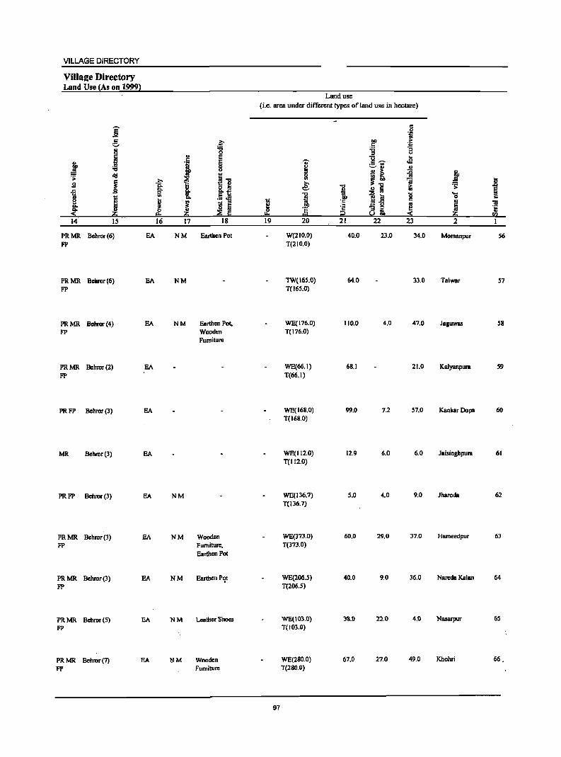
VILLAGE DIRECTORY
ViIla2e Directory Land Use (As on 1999)
j g "
;, J = ~ .:;:
j .9
1 1;;
i g; :$ 2:i 14 15
PRMR Bcbror(6) FP
PRMR Bcbror(6) FP
PRMR Behror(4) FP
PRMR Behror(2) FP
PRFP Behror(3)
MR Behror (3)
PRFP Behror (3)
PRMR Behror(3) FP
PRMR Bcbror(3) FP
PRMR Behror(5) FP
EA
EA
EA
EA
EA
EA
EA
EA
EA
EA
PRMR Behror(7) EA FP
z:. :0 0
" = ., E 0 CJ
i] ~ t c. 8.tj :s '" .5.ei ! ! s :s
~ ~ eo 2:i 16 17 18
NM Earthen Pot
NM
NM Earthen Pot, Wooden Furniture
NM
NM Wooden Furniture, Earthen Pot
NM Earthen Pqt
NM Leather Shoes
NM Wooden Furniture
Land use
(i.e. area under different types of land use in hectare)
c 0
DO .~
c ~ 'g CJ
]-;;;- .£ Oi'
~ ~ " " B ~ ii J III !] ~ li e: '"0 iii .:;: " § t ...
1 lj g 0 c g ·E ~ ~ ~ ·E ·2
~~ "" 0= i2 ~ 2:i sa 19 20 21 22 23 2
W(210.0) 40.0 23.0 34.0 Momanpur 56 T(210.0)
TW(16S.0) 64.0 33.0 Talwar 57 T(165.0)
WE(176.0) 110.0 4.0 47.0 Jaguwas 58 T(176.0)
WE(66.1) 68.1 21.0 Kalyanpura S9 T(66.1)
WE(168.0) 99.0 7.2 57.0 KankarDopa 60 T(168.0)
WE(112.0) 12.9 6.0 6.0 Jaisinghpura 61 T(l12.0)
WE(136.7) 5.0 4.0 9.0 Jharoda 62 T(136.7)
WE(373.0) 60.0 29.0 37.0 Hameedpur 63 T(373.0)
WE(206.5) 40.0 9.0 36.0 Nareda Kalan 64 T(206.S)
WE(103.0) 33.0 22.0 4.0 Nasarpur 65 T(103.0)
WE(2S0.0) 67.0 27.0 49.0 Khohri 66. T(280.0)
97
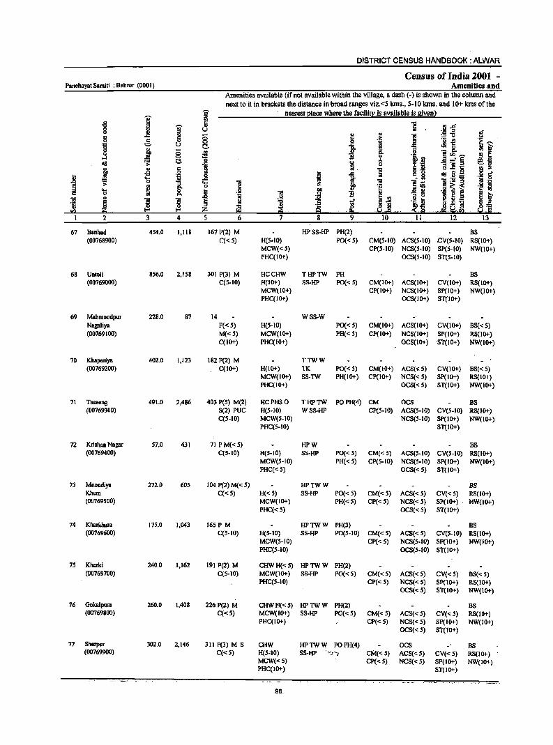
DISTRICT CENSUS HANDBOOK: ALWAR
Census of India 2001 _ Panchayat Samili : Behror (000 I) Amenities and
Amenities available (ifnot available within the village, a dash (-) is shown in the column and
next to it in brackets the distance in broad ranges viz. <5 lans., 5-10 kms. and 10+ lans of the
I i nearest elace where the facilil~ is available is Biven l " 5 "5 .R :sh '8 a- u II u
'" ~ '" '" i := u
II c g c 6 .~ ._ ~ 0 8 e! ] fp J '"
oM 0
0
i I>. ~~-
~ <:>
~ ".f! _' § ~ dII t:!- "C::I
Iii. '3 ] .[;
.t " = ] 6 .S! ~ fl·@ .~ 5 oS i I 1 = g .8 .... _g
-ef .; (;:S!-g . s; 0
1 .... "iI 'ii rl 'J:
~ til 0 C .~ C ii; < ._ S
.... ~ .8 .9 CIJ a't:l .g l § '" 0 I>. ~
'ii .5 ]j E '" '3 M E t u ~ 5 ._ 'iI .,
~. ~ § 'B ~ .l ... ~J ... 'i! '5 Iii " a·S ] ~:;:: '" ~ z B! ~. ~ :s ·9 ~~Ea· .s.! Ill·
2 3 4 5 6 7 8 ~ 10 11 12 13
67 Banhad 454.0 I,IIS 167 P(2) M HPSS-HP PH(2) BS (00768900) C« 5) H(5.10) PO« 5) CM(5-10) ACS(S-IO) eV(S-IO) RS(IO+)
MCW«S} CP(S-IO) NCS(S-IO) SP(S-IO) NW(lO+) PHC(tO+) OCS(S-IO) ST(S-IO)
68 URlali 856.0 2,158 301 P(3) M HCCHW THPTW PH BS (00769000) C(S-IO) H(IO+) SS-HP PO« 5) CM(IO+) ACS(IO+) CV(IO+) RS(10+)
MCW(IO+) CP(IO+) NCS(IO+) Sp(lO+) NW(IO+) PHC(IO+) OCS(JO+) ST(lO+)
69 MahmDOdpur 228.0 87 14 WSS-W Nagaliya P«S) H(S-IO) PO« S) CM(IO+) ACS(IO+) CV(lO+) BS« S} (00769100) M«S) MCW(IO+} PH« S} CP(IO+) NCS(IO+) SP(IO+) RS(10+)
C(10+) PHC(IO+) OCS(IO+) ST(IO+) NW(lO+)
70 Kbapariya 402.0 1,123 182 P(2) M TTWW (00769200) C(IO+) H(IO+) TK PO« 5) CM(IO+) ACS(~5) CV(IO+) BS« S)
MCW(IO+) SS-TW PH(IO+) CP(IO+) NCS«S) SP(IO+) RS(IO+) PHC(IO+) OCS«5) ST(IO+} NW(IO+}
71 Taseeng 491.0 2,486 403 peS) M(2) HCPHSO THPTW PO PH(4} CM OCS DS (00769300) S(2) PUC H(S-IO) WSS-HP CP(S-IO) ACS(5-10) CV(S-IO) RS(IO+)
C(S-IO) MCW(S-IO) NCS(S-IO) SP(1O+) NW(IO+) PHC(S-IO) ST(IO+)
72 Krishan Nagar 57.0 431 71 PM«S) HPW BS (00769400) C(S-IO) H(S-IO) S8-HP PO« 5) CM«5) ACS(S-IO) CV(S-IO) RS(1O+}
MCW(S-IO) PH« 5) CP(5-10) NCS(S-IO) SP(IO+) NW(IO+) PHC«S) OCS«S) ST(1O+)
13 Moondiya 272.0 60S 104 P(2) M«5) HPTWW BS Kbem C«S) H«S) S8-HP PO« 5) CM« 5) ACS« 5) CV«S) RS(IO+) (00769500) MCW(IO+) PH« S) CP« S) NCS« 5) SP(IO+) .' NW(IO+)
PHC«S) OCS«s) ST(IO+)
74 Kharkham 175.0 1,043 165P M HPTWW PH(3) DS (00769600) C(S-IO) H(S-IO) .S8-HP PO(S-IO) CM«S) ACS« 5) CV(S-IO) RS(lO+)
MCW(S-IO) CP« S) NCS(S-IO) SP(IO+) NW(IO+) PHC(S-IO) OCS(S-IO) ST(IO+)
7S Kherki 240.0 1,162 191 P(2) M CHWH«S) HPTWW PH(2) (00769700) C(S-IO) MCW(IO+) SS-HP PO« S) CM«5) ACS« S) CV«S) DS«S)
PHC(S-IO) CP« S) NCS« 5) SP(IO+) RS(tO+) OCS« S) ST(IO+) NW(JO+)
76 Gokalpum 260.0 1.408 226 P(2) M CHWH«S) HPTWW PH(2) BS (00769800) C«S) MCW(IO+) SS-HP PO« S) CM«S) ACS« S) CV«S) RS(tO+)
PHC(IO+) CP«S) NCS« S) SP(IO+) NW(IO+) OCS« S) ST(IO+)
77 Sherpur 302.0 2.146 311 P(3) M S CHW HPTWW POPH(4) OCS BS (00769900) C«S) H(5"10) SS-HP t'~r"~ CM«S) ACS«S) CV«S) RS(IO+)
MCW«S) CP«S) NCS« 5) SP(IO+) NW(IO+) PHC(IO+) ST(lO+)
.. ~. . ..... ,_.,
98
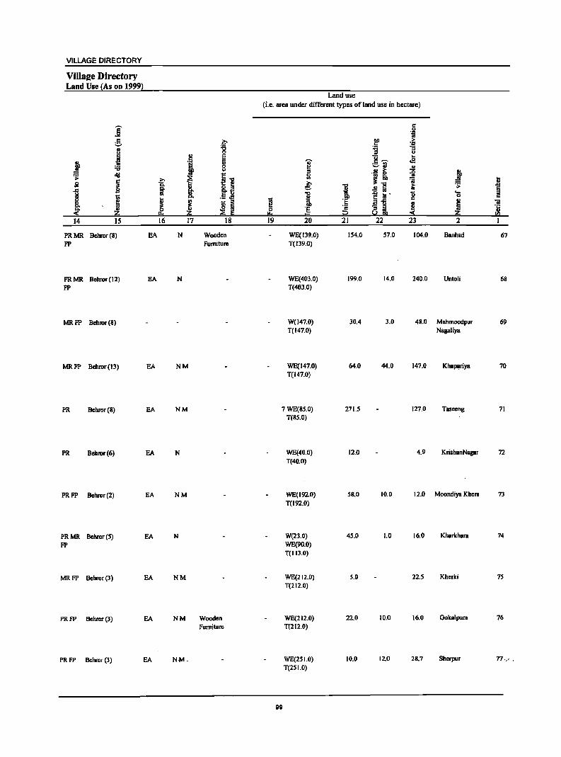
VILLAGE DIRECTORY
Villa2e Directory Land Use {As on 1999}
Land use
(i.e. area under different typcs ofland use in hectare)
j c 0 .~
g z.. IIQ > c 'D .. :;:; 'g "3
j 0 u ., e u ..
j 8 'OJ' c ,.., <E :a ~
;::-fj .. u
" a i ::g j diI ~] ~ .s: .?;> ~ !] ~ ~
S ~ c.. .e: ." iO .s: .D
It u 8..:l
:1 §
1 !: .5 .M 'C ~ iii' g ..... t; i
0 c
~ ! ~ - " ~ i!"§ ~
.. iii
.~ u a Iii 0 'E c " .. ~ 'ij
II. ~ ::a !ii I!:o = i2 5.2!!!l ii:i '" 14 IS 16 17 18 19 20 21 22 23 2
PRMR Behror(8) EA N Wooden WE(139.0) 154.0 57.0 104.0 Banhad 67 FP Furniture T(J39.0)
PRMR Behror(12) EA N WE(403.0) 199.0 14.0 240.0 Untoli 68 FP T(403.0)
MRFP Behmr(8) W(147.0) 30.4 3.0 48.0 MBhmoodpur 69 T(147.0) Nagaliya
MRFP Behmr(13) EA NM WE(147.0) 64.0 44.0 147.0 Kha~riya 70 T(147.0)
PR Behmr(S) EA NM 7 WE(SS.O) 271.5 127.0 Taseeng 71 T(BS.O)
PR Behror(6) EA N WE(40.0) 12.0 4.9 KrishanNagar 72 T(40.0)
PRFP Behror(2) EA NM WE(192.0) 5S.0 10.0 12.0 Moondiya Khem 73 T(J92.0)
PRMR Behror(5) EA N W(23.0) 45.0 1.0 16.0 Kharkham 74
FP WE(90.0) T(II3.0)
MRFP Behror(3) EA NM WE(212.0) 5.0 22.5 Kherki 75 T(212.0)
PRFP Behmr(3) EA NM Wooden WE(212.0) 22.0 10.0 16.0 Ookalpum 76
Furniture T(212.0)
PRFP Behror (3) EA NM. WE(25 1.0) 10.0 12.0 2B.7 Sherpur 77,., .
T(2SI.0)
99
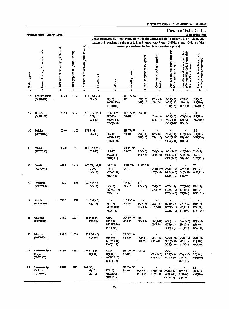
DISTRICT CENSUS HANDBOOK: ALWAR
Census of India 2001 -Panchayat Samiti : Behror (0001) Amenities and
Amenities available (if not available within the village, a dash (-) is shown in the column and next to it in brackets the distance in broad ranges viz. <5 kms., 5-10 kms. and 10+ kms of the
I g nearest place where the facility is available is given) Ul
-8 ~ ii 11 Ul..cf 0 gj u .S:! :s JI u ., .. .,
~ :=:'1l c: c:
~ IS ,. ._ t!
0 ~ '" .~ e-. oil u -'" eM 0 ; f " l c.. '" ::I.
]~-. 0 8 Ul i g- u ....I -0 oj» .!1 C!.- "0 0 _" § ~~ ~ .;: ..c: -0 .. iii u
~ .§ ] :!'c j " 6 ] .,s !l , 1
cI!I B.{@ . .8 5" .8 ... '-;I _g ].; ]:211 ~ 0
1 ... iii iii B .~ E .. 0 c .~ o~< .- s .e ... ~ .. .! 1 -1! .~ ] § '" 0 Po .8 B ]I
l~ ~ f ., ~l
~ 5 ._ "iii ; ! ! Ii ~ c ~ '1: H·5 ] '" Ul '1: <'§ 0:::
. .", Z Z ~ 9 .e- ." f.d. SO u e u I 2 3 4 5 6 7 8 9 10 II 12 13
78 Kankar Chhaja 176.0 1,173 174 P M« 5) HPTWSS-(00770000) C« S) H« S) HP PO«S) CM«S) AC8« S) CV«S) B8« S)
MCW(IO+) PH«5) CP(ID+) NCS« S) SP« 5) RS(IO+) PHC(IO+) OCS« S) ST«5) NW(IO+)
79 Oadhoj 872.0 3,127 sIOP(3) M S PHSCHW HPTWW PO PH BS (00770100) 0(2) H(s-IO) SS-HP CM« S) ACS«S) CV(s-IO) RS(IO+)
C(s-IO) MCW(S-IO) CP(s-IO) NCS(S-IO) SP(JO+) NW(IO+) PHC(S-IO) OCS(S-IO) ST(IO+)
80 Dhidhor 500.0 1,105 174P M HPTWW BS (00770200) C(S-IO) H(S-IO) SS-HP PO«S) CM«S) AC8«S) CV(S-IO) RS(IO+)
MCW(S-IO) PH« S) CP(S-to) NCS(s-IO) SP(IO+) NW(IO+) PHC(S-IO) OC8(S-10) ST(JO+)
81 Nalota 406.0 783 101 PM«S) THPTW (00770300) C(s-IO) H(s-IO) SS-HP PO« S) CM(S-IO) ACS(S-IO) CV(S-IO) BS« S)
MCW(IO+) PH« S) CP(S-IO) NCS(S-IO) SP(S-IO) RS(IO+) PHC(IO+) OCS(S-IO) . ST(IO+) NW(IO+)
82 Goonti 618.0 3,418 S47 P(4) M(2) DAPHS THPTW POPH(2) BS (00770400) SAC H(s-IO) S8-HP CM(s-lO) AC8(s-10) CV(s-IO) RS(10+)
C(S-IO) MCW(JO+) CP(s-IO) NCS(S-IO) SP(S-IO) NW(lO+) PHC(S-IO) OCS(S-IO) ST(lo+)
83 Shyampur 192.0 523 73PM«s) HPW PH (00770500) C(s-IO) H(s-IO) SS-HP PO« 5) CM« S) ACS« 5) CV(S-IO) BS« S)
MCW(s-IO) CP(s-IO) NCS(S-IO) SP(IO+) RS(IO+) PHC(IO+) OCS(S-IO) ST(IO+) NW(IO+)
84 Shimla 270.0 69S 91 PM«S) HPTWW (00770600) C(S-IO) H(s-IO) SS-HP PO« 5) CM«S) ACS« 5) CV(S-IO) BS«S)
MCW(IO+) PH« S) CP(S-IO) NCS(S-IO) Sp(IO+) RS(IO+) PHC(S-IO) OCS(S-IO) ST(IO+) NW(IO+)
8S Gujarwas 264.0 1,221 183 P(2) M CHW HPTWW PH (00770700) CCS-IO) H(S-IO) S8-HP PO« S) CM(S-IO) ACS«S) CV(S-IO) BS(S-IO)
MCW(s-IO) CP(S-IO) NCS« S) Sp(IO+) RS(1O+) PHC(IO+) OCS«S) 8T(JO+) NW(IO+)
86 Islampur 2S7.0 606 83 PM«S) HPTWW (00770800) C(s-IO) H(S-IO) 8S-HP PO«S) CM(S-IO) ACS(S-IO) CV(s-IO) B8(S-10)
MCW(S-IO) PH« 5) CP(S-IO) NCS(S-IO) SP(IO+) RS(JO+) PHC(s-IO) OGS(S-IO) ST(IO+) NW(IO+)
87 Mohammadpur 518.0 2,2S4 287 P(4) M CHW HPTWW PO PH OCS BS Goojar C(s-IO) H(s-IO) SS-HP CM(S-IO) ACS(S-IO) CV(S-IO) RS(JO+) (00770900) MCW(S-IO) CP(s-IO) NCS(S-IO) Sp(IO+) NW(lO+)
PHC(s-lO) ST(lO+)
88 Mosampw@ 440.0 1,247 168 P(2) HPTWW BS Kankara M«S) H(S-IO)· . SS-HP PO« 5) CM(S-IO) ACS(s-IO) CV«S) RS(IO+) (00771000) C(S-IO) MCW(IO+) PH«S) CP(S-IO) NCS(S-lO) Sp(IO+) NW(IO+)
PHC(IO+) OCS« S) ST(IO+)
100
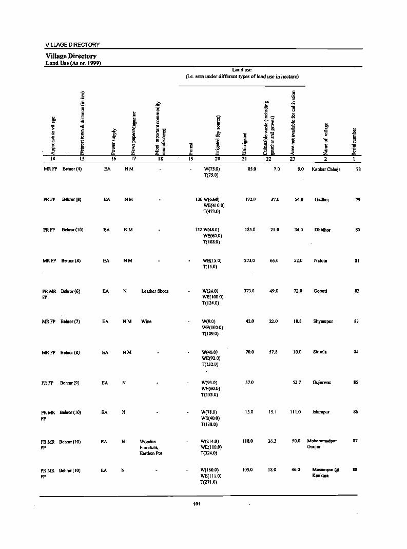
VILLAGE DIRECTORY
Villa2e Directory Land Use {As on 19991
Land use
(i.e. area under different types of land use in hectllfC)
]' " 0 .~
e l:- Oll > C ]
.1 '6 '6
u 0 " . , E U ...
~ E i c ~ oS ._ '"
"C 8 ...... ., ., tid
~~ " a > il j .;;:
~ % ~ ~ ~! ';j .8 13 ,§ "C ~ 1i 13 Co §. 8.~ i ..!! fa &i
~ J
~ . 5 J! I ~ :a 1$ .... g., 0
~ ~ ~ - " ~ :~ .a1i c ., iii
~ Ii .. ~ u ·E c - " ~
.1:
;:!; 0
~ Iii 0 8 IlL u eo ~ .... = i2 -< O!;; "" 14 15 16 17 18 19 20 21 22 23 2
MRFP Behmr(4) EA NM W(75.0) ·85.0 7.0 9.0 Kankar Chhaja 78 T(75.0)
PRFP Behmr(8) EA NM 136 W(63tfi) 172.0 37.0 54.0 Gadhoj 79 WE(4 I 0.0) T(473.0)
PRFP Bchmr(IO) EA NM 152 W(48.0) 185.0 21.0 34.0 Dhidhor 80 WE(60.0) T(IOS.0)
MRFP Behmr(S) EA NM WE(1S.0) 273.0 66.0 52.0 Nalola 81 T(IS.O)
PRMR Behmr(6) EA N Leather Shoes W(24.0) 373.0 49.0 72.0 Goonti 82 FP WE(100.0)
T(124.0)
MRFP Behmr(7) EA NM Wine W(9.0) 42.0 22.0 18.8 Shyampur 83 WE(100.0) T(109.0)
MRFP Bchror(S) EA NM W(40.0) 70.0 57.8 10.0 Shimla S4
WE(92.0) T(I32.0)
PRFP Behmr(9) EA N W(9J.0) 57.0 53.7 GUjBfWBS 85 WE(60.0) T(IS3.0)
PRMR Bchmr(IO) EA N W(7S.0) 13.0 15.1 111.0 Islampur 86
FP WE(40.0) T(II8.0)
PRMR Bchmr(lO) EA N Wooden W(214.0) 118.0 26.3 50.0 MohBmmadpur 87
FP Furniture, WE(IIO.O) Goojar
Earthen Pot T(324.0)
PRMR Behmr(IO) EA N W(160.0) 105.0 18.0 46.0 Mosampur@ 88
FP WE(I I 1.0) Kankara
T(271.0)
101
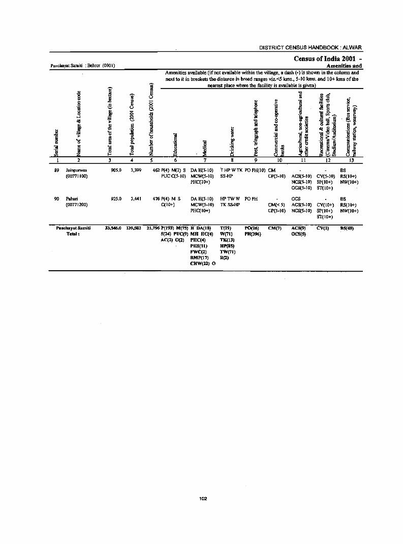
Panchaya! Sam;!; : Bchror (0001)
~ 8 .§ ii g ....:I dd j ~ ~
89 Jainpurwas (00771100)
90 Pahari (00771200)
Panch.YBt Samiti Total:
I ~ l!! g " U
j ;; §, .... ..
-!l 6 .~
~ .; ~ '" &. ]I ]I F: F: 3 4
905.0 3,399
925.0 3,441
33,546.0 139,503
DISTRICT CENSUS HANDBOOK: ALWAR
Census of India 2001 -Amenities and
Amenities available (if not available within the village, a dash (-) is shown in the column and next to it in brackets the distance in broad ranges viz. <5 kIns., 5-10 kms. and 10+ kms of the
"Ui' nearest place where the facility is available is given) iil i3
U
8 C!. ~
~ J .... "iI 0 ,2 .8 "iI
§ 'B ~ " :z; iB 5 6 7
462 P(4) M(2) S DAH(S-IO) PUCC(S-IO) MCW(S-IO)
PHC(IO+)
476 P(4) M S DAH(S·IO) C(IO+) MCW(5-10)
PHC(IO+)
21,796 P(I93) M(7S) H· DA(18) S(24) PUC(9) MH HC(4) AC(2) 0(2) PBC(4)
PHS(lI) FWC(2) RMP(17) CHW(ll) 0
102
II> " c .. _g .~
i t ~ " "" ..
j I Iii
00 c
~ 8
THPWTK. POPH(IO) CM SS-HP
HPTWW TK. SS·HP
T(19) W(71) TK(13) BP(8S) TW(71) R(2)
PO PH
P0(26) PH(396)
CP(5-10)
CM«5) CP(5-10)
CM(7)
ACS(S·IO) NCS(S·IO) OCS(5·IO)
OCS ACS(5.10) NCS(S·IO)
ACS(9) OCS(S)
11 .cr ',Q: .E! ;.: u
]~ ~~~ _" § "3 "iI .c ... ..c S dd~:a ~._ " ._ ~ i i fj .-8.5 11 ufI)
12
BS CV(S-IO) RS(lO-fo) SP(IO+) NW(IO+) ST(lO+)
BS CV(IO+) RS(IO+) SP(IO+) NW(lO+) ST(JO+)
CV(l) B8(48)
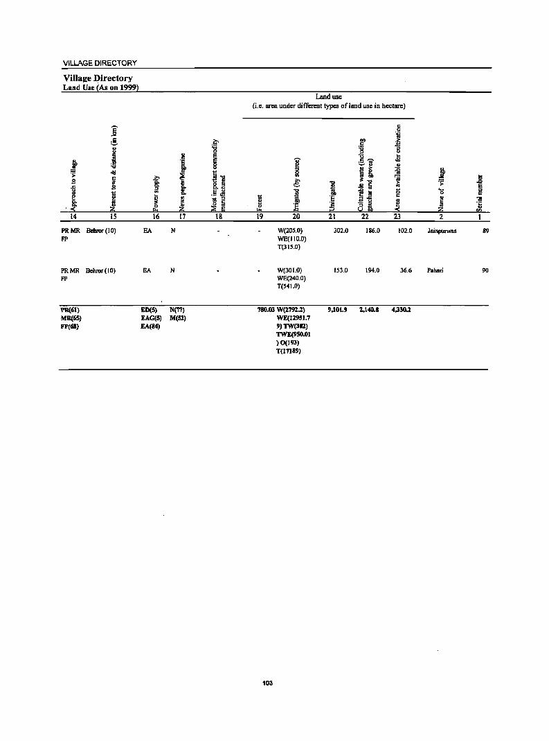
VILLAGE DIRECTORY
Villaj[e Directory Land Use {As on 1999~
Land use (i.e. area under different types ofland use in hectare)
-- c E c .... 'il
:.S .~ till .1; .5 " "8 ""0 :; U '" ... a l:l E "0 ...
j ., E .... c -- .s '6 0 ~
:.::.11 .. ... J! ii t ~ .td i""O
C
~ .2:- ~ .. 'iii " $I Q. &.~ e: i 1:; .;: .Z>
§- " .!! Ii E ..c $I ~ ~
III .5.:! ""0 ~ I;i 0 .... '" "Ill Q. " C C
~ 11 i 'E c " ; ~ - '" E-5
~ iii
&: .. .. ~ Iii ;:; ]; ';: "'3 a ~ .;: .~ j!; e. ii ~ E 100 :2 So.! bO < i!!:i
.. en
14 15 16 17 18 19 20 21 22 23 2
PRMR Behror (10) EA N W(20S.0) 302.0 186.0 102.0 Jainpurwas 89 FP WE(1I0.0)
T(3IS.0)
PRMR Bchror(IO) EA N W(301.0) 153.0 194.0 36.6 Pahari 90 FP WE(240.0)
T(S41.0)
PII.((jI) ED(S) N(77) 780.03 W(1791.1) 9.101.9 1.140.8 4,330.1 MR(6S) EAG(S) M(Sl) WE(ll9Sl.7 FP(68) EA(84) 9)TW(301)
TWE(9SO.01 )0(193) T(l7l89)
103

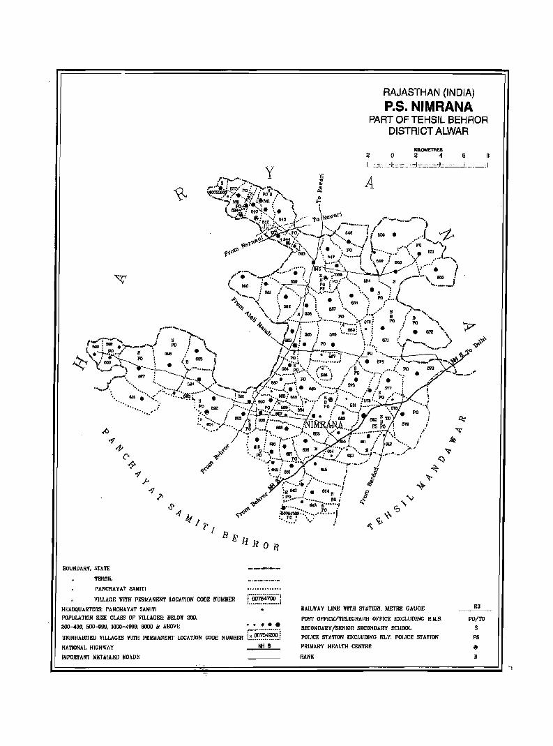
lJl!:l-: 1 R 0 R
BOUNDARY. Sf ATE
TEilSIL
rANCHAYAT SAMITI
VILLAGE WITH PERMANENT LOCATION CODE NUMBER
HI:AoqUAR'rERS: I'ANCHAYAT 5A"'11'1 POPULATION SIZE CLASS OF VILLAGES: BELOW 200.
200-499. 500-91l1l. 1000-4999. fiOOil " ABOVE • • •
UNINHAlJl'fED VILl.AGES WITH PERMANENT weATION CODE NUMBEI! [~:~~?~~~) NATIONAL HIGHWAY It! 8
IMPORTANT METALl.llD IlOAI)S
RAJASTHAN (INDIA)
P.S. NIMRANA PART OF TEHSIL BEHROR
DISTR,ICT ALWAR
KILOMETRES 2 0 Z 4 6 0
L _cj;, _~'L,::':::_::_::l:::..:.::'-':;±_;;:.::__ ... L __ , _,: I
A
RAILWAY UNE WITH S'I'ATION. METRI! GAUGE RS
1'Ol.'1· OP~'ICEl'fELECRAI'H on'ICE EXC!.UDlNC R.M.S.
SECONDARY /SENIOR SECONDARY SCHOOL
POI.ICE S'l'ATION EXCI,UDlNG ilLY, POI,ICE STATION
PRIMARY m;AI,TH CENTRF.
FlANK
PO/TO S
PS
~
B

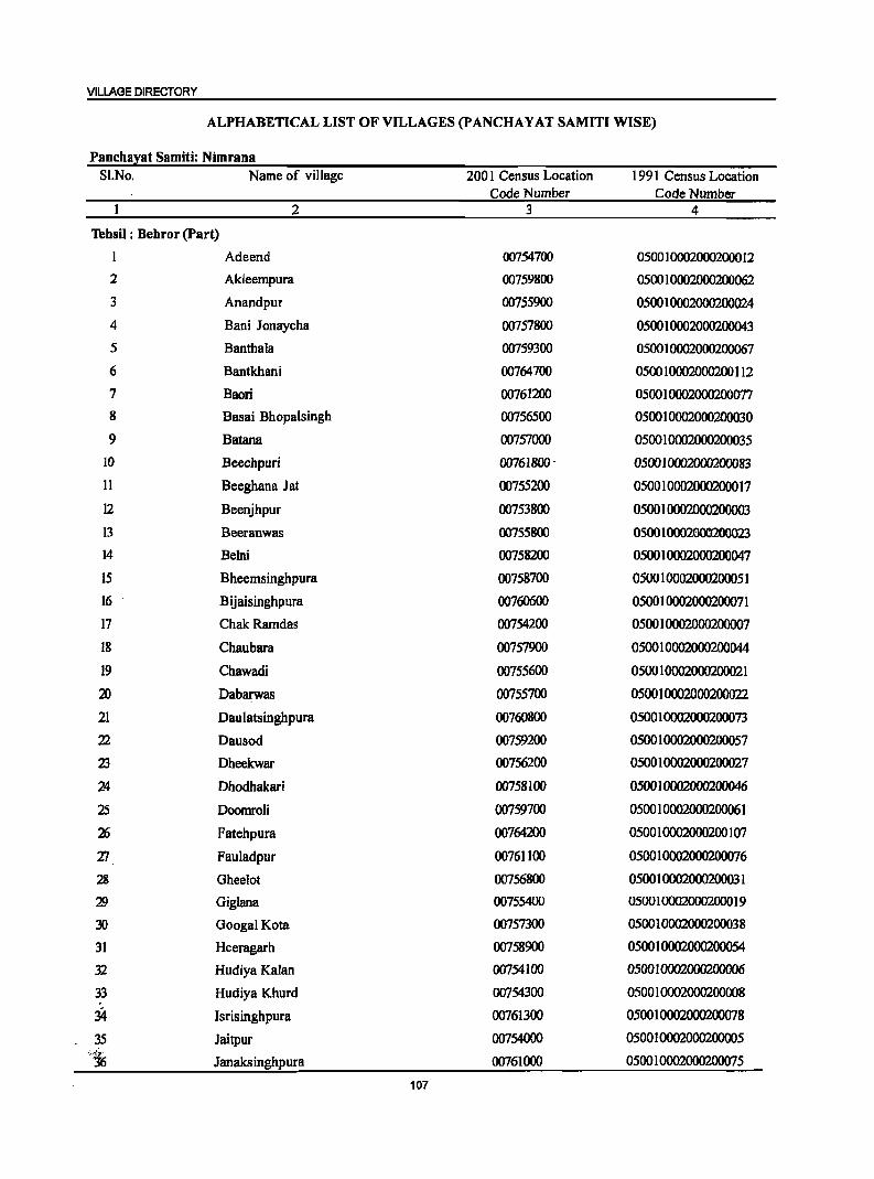
VILLAGE DIRECTORY
ALPHABETICAL LIST OF VILLAGES (PANCHAYAT SAMITI WISE)
Panchayat Samiti: Nimrana SI.No. Name of village 2001 Census Location 1991 Census Location
Code Number Code Number 2 3 4
Tehsil ; Behror (Part)
1 Adeend 00754700 050010002000200012
2 Akleempura 00759800 050010002000200062
3 Anandpur 00755900 050010002000200024
4 Bani Jonaycha 00757800 050010002000200043
5 Banthala 00759300 0500 I 0002000200067
6 Bantkhani 00764700 050010002000200112
7 Baori 00761200 050010002000200077
8 Basai Bhopalsingh 00756500 050010002000200030
9 Batana 00757000 0500 1 0002000200035
10 Beechpuri 00761800" 050010002000200083
11 Beeghana J at 00755200 050010002000200017
12 Beenjhpur 00753800 050010002000200003
13 Beeranwas 00755800 0500 10002000200023
14 Belni 00758200 0500 I 0002000200047
15 Bheemsinghpura 00758700 050010002000200051
16 Bijaisinghpura 00760600 050010002000200071
17 ChakRamdas 00754200 050010002000200007
18 Chaubara 00757900 0500 I 0002000200044
19 Chawadi 00755600 0500 1 0002000200021
2D Dabarwas 00755700 050010002000200022
21 Daulatsinghpura 00760800 0500 I 0002000200073
22 Dausod 00759200 050010002000200057
23 Dheekwar 00756200 050010002000200027
24 Dhodhakari 00758100 050010002000200046
25 Doomroli 00759700 050010002000200061
26 Fatehpura 00764200 050010002000200107
1J Fauladpur 00761100 050010002000200076
28 Gheelot 00756800 050010002000200031
'19 Gigiana 00755400 050010002000200019
30 Googal Kota 00757300 050010002000200038
31 Heeragarh 00758900 050010002000200054
.32 Hudiya Kalan 00754100 050010002000200006
33 Hudiya Khurd 00754300 050010002000200008
34 Isrisinghpura 00761300 050010002000200078
35 Jaitpur 00754000 050010002000200005 ';'i; Janaksinghpura 00761000 050010002000200075
107
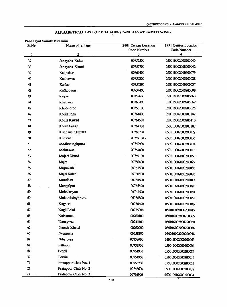
DISTRICT CENSUS HANDBOOK: ALWAR
ALPHABETICAL LIST OF VILLA~ES (p ANCHA Y AT SAMITI WISE)
Panchalat Samiti: Nimrana SI.No. Name of village 2001 Census Location 1991 Census Location
Code Number Code Number 1 2 3 4
37 Jonaycha Kalan 00757500 050010002000200040
38 Jonaycha Khurd 00757700 050010002000200042
39 KaJipahari 00761400 050010002000200079
40 Kanhawas 00756300 050010002000200028
41 Kankar 00757200 050010002000200037
.f2 Kathoowas 00754400 050010002000200009
43 Kaysa 00759600 050010002000200060
44 Khatiwas 00760400 0500 1 0002000200069
45 Khoondrot 00756100 050010002000200026
46 KolilaJoga 00764400 050010002000200109
47 Kolila Rawacl 00764500 050010002000200110
48 KoHla Sanga 00764300 050010002000200108
49 Kundansinghpura 00760700 050010002000200072
50 Kuteena . 00757100,. 050010002000200036
51 Madhosinghpura 00760900 050010002000200074
52 Mahtawas 00754800 050010002000200013
53 Majari Khurd 00759100 050010002000200056
54 Majra 00756400 050010002000200029
55 Majrakath 00761500 050010002000200080
56 MajriKaIan 00760500 050010~0
57 Mandhan 00754600 050010002000200011
58 Mangalpur 00754500 050010002000200010
59 MohaJariyan 00761600 050010002000200081
ro Mukandsinghpura 00758800 050010002000200052
61 Naghori 00758600 050010002000200049
62 NagliBalai 00755000 05001 0002000200015
63 Naisarana 00760100 050010002000200065
64 Nanagwas 00755500 050010002000200020
65 Nareda Khurd 00760000 05001 0002000200064
66 Neemrana 00758300 050010002000200048
OJ Nihalpura 00759900 050010002000200063
68 Partapur 00753900 050010002000200004 fi} Peepli 00761900 050010002000200084
70 Porula 00754900 050010002000200014
71 Pratappur ChakNo. 1 00756700 050010002000200033 72 Pratappur Chak No.2 00756600 050010002000200032 73 Pratappur Chak No.3 00756900 050010002000200034
108
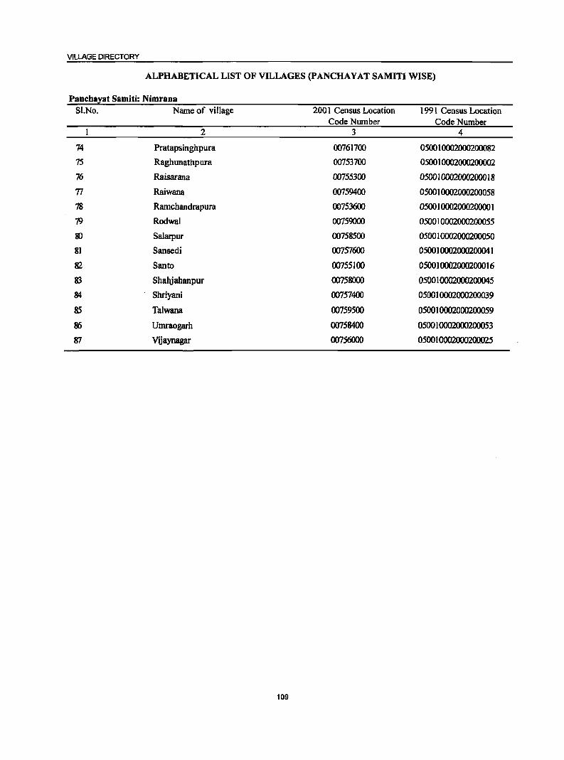
VILLAGE DIRECTORY
ALPHABETICAL LIST OF VILLAGES (PANCHA Y AT SAMITI WISE)
Panchayat Samiti: Nimrana Sl.No. Name of village 2001 Census Location 1991 Census Location
Code Number Code Number 2 3 4
74 Pratapsinghpura 00761700 050010002000200082
75 Raghunathpura 00753700 050010002000200002
76 Raisarana 00755300 0500 I 00020002000 18
71 Raiwana 00759400 050010002000200058
78 Ramchandrapura 00753600 050010002000200001
79 Rodwal 00759000 050010002000200055
80 Salarpur 00758500 0500 I 0002000200050
81 Sansedi 00757600 050010002000200041
82 Santo 00755100 050010002000200016
83 Shahjahanpur 00758000 050010002000200045
84 Shriyani 00757400 050010002000200039
85 Talwana 00759500 050010002000200059
86 Umraogarh 00758400 050010002000200053
87 Vijaynagar 00756000 050010002000200025
109
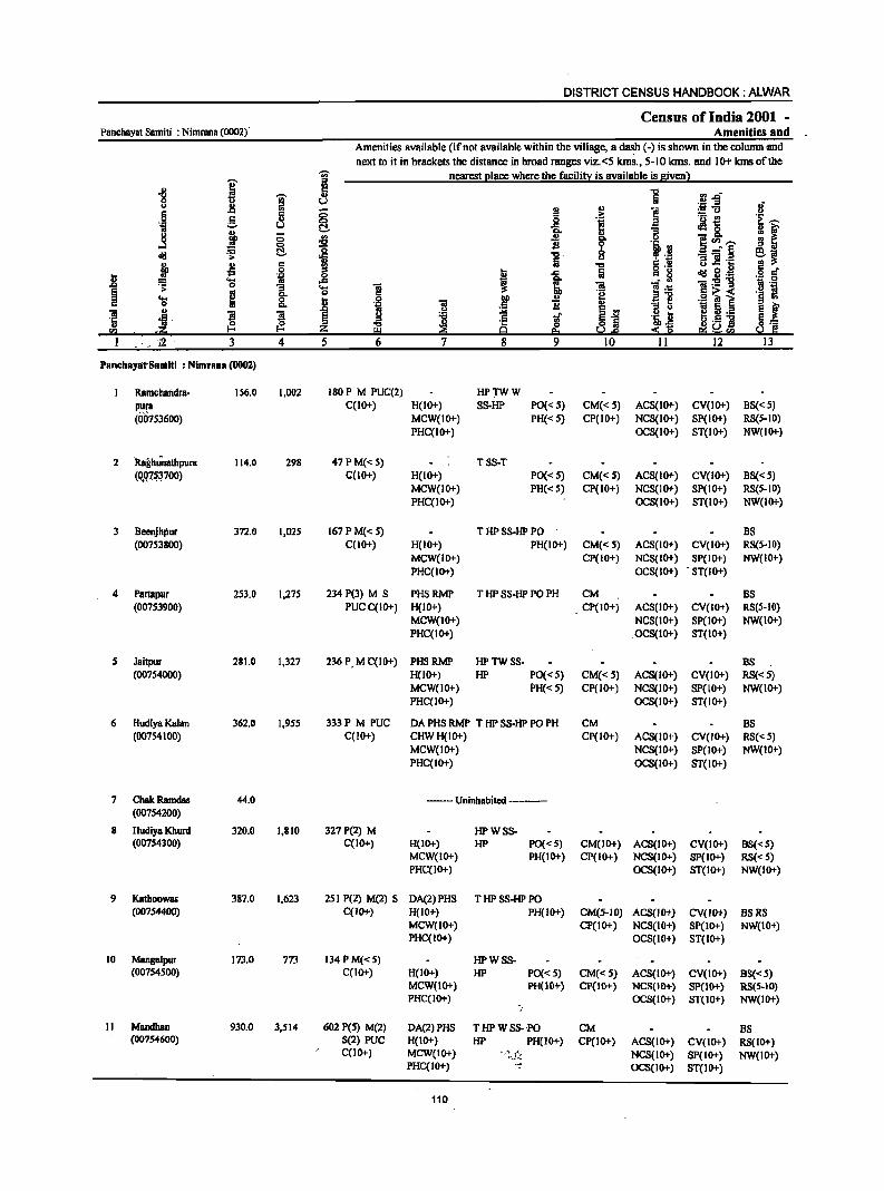
DISTRICT CENSUS HANDBOOK: ALWAR
Census of India 2001 -Panchayat Samiti : NimrBna (0002)' Amenities and
Amenities available (ifnot available within the village, a dash (-) is shown in the column ,and
next to it in brackets the distance in broad ranges viz.<5 klns., 5-10 krns. and 10+ klns of the -;;;- nearest I!lace where the facili!X is available is s,ivenl
.g I I e fjD u u l! II! .. ;§-5
8 ~ .~ §. Q) .8 ~ ]1 'i u j
Q, u ;:; ~ "B Q Q, ]CIl.--...:I (! 0 ..:E
cI!l ~ ..c '5 8 1i 2'~ j .,
'" '" .,s .2 !l ... .c: cI!l 2·~ 0
~ ... t;; ..c ; l!:5!"B ~ 0 g_ '0 ~ .. o~< ... ~ 0
J .2 Q
I '2 ._ ~
Q,
~ ~ ~._
~ ~ ~ .5] ..., g""
3 4 5 6 7 12
P8ncbayarSaniiti : Nimrana (0002)
RBmchandra- 156.0 1,002 180 P M PUC(2) HPTWW
P:'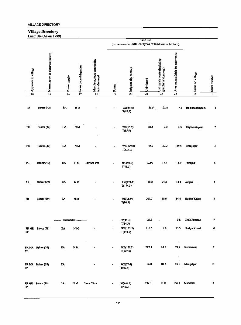
VILLAGE DIRECTORY
Village Directory Land Use (As on 1999)
j e B
~ I '6 .> oil!
~ 9 ]
J e Co
~ 14 IS
PR Behror(42)
PR Behror (42)
PR Behror(40)
PR Bchror(40)
PR Bchror(39)
PR Behror(39)
.~ -g
! E .~ E
8
1 11 ~
f It .5 Jl
J ~ _ :s !S lii
Z ~ E 16 17 18
EA NM
EA NM
EA NM
EA NM Earthen Pot
SA NM
SA NM
--Uninhabited ---
PRMR Behror(3S) SA NM FP
PRMR Behror(3S) SA NM FP
PRMR Behror(28) EA FP
PRMR Behror(26) EA NM Stone Tiles FP
Land use (i.e. area under different types of land use in hectare)
c 0 .~
1>0 > c ~ :g .., <l l-
I c - .s ;:..~
" 0 2~ ii 1 ... '" ~'C ·a ",. .8 e -a 1; .>
:1 ..!! ii § 'C e ta 0 'l5 II) c
~ i a-5 c II)
~ 8~ ~ j 0 § '" j:? < fI)
19 20 21 22 23 2 1
WE(S5.6) 3S.S 2S.0 7.1 Ramchandrapura T(SS.6)
WE(SS.9) 21.5 3.2 3.5 Raghunathpura 2 T(SS.9)
WE(129.0) 46.2 37.2 159.5 Beenjhpur 3 T(129.0)
WE(98.3) 122.0 17.4 14.9 Partapur 4 T(98.3)
TW(174.S) 6S.2 24.2 14.4 Jaitpur S T(174.s)
WE(96.9) 201.7 48.6 14.6 Hudiya '!<alan 6 T(96.9)
W(l4.3) 29.3 O.S ChakRamdas 7 T(14.3)
WE(173.S) 116.6 17.0 13.3 Hudiya Khurd 8 T(173.S)
WE(127.2) 217.3 14.8 27.4 KathooWBS 9 T(127.2)
WE(37.4) 86.S 18.7 29.8 Mangalpur 10 T(37.4)
W(469.1) 282.1 11.0 168.4 Mandhan II T(469.1)
111
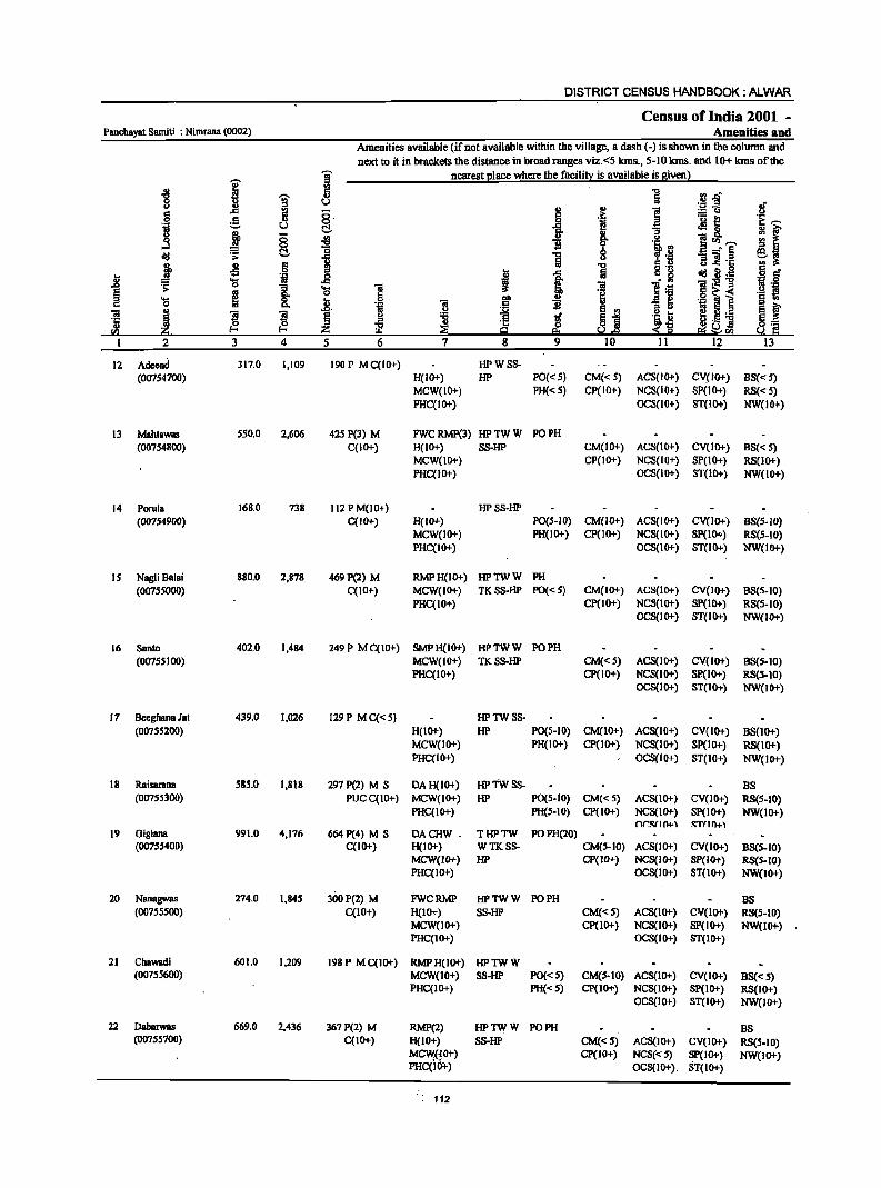
DISTRICT CENSUS HANDBOOK: ALWAR
Census of India 2001 -Panchayat Samiti : Nimrana (0002) Amenities and
Amenities available (if not available within the village, a dash (-) is shown in the column and next to it in brackets the distance in broad ranges viz.<S lans., S-IO kms. and 10+ lans of the
I ~ nearest l!lace where the facili!l: is available is Biven 1 '" ~ c ] .!Hf 8 1 8 of
:! u e =13 c::: .i?; .!.! .S! g g.
f e a ~l t~ i! u t::!, :;
.3 E 0 ~ 8. . 2 D"' .... ~I 0 0
t·! "0 0 ~. ~ ~ ~ t::!,
1 1 u "B].t: j ~ 6 1 c " .. 'i f ..c ~ .~ dd~:! :86'
j .... ..c ! ,.., 0
1 ....
1 ~ ] .~ l~i .. 'Q
> ~
0 .!.! S .... .2. "" u :;1 § '" 0 01 c "jl '" ~
u
~ S '" ~ ~.- s ~ 01 ! ~ ~ :a tf ~j
.S:! l-
'e ., ~i H'- ] ~'g! u ~
0 III O!:i I-' ::E a ~ e:I ~!"a
2 3 4 S 6 7 8 9 10 II 12 13
12 Adccnd 317.0 1,109 190P MC(IO+) HPWSS-(00754700) H(IO+) HP PO«5) CM«s) ACS(IO+) CV(IO+) BS« 5)
MCW(IO+) PH«S) Cp(IO+) NC5(IO+) 5P(10+) RS«S) PHC(IO+) OC5(10+) ST(IO+) NW(lO+)
13 Mahtowas 550.0 2,606 425 P(3) M FWCRMP(3) HPTWW PO PH (00754800) C(IO+) H(IO+) 55-HP CM(lO+) ACS(IO+) CV(IO+) B8«5)
MCW(10+) CP(1O+) NCS(10+) ·SP(IO+) R8(10+) PHC(IO+) OCS(IO+) ST(IO+) NW(1O+)
14 Porula 168.0 738 112 P M(IO+) HPSS-HP (00754900) C(IO+) H(IO+) PO(s-IO) CM(IO+) ACS(IO+) CV(IO+) BS(5-10)
MCW(IO+) PH(IO+) CP(IO+) NCS(IO+) SP(IO+) R8(S-10) PHC(IO+) OCS(IO+) ST(IO+) NW(lO+)
IS NagliBalai 880.0 2,878 469P(2) M RMPH(IO+) HPTWW PH (007S50OO) C(IO+) MCW(IO+) TKS8-HP PO«S) CM(IO+) ACS(IO+) CV(IO+) B8(5-10)
PHC(IO+) Cp(IO+) NCS(IO+) SP(IO+) R8(S-IO) OCS(IO+) ST(IO+) NW(lO+)
16 Santo 402.0 1,484 249P MC(IO+) SMPH(IO+) HPTWW PO PH (00755100) MCW(1O+) TKSS-HP CM«S) ACS(IO+) CV(IO+) B8(S-IO)
PHC(IO+) CP(IO+) NCS(IO+) Sp(IO+) R8(S-IO) OCS(IO+) ST(IO+) NW(IO+)
17 Beeghana Iat 439.0 1,026 129P MC«5) HPTWS8-(007SS200) H(IO+) HP PO(S-IO) CM(lO+) AC8(10+) CV(10+) BS(IO+)
MCW(IO+) PH(IO+) CP(IO+) NCS(IO+) SP(IO+) R8(10+) PHC(IO+) OC8(10+) ST(IO+) NW(IO+)
18 Raisarana 585.0 1,818 297P(2) M S DAH(IO+) HPTw SS- BS (00755300) PUCC(IO+) MCW(IO+) HP PO(S-IO) CM«S) ACS(IO+) CV(IO+) RS(5-IO)
PHC(IO+) PH(S-IO) CP(IO+) NCS(IO+) Sp(IO+) NW(IO+) nr.~IO+' STflll+'
19 Giglana 991.0 4,176 664 P(4) M S DACHW. THPTW POPH(20) (00755400) C(1O+) H(IO+) WTK8S- CM(S-IO) ACS(IO+) CV(IO+) B8(5-10)
MCW(IO+) HP CP(IO+) NCS(IO+) 8p(10+) RS(S-IO) PHC(IO+) OCS(IO+) 8T(10+) NW(lO+)
20 NaMgwas 274.0 1,845 300P(2) M FwCRMP HPTWW PO PH B8 (00755500) C(10+) H(IO+) SS-HP CM«S) ACS(IO+) CV(lO+) RS(S-IO)
MCW(IO+) CP(IO+) NCS(IO+) SP(IO+) NW(1O+) PHC(IO+) OCS(IO+) ST(IO+)
21 Chawadi 601.0 1,209 198 P M C(IO+) RMPH(IO+) HPTWW (00755600) MCW(IO+) S5-HP 'PO« S) CM(5-10) ACS(IO+) CV(lO+) BS« S)
PHC(IO+) PH«5) CP(IO+) NCS(IO+) Sp(IO+) RS(IO+) OCS(IO+) ST(IO+) NW(IO+)
22 Dabarwas 669.0 2,436 367P(2) M RMP(2) HPTWW PO PH BS (0075S7OO) C(IO+) H(IO+) S8-HP CM«5) ACS(lO+) CV(IO+) RS(S-IO)
MCW(IP+) CP(IO+) NCS«S) SP(IO+) NW(IO+) PHC(tD:t-) OCS(IO+) ST(IO+)
112
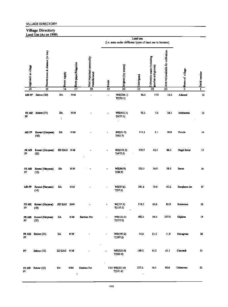
VILLAGE DIRECTORY
Village Directory Land Use (As on 1999)
]: g II
J ~ . > oil! g ~ M ;; g_ j <-14 IS
MRFP Behror(30) EA
PRMR Behror(37) EA
FP
MR FP Re\Wi (Haryana) EA (II)
2!
J .g: ~ I J ~ z 16 17
NM
NM
NM
PR MR Rewari (Haryana) ED EAG N M FP (22)
PR MR Rewari (Haryana) EA NM FP (IS)
MRFP Rewari (Haryana) EA NM (14)
PRMR Re\Wi (Haryana) EDEAG NM FP (II)
PRMR Rewari (Haryana) EA NM FP (27)
PRMR Behror(33) EA NM FP
FP Bchror(3S) EDEAG NM
PRMR Bchror(32) EA NM FP
•.
~ :g E
~ ~] 8.08 E U .- .e S ::I
:E ~ 18
Earthen Pot
Earthen Pot
Land use (i.e. area under different types of land use in hectare)
~ ... 19
'U'
~ e; ... ! § 20
WE(226.1) T(226.1)
WE(4J3.3) T(433.3)
WE(43.7) T(43.7)
WE(473.3) T(473.3)
WE(84.9) T(14.9)
WE(97.6) T(97.6)
W(137.5) T(137.5)
WE(123.0) T(123.0)
WE(197.2) T(197.2)
WE(323.0) T(323.0)
7.55 WE(331.6) T(33 1.6)
113
1 ·E . ., ;!
21
56.4
70.3
111.3
275.7
223.7
211.6
318.7
582.2
43.6
169.3
227.3
c .51 1;j
.~ >
"t:I ~ :I U
U .E c ~ :::-!'J
:i !! ~ ~ ... 'ii
..!! a i:i
lj 0 c .. u gj, ~
22 23
17.9 16.3
7.6 38.5
2.1 10.1
42.5 88.1
34.9 58.5
19.6 40.2
45.6 82.9
29.0 257.0
21.5 11.8
45.2 63.1
10.3 92.0
j .. ~ ..8
§ ... 0 c II OJ
~ ·5 .."
2 I
Adeend 12
Mahtawas 13
Porula 14
NagliBalai 15
Santo 16
Bccghana Jat 17
RBisBrBDB 18
Giglaoa 19
NanagwBS 20
Chawadi 21
Dabarwas 22

DISTRICT CENSUS HANDBOOK: ALWAR
Census of India 2001 -Panchayat Samiti : Nimrano (0002) Amenities and
Amenities available (if not available within the village, a dash (-) is shown in the column and
next to it in brackets the distance in broad ranges viz, <5 kms" 5-10 kms, and 10+ kms of the
I I nearest I!lace where the facili!l: is available is 8iven} ., 1 rI..O' "8 ~ '"
U '.13 .. ,~ <II 0 i .,
1 ;;;~ c c > '~ g .,
0 '~ !f U ~ g ~8. '" if 0 <II
., 0 Co IC1l~ 0 "0 0 'i rJ ...J
~ ~ ~ 6 _- § ~, old 1 '" ~ 'f! :;] 'I:
~ ~ C "0
o ,_ ,;;j il.~ 6 of 0 .8 I .c Iii c !:l
.8 ~ 'S °ii ~ 'iii l;;; 1~-g .~ 0
8. .... 11 ~
os 0 '~ .- 'j ... ~ 0 .8 'i I .~ i 1~ '.13 ~ i § <II 0 c.
~i ~ f 'iii .,
]I ~ I 5 .-fij ]I § ~ l .5 'E 'I: ~ ~ ~ s:;l] .. z ~1! eli~CIl CIl ~ u.e
2 3 4 5 6 7 8 9 10 11 12 13
23 Beeranwas 385.0 1,867 306 P(2) , M(2) S HPWSS- BS
(00755800) C(IO+) H(lO+) HP PO(IO+) CM«5) ACS«5) CY(IO+) RS(S-IO)
MCW(lO+) PH(IO+) Cp(IO+) NCS(IO+) SP(lO+) NW(IO+)
PHC(IO+) OCS(IO+) 8T(10+)
24 Anandpur 411.0 1,278 223 P M C(IO+) HPWSS· (00755900) H(IO+) HP PO« 5) CM«S) AC8(10+) CY(IO+) BS« 5)
MCW(IO+) PH(IO+) CP(IO+) NCS(IO+) 8P(10+) RS(S-IO} PHC(IO+) OCS(IO+) 8T(10+) NW(IO+)
25 Vijaynagar 395.0 1,216 189 P MC(IO+) OH(IO+) HPWSS·
(00756000) MCW(IO+) HP PO(5-10) CM(5-IO) . ACS(IO+) CY(IO+) BS« 5) PHC(IO+) PH(IO+) CP(IO+) NCS(IO+) Sp(IO+) RS(S-IO)
OCS(IO+) ST(IO+) NW(IO+)
26 Khoondrot 836.0 2,983 469 P(2) M OAH(IO+) TWSS-TW
(00756100) C(IO+) MCW(IO+) PO(5-to) CM(5-IO) ACS(IO+) CY(IO+) BS(S-IO)
PHC(IO+) PH(IO+) Cp(IO+) NCS(IO+) Sp(IO+) RS(S-IO) OCS(IO+) ST(IO+) NW(IO+}
27 Oheekwar 401.0 1,757 287P'MC(10+) CHWH(IO+) HPTWW (00756200) MCW(IO+) SS-HP PO« 5) GM«5) ACS(S-IO) CY(IO+) BS« 5)'
PHC(S-IO) PH« 5) CP(IO+) NCS(IO+) Sp(IO+) RS(IO+) OCS(lO+) 8T(10+) NW(JO+)
28 Kanhawas 566.0 2,241 399 P(3) M PUC PHSRMP HPWSS- PO PH BS
(00756300) C(IO+) CHWH(IO+) HP CM(IO+) ACS(IO+) CY(IO+) RS(S-IO) MCW(IO+) CP(IO+) NCS(IO+) Sp(IO+) NW{IO+) PHC{<5) OCS{to+) ST(lO+)
29 Majra 369.0 2,056 378 P(2) M S PHCH(IO+) HPTWW PO PH BS (00756400) C(IO+) MCW(IO+) SS-HP CM(5-1O) ACS(S-IO) CV(IO+) RS(IO+)
CP(IO+) NCS(IO+) Sp(IO+) NW(IO+) OCS(IO+) ST(IO+)
30 Basai 564.0 2,059 345 P MC(IO+) HPTWW Bho)lBlsingh H(IO+) SS-HP PO(I 0+) CM«5) ACS« 5) CY(IO+) as« 5)
(00756500) MCW(IO+) PH(I 0+) CP(IO+) NCS(IO+) SP(IO+) RS(IO+) PHC«5) OCS(IO+) Sf(IO+) NW(IO+)
31 Pratappur Chak 173.0 390 53 P M«5) HPWSS-No.2 C(lO+) H(IO+) HP PO{<5) CM«5) ACS«5) CV«5) BS«5) (00756600) MCW(IO+) PH«S) CP«5) NCS«5) Sp(IO+) RS(IO+)
PHC(IO+) OCS«5) ST(IO+) NW(1O+)
32 Pratappur Chak 429.0 453 79 P M«5) HPTWSS-No.1 C(10+) H(1O+) HP PO(I 0+) CM(5-10) ACS«S) CV(S-IO) BS«5) (00756700) MCW(IO+) PH« 5) CP(S-IO) NCS«S) SP(S-IO) RS(IO+)
PHC(IO+) OCS«5) ST(5-10) NW(IO+)
33 Gheelot 1,351.0 2,859 441 P(3) M THPTW PO PH ACS BS (00756800) C(IO+) H(IO+) WTKSS- CM«5) NCS(IO+) CY«S) RS(Jo+)
MCW(1O+) HP CP« S) OCS(IO+) SP(IO+) NW(rQ+) PHC(IO+) ST(IO+)
114
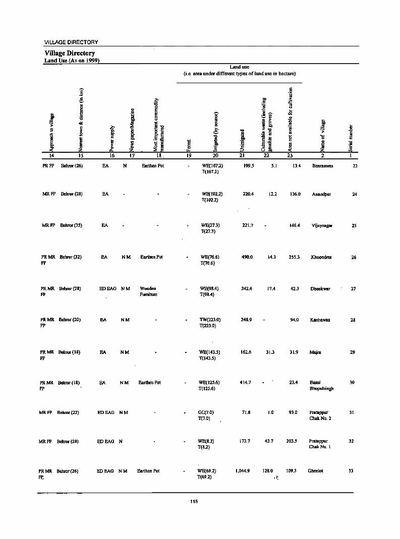
VILLAGE DIRECTORY
Village Directory Land Use (As on 1999)
]' ~
.1 j .., d!I .;:
g i g
J ~ ~ 14 15
PRFP Behror(26)
MR FP Behror (2B)
MR FP Bebror (35)
PR MR Behror(32) FP
EA
EA
EA
EA
~ :0 0 ., E . J E 0 u
i~ 2:> ~ §: ., !: .5 ~ ..
J ~ I ~ ~ 16 17 18.
N Earthen Pot
NM Ear1henPot
PR MR Behror (2B) FP
ED EAG N M Wooden
PR MR Bebror (20) FP
PRMR Bchror(IB) FP
PRMR Behror(18) FP
MRFP Bebror(22)
MRFP Behror(2S)
PRMR Behror(26) Ff,.
Furniture
EA NM
EA NM
EA NM Earthen Pot
EDEAG NM
EDEAO N
EDEAO NM Earthen Pot
Land use
(i.e. area under different types of land use in hectare)
~ r= 19
j :s ~
e: 1 ·E = 20
WE(167.2) T(167.2)
WE(102.2) T(102.2)
WE(27.3) T(27.3)
WE(76.6) T(76.6)
WE(9B.4) T(9B.4)
TW(223.0) T(223.0)
WE(l43.S) T(l43.S)
WE(12S.6) T(125.6)
GC(7.0) T(7.0)
WE(S.2) T(B.2)
WE(69.2) T(69.2)
115
.... ., i :r; c
::2 21
199.5
220.4
221.7
490.0
242.6
248.9
162.6
414.7
71.B
173.7
1,044.9
c .2 1;;
00 ,. c ~ ~ u u .. .5 ";;" .a ....... u .!:!
I! ~ ~ iii .!:! Iii
~ iii g .a '5 - :s 2'! 8~ 0(
22 23
5.1 13.4
12.2 136.0
146.4
14.3 2SS.3
17.4 42.3
94.0
31.3 31.9
23.4
1.0 93.0
43.7 203.5
12B.0 109.3
~t:
i .R = .;: ~ ...
0 c ., 'iI Iii ·0
~ rIl
2
Beeranwas 23
Anandpur 24
Vijaynagar 25
Khoondrot 26
Dheekwar 27
Kanhawas 28
Majra 29
Basai 30 Bhopalsingh
Pratappur 31 ChakNo.2
Pratappur 32 ChakNo.1
Ghcelot 33
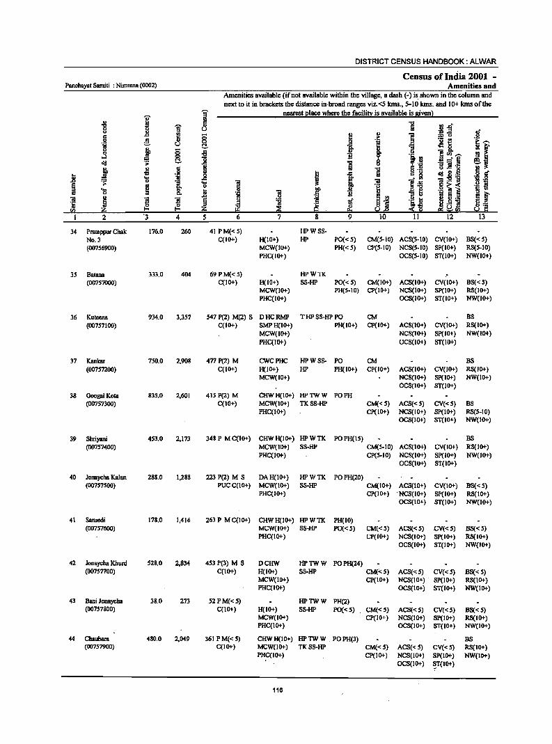
DISTRICT CENSUS HANDBOOK: ALWAR
Census of India 2001 -Panchayat Samiti : Nimrana (0002) Amenities and
Amenities available (if not available within the village, a dash (-) is shown in the column and
next to it in brackets the distance in broad ranges viz.<S lans., 5-10 lans. and 10+ lans of the
j 1 nearest elace where the facilin: is available is given}
.g I
fi 1 ll.o-0 u ~.§ .~ 0 J:l
i u ] 0:: 8 .~ .S! ~ a ~l j!.-.
5 u ~ ] = ~ 0 ~ <5 ~ 8- ]CIl.--....I 0
~ l~ = ~ ] _- ~ ~j ~ .;: ... ., Iii 11 ]1-.;: j ..s § .,
] .. 'lj 5 J .c 0:: g ~ g.~ .§ g u
~ .... .c
f ]I l~ 'l;:5!] .~ 'i .s:> 0
1 OS 1 E .. ~
c~< ::s 'Cl ~ 6 B i .2 ] ~ ~ 0:: 'lj :I a iii E 01 ..
! ! .s:>
~i .~ u eVj '5 ~ ~ ~ 1i 'C ~ o .8 8:: CIl ~ a e:s s.!.c ::!:~ III ~rIl So! C I 2 '3 4 S 6 7 8 9 10 II 12 13
34 Pratappur Chak 176.0 260 41 P M«5) HPWSS-
No.3 C(IO+) H(IO+) HP PO« S) CM(5-10) ACS(5-10) CV(IO+) BS« S) (00756900) MCW(IO+) PH«S) CP(5-10) NCS(S-IO) SP(lO+) RS(S-IO)
PHC(IO+) OCS(S.IO) ST(lO+) NW(lO+)
35 Batana 333.0 404 69 P M«5) HPWTK (00757000) C(IO+) H(lO+) S8-HP PO« 5) CM(lO+) AC8(10+) CV(IO+) B8«5)
MCW(IO+) PH(5-10) CP(IO+) NCS(IO+) SP(IO+) RS(IO+) PHC(IO+) OCS(IO+) ST(IO+) NW(IO+)
36 Kutecna 934.0 3,357 547 P(2) M(2) 8 DHCRMP THPSS-HPPO CM BS
(00757100) C(IO+) SMPH(IO+) PH(IO+) Cp(IO+) ACS(IO+) CV(IO+) RS(IO+)
MCW(IO+) NCS(IO+) Sp(IO+) NW(lO+)
PHC(lO+) OCS(lO+) ST(lo+)
37 Kanlcar 750.0 2,908 477 P(2) M CWCPHC HPWSS- PO CM BS
(007S7200) C(IO+) H(IO+) HP PH(IO+) CP(IO+) ACS(JO+) CV(IO+) RS(IO+) MCW(IO+) NCS(IO+) SP(lO+) NW(IO+)
OCS(lo+) ST(lO+)
38 GoogalKota 835.0 2,601 415 P(2) M CHWH(IO+) HPTWW PO PH (00757300) C(lO+) MCW(IO+) TKSS-HP CM«5) ACS«5) CV«5) BS
PHC(IO+) CP(IO+) NCS(IO+) SP(IO+) RS(5-10) OCS(IO+) ST(IO+) NW(IO+)
39 Shriyani 453.0 2,173 348 P M C(IO+) CHWH(IO+) HPWTK POPH(15) BS
(00757400) MCW(IO+) 8S-HP CM(5-1O) ACS(IO+) CV(IO+) RS(IO+) PHC(lO+) CP(S-JO) NCS(IO+) Sp(lO+) NW(lO+)
OCS(IO+) ST(IO+)
40 Jonaycha Kalan 288.0 1,288 223 P(2) M S DAH(IO+) HPWTK POPH(20) (00757500) PUCC(lO+) MCW(IO+) S8-HP CM(IO+) ACS(IO+) CV(IO+) BS« S)
PHC(JO+) CP(IO+) . NCS(IO+) SP(IO+) R8(10+) OCS(IO+) ST(IO+) NW(IO+)
41 Sansedi 178.0 1,416 263 P MC(IO+) CHWH(IO+) HPWTI< PH(IO) (00757600) MCW(lO+) S8-HP PO«S) CM«5) ACS«5) .cV«.5) B8« 5)
PHC(IO+) CP(IO+) NC8(10+) SP(IO+) RS(JO+) OC8(10+) ST(IO+) NW(IO+)
42 Jonaycha Khurd 528.0 2,834 453 P(3) M S DCHW HPTWW POPH(24) (00757700) C(IO+) H(IO+) S8-HP CMf<5) ACS«5) CV«S) BS« S)
MCW(IO+) CP(IO+) NCS(IO+) SP(IO+) RS(IO+) PHC(IO+) OCS(IO+) ST(IO+) NW(IO+)
43 Bani Jonaycba 38.0 273 52 PM«S) HPTWW PH(2) (007S7800) C(IO+) H(IO+) S8-HP po«S) CM«5) ACS«S) CV«.5) B8«.5)
MCW(IO+) CP(IO+) NCS(IO+) SP(IO+) RS(IO+) PHC(IO+) OCS(IO+) ST(IO+) NW(IO+)
44 Chaubara 480.0 2,049 361 PM«S) CHWH(IO+) HPTWW . POPH(3) BS (00757900) C(10+) MCW(IO+) TKSS-HP CM«S) ACS«S) CV«S) RS(IO+)
PHC(IO+) CP(lo+) NCS(IO+) SP(IO+) NW(IO+) OCS(IO+) ~T(IO+)
116
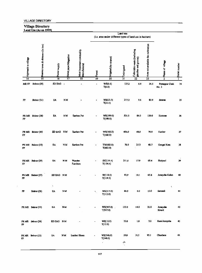
VILLAGE DIRECTORY
Village Directory Land Use (As on 1999)
]' ~ " ! j '6
~ oI1J
i 12 ..c Ii! ! e != ..
~ 14 IS
MRFP Behror(20)
FP Bchror (3 I)
PR MR Bchror (38) FP
i ;:J .. ~ i.. 16
EDEAG
EA
EA
.0 ~ ., ~ . , g u
~ I] §. I>._
'" E U ._ cf!
i 1;; :s o Iii
~ :E 5 17 18
NM
NM Earthen Pot
PR MR Behror (36) FP
ED EAG N M Earthen Pot
PR MR Behror (25) FP
PR MR Behror (29) FP
PR MR Behror (27) FP
FP Behror(26)
PRMR Behror(25)
PRMR Bebror(24) FP
PRMR Bchror(23) FP
EA N M Earthen Pot
EA NM Wooden Furniture
EDEAG NM
EA NM
EA NM
EDEAG NM
EA NM Leather Shoes
Land use (i.e. area under different types ofland use in hectare)
~ 0
!:o 19
'U'
~ '" ~
i ] 20
WE(6.6) T(6.6)
WE(23.5) T(23.5)
WE(199.0) T(199.0)
WE(166.0) T(166.0)
TW(683.0) T(683.0)
GC(154.4) T(154.4)
W(IIS.5) T(llS.S)
WE(115.0) T(1IS.0)
WE(347.0) T(347.0)
WE(12.0) T(12.0)
WE(34B.0) T(34B.0)
117
i 00
'E ·s i2 21
127.2
217.3
531.0
466.0
7B.O
211.6
93.9
44.0
135.0
22.0
19.0
,~~
c 0 'fi
co .£; c
~ :; u
U .. c .-.. cE ;=:,rJ ., B i ~ l] :;;
iii 0 ~ la c
2'5 .. - :s !! 8 CL -<
22 23
6.0 36.5
9.6 83.0
84.0 120.0
48.0 70.0
25.3 48.7
17.9 69.4
10.1 65.8
6.0 13.0
14.0 32.0
1.0 3.0
19.5 93.1
~ J! .;; § 'a c
u "iii 5 '0 ~ 5!l 2 I
Pratappur Chak 34 NO.3
Batana 35
Kuteena 36
Kankar 37
GoogalKota 38
Shriyani 39
Jonaycha Kalan 40
Sansedi 41
JonaychB 42 Khurd
Bani Jonaycha 43
ChaubBm 44
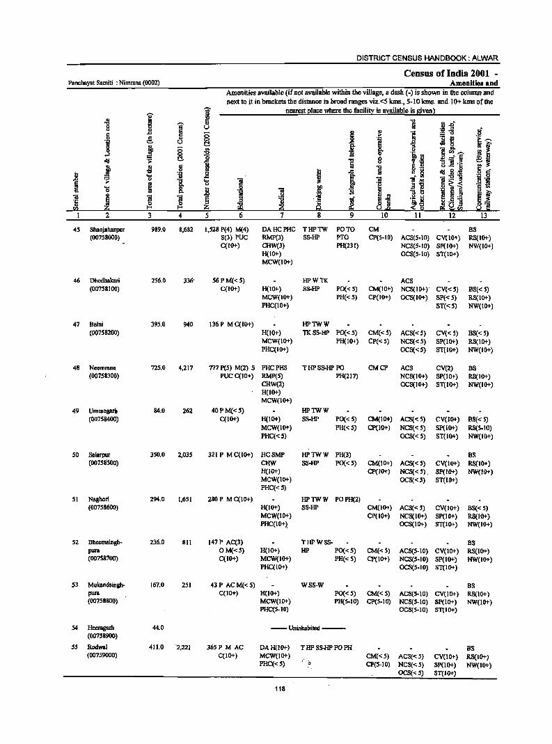
DISTRICT CENSUS HANDBOOK: ALWAR
Census of India 2001 _ Panchayat Samiti : Nimmna (0002) Amenities and
Amenities available (if not available within the village, a dash (-) is shown in the column and
next to it in brackets the distance in broad ranges viz.<5 kms., 5-10 kms. and 10+ kms of the -;;;- nearest place where the facility is available is given)
I ii! -8
1 fii 1 ;j_r;
Q U '.;::1 -= .r! u '" !! '" i c .c 0 .i:: :.:: 0
.9 e " <:>
~ e ._ t!
~,...
~ u C ~ 0
if j OJ 0 .. s:>. u ]~~ ...J <:> -0 1l ~ '~.~ Jd C ~ 1 ...:§ .. :; 01 .c
j ..s s !!I ] 5 .~ <.> .c S 8 c I .c c. ~ Jd g." b .... 'il _g ~ ]:211 .~ 0 .&l ~ Q
1 'S 1 01 ] .~ '8 .~ ~ B 'g .9 ~ 1 'S s:>. b ] .~ i ~1
-=1 ~f 01 I ]I l ~ ,~ o '" ~ ~.~ j "B 1if 'Ii.~ ~.s 1 ·c
t2 'C & a'~ '" z Z 9 u,e S Q E!I~<Il <Il
I 2 3 4 5 6 7 8 9 10 11 12 13
45 Shahjahanpur 989.0 8,682 1,528 P(4) M(4) DAHCPHC THPTW PO TO CM BS (007S80OO) S(3) PUC RMP(3) SS-HP PTO CP(S-IO) ACS(S-IO) CV(IO+) RS(IO+)
C(10+) CHW(3) PH(23I) NCS(S-IO) SP(IO+) NW(tO+) H(lO+) OCS(S-tO) ST(IO+) MCW(IO+)
46 Dhodhakari 256.0 336' 56PM«5) HPWTK ACS (00758100) C(IO+) H(IO+) S8-HP PO« 5) CM(IO+) NCS(IO+)' CV«5) 88«5)
MCW(lO+) PH« 5) CP(IO+) OC8(10+) SP« 5) RS(IO+) PHC(IO+) ST«5) NW(10+)
47 Belni 395.0 940 136 P M C(IO+) HPTWW (00758200) H(Jo+) TKS8-HP PO« 5) CM«5) ACS«S) CV«S) B8« 5)
MCW(IO+) PH(lO+) CP«5) NCS«5) SP(IO+) R8(10+) PHC(IO+) OCS«S) ST(IO+) NW(IO+)
48 Neemnna 72S.0 4,217 717 P(5) M(2) S PHCPHS THPSS-HPPO CMCP ACS CV(2) BS (007S83OO) PUC C(10+) RMP(S) PH(217) NCS(IO+) SP(IO+) RS(10+)
CHW(2) OCS(IO+) ST(lO+) NW(IO+) H(IO+) MCW(IO+)
49 Ummogarb 84.0 262 40 P M« 5) HPTWW (00758400) C(IO+) H(IO+) SS-HP PO« 5) CM(lO+) ACS«5) CV(JO+) BS«5)
MCW(lO+) PH« 5) Cp(JO+) NCS«5) Sp(IO+) RS(5-IO) PHC«S) OCS«5) ST(lo+) NW(IO+)
SO Salarpur 350.0 2,035 321 P M C(IO+) HCSMP HPTWW PH(3) BS (007SII'500) CHW SS-HP PO« 5) CM(IO+) ACS« S) CV(lO+) RS(IO+)
H(IO+) CP(IO+) NCS«S) . Sp(IO+) NW{IO+) MCW(IO+) OCS«S) ST(lo+) PHC«S)
51 Naghori 294.0 t,6S1 280 P M C(1O+) HPTWW POPH(2) (007S8600) H(IO+) SS-HP CM(IO+) ACS«S) CV(lO+) 88« 5)
MCW(IO+) CP(IO+) NCS(IO+) Sp(IO+) RS(IO+) PHC(IO+). OCS(IO+) 8T(10+) NW(IO+)
S2 Bheemsingh- 236.0 811 147 P AC(3) THPWSS- BS pun o M«S) H(IO+) HP PO« 5) CM«S) ACS(S-IO) CV(IO+) RS(IO+) (00758700) C(IO+) MCW(IO+) PH« 5) CP(IO+) NCS(S-IO) SP(IO+) NW(IO+)
PHC(IO+) OCS(S-IO) ST(lO+)
S3 MukBndsingh- 167.0 251 43 P ACM«5) WSS-W BS pura C(IO+) H{IO+) PO«5) CM«5) ACS(S-IO) CV(lO+) RS(IO+) (00758800) MCW(IO+) PH(S-lO) CP(S-IO) NCS(S-lO) SP(lO+) NW(lO+)
PHC(S-IO) OCS(S-IO) ST(IO+)
54 HceJBBIII'h 44.0 --Uninhabited ---(00758900)
SS Rod ... 1 411.0 '2,221 36SP M AC DAH(IO+) T HP SS-HP PO PH BS (00759000) C(IO+) MCW(lO+) CM«S) ACS«S) CV(IO+) RS(lO+)
PHC«S) ~. CP(S-IO) NCS«S) SP(lO+) NW(IO+) OCS«5) ST(lO+)
118
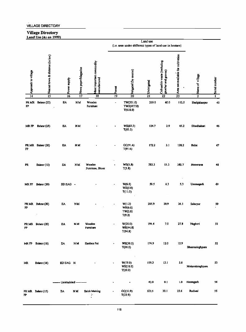
VILLAGE DIRECTORY
Village Directory Land Use (As on 1999)
]' c
;;:.
I j '6
~ cI!I
i s
J 'in
& 2:i
14 15
PRMR Behror (22) FP
MR FP Behror(2')
PR MR Bellror (20) FP
PR Bellror(15)
MRFP Behror(20)
PRMR Behror(20) FP
PRMR Behror(20) FP
MRFP Behror(18)
Z:-
~ ~ ~ 16
EA
EA
EA
EA
EDEAO
EA
EA
EA
MR Bchror(16) EDEAO
.~
." 0
2! E
'i E 0 u
t i-o &.~ .5 J! g.
~ s " ~ ~ 2:i 17 18
NM Wooden Furniture
NM
NM
NM Wooden Fumitwe. Shoes
-
NM
NM Wooden Furniture
NM Earthen Pot
N
--Uninhabited--
PRMR Behror(15) EA NM Brick Making FP . j,
Land use
(Le. area under different types ofland use in hectare)
'in e 0 r= 19
I ~ e; 1 'E = 20
TW(201.0) TWE(417.0) T(618.0)
WE(83.2) T(83.2)
OC(91.6) T(91.6)
WE(5.8) T(5.8)
W(6.0) WE(5.0) T(lI.O)
W(1.2) WE(6.0) TW(2.0) T(9.2)
W(20.0) WE(44.8) T(64.8)
WE(36.5) T(36.5)
W(19.0) WE(IO.O) T(29.0)
OC(33.9) T(33.9)
119
-g i 'E '2 :2 21
219.0
124.7
172.2
283.3
59.5
295.9
194.4
174.9
119.3
43.0
323.5
c 0 .~
!I ~ '6 .. u
8- .e ;::.:1 ... !l ~ =i ~." =s
iU .!! Iii ~ iii 0 213
c
-= II ~ !.! !!!l 22 23
40.0 112.0
2.9 45.2
3.1 128.2
55.3 380.7
8.3 5.3
20.9 24.1
7.0 27.8
12.0 12.9
13.1 5.6
0.1 1.0
30.1 23.6
i ~ .;; .D
~ .... 0 u 'iii III 'r::
u 2:i II)
2
Shahjahanpur 45
Dhodhakari 46
Belni 47
Neemrana 48
Umraogarh 49
Salarpur 50
Naghori 51
52 Bheemsinghpura
53 Mukandsinghpura
Heeragarh 54
Rodwal 55
DISTRICT CENSUS HANDBOOK: ALWAR
Census of India 2001 -Pallcbayat SBmiti : Niml'lllla (0002) Amenities and
Amenities available (if not available within the village, a dash (-) is shown in the column and next to it in brackets the distBIicc in broad ranges viz. <5 kms., 5-10 kms. and 10+ krns of the
I ~ nearest Qlacc where the facility is available is given}
] ., '" . "0
... .0 1 ., s u .S! :s .; ..!!
! .,
] ;!:u a ii § .~ .2
] g u (:!. e! ~£! ~.-.
~ 8 ... '" g -8. if c. e!",.-. ~ 'li ~ 'fj cId ~ (:!.
1 a__"~
u g ]! ·c ~ .s c::
., 1 II> g r:! 0 " f ..c: s: g cId g.g
b 'il 0
~ ... ..c: ~ 1 l~ 1j:5!"g 'N ·8 ,.D 0
1- "0 'iI ~ e 6 o~<
._ s "0 I; ... '" g] 'il E]
§ ... c:: c. 'Iii 'iI c:: 'li
~i E f ,.D .2 ~ .ii ~ S S ~ i 'B l l!; !! '" ._ ·c ~ .. 5 ] E_ '" ~ ~ ;;§
·c ~ 'f! .5!;! Zi 9 s..!.e ~ ~SQ
2 3 4 5 6 7 8 9 10 11 12 13
56 Majari Khurd 242.0 1,844 276 P(2) M HPTWW BS (00759100) C(lO+) H(IO+) SS-HP PO«S) CM(5-10) ACS(S-IO) CV(IO+) RS(lO+)
MCW(IO+) PH« S) Cp(IO+) NCS(IO+)' SP(IO+) NW(lO+) PHC«S) OCS(IO+) ST(IO+) .
S7 DBusod 9S9.0 3,016 483 P(3) M S DA PHS CHW HP TW W POPH(2S) ACS BS (007S9200) C(IO+) H(IO+) SS-HP CM(5-10) NCS(IO+) CV(IO+) RS(lO+)
MCW(IO+) Cp(IO+) OCS(IO+) 8P(10+) NW(IO+) PHC(S-IO) 8T(10+)
58 Banthala 168.0 741 123 P M«5) HPWS8-(00759300) C(IO+) H(IO+) HP PO«S) CM«S) ACS« S) CV«S) BS«S)
MCW(IO+) PH«S) CP« S) NCS(IO+) 8P(10+) RS(S-IO) PHC(S-IO) OCS(lo+) 8T(10+) NW(IO+)
59 Raiwana 608.0 1,889 309 P M C(IO+) RMPH(IO+) HPWTK PH BS (00759400) MCW(IO+) SS-HP POC< 5) CM(S-IO) ACS«5) CV«5) RS(IO+)
PHC(S-IO) CP« 5) NCS(lo+) SP(IO+) NW(IO+) OCS(IO+) 8T(10+)
60 Talwana 482.0 1,945 303 P(2) M THPWSS- CP ACS (00759500) C(IO+) H(lo+) HP PO«S) CM(S-IO) NCS(IO+) CV«5) BS«5)
MCW(IO+) PH«S) OCS(IO+) 8P(10+) RS(IO+) PHC(IO+) ST(IO+) NW(IO+)
61 Kaysa 1,403.0 3,SIS SSO P(4) M(2) 8 CHWH(IO+) HPTWW PO BS (007S9600) PUCC(JO+) MCW(JO+) SS-HP PH«S) CM(S-IO) ACS« S) CV(JO+) RS(5-10)
PHC(S-IO) CP«S) NCS(IO+) 8P(10+) NW(IO+) OCS(IO+) 8T(J0+)
62 Doomroli 1,085.0 3,362 SS7 P(4) M(2) 8 DARMP(2) THPTW PO PH BS (00759700) PUCC(IO+) SMPCHW WTKSS- CM(IO+) ACS(IO+) CV(10+) RS(lO+)
H(IO+) HP CP(IO+) NCS(IO+) SP(IO+) NW(IO+) MCW(lO+) OCS(IO+) ST(IO+) PHC(IO+)
63 Aklecmpura 179.0 838 166 P M C(IO+) . RMPSMP HPWTK PO PH (00759800) CHWH(1O+) SS-HP CM(IO+) ACS(IO+) CV(1O+) B8«5)
MCW(IO+) CP(IO+) NCS(IO+) SP(IO+) RS(10+) PHC(IO+) OCS(IO+) ST(lo+) NW(JO+)
64 Nibalpura 195.0 793 142 P M C(S-IO) RMPSMP HPWTK BS (00759900) CHW H(5-10) SS-HP . PO«5) CM(5-10) ACS(IO+) CV(S-IO) RS(S-IO)
MCW(S-IO) PH(S-IO) CP(IO+) NCS(IO+) SP(5-10) NW(IO+) PHceS-IO) OCS(IO+) ST(S-IO)
6S Nareda Khurd 228.0 928 165PM«S) RMPSMP HPWTK PH BS (00760000) C(IO+) CHWH(IO+) SS-HP PO«S) CM(IO+) ACS(lo+) CV(lo+) RS(1O+)
MCW(IO+) CP(IO+) NCS(IO+) Sp(IO+) NW(IO+) PHC(IO+) OCS(IO+) ST(IO+)
66 Naislll'llllll 730.0 1,711 2S4 P M C(IO+) RMPCHW HPTWW PH (00760100) H(10+) TKSS-HP PO«S) CM(S-IO) ACS(IO+) CV(IO+) B8«5)
')\I[CW(IO+) CP(IO+) NCS(IO+) SP(JO+) RS(IO+) PHC(IO+) OCS(IO+) ST(IO+) NW(IO+)
120
VILLAGE DIRECTORY
Village Directory Land Use (As on 1999}
]' e j J ~ .;;
~ 9 .c
l I Co < 14 15
PRMR Behror(IS) FP
PRMR Bebror(16) FP
MRFP Behror(IS)
PR Behror(l7)
PR Bebror(17)
PR Behror(18)
PR MR Behror (27) FP
PR MR Behror (31) FP
PRMR Bebror (32) FP
PRMR Behror (30) FP
PRMR Behror(31) FP
EA
EA
EA
EA
EA
EA
EA
EA
EA
EA
EA
» Q. §-'" ~ If 16
b :;:; .. ~ c
'i E 8
i] ~ ., 8..a ~ .~ ~ Co
i lS Iii z ::g E 17 18
NM Wooden Furniture. Leather Shoes
NM Wooden Furniture. Earthen Pot
NM
NM
N M Earthen Pot
N M Earthen Pot, Furniture
N M Earthen Pot, Furniture, Shoes
NM
NM
NM
NM
Land use (Le. area under different types of land use in hectare)
~ 0
"" 19
i " $I £ ~
] .~ eo 20
WE(8.0) T(8.0)
WE(636.0) T(636.0)
W(104.2) T(104.2)
WE(374.5) T(374.5)
WE(3Sl.7) T(353.7)
WE(S89.2) T(5S9.2)
16 WE(457.0) T(457.0)
WE(IIO.O) T(lIO.O)
WE(114.0) T(114.0)
WE(S7.0) T(87.0)
41 WE(247.0) T(247.0)
121
"I:J
tl DO 'E '2 t:? 21
168.0
239.0
30.6
7O.S
69.8
350.1
352.0
55.0
62.0
108.0
304.0
c 0 .~
bO > C ~ :g u
c:; .. c ~ cS ._ '" ~ u ..!! j! ~
';j iii ..!! a
~ til <; c
.a"fl '" 8' ~ 22 23
20.7 45.0
28.0 56.0
7.1 26.2
25.0 138.0
S.4 50.2
109.3 354.5
85.8 174.0
0.7 13.0
5.1 14.0
9.1 24.0
95.3 4l.0
! ..8 .;; § ....
0 C ., iii
~ .c;
z ., .."
2
MajBri Khurd 56
Dausod 57
BanthBla 58
Raiwana 59
Talwana 60
61
Doomroli 62
Aklccmpura 63
NihBlpura 64
NaredB Khurd 6S
NBisaranB 66
DISTRICT CENSUS HANDBOOK: ALWAA
Census of India 2001 _ Panchayat Samiti : Nimrana (0002) Amenities and
Amenities available (if not available within the village, a dash (-) is shown in the column and next to it in brackets the distance in broad ranges viz.<5 kms., 5-10 kms. and 10+ kms of the
I I nearest elace where the facili!X is available is Bivenl
.g 1 1 "'.0 U ~a5 of Q .c 0 :!! '" ] .~ c 8 'j 0 :§. ~ 0
._ {! ~~ ';1
} "& "5 ~8. ~ f Q 0 '" '" " 0 '0 1l 0 1; Sfll~ ....l 0 ....:§ old .;;: C "S
1 8 ~~ -5 "5] '1::
1f .s l5 [!I
I .c 1 c 8 ~ g.-8 .§ g' t ~
... 'j .8 Po '
l~ ]:211 B ._ 1
0
I .... 1 i 1 E 0 o ~ < 's! 'a t 'i ] i 1l "5 ~ .~ E a ~ ]I ..
] ] .Q
~~ .§,~ ~ ~ .E!
! § ~ ~ 1i H·5 ] !] t '1:: 0
fa :z; 9 8:1 Sc!.s :::!: Ii! e; ~fIl 1 2 3 4 5 6 7 8 9 10 11 12 13
67 Khatiwas 142.0 12 3 WSS-W (OO760400) P«5) H(IO+) PO« S) CM«S) ACS(IO+) CV(IO+) BS« 5)
M«S) MCW(IO+) PH{< S) CP{S-IO) NCS(IO+) SP(tO+) RS(IO+) C{<S) PHC« 5) OCS(IO+) ST(IO+) NW{IO+)
68 Majri Kalan S04.0 3,484 S8SP M S PUC PHCH(IO+) TliPTW POPH(8) CM BS (OO760S00) C(IO+) MCW(IO+) WSS-HP CP{5-1O) ACS(IO+) CV(S-IO) RS(IO+)
NCS(IO+) SP(tO+) NW{IO+) OCS{IO+) ST{IO+)
69 Bijaisinghpum 241.0 1,180 231 PM«5) HPWSS- BS (00760600) C(tO+) H(1O+) HP PO«5) CM« S) ACS«5) CV(IO+) RS(IO+)
MCW(IO+) PH« 5) CP{5-10) NCS{IO+) SP{IO+) NW{lO+) PHC«S) OCS(IO+) 8T{10+)
70 Kundansingh- 328.0 566 8IPM{<S) HPTWW pura C{IO+) H(IO+) S8-HP PO« S) CM{IO+) AC8«S) CV{IO+) B8«5) (00760700) MCW(IO+) PH« S) CP{IO+) NCS« 5) SP{IO+) RS(IO+)
PHC{<5) OCS{<S) ST(IO+) NW{IO+)
71 DaulatsinghpurB 446.0 1,915 288 P M C(IO+) RMPH(IO+) HPTWW PH BS (OO760800) MCW{IO+) SS-HP PO{<5) CM{<5) ACS«S) CV{<S) RS{IO+)
PHC«S) CP{<5) NCS{<5) SP{IO+) NW{IO+) OCS{<S) ST{IO+)
72 Madhosingh- 462.0 1,357 191 P M{<S) HPTWW CM pura C{IO+) H(10+) . TKSS-HP PO{< 5) CP{<S) ACS{<5) CV{<5) BS(S-IO) (00760900) MCW{IO+) PH«S) NCS«S) SP{IO+) RS(IO+)
PHC«5) OCS« 5) ST{IO+) NW(IO+)
73 JBnaksinghpura 230.0 634 81 PM{<S) THPTW BS (00761000) C(IO+) H(IO+) WTKSS- PO«5) CM«S) ACS« S) CV{<S) RS(lO+)
MCW{IO+) HP PH(IO+) CP{< 5) NCS«5) SP{IO+) NW(IO+) PHC(IO+) OCS«5) ST(IO+)
74 Fauladpur 519.0 3,03S 480PMS HPTWW PH(20) BS (00761100) C(tO+) H(IO+) SS-HP PO«5) CM«S) ACS{IO+) CV«5) RS(IO+)
MCW(IO+) Cp(IO+) NCS(IO+) SP{IO+) NW{IO+) PHC(IO+) OCS(lO+) ST(IO+)
75 Baari 363.0 488 85 P M{<5) HPTWW (00761200) C{IO+) H(IO+) SS-HP PO{< 5) CM{<5) ACS{<S) CV{<S) BS{<S)
MCW{IO+) PH(IO+) CP«5) NCS«5) SP(IO+) RS(lO+) PHC(IO+) OCS{<S) ST(lO+) NW(lO+)
76 Isrisinghpura 188.0 441 71 P M{< 5) HPWSS-(00761300) C(IO+) H(IO+) HP PO{<S) CM«S) ACS«S) CV{<5) BS«S)
MCW(IO+) PH(IO+) CP« 5) NCS«S) SP(IO+) RS(IO+) PHC(IO+) OCS«S) ST{IO+) NW(IO+)
77 Kalipahari 188.0 476 67 PM(10+) HPTWW (00761400) C(IO+) H(lo+) SS-HP PO«5) CM{<S) ACS«5) CV«5) 8S« S)
MCW(IO+) PH« 5) CP«5) NCS«5) SP{IO+) RS(IO+) ~!- PHC«S) OCS«S) ST(IO+) ,,;NW(10+)
122
VILLAGE DIRECTORY
Village Directory Land Use (As on 1999)
i d
.1 " ~ og
.;: ~
s ! ..c
~ j g: !1: 14 15
FP Behror(13)
PRMR Behror(13) FP
MRFP Behror(13)
MRFP Behror(20)
PR Behror(18)
FP Behror(15)
PR MR Behror (IS) FP
PR MR Behror (20) FP
PR MR Behror (25) FP
MR FP Behror (17)
.~ "8
.~ E E
! 0 u
I~ ~ 8- ~ co .~ ~ g.
~ ~ ~ Ii 2:i ;;§ E e=
16 17 18
EOEAG NM Wooden Furniture
EDEAG NM Brick
EDEAG -
EA NM
EA
EA N M Earthen Pot
EA ·NM
EA NM
EA NM
FP Behror(l1) EDEAG N
Land use (i.e. area under different types of land use in hectare)
i ::> Ii! € i tl
I!! 0 Jj "'" 19 20
W(40.0) T(40.0)
WE(65.0) T(6S.0)
W(16.S) WE(IS.4) T(31.9)
W(20.2) WE(20.0) TW(6.0) T(46.2)
WE(151.6) T(ISI.6)
GC(143.1) T(143.1)
32.95 GC(75.7) T(75.7)
WE(387.0) T(387.0)
WE(309.0) T(309.0)
WE(76.0) T(16.0)
WE(IS.O) T(IS.O)
123
"0
~ au 'E
~ 21
9S.0
177.7
25S.9
261.9
286.2
90.7
59.0
37.0
79.0
SO. I
S 'i
l1li .~ c '6 ] ::> U oS c~ ._ .. ~" .. .. > ii " - ~ l ~"O ~
i; .;: ..!! Iii ~ :a g ....
0
Eii u
:; iii ~ ~ ~!i!! 22 23 2
1.0 3.0 Khatiwas
383.0 55.5 Majri Kalan
15.7 16.2 Bijaisinghpura
12.3 10.3 Kundansinghpura
9.8 22.2 Oaulatsinghpura
3.7 29.4 Madhosinghpura
12.4 18.4 Janaksingbpura
29.0 44.0 Fauladpur
10.0 1.0 Baori
10.0 23.0 Isrisinghpura
20.5 12.6 KaJipahari
l E ::> c
"iii ·c u
rIJ
I
67
68
69
70
71
72
73
74
75
76
77
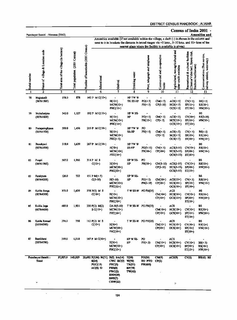
DISTRICT CENSUS HANDBOOK: ALWAR
Census ofIndia 2001 -Panchayat Samiti : Nimrana (0002) Amenities and
Amenities available (if not available within the village. a dash (-) is shown in the column and
next to it in brackets thedistanee in broad ranges viz.<5 kms., 5-10 kms. and 10+ kms ofthe
I '[ nearest I!laee where the facili~ is available is siven 1
u c 1 f(J..d' "1:1
~ ~ 8
i " i ~~ .,. c 0 .~ '! f 0 g u 0
,~ ~
'i u C!. ~ ~ 0 g l 0 <II Q, t> m~-...... 0 ] II b 19 old ';;: C!. 1 t> "9 :;a" ,~ ~~ 6
·u c U t>'<: ..
j ~ .. 1 0'-
dd 3,~ § c ..8 'ij .8 i -a c g .... l; ... :gog ''';: 0
0 ~ ~ os .~
i .... ] .~ s § .. os 0 c~< .... ; ..8 .S! .~ Il "9~ ,g ] § ..
~ II u c 0 t>. t;j
~J '" E ~ t a! Il
~ ~ § g ~ oJ' .~ ....
!~! '5 J ;Z; ~ ! ~ tb~ ~] <Il :$ e I 2 3 4 5 6 7 8 9 10 11 12 13
78 Majrakath 578.0 878 142 P M C(10+) HPTWW (0076IS00) H{IO+) TKSS-HP PO{< 5) CM{<S) ACS{<S) CV{< S) BS{< S)
MCW{IO+) PH{< S) CP{S-IO) NCS{<S) SP(10+) RS{IO+) PHC(IO+) OCS«S) ST(IO+) NW(IO+)
79 Mohalariyan 342.0 1,127 192 P M C(IO+) HPWSS- BS (00761600) H(IO+) HP PO«S) CM« S) ACS{<S) CV(IO+) RS(S-IO}
MCW(IO+) PH(IO+) CP« S) NCS(IO+) SP(IO+) NW(IO+) PHC(IO+) OCS(IO+) ST(IO+)
80 Pratapsinghpura 399.0 1,4S6 21S P M C(IO+) HPTWW PO (00761700) H(IO+) S8-HP PH«S) CM«S) ACS«5) CV« 5) BS« 5)
MCW(IO+) CP{< 5) NCS«S) SP(IO+) RS(IO+) PHC«S) OCS«S) ST(IO+) NW(IO+)
81 Bccchpuri 318.0 1,639 267P MC(IO+} HPTWW BS (00761800) H(IO+} SS-HP PO(S.IO) CM«S) ACS(S-IO} CV(IO+) RS(IO+)
MCW(IO+) PH(IO+) CP(IO+) NCS(S-IO) Sp(IO+) NW(IO+) PHC(IO+) OCS(5-10) ST(10+)
82 Peepli 567,0 1,966 314P M S HPWSS- PO BS (00761900) C(IO+) H(IO+) liP PH{IO+) CM(S-IO) ACS(5-10) CV(IO+) RS(lO+)
MCW{IO+) CP{S-IO) NCS(S-IO) Sp(IO+) NW{IO+) PHC{IO+) OCS(5.10) ST(lO+)
83 Fatehpura 126.0 722 ISIPM«S) IiPWSS- BS (00764200) C(5-IO) H(S'ID) HP PO«S) CM(IO+) ACS(ID+) CV«5) RS(IO+)
MCW(IO+) PH{S-lD) CP(IO+) NCS{IO+) SP(IO+) NW(IO+) PHC(IO+) OCS(IO+) ST(IO+)
84 Kolila Sanga 373,0 1,639 278P(2) M S TWSS·W POPH(2S) ACS BS (00764300) C(lO+) H(IO+) CM(IO+) NCS(IO+) CV(IO+) RS(IO+)
MCW(IO+) CP(IO+) OCS(IO+) SP(IO+) NW(IO+) PHC(IO+) ST(IO+)
85 KoIilaJoga 489,0 1,901 330 P(3) M(2) DAH(S.IO) TWSS·W POPH(25) ACS BS (00764400) S C(JO+) MCW(IO+) CM(IO+) NCS{IO+) CV(IO+) RS(lO+)
PHC(IO+) CP(IO+) OCS(IO+) SP(lO+) NW(10+) ST(IO+)
86 KolilaRawad 374.0 758 113 P(3) M S TWSS·W POPH(2S) ACS BS (00764500) C{IO+) H(IO+) CM(IO+) NCS(IO+) CV(IO+) RS(IO+)
MCW(IO+) CP{IO+) OCS{IO+) SP{IO+) NW(IO+) PHC(IO+) ST(IO+)
87 Bantkhani 319,0 1,018 167P MC(IO+) HPWSS- PO ACS (00764700) H{IO+) HP PH«S) CM(IO+) NCS{lO+) CV(IO+) BS«S)
MCW(JO+) cp(10+) OCS{IO+) SP(JO+) RS(IO+) PHC(IO+) ST{IO+) NW(JO+)
Panchayat SIImiti : 37,927.0 . 143,329 13,682 P(136) M(71) D(3) DA(14) T(20) P0(35) CM(9) ACS(9) CV(2) BS(43) RS Total. 8(24) ewc RC(3) W{7D) TO PTO CP(2)
PUC(13) PHC(S) TK(21) PH(693) AC(5) 0 PHS(8) HP(78)
FWC(2) TW(42) RMP(29) SMP(7) CHW(22) . t,
124
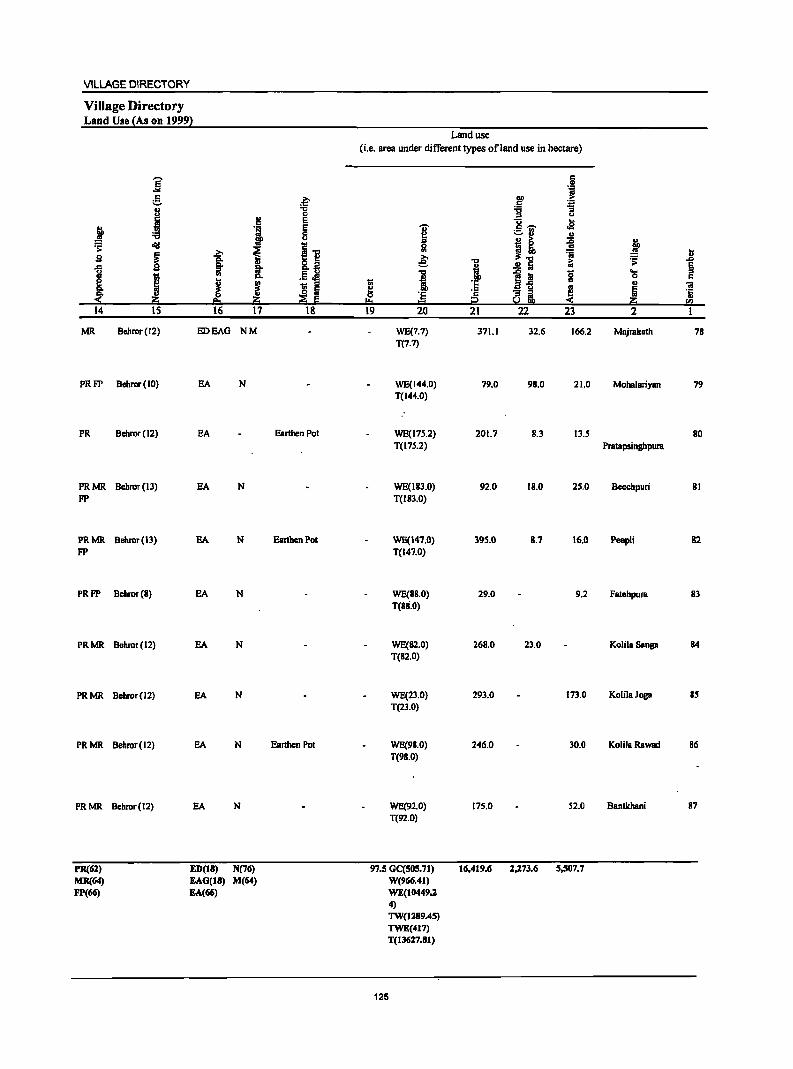
VILLAGE DIRECTORY
Village Directory Land Use {As on 19992
j ~ 9
1 ~ 14
MR
PRFP
PR
PRMR FP
PRMR FP
PRFP
PRMR
PRMR
PRMR
PRMR
PR(61) MR(64) FP(66)
]' g
j oI!I
~ j IS
Behror(12)
Behror(IO)
Behror(12)
Behror(13)
Behror(13)
Behror(S)
Behror(J2)
Behror(J2)
Behror(J2)
Behror(J2)
2! 'i
~ ~ CI.
B: :::J VI
J ! 16 17
EDEAG NM
EA N
EA
EA N
SA N
SA N
SA N
EA N
EA N
EA N
ED(ll) N(76) EAG(lS) M(64) EA(66)
.~ "C 0 E E 8
II .j 1 ::E E
18
Earthen Pot
Earthen Pot
Earthen Pot
Land use
(i.e. area under different types of I and use in hectare)
c GI
J ~ ~ :g u
U .e I c ~ ._ VI ~ ., ., ~ > ~ J VI ~! :m t .e: "C ~ ~ .ll a .!! ta E
1l l~ 0 ~ ::s c ;; i 'E c .,
] ~ ]; ·s ] ~ i2 ~ ~ 20 CI)
19 20 21 22 23 2 1
WE(7.7) 371.1 32.6 166.2 Majmkath 7S T(7.7)
WE(144.0) 79.0 9S.0 21.0 Mohalariyan 79 T(144.0)
WE(17S.2) 201.7 8.3 13.5 SO T(17S.2) Pmtapsinghpura
WE(113.0) 92.0 18.0 25.0 Beechpuri 81 T(183.0)
WE(147.0) 395.0 8.7 \6.0 Peepli 82 T(147.0)
WE(88.0) 29.0 9.2 FBlehpum 83 T(8S.0)
WE(82.0) 26S.0 23.0 KolilaSanga 84 T(82.0)
WE(23.0) 293.0 173.0 KolilaJoga 85 T(23.0)
WE(98.0) 246.0 30.0 KolilaRawad 86 T(9S.0)
WE(92.0) 175.0 52.0 Bantkhani 87 T(92.0)
97.5 GC(SOS.71) 16,419.6 1,173.6 5,507.7 W(966.41) WE(I0449.2 4) TW(1289.45) TWE(417) T(1J627.S1)
125

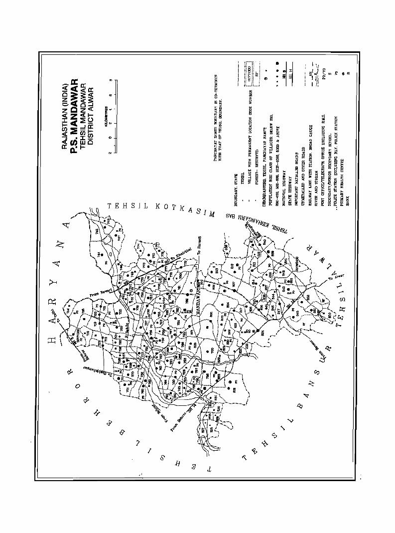
o
N
TEHSIL
o
I
l!
I Wi .. ! ·
.... l:! iii < i5 Iii ,.,
r!l"fi.
-t?-..6\ ... <
'to ~
,..1 ,......
(Il

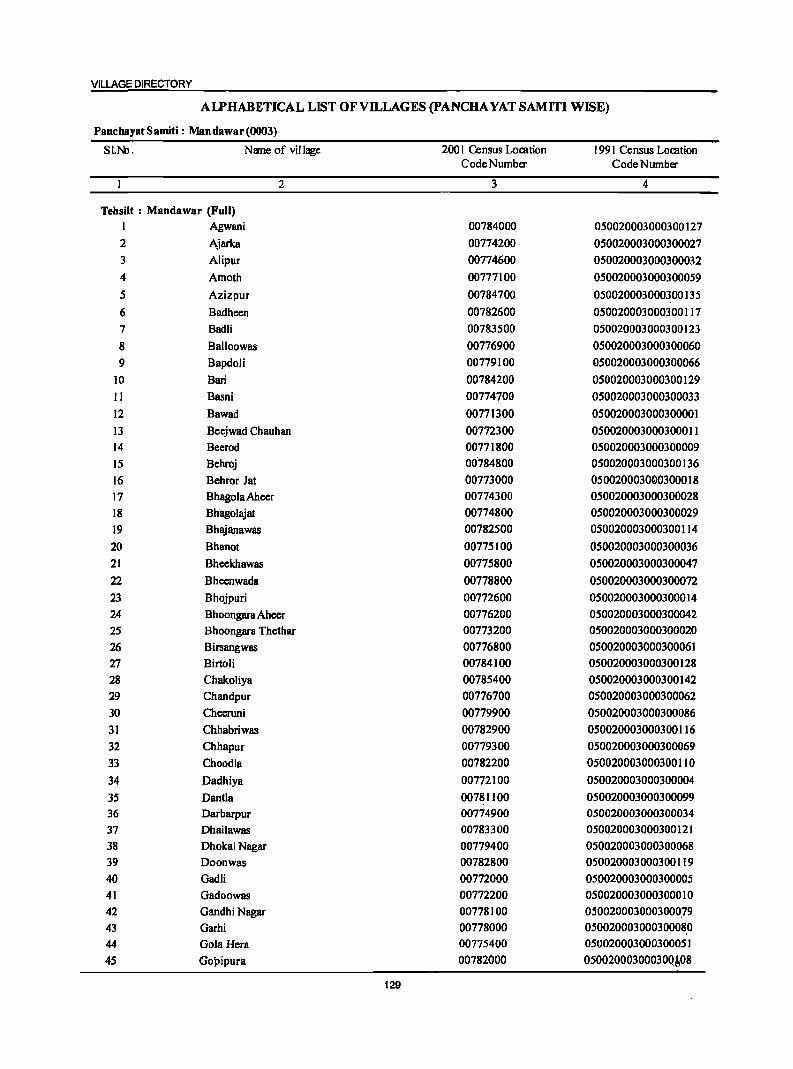
VILLAGE DIRECTORY
AI.J»HABETICAL LIST OF VILLAGES (PANCHA YAT SAMITI WISE)
PanchayatSamiti: Mandawar(0003)
SI.N:l. Name of village 200 I Census Location 1991 Census Location CodeNumber Code Number
2 3 4
Tehsilt : Mandawar (Full) I Agwani 00784000 050020003000300127 2 Ajarka 00774200 050020003000300027 3 Alipur 00774600 050020003000300032 4 Amoth 00777100 050020003000300059 5 Azizpur 00784700 050020003000300135 6 Badheen 00782600 050020003000300117 7 Badli 00783500 050020003000300123 8 Balloowas 00776900 050020003000300060 9 Bapdoli 00779100 050020003000300066
10 Bari 00784200 050020003000300129 11 Basni 00774700 050020003000300033 12 Bawad 00771300 050020003000300001 13 Beejwad Chauhan 00772300 050020003000300011 14 Beerod 00771800 050020003000300009 15 Behroj 00'784800 050020003000300136 16 Behror Jat 00773000 050020003000300018 17 BhagolaAheer 00774300 050020003000300028 18 Bhagolajat 00774800 050020003000300029 19 Bhajanawas 00782500 050020003000300114 20 Bhanot 00775100 050020003000300036 21 Bheekhawas 00775800 050020003000300047 22 Bheenwada 00778800 050020003000300072 23 Bhojpuri 00772600 050020003000300014 24 Bhoongara Aheer 00776200 050020003000300042 25 Bhoongara Thethar 00773200 050020003000300020 26 Birsangwas 00776800 050020003000300061 27 BirtoH 00784100 050020003000300128 28 Chakoliya 00785400 050020003000300142 29 Chandpur 00776700 050020003000300062 30 Cheeruni 00779900 050020003000300086 31 Chhabriwas 00782900 050020003000300116 32 Chhapur 00779300 050020003000300069 33 Choodla 00782200 050020003000300110 34 Dadhiya 00772100 050020003000300004 35 Dantla 00781100 050020003000300099 36 Darbarpur 00774900 050020003000300034 37 Dhailawas 00783300 050020003000300121 38 Dhokal Nagar 00779400 050020003000300068 39 Doonwas 00782800 050020003000300119 40 Gadli 00772000 050020003000300005 41 Gadoowas 00772200 050020003000300010 42 Gandhi Nagar 00778100 050020003000300079 43 Garhi 00778000 050020003000300080 44 Gola Hera 00775400 050020003000300051 45 Gopipura 00782000 05002000300030Q~08
129
DISTRICT CENSUS HANDBOOK: ALWAR
AlPHABETICAL LIST OF VILLAGES (pANCHA YAT SAMITI WISE)
PanchayatSamiti: Mandawar(0003)
SI.No. Name of village 2001 Census LoCation 1991 Census Location Code Number Code Number
2 3 4
46 Hada Heri 00777400 05.0020003000300054
47 Hatoondi 00779700 050020003000300087 48 Hulmana Kalan 00772400 050020003000300012 49 Hulmana Khurd 00772500 050020003000300013 50 Ikrotiya 00783600 050020003000300124 51 Jagiwara 00775600 050020003000300049 52 Jalpiwas 00782100 050020003000300109 53 Jalwas 00772800 050020003000300016 54 Jasai 00773600 050020003000300039 55 Jeendoli 00784300 050020003000300131 S6 Jeevan Singhpura 00782300 050020003000300112 57 Jhajharpur 00779800 050020003000300090 58 Jogawad 00777000 050020003000300052 59 Kadar Nagar 00784400 050020003000300132 60 Kali Pahari 00781800 050020003000300106 61 Kalooka 00778900 050020003000300071 62 . Karni Kot 00776100 050020003000300044 63 Khanpur Aheer 00777700 050020003000300057 64 Khanpur. Mewan 00785000 050020003000300138 65 Khareta 00785100 050020003000300139 66 Khohri 00776300 050020003000300043 67 Khushalwas 00784500 050020003000300133 68 Kbkawas 00779600 050020003000300088 69 Lakheempur 00782700 050020003000300118 70 Lamachpur 00771600 050020003000300007 71 Majra 00775200 050020003000300037 72 Majri Bhanda 00776000 050020003000300045 73 Majri Khola 00779200 050020003000300067 74 Mandha 00777800 050020003000300081 75 Manethi 00772700 050020003000300015 76 Manka 00771500 050020003000300003 77 Mator 00783900 050020003000300126 78 Mau 00778600 050020003000300075 79 Menpur 00780200 050020003000300091 80 Mirzapur 00771700 050020003000300008 81 Mohammadpur 00780800 050020003000300096 82 Molawas 00772900 050020003000300017 83 Mundanwara Kalan 00773300 050020003000300021 84 Mundanwara Khurd 00773400 050020003000300041 85 Mundawar 00778200 050020003000300084 86 Mundiya Khera 00776600 050020003000300063 87 Munpur 00775500 050020003000300050 88 Nahar Khera 00777200 050020003000300058 89 Nanga! Baola 00781500 050020003000300103 90 Nangal Raniya 00778300 050020003000300078 91 Nanga! Santokara 00780900 050020003000300097 92 Nanga! Singal 00784900 050020003000300137 93 Nanga! Siya 00774100 050020003000300026 94 Nanga! Udiya 00773700 050020003000300022
130
VILLAGE DIRECTORY
AIJ»HABETICAL LIST OF VILLAGES (pANCHA YAT SAMITI WISE)
PancbayatSamiti: Mandawar(0003)
SLNo. NlIl1e of village 200 I Census Location 1991 Census Location Code Number Code Number
2 3 4
95 NangaJi Ojha 00781300 050020003000300101 96 Naredi 00783700 050020003000300125 97 Padmara Kalan 00776400 050020003000300065 98 Padmara Khurd 00779000 050020003000300070 99 Palawa 00771900 050020003000300006
100 Peepli 00780000 050020003000300074 101 Pehal 00780700 050020003000300094 102 Qyara 00783000 050020003000300115 103 Radwa 00777600 050020003000300056 104 Raipur 00781600 050020003000300104 105 Rajwara 00775900 050020003000300046 106 Rambas 00778700 050020003000300073 107 Ramsinghpura 00771400 050020003000300002 108 Ranoth 00781700 050020003000300105 109 Rasgan 00781000 050020003000300098 110 Renagiri 00780600 050020003000300095 III Rundh 00784600 050020003000300134 112 Sabalgarh 00780400 050020003000300093 113 Sanchod 00774500 050020003000300031 114 Sanoli 00773100 050020003000300019 115 Sarai Kalan 00773800 050020003000300023 116 Seel Gaon 00774400 050020003000300030 117 Shahjadpur 00773500 050020003000300040 118 Shahpur 00781200 050020003000300100 119 Shamda 00783100 050020003000300111 120 Shekhawas 00775700 050020003000300048 121 Shreekrishan Nagar 00780300 050020003000300092 122 Shyopur 00780500 050020003000300083 123 Sihali Kalan 00777500 050020003000300055 124 Sihali Khurd 00777300 050020003000300053 125 SirodKalan 00774000 050020003000300025 126 Sirod Khurd 00773900 050020003000300024 127 Siya Khoh 00780100 050020003000300085 128 Sodawas 00779500 050020003000300089 129 Sorkha Kalan 00785300 050020003000300]4] 130 Sorkha Khurd 00783800 050020003000300130 131 Suheta 00785200 050020003000300140 132 Sukhman Heri 00781400 050020003000300102 133 Sundarwari 00775000 050020003000300035 134 Surajpura 00778500 050020003000300076 135 Swaroop Sarai 00776500 050020003000300064 136 Tatarpur 00783400 050020003000300122 137 Tehadka 00781900 050020003000300107 138 Tehadki 00783200 050020003000300120 139 Tejpura 00782400 050020003000300113 140 Tinkiruri 00777900 050020003000300082 141 Todarpur 00775300 050020003000300038 142 Ulaheri 00778400 050020003000300077
·:f.'
131
DISTRICT CENSUS HANDBOOK: ALWAR
Census of India 2001 -Panchayat Samiti : Mandswsr (0003) Amenities and
Amenities available Cifnot available within the village, a.clash C·) is shown in the colulIlI! and next to it in brackets the distance in broad ranges viz!<5 kms., 5-10 kms. and 10+ klns or.the
I I nearest Illace where the facili~ is available is e;ivenl .,
1 ~.c ~ l! ! u ;g~ .f c 5 c I!! -{ ] .!.!
j e, 0 j '0 ~ i:~ u Cl- ] ~ C)
~ f t ~ <I) 1~-..., i 0
f·i Q 0 _" E ei oil! 'f; 1i 1 <> ]] 'E , .s c !rl 1 § c 'i AI o ._
dd ~.g ..c c 8 jj ... 0 t ]:g-g .::: 0 0 .c
~ :i ]~ 8 ._
1 .... "iI § ~ 0 c
~ o ~ ~ ._ B
'S jj 0 I oj .:: e c .. Cl· °ii "iI
._ § ~ ~ .,
j E ., ::I U ~ ~ ._ "iI ii: ]I ]I § j S' ~!
.!.! I; 'C' th-s H ._ 'N !] .,
~ ~ ~ !i!OI -iiiO z eo :::!: 5! eli~!!.! I "2 '3 4 5 6 7 & 9 10 11 12 .13
PanclJayat Samlti : Nand.war (0003) - " '," ..
Bawall 391.0 2,980 472 PM DAH(IO+) THP W SS- PO PH
«()(lTll3OQ) AC(S) MCW(lO+) HP CM(IO+) . ACS« S) CV(IO+) BS C(IO+) PHC(IO+) CP(I~) NCS(IO+) SP(lO+) RS(S·10)
OCS(IO+) ST(IO+) NW(IO+)
2 Ramsinghpura 198.0 797 135 P AC(2) THPWSS· ..;
.,(OO'l714oo) M«S) H(lO+) HP PO« 5) CM(5-IO) .,ACS(5-IO) CV(S-IO) 8S(S.10) C(IO+) MCW(IO+) PH(S-IO) CP(S-IO) NCS(IO+) SP(IO+) RS« S)
PHC(IO+) OCS(IO+) ST(IO+) NW(IO+)
3 Manka 1,072.0 1,826 327 PM S' DARMP(2) T HP W.SS-.PO PH
(00771500) PUC SMPCHW HP CM(IO+) ACS«S) CV(IO+) 88«S) AC(4) H(IO+) Cp(IO+) NCS(IO+) SP(1O+) RS«S) C(lO+) MCW(lO+) OCS(IO+) ST(lO+) NW(IO+)
PHC(IO+)
4 Lamachpur: 277.0 522 86 PAC HPTWSS- PH
'(00771600'- M«S) H(IO+) HP PO« 5) CM(S.IO) ACS(IO+) CV(S-IO) BS«S) C(lO+) MCW(S-IO) CP« 5) NCS(IO+) SP(lO+) RS«S)
PHC(S·IO) OCS(IO+) ST(10+) NW(IO+)
S 'Mirziipur' 391.0 1,383 .227 PAC HP TW ss- PH(IO) ,(0017.1700) M«S) H(IO+) HP PO« 5) CM(S-IO) ACS«S) eV(S-IO) BS
e(I~) MCW(5-10) CP«S) NCS(io+) SP(IO+) RS(IO+) PHC(S-IO) OCS(IO+) ST(lO+} NW(IO+)
6. ,~=rod 368.0 1,337 196 PAC HPTWSS· PH CP (00771800) . M«S) H(IO+} HP PO«S) CM«S) ACS(IO+) CV(IO-l-) BS
C(IO+) MCW(S-IO) NCS(IO+) Sp(IO+) RS(S-IO) PHC(S.IO) OCS(IO+) ST(IO+) NW(IO+)
?, ,RalaWB 505.0 2,295 341 P(2) M S RMPCHW HP TW SS- PO PH( I 0) (00771900) AC 0 H(lO+) HP CM«S) ACS(S-IO) CV(S-IO) BS
C(IO+) MCW(S-IO) CP(S·ro) NeS(S.IO) SP(S-IO) RS(5-IO) PHC(S-IO) OCS(S-IO) ST(S-IO) N",,!,(IO+)
8 UadU 262.0 1,166 184 PAC HPTWSS· PH , (00?12000) M«S) H(IO+) . HP -PO« S) CM«S) ACS(IO+) CV(IO+) BS
C(lO+) MCW(IO+) .Cp«S) NCS(IO+) SP(IO+) RS(S-IO} PHC(S-IO) OCS(IO+) ST(lO+) NW(IO+)
?. I?~!lira, •. 288.0 1,443 2S0 P(3) HPSS-HP POPH(2) -(OIl?72tOO) M(2) H(IO+) CM«S) ACS(5-IO) CV(IO+) BS
ACC(IO+) MCW(IO+) CP(S.IO) NCS(IO+) SP(IO+) RS«5) PHC(IO+) ... "1Jc.S(10+} ST(IO+} NW(lO+)
_%":~;~) 617.0 2,470 357 P(2) CHWH(IO+) HPSS-HP POPH(28) M(2) MCW(IO+) CM{IO+) ACS«S) CV(10+) BS ACC(IO+) PHC«S) CP(IO+) - NCS(IO+) SP(IO+) RS(:,S}
OCS(IO+) ST(lO+) NW(IO+) ~ ~
n :qJejljwall ~ ~';'.' .1,131.0 4,163 ,,~608- "';'IM DACWC HPTWW POPH(20) CMGP' B'~'\ :iciaubaui . . pUC PHC sS·HP ' ACS(lO+) CV(10+)
'(iiom~oilJ' ACC(IO+) RMP(3) , ~CS(IO+) Sp(IO+) RS(S,IO) CHW 'pCS(IO+) ST(IO+) ~po+)
"H(i'ii+5 .. -.~ . .,.
MCW(IO+)
132
VILLAGE DIRECTORY
Villae;e Directory Land Use {As on 1999)
Land use (i.e. area under different types ofland use in hectare)
]' c 0 .~
e ~ ~ .!; .. 'g '3
j ., 0 u c E U .e
~ I E I c ~ 0 ;:..:1 .. u
j ~ :g .. .s: old
11 5l ~
~ j :; jl 9 € 'tI .!!1l &; ~ ~ I 2: 1
, 11 g ....
1;1 <II 0
j 1 ! tj 'E ..
~ S fa I!! ] ~ ~ E 0 'E ~ am. "" = '" 14 15 16 17 18 19 20 21 22 23 2
PRMR Khainhal (30) EA NM Emhen Pot W(200.0) 74.0 16.0 21.0 Bawad FP WE(73.0)
T(273.0)
MRFP Khainhal (31) EA EanhenPot W(7S.0) 3S.0 11.0 7.0 Ramsinghpulil 2 WE(63.0) T(138.0)
PRMR Kbairthal (30) EA NM Earthen Pot W(638.1) 171.1 31.1 32.1 Manica. :~ 3
FP WE(200.1) T(R3R.I)
FP Khairthal (34) EA NM Earthen Pot W(SO.O) 14.0 8.0 11.0 Lamachpur 4 WE(94.0) TW(40.0) TWE(60.0) T(244.0)
PR Khairthal (36) EA NM Eanhen Pot W(IOO.O) 18.0 26.0 Mirzapur S WE(l47.0) TW(IOO.O) T(347.0)
PRMR Khairthal (34) EA NM Earthen Pol W(IOO.O) 15.0 3R.0 ·Beerod 6 FP WE(IOO.O)
TW(l1S.0) T(3IS.0)
PR Khairthal (32) EA NM Earthen Pol W(276.0) 82.0 4.0 4l.0 Palawa 7 WE(IOO.O) T(376.0)
PR Khairthal (30) EA NM Earthen Pot' W(43.0) 134.0 2S.0 Gadli 8 WE(60.0)
T(103.0)
PR Khairthal (lS) EA NM W(I90.0) 2.0 10.0 Dadhiya 9 WE(8S.7) T(27S.7)
PR Khairthal (3S) EA NM Leather Shoca W(lIO.l) IIS.0 6.0 122.0 Gadoowas 10 WE(64.1) T(374.4)
PRMR Khairthal (30) EA NM EanhenPot W(92.0) 26.0 213.0 Beejwad 11 FP WE(300.0) Chauhan
TW(SOO.O) T(89~.O). _~
133
DISTRICT CENSUS HANDBOOK: ALWAR
Census of India 2001 -Panchayat Samiti : Mandawar (0003) Amenities and
Amenities available (if not available within the village, a dash (-) is shown in the column and
next to it in brackets the distance in broad ranges viz.<5 kms., 5-10 kms. and 10+ kms of the
~ ~ nearest I!lace where the facili~ is available is Siven)
" ~ "'" ~ .0' g tl ~ ... fa
l! U '.::1 ..2
g ~ 0 g ~ :.= D
e- o i '.::1
._ t! 'ij u C\. [ ~ 8. " ! § .. .:J "'" B ~
~ C/} ~ old .;; C\. ) ]
... -,,§ u -a] 'c
! .. .~ ~ " s
i -s I cIII,8'O '(l 111
1 .... 1'- '" ... oS 0
'IS ; 6 ._ ~ i "iii " '3 ~ 1 'il ~ ~ ~] en Z
2 3 4 5 12
12 Hulmana Kalan 327.0 547 94 PM«S) HPTWW PH(2) (00112400) C(lO+) H(IO+) SS-HP PO{< 5) CM(IO+) ACS(lO+) CY{IO+) BS«5)
MCW(IO+) CP(lO+) NCS(IO+) Sp{IO+) RS(IO+) PHC(IO+) OCS(IO+) ST(IO+) NW(IO+)
13 Hulmana Khurd 281.0 860 123 PM«S) HPTWW PH (00772500) C{IO+) H(IO+) SS-HP PO{<5) CM(IO+) ACS(IO+) CV(IO+) BS«S)
MCW(IO+) CP(IO+) NCS(IO+) SP(1O+) RS(IO+) PHC(IO+) OCS(IO+) ST(1O+) NW(lO+}
14 Bhojpuri 280.0 766 112 P M« S) HPTWW (00172600) C(lO+) H(JO+) SS-HI' PO{<S) CM{IO+) ACS(lO+) CY(IO+) 8S«5)
MCW(IO+) PH« S) CP(IO+) NCS(IO+) SP(lO+) RS(IO+) PHC«5) OCS(IO+) ST(IO+) NW(IO+)
IS Manethi 264.0 988 141 PAC HPTWW PH(II) (00772700) M«S) H(IO+) TKSS-HP PO{< 5) CM(IO+) ACS(IO+) CY(IO+) BS(S-IO)
C(IO+) MCW(IO+) CP(IO+) NCS(IO+) Sp{IO+) RS(IO+) PHC(5-10) OCS(IO+) ST(IO+) NW(1O+)
16 Jalwas 269.0 1,542 2S3PMSO THPTW PO PH (00172800) C{IO+) H(IO+) WTKSS- CM«S) ACS«S) CV(IO+) BS«S)
MCW(IO+) HI' Cp(IO+) NCS(JO+) Sp(JO+) RS(IO+) PHC«5) OCS(10+) ST(JO+) NW(IO+)
11 Molawas 269.0 1,842 333 PM RMP HPTWW (00712900) SO H(S-10) SS-HI' PO«S) CM«5) ACS«S) CY(IO+) BS«5)
C{IO+) MCW«S) PH(S-IO) CP(IO+) NCS(IO+) SP(IO+) RS(IO+) PHC«5) OCS(JO+) ST(IO+) NW(lO+)
18 BehrorJBt 581.0 3,116 S28 P(2) DHCPHS THPTW poro CM (00713000) M(2) S H(IO+) WTKSS- PTO Cp{IO+) ACS«S) CV(S-IO) BS
PUC AC MCW(IO+) HP PH(42) NCS(IO+) SP(IO+) RS(IO+) C(lO+) PHC(IO+) OCS(IO+) ST(IO+) NW(IO+)
19 Sanoli 399.0 1,983 342 P(2) HP TW 88- PO PH(20) (00713100) M(2) S H(IO+) HP CM«5) ACS«5) CY(IO+) BS
PUC 0 MCW(IO+) CP(IO+) NCS(IO+) Sp(IO+) RS(IO+) C(10+) PHC«S) OCS(IO+) ST(IO+) NW(IO+)
20 BhoD1I8B1ll 317.0 44 7 HPTWSS-Thethar P«S) H(lO+) HP PO{<5) CM«S) ACS«S) CY(S-IO) BS«S) (00773200) M«5) MCW(IO+) PH«5) CP(IO+) NCS(IO+) SP(IO+) RS(IO+)
C{IO+) PHC«5) OCS(IO+) ST(JO+) NW(IO+)
21 Mundanwata 404.0 2,133 320PMS PHSH(ID+) HPTWW PO PH Kalan C(IO+) MCW(IO+) SS-HP CM(IO+) ACS(IO+) CV(IO+) BS (00773300) PHC(IO+) Cp(IO+) NCS(IO+) SP(1O+) RS(1D+)
OCS(IO+) ST(IO+) NW(IO+) 22 Mundanwata 296.0 621 108 P M«S) CHW(5) HPTWW PH(2)
Khwd C(IO+) . H(IO+) SS-HP PO{<5) .CM(S-IO) ACS(IO+) CV(JO+) BS«5) (00773400) MCW(IO+) CP(lO+) NCS(IO+) SP(1O+) RS(1O+)
PHC("::S) OCS(IO+) .ST(IO+) NW(IO+)
134
VILLAGE DIRECTORY
Villal!e Directory Land Use {As on 1999~
Land use (i.e. area under different types ofland use in hectare)
E c 0 Oil
e c· OD > C
. ., ., '6 'g "3 u ., 0 u
! E u .2 ~ '1 § I c ~ ._ ..
~ .. ., u B f; ~ :t .:; "II
~ i) 51 ~.: b :a jl B ~ Q. ~ i ~ .s;
Q. §. ..!! :a ~ I ill au i ~ s 0 '0
I D- .5 cI! I>Il
~ ! '5 c ., I - ::I Eii
~ 5 'iI [!J Iii '5 ~ a i 'ii
:!: e. ::E E t::S ~ CIl
14 IS 16 17 18 19 20 21 22 23 2 1
MRFP Khairthal (21) EA NM W(22 1.0) 9.0 IB.O 59.0 Hulmana Kalan 12 WE(20.0) T(24 1.0)
FP KhairthBI (32) EA Earthen Pol W(IOO.O) 12.0 33.0 76.0 HulmBna 13 WE(60.0) Khurd T(I60.0)
FP Khairthal (30) EA NM Earthen Pol W(90.0) 43.0 12.0 122.0 Bhojpuri 14 WE(13.0) T(103.0)
PRMR Bchror(19) EDEAG Earthen Pol W(26.0) 20.0 16.0 72.0 Mancthi 15 FP WE(14.0)
TW(76.0) TWE(40.0) T(156.0)
PRMR Behror(19) SA NM Earthen Pol W(30.0) 1.0 28.0 14.0 Jalwas 16 FP WE(IB.O)
TW(100.0) TWE(78.0) T(226.0)
PRMR Bchror(18) SA Earthen Pol W(30.0) B.O 14.0 25.0 MolBwas 17 FP WE(24.0)
TW(90.0) TWE(7B.0) T(222.0)
PRFP Bchror(18) EA NM Earthen Pot W(SO.O) 63.0 39.0 38.0 BehrorJat 18 WE(60.0) TW(200.0) TWE(IOLO) T(44 1.0)
PR Bchror(ll) SA NM Earthen Pol W(38.0) 193.0 9S.0 42.0 Sanoli 19 WE(20.0) O{II.O) T(69.0)
MRFP Behror(IO) ED SAG NM Earthenpot W(ISS.O) SO.O 6.0 62.0 Bhoongara 20 WE(88.0) Thelhar 0{16.0) T(259.0)
PRFP Khairthal (30) EA NM Earthen Pol W(llO.O) 66.0 75.0 74.0 Mundanwara 21 WE(79.0) Kalan T(189.0)
FP MandBwar (2B) EA NM Earthen Pot W(20.0) 43.0 111.0 7.0 Mundanwara 22 WE(22.0) Khurd TW(66.0) TWE(27.0) ' ..
T(I3S.0)
135
DISTRICT CENSUS HANDBOOK: ALWAR
Census of India 2001 -Panchayat Samiti : Mandawar (0003) Amenities and
Amenities available (if not available within the village, a dash (-) is shown in the column and next to it in brackets the distance in broad ranges viz.<5 Ians., 5-10 Ians. and 10+ Ians of the
"in' nearest place where the facility is available is given)
I a Il 5 "'" rl.o "8 v
g u Iii . .",..2 of c ..c :g 8 '" u
i ;;;~ .!O! c .:: .sa :.§. u g i! i:~ 1;1 u C!- .Mo
~ f j c. u "3
" ~ orl ~ f " ]~~ 0 .m, ., ...1 ] ::I " cId .;: ] ~ .ij -'ii§ el
" 5 ." "'"
::I..c ·c j rg ~n~ " .e l~ j
..s ·i ·0 I .c :a cId g._ .... .s= ; l~ iiI:5!'g ~ 0
1 '1S iii iii B . .", os c 'e 15~< ·c ~ g .... ~ 13 .sa bII ._ ]
0 ] ~ 1! u "3 ~ e f iii ~ li li ,&> 1;1 EJ:! .~ 13
15 ._ ~ .g ...r ·c ! '" § ra .5 i §] u ~ ~ ·c
~ :!:~ C"I) ~ ill 9 u,&> !!iii ~sa. 2 3 4 5 6 7 8 9 10 II 12 13
23 Sbahjadpur 221.0 794 112 PM«5) DDAH(IO+) HPTWW PH (00773500) C(JO+) MCW(IO+) SS-HP PO«5) CM(IO+) ACS(IO+) CV(IO+) BS
PHC(10+) CP(IO+) NCS(IO+) SP(lO+) RS(IO+) OCS(IO+) ST(IO+) NW(IO+)
24 Jasai 401.0 1,683 259 PM DPHS.CHW HPWTK PO PH (00773600) C(IO+) H(IO+) SS-HP CM(IO+) ACS«5) CV(IO+) BS
MCW{IO+) CP(IO+) NCS(IO+) SP(lO+) RS(IO+) PHC{IO+) OCS(IO+) ST(lO+) NW(IO+)
25 Nangal Udiya 417.0 1,470 201 PM DACHW HPTKSS.
(!I0773700) C(IO+) H(lO+) HP PO« 5) CM(IO+) ACS{<5) CV(IO+) BS«5) MCW{IO+) PH{< 5) CP(IO+) NCS(IO+) SP(IO+) RS(IO+) PHC(IO+) OCS(IO+) ST(IO+) NW(IO+)
26 Sarai Kalan 382.0 1,709 275 PM S DARMP THPTW PO PH BS (00773800) C(IO+) H(IO+) WTKSS- CM{IO+) ACS(IO+) CV(IO+) RS(IO+)
MCW(S-IO) HP CP(IO+) NCS(IO+) SP(IO+) NW(IO+) PHC(5·10) OCS(IO+) ST(IO+)
27 Sirod Khurd 247.0 1,201 184 PM RMPH(IO+) HPTWW PH (00773900) C(IO+) MCW(5-10) TKSS-HP PO«5) CM(S-IO) ACS(IO+) CV(IO+) BS«5)
PHC(S-IO) CP(5-10) NCS(IO+) SP(IO+) RS(S-IO) OCS(IO+) ST(IO+) NW(IO+)
28 Sirod Kalan 216.0 751 123 PAC HPSS·HP PH (00774000) M«5) H(IO+) PO«5) CM«5) ACS(5.10) CV(IO+) BS«5)
C(IO+) MCW(IO+) CP(IO+) NCS(IO+) gP(IO+) RS«S) PHC(IO+) DCS(IO+) ST(IO+) NW(IO+)
29 Nangal8iya 177.0 582 95 PM«5) HPTWW PH (00774100) C(lO+) H(IO+) 7KSS·HP PO« ') CM«') ACS«') CV(lO+) BS«')
MCW(IO+) CP(IO+) NCS(IO+) SP(IO+) RS«5) PHC(IO+) OCS(IO+) ST(IO+) NW(IO+)
30 Ajarka 342.0 1,476 244PMAC DARMP(4) THPTW POTD CM BSRS (00774200) C(IO+) H(IO+) WTKSS- PTO Cp(IO+) ACS(IO+) CV(IO+) NW(lO+)
MCW(IO+) HP PH(20) NCS(IO+) SP(IO+) PHC(IO+) OCS(IO+) ST(IO+)
31 BOOgola Aheer 283.0 1,404 183 PM AC(2) HPTWW ACS BSRS«S) (00774300) C(IO+) H(IO+) SS·HP PO« ') CM«') NCS(IO+) CV(lO+) NW(IO+)
MCW(IO+) PH«') CP(IO+) OCS(IO+) SP(IO+) PHC(IO+) ST(IO+)
32 Seel Gaon 1,236.0 2,300 381 PM HPTWW PO PH (00774400) AC(S) H(IO+) SS·HP CM(S.IO) ACS(S.IO) CV(IO+) B8(S-10)
C(IO+) 'MCW(IO+) CP(10+) NCS(S-IO) 8P(10+) RS(S·IO) PHC(IO+) OCS(S·IO) 8T(10+) NW(IO+)
33 Sanchod 644.0 1,030 IS8 P AC(2) HPTWW (00774S00) M(S-IO) H(IO+) SS-HP PO{S"IO) CM(IO+) AC8(S-IO) CV(IO+) BS(S-IO)
C(S·10) MCW(IO+) PH(S-IO) CP(IO+) NCS(S-IO) SP(IO+) RS(IO+) .~~?
PHC(IO+) OCS(S-IO) ST(lO+) NW(IO+)
136
VILLAGE DIRECTORY
ViIlaee Directory Land Use {As on 19991
Land use (i.e. area under different types ofland use in hectare)
i c
.S! 1;; e &;> ~ >
.1 ] :;:; ::;
'" '" u c E r;; ~
j 'i ~ ~ gil ,£:l u ..,
g !! ~ ~ .,
:: old ~ i.., ~~ l > .a: =ii .8 s ~ o ~ € ." ~
.;;: .c ~ t i ..!! ii E c. ... .... ::s
I t; .5 eM 1 ~ ta 0 c c
~ J ~ 'E 13-5 c '" ~ "Iii ::s '" Iii OJ
c Iii 'E '2 - '" ~ ·c 0 a !lb u -< ~ ~ ~ Iii r:. .. i2 -< ~ rIl
14 15 16 17 18 19 20 21 22 23 2 1
MRFP Khainhal (30) EA NM EanltenPot W(36.0) 47.0 26.0 Sltaltjadpur 23 WE(112.0) T(148.0)
PR Kltainhal (30) EA EanltenPot W(238.0) 130.0 4.0 29.0 Jasai 24 T(238.0)
PR Kltainltal (30) EDEAG NM EannenPot W(267.0) 118.0 5.0 27.0 Nangal Udiya 25 T(267.0)
PRMR Kltainhal (3S) EA NM EanltenPot W(132.0) 96.0 13.0 21.0 Sarai Kalan 26 WE(120.0) T(2S2.0)
PRMR Kltainhal (38) EA EanltenPot W(9S.0) 32.0 8.0 10.0 Sirod Klturd 27 FP WE(102.0)
T(197.0)
MR Kltairthal (16) EA NM Eartlten Pot W(IIO.O) 42.5 2.0 29.0 Sirod Kalan 28 WE(33.0) T(143.0)
MRFP Khairtltal (16) EA NM Eannen Pot W(7I.S) 12.0 5.0 22.0 Nangal Siya 29 WE(67.0) T(l38.5)
PRMR Kltairtltal (25) EA NM Earthen Pot W(I33.0) 67.0 Aiarka 30 FP WE(142.0)
T(27S.0) •
PRFP Khairtltal (20) EA Eartlten Pot W(90.2) 11.1 47.1 63.1 Bltagol. Ahee, 31 WE(72.1) T(162.2)
PRFP Khairthal (25) EA W(SOO.O) 31.0 137.0 349.0 Sccl Gaon 32 WE(219.0) T(719.0)
MRFP Khairtltal (29) EA Earthen Pot W(312.1) 2.1 18.0 210.0 Sanchod JJ WE(102.1) T(414.2)
137
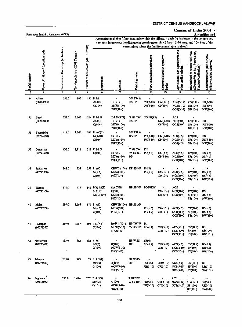
DISTRICT CENSUS HANDBOOK: ALWAR
Census of India 2001 -Panchayat Samiti : MandBwar (0003) Amenities and
Amenities available (if not available within the village, a dash (-) is shown in the column and
next to it in brackets the distance in broad ranges viz.<5 kms., 5-10 kms. and 10+ kms of the
I j nearest (!18ce where the facili~ is available is givenl
.g i 5 "'" rl.o u "
U fa .::: -= c .c 5 0 " ~ 1! :.: u c ._ !!
.2 g 0 ,g 'J:! oS 1;1 U C!. ~ eM&. j fr 13 ,3 0
~ c.. u ]cn.~ 0 1i 0 "i.B·
~ ~ C!. "i '0 8 13 'i .~
i Jl 6 Iii s-!! u.c ..
..8 Oil ] I ..c .. g ~ g.g .... ~ t·~ i:s!'g ';; 0
I .... ~
.. 0
~] o~< ... ~ .... ~ .- l 0 .!l 'la " 'S 'S ~ .~.B
~ Ii-_ '6 ~ ~ ~
~.5 ] v.I Uri)
I 2 3 4 5
34 Alipur 296.0 997 152 PM HPTWW (00774600) AC(2) H(IO+) SS-HP P0(5-10) CM(IO+) ACS(5-10) CV(IO+) BS(5-10)
C(10+) MCW(JO+) PH(S-JO) CP(1O+) NCS(S-JO) SP(1O+) RS(JO+) PHC(IO+) OCS(5-10) ST(1O+) NW(IO+)
3S Basni 729.0 2,047 324 PM S DASMP(3) THPTW PO PH(IS) ACS (00774700) AC(4) H(IO+) SS-HP CM(5-10) 'NCS(IO+) CV(IO+) BS
C(IO+) MCW(IO+) CP(IO+) OCS(JO+) SP(IO+) RS(5-JO) PHC(IO+) ST(IO+) NW(IO+)
36 Bhagolajat 413.0 1,364 192 P AC(2) HPTWW
(00774800) M(S-IO) H(IO+) SS-HP PO(S-IO) CM(S-IO) ACS« 5) CV(IO+) BS C(IO+) MCW(IO+) PH(S-IO) CP(IO+) NCS«S) SP(IO+) RS(S-IO)
PHC(IO+) OCS«S) ST(IO+) NW(IO+)
37 Darbarpur 434.0 1,911 313 PM S THPTW PH (00774900) C(IO+) H(IO+) WTKSS- PO« S) CM«S) ACS« S) CV(1O+) BS« S)
MCW(IO+) HP CP(S.IO) NCS(IO+) Sp(IO+) RS«S) PHC(IO+) .OCS(IO+) ST(IO+) NW(IO+)
38 Sundarwari 242.0 934 IS7 PAC CHWH(IO+) HPSS·HP PH(3)
(0077S0oo) M«S) MCW(IO+) PO«S) CM(IO+) ACS«S) CV(IO+) BS« 5) C(IO+) PHC(IO+) CP(IO+) NCS(IO+) SP(IO+) RS«S)
OCS(IO+) ST(IO+) NW(IO+)
39 Bhanol 510.0 915 146 pel) M(l) DACHW HPSS-HP PO PH(I I) Acs (00775100) S PUC H(IO+) CM(IO+) NCS(IO+) CV(IO+) BS
AC C(lD+) MCW(IO+) CP(IO+) OCS(1O+) SP(1O+) RS«S) PHC(IO+) ST(IO+) NW(IO+)
40 Majra 297.0 1,I6S 177 PAC CHWH(IO+) HPSS-HP
(00775200) M«S) MCW(IO+) PO« S) CM(IO+) ACS«S) CV(IO+) BS«S) C(IO+) PHC(1O+) PH« S) CP(IO+) NCS(IO+) Sp(IO+) RS«S)
OCS(IO+) ST(IO+) NW(IO+)
41 Todarpur 219.0 1,017 160 PM«S) RMPH(IO+) HPTWW PH (00775300) C(IO+) MCW(5.1O) TKSS·HP PO« S) CM(S·IO) ACS(IO+) CV(.IO+) BS
PHC(S.IO) CP(S·IO) NCS(JO+) SP(JO+) RS(JO+) OCS(JO+) ST(IO+) NW(IO+)
42 GolaHera 193.0 712 102.P M HPWSS· PH(4) (0077S400) AC(6) H(IO+) HP PO« S) CM(S-IO) ACS«S} CV(IO+) BS«5)
C(IO+) MCW(S-IO) Cp(S·IO) NCS(S-IO) SP(IO+) RS«S) PHC(S·IO) .. OCS(IO+) ST(IO+) NW(IO+)
43 Munpur 205.0 393 59 P AC(4) HPWSS· (0077'500) M("') H(IO+) HP PO("S) CM(S.IO) ACS«') CV(IO+) liS
C{1O+) MCW(S-IO) PH(S·IO) CP(S-IO) NCS(S-IO) SP(IO+) RS(S·IO) PHC(S·IO) OCS(S·IO) ST(IO+) NW(IO+)
44 JagiWIIIII 233.0 1,414 207 P AC(3) THPTW ACS (0077S600) M«S) H(IO+) WSS-HP PO« S) CM(S·IO) NCS(S·IO) CV(IO+) BS«S)
C(IO+) MCW(S·IO) PH(S·IO) Cp(S·IO) OCS(S·IO) SP(IO+) RS(S·IO) PHC(5·10) ., ''ST(IO+) NW(IO+)
138

VILLAGE DIRECTORY
Villa2e Directory Land Use {As on 1999}
Land use
(i.e. area under different typeS ofland use in hectare)
i c .2 1;1
g ~ .., > c ~ " '8 ] CJ u
J ~ E ...
J 'i E I !!~ oS ._ U>
8 ~ .. .. cI!I 11
.!! ~ =i j .;;; » t 51 ~!' ~ ..8 s ~ 1 ~ 't:I &; :s:
..c OJ ..!! 5 E
I co .§ ~ 1 i "f to g '8 "
! c ... jj 'E " ~ I - " "..c
I "iI
~ m 'c ~l ~ '1::
0 0 ·s OJ eo !:!s = 02 CI)
14 IS 16 17 18 19 20 21 22 23 2
MRFP Khainhal (28) EA NM EanhenPol W(lSS.O) 16.1 78.1 13.0 Alipur 34 WE(34.1) T(I89.I)
PRMR Khainhal (24) EA NM EanhenPol W(503.0) 76.0 24.0 40.0 Basni 35 WE(86.0) T(589.0)
PRFP Khainhal (20) EA NM EanhenPot W(ISO.I) 29.1 34.0 117.0 Bhasolajat 36 WE(83.0) T(233.1)
PRMR Khainhal (27) EA NM EanhenPoI WE(160.0) 95.0 8.0 24.0 Oarbarpur 37 FP TW(147.0)
T(307.0)
MR Khainhal (22) EA EanhenPol \\1(130.2) 66.0 13.0 12.0 Sundarwari 38 WE(21.1) T(I 5 1.3)
PR Khainhal (21) EA NM Earthen Pol W(310.3) 90.0 14.0 15.0 Bhanot 39 WE(81.2) T(39 1.5)
MR Khainhal (22) EA NM EanhenPol W(180.4) 8.0 17.0 7.0 Majra 40 WE(84.2) T(264.S)
PRMR Khainhal (35) EA NM EanhenPol W(70.0) 63.0 16.0 18.0 Toclarpur 41 FP WE(S2.0)
T(122.0)
FP Khairthal (20) EA NM Earthen POT W(8S.0) 40.0 2.0 13.0 GolaHera 42 WE(20.0) TW(33.0) T(138.0)
MRFP Khainhal (21) EA NM Earthen Pot W(IIO.O) 33.0 7.0 5.0 Munpur 43 WE(20.0) TW(30.0) T(16O.0)
MRFP Khairthal (22) EA NM Earthen Pol W(80.0) 43.0 6.0 16.0 Jagiwara 44 WE(60.0) TW(28.0)
"I, T(168.0)
139
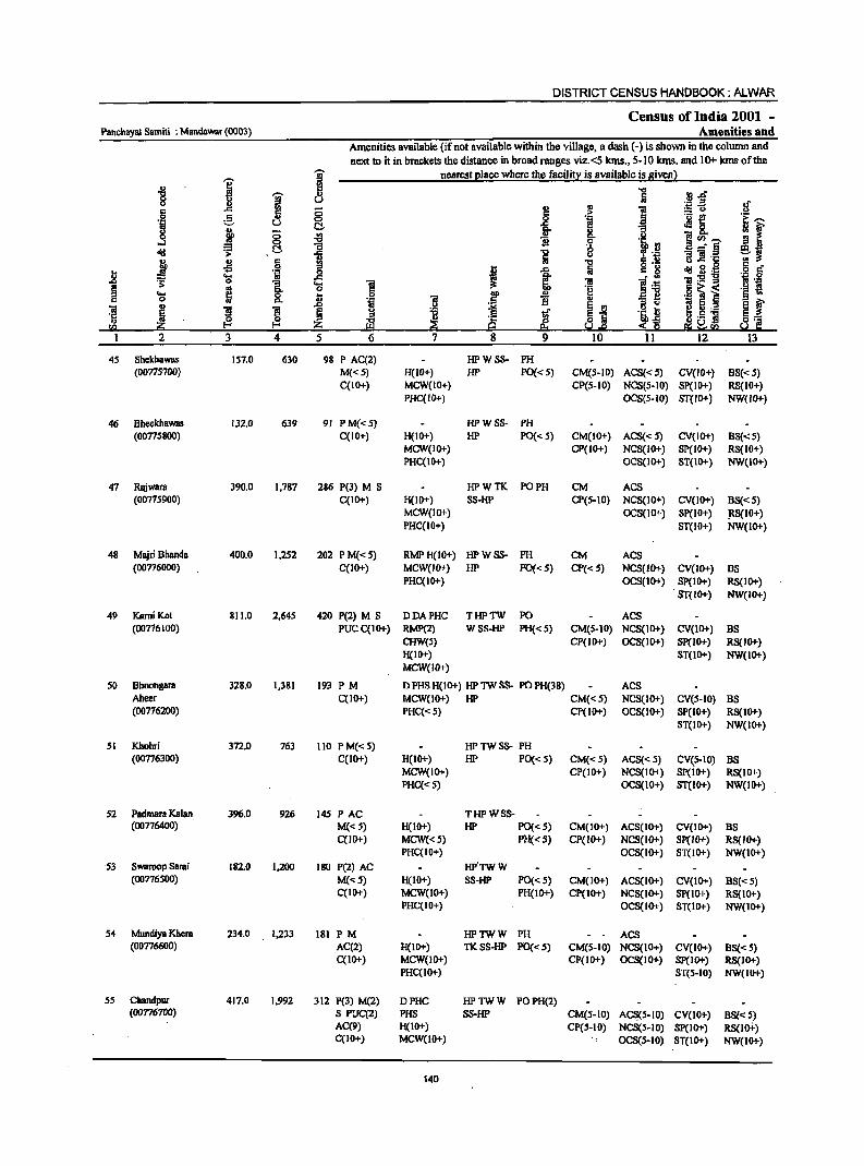
DISTRICT CENSUS HANDBOOK: ALWAR
Census of India 2001 -Panchayat Samili : Mandawar (0003) Amenities and
Amenities available (ifnot available within the village, a dash (-) is shown in the column and next to it in brackets the distance in broad ranges viz.<5 kms., 5·10 kms. and 10+ kms of the
-;;;- nearest I!lace where the facilit:i is available is givenl
'" 1 ~ "Cl rJ.o '8 1l ~ u fij ~~ II en
0 !:! '" ] § g 5 .~ jg 'i ---'1 u <:> -8. i
C!- O> g
~J ~ en .,
Co i~~ "C 1l 0
l~ ....l = C5 0 _- § old ';> "C ii Iii u t! :! '1:
:i Jl c !rl "C cI!Ig~ .g § .S I .c t; c g
U .... OJ .B a ~ .;; ;a:s!::o .., .;; 0
1 .... ] ~ B 'J:!
~ '" 0 .g ~ ~ ._ ~ 1l = t 0 DO ., .=] ~ f iii i 1l .,
Co ~ ~~ i3 " ~ 5 .2 ., .r:> .f,! ;a
! ] ] § !:I "0 l 'i.b~ ~.5 ]I E_ '5 .. ~ " d ~'c sa z ~ Sol.e ~ 1:1 e;;~fQ
1 2 3 4 5 6 7 8 9 10 11 12 13
45 Shekhawas 157.0 630 98 P AC(2) HPWSS- PH (00715700) M«5) H(IO+) HP PO« 5) CM(5-10) ACS«5) CV(IO+) BS«5)
C(tO+) MCW(IO+) CP(S-IO) NCS(S.IO) SP(IO+) RS(IO+) PHC(IO+) OCS(S-IO) ST(W"') NW(IO.f.)
46 Bheekhawas 132.0 639 91 PM«5) HPWSS- PH (00775800) C(tO+) H(IO+) HP PO« 5) CM(IO+) ACS« S) CV{tO+) BS«S)
MCW(IO+) CP([O+) NCS(IO+) SP([O+) RS([O+) PHC([O"') OCS(IO+) ST(IO.f.) NW([O"')
47 Rajwara 390.0 [,787 286 P(3) M S HPWTK PO PH CM ACS (OO775900) C(IO+) H(IO+) SS-HP CP(5-10) NCS(IO+) CV(IO+) BS«5)
MCW(IO.f.) OCS(IO+) SP(IO+) ~S(IO+) PHC(IO+) ST(IO+) NW(IO+)
48 Majri Bhanda 400.0 1,252 202 PM«5) RMPH(IO+) HPWSS- PH CM ACS (00776000) C(tO+) MCW(lO+) HP 1'0«5) CP« 5) NCS(lO+) CV(IO+) BS
PHC(tO+) OCS(IO.f.) SP(IO"') RS(IO+) ST(IO.f.) NW(IO+)
49 KamiKot 811.0 2,645 420 P(2) M S DDAPHC THPTW PO ACS (00716100) PUC C(10+) RMP(2) WSS-HP PH« 5) CM(5-10) NCS(IO.f.) CV(IO.f.) BS
CHW(5) CP(JO+) OCS(IO+) SP(IO+) RS(IO.f.) H(1O.f.) ST(IO+) NW(IO.f.) MCW(lO+)
50 Bhoongara 328.0 1,381 193 PM D PHS H(IO"') HP TW SS- PO PH(38) ACS Aheer C(IO"') MCW(IO+) HP CM«5) NCS(IO+) CV(5-1O) BS (00716200) PHC«5) CP(IO+) OCS(IO+) SP(IO+) RS(IO.f.)
ST(IO+) NW(IO+)
51 Khohri 312.0 763 Ito P M« 5) HPTWSS- PH (00716300) C(IO+) H(IO.f.) HP PO« 5) CM«5) ACS« 5) CV(S-IO) BS
MCW(lO+) CP(IO+) NCS(IO+) SP(io+) RS(IO.f.) PHC«S) OCS(lO+) ST(IO+) NW(IO+)
52 Padmara Kalan 396.0 926 145 PAC THPWSS-(00776400) M«5) H(IO+) HP PO« S) CM(IO+) ACS(IO+) CV(IO+) BS
C(1O.f.) MCW«5) PH«5) Cp(IO+) NCS(IO+) SP(IO.f.) RS{IO.f.) PHC(IO+) OCS(IO+) ST(lO+) NW(IO+)
53 Swaroop Sarai 182.0 1,200 180 P(2) AC HP'TWW (00776500) M«S) H(IO+) SS-HP PO« 5) CM(lO+) ACS(IO+) CV(IO+) BS«5)
C(IO.f.) MCW(IO+) PH(IO+) Cp(IO+) NCS(tO+) Sp(IO+) RS(IO+) PHC(IO.f.) OCS(IO+) ST(IO+) NW(IO+)
S4 Mundiya Khem 234.0 [,233 181 PM HPTWW PH ACS (00776600) AC(2) H(IO+) TKSS-HP 1'0«5) CM(S-IO) NCS(IO+) CV(IO+) BS« S)
C(IO+) MCW(IO+) CP(IO+) OCS(IO+) SP(IO+) RS(JO.f.) PHC(IO+) ST(5-10) NW(IO+)
55 Chandpur 417.0 1,992 312 P(3) M(2) DPHC HPTWW POPH(2) (00776700) S PUC(2) PHS SS-HP CM(S-IO) AC~5-10) CV(IO+) BS« 5)
AC(9) H(IO+) CP(S-IO) NCS(S-IO) SP(IO+) RS(loi-) C(IO+) MCW(IO+) OCS(S-IO) ST(IO.f.) NW(IO+)
140
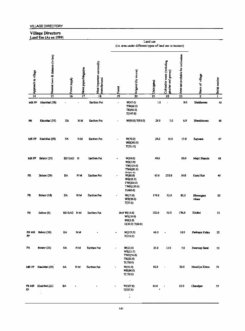
VILLAGE DIRECTORY
ViIlaee Directory Land Use {As on 1999)
Land use
(Le. area under different types ofland use in hectare)
j c 0 .~
e, ~ 01) > .5 . .;: ., :g "0 a
j " ., e g ..... .. c § I ~ j I :::.11 ., c> j! ~ J ~ c!!I ~1 ~
~ ~ .8 g i => e -0 10 ~ .c go la- o .a i ..!! :a $ liI '" .§~ "0
~.! 0 ... I "'" i
0 c e .. ~ ~ Ji c .,
"'" g s " ~ g os ~ ~ "'" " ~ ~ ] ;2 ~m, e
~ ~ e:. ~ !:!o ~ ~ '" 14 15 16 17 18 19 20 21 22 23 2
MRFP Khairthal (28) Earthen Pot W(47.0) 1.0 9.0 Shekhawas 45 TW(60.0) 1'1(40.0) T(147.0)
PR Khairthal (2.5) EA NM Earthen Pot W(9S.0) T(9.5.0) 28.0 3.0 6.0 Bheckhawas 46
MRFP Khairthal (21) EA NM Earthen Pot W(70.0) 21.0 16.0 13.0 Rajwara 47 WE(263.0) T(333.0)
MRFP Behror(2.5) EDEAO N Earthen Pot W(84.0) 49.0 50.0 Majri Bhanda 48 WE(7.0) TW(125.0) TWE(15.0) T(~nI "'
PR Bchror(29) EA NM EarthcnPol W(80.0) 45.0 232.0 54.0 KamiKot 49 WE(65.0) TW(205.0) TWE(130.0) T(480.0)
PR Bchror(18) EA NM Earthen Pot W(17.0) 174.0 33.0 83 . .5 Bhoongara SO WE(20.0) Ahccr T(37.0)
PR Bchror(l) EoEAG NM Earthen Pot 24.0 W(15.0) 102.0 10.0 176.0 Khohri 051 WE(1O.0) WF(5.0) 0(30.0) T(60.0)
PRMR Behror(20) EA NM W(312.0) 66.0 18.0 Padmara Kalan .52 FP T(312.0)
PR Behror(22) EA NM Earthen Pot W(23.0) 25.0 12.0 7.0 Swaroop Sarai 53 WE(21.0) TWE(74.0) 1'1(20.0) T(13S.0)
MRFP Khairthal (29) EA NM Earthen Pot W(S2.0) 66.0 30.0 Mundiya Khera 54 WE(86.0) T(I3S.0)
PRMR Khairthal (23) EA W(327.0) 6S.0 25.0 Chandpur S5 FE' T(327.0)
141
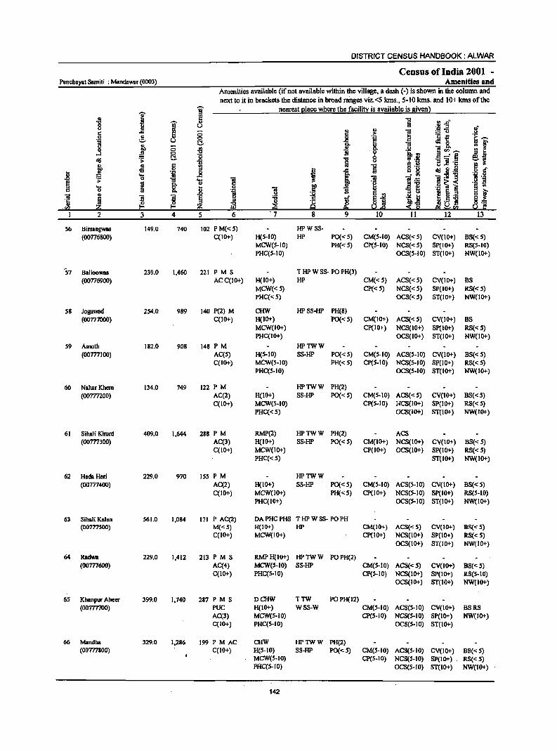
DISTRICT CENSUS HANDBOOK: ALWAR
Census of India 2001 -Panchayat Samiti : Mandawar (0003) Amenities and
Amenities available (if not available within the village, a dash (-) is shown in the column and
next to it in brackets the distance in broad ranges viz.<5 kms., 5-10 kms. and 10+ kms of the
I ~ nearest elace where the facili~ is available is given) .. '" .. -0 rJ .rJ" '8 ~ .,
Iii u ~~ .!f u
I: .c 5 ;; !! " 1 .2 !. 0 0 'E 'u ~ G--~
u C!. fr .:18.
~f l 8.. ;; i9 1i '0 .Il ]<1> __ ....I a :g 9 r'B
_·13 ~ .s: -0 ., Iii 1i ] ·c
l JI § 19 ] o ._
d!! fl.-€! 6 r:f .8 ... 'iI _g t I 1
c. iI1 'iI:sl] 'j .g
·s 0 "3 ... 1! 1] ~ e 8: 0 .§ ~ i .~ ~ ... ... .2 ] ~
§ ~ 0 ., .r> B ~ EJ:! ;l .. i ~ ._ 'iii
., '3 ~ ~ l
.~ ... ~ ;l -0
~.a lib,£; !"- ] E_ '5 ~ Yl ~ ~ 'f: ·m -20 9 ::!!: Q ~f(.I 2 3 4 5 6 . 7 8 9 10 II 12 13
56 Birsangwas 149.0 740 102 PM«5) HPWSS· (00776800) C(IO+) H(5·10) HP PO« 5) CM(5-10) ACS«5) CV(IO+) BS«5)
MCW(S-IO) PH« S) CP(5-IO) NCS«5) SP(IO+) RS(5-10) PHC(5.10) OCS(5.10) ST(IO+) NW(IO+)
57 Balloowas 239.0 1,460 221 P M S T HP W SS· PO PH(3) (00776900) ACC(IO+) H(IO+) HP CM«5) ACS« 5) CV(IO+) BS
MCW«S) CP«5) NCS«5) SP(IO+) RS«5) PHC«S) OCS«S) ST(IO+) NW(1O+)
58 Jogawad 254.0 989 140 P(2) M CHW HPSS·HP PH(8) (00777000) C(IO+) H(IO+) PO« 5) CM(IO+) ACS« 5) CV(lo+) BS
MCW(IO+) CP(IO+) NCS(IO+) SP(IO+) RS«S) PHC(IO+) OCS(IO+) ST(IO+) NW(IO+)
59 Amoth 182.0 908 148 PM HPTWW (00777100) AC(5) H(5·10) SS·HP PO« 5) CM(5.10) ACS(5-10) CV(lO+) BS«5)
C(IO+) MCW(5-10) PH« 5) CP(5-10) NCS(5-10) SP(IO+) RS«5) PHC(5.10) OCS(5-10) ST(IO+) NW(IO+)
60 NaharKhera 134.0 749 122 PM HPTWW PH(2) (00777200) AC(2) H(IO+) SS-HP PO«5) CM(5·10) ACS« 5) CV(lo+) BS«S)
C(IO+) MCW(5-10) CP(5-10) ;~CS(IO+) SP(IO+) RS«5) PHC«5) OCS(IO+) ST(IO+) NW(IO+)
61 SihBli Khurd 409.0 1,644 288 PM RMP(2) HPTWW PH(2) ACS (oom3OO) AC(3) H(IO+) SS-HP PO«5) CM(IO+) NCS(lO+) CV(IO+) BS«S)
C(IO+) MCW(IO+) CP(IO+) OCS(lO+) SP(IO+) RS«S) PHC«S) ST(IO+) NW(IO+)
62 HadaHeri 229.0 970 155 PM HPTWW (00777400) AC(2) H(IO+) SS-HP PO« 5) CM(5-1O) ACS(5·10) CV(IO+) BS«5)
C(lO+) MCW(lO+) PH«S) CP(IO+) NCS(S·IO) SP(IO+) RS(5-IO) PHC(IO+) OCS(S·IO) ST(lo+) NW(IO+)
63 Sihali Kalan 561.0 1,084 171 P AC(2) DAPHCPHS THPWSS· PO PH (00777500) M«5) H(IO+) HP CM(IO+) ACS« 5) CV(IO+) BS« 5)
C(IO+) MCW(IO+) CP(IO+) NCS(IO+) SP(IO+) RS« 5) OCS(lo+) ST(IO+) NW(IO+)
64 Radwa 229.0 1,412 213 PM S RMPH(IO+) HPTWW PO PH(2) (oom600) AC(4) MCW(S-IO) SS-HP CM(S-IO) ACS«S) CV(lo+) BS«S)
C(lO+) PHC(5-10) CP(5-10) NCS(IO+) SP(IO+) RS(S-IO) OCS(IO+) ST(IO+) NW(lo+)
6S Khanpur Aheer 399.0 1,740 287 PM S DCHW TTW POPH(12) (oom700) PUC H(IO+) WSS-W CM(S-IO) ACS(S·IO) CV(IO+) BSRS
AC(3) MCW(S-IO) CP(S-IO) NCS(S-IO) SP(IO+) NW(IO+) C(IO+) PHC(5-10) OCS(S.IO) ST(IO+)
66 Mandha 329.0 1,286 199 PM AC CHW HPTWW PH(2) (00777800) C(lO+) H(S·IO) SS-HP PO«S) CM(S-IO) ACS(S·IO) CV(IO+) BS«5)
MCW(S-IO) CP(S.IO) NCS(S-IO) SP(IO+) . RS« S) PHC(S-IO) OCS(S·IO) ST(IO+) NW(IO+)
142
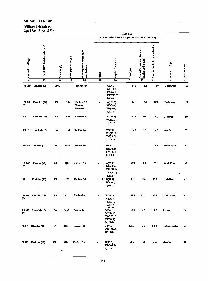
VILLAGE DIRECTORY
ViJlaee Directory Land Use (As on 1999}
Land use (i.e. area WIder different types ofland usc in hectare)
]' c 0
"if !. ~ aD .j; .5 ., '8 ." "3
.1 ..E u 2! E
~--..
j '1 ~ ]' cS ;=:or! ., ." ., " .. ~ f ; "II I] 0 - e
i .?;> ~ .. i: ~ Ji s ~ '" .€ -g .!! fa ~
.;;: § ~
., i .5 .M 1 i e la '0 .... tl .. 0 ..
i 1 ~ c
j ! - ., 'E .,.e ~
., .g l!l S 00
~ .:! g ~ 0 ~ 8~ ~ ~ e ..... -< ~ sa
14 15 16 17 18 19 20 21 22 23 2 I
MRFP Khairthal (20) EAG Earthen Pot W(24.0) 11.0 8.0 6.0 Birsangwas S6 WE(1O.0) TW(45.0) TWE(45.0) T(124.0)
PRMR Khairthal (19) EA NM Earthen Pot, W(105.0) 44.0 2.0 IS.O Balloowas 57 FP Wooden WE(30.0)
Furniture TW(40.0) T(17S.0)
PR Khairthal (21) EA NM Earthen Pot W(151.2) 57.0 9.0 S.O Jogawad 58 WE(32.1) T(183.3)
MRFP Khairthal (17) EA NM Earthen Pot W(60.0) 49.0 3.0 19.0 Amoth S9 WE(40.0) TW(II.O) T(111.0)
MRFP Khairthal (IS) EA NM Earthen Pot W(20.1) 21.1 13.0 NaharKhera 60 WE(3S.2) TW(45.1) T(100.4)
PRMR Khairthal (20) EA ~M Earthen Pot W(6S.I) 99.0 34.0 17.5 Sihali Khurd 61 FP WE(4S.3)
TW(128.1) TWE(20.0) T(2SS.S)
FP Khainhal (20) EA NM Earthen Pot 2.1 W(98.1) 40.0 8.0 15.0 Hada Heri 62 WE(66.J) T(164.2)
PRMR Khairthal (19) EA N Earthen Pot W(39.1) 178.4 13.1 32.3 Sihali Kalan 63 FP WE(42.1)
TW(207.2) TWE(49.1) T'~~'7&'
PRMR Khainhal (17) EA NM EanhenPol W(30.I) 34.3 4.5 13.0 Radwa 64 FP WE(40.2)
TW(103.1) TWE(4.1) T(I77.4)
PRFP Kh8inhal (10) EA NM Earthen POI W(44.0) 126.3 6.0 28.0 Khanpur Aheer 6S WE(19S.0) T(239.0)
PRFP Khairthal (19) EA NM Earthen PDI W(IO.O) 40.4 2.0 16.0 Mandha 66 WE(261.0) T(27 1.0)
143
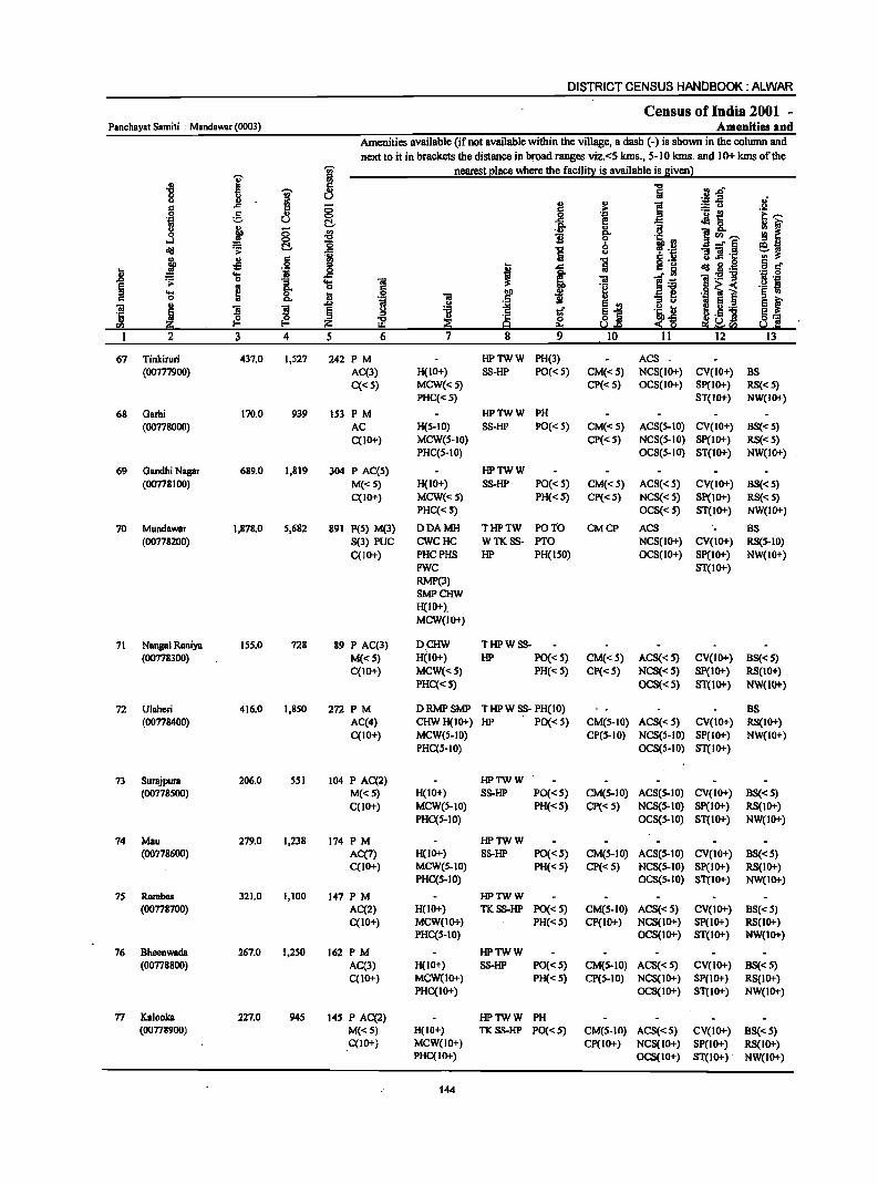
DISTRICT CENSUS HANDBOOK: ALWAR
Census of India 2001 -Panchayat Samiti : Mandawar (0003) Amenities and
Amenities available (if not available within the village, a dash (-) is shown in the column and next to it in brackets the distance in broad ranges viz. <5 kms., 5-10 kms. and 10+ kms of the
I j nearest elace where the facili!l: is available is 8iven l
1 ~ 5 ] ·Jf u of
6 .,
§ ~ .,
] :.:: () u C ;. ._ ~ 'E ,.... 5 .,
0 '! .~ u t:!- ..c ~ &. : r j Do ., "3
0 0 ., . ., Do U j ~.,.... ..J 0 '0 1i ~ .~ ~
t:!- '0 ~~ ~ ~ ..c 'E r~ " 11 .~ j .fl ~
'rA "C U g .§ § .a I ..c Iii aid .8 ._
t .... ~ 1~ ,g c
OS 1! ] 'iI ._ -g B 'J:
E > ~ Do 6 ~ 00(
._ ~ " .... 0 t 0 'iI
blI i :; ~ 'J: l ~ ~ c C Do • .::! .5 .. E 'iI I ]
~ .<>
~ '" 1!! ~j .~I:; ! !!._ ·S § :g ·c tf §~ ~ z iB :? g 0 u <~ a] en e.. _.",,:eill U.
1 2 3 4 5 6 7 8 9 10 11 12 13
67 Tinkiruri 437.0 1,527 242 PM HPTWW PH(3) ACS (00777900) AC(3) H(IO+) SS-HP PO« 5) CM«S) NCS(IO+) CV(IO+) BS
C«S) MCW«5) CP«S) OCS(IO+) Sp(IO+) RS« S) PHC«S) ST(IO+) NW(IO+)
68 Garhi 170.0 939 153 PM HPTWW PH
(00778000) AC H(S-IO) SS-HP PO« 5) CM«S) ACS(S-IO) CV(IO+) BS«S) C(lO+) MCW(S-IO) CP«S) NCS(S-IO) Sp(IO+) RS«S)
PHC(5-10) OCS(S-IO) ST(IO+) NW(IO+)
69 Gandhi Nagar 689.0 1,819 304 P AC(S) HPTWW (00778100) M«5) H(IO+) SS-HP PO«5) CM«5) ACS«S) CV(IO+) BS«5)
C(IO+) MCW«S) PH«5) CP«S) NCS« 5) SP(IO+) RS« 5) PHC« S) OCS«5) ST(IO+) NW(IO+)
70 Mundawar 1,878.0 5,682 891 P(5) M(3) DDAMH THPTW poro CMCP ACS BS (00778200) S(3) PUC CWCHC WTKSS- PTO NCS(IO+) CV(IO+) RS(5-10)
C(IO+) PHCPHS HP PH(ISO) OCS(IO+) 8p(10+) NW(lO+) FWC 8T(10+) RMP(3) SMPCHW H(IO+). MCW(IO+)
71 Nangal Raniya 155.0 728 89 P AC(3) DCHW THPWSS-(00778300) M«S) H(IO+) liP PO«S) CM«S) ACS« 5) CV(IO+) BS« 5)
C(IO+) MCW«5) PH«5) CP«5) NCS« 5) Sp(IO+) RS(IO+)
PHC«S) OC8«S) 81(10+) NW(lO+)
72 Ulaheri 416.0 1,8S0 272 PM DRMPSMP THPWSS- PH(IO) BS (00778400) AC(4) CHWH(IO+) HP PO« 5) CM(S-IO) ACS« S) CV(IO+) RS(IO+)
C(IO+) MCW(S-IO) CP(S-to) NCS(S-IO) SP(IO+) NW(lO+) PHC(S-IO) OC8(S-IO) 8T(10+)
73 Surajpura 206.0 SSI 104 P AC(2) HPTWW (00778500) M«5) H(IO+) SS-HP PO«5) CM(5-10) ACS(5-10) CV(IO+) BS«S)
C(IO+) MCW(S-IO) PH«5) CP«S) NCS(5-10) SP(lo+) RS(IO+) PHC(5-10) OCS(S-IO) 8T(10+) NW(IO+)
74 Mau 279.0 1,238 174 PM HPTWW (00778600) AC(7) H(IO+) 8S-HP PO«S) CM(5-10) AC8(S-10) CV(IO+) BS«5)
C(IO+) MCW(S-IO) PH« S) CP«S) NCS(S-IO) SP(IO+) RS(IO+) PHC(5-10) OCS(S-IO) ST(IO+) NW(IO+)
75 Rambas 321.0 1,100 147 PM HPTWW (00778700) AC(2) H(IO+) TKSS-HP PO«5) CM(5-10) ACS« 5) CV(IO+) BS«5)
C(IO+) MCW(lo+) PH«5) CP(IO+) NCS(IO+) SP(IO+) RS(IO+) PHC(5-10) OCS(IO+) ST(IO+) NW(IO+)
76 Bheenwada 267.0 1,250 162 PM HPTWW (00778800) AC(3) H(IO+) SS-HP PO«S) CM(S-IO) ACS« 5) CV(IO+) BS«S)
C(10+) MCW(lO+) PH«S) CP(S-IO) NC8(lO+) 8P{lo+) RS(IO+) PHC(IO+) OCS(IO+) 8T(10+) NW(IO+)
77 Kalooka 227.0 945 J45 P AC(2) HPTWW PH (00778900) M«5) H(IO+) TKSS-HP PO«S) CM(5-10) ACS«5) CV(IO+) BS«5)
C(lO+) MCW(IO+) Cp(IO+) NCS(IO+) SP(IO+) RS(IO+) PHC(IO+) OCS(IO+) ST(IO+) NW(JO+)
144
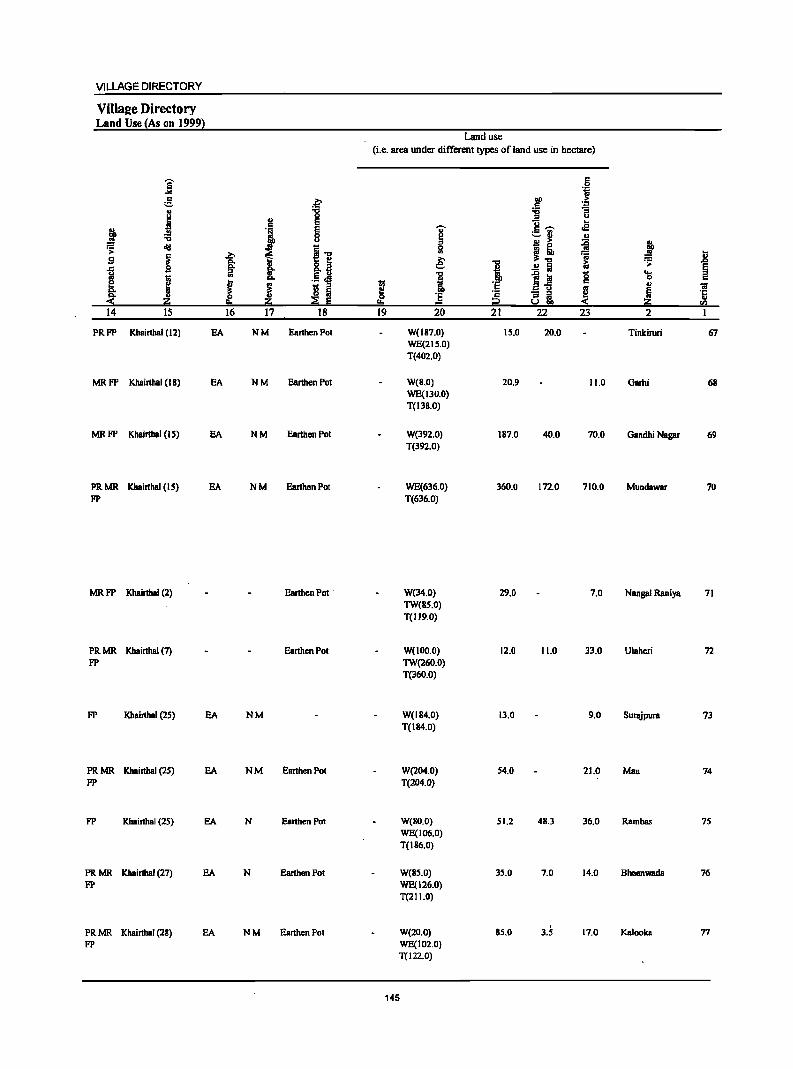
VILLAGE DIRECTORY
ViIla2e Directory Land Use {As on 1999}
Land use (i.e. area under different typeS ofland use in hectare)
e .9 -" 'OJ :§. .~
DO 'b .. ... ~ "3 u ., 0 u
J E U .. ., ~ rS
~ .J E u r::~ ._ '" 8 ~ -- '" '" ., >
~ I ~ lid ~ i ... g - ~ .8 s ~
~ e: ~ ... .OJ 0. 8.~ ... ~ .>
..c 0. §. .~
.!! Iii ~ :;! ;:
I ;J 0 .... I 0. .§ '5 0
i ~ ~ I r:: III iii S Iii
_ u
~ ~ ~
·c Ci i ·5 e. ~ ~ Iii !!::I i::l < a:; rn
14 15 16 17 18 19 20 21 22 23 2 I
PRFP Khairthal (12) EA NM Earthen Pot W(187.0) 15.0 20.0 Tinkiruri 67 WE(21S.0) T(402.0)
MRFP Khairthal (18) EA NM Earthen Pot W(8.0) 20.9 11.0 Garhi 68 WE(130.0) TeI3S.0)
MRFP Khairthal (I S) EA NM Earthen Pot W(392.0) 187.0 40.0 70.0 Gandhi Nagar 69 T(392.0)
PRMR Khairthal (15) EA NM Earthen Pot WE(636.0) 360.0 172.0 710.0 Mundawar 70 FP T(636.0)
MRFP Khairthal (2) Earthen Pot W(34.0) 29.0 7.0 Nangal Raniya 71 TW(85.0) T(1I9.0)
PRMR Khairthal (7) Earthen Pot W(IOO.O) 12.0 11.0 33.0 Ulaheri 72 FP TW(260.0)
T(360.0)
FP Khairthal (25) EA NM W(IB4.0) 13.0 9.0 Surajpura 73 T(IB4.0)
PRMR Khairthal (25) EA NM Earthen Pot W(204.0) 54.0 21.0 Mau 74 FP T(204.0)
FP Khairthal (25) EA N Earthen Pot W(SO.O) 51.2 48.3 36.0 Ramhas 75 WE(106.0) T(186.0)
PRMR Khairthal (27) EA N Earthen Pot W(BS.O) 35.0 7.0 14.0 Bheenwada 76 FP WE(126.0)
T(211.0)
PRMR Khairthal (28) EA NM Earthen Pot W(lO.O) B5.0 3.5 17.0 Kalooka 77 FP WE(102.0)
T(l22.0)
145
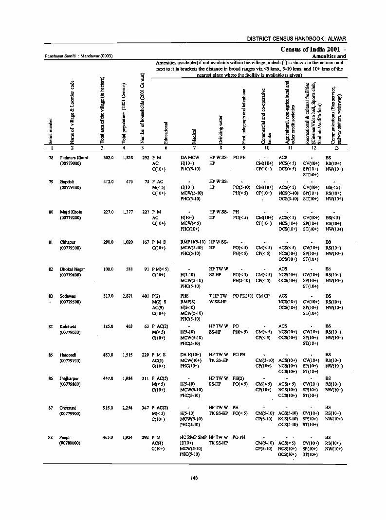
DISTRICT CENSUS HANDBOOK: ALWAR
Census of India 2001 -PanchByat Sam it; : Mandawar (0003) Amenities and
Amenities available (if not available within the village, a dash (-) is shown in the column and
nextto it in brackets the distance in broad ranges viz.<5 kms., 5-10 kms. and 10+ kms of the
I j nearest I!lace where the facili!y is available is Biven l
., = :JJf "t:I -;;- " 0 U u ill " !;! .~ .a
§ .c c 8 c :.= u
5 " _g .-= j~ .~ u ~ [ ~ ;:; .. go ] c. 0 li <Il~
oJ 0 "t:I
~ ~ ~ '0 "3 =i.~ <iii 1 1 u
~ II> § "t:I u.c ... .. -s ·iI _g I .c !ii <iii g.g ..
~ "S ~ 01:211
1 g_ .... 01
e .. c .g] i "S &. il . .8 ~ I ]
~ .0 B 01 ! ! § ~] .a:: -6 ·c .. ~ ~ Q r/} III
1 2 3 4 5 6 7 8
78 Padmara Khurd 302.0 1,838 292 PM DAMCW HPWSS- PO PH ACS as (00779000) AC H(IO+) HP CM(IO+) NCS« S) CV(IO+) RS(IO+)
C(IO+) PHC(5-10) CP(IO+) OCS« S) SP(IO+) NW(IO+) ST(IO+)
79 Bapdoli 412.0 473 75 PAC HPWSS-(00779100) M« 5) H(lO+) HP PO(5-10) CM(IO+) ACS« S) CV(IO+) as«5)
C(IO+) MCW(5-10) PH«5) CP(to+) NCS(S-to) SP(to+) RS(IO+) PHC(5-10) OCS(S-IO) ST(IO+) NW(IO+)
80 Majri Khola 227.0 1,377 227 PM HPWSS- PH (00779200) AC H(IO+) HP PO«S) CM(IO+) ACS« 5) CV(IO+) as«5)
C(IO+) MCW«5) CP(IO+) NCS(IO+) SP(lO+) RS(IO+) PHC(IO+) OCS(IO+) ST(IO+) NW(IO+)
81 Chhapur 290.0 1,020 167 PM S ruYlPH(S-IO) HPWSS- as (00779300) C(IO+) MCW(5-to) HP PO« S) CM«5) ACS«5) CV(IO+) RS(IO+)
PHC(5-10) PH« 5) CP« 5) NCS(IO+) SP(IO+) NW(IO+) OCS(IO+) ST(lO+)
82 DhokalNagar 100.0 588 91 PM«5) HPTWW ACS as (00779400) C(IO+) H(5-10) SS-HP PO« 5) CM«S) NCS(IO+) CV(IO+) RS(lO+)
MCW(5-10) PH(5-10) Cp« S) OCS(IO+) SP(IO+) NW(IO+) PHC(S-IO) ST(IO+)
83 Sodawas 517.0 2,871 401 P(2) PHS THPTW PO PH(IO) CM CP ACS as (00779500) M(2) S RMP(8) WSS-HP NCS(IO+) CV(IO+) RS(IO+)
AC(9) H(5-10) OCS(IO+) Sp(IO+) NW(IO+) C(JO+) MCW(5-10) ST(IO+)
PHC(5-10)
84 Kokawas 125.0 463 63 P AC(2) HPTWW PO ACS as
(00779600) M«S) H{S-IO) SS-HP PH« S) CM«5) NCS(IO+) CV(IO+) RS(IO+)
C(IO+) MGW{5-10) CP{< S) OCS(IO+) SP(IO+) NW(IO+) PHC(S-IO) ST(IO+)
85 Hatoondi 483.0 1,515 229 PM S DAH(IO+) HPTWW PO PH as (00779700) AC(5) MCW(IO+) TKSS-HP CM(5-10) ACS(IO+) CV(JO+) RS(IO+)
C(IO+) PHC(IO+) CP(IO+) NCS(IO+) SP(IO+) NW(IO+) OCS(IO+) ST(IO+)
86 Jhajharpur 447.0 1,984 311 P AC(S) HPTWW PH(2) as (00779800) M«5) H(S-IO) SS-HP PO« 5) CM«5) ACS« 5) CV(JO+) RS(IO+)
C(IO+) MCW(5-10) CP(IO+) NCS(IO+) SP(IO+) NW(IO+) PHC(S-IO) OCS(IO+) ST(lO+)
87 Cheeruni 915.0 2,254 347 P AC(2) HPTWW PH as
(00779900) M«S) H(S-IO) TKSS-HP PO«5) CM(S-IO) ACS(S-IO) CV(IO+) RS(IO+) C(IO+) MCW(S-IO) CP(S-IO) NCS(S-IO) SP(IO+) NW(IO+)
PHC(S-IO) OCS(S-IO) ST(IO+)
88 PeepJi 465.0 1,924 292 PM HC RMP SMP HP TW W PO PH as (00780000) AC(4) H(10+) TKSS-HP CM(S-IO) ACS«5) CV(IO+) RS(IO+)
C(JO+) MeW(S-IO) CP(S-IO) NCS(IO+) SP(IO+) NW(IO+) PHC(S-IO) OCS(IO+) ST(JO+)
146

VILLAGE DIRECTORY
ViIla2e Directory Land Use (As on 1999)
]' " ;::.
I ~ '6 .~ "II B j ~ 1iI e 5 !5:: < z 14 IS
PRMR Khairthal (35)
FP
FP Khairthal (35)
PR MR Khainhal (36) FP
PRMR Khairthal (ll)
FP
PRMR Khairthal (28) FP
PRMR Khairthal (29)
FP
PRMR Khainhal (28) FP
PRMR Khairthal (27) FP
PRMR Khairthal (27) FP
PRMR Khairthal (25) FP
PRMR Khainhal (25) FP
EA
EA
EA
EA
EA
EA
EA
EA
EA
EA
.~ "8
u ~ " 'i 0 u
i i] ~ go 8.~ ., It .5.e
J ~ 1;; :;J .. o :iii
z ::; E 16 17 18
NM EanhenPot
NM Eanhen Pot
NM EanhenPot
NM EanhenPot
NM Earthen Pot
NM EanhenPot
NM Eanhen Pot
NM Earthen Pot
NM EanhenPot
NM Eanhen Pot
Land use (i.e. area under different types of land use in hectare)
~ 0
t+.
19
147
..,. ~ 5l
£ 1l ii. 'E = 20
W(182.0) T(182.0)
W(42.0) T(42.0)
W(107.0) T(107.0)
W(7I.O) WE(148.0) T(219.0)
W(17.0) WE(51.0) T(68.0)
W(40.0) WE(72.0) TW(102.0)
TWE(147.0) T(36 1.0)
W(36.0) WE(61.0) T(9?0)
W(70.0) WE(102.0) TW(llS.O) T(307.0)
W(88.0) WE(165.0) T(2S3.0)
PC(160.0) W(23S.0) WE(170.0) T(S6S.0)
W(1I1.0) WE(203.0) T(314.0)
I C ;? 21
49.0
79.0
32.0
40.0
5.0
100.0
14.0
59.0
156.0
218.0
96.0
" 0 "fi
00 > c ~ ~ u
]-;;; oS ~ u
~ j~ 'ii .!! Iii i:i ~ Ia g B"fi ~ - .:1 8;, :( 22 23
57.0 14.0
48.0 24l.0
18.0 70.0
16.0 IS.O
7.0 20.0
56.0
l.O 11.0
75.0 42.0
7.0 31.0
71.0 61.0
9.2 46.0
! ..8 .~
~ .... 0 u
~ i en 2
Padmara Khurd 78
Bapdoli 79
MajriKhola 80
Chhapur 81
Dhokal Nasar 82
Sodawas 83
Kokawas 84
Hatoondi 85
Jhajharpur 86
Cheeruni 87
Peepli 88
DISTRICT CENSUS HANDBOOK: ALWAR
Census of India 2001 -Panchayat Sarniti : Mandawar (0003) Amenities and
Amenities available (if not available within the village, a dash (-) is shown in the colwnn and
next to it in brackets the distance in broad ranges viz.<5 kms., 5-10 kms. and 10+ kms of the -;;;- nearest place where the facility is available is given)
I :s .,
-8 -;;;- Ii '5 rl.o 8 l! iii u ~~ oJ'
c Ii 8 ] .~ ] '! f 0 c ._ t! 'iij ;=:. U C!- ! oMs. c. . OS g j ::; ., .!! ~ .11 ] ~.j "0 ...:I l§. "6 !!
f:i old ~ "0 el;l ..c Iii u 'B]'c
~ Jl g M "0 .~ g :s t; .c Iii = g old ~.~ as ;;; 'S j _g ~ ~ l~
';j:5!'g
1 'S ] 01 .§ '!j > .. :s 'e .§ ~ ~ c. 'l:; ~ 0 j 0 lID " § .,
C. '::1 01 ~ ] ., OS ti i ~.a E f .,
! ()
~i 01 1'1 l e ii tf .~ t; '5 5 .5 g.5 ] 8== t2 :s a ~ ::!:~ fa iSO ~ I:!:l ~ ~.e e:I~"" So! C 2 3 4 5 6 7 8 9 10 II 12 13
89 SiyaKhoh 639.0 1,995 354 PMS HPWSS- BS (00780100) C(10+) H(IO+) HP PO« 5) CM(IO+) ACS«5) CV(IO+) RS(IO+)
MCW(5·10) PH« 5) CP(IO+) NCS«5) SP(IO+) NW(IO+) PHC(IO+) OCS«5) ST(IO+)
90 Menpur 934.0 1,566 256PMAC DAPHS THPWSS·PH ACS (00780200) C(IO+) H(IO+) HP PO« 5) CM(S.IO) NCS(IO+) CV(IO+) BS(':: S)
MCW(S·IO) CP(S-IO) OCS(IO+) SP(IO+) RS(IO+) PHC(5-IO) ST(IO+) NW(lO+)
91 Shreekrishan 66S.0 2,104 295 PM HPW S8- PO Nagar C(IO+) H(IO+) HP PH« 5) CM(5-10) ACS«5) CV(IO+) BS(.:: 5) (00780300) MCW(IO+) CP(5-10) NCS(lO+) SP(IO+) RS(IO+)
PHC(5-10) OCS(IO+) ST(IO+) NW(IO+)
92 Sabalgarh 642.0 1,221 142 PM HPSS-HP (00780400) C(IO+) H(IO+) PO(S-IO) CM(5-10) ACS(5-IO) CV(IO+) BS(5-IO)
MCW('::5) PH(S-IO) CP(S-IO) NCS(IO+) SP(IO+) RS(5-IO) PHC(S-IO) OCS(IO+) ST(IO+) NW(IO+)
93 Shyopur 237.0 1,149 156 PM HPTWW PO PH BS (00780500) AC(4) H(1O+) SS-HP CM«S) ACS«5) CV(IO+) RS(5-IO)
C(IO+) MCW(IO+) CP(.:: 5) NCS«5) SP(IO+) . NW(IO+)
PHC«5) OCS«5) ST(1O+)
94 Renagiri 471.0 1,180 172 PM HPTWW PH BS (00780600) AC(2) H(IO+) SS-HP PO«5) CM«5) ACS(5-IO) CV(IO+) RS(5-10)
C(IO+) MCW(.::5) CP(.:: 5) NCS«5) SP(IO+) NW(IO+)
PHC« 5) OCS(':: 5) ST(IO+)
95 Pebal 1,626.0 5,423 836 P(6) DAHC THPTW PO PH(18) ACS BS
(00780700) M(2) PHS WSS·HP CM(5-IO) NCS(s-IO) CV(s-IO) RS(s-IO)
S(2) RMP(2) CP(5-10) OCS(5-10) SP(IO+) NW(IO+)
AC(2) H(lO+) ST(IO+) C(IO+) MCW(IO+)
PHC(S-IO)
96 Moh8mmadpur 334.0 1,341 209PMS HPTWW PH (00780800) AC(2) H(IO+) SS-HP PO« S) CM«5) ACS«5) CV(IO+) BS«s)
C(IO+) MCW(IO+) CP«S) NCS«5) Sp(IO+) RS« 5) PHC«5) OCS«5) ST(IO+) NW(IO+)
97 Nangal 155.0 987 141 PM« 5) HPWSS- PH
Ssntokam C(1O+) H(IO+) HP PO(S-IO) CM(S-10) ACS(.:: S) CV(S-IO) BS(5-IO) (00780900) MCW(IO+) CP(IO+) NCS(S-IO) Sp(IO+) RS(S·IO)
PHC(5-10) OCS(s-IO) ST(IO+) NW(IO+)
98 Rogan 1,009.0 ~,173 518 PM CWCPHS HPTWW PO PH ACS BS (00781000) AC(S) H(IO+) SS-HP CM«5) NCS«S) CV«S) RS«s)
C(lO+) MCW(IO+) Cp«5) OCS«S) SP(IO+) NW(IO+) PHC« 5) ST(lO+)
99 Dantla 200.0 2,035 348 PM«5) HPWSS- PH (00181100) C(IO+) H(10+) HP PO« 5) CM«5) ACS{<5) CV«5) BS('::S)
MCW(IO+) CP(IO+) NCS{< S) SP(IO+) RS«S) PHC(IO+) OCS{<5) ST(IO+) NW(IO+)
148
VILLAGE DIRECTORY
ViIla2e Directory Land Use {As on 1999!
]: e ~ 8 0
i I e
.t e :a 8
~ ~ 11 ~ >. s 'is. I>. §. .c iii
! .5 .s I Q.
J ~ til ;:J
u ~ ~ ~ ~ 14 15 16 17 18
PRFP Khairthal (27) EDEAG NM Earthen Pot
PRFP Kbairthal (23) EDEAG NM Earthen Pot
PR FP Kbairthal (25) ED EAG N M Earthen POI
MR. FP Khairthal (IS) EDEAG M Earthen Pot
PRFP Khairthal (I S) EA NM Earthen Pot
PRFP Kbairthal (IS) EA NM Earthen Pot
PRMR Khairthal (10) EA NM Earthen Pot FP
FP Khairthal (14) EA NM Earthen Pot
MRFP Khairtbal (5) EA Earthen Pot
PRMR Khairthal (4) EA NM Earthen Pot
FP
MRFP Khairthal (2) EA NM Earthen Pot
Land use
(i.e. area under different types ofland use in hectare)
j ;:J 0 .. e .... i ~ 'E
I!:! = 19 20
54.0 W(33J.0) T(33J.0)
277.0 W(273.0) T(273.0)
3.0 W(426.0) T(426.0)
128.0 W(J29.0) T(129.0)
W(IOJ.O) WE(SO.O) T(ISJ.O)
W(l78.0) WE(46.0) T(224.0)
172.0 W(198.0) WE(406.0) TW(1I8.0) TWE(ISI.O) T(873.0)
W(JOS.O) WE(70.0) T(175.0)
W(39.0) WE(70.0) T(I09.0)
W(62S.0) T(62S.0)
38.6 W(24.0) WE(72.0)
. 1'_.T(96.0)
149
! 'E ·s i2 21
140.0
192.0
163.0
149.0
18.0
84.0
467.0
116.0
39.0
307.0
9.0
c 0 .~
1 ;>
~ ;:J " g_ ._ !II .a - ., ., !l ;> ~ ~! 'ii
;; .!! Iii '0 1~ c
~ a~ 22 23
55.0 59.0
34.0 158.0
9.0 64.0
S9.0 177.0
10.0 S8.0
34.0 129.0
13.0 101.0
9.0 34.0
1.0 6.0
77.0
7.4 49.0
~ '> .... 0 ., ~ 2
Siya Khoh
Menpur
Shreelcrishan Nagar
Sabalgarh
Shyopur
Renagiri
Pchal
Mohammadpur
Nangal Santokara
Rasgan
Dantla
.8 § c
~ ra 1
89
90
91
92
93
94
9S
96
97
98
99
DISTRICT CENSUS HANDBOOK: ALWAR
Census of India 2001 -Panchayat Samiti : Mandawar (0003) Amenities and
Amenities available (if not available within the village, a dash (-) is shown in the column and next to it in bracketS the distance in broad ranges viz.<S kIns., S-IO kIns. and 10+ kms of the ..,. nearest place where the facility is available is given)
]' ill ., ~ "5 .! ~ -g g I u
.If u .. .. ] c: ..c: 0 :.: u c .~ 'u e .~ g 0 i! ; :1 u Ci. ::8. ., Q. ]
.9 ~ 8 ~ ii go
l~ ~[I),",
cId '> !:::!.. 1 "0 0 -l'§ ~l Iii u ] ]1-.:: .,
-5 c: "0
tI ~ .9 t ..c: Iii g '8 cId B.g 5 eft .... til ..c: l .~ ~ 1-;; "ii~1I .~ .g
1 '> 0 "3 .... "iii os 8:
0 c §~< ._ S
.... ~ t .~ i Ill) ii .. -:;1 ._ l § U)
c 0 c 0; ~ os:>
~ E '" E ~ 'iii .,
]I ~ § .~ tI !! ._
'5 ~ ~ ~ ~ l §"§ s~
J! ._] §:-= CI) g; f'" Z S.!..r> ~f!.! So.! ··Ill I 2 3 ..4 S 6 1 8 9 10 11 12 13
100 Shahpur 111.0 338 S4 HPTWW
(00781200) P«5) H(lO+) SS-HP PO« 5) CM(5-1O) ACS«5) CV(5-10) BS«5)
M«5) MCW(lO+) PH«5) CP(JO+) NCS«S) SP(IO+) RS{S-IO) C(IO+) PHC(S-IO) OCS«S) ST(IO+) NW(IO+)
101 Nangali Ojha 313.0 I,S99 243 P M« 5) HPTWW PH(5)
(00781300) C(IO+) H(IO+) TKSS-HP PO«5) CM(5-10) ACS«S) CV(S-IO) BS«5) MCW(5-10) CP(S-IO) NCS(5-10) 8p(10+) RS(5-10) PHC(S-to) OCS(S-IO) 8T(10+) NW(IO+)
102 Sukhman Heri 300.0 1,236 186 PM HPTWW PH(7)
(00781400) C(IO+) H(IO+) TKSS-HP PO« 5) CM(5-10) ACS(S-IO) CV(IO+) BS« 5) MCW(IO+) CP(5-IO) NCS(IO+) SP(IO+) RS(5-10) PHC(5-10) OCS(IO+) ST(IO+) NW(IO+)
103 Nangal BaDia 193.0 986 140 PM HPTWW
(00781500) C(lO+) H(IO+) ss-Hi> PO« 5) CM(5-10) ACS«5) CV(\O+) BS«S) MCW(IO+) PH«S) CP(IO+) NCS(IO+) SP(IO+) RS(IO+) PHC(IO+) OCS(IO+) ST(IO+) NW(IO+)
104 Raipur 198.0 1,021 147 P M«S) HPTWW
(00781600) C(IO+) H(IO+) SS-HP PO«S) CM«5} ACS«5) CV(lo+} 8S«5} . MCW(I 0+) PH« S) CP(IO+) NCS(IO+} sp(10+) RS(IO+) PHC(IO+) OCS(lO+) ST(IO+) NW(IO+)
IDS Ranoth 534.0 1,566 238 PM HPTWW PO ACS
(00781700) C(1O+) H(IO+) SS-HP PH«5) CM«5} NCS(IO+) CV(IO+) BS«S} MCW(IO+) CP(IO+) OCS(IO+} SP(IO+) RS(IO+} PHC(IO+) ST(IO+) NW(IO+)
106 KaIiPahari 324.0 922 133 PM«S) HPSS-HP
(00781800) C(IO+) H(IO+) PO«S) CM(S-IO) ACS«S) CV(IO+) 8S«5) MCW(S-IO) PH(IO+) CP(IO+) NCS(IO+) SP(IO+) RS(IO+) PHC(S-to) OCS(IO+} ST(IO+) NW(to+)
107 Tchadka 302.0 967 141 P M(S-IO) HPSS-HP
(00781900) C(IO+) H(IO+) PO« S) CM(5-1O} ACS«5) CV(IO+) 8S«S) MCW(S-IO) PH(IO+) CP(5-1O) NCS(lO+) SP(lO+) RS(IO+) PHC(S-IO) OCS(lO+) ST(IO+) NW(IO+)
108 Gopipum 287.0 843 130 PM OH(IO+) HPSS-HP PO PH ACS
(00782000) C(IO+) MCW«5) CM(S-IO) NCS(IO+) CV(IO+) 8S«5) PHC(S-IO) CP(S-10) OCS(IO+) Sp(IO+) RS(IO+)
ST(IO+) NW(IO+)
109 Jalpiwas 178.0 504 82 PM«5) HPSS-HP ACS (00782100) C(IO+) H(!O+) PO«5) CM(5-IO} NCS(IO+) CV(IO+) 8S« S}
MCW(S-IO) PH«5) CP(5-10) OCS(IO+) Sp(IO+) RS(IO+) PHC(S-IO) ST(IO+) NW(IO+)
110 Choodla ·359.0 804 124 P AC(2) HPTWW (00782200) M(IO+) H(IO+) SS-HP PO« 5) CM(S-IO) ACS(5-10} CV(IO+) 8S« S)
C(IO+) MCW(IO+) PH«5) CP(IO+) NCS(IO+) SP(IO+} RS(IO+} PHC(IO+) OCS(IO+) ST(IO+) NW(IO+)
150
VILLAGE DIRECTORY
Villsee Directory Land Use {As on 1999~
]' e ~
j :g ., E
} E .!!l 0 ." u old 11 .s;
~ ~ ~ B ..c ~ §. "'tl
-l l p,. .5 ~
~ ! !i Iii 0 :S !!:I ~ ~ Ii 14 IS 16 17 18
FP Khairthal (6) EA Earthen Pot
MRFP Khairthal (S) EA NM
PRMR Khairthal (10) EA NM Earthen Pot
FP
MRFP Khairthal (13) EA
MRFP Khairthal (IS) EA N
PRMR Khairthal (I S) EA NM Earthen Pot FP
MRFP Khairthal (7) EDEAG NM Earthen Pot
MR FP Khairthal (26) ED EAG N M . Earthen Pot
PR FP Khairthal (23) ED EAG N M Earthen Pot
MRFP Khairthal (20) EDEAG Earthen Pot
FP Khairthal (2S) EA Earthen Pol
Land use
(i.e. area under different types of land use in hectare)
"Q;'
~ 0
'" .e: 1 1ii e 'E 0
!!= = 19 20
12.9 W(20.0)
151
WE(12.0) T(32.0)
W(114.0) T(114.0)
W(126.0) T(126.0)
W(139.0) T(139.0)
W(136.0) T(136.0)
W(310.0) T(310.0)
W(149.0) T(149.0)
W(189.0) T(189.0)
W(238.0) T(2lS.0)
WE(IIS.O) T(IIS.O)
W(49.0) WE(22.0) TW(93.0) T(I64.0)
"t:I ., i :~ i2 21
S6.0
164.0
130.0
33.0
17.0
88.0
91.0
92.0
33.0
3S.0
89.0
c .2 1;j
IIIl > c ;; '6 ::I U
c:; .2 :§.'i u
J! ~ =a 1:; .!! fa e :a '0
a-5 c
~i ! 22 23
10.1
22.0 13.0
24.0 20.0
4.0 17.0
37.0 8.0
87.0 49.0
2.0 82.0
21.0
6.0 10.0
22.0
SI.O 5S.0
} .. 'r> .8
~ 'S c .. 'iii ~ 'c ..
i!::i rn 2
Shahpur 100
Nangali Ojha loi
SukhmanHeri 102
Nangal Baola 103
Raipur 104
Ranoth lOS
KaIiPahari 106
Tehaclka 107
Gopipura lOS
Jalpiwas 109
Choodla 110
DISTRICT CENSUS HANDBOOK: ALWAR
Census of India 2001 -Panchayat Samili : Mandowar (0003) Amenities and
Amenities available (if not available within the village, a dash (-) is shown in the colWlUl and next to it in brackets the distance in broad ranges viz.<5 kms., 5-10 kms. and 10+ kms of the
j ~ nearest )!lace where the facili!1 is available is given} Q)
II>
"8 'Oi' Iii ] ::I U
C .. ;:; 1!
., ~
>
·i :§. 0 -8. .! C!-
j ;:; -19 ., .,
j 0 a f cIiI rs: C!- ~ ] ~ ~
c '" 5 .~ ::I I; b .... _g t;j .., > 0 "3 'S ~
~ .... e 8: I; 0
~ ~ J ]I .., §
rI) ~ Z 2 3 4 5
III Jcevan 195.0 1,133 143 PM DHCPHC HPWSS· PO PH ACS BS Singhpura C(lO+) PHSH(IO+) HP CM(IO+) NCS« S) CV(IO+) RS(IO+) (00782300) MCW(IO+) CP(IO+) OCS« S) SP(IO+) NW(IO+)
ST(IO+)
112 Tcjpura 188.0 614 90 PAC HPWSS· (00782400) M«S) H(IO+) HP PO«S) CM(S-IO) ACS«S) CV(IO+) BS« S)
C(IO+) MCW(S.IO) PH«S) CP(5.10) ~CS(IO+) SP(IO+) RS(IO+) PHC(5-1O) OCS(IO+) ST(IO+) NW(IO+)
113 Bhajanawas 226.0 366 58 PAC HPWRSS-(00782500) M«5) H(IO+) HP PO«S) CM(S.10) ACS«5) CV(IO+) BS« 5)
C(IO+) MCW(IO+) PH«5) CP« 5) NCS(IO+) SP(IO+) RS«S) PHC(5-1O) OCS(IO+) ST(IO+) NW(IO+)
114 Badhcen 34S.0 619 97 PM RMPH(IO+) HPWSS-(00782600) ACC(IO+) MCW(IO+) HP PO«5) CM(5·10) AC8« 5) CV(IO+) BS« S)
PHC(S-IO) PH«S) CP« S) NCS(IO+) 8P(10+) RS(IO+) OCS(IO+) ST(IO+) NW(IO+)
115 Lakheempur 55.0 229 38 P AC(2) HPWSS· (00782700) M«5) H(IO+) HP PO«S) CM(S-IO) ACS(5-10) CV(IO+) B8(5-10)
C(IO+) MCW(IO+) PH(S-IO) CP(5-10) NCS(IO+) Sp(IO+) t RS(IO+) PHC(S-IO) OC8(10+) ST(IO+) NW(IO+)
116 Doonwas 524.0 474 67 PAC RMPH(IO+) HPTWW (00782800) M«S) MCW(IO+) RSS-HP PO« 5) CM(5-10) ACS«S) CV(IO+) 85« 5)
C(IO+) PHC(S-IO) PH(S-IO) CP«S) NCS(IO+) SP(IO+) RS(IO+) OCS(JO+) ST(IO+) NW(IO+)
117 Chhabriwas 102.0 411 57 PAC HPWSS-(00782900) M«5) H(IO+) HP PO(S-IO) CM(S-IO) AC8(~-10) CV(IO+) BS(S-IO)
C(IO+) MCW(IO+) PH(S-IO) CP(S-IO) NCS(IO+) SP(IO+) RS(IO+) PHC(S-IO) OCS(IO+) ST(IO+) NW(IO+)
118 Qyara 190.0 S79 76 PAC HPWSS· (00783000) M«·S) H(IO+) HP PO«5) CM(5-10) ACS« 5) CV(IO+) 8S« S)
C(lO+) MCW(IO+) PH«S) CP« S) NCS{IO+) SP(lO+) RS(IO+) .. PHC(S-IO) OCS(IO+) ST(IO+) NW(IO+)
119 Shamda 1,413.0 3,295 408 P(2) M PHSRMP HPTWW PO PH ACS (00783100) C(IO+) . H(IO"') SS·HP CM(IO+) NCS(IO+) CV(IO+) 8S«S)
MCW(IO+) CP(IO+) OCS(IO+) Sp(IO+) RS(IO+) PHC(S-IO) ST(IO+) NW(lO+)
120 Tehadki 3S3.0 882 130 PM«S) HPSS-HP 8S (00783200) C(IO+) H(IO+) PO«S) CM(S-IO) ACS« S) CV(IO+) RS(10+)
MCW(S.IO) PH«S) CP(IO+) NCS(IO+) SP(IO+) NW(IO+) PHC(S-IO) OCS(IO+) ST(lO+)
121 Dhailawas 190.0 805 100 PM«S) HPSS-HP BS (00783300) C(lO+) H(1O+) PO«5) CM«5) ACS«S) CV(IO+) RS(IO+)
MCW«S) PH(10+) CP(IO+) NCS(IO+) Sp(IO+) NW(IO+) PHC«S) OCS(IO+) ST(IO+)
152
VILLAGE DIRECTORY
ViIlsj[e Directory Land Use {As on 1999}
Land use (i.e. area under different types ofland use in hectare)
j 5 Oil g .~ f!l .. . ."
.1 "0 :a "S
Il 0 '" u E U ..
1 'i E 0;- c - oS 0 ~
:;:.rl ~ 'tI u
8 ~ J old ~e!
0 .;;
~ -a: ~ .,
~'O ~ jj S §" ~ 8.a ~ 11 .!! S [:; ~ E
1 .!L!l I i ~j! '0 ~ '" I ., c
[ J ~ g 'E c ., ri ~ .a '" ~ i iii ·s - .. 'ij ... ] 8 I -< &!O &!O :E E !:!:I 2 -< &!O CIl
14 IS 16 17 18 19 20 21 22 23 2
PRMR Khairthal (25) EA NM Earthen Pot W(7S.0) 41.0 14.0 16.0 Jeevan III FP WE(S.O) Singhpura
TW(44.0) T(124.0)
FP Behror(IS) EA Earthen Pot W(IS.O) 72.0 34.0 14.0 Tejpura 112 TWE(SO.O) T(68.0)
FP Behror(IS) EA W(IS.O) SS.O 78.0 Bhajanawas 113 TWE(7S.0) T(90.0)
FP Behror(IS) EDEAG - W(30.0) 70.0 21.0 144.0 Badheen 114 TWE(SO.O) T(IIO.O)
FP Behror(12) EDEAG - W(S.O) 20.0 2.0 7.0 Lakheempur 115 1wE(21.0) T(26.0)
FP Behror(13) EDEAG - Earthen Pot W(14.0) 135.0 24.0 211.0 Doonwas 116 TW(14Q.O) T(IS4.0)
FP Khairthal (30) EDEAO - Cloth Tailoring W(12.0) 20.0 1.0 4.0 Chhabriwas 117 TWE(6S.0) T(77.0)
FP Behror(IS) EA Cloth Tailoring W(l9.0) 10.0 50.0 10.0 Qyara liS TW(I 0 1.0) T(120.0)
PRMR Behror(16) EA NM EanhenPot. W(IOO.O) 354.0 92.0 74.0 Shamda 119 FP Cloth Tailoring WE(99.0)
TW(595.0) TWE(99.0) T(893.0)
PRFP Khairthal (22) EDEAO NM EanhenPot W(129.0) 139.0 21.0 64.0 Tehadki 120 T(129.0)
PRMR Khairthal (22) EDEAG NM EanhenPol W(136.0) 39.0 10.0 5.0 Dhailawas 121 FP T(l36.0)
153
DISTRICT CENSUS HANDBOOK: ALWAR
Census of India 2001 -Panchayat Samiti : Mandawar (0003) Amenities and
Amenities available (if not available within the village, a dash (.) is shown in the column and
next to it in brackets the distance in broad ranges viz.<5 kms., 5-10 kms. and 10+ kms of the 'in" nearest place where the facility is available is given)
I ii! " 5 ""CI
tl~ "0
I Iii c u u ~
i '1 ] ~~ :f .~ g g
~~ 'E ~ u e!- ~ f ! "3 8. g 8 ..
I? .2 ....l 0 i ]j '·Il
]rIl,", d!l ·S e!- II
0 _" § ~i <> "8:2 '1:;
} Jl c ""CI 6 .!t 0
I 1 Iii c. ~ cld B.~ § c 1l 'iiI 0 .... ..c ]l OI:-g"g 'iiI 0 ·s 0 "3 .... ! ]:6 .2 .~ ~
.. Cl. 0 ~ .~ ~ i .... ; 0 G 0 ~ ] ~ ~ Q Cl. 'g 01 "3 ~
01 .,
"3 "3 1 .~ :;;< E-j 'i G ~ ~ ._
~ ~ "0
~ t ~ '0 ~ ~ u
:::!:~ ~._ ] ~'a rIl ~ Z !:!l ~ 5.!.e ~f!l
2 3 4 5 6 7 8 9 10 II 12 13
122 Tatarpur 1,676.0 6,193 926 P(6) DHCPHC THPTW PO PH(60) CM CP ACS BS (00783400) M S PUC PHSFWC WSS·HP NCS(lO+) CV(IO+) RS(IO+)
C(lO+) RMP(2) OCS(IO+) SP(IO+) NW(IO+) H(IO+) ST(IO+) MCW(IO+)
123 Badli 380.0 1,553 219 P(2) HPTWW PH(2) (00783S00) M«S) H(IO+) SS·HP PO« S) CM«5) ACS« S) CV{lO+) BS« S)
C(IO+) MCW(IO+) , CP(IO+) NCS(IO+) SP(IO+) RS(IO+) PHC(IO+) OCS(IO+) ST(IO+) NW(IO+)
124 Ikrotiya 7S.0 347 51 P M(IO+) HPTWW
(00783600) C(IO+) H(IO+) SS·HP PO(IO+) CM(S·IO) ACS(S·IO) CV(IO+) BS« S) MCW(IO+) PH(IO+) CP(5-10) NCS(IO+) SP(IO+) RS(IO+) PHC(S·IO) OCS(IO+) ST(IO+) NW(IO+)
125 Naredi 214.0 536 87 PM«S) HPWSS- BS (00783700) C(S'IO) H(IO+) HP PO« 5) CM(S·IO) ACS«S) CV(S.IO) RS(S·IO)
MCW(IO+) PH«S) CP« 5) NCS(IO+) SP(IO+) NW(IO+) PHC(S·IO) OCS(IO+) ST(IO+)
126 Sorkha Khurd 207.0 659 98 PM«S) HPWTK BS (00783800) C(lO+) H(IO+) SS·HP PO«5) CM«S) ACS« S) CV(S·IO) RS(S·IO)
MCW(IO+) PH«5) CP«S) NCS(S·IO) SP(IO+) NW(lO+) PHC«S) OCS(S·IO) ST(IO+)
127 Malor .882.0 4,039 528 P(2) M PHSH(IO+) HPTWW POPH(13) BS
(00783900) C(IO+) MCW(S·IO) TKSS·HP CM(S.IO) ACS(S·IO) CVeS·IO) RS(S·IO) PHC(S·IO) CP(S·IO) NCS(S·IO) SP(IO+) NW(IO+)
OeS(s·IO) ST(S·IO)
128 Agwani 217.0 1,164 169 PM«S) HP'WSS· PH(S) (00784000) C(IO+) H(IO+) HP PO«5) CM«5) ACS« S) CV«S) BS« S)
MCW(IO+) CP(IO+) NCS« S) Sp(IO+) RS« S) PHC«S) OCS« 5) ST(IO+) NW(IO+)
129 Birtoli 169.0 579 80 HPWTK (00784100) P« S) H(IO+) SS-HP PO«S) CM(S·IO) ACS(S·IO) CV(S·IO) BS« S)
M«5) MCW(IO+) PH« 5) Cp(5-10) NCS(S-IO) Sp(IO+) RS(S·IO) C(IO+) PHC(S·IO) OCS(S·IO) ST(IO+) NW(1O+)
130 Bari 461.0 943 IS3 PM«S) HPWTK PH BS (00784200) C(IO+) HOO+) SS·HP PO«S) CM«S) ACS« 5) CV«S) RS(S·IO)
MCW(IO+) Cp« S) NCS(S·IO) SP(IO+) NW(IO+) PHC(5·10) OCS(S.IO) ST(IO+)
131 Jeendoli 841.0 3,718 561 P(2) DPHCPHS THPTW PO PH CMCP ACS BS (00784300) M(2) S 0 RMPH(IO+) WTKSS· NCS(IO+) CV(IO+) RS(lO+)
C(10+) MCW(JO+) HP OCS(IO+) sp(10+) NW(IO+) ST(IO+)
132 Kadar Nagar 206.0 711 130 PM«5) HPWSS· (00784400) C(IO+) H(IO+) HP PO«5) CM«5) ACS« 5) CV(S-IO) BS«5)
MCW(IO+) PH«S) Cp(S·IO) NCS(S·10) SP(IO+) RS(S·IO) PHC« S) OCS(S·IO) ST(IO+) NW(IO+)'
154
VILLAGE DIRECTORY
ViIlaee Directory Land Use (As on 1999)
Land use (Le. area under different types of land use in hectare)
1 6 ".g
~ ~ .~ .~
.1 :.g "'" 1i :I ... E ]_ ..
~ ., E U ._ '" oS
.", 0 I:! ~II> II> U :I u '" ~ } ~ ~
~ i"'" Ii! t~ ~ "" :;; Ji 9 l 8.! .e: "'" ~ '> 1i g §. u ..!! ta §
'" .!L!! "0 i ~ la 8 ._
j Co .. 0 .,
i J j ri i u 'Iii 'E :1"<:
'" .,
iii ~ 110 ... U !§ ·s 'c a ~ e ·c
~ ::E Iii i:! :S g; .,
I:!I I:! fIl
14 15 16 17 18 19 20 21 22 23 2 I
PR Khainhal (IS) EA NM 300.0 W(626.0) 560.0 90.0 100.0 Tatarpur 122 T(626.0)
MRFP Khairthal (13) EA Earthen Pot W(200.0) 108.0 60.0 12.0 Badli 123 T(200.0)
FP Khainhal (11) EA Earthen Pot W(38.0) T(38.0) 25.0 4.4 8.0 Ikroliya 124
PRMR Khairthal (9) EA N Earthen Pol W(38.0) T{38.0) 163.0 13.0 Naredi 125 FP
PRMR Khairthal (7) EDEAG N Earthen Pol W(l3D.O) S2.0 3.0 22.0 Sorkha Khurd 126 FP T{130.0)
PRMR Khairlhal (5) EA N Earthen Pot W(513.0) 240.0 98.0 31.0 MalDr 127 FP T(S13.0)
PRMR Khairlhal (4) EA Earthen Pol W(24.0) 90.0 22.0 11.0 Agwani 128 FP WE(70.0)
T(94.0)
MRFP Khairthal (7) EDEAG N Earthen Pol 46.0 W(74.0) T(74.0) 20.0 21.0 8.0 Birtoli 129
PRMR Khairthal (6) EDEAG N Earthen Pot 87.0 W(22B.0) 62.0 56.0 2B.0 Bari 130 FP T(228.0)
PRMR Khairthal (13) EA NM Earthen Pol W(349.0) 375.0 117.0 Jeendoli 131 FP T(349.0)
FP Khairtbal (7) EA Earthen Pol W(77.0) T(77.0) 112.0 17.0 Kadar Nagar 132
155
DISTRICT CENSUS HANDBOOK: ALWAR
Census of India 2001 -Panchayat Samiti : Mandawar (0003) Amenities and
Amenities available (if not aVailable within the village, a dash (-) is shown in the column and
next to it in brackets the distance in broad ranges viz.<5 kms., 5-10 kms. and 10+ kms of the
I ~ nearest e1ace where the facilit:l! is available is givenl
-8 2 ] ~ ., rI.o 0 u
" l! .l' .2 .~ !:l on - I
.. i'l :.: u '" a .~ :.§. ., a a
._ ~ i!~ .~ u t:!. :I .t! 0 : f " ~ 0 U) -§
., " i'l~~ 0 i ...:I §.
.., 11 ;::I !l
~ '0 i!=§ aid 1 '" e~ fa u u! '6 ., .,
'" .... g r! ~ oS 0 .. ..d Iii '" 8 aid 3·~ .. .~ 0 i ., = .... ..d
~ 3 l;;; ;a:5!'g .~ ·13 .0 .;;:: 0 '[ .... ;a § ~
0 .§ "'i< ._ fI
'S 8. Ii; ~ e :11 ·13 ] Iii U) c ;a 1i .. ., .0 N ~ ~ Ell ~ ., ._ tf ~ ~ ~ E l ~i ~ ;::I ~ .1: ~j ~.5 ] o .-m ~ Z ~ a ~ ~ra 5.l I:
I 2 3 4 5 6 7 8 9 to II 12 13
133 Khushalwas 97.0 295 62 PM{5-10) HPTWW PH BS (007845OO) C(IO+) H(S-IO) SS-HP PO(S-IO) CM(S-IO) ACS(5-10) CV(S-IO) RS(S-IO)
MCW(lO+) CP(5-1O) NCS(IO+) SP{IO+) NW(IO+) PHC(5-IO) OCS(IO+) ST(IO+)
134 Rundh 222.0 857 144 PM{<5) HPTWW BS (00784600) C(IO+) H(5-10) SS-HP PO(S-IO) CM(5-10) ACS(5-10) CV(S-IO) RS(5-10)
MCW(IO+) PH« 5) CP(5-10) NCS(IO+) SP(IO+) NW(IO+) PHC(5-10) OCS(IO+) ST(IO+)
13S Azizpur 301.0 1,239 171 P(2) THPTW PH . (00784700) M«5) H(IO+) WTKSS- PO{5-IO) CM(5-10) ACS(S-IO) CV(IO+) BS«5)
C(lO+) MCW(IO+) HP CP(IO+) NCS(S-IO) SP(IO+) RS(IO+) PHC(S-IO) OCS(5-10) ST(IO+) NW(IO+)
136 Behroj 1,710.0 3,851 579 P(3) M RMP(2) CHW T HP TW PO PH ACS (00784800) C(IO+) H(IO+) WTKSS- CM(5-10) NCS«S) CV{IO+) BS(5-10)
MCW(IO+) HP CP(IO+) OCS(IO+) SP(IO+) RS(JO+) PHC(5-10) ST(lo+) NW(IO+)
137 Nangal Singal 89.0 139 19 P M(5-10) HPTWW PH (00784900) C(IO+) H(IO+) TKSS-HP PO(5-IO) CM(5-1O) ACS(5-10) CV(IO+) BS(5-IO)
MCW(IO+) CP(IO+) NCS{S-IO) SP(IO+) RS(IO+) PHC(S-IO) OCS{S-IO) ST(IO+) NW(IO+)
138 Khanpur 199.0 649 106 P M(5-1O) HPTWW Mcwan C(IO+) H(IO+) SS-HP PO(5-10) CM(5-10) ACS(5-10) CV(IO+) BS{5-10)
(00785000) MCW(IO+) PH«S) CP(IO+) NCS(S-IO) SP(IO+) RS(IO+) PHC(S-IO) OCS(5-10) ST(IO+) NW(IO+)
139 Kharcta 492.0 1,196 181 P(2) HPTWW PH (00785100) M(5-10) H(IO+) TKSS-HP PO{S-IO) CM(5-10) ACS(IO+) CV{IO+) BS{IO+)
C(IO+) MCW(IO+) CP(IO+) NCS{IO+) SP(IO+) RS{IO+) PHC(5-10) OCS{IO+) ST(Io+) NW(lO+)
140 Suhcta 488.0 1,490 192 P AC(9) HPWTK (00785200) M{<5) H(IO+) SS-HP PO«5) CM«5) ACS«S) CV{IO+) BS«S)
C(IO+) MCW«5) PH« 5) CP«5) NCS(5-10) SP(IO+) RS(lO+)
PHC« 5) OCS(IO+) ST(IO+) NW(IO+)
141 Sorkha Kalan 535.0 1,199 177 P M C(lo+) HPWTK PO BS (00785300) H(lO+) SS-HP PH«S) CM«5) ACS(IO+) CV(IO+) RS(5.1O)
MCW(IO+) CP« 5) NCS(IO+) Sp(IO+) NW(IO+) PHC(5-IO) OCS(IO+) ST(IO+)
142 Chakoliya 255.0 399 ·56 P M« 5) HPWSS- BS (00785400) C(IO+) H(5-IO) HP PO«5) CM«5) ACS«5) CV(5-IO) RS(5-10)
MCW(IO+) PH«5) CP«5) NCS(IO+) SP(IO+) NW(IO+) PHC(5-IO) OCS(IO+) ST(IO+)
PaDchayat Samiti : 57,353.0 197,582 30,194 P(I77) M(83) D(14) DA(16) T(lS) PO(43) , CM(9) ACS(l7) BS(S9) Total 8(29) MH CWC(3) W(ll7) TO(3) CP(6) RS(2)
PUC(U) HC(6) TK(32) PTO(3) AC(191) O(S) PHC(8) HP(141) PH(604)
PHS(16) 1W(86) FWC(l) R(2) RMP(44) SMP(7) CHW(26)
156
VILLAGE DIRECTORY
Villa2e Directory Land Use (As on 1999}
Land use (i.e. area under different types orland use in hectare)
e c .9 ... t;I
e. .~ ~ > II> "8 ;g i i
u u E '0 ..
~ . , E I
c ....... .s ._ .. :a 0 ~II>
~ U II> > ~ ~ II!! i] J! i
.?;> ~ .. ';j .8 .s §: II> .e: 1 ..!! 2 iii ~ § ~ '" ~ .5 ~ "0 ~ ta 0 '!g 1;; ... i
c: e .. ~ 'E c II>
~ ~ ~ 1;; ::I a"l'i .. ~
"iii ... ~ ~ ] 'j; - ::I !! .c:;
~ 0 0 ~ ill! II> 2; e. 2; !:!:o i2 ..: CI)
14 15 16 17 18 . 19 20 21 22 23 2 I
PR Khairthal (10) EA N Earthen Pot W(S9.0) T(S9.0) 29.2 5.0 4.0 Khushalwas 133
PR Khairthal (10)- EA N Earthen Pot W(B4.0) T(B4.0) 105.0 12.0 21.0 Rundh 134
PRMR Khairthal (13) EA NM Earthen Pot 2.0 W(tn.O) 97.0 3.0 22.0 Azizpur 135 FP T(177.0)
PRMR Khairthal (18) EA NM Earthen Pot 498.0 W(S74.0) 439.0 2.0 197.0 Bchroj 136 FP T(574.0)
FP Khairthal (18) EDEAG - Earthen Pot 9.0 W(42.0) T(42.0) 27.0 11.0 Nangal Singal 137
MRFP Khairthal (17) EDEAG N Earthen Pot W(53.0) T(53.0) 65.0 81.0 Khanpur 138 Mewan
PRMR Khairthal (15) EA NM Earthen Pot 56.0 W(I90.0) 127.0 39.0 80.0 Khareta 139 FP T(190.0)
PRMR Khairthal (6) EA NM Earthen Pot 168.0 W(IS5.0) 82.0 83.0 Suheta 140 FP T(ISS.O)
PRMR Khairthal (8) EA N Elnhen Pot W(98.0) T(98.0) 112.0 325.0 Sorkha Kalan 141 FP
PRFP Khairthal (6) EDEAG - Earthen Pol W(lB4.0) 59.0 12.0 Chakoliya 142 T(184.0)
PR(86) ED(lS) N(107) 1,877.6 PC(160) 11,738.4 3,163.6 7,5111.6 MR(86) EAG(16) M(94) W(III,159.S'l) FP(1I9) EA(1I1) WE(7,1I71.S3)
TW(4,167.J) TWE(l,479.11) TK(60) WF(S) 0(57) T(33,OS9.54)
157

RAJASTHAN (INDIA)
P.S. KISHANGARH BAS TEHSIL KISHANGARH BAS AND
PART OF TEHSIL ALWAR DISTRICT ALWAR
KILOMETRES
2 D 2 ~
L::±.J=::::::J 6 8
--=:J
<\. ~
'1' IE H S
~ ~
~
TEHS!L KISHANGARH BAS CHANGl: IN JUmSDICTION
1991-2001
J
G.
/,
nOliNDMIY. Sl'A,.R
TEHSII.
JlI!~A UJS'J' TO NI!ll'LY ~ CREATED 7£1IS:1. KarKASl1i
.?> ./
e/"
~
~
>-
~ Z <t: ~
tJ::: ~~
~ ~
~
OOUNDARY. STATE
,.EHSlL
PANCHAYAT SAMITI
20::!! 4 II B Mm. 1 .. 1.-1 .......... _1_.1
, ..... !"~ ..... -. ~'~ <
" .I"~-• . . , ,. :..·~·-·i. DA3 (
r,. ...... ,·1· ".
.... .J '-'J I
:"f
._._._._._
VILLAGE lIlTlI PDUIANENT LOCATION CODC NUUDI!R f.~i;?ij~J HEADqUARTERS; 'I'EHSIL, PANCliAYAT SAlIIT! @ . POPULATION SIZE CLASS OF VILLAGES: BELOW 200.
200-499, 500-999, 10IXI-0\99Il, 5000 ,. AOOVt Ct ••••
UNINIlABIT&lI VlI.LACES WITH Pf:RIIANBNT J,ocArlD1I
OOD~ NUIlBER
UIIllJIN AREA II"ITII LOCATION OOOE HAIlE
STATE HIGHUY
IMI'ORTAIiT IIETALLED ROADS
RAILYAY LINE 'UH STATION. BROAD CAUGE RB
RIV£Il AND STREAI! ~ 1'081' OFFICI!/TEI.F.CRAI'H DFI'ICE EXCWDING R.MS PO/TO SECONDARY/SENIOR SECONDARY !SQiOOl
I'OI.ICF: STATION EXCLIIDIKG IlI.Y. POI.feR ST~TIOIf I'S
PRIMARY HllALTH CeNTRE ~
IlANK B


VILLAGE DIRECTORY
ALftlABEfICALLISf OF VILlAGES (PANCHAYATSAMITIWISE)
PanchayatSamiti: Kishangam Bas
SI.:t-b. Name of village 2001 Census location 1991 Census Location Code Number Code Number
2 3 4
Tehsil : Kishangarh Bas (part) 1 Alamdeeka 00818700 050030004000400114 2 Baghcri Kalan 00818600 050030004000400102 3 Baghor 00826600 050030004000400210 4 Baghora 00824000 050030004000400191 5 Bagthala 00819100 050030004000400118 6 Bajhot 00827900 050030004000400213 7 BalIabhgram 00827300 050030004000400216 8 Bambora 00823400 050030004000400178 9 Bas Kriplllnagar 00822500 050030004000400165
10 Basai Balan 00828200 050030004000400224 II Basai Beerthal 00818300 050030004000400100 12 Basai Jagta 00828400 050030004000400226 13 Basai Kalan 00820700 050030004000400146 14 Bhadook 00826400 050030004000400208 15 Bhatkol 00821300 050030004000400152 16 Bidarka 00823900 050030004000400183 17 Bolni 00819300 050030004000400120 18 Chachaka 00821600 050030004000400155 19 Chamroda 00819200 050030004000400119 20 Chaundawata 00824100 050030004000400184 21 Cheet Ghana 00823500 050030004000400179 22 Chhatarpur 00823000 050030004000400174 23 Chor Basai 00825300 050030004000400197 24 Dadarhera 00827000 050030004000400170 25 Dayalpur 00822300 050030004000400162 26 Dcota 00822200 050030004000400161 27 Dhamookar 00821700 050030004000400156 28 Dohra 00825800 050030004000400202 29 Dongra 00825100 050040006000600195 30 Faizpur 00819500 050030004000400122 31 Fatiyabad 00818000 050030004000400092 32 Ganj 00823300 050030004000400177 33 Ghasoli 00826000 050030004000400204 34 GoogalHeri 00818200 050030004000400099 35 Gothari 00819000 050030004000400117 36 Husepur 00821900 050030004009400158 37 Iscpur 00820800 050030004000400]47 38 Ismalpur 00826700 050030004000400212 39 Jaistika 00822100 050030004000400160 40 Jatka 00821100 050030004000400]50 41 Jeelota 00827800 050030004000400221 42 Ihamoowas 00817800 050030004000400089 43 Jharjhcela 00818100 . 050030004000400093 44 Jhirandiya 00823100 050030004000400175 45 Kankra ( Islam Nagar) 00821000 050030004000400149 46 Kaushalpur 00818500 050030004000400103 47 Khanpur Mewan 00825200 050030004000400196 48 Khera 00817600 0500~004000400087
161
, DISTRICT CENSUS HANDBOOK: ALWAR
ALmABETICALLISf OF VILlAGES (PANCHAYAT SAMITIWISE)
Panc:hayatSamiti: Kishangam Bas
SI.N:l. Name of village 2001 Census I.ocation 1991 Census Location Code Number Code Number
2 3 4
49 Kherla 00826900 050030004000400171 50 Khoha 00826100 050030004000400205 51 Khohra Peepli 00825400 050030004000400198 52 Khojaka 00821500 050030004000400154 53 Khudeena 00825700 050030004000400201 54 Kolgaon 00825500 050030004000400199 5S Kultajpur 00822900 050030004000400173 56 Kutiyapur 00823700 050030004000400181 57 Lalpuri 00824800 050030004000400192 58 Langarwas 00821400 050030004000400153 59 Lisana 00820600 050030004000400144 60 Machh Roli 00818400 050030004000400101 61 Mahond 00819900 050030004000400126 62 Mahrampur 00825900 050030004000400203 63 Mancha 00819800 050030004000400125 64 Mandwapur 00819600 050030004000400123 65 Manothadi 00821800 050030004000400157 66 Meerka 00820500 050030004000400145 67 Mirzapur 00824200 050030004000400185 68 Moosa Khera 00823600 050030004000400180 69 Mothooka 00822000 050030004000400159 70 Nagliya 00818800 050030004000400115 71 Nangal Maujiya 00822700 050030004000400168 72 Nangal Mohammadpur 00823800 050030004000400182 73 Nangla Doongar 00827100 050030004000400214 74 Nangli Janardar 00827700 050030004000400220 7S Nangli Khalcel 00828000 050030004000400222 76 Nangli Mewan 00820400 050030004000400133 77 Nangli Pathan 00819700 050030004000400124 78 Naya Gaon 00817700 050030004000400088 79 Nimbhera 00827400 050030004000400217 80 NoorNagar 00822600 050030004000400166 81 Nyana 00825000 050030004000400194 82 Odra 00821200 050030004000400151 83 Padasala 00824600 050030004000400189 84 Pahar Samlat 00826300 050030004000400207 85, Patan Mewan 00827200 050030004000400215 86 Poondraka 00818900 050030004000400116 87 Raipur Mewan 00822800 050030004000400172 88 Ranoli 00826500 050030004000400209 89 Raoka 00824900 050030004000400193 90 Rata Kalan 00828300 050030004000400225 91 Rata Khurd 00828100 050030004000400223 92 Rundh Gidawara 00824400 050030004000400187 93 Rundh Ismailpur 00826200 050030004000400206 94 Rundh Jhamoowas 00817900 050030004000400091 95 Sahoowas 00820000 050030004000400127 96 Santhalka 00820200 050030004000400129 97 S!!!l!ur 00824300 050030004000400186.
162
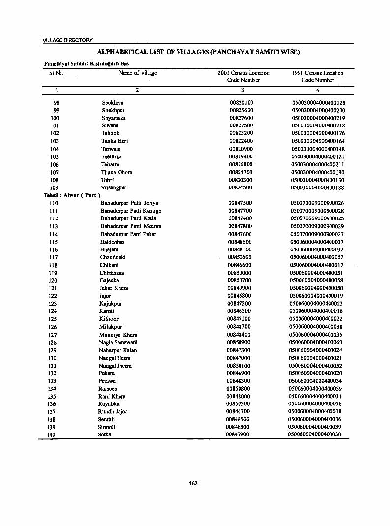
VILLAGE DIRECTORY
ALPHABEfICALLISf OF VILLAGES (pANCHAYATSAMITIWlSE)
PancbayatSamiti: Kisbangam Bas
SI.Ne. Name of village 2001 Cats us location 1991 Census Location Code Numb er Code Number
2 3 4
98 Scokhcra 00820100 050030004000400128 99 Shekhpur 00825600 050030004000400200
100 Shyarnaka 00827600 050030004000400219 101 Siwana 00827500 050030004000400218 102 Tahnoli 00823200 050030004000400176 103 Tanka Heri 00822400 050030004000400164 104 Tarwala 00820900 050030004000400148 105 Teetarka 00819400 050030004000400121 106 Tehatra 00826800 050030004000400211 107 Thana Ghora 00824700 050030004000400190 108 Tohri 00820300 050030004000400130 109 Vrisangpur 00824500 050030004000400188
Tehsil : Ahvar ( Part ) 110 Bahadurpur Patti Joriya 00847500 050070009000900026 III Bahadurpur Patti Kanugo 00847700 050070009000900028 112 Bahadurpur Patti Katla 00847400 050070009000900025 113 Bahadurpur Patti Meeran 00847800 050070009000900029 114 Bahadurpur Patti Pahar 00847600 050070009000900027 115 Baldeobas 00848600 050060004000400037 116 Bhajera 00848100 050060004000400032 117 Chandooki 00850600 050060004000400057 118 Chikani 00846600 050060004000400017 119 Chirkhana 00850000 050060004000400051 120 Gajeeka 00850700 050060004000400058 121 Jahar Khera 00849900 050060004000400050 122 Jajor 00846800 050060004000400019 123 Kajakpur 00847200 050060004000400023 124 Karoli 00846500 050060004000400016 125 Kithoor 00847100 050060004000400022 126 Milakpur 00848700 050060004000400038 127 Mundiya Khera 00848400 050060004000400035 128 Nagla Samawadi 00850900 050060004000400060 129 Naharpur Kalan 00847300 050060004000400024 130 Nangal Heera 00847000 050060004000400021 131 Nanga! Jheera 00850100 050060004000400052 132 Pahara 00846900 050060004000400020 133 Peelwa 00848300 050060004000400034 134 Raisees 00850800 050060004000400059 135 Rani Khera 00848000 050060004000400031 136 Rayabka 00850500 050060004000400056 137 Rundh Jajor 00846700 050060004000400018 138 Senthli 00848500 050060004000400036 139 Sinnoli 00848800 050060004000400039 140 Sotka 00847900 . 050060004000400030
163
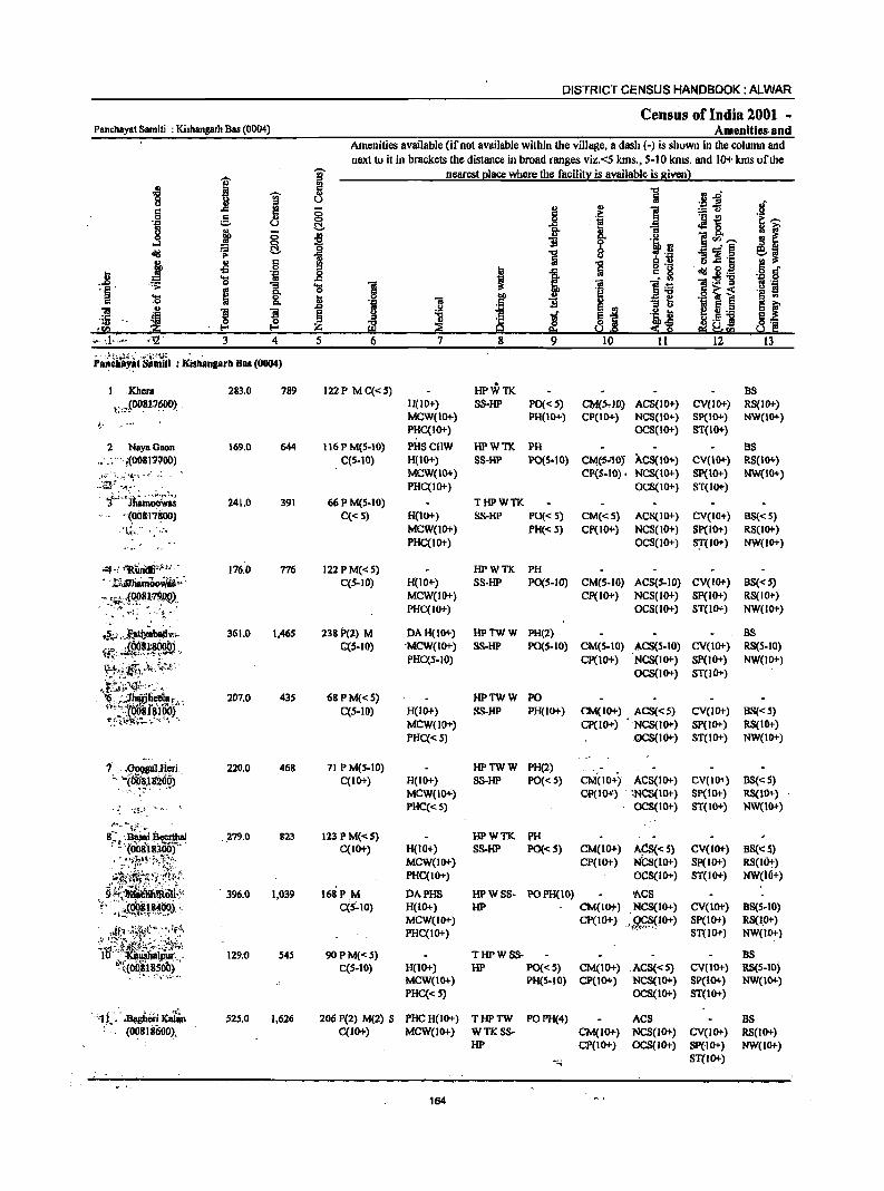
Panchayat Samiti : Kishangarh Bas (0004)
3 4 .. :~ t~.~;..;; ... ; : .. ·"i~·'·!J: ' Panl\li.Y~t Samiti : Kishanprh Bas (0004)
1 ,Khera ~;,_A~1,7600) -
2 NayaGaon .::." i(0()8t1100) :.(.'.':'-" ;~. ·Ilt·~ --~. ~~ . . :~t ... ~~ ... ·.
),.; .. )h~;~~ . (0081"1100) ·I~. - -..
'0·1(- . J31!gberi Xal1n . (00818600),
283.0
169.0
241.0
176.0
361.0
207.0
220.0
_ ,279.0
- 396.0
129;0
525.0
789
644
391
776
1,465
435
468
823
1,039
545
1,626
5
DISTRICT CENSUS HANDBOOK: ALWAR
Census of India 2001 ~ Amenities- and
Amenities available (if not available within the village, a dash (-) is shown in the column and next to it in brackets the distance in broad ranges viz.<5 kms., 5-10 krns. and 10+ kms of the
122P MC«5)
116 P M(5·10) C(S.IO)
66 P M{S-IO)
C«S)
122 P M«5) C(S-IO)
238 P(2) M C(S-IO)
68PM«S) C(S-IO)
71 P M(S·IO) C(IO-l-)
123 PM«S) C(IO+)
168PM C{s:..10)
90 PM« S) C(S-IO)
nearest place where the facility is available is given)
H(IOi-) MCW(IO+) PHC(IO+)
PHSCHW H(IO+) MCW{IO+) PHC(IO+)
H(IO+) MCW{lO-l-) PHC{lO+)
H(IO+) MCW(IO+) PHC(JO+)
DAH{IO-l-) 'MCW{IO-l-) PHC(5-10)
H{IO+) MCW(IO+)
PHC«5)
PO{< S) PH(IO+)
HPWTK PH
CM(S.IO) ACS(lOi-) CP{IO+) NCS(IO+)
OCS(IO+)
BS CV{IOi-) RS(IOi-) Sp(I(}l-) NW{IO+) ST{IO+)
BS SS-HP PO{S·IO) CM(:S·10} ACS(IO+) CV(10+) RS(IO+)
THPWTK SS-HP PO« S)
PH« 5)
HPWTK PH
CP(S-IO). NCS(IO+) OCS(IO+)
Sp(IO+) NW(IO+) ST{IO+)
CM{< S) ACS(IO+) CV(IO+) BS« 5) CP(lO+) NCS{!O+) Sp(IO+) RS(IO+)
OCSOO+) S!(IO+) NW(I(}l-)
SS·HP PO(S-IO) CM(5·IO) ACS(S.IO) CV(IO+) BS«5) CP(IO-t) NCS(IO+) SP(IO-l-) RS(JO+)
OCS(lO-l-) ST{lO-l-) NW(IOi-)
HPTWW PH(2) SS-HP PO(S-IO) CM(S-IO) ACS(S-IO)
BS CV(IO+) RS(S-IO)
Sp(IO+) NW(lO+) ST(IO+)
Cp(IO+) NCS{lO+) ocs{lO+)
HPTWW PO SS-HP PH(IO+) CM{IO+) ACS« 5) CV(IOi-) BS« S)
Cp( 10+) NCS{I 0+) SPO 0+) RS( 1Oi-) -QCS(lO+) ST(IO+) NW(IO+)
HPTWW PH(2) H(lO-l-) SS·HP PO« 5) CM(IOi-) ACS(IO+) CV(IO+) BS« 5) MCW(IO+)
PHC«S)
H{IO+) MCW(IO+) PHC(IO+}
DAPHS H{IO+) MCW(IO-l-) PHC(IO+)
H{IO-l-) MCW(IO+) PHC«S)
OP(ID-t') :NCS(IO+) SP(IO+) RS(IO+) OCS(IO+) ST{IO+) NW{IO+)
HPwn ~ • 5S-HP PO« S) CM(IO+) A~< 5) CV(IO+) BS(': 5,)
CP(IO+) NCS{IO+) Sp(IO+) RS(IOt) OCS(IO+) S1(1o+) NW(io+)
HP w SS· PO PH(IO) ~CS
HP CM(IO+) ,NCS(IO+) CV(IO+) BS{5.IO) RS(I,O+} NW(lO+)
CP(IO+) .gr;;~(lO+) SP(IO-l-} ST(IO-l-}
THPWSS· HP PO«S) CM(IO+) ACS«S)
PH(S-lO) CP(IO+) NCS{IO+) OCS(lO+)
BS CV{IO+) RS{S.lO) SP(lO+) NW(IO+) ST(lO+)
206 P(2) M(2) S PHC H(IO+) T HP TW PO PH(4) ACS BS RS(IO+) NW(IO+)
C(lO+) MCW(IO+) WTK SS· CM(IO+) HP CP(IO+)
164
NCS(IO+) CV(JO+) OCS{IOi-) SP(IO+)
ST(IO+)
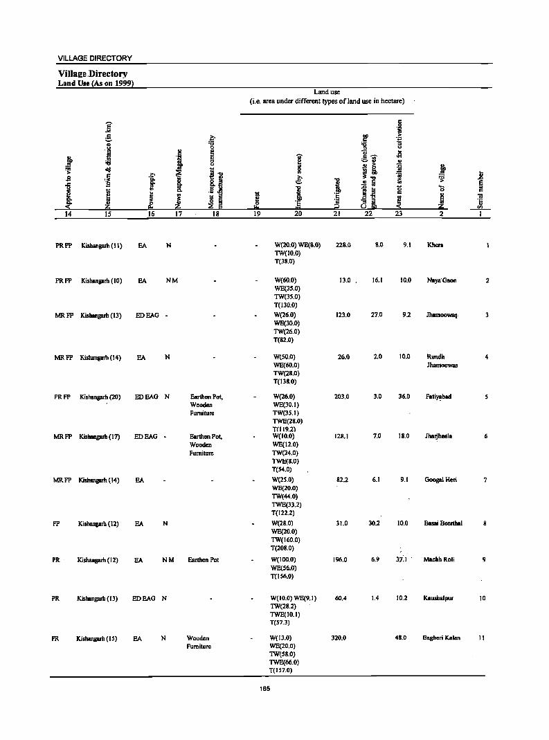
VILLAGE DIRECTORY
VilIa2e.Directory Land Use {As on 1999}
Land use (i.e. area under different types of land use in hectare)
E c 0 ... "s
g ~ ~ -Ei ., '6 '6 :;
I ., 0 :::> .., ., E g- .a ., E 'ii' of '6 0 ~
;:;,rJ OJ
" a ~ ~ .. ,.., ~
i i~ 0 ~ >
\~ .?:' .,
~] 'ii u s ~ ~ "0 ~ '> .&>
] S 8..E! .. § t: '" It .5 oM 1
1;1 ~l!! 0 'Ci
'E c e fi ! ~ I
c
~ Co t: ::I
S~ .. "iI
~ ~ ~ ~ ] ·s ~ '5 ii e:. I:!:o 02 ii -f!L_
14 15 16 17 18 19 20 21 22 23 2 1
PRFP Kishanprb (II) EA N W(20.0) WE(B.O) 22B.0 B.O 9.1 Khcra TW(IO.O) T(38.0)
PRFP Kishangarb (10) EA NM W(60.0) 13.0 . 16.1 10.0 Naya' Gaon 2 WE(3S.0) TW(3S.0) T(llO.O)
MRFP Kishangarb (Il) EDEAG - W(26,0) 12l.0 27.0 92 JhamooWB,. 3 WE(30.0) TW(26.0) T(82.0)
MRFP Kishangarb (14) EA N W(SO.O) 26.0 2.0 10.0 Rundb 4 WE(6O.0) JbamooWBS TW(28.0) T(I38.0)
PRFP Kishangarh (20) EDEAG N Earthen Pot, W{26.0) 20l.0 3.0 36.0 Fati~bad S Wooden WE(30.1) Furniture TW{3S.I)
TWE{28.0) TUI9.2)
MRFP Kisbangarh (17) EDEAG - Earthen Pot, W{IO.O) 128.1 7.0 IB.O Jhaljheela 6 Wooden WE(12.0) Furniture TW{24.0)
TWE{S.O) T(54.0)
MRFP Kishangarb (14) EA W{2S.0) &2.2 6.1 9.1 Googal Hen 7 WE(20.0) TW{44.0) TWE(33.2) T(122.2)
FP KishBngarb (12) EA N W(28.0) 31.0 30.2 10.0 BaSRi Beertbal 8 WE(20.0) TW(160.0) T(208.0)
PR Kishangarh (12) EA NM Earthen Pot W(IOO,O) 196.0 6.1l lil MachhRoli 9 WEC56.0) T{IS6.0)
PR KishBngarh (13) EDEAG N W{IO.O) WE{Il.I) 60.4 1.4 10.2 Kaushalpur 10 TW{28.2) TWE(IO.I) T(57.3)
PR Kishangarb (I 5) EA N Wooden W(I3.0) 320.0 4B.0 Bagheri Kalan II Furniture WE(20.0)
TW(SB.O) TWE(66.0) T(IS7.0)
165
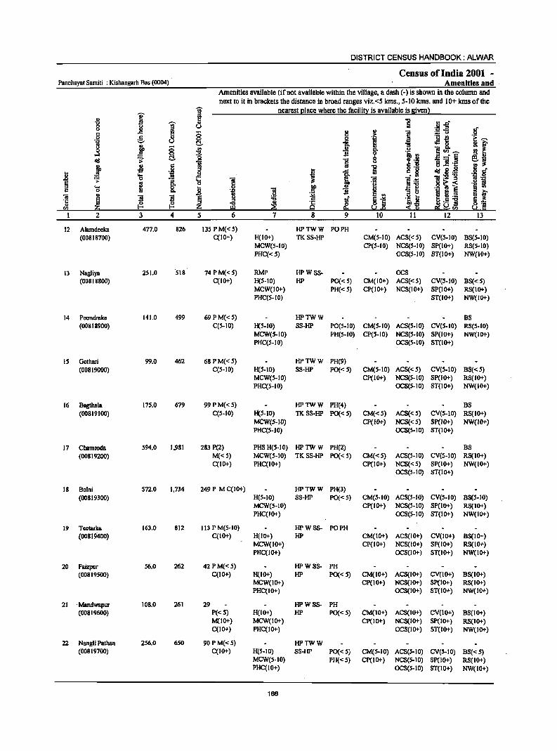
DISTRICT CENSUS HANDBOOK: ALWAR
Census of India 2001 -Panchayat Samiti : Kishangarh Bas (0004) Amenities and
Amenities available (if not available within the village, a dash C-) is shown in the column and
next to it in brackets the distance in broad ranges viz.<5 kIns., 5-10 kIns. and 10+ kmsofthe "iii' nearest Qlace where the facilit:l is available is Biven}
u ]' ~ -0 -0 'Oi' u a .~~ 0 0
~ U .f () l! J
., ] c (5 .! :.= u 0
.2 g II> 0 ._ t! .i! ~
~ u t!.. .I!! a ~ f l ;; '" .J c:>. 11
]~]' ..:I 0 -0 'i' .i.i, on ~~ d!I .;';: tl :8 ] 0
~ 'i II> u 5] ·c j ~
c !l '5 gr::! j o ._
aid fH! .8 _g t 1 c 8 ... 'iii
l~ ]:-e-g .~ .g ~ 0
is. "0 ] ~ "iii E
~ .~ .0 ~ i ._ fI
" .... a 13 .2 i § .,
c 0 "iii B ;3 ~ u .J:> 1;; .g e ... 1 ~L_ e ~ "ii ~ l ]I
~ g ..., i ~1
.2 tJ .5 ] ·c ~ ~ ~ ~ Iih.,s ~~ " fIl ~ ~ :!: Sl "'~!"a
2 3 4 5 6 7 8 9 10 II 12 13
12 Alamdeeka 477.0 826 13SPM«5) HPTWW PO PH (00818700) C(IO+) H(IO+) TKSS-HP CM(S-IO) ACS«S) CV(S-IO) BS(S-IO)
MCW(S-IO) CP(S-IO) NC8(S-IO) Sp(IO+) RSCS-IO) PHC«S) OCS(S-IO) ST(IO+) NW(JO+)
13 Nallliya 251.0 ·S18 74 PM« S) RMP HPWSS- OCS (0081$800) C(IO+) H(S-IO) HP PO« S) CM(IO+) ACS«S) CV(S-IO} BS« S}
MCW(IO+} PH«S) CP(IO+} NCS(IO+) SP(IO+} RS(IO+) PliC(S-IO} ST(IO+} NW(IO+}
14 Poondraka 141.0 499 69 PM« S} HPTWW BS (00818900) C(S-IO} H(S-IO} SS-HP PO(S-IO} CM(S-IO} ACS(S-IO) CV(S-IO} RS(S-IO}
MCW(S-IO} PH(S-IO} CP(S-IO) NCS(S-IO) SP(IO+) NW(lO+) PHC(S-IO) OCS(S-IO) ST(IO+}
IS Oothari 99.0 462 68 P M«5) HPTWW PH(9} (00819000) C(S-ID) H(S-IO) SS-HP PO« 5) CM(S-IO) ACS«5) CV(S-IO) BS«5)
MCW(S-IO} CP(IO+) NCS(S-IO) SP(IO+) RS(IO+) PHC(S-10} OC8(S-IO) ST(IO+) NW(IO+)
16 Bagthala 175.0 679 99PM«S) HPTWW PH(4) BS (00819100) C(S-IO) H(S-IO) TKSS-HP PO«S} CM«S) ACS«S) CV(S-IO) RS(IO+)
MCW(S-IO) CP(IO+) NCS«5) SP(IO+} NW(IO+) PHC(S-IO) OCS(S-IO) ST(IO+)
17 Chamroda 594.0 1,981 283 P(2) PHS H(S-IO) HPTWW PH(2) BS
(00819200) M«S) MCW(S-IO) TKSS-HP PO«S) CM«S) ACS(5-10) CV(S-IO) R8(IO+) C(IO+} PHC(IO+) CP(IO+) NC8« 5) SP(IO+) NW(IO+)
OCS(S-IO) ST(lo+)
18 Bolni S72.0 1,734 249 P M C(10+) HPTWW PH(3)
(00819300) H(S-lO) SS-HP PO« S) CM(S-IO) ACS(S-IO) CV(S-IO) B8(S-IO) MCW(S-IO) CP(IO+) NCS(5-10) SP(IO+) R8(IO+) PHC(IO+) OCS(S-IO) ST(IO+) NW(IO+)
19 Tcctarka 163.0 812 113 P M(S-IO) HPWSS- PO PH (00819400) C(IO+) H(IO+) HP CM(IO+) ACS(IO+) CV(1O+) B8(IO+)
MCW(IO+) CP(IO+) NCS(IO+) SP(IO+) RS(IO+) PHC(1O+) OCS(IO+) ST(IO+} NW(IO+)
20 Faizpur 56.0 262 42 P M«5) HPWS·S- PH (00819500) C(IO+) H(IO+) HP PO«S) CM(IO+) ACS(IO+) CV(IO+) BS(IO+)
MCW(IO+) CP(IO+) NCS(IO+) Sp(IO+) RS(IO+) PHC(IO+) OCS(IO+) ST(IO+) NW(IO+)
21 . Mandwapur 108.0 261 29 HPWSS- PH (00819600) P«S) H(IO+) HP PO«5) CM(IO+) ACS(IO+) CV(IO+) BS(IO+)
M(JO+) MCW(1O+) CP(IO+) NCS(IO+) SP(IO+) RS(IO+) C(IO+) PHC(IO+) OCS(IO+) ST(IO+) NW(IO+)
22 Nangli Pathan 256.0 650 90 P M«S) HPTWW (00819700) C(IO+) H(S-IO) SS-HP PO«S) CM(S-IO) ACS(S-IO) CV(S-IO) BS«S)
MCW(S-IO) PH{<S) Cp(IO+) NCS(S-IO} SP(IO+) RS{IO+) PHC(IO+) OCS(S-IO) ST(IO+) NW(IO+)
166
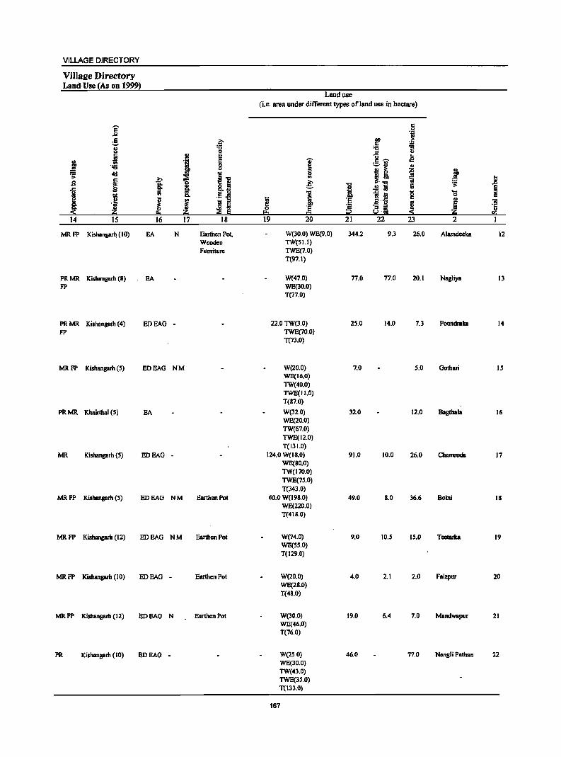
VILLAGE DIRECTORY
ViUs2e Directory Land-Use {As on 1999}
Land use
(i.e. area under different types of land use in hectare)
]' c
.S! 10
e .~ CD > c 1l 8
.., '6 0 ;:J u
j '1 E U .s
j E I c ~ 0 ;..ta III u
B ~ ~ !P :; ~ ~ 11
0
~ <II ~.., 1 tl
.B .~ £ = g: 1 .s: .t>
.c .B i .!! :a ~ J .E J! 1 ~ :a g eo.
.J .. 0
j 1$ ~ 5 I iHi .. "iii - ;:J ! 6 '5 .. 'E 8~ ~ ~ ::e § !:!:I = i2 ~ ~ fa
14 15 16 17 18 19 20 21 22 23 2 I
MRFP Kishangarh (10) EA N Earthen Pol, W(30.0) WE(9.0) 344.2 9.3 26.0 Alamdeeka 12 Wooden TW(S I. I) Furniture TWE(7.0)
T(97.1)
PRMR Kishangarh (B) EA W(47.0) 77.0 77.0 20.1 Nagliya 13 FP WE(30.0)
T(77.0)
PRMR Kishangarh (4) EDEAG - 22.0 TW(3.0) 25.0 14.0 7.3 Poondraka 14
FP TWE(7O.0) T(73.0)
MRFP Kishangarh (S) EDEAG NM W(20.0) 7.0 5.0 Gothari IS WE(16.0) TW(40.0) TWE(lI.O) T(87.0)
PRMR Khairthal (S) EA W(32.0) 32.0 12.0 Bagthala 16 WE(20.0) TW(67.0) TWE(12.0) T(131.0)
MR Kishangarh (S) EDEAG - 124.0 W(IB.O) 91.0 10.0 26.0 Chamroda 17 WE(SO.O) TW(170.0) TWE(7S.0) T(343.0)
MRFP Kishangarh (5) EDEAG NM Earthen Pot 60.0 W(l9S.0) 49.0 S.O 36.6 Bolni 18 WE(220.0) T(4 I 8.0)
MRFP Kishangarh (12) EDEAG NM Earthen Pot W(74.0) 9.0 10.5 15.0 Teetarlca 19 WE(SS.O) T(129.0)
MRFP Kishangarh (10) EDEAG - Earthen Pot W(20.0} 4.0 2.1 2.0 Faizpur 20 WE(2S.0) T(48.0)
MRFP Kishangarh (12) EDEAG N Earthen Pot W(30.0) 19.0 6.4 7.0 Mand_pur 21 WE(46.0) T(76.0)
PR Kishangarh (10) EDEAG - W(2S.0) 46.0 77.0 Nangli Pathan 22 WE(30.0) TW(43.0) TWE(3S.0) T(133.0)
167
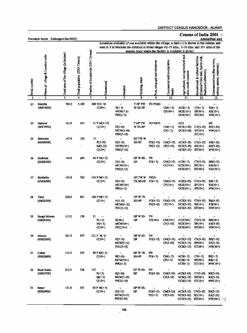
DISTRICT CENSUS HANDBOOK: ALWAR
Census of India 2001 -Panchayat Samiti : Kishangarh Bas (0004) Amenities and
Amenities available (ifnot available within the village, a dash (-) is shown in the column and next to it in brackets the distance in broad ranges viz. <5 kms., 5-10 kIns. and 10+ kIns of the
I ~ nearest Illace where the faeilin: is available is Biven) ., ., c
'E .... g- O> .S! -§" 8 " u .,-l! a l! .,
1 :!:<l
·1 ;; ,. .!:! e u 0 { .~
._ e
!f u co.. .Ma i § ., u '3
0 .... i f . 2 '2"' ...... ...:I ~ t:!- '0 If .il .a-"!jj lid 1 .... e~
i .s i Iii "5 s!: 1$ lDh:: ! g t o ._
1Id2~ .8 1 c 8 .51 § = .... ..c "iii l~ 1:9 1;1 ._
.;: 0
~ ....
1 .~ i ~ ~ 0 "§
.S! ~ i ... jl .~ 0 'iI i .,
'3 ~ E '" 1;1 e E r 'iI I ! ! E i ~ ....
.~ ~ 2 u ._
'5 i ~ ~ tf ~1 ~.5 ] g=
'" ~ ~.Q :s;'ti ~'" 50! C 2 3 4 5 6 7 8 9 10 11 12 13
23 Mancha 784.0 3,103 400 P(4) M THPTW POPH(6) (00819800) C(IO+) H(<: S) WSS-HP CM«S) ACS« S) CV« 5) BS« 5)
MCW«S) CP(IO+) NCS(IO+) Sp(IO+) RS(IO+) PHC«s) OCS(IO+) ST(IO+) NW(IO+)
24 Mahond 161.0 315 SI P M(S-lO) THPTW POPH(S) ACS BS (00819900) C(IO+) H(S-IO) WSS-HP CM«5) NCS(s-IO) CV(s-IO) RS(s-tO)
MeW(S-IO) CP« 5) OCS(S-IO) Sp(IO+) NW(IO+) PHC(S-IO) ST(tO+)
25 Sahoowas 147.0 132 15 HPTWW (00820000) P(S-IO) H(S-IO) SS-HP PO(S-IO) CM(S-IO) ACS(s-IO) CV(S-IO) BS(5-10)
M(S-IO) MCW(IO+) PH(S-IO) CP(S-IO) NCS(S-IO) . SP(IO+) RS(S-IO) C(IO+) PHC(S-IO) OCS(S-IO) ST(IO+) NW(IO+)
26 Seokhem 149.0 266 44 P M« 5) HPWSS- PH (00820100) C(IO+) H(5-10) HP PO« 5) CM(s-IO) ACS« 5) CV(S-IO) BS(S-IO)
MCW(IO+) CP(IO+) NCS(lO+) SP(lO+) RS(IO+) PHC(S-IO) OCS(lO+) ST(lO+) NW(lO+)
27 Santhalka 145.0 765 104 P M« 5) HPTWW PH(s) (00820200) C(lO+) H(S-IO) TKSS-HP PO« 5) CM(S-IO) ACS(S-IO) CV(S-IO) BS«S)
MCW(IO+) Cp(IO+) NCS(IO+) SP(IO+) RS(IO+) PHC«S) OCS(IO+) ST(IO+) NW(lo+)
28 Tahri 230;0 801 126 P M« 5) HPWTK (00820300) C(IO+) H(5-10) SS-HP PO(S-IO) CM(S-IO) ACS(S-IO) CV(S-IO) BS(S-IO)
MeW(5-10) PH(s-IO) CP(IO+) NCS(S-IO) SP(IO+) RS(IO+) PHC(s-IO) OCS(s-IO) ST(IO+) NW(IO+)
29 Nangli Mewan 115.0 159 21 HPW SS- PH (00820400) P«5) H(lO+) HP PO(IO+) CM(lO+) ACS(JO+) CV(S-IO) BS(IO+)
M«S) MCW(IO+) CP(S-IO) NCS(IO+) SP(IO+) RS(S-IO) C(IO+) PHC(IO+) OCS(IO+) ST(IO+) NW(lo+)
30 Meerka' 261.0 9S7 131 PM 0 HPWSS- PH (00820500) C(IO+) H(5-10) HP PO(S-IO) CM(S-IO) ACS(s-IO) CV(S-IO) BS(s-IO)
MCW(S-IO) CP(s-IO) NCS(S-IO) Sp(IO+) RS(5-10) PHC(5-10) OCS(5-10) ST(IO+). NW(lO+)
31 Lisana 114.0 539 88 PM«S) HPWTK PH (00820600) C(IO+) H(S-IO) SS-HP PO«s) CM«S) ACS«5) CV«5) BS«S)
MCW(IO+) CP«5) NCS«5) Sp(IO+) RS«5) PHC«5) OCS«S) ST(IO+) NW(IO+)'
32 Basai Kalan 211.0 738 127 HPWSS- PH (00820700) P«5) H(5-10) HP PO(S-IO) CM(S-IO) ACS(S-IO) CV(S-IO) BS(S-IO)
M(<:S) MeW(S-IO) CP(S-IO) NCS(5-10) SP(IO+) RS(S-IO) C(IO+) PHC(S-IO) OCS(S-IO) ST(IO+) NW(IO+)
33 Isepur 131.0 353 60PM«S) HPWSS-(~820800) C(IO+) H(5-10) HP PO(S-IO) CM(5-1O) ACS(S-IO) CV(S-to) BS(S-IO)
MeW(S-IO) PH(": 5) CP(S-IO) NCS(S-IO) S~(I0+) RS(S-IO) PHC(s-IO) OCS(S-IO) ST(lO+) NW(IO+) :·~i·
168
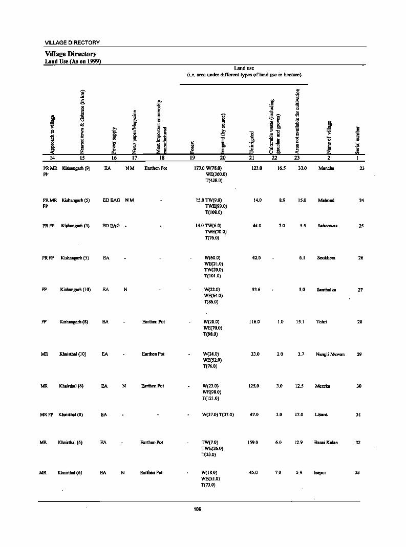
VILLAGE DIRECTORY
Villaee Directory Land Use {As on 1999l
Land use
(i.e. area under different types of land use in ·hectare)
]' .~ c:
.~ ~ .~ ;::-.. ... :a "3
J " 0 :s u
c: E u J3 j .~ E -.;- c:~ ._ ., 0 ~ '-' III III U J! >- ~ ~ :s: <III I] 51 ~! s ~ ~ ~ ~
'ii .8 !t §. 1 .!! Iii i:i .;;:
§ ~ .!~ "t> i! Ie g ':s
I ., .... a c:
[ ~ j II ·E :soC ., iii
~ ;s fa
0 ·s ·2 ai ~ Ii ·5 Zi e.t ~ !a !:!o = i2 « Zi en
14 IS 16 17 18 19 20 21 22 23 2
PRMR Kishangarh (9) EA NM Earthen Pol 173.0 W(78.0) 123.0 16.5 33.0 Mancha 23 FP WE(360.0)
T(438.0)
PRMR Kishangarh (5) EDEAG NM 15.0 TW(9.0) 14.0 8.9 15.0 Mahond 24 FP TWE(99.0)
T(IOS.O)
PRFP KishBngarh (3) EDEAG - 14.0 TW(6.0) 44.0 7.0 5.5 Sahoowas 25 TWE(70.0) T(76.0)
PRFP Kishangarh (5) EA W(60.0) 42.0 6.1 Seokhera 26 WE(21.0) TW(20.0) T(IOI.O)
FP Kishangarh (10) EA N W(22.0) 53.6 5.0 Santhalka 27 WE(64.0) T(86.0)
FP Kishangarh (8) EA EarlhenPot W(2S.0) 116.0 1.0 15.1 Tohri 28 WE(70.0) T(98.0)
MR Khairthal (10) EA Earthen Pot W(24.0) 33.0 2.0 3.7 Nangli Mewan 29 WE(S2.0) T(76.0)
MR Khairthal (6) EA N Earthen Pot W(23.0) 125.0 3.0 12.5 Meerlca 30 WE(98.0) T(121.0)
MRFP Khairlhal (8) EA W(37.0) T(37.0) 47.0 3.0 27.0 Lisana 31
MR Khairlhal (6) EA Earthen Pot TW(7.0) 159.0 6.0 12.9 BasaiKaian 32 TWE(26.0) T(33.0)
MR Khairthal (6) EA N Earthen Pot W(18.0) 45.0 7.0 5.9 Isepur 33 WE(SS.O) T(73.0)
169
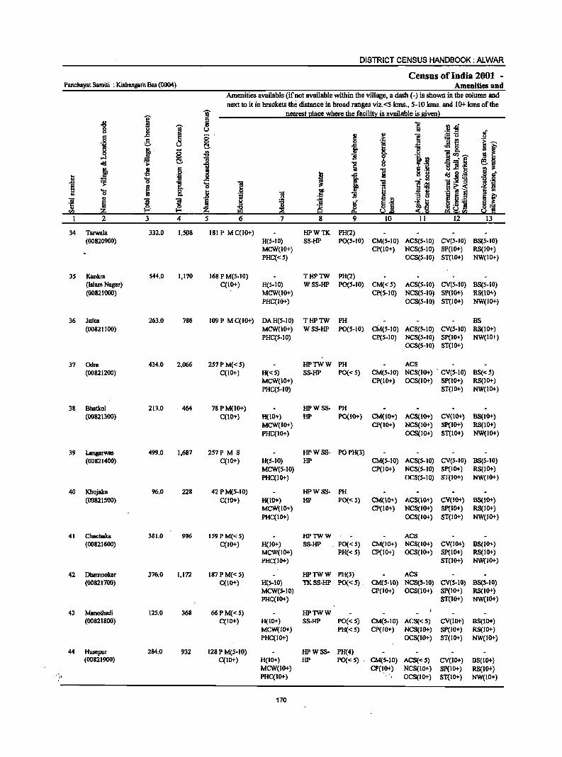
DISTRICT CENSUS HANDBOOK: ALWAR
Census ofIndia 2001 -Panchayat Samiti : Kishangarh Bas (OO04) Amenities and
Amenities available (if not available within the village, a dash (-) is shown in the column and
next to it in brackets the distance in broad ranges viz.<S kms., 5-10 krns. and 10+ kms of the ..,. nearest place where the facility is available is given)
'0' ~ 1 a 'W 11 u
·1 .,
0 ~ " r::
1 e .. 0 u ~ ]. " ~ ...l ~ i ]i ~ ~ ] ()
j Jl 6 '5 ~ 'j 0 I ..0 ~ g_ ..c:
§ >-e ~ .... 8. ..8 '" 0
] u B ~ ~ ~ <I) ~'
1 2 3 4 5
34 Tarwala 332.0 1,508 181 P M C(IO+) HPWTK PH(2) (00820900) H(S-IO) SS-HP PO(S-IO) CM(S-IO) ACS(S-IO) CV(S-IO) BS(S-IO)
MCW{IO+) Cp(IO+) NCS(S-IO) SP(IO+) RS(IO+)
PHC«S) OCS(S-IO) ST(IO+) NW{IO+)
3S Kankra 544.0 1,170 168 P M{S-IO) THPTW PH(2) (Islam Nagar) C(IO+) H{S-IO) WSS-HP PO{S-IO) CM{< S) ACS{S-IO) CV(S-IO) BS(S-IO) (00821000) MCW(IO+) CP(5-IO) NCS(5-10) SP(IO+) RS(IO+)
PHC(IO+) OCS(5-10) ST{IO+) NW{IO+)
36 Jatka 263.0 786 109 P M C(IO+) DAH(S-IO) THPTW PH BS (00821100) MCW{IO+) WSS-HP P0{5-10) CM{5-10) ACS(S-IO) CV(S-IO) RS(lO+)
PHC{5-10) CP{5-10) NCS{S-IO) Sp(IO+) NW{IO+) OCS{5-10) ST(IO+)
37 Odrs 434.0 2,066 257 PM«S) HPTWW PH ACS (00821200) C(lO+) H«5) SS-HP PO{<S) CM(S-IO) NCS(IO+) CV(S-IO) BS«5)
MCW(IO+) CP(IO+) OCS(IO+) SP(lO+) RS(IO+)
PHC(5-10) ST(lO+) NW(IO+)
38 Bhatkol 213.0 464 78 P M(IO+) HPWSS- PH {OO821300} C{lO+) H(10+} liP PO{JO+) CM(IO+} ACS(IO+} eV(lO+) 88(10+)
MCW{IO+) CP(IO+) NCS{IO+) sp(10+) RS(10+}
PHC(IO+) OCS(IO+} ST(lO+} NW(lo+)
39 Langarwas 499.0 1,687 257P M S HPWSS- POPH(3) (00821400) C(IO+) H(S-IO) HP CM{S-IO) ACS{5-10) CV(S-IO) 9S(S-10)
MCW{S-IO) CP{IO+) NCS{S-IO) SP{IO+) RS(JO+)
PHC(IO+) OCS(S-IO) ST(IO+) NW(IO+)
40 Khojaka 96.0 228 42 P M(S-IO) HPWSS- PH (0082IS00) C(1O+} H(IO+) HP PO{<S) CM(IO+) ACS(lO+} eV(IO+} BS(IO+}
MCW(IO+) CP{IO+) NCS(IO+) Sp(10+) RS{IO+)
PHC(IO+) OCS(IO+) ST(IO+) NW(IO+)
41 Chachaka 381.0 996 159 P M«S) HPTWW ACS (00821600) C(IO+) H(IO+) S8-HP _ PO{< 5) CM(IO+) NCS(IO+) CV(IO+) 9S(10+)
MCW(IO+) PH« 5) CP(IO+) OCS(IO+) SP(IO+) RS(lO+) PHC(IO+) ST(IO+) NW(lO+)
42 Dhamookar 376.0 1,172 187 P M«5) HPTWW PH(S) ACS (008217oo) C(IO+} H(S-10} TKSS-HP PO{<S} - CM(5-10} NC5(S-10} eV(S-IO} B5(5-10)
MCW(S-IO) CP(IO+) OCS(lO+} SP(IO+) RS(lO+) PHC(IO+) ST(lO+) NW{lO+}
43 Manothadi 12S.0 368 66PM«S) HPTWW (00821800) C(IO+) H(IO+) S8-HP PO« S) CM(S-IO} ACS«S) CV(IO+) BS(IO+)
MCW(lO+) PH« S) CP(IO+) NCS(IO+) SP(IO+) RS(lO+) PHC(IO+) OCS(IO+) ST(IO+) NW(IO+)
44 Huacpur 284.0 932 128 P M{5-10) HPWSS- PH(4) (OO82l900) C(IO+) H(IO+} HP PO{<S} - CM{5-10) ACS{<5) CV{lO+) 8S(10+)
MCW(IO+) CP{lO+) NCS{IO+) SP{IO+) RS(IO+) ;t PHc(lo+) OCS{IO+) ST{IO+) NW(IO+)
170
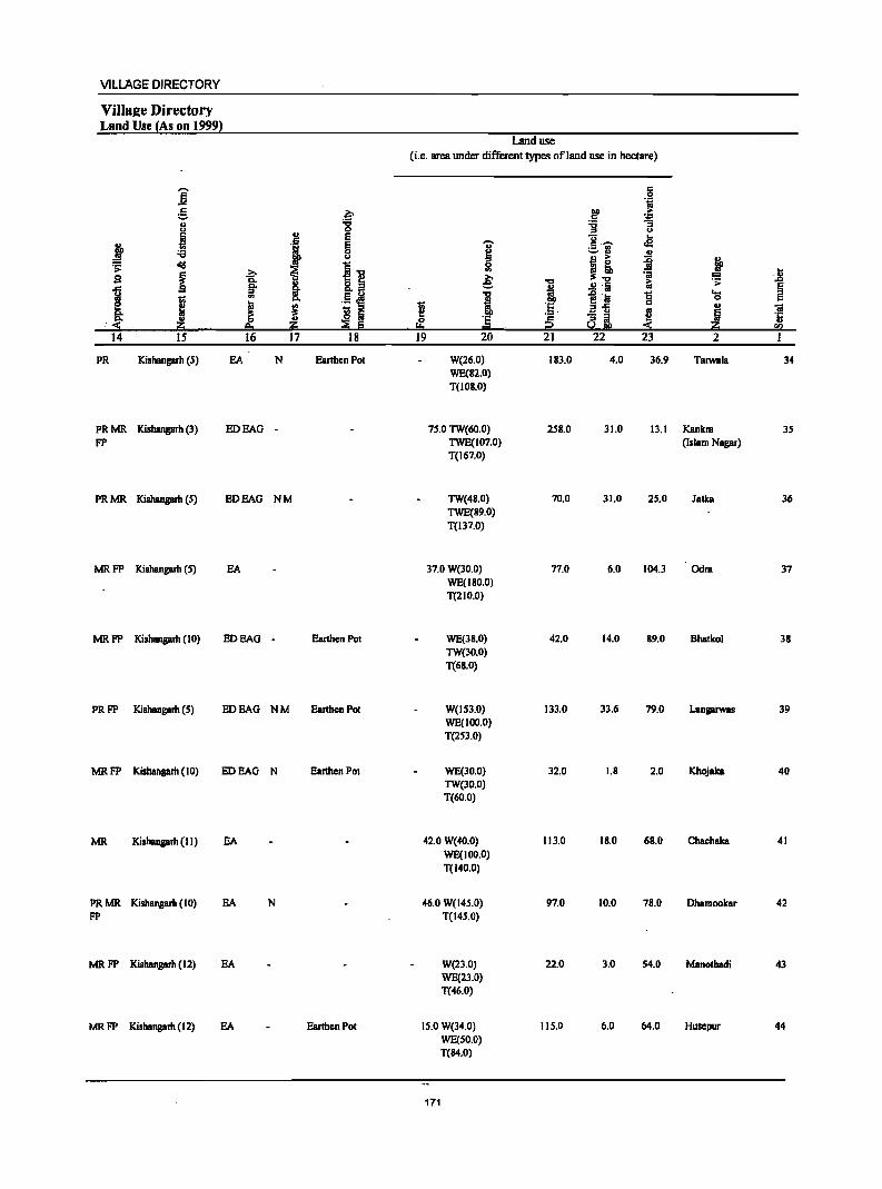
VILLAGE DIRECTORY
Villa2e Directory Land Use (As on 19991
Land use (i.e. area under different types ofland use in hectare)
]' c 0 "i
g .e ~ ... .. '8 :a ~ u ::s u
~ , E c; .. ~ ~ 'OJ' c·~ oS ._ ..
:a ~ ~., .. u a ... j l ';> ~
i~ Ii! ~! .8 .e ~ 1 e: 'iI ., ...
.£ fa 1:; ';>
~ ~ 8: .5 ~ I i .t:l Ii g .... til 0
~ J ~ til :I 1 l !.c .. "iii .a u ~ "'" ~ ~ -; i Iii 'ij
.. ~. ~ .. ·s ii!O = 50! :::!i ~ rI)
14 IS 16 17 18 19 20 21 22 23 2 I
PR Kishangarh (5) EA N Eanhen POI W(26.0) 183.0 4.0 36.9 Tarwala 34 WE(S2.0) T(IOS.0)
PRMR Kishangarh (3) EDEAG - 75.0 TW(60.0) 258.0 31.0 13.1 Kankl1l 35 FP TWE(107.0) (Islam Nagar)
T(167.0)
PRMR Kishangarh (S) EDEAG NM TW(48.0) 70.0 31.0 25.0 Jatka 36 TWE(89.0) T(137.0)
MRFP Kishangarh (5) EA 37.0 We30.0) 77.0 6.0 104.3 OdI1l 37 WE(180.0) T(2 I 0.0)
MRFP Kishangarh (10) EDEAG - EanhenPol WE(38.0) 42.0 14.0 89.0 Bhalkol 38 TW(30.0) T(68.0)
PRFP Kishangarh (5) EDEAG NM Earthen Pol W(IS3.0) 133.0 33.6 79.0 Langarwas 39 WE(IOO.O) T(253.0)
MRFP Kishangarh (10) EDEAG N Earthen POI WE(30.0) 32.0 1.8 2.0 Khojaka 40 TW(30.0) T(60.0)
MR Kishangarh (II) EA 42.0 W(40.0) 113.0 18.0 68.0 Chac:haka 41 WE(100.0) T(I40.0)
PRMR Kishangarh (10) EA N 46.0 W(14S.0) 97.0 10.0 78.0 Dhamookar 42 FP T(145.0)
MRFP Kishangarh (12) EA W(23.0) 22.0 3.0 54.0 Manothadi 43 WE(23.0) T(46.0)
MRFP Kishangarh (12) EA EanhenPol 15.0 W(34.0) 115.0 6.0 64.0 Husepur 44 WE(50.0) T(84.0)
171
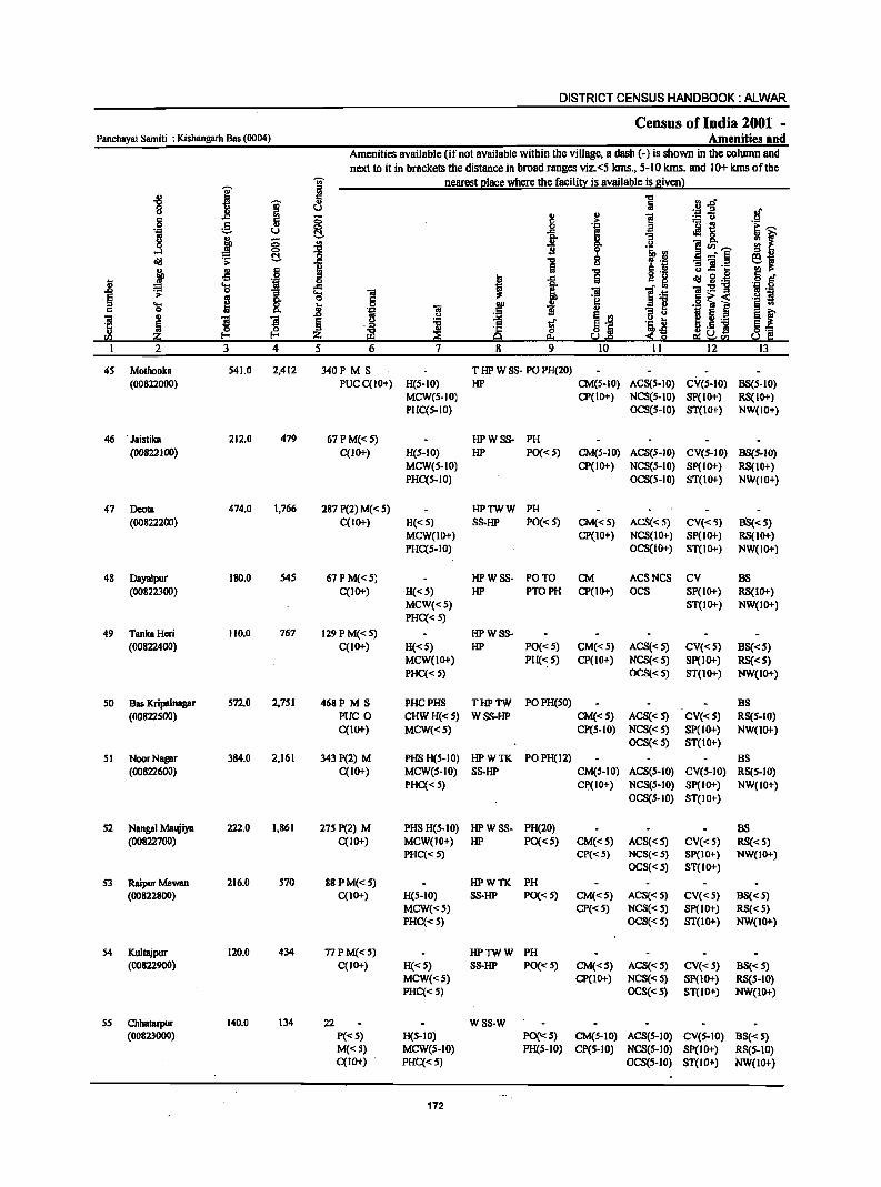
DISTRICT CENSUS HANDBOOK: ALWAR
Census of India 2001 -Panchayal Samiti : Kishangarh Bas (0004) Amenities and
Amenities available (if nol available within the village, a dash (-) is shown in the column and
next to it in brackets the distance in broad ranges viz. <5 klns., 5-10 klns. and 10+ klns of the
I ]' nearest I!Iace where the faciliD;: is available is given}
'" '" 5 "Cl .B ~a '8 1 u iii .~ '" !! '" 1! 6
.c 8 .:: :.:: u g
f e .a ._ f!
~,..., -"" u !;:!. Jl 8. ~f 1'.1 j 0 8- "'3 oS ~ u ]"',..., 0 'i' '&b :J ::I!! ~ .s: !;:!. 1 "Cl 0
~ :11 ...:'§
~~ Iii u B] °C '" J! .~ "t:J
.8 ~ 0 t i :; '" 8 ~.8~ § r! ... '" .c J ~.: 'ij .g
~ 0
I 'a 1 :iI "iii ._ " § g f:! sii;< .2 S .... Ji I .. 1 ';:1 ]
§ .. '" 0 'ii "iii 'ii '"
~ 0 S '"
"'3 u 11 5 ._ sf 'ii l l § u
~ t S-'" 'i~ '5 ." " ~.5 ] ~] ~ '1: ~j Ii!.! ~ Z Q eo ~ 2 ~~!i!.!
1 2 3 4 5 6 7 8 9 10 11 12 13
45 Mothooka 541.0 2,412 340PMS T HP W SS- PO PH(20)
(00822000) PUCC(lO+) H(S-IO) HP CM(S-IO) ACS(5-IO) CV(S-IO) BS(S-IO) MCW(S-IO) CP(IO+) NCS(S-IO) SP(IO+) RS(IO+) PHCCs-IO) OCS(5-10) ST(IO+) NW{IO+)
46 • Jaistika 212.0 479 67PM«s) HPWSS· PH (00822100) C(IO+) H(5·10) HP PO« S) CM(S.IO) ACS{S-IO) CV(S-IO) BS{S·IO)
MCW(S-IO) CP(IO+) NCS{s-IO) SP(IO+) RS(IO+) PHCCS-IO) OCS{S-IO) ST(IO+) NW(IO+)
47 Deola 474.0 1,766 287 P(2) M( < 5) HPTWW PH (00822200) C(IO+) H«S) SS-HP PO« S) CM«5) ACS«S) CV«5) 88«5)
MCW(IO+) CP(IO+) NCS(lO+) SP(IO+) RS(IO+) PHC(S·IO) OCS(IO+) ST(lO+) NW(IO+)
48 Dayalpur 180.0 545 67 P M« 5) HPWSS· PO TO CM ACSNCS CV BS (00822300) C(lo+) H«5) HP PTOPH CP(IO+) OCS SP(IO+) RS(IO+)
MCW«S) ST(IO+) NW(IO+) PHC« S)
49 Tanka Heri 110.0 767 129 P M« S) HPWSS· (00822400) C(10+) H«S) HP PO«5) CM«S) ACS«S) CV«S) BS«S)
MCW(IO+) PH(,,:5) CP(lO+) NCS{<S) Sp(IO+) RS{<S) PHC« 5) OCS{< 5) ST(IO+) NW(IO+)
50 Bas Kripalnagar S72.0 2,7S1 468P M S PHCPHS THPTW POPH(SO) BS (00822500) PUC 0 CHWH«S) WSS-HP CM«S) ACS«S) CV«5) RS{5-IO)
C(IO+) MCW«5) CP(5·10) NCS«S) SP(IO+) NW(IO+) OCS«S) ST(IO+)
51 NoorNagar 384.0 2,161 343 P(2) M PHSH(5·10) HPWTK POPH(l2) BS (00822600) C(lO+) MCW(S·IO) SS-HP CM(S-IO) ACS(S-IO) CV($-lO) RS(5-10)
PHC« 5) CI'(lO+) NCS(S-IO) SP(IO+) NW(IO+) OCS(S-IO) ST(IO+)
S2 Nangal Maujiya 222.0 1,861 275 P(2) M PHSH(S-IO) HPWSS- PH(20) BS (00822700) C(IO+) MCW(IO+) HP PO«5) CM«S) ACS«S) CV«5) RS«S)
PHC«5) CP«5) NCS«S) Sp(IO+) NW(IO+) OC8«5) 81"(10+)
53 Raipur Mewan 216.0 570 88 PM«S) HPWTK PH (00822800) C(IO+) H(S-IO) SS-HP PO«5) CM«5) ACS«S) CV« 5) B8« 5)
MCW«S) CP« S) NCS«5) SP(IO+) RS« S) PHC«S) OCS«S) ST(IO+) NW(IO+)
54 Kullajpur 120.0 434 77 PM« 5) HPTWW PH (00822900) C(IO+) H« 5) SS-HP PO«S) CM«S) ACS«S) CV«S) BS« S)
MCW«S) CP(10+) NCS«S) Sp(IO+) RS{S-IO) PHC«5) OCS«S) ST(IO+) NW(IO+)
S5 Chhatarpur 140.0 134 22 W8S-W (00823000) P«5) H(S-IO) PO('" S) CM(S-IO) ACS(S-IO) CV(S-IO) BS« 5)
M«S) MCWe5-10) PH(S-10) CP(S-IO) NCS(S-IO) SP(IO+) RS(S-IO) C(IO+) PHC«5) OCS(S-IO) ST(IO+) NW(IO+)
172
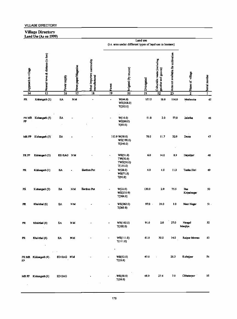
VILLAGE DIRECTORY
ViIla2e Directory Land Use (As on 1999}
]' ~ .. I
~ .:;; diI .;:
~ s ~
I i Z 14 15
PR Kishangarh (S)
PRMR Kishangarh (5) FP
MRFP Kishangarh (S)
PRFP Kishangarh (S)
PR Kishangarh (I)
PR Kishangarh (2)
PR Khairthal (6)
PR Khairthal (4)
PR Khairthal (6)
PR MR Kishanprh (4). FP
MR FP Kishangarh (3)
.. 'j
i ~ .. ~ ~ ...
.~ I If 16 17
EA NM
EA
EA
EDEAG NM
EA
EA NM
EA NM
EA NM
EA NM
EDEAG NM
EDEAG
.~ '8 E §
.11 t;; .. o fij ~ E
18
EarthcnPot
Earthen Pot
Land use
(i.e. area under different types oflll!1d use in hectare)
... ~ '" e 1 I
I!. 'E ...
19 20
W(44.0) WE(20S.0) T(2S2.0)
W(14.0) WE(68.0) T(82.0)
112.0 W(50.0) WE(190.0) T(240.0)
WE(SI.O) TW(50.0) TWE(50.0) T(151.0)
W(20.0) WE(71.0) T{91.0)
W{33.0) WE(331.0) T(364.0)
WE(262.0) T(262.0)
WE(J02.0) T(102.0)
WE(111.0) T(11 1.0)
WE{S3.0) T(53.0)
WE{58.0) T(58.0)
173
~
.J § 21
157.0
51.0
78.0
6.0
4.0
130.0
97.0 .
91.0
61.0
47.0
48.0
.~ lii
110 > .5 ] 11 l- ..
c2 :.:-fl .. I! ii :t :;;
1:; .;: ..!! Iij f Ii! 8
... 0
.aii .. :; .. ::! ~ ~ u gj, :(
22 23 2
IS.O 114.0 MothooJca
2.0 77.0 JaistiJca
11.7 32.0 Deola
14.0 8.9 Daya1pur
4.0 11.3 TanJcaHeri
2.0 75.5 Bas Kripalnagar
24.0 1.0 NoorNagar
2.0 27.0 Nangal Maujiya
30.0 14.0 RaipurMewan
20.3 Kultajpur
27.4 7.0 Chbalarpur .
1l E :> c 'iii .'1: .. I'll
I
45
46
47
48
49
50
51.
52
53
S4
55
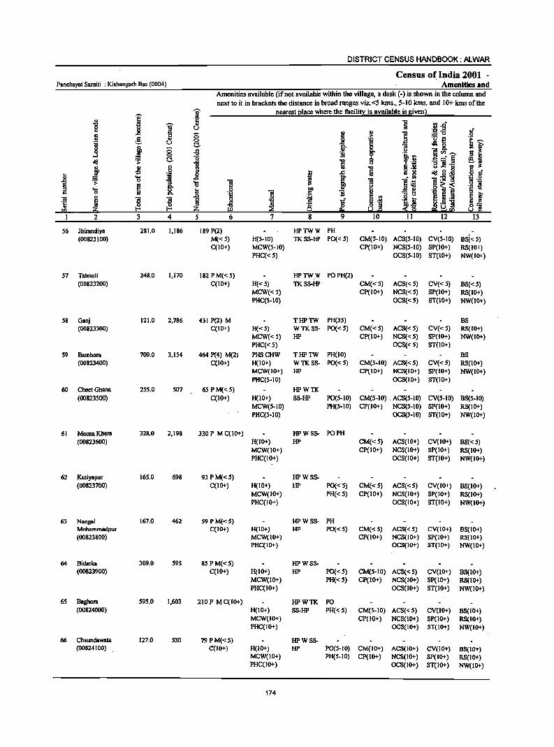
DISTRICT CENSUS HANDBOOK: ALWAR
Census of India 2001 -Panchayat Samiti : Kishanb'llrh Bas (0004) Amenities and
Amenities available (if not available within the village, a dash (-) is shown in the column and
next to it in brackets the distance in broad ranges viz. <5 Ions., 5-10 Ions. and 10+ kms of the
i j nearest elace where the facilitx is available is sivenl
" .. :J..o "tI
~ a g il ~.fi .. .c :g (5 2! "i 5 .,
0 ! ._ t!
u t!- .:l 0 g i (5 III i ]~--...:I 0 "tI
~ t!- '0 _:::f§ ~ 1i
1 ., § !rl
B J! ·c .s I ~g:ij
J! .... "if 0 .c 1:s!::S 0 1 'S § > os .S) ~ i ':iJ ~ '0 I:l .~ .. I>. - e
01 " ! ! 1 ~ ~ ._
'5 ~ is u] CI> z
2 3 4 5 8
56 Jhirandiya 281.0 1,186 189 P(2) HPTWW PH (00823100) M«5) H(S-IO) TKSS-HP PO«S) CM(S-IO) ACS(S.IO) CV(S-IO) BS«S)
C(IO+) MCW(S-IO) CP(IO+) NCS(S·IO) SP(IO+) RS(IO+) PHC«S) OCS(5·10) ST(IO+) NW(IO+)
S7 Tahnoli 248.0 1,170 182 PM«S) HPTWW POPH(2) (00823200) C(IO+) H«5) TKSS-HP CM«5) ACS«5) CV« 5) BS«5)
MCW« 5) CP(IO+) NCS«5) SP(IO+) RS(IO+) PHC(5-10) OCS«5} ST(IO+} NW(IO+}
S8 Ganj 121.0 2,786 431 P(2) M THPTW PH(35) BS (00823300) C(IO+) H«5) WTKSS- PO«S) CM«S) ACS«5) CV«5) RS{IO+)
MCW« 5) HP CP(IO+) NCS«5) SP(IO+) NW(IO+) PHC« 5) OCS«5) ST(IO+)
59 Bambora 709.0 3,154 464 P(4) M(2) PHSCHW THPTW PH(IO) BS (00823400) C(IO+) H(IO+) WTKSS- PO«S) CM(S-IO) ACS«5) CV«S) RS(IO+)
MCW(IO+) HP CP(IO+) NCS(IO+) SP(IO+) NW(IO+) PHC(S-IO) OCS(IO+) ST(IO+)
60 CheetGhana 255.0 507 65 P M«5) HPWTK (00823S00) C(10+) H(IO+) SS-HP PO(S-IO) CM(S-IO) ACS(5-10) CV(S-IO) B8(S-10)
MCW(S-IO) PH(S·IO) CP(IO+) NCS(S-IO) SP(IO+) RS(1O+) PHC(5-10) OCS(S-IO) ST(IO+) NW(IO+)
61 MoosaKhcra 328.0 2,198 330 P M C(lO+) HPWSS- PO PH (00823600) H(IO+) HP CM«S) ACS(IO+) CV(IO+) BS«5)
MCW(IO+) CP(IO+) NCS(lo+) SP(IO+) RS(IO+) PHC(IO+) OCS(IO+) ST(IO+) NW(IO+)
62 Kutiyapur 165.0 698 93 P M«5) HPW8S-(00823700) C(IO+) H(IO+) HP PO« 5) CM«S) ACS«S) CV(IO+) BS(IO+)
MCW(IO+) PH«S) CP(IO+) NC8(10+) SP(IO+) RS(IO+) PHC(IO+) OCS(IO+) ST(IO+) NW(IO+)
63 Nangal 167.0 462 S9 P M«S) HPWSS- PH Mohammadpur C(IO+) H{IO+) HP PO«S) CM«5) ACS« 5) CV(IO+) BS{IO+) (00823800) MCW(IO+) CP(IO+) NCS(IO+) SP(IO+) RS(10+)
PHC(IO+) OCS(IO+) ST(IO+) NW(IO+)
64 Bidarka 309.0 595 85PM«5) HPWSS· (00823900) C(IO+) H(lo+) HP PO« S) CM(S-IO) ACS« 5) CV(IO+) B8(lo+)
MCW(IO+) PH«S) CP(IO+) NC8(10+) SP(IO+) , RS(IO+) PHC(IO+) OC8(10+) ST(IO+) NW(IO+)
65 Baghora 595.0 1,603 210 P M C(1O+) HPWTK PO (00824000) H(lO+) SS-HP PH« S) CM(5-10) ACS«S) CV(lo+) BS{IO+)
MCW(IO+) CP(10+) NCS(1o+) SP(IO+) RS(IO+) PHC(IO+) OCS(IO+) ST(IO+) NW(IO+)
66 Chaundawata 127.0 530 79PM«5) HPWSS· (00824100) C(10+) H(IO+) HP PO(S-IO) CM(IO+) ACS(IO+) CV(IO+) B8(IO+)
MCW(IO+) PH(S-IO) CP(IO+) NCS(IO+) SP(IO+) RS(IO+) PHC(IO+) OCS(IO+) ST(IO+) NW(IO+)
174
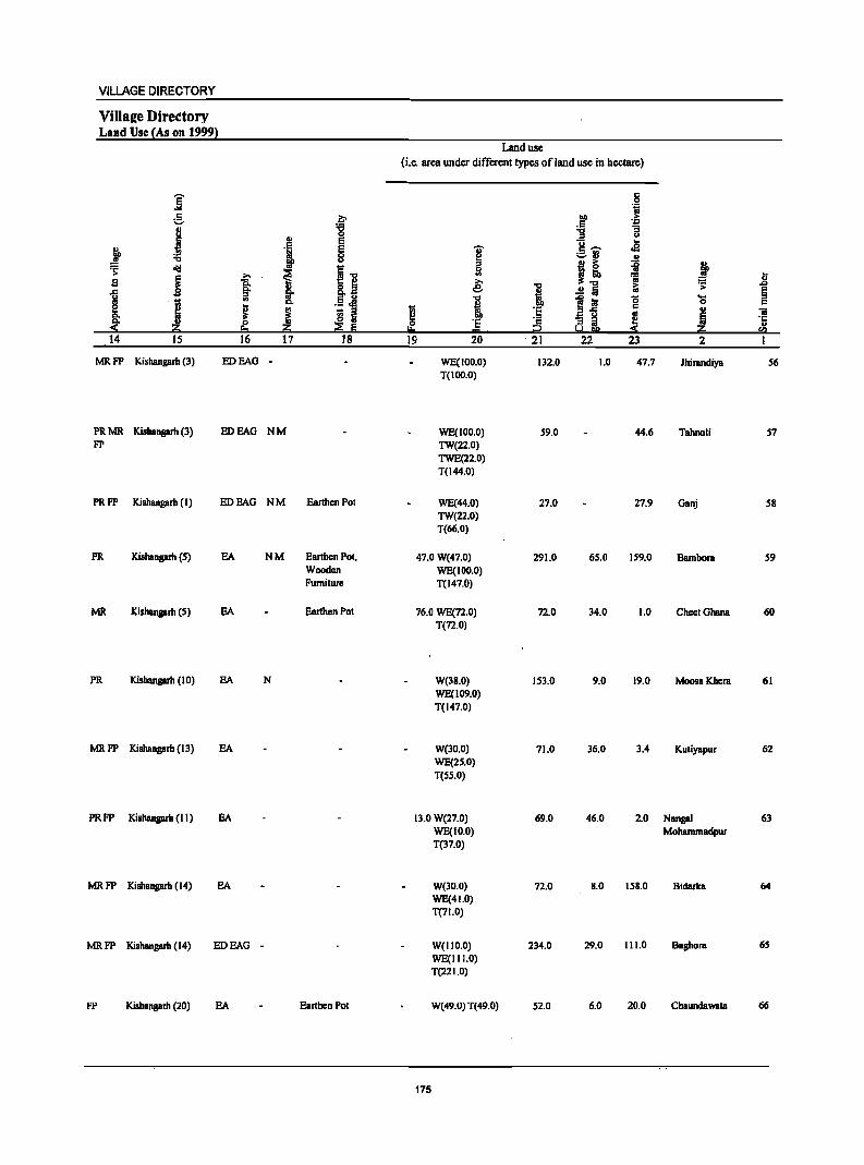
VILLAGE DIRECTORY
ViIlSlle Directory Land Use (As on 1999)
]' e ., .1 t ."
~ d!I
~ ~ s §' 1 III
I ~ ! ... ~ .~ eo 14 IS 16
MRFP Kishangarlt (3) EDEAG
PRMR Kishanprh (l) EDEAG FP
PRFP Kishangarh (I) EDEAG
PR Kishanprh (5) EA
MR Kishangarlt (5) EA
PR Kishangarlt (10) EA
MRFP Kishangarlt (13) EA
PRFP Kishangarlt (II) EA
MRFP Kishangarh (14) EA
MRFP Kishangarh (14) EDEAG
FP Kishangarh (20) EA
~ :g ., e ~ i." ~ 8.i .,
~ .5 i ! I ~ 17 18
NM
NM Earthen Pol
NM Earthen POl, Wooden Furniture
Earthen Pot
N
-
Earthen Pot
Land use
(i.e. area under different types of land use in hectare)
c 0 °ii
lID .~ .S 11 "3
u
]-;;;- .. ¥ .e
~ .. u ::I
j~ j j Iil .;; U ~ I ~ = ..0
..!! :a > §
i 1~ '8 ... 0 c
! .. ii III
! ] c ai ~ '1: u
i2 !a 19 20 - 21 22 23 2 I
WE(100.0) Il2.0 1.0 47.7 Jhirandiya 56 T(IOO.O)
WE(IOO.O) 59.0 44.6 Tahnoli 57 TW(22.0) TWE(22.0) T(I44.0)
WE(44.0) 27.0 27.9 Oanj 58 TW(22.0) T(66.0)
47.0 W(47.0) 291.0 65.0 159.0 Bambora 59 WE(IOO.O) T(147.0)
76.0 WE(72.0) 72.0 34.0 1.0 CheelGhana 60 T(72.0)
W(38.0) 153.0 9.0 19.0 MoosaKhera 61 WE(109.0) T(147.0)
W(30.0) 71.0 36.0 3.4 Kutiyapur 62 WE(25.0) T(SS.O)
Il.O W(27.0) 69.0 46.0 2.0 Nanpl 63 WE(IO.O) Moharnmadpur T(37.0)
W(lO_O) 72.0 8_0 158.0 Bidarka 64 WE(41.0) T(71.0)
W(IIO.O) 234.0 29.0 111.0 Baghora 65 WE(III.O) T(22 1.0)
W(49.0) T(49.0) 52.0 6.0 20.0 Chaundawata 66
175
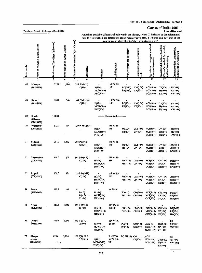
DISTRICT CENSUS HANDBOOK: N-WAR
Census of India 2001 -Panchayat Samiti : Kishangarh Bas (0004) Amenities and
Amenities Bvailable (if not available within the village, a dash (-) is shown in the column and next to it in brackets the distance in broad ranges viz.<5 lans., 5-10 lans. and 10+ lans ()fthe
';i;' nearest elace where the facilit:£ is available is siven) . G) I 2 ...
:l.s "& i " 5 u '.;:1 .a .~f " g " 1! § c <5 ... :.= u
e " 0 'E ~ ._ ~
~f .~ u ~ ..c ~ 0
! g- O> g <5 ~ i " ]~'"' ....l §, "0 13 ·~.il rg " ~ .;;: 1 -=§ e~ 1i u .!: 1$ B .! '13 } 0> 5 a ] g 'g .~ § -= I ..c ~ g.~ Ii; 'S ''ij l! ! ~
--"'" ]:9"g .~ 's ..D .;: "[ 'S ~ I!! .~ § .. il] o ~-< 'S ~ 0 .. 0 "iI gp ] 0) ._ ] § .,
c "" 11 .~ E ., :> " E f ~ ~ ! ~ ~ j :.;;!
~ §1 .~~ I ~ ._ '" ~ ~
._ 11 ~] .,
a; ~!f:2 CIl 2i eo ~.e ~ Q 2 3 4 5 6 7 8 9 10 11 12 13
67 Mirmpur 217.0 1,696 219PM«S) HPWSS-(00824200) C(IO+) H(IO+) HP PO(S-lO) CM(IO+) ACS(IO+) CV(IO+) . BS(IO+)
MCW(IO+) PR(S-IO) CP(IO+) NCS(IO+) Sp(IO+) RS(IO+) PHC(JO+) OCS(IO+) ST(IO+) NW{lO+)
68 SBrpur 188.0 340 48 PM(5-10) HPWSS-(00824300) C(IO+) H(IO+) HP PO(IO+) CM(IO+) ACS(IO+) CV(IO+) BS{IO+)
MCW(JO+) PH(JO+) CP(IO+) NCS(JO+) 8p(JO+) RS{IO+) PHC(IO+) OCS(IO+) ST(IO+) NW(IO+)
69 Rundh 1,100.0 ---- Uninhabited ------Gidawalll (00824400)
70 Vrisangpur 373.0 904 129 P MC(IO+) HPW 88-(00824500) H(IO+) HI' PO(IO+) CM(IO+) ACS{IO+) CV(IO+) BS(IO+)
MCW(IO+) PH(IO+) CP(IO+) NCS(IO+) Sp(IO+) RS{IO+) PHC(IO+) OCS(IO+) ST(IO+) NW(IO+)
71 Padasala 291.0 1,412 203 PM«5) HPW SS-(00824600) C(IO+) H(IO+) HP PO(I 0+) CM(IO+) ACS(lO+) CV(IO+) B8(10+)
MCW(IO+) PH(IO+) CP(IO+) NCS(IO+) SP(IO+) RS(IO+) PHC(IO+) OCS(IO+) ST(IO+) NW(IO+)
72 ThanaOhom 1\8.0 809 101 P M«5) . HPWSS-(00824700) C(lO+) H(lO+) HP PO(S-IO) CM(IO+) ACS(IO+) CV(IO+) 88(10+)
MGW(IO+) PH(S-IO) CP(IO+) NCS(ID+) SP(IO+) RS(IO+) PHC(ID+) OCS(IO+) ST(10+) NW(1O+)
73 Lalpuri 139.0 237 33 PM(S-IO) HPW8S-(00824800) C(IO+) H(IO+) HP PO(S-IO) CM(IO+) ACS(IO+) CV(IO+) B8(10+)
MCW(IO+) PH(5-JO) CP(IO+) NCS(IO+) SP(IO+) RS(IO+) PHC(ID+) OCS(10+) ST(IO+) NW(IO+)
74 Raoka 215.0 386 63 WSS-W (00824900) P«5) H(IO+) PO« S) CM(IO+) ACS(S-IO) CV(ID+) B8(IO+)
M«S) MCW(IO+) ~(5-10) CP(IO+) NCS(ID+) SP(IO+) RS(1O+) C(IO+) PHC(IO+) OCS(ID+) ST(IO+) NW(IO+)
7S Nyana 423.0 1,320 161 PM«S) HPTWW (00825000) C(IO+) H(5-10) SS-HP PO(S-IO) CM(5-10} ACS(S-IO) CV(S-IO) 8S(S-10)
MeW(S-IO) PH(5-1O) CP(IO+) NCS(5-10) Sp(IO+) RS(IO+) PHC(IO+) OCS(S-IO) ST(IO+) NW(IO+)
76 Dongm 752.0 2,798 .379P M 0 HPWTK BS (00825100) C(10+) H(10+) SS-HP PO« 5) CM«5) ACS«5) CV(S-IO) RS(IO+)
MCW(5-10) PH«S) CP(IO+) NCS(S-IO) Sp(IO+) NW(lO-l-) PHC(5-10) OCS(5-IO) ST(IO+)
77 Khanpur 633.0 3,826 520 P(3) M S THPTW POPH(10) CM .ACS BS Mewao OC(IO+) H(IO+) WTK8S- CP(JO+) NCS(S-IO) CV(S-JO) RS(IO+) (00825200) ':(8' MCW(S-I.O) HP OCS(S-IO) Sp(JO+) NW(Jp,t.)
PHC(IO+) ST(lO+)
176
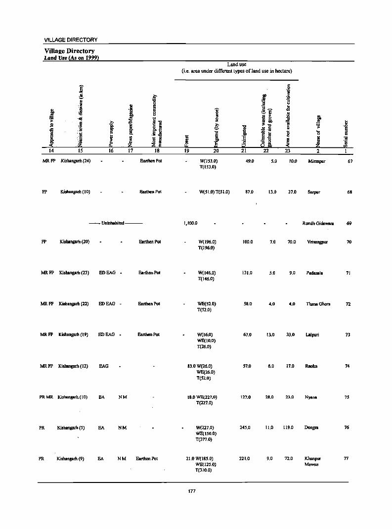
VILLAGE DIRECTORY
Villae:e Directory Land Use (As on 1999)
E ... e .. u
B ~ .!Q
.!!! "" ~ 'aid ,~ .s
I :s ::1
s· .~
14 15
MRFP Kishanprh (24)
FP Kishanprh (10)
~ 0 .,
c e '1 e
0 u
i.., >. t 1 .~j .. I ! ~ :I
~ ~ ~ 16 17 18
Earthen Pol
Earthen Pol
--Uninhahiled---
FP Kishanprh (20) Earthen Pol
MR FP Kishanprh (23) EDEAG - Earthen Pot
MRFP Kishanprh (22) EDEAG - Earthen Pot
MRFP Kishangarh (19) EDEAG - Earthen Pot
MRFP Kishanprh (12) EAG
PRMR Kishanprh (10) EA NM
PR Kishangarh (S) EA NM
PR Kishanprh (9) EA NM Earthen Pot
Land use (i.e. area under different types ofland use in hectare)
I Ii .e: ~ ~ DO
~ 'E "" 19 20
W(l53.0} T(ISJ.O}
W(S 1.0) T(S 1.0)
1,100.0
W(196.0) T(196.0)
W(l46.0) T(146.0)
WE(S2.0) T(52.0)
W(l6.0) WE(IO.O} T(26.0)
83.0 W(26.0) WE(26.0) T(52.0)
IB.O WE(227.0) T(227.0}
W(227.0) WE(ISO.O) T(3n.0)
21.0 W(ISS.O) WE(12S.0} T(3I O.O}
177
1 '2 i2 21
49.0
87.0
100.0
131.0
58.0
67.0
57.0
127.0
245.0
221.0
c .9 'iii
f .1; "3 u
g- .. rS ;,::.f1 ..
~ .. ~ ~! iii ~ Iii B 111 ~ '3 g
!.!Gb 22 23
S.O 10.0
13.0 37.0
7.0 70.0
5.0 9.0
4.0 4.0
13.0 33.0
6.0 17.0
28.0 23.0
11.0 119.0
9.0 72.0
j .8 ~ ... §
0 c " 'iii
! 'r;: " 5!!
2 1
Mirzapur 67
Sarpur 68
Rundh Gidawata 69
Vrisangpur 70
Padasala 71
ThanaGhora 72
Lalpuri 73
Raoka 74
Nyana 75
Dongra 76
Khanpur 77 Mewan
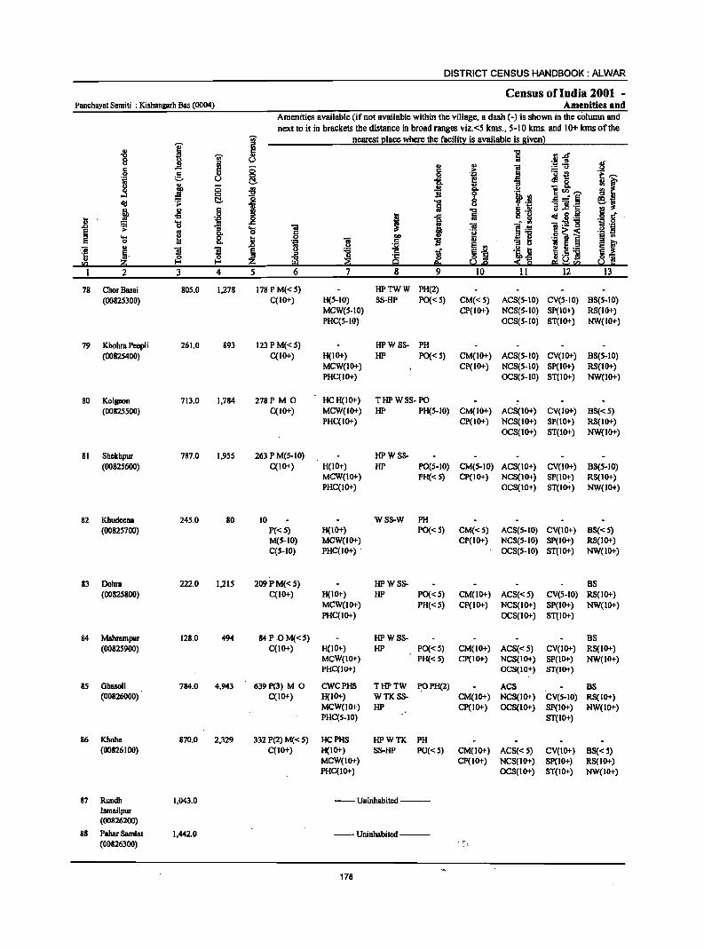
DISTRICT CENSUS HANDBOOK: ALWAR
Census ofIndia 2001 -Panchayat Samiti : Kishangarh Bas (0004) Amenities and
Amenities available (if not available within the village, a dash (-) is shown in the cOlumn and next to it in brackets the distance in broad ranges viz. <5 kms., 5-10 kms. and 10+ kms of the
I ~ nearest ~Iace where the facilin! is available is Biven)
-8 l!! "0 rl.d' 'iii'
., Iii 8 a v ._ ::>
.f " '" ] ~u 5 .c 5 0 c .C= .2 ._ {!
] g u §. -R 'f! .el 8.
i::,-.. "3 ~r i 0 '" il '" ... '" ]<1),-..
<:> "0 0 la ~ .;; !j. I ] 8 _" § e~ j " 5 ]
B] ·c
·1 § .,s t ..c g '(3 ~Sl~ I) 'a 'iiI i " Sl 1:2 .t:> ~ 1 'a 'iI ] ]:6 B '<=1 § g c
.9 ~ i ._ s ... ... 0 bO § .. c 0 l! 'N 'iI
~ 11 "3 ~ " .2 E '" ~ 5._ E f "iii !i. s s ~
"0 -rr ~l 'k1,1) '1:: ::>
" '1:: ij.si ~1 " ~ ~ i!l ~ g s~ e:i~sa '" ~ eo 2 3 4 5 6 7 8 9 10 11 12 13
78 ChorBasai 805.0 1,278 178 P M« 5) HPTWW PH(2) (00825300) C(lO+) H(5-IO) SS-HP PO«S) CM«5) ACS(5-IO) CV(5-IO) 88(5-10)
MCW(5-10) CP(IO+) NC8(S-IO) 8P(IO+) R8(10+) PHceS-IO) OCS(S-Ioj ST(IO+) NW(IO+)
79 Khohra Peepli 261.0 893 123 P M« 5) HPWSS- PH (00825400) celO+) H(IO+) HP PO«S) CM(IO+) ACS(S-IO) CV(IO+) 88(5-10)
MCW(IO+) CP(IO+) NCS(S-IO) SP(IO+) RS(IO+) PHC{IO+) OCS(S-IO) ST(IO+) NW(IO+)
80 Kolgaon 713.0 1,784 278P M 0 HCH(IO+) THPW8S- PO (00825500) C(IO+) MCW(IO+) HP PH(5-IO) CM(IO+) ACS(IO+) CV(IO+) 88« 5)
PHC(IO+) CP(IO+) NCS(1O+) SP(lO+) RS(1O+) OCS(IO+) ST(IO+) NW(IO+)
81 Shekhpur 787.0 1,9SS 263 P M(S-IO) HPWSS-(0082S600) C(IO+) H(IO+) HP PO(S-IO) CM(5-10) ACS(IO+) CV(IO+) 8S(S-IO)
MCW(IO+) PH«S) CP(IO+) NCS(IO+) SP(IO+) R8(IO+) PHC(1O+) OCS(IO+) ST(IO+) NW(IO+)
82 Khudeena 245.0 80 10 WSS-W PH (0082S7OO) P«S) H(IO+) PO«S) CM«S) ACS(S-IO) CV(IO+) 8S« S)
M(S-IO) MCW(IO+) CP(IO+) NCS(S-IO) Sp(IO+) RS(IO+) C(S-IO) PHC(IO+) . OCS(S-IO) ST(IO+) NW(IO+)
83 Dohra 222.0 1,215 209 PM« 5) HPWSS- BS (0082S800) C(10+) H(IO+) HP PO«S) CM(lO+) ACS«S) CV(S-IO) RS(IO+)
MCW(lO+) PH«S) CP(IO+) NCS(10+) SP(lO+) NW(lO+) PHC(IO+) OCS(IO+) ST(IO+)
84 Mahrampur 128.0 494 84POM«S) HPWSS- BS (00825900) C(1O+) H(IO+) HP PO« 5) CM(IO+) ACS«S) CV(IO+) RS(IO+)
MCW(IO+) PH« S) CP(IO+) NCS(IO+) SP(IO+) NW(IO+) PHC(IO+) OeS(IO+) ST(IO+)
85 ObBaoli 784.0 4,943 639P(3) M a ewe PHS THPTW ~PH(2) ACS BS (00826000) C(IO+) H(IO+) WTKSS- CM(IO+) NCS(IO+) CV(S-IO) RS(IO+)
MCW(IO+) HP Cp(IO+) OCS(IO+) SP(IO+) NW(IO+) PHC(S-IO) ST(IO+)
86 Kboha 870.0 2,329 332 P(2) M( < S) HCPBS HPWTK PH (00826100) C(IO+) H(IO+) 8S-HP PO«5) CM(IO+) ACS«5) CV(IO+) BS« S)
MCW(1O+) CP(lO+) NCS(IO+) Sp(IO+) RS(lO+) PHC(IO+) OCS(IO+) ST(IO+) NW(IO+)
87 Rundh 1,043.0 -- Uninhabited ---Ismailpur (00826200)
88 Pahar Samlat 1,442.0 --Uninhabited--(00826300) .:>
178
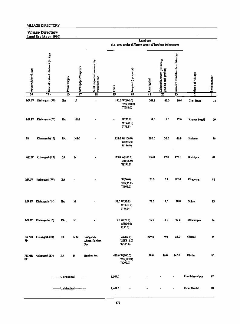
VILLAGE DIRECTORY
Villaae Directory Land Use {As on 19991
Land use (i.e. area IDIder different types of land use in hectare)
]' c 0 °i
e .~ !I .~ . ., "8 'ti :; U ::J U
j ., E U .. c
~ .~ E 'ii' £.'if .:a :a 8 ~ III
~ ::J GJ·>
~ :t ~
i i"" 0 - ~
j >. .,
~"" '; i sa l g,B ~ "i ~ .f>
i .!! Iii
I ., .5 .M i .j ~1! 8 ....
Co 0 C 0 ! ~ i j ~ ::I ! .a u
~ III "ii
::E ~ ·E "3 it l ·Ii .O!:i !!:I ~ t::I s.!!!!1 fa
14 '''15 16 17 18 19 20 21 22 23 2 I
MRFP Kishangarh (10) EA N 186.0 W( 100.0) 248.0 63.0 20.0 ChorBasai 78 WE(188.0) T(288.0)
MRFP Kishangarh (15) EA NM W(50.0) 54.0 15.0 97.0 Khohra Pcepli 79 WE(45.0) T(95.0)
PR Kishangarh (15) EA NM 155.0 W(IDO.O) 286.0 30.0 46.0 Kolgaon 80 WE(96.0) T(196.0)
MRFP Kishangarh (17) EA N 173.0 W(IDO.O) 196.0 47.0 175.0 Shckhpur 81 WE(96.0) T(196.0)
MRFP Kishangarh (18) EA W(50.0) 26.0 2.0 112.0 Khudeena 82 WE(SS.O) T(IOS.0)
MRFP Kishangarh (14) EA N 31.0 W(30.0) 78.0 19.0 28.0 Dohru 83 WE(36.0) T(66.0)
MRFP Kishangarh (13) EA N 5.0 W(20.0) 36.0 4.0 27.0 Mabrampur 84 WE(36.0) T(56.0)
PRMR Kishangarh (10) EA NM JronSOods, W(200.0) 209.0 9.0 53.0 Ghasoli 85 FP Shoes, Earthen WE(313.0)
Pot T(SI3.0)
PRMR KishBllgarh (13) EA N Earthen Pot 420.0 W(IOO.O) 90.0 16.0 142.0 Khoha 86 FP WE(102.0)
T(202.0)
-- Uninhabited --- 1,043.0 Rundh Jsmailpur 87
-- Uninhabited ----- 1,441.6 Pahar SamJa! 88
179
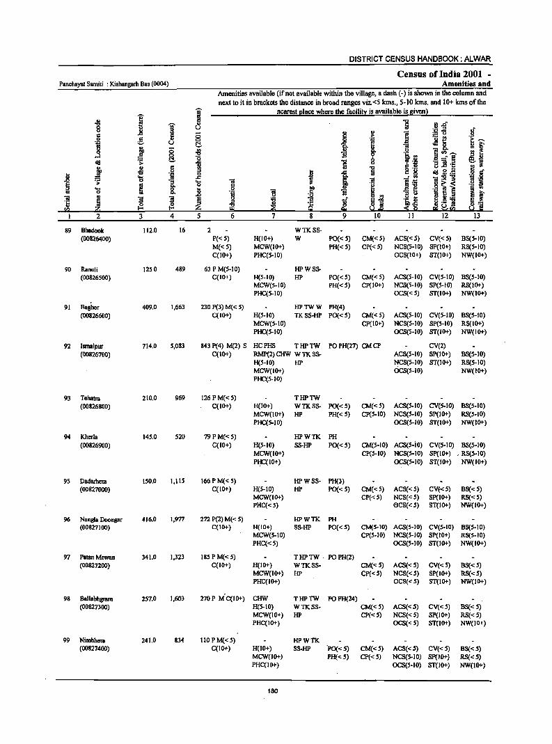
DISTRICT CENSUS HANDBOOK: ALWAR
Census of India 2001 -Panchayat Samiti : Kishangarh Bas (0004) Amenities and
Amenities available (if not available within the village, a dash (-) is shown in the column and next to it in brackets the distance in broad ranges viz. <5 kms., 5-10 kms. and 10+ kms of the
I ~ nearest I!lace where the facili!):: is available is given l
"8 :g
i rJ.d' I ., u ._ ::t .; u .,
2:! .,
] ~o :s .c <5 '1 .2 g .,
0 i ._ e
j::;--.~ U C!. -s .2l8. ; r j g ., g- .u ]Vl,"-oS "0 B ~'B eli! ~ C!. ~ i
.., "3 :g.~ e.~ u
~ ., :s .,
] g '8 u.c ~ .~ g .,s ::t
I .c cQj g.g J! 'il 0
"" .c ~ 1~ 'iI:s!"g ';> 0 "3 OS 'iI 'iI !1 'l:!
~ «I 8: c:: .~ .g ~ ~ ._ ~
..... ~ j .S! J .,
~ ~ 0 B '5 1! E~
"3 ~ l! Ii .a 'iI .,
~ ~ ~ 'B '§ g .2 8
~ ::t ~~! ~] '5 gj ~ ~
Iib.,s ta !!:I f..!.e :S Q
I 2 3 4 5 6 7 8 9 10 11 12 13
89 Bhadook 112.0 16 2 WTKSS· (00826400) P« 5) H(IO+) W PO« 5) CM«S) ACS«S) CV«S) BS(S-IO)
M«5) MCW(IO+) PH« S) CP« S) NCS(S.IO) SP(IO+) RS(S-IO) C(IO+) PHC(S-IO) OCS(IO+) ST(lO+) NW(IO+)
90 Ranoli 12S.0 489 63 P M(S·IO) HPWSS· (00826500) C(IO+) H(S-IO) HP PO« S) CM«S) ACS(S·IO) CV(S·IO) BS(S-IO)
MCW(S-IO) PH«S) CP(IO+) NCS(S.IO) SP(S-IO) RS(JO+) PHC(S-IO) OCS«5) ST(IO+) NW(IO+)
91 Baghor 409.0 1,663 230 P(3) M« S) HPTWW PH(4) (00826600) C(IO+) H(S-IO) TKSS-HP PO(·d) CM«S) ACS(S-IO) CV(S-IO) BS(s-IO)
MCW(s·IO) CP(IOt) NCS(S-IO) SP(S-IO) RS(IO+) PHC(S-IO) OCS(S-IO) ST(IO+) NW(IO+)
92 Ismalpur 714.0 5,083 843 P(4) M(2) S HCPHS THPTW PO PH(27) CM CP CV(2) (00826700) C(IO+) RMP(2) CHW W TK SS· ACS(S-IO) Sp(IO+) BS(5-10)
H(S-IO) HP NCS(S-IO) ST(IO+) RS(S·IO) MCW(IO+) OCS(S-IO) NW(IO+) PHC(S·IO)
93 Tehan 210.0 969 126 PM«S) THPTW (00826800) C(IO+) H(IO+) WTKSS· PO«s) CM«S) ACS(S-IO) CV(S-IO) BS(S.IO)
MCW(IO+) HP PH« 5) CP(5-10) NCS(S-IO) Sp(IO+) RS(s.IO) PHC(S-IO) OCS(S-IO) ST(IO+) NW(IO+)
94 Kherla 145.0 S20 79 P M« 5) HPWTK PH (00826900) C(lO+) H(S-IO) SS-HP PO« 5) CM(S-IO) ACS(S-IO) CV(S-IO) B8(S-10)
MCW(IO+) CP(5.10) NCS(S-IO) Sp(IO+) , R8(S-10) P~C(IO+) OCS(S-IO) ST(IO+) NW(IO+)
95 Oadamelll 150.0 1,115 166 P M« 5) HPWSS· PH(3) (00827000) C(IO+) H(S-IO) HP PO«5) CM« S) ACS«S) CV«S) BS« S)
MCW(IO+) CP«5) NCS« S) SP(IO+) RS« 5) PHC« S) 0CS(<: S) ST(IO+) NW(IO+)
96 Nangla Doongar 416.0 1,977 272 P(2) M« S) HPWTK PH (00827100) C(IO+) H(IO+) SS-HP PO« S) CM(S.IO) ACS(S-IO) CV(S-IO) BS(S-IO)
MCW(s-IO) CP(S-IO) NCS(S·IO) Sp(IO+) RS(s-IO) PHC«5) OCS(S-IO) ST(lO+) NW(IO+)
97 PatanMewan 341.0 1,323 ISS P M« S) T HP TW . PO PH(2) (00827200) C(IO+) H(IO+) WTKSS- CM«S) ACS(<:S) CV«S) BS« 5)
MCW(IO+) HP CP«S) NCS« S) SP(IO+) RS«5) PHC(IO+) OCS(<: 5) ST(IO+) NW(JO+)
98 Ballabhgnun 257.0 1,603 270P MC(IO+) CHW THPTW POPH(24) (00827300) H(5·10) WTKSS- CM«S) ACS«5) CV«S) BS« 5)
MCW(IO+) HP CP«S) NCS«S) SP(IO+) RS« 5) PHC(IO+) OCS«5) ST(IO+) NW(IO+)
99 Nimbhera 241.0 834 110 P M« S) HPWTK (00827400) C(1O+) H(IO+) SS·HP 'PO« S) CM«S) ACS«5) CV«S) BS« 5)
MCW(IO+) PH«5) CP«S) NCS(5-10) SP(IO+) RS{< 5) PHC(IO+) OCS(S-IO) ST(IO+) NW(1O+)
160
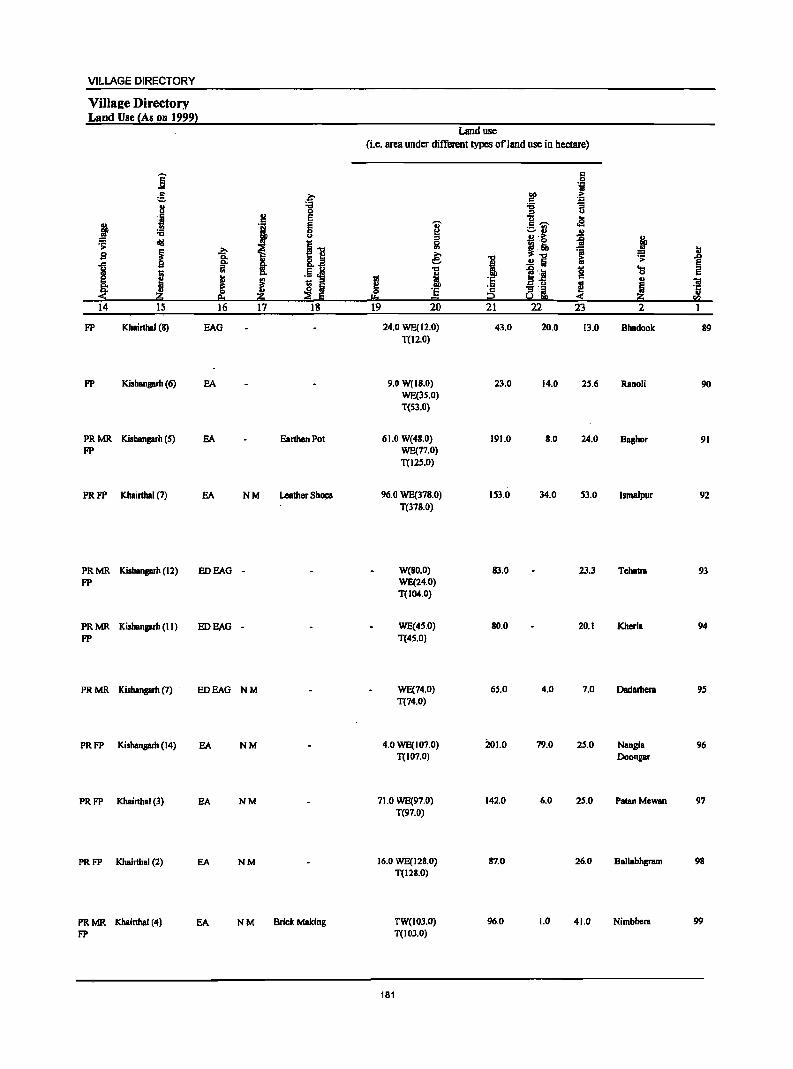
VILLAGE DIRECTORY
VillaEe Directory Land Use (As on 1999l
Land use (i.e. area under different types ofland use in hectare)
'"""' c .6 'i £ .~ ~
.. 8 "1:1 :;; ~
0 .fi u :~ .. E ..
~ I g i .S ";i" cS :;; ~ .. ..
~ ..
'" AI i> :g j ~
i] Iil ~~ 1 ] ~ s 1 ~ i .0
§. .!! t; .. ~ i 8. .. ..,
l~ g ... I '" '" .5 ~ i
0
~ ~ I .. iii
~ ! I ] ~ _.'" ~ ~ ·c ~.~ ..
~ ~ I:!:o 4( rI)
14 15 16 17 18 19 20 21 22 23 2 1
FP Khairthal (8) BAG 24.0 WE(12.0) 43.0 20.0 13.0 Bhadook 89 TO 2.0)
FP Kishanaarh (6) SA 9.0 W(18.0) 23.0 14.0 25.6 Ranoli 90 WE(lS.O) T(S3.0)
PRMR Kishanaarh (5) SA Earthen Pot 61.0 W(48.0) 191.0 8.0 24.0 Baahor 91 FP WE(77.0)
T(12S.0)
PRFP Khairthal (7) EA NM LeatherSh~ 96.0 WE(378.0) 153.0 34.0 S3.0 Ismalpur 92 T(378.0)
PRMR Kishanprh (12) EDEAG - W(80.0) 83.0 23.3 Tehatra 93 FP WE(24.0)
T(104.0)
PRMR Kishanprh (II) EDEAG - WE(45.0) 80.0 20.1 Kherla 94 FP T(45.0)
PRMR Kishanaarh (7) EDEAG NM WE(74.0) 65.0 4.0 7.0 Dadarhera 95 T(74.0)
PRFP Kishanprh (14) EA NM 4.0 WE(107.0) 201.0 79.0 25.0 Nangla 96 T(J07.0) Doonaar
PRFP Khairthal (3) SA NM 71.0 WE(97.0) 142.0 6.0 25.0 Pata" Mewsn 97 T(97.0)
PRFP Khairthal (2) SA NM 16.0 WE(128.0) 87.0 26.0 Ballabhgram 98 T(12S.0)
PRMR Khairthal (4) EA NM Brick Making TW(103.0) 96.0 1.0 41.0 Nimbhera 99 FP T(IOl.O)
181
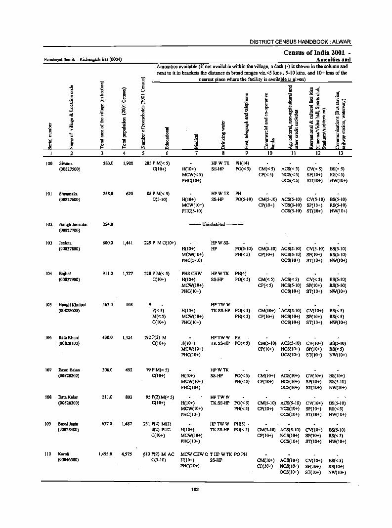
DISTRICT CENSUS HANDBOOK: ALWAR
Census of India 2001 -Panchayat Samiti : Kishangarh Bas (0004) Amenities and
Amenities available (ifnot available within the village, a dash (-) is shown in the column and next to it in brackets the distance in broad ranges viz. <5 Ions., 5-10 Ians. and 10+ kms of the
I j nearest elace where the facilitl: is available is !liven}
-8 0:: '" .~ :ar -;;;- OJ a 8 ] iil u ,; " " f! c Ii (5
! .. :.= u ...
·i g u 0 "i~ .a ]~ .~ ~ C!. 11 :: f 0 j 0 ~ "B ~ .tj, ., ]~~ ....l 0 Sj (:!. "15 0 oI!I ~ ~ "E ~ ·il - = ~ ... ;:::I CCI,
C j .s 6 "CI o ._ u ..c .9 § .:
.8 • .::z 0 I ..c a c g eli! g ._
~ 'S .. ..c i .. ]~ .. :gog .~ .S!
]. ..... 01
~ ... 0 c ·il .§ 'a i ._ !I
'S ~ 8. 13 i iii IlP "B II "3 I> § '" OJ ~
u ~ E ., ~~j e ~ 01
~ ]I
~ :a tf E .... .S=! 1-0 . .:: ~
II
~ 0 8~ ~j ~ ._ ~:= ~ ~ Z BI ~ !:I ~rn Sol C I 2 3 4 5 6 7 8 9 10 11 12 13
100 Siwana 583.0 1,900 285 P M« 5) HPWTK PH(14) (00827500) C(lO+) H(IO+) SS-HP PO«5) CM«5) ACS«5) CV« 5) BS« 5)
MCW«5) CP« 5) NCS«5) SP(IO+) RS« 5) PHC(IO+) OeS«5) ST(IO+) NW(IO+)
101 Shyamaka 258.0 620 88 P M«5) HPWTK PH (00827600) C(S-IO) H(IO+) SS-HP PO(S-IO) CM(5-IV) AeS(S-IO) eV(S-IO) BS(5-IO)
MCW(lO+) CP(IO+) NCS(Ii-IO) SP(IO+) RS(5-)0) PHC(S-IO) OC8(S-10) ST(IO+) NW(IO+)
102 Nangli Janardar 224.0 --Uninhabited ---(00827700)
103 Jeelola 600.0 1,441 229 P M C(IO+) HPWSS-(00827800) H(IO+) HP PO(S-IO) CM(S-IO) ACS(S-IO) CV(S-IO) BS(S-IO)
MCW(IO+) PH«S) CP(IO+) NCS(S-IO) SP(IO+) RS(S-IO) PHC(S-IO) OCS(IO+) ST(IO+) NW(IO+)
104 Bajhat 911.0 1,727 228 P M«S) PHSCHW HPWTK PH(4) (00827900) C(10+) H(IO+) SS-HP PO«5) CM«5) ACS«S) CV«S) BS(S-IO)
MCW(IO+) CP« 5) NCS(S-IO) SP(IO+) RS(5-10) PHC(lo+) OCS(IO+) ST(IO+) NW(IO+)
lOS Nangli Khaleel 463.0 108 9 HPTWW (00828000) P«S) H(IO+) TKSS-HP PO«S) CM(IO+) ACS(5-10) CV(IO+) B8« 5)
M«5) MCW(IO+) PH«5) CP(IO+) NCS(IO+) SP(IO+) RS« 5) C(10+) PHC(IO+) OCS(IO+) ST(IO+) NW(IO+)
106 Rata KhQrd 430.0 1,324 192 P(2) M HPTWW PH (00828100) C(IO+) H(IO+) TKSS-HP PO« 5) CM(5-10) ACS(S-IO) CV(IO+) BS(S-IO)
MCW(IO+) CP(IO+) NC8(10+) Sp(IO+) RS«5) PHC(IO+) OC8(10+) ST(IO+) NW(IO+)
107 Basai Balan 306.0 492 79PM«5) HPWTK (00828200) C(IO+) H(IO+) SS-HP PO«S) CM(lO+) ACS(IO+) CV(JO+) BS(IO+)
MCW(IO+) PH« S) CP(IO+) NCS(IO+) SP(I.O+) RS(S-IO) PHC(IO+) OCS(IO+) ST(IO+) NW(IO+)
108 Rata Kalan 211.0 802 95 P(2) M( < 5) HPTWW (00828300) C(IO+) H(IO+) TKSS-HP PO«S) CM(S-IO) ACS(S-IO) CV(IO+) 8S(S-10)
MCW(IO+) PH«5) Cp(IO+) NCS(IO+) SP(IO+) R8«S) PHC(IO+) OCS(IO+) ST(IO+) NW(IO+)
109 Basai Jagta 677.0 1,487 231 P(2) M(2) HPTWW PH(S) . (00828400) 5(2) PUC H(lO+) TKSS-HP PO«S) CM(S-IO) ACS(S-IO) CV(IO+) 8S(5-10)
C(IO+) MCW(IO+) CP(IO+) NCS(IO+) SP(IO+) RS«S) PHC(IO+) OeS(IO+) ST(IO+) NW(IO+)
110 Karoli 1,4SS.0 4,575 ~13 P(2) M AC MCWCHWO THPWTK PO PH (00846500) C(5-10) H(IO+) SS-HP CM(IO+) ACS(IO+) CV(IO+) 8S«5)
PHC(IO+) cp(JO+) NCS(IO+) Sp(IO+) RS(IO+) OCS(IO+) ST(IO+) NW(lO+)
182
VILLAGE DIRECTORY
VilIa2e Directory Land Use (As on 1999)
j g ?;>
8 ;g
J ., E
j § u
~ diI ~ ~1! g j b
Q.
t !i- f 8.fl I
., .54!l
J ~ 'S i ~
OJ .~ ~ ::e E
14 IS 16 17 18
PRFP Khairthal (6) EA NM
PR Khairthal (6) EA Earthen Pot
--Uninhabited ---
PR Khairthal (8)
PR MR Khairthal (10) FP
MR FP Khair1ha1 (IS)
PR MR Kltairthal (IS) FP
FP Khairthal (12)
PRMR Khairthal (IS) FP
PRMR Khairthal (12) FP
PR Alwar(18)
EA NM Earthen Pot
EA
EA
EA Earthen Pot
EA
EA NM
EA NM Earthen Pot, Wooden Furniture
Land use (i.e. area under different types of land use in hectare)
g ~
e I g ~ !!:o
19 20
66.0 WE(16S.0) T(16S.0)
119.0 WE(66.0) T(66.0)
112.0
282.0 WE(I 12.0) T(112.0)
5SI.0 WE(176.0) T(176.0)
232.0 W(24.0) T(24.0)
216.0 TW(174.0) T(174.0)
208.0 WE(4S.0) T(45.0)
87.0 WE(8B.0) T{88.0)
190.0 WE(260.0) T(260.0)
512.0 WE(448.0) T(44B.O)
183
"CI
! ·s 'c 2 21
191.0
3S.0
36.0
98.0
123.0
36.0
18.0
3S.0
2.0
103.0
427.0
6 "il
.~ > ~ ] u
]-;;;- .. c2
'-' OJ OJ
j! ~ '0; 1; ..!! Iii -e a g
a-£ ~ - ::I
8 !l!! ~ 22 23
11.0 150.0
S.O 33.0
4.0 72.0
25.0 83.0
33.0 28.0
18.0 IS3.0
4.0 IB.O
2.0 16.0
S.D 29.0
19.0 105.0
7.0 61.0
• ~ .8 ~ '0 ., ~ Ii
~ sa 2 1
Siwana 100
Shyamaka 101
Nangli Janardar 102
Jeelota 103
Bajhot 104
Nangli Khaleel 105
RataKhurd 106
BasaiBalan 107
Rata Kalan lOB
Basai Jagta 109
Karoli 110
DISTRICT CENSUS HANDBOOK: ALWAR
Census of India 2001 -Panchayat Samiti : Kishangarh Bas (0004) Amenities and
Amenities available (if not available within the village, a dash (-) is shown in the column and next to it in brackets the distance in broad ranges viz. <5 kms., 5-10 lcms. and 10+ kms of the
i ! nearest Elace where the facili!l! is available is given 1 "
.. ii "CO ...,
I tii :3.0 0 " U " l! ~
., ] ~-5 oJ'
c 0 > .2 .g e II> 0 _g '!
._ £!
~1 '01 U C!. .M 0
" ~ c.. II> ""6
§ .. II> - c.. 0 c.. .., E! '" ~ ..J "CO ~ b 'Q '" ~~ ~ C!. 1 .a..:§
<Ill ] .., ~ :~ B]! .§ ~ .s § i .j .§ ~ 'ta Ii;
1 = g <Ill 2·~ = ..... ... j ]~ iiI:s!'8 or> .;;: 0 "3 ..... iii ~ .2 ~ ~ a 8: 0 .§ § ~-< 't .. ao .=: e .~ § ~ f v iii
~ ~ " iii ~ or> ~ ~ Ei El .., ~ 5.~ iii
~ ~ ~ § 'Q Ii; '5 ~ :i '1: ~.s j §] C{J z H3 Q e. Up -<~ !d.!Il U.
2 3 4 5 6 7 g 9 10 II 12 13
111 Chikani 729.0 3,420 513 P M AC(3) RMP(2) THPTW PO TO CP ACS BS
(00846600) C(IO+) H(IO+) WTKSS· PH(6) CM«5) NCS«5) CV(IO+) RS(IO+) MCW(IO+) HP OCS«5) SP(IO+) NW(IO+) PHC(IO+) ST(IO+)
112 RundhJajor 974.0 --- Uninhabited _._-,
(00846700)
113 Jajor 577.0 2,039 261 P M C(IO+) HPWTK PH(7)
(00846800) H(IO+) SS-HP PO«S) CM(IO+) ACS«S) CV(IO+) BS« 5) MCW(10+) CP(IO+) NCS(lO+) Sp(IO+) RS(IO;r) PHC(IO+) OCS(IO+) ST(IO+) NW(IO+)
114 Pahara 86.0 235 22 HPWSs. PH
(00846900) p«5) H(10+) HP PO«5) CM(lO+) ACS(S-IO) CV(IO+) BS« 5) M(5-10) MCW(IO+) Cp(IO+) NCS(lo+) SP(IO+) RS(IO+) C(IO+) PHC(IO+) OCS(IO+) ST(IO+) NW(IO+)
lIS Nangal Hccra 151.0 849 143 P M«5) HPTWW PH BS
(00847000) C(IO+) H(IO+) TKSS-HP PO«5) CM(S-IO) ACS«S) CV(IO+) RS(IO+) MCW(IO+) CP(5-10) NCS(IO+) SP(IO+) NW(IO+)
PHC(IO+) OCS(IO+) ST(1O+)
116 Kithoor 564.0 2,765 455 P(2) M S PHSRMP THPTW POPH(12) BS
(00847100) ACC(10+) CHWH(IO+) WTKSS- CM(5-10) ACS«S) CV(IO+) RS(IO+) MCW(5-10) HP Cp(IO+) NCS« 5) Sp(IO+) NW(IO+) PHC(IO+) . OCS(IO+) ST(IO+)
117 Kajakpur 127.0 361 54P AC HPWTK PH(3)
(00847200) M(5-10) H(10+) SS-HP PO« 5) CM«S) ACS« 5) CV«5) BS« 5) C(IO+) MCW«5) CP« 5) NCS«S) SP« 5) RS(IO+)
PHC« S) OCS« S) ST(IO+) NW(IO+)
118 Naharpur Kalal! 274.0 1,001 144 PAC HPWTK
(00847300) M«5) H(IO+) SS·HP PO« 5) CM«5) ACS« 5) CV«S) BS« 5) C(10+) MCW«5) PH« 5) CP« 5) NCS«5) SP(IO+) RS(IO+)
PHC« 5) OCS«S) ST(IO+) NW(IO+)
119 Bahadurpur 917.0 900 108P M AC(2) MCWPHC THPWTK PO PH BS
Patti Kalla C(IO+) H(10+) SS·HP CM«S) ACS«S)" CV«S) RS(IO+)
(00847400) CP« 5) NCS« S) SP(IO+) NW(IO+) OCS«S) ST(IO+)
120 Bahadurpur 311.0 1,311 184 PAC THPWTK Patti Joriya M(S.IO) H(IO+) SS-HP PO«S) CM«5) ACS« 5) CV(IO+) BS« 5) (00847500) C(IO+) MCW(IO+) PH«S) CP«S) NCS(10+) SP(IO+) RS(IO+)
PHC«S) OCS(lO+) ST(IO+) NW(IO+)
121 Bahadurpur 421.0 1,051 193 PAC THPWTK PH(IO) Patti Pahar M«S) H(IO+) SS-HP PO«S) CM«5) . ACS« S) CV«5) BS«S) (00847600) C(IO+) MCW«S) Cp«S) NCS« S) SP(IO+) RS(IO+)
PHC«S) OCS«S) ST(IO+) NW(1O+)
184
VILLAGE DIRECTORY
ViIlaee Directory Land Use {As on 1999}
]' g .~ . ., ... i
0 g E
! '1 E '6 0
<> ~ IJ >
I >. i .e I 1 2!. .S ~ I ~ ~ J: s 5
z Po Z ::E E '14 15 16 17 18
PRMR Alwar(l6) EA FP
--Uninhabited ---
PRMR Kishangarh (18)
MRFP KishanJ!llrh (17)
PRMR. Kishangam (16)
FP
PRMR. Kishangarb (IS)
FP
MRFP Kishansarh (4)
MR. FP AlWBr (23)
PR MR. Alwar (22) FP
MR FP AIWBr (20)
MR FP Alwar (20)
EDEAG -
EDEAG - Ghee
EDEAG - Ghee
EA NM Ghee
EA Ghee. Agriculture App
EA Agriculture App
EDEAG NM
EA N M' Agriculture App
EA N M Eartehn Pot
Land use (i.e. area under different types of land use in hectare)
I e 1 til
I!:! 0 'E "" -19 20
23.0 W(220.0) T(220.D)
974.0
111.0 W(30.0) WE(122.0) T(152.0)
28.0 TW(9.0) T(9.0)
WE(59.0) T(59.0)
W(22.0) WE(180.0) T(202.0)
15.0 WE(98.0) T(98.0)
WE(93.0) T(93.0)
101.0 W(l69.0) T(169.0)
WE(164.0) T(I64.0)
8.0 WE(302.0)
T(302.0)
185
't:I
i 'E ';: C? 21
440.0
265.6
46.0
82.0
344.0
8.0
104.0
302.0
121.0
72.0
bO .5 .., '" Cl c ....... ::.rl !l ~
~~ .!! Iii ~j ·U
8 'm 22
3.0
7.0
1.0
4.0
2.1
37.0
223.0
18.0
12.0
c 0 'i >
~ .. <S '" ii ~ ~ '> ... ... .... g 0
'" ~ ~ 23 2
43.0 Chikani
RundhJl\ior
41.0 lajor
3.0 Paham
9.0 NanplHeem
14.0 Kithoor
4.0 Kajakpur
40.0 Naharpur
122.5
8.0
27.0
Kalan
Bahadurpur Patti Katla
Bahadurpur Patti Joriya
Bahadurpur Patti Pahar
.8 ~ ~ u
ra I
III
112
113
114
115
116
117
118
119
120
121
DISTRICT CENSUS HANDBOOK: ALWAR
Census of India 2001 -Panchayat Samiti : Kishangarh Bas (0004) Amenities and
Amenities available (if not available within the village, a dash (-) is shown in the colunm and next to it in brackets the distance in broad ranges viz.<5 kms., 5-10 kms. and 10+ kms of the
i I nearest elace where the facili!l: is available is Biven} .,
i :i'J.rf '8 -;;;-iii u '.;::1 .a .~ 5 l! - iii
., ] :.: u c
~ .eo e ., e
._ f! t:~
.~ u 1- ~ 8- ~ ~ ~ 8. :J .s c: ., u 0 "CO 11 0
·t·~ ~rIl~ !9 B "S ~§
ell! .;; t;:!. 1i ] 8 ~~
~ .,
'i II) 1 8 .~ ]] ·c .. -s g Il ..c ell! !l.g Jl s" ., .... ..c l i «I
• 5l 1""'" 1ii ._
.c .s;: 0 1 'S ] ]'6 ._ :s
.!'! li § .. 'e ._ ~ i .... ~ ~
QD § III c:: 0 t>. 'ii ~ ] " "3 ~ ... E
E f i§ u E ., j-5 i ~ j ~ ~ :a tf ~l 'i. Il ~ ~ ~ 8::: fa :z; ~ :S~ ~ra So! C
2 3 4 5 6 7 8 9 IO 11 12 13
122 Bahadurpur 220.0 1,289 223 P AC(9) T HP W TK PH(S) Patti Kanugo M«S) H(IO+) 8S-HP PO« 5) CM« 5) ACS«S) CV«S) B8«S) (00847700) C(IO+) MCW«5) CP« 5) NCS«5) SP(IO+) RS(IO+)
PHC«5) OCS«5) 81(10+) NW(lO+)
123 Bahadurpur S02.0 5,121 &04 PM S PUC DDAMCW THPTW PO PH(72) CM CP ACS BS Patti Meeran AC(3) C(IO+) CWC He PHC W 88-HP NCS(IO+) CV(IO+) RS(IO+f (00847800) PH8FWC OCS(lO+) Sp(IO+) NW(lO+)
H(IO+) ST(IO+)
124 Sotka 188.0 874 144 PM«5} HPWSS- PH(2) (00847900) C(IO+) H(IO+) HP PO« S) CM«S) ACS(S-IO) CV(IO+) BS«S)
MCW(S-IO) CP(IO+) NCS(IO+) Sp(IO+) RS«S) PHC« S) OCS(IO+) ST(IO+) NW(IO+}
125 Rani Khera 173.0 646 79 PM« S) HPWSS- PH (00848000) C(IO+) H(IO+) HP PO« 5) CM«S) ACS(S-IO) CV(IO+) BS(S-IO)
MCW(lo+) CP(IO+) NCS(IO+) SP(IO+) RS« 5) PHC(S-IO) OCS(IO+) ST(IO+) NW(IO+)
126 Bhajera 809.0 2,269 339P MC(IO+) DAPHS THPTW POPH(5) R8 (00848100) H(IO+) WTKSS- CM«S) ACS(5-10) CV(IOt-) BS(5-10)
MCW(IO+) HP CP(IO+) NCS(lo+) 8P(l0+) NW(lo+) PHC« S} OCS(IO+) ST(IO+)
127 Peelwa 316.0 1,087 1B2PM«5) HPWSS- PH(4) (00848300) C(10+) 8(10+) HP PO« 5) CM(5-10} ACS(5-10) CV(lO+) BS« 5)
MCW(IO+) CP(10+) NCS(IO+) SP(lO+) RS« 5) PHC(IO+) OCS(IO+) ST(IO+) NW(IO+)
128 Mundiya Khera 445.0 1,510 228P M AC(2) THPTW PH(IS) BS (00848400) C(IO+) H(IO+) WTKSS- PO(S-IO) CM(IO+) ACS(S-IO) CV(IO+) RS(IO+)
MCW(S-IO) HP CP(S-IO) NCS(S-IO) SP(IO+) NW(IO+) PHC(S-IO) OCS(S-IO) ST(IO+)
129 Senthli 213.0 988 ISO P AC(2) DAH(IO+) T HP W TK PH(2) (00848500) M(5-IO) MCW(S-IO) SS-HP PO(S-IO) CM(5-10) ACS(5-10) CV(IO+) B8« 5)
C(IO+) PHt(S-IO) CP(S-IO) NCS(S-IO) SP(IO+) RS(IO+) OCS(S-IO) ST(IO+) NW(IO+)
130 Baldeobas 136.0 244 39P AC THPTW BS (00848600) M«S) H(lo+) WTKSS- PO« S) CM(S-IO) ACS(5-10) CV(IO+) RS(IO+)
C(10+) MCW(S-IO) HP PH«S) CP(5-10) NCS(S-IO) SP(IO+) NW(IO+) PHC(S-IO) OCS(S-IO) ST(1o+)
131 Milakpur 133.0 250 32 HPWSS-(00848700) P«S) H(IO+) HI' PO«5) CM(lO+) ACS(lO+) CV(IO+) BS(S-IO)
M«S) MCW(lO+) PH(I 0+) CP(10+) NCS(lO+) Sp(IO+) RS(IO+) C(IO+) PHC(IO+) OCS(IO+) ST(IO+) NW(lo+)
132 Sirmoli 705.0 2,589 333 P MC(IO+) HPTWW PO PH (00848800) H(S-IO) TKSS-HP CM(IO+) ACS(S-lO) 'CV(IO+) BS(<:S)
MCW(S-IO) .' i. ~.
CP(IO+) NCS(S-IO) SP(IO+) RS(IO+) PHC(IO+) OCS(5-IO) ST(IO+) NW(lO+)
186
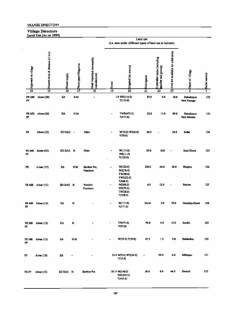
VILLAGE DIRECTORY
Village Directory Land Use {As on 1999}
]' !. .~ ., "0 u 0
i !! E
j 'J ~ '6 ~ diI i.., .~ ~ ~ s §: u gJ M s 8: '" E 0 1;; ._ cI!! e ~ J 1 1;; ::I
:f ~ Iii ~ E '14 IS 16 17 18
PRMR Alwar(20) EA NM PP
PRMR Alwar(20) EA NM PP
PR Alwar(20) EDEAG • Ghee
PRMR AlwaT(20) EDEAG N Ghee PP
PR Alwar(IS) EA NM Earthen Pot, Furniture
PRMR AlwaT(13) EDEAO N Wooden Fumiture
PRMR Alwar(14) EA N PP
PRMR Alwar(12) EA N PP
PRMR AIWBr(12) EA NM PP
PP AlwaT(IS) EA
PRPP Alwar(13) EDEAO N Earthen Pol
Land use (i.e. area under different types ofland use in hectare)
1 t= 19
I e: "0
·1 t::!
20
1.0 WE(114.0) T(114.0)
TWE(673.0) T(671.0)
W(70.0) WE(8.0) T(78.0)
W(II7.0) WE(II.O) T(128.0)
W(320.0) WE(76.0) TW(40.0) TWE(52.6) T(488.6) W(200.0) WE(70.0) TW(28.0) T(298.0)
W(171.0) T(171.0)
TW(97.0) T(97.0)
W(39.0) T(39.0)
23.0 W(9.0) WE(26.0) T(35.0)
ISI.O W(l40.0) WE(30S.6) T(44S.6)
187
1 'E '2 i2 21
87.0
25.0
86.0
29.0
220.0
6.0
243.0
94.0
87.0
30.0
c .S! tii
1>11 > ~
'-1'1 "S
::I U u ... c~ <E! :=-:1 .. B ~ ~
!"5 :a ~
~t g .. ~
22 23
8.0 10.0
15.0 89.0
24.0
16.0
44.0 56.0
12.0
2.0 29.0
6.0 16.0
1.0 9.0
69.0 6.0
4.0 44.0
j ~
~ .D
§ .... 0 c .. 'ii
i 'c u
'" 2
Bahadurpur 122 Patti Kenugo
Bahadurpur 123 Patti Meeran
Sotka 124
RaniKheni 125
Bhajera 126
PeeIWB 127
Mundiya Khera 128
Senthli 129
Baldeobas 130
Milakpur 131
Sirmoli 132
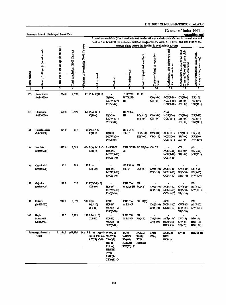
DISTRICT CENSUS HANDBOOK.: ALWAR
Census of India 2001 -Panchayat Samit; : Kishangarh Bas (0004) Amenities and
Amenities available (if not available within the village, a dash (-) is shown in the column and next to it in brackets the distance in broad ranges viz.<5 kms., 5-10 kms. and 10+ kms of the
j i nearest I!lace where the facilitt is available is siven}
] ~ "5 i ., tl.D' u U
..!! ;g-a .,; c ~ 0
., ., ] .s.! c .~ 1 S- .,
§. i ;M~ i::~ u ., § t ~ ]~- &l f ]I ~ ]
l~ ~ .,
~ rs: C!. ~ "5 ....:§
~~ u ~]h:: ~
., § j "0 -5 ...
1 !ij c g ~ 8·~ ·8 g t; ."" .~ ~ ... '" l~ "iI:5!1l 1 0
1 .... ] 1 .§ 'i '" 0 6~< ... ~ .8 j tID ] 'Q 1 ~ ~ c 0 'iii ~ '3 ~ ., .2 E e 5.~ 'iii f! ! ~ 1if ~.j .~~ '6 ~ ~
"B ·c 0 r.;!.5 ] ~~ ." ~ 9 eo :s 2 ~!Q 2 3 4 5 6 7 8 9 10 11 12 13
133 laharKhera 584.0 2,393 333 P M C(IO+) THPTW PO PH (00849900) H(JO+) WTKSS· CM(lO+) ACS(S·IO) CV(lO+) BS« 5)
MCW(lO+) HP CP(IO+) NCS(S-IO) Sp(IO+) RS(IO+) PHC(IO+) OCS(S-IO) 8T(10+) NW(IO+)
134 Chirkhana 392.0 1,497 208 PM(IO+) HPW8S· AC8 (00850000) C(IO+) H(S-IO) HP PO(S·IO) CM(IO+) NC8(10+) CV(IO+) B8(S-10)
MCW(IO+) PH(IO+) CP(IO+) OCS(IO+) 8p(10+) RS(IO+) PHC(IO+) ST(IO+) NW(JO+)
135 Nangal Jheera 164.0 179 31 PM«S) HPTWW (00850100) C(IO+) H(IO+) SS·HP PO(S.IO) CM(IO+) ACS(IO+) CV(IO+) BS«S)
MCW(lO+) PH(IO+) CP(5·10) NCS(IO+) SP(IO+) RS(10+) PHC(IO+) OCS(IO+) ST(IO+) NW(IO+)
136 Rayabka 637.0 3,085 454 P(3) M 5 0 PHSRMP T tIP W S8· PO PH(20) CM CP CV BS (00850500) C(lO+) H(5-10) tIP ACS(5'10) SP(1O+) RS(S-IO)
MCW(S-IO) NCS(S-IO) ST(lO+) NW(IO+) PHC(5-10) OCS(S-IO)
137 Chandooki 173.0 90S 89P M HPTWW PH (00850600) C(S-IO) H(S-IO) SS-HP PO«S) CM(S-IO) ACS(S-IO) CV(S-IO) B8«S)
MCW(S-IO) CP(S.IO) NCS(S-IO) SP(S-IO) R8(S-10) PHC(S-IO) OCS(5-JO) ST(S-IO) NW(IO+)
138 Gajeeka 172.0 6S7 95 P(2) M( < 5) THPTW PH BS (00850700) C(S-IO) H(5·10) W R SS-HP PO« S) CM(S-IO) ACS(S-IO) CV(S-JO) RS(S-IO)
MCW(S-IO) CP(S.IO) NCS(S-IO) SP(S·IO) NW(IO+) PHC(S-IO) OCS(S-IO) ST(S·IO)
139 Raisees 247.0 2,039 328 P(2) RMP TtlPTW POPH(8) ACS BS (00850800) M(S-IO) H(5-10) WSS-HP CM(S-IO) NCS(S-IO) eV(S-IO) RS(S-IO)
C(5-10) MCW(S-IO) CP(S·IO) OeS(5-10) SP(S-IO) NW(IO+) PHC(5·10) ST(5.10)
140 Nagla 188.0 1,21S 193 P M(S·IO) THPTW PH Samawadi C(5-10) H{5-10) WSS-HP PO{<S) CM{5-10) ACS«S) . CV{<5) BS«S) (00850900) MCW(S-IO) CP(~·IO) NCS«S) SP«S) RS(S-IO)
PHC(S.IO) OeS«S) ST«S) NW(IO+)
Panch.yat Samiti : 51,164.0 167,495 24,518 P(lS8) M(44) D DA(6) T(3S) PO(31) CM(S) ACS(l3) CV(4) BS(3l} RS Total 5(11) PUC(4) MCW(3) W(l3S) TO(2) CP(4) NeS
AC(28) 0(8) CWC(l) TK(60) PTO OCS(2) HC(4) HP(l31) PH(S16) PHC(4) N(5S) R PBS(l5) FWC RMP(I) CHW(R) 0
1B8
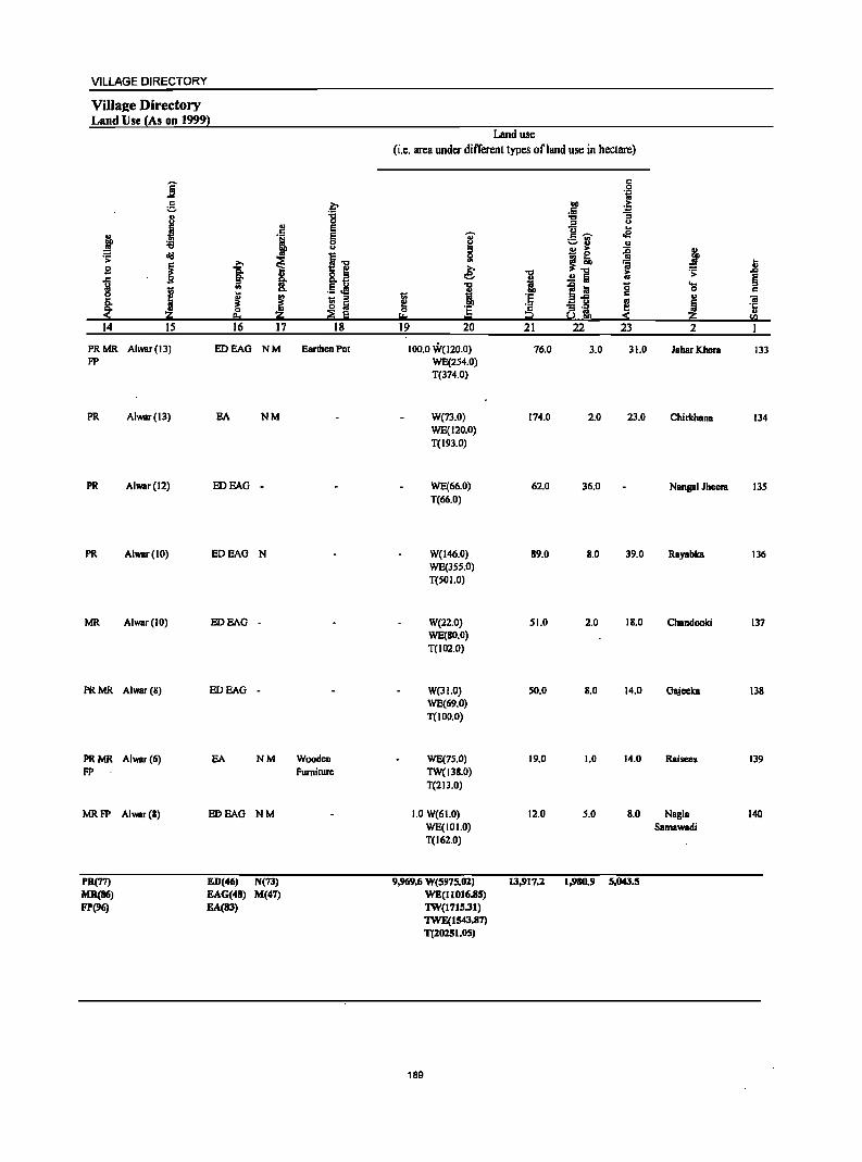
VILLAGE DIRECTORY
Villaee Directory Land Use (As on 1999l
Land use (i.e. area under different types ofland use in hectare)
]' c:
·i ~ ~ .~ .~
8 '8 "" '3 :s u
J ~ E u oS j 'i E ... c: ~ c
~ ;::.rl " u !l ~ ii J ~ old
i 11 ~
~ ;., ~"" :;; ~ g ]: € 1 ~
.;: .&l
J .!! Iii § ., .5 Jl "C 'Sj! 15 ....
1;; c.
·1 c c:
J ! j fi :r 1;; 'E c .,
'ii ~ '3 'l ..
~ ~ ~ ~ e '1:
e. I:!:s !.l :!: Z ..
= CI.l
14 15 16 17 18 19 20 21 22 23 2
PRMR Alwar(13) EDEAO NM Earthen Pot 100.0 W(120.0) 76.0 3.0 31.0 JaharKhera 133 FP WE(2S4.0)
T(374.0)
PR Alwar(13) BA NM W{73.0) 174.0 2.0 23.0 ChirlchanB 134 WE{120.0) T(193.0)
PR Alwar(l2) EDEAO - WE{66.0) 62.0 36.0 Nan8ll1 Jheera 13S T(66.0)
PR Alwar(10) EOEAO N W(146.0) 89.0 8.0 39.0 RByabka 136 WE{3SS.0) T(501.0)
MR Alwar(IO) EDEAO - W(22.0) 51.0 2.0 IS.O Chandooki 137 WE{SO.O) T(102.0)
PR MR Alwar (8) EDEAO - W(31.0) 50.0 S.O 14.0 Gajeeka 13S WE{69.0) T(IOD.O)
PRMR Alwar(6) EA NM Wooden WE(7S.0) 19.0 1.0 14.0 Raisees 139 FP Furniture TW(13S.0)
T(2IJ.0)
MRFP Alwar(S) EflEAO NM 1.0 W(61.0) 12.0 5.0 S.O Nagla 140 WE{101.0) Samawadi T(162.0)
PR(77) ED(46) N(7J) 9,969.6 W(5975.02) 13,917.1 1,980.9 S,D4l.S MR(86) EAG(48) M(47) WE(110J6.85) FP(%) EA(8J) 1W(J71S.31)
1WE(1S43.87) T(10251.05)
189

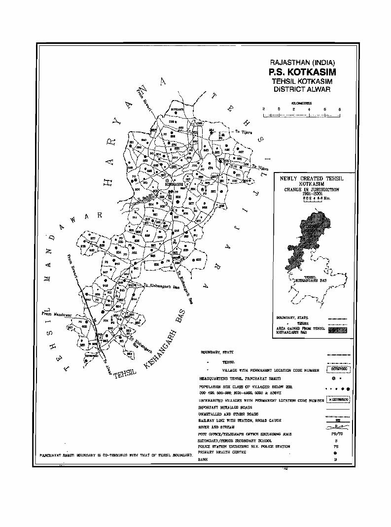
A R
I'ANCIIAYAT SANI1'J .IIOUNDAJIY IS CO-'fllflNJNUS lIl'fH THAT Ot' !'ElISI1 BOUJlDARY.
BOUNDARY, STATE
TEHSIL
RAJASTHAN (INDIA) P.S. KOTKASIM TEHSIL KOTKASIM DISTRICT ALWAR
KIUlMETIIE,s
2 0 2 4- G 6
1--+ -I--·---I----I-------·I-----~
NEWLY CREATED TEHSIL KOTKASIM
CHANGE IN JURISDICTION 199H~OOl 2 02 ~ 6 ft Km. ~
BOUNDARY, STATr.
TIlIlSlL AREA GAINgJ) FROM TEHSIJ, KISHANGARH BAS
VILLAGE "ITH PERMANENT LOCATION CODE NUMBER L.~~~~J HEADQUARTERS: TEHSIL, PANCHAYAT SAlIITI @ •
PDI'DLATION SIZE CLASS OF VILLhGES: BELOW 200, " .... OOcr-499, 500-999, 1000-4999, 6000 /Jc ABOVE .................. UNINIlABI1'~D VILLAGES Wl'fll PERMANENT LOCATION CODe NUMBER L~.~~.~j
IMPORTANT METALLED ROADS
UNIo!ETALLED AND OTHER ROADS
RAILWAY LINE WITH STATION, BROAD CAUCE
RIVER AND STREAM
POS'J' OfFlCE/TELEGIIAPJI WPICE IDCCLUDING II,M.s.
S&:ONDARY ISENIOI! SECONOAI!Y SCHOOL
POI,ICE STATION EXCI,tJDING RI.Y. I'Ol.lcr. STATION I'RIMARY HKALTH CENTRE
BANK
RS
~ I'D/ro
5
1'8
• B

VILLAGE DIRECTORY
ALPHABEI'ICALLISf OF VILlAGES (pANCHAYATSAMITIWlSE)
PanchayatSamiti: Kotkasim(0005)
SI.Nl. Name of village 2001 Census Location Code 1991 Census Location Code Number Number
2 3 4
Tehsil : Kotkasim' (Full)
1 Aheer Basna 00793800 050030005000500080
2 . Akoli 00785500 050030005000500001
3 Alampur 00789700 050030005000500043 4 Anaka 00788500 050030005000500031
5 Badsara 00791300 050030005000500059
6 " Baghana 00790000 050030005000500046 7, Bagheri Khurd 00794400 050030005000500104
8 Bcelaheri 00788300 050030005000500029
9 Bceliyawas 00788200 050030005000500028
10 Beeranwas 00785900 050030005000500005
II Begampur 00790500 050030005000500051 12 Beraheri 00794300 050030005000500098 13 Berawas Kalan 00787200 050030005000500018
14 BerawBS Khurd 00790900 050030005000500055.
15 Bhamoowas 00786800 050030005000500014
16 Bhojpur 00796500 050030005000500140
17 Bhojrajka 00792000 050030005000500066
18 Bhonkar 00786900 050030005000500015
19 Burhi Bawal 00786400 050030005000500010
20 Chachiyawas 00791600 050030005000500062
21 Chawandi 00789200 050030005000500038
22 Chowki 00788700 050030005000500033
23 Daika 00789400 050030005000500040
24 Daika 00792100 050030005000500067
25 Dalawas 00787000 050030005000500016
26 Daulat Nagar Majra 00795200 050030005000500109
27 Deengli 00791100 050030005000500057
28 Deoseeka 00786200 050030005000500008
29 Dheerdhoka 00793300 050030005000500075
30 Doomhera 00790800 050030005000500054
31 Gangapuri 00790600 050030005000500052
32 Gheekaka 00791200 . 050030005000500058
33 Girwas 00796300 050030005000500141
34 Gokulpur 00789000 050030005000500036
35 Goojriwas 00789900 050030005000500045
36 Gunsar 00792600 050030005000500068
37 Gurgachka 00794600 050030005000500095
38 Hajipur 00788000 050030005000500026
39 Hajnab 00785700 050030005000500003
40 Hanspur Kalan 00796800 050030005000500138 41 Hanspur Khurd 00796900 050030005000500139 42 HarsoH 00796400 050030005000500135
43 Ikrotiya 00792300 -"t~ 050030005000500085
193
DISTRICT CENSUS HANDBOOK: ALWAR
ALPHABETICAL LIST OF VILlAGES (P ANCHAYAT SAMITIWISE)
. Panchayat S amiti : Kotkasim (0005)
SI.No. Name of village 2001 Census Location Code 1991 Census Location Code Number Number
2 3 4
44 Jahanpuri 00793000 050030005000500072 45 Jakopur 00789800 050030005000500044 46 Jalaka 00792800 050030005000500070 47 Jamalpur 00787500 050030005000500021 48 Jatiyana 00795900 050030005000500134 . 49 Jatoowas 00787900 050030005000500025 50 Iharka 00794900 050030005000500108 51 Jhiryana 00795700 050030005000500113 52 Jokhawas 00786000 050030005000500006 53 Jonal 00793400 050030005000500076 54 Joriya 00789300 050030005000500039 55 Kadaiya 00794200 050030005000500094
56 Kanharka 00788600 050030005000500032 57 Kani 00793500 050030005000500077 58 Kaririwas 00785600 050030005000500002
59 Karwar 00792200 050030005000500086 60 Kasimpur 00790200 050030005000500048 61 Kayampura Jokhawas 00786300 050030005000500009 62 Kerwa 00792700 050030005000500069 63 Khanpur Aheeran 00791500 050030005000500061 64 Kharola 00797000 050030005000500169
65 . Kheral 00793200 050030005000500074
66 Kheri 00791400 050030005000500060
67 Khohra Thakran 00793600 050030005000500078 68 Kirwari 00796100 050030005000500143 69 Koompur 00795100 050030005000500106 70 Kotkasim 00789600 050030005000500042 71 Kutubpur 00787400 050030005000500020 72 Ladpur 00790700 050030005000500053 73 Lahdod 00794700 050030005000500096 74 Lalpur 00785800 050030005000500004 75 Lisani 00796200 050030005000500167 76 Madhoopur 00786700 050030005000500013 77 Magha Ka Majra 00793700 050030005000500079 78 Majri 00786500 050030005000500011 79 Makdawa 00787800 050030005000500024 80 Maswasi @ Madhopuri 00790100 050030005000500047 81 Mata1was 00787600 050030005000500022 82 Meerpur 00787300 050030005000500019 83 Menawas 00788900 050030005000500034 84 Meoli 00790400 050030005000500050 85 Mirzapur 00795000 050030005000500107 86 Moonpur Mewan 00795300 050030005000500110 87 Moonpur Thakran 00792900 050030005000500071
194
VILLAGE DIRECTORY
ALPHABETICAL LIST OF VILLAGES (p ANCHAYA T SAMrrI WISE)
Pam:hayatSamiti: Kotkasim (0005)
SI.No. Name of village 2001 Census Location Code 1991 Census Location Code Number Number
2 3 4
88 Nangal Saliya 00794000 050030005000500082
89 Nangli Jatan 00796700 050030005000500137
90 Narooki 00789500 050030005000500041
91 Narwas 00788400 050030005000500030
92 Nasopur 00786600 050030005000500012
93 Neemlaka 00791900 050030005000500065
94 Paharwas 00792400 050030005000500090
95 Palpur 00792500 050030005000500084
96 Pataliya 00796600 050030005000500136
97 Patan Aheer 00794100 050030005000500083
98 Pur 00791800 050030005000500064
99 Raipur Jatan 00794800 050030005000500097
100 Ramnagar 0079600(:) 050030005000500142
101 Rampur 00788100 050030005000500027
102 Raniyawas 00790300 050030005000500049
103 Roneeja 00791000 05003000500050.0056
104 Sadhooka 00795600 050030005000500131
105 Salkhar 00794500 050030005000500105
106 Sanoda 00791700 050030005000500063
107 Shahjadpur 00795500 050030005000500112
108 Shahpur 00795800 050030005000500132
109 Sherpur 00788800 050030005000500035
110 Shorwa 00795400 050030005000500111
III Silpata 00787700 050030005000500023
112 Teuwas 00787100 050030005000500017
113 Thathka 00793100 050030005000500073
114 Thethar Basna 00793900 050030005000500081
115 Turkwas 00789100 050030005000500037
116 Ujoli 00786100 050030005000500007
195
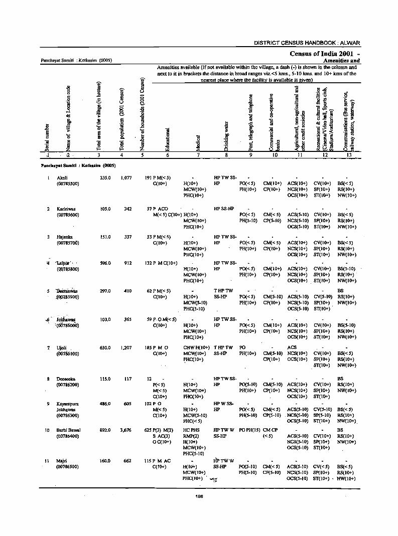
Panchayat Samiti : Kotkasim (0005)
J 3
PaDeha".t Samltl : Kotkasim (OOOS)
Akoli (00785500)
2 Kaririwas
a
(00785600)
Hiljnska (00785700)
'4 'biilpui" '. ' (00785.800)
5 'BcdiiitWas (OP?,859DO)
.6 N~WIIl!
1
8
9
1(00786000)
Ujoli , (00186100)
Dcoseeka (00786200)
Kayampum Jokliawas (00786300)
10 Burhi Bawsl (00786400)
11 Ml\jri (00786500)
335,0
105,0
151.0
596.0
297,0
10),0
630.0
115.0
486.0
892.0
160.0
4 5
1,077
342
337
912
410
365
1.207
117
60S
3,676
662
DISTRICT CENSUS HANDBOOK: ALWAR
Census of India 2001 -Amenities and
Amenities available (if not available within the village, a dash (-) is shown in the column and next to it in brackets the distance in. broad r.anges viz.<5 kms., 5-10 kms. and 10+ kms of the
nearest place where the facility is available is given)
6
191 PM«S) C(IO+)
57 P ACO
7
H(IO+) MCW(IO+) PHC(IO+)
8 9
HPTWSS-HP PO«S)
PH(IO+)
HPSS-HP
10 11 12
CM(lO+) ACS(IO+) CV(IO+) CP(IO+) NCS(IO+) SP(IO+)
OCS(IO+) ST(lO+)
13
BS« 5) RS(IO+) NW(IO+)
M« 5) C(lO+) H(IO+) MCW(IO+) PHC(IO+)
PO« 5) CM« 5) ACS(S-IO) CV(IO+) BS« S) PH(5-10) CP(5-1O) NCS(5-10) SP(IO+) RS(lO+)
OCS(5-10) ST(IO+) NW(IO+)
53PM«S) C(lo+)
132 P M C(IO+)
62 P M«S) C(IO+)
S9P OM«5) C(IO+)
185 PM 0 C(IO+)
12 p«S) M«S) C(IO+)
102P 0 M«S) C(IO+)
62S P(3) M(2) S AC(3) OC(IO+)
115 PM AC C(IO+)
H(IO+) MCW(IO+) PHC(IO+)
H(lOT) MCW(IO+) PHC(IO+)
H(.IO+) MCW(S-IO) PHC(S-IO)
H(IO+) MCW(IOT) PHC(IO+)
HPTWSS-HP PO«'s)
PH(lO+)
HPTWSS-HP PO«S)
PH(IO+)
THPTW S8-HP Poe < S)
PH(IO+)
HPTWSS-HP PO«S)
PH(lO+)
CM«5) ACS(IO+) CV(IO+) BS«5} Cp(IO+) NCS(IO+) Sp(IO+) RS(IO+)
OC8(10+) ST(IO+) NW(IO+)
CM(lO+) AC8(10+) CV(IO+) B8(5-10) CP(IO+} NCS(IO+) Sp(IO+) RS(IO+) .
OCS(lO+) ST(IO+) NW(IO+)
BS CM(5-10) ACS(S-IO) CV(S-IO) RS(IO+) CP(IO+) NCS(S-IO) SP(IO+) NW(IO+)
OCS(S-IO) ST(IO+)
CM(IO+) AC8(1D+) CV(IO+) CP( 10+) NCS(I 0+) SP(I 0+)
OCS(IO+) ST(IO+)
B8(S-IO) RS(IO+) NW(IO+)
CHWH(IO+) THPTW PO .ACS MCW,(IO+) 88-fiP PH(IO+) CM(5-10) NCS(IO+) CV(IO+)
CP(IO+) OCS(IO+) SP(IO+) ST(IO+)
BS«S) RS(IO+) NW(lO+)
~HC(IO+)
H(IO+) MCW(IO+) PHC(IOT}
H(lO+) MCW(S-IO) PHC«S)
HPTW8S- BS HP PO(S-IO) CM(S-IO) ACS(lO+) CV(IO+) RS(IO+)
PH(IO+) CP(IO+) NCS(IO+) Sp(IO+) NW(IO+) OCS(IO+) ST(IO+)
HPW8S-HP PO« 5) CM« S) AC8(S-10} CV(S-IO) B8« S)
PH(S-IO) CP(S-IO) NCS(S-tO) SP(S-IO) RS(IO+) OCS(S-IO) ST(IO+) NW(IO+).
HCPHS HPTWW POPH(IS) CMCP BS ACS(5-10) CV(IOT) RS(1D+) NCS(S-IO) SP(IO+) NW(IO+) OCS(S-IO) ST(IO+)
RMP(2) SS-HP « 5) H(IO+) MCW(IO+) PHC(S-IO)
mTWW H(IO+) 55-HP MCW(IO+) PHC(IO+) . '""!<;\
196
PO(S-IO) CM«S) ACS(S-IO) CV«S) BS«S) PH(S-IO) CP(S-IO) NC8(S-10) 5P(10+) RS(IO+)
OCS(S-IO) 5T(10+)· NW(IO+)
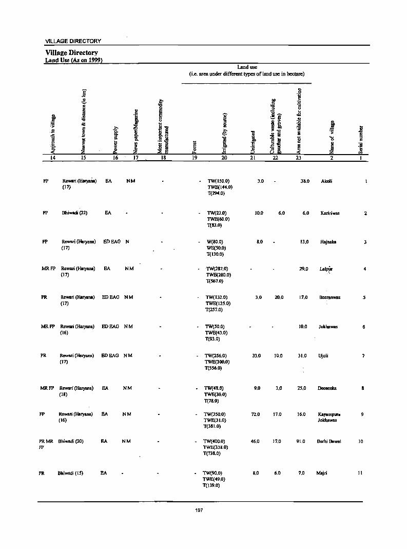
VILLAGE DIRECTORY
ViIla2e Directory Land Use {As on 1999}
Land use (i.e. area under different types of land use in hectare)
j c
.g t;I
:S .e ~ 'E;
i -g ~ "3
CJ
'l E u .E! j ~ I .S 'M'
:;;
j~ ~ J :~ ~
i 11 51
I ~ ~ .8 2 co. e: ." ~ .;;
'.<:: §o II ..!! Iii ~ l;I
I V> &. .§~ J i ~~ g "0 c
0
~ ~ ·s .. ,a, ~ _ ::0
~ OJ
~ ~ ~ ~i 1 'r:;
~ 0 ~ 0 .. li e. ,._ S ...
14 IS 16 17 18 19 20 21 22 23 2
FP Rewari (HaryaOa) EA NM - TW(ISO.O) 3.0 38.0 Akoli (17) TWE(144.0)
T(294.0)
FP Bhiwadi (22) EA - TW(23.0) 10.0 6.0 6.0 Kaririwas 2 TWE(60.0) T(83.0)
FP Rewari (Haryana) EDEAG N W(BO.O) B.O 13.0 Hajnaka 3 (17) WE(SO.O)
T(130.0)
MRFP Rewari (Haryana) EA NM ·TW(287.0) 29.0 Lalpfn' 4 (17) TWE(2BO.0)
T(S67.0)
PR Rewari (Haryana) EDEAG NM TW(132.0) 3.0 20.0 17.0 Beeranwas 5 (17) TWE(12S.0)
T(2S7.0)
MRFP Rewari (Haryana) EDEAG NM TW(SO.O) 10.0 JokhaWBS 6 (16) TWE(43.0)
T(93.0)
PR Rewari (Haryana) EDEAG NM - TW(2S6.0) 33.0 10.0 31.0 Ujoli 7 (17) TWE(300.0)
T(SS6.0)
MRFP Rewari (Haryana) EA NM - TW(4B.0) 9.0 3.0 25.0 Deoseeka B (18) TWE(30.0)
T(78.0)
FP Rewari (Haryana) EA NM - TW(350.0) 72.0 17.0 16.0 Kayampura 9 (16) TWE(31.0) JokhaWBS
T(38 1.0)
PRMR Bhiwadi (20) EA NM - TW(400.0) 46.0 17.0 91.0 BurhiBawal 10 fP TWE(338.0)
T(738.0)
PR Bhiwadi (IS) EA - TW(90.0) 8.0 6,0 7.0 Majri 11 TWE(49.0) T(139.0)
197
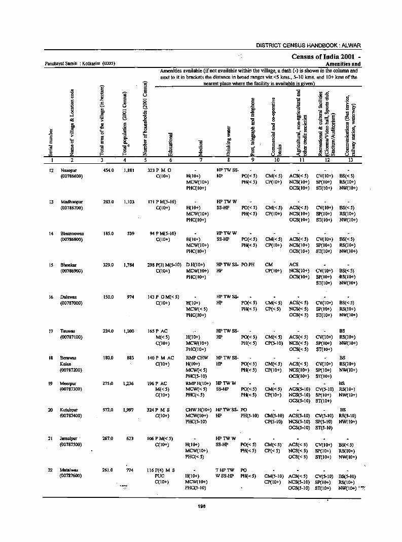
DISTRICT CENSUS HANDBOOK: ALWAR
Census of India 2001 -Panchayat Samiti : Kotkasim (0005) Amenities and
Amenities available (if not available within the village, a dash (-) is shown in the column and next to it in brackets the distance in broad ranges viz.<5 kms., 5-10 kms. and 10+ kms of the
i !i nearest place where the facility is available is given) ..
-8 I
5 '5 rl.d' 8 u u .. _g 0 i i ! ~~ 8"
.2 e u 0 ._ -e 'E ~
~ U C!. ~
JIg. ; f 8 ~ 0 .. u ...:I 0 'tl B t·B
1(1)~ dIl S C!. ~ '5
-:'§ ej > u -a «I 'c
j '" c .. .., a .!!! <> .c .9 .~ § ... -s .9 6 ; .c ~ c 8 dIl g._ " .... ~ .c i -g .~ ~:9-g .0 0 -a 'a «I :3 tI .::; § os ... ·8 !! .g ~ i ·s ~ 'S ~ OIl ~1 c 8. b «I .5
., ~ t "iI m 3 3"
.0 ... .!=l ~ E.J:! ~ ~._
·c ~ ~ 'tl lif ~ Iij 'tb b .S]
~ ~ u 0 §] u ~ :S~ !a iil:i 9 E!:I s.!r.s e:i ~Ul
I 2 3 4 5 6 7 8 9 10 11 12 13
12 Nasopur 454.0 1,881 323P M 0 HPTWSS-(00786600) C(IO+) H(IO+) HP PO« 5) CM«5) ACS«S) CV(IO+) 8S« S)
MCW(IO+) PH« 5) CP(IO+) NCS(IO+) SP(IO+) RS(lO+) PHC(IO+) OCS(IO+) ST(lO+) NW(IO+)
13 Madhoopur 283.0 1,103 171 P M(5-IO) HPTWW (00786700) C(lO+) H(IO+) SS-HP PO« 5) CM«S) ACS« 5) CV(IO+) 8S«5)
MCW(IO+) PH« 5) CP(IO+) NCS(IO+) SP(IO+) RS(IO+) PHC(IO+) OCS(IO+) ST(IO+) NW(IO+)
14 Bhamoowas IS5.0 539 94 P M(S-IO) lIPTWW (00786800) C(IO+) H(IO+) SS-lIP PO« 5) CM«5) ACS« 5) CV(IO+) 8S« S)
MCW(IO+) PH« 5) CP(IO+) NCS(IO+) Sp(IO+) RS(IO+) PHC(IO+) OCS(lO+) ST(IO+) NW(lO+)
15 Bhonkar 329.0 1,784 298 P(3) M(5-IO) DH(IO+) HP TW S8- PO PH CM ACS (007116900) C(lO+) MCW{IO+) lIP CP{IO+) NCS{IO+) CV{IO+) BS{<S)
PHC(IO+) OCS(IO+) SP(IO+) 'RS(IO+) ST(IO+) NW(IO+)
16 Dalawas 150.0 974 143 P OM«S) HPTWS8-(00787000) C(IO+) H(IO+) HP PO« S) CM«S) ACS«S) CV(lO+) BS«5)
MCW«5) PH« 5) CP{<5) NCS«S) SP(IO+) RS(IO+) PHC(IO+) OCS« 5) ST(IO+) NW(IO+)
17 Teuwas 224.0 1,200 165P AC HPTWSS- BS (00787100) M«S) H(IO+) HP PO« 5) CM«S) ACS{<S) CV(IO+) R8(10+)
C(IO+) MCW(IO+) PH« S) CP(S-IO) NCS« S) SP(IO+) NW(IO+) PHC(IO+) OCS«S) ST(lO+)
18 Berawas ISo.o 883 140P M AC RMPCHW HPTWSS- BS Kalan C(IO+) H(IO+) HP PO« S) CM«S) ACS« 5) CV(IO+) RS(IO+) (00787200) MCW«S) PH«S) CP(IO+) NCS(IO+) SP(IO+) NW(IO+)
PHC(S-IO) OCS(IO+) ST(IO+)
19 Meerpur 27S.o 1,236 196P AC RMPH(IO+) HPTWW BS (00787300) M«S) MCW«S) SS-HP PO«S) CM«S) ACS(S-IO) CV(S-IO) RS(1O+)
C(lO+) PHC«S) PH«S) CP(IO+) NCS(S-IO) Sp(IO+) NW(IO+) OCS(S-IO) ST(IO+)
20 Kutubpur 572.0 1,997 324P M S CHWH(lO+) HPTWSS- PO 8S (00787400) C(IO+) MCW(lO+) HP PH(S-IO) CM(S-lO) ACS(S-IO) CV(S-lO) RS(S-IO)
PHC(S-IO) CP{5-10) NCS{S-IO) SP{S-IO) NW(IO+) OCS(S-IO) ST(S-IO)
21 Jamalpur' 267.0 623 106 PM«S) HPTWW (00787500) C(IO+) H(IO+) SS-HP PO«S) CM«S) ACS«S) CV(lO+) BS« 5)
MCW(IO+) PH«S) CP« 5) NCS« 5) Sp(IO+) R8(IO+) PHC«S) OCS« 5) ST(1O+) NW(IO+)
22 Matalwas 261.0 774 116 P(4) M S THPTW PO (00787600) PUC H(IO+) WSS-HP PH«S) CM(S-IO) ACS«S) eV(S-IO) B8(S-IO)
C(lO+) MCW(IO+) CP(IO+) NCS(S-lO) Sp(lO+) R8(IO+) .~- PHC(5-1O) OCS(S-IO) ST(IO+) NW(IO+) '"":';.
198
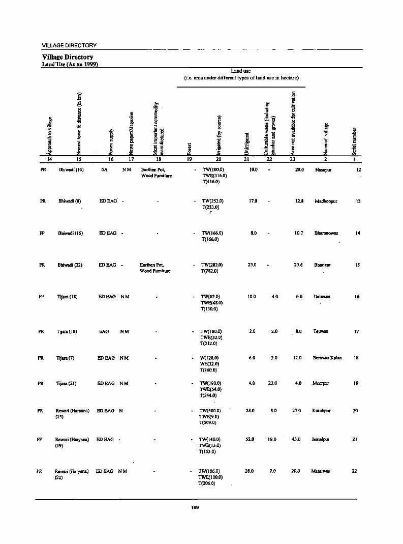
VILLAGE DIRECTORY
ViIla£e Directory Land'Use {As on 1999}
j r:: c
j .,
J .,
~ .:;: ~ ~ B I f i i I I ~ ,~ ·1O .e;s - .~
.14 IS 16 17
PR Bhiwadi (16) EA NM
PR Bhiwadi (8) HOEAG -
FP Bhiwadi (16) HOEAG -
PR Bhiwadi (22) HOEAG -
FP Tijara(18) HOEAG NM
PR Tijara(18) EAG NM
PR Tijara(7) HOEAO NM
PR Tijara(21) HOEAO NM
PR Rewari (HalYana) EDEAO N (2S)
FP Rewari (HaJYana) HOEAO -(19)
PR Rewari (HBl)'8na) EDEAG NM (22)
~ :g E e 8
~"O
Ji ri ta ~ Iii
18
Earthen Pot, Woad Furniture
Earthen Pot, Wood Furniture
Land use (i.e. area under different types of land use in hectare)
r:: 0 'i
~ .~ :g "3
u ]_ .e I ct1 u
51 I! ~ J :;; Jl e: 1 ..!! ta 1;; .;;: §
."
1~ g ... i
0 c
I ·s .. Oi ·s ~ a!!h ~ ~ ·c .. a. 0= r.a
19 20 21 22 23 2 I
TW(lOo.o) 10.0 28.0 Nasopur 12 TWE(316.0) T(416.0)
- TW(2S3.0) 17.0 12.8 Madhoopur 13 T(2S3.0)
r
- TW(166.0) 8.0 10.7 Bhamoowas 14 T(166.0)
- TW(282.0) 23.0 23.6 Bhonkar IS T(282.0)
- TW(82.0) 10.0 4.0 6.0 Dalawas 16 TWE(48.0) T(130.0)
TW(180.0) 2.0 2.0 8.0 TeuWBs 17 TWE(32.0) T(212.0)
W(128.0) 6.0 2.0 12.0 Berawas Kalan 18 WE(32.0) T(J60.0)
- TW(l90.0) 4.0 23.0 4.0 MecrpJII' 19 TWE(S4.0) T(244.P)
- TW(SOO.O) 28.0 8.0 27.0 Kutubpur 20 TWE(9.0) T(S09.0)
- TW(140.0) S2.0 19.0 43.0 JamaJpur 21 TWE(13.0) T(IUO)
TW{I06.0) 28.0 7.0 20.0 MalBlwas 22 TWE(lOO.O) T(206.0)
199
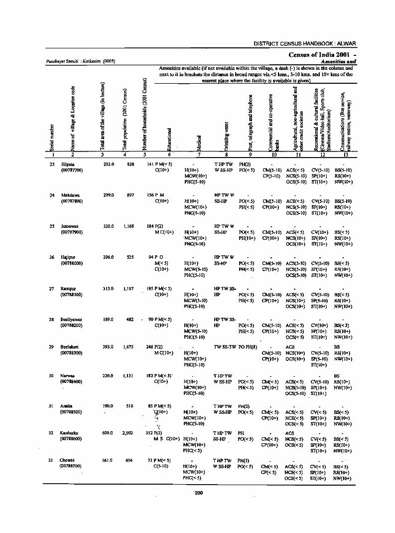
DISTRICT CENSUS HANDBOOK: ALWAR.
Census of India 2001 -Panchllyat Samiti : Kotk •• im (0005) Amenities and
Amenities available (if not aVailable within the village, a dash (-) is shown in the column and next to it in brackets the distance: in broad ranges viz.<5 Ians., 5-10 Ians. and 10+ kms of the
I ~ nearest ~lace where the faciIi!! is available is Biven} ., 5 i ..,
~ :l .0" S U '.;::I ..a .!f co .c 5 8 ~ .r: ] :.::: CJ 0 g i 'u .f! [:..-.. 'B u C!.. e "Ei ~ 0 :: f ~ - .. ..
" ]~..-.. 0 8 :E 'Ii go .~ rtl ...:I = -'§ :;:I ..
dlI .~ C!- i ] 8 , '.&:I ]] .~ S~ ~ .s 6 'C S .~ !!!
.8 'il I ..c: Iii c g dlI il·- ·15 § ~ OS ..c: ~ i·~ "iI:5!ll
~ i "Ei 'a ] :$I
6~< .~ .~ .... go kl 00· .. ~ il ._ ] § 0 Co "~ ] .5 'Ii E ~ i .0
i! E ., I.~ ] "iI ~
] ~ tf 81 .Y tJ
'1: :;:I
~'! .. t!:l ~ ~ .t;
~ ~11 Ii(.! 9 U.s ei ~Ii(.! I 2 3 4 5 6· 7 8 9 10 II 12 13
23 Silpala 293.0 838 141 PM«S) THPTW PH(2) (00787700) C(lO+) H(IO+) W SS-HP PO« S) CM(S-IO) ACS«S) CV(S-IO) BS(S-IO)
MCW(IO+) CP(S-IO) NCS(S-IO) SP(IO+) RS(IO+) PAC(S-IO) OCS(S-IO) ST(IO+) NW(IO+)
24 MakdaWB 299.0 897 156P M HPTWW (00787800) C(IO+) H(IO+) SS-HP PO«S) CM(S-IO) ACS«5) CV(S-IO) BS(S-IO)
MCW(IO+) PH« S) CP(IO+) NCS(S-IO) SP(IO+) RS(IO+) PAC(S-IO) OCS(S-IO) ST(IO+) NW(IO+)
2S JBtoOwas 320.0 1,168 184 P(2) HPTWW (00787900) MC(IO+) H(lo+) SS-HP PO«S) CM(S-IO) ACS«5) CV(IO+) BS«5)
" MCW(IO+} PH(IO+) CP(IO+) NCS(IO+) SP(IO+) RS(1O+) PAC(S-IO) OCS(IO+) ST(IO+) NW(IO+)
26 Hajipur 296.0 S2S 94P 0 HPTWW (00788000) M«S) H(IO+) SS-HP PO« S) CM(S-IO) ACS(S-IO) CV(S-IO) BS«5)
C(lO+) MCW(S-IO) PH«S) CP(IO+) NCS(S-IO) SP(IO+) RS(IO+) PHC(S-IO) OCS(S-IO) ST(IO+) NW(IO+)
27 Rampur 313.0 1,197 19S PM«S) HPTWSS-(00788100) C(IO+) H(IO+) HP PO«5) CM(S-IO) ACS«S) CV(S-IO) BS«S)
MCW(S-IO) PH«S) CP(IO+) NCS(IO+) SP(S-IO) RS(IO+) PHC(S-IO) OCS(IO+) ST(IO+) NW(IO+)
28 BeeliYBwas 189.0 482 90 P M« 5) HPTW88-(00788200) C(10+) H(IO+) HP PO«S) CM(S-IO) AC8«S) CV(iO+) B8«S)
MCW(S-IO) PH«S) CP(10+) NCS«S) SP(IO+) R8(10+) PAC(S-IO) OCS«S) ST(1O+) NW(IO+)
29 Beelahen 393.0 1,47S 246 P(2) TW SS-TW PO PH(8) ACS BS (00788300) MC(IO+) A(IO+) CM(S-IO) NCS(IO+) CV(S-IO) RS(IO+)
MCW(IO+) CP(IO+) OCS(IO+) SP(S-IO) NW(IO+) PAC(S-IO) ST(IO+)
30 Narwas 220.0 1,131 182 P M(.: S)' THPTW BS (00788400) C(lO+) H(1O+) WSS-HP PO«S) CM«S) ACS«S) CV(S-IO) RS(1O+)
MCW(IO+) PH« S) CP(IO+) NCS(S-IO) Sp(IO+) NW(IO+) PAC(S-IO) OCS(S-IO) ST(IO+)
31 Anaka 190.0 SI9 85PM«S) THPTW PH(2) (00788500) "G(IO+) H(IO+) WSS·HP PO«S) CM«S) ACS«S) CV«S) BS«S)
.'-~ MCW(IO+) CP(IO+) NCS«5) SP(IO+) RS(IO+)
'( PAC(S-IO) OCS«5) ST(IO+) NW(IO+)
32 Kanharka 609.0 2,102 352 P(Z) THPTW PH ACS (00788600) M~ C(IO+) H(IO+} 88-HP PO«S) CM«S} NCS«S) CV«S} B8«S)
MCW(JO+) CP(IO+) OCS«S) SP(IO+) RS(JO+) PAC«S) ST(JO+) NW(JO+)
33 Chowki 161.0 404 73PM«S) THPTW PH(3} - .
(00788700) C(S-IO) H(IO+) W88-HP PO«S) CM«S) ACS«S) CV«5) BS«S} MCW(JO+} CP«5) NCS«5) SP(IO+) RS(JO+) PHC«S) OCS«S) 8T(10+) NW(IO+)
'200
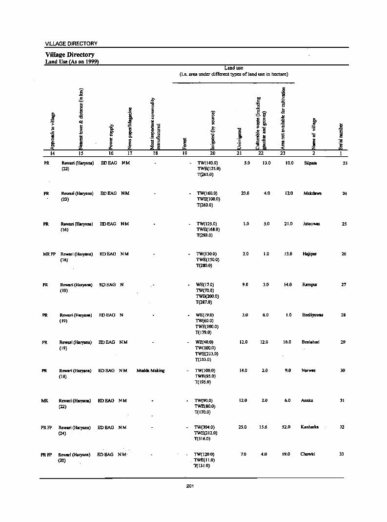
VILLAGE DIRECTORY
ViIla!e Directory Land Use {As on 1999}
Land use (Le. area under different types of land use in hectare)
]' c
'i £. ~ OIl :-
c 'oW
I "8 ~ :; u
~ E u ...
:f '! E I c ...... .s :;; 8 ;::.I'l '" B :- ~ t .;: old
~ I] 0 ~ ~ ~ ~ '" ~ u sa € 1
.'0 i:i .;: .g
1 ~ 8: .!:! a §
I .! ~ 1 ~ Ia 1;; 'S c
~ i 'I;;
:~ ~l c u Oil
8: rl Iii I!! ... i ~ E
0 'E ·12 '5 :( p.. z "" ... OJ :( Z ro 14 IS 16 17 18 19 20 21 22 23 2
PR Rewari (Haryana) EDEAG NM - TW(140.0) 5.0 13.0 10.0 Silpata 23 (22) TWE(125.0)
T(265.0)
PR Rewari (Haryana) EDEAG NM TW(160.0) 23.0 4.0 12.0 Makdawa 24 (22) TWE(IOO;O)
T(260.0)
PR Rewari (Haryana) EDEAG NM - TW(125.0) 1.0 5.0 21.0 Jatoowas 25 (16) TWE(168.0)
T(293.0)
MRFP Rewari (Haryana) EDEAG NM - TW(130.0) 2.0 1.0 13.0 Hajipur 26 (16) TWE(ISO.O)
T(280.0)
PR Rewari (Haryana) EDEAG N WE(17.0) 9.0 3.0 14.0 Rampur 27 (19) TW(70.0)
TWE(200.0) T(287.0)
PR Rewari (HBryana) EDEAG N WE(19.0) 3.0 6.0 1.0 Beeliyawas 28 (19) TW(60.0)
TWE(IOO.O) T(I79.0)
PR Rewari (Haryana) EDEAG NM WE(40.0) 12.0 12.0 16.0 Beelaheri 29 (19) TW(lOO.O)
TWE(213.0) T(3S3.0)
PR Rewari (Haryana) EDEAG NM Mudda Making TW(100.0) 14.0 2.0 9.0 NarwBS 30 (18) TWE(95.0)
T(19S.0)
MR Rewari (Haryana) EDEAG NM TW(90.0) 12.0 2.0 6.0 Anaka 31 (22) TWE(80.0)
T(170.0)
PRFP Rewari (Haryana) EDEAG NM TW(304.0) 25.0 15.6 52.0 KanhBrka 32 (24) TWE(212.0)
T(516.0)
PRFP Rewari (Haryana) EDEAG NM' TW(120.0) 7.0 4.0 19.0 Chowki 33
(20) _ TWE(II.O) 1'{131.0)
201
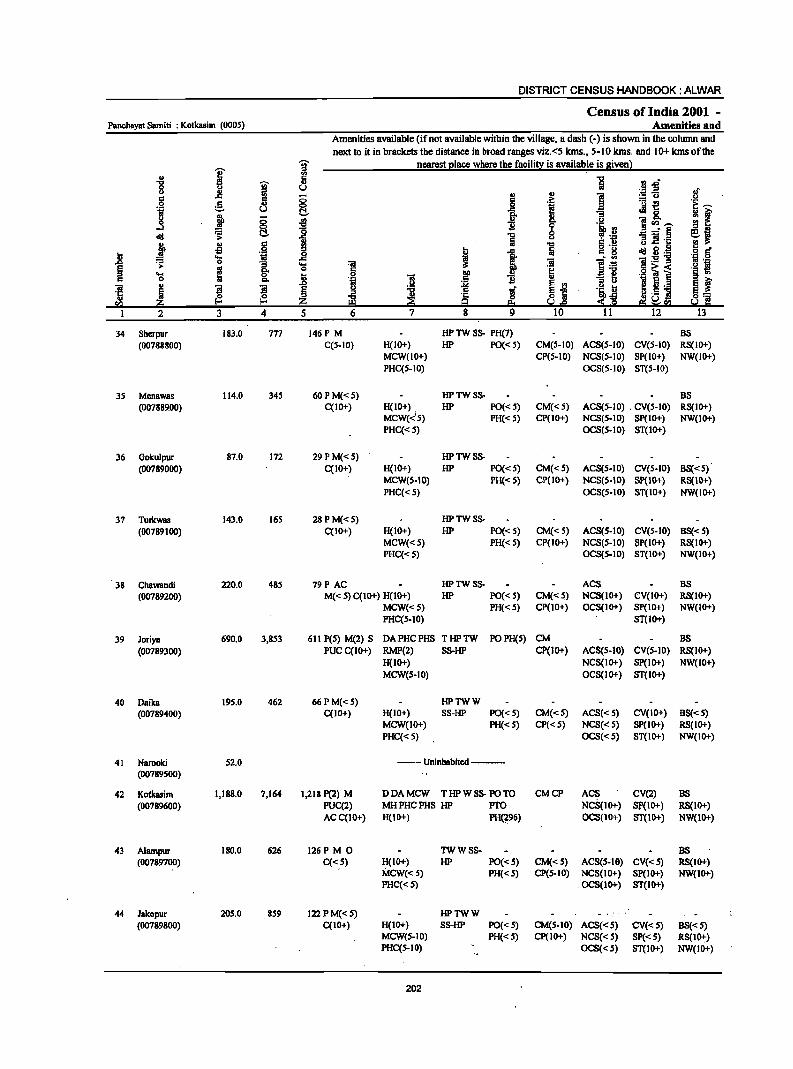
DISTRICT CENSUS HANDBOOK: ALWAR
Census of India 2001 -Panchayat Samiti : Kotkasim (0005) Amenities and
Amenities available (if not available within the village, a dash (-) is shown in the column BIld next to it in brackets the distBllcc in broad rBllges viz.<5 Ians., 5-10 kms. and 10+ kms of the
I ~ nearest elace where the facili!l: is available is siven) .. ., " flsS ....
~ .,
0 " u :; -5 " 11 fi ., .,
c: :§. 8 c: .:: r=t! 0 _g I .~ u t!. Jig. j ft-
0 § ~ 1i ~ l"'---....I ] ~ ~ t!. _-'"§
j .,
.§ ..
] g 1!.-
oS [!l .. ~ ~.~ ~ .... 1iI ..8 i ]:s-g .0 ~ 0 "3 .... e
~ g- o .e i 1 a .... I; 0 Q,
.0 01 u fI ~ §
... _ '1:: Iii 8] ... ~ z '" 2 3 4 5
34 Sherpur 183.0 777 146P M HP TW SS- PH(7) BS (00788800) C(S-IO) H(IO+) HP PO«S) CM(S-IO) ACS(S-IO) CV(S-IO) RS(IO+)
MCW(IO+) CP(S-IO) NCS(S-IO) SP(IO+) NW(IO+) PHC(S-IO) OCS(S-IO) ST(S-IO)
3S Menawas 114.0 345 60PM«S) HPTWSS- BS (007889.00) C(10+) H(IO+) . HP PO« 5) CM«S) ACS(S-IO) . CV(S-IO) RS(IO+)
MCW«'S) PH« S) CP(IO+) NCS(S-IO) Sp(IO+) NW(IO+) PHC«S) OCS(S-IO) ST(IO+)
36 Gokulpur 87.0 172 29 P M«5) HPTWSS-(00789000) C(10+) H(IO+) HP PO«S) CM«S) ACS(S-IO) CV(S-IO) BS«S)
MCW(S-IO) PH« S} CP(IO+) NCS(S-IO} Sp(IO+) RS(IO+} PHC«S) OCS(S-IO) ST(IO+) NW(IO+}
37 Turkwas 143.0 16S 28PM«S) HPTWSS-(00789100) C(IO+) H(IO+) HP PO«S) CM« S) ACS(S-IO) CV(S-IO) BS«S)
MCW«S) PH« 5) CP(IO+) NCS(S-IO) Sp(IO+) RS(IO+) PHC«s) OCS(s-IO) ST(IO+) NW(IO+)
38 ChaWBndi 220.0 48S 79P AC HPTWSS- ACS BS (00789200) M« S) C(IO+) H(IO+) HP PO« S) CM«" NCS(IO+) CV(IO+) RS(IO+)
MCW«S) PH«S) CP(IO+) OCS(IO+) Sp(IO+) NW(IO+) PHC(S-IO) ST(IO+)
39 Joriya 690.0 3,853 611 peS) M(2) s DA-PHCPHS THPTW POPH(s) CM BS (00789300) PUC C(lO+) RMP(2) SS-HP Cp(IO+) ACS(s-IO) CV(S-IO) RS(IO+)
H(IO+) NCS(IO+) SP(IO+) NW(IO+) MCW(S-IO) OCS(IO+) ST(IO+)
40 Daika 19S.0 462 66 P M«S) HPTWW (00789400) C(10+) H(IO+) SS-HP PO« S) CM«S) ACS«S) CV(IO+) BS«S)
MCW(IO+) PH« S) CP«S) NCS«S) SP(IO+) RS(IO+) PHC«S) OCS«S) ST(IO+) NW(IO+)
41 NBmoki S2.0 --Uninhabited ---(00789500)
42 Kotkasim 1,188.0 7,164 1,218 P(2) M DDAMCW THPWSS- PO TO CMCP ACS CV(2) BS (00789600) PUC(2) MHPHCPHS HP PTO NCS(IO+) Sp(IO+) RS(IO+)
ACC(IO+) H(IO+) PH(296) OCS(IO+) ST(IO+) NW(lO+)
43 Alampur 180.0 626 126P M 0 TWWSS- BS (00789700) C«s) H(IO+) HP PO« 5) CM«S) ACS(S-IO) CV«S) RS(IO+)
MCW« S) PH« S) CP(S-IO) NCS(IO+) SP(IO+) NW(IO+) PHC« S) . OCS(IO+) ST(lO+)
44 Jakopur 20S.0 859 122 PM«S) HPTWW - .,-
(00789800) C(IO+) H(IO+) SS-HP PO«S) CM(S-IO) ACS«S) CV«S) BS«S) MCW(S-IO) PH«S) CP(IO+) NCS«S) SP«S) RS(lo+) PHC(5-IO) OCS«S) ST(IO+) NW(IO+)
202
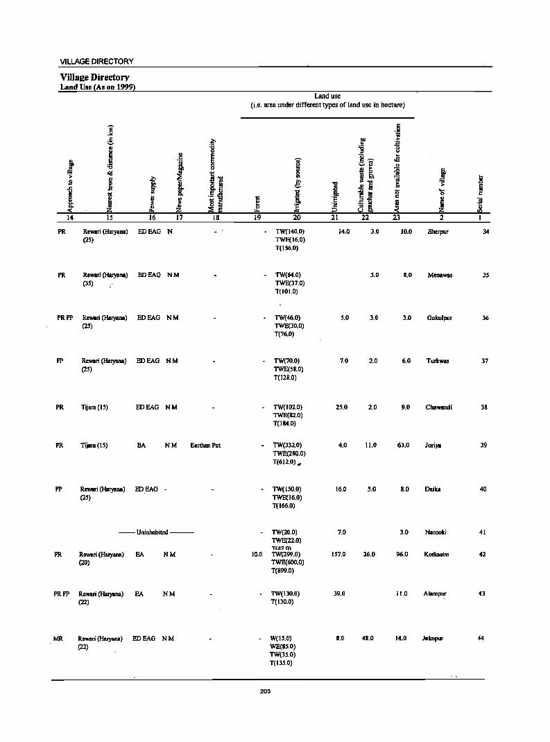
VILLAGE DIRECTORY
ViIIsl!e Directory Land Use {As on 1999}
]' " P ;::. .. :c u c B ·l E
j g ~ " a'!I
.lJ .> >, i s i I 1 "iii It
Ii ! l - '" ~ IS lii ii!:i as ::E E
14 15 16 17 18
PR Rewari (Haryana) EDEAG N (25)
PR Rewari (Haryana) EDEAG NM (35)
PRFP Rewari (Haryana) EDEAG NM (25)
FP Rewari (Haryana) EDEAG NM (25)
PR Tijara (IS) EDEAG NM
PR Tijara (15) EA NM Earthen Pot
FP Rewari (Haryana) EDEAO -(25)
--Uninhabited ---
PR Rewari (Haryana) EA NM (20)
PRFP Rewari (Haryana) EA NM (22)
MR Rewari (Haryana) ED EAG N M (22)
Land use (i.e. area under different types of land use in hectare)
I ~ 19
-
-
-
10.0
'[ '" 0
'" ~ i lID
] 20
TW(140.0) TWE(16.0) T(156.0)
TW(64.0) TWE(37.0) T(JOI.O)
TW(46.0) TWE(30.0) T(76.0)
TW(70.0) TWE(5B.0) T(128.0)
TW(102.0) TWE(B2.0) T(184.0)
TW(332.0) TWE(280.0) T(612.0) ..
TW(lSO.O) TWE(16.0) T(l66.0)
TW(20.0) TWE(22.0) T(4? 0\ TW(299.0) TWE(600.0) T(899.0)
TW(13D.O) T(130.0)
W(IS.0) WE(8S.0) TW(35.0) T(13S.0)
203
1 ·s i2 21
14.0
5.0
7.0
25.0
4.0
16.0
7.0
IS7.0
39.0
8.0
.§ "iii
~ .~ ] "S
u ],.... ...
.e ;::.13 '" B > ~ ~! 7i
~ ..!! Iii ~j g E g ] ~;L
22 23
3.0 10.0
S.O 8.0
3.0 3.0
2.0 6.0
2.0 9.0
11.0 63.0
5.0 8.0
3.0
26.0 96.0
11.0
48.0 14.0
,t ... .> l!
~ 't5 ., ] Ii u
ii!:i en 2
Sherpur 34
Menawas 35
Gokulpur 36
Turkwas 37
Chawandi 38
Joriya 39
Daika 40
NBrooki 41
Kotkasim 42
AI8mpur 43
JBkopur 44

DISTRICT CENSUS HANDBOOK: ALWAR
Census of India 2001 -Panchayat Samiti : Kotkasim (0005) Amenities and
Amenities available (if not available within the village, a dash (-) is.shown in the column and
next to it in brackets the distance in broad ranges viz.<5 kms., 5-10 kms. and 10+ kms of the
I j nearest (!Iace where the facilit~ is aVililable is Biven)
.g l!! i j II> :l.Ll U u II ~ II> II>
i '';: .E! of
c 0 ] .~ = u .~ 0 g ~ 1 ~i ~ ...... .~ u
if g ,t 0 .. i ...l <:> "" .. l~
]<11 __ C!- :8 0 ...... §
.td .;;: ] u 'B] '5 g, ~ s ~ i g 'u .~ § Ii! ~
.... 'iI _g , 1 01 . ~ o'!I,8>6 .., 0 1l ....
1 ].~ 'iI._ ;:s
B ._
~ e 8: 0
f 'H ·f~ ·g~l '§ ~ ~ Ii! ] 11 II>
II> .., E rn 'ili! ~ ~ ._ E t 'iI
! l l ~ ~ t E-'" '1: o 5 ~._ ] !1 ., '0 s:'§ sa !&I e. 1.l,Q ed:~: fa 2 3 4 5 6 7 8 9 10 It 12 13
4S Goojriwas 351.0 941 143 P OM«S) HPTWW (00789900) C(IO+) H(IO+) SS-HP PO«5) CM(5-10) ACS«S) CV(S-IO) BS« S)
MCW(S-IO) PH« 5) CP(IO+) NCS«S) SP(S-IO) RS(IO+) PHC(S-IO) OCS«S) ST(IO+) NW(lO'l-)
46 Baghana 763.0 1,969 281 PM 0 PHS H(IO+) THPTW PO PH ACS (00790000) C(lO+) MCW(IO+) WSS-HP CM(S-IO) NCS(IO+) CV(IO+) BS«S)
PHC(5-10) CP(S-IO) OCS(IO+) 8P(10+) RS(IO+) ST(IO+) NW(IO+)
47 Maswasi@ 278.0 589 9OPM«S) HP TW S8- PH(2)
Madhopuri C(IO+) H(IO") HP PO«S) CM«S) ACS« 5) CV«S) BS«S) (00790100) MCW«S) CP(IO+) NCS«5) Sp{<S) RS(IO+)
PHC«S) OCS«S) ST(IO+) NW(1O+)
48 Kasimpur 189.0 482 53P OM«S) HPTWW PH
(00790200) C«S) H(IO+) SS-HP PO«S) CM«S) ACS«S) CV«S) BS«S) MCW(IO+) CP« S) NCS(IO+)· SP(IO+) . RS(IO+) PHC«S) OCS(IO+) ST(IO+) NW(IOi-)
49 RaniyaWJIS 163.0 223 28 THPTW (00790300) P«S) 8(10+) WSS-HP PO«S) CM«S) ACS« 5) CV«5) BS«5)
M«5) MCW(IO+) PH«5) CP«S) NCS(IO+) SP(IO+) RS(IO+) C(IO+) PHC(IO+) OCS(IO+) ST(IO+) NW(IO+)
so Meoli 390.0 951 167 P M«S) THPTW
(00790400) C(IO+) H(IO+) WSS-HP PO«S) CM«S) ACS(5-10) CV«5) BS«S) MCW(IO+) PH«5) CP« 5) NCS«5) SP(IO+) RS(IO+) PHC« S) OCS«5) st(IO+) NW(IO+)
51 Begampur 99.0 223 32 P OM«5) THPTW BS (00790500) C(lO+) H(IO+) W8S-HP PO{<5) CM«5) ACS(S-IO) CV«S) RS(IO+)
MCW(IO+) PH«S) CP«5) NCS(IOi-) Sp{IO+) NW(IO+) PHC«5) OCS(IO+) ST(IO+)
52 Oangapuri 280.0 592 92P AC 0 HPSS-HP PH CP (00790600) M«S) H{<5) PO«5) CM«S) ACS{<S) CV{<S) BS{< 5)
C«S) MCW(IO+) NCS{IO+) SP(IO+) RS(IO+)' PHC(S-IO) OCS(IO+) ST(IO+) NW(IO+)
53 Ladpur 464.0 1,257 205 P(2) M S 0 HPWSS- POPH(7) (00790700) C«S) H(IO+) HP CM«S) ACS«5) CV«5) BS«5)
MCW(IO+) CP«5) NCS(IO+) Sp{IQ+) RS(IO+) PHC{<S) OCS(IO+) ST(IO+) NW{IO+)
S4 Doomhera 388.0 "i27 1l9P OM«S) HPSS-HP· PH(7) (00790800) C{ID+) H{IO+) PO«5) CM{<S) ACS(S-IO) CV(S-IO) BS(5-IO)
MCW(IO+) CP(S-IO) NCS(IO+) Sp{IO+) RS{IO+) PHC(S-IO) OCS(IO+) ST(IO+) NW(IO+)
S5 Berawas 93.0 )17 2SP OM«S) RMPH{IO+) HPSS-HP Khurtl C(10+) MCW(JO+) PO«S) CM{<S) ACS«5) .' CV(S-IO) BS«5) (00790900) PHC«S) PH{<5) CP«S) NCS(IO+) ,Sp{IO+) RS(IO+)
OCS(IO+) ST(IO+) NW(IO+)
204
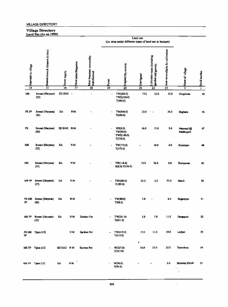
VILLAGE DIRECTORY
VillaKe Directory Land Use {As on 1999~
Land use (i.e. area under different types of land use in hectare)
]' c:: .~
5 .~ 01) .f; c
u -g ~ :; 0 u
~ ~ E 'ij ...
~ .~ E I c ~ .a ._ '" ;;:; 0 ..... u " 0 !! > ~ ~ .;;: lid
~ ~.., Ii! ~ ~ B ~ ~ e :;i II u .fj ... .!!'E ~ .;;:
1 ~ !: "0 i Si g ... ~ j J i 0
~ 1l! '" ~ 'E ., "iii .. o Ii 'E ~ ai ~ Ii ·c
::!: ~ ~ Iii 0
iil::i .,
I:!:o ... sa 14 15 16 17 18 19 20 21 22 23 2 I
MR Rewari (Haryana) EDEAG - TW(200.0) 17.0 13.0 15.0 Goojriwas 4S (22) TWE(106.0)
T(306.0)
PRFP Rewari (Haryana) EA NM TW(696.0) 33.0 34.0 Baghana 46 (26) T(696.0)
PR Rewari (Haryana) EDEAG NM WE(B.O) 16.0 15.0 9.0 Maswasi@ 47 (26) TW(90.0) Madhopuri
TWE(140.0) T(23B.0)
MR Rewari (Haryana) EA NM TW(175.0) 10.0 4.0 Kasimpur 48 (22) T(17S.0)
MR Rewari (Haryana) EA NM - TW(IIB.O) 13.0 16.0 &.0 Raniyawas 49 (23) R(B.O) T(126.0)
MR FP Rewari (Haryana) EA NM - TW(289.0) 24.0 2.0 75.0 Meoli so (27) T(2&9.0)
PRMR Rewari (HaryanB) EA NM · TW(BB.O) 5.0 6.0 Begampur SI FP (26) T(BS.O)
MRFP Rewari (HaryanB) EA NM Earthen POI · TW(26 1.0) 1.0 7.0 11.0 GBngapuri 52 (22) T(26 1.0)
PRMR Tijara (13) NM Earthen Pot · TW(419.0) 15.0 11.0 19.0 Ladpur 53 FP T(419.0)
• MRFP TijBra (12) EDEAG NM Earthen Pot W(327.0) 14.0 25.0 22.0 Doomhera S4
T(327.0)
MRFP Tijara (13) EA NM W(90.0) 3.0 Bcrawas Khurd SS T(90.0)
205
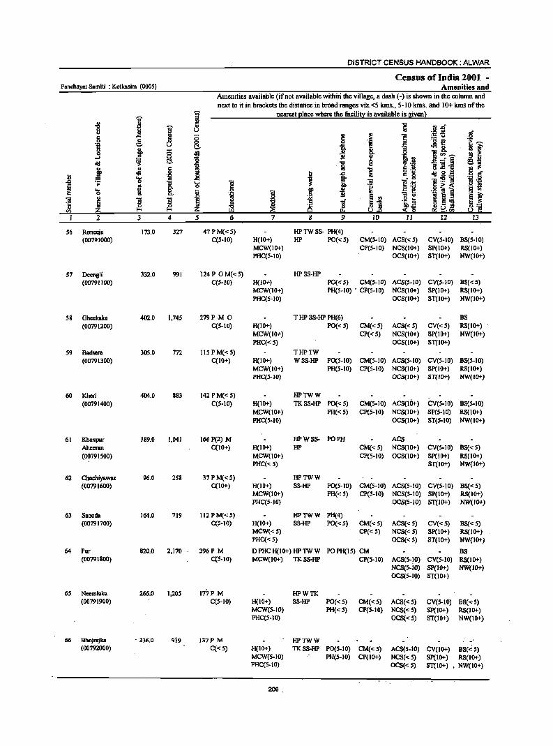
DISTRICT CENSUS HANDBOOK: ALWAR
Census of India 2001 -Panchayat Samiti : Kotkssim (0005) Amenities and
Amenities available (if not available withiri the village, II dash (-) is shown in the oolunm and next to it in brackets the distance in broad ranges viz.<5 kms., 5-10 kms. and 10+ kms of the
i 1 nearest Elace where the facili!l: is available is Biven}
-8
I ] .. ,rr 8 iI u .S! os
.~ 6 .s:: ;; ~ ~ 1! ::!:"i3 c 0 0 .~
i~ ._ {!
~~ ·5 ;;:.. u t::!. i Jl&. j j ;; ~ & ]:~ ~f §. 0
old .;;; i -0 0 , ',Q
Ii " :; ]! ·c -iii: ~
Q) 6 i S .9 .ij g.g lS • ~
fi .Q t .s:: c g ·B § ~
.... i ~ i·~ 1;-g-g .0 0 'S ! ] os .~
~ os
.Eel o~< .~ £! 'S ~ &. ~ i ) .~ i ~j
::I " 'Ol e l
~1: 'iii Q) ]I ]I ~ J tf .!:! D 1·5 ] ·c ~ ~ ~ tibfi ~ .~ Q) 0
en ~ Z ~ ~ Q eg ~sa 2 3 4 5 6 7 8 9 ID II 12 13
S6 Ronccja 173.0 327 47 P M«S) HP TW SS- PH(4) (00791000) C(5-10) H(IO+) HP PO« 5) CM(S-IO) ACS«S) CV(S-IO) BS(5-10)
MCW(lO+) CP(S-IO) NCS(lO+) SP(1O+) RS(IO+) PHC(S-IO) OCS(IO+) ST(IO+) NW(IO+)
57 Deengli 332.0 991 124P OM«S) HPSS-HP (00791100) C{S-IO) H{IO+) PO{<S) CM(S-IO) ACS(S-IO) CY(S-IO) BS«S)
MCW(10+) PH(S-IO) • CP(5-10) NCS(IO+) SP(IO+) RS(IO+) PHC{5-10) OCS(IO+) ST(IO+) NW(IO+)
S8 OheekBka 402.0 1,745 279P M 0 T HP SS-HP PH(6) BS (00791200) C{S-IO) H(IO+) PO« 5) CM«S) ACS« 5) CY«S) RS{IO+)
MCW{IO+) CP«S) NCS(IO+) SP(IO+) NW(IO+) PHC{< S) OCS(IO+) ST(IO+)
S9 Badsam 305.0 772 lIS PM«S) THPTW (00791300) C(10+) H(IO+) WSS-HP PO{S-IO) CM(S-IO) ACS(5-10) CY(S-IO) B8(S-IO)
MCW(IO+) PH(5-10) CP(5-10) NCS(IO+) SP(IO+) RS(IO+) PHC(S-IO) OCS(IO+) ST{IO+) NW{IO+)
60 Kheri 404.0 883 142 PM«S) HPTWW (00791400) C(S-IO) H(IO+) TKSS-HP PO«S) CM(S.IO) ACS(IOt-) CV(S·IO) B8(S·IO)
MCW(1O+) PH« S) CP(S·IO) NCS(IO+) SP(S·IO) RS(IO+) PHC{5-10) OCS(IO+) ST(5-10) NW(IO+)
61 Khanpur 189.0 1,041 I66P(2) M HPWSS- PO PH ACS Ahecmn C{IO+) H(IO+) HP CM«5) NCS(IO+) CV(5.IO) BS«S) (00791500) MCW(10+) CP(S-IO) OCS(IO+) SP(IO+) RS(IO+)
PHC«5) ST(10+) NW(10+)
62 Chachiyawas 96.0 2S8 37PM«5) HPTWW (007916oo) C{IO+) H(IO+) SS-HP PO(S-IO) CM(5-IO) ACS(S-IO) CV(S-IO) BS«5)
MCW(IO+) PH« 5) CP(5-IO) NCS(5-10) SP(IO+) RS(IO+) PHC(5-10) OCS(5-10} ST(IO+) NW(IO+)
63 Sanoda 164.0 719 112 PM«5) HPTWW PH(4) (00791700) C(S-10) H(IO+) SS-HP PO«S) CM«5) ACS{< 5) CV«S) BS«5)
MCW«5) CP« 5) NCS« 5) SP{IO+) RS(IO+) PHC«S) OCS« 5) ST(IO+) NW(IO+)
64 Pur 820.0 2,170 396P M D PHC H(IO+) HP TW W POPH(1S) CM BS (00791800) C{S-IO) MCW(1O+) TKSS·HP CP(5-IO) ACS(S·IO) CV(S·IO) RS(IO+)
NCS(5.iO) SP(IO+) NW(IO+) OCS(5-10) ST(IO+)
6S Nccmlaka 266.0 1,205 1'77P M HPWTK (00791900) C(S-IO) H(IO+} SS-HP PO«S) CM«S) ACS« S) CV(S-IO) BS«5)
MCW(S-IO) PH«S) CP(S-IO) NCS« S) Sp(IO+) RS(IO+) PHC(5-IO) OCS« 5) ST(IO+) NW(IO+)
66 Bhnjrajka ·336.0 919 . t37P M HPTWW -(00792000) C«S) H(IO+) TKSS·HP P0(5.10) CM«S) ACS(5.10) CV(IO+) BS(~5)
MCW(S-IO) PH(S-IO) CP(IO+) NCS« S) Sp(IO+) RS(IO+) PHC{S-IO) OCS« 5) ST(IO+) • NW(IO+)
206
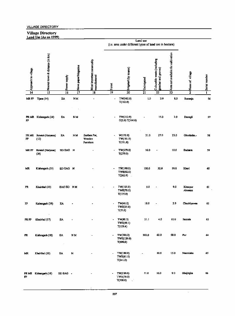
VILLAGE DIRECTORY
Villae;e Directory Land Usc (As on 1999)
j g 8
.~ ., l 't:I
d!I .s: sa ~ .c l;!
! e c. c.
~ ~ 14 15
MRFP Tijara (14)
PR MR Kishangarh (24) FP
PRMR Rewari (Haryana) FP (12)
MRFP Rewari (Haryana) (24)
MR Kishangarh (25)
PR Khairthal (3S)
FP Kishangarh (28)
PRFP Khairthal (17)
PR Kishangarh (18)
MR Khairthal (30)
~ ~
~ eo 16
EA
EA
EA
ED BAG
ED BAG
BAOEO
EA
EA
EA
EA
PRMR Kishangarh (II) EDEAG FP
~
'8 ., E ., E 8
I] I ·!i ! IS f.i ~ E
17 18
NM
NM
NM Earthen Pot, Wooden Furniture
N
N
NM
NM
N
-
Land use (i.e. area under different types ofland use in hectare)
~ "" 19
-
-
-
..,. ~ Ii! e: i 'E .. 20
TW(162.0) T(162.0)
TW(l I 2.0) 0(2.0) T(114.0)
W(ISO.O) TW(IBI.O) T(33 1.0)
TW(279.0) T(279.0)
TW(IBO.O) TWE(82.0) T(262.0)
TW(loS.O) TWE(70.0) T(17S.0)
TW(40.0) TWE(3S.0) T(7S.0)
TW(80.3) TWE(49.1) T(129.4)
TW(280.0) TWE(120.0) T(400.0)
TW(IIO.O) TWE(61.0) T(24 1.0)
TW(230.0) TWE(70.!I) T(300.0)
207
= 0 'ij
ou >
~ '.;:l :; u
]-;;;- .e ._, '" '" I! ~
'ii "0 ~ i ..!! Iii
~ la '0 'E = 2"5
~ ~ "3 '" s.2~ 21 22 23
1.0 2.0 8.0
15.0 1.0
21.0 27.0 23.0
16.0 10.0
100.0 32.0 10.0
S.O 9.0
18.0 2.9
21.1 4.0 10.0
302.0 60.0 5S.0
10.0 15.0
11.0 16.0 9.0
~ jj .s: E .... " 0 .. .,
~ Oi '1: '" !'!.!
2 I
Roneeja S6
DeenSIi 57
Gheekaka." 58
Baclsara 59
Kheri 60
Khanpur 61 Aheeran
Chac:hiyaWlS 62
Sanoda 63
Pur 64
Neemlaka 65
Bhojrajka 66
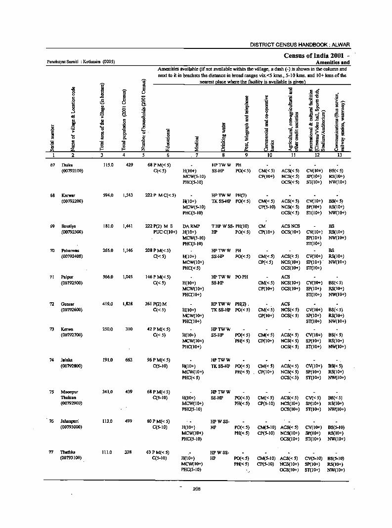
DISTRICT CENSUS HANDBOOK: ALWAR
Census of India 2001 -Panchayat Samiti : Kotkasim (0005) Amenities and
Amenities available (if not available within the village, a dash (-) is shown in the column and
next to it in brackets the distance in broad ranges viz.<5 krns., 5-10 kms. and 10+ krns of the -;;;- nearest 21ace where the facili!l: is available is Biven 1
~ I I ~ .. .rf
8 u ~~ 5 l! C; §
., e <:> 'i
._ ~ 'j u l::!. '& ~ 0
i C; ~ ]~'"' ...l ~ ~ ]
$i b _ft Ii
de! i u ] ].t: j .s c 1 0
~ J de! g.g .. 'il ..8 .s: 'a "5 'a. 'ii ~ 'ii:2]
~ os 0.. C .§] i ... ~ 8. .8 0 'ii 0 '&:1 ., g <>
]I
~ B ~ :0 " ._
!:I ~ ~ :i ej] fI)
1 2 3 4 5 6 . 7 12
67 Daika 115.0 429 68PM«S) HPTWW PH (00792100) C«S) H(IO+) 88-HP PO«S) CM«S) ACS«S) CV(IO+) 88« 5)
MCW(S-IO) CP(IO+) NCS«5) SP(I,O+) RS(IO+) PHC(S·IO) OCS«'S) ST(IO+) NW(IO+)
68 Karwar 594.0 I,S43 222P MC«S) HPTWW PH(7) (00792200) H(IO+) TKSS-HP PO«S) CM« 5) ACS«S) CV(IO+) 8S«S)
MCW(5-10) Cp(5·10) NCS«S) SP(IO+) RS(lO+) PHq5-10) OCS«5) 8T(10+) NW(IO+)
69 Ikrotiya 181.0 1,441 222P(2) M S DARMP T HP W SS- PH(IO) CM ACSNCS BS (00792300) pucqIO+) H(IO+) HP PO« S) cp(10+) OCS(IO+) CV(IO+) RS(1O+)
MCW(S-IO) Sp(IO+) NW(IO+) PHq5-10) 8T(10+)
70 Paharwas 265.0 1,146 208 PM«S) HPTWW PH BS (00792400) C«S) H(IO+) SS-HP PO« 5) CM« S) ACS(<:S) CV(IO+) RS(IO+)
MCW(lO+) CP«S) NCS(IO+) SP(IO+) . NW(IO+) PHq<S) OCS(IO+) 8T(10+)
71 Palpur 566.0 1,045 146 P M« S) HPTWW PO PH AC8 (00792500) C« 5) H(IO+) SS-HP CM«5) NCS(IO+) CV(IO+) B8« 5)
MCW(IO+) CP(IO+) OCS(IO+) SP(IO+) RS(IO+)
PHC(IO+) ST(IO+) NW(IO+)
72 Gunsar 419.0 1,828 261 P(2)M HPTWW PH(2) . ACS (00792600) C« 5) H(IO+) TKSS-HP PO« 5) CM«5) NCS« 5) CV(IO+) B8«5)
MCW(IO+) CP(IO+) OCS« 5) 8P(10+) RS(IO+) PHC(IO+) 8T(10+) NW(IO+)
73 Kerwa 250.0 310 42 PM« S) HPTWW (00792700) C« S) H(IO+) SS-HP PO«S) CM«S) AC8« S) CV(IO+) B8« S)
MCW(IO+) PH« 5) CP(IO+) NCS« 5) SP(IO+) RS(IO+) PHC(IO+) OCS«5) ST(IO+) NW(IO+)
74 Jalaka 191.0 662 96 P M« 5) HPTWW .";
(00792800) CCS-IO) H(IO+) TKSS-HP PO«S) CM«5) ACS« 5) CV(IO+) BS«5) MCW(IO+) PH« 5) CP(lO+) NCS« 5) SP(JO+) RS(IO+) PHC« 5) OCS«S) ST(IO+) NW(IO+)
75 Moonpur 341.0 439 68 P M« 5) HPTWW Thakran C(5-IO) 1:1(10+) SS-HP PO«S) CM«S) ACS«S) CV«5) BS«5) (00792900) MCW(IO+) PH«S) CP(S-IO) NCS(IO+) Sp(IO+) RS(IO+)
PHC(5-10) OCS(IO+) ST(IO+) NW(IO+)
76 Jahanpuri 113.0 499 80 P M«S) HPWSS-(00793000) C(5-10) H(IO+) HP PO«S) CM(S-IO) ACS«S) CV(IO+) BS(S-IO)
MCW(IO+) PH«S) CP(S-IO) NCS(IO+) Sp(IO+) RS(IO+) PHCCS-IO) OCS(IO+) ST(IO+) NW(IO+)
77 Thatbka 111.0 328 63 P M«5) HPWSS-(00793100) C(5-10) H(IO+) HP PO«S) CM(S-IO) "'CS«S) CV(S-IO) B8(S-10)
MCW(IO+) PH«S) CP(S-IO) NCS(lO+) SP(lO+) RS(IO+) PHC(S-IO) OCS(lO+) 8T(l0+) NW(IO+)
208
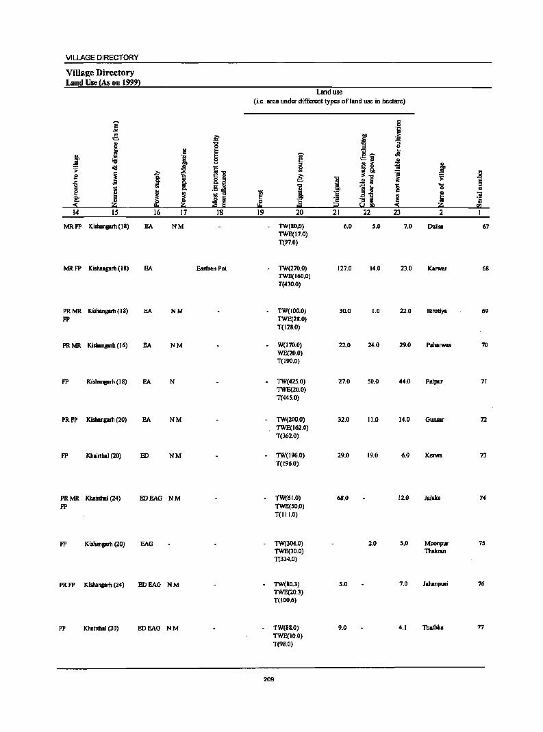
VILLAGE DIRECTORY
Villal1;e Directory Land Use {As on 19991
Land use (i.e. area under different types of land use in hectare)
]' c 0
'-&1 e ~
.. .. .5 ~ 8 -g u
J u E c; ... c
j .~ g -.;- .5 ";;' oS e ~ u ..
f u ;:I B ~ ~ j "<:I i ... .s:
i ~ 51 ~.: ~ J! g g: ·!l ~ I ~ :;:
~ l .!! Iii 0 ... Ii
I .,
I ~~ 0 c
~ J ~ ;; c .,
"iI ~ Iii e ·2 :;§, ~ 5 '5
~ ·5 :!!: :E Ii I::! t2 !.! ~ 5Q
14 15 16 17 18 19 20 21 22 23 2
MRFP Kishangarh (18) EA NM TW(80.0) 6.0 5.0 7.0 Daika 67 TWE(17.0) T(97.0)
MRFP Kishangarh (18) EA Earthen Pot - TW(270.0) 127.0 14.0 23.0 Karwar 68 TWE(160.0) T(430.0)
PRMR Kishangarh (IS) EA NM TW(IOO.O) 30.0 1.0 22.0 Ikroliya 69 FP TWE(28.0)
T(128.0)
PRMR Kishangarh (16) EA NM W(17D.O) 22.0 24.0 29.0 P.halWBS 70 WE(20.0) T(19O.0)
FP Kishangarh (18) EA N TW(42S.0) 27.0 50.0 44.0 Palpur. 71 TWE(20.0) T(445.0)
PRFP Kishangarh (20) EA NM TW(200.0) 32.0 11.0 14.0 Gunsar 72 TWE(162.0) T(362.0)
FP Khairthal (20) ED NM TW(I96.0) 29.0 19.0 6.0 Kerwa 73 T(196.0)
PRMR Khainhal (24) EDEAG NM TW(61.0) 68.0 12.0 JaJab 74 FP TWE(SO.O)
T(II 1.0)
FP Kishangarh (20) EAG TW(304.0) 2.0 5.0 Moonpur 75 TWE(30.0) Thakran T(334.0)
PRFP Kishangarh (24) EDEAG NM - TW(SO.3) s.o 7.0 Jahanpuri 76 TWE(20.3) 1(100.6)
FP Khairthal (20) EDEAG NM - 1W(8S.0) 9.0 4.1 Thathka 77 TWE(IO.O) T(9S.0)
209
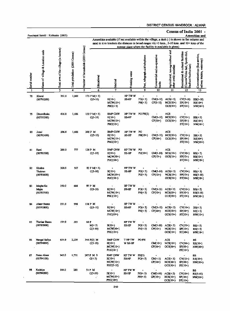
DISTRICT CENSUS HANDBOOK: ALWAR
Census of India 2001 -Panchayat Samiti : Kotkasim (0005) Amenities and
Amenities available (if not available within the village, a dash (-) is shown in the column and
next to it in brackets the distance in broad ranges viz.<5 kms., 5-10 kms. and 10+ kms of the
i ~ nearest l!lace where the facilit;t is available is Biven}
'" ~ ] fJ .0" "'" ~ .,
0 U u ., ;g-5 of c .c !!! ;; Ii u
1 .~ f 0 e '" 0 .~ ]1 OJ u t::!- .c G .t B' g ;;
i ] f lrl ] ~"~ ...:I 0
~~ ~ .;; t::!- "'" '2 o!: 1$ :; ]'c ~ ~
c f9 ] o ._ u 0 S r:!
] .~ _g I 1 5~ <III g .~ = .... "iii ]:5!"'g
.~ 0 .;: 0 :; .... "iii ~~ .~ '1 § ..
"" 0 c 'g .f~ ~ i .... ~ 0 ~ 0 00 u § f c 0 "" .~ "iii .5 B :; tl
] .,
S ~ .0 U
~ §X! it ~ ~ ._ ~ § :.a l ~i ~
.g u 'c o Ii H'- ] " :a::; Z !:!l ~ g ~& ~ ~~!i(;! !i(;!
I 2 3 4 5 6 7 8 9 10 11 12 13
78 Kheral 351.0 1.069 175 P M« 5) HPTWW (00793200) C{5-10) H(IO+) SS-HP PO«5) CM(S-IO) ACS«S) CV(5-10) B8(5-10)
MCW(IO+) PH«5) CP(S-IO) NCS(ID+) SP(IO+) RS(lO+) PHC«5) OCS(IO+) ST(IO+) NW(IO+)
79 Dheerdhoka 416.0 1.106 159 P M« 5) RMPCHW HPTWW POPH(3) ACS (00793300) C(5-10) H(IO+) SS-HP CM(S-IO) NCS(IO+) CV(IO+) BS« S)
MCW(IO+) CP(IO+) OCS(IO+) SP(IO+) RS(IO+) PHC{IO+) ST(IO+) NW(IO+)
80 Jonal 396.0 1.406 200P M RMPCHW HPTWW PO ACS (00793400) C{5-10) H(IO+) SS-HP PH(I 0+) CM(5·10) NCS(IO+) CV(IO+) BS« 5)
MCW(IO+) CP(IO+) OCS(IO+) SP(IO+) RS(IO+) PHC{IO+) ST(IO+) NW(IO+)
81 Kani 200.0 177 128P M RMPCHW HPTWW PO ACS (00793500) C(5-10) H(IO+) SS-HP PH(IO+) CM(S-IO) NCS(IO+) CV(IO+) BS« 5)
MCW(IO+) CP(IO+) OCS(IO+) SP(IO+) RS(IO+) PHC(IO+) ST(IO+) NW(IO+)
82 Khohra 308.0 567 82 P M« 5) HPTWW Thakran C(5-10) H(IO+) SS-HP PO«5) CM(5·10) ACS«5) CV(IO+) BS« 5) (00793600) MCW(IO+) PH«5) CP(IO+) NCS(IO+) Sp(IO+) RS(5-10)
PHC(IO+) OCS(IO+) ST(JO+) NW(IO+)
83 MaghaKa 250.0 684 97P M HPTWW Majra C{5-10) H(IO+) SS-HP PO«5) CM(5-1O) ACS«S) CV(lO+) BS« 5) (00793700) MCW(IO+) PH«5) CP(JO+) NCS(IO+) SP(IO+) RS(5-10)
PHC(IO+) OCS(IO+) ST(IO+) NW(IO+)
84 AheerBasna 221.0 998 158P M HPTWW . (00793 800) C(5·1O) H(IO+) SS-HP PO«5) CM(5-10) ACS«S) CV(lO+) BS« 5)
MCW(IO+) PH«5) CP(IO+) NCS(IO+) SP(IO+) RS«5) PHC(IO+) OCS(JO+) ST(lO+) NW(lO+)
85 Thethar Basna 197.0 393 60P HPTWW (00793900) M«5) H(IO+) SS-HP PO«S) CM(S-IO) ACS«5) CV(IO+) BS«5)
C(S-lO) MCW(lO+) PH«S) CP(lO+) NCS(IO+) SP(IO+) RS« 5) PHC{IO+) OCS(IO+) ST(lO+) NW(IO+)
86 Nangal Saliya 654.0 2,239 344P(2) M RMPCHW THPTW PO PH ACS BS (00794000) C(5-10) H(IO+) WSS-HP CM(IO+) NCS(IO+) CV(IO+) RS(IO+)
MCW(IO+) CP(IO+) OCS(IO+) Sp(IO+) NW(IO+) PHC{IO+) ST(lO+)
87 PatanAheer 343.0 1.771 287P M S RMPCHW HPTWW PH(3) BS (00794100) C«S) H(IO+) SS-HP PO«S) CM«S) ACS«S) CV(IO+) RS(IO+)
MCW(IO+) CP(IO+) NCS(lo+) Sp(IO+) NW(tO+) PHC{S-lO) OCS(IO+) ST(1O+)
88 Kadaiya 164.0 280 SIP M HPTWW BS (00794200) C(S-.I0) H(IO+) SS-HP PO«S) CM(S-IO) ACS«S) CY(IO+) RS(S-tO)
MCW(tO+) PH«5) CP(IO+) NCS(IO+) SP(IO't) NW(IO+) PHC{IO+) OCS(IO+) ST(IO+)
210
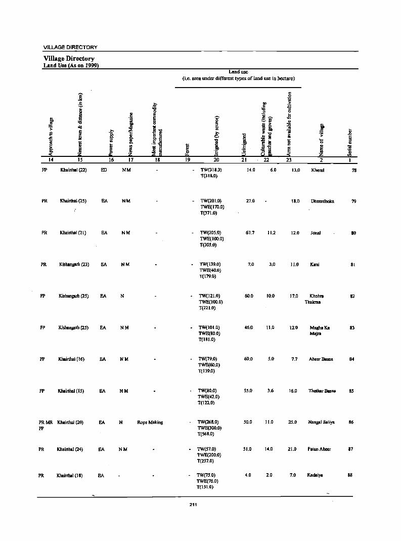
VILLAGE DIRECTORY
ViIla2e Directory Land Use {As on 1999}
Land use (i.e. orca under different types of land use in hectare)
.- c ] 0
'ij
~ .~ bO .~ c
.1 "8 :;; "5 .. " u E u .. c E -;; c'- .e j '1 0 ~
;::.~ u 't:I <.> .. > ~ J ~ ~ .. 5.., 5l - ~
i ~ ~ ~.., 'iii l; s '6 e e; .., ~ .s: .c
.c !!!" ..
0.:'1 i ..!! 5i E
i j .. ~
.5 ~ I ~~ '0 't:l ::I 0. C
J ~ t;; 'E c .. iii ! Ii I'! .:a u
~ ~ ~ 'E ~ Qi °5
Zi Z ~ .. ~ U>
14 IS 16 17 18 19 20 21 22 23 2
FP Khairlhal (22) ED NM - TW(118.3) 14.0 6.0 11.0 Kheral 78 T(3IS.0)
PR Khairlhal (25) EA NM - TW(201.0) 27.0 111.0 Dheerdhoka 79 TWE(170.0) T(171.0)
PR Khairlhal (21) EA NM TW(20S.0) 67.7 11.2 12.0 Jonal 80 TWE(100.0) T(JOS.O)
PR Kishangarh (23) EA NM TW(139.0) 7.0 3.0 11.0 Kani 81 TWE(40.0) T(179.0)
FP Kishangam (25) EA N TW(I 2 1.0) 60.0 10.0 17.0 Khohra 82 TWE(IOO.O) Thakran T(22 1.0)
FP Kishangam (25) EA NM TW(IOI.O) 46.0 11.0 12.0 MaghaKB 83 TWE(SO.O) MBjra T(ISI.O)
FP Khairthal (16) EA NM TW(79.0) 69.0 5.0 7.7 AheerBasnB 84 TWE(60.0) T(139.0)
FP Khairthal (15) EA NM TW(80.0) 55.0 3.6 16.0 Thelhar Basna S5 TWE(42.0) T(l22.0)
PRMR Khairthal (20) EA N RopeMBking TW(268.0) 50.0 11.0 25.0 Nangal SBliya 86 FP TWE(lOO.O)
T(S6S.0)
PR Khairthal (24) EA NM - TW(S7.0) 51.0 14.0 21.0 Palan Aheer 87 TWE(200.0) T(2S7.0)
PR Khairlhal (18) EA - TW(7S.0) 4.0 2.0 7.0 Kadaiya 88 TWE(76.0) T(ISI.O)
211
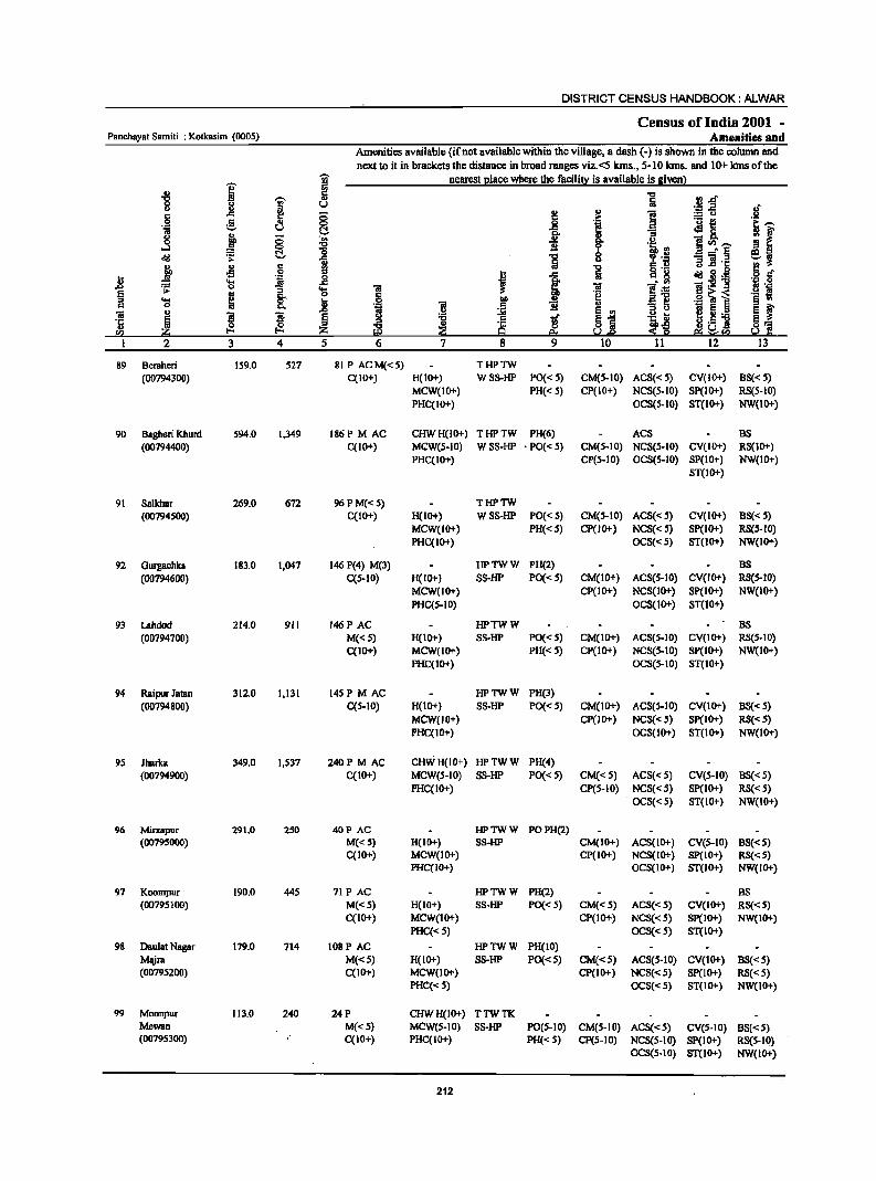
DISTRICT CENSUS HANDBOOK: ALWAR
Census of India 2001 -Panchayat Samiti : Kotkasim (0005) Amenities and
Amenities available (if not available within the village, a dash (-) is shown in the column and
next to it in brackets the distance in broad ranges viz. <5 kms., 5-10 kms. and 10+ Ions of the
i I nearest Elace where the facilill:': is available is givenl ~
~ ., ] .J :aft S ~ u of
.~ 5 ::; J .,
~ :.= u
'if g 0 1 ._ e
u t::!- aR ()
~ ::; J ::I C '" .!.! ~Ul __
...:I 0 ] '.! ~ ~ ~ ~ 8 '3 'ii .~ e;,~
j .fl 6 .,
1 s:: ., u..s:: ..
!!l
J ..s:: 8'g ~ ~ .i 5 c:f 11 '::1 0
'l:I '" ..c ~ . '" 'N .~ ~ '3 os 'iI ii! B'~ !'_ "B ~ e .~
.9 ~ i ._ ; .... §: .. 6
~ !!f ii ~1! ~ ~ 0 ., '.0:1
S '" '3 0 OJ
., S S
.c
j :.;;;i '5, ~ ~ ~._ ~ ~ s:: ..r §1 '1:
~ ~ ..
~ IS J! ._] ~1 ., ~ !!:~ !02 ~ eo I.!.e ~U)
2 3 4 5 6 7 8 9 10 11 12 13
89 Bemheri 159.0 527 81 P ACM«5) THPTW (00794300) C(IO+) H(IO+) WSS-HP PO«5) CM(S-IO) ACS« S) CV(IO+) BS« S)
MCW(IO+) PH« S) CP(IO+) NCS{S-IO) SP{IO+) RS(S-IO) PHC{IO+) OCS{S-IO) ST(IO+) NW(1O+)
90 Bagheri Khurd S94.0 1,349 186P MAC CHWH(IO+) THPTW PH(6) ACS BS (00794400) C(lO+) MeW(S-IO) WSS-HP • PO« 5) CM{S-IO) NCS(S-IO) CV(IO+) RS(IO+)
PHC(IO+) CP(S-IO) OCS{S-IO) SP(IO+) NW{IO+) ST{IO+)
91 Salkhar 269.0 672 96 P M{< 5) THPTW
(00794500) C(IO+) H(IO+) W S5-HP PO«S) CM(S-IO) ACS«S) CV(IO+) BS« S) MCW(IO+) PH«S) Cp(IO+) NCS« S) Sp(IO+) RS(S-IO) PHC(IO+) OCS«S) ST(1O+) NW{IO+)
92 Gurgachka 183.0 1,047 146 P(4) M(3) HPTWW PH(2) BS
(00794600) C(S-IO) H(IO+) SS-HP PO« S) CM(IO+) ACS(5-10) CV(IO+) RS(S-IO) MCW(IO+) CP(IO+) NCS(IO+) SP(IO+) NW(IO+) PHC(S-IO) OCS(1O+) ST(10+)
93 Lahdod 214.0 911 I46P AC HPTWW BS (00794700) M{<S) H(IO+) SS-HP PO«S) CM(IO+) ACS(S-IO) CV(IO+) RS(S-IO)
C(IO+) MCW(IO+) PH{<S) CP(IO+) NCS{S-IO) Sp(IO+) NW(IO+) PHC(IO+) OCS(S-IO) ST(IO+)
94 Raipur Jamn 312.0 1,131 145P M AC HPTWW PH(3)
(00794800) C(S-IO) H(IO+) SS-HP PO«S) CM(lO+) ACS(S-IO) CV(IO+) BS«S) MCW(IO+) CP(lO+) NCS«S) SP(IO+) RS«S) PHC(IO+) OCS{IO+) ST(IO+) NW(IO+)
9S Jharka 349.0 1,537 240 PM AC CHWH(IO+) HPTWW PH(4) (00794900) C(IO+) MCW{S-IO) SS-HP PO« S) CM« 5) ACS«S) CV{5-10) BS«5)
PHC(IO+) CP(5-10) NCS{< S) SP(IO+) RS{<5)
OCS« 5) ST(IO+) NW(IO+)
96 Mirzapur 291.0 250 40P AC HPTWW POPH(2) (00795000) M«S) 8(10+) SS-HP CM(IO.j.) ACS(IO.j.) CV(S-IO) BS«5)
C(IO+) MCW(IO+) CP(IO.j.) NCS(IO+) SP(IO+) RS«S) PHC(IO+) OCS(IO+) ST(IO+) NW(IO+)
97 Koompur 190.0 445 71 PAC HPTWW PH(2) BS (00795100) M«5) H(IO+) SS-HP po{<5) CM«5) ACS«5) CV(IO+) RS«5)
C(IO+} MCW(IO+} CP(IO+) NCS«5} SP(IO+) NW(IO+) PHC«5) OCS«S) ST(IO+)
98 Daulat Nagar 179.0 714 I08P AC HPTWW PH(IO) Majra M«5) H(IO+) SS-HP PO«5) CM«5) ACS(S-IO) CV(IO+) BS«5) (00795200) C(10+) MCW(IO+) CP(IO+) NCS«S) Sp{IO+) RS«5)
PHC«5) OCS«S) ST(IO+) NW(IO+)
99 Moonpur 113.0 240 24P CHWH(IO+) TTWTI< Mewan M«S) MCW(S-IO) SS-HP PO(5-10) CM(S-IO) ACS«S) CV(S-IO) BS«S) (00795300) C(IO+) PHC(IO+) PH« S) CP(5-10) NCS(S-IO) SP(IO+) RS(S-IQ)
OCS(S-IO) ST(IO+) NW(IO+)
212
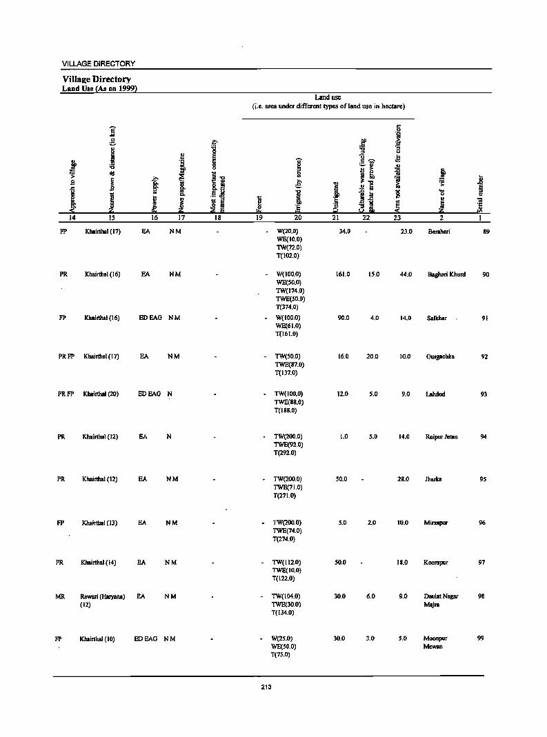
VILLAGE DIRECTORY
Village Directory Land Use {As on 1999~
Land use (i.e. area under different types ofland use in hectare)
]" c 0 °ii
e .~ 00 > .5 '.;:1
" ." ] "3 u
'" 0 u
B E U ... c 'il" .e j '1:1 E c ~ .!!!
._ ., 8 ~
~ ., ., ." ::I' B > ~ ~ ~ oij
i"" 0
~! 1 ~ ~ .. 7a u B B: &.~ e: ." 1:; '> ...,
§. ., ..!! Iii § .c ijl i eo. 1;1 1;; r:l. .5 ~ 1 1~ 0 0 c
j j ~ i ~ 'c c ., ;a ~ Iii '" ! 'E ~ 8 m. e 'c ~ Iii
., !:!:o ... ~ en
14 15 16 17 18 19 20 21 22 23 2
FP Khairthal (17) EA NM W(20.0) 34.0 23.0 Beraheri 89 WE(IO.O) TWe72.0) T(102.0)
PR Khairthal (16) EA NM W(100.0) 161.0 15.0 44.0 Bagheri Khurd 90 WE(SO.O) TW(174.0) TWE(SO.O) T(374.0)
FP Khairthal (16) EDEAG NM - W(IOD.O) 90.0 4.0 14.0 Salkhar 91 WE(61.0) T(161.0)
PRFP Khairth81 (17) EA NM - TW(SO.O) 16.0 20.0 10.0 Gurgachka 92 TWE(87.0) T(137.0)
PRFP Khairthal (20) EDEAG N - TW(lOO.O) 12.0 5.0 9.0 Lahdocl 93 TWE(88.0) T(188.0)
PR Khairthal (12) EA N - TW(200.0) 1.0 5.0 14.0 Raipur Jatan 94 TWE(92.0) T(292.0)
PR Khairthal (12) EA NM - TW(200.0) 50.0 28.0 Jharka 95 TWE(71.0) T(271.0)
FP Khairthal (13) EA NM - TW(200.0) 5.0 2.0 10.0 Mirzapur 96 TWE(74.0) T(274.0)
PR Khairthal (14) EA NM - TW(1I2.0) 50.0 18.0 Koompur 97 TWE(IO.O) T(l22.0)
MR Rewari (Hal}'llllll) EA NM - TW(104.0) 30.0 6.0 9.0 Daulat Nagar 98 (12) TWE(30.0) Majra
T(134.0)
FP Khairthal (10) EDEAG NM W(2S.0) 30.0 3.0 5.0 Moonpur 99 WE(SO.O) Mewan T(7S.0)
213
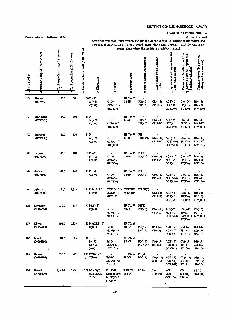
DISTRICT CENSUS HANDBOOK: ALWAR
Census of India 2001 -Panchayat Sam iii : Kotkasim (0005) Amenities and
Amenities available (if not available within the village, a dash (-) is shown in the column IUId
next to it in brackets the distance in broad rIUIges viz.<5 klns., 5-10 kms. IUId 10+kms of the 'in' nearest elace where the facili!l: is available is Biven}
j ::I
" fl "5 i'j..o "C 'W 8 u (.) ... .e ,,-J! ., 1:! " i § 5 g .j ;.:;: u .!:l c
J ]il t:~ ·ti ;::. u C!, ~ f .3 j ;; ., go ]~-0 ~ B lB ::I .,
old ~ C!, .", 8 .... ....:~ ~j !i s "3 ]! .c
~ " § "5 g .~ ~ ~.~ 5 r! -5 f J Ii; .... .~ _g _ 5! ;a:5!1l Oil .e
.D .;;: 0 "3 .... ] ;a ]:6 .!:l ~ E os g- o 'f:! §~< ::I .... ~ .8 ·1 .~ .- ~ ~ ~ c 0 0. ;a !! ... "3 !:i ;a II)
f! ]I ~ ~ ~ 'ii e~ u ... ~ 5._
·c ~ § s ·ll ~~! §== II) o· ~ "C ~ g ~ '" 1-0 !.!:l U&E! &.l c:
2 3 4 5 6 7 8 9 10 11 12 13
100 Shorwa 153.0 501 BOP AC HPTWW
(00795400) M«5) H(IO+) SS-HP PO« 5) CM« 5) ACS« 5) CV(IO+) BS«5) C(lO+) MCW(IO+) PH«5) CP(IO+) NCS«5) SP(lO+) RS«S)
PHC(IO+) OCS(IO+) ST(IO+) NW(IO+)
101 Shahjadpur 144.0 266 38 P HPTWW (00795500) M«S) H(IO+) SS-HP PO« S) CM(5-10) ACS« 5) CV(S-IO) BS(5-10)
C(IO+) MCW(S-IO) PH(<S) CP(5-10) NCS« 5) SP(IO+) RS(S-IO) PHC(lo+) OCS(IO+) ST(IO+) NW(IO+)
102 Sadhooica 165.0 335 41 P HPTWW PH
(00795600) M«s) H(IO+) SS-HP PO(5-1O) CM(5-1O) ACS« 5) CV(5-10) BS(5-IO) C(IO+) MCW(5-10) CP(S-IO) NCS(S-IO) Sp(IO+) RS(S-IO)
PHC(IO+) OCS{s-IO) ST(IO+) NW(IO+)
103 Jhiryana 105.0 400 52P AC HPTWW PH(2)
(00795700) M«S) H(IO+) SS-HP PO« 5) CM«5) ACS«S) CV(S-IO) BS«5) C(IO+) MCW(5-10)· CP«5) NCS«s) Sp(IO+) RS«5)
PHc(lo+) OCS«5) ST(IO+) NW(IO+)
104 Shahpur 48.0 947 lSI P M HPTWW PH (00795800) C(lO+) H(IO+) SS-HP PO« 5) CM(5-IO) ACS«S) CV(5-10) BS(5-I()
MCW(S-IO) CP(s-IO) NCS(5·10) Sp(IO+) RS(s·IO) PHC(IO+) OCS(S·IO) ST(IO+) NW(IO+)
105 Jatiyana 356.0 1,310 191 PM 8 AC CHWH(IO+) THPTW POPH(6)
(00795900) C(lO+) MCW(S-IO) W SS-HP CM«S) ACS«S) CV(S-IO) B8«S) PHC« 5) CP(s-IO) NCS«s) SP(IO+) RS«S)
OCS« 5) ST(IO+) NW(IO+)
106 Ramnagar 137.0 415 77 PM«s) HPTWW PH(2) (00796000) C(IO+) H(IO+) SS-HP PO« 5) CM(5-10) ACS«5) CV(5-10) BS«s)
MCW(5-IO) CP(5-1O) NCS«5) SP+R RS«5) PHC(IO+) OCS(5.10) [6]C(10+) NW(IO+)
ST(IO+)
107 Kirwari 196.0 1,420 18SP ACM«5) HPTWW (00796100) C(IO+) H(IO+) SS-HP PO«S) CM«S) ACS«5) CV«5) BS«5)
MCW«s) PH«5) CP«5) NCS«5) SP(IO+) RS«5) PHC(IO+) OCS«5) ST(IO+) NW(IO+)
108 Lisani 89.0 186 30 HPTWW (00796200) P«5) H(IO+) SS-HP. PO« 5) CM«5) ACS«5) CV«S) BS«5)
M«5) MCW«S) PH« 5) . CP« 5) NCS(IO+) SP(IO+) RS«S) (10+) PHC(IO+) OCS(IO+) ST(IO+) NW(IO+)
109 _Girwas 355.0 1,629 230 P(2) M« 5) HPTWW PH(6) (00796300) , C(IO+) H(IO+) SS-HP PO«S) CM(5-10) ACS«5) CV(S-IO) BS(5.10)
MCW(s-IO) CP(s-IO) NCS«5) SP(IO+) RS(5-10) PHC(IO+) OCS(5-10) ST(IO+) NW(IO+)
110 Hanoli 1.464.0 8,060 1.276 P(3) M(2) DARMP THPTW PO PH CM ACS CV BSRS (00796400) S(2) PUC(2) CHWH(IO+) SS-HP CP(S-IO) NCS(IO+) Sp(IO+) NW(IO+)
C(IO+) MCW(IO+) OCS(IO+) ST(IO+) PHc(lo+)
214
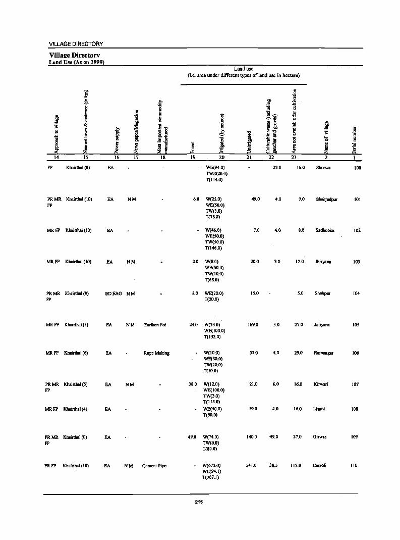
VILLAGE DIRECTORY
ViIlaee Directory Land Use {As on 1999l
Land use (i.e. area under different types of land use in hectare)
j '" .~ e .~
00 c ~ " "8 :s u " 0
.; !! E u .. ~ 'i E 1 c - .s .., 8 ;:..:1 " ~ eli!
~ ... ~ ~
I t ~ I] 5l ~ ~ :; ,lg I; s .e: 1 .!Ii ~ .s:: .c
] l .5 i "8 ~.! '0 .... §
j 0 c
J 1 ~ ~ i 'E c II> iii ! Iii .a u ~ Iii ~ am, '1: 0 :§ " ~ ::::g Iii I:!= ::!!: ~ !GI
14 15 16 17 18 19 20 21 22 23 2 1
FP Khainhal (0) EA WE(94.0) 23.0 16.0 Shorwa 100 TWE(20.0) T(114.0)
PRMR Khainhal (10) EA NM 6.0 W(2S.0) 49.0 4.0 7.0 Shabjadpur 101 FP WE(SO,O)
TW(3.0) T(7B.O)
MRFP Khairthal (10) SA W(46.0) 7.0 4.0 8.0 Sadhooka 102 WE(SO.O) TW(SO.O) T(I46.0)
MRFP Kh.irthBI (10) SA NM 2.0 W(B.O) 20.0 3.0 12.0 Jhiryana 103 WE(SO.O) TW(lo.o) T(6B.0)
PRMR Khairthal (9) HOEAO NM 8.0 WE(20.0) 15.0 5.0 Shahpur 104 FP T(20.0)
MRFP Khairthal (8) EA NM Earthen Pot 24.0 W(33.0) 169.0 3.0 27.0 Jatiyana 105 WE(tOO.O) T(133.0)
MRFP Khainhal (6) BA Rope Making W(IO.O) 53.0 5.0 29.0 Ramnagar 106 WE(30.0) TW(tO.O) T(SO.O)
PRMR KhainbBI (5) EA NM 3B.O W(12.0) 21.0 6.0 16.0 Kirwari 107 FP WE(IOO.O)
TW(3.0) T(IIS.0)
MRFP Khairthal (4) EA WE(SO.O) 19.0 4.0 16.0 Lisani lOB T(50.0)
PRMR Khainhal (0) BA 49.0 W(74.0) 140.0 49.0 37.0 Girwas 109 FP TW(6.0)
T(RO.O)
PRFP Khainhal (10) EA NM Cement Pipe W(673.0) 541.0 3B.S 117.0 HBrsoli 110 WE(94.1) T(767.1)
215
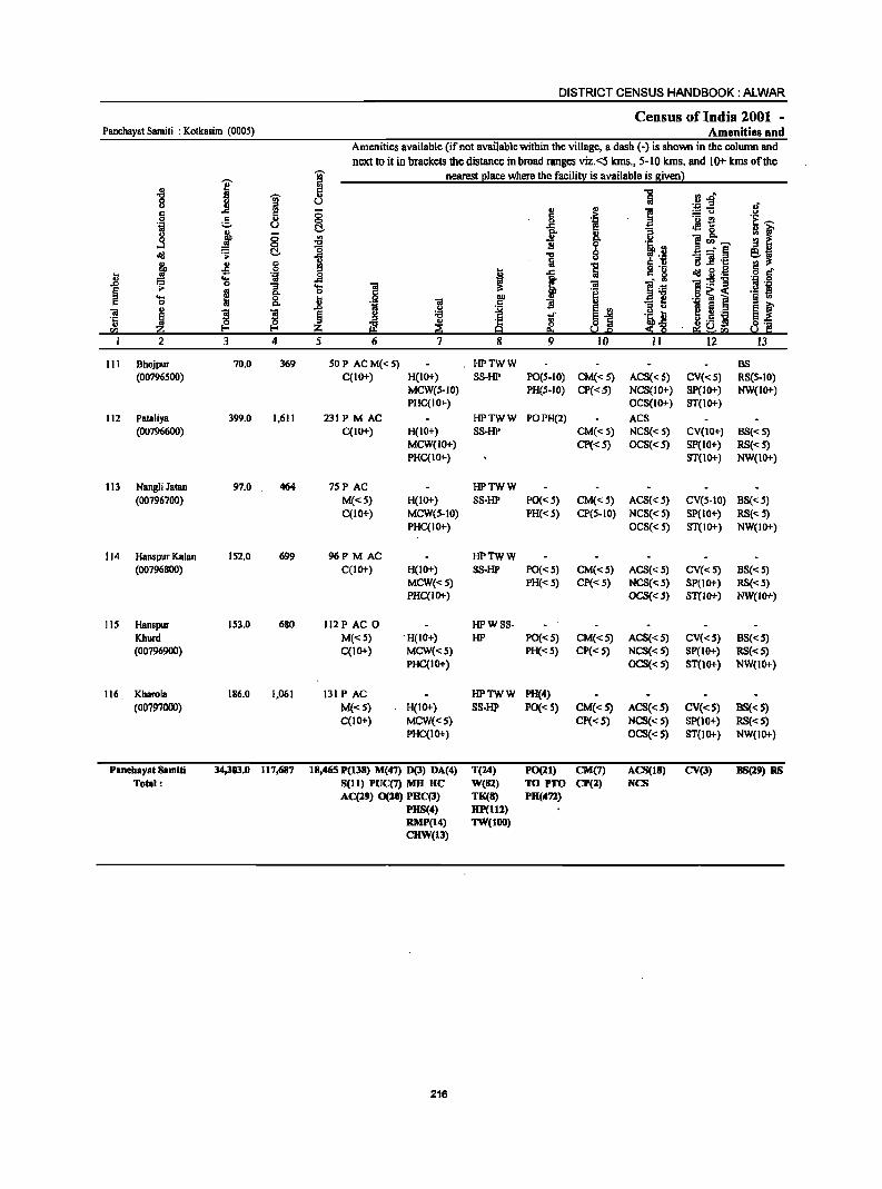
DISTRICT CENSUS HANDBOOK: ALWAR
Census of India 2001 -Panchayat Samiti : Kotkasim (0005) Amenities and
Amenities available (if not available within the village, a dash (-) is shown in the column and
next to it in brackets the distance in broad ranges viz.<5 kms., 5-10 kIns. and 10+ kIns of the
I j nearest I!lace where the faci1i!l! is available is Biven}
-8 j 5 -a
·B~ 8 u :a u' III
5 8 '" 1 c ..c ;; > :.= u .!:! 0 g 0 .~ 'u -e i:;-'+:1 U t:!. ..c ~ 0 ;[ 8 t ~ ~ f ~ u 5~~ ..l
~ ] 8 l! _- e ~
.., "3] .~ !9.~
~ £ § " a 'E !9 .... ~nl .:d il .~ .J 6' ~ ... .~ _g ~ I 1 l~ ]:9'g
1 .;;: 0 "3 'E "iii .= ~ go c
.9 ~ i .~ ~ ... ~ 0 l 0 "" 1 "iii "3 ~
" .D " e ., I ii._ e t "iii
~ ~ 11 ~ '6 +oJ'
~] .~ ~ .5 i '':
t2 '" ~ ~ a] " ~ ~~ !a !!l ~~<Il 2 J 4 5 6 7 8 9 10 II 12 IJ
111 Bhojpur 70.0 369 SOP ACM«5) HPTWW BS (00796500) C(IO+) H(IO+) SS-HP PO(S-IO) CM«5) ACS« 5) CV«S) RS(S-IO)
MCW(S-IO) PH(S-IO) CP«S) NCS(IO+) SP(lo+) NW(IO+) PHC(IO+) OCS(IO+) ST(IO+)
112 Pataliya 399.0 1,611 231PMAC HPTWW PDPH(2) ACS (00796600) C(IO+) H(lO+) SS-HP CM«5) NCS« 5) CV(IO+) BS«5)
MCW(IO+) CP«5) OCS«5) SP(IO+) RS«5) PHC(lO+) ST(10+) NW(IO+)
113 NBRllli JataR 97.0 464 7SP AC HPTWW (00796700) M«5) H(IO+) SS-HP PO«S) CM«S) ACS« S) CV(S-IO) BS«S)
C(IO+) MCW(5-10) PH«S) CP(S-IO) NCS«S) SP(IO+) RS«5) PHC(IO+) DCS« 5) ST(IO+) NW(IO+)
114 Hanspur Kalan 152.0 699 96P M AC HPTWW (00796800) C(IO+) H(IO+) SS-HP PO«5) CM«5) ACS« 5) CV«5) BS«S)
MCW«S) PH« S) CP« S) NCS« 5) SP(lO+) RS«S) PHC(lOt-) OCS«S) ST(IOt-) NW{IOt-)
115 Hanspur 153.0 680 112 PAC 0 HPWSS-Khurd M«S) . H(IO+) HP PO« 5) CM«5) ACS«5) CV«5) BS«5) (00796900) C(1Ot-) MCW«S) PH«5) Cp« 5) NCS«5) SP(lOt-) RS« 5)
PHC(IO+) OCS« 5) ST(1O+) NW{IO+)
116 Kharola 186.0 1,061 I3I PAC HPTWW PH(4) (00797000) M«S) H(IO+) 88-HP PO«S) CM«S) ACS« 5) CV«S) BS«S)
C(10+) MCW«S) CP«S) NCS{< S) SP(IO+) RS«5) PHC(IOt-) OCS{<S) ST(lO+) NW(IO+)
Panebayat Samiti 34,303.0 117,687 18,465 P(ll8) M(47) 0(3) DA(4) T(24) PO(ll) CM(7) ACS(18) CV(l) BS(19) as Total: Sell) PUC(7) MH HC W(81) TOPTO CP(l) NCS
AC(29) 0(20) PHC(l) TK(8) PH(472) PHS(4) HP(112) RMP(14) TW(lOO) CHW(13)
216
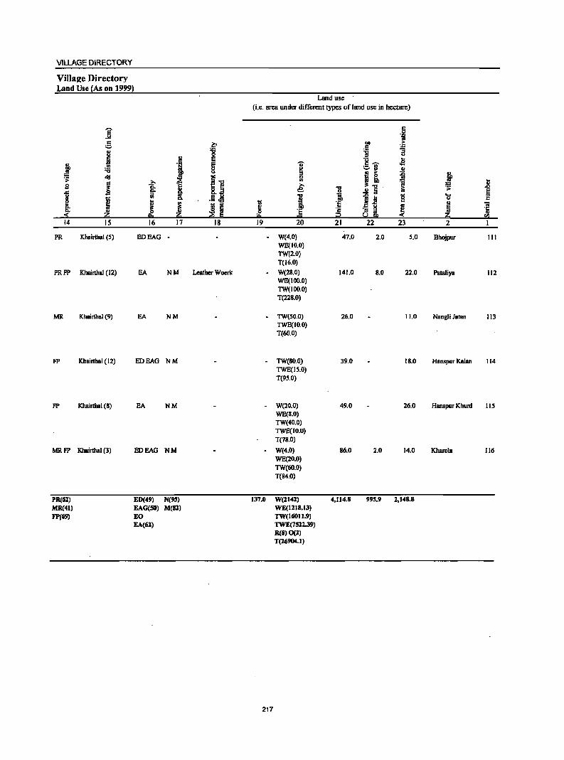
VILLAGE DIRECTORY
Village Directory Land Use (As on 19991
Land use (Le. area under different types ofland use in hectare)
]' c 0 ·i
g ~ bO > C ~ 8 :;; :;;
III 0 :;J u
Ii e u ~ c oB ,t } e "U c ~
~ 0 ~ ;:.8 ..
u II .. ~ ~ .f> ~
11 0
~! 1 .. :; il s ~ .e: =
I 1! ..!! Iii iii .;: e 1 1 i ~ :; 0 "- is I .5 oI!I 0
J 1;1 ·e c ..
£ _ :;J
Efi Of "iii
t ~ ~ !! ·2 a i ~ ~ .5j
III 0 ·e 2:i i!= = i2 CIl
14 15 16 17 18 19 20 21 22 23 2 I
PR Khairthal (5) EDEAG - W(4.0) 47.0 2.0 5.0 Bhojpur 1I1 WE(IO.O) TW(2.0) T(16.0)
PRFP Khairthal (12) EA NM Leather Woerk W(28.0) 141.0 8.0 22.0 Pataliya 1I2 WE(IOO.O) TW(IOO.O) T(228.0)
MR Khairthal (9) EA NM - TW(50.0) 26.0 11.0 Nangli Jatan 113 TWE(IO.0) T(60.0)
FP Khairtbal (12) EDEAG NM - TW(80.0) 39.0 18.0 Hanspur Kalan 114 TWE(IS.O) T(9S.0)
FP Khairthal (8) EA NM - W(20.0) 49.0 26.0 Hanspur Khunl 115 WE(8.0) TW(40.0) TWE(IO.O) T(78.0)
MRFP Khairthal (3) EDEAG NM - W(4.0) 86.0 2.0 14.0 Kharola 116 WE(20.0) TW(60.0) T(84.0)
PR(61) ED(49) N(95) 137.0 W(ll4l) 4.114.8 99S.!! 1.148.8 MR(41) EAG(50) M(8l) WE(ll18.13)
FP!69) EO TW(16011.9) EA(lil) TWE(75ll.J9)
R(8)O(l) T(lIi904.I)
217

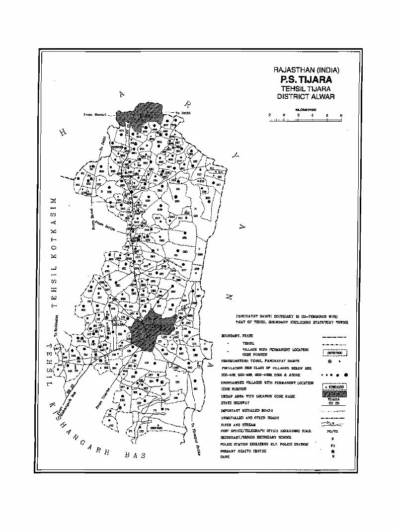
BAS
2
RAJASTHAN (INDIA) P.S. TIJARA TEHSIL TIJARA
DISTRICT ALWAR
K1LOMIITAES
u 2 4
PANCIIAYAT SAlIl1'l llOllNDARY IS CO-TERMINllS WITH
II
'rHA'r or '11!!lSIL BOllNDAI!Y EXCLllDlNG STATll1'OJlY 'roWN9.
BOllNDARY, STATE
TEn51!.
VILLAGE TIlTH PERMANENT !.DCA TION CODE NUIoIBF.R
HIlADQllARTERS: TEHSIL, PANCHAYAT SAIlITI
POPULATION SIZE CLASS OF VILLAGe;: BELOW 200.
2IlO-499, 000-999, lOOO-4!l91J, 5000 Ir. AIIlV":
UNINHABITED VILLAGI!S WITH PERMANENT LOCATION
COilE NUIJIIF;R
URJ!AN AREA lVITJI LOCATION CODE NAME
STATE HIGHWAY
IMPORTANT IoIETAll.ED ROADS
UNIlETAu.ED AND O'l'IIEI! ROADS
RIVER AMD S'fREAM
POST OFFICE/TELEGRAPH OfTICE EXCLUDING RMoS,
Sil:ONDARY ISENIOR SF.CONDARY SCHOOl
PDIJ(,'t; S'I'A71DN EXCI,UJl(NO RLY, POI.ICE STATION
1'llIMARY II£ALTII CENTRE
BANK
r--(iim7ioo---! , ................... 1
®
• ••••
~ PO/TO
S
PS
r5 II

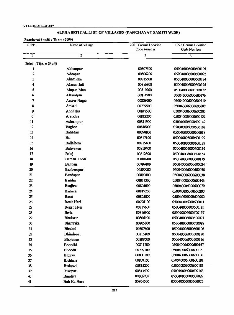
VILLAGE DIRECTORY
ALPHABETICALLISf OF VILlAGES (PANCHAYATSAMITIWISE)
PanchayatSamiti: Tijal"ll (0006)
SI.No. Name of village 200 I Cens us weat ion 1991 Census Location Code Nlmb er Code Number
'2 3 4
Tehsil: Tijara (Full)
1 Abhanpur 00807500 050040006000600105 2 Adeepur 00806200 050040006000600092 3 Ahamlaka 00815500 050040006000600184
4 Alapur Jatt 00816800 050040006000600196
5 Alapur Meo 00810200 050040006000600132 6 Alawalpur 00814700 050040006000600176 7 AmeerNagar 00808000 050040006000600110
8 Amlaki 00797900 05004000600060000
9 Andhaka 00817500 05004000600060023 10 Arandka 00812200 050040006000600152 11 Asleempur 00811900 050040006000600149 12 Baghor 00816000 05~00188
13 Bahadari 00798800 050040006000600018 14 Bai 00817100 050040006000600199 15 Baijalhera 00815400 050040006000600183 16 BaIiyawas 00810400 050040006000600134
17 Baloj 00812500 050040006000600154
18 BamanThedi 00808900 050040006000600119
19 Banban 00799400 050040006000600024 .
20 Banbeerpur 00800000 050040006000600030
21 Bandapur 0080080O 050040006000600038
22 Bandra 00811300 050040006000600143
23 Banjhra, 00804000 050040006000600070
2A Barhera 00817200 050040006000600200
25 Basai 00805000 050040006000600080
26 BeelaHeri 00798100 050040006oo0600(lll
Zl Began Heri 00815600 050040006000600185
28 Berla 00816900 050040006000600197
'19 Bhalesar 00804100 050040006000600071
30 Bhamraka 00805800 050040006000600088
31 Bhatkol 00807600 050040006000600106
32 Bhindoosi 00815100 050040006000600180
33 Bhojawas 00808600 050040006000600 116
34 Bhoodki 00811700 050040006000600147
35 Bhoodli 00799100 050040006000600021
36 Bibipur 00800100 050040006000600031
37 Bichhala 00807100 050040006000600101
38 Bichpuri 00815200 050040006000600181
39 Bilaspur 00813400 050040006000600163
40 Binoliya 00806900 050040006000600099
41 Bub Ka Hera 00804500 05~0006000600075
221
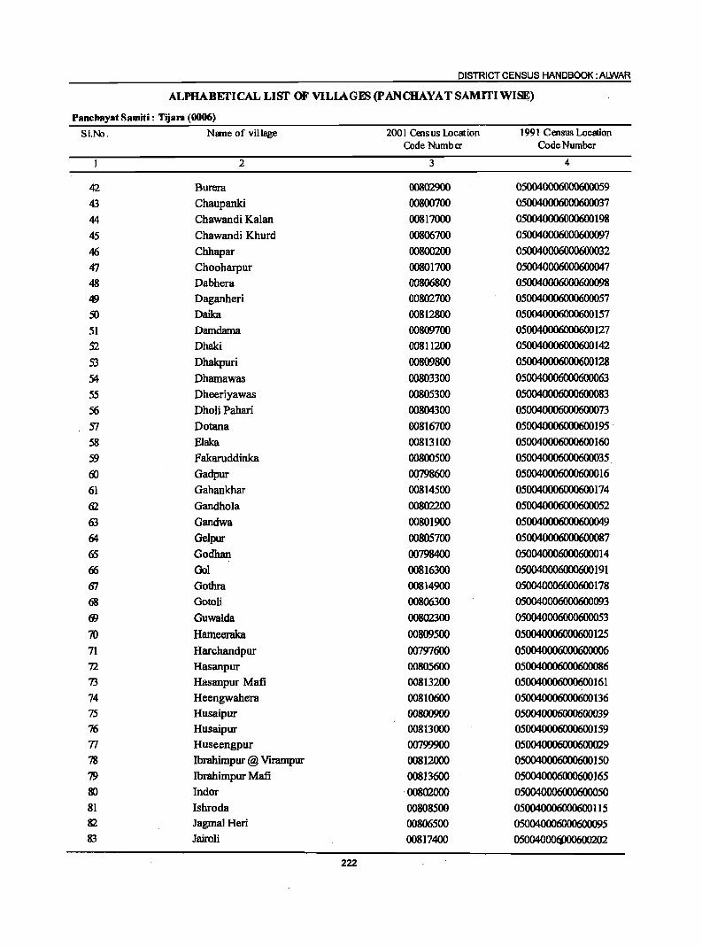
DISTRICT CENSUS HANDBOOK: ALWAR
ALPHABEI'ICALLISI' OF VILIAGJ!S (pANCHAYAT SAMITIWlSE)
Panchayat Samiti : Tijam (0006)
SI.No. Name of village 2001 Census location 1991 Census Location Code Number Code Number
2 3 4
42 Burera 00802900 050040006000600059
43 Chaupanki 00800700 050040006000600037
44 Chawandi Kalan 00817000 050040006000600198
45 Chawandi Khurd 00806700 050040006000600097
46 Chhapar 00800200 050040006000600032
47 Chooharpur 00801700 050040006000600047
48 Dabhera 00806800 050040006000600098
49 Daganheri 00802700 050040006000600057
50 Daika 00812800 050040006000600157
51 Damdama 00809700 050040006000600127
S2 Dhaki 00811200 050040006000600142
53 Dhakpuri 00809800 050040006000600128
54 Dhamawas 00803300 050040006000600063
55 Dheeriyawas 00805300 050040006000600083
56 Dholi Pahari 00804300 050040006000600073
S7 Dotana 00816700 050040006000600195 .
58 Elaka 00813100 050040006000600160
59 Fakaruddinka 00800500 050040006000600035 (j) Gadpur OQ798600 050040006000600016
61 Gahankhar 00814500 050040006000600174
62 Gandhola 00802200 050040006000600052
63 Gandwa 00801900 050040006000600049
64 Gelpur 00805700 050040006000600087
65 Godhan 00798400 050040006000600014
66 Gol 00816300 050040006000600191
67 Gothra 00814900 050040006000600178
68 Gotoli 00806300 050040006000600093 fJ) Guwalda 00802300 050040006000600053
70 Hameeraka 00809500 050040006000600125
71 Harchandpur 007CJ7f1.X) 050040006000600006
72 Hasanpur 00805600 050040006000600086
73 Hasanpur Mafi 00813200 050040006000600161
74 Heengwahera 00810600 050040006000600 136 75 Husaipur 00800900 050040006000600039 76 Husaipur 00813000 050040006000600159
77 Huseengpur 00799900 050040006000600029
78 Ibrahimpur @ Virampur 00812000 050040006000600150
79 Ibrahimpur Mafi 00813f1.X) 050040006000600165 IK) Indor ·00802000 050040006000600050 81 Ishroda 00808500 0500400QfI.X)Q600115 82 JagmaJ Heri 00806500 050040006000600095 83 Jairoli 00817400 050()4(){)()(j)()(
222
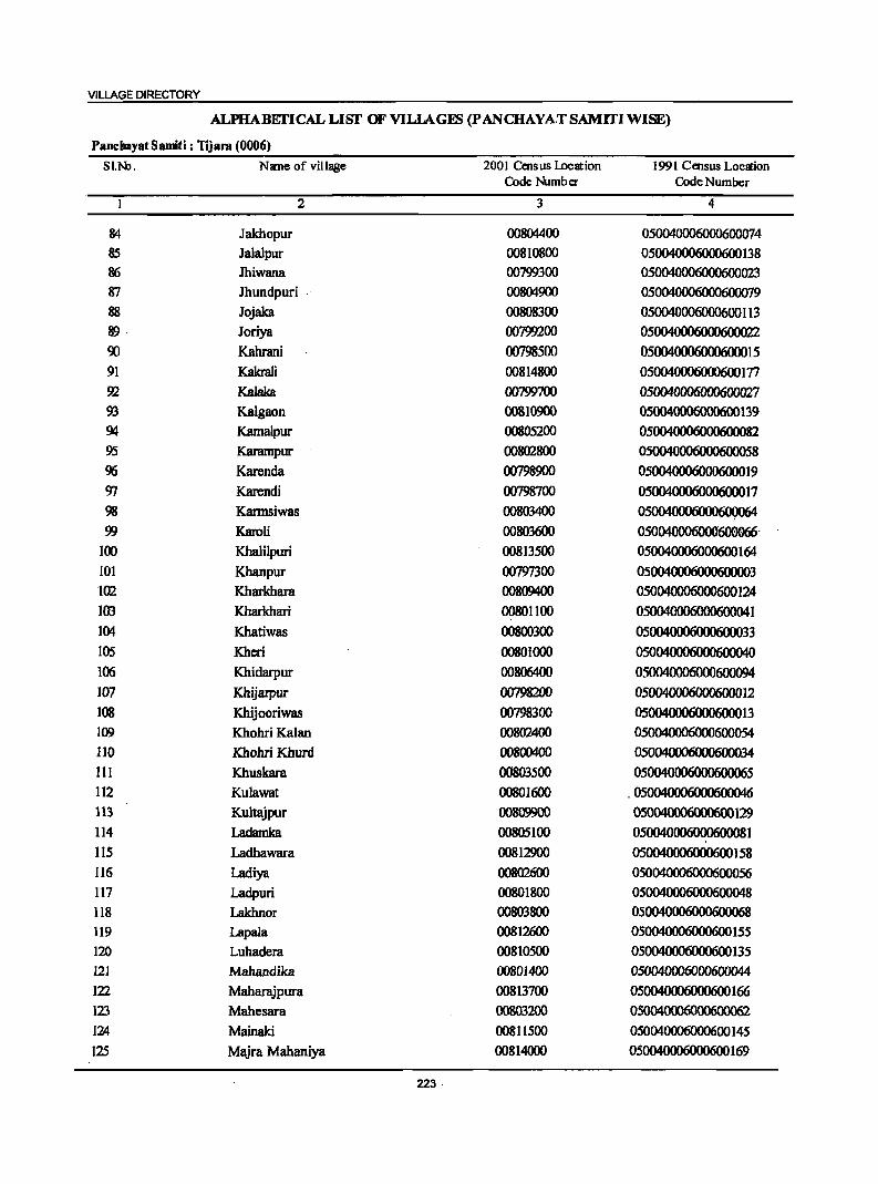
VILLAGE DIRECTORY
ALPHABEfICAL LIST' OF VILLAGEB (P ANCHAYAT SAMITIWlSE)
PanchayatSamiti: TJjara (0006)
SI.N>. Name of village 2001 Census Location 1991 Census Locaion Code Nlmb er Code Number
2 3 4
84 Jakhopur 00804400 050040006000600074 85 Jalalpur 00810800 050040006000600138 1!6 Jhiwana 00799300 050040006000600023 87 Jhundpuri 00804900 050040006000600079 88 Jojaka 00808300 050040006000600113 89 Joriya 00799200 050040006000600022 'Xl Kahrani 00798500 050040006000600015 91 KaIaaIi 00814800 050040006000600177 92 Kalaka 00'lWl00 050040006000600027 93 Kalgaon 00810900 050040006000600139 94 Kamalpur 00805200 050040006000600082 95 Karampur 00802800 050040006000600058 96 Karenda 00798900 050040006000600019 CJ7 Karendi 00798700 050040006000600017 98 Kannsiwas 00803400 05004000600060Q064 99 Karoli 00803600 050040006000600066-
100 Khalilpuri 00813500 050040006000600164 101 Khanpur 00797300 050040006000600003 102 Kharkhara 00809400 050040006000600124 103 Kharkhari OO8011oo 05004000600060001 104 Khatiwas 00800300 050040006000600033 105 Kheri 00801000 050040006000600040 106 Khidarpur 00806400 050040006000600094 lCJ7 Khijarpur 00798200 050040006000600012 108 Khijooriwas 00798300 050040006000600013 109 Khohri Kalan 00802400 050040006000600054 110 KhohriKhurd 0080040O 050040006000600034
III Khuskara 00803500 050040006000600065 112 Kulawat 00801600 _ 05004000600060004
113 Kultajpur 00809900 050040006000600129 114 Ladamka 00805100 050040006000600081 115 Ladhawara 00812900 050040006000600158 116 Ladiya 00802600 050040006000600056 117 Ladpuri 00801800 050040006000600048 118 Lakhnor 00803800 050040006000600068 119 Lapala 00812600 050040006000600155 120 Luhadera 00810500 050040006000600135 121 Mahandika 00801400 05D04OOO6DOO6OOO44 122 Maharajpura 00813700 050040006000600166 123 Mahesara 00803200 0500400060006000 124 Mainaki 008 II 500 05004D00600D600145
125 Majra Mahaniya 00814000 050040006000600169
223·
DISTRICT CENSUS HANDBOOK: ALWAR
ALPIIABEI'ICALLISI' OF VILLAGm;; (pANCHAYATSAMlTIWlSE)
Panc:hayatSamiti: Tijara (0006)
SI.No. Name of village 2001 Census Location 1991 Census Location Code Number Code Number
2 3 4
126 Majra Peepli 00808800 050040006000600118 127 Majri Goojar 00811000 050040006000600140 128 Maliyar Gurjar 00815900 129 Maliyar Jatt 00813300 050040006000600162 130 Mandha 00814400 050040006000600173 131 Maseet 00805500 050040006000600085 132 Matawas 00806600 050040006000600096 133 Mayapur 00802500 050040006000600055 134 Meethiyawas 00804600 . 050040006000600076 135 Milakpur Goojar 00797400 050040006000600004 136 MiIakpur Turk 00806100 050040006000600091 137 Milakpuri 00809200 050040006000600122 138 Mirchooni 00804800 050040006000600078 139 Mosampur 00814600 050040006000600175 140 Mundana 00810700 050040006000600137 141 Mundana Meo 00798000· . 050040006000600010 142 Muradwas 00812100 050040006000600151 143 Musari 00804700 050040006000600077 144 Musepur 00816600 050040006000600194 145 Nabi Nagar 00808200 050040006000600112 146 Nanagheri 00807200 050040006000600102 147 Nanga] 00810000 050040006000600130 148 Naugawan 00805400 050040006000600084 149 Naugawan 00815300 050040006000600182 150 Naurangabad 00813900 050040006000600168 151 NeemIi 00816100 050040006000600189 152 Nibaheri 00803900 050040006000600069 153 Pahar Samlat @ Roondh Roopbas . oo8C9600 ·050040006000600126
154 Pahar Samlat @ Rundh Baghor 00816200 050040006000600190 155 Palasali 00812700 050040006000600 156 156 Palpur 00810300 050040006000600133 157 Patan Kalan 00805900 050040006000600089 158 Patan Khurd 0080600O 05004000600060009 159 Pathredi 00800600 0S0040006000600036 160 Pavti 00807400 050040006000600104 161 Peeplana 00808100 050040006000600111 162 Phalsa 00799000 050040006000600020 163 Phullabas 00816400 050040006000600192 164 Rabadka 00803100 050040006000600061 165 Rabhana 00807300 050040006000600 103 166 Rafunatnagar 00812400 167 RaiKhera 00814200 050040006000600171 168 Raipur 00815700 050040006000600 186
224
VILLAGE DIRECTORY
ALPHABEI'ICAL LISf OF VILlAGES (p ANCHAYAT SAMITIWlSE)
PanchayatSamiti: Tijara (0006)
SI.N:l. Name of village 2001 Census lDemjon 1991 Census Location Code Number Code Number
2 3 4
169 Rajdhoki 00811800 050040006000600148
170 Ram Nagar 00815000 050040006000600179
171 Rambas Jhonpri 00809000 050040006000600120
172 Rampura 00797700 050040006000600007 .
173 Roopbas 00810100 050040006000600131
174 Rundh Gol 00815800 050040006000600187
175 Rundh Indor 00802100 050040006000600051 176 Salahera 00807000 050040006000600100 177 Salarpur 00803000 050040006000600060
178 Salarpur 00809100 050040006000600121
179 Santhalka 00797500 050040006000600005 180 Sare Kalan 00801200 050040006000600042
181 Sare Khurd 00801300 050040006000600043
182 Sarhheta 00812300 050100014001400153
183 Sarkanpur 00808700 050040006000600117
184 Seethal 00797100 05004{)()()6()()()6(1
185 Shadipur 00807800 05~108
186 Shahbad 00811400 050040006000600144
187 Shahdod 00797800 050040006000600008
188 Shahmat Nagar 00814100 05~170
189 Shahpur 00799800 050040006000600028
190 Shekbpur Aheer 00808400 050040006000600114
191 Shekbpur Jatt 00816500 050040006000600193
192 Siroli Kalan 00807700 050040006000600107
193 Siroli Khurd 00807900 05~109
194 Soorawas 00813800 050040006000600167
195 Tajalka 00809300 050040006000600123
196 Tapookra 00803700 050040006000600067
197 Tatarpur 00799500 050040006000600025
198 Teehli 00814300 050040006000600172
199 Thara 00799600 050040006000600026
200 Thons 00817300 050040006000600201
201 Tohra 00811600 050040006000600146
202 Ubaraka 00804200 050040006000600072
203 Udaipur 00797200 050040006000600002
204 Udaipur 00811100 05~141
205 Udhanwas 00801500 050040006000600045
225
DISTRICT CENSUS HANDBOOK: ALWAR
Census of India 2001 -Panchayat Samiti : Tijara (0006) Amenities and
Amenities available (if not available within the village, a dash (-) is shown in the column and next to it in brackets the distance in broad ranges viz.<5 kms., 5-10 kms. and 10+ kms of the
I ~ nearest (!Iace where the facili!): is available is I!!ven}
-8 ~
5 '"Cl
.~~ 8 u fa of .. .. ;; I) I) 1! :.= u .2 .. 5 ... 0 c .,
§_ ....
B ._ ~
i:.-. 10 ~ u "& ~ eMs.
= r j ~ ~ :;
~ .... u ]<n.--1i 0 ·t·i oIlI .;;: -£ i 8 -=§ ~J
. ~ .. J ~ ~.a::
j "5 o ._
d!I 2 .~ .~ 5-II oS I 1 c 8
~ .... - '" 1:E1l 0 '"'0 iii "i! e·=: .~ 'iI
~ .. ::s
B .~ o ~ « 'S ~ 8- II 1 .,
~w ._ ~ .. '" .... 'J:! OJ 1i ~f ] '~ f! ! e j .2 S e '" .~ D ! 5.~ ""0 E"'" .= 11 (!. Z ~ ~ &;ij s~
o ._ rLl ""~' ,."" ·eo E!I ~ra Sol C 1 2 ... . .3 4 5 6 7 8 9 10 11 12 13
Paneb!}'~t,SamltL: Tijara (0006)
Se1:thal 27S.0 1,332 21SP M AC FWCH(IO+) HPTWW PH(IO) (Q(l797100) C(lO+) MCW(S-IO) SS·HP PO«S) CM«S) ACS«5) CV(S·IO) 8S« 5) ........
PHC(S-IO) CP«5) NCS(S·IO) SP(S-IO) RS(lO+) OCS(S·IO) ST(IO+) NW(lO+)
2 Udaipur 167.0 3,137 711 PAC HPTWW PH (110797200) M«S) H(IO+) SS·HP PO«5) CM«S) ACS«5) CV«5) 8S« S)
C(IO+) MCW(d) CP(IO+) NCS(S-IO) SP«S) RS(IO+) PHC« S) OCS(S-IO) ST(lO+) NW(IO+)
3 Kl!8npilr .• ; 209.0 1,892 333 P 'AC HPTWW
(0~.z~3.~~t. M«S) H(IO+) TKSS-HP PO«S) CM«S) ACS«S) CV«S) 8S« 5) C(IO+) MCW«S) PH« S) CP«S) NCS(S-IO) Sp«5) RS(IO+)
PHC«S) OCS(S-IO) ST(IO+) NW(IO+)
4 lMi!8Iq»!r':'"-i:i\, 482.0 4,41S 941 HPTWW PH(23) CMCP BS
.c=St¥· P«S) H(IO+) TKSS-HP PO« 5) (5-10) ACS« 5) CV«5) RS(IO+) M«5) MCW«S) NCS« 5) SP(S·IO) NW(IO+) C(IO+) PHC«S) OCS«S) ST(S·IO)
S ·;~5.~r~
221.0 5,130 1,375 P'M S HPTWW PH(12) C(10+) H(lO+) TKSS-HP PO«5) CM«S) ACS«S) CV«S) BS«S)
MCW«5) CP«S) NCS«S) SP(IO+) RS(IO+) PHC«S) OCS«S) ST(lO+) NW(IO+)
6 H~kffiirid~l.i 211.0 3,S83 1,021 PM«S) HPTWW PH (00].97600) C(IO+) H(IO+) TKSS·HP PO{<') CM«') ACS«') CV«,) BS«5)
MCW«5) CP« 5) NCS«S) Sp(IO+) RS«S) PHC« S) OCS«S) ST(IO+) NW(IO+)
7 Rall)pum".,, 128.0 1,789 385 P M«S) HPTWW PH(2) CV (00797700) C(IO+) H(IO+) TKSS·HP PO«5) CM«S) ACS«S) SP(IO+) BS« 5)
MCW(IO+) CP(IO+) NeS«S) ST(IO+) RS« ~) PHC«S) OCS«5) NW(IO+)
8 Shahilo'il '.' 154.0 1,376 181 PM(S·IO) HPTWW (00/97800), " C(lO+) H(lO+) TKSS·HP PO(S·IO) CM(S·IO) ACS(S-IO) CV(S-IO) BS(S-IO)
MCW(S·IO) PH(5-10) CP(S-IO) NCS(S·IO) SP(S-IO) RS(IO+) PHC(S·IO) OCS(5·10) ST(IO+) NW(JO+)
9 Arii'tiki,·· 67.0 307 38 P M(S-IO) HPTWW (?Q1979~UJ . C(IO+) H(IO+) TKSS·HP PO(S-IO) CM(S-IO) ACS(5.1O) CV(S-IO) BS(S.IO)
MCW(IO+) PH«S) Cp(IO+) . NCS(S.IO) Sp(IO+) RS(IO+) PHC(IO+) OCS(S·IO) ST(IO+) NW(IO+)
:1,0_ . .Mii~6eiiiJ .' '2SS.0 2,303 . 479 P M«5) HPTWW PH(2) (00798000) C(IO+) H(IO+) SS-HP PO«S) CM«5) ACS«S) CV«5) BS«5)
MCW(IO+) Cp(IO+) NCS«5) Sp(IO+) RS(10+) PHqIO+) OCS«S) ST(IO+) NWc"IO+)
II BeelaHeri 66.0 1,022 209PM«S) HPTWW PH(6) (00798100) q<S) H(IO+) TKSS-HP PO«S) CM«S) ACS« 5) CV«S) BS« 5)
"q;: MCW«S) cp«S) NCS« S) SP(IO+) RS(IO+) PHC« S) OCS« 5) ST(IO+) NW(IO+)
226
VILLAGE DIRECTORY
ViIlal!e Directory Land Use (As on 1999)
Land use (i.e. area under different types of land use in hectare)
]' c
.2 'iii e .~ 1 .$j
j "8 :; .. u u E ]~ .e c 5 0-
~ ~ .~
._ en
~ ~'" u gp u j! :g • o'Il i] .~
-a: ~ ... ~ .8 .B .~
a-u 8.il € ! .!! i 1:; ~
~ ] .s 8: .... I .! ~ i 1~ g 0
I J .~ t: ·E ., ;a
IS lii !! ~ ~~ ~ ~ .1:
u ~. ·5 u 2:;. .2:; .~ fa = :!: 2:i "" 14 15 16 17 18 19 20 21 22 23 2 I
PRMR Bhiwadi(S) EDEAG - - TW(124.0) 27.0 Seelhal FP TWE(124.0)
T(248.0)
PRMR Bhiwadi(4) EDEAG N WE(30.0) 77.0 IB.O Udaipul 2 TW(42.0) T(72.0)
PRFP Bhiwadi(3) EDEAG - - TW(S7.0) 9S.0 7.0 Khanpur 3 TWE(SO.O) T(107.0)
PRMR Bhiwadi (2) EA NM Ghee 56.0 TW(S3.0) 1051.0 128.0 24.0 Milalqiur 4 FP 1WE(7O.0) • Gooju
T(123.0)
PRFP Bhiwadi (2) EA NM - TW(20.0) 69.0 71.0 53.0 Santhallca 5 TWE(S.O) T(2S.0)
PRMR Bhiwadi (2) SA NM Ghec - TW(S.O) 6.0 183.0 15.0 Hirchandpur 6 FP TWE(2.0) T(7.0)
PRMR Bhiwadi (4) SA NM Ghee 24.0 TW(30.0) 14.0 14.0 9.4 Rampura i FP TWE(37.0)
T(67.0)
PRMR Bhiwadi (S) EA NM Ghee TW(29.0) 4B.0 17.0 Shahdod 8 FP TWE(60.0)
T(S9.0)
PRFP Bhiwadi (7) EDEAG NM Ghee TW(S9.0) T(59.0) 2.0 6.0 Amlaki 9
MRFP Bhiwadi (.5) EDEAG NM 14.0 TW(12.0) 115.0 6.0 4B.0 MundanaMeo 10 TWE(60.0) T{72.0)
PRMR Bhiwadi (3) EA NM TW(7.0) 11.0 22.0 6.0 Beela Heri 11 FP TWE(20.0)
T(27.0) . ; ~.:.
227
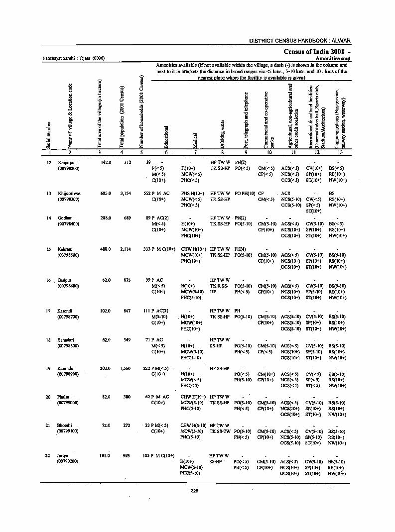
DISTRICT CENSUS HANDBOOK: ALWAR
Census of India 2001 -Panchayat Samiti : Tijara (0006) Amenities and
Amenities available (ifnot available within the village, a dash (-) is shown in the column and next to it in brackets the distance in broad ranges viz.<5 kms., 5-10 kms. and 10+ kms of the
-;;- nearest elace where the facili!X: is available is given}
I " ~ j 5 ..,
.! ~ft 0 U S .~ft U J! ., .. e c Iii § c ;. := u
0 e 0 ... a ._ ~ e,....
.~ u !:::!. .c i .s 0
~ f j fr "3 u ·8 ~ " i~-0 ...:I ]j 's, :l ~ ~ !:::!. .., 6 -= § e.!l
1 Iii u ~ :~ g.! 'c 2 ~ j ,5 C 't:I
.S! ::I l; 1 a c. § ~o.s 'i 8 i ... ii _g l ]~:g ~ 0 "3 ~ ~ 1 ~ .1::
... «I c.
·i i i .~ .IS .... ~ 8. _g .S! OIl i ::'i! c ., 0
1'i iii ~ Eix.! " u ~J iii ~ "3 ~ § j tf .~ ~ § .~ 'j '5 ~
c dJ ~ ~ 0 :$~ s~H! ra jj!O z eo. e;~sa I 2 3 4 5 6 7 8 9 10 11 12 13
12 Khijarpur 142.0 312 39 HPTWW PH(2) (00798200) P«S) H(10+) TKSS-HP PO«S) CM«S) ACS«S) CV(IO+) BS«S)
M«S) MCW«S) CP« S) NCS«S) SP(IO+) RS(10+) C(lO+) PHC«S) OCS«5) ST(IO+) NW(IO+)
13 Khijooriwas 685.0 3,IS4 SS2P MAC PHSH(IO+) HPTWW POPH(IO) CP ACS BS (00798300) C(lO+) MCW«S) TKSS-HP CM«S) NCS(S-IO) CV«S) RS(IO+)
PHC«S) OCS(S-tO) Sp« S) NW(tO+) ST(IO+)
14 Godhan 288.0 689 89 P AC(2) HPTWW PH(2) (00798400) M«S) H(lO+) TKSS-HP PO(S-tO) CM(S-tO) ACS« 5) CV(S-IO) BS«S)
C(IO+) MCW(10+) CP(tO+) NCS(10+) SP(1O+) R8(IO+) PHC(IO+) OCS(tO+) ST(IO+) NW(IO+)
15 Kahrani 488.0 2,114 333 P M C(IO+) CliWH(lO+) HPTWW PH(4) (00798500) MCW(lO+) TKSS-HP PO(S-IO) CM(S-IO) ACS«S) CVeS-IO) B8(S-10)
PHC(IO+) CP(tO+) NCS(lO+) SP(IO+) RS(IO+) .
.oCS(IO+) ST(lO+) NW(IO+)
16 . Gadpur 62.0 875 99P AC HPTWW (00798600) M«S) H(IO+) TKRSS- PO(S-IO) CM(S-IO) ACS«S) CV(S-IO) B8(S-10)
C(IO+) MCW(S-IO) HP PH«S) CP(IO+) NCS(IO+) SP(S-IO) RS(IO+) PHC(S-IO) OCS(IO+) ST(IO+) NW(IO+)
17 Karendi 102.0 847 III P AC(2) HPTWW PH (00798700) M(S-IO) H(IO+) TKSS-HP PO(S-IO) CM(S-IO) ACS(S-IO) CV(S-IO) B8(S-IO)
C(IO+) MCW(IO+) CP(lO+) NCS(S-IO) Sp(lO+) R8(IO+) PHC(IO+) OCS(S-IO) ST(lO+) NW(lO+)
18 Bahadari 62.0 549 71 PAC HPTWW (00798800) M«S) H(JO+) SS-HP PO(S-IO) CM(S-IO) ACS« S) CV(S-IO) BS(S-IO)
C(fo+) MCW(S-IO) PH« 5) CP«S) NCS(IO+) SP(S-IO) RS(IO+) PHqS-IO) OCS(IO+) ST(IO+) NW(IO+)
19 Karenda 202.0 I,S60 222 P M« S) HPSS-HP (00798900) C(IO+) H(JO+) PO« S) CM(IO+) ACS« S) CV«S) B8(S-IO)
MCW«S) PH(S-IO) CP(IO+) NCS«S) SP«S) R8(IO+) PHq<S) OCS«S) ST« S) NW(IO+)
20 Pbalsa 82.0 380 62P M AC CHWH(IO+) HPTWW (00799000) C(IO+) MCW(S-IO) TKSS-HP PO(S-IO) CM(S-IO) ACS«S) CV(S-IO) 8S(S-10)
PHqS-IO) PH«S) CP(1O+) NCS(lO+} SP(IO+} RS(lO+} OCS(lO+) ST(IO+) NW(IO+)
21 Bhoodli 72.0 272 . 33 PM«S) CHWH(S-IO) HPTWW (00799100) C(JO+) MeW(S-IO) TKSS-1W P0(5-10) CM(S-IO) ACS(:<5) CV(5-10) 88(5-10)
PHC(S-IO) PH«S) CP(IO+) NCS(S-IO) SP(S-IO} RS(lO+) OCS(S"10) 8T(l0+) NW(IO+)
22 Joriya 191.0 993 103 P M C(IO+) HPTWW (00799200) H(IO+) SS-HP . PO« S) CM(S-IO) ACS«S) CV(S-IO) 8S(S-10)
MCW(S-lO) PH« S) CP(IO+} NCS(IO+) SP(IO+} RS(IO+) PHqS-IO) OCS(JO+} ST(IO+) NW(IIlf)
228
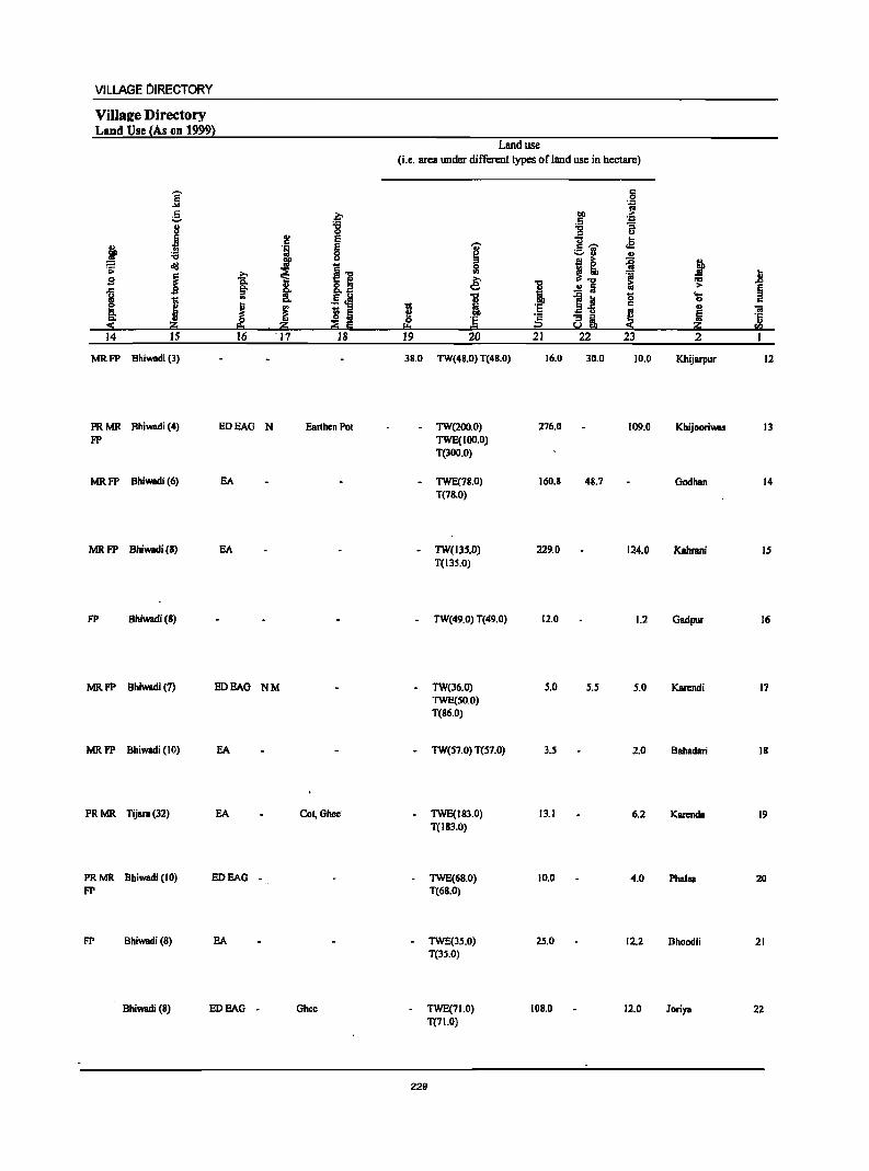
VILLAGE DIRECTORY
VilIsl!e Directory Land Use lAs on 1999}
j g ~
'6 8 0
J .. E c
~ j J .s: cId ~] j ~ s r:>.
~ §' l 8..8
I .. .5 J!!
[ J j ~ 5 r:>. ~ :i!:i ;;g Ii 14 15 16 '17 18
MRFP Bhiwadi (3)
PRMR Bhiwadi (4) EDEAG N Earthen Pot FP
MRFP Bhiwadi (6) EA
MRFP Bhiwadi (8) EA
FP Bhiwadi(8)
MR FP Bhiwadi (7) EDEAG NM
MR FP Bhiwadi (10)
PRMR Tijara(32) EA COl, Ghee
PRMR Bhiwadi (10) EDEAG -FP
FP Bhiwadi (8) EA
Bhiwadi (8) EDEAG - Ghee
Land use
(i.e. area under different types of land use in hectare)
i 51 ~
1 ~ 0 Ji ... 19 20
38.0 TW(48.0) T(48.0)
- TW(200.0) TWE(IOO.O) T(lOO.O)
- TWE(78.0) T(78.0)
- TW(13S.0) T(13S.0)
- TW(49.0) T(49.0)
- TW(36.0) TWE(SO.O) T(86.0)
- TW(S7.0) T(S7.0)
- TWE(18l.0) T(I83.0)
- TWE(68.0) T(68.0)
TWE(3S.0) T(3S.0)
- TWE(71.0) T(71.0)
229
a ',c .0
co ... .5 ~ ~ ... ~'if r2
j I! 'i I ..!:! Iii
~~ 0 'E c
~ ·s 8i i2 21 22 23
16.0 30.0 10.0
276.0 109.0
160.8 48.7
229.0 124.0
12.0 1.2
S.O 5.5 5.0
3.S 2.0
13.1 6.2
10.0 4.0
2S.0 12.2
108.0 12.0
J ] ~ § 'S c I> 'ii i '5
:i!:i !l! 2 I
Khijarpur 12
Khijooriwas 13
Godhan 14
Kahrani IS
Gadpur 16
Karendi 17
Bahadari 18
Kanmda 19
Phalsa 20
Bhoodli 21
Joriya 22

DISTRICT CENSUS HANDBOOK: ALWAR
Census of India 2001 -Panchayat Samiti : Tijara (0006) Amenities and
Amenities available (if not available within the village, a dash (-) is shown in the column and next to it in brackets the distance in broad ranges viz. <5 kms., 5-10 kms. and 10+ krns of the
I '§' nearest I!lace where the facilit~ is available is Biven} .. E i !3.c "" "iii' 8 II '" u ._ ..
8" .. .. .. ] ;:sou c ~ 0 _g 'f .~ g 0 ._ t! 'E ~ u t!.. ~&
if j 0 D. "3
t ] u 0 .~ ;l ! ." '"' ...I ~ 0 -"'§
~ ~ -0 ~ 'Ii fa u "8]! .;::; i .;,; IS j J ..c: i g '8 ~ 8·~ .! g .& = .... .t;j
I l;; ~;s!~ '1> 0 "3 .... 'iI ]I os 'J:!
§ .. D. 0 IS e ..~i .2 S 'S ~ 0 t OIl "3] 5 ..
C D. 'J:! 11 ~ ..
1 " s S .r> j S ..
.~.R ! ~._ S ~
~ ~ ~ tf· g~ ~.5 ] g:=: ~ ~ ~ 0
CIl ~ ~ eo ~1S :::!: Ii! ~." !i.! !1l 2 3 4 S 6 7 8 9 10 II 12 13
23 Jhiwana 718.0 3,875 576 P(2) M S DDAPHC THPTW POPH(2S) CP ACS BS (00799300) C(IO+) PHSH(IO+) WTKSS- CM«S) NCS(S-IO) CV{< S) RS(IO+)
MCW(IO+) HP OCS(5.1O) SP(lO+) NW(IO+) ST(IO+)
24 Banban 144.0 618 87PM«5) HPTWW PO (00799400) C(lO+) H(IO+) TKSS-HP PH«S) CM«S) ACS«S) CV{S-IO) BS«S)
MCW(IO+) CP« 5) NCS{S-IO) SP(IO+) RS(lo+) PHC« 5) OCS(IO+) ST(10+) NW(10+)
25 Talarpur 157.0 1,763 401 P M C(10+) RMP(2) HPTWW PH(l3) BS (00799500) H{lo+) SS-HP PO« 5) CM«S) ACS«S) CV«S) RS(lo+)
MCW«S) CP(S-IO) NCS«5) SP(1o+) NW(1o+) PHC«S) OCS{<S) ST(IO+)
26 Thara 181.0 762 138P M AC HPTWW (00799600) C(IO+) H(lo+) SS-HP PO{<S) CM(S-IO) ACS{< 5) CV(S-IO) BS«S)
MCW(S-IO) PH«S) CP(IO+) NCS(S-IO) SP(S-IO) RS(lo+) PHC(S-IO) OCS(S-IO) ST(IO+) NW(IO+)
27 Kalaka 197.0 601 106 PM«S) HPTWW (00799700) C{IO+) H{IO+) SS-HP PO{<S) CM{<5) ACS(S-IO) CV{S-IO) BS« 5)
MCW(S-IO) PH«5) CP(IO+) NCS(S-IO) SP{IO+) RS(lo+) PHC(S·IO) OCS(S-IO) ST(IO+) NW(lO+)
28 Shahpur 253.0 601 102 P M«5) HPTWW (O0799800) C(IO+) H{10+) SS-HP PO«5) CM{<S) ACS{< 5) CV«S) BS« 5)
MCW«5) PH«5) CP(IO+) NCS«S) SP(IO+) RS(IO+) PHC«S) OCS« 5) ST(lO+) NW(IO+)
29 Huseengpur 113.0 412 74 PM«5) HPTWW (00799900) C(IO+) H(IO+) SS-HP PO(S-IO) CM«5) ACS«5) CV«S) BS«5)
MCW(S·IO) PH«5) CP(IO+) NCS«S) SP(IO+) RS(1o+) PHC{S·IO) OCS{<S) ST(lo+) NW(IO+)
30 Banbeerpur 141.0 898 190PM«S) HPTWW PH(6) BS (00800000) C(lO+) H(IO+) TKSS-HP PO«5) CM«5) ACS(S-JO) CV«S) RS(IO+)
MCW(IO+) CP(S-IO) NCS(S-IO) SP(lO+) NW(IO+) PHC«S) OCS(IO+) ST(JO+)
31 Bibipur 137.0 778 103 P M«S) HPTWW (00800100) C(10+) H{IO+) TKSS-HP PO{<S) CM(S-IO) ACS(S-IO) CV(S-IO) BS«S)
MCW(IO+) PH«S) CP(S-IO) NCS(S-IO) SP(1o+) RS(IO+) PHC(S-IO) OCS(IO+) ST(IO+) NW(IO+)
32 Chhapar 198.0 722 105 PM«S) TWWTI( BS (00800200) C(IO+) H(IO+) SS-TW PO«S) 'CM«S) ACS«5) CV« 5) RS(lo+)
MCW(IO+) PH«S) Cp(IO+) NCS«S) SP(lO+) NW(IO+) PHC«S) OCS(IO+) ST(IO+)
33 Khatiwas 98.0 658 95PM«5) HPTWW (00800300) C(IO+) H{IO+) TKSS-HP PO« 5) CM«S) ACS«S) CV«S) BS«5)
MCW(IO+) PH« S) .. Cp« 5) NCS«S) SP(IO+) RS(IO+) PHC« 5) li.)+
OCS«S) ST(IO+) NW(IO+)
230

VILLAGE DIRECTORY
Villal!e Directory Land Use (As on 1999)
14 IS
PR MR Bhiwadi (17) FP
MR FP Bhiwadi (16)
PR Bhiwadi(7)
FP Bhiwadi (8)
MR Bhiwadi (8)
MR Bhiwadi (10)
FP Bhiwadi (8)
PRMR Bhiwadi (8) FP
PR MR Bhiwadi (9) FP
PR MR Bhiwadi (3) FP
»
~ '"
J 16
EA
EA
EA
EA
EDBAO
EDBAO
EDEAO
BA
EA
f 2! E
} E 0 u
11 I .5 oM ~ ~ m z ::E E 17 18
NM Ghee
Ghee
N M Eanhen Pot
EanhenPot
-
-
- Ghee
NM Ghec
Ghee
MR FP Bhiwadi (9) EDEAG - Ghee
Land use (i.e. area WIder different types of land use in hectare)
~ 0 '" &
~ 1 0 ·s p.. ... 19 20
17.0 TW(S20.0) T(S20.0)
8.0 TW(107.0) T(107.0)
- TW(l27.0)
-
-
-
-
TWE(7.0) T(I34.I)
TW(84.0) T(84.0)
TW(172.S) TWE(14.3) T(186.8)
TW(234.1) TWE(B.4) T(242.S)
TW(92.7} TWE(B.4) T(101.1)
TW(IOS.O) T(IOS.O)
- TW(1l9.0} T(1I9.0}
4.0 GC(169.0) T(169.0)
GC(66.0) T(66.0)
231
21 22 23 2
18.0 126.0 37.0 Jhiwana
11.0 13.0 5.0 Banban
3.9 8.1 10.9 Tatatpur
77.0 20.0 Thara
1.1 9.2 Kalaka
1.3 9.3 . Shahpur
6.1 5.8 Huseengpur
22.0 14.0 Banbeetpur
5.0 7.0 6.0 Bibipur
10.0 15.0 Chhapar
23.7 B.O ' KhBtiwas
23
24
25
26
27
28
29
30
31
32
33
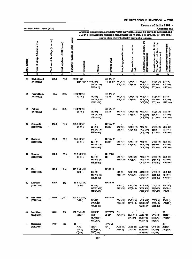
DISTRICT CENSUS HANDBOOK: ALWAR
Census ofIndia 2001 -Panchayat Samiti : Tijara (0006) Amenities and
Amenities available (if not available within the village, a dash (-) is shown in the column and next to it in brackets the distance in broad ranges viz.<5 kms., 5-10 kills. and 10+ kms of the
I T nearest I!lace where the faeilin! is available is given}
-M 'iii' 0 u u iil
i .,
8 ... ~ 0 .i!;
;§. 0
I ii c:!-u j 8 .; 0 B ...l :8 old ~ c:!- "5 ~ 41 5 J ..c: ] ~ 'a 'iI
~ m
i 'a 'a 0 u ..
Q, B ~ ~ ~ I ~
3 4 5
34 Khohri Khurd 238.0 782 100 P AC HPTWW (00800400) M« S) C(IO+) H(lo+) TKSS-HP PO«S) CM«S) ACS« 5) CV(s-IO) 8S«S)
MCW(IO+) PH«S) CP« S) NCS« S) SP(IO+) RS(IO+) PHC«S) OCS(tO+) ST(lO+) NW(tO+)
35 FakaNddinka 9S.0 1,006 140PM«S) HPTWW (00800S00) C(lO+) H(IO+) 8S-HP PO«S) CM(S-IO) AC8« 5) CV«S) . 88«5)
MCW(S-IO) PH«S) CP(lO+) NCS(IO+) 8P(10+) RS(IO+) PHC(S-IO) OCS(IO+) 8T(10+) NW(tO+)
36 Pathredi 99.0 1,081 t4SPM«S) HPTWW (00800600) C(tO+) H(tO+) 88-HP PO«S) CM(S-tO) ACS« 5) CV(S-IO) 8S(S-10)
MCW(IO+) PH«S) CP(IO+) NCS(IO+) 8p(10+) RS(IO+) PHC(S-IO) OCS(IO+) ST(lO+) NW(IO+)
37 Chaupanki 454.0 1,150 IS2PM«S) HPTWW (00800700) C(tO+) H(IO+) 8S-HP PO«S) CM(S-tO) ACS«S) CV(S-IO) 88(5-10)
MCW(S-IO) PH« S) CP(S-IO) NCS(IO+) 8P(tO+) RS(IO+) PHC(S-IO) OCS(IO+) ST(IO+) NW(IO+)
38 Bandapur 158.0 722 98PM«S) HPTWW (00800800) C(lO+) H(S·IO) SS-HP PO«5) CM(S-IO) AC5« S) CV(S-IO) B5(5-10)
MCWeS-IO) PH« 5) CP(IO+) NCS(IO+) 5p(10+) RS(IO+) PHC(S-IO) OCS(IO+) 5T(10+) NW(IO+)
39 Husaipur 182.0 730 93 P M(S-IO) HPWSS-(00800900) C(lO+) H(S·IO) HP PO«5) CM(IO+) ACS(S·IO) CV(S.IO) BS(S-tO)
MCW(S-IO) PH(S-tO) Cp(IO+) NCS(S-IO) SP(S-IO) RS(IO+) PHC(S-IO) OCS(S-IO) ST(S-IO) NW(IO+)
40 Khcri 176.0 1,154 189 P M(S-tO) HP8S-HP (0080tooo) C(IO+) H(S.IO) PO«S) CM(lO+) ACS(S-IO) CV(S-IO) B8(S-IO)
MCW(S-IO) PHis-tO) CP(lO+) NCS(S-IO) sp(s-tO) RS(lO+) PHC(S-IO) OCS(S-IO) ST(S-IO) NW(IO+)
41 Kharkhari 203.0 552 69 P M(S-IO) HPSS-HP (00801100) C(IO+) H(S-IO) PO« 5) CM(S-IO) AC8(S-IO) CV(S-IO) B8(S-10)
MCW(S-IO) PH(S-IO) CP(S-IO) NCS(S-IO) SP(S-IO) RS(IO+) PHC(S-IO) OCS(S-IO) ST(S-IO) NW(IO+)
42 Sare Kalan 376.0 1,9S7 270 P M(5-10) HPSS-HP BS (00801200) C(IO+) H(S.IO) PO(S.IO) CM(5.10) ACS(S-IO) CV(S-IO) RS(IO+)
eW(s.IO) PH(S-IO) CP(S-IO) NCS(S·IO) SP(S-IO) NW(IO+) PHC(S.IO) OCS(S-IO) ST(S-IO)
43 SareKhurd 330.0 866 IS2 P M«5) HCRMP HPTWW PH BS (00801300) C(IO+) H(IO+) SS·HP PO(IO+) CM(lO+) ACS«S) CV(S·IO) R8(IO+)
MCW(IO+) CP(IO+) NCS«S) SP(IO+) NW(IO+) PHC(IO+) OCS«S) ST(IO+)
44 Mahandika 97.0 120 21 HPWSS- 8S (00801400) P«S) H(IO+) HP PO(S-IO) CM(S-IO) ACS«S) CV(S-IO) RS(IO+)
M«S) MCW(IO+) ',' PH«S) CP(S-IO) NCS(IO+) Sp(IO+) NW(IO+) C(IO+J PHC(IO+) OCS(IO+) 8T(10+)
232
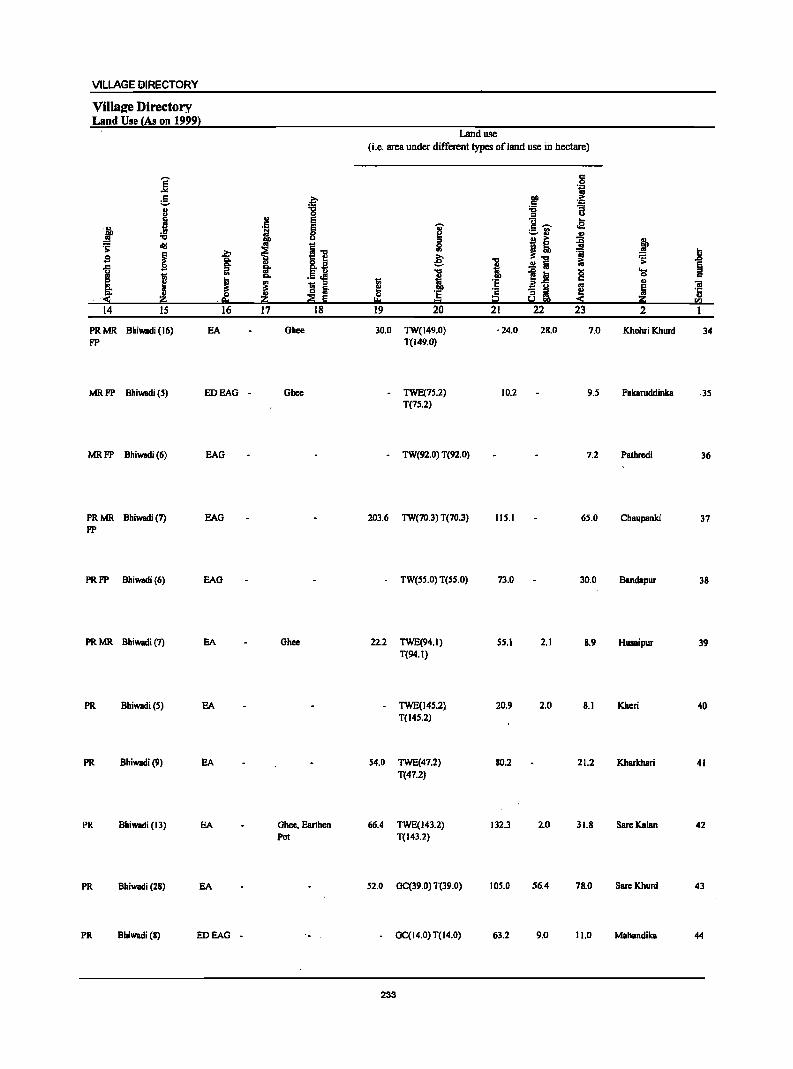
VILLAGE DIRECTORY
ViIla2e Directory Land Use (As on 1999)
i r::
;::.
II ~ .t '6
:s; old S ~ ~ 111
~ j S 14 15
PRMR Bhiwadi (16) FP
b
f ~
e.t 16
EA
MR FP Bhiwadi (5) EDEAG -
MR FP Bhiwadi (6)
PR MR Bhiwadi (7) FP
PR FP Bhiwadi (6)
PR MR Bhiwadi (7)
PR Bhiwadi (S)
PR Bhiwadi (9)
PR Bhiwadi (13)
PR Bhiwadi (28)
PR Bhiwadi (8)
EAG
EAG
EAG
EA
EA
EA
EA
EA
EDEAG -
~ .. S " ·iii E 0
l1P u
~ I] .. fit .5 J! "" ~
_ ::J
~ Iii ~ Iii .~
17 18
Ghee
Ghee
Ghee
Ghee, Earthen Pot
Land use (i.e. area under different types ofland use in hectare)
·1 ~ ~ '6 ::J U "0 ....
oS! I " --._ '" ~ ., .,
I! :c } 51 ..!!! tl e; "i 1 'r> .&>
.£ fa ... § "CI
l~ 0 "-
l 0 " I ·E " .,
~ iii
·e ·c "3 i Ii ·c ., I:!= = i2 u ::S ii!::i rIl
19 20 21 22 23 2
30.0 TW(149.0) ·24.0 28.0 7.0 Khohri Khurd 34 T(149.0)
- TWE(7S.2) 10.2 9.5 Fakaruddinka ·35 T(75.2)
- TW(92.0) T(92.0) 7.2 Pathrcdi 36
203.6 TW(70.3) T(70.3) 115.1 65.0 Chaupanki 37
TW(5S.0) T(55.0) 73.0 30.0 Bandapur 38
22.2 TWE(94.1) 55.1 2.1 B.9 Husaipur 39 T(94.I)
TWE(14S.2) 20.9 2.0 8.1 Kheri 40 T(145.2)
54.0 TWE(47.2) 80.2 21.2 Kharkhari 41 T(47.2)
66.4 TWE(143.2) 132.3 2.0 31.8 Sare Kalan 42 T(143.2)
S2.0 GC(39.0) T(39.0) 10S.0 56.4 78.0 Sare Khurd 43
- GC(14.0) T(14.0) 63.2 9.0 11.0 Mahandika 44
233
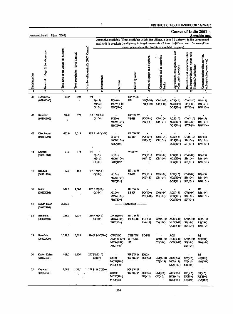
.DISTRICT CENSUS HANDBOOK: ALWAR
Census ofIndia 2001 -Panchayat Samiti : Tijara (0006) Amenities and
Amenities available (if not available within the village, a dash (-) is shown in the column and
next to it in brackets the distance in broad ranges viz.<5 kms., 5-10 kms. and 10+ kmsofthe
I j nearest l!lace where the facilitl: is available is siven) .., 5 "0 "0
~ Iii rlJ:i <> U u £E-5 of c .c IS 0 ~
.., e u ;. .51 e ~ 0=> '! il .- l! 'E ..-~ t\. .c Jig,
if j 8 g- " ::t .a 1l i u ]<1)..-....l '0 ".! -J'~ ~ ~ t\.
1 1 u 1l] ·c
~ -5 6 , .c "§ g'~ <III ~d! § C'
i ..... 'iI _g ~ :'§
_,.5! ]:E"g .~ .g .;; <> '3 'a ] 2'2 g c. ~ .51 1 i .- J!! ..... 8. D ~ § '" <> 'OJ m 1l jj
'3 l:l e f .., j ~ ~ ~ .-m
~ S ]I g tf 'i D '5 ~ ~ al. ~ ·c & $~
iJ ._ ] 8:;:: til ~ 9 !!!I ~ra ~ I: 1 2 3 4 5 6 7 8 9 10 11 12 13
45 Udhan\Ws 95.0 394 74 HPWSS-(0080IS00) P«S) H(S-IO) HP PO(S-IO) CM(S-IO) ACS« S) CV(S-IO} BS«S)
M«S} MCW(S-IO} PH(S-IO) CP(S-IO} NCS(IO+} SP(S-IO) RS(IO+) C(lO+) PHC(IO+) OCS(IO+) ST(IO+) NW(lO+)
46 Kulawat 186.0 375 S2PM«5) HPTWW (00801600) C(lO+) H(IO+) SS-HP PO(IO+) CM(IO+) ACS« 5) CV(S-IO) BS«5)
MCW(IO+) PH«S) CP(lo+) NCS(IO+) SP(S-IO) RS(lo+} PHC(lo+) OCS(lO+) ST(5-1O) NW(lO+)
47 Chooharpur 411.0 1,518 202 P M C(IO+) HPTWW (00801700) H(IO+) SS-HP PO(IO+) CM(IO+) ACS«5) CV(S-IO) 8S«S)
MCW(lo+) PH«S) CP(IO+) NCS(IO+) SP(IO+) RS(IO+) PHC(IO+) OCS(IO+) 8T(10+) NW(IO+)
48 Ladpuri 171.0 173 30 WS8-W (00801800) P«5) H(IO+) PO(lo+) CM(IO+) ACS(lO+) CV(lo+) 88«5)
M«S) MCW(IO+) PH«5) CP(IO+) NCS(IO+) Sp(IO+) RS(IO+) C(lO+) PHC(IO+) OCS(IO+) ST(IO+) NW(IO+)
49 Gaodwa 172.0 663 97PM«S) HPTWW (00801900) C(10+) H(IO+) S8-HP . PO(IO+) CM(IO+) ACS« 5) CV(IO+) 88«5)
MCW(IO+) PH«S) CP(IO+) NCS(IO+) . SP(IO+) RS(IO+) PHC(IO+) OCS(IO+) ST(IO+) NW(IO+)
50 Indor S42.0 1,362 187 P M«5) HPTWW BS (00802000) C(IO+) H(lO+) SS-HP PO(lO+) CM(IO+) ACS« 5) CV(IO+) RS(IO+)
MCW(IO+) PH(S-IO) CP(lO+) NCS(IO+) SP(IO+) NW(IO+) PHC(IO+) OCS(IO+) ST(lo+)
51 Rundh Indor 2,277.0 ---- Uninhabited ---(00802100)
52 Gandhola 268.0 1,224 156 P M«5) DAH(IO+) HPTWW (00802200) C(IO+) MCW(IO+) TKS8-HP PO« S) CM(S-IO) ACS(5-10) CV(5-1O) BS(S-IO)
PHC(IO+) PH« 5) CP(JO+) NCS(S-IO) Sp(IO+) RS(IO+) OCS(S-IO) ST(IO+) NW(JO+)
S3 Guwalda 1,387.0 6,619 886 P M C(10+) CWCHC THPTW PO PH ACS BS (00802300) RMPH(10+) WTKS8- CM(5-10) NCS(5-10) CV(S-IO) RS(IOT)
MCW(IO+) HP CP(1OT) OCS(5-10) SP(IO+) NW(IO+) PHC(S-IO) ST(1O+)
54 IChohri Kalan 448.0 1,406 207 P M« 5)· HPTWW PH(2) BS (00802400) C(IO+) H(IO+) TKSS-HP PQ«5) CM(S-IO) ACS«S) CV«S) RS(IO+)
MCW(IO+) CP(S-IO) NCS«S) Sp« S) NW(IO+) PHC«S) OCS(IO+) ST(lO+)
S5 Mayapur 152.0 1,315 . 173 P M C(IO+) HPTWW (00802500) H(IOT) TKSS-HP PO«5) CM«S) ACS«S) CV«S) BS«S)
MCW(IO+) PH«5) CP« S) NCS«5) SP(JO+) RS(IOT) PHC«S) OCS«S) ST(IO+) NW(JO+)
234
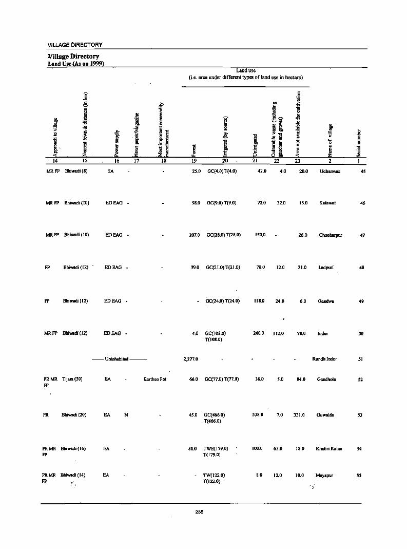
VILLAGE DIRECTORY
Willsee Directory Land Use {As on 1999}
Land use
(i.e. area under different types of land use in hectare)
]: c 0 'i
g p DO .1; s::
. ! :a I ... :; 0 u
2! E ... j .J ~ I .e
:.=.rl ..!! "CI
!I ~ ! ~ oIiI j1! ~
;~ i ~"CI ~ .8 $I .~ .e: i ~ '> ] a .!~
.!! Iii E
1 ~ iii 0 eo.. ::I
I 0 s:: ~. ~ I 'E c ..
~ a13 .. "iii
"" .. ~ Ii 'E ·s ~i 12 Iii '5
:!: .~ e. .~ .:::E .6 .'" 0= i2 S ~ rIl
14 15 16 17 18 19 20 21 22 23 2 1
MRFP Bhiwadi (B) EA 25.0 GC(4.0) T(4.0) 42.0 4.0 20.0 Udhanwas 45
MR FP Bhiwadi (10) EDEAG - 5B.0 GC(9.0) T(9.0) 72.0 32.0 15.0 Kulawa! 46
MR FP Bhiwadi (10) EDEAG - 207.0 GC(2B.O) T(2B.O) IS0.0 26.0 Choobarpur 47
FP Bhiwadi (12) . EDEAG - 39.0 GC(21.0) T(21.0) 7B.0 12.0 21.0 Ladpuri 48
FP Bhiwadi (12) EDEAG - GC(24.0) T(24.0) I1B.O 24.0 6.0 Gandwa 49
MRFP Bbiwadi (12) EDEAG - 4.0 GC(108.0) 240.0 112.0 78.0 Indor SO T(lOB.O)
--Uninhabited --- 2,277.0 Rundhlndor 51
PRMR Tijara(30) EA Earthen Po! 66.0 GC(77.0) T(77.0) 36.0 S.O 84.0 Gandhola 52 FP
PR Bhiwadi (20) EA N 45.0 GC(466.0) 538.0 7.0 331.0 Guwalda 53 T(466.0)
PRMR Bhiwadi (16) EA 88.0 TWE(179.0) 100.0 63.0 18.0 Khohri Kalan S4 FP T(179.0)
PRMR Bhiwadi (14) EA TW(122.0) B.O 12.0 10.0 Mayapur S5 FP. : ~ T(122.0)
- :~
235
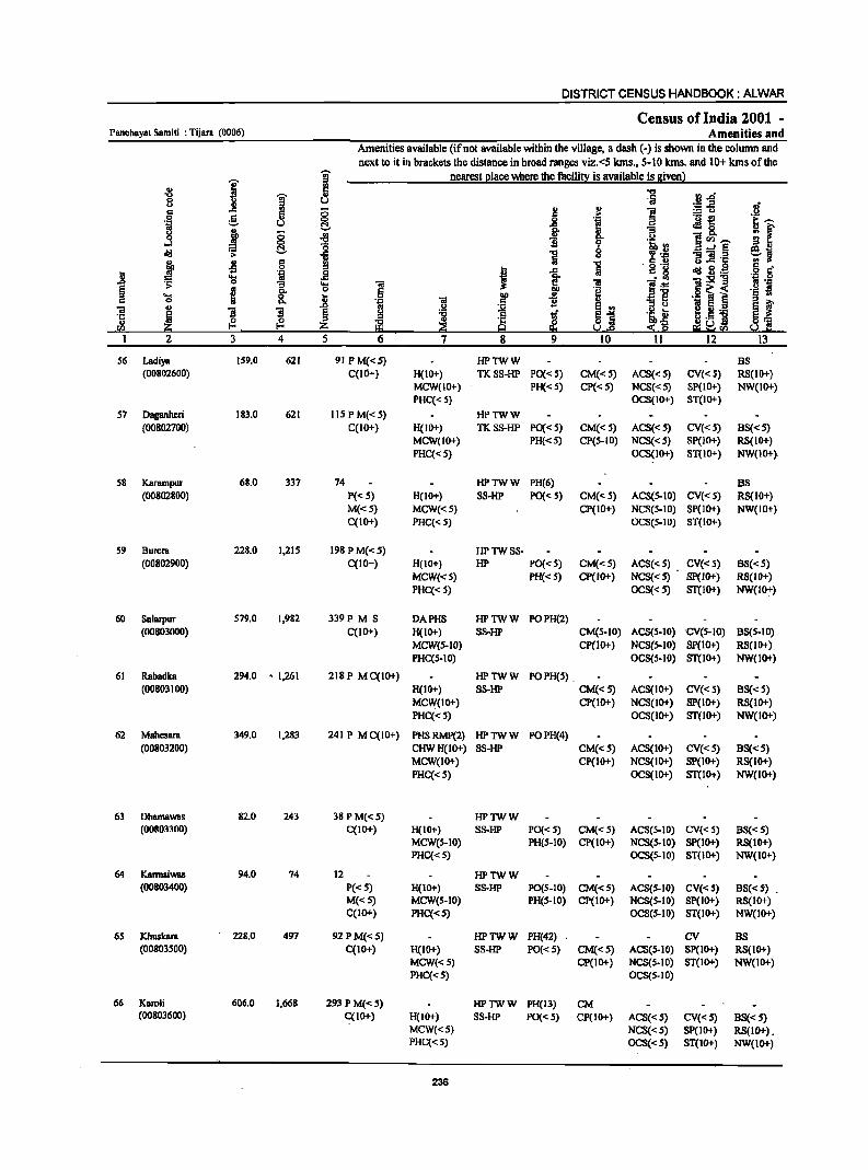
DISTRICT CENSUS HANDBOOK: ALWAR
Census of India 2001 -Panchayat Samiti : Tijara (0006) Amenities and
Amenities available (ifnot available within the village, a dash (-) is shown in the column and next to it in brackets the distance in broad ranges viz.<5 kms., 5-10 kms. and 10+ kms of the
I i nearest place where the facility is available is given) ., .. c ..,
"0 i .,
·Iii ~.c 8 u ~-5 .s <II 0 l!
., ~ c c .i! .!.!
0 e " 0
i .- t!
~--] u c:!- ~ JIg, u "3
if .f 8 ~ c. .!.! ~<Il __
:l 0 bhf(J ~ c:!- 8 ....:§
d/l ii ] 'P 'J:: '13 ]1 .c: j .s 15 !I ] g .!2 ~ i.~ 6 c
] 'i j! J .c . ~ .... ~ 1I:s!"g 'ii .9 0 "[ .... 11 iii l~ ~ >
£ 0 OQ .g o~ < .~ s .... 8. ] 0 iii ~
., '131 . _ ~ § ..
0 .~ ]j iii .. i l § .S:l ~ E3 .,
iJ ~ 5._ ~I .c: ! :I ~ 1£ ~] H·S] u ~ Z ~ ~ ~ ~ ~~sa s.d! sa 1 2 3 4 5 6 7 8 9 10 11 12 13
56 Ladiya 159.0 621 91 PM«5) HPTWW BS (00802600) C(IO+) H(IO+) TKSS-HP PO« 5) CM«5) ACS« 5) CV«S) RS(IO+)
MCW(IO+) PH«5) CP« 5) NCS« 5) SP(IO+) NW(IO+) PHC« 5) OCS(IO+) ST(IO+)
57 Daganheri 183.0 621 115 PM«S) HPTWW (00802700) C(lO+) H(IO+) TK88-HP PO« S) CM«5) ACS«5) CV«S) B8«5)
MCW(JO+) PH«5) CP(5-JO) NCS«5) SP(IO+) RS(IO+) PHC« 5) OCS(IO+) 8T(IO+) NW(IO+)
58 Karampur 68.0 337 74 HPTWW PH(6) BS (00802800) P«5) H(IO+) SS-HP PO«5) CM«5) ACS(S-IO) CV«S) RS(IO+)
M«S) MCW«S) CP(IO+) NCS(S-IO) SP(IO+) NW(IO+) C(IO+) PHC« S) OCS(S-IO) ST(IO+)
59 Burera 228.0 1,215 198PM«5) HPTWSS-(00802900) C(10+) H(IO+) HP PO«S) CM«S) ACS«S) CV«S) BS«S)
MCW«5) PH«S) CP(lO+) NCS«5) sp(10+) RS(IO+) PHC«S) OCS«S) ST(lO+) NW(10+)
60 Salarpur 579.0 1,982 339P M S DAPHS HPTWW POPH(2) (00803000) C(IO+) H(IO+) SS-HP CM(5-10) ACS(S-IO) ·CV(S-IO) BS(5-10)
MCW(S-IO) CP(1o+) NCS(S-IO) SP(IO+) RS(IO+) PHC(5-10) OCS(5-10) ST(IO+) NW(1O+)
61 Rabadka 294.0 - 1,261 21SP MC(IO+) HPTWW POPH(S) (00803100) H(IO+) SS-HP CM«S) ACS(IO+) CV«S) BS«S)
MCW(IO+) CP(IO+) NCS(1O+) SP(lO+) RS(IO+) PHC«S) OCS(IO+) ST(lo+) NW(lO+)
62 Mahesara 349.0 1,283 241 P MC(JO+) PHSRMP(2) HPTWW POPH(4) (00803200) CHWH(IO+) SS-HP CM«S) ACS(IO+) CV« S) BS«S)
MCW(IO+) CP(IO+) NCS(IO+) SP(IO+) RS(IO+) PHC«S) OCS(IO+) ST(IO+) NW(IO+)
63 DhamaWBS 82.0 243 38PM«S) HPTWW (00803300) C(IO+) H(IO+) SS-HP PO«S) CM«5) ACS(S-IO) CV«S) BS«5)
MCW(S-IO) PH(S-IO) CP(IO+) NCS(S-IO) SP(IO+) RS(IO+) PHC«S) OCS(S-IO) ST(IO+) NW(IO+)
64 Kannsiwas 94.0 74 12 HPTWW (00803400) P«S) H(IO+) SS-HP PO(S-IO) CM«S) ACS(S-IO) CV«S) BS«S) .
M«S) MCW(S-IO) PH(S-IO) CP(IO+) NCS(S-IO) Sp(IO+) RS(IO+) C(IO+) PHC«S) OCS(S-lO) ST(IO+) NW(IO+)
6S Khuskara 228.0 497 92PM«S) HPTWW PH(42) . CV BS (00803500) C(10+) H(IO+) SS-HP PO«S) CM«S) ACS(S-IO) SP(IO+) RS(IO+)
MCW«S) CP(IO+) NCS(S.IO) ST(IO+) NW(1O+) PHC«S) OCS(S.IO)
66 Karoli 606.0 1,668 293PM«S) HPTWW PH(13) CM (00803600) C(IO+) H(lO+) SS-HP PO« 5) CP(IO+) ACS«5) CV«S) BS« 5)
MCW«5) NCS«S) SP(IO+) RS(IO+). PHC«S) OCS«S) ST(IO+) NW(IO+)
236
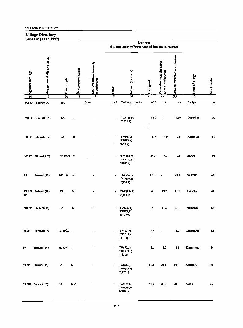
VILLAGE DIRECTORY
Villsee Directory Land Use (As on 1999}
Land use (i.e. area under different types ofland use in hectare)
E 5 -'" .~
e .c;. ~ > 'D
" :g j 1i
J ., e y .2 c " '1 e I
c ~ ._ <II
~ 8 -u ., .2! > ~ &'0 oI!I
I~ 5l ~ ~ .;;:
~ >. i :;j ~ j s I .e: ... .!!"E it; .;;:
..c i ~ ... .5 l! "C
1~ -0 'a
I Do 1 c:
! ~ 1;; ::I 1;; ·s c OJ "iii
f o Iii e! '2 -=l ~ fj '1: .;g; .;g; ~ Iii
0 :s i2 !.! 2::i ..
. !!.I I:!= rIl
14 IS 16 17 18 19 20 21 22 23 2 1
MRFP Bhiwadi (9) EA Ghee 13.0 TW(89.0) T(89.0) 40.0 10.0 7.0 Ladiya 56
MRFP Bhiwadi (14) EA TW(155.0) 16.0 12.0 Daganhcri 57 T(ISS.O)
PRFP Bhiwadi (10) EA N - TW(45.6) 5.7 4.9 3.B Karampur 5B TWE(8.1) T(53.S)
MRFP Bhiwadi (12) EDEAG N - TW(168.2) 34.7 4.9 2.B Burera 59 TWE(17.1) T(185.4)
PR Bhiwadi (10) EOEAG N TW(524.1) 15.6 29.0 Salarpur 60 TWE(10.2) T(534.3)
PRMR Bhiwadi (18) EA . N TWE(2S4.1) 6.1 13.2 21.1 Rabadka 61
FP T(2S4.I)
MRFP Bhiwadi (16) EA N lW(269.8) 7.1 41.2 23.1 MahesaJll 62 TWE(S.I) T(277.9)
MRFP Bhiwadi (17) EDEAG - TW(52.7) 4.4 6.2 Ohamawas 63 TWE(IB.4) T(71.1)
FP Bhiwadi (16) EDEAG - TW(7S.2) 2.1 1.0 4.1 Karmsiwas 64 TWE(12.0) T(87.2)
PRFP Bhiwadi (15) EA N TW(B8.2) 5U 20.0 54.1 Khuskara 65 TWE(13.9) T(102.1)
PRMR Bhiwadi (16) EA NM lW(378.8) 44.5 95.3 6S.1 Karoli 66 TWE(19.3) T(398.1)
237
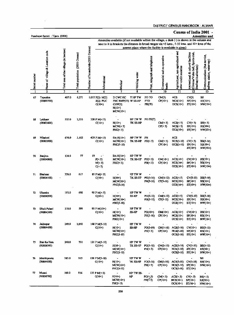
DISTRICT CENSUS HANDBOOK: ALWAR
Census of India 2001 -Panchayat Samiti : Tijara. (0006) Amenities and
Amenities available (if not available within the village, a dash (-) is shown in the column and
next to it in brackets the distance in broad ranges viz.<5 klns., 5-10 kms. and 10+ kms of the
I I nearest I!lace where the facili!l: is available is given l ., .., rI..o '0 g 5i 8 u ~~ Ii
§ .c '" ~ § u ] 0
5 5 'j ._ ~ 'E '"' .~ u fr .=! 0
j ;;
i Q, B 1~'-' :r oS 0 a ~ l~ _.§
dIl ~ C!. ~ u B] '15 ~~
~ ., c '5 § • -s 0
t .c c 8 0\:1 .§.1:: 0 'J:! i! ~ .~ .~ ~ 'S ~ :e . '" i'- -g ,0 .... 2! ]:6 ~ ~ g- o
~ o~< .~ t! .... 0 0 .~ ., .. B B ~
._ ] 0 Q,
I ~ ~ ._ s i' 'ii ~ S ]I .0 .ll ~ ~j ·c § "0 t ~j ~.5 ] ~] ., {3. {3. ~ ~ rIl ~ :z; ~f.I'J
I 2 3 4 5 6 7 8 9 10 11 12 13
67 Tapookm 407.0 6,271 1,057 P(2) M(2) DCWCHC THPTW PO TO CM(3) ACS CV(3) B8 (00803700) 8(2) PUC PHC RMP(25) W S8-HP PTO CP(IO+) NCS(lO+) 8P(10+) R8(10+)
C(IO+) CHW(3) PH(70) OCS(IO+) ST(IO+) NW(IO+) H(IO+) MCW(IO+)
68 Lakhnor 532.0 2,533 320 P M« 5) HPTWW POPH(7) (00803800) C(IO+) H(IO+) TK88·HP CM«5) AC8« 5) CV«S) B8« 5)
MCW«S) CP« 5) NCS« 5) SP(IO+) RS(IO+)
PHC« S) OCS(IO+) ST(IO+) NW(IO+)
69 Nibaheri 676.0 3,102 429PM«S) DAH(lO+) HPTWW PH ACS (00803900) C(lO+) MCW(IO+) TKS8·HP PO«5) CM«5) NCS(S-IO) CV«S) B8(S-IO)
PHC(5-10) Cp(IO+) OCS(S-IO) SP(IO+) RS(IO+) ST(IO+) NW(IO+)
70 Banjhra 134.0 77 19 DAH(IO+) HPTWW (00804000) P«5) MCW(IO+) TKS8-HP PO«S) CM(IO+) ACS(IO+) CV(lO+) 8S(l0+)
M«S) PHC«S) PH« 5) CP(IO+) NCS(IO+) SP(IO+) RS(IO+)
C«S} OCS(IO+) ST(lO+) NW(lO+)
71 8halcsa! 376.0 617 8SPM«S) HPTWW (00804100) C(IO+) H(IO+) TKSS·HP PO(S-IO} CM(S-IO) ACS«S) CV(S-IO) BS(S-10)
MCW(IO+) PH(S-IO) CP(S-IO) NCS(IO+) SP(IO+) RS(IO+) PHC(S-IO) OCS(IO+) ST(IO+) NW(IO+)
72 Ubamka 193.0 698 9SPM«S) HPTWW (00804200) C(IO+) H(IO+) SS-HP PO(S.IO) CM(S·10) ACS«S) CV(S-IO) 8S(S-10)
MCW(IO+) PH(S·IO) CP(S-IO) NCS(IO+} SP(IO+) RS(IO+) PHC(S·IO) OCS(10+) ST(IO+) NW(IO+)
73 Dholi PahBri 310.0 S99 9S P M(IO+) HPTWW (00804300) C(IO+) H(IO+) SS-HP po(IO+) CM(lO+) ACS(10+) CV(IO+) BS(IO+}
MCW(lO+) PH(S·IO} CP(IO+) NCS(10+) SP(IO+} RS(lO+) PHCCIO+) OCS(lO+) ST(IO+) NW(lO+)
74 Jakhopur 249.0 1,050 168 P M(S-IO) HPTWW (00804400) CCI 0+) H(IO+) SS-HP PO(S-IO} CM(S-IO} ACS(S-IO) CV(IO+) BS(S-IO}
MCW(IO+) PH«S) CP(IO+) NCS(S-IO} Sp(IO+) RS(IO+) PHCCS-IO) OCS(S-IO) ST(IO+) NW(IO+)
7S Bub Ka Hera 240.0 7S1 121 P M{S·10) HPTWW (00804S00) C(IO+) H(10+) TKSS-HP PO(S-IO) CM(S-10} ACS(S-IO) CV(S-IO) 88(5-10)
MCW(IO+) PH«S) CP(IO+) NCS{S-10} SP{IO+) RS(lO+) PHC(S-IO} OCS(S-IO) 8T{10+} NW{IO+)
76 Meethiyawas 245.0 915 ISO P M(S-IO) HPTWW BS (00804600) C(JO+) H(IO+) TKSS-HP PO(S.10) CM(S-IO) ACS(S-IO) CV(S-10) RS(IO+)
MCW(IO+) PH«S) Cp(IO+) NCS(S-IO) SP(IO+) NW(lO+) PHCCS-IO) OCS(5-IO) 8T(10+)
77 MusBri 100.0 916 13S PM«S) HPTWSS-(00804700) C(JO+) H(IO+) HP PO(~!~) CM«S) ACS«S) CV«5) 88«S)
MCW(IO+) PH«S) Cp(IO+) NCS(lO+) 8p(10+) RS{IO+) PHC«S) OCS(IO+) ST(IO+) NW{IO+)
238
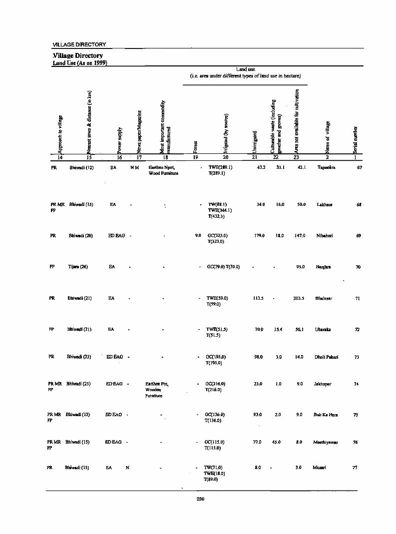
VILLAGE DIRECTORY
:Villaee Directory Land Use' (As on 1999)
]' r::
;,;;:.
J .M, • :1 .. -a ~ 0lil 2 ~
b
f "§
I 1 J Q,
:S- ~ 14 IS 16
PR Bhiwadi (12) EA
PRMR Bhiwadi (IS) EA FP
PR Bhiwadi (20) EDEAG
FP Tijara(26) EA
PR Bhiwadi (21) EA
FP Bhiwadi (21) EA
PR Bhiwadi (23) EDEAC
PRMR Bhiwadi (25) EDEAG FP
PRMR Bhiwadi (IS) EDEAO FP
PRMR Bhiwadi (15) BOEAG FP
PR Bbiwadi (IS) EA
~ '6 0
'" E
'1 E 8
~ I] ., Ii' .§~ "" i g Iii
~ E j!;; 17 18
NM Earthen Npot, Wood Furniture
-
-
- Eanhen Pot, Wooden Furniture
-
-
N
Land use (i.e. area under different types ofland use in hectare)
6 li
lID
~ r:: 'B '0 .e I r::~ ._ .. ~ .. ., I ~ ~ ~ Ii! ..
& 'ii .,
1 .!!5 i:i .;; .0
~ -a 11 0 ... !
0 , r:: .. t: _ u
'" 5 "iI ·s ai e ·c 0 'E III
'"' = i2 :S j!;; ."
19 20 21 22 23 2
TWE(289.1) 43.2 33.1 42.1 Tapookra 67 T(289.1)
TW(1I8.1) 34.0 16.0 50.0 Lakhnor 68 TWE(344.1) T(432.3)
9.0 GC(323.0) 179.0 18_0 147_0 Nibaheri 69 T(323.0)
- GC(39.0) T(39.0) 9S.0 Banjbra 70
- TWE(59.0) 113.5 203.S Bhalesar 71 T(S9.0)
- TWE(SI.!I) 70.0 15.4 56.1 Ubaraka 72 T(SI.S)
CC(19S.0) 98.0 3.0 14,0 DholiPahari 73 T(19S.0)
GC(216.0) 23.0 1.0 9.0 JBkhopur 74 T(216,0)
GC(136.0) 93.0 2.0 9.0 Bub Ka Hera 75 T(136.0)
GC(IIS.0) 77.0 45.0 8.0 Meethiyawas 76 T(IIS.O)
TW(71.0) 8.0 3.0 Musari 77 TWE(\8.0) T(89.0)
239
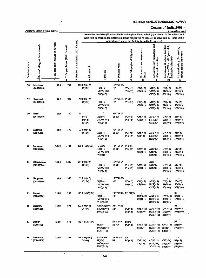
DISTRICT CENSUS HANDBOOK: ALWAR
Census of India 2001 -Panchayat Samiti : Tijam (0006) Amenities and
Amenities available (ifnot available within the village, a dash (-) is shown in the column and next to it in brackets the distance in broad ranges viz.<5 kms., 5-10 kms. and 10+ ktns of the
I I nearest 21ace where the facilit~ is available is given)
'" ... i
.. 0 g u u c: ..c: 8 .. 0 ~
5 6 .~ u ~ ..r:: 0 f 0 ~ :f ...:I 0
~ ~ ~ ] :t .s 6 !I
J ..c: .8 'S 'il .8 ~ .;;;: "3 .... "iii
~ .. 8- 0 6 .... ~ i "iii .If ..
0 ... .~ ]I "iii ..
B B .2 ~ 1 '5 ~ .g 11
c:n ~ ~ ::!1 i§ 2 3 4 5 6 7 8 9
78 Min:hooni 83.0 754 108 PM« 5) HPTWSS-(00804800) C(IO+) H(IO+) HP PO{< 5) CM«S) ACS«S) CV«S) BS«5)
MCW(IO+) PH« S) CP(IO+) NCS« 5) SP(IO+) RS(IO+)
PHC« 5) OCS«5) .ST(IO+) NW(IO+)
79 Jhundpuri 44.0 282 SOPM«5) HP TW SS- PH(2) (00804900) C(lO+) H(IO+) HP PO«5) CM«S) ACS«S) eV«S) BS«5)
MCW(S-IO) CP(IO+) NCS«5) SP(IO+) RS(IO+) paC« S) OCS«S) ST(IO+) NW(IO+)
80 Basai 47.0 107 18 HPTWW (00805000) P«S) H(JO+) SS-HP PO« S) CM«S) ACS«S) CV« 5) BS« S)
M«S) MCW(IO+) PH« S) CP{IO+) NCS(IO+) Sp(IO+) RS(IO+) C(10+) PHC«5) OCS(lO+) ST(lO+) NW(lO+)
81 Ladamka 138.0 372 73 P M« 5) HPTWW
{0080S I 00) C(IO+) H(lO+) SS-HP PO« S) CM«5) ACS«5) eV«5) BS«5) MCW(IO+) PH«5) CP{<5) NCS(IO+) Sp(IO+) RS(IO+)
PHC« 5) OCS(IO+) ST(IO+) NW(IO+)
82 Kamalpur 286.0 1,184 195 P MC(IO+) DCHW HPTWW PH(IO) (00805200) H(IO+) SS-HP PO{<S) CM«5) ACS(IO+) CV«S) BS«5)
MCW(IO+) CP(IO+) NCS(IO+) SP(IO+) RS(IO+) PHC(IO+) OCS(IO+) ST(IO+) NW(IO+)
83 Dheeriyawas 269.0 1,539 214PM«5) HPTWW ACS
(00805300) C(IO+) H(IO+) SS-HP PO{<5) CM«S) NCS(IO+) CV«S) BS«5) MCW(IO+) PH«5) CP(IO+) OCS(IO+) SP(IO+) RS(IO+)
PHC« 5) ST(IO+) NW(IO+)
84 Naugawan 89.0 386 S3 P M«5) HPTWSS-
(00805400) C(lO+) H(IO+) HP PO« 5) CM«S) ACS« S) CV«5) BS«5) MCW(IO+) PH« S) CP(IO+) NCS«'S) SP(IO+) RS(IO+)
PHC« 5) OCS«5) ST(IO+) NW(IO+)
85 Maseet 224.0 952 143 P MC(lO+) HP TW SS- PO PH(2) BS (0080SS00) H(IO+) HP CM(5-10) ACS«S) CV(5-10) RS(IO+)
MCW(IO+) CP(IO+) NCS«5) SP(IO+) NW(JO+) PHC(S-IO) OCS«5) ST(IO+)
86 Hasanpur 143.0 698 123 P M«5) CHWH(lO+) HPTWSS- BS
(00805600) C(IO+) MCW(IO+) HP PO{<5) CM(S-IO) ACS(S-IO) CV(S-IO) RS(IO+) PHC(S-IO) PH« S) 9p(10+) NCS(5-IO) SP(IO+) NW(IO+)
OCS(S-IO) ST(IO+)
87 Gelpur 168.0 878 133P MC(IO+) HPTWW PH(~) BS
(0080S700) H(IO+) SS-HP PO{< 5) CM(S-IO) ACS(5-IO) CV(S-IO) RS(IO+) MCW(IO+) Cp(IO+) NCS(5-IO) Sp(IO+) NW(IO+) PHC(S-IO) OCS(S-IO) ST(IO+)
88 Bhamraka 223.0 1,293 199 P M(5-10) PHSRMP HPWSS- PH . (00805800) C(lO+) H(IO+) HP PO«S) CM(IO+) ACS« S) CV(IO+) B8«5)
MCW(IO+) CP«5) NCS(IO+) 8p(10+) RS(IO+) PHC(S-IO) OCS(S-IO) ST(IO+) NW(IO+)
240
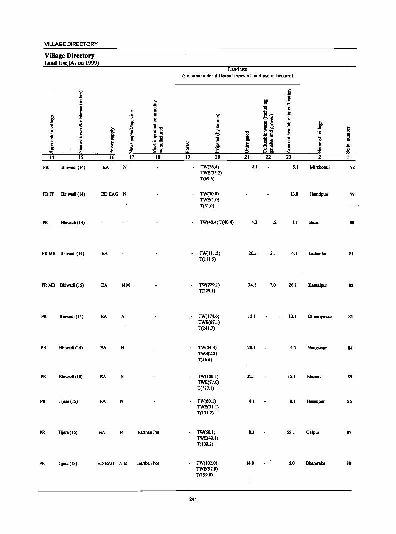
VILLAGE DIRECTORY
Villa~e Directory Land Use {As on 1999}
Land use (i.e. area under different types of land use in hectare)
j c: 0 .jj
e .~ DO ... .5
. ..,
j ..,
'g "3 0 u
l! ~ 1!~ ..
i I "Ii' .e
8 ~ ~:l ..
cij ~.., I! ~ i ::;: j 1 _g s i g_fi e: 1 .!! a to ." ~ ~ I II g ....
I .. .13 .:! 0
~ J J 1;l :I J ·E .. .. iii o Iii ·E ·2 ai e! ~ ·c
'" .. :s ~ ~ E '" :2 « fI)
14 IS 16 17 18 19 20 21 22 23 2 1
PR Bhiwadi (14) EA N TW(36.4) 8.1 5.1 Mirchooni 78 TWE(33.2) T(69.6)
PRFP Bhiwadi (14) IIDEAG N - TW(JO.O) 13.0 Jhundpuri 79 TWE(1.0) T(31.0)
PR Bhiwadi (14) - TW(40A) T(40.4) 4.3 1.2 1.1 Basai 80
PR MR Bhiwadi (14) EA - TW(1I1.5) 20.3 2.1 4.1 Ladamka 81 T(I I 1.5)
PR MR Bhiwadi (I S) EA NM - TW(229.1) 24.1 7.0 26.1 Kamalpur 82 T(229.1)
PR Bhiwadi (14) EA N TW(174.6) 15.1 12.1 Dheeriyawas 83 TWE(67.1) T(24 1.7)
PR Bhiwadi (14) EA N TW(54.4) 28.1 4.3 NaugaWBn 84 TWE(2.2) T(S6.6)
PR Bhiwadi (18) EA N TW(IOO.I) 32.1 15.1 Maseet 85 TWE(77.0) T(177.1)
PR Tijara(15) EA N TW(60.1) 4.1 8.1 Hasanpur 86 TWE(71.1) T(131.2)
PR TijBra(15) EA N Earthen POI TW(60.l) 8.3 59.1 Gelpur 87 TWE(40.1) T(IOO.2)
PR Tijara(18) EDEAG NM Earthen Pot TW(102.0) 18.0 6.0 Bhamraka 88 TWE(97.0) T(199.0)
241
DISTRICT CENSUS HANDBOOK: ALWAR
Census of India 2001 -Panchayat Samiti : Tijara (0006) Amenities and
Amenities available (if not available within the village, a dash (-) is shown in the column and
next to it in brackets the distance in broad ranges viz.<5 kms., 5-10 lans. and 10+ lans of the
I T nearest ~Iace where the facili!l: is available is g!venl
.g g ] ·~f u u .~ IS
..r:::
~ § .,
~ i :.= It,)
~ 6 'i ._ e
~-.. °i :.::, l::!- .e: ~ 8. 1A ~ &>0 fr g ;:;
i "li go u sen_ .!! ....l ..!l! Q 'i. rtl <Ill ~ l::!- i
b % 'il _. § ej u 11 ]1 .c:
.j Ji 6 = "5 o ._
<Ill is.g I!! IS '';:: _g I 1 c. ~ .g 8'
'l5 os "!:g-g ..0 ~ 1 'l5 Oil ]I ] .~ r3 . .,
~ e .§ ~ .2 ~ i ._ ~ 'l5 ~ 1>0 i "31 ~ t ] ~
., 01
., ]I ]I § B Tl e '"
~j ~ Ii._
'5 i ~ "0
~l H'S j ~] ~ ~ .,
~ 0 en jj;j :z; ~ e. eo ~""' I 2 3 4 5 6 7 8 9 10 11 12 13
89 Patan Kalan 313.0 729 106 P M« 5) PHSH(IO+) HP1WW PH (00805900) C(IO+) MCW(IO+) SS-HP PO«S) CM(S-IO) ACS«S) CV(IO+) BS(S-IO)
PHC(S-IO) CP«S) NCS(S-IO) SP(IO+) RS(IO+) OCS(S-IO) ST(1O+) NW(IO+)
90 Palan Khurd 282.0 941 118 HPTWW ACS (00806000) P«S) H(IO+) TKSS-HP PO«S) CM(S-IO) NCS(IO+) CV(S-IO) 88« 5)
M«S) MCW(IO+) PH(S-IO) CP(S-IO) OCS(IO+) SP(IO+) RS(IO+) C(IO+) PHC(S-IO) ST(IO+) NW(IO+)
91 Milakpur Turk 1,305.0 1,968 291 PM AC CHWH(IO+) HP1WW (00806100) C(IO+) MCW(IO+) TKSS-HP PO«S) CM(S-IO) ACS« S) CV(S-IO) BS(5-10)
PHC(S-IO) PH(S-IO) CP(S-IO) NCS(IO+) SP(1O+) RS(IO+) OCS(IO+) ST(10+) NW(10+)
92 Adeepur 491.0 61 WSS-W (00806200) P«S) H(lO+) PO(S-IO) CM(IO+) ACS(1O+) CV(IO+) BS(IO+)
M«S) MCW(1O+) PH(S-IO) CP(10+) NCS(IO+) SP(1O+) RS(1O+) C(IO+) PHC(IO+) OCS(IO+) ST(IO+) NW(10+)
93 Gotoli 9S7.0 1,349 191 PM« 5). DAH(IO+) HPWSS- PO PH
(00806300) C(IO+) MCW(IO+) HP CM(IO+) ACS«S) CV(IO+) BS(S-IO) PHC(IO+) CP(S-IO) NCS(1O+) SP(IO+) RS(IO+)
OCS(lO+) ST(IO+) NW(IO+)
94 Khidarpur 828.0 1,600 264P M S PUC DARMP HPWSS- PH ACS
(00806400) C(IO+) H(1O+) HP PO«S) CM(lO+) NCS(IO+) CV(IO+) BS(S-lO)
MCW(IO+) CP(IO+) OCS(IO+) Sp(IO+) RS(lO+) PHC(S-IO) ST(IO+) NW(IO+)
95 JBgmBIHeri 95.0 4SS 73 P M(S-IO) HPTWW PH BS (00806500) C(IO+) H(IO+) SS-HP PoeS-IO) CM(S-IO) ACS(S-IO) CV(IO+) RS(IO+)
MCW(IO+) CP(IO+) NCS(lO+) SP(10+) NW(IO+) PHC(IO+) OCS(lO+) ST(lO+)
96 MalBwas 105.0 297 44P HP1WW (00806600) M(S-IO) H(1o+) SS-HP PoeS-10) CM(S-IO) ACS(S-IO) CV(IO+) BS(S-IO)
C(S-IO) MCW(1O+) PH(S-lO) CP(lO+) NCS(lO+) SP(IO+) RS(IO+) PHC(IO+) OCS(IO+) ST(1O+) NW(IO+)
97 Chawandi 213.0 863 111 PAC HP1WW PH BS Khurd M(S-IO) H(lO+) SS-HP PoeS-10) CM(S-IO) ACS(S-lO). CV(lO+) RS(IO+) (00806700) C(10+) MCW(IO+) CP(lO+) NCS(IO+) SP(lO+) NW(IO+)
PHC(lO+) OCS(lO+) ST(IO+)
98 Dabbers 214.0 . S88 70P AC HP1WW (00806800) M« S) C(IO+) HOO+) TKSS-HP PO(S-IO) CM«S) ACS(S-IO) CV(IO+) BS«S)
MCW(lO+) PH(S-lO) CP(IO+) NCS(lO+) SP(lO+) RS(IO+) PHC(IO+) . OCS(IO+) ST(IO+) NW(IO+)
99 Binoliya 31S.0 1,043 - ISS P M AC(2) HPTWW (00806900) C(IO+) H(IO+) TKSS-HP PO(S-IO) CM«S) ACS(IO+) CV(IO+) B8« S)
MCW(IO+) PH(IO+) CP(lO+) NCS(lO+) Sp(IO+) RS(lO+) PHC(IO+) OCS(IO+) ST(IO+) NW(IO+)
242
VILLAGE DIRECTORY
ViIlaj!e Directory Land Use fAs on 1999}
Land use (i.c. area under different typeS of land usc in hectare)
j 5 °i
~ .?;> .~ .i: 8 :g
i~ ;; u
.! AI E ... I:
I oS
gfJ UJ .; E o.lJ :a 0 AI U J ~ ii j ~ lid
11 1 ~ I :;i .8 g ... e; 1 .!!5 ~ ~ ... ~ "0 ... ~ iii til· ~ 1 ~i 0 c e i ! u '5 c;; AI
~ ! ~ 5 ~ III 5 ~ 0 '5 "C! ~ .... "ji!I eo .ji!I .~ Iii ~ = i2 ji!I fa 14 IS 16 17 18 19 20 21 22 23 2 I .. - .
PR Tijara (23) BDBAO N 7.0 TW(IOI.O) 64.0 45.0 36.0 Patan Kalan 89 TWE(60.0) T(161.0)
PRMR Bhiwadi (18) BA 1.9 TW(l27.1) 95.1 11.0 46.4 Patan Khurd 90 FP T(127.1)
PRMR Bhiwadi (22) EA 253.6 TW(164.3) 242.1 121.5 523.1 Mllllkpur Turk 91 FP T(l64.3)
FP Tijara(IS) EDEAG - 181.0 TW(31.0) T(31.0) 9.0 34.4 236.0 Adeepur .92
PR Tijara (22) EDEAG N 96.0 TW(42.0) 378.0 53.0 367.0 Gotoli 93 TWE(21.0) T(63.0)
PR Tijara(2l) EA NM 71.0 TW(246.0) 182.0 83.0 Khidarpur '94 TWE(246.0) T(492.0)
PR Tijara (15) EA N - TW(71.0) 8.5 9.0 lagroal Heri 95 TWEe7.0) T(78.0)
FP Tijara (16) EA - TW(80.0) 7.0 3.0 Matawas 96 TWEeIS.O) T(95.0)
PRMR Tijara (13) EA N - TW(160.0) 4.0 5.0 39.7 Chawandi 97 TWE(4.0) Khurd T(164.0)
FP Tijara (II) EA - W(l99.0) 2.0 1.0 12.0 Dabbera 98 T(199.0)
FP Tijara (12) EA N W(225.0) 46.0 14.7 BinDliya 99 WE(29.0) T(254.0)
243
DISTRICT CENSUS HANDBOOK: ALWAR
Census of India 2001 -Panchayat Samiti : Tijara (0006) Amenities and
Amenities available (if not available within the village, a dash (-) is shown in the colunm and next to it in brackets the distance in broad ranges viz.<5 kms., 5-10 lans. and 10+ kms of the
I '? nearest (!lace where the facili!X is available is given)
-8 '? 5 ] tj..o u u u " '.::1 .2 ". ..c .. 0 ., " ] :.::::: u c Ii c ,. .!.!
.~ e 0 _g .~ ._ ~
1:,..... u c .!I 8. ~
co. '"3 if oS 0 :9 " t u ern,..... 0 11 ·i.!! d!I F.3 C _g ] .a .... §
~~ ,. ., u
~ ·1 1l :! '1:: j -! c
J 1 11 'i I ..c: d!I g . .g § cf r= 't:l ~ ~
. '" 01:1213 'J:) 0
~ ,.
e "3 't:l 1 ~;6 .~ ~ i B '''; co. ._ S .... 8. .. 00
., a ~ § .. 0 " .~ 01 .S 11 " ., ..c " ~i .~ 5._ s ~ 01 ~ ~ s § u ~ ~ tf 'i t '6 :I ~.5 ] a] ~ z -c
~ ·c
~ <li ra i?O !:!:I Q ~.e e;; ~rn I 2 3 4 5 6 7 8 9 10 11 12 13
100 SalBhera 384.0 543 93 PAC HPTWW (00807000) M«5) H(IO+) TKSS·HP PO« 5) CM«5) ACS«S) CV(IO+) BS«5)
C(IO+) MCW(IO+) PR(IO+) CP(IO+) NCS(10+) SP(IO+} RS(IO+) PHC(IO+) OCS(IO+) ST(IO+} NW(IO+)
101 Bichhala 263.0 1.429 260 P M«S} DAH(10+) HPTWW (00807100) C(IO+} MCW(S-IO) TKSS·HP PO« 5} CM«5) ACS«5) CV{IO+) BS{<5)
PHC{S-IO) PR{S.to) CP(S.IO) NCS(S-IO) SP(IO+) RS(ID+) OCS(S-IO) ST(IO+) NW(IO+)
102 Nanagheri 180.0 733 lOS P M(5-10) HPTWW BS (00807200) C(to+) H{IO+} SS-HP PO(5-10) CM(5-10) ACS(5-10) CV(IO+) RS{IO+)
MCW(IO+) PR(S-IO) CP(IO+) NCS(IO+) SP(IO+) NW(IO+) PHC(IO+) OCS(IO+) ST(IO+)
103 Rabhana 173.0 1,069 149P M AC HPTWW PO PH ACS BS (00807300) C(IO+} H(IO+) SS·HP CM(5.10) NCS(IO+) CV(IO+) RS(IO+)
MCW(IO+) CP(IO+) OCS(IO+) Sp(IO+) NW(IO+) PHC(IO+) ST(lO+)
104 Pavti 173.0 463 78 PM(5.10) HPTWW BS (00807400) C(10+) H(I()ot-) SS-HP PO(S-IO} CM(S·IO} ACS(5-10) CV(IO+) RS{I()ot-)
MCW(lO+) PR(S·IO) CP(IO+) NCS(IO+) SP(IO+) NW(IO+) PHC(IO+) OCS(IO+) ST(IO+)
lOS Abhanpur 249.0 516 69 P M(S-IO) HPWSS-(00807SOO) C(IO+} H(IO+) HP PO(S-IO) CM(IO+) ACS(S-IO) CV(IO+) BS(S-IO)
MCW(IO+) PR(S-IO) CP(S-IO) NCS(IO+) SP(IO+) RS(IO+) PHC(IO+) OCS(IO+) ST(IO+) NW(ID+)
106 Bhatkol 205.0 783 131 PM(5-10) HPWSS-(00807600) C(IO+) H(IO+) HP PO(S-IO) CM(IO+) ACS(S-IO) CV(IO+) BS(S-IO)
MCW(IO+) PR(S-IO) CP(S-IO) NCS(IO+) SP(IO+) RS{IO+) PHC(to+) OCS(IO+) ST(IO+) NW(IO+)
107 Siroli Kalan 695.0 1,627 216PM«S) HPTWW (00807700) C(IO+) H(IO+) SS·HP PO« 5) CM{IO+) ACS{<S) CV(I()ot-) BS{S·IO)
MCW(IO+) PH« S) CP(IO+) NCS(IO+) SP(I()ot-) RS(IO+) PHC(IO+) OCS(IO+) ST(IO+) NW(IO+)
108 Shadipur 419.0 209 23 PM(IO+) HPWSS-(00807800) C(IO+) H(IO+) HP PO(S-IO) CM{IO+) ACS{IO+) CV{IO+) BS(IO+)
MCW(IO+) PH(5.10) CP(IO+) NCS(IO+) Sp(IO+) RS(IO+) .PHC(IO+) OCS(IO+) ST(IO+) NW(IO+)
109 Siroli Khurd 185.0 360 S3PM«S) HPTWW (OO80mO) C(10+} H{IO+) SS·HP po{l()ot-) CM{IO+) ACS«S) CV(I()ot-) BS(S-IO)
MCW(IO+) PH« 5) CP(IO+) NCS(1O+) SP(IO+) RS(IO+) PHC{IO+) OCS(I()ot-) ST(IO+) NW{IO+)
110 AmeerNagar 267.0 562 88 P M«S) HPTWW (OO8080OO) C(IO+} H(IO+) SS-HP PO(IO+} CM(S-IO) ACS« S} CV(IO+) BS(S-IO}
MCW{IO+) PR(IO+} CP(IO+) NCS(IO+) SP(IO+) RS(IO+) PHC(IO+) OCS(IO+) ST(IO+) NW(IO+}
244

VILLAGE DIRECTORY
Vilis lie Directory Land Use (As on 1999)
] e j j
~ old sa ~ "§
I i -i!:O 14 15
FP Tijara (12)
.J 1 .?;>
§: VI '" "'" J ~
_.i!:O 1_6 17
PR Tijara (10) EA NM
PR Tijara (12) EA N
PRFP Tijara(12) EA N
PR Tijara(12) EA N
FP Tijara (18) EDEAG N
PR Tijara (21) EDEAG N
FP Tijara(IS) EA
FP Tijara(18) EDEAG -
PR Tijara (IS) EDEAG -
PR Tijara (14) EDEAG -
- .~ -g E E 8
11 .§ ~ t; ::I o Iii
--~-Iii 18
EanhenP~
Ghee
Land use (i.e. area under different types of land use in hectare)
..,. ~ 0
'" & "CI
i 1;; f 0 ·s
!:!:I = 19 20
W(336.5) T(336.5)
W(I77.6) WE(4R_0)
T(225.6)
- TW(llO.2) TWE(2.0) T(l32.2)
- TW(90.0) TWE(9.0) T(99.0)
- TW(llO.O) TWE(IO.0) T(140.0)
35.8 TW(26.0) TWE(12_0) T(38.0)
3.3 TW(S2_0) TWE(26.0) T{7B.O)
254.0 WE(5.0) TW(B2.0)
TWE(IS.O) T(102.0)
187.0
24.0 TW(43.0) T(43.0)
WE(122.0) T(122_0)
245
.1:1 1<1
~ .~ ] 1i U ... c ~ .g .- .. Ii :I ·c
"CI ~ Iii &i
i g ;1 ~ ~
_ u :; ::I
S.! !lb < 21 22 23
4.0 25.0 IR.O
16.0 15.0 6.0
36.0 2.0 10.0
51.0 S.O 18.2
IR_O 1.0 14.5
89.0 18.0 68.3
11.0 22.0 lO_8
211.0 18.8 109.0
62.0 10.0 160.0
34.2 1.1 71.1
23.1 122.1
• Ji ~ § .... 0 c .,
"iii Iii ·5 a::; !i!l 2 1
Salahera 100
Bichhala lOJ
Nanagheri 102
Rabhana 103
Pavti 104
Abhanpur 105
Bhatkol 106
SimliKalan 107
Shadipur 108
SimJiKhurd 109
AmeerNagar 110
DISTRICT CENSUS HANDBOOK: ALWAR
Census of India 2001 -Panchayat Samiti : Tijara (0006) Amenities and
Amenities available (if not available within the village, a dash (-) is shown in the column and
next to it in brackets the distance in broad ranges viz. <5 kms., 5-10 kms. WId 10+ kms of the
I ~ nearest elace where the facili!J! is available is sivenl
'" :g
1 "8 1 .,
fi..d' "
u ._ :s c ..c § ::l
., :::u 0 e i
.~ ._ ~ °i u l::!- f! ~&. u .,
0 '" 8. ~ ~ 0 "0 0 ]",~
<iii .;;: I::!- ~ 1 8 ~_,.§ =]h:
j ~ c '" ] ~ g.~ 0 :s
1 ~ .... 'iij _g 1!:g-g .&J ~ 0 ]. 'c; 1! ~ 'S ~ 8. lit 0 ., :B~i
~ .,
l .&J .~ .~ B i ~ .-III '3 ~ "0 .S 11
~ '" '" ~ u'" 1 2 3 4 5 6 7 12
III Peeplana 534.0 1,008 147 P M« 5) HPTWW PO PH (00808100) C(lO+) H(lO+) SS-1iP CM(S-IO) ACS«5) CV(lO+) BS« 5)
MCW(lO+) CP(IO+) NCS«5) SP(lO+) RS(10+) PHC(1O+) OCS(IO+) ST(IO+) NW(10+)
112 Nabi Nagar 2S6.0 83S 129 P M« S) HPTWW (00808200) C(IO+) H(IO+) SS-HP PO« S) CM(S-IO) ACS«S) CV(IO+) BS« 5)
MCW(IO+) PH« S) CP(IO+) NCS(IO+) SP(IO+) RS(IO+) PHC(IO+) OCS(IO+) ST(IO+) NW(IO+)
113 Jojalca 16S,O 909 139 P M C(IO+) HPTWW ACS (00808300) H(IO+) SS-HP PO« S) CM«S) NCS(IO+) CV(IO+) BS« 5)
MCW(IO+) PH«S) CP(S-IO) OCS(IO+) Sp(IO+) RS(IO+)
PHC(IO+) ST(IO+) NW(IO+)
114 Shekhpur 134,0 835 106 P M(S-IO) HPTWW PH BS Aheer C(IO+) H(IO+) SS-1iP PO(S-IO) CM(S-IO) ACS« 5) CV(S-IO) RS(IO+) (00808400) MCW(S-IO) CP(S-IO) NCS« 5) SP(S-IO) NW(IO+)
PHC(IO+) OCS«5) ST(S-IO)
115 Ishroda 1,085,0 3,588 587 P(2) M S DDAH(IO+) TIiPTW POPH(lS) CM ACS (00808500) C(IO+) MCW(IO+) WTKS5- CP(IO+) NCS(IO+) CV(IO+) BS(5-10)
PHC(IO+) liP OCS(IO+) SP(lO+) RS(S-IO) 5T(10+) NW(IO+)
116 Bhojawas 254.0 S70 101 P M(S-IO) IiPTWW (00808600) C(IO+) H(IO+) RSS-HP PO(S-IO) CM(IO+) ACS(IO+) eV(IO+) BS(IO+)
MCW(IO+) PH(lO+) CP(IO+) NCS(IO+) Sp(IO+) RS(IO+)
PHC(IO+) OCS(IO+) ST(lO+) NW(IO+)
117 Sarlcanpur 162,0 581 104PM(S-10) HPTWW (00808700) C(IO+) H(IO+) RSS-1iP PO(S-IO) CM(S-IO) ACS(S-IO) CV(S-IO) BS(S-IO)
MCW(S-IO) PH(S-IO) CP(S-IO) NCS(S-IO) SP(S-IO) RS(IO+)
PHC(S-IO) OCS(S-IO) ST(IO+) NW(10+)
118 Ml\iraPeepli 158.0 724 108 P M(S-IO) IiPTWW (00808800) C(lO+) H(lO+) RSS-1iP PO(S-IO) CM(S-IO) ACS(S-IO) eV(S-IO) B8(S-IO)
MCW(S-IO) PH(S-IO) CP(S-IO) NCS(S-IO) SP(S-IO) RS(lO+)
PHC(S-IO) OCS(S-IO) ST(S-IO) NW(IO+)
119 BamanThedi 264.0 661 120 P AC(3) HPTWW (00808900) M«S) H(IO+) SS-1iP PO« S) CM«S) ACS« S) eV(S-IO) BS(S-IO)
C(IO+) MCW(S-to) PH(S-IO) CP(S-IO) NCS(S-IO) Sp(IO+) RS(IO+) PHC(S-IO) OCS(S-IO) ST(IO+) NW(10+)
120 Rambas 3S6.0 1,27S 213 PM«5) HPTWW Jhonpri C(IO+) H(IO+) SS-HP PO«S) CM«S) ACS«S) CV(S-IO) BS« S) (00B09000) MCW(5-10) PH«5) CP(5-lD) NCS(lD+) 8P(10+) RS(1D+)
PHC(S-IO) OCS(IO+) ST(1O+) NW(IO+)
121 Salarpur 183.0 942 144 P M(S-IO) HPTWW (00809100) C(IO+) H(IO+) S5-1iP PO(S-IO) CM(S-IO) ACS(S-lO) CV(S-IO) BS(5-10)
MCW(IO+) PH(S-IO) CP(S-IO) NC8(S-IO) sp(S-IO) RS(IO+) PHC(S-IO) r: OCS(S-JO) ST(5-10) NW(IO+)
246
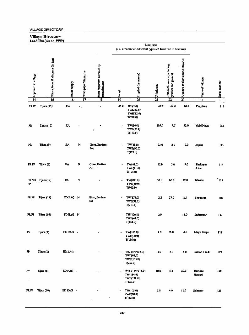
VILLAGE DIRECTORY
Villaee Directory Land Use {As on 1999}
Land use (i.e. area under different types ofland use in hectare)
i c .2 til g ~ co ...
:a .5 .~
.1 ., c -g u E ]- .e
~ I ~ .., ~
;:;:..:l
I "0 u
I! ~ ~ ~ ~1! .. sa i t £
'01 ~
u "0 iO .0
1 .!~ i ...!is ~ 1 1] 0 .... 1;; c
i J ~ 1;; :§
c " "iI
~ iii I!! ~ i ~ 5 Q. C ·s c .(:
:!i ·20 20 ~ Ii i2 « 20 u
!:l:I = fa 14 IS 16 17 18 19 20 21 22 23 2
PRFP Tijara(IJ) SA 46.0 WE(S.O) 67.0 61.0 90.0 PeeplanB III TW(2S3.0) 1WE(12.0) T(270.0)
PR Tijara (12) SA TW(30.0) 105.0 7.7 33.0 NabiNagar 112 1WE(80.0) T(lIO.O)
PR Tijara(9) EA N Ghee. Earthen TW(38.0) 23.0 2.0 12.0 JOjBka 113 Pol TWE(90.0)
T(l28.0)
PRFP Tijara (8) EA N Ghee. Earthen - TW(64.0) 15.0 S.O 9.0 Shekhpur 114 Pot TWE{41.0) Aheer
T(IOS.O)
PRMR Tijara(12) EA N - TW(1J03.0) 37.0 66.0 31J.0 Ishroda lIS FP TWE(40.0)
T(943.0)
PRFP Tijara (13) ED~G N Ghee •. Earthen TW(l7S.0) 2.2 23.0 16.1 Bhojawas 116 Pot 1WE(38.1)
T(213.1)
PRFP Tijara (10) EDEAG N TW(100.0) 2.9 15.0 Sarkanpur 117 TWE(44.0) T(J44.0)
PR Tijara(7) EDEAG - - TW(I06.0) 1.0 16.0 4.6 Majra Peepli 118 TWE(30.0) T(136.0)
FP Tijara (8) EDEAG - W(2.0) WE(8.0) 3.0 3.0 8.0 BBmanThedi 119 TW(IOS.O) TWE(13S.0) T(2S0.0)
FP TijalB (6) EDEAG - W(S.O) WE(II.O) 10.0 6.0 20.0 Rambas 120 TW(I84.0) Jhonpri TWE(J20,0) T(320.0)
PRFP TijalB (10) EDEAG - TW(IOS.O) 3.0 4.0 11.0 Salarpur 121 TWE(60.0) T(l6S.0)
247
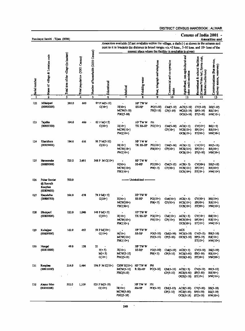
DISTRICT CENSUS HANDBOOK: ALWAR
Census ofIndia 2001 -Panchayat Samiti : Tijam (0006) Amenities and
Amenities available (if nol available within the village, a dash (-) is shown in the column and
next to il in brackets the distance in broad ranges viz.<51ans., 5·10 kms. and 10+ kms of the
I 'i nearest Illace where the facili!l! is available is Biven)
~ 'i 5 -a ",_Li 8 u lii .! ..2 l! UI § !!
., !
of 1:1
~ ;> :.= u .!:l .51 g II .... ._ ~ e,....
] j C'.. ... 13 .§ c
~ f § ~ il _ c. ... ... SCll~ "0 ~ l~ _. §
cIlI ~ C!- ii "E iJ " -e] .~ j .. 1:1 g "5 -l3 c , 1 ij 'i .~ jj 'iI ~~:a ~ 'a ..c:
]I ]:9::0 'Ei .... 1 ~ ~ 0 'il i u ~ .... 8: ... f ~ '§
0 .8 i 'jj
«I .,
~ ~ ~ ~ I I§j ~ ~J: 'p ~ 2·- ~ ., 'p !!:1l So.! .~ !i!! !:Y 9 ~ !!I ~ra 1 2 3 4 S 6 7 8 9 10 11 12 13
122 Milakpuri 205.0 663 97 P M(S-IO) HP1WW (00809200) C(IO+) H(IO+) SS-HP PO(S-IO) CM(S-IO) ACS(S-IO) CV(S-IO) BS(S-IO)
MCW(S-IO) PH(S-IO) CP(S-IO) NCS(S-IO) SP(S-IO) RS(lO+) PHC(S-IO) OCS(S-IO) ST(S-IO) NW(IO+)
123 Tajalka 194.0 460 62PM«S) HPTWW PH (00809300) C(IO+) H(IO+) TKSS·HP PO(IO+) CM(S-IO) ACS«S) CV(IO+) BS«S)
MCW(IO+) CP(IO+) NCS(IO+) SP(IO+) RS(IO+) PHC(IO+) OCS(IO+) ST(IO+) NW(IO+)
124 Kharkhara 194.0 616 91 P M(S-IO) HPTWW (00809400) C(IO+) H(lO+) TKSS·HP PO{I 0+) CM(S-IO) ACS«S) CV(IO+) BS(5-10)
MCW(JO+) PH(IO+) cP(1O+) NCS(IO+) Sp(JO+) RS(JO+) PHC(IO+) OCS(IO+) ST(S-IO) NW(IO+)
125 Hameeraka 720.0 2,691 368 P M C(IO+) HPTWW (00809500) H(lO+) SS-HP PO(IO+) CM(5-10) ACS«S) CV(lO+) B8(S-10)
MCW(IO+) PH« 5) CP(lO+) NCS(IO+) SP(IO+) RS(IO+) PHC(IO+) OCS(IO+) ST(IO+) NW(IO+)
126 Pahar Samlat 700.0 --Uninhabited --@Roondh Roopbas (00809600)
127 Damdafha 164.0 478 74PM«S) HPTWW (00809700) C(10+) H(10+) SS-HP PO{IO+) CM(IO+) ACS«S) CV(IO+) 8S(10+)
MCW(IO+) PH«S) CP(IO+) NCS(lO+) SP(IO+) RS(IO+) PHC(IO+) OCS(lO+) 8T(10+) NW(IO+)
128 Dhakpuri 122.0 1,046 148 PM«5) HPTWW (00809800) C(IO+) H(IO+) TKSS-HP PO(IO+) CM(IO+) ACS«S) CV(IO+) 8S(10+)
MCW(IO+) PH(IO+) CP(IO+) NCS(IO+) SP(IO+) RS(IO+) PHC(IO+) OCS(1O+) 8T(10+) NW(IO+)
129 Kultajpur 142.0 453 58 PM(IO+) HP1WW ACS (00809900) C(IO+) H(IO+) SS-HP PO(S·IO) CM(5-10) NCS(S-IO) CV(S.IO) 8S(S-10)
MCW(IO+) PH(S·IO) CP(S-IO) OCS(S-IO) SP(S-IO) RS(IO+) PHC(IO+) ST(IO+) NW(IO+)
130 Nangal 49.0 138 21 HP1WW (00810000) P«S) H(IO+) SS-HP PO(S-IO) CM(S·IO) ACS«S) CV(S-IO) BS(S-IO)
M«S) MCW(S.IO) PH«S) CP(S-IO) NCS(S.IO) SP(S-IO) RS(IO+) C(10+) PHC(S-IO) OCS(S'IO) ST(IO+) NW(IO+)
131 Roopbas 314.0 1,464 196P MC(IO+) CHWH(IO+) HP1WW PH (00810100) MCW(S-10) RSS-HP P~(S-IO) CM(S-IO) ACS«S) CV(S-IO) BS(S-IO)
PHC(S-IO) CP(S-IO) NCS(S-IO) SP(S-IO) RS(IO+) OCS(S-IO) ST(IO+) NW(IO+)
132 AlapurMeo SS2.0 1,109 125 PM(5-10) HPTWW PH (00810200) C(IO+) H(IO+) SS-HP PO(S-IO) CM(S-IO) ACS(S-IO) CV(S-IO) 8S(5-10)
MC;W(S-IO) CP(S-IO) NCS(S-IO) SP(S-IO) RS(S-IO) PHC(S·IO) OCS(S-IO) ST(S-IO) . NW(IO+)
248
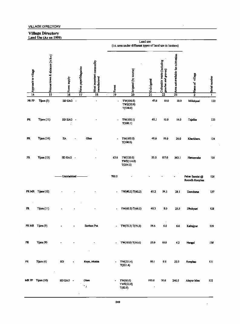
VILLAGE DIRECTORY
Villale Directory Land Use (As on 1999)
E ... g ~
tI ;g ~ I ~ ! :e 8
oI!I ~"O .:;:
~ j s ~ &.e
1i .5 j I .. g,
~ ~ i II i :!: ~ !!:t .~ ~ E 14 15 16 17 18
PRFP Tijara(S) EDEAG -
PR Tijara (11) EDEAG -
PR Tijara(14) EA Ghee
PR Tijara(13) EDEAG -
--Uninhabited--
PRMR Tijara(12)
PR Tijara(lI)
PR MR Tijara (9) Earthen POI
PR Tijara(9)
PR Tijara(6) ED Rope.Mudda
MR FP Tijam (10) EDEAG - Ghee
":\
Land use (i.e. area under different types of land use in hectare)
'i>
i e: I ~
0 'E I!:t = 19 20
- TW(106.0) TWE(l2.0) T(ll8.0)
- TW(IOO.l) T(IOO.I)
- TW(100.0) T(IDO.O)
63.0 TW(120.0) TWE(114.0) T(234.0)
700.0
- TW(40.2) T(40.2)
- TW(40.2) T(40.2)
- TW(7S.3) T(7S.3)
- TW(IO.0) T(IO.0)
- TW(22L4) T(221.4)
• TW(60.0) TWE(22.0) T(12.0)
249
1 'E 'j;l t2 21
47.0
65.1
49.0
53.0
41.2
48.3
54.4
25.0
SO.l
193.0
~ j
~ "3 u
1! ...... .. oS ;::.;J .,
j & ~
1 ~1l
1~ 0 c os
all e :!:
22 23
10.0 10.0
IS.O 14.0
19.0 26.0
107.0 263.1
54.1 28.1
B.O 25.5
6.0 6.6
10.0 4.2
9.0 l3.0
30.6 246.0
j ..i! :; § ...
0 t:: .. iii Ii '5 ;so fQ
2 1
Milakpuri 122
Tajallea 123
Kharkhara. 124
Hamceralea 12S
Paher Samla! @ 126 Roondh Roopbas
Damdama 127
Dhakpuri 12B
Kultajpur 129
Nanpl 130
Roopbas 131
AlapurMeo 132

DISTRICT CENSUS HANDBOOK: ALWAR
Census of India 2001 -Panchayat Samiti : Tijara (0006) Amenities and
Amenities available (if not available within the village, a dasb (-) is shown in the column and
next to it in brackets the distance in broad ranges viz.<5 kms., 5-10 kms. and 10+ kms of the ';i;' nearest place where the facility is available is given)
I iii .. Ii ... -;;;- IJ .D" 0 ~ u u '" ~-n .! .c ., ::; § .,
g 8 <:> , :M~ C!. .c
j Co u 8 -l:I .,
]~,_ .3 !l "il r:: C;!. ~ 1
_- e ;. "3 'iii .~
f .s § J i u.c 0 .. "il 8 .l::: . "" ~ = .... .. 1:-g-g .:; 0 "3 ..... .. 8: 0
'Q ~ i .... G n 0 ... ~
]I l ~ Ii ._ 5 .5 i
~ u." 3 4 5
133 Palpur 528.0 1,781 203 P M(S-10) HPTWW (00810300) C(S-10) H(10+) S8-HP PO(S-10) CM(S-10) ACS«S) CY(S-IO) BS(S-IO)
MCW(S-IO) PH(S-IO) CP(S-IO) NC8«S) SP(S-IO) RS(S-IO) PHC(S-IO) OCS«S) ST(JO+) NW(JO+)
134 Baliyawas 286.0 1,061 154 P M(S-IO) HPTWW (00810400) C(JO+) H(IO+) SS-HP PO«S) CM«S) ACS«5) CY(S-IO) BS«S)
MCW(S-lO) PH«S) CP« 5) NCS«5) SP(S-IO) RS(IO+) PHC(S-IO) OCS«S) ST(S-IO) NW(IO+)
135 Luhadera 379.0 1,664 2S1 PM AC DAH(5-10) THPTW PH (00810S00) C(IO+) MCW(S-IO) WSS-HP PO(S-IO) CM(S-IO) ACS« S) CV(S-IO) BS(S-IO)
PHC(S-IO) CP(S-IO) NCS(S-to) SP(IO+) RS(IO+) OCS(S-IO) ST(IO+) NW(lO+)
136 Hcengwahera 450.0 2,241 386P(2) M S PHSH(IO+) HPTWW PO PH (00810600) C(IO+) MCW(S-IO) SS-HP CM«S) ACS« S) CV(S-IO) BS(S-IO)
PHC(S-IO) CP(S-IO) NCS(S-IO) SP(S-IO) RS(S-IO) OCS(S-IO) ST(S-IO) NW(10+)
137 Mundana 496.0 803 117P M AC HPTWW PO (00810700) C(5-10) H(IO+) RSS-HP PH(S-IO) ~S-IO) ACS(IO+) CV(S-IO) BS(S-IO)
MCW(S-IO) CP{5-IO) NCS{IO+) SP(S-IO) RS(IO+) PHC(S-IO) OCS(IO+) ST(IO+) NW{IO+)
138 JalBlpur 457.0 1,446 206P M S HPTwW (00810800) C(S-lO) H(IO+) RSS-HP PO«S) CM(IO+) ACS(IO+) CV(lO+) 8S(10+)
MCW(IO+) PH(IO+) CP(IO+) NCS(IO+) SP(lO+) RS(IO+) PHC(IO+) OCS(lO+) ST(IO+) NW(IO+)
139 Kalpon 621.0 1,533 224 P(4) M« 5) RMPH(I()+) HPTWW POPH(7) (00810900) C(5-10) MCW(S-IO) SS-HP CM(S-IO) ACS(S-IO) CV(S-IO) BS(S-IO)
PHC(.s-IO). CP(S-IO) NCS(S-IO) Sp(IO+) RS(IO+) OCS{S-lO) ST(IO+) NW(1O+)
140 MBjri GoojBr 256.0 1,290 198 P M« S) HPTWW (00811000) C(IO+) H(IO+) SS-HP PO«S) CM«S) ACS« 5) CV(S-IO) B8(S-10)
MCW(5-10) PH(S-Ioj CP(S-IO) NCS(S-IO) SP{IO+) RS(IO+) PHC(S-IO) OCS{S-IO) ST{IO+) NW{IO+)
141 Udaipur 204.0 627 110 P M« 5) HPTWW (00811100) C(5-10) H(1O+) SS-HP PO(S-IO) CM{S-IO) ACS(IO+) CV(1O+) BS(S-IO)
MCW{IO+) PH(5-IO) Cp(IO+) NCS{IO+) SP(IO+) RS(IO+) PHC(IO+) OCS{IO+) ST(IO+) NW(IO+)
142 Dhaki 172.0 911 IS6P MAC RMPH(IO+) HPTWW PH (00811200) C(S-IO) MCW(IO+) SS-HP PO« 5) CM(S-IO) ACS(5-IO) CV(S-to) 88«5)
PHC(S-IO) CP(S-IO) NCS(IO+) SP(IO+) RS(IO+) OCS(IO+) ST(IO+) NW(IO+)
143 Bandra 229.0 1,190 188 P(2) M« 5) HPTWW PO PH (00811300) C(S-IO) H(IO+) SS-HP CM(IO+) ACS«S) CV(IO+) . BS(S-IO)
MCW(IO+) CP(IO+) NCS(IO+) SP(IO+) RS(IO+) PHC(lo+) OCS(IO+) ST(IO+) NW(IO+) .
250
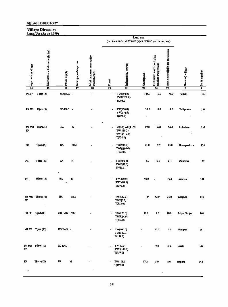
VILLAGE DIRECTORY
VilIal!e Directory Land Use lAs Oil 19991
Land use
(Le. area under different types of land use in hectare)
E .§ ... 1;1 c
.~ ~ .~ :::.
.1 "0 'g '3 C> C> ., e 13 ..
j E I c ~ oS ._ ., B '-' .. U "0 !! ~ ~ ~ ~ eli!
i1 0
~! .?;- ~ '" 'ii .8 s ~ §: i e: "0 ..!! Iii ;; '> § .. .c i ·14 .. .5 ~ i ~~ 0 ...
til 0 c .'~ i J ~
1il 'E 03'5 c u
i S Iii ~ .. i "" 0 :§ '8 ~i ~ :S ,.ii::i ;;§ Ii !:!:I i2 ii::i S!2
14 IS 16 ]7 18 19 20 21 22 23 2 '1
PRFP TijRra (.5) EDEAG TW(198.0) 144.0 10.0 76.0 PRlpur 133 TWE(IOO.O) T(298.0)
PRFP Tijara (S) EOEAG . · TW(I.50.0) 38.0 S.O 19.0 Baliyawas 134 TWE(7J.0) T(22 1.0)
PRMR Tijara(S) EA N · W(B.I) WE(1I.9) 29.0 '6.0 24.0 LuhRdera 13.5 FP TW(I80.2)
TWE(119.8) T(320.0)
PR Tijara(S) EA NM · TW(200.0) 23.0 7.9 25.0 Hcengwahcra 136 TWE(194.0) T(394.0)
PR TijBra (10) EA N · TW(400.3) 4.0 19.0 30.0 Mundane 137 TWE(43.0) T(443.3)
PR Tijara(13) EA N TW(300.0) 40.0 19.0 Jalalpur 138 TWE(98.3) T(398.3)
PRMR TijBra(IO) EA NM TW(S52.0) 1.0 42.0 23.0 Kalgaon 139 FP TWE(3.0)
T(5SS.0)
PRFP Tijara(8) EDEAG NM TW(220.0) 10.9 1.0 10.0 Majri GoojRr 140 TWE(14.0) T(234.0)
MRFP Tijara(13) EDEAG .. TW(100.0) 10.0 5.1 Udaipur 141 TWE(89.0) T(189.0)
PRMR TijBra (10) EDEAG . . TW(S7.0) 9.0 6.0 DhRki 142 FP TWE(100.0)
T(IS7.0)
FP Tijara(12) EA N TW(199.0) 17.2 S.O S.O Sandra 143 T(199.0)
. , . . ,
251
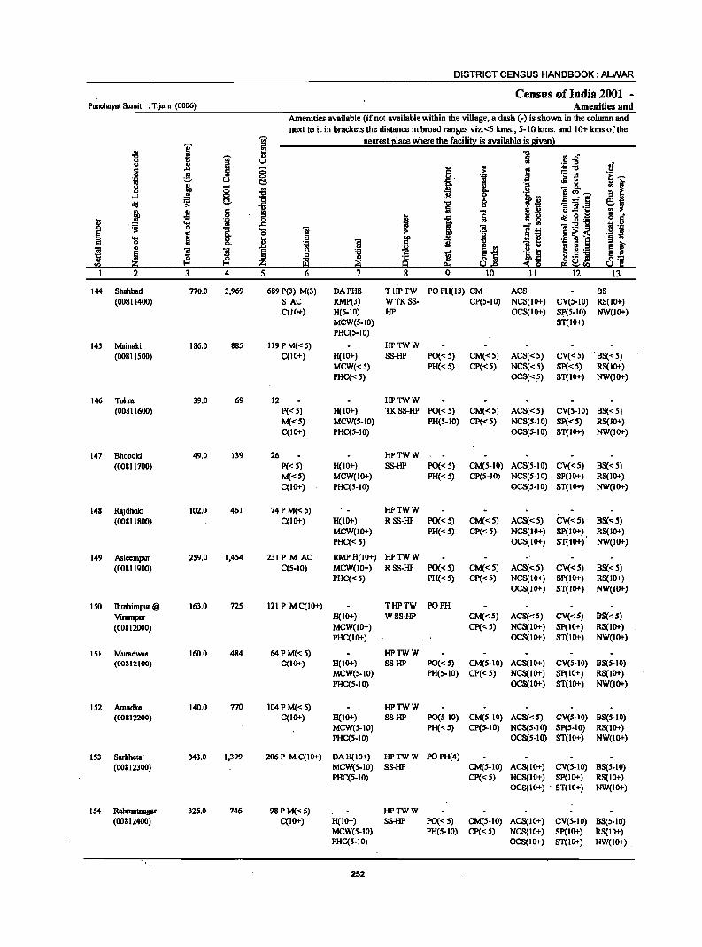
DISTRICT CENSUS HANDBOOK: ALWAR
Census of India 2001 -Panchayat Samiti : Tijam (0006) Amenities and
Amenities available (if not available within the village, a dash (-) is shown in the column and next to it in brackets the distance in broad ranges viz.<5 krns., 5-10 lans. and 10+ lans of the
i 1: nearest I!lace where the facili!l: is available is Biven l ., "5 "C
~ " "'..; 0 u ,sa :s ff <> ..
6 .c ~ ;; .. .. ] ::u
g § > ._ e 'e; ~ 0
1 .~ u t:!- .c . J!&. ~ I ~ ." "3 ;:; .. i u
]:'j ....l 0 .... ·c ~ ~ t:!- ~ ." :jP·H ~~ Iii
(.J B 2·.: j .s 6 8 "5 IS .2
i '"iii i! .c ". ~ "lIsg .~ § ..... .c ~ ]:9"8 ~ 0 "3 'E "ia ~ :3 ]:6 .§ 'j .. 8: § !:! .2 ~] 'E ~ II "" .!! § .,
.~ "ia .5 11 'U 1i ~ E ~ "ia ., u
~ §j i 5·._ ·c ~ ! ]I § :;I 'g ~ .~ D ~.5 N 8= II) ~ z i!l ~ ~ ~ :s~ 5;l C "" 9::1 ~!!I
2 3 4 5 6 7 8 9 10 11 12 13
144 ShahbBd 770.0 3,969 689 P(3) M(3) DAPHS THPTW POPH(13) CM ACS BS (00811400) SAC RMP(3) WTKSS· CP(S·IO) NCS(1O+) eV(s·IO) RS(IO+)
C(lO+) H(S.IO) HP OCS(IO+) sp(S·IO) NW(IO+) MeW(S.IO) ST(IO+) PHC(5·10)
14S Mainaki 186.0 88S 119 P M« S) HPTWW (0081 I SOD) C(IO+) H(IO+) SS·HP PO{< S) CM«S) ACS«S) eV«S) B8« S)
MeW«S) PH«S) Cp«S) NCS«S) SP«S) RS(lO+) PHC« 5) OCS«S) ST(IO+) NW(IO+)
146 Tohra 39.0 69 12 HPTWW (00811600) P«S) H(IO+) TKSS-HP PO«S) CM«S) ACS«S) CV(S-IO) BS« S)
M{<S) MCW{S-IO) PH(S-IO) CP«S) NCS(S-IO) SP«5) RS(IO+) C(IO+) PHC(S-IO) OCS(S-IO) ST(IO+) NW(IO+)
147 Bhoodki 49.0 139 26 HPTWW (00811700) P«S) H(IO+) SS·HP PO{< S) CM(S.IO) ACS(5-IO) ev« 5) BS« 5)
M{<S) MCW(IO+) PH«5) CP(S-IO) NCS{S-IO) SP(lO+) RS(IO+) C(IO+) PHC(S-IO) OCS(S-IO) ST(IO+) NW(IO+)
148 RBjdhoki 10i.0 461 74 P M«5) HPTWW (00811800) C(IO+) H(10+) RSS-HP PO« 5) CM«S) ACS«S) CV«S) BS«S)
MCW(lO+) PH«S) CP«S) NCS(IO+) SP(IO+) RS(JO+) PHC«S) OCS(IO+) ST(lO+) NW(IO+)
149 Asleempur 2S9.0 1,454 231 PM AC RMPH(IO+) HPTWW (00811900) C(S-IO) MCW(IO+) RSS-HP PO«S) CM«S) ACS«5) CV«S) BS« S)
PHC« 5) PH«5) Cp« 5) NCS(IO+) SP(IO+) R8(10+) OCS(IO+) ST(IO+) NW(lO+)
ISO Ibrahimpur @ 163.0 725 121 P M C(IO+) THPTW PO PH Virampur H(IO+) WSS-HP CM«5) ACS«S) CV«S) B8« S) (00812000) MCW(JO+) Cp« S) NCS(lO+) Sp(IO+) R8(J0+)
PHC(IO+) OCS(IO+) ST(JO+) NW(lO+)
151 Muradwas 160.0 484 64 P M(<: S) HPTWW (00812100) C(IO"') H(IO+) SS-HP PO« S) CM(S-IO) ACS(IO+) CV(S-IO) BS(5-IO)
MCW(S-IO) PH(S-IO) CP«S) NCS(IO+) Sp(IO+) RS(lO+) PHC(5·10) OCS(IO+) ST(IO+) NW(IO+)
IS2 Arandka 140.0 770 104 P M« S) HPTWW (00812200) C(IO+) H(IO+) SS-HP PO(S-IO) CM(S-IO) ACS« S) CV(S-IO) BS(5-IO)
MCW(S-IO) PH«S) CP(S-IO) NCS(S-IO) SP(S-IO) RS(IO+) PHC(S-IO) OCS(S-lO) ST(lO+) NW(IO+)
IS3 SBrhheta· 343.0 1,399 206 P M C(IO+) DAH(IO+) HPTWW POPH(4) (00812300) MCW(S-IO) SS-HP CM(S-lO) ACS(lO+) CV(S-IO) BS(S-IO)
PHC(5-10) CP«S) NCS(lO+) SP(IO+) RS(IO+) OCS(IO+) . ST(IO+) NW(IO+)
154 Rahmatnagar 32S.0 746 98 P M« S) HPTWW (00812400) C(IO+) H(IO+) SS-HP PO«S) CM(S-IO) ACS(IO+) CV(S·IO) BS(S·IO)
MCW(S-IO) PH(S-IO) Cp«S) NCS(IO+) SP(IO+) RS(IO+) PHC(S-IO) OCS(IO+) ST(lO+) NW(IO+)
252
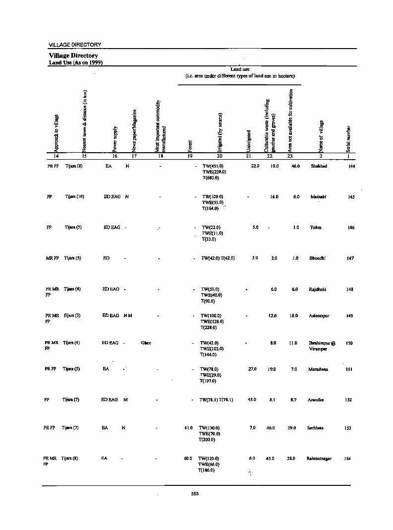
VILLAGE DIRECTORY
VilIa2e Directory Land Use !As on 1999}
Land use
(i.e. area under different types of land use in hectare)
j c
·i g ~ .Ff ~ 8 '6 -g ., 0 u
! E U .. j i § I
c .-.. oS ._ '" '-' .. ..
== oij
i"" i! i! ~ >
J 'ii .8 .s 1 &.~ ~ "" 1; .~
! ..!! Iii ~ M !: .5.M "" ~i! g OS
J i c
~ J ! ~ '8 c ., 1;; ::s a u ! III 'iii
~ ~ 0 '5 ·s ai li .=:1: ~ !!:t 0= i2 « ~ <Il
14 15 16 17 18 19 20 21 22 23 2
PRFP Tijara (8) EA N TW(4SS.0) 22.0 19.0 46.0 Shahbad 144 TWE(228.0) T(683.0)
FP Tijara (10) EDEAG N - TW(109.0) 16.0 6.0 Mainaki 14S TWE(SS.O)., T(I64.0)
FP Tijara(S) EDEAG - - TW(22.0) S.O 1.0 Tohra 146 TWE(II.O) T(33.0)
MRFP Tijara (5) EO TW(42.0) T(42.0) 3.9 2.0 1.0 Bhoodki 147
PRMR Tijara (4) EOEAG - TW(SO.O) 6.0 6.0 Rajdhoki 148 FP TWE(40.0)
T(90.0)
PRMR Tijara (3) EDEAG NM TW(100.0) 12.6 18.0 AsIcempur 149 FP TWE(128.0)
T(228.0)
PRMR Tijara(4) EO BAG - Ghee - TW(42.0) 8.0 11.0 Ibrahimpur@ ISO FP TWE(102.0) Virampur
T(I44.0)
PRFP Tijara(S) EA - TW(78.0) 27.0 19.0 7.0 Muradwas lSI TWE(29.0) T(l07.0)
FP Tijara (7) EOEAG M - TW(78.1) T(78.1) 45.0 8.1 8.7 Arandka 152
PRFP Tijara (7) EA N 61.0 TW(130.0) 7.0 46.0 29.0 Sarhheta 153 TWE(70.0) T(200.0)
PRMR Tijara (8) EA 60.0 TW(120.0) 6.0 45.0 28.0 Rahmatnasar 154 FP TWE(66.0)
T(186.0) !.,
253
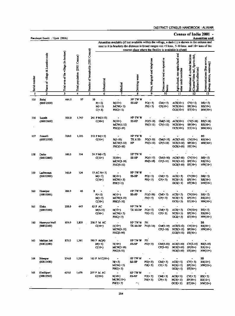
DISTRICT CENSUS HANDBOOK: ALWAR
Census of India 2001 -Panchayat 8amiti : Tijaro (0006) Amenities and
Amenities available (ifnot available within the village, a dash (-) is shown in the column and next to it in brackets the distance in broad ranges viz. <5 kms., 5-10 kms. and 10+ kms of the
I ]" nearest [!Iace where the faci1it~ is available is given~ ., a ] [(l.o '0 ]" " c U .'" .2 .!f u l! ~ ~
., i :.:: 0
S g 8 0
"I .- £!
~--·tiI u c ]. ~ 0
~ j 8 .;g .2 1~-., f
1 'B 0
!·i ~, old ~ C ] 8 - 'iii § :I .c '':::
" ~ .g ] ~.~ u S .~ § .8 gp , .c oIdS:g ~
.... as .c ~ "il ]:9 'B .~ 0 "El ... 1 ]:5 § g 8: 0 'E:! .S! ~ i '§ ~ ..... a j!ll i -3 ~ c 0 ] " ~ f 'iii .. '3 !
.s>
~ ~ e ., ~j
! Ii._ '5 ~ Iii "<:J s ~l ~ E.~ I"Il ~ Z III ~ i§ I!:l ~:c I 2 3 4 5 6 7 8 9 10 II 12 13
15S Baloj 444.0 97 10 HPTWW
(00812500) P«S) H(IO+) 88-HP PO«S) CM«5) AC8(10+) CV«S) B8«5) M«S) MCW«S) PR« 5) CP(IO+) NCS(II>+) 8P(II>+) RS(IO+)
C«S) PHC« 5) oeS(lo+) ST(W+) NW(II>+)
1S6 Lapala 50S.0 1,747 241 P M(5-10) HPTWW (00812600) qIO+) H(10+) SS-HP PO(5-10) CM(5-10) ACS(II>+) CV(S-IO) BS(S-IO)
MCW(5.;IO) PH(5-10) ep(S-IO) NCS(II>+) SP(IO+) RS(IO+) PHqs-to) OCS(IO+) ST(IO+) NW(II>+)
157 Palasali 320.0 1,5S3 213 P M« 5) HPTWW BS (00812700) qlO+) H(S-IO) TKRSS- PO(S-IO) CM(S-IO) ACS(S-IO) CV(II>+) RS(IO+)
MCW(S-IO) HP PH(S-IO) CP(S-IO) NCS(S-IO) SP(IO+) NW(IO+) PHqs-lO) OCS(S-IO) ST(to+)
158 Dailca 100.0 194 24PM«S) HPTWW
(00812800) C(IO+) H(1O+) SS-HP PO(S.IO) CM(S·JO) ACS(S·IO) CV(II>+) BS«5) MCW(S-IO) PH(S·IO) CP(S·IO) NCS(S·to) SP(IO+) RS(IO+)
PRC(S-IO) OCS(S·IO) ST(IO+) NW(JO+)
159 Ladhawara 145.0 134 17 ACP«S) HPTWW (00812900) M«S) H(II>+) SS-HP PO«S) CM«S) ACS«S) CV(IO+) BS« S)
qlO+) MCW«S) PH«S) CP« S) NCS«S) SP(II>+) RS(IO+) PHq< 5) OCS«S) ST(IO+) NW(to+)
160 Husaipur 206.0 46 8 HPTWW (00813000) P«5) H(IO+) SS.HP PO(5-10) CM«5) AC8« 5) CV(IO+) BS«5)
M«S) MCW(S-JO) PH«S) CP«S) NCS{<S) SP(IO+) RS(IO+)
C(IO+) PHqS-IO) OCS«5) 8T(II>+) NW(IO+)
161 EJaka 208.0 447 63P AC HPTWW
(00813100) M(S-IO) H(JO+) TK8S-HP PO«5) CM«S) ACS{< 5) CV(IO+) B8« 5) C(IO+) MCW«S) PH«5) CP«5) NCS{<S) 8P(II>+) RS(IO+)
PHC,«5) OCS« 5) ST(IO+) NW(JO+)
162 Hasanpur Mafi 604.0 1,859 256P M AC HPTWW PH DS (00813200) C(IO+) H(JI>+) TKSS·HP PO(S·IO) CM(S-IO) ACS(S-IO) CV(IO+) RS(II>+)
MCW(S-) 0) CP(S-IO) NCS(5-10) SP(II>+) NW(lO+) PHC(S-IO) .OCS(5·10) ST(II>+)
163 Maliyar Jatt 875.0 1,361 195 P AC(4) HPTWW PH (00813300) M«S) H(lO+) S8-HP PO«S) CM(5-1O) ACS(S-to) CV(S-ta) BS(S-IO)
C(10+) MCW(5·10) CP(S-IO) NCS(5-10) Sp(IO+) RS(II>+) PHC(S-IO) OCS(s-to) ST(W+) NW(JO+)
164 Dilaspur 2S4.0 1,234 165 P M C(IO+) HPTWW B8 (00813400) H«S) S8-HP PO«S) CM«S) ACS« 5) CV«5) RS(lO+)
MCW«5) PH«S) CP« S) NCS«S) Sp(IO+) NW(IO+) PHC«5) OCS(-<:S) ST(lO+)
165 Khalilpuri 419.0 1,479 201P M AC HPTWW (00813500) C(IO+) H(II>+) S8-HP PO«S) CM«S) ACS«S) CV«S) BS{<S)
MCW{IO+) PH«5) Cp« S) NCS«S) SP(ll>+) RS(IO+)
I'B:C« 5) t'! OCS«S) ST(IO+) NW(lo+)
254
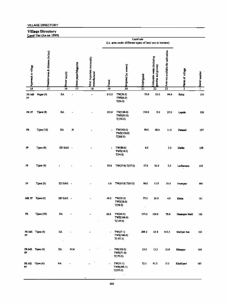
VILLAGE DIRECTORY
Villaae Directory Land Use {Ann 19991
Land usc (i.e. area under different types ofland use in hectare)
-- c Jj 0
.~
:!. &;> 1>11 > .5 'J:l
"!:l :;; .... "3 0 " u
B I!! E i- .. .t ... .tj e ..,.
:.::.l'l oS :;;
!if! 8 ~ j! ~ j ~ ~ .'~ I] $I I ~ ~ 'ii
~ jj
~ II) I ..!! Iii i:;
~ ~ 1ll a .5.a I S~ 1) 'S
~ 's J ,~ ~ ~ c II) iii - " ~ ~ Iii 0 :§ a ~ ~ .~
~ ~ "~ ~ Iii !!o ~ SQ
14 15 16 17 18 19 20 21 22 23 2
PRMR Nagar (4) EA 210.0 TW(30.0) 79.0 2S.0 94.0 Baloj ISS FP TWE(6.0)
T(36.0)
PRFP Tijara (8) EA 123.0 TW(IOO.O) IS4.0 9.0 27.0 Lapsla IS6 TWE(92.0) T(192.0)
PR Tijam(IO) EA N TW(100.0) S9.0 4S.0 11.0 Palasali IS7 TWE(102.0) T(202.0)
FP Tijara(8) EDEAG - TW(80.0) 4.0 2.0 Daika· iSS TWE(14.0) T(94.0)
FP Tijara (4) 35.0 TW(37.0) T(37.0) 37.0 34.0 2.0 Ladhawam IS9
FP Tijara(6) EDEAG - S.O TW(6S.0) T(65.0) 98.0 13.0 2S.0 Husaipur 160
MRFP Tijam (4) EDEAG - 49.0 TW(30.0) 77.0 20.0 4.0 Elalca 161 TWE(28.0) T(SS.O)
PR Tijara (10) EA 26.0 TW(69.0) 175.0 IS6.0 78.0 Hasanpur Mali 162 TWE(100.0) T(169.0)
PRMR Tijam(6) EA - TW(27.1) 209.2 65,8 413.3 MaliyarJatt 163 FP TWE(160.0)
T(187.1)
PRMR Tijara (4) EA NM TW(102.0) 53.0 13.3 IS,O Bilaspur 164 FP TWE(71.0)
T(173.0)
PRMR Tijara (4) EA TW(53.1) 72.1 81.0 13.1 Khalilpuri 165 FP TWE(200.1)
T(2S3.2)
255
DISTRICT CENSUS HANDBOOK: ALWAR
Census of India 2001 -Panchayat Samiti : Tijam (0006) Amenities and
Amenities available (if not aVliilable within the village, a dash (-) is shown in the column and next to it in brackets the distance in broad ranges viz. <5 kms., 5-10 kms. and 10+ kms of the
]' i nearest J!lace where the facilitX is available is 8iven}
-8
I 0 u U " ..
~ .j c .c
~ 0 g i 'l:l U g j 0 .;g ...l 0
1 8-
o!<! t::\. .., 8 > i j Jl 6 D 'iiI _g D .0 ~ 'a
1 '0 11 j ~ '" 'a ~ i .9 -a '" 1;1 -a ~ ':B !
u
'Ii ~ .g 'B
00 z :::;J 1 2 3 4 5 6 7
166 Ibmhimpur 101.0 30 6 HPTWW Mali P«S) H(IO+) TKSS-HP PO«S) CM«S) ACS« S) CV«5) 88«5) (00813600) M«S) MCW«S) PH«S) CP« 5) NCS« 5) SP« S) RS(lO+)
C(lO+) PHC«S) OCS«S) ST(lO+) NW(lOt)
167 Maharajpura 24S.0 657 115 P M« 5) HPTWW BS (00813700) C(IO+) H(IOt) TKSS-HP PO«S) CM«S) ACS« 5) CV«S) RS(IO+)
MCW«S) PH«S) CP« 5) NCS«S) SP« 5) NW(lOt) PHC«S) OCS«5) ST(lOt)
168 Soorawas 247.0 349 67P AC HPTWW PH(2) (00813800) M(S-IO) H(IO+) TKSS-HP PO«S) CM(S-JO) ACS(5-1O) CV(S-IO) BS{5-10)
C(IOt) MCW(S-IO) CP(S-IO) NCS(S-IO) SP(IO+) RS(IOt) PHC(S-IO) OCS(S-IO) ST(IO+) NW(lOt)
169 Naurangabad 199.0 6S9 93PM«S) HPTWW PH (00813900) C(IO+) H(IOt) SS-HP PO«S) CM«S) ACS«S) CV(S-IO) BS«S)
MCW(S-IO) CP(S-lO) NCS(S-lO) Sp« S) RS(IOt) PHC(S-IO) OCS(S-IO) ST(IO+) NW(IO+)
170 Majra 124.0 1;033 176 P M«S) HPTWW M8haniya C(S-IO) H(IO+) SS-HP PO« S) CM«S) ACS«S) CV(S-IO) BS«S) (00814000) MCW(S-IO) PH«S) CP(S-IO) NCS{S-IO) SP(IO+) RS{IO+)
PHC(S-IO) OCS(S-IO) ST(IOt) NW(IO+)'
171 ShahmBl Nagar 172.0 227 34PM«S) HPTWW (00814100) C(lO+) H(IO+) SS-HP PO«S)' CM«S) ACS«S) eV(S-IO) "85« S)
MCW(S-IO) PH« S) CP(S-IO) NCS(S-IO) Sp«S) RS(IO+) PHC(S-IO) OCS(5-10) ST(IO+) NW(JO+)
J72 RaiKhera 262.0 1,085 173 P(2) M PHSH(1O+) HPTWW PH(2) (00814200) ACC«S) MCW(IO+) S8-HP PO« 5) CM(IO+) AC8«S) CV(IO+) 88«5)
PHC(IO+) CP(IO+) NCS(IO+) 8p(10+) RS(IO+) OCS(lO+) ST(IO+) NW{lO+)
11.3 Tcehli 249.0 1,203 168PM«S) HPTWW (00814300) C(5-10) H(IO+) SS-HP PO« S) CM(IOt) ACS«S) CV(IO+) 8S«S)
MCW(IO+) PH«S) CP(IOt) NCS(IO+) SP(IO+) RS(IO+) PHC(IO+) OCS(IO+) ST(IO+) NW(IOt)
174 Mandha 504.0 2,146 311 P(3) M DAPHS HPTWW PO PH (00814400) C(S-IO) H(IOt) SS-HP CM(IOt) ACS(S-IO) CV(S-IO) BS« 5)
MCW(S-to) CP(5-10) NCS(5-10) Sp(IO+) RS(IOt) PHC(S-IO) OCS(S-IO) ST(IO+) NW(lO+)
175 Gahankhar 491.0 2,371 332 P(2) M DAPHS HPTWW POPH(IO) (00814500) C(S-IO) H(JO+} TKSS-HP CM(JO+) ACS(IO+} CV(IO+) 8S«S)
MCW(JO+) CP(IO+) NCS(IO+) SP(IO+) RS(IO+) PHC(IO+) OCS(IOt} ST(IO+) NW(IOt)
176 Mosampur 271.0 893 141 P(2) M HPTWW PH(9) BS (00814600) ACC(5-10) H(5-10) SS-HP PO« S) CM(S-IO) ACS(IO+) CV(S-JO) RS(IO+)
MCW(.5-IO) CP«S) NCS(to+) SP(S-IO) NW(IO+) PHC(S-IO) OCS(IOt) ST(IO+)
256
VILLAGE DIRECTORY
ViIla2e D'irectory Land Use {As on 1999}
Land use (i.e. area under different types of land use in hectare)
j c
~ c
.~ 110 ... ~ c '.c
8 -g ~ "3 ... 'j ., e (j ...
j e I c ~ .e .~ ,_ '"
B ._, ., I) ''0 .. ...
~ j ~ cij
.11 i J: s ~ ~ .~ ~
'S ~ .8 llit .. ! ..!:l Iii &;
~ .c 'S .. ~ ii: ;!, i !.! 8 ....
:1 c
K J '~ s i I '6 ~
., 1iI
"" '6 '2 "31 ~ '5 ::!: .~ ,~ ;;§ Iii 101. = i2 So! S 2:; rn 14 J5 16 17 18 19 20 21 '22 23 2
PRFP Tijam (5) EDEAG - TW(36.0) 26.0 3.0 Ibmhimpur 166 TWE(36.0) Mafi T(72.0)
PRFP Tijam(4) EA N TW(144.0) 16.0 3.0 12.0 Mahamjpum 167 TWE(70.0) T(214.0)
PRMR Tijara(6) EDEAG NM TWE(2 I 9.0) 11.3 4.0 13.0 Soorawas 168 FP T(219.0)
PRFP Tijara(6) EDEAG N - TW(114.0) 20.0 4.0 7.0 Naurangabad 169 TWE(54.0) T(168.0)
FP Tijara (7) EA TWE(108.0) 4.0 4.0 8.0 Majra 170 T(108.0) Mahaniya
PRFP Tijara(IO) EDEAG - TW(82.0) 3.0 1.0 4.0 Shahmat Nagar 171 TWE(82.0)
1(164.0)
MRFP 1ijam(12) EA NM WE(54.0) 8:0 Rai Khera 172 TWE(200.0) 1(254.0)
MR Tijara (13) EDEAG - W(217.2) 13.0 S.O 14.0 Teehli 173 T(217.2)
PRMR Tijara (10) EA M Wood Furniture TW(300.0) 34.3 14.2 26.0 Mandha 174 FP TWE(130.0)
T(430.0)
PRMR Ki&hangarb (7) HOBAG M EanhenPot - TW(247.2) 102.0 12.1 19.1 Gahankhar 175 FP TWE(110.3)
T(357.5)
PRMR Kishangarh (8) BA N - TW(l6S.0) 4.0 3.0 16.0 Mosampur 176 FP TWE(83.0)
T(248.0)
257
DISTRICT CENSUS HANDBOOK: ALWAR
Census of India 2001 -Panchaya! 8amiti : Tijam (0006) Amenities and
Amenities available (if not available within the village, a dash (-) is shown in the colunm and next to it in brackets the distance in broad ranges viz. <5 kms., 5-10 kms. and 10+ kms of the
I ~ nearest e1ace where the facilit:t is available is Biven}
.g '0;" 5 rl "","
8 ~
U ._ :s
§ 0 ~ ::=13 g 0 i
._ t! .~ U c:!- oM &. 0 ~ § ~ .9 ~ ]",~ old ~ c:!- :g
1 -'"§
~ .. c j ]] 'C
~ oS .2 t .<: ~ 8.~
~ 'l:; 1;j
~ "iiI:E1! .<> "3 .... "iii
~ i Q, 0 c c~< 'S &. .8 0
., ·B E
OJ ... .~ 1i ~ § .8 5 l l ~ ..r ·5 ~ '" ~._ ~
CI) ~ UCI)
I 2 3 4 5 6 9 12
177 Alawalpur 162.0 337 55 P M«5) HPTWW PH (00814700) CC5-10) H(5-10) 55-HP PO(S-IO) CM(S-IO) ACS(lO+) CY(S-IO) B8«s)
MCW(S-IO) CP(S-IO) NCS(lO+) SP(S-IO) R5(1O+) PHCCS-IO) OCS(IO+) ST(IO+) NW(IO+)
178 Kakrali 286.0 949 135 PAC HPTWW PH(3) BS (00814800) M«s) H(S-IO) 5S-HP PO« S) CM«S) ACS(lO+) CV(S-IO) RS(IO+)
CCS-IO) MCW(s-IO) CP« 5) NCS(lO+) SP(5-10) NW(IO+) PHC« 5) OCS(IO+) ST(IO+)
179 Gothra 388.0 2,467 367 P(4) DARMP THPTW POPH(2S) CP BS (00814900) M(2) S H(S-IO} WSS-HP CM(S-IO) ACS(lO+) CV(S-IO} RS(IO+}
PUC MCW(S-IO) NCS(IO+) SP(S-IO) NW(lO+)
CCS-IO) PHC(S-IO) OCS(IO+) ST(IO+)
180 Ram Nagar 349.0 1,251 174 PAC HPTWW PH(7}
(00815000) M«5) H(lO+) TKSS-HP PO«S) CM«S) ACS(S-IO) CV(IO+) 88«5) CCIO+) MeW(S-IO) CP(IO+) NCS(s-IO) SP(IO+} RS(IO+}
PHC(S-IO} OCS(S-IO) ST(IO+) NW(IO+}
181 Bhindoosi 393.0 1,189 206 P(4) M 5 PHSRMP(3) THPTW PO TO CM 85 (00815100) C(IO+} H(IO+) WTKSS- PTO CP(S-IO} ACS«S} CY(IO+) RS(IO+)
MCW(S-IO) HP PH(35) NCS(5-10) SP(IO+) NW(IO+) PHC(5-10) OCS(S-IO) ST(IO+)
182 Bichpuri 113.0 234 32P AC HPTWW
(008IS200) M«S} H(IO+) TKSS-HP PO«5) CM«S) ACS(S-IO) CY(S-IO} 85« 5) qlO+) MCW(S-IO) PH«S) CP(S-IO) NCS(S-IO) Sp(IO+) RS(lO+)
PHC(S-IO) OCS(S-IO) ST(IO+) NW(lO+)
183 Naugawan 344.0 547 94P AC HPTWW BS
(008IS300) M«S) H(lO+) TKSS-HP PO« 5) CM« 5) ACS(5-10) CY(S-IO) R5(10+) C(10+) MCW(S-IO) PH« S) CP(5-10) NCS(5-IO) SP(S-IO) NW(lO+)
PHC(S-10) OCS(S-IO) ST(IO+)
184 Baijalhera 170.0 482 6S P M(S-IO) HPTWW as (008IS400) C(IO+) H(IO+) TKSS-HP P0(5-10) CM(S-IO) ACS(S-IO) CY(S-IO) RS(IO+)
MCW(5-10) PH(S-IO) CP(S·IO) NCS(S-IO) SP(IO+) NW(JO+) PHC(IO+) OCS(S-IO) ST(IO+}
185· Ahamlaka 146.0 S7S 74 PM(S-IO) HPWSS·
(008ISS00) C(IO+) H(IO+) HP PO«.S) CM(S-IO) ACS(5-IO) CY(S-IO) 8S(S-10)
MCW(S·IO) PH(S-IO) CP(S-IO) NCS(S-IO) Sp(IO+) RS(IO+) PHC(S-tO) OCS(S-IO) ST(IO+) NW(IO+)·
186 BepnHeri 462.0 1,133 147P AC HPTWW (00815600) M«S) H(IO+) SS-HP PO«S) CM(lO+) ACS(IO+) CV(lO+) 85(10+)
C(IO+) MCW(IO+) PH«S) CP(tO+) NCS(IO+) Sp(IO+) RS(IO+) PHC(IO+) OCS(lO+) ST(tO+) NW(lO+)
187 Raipur 339.0 817 114 P(2) HPTWW (00815700) ACM«5) H(IO+) SS-HP PO(S-IO) CM(tO+) ACS(lO+) CY(IO+) B8«s)
C(IO+) MCW(IO+) PH«S) CP(IO+) NCS(IO+) SP(IO+) RS(IO+) PHqIO+) OCS(IO+) 5T(10+) NW(.IO+)
258
VILLAGE DIRECTORY
ViIla2e Directory Land Use {As on 1999}
]' e
i j ~ old
i S
1" I rllo '::!: ~ii:i ' 14 IS
MRFP Kishanprb (10)
PRMR Kisbangarb (7)
FP
PRMR Kisbanprh (5)
FP
PRMR Tijara(IO)
FP
PR MR Tijara (8)
FP
., c
I j I J ,~
Z 16 17
SA N
SA N
EA NM
ED SAG NM
EA NM
MR FP Tijara (9) EDEAO •
MRFP Tijara(8) EDEAO .
PRMR Tijara(12) SA NM FP
PRMR Tijara (6) EA NM FP
PRMR Tijara(J3) EDEAG -FP
PRMR Tijara (13) EDEAG . FP
.~ '8 S §
l~ .!L~ ! i
·;;E·5 ' ' 18,
Land use
(i.e. area under different types ofland use in hectare)
c .51 1ii
.~ .~
1: :; u
c:; .. i c ...... 02 ::..:1 " '" I! i j 0 '" l:i € ." it; ~ .D
i ..!! Iii ~ i S~ '8 ... 0
~ ·S .. ., Oi
'E! a i ~ ~ ·c 0 Jij ., .. i2 '" 19 20 21 22 23 2
TW(94.0) 4.0 4.0 12.0 Alawalpuf 177 TWE(48.0) T(142.0)
TW(167.0) 10.0 6.0 19.0 Kakrali 178 TWE(84.0)
T(2SI.O)
TW(133.0) 1.0 9,0 45.0 Gotbra 179 TWE(200.0) T(333.0)
TWE(326.0) 1.0 7.0 15.0 Ram Nagar 180 T(326,0)
7.0 TWE(313.0) 38.0 17.0 18,0 Bhindoosi 181 T(313.0)
3.0 TWE(86.0) 13.0 7.0 4.0 Bichpuri 182 T(86.0)
TWE(304.0) 14.0 13.0 13.0 Naugawan 183 T(304.0)
TW(65.6) 25.0 2.0 2.0 Baijalhera 184 TWE(7S.0) T(140.6)
- TW(60.0) 20.2 2.0 2.0 Abamlaka ISS TWE(62.0) T(122.0)
- TW(I I 1.0) 64.0 10.0 27.0 BeganHeri 186 TWE(2S0.0)
T(36 1.0)
TW(SO.l) 46.0 21.0 178.0 Raipur 187 TWE(44.0) T(94.1)
259
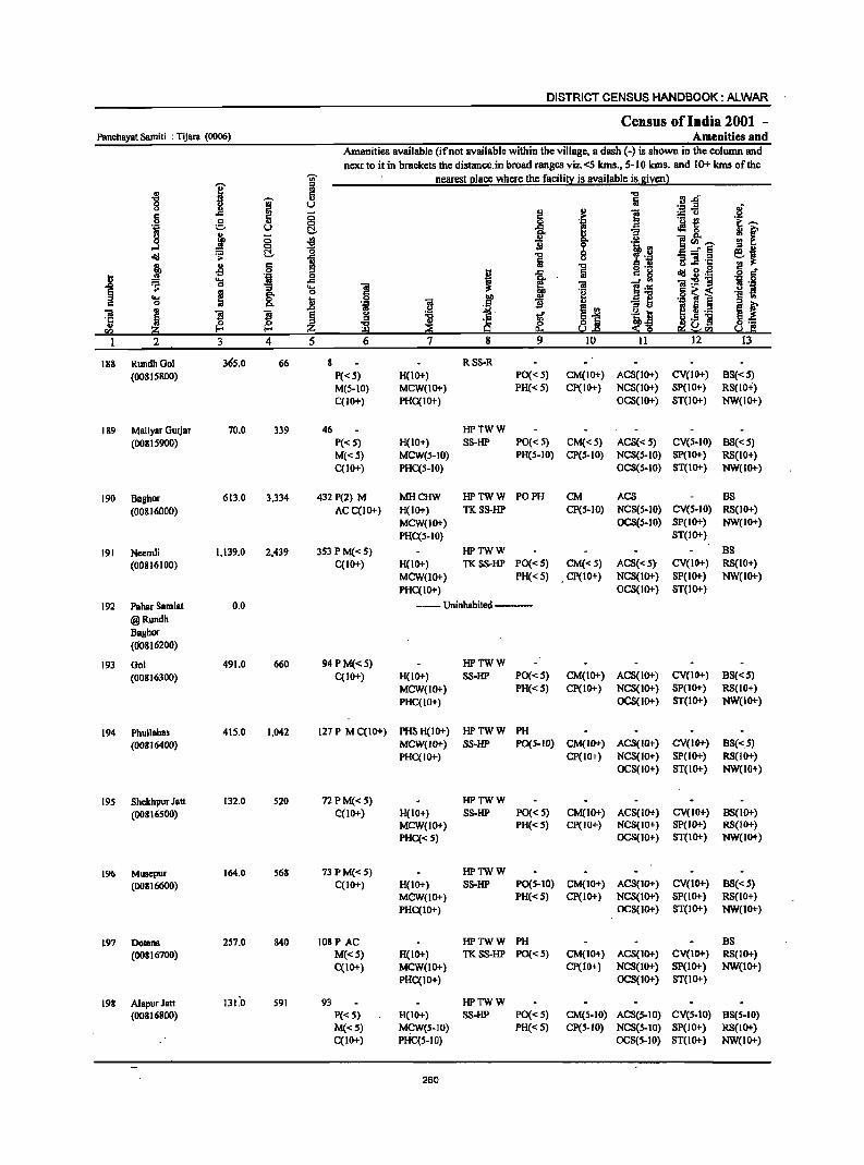
DISTRICT CENSUS HANDBOOK: ALWAR
Census of India 2001 -Panchayat Samili : Tijara (0006) Amenities and
Amenities available (ifnot available within the village, a dash (-) is shown in the column and
next to it in brackets the distance.in broad ranges viz.<5 kms., 5-10 kms. and 10+ kms of the 'in' nearest place where the facility is available is given)
I = ..
-8 c
I Q) rl Jl
0 u u ~~ 6 ;:; ]
Q)
c Q) .~ .~ ~ 0 ; .~ :.=,. U C!. ..e 0
0 j ;:; .. IT Q, i~--...l 0 "0 i e <Ill ~ C!. 1 i --'= -S] 'E Q) Jl § "0 ~ ~ .g E
~ ·til , Iii
~ -s .... "iiI:g"g os 0 6 ~ ~ <w ~
g-il
.., 0 Q, .S .~ S §
11 ]I ~ e ., ._
~ ~ Z utJ]
3 4 5 12
188 RundhOol 36S.0 66 8 RSS-R
(00815800) p«.5) H(lO+) PO« 5) CM(lO+) ACS(10+) CV(IO+) BS«S) M(5-1O) MCW(lO+) PH« S) Cp(IO+) NCS(lO+) SP(lO+) RS(10+)
C(IO+) PHC(lO+) OCS(lO+) ST(lO+) NW(IO+)
189 Maliyar Gurjar 70.0 339 46 HP'tWW
(00815900) P«S) H(IO+) SS-HP PO« 5) CM«5) ACS« S) CV(5-10) 88«S) M«S) MeW(S-IO) PH(S-IO) CP(S-IO) NCS(S-IO) Sp(IO+) RS(IO+)
C(1O+) PHC(5-IO) OCS(5-10) ST(IO+) NW(IO+)
190 Baghor 613.0 3,334 432 P(2) M MHCHW HPTWW PO PH CM ACS 88
(00816000) AC C(lO+) H(lO+) TKSS-HP CP(S-IO) NCS(5-10) CV(S-IO) RS(IO+)
MCW(IO+) OCS(S-IO) SP(IO+) NW(IO+)
PH.C(5-10) ST(IO+)
191 Ncemli 1,139.0 2,439 353 P M«5) HPTWW 8S
(00816100) C(IO+) H(IO+) TKSS-HP PO«5) CM«S) ACS«S)' CV(IO+) RS(IO+)
MCW(IO+) PH«5) . CP(IO+) NCS(IO+) SP(IO+) NW(IO+)
PHC(IO+) OCS(lO+) ST(IO+)
192 Pahar Samlat 0.0 ---- Uninhabited ---
@Rundh Baghor (00816200)
193 001 491.0 660 94PM«5) HPTWW
(00816300) C(IO+) H(IO+) SS-HP PO«5) CM(IO+) ACS(IO+) CV(IO+) BS«5)
MCW(IO+) PH«S) CP(lO+) NCS(IO+) SP(IO+) RS(IO+)
PHC(JO+) OCS(IO+) ST(IO+) NW(IO+)
194 Phullabas 41S.0 1,042 127 P M C(IO+) PHSH(IO+) HPTWW PH
(00816400) MCW(IO+) SS-HP PO(5-JO) CM(IO+) ACS(IO+) CV(IO+) 8S«5) PHC(JO+) CP(IO+) NCS(IO+) SP(lO+) RS(IO+)
OCS(IO+) ST(IO+) NW(IO+)
195 Shekhpur Jalt 132.0 520 72PM«S) HPTWW
(00816500) C(10+) H(IO+) SS-HP PO« S) CM(JO+) ACS(lO+) CV(IO+) 88(10+) MCW(IO+) PH« S) CP(JO+) NCS(IO+) SP(IO+) RS(IO+)
PHC« S) OCS(IO+) ST(IO+) NW(lO+)
196 Musepur 164.0 568 73 PM«S) HPTWW
(00816600) C(IO+) H(IO+) SS-HP PO(S-IO) CM(IO+) ACS(IO+) CV(IO+) 88«5) MCW(IO+) PH«5) CP(IO+) NCS(IO+) SP(IO+) RS(lO+)
PHC(IO+) OCS(IO+) ST(IO+) NW(IO+)
1.97 Dotana 257.0 840 108P AC HPTWW PH BS
(00816700) M«5) H(IO+) TKSS-HP PO«S) CM(JO+) ACS(JO+) CV(lO+) RS(JO+)
C(1O+) MCW(IO+) Cp(IO+) NCS(lO+) Sp(lO+) NW(IO+)
PHC(IO+) OCS(IO+) ST(IO+)
19. AlapurJatt 131.'0 59J 93 HPTWW (00816800) P«S) H(JO+) SS-HP PO« 5) CM(S-lO) ACS(S-lO) CV(S-IO) 8S(S-IO)
M«S) MCW(S-IO) PH« S) CP(S-JO) NCS(5-10) 8P(10+) RS(lO+) C(lO-+) PHC(S-lO) OCS(S-JO) ST(lO+) NW(IO+)
260

VILLAGE DIRECTORY
ViIlal[e Directory Land Use (As on 1999)
]' g
j • .!!! .., = ~ .;; g .~
..c S
1 J ~ .ii!:j 14 'IS
FP TijaJ'8 (17)
FP Tijara (8)
PRFP Tijara(lO)
PRFP Tijara(13)
'j i ~
.8-8.
! .~
~ ii!:j 16 17
EDEAG -
EA N
EA N
--Uninhabited--
FP Tijara (12) EAG
PRMR Tijara(15) EDEAG -FP
PRFP TijBra(lI) EDEAG -
'PRMR Tijara (IS) EDEAG -FP
PRFP Tijara (12) EA NM
PRFP Tijara (IO) EDEAG -
~ 'g E
~ i"" &,i!!
.~ ~ !!l :a ~ E
18
Land use (i.e. area under different types of land use in hectare)
c 0 °i
f ~ u
"U' ].- .e ~
:.::..11
j ji ~ 0 .. 2 e: 1 ..211 &i .;;
~ 1 1-2 C) .... 0
I 'E c ., "iii ...
! 'c ai e ·c 'E ., I:!o 1;;1 i2 ::!!: !ia 19 20 21 22 23 2
365.0 RundhGol 188
- TW(IO.O) 30.0 9.6 3.3 Maliyar Ourjar 189 TWE(17.4) T(27.4)
31.0 TW(190.0) 161.0 52.0 56.0 Baghor 190 1WE(122.6) T(312.6}
534.0 1W(1 4 1.0) 141.0 79.0 92.0 Neemli 191 1WE(152.0} T(293.0}
Pahar Samlat.@ 192 Rundh BBghor
- TK(36.0) T(36.0} 366.0 89.0 Gol 193
- TW(40.0) 69.0 22.0 220.0 Phullabas 194 TWE(64.I) T(104. I)
- TWE(2S.0) 97.5 9.0 Shekhpur Jail 195 T(25.0)
- 1W(100.0} 4.1 2.0 4.0 Musepur 196 TWE(S4.0) T(IS4.0)
- WE(B.O) 56.4 4.0 B.O Dolana 197 TW(BS.O) TWE(96.0) T(189.0)
6.0 TW(33.0} T(33.0) 78.3 14.0 AlapurJatt 198
261

DISTRICT CENSUS HANDBOOK: ALWAR
. Census of India 2001 -Panchayat Samiti : Tijam (0006) Amenities and
Amenities available (if not available within the village, a dash (-) is shown in the column and
ne"t to it in brackets the distance in broad ranges viz.<5 kms., 5-10 kms. and 10+ lans of the
I ~ nearest (!lace where the faeilin: is available is givenl
'" ~ '5 '" '§' .~~ 0
.If 0 l! 5 a II) II) 1! :.= u 8 c 'j e II) 0 a
._ -e i:---'il u e!- .g, .:! 0
if i '3 j g .a II)
9' u ]~~ ~ e!- i
']j .tj, .. ~ ] 8 ~ :~ '3 =i .§ l .s c
1 u .c .. I!! 0 ~.8~ t 'i I .<: c g .9 g'
'S ~ .rJ ·s 8. 'S Ol lib ~ 1'f .~ 1 ._ :s is '.c:I
§ .. c a'" .g ~ i .~ .eI .... ~ &. 11 0 ~ II) § .. c 0 '.c:I Ol ]j ., _ II:!
., ~
.~ ~ E~ :s u ~ 5 ._ § f Ol ~ $ Ol § 11 ..r ·tt t '5; ~ '" g fa ~.5 ] is ~ ;$~ 0'"
5!l 2:0 z I:!l ~ 5.!.e ~5!l So! C I 2 3 4 5 6 7 8 9 10 11 12 13
199 Berla 664.0 1,677 221 P(2) M« 5) HPTWW PH (00816900) qlO+) H(IO+) TKSS-HP PO« 5) CM(IO+) ACS(lO+) CV(IO+) 88(10+)
MCW(IO+) CP(IO+) NCS(IO+) SP(IO+) RS(IO+) PHC(IO+) OCS(lO+) ST(IO+) NW(IO+)
200 Chawandi 635.0 1,634 246P M 0 DAPHS HPTWW PH CP Kalan C(1o+) H(IO+) SS-HP POCo:: 5) CM(5-10) ACS(IO+) CV(IO+) B8(10+) (00817000) MCW(IO+) NCS(IO+) SP(IO+) RS(1O+)
PHC(lO+) OCS(lo+) ST(IO+) NW(IO<t-)
201 Bai 313.0 764 IIOPM«5) HPTWW PH
(00817100) qlO+) H(lO+) 88-HP PO«S) CM(5-10) ACS(IO+) CV(IO+) 88(10+) 'MCW(IOl-) Cp«5) NCS(IO+) 8p(10+) R8(JO+) PHC(IO+) OCS(lO+) ST(IO+) NW(IO+)
202 Barhera 232.0 690 105 P M« 5) HPTWW PH(2) (00817200) C(IO+) H(IO+) S8-HP PO« 5) CM(5-10) ACS(10+) CV(lO+) 88(10+)
MCW(IOl-) CP(5-10) NCS(IO+) 8P(10+) RS(IO+) PHC(lO+) OCS(IO+) ST(IO+) NW(IO+)
203 Thons 445.0 965 140 P M«5) DAH(IO+) HPTWW PO
(00817300) qlOl-) MCW(IO+) TKSS-HP PH(IO+) CM(IO+) ACS(IO+) CV(IO+) 88(10+) PHC(IO+) CP(IO+) NCS(IOl-) SP(IO+) RS(IO+)
OCS(IO+) ST(IO+) NW(IO+)
204 Jairoli 1,997.0 4,061 628P(l) M DUH(IO+) THPWSS-POPH BS
(00817400) C(1O+) MCW(IOl-) HP CM(IOl-) ACS(IOl-) CV(IO+) RS(lO+) PHqIO+) CP(IO+) NCS(lO+) SP(IO+) NW(IO+)
OCS(IO+) ST(IO+)
20S Andhaka 531.0 433 48PM«5) HPWSS-
(00817500) C(IO+) H(IO+) HP PO«5) CM(IO+) ACS(lo+) CV(IO+) 88«5) MCW(IO+) PH« S) CP(IOl-) NCS(IOl-) 8P(10+) RS(IO+) PHC(IO+) OCS(Io+) 8T(IO+) NW(IO+)
Panehayat Samiti : 64,034.0 2.2.6,974 35,919 P(2.07) M(S3) 0(4) DA(17) T(10) PO(2.8) CM(9) ACS(14) CV(S) BS(41)
Total 8(11) PUC(3) DU MD W(19D) TO(2.) CP(4)
AC(47) 0 CWC(2.) TK(64) P1'O(2.) DC(3) DP(I9&) PU(4SS) PDC(2.) TW(I83) PH8(14) R(U) FWC RMP(4J) CHW(I2.)
262
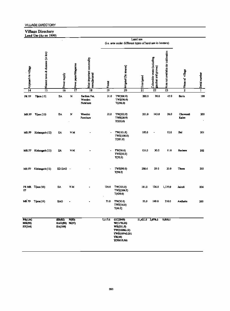
VILLAGE DIRECTORY
ViIla2e Directory Land Use {As on 1999~
Land use (i.e. area under different types ofJ811d usc in hectare)
E c 0 ... 'iI
5 .i:' OIl > .. :g :S i u ::I u
.~ '1 E i- Ja
j E 'Gi' 8 ~
:.:;.~ ., "0 j! i ~ .~ erg 1"0 51
t ~ ! ..8 s ~ .~J e: 1 ..!! Iij .;;:
§
1 go
1 1 t;! '0 'a t: .. c.. c c ; ~ ~
1;; os t;; '5 '5 .. ., 'iI
~ ~ 2! 'E ';:; ~i ~ ~ ·c
$" ~ e: 0 '" '" 0= :2 sa 14 IS 16 17 18 19 20 21 22 23 2
PRFP Tijara (IS) EA N Earthen Pot, 3l.0 TW(206.0) 200.0 90.0 47.0 Berla 199 Wooden TWE(90.0) Furniture T(296.0)
MRFP Tijara (13) EA N Wooden 33.0 TW(202.0) 201.0 143.0 26.0 Chawandi 200 Furniture TWE(30.0) Kalan
T(232.0)
MRFP Kishangarh (I Z) EA NM · TW(IOI.O) 100.0 12.0 Bai 201 TWE(IOo.o) T(201.0)
MRFP Kishangarh (13) EA NM · TW(50.0) 121.0 30.0 11.0 Barbora 202 TWE(20.0) T(70.0)
MRFP Kishangarh (12) EDEAG . · TWE(98.0) 288.6 25.0 33.0 Thons 203 T(98.0)
PRMR Tijara(16) EA NM 124.0 TW(325.0) 181.0 126.0 1,137.0 Jairoli 204 FP TWE(104.0)
T(429.0)
MRFP Tijara(19) EAG 71.0 TW(30.0) 5S.0 149.0 210.0 Andhaka 20S TWE(16.0) T(46.0)
PR{13(j) ED(82) N(83) 1,117.6 GC(2049) 11,421,5 3,870.1 9,010.1 MR(!IS) EAG(85) M(37) W{1170.33) FP{l44) EA{l04) WE{331.9)
TW{18286.12) TWE(10741.11) TK(36) T{32(jIS.S6)
263

RAJASTHAN (INDIA)
P.S. RAMGARH PART OF TEHSILS RAMGARH & ALWAR
DISTRICT ALWAR
BOU~'DARY. STATE
DI!lTRICT
TEIlSlL
PANCHAVAT SANITJ
KIlOMETRES 2 4 6 8
VILLAGE .. 1m PERlIIANENr l.OCAT[O~ CODE NU)JOBR
............ :--008_--: -.-------______ "
l\~GAH}J
'7
AREA NARKE:D AT ® BELONGS TO TEHSIL NAGAI! or DISJ'RICI' DIMIIA7PUIl
HIlACQUART~1lS: TIlI15IL. PANCHAYAT SAMm
POPUI.ATION Siltr. CI.ASS OJ' VI~I.Acm REI,o,.. 200,
200-499. 600--999, 1000--40110. 500D " ABOVe:
STATE mCIIWAY
IMPORTANT METALLED ROADS
RAILWAY LINE !rIm STATION. PROAD GAUGE
RIVER AND STREAM
I'CST OFFIC&j'J't:I.t:CIIAI'H OFFICE EXCI.UDlNll R.MS.
SECONDARY/SENIOR SECOIIOAJlV SCHOOL
POLICE STATION EXCWDING liLY. POLICE STATION
PRIMARY HEALTH c:ENTRE BANK
••• 5" 14
HS
~ 1'0/10
S
PS
" B

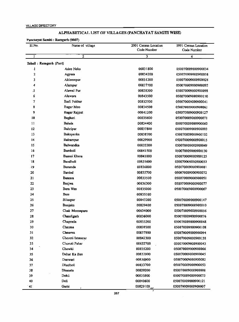
VILLAGE DIRECTORY
ALPHABETICAL LIST OF VILLAGES (PANCHA YAT SAMITI WISE)
Panchayat Samiti : Ramgarh (0007)
SI:No. Name of village 2001 Census Location 1991 Census Location Code Number Code Number
2 3 4
TehsU : Ramgarh (Part)
I Adee Naka 00831800 050070009000900034
2 Agyara 00834200 050070009000900058
3 Akleempur 00831200 050070009000900028
4 Alampur 00837700 050070009000900092
5 Alawal Pur 00838300 050070009000900098
6 Alawara 00843500 050070009000900150
7 Badi Polchar 00832500 050070009000900041
8 Bagar Meo 00834500 050070009000900061
9 Bagar Rajput 00841200 050070009000900127
10 Baghori 00835600 050070009000900071
II Bahala 00834400 050070009000900060
12 Bahripur 00837800 050070009000900093
13 Bakayanka 00838700 050070009000900102
14 Balrampur 00829900 050070009000900015
15 Balwandka 00833300 050070009000900049
16 Bamboli 00841500 050070009000900130
17 Bamni Khera 00841000 050070009000900125 18 Bandholi 00831600 050070009000900032
19 Baramda 00836800 050070009000900081
20 Bardod 00835700 050070009000900072
21 Batesra 00833500 050070009000900051
22 Beejwa 00836300 050070009000900077
23 Bera Was 00835000 050070009000900067
24 Bere 00835100
25 Bilaspur 00843200 050070009000900147
26 Boojaka 00829400 050070009000900010
27 Chak Meenapura 00834000 050070009000900056
28 Chandigarh 00836000 050070009000900076
29 Chaprada 00833200 050070009000900048
30 Chauma 00839300 050070009000900108
31 Cheerwa 00837900 050070009000900094
32 Choroti Istmurar 00842300 050070009000900138
33 Choroti Pahar 00832700 050070009000900043
34 Chowki 00835200 050070009000900066
35 Dahar Ka Bas 00832900 050070009000900045
36 Danwari 00836900 050070009000900082
37 Dhadholi 00833700 050070009000900053
38 Dhaneta 00829200 050070009000900008
39 Dohli 00835800 050070009000900073
40 Doli 00840600 050070009000900121
41 Garhi 00829100 050070009000900007 'Q~" .
267
DISTRICT CENSUS HANDBOOK :ALWAR
ALPHABETICAL LIST OF VILLAGES (PANCHA YAT SAMITI WISE)
Panchayat Samiti : Ramgarh (0007)
SI.No. Name of village 200 1 Census Location 1991 Census Location Code Number Code Number
2 3 4
42 Goha 00835300 050070009000900068
43 Goleta 00833600 050070009000900052
44 Golki 00838100 050070009000900096
45 Goojar Bas 00841800 050070009000900133
46 Goojarpur Kalan 00831500 050070009000900031
47 Goojarpur Khurd 00839900 050070009000900114
48 Gugdod 00841100 050070009000900126
49 Hajipur 00837300 050070009000900086
50 Jadoli 00844800 050070009000900163
51 Jakopur 00839600 050070009000900111
52 Jatpur 00841700 050070009000900132
53 Jugrawar OQ842700 050070009000900142
54 Kala Ghata 00830100 050070009000900017
55 Kalsawara 00830200 050070009000900018
56 Kamalpur 00833800 050070009000900054
57 Kanor 00842800 050070009000900143 58 Kareeriya 00832200 050070009000900038
59 KaroH Jageer 00839500 050070009000900110
60 KaroH Khalsa 00839700 050070009000900112 61 Kesroli 00833400 050070009000900050 62 Khanpur Kalan 00840700 050070009000900122
63 Kharkhara 00830900 050070009000900025
64 Kharkhari 00829000 050070009000900006
65 Khedli Jhanda 00838200 050070009000900097
66 Kheri 00840500 050070009000900120
67 Khertbala 00838600 050070009000900101
68 Khilora 00831900 050070009000900035
69 Khoh 00828600 050070009000900002
70 Khohar 00837200 050070009000900085
71 Khohra Karmali 00829700 050070009000900013
72 Khojaka 00836200 050070009000900078
73 Khunteta Kalan 00841900 050070009000900137
74 Khunteta Khurd 00842000 050070009000900136
75 Khushpuri 00838900 050070009000900104 . 76 Kota Kalan 00829300 050070009000900009
77 Kota Khurd 00832100 050070009000900037
78 Ladpur 00842900 050070009000900144
79 Lalawandi 00840200 050070009000900117
80 Lalpuri 00841600 050070009000900131
81 Loharwari 00832600 050070009000900042
82 Mandapur 00836500 050070009000900090
83 Mandla Kalan 00840000 050070009000900115
268
VILLAGE DIRECTORY
ALPIIABEI'ICALLISI' OFVILlAG.ES(pANCHAYATSAMmWlSE)
PancbayatSamiti: Ragam (0007)
81.1'«>. Name of village 2001 Census location 1991 Census Location Code Number Code Number
2 3 4
84 Mandla Khurd 00840100 050070009000900116
85 Mandu Ka Bas 00833000 050070009000900046
86 Mangleshpur 00844900 050070009000900164
87 Manki 00839800 050070009000900113
88 Mansheerpur 00839100 050070009000900106 89 Masta Bad 00840800 050070009000900123
90 Meenapura 00834100 050070009000900057 91 Meghawas 00836600 050070009000900080
92 Moo Khera 00840900 050070009000900124
93 Milakpur 00843400 050070009000900149
94 Mohammadpur 00837400 050070009000900087
95 Moonpur 00842500 050070009000900140
96 Mubarikpur 00837000 050070009000900083
97 Mukandwas 00832000 050070009000900036 98 Mundpuri 00841400 050070009000900129
99 Munpur Karinala 00838400 050070009000900099
100 Nagla Balaiya 00835400 050070009000900069
101 NagliMegha 00841300 050070009000900128
102 NagliwaI 00837100 050070009000900084
103 Naharpur Khurd 00837600 050070009000900091
104 Nakachpur 00832300 050070009000900039
105 Nakhnol 00829600 050070009000900012
106 NangalAlaf 00843300 050070009000900148
107 l'Ifangal Nangali 00831700 050070009000900033
108 . Nangal Tappa 00842100 050070009000900134
109 Nangla Banjeerka 00834900 050070009000900062
110 Nangla Chirawanda 00830400 050070009000900020
111 Nangli Mubarikpur 00830700 050070009000900024
112 Narka 00834600 050070009000900064
113 Nasopur 00842400 050070009000900139
114 Naugawan. 00837500 050070009000900088
115 Naya Bas 00843000 050070009000900145
116 Neekach 00829500 050070009000900011
117 Newada 00831300 050070009000900029
118 Newadi 00831100 050070009000900027
119 Niwali 00836100 050070009000900074
120 Odaka 00829800 050070009000900014
121 Odela 00839400 050070009000900109
122 Pali 00842200 050070009000900135
123 Parawada 00831000 050070009000900026
124 Pata 00830500 050070009000900021
125 Patan Bhan 'OP830000 050070009000900016,
269
DISTRICT CENSUS HANDBOOK: ALWAR
ALPHABETICALLlsrOFVILlAGES(PANCHAYATSAMITIWISE)
PanchayatSamiti: Ramgarh (0007)
SI.No. Name of village 2001 Census Location 1991 Cmsus Location Code Number Code Number
2 3 4
126 Peeproli 00834700 050070009000900065
127 Podipur 00836700 050070009000900089
128 Poothi 00840300 050070009000900 118 .
129 Rabbaka 00839000 050070009000900105
130 Raghunatbgarh 00830300 050070009000900019
131 Ramgarh 00840400 050070009000900119
132 Rasgan 00838500 050070009000900100
133 Rasoolpur 00828900 050070009000900005 134 Raswada 00830800 050070009000900023
135 Roopbas 00830600 050070009000900022
136 Rundh Dhooninath 00833900 050070009000900055
137 Sadan Ka, Bas 00834800 050070009000900063 138 Sahajpur 00842600 050070009000900141 139 Sahdoli 00833100 050070009000900047
140 Sammanpur 00831400 050070009000900030 141 Sankhala 00834300 050070009000900059
142 Sarheta 00835500 050070009000900070
143 Senthli 00843100 050070009000900146
144 Shekhpur 00836400 050070009000900079 145 Sherpur 00838000 050070009000900095
146 Sonagarh 00835900 050060008000800075
147 Sunhera 00838800 050070009000900103 148 Teekri 00839200 050070009000900107 149 Thegi Ka Bas 00832800 050070009000900044
150 Tismar 00828800 050070009000900004
151 Todli 00828500 050070009000900001 1S2 Untwal 00832400 050070009000900040 153 Warispur 00828700 050070009000900003
TehsiJ : AJwar 0007 (part)
154 Bhajeet 00854400 050060009000900094
155 Bhoowaka 00850300 050060009000900054
156 Dada 00857300 050060009000900123
157 Desoola 00854100 05006000900090001
158 Doomera 00856900 050060009000900119
159 Ghegholi 00854000 05006000900090009
160 Goojooki 00856500 050060009000900115
161 Goondpur 00854300 050060009000900093
162 Jhareda 00856800 050060009000900118
163 Kakrali 00850200 050060009000900053 164 Kakrali Jat 00857400 050060009000900124
270
VILLAGE DIRECTORY
ALPHABETICALLISf OF VILlAGES (pANCHAYAT SAMITIWISE)
'P.ancbayat Samiti : ,Rngai'h (0007)
SI.N!. Name of village 2001 Cms us Local ion 1991 Census Location Code Numb fI' Code Number
2 3 4
165 Kemala 00853900 050060009000900089
'166 Kerwa Jat 00857500 050060009000900125
167 Khanpur Jat 00856700 050060008000800117
168 Kherli Saiyad 00857000 050060009000900120
169 Mojdeeka 00850400 050060009000900055
170 'NagIi, Rajawat 00857200 ' 050060009000900122 " •...
171 Naharpur 00854200 05006()()()9Q00900092
172 Salpuri 00854500 050060009000900095
'1'73 Siraska 00848200 050060009000900033
271
DISTRICT CENSUS HANDBOOK: ALWAR
Census of India 1001 -Pancllayat Samiti : RamgBrh (0007) Amenities and
Amenities available (if not available within the village, a dash (-) is shown in the column and
next to it in brackets the distance in broad ranges viz. <5 kms" 5-10 kms, and 10+ kms of the "iii' nearest place where the facility is available is given)
i ii: -8 a ..,
rl.&i "iii' [ij 8 i ., v i! ~~ of § ..c 0 :5 ,~
'! I 'ii g u 8. ~ G i ]~ 0 Q)
0 u e~~ oS I .(g 'B f 'C 0 '0 ;' .g a_,.e <Ii! 'S: ~ ii 1 1i ] 'E ';-~ Q) I> C ... C Q)
~ o ._
~ B.~ g r:! i -s 0 ... j ij c g
.8 .... 'g ..c , 1 -e .~ ]:5!1i '8 ·8 0 "3 'a 11 ~ m '" ~~ .9 ~ ~ .- s
'0 0 .8 0 ]
... § <II .,_ . ., II B ~ <II ~ 5.2 e ~ 'iI. I> B S
.. .~ Il '5 ~' . e ~ '0
~ ;f 0"5 ~.5 11 !j ~ 0 Z is ~ ~ :!:§ rJ) . a::; ~ ~.e e!i~0I)
I :',2 .. 3 4 5 6 7 8 9 10 11 12 13
PBnthayat Samlt!' : RamgBrh (0007)
TOOli 320.0 732 101 P M(5-10) HPTWW (OO&28S00) C(IO+) H(IO+) SS-HP PO(S-IO) CM(S-IO) ACS(IO+) CV(IO+) 8S(S-10)
MCW(IO+) PH(S-IO) CP(IO+) NCS(IO+) SP(IO+) RS(IO+) PHC(10+) OCS(IO+) ST(IO+) NW(tO+)
2 Khoh 546.0 821 97 P MC(IO+) MCWCHW HPTWW PO PH (00&28600) H(IO+) TKSS-HP CM(S-IO) ACS(<:S) CV(S-IO) 8S(S-10)
PHC(S-tO) CP(S-IO) NCS(IO+) SP(tO+) RS(5-10) OCS(IO+) S1'(IO+) NW(IO+)
3 Warispur 83.0 790 88PM«5) HPTWW' (00828700) C(IO+) H(IO+) TKSS-HP PO« 5) CM(IO+) ACS(<:S) CV(tO+) 88(10+)
MCW{<S) PH«S) CP{10+) NCS{IO+) SP(IO+) RS(IO+) PHC(IO+) OCS(tO+) ST(IO+) NW(IO+)
4 Tismar 133.0 382 49PM«S) HPTWW (00828800) C(tO+) H(IO+) TKSS-HP PO« S) CM(IO+) ACS«5) CV(IO+) BS(lo+)
MCW«5) PH« 5) CP(IO+) NCS(IO+) SP(IO+) RS(IO+) PHC(IO+) OCS(tO+) ST(IO+) NW(IO+)
S Rasoolpur 188.0 296 38P ACM«5) HPTWW (00828900) C(10+) H(IO+) TKSS-HP PO«5) CM(lo+) ACS{S-IO) CV(tO+) BS(IO+)
MCW«S) PH« 5) CP(IO+) NCS(tO+) Sp(IO+) RS(1O+) PHC(IO+) OCS(IO+) ST(IO+) NW(IO+)
6 Kharkhari 127.0 345 S3 P M(S-IO) HPW8S-(00829000) C(IO+) H(IO+) HP PO«S) CM«5) ACS«S) CV(tO+) BS«S)
MCW(IO+) PH(IO+) CP«5) NCS(IO+) Sp(IO+) RS(tO+) PHC(S-IO) OCS(tO+) ST(1O+) NW(IO+)
7 Garhi 305.0 5t5 88P M AC MCWPHS HPTWW 8S (00829100) C(IO+) H(5-10) TKSS-HP PO«5) CM(S-IO) ACS(S-IO) CV(IO+) RS(IO+)
PHC(S-IO) PH(S-IO) CP(IO+), NCS(S-tO) 8p(10+) NW(1O+) OCS(S-IO) 8T(10+)
8 Dhaneta 373.0 1,028 t76P ACM«S) HPTWW liS (00829200) C(IO+) H(IO+) TKSS-HP PO(S-l() CM(S-IO) ACS(S-IO) CV(IO+) as(lO+)
MCW«S) PH(S-IO) CP(IO+) NCS(S-IO) Sp(IO+) NW(IO+) PHC(S-IO) OCS(S-IO) ST(IO+)
9 KOla Kalan t72.0 617 8S P AC M(S-IO). HPTWW (00829300) C(tO+) H(tO+) TKSS-HP PO(S-tO) CM(S-IO) ACS(S-IO) CV(IO+) BS(S-tO)
MCW(S-tO) PH« 5) CP~IO+) NCS(tO+) Sp(tO+) RS(IO+) PHC(S-tO) OCS(10+) ST(tO+) NW(IO+)
10 Boojaka 448.0 635 77 PM«S) HPTwW (00829400) C(IO+) H(IO+) TKSS-HP PO(S-IO) CM(S-IO) ACS(S-IO) CV(IO+) BS(5-10)
MCW(S-IO) PH(S-tO) CP(IO+) NCS(S-IO) Sp(IO+) RS(IO+) PHC(IO+) OCS(S-IO) 8T(tO+) NW(IO+)
II Neelau:b 628.0 2,64S 389 P(2) M CHWH(S-IO) HPTWW PH' (00829500) AC(4) C(tO+) MCW(S-IO) TKSS-HP PO(S-IO) CM(S-IO) ACS(S-IO) CV(S-tO) B8(S-10)
PHC(IO+) CP(IO+) NCS(IO+) SP(IO+) RS(IO+) ·OCS(IO+) ST(IO+) NW(IO+)
272
VILLAGE DIRECTORY
Villae;e-Directory Land Use {As on 1999}
Land use
(i.e .. area under different types of land use in hectare)
E .. .2 ... t;j
e ~ ~ ;> .~ .. 'i3 'i3 "6 u .. 0
~ ~ c E .. I 'i3 E ~
....... c2 ._ '" 'i3 8 ~ .,
~ d/J. f ~-a :0
J!l ~ j 0 ;>
-~ >. .. ;-a :a ..
$3 'i5.
i o I!! .€ -a i:i .s;; .:8
.<: $3 co. co.{j ~ .!! :a S ~
:0
1 e t;; 0 .... e i .. .5 c:! III) 0
J ~ ri ~ 'E .. .. - '" ~i ... ~ ~ 0 .. IS :; ~ :5 ·s I!! !li
as ~ ~ s i2 I.! !!II :S ~ II>
14 IS 16 17 18 19 20 . 21 22 23 2 I
MRFP Alwar(3S) EA W(IS.O) 95.0 61.0 109.0 Todli WE(S.O) TW(20.0) TWE(IS.(I) T(SS.O)
PR Alwar(34) EA NM W(146.0) 74.0 4.0 24B.0 Khoh . 2 WE(S4.0) TW(IO.O) TWE(IO.O)
Te220.0)
FP A1war(36) EA NM W(12.0) 12.0 9.0 IB.O Warispur . 3 WE(2B.0) TW(4.0) T(44.0)
FP Alwar(36) EA NM W(32.0) 10.0 13.0 3B.0 Tismar: 4 WE(40.0) T(72.0)
... .,.. A1war(37) PR W(45.0) 65.0 12.0 65.7 Rasool~ur 5
T(4S.0)
MR A1war(45) EA W(I1.0) 37.0 13.0 31.0 Kharkhari 6 WE(30.0) TW(4.0) TWE(1.0) TI46.0)
PR Alwar(46) EA TW(2B.0) 115.0 25.0 52.0 Garhi 7 TWE(BS.O) T(1I3.0)
PRMR Alwar(47) EDEAG . W(6B.0) 134.0 9.0 106.0 Dhancta B
FP TW(56.0) T(124.0)
MRFP A1war(49) EDEAG NM WE(SO_O) 39_0 S.O 60.0 Kola Kalan 9 TW(IH.O) T(68.0)
FP AlwBr(27) EDEAG . W(62.0) 63.0 28_0 266.0 Boojaka 10 WE(29_0) T(91.0)
PRMR AlwBr(49) EA NM WE(2I S.O) 35.0 3.0 200.0 Neekach II
FP TW(17S.0) T(390.0)
.,~\- ~: .'1.:
273
DISTRICT CENSUS HANDBOOK: ALWAR
Census of India 2001 -Panchayat Samiti : Ramgarh (0007) Amenities and
Amenities available (if not available within the village, a dash (-) is shown in the column and
next to it in brackets the distance in broad ranges viz.<S kms., 5-10 kms. and 10+ kms of the
1 i nearest I!Jace where the facili~ is available is &ivenl ., 5 '0
l'.l.& '0 ~ Iii 0 u ._ ..
.If u _g 5 '8 ~
., e! ~u c: .~ 0 g 0 B '0 2
!f "g u C!- -a i ,J! &. j :; g 0 :E
., .!:! e(/)~
..:I 0 !l 'i' tbfG i!=§ ~ C!- o
~ 8 e; d!I ii , 0" !> " 6 .. i § .~ B l! °C g of 05 ..
I i d!I 8.~ tl .~ 0 ':'5: ~ .... ....
:3 1:5!'g 'B .g .0 0 '3 .... a; ~.~ ~
os c:>. 0 = J g .S! ~ ~ ._ S
.... ~ &. j 0 ... '3] c: <II 0 '.::1 a; ] B " ~ ~ ~ :a e <II 1i! e :s
01 m s s E = ..r e~ .~ " !! ., ._
'1: :;E ~ ~ <II g .s 'B §:= ., ~ ~ '0 0 ~.l!! ::!:i !!.! ~ "" !!:I ~~!!.! So! C!
I 2 3 4 5 6 7 8 9 10 II 12 13
12 N8khnol 330.0 741 138 P AC M« 5) HPTWW (00829600) C(lO+) H(IO+) TKSS-HP PO(s-IO) CM(S-IO) ACS(S-IO) CY(IO+) 8S(s-10)
MCW(S-IO) PH« S) CP(IO+) NCS(IO+) SP(lO+) RS(IO+) PHqIO+) OCS(IO+) ST(IO+) NW(IO+)
13 Khohm 690.0 2,586 343 P(2) M( < 5) DAH(IO+) HPTWW BS Karmali C(IO+) MCW(IO+) TK SS-HP PO«S) CM(S-IO) ACS« S) CV(IO+) RS(IO+) (00829700) PHC(IO+) PH(S-IO) CP(IO+) NCS(IO+) Sp(IO+) NW(IO+)
OCS(lO+) ST(IO+)
14 OdakB 134.0 297 43 HPTWW (00829800) P«5) H(IO+) TKRCL PO« 5) CM(5-10) ACS« S) CY(IO+) 8S« 5)
M«S) MCW(IO+) SS-HP PH(S-IO) CP(IO+) NCS(lO+) SP(lO+) RS(lO+) C(IO+) PHC(IO+) OCS(IO+) ST(IO+) NW(IO+)
IS Balrampur IOS.O 338 47 P M«s) HPTWW (00829900) C(IO+) H(IO+) TK R C SS- PO« 5) CM(S-IO) ACS«s) CY(IO+) BS« 5)
MCW(IO+) HP PH(s-IO) CP(IO+) NCS(IO"') SP(IO+) RS(IO+) PHC(IO+) OCS(IO+) ST(IO+) NW(IO+)
16 PalanBhan 193.0 400 S7 HPTWW (00830000) P«S) H(IO+) TKRCSS- PO«S) CM(S-IO) ACS« 5) CY(IO+) 8S«5)
M«S) MCW(S-IO) HP PH(S-IO) CP(IO+) NCS(IO+) Sp(IO+) RS(IO+) C(IO+) PHC(IO+) OCS(IO+) ST(IO+) NW(IO+)
17 Kala Ghata 188.0 302 37 HPTWW (00830100) P«S) H(IO+) SS-HP PO«S) CM(IO+) ACS«S) CV(IO+) 8S(10+)
M«S) MCW(IO+) PH«S) CP(IO+) NCS(IO+) SP(IO+) RS(IO+) C(IO+) PHC(10+) OCS(IO+) ST(IO+) NW(IO+)
18 KsJsawam 190.0 395 ssPM«s) HPTWW (00830200) C(IO+) H(IO+) TKS8-HP PO«5) CM(s-lO) ACS«S) CY(S-IO) 88(5-10)
MCW(lO+) PH« 5) CP(IO+) NCS(IO+) Sp(IO+) RS(IO+) PHC(IO+) OCS(IO+) ST(IO+) NW(IO+)
19 Raghunatbgarh 1,292.0 3,102 39S P M C(lo+) THPTW PO PH ACS (00830300) H(IO+) WTKSS- CM(S-IO) NCS(IO+) CV(S-IO) BS(5-l0) .
MCW(IO+) HP CP(IO+) OCS(IO-r) Sp(IO+) RS(IO+) PHC(IO+) ST(IO+) NW(IO+)
20 Nangla 910.0 823 IIi P M« S) HPTWW Cbirawanda C(tO+) H(IO+) TKSS-HP PO(s-IO) CM(s-IO) ACS(IO+) CV(s-IO) BS(S-IO) (00830400) MCW(IO+) PH«S) CP(IO+) NCS(IO+) Sp(IO+) RS(IO+)
PHC(S-IO) OCS(IO+) ST(IO+) NW(IO+)
21 Pam 734.0 1,901 301 P M AC(2) CHWH(IO+) HPTWW (00830SOO) qIO+) MCW(IO+) TKSS-HP PO(S-IO) CM(S-IO) ACS(IO+) CV(S-IO) 8S(S-10)
PHC(S-10) ·PR(5-10) cp(IO+) NCS(IO+) Sp(IO+) RS(IO+) OCS(IO+) ST(IO+) NW(IO+)
22 Roopbas 143.0 649 89P ACM«5) HPTWW PH(JO) (00830600) qlO+) H(IO+) SS-HP PO(S-IO) CM«S) ACS(IO+) CV«S) 8S« 5)
MCW(IO+) CP(10+) NCS(IO+) Sp(IO+) RS(IO+) PRC(S-IO) OCS(IO+) ST(IO+) NW(IO+)
... .:j;"
274
VILLAGE DIRECTORY
ViIlae;e.Directory Land Use .{As on 199.9l
Land use (i.e. area under different types orland use in hectare)
j .§ 1ii
g . ~ ... ·Ei .5
.1 ..,
E! 'Ii ., 0
" E i ...... .s j 'f! E i '0 C :::-i'l .£ lIP u B ~ <iii
~] " ~ j '> ~ c
i': ~ € ..
~ .8 s ., € I iii 1: g B "" 8: 8.8 .!! a §
D i;! .5 oM I ~~ g .... c .. e ! ~ - ::I ~ :§ ~
., ;; 8: ., ., :g s
~ ] .. ~i ! 'Ii ~ .~ ~ :::E 9 t:! $ sa 14 " IS 16 17 18 19 20 21 22 23 2 "I
MRFP Alwar(S2) EDEAG NM W(4S.0) 44.0 3.0 167.0 Nakhnol 12 WE(71.0) T(1l6.0)
PRMR Alwar(38) EDEAG - W(189.0) 131.0 3.0 339.0 Khohm 13 FP WE(16.0) Kannali
TW(12.0) T(217.0)
pp Khairthal (25) W(17.0) S9.0 22.0 30.0 Odaka 14 TW(6.0) T(23.0)
MRFP Khairthal (25) ED W(44.0) 32.0 9.0 13.0 BaI~pur IS TW(IO.O) T(S4.0)
MRFP Khairthal (25) EDEAG - W(4S.0) 68.0 41.0 27.0 Patan Bhan 16 TW(12.0) T(S7.0)
MRFP Alwar(SJ) EDEAG - W(21.0) 90.0 8.0 24.0 KalaGhata 17 TWE(4S.0) T(66.0)
MRFP Alwar(49) SOEAG - W(26.7) 73.0 22.0 Kalsawara 18 TW(68.3) T(95.0)
PR Alwar(SO) EA N W(37.2) 3S3.6 777.0 Raghunatbgarh 19 TW(124.0) T(161.2)
MRFP Alwar(SO) EA TW(IOO.O) 220.0 64.0 S08.0 Nengla 20 TWE(18.0) Cbirawanda T(IIS.0)
PRMR Alwar(47) EA W(20.0) 215.0 95.0 7S.0 Pam 21 FP WE(IO.O)
TW(210.0) TWE(109.0) T(349.0)
PRMR Alwar(46) EA W(2.0) 21.0 35.0 18.0 Roopbas 22
FP TW(37.0) TWE(30.0) T(69.0)
275
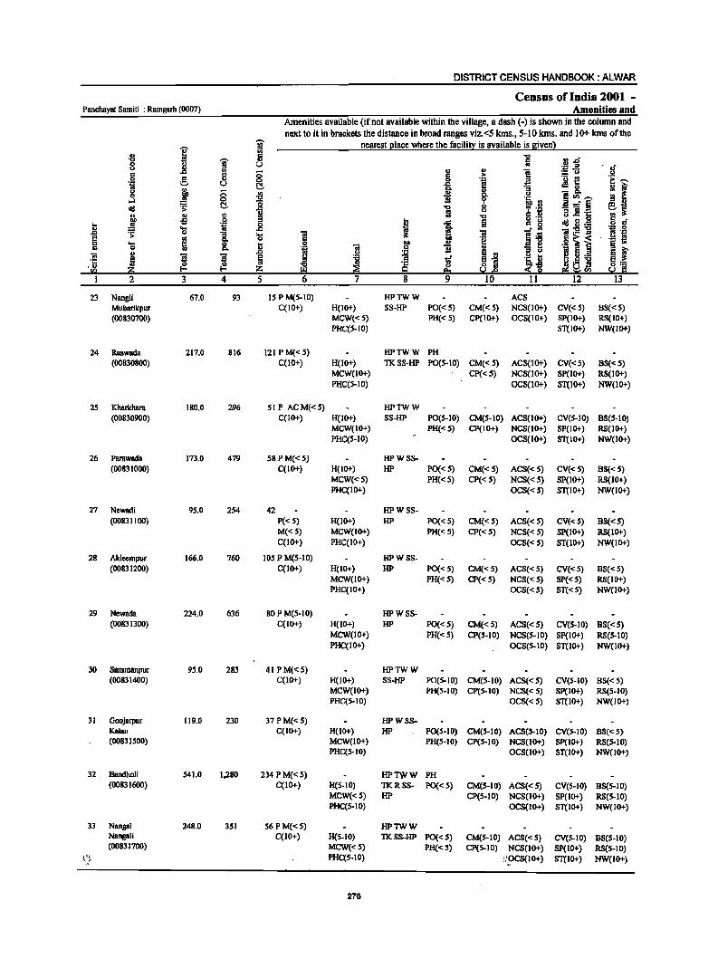
DISTRICT CENSUS HANDBOOK: ALWAR
Census of India 2001 _ PanchaYBt Samiti : Ramgarh (0007) Amenities and
Amenities available (if not available within the village, a dash (-) is shown in the column and
next to it in brackets the distance in broad ranges viz.<5 kms., 5-10 kms. and 10+ kms of the
~ '? nearest place where the facility is available is given) '" '" " -g II .&J" '1:1 0 I '" 8 U ..
'" '" IJ ':;1 .E "
.c ::; " > = u
'i e 8 0 0 'J:! ._ £!
~ .c e ~ 0
'" Q, u ::; '" ~ 8. e~ ...... 0 ~ ...l 0 :2
~ eli! os;: C!. ..8 '1:1 .e =" § IJ Iii = .! ·c '" .s c ; '1:1 U 9 ... J .g 0 I .c Iii eIi!.§'6
'" .... .. .c ~ ..c ~ 0 ]. .... 'iI ._ '" e ~ 0 ]I ·8 ~ i :;s .... 0 13 .. 0 ., Q, a
'" ..c .~ j ~ 5 s B e
.U 0 {? '" VJ t-< Z UVJ
1 2 3 4 5 12
23 NaogU 67.0 93 15 P M(5-1O) HPTWW ACS Mubarikpur C(IO+) H(IO+) SS-HP PO«5) CM«5) NCS(IO+) CV«5) B8«5) (00830700) MCW«5) PH« 5) CP(IO+) OC8(10+) SP(IO+) RS(IO+)
PHC(S-IO) ST(1O+) NW(IO+)
24 Raswada 217.0 816 121 P M« 5) HPTWW PH (00830800) C(10+) H(IO+) TKSS-HP PO(5-10) CM«5) ACS(lO+) CV«5) BS« 5)
MCW(IO+) Cp«5) NC8(10+) SP(IO+) RS(IO+) PHC(5-10) OCS(IO+) ST(IO+) NW(IO+)
2S Kharkhara 180.0 296 51 P ACM«S) HPTWW (00830900) C(IO+) H(IO+) 8S-HP PO(5-10) CM(5-10) ACS(IO+) CV(S-IO) B8(5-10)
MCW(IO+) PH«5) CP(JO+) NCS(IO+) SP(IO+) RS(IO+) PHC(S-IO) OC8(10+) 8T(JO+) NW(IO+)
26 Parawadil 173.0 479 58PM«S) HPWS8-(00831000) C(IO+) H(IO+) HP PO«5) CM« 5) AC8« 5) CV« 5) BS«5)
MCW(<'5) PH«5) CP« 5) NCS« S) SP(IO+) RS(IO+) PHC(IO+) OCS« S) ST(IO+) NW(IO+)
27 Newadi 9S.0 254 42 HPWS8-(00831100) P« S) H(lO+) HP PO«S) CM«S) ACS«S) CV«S) 88«S)
M«S) MCW(IO+) PH«5) CP« S) NCS«S) SP(IO+) RS(IO+) C(lO+) PHC(IO+) OCS«S) ST(lO+) NW(lO+)
28 Akleempur 166.0 760 lOS P M(S-10) HPW88-(00831200) C(IO+) H(IO+) HP PO«S) CM«5) ACS«S) CV«S) 8S«S)
MCW(IO+) PH«S) CP« S) NCS« S) Sp«S) RS(IO+) PHC(IO+) OCS«S) ST« 5) NW(IO+)
29 NewBlla 224.0 636 80PM(5-10) HPWSS-(00831300) C(IO+) H(IO+) HP PO«5) CM«S) ACS«S) CV(S-IO) 88«S)
MCW(IO+) PH«S) CP(S-IO) NCS(S-IO) Sp(IO+) RS(S-10) PHC(IO+) OCS(S-IO) ST(IO+) NW(lO+)
30 Sammanpur 95.0 283 4IPM«5) HPTWW (00831400) C(lO+) H(lO+) SS-HP PO(S-IO) CM(5-10) ACS«5) CV(5-10) B8«5)
MCW(IO+) PH(5-1O) CP(5-IO) NCS«S) Sp(IO+) RS(5-1O) PHC(S-IO) OCS«5) ST(IO+) NW(IO+)
31 Goojarpur 119.0 230 37 P M«5) HPWSS-Kalan C(lO+) H(lO+) HP PO(S-IO) CM(S-10) ACS(S-IO) CV(S-IO) BS«5) (00831500) MCW(lO+) PH(S-IO) CP(S-IO) NCS(lO+) Sp(IO+) RS(5-10)
PHC(S-IO) OCS(lO+) ST(IO+) NW(IO+)
32 BandhoU 541.0 1,280 234 PM«S) HPTWW PH (00831600) C(IO+) H(S-IO) TKRSS- PO«S) CM(S-IO) ACS«S) eV(S-IO) 8S(S-10)
MCW«S) HP CP(S-IO) NCS(10+) SP(IO+) RS(S-IO) PHC(S-IO) OCS(IO+) ST(IO+) NW(IO+)
33 Nanga! 248.0 3S1 56 P M«5) HPTWW NangaJi C(IO+) H(5-10) TKSS-HP PO« S) CM(S-10) ACS« S) eV(S-IO) 88(5-10) (00831700) MCW«5) PH«5) CP(5-IO) NCS(IO+) Sp(IO+) RS(S-IO)
t.·~t PHC(S-IO) :!~eS(IO+) 8T(10+) NW(IO+)
276
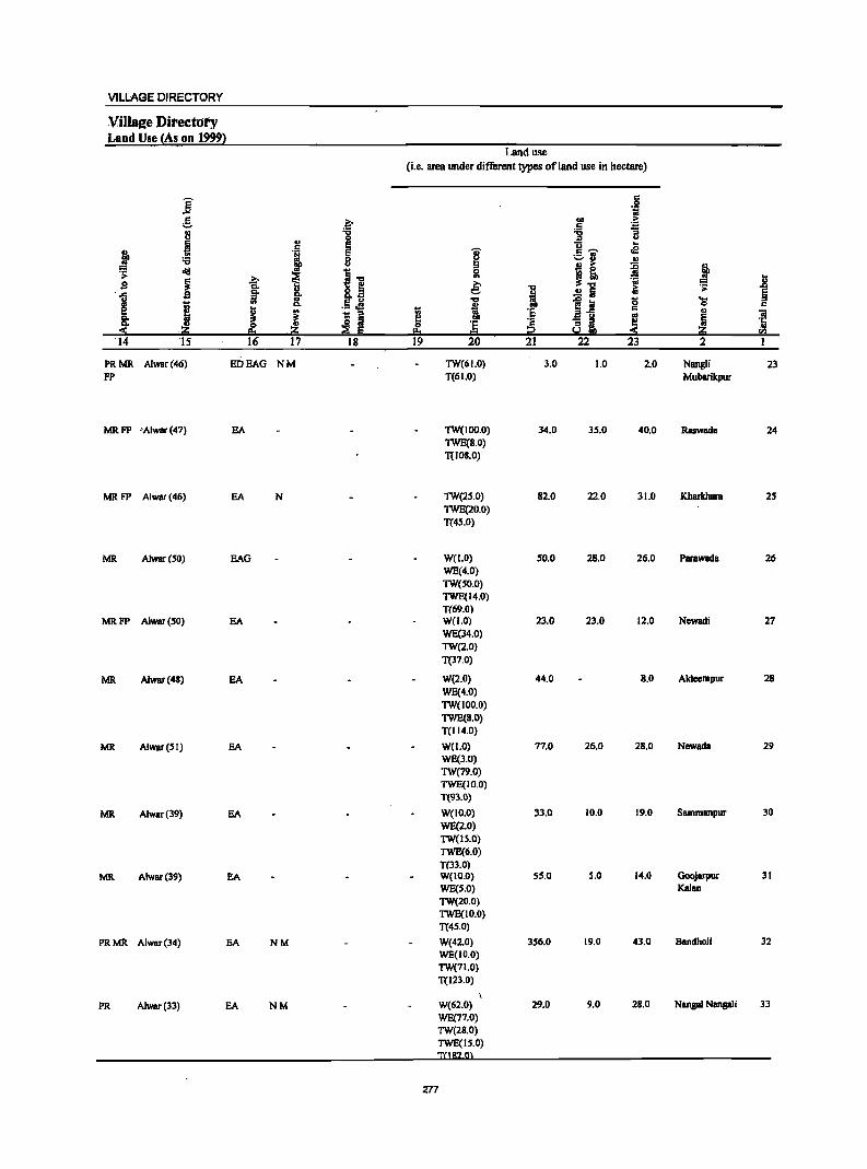
VILLAGE DIRECTORY
Villa~e Directoty Land Use {As on 19991
Land use
(i.e. area under different types of land use in hectare)
E c .S!
oW t;j C .q COD ..
;:::. ~ ~ 8 "0
0 0 ::I U
~ ~ u .. j . , i c ~ .e ._ ..
'6 8 ....... .. !! .. ~ ! ~ eli!
~ ~.., ~ ~! s i ~ ~ :rJ ]
g Co Co 8.§ ~ .!! Iii &; 'j; § .. co .., 0 ....
I DO Co E U
!l .. ~:a 0 c e J ._ oS
~ :g c ., ~ - .. aii co 'iii
8: '" :a COD - .. I!! !li '1: ., ~ E
0 'E c ~ ~ ..
:!: ·20 20 I!:I = i2 :!: 20 <n 14 IS 16 17 18 19 20 21 22 23 2 I
PRMR Alw8r(46) EDEAG NM TW(6LO) 3.0 1.0 2.0 Nangli 23 FP T(61.0) Mubarikpur
MR FP ·'Alwar (47) EA TW(IDO.O) 34.0 35.0 40.0 Raswada 24 TWE(8.0) T(IOS.O)
MRFP Alwar(46) EA N TW(2S.0) 82.0 22.0 31.0 Kharkhara 2S TWE(20.0) T(4S.0)
MR Alwar(SO) EAG WeLO) 50.0 28.0 26.0 Parawada 26 WE(4.0) TW(SO.O) TWE(14.0) T(69.0)
MRFP Alwar(SO) EA W(LO) 23.0 23.0 12.0 Ncwadi 27 WE(l4.0) TW(2.0) T(37.0)
MR Alwar(4S) EA W(2.0) 44.0 8.0 Aklccmpur 28 WE(4.0) 1W(100.0) TWE(B.O) T(114.0)
MR Alwar(SI) EA W(1.0) 77.0 26.0 28.0 Newada 29 WE(3.0) TW(79.0) TWE(IO.0) 1'(93.0)
MR Alwar(39) EA W(ID.O) 33.0 10.0 19.0 Sammanpur 30
WE(2.0) TW(IS.O) TWE(6.0) T(33.0)
MR Alwar(39) EA W(IO.O) 55.0 S.O 14.0 Goojarpur 31 WE(S.O) Kalan TW(20.0) TWE(IO.O) T(45.0)
PRMR Alwar(34) EA NM W(42.0) 356.0 19.0 43.0 Bandholi 32 WE(1O.0) TW(71.0) T(123.0)
PR Alwar(33) EA NM W(62.0) 29.0 9.0 2B.O Nanga! Nanga!i 33 WE(77.0) TW(28.0) TWE(IS.O)
277
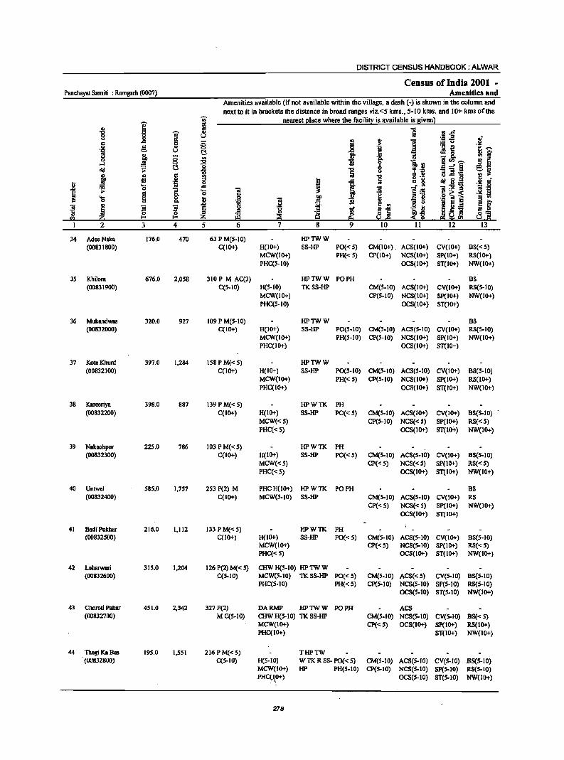
DISTRICT CENSUS HANDBOOK: ALWAR
Census of India 2001 -Panchayal Sarniti : Ramgarh (0007) Amenities and
Amenities available (if not available within the village, a dash (-) is shown in the column and
next to it in brackets the distance in broad ranges viz. <5 kms., 5-10 kms. and 10+ kms of the -;;; nearest place where the facility is available is given)
I 1i: .g ....., D 0 ~ u U II> ..c .. .0
., ~ c 5 6 0 c 0
:G .~ ::. u ~ -a ~ -0 0 .. .,
Cl. ...:I 0 "0 1i 0
~ c; 8 <Ill .;;: 13 "Cl
j .. C <II fa -g -s 0 ::I
I .8 . ., 0 .. ... i
..c ~ 0 ...
E m
0 :s 'S u c
~ S S .0 E
0 0 ::I I-< I-< Z 3 4 5
34 AdeeNaka 176.0 470 63 P M(S-IO) HPTWW (00831800) C(IO+) H(IO+) SS-HP PO«S) CM(IO+) . ACS(IO+) CV(IO+) BS«5)
MCW(IO+} PH« 5} CP(IO+} NCS(IO+) SP(IO+} RS(IO+} PHC(S-IO} OCS(IO+) ST(IO+} NW(IO+)
35 Khilom 676.0 2,058 310P M AC(3} HPTWW PO PH BS (008319OO) C(S-IO) H(S-IO) TKSS-HP CM(S-IO) ACS(IO+) CV(IO+) RS(S-IO}
MCW(IO+) CP(S-IO) NCS(IO+) SP(IO+) NW(IO+) PHC(s-IO} OCS(IO+) ST(IO+)
36 Mukandwas 320.0 927 109 P M(s-IO) HPTWW BS (00832000) C(IO+) H(IO+) SS-HP PO(s-IO) CM(s-IO) ACS(5-IO) CV(IO+) RS(s-IO}
MCW(IO+) PH(S-IO} CP(S-IO) NCS(IO+) SP(IO+) NW(IO+} PHC(IO+} OCS(IO+} ST(IO+)
37 KotaKhurd 397.0 1,284 Is8PM«s) HPTWW (00832100) C(JO+) H(IO+} 8S-HP PO(s-IO) CM(S-IO) ACS(s-IO) CV(IO+) B8(S-10)
MCW(IO+) PH« 5) CP(S-IO) NCS(IO+) SP(IO+) RS(lO+) PHC(IO+) OCS(IO+) ST(IO+} NW(IO+)
38 Kareeriya 398.0 887 139 P M«5) HPWTK PH (00832200) C(IO+) H(IO+) SS-HP PO«5) CM(S-IO) ACS(IO+) CV(IO+) B8(S-10} .
MCW«S) CP(S-IO) NCS«S) SP(IO+) RS«S) PHC«S) OCS(IO+) ST(IO+) NW(IO+)
39 Nakachpur 225.0 786 103 PM«S) HPWTK PH (00832300) C(IO+) H(IO+) SS-HP PO«S} CM(S-IO) ACS(s-IO) CV(IO+) B8(s-10)
MCW«S) CP«5} NCS«S) SP(IO+) RS«5) PHC«S} OCS(IO+) ST(IO+) NW(IO+)
40 Untwal 585.0 1,757 253 P(2) M PHCH(1o+) HPWTK PO PH BS (00832400) C(IO+) MCW(S-IO) SS-HP CM(S-IO) ACS(5-10) CV(lO+) RS
CP«5) NCS«S) SP(IO+) NW(IO+) OCS(IO+) ST(IO+)
41 BadiPokhar 216.0 1,112 133 P M«5) HPWTK PH (00832500) C(IO+) H(IO+) SS-HP PO«S) CM(S-IO) ACS(S-IO) CV(IO+) B8(s-10)
MCW(IO+) CP«s) NCS(s-IO) SP(IO+) RS«5) PHC«s) OCS(IO+) ST(lO+) NW(IO+)
42 Loharwari 315.0 1,204 126 P(2) M« 5) CHWH(S-IO) HPTWW (00832600) C(S-IO) MeW(S-IO) TKSS-HP PO«S) CM(S-IO) ACS«S) CV(S-IO) B8(S-10)
PHC(5-10) PH«S) CP(S-IO) NCS(S-IO) SP(S-IO) RS(S-IO) OCS(S-IO) ST(S-IO) NW(IO+)
43 Choroti Pahar 451.0 2,342 327 P(2) DARMP HPTWW PO PH ACS (00832700) MC(S-IO) CHW H(S-IO) TK SS-HP CM(S-IO) NCS(S-IO) CV(S-IO) BS« 5)
MCW(IO+) CP«S) OCS(IO+) SP(IO+) RS(IO+) PHC(IO+) ST(IO+) NW(IO+)
44 Thegi KaBas 195.0 1,551 216 P M«5) THPTW (00832800) C(S·IO) H(S-IO) W TK R S8- PO« 5) CM(S-IO) ACS(S·IO) CV(S-IO) .B8(S-IO)
MCW(IO+) HP PH(S.IO) CP(5-10) NCS(S·IO) SP(S-IO) RS(S.IO) PHC(\O+) OCS(S-IO) ST(S.IO) NW(IO+)
278
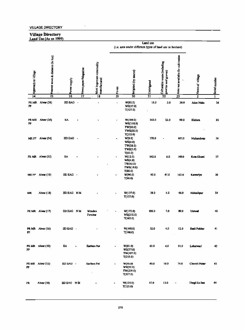
VILLAGE DIRECTORY
Villaae Directory Land Use {As on 19991
Land use
(i.e. area under different types of land use in hectare)
]' c 0 .~
g .~ .., .~ .5 u "0 11 1i <J .. 0
J c E i 1- .e &l, 'i:j E .- ..
8 -0 u ... I!I' !I .. ~ ~ '" .t oij
i !~ 5! ra e B i i € ~.: 'j; ..8 ~
g 8.fl i .!! :; i:i .;;:
~ GO
I ~J 'Q ....
I "- .5.s ·S 0
~ J ! til '" ~ c u ;;;
~ i 'c - g ~ ~ ·c 0 '5 Q ~ ..
::!: ~ !!o ... i;;! ::!: ~ sa 14 IS 16 17 18 19 20 21 22 23 2
PRMR AJwar(36) ED BAG - W(BO.O) 16.0 3.0 30.0 AdeeNaka 34 FP WE(47.0)
T(127.0)
PRMR Alwar(34) BA W(104.0) 242.0 23.0 99.0 Khilora 3S FP WE(IIB.O)
TW(60.0) TWE(30.0) T(312.0)
MRFP Alwar(34) ED BAG - W(B.O) 170.0 107.0 Muklndwas 36 WE(4.0) TW(28.0) TWE(3.0) T(43.0)
PRMR Alwar(32) BA WC12.0) 162.0 6.0 149.0 KotaKhunl 37 WE(4.0) TW(4S.0) TWE(19.0) T(8O.0)
MRFP Alwar(19) ED BAG - W(96.0) 92.0 47.0 163.0 Kareeriya 38 T(96.0)
MR. Alwar(IB) EDEAG NM W(137.0) 38.0 4.0 46.0 Nakaehpur 39 T(137.0)
PRMR Alwar(17) ED BAG NM Wooden W(173.0) 106.0 7.0 89.0 UntwaJ 40 Fumitur WE(21O.0)
T(383.0)
PRMR Alwar(16) ED BAG - W(16B.0) 32.0 4.0 12.0 BadiPokhar 41 FP T(168.0)
PRMR Alwar(IO) BA Earthen Pot W(BI.O) 65.0 4.0 31.0 Loharwari 42 FP WE(27.0)
TW(107.0) T(2IS.0)
PRMR Alwar(12) EDEAG - Earthen Pol W(66.0) 40.0 10.0 74.0 Choroli Pahar 43 FP WE(22.0)
TW(239.0) T(327.0)
PR Alwar(IO) EDEAG NM W(l25.0) 57.0 13.0 ThegiKaBas 44 T(125.0)
279
DISTRICT CENSUS HANDBOOK: ALWAR
Census of India 2001 -Panchayat Samili : Ramgarh (0007) Amenities and
Amenities available (if not available within the village, a dash (-) is shown in the column and next to it in brackets the distance in broad ranges viz.<5 kms., 5·10 kms. and 10+ kms of the
-;;;- nearest eiace where the facili~ is available is sivenl
] j ~ '0 rI.o
" § u ~ .+:; .a ,,' " J .. i! c .c: 5 ;:; .2: :.= u u
.~ e 8- G ~ '012 'E ..... u II! &. ~f !'l III g-
o ~ ;; ~ i f .!:! ~Ul,"", ,..J §, :g
f:D _" §
old ~ i u :; iii '1: ~~ j " c " '0 u.c: S '" " " ..s .9 '" I 1 Iii c g ~. g._ o c .... 'OJ 0
:~ .~ u .... .c: _" '" 1!:2'g .0 :-= 0 ]. ..... iii ] ~ .'1:1 e ...
* 0 a ~] .g ~ ~ " .... &. ... OJ) III C '"
c 0 III .~ iii .5 1i e '" ~.i ~ E i ~ ~ s s ~ ~ ...
1£ .2 ...
~ c
~l 1;;,.,$ E_ 0 0 III '1: 0 Y 'c en ~ I-< I-< Z ~ e eo ~ S! e!i~'"
1 2 3 4 5 6 7 8 9 10 11 12 13
45 DaharKaBas 148.0 855 113 P M«S) HCPHS HPTWW PH
(00832900) C(5-IO) H(S-IO) TKSS-HP PO«5) CM(5-10) ACS« S) CV(S-IO) BS(S-IO) MCW(S-IO) CP« S) NCS(S-IO) SP(S-IO) RS(S-IO) PHC(IO+) OCS(S-IO) ST(5-10) NW(IO+)
46 ManduKaBas 283.0 1,484 172 P M« 5) HPTWW PH(3)
(00833000) C(IO+) H(IO+) TKSS-HP PO«S) CM(IO+) ACS(S-IO) CV(IO+) BS(S-IO) MCW(IO+) CP(S-IO) NCS(IO+) Sp(IO+) RS(IO+) PHC(IO+) OCS(IO+) ST(IO+) NW(IO+)
47 Sahdoli 428.0 1,918 283 P M CCIO+) THPTW POPH(7)
(00833100) H(IO+) WTKSS- CM(IO+) ACS«S) CV(IO+) BS(S-IO) Mc\y(IO+) HP CP(IO+) NCS(IO+) SP(IO+) RS(IO+) PHC(IO+) OCS(IO+) ST(1O+) NW(IO+)
48 Chaprada 341.0 984 134 P(2) M« S) CHWH(IO+) HPTWW (00833200) C(10+) MCW(IO+) TKSS-HP PO«S) CM(S-IO) ACS(S-IO) CV(S-IO) BS«S)
PHC(IO+) PH« S) CP(S-IO) NCS(S-IO) SP(IO+) RS(IO+) OCS(S-IO) ST(10+) NW(10+)
49 Balwandka 281.0 1,248 186 P(2) M« S) CHWH(10+) HPTWW PH(2)
(00833300) C(IO+) MCW(lO+) TKSS-HP PO« S) CM(S-IO) ACS(S-IO) CV(S-IO) B5« 5) PHC'.(IO+) CP(S-IO) NCS(S-IO) SP(IO+) RS(IO+)
OCS(10+) ST(IO+) NW(10+)
SO Kesroli 209.0 \,309 215 P(2) M RMPCHW HPTWW PH(4)
(00833400) C(IO+) H«S) SS-HP PO« 5) CM«5) ACS« S) CV«5) B8«5) MCW(IO+) CP«5) NC5«S) Sp(IO+) RS(lO+) PHC(IO+) OCS(IO+) ST(IO+) NW(IO+)
51 Batesra 171.0 756 113 P M« S) HPTWW PH (00833S00) C(1O+) H(IO+) S5-HP PO«S) CM«S) ACS«S) CV«S) BS«5)
MCW(JO+) CP«S) NCS« S) Sp(IO+) R8(10+) PHC(IO+) OCS(IO+) ST(IO+) NW(IO+)
52 GoIC1ll 306.0 929 145 P(2) M« 5) RMP(2) CHW liP TW W PH(S) BS (00833600) C(S-IO) H«S) S8-1iP PO«S) CM«S) ACS«S) CV«S) RS(S-IO)
MCW(S-IO) CP« 5) NCS«S) SP(S-IO) NW(IO+) PHC(S-IO) OCS(S.IO) ST(S-IO)
S3 Dhadholi 200.0 1,167 194 P M«S) RMPCHW HPTWW PH(6) BS (00833700) C(IO+) H«S) SS-HP PO«S) CM«5) ACS«S) CV«S) RS(IO+)
MCW(IO+) CP«S) NCS«S) SP(IO+) NW(IO+) PHC(IO+) OCS(IO+) ST(IO+)
54 Kamalpur 233:0 643 III P M«S) ·RMPCHW IiPTWW PH(3) BS (00833800) C(S-IO) H(IO+) S8-1iP PO« S) CM«5) ACS«S) CV«S) RS(S-IO)
MCW(S-IO) CP«S) NCS«S) SP(S-IO) NW(IO+) PHC(S-IO) OC8(S-10) ST(S-IO)
55 Rundh 654.0 40 8 ' - w.ss-w Dhooninalh P« 5) M« 5) H(IOt) PO«S) CM(S-IO) ACS(5-IO) CV(IOt) BS«5) (00833900) C(IO+) MCW(IO+) PH«S) CP(S-IO) NCS(IO+) SP(IO+) RS(IO+)
PHC(IO+) OCS(IOt) ST(IO+) NW(IO+)
280
.viLLAGE DIRECTORY
Villaae Directory Land Use (As on 1999)
Land use (i.e. area under different types of land use in hectare)
E c 0
.>o! .~
e .~ QO .. ~ 8 'C ;;;
0 '" u C ., e u ..
j s '1 E 'U' c ~ oS .f!! 8 f:! efl
j ... :I ., .. j ~ ~
~1! 0 - G.
~ . ~ .. f ... ..
,s' ~ .e: 'OJ ~
u OJ i ~
.0 . .0: g ~ 8.a z Iii: §
1;1. :I .5 of! i 8 ...
J .,
t;l. QO .. t;; 0 c e ~ ~ - :I to; '5 j g. .,
Ii 8: l3 fjj I!! '6 ~ ~ 5 ·c
:::!i 0 OJ ::s 5 0 :I .. ..
!!::t ,~ !:!:I = So! !!l :::!i ~ ~
14 IS 16 17 18 19 20 21 22 23 2 I
MR AJwar(IO) EDEAG - W(IOS,O) 3.0 DaharKaBas 45 0(40.0) T(14S.0)
PRMR Alwar(13) EDEAG NM TWE(149.0) IZI.O 11.0 ManduKaBas 46 T(149.0)
PRMR Alwar(17) EDEAG NM TWE(108.0) 167.0 11.0 14Z.0 Sahdoli 47 FP T(108.0)
PRMR Alwar(14) EA Earthen Pot W(45.0) 61.0 5.0 100.0 Chaprada 48 FP WE(15.0)
TW(IIS.O) T(175.0)
PRMR Alwar(14) EA W(40.0) 51.0 2R.0 64.0 Balwandka 49
FP WE(ZB.O) TW(70.0) T(138.0)
PRMR Alwar(IZ) EA W(46.0) 7.0 10.0 13.0 Kesmli SO FP WE(20.0)
TW(91.0) TWE(2Z.0) T(l79.01
PRMR Alwar(12) EA W(30.0) 1.0 2.0 56.0 Batesra 51
FP WE(22.0) TW(50.0) TWE(IO.O) T(IIZ.O)
PRMR Alwar(IO) EA W(5a.0) 62.0 a.o 79.0 Goleta 52
FP WE(30.0) TW(SS.O) TWE(14.0) T(JS7.01
PRMR Alwar(12) EA W(44.0) 40.0 2S.0 17.0 Dhadholi S3 FP WE(JO.O)
TW(3R.0) TWE(Z6.0) T(lIR m
PRMR Alwar(IO) EA W(IR.O) 16.0 4.0 160.0 Kamalpur 54
FP WE(S.O) TW(26.0) TWE(4.0) T(Sl.O)
MRFP Alwar(IS) W(SS.O) 3a.0 283.0 250.0 Rundh S5 TW(2B.0) Dhooninath T(Rl.O)
281
DISTRICT CENSUS HANDBOOK: ALWAR
Census of India 2001 -Pancbayat Samiti : Ramgarh (0007) Amenities and
Amenities available (if not available within the village, a dash (-) is shown in the column and
next to it in brackets the distance in broad ranges viz.<5 kms., 5-10 kms. and 10+ kms of the
I ~ nearest J!lace where the facilitl: is available is !!jiven}
-8 il "0 rl.o 0 'in' u a
u ;:s ~
'J: .E! ,,-§ .c ., ;; " e :.= u .!:! Iii '" .~ e g 0 0 .~ B &i 'll u t::!. ~ 11 II) 0 til 8- e ""&. 0 bD ]fIl~
....:I .!! 0 ~ B b ·c !l B t::!. ~ .J! .E!.:E old ~ ii "0 U - 01 ;:s e~ a .!: tl ~ B :g j
., 6 !l "0 g 'g IS • oS .. .c !ij o '" .. 'll 0 i .8 .... ... .c
~ "2 .~ '-; :2 -g 'ii .g ~ 0 '3 .... -; ~ § ... ... 0 C
DO ~ .Ell .6 ~ ~ .~ ! .... ~ 0 ~
0 c 0 ... 'll 01 .5 B II)
I.~ i ~ ~ E '" ;:s u
~ " to :a "'" 'k1,~ ~ ~ ~ S g c ..r S"'" ~1 " II) ·c til o Iii "0 0
fa :i::i l- I- Z UI ~ 9 !!I So!.e :S 51 15 ~'" I 2 3 4 5 6 7 8 9 10 II 12 13
S6 Chak 126.0 73 10PM«S) HPTKSS-Meenapum C(lO+) H(IO+) HP PO« S) CM«S) ACS(5-10) CY(IO+) BS(S-IO) (00834000) MCW(IO+) PH(IO+) CP(IO+) NCS(lO+) SP(lO+) RS(IO+)
PHC(IO+) OCS(IO+) ST(IO+) NW(IO+)
57 Mccnapum 212.0 1,383 168 P M C(IO+) HPWTK (00834100) H«S) SS-HP PO« 5) CM« 5) ACS(S-IO) CY(IO+) BS« S)
MCW(IO+) PH(IO+) CP(I~) NCS(S-IO) SP(lO+) RS(IO+) PHC(lO+) OCS(5-10) ST(lO+) NW(IO+)
58 Agyara SS8.0 648 103 P ACM«S) HPWSS- PH(8) (00834200) C(IO+) H(lO+) HP PO«S) CM«S) ACS« S) CY(lO+) B8« S)
MCW(lO+) CP«S) NCS(IO+) SP(IO+) RS(IO+) PHC(IO+) OCS(IO+) ST(IO+) NW(IO+)
59 Sankhala 124.0 492 90 PM{< 5) HPlWW (00834300) C(IO+) H«S) TKSS~HP PO«S) CM«S) ACS« S) CY(S-IO) B8« S)
MCW(IO+) PH«S) CP(S-IO) NCS(5-10) SP(IO+) R8(10+) PHC(lO+) OCS(IO+) ST(IO+) . NW(IO+)
60 Babala 764.0 3,707 6S1 P M AC DAHCCHW HPlWW POPH{IO) ACS BS (00834400) C(IO+) H«5) TKSS-HP CM«S) NCS(5-IO) CY(5-1O) RS(S-IO)
MCW{IO+) CP(S-IO) OCS(IO+) Sp(IO+) NW(IO+) PHC(IO+) ST(IO+)
61 BagarMeo 524.0 2,215 319 P M{S-IO) RMP(3) CHW T HP W 55- PH(IO) B8 (00834500) C(IO+) H(S-IO) HP PO«S) CM(S-IO) ACS«S) CY(S-IO) RS(S-IO)
MCW(S-IO) CP(S-IO) NCS(IO+) SP(IO+) NW(IO+) PHC(IO+) OCS(lO+) ST(IO+)
62 Narka 373.0 1,79S 237 PM«S) THPTW PH BS (00834600) C(IO+) H(S-IO) WTKSS- PO(S-IO) CM(S-IO) ACS(5-10) CY(S-IO) RS(S-IO)
MCW(IO+) HP CP(S-IO) NCS(IO+) SP(S-IO) .NW(IO+) PHC(S-IO) OCS(IO+) ST(IO+)
63 Peeproli 600.0 2,S~S 322 P(2) M CHWH(IO+) HPlWW PH(7) BS (00834700) • C(10+) MCW(IO+) TKSS-1iP PO«S) GM«S) ACS« 5) CY«5) RS(S-IO)
PHC(IO+) Cp« 5) NCS(IO+) SP(IO+) NW(IO+) OCS(lO+) ST(IO+)
64 SadUt Ka Bas 342.0 I,S96 198 PM«S) Hl'TWW PH (00834800) C(IO+) H(SCIO) TKSS-HP PO«S) CM(S-IO) ACS(s-io) CV(S-IO) BS«S)
MCW(IO+) CP« S) NCS(IO+) SP(S-IO) RS(IO+) PHC(S-IO) OCS(IO+) ST(IO+) NW(IO+)
65 Nangla 697.0 1,296 IS8 P MC(IO+) THPTW DS Banjeerlca 'H(S-IO) WTKSS- PO(5-IO) GM(S-IO) ACS(S-IO) CV(S-IO) RS(S-IO) (00834900) MCW(IO+) HI' PH(S-IO) CP(S-IO) NCS(S-IO) SP(S-IO) NW(IO+)
PHC(S-lO) OCS(5-10) ST(S-IO)
66 BelBWas 373.0 749 116PM«S) IiPTWW PH (00835000) C(IO+) H(IO+) SS-HI' PO«S) CM(S-IO) ACS(S-IO) CY(IO+) BS«5)
MCW(IO+) CP(S-IO) NCS(S-IO) Sp(IO+) RS(S-IO) PHC(IO+) OCS(S-IO) ST(IO+) NW(IO+)
282
VILLAGE DIRECTORY
VilIa2e Directory Land Vse {As on 1999!
Land use (Le. area under different types of land use in hectare)
] c 0 1;;!
e.. .~ DO :a .5
8 .., -g Ii
i ill ~ u .. 1 .1
§ ]' :Sri <E u
'" B > :i .. old
~~ 0
~! ~ .>
i ~ ..
~ .8 s ~ u ~ 1 1; ~
1 ~ &.a .!! a E .5 J! 1 ~.! c ... '" I
g. 0 c
~ ~ c
~ ~ '" a u ~
u ~ 8: & " IS 5
~ 'E ~ ~i Iii 't ':S . i/O 6:i ~ Iii ... :S i/O ell
'14 'IS 16 17 18 19 20 21 22 23 2
MRFP Alwar(20) EDEAG - W(lI.O) 10.0 82.0 Chak 56 WE(l.O) Meenapura T(l4.0)
PR,MR Alwar(lil) EA NM W(70.0) 3.0 42.0 10.0 Meenapura 57 FP WE(87.0)
T(IS7.0)
MRFP Alwar(l7) EDEAG - W(12s.o) S3.0 208.0 42.0 AgyBra 58 WE(80.0) TW(50.0) T(255.0)
MRFP Alwar(14) EA W(62.0) 9.0 S.O 15.0 Sankhala 59 WE(8.0) TW(2S.0) T(9S.0)
PRMR Alwar(13) EA NM Earth Pol W(12D.O) 91.0 27.0 80.0 Babala 60
FP WE(30S.0) TW(141.0) T(S66.0)
PRMR AIWBr(15) EA NM Earth Pot W(139.0) 39.0 70.0 91.0 BagarMeo 61
FP WE(l29.0) TW(56.0) T(324.0)
PRMR Alwar(17) EA NM Earthn Pol W(183.0) 148.0 6.0 36.0 Narka 62
FP T(183.0)
PR Alwar(22) EA NM Earthn Pol W(141.0) 205.0 15.0 100.0 Peepmli 63 WE(139.0) T(28D.O)
PRMR A1wBr(18) EDEAG - W(I17.0) 14S.0 4.0 76.0 Sad811 Ka Bas 64
FP T(117.0)
PRMR Alwar(18) EDEAG NM Earthn Pot W(30.0) 2SS.0 8.0 237.0 Nangla 65
FP WE(167.0) Banjeerka
T(197.0)
MRFP Alwar(32) EDEAG - W(4.0) 98.0 10.0 246.0 BeraWas 66
WE(2.0) TW(12.0) TWE(1.0) T(\9.0)
283
DISTRICT CENSUS HANDBOOK: ALWAR
Census of India 2001 -Pancheya! Samiti : Ramgarh (0007) Amenities and
Amenities available (if not available within the village, a dash (-) is shown in the column and next to it in bra~kets the distance in broad ranges viz; <5 kms., 5-10 kms. and 10+ kms of the
0;;;- nearest place where the facility is available is given) j ::s .. ., 5 ] X'J.tS ... "<ii' 8 0 r..J ... iil :l! ... i5-n .. .... c Q .e:
. ~ e ... Q 0 i! '0 ~ u !::!. 1- c:;! 0 ., ~
., ]~~ ~ ~ Q. 0 ] ~ -l
~ d!! . s: ... -=8 Iii 0 .. 11 '1:
" ., .. '" ] U g
~ fi ~ ::s , d!! g._ ... 0 ... .... .s:: 0l:E'g .c .s; 0 8. ....
.g~ ~ § ~ <> .... &. .8 c 0 E ::s
~ ~ fi ~ E ~i 0 ::s en I-< I-< Z I 2 3 4 5 12
67 Bere 520.0 596 91 P M(5-tO) HPTWW PH (00835100) C(tO+) H(IO+) SS-HP PO« 5) CM(S-IO) ACS(5-10) CV(IO+) BS(5-10)
MCW(IO+) CP(5-10) NC5(10+) SP(IO+) RS(lO+) PHC(IO+) OCS(IO+) 8T(10+) NW(IO+)
68 Chowki 274.0 479 59 TWW 8 58· PH BS (00835200) P«S) H(IO+) HP PO« 5) CM«S) ACS« S) CV(IO+) RS(5~10)
M{< S) MCW(IO+) CP« 5) NCS« 5) SP(IO+) NW(IO+) C(lO+) PHC{IO+) OC8«5) ST(IO+)
69 Goha 245.0 866 126 HPTWW PH(6) (00835300) P«5) H(IO+) OSS-HP PO« 5) CM«5) ACS« 5) CV(IO+) BS« 5)
M« 5) MCW(IO+) Cp« 5) NCS« 5) SP(IO+) . RS« 5) C{IO+) PHC(IO+) OCS«5) ST(IO+) NW{IO+)
70 Nagla Balaiya 159.0 404 48 TWWO (00835400) P«S) H(IO+) 88-lJP PO« S) CM«S) ACS«5) CV(IO+) B8« 5)
M« S) MCW«S) PH(S-IO) CP«S) NCS«S) SP(IO+) RS«5) C(10+) PHC(IO+) OCS«S) ST(IO+) NW(IO+)
71 Sarheta 199.0 648 106 P M« 5) HPTWW PH (0083SSOO) C{10+) H(1b+) OSS-HP PO« S) CM«S) ACS«S) CV(IO+) B8«S)
MCW«S) Cp«S) NC8«S) Sp(IO+) RS(S-IO) PHC(tO+) OCS« 5) ST(tO+) NW(IO+)
72 B8ghori 137.0 83 12 HPTWW PH (0083S600) P«S) H(tO+) TKSS-HP PO«S) CM«S) ACS«S) CV(tO+) 8S«5)
M« 5) MCW«S) CP« 5) NCS(IO+) SP(IO+) RS« 5) C(tO+) PHC{<S) OCS(IO+) ST(IO+) NW(IO+)
73 Bardod 235.0 879 140 P M« 5) HPTWW (00835700) C(S-IO) H(IO+) TK8S-HP PO(S-IO) CM(S-IO) ACS(5-tO) CV(IO+) BS«5)
MCW(S-IO) PH(S-IO) Cp(S-tO) NCS(S-IO) Sp(IO+) RS(5-10) PHC(S-IO) OCS(S-IO) 81'(10+) NW(IO+)
74 Dohli 620.0 2,135 312PMAC CHWH(IO+) HPTWW PH BS (00835800) C(IO+) MCW«S) TKRSS- PO«5) CM«5) ACS« 5) CV(lo+) RS« 5)
PHC(JO+) HP Cp« 5) NCS« 5) 8P(10+) NW(IO+) OCS«S) 81'(10+}
75 Sonagarh 177.0 539 94 P M«S) HPTWW (0083S900) C{IO+) H(IO+) S8-HP PO«5) CM«S) ACS«S) CV«5) 8S« S)
MCW(JO+) PH«5) CP«S) NCS«S} Sp(IO+} RS«S) PHC(IO+) OCS(IO+) 81'(10+) NW(IO+)
76 Charnligarb 208.0 S27 78 P M(S-IO} HPTWW (00836000) C{S-IO) H(5-IO) TKSS-lJP PO(S-IO) CM(S-IO) ACS(S-IO) CV(S-IO) 8S(S-10)
MCW(S-IO) PH«S) CP(S-IO) NCS(IO+) SP(JO+) RS(S-IO) PHC(S-IO) OCS(IO+) ST(JO+) NW(IO+)
77 Niwali 483.0 1,905 247 P M«S) HPTWW PH(3} (00836100) C(10+) H(IO+) TKSS-HP PO«5) CM«S) ACS«5) CV«5) B8«5)
MCW«5) Cp«5) NCS(IO+) Sp(IO+) RS«5) PHC{5-IO) OCS(IO+) ST(IO+) NW(IO+)
284
VILLAGE DIRECTORY
ViiIa2e Directory Land Use {As on 1999}
Land use
(i.e. area under different types of land use in hectare)
E .. 0 ... .~
g .~ 01) .. c '+1
8 't:I 'i3 -; 0 os u
Ii .. E U .. c E I .s -;- IS j .!!l 'f.i
't:I 0 ~ .. .. If u
!I ~ ~ j ~ oil! ~'t:I 0
~ -a: I III i.., 'E ~ a 8.~ e; "0 'F;
] g A. t .!:! a § :s ... ., .. .5 J!! "0 ~j! 0
I A. i 0 c e ~ ~ ·s c ..
~ .. os
!I .. 'iii A. !!l la ~ A. .. & 0 'E 'c t!! '6 ::!: ~ ~ ::is Iii I!:I = i2 ::!: sa 14 IS 16 17 18 19 20 21 22 23 2 I
MR Alwar(27) EA W(S.O) 155.0 349.0 Bere 67 WE(4.0) TW(7.0) T(16.0)
PR A1war(24) EDEAG - W(48.0) 69.0 108.0 Chowki 68 WE(49.0) T(97.0)
PR Alwar(25) EA W(40.0) 75.0 1.0 84.0 Goha 69 WE(45.0) T(SS.O)
PR Alwar(26} EA Earthn Pot W(53.0) 35.0 1.0 40.0 Nagla Balaiya 70 WE(30.0) T(83.0)
PR Ramp (23) EA W(40.0) 63.0 1.0 60.0 Sarheta 71 WE(35.0) T(75.0)
MRFP A1war(2S} EA M W(28.0) 76.0 4.0 29.0 Baghori 72 T(28.0}
MRFP Alwar(30) EDEAG - W(38.0) 79.0 55.0 BlUdod 73 WE(43.0) TW(20.0) T(IOI.O)
PRMR. AI_T(28) EA N W(170.0) 154.0 1.0 146.0 Dohli 74
FP WE(106.0) TW(24.0} TWE(19.0) T(319.0)
MR Alwar(28) EA W(61.0) 108.0 8.0 Sonagarft 75 T(61.0)
MR Alwar(29) EDEAG - W(40.0) 138.0 7.0 9.0 Chandigarh 76
WE(14.0) T(54.0)
PR A1war(28) EA W(62.0) 362.0 22.0 Niwali 77
WE(32.0) TW(5.0} T(99.0)
285

DISTRICT CENSUS HANDBOOK: ALWAR
Census of India 2001 _ Panchayat Samiti ; Ramgarh (0007) Amenities and
Amenities available (if not available within the village, a dash (-) is shown in the column and
next to it in brackets the distance in broad ranges viz. <5 kms., 5-10 kms. IiIIld 10+ kms ofthe
I j nearest elace where the facili!! is available is Given}
" 2 "CI 13"; '8 j " Iii "
u ',c .E! of "
., "
.... il ;:; 6 ·il e ;.:: u .! ~ '1 .§, 0 i! ._ {!
u C!- .... I! ~ 8. " i ., "9 :lP ;:; ~ p,. u
~ CIl_~ ..:I 0
~ 'J::
~ C!- o "CI ""13 -=§ ~~ ~ ~ lii
,., " ""1::
f ., 6 !'I ] 8 .2 u.c S = • -5 .. .c = g old g ._ .g s k; .... 0 ~ '0 .. .c
ftI ~ ] i·;; 'iI:s!1i 13 'J:! .c 1 ... ~ E ~
0 c ~G .g ~ l ._ I!I
E .... .8 .9 'ii "" !l § '" 0 c:>. .8
E ~ 'ii § i!I ~ ~ B ~ ".
t ~~ .S:! 6 il fi ._ '5 " = Iib.,s u.5 "» E_
~ ~ " 'J:: ~'i\! !!l 2::i ~ a ~& ::!: 2 ~~!22
I 2 3 4 5 6 7 8 9 10 Jl 12 13
78 Khojaka 260.0 472 68 P M(5-10) HPTWW ACS (00836200) C(IO+) H(S-IO) TKSS·HP PO(5-10) CM(5-10) NCS(lO+) CV(5-10) BS(5-10)
MCW(S-IO) PH«S) CP(S-IO) OCS(IO+) SP(IO+) RS(5-l0) PHC(S-IO) ST(IO+) NW(IO+)
79 Bcejwa 432.0 1,227 206 P M C(lO+) liPWSS- POPH(7) BS (00836300) H(5-10) liP CM(5-10) ACS(S-IO) CV(s-IO) RS(IO+)
MCW(S-IO) CP(S-IO) NCS(IO+) SP(IO+) NW(IO+) PHC(S-IO) OCS(IO+) ST(IO+)
80 Shckhpur 349.0 1.155 222 P AC M« 5) HPTWW (00836400) C(IO+) H«5) TKSS-HP PO«5) CM«5) ACS« 5) CV«5) BS«5)
MCW«5) PH«5) CP(IO+) NCS(IO+) Sp(IO+) RS(IO+) PHC«5) OCS(IO+) ST(IO+) NW(lo+)
81 MandBpur 233.0 584 100 P M«5) HPTWW (00836500) C(IO+) H(lO+) 55-liP PO«S) CM«5) AC5(5-10) CV(lO+) B5« 5)
MCW(IO+) PH«5) Cp« 5) • NCS(S-IO) 5P(10+) RS« 5) PHC« S) OCS(S-IO) 5T(10+) NW(IO+)
82 Mcghawas 121.0 657 117 P ACM« 5) CHWH(IO+) THPTW (00836600) C(IO+) MCW(IO+) W5S-HP PO«5) CM«5) AC8« 5) CV(S-IO) BS« S)
PHC«5) PH«S) CP(IO+) NCS(1O+) Sp(IO+) RS(1O+) OC5(10+) ST(IO+) NW(IO+)
83 Podipur 135.0 214 29 AC P«5) HPTWW (00836700) M«5) H(10+) SS-liP PO«5) CM«5) AC5(10+) CV«5) B5« 5)
C(IO+) MCW(IO+) PH«5) Cp(IO+) NCS(IO+) SP(IO+) RS(IO+) PHC« S) OCS(IO+) ST(IO+) NW(IO+)
84 Baramda 255.0 1,505 257 PAC CHWH(IO+) HPTWW (00836800) M«5) MCW(IO+) TKSS-HP PO«5) CM«5) AC5« 5) CV«S) BS«5)
C(IO+) PHC«S) PH«5) Cp(IO+) NCS(IO+) SP(IO+) RS(IO+) OCS(IO+) ST(IO+) NW(IO+)
85 Danwari 393.0 1,015 15S PM AC HPTWW PH (00836900) C(IO+) H(IO+) TKSS-HP PO«S) ~<5) ACS« 5) CV«S) BS« S)
MCW(IO+) CP(IO+) NCS(IO+) Sp(IO+) RS(IO+) PHC«S) OCS(IO+) ST(IO+) NW(IO+)
86 Mubarikpur 1,363.0 5,060 842 P(2) M(2) S DAPHC THPTW POPH(91) CM ACS CV BS (00837000) PUC AC(2) RMP(4) WSS-HP CP(IO+) NCS(IO+) SP(S-IO) RS(IO+)
C(IO+) H(IO+) OCS(IO+) ST(S-IO) NW(IO+) MCW(IO+)
87 Nag1iwal 238.0 986 148 P OM«5) HPTWW (00837100) C(10+) H(IO+) TKSS-HP PO(S-IO) CM(5-10) ACS(S-IO) CV(IO+) BS(5-10)
MCW(IO+) PH(S-IO) CP(S-IO) NCS(IO+) Sp(IO+) RS(IO+) PHC(S-IO) OCS(IO+) 81'(10+) NW(IO+)
88 Khohar 379.0 803 142 PM«S) HPTWW (00837200) C(IO+) H(IO+) TKSS-HP PO(5-10) CM(S-IO) ACS(S-IO) CV(IO+) B5(5-10)
MCW(lO+) PH(5-10) CP(S-IO) NCS(S-IO) 8P(10+) RS(IO+) PHe(S-IO) DeS(S-IO) ST(IO+) NW(IO+)
288
VILLAGE DIRECTORY
Villa2e Directory Land Use (As on 1999)
! > ~.
1 . Co
< -14 15
I 1 16 17
PR AJwar(30) EDEAG •
PR Alwar(32) EA
MRFP Alwar(3S) BDEAG NM
MR Alwar(36) EA
FP Alwar(38) EDEAG NM
PRMR A1war(40) BDEAG NM FP
PRMR Alwar(40) BDEAG NM FP
PRMR Alwar(43) EDEAG NM FP
PRMR Alwar(44) BDEAG NM FP
PRMR Alwar(43) BDEAG . FP
PRFP Alwar(41) BDEAG .
18
Earthen Pot
Earthen Pot
Land use (i.e. area under different types of land use in hectare)
19 20
W(30.0)
T(lO.O)
W(14.0)
WE(S.O) TW(S4.0)
TWE(IS.O) T(88.0)
W(16.0) WE(200.0)
T(216.0)
W(SS.O)
WE(1O.0)
TW(4S.0) 0(4S.0) T(ISS.O)
W(12.0)
WE(SI.O) T(63.0)
W(38.0)
WE(4.P) T(42.0)
W(l3.0)
WE(110'0)
T(123.0)
W(2S.0) WE(67.0) T(92.0)
W(196.0) WE(264.0)
T(460.0)
W(94.0)
T(94.0)
W(143.0) T(143.0)
287
21 22 23
215.0 5.0 10.0
298.0 31.0 15.0
116.0 4.0 13.0
15.0 61.0 2.0
51.0 3.0 4.0
61.0 1.0 31.0
49.0 76.0 7.0
88.0 132.0 81.0
585.0 52.0 266.0
3S.0 1.0 108.0
29.0 1.0 206.0
j > ... o
j 2
KhojaJca·· .
Beejwa
Shckhpur
Mandapur
Meghawas
Podipur
Baramda
Danwari
Mubarikpur
Nagliwal
Khohar
78
79
80
81
82
83
84
85
86
87
88
.,~
DISTRICT CENSUS HANDBOOK: ALWAR
Census of India 2001 -Pancltllyat Samiti : Ramgarlt (0007) Amenities and
Amenities available (if not available within the village, a dash (-) is shown in the column and
next to it in brackets the distance in broad ranges viz.<5 kms., 5-10 kms. and 10+ kms of the
i' i: nearest l!lacc where the faeilin: is available is given l '" s 5 ..,
:J .r:" ..,
! Iii 8 u u § 1!
~ '" '" f! ;g-fi .g g Ii " .e '<3 ! 0 .£! ~~ .~ u
i e ::8. ., '" '" ~ ;;
i ~ 0 ii 0 ·c ~Vl"" ~ 0
~ ~u _" E <I!I .:;: ..,
~ :j B ]! .~ Ii " ., ., ·1 !!I 1 § .. ::f ..s I 1 " " ~.§:a
i ~ ... _g
01 l~ 'g ·8 0 '3 ... 01 .1 ~ ~ ~ 8: 0 .,8 'g '~H! ... j! 'iii
." .. '31 0 ] 11 ~I ~ .,
S 5 ~ .!l El ~ .g .... e! Ii .:!
Iii III .., " ~ g1 ~.5 ] . ., ~ ~ '" '1:; e;: ~~ 8 ·c !!2 ~ :<!: !!l ~ 9 s.!.c> ~VJ
1 2 3 4 5 6 7 8 9 10 II 12 13
89 Hajipur 357.0 1,454 210 P(2) M PHSCHW HPTWW (00837300) C(IO+) H(IO+) TKSS-HP PO« 5) CM« 5) ACS«5) CV(IO+) 8S«S)
MCW(IO+) PH(S-IO) CP« 5) NCS«5) SP(IO+) RS(IO+) PHC« 5) OCS« 5) ST(IO+) NW(IO+)
90 Mohammad- 284.0 1,009 151 P M(S-IO) HPTWW pur C(lO+) H(IO+) TKSS-HP PO« 5) CM«S) ACS«S) CV(IO+) BS«5) (00837400) MCW(IO+) PH« 5) CP« S) NCS«S) sp(10+) RS(5-10)
PHC«5) OCS«S) ST(IO+) NW(IO+)
91 Naugawan 1,620.0 9,113 1,358 P(4) M(2) DAMHCWC THPlW PO PH CMCP ACS CV BS (00837500) S(2) 0(3) HC PHC PHS W TK S8- NCS(IO+) Sp(IO+) RS(IIl+)
C(IO+) RMPSMP HP OCS(IO+) ST(IO+) NW(IO+) CHWH(IO+) MCW(IIl+)
92 Naharpur 97.0 320 49PM«5) HPTWW
"hurd C(IO+) H(IO+) TKSS-HP PO«5) CM«5) ACS(5-1O} CV(lO+) BS«5) (00837600) MCW(IO+) PH« 5) CP«5) NCS(IO+) Sp(IO+) RS(IO+)
PHC«5) OCS(IO+) ST(IO+) NW(IO+)
93 Alampur 255.0 1,056 140 PM«S) HPTWW (00837100) C(10+) H(IO+) TKSS-HP P0(5-10) CM«5) ACS«5) CV«5) 8S«5)
MCW«5) PH«S) CP« S) NCS(IO+) SP(IO+) RS(IO+) PHC«5) OCS(IO+) ST(IO+) NW(IO+)
94 Bahripur 157.0 878 123 P O(2)M« 5) HPTWW ACS (00837800) C(IO+) H(IO+) TKSS-HP PO«S) CM«5) NCS(IO+) CV«S) B8«5)
MCW«S) PH«5) Cp«5) OCS(IO+) 8p(10+) RS(IO+) PHC«5) ST(IO+) NW(IO+)
95 Cheerwa 160.0 836 114P M 0 PHSCHW HPTWW PO ACS (00837900) C(IO+) H(IO+) TKSS-HP PH«S) CM«S) NCS(IO+) eV«5) BS« S)
MCW«5) CP« 5) OCS(IO+) Sp(IO+) RS(IO+) PHC«S) ST(IO+) NW(lO+)
96 8herpur 3S6.0 1,226 178P 0(3)M«S) HPTWW cv 8S -(00838000) C(IO+) H(IO+) SS-HP PO«5) CM(S-IO) ACS«S) SP(IO+) RS(IO+)
MCW(IO+) PH(5-1O) CP(S-IO) NCS(IO+) ST(IO+) NW(IO+) PHC(S-IO) OCS(IO+)
97 Goiki 145.0 278 4OPM«S) HPTWW (00838100) C(IIl+) H(IO+) SS-HP PO«S) CM«5) AC8(10+) CV«S) BS« 5)
MCW(IO+) PH«S) Cp«5) NCS(IO+) Sp(IO+) RS(IO+) PHC«5) OCS(IO+) ST(IO+) NW(IO+)
98 Khedli Jhanda 155.0 386 76 P M«S) HPTWW CMCP (00838200) C(IO+) H(IO+) SS-HP PO«5) ACS(IO+) eV«S) 88(5-10)
MCW(IO+) PH(S-IO) NCS(IO+) SP(IO+) RS(IO~)
PHC(IO+) OCS(IO+) S1'(IO+) NW(JO+)
99 A1awal Pur 315.0 1,043 .IS0P ACM«S) HPTWW (00838300) C(S-IO) H(IO+) S8-HP PO«S) CM(S-IO) AC8(10+) eV«5) 88(5-10)
MCW(IO+) PH(S-IO) CP(S-IO) NCS(IO+) Sp(IO+) RS(IO+) PHC(5-IO) OCS(IO+) ST(IIl+) NW(IO+)
288
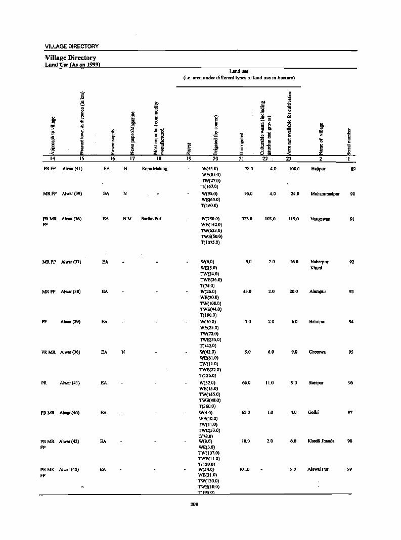
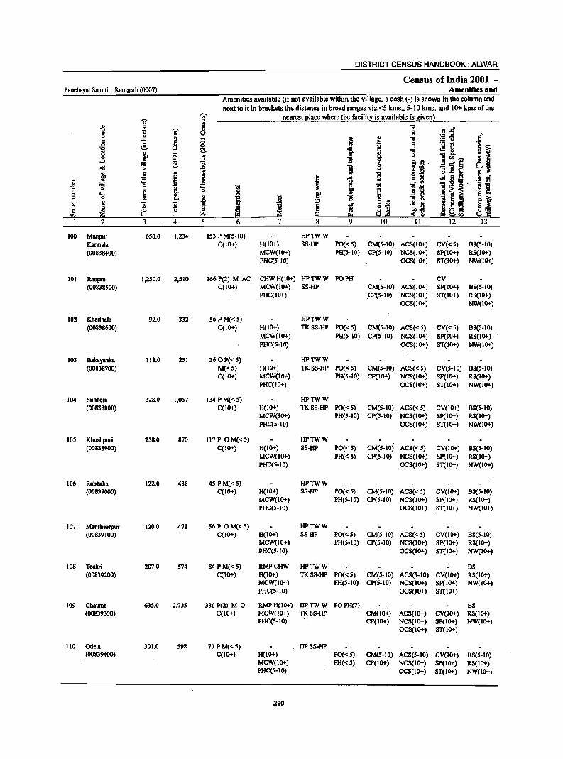
DISTRICT CENSUS HANDBOOK: ALWAR
Census of India 2001 -Panchaya! Samiti : Ramgarh (0007) Amenities and
Amenities available (if not available within the village, a dash (-) is shown in the column and next to it in brackets the distance in broad ranges viz.<5 kms., 5-10 kms. and 10+ kms of the
I ~ nearest place where the facility is available is given) ., ., 5 "0 11 .rJ' "tI
~ :ii 8 u (,) l! ;g-5 of .. .. 0 ~ .j e .~ c
0 g ... <:> 0 .a ~~ e:~ .~ u C!. -a 13 ~f ~ 0 ., ... 8- e&~ 0 <:> "tI B 0 '1: o-'l :g 8 GO B . a....:-§ ~ .:; ~ "tI Z 'il "3] ._ ';;~ j
., c gj Iii ." U .. ..s 0 ..
I :ii g "g oI!I 2.~ g " .. .ti1 0
~ .8 ... .c l~
01:9 'g . :~ 'j ~ 0 "3 ... 0; 'iI e .. ." 0 .. ·8 .§ ~ i ::I ... ~ 8. !l .9 bI) § ., c 0 rl .5 II) "3 ~ 'OJ 8 '" 8 t ~
., 'i ~ E g :a .....
l 8.>1 .~ !l ~ 5._ ~
.. ~.5 ~ ~::: ·0 ::l
~ II> '1: o a ~~ 52 l- I- Z ~ g !':.a!.e e!i~52 So! III
I 2 3 4 5 6 7 8 9 10 II 12 13
100 Munpur 656.0 1,234 153 P M(S-IO) HPTWW
Kannala C(IO+) H(IO+) SS-HP PO«S) CM(S-IO) ACS(IO+) CV«5) 85(5-10)
(00838400) MCW(IO+) PH(S-IO) CP(S-IO) NCS(IO+) SP(IO+) RS(IO+) PHC(S-IO) OCS(lO+) ST(IO+) NW(IO+)
101 Rasgan 1,250.0 2,510 366P(2) M AC CHWH(IO+) HPTWW PO PH CV (00838500) C(IO+) MCW(IO+) 55-HP CM(S-IO) ACS(IO+) SP(IO+) 85(5-10)
PHC(IO+) CP(S-IO) NCS(IO+) ST(IO+) RS(IO+) OCS(IO+) NW(IO+)
102 Kherlhala 92.0 332 56 PM«5) HPlWW
(00838600) C(IO+) H(IO+) TK55-HP PO« 5) CM(S-IO) ACS«S) CV«S) 85(5-10) MCW(IO+) PH(S-IO) CP(5-10) NC5(10+) 5P(10+) R5(10+) PHC(5-10) OC5(10+) 5T(10+) NW(IO+)
103 Bakayanka 118.0 251 360P«S) HPlWW (00838700) M«S) H(IO+) TK55-HP PO«S) CM(S-IO) ACS«5) CV(S-IO) 85(5-10)
C(IO+) MCW(IO+) PH(S-IO) Cp(IO+) NCS(IO+) Sp(IO+) RS(IO+) PHC(IO+) OCS(IO+) ST(IO+) NW(IO+)
104 5unhera 328.0 1,057 134 PM«S) HPlWW (00838800) C(IO+) H(IO+) TKSS-HP PO« 5) CM(S-IO) ACS«S) CV(IO+) 85(5-10)
MCW(IO+) PH(S-IO) CP(S-IO) NCS(IO+) 5P(10+) RS(IO+) PHC(5-10) OC5(10+) ST(10+) NW(!o+)
105 Khushpuri 258.0 870 117 P OM«S) HPTWW (00838900) C(IO+) H(IO+) SS-HP PO« S) CM(S-IO) ACS«S) CV(IO+) 85(5-10)
MCW(IO+) PH«S) CP(S-IO) NCS(IO+) SP(IO+) RS(IO+) PHC(S-IO) OCS(JO+) ST(IO+) NW(IO+)
106 Rabbaka 122.0 436 4S PM«S) HPTWW (00839000) C(lO+) H(IO+) SS-HP PO«5) CM(5-10) ACS«5) CV(lO+) 88(5-10)
MCW(IO+) PH(S-IO) CP(S-IO) NCS(IO+) Sp(IO+) RS(lO+) PHC(S-IO) OCS(lO+) ST(IO+) NW(IO+)
107 Mansheerpur 120.0 471 S6P OM«S) HPlWW (00839100) C(IO+) H(IO+) SS-HP PO« 5) CM(S-IO) ACS« S) CV(IO+) 88(S-IO)
MCW(IO+) PH(5-10) CP(5-10) NCS(IO+) SP(IO+) RS(IO+) PHC(S-IO) OCS(IO+) ST(IO+) NW(IO+)
108 Tcckri 207.0 S74 84 PM«S) RMPCHW HPTWW B8 (00839200) C(IO+) H(IO+) TKSS-HP PO«S) CM(5-10) ACS(S-IO) CV(IO+) RS(IO+)
MCW(JO+) PH(S-IO) cp(5-IO) NCS(IO+) SP(IO+) NW(IO+) PHC(S-IO) OCS(IO+) ST(IO+)
109 Chauma 635.0 2,735 386 P(2) M 0 RMPH(tO+) HPTWW POPH(7) 88 (00839300) C(IO+) MCW(IO+) TKSS-HP CM(IO+) ACS(IO+) CV(IO+) R8(10+)
PHC(S-tO) CP(IO+) NCS(IO+) SP(tO+) NW(IO+) OCS(IO+) ST(JO+)
110 Odell 301.0 598 77PM«S) HP5S-HP (00839400) C(IO+) H(tO+) PO«S) CM(S-IO) ACS(S-IO) CV(IO+) 85(5-10)
MCW(1O+) PH« 5) CP(tO+) NCS(1O+) SP(IO+) RS(IO+) PHC(S-IO) OCS(IO+) ST(IO+) NW(IO+)
290
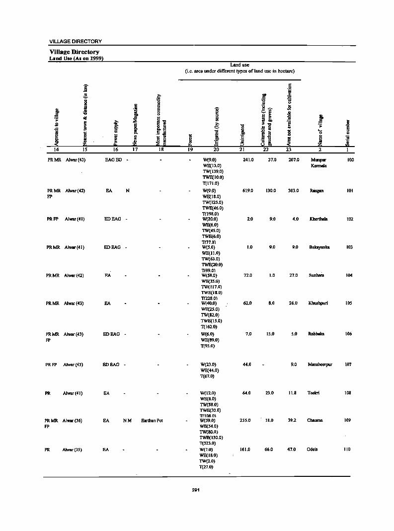
VILLAGE DIRECTORY
VilIS2e Directory Land Use {As on 1999!
Land use (i.e. area under different types ofland use in hectare)
E r:: ... .~
" .~ DO ...
e " '::1
j "0 :a :; 0 '" u
2:! E ~~ ..
j 'Iii E i oS :a 8 ...... ., .!!
=' u ... ~ ,t ~ l1li
~ ~~ 0 - ~
i ~ .. ~.., :a i sa Ii .e: i t .;;:
1 s §. 8.a .!! a iii .5 .e 1 1~ 0 .... I CI. DO 0 c
i ~ i 'E '" ., Ii: .. .. 5 "ii
~ ~ ~ (J i ~ ·c
~ 0 ~ 'E " ::!!: e. .. a::; 1::1 . a::; f:!l
14 15 16 17 18 19 20 21 22 23 2 I
PRMR Alwar(43) EAOEO - W(9.0) 241.0 37.0 207.0 Munpur 100 WE(13.0) Kannala TW(139.0) TWE(IO.O) T(171.0)
PRMR Alwar(42) BA N W(9.!» 619.0 130.0 303.0 Rasgan 101 FP WE(18.0)
TW(12S.0) TWE(46.0) T(l9S.0)
PRFP Alwar(41) EOBAO - W(20.0) 2.0 9.0 4.0 Kherthala 102 WE(6.0) TW(4S.0) TWE(6.0) TI77.0)
PRMR Alwar(41) EDEAO - W(S.O) 1.0 9.0 11.0 Bakayanka 103 WE(JI.O) TW(63.0) TWE(20.0) TIII9.0)
PRMR Alwar(42) EA W(SB.O) 72.0 1.0 27.0 SURber. 104 WE(3S.0) TW(117.0) TWE(lIi.O) T(228.0l
PRMR A1war(43) BA W(40.0) 62.0 S.O 26.0 Khushpuri 105 WE(2S.0) TW(S2.0) TWE(15.0) T(162.0)
PRMR Alwar(43) EDEAO - W(6.0) 7.0 15.0 5.0 Rabbaka 106
FP WE(8!l.0) T(95.0}
PRFP Alwar(43) EDBAO - W(23.0) 44.0 9.0 Mansheerpur 107 WE(44.0) T(67.0)
PR Alwar(41) EA W(12.0) 64.0 23.0 11.8 Teekri 108 WE(S.O) TW(58.0) TWE(30.0) T(IOR 0)
PRMR Alwar(36) EA NM Earthan Pol W(59.0) 255.0 18.0 39.2 Chauma 109
FP WE(S4.0) TW(80.0) TWE(llD.O) T(l2l.0)
PR Alwar(3S) EA W(7.0) 161.0 66.0 47.0 Odela 110 WE(IB.O) TW(2.0) T(27.0)
291
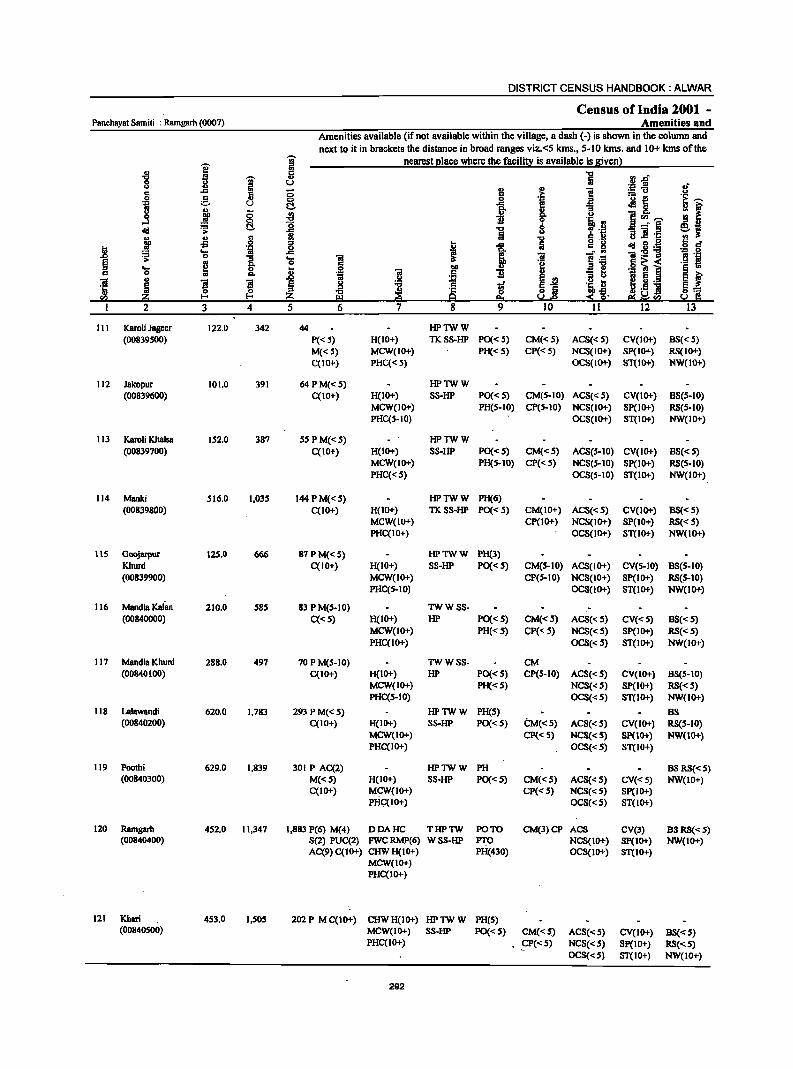
DISTRICT CENSUS HANDBOOK: ALWAR
Census of India 2001 -Panchayal Sam iii : Ramgarh (0007) Amenities and
Amenities available (if not available within the village, a dash (-) is shown in the column and next to it in brackets the distance in broad ranges viz.<5 kms., 5-10 kms. and 10+ kms of the
~ g nearest place where the facility is available is given)
2 '" .g fl
c 't::I
1 .,
lii 1l.rS 0 u ''::: .E u ., '" .. .c ;:; := u c :> .;:; !! ·i e ., 0 0 'i u C .c
of! 8-u ., g {j fir 8-0 E 11 ~"''"' ....l :8 0
-"§ old ~ t:!. 't::I 8 ., ., '" M lii (l J! .;::;
:II' -5 0 .. 1 old 3.~ ..
1 0 i ., ;;:; ... .c "iI:2"g '" 0 ...
§ :> «I 0 6'i; < ... 2
i ii ';1 E ., 0 .. '" G 5 .S! 01 ~ iI iI '5 ~ ~ :z til '" 2 3 4 5 12
111 Karoli Jageer 122.0 342 44 HPTWW (00839S00) P«S) H(IO+) TK. SS-HP PO« S) CM«S) ACS« S) CV(lO+) 8S« S)
M«S) MCW(lO+) PH« S) CP« S) NCS(IO+) Sp(lO+) RS(IO+) C(IO+) PHC«5) OCS(IO+) ST(IO+) NW(IO+)
112 Jakopur 101.0 391 64PM«S) HPTWW (00839600) C(IO+) H(lO+) S8-HP PO« S) CM(S-IO) ACS« S) CV(IO+) B5(S-10)
MCW(lO+) PH(S-IO) CP(S-10) NCS(1O+) Sp(IO+) RS(S-10) PHC(S-IO) OCS(lO+) 5T(10+) NW(lO+)
113 Karoli Khalsa lS2.0 387 SS PM«S) HPTWW (00839700) C(10+) H(lO+) S8-HP PO«S) CM«S) ACS(S-IO) CV(IO+) BS« S)
MCW(IO+) PH(HO) CP« S) NCS(S-IO) SP(IO+) RS(S-lO) PHC«S) OCS(S-lO) ST(lO+) NW(lO+)
114 Manki 516.0 1,03S I44PM«S) HPTWW PH(6) (00839800) C(lO+) H(IO+) TK. 5S-HP PO«S) CM(10+) ACS« S) CV(IO+) B5« S)
MCW(lO+) Cp(lti+) NCS(lO+) SP(IO+) RS«S) PHC(lO+) OCS(lO+) ST(IO+) NW(1O+)
115 Goojarpur 125.0 666 87PM«S) HPTWW PH(3) Khurd C(10+) H(IO+) 88-HP PO«S) CM(S-IO) ACS(lO+) CV(S-lO) BS(S-lO) (00839900) MCW(IO+) CP(S-IO) NCS(IO+) SP(IO+) RS(S-IO)
PHC(S-lO) OCS(lO+) ST(IO+) NW(IO+)
116 Mandla Kalan 210.0 S8S 83 P M(S-lO) TWWSS- -(00840000) C«S) H(IO+) HP PO«S) CM«S) ACS«S) CV«S) B8« S)
MCW(IO+) PH«S) CP«S) NCS«S) SP(IO+) RS«S) PHC(IO+) OCS« S) ST(IO+) NW(IO+)
117 Mandla Khurd 288.0 497 70 P M(S-IO) TWWSS- CM (00840100) C(10+) H(IO+) HP PO«S) CP(S-IO) ACS« S) CV(IO+) B8(S-10)
MCW(lO+) PH« S) NCS«S) Sp(IO+) RS«S) PHC(S-lO) OCS«S) ST(IO+) NW(IO+)
118 Lalawandi 620.0 1,783 293 PM«S) HPTWW PH(S) BS (00840200) C(1O+) H(lO+) SS-HP PO«S) CM«S) ACS«S) CV(IO+) RS(5-10)
MCW(IO+) Cp«5) NCS«5) SP(IO+) NW(IO+) PHC(IO+) OCS«S) ST(lO+)
119 Poolhi 629.0 1,839 301 P AC(2) HPTWW PH BSRS«S) (00840300) M«S) H(lO+) SS-HP PO«S) CM«S) ACS« S) CV«S) NW(10+)
C(IO+) MCW(IO+) CP« S) NCS«S) SP(lO+) PHC(lO+) OCS«S) 5T(10+)
120 Ramgarh 452.0 11,347 1,883 P(6) M(4) DDAHC THPTW PO TO CM(3)CP ACS eV(3) BS RS«S) (00840400) S(2) PUC(2) FWCRMP(6) WSS-HP PTO NCS(IO+) Sp(IO+) NW(10+)
AC(9)C(10+) CHWH(IO+) PH(430) OCS(lO+) ST(IO+) MCW(IO+) PHC(IO+)
121 Kheri 4S3.0 I,S05 202 P M C(lo+) CHWH(IO+) HPTWW PH(S) (00840500) MCW(IO+) SS-HP PO«5) CM«S) ACS«S) CV(IO+) BS«5)
PHC(IO+) .CP«5) NCS«S) Sp(IO+) RS«S) OCS«S) ST(lO+) NW(IO+)
292
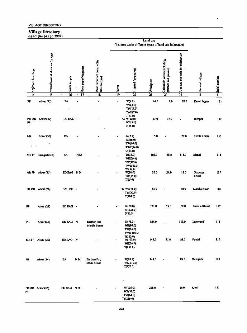
VILLAGE DIRECTORY
Viilaj!e Directory Land Use {As on 19991
i g
j .j ., N l1JI ~ lid
t ~ i ,,9 ... S :;! ill
I .. .[ ! :; ~
u' .lj ,.lj
14 15 16 17
FP Alwar(lS) EA
PRMR Alwar(30) EOEAG -FP
MR A1war(3S) EA
MRFP Ramgarh (3B) EA NM
MRFP Alwar(33) EDEAG NM
PRMR Alwar(2B) EAGEO -
FP Alwar(29) EDEAG -
I'!t A1war(26) EDEAG N
MRFP Alwar(26) EDEAG N
PR Alwar(24) EA NM
PR MR Alwar (25)
FP
BOEAG NM
.~ "C 0 e e 0 u
~i '~ ~ • _ c;:;
- ::I
,~ ,~ 18
Earthen Pot, Marble Statue
Earthen Pol, Slone Statue
Land usc
(i.e. area under different types of land use in hcctare)
11 ~ 19
... t! :s 0 .. € I 'E = 20
W(4.0) WE(l.O) TW(19.0) TWE(7.0) TIll.O)
52 W(IO.O) WE(5.0) T(15.0)
W(7.0) WE(6.0) TW(IO.0)
TWE(14.0) O(BI.O)
W(33.0) WE(29.0) TW(49.0) TWE(4l.0) TIl 54.01 W(lO.O) TW(35.0) T(65.0)
39 WE(78.0) TW(30.0) T(108.0)
W(60.0) WE(2S.0) T(85.0)
W(75.0) WE(BO.O)
TW(6S.0) TWE(103.0) T(323.0) W(IOD.O) WE(56.0)
T(IS6.0)
W(ID.O) WE(215.0) T(225.0)
W(IOS.O) WE(SO.O) TW(64.0)
-T(219.0)
293
~ :§ ..
.j2 21
44.0
12.0
5.0
IB6.0
IB.O
5l.0
121.0
184.0
34B.0
144.0
20B.0
c 0 'i
DO
~ .. :a ::I U
13 .s .. ~ -=-rl .!! B ;>
~ i! =s .!! :a i:i e1 0 .. .5 g ~ ::I .. !i.!!!!1 ~ 22 23
7.0 l8.0
22.0
29.0
58.2 IIB.O
24.0 IB.O
10.0
Il.O 69.0
113.0
37.0 BB.O
83.0
26.0
j li ~ e .... :s
0 .. ., 'iii
~ '5 2i fa 2 I
Karoli Jageer 111
Jakopur 112
Kamli Khaliia 113
Manki 114
Goojarpur 115 Khurd
Mandla Ka1an 116
Mandla Khurd 117
Lalawandi liB
Poothi 119
Ramgarh 120
Khcri 121
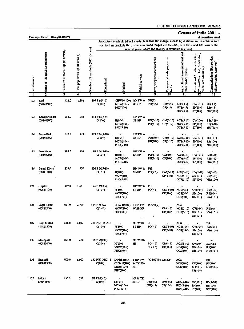
DISTRICT CENSUS HANDBOOK: ALWAR
Census of India 2001 -Panchayat Samiti : Ramgarb (0007) Amenities and
Amenities available (if not available within the village, a dash (-) is shown in the column and
next to it in brackets the distance in broad ranges viz.<S kms., 5-10 kms. and 10+ kms of the
I ;- nearest place where the facility is available is given) ..
-8 " "0 liD ~
.. fa 0 u ._ ;::s
:f <> .c .. 0 II) .. i! :!5'tl c g 5 6 > '0 !! '! j ·i 0 .~ .E u t:!. ]- :: 8. .,
8- ::s u ~ 5 .. <> 0 'C B 0 'c ~ rIl __
...l §. '0 b lID'" _" E ::s ..
~ ~ 1 "0 U ~ :~ 1i ] ·s ~~
~ ., :5 fa ..,
diI a.g c .. -5 ';j i -a fa c g .! g .8 ~
.... .c -g.; .:E"g 0
8. ... 'iI e· ';I .EI OJ ~ g 0 c i .~
~] .§ ~ ~ ... 0 j .2 ';I lID 3 '" 0 c
i1 ... 5 u ~ ~ 5 .= ~ f ~
., s s ~ 1i til' .!:! 8 (j ~ ~ ~ 'c e;; 1ib-5 ~ .S ]I or=
!!! ~ ::E 9 !.loS :S e ~rIl !.l C 2 3 4 5 6 7 8 9 10 II 12 13
122 Doli 424.0 1,802 206 P M«5) CHWH(IO+) HPTWW PH(2) (00840600) C(IO+) MCW(IO+) SS-HP PO« 5) CM« 5) ACS« 5) CV(IO+) 88«5)
PHC(IO+) Cp« 5) NCS«S) SP(IO+) RS« S) OCS«S) ST(IO+) NW(IO+)
123 Khanpur Kalan 2SI.0 772 114 PM«S) HPTWW (00840700) C(lO+) H(IO+) SS-HP PO(S-IO) CM(S-IO) ACS(S-IO) CV(IO+) 8S(S-10)
MCW(IO+) PH(S-IO) CP(S-IO) NCS(S-IO) 8P(10+) RS(S-IO) PHC(S-IO) OCS(S-IO) 8T(10+) NW(IO+)
124 Masla8ad 342.0 149 113 P M(S-IO) HPTWW (00840800) C(IO+) H(IO+) SS-HP PO(IO+) CM(S-IO) ACS(S-IO) CV(IO+) 8S(10+)
MCW(IO+) PH(IO+) CP(S-IO) NCS(S-IO) 8p(10+) RS(IO+) PHC(S-IO) OCS(S-IO) ST(IO+) NW(IO+)
12S MeoKhem 284.0 124 98 PM(S-IO) HPTWW (00840900) C(IO+) H(IO+) SS-HP PO(S-IO) CM(IO+) ACS(S-IO) CV(IO+) 88(S-10)
MCW(IO+) PH(S-IO) CP(IO+) NCS(S-IO) 8P(10+) RS(S-IO) PHC(S-IO) OCS(S-IO) ST(IO+) NW(IO+)
126 BamnlKhera 279.0 774 104 PM(S-IO) HPTWW PH (00841000) C(IO+) H(IO+) SS-HP PO«S) CM(S-IO) ACS(S-IO) CV(S-IO) BS(S-IO)
MCW(IO+) CP(S-IO) NCS(S-IO) Sp(IO+) RS(S-IO) PfJC(S-IO) OCS(S-IO) ST(IO+) NW(IO+)
127 Gugdod 367.0 1.451 193 P M« 5) HPTWW PH (00841100) C(IO+) H(IO+) SS-HP PO«S) CM(S-IO) ACS«S) CV(IO+) BS(S-IO)
MCW(IO+) CP(IO+) NCS(IO+) SP(IO+) RS(IO+) PHC(IO+) OCS(IO+) ST(IO+) NW(IO+)
128 8agar Rajput 671.0 2,1~9 414PMAC CHWH(IO+) THPTW POPH(7) ACS BS (00841200) C(S-IO) MCW(IO+) WSS-HP CM«S) NCS(S-IO) CV(IO+) RS(IO+)
PHC(IO+) CP(IO+) OCS(5-10) 5P(10+) NW(IO+) ST(IO+)
129 NagliMegha 588.0 2,033 321 P(2) MAC HPWTK PH ACS BS (00841300) C(IO+) H(IO+) SS-HP PO«S) CM(S-IO) NCS(IO+) CV(IO+) RS(IO+)
MCW(IO+) CP(S-IO) OCS(IO+) Sp(IO+) NW(IO+) PHC(IO+) ST(IO+)
130 Mundpuri 294.0 460 S8PM(10+) HPWSS-(00841400) C(IO+) H(IO+) HP PO« S) CM«S) ACS(S-IO) CV(IO+) BS«5)
MCW(10+) PH«S) CP(IO+) NCS(IO+) Sp(IO+) RS(1O+) PHC(IO+) OCS(IO+) ST(IO+) NW(IO+)
131 Baniboli 800.0 3.902 S32 P(3) M(2) S DPHSRMP THPTW PO PH(40) CM CP ACS BS (00841500) C(IO+) CHWH(IO+) WTKSS- NCS(IO+) CV(IO+) RS(IO+)
MCW(IO+) HP OCS(IO+) SP(IO+) NW(IO+) PHC(IO+) ST(IO+)
132 Lalpuri 2SS.0 653 92 P M«5) , HPWTK (00841600) C(IO+) H(IO+) SS-HP PO« S) CM«S) ACS(S-IO) CV(IO+) B5(S-10)
MCW(IO+) PH«S) CP(IO+) NCS(S-IO) Sp(IO+) RS(IO+) PHC(IO+) OCS(S-IO) ST(IO+) NW(IO+)
294
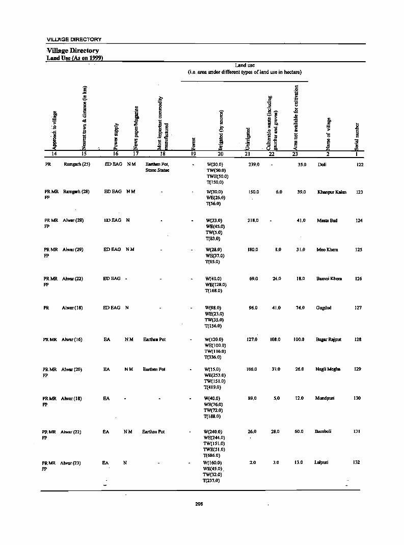
VILLAGE DIRECTORY
VUlsl(e Directory 'Land Use (As on 1999}
Land use (i.e. area under different types of land use in hectare)
E c 0 .... 'j
c .~ lID ..
;::, .5 '&1
.1 '0 11 :;
'" 0 u
c E u .. '" ., E .., c-- .,g
.. gp '0 8 ~ ;::,~ '" ~ ~ ~'O 0 B e ~ ~ ~ ~ I '" i: 'iii .. :s ai ~ '0 1:; .;; .8 ,.c s ! .!! a E ., :.I .. a. 0 ... ..
I '" .5 .:l I e iii 0 c e ~ ~ ~ :§ c
m - .. B'5 ~ ~ r:>.
~ e .r:>. ~
c - '" r,g .. .. ~. .~ !!:I .~ .i;2 '.So! !III ~ CIl
14 IS 16 17 18 19 20 21 22 23 2
PR Ramgarh (25) EDEAG NM EanbenPol. W(50.0) 239.0 35.0 Doli 122 Stone Slatue 1W(50.0)
TWE(50.0) T(150.0)
PRMR Ramgarb (2S) HOBAG NM W(30.0) ISO.O 6.0 39.0 Khanpur Kalan 123 FP WB(26.0)
T(S6.0)
PRMR Alwar(2S) HOEAG N W(33.0) 21S.0 41.0 MBSlaBad 124 FP WB(4S.0)
1W(S.O) T(S3.0)
PRMR Alwar(29) BOEAG NM W(2S.0) 180.0 8.0 31.0 MeoKbera 12S FP WB(37.0)
T(6S.0)
PRMR Alwar(22) HOEAG - W(40.0) 69.0 24.0 18.0 BamniKbera 126 FP WB(128.0)
T(168.0)
PR Alwar(18) EDEAG N W(98.0) 96.0 41.0 74.0 Gugdod 127 WE(23.0) 1W(3S.0) T(IS6.0)
PRMR Alwar(16) EA NM Earthen Pol W(120.0) 127.0 108.0 100.0 Bagar Rajpul 128 WB(100.0) 1W(116.0) T(336.0)
PRMR Alwar(20) EA NM Earthen Pot W(lS.O) 106.0 37.0 26.0 NagliMeSba 129 FP WB(2S3.0)
1W(ISI.O) T(419.0)
PRMR Alwar(IS) EA W(40.0) 89.0 5,0 12.0 Mundpuri IlO FP WB(76.0)
1W(72.0) T(ISS.O)
PRMR Alwar(22) EA NM Eartben Pot W(240.0) 26.0 2S.0 60.0 Bambali 131
FP WB(244.0) 1W(ISI.O) TWB(SI.O) T(686.0)
PRMR Alwar(23) EA N W(I60.0) 2.0 3.0 Il.O Lalpuri 132
FP WB(4S.0). 1W(32.0) T(237.0)
295
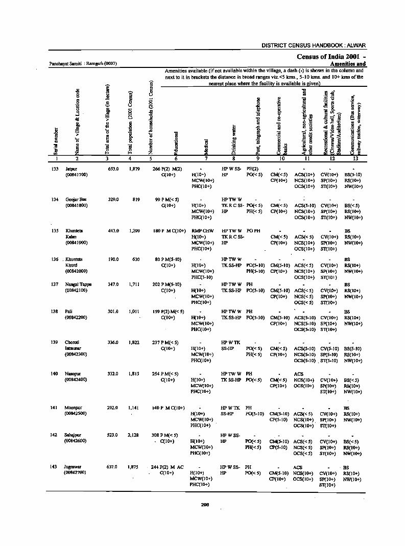
DISTRICT CENSUS HANDBOOK: ALWAR
Census of India 2001 -Panchayat Samiti : Ramgarh (0007) Amenities and
Amenities available (if not available within the village, a dash (-) is shown in the column and
next to it in brackets the distance in broad ranges viz.<S kms., SolO kms. and 10+ kms of the -;;;- nearest I!lace where the facili!X is available is given}
j ::s -8 -;;- ii flo&! 8 Co> u .. ::s .. ., .;::1 -= 5
.c 5 ;:; t .~
;::: u r::: 0 ·13 l! ·iii '=' u C!- ::: 8-Co> 1Jl, ;:; ;g -B 8-0 ~ 0 0 I!! CI) .......
oJ C!- o B a -- e
~ .i> ..c "'" -"il::S u :a ~ "2 :~ 1Jl,
., c !l "'" -5 .S! I :a .8 .. iI 0 = .... ..c "iI~-g .i> 0 :; ... ~ ~ "" 0 .g 1] .... 8- ~ 0 .. ~ ~ ]I 1 ~ 0] ~
::s CI) I-< :?: I 2 3 4 5 12
133 Jatpur 653.0 1,879 266 P(2) M(2) HPWSS- PH(2) (00841700) C(lO+) H(IO+) HP PO«S) CM«S) ACS(lO+) CV(lO+) 85(5-10)
MCW(IO+) Cp(IO+) NCS(IO+) Sp(IO+) RS(IO+) PHC(IO+) OCS(IO+) ST(IO+) NW(IO+)
134 GoojarBas 329.0 819 99 PM« S) HPTWW (00841800) C(IO+) H(IO+) TKRCSS- PO«S) CM«S) ACS(S-IO) CV(IO+) BS«5)
MCW(IO+) HP PH« S) CP(IO+) NCS(IO+) Sp(IO+) RS(IO+) PHC(IO+) OCS(IO+) ST(IO+) NW(IO+)
135 Khunteta 443.0 1,299 180 P M C(IO+) RMPCHW HPTWW PO PH BS Kalan H(IO+) TKRCSS- CM«S) ACS«S) CV(IO+) RS(IO+) (00841900) MCW(IO+) HP CP(IO+) NCS(IO+) Sp(IO+) NW(IO+)
PHC(IO+) OCS(IO+) ST(IO+)
136 . Khunteta 190.0 630 80 P M(S-IO) HPTWW BS Khurd C(IO+) H(IO+) TKSS-HP PO(S-IO) CM(S-IO) ACS« 5) CV(IO+) RS(IO+) (00842000) MCW(1O+) PH(S-IO) CP(IO+) NCS(IO+) SP(IO+) NW(IO+)
PHC(5-1O) OCS(IO+) ST(IO+)
137 Nangal Tappa 347.0 1,711 202 P M(S-IO) HPTWW PH BS (00842100) C(IO+) H(IO+) TKSS-HP PO(S-IO) CM(S-IO) ACS« S) CV(IO+) RS(IO+)
MCW(IO+) CP(IO+) NCS«S) Sp(IO+) NW(IO+) PHC(IO+) OCS«S) ST(IO+)
138 Pali 301.0 1,011 159 P(2) M« 5) HPTWW PH BS (00842200) C(IO+) H(IO+) TKSS-HP PO(S-IO) CM(S-IO) ACS(S-IO) CV(IO+) RS(IO+)
MCW(IO+) CP(IO+) NCS(S-IO) SP(IO+) NW(IO+) PHC(IO+) OCS(S-IO) ST(IO+)
139 Choroti 336,0 1,822 237 P M« 5) HPWTK Islmurar C(IO+) H(IO+) SS-HP PO«S) CM«5) ACS(S-IO) CV(S-IO) 8S(5-10) (00842300) MCW(IO+) PH«S) CP(IO+) NCS(S-IO) SP(S-IO) RS(IO+)
PHC(IO+) OCS(S-IO) . ST(S-IO) NW(IO+)
140 Nasopur 332.0 1,815 254 P M«5) HPTWW PH ACS (00842400) C(IO+) H(IO+) TKSS-HP PO«S) CM«S) NCS(IO+) CV(IO+) B5«S)
MCW(IO+) CP(IO+) OCS(IO+) Sp(IO+) RS(IO+) PHC(IO+) ST(IO+) NW(IO+)
141 Moonpur 292.0 1,141 140 P M C(IO+) HPWTK PH BS (00842S00) H(IO+) SS-HP PO(S-JO) CM(S-IO) ACS«5) CV(IO+) RS(IO+)
MCW(IO+) CP(5-10) NCS(IO+) Sp(IO+) NW(IO+) PHC(IO+) OCS(IO+) ST(IO+)
142 Sahajpur 523.0 2,128 308 PM«5) HPWSS- . (00842600) C(IO+) H(IO+) HP PO«S) CM(S-IO) ACS«S) CV(IO+) B5«5)
MCW(IO+) PH«S) CP(5-10) NCS«S) 5p(10+) RS(IO+) PHC(IO+) OCS«S) ST(IO+) NW(IO+)
143 Jugrawar 637.0 1,875 244 P(2) M AC HPWSS- PH ACS . BS (00842700) C(IO+) H(IO+) HP PO«S) CM(S-IO) NCS(IO+) CV(IO+) RS(IO+)
MCW(IO+) CP(IO+) OCS(IO+) Sp(IO+) NW(IO+) PHC(IO+) ST(IO+)
296
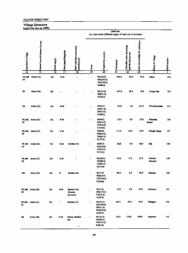
VILLAGE DIRECTORY
Villaae Directory Land Use (As on 1999)
Land use (i.e. area under different types of land use in hectare)
]' c 0
"-51
e b tID .~ c .. '6 '6 'S u 0 ., u
B :g E U .. .. '; E 'OJ' .. - oS! ! oS 0 ~
;:;:.fj .. u !I ~ :is .,
:;;: cId ~ I 'g.
0
~~ .. =' j ~
.. ~ i '$I e: = ..
I ~ .;:
~ g,
!: .§'] .!! Ii ., .",
~~ S ....
I ..
i 0 c e ! .~ ~ u .8; J I ! :i
'iI ., ~ '5 :i 81 '5
:( z p.. .Z .... CO 14 'IS 16 17 18 19 20 21 22 23 2 '1
PRMR Alwar(16) SA NM W(102.0) ' .. '194.0 26.0 33.0 Jatpur 133 FP WE(140.0)
TW(IS8.0) T(400.0)
FP Alwar(26) EA W(IOS.O) 147.0 2B.0 IB.O Goojar8as 134 WE(31.0) T(136.0)
PR Alwar(24) EA NM W(BS.O) 85.0 5.0 155.0 Khunteta Kalan 135 WE(41.0) TW(72.0) T(198.0)
PRMR Alwar(24) EA NM W(48.0) 35.0 8.0 37.0 Khunteta 136 FP WE(12.0) Khurd
TW(50.0) T(1I0.0)
PRMR Alwar(27) SA NM W(BO.O) 111.0 20.0 44.0 Nangal Tappa 137 FP WE(30.0)
TW(62.0) T(172.0)
PRMR Alwar(26) SA NM Earthen Pot W(80.0) 58.0 7.0 66.0 Pali 138 FP WE(20.0)
TW(70.0) T(l7o.0)
PRMR AlwBr(22) SA NM W(IOO.O) 29.0 13.0 22.0 Choroti 139 FP WE(88.0) Istmurar
TW(84.0) T(272.0)
MR Alwat(22) EA N Earthen Pol W(71.0) 84.0 6.0 26.0 Nasopur 140 WE(4S.0) TW(IOo.o) T(216.0)
PRMR A1war(22) EA NM Earthen Pot, W(J3.0) 13.0 3.0 20.0 Moonpur 141 FP Wooden WE(I73.0)
Furniture TW(70.0) T(2S6.0)
PRMR Alwar(21) EA Earthen POI W(I2S.0) 120.0 33.0 24.0 Sahajpur 142
FP WE(IOO.O) TW(51.0) TWE(70.0) T(346.0)
PR Alwar(18) EA NM Statue, Eanhen W(132.0) 25.0 119.0 106.0 Jugrawar 143
Pot WE(82.0) TW(l73.0) T(387.0)
297
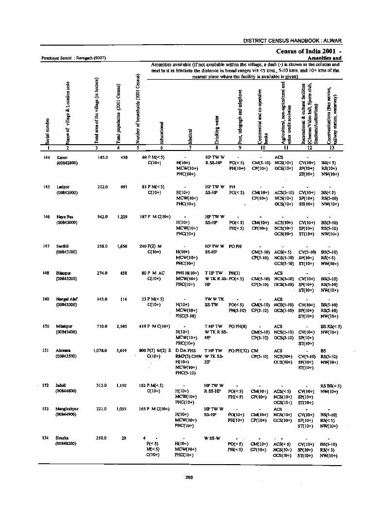
DISTRICT CENSUS HANDBOOK: ALWAR
Census of India 2001 -Panchayat Samiti : Ramgarh (0007) Amenities and
Amenities available (if not available within the village, a dash (-) is shown in the column and next to it in brackets the distance in broad ranges viz. <5 kms., 5-10 kms. and 10+ kms of the
-;;;- nearest I!lace where the facili!! is available is Bivenl
I '" ~ 5 "'" fj.D 8 ;- u Iii 'j:! .E! of " 5 2! .~ i c .c ;; := u u 0 C 0 0
~ ~i '; ~ '5 ~ u (:!. "H-0 j ;; :9 1i "" 'r: ]00_
~i ...I Q
~ I>Ofl .....:§ oil! ~ t::!. .fi ] '" ._ '" " s '" ] g .2 ! ~:g c _
~ -s .. I 1
c g .9 a .8 iI <> ... .c 'il -e .; 1I:9-g .~ 'iI .;;: 0
is. ... 'iii E .. <> c .~
~1 .! ~ i ::I .... ~ a. .. <> 1>0 i c .. c 0
~ .~ 11 :a '" ~ i "ii ~ ~ '3 E '" .!=! b B i·_ u
) ~ ..,.
S"" '5 ~ :s '" <> Iii Iib-s ._ i
~] <> 'tI & !12 '" I-< I-< IB I.!,Q ~ 2 ~~II) I 2 3 4 5 6 7 8 9 10 11 12 l3
144 Kanor 145.0 458 69PM«5) HPTWW ACS (00842800) C(lO-l-) H(IO-l-) RSS-HP PO«5) CM(S-IO) NCS(IO-I-) CV(IO-l-) 8S«S)
MCW(IO-l-) PH(IO-I-) CP(IO-l-) OCS(IO-I-) SP(lO-I-) RS(IO-I-) PHC(IO-l-) 8T(lO-l-) NW(IO-I-)
145 Ladpur 212.0 691 81 P M«s) HPTWW PH (00842900) C(lO+) H(lO+) 8S-HP PO« 5) CM(IO-I-) ACS(5-10) CV(IO-I-) 88«5)
MCW(IO+) CP(IO+) NCS(IO-I-) SP(lO-I-) RS(5-10) PHqIO+) OCS(IO-I-) 8T(10+) NW(IO-I-)
146 Naya 8as 542.0 1,229 187 P M C(lO-I-) HPTWW (00843000) H(IO+) SS-HP PO« 5) CM(IO-I-) AC8(10+) CV(IO+) 88(5-10)
MCW(IO+) PH«5) CP(IO+) NCS(IO+) SP(IO-I-) RS(s-IO) PHqIO+) OCS(IOi-) ST(lO-I-) NW(IO+)
147 Senthli 358.0 1,656 240P(2) M HPlWW PO PH (00843100) qlO-l-) H(IO+) 88-HP CM(S-IO) AC8« 5) CV(s-IO) 88(5-10)
MCW(IO-I-) CP(S-IO) NC8(s-10) SP(lO-I-) RS«S) PHC(IO-I-) OCS(s-IO) 8T(l0-I-) NW(IO-I-)
148 Bilaspur 274.0 458 80P M AC PHSH(lO+) THPlW PH(3) ACS (008432~0) C(lO+) MCW(JO+) WTKRSS-PO«S) CM(S-IO) NCS(5-10) CV(IO+) BS(5-10)
PHqIO+) HP CP(S-IO) OC8(S-IO) Sp(IO+) RS(S-IO) ST(IO+) NW(IO-I-)
149 Nangal Alar 145.0 114 23PM«5) TWWTK AC8 (00843300) C(lO+) H(IO-I-) 88-lW PO«S) CM(S-IO) NC8(s-10) CV(IO-I-) 88(5-10)
MCW(IO-I-) PH(s-IO) CP(S-IO) OCS(5-10) SP(IO-I-) R8(5-10) PHC(S-IO) 8T(10-I-) NW(lo+)
ISO Milakpur 710.0 2,540 419 P M C(IO+) THPTW POPH(8) AC8 8S RS«S) (00843400) H(IO+) WTK R SS- CM(S-IO) NC8(S-10) CV(IO-I-) NW(IO-I-)
MCW(IO-l-) liP CP(S-IO) OCS(S-IO) Sp(IO-I-) PHC(IO+) 8T(l0-I-)
151 Alawara 1,078.0 5,619 800 P(3) M(2) S DDAPHS THPTW POPH(32) CM ACS 8S (00843500) C(lO+) RMP(3) CHW W TK SS- CP(S-IO) NCS(IO+) CV(s-IO) RS(S-IO)
H(lO-I-) HP OCS(IO-I-) SP(IO+) NW(IO+) MCW(IO+) ST(lO-I-) PHC(5-10)
152 Jadoli 312.0 1,150 162 P M« 5) HPTWW RS BS« 5)' (00844800) C(IO+) H(IO-l-) RSS-HP PO«S) CM(IO+) ACS«5) CV(IO-I-) NW(IO+)
MCW(IO-I-) PH«S) CP(IO-I-) NCS(IO-I-) Sp(IO+) PHC(IO+) OCS(IO-I-) ST(IO+)
153 Mangleshpur 321.0 1,055 165 P M C(IO+) HPTWW ACS (00844900) H(IO-I-) SS-HP Po(JO+) CM(IO+) NCS(IO+) CV(IO+) 8S(S-10)
MCW(IO+) PH(IO+) CP(IO-I-) OCS(IO+) Sp(IO+) RS« 5) PHC(IO+) ST(IO+) NW(IO-l-)
154 8iraska 250.0 28 4 WSS-W (00848200) P« 5) H(IO+) PO«S) CM(IO-I-) ACS«S) CV(IO-I-) B8(S-10)
M«S) MCW(1O-1-) PH«S) CP(IO-I-) NCS(lO-l-) Sp(lO+) RS«S) C(IO-I-) PHC(IO+) OCS(IO-I-) . ST(lO-I-) NW(IO+)
298
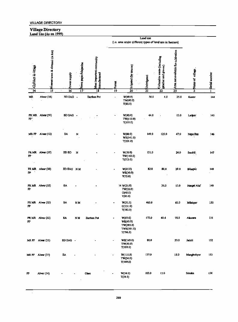
VILLAGE DIRECTORY
Villalle :Directory Land Use (As on 1999}
Land use
(i.e. area under different types of land use in hectare)
E c: .... .~ :S ~ "" >
c: ~ ,u :g u 0 u
M ., e g~ .. c:
',II> .', e i e ~ :;; 0 c~
~ u '" .s .. .,
,;';; cI!I '" ~-o 51 ~! I [i ~ ,~ =a .2 ,'51 ~ '8. a.2! e: I &i .s;
,] s ..! Iii §
1 OJ 11 .5 ~ I 1~ 8 ...
0 .. 'I: ! J ii 5 I :5 ~ 'iii ':8: :5 s:: - '" ~ ~ :S ' ,1:1 ,.~ ::E ,Iii ,;;2 ~,; ~ 14 IS 16 17' 18 19 20 21 22 23 2 1
MR. Alwar(16) EDEAG - Earthen Pol W(40.0) 36,0 4.0 25.0 Kaner 144 TW(40.0) T{80.0)
PRMR A1war(30) EOEAG - W(40.0) 44.0 13.0 Ladpur 145 FP' TW(IIS.O)
T(155.0)
MRFP Alwar(12) EA N W(80.0) 149.0 125.0 47.0 NayaBas 146 WE(141.0) T(22 1.0)
PRMR Alwar(3S) ED EO N W(70.0) 121.0 24.0 Scnthli 147 FP TW(143.0)
T(2 I 3.0)
PRMR Alwar(30) EDEAG NM W{4S.0) 820 88.0 29.0 Bilaspiir 148 FP WE(30,0)
T(7S.0)
PRMR A1war{l2) EA 14 W(21.0) 35.0 Il.O NIIJlgaI Alar 149 FP TW(22.0)
0(40.0) T(83.0)
PRMR Alwar(l2) EA NM W(SI.O) 465.0 63.0 Mitakpur ISO FP 0(131.0)
T(182.0)
PRMR A1war(32) EA NM Earthen Pot W(67.0) 172.0 40.4 70.0 AlaWlllll 151 FP WE(43.0)
TW(S85.0) TWE(101.0) T(796.0)
MRFP Alwar(3S) EDEAG - WE(149.0) 80.0 3l.0 Jadoli 152 TW(SO.O) T(199.0)
MRFP Alwar(l7) EA W(IIS.0) 137.0 IS.O Mangleshpur ISl TW(S4.0) T(169.0)
FP Alwar(14) Ghee W(54.0) 183.0 13.0 Siraska 154 T(54.0)
299
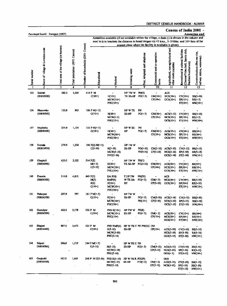
DISTRICT CENSUS HANDBOOK: ALWAR
Census of India 2001 _ PanchBYBt Samiti : Ramgarh (0007) Amenities and
Amenities available (if not available within the village, a dash (-) is shown in the column and next to it in brackets the distance in broad ranges viz.<5 kms., 5-10 kms. and 10+ kms of the
i i nearest elace where the facilit:!: is available is Biven}
-8 fl "0 fj.o 0 li I u fa .- .. of c.>
l:! OJ e ="0 6 (5 .:: <>
.s 0 0 , a .- ~ .~ -.~ u t:!. -g. .:Ig_ <> ! ;; B ~r 0 ~ 1l ·c eCl'l_
...:I ~' "0 bO!'j a _. § dd .;;: 13 ] c.> ~ :1l B :! 's OJ OJ C .,
] c _
E oS 0 6 I .... c g dd B .~ <> c .. .... .:. ~ g:5!"g
._ 0
~ ~ ..c: "2.; .~ .! :s: 0 ... Oi 1 as "" 0 ,2 "" i!1! .2 ~ ~ ::I .... ~ 8. J bO i " . .,
" 0
13 ] . 5 E .. ::I c.> 1;1 e .. ~ ~ ~ ..
~ ~ "'" .5, ~ I!! OJ .-
~ E! ~ ~
c l S"'" i! .s "N '" ·c <> Iii ~1i s:1] rn ii!:i l- I- Z 9 s.:!.s ~~r.a 2 3 4 S 6 7 8 9 10 II 12 13
155 Kakrali 382.0 3,545 419P M HPlWW PH(4) AC8 (00850200) C(IO+) H(IO+) TK8S-HP PO«5) CM(IO+) NCS(IO+) CV(IO+) 88(5-10)
MCW(IO+) CP(IO+) OC8(10+) SP(IO+) RS«5) PHC(IO+) ST(IO+) NW(IO+)
IS6 8hoowaka 132.0 903 106 PM« S) HPWTK PH (00850300) C(IO+) H(IO+) SS-HP PO« S) CM(IO+) ACS(S-IO) CV(IO+) 85(5-10)
MCW«5) Cp(10+) NCS(IO+) Sp(IO+) RS«S) PHC(IO+) OCS(lO+) 8T(10+) NW(lO+)
157 MojdeekB 2S4.0 1,124 IS3 P M« S) HPWSS- PH (00850400) C(IO+) H(IO+) HP PO« 5) CM(IO+) ACS(IO+) CV(IO+) 85(10+)
MCW(IO+) CP(IO+) NCS(IO+) SP(IO+) RS(lO+) PHC(IO+) OCS(IO+) ST(IO+) NW(IO+)
158 KemalB 279.0 1,3S8 196 P(2) M« 5) HPlWW (008S3900) C(S.IO) H(S-IO) S8-HP PO(S.IO) CM(5-10) ACS(S-IO) CV(5-10) 8S(S-10)
MCW(5-1O) PH(5-IO) CP(5-10) NCS(5-IO) SP(S-IO) RS(S-JO) PHC(S-IO) OCS(S-IO) ST(S-IO) NW(IO+)
159 Obegholi 433.0 3,132 514 P(2) HPlWW PH(7) (00854000) M«5) H(IO+) TK8S·HP PO(5-IO) CM(IO+) ACS(IO+) CV(IO+) 8S(10+)
C(5-IO) MCW(Jo+) CP(IO+) NCS(IO+) Sp(IO+) RS(IO+) PHC(IO+) OCS(IO+) ST(IO+) NW(IO+)
160 Desoola S14.0 4,81S 849 P(3) DAPHS THPTW PH(20) .ACS (00854100) M(3) RMP(4) WTKSS- PO«S) CM«S) NCS(lO+) CV(IO+) 8S(S-10)
S(2) H(10+) HP CP(S-10) OCS(10+) Sp(IO+) RS(S-IO) C(IO+) MCW(JO+) ST(IO+) NW(lo+)
PHC(IO+)
161 Naharpur 287.0 797 161 PM«5) HPTWW (00854200) C(lO+) H(IO+) S8-HP PO« 5) CM(S-IO) ACS(5-IO) CV(S-IO) 8S(S-10)
MCW(lO+) PH(IO+) CP(5-10) NCS(S-IO) SP(S-IO) RS(S-IO) PHC(IO+) OCS(S-IO) ST(S-JO) NW(JO+)
162 Goondpur 462.0 2,178 332P M PHS H(IO+) HPlWW PH(S) (00854300) C(IO+) MCW(IO+) S8-HP PO« 5) CM«S) ACS(IO+) CV(IO+) 85(10+)
PHC(IO+) CP(IO+) NCS(IO+) Sp(IO+) RS(IO+) OCS(IO+) ST(IO+) NW(IO+)
163 8hajeet 807.0 3,473 S25P M PH8 RMP(4) HP W TK C PO PH(2Sj CM (00854400) C(IO+) H(S-IO) S8-HP CP(IO+) ACS(S.IO) CV(S-IO) 88(5-10)
MCW(S-IO) NC8(S-10) Sp(5-10) RS(S-IO) PHC(S-IO) OC8(S-10) ST(5-10) NW(IO+)
164 Salpuri 206.0 1,519 244 PM«S) HPWTKC PH (00854500) C(5-10) .H(S-IO) SS-HP PO« S) CM(S.IO) ACS(5-10) CV(S-IO) BS(S-IO)
MCW(S-IO) CP(S-IO) NCS(S·lO) SP(S-IO) RS(S-IO) PHC(S-IO) OCS«S) ST(S-IO) NW(IO+)
165 Goojooki 363.0 1,665 248 P M C(S-IO) PHS H(S·IO) HP W TK R PH(20) OCS (00856500) MCW(S-IO) S8·HP P 0«S) CM«S) ACS(S-IO) CV(S-IO) B8(S-10)
PHC(S-IO) CP(S-IO) NCS(S-IO) SP(S-IO) RS(S-IO) ST(S-IO) NW(IO+)
300
VILLAGE DIRECTORY
Villa2e Directory Land Use {As on 1999~
Land use (i.c. area under different types ofland use in hectare)
e " 0 ... .~
e .~ "" .~ " 3 "0 :;; "3
0 '" 0
B .. E "0 .. " .. '" ·fJ g 'OJ' " -. .£
.f :a ~ efJ III
: u B > ~ f ~ "<I 5-a 0 i! ~ .?:> ~ '" :;i .8 9 t:: ! e: .c §: I 8.fl 1 .!! Iii i:i §
:;I I ~ ta ~ ... I '" .5 rf! "" 0 " ~ ~ ~ " ~ - '" :5 ail ! ~ "iI
III Iii "" Co II> ·5 " - '" .1: 0 0 8 :L < z p. z ~ E "- 2 ;z
., = en
14 15 16 17 18 19 20 21 22 23 2 1
PRFP Alwar(13) EDEAG N W(179.0) 94.0 25.0 34.0 Kakrali ISS WE(3S.0) TW(IS.O) T(229.0)
MRFP Alwar(lJ) EDEAG N W(7S.0) 24.0 3.0 14.0 Bhoowaka IS6 WE(12.0) TW(4.0) T(91.0)
MRFP Alwar(12) EDEAG N 13 W(4S.0) 152.0 7.0 19.0 Mojdeeka 157 WE(IO.O) TW(S.O) T(63.0)
MR Alwar(S) EA NM 33 PC(3S.0) SS.O 3.0 17.0 Kcmala ISS W(133.0) T(168.0)
PR Alwar(9) EA 51 W(62.0) 160.0 21.0 IS.O Ghegholi 159 WE(124.0) T(186.0)
PR Alwar(IO) EA NM GC(74.0) 47.0 SI.O 138.0 Desoola 160 PC(42.0) W(I62.0) T(278.0)
PR AI_(IO) EA NM W(12.0) 24.0 16.0 207.0 Naharpur 161 WE(2S.0) T(40.0)
PRMR Alwar(19) EA N GC(107.9) 165.3 92.0 13.5 Goondpur 162 W(23.S) WE(59.s) T(191.2)
PRFP Alwar(IO) EA N Earthen Pot, GC(32S.3) 121.6 4.7 210.2 Bhajeet 163
Wooden WE(145.7) Furniture T(471.0)
PRFP Alwar(9) EA N GC(96.1) S8.5 4.0 13.5 Salpuri 164 W(33.6) T(129.7)
PRFP Alwar(lI) EA N Earthen Pot, GC(88.9) 127.0 S.6 16.0 Goojooki 16S
Wooden W(12S.9) Furniture T(214.8)
301
DISTRICT CENSUS HANDBOOK: ALWAR
Census of India 1001 -PaDchaya! Sami!i : Ramgarh (0007) Amenities and
Amenities available (if not available within the village, a dllSh (-) is shown in the column and next to it in brackets the distance in broad ranges viz.<5 kms., 5-10 kms. and 10+ kms of the
"Ui' nearest place where the facility is available is given)
I iii -8
~ fi i rl.tS 8 u ._ '" .; l! 5 l:!
., i! ~u c::
~ :>- u
0 g i l a 'u ~ '! f 'g u oS 0 II) "3 <.>
~ ;; ... u e~.-. 0 ..., 'ii lI! o-l 0
:8 0
B....:§ Sf o"!! :;: C!. "5 0 <.> :; ] 'r::
! .. c:: &l "5 6.2 U g ~ ..: oS .g '" I -= c:: u
jj _g • Ii! alii ~._ ... t ~ ";i. -g ';I ,9
0 "iii ~ 106 E :>- .... .§ ~ i .~ i! ~
0 a a .... 8. ~ tID II)
0 'il B .S B v 1i 13 s ~ ~
.. B B .c
i! s~ i Si .-s ! :a ~ '~Jl fj 0 0 ::s ~. 'r:: § a !.s j ~~ sa &!:i I-< I-< :z; Q eo So.!.s s~ ~!G!
2 3 4 5 6 7 8 9 10 II 12 13
166 Kh8llpur Ja! 204.0 526 75 P MC(1o+) HPTWW PO (00856700) H(IO+) SS-HP PH«S) CM(IO+) ACS(IO+) CV{IO+) 8S(10+)
MCW(IO+) CP(IO+) NCS(IO+) 8P(10+) RS(IO+) PHC(IO+) OCS(IO+) ST(1O+) NW(lO+)
167 Jhareda 490.0 664 106 P M« 5) PHSH(IO+) HPTWW PH(3) (00856800) C(IO+) MCW(IO+) SS-HP PO«S) CM«S) ACS(IO+) CV(IO+) 8S(10+)
PHC(IO+) CP(IO+) NCS(IO+) Sp(IO+} RS(IO+} OCS(IO+) ST(IO+) NW(IO+)
168 Doomera 326.0 1,088 IS6 P(2) MAC HPTWW (00856900) C(S-lO) H(S-IO) TKSS-HP PO(S-lO) CM(S-IO) ACS(S-lO) eV(S-lO) 8S(S-10)
MCW(lO+} PH(S-IO) CP(lO+) NCS(IO+) SP(IO+) RS(IO+) PHC(IO+) OCS(IO+) ST(lO+) NW(IO+}
169 Kherli SBiyad S92.0 2,370 347 P(3) M(2) PHS HPTWW POPH(12) BS (00857000) ACC(lO+) RMP(2) SS-HP CM«S) ACS(IO+) eV« 5) RS(lO+)
H(10+) CP(IO+) NCS(IO+) 8p(10+) NW(IO+) MCW(IO+) OCS(IO+) 8T(10+) PHC(IO+)
170 Nagli Rajawat 111.0 ·367 66P OM«S) HPTWW (00857200) C(IO+} H(IO+} SS-HP PO(S-IO) CM«S) ACS(S-IO) CV(IO+} 88(10+)
MCW(IO+) PH«S) CP(IO+} NeS(IO+) Sp(IO+) RS(lO+) PHC(5-10) OC8(10+) ST(IO+) NW(IO+}
171 Dada 170.0 6S9 82P ACM«S) HPTWW (00857300) C(IO+) H(IO+) SS-HP PO«S} CM(S-IO) ACS(5-IO) eV(lO+) B8(10+)
MCW(IO+) PH«S) CP(lO+) NCS(IO+) SP(lO+) RS(JO+) PHC(IO+) OCS(IO+) ST(lO+) NW(lO+)
172 KakmliJa! 187.0 625 liSP ACM«S) HPTWW PH(8) (00857400) C(10+} H(S-lO) SS-HP PO«S) CM«S) ACS« S) eV« 5) 8S(10+)
MCW(lO+) CP(IO+) NCS(IO+) 8P{10+) RS(IO+) PHC(IO+) OCS(IO+} ST(IO+} NW(lO+}
173 KerwaJat 737.0 2,353 323 P(2) M(2) RMP(2) HPTWW POPH(IO) (00857500) ACC(IO+) H(IO+) SS-HP CM«S) AC5(5-10) CV«S) 85(10+)
MCW(lO+) CP(lO+) NCS(1O+) Sp(lO+) RS(lO+) PHC(IO+) OCS(IO+) ST(IO+) NW(IO+)
Panchayat Samltl 61,553.0 220,2.19 32.,265 P(199) M(59) D(3) DA(8) T(16) PO(2.4) CM(10) ACS(23) CV(7) BS(37) Total: S(9) PUC(3) MCW(2.) MH W(171) TO PTO CP(4) OCS RS(2)
AC(48) 0(15) CWC HC{4} TK(90) PH(888) PDC(3) HP(I66) PDS(14) TW(142) FWC R(13) C(7) RMP(39) LS SMP CHW(29)
302

VILLAGE DIRECTORY
Villaee Directory Land Use {As on 1999}
Land use (i.e. area under different types ofland use in hectare)
E c 0
-'" .~
e .~ DO ,.
C ~ 8 -a :a 0 :::I U
B ., E i- ... c § 'U' oS j .!!l 'i a ;::.[8 ., -a
i! ~ j ~ oIiI ~ ~] 2
i J 1 I:; 9 e: ~ ~ .0
9 .,
8.tl ..!! :a § ~ ! -a .0 l<l g .... til .!§.e ~ DO 0 c
i: j ~ ~ - .. 1;; '1: f!!"", ., 0;
~ Iii I!! DO ~i ~ ~ ] ~ .;::
~ ~ .,
:!: ~ ;:;a Ii rn 14 IS 16 17 18 19 20 21 22 23 2
PRMR Alwar(12) EA Earthen Pot GC(41.6) 67.1 5.5 7.2 Khanpur lal 166 W(21.4) WE(61.3) T(124.4)
PR Alwar(18) EA W(30.6) 247.4 iliA 9.4 Jhareda 167 WE(9J.7) T(122.3)
MR Alwar(IS) EA NM Wooden W(87.0) 40.0 27.0 61.0 Doomers 168 Furniture WE(22.0)
TW(73.0) TWE(16.0) T(19S.0)
PR Alwar(11) EA NM Wooden PC(2D.O) 112.0 7.0 44.0 Kherli Saiyad 169 Furniture. W(160.0) Earthen Pot WE(42.0)
TW(207.0) T(429.0)
MR AlWBr(25) EA Wooden W(25.0) 32.0 6.0 5.0 NagJi RBjawat 170 Furniture WE(S.O)
TW(30.0) TWE(8.0) T(68.0)
MR Alwar(23) EDEAG - PC(34.0) 4S.0 13.0 9.0 Dada 171 W(26.0) WE(30.0) TW(IO.O) T(100.0)
PR Alwar(17) EA NM Wooden W(17.0) 27.0 5.0 15.0 Kakrali lal 172 Furniture WE(SS.O)
TW(S.O) TWE(33.0) T(140.0)
PR AIwar(IS) EA NM Earthen Pot, W(160.0) 280.0 4.0 66.0 KerwaJal 173 Wooden WE(40.0) Furniture TW(140,0)
TWE(47.0) T(387.0)
PR(1l2) ED(63) N(18) 202 GCC733.73) 17.486.5 3.771..7 11.681..4 MR(1'1.5) EAG(64) M(S7) PC(131) !'P(1l0) EO(3) W(97l4.1S)
EA(103) WE(7454.lJ) TW(8079.35) TWE(1951) 0(337) T(284 I 0.46)
303

RAJASTHAN (INDIA)
P.S. UMREN PART OF TEHSIL ALWAR
DISTRICT ALWAR
KIlOMETRES 2 2 4
t==t=--±:=! I====:J
-
, ,. , . . i IlOO
I. I
!
BOUNDARY. TEllSI~
rolUlClIA TAT SAlIm
('. .' I' , I I' . l.
! I
E
VD.LAGB WITH PERllAllEIIT LQCATIOR com: JoIUIIIIBR
IlEADqUARTaIS : DIBI'RICT • TKHllIL • PANCIIA YAT SAMITI
FIlPULATIlIII SIZE CLASS OF VILLAGm BELOW I11III,
2110-4l1li. liOO-999, 1000-481l11. 5ODO I< ABOlE
UJlIHIIABIfIlll VILLACm WITH PERIlANBNT LOCATION CODE NUIIIIBR
URBAN ARBA WITH LOCATIOR 00IlII II AME
STATE RICHWAT
\IIJl.NUf>. WAR
,,\~1(o.S~ t I
.)-., I ....
i j i i i .i I
H
i \.,. ..... ..... ".
" i .i
1117
I i ,.
s
@ @ •
o ••••
r;'-iDiilmo; ~ ·W~14.1) '"
I
\
L
G
IMRIRTANT IlETAL1.ED ROADS
RAILWAY LINE WITH STATION. BROAD GAUGE
RIV8R AND mlEAII
WA1UI FBATUftf;li: TAIIK
POSr ornCE/l'ELEGRAPH 0 ..... 0£ EXCLUDING lULS.
SIClINDARY/SEHJOR SlCONDARY SCHOOL POIJCE STATION EXCLUDINC RI.Y, POLICE STATUIII
PRlIl.l.IZY UF.Al.'fH CD"TRR
DANK
RS
~ ~
PO/TO
S PS
8 D

VILLAGE DIRECTORY
ALPHABETICAL LIST OF'VILLAGES (PANCHA VAT SAMITI WISE)
Panchayat Samiti : Umren (0008)
SI.No. Name of village
2.
Tehsil: Alwar (Part)
Achalpuri
2 Ahmadpur
3 Akbarpur
4 Alapur
5 Alwar (Rural)
6 Bader
7 Bakhtpura
8 BalaDahra
9 Baleta
10 Ballana
II Bandipura
12 Barh Bilandi
13 Barh Kesharpur
14 Barkhera
15 Barwara
16 Beejawar
17 Belaka
18 Berka
19 Bhadoli
20 Bhakhera
21 Bhandodi
22 Bhandwara
23 Bharkol
24 Bhoogar
25 Bhurari
26 Bichpuri
27 Bijopur
28 Bilandi
29 Burja
30 Chand Pahari
31 Chandoli
307
2001 Census Location Code Number
3
00863700
00858100
00855700
00858500
00853000
00862300
00852500
00849400
00863400
00856200
00861500
00864500
00854900
00864100
00845400
00863100
00853500
00853300
00863500
00852900
00863300
00846300
00864800
00853100
00845100
00861100
00845500
00864400
00854600
00860300
00845100
1991 Census Location Code Number
4
050060008000800188
050060008000800137
050060008000800107
050060008000800135
050060008000800081
050060008000800174
050060008000800075
050060008000800045
050060008000800185
050060008000800112
050060008000800166
050060008000800196
050060008000800099
050060008000800192
050060008000800005
050060008000800182
050060008000800085
050060008000800083
050060008000800186
050060008000800019
050060008000800184
050060008000800014
050060008000800199
050060008000800080
050060008000800002
050060008000800162
050060008000800006
050060008000800195
050060008000800096
050060008000800154
050060608000800008
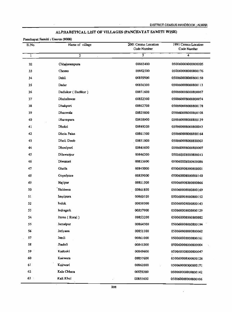
DISTRICT CENSUS HANDBOOK: ALWAR
ALPHABETICAL LIST OF VILLAGES (pANCHAYAT SAMITI WISE)
Panchayat Samiti : Umren (0008)
Sl.No. Name of village 2001 Census Location 1991 Census Location Code Number Code Number
2 3 4
32 Chhajurampura 00865400 050060008000800205
33 Chomu 00862500 050060008000800176
34 Dabli 00859900 050060008000800150
35 Dadar 00856300 050060008000800113
36 Dadhikar ( Dadikar ) 00851600 050060008000800067
37 Dhahalawas 00852300 050060008000800074
38 Dhakpuri 00862700 050060008000800178
39 Dhanwala 00855800 050060008000800108
40 Dharmpura 00858900 050060008000800139
41 Dhokri 00849200 050060008000800043
42 DholaPalas 00861300 050060008000800164
43 Dholi Doob 00851000 050060008000800061
44 Dhoolpuri 00845600 050060008000800007
45 Dilawarpur 00846200 05006Q008000800013
46 Diwakari 00853600 050060008000800086
47 Ghatla 00845000 050060008000800001
48 Gopalpura 00859000 050060008000800140
49 Hajipur 00851500 050060008000800066
50 Haldeena 00861800 050060008000800169
51 Impipura 00860100 050060008000800152
52 Indok 00859300 050060008000800143
53 Indragarh 00857900 050060008000800129
54 Itama ( Rural) 0085'3200 050060008000800082
55 Jamalpur 00864300 050060008000800194
56 Jatiyana 00851100 050060008000800062
57 Jatoli 00861000 050060008000800161
58 Jhadoli 00845300 050060008000800004
59 Kadooki 00849600 050060008000800047
60 Kairwara 00857600 050060008000800126
61 Kairwari 00862000 050060008000800111
62 KalaChhara 008'59200 050060008000800142
63 KaliKhol 00855600 050060008000800106
30B
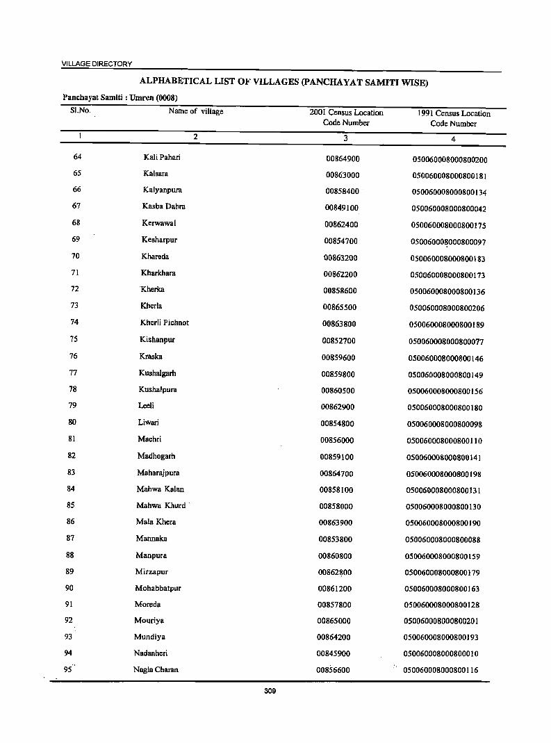
VILLAGE DIRECTORY
ALPHABETICAL LIST OF VILLAGES (PANCHA YAT SAMITI WISE)
Panchayat Samiti : Umren (0008)
SI.No. Name of village 2001 Census Location 1991 Census Location Code Number Code Number
2 3 4
64 Kali Pahari 00864900 050060008000800200
65 Kalsara 00863000 050060008000800181
66 Kalyanpura 00858400 050060008000800134
67 Kasba Dahra 00849100 050060008000800042
68 Kerwawal 00862400 050060008000800175
69 Kesharpur 00854700 050060008000800097
70 Khareda 00863200 050060008000800183
71 Kharkhara 00862200 050060008000800173
72 Kherka 00858600 050060008000800136
73 Kherla 00865500 050060008000800206
74 Kherli Pichnot 00863800 050060008000800189
75 Kishanpur 00852700 050060008000800077
76 Kraska 00859600 050060008000800146
77 Kushalgarh 00859800 050060008000800149
78 Kushalpura 00860500 050060008000800156
79 Leeli 00862900 050060008000800180
80 Liwari 00854800 050060008000800098
81 Machri 00856000 050060008000800110
82 Madhogarh 00859100 050060008000800141
83 Maharajpura 00864700 050060008000800198
84 Mahwa Kalan 00858100 050060008000800131
85 Mahwa Khurd . 00858000 050060008000800130
86 Mala Khera 00863900 050060008000800190
87 Mannaka 00853800 050060008000800088
88 Manpura 00860800 050060008000800159
89 Mirzapur 00862~00 050060008000800179
90 Mohabbatpur 00861200 050060008000800163
91 Moreda 00857800 050060008000800128
92 Mouriya 00865000 050060008000800201
93 Mundiya 00864200 050060008000800193
94 Nadanheri 00845900 050060008000800010
95 Nagla Charan 00856600 050060008000800116
309
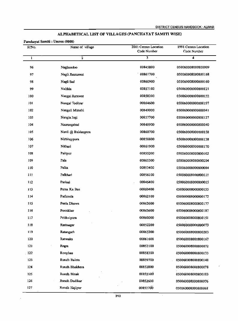
DISTRICT CENSUS HANDBOOK: ALWAR
ALPHABETICAL LIST OF VILLAGES (PANCHAYAT SAMITI WISE)
Panchayat Samiti : Umren (0008)
Sl:No. Name of village 2001 Census Location 1991 Census Location Code Number Code Number
2 3 4
96 Naglasedoo 00845800 050060008000800009
97 Nagli Jhamawat . 00861700 050060008000800168
98 Nagli Sad 00860900 050060008000800160
99 Naithla 00857100 050060008000800121
100 Nangal Ratawat 00858200 050060008000800132
101 Nangal Todiyar 00864600 050060008000800197
102 Nangali Munshi 00849000 050060008000800041
103 NanglaJogi 00857700 050060008000800127
104 Naurangabad 00848900 050060008000800040
105 Navli @ Baldeopura 00860700 050060008000800158
106 Nirbhaypura 00858800 050060008000800138
107 Nithari 00861900 050060008000800170
108 Paitpur 00855200 050060008000800102
109 PaIa 00865300 050060008000800204
lIO Palka 00853400 050060008000800084
11 I Palkhari 00856100 050060008000800111
112 Parisal 00846400 050060008000800015
113 Parsa Ka Bas 00860400 050060008000800155
114 Pathroda 00862100 050060008000800172
liS PeelaDhawa 00862600 050060008000800177
116 Poonkhar 00863600 050060008000800187
117 Prithvipura 00860000 050060008000800151
118 RariJnagar 00852200 050060008000800073
119 Ratangarh 00865200 050060008000800203
120 Ratwaka 00861600 050060008000800167
121 Rogra 00852100 050060008000800072
122 Roopbas 00858300 050060008000800133
123 Rundh Baleta 00859700 050060008000800148
124 Rundh Bhakhera 00852800 050060008000800078
125 Rundh Binak 00855300 050060008000800103
126 Rundh Dadikar 00852600 050060008000800076
127 Rundh Hajipur 008517d6 050060008000800068
310
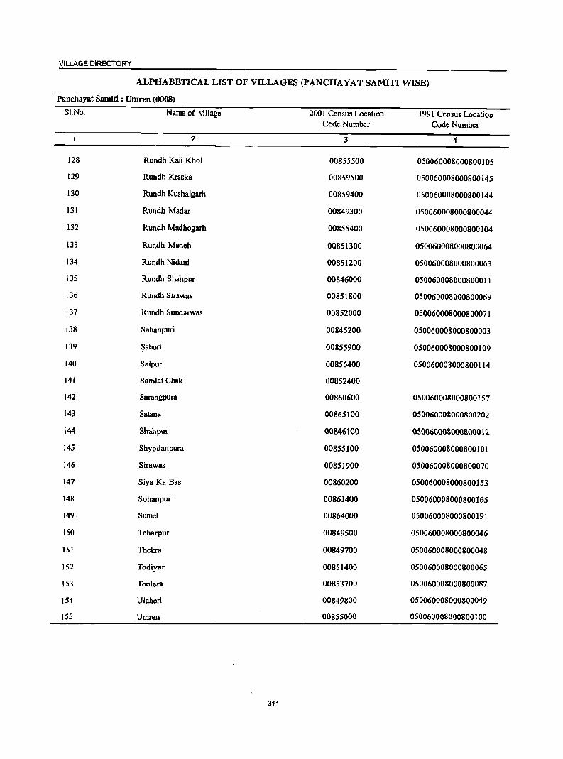
VILLAGE DIRECTORY
ALPHABETICAL LIST OF VILLAGES (PANCHA YA T SAMITI WISE)
Panchayat Samiti : Umren (0008)
SLNo. Name of village 2001 Census Location 1991 Census Location Code Number Code Number
2 3 4
128 Rundh Kali Khol 00855500 050060008000800105
129 Rundh Kraska 00859500 050060008000800145
130 Rundh Kushalgarh 00859400 050060008000800144
131 Rundh Madar 00849300 050060008000800044
132 Rundh Madhogarh 00855400 050060008000800104
133 Rundh Manch 00851300 050060008000800064
134 Rundh Nidani 00851200 050060008000800063
135 Rundh Shahpur 00846000 050060008000800011
136 Rundh Sirawas 00851800 050060008000800069
137 Rundh Sundarwas 00852000 050060008000800071
138 Sahanpuri 00845200 050060008000800003
139 Sahori 00855900 050060008000800109
140 Salpur 00856400 050060008000800114
141 SamlatChak 00852400
142 Sarangpura 00860600 050060008000800157
143 Satana 00865100 050060008000800202
\44 Shahpur 00846100 050060008000800012
145 Shyodanpura 00855100 050060008000800]01
146 Sirawas 00851900 050060008000800070
147 Siya Ka Bas 00860200 050060008000800153
148 Sohanpur 00861400 050060008000800165
149, Sume1 00864000 050060008000800191
150 Teharpur 00849500 050060008000800046
151 Thekra 00849700 050060008000800048
152 Todiyar 00851400 050060008000800065
153 Toolera 00853700 050060008000800087
154 Ulaheri 00849800 050060008000800049
155 Umren 00855000 050060008000800100
311
DISTRICT CENSUS HANDBOOK: ALWAR
Census of India 2001 -Panchayat Snmiti : Umren (0008) Amenities and
Amenities available (if not available within the village, a dash (-) is shown in the column and next to it in brackets the dista~ce in broad ranges viz.<5 krns., 5-10 kms. and 10+ kms of the
';;; nearest I!lace where the facilitlr: is available is given)
i I ~ '0 fj.JS -;;;- u ~ .., ill ;i~ .;
c::: ..c a c; i !:! e .!:l 0 ~ ~
'<=1 S :M~ ~~ .~ i g ., 8 11 e~,", :: ~ J ~ 11 'Q rl ..J
~ 8"'El =:0 ..,
d!l =s: c:!. ] (, StU u 'l' '::1 -ca=:o .., a 5 ] 8 .~ ~Bj
., ~
~ :p 'J:! 6 ~ 1: = g it = .... .. ,.c: ; ca l~ ca:=!=:o
~ :> 0 8. .... ] .. 0 :f 'g .~ i ~ =:0 .... ~ 8. tl 00
'" 0 .~ ca R 'E "E ~ f ~ ~ ~ ~i tU '" ~ ~ ~ 7!! u ti .~~ ti .5 ~ .t:: ~ ~
.g ~
'0 a~ '" 0
sa ii$; E-- III Cl eo ~&! -< so e;; \:1:s!i 2 3 4 5 6 7 8 9 10 11 12 13
Panchayat Samitl : Umren (0008)
Ghalln 849.0 2,092 290PMS PHSH(lO+) THPW POPH(IO) RS (00845000) C(IO+) MCW(S-lO) SS-HP CM(S-lO) ACS(S-lO) CV(S-lO) BS(5-10)
PHC(S-IO) CP(5-10) . NCS(S-IO) Sp(IO+) NW(lO+) OCS(5-10) 5T(lO+)
:2 Bhumri 173.0 572 88 PM(5-1O) HPTW PH(2) (00845100) C(10+) H(1O+) W PO(5-10) CM(5-l0) AC5(5-l0) CV(5-l0) B5(5-10)
MCW{S-lO) SS-HP CP(S-10) NCS(lO+) SP(lO+) RS(5-10) PHC(S-IO) OC8(10+) ST(lO+) NW(1O+)
3 Sahanpuri 166.0 230 32 PM(lO+) THP (00845200) C(10+) H(lO+) W PO«5) CM(5-10) AC5(5-10) CV(S-IO) B5«5)
MCW(S-IO) 55-HP PH(S-lO) CP(5-l0) NCS{S-lO) SP(lO+) RS(5-10) PHC(5-l0) OCS(5-10) ST(lO+) NW(1O+)
4 Jhadoli 344.0 811 116 P M(S-lO) HPW (00845300) C(lO+) H(1O+) SS-HP po«S) CM(S-lO) ACS(S-IO) CV(S-IO) BS(5-10)
MCW(S-lO) PH(S-lO) CP(S-lO) NCS(S-IO) Sp(IO+) RS(5-10) PHC(5-10) OC5{5-l0) ST(lO+) NW(lO+)
5 Barwara 1220 313 47P ACM«S) HPW (00845400) C(lO+) H(1O+) 5S-HP po«S) CM(S-IO) ACS«S) CV(lO+) B5(5-10)
MCW(S-to) PH«5) CP(S-to) NCS(](l+) sp(10+) RS«S) PHC(S-lO) OCS(lO+) ST(Ul+) NW(lO+)
6 Bijopur 478.0 1,167 159 PM S pUC HPW (00845500) C(10+) H(lO+) SS-HP PO(<S) CM(lo+) ACS«S) CV(lO+) BS«S)
MCW«S) PH«S) CP(lO+) NCS(lO+) SP(lO+) RS« 5) PHC«5) OCS(lO+) ST(lO+) NW(lO+)
7 Dhoolpuri 240.0 902 128 PM(S-IO) HPW (00845600) C(10+) H(lO+) SS-HP PO(S-lO) CM(S-lO) ACS(S-10) CV(IO+) BS(5-10)
MCW(10+) PH(S-10) CP(S-10) NCS(1O+} 8P(10+) R8(S-10) PHC(10+) OCS(lO+) ST(lO+) NW(lO+)
8 Chandoli 1,663.0 S,654 716 P(4) M S DDAH(10+) THP POPH(10) CM ACS BS (00845700) C(IO+) MCW(IO+) TWW CP(lO+) NCS(IO+) CV(IO+) RS(IO+)
PHC(IO+) SS-HP OCS(IO+) SP(lO+) NW(lO+) ST(1O+)
9 Naglasedoo 247.0 932 130PM«5) HPW PH DS (0084S1!00) C(1O+) H(1O+) SS-HP. PO«S) CM«5) ACS«S) CV(IO+) RS(lO+)
MCW«S) CP«S) NCS(lO+) SP(lO+) NW(10+) PHC(lO+) OCS(1o+j ST(lO+)
10 Nadanheri 500.0 1,019 129 P M(S-lO) HPW (00845900) C(lO+) H(lO+) 88-HP PO(<5) CM«S) ACS«S) CV(IO+) BS(S-IO)
MCW(10+) PH(lO+) CP«S) NCS(1O+) SP(lO+) RS(lO+) PHC(10+) OC8(10+) 8T(lO+) NW(10+)
11 Rundh Shahpur 135.0 671 104 HPTWW (00846000) P«S) H(lO+) SS-HP PO«5) CM«S) ACS«S) CV(lO+) B8(S-10)
M«S) MCW(S-10) PH(lO+)' CP« 5) NCS(IO+) Sp(IO+) RS(lO+) C(IO+) PHC(5-10) OCS(IO+) ST(lO+) NW(10+)
~!
312
VILLAGE DIRECTORY
Villa2e Directory Land Use ,As on 1999}
Land use (i.t. area under different types of land use in hectare)
]: c 0 .~
5 ~ CD :> .5 i '" :g .... " :J U
~ ·m E u .s
~ E 'U c -. ._ II>
'6 0 ~ ~ u ., ~ U :J a > ~ u .;; ~
~ 5 .... 0 if! g j ~ II>
~ D S ... t: ., € .... ii ." .0
~ 8- §. o 3 i .£ Ii ~ c. ...
1;; VI ... .5 eM 1 ]~ c 'S e M ! ~ ~ ~ ~ :~ c u "iii
~ ~ 0 '6 c :i iii I ! '1: li ~ Iii 02 u "" I:!o == ·u OIl U)
14 15 16 17 18 19 20 21 22 23 2 I
PR Khairthal (20) EA N Earthen Pot W(SO.O) 93.0 74.2 316.0 Gbatla WE(299.0) TW(9.0} TWE(8.0) T(~""m
MR Khairihal (8) EA Earthen Pot WE(7.0} 10.0 27.0 29.0 Bhurari 2 TW(lOO.O) T(107.0)
PRMR Khairihal (12) EA N Earthen Pot W{9.0) 25.0 39.0 67.0 Sahanpuri 3 WE(26.0) T(35.0)
PR Khairlhal (I 0) EA Earthen Pot W(2-4.0) 70.0 38.0 102.0 Ihadoli -4 WE{IIO.O) 1(134.0)
MR Alwar(20) EDEAG - Earthen Pol, W{B.O) 9.0 9.0 40.B Barwara S Furniture WE(5S.0)
1(63.0)
MR Alwar{23) EDEAG - Earlhen Pol, W(40.0) 203.0 57.0 126.0 Bijopur 6 furniture WE(S2.0)
T(92.0)
MR Alwar{26) EDEAG - Earthen Pot W{44.0) 110.0 28.0 43.4 Dhoolpuri 7 WE(IS.O} T{S9.0)
PRMR Alwar{IB) EA NM Earthen Pot 196 W{64.0) 243.0 93.0 612.9 Chandoli 8 FP WE(36.0)
TW(218.0) 1WE(200.0)
MRFP Alwar(18) EDEAG - W(91.0) 42.0 20.0 -44.0 N8glasedoo 9 WE(30.0) TW(20.0) 1(141.0)
MR Alwar(17) EDEAG - W(81.0) 71.0 31.0 235.0 Nadanheri 10 WE(7S.0) 1W(7.0) 1(163.0)
PR Alwar(17) EDEAG N W(20.0) 51.0 54.0 Rundh Shahpur 11 WE(1O.0) 1(30.0)
313
DISTRICT CENSUS HANDBOOK: ALWAR
Census of India 2001 -Panchayat Samiti : Umren (0008) Amenities and
Amenities available (if not available within the village, a dash (-) is shown in the column and
next to it in brackets the distance in broad ranges viz.<5 lans., 5·10 lans. and 10+ lans of the
I ! nearest Elace where the facili~ is available is Bivenl '" ] 'iii' 5 ] .~~ U u· II ~ J
II ] C ;; ;> :.= u .!l 0 g 0 .~
._ t! ~--.~ u ~ .M 8. j & '3
~J .3 § '" go <.> ] rn.~ 'C i
l~ cId ~ ~ '0 'C 8 . '3 ].§ -5 Iii j ~ .~ '" 'C g .. ~ ~ a.a ~ c· ::> .. 1 Iii ~ 0 j 'H .~ ~ .c 'iI ]!:E"g ..,
~ &. .... 1 ]:6 5 .. 0 .§ o~< ._ ..
.... Iii f u § t;l 0 11 ] ] II '3 ~
._ ] c 0 Co .., .~
~i til E
E f 'iI u B ! § l .!::a ... ~.5 ] '1': ~ ~ i):l ~ 1;Q,s ~~ ..
~ Z !o.!.e ~ S! e:;~r.a !a 1 2 3 4 5 6 7 8 9 10 II 12 13
12 8hahpur 264.0 1,713 241 PM 8 AC PH8H(10+) THP POPH(70) CM AC8 (00846100) C(IO+) MCW(S·IO) TWW CP(S-IO) NCS(IO+) CV(IO+) BS« S)
PHC(S-IO) SS-HP OCS(IO+) SP(IO+) RS(IO+) ST(IO+) NW(IO+)
13 Dilawarpur 310.0 1,137 152 P M« 5) HPW PH(IO) BS (00846200) C(IO+) H(IO+) SS-HP PO«S) CM«S) ACS«S) CV(IO+) RS(IO+)
MCW(lO+) CP« 5) NCS(lO+) SP(IO+) NW(lO+) PHC(IO+) OCS(IO+) ST(IO+)
14 Bhandwara 509.0 1,140 167 P M(5-10) TWW (00846300) C(lO+) H(IO+) SS-HP PO«S) CM«S) ACS«5) CV(IO+) B8«'S)
MCW(IO+) PH(lO+) CP«5) NCS(IO+) SP(IO+) RS« 5) PHC(IO+) OCS(1O+) ST(IO+) NW(1O+)
IS Parisal 196.0 688 125 P M(5-10) . RMPH(IO+) HPW POPH(5) RS (00846400) C(IO+) MCW(JO+) SS-HP CM(S-IO) ACS(5-10) CV(IO+) BS(5-IO)
PHC(IO+) CP(5-IO) NCS(IO+) SP(IO+) NW(IO+) OCS(IO+) ST(IO+)
16 Nauransal!ad 461.0 917 131 PAC HPW PH(4) (00848900) M«5) H(IO+) SS-HP PO«S} CM(IO+) AC8«S) CV(1O+) B8« 5)
C(IO+) MCW(IO+) CP« 5) NCS(IO+) SP(IO+) RS«5) PHC(IO+) OCS(IO+) ST(IO+) NW(IO+)
17 Nangali Munshi 75.0 342 SSPM«S) HPW PH (00849000) C(IO+) H(IO+) SS-HP PO«S) CM(IO+) ACS«5) CV(IO+) B8« S)
MCW(IO+) CP«5) NCS(IO+) SP(IO+) RS(10+) PHC(IO+) OCS(lO+) ST(IO+) NW(IO+)
18 Kasba nahra 233.0 1,137 176 P M« S) HCPHCPHS THP POPH(J5) BS (00849100) C(IO+) CHWH(IO+) TWW CM(lO+) ACS(IO+) CV(IO+) RS(IO+)
MCW(IO+) TKSS-HP Cp« 5) NCS(lO+) Sp(IO+) NW(lO+) OCS(IO+) ST(IO+)
19 Dhokri 1,030.0 654 73PM«5) HPW PH(5) (00849200) C(lO+) H(lO+) SS-HP PO«S) CM«5) ACS«5) CV(IO+) B~«5)
MCW(IO+) CP« 5) NCS(IO+) SP(IO+) RS(IO+) PHC(lo+) OCS(IO+) ST(IO+) NW(IOT)
20 RundhMadar 181.0 18 2 HPW (00849300) p«S) H(IO+) SS-HP PO«sj CM«S) ACS«S) CV(IO+) BS(S-IO)
M«S) MCW(IO+) PH(IO+) CP«5) NCS(IO+) SP(IO+) RS(5-10) C(lO+) PHC(IO+) OCS(lO+) ST(1O+) NW(lO+)
21 BalaDIihra 1,973.0 865 148 PM«5) TWW (00849400) C(lO+) H(10+) TK. PO« 5) CM«5) ACS«5) CV(IO+) B8«5)
MCW(IO+) SS-TW PH(IO+) CP«S) NCS(IO+) SP(IO+) RS(IO+) PHC(IO+) OCS(IO+) ST(IO+) NW(IO+)
22 Tcharpur 574.0 1,179 187PM«S) HPW (00849500) C(IO+) H(IO+) SS-HP PO(S-IO) CM(IO+) AC8«S) CV(IO+) B8«5)
MCW(IO+) PH(IOT) CP(IO+) NCS« S) Sp(IO+) RS(IO+) PHC(IO+) OCS« 5) ST(IO+) NW(IO+)'
314
VILLAGE DIRECTORY
Villsue Directory Land Use {As on 1999~
Land use (i.e. area under different types of land use in hectare)
j c
'i g _a. aD .~ c
J :g ~ :;
u u E ~.-.
.. c
j ·tl E 'Q;' .s 0 i
~10 u RfI ... !! > ~ J ~ oI!I ~ ~"O ~! B E -a: :e: :; .8 u 8.~ i ~
.:;
1 "" !: ..!! Iii ~ :I
.5 ~ ..,
~ la 0 ... J
WI u 0
~ til io = u
I ~ .5 B-= 1 '§ Iii 2 a! ~ § 0 ~ ~ = eo ii!;j ~ 5 t2 ::!: ii!;j sa
14 15 16 17 18 19 20 21 22 23 2 I
PR Alwar(IS) EA NM W(20.0) 72.0 26.0 46.0 Shahpur 12 WE(67.0) TW(33.0) T(120.0)
PR Alwar(13) EA NM W(50.0) 47.0 35.0 DilaWlll]lUr 13 WE(142.0) TW(36.0) T(228.0)
PR Alwar(20) EDEAG - W(55.0) 163.0 77.0 32.9 BhandW8l1l 14 WE(151.0) TW(30.0) 1(236.0)
PR Alwar(l7) EDEAG N Earthen POI W(IO.0) 72.0 44.0 7.2 Parisal 15 WE(5S.0) TW(8.0) 1(73.0)
PR Alwar(16) EA W(78.0) 69.0 70.0 191.0 Naurangabad 16 WE(2S.0) TW(28.0) 1(131.0)
PR Alwar(8) EDEAG NM WE(24.0) 34.0 16.9 Nangali 17 T(24.0) Munshi
PR Alwar(12) EA NM Wooden WE(l53.0) 36.0 38.0 6.0 KasbaDahlll 18 Furniture, . T(153.0) Earthen Pot
PR Alwar(16) EDEAG N 370 W(88.0) 70.0 227.0 262.0 Dhokri 19 WE(6.0) TW(7.0) T(IOI.O)
PR Alwar(18) 34 W(7.0) 1(7.0) 16.0 12.0 112.0 RundhMadar 20
PR Alwar(14) EDEAG N 1087 W(34.0) 240.0 343.0 199.0 BalaD.hlll 21 WE(30.0) TW(30.0) TWE(1O.0) T(104.0)
PRMR Alwar (I Z)'i EA 46 W(71.5) 126.0 52.0 256.7 ~!eharpur 22 WE(22.0) T(93.S)
315
DISTRICT CENSUS HANDBOOK: ALWAR
Census of India 2001 -Panchayat Samiti : Umren (0008) Amenities and
Amenities available (if not available within the village, a dash (-) is shown in the column and next to it in brackets the distance in broad ranges viz.<5 lans., 5-10 lans. and 10+ kms of the
I I nearest elace where the facili~ is available is given)
~
I 0 u u
IS ..c 0 j !. 0
~ u (j.
&l! 0 .. l :! 0 ..,
lid '5O (j. 11 .., J J:l IS ~ 'Iii ..
] 'Ci 'lj ~ ~ ~ :;
~ .. g. ..... ~ 8. Ii! 0
] ~ s ~ ~ rIl ~ I-< Z
2 3 4 5
23' Kadooki 21B.0 695 99P AC IiPTW BS (00849600) M«S) H(IO+) WTK PO«S) CM(IO+) ACS«5) CV(IO+) RS(IO+)
C(IO+) MCW(IO+) SS-1iP PH(IO+) CP(IO+) NCS(IO+) SP(IO+) NW(IO+) PHC«S) OCS(IO+) ST(IO+)
24 Thekra 35B.0 1,340 IB6PM«5) IiPTW PH (00849700) C(IO+) H(IO+) WTK PO« S) CM(IO+) ACS«S) CV(10+} BS«S}
MCW(IO+} SS-1iP CP(IO+} NCS(IO+) SP{lO+) RS(lO+) PHG(IO+) OCS(IO+) ST(IO+) NW(IO+)
25 Ulaheri 254.0 749 98P AC HPTW PH(3) (OO849BOO) M«5) H(IO+) WSS-HP PO« 5) CM(IO+) ACS«S) CV(IO+} B8«S)
C(IO+) MCW(IO+) CP(IO+) NCS(IO+) Sp(IO+) RS(IO+) PHC(IO+) OCS(IO+) ST(lO+) NW(IO+)
26 DholiDoDb 173.0 1,408 204 P(2) AC HPTWW PH(3) BS (00851000) M«5) H(S-IO) SS-HP PO«5) CM(S-IO) ACS«S) CV(S-IO) RS(S-IO)
C(S-IO} MCW(s-IO) CP(S-IO) NCS(S-IO) SP(S-IO) NW(IO+) PHC(S-IO) oeS(S-IO) ST(S-IO)
27 Jatiyana 567.0 2,421 297 P(2) M MCW H(5-1 0) T liP W SS- PO PH(2) ACS (00851100) C(S-IO) PHC(S-IO) liP CM(S-IO) NCS(S-IO) CV(s-IO) BS(s-IO)
CP(S-IO) OCS(S-IO) SP(S-IO) RS(s-IO) ST(S-IO) NW(1O+)
28 Rundh Nidani 33S.0 --Uninhabited--(00BSI200)
29 RundhManch 20.0 229 35 IiPW (00851300) P(S-IO) H(S-IO) SS-HP PO(S-IO) CM(S-IO) ACS(S-IO) CV(s-IO) BS(S-IO)
M(IO+) MeW(S-IO) PH(S-IO) CP(S-IO) NeS{S-IO) Sp(S-IO) RS(S-IO) C(S-IO) PHC(S-IO) oeS(S-IO) ST(S-IO) NW(IO+)
30 Todiyar 449.0 711 89 P M« 5) HPW (00851400) C(IO+) H(10+) SS-HP PO(IO+) CM(IO+) ACS(IO+) CV(S-IO) BS(IO+)
MCW(IO+) PH(IO+) CP(S-IO) NCS(IO+) SP(S-IO) RS(IO+) PHC(IO+) OeS(IO+) ST(S-lO) NW(IO+)
31 ~ipur 897.0 2,246 308 P M C(10+) HCH(IO+) HPW {(lOBS I 500) MCW(IO+) SS-HP PO(lO+) CM(IO+) ACS(IO+) CV(IO+) BS(IO+)
PHC(IO+) PH(1O+) CP(lO+) NCS(IO+) Sp(IO+) RS(IO+) OCS(IO+) ST(IO+) NW(IO+)
32 Dadhikar 3,335.0 1,508 194 PM(IO+} IiPW ( Dadikar) C(IO+) H(IO+) SS-1iP PO(IO+) CM(IO+) ACS(10+) CV(IO+) BS(IO+) (00851600) MCW(IO+} PH(IO+) CP(IO+) NCS(10+) SP(IO+) RS(IO+)
PHC(IO+) OCS(IO+) ST(IO+) NW(1O+)
33 Rundh Hajipur . 844.0 37 6 WSS-W (00851700) P(5-10) H(IO+) PO(I 0+) CM(IO+) ACS(IO+) CV(IO+) BS(IO+)
M«S) MCW(IO+) PH(IO+) CP(IO+) NCS(IO+) SP(IO+) RS{IO+) C(5-IO) PHC(J()tJ OCS(IO+) ST{lO+) NW(IO+)
316
VILLAGE DIRECTORY
ViIla2e Directory Land Use (As on 19991
]' ~ .~ 11 ....
0 Ii 'j e
j ;; e :a 8 ~ ~
~ ~~ ~ ~ .9 Q. .. ] .9 Q.
~ 8. ... ::l <II .§ .M til Q. e j ~ j ;; :I
Q.
~ o fa ~ iii l>.
14 15 16 17 18
PR Alwar(ll) EA NM Earthen Pot
PRMR Alwar(ID) EA FP
MR Alwar(lO) EA Earthen Pot
PRMR Alwar(5) EA NM FP
PRMR Alwar(B) EA NM Earthen Pot FP
--- Uninhabited ---
PR Alwar(8)
PRMR Alwar(ll) EDEAG -
PR Alwar(IO) EA Earthen Pot
PRMR Alwar(15) EA Earthen Pot
MR Alwar{IS) Earthen Pot, ,. Basket Making
Land use
(i.e. area under different types ofland use in hectare)
... f:! ::l 0 <II
& .... ~
~ DO
] ""' 19 20
W(39.0) WE(40.0) TW(16.0) TWE(B.O) T(I03.0)
W(40.0) WE(20.0) TW(26.0) TWE(IO.O) T(96.0)
W(17.0) WE(10.0) TW(20.0) TWE(26.0) T(73.0)
41.18 W(14.0) WE(7.0) TW(IO.O) TWE(ID.O) T(4I.D)
104 W(49.0) WE(S •. O) TW(60.0) TWE(32.0) T(199.0)
318
244 WE(103.0) T(103.0)
236.53 W(40.0) WE(20.0) T(60.0)
2616 W(109.0) WE(20.0) T(129.0)
236.53
317
1 '2 2 21
39.0
lSo.o
110.0
47.0
163.0
2.0
51.5
250.0
368.0
c 0 'j
~ > '':::
:g :; u
"0 ... .5 '(;j" .e ~ u .. B ~ :g ~ .... ~
il; .!! Ii -e liI 0 .:l-fi
c
~ s;li < 22 23
43.0 32.9
57.6 54.0
15.0 56.2
24.0 20.3
55.0 46.0
16.0 1.0
17.2 1.0
50.0
205.0 145.0
99.0 123.0
607.5
~ J .;;:
~ ... 0 .. OJ
! ·c .. on
2 1
Kadooki 23
Thekra 24
Ulaheri 25
DholiDoob 26
Jatiyana 27
Rundh Nidani 28
RundhManch 29
Todiyar 30
Hajipur 31
Dadhikar 32 (Dadikar)
Rundh HBjipur 33
DISTRICT CENSUS HANDBOOK: PJ...WAR
Census of India 2001 -Panchayat Samiti : Umren (0008) Amenities and
Amenities available (if not available within the village, a dash (-) is shown in the column and next to it in brackets the distance in broad ranges viz.<5 kms., 5-10 kms. and 10+ kms of the
I ; nearest l!lace where the facili~ is available is 8iven}
-8 5 .., ·B ~. 8 I u Iii
.~" I .,
i ;:; Co)
f5 ;:; .~ ~ 0 e
._ t!
!I ] u t:!. ~ 0
j '" ;:; '" u g. 1~'"' 0
~ i lj old· ~ t:!. ] 6 _" § ~~ u E ]I .§
! .§ c '" i .S! g-.51 '" a .c c g ~ ii·-u 'E 1;1 .s , a 01 l~ li~ Yl .J:! ,.0 "3 ..... 1 ~ > '" Q. 0 .~
._ ~ ..... ~ 8. ..8 01 .~ ] "3 ~ ·iI ] I! 0 .~ Ei '" "iI .,
! ! j ~ .ti,j e .-.1:; ~ ~ '" ~ l §J u .5 'j u
-Oi:'i i!l ::!: Ii! ei ~.." ~.~ CIJ ~.
1 2 3 4 5 6 7 8 9 10 11 12 13
34 Rundh Sirawas 368.0 688 94 HPW (00851800) P('-IO) H(IO+) SS-HP PO(lO+) CM(IO+) ACS(IO+) CV(IO+) BS(IO+)
M(5-IO) MCW(IO+) PH(IO+) CP(IO+) NCS(IO+) SP(IO+) RS(IO+) C(IO+} PHC(lo+} OCS(IO+) ST(IO+} NW(IO+}
35 Sirawas 6,805.0 60S 83 P M(5-10) HPW (00851900) C(IO+} H(IO+) SS-HP PO(IO+) CM(IO+) ACS(IO+} CV(IO+) BS(IO+)
MCW(IO+) PH(IO+} CP(lo+) NCS(IO+) SP(IO+) RS(IO+) PHC(IO+) OCS(IO+} ST(IO+) NW(IO+)
36 Rundh 3,684.0 412 69 HPW 8undarwils P(S-IO) H(IO+) 8S-HP PO(IO+) CM(IO+) ACS(IO+) CV(IO+) B8(10+) (00852000) M(5-10) MCW(IO+) PH(IO+) CP(IO+) NCS(IO+) SP(IO+) RS(IO+)
C(1O+) PHC(lo+} OCS(lo+} ST(1o+) NW(lo+) .
37 Rogra 486.0 398 43PM«S) HPW (00852100) C(IO+) H(10+) 8S-HP PO{IO+) CM(IO+) AC8{10+) CV{IO+) B8{10+)
MCW(IO+) PH(IO+) CP(IO+) NCS(lO+) Sp(IO+) RS(lO+) PHC(IO+) OCS(IO+) ST(IO+) NW(IO+)
38 Ramnagar 28'.0 174 22 HPW (00852200) P«S) H(IO+) SS-HP PO{I 0+) CM(IO+) ACS(IO+) CV(IO+) B8(10+)
M«S) MCW(IO+) PH(lD-t:) CP(IO+) NC8(10+) 8P(10+) RS(lO+) C(IO+) PHC(IO+) OCS(IO+) 8T{10+) NW(IO+)
39 Dhahalawas 954.0 1,533 245 P M C(IO+) PHSH(IO+) HPW PH (00852300) MCW(1O+) SS-HP PO(IO+) CM(1O+} AC8(1O+) CV(lO+} BSCIO+)
PHC(IO+) CP(lO+) NCS(IO+) Sp(IO+) RS(IO+) OC8(10+) ST(IO+) NW(IO+)
40 SamlatChak 140.0 409 56 HPW (00852400) P«S) H(IO+) 88-HP PO{I 0+) CM(IO+) AC8(10+) CV(IO+) B8(IO+)
M«5) MCW(IO+) PH(1O+) CP(IO+) NCS(1O+) 8p(10+) RS(IO+) qlO+) PHqlO+) OCS(IO+) ST(JII-I') NW(IO+)
, 41 BakhtpUIB 346.0 686 142P MqIO+) PHS H(10+) HPW PH
(00852500) MCW(IO+) SS-HP P0(5-1O) CM(S-IO) ACS(IO+) CV(IO+) B8(10+) PHC(IO+) CP(IO+) NCS(IO+) ·8p(10+) R8(10+)
OC8(1O+} ST(IO+) NW(lO+)
42 Rundh Dadikar 191.0 140 IS HPW (00852600) P«5) H(IO+) S8-HP PO(IO+) CM(IO+) ACS(IO+) CV(lO+) BS(IO+)
M«S) MCW(to+) PH(IO+) Cp(IO+) NCS(IO+) SP(IO+) RS(IO+) C(IO+) PHC« 5) OCS(IO+) 8T(10+) NW(IO+)
43 Kishanput 714.0 1,426 196 PM(lO+) HPW (00852700) C(IO+) H(10+) SS-HP PO(IO+) CM(IO+) ACS« 5) CV(IO+) B8(10+)
MCW(IO+) PH« 5) CP(10+) NCS(IO+) SP(IO+) RS(IO+) PHC(IO+) OCS(IO+) ST(IO+) NW(IO+)
44 Rundh 2,853.0 566 79 WSS-W Bhakhera p«S) H«S) PO{<S) CM«S) ACS« S) CV«5) BS«5) (00852800) M«S) MCW«S) PH« 5) CP« 5) NCS« 5) SP« S) RS«S)
C«S) PHC«5) OCS«5) ST« 5) NW(IO+)
318
VILLAGE DIRECTORY
Village Directory Land Use (As on 1999)
1 5 u ... j
'" ~ .!3 ...
~ oI!I
~ B .c .s [;j
J [ ~ 14 IS
MR Alwar(30)
MRFP Alwar(34)
MRFP Alwar(34)
MRFP Alwar(23)
PRMR Alwar(23) FP
PR Alwar(22)
FP Alwar(15)
j ., ~ ""' 16
EA
EDEAG -
EDEAG -
PR Alwar(20) EDEAG -
MR FP Alwar(IS)
MR FP Alwar (21) EA
FP Alwar(3)
?;-:a ~ ·i E 0 u
I] ~ '" ~ .5 ~ ! S Iii a:; :E Ii 17 18
Earthen Pot
Land use (i.e. area under different types ofland use in hectare)
... f! ::I
5l e: 1 ~ ] 0
!:!::! 19 20
368
6124 W(IS9.0) WE(30.0) T(189.0)
3684
151 W(3;.0) WE(12.0) T(47.0)
95 W(23.0) T(23.0)
242 W(l22.0) WE(2.0) T(124.0)
W(l.O) T(l.O)
148 W(JJ8.6) T(l18.6)
191
406 W(lOS.O) T(108.0)
2853
319
"0
I ·s ·s i2 21
372.0
94.0
85.0
244.0
47.0
35.0
84.0
" 0 "if
til) > "
.... :a "3 ::I ... u ... c ~ .a ;:.8
~ B ~ ~; ~
ii ..2 Iii
1~ '0 c
- :s ~ ~ GIl 22 23
87.0 33.3
89.0 105.2
28.0 53.9
135.0 208.7
33.0 59.;
14.0 30.0
118.0 58.1
j .s;: ... 0 u
~ 2
Rundh Sirawas
Sirawas
Rundh Sundarwas
Rogra
Ramnagar
Dhahalawas
SamlalChak
Bakhtpura
Rundh Dadikar
Kishanpur
Rundh Bhakhera
... '" ,Q
E ::I c iii "ii <I'.l
1
34
3;
36
37
38
39
40
41
42
43
44
DISTRICT CENSUS HANDBOOK: ALWAR
Census of India 2001 -Panchayat Samiti : Umrel1 (0008) Amenities and .
Amenities available (if not available within the village, a dash (-) is shown in the column and nextto it in brackets the distance in broad ranges viz.<5 krns., 5-IOkms. and 10+ krns of the
I I nearest e1ace where the facili~ is available is Biven}
" ] fl ..0" "0
I 0 u .'" ..2 .§ u " !! u ] 6 .c ;:; ·i :.:: c,)
5 co
f ;j~ ~.-. .~ u C!- ]
= f ~ g u ]~.-. .s '" g. ..,
~ l! C!- 1 _" § Sf <Ill .;: ] u :I iii .= ~ !l .~ i 6 .!:! u.c .s .~ g i .c c u <Ill 8·~ Iil ;:;:; 'S _g
~ :!! l~ ~:g-g ftj J:> > "3 ~ 1 ~ .... ~ 8: Jl Ill) " ~ "31 ·111 .§ ..
. 0 '"iI '" 11 ~1 ~! ~
u ]I ~ § !l ~ ~ tf .~ 6 li r:. ~ II> .1:
& ~~ 11.5 ] .. g ;.;;, :z ~ 9 !i,!.,e el ~<Il !;,,! -Cl sa 2 3· 4 S 6 7 8 9 10 11 12 13
45 Bhakhera 2,775.0 860 127 P M«5) HPTWW PH(18) (00852900) C«5) H«S) SS-HP PO« 5) CM«5) ACS«5) CV«5) BS« S)
MCW«S) CP« S) NCS«5) 8P« 5) RS«5) PHC«5) OCS«5) 8T«S) NW(ID+)
46 Alwar( Rural ) 3.0 236 48 P M(5-10) DAH(5-10) THPW (00853000) C(S-IO} MCW{S-IO} S8-HP PO{S-IO} CM(S-IO) ACS(5-IO) CV(S-IO} BS(5-10)
PHC(5-10) PH(S-IO) CP(S-IO) NCS(S-IO) 8P(S-10) RS(S-IO) OCS(S-IO) ST(S-IO) NW(ID+)
47 Bhoogar 669.0 6,528 1,120 P(3) M(2) FWC RMP(II) T HP W C PH(35) (008S3100) C(S-IO) CHW H(S-IO) SS-HP .PO(S-IO) CM(S-IO) ACS(S-IO) CV(S-IO) BS(5-10)
MCW(S-IO) CP(S-IO) NCS(S-IO) SP(S-IO) RS(S-IO) PHC(S-IO) OCS(5-10) ST(5-IO) . NW(II}l-)
48 Itama ( Rural) 398.0 90S 122 P M(S-IO) HPTWW (OO8532OO) C(S-IO) H{S-JO) SS-HP PO(5-1O) CM(5-10) ACS(5-1O) CV(S-IO) BS(5-1O)
MCW(S-IO) PH(S-IO) CP(S-IO) NCS(S-IO) SP(S-IO) RS(S-IO) PHC(S-IO) OCS(S-IO) ST(S-IO) NW(ID+)
49 Berka 69.0 --Uninhabited ---(00853300)
SO Palb 134.0 593 87 PM« S) HPTW (00853400) C(S-IO) H(S-lO) WTK PO«S) CM(S-IO) ACS{5-IO) CV{5-IO) 88(5-10)
MCW(S-IO) SS-HP PH(5-10) Cp(5"10) NCS(5-10) SP(S-IO) RS(S-lO) .PHC(IO+) OCS(5-10) ST(S-IO) NW(I()+)
51 Bel.ka 183.0 3,438 575 P(2) M« 5) THP PH(12) (00853500) C(5-JO) H(S-IO} TWW PO«S} CM(S-IO) ACS(S-IO) CV(5-1O) B8(S-IO)
MCW(S-IO) TKSS-HP CP(S-IO) NCS{S-IO) SP(S-IO) RS(S-IO) PHC(5-IO) OCS(S-IO) ST(S-IO) NW(ID+)
52 Diwakari 282.0 6,870 1,196 P(8) M(5) S PHSRMP(4) THP POPH(15) (00853600) C(5-10) H(S-IO) TWW CM(5-tO) ACS(S-IO) CV(S-IO) B8(5-10)
MCW(5-tO) TKSS-HP cP(5-10) NCS(S-IO) SP(S-IO) RS(5-IO) PHC(5-10) OCS(5-IO) ST(S-IO) NW(I()+)
S3 Toolera 939.0 3,938 496P MC«S) PHS H«5) HPTW POPH(4) (OOB53700) MCW«S) WSS-HP CM«S) ACS« S) CV«5) BS«S)
PHC«5) CP«5) NCS« S) SP« S) RS«5) OCS{<5) ST« 5) NW(I()+)
54 Mannaka 321.0 1,780 213 P M« 5) HPW PH(3) (00853800) C«S) H«5) SS-HP PO«5) CM{<5) ACS« 5) CV«5) BS«5)
MCW«5) CP«S) NCS«5) SP« 5) RS« 5) PHC«5) OCS« 5) ST«S) NW(1D+)
S5 Bulja 320.0 2,835 431 P(7) M(4) S PHSRMP THP POPH(S9) ACS 'as (00854600) C(S-IO) CHW H(S-IOj' 'Tw w CM(5-IO) NCS(5-tO) CV(S-IO) RS(S-IO)
MCW(S-IO) SS-HP CP(S-IO) OCS(S-IO) SP(S-IO) NW(II}I-) PAC(S-IO) ST(S-IO)
320
VILLAGE DIRECTORY
Villaee Directory Land Use (As on 1999)
j 5 " u
~ ~ '6 ';; old
~ 13 .c S 1;1 1;; e j t 14 IS
PRMR Alwar(3) FP
PR Alwar(6)
PR Alwar(6)
PR MR Alwar (7)
.~ -g
~ E
'i E 0 u
~ ~"" >. Ii o I!! c.
~ .§~ = ., c.
J ! 1?l ~ ::E E
16 17 18
EA NM
ED
EA N M Wood Furniture
EA NM
-_ Uninhabited--
MRFP Alwar(7) EDEAG -
PRMR Alwar(S) EA NM
PRMR Alwar(6) EA NM Earthen Pol
PR Alwar(4) EA NM
PR Alwar(4) EA NM
PRMR Alwar(7) EA N Carpel. '. FP
Land use (i.e. area under diffcrenllypes oflllDd use in hectare)
I f!"
19
I 0 II>
€ i ·s = 20
2494 GC(I06.0) W(79.0) T(IS5.0)
GC(372.5) W(170.4) T(542.8)
GC(S3.0) PC(5.0) W(4.0) T(92.0)
GC(36.0) W(3.0) T(39.0)
GC(3J.0) W(4.0) T(3S.0)
GC(59.0) pc(4.0) W(20.0) T(83.0)
W(IOI.8) 1W(22.0) T(123.8)
WE(221.0) T(221.0)
GC(120.0) W(115.0) T(23S.0)
321
1 ·s 'c hi 21
4.0
2.5
15.6
29.0
1.0
662.0
60.0
37.0
c 0 .~
OIl > C ~ '6 " '" 'il .s c ".... ._ .. ~ u .. B > ~ ~! :;;
i:; ..!! Iii
Jj g '" I!! ...:
22 23
41.0 SO.7
2.4 108.5
306.0
1.0
1.0 98.4
47.0 53.0
60.0 97.0
152.0 125.0
33.0 7.2
10.0 38.0
j ] ~ § ... 0 c .. Gil
~ '5 ro
2 1
Bhakhera 45
Alwar ( Rural) 46
Bhoogar 47
ltama ( Rural) 48
Berka 49
Palka 50
Belaka 51
Diwakari 52
Toolera 53
Mannaka 54
Burja 55
DISTRICT CENSUS HANDBOOK: ALWAR
Census of Iudia 2001 -Panchayat Samiti ; Umren (0008) Amenities and
Amenities available (if not available within the village, a dash (-) is shown in the colunm and next to it in brackets the distance in broad ranges viz.<5 Ians., 5-10 Ians. and 10+ lans of the
-;;;- nearest I!lace where the facili~ is available is mven l ., I ~ i ~.d' -g I u C) " i !o! ]
+:.2 .~. c .= 0 :.::: u 0 e c::> '0:; .- t! ~'"' 'J:I u !:!. f .el8, ~ j § j '8 ]~- ~ r II
l~ ~ ~ !:!. 't:I :; 'ii".~ ~J ~
.. § ~ Iii ] <.l .= S .8
oS 'iI t t c g ~il:a .~ § '5! OS .c :!! li "iiI::!:::I
§ :; ... "iii
.§ ~ i ._ 'j ; g- o § ~ ... ~ ~ "" i § f c 0 .,., 'iI ~ '8 tI ~ (I ._ "iii
., l l
Ei ., '1: ! ~ ~ ~ ~ 8'5 .~ ~ ~ .5 'B l] .,
:::e ~'§ .~ !!:! ~-.e ~,,/.) I 2 3 4 S 6 7 8 9 10 11 12 13
56 Kesharpur 344.0 1,329 176 P M S HPTWW PH(21) (00854700) PUC H(5-10) S8-HP PO« 5) CM(5-10) ACS(S-IO) CV(S-IO) BS(S-IO)
C(S-IO) MCW(S.IO) CP(S·IO) NCS(S.IO) spes-to) RS(S·IO) PHC{5·10) OCS{5.10) ST{S·IO) NW{IO+)
57 Liwari 286.0 1,491 252 P M« 5) HPTW PH(l5) ACS (008S4800) C(S·IO) H(S·IO) WSS·HP PO«S) CM(S·IO) NCS(S·IO) CV(S-IO) BS(S-IO)
MCW{S-IO) CP(S.IO) OCS(S.IO) SP(S-IO) RS(S.IO) PHC(5-10). ST(S-10) NW(lO+}
58 Bam Kesharpur 116.0 77 6 CHWH(S·IO) HPTW W PH(2) BS (008S4900) P{< S) MCW{S·IO} SS-HP PO« 5) CM{<5) ACS{<S) CV{S-IO) RS(S·IO)
M«5) PHC«S) CP(S-10) NCS(5-10) SP(S-IO) NW(lO+} C(5.10) OCS(5·10) ST(5-10)
S9 Umren. 1,096.0 2,904 462 P(2) M(2) PHCPHS THPTW POPH(2S) CM ACS BS (00855000) S(2) AC RMP(2} CHW W S8·HP CP(S-IO) NCS(5-10) CV(S·IO) RS(S-IO)
C(S-IO) H(S-IO) OCS(S·IO) SP(S·IO) NW(lO+) MCW(S-IO) ST(5·10)
60 Shyodanpura 164.0 319 46 HPW (OOB55100) P«S) H(IO+) SS-HP POC< S} CM«S) ACS«S) CV(IO+) BS(S-IO)
M«S) MCW(IO+) PH« 5) CP(IO+) NCS(IO+)' SP{IO+} RS{IO+} C(JO+} PHC(IO+) OCS{IO+) ST(IO+) NW(lO+)
61 Paitpur 753.0 911 166 P M(S-IO) HPW PH(2) (0085,5200) C(IO+) H(IO+) SS-HP P0(5.10) CM(5-IO) ACS(S-IO) CV(JO+) BS(IO+)
MCW(IO+) CP(IO+) NCS(S-IO). SP(IO+) RS(lO+} PHC(lO+) OCS(S-IO) ST(lO+) NW(IO+)
62 RundhBinak 5,473.0 182 29 WSS-W BS (00855300) P«,5) H(IO+) PO(IO+) CM(IO+} ACS(IO+} CV(IO+) RS(IO+}
M«S) MCW(IO+) PH«5) CP(IO+) NCS(IO+) SP(IO+) NW(IO+) C(IO+) PHC(IO+) OCS(IO+) ST(IO+)
63 Rundh 396.0 --Uninhabited --_. Madhogarh (00855400)
64 RundbKali 32.0 --Uninhabited--Khol (008555OO)
65 KaliKhol 265.0 1,156 208 P M«5) HPW (00855600) C(IO+) H(IO+) SS-HP PO«S) CM«S) ACS« 5) CV(IO+) BS« S)
MCW(IO+) PH«5) CP« 5) NCS(IO+) Sp(IO+) RS(10+} PHC(IO+) OCS(JO+) ST(IO+) NW(IO+)
66 Akbarpur 561.0 3,503 S3!l P(2) DDAPHS THP PO PH(30) CM CP ACS BS (00855700) M(2) RMP(2) CHW TW W NCS(IO+) CV(lO+) RS(lO+) .
SAC H(IO+) S8-HP OCS(IO+) Sp(IO+) NW(IO+)'.'t" C(IO+) MCW(IO+) ST(IO+)
PHC(IO+)
322
VILLAGE DIRECTORY
Villaee Directory Land Use {As on 1999}
j 5 ~
.1 :g .. E
~ . , E
"" 8 .!! ~ ~
~ ~"" i >.
9 "S. v 8.~ w "" 8: :J .§ .e til '" e ~ ~ ~ _ ::l
~ ~ Iii ~ e. ~ ::s Iii
14 IS 16 17 18
PRMR Alwar(7) EA NM FP
PRMR Alwar(S) EA NM FP
PR Alwar(8) BDEAG N
PR Alwar(lO) EDEAG N
MRFP Alwar(ll) BDEAG .
PR Alwar(lS) EA Basket Making
MRFP Alwar(22)
--Uninhabited ---
PRMR Alwar(21) FP
PR Alwar(lO)
----- Uninhabited ---
EDEAG
EA
.
N M Stone Statue, Leather Shoes
Land use (i.e. area under different types orland use in hectare)
I >. e
I ~ 'E !:!:o = 19 20
6 PC(84.0) W(2.0) WE(88.0) T(174.0)
GC(49.0) W(87.0) T(136.0)
41 PC(JI.O) T(3LO)
537.06 PC(77.0) WE(31.0) T(I08.0)
48 GC(43.0) WE(37.0) T(80.0)
360.240C(69.0) WE(48.0) T(117.0)
5322
396
66 W(27.0) T(27.0)
GC(136.0) PC(36.0) WE(40.0) TW(60.0) T(272.0)
323
1 'E ·s 2 21
23.0
S.O
27.0
27.3
76.0
94.0
32.0
123.0
44.0
" 0 .~
[!!I .. 'g ~
u U .. ,,~ oS! ~rl
~ j! 'ii i:; ..!! Iii
~1 0 " .a u ~ - " ~ ~ <
22 23
66.0 75.0
97.0 48.3
4.0 40.0
393.0 31.4
9.0
72.0 128.0
53.0 4.0
23.6 25.0
44.0 200.5
j j ~ ~ "0
" i 'iii ·c .. ~ ra 2 1
Kesharpur 56
Liwari 57
Barh Kcsharpur 58
Umren S9
Shyodanpura 60
Paitpur 61
RundhBinak 62
Rundh 63 Madhogarh
RundhKali 64 Khol
KaIiKhol 6S
Akbarpur 66
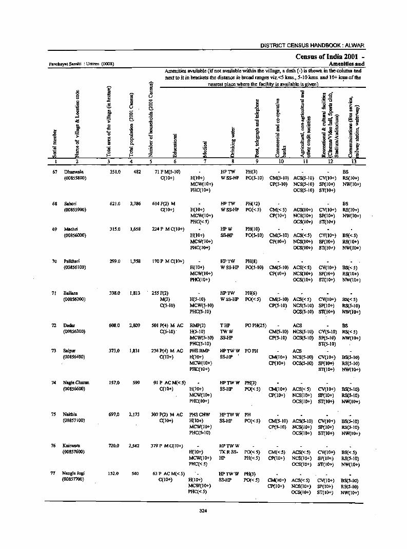
DISTRICT CENSUS HANDBOOK: ALWAR
Census of India 2001 _ Panchayat Samiti : Umren (0008) Amenities. and
Amenities available (if not available within the village, a dash (-) is shown in the column and next to it in brackets the distance in broad ranges viz.<5 Ians., 5-10 kms. and 10+ ~ of the
-;;;- nearest I!lace where the facili!i: is available is given l " i ~ 1 ·R -g~ "0 "i " g U
Jf " " g .c il :; l:! .. ] :.=13 e ~ i .~ ._ i!
if ''S u :; oM 0
" j ;; ., ]~~ -e f ." ~ => -0 a t:; ....:'§ !~ oil! ~ !:j.
1 ] u :;]1 ·c
! .£l g ] " .a I!! • :s
I .c ". i oIl!B~ ·i .§ jj .... .'S ,g t 01 1:2 .. 0
1 'S ] ]:6 Us ~
os .~ ·B ~ i .... ; a ] ~ i ::: e '§ co 0 C. .~ 8 ., " " 8 f 01 " ! ~
.D
~ .~! ~ Ii._
'1: ~ '§ g ., lif 81 ~.5 ] E_ o :z: ~ ~ ~ s~Hl III ~ U.e S S! ~(I) 1 2 3 4 5 6 7 8 9 10 II 12 13
67 Dhanwala 351.0 482 71 P M(S-IO) HPTW PH(3) BS (00855800) C(IO+) H(IO+) WSS-HP PO(S-IO) CM(S-IO) ACS(S-IO) CV(IO+) RS(IOi-)
MCW(IO+) CP(5-10) NCS(S-IO) Sp(lo+) NW(lo+) PHC(IO+) OCS(S-IO) ST(IO+)
68 Sahori 621.0 3,786 614 P(2) M HPTW PH(12) BS (00855900) C(lO+) H(lO+) WSS-HP PO(<:S) CM«S) ACS(IO+) CV(IO+) RS(IOi-)
MCW(IO+) CP(IO+) NCS(IOi-) SP(IO+) NW(IO+) PHC«5) OCS(IOf-} ST(IO+)
69 Maeilri 315.0 1,658 224 P M C(IO+) HPW PH(IO) (00356000) H(lO+) SS-HP P0(5-10) CM(5-10) ACS«S) CY(IO+) B8« 5)
MCW(10+) CP(1O+) NCS(IO+) SP(lO+) RS(10+) PHC(IO+) OCS{lor) ST(W+) NW(IO+)
70 Palkhari 299.0 1,358 170P MCCIO+) HPTW PH(8) (00856100) H(IO+) WSS-HP PO(5-10} CM(S-IO) ACS«S) CY(10+) BS« S)
MCW(IO+) Cp(IO+) NCS(Jor) SP(JO+) RS(JO+) PHC(IO+) OCS(lor) ST(lO+) NW(IO+)
71 Ballua 338.0 1,813 255 P(2) HPTW PH(6) (008S62oo) M(2) H(S-IO) WSS-HP PO«S) CM(5-10) ACS«S) CV(IO+) 8S«S)
C(S-IO) MCW(~-IO) CP(S-10) NCS(5-10) Sp(IOi-) RS(S-IO) PHCCS-IO) OCS(S-IO) ST(IO+) NW(IO+)
72 Dadar 608.0 2,809 SOl P(4) M AC RMP(2) TlIP POPH(25) ACS BS (00856300) CCS-IO) H(5-10) TWW CM(S·IO) NCS(S-JO) CY(S.IO) RS«5)
MCW(S-JO) SS-HP Cp(S-JO) OCS(5-1O) SP(5-JO) NW(IOi-) PHCCS-I0) ST(S-IO)
73 Salpur 373.0 1,831 274P(4) M AC PHSRMP HPTWW PO PH ACS (00856400) CCI 0+) H(IO+) SS-HP CM(JO+) NCS(S-IO) CV(IO+) 8S(5-10)
MCW{IO+) CP(JO+) OCS(S-JO) SP(lO+) RS(.s-IO) PHC(IO+) ST(IO+) NW(lO+)
74 Nagla Charan 157.0 599 91 P ACM«5) HPTWW PH(3) (008S6600) C(10+) H(lo+) SS-HP PO«S) CM(lO+) ACS«S) CY(JO+) 88(5-10)
MCW(IO+) CP(1O+) NCS(IO+) SP(lor) RS(5-IO) PHC(IO+) OCS(IO+) ST(IO+) NW(IO+)
75 Naithl. 697.0 2.173 307P(2) M AC PHSCHW HPTWW PH (00857100) CCIO+) H(IO+) SS-HP PO«5) CM(S·IO) ACS(S-IO) CY(IO+) 88(5-10)
MCW(IO+) CP(5-10) NCS(IO+) Sp(JO+) RS(5-10) PHC(S-IO) OC8(IO+) ST(lor) NW(lO+)
76 Kairwara 720.0 2,542 379 P MC(JO+) HPTWW (00857600) H(lO+) TKRSS- PO« 5) CM(<:S) ACS«5) CV(IO+) BS«S)
MCW(IO+) HP PH« S) CP(10+) NCS(IO+) SP(lor.) RS(S-IO) PHC«S) OCS(IO+) ST(IO+) NW(IOi-)
77 Nangla Jogi 152.0 540 63P ACM«5) HPTWW PH(3) (00857700) CCIO+) H(IO+) SS-HP PO«5) CM(IO+) ACS«5) CV(JO+) B8(5-IO)
MCW(IO+) cp(10+) NCS(JO+) SP(ID+) RS(S.IO) PHC« 5) OCS(IO+) ST(IO+) NW(IO+)
324
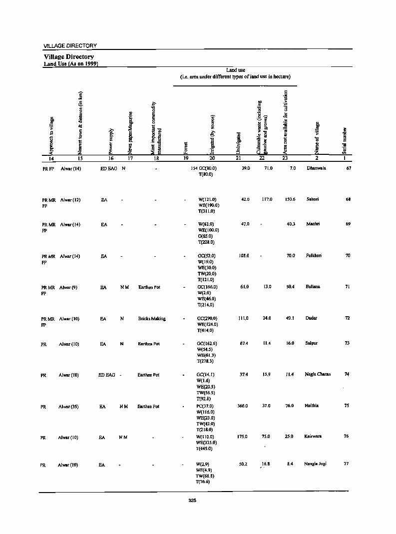
VILLAGE DIRECTORY
ViIlaee Directory Land Use (As on 1999)
i e, " u
j
l . !!! ."
cId .;;;
1 B .c !;! u ~ ~ ~ Z 14 15
PRFP Alwar(l4)
PRMR Alwar(l2) FP
PRMR Alwar(l4)
FP
PRMR Alwar(14)
FP
PRMR Alwar(9) FP
PRMR Alwar(IO)
FP
PR Alwar(IO)
PR Alwar(IO)
PR Alwar(35)
PR Alwar(IO)
PR Alwar(IO)
~ :;:; 0 ., ., i ~." ~ I <>. g_~ <>. ::s .. .5 Jj!
~ j ~ 5 p.. ::E e 16 17 18
EDEAG N
EA
EA
EA
EA NM Earthen PDI
EA N Bricks Making
EA N Earthen Pot
EDEAG . Earthen Pot
EA NM Earthen Pol
EA NM
EA
Land use (i.e. area under different types of land use in hectare)
0: .e 1;1
110 > C .~
:;:; "3 ::s u
I u .e c ~ .- .. ~" ..
51 B i ~ t ~." ~ a & ." ~
.;; ..r;;>
! ~ Iii § ... i ] a '5 0 0:
I ·E {i 0: ., iii .. !ij ·5 ·is "3 iI !:! ·c
IJ.. ttl u go < z u = CI>
19 20 21 22 23 2
154 GC(80.0) 39.0 71.0 7.0 Dhanwala 67 T(80.0)
W(121.0) 42.0 117.0 150.6 Sabori 68 WE(190.0) T(311.0)
W(63.0) 47.0 40.3 Machri 69 WE(100.0) 0(65.0) T(228.0)
GC(S2.0) 108.0 70.0 PalkhBri 70 W(19.0) WE(30.0) TW(20.0) T(121.0)
GC(166.0) 61.0 13.0 50.4 Ballana 71 W(2.0) WE(46.0) T(214.0)
GC(290.0) 111.0 34.0 49.1 Dadar 72 WE(124.0) T(414.0)
GC(162.6) 67.4 11.4 16.0 SBlpur 73
W(54.S) WE(61.3) T(278.3)
GC(14.1) 37.4 IS.\) 11.4 Nagla Charan 74
W(1.6) WE(20.S) TW(S6.S) T(92.8)
pc(31.0) 366.0 37.0 76.0 Naithla 75
W(116.0) WE(23.0) TW(42.0) T(218.0)
W(1I0.0) 175.0 75.0 25.0 Kairwara 76
WE(335.0) T(445.0)
W(2.9) 50.2 16.8 8.4 NanglBJDgi 77
WE(4.9) TW(68.8) T(76.6)
325
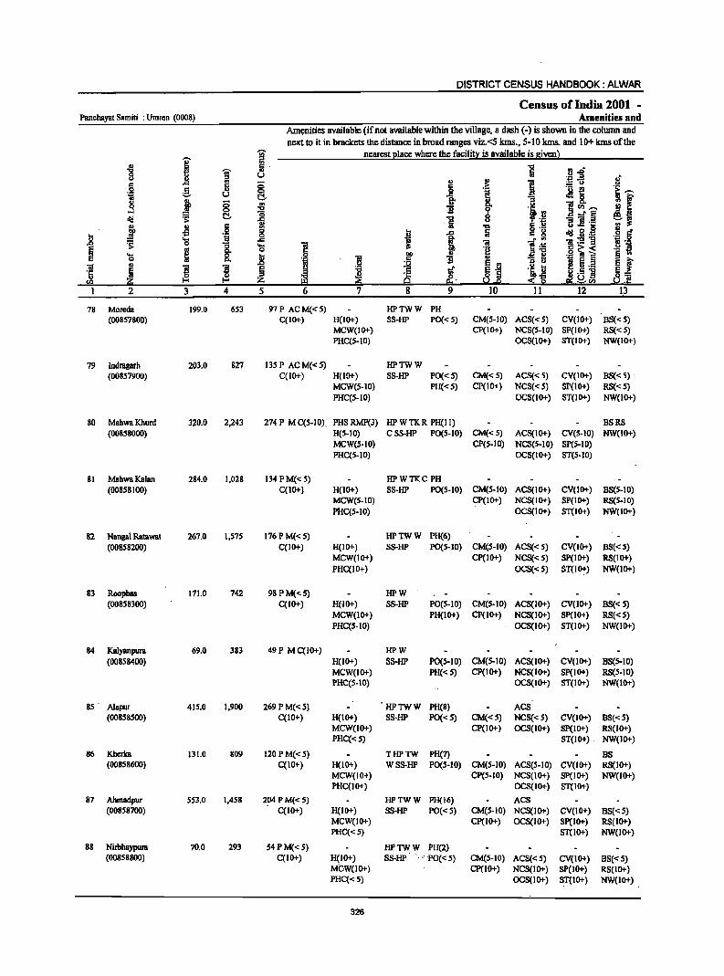
DISTRICT CENSUS HANDBOOK: ALWAR
Census ofIndia 2001 -Panchayot Samiti : Umren (0008) Amenities and
Am~ities available (if not available within the village, a dash (.) is shown in the column and next to it in brackets the distance in broad ranges viz.<5 kms., 5·10 kms. and 10+ kmsofthe
I ~ nearest Illace where the facilit:r: is available is givenl '" ~ -;;;- ~. tj.d'
8 l! ::I U 'J:I .3 c .. ;:; " '" ;.: Co) c 6 .:= 0 g II) 0
I .- ~
"i U I::!- 1- oM&. ~ j 8 ~ Jj ~
]<1>,-, ~
:;, I::!- ~ ] :; :aft .~ .. u
j -M . § <II ] ....c ...
..8 _g I ~ g.,g ... 'oj ]:5!-g :s: 0 8. .... 'iI
~ e 0 .§ o~< ~ &. t ] .- §
iii II)
! ]I .c iii ~ 5._
'5 ~ ~ ~ !:! ~ 11.5 ] rn Urn
I 2 3 4 5 6 7 12
78 Moreda 199.0 653 91P ACM«5) HPTWW PH (00857800) C(lO+) H(IO+) SS-HP PO«5) CM(S-IO) ACS«S) CV(IO+) BS« S)
MCW(IO+) Cp(IO+) NCS(S-IO) SP(IO+) RS« 5) PHC{S-IO) OCS(IO+) ST(IO+) NW(lO+)
79 lndragarh 203.0 827 135 P AC M« S) HPTWW (00857900) C{IO+) H(IO+) SS-HP PO«S) CM«5) ACS«S) CV(lO+) BS« S) .
MCW(S-IO) PH«S) CP(IO+) NCS«S) SP(IO+) RS«5) PHC{5-10) OCS(IO+) ST(IO+) NW(IO+)
80 MahwaKhurd 320.0 2,243 274 P M C(5-10). PHS RMP(3) HPWTKR PH(II) BSRS (00858000) H(S-IO) CSS-HP PO(5-IO) CM«5) ACS(IO+) CV(S-IO) NW(IO+)
MCW(S-IO) CP(S-IO) NCS(S-IO) SP(S-IO) PHC{5-10) OCS(IO+) ST(S·IO)
81 MahwaKalan 284.0 1,028 134PM«S) HPWTKC PH (00858100) C{10+) H(IO+) SS-HP PO(S-IO) CM(5-IO) ACS(IO+) CV(IO+) BS(S-IO)
MCW(S-IO) CP(IO+) NCS(IO+) SP(IO+) RS(S-IO) PHC{S·IO) OCS(!O+) ST(IO+) NW(IO+)
82 Nanga! Ratawat 267.0 1,S75 176 P M«5) HPTWW PH(6) (008S8200) C(IO+) H(IO+) SS-HP PO(S-IO) CM(5-10) ACS«S) CV(lO+) BS«5)
MCW(!O+) CP(IO+) NCS«S) SP(IO+) RS(IO+) PHC(IO+) OCS«5) ST{IO+) NW(IO+)
83 Roopbas 171.0 742 98PM{<5) HPW (008S83OO) C(IO+) H(IO+) SS-HP PO(S-IO) CM(S.IO) ACS(IO+) CV(IO+) BS{<S)
MCW{lo+) PH(lo+) CP(IO+) NCS(IO+) Sp(IO+) RS«S) PHC(S-IO) OCS{IO+) ST{IO+) NW(IO+)
84 Kalyanpura 69.0 383 49P MC(!O+) HPW (008S84OO) H(IO+) SS-HP PO(S-IO) CM(S-IO) ACS(IO+) CV(lO+) BS{S-IO)
MCW(IO+) PH«S) Cp(IO+) NCS(lO+) Sp(IO+) RS(S-IO) PHC(S-IO) OCS(IO+) ST(IO-t) NW(lO+)
85· AI.pur 415.0 1,900 269 P M«S) 'HPTWW PH(8) ACS (008S8500) C{lO+) H(lO+) SS-HP PO«S) CM«S) NCS{<5) CV(lO+) BS«S)
MCW(IO+) CP(IO+) OCS(IO+) SP(IO+) RS(lO+) PHC{<S) ST{IO+) NW(IO+)
86 Kherka 131.0 809 120 P M«5) THPTW PH(7) BS (00858600) C(IO+) H(10+) WSS-HP PO(S-IO) CM(5-10) ACS(5-10) CV(IO+) RS{IO+)
MCW(IO+) CP(5-10) NCS(IO+) Sp(IO+) NW(IO+) PHC(IO+) OCS(IO+) ST(IO+)
87 Ahmadpur S53.0 1,458 2~PM«5) HPTWW PH(16) ACS (00858700) C(10+) H(IO+) SS-HP PO«S) CM(S-IO) NCS(lO+) CV(lO+) BS{<5)
MCW(IO+) CP(IO+) OCS(IO+) Sp(lo+) RS(IO+) PHC«S) ST(IO+) NW(IO+)
88 Nirbhaypura 70.0 293 S4 P M« 5) HPTWW PH(2) (00858800) C{IO+) H(IO+) SS-HP' .. ~., ·PO« S) CM(S-IO) ACS«5) CV(IO+) B5«5)
MCW(lO+) cp(10+) NCS(lO+) SP(IO+) R5(10+) PHC{< 5) OCS(IO+) ST(IO+) NW(IO+)
326
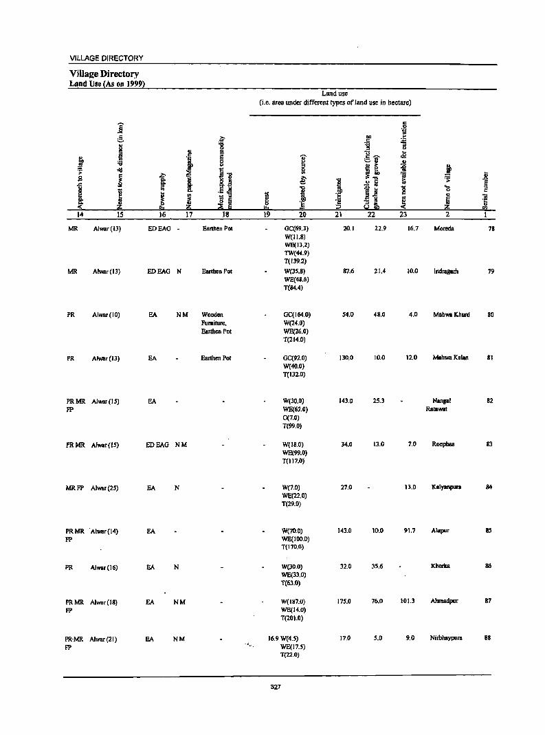
VILLAGE DIRECTORY
Vills2e Directory Land Use (As on 1999}
Land use
(i.e. area under different types of land use in hectare)
j c: .2 1;1
~ f I>ll :> c: ~ .. :a
<> :::> u
J '" e u .s i I ~ 'Z' c ......
~ ::.n ..
~ old I] I~ ~ j ~ i
co ra .8 .s B ~
t i! ..2 5 ~ Ii :::> i ....
) ., .! ~ I -e_! '0 0 c
~ ~ t;; ·S c ..
S 5 ~ i! g ~ ~ "iI
~ ~ :§ ·s ;;;J os '1::
:ii!:i ~ Iii !!:I 2 s.!!!il « .. C'Il
14 15 16 17 18 19 20 21 22 23 2 1
MR Alwar(ll) EDEAO - Earthen Pot GC(69.J) 20.1 22.9 16.7 Moreda 18 W(11.8) WE(IJ.2) TW(44.9) T(IJ9.2)
MR Alwar(IJ) EDEAG N Earthen Pot W(l5.8) 81.6 21.4 10.0 Indragarh 19 WE(48.6) T(84.4)
PR Alwar(IO) EA NM Wooden GC(164.0) 54.0 48.0 4.0 MahwaKhurd 80 Furniture, W(24.0) Earthen Pot WE(26.0)
T(214.0)
PR Alwar(l3) EA Earthen Pot OC(92.0) 130.0 10.0 12.0 MahwaKalan 81 W(40.0) T(132.D)
PRMR Alwar(IS) EA W(lO.O) 143.0 25.3 Nangal 82
FP WE(62.0) Ratawat 0(7.0) T(99.0)
PRMR Alwar(15) EDEAG NM W(I8.0) 34.0 13.0 7.0 Roopbas 83 WE(99.0) T(l17.0)
MRFP Alwar(2S) EA N W(7.0) 27.0 13.0 Kalyanpura 84 WE(22.0) T(29.0)
PRMR 'Alwar(14) EA W(70.0) 143.0 10.0 91.7 Alapur 85
FP WE(100.0) T(t70.0)
PR Alwar(16) EA N W(lO.O) 32.0 35.6 Kherka 86
WE(33.0) T(63.0)
PRMR Alwar(18) EA NM W(187.D) 17S.0 76.0 101.3 Ahmadpur 87
FP WE(14.0) T(201.0)
PR·MR Alwar(21) EA NM 16.9W(4.S) 17.0 5.0 9.0 Nirbhaypura 88
FP .,
WE(17.5) T(22.0)
327
DISTRICT CENSUS HANDBOOK: ALWAR
Census of India 2001 • Panchayal Samili : Umren (0008) Amenities and
Amenities available (ifnol available within the village, a dash (-) is shown in the column and next to it in brackets the distance in broad ranges viz. <5 kms.; 5-10 kms. and 10+ kms of the
I ~ nearest Elace where the facili!X is available is givenl
~ ~ 8 l I'l ..,,-II.) .::; ..2 .ff ..c § i
G>
~ :.= u
.~ 5 ;> e u ~ l ~~ !I l "3
.3 ;;
i u ~~~ 0
l~ C!.- 8 -- § diI .s;: 1 -a ]! .1:: e r j J.l c:: 5 o .~ .. 0
§ = 0
I 1 ., g diI 5 .1:1
l! 'S ·i • rn ~:g-g .,p 0
§ ~ .. &. 'l) ] 1 ~:a ~'I 'l) ~ 0 .8 0
B 00 .. G>
-3 ~ ·1 ~ i .§ c Co ·i c:: B E rn ILf 01 G> ] l e ! ~
~ I ~J ·i ~ .~ i ·5 ~ {:. Z .1:: $~ ~ .jg !G g e!j~!G
I 2 3 4 S 6 7 8 9 10 11 12 13
89 Dhannpura 726.0 966 141 P M«5) HPWC B8 (00858900) C(IO+) H(IO+) SS-HP PO«S) CM(S-IO) ACS«5) CV(IO+) RS(IO+)
MCW(S-IO) PH(IO+) CP(S.IO) NC8(10+) 8P(IO+) NW(lO+) PHC(S-IO) OC8(10+) 8T(10+)
90 Gopalpura 205.0 202 28 HPTWW (00859000) P(S-IO) H(lO+) TKR PO(S-IO) CM(S-IO) ACS(S-IO) CV(IO+) B8(S-10)
M(S-IO) MCW(IO+) 88-HP PH(IO+) CP«5) NCS(IO+) SP(IO+) R8(10+) C(IO+) PHC(IO+) OC8(10+) 8T(10+) NW(lO+)
91 Madhogarh 3,022.0 2,204 349 P M C(IO+) HPWTKR PO BS (00859100) H(IO+) SS-HP PH«S) . CM(S-IO) ACS(S-IO) CV(S-IO) RS(IO+)
MCW(1O+) CP(S-IO) NCS(lO+) 8P(10+) NW(IO+) PHC(S-IO) OCS(lO+) 8T(10+)
92 KalaCbhara 328.0 ISS 23 HPW (00859200) P«S) H(IO+) 8S-W PO(S-IO) CM(lO+) AC8«S) CV(IO+) B8«S)
M(S-IO) MCW(IO+) PH« S) CP(IO+) NCS«S) 8p(10+) RS(lO+) C(10+) PHC(tO+) OC8«S) 8T(10+) NW(lO+)
93 Indok 2,399.0 2,309 385 P M(S-IO) HPWTK PH(S) ACS BS (00859300) C(IO+) H(IO+) SS-HP PO«S) CM(IO+) NCS(S-IO) CV(IO+) RS(IO+)
MCW(lO+) CP(lO+) OCS(S-10) 8P(10+} NW(IO+} PHC(IO+) ST(IO+)
94 Rundh 672.0 I W88-W Kushalgarb P«5) H(IO+} PO« 5) CM(S-IO) ACS«S) CY(S-IO) BS«S) (00859400) M«S) MCW(lo+) PH«5) CP(lO+) NC8(10+) Sp(IO+) RS(1O+}
C(IO+) PHC(JO+) OCS(IO+) ST(IO+) NW(IO+)
9S Rundh Kraska 1,315.0 --Uninhabited ---(00859500)
96 Kraska 2,242.0 487 83PM(IO+) HPWTK (00859600) C(IO+) H(IO+) SS-HP PO(S~IO) CM(IO+) ACS(JO+) CV(IO+) BS(S-IO)
MCW(IO+) PH(S-IO) CP(lO+) NCS(IO+) SP(IO+) RS(IO+) PHC(IO+) OCS(IO+) ST(IO+) NW(IO+)
97 Rundh Baleta 3,602.0 --Uninhabited--(00859700)
98· Kushalgarh 1,182.0 621 9SPM«S) PHSH(IO+) HPW PH(J) ACS - BS (00859800) C(IO+) MCW(IO+) 8S-HP PO«S) CM(S-IO) NCS(IO+) CV(S-IO) RS(IO+)
PHC(lo+) CP(IO+} • OC8(10+) SP(10+) NW(IO+) ST(IO+)
99 Dabli 404.0 156 27 TKSS-TK (00859900) P(S-IO} H(lO+) PO(S-IO) CM(S-IO) ACS(S-IO) CV(lo+} BS(5-10)
M(S-IO) MCW(S-IO) PH(S-IO) CP(S-IO) NCS(IO+) SP(IO+) RS(IO+} C(IO+} PHC(lo+) OC8(l0+) ST(IO+} NW(IO+)
328
VILLAGE DIRECTORY
Villaee Directory Land Use {As on 1999}
j £, .?;-
j ~ u S c::
j '1 g ;;; u
r;: oI!I os
111 ~ ~ ~ sa
t .s !i !: c..,s
j .. .~ ~ ~ ~ ~ Ii g,
~ ::!: li 2 Ii 14 15 16 17 IB
PR Alwar(20) EDEAG -
PRMR Alwar(18) EDEAG -FP
PRMR Alwar(24) EA N Carpet Making FP
PRMR Alwar(29) EDEAG -FP
PRMR Alwar(33) EA N Mawa FP
FP Alwar(24)
-- Uninhabited ---
FP AIWBr(30) Ghee
-- Uninhabited ---
PRMR AlwBr(28) EA N Mawa FP
FP . Alwar (22) Mawa
t ..... ',f
Land use (i.e. area under different types ofland use in hectare)
.... !:! " 0 '" ~ ..,
t:: a !! & ] 19 20
431 GC(140.0) T(140.0)
129 W(30.0) WE(2J.0) T(53.0)
2242 WE(244.0) T(244.0)
222 WE(17.0) T(17.0)
770 W(I04.0) WE(28.0) T(ll2.0)
672
IllS
2241.71
3602
850 W{145.0) T(14S.0)
368 W(17.7) T(17.7)
329
I :s c:: i2 21
63.0
10.0
20.0
22.0
1.6
13.0
5 "i
gp :>-. ., :g '3
u
g~ ... .s ::::.11 .!! ,g .. ~
~! == .!! i i:i
1~ 0 c::
~ ~ i 22 23
25.0 61.0
1.0 12.0
372.0 143.7
55.6 33.0
334.0 1,141.0
167.0 18.0
S.O
j 11 ~ ~ 'S
u 'ii ~ '5 li '" 2
Dharmpura 89
Gopalpura 90
Madhogam 91
KalaChhara 92
Indok 93
Rundh 94 Kushalguh
RundhKmka 9S
Kraska 96
Rundh Baleta 97
Kushalgam 98
Dabli 99
DISTRICT CENSUS HANDBOOK: ALWAR
Census of India 2001 -Panchayat Samiti : Umrcn (0008) Amenities and
Amenities available (if not available within the village, a dash (-) is shown in the column and
neXt to it in brackets the distance in broad ranges viz.<5 kms., 5-10 kms. and 10+ kms of the
I j nearest e1ace where the facili!l;! is available is Siven}
1 ~ 5 1 VI.a u
~~ .~ " :g ., ~ e 6 .c
~ " !. .,
.8 .~ l3 i'""' .~ U .M 0 g fr ., 1i ~I f ;; -8 8- ]~'"" ...:I ~
0 '0 B 6 11 -'§ old C!-1 1 u g:!.~
lil ~ Jl .§ ..8 f 1 1 . § d!I 2·- ·1 a'
~ 'S ,.
,.:'5!"g ... ]. 'S 1 ,.
11 fi '::1
~ ~ 'e .§ ~ i .- III 'S 0 ]
I>Il
~ f Q. .~ 'iI .5 B .,
'iI u
l ]I ..
~ ~ e VI
.~~ i 5._
! § g or §~ ·c ·c .. i·5 ] §=e ~ ~ 0 .. :z; ~ 9 Ie! U.e ~ g e; gsa !;,l rn
2 3 4 5 6 7 8 9 10 II 12 13
100 Prithvipum 1,889.0 5,003 696 P(2) M(5-10) OA PHS CHW HP W POPH(35) ACS 8S (00860000) C(IO+) H(IO+) SS-HP CM(5-10) NCS(IO+) CV(IO+) RS(5-IO)
MCW(IO+) CP(IO+) OCS(IO+) SP(IO+) NW(10+) PHC(S.IO) ST(IO+)
101 Impipura 172.0 624 75 PM(IO+) CHWH(5-10) HPW
(00860100) C(10+) MCW(IO+) SS-HP PO«5) CM«5) ACS«5) CV(IO+) 8S(5.10)
PHC«S) PH«S) CP(IO+) NCS«5) SP(IO+) RS(S-IO) OCS«5) ST(IO+) NW(10+)
102 SiyaKaBas 308.0 456 69PM(5-10) HPTWW (00860200) C(IO+) H(IO+) SS-HP P0(5-10) CM(S-IO) ACS(S-IO) CV(IO+) 8S(5-10)
MCW(IO+) PH«S) CP(IO+) NCS(lo+) SP(IO+) RS(IO+) PHC(5-10) OCS(IO+) ST(IO+) NW{lO+)
103 Chand Pahari 161.0 516 67 P M(5-10) HPTWW PH (00860300) C(lO+) H(IO+) SS-HP PO(5-10) CM(5.10) ACS«5) CV(lo+) 8S(5.10)
MCW(IO+) CP(lo+) NCS(IO+) SP(IO+) RS(5-10) PHC(5.10) OCS(IO+) ST(IO+) NW(IO+)
104 ParsaKa 8as 169.0 932 108 P(2) M CHWH(IO+) HPTWW PH(6)
(00860400) C(lO+) MCW(lO+) SS·HP PO(5-10} CM{5·10) ACS« 5} CV{lO+} BS(S.lO} PHC(IO+) CP(IO+) NCS(IO+) SP(IO+) RS(IO+)
OCS{IO+) ST(IO+) NW(lO+)
lOS Kushalpum 97.0 264 36 HPTWW PH(3) (00860500) P«5) H(10+} SS-HP PO(5-10) CM(IO+) ACS(S-IO) CV(IO+) 8S(5-10)
M«S) MCW(IO+) CP(5-10) NCS(IO+) SP(IO+) . RS(5-10) C(lO+) PHC(IO+) OCS(1O+) ST(IO+) NW(IO+)
106 Sarangpum 169.0 541 67PM«S) HPTWW
(00860600) C(IO+} H(IO+) SS-HP PO(5-1O} CM(5-10} ACS«S) CV(IO+) 8S(5-10) MCW(1O+) PH« S) CP(IO+) NCS(1O+) SP(IO+) RS(S·lO) PHC(S-IO) OCS(IO+) ST(IO+) NW(IO+)
107 Nllvli@ 217.0 792 119 P(2) M« S) HPTWW PH Baldeopum C(lO+) H(IO+) SS-HP PO«5) CM«5) ACS(S-IO) CV(IO+) 8S(l0+) . (00860700) MCW(IO+) CP(IO+) NCS(IO+) SP(IO+) RS(IO+)
PHC(lo+) OCS(IO+) ST(IO+) NW(IO+)
108 Manpura 71.0 139 -16 HPTWW (00860800) P«S) H(10+) SS-HP PO(S-IO) CM(S-IO) ACS(5·10) CV(IO+) BS(5·10)
M«S) MCW(IO+) PH« 5) CP(IO+) NCS(IO+) Sp(IO+) RS(S-IO) C(lO+) PHC(5-10) OCS(IO+) ST{IO+) NW{IO+)
109 NasliSad 164.0 557 60 P M« S) HPW (00860900) C(IO+) H(10+) SS·HP po(5-IO) CM(S.IO) ACS(lo+) CV(IO+) BS(5-10)
MCW(IO+) PH(IO+) CP(JO+) NCS(IO+) SP(IO+) RS(5-10) PHC(IO+) OCS(lO+) ST(IO+) NW(IO+)
110 Jatoli S07.0 1,193 171 WTK (00861000)
, ". :. ~ I. P«S) H(lO+) SS·Tl( PO(5·10) CM(5-10) ACS(IO+) CV(IO+) 88(5"10) M«S) MCW(IO+) PH(IO+) CP(IO+) NCS(IO+) Sp(IO+) RS(IO+) C(IO+) PHC(S·IO) OCS(IO+) ST(IO+) NW(IO+)
330
VILLAGE DIRECTORY
VilIaee Directory Land Use (As on 1999)
I g 8
. i j ."
~ old
~ ~ S 0.
M 0.' :s
I '" 0
! I z 14 15 16
PRMR Alwar(30) EDEAG
PR Alwar(2S) EDEAG
MRFP Alwar(2S) EDEAG
PRMR Alwar(22) EDEAG FF
PRMR Alwar(23) EA FP
PRMR Alwar(23) EDEAG FP
PRMR Alwar(24) EA FF
MRFP Alwar(25) EDEAG
PRMR Alwar(25) EA FF
MR Alwar(2S) EA
MR • . Alwar (23) EA
.~ .., 0 .. E
t E 0 U
i] .!~ 11
~ l!i Ii z ::E e 17 18
N Earthen Pot
N Earthen Pol, Wooden Furniture
N
N
NM
-
N
-
N
N Wooden Furniture
N
Land use
(i.e. area under different types ofland use in hectare)
c
·i 2Jl ~
:g ~ u
8.-. .. Oi' oS I::? ;::.!'J .£ !I ~ :s ~ ~ 0
~! UI ~
.. e: i ru .;: .8
.£ 5 § .., e1 '0 .... i
0 c ~ :§
c
J ~ ~ B u ..
'E i? 8;' ~ ,., = ro 19 20 21 22 23 2 I
772 0(832.0) 137.0 31.0 117.0 Prithvipura 100 T(832.0)
W(l6.0) 124.0 12.0 Irnpipura 101 WE(20.0) T(36.0)
72 W{2.S) 50.0 55.0 90.9 SiyaKaBas 102 WE{37.S)
T(40.0)
21.38 W{2.S) 33.0 19.0 21.9 ChandPahari 103 WE{6U) T(66.0)
W(4.S) 44.0 24.0 10.1 Parsa KRBas 104 WE(86.5) T(9t.0)
W(1.0) 28.0 2.0 34.4 Kusbalpura lOS WE(32.0) T(33.0)
W(6.5) 49.0 25.0 57.2 Salllngpura 106 WE{31.5)
T(38.0)
W(O.5) 75.0 38.0 40.0 Navli@ 107
WE(63.S) BaldcopulII T(64.0)
W(4.S) 19.0 20.0 14.9 Manpura 108
WE(12.S) T(17.0)
W(26.0) 107.0 8.4 9.0 NagJi Sad 109
WE(to.O)
R(3.6) T(39.6)
W{47.0) 97.0 69.0 98.0 Jatoli 110
WE(196.0) T(243.0)
331
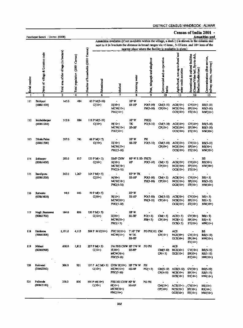
DISTRICT CENSUS HANDBOOK: ALWAR
Census ofIndia 2001 -Panchayat Samiti : Umren (0008) Amenities and
Amenities available (if not available within the village, a dash (.) is shown in the column and next to it in brackets the distance in broad ranges viz.<5 krns., 5·10 krns. and 10+ krns of the
I 'i nearest elace where the facili~ is available is Bivenl
-8
I Ii "5 ·81 0 u oJ t> U
U " I 6 .c ;; :.= Co) .~ e. c ,l!: ._ -e co 0 e ~1 .~ u !::!- .c oM 0
t> .t ;; .. i " ]~'"" oS 0
~ g.
11 !::!- b =" § ~~ <Id .;: i u "5 .! 'C;
fp ~ c rg 1 u .s Jl § 0
I i c g <Id.8'Ei t ~ '2l 'j _g
Ii 'fl 'J:! 1 1 .... ~
'ii 1'- :s .. 0 '2 '~ij '§ i .... ~ .8 2P .,
0 ''8 'ii 11 " u ~ ~ e e ~ ] ~ s ~ § l ~j ~j B.s] ~ ~ ~. 'C 8::
<I) ~ I-< ~ 9 . sa ~·ra u .. c I 2 3 '4 5 6 7 8 9 10 11 12 .. 13
111 Bichpuri 14S.0 484 6S PM(S·IO) HPW (00861100) C(lO+) H(IO+) SS-HP PO(S-IO) CM(S-IO) ACS(IO+) CV(IO+) BS(S-IO)
MCW(IO+) PH(S.IO) Cp(IO+) NCS(IO+) SP(IO+) RS(S-IO) PHC(IO+) OCS(IO+) ST(lO+) NW(IO+)
112 Mohabbatpur 312,0 884 116 P M(5·IO) HPW PH(2) (00861200) C(IO+) H(IO+) TK PO(S.IO) CM(5.10) ACS(IO+) CV(IO+) BS(S.IO)
MCW(IO+) SS·IIP CP(lo+) NCS(IO+) SP(IO+) RS(S-IO) PHC(10+) OCS(IO+) ST(IO+) NW(lO+)
113 DholaPalas 267.0 541 66 PM« 5) HPW PH (00861300) C(lO+) H(IO+) SS·HP PO(S·IO) CM(S·IO) ACS(lO+) CV(IO+) BS(5·10)
MCW(IO+) CP(IO+) NCS(IO+) SP(IO+) RS(10+) PHC(S-IO) OCS(IO+) ST(lO+) NW(lO+)
114 Sohanpur 293.0 817 123 P M«5) RMPCHW HP W R 8S· PH(7) BS (00861400) C(IO+) H(10+) HP PO(S-JO) CM«S) ACS(IO+) CV(IO+) RS(IO+)
MCW(IO+) CP(IO+) NCS(IO+) SP(IO+) NW(IO+) PHC(S-IO) OCS(IO+) ST(IO+)
115 Bandipura 242.0 1,267 164 PM«5) HPWTK (oo86IS00) C(10+) H(IO+) SS-HP PO(S-IO) CM«S) ACS(IO+) CV(IO+) BS«S)
MCW(IO+) PH(S.IO) CP(IO+) NCS(IO+) SP(IO+) RS(S.IO) PHC(S-IO) OCS(IO+) ST(IO+) NW(IO+)
116 Ratwaka 94,0 443 70PM«S) ,HPW (00861600) C(IO+) H(IO+) SS-HP PO(S-IO) CM(S-IO) ACS(IO+) CV(IO+) B8«S)
MCW(IO+) PH(S-IO) CP(IO+) NCS(IO+) SP(IO+) RS«S) PHC(S-IO) OCS(IO+) ST(IO+) NW(IO+)
117 Nagli Jhamawat 164.0 806 120 PM«5) HPW (00861700) C(IO+) H(lO+) SS-HP PO«S) CM«5) AC8«5) CV(1O+) BS« 5)
MCW(JO+) PH«S} CP(IO+} NCS«S} SP{IO+) RS«5) PHC«S) OCS«S) ST(1O+) NW(lO+)
118 Haldeena 1,191.0 4,113 SSBP MC(IO+) PHCH(lO+) THPTW POPH(IO) CM ACS as (00861800) MCW(IO+) WTK CP(JO+) NCS(JO+) CV(IO+) RS{S.IO)
S8-HP OCS(IO+) Sp(IO+) NW(IO+) ST{IO+)
119 Nithari 638.0 1,812 257PM{<S) DA PHS CHW HP TW W PO PH ACS (00861900) C(IO+) H(IO+) SS·HP CM(S-lO) NCS(IO+) CV(IO+) BS(5.10)
MCW(IO+) CP« S) OC8(1O+) SP(IO+) RS(5-10) PHC(S-IO) ST(IO+) NW(IO+)
120 Kairwari 306.0 921 137P ACM«S) CHWH(IO+) HPTWW PH (00862000) C(IO+) MCW(IO+) S8-HP PO« 5) CM(S-IO) ACS(S-IO) CV(IO+) B8(S-10)
PHC(S-IO) CP(S-IO) NCS(IO+) Sp(IO+) RS(S-IO) OCS(IO+) 81(10+) NW(IO+)
121 Pathroda 338,0 836 106 P M(IO+) PHS NH CHW HP W PO PH (00862100). C(IO+) H(1O+) SS·lIP CM(IO+) ACS(IO+)- .. , CY(IO+) BS(IO+)
MCW(IO+) CP(IO+) NCS(lO+) Sp(IO+) RS(IO+) PHC(IO+) OC8(10+) ST(IO+) NW(IO+)
332
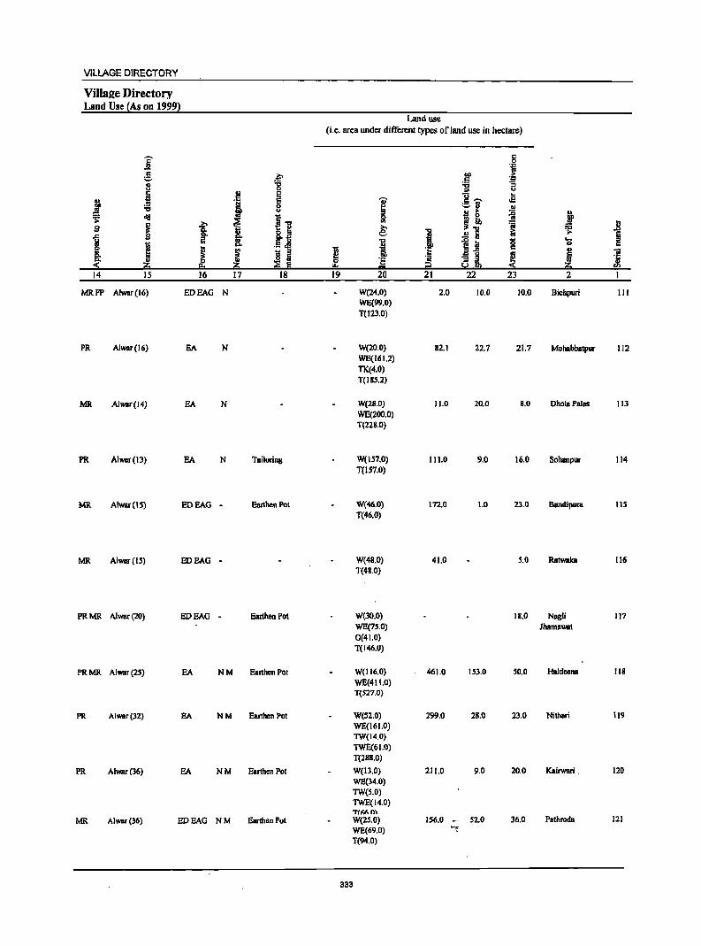
VILLAGE DIRECTORY
Villae;e Directory Land Use (As on 19991
j g .~ 8 "8 H 'i E
i .!!! 8 ." u
~ old
i I] ~ 9 ~ Q.
i go
I ., ... .5 J! Q.
I J I ! I 14 15 16 17 18
MRFP Alwar(16) EDEAG N
PR Alwar(16) EA N
MR Alwar(14) EA N
PR Alwar(13) EA N TailDring
MR Alwar(1S) EDEAG - Earthen Pot
MR Alwar(15) EDEAG -
PRMR Alwar{20) EDEAG - EarthcnPot
PRMR Alwar(25) EA NM Earthen POI
PR Alwar(32) EA NM Earthen Pol
PR Alwar(36) EA NM Earthen Pot
MR Alwar(36) EDEAG NM Earthen Pot
Land use (i.e. area under different types of land usc in hectare)
-;;
~ "" 19
I '" e: ."
I 'e ... 20
W(24.0) WE(99.0) T(123.0)
W(20.0) WE(161.2) TK(4.0) T(I8S.2)
W(28.0) WE(200.0) T(228.0)
W(157.0) T(1S7.0)
W(46.0) T(46.0)
W(48.0) T(48.0)
W(30.0) WE(75.0) 0(41.0) T(146.0)
W(116.0) WE(411.0) T(S27.0)
W(S2.0) WE(161.0) TW(14.0) TWE(61.0) T(28S.0)
W(Il.0) WE(34.0) TW(S.O) TWE(14.0) T(Mm W(2S.0) WE(69.0) T(94.0)
333
J 21
2.0
82.1
11.0
II ],0
172.0
41.0
461.0
299.0
211.0
156.0
c 0
bD 'j
C '.co '6 :; :s u g ..... .s ;:,3 .. J!j >- {i ~ ~ ~ .!!1 1:;
1~ 0 c
~L I 22 23
10.0 10.0
22.7 21.7
20.0 8.0
9.0 16.0
1.0 23.0
5.0
18.0
153.0 50.0
28.0 23.0
9.0 20.0
.. 52.0 36.0 ~~
.. l'
i ~ '8 .. iii 5 £ ~ 2
Bichpuri III
MDhBbbatpllr 112
DholBPaias 113
Sohanpur 114
Bandipura 115
Ratwaka 116
Nagli 117 Jhamawat
Haldecna 118
Nithari 119
Kairwari . 120
Pathrocla 121
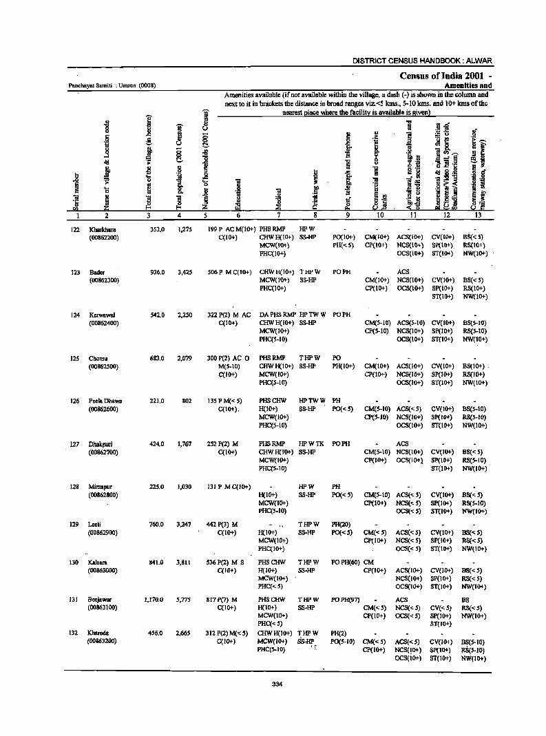
DISTRICT CENSUS HANDBOOK: ALWAR
Census of India 2001 -Panchayat Samiti ; Umren (0008) Amenities and
Amenities available (if not available within the village, a dash (-) is shown in the coIwnn and next to it in bnickctsthe distance in broad ranges viz.<5 kms., 5-10 kIns. and 10+ kms of the
I g nearest place where the facility is available is given) ..
II) 8 .... i'l"; .... g Iii " ::g~ If ..,
~ ~ II)
] § g 8 .il: ._ -E!
'!f " ~ 'i u ~ .c Jl " .., ! ~
.. fr g- il ]~'"" .3 .... II '~.~ '0 0 ..:§ e.J o'iI .;; -5 i .., ."3] 'r: j ~ 6 1 1 6.2 .., .s ! . .. "i I ..c: c. ~ o'iI i3 ._ .2 6
.8 ... ~ ] 'ii:s!'B i!"" .;; 0
I .... ] ]~ § '" " .§ ~ i '§ ~ 'S ~ I:l 0 'ii .~ 'i c .~ 1: 'ii " 'S ~ J:I
~ '! ~j Ilj tf '1:: 5 ~ '" '1:: ti .. ~ ii:l 6 ~ :!:~ e! ~ra Q :~ sa :so a 1 2 3 4 5 6 7 8 9 10 11 12 13
122 Kharkhara 353.0 1,275 199P ACM(10+) PHSRMP HPW (OO862200) C{IO+) CHWH(IO+) SS-HP PO(IO+) CM(IO+) ACS(IO+) CV(IO+) B5«5)
MCW(1O+) PH{< 5) CP(IO+) NCS(IO+) SP(IO+) RS(IO+) PHC{IO+) OCS(IO+) ST(IO+) NW{IO+)
123 Bader 936.0 3,425 506 P M C(IO+) CHWH(IO+) THPW PO PH ACS (00862300) MCW(IO+) SS·HP CM(1O+) NCS(IO+) CV(lO+) BS« 5)
PHC(IO+) CP(IO+) OCS(lO+) Sp(IO+) RS{IO+) ST(lO+) NW(IO+)
124 Kerwawal 542.0 2,250 322P(2) M AC DA PHS RMP HP TW W PO PH (00862400) C{10+) CHW H(IO+) SS-HP CM(5-10) ACS(S-IO) CV(IO+) B5(5-10)
MCW(IO+) CP(5-10) NCS(IO+) SP(IO+) RS(5-10) PHC(S-IO) OCS(1O+) ST(lO+) NW(10+)
12S Chomu 683.0 2,079 300P(2) AC 0 PHSRMP THPW PO (00862500) M(S-to) CHWH(IO+) SS-HP PH(IO+) CM(IO+) ACS(IO+) CV(IO+) B5(IO+) .
C(lO+) MCW(IO",,) CP(IO+) NCS(lo+) SP(IO+) RS(IO+) PHC{S-IO) OcS(IO+) ST(IO+) NW(IO+)
126 PcclaDhawa 221.0 802 135PM«S) PHSCHW HPTWW PH (00862600) C{IO+). H(lO+) SS-HP PO«S) CM(S-IO) ACS«5) CV(1O+) BS(5-10)
MCW(IO+) CP(S-IO) NCS(IO+) SP(lO+) R5(5-10) PHC(S-IO) OCS(IO+) ST(IO+) NW(IO+)
127 Dbakpuri 424.0 1,767 2S2P(2) M PHSRMP HPWTK PO PH ACS (00862700) C(IO+) CHWH(IO+) SS-HP CM(S-IO) NCS(IO+) CV(IO+) BS« S)
MCW(IO+) Cp(JO+) OCS(IO+), Sp(IO+) RS(S-IO) PHC{S-IO) ST{1O+) NW(IO+)
128 Mil2aplJr 225.0 1,030 131 P MqIO+) HPW PH (00862800) H(10+) SS-HP PO«S) CM(5-10) ACS« 5) CV(IO+) BS« 5)
MCW(IO+) CP(IO+) NCS«S) SP(lO+) RS(S-IO) PHC(S-to) OC5«S) ST(IO+) NW(IO+)
129 Leeli 760.0 3,247 442 P(3) M THPW PH(20) (00862900) C(IO+) H(IO+) SS-HP PO«S) CM«S) ACS«S) CV(IO+) BS« S)
MCW(IO+) CP(IO+) NCS« 5) SP(IO+) RS« 5) PHC(IO+) OCS«S) ST(IO+) NW(10+)
130 Kalsam 841.0 3,811 536P(2) M S PHSCHW THPW POPH(60) CM (00863000) C(IO+) H(IO+) SS-HP CP(IO+) ACS(IO+) CV(IO+) BS{< 5)
MCW(IO+) NCS(lO+) SP(lO+) RS«5) PHq<S) OCS(IO+) ST(IO+) NW(IO+)
131 Beejawar 1,170.0 5,775 817 P(7) M PHSCHW THPW POPH(97) ACS BS (00863100) C(IO+) H(10+) SS-HP CM«S) NCS« 5) CV«5) RS«S)
MCW(10+) CP(IO+) OCS«S) SP(IO+) NW(IO+) PHC« 5) ST(IO+)
132 Khareda 456.0 2,66S 312 P(2) M« 5) CHWH(IO+) THPW PH(2) (00863200) C(IO+) MCW(IO+) SS'HP PO(S-IO) CM«S) ACS«S) CV(IO+) B~(S.IO)
PHC(S-IO) '.r Cp(IO+) NCS(!O+) SP(IO+) RS(S-IO) OCS(lO+) ST(lO+) NW(lO+)
334
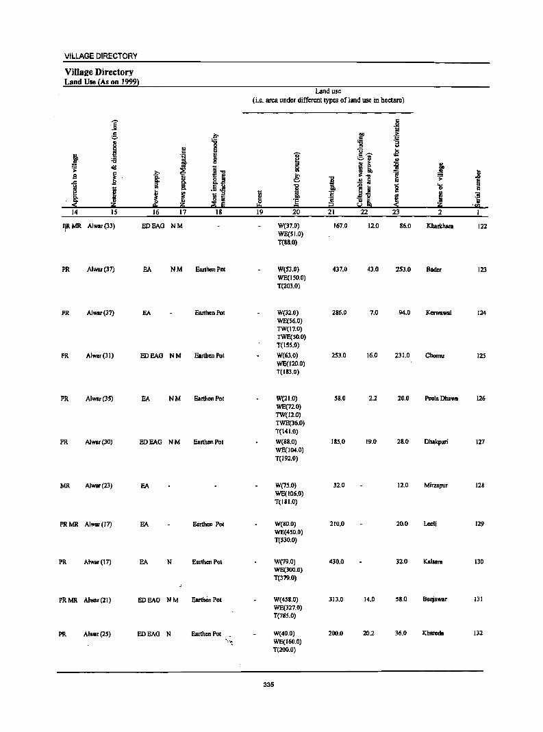
VILLAGE DIRECTORY
VilIa2e Directory Land Use !As on 1999}
Land use (i.e. area under different types of land use in hectare)
]' c .~
e .F lID > C .:::
I -0 '6 a
II> 0 :s
'1 E u ..
~ E 'U c ,..... .s :if
._ VI
8 ~ ~., .,
= dII i-o j! ~ i .;;::
j i ~ i! :a .8 .s e: :=
1 I ,tj I .!! ; ~ >-~ '8 ....
I .,
I ~ Ii 0 c
~ ~ ;; '5
~ j 01
~ ~ ! I!! ~ =1 'ij 0 '5 e. ~ !:!:o CI !i.! . !ill
14 15 16 17 18 19 20 21 22 23 2
IJRMR Alwar(33) EDEAG NM W(17.0) 167.0 12.0 86.0 Kharkhara 122 WE(S1.0) T(S8.0)
PR Alwar(37) BA NM. Eanhon Pot W(SJ.O) 437.0 41.0 2S3.0 Bader 123 WE(ISO.O) T(203.0)
PR Alwar(37) EA EanhenPot W(32.0) 286.0 7.0 94.0 KerwawaJ 124 WE(S6.0) TW(17.0) TWE(50.0) T(lSS.O)
PR Alwar(JI) EDEAG NM EanhenPot W(61.0) 251.0 16,0 231.0 Chomu 125 WE(120.0) T(18J.0)
PR Alwar(35) EA NM Earthen Pol W(21.0) 5S.0 2.2 20.0 PeelaDhawa 126 WE(n.O) TW(l2.0) TWE(36.0) T(141.0)
PR AJwar(30) EDEAG NM EanhenPot W(88.0) 185.0 19.0 28.0 Dhakpuri 127 WE(J04.0) T(192.0)
MR Alwar(23) EA W(7S.0) 32,0 12.0 Mirzapur 128 WE(106.0) T(IBI.O)
PRMR Alwar(l7) EA Earthen Pot W(BO.O) 210.0 20,0 Leeli 129 WE(4S0.0) T(SJO.O)
PR Alwar(17) EA N Earthen Pot W(79.0) 430.0 32.0 KaIBata 130 WE(300.0) T(379.0)
PRMR Alwar(21) EDEAG NM Earthen Pot W(4S8.0) 313.0 14.0 58.0 Beejawar 131 WE(327.0) T(785.0)
PR Alwar{2S) EDEAG N Earthen Pot . W(40.0) 200.0 20.2 36.0 Khareda 132 'I~ WE(160.0)
T(200.0)
335
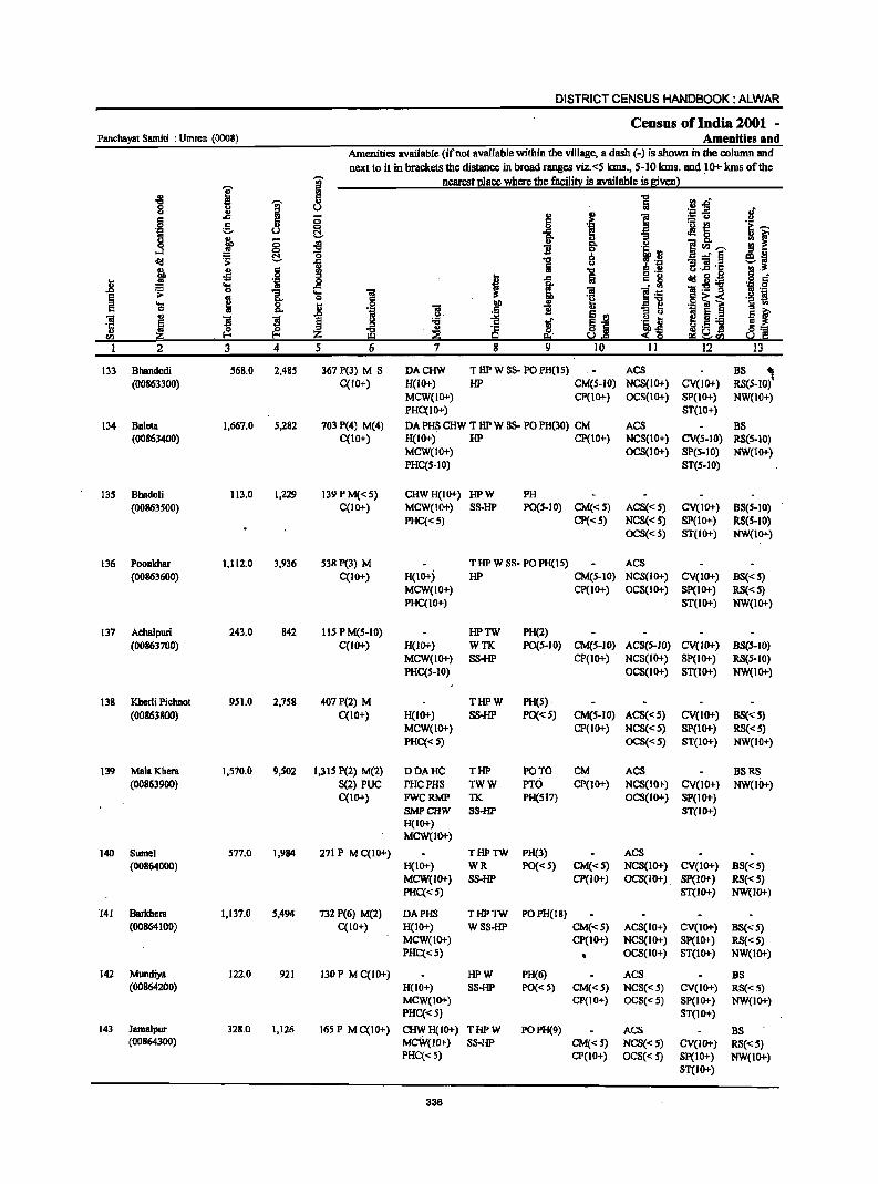
DISTRICT CENSUS HANDBOOK: ALWAR
Ceosus of India 2001 -Panchayat Samiti : Umren (0008) Amenities and
Amenities available (if not available within the village, a dash (-) is shown in the column and next to it in brackets the distance in broad ranges viz.<5 kms., 5-10 kms. and ~O+ kms of the
I j nearest Elace where the facili!l! is available is !liven}
'" a ~ rJ s:>' "CI i 8 " ';::1 .E! .f '" I II)
i .: ..c .: ;; 'j := u
'! I .S! g " ~ '0 e
ri u a8, 0 j ;; .. i ~
u i!<Il"" ...l 0 "CI
l~ <td ~ ~ '0 '5
Q a--§ ei 1 u ]]1'1: j II) .§ "CI a .S! !
Ji oS I ..c Iii c: ~ ctd ~ .~ 'i .~ "" 1ii ~ 1~-g ~ 0 :; ._
~ ~ 'iI 1-;: ~ ~
0 .~ ~~ ._ !
'8 8: ~ 0 till II) :;] If .~ 'iI c:: 11 'a! E § ., s:> .2' ~ ~i 'iI 'E l ~ t- .5=! l3 2:! ., ._ 'Ii ~ ~ ~ ~ ~ ~~ ~ ~~ ~] <Il 5.!ce
2 3 4 5 6 7 8 9 10 II 12 13
133 BhBndodi 568.0 2,485 367 P(3) M S DACHW T lIP W 8S- PO PH(IS) ACS BS , (00863300) C(lO+) H(to+) HP CM(S-IO) NCS(IO+) CV(lO+) RS(S-IO)
MCW(IO+) CP(IO+) OCS(IO+) SP(IO+) NW(IO+) PHC(IO+) ST(10+)
134 Baleta 1,667.0 S,282 703 P(4) M(4) DA PHS CHW T lIP W 8S- PO PH(30) CM ACS BS (00863400) C(IO+) H(IO+) HP CP(IO+) NCS(IO+) CV(S-IO) RS(S-IO)
MCW(IO+) OCS(IO+) SI>(5-10) NW(IO+) PHC(S-IO) ST(S-IO)
13S Bhadoli 113.0 1,229 139 P M« S) CHWH(IO+) HPW PH (00863500) C(IO+) MCW(IO+) SS-HP PO(S-IO) CM«5) ACS«S) CV(IO+) BS(S-IO)
PHC«S) CP«S) NCS«S) SP(lO+) RS(S-IO) OCS«S) ST(IO+) NW(IO+)
136 Poonkhar 1,112.0 3,936 S38P(3) M TlIPW 88- POPH(IS) ACS (00863600) C(1o+) H(1o+j lIP CM(S-IO) NCS(IO+) CV(10+) BS« 5)
MCW(IO+) CP(IO+) OCS(IO+) SP(IO+) RS«S) PHC(IO+) ST(IO+) NW(IO+)
137 Achalpuri 243.0 842 liS P M(S-IO) HPTW PH(2) (00863700) C(IO+) H(IO+) WTIC PO(S-IO) CM(S-IO) ACS(S-IO) CV(IO+) BS(S-IO)
MCW(1O+) SS-HP CP(IO+) NCS(IO+) Sp(IO+) RS(S-IO) PHC(S-IO) OCS(IO+) ST(IO+) NW(IO+)
138 Kherli Pichnot 951.0 2,758 407P(2) M THPW PH(S) (00863800) C(IO+) H(IO+) SS-HP PO«S) CM(S-IO) ACS«S) CV(IO+) BS«5)
MCW(IO+) CP(1O+) NCS«5) SP(IO+) RS«S) PHC« S) OCS«5) ST(IO+) NW(IO+)
139 MalaKhera 1,570.0 9,502 1,315 P(2) M(2) DDAHC THP PO TO CM ACS BSRS (00863900) S(2) PUC PHCPHS TWW PTO CP(1O+) NCS(lo+) CV(lO+) NW(U)+)
C(IO+) FWCRMP TK PH(SI7) OCS(IO+) SP(IO+) SMPCHW S8-HP ST(IO"') H(IO+) MCW(IO+)
140 Sumel 577.0 1,984 271 P M C(10+) THPTW PH(3) ACS (00864000) H(IO+) WR PO«S) CM«S) NCS(1o+) CV(IO+) BS«5)
MCW(IO+) SS-HP CP(IO+) OCS(IO+). Sp(IO+) RS«5) PHC«S) ST(IO+) NW(IO+)
141 Barkhera 1,137.0 5,494 732 P(6) M(2) DAPHS THPTW POPH(18) (00864100) C{lO+) H(IO+) W SS-HP CM«S) ACS(IO+) CV(IO+) BS«S)
MCW(IO+) CP(IO+) NCS(IO+) SP(IO+) RS«S) PHC«S) OCS(IO+) ST(IO+) NW(lO+)
142 Mundiya 122.0 921 130 P M C(IO"') HPW PH(6) ACS BS (00864200) H(IO+) S8-HP PO«S) CM« S) NCS«S) CV(10+) RS«S)
MCW(IO+) CP(IO+) OCS« S) 8P(10+) NW(IO+) PHC«S) ST(IO+)
143 Jamalpur 328.0 1,126 165 P M C(IO+) CHWH(IO+) THPW POPH(9) ACS BS (00864300) MCW(1O+) S8-HP CM«S) NCS«S) CV(IO+) RS«5)
PHC« S) CP(IO+) OCS« S) SP(IO+) NW(1O+) ST(IO+)
336
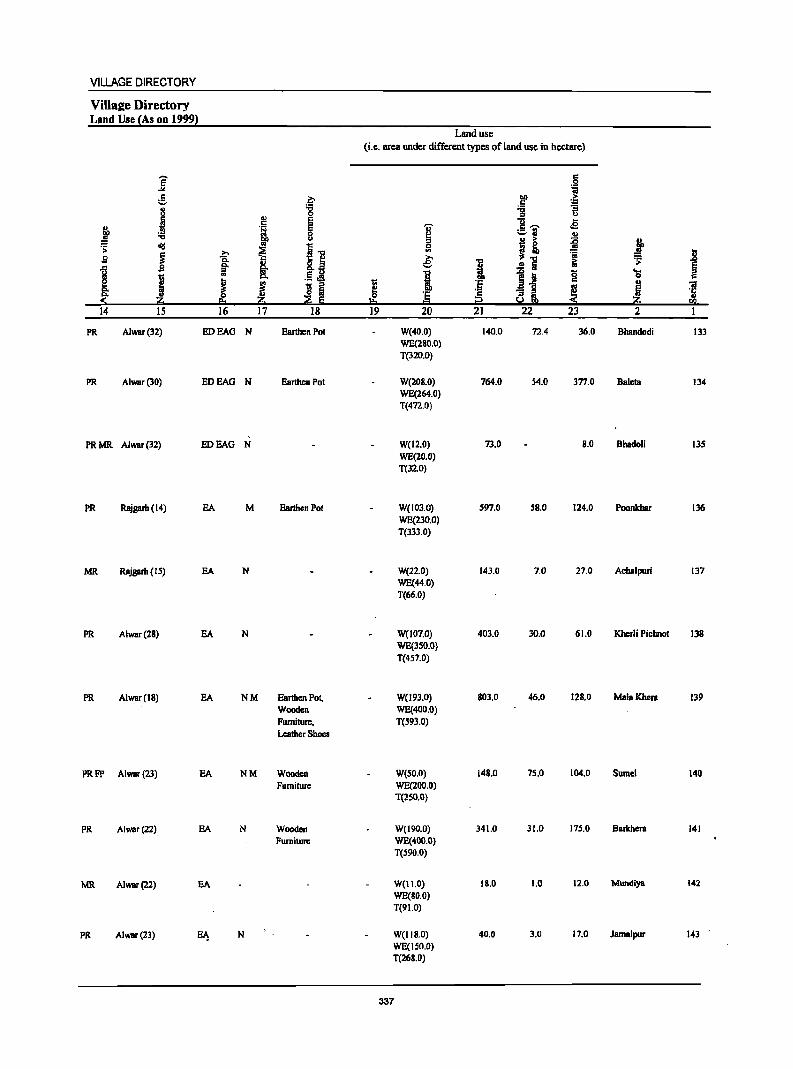
VILLAGE DIRECTORY
ViIlae:e Directory Land Use {As on 1999}
Land use (i.e. area under different types of land use in hectare)
e c .$1 ... 1;j
.5 ~ 00 > ._, c ',c .. '"6 ~ :; u
'" 0 ..,
~ .! E u .e " .!! E ~ c ......
~ .., 0 ~ ::-(1 .,
u 1 i ~ .i' ~
I"" 0 .s:
I ..... ~ '" ~ f fa Q. ... e i ..!5 EO 'J;
i §- !i- .E j .. I 1~ g ... I
c:>. 0 c
1 ~ - ::s l :§ ~ u
] Co l3 :a ! Co Z 'e c "3 i :( z 6 E !=t t? u S !iQ
14 IS 16 17 18 ]9 20 2] 22 23 2 I
PR Alwar(32) EDEAG N Earthen Pot W(40.0) 140.0 72.4 36.0 Bhandodi 133 WE(280.0) T(320.0)
PR Alwar(30) EDEAG N Earthen Pot W(20S.0) 764.0 54.0 377.0 Baleta 134 WE(264.0) T(472.0)
PR MR Alwar (32) EDEAG N W(12.0) 73.0 S.O Dhadoli 135 WE(20.0) T(32.0)
PR Rajgarh (14) EA M Earthen Pot W(103.0) 597.0 58.0 124.0 Poonkhar 136 WE(230.0) T(333.0)
MR Rajgarh (15) EA N W(22.0) 143.0 7.0 27.0 Achalpuri 137 WE(44.0) T(66.0)
PR AIWBr(2S) EA N W(l07.0) 403.0 30.0 61.0 Khcrli Pichnot 138 WE(3S0.0} T(457.0)
PR Alwar(18) EA NM Earthen Pot, W(193.0} 803.0 46.0 12S.0 MalaKhera 139 Wooden WE(400.0) Furniture. T(S93.0) Leather Shoes
PRFP Alwar(23) EA NM Wooden W(SO.O) 148.0 75.0 104.0 Sumel 140 Furniture WE(200.0)
T(2S0.0)
PR AIWBr(22) EA N Wooden W(I90.0) 341.0 31.0 175.0 Barkhera 141 Furniture WE(400.0)
T(590.0)
MR Alwar(22) EA W(I1.0) 18.0 1.0 12.0 Mundiya 142 WE(SO,O) T(91.0)
PR Alwar(23) E~ N W(IIS.0) 40.0 3.0 17.0 Jamalpur 143 WE(ISO.O) T(268.D)
337
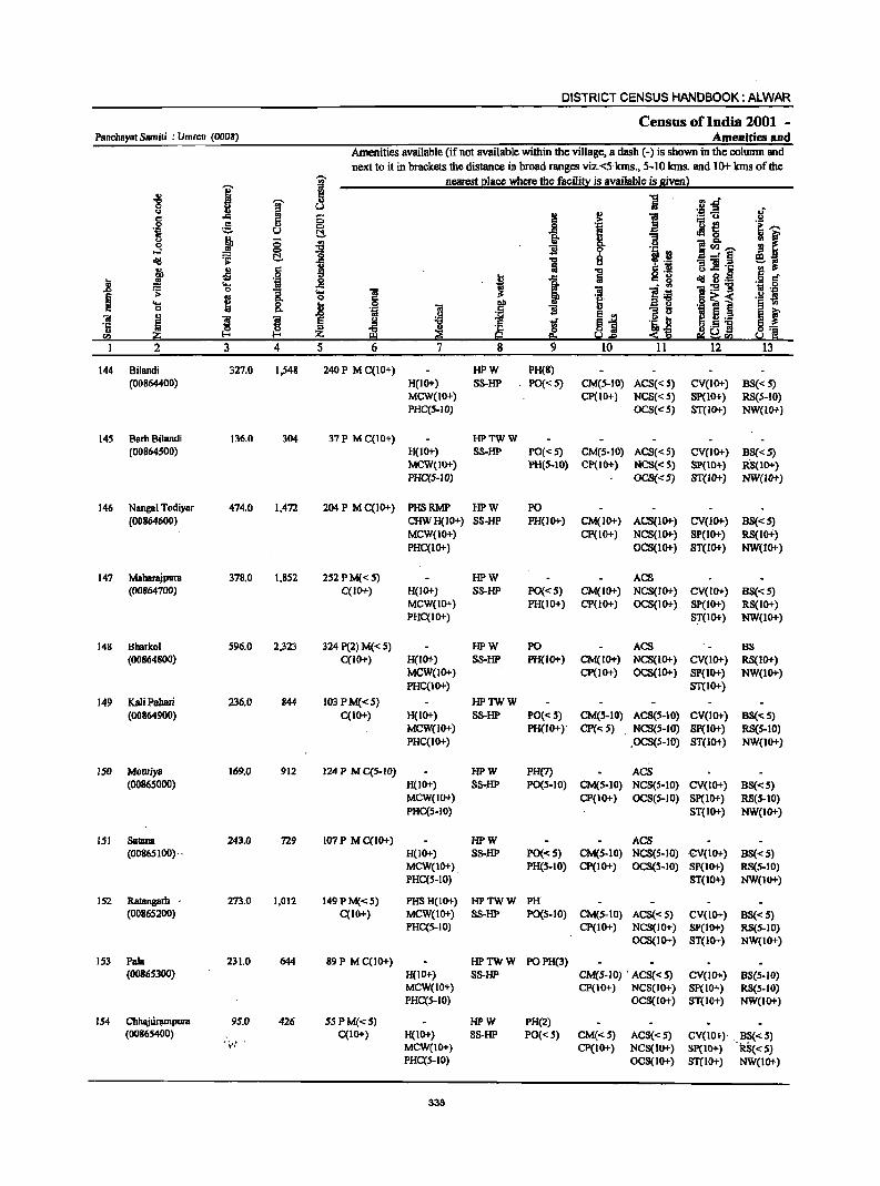
DISTRICT CENSUS HANDBOOK: ALWAR
Census of India 2001 -Panchayat Samiti : Umrcn (0008) Amenities and
Amenities available (if not available within the village, a dash (-) is shown in the column and
next to it in brackets the distance in broad ranges viz:<:5 kms., 5-10 kms. and 10+ Ions of the
i I nearest elace where the faeilin: is available is Siven}
.g J i "'.D H u .~ ..a of " ..
·1 ] I:i ,s:; 0 g =~ .2 0 c 10
!I ·ia '-=- ~ ]- Jt 0
" !} 0 '" ] 1~---..s 10 ""C ]I g.
.~.~ dd ~ ~ I .... 8 - =: § ~~ j Jl c Iii "5
a ._ G.! § 0
i 1 c. g .g § .8 ·w ..8 tI!I S! .-.... i:9"g ~ 0
i .... 1 ;a i1 ~ .-I'!
§ ~ 0 .g .j~ i .- s .... .8 f
.. § '" c: c Cl. .~ ;;; ]I
~ j ~i 5 ._ g f ;;;
~ ~ e J iJ .S] ·5 ::s i!l ~ ~ ~] ra ii!O z ~r:e e:;~ra
I 2 3 4 5 6 7 8 9 10 11 12 13
144 Bilandi 327.0 1,548 240 P M C(IO+) HPW PH(8) (00864400) H(IO+) S8-HP PO«5) CM(5-IO) ACS«5) CV(IO+) BS«S)
MCW(lO+) CP(IO+) NCS«5) SP(IO+) RS(5-10) PHC(S-JO) OCS«5) ST(IO+) NW(IO+)
145 Barh8i1andi 136.0 304 37 P M C(IO+) HPTWW (00864500) H(IO+) S8-HP PO«5) CM(5-10) ACS«5) CV(IO+) B8«5)
MCW(IO+) PH(5-10) CP(lO+) NCS«5) SP(IO+) RS(lO+) PHC(5-10) OCS{<5) ST{lO+) NW(lO+)
146 Nangal Todiyar 474.0 1,472 204P MC(IO+) PHSRMP HPW PO (00864600) CHWH(10+) S8-HP PH(IO+) CM(II>+) ACS(IO+) CV(IO+) B8«5)
MCW(IO+) CP(lO+) NCS(IO+) SP(IO+) RS(lo+) PHC(IO+) OCS(lO+) ST(IO+) NW(lO+)
147 Maharajpura 378.0 1,852 252 PM«5) HPW ACS (00864700) C(ID+) H{IO+) SS-1iP PO«5) CM(IO+) NCS(IO+) CV(IO+) BS« 5)
MCW(IO+) PH(lO+) CP(lO+) OCS(IO+) sp(10+) RS(IO+) PHC(IO+) ST(IO+) NW(IO+)
14S Bharkol 596.0 2,323 324 P(2) M« 5) HPW PO ACS BS (00864800) C(IO+) H(lO+) SS-HP PH(IO+) CM(IO+) NCS(IO+) CV(IO+) RS(IO+)
MCW(1O+) CP(lO+) OCS(IO+) SP(IO+) NW(IO+) PHC(IO+) ST(IO+)
149 Kati Pabari 236.0 B44 I03PM«S) HPTWW (00864900) C(10+) H(IO+) S8-HP PO«S) CM(5-10) ACS(S-IO) CV(IO+) BS« 5)
MCW{IO+) PH(IO+)· CP« 5) . NCS(5-IO) SP{IO+) RS{5-10) PHC(IO+) .OCS(S-iO) ST(IO+) NW(IO+)
ISO Mouriyll 169.0 912 124 PM C(S-10) HPW PH(7) ACS (00865000) H(IO+) S8-HP PO(S-IO) CM(5-IO) NCS(5-10) CV(IO+) 8S«5)
MCW(IO+) CP(IO+) OCS(5-10) SP(IO+) RS(S-IO) PHC(5-10) ST(IO+) NW(IO+)
151 SalallB 243.0 729 107 P M C(10+) HPW ACS (00865100)· . H(IO+) S8-HP PO«5) CM(5-10) NCS(S-IO) CV(IO+) BS«5)
MCW(IO+) PH(S-IO) CP(IO+) OCS(S-IO) SP(IO+) RS(5-IO) PHC(5-10) ST(IO+) NW(IO+)
152 Ratangarh . 273.0 1,012 149PM«5) PHS H(IO+) HPTWW PH (00865200) C(IO+) MCW(IO+) SS-HP PO(S-IO) CM(5-10) ACS« S) CV(IO+) BS« 5)
PHC(5-10) CP(IO+) NCS(IO+} SP(IO+) RS(S-JO} OCS(IO+) ST(IO+) NW(IO+)
153 Pala 231.0 644 89 P M C(JO+) HPTWW POPH(3) (00865300) H(IO+) S8-HP CM(S-JO} . ACS« 5) CV(lO+) 8S(5-10)
MCW(IO+) CP(JO+) NCS(IO+) Sp(IO+) RS(5-10) PHC(5-10) OCS(IO+) ST(IO+) NW(IO+)
154 Chhaju~pura 95.0 426 5S PM«5) HPW PH(2) (00865400) C(IO+) H(IO+) S8-HP PO« 5) CM«5) ACS« 5) CV(10+)· . 8S«5)
·,'f· MCW(IO+) Cp(IO+) NC8(10+) SP(JO+) -'RS«5) PHC(S-IO) OCS(IO+) ST(IO+) NW(IO+)
336
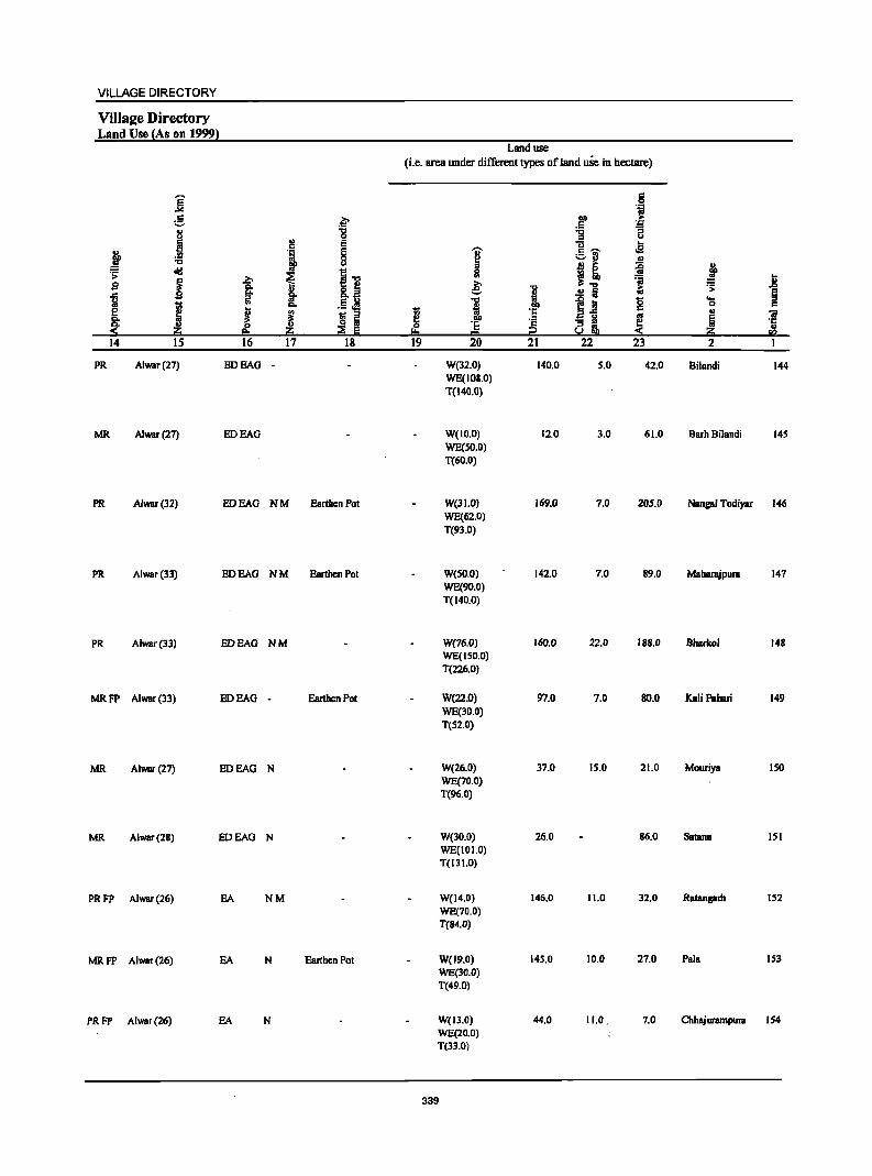
VILLAGE DIRECTORY
ViIla2e Directory Land Use (As on 1999l
Land use (Le. area under different types ofland use in hectare)
]' 5 .~
:5 .~ lID ,.
.5 ~ 8 "
'8 ~ u
.i E .. ~
. , § "Ii' c -- oS
~ c:J " -c u j! ~ ~ old i-c .;::
~ >-. i ~ = j s -a 8.~ e: "0 iii .f>
11 ... ! .!! Ii ~ 1;; iil ... .5 Jl 1 ~ Ia 8 OS
e j .. 1;; ·e " ~ ~ ~ i ::1-=
'" "iii ... e - " § <- 0 ·E ·s "3 .. ~ ·5 .... z :£ E '" Cl y§, z = <Q
14 15 16 17 18 19 20 21 22 23 2
PR Alwar(27) EDEAG - W(32.0) 140.0 5.0 42.0 Bilandi 144 WE(IOS.O) T(14O.0)
MR Alwar(27) EDEAG W(IO.O) 12.0 3.0 61.0 Barh Bilandi 145 WE(SO.O) T(60.0)
PR Alwar(32) EDEAG NM Earthen Pot W(31.0) 169.0 7.0 205.0 Nangal Todiyar 146 WE(62.0) T(93.0)
PR Alwar(33) EDEAG NM Earthen Pot W(50.0) 142.0 7.0 89.0 Maharajpura 147 WE(90.0) T(140.0)
PR Alwar(33) EDEAG NM W(76.0) 160.0 22.0 188.0 Bharkol 148 WE(150.0) T(226.0)
MRFP Alwar(33) EDEAG - Earthen Pot W(22.0) 97.0 7.0 SO.O Kali Pahari 149 WE(30.0) T(52.0)
MR Alwar(27) EDEAG N W(26.0) 37.0 15.0 21.0 Mouriya ISO WE(70.0) T(96.0)
MR Alwar(28) EDEAG N W(30.0) 26.0 86.0 Satana 151 WE(I 0 1.0) T(131.0)
PRFP Alwar(26) EA NM W(14.0) 146.0 11.0 32.0 RatBnprh 152 WE(70.0) T(84.0)
MRFP Alwar(26) EA N Earthen Pot W(19.0) 145.0 10.0 27.0 Pala 153 WE(30.0) T(49.0)
PRFP Alwar(26) EA N W(I3.0) 44.0 11.0. 7.0 Chhajurampura 154 WE(20.0) T(3l.0)
339
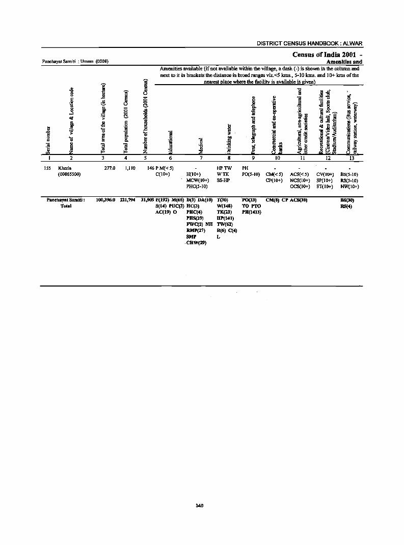
Panchayat Samiti : Umrcn (0008)
I .g ! u l! .. .§ Ii e 1;1 u u
~ C ~ ~ <iii .:;:
-!l 6 i II ·iii ~ 'S .,
"[ e ; '" 'S 8. c "iI
m ·5 ']I ']I
ra '" ~ ~
2 3 4
ISS Kherla 2n.0 1,110 (00865500)
PanebaY81 Samiti : 100,396.0 211,794 Total
DISTRICT CENSUS HANDBOOK: ALWAR
Census of India 2001 -A:menities and
Amenities available (if not available within the village, a dash (-) is shown in the column and next to it in bi"acketsthe distance in broad ranges viz.<5 kms., 5-10 kms. and 10+ kms of the
~ nearest place where the facility is available is given) '" C ., u g t:!. '" ""C
"0 ii g .c ..... "iii 0 6 ~ "iii .~ .r> .!:! ~ ~ il Z ~ ~ 5 6 7
146 PM«S) C(IO+) H(IO+)
MCW(IO+) PHC(5-1O)
31,909 P(192) M(66) D(3) DA(10) 8(14) PUC(3) HC(3) AC(19) 0 PHC(4)
PHS(29) FWC(2)NH RMP(27) 8MP
·CHW(29)
340
~
~ ~ ~ .~ 8
HPTW WTK SS-HP
T(30) W(148) TK(23) HP(141) TW(62) R(6) C(4) L
""C ta ., ., ] _g >
! fr ., ] li go
l~ 0 i u c ., i 8. ·a J "iii ].~ .g
1] li e II>
~ 81 e. ~.e ::!: 50! 9 10 II
PH P0(5-10) CM«5) ACS«S)
CP(IO+) NCS(IO+) OCS(IO+)
·P0(33) CM(8) CP ACS(30) TO PTO PH(1413)
uor; . .c .a :.= Co)
·u ~ cI!l 8. ]<Il~ _. E
:; ]I ·El u .e "iI.8'a 1! ._ '" .S! ~ ~ ! IL2 i! .5 'N e; ~ra
12
CV(IO+) SP(IO+) ST(IO+)
of .s.! ~~
~ ~ ej .~ g 1;1 • .;::; .s.! S § ..
E ~ g_ ~ ·a
13
BS(S-IO) RS(S-IO) NW(IO+)
88(30) U(4)
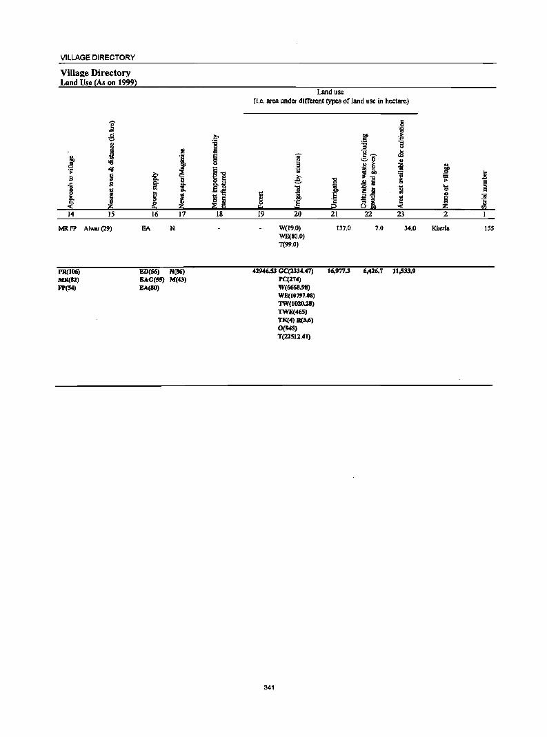
VILLAGE DIRECTORY
VilIaee Directory Land Use (As on 1999)
]' e I j :;:;
~ dII
~ s ... 1 I :( z 14 IS
MRFP Alwar(29)
PR(JO(j) MR(82) FP(54)
~ ., ~ § u
~"B ~ i 8.s ~ 11 E U ._ <Ill
J e - " IS i z ~ E
16 17 18
EA N
ED(56) N(86) EAG(55) M(43) EA(80)
Land use (i.e. area under different types of land use in hectare)
6 "i
1>0 > I: ~ :g u U ..
~ c~ .e vrJ ., B ~ ~ j 0
<II
'''' ~
... e '" ~ ~ .8
i .!! tii Ii "0
ii g .... i
0 I:
~ :~ .,
'iI .. Ii 0 'E I: l!! '5 '" = p :( z U)
19 20 21 22 23 2 I
W(l9.0) 137.0 7.0 34.0 Kherla ISS WE(80.0) T(99.0)
42946.53 GC(2334.47) 16,977.3 6,426.7 11,533.9 PC(274) W(6668.98) WE(I0797.08) 1W(J020.28) 1WE(465) TK(4) R(3.6) 0(945) T(22511.4J)
341

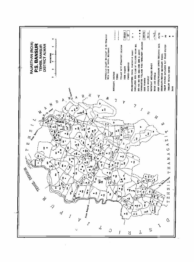
· '"
o
'"
J
\
J 1, s

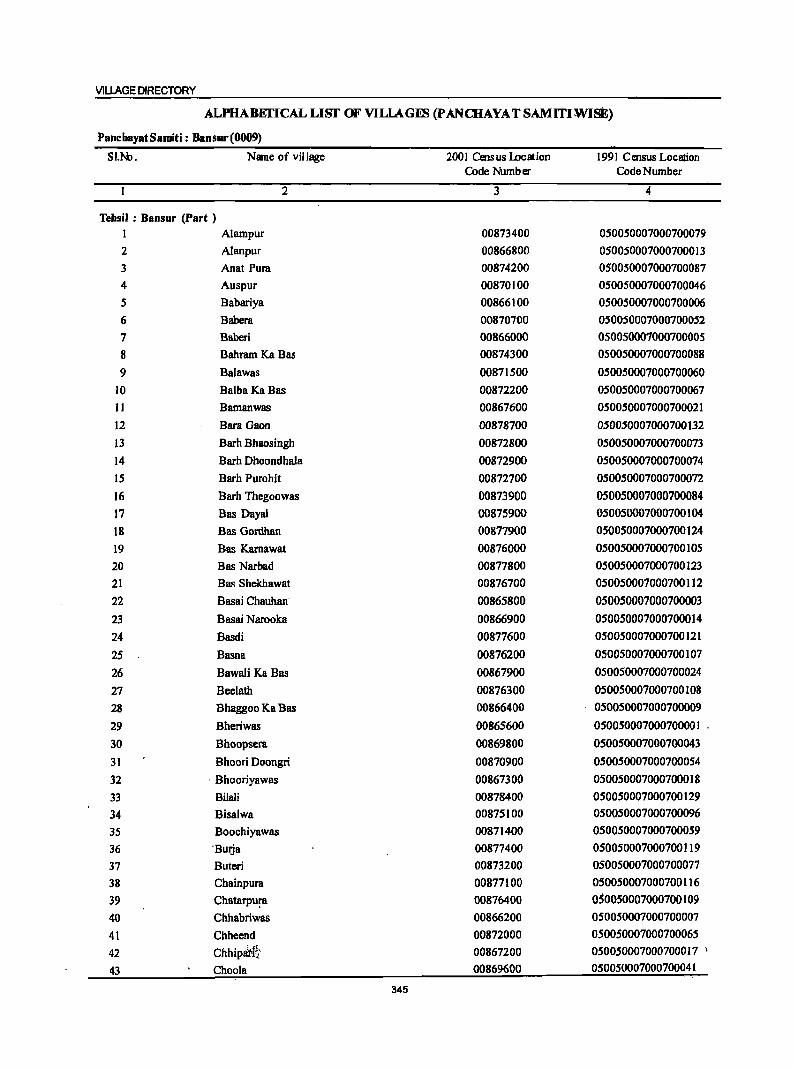
VILLAGE DIRECTORY
ALPHABEI'ICALLISf OF VILLAGIB (pANCHAYATSAMITIWIsE)
PanchayatSamiti: Bansur(0009)
SI.N>. Name of vii lage 2001 Census I..ocation 1991 Census Location Code Number Code Number
2 3 4
Tehsil : Bansur (Part ) I Alampur 00873400 050050007000700079 2 Alanpur 00866800 050050007000700013 3 Anat Pura 00874200 050050007000700087 4 Auspur 00870100 050050007000700046 5 Babariya 00866100 050050007000700006 6 Babera 00870700 050050007000700052 7 Baberi 00866000 050050007000700005
8 Bahram. Ka Bas 00874300 050050007000700088
9 Balawas 00871500 050050007000700060 10 Balba KaBas 00872200 050050007000700067 11 Bamanwas 00867600 050050007000700021
12 Bara Gaon 00878700 050050007000700132 13 Barh Bhaosingh 00872800 050050007000700073 14 Barh Dhoondhala 00872900 050050007000700074 15 Barh Purohit 00872700 050050007000700072
16 Barh Thegoowas 00873900 050050007000700084
17 Bas Dayal 00875900 050050007000700104 18 Bas Gordhan 00877900 050050007000700124
19 Bas Karnawat 00876000 050050007000700105 20 Bas Narbad 00877800 050050007000700123 21 Bas Shekhawat 00876700 050050007000700112
22 Basai Chauhan 00865800 050050007000700003
23 Basai Narooka 00866900 050050007000700014 24 Basdi 00877600 050050007000700121
25 Basna 00876200 050050007000700107
26 Bawali Ka Bas 00867900 050050007000700024
27 Beelath 00876300 050050007000700108 28 Bhaggoo Ka Bas 00866400 050050007000700009
29 Bheriwas 00865600 050050007000700001 '
30 Bhoopsera 00869800 050050007000700043
31 Bhoori Doongri 00870900 050050007000700054
32 ' Bhooriyawas 00867300 050050007000700018
33 Bilali 00878400 050050007000700129
34 Bisatwa 00875100 050050007000700096
35 Boochiyawas 00871400 050050007000700059
36 'BUlja 00877400 050050007000700119
37 Buteri 00873200 050050007000700077
38 Chainpura 00877100 050050007000700116
39 Chatarpu!'8 00876400 050050007000700109
40 Chhabriwas 00866200 050050007000700007
41 Chheend 00872000 050050007000700065
42 Chhiplirf~' 00867200 050050007000700017
43 Choo!a 00869600 050050007000700041
345
DISTRICT CENSUS HANDBOOK: ALWAR
ALPHABEI'ICALLISI' OF VILLAGl1S (pANCHAYATSAMITIWISE)
PaDcbayat Samiti : Bansur (0009)
SI.N>. Name of village 2001 Census Location 1991 Census Location Code Number Code Number
2 3 4
44 Dangiwas 00865700 050050007000700002
45 Deosan 00866300 050050007000700008
46 Dhamla Ka Bas 00872100 050050007000700066 47 Dheerpur 00868000 050050007000700025 48 Fatehpur 00869900 050050007000700044 49 Ghat 00872400 050050007000700069 50 Giroodi 00874000 050050007000700085 51 Goonta 00868700 050050007000700032 52 Gurha Bhankharwala 00874500 050050007000700090 53 Guwai"a 00869200 050050007000700037 54 Gyanpura 00877500 050050007000700120 55 Hajipur 00871900 050050007000700064 56 Harneerpur 00869400 050050007000700039 57 Harsora 00867700 050050007000700022 58 Holawas' 00875200 050050007000700097 59 Indrada 00875300 050050007000700098 60 Isra Ka Bas 00868300·· 050050007000700028 61 Jaggoowas 00866700 050050007000700012 62 Iaitpur 00878300 050050007000700128 63 JhagdetKalan 00876600 050050007000700111 64 JhlYharpura 00873500 050050007000700080 65 Kali Pahari 00874400 050050007000700089 '06 Kalyan Nagar 00869000 050050007000700035 67 Kalyanpura 00874600 050050007000700091 68 Kanjipura 00871800 050050007000700063 69 Kankariya 00873300 050050007000700078 70 Kasba Bansur 00872600 050050007000700071 71 Katariya Ka Bas 00869500 050050007000700040 72 Kauthal 00873100 050050007000700076 73 Keharpura 00870800 050050007000700053 74 Kharkhara 00875500 050050007000700100 75 Kharkhari Khurd 00878000 050050007000700125 76 Kharwa 00878200 050050007000700127 77 Khatauti 00868100 050050007000100026 78 Kheewaheri 00875800 050050007000700103 79 Khera 00873600 050050007000700081 80 Khahn 00876100 050050007000700106 sl Kishorpura 00867400 0500S0007OO0700019 82 Kool 00878100 050050007000700126 '83 Kothiya 00870500 050050007000700050 :SIJ~' Kundli 00877300···· 050050007000700118 '85 Ladpur 00867100 OS005OO07000700016 86 Lalpura 00877000 050050007900100115 87 ... ~. .Lekri .' •. O.987~00O.,,_ Q500SPOO,7q90700095
346
VILLAGE DIRECTORY
ALPHABEI'ICALLlSI' OF VlLlAG~ (pANaJAYATSAMmWlSE)
PancbayatSamiti: Bansur(0009) SI.N:>. Nane of village 2001 Cens us IDeat ion 1991 Census Location
Code Numb t:r Code Number
2 3 4
88 Loyati 00871100 050050007000700056 89 Mahanpur 00870200 050050007000700047 90 Majra Aheer 00867000 050050007000700015 91 Majra Dhakoda 00865900 050050007000700004 92 M~ra Rawat 0087]300 050050007000700058 93 Malloobas 00866600 050050007000700011 94 Manchi 00868500 050050007000700030 95 Mandeeja Basai 00873800 050050007000700083 96 Mandha 00869100 050050007000700036 97 Mandli 00876800 050050007000700113 98 Mangalwa 00872300 050050007000700068 99 Meerapur 00868600 050050007000700031
100 Milakpur ~0875700 050050007000700102 101 Moondli 00871700 050050007000700062 102 Morodi 00868400 050050007000700029 103 Mothooka 00868900 050050007000700034 104 Mugalpur 00868200 050050007000709027 105 Mukandpur 00869700 050050007000700042 106 Nanga! Bhaosingh 00871000 050050007000700055 107 Nanga! Lakha 00870400 050050007000700049 108 Narol 00867800 ' 050050007000700023 109 Nathoosar 00874900 050050007000700094 110 Nawalpura 00875400 050050007000700099 111 Naya Bas 00877200 050050007000700117 112 Neemoochana 00876500 050050007000700110 113 Pali 00878500 050050007000700130 114 Parsa Ka Bas 00870300 050050007000700048 115 Prithvipura 00877700 050050007000700122 116 Raghunathpura 00869300 050050007000700038 117 Ram Nagar 00870000 050050007000700045 118 Rampur 00874700 050050007000700092 119 Rasnali 00875600 050050007000700101 120 Ratanpura 00871600 050050007000700061 121 Ratanpura @ Karana 00878600 050050007000700131 122 Rayli 00866500 050050007000700010 123 Roondh Rampur 00874800 050050007000700093 124 Santba!pur 00873000 050050007000700075 125 Shahpur 00868800 050050007000700033 126 Shyampura 00873700 050050007000700082 127 Talwas 00867500 050050007000700020 128 Todiya Ka Bas 00874100 050050007000700086 129 Toorana 00876900 050050007000700114 130 Udho Ka Bas 00872500 050050007000700070 131 Ukhalhcra 00870600 050050007000700051
"';'~ 132 Unchhpur 00871200 050050007000700057
347
Panchayat Samiti . Bansur (0009)
2 3
Panchayat Samiti : Bansur (0009)
2
3
4
5
6
7
8
9
JO
II
Bheriwas (00865600)
Dangiwas (00865700)
Basai Chauhan (00865800)
Majra Dhakoda (00865900)
Baberi (00866000)
Babariya (00866100)
Chhabriwas (00866200)
Deosan (00866300)
BhaggooKa Bas (00866400)
Rayli (00866500)
Malloobas (00866600) .
340.0
497.0
247.0
581.0
989.0
1,249.0
282.0
274.0
301.0
80.0
130.0
4
500
1,365
692
1,455
2,471
2,752
626
1,829
1,444
1,203
1,075
DISTRICT CENSUS HANDBOOK: ALWAR
Census of India 2001 -Amenities and
Amenities available (if not available within the village, a dash (-) is shown in the column and next to it in brackets the distance in broad ranges viz.<5 kms., 5·10 kms. and 10+ kms of the
nearest place where the facility is available is given)
5
(ij c:: o .~ u
'" "0 !+l 6
58PM«5) C(IO+)
201 P M C(IO+)
94 P M« 5) C(IO+)
193 P(2) M« 5) C(10+)
332 P M C(S-IO)
349 peS) M C(IO+)
85 P(2) AC
M« 5) C(IO+)
7 8
CHW H{JO+) HP W MCW(5-1O) SS-HP PHCCIO+)
CHWH(IO+) HPTW MeW(S-IO) W TK PHCCIO+) SS-HP
CHWH(IO+) HPW MCW(S-IO) SS-HP PHC(10+)
9
PO« 5) PH« 5)
PH PO« 5)
PO« 5) PH« 5)
HPTWW PH H(IO+) MCW(IO+) PHC(IO+)
SS-HP PO« 5)
DA PHS CHW HP TW H(10+) WTK MCW(S-IO) SS-HP PHC(IO+)
DA PHS FWC TW W H( 10+) SS-HP MCW(IO+) PHCCIO+)
PO PH
PO PH
HPTW W PH H{IO+) MCW(IO+) PHCCIO+)
SS-HP PO« 5)
246 P M C(10+) PHS H(IO+) THPTW W SS-HP
PH(2)
PO« 5) MCW(5-10) PHC(IO+)
HPTWW
10 II
CM(5-10) ACS(IO+) CP(IO+) NCS(IO+)
OCS(lO+)
CM(5-1O) ACS(IO+) CP(lO+) NCS(IO+)
OCS(IO+)
CM(5.1O) ACS(IO+) CP(IO+) NCS(IO+)
OCS(IO+)
CM(5-10) ACS(IO+) CP(IO+) NCS(IO+)
OCS(IO+)
CM( I 0+ ) ACS( 10+ ) CP(5-10) NCS(IO+)
OCS(IO+)
CM(5-10) ACS(IO+) CP(10+) NCS(IO+)
OCS(IO+)
CM« 5) CP(IO+)
CM«5) CP(IO+)
ACS(IO+) NCS(IO+) OCS(lO+)
ACS« 5) NCS«5) OCS(lO+)
12
CV(lO+) SP( 10+) ST(IO+)
CV(lO+) SP(lO+) ST(IO+)
CV(lO+) SP(IO+) ST( 10+)
CV(IO+) SP(IO+) ST(IO+)
CV(IO+) SP(IO+) ST(IO+)
CV(IO+) SP(lO+) ST(10+)
CV(lO+) SP(IO+) ST(lO+)
CV(IO+) SP(IO+) ST(IO+)
194 P M CCl0+) PHS H(10+) MCW(5-1O) PHC(10+)
SS-HP PO(5-10) CM(5-10) ACS« 5) CV(IO+)
204 P M C(lO+)
127 P M C(lO+)
H(IO+) MCW(IO+) PHC(IO+)
H(lO+)
MCW« 5) PHC(JO+)
348
PH(5-10) CP(10+) NCS(5-IO) SP(IO+)
HPTWW SS-HP POe < 5)
PH« 5)
HPTWW SS-HP Poe < 5)
PH« 5)
CM« 5) CP(IO+)
CM« 5) CP« 5)
OCS( 10+) ST(1 0+)
ACS« 5) NCS« 5) OCS(IO+)
ACS«5) NCS« 5) OCS« 5)
CV(IO+) SP(IO+) ST(IO+)
CV{IO+) SP(IO+) ST(IO+)
13
8S« 5) RS(IO+) NW(lO+)
BS RS(lO+) NW(IO+)
BS« 5) RS(IO+) NW(10+)
BS« 5) RS(IO+) NW(IO+)
BS RS(IO+) NW(IO+)
BS RS(IO+) NW(IO+)
B8« 5) R8(1O+) NW(JO+)
BS RS(IO+) NW(IO+)
B8« 5) R8(JO+) NW(10+)
BS« 5) RS(IO+) NW(IO+)
BS« 5) R8(1O+) NW(IO+)

VILLAGE DIRECTORY
ViUs2eDirectory Land Use {As on 1999l
Land use (i.e. area under different types of land use in hectare)
j c .9 t;j
c .~ ~ > c 'Q ., "0 ~ :;
0 ., 0 <>
~ c: e 13 .. ~ 'i 8 u c - .s ._ In
:a ~ -u .. u :s
J~ ii ~ old ("0 0 .s;:
~ ;., i .. ';j jj S Ci. e: "0 l:i .s;:
.c c. .5 j ·1
~ iii §
J ill !. "0
~.! 0 ... I
II) 0 c
~ j 1;; i c .,
1;; :s !! _ U
<II i "iI o iii 0 '5 ·s :; S ~ '5
~ ".. ~ E !!o = 2 u!!!! ~ en 14 IS 16 17 18 19 20 21 22 23 2
MRFP Behror(l2) EA NM Ghee W(5S.0) 266.0 4.0 4.0 Bheriwas WE(II.O) T(66.0)
PR Behror(13) EA NM W(201.0) 161.0 10.0 56.0 Dangiwas 2 WE(69.0) T(270.0) , .. :.
MRFP Behror{IS) EA NM W(99.0) 100.0 5.0 1l.0 Basa!'Cha~n 3 WE(31.9) .. T(.!30.9)
FP Behror(37) EA W(147.0) 252.0 24.0 5B.0 Majra Dhakoda 4 WE{IOO.O) TC247.0)
PR Behror(IS) EA NM Earthen Pot, W(2S2.0) 424.0 10.9 149.0 Saberi 5 Ghoe WE(IS3.0)
T(40S.0)
PRMR Behror(32) EA NM W(400.0) 592.0 26.0 91.0 Babariya 6 FP WE(140.0)
T(S40.0)
FP Behror(2S) EDEAG - W(120.0) 151.0 7.0 Chhabriwas 7 WE(4.0) T(124.0)
PRMR Behror (29) EDEAG N WCI03.7) BI.O 14.2 31.2 DeoHII 8 FP 0(44.2)
T(147.9)
PRMR Behror(30) EDEAG - W(9B.I) 140.7 14.5 14:1 Bhaggoo 9
FP 0(33.1) KaBas T([31.3)
MRFP Bchror(30) EDEAG - W(49.8) 6.1 4.2 4.1 RayJi 10 0([6.2) T(66.0)
MR Behror(28) EDEAG - W(59.0} 17.0 1.0 14.0 Malloobas II WE(39.0) <'I. ....
T(98.0)
349
DISTRICT CENSUS HANDBOOK: ALWAR
Census of India 2001 -Panchayat Samiti : Bansur (0009) Amenities 'and
Amenities available (if not available within the village, a dash (-) is shown in the column and next to it in brackets the distance in broad ranges viz.<5 Ions., 5-10 kms. and 10+ Ions of the
I '§' nearest Elace where the facili!X is available is given l
.g 'ij' S rJ "
'" ;E~ u
~ !l l 6 g 8 '" ._ ~
.g ~ -a ~8. u j § ~ " ,S li ~
a CI) ~ oIi:l ~ ~ :g _" § ~ .s g II>
i 11] 'C::
.!! .:0 ~ dd2~ .... OJ !:E ~ '" -a .... 'liI OJ
8: '" a ,51 ~ i .... ~ ... 'liI '" .,
.~ liI E ~
,Q
~ ~ s ~ Z!~ t!::
:> U !-<
3 4 5 6 7
12 Jaggoowas 53.0 158 20 P M« S) TW88-W (00866700) C(1O+) H{IO+) PO(S-IO) CM«5) ACS(5-10) CV(lO+) 8S«5)
MCW(5-10) PH(S-IO) CP(S-IO) NCS(S-IO) SP(IO+) RS(IO+) PHC(IO+) OCS(5-10) ST(1O+) NW(1o+)
13 Alanpur 242.0 1,059 140 P M C(10+) HP1WW B8 (00866800) H(IO+) S8-HP PO(S-lO) CM(5-10) ACS(5-10) CV(lo+) RS(lO+)
MCW(S-IO) PH(S·IO) CP(S-IO) NCS(S.IO) SP(JO+) NW(IO+) PHC(lO+) OCS(S·IO) 8T(10+)
14 Basai Narooka 206.0 553 79 PM« S) HPW ACS (00866900) C(lO+) H(1o+) 88-HP PO(S-IO) CM(S-lO) NCS(S-IO) CV(lo+) B8«S)
MCW(S-IO) PH(S·JO) Cp(5-JO) OCS(S-IO) Sp(IO+) RS«S) PHC(IO+) 8T(1O+) NW(IO+)
IS MlUraAbeer 366,0 1,296 I92P MC(IO+) HP1WW PH(8) BS (00867000) H(l!l+) 88·HP PO«S) CM«S) AC8«5) CV(lO+) RS(IO+)
MCW(IO+) CP(IO+) NCS«5) 8P(IO+) NW(IO+) PHC(IO+) OCS«S) 8T(10+)
16 Ladpur 229.0 616 83 P(2) M HPW PHIS) (00867100) C(1O+) H(lO+) 88-HP PO«S) CM«S) ACS« 5) CV(lO+) B8«S)
MCW«S) Cp(JO+) NCS«S) Sp(JO+) RS(IO+) PHC« 5) OCS(IO+) 8T(10+) NW(IO+)
17 Chhipari 284.0 1,324 198 P M« S) HPTWW PH (00867200) C(IO+) H(IO+) TKSS-W PO«S) CM«5) ACS«S) CV(IO+) 88«5)
MCW«S) CP« S) NCS(IO+) 8p(10+) RS(lO+) PHC(lO+) OC8(10+) ST(IO+) NW(IO+)
18 Bhooriyawas 238.0 111 103 P M« S) HPTWW (00867300) C(IO+) H(10+) SS-HP P0(5-IO) CM(5-10) ACS(lo+) CV(IO+) 88(5-10)
MCW(S-to) PH(S-IO) CP(IO+) NC8(10+) 8P(IO+) RS(IO+) PHC(IO+) OC8(1o+) 8T(1o+) NW(10+)
19 Kishorpura 426,0 1,693 223P M 0 HCPH8 HPTWW (00867400) C(JO+) H(lO+) SS-HP PO« 5) CM«S) ACS(JO+) CV(IO+) BS«S)
MCW«S) PH«5) CP(IO+) NC8(10+) 8P(1o+) RS(lO+) PHC(IO+) OCS(IO+) ST(IO+) NW(IO+)
20 Telwas 240.0 652 103 P M« 5) HPTWW (00861500) C(IO+) H(IO+) SS-HP PO« S) CM(S-IO) ACS(IO+) CV(IO+) 88(5-10)
MeW(S-IO) PH(S-IO) CP(IO+) NCS(IO+) Sp(lo+) RS(IO+) PHC(IO+) OC8(10+) ST(IO+) NW(IO+)
21 Barnanwas 232,0 993 144 P MC(IO+) HPTWW PO PH (00861600) H(IO+) 88-HP CM«S) ACS(IO+) CV«5) 88« 5) .
MCW«S) CP(IO+) NCS(IO+) Sp(IO+) RS(IO+) PHC(IO+} .. OCS(IO+) ST(IO+) NW(IO+)
22 Hersom 889.0 5,210 727 P(2) M(2) 8 DDAMH THPTW POPH(II) CM ACSNCS B8 (00867700) PUCC(IO+} FwCH(JO+) WTK CP(IO+) OCS(IO+) CV(IO+) RS(lo+)
. MCW(I(f~) S8-HP SP(IO+) NW(IO+) ·PHqIO+) 8T(l0+)
350
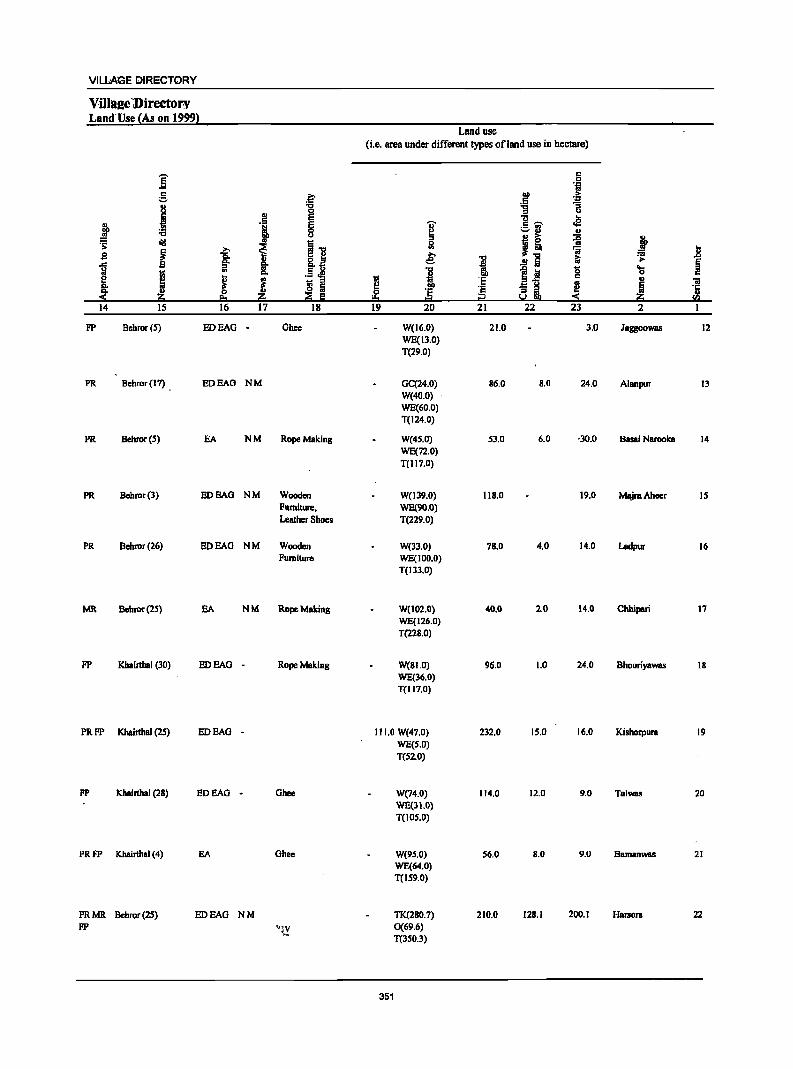
VILLAGE DIRECTORY
Villae;e Directol":V Land'Use (As on 1999}
Land use (Le, area under different types ofland use in hectare)
i r:: 0 .~
r:: l:' ~ ·Ei ;:.
j :a :g a .! ~ u ...
" Ilj I r:: ,...., oS
J ;:.3 " u j! 11 j =s: <iii
~ i] Sl ~
>. 'iii J! .9 Ci. ~ i ~ ~
J .9 §' e- ..!! a § .. .5 J! '0 ~j! 0 .... I ... 0 r::
! i ~ ~ 'E r:: II _ :s
a u III 'iI :!l Iii 00 'c - :s ! ~ '1:
II> 0 'E s:! III II
'" e. ~ dii Iii I:!::s ... i:l :S ~ fa 14 IS 16 17 18 19 20 21 22 23 2
FP Bchror(5) EDEAG - Ghee W(16.0) 21.0 3.0 Jaggoowas 12 WE(13.0) T(29.0)
PR Behmr(l7) BOEAO NM Gq24.0) 86.0 8.0 24.0 Alanpur 13 W(40.0) WE(60.0) T(124.0)
PR Bchmr(5) EA NM Rope Making W(45.0) 53.0 6.0 '30.0 Basai Narooka 14 WE(72.0) T(1I7.0)
PR Bchror(3) EDEAG NM Wooden W(139.0) IIB.O 19.0 MajraAhccr IS Furniture, WE(90.0) Leather Shoes T(229.0)
PR Bchror(26) BOEAG NM Wooden W(33.0) 7B.0 4.0 14.0 Ladpur 16 Furniture WE(100.0)
T(IJ3.0)
MR Behror(2S) EA NM Rope Making W(102.0} 40,0 2.0 14.0 Chhipari 17 WE(126.0) T(228.0)
FP Khairtbal (30) EDEAG - RopeMBking W(SI.O) 96.0 1.0 24.0 Bhooriyawas 18 WE(36.0} T(117.0)
PRFP KhBirthal (25) EDEAG - 111.0 W(47.0) 232.0 15.0 16.0 Kishorpura 19 WE(5.0) T(S2.0)
FP Khairthal (28) EOEAO - Ohee W(74'0) 114.0 12.0 9.0 Talwas 20 WE(3LO} T(IOS.0)
PRFP Khairtbal (4) EA Obee W(9S.0) 56.0 8.0 9.0 Bamanwas 21 WE(64.0) T(159.0)
PRMR Bchmr(25} BOEAG NM TK(2S0.7) 210.0 12S.1 200.1 Harsora 22 FP "-I~.y 0(69.6)
T(350.3)
351

DISTRICT CENSUS HANDBOOK: ALWAR
Census of· India 2001 -Panchayat Samiti : Bansur (0009) Amenities and
Amenities available (if not available within the village, a dash (-) is shown in the column and next to it in brackets the distance in broad ranges viz.<5 kms., 5-10 kms. and 10+ kms of the
I 1 nearest I!lace where the facili~ is available is givenl
-8
1 8 u u c Jl § !
., 'g c .~ ;::, u ~
.s ~ 0' '" t 0 "0 1i = ~ i oI!I ';;: ] !
.. c !9 ] 05 0
I ~ 0
~ .c .;;: ... ] m 8:
0
'S ..8 0
i 'ij ]I ]I
~ .g ~ ~ 3 4 5 6 7
23 Narol 402.0 S63 69PM«S) HPTWW (00867800) C(lO+) H(IO+) SS-HP PO«S) CM«S) ACS(lO+) CY(IO+) BS«S)
MCW« S) PH« 5) CP(lO+) NCS(IO+) SP(IO+) RS(10+) PHC(IO+) OCS(IO+) ST(IO+) NW(IO+)
24 Bawali !CaBas 123.0 313 40 PM« S) HPTW (00867900) C(IO+) H(IO+) SS-HP PO«S) CM«S) ACS(IO+) CY(IO+) 88«5)
MCW« 5) PH« 5) CP(IO+) NCS(IO+) Sp(IO+) RS(10+) PHC(IO+) OCS(IO+) ST(1O+) NW(IO+)
25 Dhecrpur 581.0 1,119 166 P M C(IO+) HPTWW ACS DS (00868000) H(IO+) SS-HP PO« 5) CM«5) NCS« 5) CY(IO+) RS{IO+)
MeW(S-IO) PH«5) CP(IO+) OCS(IO+) SP(10+) NW(lOi-) PHC(IO+) ST{IO+)
26 KhBtauti 454.0 665 90 P M«5) THPTW PH BS (00868100) C(IO+) H(IOi-) WSS-HP PO«S) CM«5) ACS(IO+) CY(IOi-) RS(IO+)
MCW(lo-t) CP(IOi-) NCS(IO+) Sp(IO+) NW(IO+) PHC(IO+) OCS«S) ST(IO+)
27 Mugalpur 482.0 1,073 139 P ACM«5) HPTWW PH(2) DS (00868200) C(IO+) H(S-IO) SS-HP PO«5) CM(S-IO) ACS(S-IO) CY(5-10) RS{IO+)
MCW(S-IO) CP{S-IO) NCS(S-IO) SP(10i-) NW(IO+) PHC(IO+) OCS(S-IO) ST(IOi-)
28 Ism Ka Das 3S7.0 1,347 184 P M« 5) HPTW BS (00868300) C(10+) H(lOi-) WTK PO«5) CM(S-IO) ACS(lo+) CV(IO+) RS(1O+)
MCW(S-IO) SS-HP PH« 5) CP(IOi-) NCS(IO+) Sp(IOi-) NW(IO+) PHC(IO+) OCS(IOi-) ST(lo+)
29 Morodi 1,124.0 1,738 233 P(3) M HPW DS (00868400) C(IO+) H(IOi-) SS-HP PO(S-IO) CM(IO+) ACS(IO+) CV(IO+) RS(IO+)
MCW(10i-) PH(5-10) CP(IOi-) NCS(IOi-) SP(IO+) NW(lO+) PHC(IO+) OCS(IO+) ST(IO+)
30 Manchi 567.0 1,233 135 P AC M« 5) HPTW (00868500) C(IO+) H(IO+) WTK PO(S-IO) CM«5) ACS(IO+) CV(IO+) DS«S)
MCW«S) SS-HP PH(S-IO) CP(IO+) NCS(JO+) sp(10+) RS(IO+) PHC« 5) OCS(IO+) ST(IO+) NW(IO+)
31 Meerapur 306.0 670 84PM«5) HPTW (00868600) C(IO+) H(IO+) WTK PO(S-IO) CM«5) ACS« 5) CV(lo+) 8S«5)
MCW«S) SS-HP PH(S·IO) CP(IO+) NCS(IO+) Sp(IO+) RS(10+) PHC(IO+) OCS(IO+) ST(IO+) NW(IO+)
32 Goonta 826.0 3,096 SOl P(2) M S DAPHC THPTW POPH(8) BS (00868700) PUC C(1O+) H(IO+) WTK CM«S) ACS«5) CV(S-IO) RS(10+)
MCW(S.IO) SS·HP CP(S.IO) NCS(5-10) Sp(IO+) NW(IO+) OCS(S-IO) ST(IO+)
33 Shahpur"'" 763.0 3,005 437 P(2) M« 5) THPTW PH(21) eM 'Ats DS (00868800) C(IO+);;_ H(10+) WTK PO(S.IO) Cp(5.10) NCS(S.IO) CVl~-lu} RS(lo+j'
MCW«S) SS-HP OCS(S·IO) Sp(Jo+) NW(JO+) PHC(IO+) ST(IO+)
352
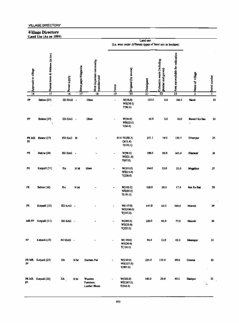
VILLAGE DIRECTORY
¥iJIa2e Directory _~Land Use {As on 199!)}
Land use (i.e. area under different types of land use in hectare)
j .§ 1;j
g ~ "" .. c ~ l! 'ii :a 0 -fi u
.~ .~ E .. j E i £.1 .,g
i 0
~ ... u ::s 8 ~ ! ~ ~
~] 0
~ )!:o ~
., ~ ... =a a; s c. & ... ~ '> .D
a-.,
&..a i _!! 5 ~ .c fit ... g
I Co .~ t J ~~ 1:5 0
~ ! ~ liS '5 c .,
"iI
~ :3 ~ ~ :ii ~ 5 '5
i1!I eo i!; :::i: Iii !!o !i.! i1!I OIl
14 15 16 17 18 19 20 21 22 23 2 1
FP 8ehror(27) EDEAG - Ghee W(58.0) 132.0 S.O 166.0 Narol 23 WE(38.0) T(96.0)
I'P Behror(27) EDEAG - Ghee W(44.0) 42.0 5.0 10.0 Bawali Ka Bas 24 WE(22.0) T(66.0)
PRMR Behror(27) EDEAG N 67.0 TK.(S8.7) 251.1 10.0 150.7 Dheerpur 25 1'P O(n.4)
T(I02.1)
PR 8ehror(28) EDEAG . W(46.0) IS8.0 36.0 163.0 Kllalauti 26 WE(21.0) T(67.0)
PR Kotputli (31) EA NM Ghee W(20S.0) 194.0 35.0 33.0 MUJllllpur 27 WE(l5.0) T(220.0)
PR 8chror(16) EA NM W(102.0) 128.0 20.0 17.8 Ism KaBas 28 WE(89.0) T(191.0)
PR Kotputli (IS) EDEAG - W(147.0) 647.0 62.0 16S.0 Morodi 29 WE(100.0) T(247.0)
MRFP Kotputli (II) EDEAG - W(200.0) 220.0 45.0 77.0 Manehi 30 WE(2S.0) T(22S.0)
FP Kotputli (22) EDEAG - W(128.0) 94.0 12.0 42.0 Meerapur 31 WE(30.0) T(ISS.O)
PRMR Kotputli (22) FA NM Earthen Pot W(2S0.0) 225.0 125.0 69.0 Goonta 32 1'P WE(IS7.0)
T(407.0)
PRMR Kotputli (22) EA NM Wooden W(300.0) 140.0 29.0 49.0 Shahpur 33 FP Furniture, WE(24S.0) ,;
Leather Shoes T(S4S.0)
353
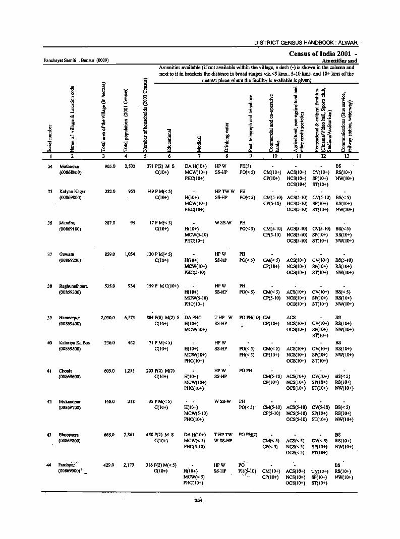
DISTRICT CENSUS HANDBOOK: ALWAR
Census of India 2001 _ Panchayat Samiti : Bansur (0009) Amenities and
Amenities available (if not available within the village, a dash (-) is shown in the column and
next to it in brackets the distance in broad ranges viz.<5 lans., 5-10 kms. and 10+ kms of the
I a nearest place where the facility is available is given) .,
..g
1 5 1 .~~ 0 u
.Ii " ] ..
1 c .<:: 0 .~ :.:: u
0 :S 0 ._ ~
i!:~ '1 u C!- ~8. .. .>,
! (5 ., & .. .. ~ "" .~. lrll.~ .J ~ i 1i ~ ~ .il ~j c!g '> 1 u -s'ii§ .. Jj 6 '5 c tl u ..r:: ''§ § c· .f I 1 g ._
j .t;j _g . ~ c!g g._ ~ 1:9] 0g .2 :;: 1 .... 1 ]I l~ u11
~ ~ 0 e 'j j] '§ '" 'S Is 00 :I] "" .~ "iI c 1i ..
u 1 ~ ~ §j E f 'iii
l i i .g 1 .~ t '5 ~ ~ ~ <~ ~u] g"" fQ :z; ff! 9 u e yell
2 3 4 5 6 7 8 9 10 II 12 13
34 Mothooka 905.0 2,532 371 P(2) M S DAH(IO+) HPW PH(S) BS (00868900) C(lO+) MCW(IO+) SS-HP PO« 5) CM(IO+) ACS(IO+) CV(IO+) RS(IO+)
PHC(lO+) CP(IO+) NCS(IO+) SP(IO+) NW(IO+) OCS(IO+) ST(IO+)
35 Kalyan Nagar 282.0 953 149 P M«5) HPTWW PH (00869000) C(IO+) H(IO+) SS-HP PO« S) CM(S-IO) ACS(S-IO) CV(5-10) BS«5)
MCW(IO+) CP(5-10) NCS(5-10) SP(IO+) RS(IO+) PHC(IO+) 'OCS(S-IO) ST(IO+) NW(IO+)
36 Mandha 287.0 95 17PM«5) WSS-W PH
(00869100) C(IO+) H(lO+) PO« S) CM(S-IO) ACS(5-10) CV(S-IO) BS«S) MCW(S-IO) CP(5-10) NCS(S.IO) SP(IO+) RS(IO+) PHC(IO+) OCS(5-10) STCIO+) NW(lO+)
37 Ouwara 859.0 1,054 130 P M«5) HPW PH (00869200) C(10+) H(10+) SS-HP PO«S) CM«5) ACS(IO+) CV(IO+) BS(5-10)
MCW(1O+) CP(IO+) NCS(lo+) SP(lO+) RS(IO+) PHC(S-IO) OCS(IO+) STCIO+) NW(lo+)
38 Ragbunatbpura 535.0 934 159 P M C(IO+) HPW PH (00869300) H(IO+) SS-HP' PO« S) CM«5) ACS(IO+) CV(IO+) BS«S)
MCW(S-IO) CP(5-10) NCS(IO+) SP(IO+) RS(IO+) PHC(IO+) OCS(ID+) ST(IO+) NW(IO+)
39 Hameerpur 2,030.0 6,173 884 P(8) M(2) S DAPHC THP W POPH(IO) CM ACS BS (00869400) C(IO+) H(IO+) SS-HP Cp(IO+) NCS(IO+) CV(IO+) RS(IO+)
MCW(ID+) OCS(IO+) Sp(IO+) NW(IO+) STCIO+)
40 Katariya Ka BII5 256.0 462 71 PM«S) HPW BS (00869500) C(IO+) H(IO+) SS-HP PO« 5) CM«S) ACS(IO+) CV(IO+) RS(IO+)
MCW(IO+) PH«S) CP(IO+) NCS(IO+) SP(IO+) NW(IO+) PHC(IO+) OCS(lO+) ST(IO+)
41 ChoDIB 609.0 1,255 203 P(Z) M(l) HPW PO PH (00869600) C(lO+) H(IO+) S8-HP CM(S-IO) ACS(IO+) CV(IO+) B8«5)
MCW(IO+) Cp(IO+) NCS(IO+) Sp(IO+) RS(IO+) PHC(IO+) OCS(IO+) ST(IO+) NW(IO+)
42 Mukandpur 168.0 218 3S PM«S) WSS-W PH (00869700) C(IO+) H(IO+) PO« 5)' CM(S-IO) ACS(S-IO) CV(S-IO) BS« S)
MCW(S-IO) CP(S-IO) NCS(S-IO) SP(IO+) RS(10+) PHC(lo+) OCS(S-IO) STCIO+) NW(IO+)
43 Bhoopacra 66S.0 2,861 458 P(2) M S DAH(IO+) THPTW POPH(2) BS (00869800) C(IO+) MCW«5) WSS-HP CM«5) ACS«5) CV«S) RS(IO+)
Plk..cs-IO) Cp«5) NCS«S) SP(IO+) NW(IO+) OCS«S) ST(IO+)
Fatchp";";·· ... "
44 429.0 2,177 316 P(2) M« S) HPW PO BS (00869900) \~ C(IO+) H('IO+) S8-HP PH~S~IO) CM(IO+) ACS(IO+) (;,Y.lIU+) RS(IO+)
MCW«S) Cp(IO+) NCS(IO+) SP(IO+) NW(IO+) PHC(IO+) OCS(IO+) ST(IO+)
'354
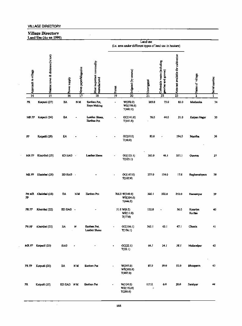
VILLAGE DIRECTORY
YiUsl[e Dir.ectory Land Use (As on 1999)
]' 5 ., u
~ ~ '9 cI!I .s:
~ 9
11 j I z 14 IS
.,
'1 .?;> ~ 8:
~ il
! ~ p. Z 16 17
PR Kotputli (27) EA NM
MRFP Kotputli (24) EA
FP Kotpulli (28) EA
MR FP Khairthal (2S) BOEAG -
MR FP Khainhal (28) EOEAG -
PRMR Khairthal (28) EA NM FP
PRFP Khairthal (22) EOEAG .
PRFP Khairthal (22) EA N
MRFP Kotputli (25) BAG
PRFP Kotputli (20) EA NM
PR Kotput1i (25) EDEAG NM
f ~
l~ .5 j ! I
18
Earthen Pot. Rope Making
Leather Shoes. Earthen Pot
Leather Shoes
EanhenPot
EanhcnPot. Leather Shoes
Earthen Pot
Earthen Pot
Land use (i.e. area under different types of land use in hectare)
I !!:s
19
i ;;J 0 III
e: ... ·1 = 20
W(292.0} WE(190.0) T(482.0)
GC(141.0) T(141.0)
GC(lo.o) T(lo.o)
GC(123.1) T(123.1)
GC(167.0) T(l67.0)
766.0 W(l40.0) WE(304.0) T(444.0)
51.0 W(6.0) WE(II.O) T(17.0)
GC(IS6.1) T(156.1)
GC(22.1) T(22.I)
W(267.0) WE(200.0) T(467.0)
W(134.0) WE(IS2.0) T(286.0)
355
"" i ·S ~ 21
265.0
76.0
83.0
363.0
227.0
366.1
132.0
363.1
64.1
87.0
117.0 ..
c 0 .~
00 > c ~ :g u
]- ... .e :.=-;1 .. II) >
~ J: =a i:i ..!! Iii
l.! (; c
'" 8 a M 22 23
75.0 83.0
44.0 21.0
194.0
46.1 327.1
124.0 17.0
202.0 252.0
56.0
43.1 47.1
24.1 58.1
59.0 S2.0
6.0 20.0
~ i .s: ..... 0
! ] rn
2 1
Mothooka 34
Kalyan Nagar 35
Mandha 36
GUWBn 37
RaghuDalhpun 38
Hamccrpur 39
Katariya 40 KaBas
Choo1a 41
Mukandpur 42
Bhoopsen 43
Fatehpur 44
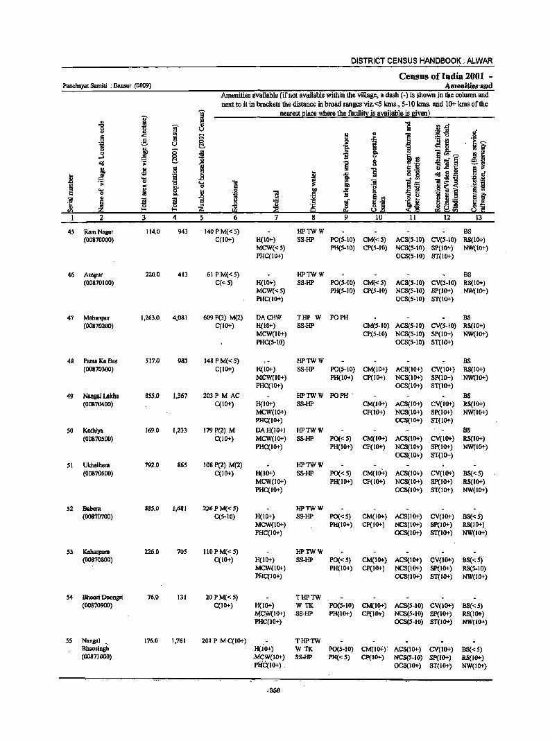
DISTRICT CENSUS HANDBOOK: ALWAR
Census of India 2001 -Panchayat Samiti : Bansur (0009) Amenities'and
Amenities available (if not available within the village, a dash (-) is shown in the column and
next to it in brackets the distance in broad ranges viz.<5 kms., 5-10 kms. and 10+ lans of the
I ~ nearest Illace where the facili!y is available is given l
" 8 ~ <II.&! -0 ~ 0 .S! ::s .If u ~ 5 I:! ..
1 ="i3 a c; .~ .~
g u §. I e :Mt :1 ~ .. t .§ 0 8. ::g !i ]"'__, ,.J
::1 _" § cfII ';;: .c i ... :;] ·c ~~ ~ -!l a ~ -0
I .<:: a c 8 U 9 a c" ~ 'j _g cfII ~ ._
'S ~ . '" l!:-5!"9 "fj .2 .;;: :; 'g 01 ]! l~ .g s ~
... 8: c
~ o ~ < .... ~ ~ 0
f I) "31 ._ ~ § ..
0 'i O! !i "
.0
j ~j J~E e f O!
~ ~ ~ '!if .2 .. '5 ~ ~J ~] !a ill ~ ei ~SQ
I 2 3 4 5 6 7 8 9 10 11 12 13
45 RamNBgar 114.0 943 140 P M« 5) HPTWW BS (00870000) C(IO+) H(IO+) 88-HP PO(S-IO) CM«5) ACS(S·IO) CV(5-10) RS(IO+)
MCW«5) PH(S.tO) CP(5-10) NCS(S.tO) SP(IO+) NW(IO+) PHC(IO+) OCS(S·IO) 8T(10+)
46 Auspur 220.0 413 61 PM«S) HPTWW BS (00870100) C«S) H(IO+) SS·HP PO(S-IO) CM«S) AC8(S.IO) CV(S-IO) RS(IO+)
MCW«S) PH(S·IO) CP(5-10) NCS(S·IO) SP(lo+) NW(IO+) PHC(IO+) OCS(S.IO) 8T(10+)
47 Mahanpur 1,263.0 4,081 609 P(3) M(2) DACHW THP W PO PH BS (00870200) C(IO+) H{lO+) S8·HP CM(S-IO) ACS(S-IO) CV(S-IO) RS(IO+)
MCW(IO+) CP(S-IO) NCS(5.IO) 8P(10+) NW(IO+) PHC(S.IO) OCS(S·ID) 8T(10+)
48 Parsa Ka Bas 517.0 983 148 PM« S) ,- HPTWW BS (00870300) C(IO+) H(IO+) 88·HP PO(S.IO) CM(IO+) AC8(10+) CV(lO+) RS(IO+)
MCW(IO+) PH(IO+) CP(IO+) NCS(IO+) 8P(IO+) NW(IO+) PHC(IO+) OC8(10+) 8T(l0+)
49 Nangal Lakha 855.0 1,367 203P M AC HPTWW PO PH , BS (00870400) C(IO+) H(IO+) 88·HP CM(lO+) ACS(IO+) CV(IO+) RS(lO+)
MCW(1O+) CP(IO+) NCS(tO+) SP(lO+) NW(lO+) PHC(IO+) OC8(10+) ST(IO+)
50 Kothiya 169.0 1,233 179 P(2) M DAH(IO+) HPTWW BS (00870500) C(10+) MCW(IO+) S8-HP PO«S) CM(IO+) ACS(lO+) CV(lO+) RS(IO+)
PHC(lO+) PH(lO+) CP(IO+) NCS(lO+) SP(lO+) NW(lO+) OC8(10+) ST(1O+)
51 Ukhalhera 792.0 86S 108 P(2) M(2) HPTWW (00870600) C(10+) H(IO+) SS-HP PO«S) CM(IO+) ACS(IO+) CV(IO+) BS« 5)
MCW(IO+) PH(IO+) CP(IO+) NC8(10+) 8P(l0+) RS(lo+) PHC(IO+) OCS(lO+) 8T(10+) NW(lO+)
52 Babera 885.0 1',681 226 P M« 5) HPTWW (00870700) C(5-10) H(IO+) S8-HP PO«S) CM(lO+) ACS(IO+) CV(IO+) BS«S)
MCW(IO+) PH(10+) CP(IO+) NC8(10+) SP(IO+) RS(IO+) PHC(IO+) OCS(IO+) 81'(10+) NW(IO+)
53 Keharpura 226.0 70S 110 PM« 5) HPTWW (0087080U) C(IO+) H(IO+) 88·HP PO«S) CM(lO+) ACS(IO+) CV(1O+) BS« S),
MCW(JO+) PH(IO+) CP(IG1-) NeS(IO"') SP(lO+) RS(5-10) PHC(IO+) OCS(IO+) ST(lO+) NW(IO+)
54 Bhoori Doongri 76.0 131 20 PM« S) THPTW (00870900) C(IO+) H(lO+) WTK PO(S-IO) CMCIO+) ACS(5·10) CV(lO+) BS«5)
M(,:W(IO+) 88-HP PH(lO+) CP(lO+) NCS(S-IO) sp(10+) RS(1O+) PHC(IO+) OCS(S·IO) ST(IO+) NW(IO+)
55 Nangal ., 176.0 1,761 201 P M C(IO+) THPTW Bbaosingh H(lO+) WTK PO(S-lO) CM(lO+}' ACS(IO+} CV(lO+) BS«S) (00871000) .MCW(JO+) 5S-HP PH«5) CP(10+) NCS(S-JO) Sp(JO+) RS(IO+)
PHCcIO+) , OCS(lO+) ST(IO+) NW(IO+)
,356
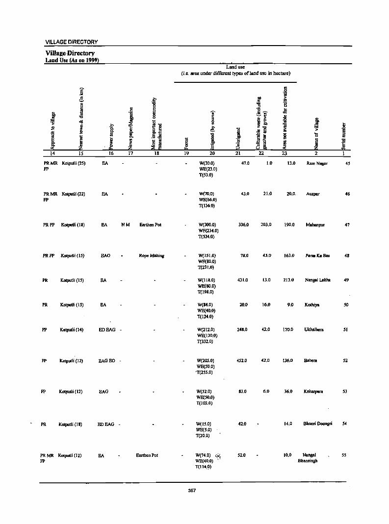
VILLAGE DIRECTORY
Villaze ,Directory Land Use (As on 19991 .,
Land use (i.e. area under different types ofland use in hectare)
j .j ., ~ ~ >
~ . .co !l ;g ;;:; 1i " j ·1 E U .e i E "OJ' gil 8 ~
., ~ old ~ ... 0 j! {i j
j » t II!
~ .8 ~ 0. ,e: ~
1 Co 8.~ i ..!! a iii § iil .5.M 1 1j g ...
1 c. 0 c:
I ~ :§ '" I 1 g ~ ~ j 'ill .&:
~ :s c: as!! '" ::E Iii ~ i2 !"!2 14 IS 16 17 18 19 20 21 22 23 2
PRMR Kotputli (25) EA W(30.0) 47.0 1.0 13.0 Ram Nagar 4S FP WE(23.0)
T(53.0)
PRMR Kotputli (22) EA W(70.0) 43.0 21.0 20.0. Auspur 46
FP WE(66.0) T(136.0)
PRFP Kotputli (I 8) EA NM Earthen Pot W(300.0) 336.0 203.0 190.0 Mahanpur 47 WE(234.0) T(S34.0)
PRFP Kotputli (IS) EAG Rope Making W(151.0} 78.0 45.0 163.0 ParsaKa Bas 48 WE(80.0} T(231.0)
PR Kotputli (I S) E.A W(118.0) 431.0 13.0 213.0 Nangal Lakha 49 WE(SO.O) T(198.0)
PR Kotputli (IS) E.A W(B4.0) 20.0 16.0 9.0 Kothiya SO WE(40.0) T(I24.0)
FP Kotpulli (I 4) EDEAG - W(212.0) 248.0 42.0 170.0 Ukhalhera 51 WE(120.0) T(332.0)
FP Kotputli (12) EAGED - W(20S.0) 4S2.0 42.0 136.0 Babera S2 WE(SO.O)
'T(255.0)
FP Kotputli (12) EAG W(52.0) 82.0 6.0 36.0 Kellarpura 53 WE(SO.O) T(102.0)
PR Kotputli (18) EDEAG - W(lS.O) 42.0 14.0 Shoori Doongri 54
WE(5.0) T(20.0)
PRMR Kotputli (12) EA Earthen Pot W(74.0) 11~1 52.0 10.0 Nangal 55
FP WE(40.0) Bhaosingh T(114,O)
357
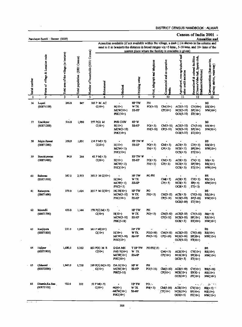
DISTRICT CENSUS HANDBOOK: ALWAR
Census of India 2001 -Panchayat Samiti : Bansur (0009) Amenities' and
Amenities available (if not available within the village, a dash (-) is shown in the column and next to it in brackets the distance in broad ranges viz. <5 lans., 5-10 kms. and 10+ lans of the
'U;' nearest I2lace where the facili~ is available is given)
I " ., 2 .., I " U.cl' 8 ., (.) ._ "
" ..,
0 g ., ;:u 0 §. 0 _g ·S :Mt ] (.)
~ R .. 0-
l1P ~ .,
'! :!:! ~
]<Il~ cIIJ ~ _g i
-:§ " :; "iii .c
j ~ .g !!i "0 "..r:: 0
i _g t
.., fij cIIJ 2 .<;:: ....
i ~ "iiI:5!"g ~ 0 .... "iii .. 0 .j 5~ < .... ~ :8 t>O '! ._ e l 0 ..
] ~ ! s ~ ~ 8 ._
~ " ·c u] ,<I) Q
1 2 3 4 5 8
56 i..oyali 246.0 847 105 PM AC HPTW PH BS (00871100) C(IOof.) H(lOof.) WTK. PO(S-IO) CM(IOof.) ACS(S-IO) CV(IOof.) RS(IOof.)
MCW(IO+) SS-HP CP(lOof.) NCS(S-IO) Sp(IO+) NW(IO+) PHC(lO+) OCS(S-IO) ST(IO+)
57 Unchhpur 516.0 1,990 277 P(2) M PHSCHW HPW BS (00871200) C(IOof.) H(IO+) SS-HP PO« 5) CM(S-IO). AC8(S.10) CV(S-IO) RS(IO+)
MCW(ScIO) PH(S-IO) CP(S-IO) NCS(S-IO) SP(IO+) NW(IO+) PHC(IO+) OCS(5-10) ST(IO+)
58 MajraRawat 350.0 1,031 134 PM« 5) HPTWW BS (00871300) C(10+) H(lO+) SS-HP PO« S) CM«S) ACS«S) CV«S) RS(1O+)
MCW«S) PH« S) Cp«s) NCS«S) Sp(IO+) NW(1O+) PHC(IO+) OCS«S) S1(IO+)
S9 Boochiyawas 94.0 266 42 PM« 5) HPTWW (00871400) C(10+) H(IO+) SS-HP PO« S) CM«S) ACS«S) CV«S) BS« 5)
MCW«S) PH« 5) CP«5) NCS«5) SP(IO+) R8(10+) ,PHC(IO+) OC8«5) 8T(100f.) NW(IO+)
60 Balawas 387.0 2,553 392 P M C(IO+) HPTW PO PH BS (00871500) H(1O+) WTK CM«S) ACS«S) CV«s) RS(IO+)
MCW(<:S) SS-HP Cp«5) NC8«') Sp(<: 5) NW(IO+) PHC«S) OCS«5) . 8T(<: 5)
61 Ratanpura 279.0 1,424 225 P M C(1O+) HCH(IO+) HPTW PO BS' (00871600) MOW(S-IO) WTK PH« S) CM(S-IO) ACS«S) CV(S-IO) RS(1O+)
PHC(IO+) 88-HP CP(S-IO) NCS(S-IO) SP(S-IO) NW(IO+) OCS(S-IO) 8T(10+)
62 Moondli 4SS.0 1,144 178 P(2) M« S) HPTW PH (00871700) C(IO+) 'H(IO+) WTK PO«S) CM(S-IO) AC8(S-JO) CV(S-IO) B8«5)
MCW(S-IO) 88-HP CP(S-IO) NCS(S-IO) SP(IO+) RS(IO+) PHC(s-10) OC8«s) ST(1O+) NW(lO+)
63 Kanjipura 231.0 1,099 163 P M(IOof.) HPTW B8 (00871800) C(IO+) H(IO+) WTK PO(S-IO) CM(S-IO) ACS(s-IO) CV(S-IO) RS(IO+)
MCW(S-IO) S8-HP PHeS-IO) CP(s-IO) NC8(s-IO) Sp(IO+) NW(IO+) PHC(IO+) OC8(5-10) 8T(10+)
64 Hajipur 1,686.0 S,353 852 P(6) M 8 DDAMH THPTW POPH(ls) BS (00871900) C{IO+) PHS H{IO+) WTK CM«s) ACS(IOof.) CV(IO+) RS(IO+)
MCW(IO+) SS-HP CP(IO+) NCS(IO+) 8P(100f.) NW(l00f.) PHC(1o+) OCS«s) 81(10+)
65 Ohheend· 1,947.0 1,738 199 P(3) M(S-I 0) DAH(IO+) HPW PH (00872000) . . C(IO+) MCW(lO+) 8S-HP PO(S-IO) CM(S-IO) ACS(S-IO) CV(lO+) BS(S-IO)
PAC(s-IO) CP(IO+) NCS(IO+) SP(10+) RS(IO+) OCS(IO+) ST(IO+) NW(lOof.)
66 Dhamla,~.Bas 702.0 331 51 PM(<: S) HPTW 'PO~"" .. '''' ,- ;;~ ~ '.;
(00872100) C(IO+) >B(lCH) WTK PH«s) CM(s-IO) ACS(IO+) CV(IO+) BS«s)"~ 'MCW(IOof.) 8S-HP ;CP(Ifrt.) NCS(IO+) 8P(10+) RS(lO+) PHO(IO+) OCS«S) ST(IO+) NW(1O+)
358
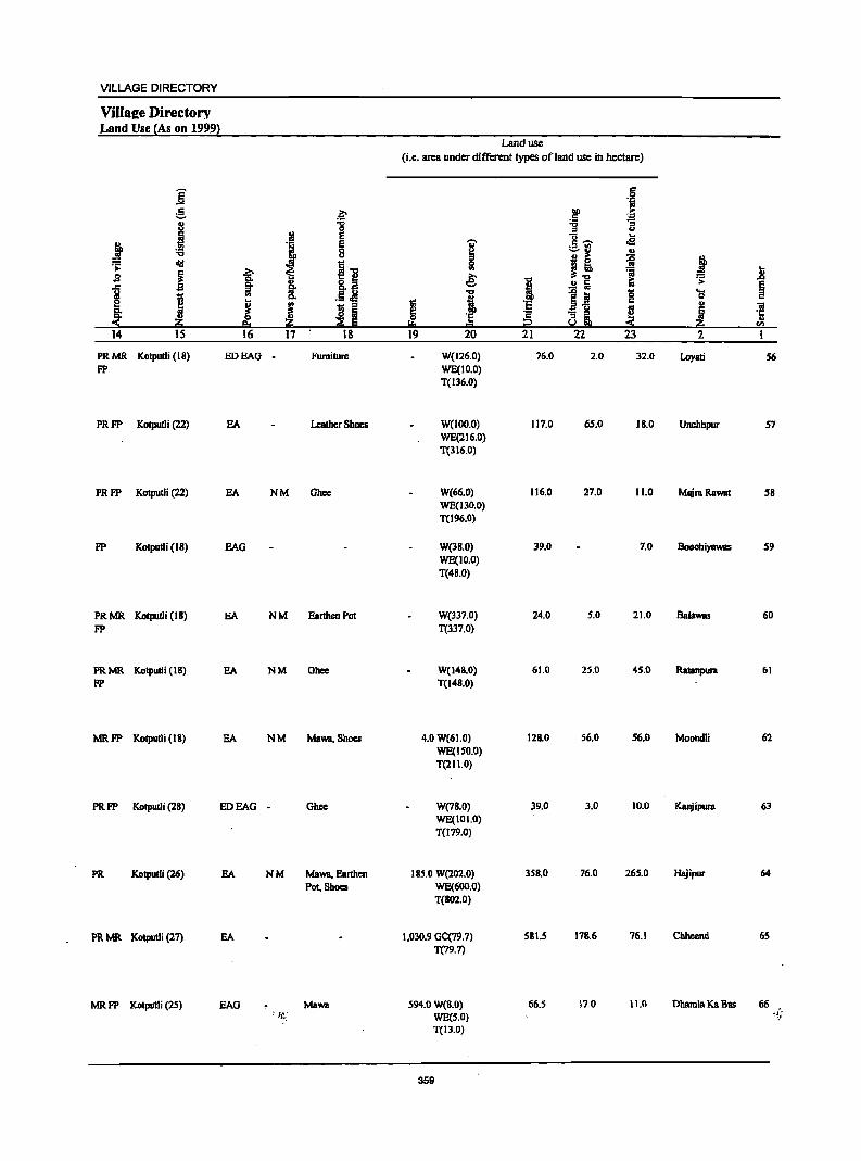
VILLAGE DIRECTORY
ViIlaee Directory Land Use (As on 1999}
i g ~
8 :g .~ ~ ~
~ I ..., 8 .;;: cI!I
i~ B ~ ~ ] a i ·~i I e ..
!!! ! ~ I ~ Z 14 15 16 17 18
PRMR Kotpulli (IS) EDEAG - Furniture FP
PRFP Kotputli (22) EA Leather Shoes
PRFP Kotputli (22) EA NM Ghcc
FP Kolpulli (IS) BAG
PRMR Kotpudi (IS) BA NM Earthen Pot FP
PRMR Kotputli (IS) BA NM Ghce FP
MRFP Kotputli (18) EA NM Maws, Shoes
PRFP Kotputli (2S) ED BAG - Ghcc
PR Kotpulli (26) EA NM Maws, Earthen Pot, Shoes
PR MR Kotputli (27) EA
MR FP Kolputli (25) BAG Maws
Land use
(i.e. area under different types ofland use in hectare)
'Ii' ~ 5l € ..., i g 'e ... = 19 20
W(126.0) WE(IO.O) T(136.0)
W(IOO.O) WE(216.0) T(316.0)
W(66.0) WE(130.0) T(l96.0)
W(3S.0) WE(1O.0) T(48.0)
W(337.0) T(337.0)
W(14S.0) T(148.0)
4.0 W(61.0) WE(ISO.O) T(211.0)
W(78.0) WE(101.0) T(l79.0)
185.0 W(202.0) WE(600.0) T(S02.0)
1,030.9 GC(79.7) T(79.7)
594.0 W(S.O) WE(S.O) T(ll.O)
359
i bD ·s § 21
76.0
117.0
116.0
39.0
24.0
61.0
128.0
39.0
358.0
581.5
66.5
·8 i!!' ~
'p
] :; u
8- ... ,£
:.:::..[(1
:I I! :;; :il Ii i;
Q
S~ c
~ 8i « 22 23
2.0 32.0
65.0 18.0
27.0 11.0
7.0
5.0 21.0
2S.0 45.0
56.0 56.0
3.0 10.0
76.0 265.0
17S.6 76.1
17.0 11.0
j 'S .8
~ os c ., "iii
~ ·c " ..,
2
Loyali 56
Unchhpur 57
MajraRawat 58
Boochiyawas 59
Balawas 60
RatBnpura 61
Moondli 62
Kanjipura 63
Hajipur 64
Chhcend 65
Dbamla Ka Bas 66 ~~;
DISTRICT CENSUS HANDBOOK: ALWAR
Census of India 2001 -Panchayat Samiti : Bansur (0009) Amenities and
Amenities available (if not available within the village, a dash (-) is shown in the colwnn and
n""lto it in brackets the distaneein broad ranges viz.<5 kins., 5-IOkms. and 10+ kms of the -;;;- nearest I!lace where the facili!X is available is given l ., I i "8 I .21f () u
c § ! .~ :E"il 0 g ._ -e .~ u !::!. e ~ 8.. j (5 ., u 0
~ ~ t ]<12---...l a _" §
dlI ~ 1 u ]].1;; J .s s _g ..c 1 diI 3·~
'a ·i .~ 1!:-s!'g ~ 1 ....
~ ~ 0 ·5!~i ... u .. ·N 01 ~ ..
j - 5._ ! "! ~ ;;I tj]
'""' 3 4 5 6 7 12
67 BalbaKaBas 158.0 834 121 PM«S) HPW PH (00872200) C(lO+) H(lO+) SS-HP PO(S-IO) CM(S-IO) ACS(lO+) CV(lO+) BS« 5)
MCW(S-IO) CP(IO+) NCS(IO+) SP(JO+) RS(IO+) PHC(S-IO) OCS(IO+) ST(IO+) NW(IO+)
68 MBngalwa 309.0 826 113P MC(JO+) HPTW (00872300) H(IO+) WTK PO«5) CM«5) ACS(IO+) CV(IO+) BS« 5)
MCW«S) C SS-HP PH«5) CP(IO+) NCS(IO+) Sp(IO+) RS(IO+) PHC«S) OCS(IO+) ST(IO+) NW(1O+)
69 Ghat S82.0 970 142 PM« S) HPTWW (00872400) C(5-10) H(IO+) SS-HP PO«S) CM(S-IO) ACS(S·IO) CV(IO+) BS« 5)
MCW(S-IO) PH«S) CP(5-10) NCS(S-IO) SP(IO+) RS(IO+) PHC(S-IO) OCS(S-IO) ST(1o+) NW(lo+)
70 UdhoKaBas 225.0 1,18S 186PM«5) HPTW (00872500) C(JO+) H(IO+) WTK PO«S) CM(S-IO) ACS(IOi') CV(S-IO) BS« 5)
MCW(S-IO) SS-HP PH«S) CP(S-IO) NCS(IO+) SP(S-IO) RS(IO+) PHC(IO+) OCS(IO+) ST(S-IO) NW(IO+)
71 Kasba Bansur 1,302.0 13,012 1,964 P(9) M(3) DAMCW THPTW PO TO CMCP ACSNCS CV as (00872600) S(2) PUC(2) CWCPHC WTK PTO OCS SP(IO+) RS(IO+)
AC(2)C(10+) PHSFWCNH SS-HP PH(6S0) ST(lO+) NW(1o+) RMP(IO) 8(10+)
72 Barb Purohit 47.0 230 39PM«Sj" HPTW PH(2) (00872700) C(10+) 8(10+) WTK PO«5) CM«S) ACS«S) CV«5) BS«S)
MCW«S) S8-HP CP« S) NCS«S) Sp(IO+) RS« S) PHC« 5) OCS«5) ST(lO+) NW(IO+)
73 Barh BhaDSiogh 227.0 2,267 311 P M C(IO+) THPTW BS (00872800) H(lo+) WTK PO«5) CM«5) ACS«S) CV«5) RS(IO+)
MCW«S) S8-HP PH«S) Cp«S) NCS«S) SP(lo+) NW(IO+) PHC«S) OCS«5) ST(IO+)
74 Barh 229.0 535 91 P MC(IO+) HPTW Dhoondbala 8(10+) WTK PO«S) CM«S) ACS«S) CV«S) BS«5) (00872900) MCW«S) S8-HP PH«S) Cp« S) NCS«S) Sp« S) Rs(lo+)
PHC«S) OCS« S) ST« S) NW(lo+)
75 Santhalpur 422.0 I,S99 264P M AC THPTW POPH(2) (00873000) C(IO+) 8(10+) WTK CM(S-IO) ACS(S-IO) CV(S-IO) BS«S)
MCW(S-IO) SS-HP CP(S-IO) NCS(IO+) SP(IO+) RS(IO+) PHC(S-IO) OCS(IO+) ST(IO+) NW(IO+)
76 Kauthal 518.0 1,193 136PM«S) THPTW (00873100) C(IO+) 8(10+) WTK PO(S-IO) CM(S-IO) ACS(S-IO) CV(S-IO) BS«S)
MCW(S-IO) SS-HP PH«S) CP(S-IO) NCS(S-IO) Sp(IO+) RS(IO+) PHC(IO+) OCS(S-IO) ST(IO+) NW(lo+)
77 Buteri 722.0 2,846 444 P(3) M THPTW PO PH as (00873200) C(IO+) ~io+) WTK CM(IO+) ACS(IO+) .CV(IO+) RS(IO+)
MCW(IO+) SS-HP CP(IO+) NCS(1O+) . SP(IO+) NW(lo+) PHC(IO+) -OCS(IO+) ST(IO+)
_ .~_ ,'w -- - _.,._ ........ -.--.~~~ ---.-_ .. 360
VILLAGE DIRECTORY
ViIlaee ·Directory Land Use {As on 1999}
]: c ;;:. ., j
j . !!l ... .s: dII
! s
J . j 14 IS
MRFP Kotputli (35)
MRFP Kotputli (3.5)
FP Kolpudi (29)
MRFP KOIpUIIi (20)
PR MR Kolputli (IS)
FP
.., iii. !r .. ~ eo 16
EDEAG
EDEAG
EDEAG
EA
EA
: ., 0 e '1 § ~ H I j 8 Iii
~ § 17 18
NM
NM
- Rope Making
Ghee
N M' Earthen Pot, Leather Shoes, Carpet
PR Kotputli (16) EDEAG NM
PR Kolputli (16) EA NM Ghee
MR KotputJi (12) EDEAG - Ghee
PRMR Kotputli (IS) EA
FP
PRMR Kotputli (IS) EDEAG -FP
PR Kotputli (IS) -'(tiEA N
Land use (i.e. area under different types of land use in hectare)
I !;!, 19
-;;-
i e: 1 ·s = 20
W(3S.0) WE(80.0) T(lIS.0)
4.0 W(41.0) WE(90.0)
T(I 3 1.0)
31.0 W( 46.0) WE(16S.0)
T(214.0)
W(194.0)
T(l94.0)
W(320.0)
WE(600.0)
T(920.0)
W(43.0)
T(43.0)
W(155.0)
T(lSS.O)
TWE(177.0)
T(I77.0)
W(25S.0) WE(tOo.o) T(3SS.0)
WeI 112.0) WE(JDD.O) T(282.D)
W(102.0) WE(350.0) T(4S2.D)
361
I :§ ;2 21
21.0
28.0
80.0
21.0
273.0
2.0
35.0
10.0
43.0
123.0
203.0
6 .~
00 .. .5 ~ -g u .. c ~ oS ._ .. ~ ..
~ B ~ ~ i! ~ a ~ fi i:i .. ~ :a g OS
~1 ~ ., ! S
22 23 2
19.0 BalbaKaBas
6.0 140.0 Mangalwa
61,0 196.0 Ghat
10.0 UdhoKaBas
6.0 103.0 Kasba BaMur
2.0 Barb Purohit
8.0 29.0 Barb Bhaosingh
15.0 27.0 Barh Dhoondhala
3.0 18.0 SanthalplD'
25.0 1111.0 Kauthal
67.0 Buteri -; ,.)
.8 ~
01 '1: u
<II
I
67
68
69
70
71
72
73
74
75
76
77
DISTRICT CENSUS HANDBOOK: ALWAR
Census of India 2001 -Panchayat Samiti : Bansur (0009) Amenities -and
Amenities available (if not available within the village, a dash (.) is shown in the column and next to it in brackets the distance in broad ranges viz.<S kms., 5·10 lans. and 10+ kms of the
I i nearest Illacc where the facili!l: is available is Biven}
'" i'l "0 .. .&>. '& I u iii .! .a .~ t> .. U
] 0: 8 0: 'i ;.: u
0 e 1 ._ ~
t'""' .~ (.) Ci.. ~ 0 g j C; .. ~ 1l ]~'""' :: f
...:I ~ I ]
8 '~.~ _. Ii " II)
cI!I "" ] e~ ;> 1l] '1':
~ -!l 6 j 1 ] ~ 'u old ~ . .g ~ c
..8 ~ "'" 'iI «I
• Iil ~:g'B 'iii .S! 0
1 .... 1 lii .2 S ~ B
0 .~ ~~i ..... ... i '" § .. '" c:>o i
«I 1i e~
'3 ~ ~! ~
II)
11 ]I .2 'i ~ i ~ ~ Iii a "0 l § " ~ .~ Z ~ ~ s:1 Si~~ ~ li &.!.e !i.! C I 2 J 4 5 6 7 8 9 IO II 12 13
78 Kankariya 681.0 1,034 III P(3) M(S-IO) HPTWW BS
(00873300) C(S-IO) H(IO+) SS-HP PO(5-10) CM(S-IO) ACS(S-IO) CV(S-IO) RS(IO+) MCW(S-IO) PH(S-IO) CP(S-IO) NCS(S.IO) SP(S-IO) NW(IO+) PHC(SoIO) OCS(S·IO) ST(S.IO)
79 Alampur 669.0 1,543 244P M AC HPTW BS
(00873400) C(IO+) H(IO+) WTK P0(5.10) CM(IO+) ACS(IO+) CV(IO+) RS(IO+) MCW(S-IO) SS-HP PH«S) Cp(IO+) NCS(IO+) Sp(IO+) NW(IO+) PHC(JO+) OCS(JO+) ST(IO+)
80 Jhajharpura 598.0 J,642 234P M AC DAH(JO+) HPTW BS
(00873500) C(IO+) Mew(S-IO) WTK PO« 5) CM(S-IO) ACS(S-IO) CV(S-IO) RS(IO+) PHC(IO+) SS-HP PH«S) CP(S-IO) NCS(S.IO) SP(lO+) NW(IO+)
OCS(S.lO) ST(IO+)
81 Khera 594.0 3,113 461 P(2) M(2) DAH(lo+) THPTW POPH(2) ACS BS
(00873600) ACC(lO+) MCW(S-IO) WTK CM(S-IO) NCS(S·IO) CV(S·IO) RS(lO+) PHC(IO+) SS-HP CP(S-IO) OCS(S-IO) Sp(IO+) NW(IO+)
ST(lO+)
82 Shyampum 832.0 3.314 S08P M S HPTW POPH(4) BS
(00873700) C(IO+) H(JO+) WTK CM(S.IO) ACS(SoIO) CV(S.IO) RS(JO+) Mew(S-IO) SS-HP CP(S-IO) NCS(S·IO) SP(JO+) NW(JO+) PHC(JO+) OCS(S-IO) S:r(JO+)
83 Mandeeja Basai 440.0 1,440 197 P(2) M« S) CHWH(IO+) HPTW
(00873800) C(IO+) Mew(S-IO) WTK PO«S) CM(S-IO) ACS(S.IO) CV(S-IO) BS«S) PHC(IO+) SS-HP PH(S-IO) CP(S-IO) NCS(IO+) SP(IO+) RS(IO+)
OCS(IO+) ST(IO+) NW(IO+)
84 Barh 491.0 2,62J 383 P M C(10+) THPTW
Thegoowas H(1O+) WTK PO« 5) CM«S) ACS«S) CV«S) BS«S) (00873900) MCW«S) SS-HP PH«S) CP«S) NCS« 5) Sp(JO+) RS(JO+)
PHC«S) OCS« 5) ST(IO+) NW(lO+)
85 Giroodi 674.0 3,398 509 peS) M S PHSCHW THPTW POPH(12) BS (00874000) C(10+) H(JO+) WTK CM(S-10) ACS(S-10) CV(IO+) RS(IO+)
MCW(S-IO) SS-HP CP(lO+) NCS(lO+) Sp(10+) NW(lo+) PHC(IO+) OCS(JO+) ST(10+)
86 Todiya Ka Bas 442.0 1,385 164 P M«5) TTWW
(00874100) C(IO+) H(IO+) SS-TW PO(S-IO) CM(SoIO) ACS(S-10) CV(IO+) BS(S-10) MCW(S-IO) PH(S-IO) cp(S·IO) NCS(S-IO) Sp(IO+) RS(IO+) PHC(S-IO) OCS(S-IO) ST(10+) NW(IO+)
87 AnaIPura 186.0 798 126 PM«S) HPTWW
(00874200) C(10+) H(IO+) SS-HP PO(S-IO) CM(S-IO) ACS(S-IO) CV(JO+) BS«S) MCW(IO+) PH(S.IO) cp(S·IO) NCS(S-IO) Sp(IO+) RS(10+1 PHC(S-IO) OCS(S-IO) ST(10+) NW(IO+)
88 B!WamKaBas 336.0 2,383 370 P(4) M HPW PH AcS(lQ+)
BS (008i~300) C(IO+) H(IO+) SS-HP PO«S) CM«S) CV(io+)" RS(lO+)
;:tJ!CW«5) CP(IO+) NCS(lO+) SP(lO+) NW(IO+) PHC«S) OCS(IO+) ST(10+)
'~62
VILLAGE DIRECTORY
Villaae Directory Land Use {As on 1999}
Land use (i.e. area under different types ofland use in hectare)
]' c 0 'iii
e. a- bO .~ c
J :a :a g 0 = .. e "0 oS
j I § I c ...... ._ '" :;; ~ .. ..
'"' !I ... =i j ~ tid i"" Ii! ~! 'ii .8 s ~ b € ~ ... g_M I i;
~ §l- i .!! a §
i .. .5.M 1 e :a ~ 'S '" J ~ fJ !i
;; ·s a-5 .. ~ iii 8: ~ 'E 'E Cii e! '5 :$ .2!:j 2!:j ;;E E !:!o 1;;1 2 -< 2!:j 52 14 15 16 17 18 19 20 21 22 23 2 1
PRFP Kotputli (8) EDEAO - W(294.0) 229.0 6.0 50.0 Kankariya 78 WE(102.0) T(396.0)
PRMR Kotputli (8) . SA W(lSO.O) 314.0 50.0 105.0 Alampur 79
FP WE(SO.O) T(200.0)
PRMR Kotputli (IS) EA W(3S0.0) 51.0 9.0 38.0 Ihajharpura 80 FP WE(ISO.O)
T(SOO.O)
PR Kotpulli (II) EA NM W(2S0.0) 130.0 33.0 27.0 Khera 81 WE(154.0)
T(404.0)
PR Kotputli (12) EA NM W(46S.0) 166.0 16.0 33.0 Shyampura 82 WE(IS2.0) T(617.0)
MRFP Kotpulli (22) EA W(l56.0) 23.0 30.0 15.0 Mandeeja Bssai 83 WE(2 I 6.0) T(372.0)
PRMR Kotputli (16) SA NM Ohce W(340.0) 920 59.0 Barh Thcgoowas 84 FP T(340.0)
PRMR Kotputli (20) EA NM W(249.0) 37.0 10.0 48.0 Oiroodi 8S FP WE(330.0)
T(579.0)
MRFP Kotpulli (20) EA Rope Making, 33.0 W(73.0) 97.0 31.0 21.0 Todiya Ka Bas 86
Ohee WE(IB7.0) T(260.0)
MR Kotputli (25) BOEAG - Rope Msking W(50.0) 73.0 11.0 AnalPura 87 WE(52.0) T(102.0)
PR Kotpulli (26) EA ,NM 40.0 TW(60.0) 59.0 1.0 66.0 Bahram Ka Bas ~8 TWE(IIO.O) T(170.0)
363
DISTRICT CENSUS HANDBOOK: ALWAR
Census of India 2001 -Panchayat Samiti : Bansur (0009) Amenities and
Amenities available (if not available within the village, a dash (-) is shown in the column and next to it in brackets the distance in broad ranges viz.<5 kms., 5-10 kms. and 10+ kms of the
'Vi' nearest (!Iace where the facilit~ is available is Given l
I ::I
" 5 i "8 I U . .rI'
II U
.j;l -= oJ" § 0; "
., ~ = u ·!r g ~ i .£i ._ £!
.~
i :e .AI&. (J j 0; '" 0 ].",,.... ..J 0 ""Q a
f·B old r= C!- ~ ] 8 '3 'li .~ ~j ;;0-
j .s . ~ ~ u'" ..
i J I 1 Iii ~.~ oId2~ .§ § ~
.... .. 1 m:E 'B.-0
1 .... 1 ~:a ~ 0 .§ ~ i .- s .... ~ .~ l!!' § '" 0 m B "3 ~
i .., .2 ~ ~j ~ Ii._ ~ f m ]I ]I ~ tf .!:! '"'" ·5 ~
."
~j Iltj] !iGl is; ~ ~ ~ ~ Ii: ~ ,e "'" fa ~] I 2 3 4 5 6 7 8 9 10 11 12 13
89 KaIiPahari 347.0 2,026 291 P M«5) HPTW (00874400) C(IO+) H(IO+) WTK PO«S) CM«S) AC8(10+) CV(IO+) B8« S)
MCW«S) 8S-HP PH«S) CP(lO+) NCS(IO+) SP(IO+) RS(IO+) PHC«S) OCS(IO+) 8T(10+) NW(IO+)
90 OUrha 229.0 1,818 282 P(3) M HPTW Bhankharwala C(IO+) H(lo+) WTK PO«5) CM«5) ACS(IO+) CV(lO+) BS«S) (00874500) MCW(IO+) 88-HP PH(IO+) CP(IO+) NCS(IO+) 8P(lO+) RS(IO+)
PHC«S) OCS(IO+) ST(IO+) NW(IO+)
91 Kalyanpura 396.0 848 122 P M(S-IO) HPTW (00874600) C(IO+) H(IO+) WTK PO(S-IO) CM(S-IO) ACS(10+) CV(lO+) BS(S-IO)
MCW(S-IO) S8-HP PH(IO+) CP(IO+) NCS(IO+) Sp(IO+) RS(IO+) PHC(S-IO) OCS(IO+) 8T(10+) NW(lo+)
92 Rampur 2,308.0 6,326 1,006 P(6) M(2) 8 DAPHS THPTW POPH(7) CM BS
(00874700) PUCC(IO+) RMP(S) WTK CP(IO+) ACS(IO+) CV(IO+) RS(IO+)
H(IO+) S8-HP NCS(IO+) 8p(10+) NW(IO+) MCW(IO+) OCS(lO+) 8T(10+) PHC(IO+)
93 Roondh Rampur 2,308.0 --Uninhabited ---(00874800)
94 Nathoosar 1,413.0 693 96P(2) 0 HPW (00874900) M(S-IO) H(lO+) 88-HP PO(IO+) CM(lO+) ACS(IO+) CV(IO+) BS(IO+)
C(10+) MCW(lo+) PH(IO+) CP(IO+) NCS(IO+) 8P(l0+) R8(IO+) PHC(IO+) OCS(IO+) 8T(10+) NW(IO+)
95 Leleri 910.0 1.624 213 P M C(IO+) HPTWW POPH(3) (00875000) H(IO+) 8S-HP CM(S-10) ACS(S-10} CV(IO+} BS«S)
MCW(S-IO) CP(5-IO) NCS(5-10) 8P(l0+) RS(IO+} PHC(S-IO} OCS(5-IO) ST(lO+) NW(Io+)
96 Bisalwa S19.0 1,319 19SPM«5) HPTWW PH (00875100) C(S-IO) H(IO+) S8-HP PO(S-IO) CM(5-10) ACS(S-IO) CV(lO+) BS«S)
MCW(IO+) CP(S-IO) NC8(S-10) SP(IO+) RS(IO+) PHC{IO+) OC8(5-10} 8T(10+) NW(IO+)
97 Holawas 367.0 3,022 413 P M C(IO+) HPTWW POPH(2) B8 (00875200) H(IO+) S8-HP CM(5-10} ACS(S-IO} CV(lO+) RS(lO+}
MCW(S-IO} CP(S-IO) NCS(S-lO} Sp(IO+) NW(IO+) PHC(S-IO) OCS(S-IO) ST(IO+)
98 Indrada 672.0 1,846 263 P(2) M« S) HPTW (00875300) C(IO+) H(10+) WTK PO«S) CM(S-IO) ACS(5-10) CV(S-IO) BS«S)
MCW(S-IO} SS-HP PH(S-IO) CP(S-IO) NCS(IO+) 8P(10+) R8(10+) PHC(S-IO) OCS(IO+) 8T(l0+) NW(IO+)
99 Nawaipura 290.0 888 IS3PM«S) HPTWW PH ... .. ~. (0087S400) C{ID+) H(IO+) TKSS-HP PO«S) CM(S-IO) ACS(S-IO} Cv(s-i'O) BS«S) MCW(S-IO) CP(S-IO) NCS(S-IO) 8p(10+) RS(IO+} PHC(lO+) OCS(S-IO} ST(IO+) NW(lO+}
.. _ ....... - -.
3&4
VILLAGE DIRECTORY
VilIsae.Direetory Land-Use {As on 1999l
Land use (Le. area under different types ofland use in hectare)
i r:: 0
"i g l;> DO > r::
~ i :a :a 0 " .~ E c:; .e
! E ., r::~
'6 i 8 ~ -=-11 ., old
II 0 j! :g
~ ... ~
..., ~ '" ~ j S is. e g- o 1 .!! a ~ .;;::
~ J 8: "tI "fi1 0 .... 1;; '" i
0
j E I ~ ·5 r:: ., "iI
IS :a 0 ·s ~ ~l ~ ~ ·fi e. ~ Iii I::!:! 1::1 S r!l
14 15 16 17 18 19 20 21 22 23 2 I
MRFP Kotputli (35) EA NM 86.0 TW(43.0). 21.0 22.0 105.0 Kali Pahari 89 TWE(70.0) TOl3.0}
MR Kotputli (l2) EA NM 11.0 W(24.0) 46.0 2.0 54.0 Gurha 90 WE(92.0) Bhankharwala T(IJ6.0)
MR Kolpudi (32) EDEAG - 61.0 W(37.0) 109.0 19.0 150.0 Kalyanp~ra 91 WE(20.0) T(S7.0)
PRMR Kbairthal (32) EA NM 537.0 W(74.0) 329_0 105.0 1,Q46.0 Rampur 92 FP WE(2 I 7.0)
T(29 1.0)
--Uninhabited --- 537.0 W(29J.0) 329.0 10S.0 1,046.0 Roondh Rampur 93 T(291.0)
MR Kotputli (36) EDEAG - I,OSS.O W(2B.0) 60.0 63.0 207.0 Nathoosar 94 T(28.0)
PR Kotputli (26) EA N Earthen Pot, 109.0 W(68.0) 193.0 28.0 412.0 Lckri 95 Wooden TWeJDO.O) Furniture T(J68.0)
PR Kotputli(30) EA Ghee 180.0 W(J04.0) 87.0 20.0 28.0 Bisalwa 96 WE(JOO.O) T(204.0)
PR Kotpudi (26) EDEAG - Earthen Pot W(73.0) 39.0 55.0 Holawas 97 WE(200.0) T(273.0)
MRFP Kotputli (26) EA Rope Making W(210.0) 72.0 7S.0 IIS.O Indrada 98 WE(200.0) T(410.0)
PR Kotputli (20) EA NM W(J68.0) WE(70.0)
33.0 19.0 NawalpurB 99
T(23S.0)
365
DISTRICT CENSUS HANDBOOK: ALWAR
Census of India 2001 -l'anchayal Sam iIi : Bansur (0009) Amenities and
Amenities available (if not available within the village, a dash (-) is shown in the column and nextto it in brackets the distance in broad ranges viz. <5 kms., 5-JO kms. and 10+ kms of the
I 'i nearest elace where the faci1i~ is available is Given}
1 :g ..,
'§' .. Iii fl.s;; U '.0 .2 J! .g ~ ;; J ..
i :.= u .i!:
:§. §. ! ._ ~
e;~ .. go Jtg,
if .§ j - .. 8. 0
~ ~ 11 0 11 SCIl--<II! ~ 1i "0 8 _..g j .s .:: .. fij
i 1Dh: .1 g-o _g I ..c c: g ell! il .i
] ',c 'S .. ~ 1" ~ ]:211 ~ '& 'l:l ] 1 B" § ..
.S! ~ i '§ ~ 'l:l ~ 0 ~ .~ til) ] <= "'- "iii ~ '5 ~
~ or> ; u
~i ~~] ~ t «I
~ S § 11 tf u~ '5 ~ ~ ~ ~ 1.'1. g ._
Yl· sa ~ ;2: ~ Sol .e . .e:i~.!!.l I 2 3 4 5 6 7 8 9 10 II J2 13
100 Kharkhara 586.0 1,478 210 P M(S-IO). HPTWW PH (00875500) C(IO+) H(IO+) TKSS-HP PO(S-IO) CM(IO+) ACS(IO+) CV(IO+) BS« 5)
MCW(IO+) CP(lO+) NCS(IO+) SP(1O+) RS(IO+) . PHC(IO+) OCS(IO+) ST(IO+) NW(IO+)
101 Rasnali 522.0 1,778 243 P M(5-1O) OH H(IO+) HPTWW PH BS (00875600) C(IO+) MCW(IO+) TKSS-HP PO(S-IO) CM(IO+) ACS(IO+) CV(lO+) RS(lO+)
PHC(lO+) CP(IO+) NCS(lO+) Sp(lO+) NW(IO+) OCS(IO+) ST(IO+)
102 Milakpur 115.0 408 57 P M«5) HPTWW PH BS (00875700) C(IO+) H(lO+) TKSS-HP PO«5) CM(5-10) ACS(5-10) CV(IO+) RS(lO+)
MCW(IO+) CP(S-IO) NCS(5-l0) SP(IO+) NW(lO+) PHC(IO+) OCS(S-lO) ST(IO+)
103 Kheewaheri 404.0 1,045 IS6 P M(S-IO) HPTWW BS (00875800) C(10+) H(1O+) TKSS-HP PO(IO+) CM(IO+) ACS(IO+) CV(lO+) RS(IO+)
MCW(IO+) PH(IO+) Cp(IO+) NCS(lO+) Sp(IO+) NW(IO+) PHC(lO+) OCS(lO+) ST(lO+)
104 BasOayal 339.0 1,345 206PM«S) CHWH(lO+) HPW PH Bs (00875900) C(IO+) MCW(IO+) SS-HP PO(IO+) CM(IO+) ACS(IO+) CV(lO+) RS(IO+)
PHC(IO+) CP(IO+) NCS(IO+) SP(IO+} NW(IO+) OCS(lO+) ST(IO+)
105 Bas Karnawat 379.0 1,186 181 P M C(IO+) HPW PO PH BS (00876000) H(lo+) SS-HP CM(IO+) ACS(IO+) CV(IO+) RS(IO+)
MCW(IO+) CP(IO+) NCS(IO+} SP(1O+) NW(IO+) PHC(lO+) OCS(IO+) ST(IO+)
106 Khohri 1,513.0 3,756 515 P(3) M S DA PHS FWC T HP TW PO PH BS (00876100) C(IO+) CHWH(IO+) W TK CM(IO+) ACS(S-IO) CV(lO+) RS{IO+)
MCW(S-IO) S8-HP CP(lO+) NCS(5-10) Sp(IO+) NW(IO+) PHC(JO+) OCS(S-IO) ST{lO+)
107 Basna 488.0 I,SI6 229 PM«5) HPW (00876200) C(IO+) H(IO+) 8S-1iP PO(I 0+) CM(IO+) ACS(IO+) CV(IO+) BS« 5)
MCW(IO+) PH(IO+) CP(lO+) NCS(IO+) SP{lO+) RS(lO+) PHC(IO+) OCS(IO+) ST~IO+) NW(IO+)
108 Beelath 828.0 583 96PM«5) PHCH(IO+) THPTW (00876300) C(IO+) MCW(JO+) WS5-HP PO(5-l0) CM(S-IO} ACS(lO+) CV(IO+) BS«S)
PH{5-IO) CP(5-10) NC8(10+) 8p(IO+) RS{IO+) OCS(IO+) ST(JO+) NW(JO+).
109 Chatarpura 1,086.0 4,284 674 P(3) M S DH(IO+) HPW POPH(S} BS (00876400) C(IO+) MCW(IO+) SS-HP CM(lO+) ACS«5) CV(IO+) RS{lO+)
PHC(IO+) cp(10+) NCS« S) SP(lO+) NW(IO+) OCS«5) ST(IO+)
110 NeemOllllhana 1,404.0 3,079 S06 P(3} M S DCWC THP W POPH(S) CM BS (00876509..) C(IO+) H(10i;) SS-HP cp(10+) ACS(IO+) CV(lO+) RS(IO+) .
M: MCW(IO+) NCS(IO+) SP(IO+) NW(IO+) .. -P.HC(-IO+) OCS(IO+) ST(lO+)
........... " ~. -. - .w • ~""""~ •• '. ~ ...... ".
3B6
367

DISTRICT CENSUS HANDBOOK: ALWAR
Census ofIndia 2001 -Panchayat Samiti : Dansur (0009) Amenities and
Amenities available (if not available within the village, a dash (-) is shown in the column and next to it in brackets the distance in broad ranges viz.<S kms., 5-10 kms. and 10+ kms of the
i 'i nearest J!lace where the facilib: is available is !!jiven} .. ~ ~~ '8 tl I u u
.§ = 0 ~ !;! :.= u :§, 0 i '.c!
._ ~ ]
u t:!. G oMs. j ~
.. ... "0 B 0 ~"'~
1 8 --"§ ~ > ] '3 ]h: j ~ § ..
i u s
.... 'j ] J ~ ~.~ ~ 0 '3 ~ 1'· 'g oj .... ~ ~ .8 ~ .~ ~ i 0
i ~ § til' - 5._
~ z t:j] 3 4 5
III Jhagdel Kalan 383.0 929 126 PM«S) HPW DS (00876600) C(lO+) H(lO+) SS-HP P0(5-10) CM(5-10) ACS(IO+) CV(IO+) RS(IO+)
MCW(IO+) PH(5-10) CP(IO+) NCS(IO+) SP(IO+) NW(IO+) PHC(IO+) OCS(IO+) ST(IO+)
112 Bas Shekbawat 253.0 1,533 213 P(2) M« 5) HPTWW BS (00876700) C(IO+) H(IO+) TKSS-HP PO« 5) CM«5) ACS(IO+) CV(IO+) RS(IO+)
MCW(lO+) PHC< 5) CP(IO+) NCS(IO+) SP(IO+) NW(~O+) PHC(IO+) OCS(IO+) ST(IO+)
113 Mandli 320.0 714 114 PM«5) HPTWW (00876800) C(IO+) H(IO+) SS-HP P0(5-1O) CM(IO+) ACS(IO+) CV(IO+) BS«5)
MCW(IO+) PH(5-1O) CP(lO+) NCS(IO+) Sp(IO+) RS(IO+) PHC(IO+) OCS(IO+) ST(IO+) NW(lO+)
114 Toomna 647.0 1,564 200 PM«5) HPTWW (00876900) C(lO+) H(IO+) SS-HP PO«S) CM(S-IO) ACS(IO+) CV(IO+) BS«5)
MCW(lO+)· PH(5-IO) Cp(IO+) NCS(IO+) SP(IO+) RS(IO+) PHC(IO+) OCS(IO+) ST(lO+) NW(1O+)
115 Lalpqm 155.0 987 139P MC(IO+) PHS H(lO+) HPTWW (00877000) MCW(IO+) 5S-HP PO« 5) CM(S-IO) ACS(S-IO) CV(IO+) DS« 5)
PHC(IO+) PH«S) Cp(IO+) NCS(10+) Sp(IO+) RS(IO+) OCS(IO+) ST(IO+) NW(1O+)
116 Chainpum 329.0 1,217 177 PM«5) . HPTWW DS (OO877100) C(lO+) H(IO+) TKSS-HP PO«S) CM(S-IO) ACS(S-IO) CV(S-IO) RS(JO+)
MCW(lO+) PH(IO+) CP(lO+) NCS(IO+) Sp(IO+) NW(IO+) PHC(IO+) OCS(IO+) ST(IO+)
117 NayaDas 645.0 1,694 237P MqIO+) HPTWW PO PH DS (00877200) H(IO+) TKSS-HP CM«S) ACS(lO+) CV(lO+) RS(IO+)
MCW(IO+) Cp(IO+) NCS(JO+) SP(IO+) NW(IO+) PHC(IO+) OCS(lO+) ST(IO+)
118 Kundli 172.0 589 96 PM« S) HPTWW (008773OO) C(lO+) H(IO+) SS-HP PO«S) CM{<S) ACS«5) CV(IO+) BS« 5)
MCW(IO+) PH«S) CP(IO+) NCS(IO+) SP(IO+) RS(IO+) PHC(IO+) OCS(lo+) ST(IO+) NW(IO+)
119 Burja 309.0 SSO 96P AC HPW (0087'7400) M(S-IO) H(IO+) SS-HP PO«S) CM(S-IO) ACS(S-IO) CV(S-IO) BS« S)
C(IO+) MCW(S-IO) PH(S-IO) CP(S-IO) NCS(S-IO) SP(IO+) RS(IO+) PHC(S-IO) OCS(S-JO) ST(IO+) NW(IO+)
120 Oyinputa' 5S8.0 2,046 324P(2) M AC PWCRMP(3) THPTW PO PH DS (00877500) C(IO+) H(1O+) WTK CM(5-IO) ACS(S-IO) CV(S-IO) RS(IO+)
MCW(S-IO) SS-HP CP(S-IO) NCS(S-IO) SP(S-IO) NW(IO+) PHC(S-IO) OCS(5-10) ST(IO+)
121 B~t:~:·::}Vl. 8S.0 237 48 HPW (00877600) P«5) ~H(iO+) SS-HP Po(~S) CM(S-IO) ACS(S-IO) CV(5-10) 88«5)
M«S) I\1CW(S-IO) PH«S) CP(S-IO) NCS(S-IO) Sp(IO+) RSOO+) qIO+) PHC(S-IO) OCS(S-IO) ST(IO+) NW(IO+)
';:368'
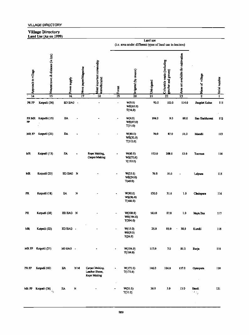
VILLAGE DIRECTORY
Villsee Directory Land Use {As on 1999}
Land use (i.e. area under different types of land use in hectare)
]' c
"i g .~ .~ .~
J '8 -g '3 u .. ·s "ii- ..
" ~ I .s j I ._ '"
:a '-' II) II)
~ cI!l ~ ~ I! ~ j Is I .?;- '01 S c>.. 8.1 ~ 1 [; ~ ,J;l
~ C>. i ...... .!! Iii §
1;; iil .!~ I ~.i g ~ c e § ! I 1;; 'E II)
~ 8: ~ Iii e _ u
~ ~ 0 'E ·s ~i s ~ !!:I ~ Ii I!= = i2 S rI)
14 IS 16 17 18 19 20 21 22 23 2 I
PRFP KOlputJi (36) EDEAG W(9.0} 93.0 102.0 114.0 Jhagdet Kalan III WE(6S.0) T(74.0}
PRMR KotpuOi (IS) EA W(4.0} 104.0 9.0 69.0 Bas SbekhaWBI 112 FP WE(67.0)
T(71.0)
MRFP KOIpulli (20) EA W(BO.O) 70.0 B7.0 SI.O Mandli 113 WE(32.0) T(1l2.0)
MR Kotputli (13) EA Rope Making, W(BO.O) 153.0 2BII.0 53.0 Toorana 114 Carpel Making WE(73.0)
T(ISl.O)
MR Kotpulli (23) EDEAG N W(2S.0) 76.0 30.0 Lalpura 115 WE(24.0) T(49.0)
PR Kolpulli (18) SA N W(RO.O) 130.0 31.6 1.0 Chainpura 116 WE(86.0) T(166.0)
PR Kotputli (20) EDEAG N W(200.0) 163.0 87.0 1.0 NayaBas 117 WE(194.0) T(394.0)
MR KotpuUi (22) EDEAG - W(IS.O) 25.0 85.0 38.0 Kundli 118 WE(9.0) T(24.0)
MRFP Kotputli (27) EDEAG - W(104.0) 117.0 7.0 81.0 Burja 119 T(104.0)
PRFP KotpuUi (40) EA NM Carpet Making. W(171.0) 146.0 104.0 137.0 Gyanpura 120 Leather Shoes, T(171.0} Rope Making
MRFP Kotputli (l8) . SA N W(31.0) 36.0 5.0 13.0 Basdi 121 ".:~ T(31.0) I'
369
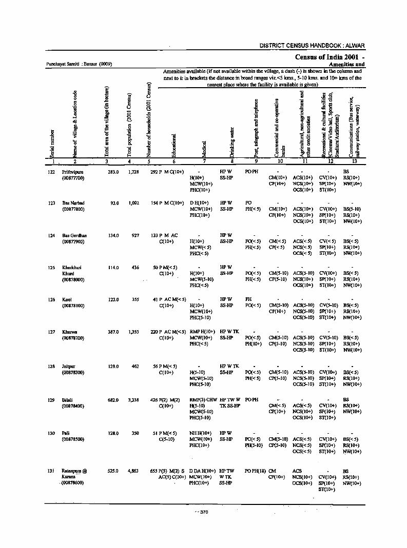
DISTRICT CENSUS HANDBOOK: ALWAR
Census of India 2001 _ Panchayat Samiti : Bansur (0009) Amenities and
Amenities available Cifnot available within the village, a dash C-) is shown in the column and next to it in brackets the distance in broad ranges viz.<5 kms., 5-10 kms. and 10+ kms of the
I ~ nearest [!Iace where the fscilit):: is available is givenl .. r!
"'_d "8 i: .,
CJ .! .a l! .. '" g ii ;:; § "" :.= u
g <:> l ._ ~
~ CJ t:!- -a .Ma
J :; .. i ]<Il,", 0 ...,
cIIJ ~ t:!- 1 ] 0 _. § u "8 ]I'r::
~ .s c ] .~ 0 I cIIJ id! ~ 'S .c "i!:5l'g
I ... '" 0 .§ ~ ~ ~ ..
..8 5 .E! ]I ]I ~ 0] ~ ~
3 4 5
122 Prithvipum 283.0 1,728 292 P M C(IOt) HPW PO PH BS (OOSmOD) H(1Ot) S8-HP CM{IO+) ACS(1D+) CV(lOt) RS(IO+)
MCW(lO+) CP(IO+) NCS(IOt) SptlOt) NW{IOt) PHC(10+) OCS(lD+) ST(IO+)
123 BasNarbad 93.0 1,092 IS4 P M C(IO+) DH{IO+) HPW PO (00877800) MCW(IO+) SS-liP PH«S) CM(IO+) ACS(IO+) CV(IO+) BS(5-IO)
PHC(IO+) CP(IO+-) NCS(IOt) 8p(10+) RS(IO+) OCS(IOt) ST(II)!.) NW(lO+)
124 Bas Gordhan 134.0 927 133P M AC HPW (00S77900) C(lO+) H(lO+) SS-liP PO«S) CM«S) ACS«S) CV«S) BS«S)
MCW{<S) PH«S) CP«S) NCS«5) Sp(IO+) RS(IOt) PHC«S) OCS«S) 8T{10+) NW(IO+)
125 Kharkhari 114.0 436 SOPM«S) liPW Khurd C(IO+) H(IOt) SS-liP PO« S) CM(S-IO) ACS(S-IO) CV(IO+) BS«S) (00878000) MCW(s-IO) PH«S) CP(s-IO) NCS(IO+) Sp(IOt) RS(IOt)
PHC«S) OCS(IO+) ST(IO+) NW(II)!.)
126 Kool 123.0 3SS 41 P ACM«S) liPW PH (00878100) C(IOt) H(IO+) S8-liP PO{<5) CM(S-IO) ACS(5-10) CV(5-IO) BS«5)
MCW(1o+) CP(1O+) NCS(S-IO) Sp(IO+) RS(IO+) PHC(S-IO) OCS(5-10) ST(IOt) NW(IO+)
127 Kharwa 387.0 I,3Ss 220P ACM«S) RMPH(lO+) liPWTK (00878200) C(tO+) MCW(IO+) SS-liP PO«S) CM(S-IO) ACS(S-IO) CV(S-IO) BS«S)
PHC«S) PH(IO+) CP(S-IO) NCS(S-IO) Sp(IO+) RS(IO+) OCS(S-tO) ST(II)!.) NW(IO+)
128 Jaitpur 128.0 462 56 P M«5) liPWTK (00878300) C(1O+) H(S-IO) S8-liP PO«S) CM(S-IO) AC8(S-10) CV(ID+) BS«S)
MCWeS-IO) PH«S) CP(S-IO) NCS(S-IO) SP(lO+) RS(IO+) PHC(S-tO) OCS(S-IO) ST(IO+) NW(IO+)
129 BUali 682.0 3,338 426 P(2) M(2) RMP(3) CHW liP TW W PO PH BS (00878400) C(IO+) H(s-IO) TKSS-lIP CM«S) ACS«S) CV(1O+) RS(IO+)
MCW(S-IO) CP(IOt) NCS(IOt) SP(IO+) NW(IOt) PHC(S-IO) OCS(IOt) ST(tO+)
130 Pali 128.0 3S0 51 PM«S) NHH(1Ot) liPW (00878S00) C(S-IO) MCW(IOt) S8-liP PO«S) CM(S-IO) ACS«S) CV(IO+) BS«S)
PHC(tO+) PH(S-tO) CP(S-IO) NCS«S) Sp(lo+) RS(IO+) OCS«S) ST(IO"') NW(IOt)
131 RatanPu.1:8 @ S2S.0 4,863 5SS PCS) M(2) S D J;>A H(1O+) liPTW POPH(1S) CM ACS BS Kamna AC(S) C(IOt) MCW(IO+) WTK CP(IOt) NCS(IO+) 'CV(I04') RS(IO+)
, . :(00878600) PHC(IO+) SS-liP OCS(IO+) SP(IO+) NW(IO+) ST(IOt)
"'370
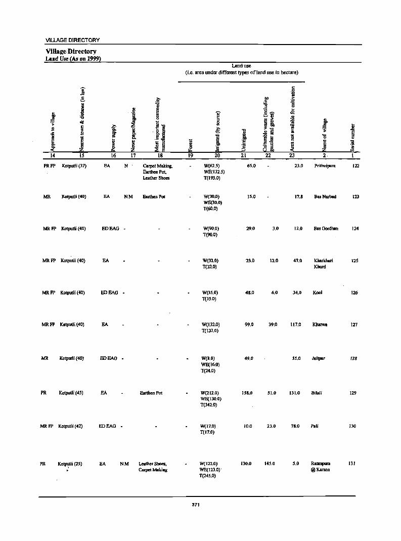
VILLAGE DIRECTORY
Villaj!e;Directory Land Use {As on 1999)
j g ~
" 'i3
S 0
:!! s
! 'i s 'i3 8 0111
~] .s: j
..., ~ s 'is.
J ~ !: '&os
.5.M I .. ~ ! li i
·20 20 ~ E 'i4 IS 16 17 18
PRFP Kotputli (37) BA N Carpet Making, Earthen Pot, Leather Shoes
MR Kolputli (40) EA NM EartheD Pot
MRFP Kotputli (40) EDEAG .
MR FP Kotputli (40) EA
MRFP Kotputli(40) EDBAG •
MR FP Kotputli (40)
MR Kotputli (40)
PR Kotputli (45)
MRFP Kotputli (42)
PR Kot~i(2S) >
EA
EDEAG
EA
EDEAG
EA
.
Earthen Pot
.
N M Leather Shoes, Cmpet Making
Land use
(i.e. area under different types of land use in hectare)
1;;
~ !!:I 19
371
]' '" Ii! ~ .., i '5 = 20
W(62.5) WE(132.5) T(195.0)
W(3D.D) WE(30.0) T(60.0}
W(9D.O) T(90.0}
W(l2.0) T(320)
W(3's.O) T(3S.0)
W(132.0) T(132.0)
W(B.O) WE(16.0) T(24.0)
W(212.0) WE(130.0) T(342.0)
W(17.0) T(17.0)
Wei 22.0) WE(123.0)· T(245.0)
"0
·t ·s i2 21
65.0
15.0
29.0
23.0
48.0
99.0
49.0
IS8.0
10.0
130.0
c 0 'iI
.~ > ',g
-g :; .. u .2 c .,..,_ ._ '" ~'"
~ .!! ..
~! 'a ~ ..2 Iii
l~ 0 c III - g ~ ael!
22 23
23.0
17.8
3.0 12.0
12.0 47.0
6.0 34.0
39.0 117.0
55.0
51.0 131.0
23.0 78.0
145.0 5.0
l .;; ... 0 .. fjj
20 2·
Prithyipura
BasNarbad
Bas Gordhan
Kharkhari Khurd
Kool
lailpur
Bilali
Pali
Ratanpura @Karanl
1l § c 'iI '5 ell
1
122
123
124
125
126
127
12B
129
130
131
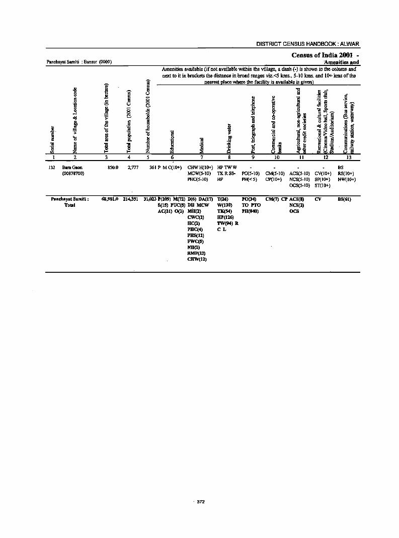
Panchayst Samiti : Bansur (0009)
I ., ] -.
l! i C 0 e-] u
~ c: ~ 15. old
I .M IS
1-'~
> 'S "3 e 8: 'S C
j 01 ! ! li !'!.!
1 2 3 4
132 BaraQaon 850,0 2,Tl7 (00878700)
Panchsyst Samlti : 68,981.0 114,351 Total
DISTRICT CENSUS HANDBOOK: ALWAR
Census of India 2001 -:Amenities and
Amenities available (if not available within the village, a dash (-) is shown in the column and next to it in brackets the distance in broad ranges viz, <5 kms" 5-10 kms, and 10+ lans of the
~ nearest l!lace where the facili~ is available is givenl ., 5
U
c: o C!. .{Ij
i _g ... l! 0 ,51 8
I ,&l j ~ 5 6 7
361 P M C{IO+) CHWH(IO+) MCW(S-IO) PHC(S-IO)
31,023 P(209) M(n} 0(6) DA(17) S(IS} PUC(S} DB MCW ACC:!l) 0(2) MD{l)
CWC(l) DC(2) PDC(4) PHS(Il) FWC(S) NH(l) RMP{:!:!) CHW(1%)
. 372
I:l j DO
,5 ~
~ 8
HPTWW TKRSS-HP
T(16) W(l30) TK(S4) HP(ll6) TW(94) R CL
§
i 1
1 a s E!:I 9
PO(S-10) PH« S)
PO(34) TO PrO PH(840)
] ~ i 1 8 '~,!l
§ ,1l ] c. ~ Oil ]'6 'e u "9 ~ ~i ~.~ ~.e 10 11
CM(S-IO) ACS(S-IO) CP(lO+) NCS(S-IO)
OCS(S-IO)
eM(7) CP ACS(8) NCS(2) OCS
fIl ,&l" '.1:1 ::t of ;.='13 ,2 '0 ~ ~,...., .:! 0 ~ ~ ]~,...., _. § ~~ "3 ] 'I:
~ g,g IS • 'J:! § 1:s-g ,~ 'j o~< § <II '.c ] ~ 5 ,_ S f
~~! e_ ~ 'c
12 13
BS CV(IO+) RS(IO+) SP(IO+} NW(IO+} ST(IO+)
cv DS(61)
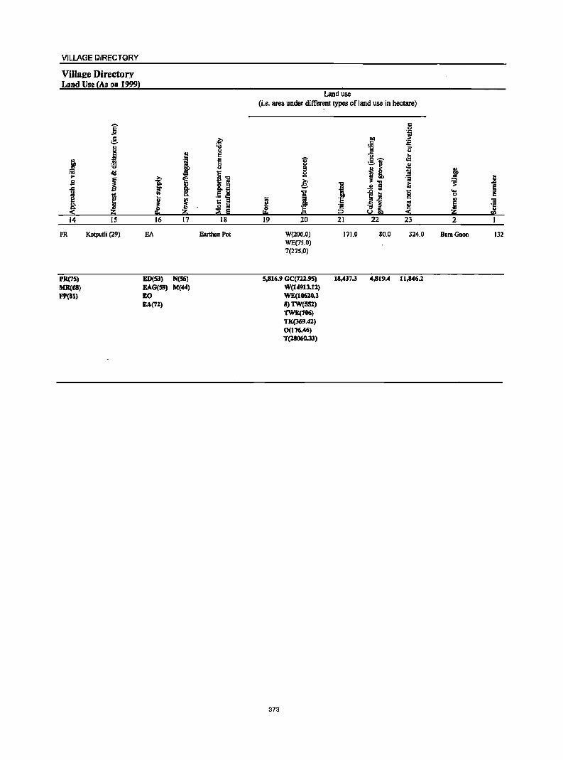
VILLAGE IJIRECTQRY
ViJ]a£e Directory Land Use (As on 1999)
j e .. u
~ ~ :a
old .;;: s i I J 14 15
PR Kolputli (29)
PR(75) MR(M1)
F'(Bl)
.~ .., 0 ., E c
i g u
i~ b
f D lit .5.!! c.
! l 1;; " o Iii ::E E
16 17 18
EA Earthen Pot
ED(53) N(56) EAG(59) M(44) EO EA(71)
Land use (i.e. area under different types ofland use in hectare)
c 0 "i
~ .~ '6 ;; '" u u ...
rS ... c -~
cfJ OJ
I! ~ ~ 2 ';j j e: I ..!! Iii i;; ~ ~ i 11 8 ...
0
I '5 ~ j 'iI
';: -3l ·c i2 5.!
.. I:!:! = <n
19 20 21 22 23 2 I
W(200.0) 171.0 80.0 324.0 BaraOaon 132 WE(7~j_0)
T{27S.0)
5,816.9 GC{722.95) 18,437.3 4,819.4 11,846.1 W(14913.11) WE(1061O.3 8)1W{SSl) TW£(706) TK(l69.41) 0(176.46) T{18060.33)
373

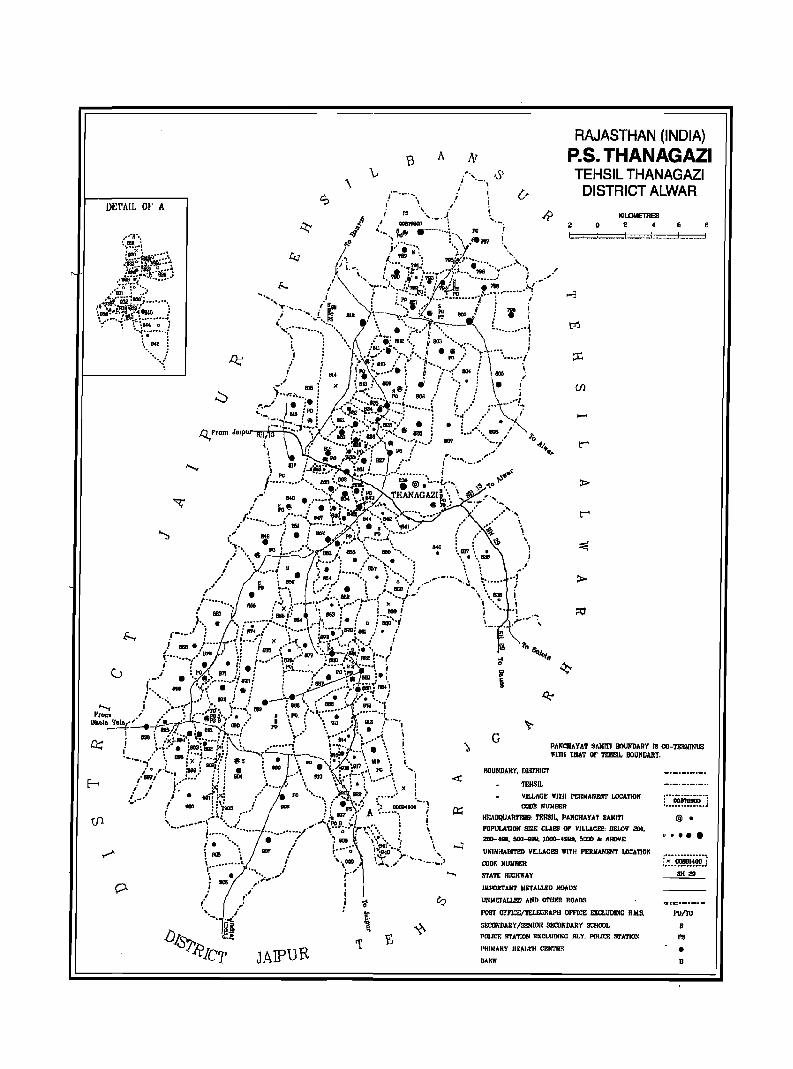
A
\
DE'I'AIL Qt' A
JAIPUR
RAJASTHAN (INDIA) P.S. THANAGAZI TEHSIL THANAGAZI
DISTRICT ALWAR
o L .... -J~~.......:
-
>
G
KILOMETRES 2
--I. 6 8 I ____ ='
PANCIIAYAT SAIiITI JIOUNIlAPY IS OO-'l'I!lIlIINIIS Wlnl THAT or mI5I~ BOUNDARY.
BOUNDARY, IlI!II'RIC1'
1EHSIL
YILLACE 111111 I'ERMANEHT LOCATION CODl! NtnlllER
Hr.AnquAllT191S: TEJ!SlI •• I'ANCHAYAT SAIII'I'I
POPULATIOX SIZE CLAES OF VILLACES: DELelf 2110, 200-"'''', sao-gag, 1000-4999, &IXIO ole AROVE
UNINHABITED YILLACI'S lVlTII PERIIANENT LO:ATJOK
OODf. lfUN'Hf.R
STATE HICHlIAY
IIIPOIITAN1' W.,.ALLI!D IIOADS
UMMEl ALLEn AND OTIIER ROADS
P05J ~FICE/'l£LEX;RAPH omCE EXCLtlDIIIC R.II.5.
SECONDARY.fS;:NIOR SJi!DfiDARY SCHOOL
pmJCP. !n'A'l'iON EXCLUDlI\:C RLY. POUCE S'J'ATION
I'NIMARY HF.~I.TH CENTR!=:
DANJ(
@ •
'" .... !:.:~~!!~~:}
BH 29
PO/TO
5
I'S
• B

VILLAGE DIRECTORY
ALPHABETICAL LIST OF VIlLAGES (P ANCHA YA T SAMITI WISE)
PancbayatSamiti: Tltanagazi (0010)
SI.Nl. Name of village 2001 Census Location I 991 Census weat ion Code Number Code Number
2 3 4
Tehsil : Th8nagazi (Full)
Agar 00886600 050080010001000079
2 Ajabgarh 00893700 050080010001000150
3 Ajabpura 00879400 050080010001000007
4 Arnka 00886800 050080010001000081
5 ArnraKa Bas 00884100 050080010001000054
6 Angari 00885000 050080010001000063
7 Bairawas 00880500 050080010001000020
8 Bakhatpura 00881800 050080010001000031
9 Balloowas 00891100 050080010001000124
.' 10 Bamanwas Chilugan 00888000 050080010001000093
11 Bamanwas Kankar 00880300 050080010001000018
12 Banchhri 00888200 050080010001000095
13 Bandro! 00881700 050080010001000030
14 Barh Doli 00882300 050080010001000036
15 Barh Goojran 00882500 050080010001000038
16 Bas Beesa 00882200 050080010001000035
17 Bas Booriya 00879500 050080010001000008
18 Basai Abhairam 00882800 050080010001000041
19 Basai Jogiyan 00880900 050080010001000024
20 Bhadach 00886700 050080001000100080
21 Bhangdoli 00884400 050080010001000057
22 Bhanwata 00887400 050080010001000087
23 Bheekampura 00888500 050080010001000098
24 Bhoodiyawas 00882600 050080010001000039
25 Bhooriyawas 00887300 050080010001000086
26 Biharisar 00883100 050080010001000044
27 ChahaKa Bas 00889800 050080010001000111
28 Chandpura 00889000 050080010001000103
29 Chandpuri 00878900 050080010001000002
30 Chosla 00887100 050080010001000085
31 Churani 00885200 050080010001000065
32 Dahra 00881600 050080010001000029
33 Daulatpura 00888600 050080010001000099
34 Dera 00887800 050080010001000091
35 Dhaital 00884500 050080010001000058
36 Dhigariya 00883200 050080010001000045
37 Doomeda 00886400 050080010001000077 .. 377
DISTRICT CENSUS HANDBOOK: AIJIIJAR
ALPHABETICAL LIST OF VIlLAGES (p ANCHA VAT SAMITI WISE)
PanchayatSamiti : lbanagazi (0010)
Sl.'!IC. Name of village 2001 Census Location 1 991 Census LDcat ion Code Number Code Number
2 3 4
38 Doonga Ka Bas 00879200 050080010001000005
39 Duhar Chaugan 00882700 050080010001000040
40 Duharmaia 00880700 050080010001000022
41 Dwarapur 00882900 050080010001000042
42 Ganeshpura With Rundh Kali Ghati 00884000 050080010001000053
43 Garb Basai 00884800 050080010001000061
44 Garhi 00878800 050080010001000001
45 Goojron Ka Guwara 00889200 050080010001000105
46 Gopalpura 00888400 050080010001000097
47 Govindpura 00891200 050080010001000125
48 Gowari 00884700 050080010001000060
49 Gurha 00885300 050080010001000066
50 Gurha Kishordas 00885400 050080010001000067
51 Guwara Bandipul 00894000 050080010001000153
52 Guwara Bhagwan 00893000 050080010001000]43
53 Guwara Bhooriyawali 00892200 050080010001000135
54 Guwara Bhopala 00883400 050080010001000047
55 Guwara Birkari 00893600 050080010001000149
56 Guwara Dabar 00892300 050080010001000136
57 Guwara Dhasi 00892500 050080010001000138
58 Guwara Dulawa 00893900 050080010001000152
59 Guwara GugH 00894100 050080010001000154
60 Guwara Hanuman 00892700 050080010001000140
61 Guwara Har 00893200 050080010001000145
62 Guwara Jamadar 00893400 050080010001000147
63 Guwara Janawat 00893100 050080010001000144
64 Guwara Ka10t 00892900 050080010001000142
65 Guwara Kalyan 00891700 050080010001000130
66 Guwara Kundal 00892100 050080010001000134
67 Guwara Lala Bhaiya 00892600 050080010001000139
'68 ' Guwara Leswa 00894300 050080010001000156
69 Guwara Naidoli 0089]600 050080010001000129
7(;'-; Guwara Nitbha 00894400 050080010001000157
71" Guwara Pakhal 00891800 050080010001000131
-'1';' GuwaraRadi 00894200 050080010001000155
:·7J'; Guwara RaiDji 00894500 050080010001000158
74" Guwara Sadararir 00891500 050080010001000128-'7Sg~- Guwara Saliiba'-·i~' 00892800 ~, __ 050080010001000141
'3.78
VILLAGE DIRECTORY
ALPHABETICAL LIST OF VIlLAGES (p ANCHA YA T SAMIn WISE)
PancbayatSamiti: Tbanagazi (0010) SI.1'«>. Name of village 2001 Census Location 1 991 Census locat ion
Code Number Code Number
1 2 3 4
76 Guwara Seeli Baori 00892000 050080010001000133
77 Guwara Seera 00892400 050080010001000137
78 Guwara Soti 00893500 050080010001000148
79 Guwara Vyas 00893300 050080010001000146
80 Hameerpur 00890400 050080010001000117
81 Hamer 00884300 050080010001000056
82 Heensla 00881900 050080010001000032
83 Hodayli 00888100 050080010001000094
84 Jagannathpura 00890900 050080010001000122
85 Jaisingbpura 00886300 050080010001000076
86 Jaitpur Brahmnan 00891300 050080010001000126
87 Jaitpur Goojran 00890500 050080010001000]18
88 Ihankri 00885]00 05008001000]000064
89 Jhiri 00888900 0500800]0001000102
90 Jodhawas 00885600 050080010001000069
91 Jodhpura 00880200 0500800]0001000015
92 Kabli Garh 00887700 0500800]000]000090
93 Kalalanka 00887900 050080010001000092
94 Kaler 00890700 050080010001000120
95 Kanpura ( Loj ) 00879800 0500800]0001000011
96 KamaKa Bas 00883900 050080010001000052
97 Kharkhari Kalan 00879700 0500800100010000]0
98 Kharrika 00885900 050080010001000072
99 Kishori 00888300 0500800]0001000096
]00 Kola Ka Bas 00882400 0500800]0001000037
]0] Kolahera 00880100 05008001000]0000]4
102 Kundalka 00883800 050080010001000051
103 Kundla 00891400 050080010001000127
104 Kyara 00888700 050080010001000100
105 Ladoowas 00879600 050080010001000009
106 Laba Ka Bas 00884200 050080010001000055
107 Lalpura 00889300 050080010001000106
108 Lila Marha 00881000 050080010001000025
109 Lothawas 00890000 050080010001000113
110 Madhogarh 008119600 050080010001000109
III Malootana 00881500 0500800]0001000028
112 Manawas 00879900 050080010001000012
113 Mankot 00882000 050080010001000033
379
DISTRICT CENSUS HANDBOOK: ALWAR
ALPHABETICAL LIST OF VIlLAGES (P ANCHA YAT SAMIn WISE)
PanchayatSamiti: Thanagar.i(OOlO)
SI.No. Name of village
114
115
116
117
118
119
120
121
122
123
124
125
126
127
128
129
130
131
132
133
134
1jS'
136
131 138
139
140
141
142
14j'
144
145
i'zi6 " 14'7'"
"! ,\ "'~ 'k - _ ~"
2
Mejod
Mundawara
Mundiyawas
Nagel
NangalBani
Nangalheri
Narayanpur
Narhat
Nathoosar
Nitata
Pachpadi
Padak Chhapli
Piplai
Pratapgarh
Prempura
Rah KaMala
Raipura
Rajpura Jageer
Rajpura Sikh
Roopu Ka Bas
RundhAgar
Rundh Ajabgarh
Rundh Hameerpur
Rundh Jhiri
Rundh Lalpura
Rundh Lothawas
Rundh Narayanpur
Rundh Pachpadi
Rundh Pratapgarh
Rundh Seeli Baori
Saleta
Samra
Sanwatsar
Seeli Baori 'lij8~:" : ... , •.... ,,~~," Shyampura
{;1~9~,>( ,',i,Y> t/<tiV" ':; Shyampura Jageer"
'i-50;;:" .' 'y;.; ,'i"t~ '- :: Siraska •. ' .
Suratgarh .~-. ,"~ •..
. ' .. _" .,-.
380
2001 Census Location 1991 Census lDcation Code Number Code Number
3 4
00886200 050080010001000075
00880000 050080010001000013
00885500 050080010001000068
00889700 050080010001000110
00884900 050080010001000062
00880600 050080010001000021
00881200 050080010001000016
00886900 050080010001000083
00883500 050080010001000048
00890600 050080010001000119
00889500 050080010001000108
00887000 050080010001000082
00891000 050080010001000123
00889100 050080010001000104
00879300 050080010001000006
00880400 050080010001000019
00886000 050080010001000073
00883000 050080010001000043
00879000 050080010001000003
00884600 050080010001000059
00886500 050080010001000078
00893'800 05008001000100015]
00890300 050080010001000116
00887500 ' 050080010001000088
00889900 050080010001000112
00890100 050080010001000114
00881400 050080010001000027
00889400 050080010001000107
00890200 050080010001000115
00894600 050080010001000159
00883300 050080010001000046
00890800 050080010001000121
00887600 050080010001000089
00891900 050080010001000132
00886100 . ;:~ 050080010001000074
00879100 r;>.Pf .... ,-:-":~-t~~'_l 050080010001000004
00883700 ".:i< •. ".<~~.>,: 050080010001000050
00888800 ; I. ;'f.4~~ !:.~:;' , .' 0500800100010001D1
VILLAGE DIRECTORY
ALPHABETICAL LIST OF VIILAGES (pANeRA VA T SA Min WISE)
PanebayatSamiti: Thanaga7.i(OOlO)
SI.No. Name of village 2001 Census Location 1 991 Census I..ocation CodeN umber Code Number
J 2 3 4
0152_ Surjanpur 00882100 050080010001000034
'153 Thanagazi 00883600 050080010001000049
)15~ Toda 00887200 050080010001000084
;155 Todi Luharan 00885700 050080010001000070 ,
~156 Todi Neejran 00885800 050080010001000071
157, Tolawas -00880800 050080010001000023. .;.._'" ... ,. ","
IS8 Turkiyawas 00881100 050080010001000017
159- - Vtiaipura 00881300 050080010001000026
381
DISTRICT CENSUS HANDBOOK: ALWAR
Census of India 2001 -Panchayat 8amiti : Thanagazi (00 I 0) Amenities and
Amenities available (if not available within the village, a dash (-) is shown in .the column and
next to it in brackets the distance in broad ranges vii.<S kms .• 5-10 kms. and 10+ kms of the
I 'i nearest elace where the facili!l;: is available is given}
~ 'OJ' ii i ij..r:l' 8 :::J U ."" -= .§" '" s ~ 0 !! .i: I
:.= u g 8- i I
'(j ~ !J .~ u o:I&. g } 8 .. ...l
... 11 0
t·R ]<1)--old !:!. '0
"5 8 _- ~ e > 1 "3 Jl 'c .. .~ "5 6'!! ..
~ oS , ..<:: c 8 ~ g .-e! IS cf 1l '(l ..8
~ 1 l; l~ 'B 'iiI 0 "S '(l 'iI .2 'i
~ .. g Co
j ._ ~ i ... &. j .., :;] ~ t 0 'iI ~ 11
'iI '" ! :6 E '"
i~ i fi ._
! 'iii e l §"5 '5 ~ :::J
~ ~ ~.= 'E' 8:= !'G Z I:!:l ~.e ~!:a r=! ~ 1 2 3 4 5 6 7 8 9 10 II 12 13
P8DehByat Samitl : TbllDagazi (0010)
GBrhi 1.963,0 5.306 714 P(3) M S PHCPH8 THPTW POPH(B) ACS B8 (00878800) C(IO+) H(IO+) W S8-HP' CM«S) NCS(IO+) CV(10+) R8(10+)
MCW(lo+) Cp(IO+) OCS(IO+) Sp(IO+) NW(lo+) 8T(10+)
2 Chandpuri 378.0 1.929 25SP M 8 HPW (00878900) CCIO+) H(IO+) SS-HP PO(5-1O) CM«5) ACS« 5) CV(IO+) 8S«5)
MCW(IO+) PH(S-IO) CP«S) NCS(lO+) sp(10+) RS(IO+) PHC(S-IO) OCS(IO+) ST(1O+) NW(IO+)
3 R8jpura Sikh 235.0 1.426 224PM«S) : - HPWTK PH
(00879000) C(S-IO) H(S-IO) SS-HP PO«S) CM«S) ACS(S-IO) CV(IO+) BS(5-10) MCW(S-IO) CP(IO+) NCS(IO+) SP(IO+) RS(S-IO) PHC(S-tO) OCS(IO+) ST(1O+) NW(tO+)
4 8hyampura 128.0 732 90 PM« Sj HPWTK Jageer C(IO+) H(IO+) S8-HP PO«S) CM«') ACS«5) CV(S-IO) B8« 5) (00879100) MCW«5) PH«S) Cp(IO+) NC8(10+) SP(to+) RS(IO+)
PHC(S-IO) OCS(1O+) ST(IO+) NW(IO+)
5 Doonga Ka Bas 112.0 485 S6PM«S) HPWTK PO PH
(00879200) C(5-IO) H(IO+) SS-HP CM«S) ACS«S) CV(IO+) BS(S-IO) MCW(S-tO) CP(IO+) NCS(IO+) SP(IO+) RS(tO+) PHC(5-10) 0(:8(10+) ST(tO+) NW(IO+)
6 Prempura 128.0 781 99PM«S) HPW PH(6) BS (00879300) C(IO+) H(S-IO) SS-HP PO« 5) CM«S) . ACS« 5) CV(IO+) RS(IO+)
MCW(10+) CP(1O+) NC8(10+) SP(IO+) NW(tO+) PHC(S-IO) . OCS(lO+) ST(lO+)
7 AjBbpura 246.0 3,2t4 488 P(4) M(3) DARMP THP POPH(IO) CM ACS BS (00879400) S PUC H(IO+) TW CP(lo+) NCS(IO+) CV(tO+) RS(IO+)
C(IO+) MCW(S-IO) WSS-HP OC8(10+) Sp(U)+) NW(tO+) PHC(.5-IO) ST(1O+)
8 Bas Booriya 72.0 468 6OPM«5) HP (00879500) C«S) H(lo+) TWW PO« 5) CM«5) ACS«S) CV(IO+) BS« 5)
MCW(IO+) TKR PH« S) CP(tO+) NCS(IO+) SP(IO+) RS(tO+) PHC(IO+) S8-HP OCS(IO+) ST(IO+) NW(1O+)
9 LadoOWBS 346.0 1.176 137PM{<S) HPWTKR (00879600) C(S-IO) H(IO+) S8-HP PO«S) CM«S) ACS«S) CV(S·IO) B8«5)
MCW(IO+) PH(IO+) CP«S) NCS(IO+) Sp(IO+) RS(tO+) PHC(IO+) OC8(tO+) ST(IO+) NW(IO+)
10 Kharkhari 1.739.0 2.759 403 P MC«S) DAH(IO+) THPTW POPH(3) BS KaJan MCW(IO+) WTK CM{<S) ACS{<S) CV(lO+) RS(IO+) (00879700) PHC(IO+) SS-HP CP(IO+) NCS«S} SP(IO+) NW(IO+)
OCS«S) ST(IO+)
II Kanpura ( Loj ) 949.0 2.252 310'!> ,M« S) HPWTKR PH(3) (00879800) C(,<5) H(IO+) S8-HP PO«S) CM{<5) ACS«5) CV(IO+) BS«5)
MCW(IO+) CP(IO+) NCS(IO+) SP(IO+) RS(IO+). PHC(IO+) OC8(10+) ST(JO+) NW(Jo+)
382
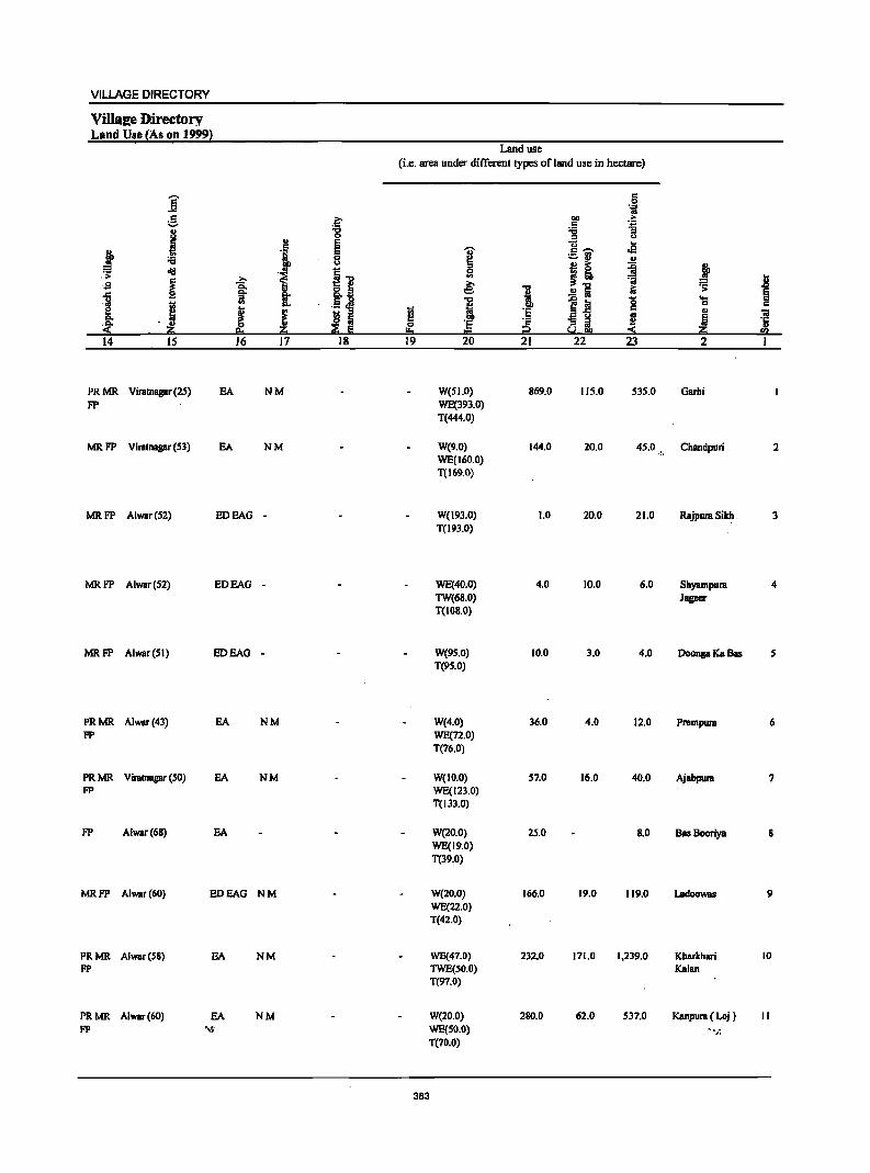
VILLAGE DIRECTORY
VilIa2e 'Directory Land Use {As on 1999}
Land use (i.e. area under different types of land use in hectare)
j c 0 .~
g ~ bI) .. c 1i
j '6 '6 0 " <>
" ~ (j .2 c
I ,t .J c .-, ._ ..
0 - .. .. ·U ! ~ ~ j <11:1 ~] 0 ::;:
I ... .. :;i t sa ~ U 8..13 ~ 1 .!!1 10 ~
1 .. s: .13 .M i ~1! 8 .... 11: 0 c
§ J l s " tl 'E '" 01 .c.. ~ E
I!:! ·s ~ ~ ~ I ~ ·c 0 u
~ ~ !!:o t::! SolS!!! :::!: fa 14 15 16 17 18 19 20 21 22 23 2 I
PRMR ViratnBgar (25) EA NM W(51.0) 869.0 115.0 535.0 Garhi FP WE(393.0)
T(444.0)
MRFP ViratnBgar (53) EA NM W(9.0) 144.0 20.0 45.0 ... Chandpuri 2 WE(160.0) T(169.0)
MRFP Alwar(52) EDEAG - W(193.0) 1.0 20.0 21.0 Rajpura Sikh. 3 T(193.0)
MRFP Alwar(52) EDEAG - WE(40.0) 4.0 10.0 6.0 Shyampura 4 TW(68.0) Jageer T(108.0)
MRFP Alwar(51) EDEAO - W(9S.0) 10.0 3.0 4.0 Doonga Ka Bas 5 T(9S.0)
PRMR Alwar(43) EA NM W(4.0) 36.0 4.0 12.0 Prempura 6 FP WE(n.0)
T(76.0)
PRMR Viratnagar (SO) EA NM W(IO.0) 57.0 16.0 40.0 Ajabpura 7 FP WE(123.0)
T(l33.0)
FP Alwar(68) EA W(20.0) 25.0 8.0 Bas Booriya 8 WE(19.0) T(39.0)
MRFP Alwar(60) EDEAG NM W(20.0) 166.0 19.0 119.0 Ladoowas 9 WE(22.0) T(42.0)
PRMR Alwar(S8} EA NM WE(47.0) 232.0 171.0 1,239.0 Kharkhari 10 FP TWE(50.0) Kalan
T(97.0)
PRMR Alwar(60) EA NM W(20.0) 280.0 62.0 537.0 Kanpura ( Loj ) II FP .... Jj.: WE(50.0) ...... J:
T(70.0)
383
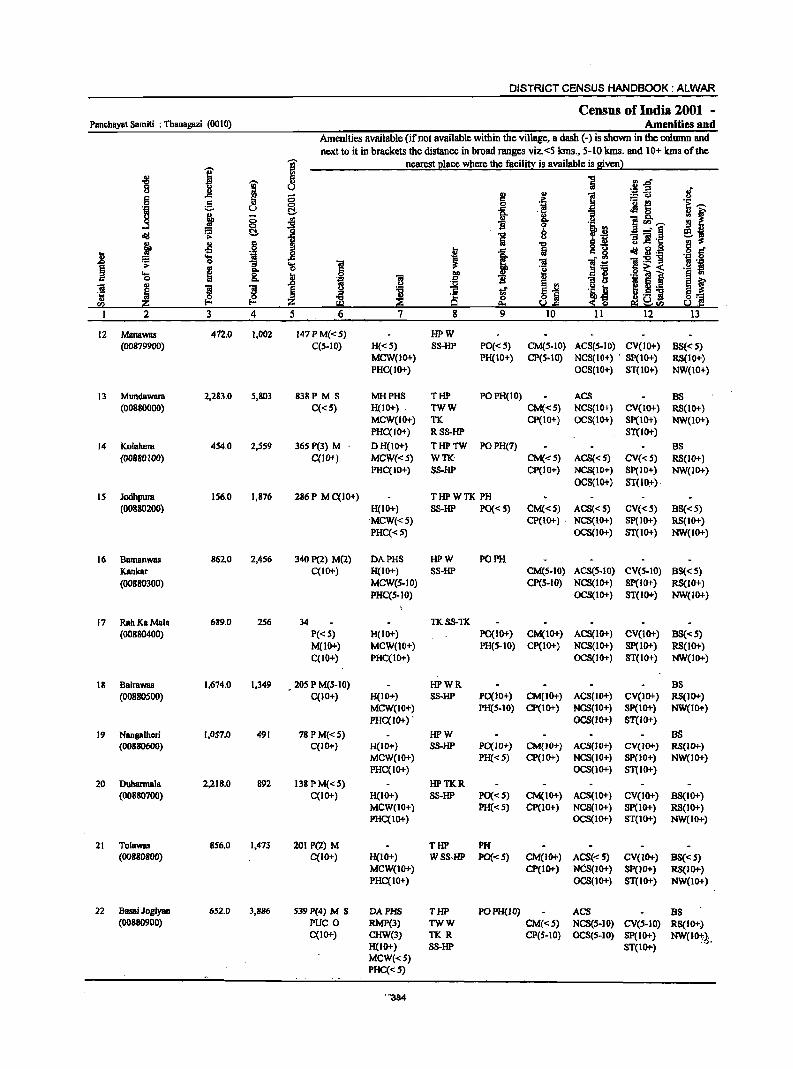
DISTRICT CENSUS HANDBOOK: ALWAR
Census of India 2001 -Panchayat Samiti : Thanagazi (0010) Amenities and
Amenities available (if not available within the village, a dash (-) is shown in the column and
next to it in brackets the distance in broad ranges viz.<5 krns., 5-10 kIns. and 10+ krns of the
j ~ nearest I!lace where the facilitt is available is Biven l ~
1 ~ ] 11.d' c <> ~-5 .~ tJ 1! ....
I u ] 5 ;§. 0 1
._ e 0 R~ ·til u C!- Jl <>
j "13 l!I f tJ 0
1 II) ... ] ~ '"' <> '§ '€j, ~ ....l 0 ~ diI ~ t:!. ~
_' § Sf tJ ~ :! e ]!.~ j .,
·1 "'C .~ g oS t i 5 r:::, ~ i<I :a.
i 'S _g ]:5!11 := "3 'S ] ]I ] .~ B 'J:! ;>-
~ ... a o ~-< ._ fI
..... C till B~ I i 0 &. ..8 'il 'iI .5 'B u ._ ~
~ .. ]I ]I I ~ ~1 I ~._ ~ m u tf 'Ii, n
~ ~ ~ 9 0 $-g ._ 11
~] !l2 :z: e:. 5.!&l el ~ fI)
2 3 4 5 6 7 8 9 10 II 12 13
12 Manawas 472.0 1,002 J47PM«S) HPW (00879900) C(S·IO) H«S) SS-HP PO« 5) CM(S-IO) ACS(S.]0) CV(JO+) BS«5)
MCW(10+) PH(10+) CP(S·IO) NCS{lO+) . SP(IO+) RS(IO+) PHC(IO+) OCS(10+) ST(10+) NW(IO+)
13 Mundawara 2,283.0 5,803 838P M S MHPHS THP POPH(IO) ACS BS (00880000) C«S) H(lO+) TWW CM«S) NCS(IO+) CV(IO+) RS(IO+)
MCW(IO+) TK CP(10+) OCS(IO+) Sp(IO+) NW(10+) PHC(JO+) RSS-HP S'I'(IO+)
14 Kolah"ra 454.0 2,S59 365 P(3) M DH(tO+) THPTW POPH(7) BS {00880J00) C{lO+) MCW«S) WTK CM«5) ACS«5) CV{<5) RS{lO+)
PHC(IO+) SS-HP CP(IO+) NCS(IO+) Sp(IO+) NW(IO+) OCS(lO+) ST(lO:,")
IS JodhpulB IS6.0 1,876 286 P M C(10+) THPWTK PH (00880200) H(IO+) SS-HP PO« 5) CM«S) ACS«S) CV«S) BS«5)
"MCW«5) CP(IO+) . NCS(IO+) SP(IO+) RS(lO+) PHC« S) OCS(IO+) ST(IO+) NW(10+)
16 Bamanwas 862.0 2,4S6 340 P(2) M(2) DAPHS HPW PO PH Kankar C(IO+) H(IO+) S8-HP CM(S.IO) ACS(5-IO) CV(S-IO) 8S« S) (00880300) MCW(S-JO) CP(S-IO) NCS(lo+) Sp(IO+) RS(10+)
PHC(S·IO) OCS(IO+) ST(IO+) NW{IO+)
17 RahKaMala 689.0 2S6 34 TKS8-TK (00880400) P«S) H(lO+) PO(lo+) CM(IO+) ACS(IO+) CV(1O+) 00«5)
M(IO+) MCW(IO+) PH(S-IO) Cp(IO+) NCS(10+) SPCIO+) RS(lO+) C(IO+) PHC(IO+) OCS(IO+) 8T(l0+) NW(IO+)
18 BairaWllll 1,674.0 1.349 _ 205 P M(S.IO) HPWR 8S (00880500) C(IO+) H(IO+} SS-HP PO(JO+) CM(JO+} ACS(lO+} CV(IO+} RS(IO+)
MCW(lO+) PH(S.IO) CP(lO+) NCS(IO+) SP(lO+) NW(IO+) PHC(IO+)' OCS(IO+) S'I'(IO+)
19 Nangalhcri 1,057.0 491 78 P M«5) HPW BS (00880600) C(IO+) H(IO+) SS-HP PO(I 0+) CM{IO+) ACS(IO+) CV(IO+) RS(IO+)
MCW(JO+) PH«S) CP(IO+) NCS(lO+) SP(JO+) NW(lo+) PHC(IO+) OCS(JO+) ST(JO+)
20 Duharrnala 2,218.0 892 138 P M«S) HPTKR (00880700) C(IO+) H(IO+) S8-HP PO«S) CM(IO+) ACS(lO+) CV(IO+) 8S(10+)
MCW(lO+) PH«5) Cp(IO+) NCS(lO+) SP(1O+) RS(IO+) PHC(IO+) OCS(IO+) ST(IO+) NW(IO+)
21 Tolawas 856.0 1.473 201 P(2) M THP PH (00880800) C(IO+} H(10+) WSS-HP PO«S) CM(IO+) ACS«S) CV(IO+) BS«S)
MCW(IO+) CP(IO+) NCS(IO+) Sp(JO+) RS(IO+) PHC(10+) OCS(1O+) ST(lO+) NW(lO+)
22 Basai Jogiyan 652.0 3,886 539 P(4) M S DAPHS THP POPH(IO) ACS BS (00880900) PUC 0 RMP(3) TWW CM«5) NCS(S-IO) CV(S-IO) RS(JO+}
C(IO+) CHW(3) TKR CP(S-IO) aeS(S-IO) SP(IO+) NW(lO+,) . H(lO+) S8-HP ST(IO+)
•• (f
MCW«S) PHC(<:S)
'''384
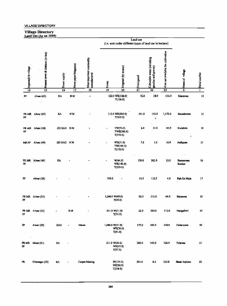
VILLAGE DIRECTORY
Villa2e Directory Lan,d'Use (As on 1999)
i g .. J Iii> ....
~ diI
~ S
1i I ~ ... ::r; z 14 15
FP Alwsr(42)
PRMR Alwar(42) ·fP
PRMR Alwar(50) fP
MRFP Alwar(49)
PRMR Alwar(40) FP
fP Alwar(2B)
PRMR Alwar(35) fP
PRMR Alwar(33) fP
j:p Alwar(20)
PRMR Alwar(41) FP
..?;>
§: ...
J 16
EA
EA
EDEAG
EDEAG
EA
EAG
EA
PR Viratnagar (20) EA
b :g
I E
~ i ...
ou 8.~ Ii!' "" .5 oM
i fi ::I
~ e 17 18
NM
NM
NM
NM
NM
Mawa
Carpet Making
Land use (i.e. area under different types ofland use in hectare)
c 0 'i
! >-':1 :;
.E u
'OJ' g ...... .e !::! :.=or: .. ::I j! :g j 51 ~ II e: ... 1;;
:=
i .!! a >-~ 1 1~ 0 os
f! 'E c .. 'iI '5 :§ '13 ::I ! ! .t;
0 u, ou ... = !j!'.l
19 20 21 22 .' 23 '2
122.0 WE(l26.0) 72.0 38.0 114.0 Manawas 12 T(126.0)
112.0 WE(30S.0) SSI.O 143.0 1,172.0 MundawarB 13 T(30S.0)
TW(72.0) 6.0 31.0 45.0 Kolabera 14 TWE(300.0) T(372.0)
WE(31.0) 7.0 1,0 16.0 Jodbpura IS TW(IOI.O) T(132.0)
W(44.0) 239.0 382.0 12.0 Bamanwas 16 WE(IBS.O) Kankar T(229.0)
559.0 14.0 112.0 4.0 RahKaMala 17
1,260.0 W(49.0) 90.0 211.0 64.0 Bairawas 18 T(49.0)
651.0 W(31.0) 22.0 240.0 113.0 Nangalheri 19 T(31.0)
1,680.0 W(31.0) 1n.0 162.0 138.0 Duharmala 20 WE(30.0) T(61.0)
211.0 W(30.0) 280.0 142.0 126.0 Tolawas 21 WE(67.0) T(97.0)
W(174.0) 285.0 6.2 125.0 Basai Jogiyan 22 WE(62.0) T(236.0)
385
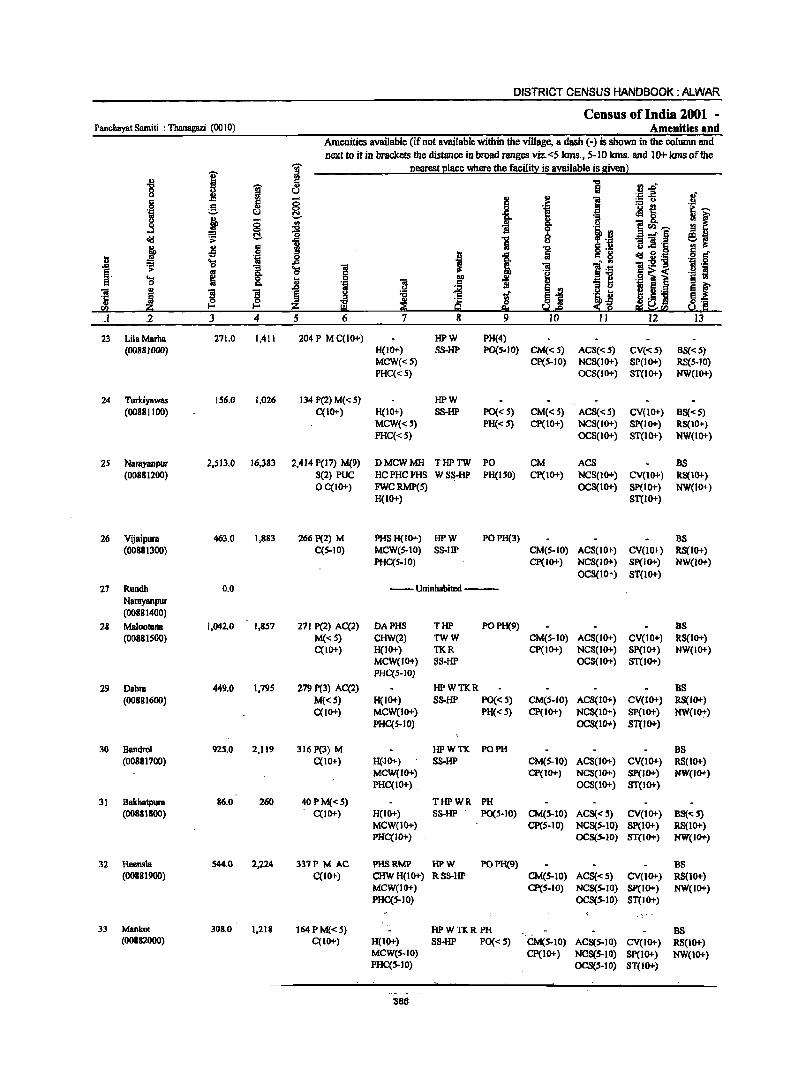
DISTRICT CENSUS HANDBOOK: ALWAR
Census of India 2001 -Panchayat Samiti : Thanagazi (0010) Amenities and
Amenities available (if not available within the viUage, a dash (-) is shown in the column and next to it in brackets the distance in broad ranges viz. <5 kms., 5-10 kms. and 10+ kms of the
I ~ nearest Elace where the facili!_X is available is given l ., 8 "5 :1..0 "8 W t!
., 1
'D ..E oj' c G ;; ... :.= u .!.! 0 ~ §_ i
.~ ._ ~
~~ .~ u ~8. ~i ~ ~
.. g. " .3 "" li e <Il '""
~ '0 8 l3 _" ~ e Oil 1 "5 j 5 6 i =] 'r:: § " o .- u s
I .r: = 8 b .... 'il .8 t 0iI~:a OJ:; 6 .&> ~ 0
I 'S 1 'iii 1'; '!.- :s 8 .-g. ID .~
.9 ~ i ._ ~ ~ fil u 'iii
.., ., ~] ~ f c j ] til e
:e " ~ ~ ~ !:! :a t §i ~i ti " .~ .. ~
~ ~ .S 'j §,....
<Il dO 8:0 5.1.e as ~SQ 5.1.~ . .1 2 3 4 5 6 7 8 9 IO II 12 13
23 Lila Marha 271.0 1,411 204 P M C(10+) HPW PH(4) (00881000) H(IO+) SS-HP PO(S-IO) CM«5) ACS« 5) CV«S) BS« 5)
MCW«S) CP(S-IO) NCS(IO+) SP(IO+) RS(S-IO) PHC«S) OCS(IO+) ST(IO+) NW(IO+)
24 Turlciyawas IS6.0 1,026 134 P(2) M« 5) HPW (00881100) C(IO+) H(IO+) 8S-HP PO« S) CM«S) AC8«S) CV(10+) BS«S)
MCW«S) PH« S) Cp(IO+) NCS(IO+) SP(IO+) RS(IO+) PHC«S) OCS(IO+) ST(IO+) NW(lo+)
2S Narayanpur 2,513.0 16,383 2,414 P(I') M(9) DMCWMH THPTW PO CM ACS BS (00881200) 8(2) PUC HCPHCPHS WSS-HP PH(ISO) Cp(IO+) NCS(IO+) CV(IO+) RS(IO+)
OC(IO+) FWCRMP(S) OCS(1O+) SP(IO+) NW(lO+) H(IO+) ST(IO+)
26 Vijaipura 463.0 1,883 266 P(2) M PHSH(IO+) HPW POPH(3) BS (00881300) C(S-IO) MCW(S-IO) SS-HP CM(S-IO) ACS(IO+) CV(lO+} RS(IO+}
PHC(5-1O) Cp(IO+) NCS(IO+) Sp(IO+) NW().()+) OC8(IO+) ST(lO+)
27 Rundb 0.0 --Uninhabited ----Narayanpur (00881400)
28 MaloofBna 1,042.0 1,857 271 P(2) AC(2) DAPHS THP POPH(9) as (00881S00) M«S) CHW(2) TWW CM(S-IO) ACS(IO+) CV(10+) RS(IO+)
C(IO+) H(IO+) TKR Cp(IO+) NCS(IO+) SP(IO+) NW(IO+) MCW(IO+) SS-HP OCS(IO+) ST(1O+) PHC(5-JO)
29 Dabra 449.0 1,795 279 P(3) AC(2) HPWTKR DS (00881600) M«5) H(IO+) SS-HP PO«S) CM(S-IO) ACS(IO+) CV(IO+) RS(IO+)
C(lO+) MCW(lO+) PH« 5) CP(10+) NCS(IO+) SP(lO+) NW(l07) PHC(5-IO) OCS(IO+) ST(IO+)
30 Bandml 925.0 2,119 316 P(3) M HPWTK PO PH BS (00881700) C(IO+) H(IO+) SS-HP CM(S-IO) ACS(lO+) CV(IO+) RS(IO+)
MCW(IO+) Cp(IO+) NCS(IO+) SP(IO+) NW(IO+) PHC(IO+) . OCS(IO+) ST(IO+}
31 BBkhatpura 86.0 260 40 PM« S) THPWR PH (00881800) C(IO+} H(IO+) SS-HP PO(S-IO) CM(5-10) ACS«S) CV(lO+) B8«S)
MCW(IO+) CP(S-IO) NCS(S-lO) SP(lO+) RS(IO+) PHC(IO+) OC8(S-lO) ST(IO+) NW(IO+)
32 Hccnsla 544.0 2,224 317P M AC PHSRMP HPW POPH(9) BS (00881900) C(1O+) CHWH(IO+) RSS-HP CM(S-lO) ACS«S) CV(IO+) R8(IO+)
MCW(IO+) CP(S-IO) NCS(S-IO) SP(IO+) NW(IO+) PHC(S-IO) OCS(S-lD) ST(IO+)
-,
33 Manko! 308.0 1,218 164PM«S) HPWTKR PH BS (00882000) C(JO+) H(IO+) SS-HP PQ« S) CM(S-IO) ACS(S-IO) CV(IO+) RS(IO+)
MCW(S-to) cp(10+) NOS(S-IO) Sp(IO+) NW(lO+) PHC(S-IO) OCS(S-IO) ST(IO+)
386
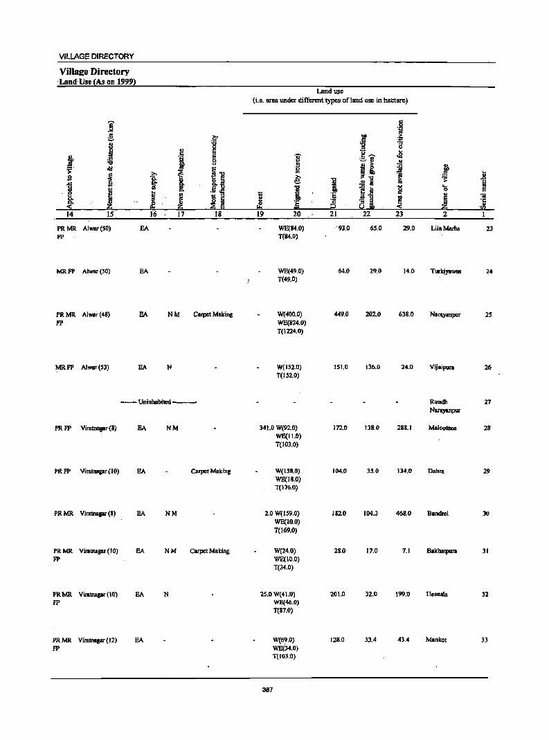
VILLAGE DIRECTORY
ViIIS2e Directory 'Land Use (As on 1999)
'""' ] c :.:. 8 j
j .!!! "CI
oI!l .;: g .~
1 g
~ B: ~ <
14 IS
PRMR Alwar(SO) FP
MR FP Alwar (50)
PR MR Alwar (48)
FP
MR.FP Alwar(S3)
.~ "CI ., ~ . , g '" i] j ~
I &..a .~ ~ ~ ~ S Iii o .
~. go ~ S 16 17 ]8
EA
EA
EA NM Carpet Making
EA N
--Uninhabited ---
PRFP Viratnapr(8) EA NM
PRFP Viratnagar(IO) EA Carpet Making
PRMR Viratnapr (8) EA NM
PRMR Viratnagar (10) EA NM CArpet Making FP
PRMR Vimtnagar (10) EA N FP
PRMR Viratnagar(12) EA FP
Land use (i.e. area under different types ofland use in hectare)
1;;
~ .I:!::s .' 19
~ 0 ... e: "CI
i 'e ."" 20
WE(84.0) T(84.0)
WE(49.0) T(49.0)
W(400.0) WE(824.0) T(1224.0)
W(IS2.0) T(152.0)
341.0 W(92.0) WE(II.O) T(103.0)
W(ISS.O) WE(18.0) T(176.0)
2.0 W(IS9.0) WE(IO.O) T(169.0)
W(24.0) WE(IO.O) T(34.0)
25.0 W(41.0) WE(46.0) T(S7.0)
W(69.0) WE(34.0) T(103.0)
387
'"CI
i 'e ~ 21
'93.0
64.0
449.0
151.0
172.0
104.0
182.0
2S.0
201.0
12S.0
c .9 1iI
0lIl .~ .5 -g [j u ... c ....... .e ;::,n .. jj ~
.~ ~ Ii
~i '5 c til
a e'b ~ 22 23
65.0 29.0
29.0 14.0
202.0 638.0
136.0 24.0
138.0 288.1
35.0 134.0
104.3 468.0
17.0 7.1
32.0 199.0
33.4 43.4
J .8 .;; § ....
0 c ., "iI Ii :5
.j!; '<1)
2 I
LilaMarha 23
Turkiyawas 24
Narayanpur 25
Vijaipura 26
Rundh 27 Narayanpur
Maloolana 28
Dabra 29
Bandrol 30
Bakhatpura 31
Hecmsla 32
Manko! 33
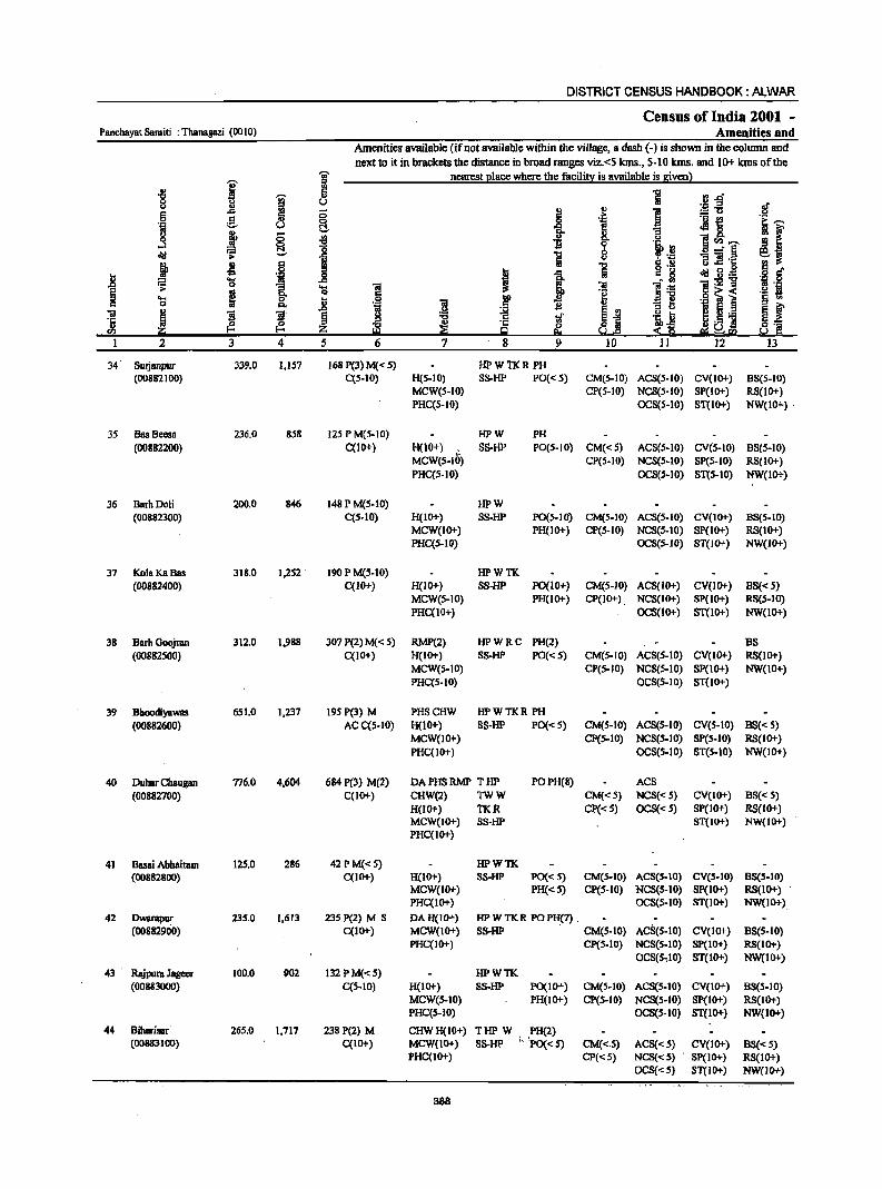
Panchayat Samiti : Thanagazi (0010)
2
34 Sutjanpur (00882100)
35 Bas Becsa (00882200)
36 Barh Doli (00882300)
37 Kola KaBas (00882400)
38 Barh Goojran (00882S00)
39 BhoodiyaWRS (00882600)
40 Dubsr Chaugan (00882700)
41 Basai Abhairam (00882800)
42 Dwarapur (00882900)
43' Rajpura Jagecr (00883000)
44 Biharisar (00883100)
3
339.0
236.0
200.0
318.0
312.0
651.0
776.0
12S.0
235.0
100.0
26S.0
4
1,IS7
858
846
1,252 .
1,988
1,237
4,604
286
1,613
902
1,717
DISTRICT CENSUS HANDBOOK: AL,wAR
Census of India 2001 -Amenities and
Amenities available (if not available within the village, a dash (-) is shown in the column and next to it in brackets the distance in broad ranges viz.<5 klns., 5-10 klns. and 10+ luns of the
nearest place where the facility is available is given)
5 6 7 8 9
168P(3)M«S) HPWTKR PH C(S-IO) H(S-IO) 8S-HP PO« S)
MCW(5-10) PHC(S-IO)
HPW PH
10 11 12 13
CM(S-IO) AC8(5-10) CV(IO+) B8(S-to) CP(5-10) NC8(5-10) SP(IO+) RS(IO+)
OCS(S-IO) 8T(10+) NW(IO+)·
125 P M(5-1O) C(lO+) H(lO+) . S8-HP
MCW(S-IO) PHC(S-IO)
PO(5-10) CM« 5) ACS(S-IO) CV(S-IO) 8S(S-10)
148 P M(5-10) C(5-10)
190PM(5-10) C(IO+)
307 P(2) M( < 5) C(IO+)
HPW
CP(S-IO} NCS(S-IO) SP(S-IO) RS(IO+) OCS(.5-IO) ST(S-IO) NW{IO+)
H(lO+) S8-HP PO(5-10) CM(S-IO) AC8(S-10) CV(IO+) B8(S-10) MCW(IO+) PHC(S-lO)
PH(lO+) CP(S-IO) NCS(5-10) Sp{IO+) RS(10+)
H(IO+) MCW(S-IO} PHC(IO+)
HPWTK SS-HP PO(IO+)
PH(IO+)
RMP(2) HP W R C PH(2) H(IO+) SS-HP PO« 5) MCW(S-IO) PHC(5-10)
OCS(S-IO) ST(IO+) NW(lO+)
CM(S-IO) ACS(IO+) CV(IO+) BS« S) CP(IO+). NC8(10+) 8P(10+) RS(S-IO)
OCS(IO+) ST(lO+) NW(IO+)
BS CM(S-IO) ACS(5-10) CV{IO+) RS(lO+) CP(S-IO} NCS(S-IO) SP(IO+) NW(IO+)
OCS(S-IO) ST{1O+)
195P(3) M PHSCHW HPWTKR PH AC C(S-10) H(lO+) SS-HP PO« 5)
MCW(IO+) PHC(IO+)
CM(S-IO) ACS(S-IO) CV(S-IO) BS« S) CP(S-IO) NCS(5-10) SP{S-IO) RS(IO+)
OCS(S-IO) ST(S-10) NW(10+)
684 P(3) M(2) C(IO+)
DA PHS RMP T HP POPH(B) ACS
42PM«S) C(10+)
23S P(2) M S C(10+)
132 PM«5) C(5-10)
238 P(2) M C(IO+)
CHW(2) TWW H(lO+) TKR MCW(IO+) 88-HP PHC(lO+)
H(IO+) MCW(IO+) PHC(IO+)
HPWTK SS-HP PO« S)
PH«S)
HPWTKR POPH(7).
CM« 5) NCS« 5) CV(IO+) BS« S) Cp« S) OCS« 5) SP(IO+) RS(10+)
8T(10+) NW(IO+)
CM(S-IO) ACS(S-IO) CV(S-IO) B8(5-10) CP(S-IO) NCS(S-IO) Sp(IO+) RS(lO+)
OCS(S-IO) ST(IO+) NW(IO+)
DAH(IO+) MCW(IO+) PHC(IO+)
SS-HP . CM(S-IO) ACS(S-IO) CV(lO+) BS(S-IO)
H(IO+) MCW(S-IO) PHC(S-IO)
HPWTK SS-HP PO(lO+)
PH(JO+)
CHWH(10+) THP W . PH(2) MCW(IO+) SS-HP 1, 'PO« S) PHC(IO+)
B88
CP{5-IO) NCS(S-IO) SP(lO+) RS(IO+) OCS(S,IO) ST(lO+) NW(lO+)
CM(S-IO) ACS(S-lO) CV(IO+) BS(S-IO) CP(S-IO) NCS(S-IO) SP(IO+) RS(IO+)
OCS(S-IO) ST(JO+) NW(IO+)
CM«.S) ACS«5) CV(JO+) BS« S) CP«S) NCS«5) SP(IO+) RS(IO+)
OCS«S) ST(IO+) NW(JO+)
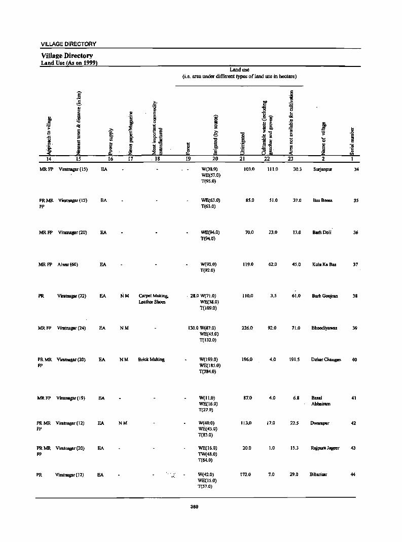
VILLAGE DIRECTORY
ViIla£e Dir.ectory Land Use {As on 1999}
E .... c .?i' ::.
.i -g ., E
l 'i E c ""Cl u .;;: old
~ i1! g I b Co
] Co l c..fl ::>
I '" .!LI!! 1 J ~ - ::> S Iii
~ Iii :!i i:!!: -i:!!: ]4 15 ]6 17 . ]8
MRFP Viratnagar (1 S) EA
PRMR Viratnagar (12) EA FP
MR FP Viralnagar (20) EA
MRFP Alwar(60) EA
PR Viratnapr (22) EA NM carpet Making,
Leather Shoes
MRFP Viratnapr (24) aA. NM
PRMR Viratnagar (20) EA NM Brick Making FP
MRFP Viratnapr (19) EA
PRMR Viratnagar (12) EA NM FP
PRMR Viratnagar (20) EA FP
PR Viratnapr(12) EA l".
Land use
(i.e. area under different types ofland use in hectare)
1;; 2! 0
!!::I 19
"U' ~ 5l e: i 'Ei = 20
W(38_0)
WE(S7.0) T(95.0)
WE(63.0) T(63_0)
WE(94.0) T(94.0)
W(92.0) T(92.0)
. 28.0 W(71.0) WE(38.0) T(I09.0)
130.0 W(S7.0) WE(4S.0) T(J32.0)
W{199.0) WE(ISS.O)
T(384.0)
W{II.O) WE(16.0) T(27_0)
W(40.0) WE(43.0) T(8l.0)
WE(16.0) TW(48.0) T(64.0)
W(42.0) WE{15.0) T{S7.0)
389
-0
! ·s ~ 21
103.0
85.0
70.0
119.0
110.0
226.0
196.0
87.0
Ill.O
20.0
172.0
6 'i
1>0
~ c '6
i~ u
.2 ::.rJ .!! 8 Ii ~:
~ ';j
iU .!! a ~~. 8
~ oi 22 23
111.0 30.3
51.0 37.0
23.0 13.0
62.0 45.0
3.5 61.0
92.0 71.0
4.0 191.5
4.0 6.S
17.0 22.5
1.0 15.3
7.0 29.0
j ..i! ~ E ...
0 i! u iii
i ·c .. <I)
2 ]
Surjanpur 34
BssBeesa 35
BarhDoli 36
KoiaKaBas 37
Barb Goojran 38
Bhoodiyawas 39
Duhar Chaugall 40
Bssai 41 Abhairam
Dwarapur 42
Rajpura Jageer 43
Biharisar 44
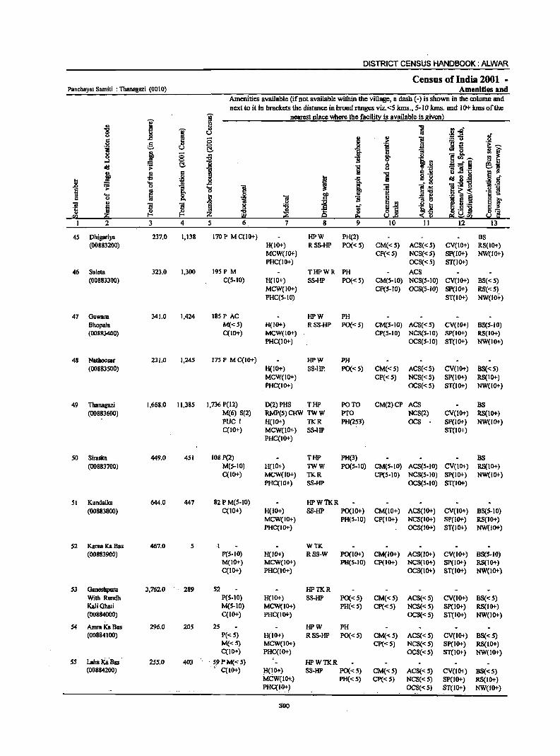
DISTRICT CENSUS HANDBOOK: ALWAR
Census of India 2001 -Panchayal Samiti : Thanagazi (0010) Amenities and
Amenities available (if not available within the village, a dash (-) is shown in the column and
next to it in brackets the distance in broad ranges viz.<5 kms., 5-10 kms. and 10+ kms of the
i ~ nearest elace where the facili!;X is available is givenl
~ J 5 '5 :~~ ~ u
.!f § ... 8 ..
i 5 0 .j ;g~ 0 e:-"ii u ~ ]. : f g j ;:; oS i u - g.
11 ·i.~ I! rIl ,-..
oJ 0
I 2....r§ ::>.2 dIl ~ ~ "D e~ !ii u
~ .~ 11]·1:; ~ ~
c:: "D § t:f I:l
.S! , -a Iii dIl g.~ ~ 'a 1;l
]~ ~:-s!'B .+:1 0
.0
1 'a ] i ~ fl .! ~ 'a ~ Jl .~ f
.S! ~ i ·s rn OJ 1l .. :I ~ ~ f OJ ... "iI "S ~
g ! .r ~1 .~ I:l I 5 .-·5 ! ~ ~ ~ ~ ~~ co·5 ]I 8:: ·m s..!.e Si ~fQ s..! r.:
2 3 4 5 6 7 8 9 10 11 12 13
4S Dhigariya 237.0 1,138 170P MqlO+) HPW PH(2) BS (00883200) H(IO+) RSS-HP PO« 5) CM«S) ACS«5) CV(IO+) RS(IO+)
MCW(lO+) CP«S} NCS«S} SP(IO+} NW(IO+} PHC(IO+) OCS«S) ST(IO+)
46 Saleta 323.0 1,300 195 PM THPWR PH ACS (00883300) C(S-IO) H(IO+) SS-HP PO«S) CM(S-IO) NCS(S-IO) CV(1O+) BS«5)
MCW(IO+} CP(S-IO} OCS(S-IO) Sp(IO+) RS«S) PHC(S-IO) ST(IO+) NW(lo+)
47 OUWBIII 341.0 1,424 185 PAC HPW PH Bhopala M«5) H(IO+) RSS-HP PO«S) CM(S-IO) ACS« S) CV(IO+) B8(S-IO) (00883400) C(IO+) MCW(IO+) CP(5-IO) NCS(S-IO) SP(IO+) RS(IO+)
PHC(IO+) OCS(S-IO) ST(1O+) NW(IO+)
48 NBlhoosar 231.0 1,245 175 P M C(IO+) HPW PH (00883S00) H(10+) SS-liP. PO«S) CM«S) ACS«5) CV(1O+) B8«5)
MCW(IO+) CP« 5) NCS«5) SP(lO+) RS(IO+) PHC(IO+) OCS«5) ST(lO+) NW(IO+)
49 Thanagazi 1,668.0 11,385 1,736 P(12) D(2) PHS THP PO TO CM(2)CP ACS BS (00883600) M(6) S(2) RMP(5) CHW TW W PTO NCS(2) CV(lO+) RS(lO+)
PUC 1 H(IO+) TKR PH(253) OCS Sp(IO+) NW(IO+) C(10+) MCW(IO+) SS-HP ST(IO+)
PHC(IO+)
50 Siraslca 449.0 451 108 P(2) THP PH(3) BS (00883700) M(S-IO) H(IO+) TWW PO(5-10) CM(5-10) ACS(S-IO) CV(lO+) RS(IO+)
C(IO+) MCW(IO+) TKR CP(S-IO) NCS(S-IO) SP(lO+) NW(lO+) PHC(lO+) SS-HP DCS(S-IO) ST(IO+)
51 Kundalka 644.0 447 82 PM(S-IO) HPWTKR (00883800) C(10+) H(lO+) SS-HP PO(IO+) CM(IO+) ACS(IO+) CV(IO+) BS(S-IO)
MCW(IO+) PH(S-IO) CP(IO+) NC8(10+) SP(lO+) RS(IO+) PHC(IO+) OCS(IO+) ST(lO+) NW(IO+)
S2 KamaKaBas 467.0 S ·1 WTK (00883900) P(S-IO) H(IO+) RSS-W PO(IO+) CM(IO+) ACS(10+) CV(IO+) BS(S-IO)
M(lO+) MCW(IO+) PH(S-IO) CP(IO+) NCS(IO+) SP(lO+) RS(IO+) C(lO+) PHC(IO+) OCS(IO+) ST(IO+) NW(lO+)
S3 Oaneshpura 3,762.0 289 52 HPTKR With Rundh P(S-IO) H(10+) SS-HP PO«S) CM«S) ACS«5) CV(IO+) BS«5) KaIiGhati M(5-10) MCW(IO+) PH« 5) CP«5) NCS«5) SP(IO+) RS(lO+) (00884000) C(IO+) PHC(lO+) OCS«S) ST(IO+) NW(IO+)
S4 Amlll Ka Bas 296.0 20S 25 HPW PH (00884100) P«5) H(io+) RSS-HP PO« S) CM«5) ACS«S) CV(IO+) BS«S)
M«5) MCW(IO+) CP«S) NCS« S) Sp(IO+) RS(IO+) C(IO+) PHC(lO+) DCS«5) ST(1O+) NW(1O+)
55 LahaKaBas 25'.0 403 < SfJPM«') HPWTKR (00884200) • C(IO+) HOO+) SS-HP PO« 5) CM«5) ACS« 5) CV(lO+) BS«5)
MCW(lo+') PH«5) Cp«5) NCS«5) SP(IO+) RS(IO+) PHC(IO+) OCS«5} ST(IO+) NW(IO+)
390
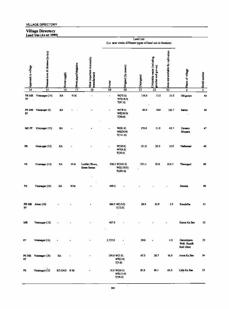
VILLAGE DIRECTORY
Villale ·Directory Land Use (~s on 1999)
j c ;::.
i j :0 :-:: cId >
! .B . .,c
1 I Q.. .< .~ 14 15
PRMR Vimtnagar (14) FP
PRMR Vimtnagar (0) FP
MRFP Vimtnagar (13)
PR Vimtnagar (12)
PR Vimtnagar (IS)
PR Vimtnagar (10)
PRMR Alwar(IO) FP
MR Vimtnagar (10)
FP Vimtnagar (10)
PR·MR Vimtnaaar (18) FP
EA
EA
EA
EA
EA
EA
EA
>.
1 '" ~ 0 ~.
16
PR Vimtnaaar d6) EDEAG
~ :0 ~ !! ., E 0 u
.11 ~ I: I !l ~
~ Iii 17 18
NM
NM Leather Shoes, Stone Statue
NM
NM
Land use
(i.e. area under different types of land use in hectare)
I 0 '" e; ... ,
~ 0 ·s
I:!:I = 19 20
W(73.0) WE(J8.0) T(91.0)
W(78.0) WE(20.0) T(98.0)
W(81.0) WE(10.0) T(111.0)
W(lO.O) WE(9.0) T(39.0)
220.2 W(141.0) WE(1S0.0) T(291.0)
449.0
566.0 W(13.0) T(ll.O)
467.0
3,722.0
169.0 W(3.0) WE(2.0) T(5.0)
IS.O W(26.0) WE(12.0) T(3S.0)
391
... , ·5
~ 21
114.0
83.0
173.0
151.0
511.1
28.0
39.0
67.0
87.0
c 0 'i
.~ > ~ ...
::I u u oS c~
-=-:1 ., .!! > i J! ..!! a &;
-e Ia 8 .8-5 ... a i ~ 22 23
11.0 21.0
18.0 123.7
11.0 45.7
25.0 16.0
30.0 616.1
35.9 1.0
1.0
38.7 16.0
49.1 61.0
j .8 '5: ~ ...
0 u iii
~ ·6 OIl
2 1
Dhigariya 45
Saleta 46
Guwam 47 Bhopala
Nathoosar 48
Thanagazi 49
Simska so
Kundalka 51
KamaKaBas 52
Gancshpum 53 With Rundh KaliGhati
AmmKaBas 54
. L8tia Ka Bas 5S .,
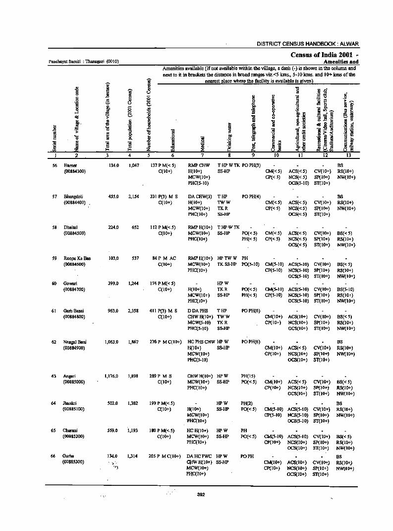
DISTRICT CENSUS HANDBOOK: ALWAR
Census of India 2001 -Panchayat Samiti : Thanagazi (00 I 0) Amenities and
Amenities available (if not available within the village, a dash (-) is shown in the column and
next to it in brackets the distance in broad ranges viz. <5 kms., 5-10 kms. and 1-0+ kms of the
I j nearest l!lace where the facilin: is available is Biven 1
., ~ 1 1Il.o '8 'it u
'" ..!! 5 0 ~ .. ] ~-5 J c
!. .~ ._ t! c 0 c ~.-. 'iI u C- o§.. £ eM c
~ f 8 t'., 0 '" .,
0- ~ ]~.-. .... ~ 0
~ ]j g 'i .rl !;:!. ....:'8 ~~ old .s: ~ '" 8. ·B ~ ]j·c
~. -5 is g 't:I .J § j! 'iI t 1 lii c 0 old 3·~ ~ 'g ..c 01 l~ ]:g1l :; .... ] B .~ e .. 8- 0 '8 c~~
._ .s 2 .... ~ j! j E ! § '" c ~
u :I r3 '1 § 0.
E '" E t "iii .. ~ ~ ~ 'i t
~ ._ ·S Ii 't:I C 1i ~~ .S] d] ,eI> .:ii!:j fo'< ~ ~ ~ ~.e ~"§ E!!i~!iGI
I 2 3 4 5 6 7 8 9 10 11 12 13
56 Hamer 134.0 1,047 137PM«S) RMPCHW T HP W TK PO PH(3) BS (00884300) C(lO+) H(IO+) SS-HP CM«S) ACS«S) CV(IO+) RS(IO+)
MCW(JO+) CP« 5) NCS«S) Sp(JO+) NW(JO+) PHC(S-IO) OCS(S-IO) ST(IO+)
57 Bhangdoli 455.0 2,154 331 P(3) M S DACHW(3) THP POPH(4) BS (00884400) C(JO+) H(IO+) TWW CM«S) ACS«S) CV(IO+) RS(IO+)
MCW(IO+) TKR CP« 5) NCS«S) Sp(IO+) NW(IO+) PHC(IO+) SS·HP OCS«S) ST(IO+)
58 Dbaital 224.0 6S2 112 PM«S) RMPH(IO+) THPWTK (00884500) C(IO+) MCW(lO+) SS-HP PO« 5) CM«S) ACS«S) CV(IO+) BS« 5)
PHC(IO+) PH« S) CP« S) NCS«S) SP(IO+) RS(lO+) OCS«S) ST(lO+) NW(lO+)
59 RODPU KoBas 103.0 537 84P M AC RMPH(lO+) HPTWW PH (00884600) C(IO+) MCW(lO+) TK8S-HP PO(S·IO) CM(S-IO) ACS(S-lO) CV(IO+) B8« S)
PHC(lO+) CP(5-10) NCS(S-IO) SP(IO+) RS(IO+) OCS(S-IO) ST(IO+) NW(lO+)
60 Gowari 399.0 1,244 174 P M« S) HPW (00884700) C(IO+) H(IO+) TKR PO«5) CM(S-IO) ACS(5·10) CV(IO+) B8(5-10)
MCW(lO+) SS-HP PH«5) CP(5cI0) NCS(S-lO) SP{lO+) RS(IO+) PHC(IO+) OCS(S-lO) ST(IO+) NW(lO+)
61 Garb Basai 963.0 2,3S8 411 P(3) M S DDAPHS THP POPH(6) (00884800) C(10+) CHWH(IO+) TWW CM(IO+) ACS(IO+) CV(IO+) BS« 5)
MCW(S-IO) TKR CP(IO+) NCS(1O+) Sp(IO+) RS(IO+) PHC(S-IO) SS-HP OCS(IO+) ST(IO+) NW(IO+)
62 Nangal Bani 1,063.0 1,867 276P MC(IO+) HC PHS CHW HP W POPH(6) BS (00884900) H(lO+) SS·HP CM(IO+) ACS«S) CV(IO+) RS(IO+)
MCW(IO+) CP(IO+) NCS(IO+) SP(lO+? NW(IO+) PHC(S-IO) OCS(IO+) ST(IO+)
63 Angari 1,176.0 1,898 289P M S CHWH(IO+) HPW PH(IS) (00885000) C(IO+) MCW(IO+) SS-HP PO«S) CM(lO+) ACS«S) CV(lO+) BS« S)
PHqIO+) CP(JO+) NCS(IO+) SP(JO+) RS(JO+} OCS(1O+) ST(1O+) NW(IO+)
64 Jhankri 502.0 1,382 199 P M«5) HPW PH(2) B8 (00885100) C(IO+) H(IO+) SS-HP PO«S) CM(S-IO) ACS(S-IO) CV(lO+) RS(JO+)
MCW(JO+) OP(S-lO) NCS(S-IO) sp(10+) NW(IO+) PHC(IO+) OCS(S-IO) ST(lO+)
6S Cburani S59.0 1,193 180PM«5) HCH(IO+) HPW PH (00885200) C(IO+) MCW(IO+) 8S-HP PO«S) CM(S-IO) ACS(S-JO) CV(JO+) BS« S)
PHC{IO+) CP(lO+) NCS(IO+) SP(lO+) RS(IO+) OCS(IO+) ST{JO+) NW{JO+)
66 Gurha 134.0 1,314 205 P M C{JO+) DAHCFWC HPW PO PH BS (00885300) ~ ~ .... " CJ{WH(IO+) SS-HP CM(lO+) ACS(IO+) CV(IO+) RS(IO+)
'f] MCW(IO+) cp(10+} NCS(JO+} SP(JO+) NW(llO+) P~C(ICi+) OCS(lO+) ST(IO+)
392
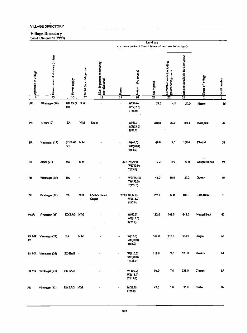
VILLAGE DIRECTORY
Villal!e -Directory Land Use {As on 1999}
Land use (i.e. area under ditTerent types of land use in hectare)
i .§ 1;;
= f .~ > ::- '-1'1
J 1l "3
J 0 u E u .s '" E I :§.'ii' gp, 0 I) =, u B > ~ j '~ -1il i.., ~ ~
~ -a: .,
'ii i g
I o f e; "CJ .!!i i:i ~ .c rt "".El i 1;1, !;; .~ ~ " l~ '0 'Cl e i J l I fJ ·s = ~ 'i3 c. !l Iii 00 .! ~ ·s 'c ~i '5 .:i:; ,;g; ~ E I:!I = i2 ;g; ra
14 15 16 17 18 19 20 21 22 23 2 'I
PR Viratnagar (18) ED FAG NM W(20.0) 74.0 4.8 20.0 Hamer 56 EO WE(1S.0)
T(35.0)
PR Alwar(IO) FA NM Shoes W(49.0) 23S.0 29.0 106.3 Bhangdoli 57 WE(33,0) T(82.0)
PR Viratnagar (19) ED FAG NM W(44.0) 49.0 3.0 IOS.O Dhaital 58 EO WE(20.0)
T(64.0)
PR Alwar(21) SA NM 27.3 W(20.0) 12.2 11.0 23.0 RoopuKaBas 59 WE(I3.0) T(33.0)
PR Viratnagar (IS) SA WE(143.0) 42.0 SO.O S2.2 Gowari 60 TW(S2.0) T(19S.0)
PR Vimtnagar (12) FA NM Leather Shoes, 239.0 W(S2.0) 152.0 72.0 403.3 GarhBasai 61 Carpet WE(IS.O)
T(97.0)
PRFP Vimtnagar (25) EDEAG NM W(60.0) 182.0 161.0 645.0 NangalBani 62 WE(IS.O) T(75.0)
PRMR. Vimtnagar (22) FA NM W(S3.0) 354.0 235.0 504.0 Ansari 63
FP WE(30.0) T(Sl.O)
PRMR. Vimtnagar (24) EDEAG - W(IIO.O) 111.0 2.0 251.0 Jhankri 64 WE(28.0) T(I3S.0)
PRMR. Viratnagar (23) EDEAG - W(lOD.O) 96.0 7.0 338.0 Churani 6S
WE(II.O) T(IIS.0)
PR Viratnagar (22) EDEAG NM W(28.0) 47.0 3.0 56.0 Curbs 66
T(21.0)
393
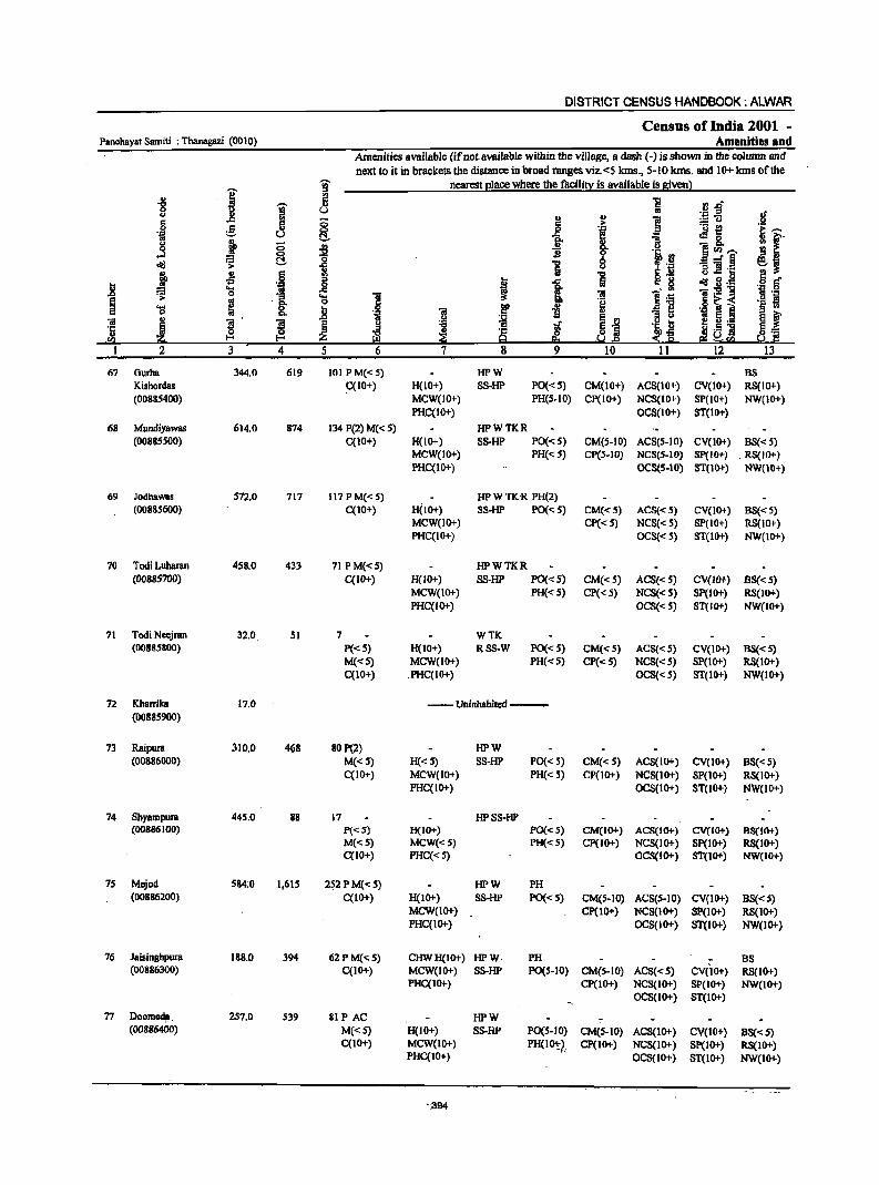
DISTRICT CENSUS HANDBOOK: ALWAR
Census of India 2001 -Panchayal Samiti : Thanagazi (0010) Amenities and
Amenities available {ifnot.available within the village, a dash (-) isshoWll in the column and next to it in brackets the distance in broad ranges viz.<5 kIns., 5-10 kms. and 10+ kIns of the
-c;;- nearest I!lace where the facilill;: is available is given l
I ::J .. ~ ~ rJ.D "8 g ._ ::I
.If () .. .. .. ii! :::u 5 5 c > e 8 .8 '.z;:; iii ._ !!
H 'iI u C!. i ,sg, ~
." 13 u 0 ~ -J CJ .s II ](/)---= §, "0 8 .J~
~ .;:
1 "5 g ].~ ~ ~ 6
i 1 "5 d!!_§", .j § " '.j:! ..8 " Ii! F- .....
t or> 0
1 :!! ] .1:: iiI·_ " ';:1
i > os ~ 13 .g ~ i ._ £!
'S ~ .B iii i ] 13M ~ t ., j .S! E ~ 5._ iii
~ ~ E .;r
~j .~ " &i ... .. ~.s ] ~~ '5 ~ ~
·c ~ :$~ sa ~ E-< a ~!"!l
I 2 3 4 5 6 7 8 9 10 11 12 13 ..
67 Ourha 344.0 619 101 P M«5) HPW BS Kishordas C(lO+) H(lO+) SS-HP PO«5) CM(lO+) ACS(IO+) CV(IO+) RS(lO+) (00885400) MCW(IO+) PH(S.IO) CP(lO+) NCS(lO+) SP(IO+) NW(IO+)
PHC(IO+) OCS(IO+) ST(1O+)
68 MundiY8WBS 614.0 874 134 P(2) M« 5) HPWTKR (00885S00) C(lO+) H(10+) SS-HP PO«5) CM(5-IO) ACS(5-IO) CV(IO+) BS« S)
MCW(IO+) PH«5) CP(5-1O) NCS(5-10) Sp(IO+) . RS(lO+) PHC(IO+) OCS(5.10) ST(IO+) NW(10+)
69 Jodhawas 572.0 717 117 P M« S) HP W TK R PH(2) (00885600) C(IO+) H(IO+) SS·HP PO«5) CM«5) ACS«5) CV(lO+) BS«5)
MCW(IO+) CP« 5) NCS«5) , SP(10+) RS(10+) PHC(IO+) OCS«5) ST(IO+) NW(IO+)
70 Tadi Luharan 458.0 433 71 PM«5) HPWTKR (00885700) C(lO+) H{lO+) SS-HP PO«S) CM{<S) ACS{<S) CV(IO+) 8S«S)
MCW(IO+) PH«5) CP{< 5) NCS«S) SP(IO+) R8(JO+) PHC(IO+) OCS«5) ST(IO+) NW(lO+)
71 Tadi Neejran 32.0 51 7 WTK (00885800) P«5) H(IO+) RSS-W PO{<S) CM«S) ACS« 5) CV(lO+) BS« 5)
M«5) MCW(IO+) PH«S) CP«5) NCS« S) SP(IO+) RS(1O+) C(10+) .PHC(IO+) OCS«S) 8T(10+) NW(IO+)
72 Kharrika 17.0 --Uninhabited ---. (00885900)
73 Raipura 310.0 468 BOP(2) HPW (00886000) M«5) H« 5) 8S-HP PO« S) CM«S) ACS(IO+) CV(10+) 8S« 5)
C(10+) MCW(IO+) PH« S) CP{tO+) NCS(IO+) SP(IO+) RS(JO+) PHC(IO+) OCS(IO+) ST(1O+) NW(IO+)
74 8hyampura 445.0 88 17 HPSS-HP (00886100) P«5) H(IO+) PO« 5) CM(IO+) ACS(IO+) CV(IO+) 88(10+)
M«S) MCW«5) PH«S) Cp(JO+) NCS(IO+) Sp(IO+) RS(IO+) qlO+) PHC«5) OCS(IO+) ST(IO+) NW(IO+)
75 Mejod 584:0 1,615 2~2PM«5) HPW PH (00886200) C(10+) H(IO+) SS·HP PO« S) CM(S-JO) ACS(S.IO) CV(IO+) B8«5)
MCW(1O+) cp(IO+) NCS(1O+) SP(IO+) RS(IO+) PHC(IO+) OCS(JO+) ST(IO+) NW(lO+)
76 Jaisinghpura 188.0 394 62PM«S) CHWH(IO+) HPW PH B8 (00886300) C(10+) MCW(IO+) SS-HP PO(S-IO) CM(S-IO) ACS«5) CV(IO+) R8(10+)
PHC(IO+) CP(lO+) NCS(IO+) SP(IO+) NW(IO+) OCS(IO+) ST(IO+)
77 Doom~. 257.0 S39 81 PAC HPW (00886400) M«5) H(IO+) S8-HP PO{S-IO) CM(S-lO) ACS(IO+) CV(lO+) BS«5)
C(IO+) MCW(IO+) PH(1~?, cp(10+) NCS(IO+) Sp(IO+) RS(10+) PHC(IO+) OCS(IO+) ST(IO+) NW(IO+)
".394
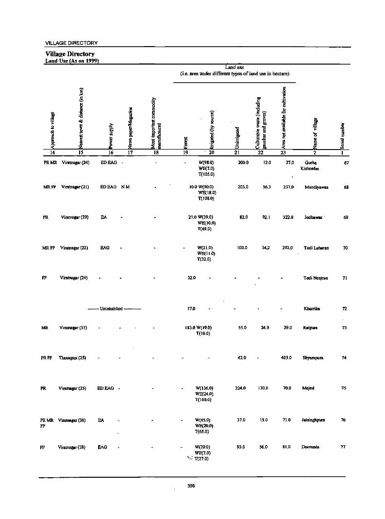
VILLAGE DIRECTORY
Villa2e Directory Land Use (As on 19991
]' e .~
I "CI 0
.~ E
i E
i :.a 8 :s: cId
.11 .s ~ -5: ~ Q,
., ~ iii !
1 e J ~ 'Ill ::0 0.
~.~ 0.
:::!: ~ 14 15 16 17 18
PRMR Viratnagar (24) ED BAG
MRFP Viratnasar (2 J) ED BAG NM
PR Viratnagar (20) EA
MRFP Viratnagar (22) BAG
FP Viratnagar (24)
--Uninhabited--
MR Viratnagar (35)
PR FP Thanagazi (25)
PR Viratnagar (25) ED BAG -
PRMR Viratnagar (26) EA FP
FP Viratnagar (28) BAG
Land use
(i.e. area under different types of land use in hectare)
-0;-
~ ~
~ 1l
~ i 0 'E
!!::t 1:::1 19 20
W(98.0) WE(1.0) T(IOS.O)
10.0 W(90.0) WE(J8.0) T(IOS.0)
27.0 W(39.0) WE(JO.O) T(49.0)
W(2l.0) WE(1l.0) Tel2.0)
32.0
17.0
183.0 W(19.0) T(l9.0)
W(J36.0) WE(24.0) T(160.0)
W(4S.0) WE(20.0) T(65.0)
W(20.0) WE(1.0)
>'.: T(27.0)
395
1 :§ c i2 21
200.0
203.0
82.0
100.0
55.0
42.0
224.0
37.0
93.0
.j .~ ~ 11 U .. '" "" .a ._ .. ~ ., ..!! !:I >
~! il :a ..!! fa ~ of iii g B"fi .. a i ~ 22 23
12.0 27.0
56.3 237.0
92.1 322.0
34.2 292.0
24.0 29.0
403.0
130.0 70.0
15.0 71.0
56.0 81.0
j ~
j
~ ... 0 ..
l ~ til
2 I
Gurba 67 Kishordas
Mundiyawas 68
Jodbawas . 69
Todi Lubarao 70
Todi Nec::jran 71
Kharrika 72
Raipura 73
Shyampura 74
Mejod 75
Jaisinghpura 16
Doomcda 71
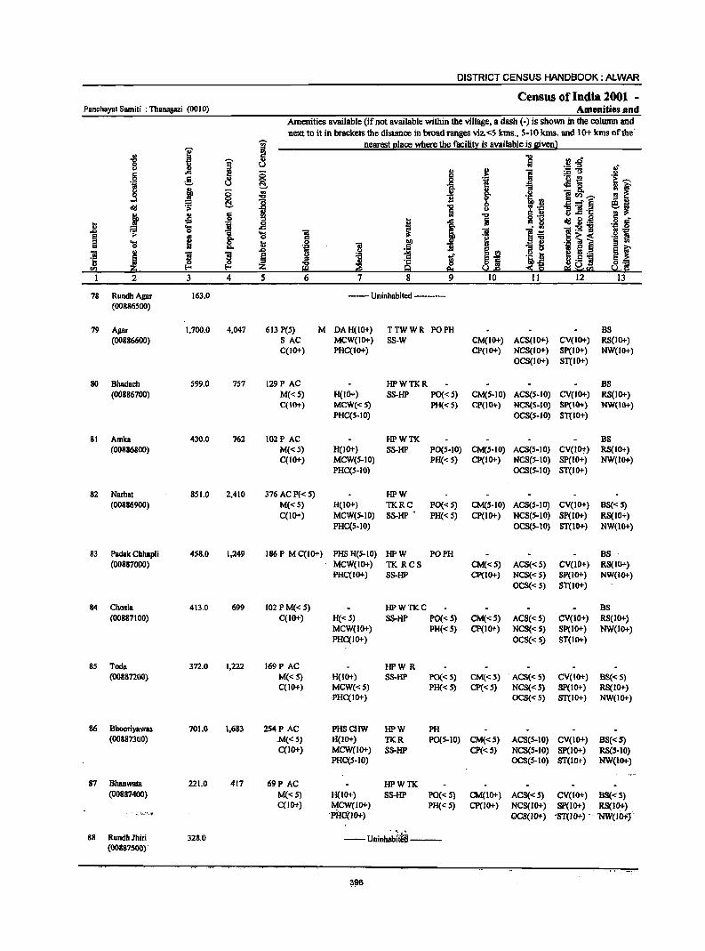
DISTRICT CENSUS HANDBOOK: ALWAR
Census of India 2001 _ Panchayat Samiti : Thanagazi (0010) Amenities and
Amenities available (if not available within the village, a dash (-) is shown in the column and next to it in brackets the distance in broad ranges viz.<S Ians., 5-IOkms. and 10+ Ians oftbe'
I I nearest I!lace where the facilit:t: is available is glvenl
i 'Oi' "5 ",r! .. :s U .£ ::I :f
] ...
~ ;:; '" '" i ::5"U
e- o IS
"! ._ ~ .~ ~
!::!, t oM 8.
if j ;:; .. u EUl.-. 0
I '5, rl E _- § old ~ !::!,
"5 " ~ :y 11 lh: } .s 6 ... -a 1 co 8 dd g.~ g -... 'j i '+1 IS .. 'S ]~ "iiI:s!1i ,.Q :=
1 'S "iii j :e I':! '+1
~ ;. .. 5 ~ IS~<
._ ~ .... ; :;; ] i :s ~ -iii e] ~ f 0 "- 'll
j ,.Q
~j ] g s ~ g l
.50! 6 l!! !ill ~ ~ ~
·c ~tl ti ._ g,...
<I) (-< 9 e; ~ r.a !i.! rl 1 2 3 4 5 6 7 8 9 10 11 12 13
78 RundhAgar 163.0 --- Uninhabited --------(00886500)
79 Apr 1,700.0 4,047 613 P(5) M DA H(lO+) TTWWR PO PH B8 (00886600) SAC MCW(IO+) SS-W CM(IO+) ACS(IO+) CV(IO+) R8(10+)
C{lO+) PHC(IO+) CP(IO+) NCS(IO+) SP(IO+) NW(IO+) OCS(IO+) 8T(10+)
80 Bhadach 599.0 757 129 PAC HPWTKR B8 (00886700) M«5) H(IO+) SS-HP PO«S) CM(S-IO) ACS(S-IO) CV(1O+) R8(10+)
C(IO+) MCW«.S) PH« S) CP(IO+) NCS(S-IO) 8p(10+) NW(IO+) PHC(S-IO) OCS(5-10) ST(lO+)
81 Arnica 430.0 762 I02P AC HPWTK B8 (00886800) M«S) H(1O+) SS-HP PO(S-IO) CM(S-IO) ACS(S-IO) CV(IO+) RS(IO+)
C(IO+) MCW(S-IO) PH« 5) CP(IO+) NCS(S-IO) SP(IO+) NW(IO+) PHC(S-IO) OCS(5-10) 8T(10+)
82 Narhat 851.0 2,410 376 AC p«5) HPW (00&86900) M«5) H(IO+) TKRC PO« 5) CM(S-IO) ACS(5-10) CV(IO+) BS« S)
C(1o+) MCW(S-IO) S8-HP • PH« S) CP(IO+) NCS(S-IO) Sp(IO+) R8(IO+) PHC(5-10) OCS(5-10) ST(lO+) NW(lO+)
83 Padak Chhapli 458.0 1,249 186P MC(IO+) PH8 H(S.IO) HPW PO PH BS (00887000) MCW(IO+) TK RCS CM«S) ACS«S) CV(1O+) RS(IO+)
PHC(IO+) SS-HP CP(IO+) NCS«S) Sp(IO+) NW(IO+) OCS« 5) ST(lo+)
84 Chosia 413.0 699 102 PM« 5) HPWTKC BS (00887100) C(lO+) H« 5) S8-HP PO« 5) CM«S) ACS« 5) CV(lO+) RS(lO+)
MCW(IO+) PH«S) CP(IO+) NCS« S) SP(IO+) NW(IO+) PHC(IO+) OCS«S) 8T(10+)
8S Toda 372.0 1,222 169 PAC HPWR (00887200) M«S) H(IO+) SS-HP PO« S) CM«S) ACS« 5) CV(IO+) BS« S)
C(IO+) MCW«S) PH«S) CP«S) NCS« S) 8P(lO+) RS(lO+) PHC(IO+) OCS« S) 8T(10+) NW(IO+)
86 Bhooriyawas 701.0 1,683 254P AC PH8CHW HPW PH (00887300) .M«S) H(IO+) TKR PO(S-10) CM«5) ACS(S-IO) CV(IO+) BS«5)
C(IO+) MCW(lO+) S8-HP CP«S) NCS(S-IO) SP(lO+) RS(S-10) PHC(S-IO) OCS(S-IO) ST(lO+) NW(IO+)
87 Bhanwata 221.0 417 69P AC HPWTK (00887400) M«5) H(lO+) S8-HP PO« S) CM(lO+) ACS«S) CV(1O+) BS« S)
C(JO+) ~CW(JO+) PH« 5) cp(JO+) NCS(JO+) Sp(JO+) RS(lO+) . -. ~~;'-" 'PHCi(JO+) OCS(IO+) 'ST(JO+) -. 'NW(ICl-fj'
88 RundhJhiri 328.0 --Uninh~f~---(00887500) .
~96
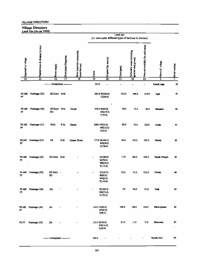
VILLAGE DIRECTORY
ViIlaKe Directory Land-Use (As on 19992 ,
Land use (i.e. area under different types of land use in hectare)
j 0= 0
'iI g .~ .~ ;0-
+:I
j ... -g ] 0
!:! e ]~ ~ ~ J § 'Z'
~ ;;..:1 u
'" S 1; =i j <iii (] 0 .s:
~ ~
., ~~ ';j Iii
B Co i ~ J ~ :; J:>
~ ..!! !ii ~ 1 I Q, .5.E I III g 'E ~ ~ ~ ~
;;
~ .,
iii ~ - g ~ '5 ~ .& '5 c
~ ell 11 20 -;;g Iii ~ 1:1 i:! 11 !!.I 14 15 16 17 18 19 20 21 22 23 2 I
--Uninhabited --- 163.0 RundhApr 7S
PRMR Viratnagar (32) ED BAG NM S8l.0 W(226.0) 215.0 166.0 510.0 Agar 79 FP T(226.0)
PRMR Viratnagar (40) EDEAG NM Carpet lS4.0 W(60.0) 49.0 71.0 46.0 Bhadach 80 FP EO WE(19.0)
T(79.0)
PRMR Viratnagar (31) BAG NM Carpet 200.0 W(2S.0) 20.0 53.0 122.0 Amka 81 FP WE(IO.O)
T(lS.O)
PRMR ViratnBgar (33) EA NM Carpet. Shoes 177.0 W(IOO.O) 63.0 133.0 320.0 Narhat 82 FP WE(S8.0)
T(IS8.0)
PRMR Viratnagar (32) ED BAG NM GC(20.0) 17.0 106.0 222.0 Padak Chhapli 83 FP W(70.0)
WE(23.0) T(113.0)
PRMR Viratnagar (33) EDEAG - GC(30.0) 12.0 51.0 232.0 Chosla 84 FP EO W(82.0)
WE(6.0) T(II8.0)
PRMR Viratnagar(36) EA W(I02.0) 7.0 99.0 91.0 Toda 85 FP WE(7l.0)
T(175.0)
PRMR Viratnagar (36) EA 162.0 W(90.0) 149.0 138.0 154.0 Bhooriyawas 86
FP WE(8.0) T(98.0)
PRFP ViratnBgar (32) EA 133.0 W(30.0) 21.0 11.0 12.0 Bhanwata 87 WE(14.0) T(44.0)
--Uninhabited --- 328.0 RundhJhiri gg
397
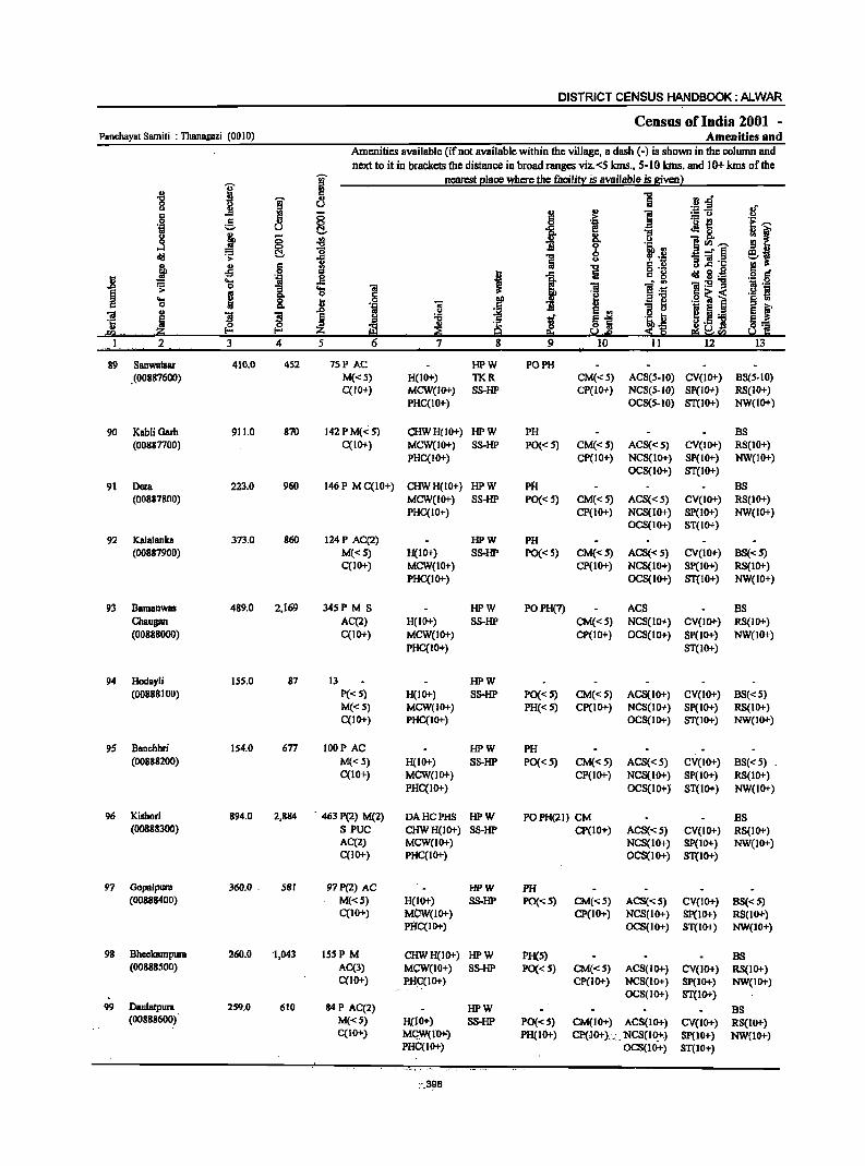
DISTRICT CENSUS HANDBOOK: ALWAR
Census of India 2001 -Panchayat Samiti : ThanagBzi (0010) Amenities and
Amenities available (if not available within the vlllage, a dash (-) is shown in the column and
next to it in brackets the distance in broad ranges viz.<5 kms .• 5-10 kms. and 10+ kms of the .... nearest place where the facility is available is given)
j iil .. c 1 "8 I " n.d' u Jl u
;g~ 8' ~ ..
] c 8 .:: 0 e ._ t! 'E ,-, 'j u (:!., i f! "3 .M8. ~ f u i § '" ..
0 Q, u ]00,-, ...:I "0
~ " .!! ~, C!, 1 _" § eli! > 1 u :; 'iI'c j ~ 6 1
co; u..c .e .~ g o ._
j 'j 0 I ) c g eli! 2·_
~ 'el .c
~ ].; 2l:2"8 1;1._ :; 'S 'iI
u ~ 'S g 8: Jl
§
I =] .g ~ i .~ ~ c
J 'iI .. til e
~ .. ]I ]I
~ ~ e ., 11 u
~ .~ ] ~ l ~] .~ I:i §..: .. ii!:i ~ ~ :!l1 :S~ ~~sa ~ C ora --
I 2 3 4 5 6 7 8 9 10 II 12 13 --
89 Sanwa1sar 410.0 452 7SP AC HPW PO PH . (00887600) M«S) H(IO+) TKR CM«5) ACS(5-10) CV(IO+) BS(5-10)
C(JO+) MCW(IO+) SS-HP Cp(IO+) NCS(5-10) Sp(IO+) RS(IO+) PHC(IO+) OCS(5-10) ST(IO+) NW(IO+)
90 Kabli Garh 911.0 870 142 P M(": S) CHWH(IO+) HPW PH BS (00887700) C(IO+) MCW(IO+) SS-HP PO« 5) CM«5) ACS«S) CV(IO+) RS(IO+}
PHC(IO+) CP(IO+) NCS(lo+) SP(IO+) NW(IO+) OCS(IO+) ST(IO+)
91 Dera 223.0 960 146 P M C(IO+) CHWH(IO+) HPW PH BS (00887800) MCW(IO+) SS-HP PO«S) CM«5) ACS«S) CV(IO+) RS(IO+)
PHC(IO+) CP(1O+) NCS{IO+) Sp(IO+) NW{IO+) OCS{IO+) ST{IO+)
92 KalBlanka 373.0 860 124P AC(2) HPW PH (00887900) M«S) H{IO+) SS-HP PO«S) CM{<S) ACS«S) CV(IO+) BS«5)
C(IO+) MCW(IO+) CP(IO+) NCS(IO+) Sp(IO+) RS(IO+) PHC(IO+) OCS(lO+) ST{IO+) NW{IO+)
93 Bamanwas 489.0 2,169 345P M S HPW POPH(7) ACS BS Chaugan AC(2) H(IO+) SS-HP CM«S) NCS(IO+) CV(IO+) RS(IO+) (OO888000) C(IO+) MCW(IO+) CP(IO+) OCS(IO+) Sp(IO+) NW{IO+)
PHC(IO+) ST{lO+)
94 Hodayli 155.0 87 13 HPW (00888100) P{<5) H{lO+) SS-HP PO« 5) CM«5) ACS(IO+) CV(lO+) BS«5)
M«S) MCW(IO+) PH(<: 5) CP(IO+) NCS(IO+) Sp(IO+) RS(IO+) C(lO+) PHC(IO+) OCS{IO+) ST(IO+) NW(IO+)
9S Banchhri 154.0 677 lOOP AC HPW PH (00888200) M«5) H(IO+) SS-HP PO(<:S) CM«5) ACS«5) CV(IO+) BS«S)
C(lO+) MCW(IO+) CP(IO+) NCS(IO+) 8P(10+) RS(IO+) PHC(IO+) OCS(IO+) ST(lO+) NW{lO+)
96 Kishori 894.0 2,884 463 P(2) M(2) DA HC PHS HPW POPH(21) CM BS (00888300) S PUC CHWH(lO+) SS-HP Cp(IO+) AC8«5) CV(IO+) RS(IO+)
AC(2) MCW(IO+) NCS(IO+) SP(IO+) NW(IO+) C(IO+) PHC(IO+) OCS(IO+) ST(IO+)
97 Gopalpul'8 360.0 - 581 97P(2) AC HPW PH (OO888400) M«5) H(IO+) SS-HP PO(<: S) CM«5) ACS«5) CV(IO+) BS{<5)
C(IO+) M(jW(IO+) CP(IO+) NCS(IO+) Sp(IO+) RS(IO+) PHC(IO+) OCS(IO+) ST(IO+) NW(IO+)
98 Bheckampura 260.0 -1,043 IS5P M CHWH(IO+) HPW PH(S) BS (00888500) AC(3) MCW(IO+) SS-HP PO«5) CM(<:S) ACS(IO+) CV(IO+) RS(IO+)
C(IO+) PH:C(IO+) Cp{IO+) NCS(IO+) Sp(IO+) NW(tO+) OCS(IO+) ST(IO+)
99 Daulatpura 259.0 610 84 P AC(2) HPW as (00888600) M(<:5) H(IO+) SS-HP POe<5) CM(IO+) ACS(IO+) CV(IO+) RS(IO+)
C(IO+) MI:;W( I{)+-) PH(I 0+) CP()O+)., _ NCS(lO:tc) sp(IO+) NW(IO+) PHC(IO+) OCS(IO+) ST(IO+)
-_398 .
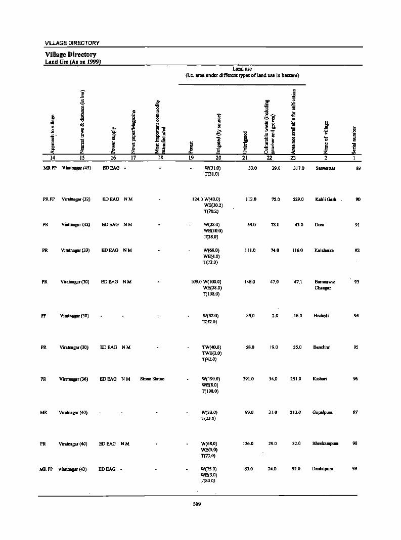
VILLAGE DIRECTORY
Villa!e Directory Land Use {As on 19991
I
Land use
(Le. area under different types of land use in hectare)
j c Q
g .~ DO .~
.5 'J:>
I -g -g "3 u ., E g,..... .a j ;;; ·S g ]' :.:::..rl .. u ::s .!! > ~ If diI i.., 0
~! >
~ ~ ! .. :a n
.8 &J € i ~ ~ .Ll ..c .. C>. ..!! :iii ~ l;! ii E U 1 ~~ 0 ...
j C>. ._ ~ 0
[ J I J '5 c ., ~ ~ Ii
_ u
F! 5 ,~ ·s ~ - ::s
:::!: Iii 8 !llI ::!: Zi ..
== 5G! . 14 15 16 17 18 19 20 21 22 23 2 1
MRFP Viratnagar (45) EDEAO - W(31.0) 33.0 29.0 317.0 Sanwatsar 89 T(31.0)
PRFP Viratnagar (32) EDEAG NM 124.0 W(40.0) 113.0 75.0 529.0 KabliGarh 90 WE(30.2) T(70.2)
PR Viratnagar (32) EDEAG NM W(28.0) 64.0 78.0 43.0 Dem 91 WE(IO.O) T(la.O)
PR Viratnagar (33) EDEAG NM W(68.0) 111.0 74.0 116.0 Kalalanka 92 WE(4.0) T(72.0)
PR ViralDagar (30) EDEAG NM 109.0 W(IOO.O) 148.0 47.0 47.1 Bamanwas 93 WE(38.0) Chaugan T(138.0)
FP Viratnagar (38) W(52,0) 85.0 2.0 16.0 Hodayli 94 T(52.0)
PR Viratnagar (30) EDEAG NM TW(40.0) 58.0 19.0 35.0 Banchhri 9S TWE(2.0) T(42.0)
PR Viratnagar (36) EDEAG NM Stone Statue W(J90.0) 391.0 54,0 251.0 Kishori 96 WE(8.0)
T(l98.0)
MR Viratnagar (40) W(23.0) 93.0 31.0 213.0 GopaJpura 97 T(23.0)
PR Viratnagar (40) EDEAG NM W{68.0) 126.0 29.0 32.0 Bheekampura 98
WE(S.O) T(73.0)
MRFP Viratnagar (43) EDEAG - W{7S.0) 63.0 24.0 92.0 Dau1atpura 99
WE(S.O) T(BO.O)
399
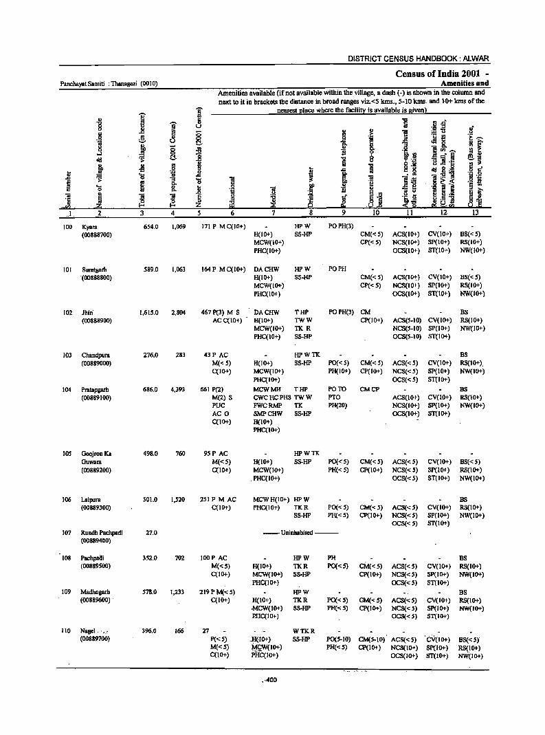
DISTRICT CENSUS HANDBOOK: ALWAR
Census of India 2001 -Panchayat Samiti : Thanagazi (001 0) Amenities and
Amenities available (if not available within the village, a dash (-) is shown in the column and next to it in brackets the distance in broad ranges viz.<5 lons., 5-10 lons. and 10+ lons of the
i j nearest 21ace where the facilit~ is available is Biven}
.g
1 ii ] l'J -
8 u :i:! ~ oJ' II>
I .,
] c ..c ;:; > .g 0 c " 0 l
._ l! e;~ ... -=- u t:!- J!8.
if g j 0 j :8 ]fIl~ ....:I 0
8 !.~ _- III old ~ t:!- "t:I
II Iii -= ]I ·c j II> 6 "t:I 8 'g C) .9
·I·~ ofi '" I 1 Iii old ~ ._ k) .... 'il _g . .. 1!:5!11 ..c ~ 0 ]. 'S 1
'iI ].~ ~
.. 'f! .0 ~ i ._ s .... f;! 0 Ji ]
I>Q !i '" "61 § '" 0 ... .5
~i ~ 5 ._ 5 t "ii ~ ! ]
~ ~ tf 'i a '5 ~
't:I ~.5 "» d'2 ~ .~ ~ 0 :si ... .,.1;/) • . -.~. e. -~ IS ~'" ) 2. 3 4 5 6 7 8 9 10 11 12 13
100 Kyara 654.0 1,069 171 P M C(IO+) HPW POPH(3) (00888700) H(IO+) SS-HP CM«S) ACS(lo+) CV(lO+) BS«5)
MCW(IO+) CP«S) NCS(IO+) SP(IO+) RS(IO+) PHC(IO+) OCS(lO+) ST(IO+) NW(lO+)
101 Suratgarh 589.0 1,063 164 P M C(lo+) DACHW HPW PO PH '(00888800) H(10+) SS-HP CM«5) ACS(IIl-t) CV(IO+) BS«5)
MCW(lO+) CP«5) NCS(IO+) SP(IO+) RS(IO+) PHqIO+) OCS(lO+) ST(lO+) NW(IO+)
102 Jhiri 1,61S.0 2,804 467 P(3) M S DACHW THP POPH(3) CM BS (00888900) ACC(IO+) H(lO+) TWW Cp(IO+) ACS(S-IO) CV(lO+) RS(IO+)
MCW(lO+) TKR NCS(S-IO) SP(IO+) NW(IO+) PHCCIO+) SS-HP OCS(S-IO) ST(IO+)
103 Chandpura 276.0 283 43P AC HPWTK BS (00889000) M«S) H(IO+) SS-HP PO«S) CM«S) ACS«S) CV(IO+) RS(10+).
qIO"') MCW(IO+) PH(IO+) CP(IO+) NCS«S) SP(IO"') NW(IO+) PHqIO+) OCS«S) ST(IO+)
104 Pmtapgath 686.0 4,393 661 P(2) MCWMH THP PO TO CMCP BS
(00889100) M(2) S CWC HC PHS TW W PTO ACS(lO+) CV(IO+) RS(IO+) PUC FWCRMP TK PH(20) NCS(JO+) Sp(IO+) NW(IO+) AC 0 SMPCHW SS-HP OCS(IO+) ST(lO+) C(IO+) H(IO+)
PHC(IO+)
105 GoojronKa 498.0 760 95P AC HPWTK GuWBra M«S) H(IO+) SS-HP PO« 5) CM«S) ACS«S) CV(JO+) BS«5) (00889200) C(lO"') MCW(IO+) PH«5) CP(IO"') NCS«S) SP(IO+) RS(IO+)
PHC(IO+) OCS« 5) ST{IO+) NW(IO+)
106 Lalpura 501.0 1,520 251 PM AC MCW H(ID+) HP W BS (00889300) C(lOT) PHC(I01-) TKR PO«5) CM«5) ACS«S) CV(IO+) RS(IO+)
SS-HP PH«S) Cp(IO"') NCS«5) SP(IO+) NW(IO+) OCS«S) ST(IO+)
107 Rundh Pachpadi 27.0 --Uninhabited--(00889400)
108 Pachplilli 351.0 702 lOOP AC HPW PH BS (00889SOO) M«S) H(IO+) TKR PO«S) CM«S) ACS{< S) CV(lO+) RS(IO+)
qIO+) MCW(IO+) SS-HP CP(IO+) NCS«S) Sp(IO+) NW(IO+) PHC(IO+) OCS«5) ST(IO+)
109 Madhogarh 578.0 1,233 219PM«S) HPW BS (00889600) C(IO+) H(IO+) TKR PO«S) CM«S) ACS«S) CV(lO+) RS(IO+)
.MCW(IO+) SS-HP PH«S) CP(IO+) NCS«5) Sp(IO+) NW(IO+) PHC(IO+) OCS«5) ST(IO+)
110 N.I·· r .·, 396.0 166 27 WTKR (00889700) P«5) . .H(:,O+) SS-HP POCS-IO) CM(5-10) ACS«5) '·CV(IO+) BS«5)
M«5) M£W(IO+) PH«5) CP(IO+) NCS(IO+) Sp(IO+) RS(IO+) C(IO+) PHC(IO+) OCS(IO+) ST(IO+) NW(IO+)
0-400
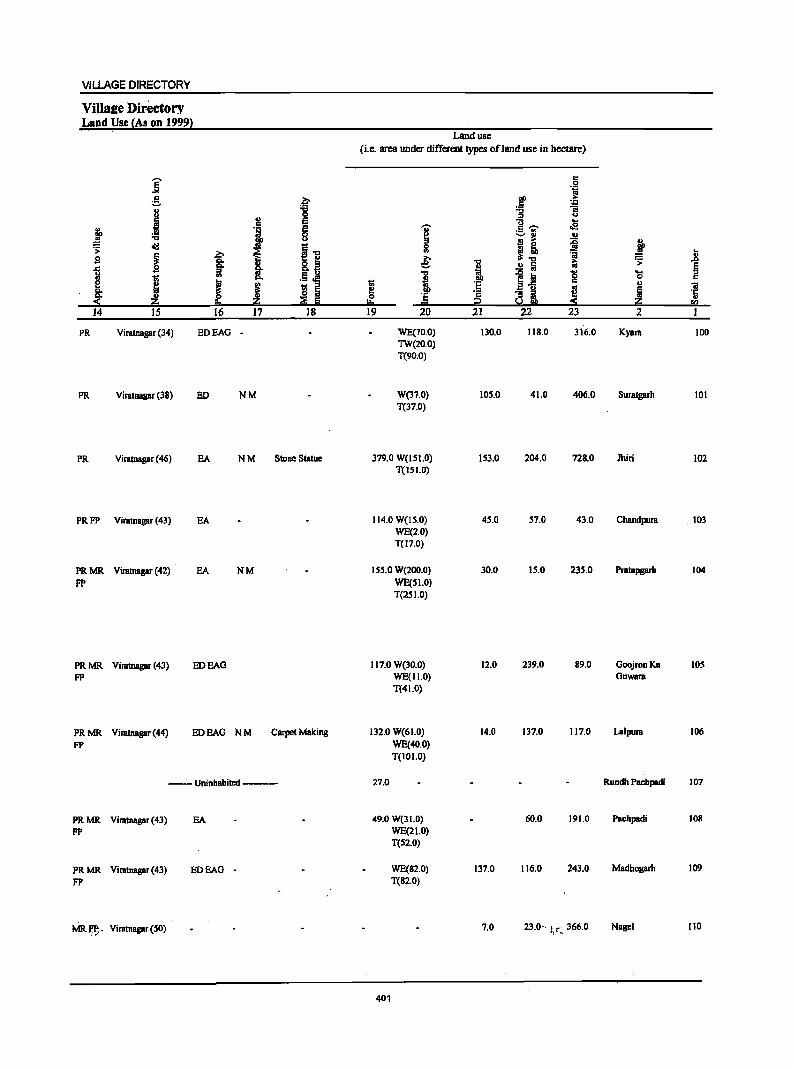
VILLAGE DIRECTORY
Villsee Directory Land Use (As on 19991
]' g f 8 ~
.., E c fo 'i E
~ c ~ <>
'> cI!I
i I] ~ ~ s
1 "" :J .. .5 ~ 'Ii: ..
"" j ~ I f ~ Iii c eo ~ Iii 14 15 16 17 18
PR Viratnagar (34) EDEAG
PR Viratnagar (38) ED NM
PR Viratnagar (46) EA N M Slone Statue
PRFP Viratnagar (43) EA
PRMR Viratnagar (42) EA NM pp
PRMR Viratnagar (43) EDEAG FP
PRMR Viratnagar (44) EDEAG NM Carpet Making
FP
--Uninhabited ---
PRMR Viratnagar (43) EA FP
PRMR Viratnagar (43) EDEAG -FP
MRf!-. Viratnagar (SO)
Land use
(ie. area under different types ofland use in hectare)
I 0 ., e: i 'Ii:
2:! c Ji !!= 19 20
WE(70.0) TW(20.0) T(90.0)
W(37.0) T(37.0)
379.0 W(ISI.O) . T(ISI.O)
114.0 W(15.0) WE(2.0) T(17.0)
155.0 W(200.0) WE(51.0) T(2SI.0)
117.0 W(30.0) WE(11.0) T(41.0)
132.0 W(61.0) WE(40.0) T(IOI.O)
27.0
49.0 W(31.0) WE(21.0) T(S2.0)
WE(82.0) T(82.0)
401
"0
i '6 'c i2 21
130.0
105.0
153.0
45.0
30.0
12.0
14.0
137.0
7.0
c
.~ .~ ~ "t:I :J <.> .. g,.... oS :.::..ri
~ B ;>
~! :;; 1;; " ~
j~ ~
~ i ~ :S
22 23
118.0 316.0
41.0 406.0
204.0 728.0
57.0 43.0
15.0 235.0
239.0 89.0
137.0 117.0
60.0 191.0
116.0 243.0
23.0" i,~:, 366.0
~ .. .. .;;: J> E .... :J c c
u iii ; '1:
~ ..
CI)
2 I
Kyara 100
Suratgarh 101
Jhiri 102
Chandpura . 103
Pratapgarh 104
GoojronKa 1.05 Guwara
Lalpura 106
Rundh Pachpadi 107
Pachpadi 108
Madhogarh 109
Nagei 110
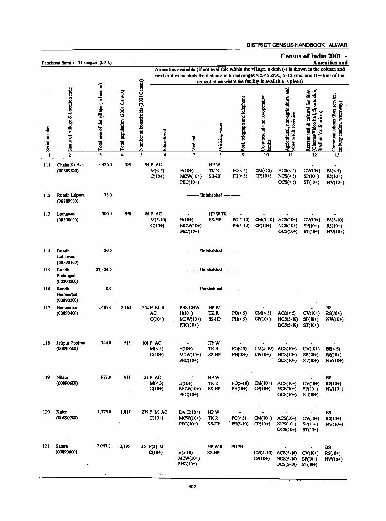
DISTRICT CENSUS HANDBOOK: ALWAR
Census of India 2001 -Panchayat Samiti : Thanagazi (0010) Amenities and
Amenities available (if not available within the village, a dash (-) is shown in the column and next to it in brackets the distance in broad ranges viz. <5 kIns., 5-10 kIns. and 10+ kms of the
-;;;- nearest 2laee where the facili~ is available is siven}
I " -8 I!!
~ ~ .. rl.&f 8 U
~-fi Ol-
e '" § J .~ :m .!.!
'i g .. i!!
._ ~ !i u ..... ~8.
~ 0 ._, g. 1i ., o· "0 B ·~·B
:$<n_ ..J 0
cIiI ~. C!- :8 "0 b -- § ej .. Iii u 1i ]h::
~ -5 .§ j 'E c ..
.) g o .-cIiI~~ ... I 1 c 8
u ~ 'g 1;1
]I ii ., '3 ... ] l'- " .. '.I:!
~ e g- o e o~< .2 S ... t ] f 'll '" .- l § ., 0 Q, ., '"iii
~1 '3 1;1 e e f 01 ~ ~ 1'1 ~ l:! tf .~ t e I:! 'E 'c ~ t! .- E_
u ~ i!;l ~ :!:~ ~ .~ <n ~ '"" Io.!.e E!l ~<n 2 :l 4 5 6 7 8 9 10 II 12 I:l
III ChahaKa8as • 426.0 589 94P AC HPW (00889800) M«5) H(IO+) TKR PO« 5) CM«S) AC8« 5) CV(IO+) BS«S)
C(IO+) MCW(IO+) 8S-HP PH« 5) CP(IO+) NC8« S) SP(IO+) R8(1O+) PHC(IO+) OC8«S) ST(IO+) NW(IO+)
112 Rundh Lalpura 73.0 ---- Uninhabited ---(00889900)
113 Lathawas 300.0 558 86P AC HPWTK (00890000) M(S-IO) H(IO+) SS-HP PO(S~IO) CM(S-IO) AC8(10+) CV(IO+) 88(5-10)
C(IO+) MCW(IO+) PH(S-IO) CP(IO+) NCS(lO+) SP(1O+) RS(lo+) PHC(IO+) OC8(10+) ST(IO+) NW(IO+)
114 Rundh 39.0 ---Uninhabited--Lathawas (00890100)
liS Rundh 27,426.0 ---Uninhabited -----Pratapgarh (00890200)
116 Rundh 0.0 ---Uninhabited --. Hameerpur (00890300)
117 HBmeerpur 1,487.0 2,160 3S2P M S PHSCHW HPW B8 (00890400) AC H(IO+) TKR PO«S) CM«S) AC8«S) CV(lo+) R8(10+)
C(IO+) MCW(IO+) SS-HP PH«S) CP(lO+) NCS(S-lO) SP(IO+) NW(lo+) PHC(IO+) OCS(S-IO) ST(IO+)
118 JBitpur Goojran 346.0 SIS 101 PAC HPW (00890500) M«5) H(IO+) TKR PO«S) CM(5-10) ACS(IO+) CV(IO+) 88«5)
C(IO+) MCW(10+) SS-HP PH(IO+) CP(IO+) NCS(IO+) SP(IO+) RS(IO+) PHC(IO+) OCS(JO+) ST(IO+) NW(IO+)
119 Nitata 971.0 911 138P AC HPW BS (00890600) M«S) H(IO+) TKR PO(S-IO) CM(IO+) ACS(IO+) CV(IO+) RS(IO+)
C(IO+) MCW(IO+) SS-HP PH(IO+) CP(IO+) NCS(IO+) SP(IO+) NW(lO+) PHC(IO+) OCS(JO+) ST(IO+)
120 Kaler 1,373.0 1.817 279P M AC DAH(IO+) HPW B8 (00890700) C(lO+) MCW(IO+) TKR PO«S) CM(IO+) ACS{IO+) CV(IO+) RS(IO+)
PHC(IO+) SS-HP PH(5-10) CP(IO+) NCS(IO+) SP(IO+) NW(IO+) OC8(10+) ST(IO+)
121 Samra 2,057.0 2,195 351 P(3) M HPWR PO PH I;IS (00890800) C(10+) H(S-IO) SS-HP CM(S-IO) A~S(S-JO) CV(IO+) RS(JO+) I
MCW(IO+) CP(lO+) NC8(S-10) Sp(IO+) NW(IO+) PHC(IO+) OCS(5-10) ST(IO+)
402
VILLAGE ~IRECTORY
Villaae Directory Land Use {As on 1999}
j !. " I .~
fW :.a l ~ tI1l
~ ~ g Co
" .c go !: ! t; '" i ~ j z g..
14 15 16 17
MRFP Viratnagar (43) SA
--Uninhabited ---
PRMR Viratnagar (39) EO BAG -FP
PR MR Viralnagar' (SO) FP
MR FP Dausa (35)
-- Uninhabited ---
--Uninhabited ---
-._ Uninhabited ---
BA NM
BA
b :g E' E 8
11 .§ ;E t; ::t
~ ~ 18
PR MR Dausa (33) FP
BA N M Marble Statue
PR MR Dausa (3S) FP
PR MR Viratnagar (43) FP
ED BAG N M Carpet Making
SA
Land use (i.e. area under different types of land use in hectare)
... !:! g .. € 1 ~ '6 If =
19 20
W(16.0) WE(30.0) T{46.0)
73.0
W(60.0) WE(9.0) T(69.0)
39.0
27,426.0
W(147,0) T(147.0)
W(20.0) T(20.0)
W(5B.0) T(S8.0)
401.0 W(103,0) T(IOJ.O)
W(l20.0) WE(S.O) T(l28.0)
403
i '6 . ';: C? 21
14.0
27.0
267.0
42.0
82.0
130.0
94.0
6 .~
1>1) > .5 .'" "C:J ] ::I ],... ..
oS :=,on .. B i ~ ;] :;i
~
~1! '0 c .a CJ ! 8i 22 23
70.0 296.0
95.0 109.0
247.0 826.0
39.0 . 245.0
246.0 S8S.0
230.0 509.0
386.0 1,449.0
~ .. ., .s: .£l
.... § 0 r:: .,
'iI fij '1:
z " Ul
2 1
ChahaKaBas III
Rundh Lalpun 112
Lothawas 113
Rundh Lothawas 114
Rundh PrataPBJl!'h 115
Rundh 116 Hamcerpur
Hameerpur 117
Jaitpur Goojran liB
Nitata 119
Kaler 120
Samra 121
DISTRICT CENSUS HANQBOOK : ALWAR
Census of India 2001 -Panchayat Samiti : Thanagazi (0010) Amenities and
Amenities available (if not available within the village, a dash (-) is shown in the column and next to it in brackets the distance in broad ranges viz.<5 kms., 5·10 kms. and 10+ kms of the
I 1 nearest glace where the facili~ is available is sivenl
-8 '? i fj .g" S u
f---.. §
., .,
i ~'U = ~ 5 a .~ ·s t! <> u e .~
t t:!.- o§. ., .as.. ;( g 1
., f
u <> 'll '~.~ ]cn __
..J e _" § d!I > C!.. "5 8] .~ ~~ ! ~
c rg ... § ._ .~ § <> t 1 Iii c IS d!I ~ ._
.8 ..... 'f;! ..8
1~ ]:9"S <> ]. ....
1 ;a .~ 'i § >
~ <> Ii .g~ i 'S &. .8 i
00 'll
., ~ t c
~ ~i ::I " ~ ~ ._ "iii I l fI § 1lf .~~ '5 ~ ia
.t: &
H·- ] 8] <I) z a b!~ :!: g eei~<I) 1 2 3 4 5 6 7 8 9 10 II 12 13
122 Jagannatbpura 595.0 611 79P AC HPW PH(4) DS
(OQ890900) M(10+) H(lO+) TKR PO« S) CM«S) AC8(IO+) CV(IO+) RS(IO+) C(IO+) MCW(IO+) SS-HP CP(IO+) NCS(JO+) SP(IO+) NW(IO+)
PHC(JO+) OCS(IO+) ST(lO+)
123 Piplai 1,533.0 2,309 3S3 P(3) M CHWH(IO+) HPW PO PH ACS DS (00891000) C(IO+) ,MCW(IO+) SS.HP CM(5-10) NCS(JO+) CV(JO+) RS(JO+)
PHC(IO+) CP(IO+) OCS(IO+) Sp(IO+) NW(JO+) ST(JO+)
124 Salloowas 495.0 888 132PM«5) HPW PH BS (00891100) C«5) H(JO+) SS-HP PO« 5) CM«5) AC8(IO+) CV(IO+) RS(JO+)
MCW(IO+) CP(IO+) NCS(JO+) SP(IO+) NW(IO+) PHC(IO+) OCS(IO+) ST(IO+)
125 Govindpura . 257.0 295 52P AC HPW PH
(00891200) M«5) H(lO+) SS-HP PO« 5) CM«5) ACS(IO+) CV(10+) DS«5) C(IO+) MCW(JO+) CP(5-10) NCS(IO+) SP(IO+) RS(IO+)
PHC(10+) OCS(JO+) ST(IO+) NW(lO+)
126 Jaitpur 401.0 829 127 P M C(10+) HPW PH(4) DS Brahmnan H(lO+) SS-HP PO«5) CM«5) ACS(JO+) CV(IO+) RS(JO+) (00891300) MCW(IO+) CP(lO+) NCS(IO+) SP(1O+) NW(IO+)
PHC(IO+) OCS(JO+) ST(JO+)
127 Kundla 399.0 496 74 P M(5-10) HPW PH BS (00891400) C(JO+) H(10+) SS-HP PO(5-10) CM(5-10) ACS(5-10) CV(IO+) RS(IO+)
MCW(1o+) CP(IO+) NCS(lo+) SP(lo+) NW(lO+) PHC(IO+) OCS(10+1 ST(IO+)
128 Guwara 271.0 454 66PM«5) .HPW BS. Sadaram C(lO+) H(IO+) SS-HP P0(5-10) CM(5-10) ACS(IO+) CV(IO+) RS(lO+) (00891500) MCW(IO+) PH(IO+) CP(IO+) NCS(IO+) SP(IO+) NW(IO+) .
PHC(IO+) OCS(IO+) ST(IO+)
129. Guwara Naidoli 238.0 511 76 P MC(IO+) HPW PH BS (00891600) H(IO+) SS-1iP PO(5-IO) CM(S-IO) ACS(IO+) CV(IO+) RS(IO+)
MCW(IO+) CP(10+) NCS(IO+) Sp(IO+) NW(IO+) PHC(IO+) OCS(10+) ST(IO+)
130 Guwara Kalyan 221.0 m 39 HPW PH (00891700) p«S) . H(IO+) SS-HP PO(S-IO) CM(5-10) ACS(IO+) CV(IO+) BS«S)
M(5-10) MCW(lO+) . CP(10+) NCS(10+) Sp(IO+) RS(10+) C(IO+) PHC(IO+) OCS(IO+) ST(IO+) NW(IO+)
131 Guwam Pakhal 27.0 132 19 HPW ". (00891800) P«S) H(IO+) SS-HP P0(5-10) CM(5-10) AcS(io+) CV(IO+) BS«S)
M«S) MCW(IO+) . PH(S-lO) CP(1O+) NCS(IO+) sp(10+) RS(IO+) C(IO+) PHC(IO+) OCS(IO+) ST(IO+) NW(IO+)
132 Seeli Baori 385.0 1,411 190P MC(JO+) DAH(IO+) HPW PO PH SS (00891900) MCW(IO+) '~\~S-HP CliIr(S-IO) ACS(lO+) CV(JO+) RS(IO+)
PHC(JO+) cp(IO+) NCS(JO+) SP(IO+) NW(10+) OCS(IO+). ST(JO+)
404
VILLAGE DIRECTORY
Villa!e Directory Land Use (As on 1999)
]' !. u
J j ~ <Ill g j -f
Q. .r::
J '"
I '" ~ &.
14 15 16
MRFP Vimtnagar (42) EDEAG
PR Viratnagar (43) EDEAG
MRFP Vimtnagar (3S) EDEAG
PR Vimtnagar (45) EDEAG
PR Vimtnagar (46) EDEAG
PRMR. Viratnagar (45) EDEAG
PRMR Vimtnagar (48) EDEAG
PR Viralnagar (46) EDEAG
FP Viratnagar (46)
FP Vimtnagar (46)
-
-
-
M
-
-
-
-
PR Vimlnagar(44) . EDEAG -
.~ "tI 0
" = E
I E 0 u
i] l 8.a
·.5.:! ~ - :s
! ! ii!::i 17 18
SlOne Statue
..
Land use
(i.e. ~ under different types ofland use in hectare)
'Ii' !! :s Ii! ~ ... ,
~ ·E == = 19 20
185.0 W(35.0) T(3S.0)
W(90.0) WE(1O.0) T(IOD.O)
W(74.0) WE(6.0) T(SO.O)
W(S6.0) WE(4.0) T(60.0)
W(20.0) WE(9.0) T(29.0)
W(20.0) WE(3.0) T(23.0)
W(30.0) WE(4.0) T(34.0)
W(l9.0) WE(1O.0) T(29.0)
W(36.0) T(36.0)
W(14.0) T(14.0)
WE(40.0) TW(S.O) T(4S.0)
1 ·e ~ 21
63.0
223.0
155.0
73.0
191.0
101.0
67.0
30.0
44.0
4.0
168.0
5 .~
f ~ u
u ... = ........ ~ :.:..13 ., j! i
'oj
..!! Iii iii
1~ '0 = §i !
22 23
214.0 98.0
IS8.0 1,022.0
102.0 ISS.O
34.0 90.0
91.0 90.0
38.0 237.0
45.0 125.0
10.0 169.0
21.0 120.0
4.0 5.0
64.0 )08.0
~ = .8 .i>
~ 'S .. «I
~ ·5 en
2 I
Jagannalbpura 122
Pip(ai 123
BaUoOWIS 124
Govindpum 125
Jaitpur 126 Brahmnan
Kundla 127
GuWlllll 128 Sadamm
Guwara 129 Naidoli
Guwam Kalyan 130
Guwara Pakhal 131
Sedi Baori 132
DISTRICT CENSUS HANDBOOK: ALWAR
Census of India 2001 -Panchayat Samiti : ThanagSzi (001.0) Amenities and
Amenities available (if not available within the village, a dash (-) is'shown in the column and next to it in brackets the distance in broad ranges viz. <5 lans., 5.10 lans. and 10+ kms of the
1 ~ nearest I?!ace where the facjlit:r: is available is 8iven~ u Iii .(1 -§ .. .., -;;;-8 iii u .. '" :!!<l .. ... c ;:;
i ...
0 c u 0 .~ ._ ~
~ ;::, u t:!- .a&; .t ;:; '" ~ . 0 i a 1<1l~
t:!- ~ -' E cId ~ ] -'il'" '" .~ ~ Jl 6 ] 0'"
f ... d!J 8·_ il ~ .... 'if i!
-~ ]:9"g 0
1 .... ] ~ ~
0 .$! ~ i ... ... 'i i· 0 Q" '" ] li 1;; E
~ u ]
.c .~ j ~- ]
~ ~ :a ti
~ ~ '" i§ 0
'" ",. u'" 2 3 4 5 6 7 8 9 12
133 GuwaraSeeli 5.0 --Uninhabited ---Baori (00892000)
134 Guwam Kunda! 248.0 113 14 HPW (00892100) P«5) H«5) SS-HP PO«S) CM«S) ACS(IO+) CV(lo-t) BS«5)
M«5) MCW(IO+) PH(lo-t) • CP(IO+) NCS(IO+) SP(lo-t) RS(IO+) C(lO+) PHC(lo-t) OCS(IO+) ST(I01-) NW(I01-)
13S Guwara 256.0 340 45 HPW Bhooriyawali P«5) H(lo-t) SS-HP PO« S) CM«S) ACS(lO+) CV(IO+) BS« S) (00892200) M«S) MCW(IO-t) PH(S-IO) CP(lO+) NCS(IO+) SP(IO+) RS(lO+)
C(10+) PHC(IO+) OCS(IO+) ST(lO+) NW(IO-t)
136 Guwara Dabar i4.0 163 22 HPW (00892300) P«5) H(IO+) SS-HP PO(I 0+) CM(IO+) ACS(IO+)- CV(IO+) 8S(IO+)
M«5) MCW(lO+) PH(S-IO) cp(10+) NCS(IO+) SP(IO+) RS(IO+) C(IO+) PHC(IO+) OCS(IO+) ST(lO+) NW(IO+)
137 Guwara Seera 119.0 188 28 HPW -(00892400) P«5) H(IO+) SS-HP PO(S-IO) CM(S-IO) ACS(IO+) CV(IO+) 8S«5)
M«S) MCW(IO+) PH(S-IO) CP(IO+) NCS(IO+) SP(IO+) RS(IO+) C(10+) PHC(lO+) OCS(IO+) ST(IO+) - NW(IO+)
138- GUWBrB Dhasi 136.0 147 22 HPW (00892S00) P«S) H(IO+) SS-HP PO(S-IO) CM(S-IO) ACS(lO+) CV{IO+) 8S«5)
M«S) MCW(IO+) PH(S-IO) CP(IO+) NCS(IO+) Sp(lO+) RS(IO+) C(IO+) PHC(lO+) OCS(IO+) ST(1O+) NW(IO+)
139 GUWBra Lala 13.0 209- 25 P M C(IO+) - HPW 8haiya H(IO+) SS-HP PO(S-IO) CM(5-10) ACS(IO+) CV(IO+) 8S«5) (00892600) MCW(lO+) PH(S-IO) CP(10+) NCS(IO+) SP(lO+) RS(IO+)
PHC(IO+) OCS(IO+) ST(IO+) NW(IO+)
140 Guwara 58.0 IS8 IS HPW Hanuman P« S) H(IO+) SS-HP PO«5) CM(IO+) ACS(IO+) CV(IO+) 8S« 5) (00892700) M«5) MCW(IO+) PH(5-10) Cp(IO+) NCS(IO+) SP(IO+) RS(IO+)
C(IO+) PHC(IO+) OCS(IO+) ST(IO+) NW(IO+)
141 GUWBra Sahiba 20.0 45 6 HPW (00892800) P« S) 8(10+) SS-HP PO«5) CM(S-IO) ACS(IO+) CV(IO+) 8S«5)
M«S) MCW(IO+) PH(S-IO) CP(IO+) NCS(IO+) SP(IO+) RS(lO+) C(IO+) PHC(IO+) OCS(IO+) ST(IO+) NW(IO+)
142 Guwara Kalo1 54.0 132 - -20 HPW (00892900) 'P« 5) H(IO+) SS-HP PO« S) CM(IO+) ACS(IO+) CV(lO+) 8S« 5)
M«S) MCW(lO+) PH(S-IO) cp(10+) NCS(IO+) Sp(IO+) RS(IO+) C(1O+) PHC(IO+) OCS(lo-t) ST(10+) NW(IO+)
143 Guwara 56.0 . 56' 8 HPW "
Bhagwan ~,~~.;! P«5) H(IO+) SS-HP -PO« 5) CM(IO+) ACS(ID+) CV(IO+) 8S(S-J()h,~ (00893000) M«S) MCW(IO+) PH(5-10) CP(IO+) NCS(IO+) SP(IO+) RS(IO-t)
C(IO+) PHC(IO+) OCS(JD+) ST(IO+) NW(lO+)
406
VILLAGE DIRECTORY
VillI.£e Directory Land Use (As on 1999)
]' g u u
ii ~ .!a ..., ~ oIlI g ~
I g
i z 14 IS
!:! ·t ~ i g-.. 11
J ~ z 16 17
--Uninhabited ---
PR FP Viratnagar(43)
FP Viratnagar (42)
FP Viralnagar (44) EAO
FP Viratnagar (46)
FP Viratnagar (46)
FP Viratnagar (46)
FP Viratnagar (46)
FP Viratnapr (47)
FP Viratnagar(46)
FP Vitatnagar (46)
b 'i3 0 .s g u
~.., a2! .5 j - " ~ Ii ::£ E
18
Land use
(i.e. area under different types Ofland use in hectare)
-;; !:! 0 u. 19
I Sl e; I ·5 = 20
W(3.0) T(3.0)
W(26.0) T(26.0)
W(l5.0) T(IS.O)
WE(9.0) T(9.0)
W(20.0) T(20.0)
W(8.0) T(8.0)
W(9.0) T(9.0)
W(l5.0) T(IS.O)
W(12.0)
TCI2.0)
W(7.0) T(7.0)
W(B.O) T(8.0)
!'f :;:; " ]" .- ., ~ .,
1! 1 ..!! Iii
~ til .a..c 81 t:l
21 22
2.0
31.0 12.0
51.0 27.0
3.0 1.0
45.0 40.0
31.0 32.0
2.0
20.0 16.0
s.O
13.0 24.0
16.0 12.0
c 0
"fi > . ." g .g u
~ ~ ~ .8 1:; .s: ... § 0 0 c c
~ u "iI !ii ·5
:( Z "" 23 2
Ouwara See)i 133 Baori
179.0 Ouwara Kunda) 134
163.0 Ouwara 135
1.0
14.0
65.0
2.0
7.0
3.0
10.0
Bhooriyawali
Ouwara Oabar
Ouwara Seem
Ouwara Ohasi
OuwamLala Bhaiya
Ouwara
Ha~uman
136
137
138
139
140
OuwaraSahiba 141
Ouwara Kalal
Ouwara Bhagwan
142
143
DISTRICT CENSl,lS HANDBOOK: ALWAR
Census of India 2001 -Panchayat Samiti : Thanagazi (ooio) Amenities and
Amenities available (if not available within the village, a dash (-) is shown in the column and next to it in brackets the distance in broad ranges viz.<5 kms., 5-10 kms. and 10+ kms of the
I ~ nearest I!lace where the facili!l: is available is Blven l
-8 ~ ..." "'.J:i 0 I Iii .,8 .E! .If I.)
§ .,
! = :.c: :.: u .S! :! ~ 'i ._ 1!!
=1 'OJ u 1- "§ oM 0 <> # 8 ~
., !~,.._ C> 1i g- ',.! ...:I
C!. 8 -t§ e <Id ii ] =]h:: : ~ = gj ..." 6 .~ I.) 0 ~ ". 0
I 1 Iii = 8 <Id ~.1:: ~ ~
'j _g l~ ]:5!"g
.::; a .0 ]. ._ 1 :!! fj ~
os 0 bO ~ o ~ <
~ ~ 8. t .~ ~ = 1i ~ ! ._ §
l " .0 J2 ~i I 5 ._ ~ f ! s ~ ~ ..." = 1i .5 ]
~ ~ ~ '1:: ~
1iO-s ~] CIl 9 U.o :S 52 ~~~ I 2 3 4 5 6 7 8 9 10 11 12 13
144 Ouwara lanawat 15.0 144 21 P M«5) HPW (00893100) C(IO+) H(lO+) SS-HP PO«5) CM(lo+) ACS(IO+) CV(IO+) BS«S)
MCW(IO+) PH(5-10) CP(IO+) NCS(IO+) SP(IO+) RS(S-IO) PHC(IO+) OCS(IO+) ST(10+) NW(10+)
145 GuwaraHar 114.0 270 43PM«S) HPW (008932QO) C(IO+) H(IO+) SS-HP PO«5) 'CM(IO+) ACS(IO+) CV(IO+) BS« S)
MCW(IO+) PH(S-IO) CP(IO+) NCS(lo+) SP(IO+) RS(IO+) PHC(IO+) OCS(IO+) ST(IO+) NW(IO+)
146 Ouwara Vyas IS.O 40 3 HPW (00893300) P«S) H(lo+) SS-HP PO«S) CM(IO+) ACS(IO+) CV(IO+) BS« 5)
M«5) MCW(to+) PH(5-10) CP(IO+) NCS(IO+) SP(to+) RS(lO+) C(IO+) PHC(lo+) OCS(IO+) ST(1o+) NW(1O+)
147 Ouwara 8.0 70 9 HPW !amadar P«S) H(IO+) SS-HP PO«5) CM(lO+) AC8(1O:r) CV(IO+) B8« S) (00893400) M«S) MCW(IO+) PH(S-IO) CP(IO+) NCS{IO+) SP(IO+) RS(IO+)
C(IO+) PHC(IO+) OCS{IO+) ST(IO+) NW(IO+)
148 OuwaraSoti 42.0 241 44PM«5) HPW (00893500) C(IO+) H(IOi') SS-HP PO«5) CM(IO+) ACS(IO+) CV(IO+) BS« 5)
MCW(10+) PH(S-IO) CP(lO+) NCS(IO+) SP(10+) RS(lO+) PHC(IO+) OCS(IO+) ST(IO+) NW(IO+)
149 Ouwara Birkari 225.0 387 62PM«5) HPW (00893600) C(lO+) H(10+) SS-HP PO«S) CM(<< 5) ACS(lo+) CV(1O+) DS« S)
MCW(IO+) PH(IO+) CP(IO+) NCS(IO+) SP(IO+) RS(1O+) PHC(10+) OCS(IO+) ST(IO+) NW(IO+)
ISO Ajabgarh 516.0 1,420, 2SS PM S CHWH(IO+) HPW POPH(2) CM DS (00893700) C(IO+) MCW(IO+) TKR CP(IO+) ACS(lO+) CV(IO+) RS(IO+)
PHC(IO+) SS-HP NCS(IO+) SP(IO+) NW(IO+) OCS(IO+) ST(IO+)
151 Rundh Ajabgarh 240.0 8 3 RSS-R (00893800) P«5) H(IO+) PO«5) CM«5) ACS(IO+) CV(lO+) 8S«5)
M«5) MCW«5) PH{I 0+) Cp(IO+) NCS(IO+) SP(IO+) RS(IO+) C(IO+) PHC«5) OCS(lo+) ST(IO+) NW(lO+)
152 Ouwara Dulawa 56,0 36 10 HPW . (00893900) P«S) H«S) SS-HP PO«,) CM«5) ACS(IO+) CV(IO+) . 8S« 5)
M«5) MCW(lO+) PH{IO+) Cp(IO+) NCS(IO+) Sp(IO+) RS(lO+) C(10+) PHC(IO+) OCS(IO+) ST(IO+) NW(IO+)
153 Ouwara 64.0 68 10 HPW Bandipul P«5) H(lO+) SS-HP PO«5) CM«5) ACS(IO+) CV(IO+) 88« 5) (00894000) M«5) MCW(lO+) PH(IO+) CP(IO+) NCS(IO+) SP(IO+) RS(IO+)
C(IO+) PHC(IO+) OCS(lO+) ST(IO+) NW(1O+) 154 Guwara Gugli 267.0 487 77PM«S) HPW -. i
(00894100) C(IO+) H(IO+) SS-HP PO«5) CM«S) ACS(IO+) CV(lti+) 8S« 5) . MCW(lO+) PH(S-lO) CP(IO+) NCS(lO+) SP(IO+') RS(lO+) PHC(IO+) OCS(IO+) ST(lo+) NW(IO+)
408
VILLAGE DIRECTORY
ViIlae:e Directory Land Use (As on 1999)
--.§ g .. i j :a
~ old
~ .s i3 B
[ 1;;
II ~ g; 14 IS
FP YiralDagar (44)
FP Viratnagar (44)
FP Viralnagar (45)
FP ViratnBga~ (43)
FP Viratnagar(43)
PR Viratnagar (43)
>.
1 '" ~
eo 16
EDEAG
PR Viratna8llr (43) EDEAG
FP Dausa(4S)
PR Viratnagar (44)
PR Viratnagar (45)
MR Viratnagar (46)
.~ "t:I 0
i E E 0 u
!1 §. .!~ .... ! :!l fa
~ § 17 18
.
~
NM
-
Land use (i.e. area under different types ofland use in hectare)
! 0
!:!o 19
"i)' I::?
.::1
i € I 'E t:::! 20
W(II.O) T(II.O)
W(39.0) WE(2.0) T(41.0)
W(IO.O) T(lo.o)
W(7.0) T(7.0)
W(29.0) T(29.0)
W(65.0) T(65.0)
96.0 W(44.0) WE(S.O) T(52.0)
240.0
W(7.0} T(7.0}
W(9.0} T(9.0)
W(20.0) T(20.0)
409
1 Ji c i2 21
2.0
31.0
3.0
4.0
52.0
64.0
35.0
38.0
61.0
c .~
tID ·Ei c :a "3 ::I U
<3 ... c -- .g ._ '" ~'" .. B ~ ii J~ 'ii
&i .!! fa ~ til 15 .a-fi
c
~i ~ :::!:
22 23
2.0
23.0 19.0
2.0
1.0
1.0 8.0
20.0 88.0
91.0 213.0
13.0 1.0
16.0 1.0
35.0 lSI.O
j ~ .... 0 .. ~ 2
Ouwara Janawal
GuwaraHar
GuwaraVyu
Guwara Jamadar
GUWBraSoti
Guwara Birbri
Ajabgarh
Rundh Ajabgarh
Guwara Dulawa
Guwara Bandipul
Ouwara Gugli
.8 ~ ~ !l2 I
144
14S
146
141
148
149
ISO
151
152
IS3
1S4
DISTRICT CENSUS HANDBOOK: ALWAR
Census ofIndia 2001 -Panchayat Samiti : Thanagazi (0010) . Amenities and
Amenities available (if not available within the village, a dash (-) is shown in the.column and nex:t to it in brackets the distance in broad ranges viz. <5 kms., 5-10 kills. and 10+ kms of the
I ~ nearest I!lace where the facilit~ is available is given)
-8 'fii' ~ ] rl.Q 8 ;::J ~ ~. .~ ·1 i § j .,_
1 !. 'j ._ t!
!f u c::!- oM 8. .s j ;; ... & ~
1l ern~ ~
"0 'B 's, Jd ~
Q
] 8 'l' .! .a .... § e~ ~ -! j 1 ] 6 .!! 1l ].§ i!I _
... I t c g ~ i #1:: .~ (5 '" = ~ l;;; 1!:-s!'g
1 .;;: "3 'S 1 ]I 5 ',::l ..
8: I;! o~« '§ III 'S ~ 1l 'iI E -B '" "Ell ._ '§ ., 'jj ~ E ., '01 E ~ f. ..
! ! i E ~ .5 'if 8~ .~ b
e ~ ._ '5 ~
;::J ., ~ ~ ~~ ~u] 8] 22 z ~ !i.1& ~rn
1 2 3 4 5 6 1 8 9 10 II 12 13
ISS Guw.ra Radi _ 118.0 2S9 35 P M«5) HPW (00894200) C(tO+) H(lo+) SS-HP PO«S) CM«S) ACS(IO+) CV(IO+) BS«5)
MCW(IO+) PH(IO+) CP(IO+) NCS(IO+) SP(IO+) RS(IO+} PHC(IO+) OCS(IO+) ST(IO+) NW(IO+)
156 Guwara Leswu 4.0 67 II HPW (00894300) P« S) H(IO+) •. SS-HP PO«S) CM«S) ACS(IO+) CV(IO+) BS« 5)
M«5) MCW(lO+) PH(IO+) CP(IO+) NCS(IO+) SP(IO+) RS(IO+) C(lO+) PHC(IO+) OCS(IO+) ST(lO+) NW(IO+)
157 Guwara Nirbha 84.0 16 2 HPW _.
(00894400) P« 5) H(lO+) SS-HP PO«5) CM«5) ACS(10+) CV(IO+) BS«S) M«5) MCW(lo+) _PH(IO+) CP(IO+) NCS(IO+) SP(IO+) RS(lo+) C(IO+) PHC(IO+) OCS(IO+) ST(IO+) NW(IO+)
158 Guwara Ramji 167.0 560 83 P MC(IO+) HPW (00894500) _ H(IO+) SS-HP PO«S) CM«S) ACS(IO+) CV(IO+) BS« S)
MCW(IO+) PH(lO+) CP(lO+) NCS(IO+) SP(IO+) RS(IO+) PHC(IO+) OCS(IO+) 81'(10+) NW(IO+)
159 Rundb SeeJi 1,385.0 --Uninhabited--Baorf (00894600)
Paochayat Samiti : 106,704.0 189,977 28,427 P(l96) M(69) D(S) DA(l6) T(23) PO(34) CM(8) AC8(10) BS(5'1) Total 8(20) PUC(6) MCW(3) W(143) TO(2) CP(2) NCS(2)
J AC(44) MH(3) cwe TK(M) PTO(Z) OCS 0(3) BC(6) HP(141) PB(655)
PHC(2) TW(18) PH8(18) R(55) C(4) FWC(J) LS RMP(Z2) SMP CBW(31)
410
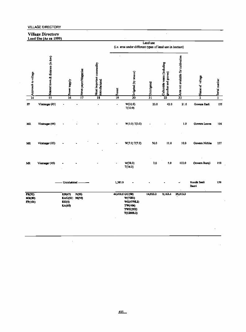
VILLAGE DIRECTORY
Villa£e Directory Land Use (As on 1999)
]' g ., i J '6
';> lid
B ~ ~ j e
~ 14 15
FP Viratnagar (45)
MR Viratnagar (44)
MR Viratnagar (43)
MR Viratnagar (45)
'1 ~ j §.
III CI.
J i ~
16 17
--Uninhabited ---
PR(91) MR(BO) FP(IOI)
ED(47) N(55) EAG(51) M(54) EO(4) EA(60)
~ :g E E 0 u
11 .§ ~ ! ::I
~ ~ 18
Land usc (i.e. area under different types ofland use in hectare)
I I!! 19
1.385.0
'Ii' $ Ii! ~ "0
i '5 1::1
20
W(32.0) T(32.0)
W(3.0) T(3.0)
W(7.0) T(7.0)
W(38.0) T(38.0)
44,418.5 GC(50) W(728l) WE(4798.2)
TW(406) TWE(3S:Z) T(12888.:Z)
c 0
'J:'
.;r g!
'g ~ Cl
u ... c ~ .E ._ .. ~., u
j! ii 'ii
I .!! Iii ~
1~ 0 '5 c
~ ~ i ~ 21 22 23
23.0 42.0 21.0
1.0
56.0 11.0 10.0
2.0 5.0 122.0
14,912.:Z 9,163.4 25,313.3
u
~ .. ~ ..8
~ .... 0 u "iii
~ '1: u
<IJ
2
GuwaraRadi ISS
Guwara Leswa 156
GuWUll Nirbha 157
GUWUll Ra.mji 158
RundhSeeli Bacri
159

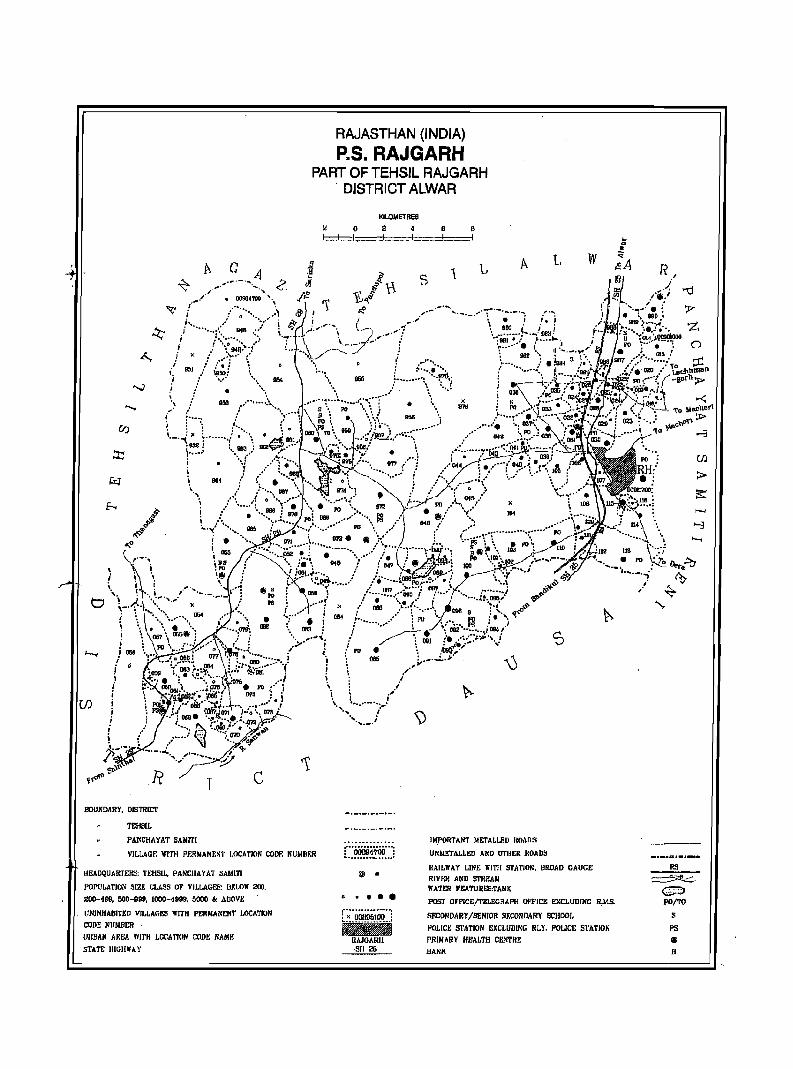
/" .....
I i i j ;1158
f 0
I
! I
i i j I
!
BOUNDARY, DISTRlcr
T£H8IL
PAJiCHAYAT SAMITI
j\. G
T c
RAJASTHAN (INDIA)
P.S. RAJGARH PART OF TEHSIL RAJGARH
DISTRICT ALWAR
KILOMETRes
~ 0 2 L._I __ J,~. ~ . .J .,..l
B _ •• :::1.. •.
B .1
A L w
VILI,AGF: 1IITH PF2!!IIANF.NT I.OCATION COOF: NUMBER r"OOii9~700"': ....................
IMPORTANT METALl.RD ROADS
UNME'l'ALLEIl AND Oi'IIER J!OADS
JlEADQUAlffEHS: 1'EHSIL, PANCIIAYAT SAMll'!
f'Ol'ULATIOX SIZK CLASS or VILLAGES: DEWll" 2110,
200-199, 500-999, 1000-1999, 5000 .. ADOVE
UNINHABITED VILLAGES WITH PERMANENT LOCATION
CODE NUMIlER ' UIIBAN All!>A IYITH LOCA'rl(lN com: NAMF,
STATE lIIenwAY
@ •
o ••••
JIAILlYAY LINE 1I'ITII STATION, 1ll10AD GAUGE
RIV~I! ANV STREAM WATER FEATURES:TANK
POST OFFICE/TELEGRAPH OFFICE EXCLUDING R,M.5.
SF.CONDARY/SENIOR SIlCOliDARY SCHOOl. POLlC~ Sf'ATION EXCLlJDlNG IlL)', POLICE STATION
PRIMARY HEALTH eEt-THE HANK
RS __ 5:Il.-::::;.
c:::> pO/TO
S
PS
~
B

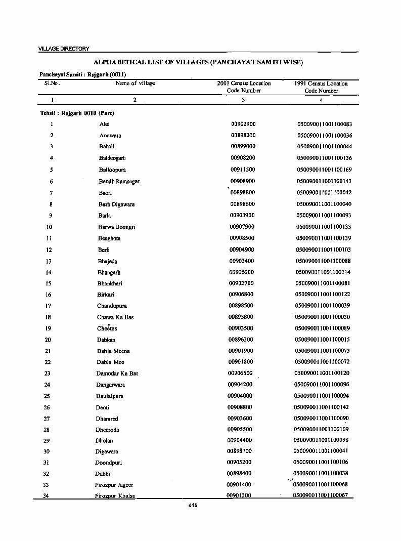
VILLAGE DIRECTORY
ALPHABEfICAL LISf OF VILLAG~ (P ANCHAYAT SAMITIWISE)
PanchayatSamiti: RBjgarh (0011) SI.N>. Name of village 2001 Census !.Demion 1991 Cmsus Location
Code Number Code Number
2 3 4
Tehsil : Rajgarb 0010 (Part)
A1ei 00902900 050090011001100083
2 Anawara 00898200 050090011001100036
3 Babali 00899000 05009001100]]00044
4 Baldeogarh 00908200 050090011001100]36
5 Balloopura 00911500 050090011001100169
6 Bandh Ramsagar 00908900 050090011001100143
7 Baari 00898800 0500900]]001100042
8 Barh Digawara 00898600 05009001]001100040
9 Barla 00903900 050090011001100093
10 Barwa Doongri 00907900 050090011001100133
II Beeghota 00908500 050090011001100139
12 Berti 00904900 05009001100'1100 I 03
13 Bhajeda 00903400 050090011001]00088
14 Bhangarh 00906000 050090011001100114
15 Bhankhari 00902700 050090011001100081
16 Birkari 00906800 05009001100il00122
17 Chandupura 00898500 050090011001100039
18 Chawa KaBas 00895800 " 050090011001100030
19 CheJtos 00903500 050090011001100089
20 Dabkan 00896300 050090011001100015
21 Dabla Meena 00901900 050090011001100073
22 Dabla Meo 00901800 050090011001100072
23 Damodar Ka Bas 00906600 050090011001100120
24 Dangarwara 00904200 050090011001100096
25 Daulatpura 00904000 050090011001100094
26 Deoti 00908800 050090011001100142
27 Dhamrcd 00903600 05009001]001]00090
28 Dheeroda 00905500 05009001]00]100109
29 Dholan 00904400 05009001]001100098
30 Digawara 00898700 05009001100110004]
31 Doondpuri 00905200 05009001100]]00106
32 Dubbi 00898400 050090011001100038 ".!
33 Firozpur Jageer 00901400 050090011001100068
3"4 FirozQur Khalsa 00901300 0500900]]00]100067
415
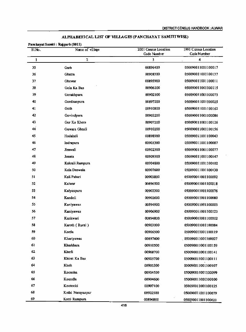
DISTRICT CENSUS HANDBOOK: ALWAR
ALPHABEI'ICAL LIST OF VILIAGIB (P ANCHAYAT SAMlTIWlSE)
PanchayatSamiti: R.garh (0011) SI.No. Name of village . 2001 Census Location 1991 Census Location
Code Number CQdeNumber
2 3 4
35 Garh 00896400 050090011001100017
36 Ghatra 00908300 050090011001100137
37 Ohewar 00895900 050090011001100011
38 GolaKa Bas 00906100 050090011001100115
39 Oorakhpura 00902100 050090011001100075
40 Gordhanpura 00897200 050090011001100025
41 Ooth 00910800 050090011001100162
42 Govindpura 00903200 050090011001100086
43 Gur Ka Khera 00907200 050090011001100126
44 Guwara Ghesli 00910200 050090011001100156
45 Hodaheli 00898900 050090011001100043
46 lndrapura 00903300 050090011001100087
47 Jirawali 00902300 050090011001100077
48 Joneta 00909300 050090011001100147
49 Kakrali Rampura 00904800 05009001100]]00102
50 Kala Deewala 00907600 050090011001100130
51 Kali Pahari 00903800 050090011001100092
52 Kalwar 00896500 05009001100]100018
53 Kalyanpura 00902200 050090011001100076
54 Kandoli 00902600 050090011001100080
55 Kaniyawas 00894900 050090011001100003
56 Kaniyawas 00906900 050090011001100123
57 Kankwari 00894800 050090011001100002
58 Karoth ( Rural ) 00903000 050090011001100084
59 Keetla 00906500 050090011001100119
60 Khariyawas 00897400 . 050090011001100027
61 Kharkhara 00910500 050090011001100159
62 Kherli 00908700 050090011001100141
63 Khirat Ka Bas 00905700 050090011001100111
64 Khoh 00905300 050090011001100107
65 Kooncha 00904500 050090011001100099
66 Koondla 00904600 050090011001100100
67 Kootooki 00907100 050090011001100125
68 Kothi Narayanpur 00902500 050090011001100079
69 Kotri Rampura 00896800 050Q90011001100021 416
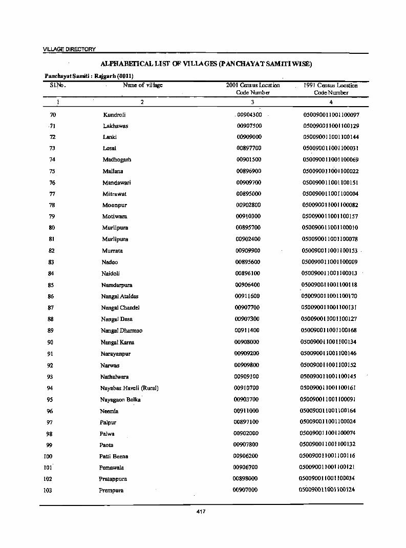
VILLAGE DIRECTORY
ALPHABEI'ICALLISf OF VILLAGES (pANCHAYATSAMITIWlSE)
PanchayatSamiti: RJ9garh (0011) SI.1Ik> . Name of village 2001 Census Location 1991 Census Location
Code Number CodeNumber
2 3 4
70 Kundroli .00904300 050090011001100097
·71 Lakhawas 00907500 050090011001100129
72 Lanki 00909000 050090011001100144
73 Losal 00897700 050090011001100031
74 Madhogarh 00901500 050090011001100069
75 MaJiana 00896900 050090011001100022
76 Mandawari 00909700 050090011001100151
77 Mitrawat 00895000 050090011001100004
78 Moonpur 00902800 050090011001100082
79 Motiwara 00910300 050090011001100157
80 Murlipura 00895700 0500900 1100 11 000 1 0
81 Murlipura 00902400 050090011001100078
82 Murrata 00909900 050090011001100153 .
83 Nadoo 00895600 050090011001100009
84 Naidoli 00896100 050090011001100013
85 Namdarpura 00906400 050090011001100118
86 Nangal Ataldas 00911600 050090011001100170
87 Nangal Chandel 00907700 050090011001100131
88 Nangal Dasa 00907300 050090011001100127
89 Nangal Dharmoo 00911400 050090011001100168
90 Nangal Karna 00908000 050090011001100134
91 Narayanpur 00909200 0500900 1100 II 00 146
92 Narwas 00909800 050090011001100152
93 Nathalwara 00909100 050090011001100145
94 Nayabas Haveli (Rural) 00910700 050090011001100161
95 Nayagaon Bolka 00903700 050090011001100091
96 Neemla 00911000 050090011001100164
97 Palpur 008971-00 050090011001100024
98 Palwa 00902000 050090011001100074
99 Paota 00907800 050090011001100132
100 Patti Beena 00906200 050090011001100116
101 Pemawala 00906700 050090011001100121
102 Pratappura 00898000 050090011001100034
103 Prempura 00907000 050090011001100124
417
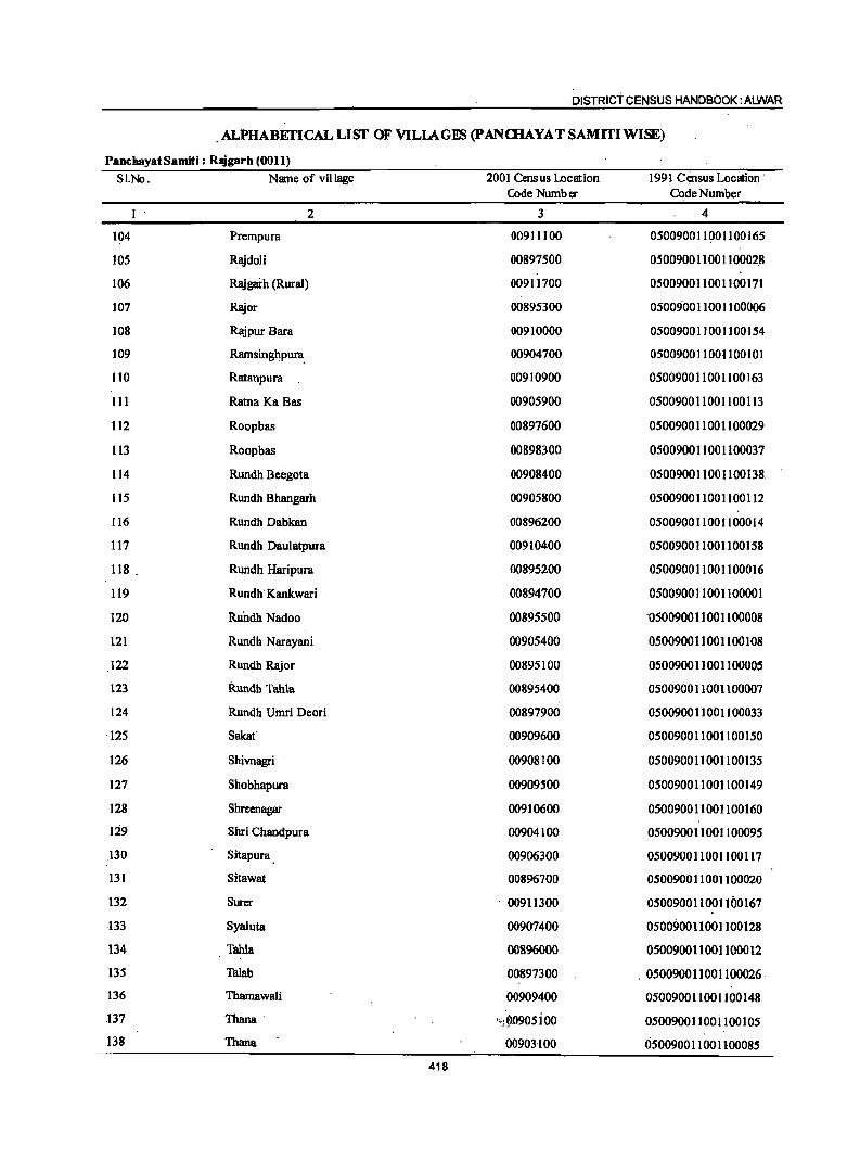
DISTRICT CENSUS HANDBOOK: AIJIIJAR
. ALPHABEI'ICAL LISf OF VILLAGES (pANCHAYAT SAMlTIWlSE)
PancbayatSamiti: Rl!igarh (0011)
S1.No. Name of village 2001 Census Location 1991 ccinsus Location· Code Number Code Number
2 3 4
104 Prempura 00911100 050090011001100165
105 Rajdoli 00897500 05009001100110002.8
106 Rajgai-h (Rural) 00911700 050090011001100171
107 Rajor 00895300 050090011001100006
108 Rajpur Bara 00910000 050090011001100154
109 Ramsinghpura. 00904700 050090011001100101
110 Ratanpura 00910900 050090011001100163
III Ratna Ka Bas 00905900 050090011001100113
112 Roopbas (l0897600 050090011001100029
113 Roopbas 00898300 050090011001100037
114 Rundh Beegota 00908400 050090011001100138
liS Rundh Bhangarh 00905800 050090011001100112
116 Rundh Dabkan 00896200 050090011001100014
117 Rundh Daulatpura 00910400 050090011001100158
118 . Rundh Haripura 00895200 050090011001100016
119 Rundh· Kankwari 00894700 050090011001100001
120 Ruudh Nadoo 00895500 ·050090011001100008
121 Rundh Narayani 00905400 050090011001100108
122 Rundh Rajor 00895100 050090011001100005
123 Rundh Tahla 00895400 050090011001100007
124 Rundh Umri Deori 00897900 050090011001100033
·125 Sakaf 00909600 0500900110011001S0
126 Shivnagri 00908100 050090011001100135
127 Shobhapura 00909500 050090011001100149
128 Shreenagar 00910600 050090011001100160
129 Shri Chandpura 00904100 050090011001100095
130 Sitapura 00906300 050090011001100117
13l Sitawat 00896700 050090011001100020
132 Surer . 00911300 050090011001100167
.J33 Syaluta 00907400 050090011001100128
134 Tahla 00896000 050090011001100012
135 Talab 00897300 . 050090011001100026
136 Thamawali 00909400 050090011001100148
.137 Thana . ";9090sioo 0500900110ui 100105
138 Thana 00901100 050090011001100085
418
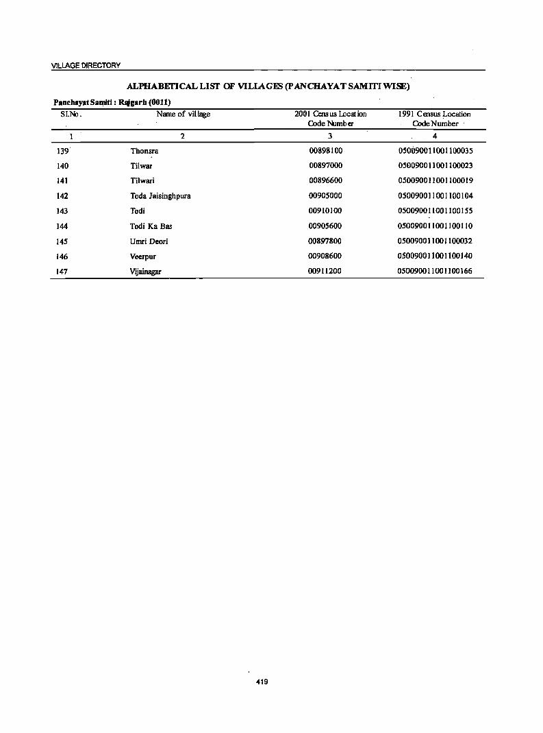
VILLAGE DIRECTORY
ALPHABErICALLISf OF VILlAGES (pANCHAYAT SAMITIWlSE)
PanchaYjltSa..mi: Rlligarh (0011)
81.:No. Name of village 2001 Cmsus IDeation 1991 Census Location Code Number CodeNumber .
2 3 4
139 Thonsra 00898100 050090011001100035
140 Tilwar 00897000 050090011001100023
141 Tilwari 00896600 050090011001100019
142 Toda Jaisinghpura 00905000 050090011001100104
143 Todi 00910100 050090011001100155
144 Todi Ka Bas 00905600 050090011001100110
145 Umri Deori 00897800 050090011001100032
146 Veerpur 00908600 050090011001100140
147 Vijainagar 00911200 050090011001100166
419
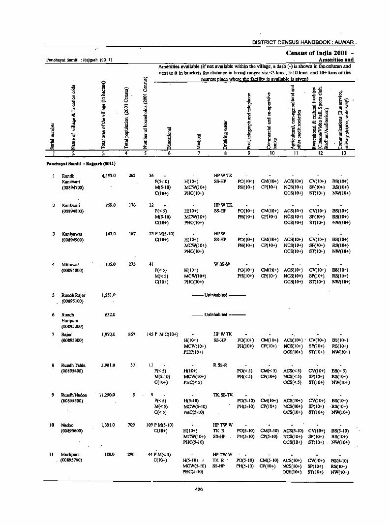
DISTRICT CENSUS HANDBOOK: ALWAR .
Census of India 2001 -Panchayat Samiti : Rajgarh (00 II) Amenities and
Amenities available (if not available within the village, a dash (-) is shown in tbe.column and
next to it in brackets the distance in broad ranges viz.<:5 kms., 5-10 kms. and 10+ kms of the
I ~ neatest I!lace where the facilitl: is available is sivenl
., ii "t:I ~ J:l. ~ ~ u Iii u j! ~
'.::J .3 :{ c ;g. 0 I f! :.:; u 0 g .. <:> .~ .a ~~ ·i f .'" u ~ .. "3 -8. u .. 8 ., .,
~ u 0 ~ ~ ell ..... ...:I 3! 1l 19 !l .. ~ 0 "t:I 0 _-J!j
~~ ~ .;; ] Iii u "3" .1:
*' ~ § "t:I 6 .!! u..c e '" ~ ..c Iii c g § c
.8 .~ 0 ~ il.-~
.... ..c i ~ Iii l~ ll:g-g .! ·8 0 .~ ... 1 § e 0 l¥ 0<;< .- £I .... 8. .8 DO
I] ._ ]
~ f c 0 ·il I ~ 1l .,
ii!i .. 1'1 ! ~~
~ fi ._ ·Iii 5 ~ ~ 1if g.S] . ~1 J2 ~
.1: ~ $~ "" a; 0 ~& E!ll ~cn
2 3 4 5 6 7 8 9 10 11 12 13
PaDehayat S8mlti : Rajg8rh (0011)
Rundh 4,353.0 262 36 HPWTK
Kankwari P(S-IO) H(IO+) SS-HP PO(IO+) CM(IO+) ACS(IO+) CV(IO+) BS(IO+)
(00894700) M(S·IO) MCW(IO+) PH(IO+) CP(IO+) NCS(IO+) SP(lO+) RS(lO+)
C(IO+) PHC(IO+) OCS(IO+) ST(lo+) NW(IO+)
2 K8nkwari 859.0 176 32 HPWTK (00894800) P«S) H(IO+) SS-HP PO(I 0+) CM(IO+) ACS(IO+) CV(IO+) BS(IO+)
M(S-IO) MCW(IO+) PH(lO+) CP(lO+) NCS(IO+) Sp(lo+) R8(10+) C(IO+} PHC(lO+) OCS(IO+) ST(lO+} NW{10+)
3 K8niyaw8s 147.0 167 23 P M(S-IO) HPW
(00894900) C(lO+) H(IO+) SS-HP PO(IO+) CM(lO+) ACS(IO+) CV(lO+) B8(10+)
MCW(lO+) PH(IO+) CP(IO+) NCS(IO+) SP(IO+} RS(IO+) PHC(IO+) OC8(10+) ST(IO+} NW(IO+)
4 MitrBwal 105.0 275 41 WSS-W
(0089S000) P«~) H(IO+) PO(IO+} CM(IO+) ACS(IO+) CV(IO+) B8(10+)
M«S) MCW(IO+) PH(IO+) CP(lO+) NCS(IO+) SP(lO+) RS(IO+) C(lO+) PHC(IO+) OCS(IO+) 8T(10+) NW(lO+)
S Rundh Rajor I,SS1.0 --Uninhabited ----(0089SI00)
6 Rundh 632.0 --Uninhabited ---Haripura (00895200)
7 Rajor 1,97~.0 867 145 P M C(IO+) HPWTK
(00895300) H(IO+) SS-HP PO(IO+) . CM(IO+) ACS(IO+) . CV(IO+) BS(IO+) MCW(IO+) PH(IO+) CP(IO+) . NCS(IO+) Sp(IO+) RS(1O+)
PHC(IO+) OCS(IO+) ST(IO+) NW(IO+)
8 RUndhTahlB 3,981.0 37 II RSS-R (00895400) P«5) H(10+) PO«S) CM«5) ACS«S) CV(IO+) BS« 5)
M(S-IO) MCW(IO+) PH«S) CP(IO+) NCS«S) SP(IO+) RS(IO+) C(IO+) PHC«S) OCS«5) ST(IO+) NW(IO+)
9 RundhNadoo 1 \,250.0 5 5 TK8S-TK (00895500) P«S) H(S-lD) PO(S-IO) CM(IO+) ACS(IO+) CV(IO+) BS(IO+)
M«S) MCW(5-1O) PH(S-IO) CP(IO+) NCS(IO+) SP(IO+) ·RS(IO+) C«5) PRC(5-10) OCS(IO+) ST(IO+) NW(IO+)
10 NadDO 1,301.0 709 109 P M(5-10) HPTWW (00895600) C(IO+) H(IO+) TKR PO(S-IO) CM(5-IO} ACS(S-IO) CV(IO+) B8(S-10)
MCW(IO+) SS-HP PR(S-tO) CP(S-IO) NCS(IO+) SP(IO+) RS(IO+) PRC(S-IO) OCS("IO+) ST(IO+) . NW(10+)
II Murlipura 188.0 296 44 P M«S) HPTWW . (00895700) C(lO+) H(S-IO) I TK R . P0(5-10) CM(5-10) ACS(IO+) CV(IO+) BS(S-IO)
MCW(S-IO) SS-HP PH(S-IO) CP(IO:) NCS(IO+) SP(IO+) RS(IO+) PRC(5-10) OCS(IO+) ST(IO+) NW(IO+)
420
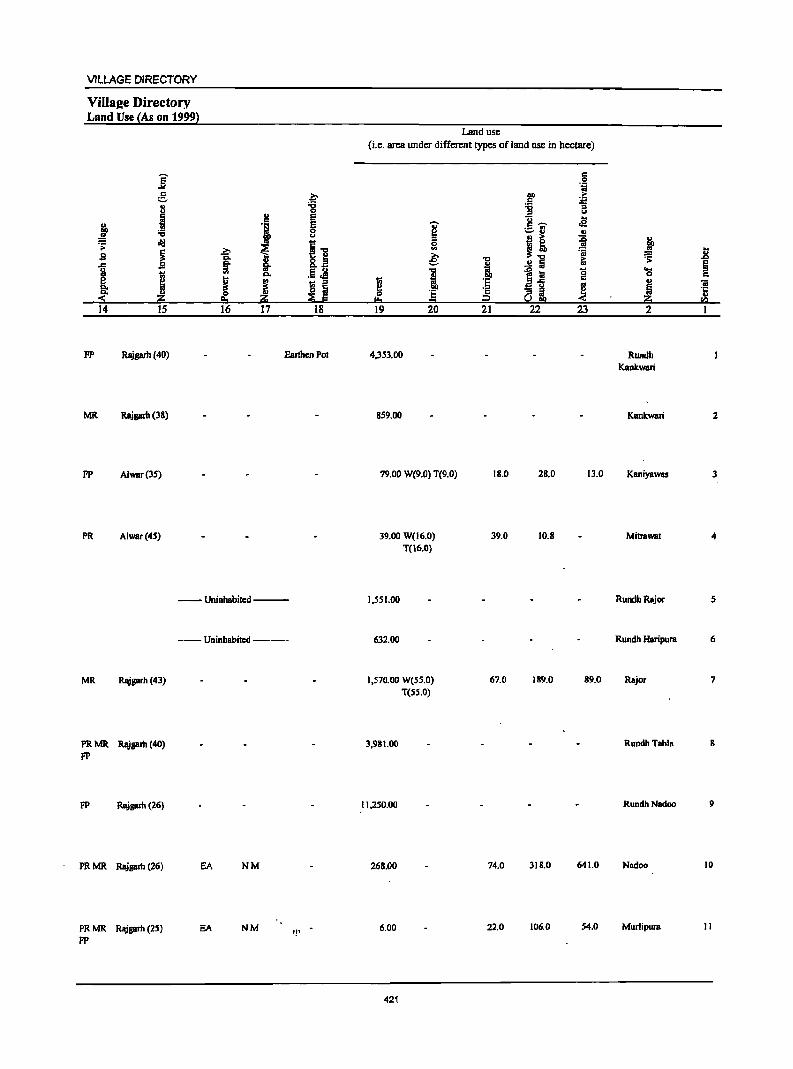
VILLAGE DIRECTORY
ViIIU2e Directory Land Use (As on 1999)
]' e. " u
~ " :£ :s .;; ~
~ s -g
J ~ <-14 15
.2;> CIo §" '" .. ~ p. 16
~ ;;:; 0
" c e
I e 0 u
I] ... §. CIo_
.5 Jl CIo
~ 18 ::>
~ ~ j2j
17 18
FP Rajgarh (40) Earthen Pol
MR Rajgath (38)
FP Alwar(35)
PR Alwar(45)
MR ~sarh(43)
PR MR Rajsarh (40) FP
FP Rajgarb (26)
PR MR Rajgarh (26)
PR MR Rajprh (25)
FP
--- Uninhabited ---
--Uninhabited ---
EA NM
EA NM "'
Land use
(i.e. area under different types of land use in hectare)
.,. $ 0 .. ~
I g !&. = 19 20
4,353.00
859.00
79.00 W(9.0) T(9.0)
39.00 W(16.0) T(16.0)
1,551.00
632.00
1,570.00 W(S5.0)
T(sS.O)
3.981.00
11,250.00
268.00
6.00
421
"C
·1 ;§ 21
18.0
39.0
67.0
74.0
22.0
c 0 "i
00
~ c :.c; ::> ..,
13 ... c ~ .e ._ ., ~..,
" I! ~ =a ~ .!! fa
1~ g
~ aa 22 23
28.0 13.0
10.8
189.0 89.0
318.0 641.0
106.0 54.0
j .8 ~ e
~ " C .. ~ ~ :z rn
2 I
Rundh Kankwari
Kankwari 2
Kaniyawas 3
MilrBwal 4
RundhRajor 5
Rundh Haripura 6
Rajor 7
RundhTBhlB g
RundhNadoo 9
Nadoo 10
Murlipura II
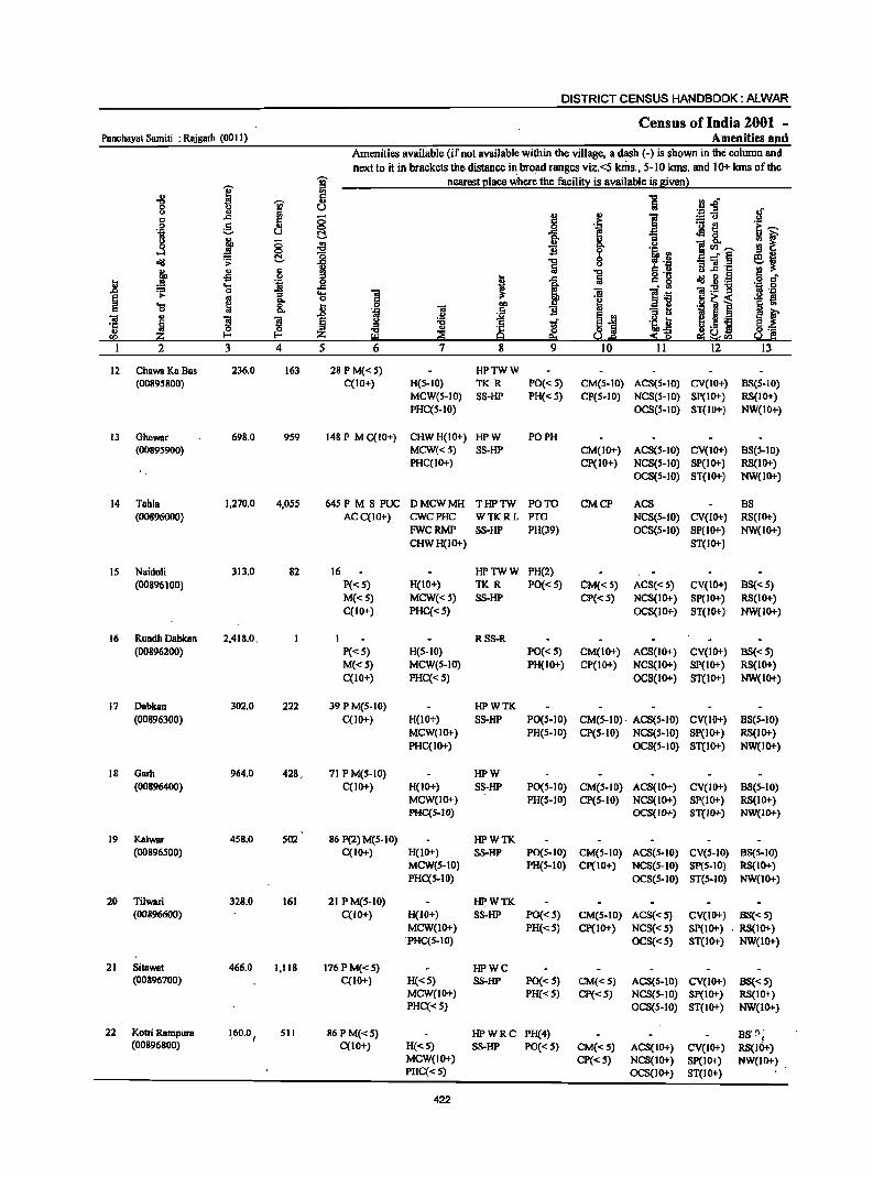
DISTRICT CENSUS HANDBOOK: ALWAR
Census of India 2001 -Panchayat Samiti ; Rajgarh (00 11) Amenities aJld
Amenities available (if not available within the village. a dash (-) is shown in the column and
next to it in brackets the distance in bro!ld ranges viz. <5 laDs .• 5-10 kms. and 10+ kms of the
~ '§' nearest I!lace where the facili~ is available is Biven}
'" 5 1 rl..Q "0 i 0 il u ~.fi If 0
j II>
i c .<: i'i § .j!; .!:!
.9 :§_ ~
._ -e e:~
] u ~ eM 0 : ~ :t "" (; ~ i "" 0 ]~~ 0 0 ·i·B oIIJ .;;: ~ 1 ~ 8 ~ ::if.§ ~,
j .s . § 1 ~ .!! u .c ... .. oIIJ g.~ 6 eft .. 0 j .<: c. §
" .... 'OJ .<: ~ 'iI:2-g 'J:! 0 .Q ~ 0 Ji f! .tol
... _ '3 .... ] Os
~ .. ... 0
il e ill Jj ~ i '§ ., ~ ~ 8.. ~ 'iI
00 .~ .5 II>
'iI .. $ ~
.D .!:l :§ ~i B U jgj Sf ·c ~ § ! "0 l 'iJ! 8:0:::
" u tI .-
en ~ I-'< Z ~ a :S Ii! e; ~en So.! I: I 2 3 4 5 6 7 8 9 10 11 12 13
12 Chawa Ko Bus 236.0 163 28PM«S) HPTWW (00895800) C(10+) H(S-IO) TK R PO« 5) CM(5-10) ACS(5-10) CV(IO+) BS(S-IO)
MCW(S-IO) SS-HP PH« 5) CP(5-10) NCS(S-IO) Sp(IO+) RS(IO+) PHC(S-IO) OCS(S-IO) ST(IO+) NW(IO+)
13 Ghewar 698.0 9S9 148 P M C(lO+) CHWH(IO+) HPW PO PH (00895900) MCW«5) SS-HP CM(IO+) ACS(S-IO) CV(IO+) BS(S-IO)
PHC(IO+) CP(IO+) NCS(S-IO) SP(IO+) RS(lO+) OCS(S-IO) ST(IO+) NW(IO+)
14 Tahla 1,270.0 4,OSS 64SP M S PUC DMCWMH THPTW PO TO CMCP ACS BS (00896000) ACC(IO+) CWCPHC WTKRL Pro NCS(S-IO) CV(IO+) RS(IO+)
FWCRMP SS-HP PH(39) OCS(5-10) SP(IO+) NW(lO+) CHWH(IO+) ST(IO+)
IS Naidoli 313.0 82 16 HPTWW PH(2) (00896100) P(<: S) H(IO+) TK R PO«S) CM«S) ACS« S) CV(IO+) BS« S)
M«S) MCW«S) SS-HP CP« S) NCS(lo+) SP(IO+) RS(lo+) C(IO+) PHC«S) OCS(IO+) ST(IO+) NW(lO+)
16 Rundh DBbkBn 2,418.0. 1 RS8-R (00896200) P«S) H(S-IO) PO«S) CM(lo+) ACS(lO+) CV(IO+) BS«S)
M«S) MCW(S-IO) PH(lo+) CP(IO+) NCS(IO+) SP(IO+) RS(IO+) C(lO+) PHC«S) OCS(IO+) ST(IO+) NW(lO+)
17 Dabkan 302.0 222 39 PM(S-IO) HPWTK (00896300) C(IO+) H(lO+) SS-HP PO(S-IO) CM(S-IO)· ACS(5-10) CV(IO+) BS(S-IO)
MCW(IO+) PH(S-IO) CP(S-IO) NCS(S-IO) Sp(IO+) RS(IO+) PHC(IO+) OCS(S-IO) ST(IO+) NW(lo+)
18 Garb 964.0 428, 71 PM(S-IO) HPW (00896400) C(IO+) H(IO+) SS-HP PO(S-IO) CM(S-IO) ACS(IO+) CV(IO+) BS(5-10)
MCW(IO+) PH(S-IO) CP(S-IO) NCS(IO+) SP(IO+) RS(IO+) PHC{5-IO) OCS(IO-l-) 8T{10+) NW{IO-I-)
19 Kalwar 4S8.0 S02 86 P(2) M(S-IO) HPWTK (00896S00) C(1O-1-) H(IO+) SS-HP PO(S-IO) CM(S-IO) ACS(S-IO) CV(S-IO) 88(5-10)
MCW(S-IO) PH(S-IO) CP(IO+) NCS(S-IO) SP(S-IO) RS(IO+) PHC(S-IO) OCS(S-IO) ST(S-IO) NW(lo+)
20 Tilwari 328.0 161 21 PM(S-IO) HPWTK (00896600) C(IO+) H(JO+) S8-HP PO«S) CM(S-IO) ACS«S) CV(IO+) 8S«S)
MCW(lO+) PH(<: S) cp(10+) NCS« S) Sp(IO+) , RS(1O+) 'PHC(S-IO) OCS«S) ST(IO+) NW(IO+)
21 Sitawat 466.0 1.118 176PM«S) HPWC (00896700) C(IO+) H«5) SS-HP PO« S) CM«S) ACS(S-IO) CV(IO+) B8«S)
MCW(IO+) PH«S) CP«S) NCS(S-IO) SP(IO+) RS(IO+) PHC{<S) OCS(S-IO) ST(IO+) NW(lO+)
22 Kotri Rampura 1,60.0 I SII 86PM«S) HPWRC PH(4) BS'!); (00896800) C(10+) H«5) SS-HP PO«S) CM«S) ACS(IO+) CV(IO+) RS(IO+)
MCW(IO+) CP«S) NCS(IO+) SP(IO+) NW(1O+) PHC«S) OCS(IO+) ST(IO+)
422
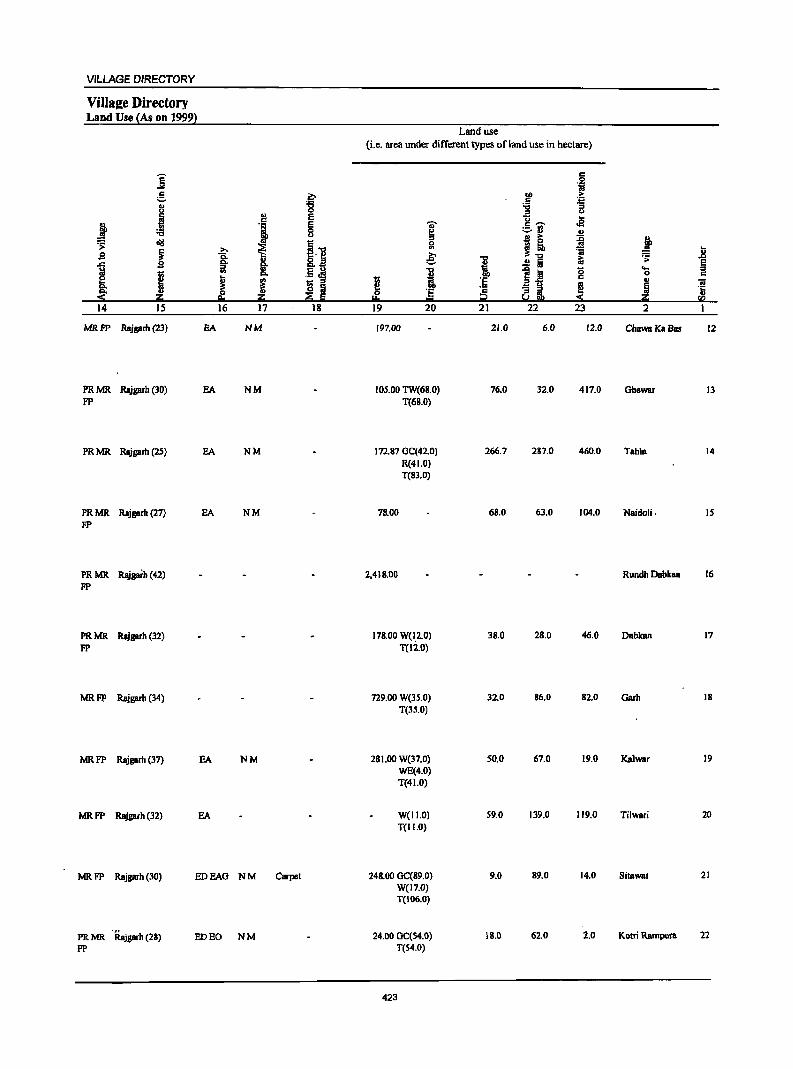
VILLAGE DIRECTORY
Village Directory Land Use (As on 1999)
]' 5 '" I .,
~ :a .> a"lI
~ S
1 s
I ~ a::; 14 15
MRFP Rajgarh (23)
PRMR. Rajgarh (30) FP
PRMR. Rajgarh (25)
PRMR Rajgarh (27) FP
PR MR Rajgarh (42) FP
PRMR Rajgarh (32) FP
MRFP Rajgarh (34)
MRFP Rajgarh (37)
MRFP RBjgarh (32)
>. 0. §" '" ~ 0 e. 16
BA
EA
EA
EA
EA
EA
MRFP Rajgarh (30) EDEAG
PRMR . Rajgarh (28) ED EO FP
.£ -g
~ E
J E 0 u
t~ i 8..:1
.5.M ~
_ ::s ~ Iii
a::; ~ g 17 18
NM
NM
NM
NM
NM
NM Carpet
NIIA
Land use (i.e. area under different types ofland use in hectare)
c
'i 00 >
~ .... "3 u
U .e 'U c ,... ._ '" ~ _.. '" ..
I! ~ j 0 '" 'ii u e: i ~ ~ .&l
..!! Iii E
I -e a 0 .... ::s 0 c
1;; .~
::s.e c .. ~ ~ ...: !J .. i ~~ ~ I!o ." i;;;! fQ
19 20 21 22 23 2
197.00 21.0 6.0 12.0 ChawaKaBas 12
105.00 TW(68.0) 76.0 32.0 417.0 Ghewar 13 T(68.0)
172.87 GC(42.0) 266.7 237.0 460.0 Tahla 14 R(41.0) T(83.0)
78.00 68.0 63.0 104.0 Naidoli. IS
2.418.00 RundIJ DabkBD 16
178.00 W(I.2.0) 38.0 28.0 46.0 Dabkan 17 T(12.0)
729.00 W(35.0) 32.0 86.0 82.0 Garh 18 T(35.0)
281.00 W(37.0) 50.0 67.0 19.0 Kalwar 19 WE(4.0) T(41.0)
W(lI.O) 59.0 139.0 119.0 Ti1wari 20 T(II.O)
248.00 GC(89.0) 9.0 89.0 14.0 Sitawat 21 W(l7.0) T(I06.0)
24.00 GC(S4.0) 18.0 62.0 2.0 Kotri Rarnpura 22 T(54.0)
423
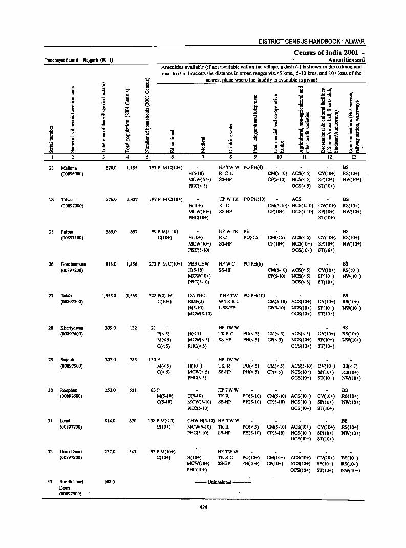
DISTRICT CENSUS HANDBOOK: ALWAR
Census of India 2001 -Panchayat Samit; : Rajgarh (00 II) Amenities and
Amenities available (if not available within the village, a dash (-) is shown in the column and next to it in brackets the distance in broad ranges viz.<5 kms., 5-10 kms. and 10+ kms of the
I '? nearest I!lace where the facili!)! is available is given)
-8 ;g
:J.D '? .. 0 t> U '';:: .2 "
., c ..c !!! 0 t! :.:: u 0 C .,
0
f .- ~
.~ ::. U t!. .H 8. j -0 -8 1"'~ ....:I 0
~ _" § ~
r:: t!. 5 .. "6 -a .c j ~ .! !i " ..c g
i 0 i ..c ~ 8·-.... ..c.
~ 1V~-g ~ 0 'S .... 1 e ." 0 .§ ~ i .... 0 j .2 ~ 0 ." 'iii
~ ~ ]I ]I E ~
I 5._ ~ ~
:s ~.5 i '" z u'"
2 3 4 5 6· 12
23 Mallana 678.0 1.165 197 P MC(IO+) HPTWW POPH(4) as (00896900) H(5-10) RCL CM(5-1O) ACS« 5) CV(IO+) RS(IO+)
MCW(IO+) SS-HP CP(S-IO) NCS« 5) Sp(IO+) NW(IO+) PHC«S) OCS« 5) ST(IO+)
24 Tilwar 376.0 1.327 197P MC(IO+) HPWTK POPH(IO) ACS BS (00897000) H(IO+) R C CM(5-10» NCS(5-10) CV(IO+) RS(IO+)
MCW(lO+) SS-HP CP(IO+) OCS(5-IO) SP(IO+) NW(IO+) PHC(IO+) ST(lO+)
25 Palpur 36S.0 637 99 P M(S-IO) HPWTK PH BS (00897100) C(IO+) H(IO+) RC PO« 5) CM«5) ACS« 5) CV(IO+) RS(IO+)
MCW(lO+) SS-HP CP(IO+) NCS(IO+) Sp(IO+) ·NW(IO+) PHC(5-1O) OCS(lO+) ST(lO+)
26 Gordhanpura 813.0 1.856 275 P M C(IO+) PHSCHW HPWC POPH(6) BS (00897200) H(5-10) SS-HP CM(5-1O) ACS« 5) CV(IO+) RS(IO+)
MCW(IO+) CP(S-IO) NCS« 5) SP(lO+) NW(lO+) PHC(5-10) OCS« 5) 8T(10+)
27 Talah 1.555.0 3.569 522 P(2) M DAPHC THPTW POPH(IO) BS (00897300) C(lO+) RMP(3) WTKRC CM(5-IO) ACS(IO+) CV(IO+) RS(IO+)
H(S-IO) LSS-HP CP(S-IO) NCS(IO+) SP(IO+) NW(IO+) MCW(S-IO) OCS(IO+) ST(IO+)
28 Khariyawas 339.0 132 21 HPTWW BS (00897400) P«S) H«5) TKRC PO«S) CM«5) ACS«5) CV(IO+) RS(IO+)
M«S) MCW«5) . SS-HP PH« 5) CP«S) NCS(IO+) SP(to+} NW(IO+) C« S) PHC«.5) OCS(IO+) ST(IO+)
29 Rajdoli 303.0 785 130 P HPTWW (00897500) M«S) H(IO+) TK R PO« 5) CM«5) ACS(S-IO) CV(IO+) BS« 5)
C«5) MCW(<:5) SS-HP PH« 5) CP«5) NCS(lO+) Sp(IO+) RS(IO+) PHC(" S) OCS(IO+) ST(lO+) NW(IO+)
30 Roopbas 253.0 S21 63P HPTWW BS (00897600) M(S-IO) H(S-IO) TKR PO(S-IO) CM(S-JO) ACS(IO+) CV(IO+) RS(IO+)
C(S-IO) MCW(S-IO) SS-HP PH(5-10) CP(S-IO) NCS(IO+) SP(IO+) NW(IO+) PHC(5-10) OCS(IO+) ST(IO+)
31 Losal 814.0 870 138 PM« S) CHWH(S-IO) HP TWW BS (00897700) C(JO+) MCW(S-IO) TKR PO«S) CM(S-IO) ACS(IO+) CV(IO+) RS(IO+)
PHC(S-IO) SS-HP PH(S-IO) CP(S-IO) NCS(IO+) SP(IO+) NW(IO+) OCS(IO+) ST(IO+)
32 UmriDeori 237.0 545 97 PM(IO+) HPTWW (00897800) C(IO+) . H(IO+) TKRC PO(IO+) CM(IO+) ACS(IO+) CV(IO+) BS(IO+)
MCW(IO+) SS-HP PH(IO+) CP(IO+) NCS(IO+) Sp(10+) RS(IO+) PHC(IO+) OCS(10+) ST(lo+) NW(1O+)
33 Runclh Umri 108.0 --- Uninhabited ----Deori (00897900)
424
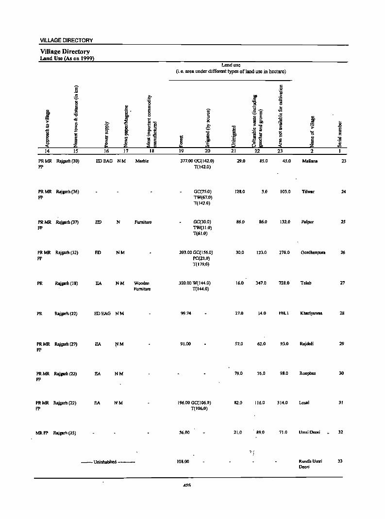
VILLAGE DIRECTORY
ViIla2e Directory Land Use (As on 1999)
,.... Jj s: :.::-
I j :a old .s::
1 B
1 1;;
~ ~ 14 15
PRMR R8jlllrh (3~) FP
PRMR Rajgarh (36)
FP
PRMR RajllIrh (37) FP
PRMR Rajgarh (32)
FP
PR RajllIrh (18)
PR Rajgarh (22)
PR MR Rajgarh (27) FP
PRMR Rajgarh (22) FP
PRMR Rajgarh (22)
FP
MRFP Rajgarh (35)
~ :g ;!! E
l E 0 u
I] t ~ l '" .S ~
! ! s 5 ~ E eo
16 17 18
EDEAG NM Marble
ED N Furniture
lID NM
EA NM Wooden Furniture
EDEAO NM
EA
EA NM
EA NM
---Uninhabited ------
Land use
(i.e. area under different types of land use in hectare)
s: .j 00 s: :!5 '6 :> u
U .. u- £'U cia ~ " B ~ ::g :> ,! 5l ~~ 'a .8 ~ "t:I iG .;; , ..!! 5 §
"t:I .oj! '8 .... ! 0 s:
~ '6 5 u J ~ 'iI
'E ·s ~i
·c i2
.. !:!:o = a:>
19 20 21 22 23 2 I
377.00 GC(142.0) 29.0 85.0 45.0 Mallana 23 T(142.0)
GC(75.0) 128.0 3.0 103.0 Tilwar 24 TW(67.0) T(142.0)
GC(30.0) 86.0 86.0 132.0 Palpur 2S TW(31.0) T(61.0)
203.00 GC(IS6.0) 30.0 123.0 278.0 Gordhanpun 26 PC(23.0) T(179.0)
320.00 W(144.0) 16.0 347.0 728.0 Talab 27 T(I44.0)
99.74 27.0 14.0 198.1 Khariyawas 28
91.00 57.0 62.0 93.0 Rajdoli 29
79.0 76.0 98.0 Roopbas 30
196.00 GCCI06.0) 82.0 116.0 314.0 Losal 31 T(I06.0)
56.00 21.0 89.0 71.0 UmriDcori 32
~. f I
108.00 RundhUmri 33 Deari
A?!'i
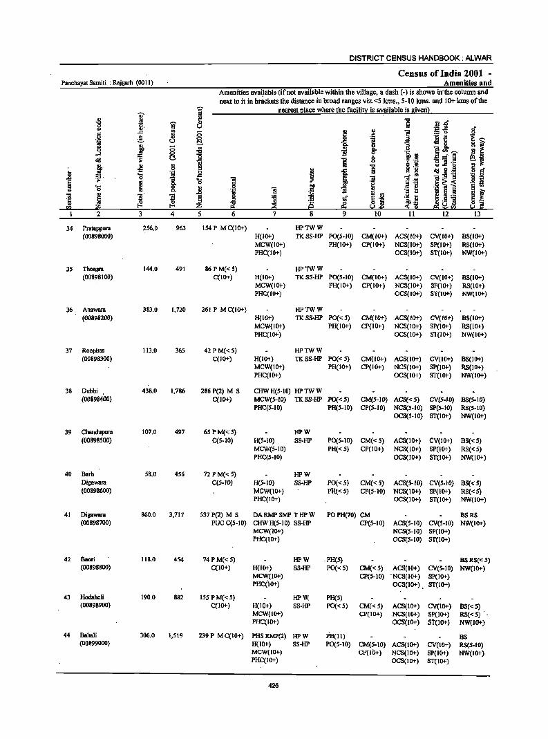
DISTRICT CENSUS HANDBOOK: ALWAR
Census of India 2001 -Panchayat Samiti : Rajgarh (0011) Amenities ahd
Amenities avai.lable (ifnol available within the village, a dash (-) is shown in' the column and
next 10 it in brackets the distance in broad ranges viz. <5 lans., 5-10 lans. and 10+ lans of the
j ; nearest place where the facility is available is given) . '" .g 5 "0 r: _&lft
]' 'W u ii .::: .a If <> '" 0 ~
., ] := 0
6 g 5 0 1 'j ._ i! .~ ~
.~ u t!- ~ 8. M F 1> 0 '" ., a
....I §. -0 B go
l~ ]<Il~ l!i B
.rd 1: ] 1 b - _" § e~ III u "3 'iI .t::
#. -!l '" ] <> .c .s § cf 0 ::l Ii> ..c: 8 '8 ... .~ 0 ~ B ._ ., .... .c ~ i ]I 1~ -;;:g~ 'N .g .0 0 "3 .... 'iI
~ ~
~ 0 c
.§ ~ i ._ s '0 go ... 0 .~
~ § ., r:>. ., ''= 'iI B .,
l~ E f 'iI II> ]l ]I .0
j ~ ~ E,gj I.~ ] ~ § J ·c
~ '" 8! 8:= ., ~ ~ 0 s1i Ii!! ~ Z 8::1 e5i ~!!'.l So:! g: 2 3 4 5 6 7 8 9 10 11 12 13
34 Pratappura 2S6.0 963 154 P M C(10+) HPTWW (00898000) H(IO+) TKSS-HP PO(S.IO) CM(IO+) ACS(IO+) CV(IO+) BS(IO+)
MCW(10+) PH(IO+) CP(IO+) NCS(1O+) SP(1O+) RS(10+) PHC(IO+) OCS(IO+) ST(IO+) NW(IO+)
35 Thonsra 144.0 491 86 PM«S) HPTWW (00898100) C(10+) H(IO+) TKSS·HP PO(S-IO) CM(IO+) ACS(IO+) CV(IO+) BS(IO+)
MCW(IO+) PH(IO+) CP(IO+) NCS(lo+) SP(IO+) RS(IO+) PHC(IO+) OCS(IO+) ST(IO+) NW(IO+)
36 Anawara 383.0 1,720 261 P M C(IO+) HPTWW
(00898200) H(IO+) TKSS·HP PO«S) CM(IO+) ACS(IO+) CV(lO+) 8S(10+)
MCW(I~+) PH(1O+) CP(10+) NCS(IO+) SP(IO+) RS(10+) PHC(IO+) OCS(IO+) ST(IO+) NW(IO+)
37 Roopbas 113.0 365 42 P M«5) HPTWW (00898300) C(IO+) H(IO+) TKSS-HP PO«5) CM(1O+) ACS(IO+) CV(IO+) 8S(10+)
MCW(IO+) PH(IO+) CP(IO+) NCS(IO+) SP(IO+) RS(lO+) PHC(IO+) OCS(IO+) ST(IO+) NW(IO+)
38 Dubbi 438.0 1,786 286 P(2) M S CHW H(5-10) HP TW W (00898400) C(IO+) MCW(S-IO) TKSS-HP PO«S) CM(S-IO) ACS«S) eV(s.IO) BS(S·IO}
PHC(5-10) PH(S-IO} CP(S-IO) NCS(S-IO} SP(S-IO) RS(S-IO} OCS(5-10) ST(IO+) NW(IO+)
39 Chandupura 107.0 497 65PM«5) HPW (00898500) C(S-IO) H(S-IO) SS-HP PO(S-IO) CM«5) ACS(JO+) CV(JO+) 88«S)
MCW(S-IO) PH« 5) CP(IO+) NCS(IO+) SP(IO+) RS«5) PHC(S-IO) OCS(JO+) ST(IO+) NW(10+)
40 Barb 58.0 456 72 PM«5) HPW Digawara C(S-JO) H(.5-IO) SS·HP PO« 5) CM«S) ACS(S.IO) CV(S.IO) BS{<S) (00898600) MCW(JO+) PH«S) ep{S-lO) NCS(JO+) SP{lO+) R8« S)
PHC(IO+) OCS(IO+) ST(IO+) NW(IO+)
41 Digawara 860.0 3,717 537 P(2) M S DARMPSMP THPW POPH(70) CM 8SRS (00898700) PUC C(S-IO) CHWH(5-10) SS-HP CP(S-tO) ACS(5.10) CV(S·IO) NW(IO+)
MCW(lO+) NCS(5-10) SP(tO+) PHC(tO+) OCS(S-IO) ST(IO+)
42 Saori 118.0 454 74 P M« 5) HPW . PH(S) 8SRS«5) (00898800) C(IO+) H(lo+) SS·HP PO«S) CM«S) ACS(lO+) CV(S-IO) NW(1O+)
MCW(IO+) CP(S-tO) . NCS(lO+) SP(IO+) PHC(JO+) OCS(JO+) . ST(IO+)
43 Hodahcli 190.0 882 15SPM«5) HPW PH(S) (00898900) C(lO+) H(10+) SS·HP PO«S) CM«5) ACS(1O+) CV(JO+) 8S«S)
MCW(IO+) CP(IO+) NCS(IO+) SP(lO+) RS«S) ._ PHC(IO+) OCS(IO+) ST(lO+) NW(JO+)
44 Bahali 306.0 1,519 239 P M C(10+) PHS RMP(2) HPW PH(II) as (00899000) H(lO+) SS-HP PO(S-tO) CM(5-JO) ACS(IO+) CV(IO+) RS(.5-IO)
MCW(IO+) CP(lO+) ~CS(IO+) SP(JO+) NW(10+) PHC(IO+) OCS(IO+) ST(IO+)
426

VILLAGE DIRECTORY
ViII8e-e Directory Land Use {As on . 1999l
Land use
(i.e. area under different types ofland use in hectare)
i c: 0 'i
g .~ .~ ~ ., "8 "g "3
i ., u c E 1L·, ...
f . , E .. ._ '" oS :;; 0 ~
~ .. .. u
j ~ :g J ~ d!I
.11 0
f ~ ~ '" ~ 13
S Q. € i .!!~ 1; ~~
~ 1 §- ~ ., 1 ~ til g ....
t;; Q. 0 C
~ 'H J ~ a 5 I ·s ~1 ~
u <a '2 ~ ·c
~ :s ., i!:i ::?1 I:l iii i2 '" 14 IS 16 17 18 19 20 21 22 23 2
MR Rajgarh (IS) EA WE(30.0) 7S.0 72.0 15.0 P~tappura 34 TW{64.0) T(94.0)
MR Rajgarh (14) EA W{27.0) 61.0 35.0 1.0 Thonsra 35 WE(20.0) T{47.0)
MR Rajgarh (I S) EA NM W(60.0) 109.0 60.0 12.0 Anawam 36 WE(142.0) T(202.0)
PR Rajgarh (14) EA W(2S.0) 45.0 3.0 7.0 Roopbas 37 WE(30.0) TeSS.O)
PR Rajgarh (10) EA NM Earthen Pot W{100.0) 195.0 19.0 19.0 Dubbi 3S WE(IOS.O) T{20S.0)
MR Rajgarh (II) EDEAG NM W{IS.O) 43.0 38.0 2.0 Chandupura 39 WE{9.0) T(24.0)
PRMR Rajgarh(8) EDEAG NM W(9.0) 30.0 5.0 4.0 Barh Digawara 40 WB{1O.0) T(J9.0)
PRMR Rajgarh(9) EA NM Eartllen Pot, 67.00 W(90.0) 431.0 71.0 76.0 Digawam 41
.wooden WE(l2S.0) Furniture T(2IS.0)
PR Rajgarh (II) SA NM W(20.0) 47.8 18.0 10.3 Saori 42 WE(22.1) T(42.1)
MRFP Rajgarh (13) SA NM . 17.62 W(S3.0) 87.9 11.5 HodaheJi 43 WE(20.0) T(73.0)
PR • Rajgaih (14) SA NM ,. 84.93 W(70.0) 73.4 27.7 BahaJi 44 WE(SO.O) T(120.0)
427
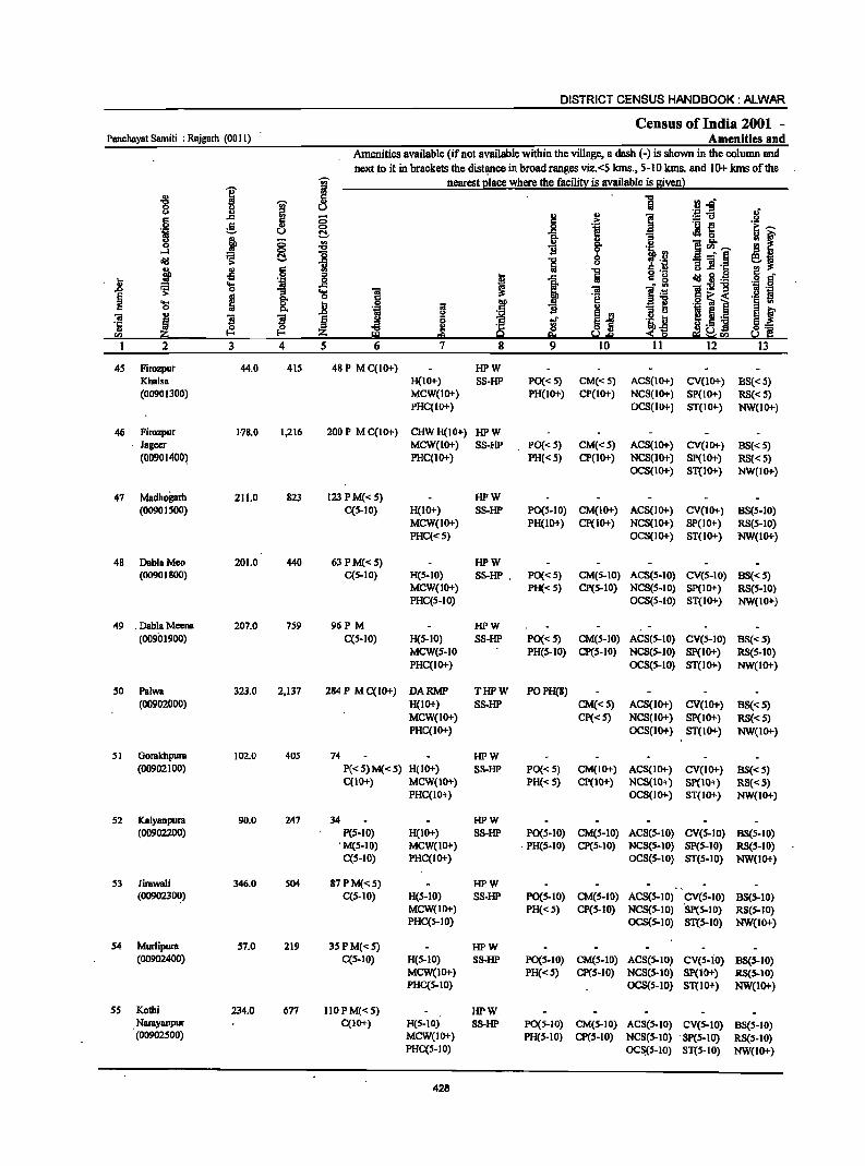
DISTRICT CENSUS HANDBOOK: ALWAR
Census of India 2001 -Panchayat Samiti : Rajgarh (0011) Amenities and
Amenities available (if not available within the village, a dash (-) is shown in the column and next.to it in brackets the distl)llcein broad ranges viz.<5 kms., 5-10 lans. and 10+ kms of the
'iii' nearest place where the facility is available is given)
i :s
.g 1
5 1 U.c u u ;g.fi .~" u Jl ;; i '" ] <:: .~ .§ g 0 f! i{! t:~ u ~ -s ~ ~ ~ '" ]!~ ;; '" IS' .. 0
I 1i l~ !I '" ....:I
~ 8- 8 _" ~ el cI!I ~ -s ] .c ~ ~ .~ ::I
i .c ~ 0= g ~ il.g § c .8 ~ 'S os ..8
1 ; 'iI l~ ]:911 'i ·8 g_ .... .!:! 19
~ ~ 0 'e .2 ~ i 'a 0 .8 I>D i _] § '" iI <:: '" I'lo
j ~ ~i .~_j I ~ ._ ~l 'iI j S ~ ~ l ·c ~.5 E .. ~ ~ ~ .~ sa a Y.e :S Iii! ~sa 1 2 3 4 5 6 7 8 9 10 11 12 13
4S Firozpur 44.0 41S 48 P M C(lO+) HPW Khalsa H(lO+) SS-HP PO{< S) CM«5) ACS(IO+) CV(IO+) 8S« 5) (00901300) MCW(IO+) PH(lO+) CP(1O+) NCS(IO+) SP(IO+) RS« 5)
PHCCIO+) OCS(IO+) ST(IO+-) NW(IO+)
46 Firozpur 1-78.0 1,216 200 P M C(10+) CHWH(IO+) HPW Jageer MCW(IO+) SS-HP PO{<5) CM«5) ACS(IO+) CV(IO+) 8S«S) (00901400) PHC(IO+) PH«5) CP(IO+) NCS(lO+) SP(lO+) RS«5)
OCS(IO+) ST(IO+) NW(IO+)
47 Madhoprh 211.0 823 123 P M« S) HPW (00901500) CCS-IO) H(IO+) SS-HP PO(S-IO) CM(IO+) ACS(IO+) CV(IO+) 8S(S-10)
MCW(IO+) PH(IO+) CP(IO+) NCS(lo+) SP(IO+) RS(S-IO) PHCC<S) OCS(IO+) ST(IO+) NW(IO+)
48 DablaMoo 201.0 440 63PM«S) HPW (00901800) C(S-IO) H(S-IO) SS-HP . PO«S) CM(5-10) ACS(S-IO) CV(S-IO) 88«5)
MCW(IO+) PH«S) CP(S-IO) NCS(S-IO) SP(IO+) RS(S-IO) PHCCS-IO) OCS(S-IO) ST(IO+) NW(IO+)
49 . Dabla Meena 207.0 7S9 96P M HPW (00901900) CCS-IO) H(S-IO) SS-HP PO«S) CM(S-IO) ACS(S-IO) CV(S-IO) BS«S)
MCW(S-IO PH(S-IO) CP(S-IO) NCS(S-IO) SP(IO+) RS(S-IO) PHC(IO+) OCS(S-IO) ST(IO+) NW(IO+)
so Pa!wa 323.0 2,137 284 P MC(IO+) DARMP THPW POPH(8) (00902000) H(IO+) SS-HP CM«S) ACS(IO+) CV(IO+) BS«S)
MCW(10+) Cp«5) NCS(1o+) Sp(IO+) RS«S) PHC(IO+) OCS(IO+) ST(IO+) NW(IO+)
51 Gorakhpura 102.0 405 74 HPW (00902100) P«S)M«S) H(IO+) SS-HP PO{<S) CM(IO+) ACS(IO+) CV(lO+) B8«S)
C(10+) MCW(IO+) PH«S) CP(10+) NCS(10+) Sp(IO+) RS«S) PHC(IO+) OCS(IO+) ST(IO+) NW(IO+)
S2 Ka!yanpura 90.0 247 34 HPW (00902200) P(S-IO) H(10+) S8-HP PO(S-IO) CM(S-IO) ACS(S-IO) CV(S-IO) BS(S-IO)
. M(S-IO) MCW(IO+) . PH(S-IO) CP(S-IO) NCS(S-IO) SP(S-IO) RS(S-IO) C(S-IO) PHC(IO+) OCS(S-IO) ST(S-IO) NW(IO+)
S3 Jirawali 346.0 S04 87 P M«5) HPW (009023~) C(S-IO) H(S-IO) SS-HP PO{S-IO) CM(S-IO) ACS(S-IO) CV(S-IO) BS(S-IO)
MCW(IO+) PH«S) CP(S-IO) NCS(S-IO) SPeS-IO) RS(S-IO) PHC(S-IO) OCS(S-IO) ST(S-IO) NW(IO+)
54 Murlipura S7.0 219 3SPM«S) HPW (00902400) C(S-IO) H(S-IO) S8-HP PO{S-lO) CM(S-lO) ACS(S-IO) cv(s-io} BS(S-lO)
MCW(1O+) 'PH«S) CP(S-IO) NCS(S-IO) Sp(IO+) RS(S-IO) PHC(S-IO) OCS(S-IO) ST(10+) NW(1O+)
ss Kothi 234.0 677 1l0PM«S) HPW Narayanpur C(lO+) H(S-IO) S8-HP PO(S-IO) CM(S-IO) ACS(S-IO) CV(S-IO) 8S(S-10) (00902500) MCW(IO+) PH(S-IO) CP(S-IO) NCS(S-IO) 'Sp(S-to) RS(S-IO)
PHC(S-IO) OC~S-IO} ST(S-IO) NW(IO+)
428
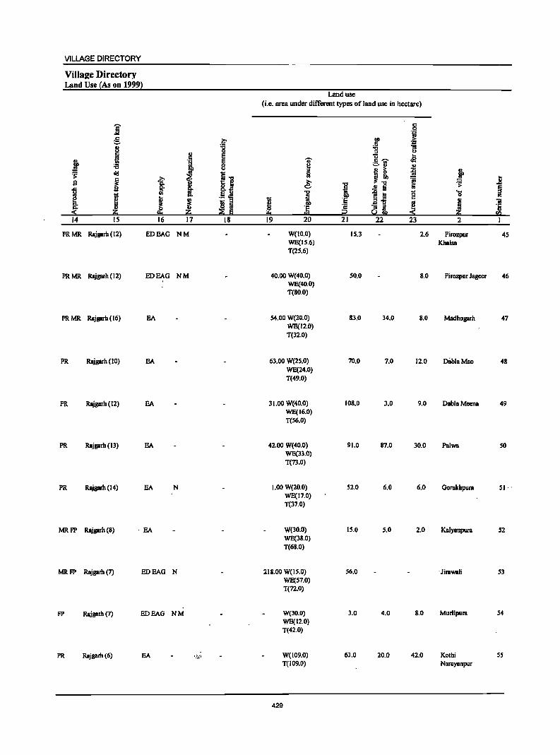
VILLAGE DIRECTORY
ViIla2e Directory Land Use !As on 1999l
Land use (i.e. area under different types of land use in hectare)
i c .9 1ii g ~
01) .£i .5 8 :c "tI "3
0 ::I U
J ·S E
'V' u .e .. g I:~ ._ ..
J ~ ~ u .. u B ~ ~ j ~ cId
f i"tl i ;., .. ~"tI ~ jj S 'is. gi ~ i iii ~ Co ..!l a §
I ::I
.~ ~ "tI
]~ '0 .... !;; '" c. i 0 c
§ ...
! I ·E I: .. ~
os iii "'- IS Iii ·E ·2 "3 iI ~ ~ ·5 ~ ~ ~ :fli Iii !!::I t::I t2 ~!II fa 14 15 16 17 18 19 20 21 22 23 2 I
PRMR Rajgarh (12) ED BAG NM W(lO.O) 15.3 2.6 Firozpur 45 WE(15.6) Khalsa T(25.6)
PRMR Rajgarh (12) ED BAG NM 40.00 W(40.0) 50.0 S.O Firozpur Jageer 46 WE(40.0) T(So.o)
PRMR Rajgarh (16) BA 54.00 W{20.0) 83.0 34.0 S.O Madhogarh 47 WE(12.0) T{l2.0)
PR Rajgarh (10) BA 63.00 W(25.0) 70.0 7.0 12.0 DliblaMco 4S WE(24.0) T(49.0)
PR Rajgarh (12) BA 31.00 W(40.0) 10S.0 3.0 9.0 DahlaMeena 49 WE(16.0) T{S6.0)
PR Rajgarh (Il) BA 42.00 W(40.0) 91.0 87.0 30.0 Pal_ SO WE(33.0) T(73.0)
PR Rajgarh (14) EA N 1.00 W{20.0) 52.0 6.0 6.0 Gorakbpura SI· . WE(17.0) T(37.0)
MRFP Rajgarh{S) . EA W{lO.O) 15.0 5.0 2.0 KaIYBnpura 52 WE(38.0) T(68.0)
MRFP Rajgarh (7) ED BAG N 218.00 W(IS.O) 56.0 . Jira_li 53 WE(57.0) T(72.0)
FP Rajprh (7) ED BAG NM W(lO.O) 3.0 4.0 S.O Murlipura S4 WE(I2.0) T(42.0)
PR Rajgarh (6) BA '.W W(109.0) 63.0 20.0 42.0 Kothi 55 T(I09.0) NaraYBnpur
429
DISTRICT CENSUS HANDBOOK: ALWAR
Census of India 2001 -Panchayat Samiti : Rajgarh (0011) Amenities and
Amenities available (if not available within the village, a dash (-) is shown in the column and
j next to i! in brackets the distance in broad ranges viz.<5 kms., 5-10 kms. and 10:" kms of the
I nearest l!lace where the facili!)! is available is sivenl
-8 c
·R~ ~ ...
8 u Il-l! ., § 5 i5 :g =- :.= u .!:1 g 0 i .~
._ -E! &--.~ u I::!- .M8. u ~ i5 rII " ~f 0 :s B g. 1"'--~ 0
oI!I ~ l::!- I 1 B ...l'§ '3] .c
j ., c 1 ;j s .~ ~ -
U -5 .~ 0 I .c .~ a ... ..c J Iii
.0 .s: 0 '3 ... l ._ ']1 § .. Q, 0
'S ~ 8. ... ] ~ § '" c .8 .~
~ f ~ " ]I ~ ~ 5 ~ g 't:I '!if g.s j " ~ " ·c 0 c,... en ::£ c I2U",
2 3 4 5 6 7 8 12 13
S6 Kondoli 131.0 718 96 P AC M(S-IO) HPW (00902600) C(S-IO) H(S-IO) SS-HP PO(S-IO) CM(S-IO) ACS(S-IO) CV(S-tO) BS(S-IO)
MCW(lO+) PH(S-IO) CP(S-IO) NCS(S-IO) SP(tO+) RS(S-IO) PHC(to+) OCS(S-tO) ST(lOT) NW(tDT)
57 BhBokhari 120.0 647 94 P AC M(S-IO) HPW (00902700) C(S-IO) H(S-IO) SS-HP PO(S-IO) CM(S-IO) ACS(S-tO) . CV(S-IO) BS(S-IO)
MCW(IO+) PH(S-IO) CP(S-to) NCS(S-IO) SP(S-IO) RS(S-IO) PHC(S-IO) OCS(S-IO) ST(tO+) NW(lO+)
58 Moonpur .217.0 1,147 192PM«S) HPW (00902800) C(S-IO) H(S-IO) SS-HP PO(S-IO) CM(S-IO) ACS(S-tO) CV(S-tO) BS(S-IO)
MCW(s-IO) PH(S-tO) CP(S-IO) NCS(S-IO) SP(S-to) RS(S-IO) PHC(S-IO) OCS(S-IO) ST(S-IO) NW(IO+)
S9 Alei 125.0 496 91P M THPW BSRS«S) (00902900) C«S) H«S) SS-HP PO«S) CM«S) ACS«S) CV«5) NW(IO+)
MCW(IO+) PH«S) CP« S) NCS« 'l SP« S) PHC«S) OCS«S) ST« S)
60 Karoth 387.0 1,769 292PMC«S) THPTW POPH(7) (Rural) H«S) W88-HP CM(<:S) ACS«S) CV(<:') BS« S) (00903000) MCW«S) CP«S) NCS(IO+) Sp« S) RS«S)
PHC(lO+) . OCS(IO+) ST«S) NW(lO+)
61 Thana 334.0 3,846 S7S P MC«S) PHSCHW(2) THPTW POPH(IO) (00903100) H«S) WSS-HP CM(<:S) ACS«S) CV«S) BS«S)
MCW«S) CP«S) NCS«S) Sp«S) RS« S) PHC(lo+) OCS«S) ST(IO+) NW(IO+)
62 Govindpura 208.0 539 8S PM(S-IO) HPW (00903200) C(S-IO) H(S-IO) SS-HP PO(S-IO) CM(S-IO) ACS(S-IO) CV(S-IO) B8(5-IO)
MCW(IO+) PH(S-IO) CP(S-IO) NCS(S-IO) Sp(lO+) R8(5-10) PHC(IOt) OCS(S-IO) ST(tO+) NW(1O+)
63 Indrapura 186.0 664 102 P M(S-IO) HPW (00903300) C(S-IO) H(S-IO) SS-HP PO(S-IO) CM(S-IO) ACS(S-IO) CV(S-tO) BS(S-IO)
MCW(S-to) PH(S-IO) CP(S-IO) NCS(S-IO) Sp(IO+) RS(5-IO) PHC(S-IO) OCS(S-IO) ST(IO+) NW(lO+)
64 Bhajcda 189.0 77S 117 P M C(S-IO) DA RMP SMP HP W PH (00903400) CHW H(S-IO) SS-HP PO(S-IO) CM(S-IO) ACS(S-IO) CV(S-IO) B8(5-10)
MCW(IO+) CP(S-IO) NCS(S-IO) SP(IO+) RS(S-IO) PHC(IO+) OCS(S-lO) ST(tO+) NW(IO+)
65 Cheetos 201.0 695 103P M HPW PO (00903SOO) C(S-IO) H(S-IO) SS-HP PH«S) CM(S-IO) ACS(S-IO) CV(5-10) B8(S-10)
MCW(IO+) CP(5-10) NCS(S-IO). SP(S-IO) RS(S-IO) PHC(_IO+) OCS(S-IO) ST(S-IO) NW(1O+)
66 Dharnred 931.0 4,002 S70P(S) M 8 D~RMP(2) THPTW PO PH ACS (00903600) PUC H(S-IO) WSS-HP CM(S-tO) NCS(S-IO) eV(S-IO) BS(~-IO)
ACe«S) MCW(S-tO) CP(5-10) OCS(S-IO) SP(IO+) RS(S-IO) PHC(S-IO) ST(IO+) . NW(I.O+)
430
VILLAGE DIRECTORY
Villa£e Directory Land Use {As on 1999}
Land use (i.e. area under different types of land use in hectare)
j '" .9 lii e .~ 00 >
'" ~ U "C :.;; j 0 '" u ., E u oS
~ E U" r::~ .. -=-rl :a 8 ~ '"
'i> erg ~ ~l
~ j! ~ ! s ~ ~ ,e: '01 jl
..c: I'l: l .! 1 .!! ta i:i 'i> § ~
ill ... "§ iii g .... I ~
0 '" ~ ~ 1;;
:~ 2-5 u "iii
~ Z 19 Iii ~ 'E 8~ E! Iii ·c p. z :E E ... i? -< z u .... "-l
14 15 16 17 18 19 20 21 22 23 2 1
PRMR Rajgarb (10) EA NM Coal, Earthen Pol W(30.0) 42.0 11.0 6.0 Kandoli 56 FP WE(42.0)
T(n.O)
MRFP Rlljgarh(IO) EDEAG NM 14.00 W(34.0) 2.0 16.0 Bhankhari 57 WE(54.0) TeSS.O)
PR Rajgarb(6) EA NM W(IO.O) 54.0 10.0 37.0 Moonpur 58 WE(106.0) T(116.O)
PR Rajgarb (3) EA NM W(II.O) 52.0 4.0 7.0 Alei 59 WE(51.0) T(62.0)
PR Rajprb(2) EA NM W(22.0) 98.0 27.0 40.0 Karoth ( Ruml 60 WE(200.0) T(222.0)
PR Rajgarh (2) EA NM 97.00 W(34.0) 45.0 27.0 30.0 Thana 61 WE(IOI.O) T(13S.0)
PRMR Rajgarh (5) EA NM 15.00 W(2S.0) 22.0 25.0 21.0 Govindpura 62
FP WE(100.0) T(12S.0)
PRMR Rajgarh (6) EA NM 20.00 W(39.0) 30.0 29.0 Indrapura 63
FP WE(68.0) T(I07.0)
PRMR Rajgarh(7) EA NM W(23.0) 35.0 31.0 8hajeda 64 FP WE(IOO.O)
T(IZ3.0)
PRMR Rajgarh (7) EA NM 15.00 W(SO.O) 41.0 25.0 Cheetos 65
FP WE(70.0) T(IZD.O)
PR 1', Rajgarh (10) EDEAG N 141.00 WE(2S6.0) 400.0 65.0 69.0 Dhamred 66
'. T(2S6.0)
431

DISTRICT CENSUS HANDBOOK: ALWAR
Census of India 2001 -Panch.yat Samiti : Rajgarb (00 II) Amenities and
Amenities available (ifnot available within the village, a dash (-) is shown in the column and next to it in brackets the distance in broad ranges viz.<5 kms., 5-10 kms. and 10+ kms of the
I I nearest I!lace where the faci1i~ is available is given)
'8 c 1 n.d' "? " u ]t .~ u J! !I '" u
j 6 ;;
I 1 e 0
!I .~ u ~ " § .~ ]I
., i e!CIl~ ....l "0 0
I:; a-,,§ oiIj' ~ r.:!. '0
1 8 ~~ 1 ;I] .c
i .s .§ ] u 0 5 c i ..<:: c. g 4d 2 .1:: ~ ... I .8 ~ 'iii ~:5!-g 'i:l.~
1 .;; 0
'a j !~ .. 'g o~< .2 .ll! .... ~ bD '" § .. 0 a 11 i . ~ ~ 0 .. ..0 j ~i
;113 os 6 E f ~ '" ]i 'iii ~ ;;; 1if .~ ~ 6 Jl] i ~ '0
~ '" ~ :::!:1! d~ CIl ~ I- Z ~ ~.Q ~~CIl 2 3 4 5 6 7 8 9 10 11 12 13
67 NaYBgaon 239.0 1,283 188P M HPTWW PO Bolka C(S-IO) H(S-IO) TK PH« S) CM(S-IO) ACS« S) CV(S-IO) BS(5-IO) (00903700) MCW(S-IO) S8-UP CP(S-IO) NCS(S-IO) SP(IO+) RS(S-IO)
PHC(S-IO) OCS(S-IO) ST(IO+) NW(IO+)
68 Kali Pabari 405.0 1,366 209PM«5) HPTWW PH (00903800) C(S-IO) H«S) TK SS-HP PO« 5) CM«5). ACS« 5) CV(S-IO) BS(5-10)
MCW(5-IO) CP(S-to) NCS(S-IO) SP(IO+) RS(S-IO) PHC(5-to) OCS(S-IO) ST(IO+) NW(IO+)
69 Barla 207.0 924 165 P M«5) TW BS (00903900) C(5-10) H(S-IO) SS-W Poes-to) CM(5-10) ACS(S-IO) CV(S-IO) RS(S-IO)
MCW(S-IO} PH(S-IO} CP(S-IO} NCS(S-IO) SP(5-10) NW(IO+) PHC(S-IO) OCS(S-lO) ST(5-10}
70 Daulatpura 143.0 567 96PM«5} HPW BS (00904000) C(IO+) H(S-IO) SS-HP PO(S-IO) CM(5-10) ACS(S-IO) CV(S-IO) RS(S-IO)
MCW(S-to) PH(S-IO) CP(S-IO) NCS(S-IO) SP(S-IO} NW(IO+) PHC(S-IO) OeS(S-IO) ST(5-10)
71 Shri 150.0 935 IS4P M AC HPW PO BS Chandpura C(S-IO) 9(5-10) SS-HP PH(5-10) CM(S-IO) ACS(S-IO) CV(S-IO) RS(S-IO) (00904100) MCW(S-IO) CP(S-IO) NCS(S-IO) SP(5-10) NW(IO+)
PHC(S-IO) OCS(S-IO) ST(5-10)
72 Dangarwara 598.0 1,194 171P M TWWTK (00904200) C(5-10) 9(S-10) SS-TK PO(S-IO) CM(S-IO) ACS«5) CV(S-IO) 8S(5-10)
MCW(S-IO) PH« 5) CP(5-10) NCS(S-IO) Sp(IO+) RS(S-IO) PHC(IO+) OCS(S-IO) ST(IO+) NW(IO+)
73 Kundroli 288.0 921 137 P M« S) HPW BS (00904300) C(S-IO) H(S-IO) SS-HP POeS-IO) CM(S-IO) ACS(S-IO) CV(S-IO) RS(S-IO)
MCW(5-10) PH(lO+) CP(S-IO) NCS(S-IO) SP(S-IO) NW(lO+) . PHC(S-IO) OCS(S-IO) ST(5-10)
74 DholBn 488.6 482 70 P M«5) HPW BS (00904400) C(IO+) H(lO+) SS-HP PO(I 0+) CM(IO+) AeS(IO+) CV(IO+) RS(lO+)
MCW(IO+) PH(lO+) CP(IO+) NCS(IO+) Sp(IO+) NW(IO+) PHC(IO+) OCS(IO+) ST(IO+)
75 Kooncha 322.0 96 16P 0 HPTWW (00904500) M«5) H«S) TKSS-HP PO« S) CM(IO+) ACS(IO+) eV(IO+) BS« S)
C(lO+) MCW(5-10) PH(IO+) CP(IO+) NCS(IO+) SP(lO+), RS(IO+) PHc,:;(IO+) OCS(IO+) ST(IO+) NW(IO+)
76 KoondlB . 1,140.0 1,065 173 PM AC PHSCHW(3) HPTWW PO BS (00904600) OC(IO+) H(IO+) TKSS-HP PH(IO+) CM(S-IO) ACS(IO+) CV(IO+) RS(IO+)
MCW(IO+) CP(S-IO) NCS(IO+) SP(lO+) NW(IO+) PHCCIO+) OCS(IO+) ST(IO+)
77 Ramsinghpura 352.0 919 138P 0 HPTWW (00904709) M«5) H(IO+) SS-HP PO(S-IO) CM(S-IO) ACS(IO+)"l'),CV(lO+ ) B5«5)
C(IO+) MCW(IO+) PH(IO+) CP(IO+) NCS(IO+) SP(IO+) RS(IO+) PHC(lO+) . OCS(.IO+) ST(lO+) NW(IO+)
432
DISTRICT CENSUS HANDBOOK: ALWAR
Census of India 2001 -Panchayat Samiti : Rajgarh (0011) Amenities and
Amenities available (if not available within the village, a dash (-) is shown in the eolumn and next to it in brackets the distance in broad ranges viz. <5 lons., 5-l0 lons. and 10+ lons of the
I ~ nearest I!lace where the facilit:l is available is given) .
~ !!! ] rl.o i .,
c U ~~ al u ., . .,
~ ij 0 u § :§, 6 .2: ·a t! ·E --0 lij .~ U M·
~ .s c I;l f t 8
,_. t .f:l ]~--oS '" IS" .., B ·t·~ ~ " ~ 0- ~ 0 ....:-9
e~ Dd ] u '3 1! .E! ~ Ji 5 '" "C 6.2 ~ g.~ § c· ::l
I .c fa c. ~ t 'g ·i ,g ~ "iI:9"g
.:;:1 0 .<:> -~ .'3 'a iii iii e .~ "'::::Z § e j ·e §?;;~ .!o! S
'IS 8: 1l .S? ., B"" § '" ] B
., '8 ~ .:;:1 9 8 c
~i e ~ "iI m ]I ]I ~ ~ til' .Iii. n
~ ., ._ ·c ~ 8.5 ] ~] .,
~ ~ ~ (;) ~ s.1.e s1i e:l~fll til
2 3 4 5 6 7 8 9 10 11 12 13
78 Kakrali 636.0 1,359 207 P M C(IO+) HPW PH Rampura H(IO+) SS.HP PO(IO+) CM(S-lO) ACS(S.lO) CV(IO+) 8S(5-IO) (00904800) MCW(IO+) CII(S·IO) NCS(S·IO) SP(IO+) RS(S-IO)
PHqIO+) OCS(S·IO) ST(IO+) NW(IO+)
79 8erli 88.0 121 20 P M(S.IO) HPW (00904900) C(IO+) H(IO+) SS·HP PO«S) CM(IO+) ACS(IO+) CV(IO+) 8S(S-10)
MCW(IO+) PH« 5) cP(IO+) NCS(IO+) SP(lO+) RS« 5) PHqIO+) OCS(IO+) ST(IO+) NW(IO+)
80 Toda 664.0 1,354 202 P M C(IO+) RMP CHW(3) HP W R BS Jaisinghpum H(S-IO) SS-HP PO(S-IO) CM(S-IO) ACS(S-IO) CV(IO+) RS(IO+) (00905000) MCW(S-IO) PH(S-IO) CP(IO+) NCS(S-IO) SP(IO+) NW(IO+)
PHqS·IO) OCS(S·IO) ST(IO+)
81 Thana 275.0 1,083 193 PM«5) HPWTKR (00905100) C(IO+) H(IO+) C.SS-HP PO« S) CM(S-IO) ACS«S) CV(IO+) BS«S)
MCW(IO+) PH«5) CP(IO+) NCS« 5) SP(IO+) RS(IO+) PHC(S-IO) OCS«5) ST(lO+) NW(lO+)
82 Doondpuri 222.0 941 146 PM«5) HP WTKR PH (00905200) C(lO+) H(IO+) CSS-HP PO« 5) CM«5) ACS«S) CV(IO+) BS«5)
MCW«5) CP(IO+) NCS« 5) SP(IO+) RS(IO+) PHC(S-IO) OCS«5) ST(IO+) NW(IO+)
83 Khoh 1,830.0 4,101 626 P(3) M(3) S DAPHCPHS THPTW PO CM BS (00905300) C(IO+) RMPCHW WTK PH(IO+) CP(IO+) ACS(S-IO) CV(IO+) RS(IO+)
H(lO+) SS-HP NCS(S-IO) SP(IO+) NW(IO+) MCW(IO+) aeS(S-IO) ST(IO+)
84 Rundh 1,133.0 ----- Uninhabited •• ---Narayani (00905400)
85 Dheeroda 896.0 1,889 28S P M C(lO+) PHSH(IO+) HPW PH(3) (00905?00) MCW(lO+) SS·HP PO{< 5) CM« 5) AC8(10+) CV{IO+) B8« 5)
PHC«5) CP(lO+) NCS(IO+) Sp(IO+) RS(IO+) OCS(IO+) ST(IO+) NW(IO+)
B6 TodiKaBas 83.0 159 31 HPWC (00905600) P«S) H(IO+) SS·HP PO{<5) CM«5) ACS(IO+) CV(IO+) .88«5)
M{<S) MGW(IO+) PH«5) cP(IO+) . NCS(IO+) Sp(IO+) RS(IO+) C(10+) PHC(IO+) OCS(IO+) 8T(10+) NW(lO+)
87 KhimtKaBas 251.0 212 38 HPWC PO (00905700) p«5) H(IO+) SS·HP PH(5.10) ~«5) ACS(IO+) CV(IO+) B8« S)
M«5) MCW(lO+) CP(IO+) NCS(IO+) SP(IO+) RS(IO+)" C(IO+) PHC(IO+) OCS(IO+) ST(IO+) NW(lO+)
88 Rundh 1,826.0 76 13 WS8-W Bhangarh P(S.IO) H(lO+) "~t:. PO(S-IO) CM«5) ACS« 5) CV(IO+) BS«S). (00905800) M{S·IO) MCW(IO+) PH(5.10) CP(IO+) NCS(IO+) SP(IO+) R8(10+)
C(IO+) PHC(IO+) OCS(IO+) ST(IO+) NW(IO+)
434
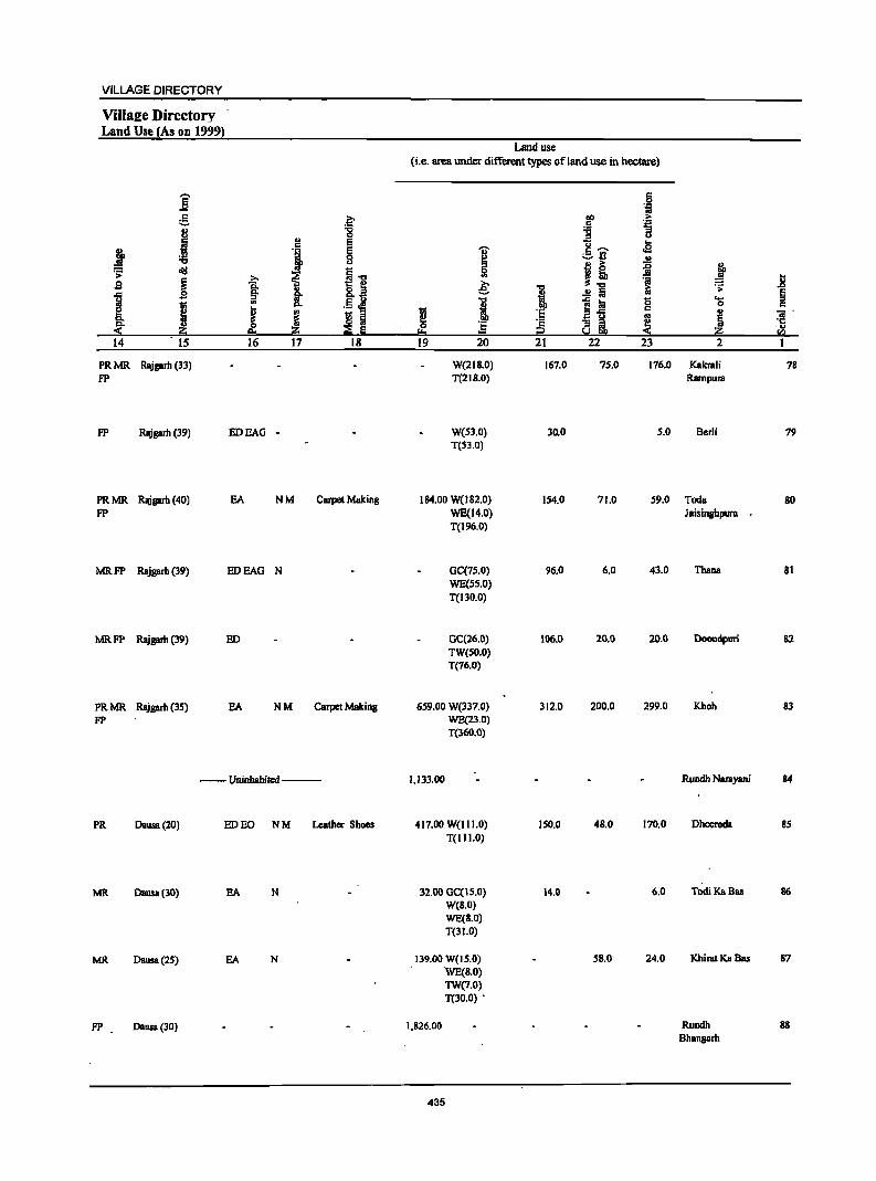
VILLAGE DIRECTORY
ViIIs2e Directory Land Use (As on 1999}
Land use (i.e. area under different types of land use in nectare)
-. c ] 0
'if g .~ ~ >
i " "8 ] ~
c E 11-. .B J 'i E .., :a 8 ~ -=-rl "
~ oi!I
t I~ 5! j! ii ~ s ~ ~ .e: ~ ]
..c ~ 11 ..!l t; os
.;; §
1 .5 ~ "" i ~ :a g .... 1;;
! i 0 c
I ~ 1;; 'E i;3..c .. "iI' ti s a os
~ ~ ] '2 ~ i ~ ·c
;;;§ Iii ." f:!::! i2 rn 14 15 16 17 18 19 20 21 22 23 2 1
PRMR Rlligarh (33) W(218.0) 167.0 75.0 176.0 Kakrali 78 FP T(2IS.0) Rampura
FP Rajgarb (39) IIDEAG - W(53.0) 30.0 5.0 Berli 79 T(53.0)
PRMR Rllisarh (40) EA NM Carpet Making 184.00 W(l82.0) 154.0 71.0 59.0 Tada SO FP WE(14.0) Jaisinghpura
T(196.0)
MRFP Rajgarb (39) IIDEAO N OC(7S.0) 96.0 6.0 43.0 Thana 81 WE(S5.0) T(130.0)
MRFP Rajgarb (39) ED GC(26.0) 106.0 20.0 20.0 Doondpuri 82 TW(SO.O) T(76.0)
PRMR Rajgarb (3S) EA NM Carpet Making 659.00 W(337.0) 312.0 200.0 299.0 Khoh 83 FP WB(23.0)
T(360.0)
-- Uninhabited --- 1,133.00 Rundb Narayani 84
PR Oausa(20) lID EO NM Leather Shoes 417.00 W(1II.0) 150.0 48.0 170.0 Dbeeroda 85 T(1I1.0)
MR Dausa(30) EA N 32.00 GC(IS.O) 14.0 6.0 Todi Ka Bas 86 W(B.O) WE(S.O) T(3J.O)
MR Oausa(2S) EA N 139.00 W(lS.O) 58.0 24.0 Khirat Ka Bas 87 WE(8.0) TW(7.0) T(30.0) .
FP Oausa (30) 1,826.00 Rundh 88 Bhangarh
435
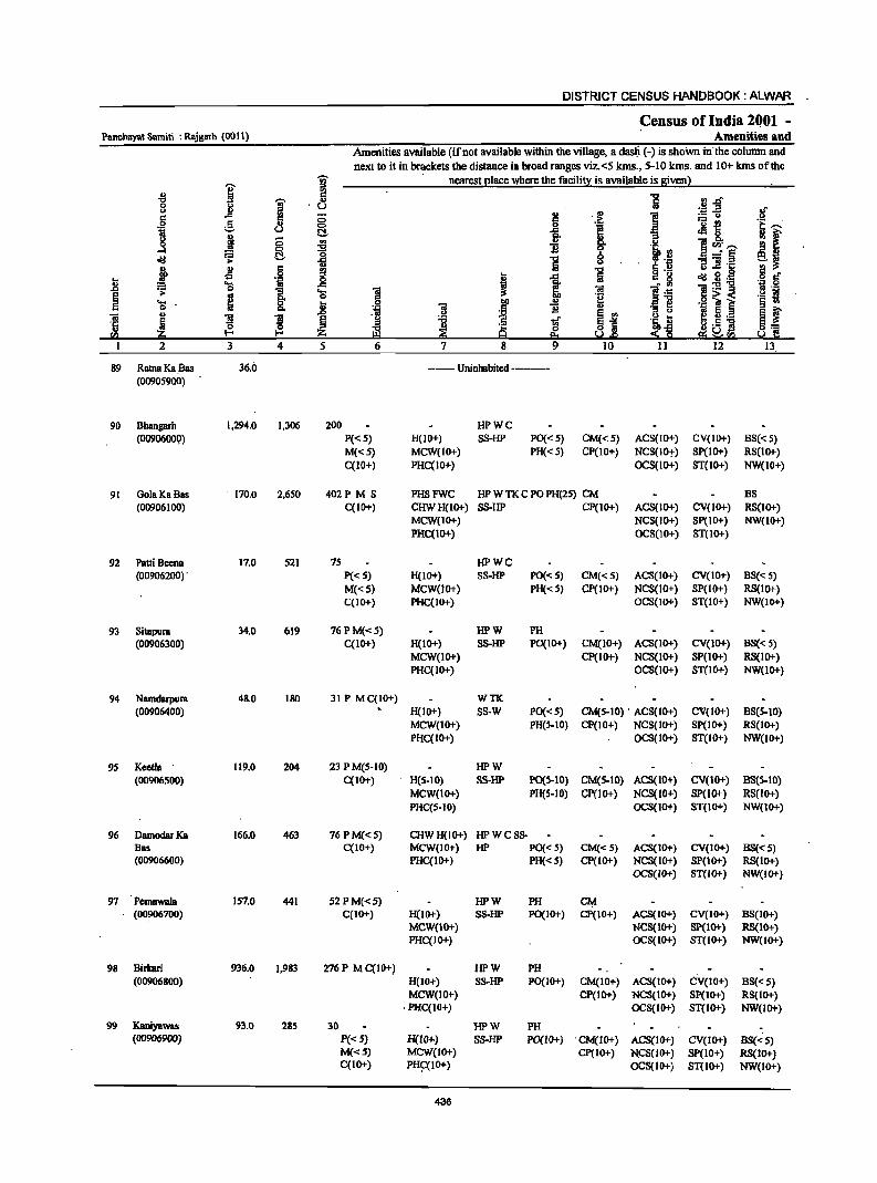
DISTRICT CENSUS HANDBOOK: ALWAR
Census of India 2QOl -Pancbayat Samiti : Rajgarh (0011) Amenities and
Amenities available (if not available within the village, a das~ (-) is shoWn in'the column and next to it in bnlckets the distance in broad ranges viz. <5 kms., 5-10 kms. and 10+ kms of the
i ~ nearest elace where the facilit):: is available is Biven)
" 5 '" -"0 'M' 8 0> U ~~ .8 ii .§ ~ 5 0 I 'u -e u <:> lii !;:!. ~ 8.. " I - '" 0 0
~ B ]~i ...:I 0
oij a !;:!. .", >- Iii ""5] .c ~ .s .~ rg ~ 8 .g
~ = .... .. _g I i ~:g-g .J:) .;; 0 ""5 'C; ~
os "" ·il ~ i 'S ~ 8- ~ B Ol t>
~ ~ ~ ~ 5._
'fij 5 ~.5 ~ II> I-< I-< ~II>
2 3 4 5
89 Raina Ka ,Bas 36.0 --- Uninhabited ----(00905900)
90 Bhangarh 1,294.0 1,306 200 HPWC (0090600Q) P«S) H(IO+) SS-HP PO« S) CM«S) ACS(IO+) CV(IO+) BS« 5)
M«S) MCW(IO+) PH«S) CP(IO+) NCS(IO,!,) SP(IO+) RS(IO+) C(10+) PHC(10+) OCS(IO+) ST(IO+) NW(IO+)
91 GolaKaBas . 170.0 2,650 402PMS PHSFWC HP W TK CPO PH(2S) CM BS (00906100) C(10+) CHWH(1O+) SS-HP CP(IO+) ACS{IO+) CV(IO+) RS(IO+)
MCW(IO+) NCS(IO+) Sp(IO+) NW{IO+) PHC(IO+) OCS(IO+) ST(IO+)
92 PaUi Beena 17.0 521 75 HPWC (00906200) , p«5) H(IO+) 88-HP PO«5) CM«5) AC8(10+) CV(IO+) B8« 5)
M«5) MCW(lO+) PH«5) Cp(IO+) NCS(IO+) SP(IO+) RS(IO+) C(IO+) PHC(IO+) OCS(IO+) ST(IO+) NW(IO+)
93 Sitapura 34.0 619 76PM«5) HPW PH (00906300) C(IO+) H(1O+) SS-HP PO(IO+) CM(10+) ACS(IO+) CV(IO+) B8« 5)
MCW(IO+) Cp(IO+) NCS(IO+) SP(IO+) RS(IO+) PHC(IO+) OCS(IO+) ST(IO+) NW(IO+)
94 Namdarpura 48.0 180 31 P MC(IO+) WTK (00906400) H(10+) SS-W PO« 5) CM(5-IO) . ACS(10+) CV(IO+) BS(5-10)
MCW(IO+) PH(S-IO) CP(10+) NCS(10+) SP(IO+) RS(lO+) PHC(IO+) OCS(IO+) ST(IO+) NW(1O+)
9S Keetla 119.0 204 23 P M(5-10) HPW (00906500) C(IO+) H(5-IO) SS-HP P0(5-10) CM(5-IO) ACS(10+) CV(IO+) B8(5-10)
MCW(1O+) PH(S-IO) CP(IO+) NCS(lO+) SP(lO+) RS(lo+) PHC(S·IO) OCS(IO+) ST(IO+) NW(IO+)
96 DamodarKa 166.0 463 76 P M«5) CHWH(lO+) HPWCSS-Bas C(10+) MCW(IO+) HP PO« S) CM«5) ACS(IO+) CV(IO+) B8«S) (00906600) PHC(IO+) PH« 5) cp(10+) NCS(1O+) SP(IO+) RS(10+)
OCS(IO+) ST(IO+) NW(IO+)
97 Pemawaia 157.0 441 52 P M«5) HPW PH C¥ (00906700) C(IO+) H(IO+) S8-HP PO(IO+) CP(IO+) ACS(IO+) CV(10+) BS(IO+)
MCW(IO+) NCS(IO+) SP(10+) RS(IO+) PHC(IO+) OCS(IO+) ST(IO+) NW(IO+)
98 Birbri 936.0 1.983 276P MC(IO+) HPW PH (00906800) H(10+) SS-HP PO(IO+) CM(10+) AC8(10+) c\1(10+) BS«5)
MCW(IO+) CP(10+) NCS(IO+) Sp(IO+) RS(IO+) ,PHC(10+) OCS(IO+) ST(IO+) NW(lO+)
99 Kaniyawas 93.0 285 30 HPW PH . (00906900) P«5) H(lO+.) SS-HP PO(IO+) 'CM(lO+) ACS(IO+) CV(IO+) B5«5)
M«5) MCW(IO+) CP(lO+) N.CS(JO+) SP(IO+) RS(JO+) C(10+) PH~(IO+) OCS(IO+) ST(IO+) NW(lO+)
436
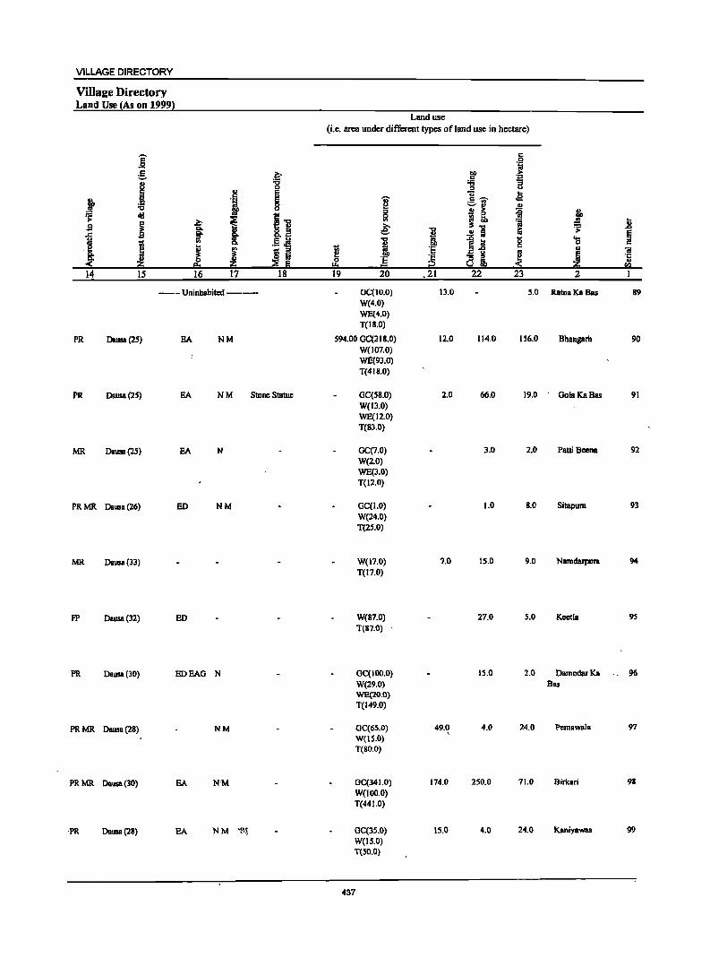
VILLAGE DIRECTORY
ViIlaae Directory Land Use {As on 1999!
e ... g ~ .1
0 II> E
l '1 ~ "I:l
dd ~1! >
~ ~ ~ S Q.
"M §" I 8.a
;: .. .S ~ ,f;! ft
.. i ! J S Iii
~ ~ :::2 fii 14 IS 16 17 18
--Uninhabited--
PR Dausa(2S) SA NM
PR DaIlS8 (25) EA NM Stone Statue
MR Dausa(2S) EA N
PRMR Dausa(26) ED NM
MR Dausa(33)
FP Dausa(32) ED
PR Dausa(JO) EDEAG N
PRMR Dausa(2S) NM
PRMR Dausa(30) EA N'M
'PR Dausa(28) EA NM 'S~
Land use
(i.e. area under different types ofland use in hectare)
~ s .. ~
I t: I!! 0 '5
!:!:I = 19 20
OC(IO.O) W(4.0) WE(4.0) T(18.0)
594.00 GC(218.0) W(J07.0) WE(93.0) T(418.0)
GC(SS.O) W(13.0) WE(12.0) T(83.0)
GC(7.0) W(2.0) WE(3.0) T(12.0)
GC(I.O) W(24.0) T(2S.0)
W(17.0) T(17.0)
W(S7.0) T(87.0) ,
OC(IOO.O) W(29.0) WE(20.0) T(149.0)
OC(65.0) W{tS.O) T(80,0)
GC(341.0) W(100.0) T(44 1.0)
OC(lS.O) W(IS.O) T(50.0)
437
"I:l II>
i '5
~ .21
13.0
12.0
2.0
7.0
49.0 ,
174.0
15.0
c .9 ta
CD > c .::: :s "3 = U
Cl oS c ~ :.:..rI
~ j! 'ii iii ..!! a
!~ 0 c
~i ~ 22 23
5.0
114,0 156.0
66,0 19.0
3.0 2.0
1.0 8.0
15.0 9.0
27.0 5.0
15.0 2.0
4.0 24.0
250.0 71.0
4.0 24.0
• n ~ .D
~ os II> "iii
! ·c ., U'l
2 I
RalnaKaBas 89
Bhangarh 90
GolaKaBas 91
Patti Beena 92
Sitapura 93
Namdarpura 94
Keetla 95
DemodarKa '. 96 Bas
Pernawale 97
Birkari 98
Kaniyewas 99
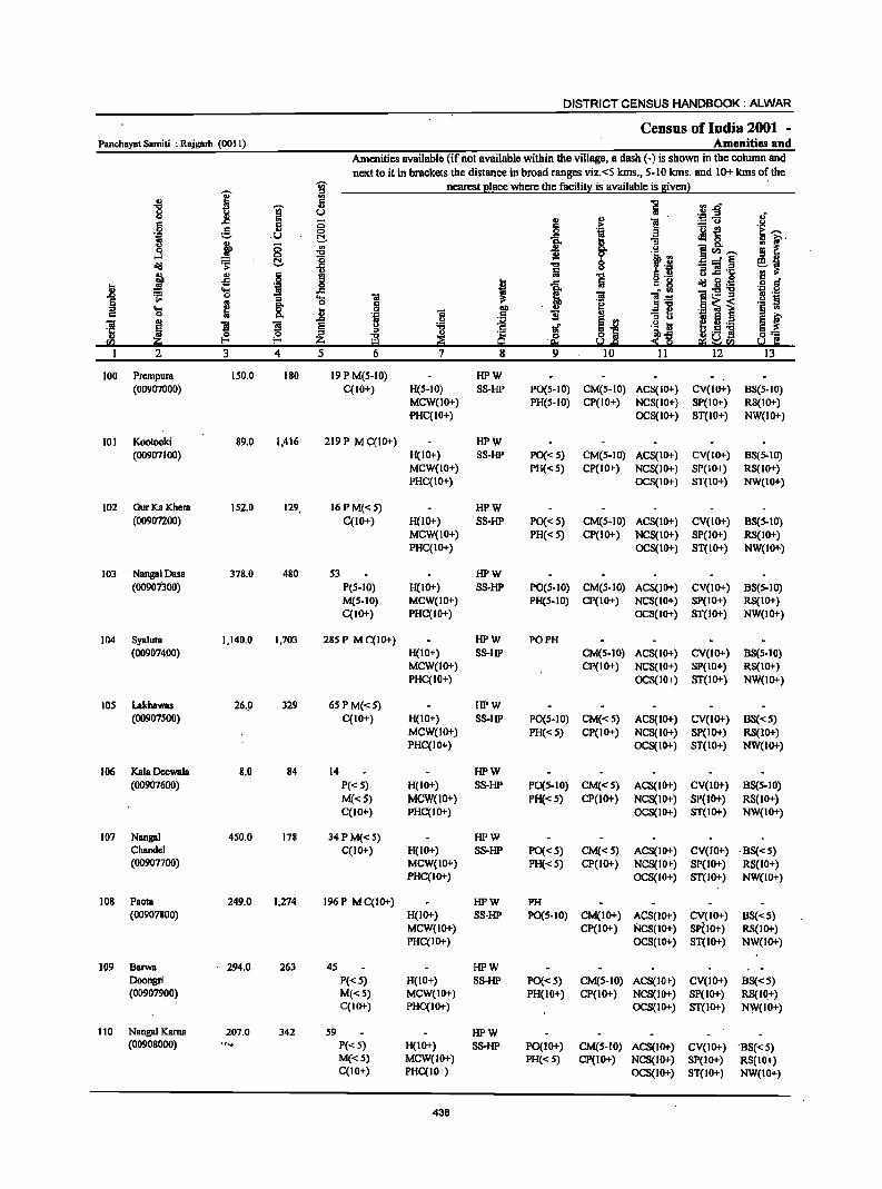
DISTRICT CENSUS HANDBOOK: ALWAR
Census of India 2001 -Panchayat Samiti : Rajgarh (001 I) Amenities and
Amenities available (if not available within the village, a dash (-) is shown in the column and
'iii' next to it in brackets the distance in broad ranges viz. <5 kms., 5-10 kms. and 10+ kms o~ the
I ::> nearest ~Iace where the facilitx is available is !Iivenl
~ :g
] I '" ~f 0 u ,; Col l! § .,
] c C; > .2 .9 g .,
0
l 'u {!
i l' ~ .U ~ .c .:18.
~ C; '" c- ] .3 -0 1l e<l)~ !l 11
~ 0
~ t'i if _" § oIil ~ 1 ;3 ftI '1: ~~ E III ·1 J -0 o .- ... .c 0
.~ ~f J! .,s
i .c Iii " 8 oIil.8:B .... ~
• III
~ 0 :; 'lS ftI :3 l~ 1'- :s r! ._
~ ~ ._ s
.... 8- t S 2P ., e "3~ ._ ~ i § III
0 Po. .~ ] II .,
S f ..0 g I S .. ! fi._ ftI J l ]I £ -0 1i g~ .~ ks 'ij
~ ~ ~ 0 <~ .... 9 ] §:;:
fI) -9= ~& el~CIl s.! C I 2 3 4 5 6 7 8 9 IO 11 12 13
100 Prcmpura 150.0 180 19PM(S-10) HPW (00907000) C(10+) H(S-IO) SS-HP PO(S-IO) CM(S-IO) ACS(IO+) CV(IO+) 88(5-10)
MCW(IO+) PH(S-IO) CP(IO+) NCS(IO+) SP(IO+) RS(IO+) PHC(IO+) OC8(10+) 8T(IO+) NW(IO+)
101 Kootooki 89.0 1,416 219 P M C(IO+) HPW (00907100) H(IO+) 88-HP PO{< 5) CM(S-IO) ACS(IO+) CV(IO+) B8(S-10)
MCW(IO+) PH«S) CP(IO+) NC8(10+) SP(IO+) RS(IO+) PHC{IO+) OCS(IO+) ST(IO+) NW(IO+)
102 GurKa Khera 152.0 129 16PM«S) HPW (00907200) C(IO+) H(IO+) SS-HP PO{< 5) CM(S-IO) ACS(IO+) CV(10+) BS(S-IO)
MCW(IO+) PH«S) CP(lo+) NCS(IO+) SP(lo+) RS(lo+) PHC(lo+) OCS(IO+) ST(IO+) NW(IO+)
103 NangalDasa 378.0 480 53 HPW (00901300) P(S-IO) H(10+) SS-HP PO(S-IO) CM(S-IO) ACS(IO+) CV(1O+) BS(S-IO)
M(S-IO) MCW(IO+) PH(S-IO) CP(IO+) NC8(10+) SP(IO+) RS(IO+) C(10+) PHC(IO+) OCS(IO+) ST(IO+) NW(IO+)
104 Syaluta 1,140_0 1,703 285 P M C(IO+) HPW PO PH (00907400) H(IO+) SS-HP CM(S-IO) ACS(IO+) CV(lo+) B8(S-10)
MCW(10+) CP(IO+) NC8(IO+) SP(IO+) RS(IO+) PHC(IO+) OCS(IO+) ST(lO+) NW(lO+)
105 Lakhawas 26.9 329 65 P M«S) HPW (00907SOO) C(IO+) H(IO+) SS-HP PO(S-IO) CM«S) AC8(IO+) CV(IO+) OS« 5)
MCW(IO+) PH«S) CP(lo+) NCS(IO+) SP(IO+) RS(IO+) PHC(IO+) OCS(IO+) ST(IO+) NW(IO+)
106 Kala DeewaJa 8.0 84 14 HPW (00907600) P«S) H(IO+) SS-HP PO{S-IO) CM«S) ACS(IO+) CV(lo+) BS(S-IO)
M«5) MCW(lO+) PH«5) CP(IO+) NCS(IO+) SP(IO+) RS(IO+) C(IO+) PHC(IO+) OC8(IO+) ST(lo+) NW(IO+)
107 Nangal 450.0 178 34 P M{< 5) HPW Chandel C{10+) H{10+) SS-HP PO{<S) CM«S) AC8(IO+) CV(IO+) -8S«S) (009077oo) MCW(IO+) PH«S) CP(IO+) NCS(IO+) SP(IO+) RS(lO+)
PHC(IO+) OCS(IO+) ST(IO+) NW(IO+)
108 PaOla 249.0 1,274 196P MC(IO+) HPW PH (00907800) H(IO+) SS-liP PO(S-IO) CM(IO+) ACS(1O+) CV(IO+) 88«S)
MCW(lo+) CP(lo+) NCS(IO+) SP(IO+) RS(IO+) PHC(IO+) OCS(IO+) ST(IO+) NW(lo+)
109 Oarwa - 294.0 263 45 HPW Doongri P«S) H(IO+) SS-liP PO{<S) CM(S-IO) ACS(IO+) CV(Io+) 88«5) (00907900) M«5) MCW(IO+) PH(lO+) CP(IO+) NCS(IO+) SP(lO+) RS(IQ+)
C(10+) PHC(IO+) OCS(IO+) ST(IO+) NVJ(IO+)
110 NangalKama 207.0 342 59 HPW (00908000) ., . .". P« 5) H(lO+) SS-liP PO(I 0+) CM(S-IO) ACS{IO+) CV(lo+) --8S«S)
M«S) MCW(lO+) PH«S) CP(IO+) NCS(IO+) SP(IO+) RS(lo+) C(IO+) PHC(IO+) OCS{IO+) ST(IO+) NW(IO+)
438
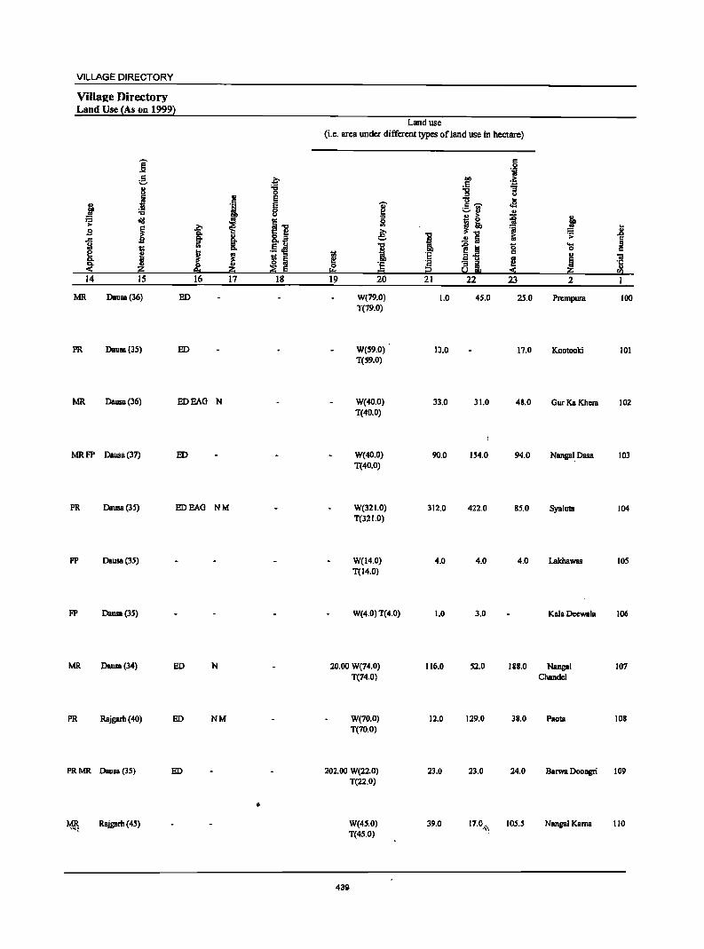
VILLAGE DIRECTORY
Villae:e Directory Land Use {As on 1999)
Land use (Le. area under different types of land use in hectare)
E c 0 ..... ·i
g .~ ~ .~
" ... :g ;;
~ 0 u
l!! E u .. ~ ·i e 'Ii' c ~ oS .!!l
B ~ ;:;.fJ ., ... j~ =f;i ~ tid ~] 51 .~
I ~ ~ l Jl s e .c a- §. &,.a I ..!! fa .. .~
§ f;I .5 ~ 1 ~j! g .... ! Q, 0 c
~ ! ~ ~ ·5 ., 'iI !l Iii i! g ~ §
~ .,
~ ·5 ~ a~ ·5 ;g; 9:1 ii!:i ::s E = ~ ;g; rIl
14 15 16 17 18 19 20 21 22 23 2 1
MR Dausa(36) ED W(79.0) 1.0 4S.0 25.0 Prempura 100 T(79.0)
PR Dausa(3S) ED W(S9.0) 13.0 17.0 Kootooki 101 T(59.0)
MR Dausa(36) EDEAG N W(40.0) 33.0 31.0 48.0 GurKa Khcra 102 T(40.0)
MRFP Dausa(37) ED W(40.0) 90.0 154.0 94.0 Nangal. nasa 103 T(40.0)
PR Dausa(3S) EDEAO NM W(32 1.0) 312.0 422.0 85.0 Syaluta 104 T(321.0)
FP Dausa(35) W(14.0) 4.0 4.0 4.0 Lakhawas lOS T(l4.0)
FP Dausa(35) W(4.0) T(4.0) 1.0 3.0 Kala Deewala 106
MR Dausa(34) ED N 20.00 W(74.0) 116.0 52.0 188.0 Nangal 107 T(74.0) Chandcl
PR Rajgarh (40) ED NM W(70.0) 12.0 129.0 38.0 Paola lOB T(70.0)
PRMR Dausa (35) ED 202.00 W(22.0) 23.0 23.0 24.0 Barwa Doongri 109 T(22.0)
• MR Rajgarh (4S) W(4S.0) 39.0 17.0..1,\ 105.5 Nangal Kama 110
,..\(~
T(45.0)
439
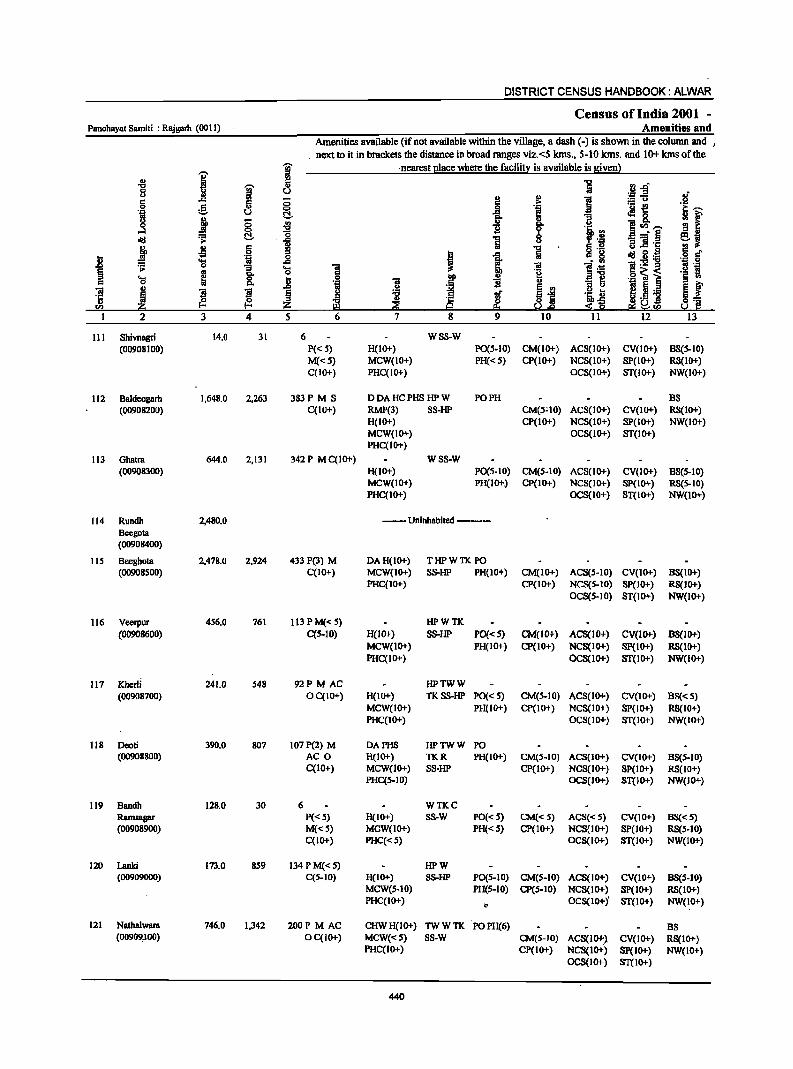
DISTRICT CENSUS HANDBOOK: ALWAR
Census oflndia 2001 -Panchayat Samiti : Rajgarh (0011) Amenities and
Amenities available (if not available within the village, a dash (-) is shown in the column and I
. next to it in brackets the distance in broad ranges viz.<5 kIns., 5-10 kIns. and 10+ kIns of the
I ~ ·nearest ~Iace where the facili!l! is available is Biven} .. ~ ] .2.g 't:I
I 8 u .~
., 1 !! 1 ;z~ c ..c: ;:;
0 g <;> .~ '0 -e i~ 'ia u t:!- 11 ~ 8. 8 J § ~
lr '" !I r ....l 1i 0 lil !<Il~
old ~ t:!- o i 8 _" § ei . .c 'El] ·c
J .s c ~ .., B .S! ~ g J~ .j 6" .9 ~ 1 Iii c 8 .8 1;1 0 .... .c l~ ~:s!~ == 0 "i9 .... '8 ~ til fl . .,
~ .. GO 0 '2 '§ ~ '" ~ . .. ~ l .... ~ 0 .8 0 c 0 '" 'N til 1i u
1~ e f til ~ .2 ~ ~i
f! 5 ._ l a ~
." tf '5 t2 ~ :i .c: ~ <~ ~.s ] ~] <Il :1!:i Q ~~
2 3 4 5 6 7 8 9 10 11 12 13
III Shivnagri 14.0 31 6 WSS-W
(00908100) P«5) H(IO+) PO(S-IO) CM(IO+) AC8(10+) CV(IO+) B8(5-10) M«S) MCW(IO+) PH«S) CP(10+) NC8(10+) SP(10+) RS(IO+) C(IO+) PHC(IO+) OCS(lO+) ST(IO+) NW(IO+)
112 Baldcogarh 1,648.0 2,263 383P M S DDAHCPHS HPW PO PH B8 (00908200) C(1O+) RMP(3) SS-HP CM(5'10) ACS(IO+) CV(IO+) RS(IO+)
H(lO+) CP(IO+) NCS(IO+) SP(IO+) NW(IO+) MCW(IO+) OCS(IO+) ST(lO+) PHC(IO+)
113 Ghatra 644.0 2,131 342 P MC(IO+) WSS-W (00908300) H(IO+) PO{S-IO) CM(S-IO) ACS(IO+) CV(IO+) B8(5-IO)
MCW(IO+) PH(I~) CP(lO+) NCS(IO+) SP(IO+) RS(5-10) PHC(IO+) OC8(10+) ST(IO+) NW(lO+)
114 Rundh 2,480.0 _- Uninhabited ----Becgola (00908400)
liS Bccghota 2.478.0 2,924 433 P(3) M DAH(IO+) THPWTKPO (00908500) C(10+) MCW(IO+) Ss.HP PH(IO+) CM(IO+) ACS(S-IO) CV(IO+) B8(10+)
PHC(IO+) CP(IO+) NCS(S-IO) SP(lO+) R8(10+) OC8(S-IO) ST(IO+) NW(IO+)
116 Veerpur 456.0 761 113 P M« 5) HPWTK (00908600) C(S-IO) H(1O+) SS-HP PO{<S) CM(IO+) AC8(IO+) CV(1O+) 88(10+)
MCW(IO+) PH(IO+) CP(IO+) NC8(IO+) Sp(IO+) RS(IO+) PHC(IO+) OCS(IO+) ST(IO+) NW(IO+)
117 Kherll 24UJ 548 92P MAC HPTWW (00908700) o C(IO+) H(IO+) TKSS-HP PO{< 5) CM(S-IO) AC8(10+) CV(IO+) B8«S)
MCW(IO+) PH(IO+) CP(IO+) NCS(IO+) SP(IO+) RS(IO+) PHC(lO+) OCS(IO+) ST(IO+) NW(IO+)
118 Dcoli 390.0 807 107P(2) M DAPHS HPTWW PO (00908800) AC 0 H(IO+) TKR PH(IO+) CM(5-10) ACS(IO+) CV(lO+) B8(S-IO)
C(IO+) MCW(1O+) SS-HP CP(1O+) NC8(IO+) SP(IO+) R8(10+) PHC(5-IO) OCS(IO+} ST(IO+) NW(IO+}
119 Bandh 128.0 30 6 WTKC Ramsapr P«S) H(IO+) SS-W PO«S) CM«S) ACS«S) CV(IO+) BS«5) (00908900) M«S) MCW(10+) PH«S) CP(IO+) NCS(IO+) SP(IO+) RS(S-IO)
C(IO+) PHC«S) OCS(IO+) ST(IO+) NW(IO+)
120 Lanki 173.0 859 134 PM«S) HPW (00909000) C(S-lO) H(10+) SS-HP PO{S-IO) CM(5-1O) ACS(IO+) CV(lO+) B8(S-IO)
MCW(S-IO) PH(S-IO) CP(S-IO) NCS(IO+) SP(lO+) RS(IO+) PHC(lO+)
~ OCS(IO+)' ST(IO+) NW(IO+)
121 Nalhalwam 746.0 1,342 200P M AC CHWH(IO+) TWWTK POPH(6) BS (00909~OO) OC(IO+) MCW«S) SS-W CM(S-IO) ACS(JO+) CV(IO+) R8(IO+)
PHC(IO+) CP(IO+) NCS(I<l+) SP(IO+) NW(IO+) OCS(IO+) ST(1O+)
440
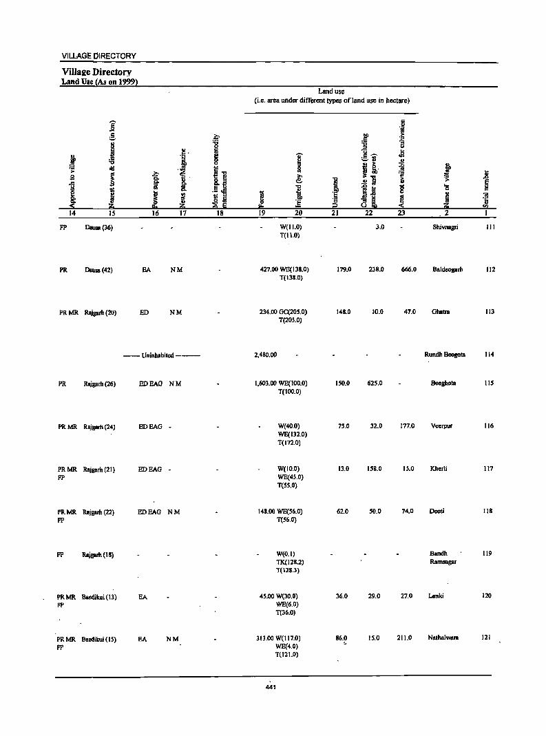
VILLAGE DIRECTORY
Villa2e Directory Land Use {As on 1999l
Land use
(i.e. area under different types ofland use in hectare)
,... IS ..e .~ :§, .~
til) c :a
j .., :g 3 0
II> E U .fa c· j ., g I c~ ;.:;.rl .,
u I i· ~ :;: old il
0 t j ~ UI .8 g e 'iii
1 ~ 8,' 8._ I .!!1 ~ .s:
§
l !. .§ ~
.., 5.2 g 'a
J 1 c
~ t;: " "iii
~ ! I a ~ 8 L ~ ~ '1: ., I:!:o ~ sa
14 15 16 17 18 19 20 21 22 23 2 I
FP Dausa(36) W(II.O) 3.0 Shivnagri III T(II.O)
PR Dausa(42) BA NM 427.00 WE(138.0) 179.0 238.0 666.0 Baldeogarh 112 T(13S.0)
PRMR Rajgarh (20) ED NM 234.00 GC(20S.0) 148.0 10.0 47.0 Ghatta 113 T(20S.0)
--Uninhabited --- 2,480.00 Rundh Beegota 114
PR Rajgarh (26) ED BAG NM 1,603.00 WE(100.0) ISO.O 625.0 Beeghota 115 T(100.0)
PRMR Rajprh (24) EDEAG - W(40.0) 75.0 32.0 177.0 Vccrpur 116 WE(ll2.0) T(172.0)
PRMR Rajgarh (21 ) ED BAG - W(ID.O) Il.O 158.0 15.0 Kherli 117
FP WE(45.0) T(SS.O)
PRMR Rajgarh (22) ED BAG NM 148.00 WE(56.0) 62.0 50.0 74.0 Deoti 118
FP T(56.0)
FP Rajgarh (18) W(O.I) Bandh 119
TK(128.2) Ramsagar
T(12S.3)
PRMR Balldikui (13) BA 45.00 W(30.0) 36.0 29.0 27.0 Lanki 120
FP WE(6.0) T(36.0)
PRMR Bandikui (15) EA NM 313.00 W(1I7.0) 86.0 15.0 211.0 Nathalwara 121
FP WE(4.0) ~
T(12 1.0)
441
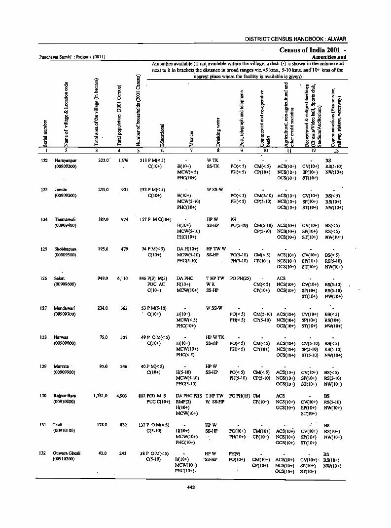
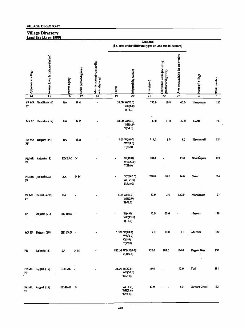
VILLAGE DIRECTORY
Villsae Directory Land Use {As on 1999}
Land use (i.e. STeH under different types of land use in hectSTe)
]' c 0 'i
5 a- .r! > '.j;l .. '6 ~ -;;
.1 0 :0 U
!! E "0 .. j 'i' E U' c ,.... cS ._ .,
~ 0 i ~ u '" u
!! ~ =i ~ ~ <iii I~ t i ~~ :;; .8 sa j ~ .., iii '>
1 .~ i i .!! Iii ~
I ..
"" 1 1~ g 'Ci
e J I ~ :§ '" 'iI
~ 1S Iii ! ~ ·c ~ § 'E i2 a~ " ..... ... ~ ."
14 IS 16 17 18 19 20 21 22 23 2
PRMR Bandikui (16) EA NM 55.110 W(70.0) 133.0 19.0 40.0 NBrayanpur 122 FP WE(6.0)
T(76.0)
MRFP Bandikui (17) EA NM 44.00 W(So.o) 87.0 11.0 37.0 Joneta 123 WE(4.0) T{54.0)
PRMR Rajgarh (14) EA NM 8.00 W(40.0) 119.0 8.0. 8.0 Thamawali 124
FP WE(4.0) T(44.0)
PRMR Rajgarh (18) EDEAG N W(40.0) 100.0 15.0 Shobliapura 125
FP WE(20.0) T(60.0)
PRMR .Rajgarh (20) EA NM GC(400.0) 280.0 10.0 84.0 Sakal 126
FP W(175.0) T(S7S.0)
PRMR Bandikui (13) EA 6.00 W(40.0) 53.0 3.0 130.0 Mandawari 127
FP WE(2.0) T(42.0)
FP Rajgarh (21) EDEAG - W(4.0) 15.0 43.0 NarWBS 128 WE(13.0) T(17.0)
MRFP Rajgarh (20) EDEAG - ROO W(IS.O) 2.0 10.0 3.0 Murrata 129 WE(6.0) 0(5.0) T(29.0)
PR Rajgarh (IS) EA NM S82.S8 WE(309.0) 352.0 103.0 134.0 RajpurBara 130 T(309.0)
PRMR Rajgarh (17) EDEAG - 56.00 W(30.0) 49.0 13.0 Todi 131
FP WE(30.0) T(60.0)
PRMR Rajgarh (IS) EDEAG M' W(15.0~ 13.0 6.0 Guwara Ghesli 132
FP WE(9.0) T(24.0)
443
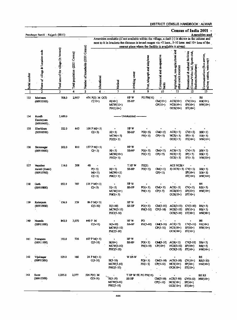
DISTRICT CENSUS HANDBOOK: ALWAR
Census of India 2001 -Panchayat Samiti : Rajgarh (0011) Amenities and
Amenities available (if not available within the village, II dash (-) is shown in the column and
next to it in brllckets the distance in broad ranges viz.<S kms., 5-10 kms. and 10+ kms ofQle .
I ~ nearest (!Iace where the facilit):: is available is 8iven}
-8 c . "" . ·~f ~ ... .:iii 8 u
.~ c ..!l . ., ;; !! .,
] :.= u c 'j ._ {! 0 g .,
<:> t if .~ u ~ .j 0
~ "3
0 0 '" oj c.. u l~~ ....l <:> i ~ 'Jib '" 9 II)
~ ~. !;:!. ] «I .!:! i] .~. Sj u § .~ j ~ 8 "" ~ 8 .g l!!. ... 'il 0 I ..r:: :iii c 8 .g g-
O> .... .c i " '" 'iI:2] .&J :;. 0 ]. ] l! )~ eo .-... .~ s
~ eo 0 'j ~ i ~ ~ 8. .8 'i 1>0 I!! c '"
I ! ] ... "3 tl. fJ ~ 01 i s ~ § tf ~i '~Jl .! ] ·c
~ 8:: 0>
~ ~ I-< Z 0 ~.&J ~ g ~~<I) u c: <I) "" 2 3 4 5 6 7 8 9 10 11 12 13
133 Motiwara 708.0 2,9S7 474 P(3) M 0(2) HPW POPH(IO) BS (00910300) C(lO+) H(lO+) SS-HP CM(lO+) ACS(lO+) CV(lO+) RS(lO+)
MCW(IO+) CP(IO+) NCS(10+) SP{IO+) NW(IO+) PHC(IO+) OCS(IO+) ST(IO+)
134 Rundh 3,489.0 ----- Uninhabited ---------Daulatpura (00910400) .
135 KharkhBIB 322.0 643 106 PM«S) HPW (00910500) C«S) H«S) SS-HP PO«S) CM«S) ACS« S) CV«S) BS«5)
MCW«S) PH«S) CP{<5) NCS«5) SP« 5) RS«S) PHC«S) OCS« S) ST(IO+) NW(IO+)
136 Shreenagar 202.0 810 137PM«S) HPW (00910600) C«5) H«S) SS-HP PO«5) CM«S) ACS« S) CV«S) BS« S)
MCW(IO+) PH«S) CP{< 5) NCS« S) SP« 5) RS« S) PHC« 5) OCS« 5) ST« 5) NW(IO+)
137 NByabas 114.0 308 48 THPW PH(S) ACSNCS« Haveli (Rural) P« 5) H«S) SS-HP PO«S) CM«S) 5) OCS« 5) eV« 5) BS« S) (00910700) M«5) MCW«S) CP«5) SP(lo+) RS« 5)
C«S) PHC«S) ST(IO+) NW(IO+)
138 Goth 652.0 787 124 P M« 5) HPW BS
(00910800) C«s) H«S) SS-HP PO«S) CM«S) ACS«S) eV«S) RS«S) MeW(IO+) PH«S) CP«S) NCS(IO+) SP(IO+) NW(IO+) PHC«S) OCS(IO+) ST(IO+)
139 Ratanpura 156.0 539 86PM«S) HPW (00910900) C(S-IO) H(S-IO) SS-HP PO«S) CM(S-IO) ACS(S-IO) CV(S-IO) BS«s)
MCW(s-IO) PH(S-IO) CP(S-IO) NCS(S-IO) SP(IO+) RS« S) PHC(S-IO) OCS(S-IO) ST(IO+) NW(IO+)
140 Nccmla 842.0 3,070 440P M HPW PO BS (00911000) C(5-10) H(5-10) SS-HP PH(S-IO) CM(S-IO) ACS«S) eV(S-IO) RS(IO+)
MeW(S-IO) CP(5-10) NCS(IO+) SP(IO+) NW(IO+) PHC(5-IO) OCS(IO+) ST(IO+)
141 PrcmpuIB 192.0 726 107 P M«5) HPW (00911100) C(5-IO) H(IO+) SS-HP PO«5) CM(5-10) ACS«5) eV(5-10) BS«5)
MCW(S-IO) PH(S-IO) CP(IO+) NCS(S-IO) SP(IO+) RS« S) PHC(S-IO) OCS(S-IO) ST(IO+) NW(IO+) •
142 Vijainagar 129.0 166 24 PM«S) WSS-W BS (0091121>0) C(S-IO) H(S-IO) PO«S) CM(S-IO) ACS(S-IO) CV(IO+) RS(S-IO)
MCW(S~.IO) PH« 5) CP(5~10) NCS(IO+) SP(IO+) NW(IO+) PHC(S-tO) OCS(IO+) ST(IO+)
143 Surer 1,235.0 3,377 526 P(4) M f.l<
THPWTK POPH(IS) BSRS (00911300) C(S-IO) H(S-IO) SS-HP CM(S-IO) ACS(S-IO) CV(S-IO) NW(lO+)
MCW(S-IO) CP(5-10) NCS(IO+) . SP(IO+) PHC(S-IO) OCS(IO+) ST(IO+)
444
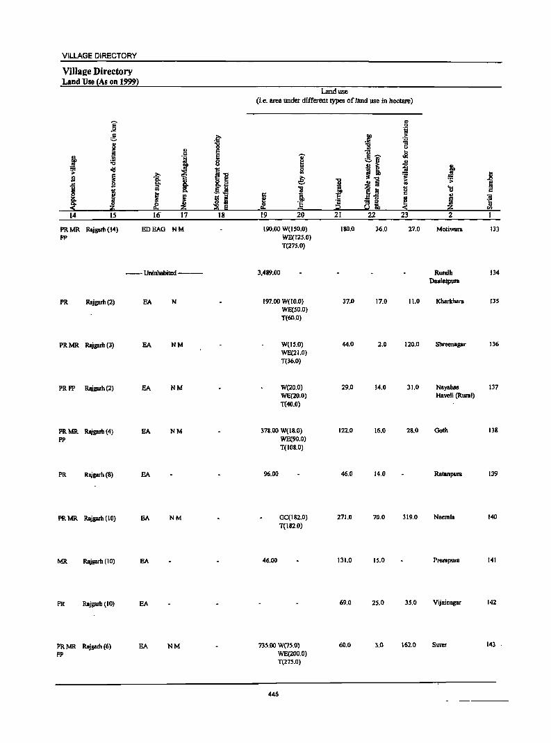
VILLAGE DIRECTORY
ViIla2e Directory Land Use (As on 1999}
i ~ 11 ., .i c
~ '1 -0 ~ old
I ~ ~ g §: ., ]
I .. 8:
I ..
~ g ~ eo ~
14 IS 16' 17
PRMR Rajgarb (14) EDEAG NM FP
--Uninhabited--
PR Rajgarb(2)
PRMR Rqigarb(3)
PRFP Rajgarh(2)
PRMR Rajgarb(4)
FP
PR Rl\igarb(8)
PR MR Rajgarb (10)
MR Rajgarh (10)
PR Rajgarh (10)
PR MR Rajgarh (6) FP
EA N
EA NM
EA NM
EA NM
EA
SA NM
EA
EA
EA NM
.~ "C 0 E E 8
i1! ,tJ ~ ::I
::e E 18
Land use
(i.e. area under different types ofJand use in hectare)
..,. ~ 0 en
€ 11
Ii: i a 'E !!:s = 19 20
190.00 W(150.0) WE(125.0) T(275.0)
3,489.00
197.00 W(lO.O) WE(50.0) T(6O.0)
W(IS.O) WE(21.0) T(36.0)
W(20.0) WE(20.0) T(40.0)
378.00 W(I8.0)
96.00
46.00
WE(90.0)
T(108.0)
GC(182.0)
T(182.0)
735.00 W(7S.0) WE(200.0) T(275.0)
445
1! .~ § 21
IW.O
37.0
44.0
29.0
122.0
46.0
271.0
131.0
69.0
6D.0
6 '',;j
~ ... .'" i :;
u c; .. eI .s .,
~ 1-0 =a ..!! Ii 1; .0 iii g 2-5
~ - ::I ::I .. ~!9 22 23
36.0 27.0
17.0 11.0
2.0 120.0
14.0 31.0
16.0 28.0
14.0
70.0 319.0
15.0
25.0 35.0
3.0 162.0
~ 1l ::: ... ~ 'S
~ «I ·c ., 2; CI)
2 1
Moliwara 133
Rundh 134 Daulatpura
Kharkhala 135
Shreenagar 136
Nayabas 137 HaveJi (Rural)
Goth 13&
Ratanpura 139
Neemla 140
Prcmpura 141
Vijainagar 142
Surer 143 .
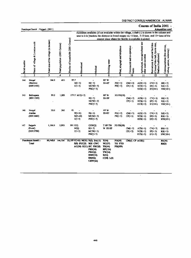
DISTRICT CENSUS HANDBOOK: ALWAR
Census of India 2001 -Panchayat Samiti : RAjgarh (0011) Amenities and
Amenities available (if not available within the village, a dash (-) is shown in the column and next to it in plackets the distance in broad ranges viz.<5 kms., 5-10 kms. and 10+ kmsbfthe
'Vi' nearest 'place where the facility is a~ailablc is given)
I " .. -8 'Vi' I:l 1 .~ ~ft 0 U U oJ' <> l! :I ., § l!! ;; l:! .=: . ] ;.:::: to>
'i~ e- ., 0 1- ~
·s ~ .~ u C!- ra a . 0 u ;; 11
!l f 0 ~ ..
l! 8- " ]"''""' -0 'i .2 o-l ~ "0 8 ..J"§ ~j d!I :: .c 1 :- ., § .2 '3 ]._ j .fl .~
., -0 u lS :s
t 1 a ,:g d!I.8~ .~ ~f ~ ..... 'iii _g
1 ~ 0 1. ..... 'iI 'iI ]:§ 'iI ._ 1;1 .-
os 0 c 'g ]~] .~ ~ 's ta 0 _g 0 ] I l! c.. 'D "3 tl
E t ~ J J 1iI E g -0 tf ~~ .2 I:l e ~._ 8] ., ~
:s ill ~ is 0 l;i,o£i el°] Ul z p. U.o ..,; 0 ",<51}
I 2 3 4 5 6 7 8 9 10 11 12 13
144 Nangal 566.0 605 95 P HPW Dhannoo M«5) H«5) SS-HP PO«S) CM«5) ACS«S) CV«5) BS«5) (00911400) C«5) MCW«5) PH«5) CP« 5) NCS« 5) SP«5) RS«S)
PHC« 5) OCS«5) ST(IO+) NW(IO+)
145 Balloopura 99.0 1,283 175P MC«S) HPW POPH(IO) (00911500) H«5) SS-HP CM«5) ACS« 5) CV«5) B8« 5)
MCW«S) CP«S) NCS«5) SP« 5) RS« 5) PHC«5) OCS«5) 8T(10+) NW(IO+)
146 Nangal 30.0 262 41 HPW Ataldas P(S-IO) H«5) SS-HP PO« 5) CM«S) ACS« 5) CV«S) BS«5) (00911600) M(S-IO) MCW«S) PH«S) CP«S) NCS« 5) Sp«S) RS«5)
C«5) PHC«5) OCS«S) ST«5) NW(lO+)
147 Rajgarh 1,106.0 5,993 901 peS) CHW(2) THPTW POPH(30) . (Rural) M(2) H«5) W S8-HP CM«5) ACS« 5) CV«5) BS« 5) (00911700) C«5) MCW«S) CP«S) NCS«5) Sp«5) RS«5)
PHq<S) OCS«5) ST«5) NW(IO+)
Panchayat Samltl : 89,748.0 144,716 11,109 P(141) M(SS) D(1) DA(ll) T(l6) PO(30) CM(6) CP AC8(6) B8(34) Total S(8) PUC(S) MH ewc W(137) TO PTO RS(1)
AC(IO) 0(11) HC PHC(S) TK(44) PH(359) PBS(IO) BP(IZ4) FWC(2) TW(34) RMP(18) R(1Z) SMI'(2) C(1B) L(4) CHW(ll)
446
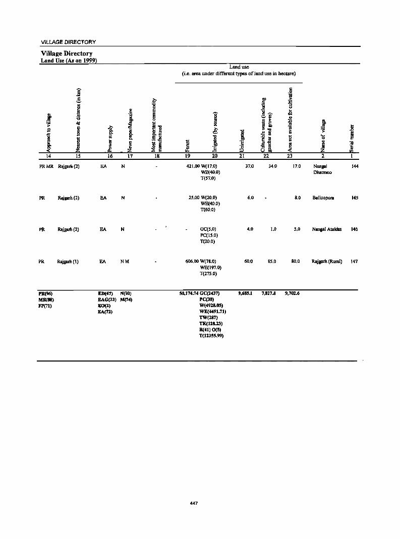
VILLAGE DIRECTORY
Villa2e Directory Land Use {As on 19992
Land use (i.e. area under different types of land use in hectare)
j c 0
'j g .~ ~ .::: .. -0 'B '3 u 0 u
.~ .. e u ...
~ ., § I .5 -;;- cla .., ...... u u u B ~ ii ~ cId I] g .:;
~ ~ ~ ~~ ~ Jl sa .,. .. .e: I ..!! 5 ~ .;;:
5 J ;:l go "'u
} e :a '0 ....
J <II c.. .5.el 0 ... ~ 'S c .. J J I ~ a ail
~ ! iii
~ "3 a '5 II- 50! lID rIl
14 15 16 17 18 19 20 21 22 23 2 1
PRMR Rajgarh (2) EA N 421.00 W(17.0) 37.0 34.0 17.0 Nangal 144 WE(40.0) Dhannoo T(S7.0)
PR RA\igarh (2) EA N 2S.OO W(20.0) 6.0 B.O Balloopura 14S WE(40.0) T(60.0)
PR Rajgarh (2) EA N GC(S.O) 4.0 1.0 S.O Nangal Ataldas 146 PC(IS.O) T(20.0)
PR Rajgarh (1) EA NM 606.00 W(7S.0) 60.0 SS.O SO.O Rajprh (Rural) 147 WE(197.0) T(27S.0)
PR(96) ED(47) N(90) 50,174.74 GC(1437) 9,685.1 7,817.8 9,702.6 MR(88) EAG(33) M(74) PC(38) FP(71) EO(l) W(4918.0S)
EA(72) WE(4491.71) TW(187) TK(128.23) R(41) 0(5) T(11355.99)
447

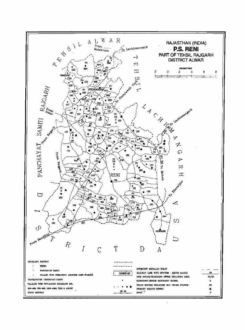
c.. \L ~/
h\ A fo'l'on) },j!ljil,klJ~;'~ .
R ,., h ~[1garh
/''fo Lneh m" ,,,:-: ... -
RAJASTHAN (INDIA)
P.S. RENI ,.- "
\ _"-·PO'1"-. ,..... ~.-.~. . ,..-.~. 11'1 '- ......
_ . • ,.,1 •.• " •• ·_, •• , .... · PO ~.- '~"" 996; ~
PART OF TEHSIL RAJGARH DISTRICT ALWAR
r I • \"~~'~?"·;~:'.PO .;.,.i"·-,. J. 992': 993 ) 99~';99~,17'
: ........... : : ......• ) {JOH09IOI' • \ " .... -... " ....... ~ ..... i/!\ r.
~·:·Oll .' ........ .. 900 , '~.,. /'. (,.t • -,_,' PO :-- •••• _.... .. .. ,./ '.
: ...... " • 010 :' 999 :' .... ,_. '. ?" ", 12" , •• ! •. "":' .1 <,0.....-' .0 to., ••• ," ...... ,.~, / PO , "
: J :::,,"';;0 \006::6000iJiijif -". _,. i~ t"" ··!lOP' • i _/'" . 001..... I II>
.t~tfj·.,·::) • oo;.i}~.~.:::::,:~ {~02· ····1:1' .~" :.. :. "_,: : ............... -( cY
.' ". • " ... "iilJ7,···· . .DOIf .: • 00:3 :' .' , ., B/" : 123 .,: '. , ..... 0
.. 01"1 "" ',,:-,! • ... D~.J: ••••••• ,- ( "'..l"
2 0 I. ::J ... L.
KILOMETRES
246 __ .1... . .. I ... _ ... _:;:j
": .. /; "~ .. L"l··· .. ·1 .... / :12c\::n ,._.1'-/ '(.. '.r- , .• : • '@i 5 24 .........}l.;, , . -1 :{:~ ,y..... ! : PO PO ,. :.' l~.'" ~~._.) ! ",~'l>
'--' ..... , ....... !2Il (122 .1'" .. <,:'rJ..~ ... t .. ··· 'ro J C' ~'I} ,.~\ "";.l /') •. ·139 T • t··: 1'0 \ i L,.,~-v:o. h :'" :~\ . ....__. \·~'1z11 ! 137 I'_: D 12lJ _,' "'-T~ --J>C
"-1 :, '.' -. : ...... <. · .. ·ro .. -·;, / )(~36 S • __ ~:_. ,,0 :;;;s :<;- .:------ "\ ..... _. .. ...... ~:'., ......... : • -<:,.~ '0' <C . ~y: \~ ''-..,_ (130 ~_ T 134 ,~) .. "T .•. ', :~ ;~ -·V,. ~ ~ Tn q,~ .. , .... 119 PO \'1 eo / po ... 7"'-:r .. ~· .. T~.- 130 ":0-,. '\ ,,'-,; ". V."l ~ • D .. ' .. ~. ~ ... " .~ ; ••••• '-. •• '1....... ~2-:._""\__ ~ r \. ,,""7'
~ : s , :' t 135 ::. 132 ..... y'---t.I'Ci···; .. •• .. f PO ..... ~::.:/' i ! of'
...• 0 .' l'S " \ .. ,'\ •••• , •• ~ 131 F( PO/.~ 164 ',-:---"_ -, 8 ! c......... 4; : ......... 1'.......! p ' •• ~-.,' ••.••• ' ••••• " .... ' .... ____ ....... :' '.~, . ..- • I, 'z. L" • \ '.~.' 0 : 180 t • ·'-l.. B .... --~.....:.. 1:;' I _,., :. ", \ 140 ..... ,'. lBI ... '" ~ 183 "'>;--ps- lll~ S i .......... : \. \.... .'. .••. .~~ ..... - ..•• 8', .
• 118 "\ •• ~. I 141 ,.'. .... .... .,.... : PO B TO I ~ ~ ~ 'y_~.J . "'''o! •• -t:'' •••• ";42 ...... ~-.::.~ ........ 182 ........ ,....-; •••.•• : ....... -~ .~ ....... .i <C 9 : .-............... ~ i PO "\ 1'3"'" ""'" .. ) 18641) f -;r; I-'T"'1 '.,' 141 ,;;'\ 1-13 ; PO '.,179" •..•• ? ............... .., ~ """" • ,"e .... : "...... .. PO ~. I U .S'., ................... , !". 'B ... ,., ••• \ •• •••• 187i o--;;r ~ '........ 145 PO: \. .,' 5 \ J S. .' ..... j 'i] f"-; ID • 1411' .; .... ,... :'" • ....... \. • ... ,. 180 ...... , <t: -; ;:::::(@'.:t·'·::~;·f47 .;0..\1411 :: \ ........ L. ~ " ~ :::t p_., V .... ·· .. ·,)51 ...... ( ..... 149 "\. r' ,RENT V' ,.'......... ! ~ ,
,::::::-.~-l?i·r~·',;~ ':.- ~"".= .. j:' ~_--_... : ............ ~~?, .... :.) ·· ...... 1 ~ ,s-
.' PO "'. ,.1513 ",: i 101 ;'····· .... • .. ·····1 , ,J-,-' S. r· .. ~· .::r·... ... .......... i. 192 i " t;Q~
l ,/.............. ·· ..... t I PO·· ... •• .. ·, ,,' ... • I .'" .... -.. ).62 ............... ,.. ' ._=---_.'.; .............. '\, ; ~o
•. -._'''! ....... . :"'/ 1: IS") N';-~''''''''!90 ' .......... ~ ~Q,
.' .,- • •••• • ••• r: ... ~' " ..... , ••••• \ : .,...... ~....o '. i .' "'. ·'·.I!I.I •••• : 164 : .....,: : 1115··.... i" .., 4.
". 155 / • .:' •••. $. : ..... :! .... !. 163 ••• ·~ 1719 "; ':'" l'h -t-._~;Jt;l_ i
,I • lD9 ,:,,,: ···t .... ··.;.i. '117lf, 174 : :.. .1>0 .~.,... " 193 '
J "-:" ..•.. i 185 'i'8Ir.,:··i ': t • ~ .. ~ : ...... 1711 J J..,--..- .. I l' ". 160' • • · •• c,",... ..... "-,:. , ." " , ,. .... '. ".: "1o.PO ... : '. : ~..:.;;:.J.--' "._ , .
"'--I '-". • .... ' \, .... , • .... ..... 167: lsi : :,!,l.--RS' ~ \ " " J .......... ':/ r: ". . '1 ... ~. ,1!.i-i~-;,1!7 i H,8 ! {~ J 194~' 1
/ ,( /'iilt .)-,<~,:.:;~ ) .... f 171 f 172; ,. ... ,:_.'_'_-' / ....... ••• , ... .i r.n " 156 "'. /PO l ItS .............. .-lI. ...... J..._ .. -i....... " ! ". "'w('.1 " ! .~ ...... / " _. .' !, ~,-,~.,i i OOm9500 !
o_ •• _, '.' " '
o~'t '! i ~Q' ~ i
~~o~ RIC T D \'X"i
BOUKDAKY, DISTRICT
TEllSlL
PANCIIAYAT SMIITI
VILLAGE WITH I'I:lIIMANKNT LOCATlDN CODE NUMBt:JI
HEADqUARTEI! I',ANCHAYAT SAllltJ
VILLAOES WITH POPULATlo.~ SlW.BELOY 200,
2OO-40e. 500-lIIIO, IODO-<l9119, 5000 .a. ABOVE
STATE HIGIlWAY
••• ell :m
IKI'I!RTANI' NETALI.ED ROADS
RAILWAY LINE wrrn STATION, METRE GAUGE
POST OFFICE/TELEGRAPH OFFICE EXCLUDlllG RJlS.
SEIDNDAIIY /5ENIDR stlCONDARY 5CllooL
POI,ICE srATION F.J(cr.umIfG RI. Y. POr.rcF. STATION
PRIIolAR'J HEo\l.T:-t CENTRE
BANK':"
liS
PO/TO
s PS
8

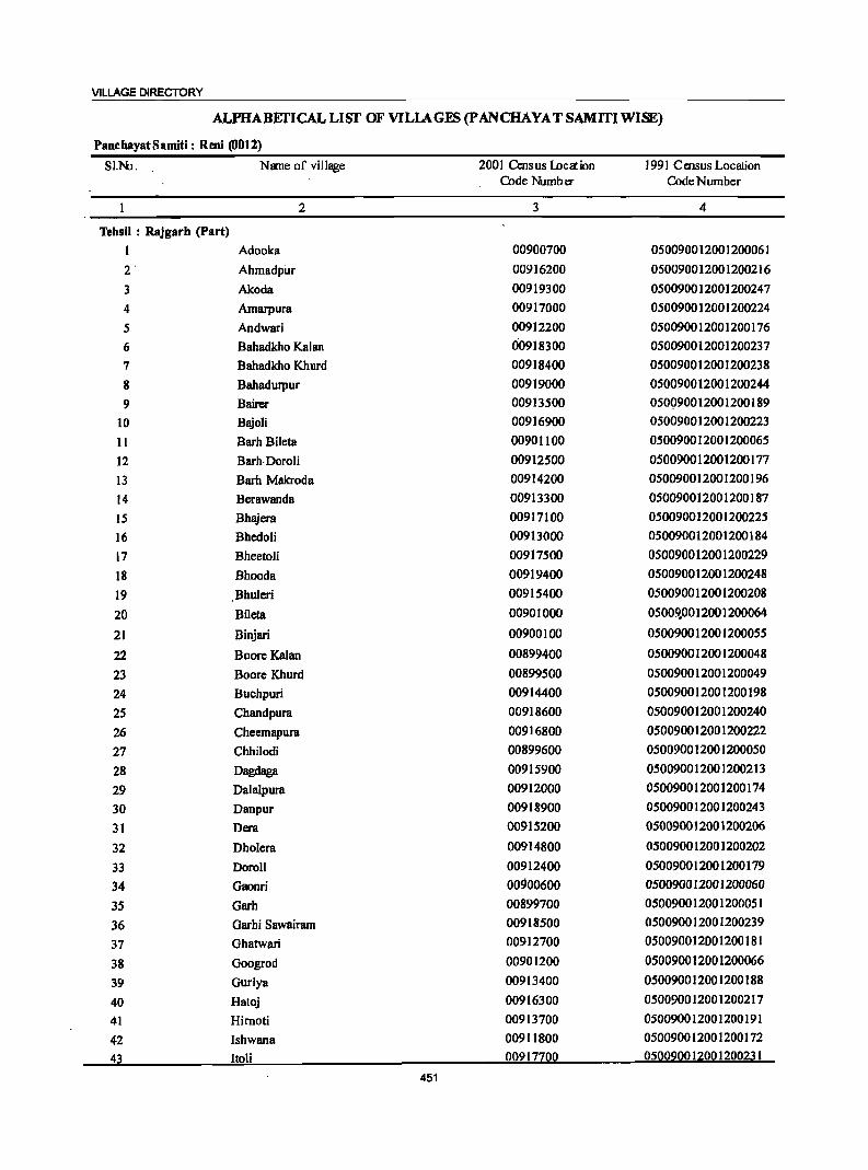
VILLAGE DIRECTORY
ALftlABEI'ICAL LIST OF VILIAGES (pANCHAYAT SAMITIWISE)
PanchayatSamiti: Rem (0012)
SI.NJ, Nane of village 2001 Census locaion 1991 Cmsus Location Code Number Code Number
2 3 4
Tehsil : RaJgarh (Part) I Adooka 00900700 050090012001200061 2' Ahmadpur 00916200 050090012001200216
3 Akoda 00919300 050090012001200247
4 Arnarpura 00917000 050090012001200224
S Andwari 00912200 050090012001200176
6 Bahadkho Kalan 00918300 050090012001200237
7 Bahadkho Khurd 00918400 050090012001200238
8 Bahadurpur 00919000 050090012001200244
9 Bairer 00913500 050Q90012001200189
10 Bajoli 00916900 050090012001200223
11 Barh Bileta 00901100 050090012001200065
12 Barh·DoroH 00912500 050090012001200177
13 Barh Makroda 00914200 050090012001200196
14 Berawanda 00913300 050090012001200187
15 Bhajera 00917100 050090012001200225
16 BhedoH 00913000 050090012001200184
17 Bheetoli 00917500 050090012001200229
18 Bhooda 00919400 050090012001200248
19 Bhuleri 00915400 050090012001200208
20 Bileta 00901000 05009.0012001200064
21 Binjari 00900100 050090012001200055
22 Boore Kalan 00899400 050090012001200048
23 Boore Khurd 00899500 050090012001200049
24 Buchpuri 00914400 050090012001200198
25 Chandpura 00918600 050090012001200240
26 Cheemapura 00916800 050090012001200222
27 Chhilodi 00899600 050090012001200050
28 Dagdaga 00915900 050090012001200213
29 Dalalpura 00912000 050090012001200174
30 Danpur 00918900 050090012001200243
31 Dera 00915200 050090012001200206
32 Dholera 00914800 050090012001200202
33 DoroH 00912400 050090012001200179
34 Gaoori 00900600 050090012001200060
35 Garh 00899700 050090012001200051
36 Garhi Sawairam 00918500 050090012001200239
37 Ghatwari 00912700 050090012001200181
38 Googrod 00901200 050090012001200066
39 Guriya 00913400 050090012001200188
40 Hatoj 00916300 050090012001200217
41 Hirnoti 00913700 050090012001200191
42 Ishwana 00911800 050090012001200172
43 Itoli 00917700 050090012001200231
451
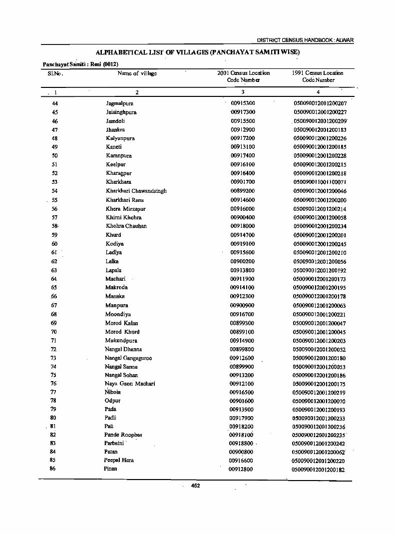
DISTRICT CENSUS HANDBOOK: ALWAR
ALPHABEfICAL LISf OF VILlAGES (P ANCHAYA T SAMITI WISE)
Panchayat Slimiti : Reni (0012)
SI.Nl. Name of village 2001 Census lDcation 1991 Census Location Code Number Code Number
1 2 3 4
44 Jagmalpura 00915300 050090012001200207
45 Jaisingbpura '00917300 050090012001200227
46 lamdoli 00915500 ,050090012001200209' 47 lhankra 00912900 050090012001200183 48 Kalyanpura 00917200 0500900[2001200226 49 Kaneti 00913100 0500900[2001200185 50 Karanpura 00917400 050090012001200228 51 Keelpur 00916100 0500900[2001200215 52 Kharagpur 00916400 0500900120012002[8 53 Kharkhara 00901700 0500900[1001100071 54 Kharkhari Chawandsingh 00899200 050090012001200046
55 Kharkhari Rana 00914600 050090012001200200 56 Khcra Mirzapur 00916000 050090012001200214 57 Khimi Khohra 00900400 050090012001200058 58· Khohra Chauhan 00918000 050090012001200234 59 Khurd 00914700 050090012001200201 60 Kodiya 00919100 050090012001200245 61 Ladiya 00915600 050090012001200210 62 Lalka 00900200 050090012001200056 63 Lapala 00913800 050090012001200192 64 Machari 00911900 050090012001200173 65 Makroda 00914100 050090012001200195 ,66 Manaka 00912300 050090012001200178
67 Manpura 00900900 050090012001200063 68 Moondiya 00916700 050090012001200221 69 Morod Kalan 00899300 050090012001200047 70 Morod Khurd 00899100 050090012001200045 71 Mukundpura 00914900 050090012001200203 72 Nangal Dhanna 00899800 050090012001200052 73 Nanga) Oangaguroo 00912600 050090012001200180 74 Nangal Sanna 00899900 050090012001200053 75 Nanga! Sohan 00913200 050090012001200186 76 Naya Oaon' Machari 00912100 050090012001200175 77 Nibola 00916500 050090012001200219 78 Odpur 00901600 050090012001200070 79 Pada 00913900 050090012001200193 80 Padli 00917900 050090012001200233
, 81 Pali 00918200 050090012001200236 82 Pande Roopbas 00918100 050090012001200235' 83 Parbaini' 00918800 . 050090012001200242 84 Patan 00900800 050090012001200062' 85 Peepal Hera 00916600 050090012001200220 86 Pinan 00912800 050090012001200182
452
VILLAGE DIRECTORY
ALPHABEfICAL LIST OF VILIAGES (p ANCHAYAT SAMITIWlSE)
PancllayatSamiti: Reni (OOIl)
SI.l-k>. Name of village 2001 Census Location 1991 Census Location Code Number Code Number
2 3 4
87 Pragpura 00915700 050090012001200211
88 Pundaraka 00900500 050090012001200059
.89 Rahcholi 00915000 050090012001200204 90 Rajpur Chhota 00900000 050090012001200054
91 Rampura 00917600 050090012001200230
92 Ramsinghpura 00918700 050090012001200241
93 Reiii 00917800 050090012001200232
94 Sahibabad 00913600 050090012001200190
95 Sainthal 00915800 050090012001200212
96 SaloH 00914500 050090012001200199
97 Tahtara 00914300 050090012001200197
98 Thonsri 00915100 05009001~0012oo205
99 Thoomta 00919200 050090012001200246
100 Toda Gyan Singh 00900300 0500900]2001200057
101 Ukeri 00919500 050090012001200249
102 Vabeli 00914000 0500900]2001200194
453
DISTRICT CENSUS HANDBOOK: ALWAR
Census of India 2001 -Pan~hayat Samiti : Reni (0012) Amenities and
Amenities available (ifnot available within the village, a dash (-) is shown in the column and next to it in brackets the distance in broad ranges viz. <S lans., 5-10 lans. and 10+ kms of the .
I ~ nearest I1lace where the facilitl;: is available is givenl '" ., c '5 .91 -g" 8 'Oi' III
U ,,; l! a ~ .,
i ~u
·1 0 .j;: .2 g .. 0 _g '!
._ ~ e,.... u C!. ~ 8. ~ ~ .. Q, ., c:> ~
;; '" i Q, .2 5~~ ...l 0 1 ~ f:1 _" § ~i <Ill ~ C!. '5 e] ·c j Jl § ;:J , ..c ] i: <Ill 2·g .~ 6" ~ ... '"iii _g
~ «I:S'g ., ~ 0 "3 .... «I :e Cd ':::I
c~< .2 ~ § m g- o §
.~ " ~ .52 ~ .... ~ i t c 0 Q, .~ I B B 5
~ ..
! $ .0
~ ~j ti§'j ! ~ 1£ ~~ ~ 0 g ._
~] !i!2 g eo e-.~'" I 2 3 4 S 6 7 8 9 10 II 12 13
PaRchayat Samiti : Remi (0012)
MorodKhurd 337.0 649 103 PM«S) HPW (00899100) C(lO+) H(IO+) SS-HP PO«5) CM(IO+) ACS(IO+) CV(IO+) BS(IO+)
MCW(IO+) PH«S) CP(IO+) NCS(IO+) SP(IOf.) RS(IO+) PHqIO+) OCS(IO+) 8T(l0f.) NW(IO+)
2 .Kharkhari 263.0 920 148 P M« 5) HPW . ChaWBndsingh C(lO+) H(IOf.) SS-HP PO«S) CM(IO+) ACS(IO+) CV(IO+) BS(IO+) (00899200) MCW(IO+) PH«S) CP(IO+) NCS(IO+) SP(IO+) RS(IO+) .
PHC(10+) OCS(IO+) ST(10+) NW(lO+)
3 Morod' Kalan 487.0 2,221 327P MC(IO+) DA H(lO+) HPW PO PH (00899300) MCW(IO+) 8S-HP CM(5-10) ACS(IO+) CV(IO+) BS(S-IO)
PHC(IO+) CP(IO+) NCS(IO+) SP(IO+) RS(IO+) OCS(IO+) ST(lO+) NW(lO+)
4 Boore Kalan 112.0 204 36 HPW (00899400) P«S) H(IO+) 8S-HP PO«5) CM«5) AC8«S) CV(IO+) B8«5)
M«5) MCW(lO+) PH«S) Cp«5) NCS(IO+) SP(IO+) RS(IO+) C(IO+) PHC(IO+) OCS(IO+) ST(lO+) NW(lO+)
S Boore Khurd 195.0 fO.7 137P M«5) HPW (00899500) C(IO+) H(IO+) SS-HP PO« 5) CM«S) ACS«5) CV(IO+) BS«S)
MCW(IO+) PH« S) Cp(IO+) NCS(IO+) Sp(IO+) RS(lO+) PHC(IO+) OCS(IO+) ST(IO+) NW(IO+)
6 Chhilodi 520.0 2,041 264 P(2) M(2) NHSMP HPTWW PO PH CMCP ACS BS (00899600) AC C(1O+) H(IO+) SS-HP NCS(IO+) CV(lO+) RS(IO+)
MCW(10+) OCS(IO+) SP(IO+) NW(IO+) PHC(IO+) ST(lO+)
7 Garh ISS.0 1,0SS 149 P MC(IO+) DAH(IO+) HPW PO (00899700) MCW(IO+) SS-1iP PH« 5) CM«5) AC8«5) CV(IO+) B8(<:5)
PHC(IO+) CP«S) NCS«5) SP(lO+) RS(1O+) OCS«5) ST(IO+) NW(IO+)
B Nangal Dhanna 102.0 66 9PM«5) HPW (00899800) C(IO+) H(IO+) SS-1iP PO« 5) CM«S) ACS« S) CV(IOf.) B8« 5)
MCW(IO+) PH«S) Cp«S) NCS(lO+) SP(IO+) RS(lO+) PHC(IO+) OCS(JO+) ST(IO+) NW(JO+)
9 Nangal Sanna 125.0 443 S6 PM«5) HPW (00899900) C(IO+) H(JO+) SS-1iP PO«S) CM«S) ACS« 5) CV(lO+) BS« S)
MCW(IO+) PH«S) CP(IO+) NCS(IO+) SP(IO+) RS(lO+) PHC(IO+) OCS(IO+) ST(1O+) NW(IO+)
10 Rajpur Chhota 397.0 2,143 315 P(2) M HPW (00900000) ACC(IO+) H(IO+) SS-HP .po« S) CM«5) ACS«5) CV(IO+) BS«5)
MCW(IO+) PH(IO+) CP(IO+) NCS(IO+) SP(IO+) RS(IOf.) PHC(IO+) OCS(IO+) ST(IO+) NW(JO+)
II Biniari 597.0 1,640 233 P M C(S-IO) CHWH(lO+) HPW PO PH (00900100) . MCW(IO+) . SS-HP CM«5) ACS«S) CV(lO+) B8« S)
PHC(IO+) CP«S) NCS(IO+) SP(IO+) RS(IO+) OCS(IO+) ST(IO+) NW(IO+)
454
VILLAGE DIRECTORY
Village Directory Land Use ~As un 1999}
Land usc (i.e. area under different types ofland use in hectare)
]' c 0 "i
5 .~ 01) ... c '+1
u -0 '6 "3
i ., 0 1) ... c E ..
~ 'i E 'OJ' c ~ oS '6 8 ~
;:,0 " ;:;; ~ I] t~ ~ j ... j ~ =a Jl sa ~ ., e: 1 Ei .:;:
~ !: .!! Ii § .. .~ ~ 1 ~.! '8 ....
I .. 0 c
I ~ j I 'E ... iii
~ I i3 u
~ 5 ·s ·s "S ~ ·c u
~ i!o = i2 Sol ~ <II
14 IS 16 17 18 19 20 21 22 23 2 1
MRFP Rajgar:h (II) EA NM W(80.0) 108.0 77.0 68.0 MorodKhurd WE(4.0) T(S4.0)
MRFP Rajgarh (IB) EA NM W(64.0) 39.0 64.0 58.0 Kharkhari 2 WE(3S.0) Chawandsingh T(102.0)
PRMR Rajgarh (20) EA NM Earthen Pot. W(86.0) 142.0 2.0 159.0 Morod Kalal1 3
FP Wooden WE(9B.0) Furniture T(l84.0)
PRMR Rajgarh (20) EA NM W(23.0) 17.0 4.0 28.0 Boon(Kalan 4
FP WE(40.0) T(63.0)
FP Rajgarh (IS) EA NM W(29.0) 85.0 3.0 38.0 BooreKhurd WE(40.0) T(69.0)
PRMR ~garh(20) EA NM Wooden W(lSO.O) ·IIS.O 1.0 151.0 ' Chhilodi· 6
FP Furniture WE(IOO.O) T(2S0.0)
PRMR Rajgarh (20) EA NM W(60.0) 17.0 15.0 Garb 7
FP WE(63.0) T(123.0)
FP Rajgarh (15) EA NM W(IO.O) 49.0 2.0 27.0 Nangal Dhanna 8 WE(14.0) T(24.0)
FP Rajgarh (IS) EA NM W(31.0) 41.0 2.0 40,0 Nangal Sanna 9 WE(II.O) T(42.0)
PRMR Rajgarh (IS) EA NM W(12S.0) !32.0 3.0 63.0 Rajpur Chhota 10
FP ·WE(74.0) T(I99.0)
PRMR Rajgarh (IS) EA NM W(lS.O) 244.0 I.
6.0 277.0 Binjari II
FP WE(SS.O) T(70.0)
455
DISTRICT CENSUS HANDBOOK: ALWAR
Census ofIndia 2001 -Panchayat Samili : Reni (0012) Amenities and
Amenities available (if not available within the village, a dash (-) is shown in the column and
next to it in brackets the distance in broad ranges viz.<5 kms., 5-10 kms. and 10+ kms of the
I I nearest Elace where the facilit~ is available is givenl
-g J
., .!~ U ..
~ § C; :.: u
:.S 0 _g ~§ ii !j.
§ OJ C; .; go e~~ llf ']j
~ 0
i a _- § 011) !j. ] "S :s .1:;
i Jl c ~ g.~ .~ = I 1 0 .... .c 1!!"g ';: 0 ]. .... ;;;
os 0 c 'a !;j 0 ~
0 .~ ,~~ i "" '-1'1 01 ']j
'" ..,
j :a ! ~ .-s ~ ~ ~ ~ ~ i! .5]
u<Il 3 4 5 6 7 12
12 Lalka 150.0 237 30 HPW (00900200) P«5) H(IO+) SS-HP PO«S) CM(lO+) ACS(IO+) CV(lO+) BS« 5)
M«5) MCW(lO+) PH(lO+) Cp(IO+) NCS(IO+) Sp(IO+) RS(IO+) C(IO+) PHC(lO+) OCS(IO+) 8T(10+) NW(IO+)
13 TodaGyan 205.0 880 130 TW 8S-T Singh P«5) H(IO+) PO« 5l CM(tO+) AC8(10+) CV(IO+) BS« 5) (00900300) M«S) MCW(IO+) PH(IO+) CP(IO+) NCS(IO+) 8P(10+) R8(10+)
C(lO+) PHC(lO+) OCS(lO+) ST(IO+) NW(IO+)
14 KhimiKhohm 181.0 592 93 P M«5) HPW (00900400) C(IO+) H(lO+) SS-HP PO«5) CM(lO+) ACS(IO+) CV(IO+) BS«S)
MCW(IO+) PH(IO+) CP(IO+) NCS(IO+) 8P(10+) RS(lO+) PHC(IO+) OCS(lO+) ST(IO+) NW(IO+) ,
IS Pundamka 154.0 750 124PM«S) HPW (00900500) C(lO+) H(lO+) SS-HP PO« 5) CM(5-10) ACS(5-IO) CV(IO+) BS«5)
MCW(IO+) PH« 5) CP(5-10) NCS(IO+) SP(IO+) RS(IO+) PHC(IO+) OCS(IO+) ST(IO+) NW(IO+)
16 Oaonri 193.0 449 71 P M«5) HPW (00900600) qIO+) H(IO+) SS-HP PO« 5) CM«5) ACS«5) CV(lO+) BS«S)
MCW(IO+) PH«5) CP(IO+) NCS(IO+) SP(IO+) RS(lo+) PHC(IO+) OCS(IO+) ST(IO+) NW(lO+)
17 Adooka 125.0 591 100 P M« 5) HPW (00900700) C(IO+) H(IO+) SS-HP PO« S) CM«5) ACS(5-10) CV(S-IO) BS«S)
MCW(IO+) PH(S-IO) CP«S) NCS(IO+) SP(S-IO) RS(IO+) PHC{IO+) OCS(IO+) ST(S-IO) NW(lO+)
18 Palan 313.0 1,562 276P M S DA H(10+) HPW PO B8 (00900800) C{IO+) MCW(IO+) SS-HP PH(I 0+) 'CM(5-IO) ACS(5-10) CV(IO+) RS(IO+)
PHC«S) CP«S) NCS(IO+) SP(IO+) NW(IO+) OCS(IO+) ST(IO+)
19 Manpura 105.0 441 67PM{<5) HPW (00900900) C.(IO+) H(lO+) SS-HP PO«S) CM(5-IO) ACS(S-IO) CV(IO+) BS« S)
MCW(IO+) PH(IO+) ., CP« S) NCS(S-IO) SP(IO+) RS(5-10) PHC«S) OCS(S-IO) ST(IO+) NW(IO+)
20 Bileta 477.0 2,179 283 P M C(IO+) CHWH(IO+) HPW PO PH (00901000) MCW(IO+) SS-HP CM(S-IO) ACS(IO+) CV(IO+) BS(5-10)
PHC(IO+) CP(IO+) NCS(IO+) SP(IO+) RS(10+) OCS(IO+) ST(IO+) NW(IO+)
21 Barh Bileta 170.0 404 52 P M«5) HPW (00901100) C(10+) H(10+) SS-HP PO(S-IO) CM(lO+) ACS(IO+) CV(IO+) B8«S)
MCW(IO+) PH«S) CP(IO+) NCS(IO+) 8P(10+) RS(IO+) PHC(IO+) OCS(IO+) 8T(l0+) NW(IO+)
22 Googrod 249.0 726 liS P M«S) HPW (00901200) C(tO+) H(IO+) SS-HP PO«S) CM(IO+) ACS(IO+) CV(lO+) BS(IO+)
MCW(IO+) PH« 5) cp(10+) NCS(IO+) SP(lO+) RS(IO+) PHC(JO+) OCS(JO+) ST(IO+) NW(IO+-)
456
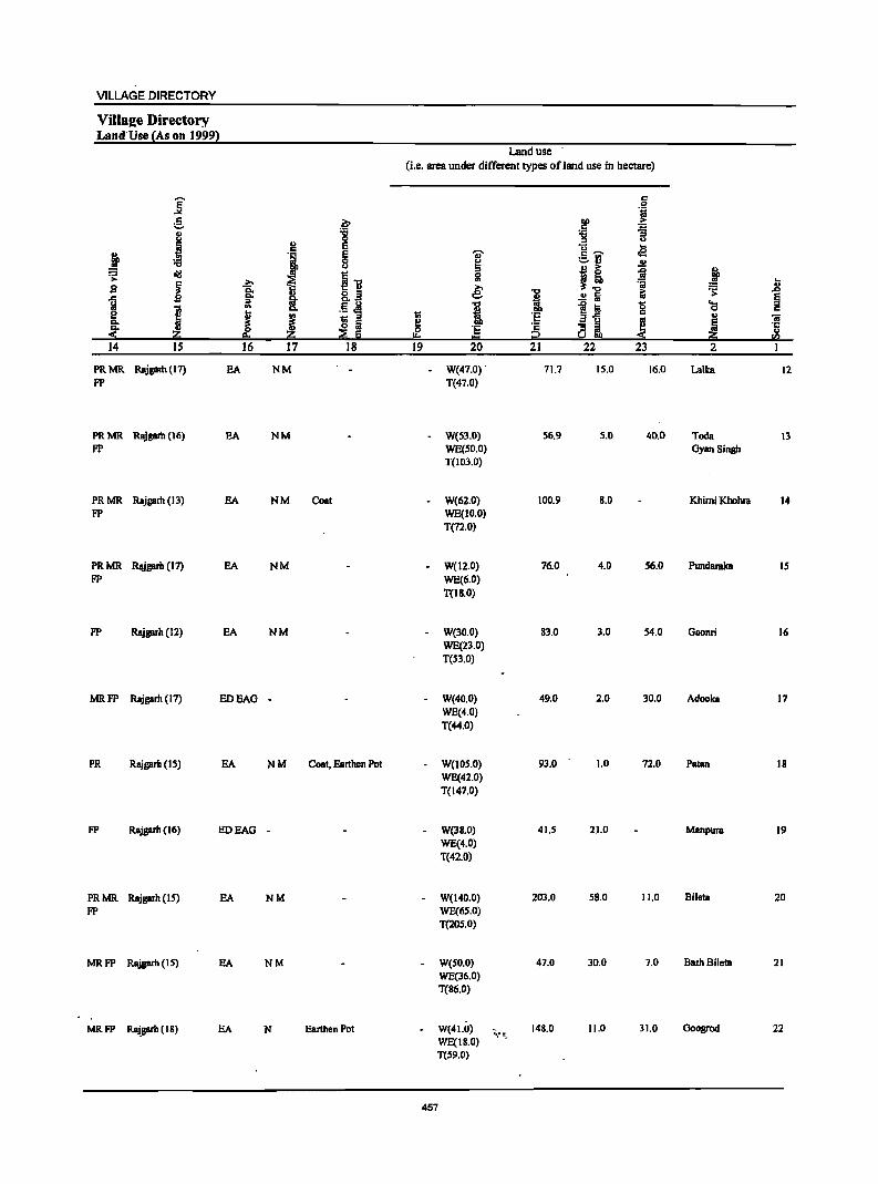
VILLAGE DIRECTORY
Vills2e Directory Land Use {As on 19991
Land use (i.e. area under different types ofland use in hectare)
j c 0 'iii e .~ lID ;>
C ~ 8 'g :g u
~ ~ e t3 .a ! J ~ 'Ii' c ,.....,
;;S ~ :.::..rJ .!!
~ J) .!! i; ~ j '> 0
~~ ~ ]; '" '0; t; sa 8 € i &; ~ .D
] fa' .!! Iii § '" .., e :a g ~ I '" c. i c e J j ~ :§ Si ~ .. iii c. IS a ~ ·c
~ ~ § 0 '5 c ..
~ I!= 1:1 2 !!j! 14 IS 16 17 18 19 20 21 22 23 2 1
PRMR Rajgarh ( 17) EA NM W(47.0) . 71.7 15.0 16.0 Lalka 12 FP T(47.0)
PRMR Rajgarh (16) EA NM W(53.0) 56.9 5.0 40.0 Toda 13 FP WE(50.0) OyBn Singh
T(103.0)
PRMR Rajgarh (13) EA NM Coat W(62.0) 100.9 8.0 Khimi Khohra 14 FP WE(1O.0)
T(72.0)
PRMR Rajgarh (17) EA NM W(12.0) 76.0 4.0 56.0 PundBrakB IS FP WE(6.0)
T{lB.O)
FP Rajgarh (12) EA NM W(30.0) 83.0 3.0 54.0 GBonri 16 WE(23.0) T(S3.0)
MRFP Rajgarh (17) EDEAG - W(40.0) 49.0 2.0 30.0 Adooka 17 WE(4.0) T(44.0)
PR Rajgarh (IS) EA NM Coat, Earthen Pot W(IOS.O) 93.0 1.0 72.0 PBtan 18 WE(42.0) T(147.0)
FP Rajgarh (16) EDEAG - W(38.0) 41.5 21.0 Manpura 19 WE(4.0) T(42.0)
PRMR Rajgarh (IS) EA NM W(140.0) 203.0 58.0 11.0 Bileta 20 FP WE(6S.0)
T(lOS.0)
MRFP Rajgarh (15) EA NM W(SO.O) 47.0 30.0 7.0 Barh Bileta 21 WJ3(36.0) T(86.0)
MRFP Raj.garh (18) EA N Earthen Pot W(41.0) -,; ..... It 148.0 11.0 31.0 Ooogrod 22 WE(18.0) T(S9.0)
457
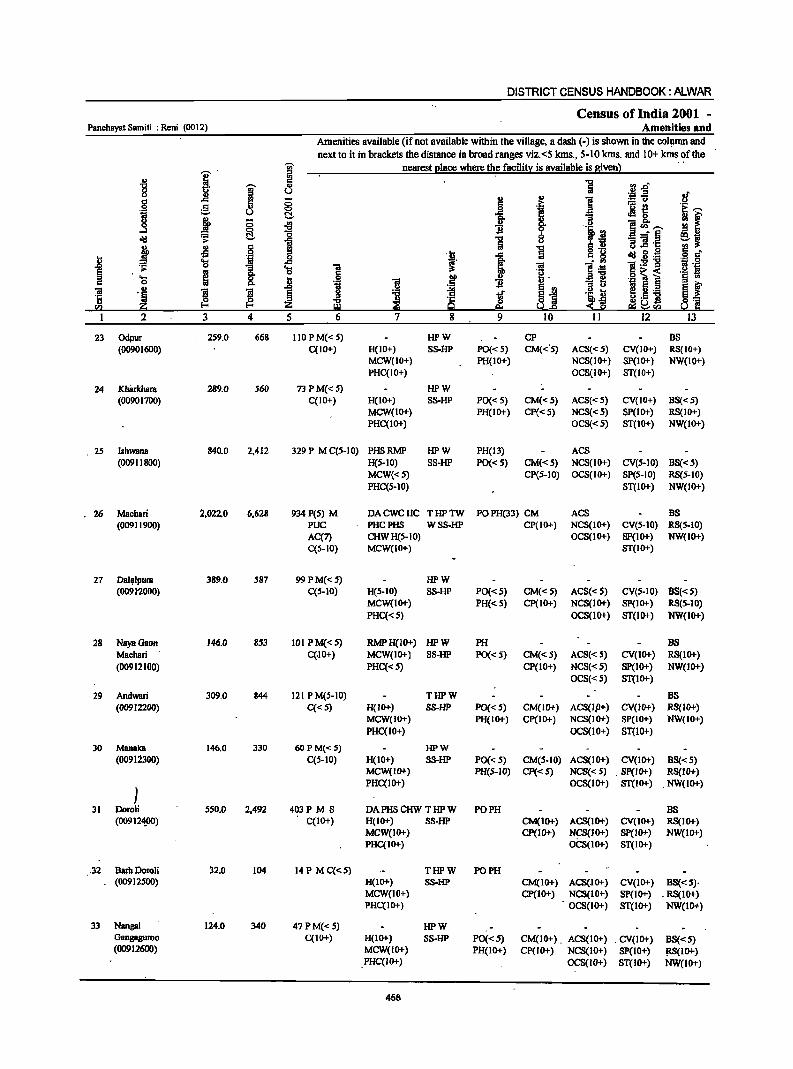
DISTRICT CENSUS HANDBOOK: ALWAR
Census of India 2001 -Panchayat Samiti : Reni (0012) Amenities and
Amenities available (if not available within the village, a dash (-) is shown in the colllmn and
'U;' next to it in brackets the distance in broad ranges viz.<S Ians., 5-10 Ians. and 10+ lans. ~f!he
j' :s nearest I!lace where !h.e facili~ is available is aiven}
'" :g i ra J:f -g ~ '" H u
:08 ~ .~ <..> ..c:: '" 8 .,
] § c 8 .~ '£i.e e " J !i '11 U e!- El
'lra ~8. 1 ;; '" ~ 0
~ ~ "',.... ....l 0
<II:! :;0 e!- '5
0 __ §
~i ... ii u s!:tl ;; 'iI '1:
j .s ·S '5 u.e 0 !!l
1 .e 8_ .~ ~ 3 .<;;: 5 co. ..8 OS
_g ~ :!i! ~:g-g ";l·B .;;: 1 .... 1 e .10:! § ~
0 I:! • a"g o ~ < .!o! B .... .8 f -§ . ::; § § ..
c 0 "" '! 'iI II.> :i ti 'iI .~ !I !I ~
.2
~ ~i 'i ~ ~ Ii ._ ~ ~ '1:
~ ! u.S] II.> ~ ~ ~ ::!:~ ~] S!:I 20 "'" U.s ~~<I)
2 3 4 5 6 7 8 9 10 11 12 13
23 Odpur 2S9.0 668 110 P M« S) HPW CP BS (00901600) C(IO+) H(IO+) SS-HP PO« 5) CM«'S) ACS«S) CV(IO+) RS(IO+)
MCW(10+) PH(10+) NCS(IO+) SP(IO+) NW(IO+) PHC(IO+) OCS(IO+) ST(IO+)
24 Kh8rkhara 289.0 560 73PM{<5) HPW (00901700) C(IO+) H(IO+) SS-HP PO«S) CM«S) ACS«S) CV(IO+) BS«S)
MCW(IO+) PH(IO+) Cp«S) NCS«S) SP(IO+) RS(IO+) PHC(IO+) OCS«S) ST{IO+) NW(IO+)
2S Ishwana 840.0 2,412 329 P M C(S-IO) PHSRMP HPW PH(13) ACS (00911800) H(S-IO) SS-HP PO«S) CM«S) NCS(10+) CV(S-IO) BS«5)
MCW«5) CP(S-IO) OCS(IO+) Spes-to) RS(S-IO) PHC(S-10) ST(IO+) NW(IO+)
.26 Machari 2.022.0 6.628 934 peS) M DACWCHC THPTW POPH(33) CM ACS BS (00911900) pOc PHCPHS WSS-HP CP(JO+) NCS(JO+) CV(S-IO) RS(S-IO)
AC(7) CHWH(S-IO) OCS(IO+) SP(IO+) NW(IO+) C(5-10) MCW(IO+) ST(IO+)
27 Dal~lpum 389.0 587 99PM{<5) HPW (0091'2000) C(S-IO) H(S-IO) SS-HP PO«5) CM«5) ACS«5) CV{S-IO) BS«S)
MCW(IO+) PH«S) CP(IO+) NCS(IO+) SP(IO+) RS(5-IO)
PHC« S) OCS(IO+) ST(IO+) NW(1O+)
28 NayaGaon 146.0 853 101 PM«S) RMPH(IO+) HPW PH BS Machari C(.IO+) MCW(IO+) SS-HP PO«S) CM«S) ACS«S) CV{IO+) RS(JO+)
(00912100) PHC«5) CP(10+) NCS«5) SP(IO+) NW(IO+) OCS«5) ST(IO+)
29 Andwari 309.0 844 121 P M(S-IO) THPW BS (00912200) C«S) H(IO+) SS-HP PO«S) CM(IO+) ACS(lP+) CV(IO+) RS(IO+)
MCW(JO+) PH(IO+) CP(IO+) NCS(IO+) SP(IO+) NW(JO+) PHC(IO+) OCS(lO+) ST(lO+)
30 Manalea 146.0 330 60 p M«5) HPW (00912300) C(5-10) H(IO+) SS-HP PO«5) CM(5·IO) ACS(lO+) CV(IO+) BS«S)
MCW(IO+) PH(S-IO) Cp«S) NCS{<S) . Sp(IO+) RS(IO+)
) PHC(1o+) OCS(IO+) ST(IO+) . NW(IO+)
31 Doroli 550.0 2.492 403P M S DAPHSCHW THPW PO PH BS (009124.00) C(IO+) H(IO+) SS-HP CM(IO+) ACS(IO+) CV(IO+) RS(IO+)
MCW(IO+) CP(IO+) NCS(IO+) SP(lO+) NW(IO+) PHC{IO+) Oi::s(IO+) ST(IO+)
.32 B~hDoroli ~2.0 104 14P MC{<S) THPW PO PH (00912500) H(IO+) SS-HP CM(IO+) ACS(JO+) CV(IO+) BS«5)·
MCW(IO+) cp(10+) NCS(lO+) SP(JO+) . RS(IO+) PHC(IO+) OCS(IO+) ST(lO+) NW(lO+)
33 NangaJ 124.0 340 47PM«5) HPW Gangaguroo C(IO+) H(IIl+) SS-HP PO«5) CM(IO+). ACS(JO+) . CV(lO+) BS«S) (00912600) MCW(JO+) PH(IO+) CP(IO+) NCS(JO+) SP(IO+) ~IO+)
PHC(IO+) OCS(10+) ST(1O+) NW(lO+)
458
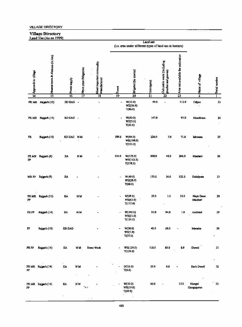
VILLAGE DIRECTORY
ViIlsl!e Directory Land Use {As on 1999l
Land use (i.e. area under different types ofland use in hectare)
]' c
'i e .€ .~
,. '::1
j "8 ~ '3 u ., E .,§ c
I } '1 g :§,i .!! u
i! ~ j r= old ~'O ,.. ~
~ ~ .. ';j J $I ~ §. 8.2 & 'B .!! 5 iii .s:
~ M .§ ~ 1 i l~ '0 ... J
.. Cl. C
~ ..
~. ~ j c .. "ii
~ '§ 5 0 ·s ~i ~ ~ 'i .::!: ea li ;Z Ii I:o!:I t:::I ::!: li ."
14 15 16 17 18 19 20 21 22 23 2
PRMR Rajgarh (12) EDEAG . - W(32.0) 59.0 112.0 Odpur 23 WE(S6.0) T(8S.0)
PRMR Rajprh (14) EDEAG - W(40.0) 147.0 97.0 Kharkhara 24 WE(S.O) T(4S.0)
PR Rajgarh (10) EDEAG NM 284.0 W(64.0) 226.0 7.0 71.0 IshwaDB 25 WE(U!8.0) T(2S2.0)
PRMR Rajgarh(8) EA NM 534.0 W(175.0) 898.0 48.0 264.0 Machari 26 FP WE(103.0).
T(278.0)
MRFP Rajgarh(9) EA W(40.0) 173.0 26.0 122.0 Dalalpur. 27 WE(28.0)
T(68.0)
PRMR Rajgarh (II) EA NM W(49.0) 23.0 1.0 10.0 NayaGaon 28
FP WE(63.0) Machan T(1l2.0)
PRFP Rajgarh (14) EA NM W(IOO.O) 93.0 94.0 1.0 Andwari 29 WE(21.0) T(121.0)
FP Rajgarh (10) EDEAG W(30.0) 40.0 69.0 Manaka 30 WE(7.0)
T(37.0)
PRFP Rajgarh (14) EA NM StoneWork - WE(139.0) 318.0 85.0 11.0 Doroli 31 T(139.0)
PRMR Rajgarh (14) EA NM . GC(6.0) 20.0 6.0 Barh DoroU 32 FP T(6.0)
PRMR Rajgarh (14) EA NM - W(SO.O) 40.0 15.0 Nangal 33
FP Y..!' WE(19.0) Gangaguroo T(69.0)
459

DISTRICT CENSUS HANDBOoK: ALWAR
Census of India 2001 -Panchayat Samiti ; Reni (0012) Amenities and
Amenities available (if not available within tl)e village, a dash (-) is shown in the column and
next to it in brackets the distance in broad ranges viz.<5 Ions., 5-10 kms. and 10+ Ions ofthe
i I nearest ~ace where the facilit:t is available is given) ., ."
[3.0 "" j a 0 u :.> 'J:! .E! !f " J:l ;; u .. ] :,:. u
.~ C C .~ '0 'E _. g ILl §_ { ~t u
M f ~ ! .. 1i 0
I -1 go f!<n_ 0 'i .il a....l"§ 19 .,
d!! C 6 ~W > C) .. t> 1i ]! 'J::
j '" 5 ] o ._
~ 2·g g. d' t oS 'il t } c g
:= .... .c iii l~ i:E-g .~ .g .to 0
1 '0 1 ~ ;-
~ t 'e .g ~ i '§ :; ~ j .~ 11 .S ., :I]
iii ~ 1!1 ] § 11 ~ .I' ~~ .. ~ i; D.8 ] m ~ '5 . ~ ~ :z ..,
~ CS ~ <~ ~~ <Il Zi I:!l s.1o&! e!i~!"Q 2 3 4 5 6 7 8 9 10 II 12 13
34 Ohatwari 95;0 270 37P M«5) HPW
(00912700) C(S-IO) H(IO+) SS-HP PO«S) CM(IO+) ACS(IO+) CV(lO+) BS« 5) MCW(IO+) PH(IO+) CP(IO+) NCS(IO+) SP(IO+) RS(IO+)
PHC(IO+) OCS(IO+) ST(IO+) NW(IO+)
35 Pinan 1,714.0 7,860 1,131 P(3) M S DDACHW THPTW PO TO CMCP ACS BS
.(00912800) PUC AC H(IO+) W~S-HP PH(114) NCS(10+) CV(IO+) RS(IO+)
C(lO+) MCW(IO+) OCS(lo+) SP(lO+) NW(lO+)
PHC(IO+) ST(lO+)
36 Jhankra 625.0 1.833 303 P M C(IO+) HPW BS
(00912900) H(IO+) SS-HP PO«5) CM(5-10) ACS«5) CV(lO+) RS(IO+)
MCW(IO+) PH(IO+) Cp(IO+) . NCS(IO+) Sp(lO+) NW(IO+)
PHC(5-10) OCS(IO+) ST(IO+)
37 'Bhcdoli 257.0 673 118 P M« 5) HPW
(00913000) C(IOt-) H(IO+) SS-HP PO«S) CM(S-IO) ACS«S) CV(1O+) BS«5) MCW(IO+) PH(IO+) CP(IO+) NCS(IO+) Sp(IO+) RS(IO+)
PHC(S-IO) OCS(IO+) ST(IO+) NW(IO+)
38 Kancti 188.0 750 128 P M C(IO+) HPW PO ACS
(OO9B100) H(IO+) SS-HP PH(IO+) CM(5-IO) l-lCS(10+) CV(tO+) BS«S) MCW(IO+) CP(IO+) OCS(IO+) Sp(IO+) RS(lo+)
PHC(IO+) ST(IO+) NW(IO+)
39 Nangal Sohan 325.0 1,111 165 P M«5) HPW ACS
(00913200) C(IO+) H(lO+) SS-HP PO«S) CM(S-IO) NCS(lo+) CV(lO+) BS« 5) MCW(lO+) PH(IO+) CP(IO+) OCS(IO+) SP(IO+) Rs(IOt-)
PHC(5-10) ST(I~) NW(IO+)
40 Bcrawanda 113.0 757 96 PM«5) HPW ACS
(00913300) C(IO+) H(lO+) SS-HP PO« 5) CM(5-10) NCS(IO+) CV(IO+) BS« 5) MCW(JOt-) PH(IO+) CP(JO+) OCS(IO+) SP(IO+) RS(IO+)
PHC(IO+) ST(10+) NW(IO+)
41 Guriya 257.0 589 98 P(2) HPW PH NCS
(00913400) M(5-10) H(IO+) SS-HP PO«5) CM«5) ACS«5) CV(IO+) BS« 5) C(IO+) MCW(IO+) CP(IOt-) OCS«5) SP(IO+) RS(IO+)
PHC«S) ST(IO+) NW(IO+)
42 Bairer 5S6.0 2,091 311 P(2) M DA PHS RMP HP W PO PH
(00913S00) C(lO+) CHW H(IO+) SS-HP CM«5) ACS«5) CV(IO+) BS« 5) MCW(lo+) CP(IOt-) NCS(IOt-) SP(IO+) RS(IOt-)
PHC«S) OCS(lO+) ST(lG-t) NW(lO+}
43 Sahibabad 36.0 417 51 P MC(IO+) .HPW (00913600) . H(lO+) SS-HP PO«S) CM«S) ACS« 5) CV(IO+) BS«5)
MCW(IO+) PH«S) CP(IO+) NCS«5) SP(JO+) RS(IOt-) PHC(S-IO) OCS«5) ST(IO+) NW(lG-t}
44 Hirnoti 267.0 1,266 183 P M« 5) .HPW PH(2) (00913700) C(lo+) H(10+) SS-HP PO«5) CM«S) ACS«S) CV(lO+) BS« 5)
MCW(IO+) CP(IO+) NCS(IOt-) SP(IO+) RS(IOt-) PHC« 5) OCS(lo+) . ST(IO+) NW(lo+)
460
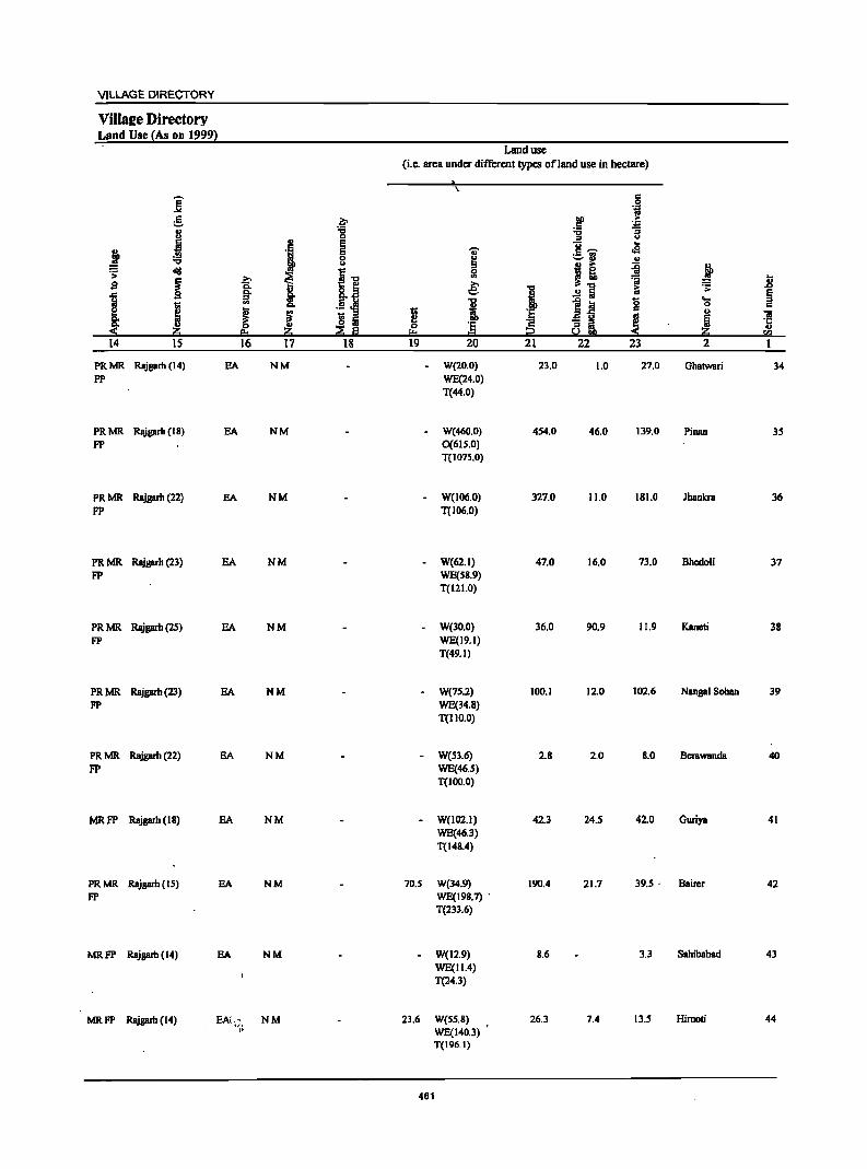
VILLAGE DIRECTORY
Villatze Directory Land Use (As on 19991
Land use (i.e. area under different types ofland use in hectare)
"\.
]' s 'j
g ~ !'!l .. ., :.a i ~
J 0 u
'1 E g~
.. ~
E ... oS 0 ~
;:.13 ., u I & ~ ~ diI
~1 0 .s:
I -'=' ~ '" ~ jj .s §: e: "" .!!5 ii .s:
J §. ! i §
I '" Co i 1~ 8 'g c
I ! 1;; 'E .,
'iI lS Iii ~ 'E ~ ~i ! ~ ·c ~ Iii u
I:t = !i!! 14 IS 16 17 18 19 20 21 22 23 2
PRMR Rajprh (14) EA NM - W(20.0) 23.0 1.0 27.0 Ghatwari 34 FP WE(24.0)
T(44.0)
PRMR Rajprh (18) EA NM - W(460.0) 454.0 46.0 139.0 Pinan 35 FP 0(615.0)
T(1075.0)
PRMR Rajprh (22) EA NM - W(106.0) 327.0 11.0 181.0 lhankra 36
FP T(I06.0)
PRMR Rajgarh (23) EA NM - W(62.I) 47.0 16.0 73.0 Bhcdoli 37 FP WE(SS.9)
T(121.0)
PRMR Rajprh (25) EA NM - W(30.0) 36.0 90.9 11.9 Kaneti 38 FP WE(19.1)
T(49.1)
PRMR Rajprh (23) EA NM - W(7S.2) 100.1 12.0 102.6 Nangal Sohan 39
FP WE(34.8) T(IIO.O)
PRMR Rajgarh (22) EA NM - W(53.6) 2.8 2.0 8.0 Berawanda 40 FP WE(46.5)
T(IOO.O)
MRFP Rajgarh (18) EA NM - W(102.1) 42.3 24.5 42.0 Goriya 41 WE(46.3) T(148.4)
PRMR Rajgarh (IS) EA NM 70.5 W(34.9) 190.4 21.7 39.5· Bairer 42 FP WE(198.7) .
T(233.6}
MRFP Rajgarh (14) EA NM - W(12.9) 8.6 3.3 Sahibabad 43 WE(11.4) T(24.3)
MRFP Rajgarb (14) BAC.;. NM 23.6 W(S5.8) 26.3 7.4 13.5 Himoti 44
" WE(140.3) T(196.1)
461
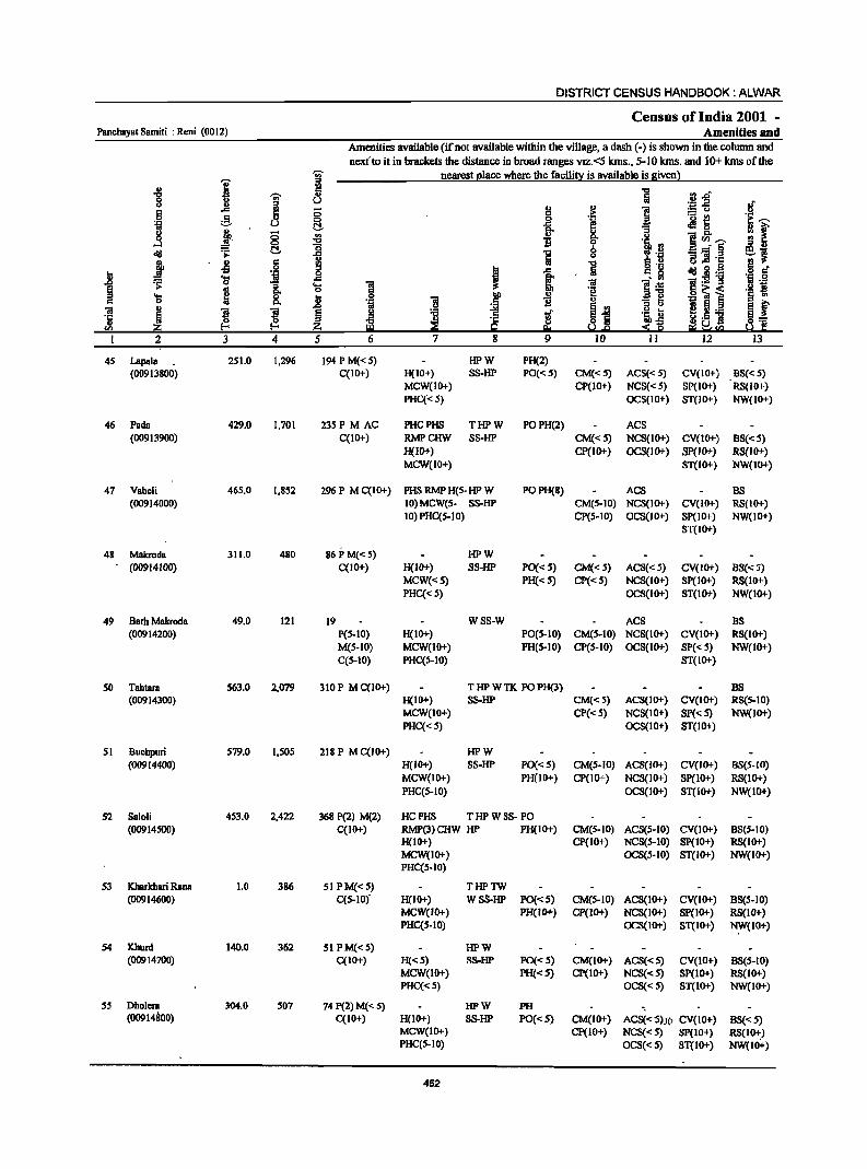
DISTRICT CENSUS HANDBOOK: ALWAR
Census of India 2001 -Panchayat Samiti : Reni (0012) Amenities and
Amenities available (if not available within the village, a dash (-) is shown in the column and
nexfto it in brackets the distance in broad ranges viz.<5 kms., 5-10 lans. and 10+ kms of the 'Ui' nearest place where the facility is available is given)
I ~ 1 I ., ] [3.e" ... u
~-5 .!f 6 J! 0 g .~ f! ;§. " ~ f f! ~ ~~ ~~ 'il u :; f 8 " § '" t )~-!f. "t:I
'm, .!l ...:I ~ :g ei <III C!. ] _.] §
j .s .~ !i "t:I g .2 El ·c .~ § ~
0 I .c 5 J;: g cId il.g .... .c ~ . ., 'liI:E1I :;:I 0
1 'S 1 ~ ~] .. 'l:I
~ .. .. 81 < .~ ~ 'S 5i .8
011 -§ ':3 § 'i i c "
~j ::s u
~f OJ " ! !I :.;;! 'ii ~
II ._ 'ij § ~ ~ '2 !if S·5 ] en ~ ~ g ~ :s--§ ~!l:I a 'f!
2 3 4 5 6 7 8 9 10 II 12 13
45 Lapala 251.0 1,296 194 P M« 5) HPW PH(2) (00913800) C(IO+) H(IO+) SS-HP PO«5) CM«5) ACS«5) CV(IO+) BS«5)
MCW(IO+) CP(10+) NCS«S) SP(10+) RS(IO+)
PHC« 5) OCS(IO+) ST(IO+) NW(IO+)
46 Pada 429.0 1,701 235 PM AC PHCPHS THPW POPH(2) ACS (00913900) C(IO+) RMPCRW SS-HP CM«5) NCS(IO+) CV(IO+) BS«5)
H(lO+) CP(lo+) OCS(lo+) Sp(IO+) RS(IO+) MCW(IO+) ST(IO+) NW(IO+)
47 Vabeli 465.0 1,852 296 P M C(IO+) PHS RMP R(5- HP W POPH(8) ACS BS (00914000) 10) MCW(S- SS-HP CM(5-10) NCS(IO+) CV(IO+) RS(IO+)
10) PHC(5-10) CP(5-10) OCS(10+) SP(10+) NW(IO+) ST(to+)
48 Makroda 311.0 480 86 P M«5) HPW (00914100) C(JO+) H(IO+) SS-HP PO«5) CM«5) ACS«5) CV(IO+) BS«5)
MCW«S) PH«S) CP«S) NCS(IO+) SP(IO+) RS(IO+) PRC«S) OCS(IO+) ST(IO+) NW(IO+)
49 Barh Makroda 49.0 121 19 WSS-W ACS BS (00914200) P(5-10) H(IO+) PO(S-IO) CM(5-10) NCS(IO+) CV(IO+) RS(IO+)
M(5-10) MCW(IO+) PH(S-IO) CP(S-IO) OCS(IO+) SP«5) NW(1O+) C(5-10) PHC(5-10) ST(IO+)
so Tahtara S63.0 2,079 310 P M C(IO+) T HP W TK PO PH(3) BS (00914300) H(IO+) SS-HP CM«5) ACS(IO+) CV(IO+) RS(5-10)
MCW(IO+) CP« 5) NCS(10+) Sp« S) NW(IO+)
PHC« 5) OCS(IO+) ST(IO+)
51 Buchpuri 579.0 I,SOS 218 P M C(IO+) HPW (00914400) H(IO+) SS-HP PO«5) CM(S-IO) AC8(1O+) CV(IO+) B8(5-10)
MCW(IO+) PH(IO+) CP(IO+) NCS(IO+) SP(IO+) RS(lo+) PHC(5-10) OCS(IO+) 8T(10+) NW(IO+)
52 Saloli 453.0 2,422 368 P(2) M(2) HCPHS THPWSS- PO (00914500) C(IO+) RMP(3) CHW HP PH(IO+) CM(5-10) ACS(5-10) CV(IO+) BS(5-10)
H(IO+) CP(IO+) NCS(5-10) Sp(10+) RS(IO+) MCW(IO+) OC8(S-10) ST(IO+) NW(IO+) PHC(5-10)
53 Kharkhari Rana 1.0 386 51 P M«5) THPTW (00914600) C(S-10)' H(IO+) WSS-HP PO«5) CM(5-10) ACS(IO+) CV(IO+) BS(5-10)
MCW(IO+) PH(IO+) cp(10+) NCS(IO+) SP(IO+) RS(10+) PHC(5.tO) OCS(IO+) ST(IO+) NW(10+)
S4 Khurd 140.0 362 51 PM«S) HPW (00914700) C(10+) H«5) SS-HP PO«5) CM(10+) ACS«S) CV(IO+) BS(5-10)
MCW(tO+) PH«5) CP(10+) NCS«S) SP(IO+) RS(IO+) PHC« 5) OCS«5) ST(to+) NW(IO+)
5S Dholera 304.0 507 74 P(2) M« S) HPW PH -. (00914800) C(10+) H(10+) SS-HP PO«5) CM(IO+) ACS«S)J(t CV(10+) BS«5)
MCW(IO+) CP(10+) NCS«5} SP(10+} RS(IOi:) PHC(S-IO) OCS«S) ST(IO+) NW(tO+)
462
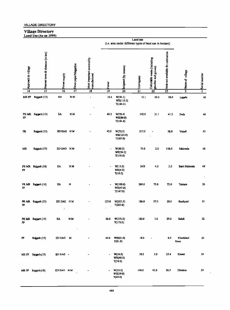
VILLAGE DIRECTORY
ViIla2e Directory Land Use {As on 1999}
Land use (i.e. area under different types ofland use in hectare)
j c 0 .~
g .~ ~ ,. . ., ., -g :;; "3 u = u
j .,
E "0 .e fa i E '0' c --.f!! ._ VI
8 ~ ~I) OJ
~ ." OJ ..
i I ~ atd i." 0 J! i .... ..
.8 9 1i. '" .~j € I 1; ,.
~ go
~ .!! Iii ~ .. I ~j 0 ... J
0 e J ~ ·E c ., ~ ~ I a u
~ ~ "ii
"" ~ 8 i ·c ~ ·E .,
~ ""' = ~ en 14 IS 16 17 18 19 20 21 22 23 2 I
MRFP Rajgarh (12) EA NM 16.4 W(S4.1) 12.1 20.6 38.0 Lapala 45 WE(1I0.3) T(164.4)
PRMR Rajgarh (13) EA NM 69.2 W(S8.4) 142.9 31.1 41.3 Pacla 46 FP WE(86.0)
T(144.4)
PR Rajgarh (13) EDEAG NM 43.0 W(32.0) 217.0 38.0 Vabcli 47 WE(13S.0) T(167.0)
MR. Rajgarh (17) EDEAG NM - W(80.0) 75.0 2.0 118.0 Makroda 48 WE(36.0) T(116.0)
PRMR Rajgarh (16) EA NM - W(IS.O) 24.b 4.0 2.0 Barh Makroda 49 FP WE(4.0)
T(19.0)
PRMR. Rajgarh (16) EA N - W(IOO.O) 269.0 75.0 72.0 Tahtara SO FP WE(47.0)
T(147.0)
PRMR Rajgarh (15) EDEAG NM 123.0 W(20S.0) IS6.0 37.0 28.0 Buchpwi 51 FP T(20S.0)
PRMR Rajgarh (I S) EA NM 66.0 W(l73.0) 182.0 3.0 29.0 Saloli S2 FP T(173.0)
FP Rajgarh (15) EDEAG M 44.0 WE(SJ.O) IS.0 8.0 Kharkhari 53 T(SJ.O) Rana
MRFP Rajgarh (IS) EDEAG - - W(34.0) 3S.0 3.0 2S.4 Khurd 54
WE(40.0) T(74.0)
MRFP Rajgarh (IS) EDEAG NM - W(SS.O) 140.0 42.0 36.S Dhulcra 55 WE(30.0) T(SS.O)
463
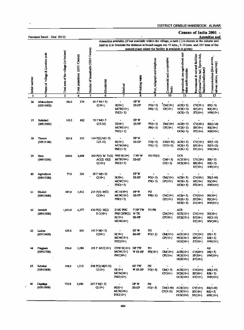
DISTRICT CENSUS HANDBOOK: ALWAR
Census of India 2001 -Panchayat Samiti : Rcni (0012) Amenities and
Amenities available (ifnot available within the village, a dash (-) is shown in the column and
next to it in brackets the distance in broad ranges viz.<S kms., S-lO Jans. and 10+ kms of the
I 'W nearest Elace where the facili!! is available is gjvenl
08
I ~
8 u c .c § § .~ g u c.. -a u ! 0 Ul
., oS 0
~ 1i oI!J > c.. ] , .£l j !9
I i .... _g .. '2i .. 8: .... ~ ~ ..
01 .,
B B .c
'5 ~ ~ 0 ~ en f-<
2 3 4 5
56 Mukundpura 196.0 374 SOPM«5) HPW
(00914900) C(lO+) H(IO+) SS-HP PO« 5) 'CM(lO+) ACS«5) CV(lO+) BS«5) MCW(IO+) PH« 5) CP(IO+) NCS«S) SP(IO+) RS(IO+) PHC«5) OCS«5) ST(IO+) NW(IO+)
57 Rahcholi 143.0 432 76PM«5 HPW
(00915000) C(5-IO) H(IO+) SS-HP PO« 5) CM(lO+) ACS«5) CV(IO+) BS(5-10) MCW(IO+) PH« 5) CP(IO+) NCS«5) SP(IO+) RS(IO+) PHC«5) OCS«5) ST(IO+) NW(IO+)
58 Thansri 305.0 955 134 P(2) M« 5) HPW
(00915100) C(5-10) H(IO+) SS-HP PO« 5) CM(S-IO) ACS«S) CV(IO+) BS(5-10) MCW(IO+~ PH« 5) CP(S-IO) NCS«S) SP(IO+) RS(S-IO) PHC«5) OCS«S) ST(IO+) NW(IO+)
S9 Dera 609.0 2,494 342 P(3) M Tr(2) PHS H(IO+) THPW POPH(5) OCS
(00915200) AC(2) 0(2) MCW(1O+) SS-HP CM«5) ACS(lO+) CV(lO+) BS« 5) C(IO+) PHC«5) CP«5) NCS(IO+) SP(IO+) RS«S)
ST(IO+) NW(IO+)
60 Jagmalpura 77.0 324 38 P M«5) HPW
(00915300) C(IO+) H(IO+) S8-HP PO«5) CM(IO+) AC8«S) CV(IO+) BS(S-IO) MCW(IO+) PH« 5) CP(IO+) NCS«5) 8P(10+) RS(IO+) PHC«S) OCS«S) ST(IO+) NW(IO+)
61 Bhuleri 447.0 1,412 214 P(2) M(2) HCH(IO+) HPW PO
(00915400) C(10+) MCW(IO+) S8-HP PH«5) CM(10+) ACS«S) CV(IO+) B8(10+)
PHC«S) CP(IO+) NCS«S) SP(IO+) RS(IO+) OCS«5) ST(IO+) NW(IO+)
62 Jamdoli 1,813.0 4,377 630 P(2) M(2) o HCPHC THPTW PO PH ACS
(00915500) S C(lO+) PHSCHW(2) WTK CM(IO+) NCS(IO+) CV(lO+) BS(lO+) H(IO+) 8S-HP CP(JO+) OC8(JO+) SP(IO+) RS(5-JO) MCW(IO+) ST(IO+) NW(IO+}
63 Ladiya 439.0 876 14S PM«5) HPW PH (00915600) C(IO+) H(10+) SS-HP PO« ~) CM(IO+) ACS(IO+) CV(IO+) BS«5)
MCW(IO+) CP(IO+) NCS(IO+) 8P(10+) RS« 5) PHC(IO+) OCS(IO+) ST(IO+) NW(IO+)
64 Pragpura 274.0 1,.286 195 P MC(IO+) CHWH(IO+) HPTW PO RS (00915700) MCW(IO+) WSS-HP PH(IO+) CM(IO+) ACS(IO+) CV(,IO+) B8«5)
PHC(10+) CP(IO+) NCS(IO+) SP(IO+) NW(IO+) OCS(IO+) ST(IO+)
65 Sainthal 548.0 1,512 218 P(2) M(S-IO) HPTW PH (00915800) C(1O+) H(IO+) WSS-HP PO«5) CM«5) ACS(IO+) CV(IO+) BS(S-10)
MCW(IO+) CP(IO+) NCS(IO+) SP(IO+) RS«S) PHC(IO+) OCS(IO+) ST(IO+) NW(IO+)
66 Dagdaga 752.0 2,084 297 PM«5) HPW PH (00915900) C(IO+) H(IO+) SS-HP PO«S) CM(S-IO) ACS(IO+) CV(IO+) BS(S-IO)
MCW(IO+) CP(5-10) NCS(JO+) SP(JO+) RS«5) PHC(IO+) OCS(IO+) ST(IO+) NW(IO+)
464
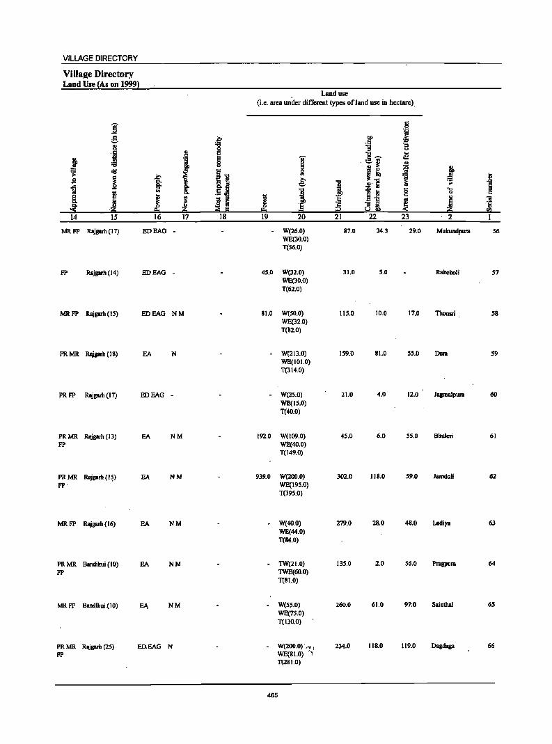
VILLAGE DIRECTORY
Villaae Directory Land Use {As on 1999}
Land use (i.e. area under different types of I and use in hectare).
:[ c 0 .~
a ~ DO > .5 '&3
·1 '8 1l '3 u
!! e ] ..... .. ~ }
e 'U <2 is 8 i
. ~~ u
oIIJ i J~ ~ j > t 'a 1 s I ~ 8.] ~ .., 2'~ iii ~
] ... .§ J! 1 ! ~ til 0 ....
I c. 0 c
K ~ 1;;
:~ c .,
~ S ::I .soC
~ "iii f 81 ~ Po ~ ~ 0 '5 'ij
:!i ·20 2:t a::; !!:o t:::I i2 20 til
14 15 16 17 18 19 20 21 22 23 2 I
MRFP Rajgarh (17) EDEAG - - W(26.0) 87.0 24.3 29.0 Mukundpura 56 WE(30.0) T(56.0)
FP Rajgarh (14) EOEAG - 45.0 W(32.0) 31.0 5.0 Rahcholi 57 WE(30.0) T(62.0)
MRFP Rajgarh (15) EDEAG NM 81.0 W(50.0) 115.0 10.0 17.0 ThODSri 58 WE(32.0) T(a2.0)
PRMR Rajprb(18) EA N - W(213.0) 159.0 81.0 55.0 DCI'll 59 WE(IOI.O) T(314.0)
PRFP Rajgarh (17) EDEAG - W(2S.0) 21.0 4.0 12.0 Jagmalpura 60 WE(15.0) T(40.0)
PRMR Rajgarb (13) EA NM 192.0 W(109.0) 45.0 6.0 55.0 Bhuleri 61
FP WE(40.0) T(149.0)
PRMR Rajgarb (I~) EA NM 939.0 W(200.0) 302.0 118.0 59.0 lamdoli 62
FP' WE(19S.0) T(395.0)
MRFP Rajgarh (16) EA NM - W(40.0) 279.0 28.0 48.0 Ladiya 63 WE(44.0) T(84.0)
PRMR Bandikui (10) EA NM - TW(21.0) 135.0 2.0 56.0 PrBgpura 64
FP TWE(60.0) T(81.0)
MRFP Bandikui {I 0) EJ\ NM - W(S5.0) 260.0 61.0 97:0 Sainthal 65 WE(7S.0) T(130.0)
PRMR Rajgarh (25) ED.EAG N - W(200.0)· A) , 234.0 118.0 119.0 Oagdaga 66
FP WE(81.0) " T(281.0)
465
DISTRICT CENSUS HANDBOOK: ALWAR
Census of India 2001 -Panchayat Samiti : Reni (0012) Amenities and
,Amenities available (ifnot available within the village, a dash (-) is shown in the column and
next 10 it in brackets the distance in broad ranges viz.<5 kIns., 5-10 kms. and lot ~ of the
I g nearest I!lace where the facili~ is available is given)
~ ;g
"5 .2 .go. .
J " 0 U of .., ., ., ~ ="i3 c ;:; ..
.9 e c .~ ]~ .~ f 0 ,g II t!-
J iP § :E go ] -0.
.3 "B 'i :J ~tI)~ !9 .. = t!- i -" § e~ <Ill '1> ~ o!:i =t ;j._
j .s ·B "5 u :s g of _g ..c: :n;i cij B·1o: 'Cl os i "'ii l~ 1:911 '.g ,9
~ -a 'Cl .2 ~ .. 0. '11 .9 ~ i ~ 8. j B " :11 ~ f 'E ~ ~ ~1 .~~ 1;; 5._
~ ,5 'j S~ .0 « 0 uti)
3 4 5 9 10 11 12 13
67 Khem Mirzapur 378.0 1,007 146 P M(S-IO) HPW PH AC8 (00916000) C(lO+) H(lO+) SS-HP PO« 5) CM(S-10) NCS(S-IO) CY(IO+) 88(5-10)
MCW(10+) CP(10+) OC8(S-10) SP(10+) RS« S) PHC(IO+) ST(IO+) NW(IO+)
68 Keelpur 157.0 430 67P M 8 DAH(IO+) HPW POPH(2) AC8 (00916100) C(IO+) MCW(IO+) SS-HP CM(S-IO) NCS(S-IO) CV(IO+) 8S(S-10) ,
PHC(lO+) CP(S-IO) OCS(5-10) SP(IO+) RS(S-IO) ST(IO+) NW(IO+)
69 Ahmadpur 167.0 801 114 P M(5-10) HPW PH (00916200) C(IO+) H«S) S8-HP PO« 5) CM(S-IO) ACS«S) CV(IO+) 88(S-IO)
MCW(5-10) CP(5-l0) NCS(S-IO) Sp(IO+) RS« S) PHC(S-IO) OCS(S-IO) ST(IO+) NW(IO+)
70 Haloj 268.0 733 99 PM«S) HPWTK (00916300) C(10+) H(IO+) SS-HP PO« 5) CM«S) ACS(IO+) CY(IO+) 88« 5)
MCW(IO+) PH«S) CP« S) NC8(10+) SPOO+) R8« S) PHC«5) OC8«S) ST(IO+) NW(lO+)
71 Khamgpur 202.0 529 78 PM«5) HPW (00916400) C(IO+) H(lo+) 8S-HP PO(S-IO) CM(S-lO) ACS(IO+) CV(IO+) 8S(5-10)
MCW(IO+) PH(S-IO) CP(S-IO) NCS(IO+) 8p(10+) RS« S) PHC(S-tO) OCS(S-tO) ST(IO+) NW(IO+)
72 Nibola 182.0 446 61 P M« 5) HPW (00916500) C(IO+) H(10+) SS-HP PO(S-IO) CM(S-IO) ACS(10+) CV(IO+) 88(5-10)
MCW(IO+) PH(10+) CP(S-IO) NCS(IO+) Sp(IO+) RS« S) PHC(5-IO) OCS«S) 8T(10+) NW(IO+)
73 Peepal Hera 137.0 769 116'PM«S) HPW (00916600) C(S-IO) H(lO+) 8S-HP PO(S-IO) CM(S-IO) AC8(10+) CV(IO+) 88(5-10)
MCW(IO+) PH(5-IO) CP(S-IO) NCS(IO+) Sp(IO+) RS«S) PHC(S-IO) OCS«S) 8T(10+) NW(IO+)
74 Moondiya 138.0 743 109 P M(5-IO) HPW PH (00916700) C(IO+) H(IO+) SS-HP PO(S-IO) CM(5-10) ACS«S) CV(IO+) 8S(5-10)
MCW(IO+) CP(IO+) NCS«5) Sp(IO+) RS« 5) PHC(lO+) OCS«5) ST(lO+) NW(IO+)
7S Cheemapura 86.0 603 92PM«S) HPW (00916800) C(IO+) H(IO+) SS-HP PO(S-IO) CM(S-lO) ACS«S) CV(lO+) 8S(S-10)
MCW(IO+) PH(S-lO) CP(S-lO) NCS(lO+) 8p(10+) RS«S) PHC(S-IO) OCS(lO+) 8T(10+) NW(IO+)
76 8ajoli 313.0 774 120 P M C(IO+) CHWH(lO+) HPW 1'H(2) (00916900) MCW(IO+) 88-HP pO(<:,s) CM('s-IO) ACS«S) CV(lO+) 88(S-10)
PHC(lO+) CP(S-IO) NCS(IO+) Sp(lO+) RS(<: 5) OCS(lO+) ST(IO+) NW(lO+)
'n AmlU]lura 117.0 180 33 HPW (.,-,
(00917000) P«5) HGIO+) SS-HP . pO«,s) CM(<:5) ACS«S) CV(IO+) 8S«S) M«5) MCW(JO+) PH(lo+) CP(1O+) NCS«S) SP(lO+) RS« S) C(10+) PHC«S) OCS«S) ST(lO+) NW(IO+)
466

VILLAGE DIRECTORY
Villatze Directory Land Use (As on 1999l
Land use (i.e. area under different types ofIand use in hectare)
]' .§ til g z- oo ;. .. :a i :s
~ 0 u
~ e u .a i -; ~ I c ....
~ ;:..1) u
~ oI!l 1-0 i' I! ~ j s 1 j e; '01
~ .8 ..c §. 8.~. i .!! S ~
~ § . t; ., c. .5 ~ I 1~ 8 OS
fi J ~ t; '8 .,
8: B a !! to
! 'iii
0 '8 ~ S3i ~ 'ii :!:. .~ i!:i ~ Ii! IJ.. = ell
14 IS 16 17 18 19 20 21 22 23 '2 I
PRFP Rajgarh (25) EA NM - W(IOI.O) 111.0 65.0 31.0 !(hera 61 WE(70.0) Mirzapur T(I71.0)
PRMR Rajgarb (25) EDEAG NM - W(30.0) 62.0 17.0 13.0 Keelpur 68 FP WE(3S.0)
T(65.0)
PRMR Rajgarh (25) EDEAG N - W(21.0) 69.0 3.0 54.0 Ahmadpur 69 FP WE(20.0)
T(41.0)
MRFP Rajgarh (25) EA - W(30.0) 124.0 19.0 17.0 Hatoj 70 WE(78.0) T(108.0)
PRFP Rajgarh (22) EA - W(33.0) 103.0 23.0 13.0 Kluuagpur 71 WE(30.0) T(63.0)
MRFP Rajgarh (23) EA - W(23.0) 39.0 38.0 12.0 Nibola' 72 WE(70.0) T(93.0)
MRFP Rajgarh (28) EA W(40.0) 26.0 3.0 15.0 Peepal Hera 73 WE(53.0) T(93.0)
MR FP . Rajgarh (26) BDEAG - W(40.0) 48.0 31.0 13.0 Moondiya 74 WE(6.0) T(46.0)
MRFP Rajgarh (27) BDEAG - - W(60.0) 9.0 6.0 7.0 Cheemapura 75 WE(4.0) T(64.0)
PR Rajgarh (24) EA - W(9S.0) 95.0 83.0 20.0 Bajoli 76 WE(20.0) T(IIS.0)
FP Rajgarh (25) EA ".: W(41.0) 69.0 3.0 4.0 Amarpura 77 T(41.0)
467
DISTRICT CENSUS HANDBOOK: ALWAR
Census of India 2001 -Panchayat Samiti : Reni (00 12) Amenities and
Amenities available (if not available within the village, a dash (-) is shown in the column mid next to it in brackets the distance in broad ranges viz.<5 Kms., 5-10 kms. and 10+ krns of the
i ~ nearest place w~ere the facility is available is given) '" II) '" ""CI .11 ~~ "8 I II) !ii u of u II) ., II)
I = "'a '" "" 0 c· .~ .s.! 0 g II) 0 0
l ._ -I!!
i---'J:! u t:!- t .s 0
!;! j 0 1 ~~--- g ~ 0-1 Q 'li 'Ii :J diI ~ t:!- .] c _' § e~ u .!::"il "!!I] '1:
~ -!l IS g .., 8 .~ u .e .~ IS il 'fi .8 ~ 1 ta diI ~ ,_
~ ...
!: ~ l~ '!:5!"g Ii! '::!
1 0 '3 ...
~ .s.! ~ .. C- o ,~~ i 'S ,~ 0 t f ., '31 J{ t 'li
., c. 'i
~j "iii .,
B ~ J 'i t D ~ ._
'I: ~ j 1if eli:.)] ., ~ I-'< If .<~ ""
yCl)
2 3 4 5 6 7 8 9 10 11 12 13
78 Bhajera 160.0 681 106 PM S CHWH{lO+) HPW POPH(S) ACS RS (00')17100) C(IO+) MCW(10+) SS-HP CM«S) NCS(IO+) CV(IO+). BS(S-IO)
PHC(5-10) CP(5-10) OCS(lO+) SP(IO+) NW(lO+) ST(IO+)
79 KaJyanpura 207,0 565 86PM«5) WSS-W (00917200) C(10+) H(10+) PO(5-10) CM«S) ACS«S) CV(10+) BS(S-IO) .
MCW(IO+) PH«S) CP(S-IO) NCS(IO+) SP(IO+) RS«S) PHC(S-IO) OCS(IO+) ST(IO+) NW(IO+)
80 Jaisinghpura 153.0 1,291 187PM«5) WSS-W PH (00917300) C(IO+) H(IO+) PO(IO+) CM«S) ACS« S) CV(IO+) BS(S-IO)
MCW(IO+) CP(S-10) NCS(S-IO) SP(IO+) RS«S) PHC(IO+) OCS(lO+) ST(IO+) NW(lO+)
31 Karanpura .92,0 856 126 P M C(lO+) THPWSS-(00917400) H(IO+) HP PO«S) CM«S) ACS« S) CV(IO+) BS(S-IO)
MCW(IO+) PH«5) Cp(S-IO) NCS(IO+) SP(lO+) RS«S) PHC(S-10) OCS(lO+) ST(IO+) NW(lO+)
82 Bhcctoli 139,0 257 38 P M« 5) HPTW PH (00917500) C(IO+) H(IO+) WSS-HP PO«5) CM«S) AC8«S) CV(5-10) B8(5-1O)
MCW(lO+) CP« 5) NC8(10+) SP(lO+) RS«5) PHC(5-10) OC8(10+) ST(IO+) NW(IO+)
83 RBmpura 272.0 1,279 193 PM S DHCH(IO+) THPW PO CM ACS RS (009176QO) C(JO+) MCW(IO+) SS-HP PH(5-10) CP(5-10) NCS(S-IO) CV(5-10) BS(5-10)
PHCCS-IO) OC8(10+) SP(S-IO) NW(IO+) ST(5-10)
84 Itoli 508.0 2,213 278P MCCIO+) HPWTK PO (00917700) H«S) SS-HP PH(IO+) CM«S) ACS« S) CV(IO+) BS« 5)
MCW«S) CP«5) NCS(IO+) SP(lO+) RS«5) PHCC<S) OC8(10+) ST(1O+) NW(IO+)
85 Rllni 3,114.0 9,000 1,271 P(4) M(4) .0 DA HC THPTW PO CMCP AC8 BS (OO~17800) S(2) PUC PHCFWC WTK PH(IOO) NCS(IO+) CV(IO+) RS(S-IO)
AC 0 RMPH(lO+) SS-HP OCS(IO+) Sp(IO+) NW(IO+) C(IO+) MCW(IO+) ST(IO+)
86 Padli 306.0 .871 128PM«S) HPW PH (00917900) C(IO+) H(IO+) SS-HP PO«5) CM«S) ACS(S-IO) CV(IO+) BS«5)
MCW(S-IO) CP(S-IO) NCS(IO+) SP(IO+) RS(5-IO) PHC(S-IO) OCS(IO+) ST(1O+) NW(IO+)
87 Khohra 347.0 1,166 197 P(2) M HPW PH ACS Chauhan CC I 0+) H(IO+) SS-HP PO(': 5) CM«S)" NCS(IO+) CV(IO+) BS« S) (00918000) MeW(S-IO) Cp(IO+) OCS(IO+) SP(IO+) RS(IO+)
PHC(S-IO) ST(IO+) NW(IO+)
88 Pande Roopbas 408.0 8S7 122 P M«5) HPW PH (00918100) . ·C(IO+) H(lO+) SS-HP PO«S) CM(~S) ACS(S-IO) CV(IO+) BS(5-10)
MCW(IO+) CP(S-IO) NCS(IO+) SP(10+) RS(IO+) PHC(S-IO) OCS(IO+) ST(IO+) NW(1O+)
468
VILLAGE DIRECTORY
Village Directory Land Use {As on 1999}
Land use (i.e. area under different types of land use in hectare)
]' r: .!a til g ~ Do .2: '
'8 .5 -3 u -g ~
u 8 E u .E
} .~ E 'Qi' c ,.... :a ._ '" 0 ~ -u
~ u j! J ell! 1'"0
0 .s:
~ i ~ '" r; 11 g o.~ € "0 .!l lii it; ~ a .c g- il I .. .§.j "0 1~ 8 'S
I 0. i ! ~ § ~
1;; ·s .. ., 1 I!! !ij
"" 0 '6 ·s 8i ~ .::!: ~ Iii !!:o = 2 li !'f..l 14 IS 16 17 18 19 20 21 22 23 2 1
PR Rajgarh (25) EA NM 0 W(71.0) 53.0 5.0 13.0 Bhajera 78 WE(8.0) TW(IO.O) T(89.0)
FP Rajgarh (28) EDEAG 0 W(130.0) 42.0 12.0 14.0 Kalyanpura 79 WE(9.0) T(139.0)
PR Rajgarh (29) EDEAG 0 W(IOD.O) 21.0 9.0 13.0 Jaisinghpura 80 WE(S.O) TW(S.O) T(1I0.0)
PRMR Rajgarh (28) ED NM 0 W(72.2) 8.1 12.0 Karanpura 81 FP T(72.2)
PR Rajgarh (27) ED NM 0 W(SS.O) 71.0 13.0 Bheetoli 82 T(S5.0)
PRMR Rajgarh (26) EDEAG NM W(I20.0) 85.0 37.0 Rampura 83 FP WE(29.7)
T(I49.7)
PR Rajgarh (23) EA N 0 W(147.0) 98.0 66.0 37.0 !toli 84 WE(160.0) T(307.0)
PRMR Rajgarb (18) EA NM Earthen Pot, 0 GC(2S0.0) 847.0 439.0 332.0 Reni 85 FP Wooden W(ISO.O)
Furniture WE(1096.0) T(J496.0)
PRFP Rajgarh (20) EA 0 W(lOO.O) 136.0 6.0 42.0 Padli 86 WE(22.0) T(122.0)
MRFP Rajgarb (18) EA NM 54.4 W(41.8) 152.7 1.7 30.8 Khohra 87 WE(65,6) Chauhan T(I07.4)
PR RBjgarh (30) EA WE(IIO.O) 42.0 33.0 190.0 PandeRoop~ 88 TW(33.0) T(143.0)
469
DISTRICT CENSUS HANDBOOK: ALWAR
Census of India 2001 _ Panc~ayat Sam it; : Ren; (0012) Amenities and
Amenities available (if not available within the village, a dash (-) is shown in the column and next to it in brackets the distance in broad ranges viz.<S kms:, 5-10 kms. and 10+ kms of the
j % nearest elace where the faci1i~ is available is siven} III .g
~ ~ "'.zS 0 J! .S! :I
" il - 2! ='U = .~ e ~ ..8
._ t! u J!&. M, Co g ~
III .. '!"'-...:I ~ i li .a_,.e
d!! .s: "0 '3 :! 'E
~ ., 6 Iij
" 0 .,g ... d!! g.<;:: ~
..... 'jj ..8 i ]:2-g 0 ]- .... ~
0 .g r;; i ..... ~ 0 Po
! ~ ~ i'! 5 ._ ~ .5 'N
I-< U'" 3 4 5 12
89 Pali 399.0 1,183 283 P M C(5-10) CHWH(IO+) HPTW PH (00918200) MCW(IO+) WSS-HP PO« 5) CM«S) ACS«S) CV(IO+) BS(5-10)
PHC(IO+) CP(S-IO) NCS(IO+} SP(IO+) RS(IO+) OCS(IO+) ST(IO+) NW(IO+)
90 Bahadkho 705.0 3,191 .516 P(6) M AC DAPHS THPTW PO PH CM Kalan C(5-10) H(IO+) WSS-HP Cp« S) ACS(IO+) CV(IO+) BS«5) (00918300) MCW(5-10) NCS(IO+) SP(IO+) RS(IO+)
PHC(lO+) OCS(IO+) ST(IO+) NW(lO+)
91 Batiadkho 327.0 79S 118 P M« 5) DA PHS CHW HP W PO Khurd C(IO+) H(IO+) SS-HP PH« 5) CM«S) ACS(IO+) CV(IO+) BS«5) (00918400) MCW(IO+) CP«S) NCS(IO+) SP(lO+) RS(IO+)
PHC(S-IO) OCS(JO+) ST(IO+) NW(IO+)
92 Garhi Sawaimm 1,069.0 5,219 749 P(4) M(2) S DDAPHC THPW PO TO CM oes BS (00918500) PUCC(IO+) PHSH(IO+) SS-HP PTa CP(IO+) ACS(IO+) CV(IO+) RS(IO+)
MCW(IO+) PH(20) NCS(lO+) SP(IO+) NW(JO+) ST(to+)
93 Chsndpum 298.0 981 141 P M(S-IO) PHS H(IO+) HPW (00918600) C(IO+) MCW(IO+) SS-lIP PO« 5) CM(IO+) ACS(5-10) CV(IO+) BS(5-10)
PHC(S-IO) PH« 5) CP(5-to) NCS(IO+) Sp(IO+) RS(IO+) OCS(IO+) ST(1O+) NW(1O+)
94 Ramsinghpum 23S.0 SOl 7S P M«S) PH8H(10+) HPW (00918700) C(IO+) MCW(1O+) S8-HP PO« 5) CM(lo+) ACS(5-10) CV(IO+) BS(5-10)
PHC(S-IO) PH(IO+) CP(S-IO) NCS(IO+) SP(lO+) RS(S-to) OCS(IO+) ST(IO+) NW(IO+)
95 Parbaini 928.0 3,501 508 PM S PHS H(IO+) THPW POPH(3) (00918800) C(IO+) MCW(10+) SS-HP CM(IO+) ACS« 5) CV(1O+) BS«5)
PHC« 5) CP«5) NCS(to+) Sp(IO+) RS(S-IO) OCS(IO+) ST(lO+) NW(IO+)
96 Danpur 428.0 1,335 191 P M« 5) HPW PH (00918900) C(IO+) H(IO+) SS-HP, PO« S) CM«S) ACS(IO+) CV«5) BS«S)
MCW«S) CP« 5) NCS(IO+) Sp(IO+) RS«S) PHC«5) OCS(to+) ST(IO+) NW(to+)
97 Bahadurpur 331.0 1,039 152 P MC(IO+) HPW PH (00919000) H(IO+) SS-lIP PO«S) CM«S) ACS(IO+) CV(10+) BS« S)
MCW«S) CP« 5) NCS(IO+). SP(IO+) RS«S) PHC«5) OCS(1O+) ST(1O+) .NW(IO+)
98 KodiYB 206.0 633 84PM«5) HPW (00919100) C(10+) H(IO+) SS-HP PO«5) CM«5) ACS« S) CV(1O+) BS« S)
MCW«S) PH«S) CP«5) NCS(IO+) Sp(IO+) RS«S) PHC«5) OCS(IO+) ST(1O+) NW(1O+)
99 Thoomra 326.0 1,019 146 P M«5) HPW (OO9111200) C(lO+) H(tO+) SS-HP PO«S) CM«S) ACS«'S) CV(S-IO) BS(S-IO)
',1 MCW(IO+j' PH(S-IO) CP«S) NCS(IO+) SP(IO+) RS«5) PHC(5-10) OCS(IO+) ST(IO+) NW(IO+)
470
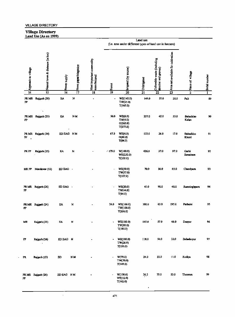
VILLAGE DIRECTORY
ViIls2e Directory Land Use {As on 1999}
Land use (i.e. area under di~erent types ofland use in hectare)
]' = 0 .~
e ~ gp .~
j :g :;; "3
" t>
~ E ]-:;- ... ~ '1 E I .a
c '-' .. ., u Bi ~ j ~ ~ I] ~
j >. I ~'O Ji S Q. e: '0 iii ~
.) §' :; .!! :iii ~ <II .§ .M I ~ iii g ....
1il "'" c c
j ~ I u ::'! 1;; ll-g .. ..
~ 12 Iij ~ ~ ~ c '5 ~!ih
e !:!o =t t:! « ~ rI)
14 IS 16 17 18 19 20 21 22 23 2 1
PRMR Rajgarb (30) EA N - WE(140.0) 149.0 57.0 28.0 Pali B9 FP TW(2S.0)
T(16S.0)
PRMR Rajgarh (25) EA NM 56.0 WE(B.O) 257.0 62.0 53.0 Bahadkho 90 FP TW(4.0) Kalan
0(265.0) T(277.0)
PRMR Rajgarh (24) EDEAG NM 67.0 WE(4.0) 133.0 26.0 17.0 Bahadkho 91 FP O(BO.O) Khurd
T(84.0)
PRFP Rajgarh (25) EA N J 179.0 W(100.0) 426.0 37.0 97.0 Garhi 92 WE(230.0) Sawairam T(l30.0)
MRFP Mandawar (12) EDEAG - WE(SO.O) 70.0 56.0 65.0 Chanclpura 93 TW(57.0) T(l07.0)
PRMR Rajgarb (26) EDEAG - WE(20.0) 41.0 90.0 40.0 Ramsinghpura 94 FP TW(44.0)
T(64.0)
PRMR Rajgarb (24) EA N 24.0 WE(166.0) 380.0 63.0 195.0 Parbaini 95
FP TW(lOO.O) T(266.0)
MR Rajgarh (25) EA N - WE(IOO.O) 145.0 57.0 46.0 Danpur 96 TW(80.0) T(IBD.O)
FP Rajgarh (24) EDEAG N - WE(100.0) l1B.O 54.0 33.0 Bahadurpur 97 TW(26.0) T(l26.0)
PR Rajgarh (23) ED NM - W(79.0) 24.0 22.0 11.0 Kodiya 98 TW(70.0) T(149.0)
PRMR Rajgarh (26) EDEAG NM - W(ISO.O) 36.2 75.0 53.0 Thoomra 99
FP WEC12.0) T(162.0)
471

DISTRICT CENSUS HANDBOOK: ALWAR
Census of India 2001 -Panchayat Samiti : Reni (0012) Amenities and
Amenities available (if not available within the village, a dash (-) is shown in the column and next to it in bracketS the distance in broad ranges viz.<5 kms., 5-10 kms. and 10+ kms of the
-;;;- nearest place where the facility is available is given)
I ::s ..
.g c ~ " 11 ..Dr..
u l! U
.~ ~~ c .. .... g 5 0
1 g 0 1 ~ :M~ u t!. j 0 .a II>
~~--0 'i 9' cI!I "" t!. -a B _" E
> 1 "5 "3 ] .S
~ oS .g § ~ g.g ~ Q t .c
'IS ... .c
~ OJ:s!1j ..0
i 'IS § .... e Ji Ji ~ i J c 0 'i OJ ~ "S g ~ I ~.-'5 ~ ~ui .., I-<
2 3 4 5
100 Akoda 274.0 1,414 196 P M(S-IO) HPW (00919300) C(lO+) H(lO+) SS-HP PO« 5) CM«S) ACS«S) CV(S-IO) 8S(S-10)
MCW(IO+) PH«S) Cp«S) NCS(IO+) SP(IO+) RS« S) PHC(S-IO) OCS(IO+) ST(IO+) NW(IO+)
101 8hooda 833.0 3,223 479 P M C(lO+) PHS H(lO+) HPW PH BSRS (00919400) MCW(IO+) SS·HP PO(IO+) CM(IO+) ACS(IO+) CV(IO+) NW(IO+)
PHC(IO+) Cp(IO+) NCS(IO+) Sp(IO+) OCS(IO+) ST(IO+)
102 Ukcri 686.0 2.508 351 P MC(IO+) THPW (00919500) H(IO+) SS-HP PO(IO+) CM(IO+) ACS(IO+) CV(IO+) 88(3-10)
MCW(IO+) PH(IO+) CP(IO+) NCS(IO+) SP(IO+) RS(S·IO) PHC(IO+) OCS(IO+) 8T(10+) NW(IO+)
Pancbayat Samiti : 39,345.0 136,491 20,027 P(127) M(48) D(S) DA(12) T(19) P0(29) CM(7) ACS(17) BS(lS) Total S(ll) PUC(4) ewc HC(6) W(l02) TO(2) CP(4) NCS RS(4)
Tr(2) AC(15) PHC(S) TK(S) PTO OCS(2) 0(3) PHS(16) &P(98) PH(341)
FWC NH 1W(ll) RMP(9) SMP L(4) CHW(lS)
472
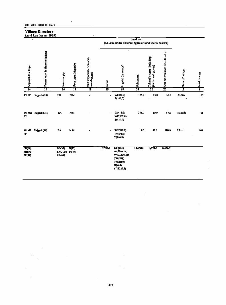
VILLAGE DIRECTORY
ViIla2e Directory Land Use (As on 1999)
]' g ., i ~ :a
;:; ~ :-s ~ ~
I [ "" < 14 15
PRFP Rajgarb (28)
PRMR Rajgarb (3S) FP
PRMR Rajgarb (40) FP
PR(66) MR(73) Fp(S7)
b :a 0 .,
c E
·i E 0 u
i ~." ~
.f~ §' .. .. Cl. .. i J fi Iii z ::2 6
16 17 18
ED NM
EA NM
EA NM
ED(33) N(77)
EAG(l'l M(67)
EA(6')
Land use (i.e. area under different types ofland use in hectare)
c 0 ·i
00 :-.5 ~ ""C
-5 '"' 'G;' .!i c: ~ .- .. Ii! '-' " .,
j! il ~ ~ =a e: I ~ .:;:
..!:! Iii
I 1~ g ... 0
~ ·S ., .. ! 0 :§ ·c 8i ~ !.t. P
19 20 21 22 23 2
- WeIOS.O) 126.0 13.0 30.0 Akoda 100 T{IOS.O)
W(4IS.0) 236.0 10.0 67.0 Bhooda 101 WE(102.0) T(S20.0)
- WE(390.0) IS.O 42.0 180.0 Ukeri 102 TW(S6.0) T(446.0)
2,911.1 GC(l56) 12,6'8.3 J,O!Il.2 5,411.' W(69!J3.0t) WE(6429.49) TW(531) TWE(60) 0(960) T(15229.5)
473

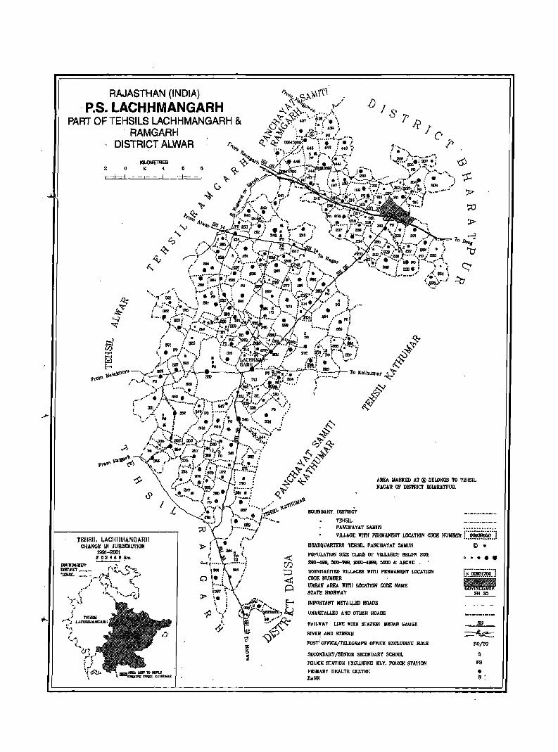
RAJASTHAN (INDIA)
. P.S. LACHHMANGARH PART OF TEHSILS LACHHMANGARH &
, RAMGARH DISTRICT ALWAR
IOLOME1lIES 2 o 2 4
TEIISI].. LACHllMANGARJI CHANGE IN lURISDIC'FION
1991-2001 e02'Belm ~.
OOIlHIIlJIIE!t nmKtcr _._._ ~12IlII'" _, __
6
[) /S
AREA ~IARK!:IJ AT ® BEIDNCS TO TEH51~ HAGAR OF DISTIlICT BHARATPUR.
BOUNDARY. IIJ5l'RICl' _._._._._._
'l"EIlSl~ _._._._._._ PANCIIAYJlT SMolin •••••••••••••
VILLAGE "In! P£I!MANE~"T LOCATION CODi! lIUMDSII C~::l Hi!hDQUARTERS: TEHSU.. PANCHAYAT SAIlITI
PIIPtlLATION SI~t C1M;S 01' VILLAGES: Bt:LOlI' 201),
200-489. 000-999, 1000-48911. 0000 6: ABOVE • .
UNINIIAOITm V1LLAG£5 "ITII PERIIANI!N'f LOCATION CODE NUMBER URJlAli AREA 1I'1TI1 LOCATION CODE NAME STATE HIGHWAY
IIIPORTJll'I'I' M!."I'ALLI!D ROADS
UIiMETALLI!D AND OTygR ROADS
RAII.WAY [.ll1E WITH STATlOIl, BROAD GAIIGE
RIVER AIiD Sl'REAII
POST'OFFICE/TELEGRAPH OFfICE HXCLUDIXG R.lI.S.
S~CONDARY /SENIOR SECOlI'DARY SCHOOL
I'OI.ICI; 3rATION t:XCl.IIDING HI,Y. I'Ol.tCt: STA1'ION
PHIMARY IIf.AJ.TfI C~~TRf; BAN"
@ •
CI ••••
~ POITO
s P3
• »:

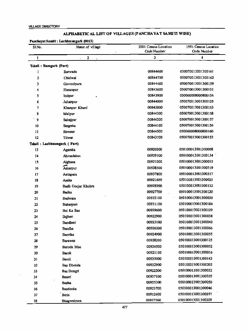
VILLAGE DIRECTORY
ALPHABETIC AL LIST OF VI~AGES (p ANCHA YA T SAMIn WISE)
PanchayatSamltl: LachhmlllgartJ (0013)
SI.No. Name of village 2001 Census Location 1991 Census lncation Code Number Code Number
2 3 4
Tebsll : Ramgarb (Part)
1 Barwada 00844600 050070013001300161
2 Chidwai 00844700 050070013001300162
3 Govindpura 00844400 050070013001300159
4 Hasanpur 00843600 050070013001300151
5 Indpur 00843900 050060008000800154
6 ,Jahanpur 00844000 050070013001300155
7 Khanpur Khurd 00843800 050070013001300153
8 Malpur 00844300 050070013001300158
9 Sahajpur 00844200 050070013001300157
10 Singraka 00844100 050070013001300156
11 Sinnaur 00844500 050060008000800160
12 Tilwar 00843700 0500700]300]300]52
Tehsil : Lachhmangarh ( Part)
13 Agaraka 00920300 0501000]3001300008
14 Ahmadabas 00929100 050100013001300134
15 Aighana 00921000 050100013001300015
16 .-Amarpur 00938500 05010001300]300319
17 Antapara 00937800 050100013001300317
18 Asaka 0092]600 050]00013001300025
19 Badh Goojar Khohra 00928900 050100013001300132
20 Badka 00927700 050100013001300120
21 Badwara 00922100 050100013001300030
22 Baharpuri 00931100 050100013001300184
23 Bai KaBas 00928600 050100013001300129
24 Bajheri 00922900 050100013001300038
25 Bandheri 00923100 050100013001300040
26 Bandka 00926200 050100013001300066
27 Baorika 00924900 050100013001300055
28 Barawas 00928200 050100013001300125
29 Baroda Meo 00924500 050100013001300052
30 BaroH 00921100 050100013001300016
31 Baroli 00930000 050100013001300143
32 Bas Dhekda 00932900 050100013001300202
33 Bas Dongri 00922300 050100013001300032
34 Baseri 00937100 050100013001300305
35 Bedha 00925300 050100013001300050
36 Beedooka 00923700 050100013001300046
37 Berla 00932400 050]00013001300J97
38 Bhllgwiltpura 00937500 050100013001300309
477
DISTRICT CENSUS HANDBOOK: ALWAR
ALPHABETICAL LIST OF VIlLAGES (P ANCBA VAT SAMIn WISE)
PanchayatSamiti: LachhmamgartJ (0013)
SI.No. Name of village 2001 Census Locati on 1991 Cens us Locat ion Code Number Code Number
2 3 4
39 Bhainsrawat 00923000 050100013001300039
40 Bhayari 00924300 050100013001300049
41 Bheekhaberi 00938700 050100013001300321
42 Bhoor Pabari 00937300 050100013001300307
43 Bichgaon 00936100 050100013001300259
44 Bidarka 00938300 050100013001300316
45 Boolaheri 00922800 050100013001300037
46 BoontoH 00928700 050100013001300130
47 Butyana 00925100 050100013001300057
48 Chak Bhayari 00924400
49 Chamarwara 00920200 050100013001300007
50 Chhangalki 00925900 050100013001300063
51 Chhatarpur 00921500 050100013001300020
52 Chhila Chhoh 00932600 050100013001300199
53 Chimanpura 00924800 050100013001300054
54 Chimrawali Gorh 00932800 050100013001300201
55 Chimrawali Sikh 00932700 050100013001300200
56 Dabri 00922000 050-100013001300029
57 Daulatpura 00929600 050100013001300139
58 Deenar 00928100 050100013001300124
59 Deewli 00934800 050100013001300246
60 Deorajpura 00936000 050100013001300258
61 Dhand 00925800 050100013001300062
62 Dongri 00922200 050100013001300031
63 Doroli 00920600 050100013001300011
64 Dusrahera 00926000 050100013001300064
65 Dwarkpur 00932100 050100013001300194
66 Fatehpur @ Khudiyana 00926700 050100013001300110
67 Fatehpur Tarf Malawali 00935300 050100013001300251
68 Gandeeka 00921200 050100013001300017
69 Gandoora 00929400 050100013001300137 70 Gaonri 00927100 050100013001300114 71 Ghat 00928500 050100013001300128
72 Goojar Khohra 00931900 050100013001300192
73 Gopalpura 00930400 050100013001300147 74 Gor Pabari 00931500 050100013001300188 75 Gothra 00938200 050100013001300315 76 Gothri Guru . 00932300 050]00013001300196 77 Gothri Purohitan 00932000 050100013001300193 78 Hadarhera 00928300 050]00013001300]26
478
VILLAGE DIRECTORY
ALPHABETICAL LIST OF VlILAGES (p ANCHA YAT SAMI1I WISE)
PanchayatSamiti: LacbhmaogartJ (0013)
SI.'No" Name of village 2001 CcnsusLocation 1991 Census Location Code Number Code Number
2 3 4
79 -Hajipur 00926600 050100013001300109
80 :Harsana 00934500 050100013001300243
81 Harsoli 00919800 050]000]3001300003
82 Hasanpur 00933400 050100013001300207
83 Hingota 00929500 050]00013001300]38
84 Imlali 00924700 050100013001300053
85 ,Jmiya 00926500 050100013001300069
86 Itera 00926400 050100013001300068
87 Itka 00923900 050100013001300021
88 Jaisinghpura 00924100 050]00013001300023
89 Jaitpur 00938800 050100013001300322
90 Jamalpur 00929000 050100013001300133
91 Jawli 00927200 0501000]3001300115
92 Ihalatala 00938000 050100013001300313
93 Jhilreda 00922700 050100013001300036
94 Jodhpura 00935500 050100013001300253
95 Iona"Khera Bhai 00934700 050100013001300245
96 Jona Khera Pabar 00934600 050100013001300244
97 Kachawa 00935400 050100013001300252
98 Kachroti 00921700 050100013001300026
99 Kafanwara 00929700 050100013001300140
100 Kaimasa 00920800 050]0001300]3000]3
101 Kajota 00935100 050100013001300249
102 Kali Pabari 00937600 05010001300]300310
103 Kanwara 00930200 050100013001300145
104 Kareeriya 00927400 050100013001300117
105 Kharsanki 00923600 050100013001300045
106 Kharsanki 00929800 050100013001300]41
107 Khera Mahmood 00919900 050100013001300004
108 Khera Mangal Singh 00938400 0501000130013003]8
109 Kherla 00925000 05010001300]300056
110 Kherli Bahadar 00920000 050100013001300005
III Kherli Chandrawat 00927600 050100013001300119
112 Kherli Lodha 00933100 050100013001300204
113 Kherli Mahlak 00931700 050100013001300190
114 Kherli Vccran 00925700 050100013001300061
115 Khohra 00935200 050100013001300250
116 Khorpuri 00925200 050100013001300051
117 Khudiyana 00926900 050100013001300112
118 Lachhmangarh 00931300 050100013001300186
479
DISTRICT CENSUS HANDBOOK: ALWAR
ALPHABETICAL LIST OF VIlLAGES (P ANCHA YAT SAMI'll WISE)
PanchayatSamiti: Lachhmangarlt (OO13)
SI.Ne. Name of village 2001 CCIISUS Location 1991 Cens us Location Code Number Code Number
2 3 4
119 Lilee 00930300 050100013001300146
120 Mahlakpur 00925500 050100013001300059
121 Mahrana 00927300 050100013001300116
122 Malawali 00935000 050100013001300248
123 Malia Ka Bas 00927000 050100013001300113
124 Manjapta 00933300 050100013001300206
125 Marakpur 00924000 050100013001300022
126 Mastpur 00921800 050100013001300027
127 Melkheri 00927900 050100013001300122
128 Mojpur 00933000 050100013001300203
129 Mokalheri 00927800 050100013001300121
130 Moliya 00926300 050100013001300067
131 JVIoondi:ya Khera 00934900 050100013001300247
132 Mukundpura 00937900 050100013001300312
133 Mundjori 00934400 050100013001300242
134 Mundpuri Kalan 00919700 050100013001300002
135 Mundpuri Khurd 00923500 050100013001300044
136 Nanga) Khanjadi 00929900 050100013001300142
137 Nangli Tarf Bayra 00926800 050100013001300111
138 Namol Kalan 00938100 050100013001300314
139 Narnol Khurd 00937000 050100013001300304
140 Naswari 00919600 050100013001300001
141 Nenapur 00928400 050100013001300127
142 Nibhera 00926100 050100013001300065
143 Nizamnagar 00924200 050100013001300048
144 Nyana 00920400 050100013001300009
145 Pagseri 00920700 050100013001300012
146 Pahrawati 00938600 050100013001300320
147 Pakhar 00938900 050100013001300323
148 Palan Khera 00921300 050100013001300018
149 Pathroda 00923200 050100013001300041
150 Peepal Khera 00924600 050100013001300047
151 Phahri 00923800 050100013001300024
152 Raghunath Bas 00929300 050100013001300136
153 Raipur 00931000 050100013001300183
154. Ramwas 00921900 050100013001300028
155 Rasoolpur 00935700 050100013001300256 156 Ratawali 00927500 050100013001300118 157 Ratnaki 00922400 v 050100013001300033 158 Resti 00928000 050100013001300123
480
VILLAGE DIRECTORY
ALPHABETICAL LIST OF VIlLAGES (pANCHA YATSAMITI WISE) ~ .~';.:
;.
PanchayatSamiti: Lac:hhm .. gam (0013)
Sl.No. Nmne ·of village 200 1 Census Locati on 1991 Census Location Code Numbcr Code Number
2 3 4
159 Roneeja Pahar 00931800 050100013001300191
160 Roneejajat 00931600 050100013001300189
161 Ronpur 00925600 050100013001300060
162 Rundh Maujpur 00932500 050100013001300198
163 Sahadka 00928800 050100013001300131
164 Saidampur 00920500 050100013001300010
165 Saipur 00939000· U50100013001300324
166 Sajanpuri 00931200 050100013001300185
167 Salarpur 00922500 050100013001300034
168 Salimpur 00935900 050100013001300257
169 Seetal 00925400 050100013001300058
170 Sehra 00937400 050100013001300308
171 Semla 00933200 050100013001300205
172 SemlaKhurd 00922600 050100013001300035
173 Semli Dilawar 00923300 050100013001300042· .. 174 Shahpur 00920100 050100013001300006
175 Shakipura 00920900 050100013001300014
176 Shekhpur 00935800 050100013001300255
177 Soorajgarh 00931400 050100013001300187
178 Sorai 00929200 05010001"3001300135
179 Sunari 00937700 050100013001300311
180 Taira 00923400 050100013001300043
181 Teekri 00921400 050100013001300019
182 Thumrela 00932200 050100013001300195
183 Tilakpur 00936200 0501000·13001300260
184 Toda Nagar I 00935600 050100013001300254
185 Todarbas 00930100 050100013001300144
186 Uchhar 00937200 050100013001300306
481

DISTRICT CENSUS HANDBOOK: ALWAR
Census of India 2001 -Panchayat 8amiti : Lachhmangarh (0013) Amenities and
Amenities avilil~ble (if not available within the village, a dash (-) is shown in the column and
next to it in brackets the distance in broad ranges viz.<5 kIns., 5-10 kIns. and 10+ kIns of the
I ~ neareSt I!lace where the facili!l: is available is Biven l
., ., c 1 -g i ., n.rS
" u
~-5 .!f .§ 0 g 1. i g 0 0 :M~ i::-t;j u C .c
: f oS ! 0 ., i .!:! - '" 0 ." 0
~Jl e",_
del .;; C ~ ." 0 a.....r§ e!l a Cl "311 ·c ~ ~. j " c rg ." g.!!
~ 2.~ -£j 0 I 1 . a c g t ·il ·0
~ .... .c iii ]~ 1!:2'"g .~ .~
1 0
1 'E iii ~ os g 'g o~~ .~ ~ "0 !ij .. OJ) i '" .8 J iii
j B !l ·1 E § ., .!:! ~i ~ f ]I Ii ] ] ~ ! l ·aJ
2! ._ t ~ ~
.- ] ~] '" 2lj ~.e ::!:'Q ed:~,!it2
I 2 3 4 S 6 7 g 9 10 11 12 13
Panchayat Samlti : Lachbmangarh (0013)
1 Hasanpur 133.0 379 61 PM«5) HPTWW PH(2) (00843600) C(10+) H(IO+) 88-HP PO« 5) CM(IO+) ACS(S-IO) CV(IO+) BS« 5)
MCW(IO+) CP(IO+) . NCS(IO+) 8P(10+) RS(S-IO) PHC(IO+) OCS(tO+) 8T(10+) NW(IO+)
2 Tilwar 534.0 2,S22 426 P M C(IO+) DASMP HPTWW PH(10)
(00843700) H(IO+) TK PO(S-IO) CM(S-IO) ACS(S-IO) CV(IO+) BS(S-IO) MCW(IO+) SS-HP CP(IO+) NCS(lO+) SP(IO+) RS(IO+) PHC(IO+) OCS(IO+) S1(1O+) NW(IO+)
Khanpur Khurd 178.0 468 71 HP1WW PH(S)
(00843800) p«S) H(IO+) TKSS-HP PO« 5) CM(IO+) ACS« 5) CV(IO+) BS«S) M«S) MCW(lO+) CP(IO+) NCS(lO+) 8P(lO+) RS(IO+) C(IO+) PHC(IO+) OCS(IO+) 8T(IO+) NW(10+)
4 InCipur 420.0 1,959 27H MC(IO+) FWCRMP HPTWW PO PH ACS BS (00843900) H(JO+) TKS8-HP CM(IO+) NCS(IO+) CV(IO+) RS(S-JO)
MCW(lO+) CP(IO+) OCS(IO+) 8P(l0+) NW(IO+)
PH~IO+) S1(10+)
5 Jahanpur 286.0 1,122 167 P M(S-IO) HP1WW BS (00844000) C(IO+) H(IO+) SS-HP PO« 5) CM(IO+) ACS«5) CV(IO+) RS(IO+)
MCW(lO+) PH« 5) CP(IO+) NCS(IO+) SP(IO+) NW(IO+) PHqlO+) OCS(IO+) 8T(10+)
6 Singraka 133.0 687 112 P M« 5) RMPH(IO+) HPTWW (00844100) C(IO+) MCvi(IO+) S8-HP PO(5-10) CM(IO+) ACS(5-10) CV(IO+) BS« 5)
PHC(IO+) PH(S-IO) CP(IO+) NCS(IO+) 8p(10+) RS(IOi:-) OCS(IO+) 8T(10+) NW(lO+)
7 Sabajpur 277.0 1,002 159 P M« 5) RMP H(IO+) HP TW W BS (00844200) C(lO+) MCW(lO+) TK8S-HP PO« S) CM(lO+) ACS«S) CV(lO+) RS(S-IO)
PHC(IO+) PH« 5) CP(IO+) NCS(10+) Sp(IO+) NW(IO+) OCS(lO+) ST(1o+)
8 Malpur 508.0 1,806 286P M S PHS RMP(2) HPTWW POPH(4) (00844300) C(IO+) H(1O+) 88-HP CM(lO+) ACS«S) CV(IO+) B8« S)
MCW(IO+) CP(lo+) NCS(IO+) Sp(IO+) RS(5-10) PHC(IO+) OCS(IO+) 8T(10+) NW(IO+)
9 Govindpura 115.0 153 21 PM«S) HPTWW PH (00844400) C(5-10) H(10+) S8-HP PO«S) CM(5-10) ACS(IO+) CV(IO+) BS«S)
MCW(IO+) CP(IO+) NCS(IO+) SP(IO+) • RS«S) PHC(5-10) OCS(1O+) 8T(10+) NW(10+)
10 Sinnaur 344.0 1,501 231 PM«S) HPTWW PO B8 (00844500) C(5-IO) H(1O+) SS-HP PH(5-10) CM(5-10) ACS(1O+) CV(1O+) RS«S)
MCW(S-IO) CP(IO+) NCS(IO+) SP(Ul+) NW(10+) PHC(S-IO) OCS(10+) 8T(10+)
II Barwada 470.0 1,523 223 P M« 5) HPTWW PH BS (00844600) C(lO+) H(lO+) RSS-HP PO«S) CM«5) ACS(IO+) CV(IO+) R8« 5)
MCW(IO+) CP(IO+) NCS(IO+) 8P(10+) NW(10+) PHC(lO+) OCS(lO+) .8T(10+) .
482
VILLAGE DIRECTORY
Village Directory Land Us~ (As on 1999)
Land use (i.e. area under different types ofland use in hectare)
]' " c '.;J .. e £'0 I>D >
I~ .'"
8 1 "S .",
B ~ ... ~ t E I <Ii! .!!I c ;::"~ _!!, -.::I u ~' cIlI ~-.::I Ii! I! j J
j i 'iii jj S o I!! e .., &; ~
i 8: .~~ ·1 .!!fij ~
I ~ t;; g ....
1;; c c :i I ~ ~
,,c
] .,
~ ~ ~ E 0 'E '= sri ~ 2::i ~ 2::i !!::t 1:::1 ii2 I"->
14 15 16 17 18 19 20 21 22 23 2 I
MRFP Alwar(34) EOEAG WE(30.0) , 60.0 12.0 12.0 Hasanpllf TW(19.0) T(49.0)
PRMR Alwar(35) EA NM Stone Statue W(241.0) 171.0 17,0 25.0 Tilwar 2
FP WE(SO.O) T(32 1.0)
MRFP Govindgarh (20) EOEAG NM TW(99.0) 26.0 8.0 5.0 Khanpur Khurd 3 TWE(40,0)
T(139.0) v .... ,~'
PR Govindgarh (18) EA NM TW(2 I 8.0) 54.0 19,0 20.0 Indpur 4 TWE(I09.0) T(327.0)
MRFP Govindgarh (19) EA NM TW(I80,O) 41.0 18.0 12,0 Jah~npur 5 TWE(35.0) T(2IS.0) .~
MRFP Govindgarh (17) ED TW(JOO.O) 22.0 5.0 6,0 Singraka 6 T(JOO.O)
PR Govindgarh (IS) EA NM TW(100.0) 58.0 16.0 IS,O Sahajpur 7 TWE(88.0) T(188.0)
PRFP Alwar(34) EA NM TW(149.0) 198.0 15.0 46.0 ' Malpur 8 TWE(IOO.O) T(249.0)
PRFP Alwar(36) EA TWE(67,O) 39,0 ,9,1 Govindpura II T(67.0)
PRFP Alwar(34) EA NM TW(lSII.O) 139.0 18.0 Sirmaur 10 TWE(28.0) T(187.0)
PRFP Alwar(32) EA NM TW(I99.0) 173.0 33.0 Barwada 11 .\.t~ TWE(6S.0) . .,.' ..
T(264.0)
483
DISTRICT CENSUS HANDBOOK: ALWAR
Census of India 2001 -Panchayat Samili : Lachhmangarh (0013) Amenities and
Amenities available (ifnoravailable within the village, a dash (-) is shown in the column and next to it in brackets the distance in broad ranges viz. <5 kms., 5-10 kms. and 10+ kms of the
I I nearest Illace where the facilit~ is available is given)
j -w -a
"'.Q
J! u a ;g~ OJ" c il (5 2! .~ l .2 0 c 0 il 'e!
._ ~ II .~ :::- u C!. Jl 0
j l 8- " (5 .s " 1~- ",.
..:I 0
~ l~ " <It! ~
... ] 0 -=§ e .~ u 13 l! '!ij
~ .s § ] ] 6 ._
.~ g .2 'i t 1 c. ~ <It! g.t: .s: ~
1 .... 1 :s ].a ]:5!1! 'r3 'J:! § .. 0 I:! .g ~i '8 ~ .... ; ~ ~ c 0 OJ ] .,
"'6 ~ "f ~ .&> 'B ~ ~ ~j ~ 5._ OJ ! ! § 1if .2 .... ~] '1::
~ ~ '1:: ~.s ~ .5] '" :z; 0 en i!O Q e. Sc!& :S 0 ~~
1 2 3 4 5 6 7 8 9 10 II 12 13
12 Chidwai 395.0 1,605 297 P(2) M HPWR BS (00844700) C(IO+) H(10+) SS'HP PO«S) CM(S-IO) ACS(1O+) CV(IO+) RS« 5)
MCW(IO+) PH(S-IO) CP(tO+) NCS(IO+) SP(IO+) NW(IO+) PHC(S-IO) OCS(IO+) ST(IO+)
13 Naswari 516.0 2,006 291 P(2) M AC DARMP HPTWW PH BS (00919600) C(5-10) H(IO ... ) TKR PO(S-IO) CM(S-IO) ACS«s) CV(IO+) RS(5-10)
MCW(IO+) SS·HP CP(S·IO) NCS(S·IO) SP(IO+) NW(JO+) PHC(s.IO) OCS(S.IO) ST(IO+)
14 Mundpuri Kalan 280.0 869 124 PM«s) HPTWW (00919700) C(S.IO) H(IO+) TKSS·HP PO(S-IO) CM(S-IO) ACS(IO+) CV(IO+) BS«5)
MCW(IO+) PH(IO+) CP(s·IO) NCS(IO+} SP(IO+) RS(S-IO} PHC(s-IO) OCS(IO+) ST(IO+) NW(IO+)
IS Harsoli . 228.0 778 114P AC HPTWW (00919800) M«S) H(lO+) RSS-HP PO« 5) CM(lO+) ACS(!O+) CV(lO+) BS(S-IO)
C(s-IO) MCW(5-10) PH(S-IO) CP(IO+) NCS(IO+) SP{IO+) RS(5-10) PHC(s-IO) OCS(IO+) ST(lO+) NW(IO+)
16 Khera 383.0 1,566 209P M AC PHSRMP HPTWW PO PH ACS BS
Mahmood C«s) CHW H(IO+) TK R CM(IO+) NCS(IO+) CV(IO+) RS« s} (00919900) MCW(IO+) SS-HP CP(IO+) OCS(10+) SP(IO+) NW(IO+)
PHq<S) ST(IO+)
17 Kherli Bahadar 298.0 1,353 248P AC RMPH(IO+) HPTWW PH ACS .(00920000) M«S) MCW(lO+) TKSS-HP PO«S) CM(IO+) NCS{10+) CV(IO+) B8(s-IO)
qS·IO) PHqS.IO) CP(IO+) OCS(IO+) SP(IO+) RS(S.IO)
ST{IO+) NW(IO+)
18 Shahpur 105.0 330 SBPM«5) HPTWW ACS (00920100) q<S) H(IO+) TKR PO« 5) CM(1O+) NCS(IO+) CV(IO+) BS«S)
MCW(IO+) SS-HP PH« 5) CP(IO+) OCS(IO+) SP(IO+) RS«S) PHq<S) ST{IO+) NW(IO+)
19 Chamarwara 151.0 435 76P AC HPTWW PH (00920200) M«S) H(IO+) TKRC PO«S) CM(IO+) ACS(IO+) CV(1O+) BS«S)
q<S) . MCW«S) SS-HP CP(IO+) NCS(IO+) SP(JO+} RS«S) PHq<S) OCS(IO+) ST{IO+) NW(IO+)
20 Agaraka 84.0 381 S8P AC THPTW (00920300) M«S) H(IO+) WTK PO« 5) CM(10+) ACS(IO+) CV(IO+) BS«S)
C«S} MCW«S) SS-HP PH«S) CP(IO+) NCS(IO+) SP(IO+) RS«S) PHC«S) OCS(IO+) ST(IO+) NW(IO+)
21 Nyana 360.0 2,IS4 329PMSAC CHW H(S-IO) HP TW W PO PH BS' (00920400) C(S·IO) MCW(s·IO) SS-HP CM(IO+) ACS(IO+) CV(IO+) RS(S.10)
PHqS.IO) CP(JO+) NCS(IO+} SP(IO+) NW(1O+) OCS(10+) . ST(IO+}
22 Saidamjlur 277.0 1,7S9. 265P M HPTWW PO PH (00920500) '=;{~i AC(2) H(IO+) RSS-HP . CM(IO+) ACS(IO+) CV(IO+) BS«s)
qS·IO) MCW(S-IO) CP(5;10) NCS(10+) SP(IO+) RS(S·10) PHC(S·IO) .OCS(IO+) ST(IO+) NW(IO+)
484
VILLAGE DIRECTORY
Village Directory Land Use (As on 1999)
i e I j :;;
~ "II
:~ B
i :1 8: .::J: Z; 14 IS
PRFP Alwar(32)
PRMR Govindgarh (9) FP
MRFP Govindgarh (II)
PRMR Govindgarh (S) FP
PR MR Govindgarh (3)
FP
MR FP Govindgarh (6)
FP Govindgarh (4)
MR FP Oovindgarh (4)
MR FP Govindgarh (4)
PR MR Govindgarh (5)
FP
PR MR Oovindgam en FP
:..JI·
.~
1 2!
J u
~ .i!:>
f I .~1 !
p.,
~ I Ii eo § 16 17 18
EA
EA NM
EDEAO NM
EA N
EA NM
EDEAO -
EA N
EA N
EA NM
EA N
Land use
(Le. area under different types ofland use in hectare)
~ !!:I 19
..,. ~ 0 '" ~ '0
i 'E = 20
WE(20.0) TW(IU.O) TWE(IS.O) T(1S3.0)
TW(39S.0) T(39S.0)
TW(246.0) T(246.0)
WE(18J.0) T(I83.0)
WE(285.0) T(2SS.0)
WE(234.0) T(234.0)
W(76.0) T(76.0)
TW(113.0} T(113.0)
TW(48.0) T(48.0)
TW(238.0) T(23S.0)
TW(206.0) T(206.0)
485
~ '§ u c -._ '" ._. " B >
i! J ..!l :a
e,]
;2 z:i 21 22
202.0
S2.0
19.0
28.0
76.0 2.0·
. 47.0 17.0
23.0 6.0
28.0
. 29.0
96.0 1.0
41.0 3.0
c 0 .::; id' >
'::2 :I u ..
oS _g
~ &i "8 ! 23
40.0
36.0
IS.O.
17.0
20.0
j =s: ... 0 I)
~ Z; 2
Chidwai
Naswari
Mundpuri
Kalan
Harscli
Khen Mahmood
~ ~ c 'iI ·c ., CI)
1
12
13
14
IS
16
Khcrli Babadar 17
Shahpur 18
10.0 Charnarwara 19
7.0 Agaraka 20
25.0 Nyana 21
27.0 . Saidarnpur • ~ .. r I
22
DISTRICT CENSUS HANDBOOK: ALWAR
Census of India 2001 -Panchayat Samiti : Lachhmangarh (0013) Amenities and
Amenities available (ifnot available within the village, a dash (-) is shown in the column and next to it in brackets the distance in broad ranges viz.<5 kms., 5-10 kms. and 10+ kms of the
I ~ nearest Elace where the facility is available is given)
" ~ ] -0 ~ li .0"
S U ._. :I of <I il ;; 2! ~ ] ;:<3 .s.! 0 e 0 0 l
._ i!! e:~ 'lj u ~ ]. ~ 8. ~ f u j ;; ., "3
0
] ]i ~ .s.! e<ll~ ....:I 0 '·i a _" § ei cId ~ ~ ]
~ ~ .; ~ ] <I Il 1i ]h: g c .... .0 8 ·0 cId 2.~
.8 = ..... _g ~ ~
• 5l 1:2-g '+:! 0 .;;: 0
I .... 1 ~ l~ fi § ~ 0
'S t till -B s ._ ~ i c 'fi 01
~ "3 rl ~i j
.0
j ~j ~ IL_ 01 ! ! ~ 1£ 'i ki '5 ~ ·c 0 ::!:~ t!.S] o ._
CIJ g e:t ~~!ia ~ Cl 2 3 4 5 6 7 8 9 10 11 12 13
23 Doroli 258.0 745 118P AC HPTWW PH (00920600) M«S) H(lO+) R88-HP PO«S) CM(IO+) AC8(10+) CV(IO+) BS« 5)
C(S-IO) MCW(S.IO) CP(IO+) NCS(IO+) 8P(IO+) R8(S.10) PHC(S·IO) OCS(IO+) 8T(10+) NW(IO+)
24 PBgBcri 153.0 916 132 PAC HPTWW PH B8 (00920700) M«S) H(IO+) SS·HP PO« 5) CM(IO+) ACS(S-IO) CV(IO+) R8(S.IO)
C(S-IO) MCW(5·10) Cp(S·IO) NCS(10+) SP(IO+) NW(IO+) PHC«5) OCS(IO+) ST(IO+)
2S Kaimasa 372.0 1,374 180P AC HPTWW PH BS (00920800) M«S) H(5-10) 88-HP PO« S) CM(IO+) AC8(1O+) CV(IO+) RS(5-10)
C(S-IO) MCW(S-IO) CP(10+) NCS(1O+) SP(IO+) NW(1O+) PHC(S-IO) OCS(IO+) ST(IO+}
26 Shakipura 114.0 485 63P AC HPTWW B8RS« S) (00920900) M«S) H(IO+) TKSS-HP PO(S-IO) CM(IO+) ACS(IO+) CV(IO+) NW(IO+)
C«S) MCW«5) PH«S) CP«S) NCS(IO+) SP(IO+) PHC«S) OCS(IO+) ST(lO+)
27 AIghanB 199.0 66S 103 PAC HPWR PH (00921000) M«5) H(IO+) 88-HP PO(5-1O) CM(IO+) ACS(IO+) CV(IO+) B8«S)
C«S) MCW«S) CP«S) NCS(lO+) SP(lO+) R8«S) PHC«S) OCS(IO+) ST(IO+) NW(IO+)
28 Baroli 238.0 1,035 135 PAC HCH(IO+) HPTWW BS (00921100) M«S) MCW«S) TKS8-HP PO« 5) CM(IO+) ACS« 5) CV(IO+) RS«S)
C«S) PHC«S) PH« 5) CP«S) NCS«S) SP{IO+) NW{IO+) OC8«S) ST{IO+)
29 Gandeeka 157.0 681 113 P M«S) HPTWW (00921200) C«S) H(IO+) TKSS-HP PO{<5) CM{JO+) ACS{lO+) CV{IO+) BS«S)
MCW«S) PH« 5) CP(lO+) NCS(lO+) SP(lO+) RS«S) PijC«S) OC8(10+) S1(10+) NW(IO+)
30 Palan Khera 148.0 109 93 PAC HPTWW (00921300) M«5) H{IO+) TKSS-HP PO{<5) CM{IO+) ACS(lO+) CV{IO+) BS« 5)
C«5) MCW(IO+) PH«S) CP(IO+) NCS(IO+) SP(IO+) RS« 5) PHC«S) OCS(IO+)- 8T(IO+) NW(IO+)
31 Teekri 168.0 717 90PM«S). HPTWW . (00921400) C(S.IO) H(IO+) TK;;S-HP PO{.:; S) CM(S-IO) ACS(IO+) CV{IO+) BS(S.IO)
MCW(IO+) PH«S) CP(IO+) NCS(IO+) SP(IO+) RS(S-IO) PHC«5) OCS(IO+) ST{IO+) NW(IO+)
32 Chhatarpllr 174.0 873 13SP M HPTWW BSRS (00921500) C(5-10) H(IO+) TK8S-HP PO{S-IO) CM(S-IO) ACS(IO+) CV{IO+) (S-IO)
MCW{S-IO) PH{S-IO) Cp(IO+) NCS(IO+) SP(IO+) NW(lO+) PHC(S-IO) OCS(IO+) 8T(10+)
33 Asaka 115.0 408 64PM«S) HPTWW . ,9190921600) C(S-IO) H(lO+) TKSS-HP PO«S) CM(5-10) Ae8(S-IO) CV(lO+) BS{S-IO)
MCW{JO+) PH«S) CP(S.IO) NCS(IO+) SP(IO+) RS(S-IO) PHC(S-IO) OCS(IO+) ST(IO+} NW(lO+)
486
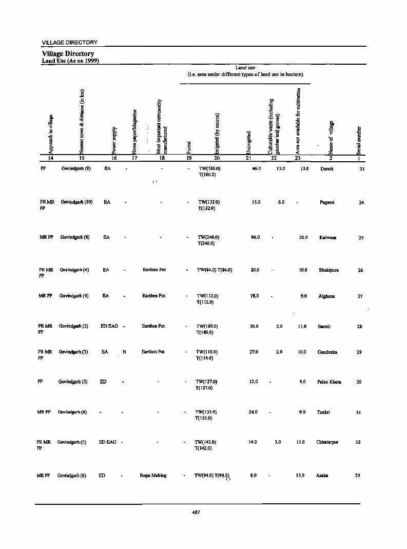
VILLAGE DIRECTORY
Village Directory Land Use (As on 1999)
E e .~ '8 '8 ,j
j E
t § ., :;;
~ oIlS ~ I , .s 8.1 .,
J I !: .5 ~ ~ ! II ~ eo
14 IS 16 17 18
FP Govindgarh (9) EA
1"
PRMR Govindgarh (10) EA FP
MR FP Govindgarh (8) EA
PRMR Govindgarh (4) EA Earthen Pot FP
MRFP Govindgarh (4) EA Earthen Pot
PRMR Govindgarh (2) EDEAG - Earthen Pot FP
PRMR Govindgarh (3) EA N Earthen Pot FP
FP Govindgarh (3) ED
MRFP Govindgarh (6)
PRMR Govindgarh (5) EDEAG . FP
MR FP Govindgarh (6) ED Rope Making
Land use
(Le. area under different types of land use in hectare)
~ I!:I 19
I 0 '" e
"C
! ~ 20
TW(186.0) T(I86.0)
TW(l32,O) T(132,O)
TW(246.0) T(246.0)
TW(84.0) T(84.0)
TW(112.0) T(112.0)
TW(189.0) T(189.0)
TW(I18.0) T(II8.0)
TW(127.0) T(127.0)
TW(I3S.0) T(13S.0)
TW(142.0) T(142.0)
TW(94.0) T(94.0) .J .-~
487
"'" ! '6 '2 t2 21
46.0
15.0
96.0
20.0
78.0
36.0
27.0
12.0
24.0
14.0
8.0
.~ .~ ~ -g u c:; .2 c ...... ._ ., _u
~ !I ~ t] :; i:i
l~ g ] ~:~
22 23
13.0 13.0
6.0
30.0
10.0
9.0
2.0 11.0
2.0 10.0
9.0
9.0
3.0 15.0
13.0
.t ... ~
I) .D
§ "0 c:
~ ~ il!:I
... .."
2
Doroli 23
Pagscri 24
Kaimasa 25
Shakipum 26
AlghBna 27
Baroli 28
GBndeeka 29
PalanKhem 30
Teekri 31
Chhatarpur 32
Asaka 33
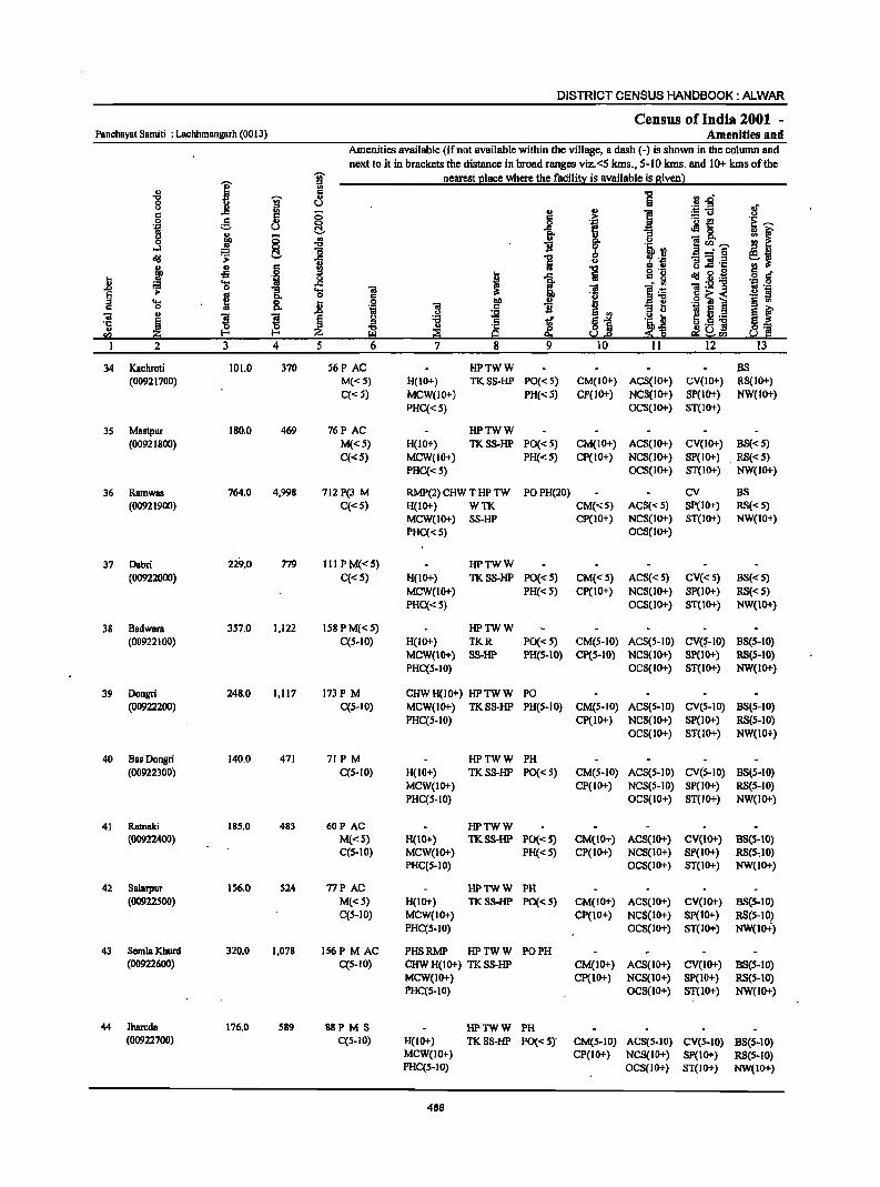
DISTRICT CENSUS HANDBOOK: ALWAR
Census of India 2001 -Panchayat Samiti : Lachhmangarh (0013) Amenities and
Amenities available (ifnot available within the village, a dash (-) is shown in the column and
next to it in brackets the distance in broad ranges viz.<S kms., SolO kms. and 10+ kms of the 'Ui' nearest place where the facility is available is given)
j :J '" " s: i '8 W " :: orl"
J! u ~.fi If s: 0 .. .,
] 0 :§. 5 § .:= ]~ 'E ~ 'i1 u 0 f! ~ 1- :I !;l r " I ~ '" t u - p. 0 li ~~~ .-l
.., lB ~, ~ -=§ .qj > ] U :J J! '1::
~ u § !I .., s: " " .s § c oS ...
1 ta 8_ .~ '" 'il 0
~ .qj 5l ._
" ~ 'g .c
1 'iI:2'g ';J .9
.&> "[ 'g ] ]~ .~ E § .... H 0 ] .9 bII ,6 ~ i § U) s: 0 p. 'iI s: ] :; tl til E
" 't;j .~ :l( §i ~ f 'iI l l Ii .g tf }~
e u ._ ·c Iii -0 s: &1.5 ] u u ·c 0 0:;; <Il ~ Z r::l 25 9 e:t Sa!=E! 1 ~!:!2 I.! III
2 3 4 5 6 7 8 9 10 11 12 13
34 Kachroti 101.0 370 56P AC HPTWW BS {0092 1700) M{<S) H(IO+) TKSS-HP PO«S) CM(IO+) ACS{IO+) CV(IO+) RS(IO+)
C«5) MCW(IO+) PH«5) CP(IO+) NCS(IO+) SP(lO+) NW(IO+) PHC{<S) OCS{IO+) ST(IO+)
35 Mastpur 180.0 469 76P AC HPTWW (00921800) M«5) H(IO+) TKSS-HP PO« 5) CM(IO+) ACS(IO+) CV(IO+) BS«5)
C«S) MCW(IO+) PH« S) Cp(IO+) NCS(lO+) SP(IO+) , R8«S) PHC«S) OCS(IO+) ST(IO+) NW(IO+)
36 Ramwas 764.0 4,998 712P(3 M RMP(2) CHW T HP TW POPH(20) CV B8 (00921900) C«5) H(IO+) WTK CM{<5) ACS« S) SP{IO+) RS«S)
MCW(IO+) SS.HP cp(10+) NCS(IO+) ST(IO+) NW(IO+)
PHC«S) OCS(IO+)
37 Dabri 229.0 779 II1PM«S) HPTWW (00922000) C«S) H(IO+) TKSS-HP PO« S) CM«5) ACS« 5) CV«S) BS«S)
MCW(1O+) PH« S) Cp(IO+) NCS(IO+) SP(IO+) RS«S) PHC{< S) OCS(IO+) ST(IO+) NW(IO+)
38 Badwara 3S7.0 1,122 158 PM«S) HPTWW (00922100) C(5-10) H(IO+) TKR PO« 5) CM(S-IO) ACS(5-10) CV(~-IO) B8(5-10)
MCW(1O+) SS-HP PH(S-IO) CP(5-10) NCS(IO+) SP(10+) RS(S-IO) PHC(S-IO) OCS(IO+) ST(1O+) NW(IO+)
39 Dongri 248.0 1,117 173P M CHWH(IO+) HPTWW PO (00922200) C(S-IO) MCW(IO+) TKSS-lIP PH(S-IO) CM(5-10) ACS(S-IO) CV(S-IO) BS(S-IO)
PHq5-10) Cp(IO+) NCS(lO+) 8P(l0+) R8(S-10) OCS(IO+) ST(IO+) NW(IO+)
40 Bas Donsri 140.0 471 71 PM lIPTWW PH (00922300) C(S-IO) H(lO+) TKSS-HP PO« S) CM(S-IO) ACS(S-IO) CV(S-IO) BS(5-10)
MCW(IO+) CP(IO+) NCS(S-IO) SP(IO+) R8(S-10) PHC(5-10) OCS(IO+) ST(IO+) NW(lO+)
41 Ratnaki 185.0 483 60P AC HPTWW (00922400) M«S) H(IO+) TKSS-HP PO«S) CM(IO+) ACS(IO+) CV(IO+) BS(S-IO)
C(S-IO) MCW(1O+) PH«S) CP(IO+) NC8(10+) SP(IO+) RS(S"IO) PHC(5-10) OCS(IO+) ST(IO+) NW(IO+)
42 Salarpur 156.0 S24 77P AC HPTWW PH (00922500) M«S) H(IO+) TK8S.HP PO« S) CM(IO+) ACS(IO+) CV(IO+) B5(S-10)
C(S-IO) MCW(IO+) CP(IO+) NCS(IO+) 8P(10+} RS(S-IO} PHC(S.IO) OC8(10+) 8T(10+) NW(ID+)
43 SemlaKhurd 320.0 1,078 IS6P M AC PHSRMP HPTWW PO PH (00922600) C{5-10) CHWH(IO+) TK8S-lIP CM(IO+) AC8(1O+) CV(IO+) B8(S-IO)
MCW(IO+) CP(IO+) NC8(10+} 8P(10+} RS(S-IO) PHC(5-10) OCS(lo+) ST(IO+) NW(lO+)
44 Jhareda 176.0 589 88PM8 HPTWW PH (00922700) C(5-10) H(IO+) TKSS-HP PO« 5)' CM(S-JO) ACS(S-IO) CV(S-IO) BS(5-10)
MCW(IO+) CP(lO+) NCS(IO+) SP(IO+) RS(S-IO) PHC(S-IO) OCS(IO+) ST(IO+) NW(IO+)
488
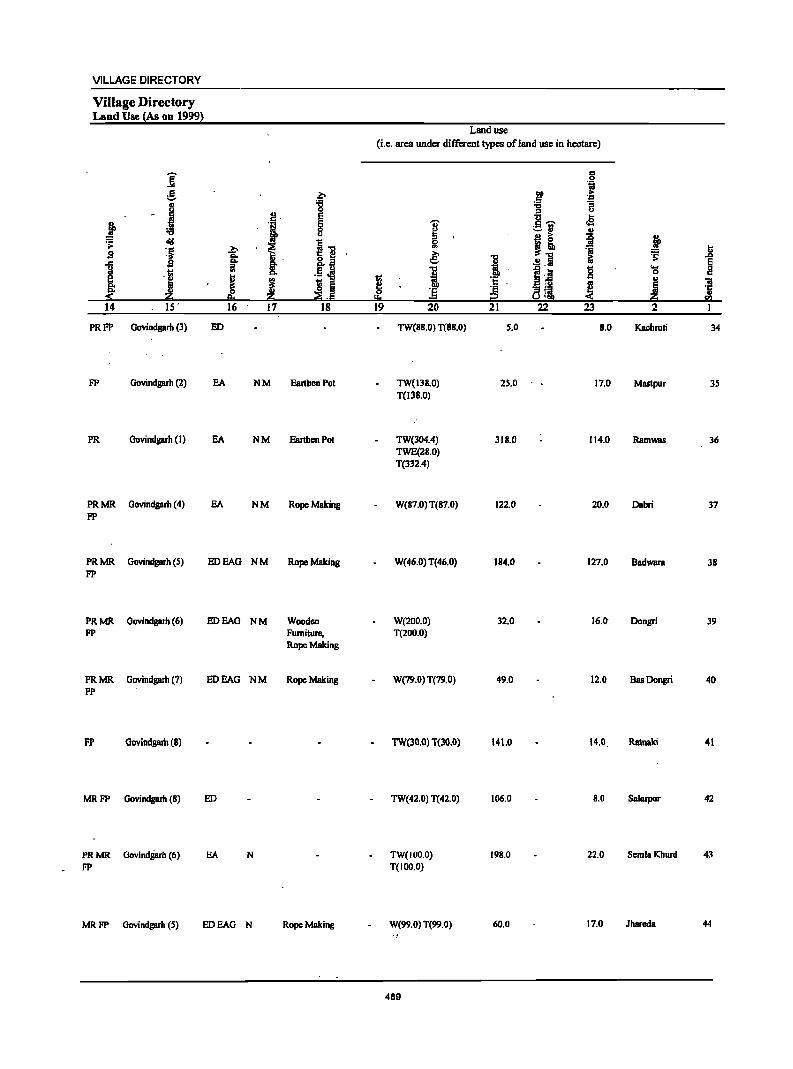
VILLAGE DIRECTORY
Village Directory Land Use (As on 1999)
i .S "-'
J j ~ := diI ..
',~ .s
J .s 'j Z
14 IS'
PRFP Govindgarb (3)
FP Govindgarh (2)
PR Govindgarh (I)
PRMR Govindgarh (4) FP
PRMR Govindgarh (5) FP
PRMR Govindgarh (6) FP
PRMR Govindgarh (7) FP
FP Goviodgarh (8)
MR FP Govindgarh (8)
PR MR Govindg.rh (6) FP
~,
f b "" ~ ~ ..
"" .. I ~
~ 16 17
ED
EA NM
EA NM
EA NM
EDEAG NM
EDEAG NM
EDEAG NM
ED
EA N
MR FP Govindgarb (5) EDEAG N
b 'B E
~ i] J~ li i ~'E
18
Earthen Pot
Earthen Pot
Rope Making
Rope Making
Wooden Furniture, Rope Making
Rope Making
Rope Making
Land use (i.e. area under different types of land use in hectare)
~ !!:I 19
I 0 '" .e: "'" i ] 20
TW(88.0) T(88.0)
TW(13B.O) T(138.0)
TW(304.4) TWE(28.0) T(332,4)
W(87.0) T(87.0)
W(46.0) T(46.0)
W(200.0) T(2oo.0)
W(79.0) T(79.0)
TW(30.0) T(3O.0)
TW(42,0) T(42.0)
TW(IOO.O) T(IOO.O)
W(99.0) T(99.0) .,
489
1 .!!!I t: ';: 2 21
5.0
25.0
318.0
122.0
184.0
32.0
49.0
141.0
106.0
198.0
60.0
c
'i bO .. c .~
:;; B ::s u .... §'il cB .. j! ~ j
t ~ j'i 8 .... ,j 0 .. a'!i ~ ! !~
22 23 2
8.0 Kaehroti
17,0 Maslpur
114.0 Ramwas
20.0 Dabri
127.0 Badwara
16.0- Dongri
12.0 BasDongri
14.0, Ratnaki
8.0 Salarpur
22.0 SemlaKhurd
17.0 Jhareda
.8 E " c
'"iii 'ij <Il
I
34
3S
36
37
38
39
40
41
42
43
44
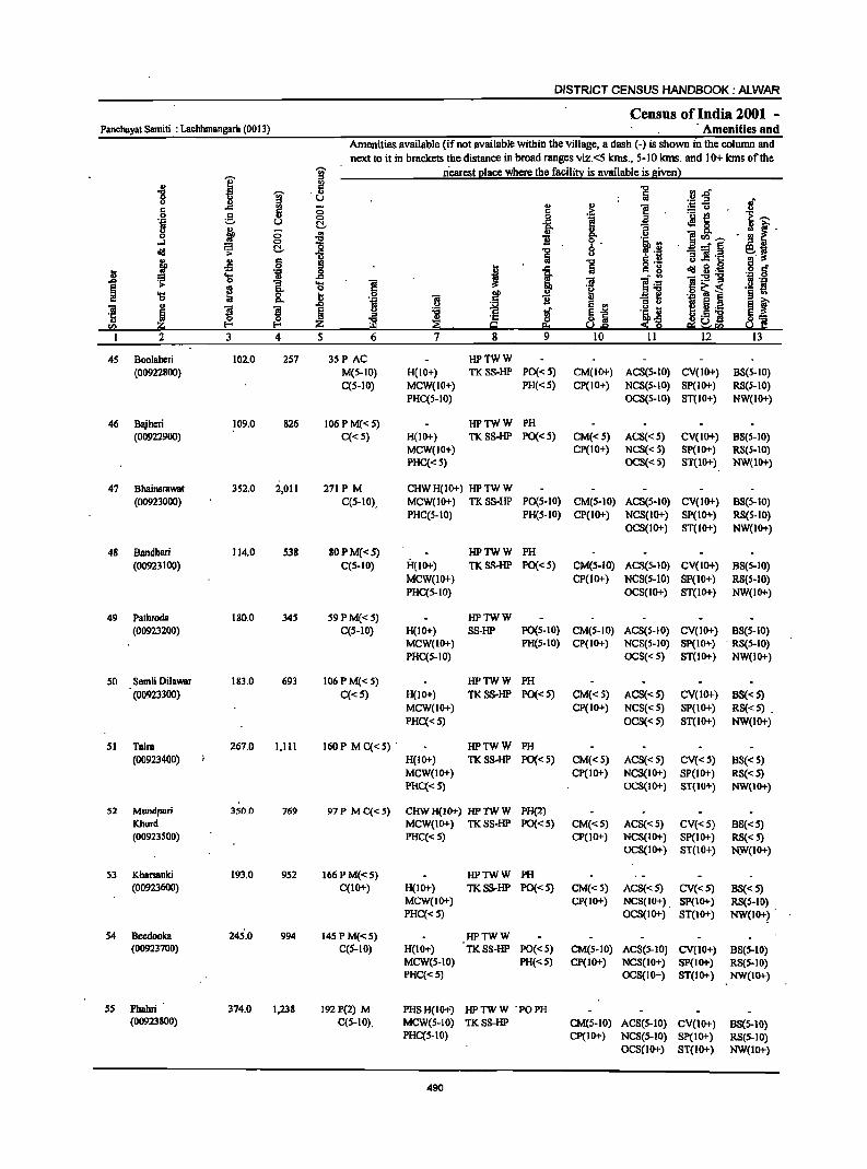
DISTRICT CENSUS HANDBOOK; ALWAR
Census of India 2001 -Panchayat Samiti : Lachhmangarh (0013) . Amenities and
Amenities available (if not available within the village, a dash (-) is shown in the column and next to it in brackets the distance in broad ranges viz.<5 kms., 5-10 kms. and 10+ kms of the
I i nearest 21ace where the facilit~ is available is Biven)
" 19 rl.o ....
i .1>
0 U u " '" .. ~~ .,. .: ..c ;::; .: .~ ·1, 0 e- o i
.- ~ Oil u t!. .el 0 u l ;::; .. 8- ] ~--0 B • !!I
...l 0 ." 9· old .;;: t!. ~ ] 8 -'"§ e.. '3 ] .t::
~ ~ IS ;j idl .1 g D 'g 0 J ?3 ..... ..c ";j:s!"'g .&> 0 "[ 'a ~ 'll
~ >
~ .g ~ ~ . fl 'a 0 II § ..
"- 5 .3 ~ f ~ ..
~ ~ ~ E t:j'B ., i o~ <I)
2 3 4 S 13
45 Boolaheri 102.0 2S7 3SP AC HPTWW (00922800) M(S-IO) H(lO+) TKSS-HP PO«5) CM(IO+) ACS(5-10) CV(IO+) BS(5-10)
C(5-10) MCW(IO+) PH«S) CP(IO+) NCS(S-IO) SP(IO+) RS(S-IO) PHC(5-10) OCS(5-10) ST(IO+) NW(IO+)
46 Bajheri 109.0 826 106 PM«5) HPTWW PH (00922900) C«S) H(lO+) TKSS-HP PO«5) CM«5) ACS«5) CV(IO+) 8S(S-10)
MCW(IO+) CP(IO+) NCS«5) SP(10+) RS(S-IO) PHC{< 5) OCS«5) ST{lO+) NW(lD+)
47 Bhainsrawat 352.0 2,011 271 PM CHWH(IO+) HPTWW (00923000) C(5-IO), MCW(lO+) TKSS-HP PO(5-10) CM(5-10) ACS(5-10) CV(IO+) BS(S-IO)
PHC(5-1O) PH(S-IO) CP(IO+) NCS(IO+) SP(IO+) RS(S-IO) OCS(IO+) ST(lo+) NW(IO+)
48 Bandheri 114.0 S38 80PM«S) HPTWW PH (00923100) C(5-10) H(IO+) TKSS-HP PO«S) CM(S-IO) ACS(5-10) CV(IO+) BS(S-IO)
MCW(IO+) CP(IO+) NCS(S-IO) SP(lO+) RS(5-10) PRC(S-JO) OCS(IO+) ST(IO+) NW(IO+)
49 Pathroda 180.0 345 59PM«5) HPTWW (00923200) C(5-10) H(IO+) SS-HP PO(5-10) CM(5-10) ACS(S-IO) CV(IO+) BS(5-10)
MCW(lO+) PR(S-IO) CP(IO+) NCS(S-IO) SP(IO+) . RS(S-IO) PHC(5-IO) OCS« 5) ST(lO+) NW(IO+)
50 Semli Dilawar 183.0 693 106P M«5) HPTWW PH (00923300) C«5) H(lO+) TKSS-HP PO«S) CM«5) ACS« S) CV(IO+) BS« 5)
MCW(IO+) CP(IO+) NCS«5) SP(IO+) RS« 5) . PHC« 5) OCS«S) ST(1O+) NW(IO+)
51 Taira 267.0 1,111 160P M C«5) . HPTWW PH (00923400) H(IO+) TKSS·HP PO«5) CM«5) ACS«5) CV«5) 8S« 5)
MCW(IO+) CP(IO+) NCS(IO+) SP(lO+) RS« 5) PHC{<5) OCS(IO+) ST{IO+) NW{IO+)
52 Mundpuri 350.0 769 97P MC{<5) CHWH(lo+) HPTWW PH(2) Khurd MCW(IO+) TKSS-HP PO{<5) CM«5) ACS«5) CV«S) 8S«S) (00923500) PHC«5) CP(IO+) NCS(IO+) SP(IO+) RS« 5)
OCS(IO+) ST(IO+) N~(IO+)
53 KharsBnki 193.0 952 166 P M«5) HPTWW PH (00923600) C(IO+) H(lO+) TKSS·HP PO«S) CM«S) ACS«S) CV«5) BS«5)
MCW(IO+) CP(IO+) NCS(IO+) . SP(IO+) RS(S-IO) PHC«5) OCS(IO+) ST(IO+) NW(IO+? .
54 Beedooka 245'.0 994 145 PM«S) HPTWW (00923700) C(S-IO) H(IO+) TKSS-HP PO«S) CM(S-IO) ACS(S-IO) CV(lO+) 8S(S-10)
MeW(S-IO) PH«S) cp(10+) NCS(IO+) SP(IO+) RS(S-IO) PHC«5) OCS(IO+) ST(IO+) NW(IO+)
55 Phahri 374.0 1,238 192 P(2) M PHSH(IO+) HPTWW 'POPH (00923800) C{S-IO), MeW(S-IO) TKSS-HP CM(S-IO) ACS(S-IO) CV(1O+) 88(S-10)
PHC(S-IO) CP(IO+) NCS(S-IO) SP(IO+) RS(5-10) OC8(10+) ST(IO+) NW(lO+)
490
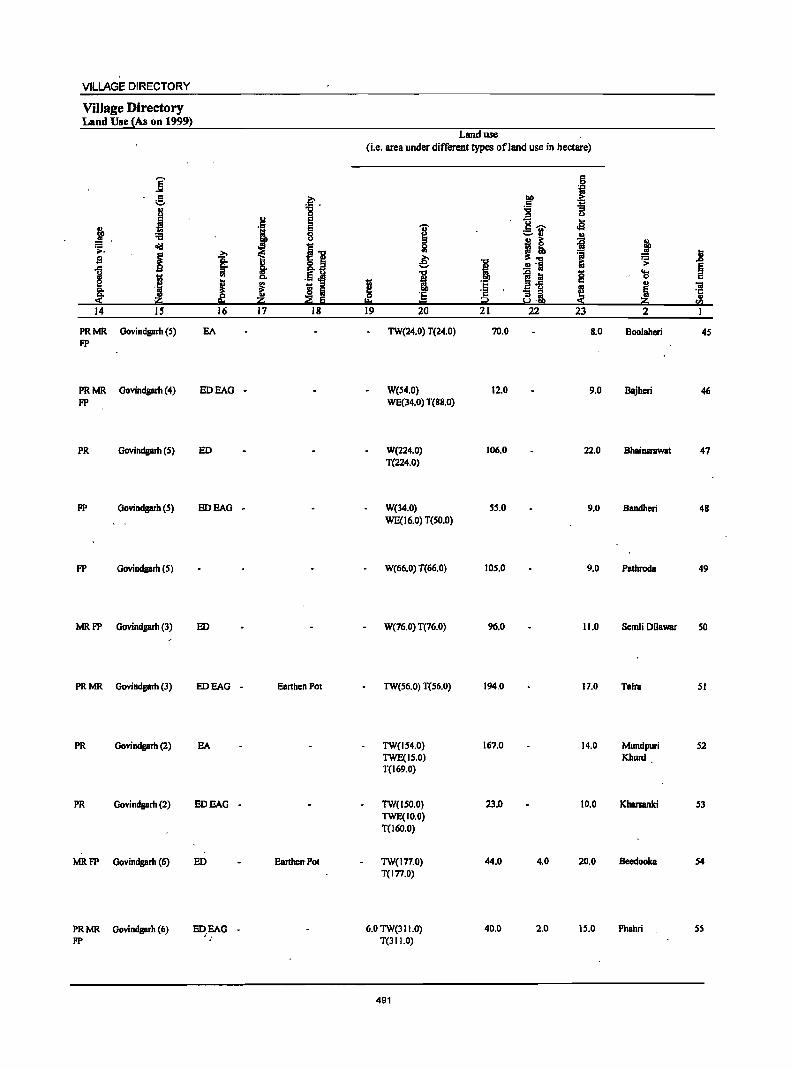
VILLAGE DIRECTORY
Village Directory Lind Use ~As on 1999)
j g .,
~ J ~. old
i B
1 I :f Z; 14 15
PRMR Govindgarh (5) FP
PRMR Govindgarh (4) FP
PR Govindgarh (5)
FP Govindgarh (5)
FP Govindgarh {5}
MR FP Govindgarh (3)
PR MR Govindgarh (3)
PR Oovindgarh (2)
PR Oovindgarh (2)
MRFP Govindgarh (6)
PR MR Govindgarh (6) FP
~ . ~ s
J s 8
il ~ Q,
~ §. .! Q,
J ~ l!l Iii ~ ::2 Iii
16 17 18
EA
EDEAG -
ED
EDEAG -
ED
EDEAG - BanhenPot
EA
EDEAG -
ED EanherrPot
Land use (i.e. area under different types ofland use in hectare)
I .. ~ ~
! 1;;
~ 'E =
19 20
TW(24.0) T(24.0)
W(54.0) WE(34.0) T(SS.O)
W(224.0) T(224.0)
W(34.0) WE(16.0) T(50.0)
W(66.0) T(66.0)
W(76.0) T(76.0)
TW(56.0) T(56.0)
TW(154.0) TWE(15.0) T(169.0)
TW(ISO.O) TWE(1O.0) T(I60.0)
TW(177.0) T(I77.0)
6.0 TW(311.0) T(311.0)
491
1 '8 'E i2 21
70.0
12.0
106.0
55.0
105.0
96.0
194.0
167.0
23.0
44.0
40.0
,!a t;j
.~ ~ 'g ~.- .s ._ '" ~.,
~ I! .~
.!! 'Iii illS
f! iii g a-5 8·i ~
22 23
S.O
9.0
22.0
9.0
9.0
11.0
17.0
14.0
10.0
4.0 20.0
2.0 15.0
j ~
~ ... ~ 'a ., 'if
! ·c ., til
2
Boolahen 45
Bajheri 46
Bhainsrawat 47
Bandheri 48
Pathroda 49
Scmli Oilawar 50
TaIra 51
Mundpuri 52 Khurd
Kbarsanki 53
Beedooka 54
Phahri S5
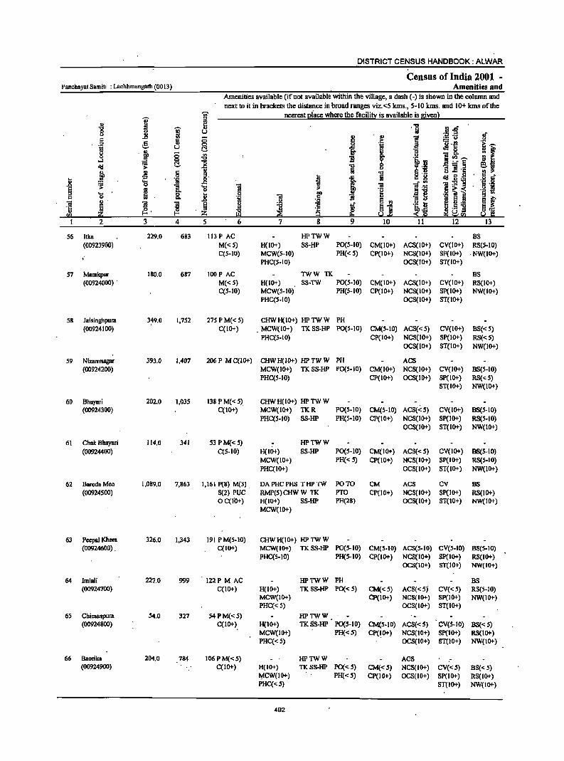
DISTRICT CENSUS HANDBOOK: ALWAR
Census of India 2001 -Panchayat Samiti : Lachhmangarh (OO13) Amenities and
Amenities available {if not available within the village, a dash (-) is shown in the column and
next to it in brackets the distance in broad ranges viz.<5 kms., 5-10 kms. and 10+ kms of the 'in' nearest l!iace where the facili~ is available is given}
I = ., 5 .] ~..d' '8 J! I u .~ .a or § ;; 8 .~ i
:: u .s.! c 0 .§. W 'iiH! j!;~ 'g -=- u C!. ... 0
if .,!' ;; ., .. go ] Q. "0 B '~.~ <1)--.
....:I 0 ] ;..... § ~ .;;: C!. ij 0
u B] 'C
l .s c ., ] ~ 'g 0 l I -a ~.8~ .~ ~f .il .... 'i
l~ .;; 0 ]. ..... 1 ~ "iI
1~i B 'j § .. 0 'e '§ ., 's ~ 0 ~ I c Q. .~ "iI B '" I! ! ~.- 9 f "'. ,Q .2 91 "iI
~. ~ § l .s:: ~ ~ "0 § ~.s ] de ~ '1:;
" l!::i :z; a !o!.e s~ f!2 ~5iQ 2 3 4 5 6 7 8 9 10 11 12 13
S6 Ilka 229.0 683 113 PAC HPTWW BS (00923900) M«S) H(10+) SS-HP PO(S-IO) CM(IO+) ACS(IO+) CY(10+) RS(S-IO)
C(S-IO) MCW(S-IO) PH« S) CP(IO+) NCS(IO+) SP(IO+) . NW(IO+) . PHC(S-IO) OCS(1O+) ST(IO+)
57 M8mkpur 180.0 687 100 PAC TWW TK BS (00924000) . M«S) H(IO+) SS-TW PO(S-IO) CM(IO+) ACS(IO+) CY(10+) RS(IO+)
C(S-IO) MCW(S-IO) PH(S-IO) CP(IO+) NCS(IO+) SP(IO+) NW(IO+) PHC(S-IO) OCS(IO+) ST(1O+)
58 Jaisinghpum 349.0 1,752 275 P M« S) CHW H(IO+) HP TW W PH (00924100) C(IO+) . MCW(IO+) TKSS-HP PO(S-IO) CM(5-10) ACS«5) CY(IO+) BS«S)
PHC(S-IO) CP(IO+) NCS(IO+) SP(IO+) RS«S) OCS(IO+) ST(IO+) NW(IO+)
59 Nizamnagar 393.0 1,407 206 P M C(IO+) CHWH(IO+) HPTWW PH ACS (00924200) MCW{IO+) TK SS-HP PO(S-IO) CM(lO+) NCS(IO+) CY{IO+) BS(S-IO)
PHC(5-1O) CP(IO+) OCS(IO+) SP(IO+) RS«5) ST(IO+) NW(IO+)
60 Bhayari 202.0 1,035 138 P M«5) CHWH(IO+) HPTWW (00924300) C(IO+) MCW(IO+) TKR PO(S-IO) CM(5-10) ACS«S) CY(IO+) BS(S-IO)
PHC(S-IO) SS-HP PH(S-IO) CP(IO+) NCS(IO+) Sp(IO+) RS(S-IO) OCS(IO+) ST(IO+) NW(IO+)
61 Chak Bhayari 114.0 341 53 PM« 5) - HPTWW (00924400) C(5-10) H(IO+) 88-HP P0(5-10) CM(IO+) ACS«S) CY(1O+) BS(5-10)
MCW(IO+) PH« S) CP(IO+) NC8(10+) Sp(IO+) RS(S-IO) PHC(1O+) OCS(IO+) ST(1O+) NW(IO+)
62 BarodaMeo 1,089.0 7,863 1,161 P(8) M(3) . DA PHC PHS T HP TW PO TO CM ACS CY BS (00924500) 8(2) PUC RMP(S) CHW W TK PTa CP{IO+) NC8(10+) Sp(IO+) R8(10+)
OC(lll+) H{IO+) SS-HP PH(28) OC8(IO+) ST(IO+) NW(IO+) MCW(IO+)
63 Peepal Khera 326.0 1,343 191 P M(S-IO) CHW H(IO+) HP TW W (00924600) . C(IO+) MCW(IO+) TKSS·HP PO(5-10) CM(S-IO) ACS(S.IO) eY(S-IO) BS(5-10)
PHC(S-IO) PH(S-IO) CP(IO+) NC8(10+) Sp(IO+) RS(IO+) OCS(IO+) ST{IO+) NW(IO+)
64 Imlali 227.0 999 122P M AC HPTWW PH BS (00924700) C(IO+) H(IO+) TKSS·HP PO«S) CM«S) ACS«S) ey«S) RS{S-IO)
MCW(IO+) CP(IO+) NCS(IO+) Sp(IO+) NW(IO+) PHC« 5) OCS(IO+) ST{IO+)
65 Chimanpura 54.0 327 54 PM«5) HPTWW -(00924800) C(IO+) H(IO+) TKSS·HP I'O(S-IO) CM(5·IO) AC8«S) CV(S-IO) BS«S)
MCW(IO+) PH«5) Cp(IO+) NCs(io+) Sp(IO+) RS(IO+) PHC« 5) OCS{IO+) ST{IO+) NW(IO+)
66 Baorika 204.0 784 I06PM«S) HPTWW ACS .-(00924900) .. C(IO+) H(IO+) TKSS-HP PO«S) CM«5) NCS(IO+) CV«5) BS« S)
¥CW(IO+) PH«S) CP(IO+) OCS(IO+) SP(IO+) RS(lO+) PHC«5) ST{IO+) NW(JO+)
492
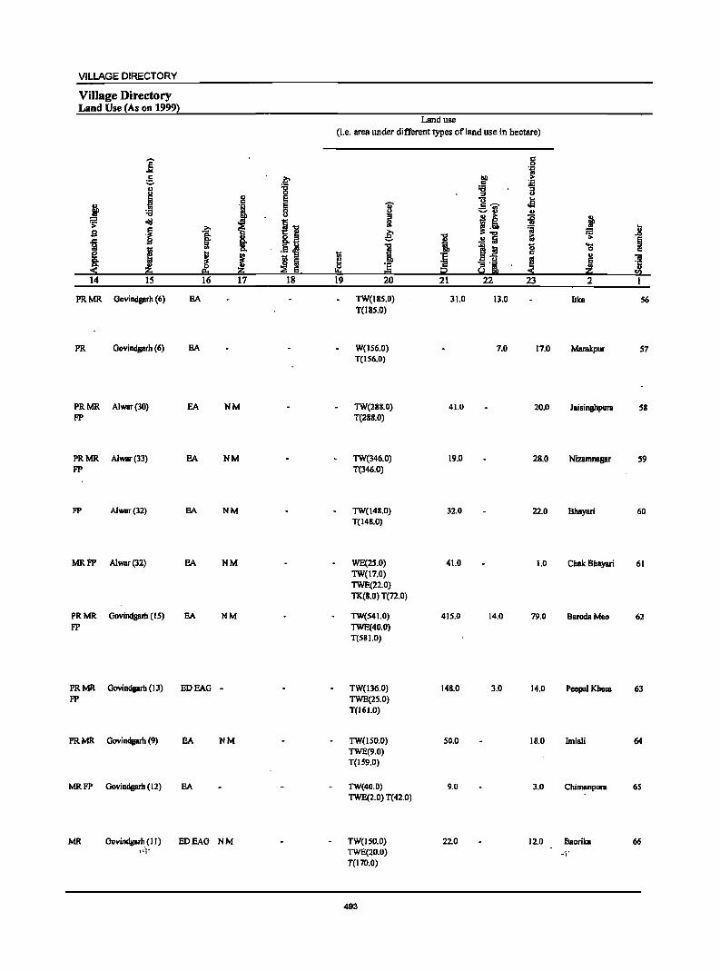
VILLAGE DIRECTORY
Village Directory Land Use (As on 1999}
Land use
(Le. area under different types of land use in hectare)
j c .2 1;; e f .~ i ., 't:I
J ::I
:!! E ]';i' .. J I ~ I .a
~ ., .!!
~ ~
.11 j! iI • s i .2;-
& =a :s j t §. 1 .!! Iii [; § ~ I c:>. 1 It 0 ~ c
~ J ! I I ti :g c II)
~ ~ ~ ~ 'e c ~ ! t::! i2 14 15 16 17 18 19 20 21 22 23 2 1
PRMR Govindgarh (6) EA TW(IR5.0) 31.0 13.0 lIke 56 T(J8S.0)
PR Govindgarh (6) EA W(156.0) 7.0 17.0 Marakpur 57 T(IS6.0)
PRMR. Alwar(30) EA NM TW(288.0) 41.0 20.0 Jaisinghpura 58 FP T(288.0)
PRMR Alwar(33) EA NM TW(346.0) 19.0 28.0 Nizamnagar S9 FP T(346.0)
FP Alwar(32) EA NM TW(148.0) 32.0 22.0 8hayari 60 T(148.0)
MRFP Alwar(32) EA NM WE(lS.O) 41.0 1.0 Chak Bhayari 61 TW(l7.0) TWE(22.0) TK(8.0) T(72.0)
PRMR. Govindgarh (15) EA NM TW(54 1.0) 415.0 14.0 79.0 8erodaMeo 62 FP TWE(40.0)
T(581.0)
PRMR Govindgarb (13) EDEAG - TW(l36.0) 148.0 3.0 14.0 Peepal Khera 63 FP TWE(25.0)
T(161.0)
PRMR Govindgarh (9) EA NM TW(1S0.0) 50.0 18.0 Imlali 64 TWE(9.0) T(IS9.0)
MRFP Govindgarh (12) EA TW(40.0) 9.0 3.0 Chimanpura 65 TWE(2.0) T(42.0)
MR Govindgarh (II) EDEAG NM TW(JSO.O) 22.0 12.0 8aorika 66 1::11 TWE(20.0) ·-'i'
T(170.0)
493
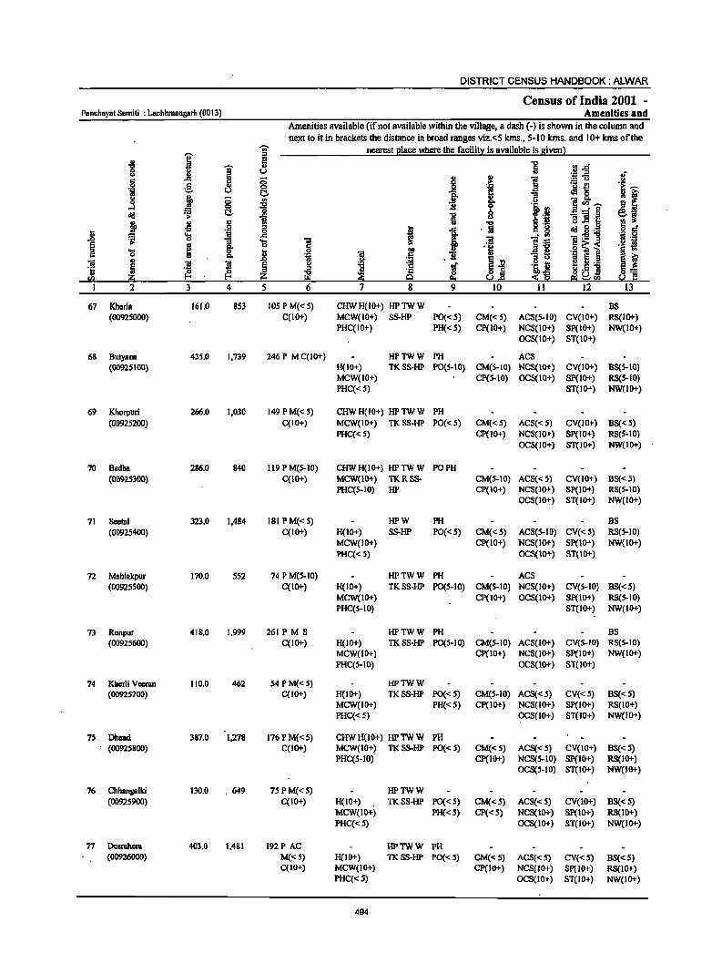
DISTRICT CENSUS HANDBOOK: ALWAR
Census of India 2001 -Ponchnyot 8amiti : Lochhmangarh (0013) Amenities and
Amenities available (ifnol available within the village, a dash (-) is shown in the column and n~t 10 it in brackets the distance. in broad ranges viz.<5 kms., 5-10 krns. and 10+ kms of the
-;;;- nearest 21ace where the faci1i!l: is available is givenl
" ]' ~ ] rJ"O g 1 ~ u ~-5 u'
S rn ;; 2!
.,
i " e i .~ ._ ~ .~ ~ 0 _g f! 'iI u ~ ~ 8. u ~ ;; '" i 8- !l r j 0 -a .,
l! S<ll~ old i C!- '0 -a b ~§
~~ ..c: u 'E ]! .\:: ~ " .§ ~ Iii -a § '8 I,) .9 6 d' n oS I 1
. Iii old g:g :::l 'I:l 'OJ ..c: li "ii~ .~ .,
1 1 .... ] ]I '::1 .. g ., '!:! c~< '§ ~ ....
.8 .~ .9 l 0 ·tiI i .1i II) "3 ~ e ~ 'il i ! ~ E g 1!! ~ ~j .~ t; I ~L_
.~ :i .t: H .51 B:= sa '" i;\;l Q 9::t ~1! e:i~<Il s.! ~ I 2 3 4 5 6 7 8 9 10 11 12 13
67 Kherla 161.0 853 lOS P M« 5) CHWH(IO+) HPTWW BS (00925000) C(IO+) MCW(IO+) SS-HP PO«5) CM«S) ACS(S-IO) CV(IO+) RS(IO+)
PHC(IO+} PH« S} CP(IO+) NCS(lO+) SP(IO+) NW(IO+) OCS(IO+) ST(IO+)
68 BUlyana 43S.0 1,739 246 P M C(IO+) HPTWW PH ACS (00925100) H(IO+} TKSS-HP PO(S-IO) CM(S-IO) NCS(IO+) CV(IO+) BS(S-IO}
MCW(IO+) CP(S-IO) OCS(IO+) 8P(l0+) RS(S-IO} PHC« S) 8T(10+) NW(IO+)
69 Khorpuri 266.0 1,030 149 P M« 5) CHWH(IO+) HPTWW PH (00925200) C(lO+) MCW(IO+) TKSS-HP PO«S) CM«5) ACS« 5) CV(IO+) BS« 5)
PHC« 5) CP(lO+) NCS(lO+) SP(lO+) RS(5-IO) OCS(IO+) ST(IO+) NW(IO+)
70 Bedha 286.0 840 119 P M(S-IO) CHWH(IO+) HPTWW PO PH (00925300) C(lO+) MCW(lO+) TKRSS- CM(S-IO) ACS« S} CV(lO+} BS« S}
PHC(S-IO) HP CP(IO+) NCS(IO+) SP(IO+) RS(5-IO) OCS(IO+) ST(IO+) NW(IO+)
71 Seetal 323.0 1,484 181 P M« 5) HPW PH BS (00925400) C(IO+) H(IO+) SS-HP PO«5) CM«S) ACS(S-IO) CV«S) RS(5-10)
MCW(IO+) CP(IO+) NCS(IO+) SP(IO+) NW(IO+) PHC« S) OC8(tO+) 8T(10+)
72 Mahlakpur 170.0 552 74 P M(5-10) HPTWW PH AC8 (00925500) C(IO+) H(IO+) TKSS-HP PO(S-IO) CM(S-IO) NCS(IO+) CV(S-IO) BS«S)
MCW(IO+) CP(lO+) OCS(lO+) 8P(10+) RS(5-10) PHC(S-IO) ST(IO+) NW(IO+)
73 Ronpur 418.0 1,999 261 PM S HPTWW PH BS (00925600) C(IO+) H(IO+) TKSS-HP PO(5-1O) CM(5-10) ACS(IO+) CV(5-10) RS(5-10)
MCW(IO+) Cp(IO+) NCS(IO+) SP(IO+) NW(IO+) PHC(5-IO) OC8(10+) 8T(10+)
74 Kherli Veeran 110.0 462 54 P M« 5) HPTWW (00925700) C(IO+) H(IO+) TK8S-HP PO«5) CM(5-10) AC8« 5) CV«5) BS« 5)
MCW(IO+) PH«5) Cp(IO+) NCS(IO+) SP(IO+) RS(IO+) PHC«S) OCS(IO+) ST(10+) NW(IO+)
75 Dhand 387.0 1,278 176 P M«5) CHWH(lO+) HPTWW PH (00925800) C(IO+) MCW(IO+~ TKSS-HP PO«5) CM«5) ACS«5) CV(IO+) BS(":; 5)
PHC(S-IO) CP(10+) NCS(5-10) Sp(IO+) RS(IO+) OCS(~-10) ST(IO+) NW(IO+)
76 Chhangalki 130.0 .649 75 P M«5) HPTWW (00925900) C(IO+) H(IO+) TKSS-HP PO« S) CM«S) ACS«5) CV(IO+) BS« S)
MCW(IO+) PH«5) CP«5) NCS(IO+) SP(IO+) RS(lO+) PHC«S) OCS(IO+) ST(IO+) NW(IO+)
77 Dusrahem 403.0 1,481 192 PAC HPTWW PH (00926000) M(:,S) H(IO+) TKSS-HP PO« S) CM«5) ACS«S) CV«S) BS«5)
C(IO+) MCW(lO+) CP(IO+) NCS(IO+) Sp(IO+) RS(10+) PHC«S) OCS(10+) ST(IO+) NW(IO+)
494
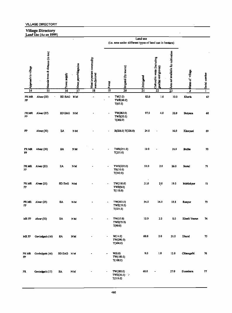
VILLAGE DIRECTORY
Village Directory Land Use (As on 1999)
Land use
(i.e. area under different types ofland use in hectare)
]' .§ 1;1
g .~ all ;;. .5 ~ .. 't:J -g
.1 0 <> .. E 1!~ .s
~ .5 E .,
"0 f 8 ~ :=-13 ..
.;: diI
il 5l I! ~ i ..
~ :>.
& '2 = .8 S 'S.
..r: §' .. 1 ! .!! Iii ~ '> §
1 'J .. !: j 1~ g ~ c
J I li Iii 1 'E
~ I "iI
.~ 'c ~ ! °is .2; ~ Iii "'" .j2 fa
14 IS 16 17 18 19 20 21 22 23 2 I
PRMR Alwur(30) IIDEAG NM TW(7.0) 83.0 1.0 10.0 Kherla 67 FP TWE(60.0)
T(67.0)
PRMR Alwar(27) EDEAG NM TW(282.0) 97.0 4.0 32.0 Butyana 68 FP TWE(20.0)
T(302.0)
FP Alwar(30) EA NM R(226.0) T(226.0) 24.0 16.0 Khorpuri 69
PRMR Alwar(30) EA NM TWE(2SI.0) 19.0 16.0 Sedha 70 FP T(25 1.0)
PRMR Alwar(23) EA NM TWE(232.0) 53.0 2.0 26.0 Seetal 71 FP TK(IO.O)
T(242.0)
PRMR Alwar(2S) IIDEAG NM TW(IIO.O) 31.0 2.0 19.0 Mahlakpur 72 FP TWE(8.0)
T(118.0)
PRMR Alwar(2S) EA NM TW(J02.0) S4.0 24.0 18.8 Ronpur 73 FP TWE(19.0)
T(32 1.0)
MRFP Alwar(32) EA NM TW(IS.O) 10.0 2.0 8.0 Kherli Veeran 74 TWE(7S.0) T(90.0)
MRFP Govindgalh (16) EA NM W(l4.0) 60.0 2.0 21.0 Dhand 75 TW(290.0) T(304.0)
PRMR Govindgarh (16) EDEAG NM W(8.0) 9.0 1.0 12.0 Chbangalki 76 FP TW(IOo'o)
T(103.0)
PR Govindgarh (17) EA NM TW(280.0) 60.0 27.0 Dusrahcra 77 TWE(36.0)· ',' T(316.0)
495
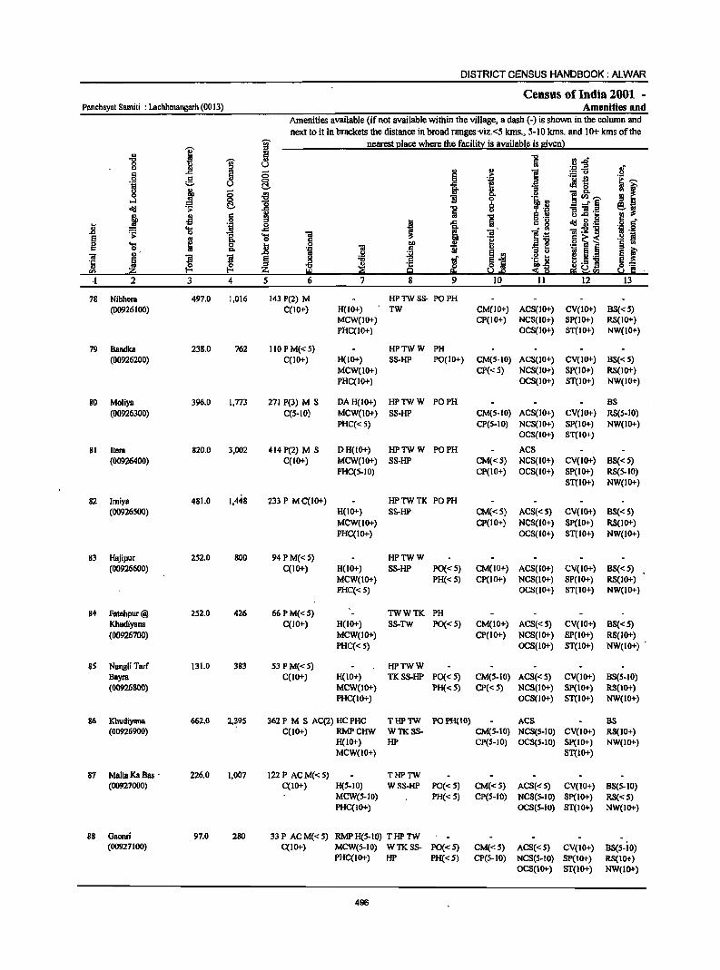
DISTRICT CENSUS HANDBOOK: ALWAR
Census of India 2001 -Panchaynt Samiti : Lachhmangnrh (0013) Amenities and
Amenities available (ifnot available within the village, a dash (-) is shown in the column and
next to it in brackets the distance in broad ranges·viz.<5 kms., 5-10 kIns. and 10+kms of the
I ~ nearest I2lace where the facilit~ is available is givenl
'" 2 "0
J '" ·B~ 0 u u
i .~ .~ <5 .~ i g 0 E ~ c:!.
j 8 I g. - p.
...l 1i ~ CIl '"'
<Ill ;> c:!. i 8 i'iir.§
.t -1l .:: i u .c ...
0
t <Ill g.g n ~ 'iii ;a:5!"8 ..c .;;: 1. ~ § ~ ~ 0 n .§ ~ i c p.
0; = ;a ",' a 11 ..c 12 .,._
'5 Iii ~ ~ § ~8]
CIl z ·1 2 3 4 5 12
78 Nibhera 497.0 1,016 143 P(2) M HP TW SS- PO PH (00926100) C(IO+) H(10+) TW CM(IO+) ACS(IO+) CV(IO+) BS« 5)
MCW{IO+) CP(IO+) NCS(IO+) SP(IO+) RS{IO+) PHC(IO+) OCS(IO+) ST(IO+) NW(lO+)
79 Bandka 238.0 762 110 PM« 5) HPTWW PH (00926200) C{IO+) H(IO+) SS-HP PO(IO+) CM(S-IO) ACS(IO+) CV(IO+) BS« 5)
MCW(IO+) CP« S) NCS(IO+) SP(10+) RS(IO+) PHC(IO+) OCS(IO+) ST(IO+) NW(IO+)
80 Moliya 396.0 l,n3 271 P(3) M S OA H(IO+) HPTWW PO PH BS
(00926300) C(5-10) MCW(IO+) SS-HP CM(5-10) ACS(IO+) CV(10+) RS(5-10)
PHC« 5) CP(5-1O) NCS(IO+) SP(IO+) NW(IO+) OCS(IO+) ST(10+)
81 Itera 820.0 3,002 414 P(2) M S OH(IO+) HPTWW PO PH ACS
(00926400) C(1O+) MCW(IO+) SS-HP CM«S) NCS(IO+) CV(10+) BS« S) PHC(S-IO) CP(IO+) OCS(IO+) SP(IO+) RS(5-IO)
ST(IO+) NW(lO+)
82 Imiya 481.0 1,448 233 P M C(1O+) HPTWTK PO PH (00926500) H(10+) SS-HP CM«S) ACS«S) CV(IO+) BS« 5)
MCW(IO+) CP(IO+) NCS(lO+) SP(1O+) RS(IO+) PHC(IO+) OCS(10+) ST(IO+) NW(IO+)
83 Hajipur 252.0 800 94 P M«5) HPTWW (00926600) C(IO+) H(10+) SS-HP PO« 5) CM(IO+) ACS(IO+) CV(IO+) BS« 5)
MCW(IO+) PH«5) CP(IO+) NCS(IO+) SP(IO+) RS(IO+) PHC«5) OCS(IO+) ST(IO+) NW(IO+)
84 Fatehpur@ 252.0 426 66PM«S) TWWTK PH
KhudiY8n8 C(1O+) H(lO+) SS-TW PO« S) CM(IO+) ACS«S) CV(IO+) BS«S) (00926700) MCW(IO+) CP(1O+) NCS(lO+) SP(IO+) RS(10+)
PHC«5) OCS(IO+) ST(lO+) NW(IO+)
8S Nangli Tarf 131.0 383 53 P M«S) HPTWW Bayra C(IO+) H(lO+) TKSS-HP PO«S) CM(S-lO) ACS« S) CV(IO+) BS(5-10) (00926800) MCW(lO+) PH« 5) CP«5) NCS(10+) SP(IO+) RS(IO+)
PHC(IO+) oeS(IO+) ST{lO+) NW{IO+)
86 Khudiyana 662.0 2,~9S 362 P M S AC(2) HC PHe THPTW POPH(IO) ACS BS (O0926900) C(10+) RMPCHW WTKSS- CM(5-10) NCS(S-IO) CV(IO+) RS(10+)
H(lO+) HP CP{5-1O) OCS(5-10) SP(IO+) NW(IO+) MCW(IO+) ST{lO+)
87 MallaKaBas - 226.0 1.007 122 P AC M{< S) THPTW (00927000) C(IO+) H(S-IO) WSS-HP PO«S) CM«S) ACS«S) eV(lo+) BS(S-IO)
MCW(S-IO) PH«5) CP(5-10) NCS(S-IO) SP(lO+) RS{< 5) PHC(IO+) OeS(S-IO) ST(IO+) NW(IO+)
88 Oaomi 97.0 280 33P ACM«S) RMPH{5-1O) THPTW {00927 100) C(IO+) MCW(S-IO) WTKSS- PO«5) CM«S) ACS«S) CV(IO+) BS(S-iO)
PHC(IO+) HP PH«S) CP(S-IO) NCS(5-10) SP(IO+) RS(IO+) OCS{IO+) ST{IO+) NW(IO+)
496
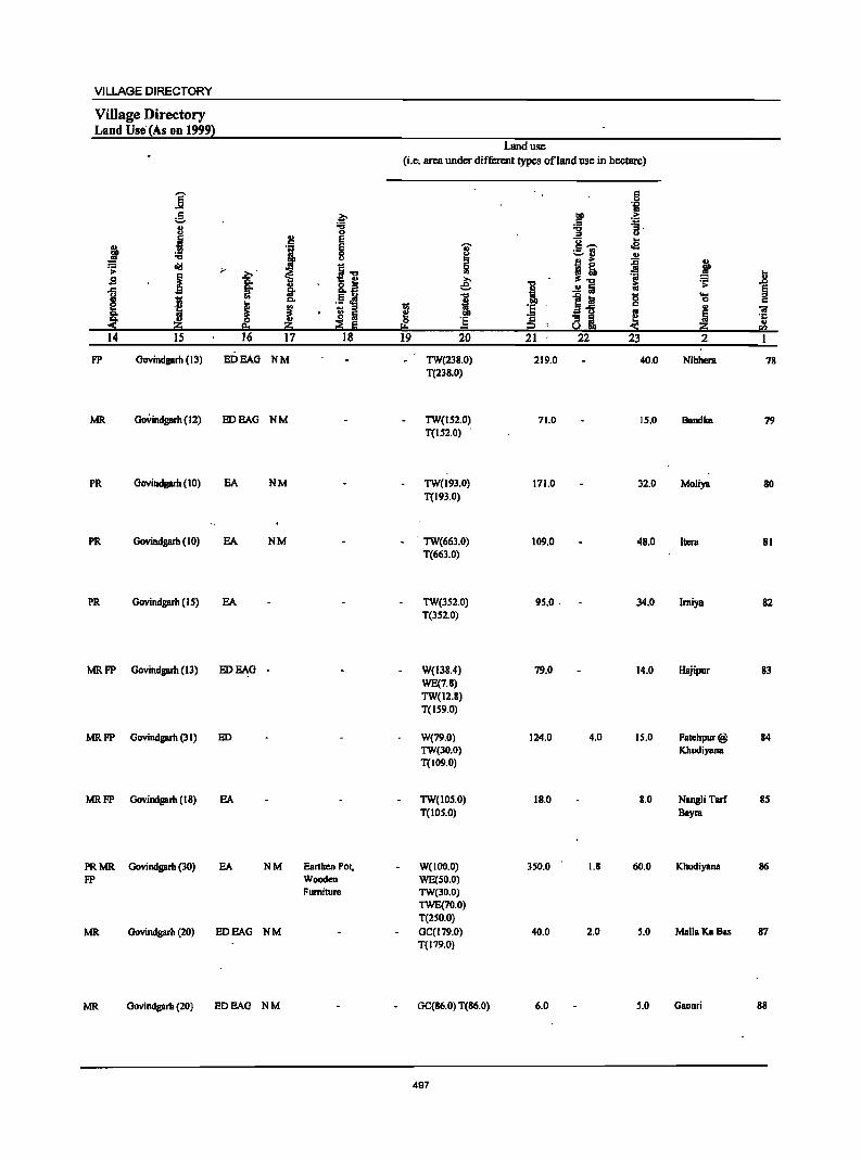
VILLAGE DIRECTORY
Village Directory Land Use'(As on 1999l
Land use (i.e; area under different types of land use in hectare)
]' .:
:1 g ~ J i '3.
0 u 2! e 8,-. .8 j I
E I :a 8 '=-rl .!!
~ oil! ;.. i"" 51 j! ~ j I
_2;-' ~ .8 s §: ·!i e 1 ~
1 §. .!! Iii <U
~ ·1
OJ D. i e iii g '(;
J E ] 'E a'5 ~ .,
01
~ IS Iii
~ ·s Qi j '5
~ ~ ~ E 2 « en 14 IS 16 17 18 19 20 21 22 23 2 1
FP Govindgarh (13) EDEAG NM TW(238.0) 219.0 40.0 Nibhera 78 T(238.0)
MR Govindgarh (12) ED BAG NM TW(IS2.0) 71.0 IS.O BBndka 79 T(1S2.0) .
PR Govindgarh (10) EA NM TW(l93.0) 171.0 32.0 Moliya 80 T(193.0)
PR Govindgarh (10) EA NM TW(663.0) 109.0 48.0 Itcra 81 T(663.0)
PR Govindgarh (I S) EA TW(3S2.0) 95.0 . 34.0 Imiya 82 T(3S2.0)
MRFP Govindgarh (13) ED BAG - W(138.4) 79.0 14.0 Hajipur 83 WE(7.8) TW(12.8) T(159.0)
MRFP Govindgarh (31) ED W(79.0) 124.0 4.0 IS.O FBtchpur@ 84 TW(30.0) Khudiyana T(109.0)
MRFP Govindgarh (18) BA TW(IOS.0) 18.0 8.0 NangliTarf 8S T(10S.0) Bayra
PRMR Govindgarh (30) BA NM Earthen PoI, W(lOO.O) 350.0 1.8 60.0 Khudiyana 86 FP Wooden WE(SO.O)
Furniture TW(JO.O)
TWE(70.0) T(250.0)
MR Govindgarh (20) ED BAG NM GC(179.0) 40.0 2.0 S.O Malia Ka Bas 87 T(179.0)
MR Govindgarh (20) ED BAG N M GC(86.0) T(86.0) 6.0 5.0 Gaonri 88
497
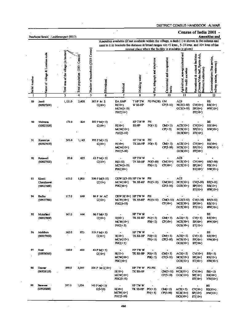
DISTRICT CENSUS HANDBOOK: ALWAR
Census of India 2001 -Panchayat Samiti : Lachhmangarh (0013) Amenities and
'Amenities available (if not available within the village, a dash .(-) is shown in the column and next to it in brackets the distance in broad ranges viz.<5 kms., 5-10 kms. and 10+ kms of the
I'--~ ]' nearcst I.!lacc where the facilitl::: is available is given) ., .. c
rJ.c "8 '" ' .. ;g u ;E-5
·1 ~. ~ (5 '" c ._ ~
0 .g_ :::- u C .~ 8. j
.~ 8 ~ _!L ]rIl~
~ .!l _" § cij C ii ] 1l] '§ .t '" § ;g -5 ,
'E 'i ..8 cij~:a . ;;: :; ....
~ 'ii .• "
~ g- o jil .... jj 13 0 C>.. 's m l ~ ~ .g :a I!:! !:! .•
."" ~ i:l u ] 3 ·4 5 6 7
89 Jawli 1,121.0 3,408 507P M S DARMP THPTW POPH(28) CM ACS BS (00927200) C(IO+) H(IO+) WSS-HP CP(S-IO) NCS(S-IO) CV(lO+) RS(lO+)
MCW(S-IO) OCS(5-1O) SP(IO.fo) NW(IO+) PHC(lO+) 8T(10+)
90 Mahrana 171.0 824 107PM«5) HPTWW PH BS (00927300) C(lO+) H(lO+) 8S·HP PO« 5) CM«5) ACS(IO.fo) CV(IO-I-) RS(lO-I-)
MCW(IO+) CP«S) NCS(IO.fo) SP(\O.fo) NW(IO-I-) PHC(5-IO) OCS(IO+) ST(lO-I-)
91 Kareeriya 303.0 1,143 195 P M«5) HPTWW PH BS (00927400) C(IO+) H(IO+) TKSS-HP PO« S) CM«S) ACS(IO+) CV(IO+) RS(IO+)
MCW(IO+) CP(S-IO) NCS(lO.fo) SP{1O+) NW{10+) PHC(S-IO) OCS(IO+) ST{10.fo)
92 Ratawali 93.0 42S 63PM«S) HPTWW ACS (00927500) CCIO+) H(5-10) TKSS-HP PO(S-IO) CM(IO.fo) NCS(IO+) CY(IO-I-) B8(S-10)
MCW(5-10) PH« 5) CP(IO+) OCS(lO+) SP(iO+) RS(IO+) PHC(IO.fo) ST(lO-l-) . NW(IO+)
93 Kherli 453.0 1,805 2S0 P M(5-10) CHWH(S-IO) HPTWW PH ACS Chandrawal CCI 0+) MCW(lo+) TKSS-HP PO(S-IO) CM(IO+) NCS(IO+) CY(S.tO) BS(5.1O) (00927600) PHC(IO+) CP(S-IO) OCS(IO+) SP(IO+) RS(IO+)
ST(IO+) NW(IO+)
94 Badka 117.0 649 84P M AC CHWH(IO+) HPTWW PH (00927700) CCIO+) MCW(IO+) TKSS·HP PO(S-IO) CM(S.IO) ACS(S·IO) CY(S.IO) B8(S.10)
PHC(S-10) CP(IO+) NCS(IO+) SP(1O+) RS(10+) OCS(IO+) ST(lO+) NW(IO+)
95 Mokalheri 141.0 444 66PM«S) HPTWW BS (00927800) C(lO+) H(IO+) TKSS-HP PO« S) CM«5) ACS« 5) CY«S) R8(10+)
MCW(lO+) PH« 5) CP(\O+) NCS(IO+) SP(IO+) NW(IO+) PHCC<S) OCS(IO+) ST(IO+)
96 Melkheri 382.0 933 119 P M«5) HPTWW B8 (00927900) C(10+) H(1O+) TKSS-HP PO« 5) CM«S) ACS« 5) CY«S) RS(IO+)
MCW(IO+) PH«S) CP(S-IO) NCS(IO+) Sp(IO+) NW(IO+) PHC«S) OCS(IO+) ST(IO+)
97 Resli 108.0 400 43 PM«S) HPTWW (00928000) C(IO+) H(IO+) TK8S-HP PO«S) CM«5) ACS«S) CY(IO+) BS«5)
MCW(lO+) PH«S) CP(5-10) NCS(IO+), SP(IO+) R8(10+) PHCCIO+) OCS(IO+) ST(IO+) NW(IO+)
98 Deenar S99.0 2,09S 326 P M C(10+) HPTWW PO PH ACS (00928100) H(IO+) TKSS·HP CM(5-10) NCS(IO+) CV(IO+) BS« S)
MCW(lO+) CP(S-to) OCS(IO+) SP.(IO+) RS(IO+) PHC(S-IO) ST(IO+) NW(IO+)
99 Barawas 297.0 1,024 145 P M« 5) HPTWW BS (00928200) C(S;I,O) H(IO+) TKSS-HP PO«5) CM«S) ACS«S) CV(10+) RS(IO+).
MCW(IO+) PH«S) CP(S-IO) NCS(IO+) SP(IO+) NW(IO+) PHC(S-IO) OCS(IO+) ST(10+)
498
VILLAGE DIRECTORY
Village Directory Land Use (As on 1999)
j g
.1 ~. "CI
~: ~
~ S
l' t;
j ~. 14 IS
PRMR Govindgarh (20)
I!!
J t .. ~ g.
J. j .f 16 17
EOEAG NM
PR Govindgarh (12) ED EAG N M
PR MR Govindgarh (II) ED EAG N M
FP Govindgarh (13) ED N
PR Oovindgarh (24) EA NM
PRMR Govindgarh (19) EDEAG NM FP
MRFP Govindgarh (17) EA NM
PRMR Alwar(29) EA NM
MRFP Govindgarh (16) EA NM
PRMR Oovindgarh (16) EA NM FP
PRMR Alwar(39) EA NM FP
.~ "CI
~ !!i U
J1 ~ ~
18
Earthen Pot
Earthen Pot
Land use (i.e. area under different types ofland use in hectare)
~ 0
I!::I 19
I .. ~ .]
tL 'E = 20
GC(9S0.0) T(9S0.0)
TW(SS.O) T(SS.O)
TWE(139.0) T(139.0)
TW(41.0) T(41.0)
WE(38.0) TW(I09.0) T(147.0)
TW(70.0) TWE(IS,O) T(S8.0)
TW(9S.0) TWE(14.0) T(109.0)
TW(2S0.0) TWE(27.0) T(277.0)
TWE(90.0) T(90.0)
W(33.0) TW(446.0) T(479.0)
W(190.0) WE(14.0) T(204.0)
499
= 0 'iI
1 .~ ]
" 8- .. oS
-=-rl " ,~ ~ I .!!·i . ~
lla g
al «I ·s ~ iii! 21 22 23
IIS.0 9.0 47.0
104.0 12.0
152.0 12.0
48.0 4.0
288.0 18.0
17.0 12.0
22.0 10.0
78.0 27.0
11.0 1.0 6.0
82.0 3.0 3S.0
64.0 29.0
j jj =s '.~ ....
0 r:::
I 'il ·c 'IJ
,<1)
2· 1
JBwli 89
Mi.hrana 90
Kareeriya 91
Raiawali 92
Kherli 93 Chandrawat
Badka 94
Mokalhcri 9S
Melkheri 96
Resti 97
Deenar 98
Barawas 99
DISTRICT CENSUS HANDBOOK: ALWAR
Census of India 2001 -Panchayat Samiti : Lachhmangarh (0013) Amenities and
Amenities available (if not available within the village, a dash (-) is shown in the column and
next to it in brackets the distance in broad ranges viz. <5 krns.; ~-I 0 krils. and '10+ krns of the
I ~ . nearest elace where ~e facilit): is available is giVen l
... ~ '0 1'J.o '§ S u Iii ._ :J
.If. C1 ~ 8 § :~ 1 ~u .S! :§. E ~~ RI 11 u l::!- '6.' "8 ~ ~ 1 i 8- e~~ .3 0 .~.~ ~j <III ~ 'E
0 3 _-!i u . § .!! "S "ii '1::
~ -!I 6 ., 1 u..c: S .~ g ... 'i is ~ -a C1 g oil! g._
" ;;3 's ..c: ~ ~ "ii 1" ~ 1:g~ B 'J:! .0
I ... 1! til po- «I 0 'g .g;;; l ._ .Ill
's ~ n 0 00 § rn C '.c ] c 11 "S ~ 'Oi E .0 «I ~ . E ., tr "ii .. B ! !i ~ll ~ !!._
'1:: ~ § Ii ~1 M'- ] " ~ ~ ~ ~ ~ ::s1 s::! .~ '" ~ Z ~SG
2 3 4 5 6 7 8 9 10 11 12 13
100 HBdarhcra 222.0 1,057 142 PM«5) HPTWW PH (00928300) qlO+) H(IO+) TKS8-HP PO(S-IO) CM«S) ACS« S) CV(S-IO) BS« S)
MCW(lO+) CP(5-10) NCS(IO+) SP(lO+) R8(10+) PHC(S-IO) OCS(IO+) ST(lO+) NW(IO+)
101 Nenapur 215.0 864 124PM«S) HPTWW
(00928400) C(lO+) H(lO+) 8S-HP PO(S-IO) CM«S) ACS« 5) CV(S-IO) B8(S-10) MCW(IO+) PH(S-IO) CP(IO+) NCS(IO+) SP(IO+) RS(IO+) PHC(S-IO) OCS(10+) ST(lO+) NW(IO+)
102 Chat 734.0 2,528 348 P M C(10+) PHS H(lO+) HPTWW PH (00928SOO) MCW(IO+) TK R C S8- PO(S-tO) CM«5) ACS«S) CV(tO+) B8«5)
PHC(S-tO) HP CP(lO+) NCS(IO+) 8P(10+) RS(IO+) OCS(lO+) ST(IO+) NW(tO+)
103 BaiKa Bas 399.0 1,003 . 147 P M«~) HPTWW ACS
(00928600) C(10+) H(10+) TKS8-HP PO(S-IO) CM«S) NCS(IO+) CV(S-to) 88(5-10) MCW(IO+) PH« 5) CP(lO+) OCS(IO+) SP(IO+) RS(IO+)
PHC(5-10) 8T(10+) NW(IO+)
104 Booritoli 787.0 2,821 416 P(4) M(2) PH8H(10+) THPTW PO PH(20) ACS 8S
(00928700) S C(10+) MCW(IO+) WTK CM«5) NCS(1o+) CV(IO+) RS(1O+) PHqtO+) SS-HP cp(10+) OCS(lO+) Sp(IO+) NW(IO+)
8T(10+)
lOS Sahadka 350.0 1,510 t64P M THPTW PO PH ACS (00928800) AC H(IO+) WTK CM{IO+) NCS(IO+) CV(IO+) BS(S-IO)
C(tO+) MCW(S-IO) SS-HP CP(IO+) OCS(IO+) 8P(10+) RS(lo+) PHqlO+) ST(lO+) NW(IO+)
106 aBdh GoojBr 109.0 387 49 PM«S) HPW Khohra C(lO+) H(IO+) S8-HP PO« 5) CM(5-10) ACS«S) CV(IO+) 8S(5-10)
(00928900) MCW(S-IO) PH«S) CP(5-10) NCS(IO+) 8P(10+) R8(10+) PHC(S-IO) OCS(IO+) ST(IO+) NW(tO+)
107 Jamalpur ·284.0 1,20S 142 PM«S) HPTWW (00929000) C(IO+) H(S-IO) TKSS-HP PO«S) CM(S-IO) ACS« 5) CV(IO+) 8S(S-10)
MCW(S-IO) PH«S) CP(S-IO) NCS{<S) SP(IO+) RS(IO+) . PHC(S-l 0) OCS(S-IO) ST(IO+) NW(tO+)
108 Ahmadabas 71.0 335 46P MC(IO+) HPTWW (00929100) H(IO+) TKSS-HP PO«S) CM(S-IO) ACS«S) CV(IO+) BS«S)
MCW(IO+) PH«S) CP(S-IO) NCS(IO+) Sp(IO+) RS(lO+) PHqIO+) 'OCS(IO+) ST(IO+) NW(tO+)
109 80mi 369.0 t,073 IS6P MqIO+) CHWH(S-tO) HPTWW PO PH ACSNCS 8S (00929200) MCW(S-IO) TKSS-HP CM(S-IO) OCS(IO+) CV(IO+) RS(HI+)
PHqS-IO) CP(S-IO) SP(IO+) NW(IO+) ST(tO+)
110 Raghunath Bas 126.0 352 S6 PM« S) HPTWW (00929300) . C(10+) .H(IO+) TKSS-HP PO«S) CM(S-IO) ACS«S) CV(IO+) BS« S) ,
MCW(IO+) PH«S) CP(S-IO) NCS(IO+) SP(IO+) RS(1O+) . ,
PHC«S) OCS(tO+) ST(IO+) NW(lO+)
500
VILLAGE DIRECTORY
Village Directory Land Use (As on 1999~
i 5 '" u
! ~ .;; eli!!
~ >. s "6.
a-.c
I ! ! li I>.
14 15 16
MRFP Alwar(JO) EI\
PRMR Alwar(26) EDEI\G FP
PRMR Alwar(27) EA FP
MRFP Alwar(2S) EI\
PRMR Alwar(40) EI\ FP
PRMR Govindgarh (26) ED FP
MR FP Govindgarh (24) ED
PR MR Govindgarh (22) FP
MR FP Alwar (3S)
PRMR Govindgarh (26) FP
MRFP Alwar(3S)
BAG
BA
BA
z. '8
2l e ·i ~ ~ i .!l !: j :!l Iii
::E Iii 17 18
N Rope Making
NM
NM
NM
NM Stone Statue
NM
NM
",. ~
Land use (i.e. area under different types of land use in hectare)
c 0
'i 01) > .5 ~ 11 u g.-. .2 I :=-I'l ..
0 j! ii OJ 'ii e; 1 .!! Iii ~ .., 1l! g ,
~ ·5 os 0 ·5 ~ ~i ~ !::!= = 19 20 21 22 23
TW(9.0) 40.0 2.0 12.0 TWE(IS9.0) T(16S.0)
TW(IO.O) 26.0 J.O 36.0 TWE(140.0) T(ISO.O)
TW(12S.0) 193.0 7.0 66.0 TWE(343.0) T(468.0)
TW(14.0) 112.0 2.0 121.0 TWE(1S0.0) T(I64.0)
W(2S0.0) SS.O 38.0 374.0 WE(40.0) T(290.0)
JO.O W(219.0) 69.0 32.0 T(219.0)
TW(S4.0) T(S4.0) 3S.0 13.0 4.0
W(81.0) T(SI.O) 176.0 7.0 20.0
WE(37.0) T(37.0) 28.0 6.0
GC(102.0) 120.0 32.0 IS.O W(100.4) T(202.4)
W(92.0) 6.0 B.O WE(20.0) T(112.0)
501
1 .;; .... 0 ., i ~ 2
Hadarhera
Ncnapur
Ghat
BaiKaBIIlI
Boontoli
Sahadka
BadhGoojar Khohra
Jamalpur
Ahmadabas
Sorai
Raghunath Bas
II S '" c iii ·c .. sa 1
100
101
102
103
104
lOS
106
107
108
109
110
DISTRICT CENSUS HANDBOOK: ALWAR
Census of India 2001 _ PanchBYBt Samiti : Lachhm.ngarh (0013) Amenities and
Amenities available (if not available within the village, a dash (-) is shown in the column and next to it in brackets the distance in broad ranges viz.<5 kms., 5-10 kms. and 10+ kms of the
i i nearest I!lace where the facili!! is available is I!ivenl
'8 ll! ] 1l.D' -;;;- " u u J:l ~ j i f! ~-5 oJ'
.! 0 .!:! g 0 a 'u {! Ei u ~ oS c
~ ~ 0 .. if 1 .. ] ~--- :: ~ 't:I li ~
0 '0 ....:§ ;;I .,
~ a. 't:I 'I' .1l e1j '5 :a u 1i ] ''§ j £ .§ ] ] :5 .2 g d'
II t 1 c g ~ g._ .... 'iii i~ Gi~'§ .~ .g
.&> ~ 0
I .... 'iI ] ~ '" c 5 .§~ i ._ s OS !li _g f ] ~
§ .. "'- 'il ] li
~j E ~ ] .,
!l ~ ~ fi ._
! ~ i ~ l ~~ ., .5 11 ~'" .,
~ I-" e; ~ra u E! ra 2 3 4 5 6 7 8 9 10 11 12 13
III Oandoora 63S.0 2,903 48S P(3) M(3) S DAPHS HPTWW PO PH(21) ACS BS (00929400) C(IO+) H(10+) TKSS-HP CM(S-IO) NCS(IO+) CV(IO+) RS(10+)
MCW(IO+) CP(S-IO) OCS(IO+) SP(IO+) NW(IO+) PHC(IO+) ST(IO+)
112 Hingots 294.0 989 13.8 P M« 5) HPWTK BS (00929500) C(IO+) H(10+) SS-HP PO«5) CM(5-1O) ACS«5) CV(IO+) RS(10+)
MCW(IO+) PH«5) CP(5-1O) NCS«S) Sp(IO+) NW(IO+) PHC(S-IO) OCS(S-IO) ST(IO+)
113 Daulatpura 96.0 258 38 HPW (00929600) P«5) H(5-10) SS-HP P0(5-10) CM(5-10)" ACS« S) CV(IO+) B8(5-10)
M«S) MCW(S-IO) PH«S) CP(S-IO) NCS«S) SP(IO+) RS(IO+) C(IO+) PHC(S-IO) OCS(S-IO) ST(IO+) NW(IO+)
114 Kafanwam 259.0 935 132 P M« 5) SMPH«5) HPTWW PH BS. (00929700) C(IO+) MCW«S) TKSS-HP PO«S) CM«S) ACS« S) CV(IO+) RS(IO+)
PHC« S) Cp«S) NCS«5) . Sp(IO+) NW(1O+) OCS« S) ST(IO+)
liS Kharsanki 109.0 4S3 57PM«S) HPWTK ACS (00929800) C(IO+) H(S-IO) SS-HP PO(S-IO) CM(S-IO) NCS(1O+) CV(S-IO) BS« 5)
MCW(S-IO) PH«S) CP(S-IO) OCS(IO+) sp(10+) RS(IO+) PHC(S-IO) ST(IO+) NW(lO+)
116 Nangal 473.0 1,500 189 P M C(IO+) CHWH(S-IO) HPTWW PH ACS BS Khanjadi MCW(lO+) TKSS-HP PO(S-lO) CM«S) NCS(IO+) CV(S-IO) RS(1O+) (00929900) PHC(IO+) CP(S-IO) OCS(IO+) SP(IO+) NW(IO+)
ST(IO+)
117 Baroli 321.0 1,186 ISS PAC RMP THPTW PH(S) (00930000) M«S) H(S-IO) WSS-HP PO«S) CM«S) ACS«S) CV(IO+) B8(S-IO)
C(10+) MCW(S-IO) CP(S-IO) NCS(S-IO) SP(IO+) RS(IO+) PHC(IO+) OCS(lO+) ST(1O+) NW(IO+)
118 Todarbas 119.0 387 64PM«S) HPW ACS BS (00930100) C(IO+) H(IO+) SS-HP PO«S) CM«S) NCS(IO+) CV«S) RS(1O+)
MCW(IO+) PH«S) Cp« S) OCS(IO+) Sp(IO+) NW(IO+) PHC(IO+) ST(IO+)
119 Kanwara 466.0 I,SIS 192PM«S) HPTWW PH ACS BS (00930200) C(IO+) H«S) TKSS-HP PO« 5) CM«5) NCS(IO+) CV«5) RS(IO+)
MCW(IO+) Cp« S) OCS(IO+) SP(lO+) NW(IO+) PHC(IO+) ST(IO+)
120 Lilee 398.0 1,83S 27SP M AC PHSSMP THPTW POPH(2S) ACS BS (00930300) C(1O+) H«S) WSS-HP CM«S) NCS«S) CV(IO+) RS(IO+)
MCW(S-IO) CP«S) OCS« S) Sp(IO+) NW(lO+) PHC(S-IO) ST(JO+)
121 Oopalpura 235.0 SS4 I06PM«S) RMP.H«S) HPTWW PH(S) BS (00930400)- C(10+) MCW(S-IO) TKSS-HP PO« S) CM«5) ACS«S) CV(IO+) RS(IO+)
PHC(S-IO) Cp«S) NCS«S) SP(lO+) NW(IO+) OCS(IO+) ST(IO+)
502
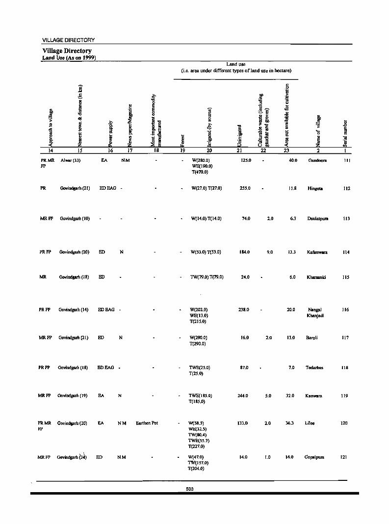
VILLAGE DIRECTORY
Village Directory Land Use (As on 1999)
i g '" U
i j ;;:; ~ cI!I
~ .s .<:
~ ! 8: Z < 14 15
PRMR Alwar(33) FP
PR Govindgarh (21)
MRFP Govindgarh(IO)
PR FP Govindgarh (20)
.g: CI. :::I
'" I 16
EA
EDEAG
ED
MR Govindgarh (18) ED
PRFP Govindgarh (14) EDEAG
MRFP Oovindgarh (21) ED
PRFP Govindgarh (18) EDEAG
MRFP Govindgarh (19) EA
PRMR Govindgarh (20) EA FP
MRFP Govindgarh ~2~) ED
.~ "0 0
'l E E 0 u
~ 11 '" Ii' .!L~ CI.
~ ~ :::I u o Iii z ;;:g e 17 18
NM
-
N
-
N
-
N
NM Earthen Pot
NM
Land use (i.e. area under different types of land use in hectare)
c .S! is
011 > C ~ :g u
U ~ 0 III
e -.:I
I , If '5 ...
'0 .. c ,...., .e ._ .., ~ ..
~ I! j ~ Ii
1 i:i ~ ..,
.!! Iii e ~.! '5
._ :::I 0 c
'5 c .. "iii 3 u ~ Iii '2 8~ ·c '" p < :z rI)
19 20 21 22 23 2 I
W(280.0) 125.0 40.0 Gandoora III WE(190.0) T(470.0)
W(27.0) T(27.0) 15S.0 11.8 Hingom 112
W(14.0) T(14.0) 74.0 2.0 6.3 Daulatpura 113
W(S3.0) T(S3.0) 184.0 9.0 13.3 Kafanwara 114
TW(79.0) T(79.0) 24.0 6.0 Kharsanki lIS
W(202.0) 238.0 20.0 Nangal 116 WE(13.0) Khanjadi T(2IS.0)
W(290.0) 16.0 2.0 13.0 Baroli 117 T(290.0)
TWE(2S.0) 87.0 7.0 Todarbas 118 T(2S.0)
TWE(18S.0) 244.0 5.0 32.0 Kanwara 119 T(ISS.O)
W(S8.S) 133.0 2.0 36.3 Lilcc 120 WE(32.S) TW(80.4) TWE(SS.7) T(227.0)
W(47.0) 14.0 1.0 16.0 Clopalpura 121 TW(IS7.0) T(204.0)
503
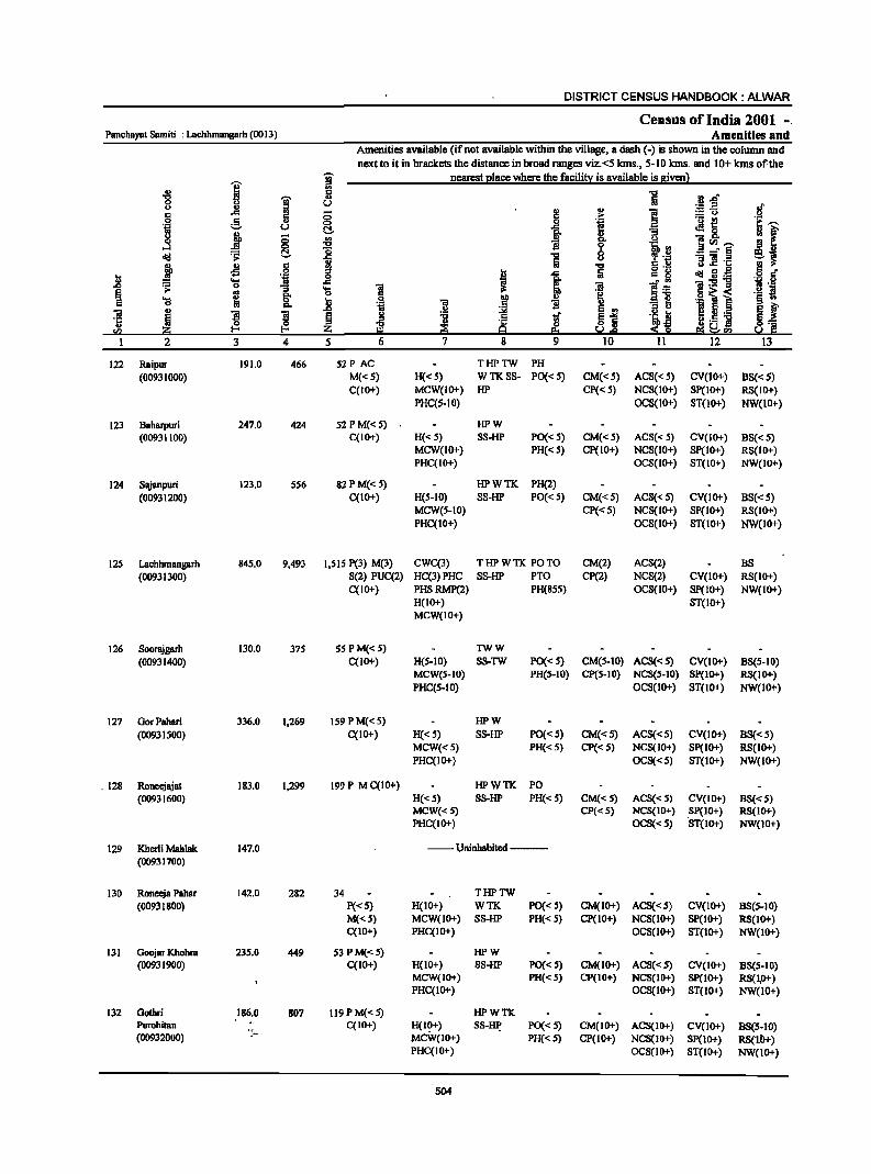
DISTRICT CENSUS HANDBOOK: ALWAR
Census of India 2001 -. Panchayat Samiti : Lachhmangarh (0013) Amenities and
Amenities available (if not available within the village, a dash (-) is shown in the column and next to it in brackets the distance in broad ranges viz.<5 kms., 5-10 kms. and 10+ kms of.the
I I nearest elace where the facili!X is available is given}
.g 1
., 1 [(l_r; u .. '" 2! '" ] .~ ..E of
·8 ..c:: ::; .~
:.:: u .2 e 0 ~ 1 ._ t!
e~ u t::!- Jl 8. : f B j ]
0 ::; '" i ]<Il~ ...:l 0 .., 0 'Ii\ .,
old ~ t::!- '0 1 6
~ 'il _-"5 e~ ii .. "'3] .~
~ .£l § j .., .. S § .r
l> ''; I 1 Iii g '8 cIiI~:g ..... 'iI " '" "ii:'5! 'iii .2 .£> .;; 0
1 '(J i S~ .2 i ~
.. 'j:! .6~i '(J !a ';; Q E s .. I>- .~ I II .. "3 D .£>
~-i l~] !{ OJ I ~ ~ § ! ~ t .~~ '5 !a z 9::! u.£> < SO e:l~""
1 2 3 4 5 6 7 8 9 10 11 12 13
122 Raipur 191.0 466 5ZP AC THPTW PH
(00931000) M«S) H«S) WTKSS- PO« 5) CM«S) ACS« S) CV(lO+) 8S«5) C(IO+) MCW(IO+) HP Cp« 5) NCS(IO+) SP(IO+) RS(JO+)
PHC(S-IO) OCS(lO+) ST(lO+) NW(lO+)
123 Baharpuri 247.0 424 52 P M« 5) HPW (00931100) C(IO+) H«S) SS-HP PO« S) CM«S) ACS«5) CV(IO+) BS«5)
MCW(lO+) PH« S) Cp(IO+) NCS(JO+) Sp(IO+) RS(IO+) PHC(IO+) OCS(IO+) ST(IO+) NW(IO+)
124 Sajanpuri 123.0 5S6 8ZPM«S) HPWTK PH(2) (00931200) C(IO+) H(S-IO} SS-HP PO«S) CM«S) ACS« S) CV(IO+) BS«5)
MCW(S-IO) Cp«5) NCS(JO+) SP(IO+) RS(IO+) PHC(IO+) OCS(lO+) ST(lO+) NW(lO+)
125 Lachhmangarh 845.0 9,493 1,515 P(3) M(3) CWC(3) THPWTK POTO CM(2) ACS(2) BS (00931300) S(2) PUC(2) HC(3)PHC SS-HP PTO CP(2) NCS(2) CV(lO+) RS(IO+)
C(IO+) PHSRMP(2) PH(85S) OCS(IO+) Sp(IO+) NW(IO+) H(IO+) ST(IO+) MCW(IO+)
126 Soorajgarh 130.0 37S 55 P M«S) TWW
(00931400) C(IO+) H(S-IO) SS-TW PO« 5) CM(S-IO) ACS«S) CV(lO+) BS(5-IO) MCW(S-IO) PH(S-IO) CP(S-IO) NCS(S-IO) SP(IO+) RS(IO+) PHC(5-10) OCS(lO+) ST(lO+) NW(IO+)
127 GorPahari 336.0 1,269 159 P M« 5) HPW
(00931500) C(lO+) H«5) 8S-HP PO« S) CM«S) ACS«5) CV(lO+) B8« 5) MCW«5) PH«S) CP«S) NCS(IO+) Sp(IO+) RS(IO+) PHC(IO+) OCS«5) ST(IO+) NW(lO+)
. 128 RDneejajat 183.0 1,299 199 P M C(lO+) HPWTK PO (00931600) H«S) SS-HP PH« S) CM«5) ACS«5) CV(IO+) BS« 5)
MCW« S) CP«S) NCS(lO+) Sp(IO+) RS(lO+) PHC(IO+) OCS«5) 'ST(IO+) NW(IO+)
129 Kherli Mahlak 147.0 _-Uninhabited--(00931700)
130 Roneeja Pahar 142.0 282 34 THPTW (00931800) P«5) H(IO+) WTK PO«5) CM(IO+) ACS«5) CV(IO+) BS(5-10)
M«S) MCW(IO+) SS-HP PH«S) CP(IO+) NCS(IO+) SP(IO+) RS(lO+) C(IO+) PHC(IO+) OCS(IO+) ST(IO+) NW(lO+)
131 GoDjar KhDhra 23S.0 449 53 P M« 5) HPW (00931900) C(IO+) H(IO+) SS-HP PO«5) CM(lO+) ACS«S) CV(IO+) BS(S-IO)
MCW(IO+) PH« 5) CP(IO+) NCS(IO+) SP(IO+) RS(I,O+) PHC(IO+) OCS(lo+) ST(IO+) NW(IO+)
132 GDtbri 186.0 807 119 P M«5) HPWTK Purohitan C(IO+) H(10+) SS-~ PO« S) CM(IO+) ACS(IO+) CV(IO+) as(5-to) (00932000) ': .. MCW(IO+) PH«S) CP(IO+) NCS(lO+) SP(lO+) RS(ll>+)
PHC(IO+) OCS(IO+) ST(IO+) NW(lO+)
504
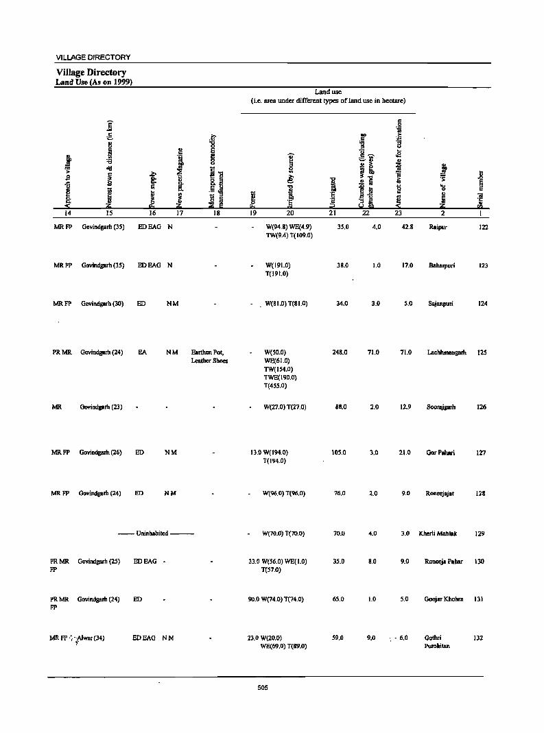
VILLAGE DIRECTORY
Village Directory Land Use (As on 1999)
E ... e ~
8 :a 0
B u E
J .. 'i E :a 0 0
~ old ~ !l ~ ~ s u
.t 1 ;: !: 1;;
~ ~ ! Co ~ Ii ~ 0 eo :si Iii 14 IS 16 17 18
MRFP Govindgarh (35) ED HAG N
MRFP Govindgarh (35) ED HAG N
MRFP Govindgarh (30) ED NM
PRMR Govindgarh (24) SA NM Earthen Pot, Leather Shoes
MR Oovindgarh (23)
MR FP Govindgarh (26) ED NM
MR FP Govindgarh (24) ED NM
--Uninhabited ---
PRMR Govindgarh (25) ED SAG -FP
PRMR Govindgarb (24) ED FP
MR FP .', 'Alwar (34) EDEAG NM l'
Land use (i.e. area under different types ofJand use in hectare)
'U' ~ 0 .. e: 't:J
! 1;; t! 0 '1:
!!:s = 19 20
W(94.8) WE{4.9) TW(9.4) T(109.0)
W(19LO) T(19LO)
. W(SI.O) T(SLO)
W(50.0) WE(61.0) TW(154.0) TWE(I90.0) T(455.0)
W(27.0) T(27.0)
13.0 W(194.0) T(194.0)
W(96.0) T(96.0)
W(7D.O) T(70.0)
33.0 W(56.0) WE{1.0) T(S7.0)
90.0 W(74.0) T(74.0)
23.0 W(20.0) WE(69.0) T{89.0)
505
1 '1:
~ 21
35.0
38.0
34.0
248.0
8S.0
105.0
76.0
70.0
35.0
65.0
59.0
c: 0
'if "" > c: .::: '6 B :I
8- ... :.::-rJ .e
u
B i ~ !] 'ij
iU
~ = g a-§ '" ai ~ 22 23
4.0 42.8
1.0 17.0
3.0 5.0
71.0 71.0
2.0 12.9
3.0 21.0
2.0 9.0
4.0 3.0
S.O 9.0
1.0 5.0
9.0 ' .• 6.0
u
~ .8 '> § .... 0 c: .,
"if ~ ·c .. ~ r£! 2 I
Raipur 122
Baharpuri 123
Slijanpuri 124
Lachhmangarh 125
Soorajgarh 126
GorPahari 127
Ronccjajat 128
Khcrli Mahlak 129
Ronecja Pabar 130
GoDjar Khobra 131
Gothri 132 Purohitan
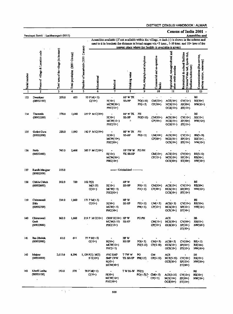
DISTRICT CENSUS HANDBOOK: ALWAR
Census of India 2001 -Panchayat Samiti : Lachhmangarh (0013) Amenities and
Arncnities available (if not available within the village, a dash (-) is shown in the column and next to it in brackets the distance in broad ranges viz.<S kms., 5-10 kms. and 10+ kms of the
I 1 nearest elace where the facilin! is available is 8ivCl1l
" 1 ·B~ "8 j u oJ <> l! 8 .. I c c Q ;> :: CJ t.J
] g '" 0 .§. ''2 ._ ~
'~l u ~ .tl 0
~ ~ ., "
II
]~~ "C 1l f lB !9 .B ~ 0 _o §
c!!I il 1 :; 11 ·c e~ i .s 15 !9 S·2 ~ 2.g .;.~ .~ 0 a Co g
'g J: J '!:E] =s: '[ 'El e·-=: ~ 21! 0]< ._ J!!
8. .8 ':;l § § .. '" <> e ~ ! ! ~ .~ ~ :l :a <~ tl 0 B !j.-
3 4 5 11 13
133 Dwarkpur 209.0 6S5 9S P M« 5) HPWTK BS (00932100) C(IO+) H(IO+) SS-HP P0(5-10) CM(IO+) ACS(IO+) CV(IO+) RS(IO+)
MCW(IO+) PH«5) CP(IO+) NCS(IO+) SP(JO+) NW(tO+) PHC(IO+) OCS(IO+) ST(IO+)
134 Thumrela 378.0 1,640 237 P M C(IO+) HPWTK PH BS (00932200) H(lO+) SS-HP PO(S·IO) .CM(lO+) ACS(IO+) CV(IO+) . RS(IO+)
MCW(IO+) .) CP(IO+) NCS(IO+) SP(IO+) NW(IO+) PHC(tO+) OCS(IO+) ST(IO+)
135 OothriOuru 320.0 1,043 143 P M C(IO+) HPWTK PH (00932300) H(IO+) SS-HP PO«S) CM(IO+) ACS(JO+) CV(JO+) BS(S-IO)
MCW(IO+) CP(lO+) NCS(IO+) SP(lO+) RS(1o+) . PHC(IO+) OCS(JO+) ST(JO+) NW(IO+)
136 Berla 745.0 2,468 385 P MC(IO+) HPTWW PO PH (00932400) H(IO+) TKSS-HP CM(IO+) ACS(IO+) CV(IO+) BS(S-IO)
MCW(IO+) CP(IO+) NCS(IO+) SP(IO+) RS(1o+) PHC(IO+) OCS(IO+) ST(IO+) NW(10+)
137 Rundh Maujpur 355.0 --Uninhabited ----(00932500)
138 Chhila Chhoh 302.0 720 102 P(2) HPW BS (00932600) M(S-IO) H(IO+) SS-HP PO«S) CM(IO+) ACS(lO+) CV(lO+) RS(IO+)
C(IO+) MCW«S) PH«S) CP(IO+) NCS(IO+) SP(IO+) NW(IO+) PHC(IO+) OCS(10+) ST(IO+)
139 Chimmwali 334.0 1,060 171 PM«S) HPW BS Sikh C(IO+) H(IO+) SS-HP PO«S) CM«S) ACS« 5) CV(IO+) RS(IO+) (00932700) MCW«S) PH«S) CP(lO+) NCS(IO+} SP(IO+) NW(IO+)
PHC(IO+) OCS(IO+) ST(IO+)
140 Chimmwali 362.0 1,660 219 P MC(lO+) CHWH(IO+) HP W PO PH ACS BS Gorb MCW(S-IO) SS-HP CM(IO+) NCS(IO+) CV(IO+) RS{IO+) (00932800) PHC(lO+) CP(IO+) OCS(lO+) Sp(IO+) NW(IO+)
ST(IO+)
141 Bas Dhekda 61.0 611 77 P M«S) HPW (00932900) C(IO+) H(IO+) SS-HP PO«S) CM«S) ACS«S) CV(IO+) BS« 5)
MCW(IO+) PH(S-IO) CP(S-IO) NCS(tO+) SP(lO+) RS(IO+) PHC«5) OCS(IO+) ST(IO+) NW(IO+)
142 Mojpur 2,615.0 8,296 1,129 P(3) M(3) PHCRMP TTWW PO CM ACS BS (00933000) S C(IO+) SMPCHW TKSS-HP PH(IIS) cp(5.10) NCS(S-IO) CV(IO+) RS{IO+)
H(IO+) OCS(IO+) Sp(IO+) NW(IO+) MCW(IO+) ST(IO+)
143 Khcrli Lodha 193.0 578 78PM«5) TWSS-W PH(3) BS (00933100) C(IO+) H(lO+) PO« ~i"'- CM« S) ACS(5·IO) CV(lO+) RS(tO+)
MCW(10+) •. CP«5) NCS(IO+) SP(ID+) NW{tO+) PHC(lO+) OCS(IO+) ST(IO+)
506
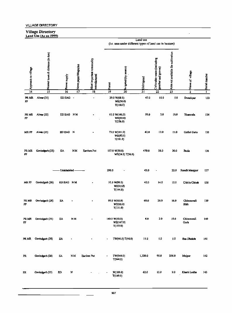
VILLAGE DIRECTORY
Village Directory Land Use {As on 1999}
]' e .~ II) -0 u 0
J i E
J ~ u
== ~
l~ >
~ ~ s
t ~ ~~ I "' ..
j ! ~ ~ Q.
::!: ii!O 14 15 16 17 18
PRMR Alwar(3J) EDEAG -FP
PRMR Alwar(32) EDEAG NM FP
MRFP Alwar(3S) EDEAG N
PRMR Govindgarh (33) EA NM Earthen Pot FP
--Uninhabited ---
MRFP Govindgarh (26) EDEAG NM
PRMR Govindgarh (28) EA FP
PRMR Govindgarh (31) EA NM FP
PRMR Govindgarh (28) EA
PR Govindgarh (28) EA N M Earthen Pot
PR Govindgarb (35) BD N
Land use (i.e. area under different types ofland use in hectare)
..,. ~ 0 "'. e: I t;
!! ~ '5
101
19 20
29.0 W(6S.0) WE(SO.O) T(IIS.O)
61.0 W(146.0) WE(90.0) T(236.0)
73.0 W(IOI.O) WE(80.0) T(ISI.O)
157.0 W(30.0) WE(24.0) T(S4.0)
290.0
92.0 W(99.0) WE(4S.0) T(I44.0)
99.0 W(65.0) WE(66.0) T(131.0)
140.0 W(SO.O) WE(147.0) T(197.0)
TW(44.0) T(44.0)
TW(944.0) T(944.0)
W(109.0) '1"(109.0)
507
-0 II)
i 'E ·s i2 21
47.0
59.0
42.0
470.0
43.0
40.0
60.0
4.0
11.0
1,320.0
62,0
c .S! ..,
OIl > c ''::: '6 ] '" 1!- ..
.a ;=:,rJ .!:! j! ~ ';j i:i .!:! Iii
~ iii '8 E1j
~ 8gt, 22 23
10.0 5.0
3.0 19.0
13.0 11.0
38.0 26.0
22.0
14.0 12.0
28.0 16.0
2.0 19.0
1.0 5.0
95.0 256.0
13.0 9.0
j ~
~ .0
§ ... 0 c .. ~ ]
ii!O CI)
2 1
Dwarkpur 133
Thumrcla 134
GothriGuru 135
Berla 136
Rundh Maujpur 137
ChhilaChhoh 13S
Chimrawali 139 Sikh
Chimrawali 140 Gorb
Bas Dhekda 141
Mojpur 142
Kherli Lodha 143
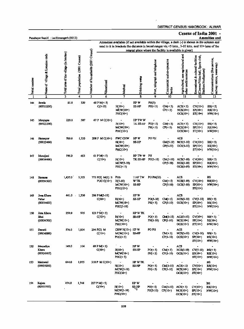
DISTRICT CENSUS HANDBOOK: ALWAR
Census of India 2001 -Panchayat Samiti : Lachhmangarh (0013) Amenities and
AmenitieS available (if not available within the village, a dash (-) is shown in the column and next to it in brackets the distance in broad ranges viz. <5 kms., 5-10 kms. and 10+ kms of the
I '[ nearest I!lace where the faci1i!l:: is available is Ilivenl
~ !' 5 "E .i! .g" u 8 .g ..
8 ! .,
i :=:0
g 5 .2: ._ ~ ·e ~ u C!.. i Jl 8- III f 8 gp C; .. ...;a c
..., 1l lB
]<1> __ ~~ ~ C!.. ~ 8 _" ~ cij ] 13 1I.r::
~ .s ·s !i ] 6 .!II u .s .~ 5"
i _g I .c c g cij .§ ._
'a 13 ... ! j ] l~ ! ._ 11 .. . ..
os
~ 0
.j li .2 t1 'a ~ .8 0
"5 bQ :I] ~I ·il .5 e .. 01 u
! ]I ~ ~ ~ .~J! e ~._
·c 6 ~ ~ Sl ~~! u ~ a .~ <I> i10 9 E!; ::!: !i! 2 3 4 5 6 7 8 9 10 11 12 13
144 Semla 81.0 320 48PM«S) HPW PH(3) (00933200) C(S.IO) :!j10+) SS·HP PO«S) CM«S) ACS«S) CV(IO+) 8S« S)
CW(IO+) CP«5) NCS(IO+) SP(IO+) RS(IO+) PHC(IO+) OCS(IO+) ST(IO+) NW(IO+)
145 Malijapta 229.0 587 67 P M C(lO+) HPTWW (00933300) H(IO+) TKS8-HP PO« S) CM« 5) AC8«5) CV(IO+) 88«S)
MCW(IO+) PH« S) CP«5) NCS(IO+) SP(IO+) RS(IO+) PHC(IO+) OCS(IO+) 8T(10+) NW(IO+)
146 Hasanpur 700.0 1,320 208 P M C(lO+) FWCCHW HPW PO PH AC8 (00933400) H(IO+) SS-HP CM(S-IO) NCS(S-IO) CV(IO+) BS«S)
MCW(IO+) CP(S.IO) OCS(S-IO) SP(IO+) RS(IO+) PHC(IO+) ST(lO+) NW(IO+)
147 Mundjori 196.0 403 6IPM«S) HPTWW PH (00934400) C(IO+) H(IO+) TKSS·HP PO(S-IO) CM(5-10) AC8(5-1O) CV(IO+) B8«S)
MCW(S-IO) CP(S·10) NCS(S-IO) SP(IO+) RS(IO+) PHC«5) OCS(S-IO) ST(IO+) NW(IO+)
148 Hamana 1,437.0 5,323 773 P(2) M(2) S PHS THPTW POPH(32) ACS BS (00934SOO) PUCC(IO+) H(5-10) WTK CM«5) NCS(S-IO) CV(lO+) RS(IO+)
MCW(IO+) S8·HP CP(S-IO) OCS(S-IO) SP(IO+) NW(IO+) PHC(IO+) ST(IO+)
149 lonaKhera 441.0 1,330 206 P M(5-10) HPW ACS Pahar C(IO+) H(IO+) S8-HP PO(S-IO) CM«S) NCS(S-IO) CV(5-10) BS«S) (00934600) MCW(IO+) PH«S) CP(5-10) OCS(IO+) SP(IO+) RS(IO+)
PHC(S·IO) ST(IO+) NW(IO+)
ISO lonaKhera 259.0 935 123 P M«5) HPWTK Bhai C(lO+) H(1o+) SS-HP PO« S) CM(5-10) ACS(S-IO) CV(lO+) BS«5) (00934700) MCW(IO+) PH(S-IO) CP(S-IO) NCS(IO+) SP(IO+) RS(IO+)
PHC(IO+) OCS(IO+) ST(10+) NW(IO+)
lSI Deewli 576.0 1,854 294 P(2) M CHW H(10+) HP W PO PH ACS (00934800) C(IO+) MC~(IO+) SS-HP CM«5) NCS(S-IO) CV(S-IO) BS«S)
PHC«5) CP(S-IO) OCS(lO+) SP(IO+) RS(lO+) ST(IO+) NW(IO+)
152 Moondiya 149.0 514 69PM«S) HPW ACS Khera C(10+) H(IO+) SS-HP PO« S) CM«S) NCS(S-IO) CV(S-IO) BS«5) (00934900) MCW(lo+) PH«S) CP(5-10) OCS(IO+) SP(IO+) RS(10+)
PHC«S) ST(IO+) NW(IO+)
IS3 Malawali 644.0 1,955 318P MC(IO+) HPWTK BS (00935000) H(10+) S8-HP PO«S) CM(S.IO) ACS«5) CV(IO+) RS(10+)
MeW(S-IO) PH«S) CP(S-IO) NCS(IO+) SP(IO+) NW(IO+) PHC(lo+) OCS(IO+) ST(IO+)
IS4 Kajota ·474.0 1,744 227 PM«S) HPW ·BS (00935100) C(10+) H(IO+) S8-HP PO«S) CM(5-10) ACS«5) CV(IO+) RS(IO+)
MCW(S-IO) ''"if. PH(S-IO) CP(IO+) NCS(lO+) SP(IO+) NW(lo+) PHC(IO+) OCS(1O+) ST(IO+)
508
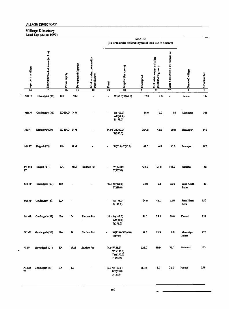
VILLAGE DIRECTORY
Village Directory Land Use (As on 1999)
Land use (i.e. area under different types of land use in hectare)
,...... c ] :t :! .~
III)
.5 '3
.1 '8 "C ., ::J t.l S U ... c
~ 'U' :§.'i) oS i .., J ~ .. F; <III 1i 0 J~ ~ ~ ...
~ >. t:] en
~ U !l 15.. ... e: i ii .;;: ,.Q
J ~ ~ 8._ .!:! Iii § .. S " I ~i
15 ... 1i! 0 c:
! ~ 3 ._ ~
~ '5 c u 'ii
~ ~ .;:; ~ ~ ·c If ~ 0 '5 ..
I:!::! = i2 < en 14 IS 16 17 18 19 20 21 22 23 2
MRFP GDvindgarh (39) ED NM W(68.0) T(68.0) 12.0 1.0 Semla 144
MRFP Oovindgarh (35) EDEAG NM W(103.0) 16.0 12.0 B.O Manjapta 145 WE(90.0) T(193.0)
PRFP Mandawar (20) EDEAG NM 143.0 W(280.0) 214.0 43.0 20.0 Hasanpur 146 T(280.0)
MRFP Rajgarh (33) EA NM W(65.0) T(65.0) 42.0 6.0 83.0 Mundjori 147
PRMR Rajgarh (31) EA NM EarthenPD! W(772.0) 423.0 101.0 141.0 Harsana 148
FP T(772.0)
MRFP Govindgarh (3) ED 90.0 W(290.0) 34.0 2.0 25.0 Jona Khcra 149 T(290.0) Pabar
MRFP Govindgarh (40) ED W(178.0} 24.0 45.0 12.0 Jona Khera ISO T(178.0) Bhai
PRMR Govindgarh (32) EA N Earthen Pot 56.1 W(243.0) 191.2 25.9 30.0 Deewli 151
WE(30.0) T(273.0)
PRMR Govindgarh (32) EA N Earthen Pot W(83.0) WE(4.0) 39.0 13.9 9.0 MODndiya 152 T(87.0) Khera
PRFP Govindgarh (3 r) EA NM Earthen Po! 94.0 W(3S.0) 126.0 19.0 37.0 Malawali 153
WE(180.0) TW(150.0) T(368.0)
PRMR Govindgarh (31) EA M 119.0 W(IOO.O) 163.0 S.O 22.0 Kajota 154
FP' WE(65.0) T(165.0)
509
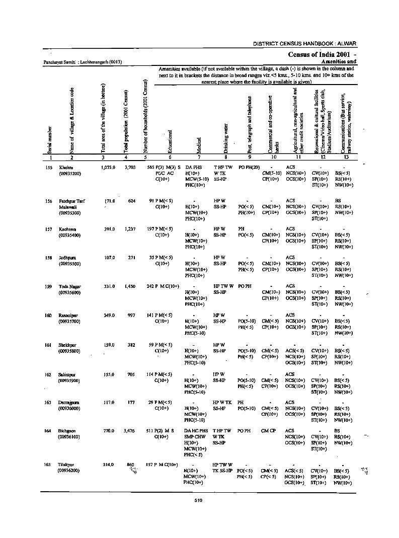
DISTRICT CENSUS HANDBOOK: ALWAR
Census of India 2001 -Panchayat Samiti : Lachhmangarh (0013) Amenities and
Amenities available (if not available within the village, a dash (-) is shown in the column and next to it in brackets the distance in broad ranges viz. <5 lans., 5-10 lans. and 10+ lans of the
I ~ nearest elace where the facili!l: is available is 8iven) u 8 1 ....
I r: .sJ"
0 u <>
i OJ
I ·z ..E .;
§ :;
1 :.= 0 <>
. .g :§, u 0 ·0 ~ .~ --8 j ~
t:!.- o:! 8. ~l '" ]~'[ ;go ...:I
.., 0
lib'" ~
'0 8 ~~ ~ ii i Z .~ :; ] .1::
j ~ .§ J ..,
Inl ~ 5l.g a e-II t 1 Iii
'c; 10 iii ]~ 1:9"9 .'" 0
> '"S ..... iii .~ .~ § '" 8: 0 . <= "1:1 .51 ~ ~ ..... ~ .8 .9 .~ i _ u
§ f <= 0 iii ., "3 t; t;j
~j ~ 5 .3 iii j l ! § ~ .2
~ l .~ iii ~] ·5 ! <>.5 ]I ~ z s~ ~~!?2
1 2 3 4 5 6 7 8 9 10 11 12 13
ISS Khohra 1,075.0 3,703 565 P(3) M(l) S DAPHS THPTW POPH(20) ACS (00935200) PUC AC H(lO+) WTK CM(5-1O) NCS(lO+) CV(lO+) BS«5)
C(IO+) MCW(S-IO) SS-HP CP(IO+) OCS(lO+) SP(1O+) RS(IO+) PHC(IO+) ST(1o+) NW(10+)
IS6 Fatehpur Tarf 171.0 624 91 P M« 5) HPW ACS BS Malawali C(10+) H(10+) SS-HP PO« S) CM(IO+) NCS(lO+) CV(IO+) RS(IO+) (00935300) MCW(lO+) PH(W"') CP(W+) OCS(IO+) SP(W+) NW(lO+)
PHC(IO+) ST(lO+)
157 Kachawa 391.0 1,237 197PM«5) HPW PH ACS (0093S400) C(IO+) H(1O+) SS-HP PO« 5) CM(IO+) NCS(IO+) CV(IO+) B8«5)
MCW(IO+) CP(IO+) OCS(IO+) Sp(IO+) RS(IO+) PHC(IO+) ST(IO+) NW(IO+)
158 Jodhpura 107.0 271 35 PM«5) HPW ACS (00935500) C(IO+) H(IO+) SS-HP PO« S) CM(IO+) NCS(IO+) CV(IO+) BS«5)
MCW(IO+) PH« S) CP(IO+) OCS(lO+) Sp(IO+) RS(IO+) PHC(lO+) ST(IO+) NW(IO+)
159 Toda Nagar 331.0 1,450 242 P M C(IO+) HPTWW PO PH ACS (00935600) H(IO+) SS-HP CM(IO+) NCS(IO+) CV(IO+) BS«S)
MCW(IO+) CP(lO+) OCS(IO+) SP(IO+) RS(lO+) PHC(IO+) 8T(10+) NW(IO+)
160 Rasoolpur 349.0 997 141 P M« S) HPW ACS (0093S700) C(IO"') H(IO+) SS-HP PO(5-10) CM«S) NCS(lO+) CV(lO+) BS«S)
MCW(10+) PH« S) CP(IO+) OCS{tO+) SP(IO+) R8(10+) PHC(S-lO) ST(IO+} NW(IO+}
161 Sbekbpur 159.0 382 S9PM«S) HPW (00935800) C(IO+) H(10+) 8S-HP PO(5-10) CM«5) AC8«5) CV(IO+) B8«5)
MCW(IO+) PH« 5) CP(IO+) NCS(IO+) SP(IO+) RS(IO+) PHC(5-10) OCS(lO+) ST(IO+) NW(IO+)
162 8Blimpur 155.0 70S 114 P M«5) HPW ACS (00935900) C(lO+) H(IO+) S8-HP PO(S-IO) CM«S) NCS(IO+) CV(IO+) B8«5)
MCW(IO+) PH«S) CP(IO+) OCS(IO+) SP(IO+) RS(IO+) PHC(S-IO) 8T(10+) NW(lO+)
163 Deorajpura 117.0 177 29 P M«S) HPWTK PH AC8 (00936000) C(IO+) H(IO+) 8S-HP PO(5-10) CM«S) NCS(10+) CV(IO+) BS«5)
MCW(IO+) CP(IO+) OCS(IO+) Sp(IO+) RS(IO+) PHC(S-IO) ST(IO+) NW(IO+)
164 Bichgaon 770.0 3,476 511 P(2) M 8 DAHCPHS THPTW PO PH CMCP ACS BS (00936100) C(IO+) SMPCHW WTK NCS(IO+) CV(IO+) RS(IO+)
H(IO+) S8-HP OCS(10+) SP(IO+) NW(IO+) MCW(lO+) 8T(10+) PHC«S)
165 Tilakpur 314.0 860 157 P M C(IO+) HPTWW (00936200) ·t.~l.
H(IO+) TKSS-HP PO«5) CM«S) ACS«5) CV(IO+) BS« S) .,~.~{
''"lj: '.:to MCW(IO+) PH«S) CP«5) NCS(IO+) SP(IO+) RS(IO+) PHC(IO+) OCS(IO+) ST(IO+) NW(IO+)
510
VILLAGE DIRECTORY
Village Directory Land Use {As on 1999)
j g :[ .,
J 0 ., E c E j '1 8
~ "<!
I~ s ~ ~ ~ c.. i 1 '" ., .5 oM B K J ! ;; '" o Iii
~ .,
i1lO ~ 8 14 15 16 17 18
PRMR Oovindprh (31) EA NM Earthen Pot FP
PRMR Rajprh (23) EA NM FP
PRMR Rajgarh (22) EA NM Earthen Pot FP
PRMR Rajgarh (21) BAG N FP
PRMR Rajgarh (20) BA NM Earthen Pot FP
MRFP Mandawar (21) EOEAG ·
MRFP Mandawar (12) EDEAG ·
MRFP Mandawar (21) EDEAG ·
MRFP Mandawar (20) ED BAG -
PRMR Rajgarh (21) EA N Earthen Pot FP
PR FP Govindgarh (32) ED
Land use
(i.e. area under different types of land use in hectare)
i ::I a e: -c a ~
0 'E !:o t:::j
19 20
179.0 W(IOO.O) WE(227.0) T(327.0)
30.0 W(49.0) WE(75.0) T(124.0)
69.0 W(IDO.O) WE(I83.0) 1(283.0)
16.0 W{24.0) WE(44.0) T(6S.0)
26.0 W(IOS.O) WE(80.0) T(188.0)
13.3 W{170.0) WE(46.0) T(216.0)
IS.6 W{90.0) WE(IS.O) T(108.0)
25.3 W(95.9) WE(6.0) T(I 0 1.9)
7.6 W(BS.O) WE(S.O) T{93.0)
29.0 WE(S4S.0) T(548.0)
84.0 W(IIO.O) T(1I0.0)
511
i 'E
~ 21
471.0
2.0
12.0
12.0
9S.0
89.0
21.6
IB.O
4.0
104.0
62.0
c 0 .~
"" :-c ~ "6 ::I u
]_ .. oS :.::.rl .,
I! ii fo ~ ~
~ Iii 1:; .;: ....
~~ -0 0 c ., ~ ~ a~ <
22 23 2
24.0 74.0 Khohra
15.0 Fatehpur Tarf Malawali
26.7 Kachawa
5.0 6.0 Jodhpulll
1.0 21.0 Toda Nagar
II.S IS.9 Rasoolpur
6.1 4.9 Shekhpur
7.4 2.4 Salimpur
8.9 3.2 Deollljplllll
25.0 64.0 Bichgaon
55.0 3.0 • '" 1ilakpur
.8 § c iii 'r::; .. rn
ISS
156
157
ISS
159
160
161
162
163
164
165
DISTRICT CENSUS HANDBOOK: ALWAR
Census of India 2001 -Panchayat Samiti : Lachhmangarh (0013) Amenities and
Amenities available (if not available within the village, a dash (-) is shown in the column and next to it in brackets the distance in broad ranges viz.<5 kms., 5-10 kIns. and 10+ kIns of the
'Vi' nearest place where the facility is available is given)
I :;J .. 5 ] "'0
~ ~.rf 0 u <> ._ ::s
of
~ § .. ] :::13 c ;; .~ .2 0 e 0
11 ._ {!
if 'g ~ -g. .!l 0
j 8 ., go 1i ]~'""' ...l .... ] .~ .11 old ~ (j. :8 "'0 8 ~§ ei .. fa 8 .11 1i ] .~ ~ Jl 6 !!l ] g .d'
:;:; I 0 I .s:: c g till g._
~ .... .s:: ~ ~ l~ "i!:E"g .~ 0
.0 0 .... 1 ~ .. 0 .§ ~ i '§ '@
'l:l ~ :;:; f " '31 .;:: 'iI ] .. ~ 5._ ., .0 '" .2
~j .~ :;:; ~ f "i!
~ ]I
~ ~ ~ i! if ·c J1.5 ] ., ~ ~ :iii e; :S~ 0:= "'-' ~"'-' 5.! C
2 3 4 5 6 7 8 9 10 11 12 13
166 NamolKhurd 381.0 870 III P M C(IO+) HPW (00937000) H(IO+) SS-HP PO(S·IO) CM«S) ACS«S) CV(IO+) B8(5·10)
MCW(IO+) PH«5) CP(IO+) NCS(IO+) SP(lO+) R8(10+) PHC(5-1O) OCS(IO+) ST(lo+) NW(lO+)
167 BoSeri 330.0 533 76 P M« 5) HPWTK PH(S) B8 (OO937100) C(1O+) H(IO+} S8-HP PO«S) CM«S} AC8«S) CV(IO+) RS(IO+)
MCW(IO+) CP(10+) NCS(IO+). SP(IO+) NW(IO+) PHC(S-IO} OC8(10+) 8T(lO+)
168 Uchhar 299.0 749 99PM«S} HPWTK PH(4) BS (00937200) C(lO+} H(IO+) S8-HP PO(S.IO) CM(S.IO) ACS(S.IO) CV(IO+) RS(IO+)
MCW(IO+) CP(IO+) NCS(S·IO) Sp(IO+) NW(IO+) PHC(S.IO) OCS(IO+) ST(IO+)
169 BhDDr Pahari 170.0 465 70PM«S} HPWTK PH (00937300) C(IO+) H(IO+) S8-HP PO«5) CM«5) ACS« 5) CV(IO+) B8« 5)
MCW(IO+) CP(IO+} NCS(lO+) 8P(I0+) RS(lO+) PHC(5.1O) OCS(IO+) ST(IO+) NW(IO+)
170 Sehra 331.0 1,091 201 P M C(IO+) PHSH(IO+) HPWTK PH ACS (00937400) MCW(IO+) SS-HP PO(S.IO) CM(IO+) NCS(IO+) CV(lo+) BS« 5)
PHC{<S) CP(IO+) OCS(IO+) 8p(10+) RS(lO+) ST(lO+) NW(IO+)
171 Bhagwatpura 66.0 94 I~ HPWTK (00937500) P«5) H(IO+) SS·HP PO(S-IO) CM(IO+) ACS(lO+) CV(lO+) BS« 5)
M«S) MCW(IO+) PH«S) CP(IO+) NCS(IO+) SP(IO+) RS(IO+) C(10+) PHC(IO+) OCS(lO+) ST(IO+) NW(IO+)
172 Kali Pahan 150.0 5S8 93 PM«S) HPWTK (00937600) C(IO+) H(IO+) SS·HP PO«5) CM(IO+) AC8«5) CV(lO+) B8« 5)
MCW(lO+) PH«5) CP(IO+) NCS(IO+) SP(lO+) RS(IO+) PHC(5·10) OC8(10+) ST(lO+) NW(IO+)
173 Sunan 279.0 913 160PM(10+) PH8H(10+) HPWTK (00937700) C(IO+) MCW(IO+) SS·HP PO(5.10) CM(IO+) ACS(IO+) . CV(10+) BS(5-1O)
PHC(S·IO) PH«5) CP(IO+) NCS(IO+) SP(IO+) RS(IO+) OCS(IO+) ST(IO+) NW(IO+)
174 Antapara 179.0 559 93PM«S) HPWTK (00937800) C(lO+) H(10+) 88-HP PO«5) CM«5) ACS«S) CV(lO+) BS« 5)
MCW(lO+) PH«5) CP(IO+) NCS(JO+) SP(IO+) RS(IO+) PHC«S) OCS(IO+) ST(IO+) NW(IO+)
17S Mukundpura 143.0 619 97PM«5) HPWTK PH (00937900) C(IO+) H(IO+) S8-HP PO«5) CM«5) ACS«S) CV(lO+) BS«S)
MCW(IO+) CP(IO+) NCS(IO+) Sp(10+) RS(10+) PHC(IO+) OC8(10+) ST(IO+) NW(IO+)
176 Jhalatala 742.0 2,883 419P M S DAPHS THPTW PO ACS BS (00938000) , .; C(IO+) CHWH(IO+) WTK PH(8) CM«5) NCS(10+) CV(IO+) ~. RS(IO+)
To MCW(lO+) S8-HP CP(IO+) OCS(IO+) SP(IO+) c NW(IO+) PHC(IO+) ST(IO+)
512
VILLAGE DIRECTORY
Village Directory Land Use (As on 1999)
Land use (Le. &reB under different types ofland use in hectare)
]; r:: 0
°if e j:;o ... > c ~ 8 :0 :a
0 " u
J .. E i~ .. c
I cI3
J '1 ~ ;::-10 ~ ~
["~ 0
.!! 1) ~ .;;;:
1 >.. ~
.. ~ Sb i .8 B Ci. e: I .!!] .;;;:
1 ~ ~ .5 j J 1~ "0 ... ~ I "" 0
~ c
~ 1;; " t; 'E '"
u -a o Ii e ';: I!! i '1::
~ 0 r:iSh u -< i!!:i !:I :::!1 Ii I!:! = i2 S i!!:i rn 14 IS 16 17 18 19 20 21 22 23 2 1
MR Rajgarh (33) EDEAG 32.0 W(108.0) ISI.O 36.0 24.0 NamolKhurd 166 WE(30.0) T(138.0)
MRFP Mandawar (26) EDEAG - 60.0 W(l2.0) 143.0 IS.O 13.0 Baseri 167 WE(67.0) T(99.0)
PRMR Rajgarh (34) EDEAG NM W(S7.0) 126.0 6.0 23.0 Uchhar 168 FP WE(87.0)
T(144.0)
MRFP Rajgarh (30) EDEAG - 8.0 W(44.0) 51.0 1.0 7.0 BhoorPahBri 169 WE(S9.0) T(IOl.O)
MRFP Rajgarh (24) EA NM Earthen Pot II.O W(56.0) 148.0 6.0 2l.0 Sehlll 170 WE(87.0) T(14l.0)
FP Rajgarh (20) W(lO.O) 22.0 2.0 4.0 Bhagwatpulll 171 TW(28.0) T(38.0)
MRFP Rajgarh (19) ED BAG - W(3l.0) 36.0 10.0 Il.O Kali Pahari 172 WE(S8.0) T(91.0)
MRFP Rajgarh (22) BA 56.0 W(48.0) 66.0 21.0 Sunari 173 WE(88.0) T(136.0)
FP Rajgarh (20) EDEAG N SI.OW(S2.0) 39.0 [.0 12.0 Antapara 174 WE(24.0) T(76.0)
PRFP MandBWBr (19) EA NM 10.0 W(28.0) 57.0 7.0 Mukundpura 17S WE(41.0) T(69.0)
PRFP MandaWBr(18) EA NM Earthen Pot 82.0 W(llS.O) 281.0 9.0 49.0 JhBlatalB 176 WE(186.0) T(321.0)
513
DISTRICT CENSUS HANDBOOK: ALWAR
Census of India 2001 -Panchayat Samit; : Lachhmangarh (0013) Amenities and
Amenities available (if not available within the village, a dash (-) is shown in the column and next to it in brackets the distance in broad ranges viz.<5 kms., 5-10 kms. and 10+ kms of the
I W nearest ~Iace where the facili!}: is available is givenl
-8 I!! 1 ~ .. "'oD 8 u ~~ .;
i ..
] c:: 5 :5 ~ .So! .51 :B 'Q
~t t:--til u !::!.. R ; ~ g ! C; .. '3
u i!!<I),-.. ....l 8-
"t:I 13 0
li oI!! :8 ~ 0 B....l'§ ~, ~
'" u '3]1'1::
! J! 6 j "t:I :5 ._
U g 6 • f ..c: Iii c. ~ oI!! .§ ._
2 ..... ~ ~ . '+1 :5 0 ....
I ] ];6 'iI ._ -g rl ._
§. ~
~ 8- 0 .6 ~ i ._ ]I .... _g I .!! § .. c:: 0 g, B B
~j 1l ~ ~ ~ ._ S f .. 'iI
! ~ ~ ~ 'B t;f ._ II
'1:: is ~~ ~._ i 51 ... ;;!i ~ e:i 2. rt;! <I)
I 2 3 4 5 6 7 8 9 10 II 12 13
177 Namol Kalan 171.0 687 98PM«S) HPWTK (00938100) C(IO+) H(IO+) SS·HP PO{< S) CM(S-IO) ACS«S) CV(IO+) BS(S-IO)
MCW(1O+) PH«S) CP(IO+) NCS(IO+) SP(IO+) RS(IO+) PHC«S) OCS(IO+) ST(IO+) NW~IO+)
178 Oothra 563.0 2,221 297 P M C(10+) HCPHS HPWTK PH (00938200) H(IO+) SS-HP PO(S.IO) CM(S.IO) ACS«S) CV(IO+) BS(5-IO)
MCW(IO+) CP(10+) NCS(10+) SP(IO+) RS(IO+) PHC(5-10) OCS(IO+) ST(IO+) NW(IO+)
179 Bidarka 399.0 1,005 156 P M C(10+) HPWTK PH(2) (00938300) H(·IO+) SS-HP PO(5-10) CM(5.10) ACS«5) CV(IO+) BS(5·10)
MCW(1O+) CP(1O+) NCS(IO+) SP(IO+) RS(IO+) PHC(5-10) OCS(IO+) ST(IO+) NW(IO+)
180 Khera Mangal 983.0 2,459 3S8P(2) M S HCCHW THPTW POPH(3) ACS BS Singh C(IO+) H(5-10) WSS-HP CM(S-IO) NCS(S-IO) CV«S) RS(5-10) (00938400) MCW(IO+) CP(S-IO) OCS(S-IO) SP(IO+) NW(IO+)
PHC(5-10) ST(IO+)
181 Amarpur 240.0 728 117PM«S) HCCHW HPTWW BS (00938500) C«5) H«5) SS-HP PO«5) CM(S-IO) ACS« 5) CV«5) RS«5)
MCW(IO+) PH« S) CP(S-IO) NCS« S) 8P(10+) NW(IO+) PHC«5) OCS« 5) ST(IO+)
182 Pahrawati 403.0 1,390 220PM«S) HPWSS-(00938600) C(IO+) H«5) HP PO« 5) CM«5) AC8(5-IO) CV«5) BS«5)
MCW(IO+) PH«S) Cp«S) NCS«S) SP(IO+) RS«S) PHC« S) OC8«S) ST(IO+) NW(IO+)
183 Bheekhaheri 319.0 1,064 I64P M 0 HPWS8-(00938700) C(IO+) H«5) HP PO{<5) CM«5) ACS(S-IO) CV«5) BS«5)
MCW(IO+) PH«S) CP« S) NCS«S) 8P(10+) RS«S) PHC«5) OCS«5) ST(1O+) NW(IO+)
184 Jaitpur 146.0 532 91 P M«5) HPTWW PO (00938800) C(IO+) H«5) TKSS-HP PH«S) CM«5) ACS« S) CV(IO+) B8«5)
MCW«S) CP«5) NCS(IO+) sp(JO+) RS«5) PHC(IO+) OCS(IO+) ST(IO+) NW(IO+)
185 Pakhar 344.0 2,692 440 P(2) M HCSMP THPTW PH CP ACS (00938900) C(lO+) CHWH«S) WTKSS- PO«S) CM«S) NCS«S) CV«S) BS« S)
MCW«S) HP OCS«S) Sp« S) RS«5) PHqIO+) ST« 5) NW(lo+)
514
VILLAGE DIRECTORY
Village Directory Land Use (As on 1999)
i .S --8 B
j ~ ~ ~
~ S ..c
J j 14 IS
MRFP Mandawar (20)
PRMR Mandawar(20)
FP Mandawar (25)
PR Mandawar (5)
PR Rajgam (24)
MRFP Marulawar (4)
MRFP Mandawar(4)
I'P Mandawar (2)
PRMR Mandawar (2) 1'P
'[ ., e e 0 (J
~ I] >. Q.
~ !r .5 l VI Co
I I ;; ::s o Iii
!!:I ~ E 16 17 IS
EDEAG
EDEAG - Earthen Pot, Wood Furniture
BA
EA NM
EA NM
EDEAG -
EDEAG -
EDEAG - Earthen Pot
EA N Earthen Pot
Land use (i.e. area under different types ofland use in hectare)
6 bI)
'j c '.j;;l
'8 :; ::s (J
c:; ~
~ .5 -r;;- oS
i1 ., ~ l 5l
.8 ~.., 'iii ~ I ~ '> .!! Iii ~ "0 ~ iii g ~ i ] 'E a-5 '"
OJ "iI
~ - ::s ~ 5 '5 '5 ~m, = i!::i U)
19 20 21 22 23 2 I
21.0 W(62.0) 55.0 12.0 9.0 NamolKalan 177 WE(12.0) T(74.0)
130.0 W(200.0) 110.0 12.0 48.0 Gothra 178 WE(63.0) T(263.0)
86.0 W(140.0) 108.0 8.0 35.0 Bidarka 179 WE(22.0) T(162.0)
166.0 W(98.0) 447.0 105.0 108.0 Kbcra Manpl 180 WE(59.0) Singh T(157.0)
97.0 W(24.0) 84.0 11.0 14.0 Arnarpur 181 WE(10.0) T(34.0)
40.0 W(llo.o) 92.0 23.0 79.0 Pahrawati 182 WE(59.0) T(I69.0)
69.0 W(80.0) 80.0 28.0 38.0 Bheckhaheri 183 WE(24.0) T(I04.0)
21.0 W(23.0) 28.0 9.0 11.0 Jaitpur 184 WE(20.0) TW(20.0) TWE(14.0) T(77.0)
14.0 W(39.0) 138.0 4.4 26.6 Pakhar 185 WE(24.0) TW(66.0) TWB(32.0) T(16 1.0)
515
Panchayat Samiti : Lachhmangarh (0013)
I ~
I 8 6 0:: .ij ;::, u
! § 0 ...I ell! ~ >
~ oS §
.8 ·iI ~ 'g
I ~ g ... 0
'iI ~ ] ~ ·c " '" i1;j I-
2 3 4
186 Saipur 120.0 726 (00939000)
Panehayat Saaliti : 59,781.0 ZZ5,8J6 Total
DISTRICT CENSUS HANDBOOK: ALWAR
Census of India 2001 -Amenities and
Amenities available (if not available within the village, a dash (-) is shown in the column and next to it in brackets the distance in broad ranges viz.<5 ians., 5-10 Ions. and 10+ kms of the
1 nearest elace where the facilill! is available is given l
u ;; 0 t:!. <II ..,
"0
] .... 1 0
! .ij 'iI "
~ 'l3
~ ~ 5 6 7
liS P M«5) RMPH«S) C(lO+) MCW«S)
PHC(IO+)
33,OJ7 '(113) M(7S) D DA(9) 8(10) PUC(S) CWC(J) AC(J6) 0(1) HCUO)
PHC(4) P88(17) FWC(2) RMP(lS) SMP(6) CBW(JO)
516
i f ·c 9 8
HPTWW TKSS-HP
T(ll) W(1SZ) TK(l2J) HP(l79) TW(131) R(14) C(2) L(4)
" 6 -a " ]
""0
iii
1 II tf ~ 9
PO«S) PH«S)
PO(38) TO(2) Pro(l) PH(1309)
" .£i e " f .., ~ 'iI ·il .,
~j 10
CM«S) CP«.'i)
CM(6) C'(4)
]
! 11 ·i.~ ~.~ c" ~
!i :; " .~JJ :S Si!
11
ACS«S) NCS« S) OCS« 5)
ACS(47) NC8(3)
.~ -§" .If ::u ._ ~ ~~ .!l 0 ~ [ -;~~ !!l " .. _" § e~ :; 1h::
~ Sl.~ .s 6" 'iI:2'"g 1ii .::1
.6 ~ i .!oj e § f ~ 5._ ~~ g.5 ]
e:i~!l2 12 13
CV«S) BS«S) SP(lO+) RS« 5) ST(lO+) NW(IO+)
CV(l) BS(59)
VILLAGE DIRECTORY
Village Directory Land Use (As on 1999)
} .:;: s
1 « 14
PRFP
PR(103) MR(136) FP(I48)
E .... c :.::. u u
B :6 cij
~ s
» Z 15
Mandawar (2)
., ~ t g: .. J j 16 17
EDEAG -
E0(85) N(ll 0) EAG(62) M(S9) EA(89)
f E g u
II fS Iii ;; E
18
Earthen Pot
Land use (i.e. area under different types of land use in hectare)
~ 0
"" 19
'Gi' I:! '" 0 .. € 1 :.5 20
W(16.0) WE(12.0) TW(18,0) TWE(18.0) T{64 ,0)
3,090.0 GC(1317) W(98Sl.92) Wt;( 4623.16) TW(13916.93) TWE(J091.7) TK(IS) R(226) T(J3075.71)
517
21 22 23
47.0 0.2 9.2
17,532.8 1,433.3 4,651.2
2
Saipur 186

NEWI,Y CRP.J\Tf,D TEHSIL KATHUMAR
BUUNDAHIE5: DlSI'JIIC'l T.ElISIL
CHANGE IN ,JURISDICTION 1991-20Dl
2 02 48 B 11m, ............._.
\
RAJASTHAN (INDIA)
P.S. KATHUMAR TEHSIL KATHUMAR &
PART OF TEHSIL LACHHMANGARH DISTRICT ALWAR
AREA MARKED AT I , :0 I< 3 BELONGS 'TO DAUSA Dr.mIlC'l. AND AII~A MARKED AT A )jELOSG"! TO DIiAIlA'rpUR DI&,,],RIC'l,
IIOUNDA RY. DISTRICl'
TEHSIL
PAII'tHAYAT SAIIITJ
VIJ.l.AGP. WITH PP.RIdANRI\"]' I,ocATIOI' ronp. NtJMIIF.!! C~!~~J HCAllQUAllTERS: TEtl51L, PANCHAYAT SAIIITI
POPULA11ON mE CLARS or VlLLAGE!l: BELI)~.200
200-400, 500-1lIl9, 10000-~IIO!J, 5000 & AHOVE
UNINHABITED VILLACIlS WITH PERMANENT LOCATIOI' caDe NUMBER
UllOAi'( AREA WITIl LOCATION CODE NAill:: STATE HIGHWAY
1III'OIlTAN'J' IIJ::rAl.L~D ROADS
UNIIETALLEP AND OTHER ROADS
RAILWAY LINE 1I11'1l STATlOK, METRE GAUGE
POST orrICK/TELEGRAPH 0!'f'1t.'E EXCLUDINC IUI.s'
SIlCONDARY /SENIOII 5ECONDAIIY SCIlOOL
POLlCI! STATION ~xcLIJml:C R~Y, POLICE STATION
PRIMARY HUI,TH (;ENl'Rr.
DANK
• • •
511
RS
PO/TO
S PS

"
VILLAGE DIRECTORY
ALPHABETICAL LIST OFVH.,LAGES (pANCHAY AT SAMITI WISE)
PanehayatSamiti: Kathumar(0014)
SI.NJ. Name of village 2001 Census Location 1991 Census Location Code Number Code Number
2 3 4
Tehsil : Laehhmangarh (Part)
Adoli 00936300 050100014001400261
2 Haripura 00930500 050100014001400150
3 Jagru 00934300 050100014001400237
4 Jatwara 00936600 050100014001400264
5 Kemla 00933500 050100014001400208
6 Khera Laganpur 00936500 050100014001400263
7 Khera Sarangpuri 00934200 050100014001400238
8 Khoh 00934000 050100014001400239
9 Makreta 00930900 050100014001400182
10 Manakpur 00936900 050100014001400303
11 Nabar Khohra 00933700 050100014001400241
12 Nangal Roopa 00933800 050100014001400233
13 Nangla Bas Guman 00934100 050100014001'400235
14 Napapara 00933900 050100014001400240
15 Nithari 00936700 050100014001400265
16 Patakpur 00930800 050100014001400181
17 Roopbas Thekri 00930700 050100014001400180
18 Santokpur 00936800 050100014001400301
19 Teentpur 00933600 050100014001400209
20 Toda 00930600 050100014001400148
21 Uksi 00936400 050100014001400262
Tehsil: Kathumar 0012 (part)
22 Agraya 00949300 050100014001400269
23 Ajeetpura 00944400 050100014001400097
24 Arroowa 00946800 050100014001400220
25 Badangarhi 00949900 050100014001400276
26 Badika 00943800 050100014001400160
27 Badka 00942600 050100014001400164
28 Badia 00945700 050100014001400151
29 Badsu 00948700 050100014001400299
30 Bahrampura 00952800 050100014001400281
31 Bahtoo Kalan 00946300 050100014001400177
32 Babtoo Khurd 00946200 050100014001400211
33 Baldeopura 00939600 050100014001400107
34 Ballupura Ramgarh 00945300 050100014001400175
35 Bamanpura 00939500 050100014001400074
36 Ban~an Ka Nan~a 00952400 050100014001400286
521
DISTRICT CENSUS HANDBOOK: ALWAR
AlPHABETICAL LIST OFV~LAGES (PANCHAY AT SAMITI WISE)
PanchayatSamiti: Kathumar(0014)
SI.No. Name of village 2001 Census Location 1991 Census Location Code Number Code Number
2 3 4
37 Barada 00941500 050100014001400083
38 Barodakan 00939800 050100014001400103
39 Basetb 00947800 050100014001400214
40 Bayra 00939100 050100014001400070
41 Beejla 00940200 050100014001400106
42 Berka 00943600 050100014001400171
43 Bhadeera 00941800 050100014001400085
44 Bhanokhar 00948300 050100014001400267
45 Bhanwar 00951400 050100014001400328
46 Bharithal 00942900 050100014001400224
47 Bhattwas 00948100 050100014001400234
48 Bhojpura 00945000 050100014001400173
49 Bisli 00940500 050100014001400099
SO Boolaheri 00939300 050100014001400072
51 Chahori Ka Nangla 00943000 050100014001400222
52 Chainpura 00951500 050100014001400329
53 Chak Tapsi 00942500 050100014001400087
54 Chandpur 00946000 050100014001400210
55 . Chokuti 00945900 050100014001400179
56 Dahari Dantwara 00950600 050100014001400294
57 Dantiya 00950500 050100014001400293
58 Daroda 00947100 050100014001400227
59 Dayalpura 00944100 050100014001400094
60 Dayothana 00947900 050100014001400232
61 Dhankroli 00942100 050100014001400090
62 Dheewri 00941700 050100014001400165
63 Doodheri 00942700 050100014001400166
64 DoroH 00952200 050100014001400279
6S Dughati 00951300 050100014001400330
66 GalaKhera 00950300 050100014001400290
67 Ganjpur 00945100 050100014001400155
68 Garoo 00949800 050100014001400225
69 Ghalawata 00952600 050100014001400285
70 Ghosrana 00949100 050100014001400295
71 Gundabas 00948000 050100014001400213
72 Haneepur 00942200 050100014001400162
73 Hanumanta 00940300 050100014001400075
74 Hul:l::ana 00941300 050100014001400081 522
VILLAGE DIRECTORY
AIP,HABETICAL LIST OF VILLAGES (PANCHAYAT SAMITI WISE)
PanchayatSamiti: I{athUJRar(0014)
Sl.No. NlIIle of village 2001 Census Location 1991 Ctnsus Location Code Number Code Number
2 3 4
75 Imarti Ka Was 00945600 050100014001400152
76 Indrawali 00940700 050100014001400077
77 Ishrota 00943900 050100014001400159
78 Ishroti 00944900 050100014001400158
79 Itola 00939900 050100014001400102
80 Jadla 00945400 050100014001400153
81 Jahadoo 00948400 050100014001400266
82 Jodhpura 00939700 050100014001400108
83 Kalwari 00949200 050100014001400268
84 Kalyanpura 00951100 050100014001400332
85 Kaneti 00950200 050100014001400271
86 Kankroli 00944200 050100014001400095
87 Kantwari 00948200 050100014001400236
88 Katabada 00950900 050100014001400325
89 Kathoomar 00943300 050100014001400161
90 Khera Meda 00946600 050100014001400172
91 Khera Tarf Sahtoo 00946400 050100014001400176
92 Khera Tarf Kalyanpura 00951000 050100014001400331
93 Kherli ReI ( Rural ) 00952300 050100014001400283
94 I_(herli Tarf Nooniya 00947700 050100014001400231
9S Kherli Tarf Rela 00943500 050100014001400170
96 Khonkhar 00951200 050]0001400]400333
97 Kuti Sawdas 00952500 050100014001400284
98 Lathki 00947500 050100014001400216
99 Lidpuri 00948800 050100014001400298
100 Maithna 00942000 050100014001400089
101 Makkhan Ka Nagla 00949600 050100014001400229
102 Mangolaki 00947300 050100014001400272
103 Mankhera 00944000 050100014001400093
104 Manpur 00941000 050100014001400092
105 Manya Ka Bas 00949000 050100014001400296
106 Masari 00943100 050100014001400221
107 Mathura Hera 00940600 050100014001400076
108 Medpura 00951800 050100014001400289
109 Moondiya 00942800 050100014001400223
110 Nagla Matwa 00940800 050100014001400078
III Nangla Jadoo 00949500 050100014001400270
112 Nangla Keshariya 00947000 050100014001400219
523
DISTRICT CENSUS HANDBOOK: ALWAR
AIJIHABETICAL LIST OFVIT..LAGES (pANCHAYAT SAMITI WISE)
PanchayatSamiti: Kathumar(0014)
SI.N>. Name of village 2001 Census LDcation 1991 Census location Code Number Code Number
2 3 4
113 Nangla Khooba 00947200 050100014001400228
114 Nangla Madhopur 00950000 050100014001400275
115 Nangla Rampura 00946900 050100014001400226
116 Nangla Sitaram 00947400 050100014001400218
117 Nangli Bhawana 00945500 050100014001400178
118 Nangli TarfToda 00945800 050100014001400149
119 Natoj 00949400 050100014001400230
120 Nooniya 00947600 050100014001400215
121 Noorpur 00945200 050100014001400154
122 Pahari 00944300 050100014001400096
123 Paota of 00944800 050100014001400157
124 Peepal Khera 00951700 050100014001400291
125 Pisai 00941900 050100014001400086
126 Preetampura 00951900 050100014001400287
127 RaJ pur 00940000 050100014001400104
128 Ram Nagar 00939400 050100014001400073
129 Rampura 00952700 050100014001400282
130 Rampura Patan 00950700 050100014001400327
131 Ranoli 00944600 050100014001400101
132 Ranota 00943700 050100014001400169
133 Reenjhwas 00948600 050100014001400302
134 Rela 00943400 050100014001400168
135 Reta 00943200 050100014001400167
136 Reti 00942300 050100014001400163
137 Roneeja Than 00948900 050100014001400297
138 Rundh Maithana 00942400 050100014001400088
139 Rundh Sonkhari 00950100 050100014001400274
140 Sahajpura ( Rural) 00952100 050100014001400278
141 Sabari 00946100 050100014001400212
142 Sajanpara 00948500 050100014001400300
143 Salempur 00944700 050100014001400156
144 Salwari 00950400 050100014001400292
145 Samoli 00941100 050100014001400091
146 Samoochi 00951600 050100014001400288
147 Saypura 00952900 050100014001400280
148 Sedooka Nangla 00940100 050100014001400105
149 Shekhpura 00946700 050100014001400217
150 Sitahara 00940400 050100014001400100
524
VILLAGE DIRECTORY
AUHABETICAL LIST OF VILLAGES (pANCHAYAT SAMm WISE)
PanehayatSamiti: Kathumar (0014)
SI.N>. NlIlle of village 2001 Census location 1 991 Census locat ion Code Number Code Number
2 3 4
151 Sonkh 00941600 050100014001400084
152 Sonkhar ( Rural ) 00952000 050100014001400277
153 Sonkhari 00949700 050100014001400273
154 Sundana 00946500 050100014001400174
155 Tasai 00940900 050100014001400079
156 Teekri 00941400 050100014001400082
157 Tigariya 00939200 050100014001400071
158 Titpuri 00944500 050100014001400098
159 Tusari 00941200 050100014001400080
160 Udaipura 00950800 050100014001400326
525
DISTRICT CENSUS HANDBOOK: ALWAR
Census of India 2001 -PaDehayat Samiti : Kathumar (0014) Amenities and
Amenities available (if not available within the village, a dash (-) is shown in the column and ne"t to it in brackets the distance in broad ranges viz.<5 lans., 5-10 kms. and 10+ lans of the ..,. nearest place where the facility is available is given)
I Gl " '" ·R ~
"C
I " 8 u .l!
i ..
6 Q > :.::: u
e t3 Q '-I'l ._ e
] !::!- R ~8. ~ 8 ~ 0 2r1)~
erg .;;: ~ i ] :3 _" ~ ,t J3 c ] B ]!.~
I:l ·ti .a <II! ~._ .D .;;: 'a ;; 'a
'iI:s!1l
~ e c~-c( Q.
.~ ~ 8. ..8 ! s ~
5 ._ .13 ]
~ Uri)
3 4 S 12
Panchayat Samltl : Kathumar (0014)
Haripura 31.0 101 16 p. M«5) HPTWW BS (00930500) C(lO+) H(S-IO) TKSS-HP PO(S-IO) CM(S-IO) ACS(IO+) CV(S-IO) RS(IO+)
MCW(IO+) PH(S-IO) CP(S-IO) NCS(IO+) SP(IO+) NW(IO+) PHC(S-IO) OCS(IO+) ST(IO+)
2 Toda ,.
879.0 2,713 377 P M C(IO+) DDAH(IO+) HPTWW PO PH 'e BS (00930600) MCW(IO+) TKS8-HP CM(S-IO) ACS(S-IO) CV(S-IO) RS(lO+)
PHC« 5) CP(S-IO) NCS(S-IO) Sp(IO+) NW(IO+) OCS(5-10) ST(lo+)
3 Roopbas Thekri ·149.0 727 80 PM«S) DAH(S-IO) . HPTWW' BS.
(00930700) C(IO+) MCW(IO+) TKSS-HP PO«S) CM(S-IO) ACS{S-IO) CV(1O+) RS(IOt-) PHC{10+) PH« S) CP(S-IO) NCS(S-IO) SP(10+) NW(IO+)
OCS(5-10) ST(10+)
4 Patakpur 120.0 188- 29PM«S) TKSS-TK BS (00930800) C(lO+) H(IO+) PO(S-IO) CM(5-10) ACS(5-IO) CV(IO+) RS(IO+)
MCW(10+) PH« 5) CP(5-10) NCS(S-IO) SP(IO+) NW(IO+) PHC{S-IO) OCS(S-IO) ST(lO+)
5 Makreta 298.0 714 I06PM«5) CHWH(IO+) HPWTK BS (00930900) C(lO+) MCW(IO+) S8-HP PO«5) CM«5) ACS«S) CV(IO+) RS(1Ot-)
PHC(S-IO) PH« S} CP«5) NCS«5} .SP(IO+) NW(IO+) OCS(IO+) ST(IO+)
6 Kemla 157.0 427 48 P M«S). HPTWW BS (00933500) C(IO+) H(IO+) TKSS-HP PO«S) CM{< 5) ACS«S) CV{IO+) RS(IO+)
MCW(IO+) PH(IO+) Cp« 5) NCS« 5) SP(IO+) NW(IO+) PHC(IO+) OCS«5) ST(IO+)
7 Teentpur 194.0 452 71 PM«S) HPWTK PH BS (00933600) C(IO+) H(IO+) SS-HP PO{<S) CM(lO+) ACS{<S) CV{IO+) RS{IO+)
MCW(IO+) CP(IO+) NCS«S) SP(IO+) NW{IO+) PHC(IO+) OCS«5) ST{lO+)
8 Nahar Khohra 376.0 1,613 220 P{2) M HPWTK PH BS (00933700) C(10+) H(10+) S8-HP PO{<5) CM«5) ACS«5) CV{IO+) RS{IO+)
MCW(IO+) CP«S) NCS«5) Sp(IO+) NW{IO+) PHC(IO+) OCS(IO+) ST(10+)
9 Nangal Roopa 357.0 1,446 202 P M«5) PHSH(IO+) HPWTK PO PH BS (00933800) C(10+) MCW(IO+) SS-HP CM(IO+) ACS«S) CV(IO+) RS(IO+)
PHC« 5) Cp(IO+) NCS«S) sp(10+) NW{IO+) OCS(IO+) ST(IO+)
10 Napapara 134.0 275 39PM«5) HPWTK PO PH as (00933900) C(10+) H(IO+) S8-HP CM«5) ACS{<S) CV{1O+) RS(IO+)
MCW(10+) CP«S) NCS« 5) SP(IO+) NW{IO+) PHC(IO+) OCS(10+) ST(IO+)
II Khob 379.0 1.297 195P M S DACHW HPWTK POPH(10) CMCP ACS . l;J~ (00934000) C(lO+) H(IO+) SS-lIP NCS(IO+) CV(lO+) RS(lO+)
MCW(IO+) OCS(lo+) SP(IO+) NW(IO+) PHC{S-IO) ST{lO+?
526
VILLAGE DIRECTORY
Village Directory Land Use ~As on 1999)
Land use (i.e. area under different tY,Pes of land use in hectare)
,..... 6 II :~ g .€ ~ "
.., :g li u 0
~ ~ E g~ .s j 'i § I ._ '" :a ~ ., II>
=s: ~ ~ I] Ii! j! {i j ...
g ~ ~ e; ~ :;: .8 ~
.., ~
J §- i .!! Iii !§ <II .§ J! i ~~ ~
....
I Q. 0 c
! i - ::I til '5
! u 'iI
~ lii ~ :s 'e 81 ~ '5 e.. ~ ~ Ii !:!:I ::J ."
14 15 16 17 18 19 20 21 22 23 2
PR Kherli (32) EDEAG N - TW(2S.0) 1.0 2.0 3.0 Haripura T(2S.0)
PRFP Kherli (35) EDEAG NM WoodWork 215.0 W(127.0) 115.0 32.0 48.0 Toda 2 WE(342.0) T(469.0)
PR Kherli (33) EDEAG 5.0 TWE(106.0) 20.0 3.0 15.0 ....
. 3 . Roopbas:, 't,. T(I06.0) Theleri u.,~
PRFP Kherli (22) ED NM Earthen Pol 8.0 W(46.0) 48.0 4.0 14.0 Patakpur 4 T(46.0)
PRFP Kherli (30) ED NM Earthen Pol 43.0 W(157.0) 80.0 3.0 15.0 Makreta 5 T(157.0)
PRFP Kherli (20) ED Earthen Pol 25.0 W(13.0) 109.0 4.0 6.0 Kemla 6 T(13.0)
PRFP Kherli (20) ED NM 35.0 W(69.0) 67.0 14.0 9.0 TeCDtpur 7 T(69.0)
PRFP Khcrli (20) EA NM 56.0 W(124.0) 165.0 3.0 28.0 Nahar Khohra 8 T(124.0)
PRFP Kherli (25) ED NM Earthen Pol 35.0 W(198.0) 101.0 2.0 21.0 Nangal Roopa 9 T(198.0)
PRFP Khcrli (20) ED NM 15.0 W(82.0) 26.0 4.0 7.0 Napapal'a 10 T(82.0)
PR'f!' Khcrli (40) EA NM Earthen Pot 88.0 W(229.0) 36.0 4.0~:~ 22.0 Khoh 11 T(229.0)
527
DISTRICT CENSUS HANDBOOK: AJ...WAR
Census of India 2001 -PBnchaYBt Samiti : KBthumar (0014) Amenities and
Amenities available (if not available within the village, a dash (-) is shown .in the column and . next to it in brackets the distance in broad ranges viz.<5 kms., 5-10 kms. and 10+ kms of the
I j nearest (!lace where the facilitl: is available is sivenl
.g c "5 I
.. fl..r:i u u j! .. u '.Q -= .!f g ;; ] :.::: u g 0 I .~ ._ ~
i!:~
~ u t:!- el ~ 8.
~ ~ .a u -a : f go u 1t1)~ ~ "0 b ·t·l1 _- § ej old 1 ] 0 "3 ]I.c
~ ~ C "t:I 6 .2 <> 0 ·1 g-o
J i a c_~ <iii 5l.1:: ] 'i j! s 'g "3 .... iii ;a
~.a ;a:9"8 B .::;
~ >
B Q. 0 .§ 'g .~ ~ i '§ ~ .... 0 ... DO 0 Q. u
"Iii .~ .5 a "3 ~ .. E S t iii
., J ]I ~ ~
~ tf ell 'il:! i ... _ 'c £ ~ ~ S~ .S] ~] .. z ~ ~ $~ a; ~ra Cf.)
I 2 3 4 S 6 7 8 9 10 II 12 13
12 NongloBas 113.0 317 30 PM«5) HPWTK PO PH B8 GumBn C(IO+) H(IO+) SS·HP CM«5) AC8«5) CV(IO+) RS(IO+) {00934 100) MCW{lO+) Cp{<S) NCS«S) Sp{IO+) NW{IO+}
PHC« S) OC8(10+) ST(IO+)
13 Khera 388.0 1,295 203 PM«5) HPWTK PH BS Samngpuri c{lO+) H(lO+) SS·HP· PO«5) CM«5) ACS«5) CV(lO+} RS(Jo+) (00934200) MCW(IO+) CP« S) NCS«S) Sp(IO+) NW(lO+)
PHC(5.10) OCS(IO+) ST(lO+)
14 Jagro 377.0 1,372 228 PM« S) HPWTKS BS (00934300) C(IO+) H(IO+) SS·HP PO«S) CM«5) ACS« 5) CV(IO+) RS(10+)
MCW(IO+) PH(IO+) CP« 5) NC8«S) Sp(IO+) NW(lO+) PHC(IO+) OCS(IO+) 8T(10+)
IS Adali 464.0 1,3S7 240 P M C(IO+) HPW PO PH (00936300) H(IO+) SS-HP CM(5-10) ACS« 5) CV(IO+) BS« 5)
MCW(IO+) CP(IO+) NCS(S-IO) Sp(IO+) RS(IO+) PHC(IO+) OCS(IO+) 8T(10+) NW(IO+)
16 Ulesi 491.0 964 144 P M« 5) CHWH(IO+) HPW PH(2) BS (00936400) C(10+) MCW(IO+) 88-HP PO«S) CM(S-10) ACS«S) CV(1O+) R8(10+)
PHC(IO+) CP(IO+) NCS(5-10) Sp(IO+) NW(IO+) OCS(1O+) 8T(1O+)
17 Khera Laganpur 191.0 941 144PM«5) HPW PH BS (00936500) C(IO+) H(IO+) 88-HP po«5) CM{S-IO) AC8{<5) CV(IO+) RS« 5)
MCW(IO+) CP(5-1O) NCS(IO+) SP(IO+) NW(IO+) PHC(IO+) OCS(IO+) 8T(l0+)
18 Jatwara 298.0 1,299 194 P M C(IO+) HCCHW HPWTK POPH(4) ACS BS
(00936600) H(IO+) SS-HP CM{<S) NCS(IO+) CV(IO+) RS(5-10) MCW(lo+) CP«5) OCS(IO+) Sp(IO+) NW(IO+) PHC(IO+) ST(IO+)
19 Nithari 190.0 816 126 P M«5) HCH(10+) HPWTK PH (00936700) C(IO+) MCW(IO+) SS-HP PO{<5) CM(5-10) ACS«S) CV(IO+) BS«5)
PHC(IO+) CP(S-IO) NCS(lO+) Sp(IO+) RS(5-IO) OCS(IO+) 8T(10+) NW(IO+)
20 Santokpur 341.0 1,036 140 P(2) M HPW (00936800) C(IO+) H(IO+) 88-HP po«S) CM(S-IO) ACS{<5) CV(IO+) BS«5)
MCW(IO+) PH«S) CP(lO+) NCS(IO+) .SP(IO+) RS(S-IO) PHC(IO+) OCS(IO+) 8T(10+) NW(IO+)
21 Manakpur 416.0 1,160 154 P(2) M« S) CHWH(JO+) HPW (00936900) C(10+) MCW(10+) 8S-HP PO« 5) CM(S-IO) ACS«S) CV(IO+) B8« 5)
PHC(IO+) PH«S) CP(IO+) NCS(5-IO). Sp(IO+) RS(IO+) OCS(S-IO) 8T(10+) NW(IO+)
22 Bayra -,_ 186.0 376 49PM«S) HPTWW -. (00939100) C(IO+) H(IO+) TKSS-HP PO«5) CM(5-1O) ACS« S)'~ CV(1O+) B8(5-1O)
MCW(IO+) PH(IO+) CP(IO+) NCS(IO+) SP{lO+) RS(IO+) PHC(IO+) OCS(IO+) ST(IO+) NW(10+)
528
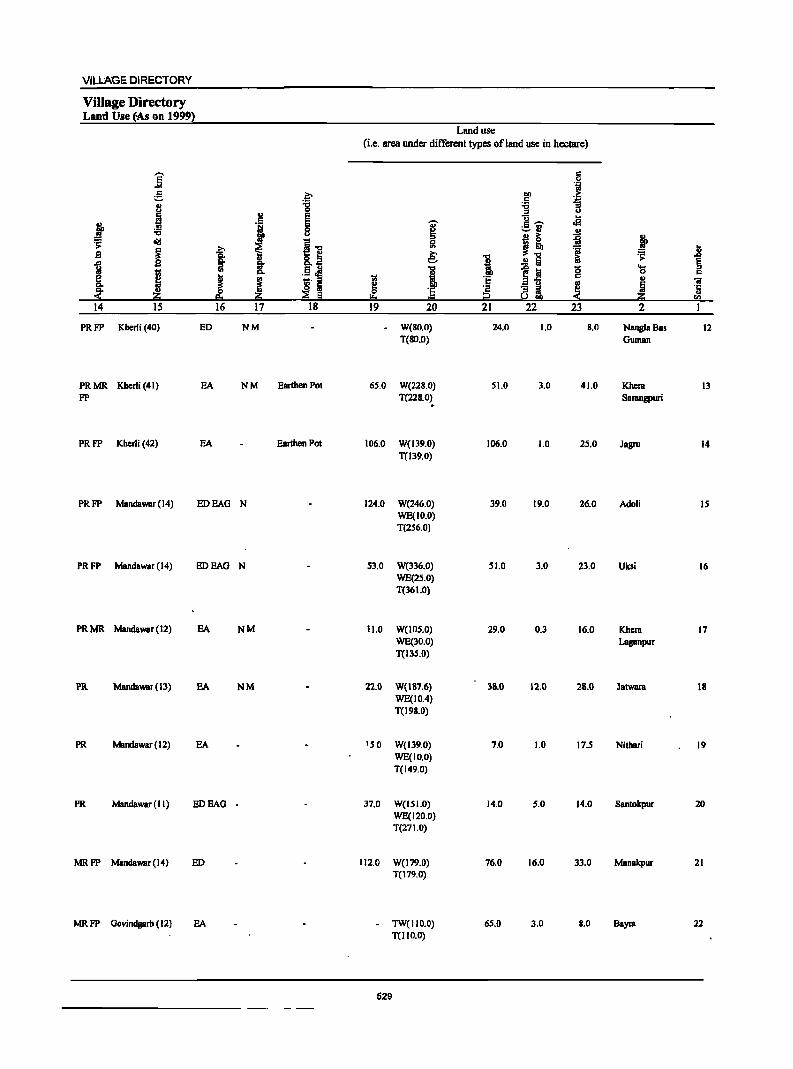
VILLAGE DIRECTORY
Village Directory Lantl Use tAs on 1999)
Land use (i.e. area under different types ofland usc in hectare)
] § "i e ::- 1>0 ;>
r:: ':;l .. 'g :;:; :;
I ::I U
I e g" oS j e 'U' ._ .,
:;:; 8 5 -" .!:l :0:: cI!I ~.., Ii! I! i j ;>
~ >. ..8 .9 I " &.~ ~ 1 .!:l Iii iii ~ § 1
j a .5 i i s~ 8 ~ r:: e J J
til 'E .. ftI Q. ~. 5 .. ~ ~ ] '2 !3i ~
·c ~ Iii i2
.. !!:o rn
14 15 16 17 18 19 20 21 22 23 2
PRFP Kherli (40) ED NM W(80.0) 24.0 1.0 8.0 Nangla Bas 12 T(80.0) Guman
PRMR Kherli (41) EA NM Earthen POI 65.0 W(22S.0) 51.0 3.0 41.0 Khera 13 FP T(22S.0) SBrangpuri
~
PRFP Kherli (42) EA Earthen Pol 106.0 W(139.0) 106.0 1.0 25.0 Jagru 14 T(139.0)
PRFP MBndawar (14) ED BAG N 124.0 W(246.0) 39.0 19.0 26.0 Adoli IS WE(1O.0) T(256.0)
PRFP MandBwar(14) ED BAG N 53.0 W(336.0) 51.0 3.0 23.0 Uksi 16 WE(25.0) T(361.0)
PRMR Mandawar (12) BA NM 11.0 W(IOS.O) 29.0 0.3 16.0 Khera 17 WE(30.0) Laganpur T(I3S.0)
PR Mandawar(13) BA NM 22.0 W(187.6) 38.0 12.0 28.0 Jatwara 18 WE(IO.4) T(198.0)
PR Mandawar (12) BA IS 0 W(139.0) 7.0 1.0 17.5 Nilhari 19 WE(IO.O) T(149.0)
PR Mandawaf (II) ED BAG - 37.0 W(151.0) 14.0 5.0 14.0 Santokpur 20 WE(120.0) T(27 1.0)
MRFP Mandawar (14) ED 112.0 W(I79.0) 76.0 16.0 33.0 Manakpur 21 T(179.0)
MRFP Govindgarh (12) EA TW(1I0.0) 65.0 3.0 8.0 Bayra 22 T(1I0.0)
529
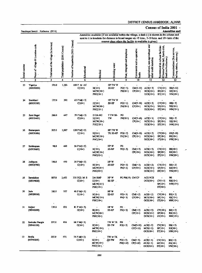
DISTRICT CENSUS HANDBOOK: ALWAR
Census of India 2001 -Panchayat Samiti : Kathumar (0014) Amenities and
Amenities available (if not available within the village, a dash (-) is shown in the column and next to it in brackets the distance in broad ranges viz.<S krns., 5-10 kms. and 10+ krns of the
i ~ nearest elace where the facili~ is available is given)
-g ~ ~ 1 [3..0 u u u
._ :s 8" .: ..c ~ 0 j
u
1 ~u
.~ e ., .E!: . _ 1!! ·E ....... u 0
~ ~ 0
1 ~ & ~ f .s 0 .. c.. u ]~ ....... 0
~ s 0
l~ cI!! ~ C!- i 6 -=§ ~~ u 5 J!l·c
j ~ IS .. 11 ~·a <III B.~ .~ .s' i .... .~ .s t I iiI:s!ll ~ 0 g, ~ ~ ]I ] .~ .!:!.j .. IS .6 ~i .... ~ 0 !il 0 iii
bI) .,.1 § .. 0 "" 'if .5 Ei f ., ..0 .!o! ~ Eii ' 5._ iii
~ ~ !i g l § ~I ·c ~ ~ u.5 ] E_ li) ~
·c 8 .~ rn iii:! '"" z 9 !'.!.e ~~0
1 2 3 4 5 6 7 8 9 10 11 12 13
23 Tigariya 535.0 1,383 189P M AC HPTWW (00939200) C(10+) H(IO+) SS-HP PO« 5) CM(5-10) ACS«5) CV(IO+) B8(5-IO)
MCW(10+) PH(lO+) CP(10+) NCS(IO+) 8P(10+) RS(IO+) PHC(IO+) OCS(IO+) 8T(IO+) NW(IO+)
24 Boolaheri 137.0 392 63PM«5) HPTWW (00939300) C(lO+) H(IO+) SS-lIP PO«5) CM(5-10) ACS«5) CY(lO+) 88«5)
MCW(IO+) PH(IO+) CP(IO+) NCS(IO+) 8P(10+) RS(IO+) PHC(IO+) OCS(IO+) ST(lO+) NW(lO+)
25 Ram Nagar 286.0 647 79PM«5) DDAHC TTWSS- PO (00939400) C(1O+) H(IO+) TW PH(IO+) CM(5·10) AC8« 5) CV(lO+) 8S«5)
MCW(IO+) CP(IO+) NCS(IO+) 8P(10+) RS(IO+) PHC(lO+) OCS(IO+) 8T(10+) NW(lO+)
26 Bamanpura 333.0 1,067 128 PM«S) HPTWW (00939500) C(IO+) H(IO+) TKSS-HP PO«S) CM(5.10) ACS«5) CY(IO+) B8(5·10)
MCW(IO+) PH(IO+) CP(IO+) NCS(IO+) SP(10+) RS(IO+) PHC(IO+) OC8(10+) ST(IO+) N\\i(IO+)
27 Baldeopura 98.0 469 56 P M«S) HPW PH (00939600) C(IO+) H(IO+) 88-UP PO«5) CM«5) ACS«5) CV(IO+) B8(10+)
MCW(IO+) CP(IO+) NCS(IO+) SP(IO+) RS(IO+) PHC(IO+) OCS(IO+) ST(1O+) NW(IO+)
28 Jodhpura 196.0 450 S6PM«5) HPW (00939700) C(10+) H(IO+) S8-HP PO«5) CM«S) ACS«5) CY(IO+) BS«5)
MCW(IO+) PH« 5) CP(IO+) NCS(IO+) SP(IO+) RS(IO+) PHC(IO+) OCS(10+) ST(1O+) NW(IO+)
29 Barodalcan 807.0 2,453 335 P(2) M S DARMP HPW PO PH(19) CM CP ACSNCS BS
(00939800) C(10+) H(IO+) S8-UP OC8(10+) CV«5) RS(IO+) MCW(IO+) SP(JO+) NW(IO+) PHC(IO+) ST(1O+)
30 1I0ia 100.0 327 46PM«5) HPW (00939900) C(IO+) H(IO+) S:'I-UP PO«5) CM(<:5) ACS«5) CY(IO+) BS« 5)
MCW(IO+) PH«S) CP(IO+) NCS(IO+) Sp(IO+) RS(IO+) PHC(IO+) OCS(IO+) ST(IO+) NW(lO+)
31 Rajpur 139.0 632 8IPM«S) UPW PH .
(00940000) C(IO+) H(1O+) S8-UP PO(<:5) CM«5) ACS(<:S) CV(IO+) BS«5) MCW(IO+) Cp(IO+) NCS(10+) Sp(IO+) RS(IO+) PHC(IO+) OCS{IO+) ST(IO+) NW(IO+)
32 Sedooka Nangla 257.0 416 68 PM«5) TWWTK PH (00940100) C(IO+) H(IO+) 8S-TW PO«5) CM{S-IO) AC8(<:S) CV(lO+) BS«5)
MCW(IO+) CP(S-IO) NCS«5) SP(IO+) RS(IO+) PHC(tO+) OC8(10+) 8T(10+) NW(IO+)
·33 Beejla 207.0 571 74 PM«5) TWWTK (00940200) C(IO+) H(IO+) • .s8-TW PO«5) CM«S). ACS(<: 5) CV(IO+). BS(<: 5)
" MCW(IO+) PH(5·10) Cp(5·10) NCS(<: 5) Sp(IO+) RS(IO+) PHC(IO+) .. OCS(IO+) ST(lO+) NW(IO+)
530
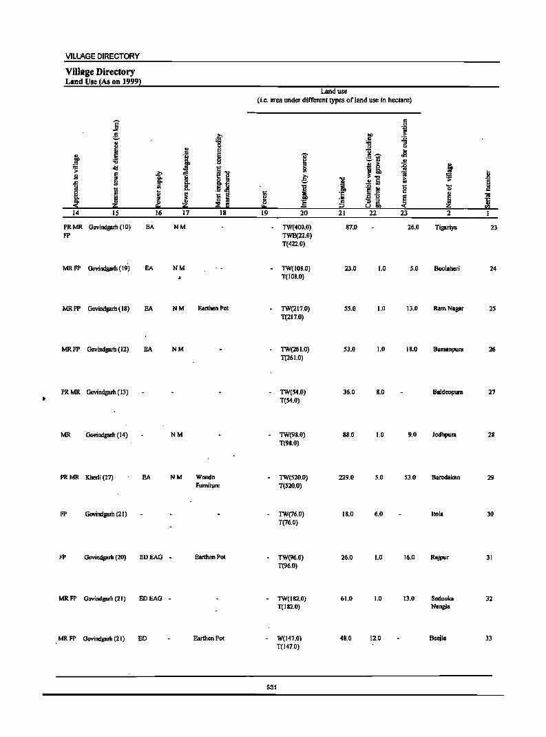
VILLAGE DIRECTORY
ViUage Directory Land Use (As on 1999}
Land use
(i.e. area under different types ofland use in hectare)
]' 0: 0 oil
e .~ tID > 0: ~ 8 "8 :a .. :s u
! I E U $I
~ ~ '[ 0: ,-.. .- '" '-' ... .. "<:I i-o :s j! ~ ~ .;;
~ .2;> 5! ';j D B co. 8.~ e: I iU
.;; ..0
] §' .!:! ~ ~ .. .. .5 cI9 I ~ iii "0 .... 1;; "- 0
K § J j 1;; :s I B1i 0: .. 'iI
~ o Iii 'E c - :> ! ~ ·c ;;; E as!! '" ~ i:I I::! i2 rn
14 IS 16 17 18 19 20 21 22 23 2 1
PRMR Govindgarh (10) EA NM TW(400.0) 87.0 26.0 Tigariya 23 FP TWE(22.0)
T(422.0)
MRFP Govindgarh (19) EA NM - TW(I08.0) 23.0 1.0 5.0 BooIBhcri 24
" T(IOS.O)
MRFP Govindgarh (18) EA NM Earthen Pot TW(217.0) 55.0 1.0 13.0 RarnNBgar 25 T(217.0)
MRFP Govindgarh (12) EA NM TW(26 1.0) 53.0 1.0 IS.O BBrnBnpurs 26 T(26 1.0)
PRMR Govindgarh (13) - TW(54.0) 36.0 8.0 Baldeopura 27
• T{S4.0)
MR Govindgarh (14) NM TW(98.0) 8B.0 1.0 9.0 Jodhpurs 28 T(9B.0)
PRMR Kherli (27) EA NM Wondn - TW(520.0) 229.0 S.O 53.0 BBrodakan 29 Furniture T(S20.0)
FP Govindgarh (21) TW(76.0) IB.O 6.0 110m 30 T{76.0)
FP Govindgarh (20) EDEAG - Earthen Pot TW(96.0) 26.0 1.0 16.0 RBjpur 31 T(96.0)
MRFP Govindgarh (21) EDEAG - TW(182.0) 61.0 1.0 13.0 Scdooka 32 T(IB2.0) Nangla
MRFP Govindgarh (21) ED Earthen Pol W(147.0) 48.0 12.0 Beejla 33 T(147.0)
531
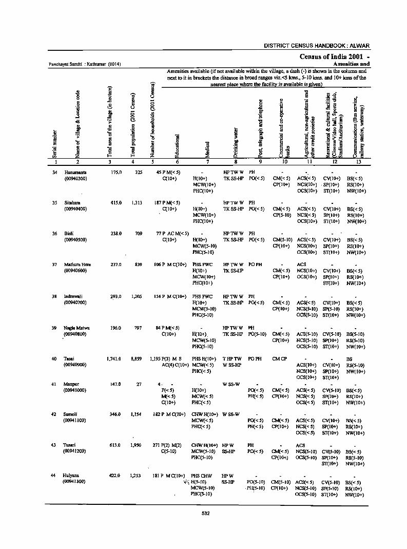
DISTRICT CENSUS HANDBOOK: ALWAR
Census of India 2001 -Panchayat Samiti : Kathumar (0014) Amenities and
Amenities available (if not available within the village, a dash (-) is shown in the column and next to it in brackets the distance in broad ranges viz.<5 kms., 5-10 Ians. and 10+ kms of the
I ~ nearest I!lace where the facili!X is available is Siven l
" ~ ] .!~ '0
1 0
.If u l! - ~ ..
1 6 0 .!i :.= u
e 8- .a ._ ~ ~,...., 'N U ~ ~ &. ~ f 0 ~ g <II
~ D. u e rIl,...., ...:I ~
0 ·i.~ old 'r;: t:!. ] b a ....... § eJ '" S .~ llih: ! " 5 g ] ~ .
..8 oS 'il I ..c c 8 oIdg~ 'i a ... ..c ~ l: _'0
'r;: 0 1 'a 1 ~ .~ ~ i '.Q
~ os '§ a 'a ~ j llP
., "31 D. .~ GI 'i .,
til 8 ~ " ]I l ! ~ 'Ii ~1 .~~ e! !! ] ~I " ~ ~ ~ ~ ~ ~ \2:CIl ~ .~ ra u,e ~ Ii!
2 3 4 5 6 7 8 9 10 11 12 13
34 Hanumanta 17S.0 32S 4SPM«S) HPTWW PH (00940300) C(10+) H(IO+) TK88-HP PO« 5) CM« 5) AC8« 5) CV(10+) B8« 5)
MCW(IO+) CP(IO+) NCS(IO+) . SP(IO+) RS(IO+) PHC(IO+) OCS(lO+) ST(IO+) NW(IO+)
35 Sitahara 41S.0 1.313 187PM«S) HPTWW PH (00940400) C(IO+) H(IO+) TKS8-HP PO« 5) CM«S) AC8« 5) CV(IO+) B8« 5)
MCW(IO+) CP(S-IO) NCS{< 5) SP{IO+) RS(IO+) PHC(IO+) OCS(IO+) ST(IO+) NW(IO+)
36 Bisti 238.0 709 77P ACM«5) HPTWW PH (00940500) C(IO+) H(IO+) TKSS-HP PO« 5) CM(S-IO) ACS«S) CV(IO+) BS« S)
MCW(S-IO) CP(IO+) NC8(1O+) SP(lO+) R8(10+) PHC(5-10) OCS(IO+) ST(IO+) NW(IO+)
37 MathuraHem 237.0 839 I06P MC{IO+) PHSFWC HPTWW PO PH ACS (00940600) He 10+) TKS8-HP CM«S) NC8(IO+) CV(1O+) B8« 5)
MCW(IO+) CP(IO+) OCS(IO+) 8P(10+) RS(IO+) PHC(IO+) 81(10+) NW(JO+)
38 Inilrawati 293.0 1,205 154 P M C(IO+) PH8FWC HPTWW PH (00940700) H(IO+) TKSS-HP PO«S) CM«S) AC8«S) CV(IO+) B8«5)
MCW(S-IO) CP(JO+) NCS(S-IO) SP(5-10) R8(JO+) PHC(S-IO) OCS(S-IO) ST(IO+) NW(IO+)
39 NaglaMatwa 196.0 797 84PM«S) HPTWW PH (00940800) C(lO+) H(1O+). TKS8-HP PO(S-IO) CM«5) AC8(S-10) CV(S-IO) B8(S-10)
MCWeS-IO) CP(IO+) NCS(S-IO) SP(IO+) R8(S-IO) PHC(S-IO) OC8(S-10) ST(IO+) NW(10+)
40 Tasai 1,741.0 8,859 1,I9S P(3) M 8 PH8 H(IO+) THPTW PO PH CMCP B8 (00940900) AC(4)C(IO+) MCW«5) WSS-HP ACS(IO+) CV(IO+) RS(S-IO)
PHC« 5) NCS(IO+) Sp(JO+) NW(lO+) OCS{IO+) ST(IO+)
41 Manpur 147.0 27 4. WSS-W {0094 1000) P«S) H(IO+) PO{< S) CM«S) AC8{<S) CV(S-IO) B8«S)
M«S) MCW«S) PH«S) CP(IO+) NC8«S) 8p(10+) RS(IO+) C(1O+) PHC«5) OCS«5) ST{IO+) NW{10+)
42 8amoli 346.0 1,154 182 PM C(IO+) CHWH(IO+) W8S-W (00941100) MCW«S) PO{<S) CM«S) ACS{<S) CV(IO+) BS« S)
PHC« S) PH«S) CP(IO+) NCS{<S) SP(lO+) RS(IO+) OCS{<S) ST(IO+) NW(IO+)
43 Tusari 613.0 1,950 271 P(2) M(2) CHWH(IO+) HPW PH ACS (00941200) C{S-IO) MCW(S-IO) SS-HP PO«S) CM«S) NCS(S-IO) CV(S-IO) B8«5)
PHC{S-IO) CP(IOi::) OCS(5-IO) SP(IO+) RS(S-IO) ST{IO+) NW{IO+)
44 Hulyana 422.0 1,253 181 P MC(IO+) PHSCHW HPW (00941300) ";'i H(S-10) SS-HP PO(S-IO) CM(S-IO) ACS«S} CV(S-IO) B8« S)
MCWeS-IO) . PH{S-IO) CP{IO+) NCS(S-IO) SP(S-IO) RS(IO+) PHC(S-IO) OCS(S-IO) 8T(10+) NW(IO+)
532
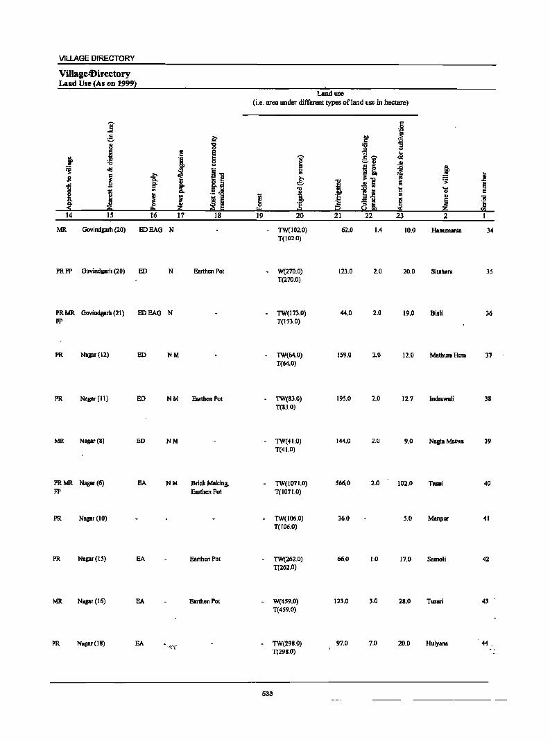
VILLAGE DIRECTORY
VillagetBirectory Land Use (As on 1999~
Land use (i.e. area under different types ofland use in hectare)
]' c .51 t;j
~ f OIl :E c
.1 '6 ;:J ;:J <I ., E U .. c
i> '1 e ]' c ,.... <2 '"Cl 0 ~13 .!! <> Ji ~ d!I .. I] " ~ ! 0
i i ~ OJ 'i 1l B .e: ] i a! .!!i i; .;;:: §
1il UI .5 J! "tI i
si 0 ....
i 0 c e j ! j ~ " 1il 'E .. " ';I
~ ~ ~ ! '8 'E ! i 'ij eo '" i2 ~ sa
14 IS 16 17 18 ]9 20 21 22 23 2 I
MR Govindgarh (20) EDEAG N TW(102.0) 62.0 1.4 10.0 Hanumanta 34 1(102.0)
PRFP Oovindgarh (20) ED N Earthen Pot W(270.0) 123.0 2.0 20.0 Sitahara 35 1(270.0)
PRMR Govindgarh (21) EDEAG N TW(173.0) 44.0 2.0 19.0 Bisli 36 FP 1(173.0)
PR Nagar (12) ED NM TW(64.0) 159.0 2.0 12.0 Mathura Hera 37 1(64.0)
PR Nagar (II) ED NM Earthen Pot TW(83.0) 195.0 2.0 12.7 Indrawali 38 1(83.0)
MR Nagar (8) ED NM - TW(41.0) 144.0 2.0 9.0 NaglaMatwa 39 1(41.0)
PRMR Nagar (6) EA NM Brick Making. TW(107l.0) 566.0 2.0 102.0 lassi 40 FP Earthen Pot 1(1071.0)
PR Nagar (10) TW(106.0) 36.0 5.0 Manpur 41 1(106.0)
PR Nagar (IS) EA Earthen POI TW(262.0) 66.0 1.0 17.0 Samoli 42 1(262.0)
MR Nagar (16) EA Earthen Pot W(4S9.0) 123.0 3.0 28.0 lusari 43 1(459.0)
PR Nagar (18) EA -rj'f TW(298.0) 97.0 7.0 20.0 HulyanB 44, 1(298.0)
533
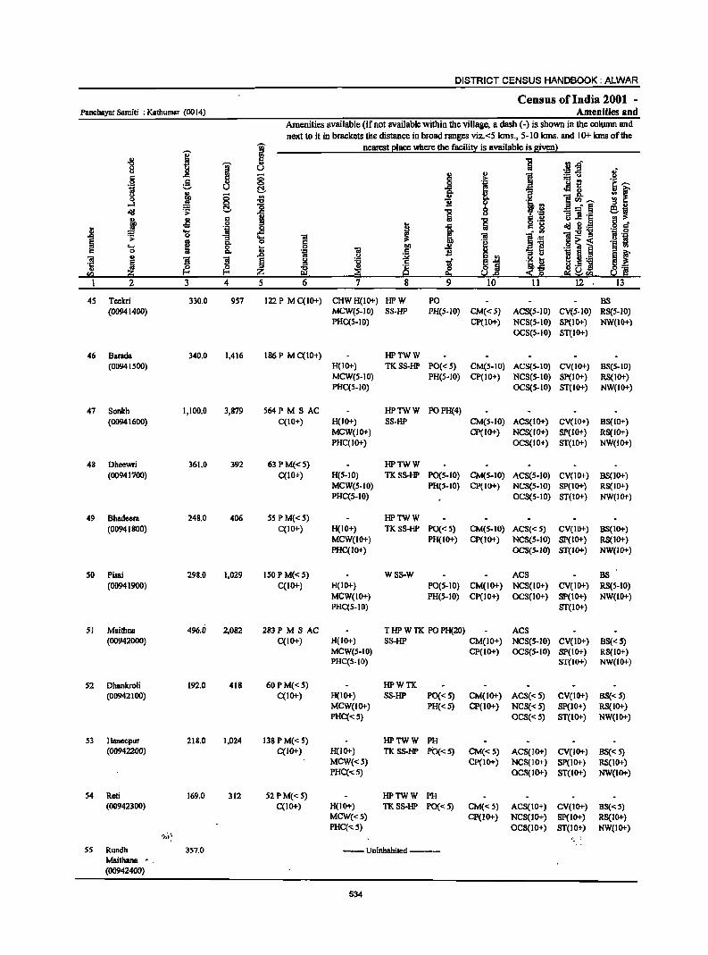
DISTRICT CENSUS HANDBOOK: ALWAR
Census ofIndia 2001 -Panchayat Samiti : Kafhumar (0014) Amenities and
Amenities available (if not available within the village, a dash (-) is shown in the column and next to it in brackets the distance in broad ranges viz.<5 kIns., 5-10 kIns. and 10+ kms of the
I "W nearest elace where the facilit~ is available is given}
" 5 1 .~j '0 ~ 0 u ti " c .c 5 ;:; ~ " i = u >
.~ g 0 ..8 l . - ~ 'e; ..... u r:!- eMs. ~ f u
~ § i ~ u i <I) ..... 0
....l ~ ·'.B d!I '!> r:!- 1 -= § ei u '" 11 '1: M> ~ 5 1 S .2 ~ S .~ .j § 1l = OS 'ij .8 I I <=. g 1:g-g '!> "3 OS 1 I j:a ra ~ ~ c.
.9 'a i .... &. .8 ~ 0 .~ 'iI "3 ~ ~ ~ s l § g .2 :.>i
l ~i iJ ~ IL_ ~ f 't:I <= rd .E ] {3. i§ ~ ~ 0= en ~ z !O.!.e e::~r:G! !O.! jg
2 3 4 5 6 7 8 9 10 11 12 13
45 Teekri 330.0 957 122 P M C(10+) CHWH(IO+) HPW PO BS (00941400) MCW{S-IO) SS-HP PH(S-IO) CM«S) ACS(5-10) CV(S-IO) RS(S-IO)
PHC(S-IO) CP(10+) NCS(S-IO) SP(IO+) NW(IO+) OCS(S-IO) ST(IO+)
46 Barada 340.0 1,416 186 P M C(10+) HPTWW (00941500) H(IO+) TKSS-HP PO«S) CM(5-10) ACS(5-10) CV(IO+) BS(5-10)
MCW(S-IO) PH(S-IO) CP(IO+) NCS(S-IO) SP(IO+) RS(lO+) PHC(S-IO) OCS(S-IO) ST(IO+) NW(IO+)
47 Sonkh 1,100.0 3,879 S64PMSAC HPTWW POPH(4) (00941600) C(IO+) H(IO+) SS-HP CM(S-lO) ACS(lO+) CV(IO+) BS(IO+)
MCW(IO+) Cp(IO+) NCS(IO+) SP(IO+) RS(IO+) PHC(IO+) OCS(IO+) ST(IO+) NW(IO+)
48 Dheewri 361.0 392 63 PM«S) HPTWW (00941700) C(1O+) H(5-10) TKSS-HP PO(S-IO) CM(S-10) ACS(5-10) CV(IO+) BS(10+)
MCW(S-IO) PH(S-IO) CP(IO+) NCS(5-10) SP(IO+) RS(IO+) PHC(S-IO) OCS(S-IO) ST(IO+) NW(IO+)
49 Bhadeera 248.0 406 5SPM«S) HPTWW (00941800) C(10+) H(IO+) TKSS-HP PO«S) CM(S-IO) ACS« S) CV(IO+) BS(IO+)
MCW(IO+) PH(IO+) CP(IO+) NCS(S-IO) SP(IO+) RS(IO+) PHC(IO+) OCS(S-IO) ST(IO+) NW(IO+)
50 Pisai 298.0 1,029 ISO P M« S) WSS-W ACS DS (00941900) C(IO+) H(IO+) PO(S-IO) CM(IO+) NCS(IO+) CV(lO+) RS(5-10)
MCW(IO+) PH(S-IO) CP(10+) OCS(IO+) SP(IO+) NW(IO+) PHC(S-IO) ST(IO+)
51 Maithna 496.0 2,082 283PMSAC T HP W TK PO PH(20) ACS (00942000) C(IO+) H(IO+) SS-HP CM(IO+) NCS(S-IO) CV(IO+) BS« S)
MCW(S-IO) CP(IO+) OCS(S-IO) SP(IO+) RS(IO+) PHC(S-IO) ST(IO+) NW(IO+)
52 Dhankroli 192.0 418 60PM«S) HPWTK. (00942100) C(IO+) H(IO+) SS-HP PO«5) CM(IO+) ACS« 5) CV(IO+) BS«5)
MCW(IO+) PH«S) CP(10+) NCS«S) Sp(IO+) RS(IO+) PHC«5) OCS« S) ST(IO+) NW(lO+)
S3 Hanecpur 218.0 1,024 138 P M« 5) HPTWW PH (00942200) C(IO+) H(IO+) TKSS-HP PO«S) CM«S) ACS(IO+) CV(IO+) BS«5)
MCW«S) CP(IO+) NCS(IO+) SP(IO+) RS(IO+) PHC(-<:5) OCS(IO+) ST(IO+) NW(IO+)
S4 Reti 169.0 312 S2 PM« 5) HPTWW PH (00942300) C(IO+) H(IO+) TKSS-HP PO«5) CM«S) ACS(IO+) CV(IO+) BS«S)
MCW«S) CP(IO+) NCS(IO+) Sp(IO+) RS(IO+) PHC«5) OCS(IO+) ST(IO+) NW(IO+)
,};,,'t ... ~ ;
55 Rundh 357.0 --Uninhabited ----Maithana •. (00942400)
534
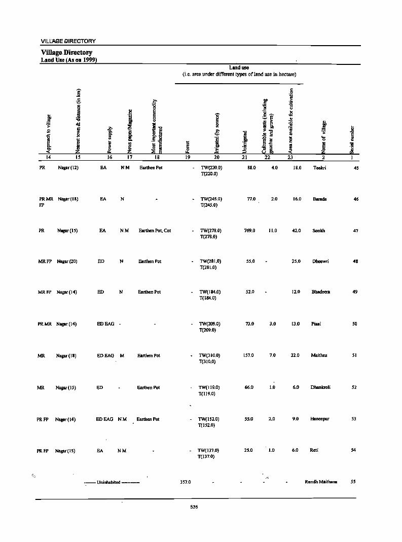
VILLAGE Ii>IRECTORY
VUlage.Dir.ector-y Land Use lAs on 19991
j ~ .~ 8 '0
Q
1ii 'j e ~ :a ~ ~ "<:I i'O ~ ~
.0 s 8= I &.~ ]
I .. .5 J! e ! ! ~ ~ "" "" ::S ~ "" ~ Iii
14 15 16 17 18
PR Nagar (12) EA NM Earthen Pol
PRMR Nagar(IS) EA N FP
PR Nagar (15) EA NM Earthen Pot, COl
MRFP Nagar (20) ED N Earthen Pot
MRFP Nagar (14) ED N Earthen Pot
PRMR Nagar (14) EDEAG -
MR Nagar (IB) EDEAG M Earthen Pot
MR Nagar (IS) ED Earthen Pot
PRFP Nagar (14) EDEAG NM Earthen Pot
PRFP Napr(IS) EA NM
.,
--- Uninhabited ----
Land use
(i.e. area under different types ofland use in hectare)
~ 0
!:!o 19
]' = 0 .. € I 'E t= 20
TW(220.0) T(220.0)
TW(245.0) T(245.0)
TW(278.0) T(278.0)
TW(28 1.0) T(28 1.0)
TW(IB4.0) T(IB4.0)
- TW(209.0) T(209.0)
- TW(310.0) T(31 0.0)
TW(1l9.0)
T(119.0)
TW(152.0) T(IS2.0)
- TW(137.0) T(137.0)
357.0
535
'0
i 'E 'E i2 21
88.0
77.0
769.0
55.0
52.0
73.0
157.0
66.0
55.0
25.0
g .~
I>Q > c ~ :;:; = u u .£l c ...., ;:;.I'l OJ
B ~ ~ ~'O ~
i:i ..!:l a ~ Iii 0 a'fi c
~ "3 iI U!!!I
22 23
4.0 18.0
2.0 16.0
11.0 42.0
25.0
12.0
3.0 13.0
7.0 22.0
1.0 6.0
2.0 9.0
1.0 6.0
_·i
.t ~ =s: .0
~ .... Q c .,
'iI ~ Ji :so 2
Teekri 4S
Barada 46
Sonlch 47
Dhcewri 48
Bhadeera 49
Pisai so
Maithna 51
Dhankroli 52
Haneepur 53
Rcti 54
Rundh Maithana 55
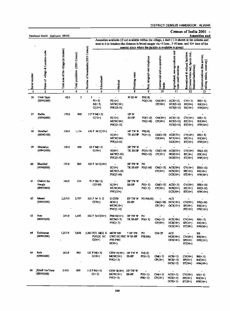
DISTRICT CENSUS HANDBOOK: ALWAR
Census of India 2001 -Panehayat Samiti : Kathumar (0014) Amenities and
Amenities available (if not available within the village, a dash (-) is shown in the column and
next to it in brackets the distance in broad ranges viz.<5 kms., 5-10 kms. and 10+ kms of the
I ~ nearest I!lace where the facilit)! is available is Biven l
II I!l 1 rJ..o .., '";i;' II
0 iil u ._ ::s
.§ u II>
t:! II
] :!:'U S ..<: 5 0 .!!:. a 0 .0 e! ._ {!
i::: ....... ';1 u !::!. ]- '3 eM c
~ f j II _ Il.
.s 0 <II Il. u 0
.., 1l 0 li S"' ....... oil! !::!. '0 .., B -"§ e.j ;.. ~ Iii ] ]'1:
j .s 6 .., ·1 § ~
';1 j f 1 Iii a: g oil! g .-8 'S 'iI l~ 'iI:5!'8 ;. ... g_ .... 'iI "g .6 ~ i ._ 'j
0 6 e .... ; 8. .ii ] f 1l _]
§ ~ c ... E~ .~ ~ 'iI J E E § ~ ..r ! ~ ._ ~-·c
~ ~ ~ ~ '1: ~ ~ § s~
.,.S] ~ .~ " Z g e:i S:!: ra '" !i.1.e
I 2 3 4 5 6 7 8 9 10 11 12 13
S6 ChakTapsi 42.0 2 I WSS-W PH(IS) (00942S00) P«S) H(IO+) . PO(S-IO) CM(IO+) ACS«S) CV« S) 88« S)
M{<S) MCW{IO+) CP{IO+) NCS(S-IO) Sp{IO+) RS(IO+) C(10+) PHC(S-IO) OCS(S-IO) ST(IO+) NW{IO+)
57 8adka 179.0 848 117PM«S) HPW (O0942600) C(IO+) H{lO+) 8S-HP PO(S-to) CM(IO+) ACS«S) CV{IO+) 8S« S)
MCW(1O+) PH{S-IO) Cp{IO+) NCS(S-IO) Sp{IO+) RS(IO+) PHC(S-IO) OCS(S-IO) ST{IO+) NW(IO+)
58 Doodheri 338.0 1,114 156 P M C{IO+) HPTWW PH(to) (00942700) H(1O+) TKSS-HP PO«S) CM(S-IO) ACS(IO+) CV(10+) 8S«S)
MCW(IO+) CP{IO+) NCS(IO+) 8p(10+) RS(IO+) PHC(S-IO) OCS(IO+) ST(IO+) NW(1O+)
59 Moondiya 159.0 496 63 P M« 5) HPTWW (00942800) C(IO+) H(IO+) TKSS-HP PO(S-IO) CM(S-IO) ACS(IO+) CV(JO+) 8S(S-IO)
MCW(S-to) PH(S-IO) CP(IO+) NCS(IO+) SP(lO+) RS{IO+) PHC{S-IO) OCS(IO+) ST(IO+) NW(IO+)
60 Bharithal 175.0 824 125 P M C(lO+) HPTWW PH (00942900) H(10+) TK SS-HP PO(S-IO) CM(S-IO) ACS(lO+) CV(IO+) BS(S-IO)
MCW(S-IO) CP(IO+) NCS(IO+) SP(IO+) RS(IO+) PHC(S-IO) OC8(IO+) 8T(10+) NW(1O+)
61 Chahori Ka 144.0 SI4 72PM«S) IiPTWW Nangia C(S-IO) H{IO+) SS-HP PO«S) CM(S-IO) ACS«S) CV(IO+) 8S(S-10) (00943000) MCW(IO+) PH«S) CP(IO+) NCS(IO+) SP(IO+) RS(S-IO)
PHC{IO+) OCS(IO+) ST(IO+) NW(IO+)
62 Masari 1,219.0 3,707 SSI PM S 0 DCHW HPTWW POPH(30) ACS (00943100) C(IO+) H(IO+) SS-HP CM(5-IO) NCS(IO+) CV(JO+) 8S(S-10)
MCW(IO+) CP(IO+) OCS(IO+) SP(IO+) RS(1O+) PHe(S-IO) ST(IO+) NW(IO+)
63 Reta 247.0 1,430 202 P MC(IO+) PHSH(IO+) IiPTWW PH (00943200) MCW«S) TKSS-HP PO«S) CM«S) ACS(IO+) CV(IO+) 88« 5)
PHC«S) CP(IO+) NCS(IO+) SP(IO+) RS(lO+) OCS(lO+) ST(IO+) NW(IO+)
64 Kathoomar 1,217.0 7;6S6 .I.26S peS) M(2) S MCWMH TIiPTW PO CMCP ACS BS (00943300) PUC(2) AC CWC HC PHC W SS-1iP PH(IOO) NCS(IO+) CV(lO+) RS{IO+)
C{IO+) PHSFWC OCS(IO+) SP(IO+) NW(IO+) H(IO+) ST(IO+)
65 Rela 261.0 943 135 PM«5) CHWH(IO+) HPTWW PH(12) (00943400) C(IO+) MCW(IO+) SS-HP PO«S) CM«S) ACS«S) CV(IO+) BS«5)
PHC« 5) CP(IO+) NCS« S) SP(IO+) RS(JO+) OCS«S) ST(IO+) NW(IO+)
66 }Sherli Tarf Rela 210.0 899 118 P M« S) CHWH(IO+) HPTWW (00943500) C« S) MCW(lO+) 88-1iP PO«S) CM«5) AOS«5) CV(JO+) BS«S)
PHC«S) PH«5) CP(IO+) NCS«5) SP(IO+) RS(lO+) OCS«5) ST(JO+) NW(JO+)
536
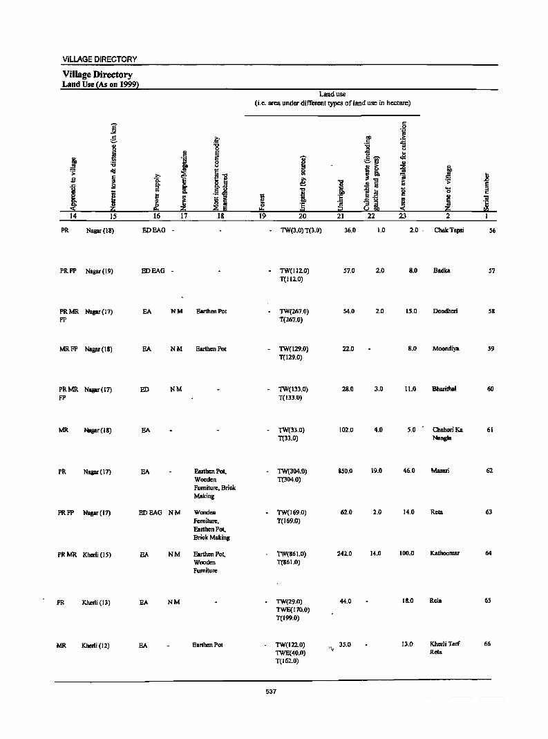
VILLAGE DIRECTORY
Village Directory Land Use (As on 1999)
j g
j ! ~ .s;
~ s ~
I [ ~ li 14 IS
PR Nagar (18)
PRFP Nagar (19)
PRMR Nagar (17) FP
MRFP Nagu(18)
PRMR Nagar(l7} FP
MR Nagar (IB)
PR Nagar (17)
PRFP Nagar (17)
PRMR Kherli (IS)
PR Khuli(13)
MR Kherli (12)
a :a 0 .,
" E
'i E 0 t>
ii..., .g: I K~ ~ .. .~ ~ ! j ~ fa 8:1 ::e Iii 16 17 18
EDEAG -
EDEAG -
EA NM Earthen Pot
SA NM Earthen Pot
ED NM
EA
EA Earthen Pot, Wooden Furniture, Brick Making
EDEAG NM Wooden Ferniture, Earthen Pot, Brick Making
EA NM Earthen Pot, Wooden Furniture
EA NM
EA Earthen Pot
Land use (i.e. area under different types of land use in hectare)
.§ 'Iii
eo > " ''::: :a '13 ~
t> ....
'U' ,,~ oS
~ :.::.:1 .!!
i! .,
1l ! .. ra 1! € i ~ ~ .!! fa § ...,
Ii g .... i
0 " l;; :§ II> 'iI ~ '" Ii 'E ~ ~ 'ij
"" = li rt:l 19 20 21 22 23 2 I
- TW(3.0) T(3.0) 36.0 1.0 2.0 . ChakTapsi 56
- TW(112.0) 57.0 2.0 8.0 Badka 57 T(Il2.0)
TW(267.0) 54.0 2.0 15.0 Doodheri 58 T(267.0)
- TW(129.0) 22.0 B.O Moondiya 59 T(129.0)
- TW(133.0) 28.0 3.0 11.0 Bharithal 60 T(I33.0)
TW(33.0) 102.0 4.0 5.0 Chahori Ka 61 T(33.0) Nangls
- TW(304.0) 850.0 19.0 46.0 Masari 62 T(304.0)
- TW(169.0) 62.0 2.0 14.0 Reta 63 T(169.0)
TW(B61.0) 242.0 14.0 100.0 Kathoomar 64
T(86 1.0)
TW(29.0) 44.0 18.0 Rela 65 TWE(170,0) T(199.0)
TW(122.0) 35.0 13.0 Kherli Tad 66 TWE(40.0)
... \.-Rels
T(162.0)
537

DISTRICT CENSUS HANDBOOK: ALWAR
Census of India 2001 -Panchayat Samiti : Kathumar (0014) Amenities and
Amenities available (if not available within the village, a dash (-) is shown in the column and
next to it in brackets the distance in broad ranges viz. <5 kms., 5-10 kms. and 10+ kms of the
]' gj' nearest Illace where the facilitl! is available is given}
.g gj' 5 Il.d <> U ... l! ',c .a §
.. (; :.:: u
~ 5 C> ._ e
.~ u ~ .e1 8. j 0 '" oS "" ]~,.._ 0 -0 c!!I r= !::!, -=§ > ~ 6 11 .~ ~ Jl § " -I .8 .~ ..8 c!!I iil·_ s .... i:E"g 0 8. ....
~ > g 0
.0 ~] .... 0 .8 0 I>.
~ ~ 'S 'S 5 ._
~ ~ § D]
C/) z I 2 3 4 5
67 Berka 308.0 1,504 212 P M«S) CHWH(10+) HPTWW PH BS (00943600) C(lO"') MCW(IO ... ) SS-HP PO«S) CM(S-IO) ACS«S) CV(IO+) RS(IO"')
PHC(S-IO) CP(IO+) NCS(S-IO) SP(IO+) NW(IO+) OCS(S-IO) ST(IO+)
68 Ranota 12S.0 498 74PM«S) CHWH(IO+) HPTWW PH BS (00943700) C(lO+) MCW(10+) SS-HP PO«S) CM«S) ACS«S) CV(IO+) RS(IO+)
PHC«S) CP(IO+) NCS«S) SP(IO+) NW(IO+) OCS«S) ST(lO+)
69 Badika 244.0 S8S S2PM«S) HPW PH (00943800) C(10+) H(IO+) SS·HP PO(<:S) CM(<:S) ACS(<:S) CV(IO+) BS(<: S)
MCW«S) CP« S) NCS«S) SP(IO+) RS(IO+) PHC«5) OCS«S) ST(IO+) NW(IO+)
70 lshrota 331.0 1,182 168P MC(lO+) HPTWW PO PH CP ACS (00943900) 8(10+) TK SS-HP CM(5-10) NCS(S-IO) CV(IO+) BS«5)
MCW(S-IO) OCS(S-IO) SP(IO+) RS(IO+) PHC(S-IO) ST(IO+) ~(IO+)
71 Mankhera 304.0 912 129 P M« S) HPW PHIS) (00944000) C(IO+) H«S) SS-HP PO«5) CM«S) ACS«S) CV(IO+) BS«5)
MCW«S) CP« 5) NCS«S) SP(1O+) RS(IO+) PHC«S) OCS«S) ST(IO+) NW(10+)
72 Dayalpura 207.0 510 76 PM« S) HPTWW (00944100) C(IO+) H(IO+) TK SS-HP PO«S) CM«S) ACS(S-IO) CV(S-IO) BS«S)
MCW«S) PH«S) CP(lO+) NCS(S-IO) SP(S-IO) RS(S-IO) PHC«S) OCS(S-IO) ST(IO+) NW(IO+)
73 Kankroli 476.0 1,792 246 P M C(IO+) HPW PH(IS) BS (00944200) H(S-IO) SS-HP PO«S) CM(5-10) ACS«S) CV(lO+) RS(IO+)
MCW(S-IO) CP(S-IO) NCS(S-IO) SP(IO+) NW(IO+) PHC(S-IO) OCS(S-IO) ST(1O+)
74 Pahari 192.0 910 lOS P AC M« 5) HPTWW PH (00944300) C(IO+) H(IO+) TKSS-HP PO«S) CM(5-10) ACS«S) CV(lO+) BS« 5)
MCW(S-IO) CP(lO+) NCS(S-IO) SP(S-IO) RS(IO+) PHC(S-IO) OCS(S-IO) ST(IO+) NW(IO+)
75 Ajeetpura 150.0 409 57 PM« 5) HPTWW (O0944400) C(IO+) H(IO+) TKSS-HP PO«S) CM(S-IO) ACS«S} CY(IO+} BS«S}
MCW(S-IO) PH«S) CP(IO+) NCS(S-IO) SP(S-IO) RS(IO+) PHC(S-IO) OCS(S-IO} ST(IO+) NW(IO+)
16 Titpuri S59.0 2,863 432P MC(IO+) DACHW TTWW PO PH CMCP ACS BS (00944500) H(IO+) TKSS-TW NCS«S) CY(IO+) RS(IO+)
MCW(IO+) OCS(IO+) SP(IO+) NW(ID+) PHC(IO+) ST(IO+)
77 Ranoli 147.0 635 102PM«S) HPTWW (00944600) C(lO+) H(I 0+) \ft,f TKSS-HP PO(S-IO) CM{S-IO) ACS«S) CV(IO+) BS«S)
MCW(S-IO} PH(IO+} CP(IO+) NCS(S-IO) SP(IO+) RS(IO+) PHC(S-JO) OCS(S-IO) ST(IO+) NW(IO+)
538
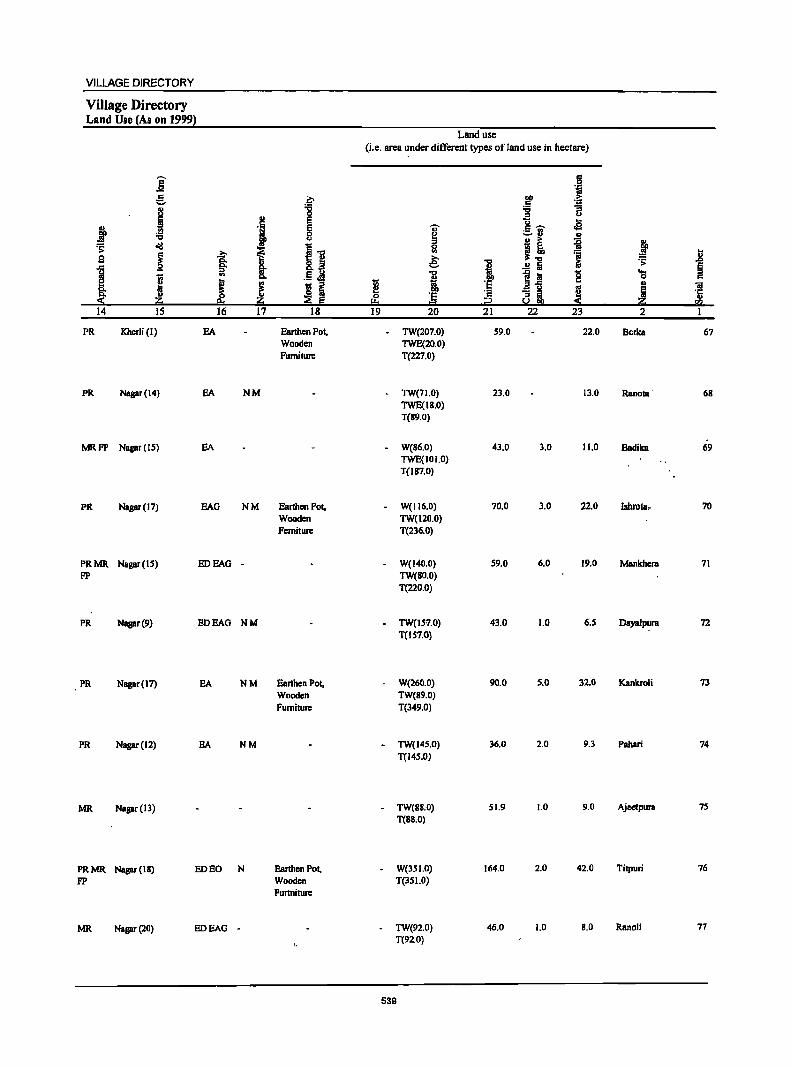
VILlAGE DIRECTORY
Village Directory Land Use (As on 1999)
Land use (i.e. area under different types of land use in hectare)
j g 'i
g ~ ~ .~
I '8 :;; "B :0
'i E "6 ...
:f E .. "'~ oS :a 0
~ -=-rl .!! u !! ~ .:;: o'il
i {] 0 ~ ~ ~ .a:;. (II ~.., :s .8 9 ~
1 .9 g; 1 .!! Ii ~
.:;: § ::> 8. .1:1 .M ..,
j~ '8 'S
I .. I ~ i c
I fj ~ ·s OJ 'iI 8: 0 '8 :3 8i J ! '5 « z ;;a Ej f+, = co 14 IS 16 17 18 19 20 21 22 23 2 I
PR Kherli (I) EA Earthen Pol, TW(207.0) 59.0 22.0 Berka 67 Wooden TWE(20.0) Furniture T(227.0)
PR Nagar (14) SA NM - TW(71.0) 23.0 13.0 Ranota ' 68 TWE(18.0) T(S9.0)
MRFP Nagar (IS) EA W(S6,0) 43.0 3.0 11.0 Badika 69 TWE(I 0 1.0) T(l87.0)
PR Nagar (17) EAG NM Earthen Pot, W(II6.0) 70.0 3.0 22.0 Ishrota" 70 Wooden TW(lZo'o) Ferniture T(236.0)
PRMR Napr(IS) EDEAG - W(140.0) 59.0 6.0 19.0 Mankhera 71 FP TW(So.o)
T(220.0)
PR Nagar (9) EDEAG NM TW(JS1.0) 43.0 1.0 6.5 Dayalpura 72 T(IS7,0)
PR Napr(l7) EA NM Earthen Pot, W(260.0) 90.0 5.0 32.0 Kankroli 73 Wooden TW(89.0) Furniture T(349,0)
PR Napr(IZ) EA NM - TW(14S,0) 36,0 2,0 9.3 PabBri 74 T(145.0)
MR Nagar (13) TW(88.0) 51.9 1.0 9.0 Ajeetpura 7S
T(8S.0)
PRMR Napr(l8) ED EO N EanhenPol, W(35 1.0) 164.0 2.0 42.0 Titpuri 76
FP Wooden T(351.0) FunnilUre
MR Nagar (20) EDEAG - TW(9Z.0} 46.0 1.0 8.0 Ranoli 77 T(92.0)
539
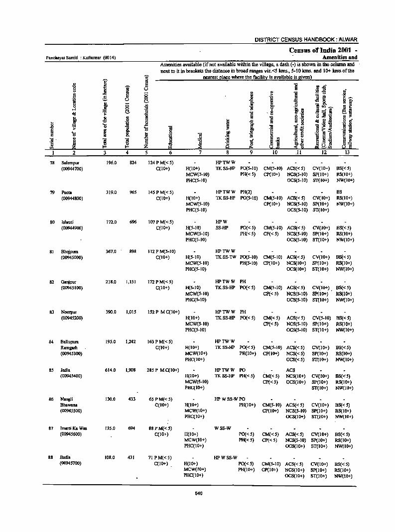
DISTRICT CENSUS HANDBOOK: ALWAR
Census of "India 2001 -PanchByat Samiti : Kathumar (0014) Amenities and
Amenities available (if not available within the villllge, II dash (-) is shown in the column and next to it in brllckets the distllnce in brolld ranges viz.<5lans., 5-10 kms. and 10+ lans of the
"iii' nearest_l!lace where the facili~ is IIvailable is gjvenl
I iii ;
II> r: ] rl.t:f '0 ! '" 8 u ._ os !f ii 0 2!
., ] ::!:"U a g > ._ ~
-~l 0 ..8 .~ .~ u t!.. .as. " j 0 go ;;
.3 ~ 1i c. <> 'i!!CIl~ 0
1 9 :i :J .a _" § ~j ell! ~ C!.. '0 - 8 a o!: 'il ;; 1! '1::
j Jl IS i ~ 'a " 0 a r! ... 'j ..8 I:l 1 ctd g.1:S
" .... j 'iI:s!1I 'N ·Il 1 == 0 1 ~ 'iI ~ ].<:! ;.- ..
I r:~< '§ i! .... ~ 0
~ ~ ;;1 .9 ~ 0 "" 'iI 1i '" EO i 'iI- '" ! ! § ~ ~ 1 ~i 'i II ~ 5 .~
·c ! ,,_S] 13::: " z ~ 9 5.2.e ::!:~
" $d, sa 5.2 I:: sa 1 2 3 4 5 6 7 8 9 10 .II 12 13
78 Salempur 196.0 824 124 P M« 5) HPTWW
(00944700) qIO+) H(IO+) TKSS-HP PO(S-IO) CM(S-IO) ACS«S) CV(JO+) BS« 5) MCW(S-IO) PH« 5) CP(lO+) NCS(S-IO) SP(IO+) RS(IO+) PHC(S-IO) OCS(S-IO) 8T(10+) NW(JO+)
79 Paola 319.0 965 145 PM«S) HPTWW PH(2) BS
(00944800) C(IO+) H(lO+) TKS8-HP PO(S-IO) CM(S-IO) ACS«S) CV(1O+) RS(IO+) MCW(S-JO) CP(IO+) NCS(S-IO) 8P(10+) NW(IO+) PHC(S-IO) OCS(S-IO) 8T(10+)
80 Ishroti 172.0 696 107PM«S) HPW
(00944900) qIO+) H(S.IO) SS-HP PO«5) CM(S-IO) ACS«5) CV(IO+) BS«5) MCW(S-IO) PH« 5) CP« 5) NCS(S-IO) 8P(10+) RS(10+) PHC(S-IO) OCS(S-IO) ST(IO+) NW(IO+)
81 Bhojpura 367.0 - 898 112 P M(S-IO) HPTWW
(00945000) C(IO+) H(S-IO) TKSS-TW P0(5-10) CM(S-IO) ACS« 5) CV(IO+) BS« 5) MCW(S-IO) PH(S-IO) CP(IO+) NCS(IO+) SP(IO+) RS(10i') PHC(S-IO) OCS(IO+) ST(IO+) NW(IO+)
82 Oanjpur 218.0 1,151 172 PM«S) HPTWW PH
(0094S I 00) C(IO+) H(S-IO) TKSS-HP PO«S) CM(S-IO) ACS«S) CV(IO+) , BS«5) MCW(S-IO) Cp«S) NCS(S-IO) SP(lO+) RS(IO+) PHC(S-IO) OCS(5-10) ST(IO+) NW(ID+)
83 Noorpur 390.0 1,015 152 P M C(IO+) HPTWW PH
(00945200) H(IO+) TKSS-HP PO« S) CM«S) ACS« 5) CV(S-IO) 88« S) MCW(S-IO) CP«S) NCS(S-IO) SP(IO+) RS(IO+) PHC(S-IO) OCS(S-IO) ST(IO+) NW(IO+)
84 Ballupura 195.0 1.242 163 PM«S) HPTWW
Ramgarh C(IO+) H(IO+) TKSS-HP PO«S) CM(5-10) ACS« 5) CV(IO+) BS«5) (00945300) MCW(IO+) PH(IO+) CP(lO+) NCS« 5) SP(IO+) RS(IO+)
PHC(IO+) OC8«5) ST(IO+) NW(IO+)
85 Jlldla 614.0 1.908 285 P MqIO+) HPTWW PO ACS (00945400) H(IO+) TKSS-HP PH« S) CM«5) NCS(IO+) CV(IO+) BS« 5)
MCW(S-IO) Cp«S) OCS(IOi') SP(IO+) RS(IO+) PHc(lo+) ST(IO+) NW(IO+)
86 Nangli 130.0 433 65 P M«5) HPWSS·WPO Bhawana C(IO+) H(IO+) PH(IO+) CM(5-10) ACS«5) CV(IO+) BS«5) (00945500) MCW(IO+) CP(IO+) NeS(S-IO) Sp(IO+) RS(1o+)
PHC(IO+) OCS(IO+) ST(IO+) NW(IO+)
87 lmarti Ka Was 135.0 694 88 p M«5) WSS-W (00945600) C(IO+) H(IO+) PO«S) CM«S) ACS« S) CV(lo+) BS« S)
MCW(IO+) PH«S) CP«S) NCS(S-IO) Sp(IO+) RS(lO+) PHC(IO+) OCS(IO+) ST(IO+) NW(IO+)
88 Badia 108.0 431 71 P M« S) HPWSS-W (00945700) C(IO+) H(IO+) PO«S) CM(S-IO) ACS«S) CV(IO+) BS« 5)
MCW(IO+) PH(IO+) CP(IO+) NCS(IO+) SP(lO+) RS(IO+) PHql0+) OCS(IO+) ST(IO+) NW(IO+)
540
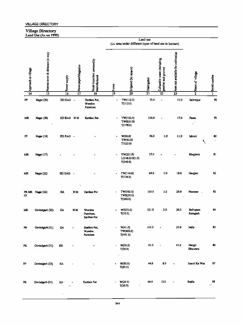
VILLAGE DIRECTORY
Village Directory Land Use (As on 1999)
Land use (i.e. area under different types of land use in hectare)
~ c 0 .~
g .~ QO ... .5 ~ .. "" "" u 0 '" u
~ .. e 8 ..... ...
:t ., § 'U' oS
:a I :=..~ ., .. ... ii j II!! {] - 0 .;;:
~ .... i ~~ 'ii ] 9 1: ~ 1 &; ~
I ..!! Iii §
tl '" .5 ~ 1 ~l! B "0 .. c
H ! ~ I 'E .. 'iii
l! QO .a <>
~ ~ :5 '2 (] ~ 'ii ~ ~ I!:o i2 CI)
'14 15 16 17 18 19 20 21 22 23 2 I
pp Nagar (20) EDEAG Eanhen Pot, TW(112.0) 72.0 12.0 Salempur 78 Wooden T(112.0) Furniture
MR Nagar (20) EDEAG NM Earthen Pot TW(I33.0) 124.0 17.0 Paota 79 TWE(4S.0) T(178.0)
FP Nagar (18) EDEAG - W(60.0) 36.0 2.0 11.0 Ishroti 80 ~(63.0) '\I. T(123.0) ~
MR Nagar (17) TW(221.0) 27.0 Bhojpura 81 L(II8.0)0(t.O) T(340.0)
MR Napr(22) EDEAG - TW(134.0) 64.0 2.0 18.0 Ganjpur 82 T(134.0)
PRMR Nagar (22) EA NM Earthen Pot TW(192.0) 116.0 3.0 29.0 Noorpur 83 pp TWE(SO.O)
T(242.0)
MR Govindgarh (22) EA NM Wooden WE(S2.0) 121.0 2.0 20.0 Bnllupura 84
Furniture, T(S2.0) Ramgarh Earthen Pot
PR Govindgarh (21) EA Erathen Pot, W(41.0) 141.0 32.0 ]adIa 85
Wooden TW(400.0) Furniture T(44 1.0)
PR Govindprh (21) ED W(26.0) 91.0 13.0 Nangli 86
T(26.0) Bhawana
pp Govindprh (22) EA W(83.0) 44.0 8.0 ImaniKaWas 87 T(83.0)
PR Govindgarh (21) EA' Earthen Pot W(26.0) 69.0 13.0 Badia 88
T(26.0)
541
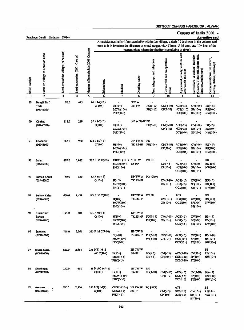
DISTRICT CENSUS HANDBOOK: M.WAR
Census of India 2001 -Panebayat Samiti : Kathumar (0014) Amenities and
Amenities available (if not available within the village, a dash (-) is shown in the column and
next to it in brackets the distance in broad ranges viz. <5 kms., 5-10 kms. and 10+ kms ofthe "0;- nearest place where the facility is available is given)
I ::I '" " I::: i .J! .g-"0
1 II>
0 U oJ' u l! Ii! " l ::=:u I:::
~ .::: .~ 0 g .f! 1<! 'u f! i::~ 'ij u ... .. oIll &. 1;1 ~ 0 j (5 ~ " 8. ~rIl~ ...:I 0
] B 0 II _' E ~j ~ C!- ] 0 old co> "3 ] .E! } .s 6 1;1 ] U 9 6 c
i 'il .8 t ..c: 1:::,2 old 2 ._ .;;: 'l)
"3 'l) 1 ~ ~ 1 l~ 01:9] 'N ._g
I go .~~ 1 ._ s .... ] f
., -=1 I i 0 ...
~ B E ., ., !:l ~ .• ]I
~ ~ ~ ~ ! l ~] 'a 13 t :S~ H'- ] ~1 !;{l a; ~[(,I I 2 J 4 5 6 7 8 9 10 11 12 IJ
89 Nangli Tarr 96.0 495 6SPM«S) TWW
Toda C(lO+) H(lO+) SS-TW PO(S-IO) CM(S-lO) ACS«S) CV(IO+) BS«S) (00945800) MCW(lO+) PH(S-IO) CP(S-IO) NCS(S-lO) SP(IO+) RS(IO+)
PHC(IO+) OCS(IO+) ST(IO+) NW(10+)
90 Chokuti 118.0 219 30PM«S) HPWSS-WPO
(0094S900) C(IO+) H(IO+) PH(S-IO) CM(S-lO) ACS«S~ CV(10+) BS«5) MCW(lO+) CP(S-IO) NCS«S) SP(1O+) RS(IO+) PHC(IO+) OCS(lO+) ST(IO+) NW(lO+)
91 Cbandpur 261.0 980 122 P M«S) HPTWW PO (00946000) C(IO+) H(IO+) TKSS-HP PH(IO+) CM(S-lO) ACS(lO+) CV(IO+) BS«5)
MCW(IO+) CP(IO+) NCS(lO+) SP(IO+) RS(IO+) PHC(IO+) OCS(IO+) ST(1O+) NW(1O+)
92 Sahari 401.0 1,612 217P MC«S) CHWH(IO+) THPW PO PH BS (00946100) MCW(IO+) SS-HP CM«S) ACS«S) CV(IO+) RS(IO+)
PHC(IO+) CP(IO+) NCS(IO+) SP(IO+) NW(JO+) OCS(1O+) ST(1O+)
93 Bahtoo Khurd 140.0 620 83 P M«5) HPTWW POPH(9) (00946200) C(IO+) H«5) TKSS-HP CM(S-IO) ACS« 5) CV(IO+) BS«5)
MCW(IO+) CP(IO+) NCS« 5) SP(IO+) RS(IO+) PHC(IO+) OCS(IO+) ST(IO+) NW(IO+)
94 Bahtoo Kalan 450.0 1,428 193 P MC(IO+) HPTWW PO PH ACS BS
(00946300) H(IO+) TKSS-HP CM(IO+) NCS(IO+) CV(IO+) RS(IO+) MCW(IO+) CP(IO+) OCS(IO+) SP(IO+) NW(IO+) PHC(IO+) ST(IO+)
9S Khera Tan 17S.0 808 123 P M«S) HPTWW
Bahtoo C(IO+) H(IO+) TKSS-HP PO(S-IO) CM(5-10) ACS{< 5) CV(IO+) BS«5) (00946400) MCW(IO+) PH(IO+) CP(IO+) NCS« S) SP(IO+) RS(IO+)
PHC(IO+) OCS«S) ST(IO+) NW(IO+)
96 Sundana 728.0 2,362 333 P M C(S-IO) HPTWW (00946500) H(S-IO) TKSS-HP PO(S-IO) CM(S-IO) ACS« S) CV(lO+) BS(S-IO)
MCW(IO+) PH(S-IO) CP(JO+) NCS(JO+) SP(IO+) RS(JO+) PHC(IO+) OCS(IO+) ST(IO+) NW(IO+)
97 KheraMcda S23.0 2,454 3S1 P(3) M S HPTWW BS (00946600) ACC(IO+) H(IO+) SS-HP PO«5) CM«5) ACS(S-IO) CV(IO+) RS(IO+)
MCW«S) PH«5) CP(IO+) . NCS(5-10) SP(IO+) NW(!O+) . PHC«5) OCS(S-IO) ST(IO+)
98 Shekhpura 217.0 650 89P ACM«S) HPTWW PH (00946700) C(IO+) H(IO+) SS-HP PO(5-10) CM(5-10) ACS«S) CV(S-IO) BS«5)
MCW(S-IO) CP(S-IO) NCS«S) SP(IO+) RS(S-IO) PHC(5-10) OCS«S) ST(lo+) NW(lO+}
99 Arroowa , 690.0 2,536 3S6 P(2) M(2) CHWH(IO+) HPTWW POPH(B) AC8 B8 (00946800) C(IO+) MCW«S) SS-HP CM«S) NCS«S) CV(IO+) RS(IO+)
PHC« 5) CP(IO+) OCS«S) . 8P(10+) NW(IO+) ST(IO+)
542
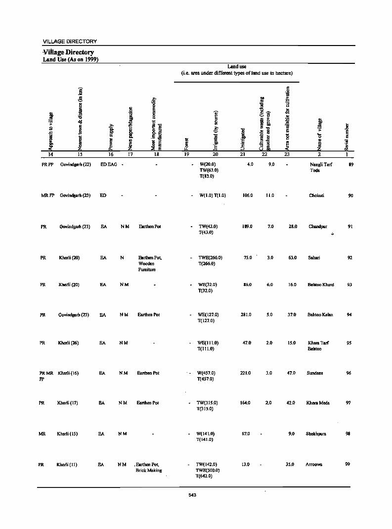
VILLAGE DIRECTORY
Village Directory Land Use (As on 1999)
j g ., i j :s
~ ~
.9 ~ ~ I ~
<- Z 14 15
j '"
J 16
PRFP Govindgarh (22) EDEAG
MR FP Govindgarh (23) ED
PR Govindgarh (23) EA
PR Kherli (20) EA
PR Kherli (20) EA
PR Govindgarh (23) EA
PR Khcrli (26) EA
PRMR Khcrli (16) EA pp
PR Kherli (17) EA
MR Kherli (IS) EA
PR Kherli (11) EA
f '" e . 5 E
i 0 C)
~ ~"C '" 8.~ !: .5 Ji! j 1;; ::I
~ ~ 17 18
-
NM Earthen Pol
N Earthen POl. Wooden Furniture
NM
NM Ear1hen Pol
NM
NM Earthen Pol
NM Earthen Pot
NM
N M . Earthen Pot, Brick Making
Land use (Le. area under ditTerent types ofland use in hectare)
19
I & ... i '5 = 20
W(20.0) TW(63.0) T(83.0)
W(1.0) T(1.0)
TW(43.0) T(43.0)
TWE(266.0) T(266.0)
WE(32.0)
T(32.0)
WE(127.0) T(127.0)
WE(III.O) T(III.O)
W(457.0) T(4S7.0)
TW(315.0) T(3 I 5.0)
W(141.0) T(141.0)
TW(142.0) TWE(SOO.O) T(642.0)
543
1 'E i§ 21
4.0
106.0
189.0
75.0
86.0
281.0
47.0
221.0
164.0
67.0
13.0
IS 'iii
1>0 .. .5 .-= -g "3
u U ... c: ...... oS ~fj
'" j! ~ 'ii ~ ..!! a
1~ g os
"3 it ~ u 22 23
9.0
11.0
7.0 28.0
3.0 63.0
6.0 16.0
S.O 37.0
2.0 15.0
3.0 47.0
2.0 42.0
9.0
35.0
j II ~ .I>
~ ... 0 c .,
"iI
! .~
CIJ
2 1
NangliTarf 89 Toda
Chokuli 90
Chandpur 91
·4"
Sahari 92
BBhtoo Khurd 93
Bahtoo Kalan 94
Khera Tarf 95 BBhtoo
Sundana 96
KhcraMcda 97
Shekhpura 98
Arroowa 99
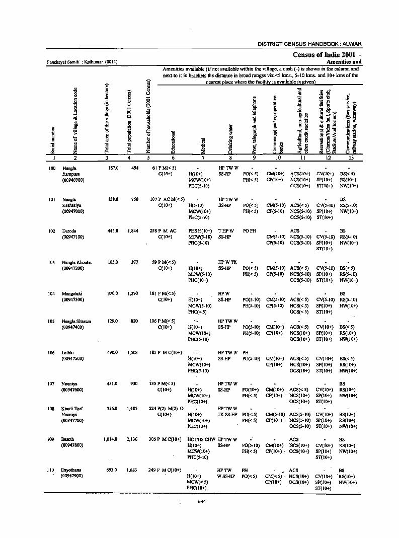
DISTRICT CENSUS HANDBOOK: ALWAR
Census of India 2001 -Panchayat Samiti : Kathumar (0014) Amenities and
Amenities available (if not available within the village, a dash (-) is shown in the column and
next to it in brackets the distance in broad ranges viz. <5 kms., 5-10 kms. and 10+ kms of the
I I nearest e1acc where the facili~ is available is Biven} .,
] -g "iii" ., U u ill (5
., ] .~ 5 c c 0
i ~ u (:!.. ] u .t ~ ~ oS 11 d<:I .s: 1 ~
u § .. oS ::0
I c g _g = .... 'il _g l; .s: 0
1 .... Oi
~ .. 0 .j .... ~ i I! Q
~ .,
B ~ u 5 ~ ""CI <~ rn W
I 2 3 4 5 6 11
100 Nangla 187.0 494 6J PM«S) HPTWW Rarnpura C(1O"') H(lO-r) SS-HP PO{< 5) CM{IO"') ~CS{IO-r) CV{IO-r) BS{< 5) (00946900) MCW(IO+) PH« S) CP(IO+) NCS(lO+) SP(IO+) RS(IO+)
PHqS-IO) OCS(JO+) ST(IO+) NW(lO+)
JOI Nanllia IS8.O 7S0 107 P AC M« 5) HPTWW BS Keshariya C(IO+) H(S-IO) SS-HP PO{< S) CM(S-IO) AC8«S) CV(S-lO) RS(S-IO) (00947000) MCW(IO+) PH« 5) CP(S-IO) NCS(S-IO) SP(lO+) NW(lO+)
PHqS-IO) OCS(S-IO) ST(IO+)
102 Daroda 445.0 1,844 258P M AC PHSH(IO+) THPW PO PH ACS BS (00947100) C(IO+) MCW{5-1O) SS-HP CM(5-1O) NCS(S-IO) CV{S-IO) RS{S-IO)
PHqS-IO) CP(S-IO) OCS(S-IO) SP(10+) NW(lO+) ST(IO+}
103 Nanllia Khoom 105.0 377 59 P M«5) HPWTK (00947200) C(JO+) H(IO+) S8-HP PO«5) CM(S-IO) ACS« S) CV(S-IO) B8« S)
MCW(S-IO) PH«S) CP(S-IO) NCS(S-IO) SP(IO+) RS(S-IO) PHC(IO+) OC8(S-IO) ST(IO+} NW(IO+)
104 Mangolaki 370.0 1,270 181 PM«S) HPW BS (00947300) C(IO+) H(IO+) SS-HP P0(5-10) CM(5-IO) ACS« 5) CV(S-IO) RS(5-10)
MCW(5-10) PH(S-IO) CP(S-IO) NCS«S) Sp(IO+) NW(IO+)
PHC«S) OCS«S) ST(IO+)
lOS Nangla Sitaram 129.0 820 106 P M« 5) HPTWW (00947400) C(IO+) H{IO+) SS-HP PO(S-IO) CM(lO+) ACS« S) CV(IO+) BS« 5)
MCW(IO+) PH(S-IO) CP(IO+) NCS(JO+) SP(IO+) RS(IO+) PHC(S-IO) OCS(JO+) ST(IO+) NW(IO+)
106 Lathki 490.0 1,508 185 P M C(lO+) HPTWW PH (00947500) H(IO+) SS-HP PO(S-IO) CM(lO+) ACS« 5) CV(IO+) 8S« 5)
MCW(IO+) CP(IO+) NCS(JO+) SP(IO+) RS(IO+) PHC(S-IO) OCS(IO+) ST(IO+) NW(IO+)
107 Nooniya 431.0 930 i3s PM«S) HPTWW BS (00947600) C(lo+) H(IO+) SS-HP PO(I 0+) CM(IO+) ACS« S) CV(IO+) RS(JO"')
MCW(IO+) PH«S) CP(IO+) NCS(IO+) SP(IO+) NW(IO+) PHC(IO+) OCS(IO+) ST(IO+)
108 Kherli Tarf 356.0 1,485 224 P(2) M(2) 0 HPTWW Nooniya C(IO+) H(JO+) TKSS-HP PO«S) CM(S-IO) ACS(5-10) CV(IO+) BS(IO+) (00947700) MCW(IO+) PH«S) CP(IO+) NCS(S-IO) SP(IO+) RS(IO+)
PHC(IO+) OCS(S-IO) ST(IO+) NW(IO+)
109 Bueth 1,014.0 2,136 30S P M C(IO+) HC PHS CHW HP TW W ACS BS (00947800) H(10"') SS-HP PO(S-IO) CM(IO+) NCS(IO+) CV(lO+) RS(JO+)
MCW(JO+) PH«S) CP(IO+) . OCS(lO+) Sp(lO+) NW(IO+) PHC(S-IO) ST(IO+)
110 Dayotbana 693.0 1,683 249 P M C(IO+) HPTW PH ',' ACS as (00947900) H{10+) WSS-HP PO«S) CM«S) . NCS(IO+) CV(IO+) RS(IO+)
MCW«S) CP(IO+) OCS(IO+) SP(IO+) NW(IO+) PHC(IO+) ST(10+)
544
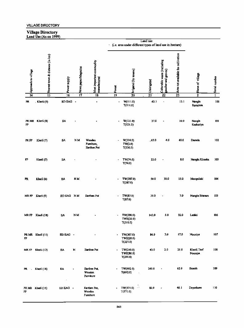
VILLAGE DIRECTORY
Village Directory Land Use (As on 1999)
]' ~ " u
J .t cI!I .;;: ~ s s 1 i ~
:( z 14 15
PR . KherJi(9)
PR MR Kberli (8) FP
PRFP Kherli (7)
FP Kherli (7)
PR Kherli (6)
u
'1 ~ ~ "" ~
u
8: ~ j 0
""' 16 17
EDEAO -
EA
BA NM
BA
BA NM
MR FP Kherli (9) EOEAO NM
MRFP Khcrli (IS) BA NM
PRMR Kherli (II) ED BAG -FP
MRFP Kherli (13) EA N
PR . Kherli (18) EA
PRMR Kherli (IS) EDEAO FP
.~ "8 E E 8
I~ "".., .5 'El ri Iii ::a E
18
Wooden Furniture. Earthen Pot
Earthen Pot
Earthen Pot
Earthen Pol, Wooden Furniture
Earthen Pol, Wooden Furniture
Land use (i.e. area under different types of land use in hectare)
~ 0
lor.
19
-
'ii' ~ 51 e; "0
i 'E =
20
W(II 1.0) T(I I 1.0)
W(121.0) T(I 2 1.0)
W(334.0) TW(2.0) T(336.0)
TW(74.0) T(74.0)
TW(287.0) T(287.0)
- TW(87.0) T(87.0)
TW(290.0) TWE(20.0) T(lIO.O)
TW(307.0) TWE(20.0) T(327.0)
TW(210.0) TWE(SO.O) T(290.0)
TW(692.0) T(692.0)
TW(S7I.O) T(S71.0)
545
i :1; c
.p 21
63.1
27.0
.65.0
23.0
58.0
35.0
143.0
84.0
43.0
260.0
.' 82.0
c 0
'ii III) .j;
.5 "0 "3 = .., ]-;;;- .. .a ~ .,
j j! 'il! .!! fii '" 1~' 0 c
'" 8i ~ 22 23
13.1
10.0
4.0 40.0
8.0
10.0 15.0
7.0
5.0 32.0
3.0 17.0
2.0 21.0
62.0
40.1
PlL S >
'IS ~ Z 2
Nangl. Rampara
NangJa Keshariya
Oaroda
Nangla Khooba
Mangolaki
.8 § '" "iI
·S CIl
100
101
102
103
104
Nangla Sitaram lOS
Lathki 106
Nooniya 107
Kherli. Tarf 108 Nooniya
8ascth 109
Oayothana 110
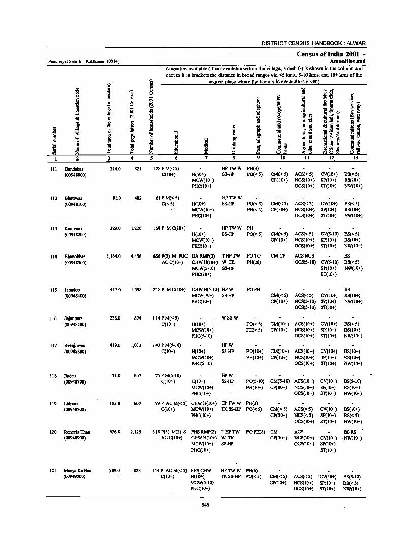
DISTRICT CENSUS HANDBOOK: ALWAR
Census of India 2001 -Panchayat Samiti : Katbumar (0014) Amenities and
Amenities available (if not available within the village, a dash (-) is shown in the colmnn and next to it in brackets the distance in broad ranges viz.<5 kms., 5-10 kms. and 10+ kms of the
I '§' nearest I!lace where the facilirt: is available is given)
i a 1 ~ u "'.Q u ~~ .If 0:: ~ 0 .. ..
] e c 'i ._ £! .S! 0 0 ~,.." 'OJ u ~ -a 1i .fIa ; ~ u ~ (5 ., .. 8. 0 ...:I 0 "CI B 0 .~ rJ ]"',.." cId ~ ~ :g ] * ~ 'il
--"§ ~i j .s .j ~
"t:l 1i l .~ .8 I 1 Iii :n~ cId .8 ._ ·8 t
~ 'ti 'iii . ., 'iii ._ -g B ._
:I .... ! 1~ ~ e g- o 'i;! .§ ~1 '§ ~ .... j 0 'iii ~ 0 '" 'l:! B '" :i a 'iii '" B 'iI ~ j ! ~ tf AJ 'i ~ B ~._ ~ f '5 Iii ~ ~ ~ ~ s~
._ 'H ~] !a ~ ~~C'Il
2 3 4 5 6 7 8 9 10 II 12 13
III Gundabas 214.0 821 128PM«S) HPTWW PH(3) (00948000) qIO+) H(IO+) SS-HP PO«S) CM«5) ACS«5) CV(lO+) BS«5)
MCW(IO+) CP(IO+) NCS(IO+) SP(IO+) RS(IO+) PHC(IO+) OCS(IO+) ST(IO+) NW(IO+)
112 Bhattwas 81.0 402 61 PM«5) HPTWW (00948100) C«S) H(lO+) SS-HP PO« 5) CM«S) ACS«S) CV(lO+) BS«S)
MCW(IO+) PH«5) CP(IO+) NCS(IO+) 8p(IO+) RS(IO+) PHC(IO+) OCS(IO+) ST(IO+) NW(IO+)
113 Kantwari 329.0 1,220 158 P M C(IO+) HPTWW PH (00948200) H(JO+) SS-HP PO«5) CM«S) ACS«S) CV(S-IO) BS«S)
MCW(lO+) CP(lO+) NCS(IO+) Sp(IO+) RS(IO+) PHC(IO+) OCS(IO+) 8T(10+) NW(IO+)
114 Bhanokhar 1,164.0 4,456 6S6 P(3) M PUC DARMP(2) THPTW PO TO CMCP ACSNCS BS (00948300) AC C(lO+) CHWH(IO+) WTK. PH(20) OCS(S-IO) CV(S-IO) RS«5)
MCW(5-10) SS-HP SP(IO+) NW(IO+) PHC(IO+) 8T(10+)
115 Jahadoo 417.0 1,598 218 P M C(IO+) CHWH(S-IO) HPW PO PH B8 (00948400) MCW(IO+) SS-HP CM«5) ACS«5) CV(IO+) RS(IO+)
PHC{lO+) cp(10+) NCS(5-IO) 8p(10+) NW(IO+) OCS(S-IO) 8T(IO+)
116 8ajanpara 238.0 894 114 PM«S) WSS-W (00948500) C(IO+) H(IO+) PO«S) CM(IO+) ACS(IO+) CV(IO+) BS«5)
MCW(lO+) PH«5) Cp(IO+) NCS(IO+) 8p(10+) RS(IO+) PHC(S-IO) OCS(IO+) 8T(IO+) NW(IO+)
117 Reenjhwas 419.0 1,033 143 P M(S-IO) HPW (00948600) C(lO+) H(IO+) 8S-HP PO(IO+) CM(IO+) ACS(lO+) CV(lO+) BS(lO+)
MCW(IO+) PH(IO+) CP(\O+) NCS(IO+) Sp(lO+) RS(IO+) PHC(S-IO) OCS(IO+) ST(10+) NW(1O+)
118 Badsu 171.0 607 7S PM(5-10) HPW (00948700) C(lO+) H{IO+) SS-HP PO(S-IO) CM(S-IO) ACS(IO+) CV(IO+) BS(S-IO)
MCW{IO+) PH(IO+) CP(lO+) NCS(IO+) 8P(10+) RS(IO+) PHC(IO+) OCS(IO+) 8T(10+) NW(IO+)
119 Lidpuri 183.0 607 79P ACM«S) CHWH(IO+) HPTWW PH(2) (009488OO) C(IO+) MCW(IO+) TK8S-HP PO«S) CM«S) ACS«S) CV(IO+) BS(IO+)
PHC{IO+) CP(IO+) NCS«S) 8p(10+) RS{<S) OCS(IO+) 8T(IO+) NW(IO+)
120 Ronec:ja Than 626.0 2,126 318 P(3) M(2) S PHSRMP(2) THPTW POPH(8) CM ACS B8RS (00948900) ACC(IO+) CHWH(IO+) W TK cp(10+) NCS(lO+) CV(lO+) ·NW(IO+)
MCW(IO+) SS-HP OCS(IO+) SP(IO+) PHC{IO+) 8T(10+)
121 ManyaKaBas 289.0 828 114P ACM«5) PHSCHW HPTWW PH(6) (00949000) C(IO+) H(IOT). TK88-HP PO«S) CM«5) ACS«S) , CV(IO+) B8(S-10)
MCW(S-IO) CP(IO+) NCS(IO+) sp(10+) RS« 5) PHC{IO+) OCS(IO+) 8T(10+) NW(IO+)
546
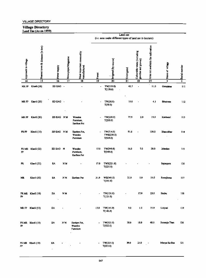
VilLAGE DIRECTORY
Villa.ge Directory Land Use (As on 1999)
-. ..e ~ .. i .,
E :a ~ rI1J
.s ~ ]
J E
~ 14 15
MRFP Kherli (20)
MRFP Kherli (20)
MRFP Kherli (20)
PRFP Kherli (10)
PRMR Kherli (22) FP
PR Kherli (22)
MR Kherli (30)
PRMR Khcrli (18) FP
MRFP Kherli (13)
PRMR Kherli (10) FP
PR MR Kberli (10) FP
~ go '"
J 16
ED SAG
ED SAG
ED SAG
ED SAG
EDEAG
SA
SA
SA
EA
EA
SA
.£ -g ., E ., E 0 U
i~ ~ ~ .5.el c:>.
~ 'Ill " o a i!:i ;;!1 8 17 18
-
-
NM Wooden Furniture, Earthen Pot
NM Earthen Pot, Wooden Furniture
N Wooden Furniture, Earthen Pot
NM
NM Earthen Pot
NM
NM Earthen Pol, Wooden Fumtiure
Land use (i.e. area under different types of land use in hectare)
! 0
I:!:! 19
17.0
17.0
31.0
13.0
i " Sl e; "C
! --E = 20
TW(IS9.0) T(1S9.0)
TW(SS.O) T(SS.O)
TW(230.0) T(230.0)
TW(714.0) TWE(220.0) T(934.0)
TW(349.0) T(349.0)
TWE(221.0) T(22 1.0)
WE(341.0) T(34 1.0)
TW(13LO) T(111.0)
TW(145.0) T(14S.0)
TW(S22.0) T(S22.0)
TW(225.0) T(22S.0)
547
1 'E '2 i2 21
43.7
19.0
n,9
91.0
16.0
21.0
9.0
38.0
39.0
5 'i
~ .. . .,
i "3 u
u -c -. oS ._ .. -u ILl
!! ~ ii ~~ ~
i:i ..!! a ~ iii g .a '5 ! ai 22 23
11.0
4.1
2.0 19.0
139.0
7.0 28.0
5.0 21.0
17.0 21.0
1.0 15.0
18.0 48.0
25.0
~ II .;:
~ .... 0 u 'iI
~ '1: ILl
!!.! 2 I
Gundabas III
Bhattwas 112
KBntwari 113
BhanokhBr 114
Jahadoo lIS
Sajanpara 116
Rccqjbwas 117
Badsu 118
Udpuri 119
Roneeja Than 120
ManyaKaBas 121
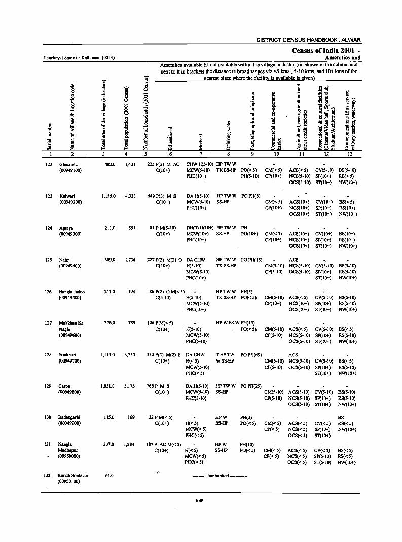
DISTRICT CENSUS HANDBOOK: /iJ....WAR
Census ofIndia 2001 -Panchayat Samiti : Kalhumar (0014) Amenities and
Amenities available (ifnot available within the village, a dash (-) is shown in the column and
next to it in brackets the distance in broad ranges viz.<5 krns., 5-10 krns. and 10+ krns of the
I gj nearest Elace where the facilitl': is available is Biven}
., IS 1 .il .g .... gj .,
8 u .~ J! 5 i
., ] ::;'0
§ :§. ;; .~ ._ ~
i:~ '" ·i u ~ e .:18. ~ f u ., ;; g. g
j ~ Q i 1i li ]cn~ ;g .,
~ ~ 8 _" E ~J dd 1 -]=
j ., §
CD
"5 ! g:g -5 19
I ..c S 0:;:"
.8 .g 0 '(l ..c
~ " 5l ]:g-g ·s 0 ~ 1 '(l ] <a ] .~ § i ·e .S! ~ i ._ .j
..... ... I>Il "31 § .. 0:;: 0 II> ] .5 11 II>
10 ~ .D 01;1
~i e f ]I III S 1I ~
u ~ l .~ ~ e ._
~ ~ ~ ~._ 'E 8_ ~ ~ ~
·c s§ 8 .~ ra g s.1.e e; ~<Il 1 2 3 4 5 6 7 8 9 10 11 12 13
122 Ghosl1llla 482.0 1,431 22SP(2) MAC CHW H(5-IO) HPTWW (00949100) C(IO+) MCW(S-IO) TKSS-HP PO«S) CM«S) ACS«S) CV(S-IO) BS(S-IO)
PHC(IO+) PH(S-IO) CP(IO+) NCS(S-IO) SP(IO+) RS«S) OeS(S-IO) ST(1O+) NW(IO+)
123 Kalwari I,ISS.O 4,333 649P(3) M S DA R(S-IO) HPTWW POPH(8) (00949200) C(IO+) MCW(S-IO) SS-HP CM«S) ACS(10+) CV(lo+) BS«S)
PHC(IO+) CP(IO+) NCS(IO+) SP(1O+) RS(IO+) OCS(IO+) ST(lo+) NW(IOi-)
124 Agraya 211.0 SSI 81 PM(S-IO) DH(3)H(10+) HPTWW PH (00949300) C(IO+) MCW(IO+) SS-HP PO(IO+) CM«S) ACS(lo+) CV(10i-) BS(IOi-)
PHC(IO+) CP(IO+) NCS(IO+) SP(IO+) RS(IO+) aeS(IO+) ST(lo+) NW(lOi-)
12S Natoj 309.0 1,734 227 P(2) M(2) 0 DACHW HPTWW POPH(IS) ACS (00949400) C(IO+) H(S-IO) TKSS-HP CM(S-IO) NCS(s-IO) CV(S-IO) BS(s-IO)
MCW(S-IO) CP(S-IO) OCS(S-IO) SP(IOi-) RS(S-IO) PHC(IO+) ST(IO+) NW(IO+)
126 Nangla Jadoo 241.0 S94 86 P(2) 0 M«S) HPTWW PH(S) (00949S00) C(S-IO) R(S-IO) TKSS-HP PO«S) CM(S-IO) ACS«S) CV(S-IO) BS(s-IO)
MCW(S-IO) CP(IOi-) NCS(lo+) SP(lo+) RS(S-IO) PHC(IO+) OCS(IO+) ST(IO+) NW(IO+)
127 MakkhanKa 376.0 7SS 126PM«S) HPW SS-W PH(IS) Nagla C(IO+) R(S-IO) PO«S) CM(S-IO) ACS«s) CV(S-IO) BS«s) (00949600) MCW(S-IO) CP(S-IO) NCS(S-IO) SP(lo+) RS(S-IO)
PHC(S-IO) OCS(S-IO) ST(W+) NW(IO+)
128 Sonkhari 1,114.0 3,7S0 532 P(3) M(2) 5 DACHW THPTW POPH(49) ACS (00949700) C(10+) H« 5) WSS-HP CM(S-IO) NCS(S-IO) CV(S-IO) BS«5)
MCW(S-IO) CP(S-IO) aeS(S-IO) SP(IO+) RS(S-IO) PHC«S) ST(IOi-) NW(JO+)
129 Garno 1,051.0 S,I7S 768P M S DAH(S-IO) HPTWW POPH(2S) (00949800) C(10+) MCW(s-IO) SS-HP CM(S-IO) ACS(S-IO) CV(S-IO) BS(S-IO)
PHC(S-IO) CP(S-IO) NCS(S-IO) Sp(IO+) RS(S-IO) OeS(S-IO) ST(IO+) NW(lo+)
130 Badangarhi lIS.0 169 22PM«S) HPW PH(3) BS (00949900) C(lO+) H«S) 55-HP PO«S) CM«S) AqI«S) CV«S) RS«S)
MCW«S) CP« S) NCS«S) Sp(IO+) NW(IO+) PHC«S) OCS«5) ST(lO+)
131 Nugla 337.0 1,284 187P ACM«S) HPW PH(IO) Madhopur C(IOi-) H«S) SS-HP PO«S) CM«S) ACS«S) eV«S) BS«S) (00950000) MCW«S) CP« S) NCS«S) SP(S-IO) RS«S)
PHC« S) OCS«S) ST(S-IO) NW(IO+)
132 Rundh Sonkhari 64.0 (,
--Uninhabited ----(00950100)
548
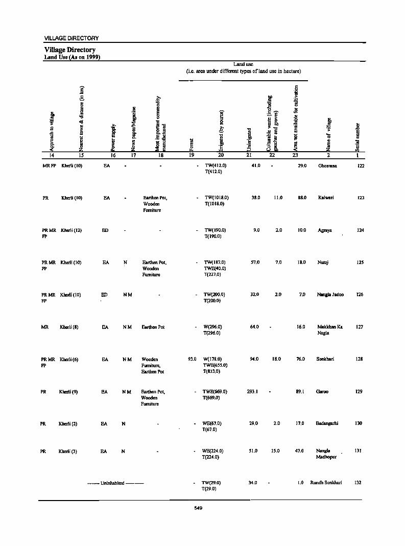
VILLAGE DIRECTORY
Village 'Directory Land Use (As on 1999)
]' g .. U
~ j :0 ~ ~
~ B
~ ! [ Q, " « l1l:i 14 IS
MRFP Kherli (10)
PR Kherli (10)
PRMR Kherli (12) FP
PRMR Kherli (10) FP
PRMR Kherli (10) FP
MR K.hcrli (8)
PRMR Kherli (6) FP
PR Kherli (9)
PR Kherli (2)
PR Kherli (3)
&0-:g
'1 E
~ ~." >, ~ is. 8.~ §- ..
rn Ii" .5 ~ Q,
J j - :I
~ ~ 16 17 18
EA
EA EanhenPot, Wooden Ferniture
ED
EA N Eanhen Pot, Wooden Furniture
ED NM
EA N M Earthen Pot
EA NM Wooden Furniture, Earthen Pot
EA NM Earthen Pot, Wooden Furniture
EA N
EA N
--Uninhabited--
Land use
(i.e. area under different types ef land use in hectare)
'lil s !!:o 19
-
93.0
.., ~ ., e: "0
·1 = 20
TW(412.0) T(412.0)
TW(1018.0) T(1018.0)
TW(190.0) T(I90.0)
TW(IB7.0) TWE(40.0) T(227.0)
TW(200.0) T(200.0)
W(296.0) T(296.0)
W(178.0) TWE(65S.0) T(833.0)
TWE(669.0) T(669.0)
WE(67.0) T(67.0)
WE(224.0) T(224.0)
TW(29.0) T(29.0)
549
."
! 'E '2 i:2 21
41.0
38.0
9.0
57.0
32.0
64.0
94.0
293.1
29.0
51.0
34.0
bi)
.5 "0 ;:I
"0 c ,.., ._ ., -u
j~ .!! Iii ]~ ~~
22
11.0
2.0
7.0
2.0
18.0
2.0
15.0
S 'j
~ U ...
oS
~ ~ ii.; 0 c
'" e! ~ 23
29.0
88.0
10.0
IB.O
7.0
16.0
76.0
89.1
17.0
47.0
=': '> 'a .. ~ 2
Ghosrana
Kalwari
Agraya
Natoj
Nangla Jadoo
MakkhanKa Nagla
Sonkhari
Garoe
Badangarhi
Nangl. Madhopur
1.0 Rundh Sonkhari
.8 § c 'iii '5 sa 1
122
123
124
125
126
127
128
129
130
131
132
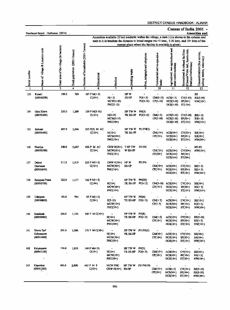
DISTRICT CENSUS HANDBOOK: ALWAR
Census of India 2001 -Panchayat Samiti : Katnumllr (0014) Amenities and
Amenities available (if not available within the village, a dash (-) is shown in the column and
next to it in brackets the distance in broad ranges viz. <5 kms., 5-10 lans. and 10+ lans of the
I I nearest (!lace where the facili!,): is available is Biven l " "8
~ " :J .r" '" ~ U ."" -= c .c 5 ;; !
:.::::;: u
.j :§. 0 ._ ~
U C!. J! 8. .3 j 8 ~ B 1!<Il~ 0
~ .a--:-§ al:f ~ C!. i OS "iI '1::
~ -1l 6 ~ .. ..c .s t .~ ..8 I 1 al:f 3·_
~ .... "iI:E1j .c 0
1 .... § ~
0 .§ ~i c ~ 1l B "iI " ]I ! §
~ (j ._ ·c ~ ... S 11 '" ~ Z Uen en
2 3 4 S 12
133 Kaneti 189.0 769 107 P M« 5) HPW BS (00950200) C(IO+) H«5) S8-HP PO«5) CM(5-10) ACS«5) CV(S-IO) RS(5-10)
MCW(5-10) PH(5-10) CP(5-10) NCS(5-IO) SP(lO+) NW(lO+) PHC(5-10) OCS(5-IO) ST(IO+)
134 Gala Khera 250.0 1,209 159 P M(S-IO) HPTWW PH(3) (00950300) C(10+) H(5-10) TKSS-HP PO(5-10) CM«5) ACS(5-IO) CY(S-IO) BS«S)
MCW(S-IO) CP(S-IO) NCS(S-IO) SP(IO+) RS«S) PHC(IO+) OCS(S-IO) ST(IO+) NW(IO+)
135 Salwari 687.0 2,494 325 P(3) MAC HPTWW POPH(3)
(00950400) C(IO+) H(IO+) TKSS-HP CM(IO+) ACS(IO+) CY(IO+) BS(10+) MCW(IO+) CP(IO+) NCS(IO+) SP(IO+) RS(IO+) PHC(IO+) OCS(IO+) ST(IO+) NW(1O+)
136 Dantiya S4O.0 2,667 432P M AC CHWH(IO+) THPTW PO PH BSRS (00950500) C(IO+) MCW(IO+) WSS-HP CM(IO+) ACS(IO+) CY(IO+) NW(1O+)
PHC(lO+) CP(lO+) NCS(IO+) SP(IO+) OCS(IO+) ST(IO+)
137 Dahari 311.0 1,619 222PM«5) CHWH(IO+) HPW PO PH
Dantwara C(10+) MCW(lO+) SS-HP CM(IO+) ACS(IO+) CY(lO+) BS«5) (00950600) PHC(IO+) CP(IO+) NCS(IO+) SP(IO+) RS«S)
OCS(IO+) ST(IO+) NW(IO+)
138 Rampura Patan 322.0 1,117 162PM«5) HPTWW PH(20) (00950700) C(IO+) H(IO+) TKSS-HP PO«S) CM(S-IO) ACS(IO+) CY(lO+) BS(IO+)
MCW(lO+) CP(IO+) NCS(IO+) Sp(IO+) RS«S) PHC(IO+) OCS(IO+) ST(IO+) NW(IO+)
139 UdaipulB 143.0 795 9SPM«5) HPTWW PH(4) (00950800) C(IO+) H(5-10) TKSS-HP PO«5) CM«5) ACS(IO+) CV(IO+) BS(IO+)
MCW(IO+) CP« 5) NCS(IO+) SP(IO+) RS«S) PHC(IO+) OCS(IO+) ST(IO+) NW(1O+)
140 Katahada 324.0 1,134 185 P M C(IO+) HPTWW PH(S) (00950900) H(IO+) TKSS-HP PO«5) CM«5) ACS(IO+) CV(IO+) BS(5-10)
MCW(IO+) CP(IO+) NCS(IO+) Sp(IO+) RS«S) PHC(IO+) OCS(IO+) ST(IO+) NW(IO+)
141 KhemTarf 251.0 1,066 171 P M C(IO+) HPTWW POPH(2) Kalyanpura H(IO+) TKSS-HP CM(1O+) ACS(lO+) CV(IO+) B8(10+) (00951000) MCW(.I0+) CP(IO+) NCS(IO+) Sp(IO+) RS(IO+)
PHC(IO+) OC8(10+) ST(IO+) NW(IO+)
142 Kalyanpura 174.0 1,019 14OPM«S) HPTWW PH(2) (00951100) C(IO+) H(IO+) TKSS-HP PO«5) CM(IO+) ACS(IO+) CV(IO+) B8(10+)
MCW(IO+) CP(IO+) NCS(IO+) SP(IO+) RS«S) PHC(IO+) OCS(IO+) ST(IO+) NW(IO+)
143 Khonkhar 483.0 2,890 443 PM S MCWPHC HPTWW POPH(IO) (0095 ~,200) C(10+) CHWH(IO+) SS-HP CM(IO+) ACS(o;::S) CV(IO+) BS(5-10)
CP(IO+) NCS(IO+) SP(IO+) RS(5-10) OCS(IO+) ST(IO+) NW(IO+)
550
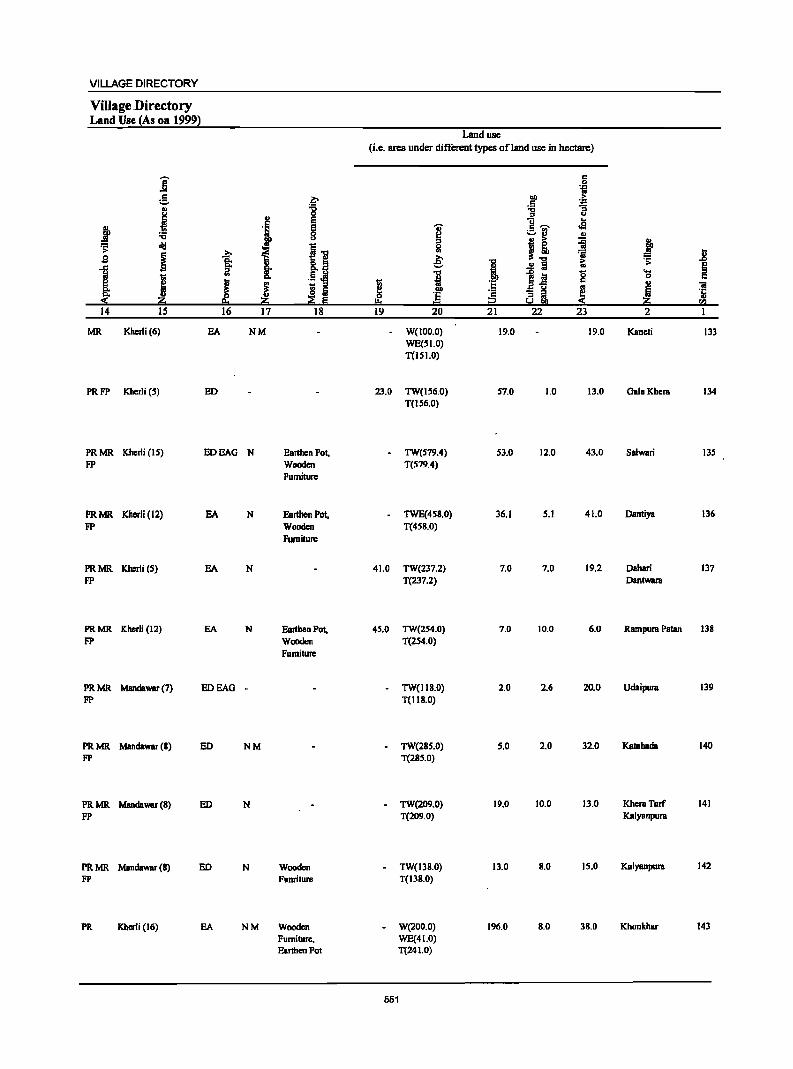
VILLAGE DIRECTORY
Village Directory Land Use (As on 1999)
Land usc (i.e. area under different types of land use in hectare)
]' c 0 .j
c ~ DO .~ :.:. c
" '6 ] "3 u "
0 u
~ E ]-..
j . , E I .a
'6 8 :.:.rl ... ~ cId 11 0 j! ~ ~
~ I .. :;; j s i ~ ! "C i:i ~
1 ·1 .!! Iii ~ .!LM 11 1~ g ....
I 0
J ~ - '" ~ til ~
OJ "iI Do 8 Iii lID
~ ·c ~ ·E ·c Zi ...
Z; Z; ;;g E !:!:s = i2 -< CIl
14 15 16 17 18 19 20 21 22 23 2 1
MR Kherli(6) EA NM W(IOO.O) 19.0 19.0 Kaneti 133 WE(51.0) T(ISI.O)
PRFP Kherli (5) ED 23.0 TW(156.0) 57.0 1.0 13.0 Gala Khem 134 T(IS6.0)
PRMR Kherli (IS) EDEAG N Earthen Pol, TW(S79.4) S3.0 12.0 43.0 Salwari 13S FP Wooden T(S79.4)
Furniture
PRMR Kherli (12) EA N Earthen POI, TWE(4S8.0) 36.1 5.1 41.0 Dantiya 136 FP Wooden T(458.0)
Furniture
PRMR Kherli (5) EA N 41.0 TW(237.2) 7.0 7.0 19.2 Dahari 137 FP T(237.2) DanlWBm
PRMR Kherli (12) EA N Earthen Pol, 45.0 TW(2S4.0) 7.0 10.0 6.0 RBmpum Palan 138 FP Wooden T(2S4.0)
Fumiture
PRMR Mandawar (7) EDEAG - TW(Il8.0) 2.0 2.6 20.0 Udaipum 139 FP T(IIS.O)
PRMR Mandawar (8) ED NM TW(28S.0) 5.0 2.0 32.0 Kamhada 140 FP T(28S.0)
PRMR Mandawar (8) ED N TW(209.0) 19.0 10.0 13.0 KhemTarf 141 FP T(209.0) Kalyanpum
PRMR Mandawar (S) ED N Wooden TW(13S.0) 13.0 8.0 15.0 Kalyanpura 142 FP Funriture T(138.0)
PR Kherli (16) EA NM Wooden W(200.0) 196.0 8.0 38.0 Khonkhar 143 Furniture. WE(41.0) Earthen Pot T(241.0)
551
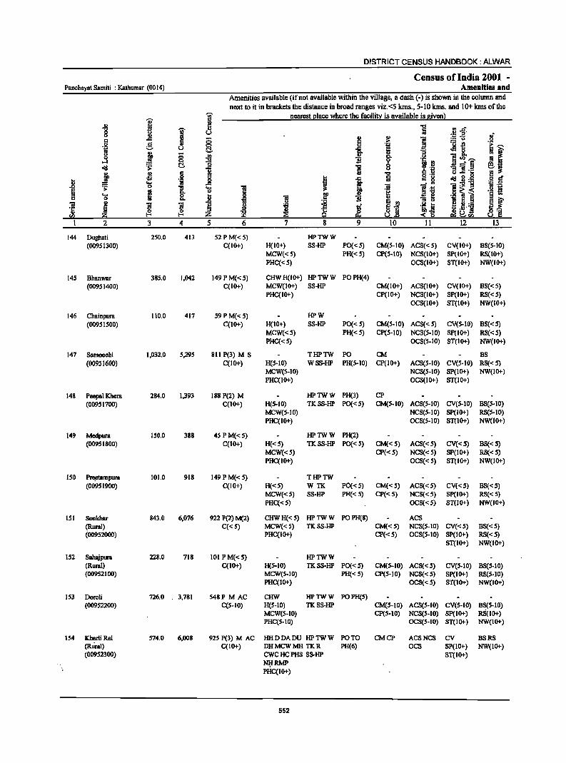
DISTRICT CENSUS HANDBOOK: ALWAR
Census ofIndia 2001 -Panchayat Samiti : Kathumar (0014) Amenities and
Amenities available (ifnot available within the village, a dash (-) is shown in the column and
next to it in brackets the distance in broad ranges viz.<5 kms., 5-10 krns. and 10+ kms of the
I g nearest I!lacc where the facilit~ is available is siven}
] a ] 'iii' '" oM :a~' u ~ " II.>
1 .~ .§ ..c 0 6 .. :: (J
g 0 .j ·6 -2 ~~ t;i u ~ ]. <Ills. ~ ( <> j ;; .. ::I 0. U '5 ~.~ oS 0 "t:I 1l ~ ·i·i ~ ~ ~ ] ] 5~
~ Jl 6 ~ "t:I .!: ~lh: g r;! , 1 a ~ .§ <iii g . .g m ~
..... ·i _g
~ ]:>!"8 ~ 0
1 0 -a .... 1 ~:§ '" !5' 0
.9 ~ i .§ .~ 'S ~ 0. i .~ "iI f 1l
~j "3 II - S Sf "
u ~ l:! ._ "iI
~ ~ 'B l .ij li ·5 ~ ~ <> ._.j ~~ en ~ ::s 5.l <~ ~ ~ra
I 2 3 4 5 6 7 8 9 10 II 12 13
144 Dughati 250.0 413 52 PM«5) HPTWW (00951300) C(10+) H(IO+) SS-HP PO{< 5) CM(5-10) ACS« 5) CV(IO+) BS(5-10)
MCW«5) PH« 5) CP(5-10) NCS(IO+) SP(IO+) RS(IO+) PHC«5) OCS(1O+) ST(IO+) NW(IO+)
145 Bhanwar 385.0 1,042 149 PM«5) CHWH(10+) HPTWW PO PH(4) (00951400) C(IO+) MCW(IO+) SS-HP CM(IO+) ACS(IO+) CV(IO+) BS« S)
PHC(IO+) CP(IO+) NCS(IO+) SP(1O+) RS«5) OCS(IO+) ST(IO+) NW(IO+)
146 Chainpura 110.0 417 59PM«5) HPW (0095 I SOO) C(IO+) H(IO+) SS-HP PO{< S) CM(S-IO) ACS« S) CV(S-IO) BS«5)
MCW«5) PH« 5) CP(5-10) NCS(5-10) SP(IO+) RS«5) PHC«S) OCS(S-IO) ST(IO+) NW(IO+)
147 Samoochi 1,032.0 5,295 811 P(3) M S THPTW PO CM BS (00951600) C(10+) H(5-10) WSS-HP PH(S-IO) CP(lO+) ACS(S-IO) CV(S-IO) RS«S)
MCW(S-IO) NCS(S-IO) SP(IO+) NW(IO+) PHC(IO+) OCS(IO+) ST(IO+)
148 Peepal Khera 284.0 1,393 188 P(2) M HPTWW PH(3) CP
(00951700) C(IO+) H(5-10) TKSS-HP PO{<5) CM(S-IO) ACS(S-IO) CV(S-IO) BS(5-10) MCW(S-IO) NCS(S-IO) Sp(IO+) RS(S-IO) PHC(lo+) OCS(S-IO) ST(lo+) NW(10+)
149 Medpura 150.0 3BB 45 PM«5) HPTWW PH(2) (0095 1 BOO) C(IO+) H«S) TKSS-HP PO{<S) CM«5) ACS«S) CV«S) BS«S)
MCW«5) CP«5) NCS«S) SP(lo+) RS«S) PHC(IO+) OCS«S) ST(IO+) NW(IO+)
ISO Pre;etampura 101.0 918 149 PM«S) THPTW (00951900) C(IO+) H«S) WTK PO« 5) CM«5) ACS« S) CV«S) BS«S)
MCW«S) SS-HP PH« 5) CP«5) NCS«5) Sp(IO+) RS« 5) PHC«S) OCS«5) ST(IO+) NW(IO+)
lSI Sonkhar 843.0 6,076 922 P(2) M(2) CHWH« S) HPTWW POPH(8) ACS (Rural) C«S) MCW«S) TKSS-HP CM«5) NCS(S-IO) CV«S) BS«S) (OO9S2OOO) PHC(IO+) CP«S) OCS(S-IO) SP(lO+) RS«S)
ST(IO+) NW(IO+)
152 Sahajpura 228.0 718 101 PM«S) HPTWW (Rural) C(IO+) H(S-IO) TKSS-HP PO«S) CM(S-IO) ACS« 5) CV(S-IO) BS(S-IO) (00952100) MCW(S-IO) PH«S) CP(S-IO) NCS«5) Sp(IO+) RS(S-IO)
PHC(IO+) OCS« 5) ST(IO+) NW(IO+)
IS3 Doroli 726.0 . 3,781 S48P MAC CHW HPTWW POPH(S) (00952200) C(S-IO) H(S-IO) TKSS-HP CM(S-IO) ACS(5-10) CV(S-IO) BS(5-10)
MCW(S-IO) CP(S-lO) NCS(S-IO) Sp(IO+), RS(IO+) PHC(S-IO) OCS(S-JO) ST(IO+) NW(JO+)
154 Kherli ReI 574.0 6,008 925 P(3) M AC HHDDADU HPTWW PO TO CMCP ACSNCS CV BSRS (Rural) C(IO+) DHMCWMHTKR PH(6) OCS SP(IO+) NW(IO+) (00952300) CWC HC PHS SS-HP ST(IO+)
~RMP PHC(IO+)
552
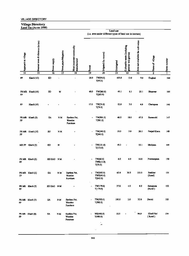
VILLAGE DIRECTORY
Village Directory Land Use {As on 1999)
Londuse (i.e. area under different types ofland use in hectare)
j c
.S li
g ~ lID > C ~ II :a :a
j 0 .. u !:! E U J!
~ ..
J § I c ~
:a ;::..rl II
~ cI!I I] ~~ ~ j ~
b .. ~"<I ~ ~
13 ~ I e; "<I ~ .£l
.c
f .!! fij at
~ ~ .5.M I ]~ '0 .... I
.. 0
~ J I is ~ -;; c .,
~ !! .. !ii Z if 'E 8i !! ,:0( :2 E = :0( Z <Il
14 15 16 17 18 19 20 21 22 23 2 1
FP Kherli (13) ED 28.0 TW(9S.0) 10S.0 13,0 9.0 Dughati 144 T(9S.0)
PRMR Kherli (16) ED M 49.0 TW(26S.0) 4S.I 6.1 20.1 BhBnwar 14S FP T(265.0)
FP Kbc:rli (10) 17.0 TW(74,O) 12.0 3.0 4.0 Chainpura 146 T(74.0)
PRMR Kberli (S) EA NM Earthen Pot, TW(90I.O) 46.0 18.0 67.0 Samoochi 147 FP Wooden T(901.0)
Furniture
PRMR Kherli (10) ED NM - TW(240.0) 19.0 5.0 20.1 Peepsl Khera 148 FP T(240.0)
MRFP Kherli (5) ED N - TW(121.0) 19.3 10.1 Mc:dpura 149 T(121.0)
PRMR Kherli (2) BOEAG NM - TW(60.0) 6.0 4.0 18.0 Preetampura 150 Fp TWE(13.0)
T(73.0)
PRMR Kherli (2) EA NM Earthen Pot, - TW(602.0) 62.0 36.0 103.0 Sonkhar 151 FP Wooden TWE(40.0) (Rural)
Furniture T(642.0)
PRMR Kherli (S) EDEAO NM - TW(179.0) 37.0 4.0 B.O Sahajpura 152 FP T(179.0) (Rural)
PRMR Kherli (5) EA NM Earthen Pot, 0 TW(502.0) 190.0 2.0 32.0 Doroli IS3 FP Wooden T(502.0)
Furniture
PRMR Kherli (0) EA NM Earthen Pot. WE(480.0) 10.0 84.0 Khc:r1i Rei 154 FP Wooden T(480.0) (Rural)
Ferniture
553
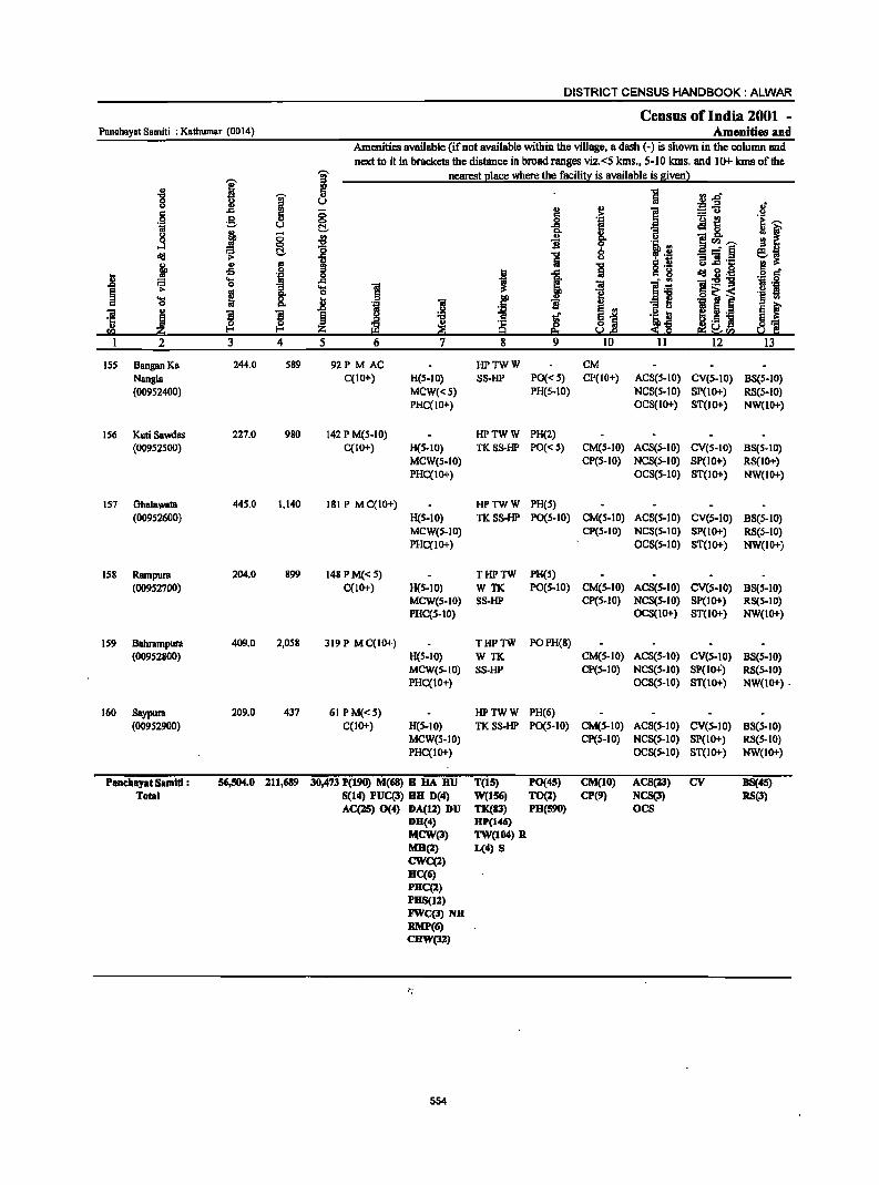
DISTRICT CENSUS HANDBOOK: ALWAR
Census of India 2001 -Panchayat Samiti : Kathumar (0014) Amenities and
Amenities available (if not available within the village, a dash (-) is shown in the column and next to it in brackets the distance in broad ranges viz,<5 kms" 5-10 kms, and 10+ kms of the
I I nearest l!lace where the facilitl:: is available is !ivenl .,
] -g ~ ., n _&lft
u U ;g.g aJ' c 6 (; ~ ,~ i u ,9 g 0 e !i '! f i'i u C!- 1-j ~ (; '" g. " 0 ... !i II a CIl ~ lid ~ t:!,. :§ '5
0 _- § e~ u "3 ] 'C 19 i!: gp ~ 'i ~ ... co 0
! I ..e Iii c 8 lid 2 ,'I:: ,9 go = 'a ~ "iI l; ~:9'g fl 's a 'S as 1 'a 1 'g 'a ~ ~ I!>
., -e] ,_~ i '§ on
D. 'i "iI li "iI
., ,!:! ~ e '" ~ ~ ,_ ~I ! 'S ~ ~ i ... l g~ '~ ~ 'C .e ~ ~ ~ ,5]
I) z :s:fl e:; ~VJ ~ 'c CI) U.s 1 2 3 4 5 6 7 8 9 10 II 12 13
ISS Bangan Ka 244,0 589 92P MAC HPTWW CM Nangla C(IO+) H(5-10) SS·HP PO« 5) CP(IO+) ACS(5-1O) CV(S-IO) BS(5-10) (00952400) MCW«S) PH(S·IO) NCS(S-IO) SP(1Ot) RS(S-IO)
PHC(lO+) OCS(IOt) ST(IOt) NW(IO+)
156 KutiSawdas 227,0 980 142 P M(5-10) HPTWW PH(2) (00952500) C(lOt) H(S-IO) TKSS-HP PO« S) CM(S-10) ACS(5-IO) eV(S-IO) BS(S-IO)
MCW(5-1O) CP(S·IO) NCS(5-IO) SP(10+) RS(IO+) PHC(IOt) OCS(S-IO) ST(IOt) NW(IO+)
157 Ohalawata 445,0 1,140 181 P MC(IO+) HPTWW PH(S) (00952600) H(S-IO) TKSS-HP PO(S.IO) CM(5-10) ACS(S-IO) ev(s.to) B8(S·10)
MCW(S-IO) CP(5-10) NCS(5-10) SP(1Ot) RS(S-IO) PHC(tO+) ocS(s-tO) ST(1Ot) NW(lO+)
IS8 Rampura 204.0 899 148 P M« 5) THPTW PH(S) (00952700) C(10+) H(5·10) WTK PO(S.lO) CM(5-10) ACS(5-10) ev(s.IO) BS(S-IO)
MCW(S-IO) SS-HP CP(5.10) NCS(5-IO) Sp(IOt) RS(S-to) PHC(S-IO) OC8(1Ot) ST(1Ot) NW(IO+)
159 Bahrampura 409.0 2,058 319 P MC{IO+) THPTW POPH(8) (00952800) H(S.IO) WTK CM(S·IO) AC8(S-10) CV(S.IO) BS(S·IO)
MCW(S.to) SS-HP CP(S-IO) NCS(S.IO) SP(IO":) RS(5-IO) PHC(IO+) OCS(S·IO) ST(1Ot) NW(1O+) .
160 Saypura 209.0 437 61 PM«S) HPTWW PH(6) (00952900) C(1Ot) H(S-IO) TKSS·HP PO(S·IO) CM(S.IO) ACS(S·IO) eV(s·IO) BS(S-IO)
MCW(S-IO) CP(S-IO) NCS(S-IO) SP(IOt) RS(5-IO) PHC(IO+) OCS(5-tO) ST(IOt) NW(IOt)
Panc:hayat 5amlti : 56,504,0 211,689 30,473 F(190) M(68) B HA HU T(15) PO(45) CM(10) ACS(23) CV B5(45) Total 5(14) PUC(3) BH D(4) W(156) TO(l) CP(9) NC5(3) RS(3)
AC(25) 0(4) DA(12) DU TK(83) PH(S90) oes DH(4) BP(146) Jl,\CW(3) TW(I04) R M8(2) L(4) S CWC(2) He(6) PHC(l) PH5(12) FWC(3)N8 RMP(6) CHW(32)
~j
554
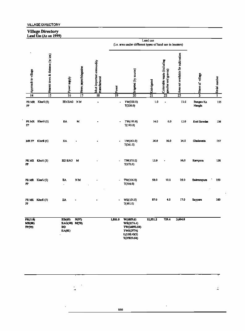
VILLAGE DIRECTORY
Village Directory Land Use-(As on 1999)
i 5 8
-I ~ ... oil! .;;:
~ 9 ..c :;I
j e Q.
~ 14 IS
PRMR Kherli (5) FP
PR MR Kherli (5) FP
MRFP Kherli (5)
PR MR Kherli (5) FP
PR MR Kherli (5) FP
PR MR Kherli (5) FP
'R(1l0) MR(88) FP(9S)
·1 :>. ~ I ..
s: ! I ~ 16 17
EDEAG NM
EA M
EA
EDEAG M
NM
EA
ED«(j9) N(97) EAG(40) M(78)
EO EA(81)
.~ ... 0 E Ii u
~ ... o 2:! Q.il
.5 ~ li Iii ~ 5
18
Land use (i.e. area under different types ofland use in hectare)
1 I!: 19
-
I 0 <II
~
i .1: = 20
TW(230.0) T(230.0)
TW(195.0) T(195.0)
- TW(36 1.0) T(36 1.0)
- TW(17S.0) T(17S.0)
- TW(3 I 6.0) T(316.0)
- WE(101.0) T(101.0)
'B i ·e ~ 21
1.0
14_0
34.0
13.0
58.0
87.0
1,801.0 W(6859.(j) 1l,5S1.2 WE(2174.4) 1W(:z4892.54) 1WE(3774) L(118) 0(1) T(37819.54)
555
a:: .9 til
DO :> .5 .,w "C 1i :> g~
.. oS
:::-3 .. J! j
-iii
.!! a ii
5~ '0 a:: ..
~ ~ ~ 22 23
13_0
6.0 12.0
16.0 34.0
16.0
10.0 25.0
4.0 17.0
729.4 3,604.8
j Jl ~ ~ ...
0 u til
! ·i (Il
2 I
8anganKa IS5 Nangla
KuliSawdas 156
Ghalawata 157
Rampura 158
BahnlmpunI 159
Saypura 160

81. No.
1 2 3 4 5 6 7 8 9 10
11
12 13 14
81. No.
1 2 3 4 5 6 7 8
9
Name of Panchayat
Samiti
2 Behror
Nimrana
MandaWclf
Kishangarh Bas
Kotkasim Tijara
Ramgam
Umren
Bansur
Thanagazi
R~galh
Reni
Lachhmangarh
Kathumar
District(Ru ral)
Name of Panchayat
8amiti
2 Bebror
Nimrana Mandawar
Kishangarh Bas Kotkasim
Tijara Ramgarh Umren
Bansur 10 Thanagazi
II ·Rl!igam 12 Reni 13 Lachhmangarh 14 Kathumar
Distri ct(Rural)
Total number Total population of inhabited of Panchayat
villages Samiti
3 4 90 139,503 85 143,329
142 197,582 135 167,495 115 117,687 202 226,974 173 220,219 149 221,794 131 214,351
-148 189,977 140 144,726 102 136,491 184 225,836 158 211,689
1,954 1~57,653
Educational institutions
Others No educational
ilcilities
DISTRICT CENSUS HANDBOOK: ALWAR
APPENDIX-]
ABSTRACT OF EDUCATIONAL, MEDICAL AND
Primary school
Villages Institut ions
5 6 82 193 84 136
139 177 124 158 112 138 181 207 160 199 129 192 130 209 121 196 116 142 97 127
180 213 156 190
1,811 1,477
Hospital Dispensary
PANCHAYAT
Educational
Mi ddle school
Villages institutionS"
7 53 60 71 40 42 49 47 50 61 50 50
.40 63 60
736
8 7S 71 83 44 47 53 59 66 72 69 55 48 75 68
885
Medical
Primary Health Centre' Health Centre
Villages Ins tituti ons Villages Insti tutions . Vi lIages Insti tutions Villages Institutions
17 18 19 20 21 22 23 24 25 2 8 1 1 16 18 8 8 1 0 0 15 17 7 8
5 5 3 0 0 27 30 11 14 8 8 11 0 0 6 7 7 8
20 20 3 0 0 6 7 4 4 20 0 0 20 22 4 5
10 15 II 0 0 9 11 6 7 1 1 20 0 0 10 13 5 7 2 2 1 0 0 21 24 6 6 4 4 26 0 0 19 21 7 8
10 11 24 0 0 13 14 6 6 2 5 5 0 0 14 17 8 11 2 2 4 0 0 10 10 10 14 4 4 2 1 4 14 21 7 8
71 81 139 1 5 ZOO 131 96 114 556
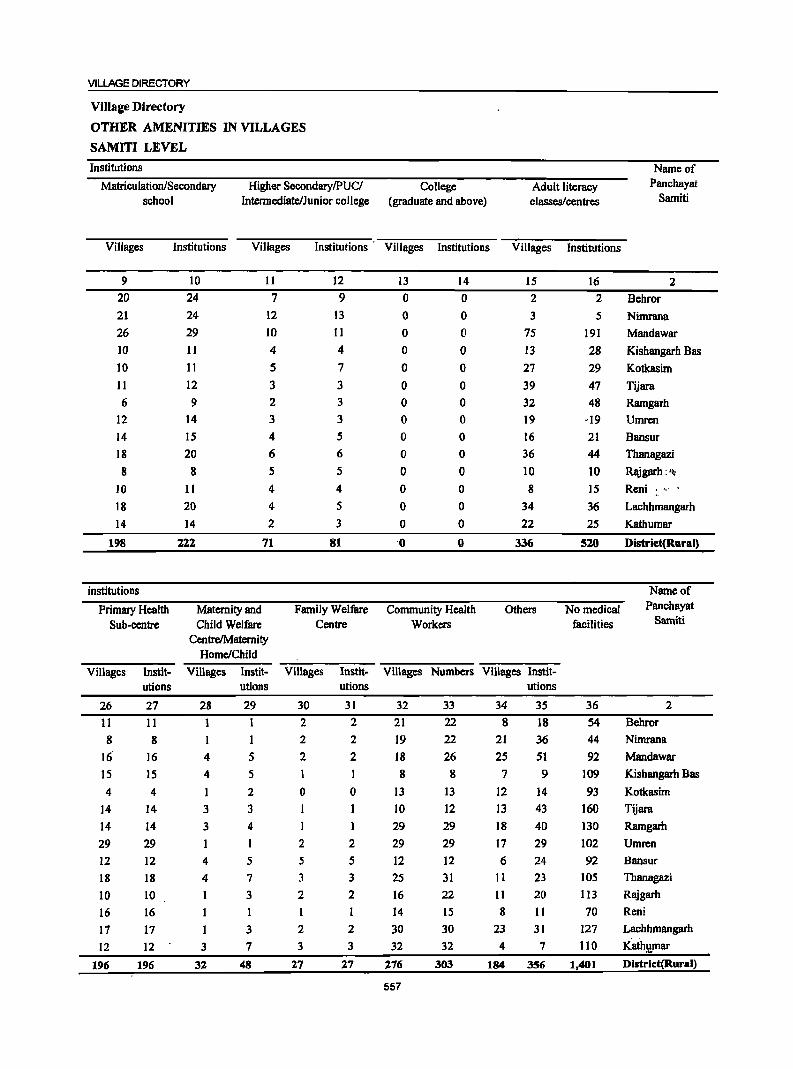
VILLAGE DIRECTORY
ViJlage Directory
OTHER AMENITIES IN VILLAGES
SAMITI LEVEL
Institutions
Matriculation/Secondary school
Higher Secondary/PUC/ Intermediate/Junior college
College (graduate and above)
Adult literacy classes/centres
Villages Institutions Villages Institutions' Villages Institutions Villages Institutions
9
20 21
26 10
10 II
6
12
14 18
8
IO
18
14
198
institutions
Primary Health Sub-centre
10 24
24
29
I I
11
12
9
14 IS
20
8
11 20
14
111
II
7 12
IO
4
5
3 2
3
4
6
5
4
4
2
71
Maternity and Child Welfare
CentrelMatemity Home/Child
12 9
13
11
4
7
3
3
3
5
6
5
4
5
3
81
Family Welfare Centre
I3
o o o o o o o o o o o o o o
'0
14 o o o o o o o o o o o o o o o
Community Health Workers
15
2
3
75
13
27
39
32 19 16
36
10
8
34 22
336
Others
16 2
5
191 28 29
47 48
-19
21
44
10 ]5 36
25
520
No medical facilities
Villages Instit- Villages Instit- Villages Instit- Villages Numbers Villages Instit-
26 11
8 16'
15
4
14 14 29
12
18
10 16
17
12
196
utions
27
II
8 16
15
4
14 ]4
29 ]2
18
10
16
17
12
196
28 I I
4
4
I
3
3
4
4
3
32
utions
29
5
5
2
3 4
5
7
3
1
3
7
48
30
2
2
2
o I
2
5
3
2
I
2
3
27
utions
31
2
2
2
o
1
2
5
3
2
2
3
27
32 21
19
18
8
13
IO
29
29 ]2
25
16
14 30
32
276
557
33
22 22
26 8
13
12
29
29
12 31
22
15
30
32
303
utions
34 35 36
8 18 54 21 36 44
25 51 92
7 9 109
12 14 93 13 43 160 18 40 130
17 29 102
6 24 92
II 23 105 II 20 II3
8 II 70
23 31 127
4 7 IIO
184 356 1,401
Name of Panchayat
Samiti
2
Behror
Nimrana
Mandawar
Kishangarh Bas
Kotkasim
Tijara
Ramgarh
Umren
Bansur
Thanagazi
Rajgarh:'10
Reni :. ,,' .
Lachhmangarh
Kathumar
Distriet(Rliral)
Name of Panchayat
Samiti
2
Behror
Nimrana
Mandawar
Kishangarh Bas
Kotkasim
Tijara
Ramgarh
Umren
Bansur
Thanagazi Rajgarh
Reni
Lachhmangarh
Kath!!mar
District(Rural)
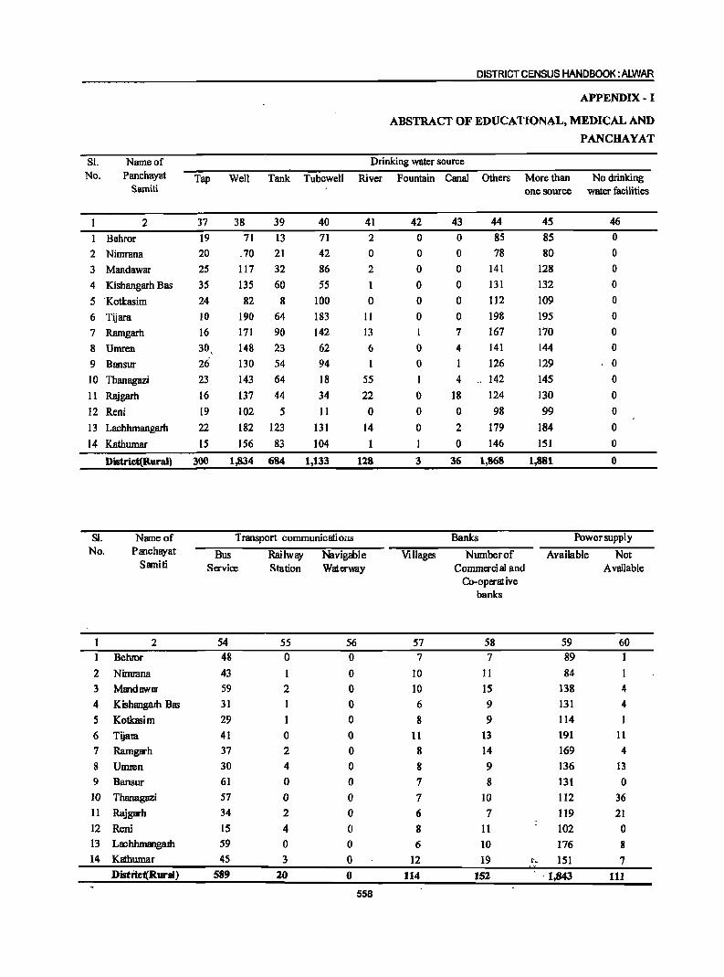
SL
No. Name of
Pam:bayat Samiti
2
Bebror
2 Nimrana
3 Mandawar
4 Kishangarh Bas
5 -Kotkasim
6 Tijara
7 Ramgarh
8 Umren
9 Bansur
10 Tbanagazi
II Rajgarh
12 Reni
13 Lacbhmangarh
14 Kathumar
Distriet(Rural)
SI. No.
Name of Panchayat
Samiti
2
1 Behror
2 Nimmna
3 Mandawar
4 Kishangalh Bas
5 Kotkasim
6 Tijara
7 Ramgarh
8 Umren 9 Bansur
10 Thanagazi
11 Rajgarh
12 Reni
13 LachhmangaJh
14 Kathumar
Distrie(Rural)
DISTRICT CENSUS HANDBOOK: ALWAR
APPENDIX- I
ABSTRACT OF EDUCATIONAL, MEDICAL AND
PANCHAYAT
Drinking water source
Tap Well Tank Tubewell River Fountain Canal Others More than No drinking
37 38 39
19 71 13 20 _70 21
25 117 32
35 135 60
24 82 8
10 190 64
16 171 90
30, 148 23 26- 130 54
23 143 64
16 137 44 19 102 5 22 182 123
15 156 83
300 1,834 684
40
71
42
86
55
100 183
142
62
94
18
34
II
131
104
1,133
41
2
o 2
1
o 11
13
6
I
55
22
o 14
118
Transport communicatioiIS
Bus Servioe
54 48
43
59
31
29
41
37
30
61
57
34
15
59
45 589
Railway Station
55
o
2
1
o 2
4
o o 2
4
o 3
20
Navigable Waterway
56 o o o o o o o o o o o o o o o
558
one source water facilities
42
o o o o o o I
o o 1
o o o
3
43 44
o 85
o 78
o 141
o 131
o 112
o 198
7 167
4 141
1 126
4 142
18 124
o 98
2 179
o 146
36 1,868
Banks
Villages Number of
57 7
10
10
6
8
11
8
8
7
7
6
8 6
12
114
Commerci al and Co-operat: ive
banks
58
7
11
15
9
9
13
14 9
8
10
7
II
10
19
152
45 85
80 128
132
109
195
170
144 129
145 130
99
184
151
1,881
46
o o o o o o o o o o o o o o o
Power supply
Available Not
59
89
84
138
131
114 191
169
136
131
1I2
119
102
176
~- 151 -1,843
Available
60
4
4
1 11
4 13 o
36
21
o 8
7
111
VILLAGE DIRECTORY
Village Directory
OTHER AMENITIES IN VILLAGES
SAMITI LEVEL
Post, Telegraph & Telephone Name of
Post Telegraph Post & Post office Telegraph office Post, Telegraph Phone Panchayat
Office Office Telegraph office & Phone & phone office & Phone Samiti
47 48 49 50 51 52 53 2 26 0 0 22 0 0 54 Behror 35 1 1 26 I I 35 Nimrana 43 3 3 38 3 3 84 Mandawar 31 2 28 2 89 Kishangarh Bas
21 16 ·46 Kotkasim
28 2 2 25 2 2 74 Tijara 24 22 78 Ramgarh 33 I 29 88 Umren 34 I 30 59 Bansur 34 2 2 34 2 2 75 Thanagazi
30 1 1 21 t 40 Rajgarh
29 2 I 20 2 42 Reni
38 2 2 34 2 2 95 Lachhmangarh
45 2 0 38 2 0 92 Kathumat--
451 21 17 383 21 17 951 District(Rural)
Credi t soci eties Reacational 'lilci lity Newspaper! Name of
Villages Number of Villagcl Number Villages Number Cinema' Sports Stadium! News Maga- News Panchayat
agricultural of non- of other Video club Au ditoriumf paper zine paper Samiti
aedit agri- aedit hall Community & societies cultuml societies hall Maga-
aedit zine societies
61 62 63 64 65 66 67 68 69 70 71 72 2 9 9 0 0 5 5 2 0 0 77 52 52 Dehror
9 9 0 0 0 0 2 0 0 76 64 64 Nimrana
27 27 0 0 0 0 0 0 0 107 94 93 Mandawar
13 13 I I 2 2 4 0 0 73 47 47 Kishangarh Bas
18 18 1 1 0 0 3 0 0 95 82 82 Kotkasim
14 14 0 0 0 0 5 0 0 83 37 34 Tijam
23 23 0 0 I I 7 0 0 78 57 56 Ramgarh
30 30 0 0 0 0 0 0 0 86 • 43 42 Umrm
8 8 2 2 0 0 56 44 44 Bansur
10 10 I 2 I 0 0 0 55 54 53 Thanagazi
6 6 0 0 0 0 0 0 0 90 74 73 Rajgam
17 17 1 2 2 0 0 0 77 67 66 Reni
46 47 2 3 0 0 2 0 0 110 89 88 Lachhmangarh
23 23 3 3 0 ·'1~l· 0 97 78 74 Kathumar
253 254 11 13 13 13 27 0 0 1,160 881 868 District(Raral)
559
DISTRICT CENSUS HANDBOOK: AUIVAR
APPENDIX lA- VHlageDirectory
VILlAGES BY NUMBER OF PRIMARY SCHOOlS
Sl. Name of Total number Number of primal)' schools No. Panchayat ofinhabited None One TIM) Three Four +
Samiti villages
2 3 4 5 6 7 8 1 Behror 90 8 30 25 12 15
2 Nimr!ll1.a 85 1 54 16 8 6
3 Mandawar 142 3 117 14 5 3 4 Kishanl?/irh Sa<! 135 11 100 17 4 3 5 Kotkasim ll5 3 96 10 3 3 6 Tijam 202 21 164 11 3 3 7 Ramgarh 173 13 131 23 4 2
8 Umren 149 20 98 19 4 8
9 Bansur 131 I 92 21 9 8 10 Thanagazi 148 27 90 14 12 5 11 Rajgarh 140 24 103 5 5 3 12 Reni 102 5 80 II 2 4 13 Lachhmangalb 184 4 161 11 6 2
14 Kathumll' 158 2 134 12 9 1 District Toml 1,954 143 1,450 209 86 66
APPENDIX IB - Village Directory
VILLAGES BY PRIMARY, MIDDLE AND SECONDARY SCHOOLS
SI. Name of Total number of Type of educational institutions available No. Panchayat Samiti inhabited No School At least one primary At least one primary At least one middle
villages school and no middle school and one school and one school middle school secondary school
2 3 4 5 6 7 I Behror 90 8 29 53 20 2 Nimrana 85 24 60 21 3 Mandawar 142 3 68 71 26 4 Kishangarh Bas 135 11 84 40 10 5 Kotkasim liS 3 70 42 10
6 Tijara 202 21 132 49 11 7 Ramgarh 173 13 113 47 6 8 Umren I!: 149 20 79 50 12 9 Bansur 131 I 69 61 14 10 Tbanagazi 148 27 71 50 18 11 Rajgarh 140 24 66 50 8 12 Reni 102 5 57 40 10 13 Lachhmangarh 184 4 117 63 18 14 Kathumar 158 2 96 60 14
District Total 1,954 143 1,075 736 198
560
VILLAGE DIRECTORY
APPENDIX 1 C - Village Directory
VILLAGES WITH DIFFERENT SOURCES OF DRINKING WATER FACILITIES AVAILABLE
Sl. Name of Number of villages with different sources of drinking water available No. Panchayat Only tap Only well Onlytube well Only handpump More than one source only
Samiti from tap, well, tube well, handpump
2 3 4 5 6 7 1 Behror 2 0 2 84
2 Nimrana 2 1 1 80
3 Mandawar 0 0 0 14 127
4 Kishangarh Bas O. 3 0 0 131
5 Kotkasim 0 0 I 5 109
6 Tijara 0 2 0 4 195
7 Ramgarh 0 2 0 1 169
8 Umren 0 4 0 0 143
9 Bansur 0 2 0 0 129
10 Thanagazi 0 0 0 140
11 Rajgarh 0 7 0 0 127
12 Reni 0 3 0 0 99
13 Lachhmangarh 0 0 0 0 184
14 KatJiumar 0 6 0 0 lSI
District Total: 2- 33 2- 28 1,868 ~
. APPENDIX II - Village Directory
VILLAGES WITH 5,000 AND ABOVE POPUI;.ATION WIDCH DO NOT HAVE ONE OR MORE AMENITIES
Sl. Name of Location Name of Popu- Amenities not available No. village Code Panchayat lation (indicate N. A. where amenity not available)
Number Samiti Senior College Primary Tap Bus Approa~h Commer-Secondary Health drinking facility by Pucca cial Bank
School Sub water road :
Centre
2 3 4 5 6 7 8 9 10 11 12
I Gandala 00762300 Behror 5869 Available N.A. Available Available Available Available Available
2 Bardod 00767000 Behror 13957 Available N.A. N.A. Available Available Available Available
3 Shahjahanpur 00758000 Nimrana 8682 Available N.A. N.A. Available Available Available Available
4 Mundawar 00778200 Mandawar 5682 Available N.A. Available Available Available Available Available
5 Pehal 00780700 Mandawar 5423 N.A. . N.A. Available Available Available Available N.A.
6 Tatarpur 00783400 Mandawar 6193 Available N.A. Available Available Available Available Available
7Ismalpur 00826700 Kishangarh Bas 5083 N.A. N.A. Available Available N.A. Available Available
8 Bahadurpur PI 00847800 Kishangarh Bas 5121 Available N.A. Available Available Available Available Available
9 Kotkasim 00789600 Kotkasim 7164 Available N.A. Available Available Available Available Available
10 HarsoH 00796400 Kotkasim 8060 Available N.A. N.A. Available Available Available Available
II Santhalka 00797500 Tijara 5130 N.A. N.A. N.A. N.A. N.A. Available N.A.
12 Guwalda 00802300 Tijara 6619 N.A. N.A. N.A. Available Available Available N.A.
13 Tapookra 00803700 Tijara 6271 Available N.A. N.A. Available Available Available Available
14 Mubarikpur 00837000 Ramgarh 5060 Available' 'i.,N.A. N.A. Available Available Available Available
15 Naul1jawan 00837500 Ram£!arh 9113 N.A. __ N.A. Available Available Available Available Available
561
DISTRICT CENSUS HANDBOOK: AIJNAR
APPENDIX n - Village Directory
VILLAGES WITH 5,000 AND ABOVE POPULATION WHICH DO NOT HAVE ONE OR MORE AMENITIES
SI. No.
Name of village
. Location Code
Number
Name of Panchayat
Samiti
2 3 4
16 Ramgarh
17 Alawara
18 Chandoli
19 Bhoogar
20 Diwakari
00840400 Ramgarh
00843500 Ramgarh
00845700 Umren
00853100 Umren
00853600 Umren
21 Prithvipura 00860000 Umren
22 Beejawar 00863100 Umren
23 Baleta 00863400 Umren
24 Mala Khera 00863900 Umren
25 Barkhera 00864100 Umren
26 Harsora 00867700 Bansur
27 Hameefpur 00869400 Bansur
28 Hajipur 00871900 Bansur
29 Kasba Bansur 00872600 Bansur
30 Rampur 00874700 Bansur
31 Garhi 00878800 Tbanagazi
32 Mundawara 00880000 Thanagazi
33 Narayanpur 00881200 Tbanagazi
34 Thanagazi 00883600 Thanagazi
35 Sakat 00909600 Rajgarh
36 Rajgarh (Rura 00911700 Rajgarh
37 Machari 00911900 Reni
38 Pinan
39 Reni
00912800 Reni
00917800 Reni
40 Garhi Sawaira 00918500 Reni
41 Baroda Meo 00924500 Lachhmangarh
42 Lachhmangarl00931300 Lachhmangarh
43 Mojpur 00933000 Lachhmangarh
44 Harsana 00934500 Lachhmangarh
45 Tasai 00940900 Kathumar
46 Kathoomar 00943300 Kathumar
47 Garoo 00949800 Kathumar
48 Samoochi 00951600 Kathumar
49 Sonkhar ( Rur 00952000 Kathumar
50 Kherli Rei ( R 00952300 Kathumar
Amenities not available Population (indicate N. A. where amenity not available)
Senior College Primary Tap drinking
water
Bus Approach Commer-Secondary Health facility by Pucca cial Bank
road School Sub Centre
5 6 7 8 9 10 11 12
11347 Available N.A. N.A. Available Available Available Available
5619 N.A. N.A. Available Available Available Available Available
5654 N.A.
6528 N.A.
6870 N.A.
5003 N.A.
5775 N.A.
5282 N.A.
9502 Available
5494 N.A.
5210 Available
6173 N.A.
5353 N.A.
N.A. N.A. Available Available Available Available
N.A.
N.A.
N.A.
N.A.
N.A.
N.A.
N.A.
N.A.
N.A.
N.A.
13012 Available N.A.
6326 Available N.A.
5306 N.A. N.A.
5803 N.A. N.A.
16383 Available N.A.
11385 Available N.A.
6110 Available N.A.
5993 N.A. N.A.
6628 Available N.A.
7860 Available N.A.
9000 Available N.A.
5219 Available N.A.
7863 Available N.A.
9493 Available N.A.
8296 N.A. N.A.
5323 Available N.A.
8859 N.A. N.A.
7656 Available N.A.
5175 N.A. N.A.
5295 N.A. N.A.
6076 N.A. N . .A. 6008 N.A. N.A.
562
N.A. Available N.A. Available N.A.
Available Available N.A. Available N.A.
Available N.A. Available Available N.A.
Available Available Available Available N.A.
Available Available Available Available Available
Available Available, Available Available Available
Available Available N.A. Available N.A.
N.A. Available Available Available Available
N.A. Available Available Available Available
Available Availabl~ Available Available N.A.
Available Available Available Available Available
Available Available Available Available Available
Available Available Available 'Available N.A.
Available Available Available Available N.A.
Available Available Available Available Available
Available Available Available Available Available
N.A. Available N.A. Available N.A.
N.A. Available N.A. Available N.A.
Available Available Available Available Available
N.A. Available Available Available Available
N.A. Available Available Available Available
Available Available Available Available Available
Available Available Available Available Available
Available Available Available Available Available
N.A. Available Available Available Available
Available Available Available Available N.A.
Available Available Available Available Available
Available Available Available Available Available
N.A. N.A. N.A. Available N.A.
N.A. Available Available Available Available
N.A. N.A. N.A. Available N.A:
Available N.A. Available Available Available
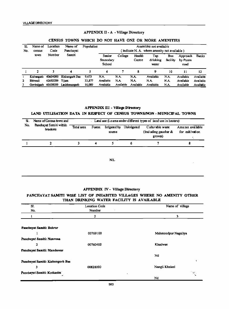
VILLAGE DIRECTORY
APPENDIX II - A - Village Directory
CENSUS TOWNS WmCH DO NOT HAVE ONE OR MORE AMENITIES
SI. Name of Location Name of Population Amenities not available No. census Code Panchayat ( indicate N. A. where amenity not available)
town Number Samiti Senior College Health Tap Bus Approach Banks Secondary Centre drinking facility by Pucca
School water road
2 3 4 S 6 7 8 9 10 II 12
I Kishangarh 40604000 Kishangarh Bas 9,473 N.A. N.A. N.A. Available N.A. Available Available 2 Bhiwadi 40602000 Tijara 33,877 Available N.A. N.A. N.A. N.A. Available Available 3 Govindgarh 40608000 Lachhmangarh 10,089 Available Available Available Available N.A. Available Available
APPENDIX HI - Village Directory
lAND UTIUSATION DATA IN RESPECf OF CENSUS TOWN SINON - MUNICIPAL TOWNS
SI. Nlme of Census town and Land use (i.e area under different types of land use in hectare) No. Panmayat Sarniti within
Total area Forest Irrigated by Unirrigated Culturable waste Areanot available brackets
source (including gauchar & for cult ivati on groves)
2 3 4 S 6 7 8
NIL
APPENDIX IV - Village Directory
PANCHAYATSAMITI WISE LIST OF INHABITED VILLAGES WHERE NO AMENITY OTHER THAN DRINKING WATER FACILITY IS AVAILABLE
SL No.
Panchayat Samiti: Behror
Panchayat Samiti: Nimrana
2
Panchayat Samiti: Mandawar
Panchayat Samiti: Kishangarh Bas
3
Panchayat Samiti: KotkasiJiI' ,.'
Location Code Number
2
00769100
00760400
00828000
Name of village
3
Mahmoodpur NagaJiya
Khatiwas
Nil
NangJi Khaleel
'. Nil
563
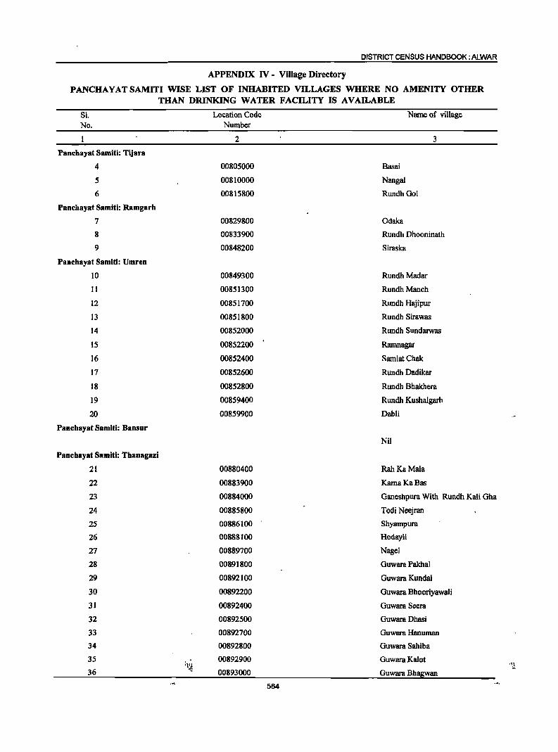
DISTRICT CENSUS HANDBOOK: ALWAR
APPENDIX IV - Village Directory
PANCHA YAT SAMITI WISE LIST OF INHABITED VILLAGES WHERE NO AMENITY OTHER THAN DRINKING WATER FACILITY IS AVAILABLE
81. No.
PaDehayat Samiti: Tijara
4
5
6
PaDehayst Samiti: Ramgarh
7
8
9
Panehayat Samitl: Umren
IO
11
12
13
14
15
16
17
18
19
20
PaDehayat Samiti: Bansur
Panehayat Samiti: ThaDagazi
21
22
23
24
25
26
27
28
29
30
31
32
33
34
3S
36 q~
Location Code Number
2
00805000
00810000
00815800
00829800
00833900
00848200
00849300
00851300
00851700
00851800
00852000
00852200
00852400
00852600
00852800
00859400
00859900
00880400
00883900
00884000
00885800
00886100
00888100
00889700
00891800
00892100
00892200
00892400
00892500
00892700
00892800
00892900
00893000
564
Name of village
Basai
Nangal
RundhGol
Odaka
3
Rundh Dhooninath
Siraska
Rundh Madar
Rundh Manch
Rundh Hajipur
Rundh Sirawas
Rundh Sundarwas
Ramnagar
SamlatChak
Rundh Dadikar
Rundh Bhakhera
Rundh Kushalgarh
Dahli
Nil
Rah KaMala
Kama KaBas
Ganeshpura With Rundh Kali Gha
Todi Neejran
Shyampum
Hodayli
Nagel
Guwara Pakhal
Guwara Kunda!
Guwara Bhooriyawali
Guwara Seem
Guwara Dhasi
Guwara Hanuman
Guwara Sahiba
Guwara Kalot
Guwara Bhagwan
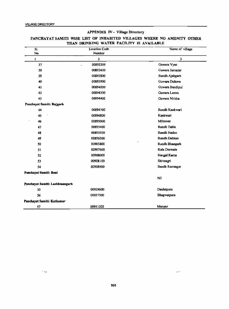
VILLAGE DIRECTORY
APPENDIX IV - Village Directory
PANCHAYAT SAMITI WISE LIST OF INHABITED VILLAGES WHERE NO AMENITY OTHER THAN DRINKING WATER FACILITY IS AVAILABLE
Sl. No.
37
38
39
40
41
42
43
Panchayat Samiti: Rajgarh
44
45
46
47
48
49
50
51
52
53
54
Panchayat Samiti: Reni
Panchayat Samiti: Lachhmangarb
55
56
Panchayat Samiti: Kathumar
57
Location Code Number
2
00893300
00893400
00893800
00893900
00894000
00894300
00894400
00894700
00894800
00895000
00895400
00895500
00896200
00905800
00907600
00908000
00908100
00908900
00929600
00937500
00941000
565
Name of village
3
Guwara Vyas
Guwara Jamadar
Rundh Ajabgarh
Guwara Dulawa
Guwara BandipuI
Guwara Leswa
Guwara Nirbha
Rundh Kankwari
Kankwari
Mitrawat
Rundh Tahla
RundhNadoo
Rundh Dabkan
Rundh Bhangarh
Kala Deewala
Nangal Kama
Shivnagri
Bandh Ramsagar
Nil
Daulatpura
Bhagwatpura
Manpur
.' .
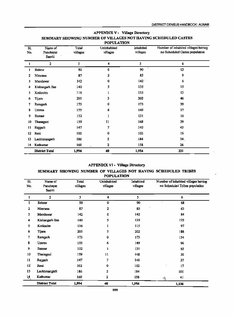
DISTRICT CENSUS HANDBOOK: ALWAR
APPENDIX V - Village Directory
SUMMARY SHOWING NUMBER OF VILLAGES NOT HAVING SCHEDULED CASTES POPULATION
Sl. Nwneof Total Uninhabited Inhabited Number of inhabited villages having No. Panchayat villages villages villages no Scheduled Castes population
Swniti
2 3 4 5 6
Behror 90 0 90 12
2 Nimrana 87 2 85 9
3 Mandawar 142 0 142 . 6
4 Kishangarh Bas 140 5 135 15
5 Kotkasim 116 1 115 13
6 Tijara 205 3 202 46
7 Ramgarh 173 0 173 39
8 Umren 155 6 149 17
9 Bansur 132 131 16
10 Thanagazi 159 11 148 39
11 Rajgarh 147 7 140 43
12 Reni 102 0 102 16
13 Lachhmangarh 186 2 184 34.
14 Kathumar 160 2 158 26
District Total 1,994 40 1,954 331
APPENDIX VI - Village Directory
SUMMARY SHOWING NUMBER OF VILLAGES NOT HAVING SCHEDULED TRIBES POPULATION
Sl. Nwneof Total Uninhabited Inhabited Number of inhabited villages having No. Panchayat villages villages villages no Scheduled Tribes population
Swniti
2 3 4 5 6
Behror 90 0 90 68
2 Nimrana 87 2 85 63
3 Mandawar 142 0 142 84
4 Kishangarh Bas 140 5 135 125
5 Kotkasim 116 1 liS 97
6 Tijara 205 3 202 188
7 Ramgarh 173 0 173 134
8 Umren 155 6 149 96
9 Bansur 132 131 65
10 Thanagazi 159 11 148 30
11 Rajgarh 147 7 140 27
12 Reni 102 0 102 17
13 Lachhmangarh 186 2 184 101 1.4 .. ~
Kathumar 160 2 158 ~:i:~ . 41
District Total 1,994 40 1,954 1,136
566
VILLAGE DIRECTORY
APPENDIX VII A - Village Directory
LIST OF VILLAGES ACCORDING TO THE PROPORTION OF THE SCHEDULED CASTES TO THE TOTAL POPULATION BY RANGES
Range of Scheduled Location Name of village Range of Scheduled Location Name of village Castes population Code Castes population Code
(percentages) Number (percentages) Number
2 3 2 3
Panchayat Samiti : Behror 00766500 Mawri Less than 5 00765300 Sorwa 00770700 Gujarwas
00769.400 Krishan Nagar 00771200 Pabari 00762500 Dawani 00763200 Bhagwari Khurd
00769900 Sherpur 5-10 00763800 Boorhwal 00762900 Jakhrana Kalan
00764100 Dhoondhariya 00763300 Bhagwari Kalan 00769700 Kherki 00767600 Shahzadpur Nangaliya 00766100 Antpura 00765100 Khatan Khera 21-30 00769500 Moondiya Khera 00765200 Milakpur 00769600 Kharkhara 00765600 ,Nagai Khodiya 00766900 NanglaRudh 00763700 Googariya 00762200 Chak Muradpur 00763400 Balpura 00769000 Untoli 00767900 Talwar 00767400 Dhis 00768900 Banhad 00770600 Shirnla 00770300 Nalota 00770900 Mohammadpur-_Goojar 00766600 , Ramsinghpura 00767200 Karoda 00766200 Kohrana 00762600 Bhoopseda
00769800 Gokalpura
11-20 00768700 Nasarpur 00770400 Goonti 00763100 Guwana 00764900 Hamjapur 00771000 Mosampur @ Kankara 00762700 Basai 00764800 Dooghera 00767500 Jaialpur 00763900 Bheeteda 00770800 Islampur 00766700 Macha! 00769300 Taseeng 00766300 Maharajwas 00764000 Chandi Chana 00770000 Kankar Chhaja 00765500 Nagli Jagccr
00768500 Hameedpur 00768800 Khohri 31-40 00760300 Khohar
00768600 Nareda Kalan 00765700 Golawas
00767800 Momanpur 00763000 Jat Gaonra Panchayat Samiti : Nimrana
00769200 Khapariya Less than 5 00761000 Janaksinghpura
00767000 Bardod 00759800 Akleempura
00768000 Jaguwas 00764500 KoliIa Rawad
00762800 Banesinghpura 00756700 Pratappur Chak No. 1
00762000 Kaliya Hoda 00761800 Becchpuri
00760200 Shyodansinghpura 00770100 Gadhoj 5-10 00756600 Pratappur Chak No.2
00764600 Keeratsinghpura 00764700 Bantkhani
00771100 Jainpurwas 00755800 Beeranwas
00762300 Gandaia 00757800 Bani Jonaycha
00767100 Nalpur 00757700 Jonaycha Khurd
00763500 KureJi 00756400 Majra 00765800 Bijorwas 00757600 Sansedi 00766000 Nibhor 00755500 Nanagwas 00768200 Kankar Dopa 00755700 Dabarwas 00765000 Riwali 00757100 Kuteena 00770500 Shyarnpur 00761100 Fauladpur 00766800 Dabrni 00767300 Ajrneripura 11-10 00758600 Naghori
567
DISTRICT CENSUS HANDBOOK: ALWAR
APPENDIX VII A - Village Directory
LIST OF VILLAGES ACCORDING TO THE PROPORTION OF THE SCHEDULED CASTES TO THE TOTAL POPULATION BY RANGES
Range of Scheduled Location Name of village Range of Scheduled Location Name of village Castes population Code Castes population Code
(percentages) Number (percentages) Number
2 3 2 3
00759700 Doomroli 00756900 Pratappur Chak No. 3 00759600 Kaysa 00761900 PeepJi 00760000 Nareda Khurd 00754400 Kathoowas 00759000 Rodwal 00754500 Mmigalpur 31-40 00755900 Anandpur 00756500 Basai Bhopalsingh 00758300 Neemrana 00761200 Baori 00760600 Bijaisinghpura 00761600 Mohalariyan 00764400 KolilaJoga 51-75 00764200 Fatehpura 00754100 Hudiya Kalan 00758100 Dhodhakari 00755400 Giglana 00764300 Kolila Sanga Pa,nehayat Samiti : Mandawar 00758700 Bheemsinghpura Le"ss than 5 00778000 Garhi 00753800 Beenjhpur 00778700 Rambas 00756300 Kanhawas 00784400 Kadar Nagar 00754300 Hudiya Khurd 00778300 Nangal Raniya 00756000 Vijaynagar 00780500 Shyopur 00758000 Shahjahanpur 00782300 Jeevan Singhpura 00758500 Salarpur 00778100 Gandhi Nagar 00756800 Gheelot 00783600 Ikrotiya 00755000 NagliBaiai 00785200 Suheta 00755100 Santo 00780300 Shreekrishan Nagar 00754900 Porula 00759500 Talwana 5-10 ,00773400 Mundanwara Khurd 00757000 Batana 00774300 BhagolaAheer 00754600 Mandhan 00775700 Shekhawas 00760500 Majri Kalan 00776900 Balloowas 00760100 Naisarana 00782800 Doonwas 00753600 Ramchandrapura 00772700 Manethi 00756200 Dheekwar 00776200 Bhoongara Aheer
00777700 Khanpur Aheer
21-30 00757500 J onaycha Kalan 00777800 Mandha 00755600 Chawadi 00774900 Darbarpur 00757300 Googal Kota 00785100 Khareta 00760900 Madhosinghpura 00776600 Mundiya Khera ' 00755300 Raisarana 00776500 Swaroop Sarai 00759200 Dausod 00784900 Nanga! Singal 00758200 Belni 00781700 Ranoth 00759100 Majari Khurd 00772500 Hulmana Khurd 00754800 Mahtawas 00775500 Munpur 00757400 Shriyani 00757200 Kankar 11-20 00777200 NaharKhera 00757900 Chaubara 00778900 Kalooka 00759400 Raiwana 00777300 Sihali Khurd 00754700 Adeend OQ777500 Sibali Kalan 00761300 Isrisinghpura 00779900 Cheeruni 00759900 Nihalpura 00776400 Padmara Kalan 00755200 Beeghana Jat 00777100 Amoth 00753900 Partapur 00776700 Chandpur 00754000 Jaitpur 00773300 Mundanwara Kalan 00759300 Banthala .. 00779400 Dhokal Nagar 00756100 Khoondrot 00785400 Chakoliya
568
VILLAGE DIRECTORY
APPENDIX VII A - Village Directory
LIST OF VILLAGES ACCORDING TO THE PROPORTION OF THE SCHEDULED CASTES TO THE TOTAL POPULATION BY RANGES
Range of Scheduled Location Name of village Range of Scheduled Location Name of village Castes population Code Castes population Code
(percentages) Number (percentages) Number
2 3 2 3
00775000 Sundarwari 00783400 Tatarpur 00779300 Chhapur 00779000 Padmara Khurd 00780600 Renagiri 00781400 Sukhman Heri 00774000 SirodKalan 00774100 Nangal Siya 00775900 Rajwara 00779600 Kokawas 00775200 Majra 00781900 Tehadka 00776300 Khohri 00784000 Agwani 00781800 Kali Pahari 00774500 Sanchod 00771800 Beerod 00784300 Jeendoli 00782000 Gopipura 00777400 Hada Heri 00771900 Palawa 00776800 Birsangwas 00775300 Todarpur 00783200 Tehadki 00773100 Sanoli 00772000 Gadli 00775800 Bheekhawas 00771400 Ramsinghpura 00780000 Peepli 00781500 Nangal Baola 00777000 Jogawad 00780800 Mohammadpur 00173500 Shahjadpur 00772400 Hulmana Kalan 00772300 Beejwad Chauhan 00783900 Mator 00784700 Azizpur 00779800 Jhajharpur 00771700 Mirzapur 00779500 Sodawas 00774800 Bhagolajat 00780700 Pehal 00772800 lalwas 00782200 Choodla 00771300 Bawad 00779100 Bapdoli 00782600 Badheen 00772900 Molawas 00772100 Dadhiya 00775400 Gola Hera 00773900 Sirod Khurd 00772600 Bhojpuri 00783300 Dhailawas 00784200 Bari 00780100 Siya Khoh 00783500 Badli 00782900 Chhabriwas 00782400 Tejpura 00779700 Hatoondi 00778600 Mau 00778800 Bheenwada 00784600 Rundh 00784800 Behroj 00773000 Behror ]at
31-40 00780200 Menpur 00777600 Radwa 00773600 Jasai 00781600 Raipur
00778400 Ulaheri 00771500 Manka
00771600 Lamachpur 00785300 Sorkha Kalan
00783700 Naredi 00783800 Sorkha Khurd
00773700 Nangal Udiya 00781000 Rasgan 00776100 Kami Kot 00781100 Dantla 00774600 Alipur 00776000 Majri Bhanda 41-50 00781300 Nangali Ojha 00772200 Gadoowas 00774700 Basni 00782100 Jalpiwas 00784500 Khushalwas 00773800 Sarai Kalan 00782500 Bhajanawas 00779200 Majri Khola
51-75 00777900 Tinkiruri 21-30 00778200 Mundawar 00774400 SeelGaon
00775100 Bhanot 00780900 Nangal Santokara 00783100 Shamda 00781200 Shahpur 00775600 ]agiwara 00774200 Ajarka 76 and above 00785000 Khanpur Mewan
569
DISTRICT CENSUS HANDBOOK: ALWAR
APPENDIX VII A - Village Directory
LIST OF VILLAGES ACCORDING TO THE PROPORTION OF THE SCHEDULED CASTES TO THE TOTAL POPULATION BY RANGES
Range of Scheduled Location Name ofviJIage Range of Scheduled Location Name of village Castes population Code Castes population Code
(percentages) Number (percentages) Number
2 3 2 3
Panchayat Samitl : Kishangarh Bas 00823300 Ganj Less than 5 00848800 Sinnoli 00820900 TarwaIa
00822900 Kultajpur 00848000 Rani Khera 00850600 Chandooki 00819800 Mancha 00820500 Meerka 00821300 Bhatkol 00824900 Raoka 00825000 Nyana
00823900 Bidarka 00817800 Jhamoowas
00821800 Manothadi 00826100 Khoha
00825900 Mahrampur 00825300 Chor Basai
00825400 Khohra Peepli 00850500 Rayabka
00824000 Baghora 00823400 Bambora
00821700 , Dhamookar 00823600 Moosa Khera
00826500 i .. Ranoli 00822000 Mothooka ,;":
00819700 Nangli Pathan 00825500 Kolgaon
00847300 Naharpur Kalan 21-30 00827300 Ballabhgram 00822100 Jaistika 00850700 Gajeeka
00827900 Bajhot 00818600 Bagheri Kalan 00824500 Vrisangpur 00827100 Nangla Doongar
00846500 KaroH 5-10 00818100 Jharjheela 00826600 Baghor
00846900 Pahara 00820100 Seokhera 00824700 Thana Ghora 00847100 Kithoor 00847400 Bahadurpur Patti Katla 00823100 Jhirandiya 00824600 Padasala 00818900 Poondraka 00820400 Nangli Mewan 00818300 Bassi BeerthaI 00819100 BagthaIa 00822300 Dayalpur 00847900 Sotka 00822500 Bas KripaInagar 00824100 Chaundawata 00823200 Tahnoli 00820800 Isepur 00822200 Deota 00821900 Husepur 00817900 Rundh Jhamoowas 00820600 Lisana 00848400 Mundiya Khera 00825600 Shekhpur 00821100 Jatka 00817700 Naya Gacn 00821200 Odra 00846800 Jajor 00850000 Chirkhana 00823500 Cheet Ghana 00826700 Ismalpur 00818000 Fatiyabad 00821400 Langarwas 00818500 Kaushalpur 00825700 Khudeena
00821000 Kankra ( Islam Nagar ) 11-20 00827400 Nimbhera 00847600 Bahadurpur Patti Pahar
00826000 Ghasoli 00819200 Chamroda 31-40 00828100 Rata Khurd 00825100 Dongra 00846600 Chikani 00817600 Khera 00820700 Bassi Kalan 00818400 Machh Roli 00850800 Raisees 00825200 'Khanpur Mewan 00818200 GoogaIHeri 00828300 Rata Kalan 00849900 Jahar Khera 00819300 Bolni 00848100 Bhajera 00847500 Bahadurpur Patti Joriya 00827200 Patan Mewan 00819400 Teetarka 00848500 Scnthli 00847800 Bahadur.pur Patti 00821600 Chachaka
Meeran 00828400 Basai Jagta
570
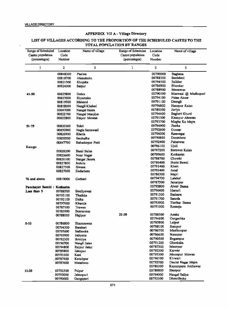
VILLAGE DIRECTORY
APPENDIX VII A - Village Directory
LIST OF VILLAGES ACCORDING TO THE PROPORTION OF THE SCHEDULED CASTES TO THE TOTAL POPULATION BY RANGES
Range of Scheduled Location Name of village Range of Scheduled Location Name of village Castes population Code Castes population Code
(percentages) Number (percentages) Number
2 3 2 3
00848300 Peelwa 00790000 Baghana 00818700 Alamdeeka 00788300 Beelaheri 00821500 Khojaka 00794500 Salkhar 00824300 Sarpur 00786900 Bhonkar
00788900 Mcnawas 41-50 00825800 Dohra 00790100 Maswasi @ Madhopuri
00827600 Shyamaka 00794100 Patan Aheer
00819900 Mahond . 00791100 Deengli
00828000 Nangli Khaleel 00796800 Hanspur Kalan 00847000 Nangal Heera 00789300 Joriya 00822700 Nangal Maujiya 00794400 Bagheri Khurd 00822800 Raipur Mewan 00791500 Khanpur Aheeran
00793700 Magha Ka Majra 51-75 00820300 Tohri 00794900 Jharka
00850900 Nagla Samawadi 00792600 Gunsar 00826900 Kherla 00796000 Ramnagar
00820200 Santhalka 00790800 Doomhera
00847700 Bahadurpur Patti 00792400 Paharwas
Kanugo 00786100 Ujoli
00828200 Basai Balan 00787200 Berawas Kalan
00822600 NoorNagar 00789600 Kotkasim
00850100 Nangal Jheera 00788700 Chowki
·00827800 Jeelota 00786400 Burhi Bawal
00827500 Siwana 00791400 Kheri
00827000 Dadarhera 00793400 Jonal 00786500 Majri
76 and above 00819000 Gothari 00794700 Lahdod 00787500 Jamalpur
Panchayat Samiti : Kotkasim 00793800 Aheer Basna
Less than 5 00788200 Beeliyawas 00796400 Harsoli
00793100 Thathka 00791300 Badsara
00792100 Daika 00791700 Sanoda
00797000 Kharola 00793900 Thethar Basna
00787100 Teuwas 00791000 Roneeja
00785900 Beeranwas 00788000 Hajipur 21-30 00788500 Anaka
00794600 Gurgachka
5-10 00786800 Bhamoowas 00785800 Lalpur
00794300 Beraheri 00788100 Rampur
00795600 Sadhooka 00786700 Madhoopur
00795900 Jatiyana 00786600 Nasopur
00792300 Ikrotiya 00790500 Begampur
00796700 Nangli Jatan 00791200 Gheekaka 00794800 Raipur Iatan 00787300 Meerpur
00789800 Jakopur 00792200 Karwar 00793500 Kani 00795300 Moonpur Mewan
,00787400 Kutubpur 00796100 Kirwari
00787600 Matalwas 00795200 Daulat Nagar Majra 00786300 Kayampura Jokhawas
11-20 00792500 Palpur 00788800 Sherpur ·00793000 Jahanpuri 00794000 NangaJ SaJiya
00790600 Gangapuri 00793300 Dheerdhoka
571
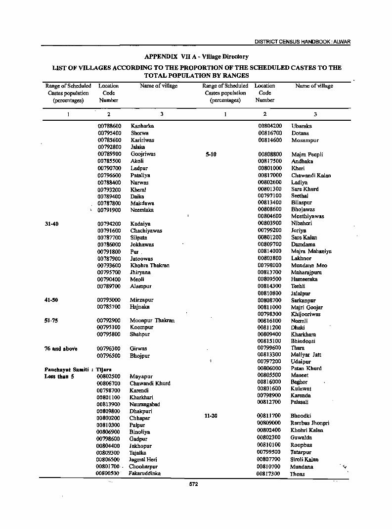
DISTRICT CENSUS HANDBOOK: ALWAR
APPENDIX VII A - Village Directory
LIST OF VILLAGES ACCORDING TO THE PROPORTION OF THE SCHEDULED CASTES TO THE TOTAL POPULATION BY RANGES
Range of Scheduled Location Name of village Range of Scheduled Location Name of village Castes population Code Castes population Code
(percentages) Number (percentages) Number
2 3 2 3
00788600 Kanharka 00804200 Ubaraka 00795400 Shorwa 00816700 Dotana 00785600 Kaririwas 00814600 Mosampur 00792800 Jalaka 00789900 Goojriwas 5-10 00808800 Majra Peepli 00785500 Akoli 00817500 Andhaka 00790700 Ladpur 00801000 Kheri 00796600 Pataliya 00817000 Chawandi Kalan 00788400 Narwas 00802600 Ladiya 00793200 Kheral 00801300 SareKhurd 00789400 Daika 00797100 Seethal 00787800 Makdawa 00813400 Bilaspur 00791900 Neemlaka 00808600 Bhojawas
00804600 Meethiyawas 31-40 00794200 Kadaiya 00803900 Nibaheri
00791600 Chachiyawas 00799200 Joriya 00787700 Silpata 00801200 SareKalan 00786000 Jokhawas 00809700 Damdama 00791800 Pur , 00814000 Majra Mahaniya 00787900 Jatoowas 00803800 Lakhnor 00793600 Khohra Thakran 00798000 Mundana Meo 00795700 Jhiryana 00813700 Maharajpura 00790400 Meoli 00809500 Hameeraka 00789700 Alampur 00814300 Teehli
00810800 Jalalpur 41-50 00795000 Mirzapur 00808700 Sarkanpur
00785700 Hajnaka 00811000 Majri Goojar 00798300 Khijooriwas
51-75 00792900 Moonpur Thakran 00816100 Neemli 00795100 Koompur 00811200 Dhaki 00795800 Shahpur 00809400 Kharkhara
00815100 Bhindoosi 76 and above 00796300 Girwas 00799600 Thara
00796500 Bhojpur 00813300 Maliyar Jatt 00797200 Udaipur
Panchayat Samiti : Tijara 00806000 Patan Khurd
Less than 5 00802500 Mayapur 00805500 Maseet
00806700 Chawandi Khurd 00816000 Baghor
00798700 Karendi 00801600 Kulawat
00801100 Kharkhari 00798900 Karenda
00813900 Naurangabad 00812700 Palasali
00809800 Dhakpuri 00800200 Chhapar 11-10 OP811700 Bhoodki
00810300 Palpur 00809000 Rambas Jhonpri
00806900 Binoliya 00802400 Khohri Kalan
00798600 Gadpur 00802300 Guwalda
00804400 lakhopur 00810100 Roopbas 00809300 Tajalka 00799500 Tatarpur 00806500 JagmalHeri 00807700 Siroli Kalan 00801700: . Chooharpur 00810700 Mundana ';'-
00800500' Fakaruddinka 00817300 Thons
572
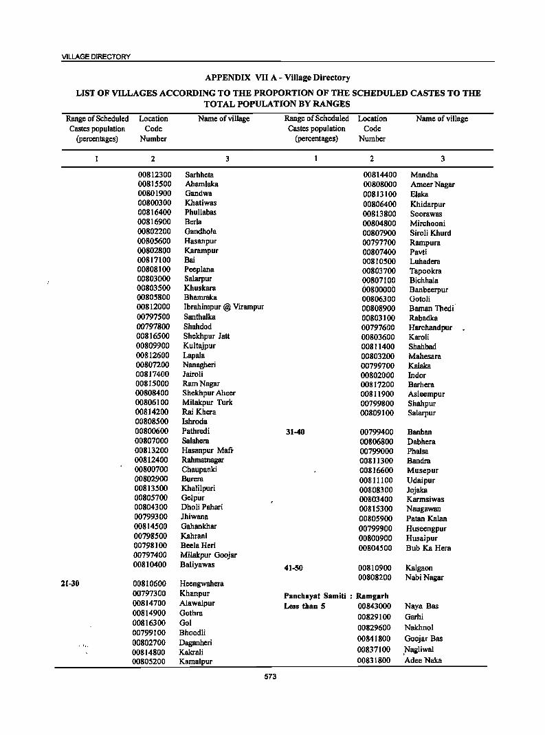
VILLAGE DIRECTORY
APPENDIX VII A - Village Directory
LIST OF VILLAGES ACCORDING TO THE PROPORTION OF THE SCHEDULED CASTES TO THE TOTAL POPULATION BY RANGES
Range of Scheduled Location Name of village Range of Scheduled Location Name of village Castes population Code Castes population Code
(percentages) Number (percentages) Number
2 3 2 3
00812300 Sarhheta 00814400 Mandha 00815500 Ahamlaka 00808000 AmeerNagar 00801900 Gandwa 00813100 Elaka 00800300 Khatiwas 00806400 Khidarpur 00816400 Phullabas 00813800 Soorawas 00816900 Beda 00804800 Mirchooni 00802200 Gandhola 00807900 Siroli Khurd 00805600 Hasanpur 00797700 Rampura 00802800 Karampur 00807400 Pavti 00817100 Bai 00810500 Luhadera 00808100 Peeplana 00803700 Tapookra 00803000 Salarpur 00807100 Bichhala 00803500 Khuskara 00800000 Banbeerpur 00805800 Bhamraka 00806300 Gotoli 00812000 Ibrahimpur @ Virampur 00808900 Baman Thedi 00797500 Santhalka 00803100 Rabadka 00797800 Shahdod 00797600 Harchandpur . 00816500 Shekhpur 1att 00803600 Karoli 00809900 Kultajpur 00811400 Shahbad 00812600 Lapala 00803200 Mahesara 00807200 Nanagheri 00799700 Kalaka 008]7400 Jairoli 00802000 Indor 00815000 Ram Nagar 008]7200 Barhera 00808400 Shekhpur Aheer 0081]900 Asleempur 00806100 Milakpur Turk 00799800 Shah pur 00814200 RaiKhcra 00809100 Salarpur 00808500 Ishroda 00800600 Pathredi 31-40 00799400 Banban 00807000 Salahera 00806800 Dabhera 00813200 Hasanpur Mafi. 00799000 Phalsa 00812400 Rahmatnagar 00811300 Bandra 00800700 Chaupanki 00816600 Musepur 00802900 Burera 00811100 Udaipur 00813500 Khalilpuri 00808300 Jojaka 00805700 Gelpur 00803400 Karmsiwas 00804300 Dholi Pahari 00815300 Naugawan 00799300 Jhiwana 00805900 Patan Kalan 00814500 Gahankhar 00799900 Huseengpur 00798500 Kahrani 00800900 Husaipur 00798]00 BeelaHeri 00804500 Bub Ka Hera 00797400 Milakpur Goojar 008]0400 Baliyawas 41-50 00810900 Kalgaon
00808200 NabiNagar 21-30 00810600 Heengwahera
00797300 Khanpur Panchayat Samiti : Ramgarh 00814700 Alawalpur Less than 5 00843000 Naya Bas 00814900 Gothra 00829100 Garhi 00816300 Gol 00829600 Nakhnol 00799100 Bhoodli
00841800 Goojar Bas 00802700 Daganheri 00814800 Kakrali 00837100 ,Nagliwal
00805200 Kamalpur 00831800 AdeeNaka
573
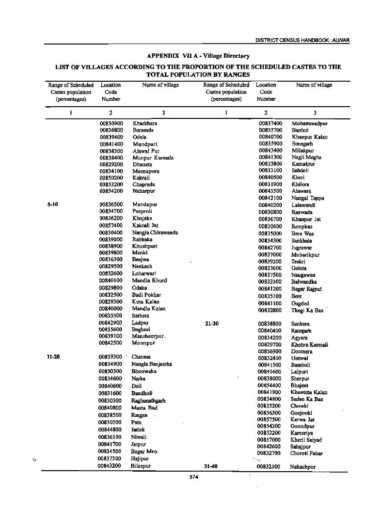
DISTRICT CENSUS HANDBOOK: ALWAR
APPENDIX VII A - Village Directory
LIST OF VILLAGES ACCORDING TO THE PROPORTION OF THE SCHEDULED CASTES TO THE TOTAL POPULA:TION BY RANGES
Range of Scheduled Location Name of village Range of Scheduled Location Name ofvillage Castes population Code Castes population Code
(percentages) Number (percentages) Number
2 3 2 3
00830900 Kharkhara 00837400 Mohammadpur 00836800 Baramda 00835700 Bardod 00839400 Odela 00840700 Kbanpur Kalan 00841400 Mundpuri 00835900 Sonagarh 00838300 Alawal Pur 00843400 Milakpur 00838400 Munpur Karmala 00841300 Nagli Megha 00829200 Dhaneta 00833800 Kamalpur 00834100 Meenapura 00833100 Sahdoli 00850200 Kakrali 00840500 Kheri 00833200 Chaprada 00831900 Khilora 00854200 Naharpur 00843500 Alawara
00842100 Nangal Tappa 5-10 00836500 Mandapur 00840200 Lalawandi
00834700 Peeproli 00830800 Raswada 00836200 Khojaka 00856700 Khanpur Jat 00857400 Kakrali Jat 00830600 Roopbas 00830400 Nangla Chirawanda 00835000 Bera Was 00839000 Rabbaka 00834300 Sankhala 00838900 Khushpuri 00842700 Jugrawar 00839800 Manki 00837000 Mubarikpur 00836300 Bccjwa 00839200 Teem 00829500 Neekach 00833600 Goleta 00832600 Loharwari 00837500 Naugawan 00840100 Mandla Khurd 00833300 Balwandka 00829800 Odaka 00841200 Bagar Rajput 00832500 Badi Pokhar 00835100 Bere 00829300 Kota Kalan 00841100 Gugdod 00840000 Mandla Kalan 00832800 Thegi Ka Bas 00835500 Sarheta 00842900 Ladpur 21-30 00838800 Sunhera 00835600 Baghori 00840400 Ramgarh 00839100 Mansheerpur. 00834200 Agyara 00842500 Moonpur 00829700 Khohra Karmali
00856900 Doomera 11·20 00839300 Chauma 00832400 Untwal
00834900 Nangla Banjeerka 00841500 Bamboli 00850300 Bhoowaka 00841600 Lalpuri 00834600 Narka 00838000 Sherpur 00840600 Doli 00854400 Bhajeet
00831600 Bandholi 00841900 Khunteta Kalan
00830300 Raghunatbgarh 00834800 Sadan KaBas
00840800 Masta Bad 00835200 Chowki
00838500 Rasgan 00856500 Goojooki
00830500 Pata 00857500 Kerwa Jat
00844800 Jadoli 00854300 Goondpur 00832200 Kareeriya
00836100 Niwali 00857000 Kherli Saiyad 00841700 Jatpur 00842600 Sahajpur 00834500 Bagar Meo 00832760 Choroti Pahar
,~ 00837300 Hajipur " '/
00843200 Bilaspur 31-40 00832300 Nakachpur
574
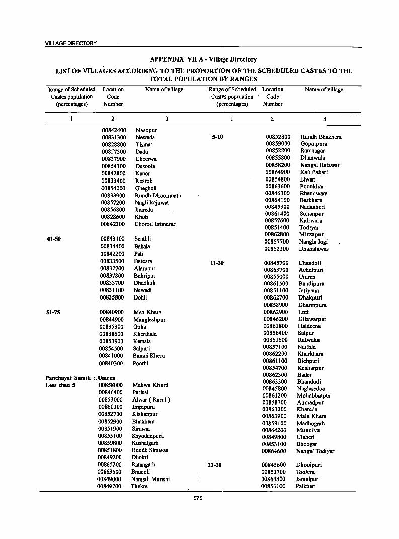
VILLAGE DIRECTORY
APPENDIX VII A - Village Directory
LIST OF VILLAGES ACCORDING TO THE PROPORTION OF THE SCHEDULED CASTES TO THE TOTAL POPULATION BY RANGES
Range of Scheduled Location Name of village Range of Scheduled Location Name of village Castes population Code Castes population Code
(percentages) Number (percentages) Number
2 3 2 3
00842400 Nasopur 00831300 Newada 5-10 00852800 Rundh Bhakhcra 00828800 Tismar 00859000 Gopalpura
·00857300 Dada 00852200 Ramnagar
00837900 Cheerwa 00855800 Dhanwala
00854100 Desoola 00858200 Nangal Ratawat
00842800 Kanor 00864900 Kali Pahari
00833400 Kesroli 00854800 Liwari
00854000 Ghegholi 00863600 Poonkhar
00833900 Rundh Dhooninath 00846300 Bhandwara
00857200 NagJi Rajawat 00864100 Barkhera
00856800 Jhareda 00845900 Nadanheri
00828600 Khoh 00861400 Sohanpur
00842300 Choroti Istmurar 00857600 Kairwara 00851400 Todiyar
Senthli 00862800 Mirzapur
41-50 00843100 00857700 NanglaJogi 00834400 Babala 00852300 Dhahalawas 00842200 Pali 00833500 Batcsra 11-20 00845700 Chandoli 00837700 Alampur 00863700 Achalpuri 00837800 Bahripur 00855000 Umrcn 00833700 Dhadholi 00861500 Bandipura 00831100 Ncwadi 00851100 Jatiyana 00835800 Dohli 00862700 Dhakpuri
00858900 Dharmpura 51-75 00840900 Mco Khcra 00862900 Leeli
00844900 Mangleshpur 00846200 Dilawarpur 00835300 Goha 00861800 Haldccna
00838600 Kherthala 00856400 Salpur
00853900 Kemala 00861600 Ratwaka
00854500 Salpuri 00857100 Naithla
00841000 Bamni Khcra 00862200 Kharkhara
00840300 Poothi 00861100 Bichpuri 00854700 Kesharpur
Panchayat Samiti :. Umren 00862300 Bader 00863300 Bhandodi
Less than 5 00858000 Mabwa Khurd 00845800 Naglascdoo 00846400 Parisal 00853000 Alwar ( Rural )
00861200 Mohabbatpur 00858700 Ahmadpur
00860]00 Impipura 00863200 Khareda 00852700 Kishanpur 00863900 Mala Khera 00852900 Bhakhcra 00859100 Madhogarh 0085]900 Sirawas 00864200 Mundiya 00855]00 Shyodanpura 00849800 Ulaheri 00859800 Kushalgarh 00853100 Bhoogar 0085]800 Rundh Sirawas 00864600 Nangal Todiyar 00849200 Dhokri 00865200 Ratangarh 11-30 00845600 Dhoolpuri 00863500 Bhadoli 00853700 Toolera 00849000 Nangali Munshi 00864300 Jamalpur 00849700 Thekra 00856100 Palkhari
575
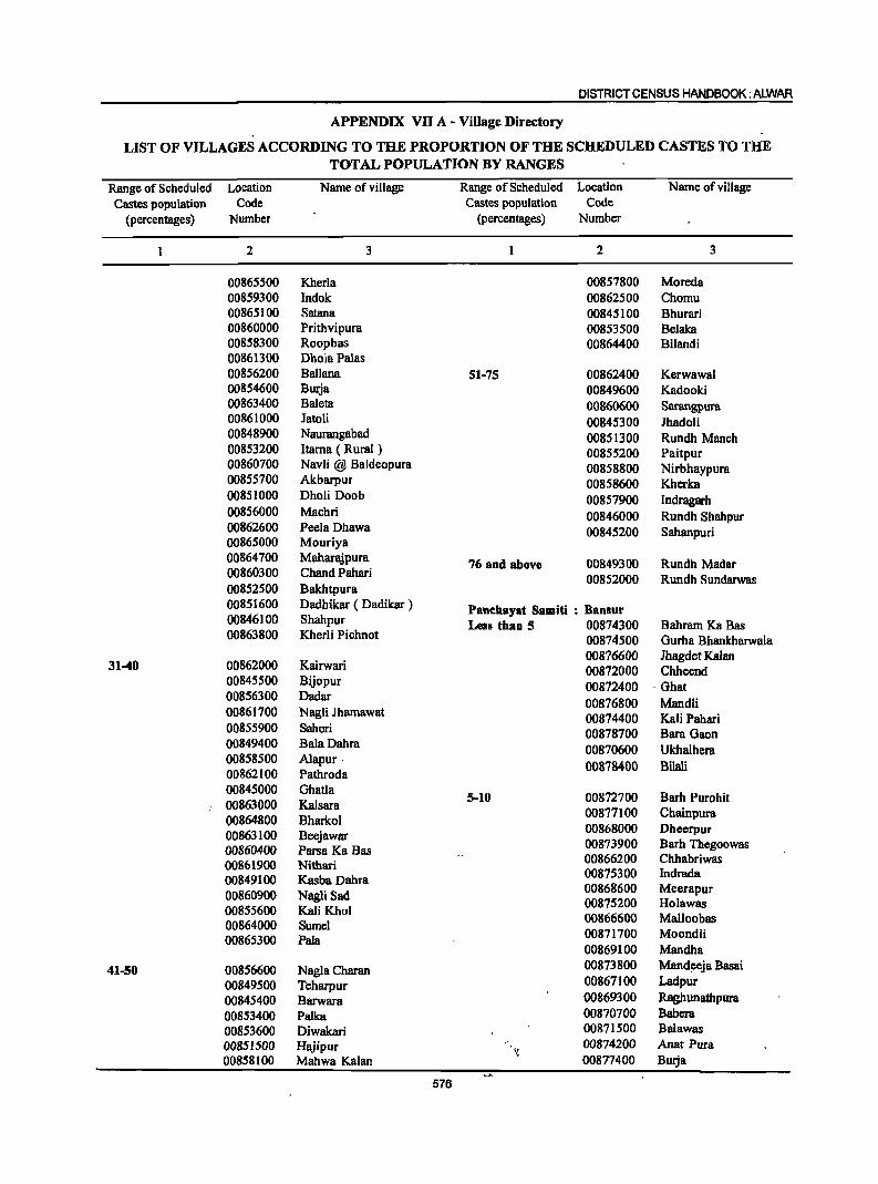
DISTRICT CENSUS HANDBOOK: ALWAR
APPENDIX VII A - Village Directory
LIST OF VILLAGES ACCORDING TO THE PROPORTION OF THE SCHEDULED CASTES TO THE TOTAL POPULATION BY RANGES
Range of Scheduled Location Name of village Range of Scheduled Location Name of village Castes population Code Castes population Code
(percentages) Number (percentages) Number
2 3 2 3
00865500 Kherla 00857800 Moreda 00859300 Indok 00862500 Chomu 00865100 Satana 00845100 Bhurari 00860000 Prithvipura 00853500 Belaka 00858300 Roopbas 00864400 Bilandi 00861300 Dhola Palas 00856200 Ballana 51-75 00862400 Kerwawal 00854600 Burja 00849600 Kadooki 00863400 Baleta 00860600 Sarangpura 00861000 Jatoli 00845300 Jhadoli 00848900 Naurangabad 00851300 Rundh Manch 00853200 ltarna ( Rural ) 00855200 Paitpur 00860700 Navli @ Baldeopura 00858800 Nirbhaypura 00855700 Akbarpur 00858600 Kherka 00851000 Dholi Doob 00857900 Indragarh 00856000 Machri 00846000 Rundh Shahpur 00862600 Peela Dhawa 00845200 Sahanpuri 00865000 Mouriya 00864700 Maharajpura 76 and above 00849300 Rundh Madar 00860300 Chand Pabari 00852000 Rundh Sundarwas 00852500 Bakhtpura 00851600 Dadhikar ( Dadikar ) Panehayat Samiti : Bansur 00846100 Shabpur Less than 5 00874300 Bahram Ka Bas 00863800 Kherli Pichnot 00874500 Gurha Bhanlcharwala
31-40 00862000 Kairwari 00876600 Jhagdet Kalan 00872000 Chheend
00845500 Bijopur 00872400 . Ghat 00856300 Dadar 00876800 Mandli 00861700 Nagli Ihamawat 00874400 Kali Pabari 00855900 Sahori 00878700 Bara Gacn 00849400 BalaDahra 00870600 Ukhalhera 00858500 Alapur· 00878400 Bilali 00862100 Pathroda 00845000 Ghatla
5-10 00872700 Barh Purohit 00863000 Kalsara 00864800 Bharkol
00877100 Chainpura
00863100 Beejawar 00868000 Dheerpur
00860400 Parsa Ka Bas 00873900 Barh Thegoowas
00861900 Nithari 00866200 Chhabriwas
00849100 Kasba Dabra 00875300 Indrada
00860900 Nagli Sad 00868600 MeerapuT
00855600 Kali Khol 00875200 Holawas
00864000 Sumel 00866600 Malloobas
00865300 Pala 00871700 Moondli 00869100 Mandha
41-50 00856600 Nagla Charan 00873800 Mand!=Cja Basai
00849500 Teharpur 00867100 Ladpur
00845400 Barwara 00869300 Raghunathpura
00853400 Palka 00870700 Babera
00853600 Diwakari 00871500 Balawas
00851500 Hajipur >: 00874200 Anat Pura
00858100 Mahwa Kalan 00877400 BuIja
576
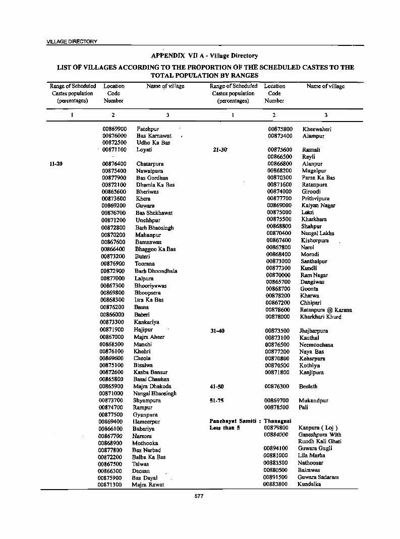
VILLAGE DIRECTORY
APPENDIX VII A - Village Directory
LIST OF VILLAGES ACCORDING TO THE PROPORTION OF THE SCHEDULED CASTES TO THE TOTAL POPULATION BY RANGES
Range of Scheduled Location Name ~f village Range, of Scheduled Location Name of village Castes population Code Castes population Code
(percentages) Number (percentages) Number
2 3 2 3
00869900 Fatehpur 00875800 Kheewaheri 00876000 Bas Karnawat 00873400 Alampur 00872500 Udho Ka Bas 00871100 Loyati 21-30' 00875600 Rasnali
00866500 Rayli 11-20 00876400 Chatarpura 00866800 Alanpur
00875400 Nawalpura 00868200 Mugalpur 00877900 Bas Gordhan 00870300 Parsa Ka Bas 00872100 Dhamla Ka Bas 00871600 Ratanpura 00865600 Bheriwas 00874000 Giroodi 00873600 Khera 00877700 Prithvipura 00869200 Guwara 00869000 Kalyan Nagar 00876700 Bas Shekhawat 00875000 Lekri
00871200 Unchhpur 00875500 Kharkhara
00872800 Barh Bhaosingh 00868800 Shahpur
00870200 Mahanpur 00870400 Nanga! Lakha
00867600 Bamanwas 00867400 Kishorpura
00866400 Bhaggoo Ka Bas 00867800 Narol
00873200 Butcri 00868400 Morodi
00876900 Toorana 00873000 Santhalpur
00872900 Barh Dhoondhala 00877300 Kundli
00877000 Lalpura 00870000 Ram Nagar 00865700 Dangiwas
00867300 Bhooriyawas 00868700 Goonta
00869800 Bhoopsera 00878200 Kharwa 00868300 Isra Ka Bas 00867200 Chhipari 00876200 Basna 00878600 Ratanpura @ Karana 00866000 Baberi 00878000 KharkhariKhurd 00873300 Kankariya 00871900 Hajipur 31-40 00873500 Jhajharpura 00867000 MajraAheer 00873100 Kauthal 00868500 Manchi 00876500 Neemoochana 00876100 Khohri 00877200 Naya Bas 00869600 Choola 00870800 Keharpura 00875100 Bisalwa 00870500 Kothiya 00872600 Kasba Bansur 00871800 Kanjipura 00865800 Basai Chauhan 00865900 Majra Dhakoda 41-50 00876300 Beelath 00871000 Nangal Bhaosingh 00873700 Shyampura 51-75 00869700 Mukandpur 00874700 Rarnpur 00878500 Pali 00877500 Gyanpura 00869400 Harneerpur Panchayat Samiti : Thanagazi
00866100 Babariya Less than 5 00879800 Kanpura ( Loj )
00867700 Harsora 00884000 Ganesbpura Witb
00868900 Mothooka Rundh Kali Ghati
00877800 Bas Narbad 00894100 GuwaTa Gugli
00872200 Balba Ka Bas 00881000 Lila Marha
00867500 Talwas 00883500 Nathoosar
00866300 Deosan 00880500 Bairawas
00875900 Bas Dayal 00891500 Guwara Sadaram 00871300 Majra Rawat 00883800 Kundalka
577
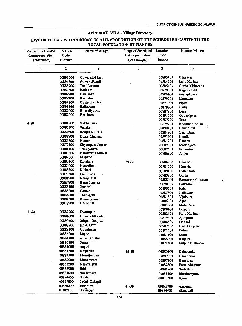
DISTRICT CENSUS HANDBOOK: ALWAR
APPENDIX VB A - Village Directory
LIST OF VILLAGES ACCORDING TO THE PROPORTION OF THE SCHEDULED CASTES TO THE TOTAL POPULATION BY RANGES
Range of Scheduled Location Name of village Range of Scheduled Location Name of village
Castes population Code Castes population Code
(percentages) Number (percentages) Number
2 3 2 3
00893600 Guwara Birkari 00883100 Biharisar 00894500 Guwara Ramji 00884200 Laha Ka Bas 00885700 Todi Luharan 00885400 Gurha Kishordas 00882300 Barh Doli 00879000 Rajpura Sikh 00887900 Kalalanka 00886300 Jaisinghpura 00888200 Banchhri 00879900 Manawas 00889800 ChahaKa Bas 00891000 Piplai 00891100 Balloowas 00878800 Garhi 00882600 Bhoodiyawas 00887800 Dera 00882200 Bas Beesa 00891200 Govindpura
00887200 Toda 5-10 00881800 Bakhatpura 00879700 Kharkhari Kalan
00883700 Siraska 00890400 Hameerpur 00884600 Roopu Ka Bas 00884800 Garh Basai· 00882700 Duhar Chaugan 00891400 Kundla 00884300 Harner 00881700 Bandrol 00879100 Shyampura J ageer 00889600 Madbogarh 00881100 Turkiyawas 00887600 Sanwatsar 00880300 Bamanwas Kankar 00886800 Amka 00882000 Mankot 008~0100 Kolahera 21-30 00886700 Bhadach 00880600 Nangalheri 00881900 Heensla 00888300 Kishori 00889100 Pratapgarh 00879600 Ladoowas 00885300 Gurha 00884900 Nangal Bani 00888000 Bamanwas Chaugan 00880900 Basai J ogiyan 00890000 Lothawas 00885100 Ihankri 00890700 Kaler 00885200 Churani 00885600 Iodhawas 00883600 Thanagazi 00881300 Vijaipura 00887300 Bhooriyawas 00886600 Agar 00878900 Chandpuri 00881500 Malootana
00889300 La\pura 11-20 00882900 Dwarapur 00882400 Kola Ka Bas
00891600 Guwara Naidoli 00879400 Ajabpura 00890500 Jaitpur Goojran 00884500 Dhaital 00887700 Kabli Garh 00882500 Barh Goojran 00888400 Gopalpura 00881600 Dahra 008862.QO Mejod 00883300 Saleta 00884100 Amra Ka Bas 00886000 Raipura 00890800 Samra 00891300 Iaitpur Brahmnan 00885000 Angari 00883200 Dhigariya 31-40 00880700 Duharmala 00885500 Mundiyawas 00889000 Chandpura 00880000 Mundawara 00887400 Bhanwata 00881200 Narayanpur 00882800 Bssai Abhairam 00888900 Jhiri 00891900 Seeli Baori 00888600 Daulatpura 00888500 Bheekampura 00890600 Nitata 00888700 Kyara 00887000 Padak Chhapli 00880200 ·Jo~hpura 41-50 00893700 Ajabgarh 00882100 Surjiinpur 00884400 Bhangdoli
578
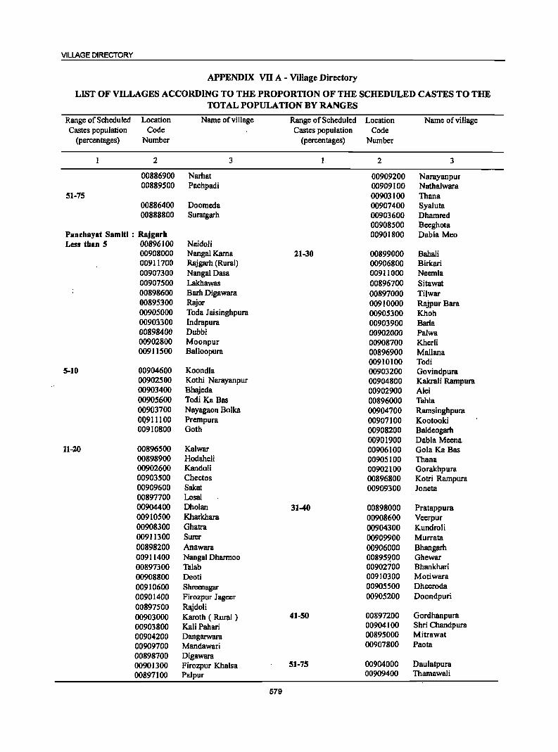
VILLAGE DIRECTORY
APPENDIX VII A - Village Directory
LIST OF VILLAGES ACCORDING TO THE PROPORTION OF THE SCHEDULED CASTES TO THE TOTAL POPULATION BY RANGES
Range of Scheduled Location Name of village Range of Scheduled Location Name of village Castes population Code Castes population Code
(percentages) Number (percentages) Number
2 3 2 3
00886900 Narhat 00909200 Narayanpur 00889500 Pachpadi 00909100 Nathalwara
51-75 00903100 Thana 00886400 Doomeda 00907400 Syaluta 00888800 Suratgarh 00903600 Dhamred
00908500 Beeghota PBnehayat SBmiti : Rajgarh 00901800 Dabla Mea Less than 5 00896100 Naidoli
00908000 Nangal Karna 21-30 00899000 Babali 00911700 Rajgarh (Rural) 00906800 Birkari 00907300 NangalDasa 00911000 Neemla 00907500 Lakhawas 00896700 Sitawat 00898600 Barh Digawara 00897000 Tilwar 00895300 Rajor 00910000 RajpurBara 00905000 Tada Jaisinghpura 00905300 Khoh 00903300 Indrapura 00903900 Barla 00898400 Dubbi 00902000 Palwa 00902800 Moonpur 00908700 Kherli 00911500 Balloopura 00896900 Mallana
00910100 Todi 5-10 00904600 Koondla 00903200 Govindpura
00902500 Kothi Narayanpur 00904800 Kakrali Rampura 00903400 Bhajcda 00902900 Alei 00905600 Todi Ka Bas 00896000 Tahla 00903700 Nayagaon Bolka 00904700 Ramsinghpura OQ911100 Prempura 00907100 Kootooki 00910800 Goth 00908200 Baldeogarh
00901900 Dabla Meena 11-20 00896500 Kalwar 00906100 Gola Ka Bas
00898900 Hodaheli 00905100 Thana 00902600 Kandali 00902100 Gorakhpura 00903500 Cheetos 00896800 Kotri Rampura 00909600 Sakat 00909300 Janeta 00897700 Losal 00904400 Dholan 31-40 00898000 Pratappura 00910500 Kharkhara 00908600 Veerpur 00908300 Ghatra 00904300 Kundroli 00911300 Surer 00909900 Murrata 00898200 Anawara 00906000 Bhangarh 00911400 Nangal Dhannoo 00895!?00 Ghewar 00897300 Talah 00902700 Bhankhari 00908800 Dcoti 00910300 Motiwara 00910600 Shrecnagar 00905500 Dheeroda 00901400 Firozpur Jageer 00905200 Doandpuri 00897500 Rajdoli 00903000 Karoth ( Rural ) 41-50 00897200 Gordhanpura
00903800 Kali Pabari 00904100 Shri Chandpura
00904200 Dangarwara 00895000 Mitrawat
00909700 Mandawari 00907800 Paota
00898700 Digawara 00901300 Firozpur Khalsa 51-75 00904000 Daulatpura
00897100 Palpur 00909400 Thamawali
579
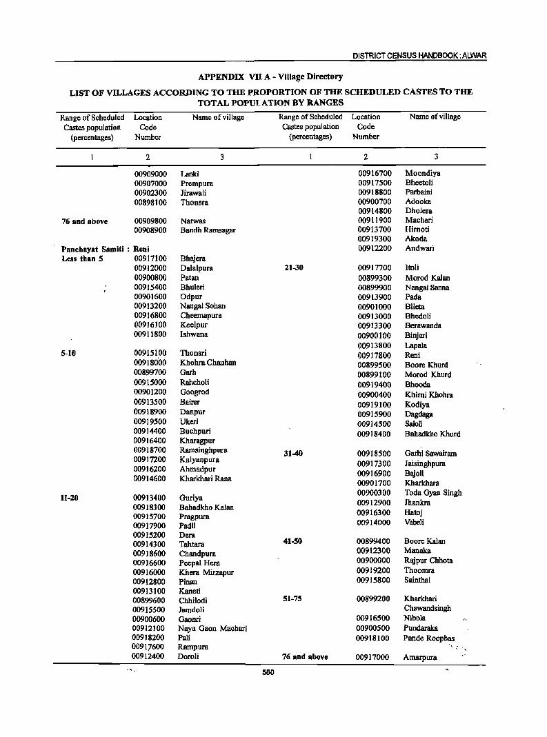
DISTRICT CENSUS HANDBOOK: ALWAR
APPENDIX VII A - ViII8IJe Directory
LIST OF VILLAGES ACCORDING TO THE PROPORTION OF THE SCHEDULED CASTES TO THE TOTAL POPUI.ATION BY RANGES
Range of Scheduled Location Name of village Range of Scheduled Location Name of viII age
Castes population Code Castes population Code (percentages) Number (percentages) Number
2 3 2 3
00909000 Lanki 00916700 Moondiya 00907000 Prempura 00917500 Bheetoli 00902300 lirawali 00918800 Parbaini 00898100 Thonsra 00900700 Adooka
00914800 Dholera 76 and above 00909800 Narwas 00911900 Machari
00908900 Bandh Ramsagar 00913700 Hirnoti 00919300 Akoda
Panchayat Samiti : Ren; 00912200 Andwari Less than 5 00917100 Bhajera
00912000 Dalalpura 21-30 00917700 ltoli 00900800 Patan 00899300 Morod Kalan 00915400 Bhuleri 00899900 Nangal Sanna 00901600 Odpur 00913900 Pada 00913200 Nangal Sohan 00901000 BUeta 00916800 Cheemapura 00913000 Bhedoli 00916100 Keelpur 00913300 Berawanda 00911800 Ishwana 00900100 Binjari
00913800 Lapala 5-10 00915100 Thonsri 00917800 Reni
00918000 Khohra Chauhan 00899500 Boore Khurd 00899700 Garh 00899100 Morod Khurd 00915000 Rahcholi 00919400 Bhooda 00901200 Googrod 00900400 Khimi Khohra 00913500 Bairer 00919100 Kodiya 00918900 Danpur 00915900 Dagdaga 00919500 Ukeri 00914500 SaIoli 00914400 Buchpuri 00918400 Bahadkho Khurd 00916400 Kharagpur 00918700 Ramsinghpura 31-40 00918500 Garhi Sawairam 00917200 Kalyanpura
00917300 Jaisinghpura 00916200 Ahmadpur 00914600 Kharkhari Rana
00916900 Bajoli 00901700 Kharkhara
11-20 00913400 Guriya 00900300 Toda Gyan Singh
00918300 Bahadkho Kalan 00912900 Ihankra
00915700 Pragpura 00916300 Hatoj
00917900 Padli 00914000 Vabeli
00915200 Dera 00914300 Tahtara 41-50 00899400 BooreKalan
00918600 Chandpura 00912300 Manaka
00916600 Peepal Hera 00900000 Rajpur Chhota
00916000 Khera Mirzapur 00919200 Thoomra
00912800 Pinan 00915800 Sainthal
00913100 Kaneti 00899600 Chhilodi 51-75 00899200 Kharkhari
00915500 lamdoli Chawandsingh
00900600 Gaonri 00916500 Nibola 00912100 Naya Gaon Machari 00900500 Pundaraka 00918200 Pali 00918100 Pande Roopbas 00917600 Rampura ",: "., 00912400 Doroli 76 aDd above 00917000 Amarpura
580
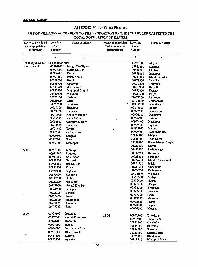
VILLAGE DIRECTORY
APPENDIX VII A - Village Directory
LIST OF VILLAGES ACCORDING TO THE PROPORTION OF THE SCHEDULED CASTES TO THE TOTAL POPULATION BY RANGES
Range of Scheduled Location Name of village Range of Scheduled Location Name of village Castes population ·Code Castes population Code
(percentages) Number (percentages) Number
2 3 2 3
Panehayat Samiti : Laehhmangarh 00933000 Mojpur Less than 5 00926800 NangJi Tarf Bayra 00922500 Salarpur
00927000 Malia Ka Bas 00844700 Chidwai 00934800 Deewli 00929000 Jamalpur 00921300 Palan Khera 00920000 Kherli Bahadar 00930000 Baroli 00928800 Sahadka 00938500 Amarpur 00932200 Thumrela 00931500 Gor Pahari 00919800 Harsoli 00923500 Mundpuri Khurd 00937200 Uchhar 00927900 Melkheri 00926500 Imiya 00920100 Shahpur 00923200 Pathroda 00928000 Resti 00924800 Chimanpura 00923700 Beedooka 00938700 Bheekhaheri 00935800 Shekhpur 00843900 Indpur 00922100 Badwara 00922600 SemlaKhurd 00919900 Khera Mahmood 00926000 Dusrahera 00937000 Namol Khurd 00926600 Hajipur 00932800 Chimrawali Gorh 00933400 Hasanpur 00938000 Jhalatala 00922900 Bajheri 00921400 Teekri 00935100 Kajota 00932300 Gothri Guru 00929300 Raghunath Bas 00929500 Hingota 00844300 Malpur 00937700 Sunari 00935600 Toda Nagar
00933300 Manjapta 00938400 Khera Mangal Singh 00920600 Doroli
5-10 00924000 Marakpur 00931300 Lachhmangarh 00921900 Rarnwas 00930200 Kanwara 00937600 Kali Pahari 00928400 Nenapur 00919600 Naswari 00927600 Kherli Chandrawat 00928600 Bai Ka Bas 00924700 Imlali 00843700 Tilwar 00920500 Saidampur 00921000 AIghana 00929700 Kafanwara
00935400 Kachawa 00935000 Malawali
00938200 Gothra 00926300 Moliya
00927800 Mokalheri 00920400 Nyana
00929900 Nangal Khanjadi 00922200 Dongri
00844200 Sahajpur 00936100 Bichgaon
00926200 Bandka 00928200 Barawas
00925400 SeetaI 00927200 Jawli
00925500 Mahlakpur 00927300 Mahrana
00920800 Kaimasa 00923800 Phahri
00929200 Sorai 00920700 Pagseri 00934500 Harsana
11-20 00925100 Butyana 21-30 00932100 Dwarkpur 00932000 Gotbri Purohitan
00928700 Boontoli 00937300 Bhoor Pahari 00921200 Gandeeka
00927700 Badka 00844600 Barwada 00934600 Jona Khcra Pahar 00844100 Singraka 00923000 Bhainsrawat 00933100 Kherli Lodha 00927500 Ratawali 00926900 Khudiyana 00920300 Agaraka 00919700 Mundpuri Kalan
581
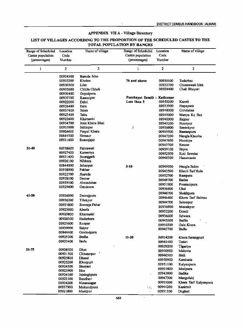
DISTRICT CENSUS HANDBOOK: ALWAR
APPENDIX VII A - Village Directory
LIST OF VILLAGES ACCORDING TO THE PROPORTION OF THE SCHEDULED CASTES TO THE TOTAL POPULATION BY RANGES
Range of Scheduled Location Name of village Range of Scheduled Location Name of village Castes population Code Castes population Code
(percentages) Number (percentages) Number
2 3 2 3
00924500 Baroda Meo 00935200 Khohm 76 and above 00930100 Todarbas 00930300 Lilee 00932700 Chimmwali Sikh 00932600 Chhila Chhoh 00924400 Chak Bhayari 00930400 Gopalpura 00935700 Rasoolpur Panchayat Sam!ti : Kathumar 00922000 Dabri Less than 5 00950200 Kaneti 00926400 Item 00933900 Napapara 00937400 Sehra 00948000 Gundabas 00923400 Taira 00949000 Manya Ka Bas 00923600 Kharsanki 00940000 Rajpur 00934700 lona Khera Bhai 00945200 Noorpur 00935900 Salimpur ~~ 00936800 Santokpur 00924600 Peepal Khera 00939500 Bamanpum 00844500 Sirmaur 00947200 Nangla Khooba 00931600 Roneejajat 00947600 Nooniya
00943700 Ranota 31-40 00938600 Pahrawati 00939100 Bayra
00927400 Kareeriya 00952500 Kuti Sawdas 00931400 Soomjgarh 00940300 Hanumanta 00926100 Nibhera 00844000 Jahanpur 5-10 00949500 Nangla Jadoo 00938900 Pakhar 00943500 Kherli Tarf Rela 00922700 Jhareda 00952700 Rampura 00928100 Deenar 00948700 Badsu 00929100 Ahmadabas 00951900 Preetampura 00929400 Gandoora
00936400 Uksi
41-50 00936000 Deorajpura 00946700 Shckbpura 00946400 Khera Tarf Bahtoo
00936200 Tilakpur 00944700 Salempur
00931800 Roneeja Pahar 00936900 Manakpur
00925000 Kherla 00952200 DoroH 00929800 Kharsanki 00936600 Jatwara 00928300 Hadarhera 00942600 Badka 00925600 Ronpur 00950300 Gala Khera 00939000 Saipur 00945700 Badia 00844400 Govindpura 00925300 Bedha 11-20 00934200 Khem Sarangpuri 00932400 Berla 00941400 Teekri
00939200 Tigariya 51-75 00928500 Ghat 00930900 Makreta
00921500 Chhatarpur ,
00940500 BisH 00925800 Dhand 00950900 Katahada 00925200 Khorpuri
00951100 Kalyanpura 00924300 Bhayari 00923900 Itka 00951800 Medpura
00924100 Jaisinghpum 00943800 Badika
00923100 Bandheri 00947300 Mangolakj
00924200 Nizamnagar 00951000 Khera Tarf Kalyanpura 00937900 Mukundpura ·'')'·1 00944200 Kankroli 00921800 Mastpuf 00951300 Dughati
582
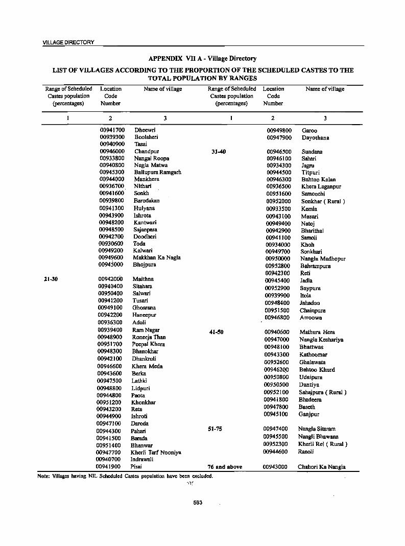
VILLAGE DIRECTORY
APPENDIX VII A - Village Directory
LIST OF VILLAGES ACCORDING TO THE PROPORTION OF THE SCHEDULED CASTES TO THE TOTAL POPULATION BY RANGES
Range of Scheduled Location Name ofvilJage Range of Scheduled Location Name ofvilJage Castes population Code Castes population Code
(percentages) Number (percentages) Number
2 3 2 3
00941700 Dheewri 00949800 Garoo 00939300 Boolaheri 00947900 Dayothana 00940900 Tasai 00946000 Chandpur 31-40 00946500 Sundana 00933800 NangaJ Roopa 00946100 Sahari 00940800 Nagla Matwa 00934300 Jagru 00945300 Ballupura Ramgarh 00944500 Titpuri 00944000 Mankhera 00946300 Bahtoo Kalan 00936700 Nithari 00936500 Khera Laganpur 00941600 Sonkh 00951600 Samoochi 00939800 Barodakan 00952000 Sonkhar ( Rural ) 00941300 Hulyana 00933500 Kemla 00943900 lshrota 00943100 Masari 00948200 Kantwari 00949400 Natoj 00948500 Sajanpara 00942900 Bharithal 00942700 Doodheri 00941100 Samoli 00930600 Toda 00934000 Khoh 00949200 Kalwari 00949700 Sonkhari 00949600 Makkhan Ka Nagla 00950000 NangJa Madhopur 00945000 Bhojpura 00952800 Bahrampura
00942300 Reti 11-30 00942000 Maithna 00945400 Jadla
00940400 Sitahara 00952900 Saypura 00950400 Salwari 00939900 Itola 00941200 Tusari 00948400 Jahadoo 00949100 Ghosrana 00951500 Chainpura 00942200 Haneepur 00946800 Arroowa 00936300 Adoli 00939400 Ram Nagar 41-50 00940600 Mathura Hera 00948900 Roneeja Than 00947000 Nangla Keshariya 0095]700 Peepal Khera 00948100 Bhattwas 00948300 Bhanokhar 00943300 Kathoomar 00942100 Dhankroli 00952600 Ghalawata 00946600 Khera Meda 009462QO Bahtoo Khurd 00943600 Berka 00947500 Lathki
00950800 Udaipura
00948800 Lidpuri 00950500 Dantiya
00944800 Paota 00952100 Sahajpura ( Rural)
0095]200 Khonkhar 0094]800 Bhadeera
00943200 Reta 00947800 Baseth
00944900 Ishroti 00945100 Ganjpur
00947100 Daroda 00944300 Pahari 51-75 00947400 Nangla Sitaram
00941500 Barada 00945500 Nangli Bhawana
00951400 Bhanwar 00952300 Kherli Rei ( Rural)
0094.7700 Kherli Tarf Nooniya 00944600 RanoH 00940700 Indrawali 00941900 Pisai 76 and above 00943000 Chahori Ka Nangla
Note: Villages having NIL Scheduled Castes population have been excluded. ·,1:'
583
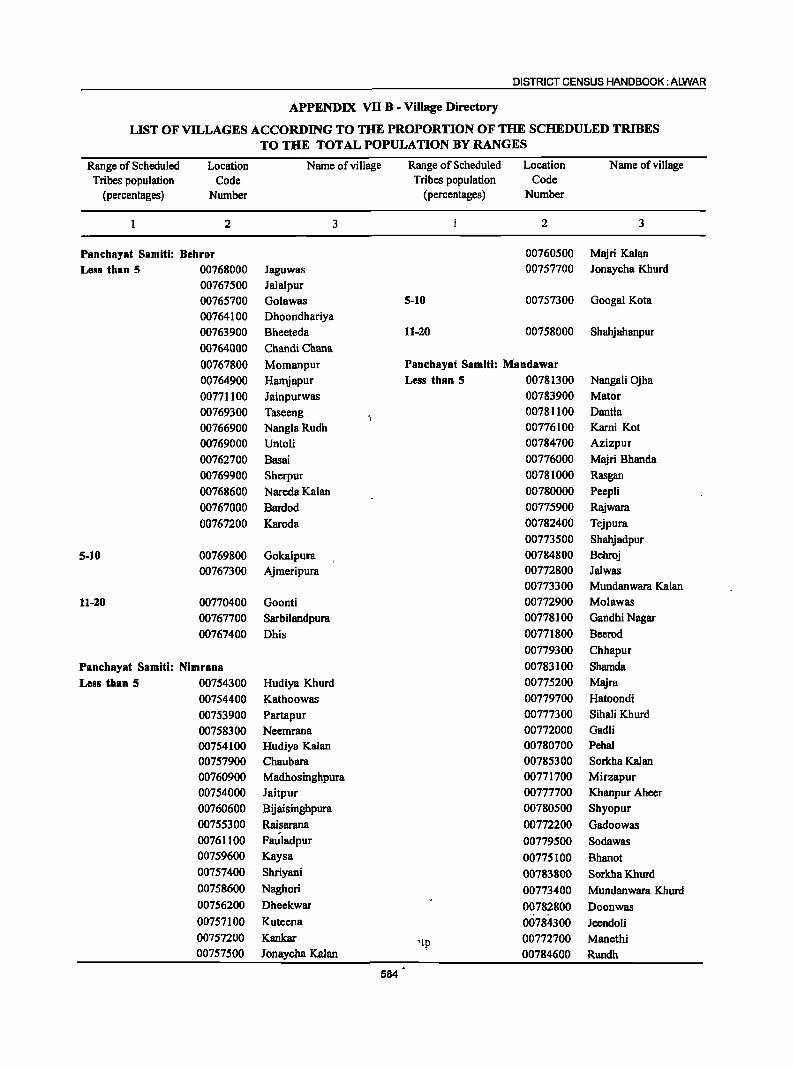
DISTRICT CENSUS HANDBOOK: ALWAR
APPENDIX VII B - Village Directory
LIST OF VILLAGES ACCORDING TO THE PROPORTION OF THE SCHEDULED TRIBES TO THE TOTAL POPULATION BY RANGES
Range of Scheduled Tribes population
(percentages)
Location Code
Number
2
Panchayat Samiti: Dehror Less than 5 00768000
00767500 00765700 00764100 00763900
00764000
00767800 00764900
00771100 00769300 00766900 00769000
00762700 00769900
00768600 00767000 00767200
5-10 00769800 00767300
11-20 00770400 00767700
00767400
Panchayat Samiti: Nimrana
Less than 5 00754300
00754400 00753900 00758300 00754100 00757900 00760900 00754000 00760600 00755300 00761100 00759600
00757400
00758600
00756200
00757100
00757200 00757500
Name of village
3
Jaguwas Jalalpur Golawas Dhoondhariya Bheeteda Chandi Chana
Mornanpur Hamjapur Jainpurwas Taseeng NanglaRudh Untoli
Basai Sherpur Nareda Kalan
Bardod Karoda
Gokalpura Ajrneripura
Goonti SarbiJandpura
Dhis
Hudiya Khurd
Kathoowas Partapur Neemrana Hudiya Kalan Chaubara Madhosinghpura Jaitpur Bijaisinghpura Raisarana Fauladpur Kaysa
ShriYlll1i
Naghori
Dheekwar
Kuteena
Kankar Jonaycha Kalan
584
RWlge of Scheduled Tribes population
(percentages)
5-10
11-20
Location Code
Number
2
00760500 00757700
00757300
00758000
Panchayat Samiti: Mandawar Less than 5 00781300
00783900 00781100 00776100 00784700
00776000 00781000 00780000 00775900 00782400
00773500 00784800 00772800 00773300 00772900 00778100
00771800
00779300
00783100 00775200
00779700 00777300 00772000 00780700 00785300 00771700 00777700 00780500
00772200
00779500
00775100
00783800
00773400
00782800 00784300
'to 00772700 ;
00784600
Name of village
3
Majri Kalan Jonaycha Khurd
Googal Kota
Shahjahanpur
NWlgali Ojha Mator Dantla Kami Kot Azizpur Majri Bhanda
Rasgan Peepli Rajwara Tejpura
Shahjadpur Behroj Jalwas Mundanwara Kalan Molawas Gandhi Nagar
Beerod
Chhapur
Shamda Majra
Hatoondi Sihali Khurd Gadli Pebal Sorkha Kalan Mirzapur Kbanpur Aheer Shyopur
Gadoowas
Sodawas
Bhanot
Sorkha Khurd
Mundanwara Khurd
Doonwas
Jeendoli Manethi Rundh
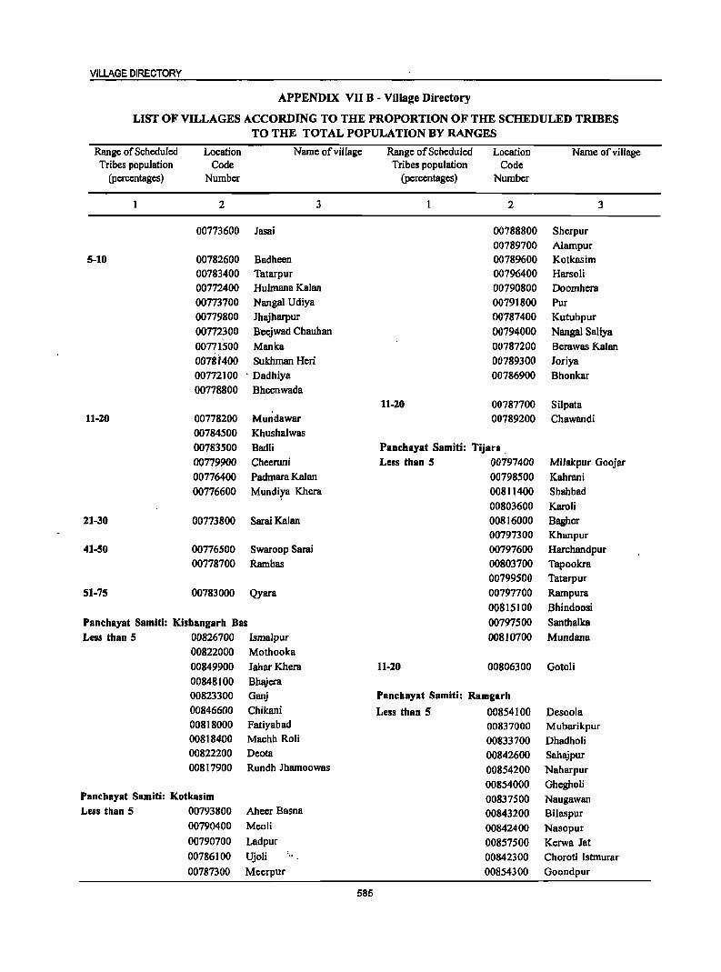
VILLAGE DIRECTORY
APPENDIX VO B - Village Directory
LIST OF VILLAGES ACCORDING TO THE PROPORTION OF THE SCHEDULED TRIBES TO THE TOTAL POPULATION BY RANGES
Range of Scheduled Location Name of village Range of Scheduled Location Name of village Tribes population Code Tribes population Code
(percentages) Number (percentages) Number
2 3 2 3
00773600 Jasai 00788800 Sherpur
00789700 Alampur
5-10 00782600 Badheen 00789600 Kotkasim
00783400 Tatarpur 00796400 HarsoH
00772400 Hulmana Kalan 00790800 Doomhera
00773700 Nangal Udiya 00791800 Pur
00779800 Jhajharpur 01}787400 Kutubpur
00772300 Beejwad Chauhan 00794000 Nangal SaJiya
00771500 Manka 00787200 Bemwas Kalan
0078i400 Sukhman Heri 00789300 Joriya
00772100 ' Dadhiya 00786900 Bhonkar
00778800 Bheenwada
11-20 00787700 Silpata , 11-20 00778200 Mundawar 00789200 Chawandi
00784500 Khushalwas
00783500 Badli Panchayat Samiti: Tijara ,
00779900 Cheeruni Less than 5 00797400 Milakpur Goojar
00776400 Padmara Kalan 00798500 Kahrani
00776600 Mundiya Khera 00811400 Shahbad
00803600 Karoli
21-30 00773800 SaraiKalan 00816000 Baghor
00797300 Khanpur
41-50 00776500 Swaroop Sarai 00797600 Harchandpur
00778700 Rambas 00803700 Tapookra
00799500 Tatarpur
51-75 00783000 Qyara 00797700 Rampura
00815100 Bhindoosi
Panchayat Samiti: Kishangarh Bas 00797500 Santhalka
Less than 5 00826700 Ismalpur 00810700 Mundana
00822000 Mothooka
00849900 Jahar Khera 11-20 00806300 Gotoli
00848100 Bhajera
00823300 Ganj Panchayat Samiti: Ramgarh
00846600 Chikani Less than 5 00854100 Desoola 00818000 Fatiyabad 00837000 Mubarikpur 00818400 Machh Roli 00833700 Dhadholi 00822200 Deota 00842600 Sahajpur 00817900 Rundh Jhamoowas 00854200 Naharpur
00854000 Ghegholi Panchayat Samiti: Kotkasim 00837500 Naugawan Less than 5 00793800 Aheer Basna 00843200 BUaspur
00790400 Meoli 00842400 Nasopur 00790700 Ladpur 00857500 Kerwa Jat 00786100 Ujoli
: " 00842300 Choroti Istmurar
00787300 Meerpur 00854300 Goondpur
585
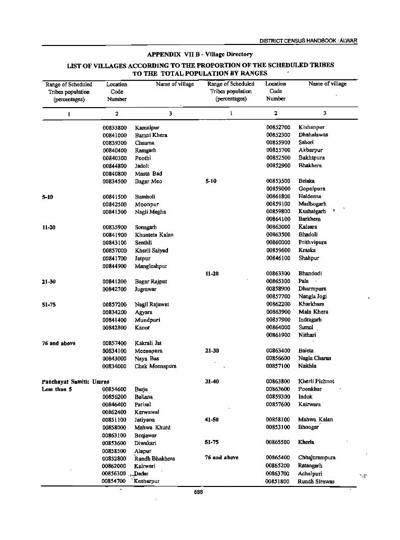
DISTRICT CENSUS HANDBOOK: ALWAR
APPENDIX VII B - Village Directory
LIST OF VILLAGES ACCORDING TO THE PROPORTION OF THE SCHEDULED TRIBES
TO THE TOTAL POPULATION BY RANGES
Range of Scheduled Location Name of village Range of Scheduled Location Name of village
Tribes population Code Tribes population Code (percentages) Number (percentages) Number
2 3 2 3
00833800 Kamalpur 00852700 Kishanpur
00841000 BamniKhera 00852300 Dhahalawas
00839300 Chauma 00855900 Sahori
00840400 Ramgarh 00855700 Akbarpur
00840300 Poothi 00852500 Bakhtpura
00844800 Jadoli 00852900 Bhakhera
00840800 Masta Bad 00834500 Bagar Meo 5-10 00853500 Belaka
00859000 Gopalpura
5-10 00841500 Bamboli 00861800 Haldeena
00842500 Moonpur 00859100 Madbogarh
00841300 Nagli Megba 00859800 Kushalgarb • 00864100 Barkhera
11-20 00835900 Sonagarh 00863000 Kalsara
00841900 Khunteta Kalan 00863500 Bhadoli
00843100 Senthli 00860000 Prithvipura
00857000 Kherli Saiyad 00859600 Kraska
00841700 Jatpur 00846100 Shahpur
00844900 Mangleshpur 11-20 00863300 Bhandodi
21-30 00841200 Bagar Rajput 00865300 Pala
00842700 Jugrawar 00858900 Dbarmpura 00857700 NanglaJogi
51-75 00857200 Nagli Rajawat 00862200 Kharkhara
00834200 Agyara 00863900 " Mala Khera
00841400 Mundpuri 00857900 Indragarh
00842800 Kanor 00864000 Sumel 00861900 Nithari
76 and above 00857400 Kakrali Jat
00834100 Meenapura 21-30 00863400 Baleta
00843000 Naya Bas 00856600 Nagla Charan
00834000 Chak Meenapura 00857100 Naithla
Panchayat Samiti: Umren 31-40 00863800 Kberli Pichnot
Less than 5 00854600 Butja 00863600 Poonkhar
00856200 BaUana 00859300 Indok 00846400 Parisa! 00857600 Kairwara 00862400 Kerwawal 00851100 Jatiyana 41-50 00858100 Mahwa Kalan
00858000 Mahwa Khurd 00853100 Bhoogar
00863100 Beejawar
00853600 Diwakari 51-75 00865500 Kherla
00858500 Alapur 00852800 "Rundh Bbakhera 76 and above 00865400 Chhajurampura
00862000 Kairwari 00865200 Ratangarh
00856300 .t_padar 00863700 Achalpuri ~ :-
00854700 'Kesharpur 00851800 Rundh Sirawas
586
VILLAGE DIRECTORY
APPENDIX VII B - Village Directory
LIST OF VILLAGES ACCORDING TO THE PROPORTION OF THE SCHEDULED TRffiES TO THE TOTAL POPULATION BY RANGES
Range of Scheduled Location Name of village Range of Scheduled Location Name of village Tribes population Code Tribes population Code
(percentages) Number (percentages) Number
2 3 2 3
00872500 Udho Ka Bas Panchayat Samiti: Bansur 00869600 Choola Less than 5 00877100 Chainpura 00875300 Indrada
00875400 Nawalpura 00874900 Nathoosar 00873400 Alampur 00875100 Bisalwa 00866000 Baberi 00875000 Lekri 00876100 Khohri
00869300 Raghunathpura 11-20 00867700 Harsora 00872000 Chheend 00868100 Khatauti 00868700 Goonta 00877000 Lalpura 00873800 Mandeeja Basai 00869400 Hameerpur 00876500 Neemoochana 00874700 Rampur 00878400 BHaH 00876400 Chatarpura 00866100 Babariya 00873900 Barh Thegoowas 00877700 Prithvipura 00869900 Fatehpur
00873500 Ihajharpura 00875900 Bas Dayal-00878600 Ratanpura @ Karana 00874500 Gurha Bhankharwala 00870800 Keharpura 00876900 Toorana
00865900 Majra Dhakoda 00865800 Basai Chauhan
00869000 Kalyan Nagar 00871000 Nangal Bhaosingh 00873600 Khera 00873000 Santhalpur 21-30 00877300 Kundli
,..-- 00869800 Bhoopsera 00876700 Bas Shekhawat 31-40 00867900 Bawali Ka Bas 00871500 Balawas
00871900 Hajipur 51-75 00869100 Mandha 00878700 Bara Gaon
00866800 Alanpur Panchayat Samiti: Thanagazi
00873200 Buteri Less than 5 00880000 Mundawara
00876800 Mandli 00884100 Amra Ka Bas 00875600 Rasnali 00880700 Duharmala
00868800 Shahpur 00884400 BhangdoJi 00873100 Kauthal 00879000 Rajpura Sikh
00872600 Kasba Bansur 00885400 Gurha Kishordas
00872800 Barh Bhaosingh 00889600 Madhogarh
00870700 Babera 00894000 Guwara Bandipul 00884200 Laba Ka Bas
5-10 00871200 Unchhpur 00882600 Bhoodiyawas
00865700 Dangiwas 00878900 Chandpuri
00868900 Mothooka 00882700 Duhar Chaugan
1 00876000 Bas Karnawat 00883700 Siraska
'. 00870200 Mahanpur 00880900 Basai Jogiyan 00874000 Giroodi 00879800 Kanpura ( Loj )
00866900 Basai Narooka 00879400 Ajabpura
00872900 Barh Dhoondhala 00883600 Thanagazi
00875200 Holawas 00881600 Dahra
00877500 Gyanpura 00884300 Hamer
587
DISTRICT CENSUS HANDBOOK: ALWAR
APPENDIX VII B - Village Directory
LIST OF VILLAGES ACCORDING TO THE PROPORTION OF THE SCHEDULED TRIBES TO THE TOTAL,POP-ULATION BY RANGES
Range of Scheduled Tribes population
(percentages)
Location Code
Number
Name of village
2 3
5-10 .0.0881200 Narayanpur .00881300 Vijaipura
.00880200 Jodhpura
00880600 Nangalheri
0088210.0 Surjanpur
0088450.0 Dhaital
00881000 Lila Marha
00881500 Malootana 00880800 Tolawas
00881700 Bandrol
008_8610.0 Shyampura ~ .. " Co v OQ882000 Mankot
00884600· Roopu Ka Bas
00882300 Barh Doli
"'~~ " off." 00819900 Manawas
• : -'~!...;, 00882400 Kola Ka Bas
·",'l·~~~~ 0087.880D~ Garhi ',' .. • ~_-f.l'!': ti _ 00880100 Kolahera
.. ~.' 00883500 Nathoosar
11-20 '.'.~) 00882200 Bas Beesa
00887300 Bhooriyawas
., '- 00892700 Guwara Hanuman
00889500 Pachpadi
. -i.~~ ~.~~ 008~~3~!l '. Jaitpur Brahmnan
00883100 Biharisar
0088~80D:{,;.: Basai !Abhairam . _' , :" ;~:- 00a~480p ,";: Garh Basai
••• ·1;10: OO,~886.00 .~~ Daulatpura ,_ ~ __ ~. ,",
-;' - 'r.:"n,,-: 00893700'" Ajabgarh
~\. ,·."0 '~I. '~ .. : 00~8~2O:0 ": Dhigariya
." .~ , 008'84900 Nangal Bani
-.:. ! :"".~l.!!-.• 00B~88GP Suratgarh
: ... -t'i;~:\q· 008880.00 Bamanwas Chaugan
.t, J.~-~.~- : ~!":.:,' 00889.100 Pratapgarh
:'o! t.,:'i.~ ~r;...:" 008829.00 Dwarapur , 00886900 ' Narhat .' ''(fli~ , ,~<!;.-l! •
...... ~ - ~ -~. 00882~00 Barh Goojran
.tH-~d~· ;'v,'f,;,l{i 00~~8~~Q",. Bheekampura ,. 008833.00 Saleta
(~-' . ~. .. 00883800 Kundalka
.- .~. t':!i'.t-~:-;-~ t;. 00883000 Rajpura Jageer
2i-30 ·'~'i~,Pl'~ .. ~·l.r::~\ _ ($ ft i •.• :.'~' ;~ ;'.,." ; J ' '00883,?~0 Kama Ka Bas
, ,. '" 00888300. Kishori 't'~~·hr 'l'!'. ~ .. ~. -,~~
,''';';''::''rr:!:? .OO~.~5300,.,r Gurha ... "~._.,, __ "...... .... _ T- , ~ ....... ",,_ ...
~ ... --~ . 588
Range of Scheduled Tribes population
(percentages)
Location Code
Number
Name of village
2 3
00886600 Agar
00880300 Bamanwas Kankar
00879100 Shyampura Jageer
00881900 Heensla
3140 00891000 Piplai
00891100 Balloowas
00886400 Doomeda 00883400 • Guwara Bhopala
41-50 00881800 Dera . 00888100 'HodayJi
00887000 Padak Chhapli
00890400 Hameerpur
00889300 Lalpura
00888900 Jhiri
00886700 Bhadach . .... " ~ . 00891900,·· Seeli Baori
51-75 00894100 Guwara GugJi
00890800 Sanua 00887100 ' Kabli Garh
., ... , , " oo891t400~' Kundla .' ,., <
" " 00891700." Guwara Kalyan
OQ888~OO Kyara ..... ~." e')', 00890-900 .,v Jagannathpura
; , ,-;' 00891~00'r, Guwara Naidoli
"'i..," " ~ 008907.o0!t Kaler
" ~ 00890000"':'- Lothawas . - ~ ..... ,', . 00~8~400, . Gopalpura
00885200 ' , Churani
, ,., 008857:00,;" Todi Luharan 00889600' ,. Chandpura
, 00886300" Jaisinghpura • I' 008879.00,' Kala1anka
00886200: Mejod
76 and above 00890600 ' Nitata
00891500. Guwara Sadaram . ' >,~" '-:, 0088~,60(r%_': Sanwatsar
'00891200 . Govindpura
00885'000. Angari , 00885500. . Mundiyawas,
:,' '. ::fr ;.,;.y088~200.',:,·Banchhri " .. , . , ,,- 008935.00.'f: Guwara Soti
" .... :, : 0089i!~90~, Guwara Har1i --";7 .. ~. ·00892200f·.: ·Guwara Bhooriyawali
VILLAGE DIRECTORY
APPENDIX VII B - Village Directory
LIST OF VILLAGES ACCORDING TO THE PROPORTION OF THE SCHEDULED TRIBES TO THE TOTAL POPULATION BY RANGES
Range of Scheduled Location Name of village Range of Scheduled Location Name of village Tribes population Code Tribes population Code
(percentages) Number (percentages) Number
2 3 1 2 3
00885100 Ihankri 00897800 Umri Deori 00889800 ChahaKa Bas 00902400 Murlipura 00893400 Guwara J amadar 11-30 00892100 Guwara Kundal 00899000 Bahali 00892500 . Guwara Dhasi 00903100 Thana 00894500 Guwara Ramji 00903700 Nayagaon Bolka 00893600 Guwara Birkari 00897300 Talab 00892400 Guwara Seera 00903600 Dhamred 00892900. Guwara Kalot 00906700 Pemawala 00893000 Guwara Bhagwan 00911000 Neemla 00894200 Guwara Radi 00909400 Thamawali 00894400 Guwara Nirbha 00904700 Ramsinghp'l:lra
Panchayat Samiti: Rajgarh 00911700 Rajgarh (RurilI) Less than 5 00911100 Prempura
00904200 Dangarwara 00909300 Joneta :~:;_:-... ~1-.
00910600 Shreenagar 00905300 Khoh 00906300 Sitapura 00904100 Shri Chan4pura
.:-:.' 00897500 Rajdoli 00901400 Firozpur lageer 00898100 Thonsra 00902500 Kothi Nar~yanpur 00905200 Doondpuri 00908800 Dcoti 00910700 Nayabas Havcli (Rural) 31-40 00906600 Damodar Ka Bas 00910800 Goth 00902100 Gorakhpura 00904000 Daulatpura 00908200 .' Baldeogarh 00909900 Murrata 00907400. Syaluta 00902700 Bhankhari 00906800 Birkari 00896500 Kalwar 00895900 Ghewar 00909600 Sakat
5-10 00897600 Roopbas 00909200 Narayanpur 00896400 Garh 00910000 Rajpur Bara 00909700 Mandawari 00896300 Dabkan 41-50 00896800 Kotri Rampura 00898600 Barh Digawara 00904800 Kakrali Rampura 00909000 Lanki
00903200 Govindpura 00897000 Tilwar 00906100 GolaKa Bas 00908700 Kherli 00905500 Dheeroda 00895000 Mitrawat 00903500 Cheetos 00908500 Beeghota
11-10 00901800 Dabla Meo 00896000 Tahla 00898700 Digawara 00911500 Balloopura 00905600 Todi Ka Bas 00910300 Motiwara 51-75 00906000 Bhangarh 00902800 Moonpur 00903000 Karoth ( Rural ) 00911400 Nangal Dharmoo 00908300 Ghatra 00910500 Kharkhara 00905100 Thana 00896700 Sitawat ,. 00898900 Hodaheli 00898200 Anawara 00902000 Palwa 00911300 Surer
589
DISTRICT CENSUS HANDBOOK: ALWAR
APPENDIX VII B - Village Directory
LIST OF VILLAGES ACCORDING TO THE PROPORTION OF THE SCHEDULED TRIBES TO THE TOTAL POPULATION BY RANGES
Range of Scheduled Location Name of village Range of Scheduled Location Name ofvillage Tribes population Code Tribes population Code
(percentages) Number (percentages) Number
2 3 2 3
00904500 Kooncha Chawandsingh 00903800 Kali Pahari 5-10 00903400 Bhajeda 00919300 Akoda 00904300 Kundroli 00912900 Ihankra 00898000 Pratappura 00917000 Amarpura 00904400 Dholan 00915100 Thonsri 00908600 Veerpur 00916700 Moondiya 00905000 Toda Jaisinghpura 00915800 Sainthal 00896900 Mallana 00899100 Morod Khurd 00903900 Barla 00914500 SaloU 00901900 Dabla Meena 11-20 00904900 Berli 00915900 DagQBga 00902900 Alei 00919200- Thoomra
76 and above 00911900 Machari 00905800 Rundh Bhangarh 00915000 Rahcholi 00897100 Palpur 00918500 Garhi Sawairam 00895300 Rajor 00912800 Pinan 00909100 Nathalwara 00900100 Binjari 00901300 Firozpur Khalsa 00900300 Toda Gyan Singh 00908000 Nangal Kama 21-30 00898800 Baari 00900400 ' Khimi Khohra 00902600 Kandoli 00915200 Dera 00896100 Naidoli 00917800 Rcni
,,, 00907900 Barwa Doongri 00900900 Manpura 00898400 Dubbi 00900600 Gaonri 00911200 Vijainagar 00918200 Pali 00904600 Koondla 31-40 00902200 Kalyanpura 00912400 Doroli 00903300 Indrapura 00917900 Padli 00897400 Khariyawas 00912700 Ghatwari 00898500 Chandupura 41-50 00907500 Lakhawas 00914000 Vabeli 00898300 Roopbas 00912200 Andwari 00905700 Khirat Ka Bas 00900800 Patan 00911600 Nangal Ataldas 00913300 Berawanda 00910900 Ratanpura 00919400 Bhooda 00895500 Rundh Nadoo 00913900 Pada
, 00896600 Tilwari 51-75 00908100 Shivnagri 00917300 Jaisinghpura
" -- 00910200 Guwara Ghesli 00916900 BajoU Panchayat Samiti: Reni
00913100 Kaneti Less than 5
, 00899300 Morad Kalan 00914100 Makroda Po;; • "'- ~ -, 00~99700 Garh 00919100 ' Kodiya
. '00900000 Rajpur Chhota 00913500 Bairer '., 00899600 - Chhilodi ' ""L 00918300 - Bahadkho Kalan
: ~ -00899200 Kharkhari 00915500 ,', Jamdoli
590
VILLAGE DIRECTORY
APPENDIX VII B - Village Directory
LIST OF VILLAGES ACCORDING TO THE PROPORTION OF THE SCHEDULED TRIBES TO THE TOTAL POPULATION BY RANGES
Range of Scheduled Location Name of village Range of Scheduled Location Name of village Tribes population Code Tribes population Code
(percentages) Number (percentages) Number
2 3 2 3
00918900 Danpur 00922100 Badwara 00913200 Nangal Sohan 00936200 Tilakpur 00912300 Manaka 00927400 Kareeriya 00916300' Hatoj 00923500 Mundpuri Khurd 0091'7700 ItoH 00919800 HarsoH 00913400 Guriya 00937000 Namol Khurd 00914300 Tahtara 00933000 Mojpur 00918400 Bahadkho Khurd 00921900 Ramwas
-. 00901700 Kharkhara 00925600 Ronpur 00915400 . Bhuleri 00931400 Soomjgarh 00918800 Parbaini 00926300 MoHya 00915700 Pragpura 00934400 Mundjori 00918000 Khohra Chauhan 00928100 Deenar 00917600 . Rampura 00931600 Roneejajat 00918700, Ramsinghpura 00931800 Roneeja ~~~~. _ 009137QO,_ Hirnoti 00924500 Baroda Meo 00916100.,. Keelpur 00929400: Gandoora ;.:
00917100 Bhajem 00931300 . Lachhmangarh
00913000 ' BhedoH 00937200 Uchhar 00901100 Barh Bileta 00926500 Imiya 00911800 Ishwana 00927800 Mokalheri.
76 and above 00916200 Ahmadpur 5-10 00933100 Kherli Lodha
00917200 KaIyanpura 00923700 Beedooka
00916000' , Khera Mirzapur 00924700 Imiali
00916600 Peepal Hera 00936100 Bichgaon
00900700 Adooka 00937900 Mukundpura
00918600 Chandpura 00926200 Bandka
00919500 Ukeri 00930300 Lilee
00914800 Dpolem 00927600 Kherli Chandrawat
00914700 Khurd 00927200 Iawli
009 I 64QO Kharagpur 00938200 Gothra
00914200 Barh Makroda 11-20 00927300 Mahrana 00914400 . Buchpuri 00927000 Malia Ka Bas 00916800 Cheemapum 00923600 Kharsanki 00914600 Kharkhari Rana 00930100 Todarbas 00917400 Karanpura 00933400 Hasanpur 00919000 Bahadurpur 00937100 Baseri 00901600 Odpur 00925100 Butyana 00914900 Mukundpura 00928300 Hadarhem 00912000 Dalalpura 00930200 Kanwara 00913600 Sahibabad 00925800 Dhand
00934500 Harsana Panchayat Samiti: Lachhmangarh 00926900 Khudiyana
Less than 5 00928600 Bai KaBas t"ii
00935900 Salimpur 21-30 00932800 Chimrawali Gorh
591
DISTRICT CENSUS HANDBOOK: ALWAR
APPENDIX VII B - Village Directory
LIST OF VILLAGES ACCORDING TO THE PROPORTION OF THE SCHEDULED TRIBES
TO THE TOTAL POPULATION BY RANGES
Range of Scheduled Location Name of village Range of Scheduled Location Name of village Tribes population Code Tribes population Code
(percentages) Number (percentages) Number
2 3 2 3
00938900 Pakhar 00950300 Gala Khera 00926000 Dusrahera 00940700 Indrawali 00931100 Baharpuri 00934200 Khera Sarangpuri 00926800 Nangli Tarf Bayra 00936400 Uksi 00926400 Itera 00940600 Mathura Hera 00935200 Khohra 00946800 Arroowa 00938100 Narnol Kalan 00944900 Ishroti
00943100 ,Masari 31-40 00937300 Bhoor Pahari 00939500 Bamanpura
00934800 Deewli 00944500 Titpuri 00939000 Saipur 00934300 Jagru 00927900 Melkheri 00943300 Kathoomar 00928400 Nenapur 00945000 Bhojpura 00924800 Chimanpura 00942700 Doodheri
00939400 Ram Nagar
41-50 00938400 Khera Mangal Singh 00951200 Khonkhar 00937500 Bhagwatpura 00941600 Sonkh 00932600 Chhila Chhoh 00943900 Ish rota 00935600 TodaNagar 00948200 Kantwari
00947400 Nangla Sitararn 51-75 00935000 Malawali 00949800 Garoo
00936000 Deorajpura 00946700 Shekhpura 00935700 Rasoolpur 00950000 Nangla Madhopur 00937400 Sehra 00948600 Reenjhwas 00938300 Bidarka 00941800 Bhadeera 00938600 Pahrawati 00945300 BaUuptira Ramgarh 00935400 Kachawa 00944000 Mankhera 00937700 Sunari 00952000 Sonkhar ( Rural) 00935300 Fatehpur Tarf 00950500 Dantiya
, " Malawali 00947100 Daroda 00926600 Hajipur 00948400 Jahadoo 00935800 Shekhpur 00946100 Sahori
00940400 Sitahara 76 and above 00927100 Gaonri 00941100 SlIIDoli
00938700 Bheekhaheri 00933800 Nangal Roopa
00924900 Baorika 00945100 Ganjpur
00933200 Semla 00946600 Khera Meda
00938000 Jhaiatala 00938500 Amarpur 5-10 00951600 Samoochi
00935500 Jodhpura 00947800 Baseth
00938800 Jaitpur 00945200 Noorpur
00937800 Antapara 00939800 Barodakan
00943700 Ranota
Panchayat Samiti: Kathumar 00941200 Tusari Less tban 5 ,~~. .":.~ ..... I 0095NI00 Medpura 00951500 Chainpura
00952900 Saypura 00947500 'Lathki 00940900 Tasai r: 00946$00 Sundana 00944300 Pahari 00949700 . Sonkhari
592
VILLAGE DIRECTORY
APPENDIX VII B - Village Directory
LIST OF VILLAGES ACCORDING TO THE PROPORTION OF THE SCHEDULED TRIBES TO THE TOTAL POPULATION BY RANGES
Range of Scheduled Location Name of viII age Range of Scheduled Location Name of village Tribes population Code Tribes population Code
(percentages) Number (percentages) Number
2 3 2 3
00936600 Jatwara 00949100 Ghosrana 00941500 Barada 00950600 Dahari Dantwara 00945400 Jadla 00946300 Bahtoo Kalan 00942200 Haneepur 00939900 Ito1a 00944100 Dayalpura 00947600 Nooniya 00943600 Berka 00948900 Roneeja Than 00943800 Badika 00936500 Khera Laganpur 31-40 00949300 Agraya 00944200 Kankroli 00952600 Ghalawata 00939300 Boolaheri 00944700 Salempur 00949400 Natoj 00936800 Santokpur 00952300 Kherli Rei ( Rural ) 00944600 Ranoli 41-50 00951000 Khera Tarf Kalyanpura
00948100 Bhattwas 11-20 00945500 NangJi Bhawana 00939200 Tigariya
00947700 Kherli Tarf Nooniya 00930500 Haripura,: .. 00948700 Badsu 00950400 Salwari 00947200 Nangla Kbooba 00944800 Paota 00946200 Bahtoo Khurd 00936300 AdoH 00943400 Rela 00949200 Kalwari 00952100 Sahajpura ( Rural ) 00950800 Udaipura 00950700 Rampura Patan 00941700 Dheewri 51-75 00948300 Bhanokhar 00947900 Dayotbana 00942300 Reti 00951900 Preetampura 00940000 Rajpur 00951700 Peepal Khera 00948000 Gundabas 00949600 Maldchan Ka Nagla 00949500 NangJa Jadoo 00946400 Kbera Tarf Bahtoo 00951100 Kalyanpura 00947000 Nangla Keshariya 00950900 Katahada
21-30 00952800 Bahrampura 76 and above 00949000 Manya Ka Bas 00952200 DoroH 00940100 Sedooka Nangla oo95l4oo Bhanwar 00936700 Nithari 00930600 Toda 00930900 Makreta 00947300 Mangolaki 00952500 Kuti Sawdas 00948500 Sajanpara 00952700 Rampura
Note:- villages having NIL Scheduled Tribes Population have been excluded
'1
593
DISTRICT CENSUS HANDBOOK: ALWAR
APPENDIX VIll -Village Directory
NUMBER OF VILLAGES UNDER EACH GRAM PANCHAYAT(PANCHAYATSAMITI-WISE)
Panchayat Samiti : Behror(OOOl) Sl. Name of Gram Panchayat Area of Number of villages Number of Total Total Total Income and Expenditure No. and I...ocalion Code Gram with location House- Popu· Scheduled Scheduled of Gram panchayat
Number Panchayat code numbers holds lalion Castes Tribes Popu· (in Rs.'Ooo') in Hectares Number Location Popu· lation Total Total·
Code lotion Income Expenditure Number
2 3 4 5 6 7 8 9 IQo 1J
Bardod(OI) 2,114.0 00767000 2,081 13,957 1,728 407 S76.0 756.9
2 Karoda(02) 2,049.0 5 00764600 1,037 6,433 1,298 447 453.4 506.5
00767100
00767200
00767300
00767400
3 Kankar Dopa(03) 1,078.0 3 00766900 716 4,424 474 12 276.5 225.6
00768100
"00768200
4 Taseeng(04 ) 548.0 2 00769300 474 2,917 718 38 118.0 126.8
00769400
5 Hameedpur (05) 1,173.0 3 00768500 717 4,458 579 0 '490.1 486.0
00769200
00769500
6 JainpulWas(06) 905.0 00771100 462 3,399 472 51 289.6 265.6
7 Pahari(07) 925.0 1 00771200 476 3,441 616 0 273.5 230.9
8 Goonti(08) 1,200.0 3 00770000 822 5,374 1,072 353 264.8 202.5
00770300
00770400
9 Gadhoj(09) 1,547.0 3 00769600 849 5,275 638 0 186.2 186.0
00770100
00770200
10 Khohri(lO) 1,961.0 4 00768800 838 5,543 841 40 218.9 199.6
00768900
00769000
-00769100
II Jaguwas( 11) 1,081.0 4 '007671iio 786 5,095 531 72 838.1 837.6
00767800
00767900
00768000
12 Kohrana(12) 882.0 00766200 490 3,126 291 0 451.1 449.5
13 Mahallljwas(l3) 784.0 3 00765700 668 4,195 704 I 228.3 244.7
00765800
oo7663QO
14 RiwaJi(14) 1,337.0 3 00763900 800 5,335 957 25 542.8 653.1
00764900
00765000
15 Sherpur(15) 1,264.0 5 00769700 892 5,934 1,078 139 448.0 481.8
00769800
00769900
00770500
00770600
16 Dhoondhariya( 16) 1,440.0 5 00762000 952 6,113 691 8 1,021.3 1,088.2
00762100
00764000 =;-. 00764100 ,-
00764800
594
VILLAGE DIRECTORY
APPENDIX VIII-Village Directory
NUMBER OF VILLAGES UNDER EACH GRAM PANCHAYAT(PANCHAYATSAMITI-WISE)
Panchayat Samiti : Behror(OOOl) 51. Name of Gnun Panchayat Area of Number of villages Number of Total Total Total Income and Expenditure No. and Location Code Gram with location House- Popu· Scheduled Scheduled of Gram panchayat
Number Panchayat code numbers holds lation Castes Tribes Popu- (in Rs.'OOO') in Hectares Nwnber Location Popu- lation Total Total
Code lation Income Expenditure Number
2 3 4 5 6 7 8 9 10 II
17 Basai(17) 1,434.0 2 00762700 628 3,845 803 57 933.5 933.3
00763700
18 Khohar(18) 1,139.0 3 00760200 698 4,249 1.047 0 333.5 359.6
00760300
00762800
19 Mohammadpur Goojar(19) 958.0 2 00770900 455 3,501 674 0 126.1 126.8
00771000
20 Gujarwas(20) 902.0 4 00767500 585 3,835 834 290.2 277.7
00767600
00770700
00770800
21 Bhagwari Khurd(21) 1,012.0 4 00763200 630 3,877 ,
634 0 185.0 164.0
00763300
00763400
00763500
22 Jat Gaonra(22) 847.0 2 00763000 662 3,701 426 0 138.0 138.0
00763100
23 Ramsinghpura(23) 1,491.0 9 00765100 747 4,806 433 27 215.3 173.8
00765300 .
00766400
00766500
00766600
00768300
00768400
00768600
00768700
24 Gandala(24) 1,288.0 3 00762200 1,008 6,125 891 0 278.2 233.5
00762300
00762400
25 BoorlJwal(25) 936.0 4 00762500 886 5,294 556 0 340.9 279.0
00762600
00763800
00765200
26 Nagal Khodiya(26) 511.0 3 00765400 519 3,230 360 0 257.1 598.4
00765500
00765600
27 Jakbrann Knlnn(27) 1,235.0 2 00762900 741 4.420 818 0 371.0 428.3
00763600
28 Machal(28) 742.0 2 00766700 731 4,674 676 0 100.2 94.4
00766800
29 Antpura(29) 763.0 3 00765900 446 2.927 260 0 243.8 282.1
00766000
00766100
Pancholat 8amiti Total 33,546.0 90 21,796 139,503 21,100 1,678 10,489.0 11,030.2
595
DISTRICT CENSUS HANDBOOK: ALWAR
APPENDIX VIII -Village Directory
NUMBER OF VILLAGES UNDER EACH GRAM PANCHAYAT(PANCHAYATSAMffi-WISE)
Panchayat Samiti : NImrana(0002) SI. Name of Gram Panchayat Area of Number of villages Number of Total Total. Total Income and Expenditure No. and Location Code Grolm with location House- Popu- Scheduled Scheduled of Gram panchayat
Number Panchayat code numbers holds lation Castes Tribes (in Rs.'OOO') in Hectares Number Location Popu- Popu- Total Total
Code lation lation Inc. Expenditure
Number
2 3 4 5 6 7 8 9 10 11
Doomroli(OI) 1,815.0 2 00759700 811 5,073 650 0 185.9 185.9
00760100
2 Akleempura(02) 602.0 3 00759800 473 2,559 311 0 94.8 94.8
00759900
00760000
3 Knysa(03) 1,403.0 I 00159600 550 3,515 369 25 454.8 454.8
4 Ruiwnnu(04) 1,090.0 2 00:'59400 612 3,834 769 0 295.7 295.7
00759500
5 Dausod (05) 1,127.0 2 00759200 606 3,757 846 0 179.0 179.0
00759300
6 Beechpuri(06) 1,011.0 3 00761800 732 4,327 1,047 0 188.8 188.8
00761900
00764200
7 Kolila Joga(07} 1,555.0 4 00764300 888 5,316 533 0 326.7 326.7
00764400
00764500
00764700
8 Prdlapsinghpum(08} 1,507.0 4 00761400 616 3,937 141 0 133.4 133.4
00761500
00761600
00761700
9 Duulalsinghpurd(09} 1,320.0 4 00758400 600 4,100 285 6 304.6 304.6
00760700
00760800
00')60900
10 Majri Kulan(IO) 888:0 3 00759100 864 5,340 991 86 613.6 613.6
00760400
00760500
II M'lira(ll) 933.0 2 00756400 723 4,115 419 0 153.7 153.7
00756500
12 Rodwal(l2) 1,099.0 5 00758700 786 4,463 786 7 318.9 318.9
00758800
00758900
00759000
00760600
13 Nanagwas(l3) 1,192.0 3 00754700 688 4,163 673 0 407.6 407.6
00755500
00755600
14 Kanhawas(l4) 967.0 2 00756200 686 3,998 650 20 273.4 273.4
00756300
IS Salarpur(15) 644.0 2 00758500 601 3,686 476 17 333.5 333.5
00758600
16 Neemnma( ~6),~ 725.0 00758300 777 4,217 1,371 4 326.1 326.1
17 Mandhan(l7) 930.0 1 00754600 602 3,514 592 0 264.0 264.0
18 Gheelot(l8) 1,956.0 3 00756700 561 3,572 537 0 412.3 412.3 ,.,., ,{ 00756800 !:
00756900
596
VILLAGE DIRECTORY
APPENDIX VIII • Village Directory
NUMBER OF VILLAGES UNDER EACH GRAM PANCHAYAT (PANCHAYAT SAMITI. WISE)
Panchayat Samiti : NImrana(0002) 51. Name of Gram Panchayat Area of Number of villages Numbcrof· Total TOIaI TOIaI Income and ExpendilUre No. and Location Code Gram wilh location House- Popu- Scheduled Scheduled of Gram panchayal
Number Panchayat code numbers holds lation Castes Tribes (in Rs.'OOO·) inHeclares Number Location Popu- Popu-
Total Total Code lation lation Income Expenditure
Number
2 3 4 5 6 7 8 9 10 11
19 Dabarwas( 19) 1.054.0 2 00755700 673 4,303 354 0 478.6 478.6
00755800
20 Fauladpur(20) 1.070.0 3 00761100 636 3,964 463 19 86.5 86.5
00761200
00761300
21 Shahjabanpur(21) 989.0 I 00758000 1,528 8.682 1,256 1.575 306.5 306.5
22 Jonaycha Khurd(22) 566.0 2 00757700 505 3,107 243 132 11.9 11.9
00757800
23 Googal Kom(23) 1.315.0 2 00757300 776 4.650 1,015 182 2828 282.8
00757900
24 Kuteena(24) 1.684.0 2 00757100 1.024 6.265 973 94 244.4 244.4
00757200
25 Giglana(25) 991.0 00755400 664 4,176 528 0 373.2 373.2
26 Shriyani(26) 964.0 3 00757000 680 3.993 673 20 204.4 204.4
00757400
00757600
27 Jonuycha Kalan(27) 1.342.0 5 00756600 549 3.588 731 26 134.8 134.8
00'i~5oo
00"'58100
00758200
00761000
28 80nlO(28) 1.594.0 4 00754900 787 5.066 995 11 536.0 536.0
00755100
00755200
00755300
29 Mahtawas(29) 1,430.0 2 007S4800 894 5,484 1.023 0 408.1 408.1
00755000
30 Khoondrot(30) 1,702.0 3 00755900 881 5.477 1,402 0 266.8 266.8
00756000
00756100
31 Hudiya Kalan(31) 687.0 3 00754000 569 3,282 588 II 263.2 263.2
00754100
00754200
32 Kathoowas(32) 880.0 3 00754300 712 4,206 815 2 287.2 287.2
00754400
00754500
33 Partapur(33) 895.0 4 00753600 628 3,000 654 345.0 345.0
00753700
00753800
00753900
Pandlayat Samltl Total 37,927.0 87 23,682 143,329 23,159 2,238 9,496.2 9,496.2
597
DISTRICT CENSUS HANDBOOK: ALWAR
APPENDIX VllI . Village Directory
NUMBER OF VILLAGES UNDER EACH GRAM PANCHAYAT (PANCHAYAT SAMITI· WISE)
Panchayat Samiti : Mandawar(0003) SI. Name of Grdm Panchayat Arenof Number of villages Number of Total Total Total Ill£ome and Expendlwre No. and Location Code Grdm with location House- Popu- Scheduled Scheduled of Gram panchayat
Number Panchayat code numhers holds lalion Castes Tribes (in Rs.'OOO') in Hectares Number Lccation Popu- Popu- Total Total
Code lalion. lation Income Expenditure Number
2 3 4 5 6 7 8 9 10 II
I Behoor Jat (01) 581.0 1 00773000 528 3,116 530 0 158.5 141.5
2 Jalwas(02) 802.0 3 00772700 733 4,372 834 87 368.2 368.2
00772800
00772900
3 MundanwDm Kalan (03) 1,186.0 4 00772500 667 4,553 660 36 153.8 170.8
00772600
00773300
00773500
4 Palawa(04) 1,264.0 3 00771700 764 5,015 691 67 404.0 404.0
00771800
00771900
5 Beej wad Chauhan (OS) 1,720.0 3 00772000 886 5,876 1,031 408 379.0 412.4
00772300
00772400
6 Gadoowas(06) 905.0 2 0077.2100 607 3,913 690 219 93.3 172.2
00772200 .
7 Kami Kot(07) 1,289.0 3 00773400 708 4,466 622 521 820.2 801.8
00776100
00776500
8 Majri Khola(08) 1,337.0 4 00776400 739 4,614 886 155 571.7 443.2
00779000
00779100
00779200
!J Bhoongard Aheer(09) 1,476.0 4 00773100 652 4,171 477 0 249.6 190.5
00773200
00776200
00776300
10 Seel GuanO 0) 1,649.0 2 00774400 573 3,664 1,476 0 36.4 104.0
00774800
II Manka(lI) 1,270.0 2 00771400 462 2,623 818 164 119.4 129.3
00771500
12 Bawad(12) 668.0 2 00771300 558 3,502 549 0 348.9 287.5
00771600
13 Khanpur Aheer( (3) 898.0 3 00777700 639 3,965 260 56 264.3 249.2
00777800
00778000
14 Ajarka(14) 735.0 3 00774000 462 2,809 527 0 1,096.2 1,094.3
00774100
00774200
15 Darbarpur(15) 717.0 2 00774300 496 3,315 253 0 192.4 249.2-
00774900
16 Sihali Khurd( 16) 1,562.0 5 00777200 949 5,859 824 39 211.6 184.9
00777300
00777400 ';.
00777500 .
00777600 17 Mundawar(17) 2,567.0 2 00778100 1,1~S 7,501 1,219 603 480.6 541.1
00778200
598
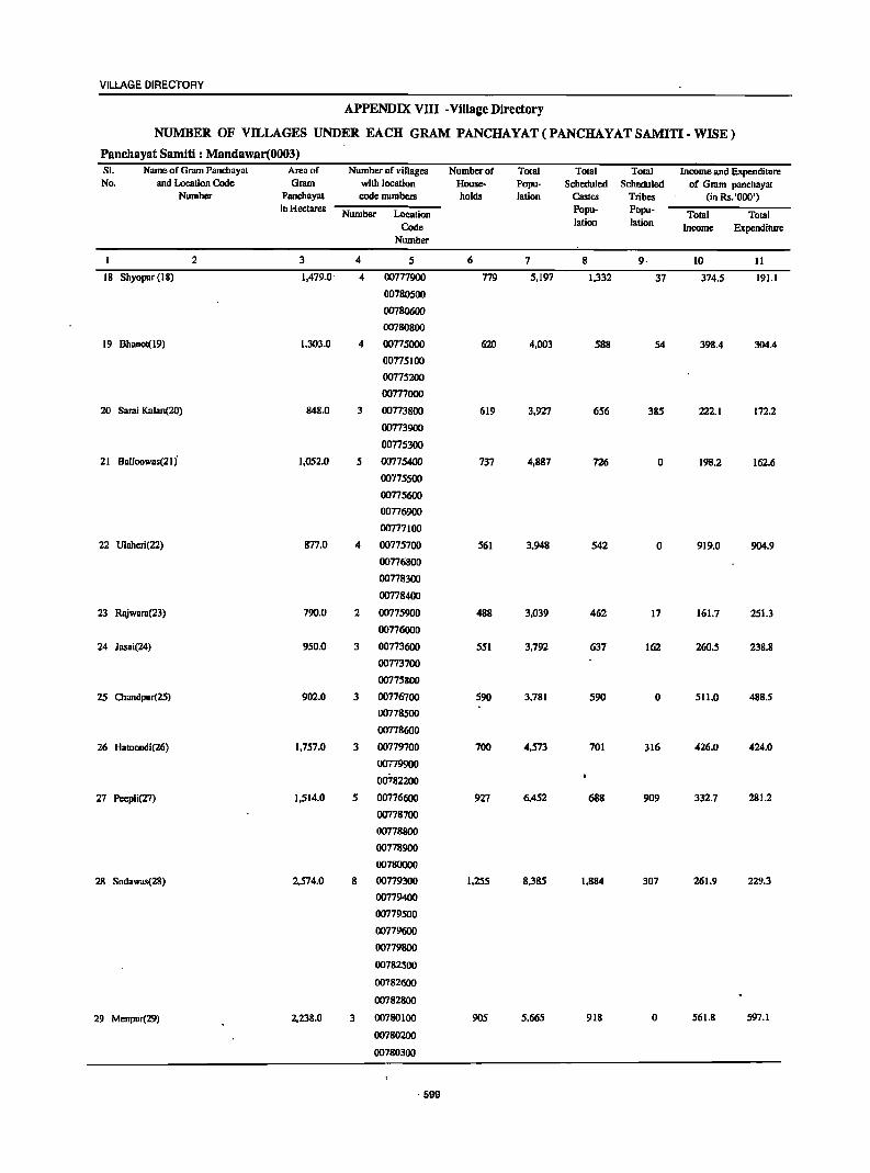
VILLAGE DIRECTORY
APPENDIX VIII-Village Directory
NUMBER OF VILLAGES UNDER EACH GRAM PANCHAYAT(PANCHAYATSAMITI-WISE)
Panchayat Samiti : Mandawar(0003) SI. Name of Gram Panchayat Area of Number of "ilIages Number of Total Total TOlal Income and Expenditure No. and Location Code Gram with location House- Popu- Scheduled Scheduled of Gram panchayat
Number Panchayal code numbers holds lation Castes Tribes (in Rs.'Ooo') in Hectares Number Location Popu- Popu- Total Tolal
Code lation lation Income Expenditure
Number
2 3 4 5 6 7 8 9· 10 11
18 Shyopur (18) 1,479.0' 4 00777900 179 5,197 1,332 37 374.5 191.1
00780500
00780600
00780800
19 Bhanol(19) 1,303.0 4 00775000 620 4,003 588 54 398.4 304.4
00775100
00775200
00777000
20 Sarai Kalan(2O) 848.0 3 00773800 619 3,921 656 385 222.1 172.2
00773900
00175300
21 Balloowas(21 j 1,052.0 5 00715400 737 4,887 726 0 198.2 162.6
00775500
00775600
00776900
00777100
22 Ulaheri(22) 877.0 4 0077S700 S61 3,948 S42 0 919.0 904.9
00776800
00778300
00778400
23 Rajwara(23) 790.0 2 00775900 488 3,039 462 17 161.7 251.3
00776000
24 Jasai(24) 950.0 3 00773600 S51 3,792 637 162 260.5 238.8
00773700
00775800
25 Chandpur(15) 902.0 3 00776700 S90 3,781 590 0 511.0 488.5
00778500
00778600
26 Haloondi(26) 1,757.0 3 00779700 700 4,573 701 316 426.0 424.0
00779900
00782200
27 Peepli(27) 1,514.0 S 00776600 927 6,452 688 909 332.7 281.2
00778700
00778800
00778900
00780000
28 Sodawas(28) 2,574.0 8 00779300 1,155 8,385 1,884 307 261.9 229.3
00779400
00779500
00779600
00779800
00782500
00782600
00782800
29 Menpur(29) 2,238.0 3 00780100 905 5,665 918 0 S61.8 597.1
00780200
00780300
, 599
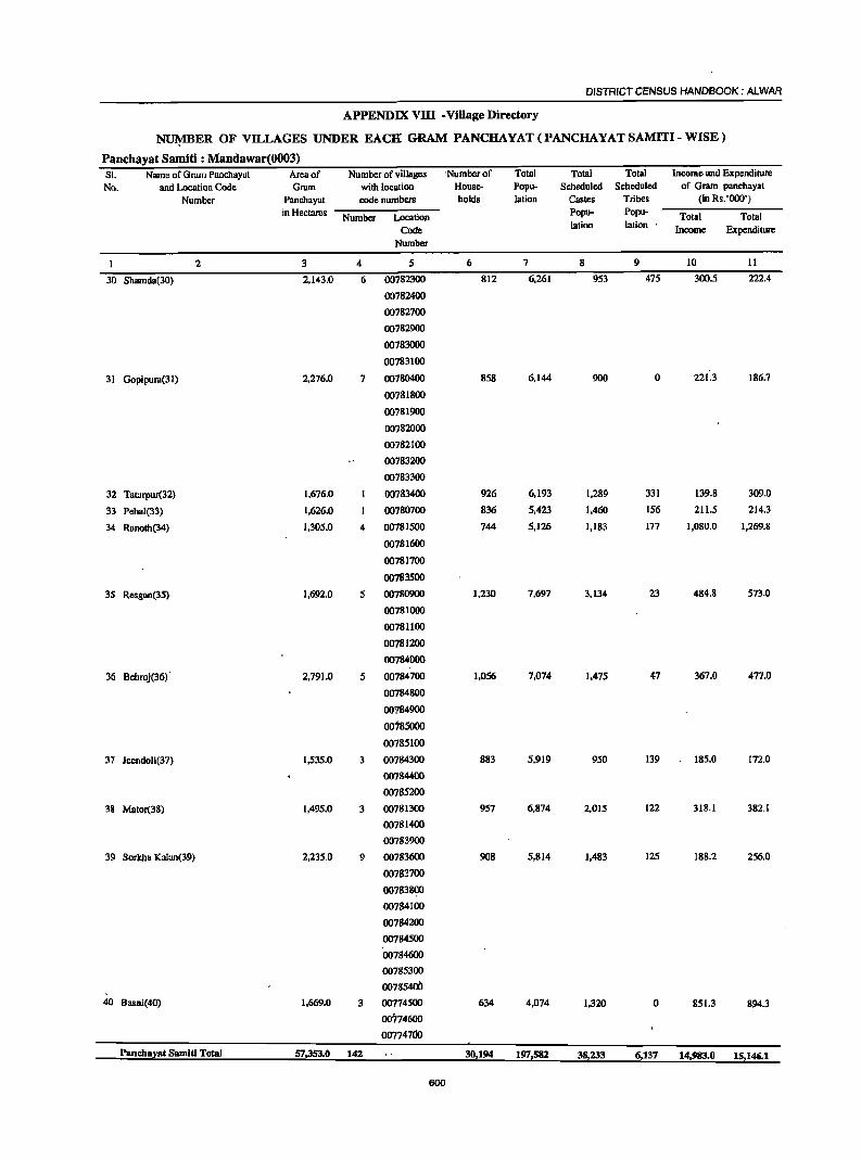
DISTRICT CENSUS HANDBOOK: AlWAR
APPENDIX vm -Village Directory
NI.J¥lBER OF VILLAGES UNDER EACH GRAM PANCHAYAT(PANCHAYATSAMITI-WISE)
Panchayat Samiti : Mandawar(0003) SI. Name of Gmm Panchayat Arenof Number of villages 'Number of Total Totol Total Income and Expenditure
No. and Location Code Gram with location House- Popu- Scheduled Scheduled of Gram panchayat
Number Panehayat code numbers holds lation Castes Tribes (in Rs.'Ooo')
in Hectares Number Location Popu- Popu- Total Total Code lation lation .
Income Expenditure Number
2 3 4 5 6 7 8 9 10 11
30 Shamda(30) 2,143.0 6 00782300 812 6,261 953 475 300.5 222.4
00782400
00782700
00782900
00783000
00783100
31 Gopipur.l(3l) 2,276.0 7 00780400 858 6,144 900 0 221.3 186.7
00781800
00781900
00782000
00782100
00783200
00783300
32 Tatarpur(32) 1,676.0 00783400 926 6,193 1,289 331 139.8 309.0
33 Pehal(33) 1,626.0 00780700 836 5,423 1,460 156 211.5 214.3
34 Raooth(34) 1,305.0 4 00781500 744 5,126 1,183 177 1,080.0 1,269.8
00781600
00781700
00783500
35 Resgan(35) 1,692.0 5 00780900 1,230 7,697 3,134 23 484.8 573.0
00781000
00781100
00781200
00784000
36 Behroj(36)' 2,791.0 5 00784700 1,056 7,074 1,475 47 367.0 477.0
00784800
00"l849OO
00't85000
00785100
37 JeendoJi(37) 1,535.0 00784300 883 5,919 950 139 185.0 172.0
00784400
00785200
38 Mator(38) 1,495.0 3 00781300 957 6,874 2,015 122 318.1 382.1
00781400
00783900
39 Sorkba Kalan(39) 2,235.0 9 00783600 908 5,814 1,483 125 188.2 256.0
00783700
00783800
00784100
00784200
00784500
00784600
00785300
00785400
40 Basni(40) 1,669.0 3 00'714SOO 634 4,074 1,320 0 851.3 894.3
00774600
00774700
Panchayat Samlti Total 57,353.0 142 30,194 197,582 38,233 6,137 14,983.0 15,146.1
600
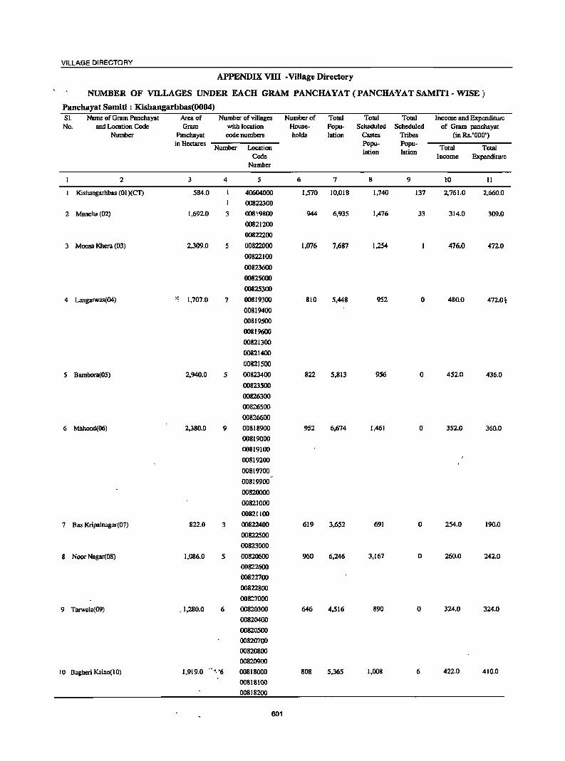
VILLAGE DIRECTORY
APPENDIX VllI • Village Directory
NUMBER OF VILLAGES UNDER EACH GRAM PANCHAYAT(PANCHA¥ATSAMITI-WISE)
Panchayat Samiti : Kishangarhbas(0004) 51. Name of Gram Panchayat Area of Number of villages Number of Total Total Total Income and Expenditure No. and Location Code Gram with location House- Popu- Scheduled Scheduled of Gram panchayat
Number Panchayat code numbers holds lalion Castes Tribes (in Rs. '000') in Hectares
Number Location Popu- Popu-
Total Total Code
lalion lalion Income Expenditure
Number
2 3 4 5 6 7 8 9 10 II
I Kishangarhbas (01 )(CT) 584.0 40604000 1,570 10,018 1,740 137 2,761.0 2,660.0
I 00822300
2 Mancha (02) 1,692.0 3 oo8~9800 944 6,935 1,476 33 314.0 309.0
00821200
00822200
3 Moosa Khera (03) 2,309.0 5 00822000 1.076 7,687 1,254 476.0 472.0
00822100
00823600
00825000
00825300
4 Langarwas(04) ~~ 1,707.0 7 00819300 810 5,448 952 0 480.0 472.0t
00819400
00819500
00819600
00821300
00821400
00821500
5 Bambora(OS) 2,940.0 5 00823400 822 5,813 956 0 452.0 436.0
00823500
00826300
00826500
0081..6600
6 Mllhond(06 ) 2,380.0 9 00818900 952 6,674 1,461 0 3520 360.0
00819000
00819100
00819200
00819700
00819900
00820000
00821000
00821100
7 Bas Kripalnagar(07) 822.0 3 00822400 619 3,652 691 0 254.0 190.0
00822500
00823000
8 Noor Nagar(08) 1,086.0 5 00820600 960 6,246 3,167 0 260.0 242.0
00822600
00822700
00822800
008::7000
9 Tarwala(09) .1,280.0 6 00820300 646 4,516 890 0 324.0 324.0
00820400
00820500
00820700
00820800
00820900
10 Bagheri Kalan(10) 1,919.0 "','6 00818000 808 5,365 1,008 6 422.0 410.0
00818100
00818200
601
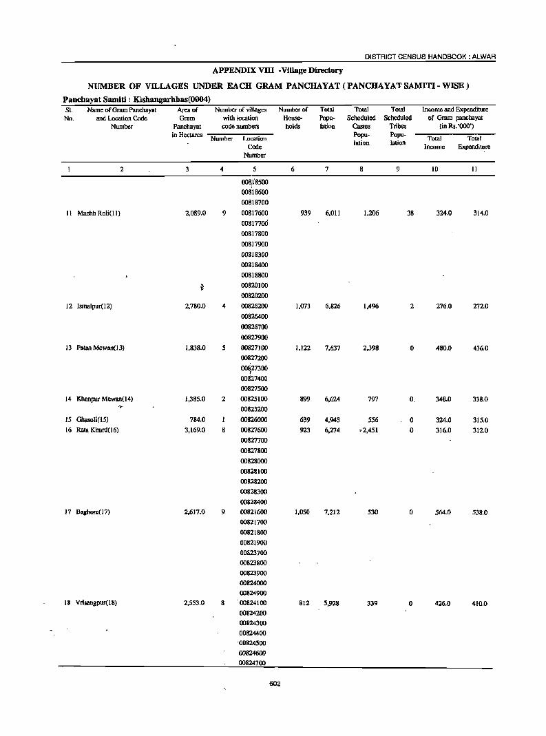
DISTRICT CENSUS HANDBOOK: ALWAR
APPENDIX vrn -Village Directory
NUMBER OF VILLAGES UNDER EACH GRAM PANCHAYAT(PANCHAYATSAMITI-WISE)
Panchayat Samiti : Kishangarhbas(0004) SI. Name of Gram Panchayat Area of Number of villages Number of Total Total Total Income and Expenditure No. and Location Code Gram with location House- Popu- Scheduled Scheduled of Gram panchayat
Number Panchayat code numbers holds lation Castes Tribes (in Rs. '000')
in Hectares Number Location Popu- Popu-
Total Total Code
lation lation Income Expenditure
Number
2 3 4 5 6 7 8 9 10 11
00~i8500
00818600
00818700
11 Machh Roli(ll) 2,089.0 9 00817600 939 6,011 1,206 38 324.0 314.0
00817700
00817800
00817900
00818300
00818400
00818800
~ 00820100
00820200
12 Ismalpur(12) 2,780.0 4 00826200 1,073 6,826 1,496 2 276.0 2720
00826400
00826700
00827900
13 Patan Mewan(l3) 1,838.0 5 00827100 1,122 7,637 2,398 0 480.0 436.0
00827200
00&27300 I
00827400
00827500
14 Khanpur Mewan(14) 1,385.0 2 00825100 899 6,624 797 O. 348.0 338.0 -.. 00825200
15 Ghasoli(15) 784.0 00826000 639 4,943 556 0 324.0 315.0
16 Rata Khurd( 16) 3,169.0 8 00827600 923 6,274 .2,451 0 316.0 312.0
00827700
00827800
00828000
00828100
00828200
00828300
00828400
17 Baghol7.l( 17) 2,617.0 9 00821600 1,050 7,212 530 0 564.0 538.0
00821700
00821800
00821900
00f;23700
00823800
00823900
00824000
00824900
18 Vrisangpur(l8) 2,553.0 8 00824100 812 5,928 339 0 426.0 410.0
00824200
00824300
00824400
. Qe824500
00824600
00824700
602
VILLAGE'DIRECTORY
APPENDIX VnI • Village Directory
NUMBER OF VILLAGES UNDER EACH GRAM PANCHAYAT (PANCHAYAT SAMITI· WISE)
Panchayat Samiti : Kishangarhbas(0004) SI. Name of Gram Panchayal Area of Number of villages Number of Tolal Total Total Income and Expenditure No. and Location Code Gram with location House- Popu- Scbeduled Scheduled of Gram panchayat
Number Panchayat code numbers holds 'Iation Castes Tribes (in Rs. '000') in Hectares
Number Location Popu- Popu-
Total Total Code
lation lation Income Expenditure
Number
2 3 4 5 6 7 8 9 10 II
00824800
19 Koigaon( 19) 2,006.0 4 00825400 674 4,712 564 0 340.0 325.0
00825500
00825600
00825700
20 Mahrampur(20» 1,220.0 3 00825800 625 4,038 899 0 318.0 312.0
00825900
00826100
21 Ganj(21) 1,125.0 6 00822900 1,084 7,065 1,230 5 295.0 292.0
00823100
00823200
00823300
00826800
00826900
22 Bahadurpur Patti 1,719.0 2 00847400 912 6,021 763 0 481.0 475.0
Meeran(22) 00847800
23 Bahadurpur Patti 1,353.0 5 00847200 798 5,013 1,194 0 325.0 314.0
Joriya(23) 00847300
00847500
00847600
00847700
24 Chikani(24) 1,523.0 4 00846600 930 6,162 1,774 . 10 406.0 401.0
00848400
00848500
00848600
25 Karoli(25) 1,980.0 3 00846500 853 6,322 1,419 0 426.0 418.0
00848700
00850000
26 Rayabka(26) 1,146.0 4 00850100 669 4,826 752 0 439.0 436.0
00850500
00850600
00850700
27 Kithoor(27) 2,352.0 5 00846700 881 5,888 1,216 0 290.0 270.0
00846800
00846900
00847000
00847100
28 Bhajera(28) 1,486.0 4 00847900 744 4,876 1,252 3 390.0 360.0
00848000
00848100
00848300
29 Sirmoli(29) 1,724.0 4 00848800 1,187 8,236 1,997 2 346.0 345.0
00849900
00850800
00850900
'Panchayat Samiti Total 51,568.0 141 26,021 176,968 36,428 ~1~' 13,209.0 12,758.0
Rural 51.164.0 140 24,518 167,495 34,824 100 10,918.0 10,558.0
Urban(CT) 404.0 1 1,503 9,473 1,604 .. 137 2,291,0 2,200.0
603
DISTRICT CENSUS HANDBOOK: ALWAR
APPENDIX VnI -Village Directory
NUMBER OF VILLAGES UNDER EACH GRAM PANCHAYAT(PANCHAYATSAMITI-WISE)
Panchayat Samiti : Kotkasim(OOOS) SI. Name of Gram Panchayat Area of Number of villages Number of Total Total Total Income and Expenditure No. and Location Code Gram with location House- Popu- Scheduled Scheduled of Gnlm panchayat
Number Panchayat code numbers holds lation Castes Tribes (in Rs. '000') in Hectares Number Location Popu- Popu- Total Total
Code lation lalion Income Expenditure Number
2 3 4 5 6 1 8 9 10 11
I Kotlcdsim(O I) 1,240.0 2 00789500 1,218 7,164 1,163 62 822.4 637.3
00789600
2 Baghana(02) 1,827.0 5 00189700 742 4,800 971 5 832.1 760.0
00790000
00'190200
00790400
00791300
3 BeeJnheri(03) 1,729.0 6 00788100 886 5,543 807 0 588.3 602.7
00788200
00788300
~ 00789800 f 00789900
00790100
4 Kanharka(04 ) 1,019.0 3 00788400 619 3,752 936 0 427.8 416.9
00788500
00788600
5 Makdawa(05) 1,120.0 4 00787500 519 3,132 710 154 375.5 229.4
00787600
00787700
00787800
6 Ujoli(06) 2,843.0 9 00785500 972 6,118 1.342 4 667.0 725.0
00785700
00785800
00785900
00786000
00786100
00786200
00787900
00788000
7 Bumi Bawal(07) 1.157.0 3 00785600 797 4,680 818 0 447.6 394.9
00786400
00786500
8 Bhonkar(08) 1,251.0 4 00786600 886 5,307 863 85 377.0 346.6·
00786700
00786800
00786900
9 Tcuwas(09) 1.049.0 5 00787000 723 4,778 449 134 269.4 220.5
00787100
00187~
00787300
00789200
10 Kutubpur(10) 1,711.0 6 00786300 771 4,590 756 59 240.9 158.4 '''l1~ 00787400 ..;..I~'r
00788700
00788800
604 -,
VILLAGE DIRECTORY
NUMBER OF VILLAGES UNDER EACH GRAM PANCHAYAT(PANCHAYATSAMITI-WISE)
Panchayat Samiti : KotIu~sim(OOOS) SI. Name of Gram Panchayat Area of Number of villages Number of Total Total Total Income and Expenditure
No. and Location Code Gram with location House- Popu- Scheduled Scheduled of Gram panehayat Number Panebaya! code numbers holds lation Castes Tribes (in Rs.'OOO')
in Hectares Number Location Popu- Popu- Total Total Code
lation lation Income Expenditure Number
2 3 4 5 6 7 8 9 10 II
00788900
00789400
II Joriya( II) 1,013.0 4 00789000 693 4,407 556 179 318.7 329.5
00789100
00789300
00790900
12 Ladpur(12) 1,637,0 5 00790600 587 3,894 709 13 496.4 593,3
00790700
00790800
00791000
00791100
13 Pur(l 3) 1,086.0 2 00791800 573 3,375 1,067 45 581.4 560.0
00791900
14 Gunsar(14) 1,311.0 5 00792000 604 4,148 453 0 436.6 387.2
00792100
00792600
00792700
00792800
15 Ikrotiya(15) 1,040.0 3 00792200 652 4,130 605 0 1,119.4 1,125.3
00792300
00792400
16 Khanpur Aheeran( 16) 1,509.0 6 00791400 694 4,259 893 0 454.2 485.6
00;91500
00792.900 .
00793000
00793100
00793200
17 Patan Aheer( 17) 1,073.0 3 oo79~ 484 3,096 437 0 440.6 445.3
00794100
00794200
18 Tiganwa(18) 1,988.0 7 00793300 884 5,931 1,137 300.5 301.6
00793400
00793500
00793600
00793700
00793800
00793900
19 Nanga] Saliya(l9) 1,654.0 5 00794000 821 5,578 1,107 63 366.4 502.3
00794600
00"194700
00794800
00795000
20 Bagheri Khurd(20) 1,657.0 7 00794300 646 4,448 907 0 817.7 837.0
00794400
00794500
00795100
00795200
605
DISTRICT CENSUS HANDBOOK: ALWAR
NUMBER OF VILLAGES UNDER EACH GRAM PANCHAYAT(PANCHAYATSAMITI-WISE)
Panchayat Samiti : Kotkasi~(OOO5) S)' Name of Grom Panchayat Area of Number of villages Number of Total Total Total Income and Expenditure No. and Lacati on Code GrJm with location House- Popu-' Scheduled Scheduled of Gr:lrn panchayat
Number Panchayat code numbers holds lalian Castes Tribes (in Rs.'OOO') ill Hectares Number Location
Papu- POJRIc Total Total Code lation lation Income Expenditure
Number
2 3 4 5 6 7 8 9 10 II
00795300
00795400
21 Harsoli(21 ) 1,464.0 00796400 1,276 &,060 1,450 83 367.4 3&6.&
22 Patal iya(22) 1,336.0 6 00794900 &85 6,052 818 0 1,384.0 1,311.9
00796600
00796700
00796800
00796900
00797000
23 Jatiyuna(23) 1,665.0 10 00795500 1,045 7,277 3,142 0 377.1 412.2
00795600
00795700 ~,
00795800
00795900
00796000
00796100
00796200
00796300
00796500
24 Gheekoka(24) 924.0 5 00790300 488 3,168 635 0 341.8 341.8
00790500
00791200
00791600
00791700
Pancha;rat Samltl Total 34,303.0 116 IMfiS 117,687 22,731 887 1~84!1.I1 12~11.4
606
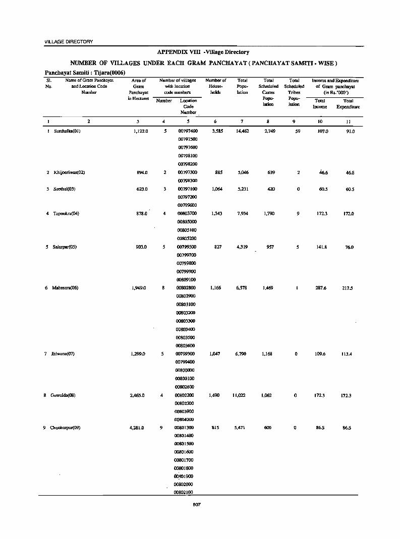
VILLAGE DIRECTORY
APPENDIX VIn -Village Directory
NUMBER OF VILLAGES UNDER EACH GRAM PANCHAYAT (PANCHAYAT SAMITI-WISE)
Pancbayat Samiti : Tijara(0006) SI. Name of Gram PaDchayat Area of Number of villages Number of Total Total Total income and Expenditure No. and Location Code Gram with location House- Popu- Scheduled Scheduled of Gram panchayat
Number Pancbayat code numbers holds lation Castes Tribes (in Rs. '000') in Hectares Number Location Popu- Popu- Total Total
Code lation lation income Expenditure Number
2 3 4 5 6 7 8 9 10 II
Santhalka(O I) 1,122.0 5 00797400 3,585 14,462 2,749 59 107.0 91.0
00797500
00797600
00798100
00798200
2 Khijooriwas(02) 894.0 2 00797300 885 5,046 639 2 46.6 46.6
00798300
3 Seethal(03) 623.0 3 00797100 1,064 5,231 420 0 60.5 60.5
00797200
00799600
4 Tapookra(04 ) 878.0 4 00803700 1,343 7,934 1,790 9 172.3 172.0
00805000
00805100
00805200
5 Salarpur(05) 903.0 5 00799500 827 4,319 957 5 141.8 76.0
00799700
00799800
00799900
00809100
6 Mahesara(06) 1,949.0 8 00802800 1,166 6,S78 1,469 287.6 217.5
00802900
00803100
00803200
00803300
00803400
001J03S00
00803600
7 lhiwana(07) 1,299.0 5 00799300 1,047 6,790 1,168 0 109.6 113.4
00799400
00800000
00800100
00802600
8 Guwalda(08) 2,465.0 4 00802200 1,490 lI,022 1,062 0 172.3 172.3
00802300
00803900
00804000
9 Olooharpur(09) 4,281.0 9 00801300 815 5,471 600 0 86.5 86.5
00801400
00801500
00801600
00801700
00801800
OO~019oo
00802000
00802100
607
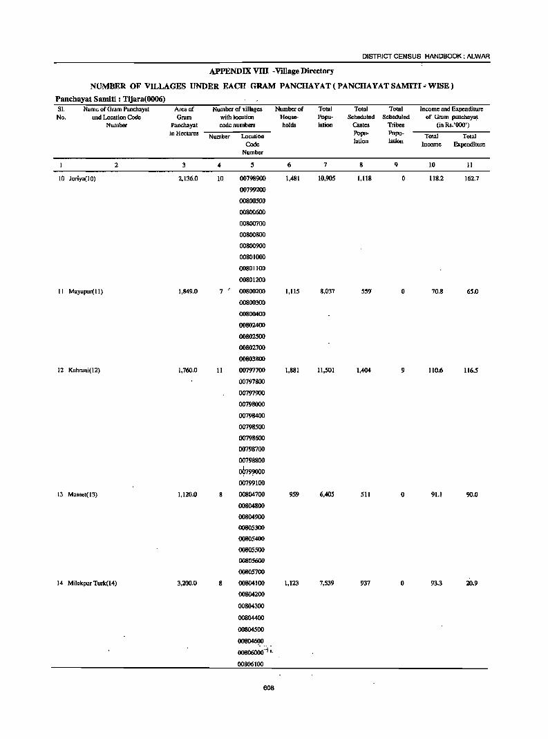
DISTRICT CENSUS HANDBOOK: ALWAR
APPENDIX vm . Village Directory
NUMBER OF VILLAGES UNDER EACH GRAM PANCHAYAT(PANCHAYATSAMITI"WISE)
Panchayat Samiti : Tijara(0006) SI- Name of Gram Panchayat Area of Nwnbcr of villages Number of Total Total Total Income and Expenditure No. and Location Code Grurn with location House- Popu- Scheduled Scheduled of Gram panchaya_l
Number Panchayat code numbers holds lation Castes Tribes (in Rs.'OOO')
in Hectares Number Location Popu- Popu- Total Total Code lation lation Income Expenditure
Number
2 3 4 5 6 7 8 9 10 11
10 Joriya(lO) 2,136.0 10 00798900 1,481 10,905 1,118 0 118.2 162.7
00799200
00800500
00800600
00800700
00800800
00800900
00801000
00801100
00801200
II Mayapur( II) 1,849.0 7 00800200 1,115 8,037 559' 0 70.8 65.0
00800300
00800400
00802400
00802500
00802700
00803800
12 Kalmuli(12) 1,760.0 11 00797700 1,881 11,501 1,404 9 110.6 116.5
00797800
00797900
00798000
00798400
00798500
00798600
00798700
00798800
~79~0 00799100
13 Maseet( 13) 1,120.0 8 00804700 959 6,405 511 0 91.1 90.0
00804800
00804900
00805300
00805400
00805500
00805600
00805700
14 MilakpurTuJk(14) 3,200.0 8 00804100 1,123 7,539 937 0 93.3 20.9
00804200
00804300
00804400
00804500
oo8~ .• _
oo806000'i L
00806100
608
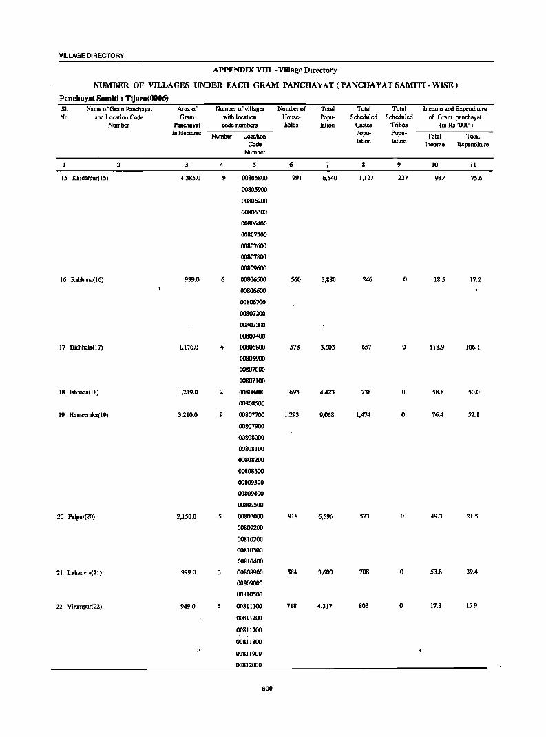
VILLAGE DIRECTORY
APPENDIX vnr -Village Directory
NUMBER OF VILLAGES UNDER EACH GRAM PANCHAYAT(PANCHAYATSAMITI-WISE)
Panchayat Samiti : Tijara(0006) SI. Name of Gram Panchayat Area of Number of villages Number of Total Total Total Income and Expenditure No. and Location Code Gram with location Hause- Papu- Scheduled Scheduled af Gram panchayat
Number Panchayat code numbers halds lation Castes Tribes (in Rs. '000') in Hectares Number Location
Popu- Popu-Total Total
Code lalion lalion Income Expenditure
Number
2 3 4 5 6 7 8 9 10 11
15 Khidarpur( 1 5) 4,385.0 9 00805800 991 6,540 1,127 227 93.4 75.6
00805900
00806200
00806300
00806400
00807500
00807600
D9807800
00809600
16 Rabhana(l6) 939.0 6 00806500 560 3,880 246 0 18.5 17.2
00806600
00806700
00807200
00807300
00807400
17 Bichhala( 17) 1,176.0 4 00806800 578 3,603 657 0 118.9 106.1
00806900
00807000
00807100
18 Ishroda( 18) 1,219.0 2 00808400 693 4,423 738 0 58.8 50.0
00808500
19 Hameeralca(19) 3,210.0 9 00807700 1,293 9,068 1,474 0 76.4 52.1
00807900
00808000
ro808100
00808200
00808300
00809300
00809400
00809500
20 Palpur(20) 2,150.0 5 00803000 918 6,596 523 0 49.3 21.5
00809200
00810200
00810300
00810400
21 Luhadera(21) 999.0 3 00808900 584 3,600 708 0 53.8 39.4
00809000
00810500
22 Virnmpur(22) 949.0 6 00811100 718 4.317 803 0 17.8 15.9
00811200
00811700
00811800
00811900
00812000
609

DISTRICT CENSUS HANDBOOK: ALWAR
APPENDIX VIII -Village Directory
NUMBER OF VILLAGES UNDER EACH GRAM PANCHAYAT (PANCHAYATSAMITI· WISE)
Panchayat Samiti : Tijara(0006) SI. Name of Gram Panchayat Area of Number of villages Numbcrof Total Total Total Income and Expenditure No. and Location Code Grdm with location Hou~ Popu- Scheduled Scheduled of Grdm panchayat
Number Panchayat code numbers holds lation Castes Tribes (in Rs.'OOO·) in Hectares
Number Location Popu- Popu- Total Total Code lation lation Income Expcndirure
Number
2 3 4 5 6 7 8 9 10 11
23 Mundana(23) 1.527.0 5 00808600 636 4.124 314 39 71.7 47.4
00808700
00808800
00810700
00810800
24 Heengwahera(24) 1.327.0 3 00810600 808 5,064 1,184 0 78.S 17.5
00810900
00811000
25 Shahbad(25) 1,712.0 7 00811400 1,068 6,496 1,099 2 14.4 27.7
00811500
00811600
00813600
00813700
00813900
00814100
26 Rai Khera(26) 864.0 4 00811300 705 4,511 720 ()' 18.9 18.7
00814000
00814200
00814300
27 Bhindoosi(27) 1,446.0 5 00813800 573 3.570 562 8 70.2 28.8
00815000
00815100
00815200
00815300
28 Gabankbar(28) 995.0 2 00814400 643 4.517 928 0 81.8 81.8
00814500
29 Gothra(29) 1.107.0 4 00814600 698 4,646 834 0 91.9 46.0
00814700
00814800
00814900
30 Chawandi Kalan(30) . 1.844.0 4 00816900 682 4,765 603 0 56.5 12.0
00817000
00817100
00817200
31 Jairoli(3l) 4.092.0 7 00815800 1,083 7,296 991 0 12.8 10.0
00816300
00816500
00816800
00817300
00817400
00817500
32 Phullabas(32) 2.207.0 8 ('0813400 873 6.711 499 0 27.9 26.2
7· 00815400 .... ··t,
00815500
00815600
610
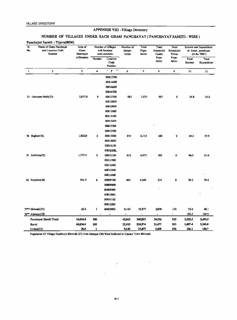
VILLAGE DIRECTORY
APPENDIX VIII-Village Directory
NUMBER OF VILLAGES UNDER EACH GRAM PANCHAYAT(PANCHAYATSAMITI-WISE)
Panchayat Samiti : Tijara(0006) SI. Name of Gram Panchayal Area of Number of villages Number of Tolal Total Total income and Expenditure No. and Location Code G ... .un with location House- Popu- Scheduled Scheduled of Gram panchayat
Number Panchayat code numbers holds lation CasteS Tribes (in Rs. '000') in Hectares Number Location Popu· Popu- Total TOlal
Code lation lation Income Expenditure Number
2 3 4 S· -- 6 7 9 10 II
00815700
00816400
00816600
00816700
33 Hasanpur Mafi(33) 2,877.0 8 00812700 983 7,073 957 0 24.8 31.2
00812800
00812900
00813000
00813100
00813200
00813300
00813500
34 Boghor(34) 1,822.0 4 00815900 831 6,112 488 2 40.2 25.9
00816000
00816100
0!>81Ji200_
35 Sarhheta(35) 1,777.0 5 00812100 619 4,473 565 0 66.5 61.6
00812300
00812400
00812500
00812600
36 Roopbas(36) 931.0 6 00809700 601 4,349 274 0 56.2 39.4
00809800
00809900
00810000
00810100
00812200
37·· Bhiwadi(37) 20.0 40602000 9,143 33,877 2,839 152 53.6 48.1
38** A1arnl!!!r(38) 102.S 102.5
Pnnchaya[ Samiti Total 64,054.0 Z06 45,062 260,851 34,516 515 3,023.5 2,493.5
Rural 64,034.0 20S 35,919 226,974 31,677 363 2,867.4 2,342.8
Urban(Ct) 20.0 1 9,143 33,877 2,839 152 156.1 150.7
Population Of Village Pnnchaynt Bhiwadi (37) And Alampur (38) Were IncliJded In Census Town Bhiwadi.
611
DISTRICT CENSUS HANDBOOK: ALWAR
APPENDIX VIII -Village Directory
NUMBER OF VILLAGES UNDER EACH GRAM PANCHAYAT(PANCHAYATSAMITI-WISE)
Panchayat Samiti : Ramgarh(0007) SI. Name of Gmm Panchayat Area of Number of villages . Number of Total Total Total Income and Expenditure No. and Location Code Gr~m with location House- Popu- Scheduled Scheduled of Grdm panchayat
Number Panchuyat code numbers holds lation Castes Tribes (in Rs.'OOO')
in Hectares Number Location Popu- Popu-Total Total
Code lation lation Income Expenditure Number
2 3 4 5 6 7 8 9 10 11
1 Alawam(OI) 1,078.0 00843500 800 5,619 872 0 9.6 11.9
2 Untwal(02) 2,317.0 6 00832200 835 5,887 1,251 0 1.2 2.6
00832300
00832400
00832500
00835000
00835100
3 Khunteta Kalan(03) 1,942.0 6 00841800 974 7,285 1,631 162 3.8 7.5
00841900
00,842000
00842100
00842200
00842400
4 Kheri(04) 1,754.0 5 00840500 733 5,552 977 22 45.5 45.5
00840600
00840700
00840800
00840900
5 Peeproli (OS) 1,477.0 5 00834700 661 4,942 789 0 8.6 13.2
00835200
00835300
00835400
00835500
6 Khilom(06) 1,980.0 6 00331800 860 5,971 647 61 13.2 10.2
00331900
00835900
00836000
00836100
00836200
1 Dohli(01) 2,029.0 6 00828500 832 6,040 1,182 0 14.8 18.0
00832000
00832100
00835600
00835700
00835800 .- 'c g Khoh(08) 1,739.0 6 00828600 562 3,920 589 0 0.3 9.3
00828700
!r .. ~ 00828800 V\.
00828900
612
VILLAGE DIRECTORY
APPENDIX VllI • Village Directory
NUMBER OF VILLAGES UNDER EACH GRAM PANCHAYAT(PANCHAYATSAMITI·WISE)
Panchayat Samiti : Ramgarh(0007) SI. Name of Gram Panchayat Area of Number of villages Number of Total Total Total Income and Expenditure No. and Location Code Gram with location House- Popu- Scheduled Scheduled of Gram panchayal
Number Panchayat code numbers holds lalion Castes Tribes (in Rs.'OOO') in Hectares Number Location Popu- Popu- Total Total
Code lation lalion Income Expenditure Number
2 3 4 , 6 7 8 9 10 II
00831600
00831700
9 Cheerwa(09) 2,392.0 13 00837600 1,176 8,649 2,064 0 8.2 10.4
00837700
00837800
00837900
00838000
00838600
Oil8387otl
00838800
00838900
00839000
00839100
00839200
00839500
10 Chomt; Pahar( 10) 937.0 3 00832600 566 4,302 1,107 0 4.5 5.3
00832700
00833500
II Jalpur(lI) 1,876.0 6 00834000 831 6,270 1,181 1,91' 13.3 121
00834100
00841400
00841600
00841700
0')842300
12 Danwari(12) 1,253.0 5 00836400 780 4,546 27 0 15.7 16.0
00836600
00836700
00836800
00836900
13 Nagl; Meghe(13) 3,139.0 6 00833900 1,199 8,205 1,463 680 6.8 7.0
00834200
00834500
00841300
00842500
00842600
14 Neekacb(14) 1,820.0 4 00829300 9" 6,'89 825 0 8.9 4.7
00829'00
00829600
00829700
613
DISTRICT CENSUS HANDBOOK: ALWAR
APPENDIX VIII -Village Directory
NUMBER OF VILLAGES UNDER EACH GRAM PANCHAYAT(PANCHAYAT SAMITI· WISE)
Pancllayat Samiti : Ramgarh(0007) SI: Name of Grdm Panchayat Arcil of Number of ~iIlages Number of Total Total Total Income lind Expenditure No. and Location Code Grum with location House- Popu- Scheduled Scheduled of Gmm panchayat
Number Panchayat code numbers holds lation Castes Tribes (in Rs. '000') in Hectares Number Location Popu- Popu.
Total Total Code lation lation Income Expenditure
Number
2 3 4 5 6 1 8 9 10 II
IS Garb i Dhaneta(l5) 2,125.0 10 00829000 757 5,165 355 0 2.3 3.0
00829100
00829200
00829400
00831000
00831100
00831200
00831300
00831400
00831500
16 Nuugawan(16) 1,620.0 00837500 1,358 9,113 1,116 28 89.7 91.4
17 Pata(17) 2,184.0 5 00830400 673 4,485 529 0 27.1 24.6
00830500
00830600
00830800
00830900
18 Bahnla(I8) 1,321.0 4 00833700 1,046 6,009 2,193 7 9.6 9.7
00833800
00834300
00834400
19 Kesroli(19) 1,137.0 4 00833200 680 4,470 899 .0 6.8 5.8
00833300
00833400
00833600
20 Bumboli{ZO) 800.0 00841500 - 532 3,902 974 268 3.6 3.6
21 Bugar Rajput(21) 1,820.0 4 00841100 920 6,583 1,318 1,407 14.5 15.7
00841200
00842700
00842800
;12 NUllgla Banjeerl<a(22) 1,412.0 3 00834600 593 4,687 747 0 9.5 18.5
00834800
00834900
23 Beejwn(23) 1,219.0 5 00836300 502 3,187 132 0 1.7 2.7
00836500
00839400
00839600
00839700
24 Chauma(24) 1,276.0 3 00839300 611 .\ 4,436 350 39 3.3 13.9
00839800
614
VILLAGE DIRECTORY
APPENDIX VIII .Village Directory
NUMBER OF VILLAGES UNDER EACH GRAM PANCHAYAT(PANCHAYATSAMITI·WISE)
Panchayat Samiti : Ramgarh(0007) SI. Name of Gram Panchayat Area of Number of villages Number of Total Total Total income and Expenditure No. and Location Code Gram wilh location House- Popu- Scheduled Scheduled of Gram panchayat
Number Panchayat code numbers holds lation Castes Tribes (in Rs.'OOO') in Hcctares Number Location Papu- Popu- Total Total
Code lotion lation Income Expenditure Number
2 3 4 5 6 7 8 9 10 II
!Y.l839900
25 Milakpur(25) 2,876.0 7 00840000 1,269 7.816 2.082 37 19.9 17.4
00840100
00840200
00840300
00843200
00843300
00843400
26 Mubarikpur(26) 1.430.0 2 00830700 857 5.153 922 3 18.5 29.5
00837000
27 Ramgarh(27) 452.0 00840400 1.883 11,347 2.314 178 297.9 283.3
28 Rasgan(28) 2.521.0 5 00838100 785 5,451 345 0 35.2 31.3
00838200
. 00838300
00838400
00838500
29 Raghunathgarh(29) 2,105.0 6 00829800 634 4,834 371 0 3.9 3.5
00829900
00830000
00830100
00830200
00830300
30 Sabdoli(30} 1.054.0 4 00832800 784 5,808 589 0 17.2 16.6
00832900
00833000
00833100
31 SentlJli(3 I) 2,024.0 6 00841000 939 6,555 1,931 1.649 2.8 1.8
00842900
00843000
Q:l843 100
00844800
00844900
32 Hajipur(32) 1,258.0 4 00837100 651 4.252 330 0 6.4 6.4
00837200
00837300
00837400
33 Kakrdli(33) 1,018.0 4 00848200 682 5,600 234 0 15.4 12.2
00850200
00850300
615
DISTRICT CENSUS HANDBOOK: ALWAR
APPENDIX VIII -Village Directory
NUMBER OF VILLAGES UNDER EACH GRAM PANCHAYAT (PANCHAYAT SAMITI. WISE)
Panchayat Samiti : Ramgarh(0007) SI. Name of Gram Panchayat Arcaof Number of villages Number of Total Total Total Income and Expenditure
No. and Location Code Gram with location House- Popu- Scheduled Scheduled of Gram panchayat Number Panchayat code numbers holds lation Castes Tribes (in Rs.'OOO')
in Hectares Number Location Popu- Popu- Total Total Code lation Iation Income Expenditure
Number
2 3 4 5 6 7 8 9 10 II
00850400
34 Oe800Ia(34) 1,513.0 4 00853900 1,720 10,102 3,546 8 7.8 IJ.2
00854000
00854100
00854200
35 Goondpur(35) 1,'156.0 ,
3 00854300 513 3,368 980 19 7.9 15.3
00856700
00856800
36 Bhajeet(36) 1,376.0 3 00854400 1,017 6,657 2,318 0 11.7 10.6
00854500
00856500
37 Kherli Saiyad(37) 2,123.0 6 00856900 1,089 7,462 2,016 1,104 2.2 2.S
00857000
00857200
00857300
00857400
00857500
Pnnt:hayat Samiti Total 61,553.0 173 32,265 220,219 41,796 7,51fT 769.1 804.2
616
VILLAGE DIRECTORY
APPENDIX VllI -Village Directory
NUMBER OF VILLAGES UNDER EACH GRAM PANCHAYAT(PANCHAYATSAMITI- WISE)
Panchayat Samiti : Umren(0008) SI. Name of Gram Panchayat Area of Number of villages Number of Total Total Total Income and Expenditure No. and Location Code Gram with location House- Popu- Scbeduled Scheduled of Gram panchayat
Number Panchayat code numbers holds lalion Castes Tribes (in Rs.'ooO') in Heclares
Number Location Popu- Popu- Total Total
Code lation !alion Income Expenditure
Number
2 3 4 5 6 7 8 9 10 II
Umren(OI) 1,212.0 2 00854900 468 2,981 303 0 2.7 3.3
00855000
2 Kesharpur(02) 6,596.0 5 00852900 889 6,059 743 64 86.0 54.7
00852800
00854700
00854800
00856200
3 Palkhari(03) 1,917.0 5 00855900 1,453 10,277 2,684 112 130.1 130.1
00856000
00856100
00858200
00858500
4 Akbarpur(04) 2,378.0 6 00855700 926 6,118 1,548 206 98.0 83.6
00855800
00858600
00858900
00859000
OOS59900
5 Madhogam(05) 11,556.0 8 00855400 936 5,777 870 1,037 41.7 68.4
00859100
00859200
00859300
00859400
00859500
00859600
00859800
6 Bakhtpurn(06) 7,807.0 7 00852500 787 4,680 1,199 47 3.0 5.6
00852700
00855100
00855200
00855300
00855500
00855600
7 Dhahalawas(07) 12,722.0 7 00851800 612 4,219 591 700 45 3.1
00851900
00852000
00852100
00852200
00852300
00852400
8 Shahpur(08) 4,459.0 7 00845800 917 6,991 1,656 164 5.3 5.9
00845900
00846000
00846100
00846200
00849200
00849400
9 Toolcrn(09) 1,260.0 2 00853700 709 5,718 820 0 8.8 10.2
00853800
10 Chandoli(lO) 1,663.0 00845700 716 5,654 573 0 3.9 4.0
617
DISTRICT CENSUS HANDBOOK: ALWAR
APPENDIX VllI -Village Directory
NUMBER OF VILLAGES UNDER EACH GRAM PANCHAYAT(PANCHAYATSAMITI-WISE)
Panchayat Samiti : Umren(0008) SI. Name of Gram Panchayat Area of Number of villages . Number of Total Totlll Total Income and Expenditure No. and Location Code Gram with location House- Popu- Scheduled Scheduled of Gram panchayat
Number Panchayat code numbers holds lation ClIStes Tribes (in Rs.'OOO') in Hectares Number Location Popu- Popu- Total Total
. Code lalion lalion Income Expenditure Number
2 3 4 5 6 7 8 9 10 11
II Kasba Dahra( ll) 7,137.0 12 00849000 1,118 7,783 2,598 0 7.1 5.3
00849100
00849300
00849500
00851200
00851300
00851400
00851500
008~1600
00851700
00852600
00853000
12 Jatiyana(12) 1,570.0 5 00849600 884 6,613 1,193 11 4.4 6.0
00849700
00849800
00851000
OOfs51100
13 Gha~la(13) 1,532.0 4 00845000 526 3,705 1,614 0 2.9 3.4
00845100
00845200
00845300
14 Bhandwara(14) 2,006.0 6 00845400 757 5,127 988 2 3.9 4.1
00845500
00845600
00846300
00846400
00848900 15 Diwakari(15) 1,066.0 5 00853200 1,980 11,806 . 5,151 226 5.6 10.2
00853300
00853400
00853500
00853600
16 Mula Kher.t(l6) 1,570.0 1 00863900 1,315 9,502 1,542 1,240 367.1 390.3
17 1'-0110(17) 1,696.? 6 00863700 825 6,018 1,359 3,100 4.6 5.1
00864000'
00865200
00~653oo
00865400
00865500
18 Prithvipura(18) 2,174.0 3 00860000 910 6,85~ 1,126 505 5.3 5.9
00860100
00863500
III Beejllwar(19) 1,170.0 1 00863100 817 5,775 2,010 40 106.4 66.8
20 Bllipla(20) 5,269.0 2 00859700 703 5,282 1,211 1,130 8.2 27.2
00863400
21 Bhandodi(21) 1,024.0 2 00863200 679 5,150 786 249 96.8 96.6
00863300
22 Jamalpur(22) 1,550.0 7 00862800 934 6,570 1,668 0 4.8 5.2
00864200
00864300
00864400
00864500
618
VILUl.GE DIRECTORY
APPENDI;X VllI -Village Directory
NUMBER OF VILLAGES UNDER EACH GRAM PANCHAYAT(PANCHAYATSAMITI-WISE)
Panchayat Samiti : Umren(0008) SI. Name of Gram Panchayal Area of Number of villages Number of Total Total Total Income and Expenditure No. and Location Code Gram with location House- Popu- Scheduled Scheduled of Gram panchayal
Number P-.lDchayal code numbers holds lalion Castes Tribes (in Rs. '000') in Hectares Numher Location Popu· Popu- TOlal Total
Code lation lation Income Expenditure Number
2 3 4 5 6 7 8 9 10 II
00865000
00865100
23 Bader(23) 2,146.0 4 00862300 1,185 8,444 1,862 0 6.4 8.7
00864700
00864800
00864900
24 Poonkhar(24 ) 2,063.0 2 00863600 945 6,694 1,125 2,171 88.6 45.5
00863800
25 Barkhem(25) 1,137.0 I 00864100 732 5,494 466 376 67.5 73.8
26 Haldeenu(26) 1.497.0 2 00861800 725 5,034 776 235 94.2 1.351.8
00£S62Ooo
27 Naithla(27) 1,335.0 2 OOg57 100 564 3,985 921 957 3.0 2.9
00861900
28 Kairwara(28) 1.483.0 3 00857600 836 5,594 1,607 985 3.1 3.2
00862400
00862600
29 Dhakpuri(29) 2,272.0 5 00862100 1,061 7,429 1.916 162 5.4 5.8
00862200
00862500
00862700
00864600
30 Mahwa Khurd(30) 1,233.0 5 00858000 765 5,798 751 442 69.2 52.0
00858100
00861400 II
00861500
00861600
3 I Mohubbalpur(31) 1,635.0 7 00858300 625 4,784 966 0 3.5 5.7
00858400
00860900
00861000
00861100
00861200
00861300
32 Sulpur(32) 1.084.0 5 00856400 660 4.450 1,378 325 2.9 2.7
00856600
00857700
00857800
00857900
33 Kalsard(33) 1,765.0 3 00861700 1,098 7,864 1.948 265 6.8 7.4
00862900
00863000
34 Bhoogar(34 ) 669.0 00853100 1,120 6,528 1,235 3,199 78.8 69.9
35 D'ddar(35) 928.0 2 00854600 932 5,644 1,520 33 139.9 139.9
00856300
36 Parsa Ka BU5(36) 1,815.0 9 00858700 740 5,391 1,389 0 164.1 164.1
00858800
00860200
00860300
00860400
00860500
2! 00~60600 (.
00860700
00860800
Pancho;l:at Samiti Total 100,396.0 155 31,209 ZZI,7!14 50,093 l'l',9S3 1,734.5 2,928.1
619
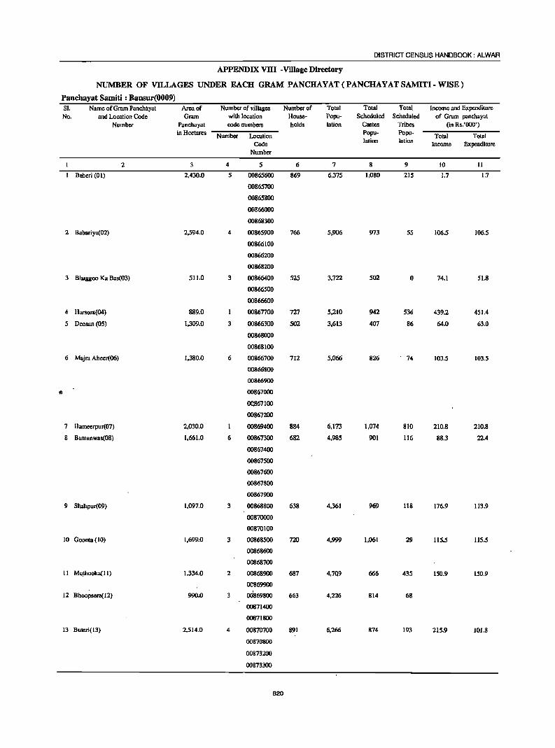
DISTRICT CENSUS HANDBOOK: ALWAR
APPENDIX VllI -Village Directory
NUMBER OF VILLAGES UNDER EACH GRAM PANCHAYAT (PANCHAYAT SAMITI - WISE)
Panchayat Samiti : Bansur(0009) SI. Name ofGmm Panchayat Area of Number of villages Number of Total Total Total Income and Expenditure No. and Location Code Gram with location House- Popu- Scheduled Scheduled of Gram panchuyat
Number Panchayat code numbers holds lation Costes Tribes (in Rs.'OOO') in Hectares Number Location
Popu- Popu- Total Total Code lation lation
Income Expendirure Number
2 3 4 5 6 7 8 9 10 II
Baberi (01) 2,430.0 5 00865600 869 6,375 1,080 215 1.7 1.7
00865700
00865800
00866000
00868300
2 Babariya(02) 2,594.0 4 00865900 766 5,906 973 55 106.5 106.5
00866100
00866200
00868200
3 Bhaggoo Ka Ba8(03) 511.0 3 00866400 525 3,722 502 0 74.1 51.8
00866500
00866600
4 Harsora(04 ) 889.0 00867700 727 5,210 942 536 439.2 451.4
5 Deosun (OS) 1,309.0 3 00866300 502 3.613 407 86 64.0 63.0
00868000
00868100
6 Majm Aheer(06) 1,380.0 6 00866700 712 5,066 826 . 74 103.5 103.5
00866800
00866900
e 00867000
0<l867100
00867200
7 Hameerpur(07) 2,030.0 I 00869400 884 6,173 1,074 810 210.8 210.8
8 Bamanwas(08) 1.661.0 6 00867300 682 4,985 901 116 88.3 22.4
00867400
00867500
00867600
00867800
00867900
9 Shahpur(09) 1,097.0 3 00868800 638 4,361 969 118 176.9 113.9
00870000
00870100
10 Goonta (I 0) 1,699.0 3 00868500 720 4,999 1,061 29 115.5 115.5
00868600
00868700
11 Mo.thooka( 11) 1,334.0 2 00868900 687 4,709 666 435 150.9 150.9
~69900
12 Bhoopsera(12) 990.0 ods698oo 663 4,226 814 68
00871400
00871800
13 ButeJi(13) 2,514.0 4 00870700 891 6,266 874 193 215.9 101.8
00870800
00873200
00873300
620
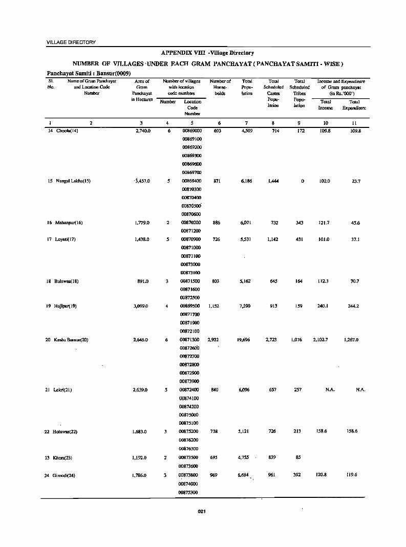
VILLAGE DIRECTORY
APPENDIX VIII-Village Directory
NUMBER OF VILLAGES-UNDER EACH GRAM PANCHAYAT(PANCHAYATSAMITI-WISE)
Panchayat Samiti : Bansur(0009) SI. Name of Gram Panchayal Area of Number of villages Number of TOlal Toral Total Income and Expenditure No. and Location Code Gram with location House- Popu- Scheduled Scheduled of Gram panchayat
Number Panchayat code numbClS holds latian Castes Tribes (in Rs.'OOO') in HectareS Number Location Popu- Popu- Total Total
Code Ialion latian Income Expenditure Number
2 3 4 5 6 7 8 9 10 II
14 Choola(14) 2,740.0 6 00869000 693 4,509 714 172 109.8 109.8
00869100
00869200
00869300
00869600
00869700
IS Nangal Lakba(15) -3,457.0 5 00868400 871 6,186 1,444 0 1020 23.7
00870300
00870400
00870500'
00870600
16 Mahanpur(16) 1.779.0 2 00870200 BB6 6,071 732 343 121.7 45.6
00871200
17 Loyati(17) 1,438.0 5 00870900 726 5,531 1.142 431 101.0 37.1
00871000
00871100
00873000
00873100
18 Balawas(18) 891.0 3 00871500 803 5.162 645 164 112.3 70.7
00871600
00872500
19 Hajipur( 19) 3,099.0 4 00869500 1.152 7,290 913 159 240.1 244.2
00871700
00871900
00872100
20 Kasba Bansur(2O) 2,646.0 6 00871300 2,922 19.696 2.723 1.076 2.102.7 1.267.0
0087260il
00872700
00872800
00872900
00873900
21 Lekri(21) 2.639.0 5 00872400 840 6,096 657 257 N.A. N.A.
00874100
00874200
00875000
00875100
22 Holawas(22) 1.683.0 3 00875200 738 5.121 726 213 158.6 158.6
00876200
00876300
23 Kheru(23) 1.192.0 2 00873500 695 4.755 839 85
00873600
24 Gimodi(24) 1.786.0 3 00873800 969 6.684 961 392 120.8 119.6
00874000
00875300
621
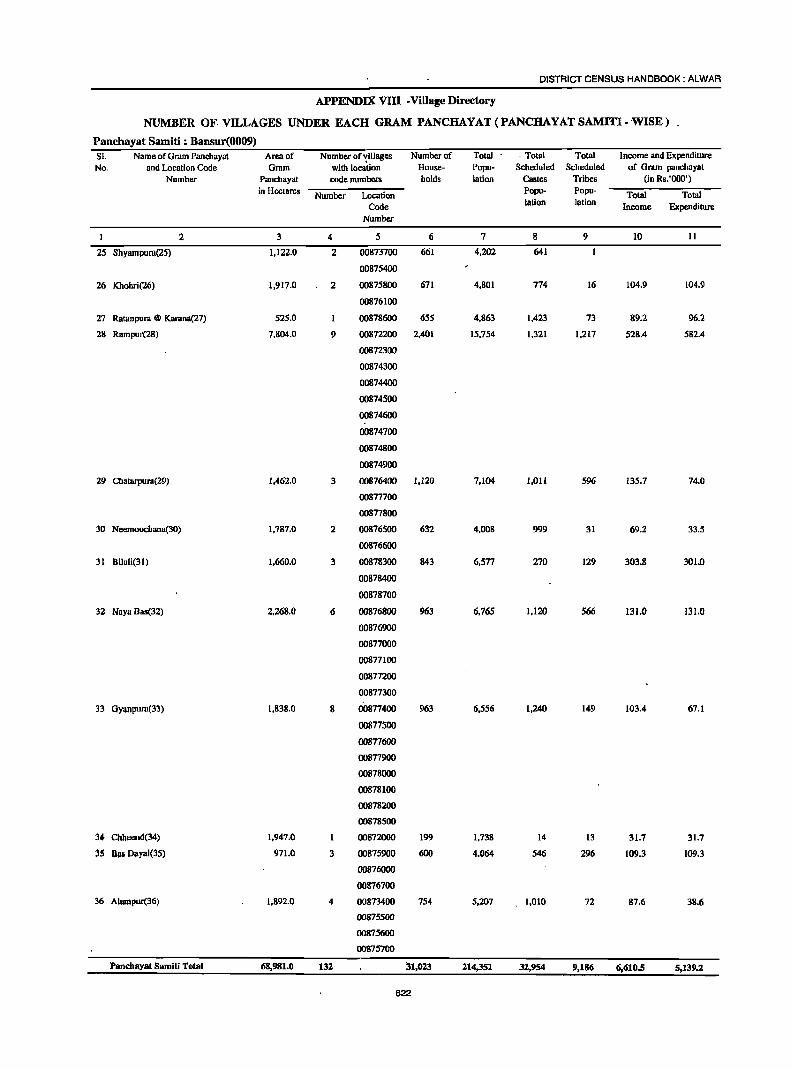
DISTRICT CENSUS HANDBOOK: ALWAR
APPENDIX VIII -Village Directory
NUMBER OF. VILLAGES UNDER EACH GRAM PANCHAYAT(PANCHAYATSAMITI-WISE)
Panchayat Samiti : Bansur(0009) SI. Name of Grdm Panchayat Area of Number of'riIlages Number of Total - Total Total Income and Expendiwre No_ and Location Code Gmm with location House- Popu- Scheduled Scheduled of Gmm panchayal
Number Panchayat code numbers holds lalion Castes Tribes (in Rs.'OOO') in Hectares Number Location
Popu- Popu- Total Total Code lation lation Income Expenditure
Number
I 2 3 4 5 6 7 8 9 10 II
25 Shyampura(25) 1,122.0 2 00873700 661 4,202 641
00875400
26 Khohri(26) 1,917.0 2 00875800 671 4,801 774 16 104.9 104.9
00876100
27 Ratanpur.l @ Ka .... ma(27) 525.0 00878600 655 4,863 1,423 73 89.2 96.2
28 RampUl"(28) 7,804.0 9 00872200 2,401 15,754 1,321 1,217 528.4 582.4
00872300
00874300
00874400
00874500
00874600
00874700
00874800
00874900
29 Chatarpurd(29) 1,462.0 3 00876400 1,120 7,104 1,011 596 135.7 74.0
00877700
00877800
30 Neemoochana(30) 1,787.0 2 00876500 632 4,008 999 31 69.2 33.5
00876600
31 Biluli(31) 1,660.0 3 00878300 843 6,577 270 129 303.8 301.0
00878400
00878700
32 Naya Bao(32) 2,268.0 6 00876800 963 6,765 1,120 566 131.0 131.0
00876900
00877000
00877100
00877200
00877300
33 Gyanpum(33) 1,838.0 8 00877400 963 6,556 1,240 149 103.4 67.1
00877500
00877600
00877900
00878000
00878100
00878200
00878500
34 Cbhcend(34) 1,947.0 00872000 199 1,738 14 13 31.7 31.7
35 Bill Dayal(35) 971.0 3 00875900 600 4,064 546 296 109.3 109.3
00876000
00876700
36 Alumpur(36) 1,892.0 4 00873400 754 5,207 1,010 72 87.6 38.6
00875500
00875600
00875700
Panchayat Samiti Total 68,981.0 132. 31,02.3 2.14,351 32.,954 9,186 6,610.5 5,139.2
622
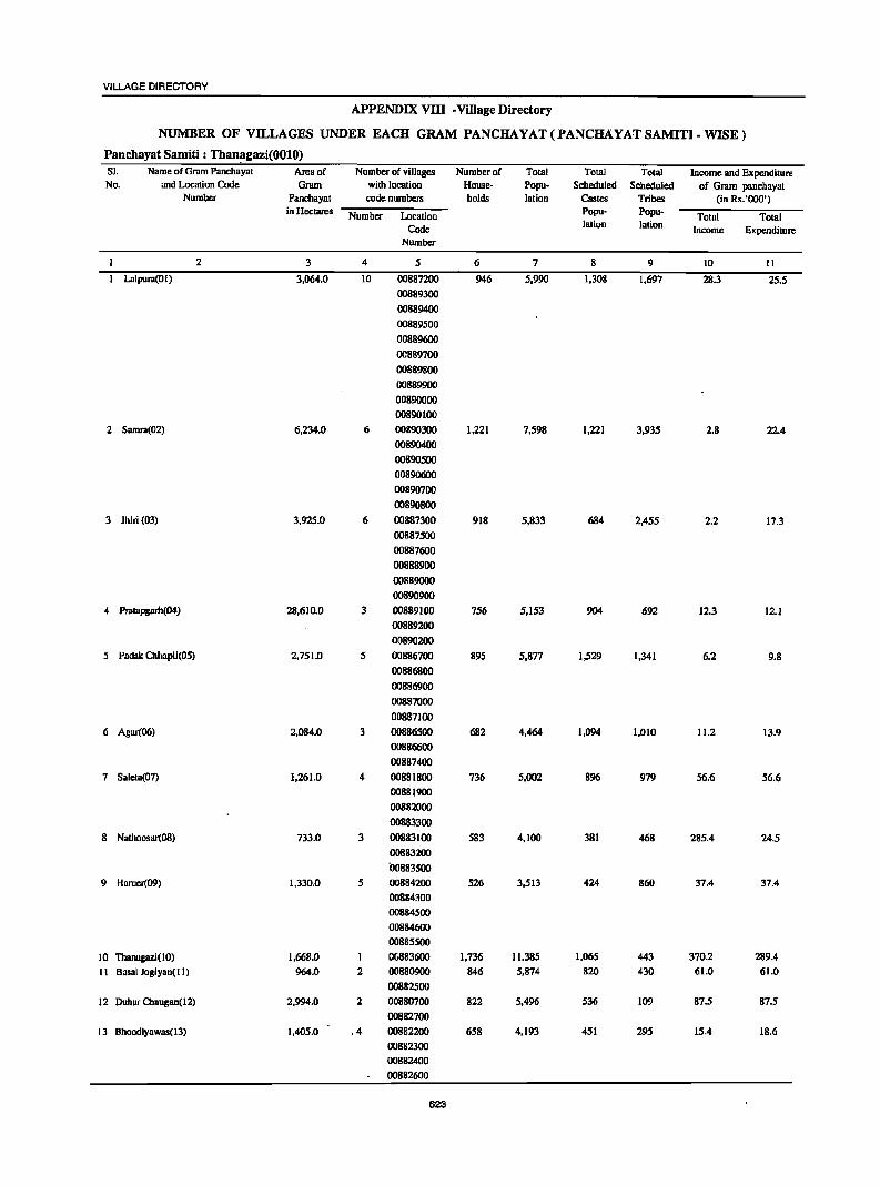
VILLAGE DIRECTORY
APPENDIX VITI • Village Directory
NUMBER OF VILLAGES UNDER EACH GRAM PANCHAYAT (PANCHAYAT SAMITI· WISE)
Panchayat Samiti : Than~gazi(OOlO) 51. Name of Grum Panchayat Area of Number of villages Numbcrof Total Total Total Income and Expenditure No. and Location Code Gnun with location House- Popu- Scheduled Scheduled of Gram panchayat
Number Panchayat code numbers bolds lation Castes Tribes (in Rs.'OOO') in Hectares Number Location Popu- Popu- Total Total
Code lation lation Income Expenditure Number
2 3 4 5 6 7 8 9 10 II
Lalpura(OI) 3,064.0 10 00887200 946 5,990 1,308 1,697 28.3 25.5 00889300
00889400
00889500
00889600
OC889700
00889800
00889900
00890000
00890100
2 Sumrn(02) 6,234.0 6 00890300 1,221 7,598 1,221 3,935 2.8 22.4
00890400
00890500
00890600
00890700
00890800
3 Jhiri (03) 3,925.0 6 00887300 918 5,833 684 2,455 2.2 17.3
00887500
00887600
00888900
00889000
00890900
4 Prolapgurh(04) 28,610.0 3 00889100 756 5,153 904 692 12.3 12.1
00889200
00890200
5 Padak Chbapli(05) 2,751.0 5 00886700 895 5,877 1,529 1,341 6.2 9.8
00886800
00886900
00887000
00887100
6 Agar(06) 2,084.0 3 00886500 682 4,464 1,094 1,010 11.2 13.9
00886600
00887400
7 Salcta(07) 1,261.0 4 00881800 736 5,002 896 979 56.6 56.6
00881900
00882000
00883300
8 Nathoosar(08) 733.0 3 00883100 583 4,100 381 468 285.4 24.5
00883200
b0883500
9 Harner(09) 1,330.0 5 00884200 526 3,513 424 860 37.4 37.4
00884300
00884500
00884600
00885500
10 ThanagaziO 0) 1.668.0 00183600 1,736 11,385 1,065 443 370.2 289.4
11 Basai Jogiyan(lI) 964.0 2 00880900 846 5,874 820 430 61.0 61.0
00882500
12 Duhar Chaogan(12) 2,994.0 2 00880700 822 5,496 536 109 87.5 87.5
00882700
13 Bhoodiyawas(13) 1,405.0 .4 00882200 658 4,193 451 295 15.4 18.6
00882300
00882400
00882600
623
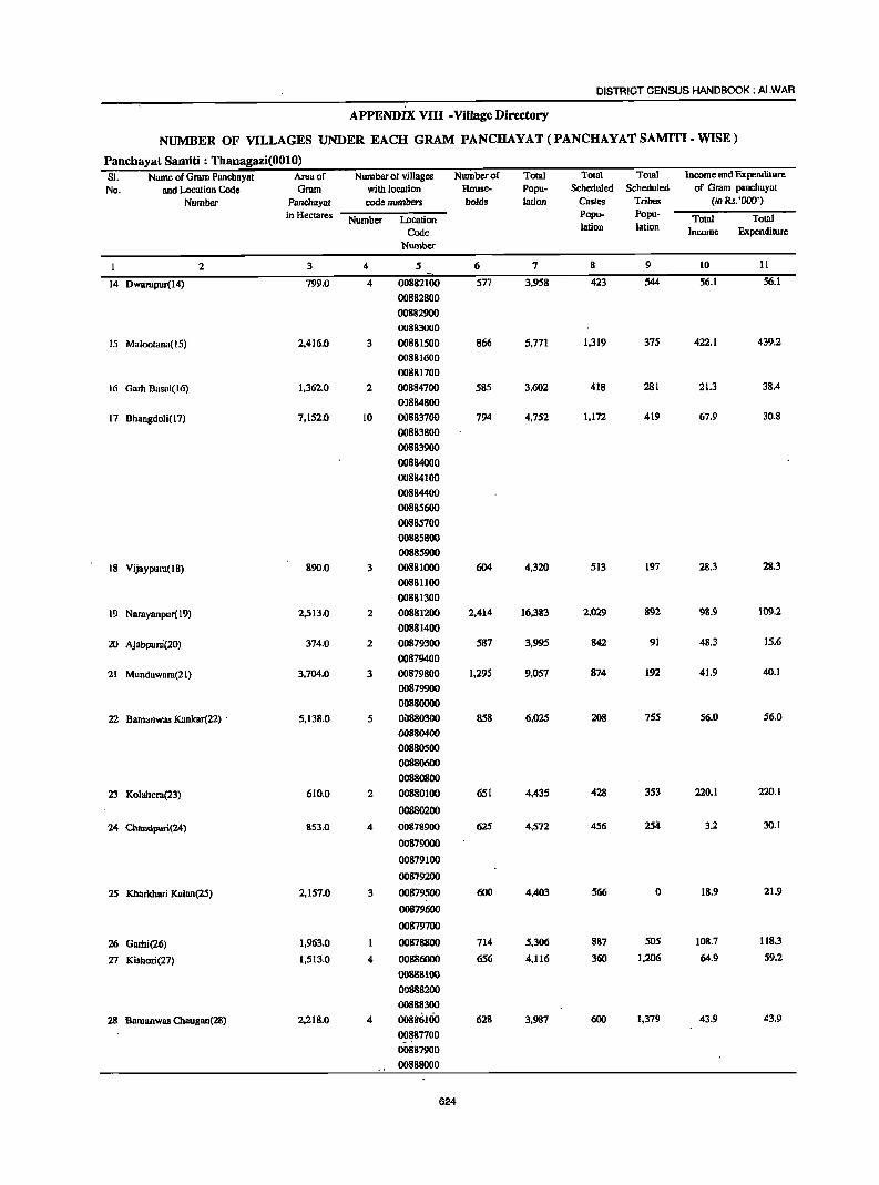
DISTRICT CENSUS HANDBOOK: ALWAR
APPENDIX VIII • Village Directory
NUMBER OF VILLAGES UNDER EACH GRAM PANCHAYAT (PANCHAYAT SAMITI. WISE)
Panchayat Samiti : Thanagazi(OOlO) SI. Name of Gram Panchnyat Areu of Number of villages Number of Total Total Total Income and Expenditure
No. and Location Code Gram with location House- Popu- Scheduled Scheduled of G,. .. m panchayat
Number Panchayal code numbers holds lalion Casles Tribes (in Rs.'OOO')
in Hectares Number LDcalion Popu- Popu- Total Total
Code lalion lation Income Expenditure
Number
I 2 3 4 5 6 7 8 9 10 11
14 Dwul"oIpur(14) 799.0 4 00882100 577 3,958 423 544 56.1 56.1
00882800
00882900
00883000
15 Malootana( 15) 2,416.0 3 00881500 866 5,771 1,319 375 422,1 439.2
00881600
00881700
16 Gmi) 8asai(16) 1,362.0 2 00884700 585 3,602 418 281 21.3 38.4
()J8848oo
17 Bhangdoli(l7) 7,152.0 10 00883700 794 4,752 1,172 419 67.9 30.8
00883800
00883900
00884000
00884100
00884400
00885600
00885700
00885800
00885900
18 Vijaypuru(18) 890.0 3 00881000 604 4,320 513 197 28.3 28.3
00881100
00881300
19 Naruyonpur( 19) 2,513.0 2 00881200 2,414 16,383 2,029 892 98.9 109.2
00881400
20 Ajabpur.i(20) 374.0 2 00879300 587 3,995 842 91 48.3 15.6
00879400
21 Mundawara(21) 3,704.0 3 00879800 1,295 9,057 874 192 41.9 40.1
00879900
00880000
22 Bamanwas Kuokar(22) . 5,138.0 5 00880300 858 6,025 208 755 56.0 56.0
00880400
00880500
00880600
00880800
23 Koluheru(23) 610.0 2 00880100 651 4,435 428 353 220.1 220.1
00880200
24 Cbaodpuri(24) 853.0 4 00878900 62S 4,572 456 2si! 3.2 30.1
00879000
00879100
00879200
25 Kharkhari Kalan(25) 2,157.0 3 00879500 600 4,403 566 0 18.9 21.9
00879600
00879700
26 Gami(26) 1,963.0 00878800 714 5,306 887 505 108.7 118.3
27 Kisbori(27) 1,513.0 4 00886000 656 4,116 360 1,206 64.9 59.2
00888100
00888200
00888300
28 Bamanwas Chaugan(28) 2,218.0 4 oo886Uio 628 3,987 600 1,379 43.9 43.9
00887700
00887900
00888000
624
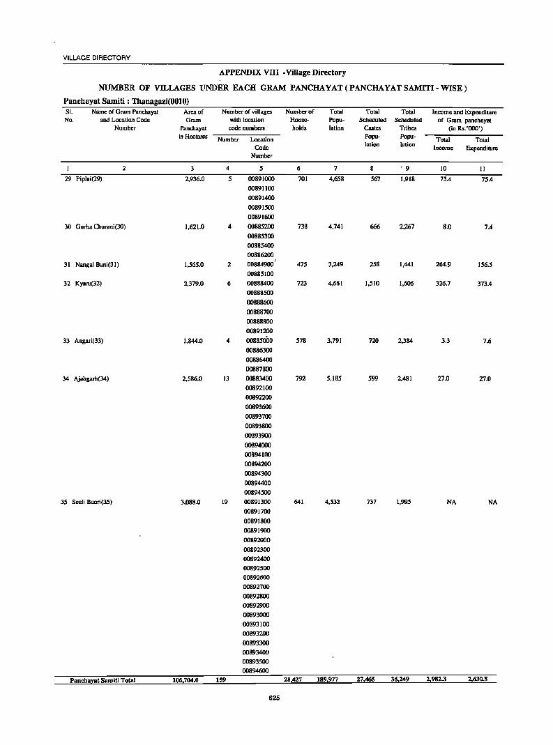
VILLAGE DIRECTORY
APPENDIX VIII-Village Directory
NUMBER OF VILLAGES UNDER EACH GRAM PANCHAYAT(PANCHAYATSAMITI-WISE)
Panchayat Samiti : Thanagazi(OOlO) SI. Name of Gram Panchayat Area of Number of villages Number of Total Total Total Income and Expenditure No. and Location Code Gram with location House- Popu- Scheduled Scheduled of Gram panchayat
Number Panchayat code numbers holds I.tion Castes Tribes (in Rs.'OOO') in Heclares Number Location Popu- Popu- Total Total
Code lation lation Income Expenditure Number
2 3 4 5 6 7 8 • 9 10 11
29 Piplai(29) 2,936.0 5 00891000 701 4,658 567 1,918 75.4 75.4
00891100
00891400
00891500
00891600
30 Guma Churani(30) 1,621.0 4 00885200 738 4,741 666 2,267 8.0 7.4 00885300
00885400
00886200
2 00884900 ,
475 3,249 258 1,441 264.9 31 Nangal Bani(31) 1,565.0 156.5
00885100
32 Kyard(32) 2,379.0 6 00888400 723 4,661 1,510 1,606 326.7 373.4
00888500
00888600
00888700
00888800
00891200
33 Angari(33) 1,844.0 4 00885000 578 3,791 720 2,384 3.3 7.6
00886300
00886400
00887800
34 Ajabgam(34) 2,586.0 13 00883400 792 5,185 599 2,481 27.0 27.0 00892100
00892200
00893600
00893700
00893800
00893900
00894000
00894100
00894200
00894300
00894400
00894500
35 Seeli Baori(35) 3,088.0 19 00891300 641 4,532 737 1,995 NA NA
00891700
00891800
00891900
00892000
00892300
00892400
00892500
00892600
00892700
00892800
00892900
00893000
00393100
00893200
00893300
00893400
00893500 00894600
Pnnchaynt Samiti Total 106,704.0 159 28,427 189,977 27,465 36,249 2,982.3 2,630.5
626
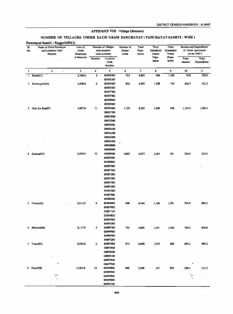
DISTRICT CENSUS HANDBOOK: ALWAR
APPENDIX VIII -Village Directory
NUMBER OF VILLAGES UNDER EACH' GRAM PANCHAYAT (PANCHAYAT SAMITI - WISE)
Panchayat Samiti : Rajgarh(OOll) Sl. Name of Gr.lDl Panchayat Area of Number of villages Number of Total Total Total Income and Expenditure No. and Location Code Gram with location House- Popu- Scheduled Scheduled of Grum pancnayal .
Number Panchayat code numbers holds lation Castes Tribes (in Rs.'OOO') in Hectares Number Location Popu- Popu· Total Total
Code lation lotion Income Expenditure Number
2 3 . 4 5 6 7 8 9 10 11
Khoh(OI) 2,288.0 2 00896500 712 4,603 984 1,328 32.0 320.0
00905300
2 Baldeogarb(02) 4.628.0 6 00905400 806 4,935 1.358 719 424.3 42l.3
00905500
00907700
00907900
00908000
009~8200
3 Gala Ka Bas(03) 4,897.0 II OOQ056oo l,i93 8,252 1,596 840 1,101.2 1,020.4
00905700
00905800
00905900
00906000
00906100
00906200
00906300
00906700
00906800
00906900
4 Syulula(04) 2,539.0 12 00906400 1,003 6,473 1,364 421 324.0 312:4
00906500
00906600
00907000
00907100
00907200
00907300
00907400
00907500
00907600
00907800
00908100
5 Tilwur(OS) 2,015.0 6 00896600 690 4,546 1,126 1,391 794.0 850.2
00897000
00897100
00904800
00904900
00905200
6 MuUana(06) 2,117.0 4 00896700 734 4,650 1,441 1,456 784.2 830.0 00896800
00896900
00897200
7 Tubla(07) 6,904.0 6 00895900 971 6,050 1,515 688 690.2 690.2
00895400
00896000
00896100
00897400 ~ 00897500
8 Rajor(08) 13,301.0 10 00394800 388 2,398 147 955 120.3 112.3 00394100
'_..I .. 00894900 • J:..
00895000
00895100
626
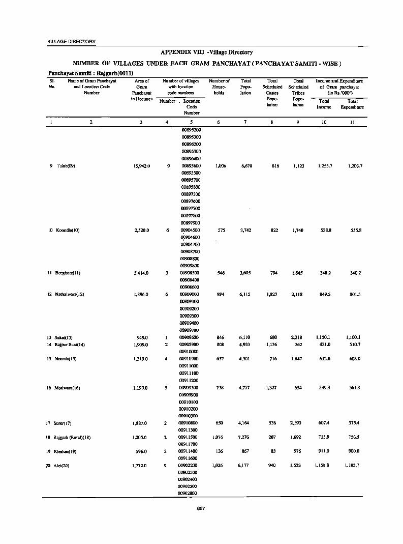
VILLAGE DIRECTORY
APPENDIX VllI -Village Directory
NUMBER OF VILLAGES UNDER· EACH GRAM PANCHAYAT(PANCHAYATSAMITI-WISE)
Panchayat Samiti : Rajgarh(OOll) SI. Name of Gram Panchayat Area of Number of villages Number of Total Total Total Income and Expenditure No. aod Location Code Gram with location House- Popu- Scheduled Scheduled of Gram panchayat
Number Panchayat code nwnbcrs holds lation Castes Tribes (in Rs.'Ooo') in Hectares Number . l!.ocation Popu· Popu- Total Total
Code lation Iation Income Expenditure Number
2 3 4 5 6 7 8 9 10 II
OOS95200
00895300
00896200
00896300
00896400
9 Talab(09) 15,942.0 9 00895600 1,006 6,678 616 1,123 1,253.7 1,203.7
00895500
00895700
00895800
00897300
00897600
00897700
00897800
00897900
10 Koondla(IO) 2,520.0 6 00904500 575 3,742 822 1,740 528.8 555.8
0!l904600
00904700
00908700
00908S00
00909800
II Beeghola(lI) 5,414.0 3 00908500 S46 3,685 794 1,845 348.2 340.2
00908400
00908600
12 Nathalwara(12) 1,896.0 6 0090900O 894 6,115 1,827 2,118 849.5 801.5
00909100
00909200
00909300
00909400
00909700
13 Sakat(l3) 949.0 00909600 846 6,110 680 2,21S 1,150.1 1,100.1
14 Rajpur Bara(14) 1,909.0 2 00908900 SOS 4,933 1,136 262 421.0 510.7
00910000
15 Neemla(l5) 1,319.0 4 00910900 657 4,501 716 1,647 612.0 60S.0
00911000
00911100
00911200
16 Motiwara{l6) 1,199.0 5 00909500 75S 4,757 1,327 654 549.3 561.3
00909900
00910100
00910200
00910300
17 SUrer(I7} I,SS7.0 2 00910800 650 4,164 536 2,190 607.4 573.4
00911300
18 RlIigrub (Rural)( 18) 1,205.0 2 00911500 1,076 7,276 207 1,692 715.9 756.5
00911700
19 KlcshlUl(l9) 596.0 2 00911400 136 867 83 576 911.0 900.0
00911600
20 Alei(20} 1,772.0 9 00902200 1,026 6,177 940 1,633 1,158.S 1,183.7
00902300
00902400
00902500
00902800
627
DISTRICT CENSUS HANDBOOK: ALWAR
APPENDIX vm -Village Directory ,
NUMBER OF VILLAGES UNDER EACH GRAM PANCHAYAT (PANCHAYAT SAMITI - WISE)
Panchayat Samiti : Rajgarh(OOll} SI. Name of Grdm Panchayal Area of Number of villages Number of TOlal TOlal Towl Income and Expenditure No. and Location Code Gram with location House- Popu- Scheduled Scheduled of Grdm panchayat
Number Panchayat code numbers holds lalion Castes Tribes (in Rs. '000') in Hectares Number Location Popu- Popu-
Total Total Code
lation lation Income Expenditure
Number
2 3 4 S 6 7 8 9 10 11
00902900
0~903000
00910600
00910700
21 Thuna(21) 656.0 2 00903100 681 4,489 751 1,214 2,061.7 201.3
00910500
22 Shri Chundpura(22) 4,765.0 6 00903900 622 3,829 1,239 1,946 619.3 614.3
00904000
00904100
00904300
00904400
00910400
23 Dhamred(23) 931.0 1 00903600 570 4,002 749 968 541.6 499.0
24 Dubbi(24) 1,334.0 5 00898000 829 5,325 961 3,556 2,453.5 2,359.2
00898100
00898200
00898300
00898400
25 Digawura(25) 1,025.0 3 00898500 674 4,670 597 2,466 934.2 934.0
00898600
00898700
26 Nayaguon Bolku(26) 1,242.0 3 00903700 568 3,843 506 1,093 319.4 315.3
00903800
00904200
27 Bhajeda(27) 1,035.0 6 00902600 597 4,038 604 2,022 617.5 615.5
00902700
00903200
00903300
. 00903400
00903500
28 Palwa(J8) 1,044.0 5 00901500 640 4,564 926 1,083 538.2 384.2
00901800
00901900
00902000
00902100
29 Fimzpur Jageer(29) 836.0 5 00898800 716 4,486 645 1,507 884.5 914.1
00898900
00899000
00901300
00901400
30 Toda Jaisinghpura(30) 1,583.0 3 00905000 737 4,568 650 1,309 719.3 719.0
00905100
00908300
Panchayat Samltl Total 89,748.0 147 22,109 144,726 26,843 42,660 23,065.1 21,207.6'
628
VILLAGE DIRECTORY
APPENDIX VllI -Village Directory
NUMBER OF VILLAGES UNDER EACH GRAM PANCHAYAT (PANCHAYAT SAMITI- WISE)
Panchayat Samiti : Reni(0012) SI. Name of Gram Panchayat Area of Number of villages Number of Total Total Total Income and Expenditure No. and Location Code Gram with location House- Popu- Scheduled Scheduled of Gram panchayat
Number Panchayal code numbers holds lalion Castes Tribes (in Rs.'OOO·) in Hectares Number Location Popu- Popu- Total Total
Code lalion )alion
Income Expenditure Number
2 3 4 5 6 7 8 9 10 II
Reni (01) 3.114.0 00917800 1.271 9.000 2.076 2.127 184.1 163.9
2 Rwnpura(02) 1.103.0 5 00917400 699 4.825 987 1.894 11.2 9.2
00917500
00917600
00919200
00919300
3 Bhooda(03) 1.519.0 2 00919400 830 5.731 1.017 3.471 19.9 19.3
00919500
4 Bhajera(04 ) 1.057.0 6 00916700 700 4.657 909 2.550 12.1 12.1
00916800
00916900
00917100
00917200
00917300
5 Prolgpur.l(05) 1.261.0 3 00915600 558 3.674 843 951 62.0 45.9
00915700
00915800
6 Keelpur(06) 1.454.0 4 00915900 624 4.322 823 1.921 6.5 6.4
00916000
00916100
00916200
7 IIOIi(07) 1.473.0 4 00917700 705 5.220 725 3.402 78.8 44.6
00918900
00919000
00919100
8 Dera(08) 1,515.0 6 00915200 729 5,151 1,191 2,037 40.7 40.7
00916300
00916400
00916500
00916600
00917000
9 Bbulcri(09) 1.612.0 7 00914700 637 4.366 188 2.116 9.2 9.2
00914800
00914900
00915000
00915100
00915300
00915400
10 Jamdoli(lO) 1.813.0 00915500 630 4,377 654 2.476 N.A. N.A.
II Saloli (II) 1.183.0 3 00914400 637 4.313 870 1.860 29.1 29.1
00914500
00914600
629
DISTRICT CENSUS HANDBOOK : ALWAR
APPENDIX VllI • Village Directory
NUMB;ER OF VILLAGES UNDER EACH GRAM PANCHAYAT(PANCHAYATSAMITI-WISE)
Panchayat Samiti : Reni(0012) SI. Name of Grdm Panchayut Area of Number of villages Number of Total Total Total Income and Expenditure No. and Location Code Grum with location House- Popu- Scheduled Scheduled of Grdm panchayat
Number Panchayat code numbers holds lation Castes Tribes (in Rs. '000') in Hectares
Number Location Popu- Popa- Total Total
Code lation lation Income Expendirure
Number
2 3 4 5 6 7 8 9 10 11
12 Vabeli(l2) 1,616.0 3 00911800 711 4,744 838 2,814 6.4 7.3
00914000
00914100
13 Bairer([3) 1,[60.0 3 00913400 606 3,846 296 2,283 25.9 24.1
00913500
00918000
14 Tahlara(14) 1,725.0 5 00914200 862 5,711 1,284 2,171 13.2 13.2
00914300
00917900
00918100
00918200
15 Pinan(15) 1,714.0 00912800 1,131 7,860 1,124 1,360 43.6 42.9
16 Garhi Sawuimm(16) 1,069.0 00918500 749 5,219 1,653 871 401.2 401.2
17 Putan(17) 1,430,0 7 00900600 757 4,601 538 2,577 12.5 12.5
00900700
00900800
00900900
00901600
00901700
00912300
18 Padu(l8) 1,129,0 5 00912100 764 5,533 1,047 2,056 58.6 58.6
00913600
00913700
00913800
0l)913900
19 Rllipur Cbhota(l9) 1,570.0 6 0:l899500 874 5,869 2,038 342 18.8 16.4
00899800
00899900
00900000
00900100
00900500
20 Chhilodi(20) 1,274.0 4 00899300 776 5,521 894 118 31.9 31.9
00899400
00899600
00899700
21 Bllela(21) 1,496.0 5 00899100 701 4,878 1,149 394 1.7 1.7
00899200
00901000
00901100
00901200
22 Machari(22) 2,411.0 2 00911900 1,033 7,215 1,246 1,548 16.9 15.8
00912000
630
VILLAGE DIRECTORY
APPENDIX VIII-Village Directory
NUMBER OF VILLAGES UNDER EACH GRAM PANCHAYAT(PANCHAYATSAMITI-WISE)
Panchayat Samiti : Reni(0012) SI. Name of Gram Panchayal Area of Number of villages Number of Total TOlal Total Income and Expenditure No. and Location Code Gram willi location House- Popu- Scheduled Scheduled of Gram panchayal
Number Panchayal code numbers holds lalion Castes Tribes (in Rs.'OOO')
in HeclareS Number Localion Popu- Popu- Total TOlal
Code lation lalion Income Expendiwre Number
2 3 4 5 6 7 8 9 10 II
23 Kaneli(23) 1,508.0 5 00912900 810 5.124 1.143 1.971 13.1 12.4
00913000
00913100
00913200
00913300
24 Doroli(24) 1.646.0 8 00900200 875 5.759 1.060 1.552 26.1 23.4
00900300
00900400
00912200
00912400
00912500
00912600
00912700
25 Bahadkho Kalau(25) 1.032.0 2 00918300 634 3.986 632 2.293 8.5 4.5
00918400
26 Parbaini(26) 1.461.0 3 00918600 724 4.989 795 3.370 108.6 108.5
00918700
00918800
Panchayat Samlti Total 39,345.0 102 20,027 136,491 26,020 50,525 1,240.6 1,154.8
631
DISTRICT CENSUS HANDBOOK: ALWAR
APPENDIX VIII -Village Directory
NUMBER OF VILLAGES UNDER EACH GRAM PANCHAYAT(PANCHAYATSAMITI-WISE)
Panchayat Samiti : Lachhmangarh(0013) SI. Name of Gram Panchayat Area of Number of villages Numbcrof Total Total Total Income and Expenditure No. and Location Code Gmm with location House- Popu- Scheduled Scheduled of Gram panchayat
Number Panchayal code numbers holds lalian Castes Tribes (in Rs.'OOO') in Hectares Number Location
Popu- Popu-Total Total
Code lalion lalion Income Expenditure
Number
2 3 4 S 6 7 8 9 10 11
Lachhmangarh(O 1) 845.0 00931300 1,515 9,493 1,531 379 184.8 132.5
2 Suhadka(02) 1,502.0 7 00928800 658 5,196 724 SO 89.S 82.S
00928900
00931S00
00931600
00931700
00931800
00931900
3 Bcrla(03) 1,838.0 5 00932000 979 6,613 1,666 0 553.4 435.1
00932100
00932200
00932300
00932400
4 Mojpur(04) 3,031.0 3 00932500 1,206 8,907 986 203 171.0 170.7
00932900
00933000
5 Olimruwali Gorb(OS) 1,472.0 4 00932600 719 S,184 I,S09 676 SI.O 4S.4
00932700
00932800
00935100
6 Hasanpur(06) 2,014.0 7 00931100 741 5,115 496 558 57.6 57.6
00931200
00933100
00933200
00933300
00933400
00934600
7 Lilee (07) 824.0 3 00930300 433 3,155 627 150 211.0 201.8
00930400
00931000
8 Nangal Khanjudi(08) 1,713.0 6 00927500 815 6,085 1,227 467 77.5 77.6
00927600
00929800
00929900
00930100
00930200
II JawJi(09) 1.765.0 4 00927000 817 5.881 659 644 29.2 255
00927100
00927200
00930000
632
VILLAGE DIRECTORY
APPENDIX VIII-Village Directory
NUMBER OF VILLAGES UNDER EACH GRAM PANCHAYAT(PANCHAYATSAMITI-WISE)
Panchayat Samiti : Lachhmangarh(0013) SI. Name of Gram Panchayat Area of Number of villages Number of Total Total Total Income and Expenditure No. and Location Code Gram with location House- Popu- Scheduled Scheduled of Gram panch.ya!
Number Panchayat codcnumbcn holds lation Castes Tribes (in Rs.'OOO') in Hectares Number Location Popu- Popu- Total Total
Code lotion iation Income Expenditure Number
2 3 4 5 6 7 8 9 10 II
10 SOI"'.li(IO) 1,432.0 6 00929000 661 4,835 579 10 166.2 166.2
00929200
00929500
00929600
00929700
00931400
II Khohl"'d Malawali(ll) 1,719.0 2 0093.5000 883 .5,658 1,197. 2,081 28.9 40.5
00935200
12 Toda Nagar(12) 1,000.0 4 00935300 565 3,582 317 2,193 38.3 31.3
00935400
00935500
00935600
13 Deewli (13) 1,764.0 7 00934700 829 5,564 814 1,468 127.5 124.2
0J934800
00934900
00935700
00935800
00935900
00936000
14 Sehra(14) 1,625.0 7 00937100 714 4,403 549 1,473 46.0 44.2
00937200
00937300
00937400
00937500
00937600
00937700
15 Jhalalala(15) 885.0 2 0'1937900 516 3,502 560 2,422 23.6 18.3
otJ938000
16 Kher-d Mangal Singh 1,945.0 4 00938400 859 5,641 983 3,404 298.2 204.8
(16) 00938500
00938600
00938700
17 Saipur( 17) 610.0 3 00938800 646 3,950 1,228 1,364 47.3 46.7
00938900
00939000
18 Bichgaon(18) 1,084.0 2 00936100 668 4,336 1,003 232 49.2 44.4
00936200
19 Gothra(19) 1,693.0 5 00937000 755 5,342 193 1,555 163.6 153.1
633
DISTRICT CENSUS HANDBOOK: ALWAR
APPENDIX VIII • Village Directory
NUMBER OF VILLAGES UNDER EACH GRAM PANCHAYAT (PANCHA YAT SAMITI - WISE)
Panchayat Samiti : Lachhmangarh(0013) SI. Name of Gnlm Panchayot Area of Number of villages Number of Total Total Total Income and Expenditure No. and Location Code Gram with location House- Popa- Scheduled Scheduled of Gram panchayat
Number Panchayat code numbers holds !ation Castes Tribes (in Rs.'OOO')
in Hectares Number Location Popu- Popa-Total Total
Code lation lation Income Expenditure Number
2 3 4 5 6 7 8 9 10 11
00937800
00938100
00938200
00938300
20 Khudiyana(20) 1,166.0 3 00926600 522 3,621 639 1,015 36.7 36.7
00926700
00926900
21 Ghot(21) 1,680.0 5 00925700 815 5,914 1,965 486 71.6 66.2
00928300
00928400
00928500
00928600
22 Deenar(22) 1,385.0 5 00925000 725 5,275 1,780 290 63.2 6l.4
00925800
00925900
00928000
00928100
23 Boontoli(23) 1,084.0 2 00928200 561 3,845 478 0 165.1 164.7
00928700
24 Gandoorn(24) 832.0 3 00929100 587 3,590 1,310 96 159.7 97.0 "j
00929300
00929400
25 lterd(25) 1,432.0 3 00926400 700 4,833 948 984 69.4 69.4
00926500
00926800
26 Harsano(26) 1,633.0 2 00934400 834 5,726 1,028 975 63.1 60.3
00934500
27 Chidwai(27) 1,324.0 4 00844400 772 4,782 1,036 0 25.8 30.4
00844500
00844600
00844700
28 Indpar(28) 1,265,0 4 00843600 829 5,328 470 0 60.9 24.1
00843700
00843800
00843900
29 Ma1pur(29) 1,204.0 4 00844000 724 4,617 879 0 47.8 28.6
00844100
00844200
00844300
634
VILLAGE DIRECTORY
APPENDIX VIII • Village Directory
NUMBER OF VILLAGES UNDER EACH GRAM PANCHAYAT (PANCHAYAT SAMITI· WISE)
Panchayat Samiti : Lachhmangarh(0013) SI. Name of Gnun Panchayat Area of Number of villages Number of Total Total Total Income and Expenditure No. and Localion Code Gram with location House- Popu- Scheduled Scheduled of Gram panchayal
Number Panchayat codenumben holds lalion Castes Tribes (in Rs.'OOO') in Hectares Number Location Popu- Popu- Total TOlal
Code lalion lation Income Expenditure Number
2 3 4 5 6 7 8 9 10 II
30 Naswarl(30) 1,433.0 5 00919600 742 5,023 854 18 321.0 305.8
00919700
00919800
00923900
00924000
31 Nizamnagar(31) 1,610.0 6 00924100 940 6,405 3,940 0 22.2 21.9
1»)924200
00924300
00924400
00925200
00925300
32 Phuhri(32) 1,088.0 5 00921500 612 3,982 1,067 59 241.6 246.7
00921600
00921800
00923700
00923800
33 Khem MDhmood(33) 1,203.0 6 00919900 754 5,045 269 0 18.8 11.8
00920000
00920100
00921300
om 1400
0092i700
34 Ramwas(34) 1,574.0 4 00921900 1,135 7,830 843 252 104.9 142.2
00923400
00923500
00923600
35 Bhainsmwal(35) 938.0 5 00922900 622 4,413 737 0 110.6 102.4
00923000
00923100
00923200
00923300
36 Salem. Khunl(36) 763.0 4 00922400 328 2,342 226 0 11.5 24.7
00922500
00922600
00922800
37 Dongri(37) 1,150.0 5 ~922oo0 601 4,078 630 8 392.1 356.8
00922100
00922200
00922300
635
DISTRICT CENSUS HANDBOOK: ALWAR
APPENDIX vm -Village Directory
NUMBER OF VILLAGES UNDER EACH GRAM PANCHAYAT (PANCHAYAT SAMITI - WISE)
Panchayat Samiti : Lachhmangarh(0013) SI. Name of Grdm Panchayat Area of Number of villages Number of Total Total Total Income and Expenditure No. and Location Code Gr.un with location House- Popu- Scheduled Scheduled of Gram panchayat
Number Panchayat code numbers holds lation Castes Tribes (in Rs.'OOO') in Hectares Number LOcation Popu- Popu- Total Total
Code lation lation Income Expenditure Number
2 3 4 5 6 7 8 9 10 11
(}1I922700
38 Saidampur(38) 1,060.0 4 00920500 695 4,794 727 0 139.4 137.1
00920600
00920700
00920800
39 Nyuna(39) 1,303.0 7 00920200 877 5,836 623 0 2,050.0 204.6
00920300
00920400
00920900
00921000
00921100
00921200
40 Baroda Meo( 40) 1,415.0 2 00924500 1,352 9,206 2,150 253 437.6 435.1
00924600
41 Butyana(41) 1,346.0 4 0092~IOO 762 5,774 1,274 327 137.4 66.6
0092S400
00925500
00925600
42 Badka(42) 1,528.0 7 00924700 743 5,617 565 1,506 164.4 155.5
00924800
00924900
00926000
00927700
00927800
00927900
43 MoJiya(43) 1,605.0 5 00926100 826 5,518 1,222 205 52.0 42.9
00926200
00926300
00927300
00927400
44·· Govindgarl1(44)(C.T.) 500.0 40608000 1,597 10,089 1,553 388 1,810.0 1,559.0
l'lInchayat Samltl Total 60,282.0 187 34,634 235,925 44,061 26,191 9,191.0 6,554.2
Rurlll 59,782..0 186 33,037 llS,836 42,508 25,803 7,381.0 4,995.2
Urban(C.T.) 500.0 1 1,597 10,089 1,553 388 1,810.0 1,559.0
636
VILLAGE DIRECTORY
APPENDIX VIII-Village Directory
NUMBER OF VILLAGES UNDER EACH GRAM PANCHAYAT(PANCHAYATSAMITI-WISE)
Panchayat Samiti : kathumar(0014) SI. Name of Gram Panchayat Area of Number of villages Number of Total Total Total Income and Expenditure No. and Location Code Gram with loc.tion . House- Popu- Scheduled Scheduled of Gram panchayat
Number Panchayat code numbers holds lation Castes Tribes (in Rs.'OOO') in Hectares Number Location Popu· Popu-
Total Total Code lation lalion Income Expenditure
Number
2 3 4 5 6 7 8 9 10 II
Kathoomar(OI) 1,217.0 00943300 1,265 7,656 3,272 lSI 3O.S 30.5
2 Samoochi (02) 1,276.0 2 OO9S1600 903 S,884 1,715 270 15.9 IS.9
00952400
3 Sonkhar ( Rural )(03) 944.0 2 00951900 1,071 6,994 2,063 352 31.4 31.7
00952000
4 Reta(04) 1,306.0 6 00942200 736 5,200 1.212 262 21.2 27.3
00942300
00942700
00942800
00942900
00943200
5 Salwari(05) 1,371.0 4 OO9S0300 717 5,484 1,015 1,346 45.3 40.2
00950400
009S1700
0il951800
6 Buseth(06) 2,064.0 4 00947400 731 5,394 1,887 473 15.3 15.3
00947500
00947600
00947800
7 Maithna(07) 1.564.0 6 00941900 611 4,379 912 0 25.2 49.9
00942000
00942100
00942400
00942500
00942600
8 Dantiya(OB) 1.236.0 3 00950500 803 5,328 1,522 728 3.5 16.8
00950600
00951400
9 Sonkhari(09) 2,113.0 5 00947300 946 6,544 1,694 646 1.8 1.7
00949600 00949700
00950100
00950200
10 Tasai(lO) 1.741.0 00940900 1,195 8,859 1,445 50 37.4 36.8
II Titpuri (11) 1,438.0 4 00940100 761 5,163 1,187 442 7.6 7.6
00940200
00940400
00944500
12 Tusari(12) 1,858.0 5 00941000 760 5,341 1,ISO 161 18.1 51.4
00941100
00941200
00941300
00941400
13 Khero Tarf 1,214.0 5 00950700 753 5,131 785 2,503 3.6 3.6
Kalyanpura(l3) 00950800
00950900
00951000
00951100
14 Natoj(l4) 906.0 3 00947700 537 3,813 1,050 690 10.3 15.9
00949400
00949500 . ~ : .. 15 Kalwari(l5) 1,366.0 2 00949200 730 4,884 829 2,129 41.7 61.9
00949300
637
DISTRICT CENSUS HANDBOOK : ALWAR
APPENDIX VIII -Village Directory
NUMBER OF VILLAGES UNDER EACH GRAM PANCHAYAT(PANCHAYATSAMITI-WJSE)
Panchayat Samiti : katbumar(0014) Sl. Name of Gmm Pnnchaynt Arenof Number of villages Number of Total Total Totul Income and Expenditure No. and Location Code Gmm with location House- Popu- Scheduled Scheduled of Oram pnnchayat
Number Panchayat code nuw,llen holds lation Castes Tribes (in Rs. '000') in Hectares
Number l!ocotion Popu- Popu- Total Total Code lation lation Income Expenditure
Number
2 3 4 5 6 7 8 9 10 II
16 Kheol Meda(16) 1,618.0 3 00945000 796 5,714 1,489 281 0.4 16.8
00946500
00946600
17 Apruown(17) 1,594.0 5 00943400 895 6,380 1,452 314 48.5 78.9
00943500
00943609
00943700
00946800
18 Kherli Rel(J8) 1,246.0 3 00952300 1,248 8,128 4,099 1,855 1.9 1.9
00952500
00952600
19 Sonkh( 19) 2,049.0 4 00941500 868 6,093 1,321 257 18.4 62.6
00941600
00941700
00941800
20 Khonkhar(20) 843.0 3 00951200 554 3,720 972 93 9.2 21.5
00951300
00951500
21 03roo(21) 1,238.0 2 00946900 829 5,669 },511 142 2.1 12.1
00949800
22 Oaroda(22) 1,377.0 6 00946700 722 5,074 1,336 321 261.3 32.4
00947000
00947100
00947200
00949900
00950000
23 Jabadoo(23) 1,245.0 4 00948400 550 4,132 836 372 20.3 10.8
00948500
00948600
00948700
24 Doroli(24) 954.0 2 00952100 649 4,499 639 874 35.2 40.4
00952200
25 Bahrdmpul'Il(25) 822.0 3 00952700 528 3,394 1,014 1,238 4.3 4.3
00952800
00952900
26 Bhanokhar(26) 1,164.0 1 00948300 656 4,456 1,050 2,369 28.2 24.8
27 Ishrota(27) 1.527.0 5 00943800 732 5.167 898 278 61.6 61.6
00943900
00944000
00944200
00944900
28 Roneeja Than(28) 1.580.0 4 00948800 736 4.992 942 1.627 1.6 1.6
00948900
00949000
00949100
29 Masari(29) 1.363.0 2 00943100 623 4.221 1,669 60 18.5 49.7
00943000
30 Mathum Hera(30) 1.688.0 g 00940300 704 5.704 1.166 67 81.6 58.2
00940500
00940600
00940700
00940800
00944100
00944300
638
VILLAGE DIRECTORY
APPENDIX VIII -Village Directory
NUMBER OF VILLAGES UNDER EACH GRAM PANCHAYAT(PANCHAYATSAMITI-WISE)
Panchayat Samiti : kathumar(0014) SI. Name of Gram Panchayat Area of Number of villages Number of Total Total Total Income and Expenditure No. and Location Code Gram with location House- Popu- Scheduled Scheduled of Gram panchayat
Number Panchayat code numbers holds lation Castes Tribes (in Rs. '000') in Hectares Number Location Popu- Popu-
Total Toml Code lation lation Income Expenditure
Nwnber
2 3 4 5 6 7 8 9 10 Il
00944400
31 Noorpur(31) 1,270.0 5 00944600 695 4,590 1,305 885 17.0 17.9 00944700
00944800
00945100
00945200
32 Tigariya(32) 1,477.0 5 00939100 508 3,865 389 647 10.6 10.6 00939200
00939300
00939400
00939500
33 Toda(33) 1,059.0 3 00930500 473 3,541 503 651 7.2 24.0 J 00930600
00930700
34 Nahar Khohra(34) 1,636,0 7 00930800 715 5,115 471 685 17.3 23.7 00930900
00933500
00933600
00933700
00933800
00933900
35 Khoh(35) 1,257.0 4 00934000 656 4,281 1,029 36 26.0 25.4 00934100
00934200
00934300
36 Jatward(36) 1,020.0 4 00936500 604 4,092 578 1,173 31.3 14.4 00936600
00936700
00936800
37 AdoU(37) 1,371.0 3 00936300 538 3,481 457 617 14.0 9.2 00936400
00936900
38 Jadla(38) 1,201.0 6 00945400 604 4,180 1,040 168 9.3 3.9 00945500
00945600
00945700
()()'l458oo
00945900
39 Barodalcan(39) 1,340.0 5 00939600 574 4,331 567 591 13.5 23.3
00939700
00939800
00939900
00940000
40 Balltoo Kalan( 40) 1,227.0 5 00945300 684 5,078 1,169 632 67.4 70.4
00946000
00946200
00946300
00946400
41 Sahari(41) 1,724.0 5 00946100 813 5,738 1,384 1,021 21.5 17.0 00947900
00948000
00948100
00948200
Panchayat Samlti Total 56,504.0 160 30,473 211,689 51,024 27,457 1,137.1 1,124.2
639
DISTRICT CENSUS HANDBOOK: ALWAR
APPENDIX IX - Village Directory
STATEMENT SHOWING NUMBER OF GIRLS SCHOOLS IN THE VILLAGES SI. Name of Village Name of Number of Birls school No. Panchayat Location Code village Primary Middle MatriculationlSecondory Higher Secondary/PUC/
Samiti Number School School School Intermediate/Junior College
2 3 4 5 6 7 8
N.A.
Note: N.A. stands for information not available.
640
Section-II
Town Directory NOTE EXPLAINING THE ABBREVIATIONS USED IN THE TOWN DIRECTORY
Town Directory statements (I to VII)
Statement I : Status and Growth History
Column 2 : Class, name and civic administration status of town
Class has been introduced to facilitate analysis of town directory data at the state and all India levels. It is presented according to 2001 Census Population of the town as foJlows:
100,000 and above 50,000 - 99,999 20,000 - 49,999 10,000 - 19,999 5,000 - 9,999 Below 5,000
Class I
II III IV V
VI
Town with a population of one hundred thousand (1,00,000) and above is treated as a city.
The civic administration status of the towns is indicated within bracket against the name of the town. The following abbreviations are used to denote civic status of town.
(i) (ii)
(iii) (iv) (v)
(vi) (vii) (viii)
(ix) (x)
(xi)
Municipal Corporation Municipal Committee Municipal Council City Municipal Council Town Municipal Council Municipal Board Municipality Cantonment Board/Cantonment Notified Area Notified Town Notified Area Committee/ Notified Area Council
(xii) Notified Town Area (xiii) Industrial Notified Area (xiv) Industrial Township (xv) Township
(xvi) Town Panchayat (xvii) Nagar Panchayat
(xviii) Town CommitteelTown Area Committee
M. Corp. MC
M.CI. CMC TMC
MB M
CB NA NT
NAC
NTA INA ITS TS TP NP TC
641
(xix) Small Town Committee (xx) Estate office
(xxi) Gram Panchayat (xxii) Census Town
Others columns need no comments.
ST EO GP CT
Statement II : Physical Aspects and Location of towns, 1999
Column 3 to 5 : Physical Aspects, In these columns the Rainfall and Maximum and
Minimum Temperature of the town is recorded.
Column 6, 7 and 8 Name of the State headquarters, District
headquarters and Tehsil headquarters' with distance from the referent town in kilometers, is to be recorded respectively. If the names mentioned in these columns are the same as the referent town itself, the distance is recorded as (0) zero.
Column 9 and 10
Name of the neares~ city with one lakh and more and five lakhs and more population are recorded.
Column 11, 12 and 13 If referent town enjoys the facility of railway
station, bus route facility or navigable river/canal. Its name is to be mentioned. If not available, then the name of nearest place with distance, where such facility exists is to be mentioned.
Statement III : Municipal Finance 1998-1999 Item-wise amount of receipt and expenditure in
thousand rupees, relating to municipal finance of the town for the year 1998-99 is to be recorded.
Statement IV : Civic and Other amenities, 1999
Column 1 to 5 : Self explanatory
Column 6 : Road length (in kms.)
Information about kutcha / pucca road is to be recorded separately for the roads within the limits of the referent town.
(i) Pucca Road (ii) Kutcha Road
Column 7 : System Qf Sewerage Generally, by sewerage system is implied the
network of mains and branches of underground conduits for the. conveyance of sewerage to the point of disposal. Sewers that carry only household and industrial wastes are called separate sewers, those that carry storm water from roofs, streets and other surface are known as storm water drains, while those carrying both sewage and storm water are called combined sewers.
The codes used for different types of drainage system are as follows :
(i) Sewer (ii) Open Surface Drains
(iii) Box Surface Drains (iv) ,Sylk-Drains (v) Cesspool method
(vi) Pit System (vij) qther,!! __
Coluii'-n~8"'o 11 : NuJiiber of latrines
S OSD BSD
SD CP Pt o
Number of various types of latrines both Public and Private, .. ~e,given in these columns.
€olumn ~~'2" : -M;-e'thod ·of disposal of night soil
The v8rtoDs.prevaIent method of disposal of night soH are 'given below with codes:
: - ~
(i) Head Loads HL (ii) Basket B
(iii) Wheel Barrows WB (iv) Septic Tank ST (v) Pit System Pt
(vi) Sewerage S (vii) Others 0
Column 13 and 14 : Water supply
S"6urce ana capacity of storage system. The following codes are used in these columns:
Column 13 ., s ~ .~ • ..-{.
(i) Tap water (ii) Tube-well water
(iii) Tank Water (iv) Well Water
Cdlumn 14
(v) Over Head TaDk . (vi) Servic~ . .Reservoir (v~i) . ,~v~ ·~~filtration 9allery
(-v.iij) . Bo~~ W_.ell, ~umping System (ix) Pressure Tank
T TW TK W
OHT SR
RIG BWP,
PT
The information on major source .ofwater supply ate given in column 13 and the stofage capacity against
642
DISTRICT CENSUS HANDBOOK: ALWAR
each in kilo-Htres (in bracket) are presented in column 14.
Column 15 : Fire Fighting Service
In case the fire fighting service is available in the referent town 'yes' is recorded. If the facility is not available within the town. The name of the nearest place having this facility with its distance from the referent town has been recorded.
Column 16 to 20 : Electrification (Number of connections)
Different types of electric connections have been shown in these columns, i.e. Domestic, Industrial, Commer.cial, Road· lighting.{points) '& others.
Statement V: Medical, Educa'tional, Recreational and ·-CulturaltoFacilities, 1999
Column 1 to 3 : Sill- explanatory
Column 4 & 5
The data covers all such medical institutions run by cii- aided by Government/Semi GovemmentILocal bodies and Charitable institutions or Social agencies like the Missionaries. Where the family planning centres are attached to hospitals Or maternity and child welfare centres or primary health centres, may be treated as independent units and counted separately using following codes :
(i) Hospital H (ii) Dispensary D
(iii) Health Centre HC (iv) Family Welfare Centre FWC (v) T.B. Clinic TB
(vi) Nursing Home NH (vii) Others 0
In case of more than one institutions of any type, it is indicated within brackets the number of such institution (5) e.g. D(3), NH(8), ·etc. The institutions have further been distinguished by providing additional codes within thi:l"briicket as given below :
Ayurvedic A Unani . U Homoeopathic Hom
Column 6 to 9
The codes used for these columns are as follows:
0) Arts only A (ii) Science only 'S
(iii) Commerce only 'C (iv) Arts & Science only AS (v) Arts & Commerce orily AC
(vi) Combined for all ASC categories-Arts, 'Science' " .. and Commerce
TOWN DIRECTORY
(vii) Law (viii) University
(ix) Others
L U o
Column 10 : Recognized shorthand, typewriting and vocational training institutes
"Recognised" should mean recognised by some statutory authority, like education department, commerce department, labour department etc. of the government or semi government or autonomous bodies, public sector undertakings etc.
The following codes are used :
(i) Vocational Training Institute (ii) Shorthand
(iii) Typewriting (iv) Shorthand & Typewriting (v) Others
VT SH
Type SH Type
o The vocational institutions like - Applied Art!
Painting college, Pharmacy college, B. Ed. College, Teacher's Training Institute, MusiclDance School, Nursing School etc. are covered under 'Others'.
Column 11 to 14 : Higher SecondarylIntermediatel Senior SecondarylPUC/Junior College level, SecondarylMatriculation, Middle Schools/Junior Secondary and Primary Schools.
School up to class V are treated as Primary or elementary schools. These include Nursery schools, Kindergarten schools, Pre-Primary schools, Junior Basic schools upto class V and Primary schools upto class N.
Schools upto vm are considered as Middle school or Junior Secondary.
Schools upto class X are considered as Matriculation or Secondary schools.
Schools upto XI or XII classes are considered as Higher SecondarylIntCrmediatelPre University/Junior College etc. This would cover 10+2 classes whether held in schools or college.
If there are composite schools like middle schools with primary classes or Secondary schools with Middle classes, these are al.so included in the number of Primary and Middle schools, respectively. For example, if in a town, there are two Primary Schools and one Middle school with Primary classes, the number of Primary schools in the town is given as three and that of Middle schools as one though there are only three educational institutions.
If there are more institutions of a type in the town, the number is indicated within bracket along with the abbreviation, e.g. P(4), M(3).
643
Column 15 : Adult literacy class/centres
This column has been introduced keeping in view the Minimum Needs Programme of the Planning Commission. There are number of Adult Education Centres which are included in these columns.
If an educational facility is not available in the town, the name of the nearest place and its distance in kilometres from the town where the facility is available is mentioned. Column 16 : Working Women's hostels with
number of seats The number of working women's hostel if
available in the referent town is mentioned with number of seats. If the facility is not available in the town the name of nearest place with distance where the facility is available is recorded. Column 17 to 19 : Recreational and Cultural
Facilities . . \ Stadium, Cinema, AuditoriumlDramalCommunity
Hall are covered under recreational .& cultural facilities. The particulars of permanent recreational facilities are considered for these columns·.,
'i~ .. , Column 20 : Public Libraries, Reading.'Rooms
Number of public libraries and reading rooms available in the referent town are recorded in codes as follows:
(i) Public Library PL (ii) Reading room RR
Statement VI : Trade, Commerce, Industry .and Banking, 1999
Column 3 to 8 Names of three most important commodities
exported and names of three most important commodities manufactured in the town are recorded.
Column 9 : Number of Banks Number of Banks available in the referent town
both Commercial and Co-operative banks are recorded against this column. Column' 10 & 11 : Number of Agricultural Credit
Societies and:.Non Agricultural Credit Societies
The total number of Agricultural Credit Societies and Non-Agricultural Credit Societies in the referent town are recorded against these columns. Statement VII : Civic and other Amenities in
Slums, 1999 . This is the statement on civic and other amenities
in all slums wh~t!ter notified or not and for all towns having statutory bodies, like municipality, Municipal Corporation, )'own area committee etc.
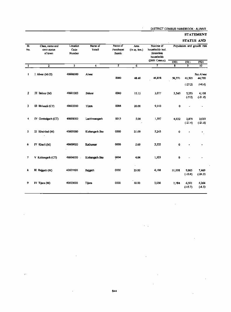
DISTRICT CENSUS HANDBOOK: ALWAR
STATEMENT
STATUS AND
SI. Class, name and Location Name of Name of Area Number of Population and growth rate No. civic stutus Code Tehsil Panchayat (in sq. km.) households incl.
of town Number Samitl Houseless households
(2001 Census) 1901 1911 1921
2 3 4 5 6 7 8 9 10
I Alwar (M.el) 40606000 Alwar SeeAlwar 0000 48.40 46,878 56,771 41,305 44,760
(-27.2) (+8.4)
2 III Bchror (M) 4060)000 Behror 0000 15.12 3,977 5,540 5,253 4,108 (.5.2) (.21.8)
3 III Bhiwadi (Cn 40602000 Tijara 0006 20.00 9,143 0
4 IV Govindgarh (eT) 40608000 Lachhmangarh 0013 5.00 1,597 4,932 3,879 3,033 (-21.4) (-21.8)
5 III Khairthal (M) 40605000 Kishangarh Bas 0000 21.09 5,245 0
6 IV Kherli (M) 40609000 Kathumar 0000 5.00 2,532 a
7 V Kishangarh (eT) 40604000 ' Kishangarh Bas 0004 4.04 1,503 0
8 III Rajgarh (M) 40607000 Rajgarh 0000 25.00 4,198 11,008 9,865 7,469 (-10.4) (-24.3)
9 IV Tijara (M) 40603000 Tijara 0000 10.00 3,056 7,784 6,561 6,264 (.15.7) (-4.S)
644

TOWN DIRECTORY
-I
GROWTH HISTORY (in brackets) of the town Bt the Censuses of Density Sex ratio Class, nllme lind
(2001 civic status Census) of town
1931 1941 1951 1961 1971 1981 1991 2001 1981 1991 2001 11 12 13 14 15 16 17 18 19 20 21 22 2
Urban Agglomeration 1 Alwar (M.el) 47,900 54,143 57,868 72,707 100,378 145,795 205,086 266,203 5,500 822 857 853
(+7.0) (+13.0) (+6.9) (+25.6) (+38.1) (+45.3) (+40.7) (+29.8)
4,132 4,514 4,465 0 0 0 16,238 22,856 1,512 - 816 859 III Behror (M) (+0.6) (+9.2) (-1.1) (+40.8)
0 ° ° ° 15,285 33,877 1,694 - 511 577 III Bhiwadi (CT) (+121.6)
2,843 3,028 3,159 0 ° ° 7,991 10,089 2,018 - 935 905 IV Govindgarh (CT) (-6.3) (+6.5) (+4.3) (+26.3)
0 0 ° 10,687 15,962 22,741 32,005 1,518 870 879 881 m Khairthal (M) (+49.4) (+42.5) (+40.7)
0 3,816 3,137 4,798 8,046 12,263 15,506 3,101 836 840 866 IV Kherli (M) (-17.8) (+53.0) (+67.7) (+52.4) . (+26.4)
0 0 0 0 0 9,473 2,345 - 876 V Kishangarh (en
7,683 9,165 9,485 12,048 11,019 14,199 20,224 25,009 1,000 857 889 874 III RlUgarh (M) (+2.9) (+19.3) (+3.5) (+27.0) (-8.5) (+28.9) (+42.4) (+23.7)
6,272 7,380 5,296 0 0 12,199 15,399 19,921 1,992 903 903 899 IV Tijara (M) (+0.1) (+17.7) (-28.2) (+26.2) (+29.4)
645
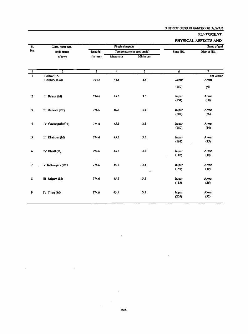
DISTRICT CENSUS HANDBOOK :ALWAR
STATEMENT
PHYSICAL ASPECTS AND
SI. Class. name and Physical aspects Name of and No. civic status Rainfall Tempemture (in centigrade) StateHQ. District HQ.
of town (in mm) Maximum Minimum
2 3 4 5 6 7
I AlwarUA See Alwar I Alwar (M.Cl) 774.6 45.5 3.5 Jaipur Alwar
(ISO) (0)
2 III Behror (M) 774.6 45.5 3.5 Jaipur Alwar (134) (60)
3 Ul Bbiwadi reT} 714.6 45.5 3.5 Jaipur Alwar (205) (85)
4 IV Govindgarh (CT) 774.6 45.5 3.5 Jaipur Alwar (180) (44)
5 III Khairthal (M) 774.6 45.5 3.5 Jaipur Alwar (165) (35)
6 IV Kherli(M) 774.6 45.5 3.5 Jaipur Alwar (142) (80)
7 V Kishllngarh (en 774.6 45.5 . 3.5 Jaipur Alwar (ISO) (40)
8 III Rajgarb (M) 774.6 45.5 3.5 Jaipur Alwar (113) (36)
9 IV Tijam(M) 774.6 45.5 3.5 Jaipur Alwar (205) (55)
646
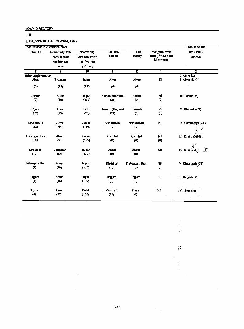
TOWN DIRECTORY
-II
LOCATION OF TOWNS, 1999
road distance in kilometer(s) from . Class, name and
Tehsil HQ. Nearest city-with Nearest city Railway Bus Navigable river! civic status
population of with population Station facility canal (if within ten of town
onclakh and of five lakh ki lometers)
more and more
8 9 10 II 12 13 2
Urban Agglomeration I AlwarUA Alwar Bharatpur Jaipur Alwar Alwar Nil I Alwar (M.el)
(0) (88) (150) (0) (0)
Behror Alwar Jaipur Namaul (Haryana) Behror Nil III Behror (M) (0) (60) (134) (25) (0) (0)
Tijara Alwar Delhi Rcwari (Haryana) Bhiwadi Nil m Bhiwadi (CT) (32) (8S) (75) (27) (0) (0)
Laxmangarh Alwar Jaipur Govindgarh Govindgarh Nil IV Govindga(h (CT) (22) (44) (180) (0) (0)
}' ·S-.,
Kisbangarh Bas Alwar Jaipur Khairthal Khairthal Nil In Khairthal;(M) ;,. (10) (35) (165) (0) (0) (0)
::.-,~
:I~ ~~: Kathumar Bharatpur Jaipur Kherli Kherli Nil IV KherJl {M); . ~_I:': '
(12) (65) (150) (0) (0)
KishllngarlJ Bas Alwar Jaipur Khairthal Kishangarh Bas Nil V Kishangarh~(CT) (I) (40) (150) (10) (0) (0)
Rajgarh Alwar Jaipur Rajgarh Rajgarh Nil III Rajgarh (M) (0) (36) (liS) (0) (0)
Tijara Alwar Delhi Khairthal Tijara Nil IV Tijara (M).-(0) (55) (105) (28) (0)
t·, .'.. ...
647
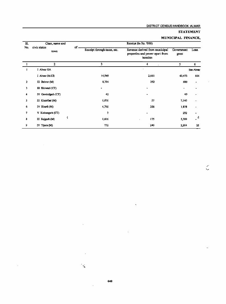
DISTRICT CENSUS HANDBOOK :ALWAR
STATEMENT
MUNICIPAL FINANCE,
S!. Class, name and Receipt (in Rs. '000) No. civic status of
town Receipt through taxes, etc. Revenue derived from municipal Government Loan properties and power apart from grant
taxation
2 3 4 5 6
I AlwBrUA See Alwar
I Alwar (M.CI) 14,949 2,661 43,473 664
2 III lIehror (M) 8,794 252 600
3 III Bhiwadi (CT)
4 IV Govindgarh (CT) 42 40
5 III KhBirthBI (M) 1,876 57 7,140
6 IV Kherli(M) 4,705 356 1,878
7 V Kishangarh (CT) 7 292
8 III Rajgarh (M) .j
1,416 175 5,399 ,t
9 IV Tijara (M) 772 240 2,204 22
648
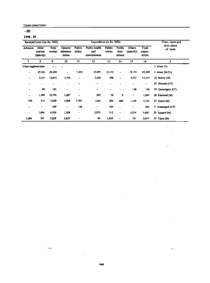
TOWN DIRECTORY
-III
1998 - 99
Receipt(Contd.) (in Rs. '000) Expenditure (in Rs. '000) Class, name and civic status
Advance Other Total General Public Public health Public Public Others Total .of town sources receipt administ- safety and works insli- (specifY) expen-
(specifY) ration conveniences tutions diture
7 8 9 10 11 12 13 14 IS 16 2
Urban. Agglomeration I AlwarUA
27,522 89,268 7,109 35,097 25,172 18,191 85,568 I Alwar (M.eL)
3,167 12,813 2,754 3,642 366 5,351 12,113 III Behror (M)
III Bhiwadi (CT)
99 181 156 156 IV Govindgarh (CT)
1,304 10,376 1,287 293 78 9 1,667 III Khairthal (M)
574 316 7,829 1,008 1,767 1,645 904 669 1,159 7,152 IV Kherli (M)
299 120 100 220 V Kishangarh (CT)
1,605 8,596 1,388 2,973 312 5,014 9,687 III Rajgarh (M)
1,684 l07 5,229 l,833 84 1,859 181 5,957 IV Tijar8 (M)
649
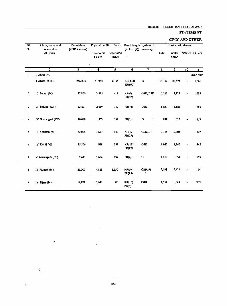
DISTRICT CENSUS HANDBOOK :ALWAR
STATEMENT
CIVIC AND OTHER
SI. Class, name and Population Population 200 I Census Road length System of Number of latrines No. civic status (2001 Census) (in km. (s» sewerage
of town Scheduled Scheduled Total Water Service Others Castes Tribes borne
2 3 4 5 6 7 8 9 10 11
I AlwarUA SeeAlwar
I Alwar (M.CI) 266,203 41,943 8,195 KR(432) 8 37,134 28,474 8,660 PR(692)
2 III Behror (M) 22,856 3,575 419 KR(6) OSO,B80 3,161 2,123 1,038 PR(37)
3 III Bhiwadi (CT) 33,877 . 2,839 152 PR(IO) 080 5,837 5,181 656
4 IV Govindgarh (CT) 10,089 1,553 388 PR(3) PI 878 625 253
5 III Khairthal (M) 32,005 7,657 133 KReI2) 080,5T 3,115 2,608 507 PR(2S)
6 IV Kherli (M) 15,506 968 398 KR(IS) 050 1,982 1,540 442 PR(12)
7 V Kishangarh (CT) 9,473 1,604 137 PR(2) a 1,019 854 16S
8 III Rajgarh (M) 25,009 4,823 1,1 SO KR(S) OSO, Pt 2,298 2,124 174 PR(25)
9 IV Tijara (M) 19,921 3,647 80 KReiS) OSO 1,554 1,249 305 PR(6)
650
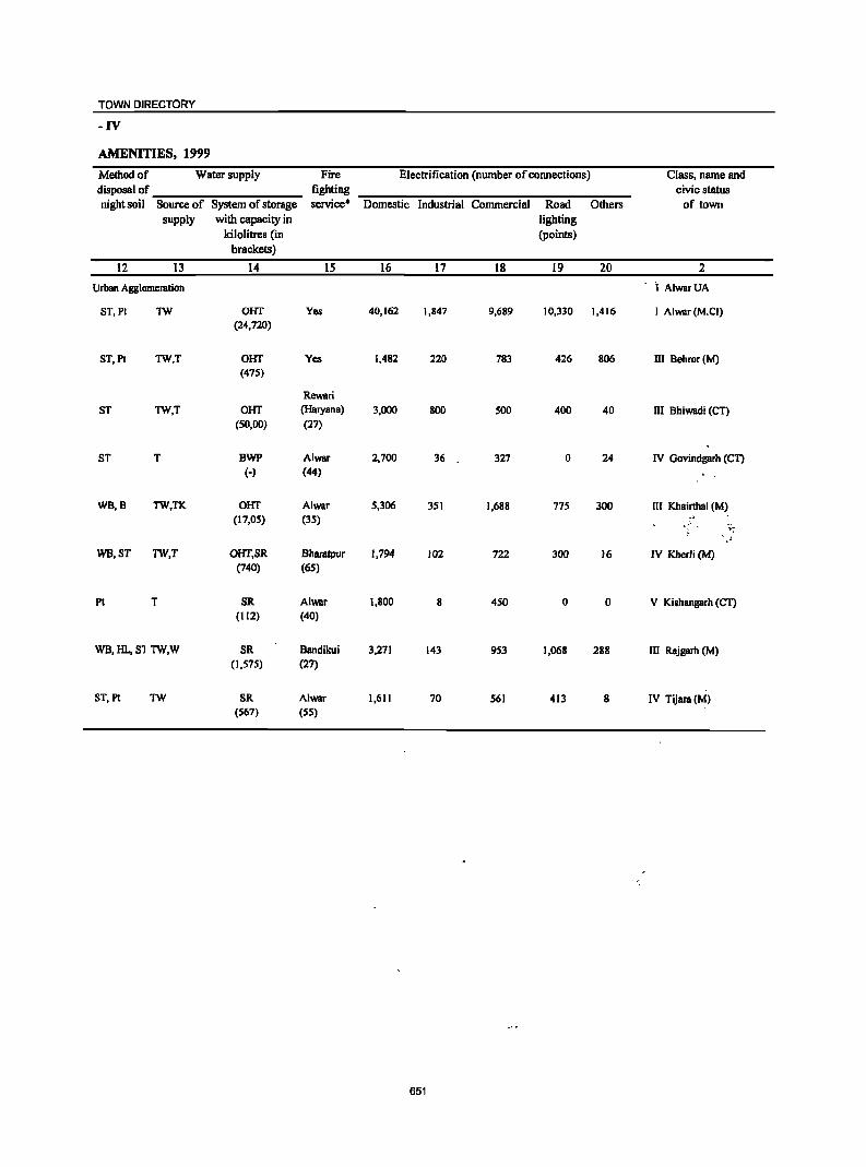
TOWN DIRECTORY
-IV
AMENITIES, 1999
Method of Water supply Fire Electrification (number of connections) Class, name and disposal of fighting civic status night soil Source of System of storage service· Domestic Industrial Commercial Road Others of town
supply with capacity in lighting kilolitres (in (points)
brackets)
12 13 14 15 16 17 18 19 20 2
Urban Agglomeration ·1 AlwarUA
ST,PI TW OHT Yes 40,162 1,847 9,689 10,330 1,416 I Alwar (M.el) (24,720)
ST,PI TW,T OHT Yes 1,482 220 783 426 806 III Behror (M) (475)
Rewari ST TW,T OHT (HIIryana) 3,000 800 500 400 40 m Bhiwadi (CT)
(SO,DO) (27)
ST T BWP Alwar 2,700 36 327 0 24 IV Govindgarh (en (-) (44)
WB,B TW,TK OHT Alwar 5,306 351 1,688 775 300 III Khairthal (M) (17,05) (35)
.:~ . :. .. \~
WB,ST TW,T OHT,SR Bharatpur 1,794 102 722 300 16 IV Kherli (M) (740) (65)
Pt T SR Alwar 1,800 8 450 0 0 V Kishangarh (en (112) (40)
WB,HL,S1 TW,W SR Bandikui 3,271 143 953 1,068 288 III Rajgarh (M) (1,575) (27)
ST, PI TW SR Alwar 1,611 70 561 413 8 IV Tijara (M) (567) (55)
651
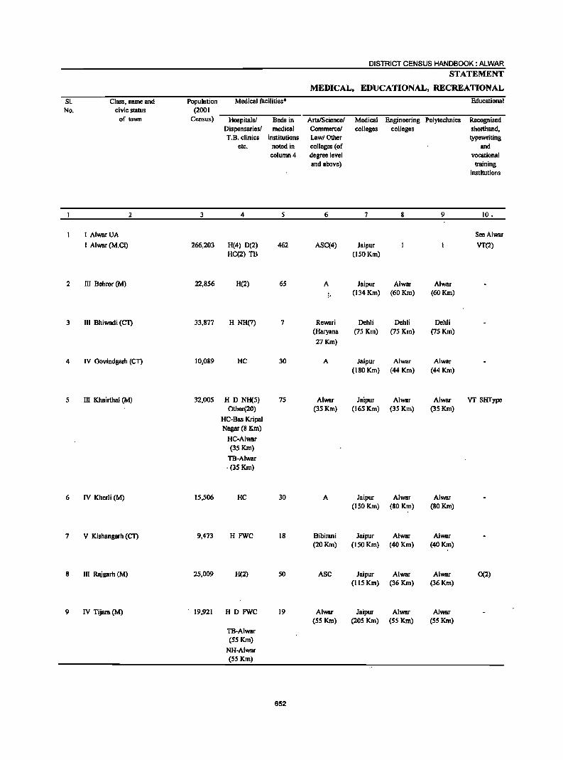
SI. No.
:2
3
4
5
6
7
8
9
Class, name and civic status
of town
:2
I AlwarUA
I Alwar (M.CI)
III Behror (M)
III Bhiwadi (CT)
IV Govindgarh (CT)
III Khairthal (M)
IV Kherli(M)
V Kishungarh (eT)
III Rajgarh (M)
IV Tijara (M)
Population (2001
Census)
3
266,203
22,856
33,877
10,089
32,005
15,506
9,473
25,009
19,921
Medical facilities·
Hospitalsl Beds in Dispensaries! medical T.B. clinics institutions
etc. noted in column 4
4 5
H(4) D(2) 462 HC(2) TB
H(2) 65
H NH(7) 7
HC 30
H D NH(5) 75 Other(20)
HC-Bas Kripal Nagar(S Km)
HC-Alwar (35 Km)
TB-Alwar . (35Km)
HC 30
H FWC 18
H(2) 50
H D FWC 19
TB-Alwar (55 Km)
NH-Alwar (55 Km)
652
DISTRICT CENSUS HANDBOOK: ALWAR
STATEMENT
MEDICAL, EDUCATIONAL, RECREATIONAL
Educational
ArtBlSciencel Medical Engineering Polytechnics Recognised Commerce! colleges colleges shorthand, Law/Other typewriting colleges (of and degree level vocational and above) training
institutions
6 7 8 9 10.
SeeAlwar
ASC(4) Jaipur VT(2) (150 Km)
A Jaipur Alwar Alwar , (134 Km) (60 Km) (60Km) ,.
Rewari Dehli Dehli Dehli (Haryana (75 Km) (75 Km) (75 Km)
27Km)
A Jaipur Alwar Alwar (180Km) (44 Km) (44 Km)
AIWllr Jaipur Alwar Alwar VT SHType (35Km) (165 Km) (35 Km) (35 Km)
A Jaipur Alwar Alwar (150 Km) (80 Km) (80Km)
Bibirani Juipur Alwar Alwar (20Km) (150 Km) (40Km) (40Km)
ASe Jaipur Alwar Alwar 0(2) (115 Km) (36Km) (36Km)
Alwar Juipur Alwar Alwar (55 Km) (205 Km) (55 Km) (55Km)
TOWN DIRECTORY
-v AND CULTURAL FACILITIES, 1999
facilities· Number of recreational and Class, name and cultural facilities civic status
Higher Secondaryl Junior Primary Adult Working Stadium Cinema Audit- Public of town
secondaryl Matri- secondary schools literacy women's oriuml libraries Intermediate! culation and classes! hostels Drama! including
Senior Middle centres, with commu- reading Secondaryl schools others number of nily Halls rooms PUC (Pre- (specifY) sealS university
college)! Junior college
level
11 12 13 14'- IS 16 17 18 19 20 2
Urban Agglomeration I AlvyarUA
18 26 23 98 II 1 (32) 3 PL(3) [ Alwar(M.CI) RR(3)
2 2 12 16 2 Alwar PL RR m Behror (~), (60Km)
;
~,
2 3 Delhi 4 In Bhiwadi (en.." (75Km) .. 'i~. "::"i." -.
~-;;[ . .• ,l'P'
2 2 3 Alwar -IV Govindgarh (CT) (44Km)
Alwar (35 Km) 4 3 6 2 Alwar m Khairthal (M) (35 Km)
2 5 17 9 2 Bharatpur RR IV: Kherli (M) (65Km)
"..-
3 4 10 Alwar V Kishangarh (CT) (40Km)
i~· 2 2 14 17 2 Alwar PL RR -'Iii Rajgarh (M)
(36Km)
3 3 S 6 2 Alwar PL RR .IV Tijara (M) (55 Km)
653
DISTRICT CENSUS HANDBOOK: ALWAR
STATEMENT
TRADE, COMMERCE, INDUSTRY
SI. Class, name and Name of three most important No. civic status commodities exported
of town 1st 2nd 3rd
2 3 4 5
I AlwarUA SeeAlwar
I Alwar (M.CI) Men Made Fabring Sand Stone,Grainite Deco.Leminated Paper
2 UI Behror (M) Mustard Wheat Bazra
3 UI Bhiwadi (CT) Rubber Goods Steel Goods Silk Thread
4 IV Govindgarh (CT) Mustred Wheat Gram
5 III. Khairthal (M) Oil Onion Cotton
6 IV Kherli (M) Mustard Wheat Gram
7 V Kishangarh (Cn
8 III Rajgarh (M) Vegetable Oil Gram Stone Powder
9 IV Tijara{M) Wheat Mustard Oil Mustard
654
TOWN DIRECTORY
-VI
AND BANKING, 1999
Name of three most important Number Number of Number of non- Class, name and commodities manufactured of banks agricultural agricultural civic status
1st 2nd 3rd credit credit societies of town societies
6 7 8 9 10 11 2
Urban Agglomeration I AlwarUA
Vegitable Ghee Granite Tiles Filter Expaler 20 I Alwar (M.CI) Oil
Cement Sunmica Granite 5 III Behror(M)
Rubber Goods Steel Goods Silk Thread 6 III Bhiwadi (CT)
Leather Mojari Oil Cake Oil IV Govindgarh (CT) Shoes
Lather Shoes Oil Pulses 6 2 III Khairthal (M), ~ , ,
Iron Febrication Musterd Oil Iron Boxes 4 IV Kherli (M)
2 V Kishangarh (CT)
Stone Powder LimeStone Mustrd Oil 7 III Rajgarh (M)
Electric Goods Cloth Medicine 3 IV Tijara (M)
655
SI. No.
2
Alwar
Khairthal
Class and
name of town
2
.J
Name of the slum
3
I. Galib Saiyad
2. Teej Ke Paschim
3. Hajuri Darwaja Bahar
4. Manglasar Harijan Basti
5. Familc Line
6. Mohalla Khadana
7. ShyolalpurB
8. Seth Ki Bawari
9. Lal Khan
10. Akhaipur
11. Behind Gopal Talkies
12. Nangli Kota
13. Khohra
14. Sonaba South
15. Sonaba North
16. Karoli Kunda
17. Behind Petrol Pump
1. Maliwara Ward No. 1
2. Aheerwada VBlmiki Basti Ward No.3
3. Jogi Wara Ward No.4
4. Harijan Basti Ward No.6
S. Harijan Basti Ward No.8
656
Is it notified
4
No
No
No
No
No
No
No
No
No
No
No
No
No
No
No
No
No
No
No
No
No
No
DISTRICT CENSUS HANDBOOK: ALWAR
STATEMENT
CIVIC AND OTHER AMENITIES
No. of households
(approximate)
5
.145
90
118
35
353
124
92
79
647
301
112
70
166
58
198
86
107
24
26
35
25
43
Population oflheSIum
(approxima~)
6
930
567
656
168
1,920
977
526
395
4,058
1,695
651
442
922
294
1,093
497
781
140
160
350
144
400
Paved roads (in
kilometers)
7
2
2
2
2
0
0
0
0
System of sewerage
8
0
0
0
0
0
0
0
0
0
0
0
0
0
0
0
0
0
0
0
0
0
0
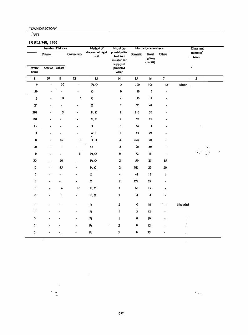
TOWN DIRECTORY
-VII
IN SLUMS, 1999 Number oflatrines Method of No, of tap Electricity connections Class and
Private Community disposal of night points/public
Domestic Road Others name of soil hydrants
lighting town installed for
supply of (points)
Water Service Others protected borne water
9 10 II 12 13 14 15 16 17 2
0 50 PI, 0 3 100 105 45 Alwar
50 0 0 80 5
0 9 0 4 80 17
20 0 20 42
202 3 PI,O 210 30
104 Pt,a 2 26 25
15 0 5 68 8
8 WB 3 49 29
0 50 PI, 0 5 396 70
20 0 3 90 50
0 Pt,O 0 72 18 .,' '
30 50 PI,a 2 50 25 15
10 95 PI,O 2 105 20 20
0 0 4 48 19
0 a 2 179 27
0 4 16 PI,O 60 17
0 3 Pt,O 2 4 4
Pt 2 0 10 Khairthal
'I PI 3 12
3 PI 0 10
2 PI 2 0 12
3 PI 3 0 23
657
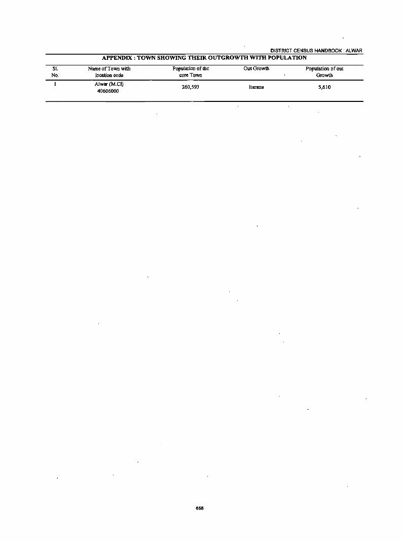
SI. No.
DISTRICT CENSUS HANDBOOK: ALWAR APPENDIX: TOWN SHOWING THEIR OUTGROWTH Wlm POPULATION
Name of Town with location code
Alwar (M.el) 40606000
Population of the core Town
260,593
658
OutGrowth
ltarana
Population of out Growth
5,610
PART-B : PRIMARY CENSUS ABSTRACT

Brief note on Primary Census Abstract
The first census of the third millennium and twenty first century the Census of India. 200 I was the
14th continuous and uninterrupted In~ian census since 1872. Thus, 2001 Census will provide data on population and its characteristics marking transition from one century and millennium to another.
The gigantic operation of Population Enumeration (considered by many to be the s'ingle largest and complex peace time administrative exercise in the world) was made possible due to the door to door universal canvassing of the Household Schedule by about 2 million enumerators and supervisors covering 593 districts, 5,463 sub-districts, 5,161 towns and 638,588 villages. The comprehensive Household Schedule which replaced the individual slip had three parts and two sides A and B. Part I contained the Location Particulars; Part II related to the Individual Part,iculars and Part III contained questions for Household engaged in CultivationIPlantation. The part II of the Household Schedule had 39 columns and 23 questions all of which were universally canvassed and no sampling was resorted to during enumeration.
Data Processing
A quantum leap was made in the technology front while processing the Census 200 I data both for Houselisting and Population Enumeration. The Census schedules for both the phases were scanned through high speed scanners in fifteen data centers across the country and hand-written data from the schedules were converted into digitized form through Intelligent Character Reading (ICR) software for creation of ASCII records for further processing. The designing and formatting of the Household Schedule had to be done very carefully using specialized software so as to ensure uniformity, which was an essential prerequisite for scanning. The selection of appropriate state-of-art technology in data processing has made it possible to produce all the Houselisting as well as Population Enumeration tables on full count basis for the first time in the history of Census. For Census 200 I, about 202 million schedules consisting of about' -1,028 million records were scanned and processed
661
within a span of only 10 months starting October, 2002.
Task Force on Quality Assurance
After the data is processed, it is expedient on the part of the data producing agency to satisfy itself about its quality before putting the same in public domain. This has to be done mainly throllgh the process of internal consistency, comparison with similar data in the past and also through validation with likewise data if available, from external sources. Quite often the local knowledge and perception has to be brought into play to understand both the existing and the new emerging trends of population distribution and characteristics. The other very important aspect of the data quality is to ensure complete,coverage of all geographical areas especially for the population enumeration phase where the data is disseminated right up to the village level in the rural areas and the ward level in the urban areas. Thus ensuring the complete coverage and correct geographical linkage of each enumeration block was one of the major planks of the quality control, specially for small area population statistics.
A very comprehensive check and ·edit mechanism was put in place to objectively examine the preliminary Census 2001 Population Enumeration results and finaIJy clear them for use. The responsibility of the final clearance of data was. with the Task Force on Quality Assurance (TFQA), headed by the Registrar General and Census Commissioner, India. The other members of the TFQA were the Heads and senior officers of the Census Division, Data Processing Division, Map Division, Demography Division and Social Studies Division. The Directors of Census Operations were co-opted as members whenever the TFQA discussed the data for their StateslUnion territories. The Directors and their senior officers were required to make detailed presentations of data for their own state both in respect to the quality and the coverage and only after t~e full possible cleared.
There has been a major departure in Census 2001 from the past in respect of the procedure foHowed for finalization of the Scheduled Castes and the Scheduled Tribes population. In the earlier censuses, the total Scheduled Castes and Scheduled Tribes populations were finalized at the time of the manual compilation of the Primary Census Abstracts (PCA) at the Regional Tabulation Offices which were specially set up for this purpose. The individual Scheduled Castes and the Scheduled Tribes population for each state was finalized much later based on manual coding done by the coders. In 2001 Census, each individual Scheduled Caste and the Scheduled Tribe have been coded directly on the computers by the Data Entry Operators through a process known as Computer Assisted Coding (CAC) and taken up along with the processing of PCA data. The CAC process involves pulling down, from the relevant dictionary of the Scheduled Castes and the Scheduled Tribes, on the computer screen and coding from the diction~ by referring to the image of the speCific individual entry in the Household Schedule appearing on the screen. The CAC of the response on Religion wherever required, was, also undertaken along with the processing of PC A. This is because the Scheduled Castes status had to be determined in relation to the religion of the individual. Two Special Task Force", one on Religion and the other on Scheduled Castes! Scheduled Tribes were constituted for scrutiny and appropriate classification of these responses.
The main task of the Special Task Force on Religion was to appropriately merge or group the new responses encountered and code it into the appropriate religious community based on available literature and local knowledge. The Special Task Force on Scheduled Castes and Scheduled Tribes examined the different Scheduled Castes and Scheduled Tribes .entries encoun-tered and classified these into appropriate category of the Scheduled Castes or the Scheduled Tribes principally based on the Presidential Notification and the available literature. Thus a very systematic and scientific mechanism was operationalised to firm up the individual religion and the individual, Scheduled CasteslTribes returns. The Scheduled Castes and the Scheduled Tribes population in 2001 Census, is thus being finalized by aggregating the population data for individual Scheduled Castes and the Scheduled Tribes at appropriate geographical levels.
662
DISTRICT CENSUS HANDBOOK: ALWAR
The entire work relating to the data validation and scrutiny was completed by all the States/Union Territories under the overall supervision and monitoring of the Census Division of the Office of the Registrar General, India with active cooperation and support of the Social Studies Division, Data Processing Division, Data Dissemination Division and Map Division.
Primary Census Abstract
The Primary Census Abstract which is yet another important publication of 200 I Census gives basic information on Area, Total Households, Total population, Scheduled Castes, Scheduled Tribes population, Population in the age group 0-6, Literates, Main workers and Marginal workers classified by the four broad industrial categories, namely, (i) Cultivators, (ii) Agricultural labourers, (iii) Household Industry Workers, and (iv) Other workers and also Non-workers. The characteristics of the Total Population includes Scheduled Castes, Scheduled Tribes, Institu-tional and Hou~eless population and are presented by sex and rural-urban residence. This data is presented at different levels, namely, India, StateslUnion territories, Districts and Cities, Urban Agglomerations (Population 1,00,000 and above) in three different tables. In addition, the Appendix of said publication provides Houseless and Institutional Households and their population by residence and sex for 2001 for India, State and Union territory.
Apart from the India and StatelUnion Territory volumes for Primary Census Abstract, the District Census Handbook contains District Primary Census Abstract, Appendix to District Primary Census Abstract, Primary Census Abstract for Scheduled Castes, Primary Census Abstract for Scheduled Tribes, Village Primary Census Abstract and Urban Primary Census Abstract of the concerned district in the state.
It was for the first time at the 1981 Census that the Primary Census Abstract (PCA) was brought out for the Scheduled Castes and the Scheduled Tribes separately on the pattern of General Primary Census Abstract. This practice was continued in 1991 also. In the 1961 and 1971 Censuses, such data were made available in Table C-VIII-Social and Cultural table and to some extent in the series 'Special Tables for Scheduled Castes/Scheduled Tribes'.
PRIMARY CENSUS ABSTRACT
The format of Primary Census Abstract has been restructured slightly in the 2001 Census as compared to that of 1991 Census. The nine-fold industrial classification of main workers given in the Primary Census Abstract of 1991 Census has been discontinued and its place, four-fold industrial classification of both 'main workers' and 'marginal workers' are included. In 1981 census only main workers were presented in to four categories. One of the novel features of the primary census abstract of 1991 census was the presentation of data of the population of age group 0-6 is continued in
Name of the Primary Census Abstract
1. District Primary Census Abstract
2001 Census also. This will help the data users in better analysis and understanding of this literacy data.
Level of presentation in District Census Handbooks
The Primary Census Abstract data in different PCAs are presented at different levels. The level of presentation of Primary Census Abstracts are as under:
Level of presentation
2. Primary Census Abstract for Scheduled Castes DistrictlPanchayat SamitilUA/Cityrrown DistrictlPanchayat Samitirrown DistrictlPanchayat SamitilTo~ Panchayat SamitilViliage wise
3. Primary Census Abstract for Scheduled Tribes 4. Village Primary Census Abstract 5. Urban Primary Census Abstract
The PCA Data for villages was presented Panchayat Samiti wise for the first time in 1991 Census. This practice is continued in 2001 Census also. The data for each Panchayat Samiti is presented both for rural and urban areas separately. All the villages within the Panchayat Samiti constitute the rural portion and the Census Towns and Outgrowths are shown under the urban portion of the Panchayat Samiti. In case a Panchayat Samiti is spread over two or more districts, than portion which falls within the district is presented, the data pertaining to remaining portion of the Panchayat Samiti is presented in the concerned District Census Handbook. The data in the Urban Primary Census Abstract for each town as well as for town with outgrowths in the 'district are presented. The data for all the wards and the outgrowths of the town(s) are also presented separately below the concerned town(s).
The District Primary Census Abstract is presented in 59' columns. The Primary Census Abstract for Scheduled Castes and Primary Census Abstract for Scheduled Tribes are presented in 52 columns. The VilJage Primary Census Abstract and Urban Primary Census Abstract are presented in 58 columns.
The concepts and definitions used in the column heading are explained under the sub heading 'Census Concepts' in the Analytical Note. The term 'Total Population' includes, ~e Scheduled Castes, the Scheduled Tribes, the Institutional and the Houseless popUlations. The explanation regarding area figures
663
TownlWard level '.
presented at various level in the Primary Census Abstracts are as follows:
Area Figures
The area figures supplied by local revenue authorities of the district in respect oftehsils, and by the local bodies in respect of towns are giv~~ in square kilometers. The area figures of the villages supplied by the Tehsildars in acres have been converted and shown in hectares. The area figures of the Panchayat Samiti is the total oftlte village areas coming under each Panchayat Samiti. The area figures for the district are the same as adopted by the Surveyor General ofIndia to maintain uniformity at the national level. The total area figures of all the tehsilsl Panchayat Samiti within the district may not tally with area figures of the district because former represents land use area only. Similarly, the total of all the villages may not tally with the entire rural of Tehsil. The difference may be due to the fact that while the area covered by hills, forests and rivers etc, have been accounted in the Tehsils and Panchayat Samiti level the same may not be covered under the area of the villages. Apart from this it may also differ due to varying methods of computation adopted at different levels.
An appendix to District Primary Census Abstt_act has also been furnished showing urban enumeratipn block-wise particulars on Total Population, the Scheduled Castes Population and the Schedqled Tribes Population for each town.
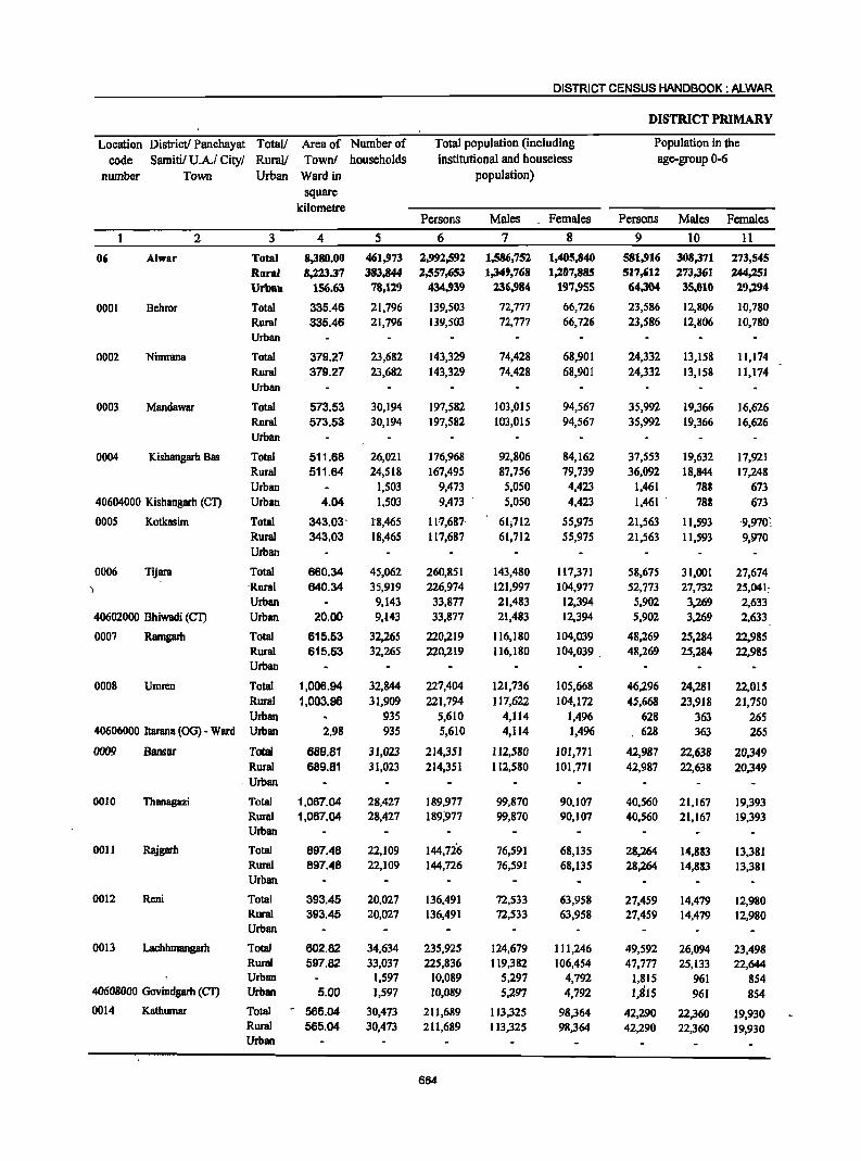
DISTRICT CENSUS HANDBOOK: ALWAR
DISTRICT PRIMARY
Location District! Panchayat Total/ Area of Number of Total population (including Population in the code Samitil U.A.I City/ Rural/ Town! households institutional and houseless age-group 0-6
number Town Urban Ward in population) square
kilometre Persons Males Females Persons Males Females
2 3 4 5 6 7 8 9 10 11
06 Alwar Total 8,380.00 461,973 2,992,592 1,586,752 1,405,840 581,916 308,371 273,545 Rural 8,223.37 383,844 2,557,653 1,349,768 1,207,885 517,612 273,361 244,251 Urban 156.63 78,119 434,939 136,984 197,955 64,304 35,010 29,194
0001 Behror Total 335.46 21,796 139,503 72,777 66,726 23,586 12,806 10,780 Rural 335.46 21,796 139,503 72,777 66,726 23,586 12,806 10,780 Urban
0002 Nimrana Total 379.27 23,682 143,329 74,428 68,901 24,332 13,158 11,174 Rural 379.27 23,682 143,329 74,428 68,901 24,332 13,158 11,174 Urban
0003 Mandawar Total 573.53 30,194 197,582 103,015 94,567 35,992 19,366 16,626 Rural 573.53 30,194 197,582 103,015 94,567 35,992 19,366 16,626 Urban
0004 Kishangarh Bas Total 511.68 26,021 176,968 92,806 84,162 37,553 19,632 17,921 Rural 511.64 24,518 167,495 87,756 79,739 36,092 18,844 17,248 Urban 1,503 9,473 5,050 4,423 1,461 788 673
40604000 Kishangarh (CT) Urban 4.04 1,503 9,473 5,050 4,423 1,461 . 788 673
0005 Kotkasim Total 343.03- 1"8,465 . 11'7,687· 61;712 55,975 21,563 11,593 '9,970:. Rural 343.03 18,465 117,687 61,712 55,975 21,563 11,593 9,970 Urban
0006 Tijara Total 660.34 45,062 260,851 143,480 117,371 58,675 31,001 27,674 ) 'Rural 640.34 35,919 226,974 121,997 104,977 52,773 27,732 25,041;
Urban 9,143 33,877 21,483 12,394 5,902 3,269 2,633 40602000 Bhiwadi (Cl') Urban 20.00 9,.143 33,877 21,483 12,394 5,902 3,269 2,633
0007 Ramgarh Total 615.53 32,265 220,219 116,180 104,039 48,269 25,284 22,985 Rural 615.53 32,265 220,219 116,180 104,039 . 48,269 25,284 22,985 Urban
0008 Umren Total 1,006.94 32,844 227,404 121,736 105,668 46,296 24,281 22,015 Rural 1,003.96 31,909 221,794 117,622 ]04,172 45,668 23,918 21,750 Urban 935 5,610 4,114 1,496 628 363 265
40606000 Itarana (OG) - Ward Urban 2.98 935 5,610 4,114 1,496 628 363 265
0009 Bansur Total 689.81 31,023 214,351 112,580 101,771 42,987 22,638 20,349 Rural 689.81 31,023 214,351 112,580 101,771 42,987 22,638 20,349
. Urban
0010 Tbanagazi Total 1.067.04 28,427 189,977 99,870 90,107 40,560 21,167 19,393 Rural 1,067.04 28,427 189;977 99,870 90,107 40,560 21,167 19,393 Urban
0011 Rajgarh Total 897.48 22,109 144,726 76,591 68,135 28,264 14,883 13,381 Rural 897.48 22,109 144,726 76,591 68,135 28,264 14,883 13,381 Urban
0012 Reni Total 393.45 20,027 136,491 72,533 63,958 27,459 14,479 12,980 Rural 393.45 20,027 136,491 72,533 63,958 27,459 14,479 12,980 Urban
0013 Lachhmangarh Total 602.82 34,634 235,925 124,679 111,246 49,592 26,094 23,498 Rural 597.82 33,037 225,836 119,382 106,454 47,777 25,133 22,644 Urban 1,597 10,089 5,297 4,792 1,815 961 854
40608000 Govindgarh (Cl') Urban 5.00 1,597 10,089 5,297 4,792 1,815 961 854 0014 Kathumar Total - 565.04 30,473 211,689 113,325 98,364 42,290 22,360 19,930
Rural 565.04 30,473 211,689 113,325 98,364 42,290 22,360 19,930 Urban
664
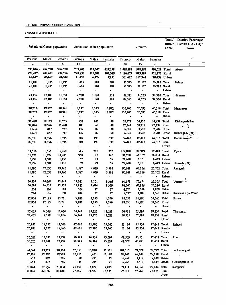
DISTRICT PRIMARY CENSUS ABSTRACT
CENSUS ABSTRACT
Total! District! Panchayat Rural/ Samitil UA/ City/
Scheduled Castes population Scheduled Tribes population Literates Urban Town
Persons Males Females Persons Males Females Persons Males Females
'12 13 14 15 16 17 18 19 20 3 2
539,036 .• 284,298 '254,738 239,905 1%7,707 ,112;198 1,488,281 .998,253 490,028 Total Alwar 470;427, 247,631 222,796 228,853, 121,508 107;345 1,186,679 '815;309 371,370 Rural 68,609 " '36,667 31,942 11,052 6;199 4;853 301,602 182,944 118,658 Urban
21,100,' 10,905 10,195 1,678 884 794 83,323 52,537 30,786 Total Behror 21,100 10,905 10,195 1,678 884 794 83,323 52,537 30,786 Rural
Urban
23,159 12,108 11,051 2,238 1,120 1,118 88,585 54,255 34,330 Total Nimrana 23,159 12,108 11,051 2,238 1,120 1,118 88,585 54,255 34,330 Rural
Urban
38,233· 19,892 18,341 6,137 3,145 2,992 110,905 70,595 40,310 Total Mandawar 38,233 19,892 18,341 6,137 3,145 2,992 110,905 70,595 40,310 Rural
Urban
36,428 19,173 17,255 237 147 90 78,974 54,136 24,838 Total Kish~garh Bas 34,824 18,326 16,498 100 60 40 72,347 50,213 22,134 Rural \
\" 1,604 847 757 137 87 SO 6,627 3,923 2,704 Urban 1,604 847 757 137 87 SO 6,627 3,923 2,704 Urban Kishangarh (Cl) ._ ..
" ,'~ v.. ... 22,731 11,796 10,935 887 490 397 66,440 42,425 24,015 Total Kotkasim.m:fl· _-
"
22,731 11,796 10,935 887 490 397 66,440 42,425 24,015 Rural Urban
34.516 18,556 15,960 SIS 290 225 114,810 82,323 32,487 Total Tijara 31,677 16,872 14,805 363 197 166 92,200 66,162 26,038 Rural 2,839 1,684 1,155 152 93 S9 22,610 16,161 6,449 Urban 2,839 1,684 1,155 152 93 59 22,610 16,161 6,449 Urban Bhiwadi:(CT)
41,796 22,030 19,766 7,587 4,079 3,508 90,068 64,366 25,702 Total Ramgarh' 41,796 22,030 19,766 7,587 4,079 3,508 90,068 64,366 25,702 Rural
Urban
50,307 26,662 23,645 18,087 9,701 8,386 97,979 70,674 27,305 Total i~ .
Umren '--!o':-
50,093 26,556 23,S37 17,983 9,624 8,359 93,202 66,966 26,236 Rural 214 106 108 104 77 27 4,777 3,708 1,069 Urban 214 106 108 104 77 27 4,777 3,708 1,069 Urban ltarana (OG) - Ward
32,954 17,183 15,771 9,186 4,790 4,396 98,6S5 66,890 31,765 Total Bansur 32,954 17,183 IS,171 9,186 4,790 4,396 98,6SS 66,890 31,765 Rural
Urban
27,465 14,399 13,066 36,249 19,226 17,023 70,931 52,599 18,332 Total Thanagazi 27,465 14,399 13,066 36,249 19,226 17,023 70,931 52,S99 18,332 Rural
Urban
26,843 14,077 12,766 42,660 22,700 19,960 63,156 45,514 17,642 Total Rajgarh 26,843 14,077 12~ 766 42,660 22,700 19,960 63,1S6 4S,S14 17,642 Rural ... _
Urban
26,020 13,781 12,239 50,525 26,916 23,609 61,509 43,871 17,638 Total Reni 26,020 13,781 12,239 50,525 26,916 23,609 61,509 43,871 17,638 Rural
Urban
44,061 23,327 20,734 26,191 13,870 12,321 102,515 72,768 29,747 Total Lachhmangarh 42,508 22,520 19,988 25,803 13,655 12,148 96,247 68,949 27,298 Rural
1,553 807 746 388 215 173 6,268 3,819 2,449 Urban 1,553 807 746 388 2'15 173 6,268 3,819 2,449 Urban Govindgarh (eT)
51,024 27,1~6 23,838 27,457 14,622 12,835 99,111 69,967 29,144 Total Katl:!{Far 51,024 27,186 23,838 27,457 14,622 12,835 99,111 69,967 29,144 Rural
Urban
665
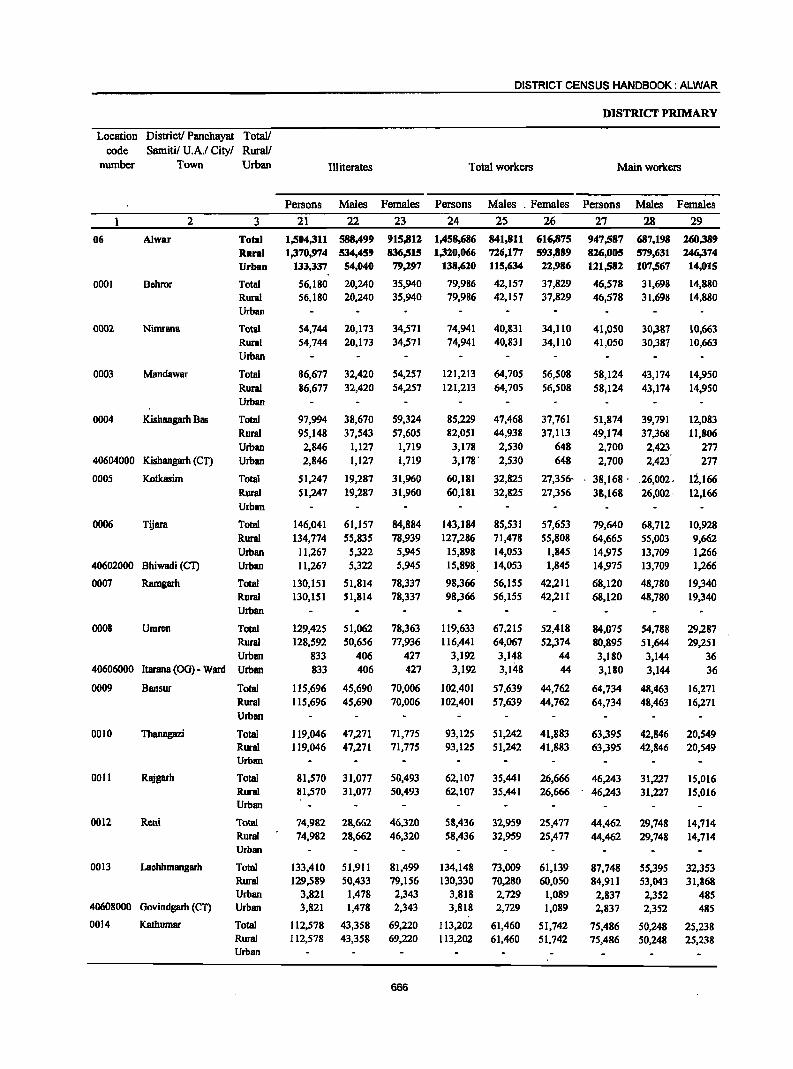
DISTRICT CENSUS HANDBOOK: ALWAR
DISTRICT PRIMARY
Location District! Panchayat Total! code Samiti! U.A.I City! Rural!
number Town Urban Illiterates Total workers Main workers
Persons Males Females Persons Males . Females Persons Males Females
2 3 21 22 23 24 25 26 27 28 29
06 Alwar Total 1,504,311 588,499 915,812 1,458,686 841,811 616,875 947,587 687,198 260,389 Rural 1,370,974 534,459 836,515 1,320,066 726,177 593,889 826,005 579,631 246,374 Urban 133,337 54,040 79;1.97 138,620 115,634 22,986 121,582 107,567 14,015
0001 Behror Total 56,180 20,240 35,940 79,986 42,157 37,829 46,578 31,698 14,880 Rural 56,180 20,240 35,940 79,986 42,157 37,829 46,578 31,698 14,880 Urban
0002 Nimrana Total 54,744 20,173 34,571 74,941 40,831 34,110 41,050 30,387 10,663 Ruml 54,744 20,173 34,571 74,941 40,831 34,110 41,050 30,387 10,663 Urban
0003 Mandawar Total 86,677 32,420 54,257 121,213 64,705 56,508 58,124 43,174 14,950 Rural 86,677 32,420 54,257 121,213 64,705 56,508 58,124 43,174 14,950 Urban
0004 Kishangarh Bas Total 97,994 38,670 59,324 85,229 47,468 37,761 51,874 39,791 12,083 Rural 95,148 37,543 57,605 82,051 44,938 37,113 49,174 37,368 11,806 Urban 2,846 1,127 1,719 3,178 2,530 648 2,700 2,423 217
40604000 Kishangarh (Cl') Urban 2,846 1,127 1,719 3,178· 2,530 648 2,700 2,423 277
0005 Kotkasim Total 51,247 19,287 31,960 60,181 32,825 27,356- 38,168· . . 26,002, 12,166 Rural 51,247 19,287 31,960 60,181 32,825 27,356 38,168 26,002· 12,166 Urban
0006 Tijara Total 146,041 61,157 84,884 143,184 85,531 57,653 79,640 68,712 10,928 Rural 134,774 55,835 78,939 127,286 71,478 55,808 64,665 55,003 9,662 Urban 11,267 5,322 5,945 15,898 14,053 1,845 14,975 13,709 1,266
40602000 Bhiwadi (CT) Urban 11,267 5,322 5,945 15,898 14,053 1,845 14,975 13,709 1,266
0007 Ramgarh Total 130,151 51,814 78,337 98,366 56,155 42,211 68,120 48,780 19,340 Rural 130,151 51,814 78,337 98,366 56,155 42,2lf 68,120 48,780 19,340 Urban
0008 Umrco Total 129,425 51,062 78,363 119,633 67,215 52,418 84,075 54,788 29,287 Rural 128,592 50,656 77,936 116,441 64,067 52,374 80,895 51,644 29,251 Urban 833 406 427 3,192 3,148 44 3,180 3,144 36
40606000 ltarana (00) - Ward Urban 833 406 427 3,192 3,148 44 3,180 3,144 36
0009 Bansur Total 115,696 45,690 70,006 102,401 57,639 44,762 64,734 48,463 16,271 Ruml 115,696 45,690 70,006 102,401 57,639 44,762 64,734 48,463 16,271 Urban
0010 Thanagazi Total 119,046 47,271 71,775 93,125 51,242 41,883 63,395 42,846 20,549 Rural 119,046 47,271 71,775 93,125 51,242 41,883 63,395 42,846 20,549 OrbBll
0011 Rajgarh Total 81,570 31,077 50,493 62,107 35,441 26,666 46,243 31,227 15,016 Rural 81,570 31,077 50,493 62,107 35,441 26,666 46,243 31,227 15,016 UrbBll
0012 Reni Total 74,982 28,662 46,320 58,436 32,959 25,477 44,462 29,748 14,714 Rural 74,982 28,662 46,320 58,436 32,959 25,477 44,462 29,748 14,714 Urban
0013 LaohhmBllgarh Total 133,410 51,911 81,499 134,148 73,009 61,139 87,748 55,395 32,353 Rural 129,589 50,433 79,156 130,330 70,280 60,050 84,911 53,043 31,868 Urban 3,821 1,478 2,343 3,818 2,729 1,089 2,837 2,352 485
40608000 Govindgarh (CT) Urban 3,821 1,478 2,343 3,818 2,729 1,089 2,837 2,352 485
0014 Kathumar Total 112,578 43,358 69,220 113,202 61,460 51,742 75,486 50,248 25,238 Rural 112,578 43,358 69,220 113,202 61,460 51,742 75,486 50,248 25,238 Urban
666
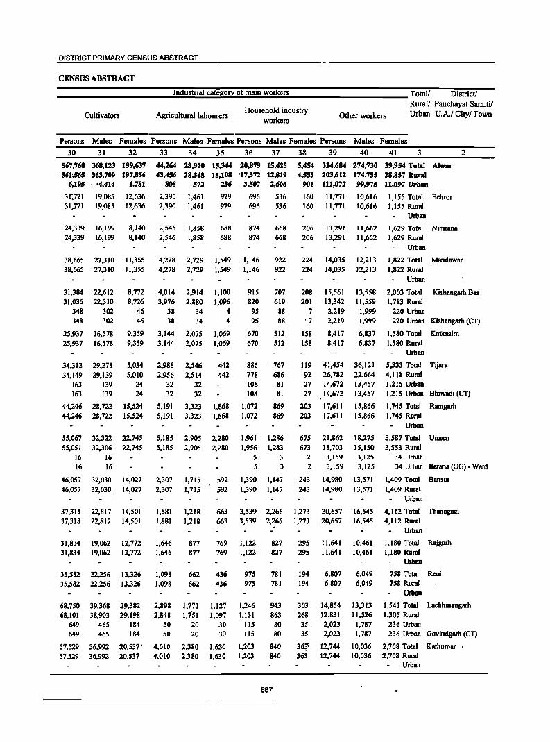
DISTRICT PRIMARY CENSUS ABSTRACT
CENSUS ABSTRACT
___________ ...;I;;;.:n;.=d=us::.;tr:.::ia=l..=c;.=at=ej;l;go::.;ry&...::.o,:_f:,::m=al;;;.:·n:..,.:w,.:.;o:.:,rk:,::e:.:,r:..s ____________ Total! District!
Cultivators Agricultural labourers Household industry
workers Other workers
Rural! Panchayat Samitil Urban U.A.I Cityl Town
Persons Males Females Persons Males .Females Persons Males Females Persons Males Females
30 31 32
567,760 [168,123 199,637 '561~65 363,709 197,856
'6,195 ,"4,414 .1,781
31;721 31,721
24,339 24,339
19,085 19,085
16,199 16,199
38,665 27,310 38,665 27,310
31,384 31,036
348 348
25,937 25,937
34,312 34,149
163 163
44,246 44,246
55,067 55,051
16 16
46,057 46,057
37,318 37,318
31,834 31,834
35,582 35,582
68,750 68,101
649 649
57,529 57,529
22,612 22,310
302 302
16,578 16,578
29,278 29,139
139 139
28,722 28,722
32,322 32,306
16 16
32,030 32,030
22,817 22,817
19,062 19,062
22,256 22,256
39,368 38,903
465 465
36,992 36,992
12,636 12,636
8,140 8,140
11,355 11,355
-8,772 8,726
46 46
9,359 9,359
5,034 5,010
24 24
15,524 15,524
22,745 22,745
14,027 14,027
14,501 14,501
12,772 12,772
13,326 13,326
29,382 29,198
184 184
20,537 • 20,537
33
44,264 43,456
BOB
2,390 2,390
2,546 2,546
4,278 4,278
4,014 3,976
38 38
3,144 3,144
2,988 2,956
32 32
5,191 5,191
5,185 5,185
2,307 2,307
1,881 1,881
1,646 1,646
1,098 1,098
2,898 2,848
SO 50
4,010 4,010
34
28,920 28,348
572
1,461 1,461
1,858 1,858
2,729 2,729
2,914 2,880
34 34
2,075 2,075
2,546 2,514
32 32
3,323 3,323
2,905 2,905
1,715 1,715
1,218 1,218
877 877
662 662
1,771 l,i51
20 20
2,380 2,380
35 36 37
15,344 20,879 15,425 15,108 '17,372 12,819
236 3,507 2,606
929 929
688 688
1,549 1,549
1,100 1,096
4 4
1,069 1,069
442 442
1,868 1,868
2,280 2,280
592 592
663 663
769 769
436 436
1,127 1,097
30 30
1,630 1,630
696 696
874 874
1,146 1,146
915 820
95 95
670 670
886 778 108 108
1,072 1,072
1,961 1,956
5 5
1,390 1,390
536 536
668 668
922 922
707 619
88 88
512 512
767 686
81 81
869 869
1,286 1,283
3 3
1,147 1,147
3,539 2,266 3,539 2,266
1,122 1,122
975 975
1,246 1,131
liS liS
1,203 1,203
827 827
781 781
943 863
80 80
840 840
667
38 39 40
5,454 314,684 274,730 4,553 203,612 174,755
901 111,072 99,975
160 160
206 206
224 224
208 201
7 '7
158 158
119 92 27 27
203 203
675 673
2
2
243 243
1,273 1,273
295 295
194 194
11.771 11,771
13,291 13,291
14,035 14,035
15,561 13,342 2,219 2,219
8,417 8,417
41,454 26,782 14,672 14,672
17,611 17,611
21,862 18,703 3,159 3,159
14,980 14,980
20,657 20,657
11,641 11,641
6,807 6,807
303 14,854 268 12,831 35, 2,023 35 2,023
j6~? 12,744 363 12,744
10,616 10,616
11,662 11,662
12,213 12,213
13,558 11,559
1,999 1,999
6,837 6,837
36,121 22,664 13,457 13,457
15,866 15,866
18,275 15,150 3,125 3,125
13,571 13,571
16,545 16,545
10,461 10,461
6,049 6,049
13,313 11,526
1,787 1,787
10,036 10,036
41 3
39,954 Total Alwar 28,857 Rural n,D97 Urban
1,155 Total Behror 1,155 Rural
Urban
1,629 Total Nimrana 1,629 Rural
Urban
2
1,822 Total Mandawar 1,822 Rural
Urban
2,003 Total Kishangarh Bas 1,783 Rural
220 Urban 220 Urban Kishangarh (CT)
1,580 Total Kotkasim 1,580 Rural
Urban
5,333 Total Tijara 4,118 Rural 1,215 Urban 1,215 Urban Bhiwadi (CT)
1,745 Total Ramgarh 1,745 Rural
Urban
3,587 Total Umren 3,553 Rural
34 Urban 34 Urban ltarana (OG) - Ward
1,409 Total Bansur
1,409 Rural. Urban
4,112 Total Thanagazi 4,112 Rural
Urban
1,180 Total Rajgarh 1,180 Rural
Urban
758 Total Reni 758 Rural
Urban
1,541 Total Lachhmangarh 1,305 Rural
236 Urban 236 Urban Govindgarh (CT)
2,708 Total Kathumar· 2,708 Rural
Urban
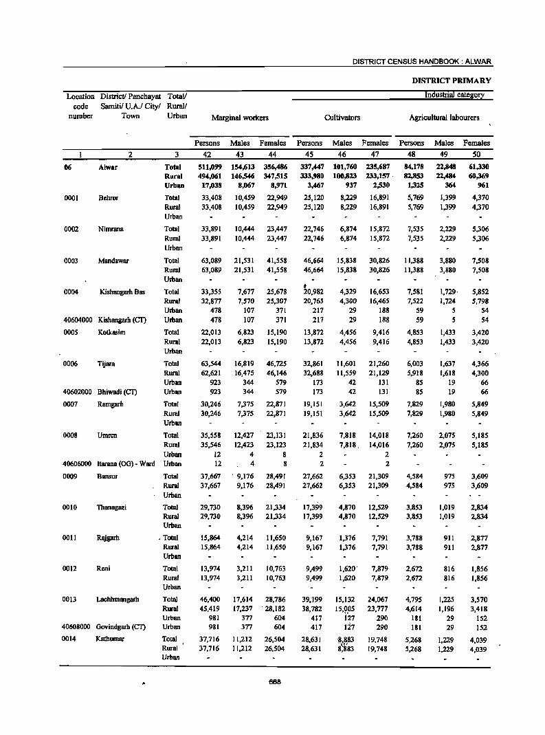
DISTRICT CENSUS HANDBOOK: ALWAR
DISTRICT PRIMARY
Location Districtl Panchayat TotaV Industrial cate&o!2;:
code Samitil U.A.I City! Rural! number Town Urban Marginal workers Cultivators Agricultural labourers
Persons Males Females Persons Males Females Persons Males Females
2 3 42 43 44 45 46 47 48 49 50
06 Alwar Total 511,099 154,613 356,486 337,447 101,760 235,687 84,178 22,848 61,330 Rural 494,061 146,546 347,515 333,980 100,823 233,157· 82,853 22,484 60,369 Urban 17,038 8,067 8,971 3,467 937 2,530 1,325 364 961
0001 Behror Total 33,408 10,459 22,949 25,120 8,229 16,891 5,769 1,399 4,370
Rural 33,408 10,459 22,949 25,120 8.229 16,891 5,769 1,399 4,370 Urban
0002 Nimrana Total 33,891 10,444 23,447 22,746 6,874 15,872 7,535 2,229 5,306 Rural 33,891 10,444 23,441 22,146 6,874 15,872 7,535 2,229 5,306 Urban
0003 Mandawar Total 63,089 21,531 41,558 46,664 15,838 30,826 11,388 3,880 7,508 Rural 63,089 21,531 41,558 46,664 15,838 30,826 11,388 3,880 7,508 Urban
0004 Kishangarh Bas Total 33,355 7,677 25,678 t 20,982 4,329 16,653 7,581 1,729· 5,852
Rural 32,877 7,570 25,307 20,165 4,300 16,465 7,522 1,124 5,798 Urban 478 107 371 217 29 188 59 5 54
40604000 Kishangarh (CT) Urban 478 107 371 217 29 188 59 5 54
0005 Kotkasim Total 22,013 6,823 15,190 13,872 4,456 9,416 4,853 1,433 3,420 Rural 22,013 6,823 15,190 13,872 4,456 9,416 4,853 1,433 3,420 Urban
0006 Tijara Total 63,544 16,819 46,725 32,861 11,601 21,260 6,003 1,637 4,366 Rural 62,621 16,475 46,146 32,688 11,559 21,129 5,918 1,618 4,300 Urban 923 344 579 173 42 131 85 19 66
40602000 Bhiwadi (CT) Urban 923 344 579 173 42 131 85 19 66
0007 Ramgarh Total 30,246 7,375 22,871 19,151 3,642 15,509 7,829 1,980 5,849 Rural 30,246 7,375 22,871 19,151 3,642 15,509 7,829 1,980 5,849 Urban
0008 Utnren Total 35,558 12,427 23,131 21,836 7,818 14,018 7,260 2,075 5,185 Rural 35,546 12,423 23,123 21,834 7,818. 14,016 7,260 2,075 5,185 Urban 12 4 8 2 2
40606000 ltarana (00) - Ward Urban 12 4 8 2 2
0009 Bansur Total 37,667 . 9,176 28,491 27,662 6,353 21,309 4,584 975 3,609 Rural 37,667 9,176 28,491 27,662 6,353 21,309 4,584 975 3,609 Urban
0010 Thanagazi Total 29,730 8,396 21,334 17,399 4,870 12,529 3,853 1,019 2,834 Rural 29,730 8,396 21,334 17,399 4,870 12,529 3,853 1,019 2,834 Urban
0011 Rajgarh . Total 15,864 4,214 11,650 9,167 1,376 7,791 3,788 911 2,877 Rural 15,864 4,214 11,650 9,1(;7 1,376 7,791 3,788 911 2,877 Urban
0012 Reni Total 13,974 3,211 10,763 9,499 1,620' 7,879 2,672 816 1,856 Rural 13,974 3,211 10,763 9,499 1,620 7,879 2,672 816 1,856 Urban
0013 Lachhmangarh Total 46,400 17,614 28,786 39,199 15,132 24,067 4,795 1,225 3,570 Rural 45,419 17,237 . 28,182 38,782 15,9.°5 23,777 4,614 1,196 3,418 Urban 981 377 604 417 127 290 181 29 152
40608000 Govindgarh (CT) Urban 981 377 604 417 127 290 181 29 152
0014 Kathumar Total 37,716 11,212 26,504 28,631 '~t~83 19,748 5,268 1,229 4,039 Rural 37,716 11,212 26,504 28,631 8;883 19,748 5,268 1,229 4,039 Urban
668
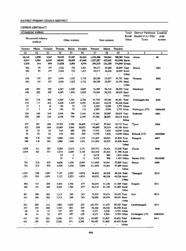
DISTRICT PRIMARY CENSUS ABSTRACT
CENSUS ABSTRACT
of marginal workers
Household industry workers
Other workers Non-workers
Totall DistricU Panchayat Location Rural! Sarnitil U.A.I Cityl code Urban Town number
Persons Males Females Persons Males Females Persons Males Females
51
10,145 8~27
1,218
296 296
656 656
650
650
587 570
17 17
350
350
977 922
55 55
380 380
1,078 1,078
791 791
1,351 1,351
466 466
491 491
521 475
46 46
451 451
52 2,898 2,584
314
99 99
119 119
255
255
118 117
I 1
140 140
281 258
23 23
118 118
321 321
212 212
254 254
161
161
206 206
209 195
14 14
129 129
53
7,247 6,343
904
197 197
537
537
395 395
469 453
16 16
210
210
696 664 32 32
262 262
757 757
579 579
1,097 1,097
305 305
285 285
312 280 32 32
322 322
54
79,329 68,301 11,028
2,223 2,223
2,954 2,954
4,387
4,387
4,205 4,020
185 185
2,938 2,938
23,703 23,093
610 610
2,886 2,886
5,384 5,374
10 10
4,630 4,630
7,127 7,127
2,443 2,443
1,312 1,312
1,885 1,548
337 337
3,366 3,366
55
·27,107 20,655 6,452
732 732
1,222
1,222
1,558
1,558
1,501 1,429
72 72
794 794
3,300 3,040
260 260
1,635 1,635
2,213 2,209
4 4
1,636 1,636
2,253 2,253
1,766 1,766
569 569
1,048 841 207
207
971 971
56 52,222 47,646
4,576
1.491 1,491
1,732 1,732
2,829
2,829
2,704 2,591
113 113
2,144 2,144
20,403
20,053 350 350
1,251 1,251
3,171 3,165
6 6
2,994 2,994
4,874 4,874
677 677
743 743
837 707 130 130
2,395 2,395
57 1,533,906 1,237,587
296,319
59,517
58
744,941 623,591 121,350
30,620
59 3 2
788,965 Total Alwar 613,996 Rural 174,969 Urban
28,897 Total Behror 59,517 30,620 28,897 Rural
68,388 68,388
76,369 76,369
91,739 85,444
6,295 6,295
57,506 57,506
117,667 99,688 17,979 17,979
121,853 121,853
107,771 105,353
2,418 2,418
111,950 111,950
96,852 96,852
82,619 82,619
78,055 78,055
101,777 95,506
6,271 6,271
.,; 98,487 .- 98,487
669
33,597 33,597
38,310 38,310
45,338 42,818
2,520 2,520
28,887 28,887
57,949 50,519
7,430 7,430
60,025 60,025
54,521 53,555
966 966
54,941 54,941
48,628 48,628
41,150 41,150
Urban
34,791 Total Nirnrana 34,791 Rural
Urban
38,059 Total Mandawar 38,059 Rural
Urban
46,401 Total Kishangarh Bas 42,626 Rural
3,775 Urban 3,775 Urban Kishangarh (CI')
28,619 Total Kotkasim 28,619 Rural
Urban
59,718 Total Tijara 49,169 Rural 10,549 Urban 10,549 Urban Bhiwadi (CT)
61,828 Total Ramgarh 61,828 Rural
Urban
53,250 Total Umren 51,798 Rural
1,452 Urban 1,452 Urban ltarana (OG)
57,009 Total Bansur 57,009 Rural
Urban
48,224 Total Thanagazi 48,224 Rural
Urban
41,469 Total Rajgarh 41,469 Rural
Urban
39,574 38,481 Total Reni 39,574 38,481 Rural
51,670 49,102
2,568 2,568
51,865 51,865
Urban
50,107 Total Lachhmangarh 46,404 Rural
3,703 Urban 3,703 Urban Govindgarh (Cf)
46,622 Total Kathumar 46,622 Rural
Urban
06
0001
0002
0003
0004
40604000
0005
0006
40602000
0007
0008
40606000
0009
0010
0011
0012
0013
40608000
0014
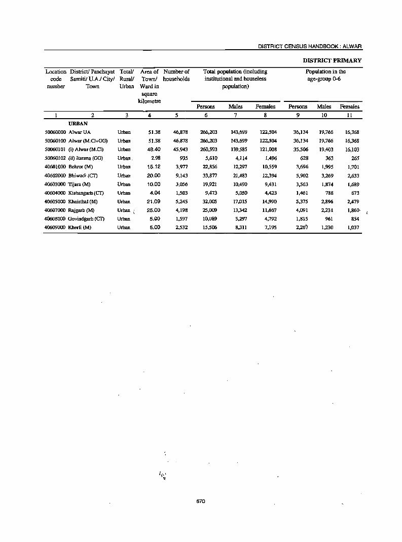
DISTRICT CENSUS HANDBOOK: ALWAR
DISTRICT PRIMARY
Location District! Panchayat Total! Area of Number of Total population (including Population in the
code Samitil U.A.I Cityl Rural! Townl households institutional and houseless age-group 0-6
number Town Urban Ward in population)
square kilometre
Persons Males Females Persons Males Females
2 3 4 5 6 7 8 9 10 11
URBAN
50060000 Alwar UA Urban 51.38 46,878 266,203 143,699 122,504 36,134 19,766 16,368
50060100 Alwar(M.CI+OG) Urban 51.38 46,878 266,203 143,699 122,504 36,134 19,766 16,368
50060101 (i) Alwar(M.CI) Urban 48.40 45.943 260,593 139,585 121,008 35,506 19,403 16,103
50060102 (ii) !tarana (OG) Urban. 2.98 935 5,610 4,114 1,496 628 363 265
40601000 Bebror (M) Urban 15.12 3,977 22,856 12,297 10,559 3,696 1,995 1,701
40602000 Bhiwadi (CI') Urban 20.00 9,143 33,877 21,483 12,394 5,902 3,269 2,633
40603000 Tijara (M) Urban 10.00 3,056 19,921 10,490 9,431 3,563 1,874 1,689
40604000 Kisbangarh (CI') Urban 4.04 1,503 9,473 5,050 4,423 1,461 788 673
40605000 Khairthal (M) Urban 21.09 5,245 32,005 17,015 14,990 5,375 2,896 2,479
40607000 Rajgarb (M) Urban .; 25.00 4,198 25,009 13,342 11,667 4,091 2,231 1,860'
40608000 Govindgarh (eT) Urban 5.QO 1,597 10,089 5,297 4,792 1,815 961 854
40609000 Kherli (M) Urban 5.00 2,532 15,506 8,311 7,195 2,267 1,230 1,037
670

DISTRICT PRIMARY CENSUS ABSTRACT
CENSUS ABSTRACT
Total! District! Panchayat Rura1l Samitil U.A.I Cityl
Scheduled Castes population Scheduled Tribes population Literates Urban Town
Persons Males Females Persons Males Females Persons Males Females
12 13 14 15 16 17 18 19 20 3 2
URBAN
41,943 22,351 19,592 8,195 4,523 3,672 190,580 113,252 77,328 Urban AlwarUA
41,943 22,351 19,592 8,195 4,523 3,672 190,580 113,252 77,328 Urban Alwar (M.Cl+0G)
41,729 22,245 19,484 8,091 4,446 3,645 185,803 109,544 76,259 Urban (i) Alwar (M.CI)
214 106 108 104 77 27 4,777 3,708 1,069 Urban (ii) ltarana (OG)
3,575 1,906 1,669 419 227 192 15,759 9,473 6,286 Urban Behror (M)
2,839 1,684 1,155 152 93 59 22,610 16,161 6,449 Urban Bhiwadi (CT)
3,647 1,850 1,797 80 47 33 12,291 7,520 4,771 Urban Tijara(M)
1,604 847 757 137 87 50 6,627 3,923 2,704 Urban Kishangarh (cr)
7,657 4,092 3,565 133 no 23 20,302 12,085 8,217 Urban Khairthal (M)
4,823 2,604 2,219 1,150 667 483 15,896 10,063 5,833 Urban . Rajgarh (M)
1,553 807 746 388 215 173 6,268 3,819 2,449 Urban Govindgarh (CI')
968 526 442 398 230 168 11.269 6,648 4.621 Urban Kherli (M)
.'
671
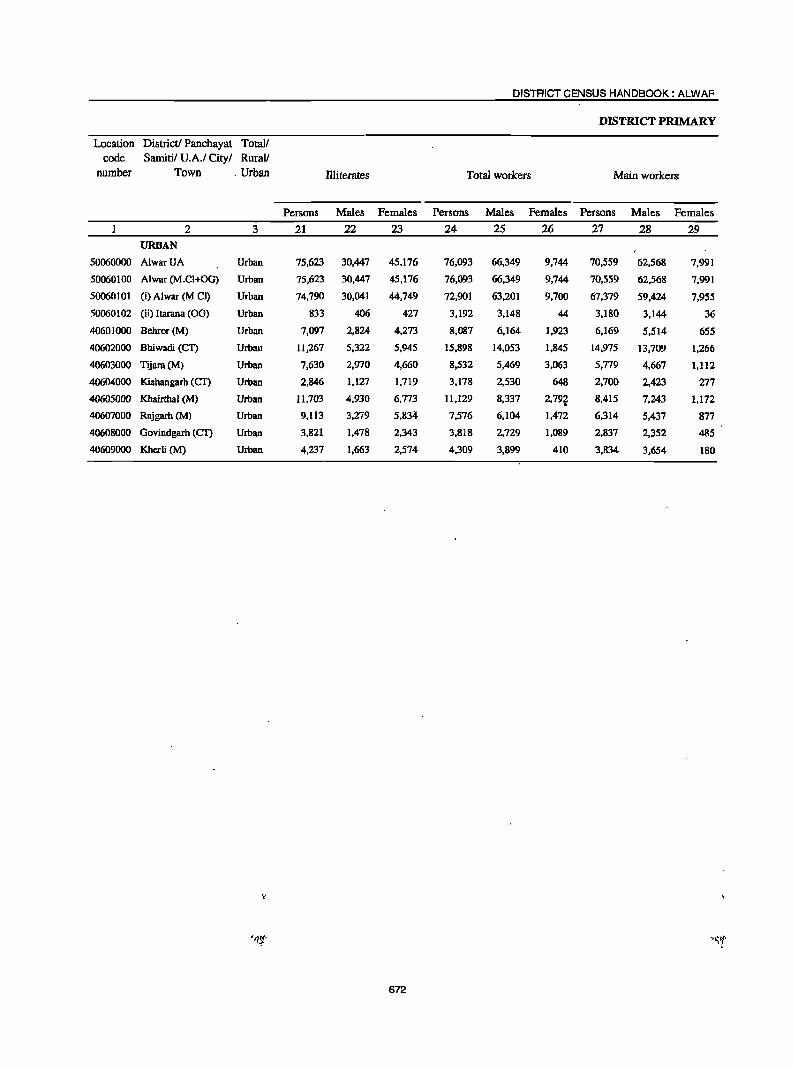
DISTRICT CENSUS HANDBOOK: ALWAR
DISTRICT PRIMARY
Location District! Panchayat Totall code Samitil U.A.I Cityl RuraV
number Town . Urban Illiterates Total workers Main workers
Persons Males Females Persons Males Females Persons Males Females
2 3 21 22 23 24 25 26 27 28 29 URBAN
50060000 AlwarUA Urban 75,623 30,447 45,176 76,093 66,349 9,744 70,559 62,568 7,991
50060100 Alwar (M.C1+0G) Urban 75,623 30,447 45,176 76,093 66,349 9,744 70,559 62,568 7,991
50060101 (i) Alwar (M el) Urban 74,790 30,041 44,749 72,901 63,201 9,700 67,379 59,424 7,955
50060102 (ii) ltarana (OG) Urban 833 406 427 3,192 3,148 44 3,180 3,144 36
40601000 Behror (M) Urban 7,097 2,824 4,273 8,087 6,164 1,923 6,169 5,514 655
40602000 Bhiwadi (CI) Urban 11,267 5,322 5,945 15,898 14,053 1,845 14,975 13,709 1,266
40603000 Tijnrn(M} Urban 7,630 2,970 4,660 8,532 5,469 3,063 5,779 4,667 1,112
40604000 Kishangarh (Cf) Urban 2,846 1,127 1,719 3,178 2,530 648 2,700 2,423 277
40605000 Khairthal (M) Urban 1l,703 4,930 6,773 11,129 8,337 2,79t 8,415 7,243 1,172
40607000 Rajgarh(M) Urban 9,113 3,21"9 5,834 7,576 6,104 1,472 6,314 5,437 877
40608000 Govindgarh (CI) Urban 3,821 1,478 2,343 3,818 2,729 1,089 2,837 2,352 485
40609000 Kherli (M) Urban 4,237 1,663 2,574 4,309 3,899 410 3,834 3,654 180
"
672
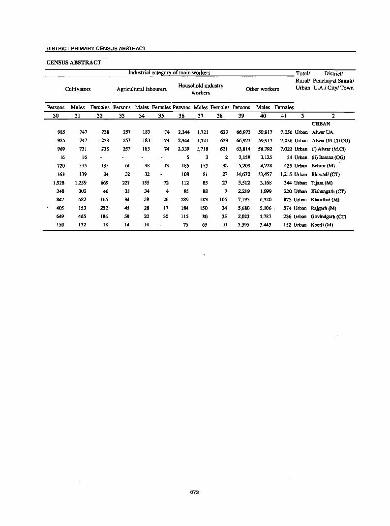
DISTRICT PRIMARY CENSUS ABSTRACT
CENSUS ABSTRACT
Industrial cate~0!1 of main workers Total! District!
Household industry RuraV Panchayat Samitil
Cultivators Agricultural labourers workers
Other workers Urban U .A.I Cityl Town
Persons Males Females Persons Males Females Persons Males Females Persons Males Females
30 '31 32 33 34 3S 36 37 38 39 40 41 3 2
URBAN
985 747 238 257 183 74 2,344 1,72] 623 66,973 59,917 7,056 Urban AlwarUA
985 747 238 257 183 74 2,344 1,72] 623 66,973 59,917 7,056 Urban Alwar (M.CI+OG)
969 731 238 257 183 74 2,339 1,718 621 63,814 56,792 7,022 Urban (i) Alwar (M.CI)
16 16 5 3 2 3,159 3,125 34 Urban (ii) Ilarana (OG)
720 535 185 61 48 13 185 153 32 5,203 4.778 425 Urban Behror (M)
163 139 24 32 32 108 81 27 14,672 13.457 1.215 Urban Bhiwadi (C'l)
1,928 1,259 669 227 155 72 112 85 T1 3,512 3,168 344 Urban Tijara(M)
348 302 46 38 34 4 95 88 7 2,219 ],999 220 Urban Kishangarb (CT)
847 682 165 84 58 26 289 183 106 7,195 6,320 875 Urban Khairthal (M)
405 153 252 45 28 17 184 150 34 5,680 5,106 " 574 Urban Rajgarh (M)
649 465 184 50 20 30 115 80 35 2,023 1,787 236 Urban Govindgarh (CI')
150 132 18 14 14 75 65 10 3,595 3,443 152 Urban Kherli (M)
673
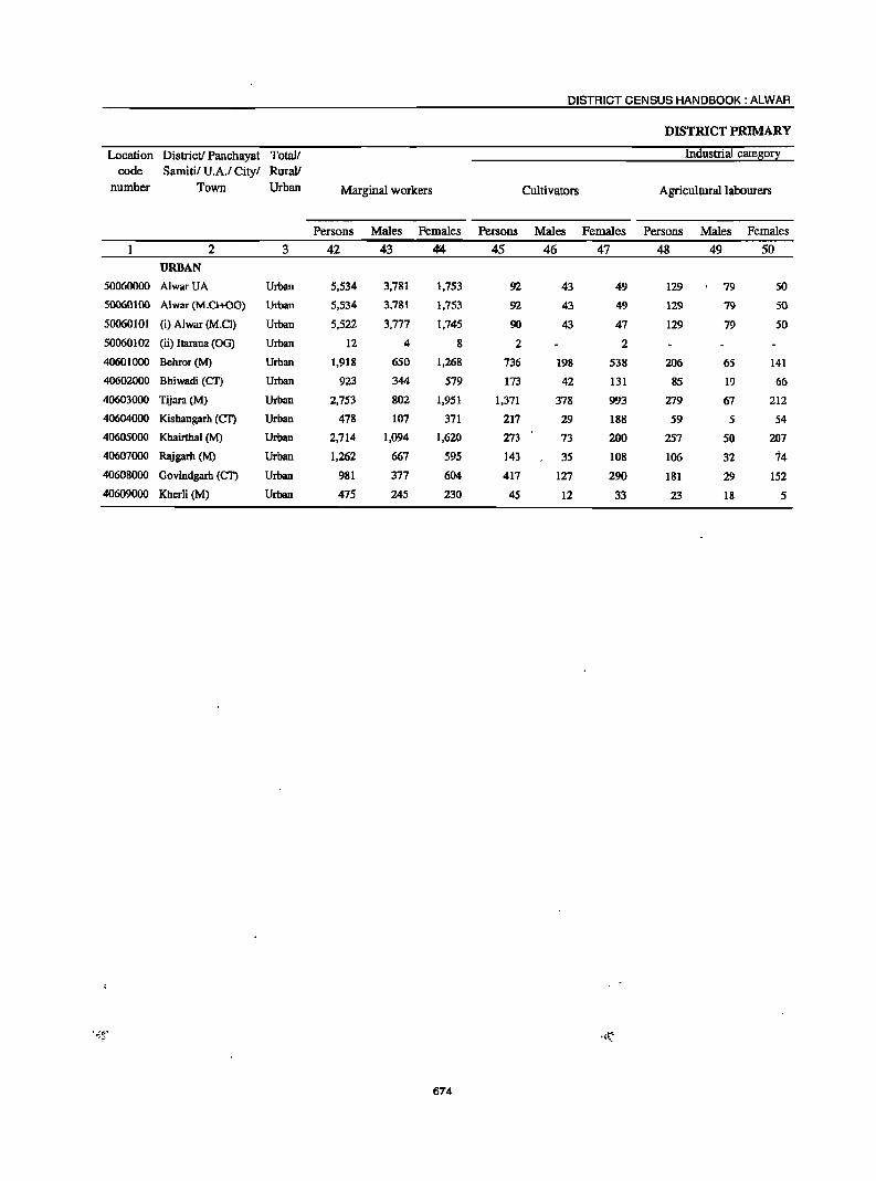
DISTRICT CENSUS HANDBOOK: ALWAR
DISTRICT PRIMARY
Location District! Panchayat Totall Industrial catego!J
code Samitil U.A.I Cityl RuraV
number Town Urban Marginal workers Cultivators Agricultural labourers
Persons Males Females Persons Males Females Persons Males Females
2 3 42 43 ~ 45 46 47 48 49 50 URBAN
50060000 AlwarUA Urban 5,534 3,781 1,753 92 43 49 129 79 50
50060100 Alwar (M.CI+OO) Urban 5,534 3,781 1,753 92 43 49 129 79 50
50060101 (i) Alwar (M.Cl) Urban 5,522 3,777 1,745 90 43 47 129 79 50
50060102 (ii) ltarana (00) Urban 12 4 8 2 2
40601000 Behror(M) Urban 1,918 650 1,268 736 198 538 206 65 141
40602000 Bhiwadi (Cf) Urban 923 344 579 173 42 131 85 19 66
40603000 Tijara (M) Urban 2,753 802 1,951 1,371 378 993 279 67 212
40604000 Kishangarh (Cf) Urban 478 107 371 217 29 188 59 S S4
40605000 Khairthal (M) Urban 2,714 1,094 1,620 273 73 200 257 50 207 40607000 Rajgarh (M) Urban 1,262 667 595 143 3S 108 106 32 74
40608000 Oovindgarh (CT) Urban 981 377 604 417 127 290 181 29 IS2
40609000 Khcrli (M) Urban 475 245 230 45 12 33 23 18 5
674
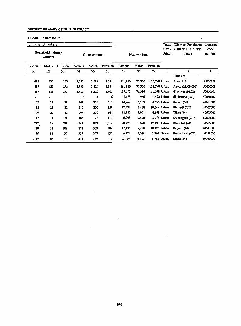
DISTRICT PRIMARY CENSUS ABSTRACT
CENSUS ABSTRACT
ofmar~inal workers Total! District! Panchayat Location RuraV Samitil U.A.I Cityl code
Household industry Other workers Non-workers Urban Town number
workers
Persons Males Females Persons Males Females Persons Males Females
5] 52 53 54 55 56 57 58 59 3 2 URBAN
418 135 283 4,895 3,524 1,371 190,110 77,350 112,760 Urban AlwarUA 50060000
418 135 283 4,895 3,524 1,371 190,110 77,350 112,760 Urban Alwar (M.Cl+OG) 50060100
418 135 283 4,885 3,520 1,365 187,692 76,384 111,308 Urban (i) Alwar (M.CI) 50060101
10 4 6 2,418 966 1,452 Urban (ii) ltarana (OG) 50060102
107 29 78 869 358 511 14,769 6,133 8,636 Urban Behror(M) 40601000
5S 23 32 610 260 3S0 17,979 7,430 10,549 Urban Bhiwadi (CT) 40602000
109 27 82 994 330 664 11,389 5,021 6,368 Urban Tijara (M) 40603000
17 I 16 185 72 113 6,29S 2,S20 3,775 Urban Kishangarh (CI) 40604000
237 38 199 1,947 933 1,014 20,876 8,678 12,198 Urban Khairthal (M) 40605000
140 31 109 873 569 304 17,433 7,238 10,195 Urban Rajgarh (M) 40607000
46 14 32 337 207 130 6,271 2,568 3,703 Urban Govindgarh (CI) 40608000
. 89 16 73 318 199 119 11,197 4,412 6,785 Urban Kherli (M) 40609000
675
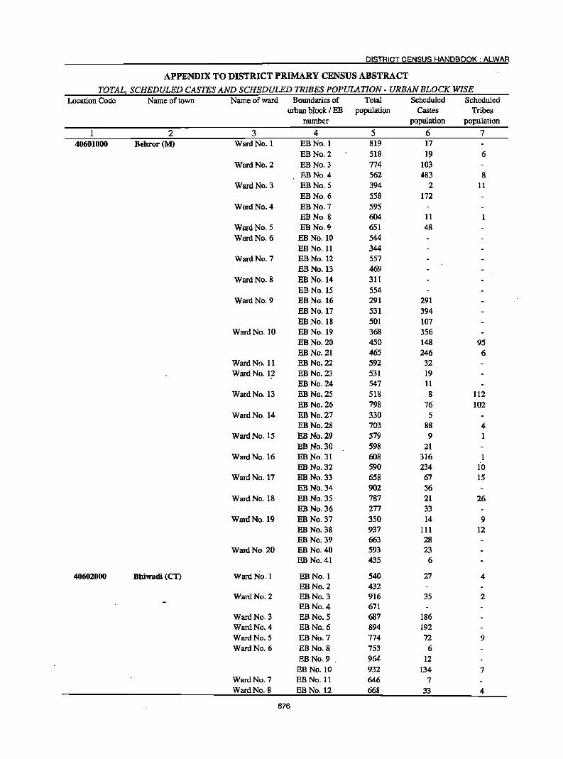
DISTRICT CENSUS HANDBOOK: ALWAR
APPENDIX TO DISTRICT PRIMARY CENSUS ABSTRACT
TOTAL, SCHEDULED CASTES AND SCHEDULED TRIBES POPUlATION - URBAN BLOCK WISE Location Code Name of town Name of ward Boundaries of Total Scheduled Scheduled
urban block I EB population Castes Tribes number population population
1 2 3 4 5 6 7 40601000 Behror(M) Ward No. 1 EBNo.l 819 17
EBNo.2 518 19 6 Ward No. 2 EBNo.3 774 103
EBNo.4 562 483 8 Ward No. 3 EBNo.5 394 2 11
EBNo.6 558 172 Ward No. 4 EBNo.7 595
EBNo.8 604 11 Ward No. 5 EBNo.9 651 48 Ward No. 6 EBNo.10 544
EB No. 11 344 Ward No. 7 EBNo.12 557
EBNo.13 469 Ward No. 8 EB No. 14 311
EB No. 15 554 Ward No. 9 EB No. 16 291 291
EBNo.l7 531 394 EB No. 18 501 107
Ward No. 10 EBNo.19 368 356 EB No. 20 450 148 95 EB No. 21 465 246 6
Ward No. 11 EB No. 22 592 32 Ward No. 12 EB No. 23 531 19
EB No. 24 547 11 Ward No. 13 EB No. 25 518 8 112
EB No. 26 798 76 102 Ward No. 14 EBNo.27 330 5
EB No. 28 703 88 4 Ward No. 15 EB No. 29 579 9
EB No. 30 598 21 Ward No. 16 EBNo.31 608 316 1
EBNo.32 590 234 10 Ward No. 17 EBNo.33 658 67 15
EB No. 34 902 56 Ward No. 18 EB No. 35 787 21 26
EB No. 36 277 33 Ward No. 19 EB No. 37 350 14 9
EB No. 38 937 111 12 EB No. 39 663 28
Ward No. 20 EB No. 40 593 23 EB No. 41 435 6
40602000 Bhiwadi (CT) Ward No. 1 EBNo.l 540 27 4 EBNo.2 432
Ward No. 2 EB No. 3 916 35 2 EB No.4 671
Ward No. 3 EB No.5 687 186 Ward No. 4 EB No.6 894 192 Ward No. 5 EB No. 7 774 72 9 Ward No. 6 EB No.8 753 6
EB No. 9 964 12 EB No. 10 932 134 7
Ward No. 7 EB No. 11 646 7 Ward No. 8 EB No. 12 668 33 4
676
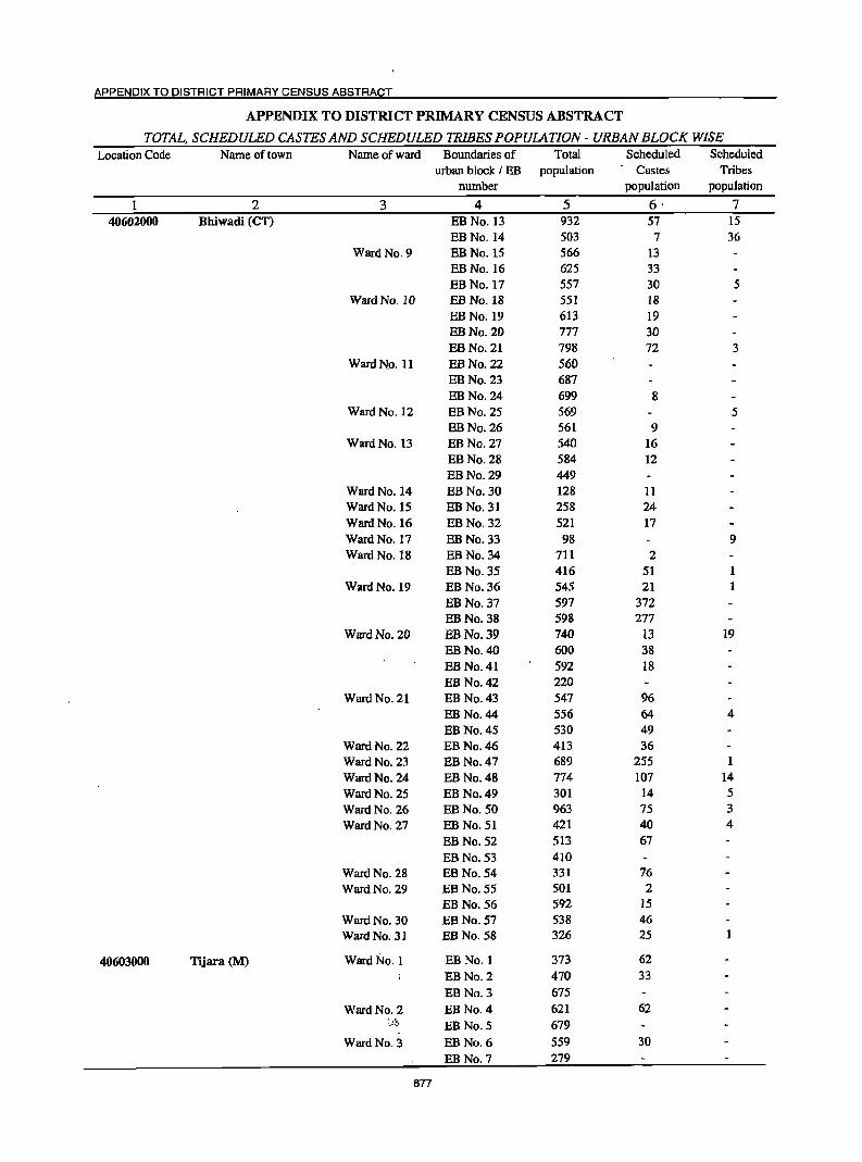
APPENDIX TO DISTRICT PRIMARY CENSUS ABSTRACT
APPENDIX TO DISTRICT PRIMARY CENSUS ABSTRACT
TOTAL, SCHEDULED CASTES AND SCHEDULED TRIBES POPUlATION - URBAN BLOCK WISE Location Code Name of town Name of ward Boundaries of Total Scheduled Scheduled
urban block I EB population Castes Tribes number population population
2 3 4 5 6· 7 40602000 Bhiwadi (CT) EB No. 13 932 57 15
EBNo.14 503 7 36 Ward No. 9 EBNo.I5 566 13
EBNo.16 625 33 EBNo.17 557 30 5
Ward No. 10 EB No. 18 551 18 EBNo.19 613 19 EBNo.20 777 30 EBNo.21 798 72 3
WardNo. II EBNo.22 560 EB No. 23 687 EBNo.24 699 8
Ward No. 12 EBNo.25 569 5 EBNo.26 561 9
Ward No. 13 EBNo.27 540 16 EBNo.28 584 12 EBNo.29 449
Ward No. 14 EBNo.30 128 II Ward No. 15 EBNo.31 258 24 Ward No. 16 EBNo.32 521 17 Ward No. 17 EBNo.33 98 9 Ward No. 18 EB No. 34 711 2
EB No. 35 416 51 Ward No. 19 EB No. 36 545 21
EB No. 37 597 372 EBNo.38 598 277
Ward No. 20 EBNo.39 740 13 19 EB No. 40 600 38 EBNo.41 592 18 EB No. 42 220
Ward No. 21 EB No. 43 547 96 EB No. 44 556 64 4 EB No. 45 530 49
Ward No. 22 EB No. 46 413 36 Ward No. 23 EB No. 47 689 255 Ward No. 24 EB No. 48 774 107 14 Ward No. 25 EB No. 49 301 14 5 Ward No. 26 EB No. 50 963 75 3 Ward No. 27 EB No. 51 421 40 4
EB No. 52 513 67 EB No. 53 410
Ward No. 28 EB No. 54 331 76 Ward No. 29 EB No. 55 501 2
EB No. 56 592 15 Ward No. 30 EB No. 57 538 46 Ward No. 31 EBNo.58 326 25
40603000 Tijara (M) Ward No.1 EB No.1 373 62 EB No.2 470 33 EB No.3 675
WardNo.2 EB No.4 621 62 :_,b EB No.5 679
Ward No. 3 EB No.6 559 30
EBNo.7 279
677
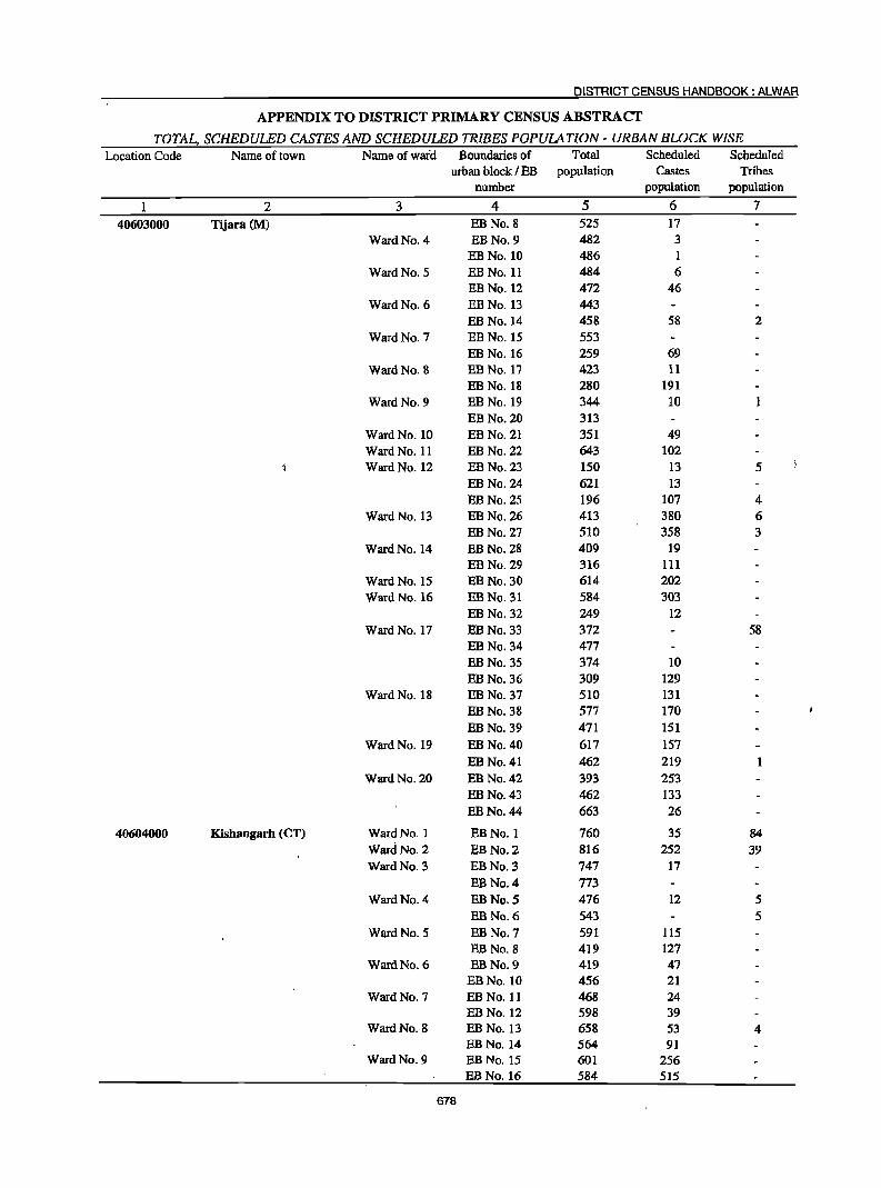
DISTRICT CENSUS HANDBOOK: ALWAR
APPENDIX TO DISTRICT PRIMARY CENSUS ABSTRACT
TOTAL, SCHEDULED CASTES AND SCHEDULED TRIBES POPULATION - URBAN BWCK WISE Location Code Name of town Name ofwaid Boundaries of Total Scheduled Scheduled
urban block I EB population Castes Tribes number population population
2 3 4 5 6 7 40603000 Tijara (M) EBNo.8 525 17
Ward No. 4 EBNo.9 482 3 EB No. 10 486 1
Ward No. 5 EB No. 11 484 6 EBNo.12 472 46
Ward No. 6 EB No. 13 443 EB No. 14 458 58 2
Ward No. 7 EB No. 15 553 EB No. 16 259 69
Ward No. 8 EB No. 17 423 11 EB No. 18 280 191
Ward No. 9 EB No. 19 344 10 EB No. 20 313
Ward No. 10 EB No. 21 351 49 Ward No. 11 EB No. 22 643 102 Ward No. 12 EB No. 23 150 13 5
EB No. 24 621 13 EBNo.25 196 107 4
Ward No. 13 EBNo.26 413 380 6 EBNo.27 510 358 3
Ward No. 14 EB No. 28 409 19 EBNo.29 316 111
Ward No. 15 EB No. 30 614 202 Ward No. 16 EB No. 31 584 303
EBNo.32 249 12 Ward No. 17 EBNo.33 372 58
EBNo.34 477 EBNo.35 374 10 EBNo.36 309 129
Ward No. 18 EB No. 37 510 131 EBNo.38 577 170 EBNo.39 471 151
Ward No. 19 EB No. 40 617 157 EB No. 41 462 219
Ward No. 20 EB No. 42 393 253 EB No. 43 462 133 EBNo.44 663 26
40604000 Kishangarh (CT) Ward No. 1 EBNo.l 760 35 84 WareiNo.2 EBNo.2 816 252 39 Ward No. 3 EB No. 3 747 17
EBNo.4 773 Ward No. 4 EB No. 5 476 12 5
EB No.6 543 5 Ward No. 5 EB No.7 591 115
EB No.8 419 127 Ward No. 6 EB No. 9 419 47
EBNo.lO 456 21 Ward No. 7 EB No. 11 468 24
EBNo.12 598 39 Ward No. 8 EB No. 13 658 53 4
EBNo.14 564 91 Ward No. 9 EB No. 15 601 256
EBNo.16 584 515
678
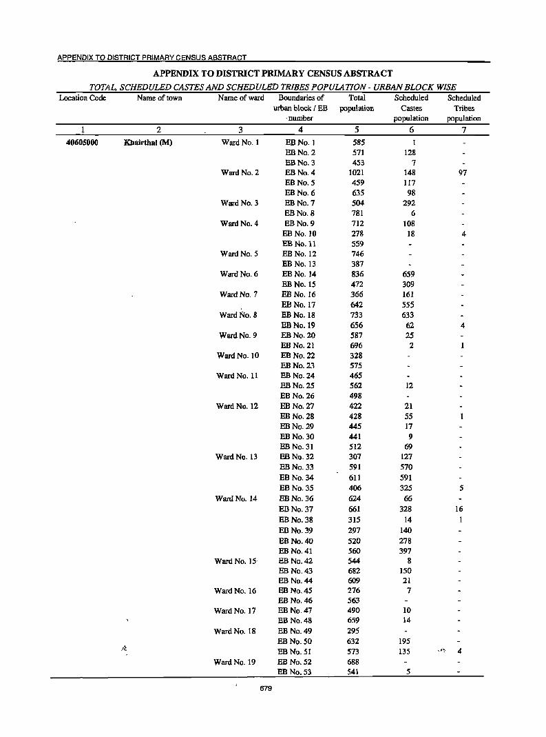
APPENDIX TO DISTRICT PRIMARY CENSUS ABSTRACT
APPENDIX TO DISTRICT PRIMARY CENSUS ABSTRACT
TOTAL, SCHEDULED CASTES AND SCHEDULED TRIBES POPULATION - URBAN BLOCK WISE Location Code Name of town Name of ward Boundaries of Total Scheduled Scheduled
urban block I EB population Castes Tribes . number population population
1 2 3 4 5 6 7 40605000 Khairthal (M) Ward No.1 EBNo.l 585 1
EBNo.2 571 128 EBNo.3 453 7
Ward No. 2 EB No. 4 1021 148 97 EBNo.5 459 117 EB No. 6 635 98
Ward No. 3 EB No. 7 504 292 EB No.8 781 6
Ward No. 4 EB No. 9 712 108 EB No. 10 278 18 4 EB No. 11 559
Ward No. 5 EB No. 12 746 EB No. 13 387
Ward No. 6 EB No. 14 836 659 EB No. 15 472 309
Ward No. 7 EB No. 16 366 161 EB No. 17 642 555
Ward No. 8 EB No. 18 733 633 EBNo.19 656 62 4
Ward No. 9 EB No. 20 587 25 EB No. 21 696 2
Ward No. 10 EBNo.22 328 EB No. 23 575
Ward No. 11 EB No. 24 465 EB No. 25 562 12 EBNo.26 498
Ward No. 12 EB No. 27 422 21 EBNo.28 428 55 EBNo.29 445 17 EB No. 30 441 9 EBNo.31 512 69
Ward No. 13 EB No. 32 307 127 EBNo.33 591 570 EBNo.34 611 591 EB No. 35 406 325 5
Ward No. 14 EBNo.36 624 66 EB No. 37 661 328 16 EBNo.38 315 14 EBNo.39 297 140 EB No. 40 520 278 EBNo.41 560 397
Ward No. 15· EB No. 42 544 8 EB No. 43 682 150 EB No. 44 609 21
Ward No. 16 EB No. 45 276 7 EB No. 46 563
Ward No. 17 EB No. 47 490 10 EB No. 48 659 14
Ward No. 18 EB No. 49 295 EB No. 50 632 195
)~. EB No. 51 573 l35 .t~ 4 Ward No. 19 EB No. 52 688
EB No. 53 541 5
679
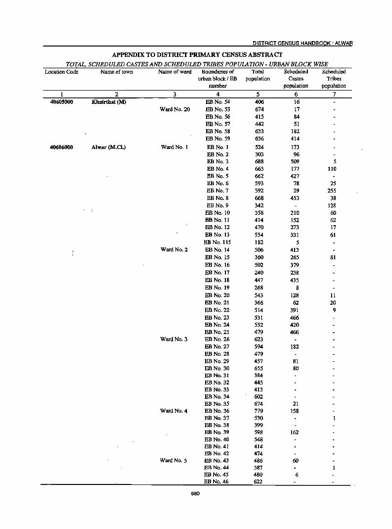
DISTRICT CENSUS HANDBOOK: ALWAR
APPENDIX TO DISTRICT PRIMARY CENSUS ABSTRACT
TOTAL, SCHEDULED CASTES AND SCHEDULED TRIBES POPULATION - URBAN BLOCK WISE Location Code Name of town Name of ward Boundaries of Total Scheduled Scheduled
urban block I EB, population Castes Tribes number population population
2 3 4 5 6 7 40605000 Khairthal (M) EBNo.54 406 16
Ward No. 20 EBNo.55 674 17 EBNo.56 415 84 EBNo.57 442 51 EBNo.58 633 182 EBNo.59 636 414
40606000 Alwar (M.el.) Ward No. 1 EB No.1 524 173 EB No. 2 303 96 EB No.3 688 509 5 EB No.4 663 177 110 EB No.5 662 427 EBNo.6 593 78 25 EB No.7 592 29 255 EB No.8 668 453 38 EB No.9 342 128
EBNo.10 358 210 60 EBNo.11 414 152 62 EBNo.12 470 273 17 EBNo.13 554 331 61 EBNo.115 182 5
Ward No. 2 EBNo.14 506 413 EBNo.15 360 265 81 EBNo.16 502 379 EBNo.17 240 238 EBNo.18 447 435 EBNo.19 268 8 EBNo.20 543 128 11 EBNo.21 366 62 20 EB No. 22 514 391 9 EBNo.23 531 466 EBNo.24 532 420 EBNo.25 479 466
Ward No. 3 EBNo.26 623 EBNo.27 594 182 EBNo.28 479 EBNo.29 457 81 EBNo.30 655 80 EBNo.31 384 EBNo.32 445 EBNo.33 413 EBNo.34 602 EBNo.35 674 21
WardNo.4 EBNo.36 779 158 EBNo.37 530 EBNo.38 399 EBNo.39 598 162 EB No. 40 548 EBNo.41 414 EBNo.42 474
Ward No. 5 EB No. 43 486 60 EB No. 44 587 EB No. 45 480 6 EB No. 46 622
680
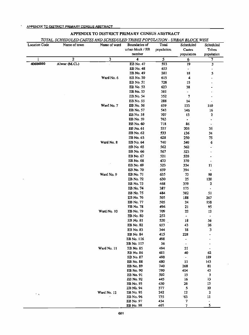
APPENDIX TO DISTRICT PRIMARY CENSUS ABSTRACT
APPENDIX TO DISTRICT PRIMARY CENSUS ABSTRACT
TOTAL, SCHEDULED CASTES AND SCHEDULED TRIBES POPULATION - URBAN BLOCK WISE Location Code Name of town Name of ward Boundaries of Total Scheduled Scheduled
urban block I EB population Castes Tribes number population population
2 3 4 5 6 7 40606000 Alwar (M.Cl.) EB No. 47 593 19 3
EBNo.48 655 EBNo.49 281 18 5
Ward No. 6 EB No. 50 615 4 EB No. 51 728 15 EBNo.52 623 38 EB No. 53 381 EBNo.54 352 7 EBNo.55 288 14
Ward No. 7 EBNo.56 659 133 110 EBNo.57 543 146 16 EBNo.58 707 13 2 EBNo.59 763 EBNo.60 718 86 EBNo.61 557 205 35 EBNo.62 533 136 34 EBNo.63 628 250 75
Ward No. 8 EBNo.64 740 549 6 EBNo.65 562 562 EBNo.66 567 523 EBNo.67 521 520 EBNo.68 433 370 EBNo.69 523 334 11 EBNo.70 659 394
Ward No. 9 EBNo.71 635 73 98 EB No. 72 630 25 120 EB No. 73 468 359 2 EBNo.74 387 175 EB No. 75 484 382 51 EB No. 76 50S 188 267 EB No. 77 505 24 158 EB No. 78 496 21 95
Ward No. 10 EB No. 79 709 22 12 EBNo.80 252 EBNo.81 520 18 56 EBNo.82 653 43 26 EBNo.83 344 18 3 EBNo.84 415 228
EB No. 116 498 EB No. 117 56
Ward No. 11 EB No. 85 494 21 EB No. 86 601 40 62 EB No. 87 490 189 EB No. 88 480 11 143 EBNo.89 740 268 81 EB No. 90 780 404 45 EB No. 91 502 15 5 EBNo.92 445 16 13 EB No. 93 450 26 13 EBNo.94 377 5 10
Ward No. 12 EB No. 95 242 12 2 EBNo.96 735 ·"63 11 EBNo.97 454 7 EBNo.98 465 7 5
681
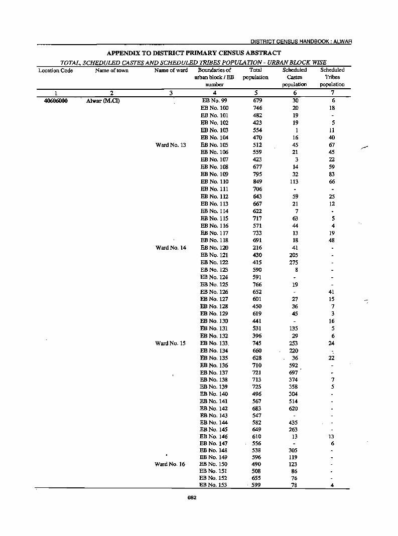
DISTRICT CENSUS HANDBOOK: ALWAR
APPENDIX TO DISTRICT PRIMARY CENSUS ABSTRACT
TOTAL, SCHEDULED CASTES AND SCHEDULED TRIBES POPULATION - URBAN BLOCK WISE Location Code Name of town Name of ward Boundaries of Total Scheduled Scheduled
urban block I EB population Castes Tribes number population population
1 2 3 4 5 6 7
40606000 Alwar (M.el) EB No. 99 679 30 6 EBNo.100 746 20 18 EB No. 101 482 19 EBNo.102 423 19 5 EBNo.103 554 11 EBNo.104 470 16 40
Ward No. 13 EBNo.105 512 45 67 EB No. 100 559 21 45 EBNo.107 423 3 22 EBNo.108 677 14 59 EBNo.I09 795 32 83 EB No. 110 849 113 66 EB No. 111 706 EBNo.112 643 59 25 EB No. 113 667 21 12 EB No. 114 622 7 EB No. 115 717 63 5 EB No. 116 571 44 4 EBNo.117 733 13 19 EB No. 118 691 18 48
Ward No. 14 EBNo.l20 216 41 EBNo.121 430 205 EBNo.l22 415 275 EB No. 123 590 8 EBNo.l24 591 EBNo.l25 766 19 EBNo.l26 652 41 EBNo.127 601 27 15 -EBNo.128 450 36 7 EBNo.129 619 45 3 EBNo.130 441 16 EBNo.131 531 135 5 EBNo.132 396 29 6
Ward No. 15 EBNo.133. 745 253 24 EBNo.134 660 220 EB No. 135 628 36 22 EB No. 136 710 592 EBNo.137 721 697 EBNo.138 713 374 7 EBNo.139 725 358 5 EBNo.14O 496 304 EBNo.141 567 514 EBNo.142 683 620 EBNo.143 547 EB No. 144 582 435 EB No. 145 649 263 EBNo.146 610 13 13 EBNo.147 556 6 EB No. 148 538 305 EBNo.149 596 119
Ward No. 16 EB No. 150 490 123 EB No. 151 508 86 EB No. 152 655 76 EB No. 153 . 599 78 4
682
APPENDIX TO DISTRICT PRIMARY CENSUS ABSTRACT
APPENDIX TO DISTRICT PRIMARY CENSUS ABSTRACT
TOTAL,'SCHEDULED CASTES AND SCHEDULED TRIBES POPULATION - URBAN BLOCK WISE Location Code Name of town Name of ward Boundaries of Total Scheduled Scheduled
urban block I BB population Castes Tribes number population population
1 2 3 4 5 6 7 40606000 Alwar(M.O) BB No. 154 617 271
BB No. 155 535 52 7 BB No. 156 474 57 1 BB No.IS7 472 14 5 BB No. 158 462 1 BB No. 159 649 43 3 BB No. 160 869 86 23 BB No. 161 535 113 14 BB No. 162 706 129 BB No. 163 621 195 3 EBNo.IM 784 159 11 BB No. 165 713 14 10 BB No. 166 682 81 5 BB No. 167 635 16
Ward No. 17 BB No. 168 657 56 4 BB No. 169 891 61 23 EBNo.170 237 30 4 EB No. 171 188 2 BBNo.l72 621 227 6 EBNo.l73 505 309 EBNo.174 675 237 EBNo.l75 413 29 4 EBNc.176 621 3 EBNo.l77 724 204 4 BB No. 178 694 131 119 BBNo.179 648 55 BB No. 180 592 38 EB No. 181 458 10 EBNo.182 519 17 EB No. 183 421 5 EB No. 184 459 4 BBNo.185 603 EBNo.186 695 6 3
Ward No. 18 EB No. 187 666 5 6 EB No. 188 426 31 EBNo.189 444 72 5 EBNo.190 527 36 16 BB No. 191 391 45 EBNo.192 597 BB No. 193 677 5 8 EBNo.194 419 36 BBNo.195 722 53 BBNo.196 611 58 8 EBNo.197 453 18 BBNo.198 309 6 BB No. 199 643 27 2 ES No. 200 478 45 BBNo.201 373 32 4 ~BNo.202 615 23
Ward No. 19 EB No. 203 375 EB No. 204 461 15 32 ,BB No. 205 533 EB No. 206 482 23 EB No. 207 329 5
683
DISTRICT CENSUS HANDBOOK: ALWAR
APPENDIX TO DISTRICT PRIMARY CENSUS ABSTRACT
TOTAL, SCHEDULED CASTES AND SCHEDULED TRIBES POPULATION - URBAN BLOCK WISE Location Code Name of town Name of ward Boundaries of Total Scheduled Scheduled
urban block f EB population Castes Tribes number population population
2 3 4 5 6 7 40606000 Alwar (M.el) EBNo.208 702 12
EBNo.2OO 638 27 EBNo.21O 764 41 EBNo.211 663 24 EBNo.212 904 96 14 EB No. 213 744 35 5
Ward No. 20 EB No. 214 794 479 EB No. 215 518 211 45 EB No. 216 464 96 2 EB No. 217 656 37 EB No. 218 441 27 EB No. 219 510 12 EB No. 220 520 4 EB No. 221 513 EB No. 222 342 EB No. 223 386 6 19 EBNo.224 534 29 9 EBNo.225 563 36 1 EB No. 226 447 29 4 EB No. 227 450 3 EBNo.228 517 161 9 EB No. 229 502 22 11 EB No. 230 446 20 5 EB No. 231 523 59 16
Ward No. 21 EB No. 232 786 21 EB No. 233 799 798 EB No. 234 538 51 6 EB No. 235 352 283 EB No. 236 503 424 EBNo.237 431 431 EB No. 238 429 349 9
Ward No. 22 EB No. 239 559 54 EBNo.240 588 451 EB No. 241 731 102 138 EB No. 242 485 253 28 EB No. 243 501 2 45 EB No. 244 402 59 57 EB No. 245 449 142 EB No. 246 474 8 58 EB No. 247 718 373
Ward No. 23 EBNo.248 752 48 7 EB No. 249 635 11 EB No. 250 521 EB No. 251 475 EB No. 252 505 3 EB No. 253 402 11 EB No. 254 SIS 5 EB No. 255 534 87
Ward No. 24 EB No. 256 285 EB No. 257 682 92 EB No. 258 484 47 EB No. 259 524 154 EB No. 260 448 73 EB No. 261 585 5 38
684
APPENDIX TO DISTRICT PRIMARY CENSUS ABSTRACT
APPENDIX TO DISTRICT PRIMARY CENSUS ABSTRACT
TOTAL, SCHEDULED CASTES AND SCHEDULED TRIBES POPULATION - URBAN BLOCK WISE Location Code Name of town Name of ward Boundaries of Total Scheduled Scheduled
urban block I EB population Castes Tribes number population population
1 2 3 4 5 6 7 40606000 Alwar (M.el) EB No. 262 277 5
EBNo.263 19 Ward No. 25 EB No. 264 541
EB No. 265 474 4 EBNo.266 648 23 EB No. 267 420 4 EBNo.268 697 EB No. 269 641 33
Ward No. 26 EBNo.270 639 68 26 EB No. 271 651 EB No. 272 707 147 EBNo.273 669 70 BBNo.274 622 279 32 BBNo.275 563 90 173
Ward No. 27 EB No. 276 565 150 63 EBNo.277 753 54 56 EB No. 278 487 106 13 EBNo.279 516 23 EBNo.280 289 39 EB No. 281 427 108 EBNo.282 496 113
Ward No. 28 EB No. 283 528 32 EB No. 284 548 57 EB No. 285 805 24 31 EB No. 286 777 55 3 EB No. 287 758 68 34 EB No. 288 487 351 12
Ward No. 29 EB No. Il8 546 20 EB No. 289 . 332 5 EBNo.290 713 6 EB No. 291 568 13 10 EB No. 292 355 EB No. 293 654 2 9 EB No. 294 557 23 EB No. 295 503 8 14 EB No. 296 470 30 EB No. 297 495 2 8
Ward No. 30 EB No. 298 603 3 EB No. 299 512 59 EB No. 300 507 9 EBNo.301 592 EB No. 302 439 EBNo.303 407 169 EB No. 304 407 5 31 EBNo.305 478 131 19
Ward No. 31 EBNo.306 329 33 EBNo.307 686 34 103 EBNo.308 555 24 275 EBNo.309 699 109 23 EB No. 310 392 307 EBNo.311 490 160 EB No. 312 809 27
Ward No. 32 EB No. 313 595 '9 14
685
DISTRICT CENSUS HANDBOOK: ALWAR
APPENDIX TO DISTRICT PRIMARY CENSUS ABSTRACT
TOTAL, SCHEDULED CASTES AND SCHEDULED TRIBES POPULATION - URBAN BLOCK WISE Location Code Name of town Name of ward Boundaries of Total Scheduled Scheduled
urban block f EB population Castes Tribes number population population
1 2 3 4 5 6 7 40606000 Alwar (M.e!) EBNo.314 573 12 36
EB No. 315 773 3 196 EB No. 316 452 52 EB No. 317 350 43 7 EB No. 318 618 25 13 EB No. 319 506 22 BBNo.320 322 87 4 EB No. 321 650 66 14
Ward No. 33 EB No. 322 624 18 EBNo.323 557 10 EB No. 324 792 95 14 EBNo.325 638 26 42 EBNo.326 499 16 EBNo.327 784 70 59 EBNo.328 567 42 207 EBNo.329 384 35 79 EBNo.330 538 EB No. 331 644 BB No. 332 679 138 148
Ward No. 34 EBNo.333 808 17 22 EBNo.334 636 34 16 EBNo.335 846 334 6 EB No. 336 590 269 EB No. 337 570 19 3 EB No. 338 630 51 12 EBNo.339 446 108 EBNo.34O 526 115 2 EBNo.341 614 58 3 EBNo.342 166 11 EB No. 343 935 278 28 BB No. 344 585 8 5 BB No. 345 713 25 5 BBNo.346 634 37 15 BB No. 347 545 5 BBNo.348 629 19 BBNo.349 668 15 BB No. 350 474 5 EB No. 351 20 3 4
Ward No. 35 BBNo.352 624 90 BBNo.353 626 222 BBNc.354 404 EBNo.355 557 335 BBNo.356 552 1 3 EBNo.357 459 3
Ward No. 35 BBNo.358 434 EBNo.359 465 2 BBNo.360 338 BBNo.361 455 BBNo.362 513 3 2 BBNo.363 477 EBNo.364 557 10
:;' BBNo.365 391 339 BBNo.366 366 BBNo.367 456
686
APPENDIX TO DISTRICT PRIMARY CENSUS ABSTRACT
APPENDIX TO DISTRICT PRIMARY CENSUS ABSTRACT
TOTAL. SCHEDULED CASTES AND SCHEDULED TRIBES POPULATION - URBAN BLOCK WISE Location Code Name of town Name of ward Boundaries of Total Scheduled Scheduled
urban block I EB population Castes Tribes nwnber population population
1 2 3 4 5 6 7 40606000 Alwar (M.el) Ward No. 37 EB No. 119 321
EB No. 120 Z72 2 EB No. 368 156 134 EBNo.369 496 429 EB No. 370 374 132 88 EBNo.371 614 221 EBNo.372 500 160 I EB No. 373 737 12 6 EBNo.374 365 16 EBNo.375 485 10 EB No. 376 423 6 EBNo.377 396 EB No. 378 518 EBNo.379 431 122
Ward No. 38 EBNo.380 300 19 17 EB No. 381 480 377 EB No. 382 452 315 EBNo.383 424 26 7 EB No. 384 416 6 EBNo.385 666 6 6 EBNo.386 681 EB No. 387 592 ';f
EBNo.388 507 61 EB No. 389 359 6 EB No. 390 544 12 EB No. 391 416 25 EBNo.392 424 24 2
Ward No. 39 EB No. 393 603 7 EB No. 394 354 44 EB No. 395 679 36 EB No. 396 527 10 EB No. 397 387 EBNo.398 405
Ward No. 40 EBNo.399 225 EB No. 400 700 27 EBNo.401 562 5 EB No. 402 475 EB No. 403 451 95 EB No. 404 387 17 EB No. 405 458 32 6
Ward No. 41 EB No. 406 435 18 EBNo.407 398 12 3 EB No. 408 489 454 EB No. 409 511 483 EB No. 410 627 36 17 EB No.4Il 806 376 EB No. 412 782 327 EBNo.413 117 EB No. 414 196 25 EB No. 415 522 522
Ward No. 42 EB No. 416 595 6 EB No. 417 576 29 7 EBNo.418 374
687
DISTRICT CENSUS HANDBOOK: ALWAR
APPENDIX TO DISTRICT PRIMARY CENSUS ABSTRACT
TOTAL, SCHEDULED CASTES AND SCHEDULED TRIBES POPULATION - URBAN BLOCK WISE Location Code Name of town Name of ward Boundaries of Total Scheduled Scheduled
i urban block I EB population Castes Tribes number population population
1 2. 3 4 5 6 7 40606000 Alwar (M.Cl) EB No. 419 522 19
EB No. 420 530 45 EB No. 421 526 31
Ward No. 43 EB No. 422 501 EBNo.423 536 EB No. 424 376 EBNo.425 749 EB No. 426 639 28 EB No. 427 417 84 EB No. 428 348 121
Ward No. 44 EB No. 429 398 EB No. 430 422 EB No. 431 495 32 EB No. 432 700 EB No. 433 690 16 19 EB No. 434 391
Ward No. 45 EB No. 435 631 152 EB No. 436 707 605 EB No. 437 750 277 4 EB No. 438 504 EB No. 439 346 10 EB No. 440 689 585
Ward No. 46 EBNo.441 738 7 15 EBNo.442 445 40 2 EB No. 443 449 38 35 EBNo.444 501 107 44 EBNo.445 512 EBNo.446 421
Ward No. 47 EB No. 447 633. 22 30 EBNo.448 412 EB No. 449 428 18 52 EB No. 450 772 EB No. 451 751 EB No. 452 420 EB No. 453' 481 4 14 EBNo.454 634 4 33 EB No. 455 438 4 EB No. 456 221 EB No. 457 393 2 EB No. 458 411 EB No. 459 495
Ward No. 48 EBNo.460 493 6 EB No. 461 435 6 EB No. 462 680 6 EB No. 463 477 10 EB No. 464 522 23 EB No. 465 449 EB No. 466 692 EB No. 467 447
Ward No. 49 EB No. 468 524 EBNo.469 533 EBNo.470 396 ... ,. ~
< EB No. 471 440 EBNo.472 457
688
APPENDIX TO DISTRICT PRIMARY CENSb!S A8§TRACT
APPENDIX TO DISTRICT PRIMARY CENSUS ABSTRACT
TOTAL, SCHEDULED CASTES AND SCHEDULED TRIBES POPULATION - URBAN BLOCK WISE Location Code Name of town Name of ward Boundaries of Total Scheduled Scheduled
urban block I EB population Castes Tribes number population population
1 2 3 4 5" 6 7
40606000 Alwar (M.el) EB No. 473 408 8
EB No. 474 725
EB No. 475 590 5
Ward No. 50 EB No. 476 581 EB No. 477 406 8 EB No. 478 831 EB No. 479 609 EB No. 480 456 23 EB No. 481 485 19
EB No. 482 470
Ward No. 51 EB No. 101 432 7
EBNo.l02 220 EBNo.103 394 EBNo.I04 388 12
EB No. 105 138 3 EB No. 106 113 10
EB No. 107 402 4 27
EB No. 108 159
EBNo.I09 III EB No. 110 264 16
EB No. III 702 56 7
EB No. 112 693 88 4
EB No. 113 763 39
EB No. 114 831 4 41
40607000 Rajgarh(M) Ward No. 1 EB No.1 762 33 25
EB No.2 385 16 23
Ward No. 2 EBNo.3 503 5 24 EB No. 4 386 95 EB No.5 555 172 12 EB No.6 573 166
Ward No. 3 EBNo.7 569 376 65 EB No.8 438 213
Ward No. 4 EB No.9 687 413 72 EBNo.10 484 261 20
Ward No. 5 EBNo.l1 627 184 21 EBNo.12 686 66 193
Ward No. 6 EBNo.13 880 75 148 EBNo.14 528 22 25
Ward No. 7 EB No. 15 246 12 11 EBNo.16 370 2 30 EBNa.17 624 58 49
Ward No. 8 EBNo.I8 439 6 10 EBNo.19 396 EBNo.20 478 2 4
Ward No. 9 EBNa.21 493 22 EBNo.22 618 15 16
Ward No. 10 EBNo.23 435 11 7 EBNo.24 471 190 7 EBNo.25 331 43
" ~ Ward No. 11 EBNo.26 521 205 104
EBNo.27 441 418 EBNo.28 344 60
Ward No. 12 EBNo.29 461 324
689
DISTRICT CENSUS HANDBOOK: ALWAR
APPENDIX TO DISTRICT PRIMARY CENSUS ABSTRACT
TOTAL, SCHEDULED CASTES AND SCHEDULED TRIBES POPULATION - URBAN BLOCK WISE Location Code Name of town Name of ward Boundaries of Total Scheduled Scheduled
urban block I EB population Castes Tribes number population population
2 3 4 5 6 7 40607000 Rajgarh (M) EBNo.30 652 582
Ward No. 13 EBNa.31 519 44 71 EBNa.32 420 55 20
Ward No. 14 EBNo.33 413 29 2 EBNo.34 465 2 2
Ward No. 15 EBNo.35 693 24 8 EBNa.36 351
Ward No. 16 EBNa.37 352 24 EBNa.38 553 85 EBNa.39 658 234 72
Ward No. 17 EB No. 40 360 1 26 EBNo.41 518 41
Ward No. 18 EBNa.42 547 147 2 EBNa.43 482 8 EBNo.44- 679 10
Ward No. 19 EBNa.45 551 EB No. 46 557 153 EB No. 47 172
Ward No. 20 EBNa.48 509 EBNa.49 491 EBNa.50 336
40608000 Govindgarh (CT) Ward No. 1 EBNo.l 777 13 39 EB No. 2 570 12 3
Ward No. 2 EB No. 3 361 Ward No. 3 EB No. 4 510 Ward No. 4 EB No. 5 451 1 Ward No. 5 EB No. 6 458 Ward No. 6 EBNo.7 356 Ward No. 7 EB No. 8 480 18 84
. Ward No. 8 EBNo.9 467 Ward No. 9 EBNa.IO 452
Ward No. 10 EBNa.II 427 63 Ward No. 11 EBNo.12 574 19 Ward No. 12 EB No. 13 400 5 Ward No. 13 EBNa.14 509 54 6 Ward No. 14 EBNo.lS 240 101 Ward No. 15 EBNa.16 649 138 8 Ward No. 16 EBNo.17 551 412 Ward No. 17 EBNo.I8 585 548 Ward No. 18 EBNo.19 657 98 Ward No. 19 EBNo.20 615 ,71 248
40609000 Kherli (M) Ward No. 1 EB No.1 442 60 55 EBNo.2 627 6 1
Ward No. 2 EB No.3 471 57 EB No.4 359 26 12
Ward No. '3 EB No.5 645 7 EB No. 6 444 87 16 EBNo.7 379 189 8
Ward No. 4 EBNo.8 613 19 8 EB No. 9 :,483
Ward No. 5 EBNo.10 426 6 4 EB No. 11 367 7 3
690 .(
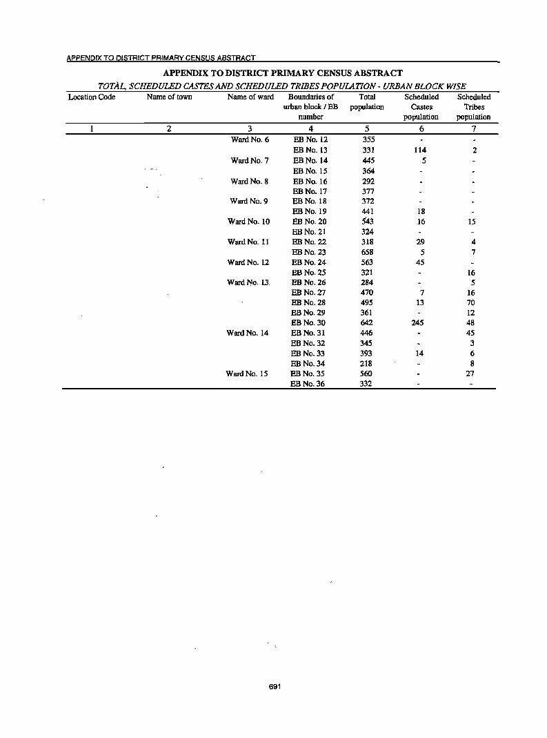
APPENDIX TO DISTRICT PRIMARY CENSUS ABSTRACT
APPENDIX TO DISTRICT PRIMARY CENSUS ABSTRACT
TOTAL, SCHEDULED CASTES AND SCHb'DULED TRIBES POPUlATION - URBAN BLOCK WISE Location Code Name of town Name of ward Boundaries of Total Scheduled Scheduled
urban block I EB population Castes Tribes number population population
2 3 4 5 6 7 Ward No. 6 EBNo.12 355
EB No. 13 331 114 2 Ward No. 7 EBNo.14 445 5
EBNo.15 364 Ward No. 8 EBNo.16 292
EBNo.17 377 Ward No. 9 EBNo.18 372
EBNo.19 441 18 Ward No. 10 EBNo.20 543 16 15
EBNo.21 324 Ward No. 11 EBNo.22 318 29 4
EBNo.23 658 5 7 Ward No. 12 EBNo.24 563 45
EBNo.25 321 16 Ward lIIo. 13. EBNo.26 284 5
EBNo.27 470 7 16 EBNo.28 495 13 70 EB No. 29 361 12 EB No. 30 642 245 48
Ward No. 14 EBNo.31 446 45 EBNo.32 345 3 EBNo.33 393 14 6 EBNo.34 218 8
Ward No. 15 EB No. 35 560 27 EB No. 36 332
691
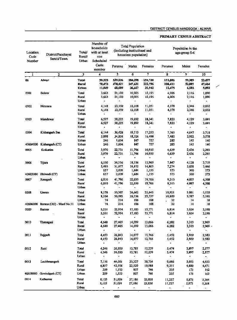
DISTRICT CENSUS HANDBOOK: ALWAR
PRIMARY CENSUS ABSTRACT
Number of households Total Population
Population in the Location Totall with at least (including institutional and
age-group 0-6 Code
DistrictlPanchayat Rural! one houseless population)
Number SamitiITown
Urban Scheduled Caste Persons Males Females Persons Males Females
member
2 3 4 5 6 7 8 9 10
06 Alwar Total 90,322 539,036 284,298 ·254,738 112,886 59,389 53,497 Rural 78,473 470,427 247,631 222,796 100,411 52,807 47,604 Urban 11,849 68,609 36,667 31,942 12,475 6,582 5,893 r
0001 Behror Total 3,663 21,100 10,905 10,195 4,006 2,116 1,890 Rural 3,663 21,100 10,905 10,195 4,006 2,116 1,890 Urban
0002 Nimrana Total 4,148 23,159 12,108 1l,051 4,378 2,346 2,032 Rural 4,148 23,159 12,108 11,051 4,378 2,346 2,032 Urban
0003 Mandawar Total 6,527 38,233 19,892 18,341 7,820 4,129 3,691 Rural 6,527 38,233 19,892 18,341 7,820 ' 4,129 3,691 Urban
0004 Kisbangarh Bas Total 6,144 36,428 19,173 17,255 7,765 4,047 3,718 Rural 5,898 34,824 18,326 16,498 7,480 3,902 3,578 Urban 246 1,604 847 757 285 145 140
40604000 Kishangarh (CT) Urban 246 1,604 847 757 285 145 140
0005 Kotkasim Total 3,970 22,731 11,796 10,935 4,639 2,436 2,203 Rural 3,970 22,731 11,796 10,935 4,639 2,436 2,203 Urban
0006 Tijara Total 6,150 34,516 18,556 15,960 7,847 4,128 3,719 Rural 5,493 31,677 16,872 14,805 7,274 3,828 3,446 Urban 657 2,839 1,684 1,155 573 300 273
40602000 Bhiwadi (eT) Urban 657 2,839 1,684 1,155 573 300 273
0007 Ramgarh Total 6,810 41,796 22,030 19,766 9,315 4,807 4,508 Rural 6,810 41,796 22,030 19,766 9,315 4,807 4,508 Urban
0008 Umren Total 8,178 50,307 26,662 23,645 10,921 5,801 5,120 Rural 8,104 50,093 26,556 23,537 10,889 5,787 5,102 Urban 74 214 106 108 32 14 18
40606000 Itarana (OG) - Ward No.51 Urban 74 214 106 108 32 14 18
0009 Bansur Total 5,531 32,954 17,183 15,771 6,814 3,624 3,190 Rural 5,531 32,954 17,183 15,771 6,814 3,624 3,190 Urban
0010 Thanagazi Total 4,640 27,465 14,399 13,066 6,282 3,313 2,969 Rural 4,640 27,465 14,399 13,066 6,282 3,313 2,969 . Urban
0011 Rajgarh Total 4,453 26,843 14,077 12,766 5,452 2,869 2,583 Rural 4,453 26,843 14,077 12,766 5,452 2,869 2,583 Urban
0012 Reni Total 4,246 26,020 13,781 12,239 5,474 2,897 2,577 Rural 4,246 26,020 13,781 12,239 5,474 2,897 2,577 Urban
0013 Lachhmangarh Total 7,116 44,061 23,327 20,734 9,686 5,053 4,633 Rural 6,857 42,508 22,520 19,988 9,351 4,880 4,471 Urban 259 1,553 807 746 335 173 162
40608000 Govindgarh (CT) Urban 259 1,553 807 746 335 173 162
0014 Kathumar Total 8,133 51,024 27,186 23,838 11,237 5,873 5,364 Rural 8,133 51,024 27,186 23,838 11,237 5,873 5,364 Urban
692
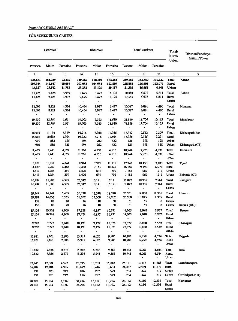
PRIMARY CENSUS ABSTRACT
FOR SCHEDULED CASTES
Literates Illiterates Total workers Totall RuraV Urban
DistrictlPanchayat Samiti/Town
Persons Males Females Persons Males Females Persons Males Females
11
238,671 203,344
35,327
11,425 11,425
12,695 12,695
19,230 19,230
16,512 15,602
910 910
11,463 11,463
15,602 14,189
1,413 1,413
16,484 16,484
19,549 19,391
158 158
15,126 15,126
9,267 9,267
10,931 10,931
10,812 10,812
17,146 16,409
737 737
20,320 20,320
12
166,189 142,647
23,542
7,428 7,428
8,121 8,121
12,569 12,569
11,193 10,608
585 585
7,441 7,441
10,761 9,707 1,054 1,054
11,889 11,889
14,144 14,056
88 88
10,326 10,326
7,227 7,227
8,051 8,051
7,936 7,936
12,624 12,104
520 520
15,184 15,184
13
, 72,482
60,697 11,785
3,997' 3,997
4,574 4,574
6,661 6,661
5,319 4,994
325 325
4,022 4,022
4,841 4,482
359 359
4,595 4,595
5,405 5,335
70 70
4,800 4,800
2,040 2,040
2,880 2,880
2,876 2,876
4,522 4,305
217 217
5,136 5,136
14
300,365 267,083 33,282
9,675 9,675
10,464 10,464
19,003 19,003
19,916 19,222
694 694
11,268 11,268
18,914 17,488 1,426 1,426
25,312 25,312
30,758 30,702
56 56
17,828 17,828
18,198 18,198
15,912 15,912
15,208 15,208
26,915 26,099
816 816
30,704 30,704
15
118,109 104,984 13,125
3,477 3,477
3,987 3,987
7,323 7,323
7,980 7,718
262 262
4,355 4,355
7,795 7,165
630 630
10,141 10,141
12,518 12,500
18 18
6,857 6,857
7,172 7,172
6,026 6,026
5,845 5,845
10,703 10,416
287 287
12,002 12,002
16
182,256 162,099 20,157
6,198 6,198
6,477 6,477
11,680 11,680
)l,936 11,504
432 432
6,913 6,913
11,119 10,323
796 796
15,171 15,171
18,240 18,202
38 38
10,971 10,971
11,026 11,026
9,886 9,886
9,363 9,363
16,212 15,683
529 529
18,702 18,702
693
17
249,782 228,'180 21,302
10,383 10,383
10,587 10,587
21,859 21,859
16,912 16,386
526 526
10,944 10,944
17,342 16,160 1,182 1,182
17,877 17,877
25,361 25,300
61 61
14,005 14,005
12,372 12,372
10,783 10,783
10,745 10,745
25,101 24,367
734 734
26,712 26,712
18
142;860 126,404
16;456
5;572 5,572
6,091 6,091
11,704 11,704
9,513 9,115
398 398
5,973 5,973
10,159 9,190
969 969
10,316 10,316
14,000 13,945
55 55
8,048 8,048
6,820 6,820
-' 6,259 6,259
6,061 6,061
13,416 12,994
422 422
14,316 14,316
19 3 2
106,922 Total Alwar 102,07{; Rural
4,846 Urban
4,811 Total Behror 4,811 Rural
Urban
4,4% Total 4,496 Rural
Urban
10,155 Total 10,155 Rural
Urban
Nimrana
Mandawar
7,399 Total Kishangarh Bas 7,271 Rural
128 Urban 128 Urban Kishangarh (Cf)
4,971 Total 4,971 Rural
Urban
Kotkasim
7,183 Total Tijara 6,970 Rural
213 Urban 213 Urban Bhiwadi (C1)
7,561 Total Ramgarh 7,561 Rural
Urban
11 ,361 Total Umren 11 ,355 Rural
6 Urban 6 Urban Itarana (OG)
5,957 Total Bansur 5,957 Rural
Urban
5,552 Total Thanagazi 5,552 Rural
Urban
4,524 Total 4,524 Rural
Urban
4,684 Total 4,684 Rural
Urban
Rajgarh
Reni
11,685 Total Lacbhmangarh 11,373 Rural
312 Urban 312 Urban Govindgarh (CI')
12,396 Total Kathumar '12,396 Rural
Urban
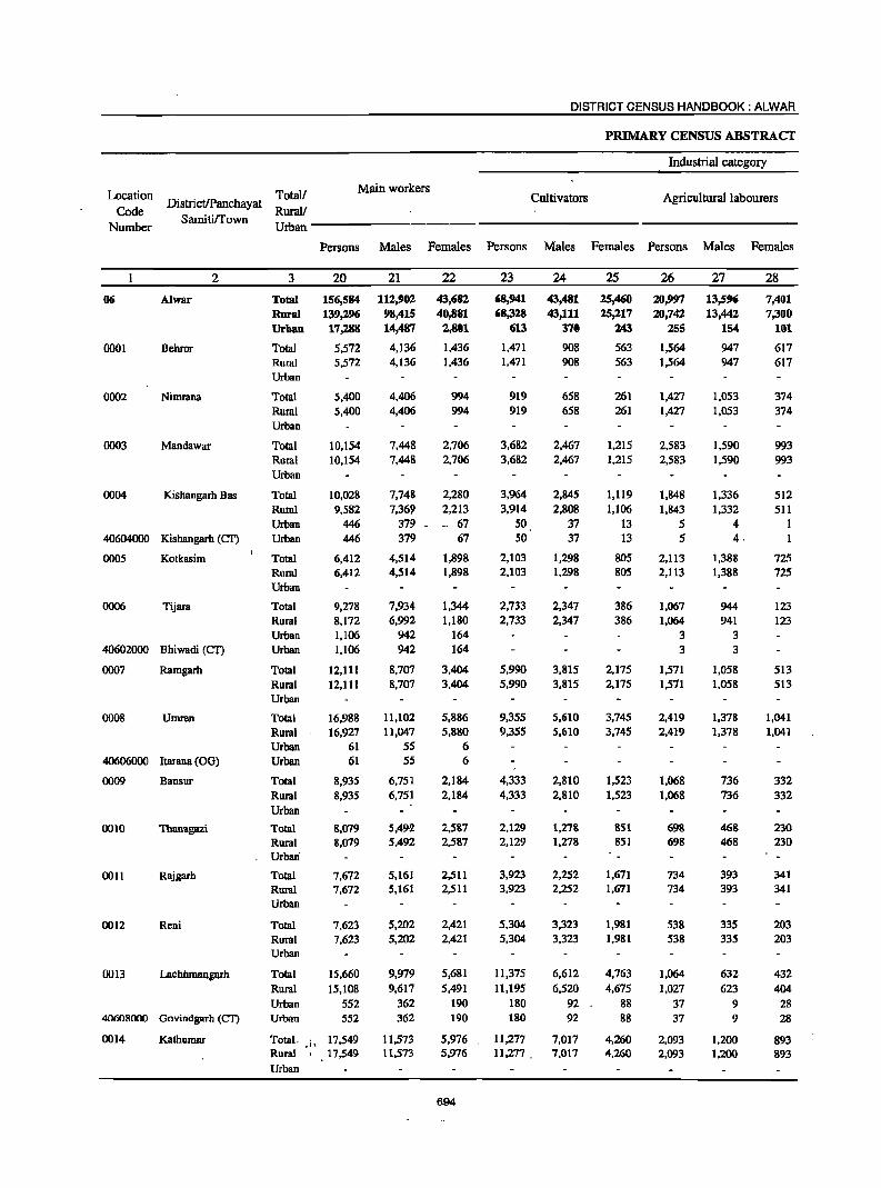
DISTRICT CENSUS HANDBOOK: ALWAR
PRIMARY CENSUS ABSTRACT
Industrial category
Main workers Cultivators Agricultural labourers Location
Code Number
Totall DistricUPanchayat Rural!
Srumti~own ________________________________________ _ Uroan--------------------
2
06 Alwar
0001 Dehror
0002 Nimrana
0003 Mandawar
0004 Kishangarh Bas
40604000 Kishangarh (cr)
0005 Kotkasim
0006 Tijara
40602000 Bhiwadi (CT)
0007 Ramgarh
0008 Umren
40606000 Itarana COG)
0009 Bansor
0010 Thanagazi
0011 Rajgarh
0012 Reni
00 13 Lachhmangarh
40608000 Govindgarh (CT)
0014 Kathumar
Persons Males Females Persons Males Females Persons Males Females
3
Total Rural Urban
Total Rural Urban
Total Rural Urban
Total Rural Urban
Total Rural Urban Urban
Total Rural Urban
Total Rural Urban Urban
Total Rural Urban
Total Rural Urban Urban
Total Rural Urban
Total Rural Urban'
Total Rural Urban
Total Rural Urban
Total Rural Urban Urban
20
156,584 139,296 17,288
5,572 5,572
5,400 5,400
10,154 10,154
10,028 9.582
446 446
6,412 6,412
9,278 8,172 1,106 1,106
12,111 12,111
16,988 16,927
61 61
8,935 8,935
8,079 8,079
7,672 7,672
7,623 7,623
15,660 15,108
552 552
Total. • i • 17.549 Rural 17.549
Urban
21
112,902 98,415 14,487
4,136 4,136
4,406 4,406
7,448 7,448
7,748
7,36' 379 -379
4,514 4,514
7,934 6,992
942 942
8,707 8,707
11,102 11,047
55 55
6,751 6,751
5,492-5,492
5,161 5,161
5,202 5,202
9,979 9,617
362 362
11,573 11,573
22
43,682 40,881
2,801
1,436 1,436
994 994
2,706 2,706
2,280 2,213 •. 67
67
1,898 1,898
1,344 1,180
164 164
3,404 3,404
5,886 5,880
6 6
2,184 2,184
2,587 2,587
2,511 2,511
2,421 2,421
5,681 5,491
190 190
5,976 5,976
694
23
68,941 68,328
613
1,471 1,471
919 919
3,682 3,682
3,964 3,914
SO 50
2,103 2,103
2,733 2,733
5,990 5,990
9,355 9,355
4,333 4,333
2,129 2,129
3,923 3,923
5,304 5,304
11,375
11,195 180 180
24
43,481 43,111
370
908 908
658 658
2,467 2,467
2,845 2,808
37 37
1,298 1,298
2,347 2,347
3,815 3,815
5,610 5,610
2,810 2,810
1,278 1,278
2,252 2,252
3,323 3,323
6,612 6,520
92 92
11,277 7,017 11,277. 7,017
25
25,4CiO 25,217
243
563 563
261 261
1,215 1,215
1,119 1,106
13 13
805 805
386 386
2,175 2,175
3,745 3,745
1,523 1,523
851 851
1,671 1,671
1,981 1,981
4,763 4,675
88 88
4,260 4,260
26
20,997 20,742
255
1,564 1,564
1,427 1,427
2,583 2,583
1,848 1,843
5 5
2,113 2,113
1,067 1,064
3 3
1,571 1,571
2,419 2,419
1,068 1,068
698 698
734 734
538 538
1,064
1,027 37 37
2,093 2,093
27
13,596 13,442
154
947 947
1,053 1,053
1,590 1,590
1,336 1,332
4 4·
1,388 1,388
944 941
3 3
1,058 1,058
1,378 1,378
736 736
468 468
393 393
335 335
632 623
9 9
1,200 1.200
28
7,401 7,300
101
617 617
374 374
993 993
512 511
I
725 725
123 123
513 513
1,041 1,041
332 332
230 230
341 341
203 203
432 404
28 28
893 893
PRIMARY CENSUS ABSTRACT
FOR SCHEDULED CASTES
of main workers
Household industry Other work Marginal workers Total!
DistrictlPanchayat Rural!
Samitirrown Urban
Persons Males Females Persons Males Females Persons Males Females
29 30 31 32 33 34 35 36 37 3 2
5,139 '3,197 1,942 61,507 52,628 8,879 93,198 29,958 63,240 Total Alwar 4,372 2,795 1,577 45,854 39,067 6,787 89,184 27,989 61,195 Rural
767 402 365 15,653 13,561 2,092 4,014 1,969 2,045 Urban
99 75 24 2,438 2,206 232 4,81 I 1,436 3,375 Total Behror 99 75 24 2,438 2,206 232 4,81 I 1,436 3,375 Rural
Urban
99 81 18 2,955 2,614 341 5,187 1,685 3,502 Total Nimrana 99 81 18 2,955 2,614 341 5,187 1,685 3;502 Rural
Urban
211 157 54 3,678 3,234 444 11,705 4,256 7,449 Total Mandawar 'j 211 157 54 3,678 3,234 444 11,705 4,256 7,449 Rural i
Urban
301 220 81 3,915 3,347 568 6,884 1,765 5,119 Total Kishangarh Bas 292 212 80 3,533 3,017 516 6,804 1,746 5,058 Rural
9 8 [ 382 330 52 80 19 61 Urban 9 8 I 382 330 52 80 19 61 Urban Kishangarh (CT)
126 88 38 2,070 1,740 330 4,532 1,459 3,073 Total Kotkasim 126 88 38 2,070 1,740 330 4,532 1,459 3,073 Rural
Urban
206 180 26 5,272 4,463 809 8,064 2,225 5,839 Total Tijara 203 178 25 4,172 3,526 646 7,988 2,198 5,790 Rural
3 2 1,100 937 163 76 27 49 Urban 3 2 1,100 937 163 76 27 49 Urban Bhiwadi (CT)
[72 113 59 4,378 3,721 657 5,766 1,609 4,1S7 Tota[ Ramgarh 172 113 59 4,378 3,721 657 5,766 1,609 4,1S7 Rural
Urban
444 206 238 4,770 3,908 862 8,373 2,898 5,475 Total Umren 443 206 237 4,710 3,853 857 8,373 2,898 5,475 Rural
1 I 60 55 5 Urban 60 55 5 Urban 1tarana (00) - Ward No.51
300 255 45 3,234 2,950 284 5,070 1,297 3,773 Tota[ Bansur 300 255 45 3,234 2,950 284 5,070 1,297 3,773 Rural
Urban
1,655 880 775 3,597 2,866 731 4,293 1,328 2,965 Total Thanagazi 1,655 880 775 3,597 2,866 731 4,293 1,328 2,965 Rural
Urban
275 189 86 2,740 2,327 413 3,111 1,098 2,013 Total Rajgarh 275 189 86 2,740 2,327 413 3,111 1,098 2,013 Rural
Urban
109 81 28 [,672 [,463 209 3,[22 859 2,263 Tota[ Reni 109 81 28 1,672 1,463 209 3,[22 859 2,263 Rural
Urban
194 15[ 43 3,027 2,584 443 9,441 3,437 6,004 Tota[ Lachhmangarh 183 143' 40 2,703 2,331 372 9,259 3,377 5,882 Rural
11 8 3 324 253 71 182 60 122 Urban
11 8 3 324 253 71 182 60 122 Urban Govindgarh (CT) "",""j n"
205 131 68 3,974 3,219 755 9,163 2,743 6,420 Total Kathumar -..' 205 137 68 3,974 3,219 755 9,163 2,743 6,420 Rural
Urban
695
Location Code
Number
DistrictIPanchayat Samitirrown
2
06 Alwar
0001 Behror
0002 Nimrana
0003 Mandawar
0004 Kishangarh Bas
40604000 Kishangarh (eT)
0005 Kotkasim
0006 Tijara
40602000 Bh,iwadi (eT)
0007 Ramgarh
0008 Umren
40606000 Itarana (00) - Ward No.51
0009 Bansur
0010 Thanagazi
0011 Rajgarh
0012 Reni
0013 Lachhmangarh
40608000 Govindgarh (eT)
0014 Kathumar
Totall Rurall
Cultivators
DISTRICT CENSUS HANDBOOK: ALWAR
PRIMARY CENSUS ABSTRACT
Industrial category of marginal workers
Agricultural labourers Household industry
Urban--------- ------------------
3
Total Rural Urban
Total Rural Urhan
Total Rural Urban
Total Rural Urban
Total Rural Urban Urban
Total Rural Urban
Total Rural Urban Urban
Total Rural Urban
Total Rural Urban Urban
Total Rural Urban
Total Rural Urban
Total Rural Urban
Total Rural Urban
Total Rural Urban Urban
Total Rural Urban
Persons Males Females Persons Males Females Persons Males Females
38
39,523 39,248
275
1,510 1,510
1,027 1,027
4,738 4,738
2,449 2,427
22 22
1,102 1,102
2,627 2,627
2,520 2,520
4,215 4,215
2,383 2,383
1,421 1,421
980 980
1,607 1,607
7,166 7,078
88 88
5,613 5,613
39
12,188 12,104
84
464 464
283 283
1,695 1,695
S75 571
4 4
36"6 366
914 914
467 467
1,417 1,417
542 542
393 393
145 145
281 281
2,742 2,711
31 31
1,855 1,855
40
27,335 27,144
191
1,046 1,046
744 744
3,043 3,043
1,874 1,856
18 18
736 736
1,713 1,713
2,053 2,053
2,798 2,798
1,841' 1,841
1,028 1,028
835 835
1,326 1,326
4,424 4,367
57 57
3,758 3,758
696
41
34,662 34,168
494
2,807 2,807
3,425 3,425
5,632 5,632
3,039 3,003
36 36
2,699 2,699
2,041 2,025
16 16
2,304 2,304
2,516 2,516
1,801 1,801
1,336 1,336
1,232 1,232
1,144 1,144
1,758 1,695
63 63
2,549 2,549
42
9,606 9,468
138
782 782
1,013 1,013
1,956 1,956
695 693
2 2
827 827
543 542
584 S84
704 704
383 383
327 327
350 350
349 349
433 424
9
9
534 534
43
25,056 24,700
356
2,025 2,025
2,412 2,412
3,676 3,676
2,344 2,310
34 34
1,872 1,872
1,498 1,483
15 15
1,720 1,720
1,812 1,812
1,418 1,418
1,009 1,009
882 882
795 795
1,325 1,271
54 54
2,015 2,015
44
2,303 1,954
349
33 33
66 66
158 158
183 180
3 3
80 80
205 205
64 64
274 274
134 134
365 365
130 130
30 30
125 120
5
5
115 115
45
599 545
54
12 12
11 II
S6 56
22 22
22 22
61 . 61
14 14
95 95
30 30
85 85
42 42
13 13
58 55 3 3
27 27
46
1,704 1,409
295
21 21
55 55
102 102
161 IS8
3 3
58 58
144 144
50 SO
179 179
104 104
280 280
88 88
17 17
67 65
2
2
88 88
PRIMARY CENSUS ABSTRACT
FOR SCHEDULED CASTES
Non-workers Total/ Location Other work DistrictlPanchayat RuraV
SamitiITown Code
Urban Number
Persons Males Females Persons Males Females
47 48 49 50 51 52 3 2
16,710 7,565 9,145 289,154 141,438 147,816 Total Alwar 06 13,814 5,872 7,942 241,947 121,227 120,720 Rural 2,896 1,693 1,103 .47,307 20,211 27,096 Urban
461 178 283 10,717 5,333 5,384 Total Behror 0001 461 178 283 10,717 5,333 5,384 Rural
Urban
669 378 291 12,572 6,017 6,555 Total Nimrana 0002 669 378 291 12,572 6,017 6,555 Rural
Urban
1,177 549 628 16,374 8,188 8,186 Total Mandawar 0003 1,177 549 :: 628 16,374 8,188 8,186 Rural
Urban
1,213 473 740 19,516 9,660 9,856 Total Kishangarh Bas 0004 1,194 460 734 18,438 9,211 9,227 Rural
19 13 6 1,078 449 629 Urban 19 13 6 1,078 449 629 Urban Kishangarh (CT) 40604000
651 244 407 11,787 5,823 5,964 Total Kotkasim 0005 651 244 407 11,787 5,823 5,964 Rural
Urban
3,191 707 2,484 17,174 8,397 8,777 Total Tijara 0006 3,131 681 2,450 15,517 7,682 7,835 Rural
60 26 34 1,657 715 942 Urban 60 26 34 1,657 715 942 Urban Bhiwadi (CT) 40602000
878 544 334 23,919 11,714 12,205 Total Rarngarh 0007 878 544 334 23,919 11,714 12,205 Rural
Urban
1,368 682 686 24,946 12,662 12,284 Total Umren 0008 1,368 682 686 24,793 12,611 12,182 Rural
153 51 102 Urban 153 51 102 Urban ltarana (00) - Ward No.5 I 40606000
752 342 410 18,949 9,135 9,814 Total Bansur 0009 752 342 410 18,949 9,135 9,814 RIJ!1II
Urban
1,171 523 648 15,093 7,579 7,514 Total Thanagazi 0010 1,171 523 648 15,093 7,579 7,514 Rural
Urban
769 561 208 16,060 7,818 8,242 Total Rajgarh 0011 769 561 208 16,060 7,818 8,242 Rural
Urban
341 216 125 15,275 7,720 7,555 Total Reni 0012 341 216 125 15,275 7,720 7,555 Rural
Urban
392 204 188 18,960 9,911 9,049 Total Laehhmangarh 0013 366 187 179 ' 18,141 9,526 8,615 Rural 26 17 9 819 385 434 Urban
26 17 9 819 385 434 Urban Govindgarh (Cn 40608000
886 327 559 . '.' 24,312 12,870 11,442 Total Kathumar 0014 886 327 559 24,312 12,870 11,442 Rural
Urban
697
DISTRICT CENSUS HANDBOOK: ALWAR
PRIMARY CENSUS ABSTRACT
Number of Total Population households Population in the
Location Total/ with at least (including institutional and age-group 0-6
Code DistrictJPanchayat
Rural/ one houseless population)
Number SamitilTown
Urban Scheduled Caste Persons Males Females Persons Males . Females
member
2 3 4 5 6 7 8 9 10
URBAN
40601000 Behror(M) .Urban 599 3,575 1,906 1,669 641 336 305
4()602000 Bhiwadi (CT) Urban 657 2,839 1,684 1,155 573 300 273
4()603000 Tijara(M) Urban 587 3,647 1,850 1,797 707 366 341
40604000 Kishangarh (CT) Urban 246 1,604 847 757 285 145 140
40605000 Khairthal (M) Urban 1,322 7,657 4,092 3,565 1,432 778 654
40606000 Alwar (M. CI+0G) Urban 7,182 41,943 22,351 19,592 7,357 3,872 3,485
40607000 Rajgarh(M) Urban 839 4,823 2,604 2,219 956 517 439
40608000 Govindgarh (CT) Urban 259 1,553 807 746 335 173 162
40609000 Kherli~~ Urban 158 968 526 442 189 95 94
698
PRIMARY CENSUS ABSTRACT
FOR SCHEDULED CASTES
Literates Illiterates Total workers Total/
Rural! DistrictIPanchayat
Urban SamitilTown
Persons Males Females Persons Males Females Persons Males Females
'11 12 13 14 15 16 17 18 19 3 2
URBAN
2,039 1,332 707 1,536 574 962 1,134 885 249 Urban Behror(M)
1,413 1,054 359 1,426 630 796 1,182 969 213 Urban Bhiwadi (CT)
2,028 1,249 779 1,619 601 1,018 1,421 897 524 Urban Tijara(M)
910 58S 325 694 262 432 526 398 128 Urban Kis~angarh (CT)
3,917 2,565 1,352 3,740 1,527 2,213 2,769 1,880 889 Urban Khairthal (M)
21,368 14,151 7,217 20,575 8,200 12,375 11,690 9,626 2,064 Urban Alwar (M. Cl+OG)
2,446 1,749 697 2,377 855 1,522 1,575 1,160 415 Urban Rajgarh eM)
737 520 217 816 287 529 734 422 312 Urban Govindgarh (CT)
469 337 132 499 189 310 271 219 52 Urban Kherli (M)
,.~~
..
699
DISTRICT CENSUS HANDBOOK: ALWAR
PRIMARY CENSUS ABSTRACT
Industrial category
Location Totall Main workers DistrictlPanchayat Cultivators Agricultural labourers
Code Samitirrown
Rural/ Number Urban
Persons Males Females Persons Males Females Persons Males Females
2 3 20 21 22 23 24 25 26 27 28
URBAN
40601000 Behror(M) Urban 840 745 9S 9 5 4 12 10 2 r -40602000 Bhiwadi (CT) Urban 1,106 942 164 3 3
40603000 Tijara (M) Urban 942 775 167 128 85 43 112 72 40
40604000 Kishangarh (CT) Urban 446 379 67 SO 37 13 5 4
40605000 Khairthal (M) Urban 1,984 1,531 453 144 87 57 38 19 19
40606000 Alwar (M. CI+OG) Urban 10,045 8,592 1,453 60 40 20 38 28 10
40607000 R~garh(M) Urban 1,194 992 202 33 17 16 5 4
40608000 Govindgarh (CT) Urban SS2 362 190 180 92 88 37 9 28
40609000 Kherli ~M~ Urban 179 169 10 9 7 2 5 5
700
PRIMARY CENSUS ABSTRACT
FOR SCHEDULED CASTES
of main workers
Household industry Other work Marginal workers Total/
DistrictlPanchayat Rural/
SamitilTown Urban
Persons Males Females Persons Males Females Persons Males Females
29 30 31 32 33 34 3S 36 37 3 2
URBAN
6 6 813 724 89 294 140 154 Urban Behror(M)
3 2 1,100 937 163 76 27 49 Urban Bhiwadi (CT)
14 8 6 688 610 78 479 122 357 Urban Tijara (M)
9 8 382 330 52 80 19 61 Urban Kishangarh (CT)
124 50 74 1,678 1,375 303 785 349 436 Urban Khairthal (M)
540 265 275 9,407 8,259 1,148 1,645 1,034 611 Urban Alwar (M. CI+OG)
58 53 S 1,098 918 180 381 168 213. Urban Rajgarh (M)
11 8 3 324 253 71 182 60 122 Urban Govindgarh (CT)
2 2 163 ISS 8 92 50 42 Urban Khcrli (M)
701
DISTRICT CENSUS HANDBOOK: ALWAR
PRIMARY CENSUS ABSTRACT
Industrial category of marginal workers
Location DistrictlPanchayat
Totall Cultivators Agricultural labourers Household industry Code
Samitirrown Rurall
Number Urban
Persons Males Females Persons Males Females Persons Males Females
2 3 38 39 40 41 42 43 44 45 46
URBAN
40601000 Behror(M) Urban 6 4 2 96 27 69 7 6
40602000 Bhiwadi (CT) Urban 16 15
40603000 Tijara (M) Utban 94 29 65 126 37 89 8 2 6
40604000 Kishangarh (CT) Urban 22 4 18 36 2 34 3 3
40605000 Khairthal (M) Urban 31 8 23 90 16 74 86 14 72
40606000 Alwar (M. CI+OG) Urban 16 6 10 48 36 12 181 27 154
40607000 Rajgarh (M) Urban 11 11 19 10 9 51 4 47
40608000 Govindgarh (eT) Urban 88 31 57 63 9 54 5 3 2
40609000 Kherli !Ml Urban 7 2 5 8 3 5
702
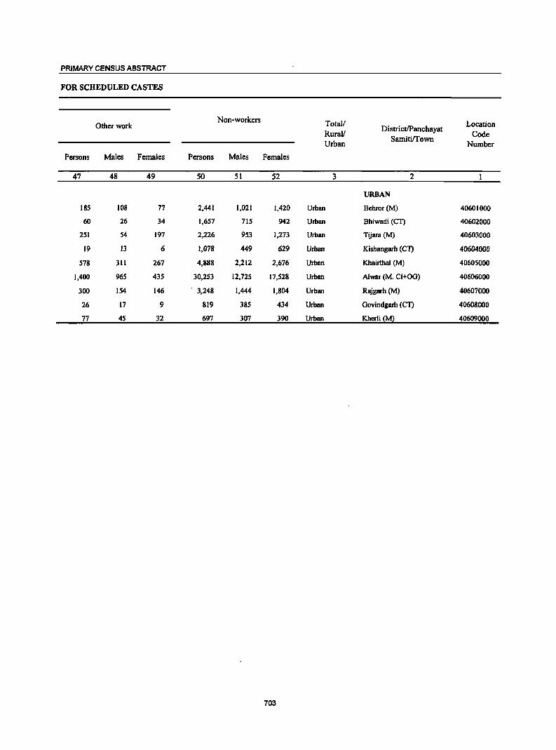
PRIMARY CENSUS ABSTRACT
FOR SCHEDULED CASTES
Non-workers Total! Location Other work DistrictIPanchayat Rural!
SamitiITown Code
Urban Number
Persons Males Females Persons Males Females
47 48 49 SO 51 52 3 2
URBAN
185 108 77 2,441 1,021 1,420 Urban Bchror(M) 40601000
60 26 34 1,657 715 942 Urban Bhiwadi (CT) 40602000
251 54 197 2,226 953 1,273 Urban Tijara (M) 40603000
19 13 6 1,078 449 629 Urban Kishangarh (CT) 40604000
578 311 267 4,888 2,212 2,676 Urban Khairthal (M) 40605000
1,400 965 435 30,253 12,725 17,528 Urban Alwar (M. CI+OG) 40606000
300 154 146 . 3,248 1,444 1,804 Urban Rajgarh (M) 40607000
26 17 9 819 385 434 Urban Govindgarh (CT) 40608000
77 45 32 697 307 390 Urban Kherli~~ 40609000
703
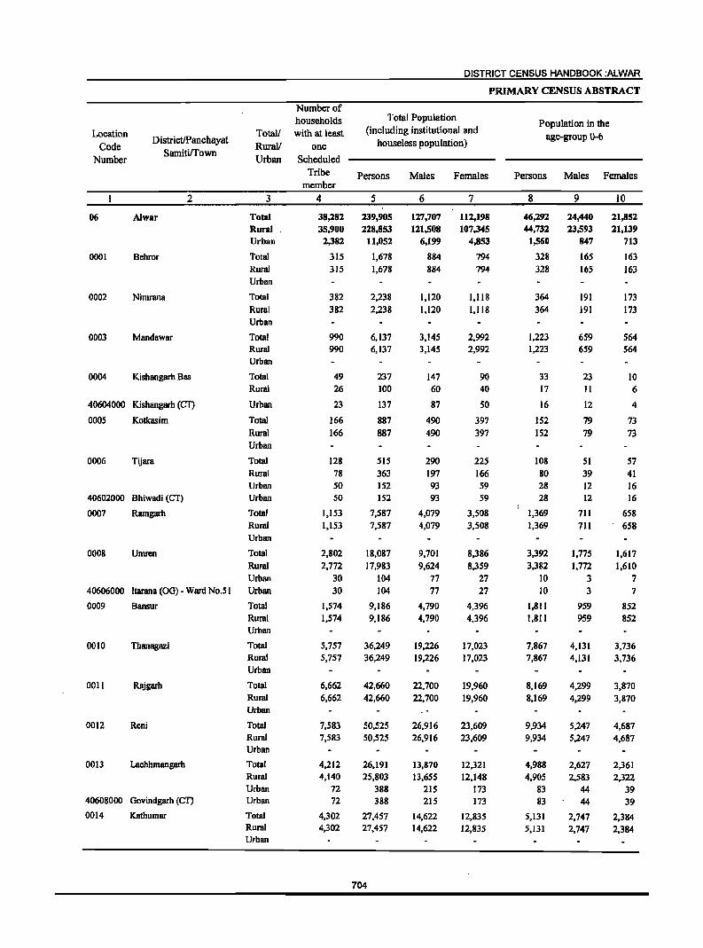
Location Code
Number
DistrictIPanchayat Samitirrown
2
06 Alw8r
0001 Behror
0002 Nimrana
0003 Mandawar
0004 Kishangarh Bas
40604000 Kishangarh (CT)
0005 Kotkasim
0006 Tijara
40602000 Bhiwadi (CT)
0007 RJungarh
0008 Umren
40606000 ltarana (00) - Ward No.5 I
0009 Bansur
0010 Thanagazi
0011 Rajgarh
0012 Reni
0013 Lachhmangarh
40608000 Govindgarh (CD
0014 Kathumar
Number of households
Total! with at least Rural/ one Urban Scheduled
3
Total Rural Urban
Total Rural Urban
Total
Rural Urban
Total Rural Urban
Total Rural
Urban
Total Rural Urban
Total Rural Urban Urban
Total Rural Urban
Total Rural Urban Urban
Total Rural Urban
Total Rural Urban
Total Rural
Urban
Total Rural Urban
Total Rural Urban Urban
Total Rural Urban
Tribe member
4
38,282 35,900
2,382
315
315
382
382
990 990
49 26
23
166
166
128 78 50 50
1,153 1,153
2,802 2,772
30 30
1,574 1,574
5,757 5,757
6,662 6,662
7,583 7,583
4,212 4;140
72 72
4,302 4,302
DISTRICT CENSUS HANDBOOK :ALWAR
PRIMARY CENSUS ABSTRACT
Total Population (including institutional and
houseless population)
Persons
5
239,905 228,853
11,052
1,678
1,678
2,238
2,238
6,137 6,137
237 100
137
887 887
515 363 152 152
7,587 7,587
18,087 17,983
104 104
9,186 9,186
36,249 36,249
42,660 42,660
50,525 50,525
26,191 25,803
388 388
27,457 27,457
704
Males
6
127,707 121,508
6,199
884 884
1,120 1,120
3,145 3,145
147 60
87
490
490
290 197 93 93
4,079 4,079
9,101 9,624
77 77
4,790 4,790
19,226 19,226
22,700 22,700
26,916 26,916
13,870 13,655
215 21S
14,622 14,622
Females
7
112,198 107,345
4,853
794
794
1,118 1,118
2,992 2,992
90 40
50
397 397
225
166 59 59
3,508 3,508
8,386 8,359
27 27
4,396 4,396
17,023 17,023
19,960 19,960
23,609 23,609
12,321 12,148
173 173
12,835 12,835
Population in the age-group 0-6
Persons Males Females
8
46,292 44,732
1,560
328
328
364 364
1,223 1,223
33 17
16
152 152
108 80 28 28
1,369 1,369
3,392 3,382
10 10
1,811 1,811
7,867 7,867
8,169 8,169
9,934 9,934
4,988 4,905
83 83
5,131 5,131
9
24,440 23,593
847
165
165
191 191
659 659
23 11
12
79
79
51 39 12 12
711
7ll
1,775 1,772
3 3
959 959
4,131 4,131
4,299 4,299
5,247 5,247
2,627 2,583
44 44
2,747 2,747
10
21,852 21,139
713
163
163
173 173
564 564
10 6
4
73
73
57 41 16 16
658
658
1,617 1,610
7
7
852 852
3,736 3,736
3,870 3,870
4,687 4,687
2,361
2.322 39 39
2.384 2,384
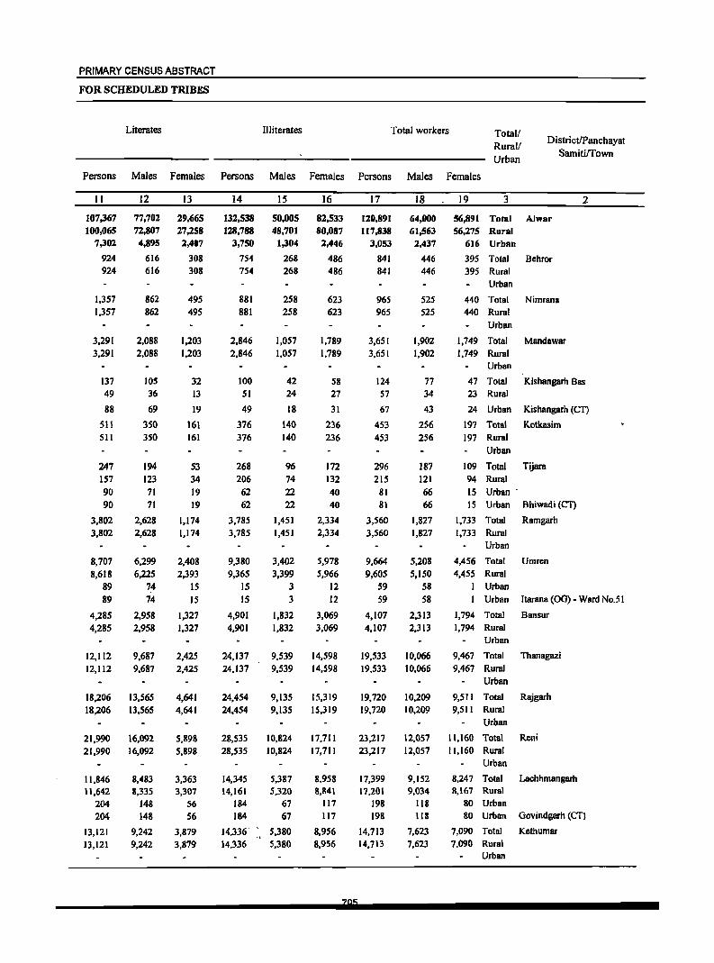
PRIMARY CENSUS ABSTRACT
FOR SCHEDULED TRIBES
Literates Illiterates Total workers Total! Rurall Urban
DistrictIPanchayat SamitilTown
Persons Males Females Persons Males Females Persons Males Females
II
107,367 100,065
7,302
924 924
1,357 1,357
3,291 3,291
137 49
88
511 511
247 157 90 90
3,802 3,802
8,707 8,618
89 89
4,285 4,285
12,112 12,112
18,206 18,206
21,990 21,990
11,846 11,642
204 204
13,121 13,121
12
77,702 72,807 4,895
616 616
862 862
2,088 2,088
105 36
69
350 350
194 123 71 71
2,628 2,628
6,299 6,225
74 74
2,958 2,958
9,687 9,687
13,565 13,565
16,092 16,092
8,483 8,335
148 148
9,242 9,242
13
29,665 27,258 2,407
308 308
495 495
1,203 1,203
32 13
19
161 161
53 34 19 19
1,174 1,174
2,408 2,393
IS IS
1,327 1,327
2,425 2,425
4,641 4,641
5,898 5,898
3,363 3,307
56 S6
3,879 3,879
14
132,538 128,788
3,750
754 754
881 881
2,846 2,846
100 51
49
376 376
268 206
62 62
3,785 3,785
9,380 9,365
IS IS
4,901 4,901
24,137 24,137
24,454 24,454
28,535 28,535
14,345 14,161
184 184
14,336" <
14,336
15
50,005 48,701
1,304
268 268
258 258
1,057 1,057
42 24
18
140 140
96 74 22 22
1,451 1,451
3,402 3,399
3 3
1,832 1,832
9,539 9,539
9,135 9,135
10,824 10,824
5,387 5,320
67 67
5,380 5,380
16
82,533 80,087
2,446
486 486
623 623
1,789 1,789
58 27
31
236 236
172 132
40 40
2,334 2,334
5,978 5,966
12 12
3,069 3,069
14,598 14,598
15,319 15,319
17,711 17,711
8,958 8,841
117 117
8,956 8,956
17
120,891 117,838
3,053
841 841
965 965
3,651 3,651
124 57
67
453 453
296 215
81 81
3,560 3,560
9,664 9,605
59 59
4,107 4,107
19,533 19,533
19,720 19,720
23,217 23,217
17,399 17,201
198 198
14,713 14,713
18
64,000 61,563 2,437
446 446
525 525
1,902 1,902
77 34
43
256 256
187 121 66 66
1,827 1,827
5,208 5,150
58 58
2,313 2,313
10,066 10,066
10,209 10,209
12,057 12,057
9,152 9,034
118 118
7,623 7,623
19 3 2
56,891 Total Alwar 56,275 Rural
616 Urban
395 Total Behror 395 Rural
Urban
440 Total Nimrana 440 Rural
Urban
1,749 Total Mandawar 1,749 Rural
Urban
47 Total Kishangarh Bas 23 Rural
24 Urban Kishangarh (Cf)
197 Total Kotkasim 197 Rural
Urban
109 Total Tijara 94 Rural 15 Urban" 15 Urban Bhiwadi (CT)
1,733 Tota) Ramgarh 1,733 Rural
Urban
4,456 Total Umren 4,455 Rural
I Urban Urban ltarana (00) - Ward No.5 I
1,794 Total Bansur 1,794 Rural
Urban
9,467 Total Thanagazi 9,467 Rural
Urban
9,511 Total Rajgarh 9,511 Rural
Urban
11,160 Total Reni 11,160 Rural
Urban
8,247 Total 8,167 Rural
80 Urban 80 Urban
7,090 Total 7,090 Rural
Urban
Lachhmangarh
Govindgarh (CT)
Kathumar
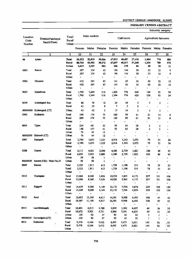
Location Code
Number
06
0001
0002
0003
0004
DistrictiPanchayat Samiti!I'own
2
Alwar
Behror
Nimrana
Mandawar
Kishangarh Bas
40604000 Kishangarh (CT)
0005 Kotkasim
0006 Tijara
40602000 Bhiwadi (CT)
0007 Ramgarh
0008 Umren
40606000 ltarana COO) - Ward No.5 I
0009 Bansur
0010 Thanagazi
0011 Rajgarh
0012 Reni
00 13 Lachhmangarh
40608000 Govindgarh {Cn
0014 Kathumar
Totall Rurall
Main workers
DISTRICT CENSUS HANDBOOK: ALWAR
PRIMARY CENSUS ABSTRACT
Industrial category
Cultivators Agricultural labourers
Urban---------------------------
3
Total Rural Urban
Total
Rural
Urban
Total
Rural
Urban
Total Rural
Urban
Total
Rural
Urban
Total
Rural
Urban
Total
Rural Urban
Urban
Total
Rural Urban
Total
Rural Urban
Urban Total
Rural
Urban
Total Rural
Urban Total
Rural Urban
Total Rural
Urban
Total
Rural
Urban
Urban
Total Rural Urban
Persons Males Females Persons Males Females Persons Males Females
20
83,373
80,754
2,619
387
387
432
432
1,760 1,760
86
41
45
249
249
234
158 76
76
2,780
2,780
6,111
6,052
59
59
2,523
2,523
13,686 13,686
14,429·
14,429
18,007 18,007
10,801
10,672
129 129
9,578
9,578
21
52,819
50,582
2,237
324
324
345
345
1,244 1,244
74
32
42
174
174
181 117 64
64
1,655
1,655
4,021
3,963
58
58
1,911
1,911
8,260 8,260
9,280
9,280
11,190 11,190
6,013
5,921
92 92
6,166
6,166
706
22
30,554
30,172
382
63
63
87
87
516
516
12
9
3
75
75
53 41 12
12
1,125
1,125
2,090
2,089
612
612
5,426 5,426
5,149 5,149
6,817 6,817
4,788
4,751 37 37
3,412
3,412
23
67,913
67,657 256
196
196
141
141
1,204
1,204
24
7
17
160
160
93
93
2,416
2,416
4,580
4,580
1,729
1,729
10,020 10,020
12,172
12,172
16;581 16,581
9,959 9,866
93 93
8,492
8,492
24
40,487
40,317
170
146
146
85
85
776 776
19
5
14
99
99
65
65
1,343
1,343
2,759
2,759
1,198
1,198
5,845
5,845
7,296
7,296
9,988
9,988
5,302
5,241
61 61
5,471
5,471
25
27,426
27,340
86
SO SO
56
56
428
428
5 2
3
61 61
28 28
1,073
1,073
1,821 1,821
531
531
4,175
4,175
4,876 4,876
6,593 6,593
4,657
4,625
32
32
3,021
3,021
26
1,364
1,334
30
32
32
62
62
126
126
5
5
21 21
2 2
79
79
180
180
78
78
207
207
229 229
108 108
66 65
145
145
27
778 759
19
23 23
52
52
92
92
13 13
2
2
53
53
89
89
55
55
101
101
105 105
47 47
36
35
92 92
28
586
575 11
9 9
10
10
34
34
8 8
26
26
91
91
23
23
106 106
124 124
61 61
30
30
-,-53 , 53
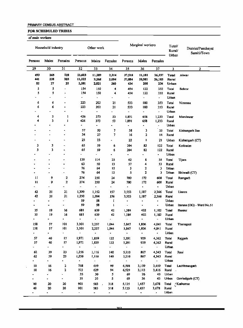
PRIMARY CENSUS ABSTRACT
FOR SCHEDULED TRIBES
of main workers
Household industry Other work Marginal workers TQta11
Rural! Urban
DistrictIPanchayat Samitiffown
Persons Males Females Persons Males Females Persons Males Females
29
493 441 52
S S
6 6
4 4
3 3
II II
42
42
35 35
158
158
57 57
62 62
18 18
'40 40
30
265 238 27
5 5
6 6
3
3
3
3
9 9
21
21
19 19
57 57
40 40
39 39
16 16
20 20
31
228 203 25
2 2
21
21
16 16
101
101
17 17
23 23
2 2
20 20
32
13,603 1l,322 2,281
154 154
223 223
426 426
57 34
23
65
65
139 63 76 76
274 274
1,309
1,250
S9 59
681 681
3,301 3,301
1,971 1,971
1,256 1,256
758 723 35 35
901
901
33
11,289 9,268 2,021
150 150
202 202
373 373
50 27
23
S9 S9
114
50 64 64
250 250
1,152
1,094
58 58
639 639
2,257
2,257
1,839 1,839
1,116 1,116
659 629 30 30
583 583
34
2,314 2,054
260
4 4
21 21
53 53
7 7
6
6
25
13 12 12
24
24
157
156
42 42
1,044 1,044
132 132
140 140
99 94 5 5
318 318
35
37,518 37,084
434
454 454
533 533
1,891 1,891
38 16
22
204
204
62
57 5 5
780 780
3,S53 3,553
1,584 1,584
5,847
5,847
5,291 5,291
5,210 5,210
6,598 6,529
69 69
5,135 5,135
36
11,181 10,981
200
122 122
180 180
658 658
3 2
1
82
82
6 4 2 2
172 172
1,187
1,187
402 402
1,806 1,806
929 929
867 867
3,139 3,113
26 26
1,457 1,457
37 3 2
26,337 Total Alwar 26,103 Rural
234 Urban
332 Total Behror
332 Rural
Urban
353 Total Nimrana 353 Rural
1,233 1,233
35 14
21
122
122
Urban
Total Rural Urban
Total
Rural
Urban
Total
Rural Urban
MandBwar
KishBngarh Bas
Kishangarh (CT)
Kotkasim
56 Total Tijara
53 Rural 3 Urban 3 Urban Bhiwadi (CT)
608 Total Ramgarh 608 Rural
Urban
2,366 Total Umren
2,366 Rural
Urban Urban Itarana (OG) - Ward No.5 I
1,182 Total Bansur 1,182 Rural
4,041
4,041
4,362 4,362
4,343 4,343
3,459 3,416
43 43
3,678 3,678
Urban
Total Rural
Urban
Total Rural
Urban
Total Rural Urban
Total Rural Urban Urban
Total Rural Urban
Thanagazi
Rajgarh
Reni
Lachhmangarh
Govindgarh (CT)
"KathumBr I;
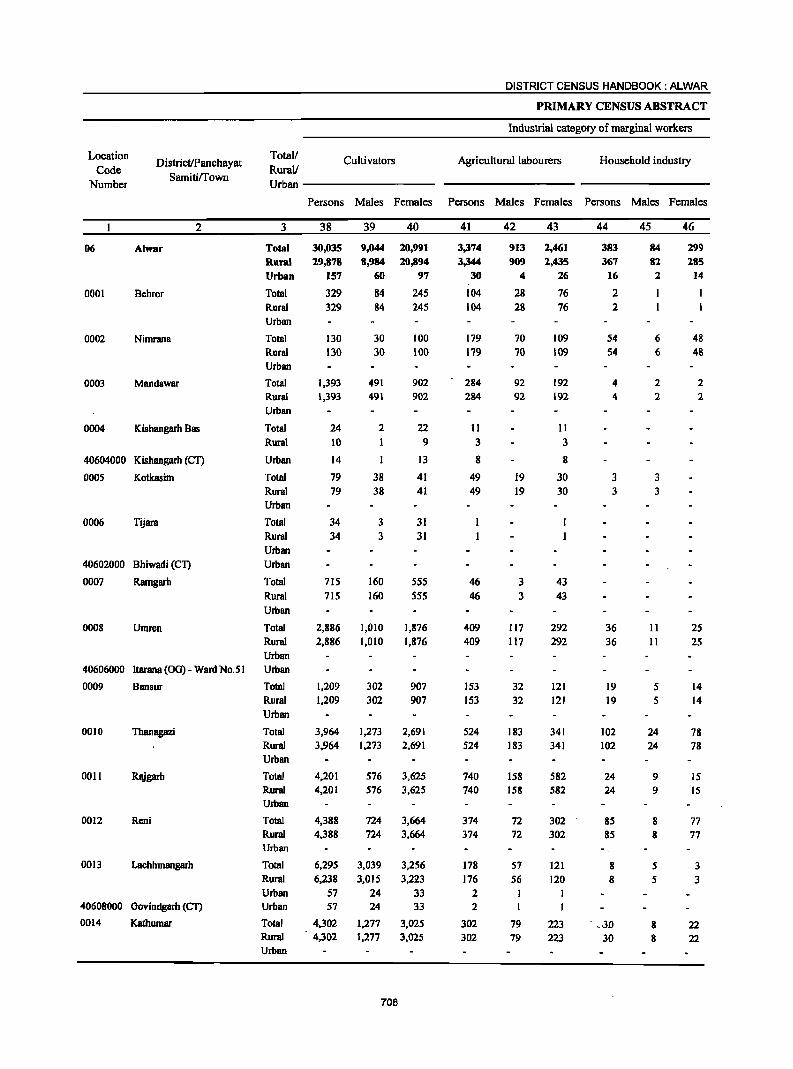
Location
Code Number
DistricUPanchayat Samitilfown
Total/
Rural! Cultivators
Urban ---------
DISTRICT CENSUS HANDBOOK: ALWAR
PRIMARY CENSUS ABSTRACT
Industrial category of marginal workers
Agricultural labourers Household industry
Persons Males Females Persons Males Females Persons Males Females
2
06 Alwar
0001 Behror
0002 Nimrana
0003 Mandawar
0004 Kishangarh Bas
40604000 Kishangarh (Cn
0005 Kotkasim
0006 Tijara
40602000 Bhiwadi (Cn
0007 Ramgarh
0008 Umren
3
Total Rural Urban
Total Rural Urban
Total Rural Urban
Total Rural Urban
Total Rural
Urban
Total Rural Urban
Total Rural Urban Urban
Total Rural Urban
Total Rural Urban
40606000 ltarana (OG) - Ward No.51 Urban
0009 Bansur
0010 Thanagazi
0011 Rsjgarh
0012 Reni
0013 Lachhmangarh
40608000 Govindgarh (Cn
0014 Kathumar
Total Rural Urban
Total Rural Urban
Total Rural
Urban
Total Rural Urban
Total Rural Urban Urban
Total Rural Urban
38
30,035 29,878
157
329 329
130 130
1,393 1,393
24 10
14
79 79
34 34
715 715
2,886
2,886
1,209 1,209
3,964 3,964
4,201 4,201
4,388 4,388
6,295 6,238
57 57
4,302 4,302
39
9,044
8,984
60
84 84
30 30
491 491
2
I
38 38
3
3
160 160
1,010 1,010
302
302
1,273 1,273
40
20,991
20,894
97
245 245
100 100
902 902
22 9
13
41 41
31 31
555 555
1,876 1,876
907 907
2,691 2,691
576 3,625 576 3,625
724 3,664 724 3,664
3,039
3,015
24 24
1,277 1,277
708
3,256 3,223
33 33
3,025 3,025
41
3,374
3,344
30
104 104
179 179
284 284
II 3
8
49 49
46 46
409 409
153 153
524 524
740 740
374 374
178
176
2 2
302 302
42
913
909
4
28 28
70 70
92 92
19 19
3 3
117 117
32
32
183 183
158 158
72 72
57 56
1
79 79
43
2,461 2,435
26
76 76
109 109
192 192
11
3
8
30 30
43 43
292 292
121 121
341 341
582 582
302 302
121
120
223 223
44
383
367 16
2 2
54 54
4 4
3 3
36 36
19 19
102 102
24 24
85 85
-, 8 8
. _,3D
30
45
84 82
2
1
6 6
2 2
3
3
II II
5 5
24 24
9 9
8 8
5 5
8 8
46
299
285
14
1
48 48
2 2
25
25
14 14
78 78
15 15
77 77
3 3
22 22
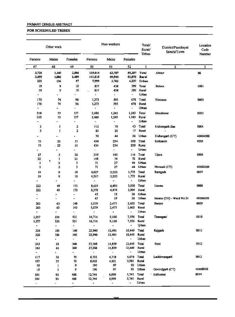
PRIMARY CENSUS ABSTRACT
FOR SCHEDULED TRIBES
Non-workers Total/ Location Other work DistrictIPanchayat Rural!
Samitirrown Code
Urban Number
Persons Males Females Persons Males Females
47 48 49 50 51 52 3 2
3,726 1,140 2,586 119,014 63,707 55,307 Total Alwar 06 3,495 1,006 2,489 111,015 59,945 51,070 Rural
231 134 97 7,999 3,762 4,237 Urban
19 9 10 837 438 399 Total Behror 0001 19 9 10 837 438 399 Rural
Urban
170 74 96 1,273 595 678 Total Nimrana 0002 170 74 96 1,273 595 678 Rural
Urban
210 73 137 2,486 1,243 1,243 Total Mandawar 0003 210 73 137 2,486 1,243 1,243 Rural
Urban
3 2 113 70 43 Total Kishangarh Bas 0004 3 2 43 26 17 Rural
70 44 26 Urban Kishangarh {CT} 40604000
73 22 51 434 234 200 Total Kotkasim ODDS
73 ·22 51 434 234 200 Rural Urban
27 3 24 219 103 116 Total Tijara 0006 22 1 21 148 76 72 Rural • 5 2 3 71 27 44 Urban
5 2 3 71 27 44 Urban Bhiwadi (CT) 40602000
19 9 10 4,027 2,252 1,775 Total Ramgarh 0007
19 9 10 4,027 2,252 1,775 Rural Urban
222 49 173 8,423 4,493 3,930 Total Umrcn 0008
222 49 173 8,378 4,474 3,904 Rural 45 19 26 Urban
45 19 26 Urban ltarana (OG) - Ward No.51 40606000
203 63 140 5,079 2,477 2,602 Total Bansur 0009
203 63 140 5,079 2,477 2,602 Rural Urban
1,257 326 931 16,716 9,160 7,556 Total Thanagazi 0010
1,257 326 931 16,716 9,160 7,556 Rural
l!rban
326 186 140 22,940 12,491 10,449 Total Rajgarh 0011
326 186 140 22,940 12,491 10,449 Rural Urban
363 63 300 27,308 14,859 12,449 Total Reni 0012
363 63 300 27,308 14,859 12,449 Rural Urban
117 38 79 8,792 4,718 4,074 Total Lachhmangarh 0013
107 37 70 8,602 4,621 3,981 Rural
10 1 9 190 97 93 Urban
10 I 9 190 97 93 Urban Govindgarh {CT} 40608000
Sal 93 408 12,744 6,999 5,745 Total Kathumar 0014
501 93 408 12,744 6,999 5,745 Rural Urban
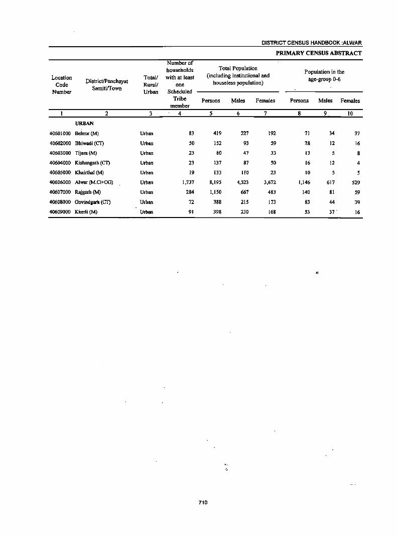
DISTRICT CENSUS HANDBOOK :ALWAR
PRIMARY CENSUS ABSTRACT
Number of households Total Population
Population in the Location Total! with at least (including institutional and
age-group 0-6 Code
DistrictlPanchayat Rural! one houseless population)
Number SamitilTown
Urban Scheduled Tribe Persons ~ales Females Persons Males Females
member 2 3 4 5 6 7 8 9 10
URBAN
40601000 Behror(M) Urban 83 419 227 192 71 34 37
40602000 Bhiwadi (CT) Urban 50 152 93 59 28 12 16
40603000 Tijara{M) Urban 23 80 47 33 13 5 8
40604000 Kishangarh (eT) Urban 23 137 87 50 16 12 4
40605000 Khairthal (M) Urban 19 133 110 23 10 5 5
40606000 Alwar (M.CI+OG) Urban 1,737 8,195 4,523 3,672 1,146 617 529
40607000 Rajgarh (M) Urban 284 1,150 667 483 140 81 59
40608000 Govindgarh (eT) Urban 72 388 215 173 83 44 39
40609000 Kherli (M) Urban 91 398 230 168 53 37 . 16
"
710
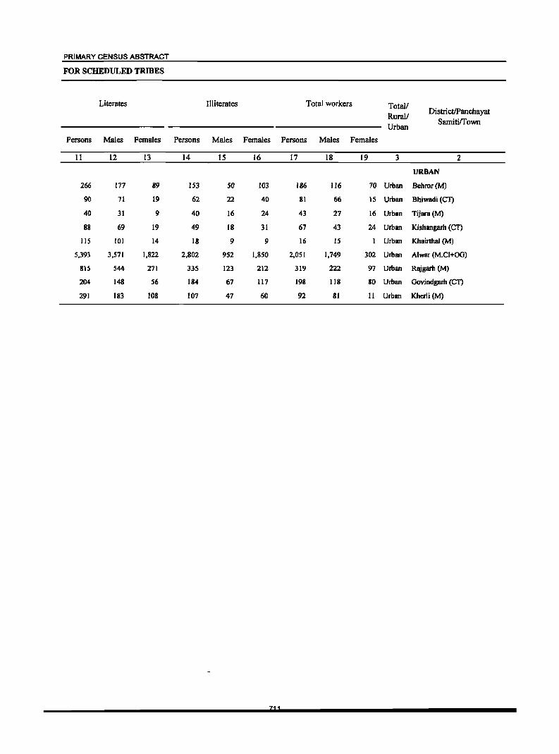
PRIMARY CENSUS ABSTRACT
FOR SCHEDULED TRIBES
Literates Illiterates Total workers Total/ Rural/
DistrictlPanchayat
Urban Sarniti/Town
Persons Males Females Persons Males Females Persons Males Females
11 12 13 14 15 16 17 18 19 3 2
URBAN
266 177 89 153 50 103 186 116 70 Urban Behror(M)
90 71 19 62 22 40 81 66 IS Urban Bhiwadi (Cl)
40 31 9 40 16 24 43 27 16 Urban Tijara(M)
88 69 19 49 18 31 67 43 24 Urban Kishangarh (CT)
liS 101 14 18 9 9 16 15 Urban Khairthal (M)
5,393 3,571 1,822 2,802 952 1,850 2,051 1,749 302 Urban Alwar (M.CI+OG)
815 544 271 335 123 212 319 222 97 Urban Rajgarh (M)
204 148 56 184 67 117 198 118 80 Urban Govindgarh (CT)
291 183 108 107 47 60 92 81 11 Urban Kherli (M)
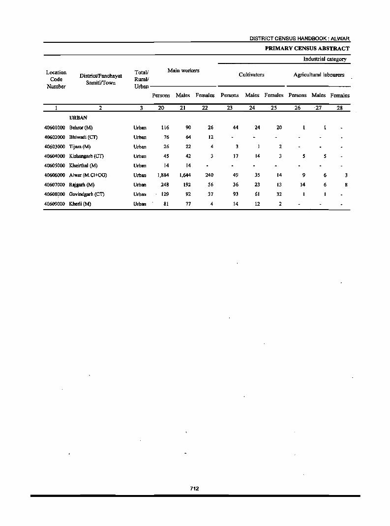
DISTRICT CENSUS HANDBOOK: ALWAR
PRIMARY CENSUS ABSTRACT
Industrial category
Location Totall Main workers DistrictiPanchayat Cultivators Agricultural labourers
Code Samitirrown
Rurall Number Urban
Persons Males Females Persons Males Females Persons Males Females
2 3 20 21 22 23 24 25 26 ·27 28
URBAN
40601000 8ehror(M) Urban 116 90 26 44 24 20
40602000 Bhiwadi (eT) Urban 16 64 12
40603000 Tijara(M) Urban 26 22 4 3 2
40604000 Kishangarh (CT) Urban 4S 42 3 17 14 3 S 5
40605000 Khairthal (M) Urban 14 14
40606000 Alwar (M.CI+OG) Urban 1,884 1,644 240 49 3S 14 9 6 3
40607000 Rajgarh (M) Urban 248 192 S6 36 23 13 14 6 8
40608000 Oovindgarh (eT) Urban 129 92 37 93 61 32
40609000 Kherli (M) Urban 81 77 4 14 12 2
712
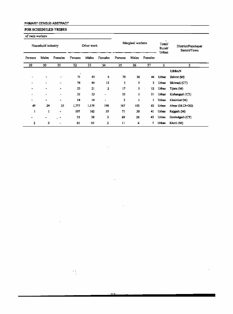
PRIMARY CENSUS ABSTRACT
FOR SCHEDULED TRIBES
of main workers
Household industry Other work Marginal workers Totall
DistrictlPanchayat Rural!
Samiti/Town Urban
Persons Males Females Persons Males Females Persons Males Females
29 30 31 32 33 34 35 36 37 3 2
URBAN
71 6S 6 70 26 44 Urban Behror(M)
76 64 12 S 2 3 Urban Bhiwadi (CT)
23 21 2 17 S 12 Urban Tijara(M)
23 23 22 21 Urban Kishangarh (CT)
14 14 2 Urban Khairthal (M)
49 24 25 1,777 1,579 198 167 105 62 Urban AI~ar (M.CI+OG)
197 162 3S 71 30 41 Urban Rajgarh eM)
3S 30 5 69 26 43 Urban Govindgarh (Cl')
2 2 6S 63 2 II 4 7 Urban Kherli (M)

DISTRICT CENSUS HANDBOOK: ALWAR
PRIMARY CENSUS ABSTRACT
Industrial category of marginal workers
Location DistrictlPanchayat
Total/ Cultivators Agricultural labourers Household industry Code
SamitilTown Rural/
Number Urban
Persons Males Females Persons Males Females Persons Males Females
2 3 38 39 40 41 42 43 44 45 46
URBAN
40601000 BeIlror(M) Urban 50 ' l7 :13 3 3
40602000 Bhiwadi (CT) Urban
40603000 Tijara(M) Urban II 2 9
40604000 Kishangarh (CT) Urban 14 13 8 8 -. 40605000 Khairthal (M) Urban
40606000 Alwar (M.CJ+OG) Urban 8 7 3 2 14 2 12
40607000 Rajgarh (M) Urban 22 IS 7 2 2 2 2
40608000 Govindgarh (CT) Urban 57 24 33 2
40609000 Kherli (M) Urban 6 2 4
714
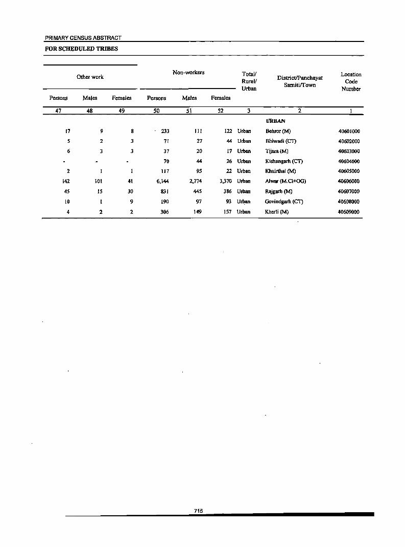
PRIMARY CENSUS ABSTRACT
FOR SCHEDULED TRWES
Non-workers Total! Location Other work DistrictlPanchayat Rural!
Sarnitirrown Code
Urban Number
Persons Males Females Persons Males Females
47 48 49 50 51 52 3 2
URBAN
17 9 8 233 III 122 Urban Behror(M) 40601000
S 2 3 71 27 44 Urban Bhiwadi (CT) 40602000
6 3 3 37 20 17 Urban Tijara(M) 40603000
70 44 26 Urban Kishangarh (CT) 40604000
2 117 95 22 Urban Khairthal (M) 40605000
142 101 41 6,144 2,774 3,370 Urban Alwar (M.CI+OG) 40606000
4S 15 30 831 44S 386 Urban Rl\igarb (M) 40607000
10 9 190 97 93 Ur~an Govindgarh (CT) 40608000
4 2 2 306 149 157 Urban Kherli (M) 40609000
715
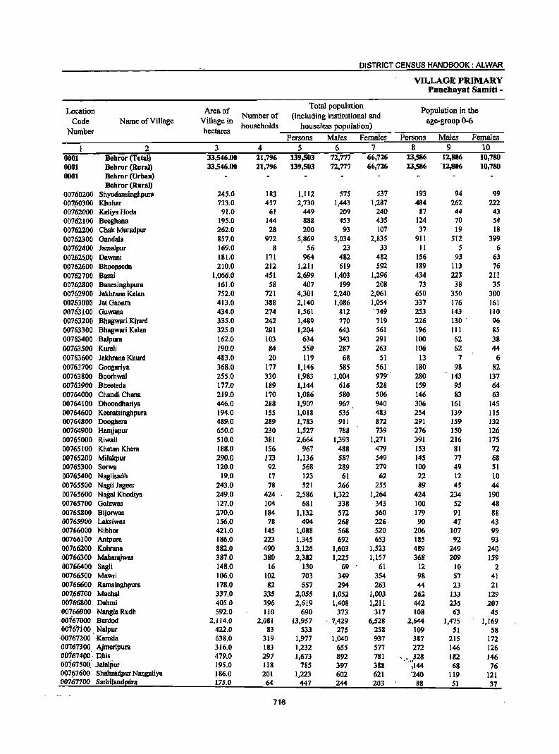
DISTRICT CENSUS HANDBOOK: ALWAR
VILLAGE PRIMARY Pancbayat Samiti -
Location Area of Total population
Population in the Code Name of Village Village in
Number of (including institutional and age-group 0-6
Number hectares households houseless population)
Persons Males Females Persons Males Females
I 2 3 4 5 6 7 8 9 10 0001 Behror (Total) 33,546.00 21,796 139,503 72,777 66,726 23,586 12,806 10,780 0001 Behror (Rural) 33,546.00 21,796 139,503 72,777 66,726 23,586 '12,806 10,780 0001 Behror (Urban)
Bebror (Rural) 00760200 Shyodansinghpul1l 245.0 183 1,112 575 537 193 94 99 007fj0300 Khohar 733.0 457 2,730 1,443 1,287 484 262 222 00762000 Kaliya Hoda 91.0 61 449 209 240 87 44 43 00762100 Beeghana 195.0 144 888 453 435 124 70 54 00762200 Chak Muradpur 262.0 28 200 93 107 37 19 18 00762300 Oandala 857.0 972 5,869 3,034 2,835 911 512 399 00762400 Jamalpur 169.0 8 56 23 33 11 5 6 007.625..0Q Dawani 181.0 171 964 482 482 156 93 63 00762600 Bhoopseda 210.0 212 1,211 619 592 189 113 76 00762700 Basai 1,066.0 451 2,699 1,403 1,296 434 223 211 00762800 Banesingbpura 161.0 58 407 199 208 73 38 35 00762900 Jakhrana Kalan 752.0 721 4.301 2,240 2,061 650 350 300 00711300lJ Jat Gaoora 413.0 388 2,140 1,086 1,054 337 176 161 00763loo Guwana 434.0 274 1,561 812 '749 253 143 110 00763200 Bhagwari Khurd 335.0 242 1,489 770 719 226 130 . 96 00763300 Bhagwari Kalan 325.0 291 1,204 643 561 196 111 85 00763400 Balpura 162.0 103 634 343 291 100 62 38 00763500 Kureli 190.0 84 550 287 263 106 62 44 00763600 Jakhrana Khurd 483.0 20 119 68 51 13 7 6 00763700 Googariya 368.0 177 1,146 585 561 180 98 82 00763800 Boorhwal 255.0 330 1,983 1,004 979" 280 143 137 00763900 Bheeteda 177.0 189 1,144 616 528 159 95 64 00764000 Chandi Chana 219.0 170 1,086 580 506 146 83 63 00764100 Dhooodhariya 446.0 288 1,907 967 940 306 161 145 00764600 Keeratsinghpura 194.0 155 1,018 535 483 254 139 115 00764800 Dooghera 489.0 289 1,783 911 872 291 159 132 00764900 Hamjapur 650.0 230 1,527 788 739 276 150 126 00765000 Riwali 510.0 381 2,664 1,393 1,271 391 216 175 00765100 Khatan Khera 188.0 156 967 488 479 153 81 72 00765200 Milakpur 290.0 173 1,136 587 549 145 77 68 00765300 Sorwa 120.0 92 568 289 279 100 49 51 00765400 Naglisadh 19.0 17 123 61 62 22 12 10 00765500 Nagli Jageer 243.0 78 521 266 255 89 45 44 00765600 NaBaI Khodiya 249.0 424 2,586 1,322 1,264 424 234 190 00765700 Golawas 127.0 104 681 338 343 100 52 48 00765800 Bijorwas 270.0 184 1,132 572 560 179 91 88 00765900 Laksiwas 156.0 78 494 268 226 90 47 43 00766000 Nibhor 421.0 145 1,088 568 520 206 107 99 00766100 Antpura 186.0 223 1,345 692 653 185 92 93 00766200 Kohrana 882.0 490 3,126 1,603 1,523 489 249 240 00766300 Maharajwas 387.0 380 2,382 1,225 1,157 368 209 159 00766400 Sagli 148.0 16 130 69 61 12 10 2 00766500 Mawri 106.0 102 703 349 354 98 57 41 00766600 Ramsinghpura 178.0 82 557 294 263 44 23 21 007.66700 Machal 337.0 335 2,055
.', 1,052 1,003 262 133 129
0076-6800 Dahmi 405.0 396 2,619 1,408 1,211 442 235 207 00766900 NangiaRudh 592.0 110 690 373 317 108 63 45 00767000 Bardod 2,114.0 2,081 13,957 - 7,429 6,528 2,644 1,475 1,169 00767ioo. Nalpur 422.0 83 533 275 258 109 51 58 ·00761200 ··Karoda 638.0 319 1,977 1,040 937 387 215 172 00767300. Ajmeripura 316.0 183 1,232 65'5 577 272 146 126 00767400· Dhis 479.0 297 1,673 892 781 , • 328 182 146 00i6750(i_" JalalPur 195.0 118 785 397 388
~ .\1
)144 68 76 007~7600 Shahzad'pur Nan__gaJiya 186.0 201 1,223 602 621 '240 119 121 00767700 Sarbilandi!!!!a 175.0 64 447 244 203 88 51 37
716
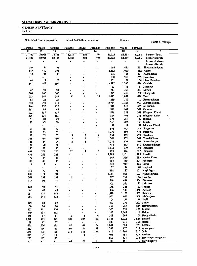
VILLAGE PRIMARY CENSUS ABSTRACT
CENSUS ABSTRACT Behror
Scheduled Castes popuation Scheduled Tribes population Literates Name of Village
Persons Males Females Persons Males Females Persons Males Females
II 12 13 14 15 16 17 18 19 2 21,100 10,905 10,195 1,678 884 794 83,323 52.537 30,786 Behror (Total) 21,100 10,905 10,195 1,678 884 794 83,323 52,537 30,786 Behror (Rural)
Behror (Urban) Behror (Rural)
147 74 73 666 435 231 Shyodansinghpura 847 452 395 1,602 1,020 582 Khohar 59 24 35 276 155 121 Kaliya Hoda
630 368 262 8eeghana 43 : 18 25 131 71 60 Chak Muradpur
848 449 399 3,817 2,337 1,480 Gandala 33 16 17 Jamalpur
47 23 24 711 358 353 Dawani
306 166 140 749 469 280 Bhoopseda
712 366 346 57 31 26 1,697 1,067 630 Basai
53 26 27 289 147 142 Banesinghpura 818 399 419 2,714 1,723 991 Jakhrana Kalan 264 132 132 1,340 815 525 JatGaonra 162 93 69 991 603 388 Guwana
272 137 135 896 558 338 Bhagwari Khurd
229 124 105 814 498 316 Bhagwari Kalan . .. 51 28 23 378 251 127 Ba1pura
82 43 39 360 202 158 Kureli 91 59 32 Jakhrana Khurd
91 48 43 678 433 24S Googariya
118 63 S5 1,273 800 473 Boorhwal
122 65 57 3 2 754 483 271 Bheeteda
318 168 ISO 3 2 1 741 472 269 Chandi Chana
128 54 74 5 3 2 1,228 720 508 OhoondhariYB
138 70 68 453 313 140 KeeratsinghpUni
186 89 97 1,033 639 394 Oooghera
401 201 200 22 14 8 933 576 357 Hamjapur
434 206 228 1,889 1,101 788 Riwali
72 34 38 649 366 283 Khatan Khera
85 40 45 804 480 324 Milakpur 342 217 125 Sorwa
72 44 28 NagJisadh
15S 79 76 288 187 101 Nagli Jageer
205 III 94 1,684 1,011 673 Nagai Khodiya
263 132 131 397 251 146 Golawas
175 96 79 740 434 306 Bijorwas 303 206 97 Laksiwas
169 93 76 548 385 163 Nibhor
91 46 45 896 548 348 Antpura
291 137 154 1,810 1,178 632 Kohrana
266 144 122 1,473 90S 568 Maharajwas 104 55 49 Sag1i
122 60 62 473 272 201 Mawri
50 26 24 491 267 224 Ramsinghpura
227 III 116 1,365 839 526 Machal
449 237 212 1,567 1,048 519 Oahmi
148 87 61 12 6 6 308 204 104 NanglaRudh
1,728 905 823 407 225 182 8,145 5,222 2,923 Bardod
79 42 37 380 215 165 Nalpur
491 256 235 80 44 36 1,044 668 376 Karoda
212 124 88 93 44 49 763 452 311 Ajmeripura
378 199 179 274 145 129 916 596 320 Ohis
215 109 106 405 268 137 Jalalpur
236 109 127 660 424 236 ShBhzadpur NangaJiya
49 28 21 300 181 119 Sarbilandpura
717
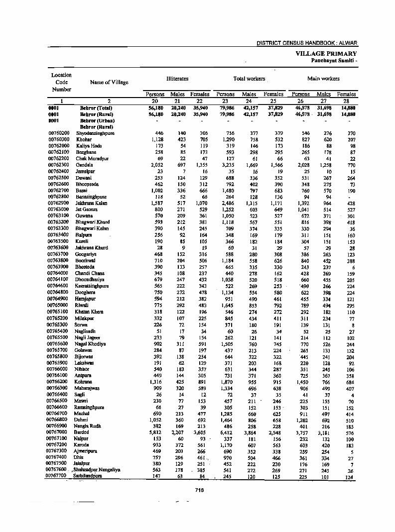
DISTRICT CENSUS HANDBOOK: ALWAR
VILLAGE PRIMARY Panchayat Samiti -
Location Illiterates Total workers Main workers
Code Name of Village Number
Persons Males Females Persons Males Females Persons Males Females 2 20 21 22 23 24 25 26 27 28
0001 Dehror (Total) 56,180 20,240 35,940 79,986 42,157 37,829 46,578 31,698 14,880 0001 Dehror (Rural) 56,180 20,240 35,940 79,986 42,157 37,829 46,578· 31,698 14,880 0001 Debror (Urban)
Dehror (Rural) 00760200 Shyodansinghpura 446 140 306 756 377 379 546 276 270 00760300 Khohar 1,128 423 70S 1,290 758 532 827 620 207 00762000 Kaliya Hoda 173 54 119 319 146 173 186 88 98 00762100 Bccghana 258 85 173 593 298 295 265 178 87 00762200 Chak Muradpur 69 22 47 127 61 66 63 41 22 00762300 Gandala 2,052 697 1,355 3,235 1,669 1,566 2,028 1,258 770 00762400 Jamalpur 23 7 16 35 1.6 19 25 10 15 00762500 Dawani 253 124 129 688 336 352 531 267 264 00762600 Bhoopscda 462 150 312 792 402 390 348 275 73 00762700 Basai 1,002 336 666 1,480 797 683 760 570 190 00762800 Banesinghpura 118 52 66 264 128 136 94 94 00762900 Jakhrana Kalan 1,587 517 1,070 2,486 1,315 1,171 1,392 964 428 00763000 JatGaonra 800 271 529 1,252 603 649 1,041 514 527 00763100 Guwana 570 209 361 1,050 523 527 672 371 301 00763200 Bhagwari Khurd 593 212 381 1,118 567 551 816 398 418 00763300 Bhagwari Kalan 390 145 245 709 374 335 330 294 36 00763400 Balpura 256 92 164 348 169 179 311 151 160 00763500 Kurcli 190 B5 105 366 182 184 304 151 153 00763600 Jakhrana Khurd 28 9 19 60 31 29 57 29 28 00763700 GoogariY8 468 152 316 588 280 308 386 263 123 00763800 Boorhwal 710 204 506 1,184 558 626 840 452 388 00763900 Bheeteda 390 133 257 665 335 330 243 237 6 00764000 Chandi Chana 345 108 237 440 278 162 428 269 159 00764100 Dhoondhariya 679 247 432 1,038 520 518 660 455 205 00764600 Keeratsingbpum 565 222 343 522 269 253 '490 266 224 00764800 Dooghem 750 272 478 1,134 554 580 622 398 224 00764900 Hamjapur 594 212 382 951 490 461 455 334 121 00765000 Riwali 775 292 483 1,645 853 792 789 494 295 00765100 Khatan Khera 318 122 196 546 274 272 292 182 110 00765200 Milakpur 332 107 225 845 434 411 311 234 77 00765300 Sorwa 226 72 154 371 180 191 139 131 8 00765400 Naglisadh 51 17 34 60 26 34 52 25 27 00765500 NagH Jagecr 233 79 154 262 121 141 214 112 102 00765600 Nagai Khodiya 902 311 591 1,505 760 745 770 526 244 00765700 Golawas 284 87 197 437 213 224 265 133 132 00765800 Bijorwas 392 138 254 644 322 322 '445 241 204 00765900 Laksiwas 191 62 129 371 203 168 220 128 92 00766000 Nibbor 540 183 357 631 344 287 351 245 106 00766100 Antpura 449 144 305 731 371 360 725 367 358 00766200 Kobrana 1,316 425 891 1,870 955 915 1,450 766 684 00766300 Mahamjwas 909 320 589 1,334 696 638 906 499 407 00766400 Sagli 26 14 12 72 37 35 41 37 4 00766500 Mawri 230 77 153 457 211 246 225 15S 70 00766600 Ramsinghpum 66 27 39 305 152 153 ' 303 151 152 00766700 Machal 690 213 417 1,285 660 625 911 497 414 00766800 Dahmi 1,052 360 692 1,464 806 658 1,202 692 510 00766900 NangiaRudb 382 169 213 486 258 228 401 216 185 00767000 Bardod 5,812 2,207 3,605 6,412 3,864 2,548 3,757 3,181 576 00767100 Nalpur 153 60 93 337 181 156 232 132 100 00767200 Karoda 933 372 561 1,170 601 563 603 420 183 00767300 Ajmcripura 469 203 266 690 352 338 259 254 5 00767400 Dbis 757 296 461., 970 504 466 361 334 27 00767500 Jalalpur 380 129 251 452 222 230 176 169 7 00767600. ,Shahza4purNangaliya 563 178 3115 541 272 269 27] 245 26 00767100 SBrbiiandeur8 ]47 63 84 245 120 125 225 101 124
718
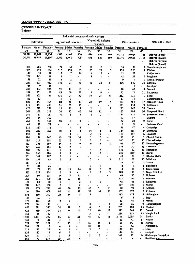
VILLAGE PRIMARY CENSUS ABSTRACT
CENSUS ABSTRACT Behror
Industrial category of main workers
Cultivators Agricultural labourers Household industry
Other workers Name of Village workers
Persons Males Females Persons Males Females Persons Males Females Persons Males Females 29 30 31 32 33 34 35 36 37 38 39 40 2
31,721 19,085 12,636 2,390 1,461 929 696 536 160 11,771 10,616 1,155 Behror (Total) 31,721 19,085 12,636 2,390 1,461 929 696 536 160 11,771 10,616 1,155 Behror (Rural)
Bebror (Urban) Bebror (Rural)
461 205 256 21 14 7 11 6 5 53 51 2 Shyodansinghpura 363 259 104 213 130 83 25 22 3 226 209 17 Khohar 146 58 88 17 7 10 I I 22 22 KaJiyaHoda 221 143 78 1 I 1 1 42 33 9 Bceghana
51 32 19 3 2 9 7 2 Chak Muradpur 1,247 61S 632 142 71 71 43 32 II 596 540 56 Gandala
24 9 IS I I Jamalpur 430 194 236 21 11 10 80 62 18 Dawani 184 ISS 29 83 60 23 9 9 72 51 21 Bhoopseda 362 223 139 131 JOI 30 35 25 10 232 221 11 Basai
82 82 I I II II Banesinghpura 809 443 366 ~8 48 40 24 19 5 471 454 17 lakhrana Kalan 819 361 458 91 35 56 131 118 13 JatOaonra 470 212 258 IS II 4 2 I I 185 147 38 Guwana 562 250 312 76 30 46 16 ' 12 4 162 106 56 Bhagwari Khurd 140 III 29 4 3 I 2 2 184 178 6 Bhagwari Kalan . 294 134 160 17 17 Balpura 264 123 141 18 8 10 22 20 2 Kureli
48 20 28 9 9 Jakhrana Khurd 328 212 116 7 4 3 51 47 4 Googariya 692 323 369 10 6 4 14 g 6 124 115 9 Boorhwal 130 130 1 I 2 2 110 104 6 Bheeteda 286 144 142 43 29 14 3 3 96 93 3 Chandi Chana 495 314 181 23 16 7 2 2 140 123 17 Dhoondhariya 403 206 197 14 5 9 9 8 64 47 17 Keeratsinghpura 434 269 165 13 7 6 175 122 53 Oooghera 308 197 III I I 4 4 142 132 10 Hamjapur 544 260 284 9 9 6 6 230 219 II Riwali 251 144 107 1 I 40 37 3 Khatan Khcra 194 131 63 3 2 3 3 111 101 10 Milakpur 117 116 I 22 IS 7 Sorwa 47 21 26 3 3 2 I I Naglisadh
159 77 82 29 15 14 12 10 2 14 10 4 Nagli Jageer 552 324 228 3 3 6 3 3 209 196 13 Nagai Khodiya 200 92 108 16 5 11 49 36 13 Golawas 301 131 170 31 13 18 113 97 16 Bijorwas 168 80 88 3 I 2 48 46 2 Laksiwas 242 142 100 2 I 107 102 5 Nibhor 509 213 296 66 30 36 52 31 21 98 93 5 Antpura
1,189 580 609 92 45 47 37 16 21 132 125 7 Kohrana 698 306 392 23 14 9 2 183 178 5 Maharajwas 35 32 3 6 5 Sagli
170 104 66 2 2 S3 49 4 Mawri 273 124 149 2 I 28 26 2 Ramsinghpura 680 295 385 24 19 S 4 3 203 180 23 Machal 622 319 303 38 19 19 27 10 17 515 344 171 Dahmi 162 60 102 3 3 236 153 83 NanglBRudh
1,480 1,081 399 86 63 23 45 32 13 2,146 2,005 141 Bardod 168 86 82 4 3 I 60 43 17 Nalpur 378 227 151 51 35 16 16 IS 158 143 15 Karoda 193 188 5 4 4 10 10 52 52 Ajmeripura 215 192 23 4 4 5 5 137 133 4 Ohis 126 120 6 6 5 J 44 44 Jalalpur 120 109 11 5 4 1 5 5 141 127 14 Shahzadpur Nangaliya 192 73 119 29 24 5 4 4 Sarbiland2ura
719
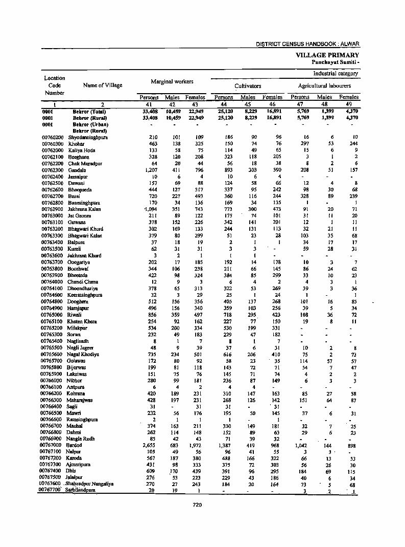
DISTRICT CENSUS HANDBOOK: ALWAR
VILLAGE PRIMARY Panchayat Samiti -
Location Industrial category
Code Name of Village Marginal workers
Cultivators Agricultural labourers Number
Persons Males Females Persons Males Females Persons Males Females 2 41 42 43 44 4S 46 47 48 49
0001 Bebror (Total) 33,408 10,459 22,949 25,120 8,229 16,891 5,769 1,399 4,370 0001 Bebror (Rural) 33,408 10,459 22.949 25,120 8,229 16,891 5,769 1,399 4,370 0001 Bebror (Urban)
Bebror (Rural) 00760200 Shyodansingbpura 210 101 109 186 90 96 16 6 10
00760300 Khohar 463 138 325 ISO 74 76 297 53 244 00762000 KaiiyaHoela 133 58 75 114 49 65 15 6 9 00762100 Beeghana 328 120 208 323 118 205 3 I 2 00762200 Chak Muradpur 64 20 44 56 18 38 8 2 6 00762300 Gandala 1,207 411 796 893 303 590 208 51 157 00762400 Jarnaipur 10 6 4 10 6 4 00762500 Oawani 157 69 88 124 58 66 12 4 8 00762600 Bhoopseda 444 127 317 337 95 242 98 30 68 00762700 Basai 720 227 493 360 116 244 328 89 239 00762800 Banesinghpura 170 34 136 169 34 135 I 00762900 Jakhrana Kalan '1,094 351 743 773 300 473 91 20 71 00763000 JatGaonm 211 89 122 175 74 101 31 II 20 00763100 Guwana 378 152 226 342 141 201 12 1 II 00763200 Bhagwari Khurd 302 169 133 244 131 113 32 21 II 00763300 Bhagwari Kalan 379 80 299 51 23 28 103 35 68 00763400 Baipura 37 18 19 2 1 34 17 17 00763500 Kureli 62 31 31 3 3 59 28 31 00763600 Jakhrana Khurd 3 2 I 1 I 00763700 Googariya 202 17 185 192 14 178 10 3 7 00763800 Boorhwal 344 106 238 211 66 145 86 24 62 00763900 Bheeteda 422 98 324 384 85 299 33 10 23 00764000 Chandi Chana 12 9 3 6 4 2 4 3 I 00764100 Ohoondhariya 378 65 313 322 53 269 39 3 36 00764600 Keeratsingbpura 32 3 29 25 1 24 I 1 00764800 Dooghera 512 156 356 405 137 268 101 16 85 00764900 Harnjapur 496 156 340 359 103 256 39 5 34 00765000 Riwaii 856 359 497 718 295 423 108 36 72 00765100 Khatan Khera 254 92 162 227 77 150 19 8 II 00765200 Milakpw- 534 200 334 530 199 331 00765300 Sorwa 232 49 183 229 47 182 00765400 Naglisadh 8 I 7 8 1 7 00765500 Nagli Jageer 48 9 39 37 6 31 10 2 8 00765600 Nagal Khodiya 735 234 501 616 206 410 75 2 73 00765700 Golawas 172 80 92 58 23 35 114 57 57 00765800 Bijorwas 199 81 118 143 72 71 54 7 47 00765900 Laksiwas 151 75 76 145 71 74 4 2 2 00766000 Nibhor 280 99 181 236 87 149 6 3 3 00766100 Antpum 6 4 2 4 4 00766200 Kohrana 420 189 231 310 147 163 85 27 58 00766300 Maharajwas 428 197 231 268 126 142 151 64 87 00766400 Sagli 31 31 31 . 31 00766500 Mawri 232 56 176 195 50 145 37 6 31 00766600 Rarnsinghpura 2 I 1 1 I 00766700 Mac;hal 374 163 211 330 149 181 32 7 25 00766800 Oahmi 262 114 148 152 89 63 29 6 23 00766900 NanglaRudh 85 42 43 71 39 32 00767000 Bardod 2,655 683 1,972 1,387 419 968 1,042 144 898 00767100 Nalpur 105 49 56 96 41 55 3 3 . 00767;200 Kamela 567 187 380 488 166 322 66 13 53 00767300 Ajmerjpura 431 98 333 375 72 303 56 26 30 00767400 Ohis 609 ,170 439 391 96 295 184 69 115 00767500 Jalalpur 276 53 223 229 43 186 40 6 34 00767600 . ..shalizadpur Nangaliya 270 27 243 184 20 164 73 5 68 0076770rf SarblJaodeura 20 19 3. .2. .: ... L
720
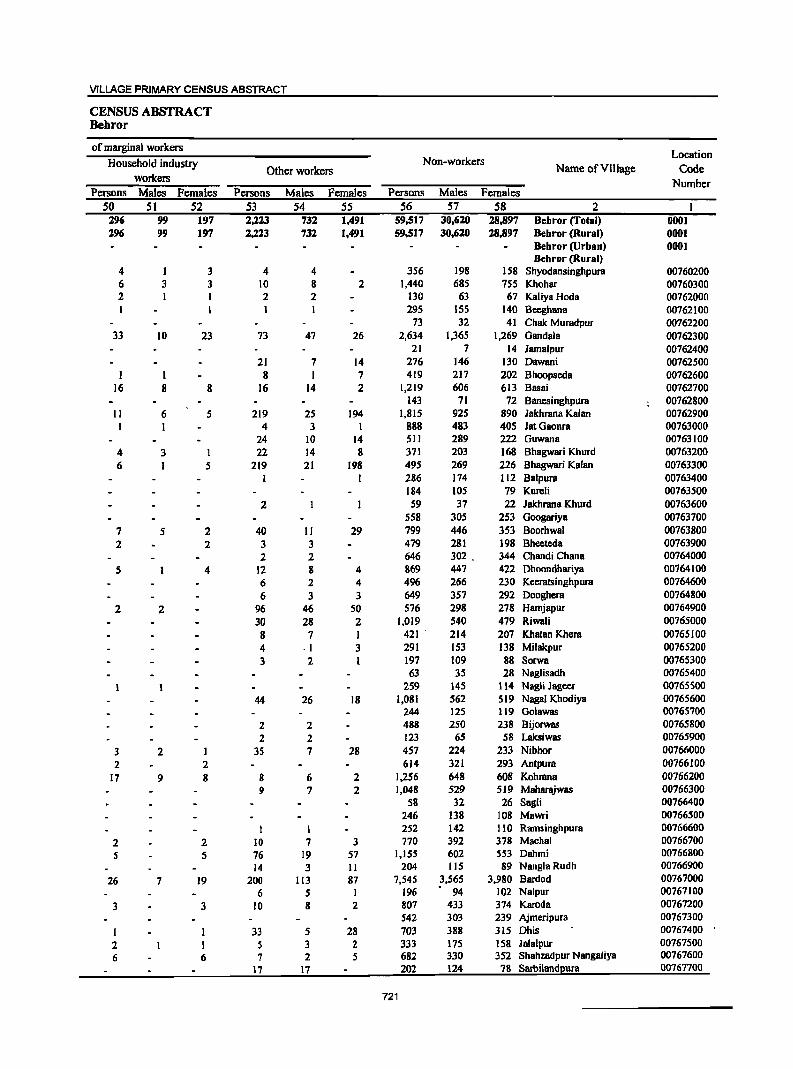
VILLAGE PRIMARY CENSUS ABSTRACT
CENSUS ABSTRACT Behror
of marginal workers Location
Household industry Non-workers Other workers Name of Village Code
workers Number Persons Males Females Persons Males Females Persons Males Females
50 51 52 53 54 55 56 57 58 2 296 99 197 2,223 732 1,491 59,517 30,620 28,897 Behror (Total) 0001 296 99 197 2,223 732 1,491 59,517 30,620 28,897 Behror (Rural) 0001
Behror (Urban) 0001 Behror (Rural)
4 I 3 4 4 356 198 IS8 Shyodansinghpura 00760200 6 3 3 10 8 2 1,440 685 755 Khohar 00760300 2 I I 2 2 130 63 67 Kaliya Hoda 00762000
295 155 140 Beeghana 00762100 73 32 41 Chak Muradpur 00762200
33 10 23 73 47 26 2,634 1,365 1,269 Gandala 00762300 21 7 14 Jamalpur 00762400
21 7 14 276 146 130 Dawani 00762500 I I 8 I 7 419 217 202 Bhoopseda 00762600
16 8 8 16 14 2 1,219 606 613 Basai 00762700 143 71 72 Bancsinghpura 00762800
11 6 5 219 25 194 1,815 925 890 Jakhrana Kalan 00762900 1 4 3 1 888 483 405 latGaonra 00763000
24 10 14 511 289 222 Guwana 00763100 4 3 1 22 14 8 371 203 168 Bhagwari Khurd 00763200 6 I 5 219 21 198 495 269 226 Bhagwari Kalan 00763300
1 I 286 174 112 Ba1pura 00763400 184 105 79 Kureli 00763500
2 59 37 22 Jakhrana Khurd 00763600 558 305 253 Googariya 00763700
7 5 2 40 II 29 799 446 353 Boorhwal 00763800 2 2 3 3 479 281 198 Bheeteda 00763900
2 2 646 302 . 344 Chandi Chana 00764000 5 4 12 8 4 869 447 422 Dhoondhariya 00764100
6 2 4 496 266 230 Keeratsinghpura 00764600 6 3 3 649 357 292 Dooghera 00764800
2 2 96 46 50 576 298 278 Hamjapur 00764900 30 28 2 1,019 540 479 Riwali 00765000 8 7 1 421 . 214 207 Khatan Khera 00765100 4 .1 3 291 153 138 Mi1akpur 00765200 3 2 I 197 109 88 Sorwa 00765300
63 35 28 Naglisadh 00765400 259 145 II4 Nagli Jageer 00765500
44 26 18 1,081 562 519 Nagai Khodiya 00765600 244 125 119 Golawas 00765700
2 2 488 250 238 Bijorwas 00765800 2 2 123 65 58 Laksiwas 00765900
3 2 I 35 7 28 457 224 233 Nibhor 00766000 2 2 614 321 293 Antpura 00766100
17 9 8 8 6 2 1,256 648 608 Kohrana 00766200 9 7 2 1,048 529 519 Maharajwas 00766300
58 32 26 Sagli 00766400 246 138 108 Mawri 00766500
1 252 142 110 Rarnsinghpura 00766600 2 2 10 7 3 770 392 378 Machal 00766700 5 5 76 19 57 1,155 602 553 Dahmi 00766800
14 3 II 204 115 89 NanglaRudh 00766900 26 7 19 200 113 87 7,545 3,565 3,980 Bardod 00767000
6 5 196 94 102 Nalpur 00767100 3 3 10 8 2 807 433 374 Karoda 00767200
542 303 239 Ajmeripura 00767300 I I 33 5 28 703 388 315 Dhis 00767400 2 1 5 3 2 333 175 158 Jala1pur 00767500 6 6 7 2 5 682 330 352 Shahzadpur Nangaliya 00767600
17 17 202 124 78 Sarbilandpura 00767700
721
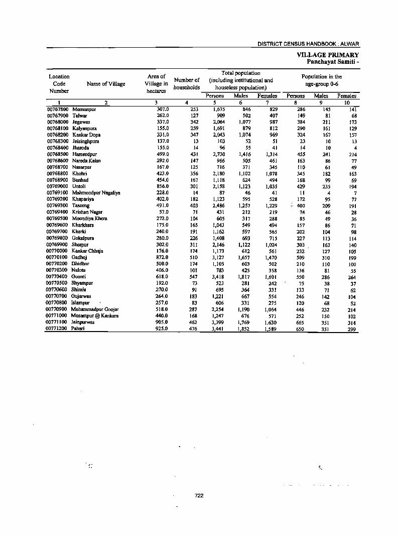
DISTRICT CENSUS HANDBOOK: ALWAR
VILLAGE PRIMARY Panchayat Samiti -
Location Area of Total population
Population in the Code Name of Village Village in
Number of (including institutional and age-group 0-6
Number hectares households houseless population)
Persons Males Females Persons Males Females 2 3 4 5 6 7 8 9 10
00767800 Momanpur 307.0 253 1,675 846 829 286 145 141 00767900 Talwar 262.0 127 909 502 407 149 81 68 00768000 Jaguwas 337.0 342 2,064 1,077 987 384 211 173 00768100 Kalyanpura 155.0 259 1,691 879 812 290 161 129 00768200 KankarDopa 331.0 347 2,043 1,074 969 324 167 157 00768300 laisinghpura 137.0 13 103 52 51 23 10 13 00768400 lharoda 155.0 14 96 55 41 14 10 4 00768500 Hameedpur 499.0 431 2,730 1,416 1,314 455 241 214 00768600 Nare<la Kalan 292.0 147 966 505 461 163 86 77 00768700 Nasarpur 167.0 125 716 371 345 110 61 49 00768800 Khohri 423.0 356 2,180 1,102 1,078 345 182 163 00768900 Banhad 454.0 167 1,118 624 494 168 99 69 00769000 Untoli 856.0 301 2,158 1,123 1,035 429 235 194 00769100 Mahmoodpur NagaJiya 228.0 14 87 46 41 11 4 7 00769200 Khapariya 402.0 182 1,123 595 528 172 95 77 00769300 Tasceng 491.0 403 2,486 1,257 1,229 .. 400 209 191 00769400 Krishan Nagar 57.0 71 431 212 219 1-4 46 28 00769500 Moondiya Khera 272.0 104 605 317 288 85 49 36 00769600 Kharkhara 175.0 165 1,043 549 494 157 86 71 00769700 Kherki 240.0 191 1,162 597 565 202 104 98 00769800 Gokalpura 260.0 226 1,408 693 715 227 113 114 00769900 Sherpur 302.0 311 2,146 1,122 1,024 303 163 140 00770000 Kankar Chhaja 176.0 174 1,173 612 561 232 127 lOS 00770100 Gadhoj 872.0 510 3,127 1,657 1,470 509 310 199 00770200 Dhidhor 500.0 174 1,105 603 S02 210 110 100 00770300 Nalota 406.0 101 783 425 358 136 81 55 00770400 Goonti 618.0 547 3,418 1,817 1,601 550 286 264 00770500 Shyampur 192.0 73 523 281 242 75 38 37 00770600 ShimJa 270.0 91 695 364 331 m 71 62 00770700 Gl!iarwas 264.0 183 1,221 667 554 246 142 104 00770800 Islampur 257.0 83 606 331 275 120 68 52 00770900 Mohammadpur Goojar 518.0 287 2,254 1,190 1,064 446 232 214 00771000 Mosampur @ Kankara 440.0 168 1,247 676 571 252 ISO 102 00771100 Jainpurwas 905.0 462 3,399 1,769 1,630 665 351 314 00771200 Pahari 925.0 476 3,441 1,852 1,589 650 351 299
722
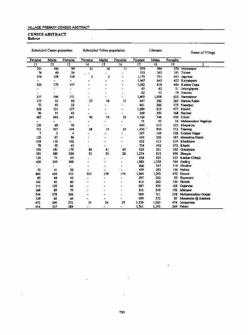
VILLAGE PRIMARY CENSUS ABSTRACT
CENSUS ABSTRACT Behror
Scheduled Castes popuation Scheduled Tribes population Literates Name of Village
Persons Males Females Persons Males Females Persons Males Females II 12 13 14 15 16 17 18 19 2
201 102 99 21 10 II 970 594 376 Momanpur 74 40 34 553 362 191 Ta1war
256 128 128 2 2 1,174 731 443 Jaguwas 1,067 645 422 Kalyanpura
326 179 147 1,262 818 444 KankarDopa 63 42 21 Jaisinghpura 62 43 19 Jharoda
317 166 lSI 1,690 1,058 632 Hameedpur 115 55 60 27 16 11 647 382 265 Nareda Kalan 73 41 32 461 286 175 Nasarpur
258 131 127 1,289 812 477 Khohri 96 51 45 S60 392 168 Banhad
487 246 241 40 19 21 1,166 746 420 Untoli 51 35 16 Mahmoodpur Nagaliya
139 69 70 640 415 225 Khapariya 711 367 344 38 IS 23 1,456 i 904 552 Taseeng
7 3 4 257 149 108 Krishan Nagar 123 67 S6 439 252 187 Moondiya Khera 218 116 102 632 413 219 Kharkhara
78 35 43 724 452 272 Kherki 3S6 181 175 86 41 45 923 531 392 GokaJpura 393 189 204 53 33 20 1.274 SlS 459 Sherpur 136 71 65 658 425 233 Kankar Chhaja 420 220 200 1,982 1,238 744 Gadhoj
466 347 119 Dhidhor 70 41 29 439 293 146 Na10ta
866 456 410 353 179 174 1,964 1,292 672 Goonti 89 44 45 297 202 95 Shyampur
162 82 80 416 262 154 Shimla 215 129 86 607 439 168 Gujarwas 168 89 79 312 210 102 Islampur. 544 278 266 969 711 258 Mohammadpur Goojar 130 66 64 459 372 87 Mosampur @ Kankara 472 240 232 51 24 27 1,539 1,065 474 Jainpurwas 616 327 289 1,761 1,192 569 Pahari
723
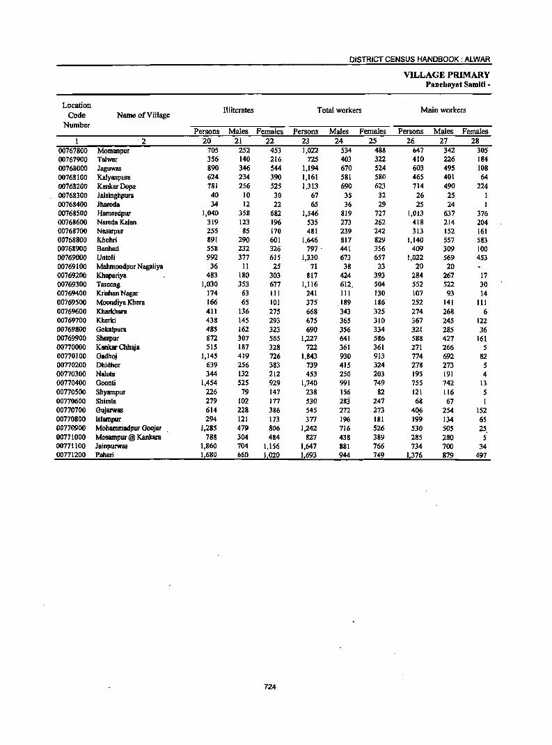
DISTRICT CENSUS HANDBOOK: ALWAR
VILLAGE PRIMARY Panebayat Samiti -
Location Illiterates Total workers Main workers
Code Name of Village Number
Persons Males Females Persons Males Females Persons Males Females '2 20 21 22 23 24 25 26 27 28
00767800 Momanpur 705 252 453 1,022 534 488 647 342 305 00761900 Talwar 356 140 216 725 403 322 410 226 184 00768000 Jaguwas 890 346 544 1,194 610 524 603 495 108 00768100 Kalyanpura 624 234 390 1,161 581 580 465 401 64 00768200 KankarDopa 781 256 525 1,313 690 623 714 490 224 00768300 Jaisinghpura 40 10 30 67 35 32 26 25 00768400 Jharoda 34 12 22 65 36 29 25 24 1 00768500 Hameedpur 1,040 358 682 1,546 819 727 1,013 637 376 00768600 Nare~a Kalan 319 123 196 535 273 262 418 214 204 00768700 Nasarpur 255 85 170 481 239 242 313 152 161 00768800 Khohri 891 290 601 1,646 817 829 1,140 557 583 00768900 Banhad 558 232 326 797· 441 356 409 309 100 00769000 Untoli 992 377 615 1,330 673 657 1,022 569 453 00769100 Mahmoodpur Nagaliya 36 11 25 71 38 33 20 20 00769200 Khapariya 483 180 303 817 424 393 284 267 17 00769300 Tasccng 1,030 353 677 1,116 612 504 552 522 30 00769400 Krishan Nagar 174 63 111 241 III 130 107 93 14 00769500 Moondiya Khera 166 65 101 375 189 186 252 141 III 00769600 Kharkhara 411 136 275 668 343 325 274 268 6 00769700 Kherki 438 145 293 675 365 310 367 245 122 00769800 Gokalpura 485 162 323 690 356 334 321 285 36 00769900 Sherpur 872 307 565 1,227 641 586 588 427 161 00770000 Kankar Chhaja 515 187 328 722 361 361 271 266 5 00770100 Gadhoj 1,145 419 726 1,843 930 913 774 692 82 00770200 Dhidhor 639 256 383 739 415 324 278 273 5 00770300 Nalota 344 132 212 453 250 203 195 191 4 00770400 Goonti 1,454 525 929 1,740 991 749 755 742 13 00770500 Shyampur 226 79 147 238 156 82 121 116 5 00110600 Shimla 219 102 177 530 283 247 68 67 1 00770700 Gujarwas 614 228 386 545 272 273 406 254 152 00770800 Islampur 294 121 173 377 196 181 199 134 65 00770900 Mohammadpur Goojar 1,285 479 806 1,242 716 526 530 505 25, 00771000 Mosampur @ Kankara 788 304 484 827 438 389 285 280 5 00771100 Jainpurwas 1,860 704 1,156 1,647 881 766 734 700 34 00771200 Pahari 1,680 660 1,020 1,693 944 749 1376 879 497
724
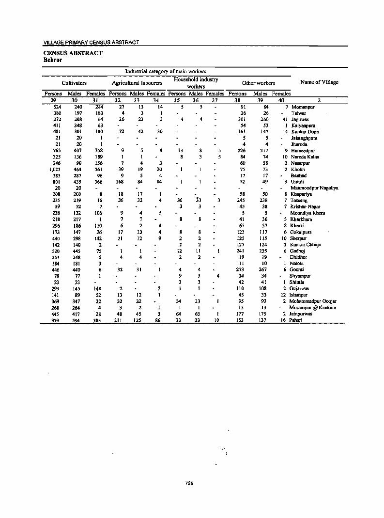
VILLAGE PRIMARY CENSUS ABSTRACT
CENSUS ABSTRACT Behror
Industrial category of main workers
Cultivators Agricultural labourers Household industry
Other workers Name of Village workers
Persons Males Females Persons Males Females Persons Males Females Persons Males Females 29 -30 31 32 33 34 35 36 37 38 39 40 2
524 240 284 27 13 14 5 5 91 84 7 Momanpur 380 197 183 4 3 1 26 26 Talwar 272 208 64 26 23 3 4 4 301 260 41 Jaguwas 411 348 63 54 53 1 Kalyanpura 481 301 180 72 42 30 161 147 14 KankarDopa
21 20 1 5 5 Jaisinghpura 21 20 1 4 4 Jharoda
765 407 358 9 5 4 13 8 5 226 217 9 Hameedpur 325 136 189 1 I 8 3 5 84 74 10 Nareda Kalan 246 90 156 7 4 3 60 58 2 Nasarpur
1,025 464 561 39 19 20 75 73 2 Khohri 383 287 96 9 S 4 17 17 Banhad 801 435 366 168 84 84 52 49 3 Untoli 20 20 Mahmoodpur NagaJiya
208 200 8 18 17 58 50 8 Khapariya 235 219 16 36 32 4 36 33 3 245 238 7 Taseeng
59 52 7 3 3 45 38 7 Krishan Nagar 238 132 106 9 4 5 5 5 Moondiya Khera 218 217 1 7 7 8 8 41 36 5 Kharkhara 296 186 110 6 2 4 65 57 8 Khcrki 173 147 26 17 13 4 8 8 123 117 6 Gokalpura 440 298 142 21 12 9 2 2 125 115 10 Sherpur 142 140 2 2 2 127 124 3 Kankar Chhaja 520 445 75 1 12 11 241 235 6 Gadhoj 253 248 5 4 4 2 2 19 19 Dhidhor 184 181 3 II 10 I Nalota 446 440 6 32 31 4 4 273 267 6 Goonti 78 77 I 9 5 4 34 34 Shyampur 23 23 3 3 42 41 I Shimla
293 145 148 2 2 I 1 110 108 2 Gujarwas 141 89 52 13 12 45 33 12 Islampur 369 347 22 32 32 34 33 95 93 2 Mohammadpur Goojar 268 264 4 3 2 1 I I 13 13 Mosampur @ Kankara 445 417 28 48 45 3 64 63 I 177 175 2 Jainpurwas 979 594 385 211 125 86 33 23 10 153 137 16 Pahari
725
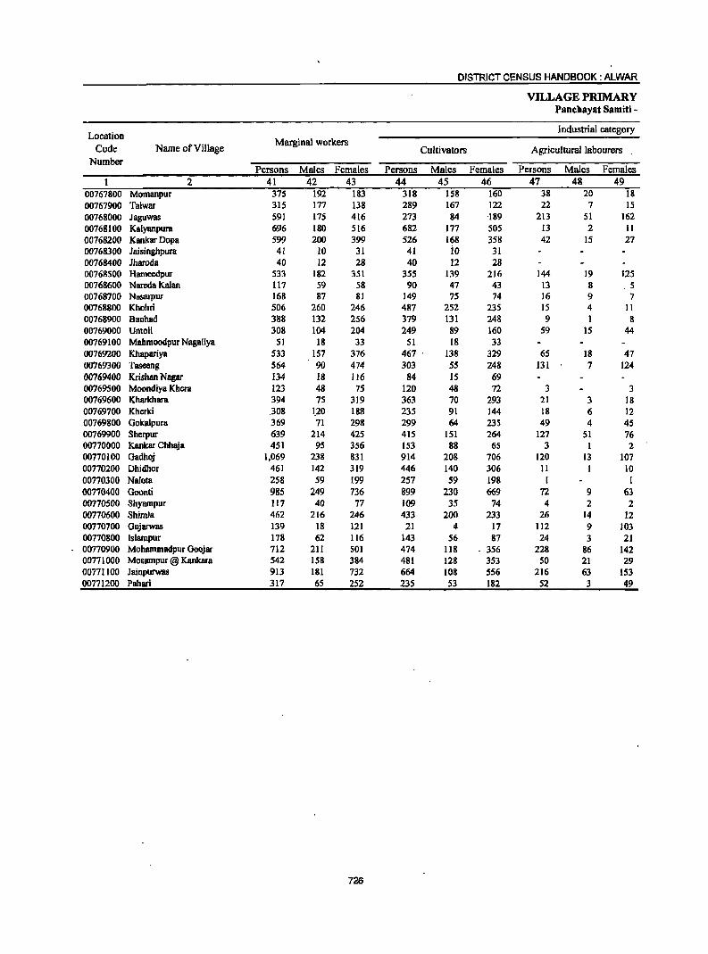
DISTRICT CENSUS HANDBOOK: ALWAR
VILLAGE PRIMARY Panchayat Samiti -
Location Industrial category
Code Name ofVilJage Marginal workers
Cultivators Agricultural labourers . Number
Persons Males Females Persons Males Females Persons Males Females 2 41 42 43 44 45 46 47 48 49
00767800 Momanpur 375 192 183 318 158 160 38 20 18 00767900 Talwar 315 177 138 289 167 122 22 7 15 00768000 Jaguwas 591 175 416 273 84 U9 213 51 162 00768100 KalYllOpura 696 180 5[6 682 177 505 13 2 II 00768200 KankarDopa 599 200 399 526 168 358 42 15 27 00768300 Jaisinghpura 41 10 31 41 io 31 00768400 Jharoda 40 [2 28 40 12 28 00768500 Hameedpur 533 182 351 355 139 216 144 19 125 00768600 Nareda Ka[1IO 117 59 58 90 47 43 [3 8 . 5 00768700 Nasarpur 168 87 81 149 75 74 16 9 7 00768800 Khohri 506 260 246 487 252 235 15 4 II 00768900 Banhad 388 132 256 379 131 248 9 I 8 00769000 Untoli 308 [04 204 249 89 160 S9 IS 44 00769100 Mahmoodpur Nagaliya 51 18 33 51 18 33 00769200 Khapariya 533 157 376 467 . 138 329 65 18 47 00769300 Taseeng 564 90 474 303 55 248 131 7 [24 00769400 Krishan Nagar 134 18 116 84 15 69 00769500 Moondiya Khera 123 48 75 120 48 72 3 3 00769600 Kharkhara 394 75 319 363 70 293 21 3 18 00769700 Kherki .308 1,20 188 235 91 144 18 6 12 00769800 Gokalpura 369 71 298 299 64 235 49 4 4S 00769900 Sherpur 639 214 425 415 151 264 127 51 76 00770000 Kankar Chhaja 451 95 356 153 88 65 3 I 2 00710[00 Gadhoj 1,069 238 831 914 208 706 120 13 107 00710200 Dhidhor 461 142 319 446 140 306 11 10 00770300 Na10ta 258 59 199 257 59 198 1 [
00770400 Goonti 985 249 736 899 230 669 72 9 63 00770500 Shyampur 117 40 77 109 35 74 4 2 2 00770600 Shimla 462 216 246 433 200 233 26 14 12 00770700 Gujarwas 139 18 121 21 4 17 112 9 103 00770800 [slampur 178 62 116 143 56 87 24 3 21 00770900 Mohammadpur Goojar 712 211 501 474 118 - 356 228 86 142 00771000 Mosampur @ Kankara 542 158 384 481 128 353 50 21 29 00771100 Jainpurwas 913 181 732 664 108 556 216 63 153 00771200 Pahari 317 65 252 235 53 182 52 3 49
726
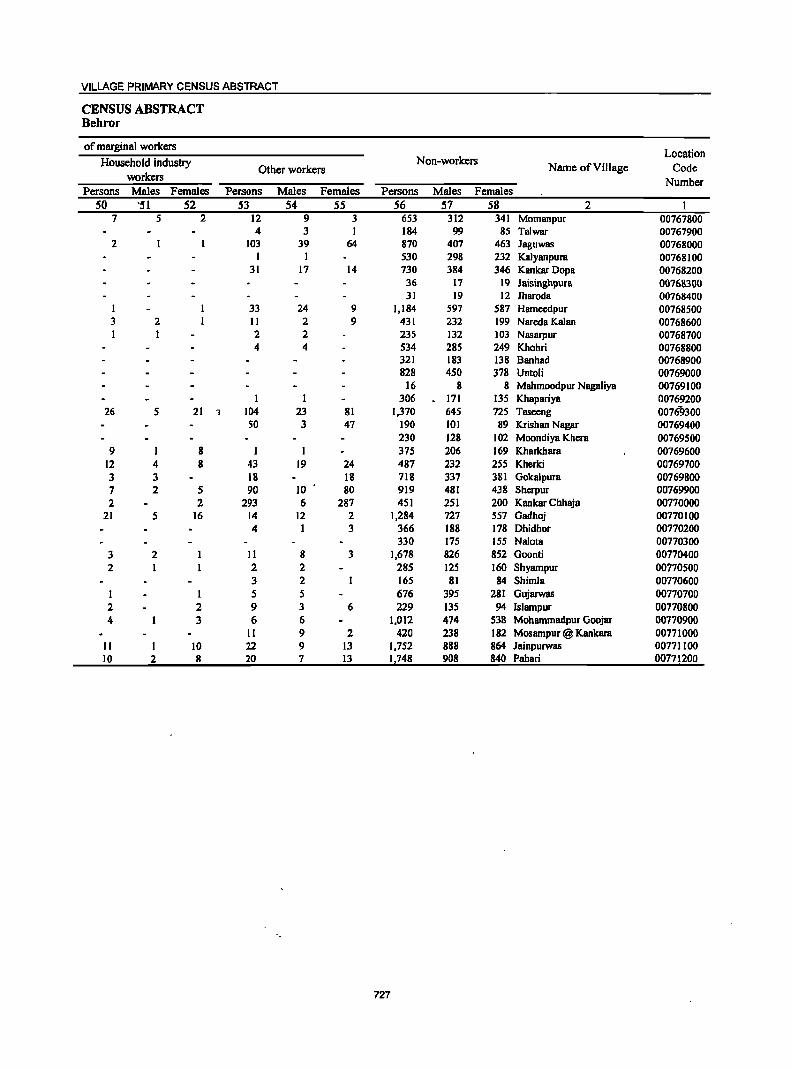
VILLAGE PRIMARY CENSUS ABSTRACT
CENSUS ABSTRACT Behror
of marginal workers Location
Household industry Non-workers Name of Village Code Other workers
workers Number Persons Males Females Persons Males Females Persons Males Females
50 '51 52 53 54 55 56 57 58 2 7 5 2 12 9 3 653 312 341 Momanpur 00767800
4 3 I 184 99 85 Talwar 00767900 2 103 39 64 870 407 463 Jaguwas 00768000
I 1 530 298 232 Kalyanpura 00768100 31 17 14 730 384 346 Kankar Dopa 00768200
36 17 19 JaisinghpurB 00768300 31 19 12 Jharoda 00768400
1 33 24 9 1,184 597 587 Hameedpur 00768500 3 2 II 2 9 431 232 199 Nareda Kalan 00768600 I 1 2 2 235 132 103 Nasarpur 00768700
4 4 534 285 249 Khohri 00768800 321 183 138 B8Ilhad 00768900 828 450 378 Untoli 00769000
16 8 8 Mahmoodpur Nagaliya 00769100 I 1 306 171 135 Khapariya 00769200
26 5 21 , 104 23 81 1,370 645 725 Taseeng 00769300 50 3 47 190 101 89 Krishan Nagar 00769400
230 128 102 Moondiya Khera 00769500 9 8 I I 375 206 169 Kharkhara 00769600
12 4 8 43 19 24 487 232 255 Kherki 00769700 3 3 18 18 718 337 381 Gokalpura 00769800 7 2 5 90 10 80 919 481 438 -Sherpur 00769900 2 2 293 6 287 451 251 200 Kankar Chhaja 00770000
21 5 16 14 12 2 1,284 727 557 Gadhoj 00770100 4 1 3 366 188 178 Dhidhor 00770200
330 175 155 Nalota 00770300 3 2 II 8 3 1,678 826 852 Goonti 00770400 2 1 2 2 285 125 160 Shyampur 00770500
3 2 165 81 84 Shimla 00770600 I 1 5 5 676 395 281 Gujarwas 00770700 2 2 9 3 6 229 135 94 Islampur 00770800 4 3 6 6 1,012 474 538 Mohammadpur Goojar 00770900
11 9 2 420 238 182 Mosampur @ Kankara 00771000 II I 10 22 9 13 1,752 888 864 Jainpurwas 00771100 10 2 8 20 7 13 1,748 908 840 Pahari 0077.200
727

DISTRICT CENSUS HANDBOOK: ALWAR
VILLAGE PRIMARY Panch..ayat Samiti -
Location Area of Total population
. -Population:in tfie Number of (including institutional and
Code Name of Village Village in households houseless populatiol)) .
age-,group .0-6
Number hectares Persons Males Females Persons . Males Females
2 3 4 5 6 7 8 9 10
0002 Nimrana ffotal) 37,927.00 23,682 143,329 74,428 68,901 24,332 13,158 11,174
0002 Nlmrana (Rural) 37,927.00 23,682 143,329 74,428 68,901 24,332 13,158 11,174
0002 Nimrana (Urban) Nimrana (Rural)
00753600 R8mch8ndrapura 156.0 180 1,002 514 488 166 103 63 00753700 Raghunathpura 114.0 47 298 149 149 55 29 26 00753800 Beenjhpur 372.0 167 1,025 522 503 149 72 77 00753900 Partapur 253.0 234 1,275 651 624 222 119 103
00754000 Jaitpu[ 281.0 236 1,327 702 625 191 103 88
00754100 Hudiya Kalan 362.0 333 1,955 991 964 284 155 129
00754200 ChakRamdas 44.0 -----------Un-inhabited------------00754300 Hudiya Khurd 320.0 327 1,810 931 879 249 146 103 00754400 Kathoowas 387.0 251 1,623 835 788 273 154 119
00754500 Mangalpur 173.0 134 773 380 393 III 60 51
00754600 Mandhan 930.0 602 3,514 1,854 1,660 546 288 258
00754700 Adeend 317.0 190 1,109 586 52) . 164 86 78 00754800 Mahtawas 550.0 425 2,606 1,387 1,219 390 219 171 00754900 Porula 168.0 1I2 738 385 353 110 55 5S 00755000 NagliBalai 880.0 469 2,878 1,482 1,396 482 256 226 00755100 Santo 402.0 249 1,484 749 735 229 120 109
00755209 Beeghana Jat 439.0 129 1,026 538 488 175 89 86 00755300 Raisarana 585.0 297 1,81.8 947 871 331 166 165
00755400 Giglana 991.0 664 .. 4,176 2,227 1,949 694 402 292
00755500 Nanagwas 274.0 300 1,845 925 920 315 160 ISS 0075'561)0 Chawadi 601.0 198 1,209 616 593 236 127 109
00755700 Dabarwas 669.0 367 2,436 1,278 1,158 400 222 178
00755800 Beeranwas 385.0 306 1,867 950 917 303 160 143
60755906 Anandpur 471.0 223 1,278 660 618 201 113 88 00156001) Vijaynagar 395.0 J8$ 1,216 626 .590 249 125 124 ObiS61l>0 Khoondrot 836.0 469 2,983 1,555 11428 '608 313 295 00756200 Dheekwar 401.0 281 1,757 901 .856 300 153 147 007563-60 Kanhawas 566.0 ,3~ 2,241 1,166 1,075 408 224 184 007564dd' Majra 369.0 378 2,056 1,005 1',051 289 144 145
00756500 Basai Bhopalsingh 564.q 345 2,~)!J 1,059 1,000 :352 202 '. ISO 00756600 -Pratappur Chak No.-2 173;0 ' ~S3 390 210 -no 'n- 50' .. - .. '3"2-
00756700 Pratappur Chak No. 1 429.0 79 453 242 211 80 49 . 31.
00756800 Ghee10t 1,351.0 441 2,859 1,493 1,366 520 276 244 00756900 Pratappur Chak No.3 176.0 41 260 140 120 63 37 26
00757000 Batana 333.0 69 404 203 201 87 53 34 00757100 Kuteena 934.0 547 3,357 1,729 1,628 599 322 277
00757200 Kankar 750.0 477 2,908 1,551 1,357 542 290 252 00757300 Googal Kota 835.0 415 2,601 1,337 1,264 467 267 200 00757400 Shriyani 453.0 348 2,173 1,159 1,014 291 156 135. 00757500 Jonaycha Kalan 288.0 223 1,288 671 617 177. 101 7.6 00757600 Sansedi 178.0 263 1,416 755 661 193 108 85 00757700 Jonaycha Khurd 528.0 453 2,834 1,424 1,410 505 268
.. 237
00757800 BaniJonaycha 38.0 52 273 142 131 49 32 17 00757900 Chaubara 480.0 361 2,049 1,100 949 326 181 145 00758000 Shahjahanpur 989.0 1,528 8,682 4,594 4,088 1,470 787 6113 00758100 Dhodhakari 256.0 56 336 170 166 74 37 37 00758200 Be1ni 395.0 136 940 487 453 190 92 98 00758300 Neemrana 725.0 777 4,217 2,276 1,941 769 425 344 00758400 Umraogarb 84.0 40 262 134 'l28 53 30 23 00758500. Salarpur 350.0 321 2;035 1,049 986 331 169 ~'162 00758600 Naghori 294.0 280 1,651 865 786 248 130 ;;U.8 00758700 Bheemsinghpura 236.0 147 811 421 390 128 -68
.. ';,~~~ "~~::~: . 00758800 MuJalndsil)ghpura 167.0 43 251 119 132 56·' 'J~ 00758900 Heerasarh' , 44.0 ----- - Un";inblfuited
.... -- , :-':' -.. " ..... - - .. -~ -
728" ,r
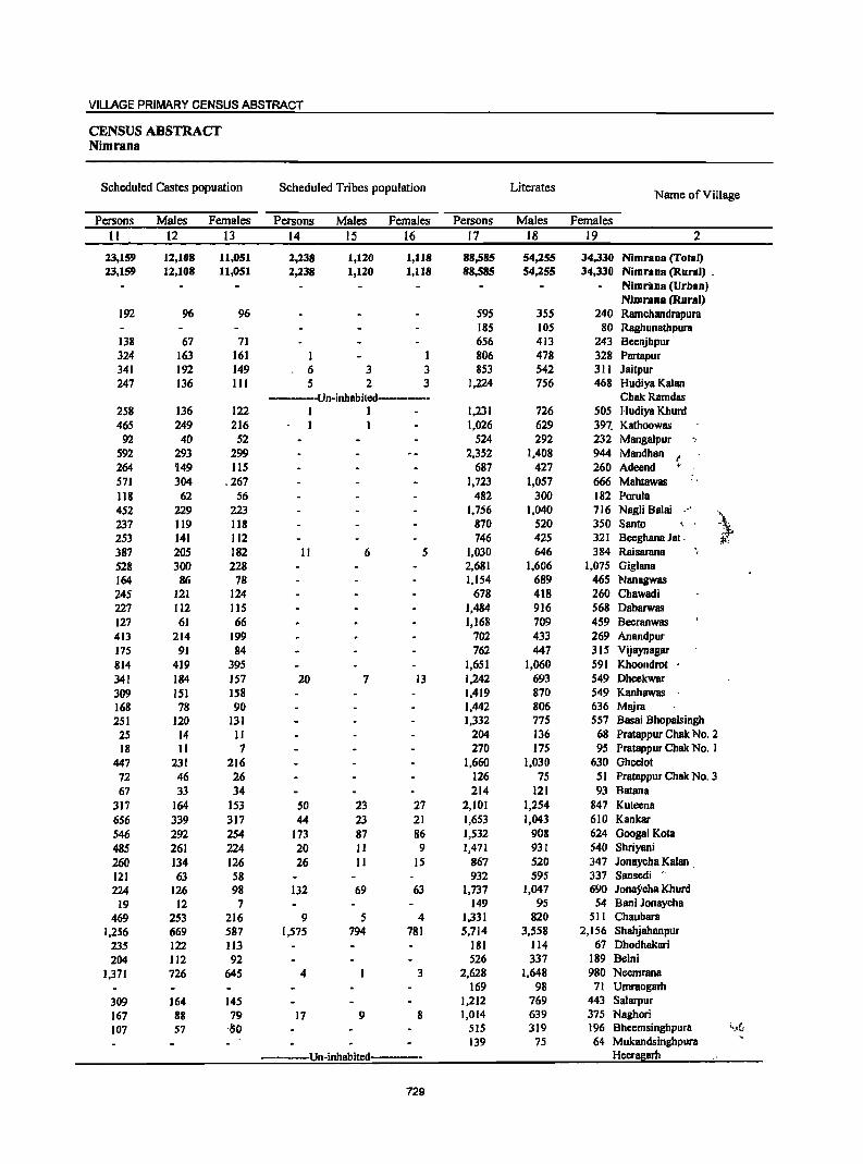
VILLAGE PRIMARY CENSUS ABSTRACT
CENSUS ABSTRACT Nimrana
Scheduled Castes popuation Scheduled Tribes population Literates Name of Village
Persons Males Females Persons Males Females Persons Males Females
II 12 13 14 15 16 17 18 19 2
23,159 12,108 11,051 2,238 1,120 1,118 88,585 54,255 34,330 Nimrana (Total) 23,159 12,108 11,051 2,238 1,120 1,118 88,585 54,255 34,330 Nimrana (Rural) .
Nimrilna (Urban) Nimrana (Rural)
192 96 96 595 355 240 Ramchandrapum 185 lOS 80 Raghunathpura
138 67 71 656 413 243 Beenjhpur 324 163 161 1 1 806 478 328 Partapur 341 192 149 6 3 3 853 542 311 Jaitpur 247 136 III 5 2 3 1,224 756 468 Hudiya Kalan
·--··Un·inhabited--······- ChakRamdas 258 136 122 I 1 1,231 726 50S Hudiya Khurd 465 249 216 1 1,026 629 397. Kathoowas
92 40 52 524 292 232 Mangalpur ".
592 293 299 2,352 1,408 944 Mandhan t 264 149 115 687 427 260 Adeend ,. S71 304 .267 1,723 1,057 666 Mahtawas '. 118 62 56 482 300 182 Porula 452 229 223 1,756 1,040 716 Nagli Balai .~
237 119 118 870 520 350 Santo , .. \:_
253 141 112 746 425 321 Beeghana Jat. i;'r: 387 20S 182 II 6 5 1,030 646 384 Raisarana 528 300 228 2,681 1,606 1,075 Giglana 164 86 78 1.154 689 465 Nanagwas 245 121 124 678 418 260 Chawadi 227 112 llS 1,484 916 568 Daharwas 127 61 66 1,168 709 459 Beeranwas 413 214 199 702 433 269 Anandpur 175 91 84 762 447 315 Vijaynagar 814 419 395 1,651 1,060 S91 Khoondrot 341 184 157 20 7 13 1,242 693 549 Dheekwar 309 lSI IS8 1,419 870 549 Kanhawas 168 78 90 1,442 806 636 Majra 251 120 131 1,332 775 557 Basai Bhopalsingb
25 14 II 204 136 68 Pratappur Chak No.2 18 II 7 270 175 95 Pratappur Chak No. 1
447 231 216 1,660 1,030 630 Oheelot 72 46 26 126 75 51 Pratappur Chak No.3 67 33 34 214 121 93 Batana
317 164 153 50 23 27 2,101 1,254 847 Kuteena
656 339 317 44 23 21 1,653 1,043 610 Kankar 546 292 254 173 87 86 1,532 908 624 Ooogal Kota
48S 261 224 20 II 9 1,471 931 540 Shriyani
260 134 126 26 11 IS 867 520 347 Jonaycha Kalan . 121 63 58 932 595 337 Sansedi
224 126 98 132 69 63 1,737 1,047 690 Jonaycha Khurd
19 12 7 149 95 54 Bani Jonaycha
469 253 216 9 5 4 1,331 820 511 Chaubara 1,256 669 587 1,575 794 781 5,714 3,558 2,156 Shahjahanpur
235 122 113 181 114 67 Dhodhakari 204 112 92 526 337 189 Belni
1,371 726 645 4 3 2,628 1,648 980 Neemrana 169 98 71 Umraogarh
309 164 145 1,212 769 443 Salarpur
167 88 79 17 9 8 1,014 639 375 Naghori
107 57 '·50 SIS 319 196 Bheemsinghpura l~J(;
139 75 64 Mukandsinghpura
··_·--Un·inhabited· Heeragarh
729
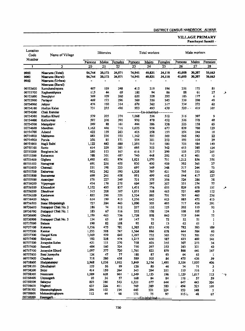
DISTRICT CENSUS HANDBOOK: ALWAR
VILLAGE PRIMARY Panchayat Samiti -
Location Illiterates Total workers Main workers
Code Name of Village Number
Persons Males Females Persons Males Females Persons Males Females 2 20 2] 22 23 24 25 26 21 28
0002 Nimrana (rotal) 54,744 20,173 34,571 74,941 40,831 . 34,110 41,050 30,387 10,663 0002 Nimrana (Rural) 54,744 20,173 34,571 74,941 40,831 34,110 41,050 30,387 10,663 0002 Nlmrana (Urban)
Nimrana (Rural) 00753600 Ramchandrapura 407 159 248 415 219 196 256 175 81 00753700 Raghunathpura 113 44 69 180 94 86 88 61 27 .)
00753800 Beenjhpur 369 109 260 620 328 292 183 177 6 00753900 Partapur 469 173 296 569 326 243 339 290 49 00754000 Jaitpur 474 160 314 679 362 317 334 272 62 00754100 Hudiya Kalan 731 235 496 923 493 430 520 - . 419 JOI 00754200 ChakRamdas ----------Un-inhabited------------00754300 Hudiya Khurd 579 205 374 1,068 556 512 316 307 9 00754400 Kathoowas 597 206 391 930 478 452 326 278 48 00754500 Mangalpur 249 88 161 444 206 238 223 158 65 00754600 Mandhan 1,162 446 716 1,635 958 677 829 700 129 00754700 Adcend 422 159 263 415 258 151 254 244 10 00754800 Mahtawas 883 330 553 1,162 593 569 565 543 22 00754900 Porola 256 85 171 554 301 253 193 164 29 00755000 Nagli Balai 1,122 442 680 1,295 715 580 733 584 149 00755100 Santo 614 229 385 . 695 353 342 413 289 124 00755200 8ceghana Jet 280 113 167 616 317 299 533 272 261 00755300 Raisarana 788 301 487 740 448 292 413 401 12 00755400 Giglana 1,495 621 874 1,821 1,070 751 1,212 856 356 00755500 Nanagwas 691 236 455 850 450 400 392 365 27 00755600 Chawadi 531 198 333 697 349 348 317 244 73 00755700 Oabarwas 952 362 590 1,328 707 621 795 533 262 00755800 Bceranwas 699 241 458 951 499 452 544 417 127 00755900 Anandpur 576 227 349 731 375 356 324 286 38 00756000 Vijaynagllr 454 179 275 604 297 ~07 351 274 77 00756100 Khoondrot 1,332 495 837 1,431 776 655 829 678 151 ~
00756200 Dheekwar 515 208 307 1,031 568 463 521 409 112 00756300 Kanhawas 822 296 526 1,554 803 751 701 465 236 00756400 Majra 614 199 415 1,256 643 613 885 472 413 00756500 Bassi Bhopalsingh 727 284 443 1,000 505 495 717 426 291 00756600 Pratappur Chak No.2 186 74 112 257 132 125 202 110 92 00756700 Pratappur Chak No. 1 183 67 116 232 108 124 108 103 5 00756800 Gheelot 1,199 463 736 1,738 898 840 719 644 75 00756900 Pratappur Chak No.3 134 65 69 147 75 72 52 51 I 00757000 Batana 190 82 108 95 82 13 62 61 I 00757100 Kuteena 1,256 475 781 1,305 835 470 782 593 189 00757200 Kankar 1,255 508 747 1,564 886 678 644 584 60 00757300 Googal Kota 1,069 429 640 1,297 732 565 712 581 131 00757400 Shriyani 702 228 474 1,217 630 587 623 482 141 00757500 Jonaycha Kalan 421 151 270 758 403 355 307 273 34 00757600 Sansedi 484 160 324 750 397 353 363 321 42 00757700 Jonaycha Khurd 1,097 377 720 1,701 822 879 808 641 167 00757800 Bani Jonaycha 124 47 77 180 87 93 64 63 1 00757900 Chaubara 718 280 438 589 505 84 475 436 39 00758000 Shahjabanpur 2,968 1,036 1,932 3,849 2,354 1,495 2,326 1,920 406 00758100 DhodhaJcari 155 56 99 126 80 46 74 71 3 00758200 Bclni 414 ISO 264 545 294 251 119 116 3 00758300 Neemrana 1,589 628 961 1,349 1,153 196 1,129 1,017 112 ...., 00758400 Umraogarh 93 36 57 168 84 84 116 • 57 S9 00758500 Salarpur 823 280 543 1,321 677 644 647 443 204 00758600 Naghori 637 226 411 769 389 380 494 325 169 00758700 B"ec;msinghpura 296 102 194 445 221 224 153 148 5 00758800 Mukandsinghpura 112 44 68 172 75 97 115 f... 48 67 00758900 Heeragai'h. < --Un-inhabited----
730
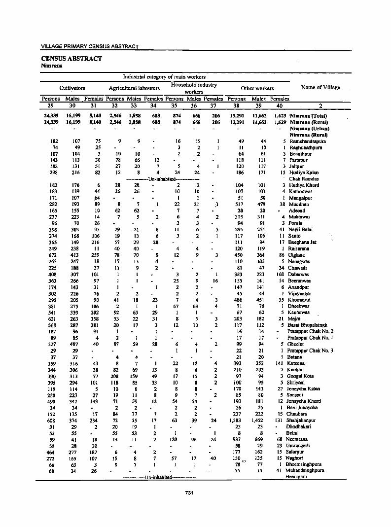
VILLAGE PRIMARY CENSUS ABSTRACT
CENSUS ABSTRACT Nimrana
Industrial category of main workers
Cultivators Agricultural labourers Household industry
Other workers Name of Village workers
Persons Males Females Persons Males Females Persons Males Females Persons Males Females 29 30 31 32 33 34 35 36 37 38 39 40 2
24,339 16,199 8,140 2,546 1,858 688 874 668 206 13,291 11,662 1,629 'Nimrana-(Total) 24,339 16,199 8;140 2,546 1,858 688 874 668 206 13,291 11,662 1,629 Nimrana (Rural)
Nimrana (Urban) Nimrana (Rural)
182 101 75 9 9 16 15 49 44 5 RamchandrapUra 74 49 25 3 2 II 10 Raghunalhpura
107 104 3 10 10 2 _2 64 61 3 Beenjhpur 143 113 30 78 66 12 118 111 7 Partapur 182 131 51 27 20 7 5 4 120 117 3 Jaitpur 298 216 82 12 8 4 24 24 186 171 15 Hudiya Kalan
-------Un-inhabited-------- ChakRamdas 182 176 6 28 28 2 2 104 101 3 Hudiya Khurd 183 139 44 26 26 10 10 107 103 4 Kathoowas 171 107 .64 I 51 50 I Mangalpur 282 193 89 8 7 22 21 ;l 517 479 38 Mandhan 165 155 10 62 62 7 7 20 20 Adeend 237 223 14 7 5 2 6 4 2 315 311 4 Mahtawas
96 70 26 3 3 94 91 3 Porula 398 303 95 29 21 8 II 6 5 295 254 41 Nagli Balai 274 168 106 19 13 6 3 2 117 106 II Santo 365 149 216 57 29 28 111 94 17 Beeghana Jat 249 238 II 40 40 4 4 120 119 J Raisarana 672 413 259 78 70 8 12 9 3 450 364 86 Gigiana 265 247 18 17 13 4 110 lOS 5 Nanagwas 225 188 37 11 9 2 81 47 34 Chawadi 408 307 101 3 2 383 223 160 Dabarwas 363 266 97 25 9 16 155 141 14 Beeranwas 174 143 31 I 2 2 147 141 6 Anandpur 302 226 76 2 2 2 2 45 44 I Vijaynagar 295 205 90 41 18 23 7 4 3 486 451 35 Khoondrot 381 275 106 2 1 1 67 63 4 71 70 I Dheekwar 541 339 202 92 63 29 I I 67 62 5 Kanhawas 621 263 358 53 22 31 8 5 3 203 182 21 Majra 568 287 281 20 17 3 12 10 2 117 112 5 Basai Bhopalsingh 187 96 91 I 1 14 14 Pratappur Chak No.2 89 85 4 2 I 1 17 11 Pratappur Chak No. 1
527 487 40 87 59 28 6 4 2 99 94 5 Ghcelot 29 29 I I 22 21 I Pratappur Chak No_ 3 37 37 4 4 21 20 Batana
359 316 43 8 7 1 22 18 4 393 252 141 Kuteena
344 306 38 82 69 13 8 6 2 210 203 7 Kankar 390 313 77 208 159 49 17 15 2 97 94 3 Googal Kota
395 294 101 118 85 33 10 8 2 100 95 5 Shriyani 119 114 S 10 8 2 8 8 170 143 27 Jonaycha Kalan
2S0 223 27 19 11 8 9 7 2 85 80 5 Sansedi 490 347 143 71 59 12 S4 54 193 181 12 Jonaycha Khurd 34 34 2 2 2 2 26 25 I Bani Jonaycha
152 135 17 84 77 7 2 2 237 222 15 Chaubara 608 374 234 72 55 17 63 39 24 1,583 1,452 131 Shahjahanpur 31 29 2 20 19 I 23 23 Dhodhakari 55 55 55 53 2 I I 8 8 Beini
59 41 18 13 11 2 120 96 24 937 869 68 Neemrana
58 28 30 58 29 29 Umraogarh
464 277 187 6 4 2 177 162 IS Salarpur
272 165 107 15 8 1 57 17 40 ISO 135 15 Naghori :r;;}
66 63 3 8 7 78 77 Bheemsinghpura
60 34 26 55 14 41 Mukandsinghpura --Un-inhabited------------ Hceragarh
731

DISTRICT CENSUS HANDBOOK: ALWAR
VILLAGE PRIMARY Panchayat Samiti -
Location Industrial category
Code Name of Village Marginal workers
Cultivators Agricultural labourers Number
Persons Males Females Persons Males Females Persons Males Females 2 41 42 43 44 45 46 47 48 49
0001 Nimrana (Total) 33,891 10,444 13,447 11,746 6,874 15,871 7,535 1,219 5,306 0002 Nimrana (Rural) 33,891 10,444 23,447 22,746 6,874 15,872 7,535 2,229 5,306 0002 Nimrana (Urban)
Nimrana (Rural) 00753600 Rarnchandrapura 159 44 115 108 25 83 51 19 32 00753700 .Raghunathpura 92 33 59 90 32 58 00753800 Beenjhpur 437 151 286 324 III 213 98 29 69 00753900 Partapur 230 36 194 155 28 127 68 7 61 00754000 Jaitpur 345 90 255 133 17 116 202 64 138 00754100 Hudiya Kalan 403 74 329 315 S3 262 35 11 24 00754200 Chak Rarndas -------Un-inhabitcd---------00754300 HudiyB Khurd 752 249 503 661 210 451 66 16 50 00754400 Kathoowas 604 200 404 402 130 272 136 48 88 00754500 Mangalpur 221 48 173 205 46 159 14 14 00754600 Mandhan 806 258 548 571 180 391 113 16 97' 00754700 Adeend 161 14 147 91 ' 8 83 69 5 64 00754800 Mabtawas 597 SO 547 469 36 433 118 9 109 00754900 Porula 361 137 224 317 127 190 21 3 18 00755000 NagJi Balai 562 131 431 258 82 176 222 28 194 00755100 Santo 282 64 218 217 SO 167 49 11 38 00755200 Becghana Jat 83 45 38 44 23 21 8 4 4 00755300 Raisarana 327 47 280 219 27 192 99 15 84 00755400 Gig1ana 609 214 395 4i9 182 237 145 23 122 00755500 Nanagwas 458 85 373 406 64 342 34 6 28 00755600 Chawadi 380 105 275 358 95 263 11 3 8 00755700 Dabarwas 533 174 359 249 64 185 19 13 6 00755800 Beeranwas 407 82 325 324 72 252 32 6 26 00755900 Anandpur 407 89 318 362 73 289 26 8 18 00756000 Vijaynagar 253 23 230 209 4 205 42 18 24 00756100 Khoondrot 602 98 504 249 40 209 263 49 214 00756200 Dheekwar 510 159 351 328 86 242 165 67 98 00756300 Kanhawas 853 338 515 268 94 174 581 241 340 00756400 Majra 371 171 200 294 146 148 66 19 47 00756500 Basai Bhopalsingh 283 79 204 188 51 137 79 17 62 00756600 Pratappur Chak No.2 55 22 33 1 1 54 22 32 00756700 Pratappur Chak No. 1 124 5 119 118 2 116 3 1 2 00756800 Gheclot 1,019 254 765 614 145 469 385 105 280 00756900 Pratappur Chak No.3 95 24 71 30 4 26 62 19 43 00757000 Batana 33 21 12 19 9 10 00757100 Kutecna 523 242 281 192 84 108 101 46 55 00757200 Kankar 920 302 618 432 156 276 412 114 298 00757300 Googal Kota 585 151 434 441 131 310 139 18 121 00757400 Shriyani 594 148 446 428 115 313 157 30 127 00757500 Jonaycha Kalan 451 130 321 184 44 140 86 29 57 00757600 Sansedi 387 76 311 282 59 223 65 8 57 00757700 Jonaycha Khurd 893 181 712 589 145 444 154 30 124 00757800 Bani Jonaycha 116 24 92 III 24 87 5 5 00757900 Chaubara 114 69 45 20 14 6 . 78 44 34 00758000 Shahjabanpur 1,523 434 1,089 346 78 268 180 63 117 00758100 Dhodhakari 52 9 43 5 5 46 8 38 00758200 Belni 426 178 248 426 178 248 00758300 Neemrana 220 136 84 26 16 10 68 34 34 00758400 UmraQgarh 52 27 25 45 26 19 -_ 00758500 Sa1arpur 674 234 440 629 221 408 26 3 23 00758600 Naghori 275 64 211 120 26 94 106 14 92 00758700 BIieems~glJpura 292 73 219 250 60 19.0,· 39 10 29 00758800 ..Muk8ndsinghpura 57 27 30 51 27 24' 00758900 -H~ . " Un-inhabited-
732
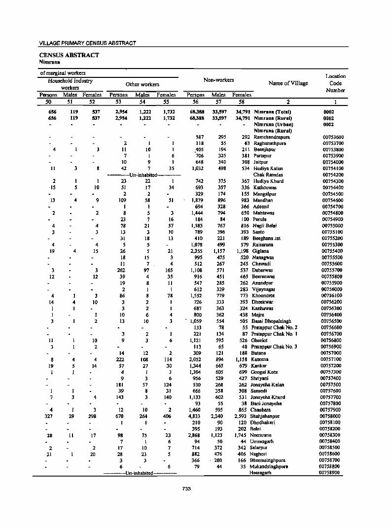
VILLAGE PRIMARY CENSUS ABSTRACT
CENSUS ABSTRACT Nimrana
of marginal workers Location
Household industry Non-workers Name of Village Code Other workers
workers Number Persons Males Females Persons Males Females Persons Males Females
50 SI S2 53 54 55 S6 57 58 2
656 119 537 2,954 1,222 1,732 68,388 33,597 34,791 Nimranll (Total) 0002 656 119 537 2,954 1,:z22 1,732 68,388 33,597 34,791 Nimranll (Rural) 0002
Nimranll (Urban) 0002 Nimranll (Rural)
587 295 292 Ramchllndrllpura 00753600 2 118 55 63 Raghunathpura 00753700
4 3 11 10 1 405 194 211 Beenjhpur 00753800 7 1 6 706 325 381 Partapur 00753900
10 9 I 648 340 308 Jaitpur 00754000 II 3 8 42 7 35 1,032 498 534 Hudiya Kalan 00754100
-------Un-inhabited---------- Chak Ramdas 00754200 2 I I 23 22 I 742 375 367 Hudiya Khurd 00754300
·15 5 10 51 17 34 693 357 336 Kathoowas 00754400 2 2 329 174 155 Mangalpur 00754500
13 4 9 109 58 51 1,879 896 983 Mandhao 00754600 I I 694 328 366 Adeend 00754700
2 2 8 5 3 1,444 794 650 Mahtawas 00754800 23 7 16 184 84 100 Porula 00754900
4 4 78 21 57 1,583 767 816 Nagli Balai 00755000 3 3 13 3 10 789 396 393 Santo 00755100
31 18 13 410 221 189 Beeghana Jat 00755200 4 4 5 5 1,078 499 579 Raisllrana 00755300
19 4 15 26 5 21 2,355 1,157 1,198 Giglana 00755400 18 IS 3 995 475 520 Nanagwas 00755500 11 7 4 512 267 245 Chawadi 00755600
3 3 262 97 165 1,108 571 537 DabllrWas 00755700 12 12 39 4 35 916 451 465 Beeranwas 00755800
19 8 11 547 285 262 Anandpur 00755900 2 1 1 612 329 283 Vijaynagar 00756000
4 3 86 8 78 1,552 779 773 Khoondrot 00756100 14 4 10 3 2 1 726 333 393 Dheekwllr 00756200 1 I 3 2 I 687 363 324 Kanhawas 00756300 I 1 10 6 4 800 362 438 Majra 00756400 3 2 13 10 3 1,059 554 505 Basai Bhopalsingh 00756500
133 78 55 Prlltappur Chak No.2 00756600 3 2 I 221 134 87 Prlltappur Chak No. I 00756700
11 10 9 3 6 1,121 595 526 Gheelot 00756800 3 2 113 65 48 Pratappur Chak No.3 00756900
14 12 2 309 121 188 Batana 00757000 8 4 4 222 108 114 2,052 894 1,158 KUleena 00757100
19 5 14 57 27 30 1,344 665 679 Kankar 00757200 I 4 I 3 1,304 60S 699 Googal Kota 00757300
9 3 6 956 529 427 Shriyani 00757400 181 57 124 530 268 262 Jonaycha Kalan 00757500
1 1 39 8 31 666 358 308 Sansedi 00757600 7 3 4 143 3 140 1,133 602 531 Jonaycha Khurd 00757700
93 55 38 Bani Jonaycha 00757800 4 I 3 12 10 2 1,460 595 865 Chaubara 00757900
327 29 298 670 264 406 4,833 2,240 2,593 Shahjahanpur 00758000 1 1 210 90 120 Dhodhakllri 00758100
395 193 202 Belni 00758200 28 II 17 98 75 23 2,868 1,123 1,745 Neemrana 00758300
7 I 6 94 SO 44 Umraogarh 00758400
2 2 17 10 7 714 372 342 Salarpur 00758500 21 20 28 23 5 882 476 406 Naghori 00758600
3 3 366 200 166 Bheemsinghpura 00758700 6 6 79 44 35 Mukandsinghpura 00758800
------------Un-inhabitcd--------- Heeragarh 00758900
733
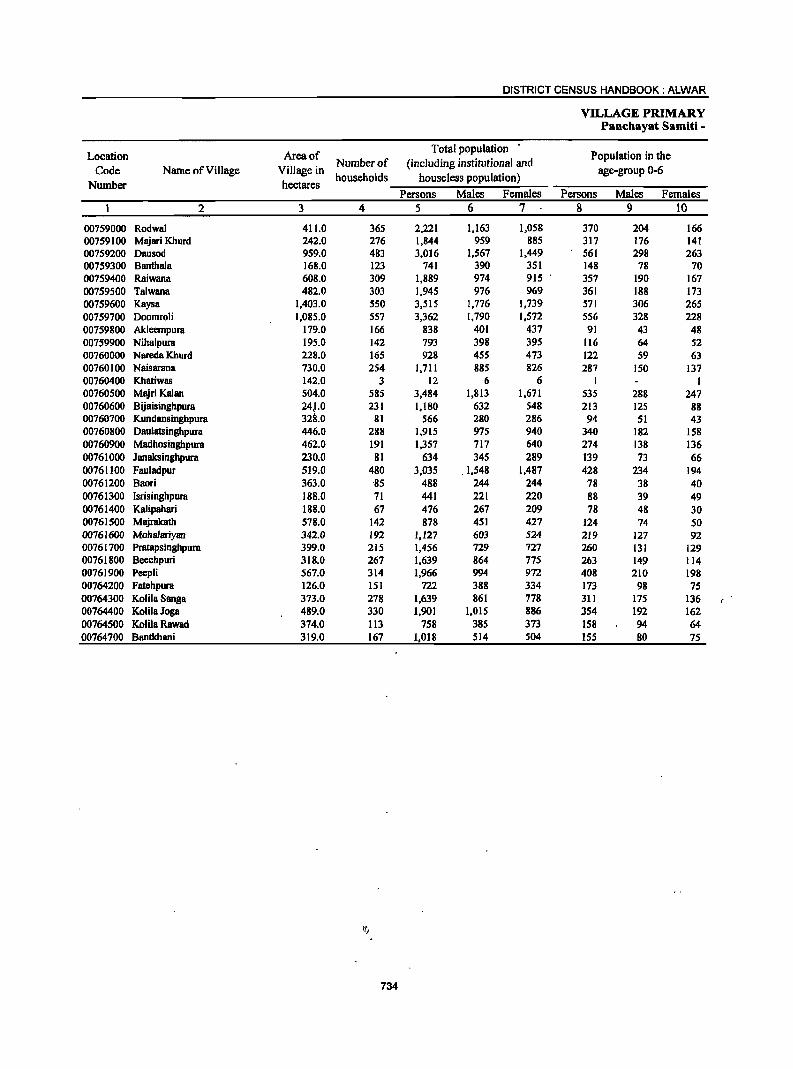
DISTRICT CENSUS HANDBOOK: ALWAR
VILLAGE PRIMARY Panchayat Samiti -
Location Area of Total population
Population in the Code Name of Village Village in
Number of (including institutional and age-group 0-6
Number hectares households houseless population)
Persons Males Females Persons Males Females 2 3 4 5 6 7 8 9 10
00759000 Rodwal 411.0 365 2,221 1,163 1,058 370 204 166 00759100 Majari Khurd 242.0 276 1,844 959 885 317 176 141 00759200 Dausod 959.0 483 3,016 1,567 1,449 561 298 263 00759300 Banthala 168.0 123 741 390 351 148 78 70 00759400 Raiwana 608.0 309 1,889 974 915 . 357 190 167 00759500 Talwana 482.0 303 1,945 976 969 361 188 173 00759600 Kaysa 1,403.0 550 3,515 1,776 1,739 571 306 265 00759700 Doomroli 1,085.0 557 3,362 1,790 1,572 556 328 228 00759800 Akleempura 179.0 166 838 401 437 91 43 48 00759900 Nihalpura 195.0 142 793 398 395 116 64 52 00760000 Nareda Khurd 228.0 165 928 455 473 122 59 63 00760100 Naisarana 730.0 254 1,711 885 826 287 150 137 00760400 KhatiwBS 142.0 3 12 6 6 I 1 00760500 Majri Kalan 504.0 585 3,484 1,813 1,671 535 288 247 00760600 Bijaisinghpura 24J.0 231 1,180 632 548 213 125 88 00760700 Kundansinghpura 328.0 81 566 280 286 94 51 43 00760800 Daulatsinghpura 446.0 288 1,915 975 940 340 182 158 00760900 Madhosinghpum 462.0 191 1,357 717 640 274 138 136 00761000 Janaksinghpura 230.0 81 634 345 289 139 73 66 00761100 Fauladpur 519.0 480 3,035 .1,548 1,487 428 234 194 00761200 Baori 363.0 '85 488 244 244 78 38 40 00761300 Isrisinghpura 188.0 71 441 221 220 88 39 49 00761400 Kalipahari 188.0 67 476 267 209 78 48 30 00761500 Majrakath 578.0 142 878 451 427 124 74 50 00761600 Mohalariyan 342.0 192 1,127 603 524 219 127 92 00761700 Pratapsinghpum 399.0 215 1,456 729 727 260 131 129 00761800 Beechpuri 318.0 267 1,639 864 775 263 149 114 00761900 Peepli 567.0 314 1,966 994 972 408 210 198 00764200 Fatehpum 126.0 151 722 388 334 173 98 75 00764300 Kolila Sanga 373.0 278 1,639 861 778 311 175 136 00764400 KolilaJoga 489.0 330 1,901 1,015 886 354 192 162 00764500 Kalila Rawad 374.0 113 758 385 373 158 94 64 00764700 Baotkhani 319.0 167 1,018 514 504 155 80 75
734
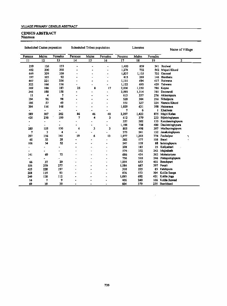
VILLAGE PRIMARY CENSUS ABSTRACT
CENSUS ABSTRACT Nimrana
Scheduled Castes popuation Scheduled Tribes population Literates Name of Village
Persons Males Females Persons Males Females Persons Males Females II 12 13 14 IS 16 17 18 19 2
259 126 133 1,400 859 541 Rodwal 402 200 202 1,274 732 542 Majari Khurd 649 329 320 1,837 1,105 732 Dausod 197 105 92 415 269 146 Bantha1a 447 221 226 1,111 694 417 Raiwana 322 166 156 1,122 693 429 Ta1wana 369 186 183 25 8 17 2,036 1,250 786 Kaysa 346 188 158 2,095 1,314 781 Doomroli
11 4 7 613 337 276 ~leempura 194 96 98 520 304 216 Nihalpura 106 57 49 551 327 224 Nareda Khurd 304 156 148 1,029 631 398 Naisarana
7 6 I Khatiwas 589 307 282 86 46 40 2,297 1,422 875 Majri Kalan 420 230 190 7 4 3 612 379 233 Bijaisinghpura
337 202 135 Kundansinghpura 1,188 708 480 Daulatsinghpura
285 155 130 6 3 3 805 498 307 Madhosinghpura 7 3 4 373 241 132 Janaksinghpura
297 156 141 19 6 13 1,977 1,203 774 Fauladpur "
60 32 28 282 177 105 Baori 106 54 52 247 159 88 Isrisinghpura
208 183 25 Kalipahari 574· 332 242 Majrakath
141 69 72 686 424 262 Mohalariyan 756 510 246 Pratapsingbpura
66 37 29 1,054 653 401 Beechpuri 556 279 277 1,084 687 397 Peepli 425 228 197 310 225 85 Fatehpura 208 115 93 876 572 304 KolilaSanga 240 128 112 1,093 692 401 KolilaJoga
16 7 9 406 240 166 Kolila Rawad 69 39 30 604 379 225 Bantkhani
735
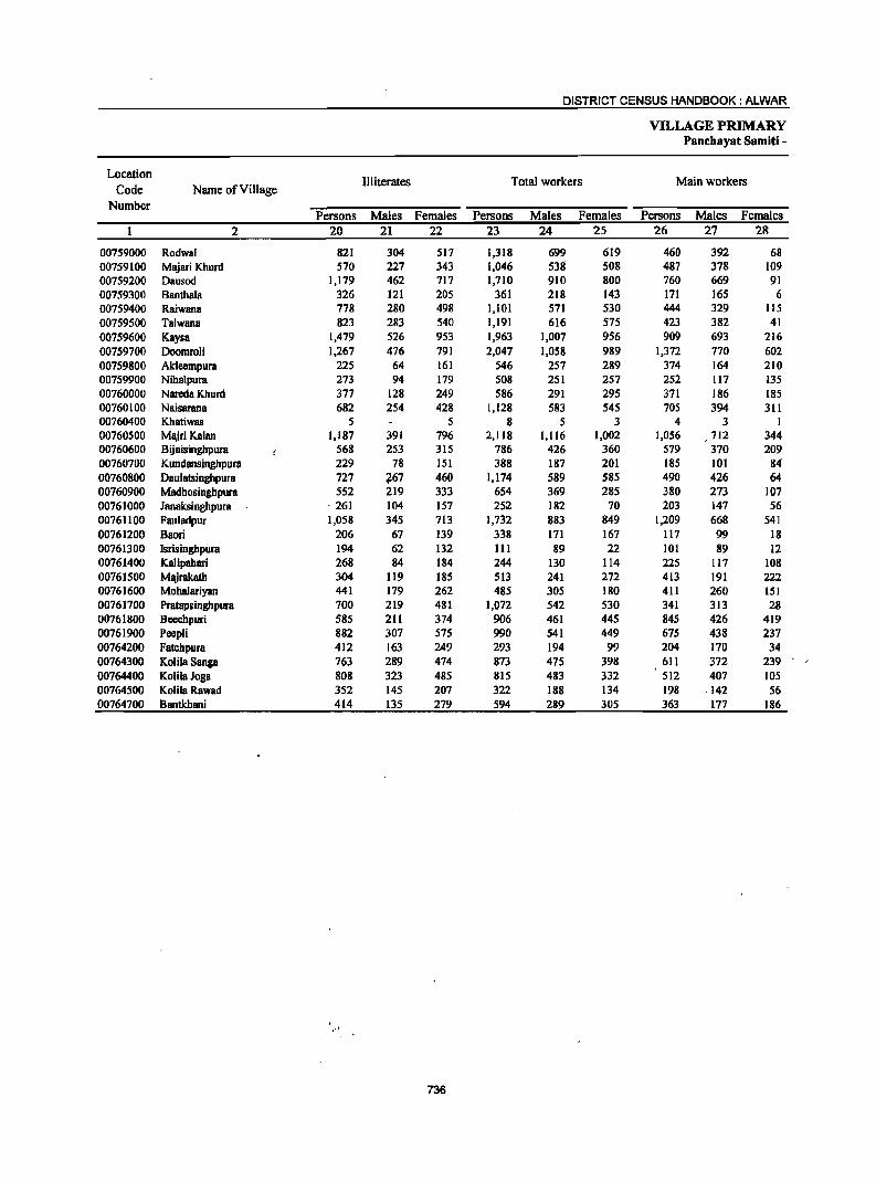
DISTRICT CENSUS HANDBOOK: ALWAR
VILLAGE PRIMARY Panehoyat Somiti -
Location Illiterates Total workers Main workers
Code Name of Village Number
Persons Males Females Persons Males Females Persons Males Females 2 20 21 22 23 24 25 26 27 28
00759000 Rodwal 821 304 517 1,318 699 619 460 392 68 00759100 Majari Khurd 570 227 343 1,046 538 508 487 378 109 00759200 Dausod 1,179 462 717 1,710 910 800 760 669 91 00759300 Banthala 326 121 205 361 218 143 171 165 6 00759400 Raiwana 778 280 498 1,101 571 530 444 329 115 00759500 Talwana 823 283 540 1,191 616 575 423 382 41 00759600 Kaysa 1,479 526 953 1,963 1,007 956 909 693 216 00759700 Doomroli 1,267 476 791 2,047 1,058 989 1,372 770 602 00759800 Akleempura 225 64 161 546 257 289 374 164- 210 00759900 Niha1pura 273 94 179 508 251 257 252 117 135 00760000 Nareda Khurd 377 128 249 586 291 295 371 186 185 00760100 Naisarana 682 254 428 1,128 583 545 70S 394 311 00760400 Khatiwas 5 5 8 5 3 4 3 1 00760500 Majri Kalan 1,187 391 796 2,118 1,116 1,002 1,056 712 344 00760600 Bijaisinghpura 568 253 315 786 426 360 579 370 209 00760700 KundDllsinghpura 229 78 151 388 187 201 185 101 84 00760800 Daulatsinghpura 727 767 460 1,174 589 585 490 426 64-00760900 Madhosinghpura 552 219 333 654 369 285 380 273 107 00761000 Janaksinghpura ·261 104 157 252 182 70 203 147 56 00761100 Fauladpur 1,058 345 713 1,732 883 849 1,209 668 541 00761200 Baori 206 67 139 338 171 167 117 99 18 00761300 Isrisinghpura 194 62 132 111 89 22 101 89 12 00761400 Kalipahari 268 84 184 244 130 114 225 117 108 00761500 Majrakath 304 119 185 513 241 272 413 191 222 00761600 Mohalariyan 441 179 262 485 305 180 411 260 151 00761700 Pratapsinghpura 700 219 481 1,072 542 530 341 313 28 00761800 Beechpuri 585 211 374 906 461 445 845 426 419 00761900 Peepli 882 307 575 990 541 449 675 438 237 00764200 Fatehpura 412 163 249 293 194 99 204 170 34 00764300 KolilaSanga 763 289 474 873 475 398 611 372 239 00764400 KoIilaJoga 808 323 485 815 483 332 512 407 lOS 00764500 KoIilaRawad 352 145 207 322 188 134 198 -142 56 00764700 Bantkhani 414 135 279 594 289 305 363 177 186
736
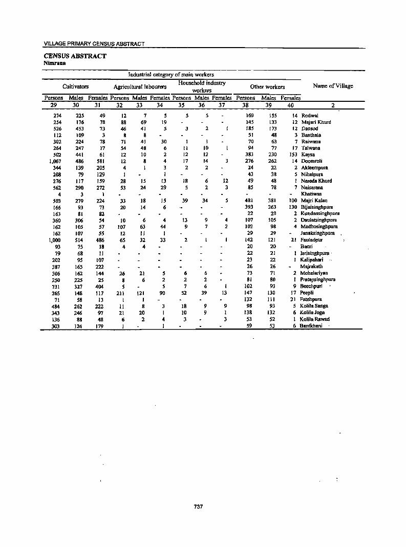
VILLAGE PRIMARY CENSUS ABSTRACT
CENSUS ABSTRACT Nimrana
Industrial category of main workers
Cultivators Agricultural labourers Household industry
Other workers Name ofVilJage workers
Persons Males Females Persons Males Females Persons Males Females Persons Males Females 29 30 3] 32 33 34 35 36 37 38 39 40 2
274 225 49 12 7 5 5 5 169 ISS 14 Rodwal 254 176 78 88 69 19 145 133 12 Majari Khurd 526 453 73 46 41 5 3 2 18S 173 12 Dausod 112 109 3 8 8 51 48 3 Bantbala 302 224 78 71 41 30 1 1 70 63 7 Raiwana 264 247 17 54 48 6 II 10 94 77 17 Talwana S02 441 61 12 10 2 12 12 383 230 153 Kaysa
1,067 486 581 12 8 4 17 14 3 276 262 14 Doomroli 344 139 205 4 1 3 2 2 24 22 2 Akleempura 208 79 129 1 1 43 38 5 Nihalpura 276 117 159 28 15 13 18 6 12 49 48 1 Nareda Khurd S62 290 272 53 24 29 5 2 3 85 78 7 Naisarana
4 3 1 Khatiwas S03 279 224 33 18 15 39 34 5 481 381 100 Majri Kalan 166 93 73 20 14 6 393 263 130 Bijaisinghpura 163 81 82 22 20 2 Kundansinghpura 360 306 54 10 6 4 13 9 4 107 lOS 2 Dau1atsinghpura 162 105 57 107 63 44 9 7 2 102 98 4 Madhosinghpura 162 107 55 12 11 1 29 29 Janaksinghpum
1,000 S14 486 65 32 33 2 142 121 21 Fauladpur 93 75 18 4 4 20 20 Baori 79 68 11 22 21 lsrisinghpum .
202 95 107 23 22 KaJipahari .. 387 165 222 26 26 Ml\irakath 306 162 144 26 21 S 6 6 73 71 2 Mohalariyan
250 225 25 8 6 2 2 2 81 80 1 Pmtapsinghpura
731 327 404 S S 7 6 102 93 9 Beechpuri
265 148 117 211 121 90 52 39 13 147 130 17 Peep1i
71 58 13 I 1 132 III 21 Fatehpum
484 262 222 11 8 3 18 9 9 98 93 5 KoJilaSanga 343 246 97 21 20 1 10 9 1 138 132 6 KolilaJoga 136 88 48 6 2 4 3 3 53 52 1 Kolila Rawad 303 124 179 I 59 53 6 Bantkhani
737
DISTRICT CENSUS HANDBOOK: ALWAR
VILLAGE PRIMARY Panchayat Sarniti -
Location Industrial category
Code Name of Village Marginal workers
Cultivators Agricultural labourers Number
Persons Males Females Persons Males Females Persons Males Females 2 41 42 43 44 45 46 47 48 49
00759000 Rodwal 858 307 551 683 224 459 103 34 69 00759100 M~ari Khurd 559 160 399 368 113 255 181 46 135 00759200 Dausod 950 241 709 737 174 563 150 35 115 00759300 Banthala 190 53 137 151 41 110 36 10 26 00759400 Raiwana 657 242 415 41S 141 277 221 92 129 00759500 Talwana 768 234 534 5S4 IS3 401 173 48 125 00759600 Kaysa 1,054 314 740 882 268 614 41 13 28 00759700 Doomroli 615 2S8 387 641 273 368 15 4 11 00759800 Ak1eempura 172 93 79 156 89 67 14 4 10 00759900 Niha1pura 256 134 122 170 90 80 77 35 42 00760000 Nareda Khurd 215 lOS 110 201 96 105 6 2 4 00760100 Naisarana 423 189 234 338 150 188 79 36 43 00760400 Khatiwas 4 2 2 4 2 2 00760500 Majri Kalllll 1,062 404 658 707 261 446 289 106 183 00760600 Bijaisinghpura 207 56 151 155 42 113 17 17 00760700 Kundansinghpura 203 86 117 201 84 117 00760800 Daulatsinghpura 684 163 521 573 152 421 93 7 86 00760900 Madhosinghpura 274 96 178 173 51 122 89 36 53 00761000 Janaksinghpura 49 35 14 16 12 4 21 14 1 00761100 FauJadpur 523 215 308 384 166 218 HI 44 67 00761200 Baori 221 72 149 209 68 141 9 2 7 00761300 Isrisinghpura 10 10 9 9 I I 00761400 Kalipahari 19 13 6 11 6 5 I I 00761500 Majrakatb 100 50 SO 89 45 44 7 3 4 00761600 Mohalariyan 74 45 29 62 40· 22 9 3 6 00761700 Pratapsinghpura 731 229 502 711 224 487 19 4 15 00761800 Beechpuri 61 35 26 57 35 22 3 3 00761900 PeepJi 315 103 212 149 49 100 157 49 108 00764200 Fatehpura 89 24 65 81 22 59 1 1 00764300 Kolila S80ga 262 103 159 178 62 116 72 30 42 00764400 KolilaJoga 303 76 227 219 48 171 79 25 S4 00764500 Kolila Rawad 124 ·46 78 58 22 36 16 6 10 00764700 Bantkhani 231 112 119 224 108 116 2 2
738
VILLAGE PRIMARY CENSUS ABSTRACT
CENSUS ABSTRACT Nimrana
of marginal workers Location Household industry
Other workers Non-workers
Name of Village Code workers Persons Males Females Persons Males Females Persons Males Females
Number
SO S1 52 S3 S4 SS S6 57 58 2
I 71 48 23 903 464 439 Rodwal 00759000 I 1 9 ~ 8 798 421 377 Majari Khurd 00759100 3 2 60 31 29 1,306 657 649 Dausod 00759200
3 2 1 380 172 208 BanthaIa 00759300 5 3 2 13 6 7 788 403 385 Raiwana 00759400 3 1 2 8 2 6 754 360 394 Talwana 00759500
II 2 9 120 31 89 1,552 769 783 Kaysa 00759600 12 7 5 7 4 3 1,315 732 583 Doomroli 00759700
2 2 292 144 148 Akleempura 00759800 9 9 285 147 138 Nihalpura 00759900
5 4 1 3 3 342 164 178 Nareda Khurd 00760000 4 2 2 2 1 583 302 281 Naisarana 00760100
4 1 3 Khatiwas 00760400 65 37 28 1,366 697 669 Majri Kalan 00760500 35 14 21 394 206 188 Bijaisinghpura 00760600 ,. 2 2 178 93 85 Kundansinghpura 00760700
8 7 10 3 7 741 386 355 Daulatsinghpura 00760800 1 1 II 9 2 703 348 355 Madhosinghpura 00760900 3 3 9 9 382 163 219 Janaksinghpura 00761000 2 1 26 4 22 1,303 665 638 Fauladpur 00761100
3 2 1 150 73 77 Banri 00761200 330 132 198 Isrisinghpura 00761300
7 6 232 137 95 Kalipahari 00761400 4 2 2 365 210 155 Majrakath 00761500 3 2 1 642 298 344 Mohalariyan 00761600 1 I 384 187 197 Pratapsinghpura 00761700
1 1 733 403 330 Beechpuri 00761800 3 3 6 5 I 976 453 523 Peepli 00761900
7 2 5 429 194 235 Fatehpura 00764200 3 2 9 9 766 386 380 KolilaSanga 00764300
5 3 2 1,086 532 554 KolilaJoga 00764400 42 11 31 8 7 1 436 197 239 KolilaRawad 00764500
5 4 424 225 199 Bantkhani 00764700
739
Location Code
Number Name of Village
2
0003 Mandawar (Total) 0003 Mandawar (Rural) 0003 Mandawar (Urban)
Mandawar (Rural) 00771300 Bawad 00771400 Ramsinghpura 00771500 ~anka 001716ao Lamachpur 00771700 ~irzapur 00771800 Bcerod 00771900 Palawa 00772000 Gadli 00772100 Dadhiya 00772200 Gadoowas 00772300 Beejwad Chauhan 00772400 Hulmana Kalan 007'72500 Hulmana Khurd 0077260'0 Bhojpuri 00772700 Manethi 0077280,() lalwas 00772900 Molawas 00713000 Bebwr lat 001173100 Sanoli 00773200' BhoongBra Thethar 00773300 Mundanwara Kalan . 00773400 Mundanwara Khiltd 00173SbQ. Sh~adpur 0\)71360'() lasai ot}71'j,Uo Nangal Udiya 0(1773800 Sarai Kalan 00773900 Sirod Khurd 00774000. Sirod Kalan QQ1711J)JL NlII)gal Siya 00774200 Ajarka 00774300 Bhagola Abeer 00774400 Seel Gaon 00774500 Sanchod 00774600 Alipur 00774700 Basni 00774800 Bhagoll\jat 00774900 Darbarpur 00775000 Sundarwari 00775100 Bhanot 00775200 Majra 00775300 Todarpur 00775400 Gola Hera 00775500 Munpur 00775600 Jagiwara 00775700 ShekhBWas 00775800 Bheckhawm 00775900' RiYwara 00776000 Majri Bhands
. ;!JOn6i!OO" .~i Kot . 0077~OO\ .:Bhoongara Aheer
001163:00.: '~K:!'0!tri 00776400 ~P.allmara Kalan 007.76500: 'SwarooP"Sarai . 00716600 Mundiya K1iera
DISTRICT CENSUS HANDBOOK: ALWAR
VILLA:GE PRIMARY PanchayatSamiti -
Total population Area of
Number of (including institutional and -Population in-the
age-group 0-6 Village in households houseless population) hectares ~:-----:-:~--~:-,--.-- --=--.;.....--:-.-::--~:=:---:"-
3 4
57,353.00 57,353.00
391.0 198.0
1,072.0 277.0 391.0 368.0 505.0 262.0 288.0 617.0
1,131.0 327.0 281.0 280.0 264.0 269.0 269.0 581.0 399.0 377.0 404.0 296.0 221.0 401.0 417.0 382.0 247.0 216.0 177.0 342.0 283.0
1,236.0 644.0 296.0 729.0 413,0 434.0 242.0 510.0 297.0 219.0 193.0 205.0 233.0 157.0 132.0 390.0 400.0 811.0 328.0 372.0 396.0 182.0 234.0
30,194 30,194
472 135 327
86 227 196 341 184 250 357 608 94
123 112 147 253 333 528 342
7 320 108 112 259 201 275 . 184 123 ·95 244 183 381 158 152 324 192 313 157 146 177 160 102 59
207 98 91
286 202 420 193 110 145 180 181
'Persons :Males :Females .Persons Males Females 5 6 7.. 8 _9 10
197,582 197,582
2,980 797
1,826 522
1,383 1,337 2,295 1,166 1,443 2,470 4,163
547 860 766 988
1,542 1,842 3,116 1,983
44 2,133
621 794
1,683 1,470 1,709 1,201
751 . .s82 1,476 1,404 2,300 1,030
997 2,047 1,364 1,911
934 915
1,165 1,017
712 393
1,414 630 639
1,787 1,252 2,645 1,381 ,763 926
l;200 1;233
103,015 103,015
1,564 428 980 256 728 72S
1,194 616 761
1,280 2,166
290 449 401 511 786 965
1,657 1,021
19 1,088
300 413 865 767 875 627 398 306 780 745
1,199 550 553
1,122 721 998 489 451 600 521 348 210 743 346 322 932 638
1,378 712 399 471 607 648
94,567 35,992 19,366 16,626 16,626 94,567 35,992 19,366
1,416 369 846 266 655 612
1,101 550 682
1,190 1,997
257 411 365 477 756 877
1,459 962 25
1,045 321 381 818 703 834 574
·:353 ~276
696 659
1,101 480 444 925 643 913 445 464 565 496 364 183 671 284 317 855 614
1,267 " 659 ~ 364 455
. "593 585
557 323 234 149 84 65 317 180 137
88 49 39 217 128 89 195 121 74 376 212 164 191 III 80 165 91 74 430 217 213 753 421 332 83 48 35
163 88 75 . 126 70 56 . 161 92 69 266 142 124 299 165 .,: 134 448 253 ' 195 319 179 140
8 4 4 293 174 119
86 47 39 136 71 65 300 158 142 280 152 . 128 298 143 155 192 123 69 111 67 44
J04 _ .... .61.,. _. _ 43 233 124 109 215 102 113 459 255 204 236 123 113 189 96 93 392 222 170 254 136 118 313 174 139 142 84 58 148 66 82 203 IlS 88 183 101 82 142 68 74 67 37 30
244 135 10.9 57 33 24 67 32 35
262 146 116. 201 lOS 96
.. , . .39?. ,~.I!J"::"i.~;;.I8S __ , ,r .. 216 .' _ 126. ' ;"" <" :90. .. _, U8 ' "63 . 1. ••• '; •. 55 "'. ~163· _-,~ . . "117 : :l~':: .. 7ft ~. '253 .1as:" ~: :116' " . • 217 • 1'23 ,. ' §4
VILLAGE PRIMARY CENSUS ABSTRACT
CENSUS ABSTRACT Mandawar
Scheduled Castes popuation Scheduled Tribes population Literates Name of ViII age
Persons Males Females Persons Males Females Persons Males Females II 12 13 [4 IS 16 [7 18 [9 2
38,233 19,892 18,341 6,137 3,145 2,992 110,905 70,595 40,310 Mandawar (Total) 38,233 19,892 18,341 6,137 3,145 2,992 110,905 70,595 40,310 Mandawar (Rural)
Mandawar (Urban) Mandawar (Rural)
458 244 214 1,714 1,107 607 Bawad 196 108 88 474 317 157 Ramsinghpura 622 340 282 164 92 72 1,133 719 414 Manka
91 43 48 365 195 170 Lamachpur 206 117 89 43 21 22 971 553 418 Mirzapur 177 96 81 24 12 12 826 532 294 Beerod 308 158 150 1,460 887 573 Palawa 286 153 133 28 17 II 724 446 278 Gadli 228 125 103 138 63 75 913 589 324 Dadhiya 462 242 220 81 43 38 1,543 940 603 Gadoowas 603 315 288 349 168 ' 181 2,482 1,483 999 Beejwad Chauhan 142 79 63 31 18 13 354 215 139 Hulmana Kalan 84 45 39 493 307 186 Hulmana Khurd
219 III 108 489 292 197 Bhojpuri 75 39 36 41 24 17 711 396 315 Manethi \. 235 110 125 17 9 8 945 578 367 Ja[was
524 283 241 29 17 12 1,129 735 394 Molawas ,t~ ••
530 270 260 2,012 1,288 724 BehrorJat ;,
273 141 132 1,258 778 480 Sanoli 29 14 15 Bhoongara Thethar
242 117 125 28 17 II 1,430 840 590 Mundanwara Kalan 32 13 19 22 10 12 474 239 235 Mundanwara Khurd
115 63 52 8 3 5 433 280 153 ShJhjadpur 290 148 142 71 37 34 928 598 330 Jasai 259 133 126 91 50 41 941 565 376 Nangal Udiya 323 165 158 385 186 199 986 659 327 Sarai Kalan 193 99 94 825 465 360 Sirod Khurd 95 54 41 445 301 144 Sirod Kalan
125 67 58 313 202 III Nangal Siya 307 156 151 916 581 335 Ajarka
77 48 29 886 585 301 Bhagola Aheer 1,271 665 606 1,033 679 354 Seel Gaon
244 127 117 361 275 86 Sanchod 186 95 91 399 324 75 Alipur 890 510 380 1,114 740 374 Basni 205 106 99 800 516 284 Bhagolajat 176 86 90 1,211 751 460 Darbarpur III 62 49 586 364 222 Sundarwari 186 88 98 31 15 [6 545 334 211 Bhanot 149 77 72 23 12 II 647 426 221 Majra 140 72 68 550 347 203 Todarpur 203 98 105 352 222 130 GolaHera
39 19 20 258 151 107 Munpur 292 158 134 813 543 270 Jagiwara
36 24 12 486 290 196 Shekhawas 88 45 43 494 275 219 Bhcckhawas
228 108 120 II 5 6 1,117 691 426 Rajwara 234 114 120 6 3 3 767 479 288 Majri Bhanda 478 239 239 8 2 6 1,710 1,064 646 Karni Kot 105 50 55 871 545 326 Bhoongara Aheer 99 52 47 -,., 514 308 206 Khohri 97 47 50 155 79 76 " 543 336 207 Padmara Kalan
112 60 52 491 248 2:43 714 423 291 Swaroop Sarai 115 62 53 245 130 115 732 469 263 Mundiya Khera
741
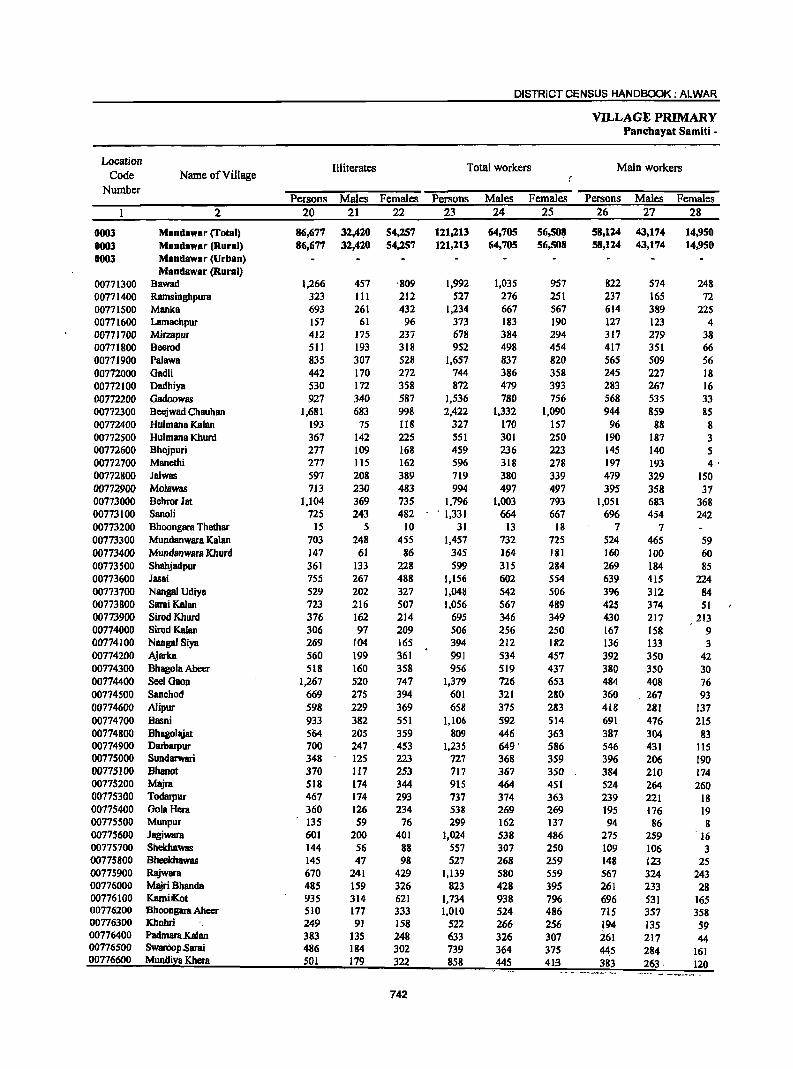
DISTRICT CENSUS HANDBOOK: ALWAR
VILLAGE PRIMARY Panchayat Sarniti -
Location Illiterates Total workers Main workers
Code Name of Village Number
Persons Males Females Persons Males Females Persons Males Females 2 20 21 22 23 24 25 26 27 28
0003 Mandawar (Total) 86,677 32,420 54,257 121,213 64,705 56,508 58,124 43,174 14,950 0003 MaDdawar (Rural) 86,677 32,420 54,257 121,213 64,705 56,508 58,124 43,174 14,950 0003 MaDdawar (Urban)
Mandawar (Rural) 00771300 Bawad 1,266 457 ,809 1,992 1,035 957 822 574 248 00771400 RamsinghpurB 323 III 212 527 276 251 237 165 72 00771500 Manka 693 261 432 1,234 667 567 614 389 225 00771600 Lamachpur 157 61 96 373 183 190 127 123 4 00771700 Mirzapur 412 175 237 678 384 294 317 279 38 00771800 Beerod 511 193 318 952 498 454 417 351 66 00771900 Palawa 835 307 528 1,657 837 820 565 509 56 00772000 Oadli 442 170 272 744 386 358 245 227 18 00772100 Dadhiya 530 172 358 872 479 393 283 267 16 00772200 Oadoowas 927 340 587 1,536 780 756 568 535 33 00772300 Beejwad Chauhan 1,681 683 998 2,422 1,332 1,090 944 859 85 00772400 Hulmana Kalan 193 75 118 327 170 157 96 88 8 00772500 Hulmana Khurd 367 142 225 551 301 250 190 187 3 00772600 Bhojpuri 277 109 168 459 236 223 145 140 5 00772700 Manethi 277 115 162 596 318 278 197 193 4' 00772800 Jalwas 597 208 389 719 380 339 479 329 150 00772900 Molawas 713 230 483 994 497 497 395 358 37 00773000 Behror Jat 1,104 369 735 1,796 1,003 793 1,051 683 368 00773100 Sanoli 725 243 482 . 1,331 664 667 696 454 242 00773200 Bhoongara Thethar IS 5 10 31 13 18 7 7 00773300 Mundanwara Kalan 703 248 455 1,457 732 725 524 465 59 00773400 Mundanwara Khurd 147 61 86 345 164 181 160 100 60 00773500 Shabjadpur 361 133 228 599 315 284 269 184 85 00773600 Jasai 755 267 488 1,156 602 554 639 415 224 00773700 Nanga! Udiya 529 202 327 1,048 542 506 3% 312 84 00773800 Sarai Kalan 723 216 507 1,056 567 489 425 374 51 00773900 SirodKhllrd 376 162 214 695 346 349 430 217 213 00774000 Sirod Kalan 306 97 209 S06 256 250 167 158 9 00774100 NangalSiya 269 104 165 394 212 182 136 133 3 00774200 Ajarka 560 199 361 991 534 457 392 350 42 00774300 Bhagola Aheer 518 160 358 956 519 437 380 350 30 00774400 SeeJ Gaun 1,267 520 747 1,379 726 653 484 408 76 00774500 Sanchod 669 275 394 601 321 280 360 . 267 93 00774600 Alipur 598 229 369 658 375 283 418 281 137 00774700 Basni 933 382 551 1,106 592 514 691 476 215 00774800 Bhlgoll\iat Si54 20S 359 809 446 363 387 304 83 00774900 Darbarpur 700 247 .453 1,235 649 ' 586 546 431 115 00775000 SlIndarwari 348 125 223 727 368 359 396 206 190 00775100 Bhanot 370 117 253 717 367 350 384 210 174 00775200 Majra 518 174 344 915 464 451 524 264 260 00775300 Todarpur 467 174 293 737 374 363 239 221 18 00775400 GolaHera 360 126 234 538 269 269 195 -176 19 00775500 Munpur 135 59 76 299 162 137 94 86 8 00775600 Jagiwara 60] 200 401 1,024 538 486 275 259 16 00775700 ShekhaWBS 144 56 88 557 307 250 109 106 3 00775800 BheeIchawas 145 47 98 527 268 259 148 123 25 00775900 Rajwara 670 241 429 1,139 580 559 567 324 243 00776000 Majri Bhanda 485 159 326 823 428 395 261 233 28 00776100 KamiOCot 935 314 621 1,734 938 79.6 696 531 165 00776200 ·Bhoongara Aheer 510 177 333 1,010 524 486 715 357 358 00776300 Khohri 249 91 158 522 266 256 194 135 59 00776400 Padmara.KaIan 383 135 248 633 326 307 261 217 44 00776500 Swaniop.Sarai 486 184 302 739 364 375 445 284 161 00776600 Mun'(fi~a Khera 501 179 322 858 445 413 383 263· 120 .. - .~ .. ---........
742
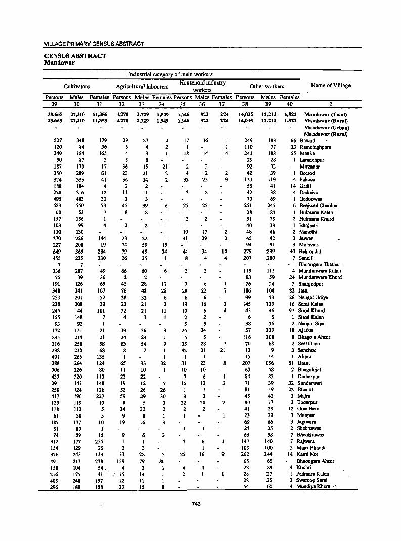
VILLAGE PRIMARY CENSUS ABSTRACT
CENSUS ABSTRACT Mandawar
Industrial category of main workers
Cultivators Agricultural labourers Household industry
Other workers Name ofViUage workers
Persons Males Females Persons Males Females Persons Males Females Persons Males Females 29 '30 31 32 33 34 35 36 37 38 39 40 2
38,665 17,310 11,355 4,178 1,719 1,549 1,146 911 114 14,035 11,113 1,811 Mandawar (Total) 38,665 17,310 11,355 4,178 1,719 1,549 1,146 911 114 14,035 12,113 1,811 Mandawar (Rural)
Mandawar (Urban) Mandawar (RuraJ)
527 348 179 29 27 2 17 16 249 183 66 Bawad 120 84 36 6 4 2 110 77 33 Rarnsinghpura 349 184 165 4 3 I 18 14 4 243 188 55 Manka 90 87 3 8 8 29 28 Lamachpur
187 170 17 36 15 21 2 2 92 92 Mirzapur 350 289 61 23 21 2 4 2 2 40 39 1 Beerod 374 333 41 36 34 2 32 23 9 123 119 4 Palawa 188 184 4 2 2 55 41 14 Gadli 228 216 12 11 11 2 2 42 38 4 Dadhiya 495 463 32 3 3 70 69 1 Gadoowas 623 550 73 45 39 6 2S 25 2S1 24S 6 Beejwad Chauhan 60 53 7 8 8 28 27 1 Hulmana-Kalan
157 156 1 2 2 31 29 2 Hulmana Khurd 103 99 4 2 2 40 39 Bhojpuri 130 130 19 17 2 48 46 2 Manethi 370 226 144 23 22 1 41 39 2 45 42 3 Jalwas 227 208 19 74 59 IS 94 91 3 Molawas 649 365 284 79 45 34 44 34 10 279 239 40 Behror Jat 4S5 22S 230 26 25 8 4 4 207 200 7 Sanoli
7 7 Bhoongara Thcthar 336 287 49 66 60 6 3 3 119 115 4 Mundanwara Kalan
7S 39 36 2 2 83 59 24 Mundanwara· Khurd 191 126 65 45 28 17 7 6 1 26 24 2 Shahjadpur 348 241 107 76 48 28 29 22 7 186 104 82 Jasai 253 201 52 38 32 6 6 6 99 73 26 Nanga! Udiya 2]8 208 30 23 21 2 19 16 3 145 129 16 Sarai Kalan 245 144 101 32 21 11 10 6 4 143 46 97 Sirod Khurd ISS 148 7 4 3 1 2 2 6 5 I Sirod Kalan 93 92 1 5 5 38 36 2 Nangal Siya
172 151 21 39 36 3 24 24 157 139 18 Ajarka 235 214 21 24 23 1 5 5 116 108 8 Bhagola Aheer 316 258 58 63 54 9 35 28 7 70 68 2 Seel Gaon 298 230 68 8 7 I 42 21 21 12 9 3 Sanchod 401 266 1]5 1 1 I I 15 14 1 Alipur 388 264 124 65 33 32 31 23 8 207 IS6 51 Basni 306 226 80 11 10 I 10 10 60 58 2 Bhagoliljat 433 320 113 22 22 7 6 I 84 83 1 Darbarpur 291 143 148 19 12 7 15 12 3 71 39 32 Sundarwari 250 124 126 52 26 26 I I 81 S9 22 Bhano! 417 190 227 59 29 30 3 3 4S 42 3 Majra 129 119 10 8 5 3 22 20 2 80 77 3 Todarpur 118 113 5 34 32 2 2 2 41 29 12 GolaHera 61 58 3 9 8 1 23 20 3 Munpur
187 177 10 19 16 3 69 66 3 Jagiwara 81 80 27 25 2 Shekhawas 74 59 15 9 6 3 65 58 7 Bheekhawas
412 177 235 1 1 7 6 147 140 7 Rajwara 154 129 25 3 3 I I 103 100 3 Majri Bhanda 376 243 133 33 28 5 25 16 9 262 244 18 KamiKot 491 213 278 159 79 80 65 65 Bhoongara Aheer 158 104 54. 4 3 4 4 28 24 4 Khohri 216 175 41 .• ~ 15 14 1 2 28 27 1 Padmara Kalan 405 248 157 12 11 I 28 2S 3 Swaroop Sarai 296 188 108 23 15 8 64 60 4 Mundiya Khera .•
743
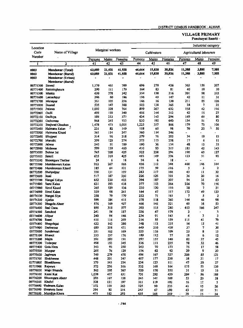
DISTRICT CENSUS HANDBOOK: ALWAR
VILLAGE PRIMARY Panchayat Samiti -
Location Industrial category
Code Name of Village Marginal workers
Cultivators Agricultural labourers Number
Persons Males Females Persons Males Females Persons Males Females 2 41 42 43 44 45 46 47 48 49
0003 Mandawar (Total) 63,089 21,531 41,558 46,664 15,838 30,826 11,388 3,880 '7,508 0003 Mandawar (Rural) 63,089 21,531 41,558 46,664 15,838 30,826 11,388 3,880 7,508 0003 Mandawar (Urban)
Mandawar (Rural) 00771300 Bawad 1,170 461 709 696 270 426 363 156 207 00771400 Ramsinghpura 290 111 179 164 83 81 40 10 30 00771500 Manka 620 278 342 354 138 216 201 98 103 00771600 Lamachpur 246 60 186 196 49 147 42 11 31 00771700 Mirzapur 361 105 256 146 16 130 211 85 126 00771800 Beerod 535 147 388 503 138 365 28 7 21 00771900 Palawa 1,092 328 764 899 267 632 158 42 116 00772000 Oadli 499 159 340 456 144 312 42 15 27 00772100 Oadhiya 589 212 377 434 140 294 149 69 80 00772200 Gadoowas 968 245 723 830 190 640 134 51 83 00772300 Beejwad Chauhan 'I 1,478 473 1,005 1,223 357 866 179 73 106 00772400 Hulmana Kalan " 231 82 149 158 60 98 70 20 ;~ 50 00772500 Hulmana Khurd 361 114 247 360 114 246 00m600 Bhojpuri 314 96 218 219 16 203 34 19 15 00172700 Manethi 399 125 274 373 115 258 17 6 11 00772800 Jalwas 240 51 189 190 36 154 48 15 33 00772900 Molawas 599 139 460 410 93 317 185 42 143 Q0773000 Behror Jat 745 '320 425 522 228 294 190 63 127 00713100 Sanoli 635 210 425 493 169 324 123 31 92 00713200 Bhoongara Thethar 24 6 18 24 6 18 ' 00713300 Mundanwara Kalan 933 267 666 456 112 344 460 146 314 00773400 Mundanwara Khurd 185 64 121 175 59 ·116 5 3 2 00773500 Shahjadpur 330 131 199 283 Jl7 166 43 II 32 00773600 Jasai 517 187 330 226 125 101 36 20 16 00773700 Nangal Udiya 652 230 422 394 187 207 94 31 63 00773800 Sarai Kalan 631 193 438 377 113 264 226 70 156 00773900 SirodKhurd 265 129 136 230 120 110 28 7 21 00774000 Sirod Kalan 339 98 241 164 47 117 172 ' 49 123 00774100 Nanga! Siya 258 79 179 232 71 161 7 5 2 00774200 Ajarka 599 184 415 378 1I8 260 144 46 98 00774300 Bhagola Aheer 576 169 401 466 145 321 69 16 53 00774400 See] Gaon 895 318 577 395 115 280 413 166 247 00774500 Sanchod 241 54 187 226 47 179 3 3 00774600 Alipur 240 94 146 234 91 143 6 3 3 00714100 Basni 415 116 299 214 55 159 III 41 70 00714800 Bhagolajat 422 142 280 348 113 235 S4 13 41 00774900 Oarbarpur 689 218 471 649 210 439 37 7 30 00775000 Sundarwari 331 162 169 225 116 109 23 8 15 00775100 Bhanot 333 157 176 189 112 77 18 6 12 00775200 Majra 391 200 191 297 151 140 82 31 45 00775300 Todarpur 498 153 - 345 336 III 225 78 32 46 00775400 GolaHera 343 93 250 243 70 173 75 17 58 00775500 Munpur 205 76 129 154 62 92 29 9 20 00775600 Jagiwara 749 279 470 494 167 327 206 85 121 00775700 Shekhawas 448 201 247 407 177 230 38 21 17 00775800 Bheekhawas 379 145 234 234 123 III 47 20 27 00775900 Rajwara . 572 256 316 332 168 164 175 55 120 00776000 Majri Bhanda 562 195 367 520 170 350 31 15 16 00776100 KamiKot 1,038 407 631 73J 292 439 284 96 188 00776200 Bhoongara Aheer 295 167 128 241· 141 100 53 25 28 00176300 Khohri 328 131 197 311 119 192 16 II 5 00776400 "1'admara Kalan '372 109 263 325 90 235 41 15 26 00776500 ',Swaroop:Sarai 294 80 214 24:7 67 .180 43 12 31 00776600 Mundil:a Khera ' ·475 182 293 435 166 269 39 15 24
1.;r44
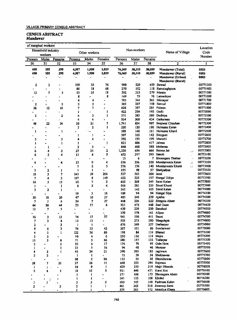
VILLAGE PRIMARY CENSUS ABSTRACT
CENSUS ABSTRACT Mandawar
of marginal workers Location
Household industry Non-workers
workers Other workers Name ofYiIlage Code
Number Persons Males Females Persons Males Females Persons Males Females
50 51 52 53 54 55 56 57 58 2
650 255 395 4,387 1,558 2,829 76,369 38,310 38,059 Mandawlr (Total) 0003 650 255 395 4,387 1,558 2,829 76;369 38,310 38,059 Mandawar (Rural) 0003
- Mandawar (Urban) 0003 Mandawar (Rural)
2 2 109 33 76 988 529 459 Bawad 00771300 86 18 68 270 152 118 Ramsinghpura 00771400
12 7 5 53 3S 18 592 313 279 Manka 00771500 8 8 149 73 76 Lamachpur 00771600 4 4 705 344 361 Mirzapur 00771700
2 2 2 2 385 227 158 Beerod 00771800 28 12 16 7 7 638 357 281 Palawa 00771900
422 230 192 Gadli 00772000 2 2 4 3 571 282 289 Dsdhiya 00772100
4 4 934 500 434 Gadoowas 00772200 48 22 26 28 21 7 1,741 834 907 Beejwad Chauhan 00772300
3 2 220 120 100 Hulmans Kalan 00772400 309 148 161 Hulmana Khurd 00772500
I I 307 165 142 Bhojpuri 00772600 5 5 4 4 392 193 199 Manethi 00772700 I I I 823 406 417 Jalwas 00772800 I 1 3 3 848 468 380 Molawas 00772900 6 4 2 27 25 2 1,320 654 666 Behror Jat ... 00773000 6 2 4 13 8 5 652 357 295 Sanoli 00773100
13 6 7 Bhoongara Thethar 00773200 4 4 13 9 4 676 356 320 Mundanwara Kalan .• t, 00773300
5 2 3 276 136 140 Mundanwara Khurd ~ ; 00773400 3 2 I I I 195 98 97 Shal\iadpur 00773500
10 3 7 245 39 206 527 263 264 Jasai 00773600 7 4 3 157 8 149 422 225 197 Nangal Udiya 00773700
18 3 IS 10 7 3 653 308 345 Sarai Kalan 00773800 I 1 6 2 4 506 281 225 Sirod Khurd 00773900 3 2 I 245 142 103 Sirod Kalan 00774000
19 3 16 188 94 94 Nangal Siya 00774100 30 10 20 47 10 37 485 246 239 Ajarka 00774200 7 1 6 34 7 27 448 226 222 Bhagola Aheer 00774300
64 20 44 23 17 6 921 473 448 Seel Gaon 00774400 12 7 5 429 229 200 Sanchod 00774500
339 178 161 Alipur 00774600 16 3 13 74 17 57 941 530 411 Basni 00774700 7 3 4 13 13 SS5 275 280 Bhagolajat 00774800 2 2 I I 676 349 327 Darbarpur 00774900 9 6 3 74 32 42 207 121 86 Sundarwari 00775000 4 3 I 122 36 86 198 84 114 Bhano! 00775100 2 2 10 4 6 250 136 114 Majra 00775200
13 5 8 71 5 66 280 147 133 Todarpur 00775300 2 2 23 6 17 174 79 95 GolaHera 00775400 1 I 21 5 16 94 48 46 Munpur 00775500 4 3 I 4S 24 21 390 205 185 Jagiwara 00775600 2 2 I I 73 39 34 Shekhawas 00775700
98 2 96 112 S4 58 Bhcekhawas 00775800 28 7 21 37 26 II 648 352 296 RiUwara 00775900
I 10 9 I 429 210 219 Majri Bhanda 00776000 5 4 18 IS 3 911 440 471 Karni Kat 00776100
I I 371 198 173 Bboongara Aheer 00776200 .. I I 241 133 108 Khohri 00776300
5 3 2 293 145 148 Padmara Kalan 00776400 2 2 2 I 461 243 218 Swaroop Sarai 00776500
I 375 203 172 Mundiya Khera 00776600
745
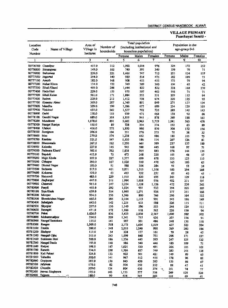
DISTRICT CENSUS HANDBOOK: ALWAR
VILLAGE PRIMARY Panchayat Samiti -
Location Area of Total population
Population in the Name ofVilJage Village in
Number of (including institutional and age-group 0-6 Code households houseless population)
Number hectares Persons Males Females Persons Males Females
2 3 4 5 6 7 8 9 10
00776700 Chandpur 417.0 312 1,992 1,016 976 324 172 152 00776800 Birsangwas 149.0 102 740 391 349 150 79 71 00776900 Balloowas 239.0 221 1,460 747 713 253 134 119 00777000 Jogawad 254:0 140 989 514 475 182 109 73 00777100 Amoth 182.0 148 908 453 455 173 79 94 00777200 NaharKhera 134.0 122 749 389 360 104 62 42 00777300 Sihali Khurd 409.0 288 1,644 822 822 338 168 170 00777400 HadaHeri 229.0 ISS 970 507 463 146 75 71 00777500 SihaliKalan 561.0 171 1,084 553 531 209 115 94 00777600 RadWB 229.0 213 1,412 738 674 220 125 95 00777700 Khanpur Meer 399.0 287 1,740 891 849 271 137 134 00777800 Mandha 329.0 199 1,286 677 609 234 129 105 00777900 TinkilUri 437.0 242 1,527 792 735 285 . 142 143 00778000 Garbi 170.0 153 939 471 4~8 158 92 66 00778100 Gandhi Nagar 689.0 304 1,819 941 878 349 188 161 00778200 Mundawar 1,878.0 891 5,682 2,963 2,719 1,041 563 478 00778300 Nangal Raniya 155.0 89 728 JS4 374 152 63 89 00778400 U1aberi 416.0 272 1,850 980 870 308 172 136 00778500 Surajpura 206.0 104 551 276 275 70 38 32 00778600 Mau 279.0 174 1,238 652 586 180 105 75 00778700 Rambas 321.0 147 1,100 586 514 207 126 81 00778800 Bheenwada 267.0 162 1,250 661 589 237 137 100 00778900 Kalooka 227.0 145 945 500 445 168 97 71 00779000 Padmara Khurd 302.0 292 1,838 955 883 278 144 134 00779100 Bapdoli 412.0 75 473 248 225 105 48 57 00779200 Ml\iriKhola 227.0 227 1,317 699 678 233 123 110 00779300 ehhapur 290.0 167 1,020 550 470 165 100 65 00779400 Dhokal Nagar 100.0 91 588 304 284 91 53 38 00779500 Sodawas 517.0 401 2,871 1,513 1,358 582 294 288 00779600 Kolcawas 125:0 63 463 232 231 83 40 43 00779700 Hatoondi 483.0 229 1,515 820 695 245 129 116 00779800 lhajharpur 447.0· 311 1,984 1,028 956 402 211 191 00779900 Cheeruni 915.0 . 347 2,254 1,128 1,126 472 230 242 00780000 PeepJi 465.0 292 1,924 991 933 394 205 189 00780100 SiyaKhoh 639.0 354 1,995 1,071 924 377 211 166 00780200 Menpur 934.0 256 1,566 800 766 296 164 132 00780300 Shreekrishan Nagar 665.0 295 2,104 1,113 991 345 196 ]49 00780400 Sabalgarh 642.0 142 1,221 633 588 226 lIS III 00780500 Sbyopur 237.0 156 1,149 596 553 244 129 ItS 00780600 Renagiri 471.0 172 1,180 618 562 226 130 96 00780700 Pebal 1,626.0 836 5,423 2,856 2,567 1,090 588 502 00780800 Mohammadpur 334.0 209 1,341 715 626 207 116 91 00780900 Nanga! Santokara 155.0 141 987 501 486 248 130 118 00781000 Rasgan 1,009.0 518 3,173 1,654 1,519 627 323 304 00781100 Oantla 200.0 348 2,035 1,040 995 389 203 186 00781200 Shahpur 1Il.0 54 338 177 161 70 28 42 00781300 Nangali Ojha 313.0 243 1,599 848 751 298 171 127 00781400 Sukhrnan Heri 300.0 186 1,236 643 593 247 125 122 '007'8ISOO Nangal BanIa 193.0 140 986 540 446 180 109 71 00781600 Raipur 198.0 147 1,021 530 491 206 105 101 00181700 Ranoth 534.0 238 1,566 817 749 283 145 138 00181300 Kali Pahari 324.0 133 922 501 421 149 89 60 "O07111900 Tehadka 302;0 141 967 512 455 178 96 82 '00782000 Gopipura 287.0 130 843 450 393 133 66 67 00182100 Jalpiwas 178.0 82 504 252 252 88 47 41 007WOO Choodla 35910 -I24 804 430 374 ~c: , 151 74 77 00182300 Jeevan Singhpura 195,0 143 1,133 577 556 249 129 120 00782400 Tejpura ·· ... t 188:0 90 614 345 269. 110 69 41
746
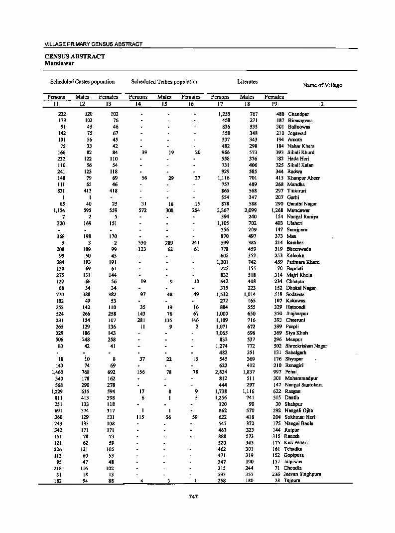
VILLAGE PRIMARY CENSUS ABSTRACT
CENSUS ABSTRACT MBndawar
Scheduled Castes popuation Scheduled Tribes population Literates Name of Village
Persons Males Females Persons Males Females Persons Males Females II 12 13 14 15 16 17 18 19 2
222 120 102 1,255 767 488 Chandpur 179 103 76 458 271 187 Birsangwas 91 45 46 836 535 301 Balloowas
142 75 67 558 348 210 Jogawad 101 56 45 537 343 194 Amoth 75 33 42 482 298 184 NaharKhera
166 82 84 39 19 20 966 573 393 Sihali Khurd 232 122 110 558 376 182 HadaHeri 110 56 54 731 406 325 Sihali Kalan 241 123 118 929 585 344 Radwa 148 79 69 56 29 27 1,116 701 415 Khanpur Aheer 111 65 46 757 489 268 Mandha 831 413 418 865 568 297 Tinkiruri
1 1 554 347 207 Garhi 65 40 25 31 16 15 878 588 290 Gandhi Nagar
1,154 S9S SS9 S72 308 264 3,367 2,099 1,268 Mundawar 7 2 5 394 240 154 Nangal Raniya
320 169 151 1,105 702 403 Ulaheri 3S6 209 147 Surajpura
368 198 170 870 497 373 Mao 5 3 2 530 289 241 599 385 214 Rambas
208 109 99 123 62 61 778 459 319 Bheenwada 95 SO 45 60S 352 253 Kalooka
384 193 191 1,201 742 459 Padmara Khurd 130 69 61 225 ISS 70 Bapdoli 275 131 144 832 518 314 Majri Khola 122 66 S6 19 9 10 642 408 234 Chhapur 68 34 34 375 223 152 Dhokal Nagar
770 388 382 97 48 49 1,532 1,014 518 Sodawas 102 49 53 272 165 107 Kokawas 252 142 110 35 19 16 884 555 329 H~toondi
524 266 258 143 76 67 1,000 650 350 Jhajharpur 231 124 107 281 135 146 1,109 716 393 Cheeruni 265 129 136 11 9 2 1,071 672 399 Peepli 329 186 143 1,065 696 369 SiyaKhoh 506 248 258 833 537 296 Menpur 83 42 41 1,274 772 502 Shreekrishan Nagar
482 351 131 Sabalgarh 18 io 8 37 22 15 545 369 176 Sbyopur
143 74 69 622 412 210 Renagiri 1,460 768 692 156 78 78 2,834 1,837 997 Pehal
340 178 162 812 511 301 Mobammadpur
568 290 278 444 297 147 Nangal Santokara 1,229 635 594 17 8 9 1,738 1,116 622 Rasgan
811 413 398 6 I 5 1,256 741 SIS Dantla 251 133 118 120 90 30 Shahpur 691 374 317 I 1 862 570 292 NangaJi Ojha 260 129 131 115 56 59 622 418 204 Sukhman Heri 243 135 108 547 372 175 Nangal Baola 342 171 171 467 323 144 Raipur lSI 78 73 888 573 315 Ranoth 121 62 59 520 345 175 Kali Pahari 226 121 105 462 301 161 Tehadka 113 60 53 471 319 152 Gopipura
95 47 48 347 190 157 Jalpiwas 218 116 102 315 244 71 Choodla
31 18 13 593 357 236 Jeevan Singhpura 182 94 88 4 3 258 180 78 Tejpura
747
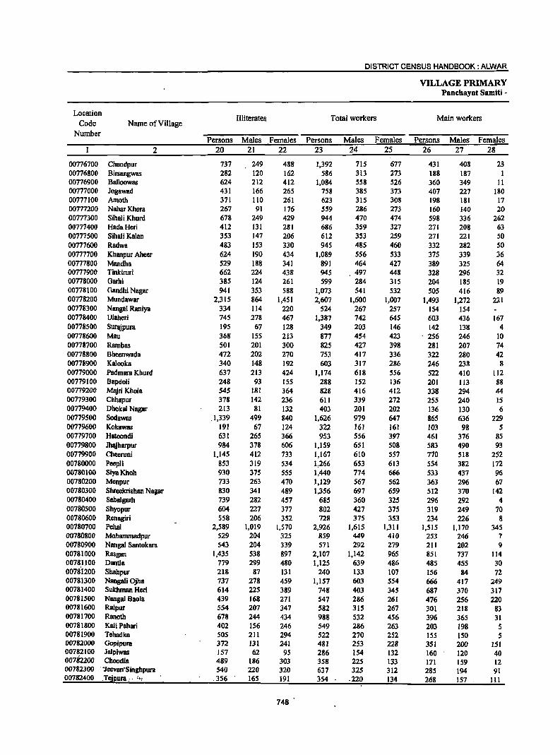
DISTRICT CENSUS HANDBOOK: ALWAR
VILLAGE PRIMARY Panchayat Samiti -
Location Illiterates Total workers Main workers
Code Name of Village Number
Persons Males Females Persons Males Females Persons Males Females 2 20 21 22 23 24 25 26 27 28
00776700 Chandpur 737 249 488 1,392 715 677 431 408 23 00776800 Birsangwas 282 120 162 586 313 273 188 187 1 00776900 Balloowas 624 212 412 1,084 558 526 360 349 11 00777000 Jogawad 431 166 265 758 385 373 407 227 180 00777100 Amoth 371 1I0 261 623 315 308 198 181 17 00777200 NaharKhera 267 91 176 559 286 273 160 140 20 00777300 SihaliKhurd 678 249 429 944 470 474 598 336 262 00777400 HadaHeri 412 131 281 686 359 327 271 208 63 00777500 Sihali Kalan 353 147 206 612 353 259 271 221 50 00777600 Radwa 483 153 330 945 485 460 332 282 50 00777700 Kbanpur Aheer 624 190 434 1,089 556 533 375 339 36 00777800 Mandha 529 188 341 891 464 427 389 325 64 00777900 Tinkiruri 662 224 438 945 497 448 328 296 32 00778000 Garhi 385 124 261 599 284 315 204 185 19 00778100 Gandhi Nagar 941 353 588 1,073 541 532 505 416 89 00778200 Mundawar 2,315 864 1,451 2,607 1,600 1,007 1,493 1,272 221 00778300 Nanga1 Raniya 334 114 220 524 267 257 154 154 00778400 Ulaheri 745 278 467 1,387 742 645 603 436 167 00778500 Surajpura 195 67 128 349 203 146 142, 138 4 00778600 Mau 368 155 213 877 454 423 - 256 246 10 00778700 Rarnbas 501 201 300 825 427 398 281 207 74 00778800 Bheenwada 472 202 270 753 417 336 322 280 42 00778900 Kalaoka 340 148 192 603 317 286 246 238 8 00779000 PadmarB Khurd 637 213 424 1,174 618 556 522 410 112 00779100 Bapdoli 248 93 155 288 152 136 201 113 88 00779200 MBjri Khola 545 181 364 828 416 412 338 294 44 00779300 Chhapur 378 142 236 611 339 272 255 240 15 00779400 Dhaka! Nagar 213 81 132 403 201 202 136 130 6 00779500 Sodawas _1,339 499 840 1,626 979 647 865 636 229 00779600 Kokawas 191 67 124 322 161 161 103 98 5 00779700 Hatoondi 631 265 366 953 556 397 461 376 85 00779800 Jhajharpur 984 378 606 1,159 651 508 583 490 93 00779900 Cheeruni 1,145 412 733 1,167 610 557 770 518 252 00780000 PeepJi 853 319 534 1,266 653 613 554 382 172 00780100 SiyaKhob 930 375 555 1,440 774 666 533 437 96 00780200 Menpur 733 263 470 1,129 567 562 363 296 67 00780300 Shreekrishan Nagar 830 341 489 1,356 697 659 512 370 142 00780400 Sabalgarh 739 282 457 685 360 325 296 292 4 00780500 Shyopur 604 227 377 802 427 375 319 249 70 00780600 Renagiri 558 206 352 728 375 353 234 226 8 00780700 Pebal 2,589 1,019 1,570 2,926 1,615 1,311 1,515 1,170 345 00780800 Mohammadpur 529 204 325 859 449 410 253 246 7 00780900 Nanga! Santokara 543 204 339 571 292 279 211 202 9 00781000 Rasgan 1,435 538 897 2,107 1,142 965 851 737 114 00781100 Dantla 779 299 480 1,125 639 486 485 455 30 0078'1200 Shahpur 218 87 131 240 133 107 156 84 72 00781300 Nangali Ojha 737 278 459 1,157 603 554 666 417 249 00781400 SulChman Heri 614 225 389 748 403 345 687 370 317 00781500 Nanga! Baola 439 168 271 547 286 261 476 256 220 00781600 Raipur 554 207 347 582 315 267 301 218 83 00781700 Ranoth 678 244 434 988 532 456 396 365 31 00781800 Kali Pahari 402 156 246 549 286 263 203 198 5 00781900 Tehadka 505 211 294 522 270 252 155 150 5 00782000 Gopipura 372 131 241 481 253 228 351 200 151 00782100 Jalpiwas 157 62 95 286 154 132 160 120 40 00782200 Choodla 489 186 303 358 225 133 171 159 12 00782300 '1eevan'Singhpura 540 220 320 637 325 312 285 194 91 00782400 .Tejpura __ . :., .356 165 191 354 -220 134 268 157 III
748
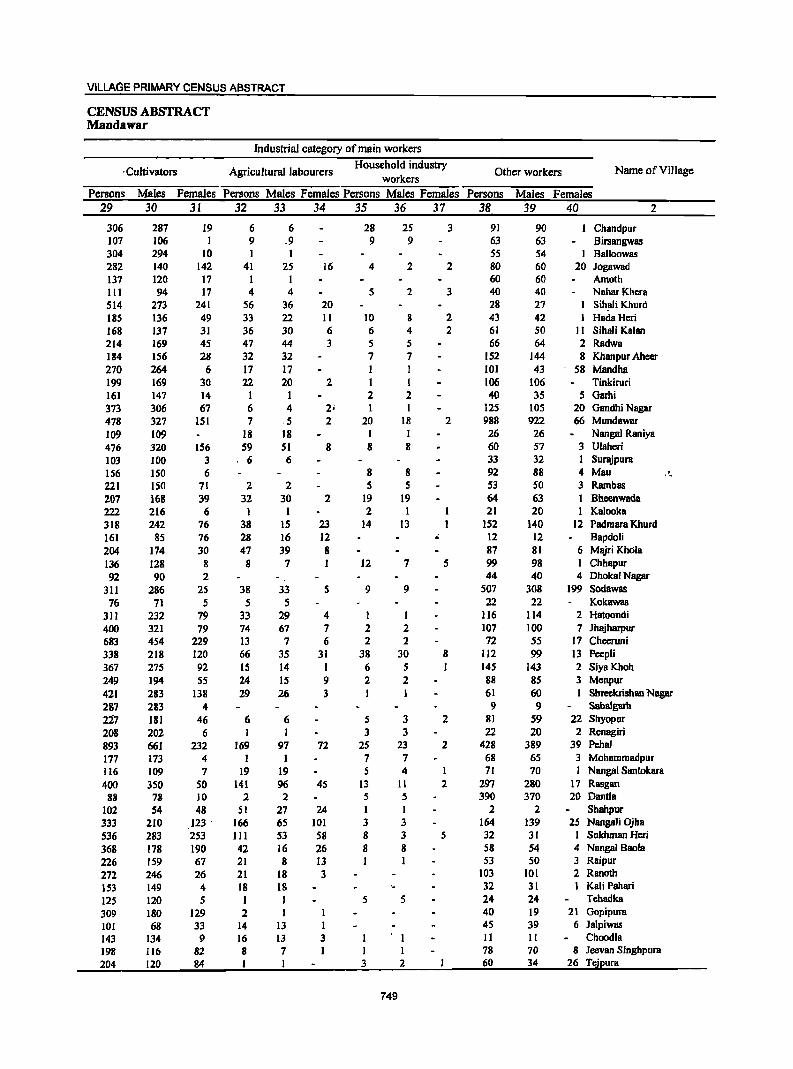
VILLAGE PRIMARY CENSUS ABSTRACT
CENSUS ABSTRACT Mandawar
Industrial category of main workers
, Cultivators Agricultural labourers Household industry
Other workers Name ofVilJage workers
Persons Males Females Persons Males Females Persons Males Females Persons Males Females 29 30 31 32 33 34 35 36 37 38 39 40 2
306 287 19 6 6 28 25 3 91 90 Chandpur 107 106 I 9 .9 9 9 63 63 Birsangwas 304 294 10 1 1 55 54 I Ballaowas 282 140 142 41 25 16 4 2 2 80 60 20 Jogawad 137 120 17 1 60 60 Amoth 111 94 17 4 4 S 2 3 40 40 NaharKhera 514 273 241 S6 36 20 28 27 Sihali Khurd 185 136 49 33 22 II 10 8 2 43 42 Hada Heri 168 137 31 36 30 6 6 4 2 61 50 II Sihali Kalan 214 169 45 47 44 3 S 5 66 64 2 Radwa 184 156 28 32 32 7 7 152 144 8 Khanpur Aheer 270 264 6 17 17 I I 101 43 58 Mandha 199 169 30 22 20 2 I 1 106 106 Tinkiruri 161 147 14 1 1 2 2 40 35 5 Garhi 373 306 67 6 4 2; I I 12S 105 20 Gandhi Nagar 478 327 151 7 .5 2 20 18 2 988 922 66 Mundawar
109 109 18 18 I I 26 26 Nangal Raniya
476 320 156 59 51 8 8 8 60 57 3 Ulaheri
103 100 3 ' 6 6 33 32 I Surajpura
156 ISO 6 8 8 92 88 4 Mau . 221 ISO 71 2 2 S 5 53 50 3 Rarnbas 207 168 39 32 30 2 19 19 64 63 I Bheenwada 222 216 6 1 1 2 1 21 20 1 Kalooka 318 242 76 38 15 23 14 13 152 140 12 Padmara Khurd 161 85 76 28 16 12 " 12 12 Bapdo1i
204 174 30 47 39 8 87 81 6 Majri KhOla
136 128 8 8 7 I 12 7 5 99 98 1 Chhapur
92 90 2 44 40 4 Dhakal Nagar
311 286 2S 38 33 S 9 9 507 308 199 Sodawas
76 71 5 5 5 22 22 Kokawas 311 232 79 33 29 4 I I 116 114 2 Hatoandi
400 321 79 74 67 7 2 2 107 100 7 Jhajbarpur 683 454 229 13 7 6 2 2 72 55 17 Cheeruni 338 218 120 66 35 31 38 30 8 112 99 13 Peep1i 367 275 92 15 14 I 6 5 1 145 143 2 SiyaKbab 249 194 S5 24 15 9 2 2 88 85 3 Menpur
421 283 138 29 26 3 61 60 Sbreekrishan Nagar
287 283 4 9 9 SBbaigarh
227 181 46 6 6 5 3 2 81 59 22 Sbyopur
208 202 6 I 1 3 3 22 20 2 RenBgiri
893 661 232 169 97 72 25 23 2 428 389 39 Pehal
177 173 4 I I 7 7 68 65 3 Mohammadpur
116 109 7 19 19 5 4 71 70 1 Nangal Santokara
400 350 50 141 96 45 13 11 2 297 280 17 Rasgan 88 78 10 2 2 5 5 390 370 20 DantJa
102 54 48 51 27 24 I I 2 2 Shahpur 333 210 123 ' 166 65 101 3 3 164 139 25 NangaliOjha
536 283 253 III 53 58 8 3 5 32 31 I Sukhman Heri
368 178 190 42 16 26 8 8 58 54 4 Nangal Bania
226 159 67 21 8 13 1 1 53 50 3 Raipur
272 246 26 21 18 3 103 101 2 Ranoth
153 149 4 18 18 32 31 1 Kali Pahari
125 120 5 I 1 5 5 24 24 Tehadka
309 180 129 2 I 40 19 21 Gapipura
101 68 33 14 13 45 39 6 Jalpiwas
143 134 9 16 13 3 I II II Choodla
198 116 82 8 7 I 1 78 70 8 Jeevan Singbpura
204 120 84 3 2 60 34 26 Tcjpura
749
DISTRICT CENSUS HANDBOOK: ALWAR
VILLAGE PRIMARY Panchayat Samiti-
Location Industrial category
Code Name of Village ~arginalvvorkers Cultivators Agricultural labourers
Number Persons Males Females Persons Males Females Persons Males Females
2 41 42 43 44 4S 46 47 48 49
00716700 Cnandput 961 301 654 785 232 553 144 61 83 00776800 Birsangwas 398 126 272 264 74 190 126 44 82 00776900 Balloowas 724 209 515 675 184 ,491 31 16 15 00777000 Jogawad 351 158 193 194 107 87 42 12 30 00777100 Amoth 425 134 291 147 64 83 34 IS 19 00777200 Nahar Khera 399 146 253 21 4 17 376 140 236 00777300 Sihali Khurd 346 134 212 167 81 86 177 51 126 00177400 HadaHeri 415 151 264 345 118 221 60 29 31 00777500 Sihali Kalan 341 132 209 192 84 103 73 30 43 00777600 Radwa 613 203 410 437 143 294 164 S6 108 00777700 Khanpur Aheer 714 217 497 619 193 426 84 22 62 00777800 MandhB 502 139 363 462 128 334 30 9 21 00777900 Tinkiruri 617 201 416 459 140 319 144 49 95 00778000 Garhi 395 99 296 373 88 285 17 7 10 00778100 Gandhi Nagar 568 125 443 487 102 385 I 1 00778200 Mundawar 1,114 328 786 619 196 423 77 22 55 00778300 Nangal Raniya 370 113 257 335 100 235 14 9 5 00778400 Ulaheri 784 306 478 657 268 389 123 37 86 00778500 Surajpura 207 6S 142 200 60 140 3 I 2 00778600 Mau 621 208 413 514 160 354 93 42 51 00778700 Rambas 544 220 324 500 202 298 25 6 19 00778800 Bheenwada 43'1 137 294 397 129 268 33 7 26 00778900 Katooka 357 79 278 352 77 275 3 3 00779000 Padmara Khurd 652 208 444 422 128 294 172 SO 122 00719100 Bapdoli 87 39 48 69 32 37 18 7 II 00779200 M~riKhola 490 122 368 402 103 299 65 15 50 00779300 Chhapur 356 99 257 185 60 125 lSI 32 119 00779400 Dhoka1 Nagar 267 71 196 234 68 166 2 2 00179500 Sodawas 761 343 418 471 223 248 173 56 117 00779600 Kokawas 219 63 156 200 61 139 19 2 17 00779700 Hatoondi 492 180 312 407 146 261 56 22 34 00779800 Jhajharpur 576 161 415 446 128 318 114 26 88 00779900 Cheeruni 397 92 305 375 82 293 13 6 7 00780000 Peepli 712 271 441 465 171 294 199 73 126 00780100 SiyaKhoh 901 337 570 821 310 51 I 67 17 50 00780200 Menpur 766 271 495 617 238 379 141 25 116 00780300 Shreekrishan Nagar 844 327 517 689 295 394 55 22 33 00780400 Sabalgarh 389 68 321 388 67 321 1 1 00780500 Shyopur 483 178 305 416 ISO 266 39 10 29 00780600 Renagiri 494 149 345 456 131 325 20 4 16 00780700 Pehal 1,411 445 966 1,004 341 663 224 49 175 00780800 Mobarnmadpur 606 203 403 532 181 351 71 21 50 00780900 Nangal Santokara 360 90 270 317 80 237 27 4 23 00781000 Rasgan 1,256 405 851 899 290 609 325 96 229 00781100 Dantla 640 184 456 281 78 203 63 5 58 00781200 Shahpur 84 49 35 49 29 20 35 20 IS 00781300 Nangali Ojha 491 186 305 317 131 246 89 40 49 00781400 Sukhman Heri 61 33 28 52 29 23 9 4 5 00781500 Nangal 880la 71 30" 41 51 26 25 16 3 13 00781600 Raipur 281 97 184 242 80 162 20 4 16 00781700 Ranoth 592 167 425 558 162 396 31 4 27 00781800 Kali Pahari 346 88 258 293 74 219 52 13 39 00781900 Tehadka 367 120 247 317 83 234 32 21 11 00782000 Gopiputa· 130 53 77 127 52 75 3 I 2 00782100 Jalpiwas' 126 34 92 121 34 87 3 3 00782200 Chooala ,", 187 66 121 ISO 43 '107 31 18 13 0078230'O"'i:eviln Singhpui'a 352 131 221 304 [04 200 42 26 16 00782400_ T~jpura .'"'" -86 63 23 32 25 7 51 3S 16
750
VILLAGE PRIMARY CENSUS ABSTRACT
CENSUS ABSTRACT Mandawar
of marginal workers Location
Household industry Non-workers Name of ViII age Code Other workers
workers Number Persons Males Females Persons Males Females Persons Males Females
50 51 52 53 54 S5 56 57 58 2
25 10 15 7 4 3 600 301 299 Chandpur 00776700 6 6 2 2 154 78 76 Birsangwas 00776800 9 4 5 9 5 4 376 189 187 Balloowas 00776900
115 39 76 231 129 102 Jogawad 00777000 244 55 189 285 138 147 Amoth 00777100
2 2 190 103 87 Nahar Khera 00717200 2 2 700 352 348 Sihali Khurd 00777300
3 3 7 4 3 284 148 136 HadaHeri 00177400 7 3 4 69 15 54 472 200 272 Sihali Kalan 00777500 4 3 I 8 I 7 467 253 214 Radwa 00177600 9 I 8 2 I I 6S1 335 316 Khanpur Aheer 00177700
10 2 8 395 213 182 Mandha 00777800 I 13 12 582 295 287 Tinkiruri 00717900 3 2 2 2 340 187 153 Garhi 00778000
13 • 2 II 67 20 47 746 400 346 Gandhi Nagar 00778100 8 I 7 410 109 301 3,075 1,363 1,712 Mundawar 00778200 I I 20 4 16 204 87 117 Nangal Raniya 00778300 2 2 2 1 I 463 238 225 Ulaheri 00778400
4 4 202 73 129 Surajpura 00778500 I I 13 6 7 361 198 163 Mau 01;1778600
II 4 7 8 8 275 159 116 Rambas 00778700 I I 497 244 253 Bheenwada 00778800 2 2 342 183 159 Kalooka 00778900
14 7 7 44 23 21 664 337 327 Padmara Khurd 00779000 185 96 89 Bapdoli 00779100
23 4 19 549 283 266 Majri Khola 00779200 9 2 7 11 S 6 409 211 198 Chhapur 00779300
31 3 28 185 103 82 Dhokal Nagar 00779400 2 2 115 62 S3 1,245 534 711 Sodawas 00779500
141 71 70 Kokawas 00779600 2 1 27 11 16 562 264 298 Hatoondi 00779700 I I 15 7 8 825 377 448 Jhajharpur 00779800 1 I 8 4 4 1,087 S18 S69 Cheeruni 00779900
24 7 17 24 20 4 658 338 320 Peepli 00780000 4 2 2 15 8 7 S55 297 258 SiyaKhoh 00780100
8 8 437 233 204 Menpur 00780200 100 10 90 748 416 332 Shreekrishan Nagar 00780300
536 273 263 Sabalgarh 00780400 5 3 2 23 IS 8 ' 347 169 178 Shyopur 00780500 I I 17 14 3 452 243 209 Renagiri 00780600
20 5 15 163 SO 113 2,497 1,241 1,256 Peha1 00780700 3 I 2 482 266 216 Mohammadpur 00780800
I IS 5 10 416 209 207 Nangal Santokara 00780900 3 3 29 19 10 1,066 512 554 Rasgan 00781000 6 6 290 101 189 910 401 509 DantIa 00781100
98 44 S4 Shahpur 00781200 25 15 10 442 245 197 Nangali Ojha 00781300
488 240 248 Sukhman Heri 00781400 3 3 439 254 185 Nangal Bao1a 00781500
19 13 6 439 215 224 RaipUT 00781600 3 I 2 S78 285 293 Ranoth 00781700
- , I I 373 21S 158 Kali Pahari 00781800 18 16 2 445 242 203 Tehadka 00781900
362 197 165 Gopipura 00782000 2 2 218 98 120 Jalpiwas ·00782100 5 4 I 446 205 241 Choodla 00782200 5 I 4 496 252 244 Jeevan Singhpura 00782300 2 2 260 125 135 Tejpura 00782400
751
DISTRICT CENSUS HANDBOOK: ALWAR
VILLAGE PRIMARY Panchayat Samiti -
Location Area of Total population
Population in the
Code Name of Village Village in Number of (including institutional and
age-group 0-6 Number hectares
households houseless population)
Persons Males Females Persons Males Females 2 3 4 5 6 7 8 9 10
00782500 Bbajanawas 226.0 58 366 193 173 67 38 29 00782600 Badbeen 345.0 97 619 325 294 146 70 76 00782700 Lakheempur 55.0 38 229 125 104 34 21 13 00782800 Doonwas 524.0 67 474 247 227 99 47 52 00782900 Chhabriwas 102.0 57 411 222 189 87 45 42 00783000 Qyara 190.0 76 579 280 299 134 63 71 00783100 ShamdB 1,413.0 408 3,295 1,693 1,602 661 351 310 00783200 Tehadki 353.0 130 882 466 416 201 99 102 00783300 Dhailawas 190.0 100 805 417 388 149 68 81 00783400 Tatarpur 1,676.0 926 6,193 3,202 2,991 1,140 617 523 00783500 Badli 380.0 219 1,553 800 753 326 160 166 00783600 Ikrotiya 75.0 51 347 185 162 68 42 26 00783700 Naredi 214.0 87 536 279 257 100 54 46 00783800 Sorkha Khurd 207.0 98 659 335 324 161 86 75 00783900 Mator 882.0 528 4,039 2,092 1,947 871 456. 415 00784000 Agwani 217.0 169 1,164 602 562 232 116 . ll6 00784100 Birtoli 169.0 80 579 306 273 136 76 60 00784200 Bari 461.0 153 943 459 484 226 III ll5 00784300 Jeendoli 841.0 561 3,718 1,967 1,751 761 405 356 00784400 Kadar Nagar 206.0 130 711 359 352 192 98 94 00784500 Khushalwas 97.0 62 295 166 129 77 39 38 00784600 Rundh 222.0 144 857 467 390 172 99 '73 00784700 Azizpur 301.0 171 1,239 636 603 306 155 151 00784800 Bchroj 1,710.0 579 3,851 2,069 1,782 723 399 324 00784900 Nangal Singal 89.0 19 139 68 71 24 13 11 00785000 Kbanpur Mewan 199.0 106 649 343 306 122 61 61 00185100 Khareta 492.0 181 1,196 612 584 260 133 127 00785200 Subeta 488.0 192 1,490 765 725 319 174 145 00185300 Sorkha Kalan 535.0 177 1,199 628 571 231 116 115 00785400 Chakolil! 255.0 56 399 217 182 S9 36 23
"
0752
VILLAGE PRIMARY CENSUS ABSTRACT
CENSUS ABSTRACT Mandawar
Scheduled Castes popuation Scheduled Tribes population Literates Name of Village
Persons Males Females Persons Males Females Persons Males Females 11 12 13 14 15 16 17 18 19 2
169 86 83 187 113 74 Bhajanawas 96 38 58 31 17 14 343 217 126 Badheen
138 87 51 Lakheempur 33 14 19 17 10 7 269 175 94 Doonwas 68 35 33 196 132 64 Chhabriwas
407 197 210 349 172 177 Qyara 672 363 309 64 27 37 1,423 971 452 Shamda 2IS 114 101 334 235 99 Tehadki 130 60 70 391 271 120 Dhailawas
1,289 640 649 331 170 161 3,226 2,076 USO Tatarpur 447 238 209 177 87 90 810 553 257 Badli
13 6 7 219 123 96 lkrotiya 94 51 43 337 204 133 Naredi
247 119 128 23 13 10 301 208 93 Sorkha Khurd .( 1,064 546 518 6 2 4 1,764 1,192 ·572 Mator
275 142 133 513 353 160 Agwani 278 194 84 Birtoli "
271 129 142 389 257 132 Bari 887 461 426 139 75 64 2,054 1,348 706 Jeendoli
6 3 3 201 160 41 Kadar Nagar 134 79 55 30 13 17 120 93 27 Khushalwas 25S 149 106 36 20 16 389 273 116 Rundh 183 98 85 5 3 2 559 380 179 Azizpur 644 342 302 42 22 20 1,783 1,258 525 Behroj
13 6 7 69 43 26 Nangal Singal 524 280 244 266 192 74 Khanpur Mewsn 111 56 55 398 289 109 Khareta 57 27 30 424 320 104 Suhcta
422 231 191 36 20 16 643 426 217 Sorkha Kalan 47 21 26 239 165 74 Chakoliya
753
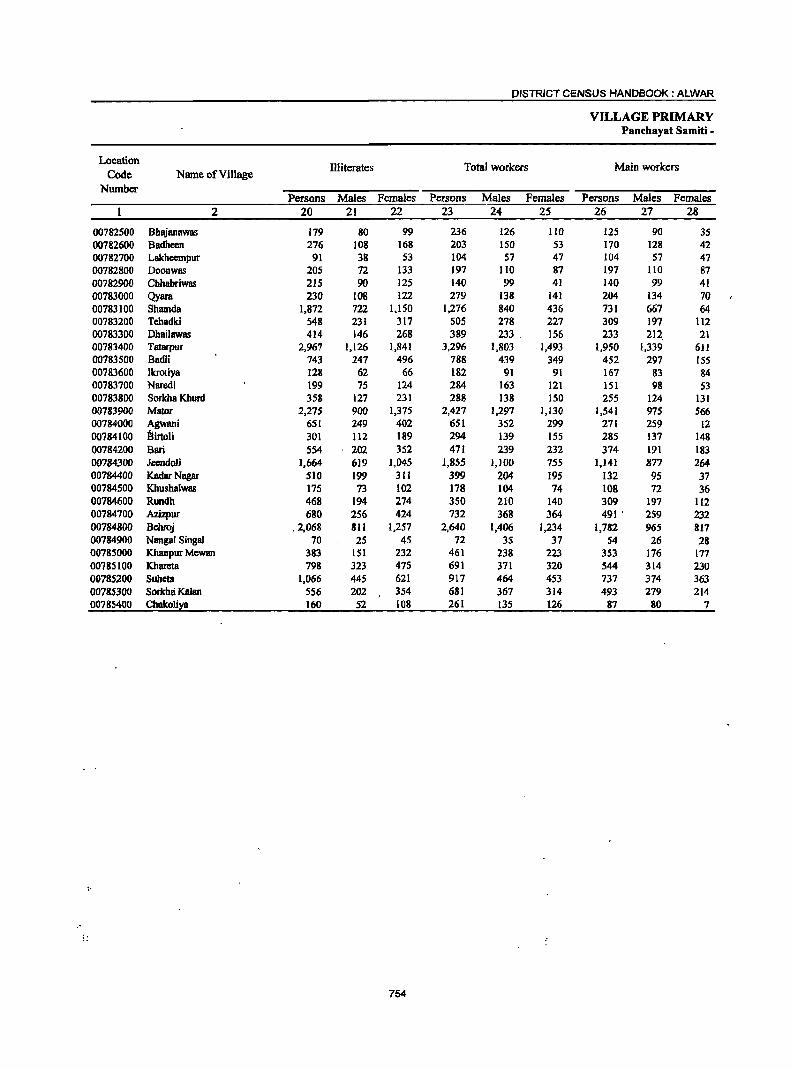
DISTRICT CENSUS HANDBOOK: ALWAR
VILLAGE PRIMARY Panchayat Samiti -
Location Illiterates Total workers Main workers
Code Name of Village Number
Persons Males Females Persons Males Females Persons Males Females 2 20 21 22 23 24 25 26 27 28
00782500 Bhajanawas 179 80 99 236 126 110 125 90 35 00782600 Badheen 276 108 168 203 150 53 170 128 42 00782700 Lakheempur 91 38 53 104 57 47 104 57 47 00782800 Doonwas 205 72 133 197 110 87 197 110 87 00782900 Chhabriwas 215 90 125 140 99 41 140 99 41 00783000 Qyara 230 108 122 279 138 141 204 134 70 00783100 Sharnda 1,872 722 1.150 1,276 840 436 731 667 64 00783200 Tehadki 548 231 317 505 278 227 309 197 112 00783300 Dhailawas 414 146 268 389 233. 156 233 212, 21 00783400 Tstarpur 2,967 1,126 1,841 3,296 1,803 1,493 1,950 1,339 611 00783500 Badli 743 247 496 788 439 349 452 297 155 00783600 lkrotiya 128 62 66 182 91 91 167 83 84 00783700 Naredi 199 75 124 284 163 121 lSI 98 53 00783800 Sorkha Khurd 358 127 231 288 138 150 255 124 131 00783900 Mator 2,275 900 1,375 2,427 1,297 1,130 1,541 975 566 00784000 Agwani 651 249 402 651 352 299 271 259 12 00784100 BirtoH 301 112 189 294 139 155 285 137 148 00784200 Bari 554 202 352 471 239 232 314 191 183 00784300 Jeendoli ],664 619 1,045 1,855 1,100 755 1,14] 877 264 00784400 Kadar Nagar 510 199 311 399 204 195 132 95 37 00784500 Khusbalwas 175 73 102 178 104 74 108 72 36 00784600 Rundb 468 194 274 350 210 140 309 197 112 00784700 Azizpur 680 256 424 732 368 364 491 ' 259 232 00784800 Behroj .2,068 811 1,257 2,640 1,406 1,234 1,782 965 817 00784900 Nangal Singal 70 25 45 72 35 37 S4 26 28 00785000 Khanpur Mewan 383 lSI 232 461 238 223 353 116 177 00785100 Khareta 798 323 475 691 371 320 544 314 230 00785200 Suheta 1,066 445 621 917 464 453 737 374 363 00785300 Sorlcha Kalan 5S6 202 354 681 361 314 493 279 214 00785400 Chakoli~a 160 52 108 261 135 126 87 80 7
I'
754
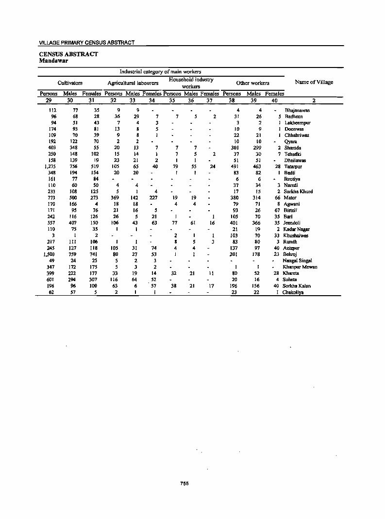
VILLAGE PRIMARY CENSUS ABSTRACT
CENSUS ABSTRACT Mandawar
Industrial category of main workers
Cultivators Agricultural labourers Household industry
Other workers Name of Village workers
Persons Males Females Persons Males Females Persons Males Females Persons Males Females 29 30 31 32 33 34 35 36 37 38 39 40 2
112 77 35 9 9 4 4 Bhajanawas 96 68 28 36 29 7 7 5 2 31 26 5 Badheen 94 51 43 7 4 3 3 2 Lakheempur
174 93 81 13 8 5 10 9 Doonwas 109 70 39 9 8 I 22 21 Chhabriwas 192 122 70 2 2 10 10 Qyara 403 348 55 20 13 7 7 7 301 299 2 Shamda 250 148 102 IS 14 7 5 2 37 30 7 Tehadki 158 139 19 23 21 2 I I 51 51 Dhailawas
1.275 756 519 lOS 65 40 79 55 24 491 463 28 Tatarpur 348 194 154 20 20 I I 83 82 I Badli 161 77 84 6 6 Ikrotiya 110 60 50 4 4 37 34 3 Naredi 233 108 125 5 I 4 17 15 2 Sorkha Khurd 773 500 273 369 142 227 19 19 380 314 66 Mator 170 166 4 18 18 4 4 79 71 8 Agwani 171 95 76 21 16 5 93 26 67 Birtoli 242 116 126 26 5 21 105 70 35 Bari 557 407 150 106 43 63 77 61 16 40] 366 35 Jeendoli lID 75 35 1 1 21 19 2 Kadar Nagar
3 1 2 2 I I 103 70 33 Khushalwas 217 III 106 I ] 8 5 3 83 80 3 Rundh 245 127 Il8 105 31 74 4 4 137 97 40 Azizpur
1.500 759 741 80 27 53 I ] 201 178 23 Behroj 49 24 25 5 2 3 Nangal Singal
347 172 175 5 3 2 I I Khanpur Mcwan 399 222 177 33 19 14 32 21 11 80 52 28 Khareta 601 294 307 116 64 52 20 16 4 Suheta 196 96 100 63 6 57 38 21 17 196 156 40 Sorkha Kalan 62 57 5 2 I I 23 22 I ChBkoliya
755
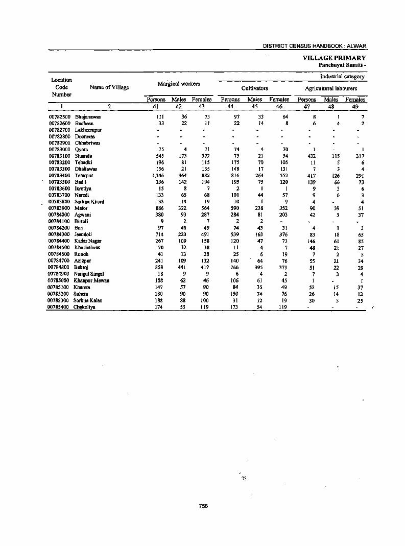
DISTRICT CENSUS HANDBOOK: ALWAR
VILLAGE PRIMARY Panchayat Samiti -
Location Industrial category
Code Name of Village Marginal workers
Cultivators Agricultural labourers Number
Persons Males Females Persons Males Females Persons Males Females 2 41 42 43 44 45 46 47 48 49
00782500 Bhajanawas III 36 7S 97 33 64 8 7 00782600 Badheen 33 22 11 22 14 8 6 4 2 00782700 Lakheempur 00782800 Doonwas 00782900 Chhabriwas 00783000 Qyara 75 4 71 74 4 70 1 1 00783100 Shamda 545 173 372 75 21 S4 432 115 317 00783200 Tehadki 196 81 115 175 70 105 11 5 6 00783300 Dhailawas 156 21 13S 148 17 131 7 3 4 00783400 Tatarpur 1,346 464 882 816 264 552 417 126 291 00783500 Badli 336 142 194 195 75 120 139 66 73 00783600 lkrotiya 15 8 7 2 I 1 9 3 6 00783700 Naredi 133 65 68 101 44 57 9 6 3 00783800 Sorkha Khurd 33 14 19 10 1 9 4 4 00783900 Mator 886 322 564 590 238 352 90 39 51 00784000 Agwani 380 93 287 284 81 203 42 S 37 00784100 Birtoli 9 2 7 2 2 00784200 Sari 97 48 49 74 43 31 4 I 3 00784300 Jeendoli 714 223 491 539 163 376 83 18 65 00784400 Kadar Nagar 267 109 158 120 "47 73 146 61 85 00784500 Khushalwas 70 32 38 11 4 7 48 21 27 00784600 Rundh 41 13 28 2S 6 19 7 2 5 00784700 Azizpur 241 109 132 140 64 76 55 21 34 00784800 Behroj 858 441 417 766 395 371 51 22 29 00784900 Nangal Singal 18 9 9 6 4 2 7 3 4 00785000 Khanpur Mewan 108 62 46 106 61 45 I 1 00785100 Khareta 147 57 90 84 35 49 52 15 37 00785200 Suheta 180 90 90 150 74 76 26 14 12 00785300 Sorkha Kalan 188 88 100 31 12 19 30 5 2S 00785400 Chakolixa 174 55 119 173 54 119
756
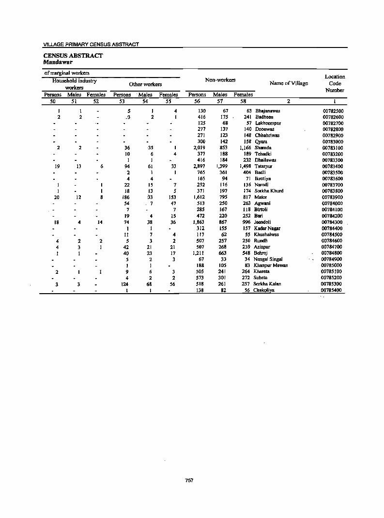
VILLAGE PRIMARY CENSUS ABSTRACT
CENSUS ABSTRACT Mandawar
of marginal workers Location
Household industry Non-workers Name ofVilJage Code Other workers
workers Number Persons Males Females Persons -Males Females Persons Males Females
50 51 52 53 54 55 56 57 58 2
I 1 5 1 4 130 67 63 Bhajanawas 00782500 2 2 :3 2 1 416 175 241 Badheen 00782600
125 68 57 Lakheempur 00782700 277 137 140 Doonwas 00782800 271 123 148 Chhabriwas 00782900 300 142 158 Qyara 00783000
2 2 36 -35 I 2,019 853 1,166 Shamda 00783100 10 6 4 377 188 189 Tehadki 00783200 1 1 416 184 232 Dhailawas 00783300
19 13 6 94 61 33 2,897 1,399 1,498 Tatarpur 00783400 2 1 1 765 361 404 Badli 00783500 4 4 165 94 71 Ikrotiya 00783600
I 22 IS 7 252 116 136 Naredi 00783700 1 18 13 5 371 197 174 Sorkha Khurd 00783800
20 12 8 186 -33 153 1,612 795 817 Mator 00783900 54 7 47 513 250 263 Agwani 00784000 7 7 285 167 118 Birtoli 00784100
19 4 IS 472 220 2S2 Bari 00784200 18 4 14 74 38 36 1,863 867 996 leendoli 00784300
I I 312 ISS 157 Kadar Nagar 00784400 11 7 4 117 62 55 Khushalwas 00784500
4 2 2 5 3 2 507 257 250 Rundh 00784600 4 3 42 21 21 507 268 239 Azizpur 00784700 1 40 23 17 1,211 663 548 Behroj 00784800
5 2 3 67 33 34 Nanga1 Singal 00784900 1 1 188 105 83 Khanpur Mewan 00785000
2 9 6 3 505 241 264 Khareta 00785100 4 2 2 573 301 272 Suheta 00785200
3 3 124 68 56 518 261 257 Sorkha Kalan 00785300 1 138 82 56 Chakolil:a 00785400
757
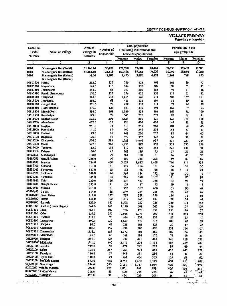
DISTRICT CENSUS HANDBOOK: ALWAR
¥.ILLAGE PRIMARY Pancbayat Samiti -
Location Area of Total population
Population in .the Number of (including institutional and
Code Name of Village Village in households houseless population)
age-group 0-6
Number hectares Persons Males Females Persons Males Females
2 3 4 5 6 7 8 9 10
0004 Kishangarh Bas (Total) 51,168.04 26,021 176,968 92,806 84,162 37,553 19,632 17,92] 0004 Klshangarh Bas (Rural) 51,164.00 24,518 167,495 87,756 79,739 36,092 18,844 17,248 0004 Kishangarll Bas (Urban) 4.04 1,503 9,473 5,050 4,423 1,461 788 673
Kishangarb 8as (Rural) 00817600 Khcra 283.0 122 789 423 366 162 89 73 008]7700 NayaGaon 169.0 116 644 335 309 98 53 45 00817800 Jhamoowas 241.0 66 391 203 188 93 47 46 00817900 Rundh Jhamoowas 176.0 122 776 420 356 117 65 52 00818000 Fatiyabad 361.0 238 1,465 748 717 308 157 lSI 00818100 Jharjheela 207.0 68 43S 238 197 5S 30 25 00818200 Googal Heri 220.0 71 468 257 211 72 44 28 00818300 Basai Beerthal 279.0 123 823 432 391 162 87 7S 00818400 MachhRoli 396.0 168 1,039 538 501 167 88 . 79
00818500 Kallsha1pur 129.0 90 545 272 273 92 51 41 00818600 Bagheri Kalan 525.0 206 1,626 805 821 321 161 160 OOil1,s700 Alamdeeka 477.0 135 826 426 400 145 80 65 00818800 Nagliya 251.0 74 518 258 260 104 58 46 00818900 Poondraka 141.0 69 499 245 254 158 77 81 00819000 Gotltari 99.0 68 462 230 232 86 44 42 00819'}00 BagtItala 175.0 99 679 352 327 165 91 74 00819200 Chamroda 594.0 283 1,981 1-,044 937 431 227 204 00819300 Bolni 572.0 249 1,734 882 852 353 177 176 00819400 Teetarka 163.0 113 812 429 383 221 130 91 00819500 Faizpur 56.0 42 262 139 123 57 32 25 00819600 Mandwapur 108,0 29 261 130 131 76 40 36 008197.00 Nangli Pathan 256.0 90 650 355 295 149 80 69 00819800 Mancha 784.0 400 3,103 1,643 1,460 746 411 335 0.0819900 Mahood ('I.:: 161:0 51 315 164 151 66 31 35 0'0820000 Sahoowas 147;0 -- 15 132 '66 ,66 38 17 21 00820100 Seokhera 149;0 44 266 144 122 49 30 19 00820200 Santhalka 145.0 104 165 398 . jfii . 171 80" 91 00820300 Tohri 230.0 126 801 433 368 164 91 73 00820400 Nangli Mewan .115.0 21 159 87 72 29 14 15 00820500 Meerka 261.0 131 957 507 450 165 96 69 00820600 Lis80a 114.0 88 539 274 265 85 45 40 00820700 BasaiKalan 211.0 127 738 388 350 136 72 64 00820800 Isepur 131.0 60 353 166 187 78 34 44 00820900 Tarwala 332.0 181 1,508 782 726 280 138 142 00821000 Kankra ( Islam Nagar ) 544.0 168 1,170 608 562 256 127 129 00811100 Jatka 263.0 109 786 428 358 153 86 67 00821200 Odra 434.0 257 2,066 1,076 990 516 258 258 00821300 Bhatkol 213.0 78 464 232 232 82 35 47 00821400 Langarwas 499.0 257 1,687 872 815 287 148 139 00821500 Khojaka 96.0 42 228 105 123 39 17 22 00821600 Chachaka 381.0 159 996 506 490 231 124 107. 00821700 Dhamookar 376.0 187 1,172 603 569 309 166 143 00821800 Manotltadi 125.0 66 368 198 170 71 40 31 008219g0, Husepur 284.0 128 932 471 461 240 119 121 00822000 'MOthooka 541.0 340 2,412 1,274 1,138 506 269 237 00822100 Jaistika 212.0 67 479 242 237 93 49 44 008222(lO 'DC'ota 474.0 287 1,766 923 843 461 240 22i 00822300 iDayalpur 180.0 67 545 331 214 64 41 23 00822400 1;8Ol(a Heri 110.0 129 767 404 363 105 5?. . '5.2. '00822500: :BuXripal. 572.0 468 2,751 1,432 1,3J.9 460' . 253. ~ 'a01 -00.1122600 'N,oor Nagar .' 384.0 343 2,161 1,117 1,044 426 229 '197, 00822700 : -Ningar Maujiya '222.0 275 1,861 961 899 . 406 195-- ill 00822800~'Rilptir'MeW8n 216.0 88 570 295 275 96 ,48- ,'" _. 148" 00822900 iCultajpur' 120.0 77 434 229 205 '85 41 .- 44
"7-58 ..
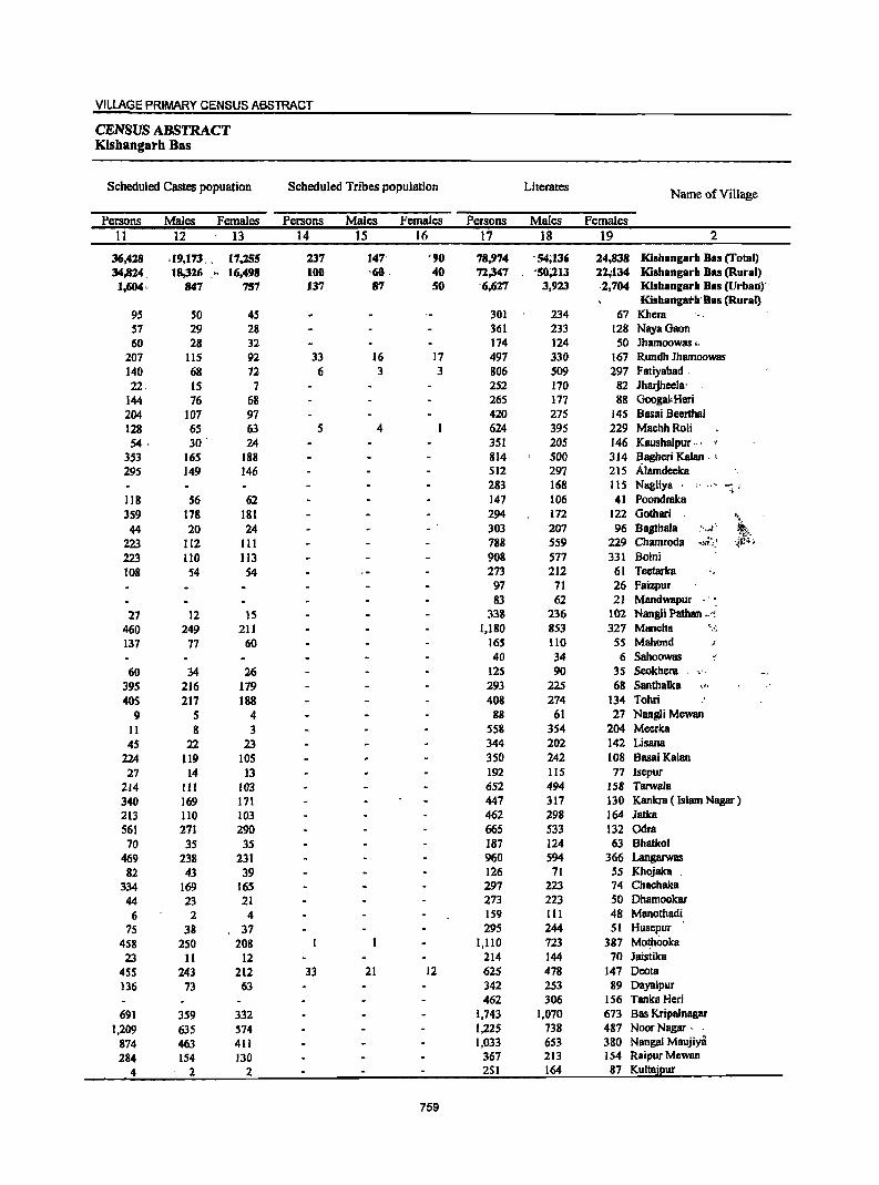
VILLAGE PRIMARY CENSUS ABSTRACT
CENSUS ABSTRACT Kishangarb Bas
Scheduled Castes popuation Scheduled Tribes population Literates Name of Village
Persons Males Females Persons Males Females Persons Males Females 11 12 13 14 15 16 17 18 19 2
36,428 .19,173. 17,255 237 147' '90 78,974 -54;136 24,838 Kishangarh Bas (Total) 34,824, 18,316 ,., 16,498 100 '60 . 40 71,347 '50;213 11;134 Kishangarh Bas (Rural) 1,604" 847 757 137 87 SO '6,627 3,923 ,2,704 Kishangarh Bas (Urban)"
Kishangath'Bas (Rural) 95 SO 45 301 234 67 Khera 57 29 28 361 233 128 NayaGaon 60 28 32 174 124 50 Jhamoowas "
207 liS 92 33 16 17 497 330 167 Rundh Jhamoowas 140 68 72 6 3 3 806 509 297 Fatiyabad, 22, IS 7 2S2 170 82 Jharjheela'
144 76 68 26S 177 88 Googal: Hen 204 107 97 420 27S 145 Basai Beerthal 128 65 63 5 4 624 395 229 MachhRoli 54· 30 ' 24 351 205 146 Kaushalpur ... .
353 165 188 814 500 314 Bagheri Kalan. , 295 149 146 512 297 215 Alamdeeka
283 168 115 Nagliya . ;' .,-. ",
118 S6 62 147 106 41 Poondraka 359 178 181 294 172 122 Gothari '~
44 20 24 303 207 96 Bagthala , ...... t·,
",' 223 112 III 788 5S9 229 Chamroda ".l.~,~;.~ '{!1~;
223 110 113 908 577 331 Bolni 108 54 S4 273 212 61 Teetarka ".
97 71 26 Faizpur 83 62 21 Mandwapur ."
27 12 15 338 236 102 Nangli Patban .. ", 460 249 211 1,180 853 327 Mancha "-,:;
137 77 60 165 110 55 Mahond 40 34 6 Sahoowas .
60 34 26 125 90 35 Seokhera 395 216 179 293 225 68 Santhalka 0:,:.
405 217 188 408 274 134 Tohri 9 5 4 88 61 27 Nangli Mewan
II 8 3 558 354 204 Meerka
45 22 23 344 202 142 Lisana
224 119 105 350 242 108 BasaiKalan
27 14 13 192 115 77 Isepur 214 III 103 652 494 158 Tarwala 340 169 171 447 317 130 Kankra ( Islam Nagar) 213 110 103 462 298 164 Jatka 561 271 290 665 533 132 Odra 70 35 35 187 124 63 Bhatkol
469 238 231 960 S94 366 Langarwas 82 43 39 126 71 55 Khojaka
334 169 165 297 223 74 Chachaka
44 23 21 273 223 50 Dhamookar
6 2 4 159 III 48 Manothadi
75 38 37 295 244 SI Husepur
458 250 208 1,110 723 387 Mothooka
23 II 12 214 144 10 Jaistika
455 243 212 33 21 12 625 478 147 Dcala 136 73 63 342 253 89 Dayalpur
462 306 156 Tanka Heri 691 359 332 1,743 1,070 673 Bas Kripalnagar
1,209 635 574 1,225 738 487 Noor Nagar - .
874 463 411 1,033 653 380 Nangal Maujiya
284 154 130 367 213 154 Raipur Mewan
4 2 2 2S1 164 87 Kultajpur
759
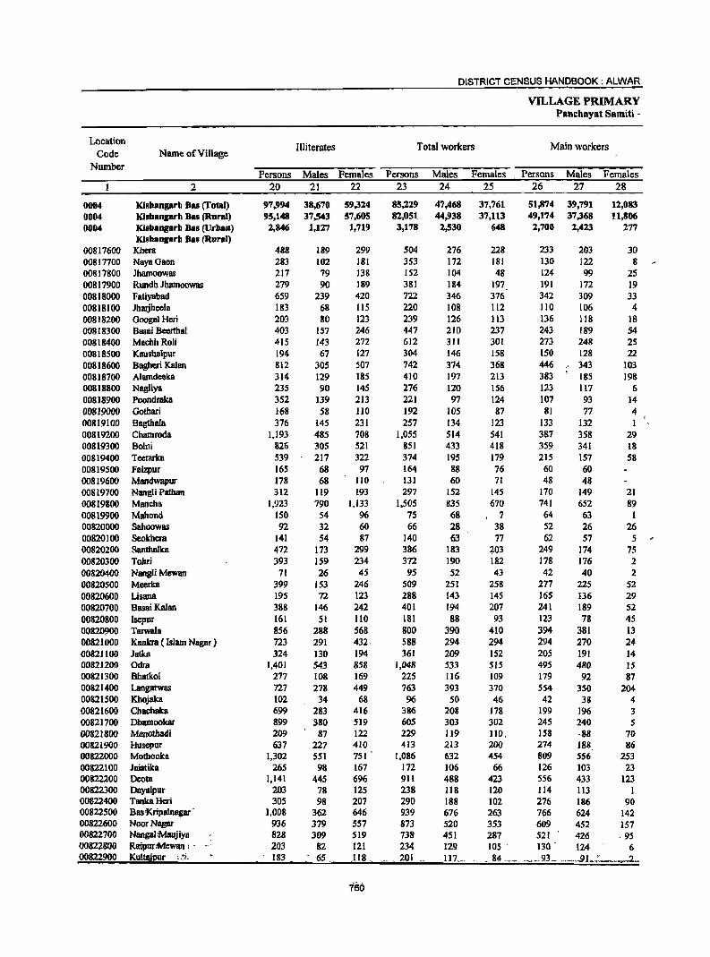
DISTRICT CENSUS HANDBOOK: ALWAR
VILLAGE PRIMARY PBncbayat Samiti -
Location Illiterates Total workers Main workers
Code Name of Village Number
Persons Males Females Persons Males Females Persons Males Females 2 20 21 22 23 24 25 26 27 28
0004 Kl8hangarb Bas (Total) 97,994 38,670 59,324 85,229 47,468 37,761 51,874 39,791 12.,083 0004 Kishangarb Ba8 (Rural) 95,148 37,543 57,605 82,051 44,938 37,113 49,174 37,368 11,806 0004 Kisbangarh Bas (Urban) 2,846 1,127 1,719 3,178 2,530 648 2,700 2,413 277
Kisbangarh Bas (Rural) 00817600 Khera 488 189 299 S04 276 228 233 203 30 00817700 NayaGaon 283 102 181 353 172 181 130 122 8 00817800 Jharnoowas 217 79 138 152 104 48 124 99 2S 00817900 Rundh Jharnoowas 279 90 189 381 184 197 191 172 19 00818000 Fatiyabad 659 239 420 722 346 376 342 309 33 00818100 Jharjheela 183 68 115 220 108 112 110 106 4 00818200 GoogalHcri 203 80 123 239 126 113 136 118 18 00818300 Basai Beerthal 403 157 246 447 210 237 243 189 54 00818400 MachhRoIi 415 143 272 612 311 301 273 248 2S 00818500 Kaushalpur 194 67 127 304 146 158 ISO 128 22 00818600 Bagheri Kalan 812 305 507 742 374 368 446 343 103 00818700 Alarndeeka 314 129 185 410 197 213 383 185 198 00818800 Nagliya 235 90 145 276 120 156 123 117 6 00818900 Poondraka 352 139 213 22] 97 124 107 93 ]4 00819000 Gothari 168 58 110 192 105 87 8] 77 4 00819100 Bagthala 376 145 231 257 134 , 123 133 132 I ,
00819200 Charnroda 1,193 485 708 1,055 514 541 387 358 29 00819300 Bolni 826 305 521 851 433 418 359 341 18 00819400 Teetarka 539 217 322 374 195 179 215 157 58 00819500 Faizpur 165 68 97 164 88 76 60 60 00819600 Mandwapur 178 68 110 131 60 71 48 48 00819700 Nangli Pathan 312 119 193 297 152 145 170 149 21 00819800 Mancha 1,923 790 1,133 1,505 835 670 741 652 89 00819900 Mahond ISO S4 96 7S 68 7 64 63 I 00820000 Sahoowas 92 32 60 66 28 38 52 26 26 00820100 Seokhera 141 54 87 140 63 77 62 57 5 00820200 . Santhalka 472 173 299 386 183 203 249 174 75 00820300 Tohri 393 159 234 372 190 182 178 176 2 00820400 Nangli Mewan 71 26 45 95 52 43 42 40 2 00820500 Meerka 399 153 246 509 251 258 277 225 52 00820600 Usana 19S 72 123 288 143 14S 165 136 29 00820700 BasaiKaian 388 146 242 40] 194 207 241 189 52 00820800 lsepur 161 SI 110 181 88 93 123 78 4S 00820900 Tarwala 856 288 568 800 390 410 394 381 13 00821000 Kankra ( Islam Nagar) 723 291 432. 588 294 294 294 270 24 00821100 Jatka 324 130 194 361 209 152 205 191 14 00821200 Odra 1,401 543 858 1,048 533 515 495 480 IS 00821300 Bhatkol 277 108 169 225 116 109 179 92 87 00821400 Langatwas 727 278 449 763 393 370 554 350 204 00821500 Khojaka 102 34 68 96 50 46 42 38 4 00821600 Chachaka 699 283 416 386 208 178 199 196 3 00821700 Dhamookar 899 380 519 60s 303 302 245 240 5 00821800 Manothadi 209 87 122 229 119 110, IS8 -88 70 00821900 Husepur 637 227 410 413 213 200 274 188 86 00822000 Mothooka 1,302 551 751 1,086 632 4S4 809 SS6 253 00822100 Jaistika 265 98 167 172 ]06 66 126 103 23 00822200 Doota 1,141 445 696 911 488 423 556 433 123 00822300 Dayalpur 203 78 125 238 118 120 114 113 1 00822400 TankaHeri 305 98 207 290 188 102 276 186 90 00822500 Bas >J<ripalnagar - 1,008 362 646 939 676 263 766 624 142 00822600 NoorNagar 936 379 557 873 520 353 609 4S2 157 00822700 Nanga! iMaujiya 828 309 519 738 451 287 521 426 ,95 00822800 RBipurMewan: - 203 82 121 234 129 105 130 - 124 6 00822900 Kultajpur . ~ ,~L 183 65 JI8 _ . 201 IlL '" 84 _~,_93. _, ___ .91_~:____L
7eO
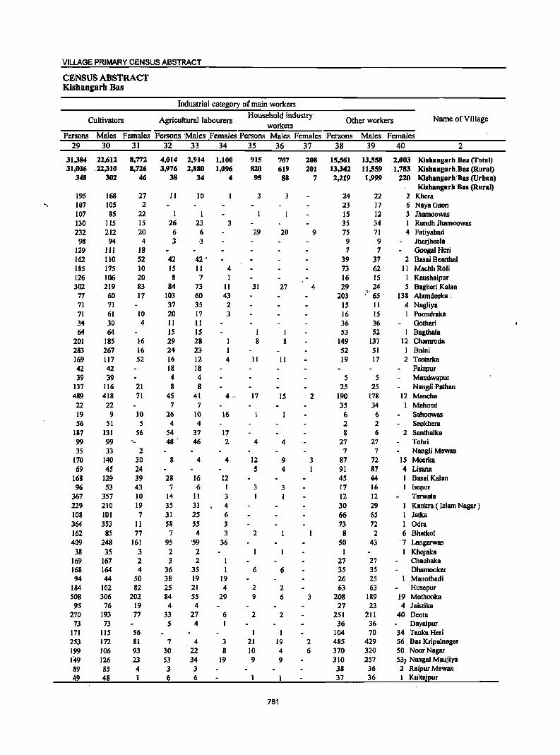
VILLAGE PRIMARY CENSUS ABSTRACT
CENSUS ABSTRACT Kishangarh Bas
Industrial category of main workers
Cultivators Agricultural labourers Household industry
Other workers Name of Village workers
Persons Males Females Persons 'Males Females Persons Males Females ,Persons Males Females
29 30 31 32 33 34 35 36 37 38 39 40 2
31,384 22,612 8,772 4,014 2,914 1,100 915 707 208 15,561 13,558 ,2,003 Kishangarh Bas (Total) 31,036 ,22,310 8,726 3,976 2,880 1,096 820 619 201 13,342 11,559 1,783 Kishangarh,Bas (Rural)
348 302 46 38 34 4 9S 88 7 2,219 1,999 220 K1shangarh'Bas (Urban) Kishangarh'Bas (Rural)
195 168 27 11 10 3 3 24 22 2 Khera 107 105 2 23 17 6 NayaGaon 107 85 22 I I IS 12 3 Ihamoowas 130 115 15 26 23 3 35 34 1 Rundh Ihamoowas 232 212 20 6 6 29 20 9 75 71 4 Fatiyahad 98 94 4 3 .J 9 9 Ihmjheela
129 111 18 7 7 GoogalHeri 162 110 52 42 42 • 39 37 2 Basai Bcerthal 185 175 10 15 11 4 73 62 II MachhRoli 126 106 20 8 7 16 15 I Kaushalpur 302 219 83 84 73 II 31 27 4 29 24 5 Bagheri Kalan
77 60 17 103 60 43 203 ," 65 138 Alamdeeka, 71 71 37 35 2 IS II 4 Nagliya 71 61 10 20 17 3 16 15 Poondraka 34 30 4 II II 36 36 Gathari 64 64 IS 15 I I 53 52 I Bagthala
201 185 16 29 28 I 8 8 149 137 12 Chamroda 283 267 16 24 23 I 52 51 Bolni 169 117 52 16 12 4 II II 19 17 2 Teetarka 42 42 18 18 Faizpur 39 39 4 4 5 S Mandwapur
137 116 21 8 8 25 2S Nangli Pathan 489 418 71 45 41 4 ' 17 IS 2 190 178 12 Mancha 22 22 7 7 35 34 I Mahond 19 9 10 26 10 16 6 6 Sahoowas 56 51 5 4 4 2 2 Seokhera
187 131 56 S4 37 17 8 6 2 Santhalka 99 99 - 48 ' 46 2 4 4 27 27 Tohri 35 33 2 7 7 Nangli Mewan
170 140 30 8 4 4 12 9 3 87 72 15 Meerka 69 4S 24 5 4 I 91 87 4 Lisana
168 129 39 28 16 12 45 44 I Basai Kalan 96 53 43 7 6 1 3 3 17 16 I Isepur
367 357 10 14 II 3 12 12 Tarwala 229 210 19 35 31 4 30 29 I Kankra ( Islam Nagar ) 108 101 7 31 25 6 66 65 1 Iatka 364 353 II 58 55 3 73 72 I Odra 162 85 77 7 4 3 2 8 2 6 Bhatkol 409 248 161 95 '59 36 50 43 '7 Langarwas
38 35 3 2 2 I I Khojaka 169 167 2 3 2 27 27 Chachaka 168 164 4 36 35 6 6 35 35 Dhamookar 94 44 50 38 19 19 26 25 Manothadi
184 102 82 25 21 4 2 2 63 63 Husepur 508 306 202 84 55 29 9 6 3 208 189 19 Mothooka
95 76 19 4 4 27 23 4 Jaistika 270 193 77 33 27 6 2 2 251 211 40 Deota
73 73 5 4 I 36 36 Dayalpur 171 115 56 I 104 70 34 Tanka Heri 253 172 81 7 4 3 21 19 2 485 429 56 Bas Kripalnagar 199 106 93 30 22 8 10 4 6 370 320 50 NoorNagar 149 126 23 53 34 19 9 9 310 257 53;; Nangal Maujiya 89 85 4 3 3 38 36 2 Raipur Mewan 49 48 1 6 6 37 36 Kultajpur
761
DISTRICT CENSUS HANDBOOK: ALWAR
VILLAGE PRIMARY Panchayat Samiti -
Location Industrial category
Code Name of Village Marginal workers
Cultivators Agricultural labourers Number
Persons Males Females Persons Males Females Persons Males Females 2 41 42 43 44 45 . 46 47 48 49
0004 Kishangarh Bas Clotal) 33,355 7,677 25,678 20,982 4,329 16,653 7,581 1,729 5,852 0004 Kishangarh Bas (Rural) 32,877 7,570 25,307 20,765 4,300 16,465 7,522 1,724 5,798 0004 Kishangarh Bas (Urban) 478 107 371 217 29 188 59 S S4
00817'600 Kishangarh Ba8 (Rural)
Khera 271 73 198 249 71 178 20 20 00817700 NayaGaon 223 50 173 165 27 138 29 11 18 00817800 Jhamoowas 28 5 23 17 4 13 00817900 Rundh Jhamonwas 190 12 178 157 8 149 32 3 29 00818000 Fatiyabad 380 37 343 300 25 275 65 3 62 00818100 Jharjhee1a 110 2 108 110 2 108 00818200 Googal Heri 103 8 95 92 I 91 10 6 4 00818300 Basai Beerthal 204 21 183 126 .19 107 78 2 76 00818400 MachhRoli 339 63 276 301 59 242 32 3 29 00818500 Kaushalpur 154 18 136 147 16 131 6 1 5 00818600 Bagheri Kalan 296 31 265 182 II 171 82 8 74 00818700 Alamdeeka 27 12 IS '7 5 2 4 1 3 00818800 Nagliya 153 3 ISO 131 3 128 21 21 00818900 Poondraka 114 4 110 82 3 79 32 31
• 00819000 Gothari III 28 83 96 25 71 15 3 12 00819100 Bagthala 124 2 122 106 2 104 12 12 00819200 Chamroda 668 156 512 422 163 319 134 26 108 00819300 Bolni 492 92 400 367 45 322 119 42 77 00819400 Teetarka 159 38 121 117 25 92 33 6 27 00819500 Faizpur 104 28 76 70 19 51 34 9 25 00819600 Mandwapur 83 12 71 74 10 64 9 2 7 00819700 Nangli Pathan 127 3 124 125 3 122 00819800 Mancha 764 183 581 439 63 376 299 109 190 00819900 Mahond II 5 6 3 1 2 6 3 3 00820000 Sahoowas 14 2 12 3 3 II 2 9 00820100 Seokhera 78 6 72 67 4 63 11 2 9 00820200 Santhalka 137 9 128 112 8 104 25 1 24 00820300 Tohri 194 14 180 lOS 105 84 12 72 00820400 NaogliMewan 53 12 41 45 12 33 00820500 Meerka 232 26 206 181 23 158 2 1 00820600 Lisana 123 7 116 113 5 108 1 1 00820100 Bssai Kalan 160 5 155 132 5 127 28 28 00820800 Isepur 58 10 48 35 8 27 22 2 20 00820900 Tarwala 406 9 397 387 5 382 II I 10 00821000 Kankra ( Islam Nagar ) 294 24 270 266 20 246 28 4 24 00821100 Jatka lS6 18 138 126 13 113 30 S 25 00821200 Odra 553 53 500 447 43 404 103 9 94 ~0821300 Bhatkol 46 24 22 3 2 1 41 22 19 00821400 Langarwss 209 43 166 141 21 120 61 17 44 00821500 Khojaka S4 12 42 37 8 29 11 4 13 00821600 Chachaka 187 12 175 181 8 173 4 2 2 00821700 Dhamonkar 360 63 297 277 43 234 68 11 57 00821800 Manothadi 71 31 40 63 28 3S 8 3 5 00821900 Husepur 139 25 114 105 22 '83 25 3 22 00822000 Mothooka 271 76 201 173 33 140 44 9 35 00822100 Jaistika 46 3 43 26 1 25 8 1 7 00822200 Deota 355 55 300 239 31 202 18 5 73 00822300 Dayalpur 124 5 119 4 2 2 119 2 117 00822400 TankaHeri 14 2 12 1 I 00822500 Bas\Xripl!,lnagar 173 S2 121 84 16 68 26 9 17 00822600 NoorNagar '. 264 68 196 S3 12 41 142 28 114 00822700 Nangal Maujiya 211 25 192 49 8 41 100 3 97 00822800 Raipur Mewan 104 5 99 97 4 93 6 6 00822900 Kultajpur. 108 26 82. 97 .. 20 _ .. ,]1_, ... __ 6 .. . ., .• 5 .. : •. ~ ... J.
762
VILLAGE PRIMARY CENSUS ABSTRACT
CENSUS ABSTRACT Kisbangarh Bas
of marginal workers Location
Household industry Non-workers Other workers Name of Village Code
workers Number Persons Males Females Persons Males Females Persons Males Females
50 51 52 53 54 55 56 57 58 2
587 U8 469 4,205 1,501 2,704 91,739 45,338 46,401 Kishangarh Bas (Total) 0004 570 117 453 4,020 1;429 2,591 85,444 42,818 42,626 Kishangarh Bas (Rural) 0004
17 1 16 185 72 113 6,295 2,520 3,775 Kishangarb Bas (Urban) 0004 Kishangarh Bas (Rural)
1 I 285 147 138 Khera 00817600 29 12 17 291 163 128 NayaGaon 00817700 II I 10 239 99 140 Jhamoowas 00817800
I 395 236 159 Rundh Jhamoowas 00817900 6 6 9 9 743 402 341 Fatiyabad 00818000
215 130 85 Ih8ljheela 00818100 229 131 98 Googal Heri 00818200 376 222 154 Basai Beenhal 00818300
6 I 5 427 227 200 Machh Roli 00818400 I 241 126 115 Kaushalpur 00818500
21 6 15 II 6 ~ 5 884 43l 453 Baghcri Kalan 00818600 16 6 10 416 229 187 Alamdeeka 00818700
1 242 138 104 Nagliya 00818800 278 148 130 Poondraka 00818900 270 125 145 Gothari 00819000
I 1 5 5 422 218 204 Bagtbala 00819100 12 11 100 26 74 926 530 396 Chamroda 00819200
6 5 I 883 449 434 Bolni 00819300 2 7 6 1 438 234 204 Teetarka 00819400
98 51 47 Faizpur 00819500 130 70 60 Mandwapur 00819600
2 2 353 203 ISO Nangli Pathan 00819700 11 4 7 15 7 8 1,598 808 790 Mancha 00819800
2 1 1 240 96 144 Mahond 00819900 66 38 28 Sahoowas 00820000
126 81 45 Scokhcra 00820100 379 215 164 Santhalka 00820200
5 2 3 429 243 186 Tohri 00820300 5 5 3 3 64 35· 29 Nangli Mewan 00820400
18 18 31 2 29 448 256 192 Meerka 00820500 6 5 3 1 2 251 131 120 Lisana 00820600
337 194 143 Basai Kalan 00820700 1 I 172 78 94 Isepur 00820800
3 3 5 5 708 392 316 Tarwala 00820900 582 314 268 Kankra ( Islam Nagar ) 00821000 425 219 206 Jatka 00821100
3 2 1,018 543 475 Odra 00821200 1 1 1 1 239 116 123 Bhatkol 00821300 2 2 S S 924. 479 44S Langarwas 00821400
132 55 77 Khojaka 00821500 2 2 610 298 312 Chachaka 00821600
3 3 12 9 3 567 300 267 Dhamookar 00821700 139 79 60 Manothadi 00821800
2 2 7 7 519 258 261 Husepur 00821900 60 34 26 1,326 642 684 Mothooka 00822000 12 1 11 307 136 171 Jaistika 00822100
4 3 34 12 22 855 435 420 Deota 00822200 1 1 307 213 94 Oayalpur 00822300
13 1 12 477 216 261 Tanka Hcri 00822400 1 1 62 26 36 1,812 756 1,056 Bas Kripalnagar 00822500
17 1 16 52 27 2S 1,288 597 691 NoorNagar 00822600 4 3 I 64 11 53 ~.:.;. 1,123 511 612 Nangal Maujiya 00822700
1 336 166 170 Raipur Mewan 00822800 3 3 2 233 112 121 Kultajpur 00822900
763
DISTRICT CENSUS HANDBOOK: ALWAR
VILLAGE PRIMARY Panehayat Samiti -
Location Area of Total population
Population in the Code Name of Village Village in'
Number of (including institutional and age-group 0-6
households houseless population) Number hectares
Persons Males Females Persons Males Females 2 3 4 5 6 7 8 9 10
00823000 Chhatarpur 140.0 22 134 77 57 16 6 10 00823100 Jhirandiya 281.0 189 1,186 631 555 253 135 118 00823200 Tahnoli 248.0 182 1,170 616 SS4 224 119 105 00823300 Ganj 121.0 431 2,786 1,518 1,268 383 206 177 00823400 Bambora 709.0 464 3,154 1,656 1,498, 536 287 249 00823500 CheetGhana 255.0 65 507 268 239 148 83 65 00823600 MoosaKhera 328.0 330 2,198 1,149 1,049 461 251 210 00823700 Kutiyapur 165.0 93 698 378 320 178 91 87 00823800 Nangal Mohammadpur 167.0 59 462 247 215 114 63 51
·00823900 Bidarka 309.0 85 595 304 291 176 96 80 00824000 Baghora 595.0 210 1,603 871 732 431 218 213 00824100 Chaundawata 127.0 79 530 279 251 148 79 69 00824200 Mirzapur 217.0 219 1,696 914 782 469 248 221 00824300 Sarpur 188.0 48 340 184 156 89 51 38 00824400 Rundh Gidawara 1,100.0
1~9 --·---·--·Un·inhabited-····---·---·
00824500 Vrisangpur 37.1.0 904 470 434 254 117 137 00824600 Padasala 291.0 203 1,412 752 660 295 150 145 00824700 Thana Ghol8 118.0 101 809 408 401 194 91 103 00824800 Lalpuri 139.0 33 237 128 109 69 38 31 00824900 Raoka 215.0 63 386 212 174 106 58 48 00825000 Nyana 423.0 1"61 1,320 663 657 298 138 160 00825100 Dongra 752.0 379 2,798 1.437 1,361 667 338 329 00825200 Khanpur Mcwan 633.0 520 3,826 2,038 1,788 924 503 421 00825300 ChorBasai 805.0 178 1,278 665 613 306 153 153 00825400 Khohra Peepli 261.0 123 893 468 425 237 124 113 00825S00 Koigaon 713.0 278 1,784 935 849 416 213 203 00825600 Shekhpur 787.0 263 1,955 1,011 944 470 254 216 00825700 Khudeena 245.0 10 80 40 40 27 13 14 00825800 Dobra 222.0 209 1,215 655 560 254 138 116 00825900 Mahrampur 128.0 84 494 265 229 90 54 36 00826000 Ghssoli 784.0 639 4,943 2,S79 2,364 1,164 608 556 00826100 Khoha 870.0 332 2,329 1,232 1,097 575 307 268 00826200 Rundb Ismailpur 1,043.0 ·---Un-inhabited--·----··-00826300 Pahar Samlat 1,442.0 --·-·--·-Un-inhabited-·--·-----00826400 Bhadook B2.0 2 16 12 4 3 2 1 00826500 Ranoli 125.0 63 489 266 223 136 71 6S 00826600 Baghor 409.0 230 1,663 870 793 337 165 172 00826700 Ismalpur 714.0 843 5,083 2,627 2,456 1,033 514 519 00826800 Tehatra 210.0 126 969 501 468 256 135 121 00826900 Kherla 145.0 79 520 263 257 112 S5 57 00821000 Dadarhera 150.0 166 1,115. 578 537 231 123 108 00821100 Nangla Doongar 416.0 212 1,977 1,058 919 474 246 228 00827200 PatanMewan 341.0 185 1,323 690 633 285 138 147 00827300 Ballabbgram '257.0 270 1,603 860 743 324 178 146 00827400 Nimbhera 241.0 110 . 834 426 408 228 III 117 00827500 Siwana 583.0 285 1,900 1,007 893 478 264 2J4 00827600 Shyamaka 258.0 88 620 321 299 127 68 59 00827700 Nangli Janardar 224.0 --·--Un-inhabited-------00827800 Jeelota 600.0 229 1,4'41 744 697 356 175 181 008279'00 BajlJot 911.0 228 1,727 927 800 412 217 195 00828000 Nangli Khaleel 463.0 9 108 S4 ~4 30 17. 13 00828100 RataKhurd 430.0 192 1,324 684 640 302 149 153 ooaill2'oo Basai Balan 306.0 79 492 254 238 86 44 42 00'82830'0 Rata Kalan 211.0 95 802 414 388 185 94 91 008tti400 Bssai Jagta 677.0 231 1,487 715 712 277 157 120 00846500 Karoli 1,455.0 613 4,575 2,393 2,182 1,035 542 493 00846600 Chikani 729.0 S13 3,420 1,812 1,608 638 338 300 00846700 RundhJajor \"(' :- 974.0 .--:l}n·inhabited··.._,.
764
VILLAGE PRIMARY CENSUS ABSTRACT
CENSUS ABSTRACT Kishangarh Bas
Scheduled Castes popuation Scheduled Tribes population Literates Name of Village
Persons Males Females Persons Males . Females Persons Males Females 11 12 13 14 15 16 17 18 19 2
88 65 23 Chhatarpur 273 155 118 571 386 185 Jhirandiya 299 156 143 671 411 260 Tahnoli 389 211 178 5 3 2 1,893 1,156 737 Ganj 516 . 270 246 1,904 1,196 708 Bambora 48 24 24 172 129 43 CheetGhana
369 189 180 809 577 232 MoosaKhera 148 136 12 Kutiyapur 130 114 16 Nangal Mohammadpur
8 6 2 127 108 19 Bidarka 58 33 25 470 378 92 Baghora 39 20 19 162 132 30 Chaundawata
311 260 51 Mirzapur 133 76 57 79 65 14 Sarpur
----·-Un·inhabited---·- Rundh Gidawara 4S 24 21 177 138 39 Vrisangpur 79 39 40 296 249 47 Padasala 43 18 25 206 180 26 Thana Ghora
59 50 9 Lalpuri S I 4 91 82 9 Raoka 1,_
201 103 98 416 341 7S Nyana 320 166 154 914 711 203 Dongra 477 249 228 1,347 1,039 308 Khanpur Mewan 203 105 98 298 248 50 ChorBasai 27 14 13 245 210 35 Khohra Peepli
344 195 149 730 527 203 Kolgaon 170 100 70 566 489 77 Shekhpur 23 12 11 38 18 20 Khudeena
52S 286 239 446 359 87 Dohra 14 4 10 199 149 50 Mahrampur
556 291 265 1,938 1,406 532 Ghasoli 36O 193 167 767 593 174 Khoha
---·Un-inhabited---- Rundh Ismailpur ---·Un-inhabited-··--·- Pahar Samlat
8 8 Bhadook 20 11 9 202 156 46 Ranoli
372 197 175 721 481 240 Baghor 1,411 728 683 2 2 2,308 1,524 784 Ismalpur
386 277 109 Tehatra 265 136 129 231 157 74 Kherla 755 383 372 609 384 225 Dadarhera 434 232 202 755 573 182 Nangla Ooongar 428 231 197 651 444 207 Patan Mewan 322 181 141 881 548 333 Ballabhgram
89 43 46 350 242 108 Nimbhera 1,125 605 520 794 555 239 Siwana
269 142 127 312 200 112 Shyamaka Un·inhabited--·-- Nangli Janardar
842 449 393 546 369 177 Jeelota 85 50 35 498 414 84 Bajhot 50 23 27 21 16 5 Nangli Khaleel
401 222 179 457 324 133 Rata Khurd 266 139 127 233 169 64 Basai Balan 103 54 49 268 201 67 Rata Kalan 520 270 250 763 492 271 Basai Jagta
1,009 542 467 ..• ..il .. 1,444 1,095 349 Karoli 1,037 553 484 10 6 4 1,957 1,235 722 Chikani
_··_··.·-Un·inhBbitcd--·····-· RundhJajor
765
DISTRICT CENSUS HANDBOOK: ALWAR
VILLAGE PRIMARY Panchayat Samiti -
Location Illiterates Total workers Main workers
Code Name of Village Number
Persons Males' Females Persons Males Females Persons Males_ Females 2 20 21 22 23 24 25 26 27 28
00823000 ChhafllrpUT 46 12 34 74 40 34 40 40 00823100 Jhirandiya 615 245 370 520 305 215 316 297 19 00823200 Tahnoli 499 205 294 443 294 149 363 294 69 00823300 Ganj 893 362 531 971 722 249 708 642 66 00823400 Bambora 1,250 460 790 1,229 801 428 845 665 180 00823500 CheetGhana 335 139 196 242 113 129 177 108 69 00823600 MoosaKhera 1,389 572 817 862 519 343 475 408 67 00823700 Kutiyapur 550 242 308 363 189 174 263 169 94 00823800 Nangal Mohammadpur 332 133 199 224 III 113 107 104 3 00823900 Bidarka 468 196 272 211 135 76 134 129 5 00824000 Baghora 1,133 493 640 947 526 421 448 353 95 00824100 Chaundawata 368 147 221 246 137 109 115 111 4 00824200 Mirzapur 1,385 654 731 779 410 369 409 389 20 00824300 Sarpur 261 119 142 156 82 74 91 75 16 00824400 Rundh Gidawar,\l --------Un-inhabited------------- -, 00824500 Vrisangpur 727 332 395 424 227 197 360 207
,', 153
00824600 Padasala 1,116 503 613 746 383 363 388 323 65 00824700 ThanaOhora 603 228 375 387 202 185 185 163 22 00824800 Lalpuri 178 78 100 122 60 62 58 58 00824900 Raoka 295 130 165 201 108 93 107 106 00825000 Nyana 904 322 582 383 270 113 327 269 58 00825100 Dongra 1,884 726 1,158 1,347 692 655 559 523 36 00825200 Khanpur Mewan 2,479 999 1,480 1,638 979 659 899 815 84 00825300 ChorBasai 980 417 563 549 305 244 283 256 27 00825400 Khohra Peepli 648 258 390 312 180 132 198 176 22 00825500 Kolgaon 1,054 408 646 781 417 364 745 408 337 00825600 Shekhpur 1,389 522 867 970 471 499 435 406 29 00825700 Khudeena 42 22 20 34 18 16 19 17 2 00825800 Dohra 769 296 473 401 292 109 264 248 16 00825900 MahrampuT 295 116 179 242 136 106 130 128 2 00826000 Ohaso1i 3,005' 1,173 1,832 2,662 1,475 1,187 1,574 1,210 364 00826100 Khoha 1,562 639 923 1,054 610 444 748 - 555 193 00826200 Rundh Ismailpur ------Un-inhabited-----------
, 00826300 Pahar Sarnlat -------Un-inhabited----------00826400 Bhadook 8 4 4 8 5 3 4 4 00826500 Ranoli 287 110 177 297 158 139 123 93 30 00826600 Baghor 942 389 553 913 471 442 471 454 17 00826700 Ismalpur 2,775 1,103 1,672 2,320 1,383 937 1,581 1,239 342 00826800 Tehatra 583 224 359 50S 235 270 225 201 24 00826900 Kherla 289 106 183 324 171 153 lIS 106 9 00827000 Dadarhera 506 194 312 570 314 256 233 202 31 00827100 Nangla Ooongar 1,222 485 737 873 459 414 496 397 99 00827200 Patan Mewan 672 . 246 426 729 380 349 292 262 30 00827300 Ballabhgram 722 312 410 668 454 214 510 444 66 00827400 Nimbhera 484 184 300 481 253 228 317 198 119 00827500 Siwana 1,106 452 654 632 417 215 503 381 122 00827600 Shyarnaka 308 ,121 187 321 176 145 216 157 59 00827700 Nangli Janardar ------Un-inhabited-------00827800 Jee10ta 895 375 520 561 372 189 443 352 91 00827900 Bajhot 1,229 513 716 709 429 280 491 395 96 00828000 Nangli Khaletl 87 38 49 60 29 31 19 15 4 00828100 RataKhurd 867 360 507 644 333 311 238 205 33 00828200 BasaiBalan 259 85 174 269 128 141 79 65 14 00828300 RataKalan'- 534 213 321 367 190 177' 15'1 150 4 00828400 Basai Jagta 724 283 441 644 348 296 301 283 18 00846500 Karcli .' . 3,131 1,298 1,833 3,002 1,580 1,42i 1,913 1,083 830 00846600 Chikani 1,463 . 577 886 1,639 907 732- - 1,149 . 767 382 00846700 Rundh -Jlijor' .. • ' _ ..... ~ _ w _ ----;;;.;_;·On:iinlia15iteil '" -- __ •• _ .............. ft, ......... ,· ... _., ... " __ ....... _ ....
.766
VILLAGE PRIMARY CENSUS ABSTRACT
CENSUS ABSTRACT Kishangarh Bas
Industrial category of main workers
Cultivators Agriculturallahourers Household industry
Other workers Name of Village workers
Persons Males Females Persons Males Females Persons Males Females Persons Males Females 29 30 31 32 33 34 35 36 37 38 39 40 2
36 36 4 4 Chhatarpur 165 154 II 13 13 I I 137 129 8 Jhirandiya 162 108 54 10 5 5 1 1 190 180 10 Tahno1i 164 131 33 13 10 3 32 27 5 '499 474 25 Ganj 512 365 147 113 91 22 20 18 2 200 191 9 Bambora,,' 151 83 68 24 23 I 2 2 ChcetGhana 204 179 25 15 13 2 10 9 246 207 39 MoosaKhera 262 168 94 I 1 Kutiyapup
92 90 2 1 14 14 Nangal Mohammadpur , 101 96 5 23 23 10 10 Bidarka', 414 319 95 14 14 ,. 20 20 Baghora
90 86 4 12 12 4 4 9 9 Chaundawata 308 299 9 27 26 1 73 63 10 Mirzapur
86 70 16 5 5 Sarpur ----Un-inhabiled-··--·- Rundh Gidawara
355 202 153 I I 4 4 Vrisangpur, 361 296 65 4 4 23 23 Padasala' ,; 161 140 21 2 2 1 1 21 20 Thana Ghora 53 53 2 2 3 3 Lalpuri 96 95 I 3 3 I 7 7 Raoks !. ..
323 265 58 4 4 Nyaoa 394 372 22 39 37 2 2 2 124 112 12 Dongra 582 526 56 90 84 6 29 27 2 198 178 20 Khanpuf'Mewan 210 188 22 1 1 72 67 5 Chor Basai':~;, 154 134 20 9 8 I 34 34 Khohra PceplL, 638 320 318 16 9 7 90 79 II Kolgaon ' __ ' .. ' 314 296 18 53 51 2 67 58 9 Shekhpur
10 10 8 7 1 I I Khudeena 172 162 10 19 14 5 73 72 1 Dohra 69 68 I 19 19 42 41 I Mahrampur
1,028 687 341 54 44 10 101 97 4 391 382 9 Ghasoli 520 368 152 114 85 29 2 2 1t2 100 12 Khoha
----Un-inhabitcd--··- Rundh Ismai1pur ·-----Un-inhabited·---- Pahar Samlat
3 3 I Bhadook 83 63 20 7 3 4 33 27 6 Ranoli
321 312 9 67 65 2 2 2 81 75 6 Bagllor 550 359 191 227 174 53 130 102 28 674 604 70 IsmaIpur 162 143 19 14 14 I 1 48 43 5 Tehatra
51 45 6 7 6 I 57 55 2 Kherla III 83 28 11 10 1 2 2 109 107 2 Dadarhera 247 160 87 90 84 6 2 1 I 157 152 5 Nangla Doongar 167 163 4 2 2 9 6 3 114 91 23 Paten Mcwan 146 106 40 25 19 6 338 318 20 Ballabhgram 170 84 86 147 114 33 Nimbhera 274 184 90 48 18 30 4 4 177 175 2 Siwana 101 81 20 84 47 37 31 29 2 Shyamaka
----··Un·inhabited-·-····-· NangJi Janardar 173 130 43 97 71 26 173 151 22 Jeelota 299 242 57 38 18 20 7 6 147 129 18 Bajhot
16 12 4 3 3 Nangli Khaleel 154 143 II 13 13 5 5 66 44 22 Rata Khurd 36 27 9 II 10 32 28 4 Basai Balan 99 96 3 8 8 47 46 I Rata Kalan
196 186 10 30 27 3 75 70 5 Basai Jagta 1,374 ''697 677 147 72 75 26 9 11 366 305 61 Karoli:.g
634 407 221 37 22 15 5 5 473 333 140 Chikani --------Un-inhabited--·-------- RundhJajor
767
DISTRICT CENSUS HANDBOOK: ALWAR
VILLAGE PRIMARY Panchayat Samiti -
Location Industrial category
Code Name of Village Marginal workers
Cultivators Agricultural labourers Number
Persons Males Females Persons Males Females Persons Males Females 2 41 42 43 44 4S 46 47 48 49
00823000 Chhatarpur 34 34 34 34 00823100 Jhirandiya 204 8 196 165 6 159 33 33 00823200 Tahnoli 80 80 64 64 8 8 00823300 Ganj 263 80 183 25 7 18 131 29 102 00823400 Barnbora 384 136 248 103 17 86 232 79 153 00823500 CheetGhana 65 5 60 44 5 39 21 21 00823600 MoosaKhera 387 III 276 130 12 118 103 26 77 00823700 Kutiyapur 100 20 80 98 20 78 2 2 00823800 Nanga] Mohammadpur 117 7 110 106 5 101 8 I 7 00823900 Bidarka 77 6 71 70 3 67 7 3 4 00824000 Baghora 499 173 326 447 158 289 20 4 16 00824100 Chaundawata 131 26 105 114 22 92 11 11 00824200 Mirzapur 370 21 349 330 17 313 31 3 28 00824300 Sarpur 65 7 58 65 7 58 00824400 Rundh Gidawara ---------Un-inhabited-----------00824500 Vrisangpur 64 20 44 20 ' 4 16 '43 15 28 00824600 Padasala 358 60 298 272 20 252 76 31 45 00824700 Thana Ghora 202 39 163 159 20 139 40 16 24 00824800 Lalpuri 64 2 62 62 2 60 2 2 00824900 Rooka 94 2, 92 79 2 77 13 13 00825000 Nyana 56 1 5S S4 1 53 2 2 00825100 Dongra 788 169 619 413 67 346 240 49 191 00825200 Khanpur Mewan 739 164 575 470 ,114 356 41 8 33 00825300 ChorBasai 266 49 217 68 4 64 6 2 4 00825400 Khohra Peepli 114 4 110 98 3 9S 9 1 8 00825500 Koigaon 36 9 27 17 2 15 9 2 7 00825600 Shekhpur 535 65 470 373 43 330 121 19 102 00825700 Khudeena IS I 14 8 8 7 I 6 00825800 Dohra 137 44 93 42 10 32 75 20 55 00825900 Mahrampur 112 8 104 87 6 81 22 22 00826000 Ghasoli 1,088 265 823 934 247 687 57 4 53 00826100 Khoha 306 55 251 181 30 lSI 93 22 71 00826200 Rundh lsmailpur -·----Un·inh8bited-------:-00826300 Pahar Samlat -------Un·inhabited·--------00826400 Bhadoolc 4 I 3 4 I 3 00826500 Ranoli 174 65 109 43 21 22 17 5 12 00826600 Baghor 442 17 425 308 4 304 91 7 84 00826700 Ismalpur 739 144 595 304 59 245 260 44 216 00826800 Teh8tra 280 34 ,246 230 22 208 35 4 31 00826900 Kherla 209 65 144 155 5S 100 41 5 36 00827000 Dadarhera 337 112 225 Ui6 61 105 129 37 92 00827100 Nangla Doongar 377 62 315 118 11 107 246 40 206 00827200 Patan Mewan 437 118 319 309 66 243 71 21 50 00827300 Ballabhgram 158 10 148 54 4 50 24 3 21 00827400 Nimbhera 164 55 109 135 48 87 8 3 5 00827500 Siwana 129 36 93 27 13 14 94 16 78 00827600 Shyamaka 105 19 86 41 12 29 17 5 12 00827700 Nangli Janardar ------Un-inhabited---------00827800 Jeelota 118 20 98 48 6 42 52 6 46 .00827900 Bl\ihot 218 34 184 121 7 114 64 10 54 00828000 NangIi Khaleel 41 14 27 2 I 1 9 6 3 00828100 RataKhurd 406 128 278 14 6 8 216 77 139 00828200 Basai'Balan 190 63 127 30 12 18 139 43 96 00828300 Rata Kalaii '. 2i3 40 173 174 28 146 14 3 11 00828400 Basai 3agta' 343 65 278 38 11 27 265 47 218 00846500 Karoli t· .. • • 1,089 497 592 740 387 353 209 '49 160 00846600 Chikani .' •. - 490 140 350 77 44 33 42 }_ IS 27 00846700 __ Runilh'Jajot' Un-inhabited
'768
VILLAGE PRIMARY CENSUS ABSTRACT
CENSUS ABSTRACT Kishangarh Bas
of marginal workers Location
Household industry Non-workers Name of Village Code Other workers
workers Number Persons Males Females Persons Males Females Persons Males Females
50 51 52 53 54 55 56 57 58 2
60 37 23 Chhatarpur 00823000 5 2 3 666 326 340 Jhirandiya 00823100
I I 7 7 727 322 405 Tahnoli 00823200 29 2 27 78 42 36 1,815 796 1,019 Ganj 00823300
8 3 5 41 37 4 1,925 855 1,070 Bambora 00823400 265 155 110 CheetGhana 00823500
8 8 146 73 73 1,336 630 706 MoosaKhera 00823600 335 189 146 Kutiyapur 00823700
2 2 238 136 102 Nangal Mohammadpur 00823800 384 169 215 BidarJC8 00823900
18 3 IS 14 8 6 656 345 311 Baghora 00824000 5 3 2 I 284 142 142 Chaundawata 00824100
I 8 7 917 504 413 Mirzapur 00824200 184 102 82 Sarpur 00824300
-_" --Un-inhabited------- Rundh Gidawara 00824400' 1 I 480 243 • 237 Vrisangpur 00824500
10 9 666 369 297 Padasala 00824600 3 3 422 206 216 Thana Ghora 00824700
115 68 47 Lalpuri 00824800 2 2 185 104 81 Raoka 00824900
937 393 544 Nyana 00825000 7 6 128 52 76 1,451 745 706 Dongra 00825100
12 II 216 41 175 2,188 1,059 1,129 Khanpur Mewan ._ 00825200 192 43 149 729 360 369 ChorBasai 00825300
7 7 581 288 293 Khohra Peepli 00825400 10 5 5 1,003 518 485 Koigaon 00825500 40 2 38 985 540 445 Shekhpur 00825600
46 22 24 Khudeena 00825700 20 14 6 814 363 451 Dohra 00825800 3 2 I 252 129 123 Mahrampur 00825900
52 2 50 45 12 33 2,281 1,104 1,177 Ghasoli 00826000 32 3 29 1,275 622 653 Khoha 00826100
-----Un-inhabited----- Rundh Ismailpur 00826200 ----Un-inhabited------ Pahar Samlat 00826300
8 7 I Bhadook 00826400 114 39 75 192 108 84 Ranoli 00826500
8 1 7 35 5 30 750 399 351 Baghor 00826600 81 9 72 94 32 62 2,763 ),244 1,519 Ismalpur 00826700
15 8 7 464 266 198 Tehatra 00826800 12 5 7 196 92 104 Kherla 00826900 42 14 28 545 264 281 Dadarhera 00827000
I I 12 11 I 1,104 599 505 Nangla Ooongar 00827100 5 4 52 30 22 594 310 284 Patan Mewan 00827200 1 1 79 3 76 935 406 529 Ballabhgram 00827300
21 4 17 353 173 180 Nimbhera 00827400 8 7 I 1,268 590 678 Siwana 00827500
47 2 45 299 145 154 Shyamaka 00827600 ------Un-inhabited---- NangJi Janardar 00827700
18 8 10 880 372 508 JeeIota 00827800 3 3 30 17 13 1,018 498 520 Bajhot • 00827900
30 7 23 48 25 23 NangJi Khaleel 00828000 3 3 173 42 131 680 351 329 Rata Khurd 00828100
20 8 12 223 126 97 Basai Balan 00828200 25 9 16 435 224 211 Rata Kalan 00828300 40 7 33 843 427 416 Basai Jagta 00828400
._ 9 6 3 131 55 76 1,573 813 760 Karoli' 00846500 I I 310 81 289 1,781 905 876 Chikani 00846600
---------Un-inhabited------------- Rundh Jajor 00846700
769
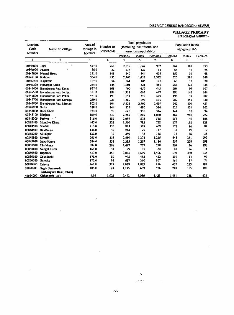
DISTRICT CENSUS HANDBOOK: ALWAR
VILLAGE PRIMARY PaDchayat Samiti -
Location Area of Total population
Population in the Code Name of Village Village in
Number of (including institutional and age-group 0-6
Number hectares households houseless population)
Persons Males Females Persons Males Females 2 3 4 5 6 7. 8 9 10
00846800 Jajor 577.0 261 2,039 1,047 992 362 189 173 00846900 Pahara 86.0 22 235 122 113 56 31 25 00847000 Nanga) Heera 151.0 143 849 444 405 159 91 68 00847100 Kithoor 564.0 455 2,765 1,453 1,312 520 280 240 00847200 Kajakpur 127.0 54 361 186 175 63 33 30 00847300 Naharpur Kalan 274.0 144 1,001 521 480 258 123 135 00847400 Bahadurpur Patti Katla 917.0 108 900 457 443 204 97 107 00847500 Bahaclurpur Patti Joriya 311.0 184 1,311 664 647 290 146 144 00847600 Bahadurpur Patti Pahar 421.0 193 1,051 572 479 196 94 102 00847700 Bahadurpur Patti Kanugo 220.0 223 1,289 693 596 282 152 130 00847800 Bahadurpur Patti Meersn 802.0 804 5,121 2,702 2,419 942 491 451 00847900 Sotks 188.0 144 874 490 384 226 124 102 00848000 Rani Khera 173.0 79 646 330 316 144 70 74 00848100 Bhajera 809.0 339 2,269 1,209 1,060 462 240 222 00848300 Peelwa 316.0 182 1,087 572 515 254 146 108 00848400 Mundiya Khera 445.0 228 1,510 782 728 279 158 121 00848500 Senthli 213.0 150 988 519 469 178 86 92 00848600 Bsldeobas 136.0 39 244 127· 117 38 19 19 00848700 Milakpur 133.0 32 250 132 118 74 36 38 00848800 Sirmoli 705.0 333 2,589 1,374 1,215 648 351 297 00849900 Jahar Khera 584.0 333 2,393 1,207 1,186 557 259 298 00850000 Chirlchana 392.0 208 1,497 777 720 369 176 193 00850100 Nangal Jheera 164.0 31 179 95 84 40 26 14 00850500 Rayabka 637.0 454 3,085 1,619 1,466 698 360 338 00850600 Chandooki 173.0 89 905 483 422 210 113 97 00850700 Gajeeka 172.0 95 657 350 307 161 87 74 00850800 Raisees 247.0 328 2,039 1,083 956 402 213 189 00850900 Nagla Samawadi 188.0 193 1,215 639 576 218 115 103
Kishaogarh Bas (Urban) 40604000 Kishan~~ 4.04 1,503 9,473 51050 4,423 1,461 788 673
.. ,
770
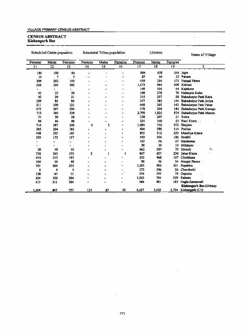
VILLAGE PRIMARY CENSUS ABSTRACT
CENSUS ABSTRACT Kishangarh Bas
Scheduled Castes popu~tion Scheduled Tribes population Literates Name of Village
Persons Males Females Persons Males Females Persons Males Females
·11 12 13 14 15 16 17 18 19 2
184 100 84 884 638 246 Jajor 12 7 5 87 64 23 PBhara
394 202 192 459 284 175 Nangal Heera 626 324 302 1,473 964 509 Kithoor
148 104 44 Kajakpur 43 23 20 348 278 70 Naharpur Kalan SO 29 21 315 257 58 BahBdurpur Patti Katla
169 85 84 527 383 144 Bahadurpur Patti Joriya 311 190 121 448 305 143 Bahadurpur Patti Pahar 671 367 304 578 394 184 Bahadurpur Patti Kanugo 713 384 329 2,799 1,825 974 Bahadurpur Patti Mccran 57 29 28 238 '207 31 Sotka 94 46 48 221 168 53 Rani Khera
716 387 329. 3 3 1,004 732 272 Bhajera 385. 204 181 404 290 114 Peelwa 408 225 183 80S 512 293 Mundiya Khera 329 172 157 540 354 186 Senthli
163 96 67 Baldeobas 58 39 19 Milakpur
20 10 10 662 587 75 Sinnoli -.~~ . 738 365 373 2 867 637 230 Jahar Khera ' 410 213 197 635 468 167 Chirkhana 104 56 48 90 56 34 Nangal Jhccra 501 266 235 1,205 904 301 Rayabka
9 4 5 272 246 26 Chandooki 138 67 71 276 197 79 Oajeeka 624 330 294 1,063 704 359 Raisees 615 311 304 586 401 185 Nagla Samawadi
Kishangarh Bas (Urban) 1,604 847 757 137 87 SO 6,627 3,923 2,704 Kishangarh (C1)
771
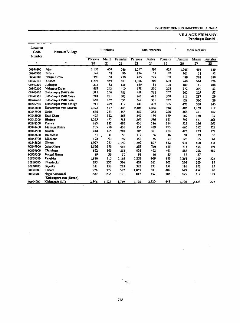
DISTRICT CENSUS HANDBOOK: ALWAR
VILLAGE PRIMARY Panchayat Samiti -
Location Illiterates Total workers Main workers Code Name of Village
Number Persons Males Females Persons Males Females Persons Males Females
2 20 21 22 23 24 25 26 27 28
00846800 Jajor 1,155 409 746 1,217 592 625 1,048 498 550 00846900 Pahara 148 58 90 124 57 67 103 51 52 00847000 Nangal Heera 390 160 230 425 227 198 388 208 180 00847100 Kithoor 1,292 489 803 1,306 703 603 740 564 176 00847200 Kajakpur 213 82 131 189 81 108 189 81 108 00847300 Naharpur Kalan 653 243 410 578 300 278 272 219 53 00847400 Bahadurpur Patti Kalla 585 200 385 468 261 207 262 205 57 00847500 Bilbadurpur patti Joriya 784 281 503 766 416 350 316 287 29 00847600 8ahadurpur Patti Pahar 603 267 336 662 375 287 329 300 29 00847700 8ahadurpur Patti Kanugo 711 299 412 787 432 355 470 330 140 00841800 Bahadurpur Patti Meeran 2,322 877 1,445 2,404 1,486 918 1,486 1,169 317 00847900 Sotka 636 283 353 459 253 206 368 221 147 00848000 RaniKhera 425 162 263 349 180 169 187 ISO 37 00848100 Bhl\iera 1,265 477 788 1,167 586 581 792 531 261 00848300 Pee1wa 683 282 401 630 316 314 522 256 266 00848400 Mundiya Khera 105 270 435 854 429 425 665 342 323 00848500 Senthli 448 165 283 585 321 264 425 253 112 00848600 Baldeobas 81 31 SO 112 66 46 94 59 3S 00848700 Milakpur 192 93 99 158 85 73 126 65 61 00848800 Sirmoli 1,927 787 1,140 1,709 897 812 931 600 331 00849900 lahar Khera 1,526 570 956 1,385 720 665 715 524 191 00850000 Chirkhana 862 309 553 933 492 441 587 298 289 00850100 Nangal Jheera 89 39 50 91 46 45 37 37 00850500 Rayabka 1,880 715 1,165 1,852 969 883 1,266 740 526 00850600 Chandooki 633 237 396 463 261 202 296 209 87 00850700 Gajecka 38) )53 228 322 171 lSI )]6 103 13 00850800 Raisees 976 379 597 1,065 583 482 629 459 170 00850900 Nagla Samawadi 629 238 391 817 432 385 495 312 183
Kishangarh Bas (Urban) 40604000 Kishan8arh ~C:Q 2,846 1,127 1,719 3,178 2,530 648 2,700 2,423 277
... eo:
772
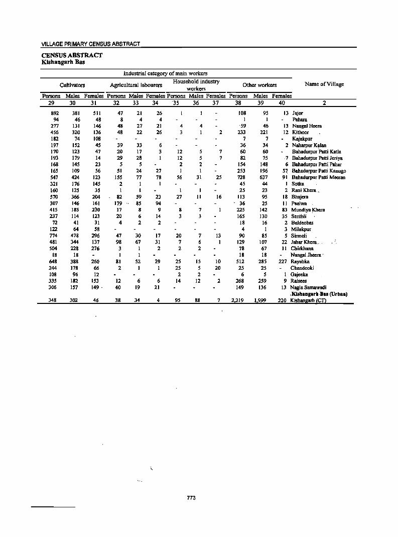
VILLAGE PRIMARY CENSUS ABSTRACT
CENSUS ABSTRACT Kishangarh Bas
Industrial category of main workers
Cultivators Agricultural labourers Household industry
Other workers Name of Village workers
Persons Males Females Persons Males Females Persons Males Females Persons Males Females 29 30 31 32 33 34 '35 36 37 38 39 40 2
892 381 Sl1 47 21 26 108 95 13 Jllior 94 46 48 8 4 4 I Pahara
277 131 146 48 27 21 4 4 '59 46 13 Nangal Heera 4S6 320 136 48 22 26 3 I 2 233 221 12 Kithoor 182 74 108 7 7 Klliakpur 197 152 4S 39 33 6 36 34 2 Naharpur K~lan 170 123 47 20 17 3 12 5 7 60 60 Bahadurpur Patti Katla 193 179 14 29 28 I 12 5 7 82 75 ,7 Bahadurpur Patti Joriya 168 145 23 5 5 2 2 154 148 6 Bahadurpur Patti Pahar 165 109 56 51 24 27 I I 253 196 5~ BahadufPur Patti Kanugo 547 424 123 ISS 77 78 56 31 2S 728 637 91 Bahadurpur Patti Meeran 321 176 145 2 I I 45 44 I Sotka 160 125 35 I I I 25 23 2 Rani Khera >,
570 366 204 82 59 23 27 II 16 113 95 18 Bhajera 307 146 161 179 " 85 94 ' 36 25 II Peelwa 415 18S 230 17 8 9 8 7 225 142 83 Mundiya Khera 237 114 123 20 6 14 3 3 165 130 35 Senthli
72 41 31 4 2 2 18 16 2 Ba1deobas 122 64 58 4 I 3 Milakpur 774 478 296 47 30 17 20 7 13 90 85 5 Sirrno1i 481 344 137 98 67 31 7 6 1 129 107 22 Jahar Khera .. ' , ,
504 228 276 3 I 2 2 2 78 67 11 Chirkhana 18 18 1 1 18 18 Nanga1 Jheera'
648 388 260 81 52 29 25 15 10 512 285 227 Rayabka 244 178 66 2 1 1 25 S 20 2S 2S Chandooki 108 96 12 2 2 6 S 1 Gajeeka 335 182 153 12 6 6 14 12 2 268 259 9 Raisees 306 157 149 . 40 19 21 149 136 13 Nag1a Samawadi
,Kishangarb,Bas (Urban) 348 302 46 38 34 4 95 88 7 2,219 1,999 220 Kishangarh (CT)
"
773
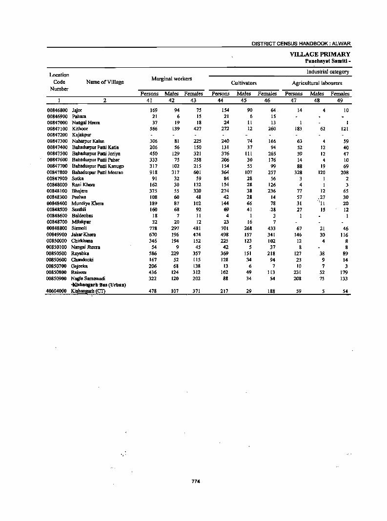
DISTRICT CENSUS HANDBOOK: ALWAR
VILLAGE PRIMARY Panchayat Samiti -
Location Industrial category
Code Name of Village Marginal workers
Cultivators Agricultural labourers Number
Persons Males Females Persons Males Females Persons Males Females 2 41 42 43 44 45 46 47 48 49
00846800 Jajor 169 94 75 154 90 64. 14 4 10 00846900 Pahara 21 6 15 21 6 15 00847000 Nangal Heera 37 19 18 24 11 13 I 00847100 Kithoor 566 139 421 272 12 260 183 62 121 00847200 Kajakpur 00847300 Naharpur Kalan 306 81 225 240 74 166 63 4 59 00847400 Bahadurpur Patti Katla 206 56 150 131 37 94 52 12 40 00847500 Bahadurpur Patti Joriya 450 129 321 376 111 265 59 12 47 00847600 Bahadurpur Patti Pabar 333 75 258 206 30 176 14 4 10 00847700 Bahadurpur Patti Kanugo 317 102 215 154 55 99 88 19 69 00847800 Bahadurpur Patti Meeran 918 317 601 364 107 257 328 120 208 00847900 Sotka 91 32 59 84 28 56 3 1 2 00848000 Rani Khera 162 30 132 154 28 126 4 1 3 00848100 Bhajera 375 55 320 274 38 236 77 12 65 00848300 Peelwa 108 60 48 42 28 14 57 .27 30 00848400 Mundiya Khera 189 87 102 144 66 78 31 -III 20 00848500 Senthli 160 68 92 69 41 .28 27 IS 12 00848600 Baldeobas 18 7 II 4 1 3 00848700 Milakpur 32 20 12 23 16 7 00848800 Sirmoli 778 297 481 701 268 433 67 21 46 00849900 JahatKherQ 670 196 474 498 157 341 146 30 116 00850000 Chirkhana 346 194 152 225 123 102 12 4 8 00850100 Nangal Jheera 54 9 45 42 5 37 8 8 00850500 Rayabka 586 229 357 369 151 218 127 38 89 00850600 Chandooki 167 52 115 128 34 94 23 9 14 00850700 Gajeeka 206 68 138 13 6 7 10 7 3 00850800 Raisees 436 124 312 162 49 113 231 52 179 00850900 Nagla Samawadi 322 120 202 88 34 54 208 7S 133
·Kisbangarh·Bas (Urban) 40604000 Kishansarh !£!2 478 107 371 217 29 188 59 5 54
\
" .
774
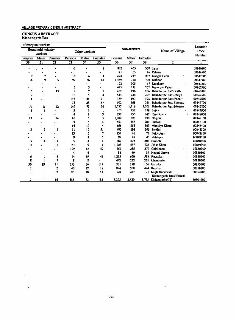
VILLAGE PRIMARY CENSUS ABSTRACT
CENSUS ABSTRACT Kisbangarh Bas
of marginal workers Location
Household -industry Non-workers Name of Village Code Other workers
workers Number Persons Males Females Persons Males Females Persons Males Females
-50 '51 52 53 54 55 56 57 58 2
",I 822 455 367 Jl\ior 00846800 III 65 46 Pahara 00846900
2 2 10 6 4 424 217 207 Nangal Heera 00847000 14 9 5 97 56 41 1,459 750 709 Kithoor 00847100
172 105 67 Kajakpur 00847200 3 3 423 221 202 Naharpur Kalan '00847300
15 15 8 7 432 196 236 Bahadurpur Patti Katla 00847400 2 I 13 5 8 545 248 297 Bahadurpur Patti Joriya 00847500
112 41 71 389 197 192 Bahadurpui Patti Pahar . 00847600 75 28 47 502 261 241 Bahadurpur Patti Kanugo 00847700
77 15 62 149 75 74 2,.717 1,216 1,501 Babadurpur Patti Meeran 00847800 1 I 3 2 I 415 237 178 Satka 00847900
4 I 3 297 150 147 Rani Khera 00848000 14 14 10 5 5 1,102 623 479 Bhajera 00848100
9 5 4 457 256 201 Peelwa 00848300 14 10 4 656 353 303 Mundiya Kbera 00848400
3 2 61 10 51 403 198 205 Senthli 00848500 13 6 7 132 61 71 Baldeobas 00848600 9 4 5 92 47 45 Milakpur 00848700
5 4 1 5 4 I 880 477 403 Sirmoli 00848800 3 3 23 9 14 1,008 487 521 JaharKbera 00849900
109 67 42 564 285 279 Chirkhana 00850000 4 4 88 49 39 Nangal Jheera 00850100
6 I 5 84 39 45 1,233 650 583 Rayabka 00850500 8 1 7 8 8 442 222 220 Chandooki 00850600
30 19 II 153 36 117 335 179 156 Gajeeka 00850700 3 I 2 40 22 18 974 500 474 Raisees 00850800 3 1 2 23 10 13 398 207 191 Nagla Sarnawadi 00850900
Kisbangarh Bas (Urban) 17 16 185 72 113 6.295 2,520 3.775 Kishan~arh (CT) 40604000
775

DISTRICT CENSUS HANDBOOK: ALWAR
VILLAGE PRIMARY Panchayat Samiti -
Location Area of Total population
·Poptilationin·the . Code Name of Village Village in
Number of (including institutional and age-group 0-6
Number hectares households houseless.populatioQ) - ~ ... - '. ,_
Persons iMales. Females ~ersons Males FemBles 2 3 4 5 6 7 8 9 10
0005 Kotkasim (fotal) 34,303.0 181'165 117,687 61,712 55,975 21,563 11,593 9/)70 0005 Kotkasim (Rural) 34,303.0 18,465 117,687 61,712 55,975 21,563 11,593 9,970 0005 Kotkasim (Urban)
Kotkasim (Rural) 00785500 Akoli 335.0 191 1,077 545 532 181 88 93 00785600 Kaririwas 105.0 57 342 188 154 36 26 10 00785700 Hajnaka 151.0 53 337 169 168 71 32 39 00785.800 Lalpur 596.0 1'32 912 469 443 162 76 86 00785900 Bccrahwas 297.0 62 410 208 202 65 29 36 00786000 lokhawas 103:0 59 365 197 168 66 40 26 001186lO0 Ujoli 630.0 185 1,207 628 579 244 144 100 00186200 Dcosecka 115.0 12 117 67 SO 22 15 7 00786300 Kayampura Jokhawas 486.0 102 60S 331 274 138 71 67 00786i100 BurhiBawal 892.0 ·625 3,676 1,900 1,716 664 343 321 007865.00 Majri 160.0 liS 662 343 319 115 76 39 ODi1S66O!) Nasopur .< 4S4~O 323 1,881 1,009 872 332 185 147 00786700 Madhoopur 283;0 171 1,103 565 538 224 129 95 00186800 Bhamoowas 185.0 94 539 271 268 102 45 57 00786900 Bhonkar 329.0 298 1,784 967 817 301 178 123 007.87000 Dalawas 150.0 143 974 530 444 274 156 118 00787100 Teuwas 224.0 165 1,200 630 570 333 170 163 001,87200 Berawas Kalan 180.0 140 883 460 423 148 88 60 001,873.00 Meerpur 275:0 196 1,236 636 600 219 117 102 007.87400 Kulubpur 572.0 324 1,997 1,039 958 278 142 136 QQ78"1..500 Jamalpur 267.0 106 623 332 291 136 76 60 00787.600 Matalwas 261.0 I f6 774 383 391 155 85 70 Ocil.87.7DO Silpata 293:0 f41 838 437 401 166 94 72 0098i800 Makdawa 299.'0 TS6 897 469 428 149 86 63 60787900 Jat06:was' ,i<- 't'tit.:~t:i!'~ 320.0 184 1,168 589 579 195 91 104 !g,r.t~2&Q_'!!\ijiP1!r :;-=:";I:=";¥~f,,::. 29_($~i:( _.'~~f "_ .525 '281-. .... ~:244-.-- -":":''1.3 ·48· -2§ 00788100 RJunpur 313.0 195 1,197 645 552 232 129 103 00788200 Beeliyawas 189.0 90 482 262 220 93 48 45 00788300 Beclaheri 393.0 246 1,475 741 734 24:1 129 113 00788400 Narwas 220.0 182 1,l3l 599 532 188 102 86 00788500 Anaka 190.0 85 519 261 258 80 38 42 00788600 Kanharka 609.0 352 2,102 1,098 1,004 381 204 177 00788700 Chowki 161.0 73 404 228 176 47 31 16 00788800 Sherpur 183.0 146 777 376 401 139 64' 75 00788900 Mcnawas 114.0 60 345 172 173 47 21 26 00789000 Gokulpur 87.0 29 172 88 84 28 17 11 00789100 Turkwas 143.0 28 165 84 81 40 20 .. 20 00789200 Chawandi 220.0 79 485 259 226 79 43· .36 00789300 Joriya 690.0 611 3,853 2,052 1,801 640 341 299. 00789400 Dsika 195.0 66 462 224 238 92 43 ":-- 219 00789500 Narooki 52.0 -------Un-inhabitcd------00789600 Kotkasim 1,188.0 1,218 7,164 3,802 3,362 1,166 630 536 00789700 Alampur 180.0 126 626 334 292 115 63 52 P!>7,8?~00 Jakopur 205.0 122 859 453 406 165 88 77 00.7.89900 Goojriwas 351.0 143 941 500 441 220 110 ""'110 007900'00 Baghana 763.0 281 1,969 1,054 915 351 210 l'n oo'i§Oi.i)a,;:Mmvasi @ Madhopuri
t ....
278.0 90 589 316 273 97 61 36' 00790~QO .,;.Kasiiqpur 189.0 53 482 265 217 104 58 46
. 00190300.: :RaniYawas 163.0 28 223 Il3 llO .. . '34 .. i8 \. -.
16 .;;,":.
;. 007904QO~.;_.Meoli. 390.0 167 951 520' 431'.' :.l· '138' . '7,3 ... '. ~>~:'6S' OO;Z9050D\ BCgBIl!pur 99.0 32 223 121 102 '35 18.' . ~', '17 00790600 'Gaitgapuri 280.0 92 592 301 291 .109 56 _
~ ,
. 53 '00790700: ~l;adJltir' 464.0 205 1;257 -M9 ·608 ''''"':_. ... 2.23 12S--·· ':-:'. ·98 ':-. '00790800 Tioonmcra 388.0 '119 727 376- ~.' . .'351'.' : ... 106 SO _ ... :...·.56··· ..
. .. . . ,. " -~~ .
-- ....... - ;.- .~ .. --'i76~--' -
"":! _. ~.-, "'"#. ;;;:.:-:: _.., : :-----" ~.> .... ,; --.J..-f· .... ~ - ~ ...
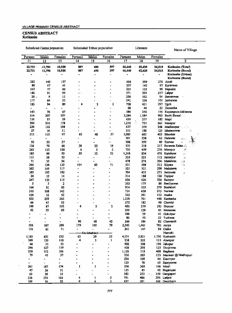
VILLAGE PRIMARY CENSUS ABSTRACT
CENSUS ABSTRACT Kotkasim
Scheduled Castes popuation Scheduled Tribes population Literates Name of Village
Persons 'Males Females Persons Males Females Persons Males Females .11 12 13 14 15 16 17 18 19 2
22,731 " ,11,796 10,935 887 l&90 397 66,440 42,425 24,015 Kotkasim (fotal) 22,731 11,796 10,935 887 490 397 66,440 42,425 24,015 Kotkallim (Rural)
. Kotkasim (Urban) Kotkallim (Rural)
282 145 137 666 390 276 Akoli 88 47 41 237 140 97 Kaririwas
143 77 66 221 122 99 Hajnaka 186, 91 95 571 354 217 La1pur 20" 9 11 256 162 94 Beeranwas
117 64 53 241 136 105 Jokhawas 183 94 89 4 2 2 728 431 297 Ujoli
68 46 22 Dcoseeka 143 76 67 386 240 146 Kayampura Jokhawas 614 307 307 2,284 1,384 900 Burhi Bawal'. ' 116 S7 S9 439 257 182 Majri 394 216 178 1,216 755 461 Nasopur 230 122 108 627 379 248 Madhoopur. 27 16 II 311 188 123 Bhamoowas .,
212 115 97 85 48 37 1,085 682 403 Bhonkar 301 238 63 Dalawas .. ~, . :-,~ SO 23 27 308 259 49 Teuwas .. ,
136 70 66 38 22 16 535 318 217 Berawas Kalan .:~ 263 133 130 6 3 3 735 459 276 Meerpur ,a/
183 90 93 55 32 23 1,310 834 476 Kutubpur , ~ .. III 58 53 333 221 112 Jama1pur i.
7l 35 36 478 274 204 Matalwas : .. ~~ 266 134 132 154 83 71 521 308 213 Silpata ,., 262 145 117 521 321 200 Makdawa 385 193 192 704 431 273 Jatoowas ., 26 12 14 314 188 126 Hajipur
247 132. 115 656 420 236 Rampur 5 3 2 263 175 88 Beeliyawas
164 81 83 914 535 379 Beelaheri 310 168 142 731 458 273 Narwas 104 52 52 323 201 122 Analea 522 259 263 1,239 791 448 Kanharka 66 41 25 272 182 90 Chowki
190 87 103 4 2 2 462 279 183 Sherpur 42 22 20 209 128 81 Menawas
100 59 41 Gokulpur 80 55 25 Turkwas
90 48 42 266 184 82 Chawandi 556 267 289 179 100 79 2,243 1,461 782 Joriya 132 61 71 241 147 94 Daika
------Un-inhabited------- Narooki 1,163 631 532 62 39 23 4,551 2,821 1,730 Kotkasim
249 139 110 4 3 1 338 223 115 Alampur 66 33 33 502 308 194 Jakopur
246 127 119 428 295 133 Goojriwas 218 112 106 1,126 718 408 Baghana
79 42 37 336 203 133 Maswasi @ Madhopuri 224 160 64 Kasimpur 123 78 45 Raniyawas
361 187 174 526 360 166 Meoli 47 26 21 125 85 40 Begampur 63 30 33 383 233 150 Gangapuri
336 174 162 4 I 3 791 486 305 Ladpur 109 56 53 9 6 3 457 291 166 Doomhera
777
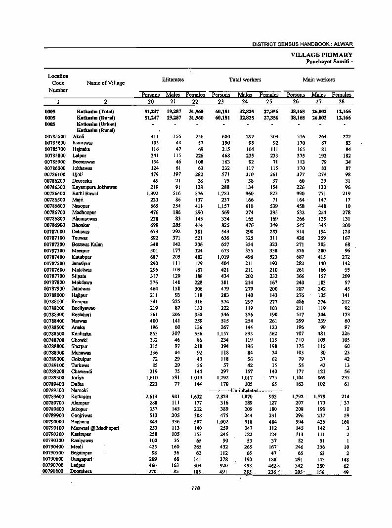
DISTRICT CENSUS HANDBOOK: ALWAR
VILLAGE PRIMARY Panchayat Samiti -
Location III iterates Total workers Main workers
Code Name of Village Number
Persons Males Females Persons Males Females Persons Males Females 2 20 21 22 23 24 25 26 27 28
0005 Kotkasim (Total) 51,247 19,287 31,960 60,181 32,825 27,356 38,168 26,002 12,166 0005 Kotkasim (Rural) 51,247 19,287 31,960 60,181 32,825 27,356 38,168 26,002 12,166 0005 Kotkasim (Urban)
Kotkaslm (Rural) 00785500 Akoli 411 .155 256 600 297 303 536 264 272 00785600 Kaririwas 105 48 57 190 98 92 170 87 83 00785700 Hajnaka 116 47 69 215 104 111 165 81 84 00785800 Lalpur 341 115 226 468 235 233 375 193 182 00785900 Beemnwas 154 46 108 163 92 71 113 79 34 00786000 Jokhawas 124 61 63 232 117 115 170 83 87 00786100 Ujoli 479 197 282 571 310 261 377 279 98 00786200 Deoseeka 49 21 28 75 38 31 60 29 31 00786300 Kayampura Jokhawas 219 91 128 288 134 154 226 130 96 00786400 Burhi Bawal 1,392 516 876 1,783 960 823 990 771 219 00786500 Majri 223 86 137 237 166 71 164 . 147 17 00786600 Nasopur 665 254 4U 1,157 618 539 458 448 10 00786700 Madhoopur 476 186 290 569 274 295 532 254 278 00786800 Bhamoowas 228 83 145 334 165 169 266 135 131 00786900 Bhankar 699 285 414 825 476 349 545 345 200 00787000 Oalawas 673 292 381 543 290 253 314 194 120 00787100 Teuwas 892 371 521 636 325 311 426 259 167 00787200 Berawas Kalan 348 142 206 657 334 323 271 203 68 00787300 Meerpur 501 177 324 673 335 338 376 280 96 00787400 Kutubpur 687 205 482 1,019 496 523 687 415 272 00787500 Jamalpur 290 111 179 404 211 193 282 140 142 00787600 Matalwas 296 109 187 421 211 210 261 166 95 00787700 Silpata 317 129 188 434 202 232 366 157 209 00787800 Makdawa 376 148 228 381 214 167 240 183 57 00787900 Jatoowas 464 158 306 479 279 200 287 242 45 00788000 Hajipur 211 93 118 283 140 143 276 135 141 00788100 Rampur 541 225 316 574 297 277 486 274 212 00788200 Beeliyawas· 219 87 132 222 119 103 2'11 119 92 00788300 Beelaheri 561 206 355 546 356 190 517 344 173 00788400 Narwas 400 141 259 515 254 261 299 239 60 00788500 Anaka 196 60 136 267 144 123 196 99 97 00788600 Kanharka 863 307 556 1,157 595 562 707 481 226 00788700 Chowki 132 46 86 234 119 liS 210 105 105 00788800 Sherpur 315 97 218 394 196 198 175 115 60 00788900 Menawas 136 44 92 1I8 84 34 103 80 23 00789000 Gokulpur 72 29 43 118 56 62 79 37 42 00789100 Turkwas 85 29 56 57 42 15 55 42 13 00789200 Chawandi 219 75 144 297 157 140 177 121 56 00789300 Joriya 1,610 591 1,019 1,792 1,017 775 1,104 869 235 00789400 Oaika 221 77 144 170 105 65 163 102 61 00789500 Narooki ------Un-inhabited--------00789600 Kotkasim 2,613 981 1,632 2,823 1,870 953 1,792 . 1,578 214 00789700 Alampur 288 III 177 316 189 127 207 170 : 37 00789800 Jakopur 357 145 212 389 209 180 208 198 10 00789900 Goojriwas 513 205 308 475 244 231 296 237 59 00790000 BaglulIla 843 336 507 1,002 518 484 594 426 168 00790100 Maswasl @ Madbopuri 253 113 140 259 147 112 145 142 3 00790200 Kasimpur 258 lOS 153 246 122 124 113 111 2 00790300 Raniyawas 100 35 65 90 53 37 52 51 00790400 Meoli 425 160 265 432 265 167' 246 236 10 00790500 Begampur 98 36 62 112 65 47 65 63 2 00790600 Gangapuri .~ 209 68 141 378 :/ 190 188 291 143 148 00790700 Ladpur 466 163 303 920 458 462~(; 342 280 62 00790800 _ Doomhera 270 85 185 ~91 2S5 .236.:._ .. .. 205' .~_~ _156._ 49
778
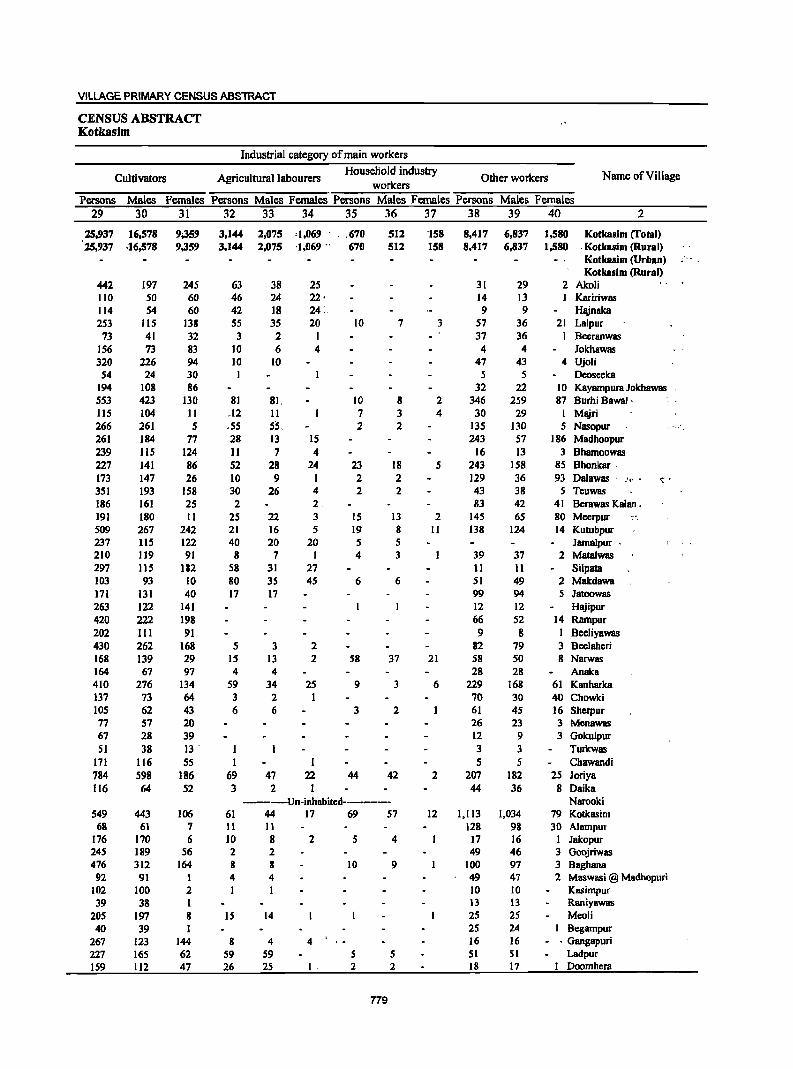
VILLAGE PRIMARY CENSUS ABSTRACT
CENSUS ABSTRACT Kotkasim
Industrial category of main workers
Cultivators Agricultural labourers HouseHold industry
Other workers Name of Village workers
Persons Males Females Persons Males Females' Persons Males Females Persons Males Females
29 30 31 32 33 34 35 36 37 38 39 40 2
25,937 16,578 9;359 3,144 2,075 '1,069 . . . 670 512 'l58 8,417 6,837 1,580 Kotkasim crotal) 25,937 .16,578 9,359 3,144 2,075 '1,069 .. 670 512 158 8,417 6,837 1,580 -Kotkasim (Rural)
Kotkasim (Urban) Kotkasim (Rural)
442 197 245 63 38 25 31 29 2 Akoli 110 50 60 46 24 22· 14 13 1 Kaririwas 114 54 60 42 18 24 : 9 9 Hajnaka 253 115 138 55 35 20 10 7 3 57 36 21 Lalpur
73 41 32 3 2 I 37 36 I Bccranwas 156 73 83 10 6 4 4 4 lokhawas 320 226 94 10 10 47 43 4 Ujoli
54 24 30 5 5 Deoseeka 194 108 86 32 22 10 Kayampura Jokhawas 553 423 130 81 81, 10 8 2 346 259 87 Burhi Bawal ' 115 104 Il .12 II 7 3 4 30 29 I Majri 266 261 5 .55 55. 2 2 135 130 5 Nasopur 261 184 77 28 13 15 243 57 186 Madhoopur 239 115 124 II 7 4 16 13 3 Bhamoowas 227 141 86 52 28 24 23 18 5 243 158 85 Bhonkar . 173 147 26 10 9 I 2 2 129 36 93 Dalawas . .' •. , <:'. 351 193 158 30 26 4 2 2 43 38 5 Teuwas 186 161 25 2 2 83 42 41 Bcrawas Kalan. 191 180 II 25 22 3 15 13 2 145 65 80 Mccrpur --509 267 242 21 16 5 19 8 II 138 124 14 Kutubpur 237 115 122 40 20 20 5 5 Jamalpur . 210 119 91 8 7 I 4 3 39 37 2 Matalwas 297 115 182 58 31 27 II II Silpata 103 93 10 80 35 45 6 6 51 49 2 Makdawa 171 131 40 17 17 99 94 5 Jatoowas 263 122 141 12 12 Hajipur 420 222 198 66 52 14 Rampur 202 III 91 9 8 I Beeliyawas 430 262 168 5 3 2 82 79 3 Bcelahcri 168 139 29 15 13 2 58 37 21 58 50 8 Narwas 164 67 97 4 4 28 28 ARaka 410 276 134 59 34 25 9 3 6 229 168 61 Kanharka 137 73 64 3 2 I 70 30 40 Chowki 105 62 43 6 6 3 2 61 4S 16 Shcrpur 77 57 20 26 23 3 Menawas 67 28 39 12 9 3 Gokulpur SI 38 13 . 3 3 Turkwas
171 116 55 1 I 5 5 Chawandi 784 598 186 69 47 22 44 42 2 207 182 25 Joriya 116 64 52 3 2 1 44 36 8 Daika
----Un-inhabitcd------- Narooki 549 443 106 61 44 17 69 57 12 1,113 1,034 79 Kotkasim
68 61 7 11 II 128 98 30 A1ampur 176 170 6 10 8 2 5 4 17 16 1 lakopur 245 189 56 2 2 49 46 3 Goojriwas 476 312 164 8 8 10 9 100 97 3 8aghana 92 91 1 4 4 49 47 2 Maswasi @ Madhopuri
102 100 2 10 10 Kasimpur 39 38 I 13 13 Raniyawas
205 197 8 IS 14 25 25 Meoli 40 39 1 25 24 8egampur
267 123 144 8 4 4 16 16 - . Gangapuri 227 165 62 59 59 S 5 51 SI Ladpur 159 112 47 26 25 1. 2 2 18 17 I Doomhcra
779
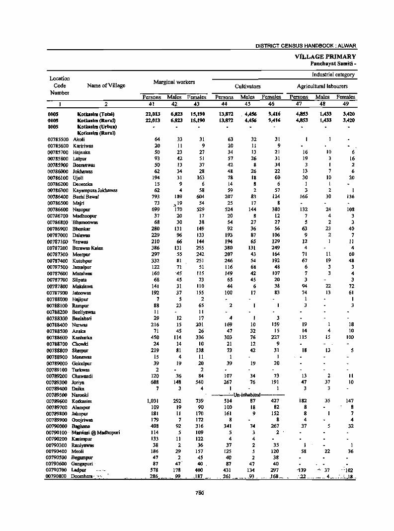
DISTRICT CENSUS HANDBOOK: ALWAR
ViLLAGE PRIMARY Panehayat Samiti -
Location Industrial category
Code Name of Village Marginal workers
Cultivators Agricultural labourers Number
Persons Males Females Persons Males Females Persons Males Females 2 41 42 43 44 45 46 47 48 49
0005 Kotkasim (Totsl) 22,013 6,823 15,190 13,872 ,4,456 9,416 4,853 1,433 3,420 0065 Kotkaslm (Rural) 22,013 6,823 15,190 13,872 4,456 9,416 4,853 1,433 3,420 ODDS Kotkaslm (Urban)
Kotkasim (Rural) 00785500 Akoli 64 33 31 63 32 31 00785600 Kaririwas 20 11 9 20 11 9 00785700 HiUnaka 50 23 27 34 13 21 16 10 6 00785800 Lalpur 93 42 SI 57 26 31 19 3 16 00785900 Bceranwas 50 13 37 42 8 34 3 I 2 00786000 Jokhawas 62 34 28 48 26 22 13 7 6 007.86100 Ujoli 194 31 163 78 18 60 30 10 20 00786200 Deoseeka 15 9 6 14 8 6 I I 00786300 Kayampura Jokhawas 62 4 58 59 2 57 3 2 1 00786400 Burhi Bawal 793 189 604 207 83 124 166 30 136 00786500 Majri 73 ;,19 54 25 17 8 00786600 Nasopur 699 170 529 524 144 380 132 24 108 00786700 Madhoopur 37 20 17 20 8 12 7 4 3 00786800 'Bhamoowas 68 30 38 S4 21 27 5 2 3 00786900 Bhonkar 280 131 149 92 36 S6 63 23 40 00787000 Oalawas 229 96 133 193 87 106 9 2 7 00787100 Teuwas 210 66 144 194 6S 129 12 I II 00787200 Berawas Kalan 386 131 2S5 380 131 249 4 4 00787300 Meerpur 297 55 242 207 43 164 71 II 60 00787400 Kutubpur 332 81 251 246 54 192 67 19 48 00787500 Jama1pur 122 71 SI 116 68 48 6 3 3 00787600 Matalwas 160 '45 lIS 149 42 107 7 3 4 00787700 Silpata 68 45 23 65 45 20 3 3 00787800 Makdawa 141 31 110 44 6 38 94 22 72 00787900 Jatoowas 192 37 155 100 17 83 74 13 61 00788000 HiUipur 7 5 2 I 1 00788100 Rampur 88 23 65 2 3 3 00788200 Beeliyawas 11 11 00788300 Beelahcri 29 12 17 4 I 3 00788400 Narwas 216 15 201 169 10 159 19 1 18 00788500 Anaka 71 45 26 47 32 15 14 4 10 00788600 Kanharka 450 114 336 303 76 227 115 15 100 00788700 Chowki 24 14 10 21 12 9 00788800 Sherpur 219 81 138 73 42 31 18 13 5 00788900 Menawas 15 4 11 1 I 00789000 Gokulpur 39 19 20 39 19 20 00789100 Turkwas 2 2 00789200 Chawandi 120 36 84 107 34 73 13 2 11 00789300 Joriya 688 148 540 267 76 191 47 37 10 00789400 Oaika 7 3 4 1 3 3 00789500 Narooki -------' -Un-il1habitcd--------00789600 Kotkasim 1,031 292 739 514 87 427 i82 35 147 00789700 Alampur 109 19 90 100 18 82 8 8 00789800 Jakopur 181 11 170 161 9 152 8 7 00789900 Goojriwas 179 7 172 8 8 4 4 00790000 Baghana 408 92 316 341 74 267 37 5 32 00790100' ,Maswasi @ Madhopuri 114 5 109 5 3 2 00790200 Kasimpur 133 11 122 4 4 00790300 Raniyawas 38 2 36 37 2 35 1 1 00790400 Meoli 186 29 157 125 5 120 58 22 36 00790500 Begampur 47 2 45 40 2 38 00790600 Gangapuri ' 87 47 40 , 87 47 40 00790700 Ladpur 578 178 400 431 134 297 -139 _'., 37 ':102 00790800 Doomhera·. ":" _ 286 ___ , ... 99 .. ".187 _ _, 261 .. _ '. __ .93" _>', .168,., ::22 __ ,. <_., 4_ •. __ :;~ .• IB ..
786

VILLAGE PRIMARY CENSUS ABSTRACT
CENSUS ABSTRACT Kotkasim
of marginal workers Location Household industry Non-workers Name of Village Code Other workers
workers Number Persons Males Females Persons Males Females Persons Males Females
50 51 52 53 54 55 56 57 58 2
350 140 210 2.938 794 2,144 57,506 28,887 28,619 Kotkasim (Total) 0005 350 140 210 2,938 794 2,144 57,506 28,887 28,619 Kotkasim (Rural) 0005
Kotkasim (Urban) 0005 Kotkasim (Rural)
477 248 229 Akoli 00785500 152 90 62 Kaririwas 00785600 122 65 57 Hajnaka 00785700
3 3 14 10 4 444 234 210 Lalpur 00785800 5 4 247 116 131 Beeranwas 00785900 1 I 133 80 53 Jokhawas 00786000
86 3 83 636 318 318 Ujoli 00786100 42 29 13 Oeosecka 00786200
317 197 120 Kayampura Jokhawas 00786300 7 2 5 413 74 339 1,893 940 953 Burhi Bawal 00786400
48 2 ·46 425 177 248 Majri 00786500 43 2 41 724 391 333 Nasopur 00786600 9 7 2 534 291 243 Madhoopur 00786700 9 8 205 106 99 Bhamoowas 00786800
23 14 9 102 58 44 959 491 468 Bhonkar 00786900 27 7 20 431 240 191 Dalawas 00787000 3 3 564 305 259 Teuwas 00787100 2 2 226 126 100 Bcrawas Kalan 00787200
1 18 18 563 301 262 Meerpur 00787300 2 17 7 10 978 543 435 Kutubpur ", 00787400
219 121 98 Jama1pur 00787500 3 3 353 172 181 Mata1was 00787600
404 235 169 Silpata 00787700 3 3 516 255 261 Makdawa 00787800
17 7 10 689 310 379 Jatoowas 00787900 S 4 1 242 141 101 Hajipur 00788000
83 22 61 623 348 27S Rampur 00788100 11 11 260 143 117 Beeliyawas 00788200 25 11 14 929 385 544 Beelaheri 00788300
2S 3 22 3 1 2 616 345 271 Narwas 00788400 10 9 1 252 117 135 Anaka 00788500
2 2 30 21 9 945 503 442 Kanharka 00788600 3 2 I 170 109 61 Chowki 00788700
127 26 101 383 180 203 Sherpur 00788800 14 4 10 227 88 139 Menawas 00788900
S4 32 22 Gokulpur 00789000 2 2 108 42 66 Turkwas 00789100
188 102 86 Chawandi 00789200 34 5 29 340 30 310 2,061 1,035 1,026 Joriya 00789300
3 3 292 119 173 Oaika 00789400 -----Un-inhabited----- Narooki 00789500
30 13 17 305 157 148 4,341 1,932 2,409 Kotkasim 00789600 1 1 310 145 165 Alampur 00789700
12 1 11 470 244 226 Jakopur 00789800 1 166 6 160 466 256 210 Goojriwas 00789900 S 4 2S 12 13 967 536 431 8aghana 00790000
109 2 107 330 169 161 Maswasi @ Madhopuri 00790100 129 7 122 236 143 93 Kasimpur 00790200
133 60 73 Raniyawas 00790300 3 2 1 519 2S5 264 Meoli 00790400 7 7 III 56 55 Begampur 00790500
.=:~~. 214 111 103 Gangapuri 00790600 S 5 3 2 337 191 146 Ladpur 00790700 2 I:- 236 121 115 Doomhera 00790800
781
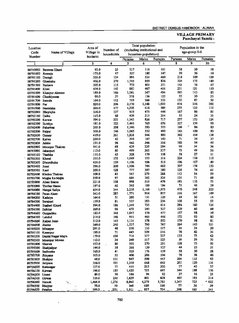
DISTRICT CENSUS HANDBOOK: ALWAR
VILLAGE PRIMARY Panchayat Samiti -
Location Area of Total population
Population in the
Code Name of Village Village in Number of (including institutional and
age-group 0-6 Number hectares
households houselcss population)
Persons Males Females Persons Males Females 2 3 4 5 6 7 8 9 10
00790900 Berawas Khurd 93.0 2S 217 116 101 38 20 18 00791000 Roneeja 173.0 47 327 180 147 50 36 14 00791100 Deengli 332.0 124 991 531 460 218 109 109 00791200 Gheekaka 402.0 279 1,745 919 826 324 175 149 00791300 Badsara 305.0 115 772 401 371 145 78 67 00791400 Khcri 404.0 142 883 467 416 231 121 110 00791500 Khanpur Aheeran 189.0 166 1,041 547 494 19S 113 82 00791600 ChachiyawBS 96.0 37 258 136 122 S5 30 25 00791700 Sanoda 164.0 112 719 366 353 132 82 50 00791800 Pur 820.0 396 2,170 1,148 1,022 416 216 200 00791900 Neemlaka 266.0 177 1,205 616 589 233 123 110 00792000 Bhojrajka 336.0 137 919 475 444 167 86 81 00792100 Daika 115.0 68 429 215 214 55 24 31 00792200 Karwar 594.0 222 1,543 826 717 277 153 124 00792300 Ikrotiya 181.0 222 1,441 765 676 227 134 93 00792400 PaharWBS 265.0 208 1,146 593 553 169 86 83 00792500 Palpur 566.0 146 1,045 552 493 183 100 83
00792600 Gunsar 419.0 261 1,828 946 882 302 164 138 00792700 Kcrwa 250.0 42 310 167 143 71 34 37 00792800 Jalaka 191.0 96 662 346 316 103 54 49 00792900 Moonpur Thakran 341.0 68 439 235 204 90 54 36 00793000 Jahanpuri 113.0 80 499 262 237 75 49 26 00793100 Thathka 111.0 63 328 170 . 158 58 27 31 00793200 Kheral 351.0 175 1,069 553 516 224 114 110 00793300 Dheerdhoka 416.0 159 1,106 596 510 196 107 89 00793400 Jonal 396.0 200 1,406 744 662 307 154 153 00793500 Kani 200.0 128 777 397 380 135 74 61 00793600 Khohra Thakran 308.0 82 567 279 288 113 54 59 00193700 Magha Ka Majra 250.0 97 684 360 324 131 71 60 00793800 AheerBasna 221.0 158 998 519 479 183 no 73 00793900 Thethar Basna 197.0 60 393 199 194 75 46 29 00794000 Nanga! Saliya 654.0 344 2,239 1,164 1,075 470 248 222 00794100 PatanAheer 343.0 287 1,771 914 857 316 167 149 00794200 Kadaiya 164.0 51 280 151 129 44 30 14 00794300 Beraheri 159.0 81 527 293 234 108 S5 S3 00794400 Bagheri Khurd 594.0 186 1,349 735 614 284 160 124 00794500 Salkhar 269.0 96 672 345 327 129 60 69 00794600 Gurgacbka 183.0 146 1,047 570 477 157 98 59 00794700 Lahdod 214.0 146 911 465 446 173 93 80 00794800 Raipur Jatan 312.0 145 1,131 578 553 179 98 81 00794900 Jharka 349.0 240 1,537 790 747 264 143 121 00795000 Mirzapur 291.0 40 250 133 117 44 24 20 00795100 Koompur 190.0 71 445 229 216 78 42 36 00795200 Daulat Nagar Majra 179.0 108 714 377 337 135 73 62 00795300 Moonpur Mewan 113.0 24 240 117 123 59 29 30 00795400 Shorwa 153.0 80 501 270 231 128 73 55 00795500 Shahjadpur 144.0 38 266 139 127 44 23 21 00795600 Sadhooka 165.0 41 335 176 159 58 30 28 00795700 Jhiryana 105.0 52 400 206 194 78 38 40 00195800 ShahPur 48.0 151 947 500 447 204 112 92 00795900 Jatiyana 356.0 191 1,310 668 642 251 120 131 00796000 Ramnagar 137.0 77 415 215 200 77 40 37 00796100 Kirwari 196.0 185 1,420 723 697 344 188 156 0(r'l96200 Lisani 89.0 30 186 94 92 37 16 21 0079630~ Girwas 355.0 230 1,629 801 828 407 193 214 00796400 Harsoli '" 1,464.0 1,276 8,060 4,279 3,781 1,347 725 ., 622 00796500 Bhojpur 70.0 50 369 -189 180 -77 38 39 00196600 P.ataiiya .399.0. ___ _ ~.231. .•. _ 1,61J ._. __ 857 _ "'_. .' 754 ..... _ . .. .308. 163 . . _ .145
-782
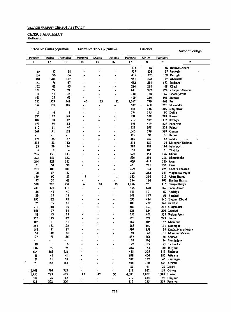
VILLAGE PRIMARY CENSUS ABSTRACT
CENSUS ABSTRACT Kotkasim
Scheduled Castes popuation Scheduled Tribes population Literates Name of Village
Persons Males .Females Persons Males Females Persons Males Females 11 12 13 14 15 16 17 18 19 2
133 87 46 Berawas Khurd 65 37 28 255 138 117 Roneeja
136 70 66 435 326 109 Oeengli 368 201 167 981 624 357 Gheekaka 143 76 67 462 289 173 Badsara 152 87 65 284 216 68 Kheri 151 77 74 611 387 224 Khanpur Ahccran 80 42 38 ISO 88 62 Chachiyawas
140 75 65 419 256 163 Sanoda 715 373 342 45 23 22 1,267 799 468 Pur 352 170 182, 637 408 229 Neemlaka
555 346 209 Bhojrajka' 12 4 8 274 175 99 Daika
330 182 148 891 608 283 Karwar 102 60 42 919 587 332 Ikrotiya .. 173 89 84 645 419 226 Paharwas 110 61 49 623 398 225 Palpur 269 141 128 1,046 679 367 Gunsar
129 98 31 Kerwa 172 85 87 ~ 389 247 142 lalaka ... "-235 123 112 213 139 74 Moonpur Thakran
53 29 24 295 181 114 lahanpuri 6 2 4 151 100 51 Thathka
296 153 143 527 351 176 Kheral 273 151 122 599 391 208 Dheerdhoka 244 129 115 659 449 210 lanai
61 31 30 451 281 170 Kani 203 103 100 299 174 125 Khohra Thakran 100 58 42 395 252 143 Magha Ka Majra 179 90 89 583 364 219 Aheer Basna 77 35 42 224 124 100 Thethar Basna
550 296 254 63 30 33 1,176 761 415 Nangal Saliya 241 123 118 995 628 367 Patan Aheer
86 46 40 163 101 62 Kadaiya 29 15 14 198 147 51 Beraheri
195 112 83 590 444 146 Baghcri Khurd 76 35 41 400 252 148 Salkhar
213 118 95 584 367 217 Gurgachka 161 77 84 526 324 202 Lahdod
81 43 38 656 401 255 Raipur latan 225 113 112 820 521 299 Iharka 102 51 51 167 lOS 62 Mirzapur 258 133 125 288 157 131 KoompuT 168 81 87 394 258 136 Daulat Nagar MajTa 54 30 24 94 63 31 Moonpur Mewan
127 71 56 237 161 76 Shorwa 160 106 54 ShahjadpuT
19 13 6 172 119 53 Sadhooka 146 72 74 232 152 80 Jhiryana 694 363 331 418 305 113 Shahpur
88 44 44 639 454 185 Jatiyana 62 31 31 182 137 45 Ramnagar
323 162 161 508 380 128 Kirwari 83 61 22 Lisani
; ),468 716 752 513 362 151_ Girwas 1,450 773 677 83 . 47 36 4,883 3,102 1,78"i; Harsoli
342 175 167 217 124 93 BhojPUT 431 222 209 812 555 '257 Pataliya
783

DISTRICT CENSUS HANDBOOK: ALWAR
VILLAGE PRIMARY Panchayat Samiti -
Location Illiterates Total workers Main workers
Code Name of Village Number
Persons Males Females Persons Males Females Persons Males Females 2 20 21 22 23 24 25 26 27 28
00790900 Berawas Khurd 84 29 55 125 66 59 52 49 3 00791000 Roneeja 72 42 30. 264 137 127 173 80 93 00791100 Deengli 556 205 351 579 303 276 297 237 60 00791200 Gheekaka 764 295 469 903 479 424 710 431 279 00791300 BBdsara 310 112 198 444 227 217 277 169 108
J 00791400 Khcri 599 251 348 423 226 197 226 197 29 00791500 KhBnpur Aheeran 430 160 270 798 409 389 533 263 270 00791600 Chachiyawas 108 48 60 153 83 70 92 62 30 00791700 Sanoda 300 110 190 386 193 193 306 160 146 00791800 Pur 903 349 554 889 566 323 749 492 257 00791900 Neemlaka 568 208 360 593 313 280 432 293 139 00792000 Bhojrajka 364 129 235 593 309 284 300 180 120 00792100 Oaika 155 40 115 196 92 104 116 78 38 00792200 Karwar 652 218 434 1,001 530 471 376 369 7 09792300 lkrotiya 522 178 344 554 343 2Jl 376 328 48 00792400 Paharwas 501 174 327 490 275 215 199 178 21 00792500 Palpur 422 154 268 367 273 94 201 192 9 00792600 Gunsar 782 267 515 1,083 556 527 704 401 303 00792700 Kerwa 181 69 112 167 101 66 69 67 2 00792800 Jalaka 273 99 174 505 265 240 411 218 193 00792900 Moonpur Thakran 226 96 130 233 121 112 185 108 77 00793000 Jahanpuri 204 81 123 300 149 lSI 241 109 132 00793100 Thathka 177 70 107 172 86 86 107 69 38 00793200 Kheral S42 202 340 668 340 328 401 274 127 00793300 Dheerdhoka 507 205 302 770 422 348 308 287 21 00793400 Jonal 747 295 452 968 519 449 425 298 127 00793500 Kani 326 116 210 534 272 262 348 193 155 00793600 Khohra Thakran 268 105 163 311 157 154 129 115 14 00793700 Magha Ka Majra 289 108 181 284 162 122 245 155 90 00793800 AhecrBasna 415 155 260 594 301 293 22S 205 20 00793900 Thethar Basna 169 75 94 197 90 107 76 67 9 00794000 Nanga! Saliya 1,063 403 660 807 486 321 611 394 217 00794100 Patan Ahecr 776 286 490 1,003 486 517 445 379 66 00794200 Kadaiya 117 50 67 132 73 59 96 64 32 00794300 Beraheri 329 146 183 299 159 140 187 120 67 00794400 Bagheri Khurd 759 291 468 845 454 391 758 422 336 00794500 Salkhar 272 93 179 392 199 193 92 73 19 00794600 Gurgachka 463 203 260 645 339 306 321 271 50 00794700 Lahdod 385 141 244 408 205 203 234 126 108 00794800 Raipur Jatan 475 177 298 631 312 319 447 251 196 00794900 Jharka 717 269 448 622 352 270 437 267 170 00795000 Mirzapur 83 28 55 149 77 72 65 63 2 00795100 Koompur 157 72 85 210 105 105 103 82 21 00795200 Daulat Nagar Majra 320 119 201 420 224 196 96 79 17 00795300 Moonpur Mewan 146 54 92 116 56 60 90 46 44 00795400 Shorwa 264 109 155 293 147 146 177 104 73 00795500 Shahjadpur 106 33 73 119 61 58 118 60 58 00795600 Sadhooka 163 57 106 181 84 97 89 57 32 00795700 Jhiryana 168 54 114 179 99 80 81 60 21 00795800 Shahpur 529 195 334 373 210 163 274 183 91 00795900 Jatiyana 671 214 457 741 370 371 592 296 296 00796000 Ramoagar 233 78 ISS 146 116. 30 86 84 2 00796100 Kirwari 912 343 569 695 382 313 399 304 95 00796200 Lisani 103 33 70 49 44 5 38 38 00796300 Girwas 1,116 439 677 693r 384 309 632 361 271 00796400 Harsoli 3,177 1,177 2,000 3,745 2,257 1,488 2,57j'-'r 1,823 750 00796500 Bhojpur 152 65 87 208 113 95' ,. 94- . 89 5 00796600 _ Pataliya 799 302 497 855 .429._. __ 426 __ ~\ . _ .735 377 • 358
784
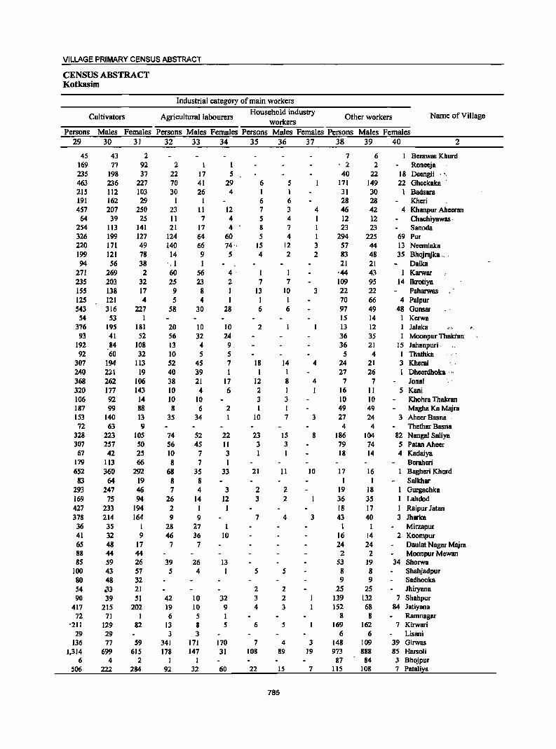
VILLAGE PRIMARY CENSUS ABSTRACT
CENSUS ABSTRACT Kotkasim
Industrial category of main workers
Cultivators Agricultural labourers Household industry
Other workers Name of Village workers
Persons Males Females Persons Males Females Persons Males Females Persons Males Females 29 30 31 32 33 34 3S 36 37 38 39 40 2
4S 43 2 7 6 Berawas Khurd 169 77 92 2 I I ' 2 2 Roneeja 23S 198 37 22 17 5 40 22 18 Deengli ' " 463 236 227 70 41 29 6 S 171 149 22 Gheekaka 215 112 103 30 26 4 I 1 31 30 1 Badsara 191 162 29 1 1 6 6 28 28 Kheri 457 207 250 23 11 12 7 3 4 46 42 4 Khanpur Ahccran
64 39 2S 11 7 4 5 4 1 12 12 Chachiyawas ' 254 113 141 21 17 4 8 7 I 23 23 Sanoda 326 199 127 124 64 60 5 4 I 294 225 69 Pur 220 171 49 140 66 74·· IS 12 3 57 44 13 Neemlaka 199 121 78 14 9 5 4 2 2 83 48 35 Bhojrajka _, . 94 56 38 '. 1 1 21 21 Daika
271 269 2 60 56 4· I ,44 43 I Karwar 23S 203 32 25 23 2 7 7 109 95 14 Ikrotiya 155 138 17 9 8 1 13 10 3 22 22 Paharwas 125 121 4 S 4 J I I 70 66 4 PaJpur 543 316 227 58 30 28 6 6 97 49 48 Gunsar
54 53 1 15 14 1 Kcrwa 376 195 181 20 10 10 2 13 12 Jalaka '_
93 41 52 56 32 24 36 3S Moonpur Thaktan' 192 84 108 13 4 9. 36 21 15 Jahanpuri, 92 60 32 10 5 5 5 4 I Thathka
307 194 113 52 45 7 18 14 4 24 21 3 Khcral 240 221 19 40 39 I I 27 26 1 Dheerdhoka . ,>
368 262 106 38 21 17 12 8 4 7 7 Jonal 320 177 143 10 4 6 2 I 1 16 II 5 Kani 106 92 14 10 10 3 3 10 10 Khohra Thakran 187 99 88 8 6 2 I 49 49 Magha Ka Majra 153 140 13 35 34 10 7 3 27 24 3 Ahecr Basna . 72 63 9 4 4 Thethar Basna
328 223 105 74 52 22 23 15 8 186 104 82 Nangal Saliya 307 257 50 56 4S 11 3 3 79 74 5 PatanAheer 67 42 25 10 7 3 I 18 14 4 Kadaiya
179 113 66 8 7 I Beraheri 652 360 292 68 3S 33 21 II 10 17 16 Bagheri Khurd 83 64 19 8 8 I 1 Salkhar
293 247 46 7 4 3 2 2 19 18 Gurgachka 169 75 94 26 14 12 3 2 36 35 Lahdod 427 233 194 2 1 18 17 1 Raipur Jatan 378 214 164 9 9 7 4 3 43 40 3 Jharka 36 35 1 28 27 1 1 MilZllJlur 41 32 9 46 36 10 16 14 2 Koompur 65 48 17 7 7 24 24 Daulat Nagar Majra 88 44 44 2 2 Moonpur Mewan 85 59 26 39 26 13 53 19 34 Shorwa
100 43 57 5 4 I S 5 8 8 Shahjadpur 80 48 32 9 9 Sadhooka 54 on 21 2 2 2S 2S Jhiryana 90 39 51 42 10 32 3 2 139 132 7 Shahpur
417 215 202 19 10 9 4 3 152 68 84 Jatiyana 72 71 1 6 5 8 8 Ramnagar
-211 129 82 13 8 5 6 5 169 162 7 Kirwari 29 29 3 3 6 6 Lisani
136 77 S9 341 171 170 7 4 3 148 109 39 Girwas 1,314 699 615 178 147 31 108 89 19 973 888 8S Harsoli
6 4 2 I I 87 84 3 Bhojpur 506 222 284 92 32 60 22 15 7 115 108 7 Pataliya
785
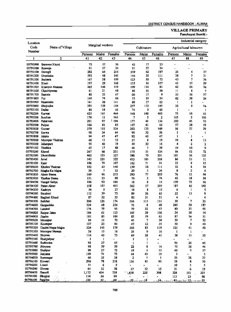
DISTRICT CENSUS HANDBOOK: ALWAR
VILLAGE ,PRIMARY Panchayat Samiti -
Location Industrial category
Code Name of Village Marginal workers
Cultivators Agricultural labourers Number
Persons 'Males Females Persons Males Females Persons Males Females 2 41 42 43 44 45 46 47 48 49
00790900 Berawas Khurd 73 17 56 42 17 25 00791000 Roneeja 91 57 34 91 57 34 00791100 Deengli 282 66 216 259 62 197 21 4 17 00791200 Gheekaka 193 . 48 145 146 35 III 38 7 31 00791300 Badsara 167 58 109 123 50 73 43 7 36 00791400 Kheri 197 29 168 153 16 137 41 12 29 00791500 Khanpur Aheeran 265 146 119 199 116 83 62 26 36 00791600 Chachiyawas 61 21 40 46 16 30 II 4 7 00791700 Sanoda 80 33 47 ·26 17 9 53 16 37 00791800 Pur 140 74 66 53 19 34 62 38 24 00791900 Neem1aka 161 20 141 80 17 63 I 1 00792000 Bhojrajka 293 129 164 257 112 145 25 9 16 00792100 Oaika 80 14 66 74 9 65 I I 00792200 Karwar 625 161 464 548 148 400 73 10 63 00792300 ,Ikrotiya 178 15 163 7 5 2 165 5 160 00792400 Paharwas 291 97 )·194 177 41 136 100 45 55 00792500 Palpur 166 81 85 107 41 66 57 38 19 00792600 Gunsar 379 155 224 292 123 169 56 27 29 00792700 Kerwa 98 34 64 90 32 58 I 00792800 Jalaka 94 47 47 92 45 47 I I 00792900 Moonpur Thakran 48 13 35 27 g 19 19 4 15 00793000 Jahanpuri 59 40 19 49 33 16 4 2 2 00793100 Thathka 65 17 48 46 7 39 19 10 9 00793200 Khera! 267 66 201 175 51 124 84 12 72 00793300 Dheerdhoka 462 135 327 280 79 201 181 56 125 00793400 Jonal 543 221 322 453 185 268 86 35 51 00793500 Kani 186 79 107 162 71 91 23 8 IS 00793600 Khohra Thakran 182 42 140 139 28 III 32 8 24 00793700 Magha Ka Majra 39 7 32 29 5 24 8 2 6 00793800 AheerBasna 369 96 273 280 77 203 76 12 64 00793900 Thethar Basna 121 23 98 76 2 74 42 18 24 00794000 Nangal Saliya 196 ,92 104 18 8 10 139 73 66 00794100 Patan Aheer 558 107 4S1 362 57 305 187 45 142 00794200 Kadaiya 36 9 27 18 8 10 6 1 5 00794300 Beraheri 112 39 73 89 26 63 22 13 9 00794400 Bagberi Khurd 87 32 55 82 31 51 4 4 00794500 Salkhar 300 126 174 266 115 151 30 7 23 00794600 Gurgachka 324 68 256 76 8 68 245 58 187 00794700 Lahdod 174 79 95 79 32 47 80 35 4S 00794800 Raipur Jatan 184 61 123 145 39 106 34 20 14 00794900 Iharka 185 85 100 82 19 63 87 56 31 00795000 Mirzapur 84 14 70 45 7 38 39 7 32 00795100 Koompur 107 23 84 47 12 35 58 9 49 00795200 Daulat Nagar Majra 324 145 179 202 83 119 .121 61 60 00795300 Moonpur Mewan 26 10 16 25 9 16 00795400 Shorwa 116 43 73 69 28 41 38 13 2S 00795500 Shahjadpur I I I I 00795600 Sadhooka 92 27 65 I I 91 26 6S 00795700 Jhiryana 98 39 59 22 8 14 70 26 44 00795800 Shahpur 99 27 72 19 6 13 66' 9 57 00795900 JatiyanB 149 74 75 64 45 19 3 3 00796000 Ramnagar 60 32 28 2 1 1 55 28 27 00796100 Kirwari 296 78 218 136 43 93 58 8 SO 00796200 Lisani 11 6 5 10 5 5 00796300 Girwas 61 23 38 27 12 IS 21 6 15 00796400 HlIl30li 1,172 434 738 " ~,§,18 220 398 328 101 227 00796500 Bhojpur 114 24 90 113 23 90 00796600 Pataliya _ ...... ,> _ .. _ .. ., J20 , .52 ..• _:68 ,. __ " __ ..3L_;~_~ ~,8 ..14_ .-_",:.,45 -, -- .12-_. .33 .
786
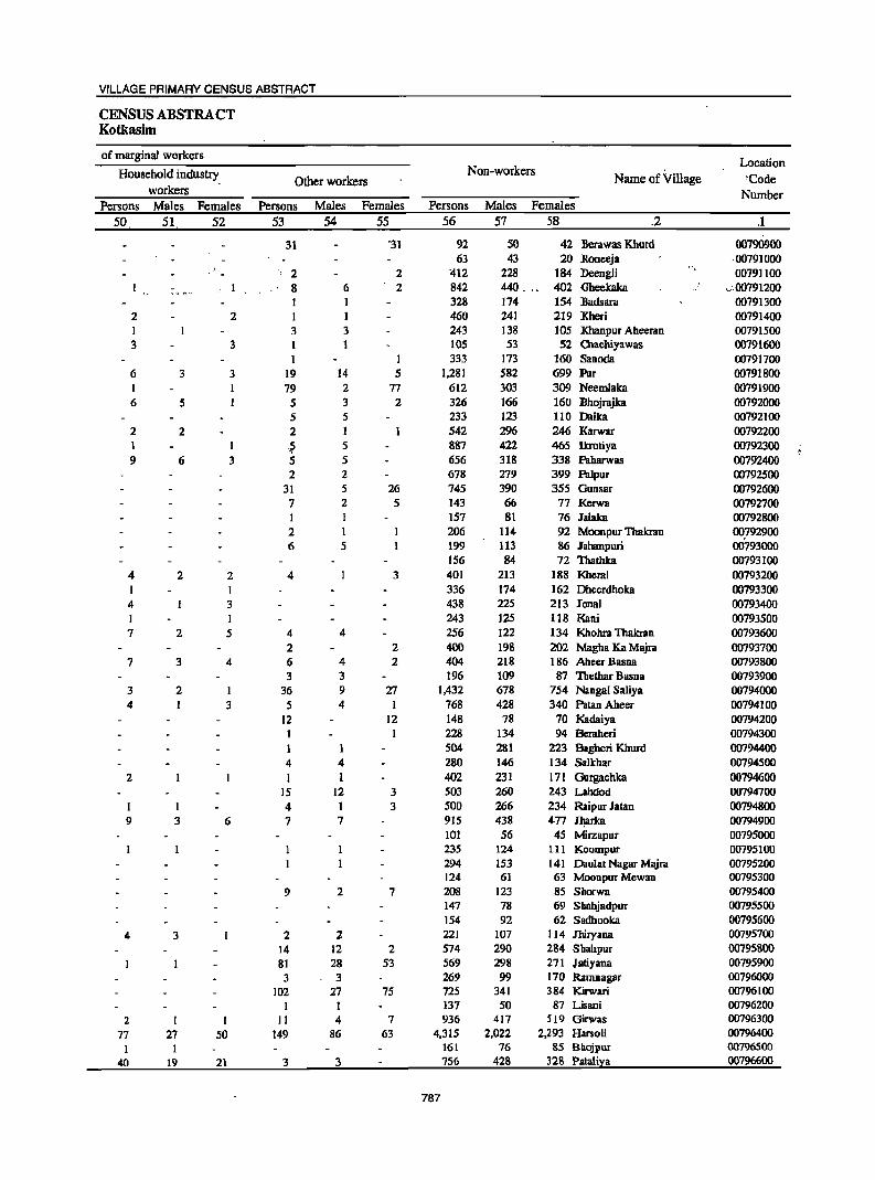
VILLAGE PRIMARY CENSUS ABSTRACT
CENSUS ABSTRACT Kotkasim
of marginal workers Location
Household industry Non-workers Name of Village 'Code Other workers
workers Number Persons Males Females Persons Males Females Persons Males Females
50 51 52 53 54 55 56 57 58 .2 .1
31 '31 92 50 42 Berawas Khurd 00790900 63 43 20 Roneeja ·00791000
" 2 2 412 228 184 Deengli 00791100
,-"",,- 8 6 2 842 440 : 402 ,Gheekaka .;.00791200 328 174 154 Badsara 00791300
2 2 460 241 219 Kheri 00791400 I 3 3 243 138 105 Khanpur Aheeran 00791500 3 3 1 105 53 52 Chacbiyawas 00791600
1 1 333 173 160 Sanoda 00791700 6 3 3 19 14 5 1,281 582 699 Pur 00791800 I 79 2 77 612 303 309 Neemlaka 00791900 6 5 5 3 2 326 166 160 Bhojrajka 00792000
5 5 233 123 110 Daika 00792100 2 2 2 1 542 2% 246 Karwar 00792200 I 1 ,~ 5 887 422 465 Ikrotiya 00792300 9 6 3 5 5 656 318 338 Paharwas 00792400
2 2 678 279 399 Palpur 00792500 31 5 26 745 390 355 Gunsar 00792600 7 2 5 143 66 77 Kerwa 00792700 I I 157 81 76 lalaka 00792800 2 1 206 114 92 Moonpur Thakran 00792900 6 5 199 113 86 lahanpuri 00793000
156 84 72 Thathka 00793100 4 2 2 4 3 401 213 188 Kheral 00793200
336 174 162 Dheerdhoka 00793300 4 3 438 225 213 Jonal 00793400 1 243 125 118 Kani 00793500 7 2 5 4 4 256 122 134 Khohra Thakran 00793600
2 2 400 198 202 Magba Ka Majra 00793700 7 3 4 6 4 2 404 218 186 AheerBasna 00793800
3 3 196 109 87 'lbethar Basna 00793900 3 2 I 36 9 27 1,432 678 754 Nangal Saliya 00794000 4 3 5 4 I 768 428 340 Patan Abeer 00794100
12 12 148 78 70 Kadaiya 00794200 228 134 94 Beraheri 00794300 504 281 223 Bagberi Khurd 00794400
4 4 280 146 134 Sa1khar 00794500 2 1 I 402 231 171 Gurgachka 00794600
15 12 3 503 260 243 Lahdod 00794700 4 3 500 266 234 Raipur Jatan 00794800
9 3 6 7 7 915 438 4-77 J1!arka 00794900 101 56 45 Mirzapur 00795000 235 124 tIl Koompur 00795100 294 153 141 Daulat Nagar Mlljra 00795200 124 61 63 Moonpur Mewan 00795300
9 2 7 208 123 85 Shorwa 00795400 147 78 69 Shahjadpur 00795500 154 92 62 Sadhooka 00795600
4 3 2 2 221 107 114 J11iryana 00795700 14 12 2 574 290 284 Sbab.pur 00795800 81 28 53 569 298 271 Jatiyana 00795900 3 3 269 99 170 Ramnagar 00796000
102 27 75 725 341 384 Kirwari 00796100 I I 137 50 87 Lisani 00796200
2 II 4 7 936 417 519 Girwas 00796300 77 27 50 149 86 63 4,315 2,022 2,293 Harsoli 00796400
I 161 76 85 Bhojpur 00796500 40 19 21 3 3 756 428 328 Pataliya 00796600
787
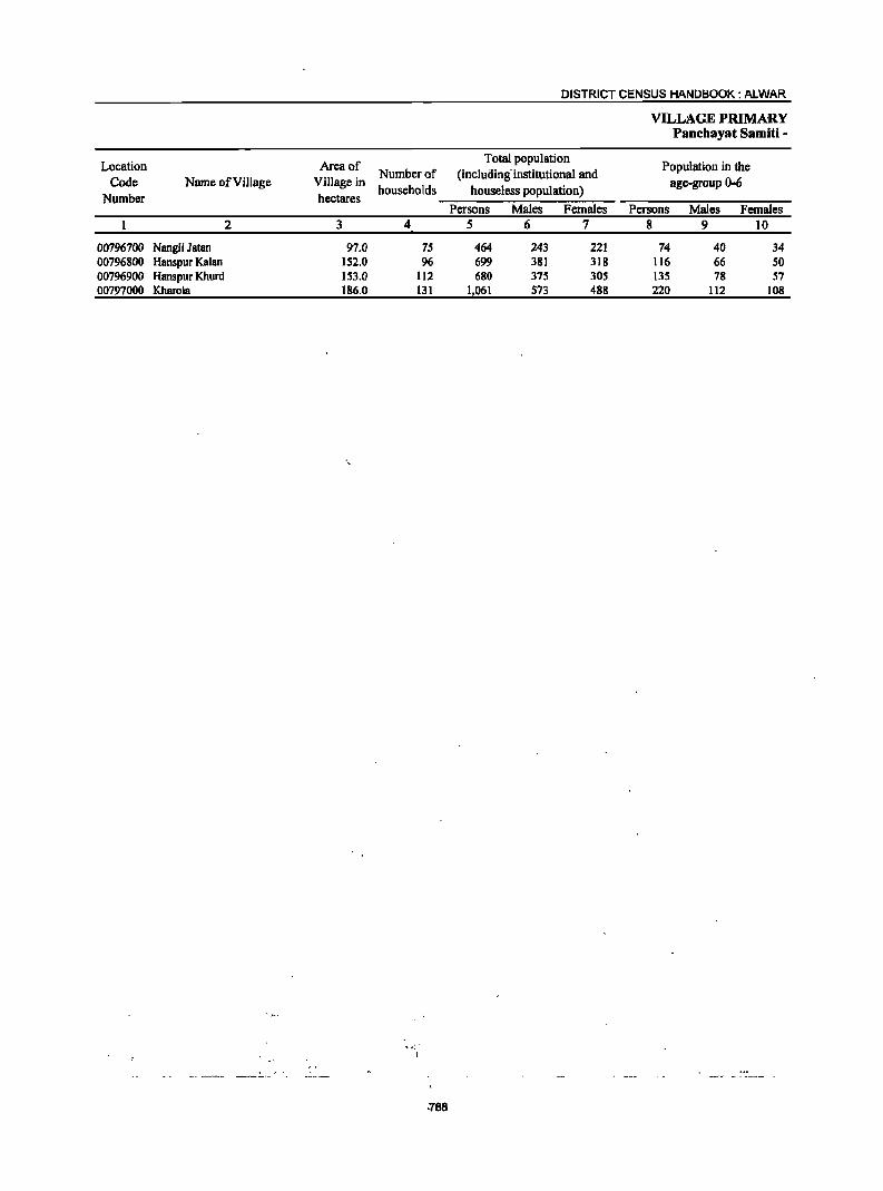
Location Area of Code Name of Village Village in
Number of
Number hectares households
2 3 4
00796700 Nangli Jatan 97.0 75 00796800 Hanspur Kalan 152.0 96 00796900 Hanspur Khurd 153.0 112 00797000 Kharola 186.0 131
.788
DISTRICT CENSUS HANDBOOK: ALWAR
Total population (including- institutional and
houseless population) Persons Males Females
5 6 7
464 243 221 699 381 318 680 375 305
1,061 573 488
VILLAGE PRIMARY Panchayat Samiti -
Population in the age-group 0-6
Persons Males Females 8 9 10
74 40 34 116 66 50 135 78 57 220 112 108
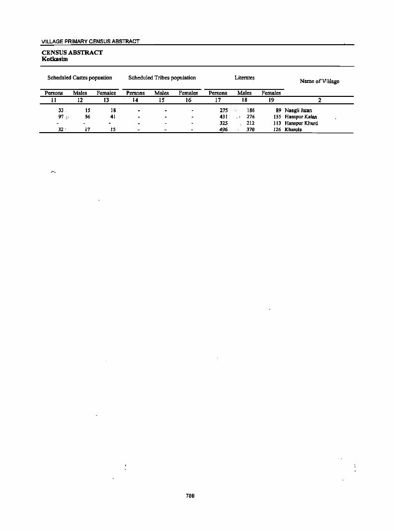
VILLAGE PRIMARY CENSUS ABSTRACT
CENSUS ABSTRACT Kotkasim
Scheduled Castes popuation
Persons 11
33, 97 _,.
32 '
Males 12
15 56
17
Females 13
18 41
IS
Scheduled Tribes population
Persons Males Females 14 15 16
789
Literates Name of Village
Persons Males Females 17 18 19 2
275 186 89 Nangli Jatan 431 , 276 ISS Hanspur Kalan 325 212 113 Hanspur Khurd 496 370 126 Kharola
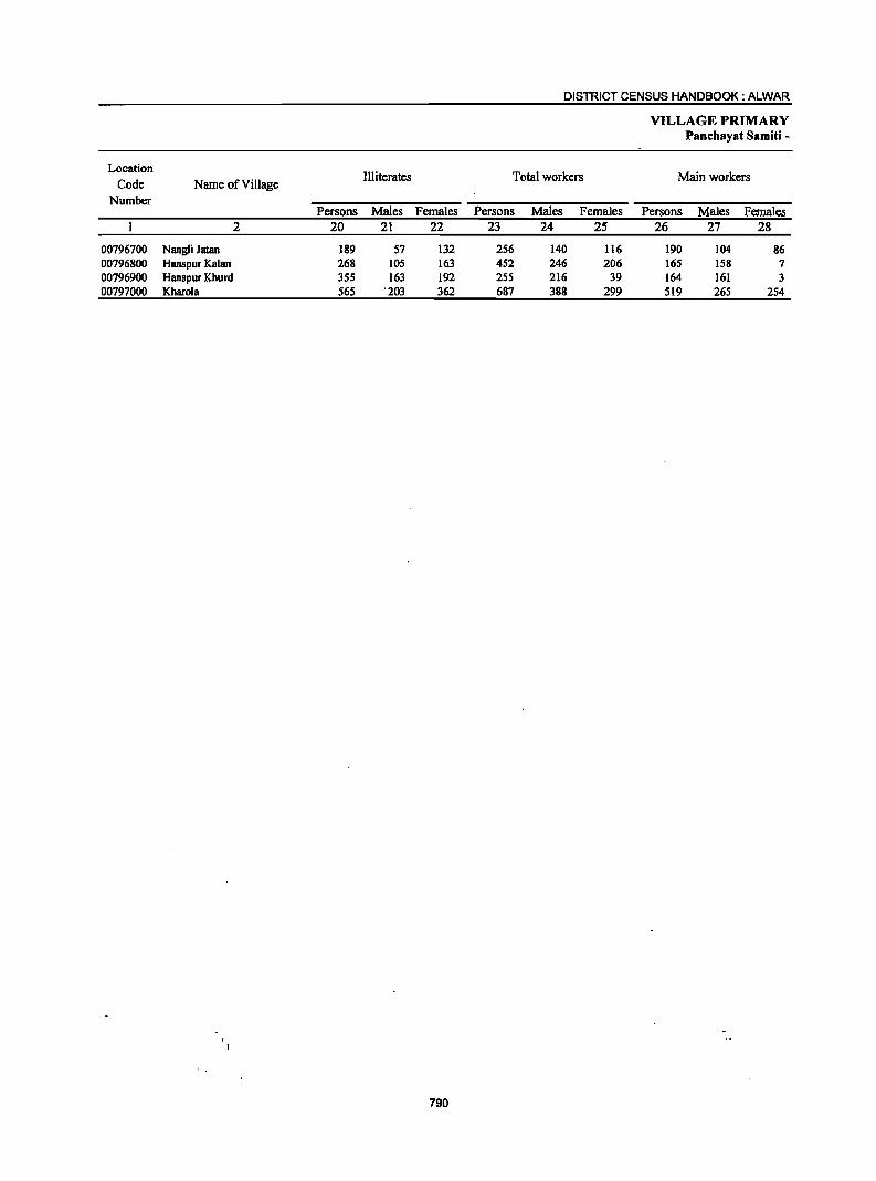
DISTRICT CENSUS HANDBOOK: ALWAR
VILLAGE PRIMARY Panchayat Samiti -
Location III iterates Total workers Main workers Code Name ofViUage
Number Persons Males Females Persons Males Females Persons Males Females
2 20 21 22 23 24 25 26 27 28
00796700 Nangli Jatan 189 57 132 256 140 116 190 104 86 00796800 Hanspur Kalan 268 105 163 452 246 206 165 158 7 00796900 Hanspur Khurd 355 163 192 2SS 216 39 164 161 3 00797000 Kharola S6S '203 362 687 388 299 519 265 254
790
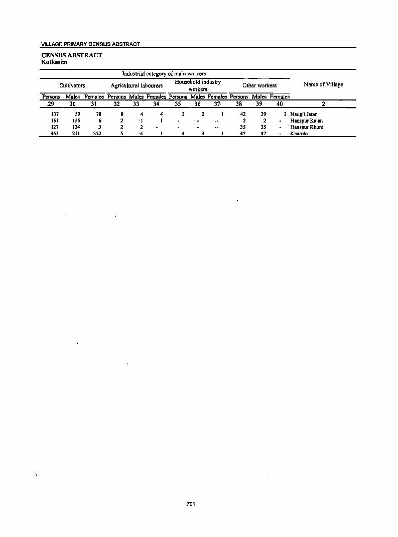
VILLAGE PRIMARY CENSUS ABSTRACT
CENSUS ABSTRACT Kotkasim
,Cultivators
Persons Males Females .29 30 31
137 59 78 161 ISS 6 127 124 3 463 211 252
Industrial category of main workers
Agricultural labourers Household industry
Other workers Name of Village workers
Persons Males Females Persons Males Females Persons Males Females 32 33 34 3S 36 37, 38 39 40 2
8 4 4 3 2 42 39 3 Nangli Jatan 2 'I 2 2 Hanspur Kalan 2 2 3S 3S ' Hanspur Khurd S '4 4 3 47 41 Kharola
791
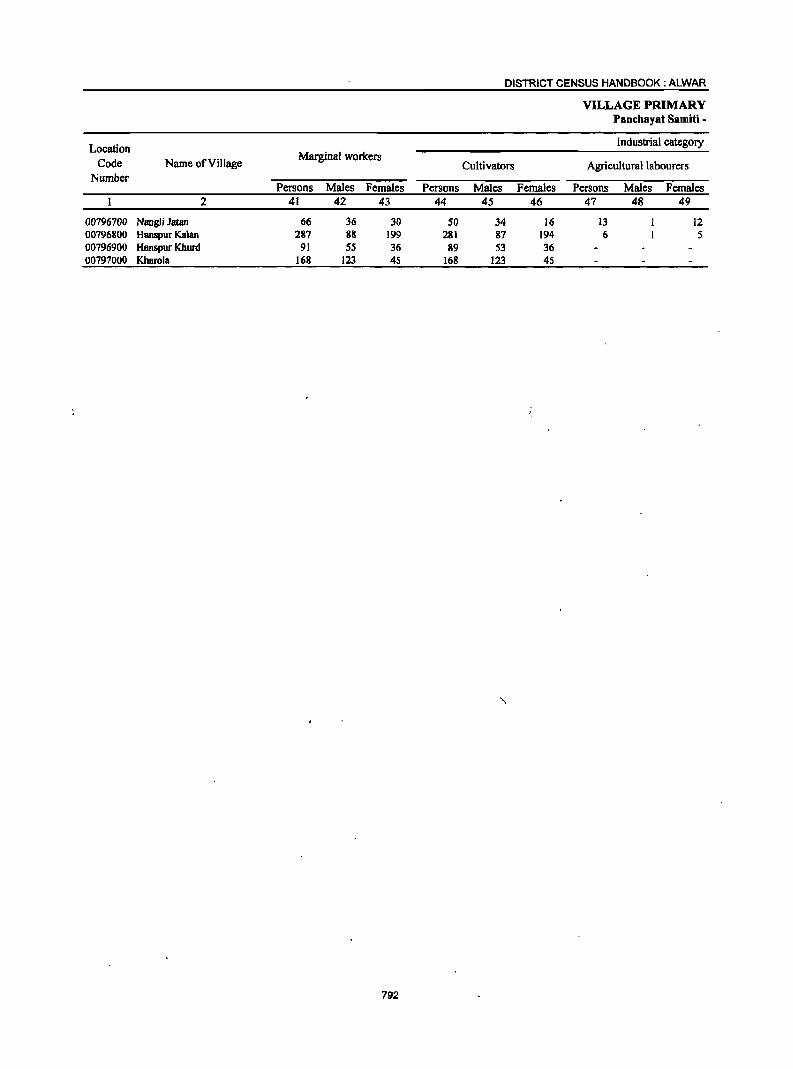
Location Code
Number Name ofYillage
00196100 Nangli Jatan 00196800 Hanspur Kalan 00196900 HlUlspur [(hurd 00191000 Kharola
2
Marginal workers
Persons Males Females 41 42 43
66 36 30 287 88 199
91 55 36 168 123 4S
792
Persons 44
50 281 89
168
DISTRICT CENSUS HANDBOOK: ALWAR
Cultivators
Males Females 45 46
34 16 87 194 53 36
123 4S
VILLAGE PRIMARY PBnchByat SBmiti -
Industrial category
Agricultural labourers
Persons 41
13 6
Males 48
Females 49
12 5
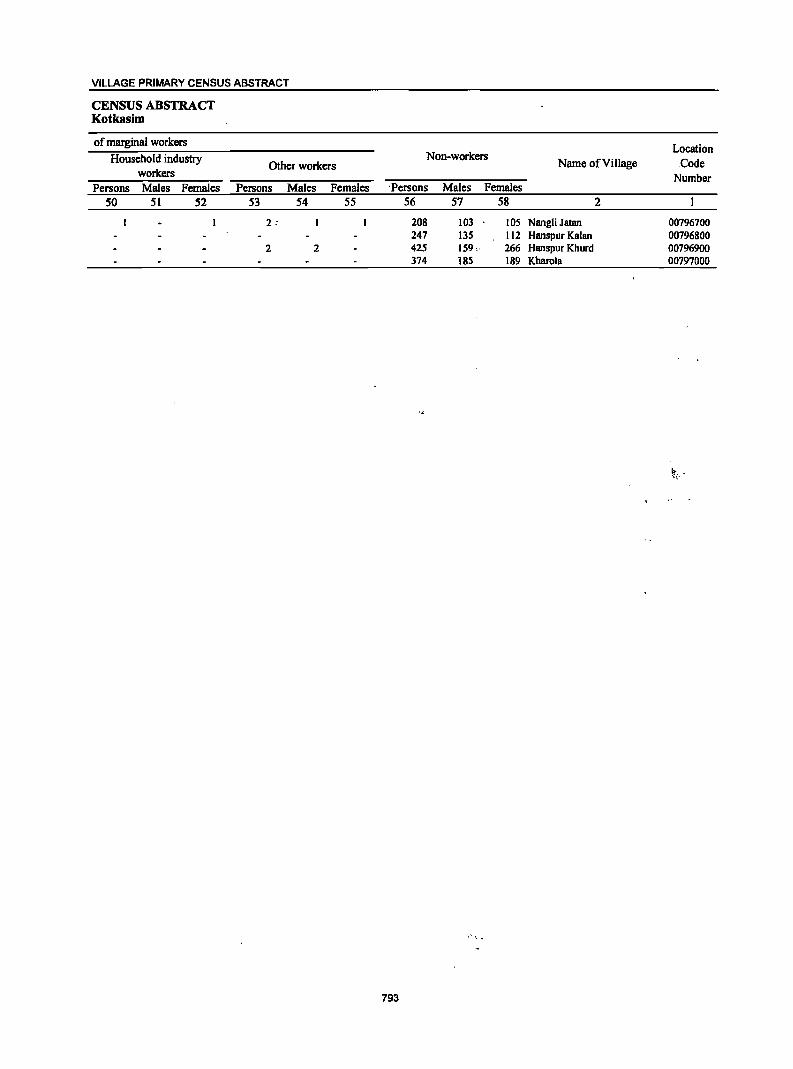
VILLAGE PRIMARY CENSUS ABSTRACT
CENSUS ABSTRACT Kotkasim
of marginal workers Household industry
workers Persons Males Females
50 51 52
Other workers
Persons Males Females 53 54 55
2 ,
2 2
Location Non-workers
Nwne of Village ,Code Number
'Persons Males Females 56 57 58 2
208 103 105 Nangli Jatan 00796700 247 135 112 Hanspur Kalan 00796800 425 159" 266 Hanspur Khurd 00796900 374 185 189 Kharola 00797000
.' " ~
793
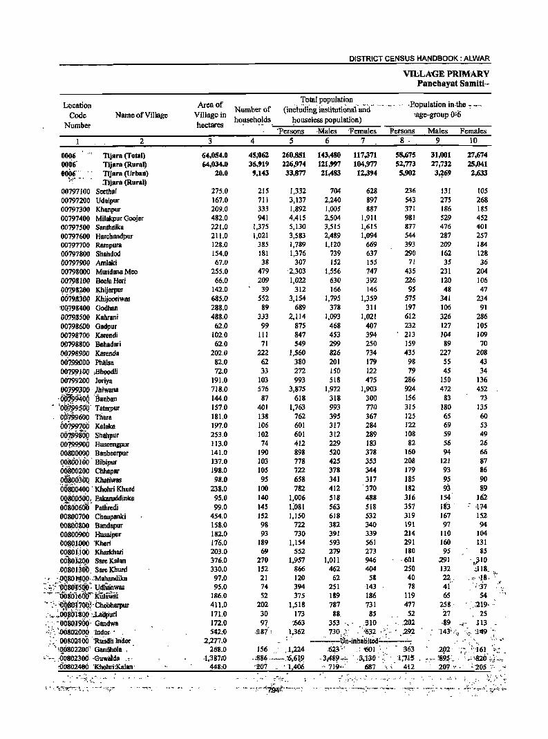
Location Code
Number Name ofViJlage
1 2
0006 6006-0006'" ..
~"~" .... ,
Tljara (Total) Tljara (Rural) TijarB (Urbali) 1'Ijara (Rural)
00797100 Seethal 00797200 Udaipur 00797300 Khanpur 00797400 Milakpur Goojar 00797500 Santhllllea 00797600 Harchandpur 00.797700 Rampura 00797800 Shahdod 00797900 Amlaki 00798000 Mundena Meo 00?98100 Beela Heri 00798200 Khijarpur 0079B300 .Khijooriw85 '-DQ1981l00 Godhan 00798500 Kahrani 00798600 Gadpur 00798700 Karendi 00798800 Bahadari 00798900 Karenda 06799.000 Philsa 007.9.9H>Q . Bhoodli 00799200 Joriya 00199300 . }biwana
'00;99406 'Banban . \Q~!~9~aQ' Tatalpur
00199600 Thara 00799700 Kalaka ojji.lJ~iBQ Shahpur 0.0799900 Huscengpur 00800000 Banbeerpur 00800'Hio' Bibipur 06.1100200 Chhapar R~~~630'Q Khatiwas 0080.0400 ' Khohri Khurd 0080D500, Eakaruddinlea 00soo6ff'd' Patiiredi 00800700 Chaupanki oo89~800 Bandapur 00800900 Husaipur OQ~Ql~OO 'Kheri 0080 J.1 00 Kharkhari oosolaOo Sare Kalan :00801~ob, Sare Khurd
. ,. ·,0080]'400.:.Mahandilea ·: . .:.;~:''b6801is6b: Udhanwas -~.:. --i)08D1'60'0"" k-Ula1.iliit " '.:" ;OOBD170"0:" Cboobarpur .'..-... ~~o~bi;80.0 ':~uri , ~. ;' : :o~'801969' Gandwa <", .0080'2000 'Indor·' . ,::' 06802lJ.oO 'R;mah Inaor . -, ;6.o8022~O' Gandho1a •
~"'--". ,00.80230(j, ·Guwalda .. 000802406 'Kbohri:Kalan'
DISTRICT CENSUS HANDBOOK: ALWAR
VlliLAGE PRIMARY Panchayat Samiti·-
Area of Total population R I t' . th Number of (inci~ding institutional' and - .--. .,. -. , ,opu a Ion In' e -: -,',
Village in households h I I . ) 'age-group 0-6 hectares _-=,....-..... o_u_s_e_e-:-ss-i-po.,...:..pu_at...,.lo_n.;.._,....-- ___ ---...,.....,,....,...---...,......-
3
64,054.0 64,634.6
20.0
275.0 167.0 209.0 482.0 221.0 211.0 128.0 154.0 67.0
255.0 66.0
142.0 685.0' 288.0 488.0
62.0' 102.0 62.0
202.0 82.0 72.0
191.0 718.0 144.0' 157.0 181.0 197.0 253.0 113.0 141.0 137.0 198.0 98.0
238.0 95.0 99.0
454.0 158.0 182.0 176.0 20.3.0 376.0 330.0 97.0 95.0
186.0 411.0 17l.0 112.D '542:0
2,277.0 268.0
·1,38710 448:0
'Persons ·Nlales 'Females Persons Males Females 4 5 6 7 8 . 9. 10
45j062 35,919
9,143
260,851 143,480 117,371 58,675 226,974 121,997 164,977 52,773 33,877 21,483 12,394 5,902
215 711 333 941
1,375 1,021
385 181 38
479 209 39
552 89
333 99
III 71
222 62 33
103 576 87
401 138 106 102 74
190 103 105 95
100 140 145 152 98 93
189 69
270 152 21 74 52
202 30
9? ,!l8:('
1,332 3,137 1,892 4,415 5,130 3,583 1,789 1,376
30'7 '2,303 1,022
312 3,154
689 2,114
875 847 549
1,560 380 272 993
3,875 618
1,763 762 601 601 412 898 778 722 658 782
1,006 1;081 1,150
722 730
1,154 552
1,957 866 120 394 375
1,518 173
:663 1,362
156 .. ,.1,224 -;~8~ .. ~.,.... .~.6,61~ '20.7 .... , "1,406
-; Y:.,
- ,_ w·:. .. · ... '794f.' -"."~
704 2,240 1,0.05 2,504 3,515 2,489 1,120
739 152
1,556 630 166
1,795 378
1,093 468 453 299 826 201 150 518
1,972 318 993 395 317 312 229
628 897 887
1,911 1,615 1,094
669 637 155 747 392 146
1,359 311
1,021 407 394 250 734 179 122 475
1,903 300 770 367 284 289 183
236 543 371 981 877 544 393 290
71 435 226
95 575 197 612 232 213 159 435
98 79
286 924 156 3IS 125 122 108 82
520 378 160 425 353 208 378 344 179 341 317 185 412 370 182 518 488 316 563 518 357 618 532 319 382 340 191 391 339 214 593 561 291 279 273 180
1,011 946 ·601 462 404 250
62 58 40 251 -143 78 189 186 119 787 731 477 88 85., 52
353 '_ - .310 '. ,202 730 ;:. ·'1532," .. · 292
--·------{]-~~inhatiitCd.;.:~~--:-~ .623 ,;, : '601: - 363
-3J489-~ . ,3;'130: :.", ;1;7.1:5 ... 719''- . 687 ',~,,' 4-12
•• - 7"! ....... _.:n-... ..:. ........... ,': ..... -- .-~ .. :.".-. . .... ~- ~
31,001 27,674 27,732 25,041 3~69 2,633
131 105 275 268 186 185 529 452 476 401 287 257 209 184 162 128 35 36
231 204 120 106 48 47
341 234 ]06 9] 326 286 127 105 104 109 89 70
227 208 55 43 45 34
150 136 472 452
83 73 180 135 65 60 69 53 59 49 56 26 94 66
121 87 93 86 95 90 93 89
154 162 ISj -- 474 167 152 97 94
110 104 160 131 95 85
.291 - • .310 132 .:J 18 22 , , 10 '18: ';-. 4( ';-37 <
65 54 258.- .:219- .: 27 25 -89 .• - 113 _
'}43' ::./ .;;., ::1'19.'-: ~"_'" .~:, _"So
202' '." -;·-161 ··; .. t
:-: .. ~95: .. .' ~>,820' ;ci~:-: 207 ',' -' '~"205 -,~ .<
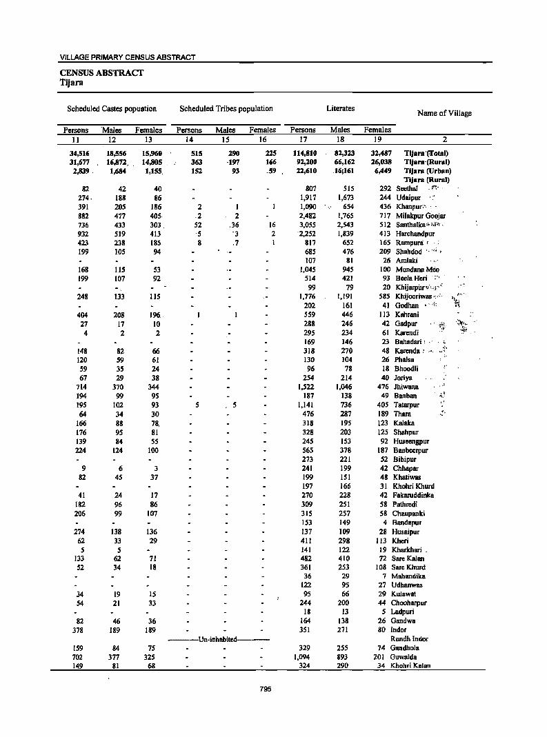
VILLAGE PRIMARY CENSUS ABSTRACT
CENSUS ABSTRACT Tijara
Scheduled Castes popuation Scheduled Tribes population Literates Name of Village
Persons 'Males Females Persons Males Females Persons Males Females II 12 13 14 15 16 17 18 ]9 2
34,516 18,556 15,960 515 290 225 114,810 82,323 32,487 TlJara 'frotal) 31,677 16,872. , 14,805 363 ,197 166 92,200 66,162 26,038 Tijara'(Rural) 2,839, 1,684 1,155, 152 93 .59 22,610 16:161 6,449 njara (Urban)
Tijara (Rural) 82 42 40 807 515 292 Scethal . tI".~~ ,
274, 188 86 1,917 1,673 244 Udaipur . .:. 391 205 186 2 I 1,090 654 436 Khanpur:" : ' 882 477 405, ,2 2 2,482 1,765 717 Milakpur Goojar 736 433 303, 52 ,36 16 3,055 2,543 512 Santhalka'~~" , 932 519 413 ,5 '3 2 '2,252 1,839 413 Harchandpur 423 238 185 8 ,7 817 652 165 Rampur8' .: 199 ]05 94 685 476 209 Shahdod ',"i ,
107 81 26 Amlaki 168 115 53 1,045 945 100 MundanaMeo 199 107 92 514 421 93 Bcela Heri ':"
99 79 20 Khijarpuri,.,,;j" .- .. '~ 248 133 lIS 1,776 1,191 585 Khijooriwas ",:' ~" ... '.
'':t; 202 161 41 Godhan ~ ~ ~'~~ i'-"~
404 208 196" 559 446 113 Kahrani 27 17 10 288 246 42 Gadpur :;;: ,~,~
4 2 2 295 234 61 Karendi '~
169 146 23 Bahadari: " ... 148 82 66 318 270 48 Karenda: ,', .. 7 ..
q',
120 59 61 130 104 26 Phalsa 59 35 24 96 78 18 Bhoodli "
67 29 38 254 214 40 Joriya 714 370 344 1,522 1,046 476 Jhiwana ,,'
194 99 95 187 138 49 Banban " ''''.-195 102 93 5 5 1,141 736 405 Tatarpur 64 34 30 476 287 189 Thara .!,
166 88 78, 318 195 123 Kalaka 176 95 81 328 203 125 Shahpur 139 84 55 245 153 92 Huseengpur 224 124 100 565 378 187 Banbeerpur
273 221 52 Bibipur 9 6 3 241 199 42 Chhapar
82 45 37 199 151 48 Khatiwas 197 166 31 Khohri Khurd
41 24 17 270 228 42 Fakaruddinka 182 96 86 309 251 58 Pathredi 206 99 107 315 257 58 Chaupanki
153 149 4 Bandapur 274 138 136 137 ]09 28 Husaipur
62 33 29 411 298 113 Kheri 5 5 141 122 19 Kharkhari ,
133 62 71 482 410 72 SareKalan 52 34 18 361 253 108 Sarc Khurd
36 29 7 Mahandika 122 95 27 Udhanwas
34 19 15 95 66 29 Kulawat 54 21 33 244 200 44 Chooharpur
18 13 5 Ladpuri 82 46 36 164 138 26 Gandwa
378 189 189 351 271 80 Indor -------Un-inhabited----- Rundh lndor
159 84 75 329 255 74 Gandhola 702 377 325 1,094 893 201 Guwalda 149 81 68 324 290 34 Khohri Kalan
795
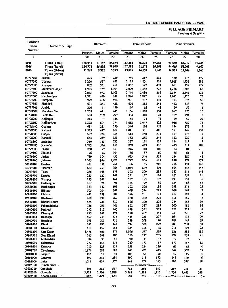
DISTRICT CENSUS HANDBOOK: ALWAR
VILLAGE PRIMARY Pancbayat Samiti -
Location Illiterates Total workers Main workers
Code Name ofViIlage Number
Persons Males Females Persons Males Females Persons Males Females 2 20 21 22 23 24 25 26 27 28
0006 Tijara (Total) 146,041 61,157 84,884 143,184 85,531 57,653 79,640 68,712 10,928 0006 Tljara (Rural) 134,774 55,835 78,939 127,286 71,478 55,808 64,665 55,003 9,662 0006 TiJara (Urban) 11,267 5,322 5,945 15,898 14,053 1,845 14,975 13,709 1,266
Tljara (Rural) 00797100 Seethal 525 189 . 336 740 387 353 460 318 142 00797200 Udaipur 1,220 567 653 2,115 1,801 314 1,918 1,732 186 00797300 Khanpur 802 351 451 1,001 527 474 661 432 229 00797400 Milakpur Ooojar 1,933 739 1,194 2,079 1,352 727 1,268 1,206 62 00797500 Santhalka 2,075 972 1,103 2,744 2,480 264 2,554 2,442 112 00797600 Harchandpur 1,331 650 681 1,924 1,827 97 1,845 1,770 75 00797700 Rampura 972 468 504 901 707 194 723 673 50 00797800 Shahdod 691 263 428 626 385 241 412 338 74 00797900 Amlaki 200 71 129 110 62 48 60 59 1 00798000 MundanaMeo 1,258 611 647 1,156 1,005 151 992 976 16 00798100 BeclaHeri 508 209 299 334 310 24 307 294 13 00798200 Khijarpur 213 87 126 145 74 71 79 52 27 00798300 Khijooriwas 1,378 604 774 1,668 1,047 621 956 882 74 00798400 Godhan 487 217 270 346 194 152 184 177 7 00798500 Kahrani 1,555 647 908 I,Oll 531 480 581 449 132 00798600 Gadpur 587 222 365 513 280 233 177 176 I 00798700 Karendi 552 219 333 532 288 244 122 120 2 00798800 Bahadari 380 153 227 257 128 129 124 117 7 00798900 Karendll. 1,242 556 686 859 443 416 425 317 108 00799000 Phalsa 250 97 153 216 110 106 84 84 00799100 Bhoodli 176 72 104 156 87 69 65 64 00799200 Joriya 739 304 435 653 340 313 234 189 45 00799300 JhiwanB 2,353 926 1,427 1,797 966 831 949 771 178 00799400 Banban 431 180 251 386 185 201 274 134 140 00799500 Tatarpur 622 257 365 1,044 639 405 694 548 146 00799600 Thara 286 108 178 592 309 283 357 211 146 00799700 Ka1aka 283 122 161 281 157 124 162 151 II 00799800 Shahpur 273 109 164 367 185 182 137 13l 6 00799900 Huseengpur 167 76 91 185 99 86 134 82 52 00800000 Banbeerpur 333 142 191 502 306 196 298 273 2S 00800100 Bibipur 50S 204 301 459 244 215 169 162 7 00800200 Chhapar 481 179 302 376 201 175 202 198 4 00800300 Khatiwas 459' 190 269 460 232 228 151 149 2 00800400 Khohri Khurd 585 246 339 596 320 276 244 152 92 00800500 Fakaruddinka 736 290 446 602 317 285 200 186 14 00800600 Pathredi 772 312 460 638 335 303 223 217 6 00800700 Chaupanki 83S 361 474 770 407 363 243 221 22 00800800 BandBpur 569 233 336 445 238 207 164 135 29 00800900 Husaipur 593 282 311 389 209 180 182 143 39 00801000 Kheri 743 295 448 592 300 292 280 230 50 00801100 Kharkhari 411 157 254 334 166 168 211 119 92 00801200 Sare Kalan 1,475 601 874 1,096 567 529 526 388 138 00801300 SareKhurd 505 209 296 510 277 233 274 233 41 00801400 Mahandika 84 33 51 70 33 37 17 17 00801500 Udhanwas 272 156 116 240 173 67 170 157 13 00801600 Kulawat 280 123 157 253 124 129 66 62 4 00801700 Chooharpur 1,274 587 687 840 427 413 342 307 35 00801800 Ladpuri 155 75 80 108 58 50 49 45 4 00801900 Gandwa 499 215 284 390 218 172 146 140 6 00802000 Indor 1,011 459 552 844 479 365 396 378 18 00802100 Rundh'lndor' . ----. Ori-irihlibited------------00802200 Gandhola 895 368 527 752 365 387 289 268 21 00802300 Guwalda 't" 5,525 2,596 2,929 3,598 1,883 1,715 1,700 1,440 260 00802400 Khohri.KaJan . 1,082 ___ .- ·429 .653 __ . .669 .3S9 _ .. 310.':: .. - .. -286.---28-1-,.---· .. 5--
796
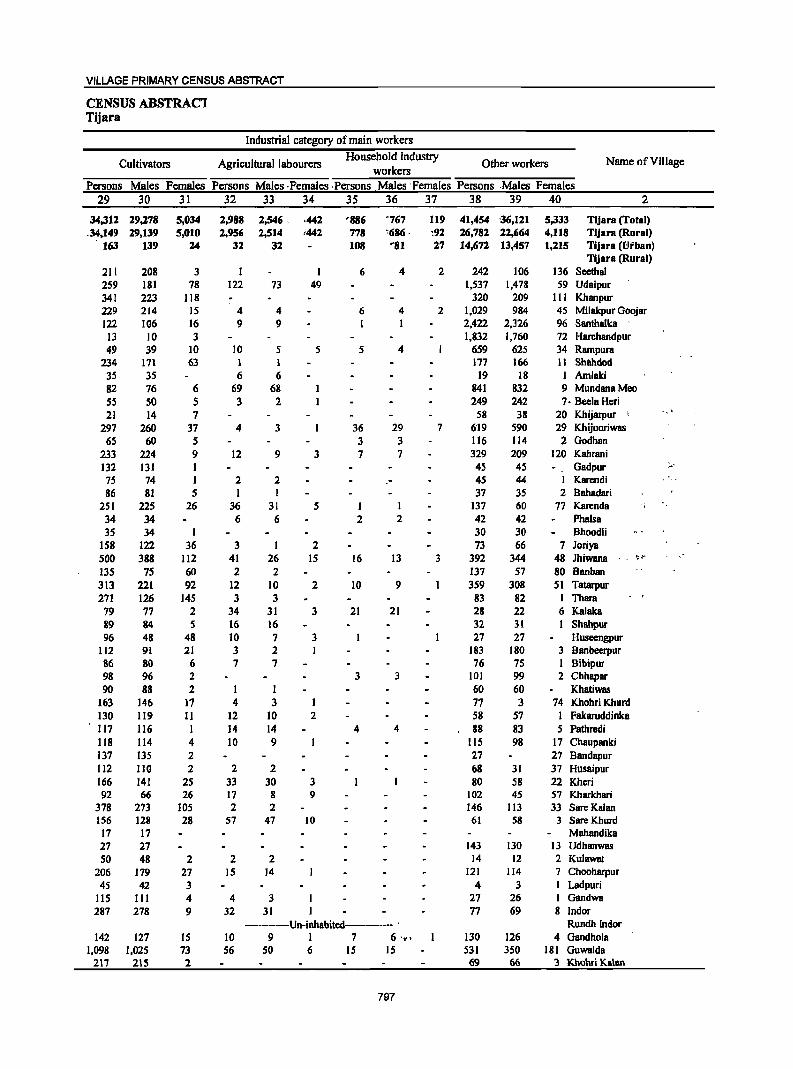
VILLAGE PRIMARY CENSUS ABSTRACT
CENSUS ABSTRAC1 Tijara
Industrial category of main workers
Cultivators Agricultural labourers Household industry
Other workers Name ofViJlage workers
Persons Males Females Persons Males ,Females ,Persons Males 'Females Persons ,Males Females 29 30 31 32 33 34 35 36 37 38 39 40 2
34,312 29,278 5,034 2,988 2,546, ·442 '886 "767 119 41,454 '36,121 5,333 Tijara (Total) .34,149 29,139 5,010 2,956 2,514 ,442 778 ~686 . :92 26,782 22,664 4,118 Tfjara (Rural)
163 139 24 32 32 108 '81 27 14,672 13,457 1,215 Tijara (Ui'ban) Tljara (Rural)
211 208 3 I I 6 4 2 242 106 136 Seethal 259 181 78 122 73 49 1,537 1,478 59 Udaipur 341 223 118 320 209 III Kbanpur 229 214 IS 4 4 6 4 2 1,029 984 45 Milakpur Goojar 122 106 16 9 9 I I 2,422 2,326 96 Santhalka
13 10 3 1,832 1,760 72 Harchandpur 49 39 IO 10 S S 5 4 659 625 34 Rampura
234 171 63 1 1 177 166 11 Shahdod 35 35 6 6 19 18 1 Amlaki 82 76 6 69 68 841 832 9 MundanaMeo 55 50 5 3 2 249 242 7 - Beela Heri 21 14 7 58 38 20 Khijarpur -,
297 260 37 4 3 36 29 7 6'19 590 29 Khijooriwas 65 60 5 3 3 116 114 2 Godhan
233 224 9 12 9 3 7 7 329 209 120 Kahrani 132 131 1 45 45 Gadpur ;,,'
7S 74 1 2 2 - 45 44 I Karendi 86 81 5 1 1 37 35 2 Bahadari
251 225 26 36 31 5 1 I 137 60 77 Karenda '. 34 34 6 6 2 2 42 42 Phalsa 35 34 1 30 30 Bhoodli
158 122 36 3 1 2 73 66 7 Joriya 500 388 112 41 26 IS 16 I3 3 392 344 48 Jhiwana ~l··
135 75 60 2 2 137 57 80 Banban 313 221 92 12 10 2 10 9 359 308 51 Tatarpur 271 126 145 3 3 83 82 1 Thara
79 77 2 34 31 3 21 21 28 22 6 Kalska 89 84 5 16 16 32 31 I Shahpur 96 48 48 10 7 3 27 27 Huseengpur
112 91 21 3 2 183 180 3 Banbeerpur 86 80 6 7 7 76 75 I Bibipur 98 96 2 3 3 101 99 2 Chhapar 90 88 2 I I 60 60 Khatiwas
163 146 17 4 3 1 77 3 74 Khohri Khurd 130 119 11 12 10 2 58 57 I Fskaruddinka 117 116 I 14 14 4 4 88 83 5 Pathredi 118 114 4 10 9 115 98 17 Chaupanki 137 135 2 27 27 8andapur 112 1I0 2 2 2 68 31 37 Husaipur 166 141 25 33 30 3 80 58 22 Khcri 92 66 26 17 8 9 102 45 57 Kharkhari
378 273 105 2 2 146 113 33 Sare Kalan 156 128 28 57 47 10 61 58 3 SareKhurd
17 17 Mahandika 27 27 143 130 13 Udhanwas 50 48 2 2 2 14 12 2 Kulawat
206 179 27 15 14 121 114 7 Chooharpur 45 42 3 4 3 I Ladpuri
lIS 111 4 4 3 27 26 I Gandwa 287 278 9 32 31 77 69 8 Indor
-------Un-inhabited--------- . Rundh Indor 142 127 15 10 9 1 7 6 '!I!' 130 126 4 Gandhola
1,098 1,025 73 56 50 6 15 15 531 350 181 Guwalda 217 215 2 69 66 3 Khohri Kalan
797
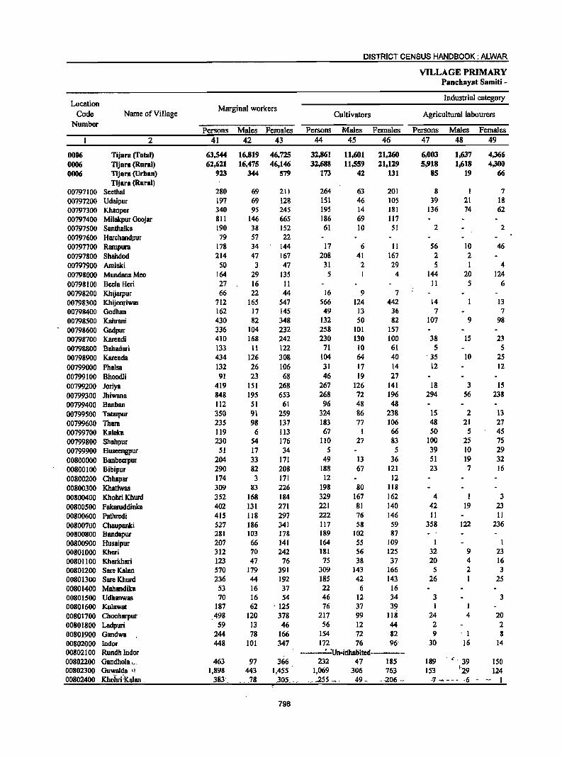
DISTRICT CENSUS HANDBOOK: ALWAR
VILLAGE PRIMARY Panchayat Samiti -
Location Industrial category
Code Name of Village Marginal workers
Cultivators Agricultural labourers Number
Persons Males Females Persons Males Females Persons Males Females 2 41 42 43 44 45 46 47 48 49
0006 Tijara (Total) 63,544 16,819 46,725 32,861 11,601 21,260 6,003 1.637 4,366 0006 Tijara (Rural) 62,621 16,475 46,146 32,688 11,559 n,129 5,918 1,618 4,300 0006 Tijara (Urban) 923 344 579 173 42 131 85 19 66
Tijara (Rural) 00797100 Seethal 280 69 211 264 63 201 8 I 7 00797200 Udaipur 197 69 128 lSI 46 105 39 21 18 00797300 Khanpur 340 95 245 195 14 181 136 74 62 00797400 Milakpur Goojar 811 146 665 186 69 117 00797500 Santhalka 190 38 152 61 10 51 2 2 00797600 Harchandpur 79 57 22 00797700 Rampura 178 34 144 17 6 II S6 10 46 00797800 Shahdod 214 47 167 208 41 167 2 2 00797900 Arnlaki SO 3 47 31 2 29 5 I 4 00798000 MundanaMeo 164 29 135 5 4 144 20 124 00798100 BeelaHeri 27 16 11 II 5 6 00798200 Khijarpur 66 22 44 16 9 7 00798300 Khijooriwll!! 712 165 547 566 124 442 14 13 00798400 Godhan 162 17 145 49 13 36 7 7 00798500 Kahrani 430 82 348 132 50 82 107 9 98 00798600 Gadpur 336 104 232 258 101 157 00798700 Karendi 410 168 242 230 130 100 38 15 23 00798800 Bahadari 133 11 122 71 10 61 S 5 00798900 Karenda 434 126 308 104 64 40 35 10 25 00799000 Phalsa 132 26 106 31 17 14 12 12 00799100 Bhoodli 91 23 68 46 19 27 00799200 Joriya 419 151 268 267 126 141 18 3 15 00799300 Jhiwana 848 195 653 268 72 196 294 S6 238 00799400 Banban 112 SI 61 96 48 48 00799500 Tatarpur 3S0 91 259 324 86 238 15 2 13 00799600 Thara 235 98 137 183 77 106 48 21 27 00799700 Kalaka 119 6 113 67 1 66 SO 5 4S 00799800 Shahpur 230 S4 176 110 27 83 100 2S 7S 00799900 Huseengpur 51 17 34 S 5 39 10 29 00800000 Banbcerpur 204 33 I7l 49 13 36 51 19 32 00800100 Bibipur 290 82 208 188 67 121 23 7 16 00800200 Chhapar 174 3 I7l 12 12 00800300 Khatiwas 309 83 226 198 80 118 00800400 Khohri Khurd 352 168 184 329 167 162 4 I 3 00800500 Fakaruddinka 402 131 271 221 81 140 42 19 23
00800600 Pathredi 415 118 297 222 76 146 II II 00800700 Chaupanki 527 186 341 117 58 59 358 122 236 00800800 Bandapur 281 103 178 189 102 87 00800900 Husaipur 207 66 141 164 SS 109 1 I 00801000 Kheri 312 70 242 181 56 125 32 9 23 00801100 Kharkhari 123 47 76 7S 38 37 20 4 16 00801200 SareKalan 570 179 391 309 143 166 5 2 3 00801300 Sare Khurd 236 44 192 185 42 143 26 1 25 00801400 Mahandika 53 16 37 22 6 16 00801500 Udhanwas 70 16 54 46 12 34 3 3 00801600 Kulawat 187 62 ' 12S 76 37 39 I 1 00801700 ClIooharpur 498 120 378 217 99 118 24 4 20 00801800 Ladpuri 59 13 46 56 12 44 2 2 00801900 Gandwa 244 78 166 154 72 82 9 . 1 8 00802000 Indor 448 101 347 172 76 96' 30 16 14 00802100 Rundh Indor -------.:_'Un·irihlibltell------00802200 Gandhola._.. 463 97 366 232 47 185 189 . ,. 39 150 00802300 Guwalda Ll 1,898 443 1,455 1,069 306 763 153 j'29 124 00802400 Khohri :Kalan . 383'_' 78 .30L_ .. ' .255 __ . 49 .• . . .z06 .- ·7 - - - - -6 - -. 1
798
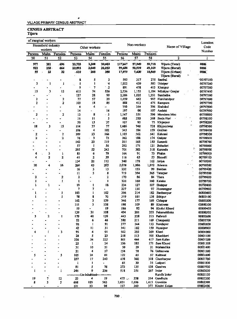
t!I
VILLAGE PRIMARY CENSUS ABSTRACT
CENSUS ABSTRACT Tijara
of marginal wor~ers Location Household industry Non-workers Name of Village Code Other workers
workers Number Persons 'Males 'Females Persons Males- Females Persons Males Females
"50 51 52 53 54 55 56 57 58 2 .1
977 181 ,696 13,703 3,300 10;'403 117;667 57,949 59,718 Tijara (Total) 0006 911 158, 664 13;093 3,040 10,053 99;688 50,519 49,169 Tijara (Rural) 0006
55 23 31 >,610 260 350 17,979 7,430' 10,549 Tijara (Urban) 0006,' Tijara (Rural) f~
g 5 3 592 317 275 Seethal '00797100 2 5 I -4 1',022 439 583 Udaipur 00797200
9 7 ' ,2 891 478 413 Khanpur 00797300 15 3 12 610 74 536 2;336 1,152 . 1,184 Milakpur Goojar Q0797400
127 28 99 2;386 1,035 1,351 Santhalka 00797500 2 2 77 57 20 1,659 662 997 Harchandpur 00797600 2 2 103 18 85 888 413 475 Rarnpura 00797700
4 4 750 354 396 Shahdod 00797800 14 14 197 90 107 Amlaki 00797900
2 2 13 8 ,,5 1,147 551 596 MundanaMeo Q0798000 16 II 5 688 320 368 BeelaHeri 00798100 50 13 '37 167 92 75 Khijarpur 00798200
18 3 15 ' 114 37 77 1;486 748 738 Khijooriwas 00798300 106 4 102 343 184 159 Godhan 00798400
2 2 189 23 166 1,103 562 541 Kahrani 00798500 2 2 76 3 73 362 188 174 Gadpur 00798600
142 23 119 315 165 150 Karendi 00798700 57 1 56 292 171 121 Bahadari 00798800
295 52 243 701 383 318 Karenda " 00Z98900 4 3 1 85 6 79 164 91 73 Phalsa 00799000 4 2 2 41 2 39 116 63 53 Bhoodli 00799'nio
134 22 112 340 178 162 loriya OIhiJ9200 20 4 16 266 63 203 2,078 1,006 1,072 lhiwana 00799.300
16 3 13 232 133 99 Banban 00799400 11 3 8 719 354 365 Tatarpur 00799500
2 2 2 2 170 86 84 Thara 00799600 I I I I 320 160 160 Kalaka 00799700
19 1 18 234 127 107 Shahpur oo7~8oo 7 7 227 130 97 Huseengpur 00799900
103 I 102 396 214 182 Banbcerpur 00800000 78 8 70 319 181 138 Bibipur 00800100
162 3 159 346 177 169 Chhapar 00800200 111 3 108 198 109 89 Khatiwas 00800300
19 19 186 92 94 Khohri Khurd 00800400 139 31 108 404 201 203 Fakaruddinka 00800500
3 2 179 40 139 443 228 215 Pathredi 00800600 52 6 46 380 211 169 Chaupanki 00800700 92 I 91 277 144 133 Bandapur 00800800 42 11 31 341 182 159 Husaipur 00800900
4 3 95 4 91 562 293 269 Kheri 00801000 28 5 23 218 113 lOS Kharkhari 00801100
256 34 222 861 444 417 SareKalan 00801200 25 1 24 356 185 171 SareKhurd 00801300 31 10 21 50 29 21 Mahandika 00801400 21 4 17 154 78 76 Udhanwas 00801500
5 5 105 24 81 122 65 57 Ku1awat 00801600 257 17 240 678 360 318 Chooharpur 00801700
1 I 6S 30 35 Ladpuri 00801800 81 5 76 273 135 138 Gandwa 00801900
245 9 236 518 251 267 Indor 00802000 -------Un-inhabited------- Rundh Indor 00802100
19 7 12 23 4 19 472 " 258 214 Gandhola 00802200 8 3 5 668 105 563 3,021 1,606 1,415 Guwalda 00802300
121 23 98 737 360 377 Khohri Kalan 00802400
799 .
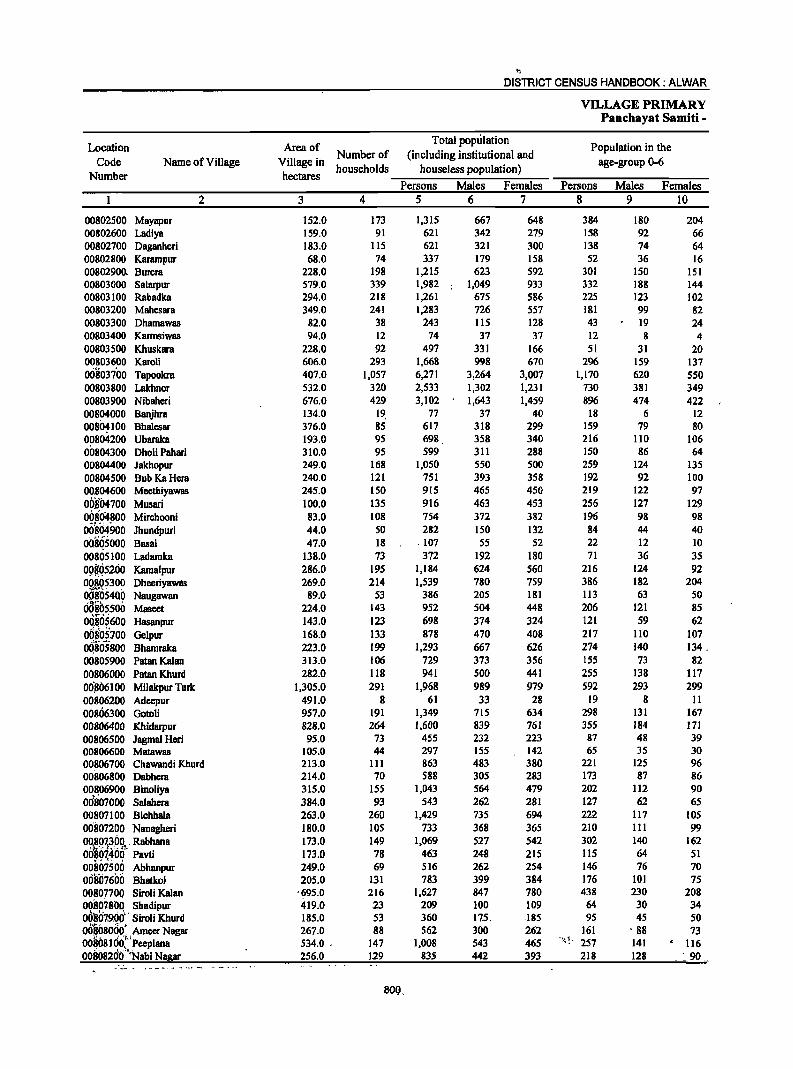
'" DISTRICT CENSUS HANDBOOK: ALWAR
VILLAGE PRIMARY Panchayat Samiti -
Location Area of Total population
Population in the Code Name of Village Village in
Number of (including institutional and age-group 0-6
Number hectares households houseJess population)
Persons Males Females Persons Males Females 2 3 4 5 6 7 8 9 10
00802500 Mayapur 152.0 173 1,315 667 648 384 180 204 00802600 Ladiya 159.0 91 621 342 279 158 92 66 00802700 Daganheri 183.0 115 621 321 300 138 74 64 00802800 Kararnpur 68.0 74 337 179 158 52 36 16 00802900. Burera 228.0 198 1,215 623 592 301 ISO 151 00803000 Salarpur 579.0 339 1,982 1,049 933 332 188 144 00803100 Rabadka 294.0 218 1,261 675 586 225 123 102 00803200 Mahesara 349.0 241 1,283 726 557 181 99 82 00803300 Dhamawas 82.0 38 243 115 128 43 19 24 00803400 Karrnsiwas 94.0 12 74 37 37 12 8 4 00803500 Khuskara 228.0 92 497 331 166 51 31 20 00803600 Karoli 606.0 293 1,668 998 670 296 159 137 00803700 Tapookra 407.0 1,057 6,271 3,264 3,007 1,170 620 550 00803800 Lakhnor 532.0 320 2,533 1,302 1,231 730 381 349 00803900 Nibahcri 676.0 429 3,102 1,643 1,459 896 474 422 00804000 Banjhra 134.0 19. 77 37 40 18 6 12 00801100 Bhalcsar 376.0 85 617 318 299 159 79 80 00804200 Ubaraka 193.0 95 698 358 340 216 1I0 106 00804300 DholiPahari 310.0 95 599 311 288 150 86 64 00804400 Jakhopur 249.0 168 1,050 550 500 259 124 135 00804500 Bub KaHera 240.0 121 751 393 358 192 92 100 00B04600 Meethiyawas 245.0 150 915 465 450 219 122 97 OOBl)4700 Musari 100.0 135 916 463 453 256 127 129 00804800 Mirchooni 83.0 108 754 372 382 196 98 98 OO~ri4900 Jhundpuri 44.0 50 282 150 132 84 44 40 Oo.ii~sooo Basai 47.0 18 . 107 55 52 22 12 10 00805100 Ladamka 138.0 73 372 192 180 71 36 35 09~Q52(jO Kamalpur 286.0 195 1,184 624 560 216 124 92 Og!~?30~ Dheeriyawas 269.0 214 1,539 780 759 386 182 204 008054QO Naugawan 89.0 53 386 205 181 113 63 50 00805500 Maseet 224.0 143 952 504 448 206 121 85 OQSOS600 Hasanpur 143.0 123 698 374 324 121 59 62 OOgOS]OO Gelpur 168.0 133 878 470 408 217 110 107
~~*' -..I:..
OQ805800 Bhamraka 223.0 199 1,293 667 626 274 140 134. 00805900 PataDKalan 313.0 106 729 373 356 ISS 73 82 00806000 PatanKhurd 282.0 118 941 500 441 255 138 117 00.806100 Milakpur Turk 1,305.0 291 1,968 989 979 592 293 299 00806200 Adeepur 491.0 8 61 33 28 19 8 11 00806300 Gotoli 957.0 191 1,349 715 634 298 131 167 00806400 Khidarpur 828.0 264 1,600 839 761 355 184 171 00806500 Jagmal Heri 95.0 73 455 232 223 87 48 39 00806600 Matawas 105.0 44 297 155 142 65 35 30 00806700 Chawandi Khurd 213.0 III 863 483 380 221 125 96 00806800 Dabhcra 214.0 70 588 305 283 173 87 86 00806900 Binoliya 315.0 155 1,043 564 479 202 112 90 ,.' 00807000 Salahcra 384.0 93 543 262 281 127 62 65 00807100 Bichhala 263.0 260 1,429 735 694 222 117 105 00807200 Nanagheri 180.0 105 733 368 365 210 III 99 ~~~Q7,~,691- ' Rabhana 173.0 149 1,069 527 542 302 140 162 00801400 Pavti 173.0 78 463 248 215 115 64 51 0081r1500 Abhanpur 249.0 69 516 262 254 146 76 70 00807600 Bhatkol 205.0 131 783 399 384 176 101 75 0080770Q Siroli Kalan ·~95.0 216 1,627 847 780 438 230 208 00807.800 Shadipur 419.0 23 209 100 109 64 30 34 00'807.9.00" Siroli Khurd 185.0 53 360 175. .185 95 45 50 OO~80q«( Amcer Nagar 267.0 88 562 300 262 161 . 88 73 00~081 00., Peeplana 534.0 . 147 1,008 543 465 '!-.j 1 ~ 257 141 . 116 00B0820() "Nabi N!!E: 256.0 129 835 442 393 218 128 _ ~ 90
¥ -- • . - _- .. - - - .~. -.
80Q.
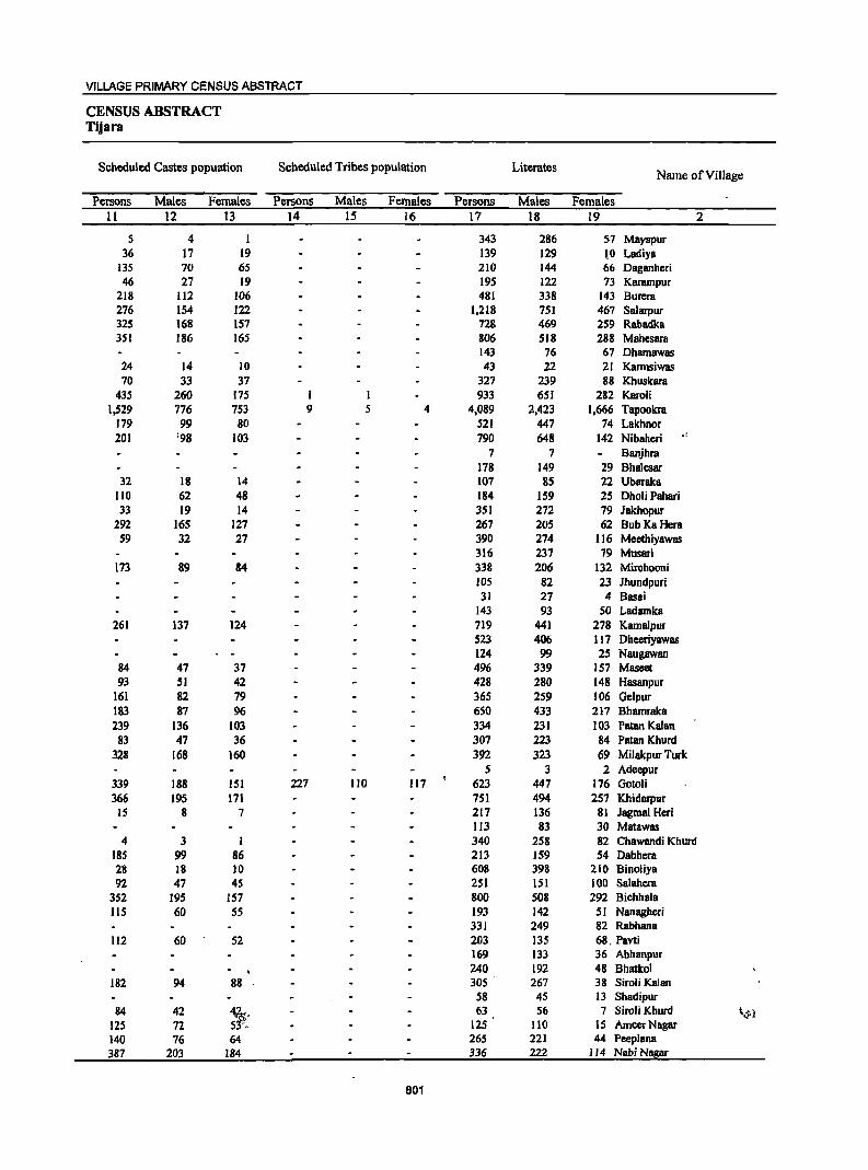
VILLAGE PRIMARY CENSUS ABSTRACT
CENSUS ABSTRACT Tijara
Scheduled Castes popuation Scheduled Tribes population Literates Name of ViII age
Persons Males Females Persons Males Females Persons Males Females 11 12 13 14 15 16 17 18 19 2
5 4 I 343 286 57 Mayapur 36 17 19 139 129 \0 Ladiya
135 70 65 210 144 66 Daganheri 46 27 19 195 122 73 Karampur
218 112 106 481 338 143 Burera 276 154 122 1.218 751 467 Salarpur 325 168 157 728 469 259 Rabadka 351 186 165 806 518 288 Mahcsara
143 76 67 Dhamawas 24 14 10 43 22 21 Kannsiwas 70 33 37 327 239 88 Khuskara
435 260 175 I 1 933 651 282 Karoli 1,529 776 753 9 5 4 4,089 2,423 1,666 Tapoolcra
179 99 80 521 447 74 Lakhnor 201 '98 103 790 648 142 Nibahcri ,I
7 7 Banjhra 178 149 29 Bhalesar
32 18 14 107 B5 22 Ubaraka 110 62 48 184 159 25 Dholi Pahari 33 19 14 351 272 79 Jakhopur
292 16S 127 267 205 62 Bub KaHcra S9 32 27 390 274 116 Meethiyawas
316 237 79 Musari 173 89 84 338 206 132 Mirchooni
105 82 23 Jhundpuri 31 27 4 Basai
143 93 50 Ladamka 261 137 124 719 441 278 Kamalpur
523 406 117 Dheeriyawas 124 99 25 Naugawan
84 47 37 496 339 157 Maseet 93 51 42 428 280 148 Hasanpur
161 82 79 365 259 106 Gclpur 183 87 96 650 433 217 Bhamraka 239 136 103 334 231 103 Patan Kalan
83 47 36 307 223 84 Patan Khurd 328 168 160 392 323 69 Milakpur Turk
5 3 2 Adeepur 339 188 151 227 110 117 623 447 176 Gotoli 366 195 171 751 494 257 Khidarpur
15 8 7 217 136 81 Jagrnal Heri IJ3 83 30 Matawas
4 3 I 340 258 82 Chawandi Khurd 18S 99 86 213 159 S4 Dabhcra 28 18 )0 608 398 210 Binoliya 92 47 45 2S1 151 100 Salahera
352 195 157 800 508 292 Bichhala lIS 60 55 193 142 51 Nanagheri
331 249 82 Rabhana 112 60 52 203 135 68, Pavti
169 133 36 Abhanpur 240 192 48 Bhatkol
182 94 88 . 305 267 38 Siroli Kalan 58 45 13 Shadipur
84 42 ~: 63 56 7 Siroli Khurd ~~l
125 72 125 110 15 AmeerNagar 140 76 64 265 221 44 Peeplana 387 203 184 336 222 114 Nabi Nagar
801
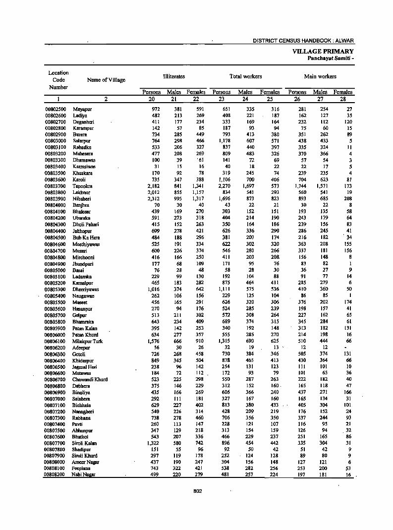
DISTRICT CENSUS HANDBOOK: ALWAR
VILLAGE PRIMARY Panchayat Samiti -
Location Illiterates Total workers Main workers
Code Name of Village Number
Persons Males Females Persons Males Females Persons Males Females 2 20 21 22 23 24 25 26 27 28
00802500 Mayapur 972 381 591 651 335 316 281 254 27 00802600 Ladiya 482 213 269 408 221 187 162 127 35 00802700 Daganheri 411 177 234 333 169 164 232 112 120 00802800 Karampur 142 57 85 187 93 94 75 60 15 00802900 Burera 734 285 449 793 413 380 351 262 89 00803000 Salarpur 764 298 466 1,178 607 571 438 433 5 00803100 Rabadka 533 206 327 837 440 397 335 324 II 00803200 MahesarB 477 208 269 809 483 326 370 366 4 00803300 DhamBwas 100 39 '61 141 72 69 57 54 3 00803400 Karmsiwas 31 15 16 40 18 22 22 17 5 00803500 Khuskara 170 92 78 319 245 74 239 235 4 00803600 Karoli 735 347 388 1,106 700 406 704 623 81 00803700 Tapookra 2,182 841 1,341 2,270 1,697 573 1,744 1,571 173 00803800 Lakhnor 2,012 855 1,157 834 541 293 560 541 19 00803900 Nibahcri 2,312 995 1,317 1,696 873 823 893 685 208 00804000 8anjhra 70 30 40 43 22 21 30 22 8 00804100 Bhalesar 439 169 270 303 152 151 193 135 58 00804200 Ubaraka 591 273 318 404 214 190 243 179 64 00804300 Dholi Pahari 415 152 263 350 164 186 239 156 83 00804400 Jakhopur 699 278 421 626 336 290 286 245 41 00804500 Bub KaHera 484 188 296 381 207 174 216 182 34 00804600 Mecthiyawas 525 191 334 622 302 320 363 208 155 00804700 Musari 600 226 374 546 280 266 337 181 156 00804800 Mirchooni 416 166 250 411 203 20S. 156 148 8 00804900 Jhundpuri 177 68 109 171 95 76 83 82 1 00805000 Basai 76 28 48 58 28 30 36 27 9 0080S100 Ladamka 229 99 130 192 104 88 91 77 14 00805200 Kamalpur 465 183 282 875 464 411 285 279 6 00805300 Dheeriyawas 1,016 374 642 1,111 575 536 410 360 50 00805400 Naugawan 262 106 156 229 125 104 86 85 1 00805500 Maseet 456 165 291 626 320 306 376 202 174 00805600 Hasanpur 270 94 176 524 285 239 198 157 41 00805700 Gelpur 513 211 302 572 308 264 227 162 65 00805800 Bhamraka 643 234 409 689 374 315 345 284 61 00805900 Patan Kalan 395 142 253 340 192 148 313 182 131 00806000 PatanKhurd 634 277 357 555 285 270 214 198 16 00806100 Milakpur Turk 1,576 666 910 1,315 690 625 510 444 66 00806200 Adeepur 56 30 26 32 19 13 12 12 00806300 Gotoli 726 268 458 730 384 346 505 374 131 00806400 Khidarpur 849 345 504 878 465 413 430 364 66 00806500 JagmalHeri 238 96 142 254 131 123 III 101 10 00806600 Matawas 184 72 112 172 93 79 101 65 36 00806700 Chawandi Khurd 523 225 298 550 287 263 222 182 40 00806800 Dabhera 375 146 229 312 152 160. 165 118 47 00806900 Binoliya 435 166 269 606 366 240 437 271 166 00807000 Salahera 292 III 181 327 167 160 165 134 31 00807100 Bichhala 629 227 402 813 380 433 405 304 101 00807200 Nanagheri 540 226 314 428 209 219 176 152 24 00807300 Rabhana 738 278 460 706 356 350 337 244 93 00807400 Pavti 260 113 147 228 121 107 116 95 21 00807500 Abhanpur 347 129 218 313 154 159 126 94 32 00807600 Bhatkol 543 207 336 466 229 237 251 165 86 00807700 Siroli Kalan 1,322 580 742 896 454 442 335 304 31 00807800 Shadipur 151 55 96 92 50 42 51 42 9 00807900 Siroli Khurd 297 I19 178 252 124 128 89 80 9 00808000 AmeerNagar 437 190 247 304 156 148 127 121 6 00808100 Peeplana 743 322 421 S38 282 256 253 200 53 00808200 NabiNagar 499 220 279 481 257 224 197 181 16
802
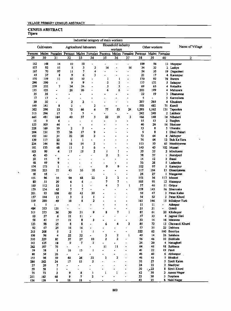
VILLAGE PRIMARY CENSUS ABSTRACT
CENSUS ABSTRACl Tijara
Industrial category of main workers
Cultivators Agricultural labourers Household industry
Other workers Name of Village workers
Persons Males Females Persons Males Females Persons Males Females Persons Males Females 29 30 31 32 33 34 35 36 37 38 39 40 2
162 148 14 10 10 109 96 13 Mayapur 107 92 15 5 3 2 16 16 34 32 2 Ladiya 167 70 97 11 7 4 54 35 19 Daganheri 45 37 8 9 6 3 21 17 4 Karampur
170 159 11 10 10 I I 170 92 78 Burera 290 290 9 9 2 2 137 132 5 Salarpur 239 232 7 24 24 3 3 69 65 4 Rabadka 135 135 26 26 6 6 203 199 4 Mahesara 3S 35 22 19 3 Dhamawas 17 17 5 5 Karmsiwas 30 30 2 2 207 203 4 Khuskara
149 141 8 2 2 553 482 71 Karoli 302 290 12 72 66 6 77 53 24 1,293 1,162 131 Tapookra 313 296 17 5 5 242 240 2 Lakhnor 665 481 184 40 37 3 22 19 3 166 148 18 Nibaheri
IS 9 6 IS 13 2 Banjhra 153 109 44 40 26 14 Bhalesar 228 169 59 2 2 13 8 5 Ubaraka 204 131 73 26 17 9 9 8 1 Dholi Pahari 192 161 31 22 20 2 72 64 8 Jakhopur
139 117 22 1 I 76 64 12 Bub KaHera ','
234 144 90 16 14 2 113 SO 63 Meethiyawas 181 133 48 11 5 6 145 43 102 Musari 103 99 4 17 IS 2 35 33 2 Mirchooni 43 43 2 2 38 37 I lhundpuri 22 15 7 14 12 2 Basai 58 49 9 33 28 5 Ladamka
174 173 1 9 9 102 97 5 Kamalpur 250 223 27 43 33 10 117 104 13 Dheeriyawas
58 58 28 27 1 Naugawan 131 96 3S 90 68 22 2 2 153 36 117 Maseet 80 51 29 6 6 7 7 105 93 12 Hasanpur
16S 112 S3 1 I 4 3 57 46 11 Gelpur 179 134 45 7 7 159 143 16 Bhamraka 201 93 108 62 42 20 50 47 3 PatanKalan 157 144 13 3 2 1 54 52 2 Patan Khurd 339 290 49 10 8 2 161 146 15 Mi1akpur Turk
1 1 11 11 Adeepur 484 353 131 21 21 Gotoli 311 275 36 ;i0 21 9 8 7 81 61 20 Khidarpur
63 57 6 11 II 37 33 4 Jagmal Heri 58 41 17 11 8 3 32 16 16 Matawas
123 98 2S 8 8 6 4 2 85 72 13 Chawandi Khurd 92 67 25 16 16 57 35 22 Dabhers
213 208 5 2 1 222 62 160 Binoliya 100 96 4 22 22 3 2 40 14 26 Salahera 310 229 81 37 27 10 2 2 S6 46 10 Bichhala 143 125 18 9 7 2 24 20 4 Nanagheri 262 187 75 11 II 64 46 18 Rabhana
59 58 I 16 IS 41 22 19 Pavti 80 54 26 46 40 6 Abhanpur
155 96 59 48 26 22 2 2 46 41 5 Bhatkol
286 262 24 17 15 2 32 27 5 Siroli Kalan 27 20 7 24 22 2 Shadipur
S9 58 I 30 ,.,,,,22 8 Siroli Khurd
75 73 2 9 8 1 42 39 3 AmeerNagar
211 163 48 9 7 2 33 30 3 Peeplana 136 128 8 18 18 43 35 8 NabiNagar
803

DISTRICT CENSUS HANDBOOK: ALWAR
VILLAGE PRIMARY Panchayat Samiti -
Location Industrial category
Code Name of Village Marginal workers
Cultivators Agricultural labourers Number
Persons Males Females Persons Males Females Persons Males Females 2 41 42 43 44 45 46 47 48 49
00802500 Mayapur 370 81 289 182 60 122 40 14 26 00802600 Ladiya 246 94 152 106 69 37 27 11 16 00802700 Daganheri 101 57 44 72 45 27 00802800 Karampur 112 33 79 30 11 19 16 7 9 00802900 Burera 442 151 291 350 132 218 28 15 13 00803000 Salarpur 740 174 566 356 IS5 201 43 9 34 00803100 Rabadka . 502 116 386 253 102 151 24 10 14 00803200 Mahesara 439 117 322 203 90 113 61 13 48 00803300 Dhamawas 84 18 66 38 IS 23 1 00803400 Karmsiwas 18 1 17 4 I 3 00803500 Khuskara 80 10 70 19 4 15 19 4 15 00803600 Karoli 402 77 325 149 54 95 12 4 8 00803700 Tapookra 526 126 400 283 S9 224 123 24 99 00803800 Lakhnor 274 274 270 270 3 3 00803900 Nibaheri 803 188 615 373 135 238 47 13 34 00804000 Banjhra 13 13 13 13 00804100 Bhalesar 110 17 93 88 16 72 00804200 Ubaraka 161 35 126 ISO 35 115 1 1 00804300 Dho1i Pahari III 8 103 65 8 57 12 12 00804400 Jakhopur 340 91 249 154 54 100 38 11 27 00804500 BubKaHera 165 25 140 32 8 24 1 1 00804600 Mcethiyawas 259 94 165 180 90 90 31 2 29 00804700 Musari 209 99 lIO 141 74 67 5 4 I 00804800 Mirehooni 255 55 200 76 28 48 13 5 8 00804900· Jhundpuri 88 13 75 51 12 39 00805000 Basai 22 1 21 22 1 21 00805100 Ladamka 101 27 74 57 13 44 23 2 21 00805200 Kamalput 590 185 405 389 141 248 OQ8053oo Dheeriyawas 701 215 486 510 191 319 56 13 43 00805400 Naugawan 143 40 103 66 40 26 00805500 Maseet 250 118 132 125 77 48 53 27 26 00805600 Hasanpur 326 128 198 206 83 123 43 15 28 00805700 Ge1pur 345 146 199 85 55 30 43 17 26 00805800 Bhamraka 344 90 254 260 73 187 40 14 26 00805900 Patan Kalan 27 10 17 23 10 13 4 4 00806000 Patan Khurd 341 87 254 243 60 183 5 5 00806100 Milakpur Turk 805 246 559 655 232 423 23 4 19 00806200 Adeepur 20 7 13 2 2 00806300 Gototi 225 10 215 133 6 127 00806400 Khidarpur 448 101 347 120 48 72 14 1 13 00806500 Jagma1 Heri 143 30 113 71 26 45 . 8 1 7 00806600 Matawas 71 28 43 36 21 15 3 2 I 00806700 Chawandi Khurd 328 105 223 211 74 137 18 :3 15 00306800 Dabhera 147 34 113 38 26 12 4 1 3 00806900 Binoliya 169 95 74 153 90 63 I 1 00807000 Sa1ahera 162 33 129 86 29 57 7 1 6 00807100 Bichhala 408 76 332 147 41 106 32 10 22 00807200 Nanagheri 252 57 195 125 55 70 13 I 12 00807300 Rabhana 369 112 2S7 218 106 112 00807400 Pavti 112 26 86 39 9 30 22 6 16 00807500 Abhanpur 187 60 127 87 38 49 1 1 00807600 BhBtkol 215 64 151 67 27 40 10 2 8 00807700 Siroti Kalan 561 150 411 193 43 150 97 11 86 00807800 Shadipur 41 8 33 13 1 12 00807900 Siroli Khurd 163 44 119 105 40 65 I I 00808000 AmeerNagar 177 3S 142 99 26 ijd(! 22 5 17 00808100 Peeplana 285 82 203 214 65 149 28 5 23 00808200 NabiNagar 284 76 208 181 S4 ·127 23 4 19
804

VILLAGE PRIMARY CENSUS ABSTRACT
CENSUS ABSTRACT Tijara
of marginal workers Location
Household industry Non-workers Other workers Name of Village Code
workers Numher Persons Males Females Persons Males Females Persons Males Females
50 51 52 53 54 55 56 57 S8 2
148 7 141 664 332 332 Mayapur 00802500 106 8 98 7 6 1 213 121 92 Ladiya 00802600
29 12 17 288 152 136 Daganheri 00802700 3 2 63 14 49 150 86 64 Karampur 00802800
64 4 60 422 210 212 Burera 00802900 341 10 331 804 442 362 Salarpur 00803000 224 3 221 424 235 189 Rabadka 00803100
6 5 169 13 156 474 243 231 Mahesara 00803200 45 3 42 102 43 59 Dhamawas 00803300 14 14 34 19 15 Karmsiwas 00803400 42 2 40 178 86 92 Khuskara 00803500
1 ) 240 19 221 562 298 264 Karcli 00803600 25 6 19 95 37 58 4,001 1,567 2,434 Tapookra 00803700
1 1 1,699 761 938 Lakhnor 00803800 35 14 21 348 26 322 1,406 770 636 Nibaberi 00803900
34 15 19 Banjhra 00804000 22 21 314 166 148 Bha1esar 00804100 10 10 294 144 150 Ubaraka 00804200 34 34 249 147 102 Dholi Pabari 00804300
148 26 122 424 214 210 Jakhopur 00804400 132 17 115 370 186 184 Bub KaHera 00804500 48 2 46 293 163 130 Meethiyawas 00804600 63 21 42 370 183 187 Musari 00804700
166 22 144 343 169 174 Mirchooni 00804800 3 3 34 33 111 55 56 Jhundpuri 00804900
49 27 22 Basai 00805000 21 12 9 180 88 92 Ladamka 00805100
200 44 156 309 160 149 Karnalpur 00805200 135 11 124 428 20S 223 Dheeriyawas 00805300 77 77 157 80 77 Naugawan 00805400 72 14 58 326 184 142 Maseet 00805500
3 1 2 74 29 45 174 89 85 Hasanpur 00805600 4 2 2 213 72 141 306 162 144 Gelpur 00805700
44 3 41 604 293 311 Bhamraka 00805800 389 181 208 Patan Kalan 00805900
93 27 66 386 215 171 Patan Khurd 00806000 127 10 117 653 299 354 Milakpur Turk 00806100
18 7 11 29 14 15 Adeepur 00806200 91 4 87 619 331 288 Gotoli 00806300
5 3 2 309 49 260 722 374 348 Khidarpur 00806400 64 3 61 201 101 100 Jagmal Heri 00806500 32 5 27 125 62 63 Matawas 00806600
7 6 92 27 65 313 196 117 Chawandi Khurd 00806700 105 7 98 276 153 123 Dabhera 00806800
15 4 11 437 198 239 Binoliya 00806900 1 1 68 3 65 216 95 121 Salahera 00807000 3 3 226 25 201 616 355 261 Bichhala 00807100
114 1 113 305 159 146 Nanagheri 00807200 151 6 145 363 171 192 Rabhana 00807300 51 II 40 235 127 108 Pavti 00807400 99 22 77 203 108 95 Abhanpur 00807500
I 137 35 102 317 170 147 Bhatkol 00807600 15 2 13 256 94 162 731 393 338 Siroli Kalan 00807700
28 7 21 117 50 67 Shadipur 00807800 57 4 53 108 '_1\·,51 57 Siroli Khurd 00807900 56 4 52 258 144 114 AmeerNagar 00808000 43 12 31 470 261 209 Peeplana 00808100 80 18 62 354 185 169 Nabi Nagar 00808200
805
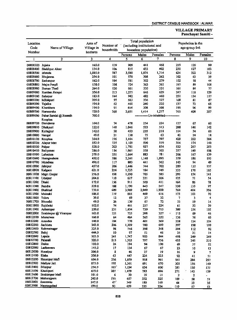
DISTRICT CENSUS HANDBOOK: ALWAR
VILLAGE PRIMARY Panchayat Samiti -
Location Area of Total population
Population in the
Code Name of Village Village in Number of (including institutional and
age-group 0-6
Number hectares households houseless population)
Persons Males Females Persons Males Females
2 3 4 5 6 7 8 9 10
00808300 Jojaka 165.0 139 909 441 468 219 120 99 00808400 Shekhpur Aheer 134.0 106 835 433 402 230 127 103 00808500 Ishroda 1,085.0 587 3,588 1,874 1,714 634 322 312 00808600 Bhojawas 254.0 101 570 308 262 102 63 39 00808700 Sarkanpur 162.0 104 581 302 279 102 58 44 00808800 Majra Peepli 158.0 108 724 363 361 197 89 108 00808900 Baman Thedi 264.0 120 661 330 331 161 84 77 00809000 Rambas Jhonpri 356.0 213 1,275 646 629 247 118 129 00809100 Salarpur 183.0 144 942 482 460 251 134 117 00809200 MlIakPuri 205.0 97 663 336 327 168 81 87 00809300 Tajalka 194.0 62 460 240 220 137 72 65 00809400 Kharkbara 194.0 91 616 308 308 195 96 99 00809500 Hameeraka 720.0 368 2,691 1,414 1,277 765 408 357 00809600 Pahar Samlat @ Roondh 700.0 ---------Un-inhabited-----------
Roopbas 00809700 Damdama 164.0 74 478 254 224 127 67 60 00809800 Dhakpuri 122.0 148 1,046 533 513 288 146 142 00809900 Kultajpur 142.0 58 453 235 218 114 S4 60 00810000 Nangal 49.0 21 138 75 63 42 24 18 00810100 Roopbas 314.0 196 1,464 7S7 707 428 222 206 00810200 AlapurMeo 552.0 125 1,109 590 519 314 174 140 00810300 Palpur 528.0 203 1,781 927 854 522 267 255 00810400 Baliyawas 286.0 154 1,061 558 503 257 149 108 00810500 Luhadera 379.0 251 1,664 883 781 306 167 139 00810600 Heengwahera 450.0 386 2,241 1,148 1,093 379 186 193 00810700 Mundana 496.0 117 803 441 362 143 94 49 00810800 Jalalpur 457.0 206 1,446 744 702 289 132 157 00810900 Kalgaon 621.0 224 1,533 784 749 335 170 165 00811000 Majri Goojar 256.0 198 1,290 70S 585 295 154 141 00811100 Udaipur 204.0 110 627 321 306 125 71 54 00811200 Dhaki 172.0 156 911 500 411 164 86 78 00811300 Bandra 229.0 188 1,190 643 547 230 133 97 00811400 Shahbad 770.0 689 3,969 2,049 1,920 760 404 356 00811500 Mainaki 186.0 119 885 469 416 173 103 70 00811600 Tohra 39.0 12. 69 37 32 7 3 4 00811700 Bboodki 49.0 26 139 67 72 33 19 14 00811800 Rajdhoki 102.0 74 461 237 224 61 32 29 00811900 Asleempur 259.0 231 1,454 739 715 309 154 ISS 00812000 Ibrahimpur @ Virampur 163.0 121 725 398 327 115 69 46 00812100 Muradwas 160.0 64 484 262 222 136 76 60 00812200 Arandka 140.0 104 770 401 369 228 124 104 00812300 Sarhheta 343.0 206 1,399 700 699 397 198 199 00812400 Rahmatnagar 325.0 98 746 398 348 204 112 92 00812500 Baloj 444.0 10 97 51 46 35 21 14 00812600 Lapala 505.0 241 1,747 903 844 498 249 249 00812700 Palasali 320.0 213 1,553 797 756 455 245 210 00812800 Daika 100.0 24 i94 94 100 69 37 32 00812900 Ladhawara 145.0 17 134 67 67 23 10 13 00813000 Husaipur 206.0 8 46 27 19 16 9 7 00813100 Elaka 208.0 63 447 224 223 92 41 51 00813200 Hasanpur Mafi 604.0 256 1,859 958 901 541 284 257 00813300 Maliyar Jatt 875.0 195 1,361 691 670 305 156 149 00813400 Bilaspur 254.0 165' 1,234 634 600 281 150 131 00813500 Kbali1puri 419.0 207 . 1,479 783 696 271 142 129 00813600 Ibrahimpur Mafi 101.0 6 30 19 11 2 2 00813700 Maharajpura 245.0 IH. 657 332 325 109 58 51 00813800 Soorawas 247.0 67' 349 180 169 68 33 35 00813900 Naurangabad 199.0 93 659 335 324 110 57 S3
806
VILLAGE PRIMARY CENSUS ABSTRACT
CENSUS ABSTRACT Tijara
Scheduled Castes popuation Scheduled Tribes popUlation Literates Name of Village
Persons Males Females Persons Males Females Persons Males Females 11 12 13 14 15 16 17 18 19 2
292 146 146 382 233 149 Jojaka 137 75 62 263 191 72 Shekhpur Aheer 601 299 302 2,048 1,310 738 Ishroda 36 21 15 310 209 101 Bhojawas 43 23 20 355 216 139 Sarkanpur 38 20 18 342 223 119 Majra Peepli
168 87 81 313 196 117 BamanThedi 135 69 66 653 432 221 Rambas Jhonpri 281 153 128 333 226 107 Salarpur
231 177 54 Milakpuri 15 9 6 147 100 47 Tajalka 50 16 34 126 101 25 Kharkhara
199 101 98 601 511 90 Hameeraka -_·-----Un·inhabited----··_·- Pabar Samlat @ Roondh
Roopbas 33 16 17 84 79 5 Damdama 13 7 6 189 157 32 Dhakpuri 69 37 32 109 88 21 Kultajpur
28 21 7 Nangal 159 79 80 380 280 100 Roopbas
202 173 29 AlapurMeo 35 17 18 376 345 31 Palpur
212 115 97 407 284 123 Baliyawas 405 214 191 977 630 347 Luhadera 459 227 232 1,327 855 472 Heengwahera 90 44 46 39 18 21 S09 317 192 Mundana
107 S9 48 661 484 177 Jalalpur 629 326 303 806 516 290 Kalgaon
96 51 45 457 345 112 Majri Goojar 200 105 95 341 214 127 Udaipur
73 36 37 510 351 159 Ohaki 378 195 183 647 426 221 Bandra
1,044 546 498 2 2 2,147 1,326 821 Shahbad 598 348 250 Mainaki 44 30 14 Tohra
14 9 5 68 43 25 Bhoodki 306 188 118 Rajdhoki
413 220 193 749. 477 272 Asleempur 103 61 42 452 290 162 Ibrahimpur @ Virampur
174 144 30 Muradwas 282 191 91 Arandka
165 84 81 303 252 51 Sarhheta
133 75 58 150 119 31 Rahmatnagar 7 5 2 Baloj
267 138 129 483 393 90 Lapala 154 75 79 380 322 58 Palasali
72 48 24 Oaika 64 45 19 Ladhawara
8 8 Husaipur 102 51 51 210 137 73 Elaka 316 159 157 432 342 90 Hasanpur Mali
118 59 59 .1.,: 550 367 183 Maliyar Jatt
76 43 33 360 295 65 Bilaspur
267 139 128 701 460 241 KhaliJpuri
t:_f 20 15 5 Ibrabimpur Mafi
48 27 21 .J.'; 369 225 144 Maharajpura ..
80 3S 4S 188 124 64 Soorawas
7 3 4 388 237 151 Naurangabad
807
DISTRICT CENSUS HANDBOOK: ALWAR
VILLAGE PRIMARY Panchayat Samiti -
Location Illiterates Total workers Main workers
Code Name of Village Number
Persons Males Females Persons Males Females Persons Males Females 2 20 21 22 23 24 25 26 27 28
00808300 Jojaka 527 208 319 489 241 248 245 188 57 00808400 Shckhpur Aheer 572 242 330 392 209 183 196 160 36 00808500 Ishroda 1,540 564 976 2,043 1,058 985 949 853 96 00808600 Bhojawas 260 99 161 409 213 196 147 136 II 00808700 Sarkanpur 226 86 140 321 ISO 171 143 131 12 00808800 MajraPeepli 382 140 242 414 221 193 189 147 42 00808900 BamanThcdi 348 134 214 474 231 243 162 147 15 00809000 Rambas Jhonpri 622 214 408 827 421 406 327 295 32 00809100 Salarpur 609 256 353 557 272 285 261 179 82 00809200 Milakpuri 432 159 273 375 195 180 134 125 9 00809300 Tajalka 313 140 173 225 110 115 89 87 2 00809400 Kharkhara 490 207 283 352 188 164 160 140 20 00809500 Hameeraka 2,090 903 1,187 1,704 885 819 671 582 89 00809600 Pahar Samlat @ Roondh ---------Un-inhabited--------------
Roopbas 00809700 Damdama 394 175 219 268 138 130 96 95 I 00809800 Dhakpuri 857 316 481 644 338 306 178 116 2 00809900 Kultajpur 344 147 197 265 149 116 183 95 88 00810000 Nangal 110 54 56 76 41 35 53 30 23 00810100 Roopbas 1,084 477 607 855 442 413 322 299 23 00810200 AlapurMeo 907 417 490 627 327 300 385 259 126 00810300 Palpur 1,405 582 823 1,049 558 491 496 338 158 00810400 Baliyawas 654 214 380 651 311 324 336 230 106 00810500 Luhadcra 687 253 434 1,020 527 493 464 412 52 00810600 Heengwahera 914 293 621 1,379 713 666 526 491 35 00810700 Mundana 294 124 170 446 226 220 212 198 14 00810800 Jalalpur 785 260 525 1,055 561 494 332 326 6 00810900 Kalgaon 127 268 459 129 394 335 345 325 20 00811000 Majri Goojar 833 360 473 751 399 352 300 298 2 00811100 Udaipur 286 107 179 311 151 154 157 150 1 00811200 Dhaki 401 149 252 604 334 270 265 226 39 00811300 Bandra 543 217 326 658 364 294 414 281 133 00811400 ShahbBd 1,822 723 1,099 2,031 1,167 864 1,024 906 118 00811500 Mainaki 287 121 166 626 321 305 255 209 46 00811600 Tahra 25 7 18 55 31 24 19 18 I 00811700 Bhoodki 71 24 47 91 41 50 36 32 4 00811800 Rajdhoki 155 49 106 326 167 159 127 113 14 00811900 Asleempur 70S 262 443 877 453 424 404 326 78 00812000 lbrahimpur@ Virampur 273 108 165 447 232 215 208 183 25 00812100 Muradwas 310 118 192 241 119 122 86 75 II 00812200 Arandka 488 210 278 439 227 212 126 HI 15 00812300 Sarhheta 1,096 448 648 942 418 464 326 303 23 00812400 Rahmatnagar 596 219 311 471 259 212 173 158 15 00812500 Baloj 90 46 44 59 29 30 19 16 3 00812600 Lapala 1,264 510 754 872 469 403 438 361 77 00812700 Palasali 1,173 475 698 792 388 404 398 317 81 00812800 Daika 122 46 76 92 46 46 30 29 1 00812900 Ladhawara 70 22 48 92 47 45 37 36 I 00813000 Husaipur 38 19 19 26 16 10 13 13 00813100 Elaka 237 87 ISO 280 149 131 116 109 7 00813200 Hasanpur Mafi 1,427 616 811 799 431 368 432 383 49 00813300 Maliyar Jatt 811 324 487 703 342 361 298 298 00813400 Bilaspur 874 339 535 863 436 427 394 283 III 00813500 Kbalilpuri 778 323 455 1,067 564 503 471 352 119 00813600 lbrahimpur Mafi 10 4 6 25 14 II 15 II 4 00813700 Maharajpura i88" 107 181 331 ISO 181 216 149 67 00813800 Soorawas 161 56 105 164 82 82 108 72 36 00813900 NaurBngabad ,271 98 173 413 215 198 236 168 68
808
VILLAGE PRIMARY CENSUS ABSTRACT
CENSUS ABSTRACT Tijara
Industrial category of main workers
Cultivators Agricultural labourers Household industry
Other workers Name of Village workers
Persons Males Females Persons Males Females Persons Males Females Persons Males Females 29 30 31 32 33 34 35 36 37 38 39 40 2
130 101 29 41 32 9 2 2 72 53 19 Jojaka 126 96 30 2 2 68 62 6 Shekhpur Aheer 620 559 61 70 47 23 17 16 242 231 II Ishroda 126 118 8 21 18 3 Bhojawas 106 98 8 7 7 30 26 4 Sarkanpur 99 87 12 II 7 4 79 53 26 Majra Peepli
131 122 9 11 II 20 14 6 BamanThedi 186 171 15 71 65 - 6 70 59 11 Rambas Jhonpri 119 108 II 21 19 2 120 51 69 Salarpur 106 100 6 28 25 3 Milakpuri 66 65 I 5 S 18 17 1 Tajalka
106 101 5 3 3 51 36 15 Kharkhara 465 397 68 24 18 6 17 14 3 16S 153 12 Hameeraka
------Un-inhabited------ Pahar Samlat @ Roondh Roopbas-
63 62 II II 22 22 Damdama 138 137 I 5 5 35 34 1 Dhakpuri 104 49 55 18 7 II 60 39 21 Kultajpur
12 3 9 8 8 33 27 6 Nangal 221 210 11 31 26 5 3 3 67 60 7 Roopbas I
285 171 114 I I 98 86 12 AlapurMeo • 294 210 84 3 I 2 198 126 72 Palpur 200 154 46 35 29 6 101 47 54 Baliyawas 345 295 SO 34 34 2 2 83 81 2 Luhadcra 345 322 23 43 42 1 3 3 135 124 II Heengwahera 103 96 7 46 43 3 5 5 58 54 4 Mundana 277 274 3 18 18 2 2 35 32 3 Jalalpur 217 213 4 41 41 86 70 16 Kalgaon 240 239 I 9 9 SO 49 I Majri Goojar 126 119 7 S 5 26 26 Udaipur 194 165 29 11 11 2 2 58 48 10 Dhaki 238 177 61 41 40 I 135 64 71 Bandra 427 377 50 110 100 10 97 93 4 390 336 54 Shahbad 236 191 45 19 18 Mainaki
17 17 2 I Tohra 33 29 4 3 3 Bhoodki 98 85 13 2 2 27 26 1 Rajdhoki
237 197 40 59 48 11 108 81 27 Asleempur 132 114 18 7 7 5 '5 64 57 7 Ibrahimpur @ Virampur
71 61 10 6 5 9 9 Muradwas 87 77 10 3 3 36 31 5 Arandka
243 225 18 17 IS 2 10 10 56 53 3 Sarhheta 124 120 4 14 13 2 33 24 9 Rahmatnagar 17 14 3 I I I I Baloj
229 217 12 7 7 3 3 199 134 65 LapaJa 233 215 18 SO 46 -4 115 56 59 Palasali
17 16 3 3 10 10 Daika 35 34 2 2 Ladhawara 9 9 4 4 Husaipur
103 98 5 I 1 12 10 2 Elaka 283 247 36 8 8 141 128 13 Hasanpur Mafi 266 266 2 2 5 5 25 25 Maliyar Jatt 272 204 68 II 10 17 12 5 94 57 37 Bilaspur 340 314 26 2 2 129 36 93 Khalilpuri
15 11 4 Ibrahimpur Mafi 199 133 66 17 16 1 Maharajpura 80 46 34 -2 2 26 24 2 Soorawas
224 158 66 2 10 9 Naurangabad
809

DISTRICT CENSUS HANDBOOK: ALWAR
VILLAGE PRIMARY Panchayat Samiti -
Location Industrial category
Code Name of Village Marginal workers
Cultivators Agricultural labourers Number
Persons Males Females Persons Males Females Persons Males Females 2 41 42 43 44 45 46 47 48 49
00808300 Jojaka 244 53 191 163 45 118 39 4 35 00808400 Shekhpur Aheer 196 49 147 60 4 56 18 4 14 00808500 Ishroda 1,094 205 889 653 149 504 100 22 78 00808600 Bhojawas 262 77 185 117 7I 46 00808700 Sarkanpur 178 19 159 18 7 II ,00808800 Majra Peepli 225 74 lSI 113 58 55 10 10 00808900 BamanThedi 31'2 84 228 121 74 47 25 5 20 00809000 Rambas Jhonpri 500 126 374 158 92 66 89 21 68 00809100 Salarpur 296 93 203 85 48 37 35 7 28 00809200 Milakpuri 241 70 171 III 57 54 00809300 Tajalka 136 23 113 42 21 21 5 2 3 00809400 Kharkhara 192 48 144 78 40 38 1 1 00809500 Hameeraka 1,033 303 730 380 211 169 22 5 17 00809600 Pahaf Samlat @ Roondh ------··-Un-inhabited--··----·--
Roopbas 00809700 Damdama 172 43 129 76 21 55 38 9 29 00809800 Dhakpuri 466 162 304 180 51 129 152 63 89 00809900 KUltajpur 82 S4 28 75 S4 21 6 6 00810000 Nangal 23 11 12 17 9 8 3 2 00810100 Roopbas 533 143 390 343 105 238 56 18 38 00810200 A1apurMeo 242 68 174 174 38 136 I I 00810300 Palpur 553 220 333 478 184 294 60 24 36 00810400 Baliyawas 315 97 218 182 69 113 28 10 18 00810500 Luhadera 556 115 441 489 104 385 46 6 40 00810600 Heengwahera 853 222 631 361 183 178 51 II 40 00810700 Mundana 234 28 206 150 25 125 44 44 00810800 Jalalpuf 723 235 488 446 221 225 10 7 3 00810900 Kalgaon 384 69 315 158 56 102 39 10 29 00811000 Majri Goojar 451 101 350 175 82 93 3S 8 27 00811100 Udaipur 154 7 147 49 6 43 00811200 Dhaki 339 108 231 179 98 81 5 3 2 00811300 Bandra 244 83 161 135 81 54 23 I 22 00811400 Shahbad 1,007 261 746 320 145 175 150 48 102 00811500 Mainaki 371 112 259 254 III 143 00811600 Tohra 36 13 23 23 13 10 00811700 Bhoodki 55 9 46 26 8 18 00811800 Rajdhoki 199 54 145 85 52 33 00811900 Asleempur 473 127 346 387 114 273 49 6 43 00812000 lbrahimpur @ Virampur 239 - 49 190 108 43 65 13 3 10 00812100 Muradwas ISS 44 III 140 38 102 7 2 5 00812200 Arandka 313 116 197 158 93 65 9 8 I 00812300 Sarhheta 616 175 441 311 114 197 15 2 13 00812400 Rahmatnagar 298 101 197 218 76 142 36 6 30 00812500 Baloj 40 13 27 33 7 26 I I 00812600 Lapala 434 108 326 56 34 22 90 34 56 00812700 Palasali 394 7I 323 42 36 6 27 7 20 00812800 Daika 62 17 45 42 12 30 II 2 9 00812900 Ladhawara S5 11 44 30 10 20 00813000 Husaipur 13 3 10 II 3 8 00813100 Elaka 164 40 124 97 33 64 I 00813200 Hasanpur Mafi 367 48 319 123 23 100 3 3 00813300 Maliyar Jatt 40S 44 361 157 II 146 II 2 9 00813400 Bilaspur 469 153 316 318 129 189 i7 4 13 00813500 Khalilpuri 596 212 384 479 201 278 13 5 8 00813600 Ibrahimpur Mafi 10 3 7 4 3 I 00813700 • .. Maharajpura 115 1 114 22 22 \.b.~
00813800 SooraWllS 56 10 46 3 2 1 22 7 IS 00813900 Naurangabad 177 47 130 103 45 58 4 2 2
810
VILLAGE PRIMARY CENSUS ABSTRACT
CENSUS ABSTRACT Tijara
of marginal workers Location
Household industry Other workers
Non-workers Name ofViJlage Code workers Number
Persons Males Females Persons Males Females Persons Males Females 50 51 52 53 54 55 56 57 58 2
42 4 38 420 200 220 Jojaka 00808300 118 41 77 443 224 219 Shekhpur Aheer 00808400
6 5 335 33 302 1,545 816 729 Ishroda 00808500 145 6 139 161 95 66 Bhojawas 00808600 160 12 148 260 152 108 Sarkanpur 00808700 102 16 86 310 142 168 Majra Peepli 00808800 166 5 161 187 99 88 Barnan Thedi 00808900 253 13 240 448 225 223 Rarnbas Jhonpri 00809000 176 38 138 385 210 175 Salarpur 00809100 130 13 117 288 141 147 Milakpuri 00809200 88 88 235 130 105 Tajalka 00809300
113 8 lOS 264 120 144 Kharkhara 00809400 12 11 619 86 533 987 529 458 Harneeraka 00809500
------Un-inhabited--- PabaT Samlat @ Roondh 00809600 Roopbas
58 13 45 210 116 94 Darndarna 00809700 134 48 86 402 195 207 Dhakpuri 00809800
. - 1 I 188 86 102 Kultajpur 00809900 3 2 62 34 28 Nangal 00810000
3 3 131 20 III 609 315 294 Roopbas 00810100 67 30 37 482 263 219 A1apurMeo 00810200 14 11 3 732 369 363 Palpur 00810300
105 18 87 410 231 179 Baliyawas 00810400 20 5 15 644 356 288 Lubadera 00810500
441 28 413 862 _ 435 427 Heengwahera 00810600 7 6 33 2 31 357 215 142 Mundana 00810700
267 7 260 391 183 208 Jalalpur 00810800 186 3 183 804 390 414 Ka1gaon 00810900 240 11 229 539 306 233 Majri Goojar 00811000 105 I 104 316 164 152 Udaipur 00811100 ISS 7 148 307 166 141 Dhaki 00811200 86 I 85 532 279 253 Bandra 00811300
70 18 52 467 50 417 1,938 882 1,056 Shah bad 00811400 117 I 116 259 148 111 Mainaki 00811500
13 13 14 6 8 Tohra 00811600 29 I 28 48 26 22 Bhoodki 00811700
114 2 112 135 70 65 Rajdhoki 00811800 37 7 30 577 286 291 AsJeempur 00811900
117 2 115 278 166 1I2 Ibrahimpur @ Virampur 00812000 8 4 4 243 143 100 Muradwas 00812100
146 15 131 331 174 157 Arandka 00812200 II 11 279 59 220 457 222 235 Sarbheta 00812300 5 3 2 39 16 23 275 139 136 Rahmatnagar 00812400
6 6 38 22 16 Baloj 00812500 12 7 5 276 33 243 875 434 441 Lapala 00812600
325 28 297 761 409 352 Palasali 00812700 9 3 6 102 48 54 Daika 00812800
25 I 24 42 20 22 Ladhawara 00812900 2 2 20 II 9 HusaipuT 00813000
65 7 58 167 75 92 Elaka 00813100 241 22 219 1,060 527 533 Hasanpur Mafi 00813200
8 I 7 229 30 199 658 349 309 Maliyar Iatt 00813300 28 10 18 106 10 96 371 198 173 Bilaspur 00813400 I I 103 6 97 412 219 193 Kbalilpuri 00813500
6 6 5 S Ibrahimpur Mafi 00813600 93 92 326 182 144 Maharajpura 00813700 31 30 185 98 87 Soorawas 00813800 69 69 246 120 126 Naurangabad 00813900
811
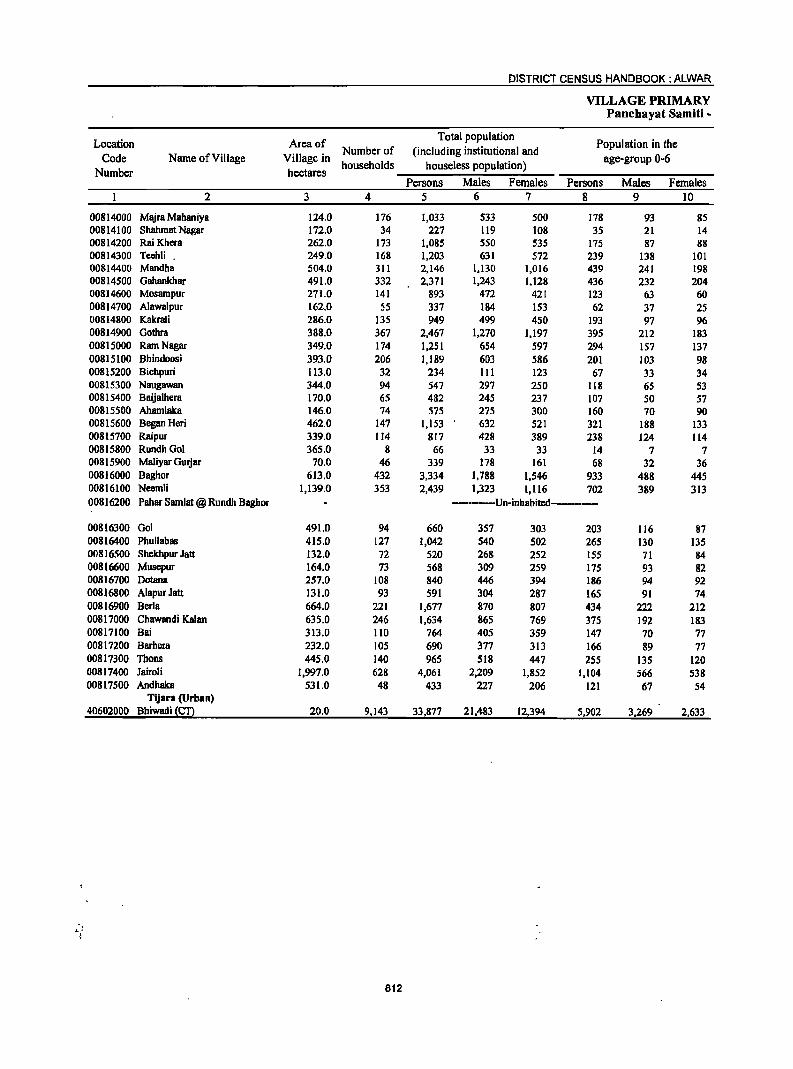
DISTRICT CENSUS HANDBOOK: ALWAR
VILLAGE PRIMARY Panchayat Samiti -
Location Area of Total population
Population in the Code Name of Village Village in
Number of (including institutional and age· group 0-6
Number hectares households houseless population)
Persons Males Females Persons Males Females 2 3 4 5 6 7 8 9 10
00814000 Majra Mahaniya 124.0 176 1,033 533 500 178 93 85 00814100 Shllhmat Nagar 172.0 34 227 119 108 35 21 14 00814200 RaiKhera 262.0 173 1,085 550 535 175 87 88 00814300 Teehli . 249.0 168 1,203 631 572 239 138 101 00814400 Mandha 504.0 311 2,146 1,130 1,016 439 241 198 00814500 Gahankhar 491.0 332 2,371 1,243 1,128 436 232 204 00814600 Mosampur 271.0 141 893 472 421 123 63 60 00814700 Alawalpur 162.0 55 337 184 153 62 37 25 00814800 Kakmli 286.0 135 949 499 450 193 97 96 00814900 Gothra 388.0 367 2,467 1,270 1,197 395 212 183 00815000 Ram Nagar 349.0 174 1,251 654 597 294 157 137 00815100 Bhindoosi 393.0 206 1,189 603 586 201 103 98 00815200 Bichpuri 113.0 32 234 III 123 67 33 34 00815300 Naugawan 344.0 94 547 297 250 118 65 53 00815400 Baijalhera 170.0 65 482 245 237 107 50 57 00815500 Ahamlaka 146.0 74 575 275 300 160 70 90 00815600 Began Heri 462.0 147 1,153 632 521 321 188 133 00815700 Raipur 339.0 114 817 428 389 238 124 114 00815800 RundhGol 365.0 8 66 33 33 14 7 7 00815900 Maliyar Gurjar 70.0 46 339 178 161 68 32 36 00816000 Baghor 613.0 432 3,334 1,788 1,546 933 488 445 00816100 Neemli 1,139.0 353 2,439 1,323 1,116 702 389 313 00816200 Pahar Samlat @ Rundh Baghor • __ ···_·Un·inhabited·-···.·_·
00816300 Go1 491.0 94 660 357 303 203 116 87 00816400 Phullabas 415.0 127 1,042 540 502 265 130 135 00816500 ShekhpurJatt 132.0 72 520 268 252 155 71 84 00816600 Musepur 164.0 73 568 309 259 175 93 82 00816700 Dotana 257.0 108 840 446 394 186 94 92 00816800 Alapur Jatt 131.0 93 591 304 287 165 91 74_ 00816900 Berla 664.0 221 1,677 870 807 434 222 212 00817000 Chawandi Kalan 635.0 246 1,634 865 769 375 192 183 00817100 Bai 313.0 110 764 405 359 147 70 77 00817200 Barhera 232.0 105 690 377 313 166 89 77 00817300 Thons 445.0 140 965 518 447 255 135 120 00817400 Jairoli 1,997.0 628 4,061 2,209 1,852 1,104 566 538 00817500 Andhaka 531.0 48 433 227 206 121 67 S4
Tijara (Urban) 40602000 Bhiwadi ~£!l 20.0 9,143 33,877 21,483 12,394 5,902 3,269 2,633
812
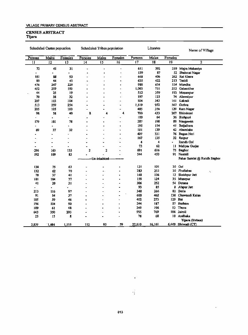
VILLAGE PRIMARY CENSUS ABSTRACT
CENSUS ABSTRACT Tijara
Scheduled Castes popuation Scheduled Tribes population Literates Name of Village
Persons Males Females Persons Males Females Persons Males Females 11 12 13 14 15 16 17 18 19 2
72 41 31 611 392 219 Majra Mahaniya 139 87 52 Shahmat Nagar
181 88 93 668 406 262 Rai Khera 89 44 45 635 422 213 Tcehli
476 247 229 988 654 334 Mandha 452 259 193 1,003 751 252 Gahankhar 44 25 19 5S2 359 193 Mosampur 70 38 32 197 123 74 Alawalpur
207 103 104 504 343 161 Kakrali S13 259 254 1,519 952 567 Gothra 205 105 100 485 356 129 Ram Nagar 98 58 40 8 4 4 '100 433 26'1 Bbindoosi
100 64 36 Biehpuri 179 101 78 287 198 89 Naugawan
195 154 41 Baijalhera 69 37 32 181 139 42 Ahamlaka
407 331 76 Began Heri 167 135 32 Raipur
4 4 RundhGoI 73 62 II Maliyar Gurjar
·296 163 133 2 2 691 616 75 Baghor 192 109 83 544 453 91 Neemli
Un-inhabited------ Pahar Samlat @ Rundh Baghor
138 75 63 131 101 30 Gol 132 62 70 283 253 30 Phullabas 78 37 41 148 136 12 ShekhpurJatt
181 104 77 159 124 35 Musepur 41 20 21 306 252 54 Dotana
93 85 8 AJapurJatt 213 116 97 348 266 82 Berla
91 54 31 600 462 138 Chawandi Kalan 105 59 46 402 273 129 Bai 194 104 90 244 181 51 Barhera 109 61 48 249 196 53 Thons 643 350 293 955 169 186 Jairoli 23 15 8 78 68 10 Andhaka
Tijara (UrbaD)
2,839 . 1,684 1,155 152 93 59 22,610 16,161 6,449 Bhiwadi !£!.l
813
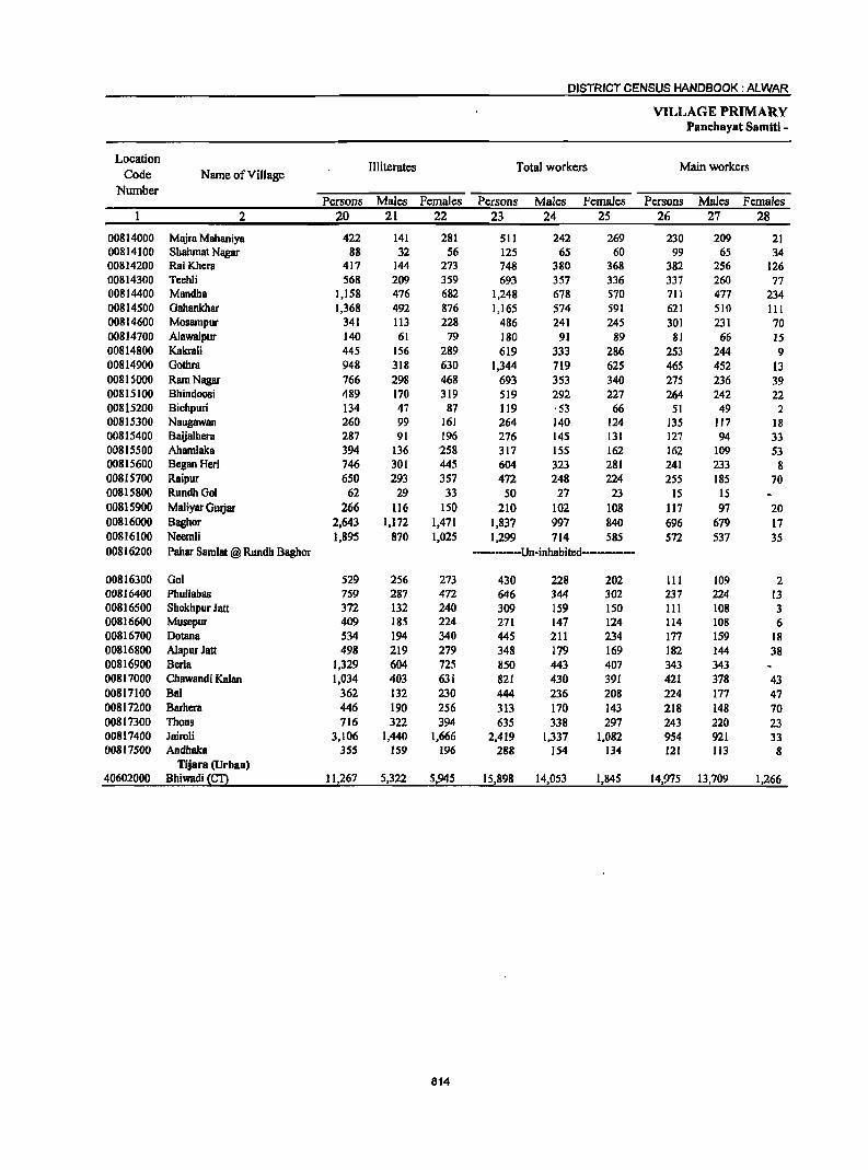
DISTRICT CENSUS HANDBOOK: ALWAR
VILLAGE PRIMARY Panchayat Samiti -
Location Illiterates Total workers Main workers
Code Name ofVilJage Number
Persons Males Females Persons Males Females Persons Males Females 2 20 21 22 23 24 25 26 27 28
00814000 Majra Mahaniya 422 141 281 511 242 269 230 209 21 00814100 Shahmat Nagar 88 32 56 125 65 60 99 65 34 00814200 RaiKhera 417 144 273 748 380 368 382 256 126 00814300 Teehli 568 209 359 693 357 336 337 260 77 00814400 Mandha 1,158 476 682 1,248 678 570 711 477 234 00814500 Gahankhar 1,368 492 876 1,165 574 591 621 510 III 00814600 Mosampur 341 113 228 486 241 245 301 231 70 00814700 Alawalpur 140 61 79 180 91 89 81 66 15 00814800 Kakrali 445 156 289 619 333 286 253 244 9 00814900 Gothra 948 318 630 1,344 719 625 465 452 13 00815000 Ram Nagar 766 298 468 693 353 340 275 236 39 00815100 Bhindoosi 489 170 319 519 292 227 264 242 22 00815200 Bichpuri 134 47 87 119 ,53 66 51 49 2 00815300 Naugawan 260 99 161 264 140 124 135 117 18 00815400 Baijalhcra 287 91 196 276 145 131 127 94 33 00815500 Ahamlaka 394 136 '258 317 155 162 162 109 53 00815600 Began Heri 746 301 445 604 323 281 241 233 8 00815700 Raipur 650 293 357 472 248 224 255 185 70 00815800 RundhOol 62 29 33 50 27 23 15 15 00815900 Maliyar GUljar 266 116 150 210 102 108 117 97 20 00816000 Bughor 2,643 1,172 1,471 1,837 997 840 696 679 17 00816100 Ncemli 1,895 870 1,025 1,299 714 585 572 537 35 00816200 Pallar Samlat @ Rundh Baghor ---------Un-inhabitcd--------
00816300 001 529 256 273 430 228 202 III 109 2 00816400 Phullabas 759 287 472 646 344 302 237 224 13 00816500 ShekhpurJatt 372 132 240 309 159 ISO 111 108 3 00816600 Muscpur 409 185 224 271 147 124 114 108 6 00816700 Dotana 534 194 340 445 211 234 177 159 18 00816800 Alapur Jatt 498 219 279 348 179 169 182 144 38 00816900 Berla 1,329 604 725 850 443 407 343 343 00817000 Chawandi Kalan 1,034 403 631 821 430 391 421 378 43 00817100 Bai 362 132 230 444 236 208 224 177 47 00817200 Barhera 446 190 256 313 170 143 218 148 70 00817300 Thons 716 322 394 635 338 297 243 220 23 00817400 Jairoli 3,106 1,440 1,666 2,419 1,337 1,082 954 921 33 00817500 Andhaka 355 159 196 288 154 134 121 113 8
Tijara (Urban) 40602000 Bhiwadi (£!2 11,267 5,322 5,945 15,898 14,053 1,845 14,975 13,709 1,266
814
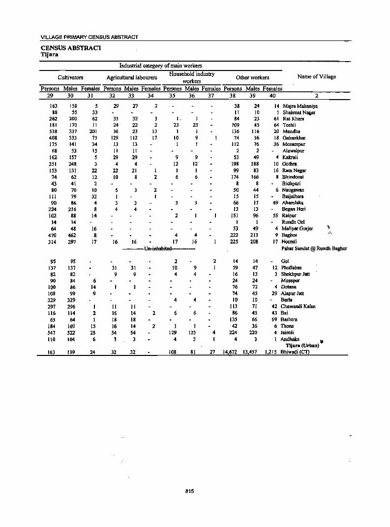
VILLAGE PRIMARY CENSUS ABSTRACT
CENSUS ABSTRACl Tijara
Industrial category of main workers
Cultivators Agricultural labourers Household industry
Other workers Name of Village workers
Persons Males Females Persons Males Females Persons Males Females Persons Males Females 29 30 31 32 33 34 35 36 37 38 39 40 2
163 158 5 29 27 2 38 24 14 Majra Mahaniya 88 55 33 II 10 1 Shahmat Nagar
262 200 62 35 32 3 I. I 84 23 61 Rai Khera 181 170 II 24 22 2 23 23 109 45 64 Teehli 538 337 201 36 23 13 1 I 136 116 20 Mandha 408 333 75 129 112 17 10 9 74 56 18 Oahankhar 175 141 34 13 13 112 76 36 Mosampur 68 53 15 II II 2 2 Alawalpur
162 157 5 29 29 9 9 53 49 4 Kakra1i 251 248 3 4 4 12 12 198 188 10 Gothra 153 131 22 22 21 1 1 1 99 83 16 Ram Nagar 74 62 12 10 8 2 6 6 174 166 8 Bhindoosi 43 41 2 8 8 Bichpuri 80 70 10 5 3 2 50 44 6 Naugawan
III 79 32 1 I 15 IS Baijalhera 90 86 4 3 3 3 3 66 17 49 Ahamlaka
224 216 8 ·4 4 13 13 Began Heri 102 88 14 2 151 96 55 Raipur
14 14 1 I RundhOol 64 48 16 53 49 4 MaJiyar Gurjar ~,
470 462 8 4 4 222 213 9 Baghor .fj~
314 297 17 16 16 17 16 225 208 17 Neemli Un-inhabited Pahar Samlat @ Rundh Bagher
95 95 2 2 14 14 Gal 137 137 31 31 10 9 1 S9 47 12 Phullabas 82 82 9 9 4 4 16 13 3 Shekbpur Jan 90 84 6 24 24 Musepur
100 86 14 76 72 4 Dotana 108 99 9 74 4S 29 A1apur Jatt 329 329 4 4 10 10 Berla 297 296 I II II 113 71 42 Chawandi Kalan 116 114 2 16 14 2 6 6 86 43 43 Bai 6S 64 I 18 18 135 66 69 Barhera
184 169 15 16 14 2 J 42 36 6 Thons 547 522 25 54 54 129 125 4 224 220 4 Jairoli 110 104 6 3 3 4 3 1 4 3 1 Andhaka ,.
Tijara (Urban) 163 139 24 32 32 108 81 27 14,672 13,457 1,215 Bhiwadi {£!2
815
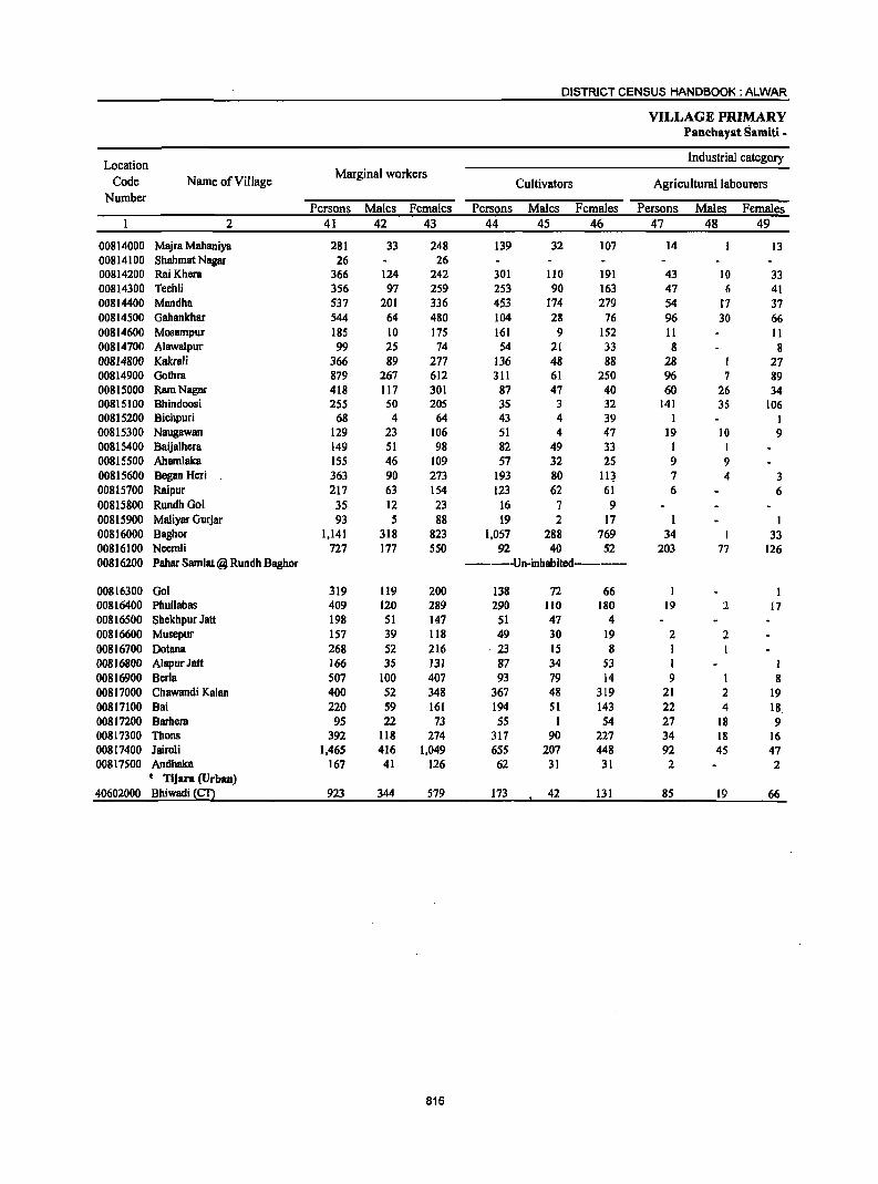
DISTRICT CENSUS HANDBOOK: ALWAR
VILLAGE PRIMARY Panehayat Samiti -
Location Industrial category
Code Name ofViJlage Marginal workers
Cultivators Agricultural labourers Number
Persons Males Females Persons Males Females Persons Malcs Fcmales 2 41 42 43 44 4S 46 47 48 49
00814000 Majra Mahaniya 281 33 248 139 32 107 14 13 00814100 Shahmat Nagar 26 26 00814200 RaiKhera 366 124 242 301 110 191 43 10 33 00814300 Teehli 356 97 259 253 90 163 47 6 41 00814400 Mandha 537 201 336 453 174 279 54 f7 37 00814500 Gahankhar 544 64 480 104 28 76 96 30 66 00814600 Mosampur 185 10 175 161 9 152 II II 00814700 Alawalpur 99 25 74 54 21 33 8 8 00814800 KakraJi 366 89 277 136 48 88 28 I 27 00814900 Gothra 879 267 612 311 61 250 96 7 89 00815000 Ram Nagar 418 117 301 87 47 40 60 26 34 00815100 Bhindoosi 255 50 205 35 3 32 141 35 106 00815200 Bichpuri 68 4 64 43 4 39 I 00815300 Naugawan 129 23 106 51 4 47 19 10 9 00815400 Baijalhera 149 51 98 82 49 33 I I 00815500 Ahamlaka 155 46 109 57 32 25 9 9 00815600 Began Hcri 363 90 273 193 80 11~ 7 4 3 00815700 Raipur 217 63 154 123 62 61 6 6 00815800 RundhGol 35 12 23 16 7 9 00815900 Maliyar Gurjar 93 5 88 19 2 17 1 I 00816000 Baghor 1,141 318 823 1,057 288 769 34 I 33 00816100 Necmli 727 177 550 92 40 52 203 77 126 00816200 Pahar Samlat @ Rundh Baghor -----Un-inhabitcd------
00816300 Gol 319 119 200 138 72 66 I 00816400 Phullabas 409 120 289 290 110 180 19 2 17 00816500 Shckhpur Jalt 198 51 147 51 47 4 00816600 Muscpur 157 39 118 49 30 19 2 2 00816700 Dotana 268 52 216 ·23 15 8 I I 00816800 AlapurJatt 166 35 131 87 34 53 1 I 00816900 Berla 507 100 407 93 79 14 9 I 8 00817000 Chawandi Kalan 400 52 348 367 48 319 21 2 19 00817100 Bai 220 59 161 194 51 143 22 4 18 00817200 Barhera 95 22 73 55 I 54 27 18 9 00817300 Thons 392 118 274 317 90 227 34 18 16 00817400 Jairoli 1,465 416 1,049 655 207 448 92 45 47 00817500 Andhaka 167 41 126 62 31 31 2 2
e Tijara (Urban) 40602000 Bhiwadi~ 923 344 579 173 42 131 85 19 66
816
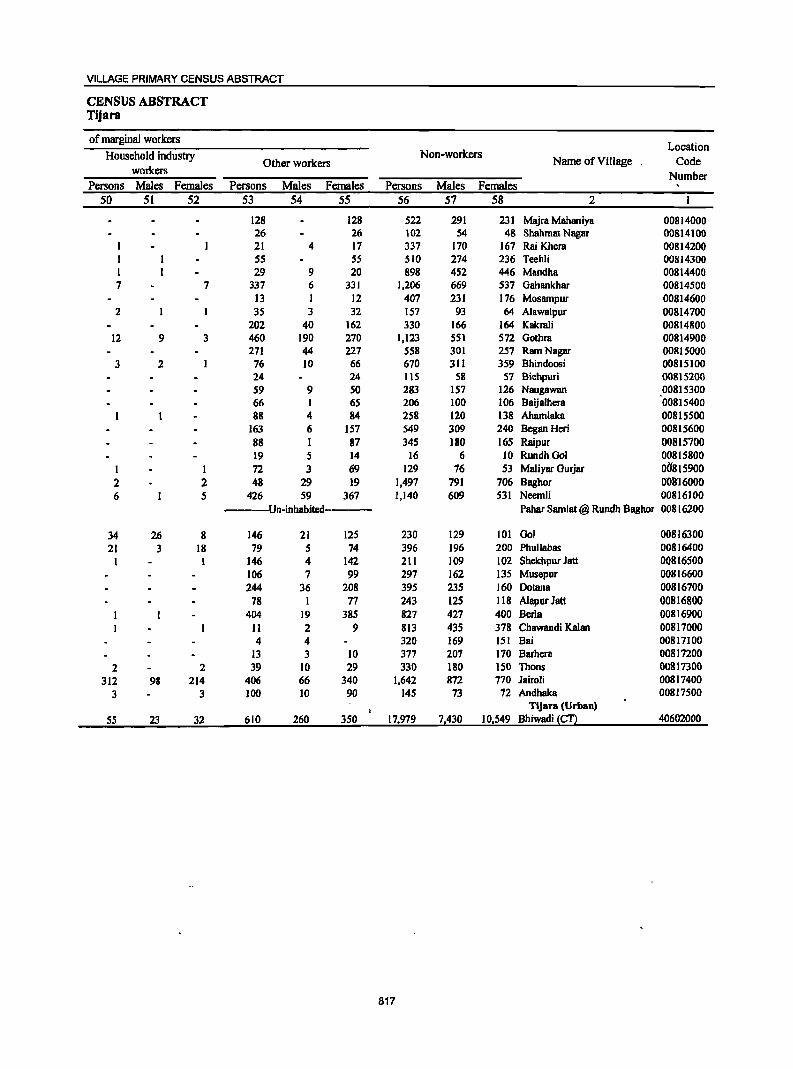
VILLAGE PRIMARY CENSUS ABSTRACT
CENSUS ABSTRACT Tijara
of marginal workers Location
Household industry Non-workers Name of Village Code Other workers workers Number
Persons Males Females Persons Males Females Persons Males Females 50 51 52 53 54 55 56 57 58 2
128 128 522 291 231 Majra Mahaniya 00814000 26 26 102 54 48 Shabmat Nagar 00814100 21 4 17 337 170 167 Rai Khera 00814200
1 55 5S SIO 274 236 Teehli 00814300 1 29 9 20 898 452 446 Mandha 00814400 7 7 337 6 331 1,206 669 537 Oahankhar 00814500
13 I 12 407 231 176 Mosampur 00814600 2 35 3 32 157 93 64 Alawalpur 00814700
202 40 162 330 166 164 Kakrali 00814800 12 9 3 460 190 270 1,123 551 572 Oothra 00814900
271 44 227 558 301 257 Ram Nagar 00815000 3 2 76 10 66 670 311 359 Bhindoosi 00815100
24 24 115 58 57 Bichpuri 00815200 59 9 50 283 IS7 126 Naugawan 00815300 66 I 65 206 100 106 Baija1hera 00815400 88 4 84 258 120 138 Ahamlaka 00815500
163 6 157 549 309 240 Began Heri 00815600 88 1 87 345 180 165 Raipur 00815700 19 5 14 16 6 10 RundhGoI 00815800
1 1 72 3 69 129 76 53 Maliyar Gurjar 00815900 2 2 48 29 19 1,497 791 706 Baghor 008'16000 6 5 426 59 367 1,140 609 531 Neemli 00816100
--Un-inhabited---- Pabar Samlat@ Rundh Baghor 00816200
34 26 8 146 21 125 230 129 101 001 00816300 21 3 18 79 5 74 396 196 200 Phullabas 00816400
1 146 4 142 211 109 102 Shekhpurlatt 00816500 106 7 99 297 162 135 Musepur 00816600 244 36 208 395 235 160 Dotana 00816700
78 1 77 243 125 118 A1apur Jatt 00816800 404 19 385 827 427 400 Berla 00816900
11 2 9 813 435 378 Chawandi Kalan 00817000 4 4 320 169 151 Bai 00817100
13 3 10 377 207 170 Barhera 00817200 2 2 39 10 29 330 180 150 Thons 00817300
312 98 214 406 66 340 1,642 872 770 lairoli 00817400 3 3 100 10 90 145 73 72 Andhaka 00817500
Tljara (Urban)
55 23 32 610 260 350 171979 71430 10,549 Bhiwadi (CT) 40602000
817
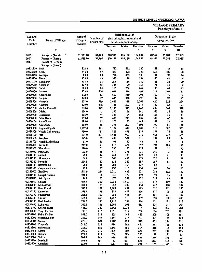
DISTRICT CENSUS HANDBOOK: ALWAR
VILLAGE PRIMARY Panchayat Samiti -
Location Area of Total population
Population in the Code Name of Village Village in
Number of (including institutional and age-group 0-6
Number hectares households houseless population)
Persons Males Females Persons Males Females 2 3 4 5 6 7 8 9 10
0007 Ramgarh (Total) 61,553.00 32,265 220,219 116,180 104,039 48,269 25,284 22,985 0007 Ramgarh (Rural) 61,553.00 32,265 220,219 116,180 104,039 48,269 25,284 22,985 0007 Ramgarh (Urban)
Ramgarb (Rural) 00828500 Todli 320.0 101 732 392 340 148 83 65 00828600 Khoh 546.0 97 821 428 393 218 120 98 00828700 Warispur 83.0 88 790 402 388 181 95 86 00828800 Tismar 133.0 49 382 188 194 85 41 44 00828900 Rasoolpur 188.0 38 296 156 140 61 32 29 00829000 Kharkhari 127.0 53 345 179 166 71 39 32 00829100 Garhi 305.0 88 SIS 266 249 90 45 45 00829200 Dhaneta 373.0 176 1,028 530 498 213 102 III 00829300 KotaKalan 172.0 85 617 319 298 159 76 83 00829400 Boojaka 448.0 77 635 340 295 189 92 97 00829500 Ncckach 628.0 389 2,645 1,380 '1,265 620 326 . 294 00829600 Nakhnol 330.0 138 741 393 348 142 69 73 00829700 Khohra Karmali 690.0 343 2,586 1,343 1,243 688 360 328 00829800 Odaka 134.0 43 297 156 141 66 36 30 00829900 Balrampur 108.0 47 338 174 164 82 45 37 00830000 PatanBhan 193.0 57 400 211 189 108 62 46 00830100 Kala Ghata 188.0 :n 302 153 149 82 38 44 00830200 Kalsawara 190.0 55 395 203 . 192 99 51 48 00830300 Raghunatbgarh 1,292.0 395 3,102 1,614 1,488 115 382 333 00830400 Nangla Chirilwanda 910.0 III 823 438 385 157 76 81 00830500 Pata 734.0 301 1,901 991 910 463 239 224 00830600 Roopbas 143.0 89 649 338 311 159 85 74 00830700 Nangli Mubarikpur 67.0 IS 93 SO 43 IS 9 6 00830800 Raswada 217.0 121 816 424 392 193 103 90 00830900 Kharkhara 180.0 51 296 157 JJ9 57 37 20 00831000 Parawada 173.0 58 479 251 228 141 73 68 00831100 Newadi 95.0 42 254 125 129 59 21 38 00831200 Akleempur 166.0 105 760 407 353 172 91 81 00831300 Newada 224.0 80 636 349 287 157 88 69 00831400 Sammanpur 95.0 41 283 156 127 64 34 30 00831500 Goojarpur Kalan 119.0 37 230 116 114 46 20 26 00831600 Bandholi 541.0 234 1,280 659 621 282 132 150 00831700 Nangal Nangali 248.0 56 351 172 179 79 36 43 00831800 Adee~aka 176.0 63 470 248 222 118 69 49 00831900 Khilora 676.0 310 2,058 1,080 978 370 190 180 00832000 Mukandwas 320.0 109 927 489 438 ' 241 140 107 00832100 KotaKhurd 397.0 158 1,284 691 593 312 162 ISO 00832200 Kareeriya 398.0 139 887 473 414 118 95 83 00832300 Nakachpur 225.0 103 786 44S 341 191 104 87 00832400 Untwal 585.0 253 1,751 918 839 393 188 205 00832500 BadiPokhar 216.0 133 1,112 588 524 251 135 116 00832600 Loharwari 315.0 126 1,204 591 613 314 147 167 00832700 Choroti Pahar 451.0 327 2,342 1,238 1,104 472 252 220 00832800 ThegiKaBas 195.0 216 1,551 815 136 396 205 191 00832900 DaharKaBas 148.0 113 855 440 415 209 108 101 00833000 ManduKaBas 283.0 172 1,484 777 707 327 178 149 00833100 Sahdoli 428.0 283 1,918 999 919 455 224 231 00833200. Chaprada 341.0 134 984 502 482 231 111 120 00833300 Balwandka 281.0 186 1,248 654 594 318 168 150 00833400 Kesrali 209.0 215 1,309 682 627 257 134 123 00833500 Batesm 111.0 113 756 383 373 .. 179 86 93 00833600 Goleta 306.0 145 929 488 441 .',224 131 93 00833700 Dhadholi 200.0 194 1,167 631 536 263 143 120 00833800 Kamalpur 233.0 III 643 352 291 126 66 60
818
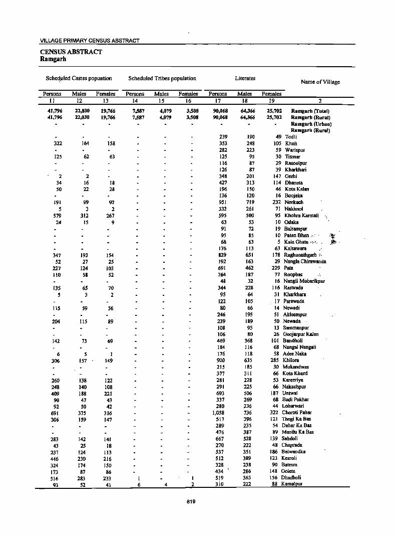
VILLAGE PRIMARY CENSUS ABSTRACT
CENSUS ABSTRACT Ramgarh
SCheqpled Castes popuation Scheduled Tribes population Literates Name of Village
Persons Males Females Persons Males Females Persons Males Females 11 12 13 14 15 16 17 18 19 2
41,796 22,030 19,766 7,587 4,079 3,508 90,068 64,366 25,702 Ramgarh (Total) 41,796 22,030 19,766 7,587 4,079 3,508 90,068 64,366 25,702 Ramgarh (Rural)
Ramgarh (Urban) Ramgarh (Rural)
239 190 49 Todli 322 164 158 353 248 105 Khoh
282 223 59 Warispur 125 62 63 125 95 30 Tismar
116 87 29 Rasoolpur 126 87 39 Kharkhari
2 2 348 201 147 Garhi 34 16 18 427 313 114 Dhaneta 50 22 28 196 150 46 Kota Kalan
136 120 16 Boojaka 191 99 92 951 719 232 Neekach
5 3 2 332 261 71 Nakhnol 579 312 267 595 sao 95 Khohra Karmali 24 IS 9 63 53 10 Odaka
91 72 19 Balrampur 95 85 10 Patan Bhan.: . :t" 68 63 5 Kala Ghata ,,..... . .'Ift!.< .
176 113 63 Kalsawara 347 193 154 829 651 178 Raghunathgarh !.
52 27 2S 192 163 29 Nangia Cbirawanda 227 124 103 691 462 229 Pata 110 58 52 264 187 77 Roopbas "'
48 32 16 Nangli Mubarikpur 135 6S 70 344 228 116 Raswada
5 3 2 9S 64 31 Kharkhara 122 lOS 17 ParawBda
115 59 S6 80 66 14 Newadi 246 195 51 Akleempur
204 liS 89 239 189 SO Newada 108 95 13 Sammanpur 106 80 26 Goojarpur Kalan
142 73 69 469 368 101 Bandholi 184 116 68 Nangal Nangali
6 5 1 176 Jl8 58 AdeeNaka 306 157 149 920 635 285 Khilora
215 185 30 Mukandwas 377 311 66 KotaKhurd
260 138 122 281 228 53 Kareeriya 248 140 108 291 225 66 Nakachpur 409 188 221 693 506 187 Untwal 90 47 43 337 269 68 Badi Pokbar 92 SO 42 280 236 44 Loharwari
691 375 316 1,058 736 322 Choroti Pahar 306 159 147 517 396 121 Thegi KaBas
289 235 54 Dahar KaBas 476 387 89 ManiluKaBas
283 142 141 667 528 139 Sahdoli 43 25 18 270 222 48 Chaprada
237 124 113 537 351 186 Balwandka 446 230 216 512 389 123 Kesroli 324 174 ISO 328 238 90 Batesra 173 87 86 434 286 148 Goleta 516 283 233 1 I 519 363 156 Dhadholi 93 52 41 6 4 2 3io 222 88 Kamalpur
819
DISTRICT CENSUS HANDBOOK: ALWAR
VILLAGE PRIMARY Panchayat Samiti -
Location III iterates Total workers Main workers
Code Name of Village Number
Persons Males Females Persons Males Females Persons Males Females 2 20 21 22 23 24 25 26 27 28
0007 Ramgarh (Total) 130,151 51,814 78,337 98,36() 56,155 42,211 68,120 48,780 19,340 0007 Ramgarh (Rural) 130,151 51,814 78,337 98,366 56,155 42,211 68,120 48,780 19,340 0007 Ramgarh (Urban)
Ramgarh (Rural) 00828500 Todli 493 202 291 491 264 227 348 179 169 00828600 Khoh 468 180 288 269 175 94 192 160 32 00828700 Warispur 508 179 329 412 185 227 203 180 23 00828800 Tismar 257 93 164 164 76 88 71 70 1 00828900 Rasoolpur 180 69 III 135 63 72 60 59 I 00829000 Kharkhari 219 92 127 153 84 69 92 73 19 00829100 Garhi 167 65 102 179 128 51 142 124 18 00829200 Dhaneta 601 217 384 503 272 231 334 251 83 00829300 KotaKalan 421 169 252 280 lSI 129 127 119 8 00829400 Boojaka 499 220 279 337 180 157 233 151 82 00829500 Neekach 1,694 661 1,033 1,206 608 598 622 510 112 00829600 Nakhnol 409 132 277 315 203 112 161 125 36 00829700 Khohra Karmali 1,991 843 1,148 1,179 628 551 909 577 332 00829800 Odaka 234 103 131 142 76 66 78 72 6 00829900 Balrampur 247 102 145 180 84 96 84 78 6 00830000 Patan Bhan 305 126 179 231 108 123 132 99 33 00830100 Kala Ghllta 234 90 144 131 61 70 51 49 2 00830200 Kalsawara 219 90 129 187 91 96 75 6S 10 00830300 Raghunathgarh 2,273 963 1,310 1,298 757 541 879 678 201 00830400 Nangla Chirawanda 631 275 356 445 240 205 260 217 43 00830500 Pata 1,210 529 681 735 459 276 622 433 189 00830600 Roopbas 385 151 234 319 157 162 188 131 57 00830700 NangJi Mubarikpur 45 18 27 40 22 18 28 20 8 00830800 Raswada 472 196 276 368 202 166 332 181 151 00830900 Kharkhara 20) 93 108 139 82 57 99 77 22 00831000 Parawada 357 146 211 213 117 96 157 116 41 00831100 Newadi 174 59 115 117 63 54 52 49 3 00831200 Akleempur 514 212 302 421 238 183 184 156 28 00831300 Newada 397 160 237 285 150 135 147 135 12 00831400 Sammanpur 175 61 114 164 88 76 106 55 51
. 00831500 Goojarpur Kalan 124 36 88 121 59 62 81 41 40 00831600 Bandholi 811 291 520 573 320 253 361 290 71 00831700 Nangal Nangali 167 S6 111 139 70 69 78 66 12 00831800 AdeeNaka 294 130 164 132 103 29 108 93 15 00831900 Khilora 1,138 445 693 849 492 357 810 481 329 00832000 Mukandwas 712 304 408 484 245 239 398 200 198 00832100 KotaKhurd 907 380 527 484 264 220 477 260 217 00832200 Karecriya 606 245 361 510 264 246 259 229 30 00832300 Nakaehpur 495 220 275 398 226 172 359 211 148 00832400 Untwal 1,064 412 652 850 445 405 562 416 146 00832500 BadiPokhar 775 319 456 484 253 231 395 218 177 00832600 Lobarwari 924 355 569 484 243 241 219 214 5 00832700 Choroti Pahar 1,284 502 782 1,356 720 636 634 564 70 00832800 Thcgi KuBas 1,034 419 615 879 474 405 376 35S 21 00832900 DaharKuBas 566 205 361 437 212 225 318 200 118 00833000 ManduKaBas 1,008 390 618 801 397 404 332 311 21 00833100 Sahdoli 1,251 471 780 954 SIS 439 448 430 18 00833200 Chaprada 714 280 434 572 310 262 314 171 143 00833300 Ba1wandka 711 303 408 715 368 347 347 295 52 00833400 Kesroli 797 293 504 561 314 247 334 238 96 00833500 Batesra 428 145 283 303 181 122 234 170 64 00833600 Goleta 495 202 293 339 222 117 304 213 91 00833700 Dhadholi 648 268 380 406 289 117 384 284 100 00833800 Kamalpur 333 130 203 270 180 90 145 -129 16
820
VILLAGE PRIMARY CENSUS ABSTRACT
CENSUS ABSTRACT Ramgarh
Industrial category of main workers
Cultivators Agricultural labourers . Household industry
Other workers Name of Village workers
Persons Males Females Persons Males Females Persons Males Females Persons Males Females 29 30 31 32 33 34 3S 36 37 38 39 40 2
44,24(i 28,722 15,524 5,191 3,323 I,S(iS 1,072 S(i9 203 17,611 15,866 1,745 Ramgarh (Total) 44,246 28,722 15,524 5,191 3,323 . 1,868 1,072 869 203 17,611 15,866 1,745 Ramgarh (Rural)
Ramgarh (Urban) Ramgarh (Rural)
338 170 168 10 9 I Todli 137 107 30 SS 53 2 Khoh 152 135 17 1 I 21 IS 6 29 29 Warispur 53 52 I 8 8 10 10 Tismar SO 49 I 10 10 Rasoolpur 58 41 17 8 6 2 6 6 20 20 Kharkhari 93 79 14 6 6 43 39 4 Garhi
214 138 76 55 51 4 3 2 62 60 2 Dhaneta 58 55 3 7 7 62 57 5 KotaKalan
217 136 81 6 5 I 10 10 Boojaka 380 303 77 112 81 31 9 8 121 118 3 Neekach 125 91 34 I 1 2 I 33 32 I NBkhnol 738 435 303 92 71 21 5 5 74 66 8 Khohra Karmali 54 50 4 23 21 2 Odaka 61 60 I 21 17 4 Balrampur
129 97 32 3 2 I PatanBhan 51 49 2 Kala Ghata 71 62 9 I I 3 3 Kalsawara
701 527 174 20 14 6 25 23 2 133 114 19 Raghunatbgarh 206 169 37 I I 53 48 5 Nangla Chirawanda 469 310 159 60 40 20 12 10 2 81 73 8 Pata 157 101 56 9 8 I 22 22 Roopbas 23 15 8 5 5 Nangli Mubarikpur
194 97 97 101 51 50 8 4 4 29 29 Raswada 69 67 2 8 8 22 2 20 Kharkhara
108 106 2 9 7 2 40 3 37 Parawada 26 23 3 10 10 16 16 Newadi
167 139 28 3 3 14 14 Akleempur 106 95 11 13 12 28 28 Newada 78 40 38 26 13 13 2 2 Sammanpur 72 34 38 3 I 2 I 5 5 Goojarpur Kalan
244 193 51 45 30 15 2 2 70 65 5 Bandholi 43 40 3 2 2 33 24 9 Nangal Nangali 80 68 12 2 I I 26 24 2 Adee NBka
447 242 205 189 69 120 6 4 2 168 166 2 Khilora 354 166 188 21 12 9 23 22 I Mukandwas 452 236 216 25 24 I KotaKhurd 161 135 26 2 2 96 92 4 Kareeriya 231 137 94 92 53 39 24 12 12 12 9 3 NBkachpur 259 185 74 105 SO 55 35 27 8 163 154 9 Untwal 346 169 177 2 2 I I 46 46 Badi Pokhar 151 ISO I 6 4 2 5 5 57 55 2 Loharwari 386 319 67 1 I 247 245 2 Choroti Pahar 219 206 13 17 15 2 140 134 6 Thcgi KaBas 258 142 116 4 3 56 55 DaharKaBas 304 283 21 6 6 22 22 ManduKaBas 193 185 8 8 7 1 40 35 5 207 203 4 Sahdoli 269 132 137 18 14 4 1 26 24 2 Chaprada 209 164 45 13 10 3 125 121 4 Balwandka 150 62 88 1 I 5 3 2 178 172 6 Kesroli 120 68 52 18 10 8 96 92 4 Batesra 117 45 72 21 11 10
\f:. ~ 166 157 9 Goleta
93 57 36 10 5 5 3 3 278 219 59 Dhadholi 41 40 1 - 104 89 15 Kamalpur
821
DISTRICT CENSUS HANDBOOK: ALWAR
VILLAGE PRIMARY Panchayat Samiti -
Location Industrial category
Code Name of Village Marginal workers
Cultivators Agricultural labourers Number
Persons Males Females Persons Males Females Persons Males Females 2 41 42 43 44 45 46 47 48 49
0007 Ramgarh (Total) 30,246 7,)75 22,871 19,151 3,642 15,509 7,829 1,980 5,849 0007 Ramgarh (Rural) 30,246 7,375 21,871 19,151 3,641 15,509 7,819 1,980 5,849 0007 Ramgarh (Urban)
Ramgarh (Rural) 00828500 Todli 143 85 58 137 81 56 4 2 2 00828600 Khoh 77 15 62 45 8 37 4 3 00828700 Warispur 209 5 204 183 2 181 20 19 00828800 Tismar 93 6 87 81 5 76 12 11 00828900 Rasoolpur 75 4 71 75 4 71 00829000 Kharkhari 61 11 50 41 6 35 10 9 00829100 Garhi 37 4 33 36 3 33 00829200 Dhaneta 169 21 148 75 5 70 81 8 73 00829300 KotaKalan 153 32 121 110 19 91 32 7 25 00829400 Boojaka 104 29 75 94 23 71 3 I 2 00829500 Neekach 584 98 486 389 50 339 181 44 137 00829600 Nakhnol 154 78 76 152 77 75 00829700 Khohra Karmali 270 51 219 227 39 188 31 5 26 00829800 Odaka 64 4 60 39 39 23 2 21 00829900 Balrampur 96 6 90 45 44 49 3 46 00830000 PatllD Bhan 99 9 90 99 9 90 00830100 KalaGhata 80 12 68 80 12 68 00830200 Kalsawara 112 26 86 95 17 78 8 4 4 00830300 Raghunathgarh 419 79 340 321 37 284 37 6 31 00830400 Nangla Chirawanda 185 23 162 176 19 157 5 3 2 00830500 Pata 113 26 87 66 13 53 42 10 32 00830600 Roopbas 131 26 105 35 2 33 9S 23 72 00830700 Nangli Mubarikpur 12 2 10 7 2 5 5 5 00830800 Raswada 36 21 15 8 3 5 17 II 6 00830900 Kharkhara 40 5 35 35 4 31 5 1 4 00831000 Parawada 56 1 55 53 1 52 3 3 00831100 Newadi 65 14 SI 23 4 19 41 9 32 00831200 Akleempur 237 82 155 76 23 53 160 58 102 00831300 Newada 138 15 123 117 7 110 12 4 8 00831400 Sarnmanpur 58 33 25 44 23 21 14 10 4 00831500 Goojarpur Kalan 40 18 22 39 17 22 00831600 Bandholi 212 30 182 185 20 165 22 8 14 00831700 Nangal Nangali 61 4 57 12 1 11 17 3 14 00831800 AdeeNaka 24 10 14 16 4 12 3 3 00831900 Khilora 39 II 28 6 4 2 33 7 26 00832000 Mukandwas 86 45 41 71 34 37 13 10 3 00832100 Kota Khurd 7 4 3 3 3 00832200 Kareeriya 251 J5 216 183 29 154 62 4 58 00832300 Nakachpur 39 IS 24 12 6 6 21 7 14 00832400 Untwal 288 29 259 195 20 175 71 7 64 00832500 Badi Pokhar 89 35 54 24 12 12 53 11 42 00832600 Loharwari 265 29 236 9 1 8 158 11 147 00832700 Choroti Pahar 722 156 566 670 145 525 35 4 31 00832800 ThegiKaBas 503 119 384 377 92 285 98 17 81 00832900 DaharKaBas 119 12 107 82 7 75 33 3 30 00833000 ManduKaBas 469 86 383 334 32 302 11 3 8 00833100 Sahdoli 506 85 421 368 58 310 44 2 42 00833200 Chaprada 258 q9 119 170 91 79 77 38 39 00833300 Balwandka 368 73 295 268 51 217 70 9 61 00833400 Kesroli 227 76 151 127 12 115 23 1 22 00833500 Batesra 69 II 58 32 2 30 15 2 13 00833600 Goleta 35 9 26 16 3 13 6 2 4 00833700 Dhadholi 22 5 17 00833800 Karnall!ur 125 51 74 3 3 105 36 69
822

VILLAGE PRIMARY CENSUS ABSTRACT
CENSUS ABSTRACT Ramgarh
of marginal workers Location
Household industry Non-workers Other workers Name of Village Code
workers Number Persons Males Females Persons Males Females Persons Males Females
50 51 52 53 54 55 56 57 58 2
380 118 262 2,886 1,635 1,251 121,853 60,025 61,828 Ramgarh (Total) 0007 380 118 262 1,886 1,635 1,251 121,853 60,015 61,818 Ramgarh (Rural) 0007
Ramgarh (Urban) 0007 Ramgarh (Rural)
2 2 241 128 113 Todli 00828500 28 6 22 552 253 299 Khoh 00828600
4 3 2 I 378 217 161 Warispur 00828700 218 1I2 106 Tismar 00828800 161 93 68 Rasoolpur 00828900
5 5 5 4 192 95 97 Kharkhari 00829000 I I 336 138 198 Garhi 00829100
6 2 4 7 6 I 525 258 267 Dhaneta 00829200 11 6 5 337 168 169 KotaKalan 00829300 7 5 2 298 160 138 Boojaka 00829400
10 10 4 4 1,439 772 667 Neekach 00829500 2 I 426 190 236 Nakhnol 00829600 4 4 8 7 1,407 715 692 Khohra Karmali 00829700
2 2 155 80 75 Odaka 00829800 2 2 158 90 68 Balrampur 00829900
169 103 66 Patan Shan 00830000 171 92 79 KalaGhata 00830100
9 5 4 208 112 96 Kalsawara 00830200 26 13 13 35 23 12 1,804 857 947 Raghunathgarh 00830300
4 I 3 378 198 180 Nangla Chirawanda 00830400 3 2 2 1,166 532 634 Pata 00830500
I 330 181 149 Roopbas 00830600 5) 28 25 Nangli Mubarikpur 008)0700
II 7 4 448 222 226 Raswada 00830800 157 75 82 Kharkhara 00830900 266 134 132 Parawada 00831000
I 137 62 75 Newadi 00831100 I I 339 169 170 Akleempur 00831200 9 4 5 351 199 152 Newada 00831300
119 68 51 Sammanpur 00831400 1 I 109 57 52 Goojarpur Kalan 00831500 5 2 3 707 339 368 Bandholi 00831600
32 32 212 102 110 Nangal Nangali 00831700 5 3 2 .338 145 193 AdeeNaka 00831800
1,209 588 621 Khilora 00831900 2 443 244 199 Mukandwas 00832000 4 4 800 427 373 Kota Khurd 00832100 6 2 4 377 209 168 Kareeriya 00832200
6 2 4 388 219 169 Nakachpur 00832300 15 I 14 7. 1 6 907 473 434 Untwal 00832400
12 12 628 335 293 Badi Pokhar 00832500 8 6 2 90 11 79 720 348 372 Loharwari 00832600
17 7 10 986 518 468 Choroti Pahar 00832700 28 10 18 672 341 331 Thegi Ka Bas . 00832800 3 2 I 418 228 190 DaharKaBas 00832900
124 51 73 683 380 303 Mandu KaBas 00833000 47 12 3S 47 13 34 964 484 480 Sahdoli 00833100
II 10 I 412 192 220 Chaprada 00833200 30 13 17 533 286 247 Balwandka 00833300
7 3 4 70 60 10 748 368 380 Kesroli 00833400 I 21 7 14 453 202 251 Batesra 00833500
" .. -.. '.' 13 4 9 590 266 324 Goleta 00833600 22 5 17 761 342 419 Dhadholi 00833700
2 15 14 373 172 201 Kamalpur 00833800
823
DISTRICT CENSUS HANDBOOK: ALWAR
VILLAGE PRIMARY Panchayat Samiti -
Location Area of Total population
Population in the Number of (including institutional and
Code Name of Village Village in households houseless population)
age-group 0-6 Number hectares
Persons Males Females Persons Males Females 2 3 4 5 6 7 8 9 10
00833900 Rundh Dhooninath 654.0 8 40 20 20 6 3 3 00834000 Chak Meenapura 126.0 10 73 35 38 10 5 5 00834100 Meenapura 212.0 168 1,383 761 622 240 135 105 00834200 Agyara 558.0 103 648 345 303 130 65 65 00834300 Sankha1a 124.0 90 492 269 223 95 48 47 00834400 Bahala 764.0 651 3,707 1,981 1,726 856 458 398 00834500 BagarMeo 524.0 319 2,215 1,172 1,043 528 253 275 00834600 Narka 373.0 237 1,795 932 863 416 224 192 00834700 Peeproli 600.0 322 2,545 1,333 1,212 609 331 278 00834800 Sadan Ka Bas 342.0 198 1,596 838 758 371 191 180 00834900 Nangla Banjeerka 697.0 158 1,296 674 622 359 194 165 00835000 BeraWas 373.0 116 749 403 346 209 110 99 00835100 Bere 520.0 91 596 320 276 158 82 76 00835200 Chowki 274.0 59 479 242 237 128 62 66 00835300 Goha 245.0 126 866 457 409 198 111 87 00835400 Nagla Balaiya 159.0 48 404 214 190 110 56 54 00835500 Sarhcta 199.0 106 6"48 316 332 187 90 97 00835600 Baghori 137.0 12 83 41 42 16 8 8 00835700 Bardod 235.0 140 879 475 404 204 111 93 00835800 Dohli 620.0 312 2,135 1,113 1,022 484 268 216 00835900 Sonagarh 177.0 94 539 283 256 110 58 52 00836000 Chandigarh 208.0 78 527 283 244 101 51 50 00836100 Niwali 483.0 247 1,905 1,005 900 462 235 227 00836200 Khojaka 260.0 68 472 244 228 119 64 55 00836300 Beejwa 432.0 206 1,227 651 576 237 126 111 00836400 Shckhpur 349.0 222 1,155 596 559 288 159 129 00836500 Mandapur 233.0 100 584 294 290 123 57 66 00836600 Meghawas 121.0 117 657 311 346 154 .60 94 00836700 Podipur 135.0 29 214 112 102 57 28 29 00836800 Baramda 255.0 257 1,505 786 719 318 163 IS5 00836900 Danwari 393.0 155 1,015 554 461 239 135 104 00837000 Mubarikpur 1,363.0 842 5,060 2,608 2,452 1,069 546 523 00837100 Nagliwal 238.0 148 986 525 461 233 120 113 00837200 Khohar 379.0 142 803 398 405 142 76 66 00&37300 Hajiput 357.0 210 1,454 758 696 333 178 155 00837400 Mohammadpur 284.0 151 1,009 550 459 . 230 131 99 00837500 Naugawan 1,620.0 1,358 9,113 4,881 4,232 1,702 916 786 00837600 Naharpur Khurd 97.0 49 320 170 150 68 39 29 00837700 Alampur 255.0 140 1,056 525 531 239 131 108 00837800 Bahripur 157.0 123 878 452 426 202 98 104 00837900 Cheerwa 160.0 114 836 432 404 157 83 74 00838000 Sherpur 356.0 178 1,226 635 591 288 153 135 00838100 Golki 145.0 . 40 278 131 147 61 30 31 00838200 Khedli Jhanda 155.0 76 386 204 182 63 30 33 00838300 A1awalPur 315.0 ISO 1,043 527 516 250 127 123 00838400 Munpur Karmala 656.0 153 1,234 634 600 334 178 156 00838500 Rasgan 1,250.0 366 2,510 1,295 1,215 623 306 317 00838600 Kherthala 92.0 56 332 181 151 81 53 28 00838700 Bakayanka 118.0 36 251 125 126 66 29 37 00838800 Sunhcra 328.0 134 1,057 581 476 232 126 106 00838900 Khushpuri 258.0 117 870 435 435 241 124 117 00839000 Rabbaka 122.0 45 436 230 206 118 69 49· 00839100 Mansheerpur 120.0 56 471 257 214 107 57 50 00839200 Teekri 207.0 84 574 294 280 132 70 62 00839300 Chauma 635.0 386 2,735 1,434 1,301 611 319 292 00839400 Odela 301.0 77 598 312 286 222 113 109 00839500 Karoli Jageer 122.0 44 342 187 155 82 46 36 00839600 Jakopur 101.0 64 391 202 189 96 52 44
824
VILLAGE PRIMARY CENSUS ABSTRACT
CENSUS ABSTRACT Ramgarh
Scheduled Castes popuation Scheduled Tribes population Literates Name of Village
Persons Males Females Persons Males Females Persons Males Females II 12 13 14 15 16 17 18 19 2
15 8 1 11 II 6 Rundh Dhooninath 73 35 38 44 27 17 Chak Meenapura
53 30 23 1,283 70S 578 914 567 347 Meenapura 142 77 65 331 174 157 308 227 81 Agyara 84 53 31 214 141 61 Sankha1a
1,500 799 701 1,454 1,071 383 Baha1a 215 lSI 124 75 36 39 971 692 279 Bagar Meo 197 99 98 523 409 114 Narka 149 86 63 756 641 115 Peepro1i 418 215 203 609 452 157 Sadan KaBas 132 69 63 365 290 75 Nang1a Banjeerka 127 68 59 183 161 22 Bera Was 117 62 55 154 139 IS Bere 126 58 68 171 119 52 Chowki 457 241 216 401 280 121 Goha
135 99 36 Nagla Balaiya 57 28 29 218 149 69 Sarheta 8 3 5 63 32 31 Baghori
120 64 56 315 249 66 Bardod 1,054 541 513 814 606 208 Doh1i
75 43 32 61 34 27 301 189 112 Sonagarh 277 191 86 Chandigarh
232 126 106 644 489 155 Niwali 28 14 14 154 124 30 Khojaka 88 42 46 579 399 180 Beejwa
393 270 123 Shekhpur 33 18 15 224 153 71 Mandapur
260 188 72 Meghawas 43 36 7 Podipur
27 11 ]6 515 400 115 Baramda 348 290 58 Danwari
922 478 444 3 2 2,504 1,549 955 Mubarikpur 11 6 5 284 219 65 Nagliwal
377 239 138 Khohar 182 99 83 474 367 107 Hajipur 137 80 57 454 335 119 Mohammadpur
1,716 945 771 28 17 11 4,458 2,906 1,552 Naugawan 120 86 34 Naharpur Khurd
457 232 225 376 272 104 Alampur 387 199 188 318 234 84 Bahripur 278 151 127 364 276 88 Cheerwa 314 172 142 331 267 64 Sherpur
113 72 41 Golki 124 99 25 Khedli lhanda
23 18 5 312 239 73 AlawalPur 33 16 17 211 194 17 Munpur Karmala
289 149 140 541 456 85 Rasgan 178 100 78 102 83 19 Kherthala
78 58 20 Bakayanka 215 119 96 431 309 122 Sunhera
56 29 27 168 147 21 Khushpuri 28 14 ]4 IS7 122 35 Rabbaka 46 28' 18 180 125 55 Mansheerpur
]05 5S 50 196 135 61 Teekri 278 143 135 39 2S 14 1,084 781 303 Chauma . II "6! 5 130 116 14 Ode1a ''),J
108 86 22 Karoli Jageer 167 106 61 Jakopur
825
DISTRICT CENSUS HANDBOOK: ALWAR
VILLAGE PRIMARY Panchayat Samiti -
Location Illiterates Total workers Main workers
Code Name of Village Number
Persons Males Females Persons Males Females Persons Males Females 2 20 21 22 23 24 25 26 27 28
00833900 Rundh Dhooninath 23 9 14 20 10 10 17 10 7 00834000 Chak Meenapura 29 8 21 30 14 16 17 14 3 00834100 Meenapura 469 194 275 620 307 313 454 290 164 00834200 Agyam 340 118 222 260 147 113 241 142 99 00834300 Sankhala 278 122 156 203 129 74 143 119 24 00834400 Bahala 2,253 910 1,343 1,572 985 587 1,274 848 426 00834500 BagarMeo 1,244 480 764 SS8 536 322 658 500 158 00834600 Narka 1,272 523 749 824 434 390 644 401 243 00834100 Peeproli 1,189 692 1,091 1,091 576 SIS 834 531 303 00834800 Sadan KaBas 987 386 601 688 378 310 323 294 29 00834900 Nangla Bllnjeerka 931 384 547 600 . 338 262 225 224 I 00835000 Bera Was 566 242 324 362 186 176 261 158 103 00835100 Bere 442 181 261 217 158 59 189 134 55 00835200 Chowki 308 123 185 153 79 74 153 79 74 00835300 Goha 465 171 288 430 223 207 331 199 132 00835400 Nag1a 8a1aiya 269 115 154 154 91 57 154 97 57 00835500 Sarheta 430 167 263 227 140 87 194 122 72 00835600 Baghori 20 9 II 34 24 10 31 21 10 00835100 Bardod 564 226 338 458 232 226 259 194 65 00835800 Oohli 1,321 507 814 1,060 543 517 780 497 283 00835900 Sonagarh 238 94 144 238 127 111 214 117 97 00836000 Chandigarh 250 92 158 239 121 112 237 125 112 00836100 Niwali 1,261 516 745 852 479 373 655 441 208 00836200 Khojaka 318 120 198 301 155 146 188 98 90 00836300 Beejwa 648 252 396 457 312 145 345 285 60 00836400 Shekhpur 762 326 436 623 307 316 396 284 112 00836500 Mandapur 360 141 219 304 154 150 158 116 42 00836600 Meghawas 391 123 274 206 160 46 101 101 00836700 Podipur 171 76 95 113 58 55 57 53 4 00836800 Baramda 990 386 604 676 366 310 266 206 60 00836900 Oanwari 661 264 403 452 263 189 270 234 36 00837000 Mubarikpur 2,556 1,059 1,497 2,331 1,363 968 1,269 1,146 123 00837100 Nagliwal 702 306 396 508 268 240 428 260 168 00837200 Khohar 426 159 267 465 211 254 218 164 54 00837300 Hajipur 980 391 589 141 366 375 375 335 40 00837400 Mohammadpur 555 215 340 490 260 230 254 248 6 00837500 Naugawan 4,655 1,975 2,680 3,235 2,353 882 2,382 1,986 396 00837600 Naharpur Khurd 200 84 116 208 110 98 107 59 48 00837700 Alampur 680 253 421 537 259 278 382 249 133 00837800 Bahripur 560 218 342 399 217 182 353 204 149 00837900 Cheerwa 472 156 316 434 210 224 325 182 143 00838000 Sherpur 895 368 527 465 273 192 393 261 132 00838100 Golki 165 59 106 115 56 59 55 54 1 00838200 Khedli Jhanda 262 105 157 200 112 88 115 109 6 00838300 A1awa1 Pur 731 288 443 467 269 198 415 256 159 00838400 Munpur Karma1a 1,023 440 583 470 289 181 361 261 106 00838500 Rasgan 1,969 839 1,130 1,362 707 655 1,239 643 596 00838600 Kherthala 230 98 132 155 77 78 89 67 22 00838700 Bakayanka 173 67 106 123 65 58 87 58 29 00838800 SUMera 626 272 354 454 235 219 354 209 145 00838900 Khushpuri 702 288 414 416 212 204 320 177 143 00839000 Rabbaka 279 108 171 188 92 96 171 89 82 00839100 Mansheerpur 291 132 159 221 125 96 130 121 9 00839200 Teekri 318 159 219 240 132 108 233 132 101 00839300 Chauma 1,651 653 998 1,132 668 464 1,131 667 464 00839400 Odela 468 196 272 271 148 129?' 186 119 67 00839500 Karoli Jageer 234 101 133 210 114 96 122 74 48 ·00839600 Jakopur 224 96 128 156 84 12 81 73 8
826
VILLAGE PRIMARY CENSUS ABSTRACT
CENSUS ABSTRACT Ramgarh
Industrial category of main workers
Cultivators Agricultural labourers Household industry
Other workers Name of ViII age workers
Persons Males Females Persons Males Females Persons Males Females Persons Males Females 29 30 31 32 33 34 35 36 37 38 39 40 2
13 7 6 4 3 Rundh Dhooninath 15 12 3 2 2 Chak Meenapura
388 232 156 7 2 S S9 56 3 Meenapura 226 130 96 2 1 1 13 11 2 Agyara 68 62 6 3 3 72 57 15 Sankhala
340 200 140 60 35 25 29 24 5 845 589 256 Bahala 263 157 106 130 104 26 265 239 26 BagarMeo 340 173 167 108 54 54 6 3 3 190 171 19 Narka 605 325 280' 72 50 22 10 10 147 146 1 Peeproli 260 235 2S 21 21 2 2 40 38 2 Sadan KaBas 185 184 I 2 2 3 3 35 35 Nangla Banjeerka 140 75 65 87 49 38 34 34 Bera Was 147 94 53 8 6 2 3 3 31 31 Bere 133 66 67 17 10 7 3 3 Chowki 203 82 121 4 2 2 28 .28 96 87 9 Goha
96 47 49 24 16 8 2 2 32 32 Nagla Balaiya 152 87 65 I 1 I I 40 33 7 Sarheta 21 12 9 IO 9 I Baghori
189 143 46 52 33 19 18 18 Bardod 540 325 215 95 69 26 6 6 139 97 42 Dohli ~t -124 74 50 3 2 I 87 41 46 Sonagarh, . '. 194 83 111 43 42 I Chandigarh 448 281 167 47 32 15 8 3 5 152 131 21 Niwali 140 65 75 25 II 14 I 22 21 I Khojaka 168 123 45 18 13 5 159 149 IO Beejwa 322 221 101 50 39 11 24 24 Shekhpur 118 78 40 9 7 2 31 31 Mandapur 70 70 I I 30 30 Meghawas , 31 27 4 4 4 22 22 Podipur
195 145 50 21 13 8 50 48 2 Baramda 179 154 25 43 38 5 3 3 45 39 6 Danwari 601 522 79 98 93 5 44 43 526 488 38 Mubarikpur 223 135 88 133 57 76 72 68 4 Nagliwal 195 141 54 6 6 17 17 Khohar 246 2i3 33 78 7S 3 50 46 4 Hajipur 149 145. 4 8 7 I 97 96 I Mohammadpur 951 733 218 159 108 51 94 80 14 1,178 1,065 113 Naugawan
71 38 33 27 13 14 9 8 1 NahBrJlur K!turd 354 227 127 12 8 4 15 13 2 Alampur . 280 146 134 32 19 13 41 39 2 Bahripur 234 119 115 31 12 19 I 59 51 8 Cheerwa 285 177 108 54 35 19 8 7 46 42 4 Sherpur 49 48 I 2 2 4 4 Golki 84 80 4 30 28 2 I I Khedli Ihanda
263 175 88 137 71 66 IS 10 5 AlawalPur 318 222 96 30 21 9 19 18 1 ,Munpur Karmala
1,067 551 516 140 70 70 31 22 9 Rasgan 34 24 10 50 38 12 5 5 Kherthala 67 42 25 18 14 4 2 2 Bakayanka
275 138 131 34 26 8 45 45 Sunhera 271 147 124 18 4 14 31 26 5 Khushpuri 149 68 81 4 3 I 18 18 Rabbaka 82 76 6 4 4 4 4 40 37 3 Mansheerpur
202 104 98 4 2 2 27 26 I Teekri 722 333 389 103 50 53 5 4 301 283 18 Chauma 174 109 65 II 9 2 . f'5;'~
~, I I Odela 88 45 43 34 29 5 Karoli Jageer 47 39 8 3 3 30 30 Jakopur
827

DISTRICT CENSUS HANDBOOK: ALWAR
VILLAGE PRIMARY PaDchayat Samiti -
Location Industrial category
Code Name of Village Marginal workers
Cultivators Agricultural labourers Number
Persons Males Females Persons Males Females Persons Males Females 2 41 ~2 43 44 45 46 47 48 49
00833900 Rundh Dhooninath 3 3 3 3 00834000 Chak Meenapura 13 13 13 13 00834100 Meenapura 166 17 149 137 17 120 28 28 00834200 Agyara 19 5 ·14 9 3 6 4 2 2 00834300 Sankhala 60 10 50 11 11 39 8 31 00834400 Sabala 298 137 161 78 24 54 47 15 32 00834500 BagarMco 200 36 164 113 18 95 50 8 42 00834600 Narka 180 33 147 49 6 43 III 15 96 00834700 Pceproli 257 45 212 179 12 167 76 31 45 00834800 Sadan KaBas 365 84 281 290 49 241 53 32 21 00834900 Nangla Banjeerka 375 114 261 295 53 242 16 6 10 00835000 ScraWas 101 28 73 41 14 27 54 11 43 00835100 Sere 28 24 4 6 3 3 7 7 00835200 Chowki 00835300 Goba 99 24 75 .. 69 23 46 12 12 00835400 Nagla BBlaiya 00835500 Sarheta 33 18 15 7 4 3 24 12 12 00835600 Baghori 3 3 3 3 00835700 Bardod 199 38 161 179 36 143 17 2 15 00835800 Dobli 280 46 234 188 40 148 67 3 64 00835900 Sonagarh 24 10 14 15 8 7 1 I 00836000 Chandigarh 2 2 2 2 00836100 Niwali 197 32 165 72 7 65 120 24 96 00836200 Khojaka 113 57 56 97 49 48 11 4 7 00836300 Bccjwa 112 27 85 88 8 80 11 8 3 00836400 Shekbpur 227 23 204 183 17 166 44 6 38 00836500 Mandapur 146 38 108 54 7 47 82 23 59 00836600 Meghawas 105 59 46 1 I 98 S3 45 00836700 Podipur 56 S 51 42 3 39 14 2 12 00836800 Baramda 410 160 250 140 23 117 254 121 133 00836900 Danwari 182 29 153 63 12 51 119 17 102 00837000 Mubarikpur 1,062 217 845 744 149 595 186 28 158 00837100 Nagliwal 80 8 72 23 4 19 51 2 49 00837200 Khohar 247 47 200 118 5 113 129 42 87 00837300 Hajipur 366 31 33S 129 5 124 234 24 210 00837400 Mohammadpur 236 12 224 220 8 212 12 3 9 00837500 Naugawan BS3 367 486 161 19 142 303 88 21S 00837600 Naharpur Khurd 101 51 50 77 39 38 15 5 10 00837700 Alampur ISS 10 145 123 4 119 30 6 24 00837800 Bahripur 46 13 33 16 3 13 16 1 15 00837900 Cheerwa 109 28 81 B3 23 60 13 3 10 00838000 Sherpur 72 12 60 17 I 16 53 10 43 00838100 Golki 60 2 58 3 2 I 57 57 00838200 Khedli Jhanda 85 3 82 I I 84 3 81 00838300 AlawalPur 52 13 39 41 10 31 9 2 7 00838400 Munpur Karmala 103 28 75 93 24 69 10 4 6 00838500 Rasgan 123 64 59 99 56 43 14 8 6 00838600 Kherlhala 66 10 56 9 2 7 57 8 49 00838700 Bakayanka 36 7 29 14 5 9 22 2 20 00838800 Sunhera 100 26 74 66 IS 51 23 4 19 00838900 Khushpuri 96 35 61 49 20 29 31 9 22 00839000 Rabbaka 17 3 14 11 2 9 6 I 5 00839100 Mansheerpur 91 4 87 91 4 87 00839200 Teekri 7 7 5 5 2 2 00839300 Chauma I I 00839400 Odela 91 29 62 83 -all 56 6 5 00839500 Karoli Jageer 88 40 48 82 38 44 2 2 00839600 Jakopur 75 11 64 47 3 44 26 7 19
828

VILLAGE PRIMARY CENSUS ABSTRACT
CENSUS ABSTRACT Ramgarh
of marginal workers Location
Household industry Non-workers Other workers Name of Village Code
workers Number Persons Males Females Persons Males Females Persons Males Females
50 51 52 53 54 55 56 57 58 2
20 \0 10 Rundh Dhooninath 00833900 43 21 22 Chak Meenapura 00834000
I I 763 454 309 Mcenapura 00834100 6 6 388 198 190 Agyara 00834200
10 2 8 289 140 149 Sankhala 00834300 5 4 168 97 71 2,135 996 1,139 Bahala 00834400
37 10 27 1,357 636 721 BagarMeo 00834500 20 12 8 971 498 473 Narka 00834600 2 2 1,454 757 697 Pceproli 00834700
21 3 18 908 460 448 Sadan KaBas 00834800 4 4 60 55 5 696 336 360 Nangla Banjecrka 00834900
6 3 3 387 217 170 Bera Was 00835000 15 14 I 379 162 217 Bere 00835100
326 163 163 Chowki 00835200 17 17 436 234 202 Goha 00835300
250 117 133 Nagla Balaiya 00835400 2 2 421 176 245 Sarheta 00835500
49 17 32 Baghori 00835600 3 3 421 243 178 Bardod 00835700
5 5 20 3 17 1,075 570 505 Cohli 00,835800 8 7 301 156 145 Sonagarh 00835900
288 156 132 Chandigarh 00836000 4 3 1,053 526 527 Niwali 00836100 5 4 I 171 89 82 Khojaka 00836200
13 11 2 770 339 431 8eejwa 00836300 532 289 243 Shekhpur 00836400
9 8 280 140 140 Mandapur 00836500 6 6 451 151 300 Mcghawas 00836600
101 54 47 Podipur , , 00836700 IS IS 829 420 409 Baramda 00836800
563 291 272 Danwari 00836900 19 4 15 113 36 77 2,729 1,245 1,484 Mubarikpur 00837000
6 2 4 478 257 221 Nagliwal 00837100 338 187 lSI Khohar 00837200
3 2 1 713 392 321 Hajipur 00837300 4 I 3 519 290 229 Mohammadpur 00837400
25 10 IS 364 250 114 5,878 2,528 3,350 Naugawan 00837500 9 7 2 112 60 52 Naharpur Khurd 00837600 I I 519 266 253 Alampur 00837700
14 9 5 479 235 244 Bahripur 00837800 12 2 10 402 222 180 Cheerwa 00837900 2 I 1 761 362 399 Sherpur 00838000
163 7S 88 Golki 00838100 186 92 94 Khedli lhanda 00838200
2 576 258 318 Alawal Pur 00838300 764 345 419 Munpur Karmala 00838400
10 10 1,148 588 560 Rasgan 00838500 177 104 73 Kherthala 00838600 128 60 68 8akayanka 00838700
II 7 4 603 346 257 Sunhera 00838800 16 6 10 454 223 231 Khushpuri 00838900
248 138 110 Rabbaka 00839000 250 132 118 Mansheerpur 00839100 334 162 172 Teekri 00839200
I 1,603 766 837 Chauma 00839300 2 'ltJ21 164 157 Odcla 00839400
4 2 2 132 73 59 KaroH Jageer 00839500 2 I 235 118 117 Jakopur 00839600
829
DISTRICT CENSUS HANDBOOK: ALWAR
VILLAGE PRIMARY Panchayat Samiti -
Location Area of Total population
Population in the
Code Name of Village Village in Number of (including institutional and
age-group 0-6
Number hectares households houseless population)
Persons Males Females Persons Males Females
2 3 4 5 6 7 8 9 ]0
00839700 Karoli Khalsa 152.0 55 387 199 188 105 54 51 00839800 Manki 516.0 144 1,035 546 489 287 155 132 00839900 Goojarpur Khurd 125.0 87 666 351 315 144 63 81 00840000 Mandla Kalan 210.0 83 585 316 269 145 82 63 00840100 Mandla Khurd 288.0 70 497 251 246 129 66 63 00840200 Lalawandi 620.0 293 1,783 922 861 409 211 198 00840300 Poothi 629.0 301 1,8.39 971 868 406 213 193 00840400 Ramgarh 452.0 1,883 11,347 6,018 5,329 2,012 1,093 919 00840500 Kheri 453.0 202 1,505 790 715 267 136 131 00840600 Doli 424.0 206 1,802 948 854 400 208 192 00840700 Khanpur Kalan 251.0 114 772 411 361 169 93 76 00840800 MastaBad 342.0 113 749 397 352 114 61 53 00840900 Moo Khera 284.0 98 724 372 352 171 79 92 00841000 Bamni Khera 279.0 104 774 402 372 179 96 83 00841100 Gugdod 367.0 193 1,451 759 692 362 174 188 00841200 Bagar Rajput 671.0 414 2,799 1,465 1,334 642 345 297 00841300 Nagli Megha 588.0 321 2,033 1,037 996 358 176 182 00841400 Mundpuri 294.0 58 460 240 220 76 44 32 00841500 Bamboli 800.0 532 3;902 2,119 1,783 753 415 338 00841600 Lalpuri 255.0 92 653 329 324 146 69 77 00841700 Jatpur 653.0 266 1,879 982 897 344 169 175 00841800 GoojarBas 329.0 99 819 429 390 194 105 89 00841900 Khunteta Kalan 443.0 180 1,299 691 608 279 147 132 00842000 Khunteta Khurd 190.0 80 630 348 282 141 77 64 00842100 Nangal Tappa 347.0 202 1,711 924 787 403 224 179 00842200 Pali 301.0 159 1,011 532 479 227 113 114 00842300 Choroti Istmurar 336.0 237 1,822 977 845 408 228 180 00842400 Nasopur 332.0 254 1,815 945- 870 388 191 197 00842500 Moonpur 292.0 140 1,141. 615 526 225 UO lOS 00842600 Sahajpur 523.0 308 2,128 1,095 1,033 496 259 237 00842700 Jugrawar 637.0 244 1,875 1,001 874 366 204 162 00842800 Kanor 145.0 69 458 236 222 114 62 52 00842900 Ladpur 212.0 81 691 360 331 174 79 9S 00843000 NayaBas 542.0 187 1,229 665 564 171 87 84 00843100 Senthli 358.0 240 1,656 888 768 354 185 169 00843200 Bilaspur 274.0 80 458 244 214 83 51 32 00843300 NangalAlaf 145.0 23 114 60 54 13 5 8 00843400 Milakpur 710.0 419 2,540 1,362 1,178 586 329 257 00843500 Alawara 1,078.0 800 5,619 3,031 2,588 1,103 612 491 00844800 Jadoli 312.0 162 1,150 596 554 258 129 129 00844900 Mangleshpur 321.0 165 1,055 565 490 200 94 106 00848200 Siraska 250.0 4 28 16 12 4 2 2 00850200 Kakrali 382.0 419 3,545 1,840 1,705 898 462 436 00850300 Bhoowaka 132.0 106 903 463 440 205 103 102 00850400 Mojdeeka 254.0 153 1,124 599 525 220 112 108 00853900 Kemala 279.0 196 1,358 714 644 335 178 157 00854000 Ghcgho1i 433.0 514 3,132 1,722 1,410 746 397 349 00854100 Desoo1a 514.0 849 4,815 2,635 2,180 1,049 539 510 00854200 Naharpur 287.0 161 797 446 351 166 76 90 00854300 Goondpur 462.0 332 2,178 1,277 901 389 193 196 00854400 Bhajeet 807.0 525 3,473 1,844 1,629 633 336 297 00854500 Salpuri 206.0 244 1,519 787 732 328 172 156 00856500 Goojooki 363.0 . 248 1,665 899 766 340 188 152 00856700 KhanpurJat 204.0 75 526 277 249 84 41 43 00856800 Jhareda 490.0 106 664 366 298 J06 65 41 00856900 Doomera 326:0g1 156 1,088 575 513 223 114 109 00857000 Khcrli Saiyad 592.0 347 2,370 1,249 1,121 499 276 223 00857200 Nagli Rajawat 111.0 66 367 196 171 68 36 32
830
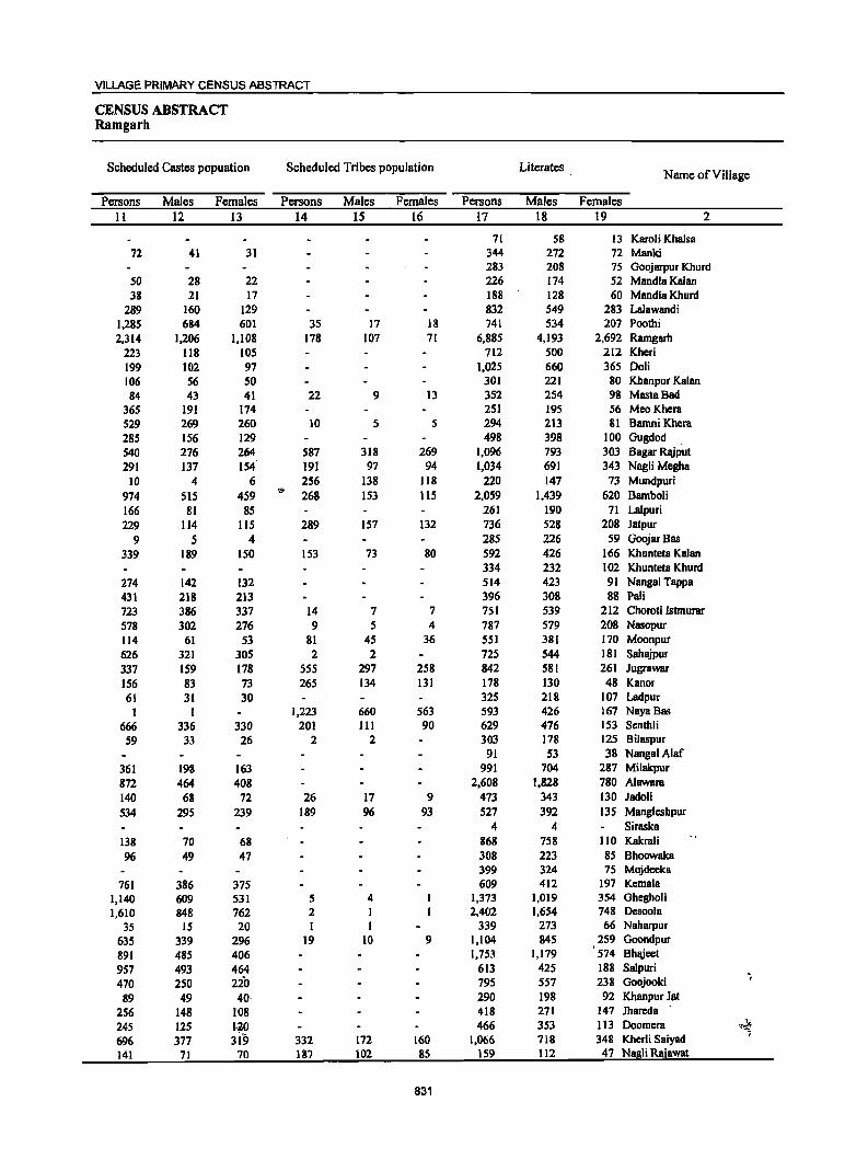
VILLAGE PRIMARY CENSUS ABSTRACT
CENSUS ABSTRACT Ramgarh
Scheduled Castes popuation Scheduled Tribes population Literates Name of Village
Persons Males Females Persons Males Females Persons Males Females
II 12 13 14 15 16 17 18 19 2
71 58 13 Karoli Khalsa 72 41 31 344 272 72 Manki
283 208 75 Goojarpur Khurd 50 28 22 226 174 52 Mandla Kalan 38 21 17 188 128 60 Mandla Khurd
289 160 129 832 549 283 Lalawandi 1,285 684 601 35 17 18 741 534 207 Poothi 2,314 1,206 1,108 178 107 71 6,885 4,193 2,692 Ramgarh
223 118 105 712 500 212 Kheri 199 102 97 1,025 660 365 Doli 106 56 50 301 221 80 Khanpur Kalan 84 43 41 22 9 13 352 254 98 MastaBad
365 191 174 251 195 56 Meo Khera 529 269 260 10 5 S 294 213 81 Barnni Khcra 285 156 129 498 398 100 Gugdod 540 276 264 587 318 269 1,096 793 303 Bagar Rajput 291 137 154 191 97 94 1,034 691 343 Nagli Megha
10 4 6 256 138 118 220 147 73 Mundpuri
974 SIS 4S9 I@
268 1S3 115 2,059 1,439 620 Bambo1i 166 81 85 261 190 71 Lalpuri 229 114 115 289 157 132 736 528 208 Jatpur
9 5 4 285 226 59 Goojar8as
339 189 150 153 73 80 592 426 166 Khunteta Kalan 334 232 102 Khunteta Khurd
274 142 132 514 423 91 Nangal Tappa
431 218 213 396 308 88 Pali 723 386 337 14 7 7 751 539 212 Choroti Istmurar 578 302 276 9 5 4 787 579 208 Nasopur 114 61 53 81 45 36 551 381 170 Moonpur 626 321 305 2 2 725 544 181 Sahajpur 337 159 178 555 297 258 842 581 261 Jugrawar 156 83 73 265 134 131 178 130 48 Kanor 61 31 30 325 218 107 Ladpur
I I 1,223 660 563 593 426 167 Naya Bas
666 336 330 201 III 90 629 476 153 Senthli 59 33 26 2 2 303 178 125 Bilaspur
91 53 38 NangalAlaf 361 198 163 991 704 287 Milakpur
872 464 408 2,608 1,828 780 Alawara
140 68 72 26 17 9 473 343 130 Jadoli
534 295 239 189 96 93 527 392 135 Mangleshpur 4 4 Siraska
138 70 68 868 758 110 Kakrali
96 49 47 308 223 85 Bhoowaka 399 324 75 Mojdeeka
761 386 375 609 412 197 Kernala 1,140 609 531 5 4 1,373 1,019 354 Ghegholi 1,610 848 762 2 1 2,402 1,654 748 Desoola
35 15 20 I I 339 273 66 Naharpur
635 339 296 19 10 9 1,104 845 259 Goondpur
891 485 406 1,753 1,179 574 Bhajeet
957 493 464 613 425 188 Salpuri
470 250 220 795 557 238 Goojooki ~
89 49 40· 290 198 92 Kbanpur Jat
256 148 108 418 271 147 Jhareda
245 125 1.20 466 353 113 Doornera Yi~
696 377 3i'9 332 172 160 1,066 718 348 Kherli Saiyad ,
141 71 70 187 102 85 159 112 47 Nagli Rajawat
831
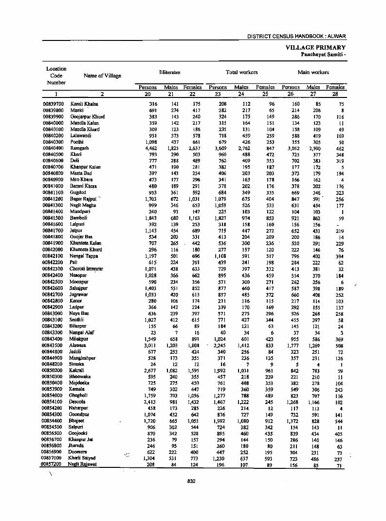
DISTRICT CENSUS HANDBOOK: ALWAR
VILLAGE PRIMARY Panchayat Samiti -
Location Illiterates Total workers Main workers
Code Name of Village Number
Persons Males Females Persons Males Females Persons Males Females 2 20 21 22 23 24 25 26 27 28
00839700 Karoli Khalsa 316 141 175 208 112 96 160 85 75 00839800 Manki 691 274 417 282 217 65 214 206 8 00839900 Goojarpur Khurd 383 143 240 324 175 149 286 170 116 00840000 Mandla Kalan 359 142 217 315 164 151 134 123 II 00840100 Mandla Khurd 309 123 186 235 131 104 IS8 109 49 00840200 Lalawandi 951 373 578 718 459 259 588 419 169 00840300 Poothi 1,098 437 661 679 426 253 355 305 SO 00840400 Ramgarh 4,462 1,825 2,637 3,609 2,762 847 3,052 2,590 462 00840500 Kheri 793 290 503 960 488 472 725 377 348 00840600 Doli 777 288 489 762 409 353 702 383 319 00840700 Khanpur Kalan 471 190 281 382 195 187 177 172 5 00840800 MastaBad 397 143 254 406 203 203 373 179 194 00840900 MeoKhera 473 177 296 341 163 178 166 162 4 00841000 Bamni Khera 480 189 291 378 202 176 378 202 176 00841100 Gugdod 953 361 592 684 349 335 669 346 323 00841200 Bagar Rlliput '. 1,703 672 1,031 1,079 675 404 847 591 256 00841300 NagJi Megha 999 346 653 1,059 526 533 631 454 177 00841400 Mundpuri 240 93 147 225 103 122 104 103 I 00841500 Bamboli 1,843 680 1,163 1,827 974 853 921 862 59 00841600 Lalpuri 392 139 253 318 158 160 156 156 00841700 Jatpur 1,143 454 689 719 447 272 652 433 219 00841800 GoojarBas 534 203 331 413 204 209 200 186 14 00841900 Khunteta Kalan 707 265 442 536 300 236 520 291 229 00842000 Khunteta Khurd 296 n6 180 277 157 120 222 146 76 00842100 Nangal Tappa 1,197 501 696 1,108 591 517 796 402 394 00842200 Pali 615 224 391 439 241 198 284 222 62 00842300 Choroti Istmurar 1,071 438 633 729 397 332 413 381 32 00842400 Nasopur 1,028 366 662 895 436 459 554 370 184 00842500 Moonpur 590 234 356 571 300 271 262 256 6 00842600 Sahajpur 1,403 551 852 877 460 417 587 398 189 00842700 Jugrawar 1,033 420 613 857 485 372 660 408 252 00842800 Kanor 280 106 174 231 116 115 217 114 103 00842900 Ladpur 366 142 224 339 170 169 292 155 137 00843000 NayaBas 636 239 397 571 275 296 526 268 258 00843100 Senthli 1,027 412 615 771 427 344 455 397 58 00843200 Bilaspur 155 66 89 184 121 63 145 i2"1 24 00843300 Nangal Alaf 23 7 16 40 34 6 37 34 3 00843400 Mi1akpur 1,549 658 891 1,024 601 423 955 586 369 00843500 Alawara 3,On 1,203 1,808 2,245 1,412 833 1,777 1,269 508 00844800 Jadoli 677 253 424 340 256 84 323 251 72 00844900 Mangleshpur 528 173 355 371 236 135 357 231 126 00848200 Siraska 24 12 12 16 7 9 5 4 I 00850200 Kakrali 2,677 1,082 1,595 1,992 1,031 961 842 783 59 00850300 Bhoowaka 595 240 355 457 218 239 221 210 11 00850400 Mojdeeka 725 275 450 761 408 353 382 278 104 00853900 KemaIa 749 302 447 719 360 359 549 306 243 00854000 Ghegholi 1,759 703 1,056 1,277 788 489 823 707 116 00854100 Desoola 2,413 981 1,432 1,467 1,222 245 1,268 1,166 102 00854200 Naharpur 458 173 285 426 214 12 117 113 4 00854300 Goondpur 1,074 432 642 876 727 149 732 591 141 00854400 BhlYeet 1,720 665 1,055 1,992 1,080 912 1,372 828 544 00854500 Salpuri 906 362 544 724 382 342 154 143 11 00856500 Goojooki 870 342 528 895 460 435 839 434 405 00856700 Khanpur Jat 236 79 157 294 144 150 286 140 146 00856800 Jhareda 246 95 151 260 180 80 211 148 63 00856900 Doomera . ~~~. 622 222 400 447 252 195 304 231 73 00857000 Kher1i Saiyad 1,304 531 773 1,230 637 593 723 486 237 00857200 N!!!!!iRajawat 208 84 124 196 107. 89 156 85 71
\ 832
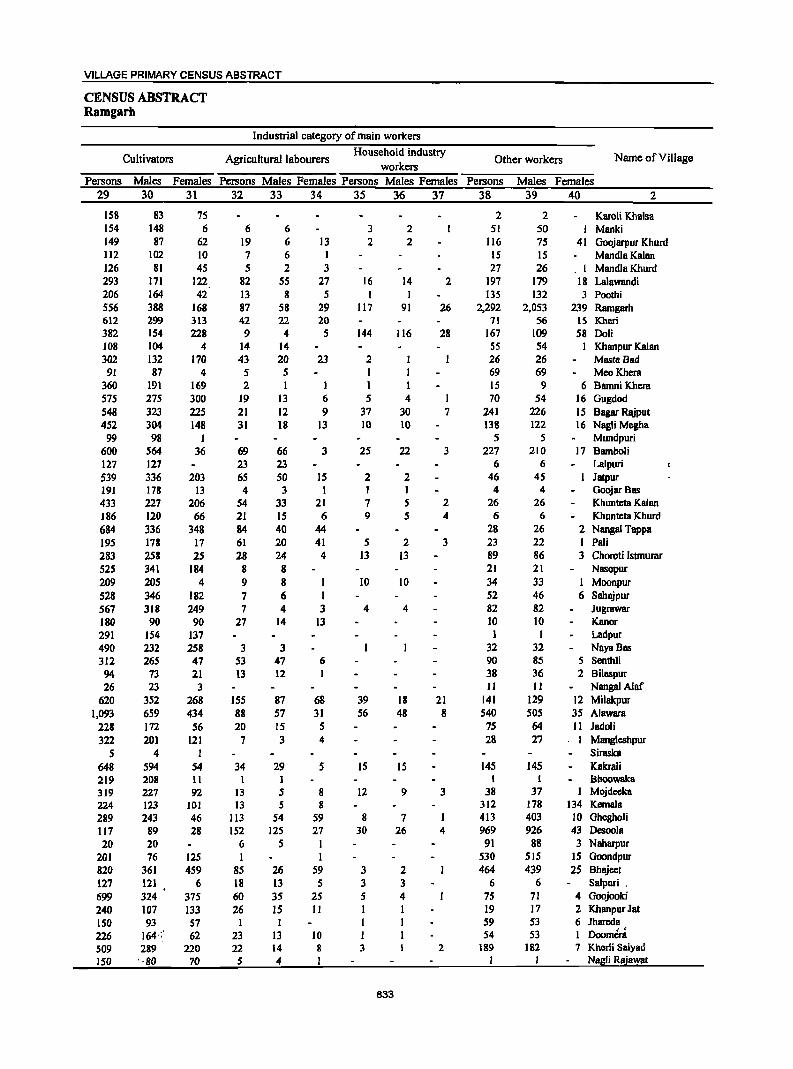
VILLAGE PRIMARY CENSUS ABSTRACT
CENSUS ABSTRACT Ramgarh
Industrial category of main workers
Cultivators Agricultural labourers Household industry
Other workers Name of V iII age workers
Persons Males Females Persons Males Females Persons Males Females Persons Males Females 29 30 31 32 33 34 35 36 37 38 39 40 2
158 83 7S 2 2 Karoli Khalsa 154 148 6 6 6 3 2 51 50 I Manki 149 87 62 19 6 13 2 2 116 7S 41 Ooojarpur Khurd 112 102 IO 7 6 I IS IS Mandla Kalan 126 81 4S S 2 3 27 26 . I Mandla Khurd 293 171 122 82 55 27 16 14 2 197 179 18 Lalawandi 206 164 42 13 8 S 1 I I3S 132 3 Poothi 556 388 168 87 58 29 117 91 26 2,292 2,053 239 Ramgarh 612 299 313 42 n 20 71 S6 15 Kheri 382 154 228 9 4 5 144 116 28 167 109 58 Doli 108 104 4 14 14 SS 54 I Khanpur Kalan 302 132 170 43 20 23 2 26 26 MlISta Bad
91 87 4 5 5 I 69 69 MeoKhem 360 191 169 2 I 1 1 15 9 6 BamniKhem 575 275 300 19 I3 6 5 4 1 70 54 16 Gugdod 548 323 225 21 12 9 37 30 7 241 226 15 Bagar RJUput 452 304 148 31 18 13 10 10 138 122 16 Nagli Megha
99 98 I 5 5 Mundpuri 600 564 36 69 66 3 25 22 3 227 210 17 Bamboli 127 127 23 23 6 6 Lalpuri 539 336 203 65 50 IS 2 2 46 45 Jatpur 191 178 13 4 3 1 1 1 4 4 Goojar BIIS 433 227 206 54 33 21 7 S 2 26 26 Khunteta Kalan 186 120 66 21 15 6 9 5 4 6 6 Khunteta Khurd 684 336 348 84 40 44 28 26 2 Nanga! Tappa 195 178 17 61 20 41 5 2 3 23 22 1 Pali 283 258 25 28 24 4 13 13 89 86 3 Choroti Istmumr 525 341 184 8 8 21 21 Nasopur 209 205 4 9 8 I 10 10 34 33 I Moonpur 528 346 182 7 6 I 52 46 6 Sahajpur 567 318 249 7 4 3 4 4 82 82 Jugrawar 180 90 90 27 14 13 10 10 Kanor 291 154 137 1 1 Ladpur 490 232 258 3 3 32 32 NayaBas 312 265 47 53 47 6 90 85 5 Senthli 94 73 21 13 12 1 38 36 2 Bilaspur 26 23 3 11 11 Nangal A1af
620 352 268 155 87 68 39 18 21 141 129 12 Milakpur 1,093 659 434 88 57 31 56 48 8 540 505 35 Alawam
228 172 56 20 15 5 75 64 11 Jadoli 322 201 121 7 3 4 28 27 . I Mangleshpur
5 4 I SirllSka 648 594 54 34 29 5 15 IS 145 145 Kakrali 219 208 11 I I I Bhoowaka 319 227 92 13 5 8 12 9 3 38 37 I Mojdecka 224 123 101 13 5 8 312 178 134 Kemala 289 243 46 113 54 59 8 7 1 413 403 10 Ohegholi 117 89 28 IS2 125 27 30 26 4 969 926 43 Desoola 20 20 6 5 I 91 88 3 Naharpur
201 76 125 1 I 530 515 15 Ooondpur 820 361 459 85 26 59 3 2 464 439 25 Bhajcct 127 121 6 18 13 5 3 3 6 6 Salpuri , 699 324 375 60 35 25 5 4 75 71 4 Goojooki 240 107 133 26 15 II I I 19 17 2 KhanpurJat 150 93 57 I 1 1 59 53 6 Jhareda 226 164';.'· 62 23 13 10 I 54 53 1 ' . Doomera S09 289 220 22 14 8 3 2 189 182 7 Kherli Saiyad ISO ' ·80 70 5 4 I I I Nagli Rajawat
833

DISTRICT CENSUS HANDBOOK: ALWAR
VILLAGE PRIMARY Panchayat Samiti -
Location Industrial category
Code Name of Village Marginal workers
Cultivators Agricultural labourers Number
Persons Males Females Persons Males Females Persons Males Females 2 41 42 43 44 45 46 47 48 49
~08397oo Karoli Khalsa 48 27 21 45 25 20 3 2 I 00839800 Manki 68 11 57 64 10 54 2 2 00839900 Goojarpur Khurd 38 S 33 30 4 26 7 I 6 00840000 Mandla Kalan 181 41 140 98 14 84 83 27 S6 00840100 Mandla Khurd 77 22 55 27 4 23 I I 00840200 Lalawandi 130 40 90 38 12 26 80 19 61 00840300 Poothi 324 121 203 191 19 172 26 6 20 00840400 Ramgarh 557 172 385 202 22 180 126 24 102 00840500 Kheri 235 III 124 216 108 108 9 8 00840600 Doli 60 26 34 36 14 22 1 1 00840700 Khanpur Kalan 205 23 182 170 12 158 28 6 22 00840800 MastaBad 33 24 9 29 21 8 4 3 1 00840900 MeoKhera 175 1 174 146 1 145 29 29 00841000 Bamni Khera 00841100 Gugdod 15' 3 12 10 10 4 2 2 00841200 Bagar Rajput 232 84 148 76 27 49 31 21 10 00841300 Nagli Megha 428 72 356 199 29 170 202 2S 177 00841400 Mundpuri 121 121 III III 10 10 00841500 Bamboli 906 112 794 743 77 666 123 15 108 00841600 La1puri 162 2 160 128 128 33 I 32 00841700 Jatpur 67 14 53 57 7 50 5 2 3 00841800 GoojarBas 213 18 19S 201 17 184 12 1 11 00841900 Khunteta Kalan 16 9 7 7 3 4 8 5 3 00842000 Khunteta Khurd 55 11 44 46 9 37 9 2 7 00842100 Nangal Tappa 312 189 123 293 176 117 19 .13 6 00842200 Pali 155 19 136 104 2 102 35 3 32 00842300 Choroti Istmurar 316 16 300 271 6 265 23 2 21 00842400 Nasopur 341 66 275 252 25 227 42 7 35 00842500 Moonpur 309 44 26S 2S3 24 229 47 II 36 /;)
00842600 Sahajpur 290 62 228 187 13 174 84 33 51 A
00842700 Jugrawar 197 77 120 146 50 96 46 22 24 00842800 Kanor 14 2 12 13 I 12 I I 00842900 Ladpur 47 15 32 35 7 28 7 4 3 00843000 NayaBas 45 7 38 44 6 38 00843100 Senthli 316 30 286 260 25 235 50 3 47 00843200 Bilaspur 39 39 25 2S 14 14 00843300 NangaiAiaf 3 3 2 2 00843400 Milakpur 69 15 54 29 28 28 4 24 . 00843500 Alawara '468 143 325 249 55 194 68 22 46 00844800 Jadoli 17 5 12 10 9 7 4 3 00844900 Mangleshpur 14 5 9 9. 4 5 00848200 Siraska II 3 8 11 3 8 00850200 Kakrali 1,150 248 902 997 230 767 145 16 129 00850300 Bhoowaka 236 8 228 232 8 224 4 4 00850400 Mojdeeka 379 130 249 356 121 235 10 6 4 00853900 Kemala 170 S4 116 65 31 34 77 13 64 00854000 Gbegholi 454 81 373 146 5 141 279 55 224 00854100 Desoola 199 56 143 27 4 23 100 15 85 00854200 Naharpur 109 101 8 4 4 13 11 2 00854300 Ooondpur 144 136 8 64 60 4 10 9 1 00854400 Bbajeet 620 252 368 329 153 176 271 90 181 00854500 Salpuri 570 239 331 22 12 10 543 222 321 00856500 Goojooki 56 26 30 36 20 16 17 4 13 00856700 Kbanpur Jat 8 4 4 3 1 2' 2 2 00856800 Jhareda 49 32 17 28 15 13 8 5 3 00856900 Doomera 143 21 122 108 7 I~r 25 6 19 00857000 Kherli Saiyad 507 lSI 356 409 126 283 94 21 73 00857200 Nagli Rajawat 40 22 18 3S 19 16 S 3 2
834
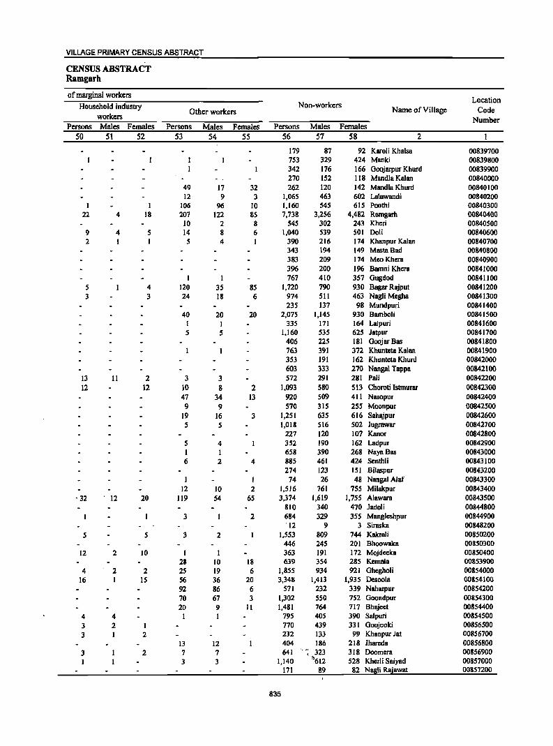
VILLAGE PRIMARY CENSUS ABSTRACT
CENSUS ABSTRACT Ramgarh
of marginal workers Location
Household industry Non-workers Name of Village Code Other workers
workers Number Persons Males Females Persons Males Females Persons Males Females
50 51 S2 S3 S4 5S S6 57 58 2
179 87 92 Karoli Khalsa 00839700 753 329 424 Manki 00839800 342 176 166 Goojarpur Khurd 00839900 270 152 118 Mandla Kalan 00840000
49 17 32 262 120 142 Mandla Khurd 00840100 12 9 3 1,065 463 602 Lalawandi 00840200
I I 106 96 10 1,160 545 615 Poothi 00840300 22 4 18 207 122 85 7,738 3,256 4,482 Ramgarb 00840400
10 2 8 545 302 243 Kbcri 00840500 9 4 5 14 8 6 1,040 539 501 Doli 00840600 2 I 5 4 390 216 174 Khanpur Kalan 00840700
343 194 149 Masta Bad 00840800 383 209 174 MeoKhera 00840900 396 200 196 Bamni Khera 00841000
I 1 767 410 357 Gugdod 00841100 5 4 120 35 85 1,720 790 930 Bagar Rajput 00841200 3 3 24 18 6 974 511 463 NagJi Megha 00841300
235 137 98 Mundpuri 00841400 40 20 20 2,075 1,145 930 Bamboli 00841500
I I 335 171 164 Lalpuri 00841600 5 5 1,160 535 625 Jatpur 00841700
406 225 181 GoojarBas 00841800 763 391 372 Khunteta Kalan 00841900 353 191 162 Khunteta Khurd 00842000 603 333 270 Nangal Tappa 00842100
I3 11 2 3 3 572 291 281 Pali 00842200 12 12 10 8 2 1,093 580 513 Choroti Istmurar 00842300
47 34 13 920 509 411 Nasopur 00842400 9 9 570 315 255 Moonpur 00842500
19 16 3 1,251 635 616 Sahajpur 00842600 5 5 1,018 516 502 lugrawar 00842700
227 120 107 Kanor 00842800 5 4 352 190 162 Ladpur 00842900 I I 658 390 268 NayaBas 00843000 6 2 4 885 461 424 Senthli 00843100
274 123 151 Bilaspur 00843200 1 74 26 48 NangalAlaf 00843300
12 10 2 1,516 761 755 Milakpur 00843400 • 32 ' 12 20 119 54 6S 3,374 1,619 1,75S Alawara 00843SOO
810 340 470 Jadoli 00844800 3 2 684 329 35S Manglesbpur 00844900
'12 9 3 Siraska 00848200 5 5 3 2 1,553 809 744 Kakrali 00850200
446 245 201 Bhoowaka 00850300 12 2 10 I 363 191 172 Mojdeeka 00850400
28 10 18 639 354 285 Kernala 00853900 4 2 2 2S 19 6 1,855 934 921 Ghcgboli 00854000
16 15 56 36 20 3,348 1,413 1,935 Desoola 00854100 92 86 6 571 232 339 Naharpur 00854200 70 67 3 1,302 550 752 Goondpur 00854300 20 9 II 1,481 764 717 Bhajeet 00854400
4 4 1 I 795 405 390 Salpuri 00854500 3 2 I 770 439 331 Goojooki 00856500 3 I 2 232 133 99 Khanpur Jat 00856700
13 12 404 186 218 Ihareda 00856800 3 2 7 7 641 , 323 318 Doomera 00856900
3 3 1,140 '11'612 528 Kherli Saiyad 00857000 171 89 82 Nagli Rajawat 00857200
835
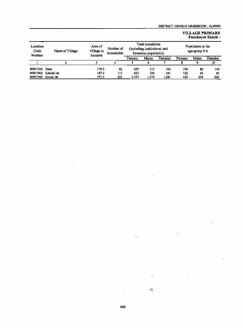
Location Code
Number Name of Village
00857300 Dada 00857400 Kakrali Jat 00857500 Kerwa Jat
2
Area of Number of
Village in households hectares
3
170.0 187.0 737.0
4
8~ liS 323
836
DISTRICT CENSUS HANDBOOK: ALWAR
Total population (including institutional and
houseless population) Persons Males Females
5 6 7
659 313 346 625 334 291
2,353 1,272 1,081
VILLAGE PRIMARY Panchayat Samiti -
Population in the age-group 0-6
Persons Males Females 8 9 10
194 80 il4 122 62 60 463 234 229
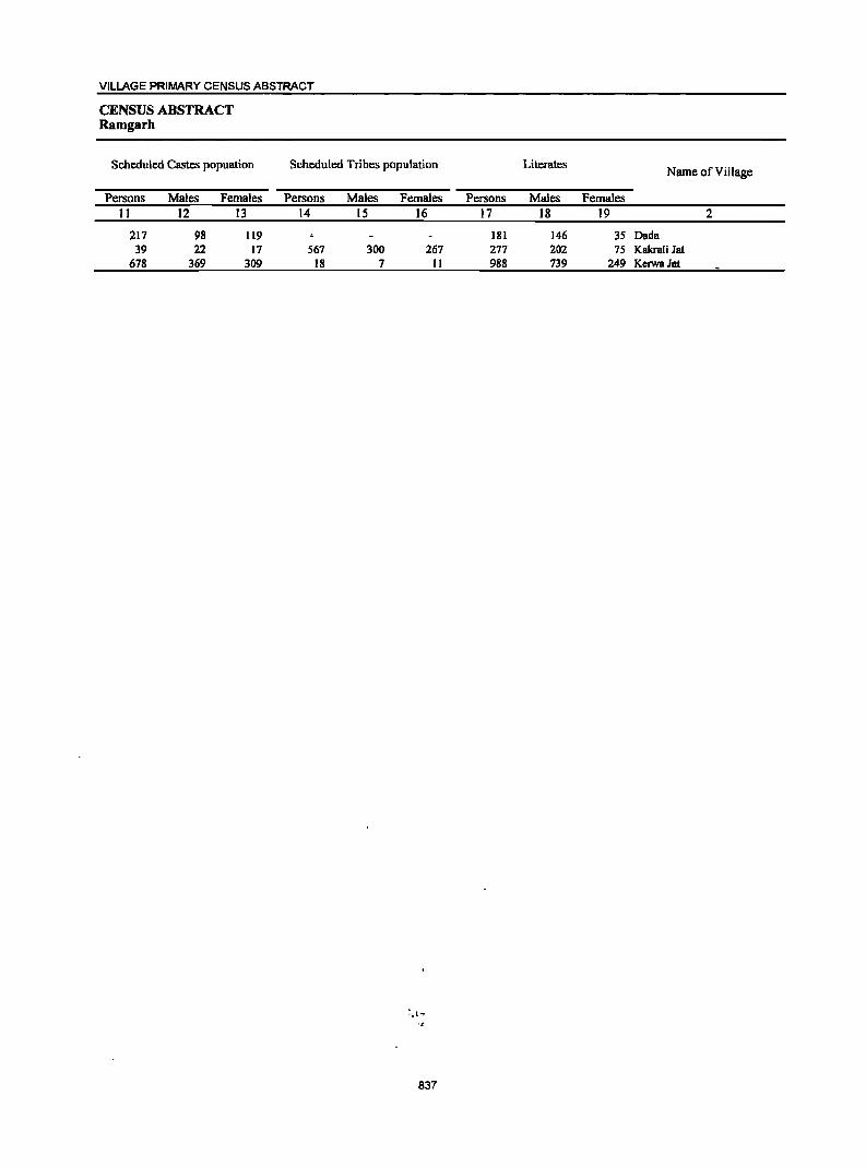
VILLAGE PRIMARY CENSUS ABSTRACT
CENSUS ABSTRACT Ramgarh
Scheduled Castes popuation
Persons Males Females 11 12 13
217 98 119 39 22 17
678 369 309
Scheduled Tribes population
Persons Males Females 14 15 16
567 300 267 18 7 11
837
Literates Name of Village
Persons Males Females 17 18 19 2
181 146 35 Dada 277 202 75 Kakrali lat 988 739 249 KerwaJat
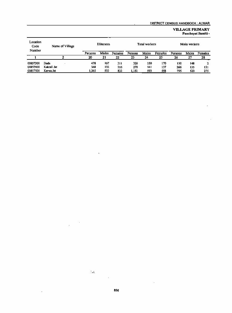
Location Illiterates
Code Name of Village Number
Persons Males Females 2 20 21 22
00857300 Dada 478 167 311 00857400 Kakrali Jat 348 132 216 00857500 KerwaJat 1,365 533 832
, .~':'
838
DISTRICT CENSUS HANDBOOK: ALWAR
Total workers
Persons Males Females 23 24 25
320 ISO 170 278 141 137
1151 593 558
VILLAGE PRIMARY Panchayat Samiti -
Main workers
Persons Males Females 26 27 28
ISO 148 2 266 135 131 795 520 275
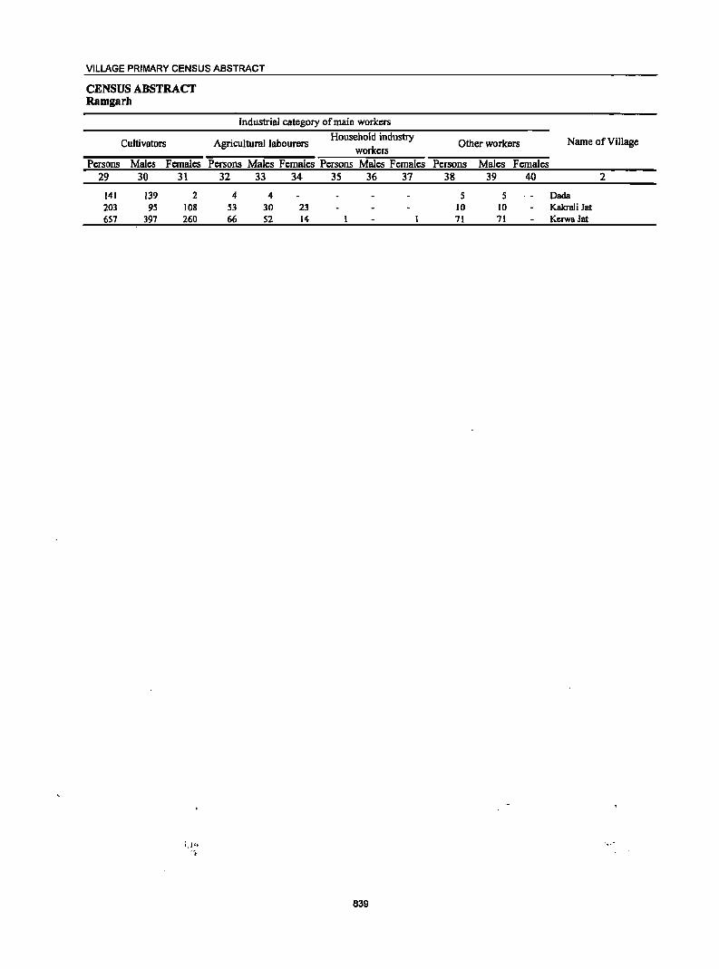
VILLAGE PRIMARY CENSUS ABSTRACT
CENSUS ABSTRACT Ramgarb
Cultivators
Persons Males Females 29 30 31
141 139 2 203 95 108 657 397 260
i .l':~ ",
Industrial category of main workers
Agricultural labourers Household industry
workers Persons Males Females Persons Males Females
32 33 34 3S 36 37
4 4 S3 30 23 66 52 14
839
Other workers Name of Village
Persons Males Females 38 39 40 2
S S Dada 10 10 Kakrali 1at 11 11 KerwaJat
Location Code
Number Name of Village
00857300 Dada 00857400 Kakrali Jat 00857500 KcrwaJat
2
Marginal workers
Persons 41
170 12
356
Males Females 42 43
2 6
73
168 6
283
840
Persons 44
168 4
209
DISTRICT CENSUS HANDBOOK: ALWAR
VILLAGE PRIMARY Panchayat Samiti -
Industrial category
Cultivators Agricultural labourers
Males Females Persons Males Females 45 46 47 48 49
2 166 2 2 2 2 8 4 4
16 193 142 53 89
VILLAGE PRIMARY CENSUS ABSTRACT
CENSUS ABSTRACT Ramgarb
of marginal workers
Household industry workers
Persons Males Females 50 51 52
2
J.
Other workers
Persons Males Females 53 54 55
3 3
Non-workers Location
Name of Village Code Number
Persons Males Females 56 57 58 2
339 163 176 Dada 00857300 347 193 154 Kakrali Jat 00857400
1,202 679 523 KerwaJat 00857500
!.
841
DISTRICT CENSUS HANDBOOK: ALWAR
VILLAGE PRIMARY Panchayat Samiti -
Location Area of Total population
Population in the Number of (including institutional and
Code Name of Village Village in households houseless population)
age-group 0-6 Number hectares
Persons Males Females Persons Males Females 2 3 4 5 6 7 8 9 10
0008 Umren (Total) 100,398.98 32,844 227,404 121,736 105,668 46,296 24,281 22,015 0008 Umren (Rural) 100,396.00 31,909 221,794 117,622 104,172 45,668 23,918 21,750 0008 Umren (Urban) 2.98 935 5,610 4,114 1,496 628 363 265
Umren (Rural) 00845000 Ghatla 849.0 290 2,092 1,101 991 503 272 231 00845100 Bhurari 173.0 88 572 296 276 liS 57 58 00845200 Sahanpuri 166.0 32 230 126 104 39 22 17 00845300 Jhadoli 344.0 116 811 444 367 195 105 90 00845400 Barwara 122.0 47 313 164 149 72 38 34 00845500 Bijopur 478.0 159 1,167 601 566 329 162 167 00845600 Dhoolpuri 240.0 128 902 474 428 187 101 86 00845700 Chandoli 1,663.0 716 5,654 2,957 2,697 1,330 642 688 00845800 Naglasedoo 247.0 130 932 480 452 194 101 93 00845900 Nadanheri 500.0 129 1,019 524 495 248 139 109 00846000 Rundh Shahpur 135.0 104 671 351 320 153 8S 68 00846100 Shahpur 264.0 2'11 1,713 909 804 298 166 132 00846200 Dilawarpur 310.0 152 1,137 610 527 215 109 106 00846300 Bhandwara 509.0 167 1,140 596 544 212 109 103 00846400 Parisal 196.0 125 688 377 311 114 59 55 00848900 Naurangabad 461.0 131 917 472 445 193 108 85 00849000 Nangali Munshi 75.0 55 342 187 155 50 29 21 00849100 KasbaDahra 233.0 176 1,137 586 551 216 105 III 00849200 Dhokri 1,030.0 73 654 340 314 158 87 71 00849300 Rundh Madar 181.0 2 18 11 7 4 3 1 00849400 BalaDahra 1,973.0 148 865 458 407 153 73 80 00849500 Teharpur 574.0 187 1,179 655 524 257 lSI 106 00849600 Kadooki 218.0 99 695 365 330 169 97 72 00849700 Thekra 358.0 186 1,340 676 664 315 152 163 00849800 Ulaheri 254.0 98 749 387 362 184 90 94 00851000 DholiDoob 173.0 204 1,408 741 667 237 127 110 00851100 Jatiyana 567.0 297 2,421 1;304 1,117 550 329 221 00851200 Rundh Nidani 335.0 ------Un-inhabited------------00851300 Rundh Manch 20.0 35 229 130 99 25 13 12 00851400 Todiyar 449.0 89 711 389 322 174 96 78 00851500 Hajipur 897.0 308 2,246 1,175 1,071 481 233 248 00851600 Dadhikar ( Dadikar ) 3,335.0 194 1,508 822 686 320 165 ISS 00851700 Rundh Hajipur 844.0 6 37 16 21 6 I 5 00851800 Rundh Sirawas 368.0 94 688 373 315 lSI 78 73 00851900 Sirawas 6,805:0 83 605 341 264 132 73 59 00852000 Rundh Sundarwas 3,684.0 69 412 220 192 58 34 24 00852100 Rogra 486.0 43 398 211 187 80 41 39 00852200 Rarnnagar 285.0 22 174 90 84 38 14 24 00852300 Dhahalawas 954.0 245 1,533 834 699 362 194 168 00852400 Sarnlat Chak: 140.0 S6 409 219 190 91 41 50 00852500 Bakhtpura 346.0 142 686 359 327 145 73 72 00852600 Rundh Dadikar 191.0 18 140 72 68 36 20 16 00852700 Kishanpur 774.0 196 1,426 768 658 324 ISS 139 00852800 Rundh Bhakhera 2,853.0 79 566 296 270 138 68 70 00852900 Bbakhera 2,775.0 127 860 458 402 139 70 69 00853000 Alwar ( Rural) 3.0 48 236 140 96 46 24 22 00853100 Bhoogar 669.0 1,120 6,528 3,505 3,023 1,012 552 460 00853200 !tama ( Rural ) 398.0 122 905 467 438 223 122 101 00853300 Berka 69.0 -------Un-inhabited--------00853400 Palka 134.0 87 593 312 281 120 67 53 00853500 Belaka 183.0 575 3,438 1,836 1,602 750 394 356 00853600 Diwakari 282.0 1,196 6,870 3,725 3,145 1,262 677 585 00853700 Toolera 939.0 496 3,938 2,079 1,859 804 412 392 00853800 Mannaka 321.0 213 1,780 944 836 465· 244 221
842
VILLAGE PRIMARY CENSUS AB·
CENSUS ABSTRACT Umren
Scheduled Castes popuation Scheduled Tribes population Literates Name of Village
Persons Males Females Persons Males Females Persons Males Females
II 12 13. 14 15 16 17 18 19 2
50,307 26,662 23,645 18,087 9,701 8,386 97,1)79 70,674 27,305 Umren (Total) 50,01)3 26,556 23,537 17,983 9,624 8,359 93,202 '66,966 26,236 Umren (Rural)
214 106 108 104 77 27 4,777 3,708 1,061) Umren (Urban) Umren (Rural)
707 357 350 955 638 317 Ghatla 278 139 139 300 193 107 Bhurari 171 93 78 129 84 45 Sahanpuri 458 254 204 349 260 89 Ihadoli 131 69 62 149 111 38 Barwara 357 188 169 350 284 66 Bijopur 187 101 86 378 282 96 Dhoolpuri 573 300 273 1,653 1,291 362 Chandoli 144 68 76 323 238 85 Naglasedoo 90 54 36 258 216 42 Nadanheri
480 253 227 230 153 77 Rundh Shahpur '
507 270 237 164 90 74 972 627 345 Shahpur ",
136 79 57 - 563 382 181 Dilawarpur -. 88 43 45 516 346 170 Bhandwara 2 2 2 2 359 262 97 Parisal
223 116 107 371 255 116 Naurangabad \j., .. -
13 8 5 211 143 68 Nangali Munshi' - ,~,
405 -210 195 570 374 196 KasbaDahra 13 9 4 272 191 81 Dhokri 18 II 7 6 5 I Rundh Madar
286 143 143 384 290 94 Bala Dahra 481 269 212 476 365 III Teharpur 374 199 175 251 171 80 Kadooki
56 22 34 400 336 64 Thekra 134 75 59 259 184 75 Ulahcri 356 182 174 759 489 270 Dholi rJoob 273 148 125 II 5 6 787 630 157 Jatiyana
------Un-inhabited-------- Rundh Nidani 130 73 57 124 85 39 RundhMBnch
69 42 27 286 225 61 Todiyar 1,035 529 506 694 544 150 Hajipur
446 240 206 396 341 55 Dadhikar ( Dadikar ) II 6 5 Rundh Hajipur
10 5 5 667 362 305 338 243 95 Rundh Sirawas 7 4 3 101 89 12 Sirawas
412 220 192 122 100 22 Rundh Sundarwas 131 97 34 Rogra
II 5 6 39 39 Ramnagar 151 82 69 33 19 14 405 374 31 DhahalaWBS
144 117 27 SanJlatChak 193 99 94 23 13 10 218 177 41 Bakhtpura
19 16 3 Rundh Dadikar
7 5 2 24 15 9 3S1 289 62 Kishanpur
30 19 11 6 2 4 192 145 47 Rundh Bhakhera
9 6 3 39 22 17 466 30S 161 Bhakhera I I 87 69 18 Alwar ( Rural)
1,235 650 585 3,199 1,712 1,487 4,068 2,690 1,378 Bhoogar 223 123 100 301 226 75 ltama ( Rural)
-------Un-inhabited----------- Berka
250 132 118 266 179 87 Palka
1,674 895 779 175 93 82 1,853 1,220 633 Belaka
3,004 1,612 1,392 51 31 20 ;4,066 2,612 1,454 Diwakari
820 434 386 1,668 1,230 438 Toolera 839 598 241 Mannaka
843
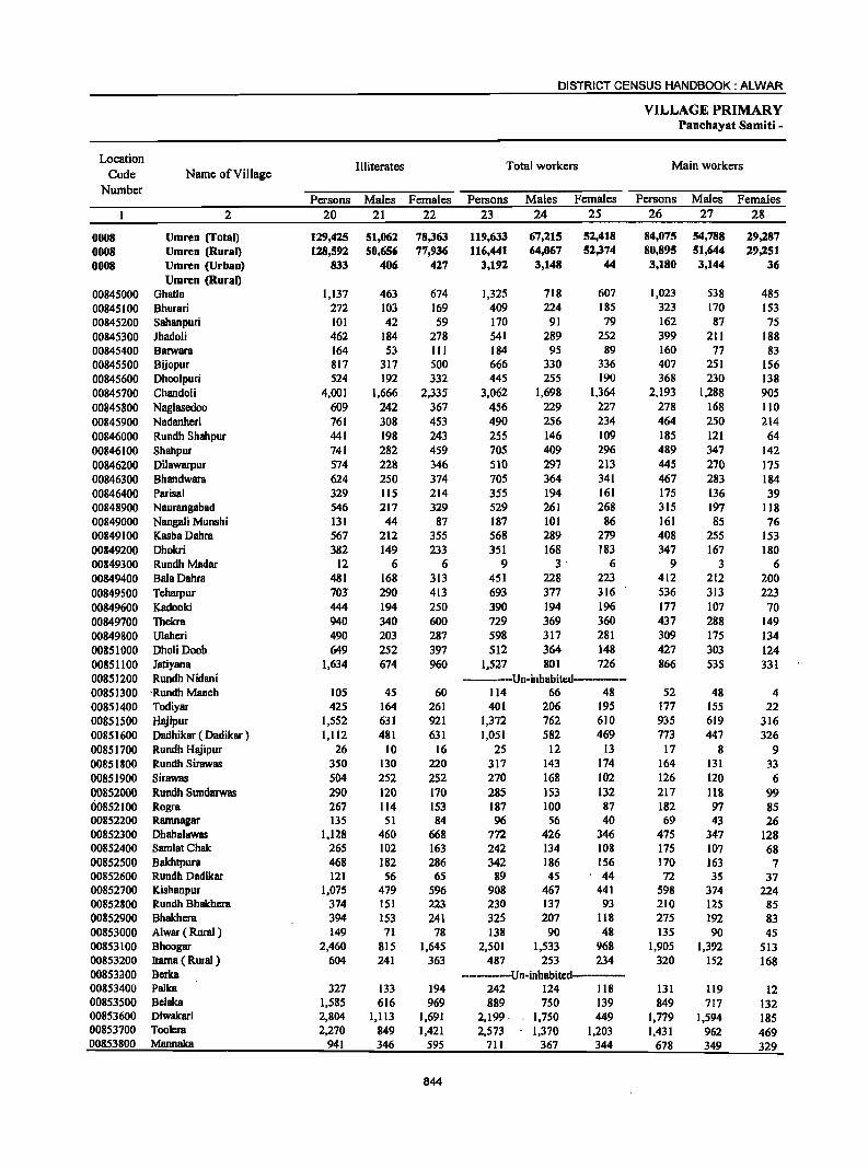
DISTRICT CENSUS HANDBOOK: ALWAR
VILLAGE PRIMARY Panchayat Samiti -
Location Illiterates Total workers Main workers
Code Name of Village Number
Persons Males Females Persons Males Females Persons Males Females 2 20 21 22 23 24 25 26 27 28
0008 Umren (fotal) 129,425 51,062 78,363 119,633 67,215 52,418 84,075 54,788 29,287 0008 Umren (Rural) 128,592 50,656 77,936 116,441 64,067 52,374 80,895 51,644 29,251 0008 Umren (Urban) 833 406 427 3,192 3,148 44 3,180 3,144 36
Umren (Rural) 00845000 Ohatla 1,137 463 674 1,325 718 607 1,023 538 485 00845100 Bhurari 272 103 169 409 224 185 323 170 153 00845200 Sahanpuri 101 42 59 170 91 79 162 87 75 00845300 lhadoli 462 184 278 541 289 252 399 211 188 00845400 Barwara 164 53 III 184 95 89 160 77 83 00845500 Bijopur 817 317 500 666 330 336 407 251 156 00845600 Dhoo1puri 524 192 332 445 255 190 368 230 138 00845700 Chandoli 4,001 1,666 2,335 3,062 1,698 1,364 2,193 1,288 905 00845800 Naglasedoo 609 242 367 456 229 227 278 168 110 00845900 Nadanheri 761 308 453 490 256 234 464 250 214 00846000 Rundh Shahpur 441 198 243 255 146 109 185 121 64 00846100 Shahpur 741 282 459 705 409 296 489 347 142 00846200 Dilawarpur 574 228 346 510 297 213 445 270 175 00846300 Bhandwara 624 250 374 705 364 341 467 283 184 00846400 Parisal 329 115 214 355 194 161 175 136 39 00848900 Naurangabad 546 217 329 529 261 268 315 197 II8 00849000 Nangali Munshi 131 44 87 187 101 86 161 85 76 00849100 KasbaDahra 567 212 355 568 289 279 408 255 153 00849200 Dhokri 382 149 233 351 168 183 347 167 180 00849300 Rundh Madar 12 6 6 9 3' 6 9 3 6 00849400 BalaDahra 481 168 313 451 228 223 412 212 200 00849500 Teharpur 70J" 290 413 693 377 316 536 313 223 00849600 Kadooki 444 194 250 390 194 196 177 107 70 00849700 Thekra 940 340 600 729 369 360 437 288 149 00849800 Ulaheri 490 203 287 598 317 281 309 175 134 00851000 Dholi Doob 649 252 397 512 364 148 427 303 124 00851100 Jatiyana 1,634 674 960 1,527 801 726 866 535 331 00851200 Rundh Nidani -----Un-inhabited------00851300 . Rundh Manch 105 45 60 II4 66 48 52 48 4 00851400 Todiyar 425 164 261 401 206 195 177 155 22 00851500 Hajipur 1,552 631 921 1,372 762 610 935 619 316 00851600 Dadhikar ( Dadik8T ) 1,112 481 631 1,051 582 469 773 447 326 00851700 Rundh Hajipur 26 10 16 25 12 13 17 8 9 00851800 Rundh Sirawas 350 130 220 317 143 174 164 13I 33 00851900 Sirawas 504 252 252 270 168 102 126 120 6 00852000 Rundh Sundarwas 290 120 170 285 153 132 217 118 99 00852100 Rogra 267 114 153 187 100 87 182 97 85 00852200 Ramnagar 135 51 84 96 56 40 69 43 26 00852300 Dhahalawas 1,128 460 668 772 426 346 475 347 128 00852400 Samlat Chak: 265 102 163 242 134 108 175 107 68 00852500 Bakhtpura 468 182 286 342 186 156 170 163 7 00852600 Rundh Dadikar 121 56 65 89 45 ' 44 72 3S 37 00852700 Kishanpur 1,075 479 596 908 467 441 598 374 224 00852800 Rundh Bhakhera 374 151 223 230 137 93 210 125 85 00852900 Bhakhera 394 153 241 325 207 118 275 192 83 00853000 Alwar ( Rural) 149 71 78 138 90 48 135 90 45 00853100 Bhoogar 2,460 815 1,645 2,501 1,533 968 1,905 1,392 513 00853200 ltarna ( Rural ) 604 241 363 487 253 234 320 152 168 00853300 Berka ---------Un-inhabited-----00853400 Palka 327 133 194 242 124 118 131 119 12 00853500 Belaka 1,585 616 969 889 750 139 849 717 132 00853600 Diwakari 2,804 1,113 1,691 2,199· 1,750 449 1,779 1,594 185 00853700 Toolera 2,270 849 1,421 2,573 1,370 1,203 1,431 962 469 00853800 Mannaka 941 346 595 711 367 344 678 349 329
844

VILLAGE PRIMARY CENSUS ABSTRACT
CENSUS ABSTRACl Umren
Industrial category of main workers
Cultivators Agricultural labourers Household industry
Other workers Name of Village workers
Persons Males Females Persons Males Females Persons Males Females Persons Males Females 29 30- 31 32 33 34 35 36 37 38 39 40 2
55,067 32,322 22,745 5,185 2,905 2,280 1,961 1,286 675 21,862 18,275 3,587 Umren (Total) 55,051 32,306 22,745 5,185 2,905 2,280 1,956 1,283 673 18,703 15,150 3,553. Umren (Rural)
16 16 5 3 2 3,159 3,125 34 Umren (Urban) Umren (Rural)
879 433 446 48 18 30 10 6 4 86 81 5 Ghatla 256 130 126 43 16 27 24 24 Bhurari 158 84 74 2 2 2 Sahanpuri 342 166 176 .9 I 8 48 44 4 Jhadoli
96 44 52 62 31 31 2 2 Barwara 304 190 114 38 30 8 65 31 34 Bijopur 309 171 138 17 17 2 2 40 40 Dhoolpuri
1,469 753 116 23 12 11 186 83 103 515 440 15 Chandoli 188 91 97 24 13 11 3 3 63 61 2 Naglasedoo 289 132 157 70 31 39 105 87 18 Nadanheri 127 69 58 41 38 , 3 1 I 16 13 3 Rundh Shahpur 255 130 125 20 14 6 2 2 212 201 II Shahpur 327 174 153 44 27 17 10 8 2 64 61 3 Dilawarpur 289 167 122 106 50 56 7 5 2 65 61 4 Bhandwara 123 87 36 7 6 I 2 2 43 41 2 Parisal 264 162 102 17 10 7 10 3 7 24 22 2 Naurangabad 123 51 72 6 3 3 3 3 29 28 1 Nangali Munshi 250 II6 134 38 28 10 8 6 2 Il2 105 7 Kasba Dahra . 316 136 180 8 8 22 22 Dhokri
8 2 6 1 I RundhMadar 277 132 145 93 39 54 42 41 I Bala Dahra 377 199 178 106 70 36 52 43 9 Tcharpur 137 77 60 14 9 5 25 21 4 Kadooki 317 186 131 4 3 I 116 99 17 Thckra 189 96 93 9 5 4 29 14 15 82 60 22 Ulaheri 223 120 103 21 19 2 3 3 180 161 19 DholiDoob 711 395 316 5 4 150 136 14 Jatiyana
-----Un-inhabited------ Rundh Nidani 31 28 3 8 7 1 13 13 Rundh Manch
143 123 20 10 8 2 24 24 Todiyar 300 280 20' 278 142 136 210 73 137 147 124 23 Hajipur 677 381 296 3 2 92 64 28 Dadhikar ( Dadikar )
16 7 9 I I Rundh Hajipur 152 119 33 3 3 9 9 Rundh Sirawas 99 98 I 21 16 5 6 6 Sirawas
109 61 48 106 55 51 2 2 Rundh Sundarwas 179 95 84 I 1 2 2 Rogra 60 37 23 2 1 7 5 2 Ramnagar
29S 203 92 29 14 15 25 19 6 126 III 15 Dhahalawas 111 62 49 2 2 2 60 42 18 SamlatChak 127 123 4 12 12 5 5 26 23 3 Bakhtpura 72 35 37 Rundh Dadikar
426 275 lSI 10 9 I 46 25 21 116 65 SI Kishanpur 66 28 38 12 6 6 3 3 129 88 41 Rundh Bhakbcra
146 83 63 8 2 6 121 107 14 Bhakhera 4 4 131 86 45 Alwar ( Rural)
4S7 217 240 22 13 9 116 65 51 1,310 1,097 213 Bhoogar 266 106 160 11 3 8 1 I 42 42 ltama ( Rural) ,
--------Un-inhabited------------ Berka 59 S4 5 72 65 7 Palka
146 96 50 22 16 6 IS 14 1 666 591 75 Belaka 129 111 18 53 46 7 107 I. 71 36 1,490 1,366 124 Diwakari
1,051 617 434 69 48 21 11 9 2 300 288 12 Toolera 285 227 58 393 122 271 Mannaka
845
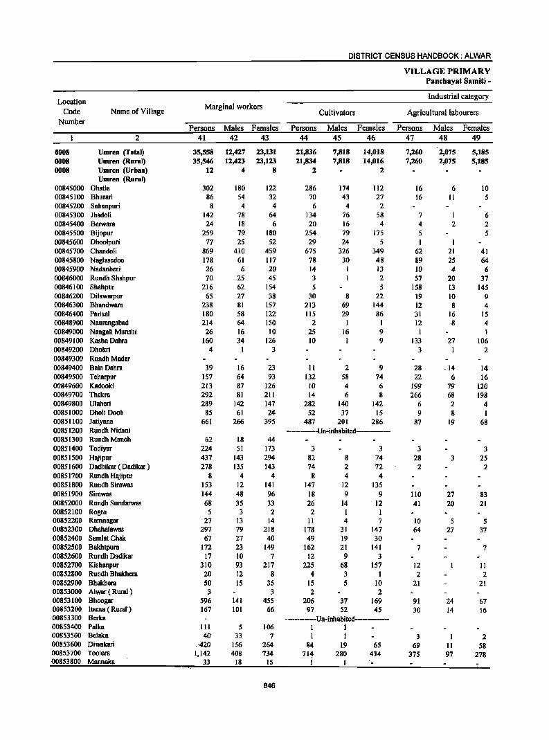
DISTRICT CENSUS HANDBOOK: ALWAR
VILLAGE PRIMARY Panchayat Samiti -
Location Industrial category
Code Name of Village Marginal workers
Cultivators Agricultural labourers Number
Persons Males Females Persons Males Females Persons Males Females 2 41 42 43 44 45 46 47 48 49
0008 Umren (Total) 35,558 12,427 23,131 21,836 7,818 14,018 7,260 2,075 5,185 0008 Umren (Rural) 35,546 12,423 23,123 21,834 7,818 14,016 7,260 2,075 5,185 0008 Umren (Urban) 12 4 8 2 2
Umren (Rural) 00845000 Ghatla 302 180 122 286 174 112 16 6 10 00845100 Bhurari 86 54 32 70 43 27 16 II S 00845200 Sahanpuri 8 4 4 6 4 2 00845300 Jhadoli 142 78 64 134 76 58 7 I 6 00845400 Barwara 24 18 6 20 16 4 4 2 2 00845500 Bijopur 259 79 180 254 79 175 5 5 00845600 Dhoolpuri 77 25 52 29 24 5 I 00845700 Chandoli 869 410 459 675 326 349 62 21 41 00845800 Naglasedoo 178 61 117 78 30 48 89 25 64 00845900 Nadanheri 26 6 20 14 13 10 4 6 00846000 Rundh Shahpur 70 25 45 3 2 57 20 37 00846100 Shahpur 216 62 154 5 5 158 13 145 00846200 Dilawarpur 65 27 38 30 8 22 19 10 9 00846300 Bhandwara 238 81 157 213 69 144 12 8 4 00846400 Parisal 180 58 122 115 29 86 31 16 15 00848900 Naurangabad 214 64 150 2 I I 12 8 4 00849000 Nangali Munshi 26 16 10 25 16 9 I I 00849100 KasbaDahra 160 34 126 10 I 9 133 27 106 00849200 Dhokri 4 3 3 I 2 00849300 RundhMadar 00849400 BalaDahra 39 16 23 11 2 9 28 .14 14 00849500 Teharpur 157 64 93 132 58 74 22 6 16 00849600 Kadooki 213 87 126 10 4 6 199 79 120 00849700 Thekra 292 81 211 14 6 8 266 68 198 00849800 Ulaheri 289 142 147 282 140 142 6 2 4 00851000 Dholi Doob 85 61 24 52 37 15 9 8 1 00851100 Jatiyana 661 266 395 487 201 286 87 19 68 00851200 Rundh Nidani --------Un-inhabited---------00851300 RundhManch 62 18 44 00851400 Todiyar 224 51 173 3 3 3 3 00851500 Hajipur 437 143 294 82 8 74 28 3 25 00851600 Dadhikar ( Dadikar ) 278 135 143 74 2 72 2 2 00851700 Rundh Hajipur 8 4 4 8 4 4 00851800 Rundh Sirawas 153 12 141 147 12 135 00851900 Sirawas 144 48 96 18 9 9 110 27 83 00852000 Rundh Suodarwas 68 35 33 26 14 12 41 20 21 00852100 Rogra 5 3 2 2 I 1 00852200 Ramnagar 27 13 14 11 4 7 10 5 5 00852300 DhahaJawas 297 79 218 178 31 147 64 27 37 00852400 SamlatChak 67 27 40 49 19 30 00852500 Bakhtpura 172 23 149 162 21 141 7 7 00852600 Rundh Dadikar 17 10 7 12 9 3 00852700 Kishanpur 310 93 217 225 68 157 12 II 00852800 Rundh Bhakhera 20 12 8 4 3 I 2 2 00852900 Bhakhera 50 IS 35 15 5 10 21 21 00853000 Alwar ( Rural ) 3 3 2 2 00853100 Bhoogar 596 141 4S5 206 37 169 91 24 67 00853200 ltarna ( Rural") 167 101 66 97 52 4S 30 14 16 00853300 Berka ------------Un-inhabited---------00853400 Palka III 5 106 I I 00853500 Belaka 40 33 7 I I 3 2 00853600 Diwakari ,'420 156 264 84 19 65 69 11 58 00853700 Toolera 1,142 408 734 714 280 434 375 97 278 00853800 Mannaka 33 18 15 I
846
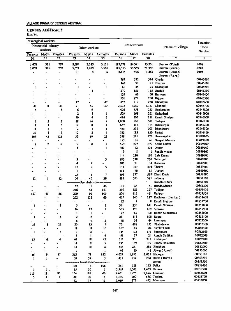
VILLAGE PRIMARY CENSUS ABSTRAC
CENSUS ABSTRACT Umren
of marginal workers Location
Household industry Non-workers Name of Village Code Other workers
workers Number Persons Males Females Persons Males Females Persons Males Females
50 51 52 53 54 55 56 57 58 2
1,078 321 757 5,384 2,213 3,171 107,771 54,521 53,250 Umren (Total) 0008 1,078 311 757 5,374 1,209 3,165 105,353 53,555 51,798 Umren (Rural) 0008
10 4 6 2,418 966 1,452 Umren (Urban) 0008 Umren (Rural)
767 383 384 Ghatla 00845000 163 72 91 Bhurari 00845100 60 35 25 Sahanpuri 00845200
270 155 115 Ihadoli 00845300 129 69 60 Barwara 00845400 501 271 230 Bijopur 00845500
47 47 457 219 238 Dhoolpuri 00845600 41 11 30 91 52 39 2,592 1,259 1,333 Chandoli 00845700
5 5 6 6 476 251 225 Naglasedoo 00845800 2 I 1 529 268 261 Nadanheri 00845900
10 4 6 416 205 211 Rundh Shah pur 00846000
5 3 2 48 46 2 1,008 500 508 Shahpur 00846100
4 1 3 12 8 4 627 313 314 Di1awarpur 00846200
II 3 8 2 1 I 435 232 203 Bhandwara 00846300
22 5 17 12 8 4 333 183 150 Parisal 00846400
168 45 123 32 10 22 388 211 177 Naurangabad 00848900 155 86 69 Nangali Munshi 00849000
8 2 6 9 4 5 569 297 272 KasbaDahra 00849100 1 1 303 172 131 Dhokri 00849200
9 8 I Rundh Madar 00849300 414 230 184 Bala Dahra 00849400
3 3 486 278 208 Tcharpur 00849500 4 4 305 171 134 Kadooki 00~49600
12 7 5 611 307 304 Thekra 00849700 1 1 lSI 70 81 U1aheri 00849800
1 1 23 16 7 896 377 519 Dholi Doob 00851000
13 12 74 45 29 894 503 391 Jatiyana 00851100 -----Un-inhabited-------- Rundh Nidani 00851200
62 18 44 115 64 51 RundhManch 00851300 218 51 167 310 183 127 Todiyar 00851400
127 41 86 200 91 109 874 413 461 Hajipur 00851500
202 133 69 457 240 217 Dadhikar ( Dadikar ) 00851600 12 4 8 Rundh Hajipur 00851700
3 3 3 3 371 230 141 Rundh Sirawas 00851800 16 12 4 335 173 162 Sirawas 00851900
1 1 127 67 60 Rundh Sundarwas 00852000
2 2 211 111 100 Rogra 00852100
6 4 2 78 34 44 Ramnagar 00852200
35 8 27 20 13 7 761 408 353 Dhaha1awas 00852300 18 8 10 167 85 82 SamlatChak 00852400 2 2 344 173 171 Bakhtpura 00852500 5 1 4 51 27 24 Rundh Dadikar 00852600
12 6 6 61 18 43 518 301 217 Kishanpur 00852700
14 9 5 336 159 177 Rundh Bhakhera 00852800 14 10 4 535 251 284 Bhakhera 00852900
1 1 98 SO 48 A1war ( Rural ) 00853000
46 9 37 253 71 182 4,027 1,972 2,055 Bhoogar 00853100
1 39 34 5 418 214 204 llama ( Rural) 00853200
--------Un-inhabited-------- Berka 00853300
110 4 106 351 188 163 Palka 00853400
1 1 35 30 5 2,549 1,086 1,463 Belaka 00853500
113 18 95 154 108 46 4,671 1,975 2,696 Diwakari -. 00853600
5 1 4 48 30 18 1,365 709 656 Toolera 00853700 . " 32 17 15 1,069 577 492 Manuska 00853800
847
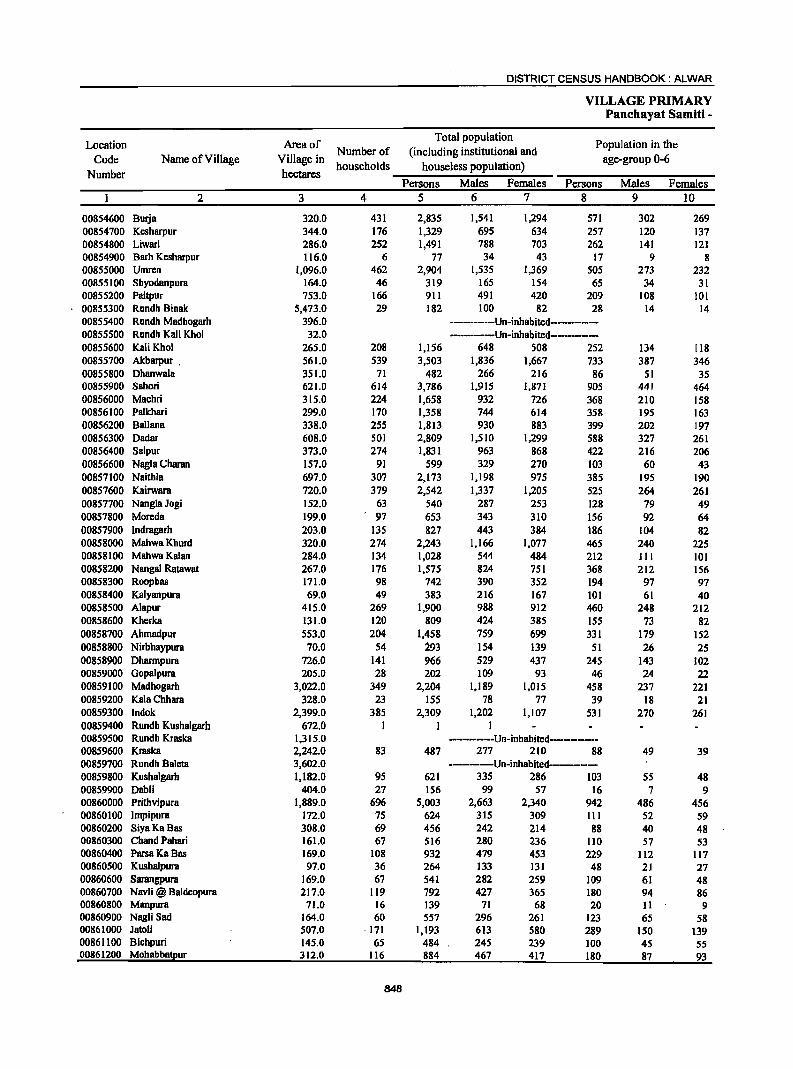
DISTRICT CENSUS HANDBOOK: ALWAR
VILLAGE PRIMARY Panchayat Samiti -
Location Area of Total population
Population in the
Code Name of Village Village in Number of (including institutional and
age-group 0-6
Number hectares households houseless population)
Persons Males Females Persons Males Females
2 3 4 5 6 7 8 9 10
00854600 Burja 320.0 431 2,835 1,541 1,294 571 302 269 00854700 Kcsharpur 344.0 176 1,329 695 634 257 120 137 00854800 Liwari 286.0 252 1,491 788 703 262 141 121 00854900 Barh Kcsharpur 116.0 6 77 34 43 17 9 8 00855000 Umren 1,096.0 462 2,904 1,535 1,369 505 273 232 00855100 Shyodanpura 164.0 46 319 165 154 65 34 31 00855200 Paitpur 753.0 166 911 491 420 209 108 101 00855300 Rundh Binak 5,473.0 29 182 100 82 28 14 14 00855400 Rundh Madhogarh 396.0 -----------Un-inhabitcd-------------00855500 Rundh Kali Khol 32.0 -----Un-inhabitcd-------------00855600 KaliKhol 265.0 208 1,156 648 508 252 134 118 00855700 A1cbarpur . 561.0 539 3,503 1,836 1,667 733 387 346 00855800 Ohanwala 351.0 71 482 266 216 86 51 35 00855900 Sahori 621.0 614 3,786 1,915 1,871 905 441 464 00856000 Machri 315.0 224 1,658 932 726 368 210 158 00856100 Palkhari 299.0 170 1,358 744 614 358 195 163 00856200 Ballana 338.0 255 1,813 930 883 399 202 197 00856300 Oadar 608.0 501 2,809 1,510 1,299 588 327 261 00856400 Salpur 373.0 274 1,831 963 868 422 216 206 00856600 Nagla Charan 157.0 91 599 329 270 103 60 43 00857100 Naithla 697.0 307 2,173 1,198 975 385 195 190 00857600 Kairwam 720.0 379 2,542 1,337 1,205 525 264 261 00857700 NanglaJogi 152.0 63 540 287 253 128 79 49 00857800 Moreda 199.0 . 97 653 343 310 156 92 64 00857900 Indragarh 203.0 135 827 443 384 186 104 82 00858000 MahwaKhurd 320.0 274 2,243 1,166 1,077 465 240 225 00858100 MahwaKalan 284.0 134 1,028 544 484 212 III 101 00858200 Nangal Ratawat 267.0 176 1,575 824 751 368 212 156 00858300 Roopbas 171.0 98 742 390 352 194 97 97 00858400 Kalyanpura 69.0 49 383 216 167 101 61 40 00858500 Alapur 415.0 269 1,900 988 912 460 248 212 00858600 Khcrka 131.0 120 809 424 385 155 73 82 00858700 Ahmadpur 553.0 204 1,458 759 699 331 179 152 00858800 Nirbhaypura 70.0 54 i93 154 139 51 26 25 00858900 Oharmpura 726.0 141 966 529 437 245 143 102 00859000 Gopalpum 205.0 28 202 109 93 46 24 22 00859100 Madhogarh 3,022.0 349 2,204 1,189 1,015 458 237 221 00859200 KalaChhara 328.0 23 ISS 78 77 39 18 21 00859300 Indok 2,399.0 385 2,309 1,202 1,107 531 270 261 00859400 Rundh Kushalgarh 672.0 I 1 I 00859500 Rundh Kraska 1,315.0 -----------Un-inhabitcd-----------00859600 Kraska 2,242.0 83 487 277 210 88 49 39 00859700 Rundh Baleta 3,602.0 ---------Un-inhabitcd--------00859800 Kushalgarh 1,182.0 95 621 335 286 103 55 48 00859900 Oabli 404.0 27 156 99 57 16 7 9 00860000 Prithvipura 1,889.0 696 5,003 2,663 2,340 942 486 456 00860100 Impipura 172.0 75 624 315 309 III 52 59 00860200 SiyaKaBas 308.0 69 456 242 214 88 40 48 00860300 Chand Pahari 161.0 67 516 280 236 110 57 53 00860400 ParsaKaBas 169.0 108 932 479 453 229 112 117 00860500 KushaJpura 97.0 36 264 133 131 48 21 27 00860600 Sarangpura 169.0 67 541 282 259 109 61 48 00860700 Navli @ Baldcopura 217.0 119 792 427 365 180 94 86 00860800 Manpura 71.0 16 139 71 68 20 11 9 00860900 Nagli Sad 164.0 60 557 296 261 123 65 58 00861000 Jatoli 507.0 ·171 1,193 613 580 289 150 139 00861100 Bichpuri 145.0 65 484 245 239 100 45 55 00861200 Mohabbatpur 312.0 116 884 467 417 180 87 93
848
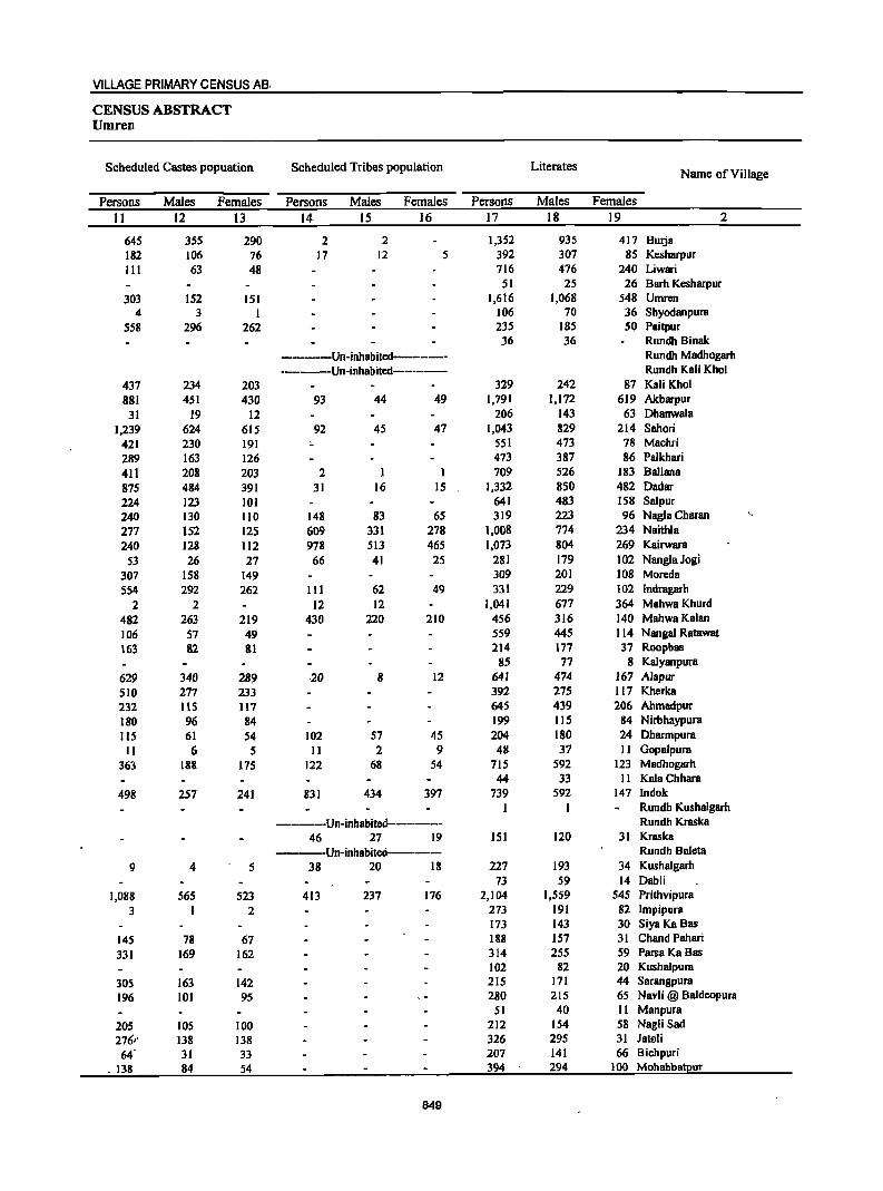
VILLAGE PRIMARY CENSUS AB.
CENSUS ABSTRACT Umren
Scheduled Castes popuation Scheduled Tribes population Literates Name of Village
Persons Males Females Persons Males Females Persons Males Females
11 12 13 14 15 16 17 18 19 2
645 355 290 2 2 1,352 935 417 Burja 182 106 76 17 12 5 392 307 85 Kcsharpur 111 63 48 716 476 240 Liwari
51 25 26 Barh Kesharpur
303 152 151 1,616 1,068 548 Umren 4 3 1 106 70 36 Shyodanpura
558 296 262 235 185 50 Paitpur 36 36 RundhBinak
-----Un-inhabited-------- Rundh Madhogarh --------Un-inhabited-------- Rundh Kali Khol
437 234 203 329 242 87 Kali Khol 881 451 430 93 44 49 1,791 1,172 619 Akbarpur
31 19 12 206 143 63 Dhanwala
1,239 624 615 92 45 47 1,043 829 214 Sahori 421 230 191 551 473 78 Machri
289 163 126 473 387 86 Pa1khari
411 208 203 2 1 1 709 526 183 Ballana
875 484 391 31 16 15 1,332 850 482 Dadar 224 123 101 641 483 158 Salpur 240 130 110 148 83 65 319 223 96 Nagla Charan '"
277 152 125 609 331 278 1,008 774 234 Naithla
240 128 112 978 513 465 1,073 804 269 Kairwara
53 26 27 66 41 25 281 179 102 NanglaJogi 307 158 149 309 201 108 Moreda 554 292 262 III 62 49 331 229 102 Indragarh
2 2 12 12 1,041 677 364 MahwaKhurd
482 263 219 430 220 210 456 316 140 MahwaKalan
106 57 49 559 445 114 Nangal Ratawat
163 82 81 214 177 37 Roopbas 85 77 8 Kalyanpura
629 340 289 ·20 8 12 641 414 167 Alapur
510 277 233 392 275 117 Kherka 232 llS 117 64S 439 206 Ahmadpur
180 96 84 199 115 84 Nirbhaypura
lIS 61 54 102 57 45 204 180 24 Dharmpura
11 6 5 11 2 9 48 37 11 Gopalpura
363 188 175 122 68 54 715 592 123 Madhogarh 44 33 II KalaChhara
498 257 241 831 434 397 739 592 147 Indok 1 1 Rundh Kushalgarh
-----Un-inhabited------------ Rundh Kraska
46 27 19 151 120 31 Kraska ------Un-inhabited----- Rundh Baleta
9 4 5 38 20 18 227 193 34 Kushalgarh 73 59 14 Dabli
1,088 565 523 413 237 176 2,104 1,559 545 Prithvipura
3 2 273 191 82 Impipura 173 143 30 Siya KaBas
145 18 67 188 151 31 Chand Pahari
331 169 162 314 255 59 ParsaKa Bas 102 82 20 Kushalpura
305 163 142 215 171 44 Sarangpura
196 101 95 280 215 65 Navli @ Baldeopura 51 40 11 Manpura
205 lOS 100 212 154 58 Nagli Sad 276,' 138 138 326 295 31 JalQli
M 31 33 207 141 66 Bichpuri
. 138 84 54 394 294 100 Mohabbatpur
849
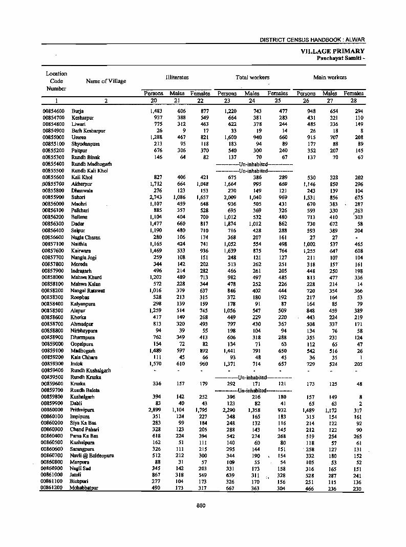
DISTRICT CENSUS HANDBOOK: ALWAR
VILLAGE PRIMARY Panchayat Samiti -
Location III iterates Total workers Main workers
Code Name of Village Number
Persons Males Females Persons Males Females Persons Males Females 2 20 21 22 23 24 25 26 27 28
00854600 Burja 1,483 606 877 1,220 743 477 948 654 294 00854700 Kcsharpur 937 388 549 664 381 283 431 321 lIO 00854800 Liwari 775 312 463 622 378 244 485 336 149 00854900 Barh Kesharpur 26 9 17 33 19 14 26 18 8 00855000 Umren 1,288 467 821 1,600 940 660 915 707 208 00855100 Shyodanpura 213 95 118 183 94 89 177 88 89 00855200 Paitpur 676 306 370 540 300 240 352 207 145 00855300 Rundh BinRk 146 64 82 137 70 67 137 70 67 00855400 Rundh Madhogarh ----------Un-inhabited-----------00855500 Rundh KBIi Khol -----------Un-inhabited------------00855600 KaliKhol 827 406 421 675 386 289 530 328 202 .00855700 Akbarpur 1,712 664 1,048 1,664 995 669 1,146 850 296 00855800 DhanwalB 276 123 153 270 149 121 243 139 104 00855900 Sahori 2.743 1,086 1,657 2,009 1,040 969 1,531 856 675 00856000 Machri 1,107 459 648 936 505 431 670 383 287 00856100 Palkhari 885 357 528 695 369 326 593 330 )263 00856200 Ballana 1,104 404 700 1,012 532 480 713 410 303 00856300 Dadar 1,477 660 817 1,874 1,012 862 730 672 58 00856400 Salpur 1,190 480 710 716 428 288 593 389 204 00856600 Nagla Charan 280 106 174 368 207 161 27 27 00857100 Naithla 1,165 424 741 1,052 554 498 1,002 537 465 00857600 Kairwara 1,469 533 936 1,639 875 764 1,255 647 608 00857700 NanglaJogi 259 108 151 248 121 127 211 107 104 00857800 Moreda 344 142 202 513 262 251 318 157" 161 00857900 Indragarh 496 214 282 466 261 205 448 250 198 00858000 MahwaKhurd 1,202 489 713 982 497 485 813 477 336 00858100 MahwaKalan 572 228 344 478 252 226 228 214 14 00858200 Nangal Ratawat 1,016 379 637 846 402 444 720 354 366 00858300 Roopbas 528 213 315 372 180 192 217 164 53 00858400 Kalyanpura 298 139 159 178 91 87 164 85 79 00858500 Alapur 1,259 514 745 1,056 547 509 848 459 389 00858600 Kherka 417 149 268 449 229 220 443 224 219 00858700 Ahmadpur 813 320 493 797 430 367 508 337 17I 00858800 Nirbhaypura 94 39 55 198 104 94 134 76 58 00858900 DhBrmpura 762 349 413 606 318 288 355 231 124 00859000 Gopalpura 154 72 82 134 71 63 112 65 47 00859100 Madhogarh 1,489 597 892 1,441 791 650 542 516 26 00859200 KalaChhara 111 45 66 93 48 45 36 35 1 00859300 Indok 1,570 610 960 1,371 714 657 729 524 205 00859400 Rundh Kushalgarh 00859500 Rundh Kraska ------------Un-inhabited-------------00859600 Kraska 336 157 179 292 171 121 173 125 48 00859700 Rundh Baleta --------Un-inhabited-------------00859800 Kushalgarh 394 142 252 396 216 180 157 149 8 00859900 Dab1i 83 40 43 123 82 41 65 63 2 00860000 Prithvipura 2,899 1,104 1,795 2,290 1,358 932 1,489 1,172 317 00860100 Impipura 351 124 227 348 165 183 315 154 161 00860200 SiyaKaBas 283 99 184 248 132 116 214 122 92 00860300 Chand Pahari 328 123 205 288 143 145 212 122 90 00860400 ParsaKa Bas 618 224 394 542 274 268 519 254 265 00860500 Kushalpura 162 51 III 140 60 80 118 57 61 00860600 Sarangpura 326 III 215 295 144 151 . 258 127 131 00860700 Navli @ Baldeopura 512 212 300 344 190 154 332 180 152 00860800 Manpura 88 31 57 109 55 54 105 53 52 00860900 NagJi Sad 345 142 203 331 173 158 316 165 151 00861000 Jatoli 867 318 549 639 311 :: 328 528 287 241 00861100 Bichpuri 277 104 173 326 170 156 251 115 136 00861200 Mohabbatpur 490 173 317 667 363 304 466 236 230
850
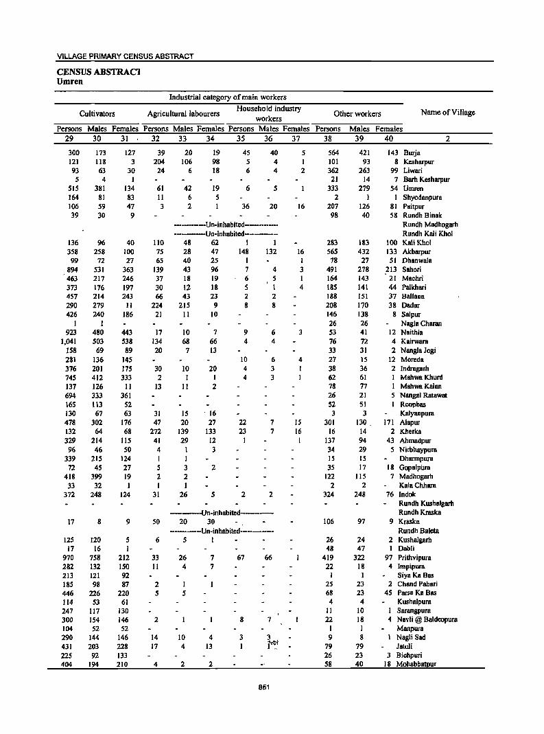
VILLAGE PRIMARY CENSUS ABSTRACT
CENSUS ABSTRAC1 Umren
Industrial category of main workers
Cultivators Agricultural labourers Household industry
Other workers Name of Village workers
Persons Males Females Persons Males Females Persons Males Females Persons Males Females 29 30 31 32 33 34 35 36 37 38 39 40 2
300 173 127 39 20 19 45 40 5 564 421 143 Burja 121 1I8 3 204 106 98 5 4 I 101 93 8 Kesharpur 93 63 30 24 6 18 6 4 2 362 263 99 Liwari 5 4 I 21 14 7 Barh Kcsharpur
515 381 134 61 42 19 6 5 333 279 54 Umren 164 81 83 11 6 5 2 1 1 Shyodanpura 106 59 47 3 2 1 36 20 16 207 126 81 Paitpur 39 30 9 98 40 58 Rundh Binak
----------Un-inhabited---------- Rundh Madhogarh ------Un-inhabited----------- Rundh Kali Khol
136 96 40 110 48 62 I 1 283 183 100 Kali Khol 358 258 100 75 28 47 148 132 16 565 432 133 Alcbarpur 99 72 27 65 40 25 I I 78 27 51 Dhanwala
894 531 363 139 43 96 7 4 3 491 278 213 Sahori 463 217 246 37 18 19 6 5 I 164 143 21 Machri 373 176 197 30 12 18 5 I 4 185 141 44 Palkhari 457 214 243 66 43 23 2 2 188 151 37 Ballana 290 279 1I 224 215 9 8 8 208 170 38 Dadar 426 240 186 21 11 10 146 138 8 Sal pur
I I 26 26 Nagla Charan 923 480 443 17 10 7 9 6 3 53 41 12 Naithla
1,041 503 538 134 68 66 4 4 76 72 4 Kairwara 158 69 89 20 7 13 33 31 2 NanglaJogi 281 136 145 10 6 4 27 15 12 Moreda 376 201 175 30 10 20 4 3 I 38 36 2 Indragarh 745 412 333 2 1 4 3 62 61 MahwaKhurd 137 126 11 13 11 2 78 77 MahwaKalan 694 333 361 26 21 5 Nangal Ratawat 165 113 52 52 51 1 Roopbas 130 67 63 31 15 . 16 3 3 Kalyanpura 478 302 176 47 20 27 22 7 IS 301 130 171 Alapur 132 64 68 272 139 133 23 7 16 16 14 2 Kherka 329 214 115 41 29 12 I 137 94 43 Ahmadpur
96 46 SO 4 3 34 29 5 Nirbhaypura 339 215 124 I I 15 15 Dharmpura
72 45 27 5 3 2 3S 17 18 GopalpiJra 418 399 19 2 2 122 115 7 Madhogarh
33 32 I I I 2 2 KalaChhara 372 248 124 31 26 5 2 2 324 248 76 Indok
Rundh Kushalgarh -----Un-inhabited--------- Rundh Kraska
17 8 9 50 20 30 106 97 9 Kraska ------Un-inhabited--------- Rundh Baleta
125 120 5 6 5 I 26 24 2 Kushalgarh 17 16 1 48 47 1 Dabli
970 758 212 33 26 7 67 66 419 322 97 Prithvipura 282 132 150 11 4 7 22 18 4 Impipura 213 121 92 I 1 Siya Ka Bas 185 98 87 2 1 25 23 2 Chand Pahari 446 226 220 5 5 68 23 45 ParsaKaBas 1I4 53 61 4 4 Kushalpura 247 117 130 11 10 Sarangpura 300 154 146 2 8 7 22 18 4 Navli @ Baldeopura 104 52 52 I 1 Manpura 290 144 146 14 10 4 3 3 9 8 Nagli Sad 431 203 228 17 4 13 I i'~t - 79 79 Jatoli 225 92 133 26 23 3 Bichpuri 404 194 210 4 2 2 58 40 18 Mohabbatpur
851
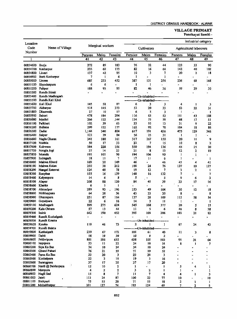
DISTRICT CENSUS HANDBOOK: ALWAR
VILLAGE PRIMARY Panchayat Samiti -
Location Industrial category
Code Name of Village Marginal workers
Cultivators Agricultural labourers Number
Persons Males Females Persons Males Females Persons Males Females 2 41 42 43 44 45 46 47 48 49
00854600 Burja 272 89 183 76 32 44 123 33 90 00854700 Kesharpur 233 60 173 82 16 66 142 40 102 00854800 Liwari 137 42 95 10 3 7 20 2 18 00854900 Barh Kesharpur 7 I 6 I I 00855000 Umren 685 233 452 387 131 256 236 68 168 00855100 Shyodanpura 6 6 I I 00855200 Paitpur 188 93 95 82 46 36 59 29 30 00855300 Rundh Binak 00855400 Rundh Madhogarh ------------Un-inhabited--------------00855500 Rundh Kali Khol ------Un-inhabited------------00855600 Kali Khol 145 58 87 6 3 3 4 I 3 00855700 Akbarpur 518 145 373 S3 20 33 S3 22 31 00855800 Dhanwala 27 10 17 6 3 3 I I 00855900 Sahori 478 184 294 116 63 53 lSI 43 108 00856000 l\I.!achri 266 122 .144 134 75 59 68 17 51 00856100 Palkhari 102 39 63 23 10 13 31 9 22 00856200 Ballana 299 122 177 162 92 70 104 18 86 00856300 Dadar 1,144 340 804 617 191 426 475 129 346 00856400 Salpur 123 39 84 56 25 31 I I 00856600 Nagla Charan 341 180 161 317 167 150 20 II 9 00857100 Naithla 50 17 33 22 7 15 10 8 2 00857600 Kairwara 384 228 156 330 194 136 45 25 20 00857700 NanglaJogi 37 14 23 21 8 13 12 2 10 00857800 Moreda 195 105 90 194 104 90 00857900 Indragarh 18 II 7 17 II 6 I 00858000 MahwaKhurd 169 20 149 46 46 45 4 41 00858100 MahwaKalan 250 38 212 100 24 76 137 10 127 00858200 Nangal Ratawat 126 48 78 19 12 7 3 2 1 00858300 Roopbas ISS 16 139 148 16 132 7 7 00858400 Kalyanpura 14 6 8 5 5 9 6 3 00858500 Alapur 208 88 120 84 45 39 33 17 16 00858600 Kherka 6 5 I 00858700 Abmadpur 289 93 196 153 49 104 30 12 18 00858800 Nirbhaypura 64 28 36 43 23 20 8 8 00858900 Dharmpura 251 87 164 137 28 109 112 58 54 00859000 Gopalpura 22 6 16 14 3 11 I 1 00859100 Madhogarh 899 275 624 545 168 377 20 5 15 00859200 KalaChhara 57 13 44 11 5 6 46 8 38 00859300 Indok 642 190 452 395 109 286 103 21 82 00859400 Rundh Kushalgarh 00859500 Rundh Kraska ----------Un-inhabited------------00859600 Kraska 119 46 73 2 I I 67 24 43 00859700 Rundh Baleta ---------Un-inhabited----------00859800 Kushalgarh 239 67 172 101 61 40 II 3 8 00859900 Dabli 58 19 39 10 8 2 00860000 Prithvipura 801 186 615 608 lOS 503 95 31 64 00860100 Impipura 33 11 22 24 10 14 8 1 7 00860200 SiyaKaBas 34 10 24 34 10 24 00860300 Chand Pahari 76 21 55 71 19 52 00860400 ParsaKaBas 23 20 3 23 20 3 00860500 Kushalpura 22 3 19 19 3 16 00860600 . Sarangpura 37 17 20 37 17 20 00860700 Navli @ Baldeopura 12 10 2 I I 5 4 1 00860800 Manpura 4 2 2 3 2 1 I 1 00860900 NagJi Sad 15 8 7 II 7 4 4 3 00861000 JatoJi 111 24 87 100 23 77 10 10 00861100 Bichpuri 75 55 20 71 53 18 2 I I 00861200 Mohabbatpur 201 127 74 193 124 69 7 2 5
852
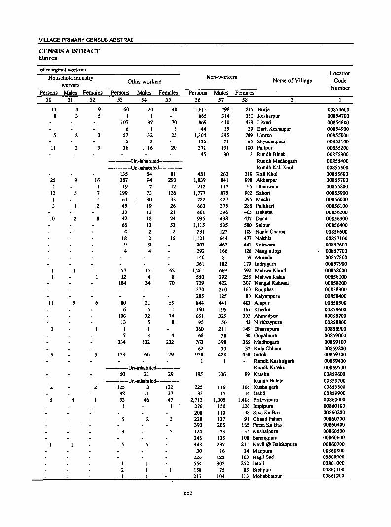
VILLAGE PRIMARY CENSUS ABSTRA(
CENSUS ABSTRACT Umren
of marginal workers Location
Household industry Non-workers Name of Village Code Other workers
workers Number Persons Males Females Persons Males Females Persons Males Females
50 51 52 53 54 55 56 57 58 2
13 4 9 60 20 40 1,615 798 817 Burja 00854600 8 3 5 I I 665 314 351 Kesharpur 00854700
107 37 70 869 410 459 Liwari 00854800 6 I 5 44 15 29 Barh Kesharpur 00854900
5 2 3 57 32 25 1,304 595 709 Umrcn 00855000 5 5 136 71 65 Shyodanpura 00855100
II 2 9 36 . 16 20 371 191 180 Paitpur 00855200 45 30 15 Rundh Binak 00855300
------Un-inhabited---------- Rundh Madhogarh 00855400 -------Un-inhabited-------- Rundh Kali Khol 00855500
135 54 81 481 262 219 Kali Khol 00855600 25 9 16 387 94 293 1,839 841 998 Akbarpur 00855700
I I 19 7 12 212 117 95 Dhanwala 00855800 12 5 7 199 73 126 1,777 875 902 Sahori 00855900 1 1 63 30 33 722 427 295 Machri 00856000 3 2 45 19 26 663 375 288 Palkhari 00856100
33 12 21 801 398 403 Ballana 00856200 10 2 8 42 18 24 935 498 437 Dadar 00856300
66 13 53 1,115 535 580 Salpur 00856400 4 2 2 231 122 109 Nagla Charan OOS56600
18 2 16 1,121 644 477 Naithla 00857100 9 9 903 462 441 Kairwara 00S57600 4 4 292 166 126 NanglaJogi 00857700
140 81 59 Moreda 00857800 361 182 179 IndJ1lgarh 00857900
77 15 62 1,261 669 592 MahwaKhurd 00858000 12 4 8 550 292 258 MahwaKalan 00858100
104 34 70 729 422 307 Nangal Ratawat 00858200 370 210 160 Roopbas 00858300 205 125 80 Kalyanpura 00858400
II 5 6 80 21 59 844 441 403 Alapur 00858500 6 5 I 360 195 165 Kherka 00858600
106 32 74 661 329 332 Ahmadpur 00858700 13 5 8 95 50 45 Nirbhaypura 00858800 I I 360 211 149 Dhannpura 00858900 7 3 4 68 38 30 Gopalpura 00859000
334 102 232 763 398 365 Madhogarh 00859100 62 30 32 Kala Chhara 00859200
5 5 139 60 79 938 488 450 Indok 00859300 I 1 Rundh Kushalgarh 00859400
-----Un-inhabited---------- Rundh Kraska 00859500 50 21 29 195 106 89 Kraska 00859600
-----Un-inhBbited------- Rundh Baleta 00859700 2 2 125 3 122 225 119 106 Kushalgarh 00859800
48 11 37 33 17 16 Dabli 00859900 5 4 93 46 47 2,713 1,305 1,408 Prithvipura 00860000
276 150 126 Impipura 00860100 208 110 98 Siya Ka Bas 00860200
5 2 3 228 137 91 Chand Pahari 00860300 390 205 185 ParsaKaBas 00860400
3 3 124 73 51 Kushalpura 00860500 246 138 108 Sarangpura 00860600
5 5 448 237 211 Navli @ Baldeopura 00860700 30 16 14 Manpura 00860800
226 123 103 Nagli Sad 00860900 554 302 252 Jaloli 00861000
2 158 75 83 Bichpuri 00861100 I 217 104 113 Mohabbatpur 00861200
853
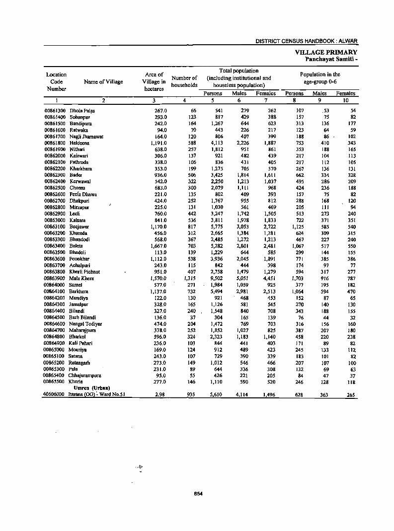
DISTRICT CENSUS HANDBOOK: ALWAR
VILLAGE PRIMARY Panchayat Samiti -
Location Area of Total population
Population in the
Code Name of Village Village in Number of (including institutional and
age-group 0-6
Number hectares households houseless population)
Persons Males Females Persons Males Females
2 3 4 5 6 7 8 9 10
00861300 Ohola PalllS 267.0 66 541 279 262 107 .53 54 00861400 Sohanpur 293.0 123 817 429 388 157 75 82 00861500 Bandipura 242.0 164 1,267 644 623 313 136 177 00861600 Ratwaka 94.0 70 443 226 217 123 64 59 00861700 NagJi Jhamawat 164.0 120 806 407 399 188 86 102 00861800 Haldcena 1,191.0 588 4,113 2,226 1,887 753 410 343 00861900 Nithari 638.0 257 1,812 951 861 353 188 165 00862000 Kairwari 306.0 137 921 482 439 217 104 113 00862100 Pathroda 338.0 106 836 431 405 217 112 105 00862200 Kharkhara 353.0 199 1,275 705 570 267 136 131 00862300 Bader 936.0 506 3,425 1,814 1,611 662 334 328 00862400 Kerwawal 542.0 322 2,250 1,213 1,037 495 286 209 00862500 Chomu 683.0 300 2,079 1,111 968 424 236 188 00862600 PcefaDhawa 221.0 135 802 409 393 157 75 82 00862700 Dhakpuri 424.0 252 1,767 955 812 288 168 120 00862800 Mirzapur 225.0 131 1,030 561 469 205 III 94 00862900 Leeli 760.0 442 3,247 1,742 1,505 513 273 240 00863000 Kalsara 841.0 536 3,811 1,978 1,833 722 371 351 00863100 Beejawar 1,170.0 817 5,775 3,053 2,722 1,125 585 540 00863200 Khareda 456.0 312 2,665 1,384 1,281 624 309 315 00863300 Bhandodi 568.0 367 2,485 1,272 1,213 467 227 240 00863400 Baleta 1,667.0 703 5,282 2,801 2,481 1,067 517 550 00863500 Bhadoli 113.0 139 1,229 644 585 299 144 155 00863600 Poonkhar 1,112.0 538 3,936 2,045 1,891 771 385 386 00863700 Achalpuri 243.0 115 842 444 398 174 97 77 00863800 Kherli Pichnot 951.0 407 2,758 1,479 1,279 594 317 277 00863900 Mala Khera 1,570.0 1,315 9,502 5,051 4,451 1,703 916 787 00864000 Sumel 577.0 271 1,984 1,059 925 377 195 182 00864100 Barkhera 1,137.0 732 5,494 2,981 2,513 1,064 594 470 00864200 Mundiya 122.0 130 921 468 453 152 87 65 00864300 Jamalpur 328.0 165 1,126 581 545 270 140 130 00864400 Bilandi 327.0 240 1,548 840 708 343 188 155 00864500 BarhBilandi 136.0 37 304 165 139 76 44 32 00864600 Nangal Todiyar 474.0 204 1,472 769 703 316 156 160 00864700 Maharajpura 378.0 252 1,852 1,027 825 387 207 180 00864800 Bharkol 596.0 324 2,323 1,183 1,140 458 220 238 00864900 Kali Pahari 236.0 103 844 441 403 171 89 82 00865000 Mouriya 169.0 124 912 489 423 245 133 il2 00865100 Satana 243.0 107 729 390 339 183 101 82 00865200 Ratangarh 273.0 149 1,012 546 466 207 107 100 00865300 Pala 231.0 89 644 336 308 132 69 63 00865400 Chhajurampura 95.0 55 426 221 205 84 47 37 00865500 Kherla 277.0 146 1,110 590 520 246 128 118
Umren (Urban) 40606000 Itarana (ool ~ Ward No.S 1 2.98 935 5,610 4,114 1,496 628 363 265
854
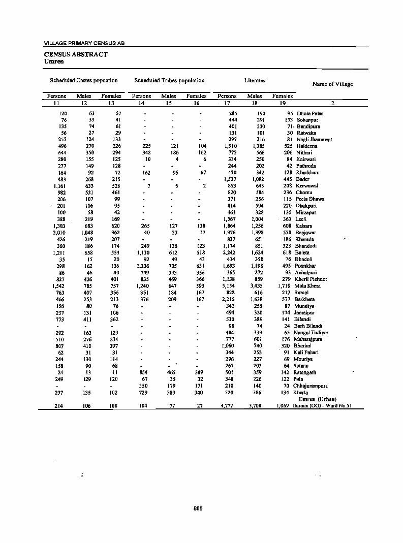
VILLAGE PRIMARY CENSUS AB·
CENSUS ABSTRACT Umren
Scheduled Castes popuation Scheduled Tribes population Literates Name ofVilJage
Persons Males Females Persons Males Females Persons Males Females II 12 J3 14 IS 16 17 18 19 2
120 63 57 285 190 95 DholaPalas 76 35 41 444 291 153 Sohanpur
135 74 61 401 330 71. Bandipura 56 27 29 131 101 30 Ratwaka
257 124 133 297 216 81 Nagli Jharnawat 496 270 226 225 121 104 1,910 1,385 525 Haldeena 644 350 294 348 186 162 772 566 206 Nithari 280 15S 12S 10 4 6 334 250 84 Kairwari 277 149 128 244 202 42 Pathmda 164 92 72 162 95 67 470 342 128 Kharkhara 483 268 215 1,527 1,082 445 Bader
1,161 633 528 7 5 2 853 645 208 Kerwawa1 982 521 461 820 584 236 Chornn 206 107 99 371 256 115 PeelaDhawa 201 106 95 814 594 220 Dhakpuri 100 58 42 463 328 135 Mirzapur 388 219 169 1,367 1,004 363 Leeli
1,303 683 620 265 127 138 1,864 1,256 608 Kalsara 2,010 1,048 962 40 23 17 1,976 1,398 578 Beejawar
426 219 207 837 651 186 Khareda 360 186 174 249 126 123 1,174 851 323 Bhandodi
1,211 658 553 1,130 612 S18 2,242 1,624 618 Baleta 35 15 20 92 49 43 434 358 76 Bhadoli
298 162 136 1,336 705 631 1,693 1,198 495 Poonkhar 86 46 40 749 393 356 365 272 93 Achalpuri
827 426 401 835 469 366 1,138 859 279 Kherli Pichnot 1,542 785 757 1,240 647 593 5,154 3,435 1,719 MalaKhera
763 407 356 351 184 167 828 616 212 Sumel 466 253 213 376 209 167 2,215 1,638 577 Barkhera 156 80 76 342 255 87 Mundiya 237 131 106 494 320 174 Jamalpur 773 411 362 530 389 141 Bilandi
98 74 24 Barh Bilandi 292 163 129 404 339 65 Nangal Todiyar 510 276 234 777 601 176 Maharajpura 807 410 397 1,060 740 320 Bharkol 62 31 31 344 253 91 Kali Pahari
244 130 114 296 227 69 Mouriya 158 90 68 267 203 64 Satana 24 13 11 854 465 389 501 359 142 Ratangarh
249 129 120 67 35 32 348 226 122 Pala 350 179 171 210 140 70 Chhajurampura
237 135 102 729 389 340 520 386 134 Kherla Umren (Urban)
214 106 108 104 77 27 4,777 3,708 1,069 ltarana {OG} - Ward No.51
855
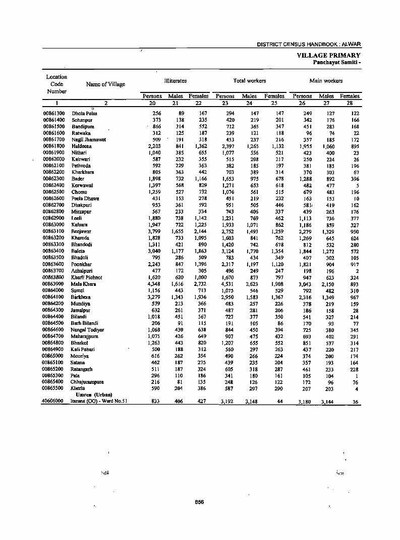
DISTRICT CENSUS HANDBOOK: ALWAR
VILLAGE PRIMARY Panchayat Samlti -
Location Illiterates Total workers Main workers
Code Name of Village Number
Persons Males Females Persons Males Females Persons Males Females 2 20 21 22 23 24 25 26 27 28
II
00861300 DholaPalas 256 89 167 294 147 147 249 127 122 00861400 Sohanpur 373 138 235 420 219 201 342 176 166 00861500 Bandipura 866 314 552 712 365 347 451 283 168 00861600 Ratwaka 312 125 187 239 121 118 96 74 22 00861700 Nagli Jhamawat 509 191 318 453 237 216 357 185 172 00861800 Ha1deena 2,203 841 1,362 2,397 1,265 1,132 1,955 1,060 895 00861900 Nithari 1,040 385 655 1,077 556 521 423 400 23 00862000 Kairwari 587 232 355 515 298 217 250 224 26 00862100 Pathroda 592 229 363 382 185 197 381 185 196 00862200 Kharkhara 805 363 442 703 389 314 370 303 67 00862300 Bader 1,898 732 1,166 1,653 975 678 1,288 892 396 00862400 Kerwawal 1,397 568 829 1,271 653 618 482 477 5 00862500 Chomu 1,259 527 732 1,076 561 SIS 679 483 196 00862600 PeelaDhawa 431 153 278 451 219 232 163 153 10 00862700 Dhakpuri 953 361 592 951 505 446 581l 419 162 00862800 Mirzapur 567 233 334 743 406 337 439 263 176 00862900 Leeli 1,880 738 1,142 1,231 769 462 1,113 736 377 00863000 Kalsara 1,947 722 1,225 1,933 1,071 862 1,186 859 327 00863100 Beejawar 3,799 1,655 2,144 2,752 1,493 1,259 2,279 1,329 950 00863200 Khareda 1,828 733 1,095 1,603 841 762 1,269 645 624 00863300 Bhandodi 1,311 421 890 1,420 742 678 812 532 280 00863400 Baleta 3,040 1,177 1,863 3,124 1,770 1,354 1,844 1,272 572 00863S00 Bhadoli 795 286 509 783 434 349 407 302 105 00863600 Poonkhar 2,243 847 1,396 2,317 1,197 1,120 1,821 904 917 00863700 Acha1puri 477 172 305 496 249 247 198 196 2 00863800 Kherli Pichnot 1,620 620 1,000 1,670 873 797 947 623 324 00863900 Mala Khera 4,348 1,616 2,732 4,531 2,623 1,908 3,043 2,150 893 00864000 Sume1 1,156 443 713 1,075 546 529 792 482 310 00864100 Barkhcra 3,279 1,343 1,936 2,950 1,583 1,367 2,316 1,349 967 00864200 Mundiya 579 213 366 483 257 226 378 219 159 00864300 Jamalpur 632 261 371 487 281 206 186 158 28 00864400 Bilandi 1,018 451 567 727 377 350 541 327 214 00864500 Barh Bilandi 206 91 115 191 105 86 170 93 77 00864600 Nangal Todiyar 1,068 430 638 844 450 394 725 380 345 00864700 Maharl\ipura 1,075 426 649 907 475 432 693 402 291 00864800 Bharkol 1,263 443 820 1,207 65S 552 851 537 314 00864900 Kali Pahari 500 188 312 560 297 263 437 220 217 00865000 Mouriya 616 262 354 490 266 224 374 200 174 00865100 Satana 462 187 275 439 23S 204 357 193 164 00865200 Ratangarh 511 187 324 605 318 287 461 233 228 00865300 Pala 296 110 186 341 180 161 105 104 1 00865400 Chhajurampura 216 81 135 248 126 122 172 96 76 00865S00 Kherla 590 204 386 587 297 290 207 203 4
Umren (Urban) 40606000 ltaranll ~OGl- Ward No.5 I 833 406 427 3,192 3,148 44 3,180 3,144 36
856
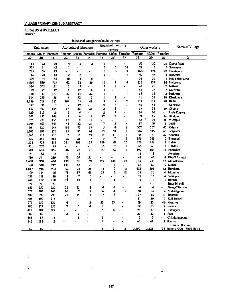
VILLAGE PRIMARY CENSUS ABSTRACT
CENSUS ABSTRACl Umren
Industrial category of main workers
Cultivators Agricultural labourers Household industry
Other workers Name ofViUage workers
Persons Males Females Persons Males Females Persons Males Females Persons Males Females
29 30 31 32 33 34 35 36 37 38 39 40 2
185 92 93 4 2 2 I 59 32 27 Dhola Palas 303 161 142 I I 17 3 14 21 12 9 Sohanpur 275 156 119 10 3 7 166 124 42 Bandipura
46 28 18 2 2 I 47 44 3 Ratwaka 309 144 165 10 4 6 38 37 I Nagli Jhamawat
1,664 889 775 62 32 30 14 8 6 215 131 84 Haldeena 376 355 21 3 3 2 2 42 40 2 Nithari
189 177 12 18 12 6 I 42 35 7 Kairwari 318 157 161 47 15 32 I IS 13 2 Pathroda 314 259 55 14 12 2 I 41 31 10 Kharkhara
1,036 719 317 104 55 49 9 7 2 139 III 28 Bader
399 396 3 19 19 9 8 I 55 54 1 Kerwawal 561 407 154 58 35 23 3 3 57 38 19 Chomu 129 119 10 6 6 2 2 26 26 PeelaDhawa S02 356 146 8 6 2 12 12 59 45 14 Dhakpuri 375 220 155 12 9 3 52 34 18 MirzapUT
1,005 662 343 44 22 22 7 3 4 57 49 8 Lceli 764 520 244 110 73 37 5 4 I 307 262 45 Kalsara
1,707 883 824 125 81 44 63 50 13 384 315 69 Bcejawar 1,063 533 530 97 38 59 14 11 3 95 63 32 Khareda
620 359 261 28 21 7 9 7 2 155 145 10 Bhandodi 1,138 724 414 321 196 125 109 89 20 276 263 13 Baleta
331 232 99 10 7 3 66 63 3 Bhadoli 1,549 693 856 46 25 21 29 22 7 197 164 33 Poonkhar
184 182 2 1 1 13 13 Achalpuri 830 541 289 70 39 31 47 43 4 Kherli Pichnot
1,630 960 670 139 70 69 227 180 47 1,047 940 107 Mala Khera 590 348 242 131 68 63 6 6 65 60 5 Sumel
1,817 915 902 52 24 28 14 9 5 433 401 32 Barkhera 190 144 46 78 17 61 55 7 48 55 51 4 Mundiya 138 lIB 20 II 7 4 37 33 4 JamalpuT 482 282 200 24- 13 11 34 31 3 Bilandi 170 93 77 Barh Bilandi 689 357 332 26 13 13 4 4 6 6 Nangal Todiyar 573 307 266 26 7 19 6 4 2 88 84 4 Maharajpura 689 399 290 28 IS 13 7 7 127 116 11 Bharko1 406 190 216 31 30 I Kali Pahari 276 ISO 126 6 4 2 23 23 69 23 46 Mouriya 280 124 156 7 3 4 I I 69 65 4 Satana 428 201 227 5 5 28 27 I Ratangarh
80 80 2 2 23 22 1 Pala 163 87 76 I I 7 7 Chhajurampura 140 138 2 4 4 63 61 2 Kherla
Umren (Urban)
16 16 5 3 2 3,159 3,125 34 ltarana (OG) - Ward No.5 1
.<
857
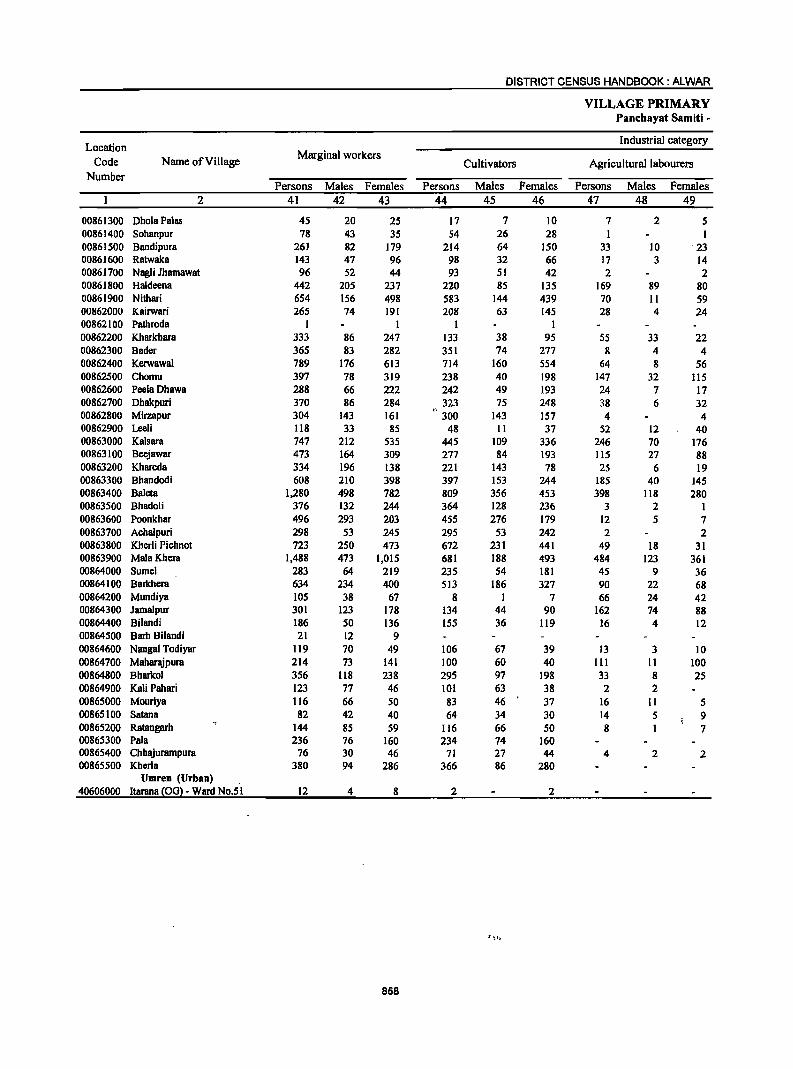
DISTRICT CENSUS HANDBOOK: ALWAR
VILLAGE PRIMARY Panc:hayat Samiti -
Location Industrial category
Code Name of Village Marginal workers
Cultivators Agricultural labourers Number
Persons Males Females Persons Males Females Persons Males Females 2 41 42 43 44 45 46 47 48 49
00861300 DholaPalas 45 20 25 17 7 10 7 2 5 00861400 Sohanpur 78 43 35 54 26 28 1 1 00861500 Bandipura 261 82 179 214 64 150 33 10 23 00861600 Ratwaka 143 47 96 98 32 66 17 3 14 00861700 Nagli Jhamawat 96 52 44 93 51 42 2 2 00861800 Haldeena 442 205 237 220 85 135 169 89 80 00861900 Nithari 654 156 498 583 144 439 70 11 59 00862000 Kairwari 265 74 191 208 63 145 28 4 24 00862100 Pathroda 1 1 1 1 00862200 Kharkhara 333 86 247 133 38 95 55 33 22 00862300 Bader 365 83 282 351 74 277 8 4 4 00862400 Kerwawal 789 176 613 714 160 554 64 8 56 00862500 Chomu 397 78 319 238 40 198 147 32 115 00862600 PeelaDhawa 288 66 222 242 49 193 24 7 17 00862700 DhBkpuri 370 86 284 323 75 248 38 6 32 00862800 Mirzapur 304 143 161 300 143 157 4 4 00862900 Leeli 118 33 85 48 11 37 52 12 40 00863000 Kalsara 747 212 535 445 109 336 246 70 176 00863100 Beejawar 473 164 309 277 84 193 115 27 88 00863200 KhBreda 334 196 138 221 143 78 25 6 19 00863300 Bhandodi 608 210 398 397 153 244 185 40 145 00863400 Baleta 1,280 498 782 809 356 453 398 118 280 00863500 Bhadoli 376 132 244 364 128 236 3 2 1 00863600 Poonkhar 496 293 203 455 276 179 12 5 7 00863700 Achalpuri 298 53 245 295 53 242 2 2 00863800 Khcrli Pichnot 723 250 473 672 231 441 49 18 31 00863900 Mala Khera 1,488 473 1,015 681 188 493 484 123 361 00864000 Sumcl 283 64 219 235 54 181 45 9 36 00864100 Barkhera 634 234 400 513 186 327 90 22 68 00864200 Mundiya 105 38 67 8 1 7 66 24 42 00864300 Jamalpur 301 123 178 134 44 90 162 74 88 00864400 Bilandi 186 50 136 155 36 119 16 4 12 00864500 Barh Bilandi 21 12 9 00864600 Nangal Todiyar 119 70 49 106 67 39 13 3 10 00864700 Maharajpura 214 73 141 100 60 40 III 11 100 00864800 Bharkol 356 118 238 295 97 198 33 8 25 00864900 Kali Pahari 123 77 46 101 63 38 2 2 00865000 Mouriya 116 66 50 83 46 37 16 11 5 00865100 Satana 82 42 40 64 34 30 14 5 9 00865200 Ratangarh 144 85 59 116 66 50 8 7 00865300 Pala 236 76 160 234 74 160 00865400 Chhajurampura 76 30 46 71 27 44 4 2 2 00865500 Kherla 380 94 286 366 86 280
Umren (Urban) 40606000 Itarana !OGl- Ward No.51 12 4 8 2 2
858
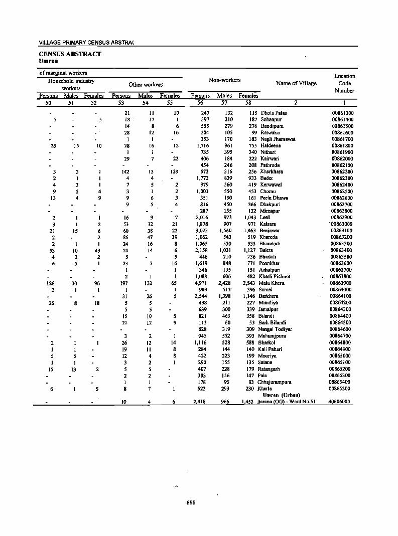
VILLAGE PRIMARY CENSUS ABSTRA(
CENSUS ABSTRACT Umren
of marginal workers Location
Household industry Non-workers Name ofVilJage Code Other workers
workers Number Persons Males Females Persons Males Females Persons Males Females
50 51 52 53 54 55 56 57 58 2 'I
21 II 10 247 132 115 Ohola Palas 00861300 5 5 18 ' 17 I 397 210 187 Sohanpur 00861400
14 8 6 555 279 276 Bandipura 00861'500 28 12 16 204 105 99 Ratwaka 00861600
I I 353 170 183 Nagli Jhamawat 00861700 25 IS 10 28 16 12 1,716 961 755 Haldeena 00861800
I I 735 395 340 Nithari 00861900 29 7 22 406 184 222 Kairwari 00862000
454 246 208 Pathroda 00862100 3 2 142 13 129 572 316 256 Kharkhara 00862200 2 I 4 4 1,772 839 933 Bader 00862300 4 3 7 5 2 979 560 419 Kerwawal 00862400 9 5 4 3 I 2 1,003 550 453 Chomu 00862500
13 4 9 9 6 3 351 190 161 PeelaDhawB 00862600 9 5 4 816 450 366 Ohakpuri 00862700
287 155 132 Milzapur 00862800 2 I I 16 9 7 2,016 973 1,043 Leeli 00862900 3 I 2 53 32 21 1,878 907 971 Kalsara '00863000
21 15 6 60 38 22 3,023 1,560 1,463 Beejawar 00863100 2 2 86 47 39 1,062 543 519 Khareda 00863200 2 I 24 16 8 1,065 530 535 Bhandodi 00863300
53 10 43 20 14 6 2,158 1,031 1,127 Baleta 00863400 4 2 2 S 5 446 210 236 Bhadoli 00863500 6 5 I 23 7 16 1,619 848 771 Poonkhar 00863600
I I 346 195 151 Achalpuri 00863700 2 I I 1,088 606 482 Kherli Pichnot ,- 00863800
126 30 96 197 132 65 4,971 2,428 2,543 MalaKhera 00863900 2 I I I I 909 513' 396 Sumel 00864000
31 26 5 2,544 1,398 1,146 Barkhera 00864100 26 8 18 5 5 438 211 227 Mundiya 00864200
5 5 639 300 339 JamaJpur 00864300 15 10 5 821 463 358 Bilandi 00864400 21 12 9 113 60 53 Barh Bilandi 00864500
628 319 309 Nangal Todiyar 00864600 3 2 I 945 552 393 Maharajpura 00864700
2 26 12 14 1,116 528 588 Bharkol 00864800 I I 19 II 8 284 144 140 Kali Pahari 00864900 5 5 12 4 8 422 223 199 Mouriya 00865000 I I 3 2 290 155 135 Satana 00865100
15 13 2 5 5 407 228 179 Ratangarh 00865200 2 2 303 156 147 Pala 00865300 I I 178 95 83 Chhajurampura 00865400
6 5 8 7 523 293 230 Kherla 00865500 Umren (Urban)
10 4 6 2,418 966 1,452 ltarana ~OG2 - Ward No.5 I 40606000
859
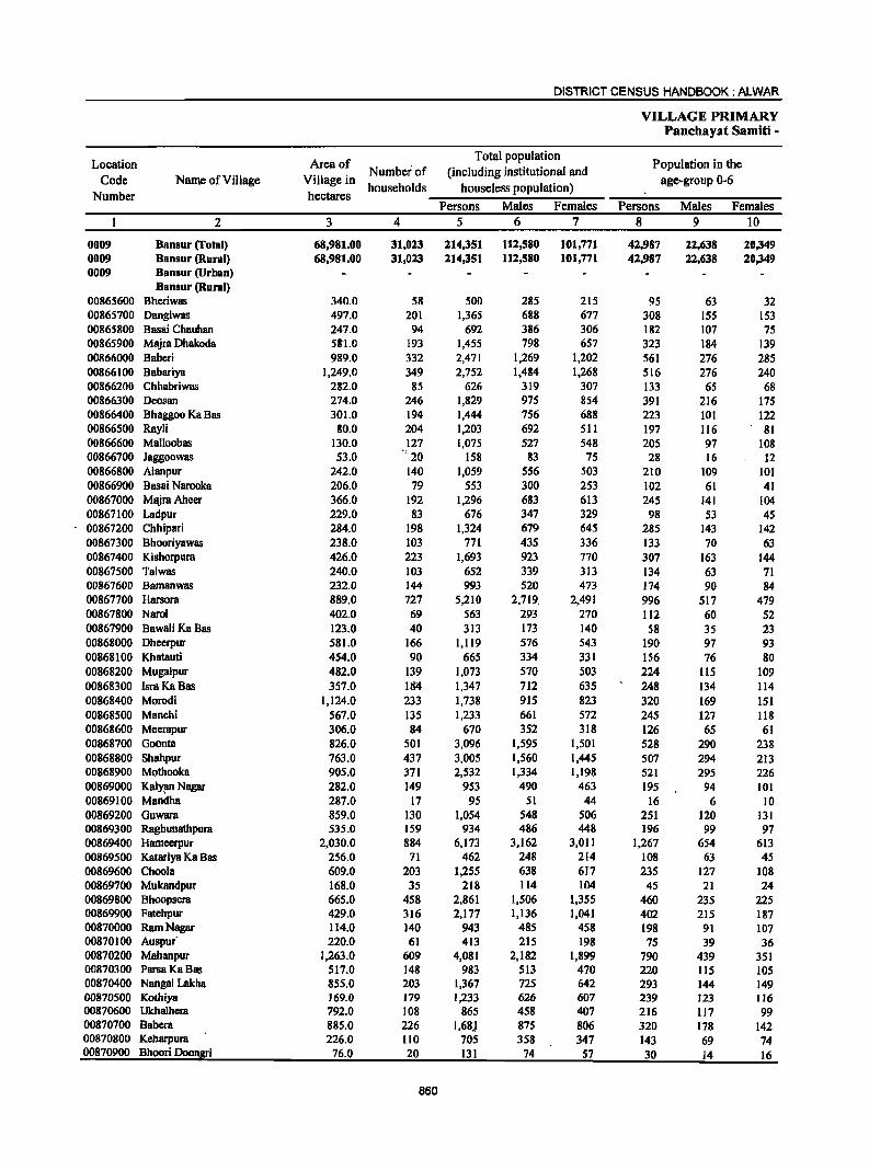
DISTRICT CENSUS HANDBOOK: ALWAR
VILLAGE PRIMARY Panchayat Samiti -
Location Area of Total population
Population in the Number of (including institutional and
Code Name of Village Village in households houseless population)
age-group 0-6
Number hectares Persons Males Females Persons Males Females
2 3 4 5 6 7 8 9 10
0009 Hansur (Total) 68,981.00 31,023 214,351 112,580 101,771 42,987 22,638 20,349 0009 Hansur (Rural) 68,981.00 31,023 214,351 112,580 101,771 42,987 22,fi38 20,349 0009 Hansur (Urban)
Hansur (Rural) 00865600 Bheriwas 340.0 58 500 285 215 95 63 32 00865700 Dangiwas 497.0 201 1,365 688 677 308 155 153 00865800 Basai Chauhan 247.0 94 692 386 306 182 107 75 00865900 Majra Dhakoda 58"1.0 193 1,455 798 657 323 184 139 00866000 Baberi 989.0 332 2,471 1,269 1,202 561 276 285 00866100 Babariya 1,249.0 349 2,752 1,484 1,268 516 276 240 00866200 Chhabriwas 282.0 85 626 319 307 133 65 68 00866300 Deosan 274.0 246 1,829 975 854 391 216 175 00866400 Bhaggoo Ka Bas 301.0 194 1,444 756 688 223 101 122 00866500 Rayli 80.0 204 1,203 692 511 197 116 81 00866600 Malloobas 130.0 127 1,075 527 548 205 97 108 00866700 Jaggoowas 53.0 .: 20 158 83 75 28 16 12 00866800 A1anpur 242.0 140 1,059 556 503 210 109 101 00866900 Basai Narooka 206.0 79 553 300 253 102 61 41 00867000 MajraAheer 366.0 192 1,296 683 613 245 141 104 00867100 Ladpur 229.0 83 676 347 329 98 53 45 00867200 Chhipari 284.0 198 1,324 679 645 285 143 142 00867300 BhooriyawBS 238.0 103 771 435 336 133 70 63 00867400 Kishorpum 426.0 223 1,693 923 770 307 163 144 00867500 Talwas 240.0 103 652 339 313 134 63 71 00867600 Bamanwas 232.0 144 993 520 473 174 90 84 00867700 Harsora 889.0 727 5,210 2,719. 2,491 996 517 479 00867800 Narol 402.0 69 563 293 270 112 60 52 00867900 BawaliKaBas 123.0 40 313 173 140 58 35 23 00868000 Dheerpur 581.0 166 1,119 576 543 190 97 93 00868100 Khatauti 454.0 90 665 334 331 156 76 80 00868200 Mugalpur 482.0 139 1,073 570 503 224 115 109 00868300 Ism Ka Bas 357.0 IIl4 1,347 712 635 248 134 114 00868400 Morodi 1,124.0 233 1,738 915 823 320 169 151 00868500 Manchi 567.0 135 1,233 661 572 245 127 118 00868600 Meerapur 306.0 84 670 352 318 126 65 61 00868700 Ooonta 826.0 501 3,096 1,595 1,501 528 290 238 00868800 Shahpur 763.0 437 3,005 1,560 1,445 507 294 213 00868900 Mothooka 905.0 371 2,532 1,334 1,198 521 295 226 00869000 KalY1lll Nagar 282.0 149 953 490 463 195 94 101 00869100 Mandha 287.0 17 95 51 44 16 6 10 00869200 Guwara 859.0 130 1,054 548 506 251 120 131 00869300 Raghunatbpum 535.0 159 934 486 448 196 99 97 00869400 Hameerpur 2,030.0 884 6,173 3,162 3,011 1,267 654 613 00869500 Katariya Ka Bas 256.0 71 462 248 214 108 63 45 00869600 Choola 609.0 203 1,255 638 617 235 127 108 00869700 Mukandpur 168.0 35 218 114 104 45 21 24 00869800 Bhoopsera 665.0 458 2,861 1,506 1,355 460 235 225 00869900 Fatehpur 429.0 316 2,177 1,136 1,041 402 215 187 00870000 Ram Nagar 114.0 140 943 485 458 198 91 107 00870100 Auspur 210.0 61 413 215 198 75 39 36 00870200 Mahanpur 1,263.0 609 4,081 2,182 1,899 790 439 351 00870300 ParsaKaBas 517.0 148 983 513 470 220 115 105 00870400 Nangal Lakha 855.0 203 1,367 725 642 293 144 149 00870500 KotiJiya 169.0 179 1,233 626 607 239 123 116 00870600 Ukhalhera 792.0 108 865 458 407 216 117 99 00870700 Babem 885.0 226 1,68) 875 806 320 178 142 00870800 Keharpura 226.0 110 705 358 347 143 69 74 00870900 Bhoori Doongri 76.0 20 131 74 57 30 14 16
860
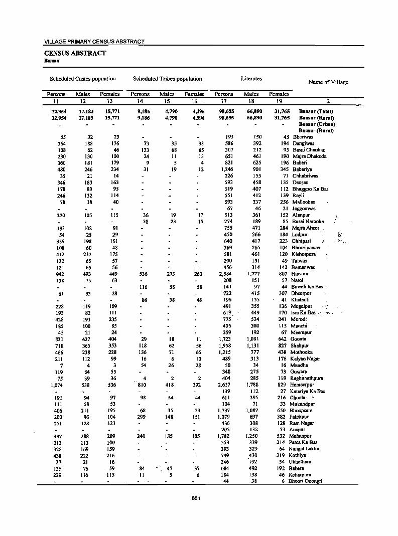
VILLAGE PRIMARY CENSUS ABSTRACT
CENSUS ABSTRACT Baosur
Scheduled Castes popuation Scheduled Tribes population Literates Name of Village
Persons Males Females Persons Males Females Persons Males Females
11 12 13 14 15 16 17 18 19 2
32,954 17,183 15,771 9,186 4,790 4,396 98,655 66,890 31,765 Bansur (Total) 32,954 17,183 15,771 9,186 4,790 4,396 ·98,655 66,890 31,765 Bansur (Rural)
Bansur (Urban) Bansur (Rural)
55 32 23 195 150 45 Bheriwas 364 188 176 73 35 38 586 392 194 Dangiwas 108 62 46 133 68 65 307 212 95 Basai Chauhan 230 130 100 24 II 13 651 461 190 Majra Dhakoda 360 181 179 9 5 4 821 625 196 Baberi 480 246 234 31 19 12 1,246 901 345 Babariya
35 21 14 226 155 71 Chhabriwas 346 183 163 593 458 135 Deosan 178 83 95 519 407 112 Bhaggoo Ka Bas 246 132 114 551 412 139 Rayli
78 38 40 593 337 256 Malloobas 67 46 21 Jaggoowas
220 105 115 36 19 17 513 361 152 Alanpur \ . 38 23· 15 274 189 85 Basai Narooka .
193 102 91 755 471 284 Majra Aheer . 54 25 29 450 266 184 Ladpur !i;
359 198 161 640 417 223 Chhipari . :!-::""'\.
108 60 48 369 265 104 Bhooriyawas 412 237 175 581 461 120 Kishorpura .. 122 65 57 200 151 49 Talwas 121 65 56 456 314 142 Bamanwas 942 493 449 536 273 263 2,584 1,777 807 HaTSora 138 75 63 208 151 57 Narol
116 58 58 141 97 44 Bawali Ka Bas .
61 33 28 722 415 307 Dheerpur 86 38 48 196 155 41 Khatauti
228 119 109 491 355 136 Mugalpur 193 82 III 619 449 170 Isra Ka Bas .' .'''''' . 428 193 235 775 534 241 Morodi 185 100 85 495 380 ItS Manchi 4S 21 24 259 192 67 Meerapur
831 427 404 29 18 11 1,723 1,081 642 Goonta 718 365 353 118 62 56 1,958 1,131 827 Shahpur 466 238 228 136 71 65 1,215 777 438 Mothooka 211 112 99 16 6 10 489 313 176 Kalyan Nagar
7 4 3 54 26 28 50 34 16 Mandha 119 64 55 348 275 73 Guwara 75 39 36 4 2 2 404 285 119 Raghimathpura
1,074 538 536 810 418 392 2,617 1,788 829 Hameerpur 139 112 27 Katariya Ka Bas
191 94 97 98 54 44 611 395 216 Choola· '. III 58 53 104 71 33 Mukandpur 406 211 195 68 35 33 1,737 1,087 650 Bhoopsera 200 96 104 299 148 151 1,079 697 382 Fatehpur 251 128 123 436 308 128 Ram Nagar
205 132 73 Auspur 497 288 209 240 135 105 1,782 1,250 532 Mahanpur 213 113 100 553 339 214 ParsaKaBas
328 169 159 393 329 64 Nangal Lakha
438 222 216 749 430 319 Kothiya
37 21 16 246 192 S4 Ukhalhera 135 76 59 84 47 37 684 492 192 Babera 229 116 113 11 5 6 184 138 46 Keharpura
44 38 6 Bhoori Doongri
861
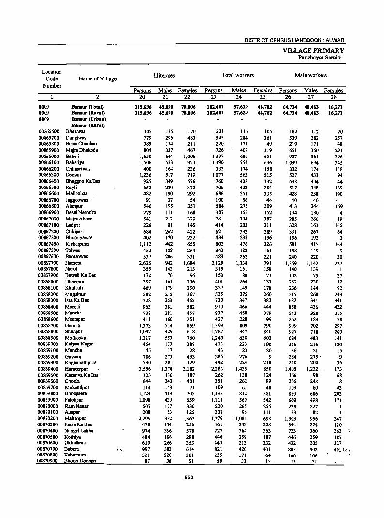
DISTRICT CENSUS HANDBOOK: ALWAR
VILLAGE PRIMARY Panchayat Samiti -
Location Illiterates Total workers Main workers
Code Name ofVilJage Number
Persons Males Females Persons Males Females Persons Males Females 2 20 21 22 23 24 25 26 27 28
0009 Hansur (Total) 115,696 45,690 70,006 102,401 57,639 44,762 64,734 48,463 16,271 0009 HanBur (Rural) 115,696 45,690 70,006 102,401 57,639 44,762 64,734 48,463 16,271 0009 Hansur (Urban)
Hansur (Rural) 00865600 Bheriwas 305 135 170 221 116 105 182 112 70 00865700 Oangiwas 779 296 483 545 284 261 539 282 257 00865800 Basai Chauhan 385 174 211 220 171 49 219 171 48 00865900 Majra Ohakoda 804 337 467 726 407 319 651 360 291 00866000 Baberi 1,650 644 1,006 1,337 686 651 957 561 396 00866100 Babariya 1,506 583 923 1,390 754 636 1,039 694 345 00866200 Chhabriwas 400 164 236 332 174 158 332 174 158 00866300 Dcosan 1,236 517 719 1,077 562 515 527 433 94 00866400 Bhaggoo Ka Bas 925 349 576 760 428 332 448 404 44 00866500 Rayli 652 280 372 706 422 284 517 348 169 00866600 Malloobas 482 190 292 686 351 335 428 238 190 00866700 Jaggoowas 91 37 54 100 56 44 40 40 00866800 Alanpur 546 195 351 584 275 309 413 244 169 00866900 Basai Narooka 279 III 168 307 155 152 134 130 4 00867000 MajraAheer 541 212 329 781 394 387 285· 266 19 00867100 LBdpur 226 81 145 414 203 211 328 163 165 00867200 Chhipari 684 262 422 621 332 289 331 267 64 00867300 Bhooriyawas 402 170 232 434 238 196 196 193 3 00867400 Kishorpura 1,112 462 650 802 476 326 581 417 164 00867500 Talwas 452 188 264 343 182 161 158 149 9 00867600 Bamanwas 537 206 331 483 262 22[ 240 220 20 00867700 Harsora 2,626 942 1,684 2,129 1,338 791 1,369 1,142 227 00867800 Narol 355 142 213 319 161 158 140 139 1 00867900 Bawa[i Ka Bas 172 76 96 153 80 73 102 75 27 00868000 Dheerpur 397 161 236 401 264 137 282 230 52 00868100 Khatauti 469 [79 290 327 149 178 236 144 92 00868200 Mugalpur 582 215 367 53S 275 260 517 268 249 00868300 !sra KaBas 728 263 465 730 347 383 682 341 341 00868400 Morodi 963 381 582 910 466 444 858 436 422 00868500 Manchi 738 281 457 837 458 379 543 328 215 00868600 Meerapur 411 160 251 427 228 199 262 184 78 00868700 Goonta 1,373 514 859 1,599 809 790 999 702 297 00868800 Shahpur 1,047 429 618 1,787 947 840 927 718 209 00868900 Mothooka 1,317 557 760 1,240 638 602 624 483 141 00869000 Klllyan Nagar 464 177 287 413 223 190 346 216 130 00869100 Mandhll 45 17 28 43 23 20 36 21 15 00869200 Guwara 706 273 433 285 276 9 284 275 . 9 00869300 Raghunathpura 530 201 329 442 224 218 240 204 36 00869400 Hameerpur 3,556 1,374 2,182 2,285 1,435 850 1,405 1,232 173 00869500 Katariya Ka Bas 323 136 187 262 138 124 166 98 68 00869600 Choola 644 243 401 351 262 89 266 248 18 00869700 Mukandpur 114 .43 71 109 61 48 103 60 43 00869800 Bhoopsera 1,124 419 705' 1,393 812 581 889 686 203 00869900 Fatehpur 1,098 439 659 1,lll 569 542 669 498 171 00870000 Ram Nagar 507 177 330 520 265 255 228 227 I 00870100 Auspur 208 83 125 207 96 III 83 82 I 00870200 Mahanpur 2,299 932 1,367 1,779 1,081 698 1,303 956 347 00870300 ParsaKaBas 430 174 256 461 233 228 344 224 120 00870400 Nangal Lakba 974 396 578 727 364 363 723 360 363 00870500 Kothiya 484 196 288 446 259 187 446 259 187 00870600 Ukhalhera 619 266 353 445 213 232 432 205 227 00870700 Babcra !I);, 997 383 614 821 420 401 803 402 401 {c. 00870800 Kcharpura ., 521 220 301 235 171 64 166 166 00870900 Bhoori Doongri 87 36 51 50 33 17 31 31
862

VILLAGE PRIMARY CENSUS ABSTRACT
CENSUS ABSTRACT Banaur
Industrial category of main workers
Cultivators Agricultural labourers Household industry
Other workers Name of Village workers
Persons Males Females Persons Males Females Persons Males Females Persons Males Females 29 30 31 32 33 34 35 36 37 38 39 40 2
46,057 32,030 14,027 2,307 1,715 592 1,390 1;147 243 14,980 13,571 1,409 Banlur (l'otal) 46,057 32,030 :14,027 2,307 1,715 592 1,390 1,147 243 14,980 13,571 1,409 Banlur (Rural)
Banlur (Urban) Bansur (Rural)
174 104 70 2 2 6 6 Bheriwas 502 247 255 7 5 2 30 30 Dangiwas 165 125 40 21 IS 6 7 5 2 26 26 Basai Chauhan 614 328 286 IS 11 4 1 I 21 20 I Majra Dhakoda 902 509 393 I3 13 7 5 2 35 34 I Baberi 862 566 296 114 70 44 6 4 2 57 54 3 Babariya 323 168 ISS 4 1 3 5 5 Chhabriwas 474 387 87 21 18 3 5 3 2 27 25 2 Dcosan 390 351 39 II 6 5 31 31 16 16 Bhaggoo Ka Bas 438 272 166 3 2 1 54 54 22 20 2 Rayli 404 219 185 1 8 6 2 15 12 3 Malloobas
28 28 I I II 11 Jaggoowas 315 162 153 5 3 2 5 5 88 74 14 Alanpur
99 97 2 I I 34 32 2 Basai Narooka 172 159 13 12 II 14 10 4 87 86 I MajraAbccr 280 II7 163 I 1 47 4S 2 Ladpur o.
231 173 58 32 28 4 4 3 64 63 1 Chhipari·· 164 163 I 6 5 I 26 25 Bhooriyawas 514 367 147 39 24 IS 27 25 2 Kishorpura 147 140 7 II 9 2 Talwas 153 146 7 19 16 3 2 2 66 56 10 Bamanwas 505 396 109 87 63 24 42 32 10 735 651 84 Harsora .. 106 105 I 16 16 18 18 Narol 97 71 26 4 3 1 I BawaliKaBas
194 149 45 3 3 27 22 5 58 56 2 Dheerpur 221 131 90 2 1 I I I 12 II I Khatauti 334 165 169 120 .61 59 32 17 IS 31 25 6 Muga1pur 593 274 319 44 22 22 5 5 40 40 IsraKaBas 733 356 377 55 19 36 8 5 3 62 56 6 Morodi 521 309 212 4 I 3 18 18 Manchi 246 168 78 I I 7 7 8 8 Mccrapur 687 437 250 66 50 16 14 13 I 232 202 30 Goonta 635 473 162 73 47 26 20 17 3 199 181 18 Shahpur 471 334 137 52 50 2 14 13 I 87 86 1 Mothooka 310 181 129 I I 35 34 Kalyan Nagar
35 20 IS I 1 Mandha 250 242 8 25 24 1 9 9 Guwara 204 170 34 4 2 2 32 32 Raghunathpura 744 609 135 19 16 3 16 11 5 626 596 30 Hamccrpur 163 95 68 3 3 Katariya Ka Bas 175 159 16 5 5 6 6 80 78 2 Choola 93 50 43 10 10 Mukandpur
538 433 105 19 12 7 32 28 4 300 213 87 Bhoopsera 478 315 163 18 15 3 8 4 4 165 164 Fatchpur 220 219 I 7 7 Ram Nagar
67 66 I 16 16 Auspur 858 563 295 52 49 3 30 25 5 363 319 44 Mahanpur 298 .190 108 30 21 9 2 I 14 12 2 ParsaKa Bas 707 349 358 3 2 13 9 4 N~gal Lakha 377 192 185 22 20 2 6 6 41 41 Kothiya 429 .202 227 3 3 Ukhalhera 794 -394 400 1 1 8 7 Babera 147 147 2 2 7 7 10 10 Keharpura 31 31 Bhoori Doongri
863
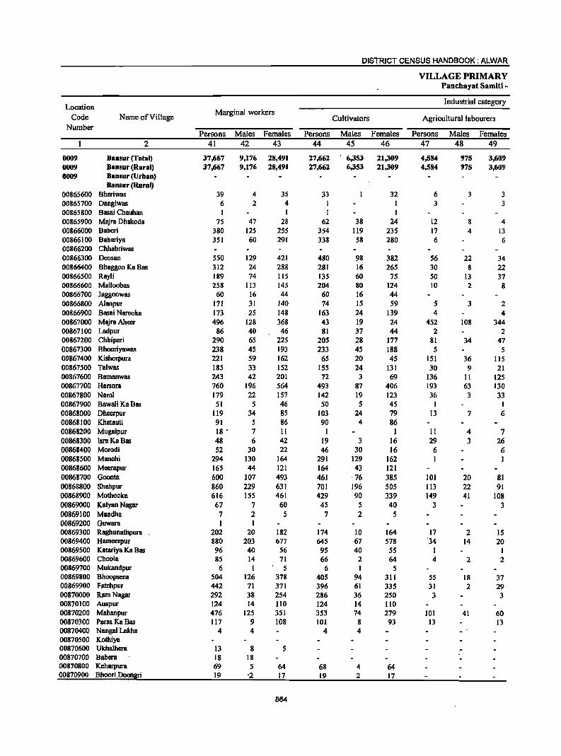
DISTRICT CENSUS HANDBOOK: ALWAR
VILLAGE PRIMARY Panchayat Sarniti -
Location Industrial category
Code Name of Village Marginal workers
Cultivators Agricultural labourers Number
Persons Males Females Persons Males Females Persons Males Females 2 41 42 43 44 45 46 47 48 49
0009 Banlur (Total) 37,667 9,176 28,491 27,662 6,353 21,309 4,584 975 3,609 0009 Bansur (Rural) 37,667 9,176 28,491 27,662 6,353 21,309 4,584 975 3,609 0009 Bansur (Urban)
Bansur (Rural) 00865600 Bheriwas 39 4 35 33 32 6 3 3 00865700 Dangiwas 6 2 4 1 1 3 3 00865800 Basai Chauhan 1 1 00865900 Majra Dhakoda 75 47 28 62 38 24 12 8 4 00866000 Baberi 380 125 255 354 119 235 17 4 13 00866100 Babariya 351 60 291 338 58 280 6 6 00866200 Chhabriwas 00866300 Deosan 550 129 421 480 98 382 56 22 34 00866400 Bhaggoo Ka Bas 312 24 288 281 16 265 30 8 22 00866500 Rayli 189 74 115 135 60 75 50 13 37 00866600 Malloobas 258 113 145 204 80 124 10 2 8 00866700 Jaggoowas 60 16 44 60 16 44 00866800 Alanpur 171 31 140 74 15 59 5 3 2 00866900 Basai Narooka 173 25 148 163 24 139 4 4 00867000 MajraAheer 496 128 368 43 19 24 452 108 344 00867100 Ladpur 86 40 46 81 37 44 2 2 00867200 ChhipBri 290 65 225 205 28 177 81 34 47 00867300 Bhooriyawas 238 4S 193 233 45 188 5 S 00867400 Kishorpura 221 S9 162 6S 20 45 151 36 liS 00867500 Talwas 18S 33 152 ISS 24 131 30 9 21 00867600 BBmanwas 243 42 201 72 3 69 136 II 125 00867700 Harsora 760 196 S64 493 87 406 193 63 130 00867800 Narol 179 22 157 142 19 123 36 3 33 00867900 BBwBIiKBBas 51 5 46 SO 5 45 I I 00868000 Dheerpur 119 34 85 103 24 79 13 7 6 00868100 Khatauti 91 5 86 90 4 86 00868200 Mugalpur 18 • 7 II I 1 11 4 7 00868300 IsraKaBas 48 6 42 19 3 16 29 3 26 00868400 Morodi 52 30 22 46 30 16 6 6 00868500 Manchi 294 130 164 291 129 162 I 1 00868600 Mecrapur 165 44 121 164 43 121 00868700 Goonta 600 107 493 461 " 76 385 101 20 81 00868800 Shahpur 860 229 631 701 196 505 113 22 91 00868900 Mothooka 616 155 461 429 90 339 149 41 108 00869000 Kalyan Naglir 67 7 60 45 5 40 3 3 00869100 Mandha 7 2 5 7 2 5 00869200 Guwara 1 1 00869300 Raghunathpura 202 20 182 174 10 164 17 2 IS 00869400 Hameerpur 880 203 677 645 67 578 "34 14 20 00869500 Katariya Ka Bas 96 40 56 95 40 55 1 00869600 Choola 85 14 71 66 2 64 4 2 2 00869700 Mukandpuf 6 I 5 6 I 5 00869800 Bhoopsera 504 126 378 405 94 311 SS 18 37 00869900 Patehpur 442 71 371 396 61 335 31 2 29 00870000 Ram Nagar 292 38 254 286 36 250 3 3 00870100 Auspur 124 14 110 124 14 110 00870200 Mahanpur 476 125 351 353 74 279 101 41 60 00870300 Parsa Ka Bas 117 9 108 101 8 93 13 13 00870400 Nanga! Lakha 4 4 4 4 00870500 Kothiya 00870600 UkhBlhera 13 8 5 00870700 Babera 18 18 00870800 Keharpura 69 5 64 68 4 64 00870900 Bhoori,Doongri 19 '2 17 19 2 17
864
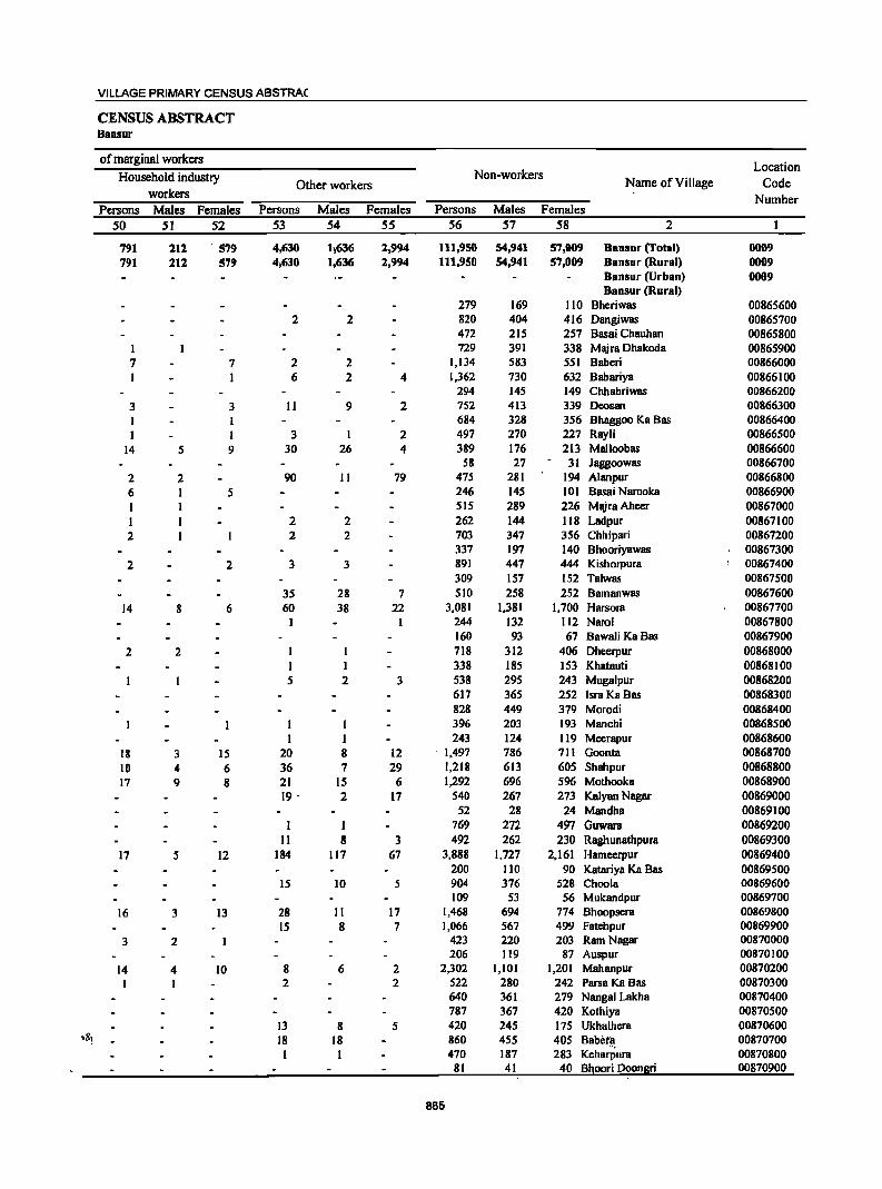
VILLAGE PRIMARY CENSUS ABSTRA(
CENSUS ABSTRACT Bansur
of marginal workers Location
Household industry Non-workers Name of Village Code Other workers
workers Number Persons Males Females Persons Males Females Persons Males Females
50 51 52 S3 S4 SS 56 57 58 2
791 212 ' 579 4,630 1,636 2,994 111,950 54,941 57,009 Bansur (Total) 0009 791 212 579 4,630 1,636 2,994 111,950 54,941 57,009 Bansur (Rural) 0009
Bansur (Urban) 0009 Bansur (Rural)
279 169 110 Bheriwas 00865600 2 2 820 404 416 Dangiwas 00865700
472 215 257 Basai Chauhan 00865800 I 729 391 338 Majra Dhakoda 00865900 7 7 2 2 1,134 583 551 Baberi 00866000 1 1 6 2 4 1,362 730 632 Babariya 00866100
294 145 149 Chhabriwas 00866200 3 3 11 9 2 752 413 339 Deosan 00866300
I 684 328 356 Bhaggoo Ka Bas 00866400 1 3 I 2 497 270 227 Rayli 00866500
14 5 9 30 26 4 389 176 213 Malloobas 00866600 58 27 31 Jaggoowas 00866700
2 2 90 II 79 475 281 194 Alanpur 00866800 6 1 5 246 145 101 Basai Narooka 00866900 1 1 515 289 226 MajraAheer 00867000 1 1 2 2 262 144 118 Ladpur 00867100 2 1 2 2 703 347 356 Chhipari 00867200
337 197 140 Bhooriyawas 00867300 2 2 3 3 891 447 444 Kishorpura 00867400
309 157 152 Talwas 00867500 35 28 7 510 258 252 Bamanwas 00867600
14 8 6 60 38 22 3,081 1,381 1,700 Harsora 00867700 I 244 132 I12 Narcl 00867800
160 93 67 Bawali Ka Bas 00867900 2 2 1 I 718 312 406 Dhcerpur 00868000
I 1 338 185 153 Khatauti 00868100 5 2 3 538 295 243 Mugalpur 00868200
617 365 252 Isra Ka Bas 00868300 828 449 379 Morodi 00868400 396 203 193 Manchi 00868500
I 243 124 119 Meerapur 00868600 18 3 15 20 8 12 1,497 786 711 Goonta 00868700 10 4 6 36 7 29 1,218 613 605 Shahpur 00868800 17 9 8 21 15 6 1,292 696 596 Mothooka 00868900
19 " 2 17 540 267 273 Kalyan Nagar 00869000 52 28 24 Mandha 00869100
1 1 769 272 497 Guwara 00869200 II 8 3 492 262 230 Raghunathpura 00869300
17 5 12 184 117 67 3,888 1,727 2,161 Hamcerpur 00869400 200 110 90 KatariYB Ka Bas 00869500
IS 10 5 904 376 528 Choola 00869600 109 53 56 Mukandpur 00869700
16 3 13 28 II 17 1,468 694 774 Bhoopsera 00869800 IS 8 7 1,066 567 499 Fatehpur 00869900
3 2 423 220 203 Ram Nagar 00870000 206 119 87 Auspur 00870100
14 4 10 8 6 2 2,302 1,101 1,201 Mahanpur 00870200 2 2 522 280 242 Parsa KaBas 00870300
640 361 279 Nangal Lakha 00870400 787 367 420 Kothiya 00870500
13 8 5 420 245 175 Ukhalhcra 00870600 'll! 18 18 860 455 405 Babeta 00870700
1 1 470 187 283 KeharPura 00870800 81 41 40 Bhoori Doongri 00870900
865
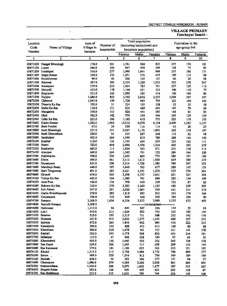
DISTRICT CENSUS HANDBOOK: ALWAR
VILLAGE PRIMARY Panchayat Samiti -
Location AIeaof Total population
Population in the Code Name of Village Village in
Number of (including institutional and age-group 0-6
Number hectares households houseless population)
Persons Males Females Persons Males Females 2 3 4 5 6 7 8 9 10
00871000 Nanga1 Bhaosingh 176.0 201 1,761 924 837 357 176 181 00871100 Loyati 246.0 105 847 448 399 158 75 83 00871200 Unchhpur 516.0 277 1,990 1,041 949 ~57 186 171 00871300 MajraRawat 350.0 134 1,031 576 455 199 115 84 00871400 Boochiyawas 94.0 42 266 135 131 66 28 38 00871500 Ba1awas 387.0 392 2,553 1,328 1,225 525 278 247 00871600 Ratanpum 279.0 225 1,424 723 701 237 125 112 00871700 Moondli 455;0 178 1,144 621 523 196 119 77 00871800 KBnjipura 231.0 163 1,099 585 514 190 104 86 00871900 Hajipur 1,686.0 852 5,353 2,816 2,537 1,094 587 507 00872000 Chheend 1,947.0 199 1,738 943 795 325 160 165 00872100 Dham1a Ka Bas 702.0 51 331 193 138 53 25 28 00872200 BalbaKa Bas 158.0 121 834 429 405 147 79 68 00872300 Mangalwa 309.0 113 826 441 385 164 81 83 00872400 Ghat 582.0 142 970 524 446 243 139 104 00872500 UdhoKaBas 225.0 186 1,185 610 575 223 118 105 00872600 Kasba Bansur 1,302.0 1,964 13,012 6,878 6,134 2,490 1,343 1,147 00872700 Barh Purohit 47.0 39 230 116 114 43 20 23 00872800 Barh Bhaosingh 227.0 311 2,267 1,176 1,091 365 178 187 00872900 Barh Dhoondhala 229.0 91 535 287 248 110 62 48 00873000 Santhalpur 422.0 264 1,599 819 780 288 146 142 00873100 Kauthal 518.0 136 1,193 634 559 233 122 III 00873200 Buteri 722.0 444 2,846 1,520 1,326 602 332 270 00873300 Kankariya 681.0 III 1,034 563 471 231 118 113 00873400 Alampur 669.0 244 1,543 791 752 284 164 120 00873500 Jhajharpum 598.0 234 1,642 869 773 386 197 189 00873600 Khem 594.0 461 3,113 1,613 1,500 619 300 319 00873700 Shyampura 832.0 508 3,314 1,728 1,586 749 397 352 00873800 Mandeeja Basai 440.0 197 1,440 763 677 280 145 135 00873900 Barh Thegoowas 491.0 383 2,621 1,351 1,270. 535 274 261 00874000 Giroodi 674.0 509 3,398 1,757 1,641 631 327 304 00874100 Todiya Ka Bas 442.0 164 1,385 701 684 283 134 149 00874200 AnatPum 186.0 126 798 449 349 152 87 65 00874300 Bahram Ka Blis 336.0 370 2,383 1,260 1,123 442 239 203 00874400 Kali Pahari 347.0 291 2,026 1,067 959 421 211 210 00874500 Gurha Bhankharwala 229.0 282 1,818 983 835 334 170 164 00874600 Kalyanpum 396.0 122 848 446 402 194 104 90 00874700 Rampur 2,308.0 1,006 6,326 3,337 2,989 1,275 672 603 00874800 Roondh Rampur 2,308.0 ----------Un-inhabited-----------00874900 Nathoosar 1,413.0 96 693 367 326 119 55 64 00875000 Lekri 910.0 213 1,624 882 742 322 182 140 00875100 Bisalwa 519.0 195 1,319 711 608 252 142 110 00875200 Holawas 367.0 413 3,022 1,577 1,445 600 327 273 00875300 Indrada 672.0 263 1,846 962 884 436 222 214 00875400 Nawalpura 290.0 153 888 473 415 168 80 88 00875500 Kharkhara 586.0 ·210 1,478 761 717 311 141 170 00875600 Rasnali 522.0 243 1,778 958 820 405 214 191 00875700 Milakpur 115.0 57 408 228 180 97 65 32 00875800 Kheewaheri 404.0 156 1,045 543 502 242 124 118 00875900 Bas Dayal 339.0 206 1,345 717 628 299 155 144 00876000 Bas Karnawat 379.0 181 1,186 623 563 233 131 102 00876100 Khohri 1,513.0 515 3,756 1,984 1,772 786 409 377 00876200 Basna . 488.0 229 1,516 812 704 349 189 160 00876300 Beelath 828.0 96 583 306 277 151 94 57 00876400 Chatarpura 1,086.0 674 4,284 2,226 2,058 861 460 401 00876500 Neemoochana 1,404.0 506 3,079 1,602 1,477 587 322 265 00876600 JhagdetKalan 383.0 126 929 495 434 205 1I8 87 00876700 Bas Shekhawat 253.0 213 1533 789 744 336 168 168
866
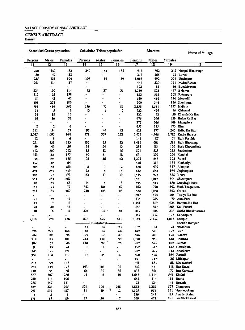
VILLAGE PRIMARY CENSUS ABSTRACT
CENSUS ABSTRACT Bansur
Scheduled Castes popuation Scheduled Tribes population Literates Name ofViUage
Persons Males Females Persons Males Females Persons Males Females 11 12 13 14 15 16 17 18 19 2
290 157 133 349 163 186 914 602 312 Nangal Bhaosingh 80 42 38 317 265 52 Loyati
235 131 104 103 54 49 1,016 692 324 Unchhpur 201 114 87 441 330 111 MajraRawat
122 86 36 Boochiyawas 224 110 114 72 37 35 1,250 823 427 Balawas 310 152 158 823 515 308 Ratanpura 84 42 42 630 416 214 Moondli
408 228 180 500 344 156 Kanjipura 795 430 365 159 77 82 2,338 1,581 . 757 Hajipur
14 5 9 13 6 7 522 426 96 Chheend 34 18 16 122 92 30 Dhamla Ka Bas
156 80 76 476 296 180 Balba-Ka Bas 375 266 109 Mangalwa
8 2 6 455 285 170 Ghat III 54 57 92 49 43 623 377 246 UdhoKaBas
2,025 1,095 930 579 307 272 7,472 4,746 2,726 Kasba BansuT 12 6 6 141 87 54 Barh Purohit
271 138 133 107 55 52 1,482 901 581 Barh Bhaosingh 69 40 29 37 24 13 284 184 100 Barh Dhoondhala
412 200 212 33 18 15 821 528 293 Santhalpur 360 183 177 49 31 18 621 392 229 Kauthal 358 193 165 98 46 52 1,225 853 372 Buteri 152 88 64 446 312 134 Kankariya 306 156 150 5 3 2 826 509 317 AJampur 494 255 239 22 8 14 632 468 164 Jhajharpura 345 172 173 63 33 30 1,535 997 538 Khera 551 284 267 1,521 1,017 504 Shyampura 108 5S 53 14 6 8 59S 415 180 Mandeeja Basai 145 73 72 353 184 169 1,162 770 392 Barh Thegoowas 744 384 360 230 125 105 1,620 1,068 552 Giroodi
609 404 205 Todiya Ka Bas 71 39 32 335 265 70 AnatPura 13 7 6 1,441 817 624 Bahram Ka Bas 78 40 38 855 587 268 Kali Pahari 10 6 4 324 176 148 819 586 233 Gurha Bhankharwala
347 232 115 Kalyanpura 1,064 578 486 836 425 411 3,147 2,132 1,015 Rampur
----Un-inhabited------- Roondh Rampur 57 34 23 137 114 23 Nathoosar
376 212 164 148 84 64 672 500 172 Lekri 202 108 94 109 62 47 576 406 170 Bisalwa 218 117 101 213 114 99 1,398 950 448 Holawas 109 63 46 148 72 76 707 525 182 Indrada 90 49 41 1 459 317 142 Nawalpura
346 175 171 789 475 314 Kharkhara 358 188 170 67 35 32 660 496 164 Rasnali
153 117 36 Milakpur 207 99 108 241 183 58 Kheewaheri 260 134 126 193 103 90 529 411 JI8 Bas Dayal 110 54 56 66 30 36 533 361 172 Bas Kamawat 567 307 260 16 6 10 1,658 1,114 544 Khohri 220 114 106 545 414 131 Basna 288 147 141 172 124 48 Beelath 429 224 205 574 306 268 1,862 1,287 575 Chatarpura 993 506 487 31 19 -cr~ 12 1,505 954 551 Neemoochana
6 3 3 330 245 8S lhagdet Kalan 176 87 89 37 20 17 6S9 478 181 Bas Shekhawat
867
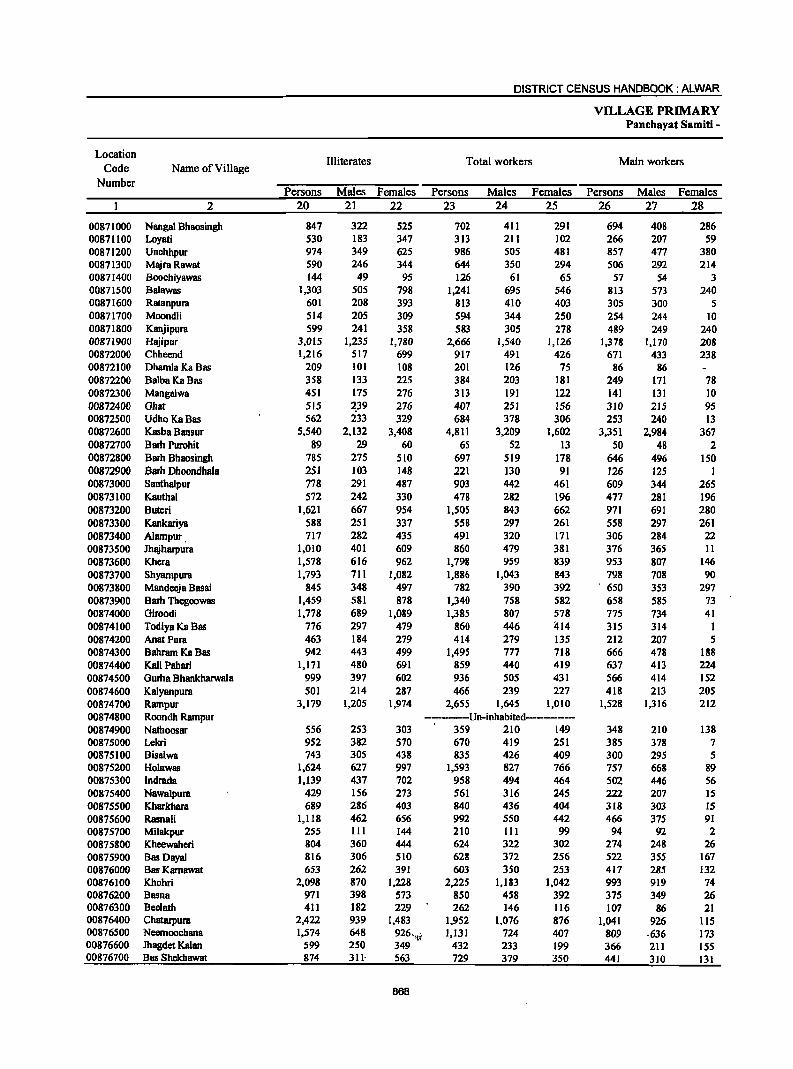
DISTRICT CENSUS HANDBOOK: ALWAR
VILLAGE PRIMARY Panchayat Samiti -
Location Illiterates Total workers Main workers
Code Name of Village Number
Persons Males Females Persons Males Females Persons Males Females 2 20 21 22 23 24 25 26 27 28
00871000 Nangal Bhaosingh 847 322 525 702 411 291 694 408 286 00871100 Loyati 530 183 347 313 211 102 266 207 59 00871200 Unchhpur 974 349 625 986 505 481 857 477 380 00871300 MajraRawat 590 246 344 644 350 294 506 292 214 00871400 Boochiyawas 144 49 95 126 61 65 57 54 3 00871500 Balawas 1,303 505 798 1,241 695 546 813 573 240 00871600 Ratanpura 601 208 393 813 410 403 305 300 5 00871700 Moondli 514 205 309 594 344 250 254 244 10 00871800 Kanjipura 599 241 358 583 305 278 489 249 240 00871900 Hajipur 3,015 1,235 1,780 2,666 1,540 1,126 1,378 1,170 208 00872000 Chhcend 1,216 517 699 917 491 426 671 433 238 00872100 Dhamla Ka Bas 209 101 108 201 126 75 86 86 00872200 BalbaKaBas 358 133 225 384 203 181 249 171 78 00872300 Mangalwa 451 175 276 313 191 122 141 131 10 00872400 Ghat 515 ~39 276 407 251 156 310 215 95 00872500 UdhoKaBas 562 233 329 684 378 306 253 240 IJ 00872600 Kasba Bansur 5,540 2,132 3,408 4,811 3,209 1,602 3,351 2,984 367 00872700 Barb Purohit 89 29 60 65 52 13 50 48 2 00872800 Barh Bhaosingh 785 275 510 697 519 178 646 496 150 00872900 Barh Dhoondhala 251 103 148 221 130 91 126 125 1 00873000 Santhalpur 778 291 487 903 442 461 609 344 265 00873100 Kauthal 572 242 330 478 282 196 477 281 196 00873200 Buteri 1,621 667 954 1,505 843 662 971 691 280 00873300 Kankariya 588 251 337 558 297 261 558 297 261 00873400 AJompur. 717 282 435 491 320 171 306 284 22 00873500 Jhajharpura 1,010 401 609 860 479 381 376 365 II 00873600 !<hera 1,578 616 962 1,798 959 839 953 807 146 00873700 Shyampura 1,793 711 1,082 1,886 1,043 843 798 708 90 00873800 MandeejB Basai 845 348 497 782 390 392 . 650 353 297 00873900 Barh Thegoowas 1,459 581 878 1,340 758 582 658 585 73 00874000 Giroodi 1,778 689 1,089 1,385 807 578 775 734 41 00874100 Todiya Ka Bas 776 297 479 860 446 '114 315 314 1 00874200 AnatPura 463 184 279 414 279 135 212 207 5 00874300 Bahram Ka Bas 942 443 499 1,495 777 718 666 478 188 00874400 Kali Pallari 1,171 480 691 859 440 419 637 413 224 00874500 Gurha Bhankharwala 999 397 602 936 505 431 566 414 152 00874600 Kalyanpura 501 214 287 466 239 227 418 213 205 00874700 Rampur 3,179 1,205 1,974 2,655 1,645 1,010 1,528 1,316 212 00874800 Roondh Rampur ---------Un-inhabited------------00874900 Nathoosar 556 253 303 359 210 149 348 210 138 00875000 Lekri 952 382 570 670 419 251 385 378 7 00875100 Bisalwa 743 305 438 835 426 409 300 295 5 00875200 Holawas 1,624 627 997 1,593 827 766 757 668 89 00875300 Indrada 1,139 437 702 958 494 464 502 446 56 00875400 Nawa1pura 429 156 273 561 316 245 222 207 15 00875500 Kbarkhara 689 286 403 840 436 404 318 303 15 00875600 Rasnali 1,118 462 656 992 550 442 466 375 91 00875700 Milakpur 255 111 144 210 111 99 94 92 2 00875800 Kheewaheri 804 360 444 624 322 302 274 248 26 00875900 Bas Dayal 816 306 510 628 372 256 522 355 167 00876000 Bas Kamawat 653 262 391 603 350 253 417 285 132 00876100 Khohri 2,098 870 1,228 2,225 1,183 1,042 993 919 74 00876200 Basna 971 398 573 850 458 392 375 349 26 00876300 Beelath 411 182 229 262 146 116 107 86 21 00876400 Chatarpura 2,422 939 1,483 1,952 1,076 876 1,041 926 115 00876500 Neemoocbana 1,574 648 926.'I( 1,131 724 407 809 ·636 173 00876600 Jhagdet Kalan 599 250 349 432 233 199 366 211 ISS 00876700 Bas Shekhawat 874 3n 563 729 379 350 441 310 131
86B
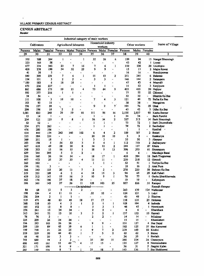
VILLAGE PRIMARY CENSUS ABSTRACT
CENSUS ABSTRACT DaRBor
Industrial category of main workers
Cul~ivators Agricultural labourers Household industry
Other workers Name of Village workers
Persons Males Females Persons Males Females Persons Males Females Persons Males Females 29 30 31 32 33 34 35 36 37 38 39 ,40 2
552 288 264 32 26 6 109 94 15 Nanga! Bhaosingh 223 165 58 43 42 Loyati 677 334 343 23 7 16 7 6 ISO 130 20 Unchhpur. 428 238 190 54 32 22 9 9 15 13 2 MajraRawat
41 38 3 16 16 Boochiyawas 540 309 231 7 6 15 13 2 251 245 6 Balawas 154 151 3 2 2 3 3 146 144 2 Ratanpura
• 189 183 6 18 18 47 43 4 Moondli 473 236 237 I I IS 12 3 Kanjipura 861 686 175 19 15 4 73 64 9 425 405 20 Hajipur 593 377 216 I I 77 S5 22 Chheend
54 54 32 32 Dhamla Ka Bas III 108 3 10 10 7 4 3 121 49 72 BalbaKaBas 103 93 10 38 38 Mangalwa 196 137 59 ':'{ 9 2 7 ' 105 76 29 Ghat 206 196 10 2 2 45 42 3 UdhoKaBas
1,081 833 248 29 19 10 III 95 16 2,130 2,037 93 Kasba Bansur 15 14 I I I 34 34 Barb Purohit
254 i21 133 9 8 56 54 2 327 313 14 Barh Bhaosingh 52 52 I I 73 72 I Barh Dhoondhala .
534 271 263 I I 74 72 2 Santhalpur 476 280 196 I Kauthal " 614 440 174 242 140 102 6 4 2 109 107 2 Buteri 535 284 251 20 10 10 3 3 Kankariya 269 251 18 I 3 3 33 30 3 Alampur 203 198 5 56 53 3 5 4 I 112 110 2 Jhajharpura' 667 618 49 28 20 8 14 12 2 244 157 87 Khera 368 353 15 16 15 1 18 5 13 396 335 61 Shyampura 639 344 295 5 3 2 6 6 Mandeeja Basai 216 160 56 14 14 18 17 410 394 16 Barh Thegoowas 497 472 25 37 33 4 II 11 230 218 12 Giroodi- , 262 262 1 I 52 51 1 Todiya Ka Bas 194 191 3 18 16 2 AnatPura 366 243 123 20 13 7 2 2 278 220 58 Bahram Ka Bas 519 331 188 6 2 4 18 15 3 94 65 29 Kali Pahari 459 312 147 19 16 3 10 9 I 78 77 I Gurha Bhankharwala 362 176 186 37 18 19 19 19 Kalyanpura 506 361 145 37 26 II 128 103 25 857 826 31 Rampur
-------Un-inhabited------- Roondh Rampur 80 68 12 5 3 2 263 139 124 Nathoosar
198 194 4 II II .52 52 124 121 3 Lekri 256 254 2 I I 43 40 3 Bisalwa 519 471 48 63 45 18 17 17 158 135 23 Holawas 388 338 50 4 3 2 I 108 104 4 Indrada 165 152 13 8 8 3 2 46 45 Nawalpura 276 261 IS 34 34 2 2 6 6 Kharkhara 313 241 72 13 10 3 3 2 137 122 15 Rasnali 78 76 2 2 2 14 14 Milakpur
235 209 26 24 24 15 15 Kheewaheri 356 193 163 26 26 9 9 131 127 4 Bas Dayal 209 120 89 45 39 6 I I 162 125 37 Bas Kamawat 739 718 21 26 25 I 9 7 2 219 169 50 Khohri 259 239 20 44 43 I 7 5 2 65 62 3 Basna
68 48 20 3 3 36 35 I Beelath 743 669 74 3 3, , 35 20 IS 260 234 26 Chatarpura 606 445 161 53 49 .,'':: 4 15 IS 135 127 8 Neemoochana 321 171 ISO 9 9 36 31 5 Ihagdet Kalan 265 149 116 8 '7 25 18 7 143 136 7 Bas Shekhawat
869
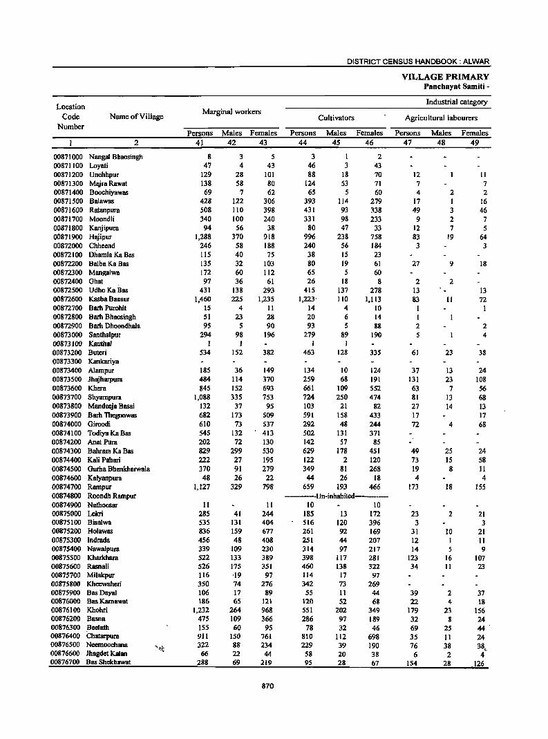
DISTRICT CENSUS HANDBOOK: ALWAR
VILLAGE PRIMARY Panchayat Samiti -
Location Industrial category
Code Name of Village Marginal workers
Cultivators Agricultural labourers Number
Persons Males Females Persons Males Females Persons Males Females 2 41 42 43 44 45 46 47 48 49
00871000 Nanga! Bhaosingh 8 3 5 3 I 2 00871100 Loyati 47 4 43 46 3 43 00871200 Unchhpur 129 28 101 88 18 70 12 II 00871300 MajraRawat 138 58 80 124 53 71 7 7 00871400 Boochiyawas 69 7 62 65 5 60 4 2 2 00871500 Balawas 428 122 306 393 114 279 17 1 16 00871600 Ratanpura 508 110 398 431 93 338 49 3 46 00871700 Moondli 340 100 240 331 98 233 9 2 7 00871800 Kanjipura 94 56 38 80 47 33 12 7 5 00871900 Hajipur 1,288 370 918 996 238 758 83 19 64 00872000 Chheend 246 58 188 240 56 184 3 3 00872100 D1iamla Ka Bas 115 40 75 38 15 23 00872200 BalbaKa Bas 135 32 103 80 19 61 27 9 18 00872300 Mangalwa 172 60 112 65 5 60 00872400 Ghat 97 36 61 26 18 8 2 2 00872500 Udho KaBas 431 138 293 415 137 278 13 13 00872600 Kasba Bansur 1,460 225 1,235 1,223' 110 1,113 83 II 72 00872700 Barh Purohit 15 4 11 14 4 10 I I 00872800 Barh Bhaosingh 51 23 28 20 6 14 I 00872900 Barh Dhoondhala 95 5 90 93 5 88 2 2 00873000 Santhalpur 294 98 196 279 89 190 5 4 00873100 Kauthal 1 I I 00873200 Buteri 534 152 382 463 128 335 61 23 38 00873300 Kankariya 00873400 Alampur 185 36 149 134 10 124 37 13 24 00873500 Jhajharpura 484 114 370 259 68 191 131 23 108 00873600 Khera 845 152 693 661 109 552 63 7 56 00873700 Shyampura 1,088 335 753 724 250 474 81 13 68 00873800 Mandeeja Basai 132 37 95 103 21 82 27 14 13 00873900 Barh Thegoowas 682 173 509 591 158 433 17 17 00874000 Giroodi 610 73 537 292 48 244 72 4 68 00874100 Todiya Ka Bas 545 132 413 502 131 371 00874200 AnatPura 202 72 130 142 57 85 00874300 Bahram Ka Bas 829 299 530 629 178 451 49 25 24 00874400 Kali Pahari 222 27 195 122 2 120 73 15 58 00874500 Gurha Bhankhai"Wala 370 91 279 349 81 268 19 8 II 00874600 Kalyanpura 48 26 22 44 26 18 4 4 00874700 Rampur 1,127 329 798 659 193 466 173 18 155 00874800 Roondh Rampur -------Un-inhabited--------00874900 Nathoosar 11 II 10 10 00875000 Lekri 285 41 244 185 13 172 23 2 21 00875100 Bisalwa S35 1JI 404 SI6 120 396 3 3 00875200 Ho1awas 836 159 677 261 92 169 31 10 21 00875300 Indrada 456 48 408 251 44 207 12 I 11 00875400 Nawalpura 339 109 230 314 97 217 14 5 9 00875500 Kharkhara 522 133 389 398 117 281 123 16 107 00875600 Rasnali 526 175 351 460 138 322 34 11 23 00875700 Milakpur 116 ,19 97 114 17 97 00875800 Kheewaheri 350 74 276 342 73 269 00875900 Bas Dayal 106 17 89 55 11 44 39 2 37 00876000 Bas Karnawat 186 65 121 120 52 68 22 4 18 00876100 Khohri 1,232 264 968 551 202 349 179 23 156 00876200 Basna 475 109 366 286 97 189 32 8 24 00876300 Beelath 155 60 95 78 32 46 69 25 44 00876400 Chatarpura 911 150 761 810 112 698 35 II 24 00876500 Neemoochana
'~t 322 88 234 229 39 190 76 38 38c
00876600 Jhagdet Kalan 66 22 44 58 20 38 6 2 4 00876700 Bas Shekhawat 288 69 219 95 28 67 154 28 126
870
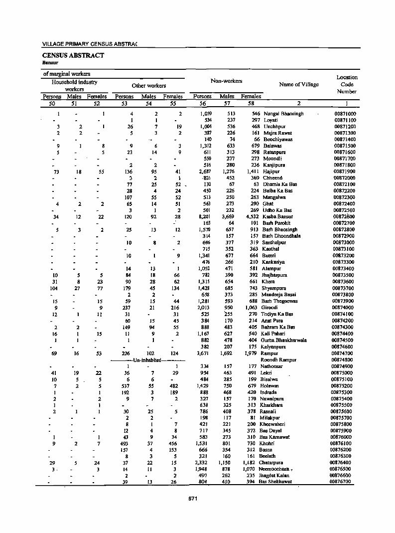
VILLAGE PRIMARY CENSUS ABSTRA(
CENSUS ABSTRACT BaDsur
of marginal workers Location
Household industIy Non-workers Name of Village Code Other workers
workers Number Persons Males Females Persons Males Females Persons Males Females
50 51 52 53 54 55 56 57 58 2
4 2 2 1,059 513 546 Nangal Bhaosingh 00871000 I 1 534 237 297 Loyati 00871100
3 2 26 7 19 1,004 536 468 Unchhpur 00871200 2 2 5 3 2 387 226 161 MajraRawat 00871300
140 74 66 Boochiyawas 00871400 9 8 9 6 3 1,312 633 679 Balawas 00871500 5 5 23 14 9 611 313 298 Ratanpura 00871600
550 277 273 Moondli 00871700 2 2 516 280 236 Kanjipura 00871800
73 18 55 136 95 41 2,687 1,276 1,411 Hajipur 00871900 3 2. 1 ·821 452 369 Chheend 0()872000
77 25 52 130 67 63 Dhamla Ka Bas 0()872100 28 4 24 450 226 224 BalbaKa Bas 00872200
107 55 52 513 250 263 Mangalwa 00872300 4 2 2 65 14 51 563 273 290 Ghat 00872400
3 2 501 232 269 UdhoKaBas 00872500 34 12 22 120 92 28 8,201 3,669 4,532 Kasba Bansur 00872600
165 64 101 Barb Purohit 00872700
5 3 2 25 13 12 1,570 657 913 Barh Bhaosingh 00872800 314 157 157 Barh Dhoondhala 00872900
10 8 2 696 377 319 Santhalpur 00873000 715 352 363 KauthBI 00873100
10 9 1,341 677 664 Buteri 00873200 476 266 210 Kankariya 00873300
14 13 1,052 471 581 Alampur 00873400 10 5 5 84 18 66 782 390 392 Jhajharpura 00873500 31 8 23 90 28 62 1,315 654 661 Khera 00873600
104 27 77 179 45 134 1,428 685 743 Shyampura 00873700 2 2 658 373 285 Mandeeja Basai 00873800
IS IS 59 IS 44 1,281 593 688 Barh Thegoowas 00873900
9 9 237 21 216 2,013 950 1,063 Giroodi 00874000
12 11 31 31 525 iss 270 Todiya Ka Bas 00874100 60 IS 45 384 170 214 Anat Pura 00874200
2 2 149 94 55 888 483 405 Bahram Ka Bas 00874300 16 I IS 11 9 2 1,167 627 540 Kali Pahari 00874400 1 I 882 478 404 Gurha Bhankharwala 00874500
382 207 175 Kalyanpura 00874600 69 16 53 226 102 124 3,671 1,692 1,979 Rampur 00874700
-----Un-inhabited------- Roondh Rampur 00874800 I I 334 157 177 Nathoosar 00874900
41 19 22 36 7 29 954 463 491 Lekri 00875000 10 5 5 6 6 484 285 199 Bis81wa 00875100 7 2 5 537 55 482 1,429 750 679 Hol8was 00875200 I I 192 3 189 888 468 420 Indr8d8 00875300 2 2 9 7 2 327 157 170 Nawalpura 00875400 I I 638 325 313 Kharkhara 00875500 2 I 30 25 5 786 408 378 Rasnali 00875600
2 2 198 117 81 Milalcpur 00875700 8 I 7 421 221 200 Kheewaheri 00875800
12 4 8 717 345 372 Bas Dayal 00875900 I I 43 9 34 583 273 310 Bas Karnawat 00876000 9 2 7 493 37 456 1,531 801 730 Khohri 00876100
157 4 153 666 354 312 Basna 00876200
8 3 5 321 160 161 Beelath 00876300
29 5 24 37 22 15 2,332 1,150 1,182 Chatarpura 00876400
3· 3 14 II 3 1,948 878 1,070 Neemoochallll· , 00876500 2 2 497 262 235 Jhagdet Kalan 00876600
39 13 26 804 410 394 Bas Shekhawat 00876700
871
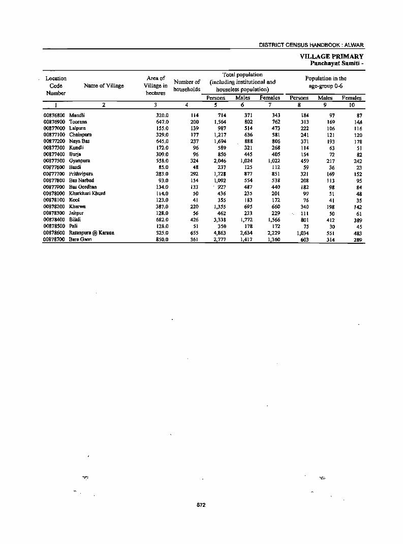
DISTRICT CENSUS HANDBOOK: ALWAR
VILLAGE PRIMARY Panchayat Samiti -
Location Area of Total population
Population in the Number of (including institutional and
Code Name of Village Village in households houseless population)
age-group 0-6 Number hectares
Persons Males Females Persons Males Females 2 3 4 5 6 7 8 9 10
00876800 Mandli 320.0 114 714 371 343 184 97 87 00876900 Toorana 647.0 200 1,564 802 762 313 169 14.11 00877000 Lalpura 155.0 139 987 514 473 222 106 116 00877100 Chainpum 329.0 177 1.217 636 581 241 121 120 00877200 NayaBas 645.0 237 1,694 888 806 371 193 178 00877300 Kundli 172.0 96 589 321 268 114 63 51 00877400 Burja 309.0 96 850 445 405 154 72 82 00877500 Gyanpura 558.0 324 2,046 1,024 1,022 4S9 217 242 00877600 Basdi 85.0 48 237 125 112 S9 36 23 00877700 Prithvipura 283.0 292 1,728 877 851 321 169 152 00877800 Bas Narbad 93.0 154 1,092 554 538 208 113 95 00877900 Bas Gordhan 134.0 133 927 487 440 182 98 84 00878000 Kharkhari Khurd 114.0 50 436 235 201 99 51 48 00878100 Kool 123.0 41 355 183 172 76 41 3S 00878200 Kharwa 387.0 220 1,355 695 660 340 198 142 00878300 Jaitpur 128.0 56 462 233 229 III 50 61 00878400 Bilali 682.0 426 3,338 1,772 1,566 801 412 389 00878500 Pali 128.0 51 350 178 172 75 30 4S 00878600 Ratanpura @ Karana 525.0 655 4,863 2,634 2,229 1,034 551 483 00878700 BamGaon 850.0 361 2,777 11417 1,360 603 314 289
872
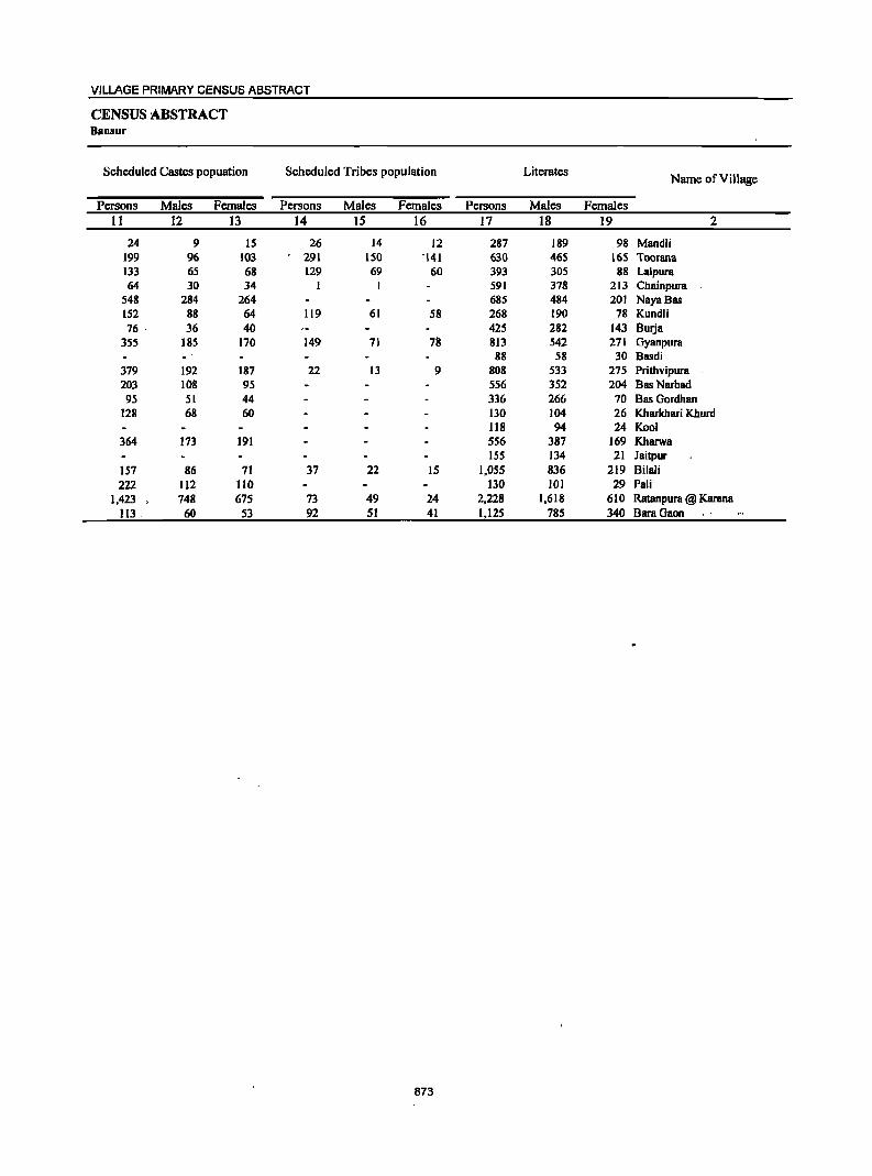
VILLAGE PRIMARY CENSUS ABSTRACT
CENSUS ABSTRACT Banlur
Scheduled Castes popuation Scheduled Tribes population Literates Name of Village
Persons Males Females Persons Males Females Persons Males Females II 12 13 14 15 16 17 18 19 2
24 9 15 26 14 12 287 189 98 Mandli 199 96 103 291 150 -141 630 465 165 Toorana 133 65 68 129 69 60 393 305 88 Lalpura 64 30 34 1 I 591 378 213 Chainpura
548 284 264 685 484 201 NayaBas 152 88 64 119 61 58 268 190 78 Kundli 76 ' 36 40 425 282 143 Surja
355 185 170 149 71 78 813 542 271 Gyanpura
- 88 58 30 Basdi 379 192 187 22 13 9 808 533 275 Prithvipura 203 108 95 556 352 204 Bas Narbad 95 51 44 336 266 70 Bas Gordhan
128 68 60 130 104 26 Kharkhari Khurd 118 94 24 Kool
364 173 191 556 387 169 Kharwa 155 134 21 Jaitpur
157 86 71 37 22 15 1,055 836 219 Bilali 222 112 110 130 101 29 Pali
1,423 748 675 73 49 24 2,228 1,618 610 Ratanpura @ Karana Il3 _ 60 53 92 SI 41 1,12S 785 340 BaraGaon
873
DISTRICT CENSUS HANDBOOK: ALWAR
VILLAGE PRIMARY Panchayat Samiti -
Location Illiterates Total workers Main workers
Code Name of Village Number
Persons Males Females Persons Males Females Persons Males Females 2 20 21 22 23 24 25 26 27 28
00876800 Mandli 427 182 245 283 170 113 186 148 38 00876900 Toorana 934 337 597 880 444 436 433 365 68 00877000 La1pura 594 209 385 460 284 176 263 231 32 00877100 Chainpura 626 258 368 601 382 219 419 301 118 00877200 NayaBas 1,009 404 605 755 439 316 669 413 256 00877300 Kundli 321 131 190 136 135 1 136 135 1 00877400 Burja . 425 163 262 400 216 184 381 199 182 00877500 Gyanpura 1,233 482 751 784 480 304 489 401 88 00877600 Basdi 149 67 82 118 72 46 67 60 7 00877700 Prithvipura 920 344 576 696 415 281 470 371 99 00877800 Bas Narbad 536 202 334 561 292 269 309 248 61 00877900 Bas Gordhan 591 221 370 473 239 234 393 206 187 00878000 Kharkhari Khurd 306 131 175 261 143 118 137 130 7 00878100 Kool 237 89 148 223 114 109 87 78 9 00878200 Kharwa 799 308 491 416 269 147 270 223 47 00878300 Jaitpur 307 99 208 223 115 108 142 62 80 00878400 Bi1ali 2,283 936 1.347 1,448 836 612 1,336 791 545 00878500 Pa1i 220 77 143 194 % 98 93 91 2 00878600 Ratanpura @ Karana 2,635 1,016 1,619 2,079 1,232 847 1,190 1,044 146 00878700 BaraGaon 1,652 632 1,020 1,269 655 614 503 454 49
874
VILLAGE PRIMARY CENSUS ABSTRACT
CENSUS ABSTRACT Bansur
Industrial category of main workers
Cultivators Agricultural labourers Household industry
Other workers Name of Village workers
Persons Males Females Persons Males Females Persons Males Females Persons Males Females 29 30 31 32 33 34 35 36 37 38 39 40 2
169 132 37 16 15 Mandli· 330 281 49 17 12 5 46 32 14 40 40 Toorana 216 187 29 4 4 43 40 3 Lalpura 390 278 112 I I 28 22 6 ChainpuTa 590 336 254 20 18 2 8 8 51 51 NayaBas 128 127 I 8 8 Kundli 376 194 182 5 5 Burja 304 228 76 24 23 14 13 147 137 10 Gyanpura
48 41 7 19 19 Basdi 213 163 50 I I 44 40 4 212 167 45 Prithvipura 176 1J9 57 4 3 3 3 126 123 3 Bas Narbad 371 184 187 22 22 Bas Gordhan 121 116 5 6 4 2 10 10 Kharkhari Khurd 77 68 9 I I 9 9 Kool
158 115 43 112 108 4 Kharwa 135 56 79
_. 7 6 I JaitpuT
1,086 552 534 8 4 4 4 3 238 232 6 Bilali 47 46 I 46 45 ·1 Pali
666 565 101 72 70 2 73 58 IS 379 351 28 Ratanpura @ Karana 281 243 38 9 7 2 4 3 I 209 201 8 BaraGaon ...
875
DISTRICT CENSUS HANDBOOK: ALWAR
VILLAGE PRIMARY Panchayat Samiti -
Location Industrial category
Code Name of Village Marginal workers
Cultivators Agricultural labourers Number
Persons Males Females Persons Males Females Persons Males Females 2 41 42 43 44 45 46 47 48 49
00876800 Mandli . 97 22 75 71 16 55 24 5 19 00876900 Toorana 447 79 368 409 73 336 14 14 00877000 Lalpura 197 53 144 193 53 140 00877100 Chainpura 182 81 101 179 78 101 00877200 Naya Bas 86 26 60 41 13 28 39 11 28 00877300 Kundli 00877400 Burja 19 17 2 19 17 2 00877500 Gyanpura 295 79 216 174 29 145 47 5 42 00877600 Basdi 51 12 39 51 12 39 00877700 Prithvipura 226 44 182 139 33 106 00877800 Bas Narbad 252 44 208 228 40 188 18 3 IS 00877900 Bas Gordhan 80 33 47 79 32 47 00878000 Kharkhari Khurd 124 13 III 80 II 69 43 42 00878100 Kool 136 36 100 136 36 100. 00878200 Kharwa 146 46 100 102 II 91 4 3 00878300 Jaitpur 81 53 28 I I 15 14 00878400 Bilali 112 45 67 7 3 4 42 10 32 00878500 Pali 101 5 96 86 I 85 00878600 Ratanpura @ Karana 889 188 701 613 101 512 123 13 110 00878700 BaraGaon 766 201 565 372 64 308 254 14 240
876
VILLAGE PRIMARY CENSUS ABSTRA(
CENSUS ABSTRACT BaDsur
of marginal workers Location
Household industry Non-workers Name of Village Code Other workers
workers Number Persons Males Females Persons Males 'Females Persons Males Females
50 51 52 53 54 55 56 57 58 2
I I I' ,I 431 201 230 Mandli 00876800 21 5 16 3 2 684 358 326 Toorana 00876900 4 4 527 230 297 Lalpura 00877000
3 3 616 254 362 Chainpura 00877100 4 4 2 2 939 449 490 Naya8as 00877200
453 186 267 Kundli 00877300 450 229 221 8urja 00877400
13 12 61 44 17 1,262 544 718 Gyanpura 00817500 119 53 66 Basdi 00877600
22 21 64 10 54 1,032 462 570 Prithvipura 00877700 6 .1 5 531 262 269 Bas Narbad 00877800 I I 454 248 206 Bas Gordhan 00871900 I ' I 175 92 83 Kharkhari Khurd 00878000
132 69 63 Kool 00878100 40 ,-34 6 939 426 513 Kharwa 00878200
'I, 65 52 13 239 118 121 Jaitpur 00878300
12 II 51 .31 20 1,890 936 954 8i1ali 00878400 IS 4 II 156 82 74 Pali 00878500
43 14 29 110 ' 60 50 2,784 1,402 1,382 Ratanpura @ Karana 00878600 4 4 136 123 13 1,508 762 746 BaraGaon 00878700
-!1' ... ~'- .
. ,_
877
DISTRICT CENSUS HANDBOOK: ALWAR
VILLAGE PRIMARY Pancbayat Samiti -
Location Area of Total population
Population in the
Code Name of Village Village in Number of (including institutional and
age-group 0-6 Number hectares
households houseless population)
Persons Males Females Persons Males Females 2 3 4 5 6 7 8 9 10
0010 Thanagazi (Total) 106,704.00 28,417 189,977 99,870 90,107 40,560 11,167 19,393 0010 Thanagazi (Rural) 106,704.00 28,417 189,977 99,870 90,107 40,560 11,167 19,393 0010 Thanagazi (Urban)
Thanagazl (Rural) 00878800 Garhi 1,963.0 714 5,306 2,841 2,465 1,049 580 469 00878900 Chandpuri 378.0 255 1,929 993 936 390 201 189 00879000 Rajpura Sikh 235.0 224 1,426 766 660 310 175 135 00879100 Shyampura Jageer 128.0 90 732 385 347 139 74 65 00879200 Doonga Ka Bas 112.0 S6 485 247 238 93 43 SO 00879300 Prempura 128.0 99 781 394 387 143 71 72 00879400 Ajabpura 246.0 488 3,214 1,649 1,565 673 347 326 00879500 Bas Booriya 72.0 60 468 250 218 99 59 40 00879600 Ladoowas 346.0 137 1,176 609 567 298 156 142 00879700 Kharkhari Kalan 1,739.0 403 2,759 1,468 1,291 562 302 260 00879800 Kanpura ( Loj ) 949.0 310 2,252 1,181 1,071 573 295 278 00879900 Manawas 472.0 147 1,002 531 471 219 " 106 113 00880000 Mundawara 2,283.0 838 5,803 3,070 2,733 1,218 621 597 00880100 Kolahcra 454.0 365 2,559 1,353 1,206 495 281 214 00880200 Jodhpura 156.0 286 1,876 980 896 346 175 171 00880300 Bamanwas Kankar 862.0 340 2,456 1,268 1,188 545 282 263 00880400 RahKaMaia 689.0 54 256 133 123 50 25 25 00880500 Bairawas 1,674.0 205 1,349 743 606 326 178 148 00880600 Nangalheri 1,057.0 78 491 281 210 82 40 42 00880700 Duharmala 2,218.0 138 892 469 423 241 118 123 00880800 Tolawas 856.0 201 1,473 763 710 304 165 139 00880900 Basai Jogiyan 652.0 539 3,886 2,037 1,849 845 425 420 00881000 Lila Marha ~71.0 204 1,411 716 695 285 155 130 00881100 Turkiyawas 156.0 134 1,026 521 505 166 75 91 00881200 Narayanpur 2,513.0 2,414 16,383 8,515 7,868 3,425 1,736 1,689 00881300 Vijaipura 463.0 266 1,883 1,010 873 406 228 178 00881400 Rundh Narayanpur ---------Un-inhabited-------00881500 Malootana 1,042.0 271 1,857 982 875 410 216 194 00881600 Dahra 449.0 279 1,795 972 823 364 198 166 00881700 Bandra1 925.0 316 2,119 1,149 970 446 241 205 00881800 Bakhatpura 86.0 40 260 141 119 63 33 30 00881900 Hccnsla 544.0 337 2,224 1,135 1,089 501 245 256 00882000 Mankot 308.0 164 1,218 662 556 230 133 97 00882100 Surjanpur 339.0 168 1,157 605 552 234 115 119 00882200 BasBeesa 236.0 125 858 427 431 191 96 95 00882300 Barb Doli 200.0 148 846 407 439 179 93 86 00882400 Kola KaBas 318.0 190 1,252 610 642 245 JI6 129 00882500 Barh Goojran 312.0 307 1,988 1,026 962 430 201 229 00882600 Bhoodiyawas 651.0 195 1,237 620 617 267 141 126 00882700 Duhar ChllUgan 776.0 684 4,604 2,344 2,260 1,010 521 489 00882800 Basai Abhairarn 125.0 42 286 140 146 52 21 31 00882900 Dwarapur 235.0 235 1,613 837 776 378 183 195 00883000 Rajpura Jageer 100.0 132 902 464 438 188 99 89 00883100 Biharisar 265.0 238 1,717 904 813 371 212 159 00883200 Dhigariya 237.0 170 1,138 625 513 248 127 121 00883300 Saleta 323.0 19S 1,300 677 623 307 157 150 00883400 Guwara Bhopala 341.0 185 1,424 752 672 258 120 138 00883500 Nathoosar 231.0 175 1,245 625 620 281 144 137 00883600 Thanagazi 1,668.0 1,736 11,385 5,950 5,435 2,214 1,162 1,052 00883700 Siraska 449.0 108 451 281 170 62 30 32 00883800 Kundalka 644.0 82 447 237 210 94 48 46 00883900 KarnaKaBas ~,
467.0 I 5 5 '",
00884000 Gancshpura With Rundh Kali 3,762.0 52 289 147 142 75 43 .. 32 Ghati
878
VILLAGE PRIMARY CENSUS ABSTRACT
CENSUS ABSTRACT Thanagazi
Scheduled Castes popuation Scheduled Tribes population Literates Name of Village
Persons Males Females Persons Males Females Persons Males Females II 12 13 14 15 16 17 18 19 2
27,465 14,399 13,066, 36,249 19,226 17,023 70,931 52,599 18,332 Thanagazi (Total) 27,465 14,399 13,066. 36,249 19,226 17,023 70,931 52,599 18,332 Thanagazi (Rural)
Thanagazi (Urban) Thanagazi (Rural)
887 478 409 50S 268 237 :. 2,118 1,547 571 Garhi 189 96 93 34 17 17 810 589 221 Chandpuri 222 114 108 18 10 8 642 469 173 Rajpura Sikh 45 23 22 202 107 9S 323 233 90 Shyampura Jageer
240 168 72 Doonga Ka Bas 393 268 125 Prempura
842 442 400 91 50 41 1,239 910 329 Ajabpura 186 128 58 Bas Booriya
87 41 46 443 316 127 Ladoowas 479 244 235 1,059 742 317 Kharkhari Kalan
I I 58 27 31 818 612 206 Kanpura ( Loj ) 167 95 72 90 44 46 284 225 59 Manawas. 706 384 322 44 23 21 2,077 1,579 498 Mundawara 174 91 83 248 138 110 1,186 820 366 Kolahera
,-
254 126 128 105 49 56 879 615 264 Jodhpura 159 85 74 621 316 305 965 687 278 Bamanwas Kankar 't!r,.
20 14 6 Rah Ka Mala "%,;: •.•.. ~ 15 10 5 267 228 39 Bairawas 34 19 15 28 17 11 133 119 14 Nangalheri
269 129 140 9 5 4 208 165 43 Duharmala .< 106 53 53 575 398 177 Tolawas
298 144 154 96 53 43 1,479 1,076 403 Basai Jogiyan 9 6 3 94 42 52 827 486 341 Lila Marha
64 33 31 390 282 108 Turkiyawas 2,029 1,060 969 892 469 423 7,114 4,943 2,171 Narayanpur
440 216 224 103 57 46 718 581 197 Vijaipura ----Un-inhabited------ Rundh Narayanpur
470 262 208 133 71 62 624 469 155 Malootana 472 259 213 82 40 42 57I 475 96 Dahra 377 192 185 160 80 80 695 567 128 Bandrel
13 6 7 74 63 11 Bakhatpura 457 224 233 653 347 306 7.61 592 169 Heensla
80 44 36 101 53 48 280 234 46 Mankot 157 81 76 72 39 33 426 318 108 Surjanpur 41 18 23 86 38 48 268 210 S8 Bas Beesa 27 12 15 75 36 39 413 243 170 Barh Doli
325 147 178 114 47 67 500 338 162 KoiaKaBas 522 260 262 334 176 158 724 548 176 Barh Goojran
58 30 28 20 10 10 457 318 139 Bhoodiyawas 267 133 134 100 SO 50 1,899 1,334 565 Duhar Chaugan 102 50 52 34 16 18 117 80 37 Busai Abhairam 164 84 80 260 145 115 637 483 154 Dwarapur
178 94 84 398 272 126 Rajpura Jageer 238 116 122 202 103 99 710 538 172 Biharisar 133 75 58 144 86 58 474 364 110 Dhigariya 346 186 160 22S 113 112 421 347 74 Saleta
470 242 228 556 422 134 Guwara Bhopala 10 6 4 122 59 63 461 352 109 Nathoosar
1:065 S53 512 443 209 234 5,824 3,909 1,91S -Thanagazi 23 16 7 11 9 2 232 182 50 Siraska 6 2 4 83 44 39 138 121 17 KundaIka
5 5 - • . Kama Ka Bas 20 18 2' Ganeshpura With Rundh Kali
Ghati
879
DISTRICT CENSUS HANDBOOK: ALWAR
VILLAGE PRIMARY Panchayat Samiti -
Location Illiterates Total workers Main workers Code Name of Village
Number Persons Males Females Persons Males Females Persons Males Females
2 20 21 22 23 24 25 26 27 28
0010 ThaDagazi (Total) 119,046 47;1.71 71,775 93,125 51;1.42 41,883 63,395 42,846 20,549 -0010 Thanagazi (Rural) 119,046 47,271 71,775 93,125 51;1.42 41,883 63,395 42,846 20,549 0010 Thanagazi (Urban)
Thanagazi (Rural) 00818800 Garhi 3,188 1,294 1,894 2,565 1,444 1,121 1,468 1,176 292 00818900 Chandpuri 1.119 404 115 1,100 561 539 459 455 4 00819000 Rajpura Sikh 784 297 487 480 302 178 199 191 8 00819100 Shyampura Jageer 409 152 257 300 151 149 131 130 I 00879200 Ooonga Ka Bas 245 19 166 102 101 1 99 98 I 00879300 Prempura 388 126 262 302 188 114 296 182 114 00879400 Ajabpura 1,975 739 1,236 1,234 763 471 1,100 725 375 00879500 Bas Booriya 282 122 160 206 9S III 159 84 75 00879600 Ladoowas 733 293 440 532 266 266 510 251 259 00879700 Kharkhari Kalan 1,700 726 974 1,128 719 409 643 564 79 00879800 Kanpura ( Loj ) 1,434 569 865 800 542 258 645 450 195 00879900 Manawas 718 306 412 459 272 187 303 242 61 00880000 Mundawara 3,726 1,491 2,235 3,224 1,701 1,523 1,924 1,337 587 00880100 Kolahera 1,373 533 840 1,210 697 573 829 572 257 00880200 Jodhpura 997 365 632 930 500 430 490 393 97 00880300 Bamanwas Kankar 1,491 581 910 1,049 567 482 605 515 90 00880400 Rah KaMala 236 119 117 132 77 55 80 67 13 00880500 Bairawas 1,082 SIS 567 691 419 272 357 325 32 00880600 Nangalheri 358 162 196 272 150 122 150 140 10 00880700 Duharmala 684 304 380 488 261 227 330 210 120 00880800 Tolawas 898 365 533 719 371 348 468 305 163 00880900 Basai Jogiyan 2,407 961 1.446 1,633 1,007 626 984 793 191 00881000 Lila Marha 584 230 354 617 321 296 357 276 81 00881100 Turkiyawas 636 239 397 391 214 177 326 207 119 00881200 Narayanpur 9,269 3,572 5,697 7.285 4,175 3,110 4,284 3,431 853 00881300 Vijaipura 1,105 429 676 1,036 550 486 495 406 89 00881400 Rundh N arayanpur -----Un-inhabited----00881500 Malootana 1,233 513 720 924 513 411 605 457 148 00881600 Dahra 1,224 497 727 956 463 493 558 442 116 00881700 Bandrol 1,424 582 842 795 525 270 449 421 28 00881800 Bakhatpura 186 78 108 129 68 61 101 58 43 00881900 Heensla 1,463 543 920 1.051 541 510 600 463 137 00882000 Mankot 938 428 510 454 318 . 136 348 291 57 00882100 Suljanpur 731 287 444 559 286 273 492 278 214 00882200 BasBeesa 590 217 373 380 205 175 250 185 65 00882300 Barb Doli 433 164 269 414 187 227 252 166 86 00882400 KolaKaBas 752 272 480 602 290 312 434 253 181 00882500 Barb Goojran 1,264 478 786 1,040 535 505 629 446 183 00882600 Bhoodiyawas 780 302 478 635 290 345 533 258 275 00882700 Duhar Chaugan 2,705 1,010 1,695 2,382 1,187 1,195 1,317 946 371 00882800 Bssai Abbairam 169 60 109 121 61 60 78 59 19 00882900 Dwarapur 976 354 622 721 377 344 483 346 137 00883000 Rajpura Jageer 504 - 192 312 451 213 238 212 203 9 00883100 Biharisar 1,007 366 641 130 401 329 548 360 188 00883200 Dhigariya 664 261 403 641 361 280 333 294 39 00883300 Saleta 879 330 549 643 335 308 353 188 165 00883400 Guwara Bhopala 868 330 538 768 418 350 674 377 297 00883500 Nathoosar 784 273 511 854 423 431 549 251 298 00883600 Thanagazi 5,561 2,041 3,520 4,398 2,875 1,523 3,916 1 2,734 1,182 00883700 Siraska 219 99 120 245 201 44 194 187 7 00883800 Kundalka 309 116 193 221 130 91 219 129 90 00883900 KamaKa Bas 5 5 - S ,_, 5 00884000 Ganeshpura With Rundh Kali 269 129 140 166 83 83 139 .• 17 62
Ghati
880
VILLAGE PRIMARY CENSUS ABSTRACT
CENSUS ABSTRACT Thsnagazi
Industrial category of main workers
Cultivators Agricultural labourers Household industry
Other workers Name of ViII age workers
Persons Males Females Persons Males Females Persons Males Females Persons Males Females 29 30 31 32 33 34 3S 36 37 38 39 40 2
37,318 22,817 14,501 1,881 1,218 663 3,539 2,266 1,273 20,657 16,545 4,112 Thanagazi (Total) 37,318 ,22,817 14,501 1,881 1,218. 663· 3,539 2,266 1,273 20,657 16,545 4,112 Thanagazi (Rural)
Thanagazi (Urban) Thanagazi (Rural)
1,077 841 236 14 13 83 51 32 294 271 23 Garhi 311 309 2 18 17 8 8 122 121 I Chandpuri 126 121 5 4 4 3 3 66 63 3 RaJpura Sikh 1I9 1I8 1 2 2 1 9 9 Shyampura Jageer 64 63 4 4 31 31 Doonga Ka Bas
170 59 111 79 76 3 47 47 Prempura 348 189 159 73 36 37 167 97 70 512 403 109 Ajabpura 139 65 74 19 18 1 Bas Booriya 442 188 254 6 2 4 61 60 1 Ladoowas 498 429 69 27 25 2 20 20 98 90 8 Kharkhari Kalan 463 269 194 3 3 2 2 177 176 1 Kanpura ( Loj ). 227 172 55 8 8 6 5 .~ 62 57 5 Manawas "
1,317 847 470 19 14 5 109 52 57 479 424 55 Mundawara 485 266 219 36 6 30 61 61 247 239 8 Kolahera 305 223 82 I I 184 170 14 Jodhpura 308 237 71 7 6 17 15 2 273 257 16 Bamanwas.Kankar
46 40 6 34 27 7 RahKaMaia 124 II3 II 7 6 226 206 20 Bairawas 95 93 2 14 12 2 41 35 6 Nangalheri· 39 34 5 1 I 290 175 115 Duharmala
290 216 74 35 32 3 4 4 139 53 86 Tolawas 657 474 183 8 8 86 81 5 233 230 3 Basai Jogiyan 100 88 12 13 7 6 6 6 238 175 63 Lila Marha. 244 162 82 5 5 77 40 37 Turkiyawas
1,813 1,340 473 40 22 18 150 119 31 2,281 1,950 331 Narayanpur 359 284 75 86 81 5 II 9 2 39 32 7 Vijaipura
-----Un-inhabited----- Rundh Narayanpur 373 250 123 49 41 8 8 8 175 158 17 Malootana 332 311 21 91 86 5 135 45 90 Dahra 228 207 21 4 3 I 217 211 6 Bandrol 37 21 16 2 I 62 36 26 Bakhatpura
315 199 116 I I 17 14 3 267 249 18 Heensla 135 123 12 78 57 21 I I 134 III 23 Mankol 350 16O 190 I I 8 6 2 133 III 22 Surjanpur 193 131 62 6 6 10 9 I 41 39 2 Bas Beesa 169 III 58 II 6 5 4 2 2 68 47 21 BarhDoli 326 157 169 17 11 6 21 16 5 70 69 Kola Ka Bas 369 219 150 12 2 10 2 I 1 246 224 22 Barh Goojran 424 169 255 19 9 10 16 8 8' 74 72 2 Bhoodiyawas 772 545 227 34 24 10 31 19 12 480 358 122 Duhar Chaugan 60 47 13 II 6 5 7 6 1 Basai Abhairam
272 167 105 10 7 3 48 3S 13 153 137 16 Dwarapur 160 151 9 1 I I 50 50 Rajpura Jageer 271 120 151 277 240 37 Biharisar 200 169 31 23 23 5 5 105 97 8 Dhigariya 125 73 52 14 6 8 23 II 12 191 98 93 Saleta 535 307 228 5 2 3 12 II 1 122 57 65 Guwara Bhopala 434 198 236 II 8 3 7 7 97 38 59 Nathoosar
1,591 665 926 I13 58 55 264 178 86 1,948 1,833 115 Thanagazi 3 2 191 185 6 Siraska
115 52 63 103 76 27 Kunda1ka 5-: ' 5 KarnaKaBas
81 3S 46 20 4 16 38 38 - Ganeshpura With Rundh Kali Ghati
881
DISTRICT CENSUS HANDBOOK: ALWAR
VILLAGE PRIMARY Panc:hayat Samiti -
Location Industrial category
Code Name of Village Marginal workers
Cultivators Agricultural labourers Number
Persons Males Females Persons Males Females Persons Males Females 2 41 42 43 44 45 46 47 48 49
0010 ThaDagazi (Total) 29,730 8,396 21,334 17,399 4,870 12,529 3,853 1,019 2,834 0010 ThaDagazi (Rural) 29,730 8,396 21,334 17,399 4,870 12,529 3,853 1,019 2,834 0010 Thanagazi (Urban)
ThaDagazl (Rural) 00878800 Oarhi 1,097 268 829 856 155 701 132 41 91 00878900 Chandpuri 641 106 535 529 78 451 45 6 39 00879000 Rajpura Sikh 281 111 170 3 3 56 40 16 00879100 Shyampura Jageer 169 21 148 97 12 85 71 9 62 00879200 Ooonga Ka Bas 3 3 00879300 Prempura 6 6 1 1 4 4 00879400 Ajabpura 134 38 96 83 18 65 17 9 8 00879500 Bas Booriya 47 11 36 46 11 35 00879600 Ladoowas 22 15 7 16 11 5 5 3 2 00879700 Kharkhari Kalan 485 155 330 242 41 201 204 92 112 00879800 _ Kanpura ( Loj ) 155 92 63 75 17 58 2 2 00879900 Manawas 156 30 -,: 126 86 14 72 66 12 54 00880000 Mundawara 1,300 364 936 999 257 742 125 35 90 00880100 Kolahera 441 125 316 313 83 230 96 23 73 00880200 Jodhpura 440 107 333 376 93 283 56 11 45 00880300 Bamanwas Kankar 444 52 392 49 20 29 1 I 00880400 RahKaMala 52 10 42 22 3 19 00880500 Bairawas 334 94 240 168 38 130 33 3 30 00880600 NangaIheri 122 10 112 72 4 68 21 2 19 00880700 Duharma1a 158 51 107 90 14 76 6 3 3 00880800 To1awas 251 66 185 185 SO 135 22 9 13 00880900 Basai Jogiyan 649 214 435 450 148 302 76 41 35 00881000 Lila Marha 260 45 215 196 32 164 37 7 30 00881100 Turkiyawas 65 7 58 7 1 6 13 6 7 00881200 Narayanpur 3,001 744 2,257 1,470 344 1,126 216 65 151 00881300 Vijaipura 541 144 397 105 57 48 138 46 92 00881400 Rundh Narayanpur ----Un-inhabited-------00881500 Malootana 319 56 263 135 22 113 147 17 130 00881600 Dahra 398 21 377 148 3 145 247 18 229 00881700 Bandrol 346 104 242 62 11 51 200 25 175 00881800 Bakhatpura 28 10 18 14 9 5 00881900 Heensla 451 78 373 292 36 256 2 2 00882000 Mankot 106 27 79 14 I 13 68 19 49 00882100 Surjanpur 67 8 59 48 4 44 00882200 Bas Beesa 130 20 110 127 19 108 I 1 00882300 BarhDoli 162 21 141 78 13 65 15 1 14 00882400 Kola KaBas 168 37 131 74 4 70 52 11 41 00882500 Barh Goojran 411 89 322 297 67 230 38 3 35 00882600 Bhoodiyawas 102 32 70 85 30 55 14 1 13 00882700 Duhar Chaugan 1,06S 241 824 535 144 391 85 21 64 00882800 Basai Abhairam 43 2 41 42 1 41 00882900 Dwarapur 238 31 207 187 18 169 17 1 16 00883000 Rajpura Jagcer 239 10 229 218 9 209 20 20 00883100 Biharisar 182 41 141 113 24 89 2 2 00883200 Dhigariya 308 67 241 272 62 210 30 30 00883300 Saleta 290 147 143 40 22 18 126 27 99 00883400 Guwara Bhopala 94 41 53 70 30 40 2 1 1 00883500 Nathoosar 305 172 133 257 146 III 14 6 8 00883600 Thanagazi 482 141 341 336 87 249 35 10 25 00883700 Siraska 51 14 31 I 00883800 Kundalka 2 1 1 2 00883900 Karna Ka Bas ~.-
00884000 Ganeshpura With Rundh Kali 27 6 21 .. 4 3 23 5 18 Ghati
882
VILLAGE PRIMARY CENSUS ABSTRACT
CENSUS ABSTRACT Thanagazi
of marginal workers Location
Household industry Non-workers Name of ViII age 'Code Other workers
workers Number Persons Males Females Persons Males Females Persons Males Females
50 51 52 53 54 55 56 57 58 2
1,351 254 1,097 7,127 2,253 4,874 96,852 48,628 48,224 Thanagazi (Total) 0010 1,351 254 1,097 7,127 2,253 4,874 96,852 48,628 48,224 Thanagazi (Rural) 0010
Thanagazi (Urban) 0010 Thanagazi (Rural)
19 8 II 90 64 26 2,741 1,397 1,344 Garhi 00878800 9 I 8 58 21 37 829 432 397 Chandpuri 00878900
10 5 5 212 63 149 946 464 482 Rajpura Sikh 00879000 1 I 432 234 198 Shyampura Jageer 00879100 1 2 2 383 146 . 237 Doonga Ka Bas 00879200
I I 479 206 273 Prempura 00879300 2 2 32 11 21 1,980 886 1,094 Ajabpura 00879400 I I 262 155 107 Bas Booriya 00879500
I 644 343 301 Ladoowas 00879600 8 2 6 31 20 11 1,631 749 882 Kharkhari Kalan 00879700 2 1 1 76 74 2 1,452 639 813 KanpurB ( Loj ) 00879800 3 3 l~ 1 543 259 284 Manawas 00879900 .'
35 5 30 141 67 74 2,579 1,369 1,210 Mundawara 00880000 S 5 27 19 8 1,289 656 633 Kolahera 00880100
8 3 5 946. 480 466 Jodhpura 00880200 12 2 10 382 29 353 1,407 701 706 Bamanwas Kankar 00880300
30 7 23 124 S6 68 Rah Ka Mala 00880400 14 J3 119 52 67 658 324 334 Bairawas 00880500
29 4 25 219 131 88 NBngalheri 00880600 62 34 28 404 208 196 DuharmBla 00880700 44 7 37 754 392 362 Tolawas 00880800
98 11 87 2S 14 11 2,253 1,030 1,223 Basai Jogiyan 00880900 6 I 5 21 5 16 794 395 399 Lila Marha 00881000
45 45 635 307 328 Turkiyawas 00881100 135 24 III 1,180 311 869 9,098 4,340 4,758 Narayanpur 00881200 107 I 106 191 40 151 847 460 387 Vijaipura 00881300
------Un-inhabited------ Rundh Narayanpur 00881400 3 2 34 16 18 933 469 464 Malootana 00881500 1 2 2 839 509 330 Dahra 00881600
84 68 16 1,324 624 700 Bandrol 00881700 14 1 13 I3l 73 58 Bakhatpura 00881800
7 7 150 42 108 1,173 594 579 Heensla 00881900 4 3 20 6 14 764 344 420 Mankot 00882000 1 I 18 4 14 598 319 279 Surjanpur 00882100 2 I 478 222 256 Bas Beesa 00882200 1 I 68 7 61 432 220 212 Barh Doli 00882300
14 13 28 21 7 650 320 330 Kola KaBas 00882400 2 1 74 18 S6 948 491 457 Barh Goojran 00882500 2 2 I 1 602 330 272 Bhoodiyawas 00882600
22 22 423 76 347 2,222 1,157 1,065 Duhar Chaugan 00882700 I 165 79 86 Basai Abhairam 00882800
23 5 18 II 7 4 892 460 432 Dwarapur 00882900 I 451 251 200 Rajpura Jageer 00883000
67 17 SO ·987 503 484 Biharisar 00883100 2 2 4 3 I 497 264 233 Dhigariya 00883200
IS 9 6 '109 89 20 657 342 315 Saleta 00883300 22 10 12 656 334 322 Guwara Bhopala 00883400 34 20 14 391 202 189 Nathoosar 00883500
16 5 11 95 39 56 6,987 3,075 3,912 Thanagazi 00883600 2 2 48 14 34 206 80 126 Siraska 00883700
226 107 119 Kundalk8 00883800 Kama Ka Bas 00883900
123 64 59 Ganeshpura With Rundh Kali 00884000 Ghati
883
DISTRICT CENSUS HANDBOOK: ALWAR
VILLAGE PRIMARY Panchayat Samiti -
Location Area of Total population
Population in the Number of (including institutional and
Code Name ofViIlage Village in households houseless population)
age-group 0-6 Number hectares
Persons Males Females Persons Males Females
2 3 4 5 6 7 8 9 10
00884100 Amra Ka Bas 296.0 25 205 118 87 47 23 24 00884200 LahaKaBas 255.0 59 403 221 182 88 48 40 00884300 Hamer 134.0 137 1,047 562 485 208 114 94. 00884400 Bhangdoli 455.0 331 2,154 1,157 997 410 219 191 00884500 Dhaital 224.0 112 652 347 305 133 70 63 00884600 Roopu KaBas 103.0 84 537 270 267 134 71 63 00884700 Gowari 399.0 174 1,244 657 587 275 143 132 00884800 Garh Basai 963.0 411 2,358 1,199 1,159 512 270 242 00884900 Nangal Bani 1,063.0 276 1,867 997 870 399 218 181 00885000 Angari 1,176.0 289 1.898 1,016 882 468 258 210 00885100 Ihankri 502.0 199 1,382 723 659 335 166 169 00885200 Churani 559.0 180 1,193 652 541 252 132 120 00885300 Gurha 134.0 205 1,314 688 626 258 144 114 00885400 Gurha Kishordas 344.0 101 619 31i 308 150 79 71 00885500 Mundiyawas . 614.0 134 874 462 412 218 125 93 00885600 Jodhawas 572.0 117 717 376 341 135 67 68 00885700 Todi Luharan 458.0 71 433 225 208 95 45 50 00885800 Todi Neejran 32.0 7 51 28 23 IS 9 6 00885900 Kharrika 17.0 ---------Un-inhabited---·-------00886000 Raipura 310.0 80 468 246 222 105 56 49 00886100 Shyampura 445.0 17 88 43 45 18 6 12 00886200 Mejod 584.0 252 1,615 870 745 392 21l 181 00886300 Jaisinghpura 188.0 62 3'94 219 175 98 57 41 00886400 Doomeda 257.0 81 539 274 265 144 73 71 00886500 RundhAgar 163.0 ---------Un-inhabited--·-----00886600 Agar 1,700.0 613 4,047 2,102 1,945 807 402 405 00886700 Bhadach 599.0 129 757 377 380 161 72 89 00886800 Amka 430.0 102 762 398 364 193 93 100 00886900 Narhat 851.0 376 2,410 1,284 1,126 527 287 240 00887000 Padak Chhapli 458.0 186 1,249 674 575 294 158 136 00887100 Chosla 413.0 102 699 363 336 164 87 77 00887200 Toda 372.0 169 1,222 647 575 293 161 132 00887300 Bhooriyawas 701.0 254 1,683 899 784 367 176 191 00887400 Bhanwata 221.0 69 417 227 190 103 57 46 00887500 RundhJhiri 328.0 ·---·-·-Un-inhabited--··-----00887600 Sanwatsar 410.0 75 452 239 213 100 48 52 00887700 Kabli Garh 911.0 142 870 455 415 201 105 96 00887800 Dem 223.0 146 960 514 446 197 III 86 00887900 Kalalanka 373.0 124 860 477 383 143 77 66 00888000 Bamanwas Chaugan 489.0 345 2,169 1,144 1,025 442 225 217 00888100 Hodayli 155.0 13 87 45 42 17 9 8 00888200 Banchhri 154.0 100 677 360 317 155 77 78 00888300 Kishori 894.0 463 2,884 1,490 1,394 620 314 306 00888400 Gopalpura 360.0 97 581 282 299 134 68 66 00888500 Bheekampura 260.0 155 1,043 552 491 232 114 118 00888600 Daulatpura 259.0 84 610 301 309 161 75 86 00888700 Kyara 654.0 111 1,069 589 480 233 137 96 00888800 Suratgarh 589.0 164 1,063 576 487 217 128 89 00888900 Jhiri 1,615.0 467 2,804 1,488 1,316 61l 320 291 00889000 Chandpura 276.0 43 283 137 146 84 30 54 00889100 Pratapgarh 686.0 661 4,393 2,340 2,053 893 489 404 00889200 Goojron Ka Guwara 498.0 95 760 388 372 173 94 79 00889300 Lalpura 501.0 251 1,520 817 703 326 178 148 00889400 Rundh Pachpadi 27.0 -------Un-inhabitcd-------00889500 . Pachpadi 352.0 100 702 376 326 163 93 70 00889600 Madhogarh 578.0 219 1,233 609 624 295 151 144 00889700 Nagel 396.0 27 166 91 75 39 20 19 00889800 Chaha Ka Bas 426.0 94 589 317 272 1I8 64 54
884
VILLAGE PRIMARY CENSUS ABSTRACT
CENSUS ABSTRACT Thanagazi
Scheduled Castes popuation Scheduled Tribes population Literates Name of Village
Persons Males Females Persons Males Females Persons Males Females II 12 13 14 15 16 17 18 19 2
23 11 12 2 2 57 50 7 Amra KaBas 56 31 25 6 3 3 63 62 I LahaKaBas 62 33 29, 52 28 24 497 342 ISS Hamer
941 496 445 25 15 10 906 686 220 Bhangdoli 171 84 87 43 22 .21 250 187 63 Dhaital 31 18 13 46 20 26 220 145 75 Roopu·Ka Bas
458 330 128 Gowari 418 226 192 281 140 141 996 702 294 Garh Basai 143 84 59 237 119 118 584 436 148 Nangal Bani, 221 113 108 1.540 830 710 552 486 66 Angari 115 62 53 1.204 626 578 457 379 78 Ihankri III 61 50 766 415 351 360 297 63 Churani 284 152 132, 291 160 131 615 430 185 Gurha
91 46 45 8 5 3 235 154 81 Gurha Kishordas 104 58 46 713 378 335 239 202 37 Mundiyawas 167 79 88 176 141 35 lodhawas II 3 8 297 156 141 160 126 34 Todi Luharan
12 12 Todi Neejran -----Un-inhabited--------- Kharrika
126 71 55 III 91 20 Raipura '. 7 3 4 6 6 Shyampura
180 89 91 1,202 658 544 431 364 67 Mejod 65 34 31 276 152 124 143 112 31 laisinghpura
272 143 129 172 84 88 188 139 49 Doomeda -------Un-inhabited--------- RundhAgar
949 501 448 1,010 531 479 1,274 987 287 Agar ISS 77 78 374 192 182 195 168 27 Bhadach 152 76 76 214 182 32 Amka
1,055 573 482 399 214 185 906 677 229 Narhat 167 92 75 568 299 269 380 333 47 Padak Chhapli
173 151 22 Chosla 212 117 95 259 240 19 Toda 162 89 73 170 95 75 490 409 81 Bhooriyawas 145 79 66 104 83 21 Bhanwata
-----Un-inhabited------- RundhJhiri 85 40 45 355 192 163 121 109 12 Sanwatsar 93 39 54 447 246 201 391 265 126 Kahli Garh
162 94 68 396 199 197 332 249 83 Oera 30 13 17 618 348 270 3J8 254 64 Kalalanka
477 258 219 307 160 147 817 632 185 Bamanwas Chaugan 36 17 19 36 28 8 Hodayli
25 13 12 571 302 269 282 214 68 Banchhri 209 109 100 599 308 291 1,158 831 327 Kishori
64 29 35 359 173 186 161 120 41 GopaJpura 381 200 181 180 91 89 440 307 133 Bheekampura
77 37 40 74 35 39 124 112 12 Daulatpura 392 219 173 611 337 274 376 308 68 Kyara 546 293 253 143 79 64 449 330 119 Suratgarh 351 177 174 1,376 732 644 885 677 208 Jhiri
86 42 44 196 94 102 56 51 5 Chandpura 904 478 426 692 373 319 1,849 1,333 516 Pratapgarh
94 86 8 Goojron Ka Guwara 391 202 189 . 744 413 331 498 407 91 Lalpura
----------Un-inhabited--------- Rundh Pacbpadi. 330 175 155 81 43 38 193 157 36 Pachpadi 229 III 118 , 16 8 8 281 220 61 Madhogarh
33 32 I Nagel 22 9 13 514 280 234 205 169 36 Chaha KaBas
885
DISTRICT CENSUS HANDBOOK: ALWAR
VILLAGE PRIMARY Panchayat Samiti -
Location Illiterates Total workers Main workers
Code Name of Village
Number Persons Males Females Persons Males Females Persons Males Females
2 20 21 22 23 24 25 26 27 28
00884100 Amra Ka 8as 148 68 80 134 81 53 125 77 48 00884200 Laha Ka Bas 340 159 181 219 123 96 178 108 70 00884300 Hamer 550 220 330 641 350 291 317 259 58 00884400 8hangdoli 1,248 471 777 1,065 610 455 696 522 174 00884500 Ohaital 402 160 242 352 194 158 230 168 62 00884600 RoopuKaBas 317 125 192 290 144 146 227 liS Il2 00884700 Gowari 786 327 459 736 382 354 477 295 182 00884800 Garh Basai 1,362 497 865 931 540 391 657 386 271 00884900 Nangal Bani 1,283 561 722 1,024 552 472 591 417 174 00885000 Angari 1,346 530 816 927 449 478 612 405 207 00885100 Ihankri 925 344 581 755 385 370 434 308 126 00885200 Churani 833 355 478 788 424 364 367 292 75 00885300 Gurha 699 258 441 736 372 364 421 253 168 00885400 Gurha Kishordas 384 157 227 261' 124 137 153 95 58 00885500 Mundiyawas 635 260 375 530 267 263 272 189 83 00885600 -]odhawas 541 235 306 471 237 234 3i2 174 138 00885700 Todi Luharan 273 99 174 307 168 139 207 101 106 00885800 Todi Neejran 39 16 23 27 16 II 18 10 8 00885900 Kharrika -----Un-inhabited----------00886000 Raipura 357 ISS 202 271 143 128 174 I13 61 00886100 Shyampura 82 37 45 57 29 28 33 27 6 00886200 Mejod 1,184 506 678 967 522 445 616 414 202 00886300 Jaisinghpura 251 107 144 177 93 84 90 81 9 00886400 Ooomeda 351 135 216 254 129 125 193 104 89 00886500 Rundh Agar ----------Un-inhabited-------00886600 Agar 2,773 1,115 1,658 1,983 1,108 875 1,620 947 673 00886700 Bhadach 562 209 353 502 249 253 269 139 130 00886800 Amka 548 216 332 348 191 157 327 182 145 00886900 Narhat 1,504 607 897 1,103 583 520 999 536 463 00887000 Padak Chhapli 869 341 528 745 411 334 591 298 293 00887100 Chosla 526 212 314 314 185 129 201 168 33 00887200 Toda 963 407 556 747 396 351 544 297 247 00887300 Bhooriyawas 1,193 490 703 932 493 439 841 455 386 00887400 Bhanwata 313 144 169 264 151 113 229 126 103 00887500 RundhJhiri -------Un-inhahited-----------00887600 Sanwatsar 331 130 201 216 III 105 21l 108 103 00887700 Kahli Garh 479 190 289 472 236 236 231 225 6 00887800 Oem 628 265 363 537 298 239 293 225 68 00887900 Kaiahinka 542 223 - 319 458 236 222 322 209 113 00888000 Bamanwas Chaugan 1,352 512 840 975 624 351 720 537 183 00888100 Hodayli 51 17 34 46 22 24 22 22 00888200 Banchhri 395 146 249 399 206 193 346 175 171 00888300 Kishori 1,726 659 1,067 1,565 846 719 804" 695 109 00888400 Gopalpura 420 162 258 308 146 162 114 83 31 00888500 Bheekampura 603 245 358 412 251 161 362 242 120 00888600 Daulatpura 486 189 297 339 170 169 296 142 154 0088870.0 Kyara 693 281 412 731 386 345 404 254 150 00888800 Suratgarh 614 246 368 397 248 149 354 231 123 00888900 Jhiri 1,919 811 1,108 1,479 808 671 1,270 730 540 00889000 Chandpura 227 86 141 118 63 55 116 61 55 00889100 Pratapgarh 2,544 1,007 1,537 1,858 1,099 759 1,372 990 382 00889200 Goojron Ka Guwara 666 302 364 410 192 218 203 173 30 00889300 Lalpura 1,022 410 612 818 435 383 646 341 305 00889400 Rundh Pachpadi . -----------Un-inhabited---------00889500 Pachpadi 509 219 290 368 180 188 301 153 148 00889600 Madhogarlt ;;. " 952 389 563 675 328 347 523 266- 257 00889700 Nagel '-, 133 59 74 90 S3 37 75 4S 30 00889800 ChahaKaBas 384 148 236 359 183 176 153 .1;37 16
886
VILLAGE PRIMARY CENSUS ABSTRACT
CENSUS ABSTRACT Thanagazi
Industrial category Qf main workers
Cultivators Agricultural labourers Household industry
Other workers Name of Village workers
Persons Males Females Persons 'Males Females Persons Males Females Persons Males Females 29 30 31 32 33 34 35 36 37 38 39 40 2
84 36 48 41 41 AmraKaBas 132 63 69 2 2 44 43 I LahaKaBas 160 110 50 7 4 3 32 31 118 114 4 Hamer 265 174 91 17 15 2 214 144 70 200 189 II Bhangdoli 123 69 54 6 .) 3 19 17 2 82 79 3 Dhaita1 . 139 69 70 1 1 40 40 47 45 2 RoopuKaBas 399 236 163 2 2 76 57 19 Gowari, 349 163 186 2 1 127 59 68 179 163 16 Garh Basai 424 282 142 6 6 161 1J5 26 Nangal Bani 338 204 134 7 6 38 18 20 229 182 47 Angari 301 189 112 10 8 2 123 III 12 Jhankri 310 245 65 9 2 7 I I 47 44 3 Churani 270 126 144 9 3 6 8 3 5 134 121 13 Gurha
92 66 26 1 I 59 28 31 Gurha Kishordas 202 143 59 5 4 I 65 42 23 Mundiyawas 193 74 119 11 5 6 16 10 6 92 85 7 Jodhawas. 165 73 92 5 4 I 37 24 13 Todi Luharan
2 1 1 16 9 7 Todi Neejran -----Un-inhabited--------- Kharrika
96 87 9 1 77 26 51 Raipura , 2 1 1 1 30 25 5 Shyampura.
SIS 334 181 17 6 11 3 I 2 81 73 8 Mejod 77 69 8 3 3 10 9 I Jaisinghpura
144 68 76 1:2 2 10 37 34 3 Doomeda --------Un-inhabited------- Rundh Agm:
990 463 527 35 16 19 99 60 39 496 408 88 Agar 206 95 III 13 I 12 4 4 46 39 7 Bhadach 223 99 124 21 6 15 83 77 6 Amka 479 248 231 10 5 5 341 145 196 169 138 31 Narhat 447 206 241 2 1 1 3 3 139 88 51 Padak Chhap1i 143 129 14 5 5 53 34 19 Chosla 466 230 236 5 ,3 2 2 2 71 62 9 Toda 592 280 312 4 2 2 15 13 2 230 160 70 Bhooriyawas 137 65 72 7 4 3 17 7 10 68 50 18 Bhanwata
-----Un-inhabited---------- Rundh Jhiri 124 45 79 14 7 7 73 56 17 Sanwatsar 212 206 6 5 5 14 14 KabliGarh 194 153 41 10 9 1 4 4 85 59 26 Oera 174 137 37 20 9 11 I 1 127 62 65 Kalalanka 406 246 160 57 53 4 35 27 8 222 211 11 Bamanwas Chaugan
14 14 8 8 HodayJi 276 112 164 4 I 3 66 62 4 Banchhri 400 317 83 18 14 4 214 213 172 151 21 Kishori 72 58 14 1 1 41 24 17 Gopalpura
164 112 52 10 2 8 188 128 60 Bheekampura 239 139 100 3 2 I I I 53 53 Daulatpura 293 167 126 26 12 14 28 23 5 57 52 5 Kyara 117 86 31 36 18 18 53 29 24 148 98 50 Suratgarh 696 288 408 72 35 37 27 21 6 475 386 89 Jhiri 57 21 36 22 II II 37 29 8 Chandpura
512 272 240 14 8 6 150 108 42 696 602 94 Pratapgarh 95 85 10 14 II 3 94 77 17 Goojron Ka Guwara
413 208 205 33 22 .lI 86 4S 41 114 66 48 Lalpura -----------Un-inhabited-------- Rundh Pachpadi
138 77 61 43 22 21 71 27 44 49 27 22 Pachpadi t 240 133 107 3 2 19 II 8 261 120 " .J41 Madhogarh
21 16 5 6 5 48 24 24 Nagel 115 100 15 5 5 33 32 ChahaKaBas
887
DISTRICT CENSUS HANDBOOK: ALWAR
VILLAGE PRIMARY Panchayat Samiti -
Location Industrial category
Code Name of Village Marginal workers
Cultivators Agricultural labourers Number
Persons Males Females Persons Males Females Persons Males Females 2 41 42 43 44 45 46 47 48 49
00884100 AmraKaBas 9 4 5 7 4 3 2 2 00884200 LahaKaBas 41 . 15 26 36 13 23 4 3 00884300 Hamer 324 91 233 255 62 193 28 11 17 00884400 Bhangdoli 369 88 281 222 55 167 13 1 12 00884500 Dhaital 122 26 96 97 24 73 17 2 15 00884600 RoopuKaBas 63 29 34 40 22 18 00884700 Gowari 259 87 172 248 83 165 00884800 Garh Basai 274 154 120 22 3 19 31 4 27 00884900 Nangal Bani 433 135 298 160 80 80 5 1 4 00885000 Angari 315 44 271 290 41 249 8 8 00885100 Jhankri 321 77 244 141 60 81 1 1 00885200 Churani 421 132 289 299 86 213 122 46 76 00885300 Gorha 315 119 196 106 37 69 148 46 102 00885400 GuTha Kishordas 108 29 79 68 10 58 13 7 6 00885500 Mundiyawas ' 258 78 180 170 63 107 6 3 3 00885600 Jodhawas 159 63 96 133 57 " 76 14 4 10 00885700 Todi Luharan 100 67 33 95 63 32 00885800 Todi Neejran 9 6 '3 9 6 3 00885900 Kharrika --------Un-inhabited-------00886000 Raipura 97 30 67 84 23 61 13 7 6 00886100 Shyampura 24 2 22 13 1 12 11 1 10 00886200 Mejod 351 108 243 245 70 175 79 37 42 00886300 Jaisinghpura 87 12 75 71 8 63 1 1 00886400 Doomeda 61 25 36 35 15 20 13 5 8 00886500 RundhAgar ------Un-inhabited------------00886600 Agar 363 161 202 239 112 127 30 5 25 00886700 Bhadach 233 110 123 136 74 62 51 13 38 00886800 Amka 21 9 12 3 2 1 10 4 6 00886900 Narhat 104 47 57 31 14 17 11 10 00887000 Padak Chhapli 154 113 41 129 101 28 1 00887100 Chosla 113 17 96 56 11 45 00887200 Toda 203 99 104 163 78 85 4 1 3 00887300 Bhooriyawas 91 38 53 48 20 28 5 2 3 00887400 Bhanwata 35 25 10 32 23 9 1 I 00887500 RundhJhiri -----Un-inhabited-----------00887600 Sanwatsar 5 3 2 I I 00887700 KBbliGarh 241 II 230 228 6 222 4 4 00887800 Oem 244 73 171 222 63 159 11 7 4 00887900 Kalalanka 136 _ 27 109 117 22 95 15 5 10 00888000 Bamanwas Chaugan 255 87 168 III 37 74 46 16 30 00888100 Hodayli 24 24 18 18 6 6 00888200 Banchhri 53 31 22 46 29 17 4 4 00888300 Kishori 761 151 610 365 90 275 35 7 28 00888400 Gopalpura 194 63 13I 75 25 50 47 5 42 00888500 Bheekampura 50 9 41 29 4 25 00888600 Daulatpura 43 28 15 5 2 3 28 22 6 00888700 Kyara 327 132 195 234 97 137 50 24 26 00888800 Suratgarh 43 17 26 8 8 13 3 10 00888900 Ibiri 209 78 131 105 41 64 53 18 35 00889000 Chandpura 2 2 00889100 Pratapgarh 486 109 377 190 53 137 13 12 00889200 Goojron Ka Guwara 207 19 188 145 10 135 1 00889300 LBlpura 172 94 78 31 17 14 12 5 7 00889400 Rundh Pachpadi --------Un-inhabitcd---------00889500 Pachpadi 67 27 40 7 3 4 48 22 26 00889600 Madhogarh 152 62 90 77 45 32 . 111 3 8 00889700 Nagel 15 8 7 8 8 - 5 5 00889800 ChahaKaBas 206 46 160 187 40 147 2 2
888
VILLAGE PRIMARY CENSUS ABSTRACT
CENSUS ABSTRACT Thanagazi
of marginal workers Location
Household industry Non-workers Name of Village Code Other workers
workers Number Persons Males Females Persons Males Females Persons Males Females
50 51 52 53 54 55 56 57 58 2
71 37 34 Amra Ka Bas 00884100 I 184 98 86 Laha KaBas 00884200
28 13 IS 13 5 8 406 212 194 Harner 00884300 96 12 84 38 20 18 1,089 547 542 Bhangdoli 00884400 5 5 3 3 300 153 147 Dhaital 00884500
22 6 16 I 247 126 121 Roopu KaBas 00884600 2 2 9 2 7 508 275 233 Gowari 00884700
10 4 6 21 I 143 68 1,427 659 768 Garh Basai 00884800 8 8 260 54 206 843 445 398 Nangal Bani 00884900 4 3 13 2 II 971 567 404 Angari 00885000 2 1 177 16 161 627 338 289 Ihankri 00885100
405 228 177 Churani 00885200 2 2 59 36 23 578 316 262 GUrhB 00885300
27 12 IS 358 187 171 GUrhB Kishordas 00885400 82 12 .70 344 195 149 Mundiyawas 00885500
9 8 3 1 2 246 139 107 JodhBWas 00885600 5 4 126 57 69 TodiLuharan 00885700
24 12 12 Todi NeejrBn 00885800 -----Un-inhabited------- Kharrika 00885900
197 103 94 Raipura 00886000 31 14 17 ShyampurB 00886100
2 2 25 24 648 348 300 Mejod 00886200 2 2 13 4 9 217 126 91 Jaisinghpura .,' 00886300
13 5 8 285 145 140 Doomeda 00886400 ------Un-inhabited------ RundhAgar 00886500
18 4 14 76 40 36 2,064 994 1,070 Agar 00886600 4 4 42 19 23 255 128 127 Bhadach 00886700
8 3 5 4]4 207 207 Amka 00886800 17 4 13 45 28 17 1,307 701 606 Narhat 00886900 6 3 3 18 8 10 504 263 241 Padak Chhapli 00887000
57 6 51 385 178 207 Chosla 00887100 7 2 5 29 18 II 475 251 224 Toda 00887200
I 37 16 21 75] 406 345 Bhooriyawas 00887300 2 2 153 76 77 Bhanwata 00887400
---Un-inhabited----- Rundh Jhiri 00887500 4 2 2 236 128 108 Sanwatsar 00887600
3 2 6 4 2 398 219 179 Kabli Garb 00887700 II 3 8 423 216 207 Dera 00887800 4 4 402 241 161 Kalalanka 00887900
75 19 56 23 15 8 1,194 520 674 Bamanwas ChBugBn 00888000 41 23 18 Hodayli 00888100
3 2 1 278 154 124 Banchhri 00888200 97 20 77 264 34 230 1,319 644 675 Kishori 00888300 2 I 1 70 32 38 273 136 137 Gopalpura 00888400
21 5 16 631 301 330 Bheekampura 00888500 6 3 3 4 1 3 271 131 140 Daulatpura 00888600
32 6 26 11 5 6 338 203 135 KyarB 00888700 4 3 18 II 7 666 328 338 Suratgarh 00888800 4 3 47 16 31 1,325 680 645 Jhiri 00888900
2 2 165 74 91 Chandpura 00889000 49 7 42 234 48 186 2,535 1,241 1,294 Pratapgarh 00889100 3 3 58 9 49 350 196 154 Goojron Ka Guwara 00889200 2 I 127 71 56 702 382 320 Lalpura 00889300
---------Un-inhabited-------- Rundh Pachpadi 00889400 2 I 10 1 9 334 196 138 Pachpadi 00889500 3 3 61 14 47 558 281 277 MadhogBrh 00889600
2 2 76 38 38 Nagel 00889700 3 2 14 5 9 230 134 96 ChahaKaBas 00889800
889

DISTRICT CENSUS HANDBOOK: ALWAR
VILLAGE PRIMARY Panchayat Samiti -
Location Area of Total population
Population in the Code Name of Village Village in
Number of (including institutional and age-group 0-6
Number hectares households houseless population)
Persons Males Females Persons Males Females 2 3 4 5 6 7 8 9 JO
00889900 Rundh Lalpura 73.0 ----------Un-inhabited--------·--00890000 Lothawas 300.0 86 558 301 257 99 54 45 00890100 Rundh Lothawas 39.0 -------·--Un-inhabited----------·-00890200 Rundh Pratapgarh 27,426.0 -----------Un-inhabited--·----·--00890300 Rundh Hameerpur ----------·Un-inhabited·--······--00890400 Hameerpur 1,487.0 352 2,160 1,136 1,024 478 249 229 00890500 Jaitpur Goojr8n 346.0 101 SIS 270 245 III 54 57 00890600 Nitat8 971.0 138 911 477 434 211 112 99 00890700 Kaler 1,373.0 279 1,817 993 824 424 239 185 00890800 Samra 2,057.0 351 2,195 1,124 1,071 509 256 253 00890900 Jagannathpura 595.0 79 611 305 306 125 60 65 00891000 Plplai 1,533.0 353 2,309 1,251 1,058 SIS 284 231 00891100 Balloowas 495.0 132 888 464 424 191 98 93 00891200 Govindpura 257.0 52 295 169 126 61 38 23 00891300 Jaitpur Brahmnan 401.0 127 829 414 415 213 107 106 00891400 Kundla 399.0 74 496 268 228 109 57 52 00891500 Guwara Sadaram 271.0 66 454 252 202 89 49 40 00891600 Guwara Naidoli 238.0 76 511 265 246 115 52 63 00891700 Guwara Kalyan 221.0 39 297 167 130 58 27 31 00891800 Guwara Pakhal 27.0 19 132 70 62 21 10 II 00891900 Seeli Baori 385.0 190 1,411 755 656 309 154 ISS 00892000 Guwara Seeli Baori 5.0 -----Un·inhabited-·········---00892100 Guwara Kundal 248.0 14 113 60 53 34 IS 19 00892200 Guwara BhooriyawBli 256.0 45 340 193 147 73 38 35 00892300 Guwara Dabar 14.0 22 163 87 76 38 18 20 00892400 Guwara Seera Jl9.0 28 188 lOS 83 41 21 20 00892S00 Guwara Dhasi 136.0 22 147 87 60 32 21 11 00892600 Guwara Lala Bhaiya 13.0 25 209 115 94 63 33 30 00892700 Guwara Hanuman 58.0 15 158 84 74 38 16 22 00892800 Guwara Sahiba 20.0 6 45 26 19 9 5 4 00892900 Guwara Kalot 54.0 20 132 72 60 37 21 16 00893000 Guwara Bhagwan 56.0 8 56 .29 27 15 9 6 00893100 Guwara Janawat 15.0 21 144 78 66 28 II 17 00893200 GuwaraHar 114.0 43 270 142 128 65 33 32 00893300 Guwara Vyas 15.0 3 40 20 20 8 3 5 00893400 Guwara Jamadar 8.0 9 70 31 39 14 9 5 00893500 GuwaraSoti 42.0 44 241 126 115 53 30 23 00893600 Guwara Birkari 225.0 62 387 206 181 91 51 40 00893700 Ajabgarh 516.0 255 1,420 760 660 288. 150 138 00893800 Rundh Ajabgarh 240.0 3 8 8 00893900 Guwara Dulawa 56.0 10 36 16 20 8 2 6 00894000 Guwara Bandipul 64.0 10 68 41 27 II 6 5 00894100 GuwaraGugli 267.0 ·77 487 274 213 81 48 33 00894200 GuwaraRadi 118.0 35 259 147 112 51 30 21 00894300 Guwara Leswa 4.0 11 67 39 28 9 5 4 00894400 Guwara Nirbha 84.0 2 16 9 7 6 3 3 00894500 Guwara Ramji 167.0 8·3 560 318 242 97 57 40 00894600 Rundh Seeli Baori 1,385.0 ------Un-inhabited----
890
VILLAGE PRIMARY CENSUS ABSTRACT
CENSUS ABSTRACT Thanagazi
Scheduled Castes popuation Scheduled Tribes population Literates Name of Village
Persons Males Females Persons Males Females Persons Males Females 11 12 13 14 15 16 17 18 19 2
-------Un-inhabited---------- Rundh Lalpura 124 61 63 342 '188 154 150 118 32 Lothawas
-------Un-inhabitcd----------- Rundh Lothawas ---------Un-inhabited-------- , Rundh Pratapgarh --------Un-inhabited---------- Rundh Hameerpur
381 198 183 1,023 535 488 665 542 123 Hameerpur 55 29 26 106 96 10 Jaitpur Goojran
116 62 54 697 359 338 295 232 63 Nitata 414 229 185 1,098 599 499 SOS 421 84 Kaler 2SS 139 116 1,117 562 555 550 454 96 Samra
358 184 174 247 174 73 Jagannatbpura 385 215 170 707 388 319 798 650 148 Piplai 36 20 16 281 149 ,132 208 182 26 Balloowas ','
50 25 25 239 142 97 94 86 8 Govindpura 226 118 108 97 52 45 364 241 123 Jaitpur Brahmnan 88 47 41 277 158 119 132 117 15 Kundla 6 1 5 349 206 143 172 130 42 Guwara Sadaram
52 27 25 304 159 145 153 132 21 Guwara Naidali 168 97 71 109 99 10 Guwara Ka1yan
30 24 6 Guwara Pakhal, ~
Sl1 279 232 701 370 331 405 343 62 Seeli Baori ----Un-inhabited------- Guwara Seeli Baari
103 54 49 41 33 8 Guwara Kunda!. 291 163 128 86 75 II Guwara BhooriyawaIi
34 29 5 Guwara Dabar. 188 lOS 83 46 40 6 Guwara Seera 136 78 58 45 36 9 Guwara Dhasi
48 43 5 Guwara Lala Bhaiya 18 11 7 43 36 7 Guwara Hanuman
18 17 Guwara Sahiba . 132 72 60 40 31 9 Guwara Kalot 56 29 27 19 13 6 Guwara Bhagwan
52 46 6 Guwara Janawat 231 118 113 78 68 10 GuwaraHar
20 16 4 Guwara Vyas 63 28 35 35 19 16 Guwara Jamadar
205 108 97 107 71 36 GuwaraSoti 8 4 4 378 202 176 156 115 41 Guwara Birkari
575 305 270 174 85 89 511 382 129 Ajabgarh . 8 8 Rundh Ajabgarh 9 7 2 Guwara Du1awa
1 1 15 14 1 Guwara Bandipul 3 2 247 133 114 189 142 47 Guwara Gugli
259 147 112 91 73 18 GuwaraRadi 40 30 10 Guwara Lcswa
16 9 7 5 5 Guwara Nirbha 13 8 5 542 305 237 264 207 57 Guwara Ramji
-------Un-inhabited------------ Rundh Seeli Baari
891
DISTRICT CENSUS HANDBOOK: ALWAR
VILLAGE PRIMARY Panchayat Samiti -
Location Illiterates Total workers Main workers
Code Name of Village Number
Persons Males Females Persons Males Females Persons Males Females 2 20 21 22 23 24 25 26 27 28
00889900 Rundh Lalpura -----------Un-inhabited----------00890000 Lothawas 408 183 225 212 149 63- 167 129 38 00890100 Rundh Lothawas --------·-Un-inhabited-----·--·--00890200 Rundh Pratapgarh ------·---Un-inhabitcd---------00890300 Rundh Hameerpur --·-·-·-·-·-Un-inhabited-------····· 00890400 Hameerpur 1,495 594 901 1,168 603 565 640 468 172 00890500 Jaitpur Goojran 409 174 235 342 185 157 233 148 85 00890600 Nitata 616 245 371 512 253 259 403 206 197 00890700 Kaler 1,312 572 740 1,058 552 506 837 414 423 00890800 Samra 1,645 670 975 1,367 733 634 1,057 551 506 00890900 Jagannathpura 364 131 233 313 169 144 313 169 144 00891000 Piplai 1,511 601 910 1,223 636 587 1,147 585 562 00891100 Balloowas 680 282 398 506 265 241 440 221 219 00891200 Govindpura 201 83 118 171 83 88 158 7S 83 00891300 Jaitpur Brahmnan 465 173 292 405 193 212 238 172 66 00891400 Kund1a 364 151 213 284 138 146 216 123 93 00891500 Guwara Sadaram 282 122 160 229 113 116 229 113 116 00891600 Guwara Naidoli 358 133 225 231 123 108 207 120 87 00891700 Guwara Kalyan 188 68 120 157 84 73 Il3 67 46 00891800 Guwara Pakhal 102 46 56 88 47 41 71 45 26 00891900 Seeli Baori 1,006 412 594 799 422 377 482 332 150 00892000 Guwara Seeli Baori --·-------Un-inhabited---·-00892100 Guwara Kundal 72 27 45 48 26 22 48 26 22 00892200 Guwara Bhooriyawali 254 118 136 ISS 87 68 155 87 68 00892300 Ouwara Dabar 129 58 71 88 44 44 46 42 4 00892400 Guwara Seera 142 65 77 86 62 24 60 56 4 00892500 Ouwara Dhasi 102 51 51 80 43 37 39 36 3 00892600 Guwara Lata Bhaiya 161 72 89 114 58 56 62 48 14 00892700 Guwara Hanuman 115 48 67 85 43 42 78 39 39 00892800 Guwara Sahiba 27 9 18 25 14 11 25 14 11 00892900 Guwara Kalot 92 41 51 62 31 31 26 22 4 00893000 Ouwara Bhagwan 37 16 21 28 12 16 27 12 15 00893100 Ouwara Janawat 92 32 60 85 48 37 77 46 31 00893200 GuwaraHar 192 74 118 137 67 70 133 67 66 00893300 GuwaraVyas 20 4 16 i7 7 10 15 7 8 00893400 Ouwara Jamadar 35 12 23 28 II 17 20 9 II 00893500 GuwaraSoti 134 55 79 130 62 68 102 46 56 00893600 Guwara Birkari 231 91 140 195 100 95 147 80 67 00893700 Ajabgarh 909 378 531 732 418 314 492 373 119 00893800 Rundh Ajabgarh 8 8 8 8 00893900 Guwara Dulawa 27 9 18 21 12 9 13 II 2 00894000 Guwara Bandipul 53 27 26 39 24 15 33 22 II 00894100 GuwaraGugli 298 132 166 259 126 133 241 120 121 00894200 GuwaraRadi 168 74 94 ISO 82 68 123 62 61 00894300 Guwara Leswa 27 9 18 51 29 22 37 20 17 00894400 Guwara Nirbha 11 4 7 10 6 4 9 5 4 00894500 Guwara Ramji 296 III 185 309 147 162 307 146 161 00894600 Rundh Seeli Baori -------Un-inhabited··------
'.
892
VILLAGE PRIMARY CENSUS ABSTRACT
CENSUS ABSTRACT Thanagazi
Industrial category of main workers
Cultivators Agricultural labourers Household industry
Other workers Name of Village workers
Persons Males Females Persons Males Females Persons Males Females Persons Males Females 29 30 31 32 33 34 3S 36 37 38 39 40 2
---------Un-inhabited------ Rundh Lalpura 116 88 28 4 3 1 10 7 3 37 31 6 Lothawas
------Un-inhabited---------- Rundh Lo,hawas ----------Un-inhabited----- Rundh Pratapgarh, --, ---:--Un-inhabited------------ Rundh Hameerpur
414 283 131 7 6 I 50 34 16 169 145 24 Hameerpur, 167 86 81 I I ,65 61 4 Jaitpur Goojran 254 98 156 II 10 138 98 40 Nitata 527 215 312 2 2 308 199 109 Kaler 753 304 449 8 7 34 21 13 262 225 37 Samra 239 99 140 12 12 62 58 4 Jagannathpura 541 297 244 58 26 32 142 78 64 406 184 222 Piplai 316 197 119 I I 123 23 100 Balloowas,,'"
97 57 40 12 6 6 37 37 12 12 Oo\!indpura 104 77 27 22 13 9 15 8 7 97 74 23 Jaitpur Brahmnan 105 75 30 7 2 5 79 24 55 25 22 3 Kundla ,;" ' 144 97 47 85 16 6~ Quwara Sa.;iara,,! 124 65 59 31 6 25 52 49 3 Guwara Naidoli 84 ,49 35 28 17 II puwara Kalyan 50 29 21 21 16 5 Guwara Pakhal ,.0
256 193 63 13 5 8 35 19 16 178 115 63 Seeli Baori '. ------Un-inhabited------- , ' GI!W~ Scx:Ji Baori
26 18 8 8 5 3 2 I 12 2 10 Guwara Kundal 89 61 28 25 22 3 41 4 37 Guwara ~hqoriyawali 42 41 I 4 I 3 Guwara Dabar 52 50 2 6 4 2 Guwara Seera 37 34 3 2 2 Guwara Dh;mi 33 27 6 10 6 4 18 14 4 Guwara LaI!I Bhaiya 73 37 36 5 2 3 Guwara tI~uman 25 14 11 Guwara Sahiba 25 21 4 Guwara Kalot 24 9 15 3 3 Guwara Bhagwan 63 39 24 13 6 7 Guwara Janawal
107 63 44 26 4 22 GuwaraHar 11 6 5 4 I 3 Guwara Vyas 17 6 II 2 2 Guwara Jamadar 81 45 36 21 I 20 GuwaraSoti 96 72 24 51 8 43 Guwara Birkari
ISS 112 43 104 64 40 83 73 10 150 124 26 Ajabgarh 8 8 Rundh Ajabgarh
II 9 2 2 2 Guwara Dulawa 29 21 8 4 I 3 Guwara Bandipul
174 97 17 66 23 43 GuwaraGugli 104 61 43 19 I 18 GuwaraRadi 27 10 17 10 10 Guwara Leswa 9 5 4 Guwara Nirbha
247 134 113 60 12 48 Guwara Ramji -------Un-inhabited----------- Rundh Seeli Baori
893
DISTRICT CENSUS HANDBOOK: ALWAR
VILLAGE PRIMARY Panchayat Samiti -
Location Industrial category
Code Name of Village Marginal workers
Cultivators Agricultural labourers Number
Persons Males Females Persons Males Females Persons Males Females 2 41 42 43 44 45 46 47 48 49
00889900 Rundh Lalpura -------Un-inhabited----------00890000 Lothawas 45 20 25 30 12 18 00890100 Rundh Lothawas ----------Un-inhabited---------00890200 Rundh Pratapgarh -------Un-inhabited-----------00890300 Rundh Hameerpur ----Un-inhabited------------00890400 Hameerpur 528 135 393 325 100 225 22 3 19 00890500 Jaitpur Goojran 109 37 72 108 37 71 00890600 Nitata 109 47 62 41 15 26 00890700 Kaler 221 138 83 166 101 65 10 6 4 00890800 Samra 310 182 128 278 171 107 9 3 6 00890900 Jagannathpura 00891000 Piplai 76 51 25 50 40 10 5 2 3 00891100 Salloowas 66 44 22 54 38 16 2 2 00891200 Govindpura 13 8 S 12 8 4 1 I 00891300 Jaitpur Brahmnan 167 21 146 28 4 24 24 9 IS 00891400 Kundla 68 15 53 2 15 2 13 00891500 Guwara Sadaram 00891600 Guwara Naidoli 24 3 21 \ 2 2 00891700 Guwara Kalyan 44 17 27 16 5 II 00891800 Guwara Pakhal 17 2 15 15 2 13 00891900 Seeli Saori 317 90 227 205 53 152 53 12 41 00892000 Guwara Seeli Baori ------Un-inhabited--------00892100 Guwara Kundal 00892200 Guwara Bhooriyawali 00892300 Guwara Oabar 42 2 40 42 2 40 00892400 Guwara Seera 26 6 20 25 6 19 00892500 Guwara Ohasi 41 7 34 14 5 9 00892600 Guwara Lala Bhaiya 52 10 42 16 8 8 00892700 Guwara Hanuman 7 4 3 2 1 00892800 Guwara Sahiba 00892900 Guwara KalOl 36 9 27 19 8 11 00893000 Guwara Bhagwan 1 I 00893100 Guwara Janawat 8 2 6 2 2 00893200 GuworaHar 4 4 00893300 Guwara Vyas 2 2 00893400 Guwara Jomodar 8 2 6 4 3 00893500 GuwaraSoti 28 16 12 23 15 8 00893600 Guwara Birkari 48 20 28 3 2 00893700 Ajabgarh 240 4S 19S 33 IS 18 38 4 34 00893800 Rundh Ajabgarh 00893900 Guwara Dulawa 8 I 7 00894000 Guwara Bandipul 6 2 4 00894100 . Guwara Gugli 18 6 12 5 5 00894200 Guwara Radi 27 20 7 27 20 7 00894300 Guwara Lcswa 14 9 5 14 9 5 00894400 Guwara Nirbha 1 1 1 1 00894500 Guwara Ramji 2 1 I 1 00894600 Rundh Seeli Baori ------Un-inhabited----------
894
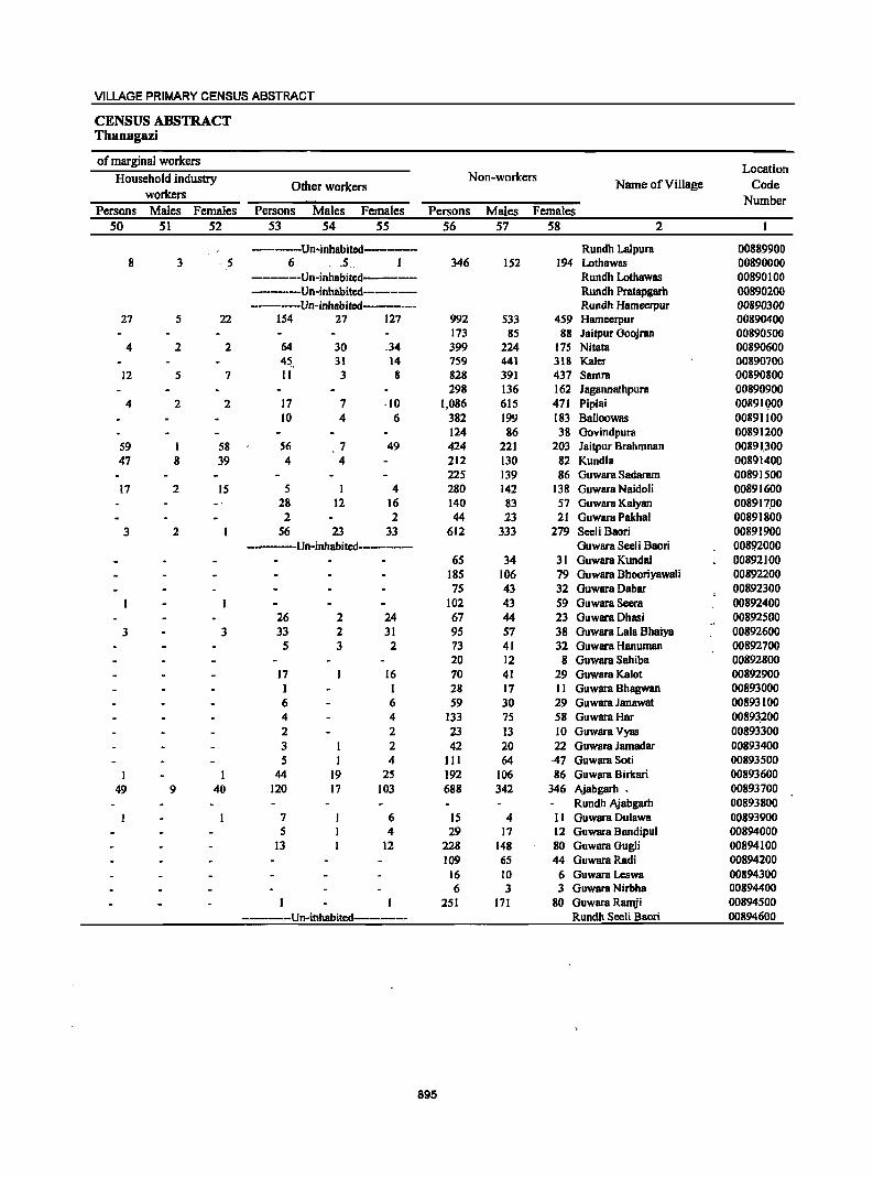
VILLAGE PRIMARY CENSUS ABSTRACT
CENSUS ABSTRACT Thanagazi
of marginal workers Location
Household industry Non-workers Name of Village Code Other workers
workers Number Persons Males Females Persons Males Females Persons Males Females
50 51 52 53 54 55 56 57 58 2
-----------Un-inhabitcd-------- Rundh Lalpura 00889900 8 3 ' ,5 6 , .5. 1 346 152 194 Lothawas 00890000
--------Un-inhabitcd-------- Rundh Lothawas 00890100 -----Un-inhabitcd--------- Rundh Pratapgarh 00890200 ----Un-inhabited--------- Rundh Hameerpur 00890300
27 5 22 154 27 127 992 533 459 Hameerpur 00890400 173 85 88 ]aitpur Goojran 00890500
4 2 2 64 30 _34 399 224 175 Nitata 00890600 45, 31 14 759 441 318 Kaler 00890700
12 5 7 11 3 8 828 391 437 Samra 00890800 298 136 162 Jagannathpura 00890900
4 2 2 17 7 ,10 1,086 615 471 Piplai 00891000 10 4 6 382 199 183 Balloowas 00891100
124 86 38 Govindpura 00891200 59 1 58 56 7 49 424 221 203 Jaitpur Brahmnan 00891_300 47 8 39 4 4 212 130 82 Kundla 00891400
225 139 86 Guwara Sadaram 00891500 17 2 15 5 I 4 280 142 138 Guwara Naidoli 00891600
28 12 16 140 83 57 Guwara Kalyan 008917,00 2 2 44 23 21 Guwara Pakhal 00891800
3 2 56 23 33 612 333 279 Seeli Baari 00891900 -----Un-inhabitcd---------- Guwara Seeli Baari 008!12000
65 34 31 Guwara Kunda! 00892100 185 106 79 Guwara Bhaariyawali 00892200 75 43 32 Guwara Dabar 00892300
102 43 59 Guwara Seera 00892400 26 2 24 67 44 23 Guwara Dhasi 00892500
3 3 33 2 31 95 57 38 Guwara Lala Bhaiya 00892600 5 3 2 73 41 32 Guwara Hanuman 00892700
20 12 8 Guwara Sahiba 00892800 17 16 70 41 29 Guwara Kalat 00892900 1 1 28 17 II Guwara Bhagwan 00893000 6 6 59 30 29 Guwara JanawBt 00893100 4 4 133 75 58 GuwaraHar 00893.200 2 2 23 13 10 GuwarBVyas 00893300 3 2 42 20 22 Guwara JamBdar 00893400 5 1 4 111 64 ·47 Guwara Soti 00893500
I I 44 19 25 192 106 86 Guwara Birkari 00893600 49 9 40 120 11 103 688 342 346 Ajabgarh • 00893700
Rundh AjabgBrh 00893800 7 6 IS 4 II Guwara DulBwa 00893900 5 4 29 17 12 Guwara 8andipul 00894000
13 12 228 148 80 GuwaraGugli 00894100 109 65 44 GuwaraRadi 00894200
16 10 6 Guwara Leswa 00894300 6 3 3 Guwara Nirbha 00894400
251 111 80 GuwarB Ramji 00894500 ------Un-inhabited------- Rundh Secli Baari 00894600
895
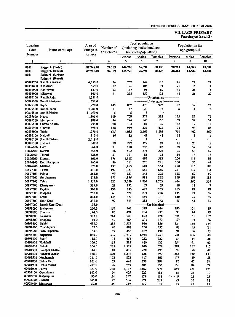
DISTRICT CENSUS HANDBOOK: ALWAR
VILLAGE PRIMARY Panchayat Samiti -
Location Area of Total population
Population in the
Code Name of Village Village in Number of (including institutional and
age-group 0-6
Number hectares households houseless population)
Persons Males Females Persons Males Females 2 3 4 5 6 7 8 9 10
0011 Rajgarh (rotal) 89,748.00 22,109 144,726 76,591 68,135 28,264 14,883 13,381 0011 Rajgarh (Rural) 89,748.00 22,109 144,726 76,591 68,135 28,264 14,883 13,381 0011 Rajgarh (Urban)
Rajgarh (Rural) 00894700 Rundh Kankwari 4,~53.0 36 262 147 115 45 24 21 00894800 Kankwari 859.0 32 176 105 71 26 15 II 00894900 Kaniyawas 147.0 23 167 98 69 41 26 IS 00895000 Mitrawat 105.0 41 275 150 125 48 26 22 00895100 Rundh Rajor 1,551.0 -~-------Un-inhabited------------00895200 Rundh Haripura 632.0 ----------Un-inhabited------------00895300 Rajor 1,970.0 145 867 475 392 132 59 73 00895400 Rundh Tahla 3,981.0 II 37 20 17 6 4 2 00895500 RundhNadoo 11,250.0 5 5 5 00895600 Nadoo 1,301.0 109 709 377 332 153 82 71 00895700 Murlipura 188.0 44 296 146 ISO 63 32 31 00895800 ChawaKaBas 236.0 28 163 87 76 32 17 IS 00895900 Ghewar 698.0 148 959 533 426 178 93 85 00896000 Tabla 1,270.0 645 4,055 2,162 1,893 761 402 359 00896100 Naidoli 313.0 16 82 41 41 14 8 6 00896200 Rundh Dabkan 2,418.0 1 1 1 00896300 Dabkan 302.0 39 222 129 93 41 23 18 00896400 Garh 964.0 71 428 246 182 89 52 37 00896500 Kalwar 458.0 86 502 273 229 105 56 49 00896600 Tilwari 328.0 21 161 83 78 34 16 18 00896700 Sitawat 466.0 176 1,118 605 513 206 Jl4 92 00896800 Kotri Rarnpura 160.0 86 511 270 241 100 56 44 00896900 Mallana 678.0 197 1,165 601 564 220 JlS 105 00897000 Tilwar 376.0 197 1,327 681 646 271 137 134 00897100 Palpur 365.0 Q9 637 342 295 128 69 59 00897200 Gordhanpura 813.0 275 1,856 988 868 379 194 185 00897300 Talab 1,555.0 522 3,569 1,866 1,703 674 360 314 00897400 Khariyawas 339.0 21 132 73 59 18 II 7 00897500 Rajdoli 303.0 130 785 422 363 165 82 83 00897600 Roopbas 253.0 63 521 293 228 135 79 56 00897700 Losal 814.0 138 870 489 381 140 75 65 00897800 Umri Deori 237.0 97 545 283 262 85 42 43 00897900 Rundh Umri Deori 108.0 ------------Un-inhabitcd--------00898000 Pratappura 256.0 154 963 519 444 190 101 89 00898100 Thonsra }44.0 86 491 254 237 93 44 49 00898200 Anawara 383.0 261 1,720 892 828 328 161 ,167 00898300 Roopbas 113.0 42 365 203 162 69 33 36 00898400 Dubbi 438.0 286 1,786 950 836 324 160 164 00898500 Chandupura 107.0 65 497 260 237 86 45 41 00898600 Barh Digawara 58.0 72 456 257 199 91 56 35 00898700 Digawara 860.0 537 3,717 1,954 1,763 748 406 342 00898800 Baori 118.0 74 454 232 222 84 44 40 00898900 Hodaheli 190.0 155 882 460 422 154 91 63 00899000 Bahali 306.0 239 1,519 840 679 282 165 117 00901300 Firozpur Khalsa 44.0 48 415 220 195 92 50 ' 42 00901400 Filozpur Jageer 178.0 200 1,216 626 590 253 120 133 00901500 Madhogarh 211.0 123 823 417 406 177 89 88 00901800 DablaMeo 201.0 63 440 236 204 81 47 34 00901900 DablaMeena 207.0 96 759 404 355 156 84 72 00902000 Palwa 323.0 284 2,137 1,162 975 419 221 198 00902100 Gorakhpura 102.0 74 405 222 183 65 35 30 00902200. Katyanpura 90.0 34 247 129 118 '.'" 49 21 28 00902300 Jirawali 346.0 87 504 271 233 93 55 38 00902400 Murlipura 57.0 35 219 119 100 25 12 13
896
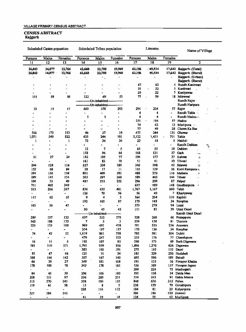
VILLAGE PRIMARY CENSUS ABSTRACT
CENSUS ABSTRACT Rajgarh
Scheduled Castes popuation Scheduled Tribes population Literates Name of Village
Persons Males 'Females Persons Males Females Persons Males Females
II 12 13 14 15 16 17- 18 19 2
26,843 14,077 12,766 42,660- 22,700 19,960 63,156 .. .-45,514 17,642 Rajgarh iffotal) -26;843 14,077 . 12,766 42,660 22,700 19,960 63,156 -45,514 17,642 Rajgarh ,(Rural)
,Rajgal'h: (Urban) Rajgarh -(Rural)
67 63 4 Rundh Kankwari 35 32 3 Kankwari . 29 22 7 Kaniyawas
115 59 56 122 69 53 77 59 18 Mitrawat ···--·--Un·inhabited--··_· Rundh Rajor :
-·-·Un·inhabited-······_··· Rundh Haripura 32 15 17 663 370 293 291 234 57 Rajor
4 4 Rundh Tahla ' 5 5 4 4 Rundh NBdoo ,'_
251 194 57 Nadoo 74 62 12 Murlipura ," 77 49 28 ChawaKaBas
326 173 153 46 27 '19 475 344 131 Ghewar 1,071 549 522 435 244 191 2,122 1,421 701 Tahla
I I 72 36 36 23 18 5 Naidoli Rundh Dabkan >;r -.
12 7 5 65 55 IO Dabkan '-
158 94 64 168 131 37 Garh l(.t'.
51 27 24 182 105 77 194 157 37 Kalwar ::" 161 83 78 51 41 10 Tilwari
244 128 116 fl27 338 289 340 298 42 Sitawat -',1;-
152 68 84 28 17 II 155 129 26 Kotri Rampura.l" 294 156 138 801 409 392 488 372 116 Mallana t'
299 145 154 565 297 268 589 445 144 Tilwar 104 55 49 487 255 232 296 209 87 Pal pur 751 402 349 637 489 148 Gordhanpura -"
513 266 247 836 435 401 1,767 1,167 600 Talab 126 70 56 56 49 7 Khariyawas
117 62 55 9 4 5 364 254 110 Rajdoli 192 105 87 179 145 34 Roopbas
103 56 47 . 373 279 94 Losal 90 45 45 III 82 29 Umri Deori
-·--Un-inhabited----·· Rundh Umri Deori 289 157 132 607 332 275 328 268 60 Pratappura 363 188 175 7 5 2 239 158 81 Thonsra 235 135 100 969 491 478 791 535 256 AnBwara
354 197 157 170 136 34 Roopbas 74 42 32 1,619 861 758 785 581 204 Dubbi
479 247 232 253 176 77 Ch8lldupura 16 11 5 192 107 85 240 171 69 Barh Digawara
581 310 271 1,795 939 856 1,896 1,270 626 Digawara 383 192 191 275 165 110 Baori
93 47 46 125 71 54 585 329 256 Hodaheli 308 166 142 307 167 140 695 506 189 Bahali 66 39 27 349 181 168 191 135 56 Firozpur Khalsa
178 100 78 343 178 165 526 389 137 Firozpur Jageer 299 224 75 Madhogarh
84 45 39 206 106 100 192 138 54 DablaMeo 208 III 97 536 285 251 334 243 91 DablaMeena SIS 270 245 328 193 135 848 636 212 Palwa 119 61 58 13 8 5 238 159 79 Gorakhpura
228 116 112 104 81 23 Kalyanpura 327 184 143 306 186 120 Jirawali
41 23 18 138 95 43 Murlipura
897
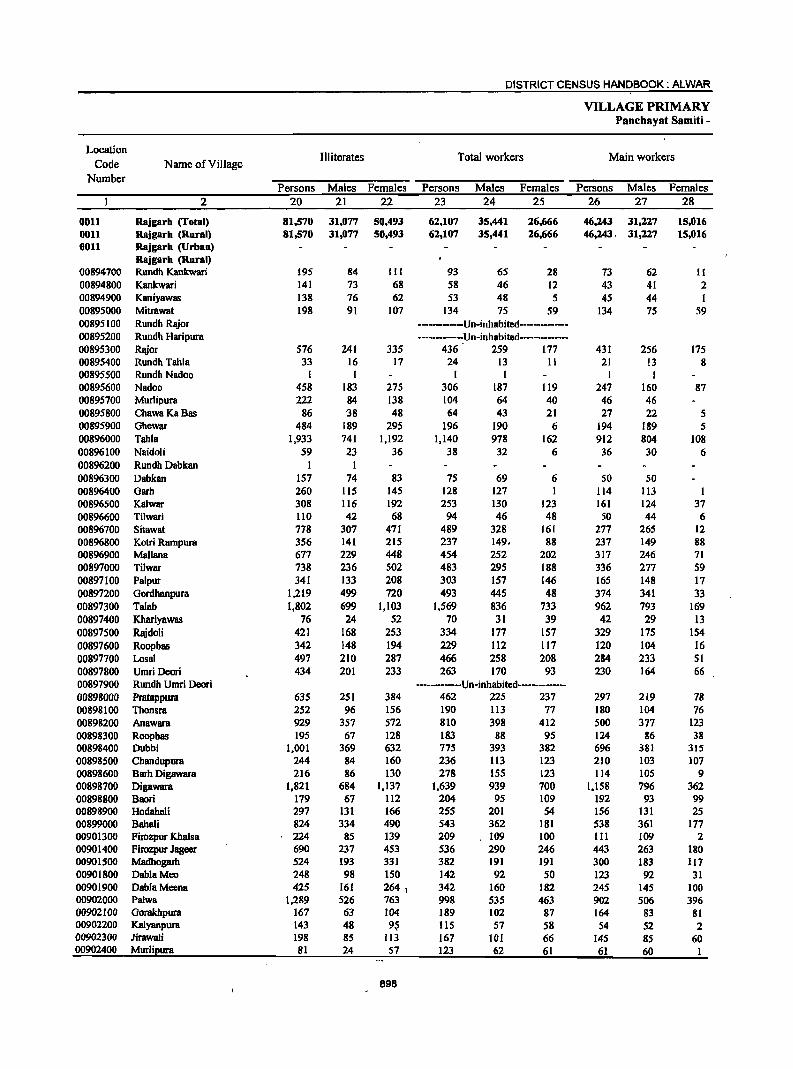
DISTRICT CENSUS HANDBOOK: ALWAR
VILLAGE PRIMARY Panehayat Samiti •
Location III iterates Total workers Main workers
Code Name of Village Number
Persons Males Females Persons Males Females Persons Males Females 2 20 21 22 23 24 25 26 27 28
0011 Rajgarh (Total) 81,570 31,077 50,493 62,107 35,441 26,666 46,243 31,227 15,016 0011 Rajgarh (Rural) 81,570 31,077 50,493 62,107 35,441 26,666 46,243, 31,227 15,016 0011 Rajgarh (Urban)
Rajgarh (Rural) 00894100 Rundh Kankwari 195 84 III 93 65 28 73 62 11 00894800 Kankwari 141 73 68 58 46 12 43 41 2 00894900 Kaniyawas 138 76 62 53 48 5 45 44 I 00895000 Mitrawat 198 91 107 134 75 59 134 75 59 00895100 Rundh Rajor ···_·······Un·inhabited··-········ 00895200 Rundh Haripura ········-···Un·inhBbited·-··········· 00895300 Rajor 576 241 335 436 259 177 431 256 175 00895400 Rundh Tahla 33 16 17 24 13 II 21 13 8 00895500 Rundh Nadoo I I I I I I 00895600 Nadoo 458 183 275 306 187 119 247 160 87 00895700 Murlipura 222 84 138 104 64 40 46 46 00895800 ChawaKaBas 86 '38 48 64 43 21 27 22 5 00895900 Ghewar 484 189 295 196 190 6 194 189 5 00896000 Tahla 1,933 141 1,192 1,140 978 162 912 804 108 00896100 Naidoli 59 23 36 38 32 6 36 30 6 00896200 Rundh Dabkan I I 00896300 Dabkan 157 74 83 75 69 6 SO 50 00896400 Garh 260 115 145 128 127 I 114 113 I 00896S00 Kalwar 308 116 192 253 130 123 161 124 37 00896600 Tilwari 110 42 68 94 46 48 50 44 6 00896700 Sitawat 178 307 471 489 328 161 277 265 12 00896800 Kotri Rampura 356 141 215 237 149. 88 237 149 88 00896900 Mallana 677 229 448 454 252 202 317 246 71 00897000 Tilwar 738 236 502 483 295 188 336 217 59 00897100 Palpur 341 133 208 303 157 146 165 148 17 00897200 Gordhanpura 1,219 499 720 493 445 48 314 341 33 00897300 Talab 1,802 699 1,103 1,569 836 733 962 793 169 00897400 Khariyawas 76 24 52 70 31 39 42 29 13 00897500 Rajdoli 421 168 253 334 177 157 329 175 154 00897600 Roopbas 342 148 194 229 112 117 120 104 16 00897700 Losal 497 210 287 466 258 208 284 233 51 00897800 Umri Deori 434 201 233 263 170 93 230 164 66 00897900 Rundh Umri Deori -·.·------Un-inhabited----·---------00898000 Pratappura 635 251 384 462 225 237 291 219 78 00898100 Thonsra 252 96 156 190 113 77 180 104 76 00898200 Anawara 929 357 572 810 398 412 500 377 123 00898300 Roopbas 195 67 128 183 88 95 124 86 38 00898400 Dubbi 1,001 369 632 775 393 382 696 381 3IS 00898500 Chandupura 244 84 160 236 Il3 123 210 103 107 00898600 Barh Digawara 216 86 130 278 ISS 123 114 lOS 9 00898700 Digawara 1,821 684 1,137 1,639 939 700 1,158 796 362 00898800 Baari 179 67 ll2 204 95 109 192 93 99 00898900 Hodaheli 297 131 166 255 201 54 156 13l 25 00899000 Bahali 824 334 490 543 362 181 538 361 177 00901300 Firozpur Khalsa 224 85 139 209 109 100 III 109 2 00901400 Firozpur Jageer 690 237 453 536 290 246 443 263 180 00901500 Madbogarb 524 193 331 382 191 191 300 183 117 00901800 DablaMeo 248 98 150 142 92 50 123 92 31 00901900 DablaMeena 425 161 264 1 342 160 182 245 145 100 00902000 Palwa 1,289 526 763 998 535 463 902 506 396 00902100 Gorakhpura 167 63 104 189 102 87 164 83 81 00902200 Kalyanpum 143 48 9$ lIS 57 58 54 52 2 00902300 Jirawali 198 85 113 167 101 66 145 85 60 00902400 Murlipura 81 24 57 123 62 61 61 60
898
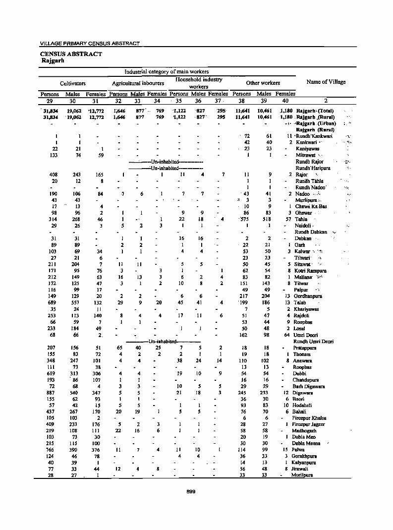
VILLAGE PRIMARY CENSUS ABSTRACT
CENSUS ABSTRACT Rajgarh
Industrial category of main workers
Cultivators Agricultural 'labourers Household industry
Other workers Name of Village workers
Persons Males Females Persons Males Females Persons Males Females Persons Males Females
29 30 31 32 33 34 - 35 36 37 - 38 39 40 2
31,834 19,062 '12,772 1;646 877' " 769 '1,122 "'827 '29'S' 11<,641 10,461 .1,180 Rajgarh.(fotal) 31,834 '19,062 12,772 1;646 877 769 '1,122 ,827' 295 11,641 10,461 1,180 _ Rlijgarh ,(Rural)
- " "RIIJgarh ;(Utban) • r • .. RaJgarh (Rural)
I 72 61 II 'Rundh'Kankwari ,""(:
I I 42 40 2 Kankwari ". • ~, ~~ f<
22 21 I 23 23 Kaniyawas 133 74 59 I I Mitrawat '.'
-~---Un-inhabited--------- Rundh Rajor -~;I,<
, ~Un-inh8bited----------- Rundh'Haripura "!.'
408 243 165 I II 4 7 11 9 2 Rl\ior '. 20 12 8 I I Runilh T8Ida ',',
I I Rundh Nidoo' .~,~
190 106 84 ·7 6 7 7 . 43 41 2 Nadoo ., .. , '!'
43 43 }I 3 3 Murlipura :" .' 17 13 4 10 9 I ChaWli Ka·Bas 98 96 2 I 9 9 86 83 3 Ghewar . :
314 268 46 I ·1 22 18 4 "575 518 57 Tahla 29 26 3 5 2 3 I I I Naidoli, ~ ;
Rundh Dabkan "-...1
31 31 I I 16 16 2 2 Dabkan 89 89 2 2 I I 22 21 I Garh
103 69 34 I 1 4 4 53 50 3 Kalwar " "1;
27 21 6 23 23 Tilwari' "
211 204 7 II II 5 5 50 45 5 Sitawat· r
171 95 76 3 3 I 62 54 8 Kotri Rampura 212 149 63 16 13 3 6 2 4 83 82 I Mallana- '!J..~.;'.
172 125 47 3 I 2 10 8 2 151 143 8 Tilwar 116 99 17 49 49 Palpur ~ '4
149 129 20 2 2 6 6 217 204 13 Gordhanpura 689 557 132 29 9 20 4S 41 4 '199 186 13 Talab 35 24 II 7 5 2 Khariyawas
253 113 140 8 4 4 17 11 6 51 47 4 Rajdoli 66 59 7 I 53 44 9 Roopbas
233 184 49 50 48 2 Losal 68 66 2. 162 98 64 Urnri Deori
----Un-inhabited----- Rundh Urnri Deori 207 156 51 65 40 2S 7 5 2 18 18 Pratappura 155 83 72 4 2 2 2 I 19 18 I Thonsra 348 247 101 4 4 38 24 14 110 102 8 Anawara III 73 38 13 13 Roopbas 619 313 306 4 4 19 10 9 S4 S4 Dubbi 193 86 107 I I 16 16 Chandupura 72 68 4 3 3 10 5 5 29 29 Barb Digawara
887 540 347 5 5 21 18 3 245 233 12 Digllwara 155 62 93 I I 36 30 6 Baori 57 42 IS 5 5 I I 93 83 10 Hodahcli
437 267 170 20 19 5 5 76 70 6 Bahali 105 103 2 6 6 Firozpur Khalsa 409 233 176 5 2 3 28 27 Firozpur Jageer 219 108 III 22 16 6 58 58 Madhogarh 103 73 30 20 19 DablaMeo 215 liS 100 30 30 DablaMeena 766 390 376 II 7 4 II 10 114 99 15 Palwa 124 46 78 4 4 36 33 3 Gorakhpura 40 39 I 14 13 Kalyanpura 77 33 44 12 4 8 56 48 8 Jirawali 28 27 I 33 33 Murlipura
899
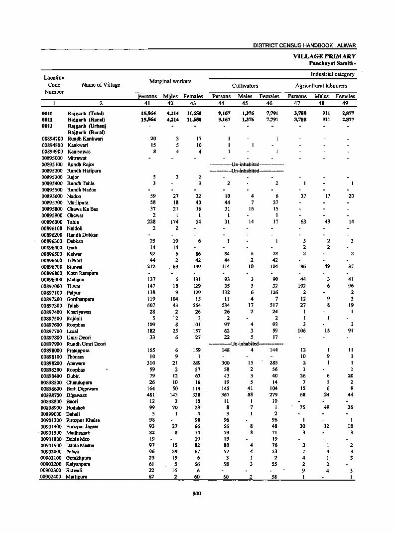
DISTRICT CENSUS HANDBOOK: ALWAR
VILLAGE PRIMARY Panchayat Samiti -
Location Industrial category
Code Name ofYillage Marginal workers
Cultivators Agricultural labourers Number
Persons Males Females Persons Males Females Persons Males Females 2 41 42 43 44 45 46 47 48 49
0011 Rlljgarh (Total) 15,864 4,214 11,650 9,167 1,376 7,791 3,788 911 2,877 0011 RIljgarh (Rural) 15,864 4,214 11,650 9,167 1,376 7,791 3,788 911 2,877 0011 Rajgarh (Urban)
Rajgarh (Rural) 00894700 Run,dh Kankwari 20 3 17 00894800 Kankwari 15 5 10 00894900 Kaniyawas 8 4 4 00895000 Mitrawat 00895100 Rundh Rajor -----------Un-inhabited------------00895200 Rundh Haripura -------------Un-inhabited--------00895300 Rajor 5 3 2 00895400 Rundh Tabla 3 3 2 2
00895500 RundhNadoo 00895600 Nadoo 59 27 32 10 4 6 37 17 20 00895700 Murlipura 58 18 40 44 ,7 37 00895800 ChawaKaBas 37 21 16 31 16 15 00895900 Ghewar 2 I 1 1 1 00896000 Tahla 228 174 S4 31 14 17 63 49 14 00896100 Naidoli 2 2 00896200 Rundh Dabkan 00896300 Dabkan 25 19 6 5 2 3 00896400 Garh 14 14 2 2 00896500 Kalwar 92 6 86 84 6 78 2 2 00896600 Tilwari 44 2 42 44 '2 42 00896700 Sitawat 212 , 63 149 114 10 104 86 49 37 00896800 Kotri Rampura 00896900 Mallana 137 6 131 93 3 90 44 3 41 00897000 Tilwar 147 18 129 35 3 32 102 6 96 00897100 Palpur 138 9 129 132 6 126 2 2 00897200 Gordhanpura 119 104 15 11 4 7 12 9 3 00897300 Talab 607 43 564 534 17 517 27 8 19 00897400 Khariyawas 28 2 26 26 2 24 1 00897500 Rajdoli 5 '2 3 2 2 1 00897600 Roopbas 109 8 101 97 4 93 3 3 00897700 Losal 182 2S 157 62 3 59 106 15 91 00897800 Umri Deori 33 6 27 22 5 17 00897900 Rundh Umri Dcori -------Un-inhBbited---------00898000 PrBtappura 165 6 159 148 4 144 12 I 11 00898100 Thonsra 10 9 1 10 9 1 00898200 Anawara 310 21 289 300 15 285 2 1 00898300 Roopbas 59 2 57 58 2 56 1 00898400 Dubbi 79 12 67 43 3 40 26 6 20 00898500 Chandupura 26 10 16 19 5 14 7 5 2 00898600 Barh Digawara 164 50 114 145 41 104 15 6 9 00898700 Digawara 481 143 338 367 88 279 68 24 44 00898800 Baori 12 2 10 11 1 10 00898900 HodaheJi 99 70 29 8 7 1 75 49 26 00899000 Bahali 5 1 4 3 1 2 00901300 Firozpur Khalsa 98 98 96 96 1 1 00901400 Firozpur Jageer 93 27 66 56 8 48 30 12 18
, 00901500 Madhogarh 82 8 74 79 8 71 3 3 00901800 DablaMeo 19 19 19 19 00901900 DablaMeena 97 15 82 80 4 76 3 2 00902000 Palwa 96 29 67 57 4 S3 7 4 3 00902100 Gorakhpura 25 19 6 3 1 2 4 1 3 00902200 Kalyanpura 61 5 56 58 3 55 2 2 00902300 Jirawali 22 16 6 9 4 5 00902400 Murlipura 62 2 60 60 2 58 1
900
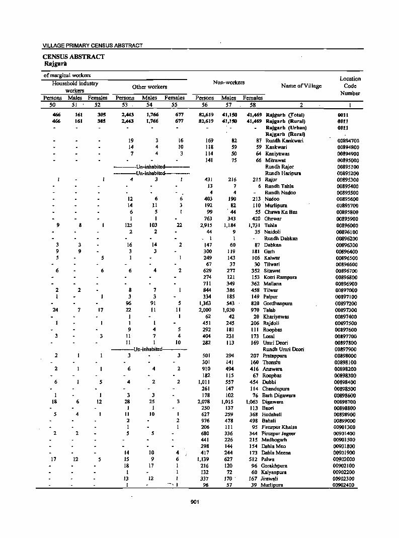
VILLAGE PRIMARY CENSUS ABSTRACT
CENSUS ABSTRACT Rajgarh
of marginal workers Location
Household industIy Non-workers Name of Village Code Other workers
workers Number Persons Males Females Persons Males Females Persons Males Females
50 SI S2 53 . 54 55 S6 57 58 2
466 161 305 2,443 1,766 677 82,619 41,150 41,469 Rajgarh (.Total) 0011 466 161 305 2,443 1,766 677 82,619 41,150 41,469 Rajgarh (Rural) 0011
Rajgarh (Urban) 0011 Rajgarb (Rural)
19 3 16 169 82 87 Rundh Kankwari 00894700 14 4 10 118 59 59 Kankwari 00894800 7 4 3 114 50 64 Kaniyawas 00894900
141 75 66 Mitrawat 00895000 -----Un-inhabited-------- Rundh Rajor 00895100 ----Un-inhabited------- Rundh Haripura 00895200
4 3 1 431 216 215 Rajor 00895300 13 7 6 Rundh Tahla 00895400 4 4 Rundh Nadoo 00895500
12 6 6 403 190 213 Nadoo 00895600 14 11 3 192 82 110 Murlipura 00895700 6 5 99 44 55 ChawaKaBas 00895800
I 763 343 420 Ghewar 00895900 9 8 125 103 22 2,915 1,184 1,731 Tahla 00896000
2 2 44 9 35 Naidoli 00896100 , I 1 Rundh Dabkan 00896200
3 3 16 14 2 147 60 87 Dabkan 00896300 9 9 3 3 300 119 181 Garh 00896400 5 5 I 249 143 106 Kalwar 00896500
67 37 30 Tilwari 00896600 6 6 6 4 2 629 277 352 Sitawat 00896700
274 121 153 Kotri Rampura 00896800 711 349 362 Mallana 00896900
2 2 8 7 844 386 458 Tilwar 00897000 1 3 3 334 185 149 Palpur 00897100
96 91 5 1,363 543 820 Gordhanpura 00897200 24 7 17 22 11 11 2,000 1,030 970 Talab 00897300
1 I 62 42 20 Khariyawas 00897400 1 1 451 245 206 Rajdoli 00897500 9 4 5 292 181 111 Roopbas 00897600
3 3 11 7 4 404 231 173 Losal 00897700 11 I 10 282 113 169 Umri Deari 00897800
-----Un-inhabited------ Rundh Umri Deori 00897900 2 3 3 501 294 207 Pratappura 00898000
301 141 160 Thonsta 00898100 2 6 4 2 910 494 416 Anawara 00898200
182 115 67 Roopbas 00898300 6 5 4 2 2 1,011 557 454 Dubbi 00898400
261 147 114 Chandupura 00898500 1 3 3 178 102 76 Barh Digawara 00898600
18 6 12 28 25 3 2,078 1,015 1,063 Digawara 00898700 1 I 250 137 113 Baori 00898800
5 4 II 10 I 627 259 368 Hodaheli 00898900 2 2 976 478 498 Bahali 00899000 I 206 111 95 Firozpur Khalsa 00901300
2 2 5 5 680 336 344 Firozpur Jageer 00901400 441 226 215 Madbogarb 00901500 298 144 154 DablaMeo 00901800
14 10 4 417 244 173 DablaMccna 00901900 17 12 5 15 9 6 1,139 627 512 Palwa 00902000
18 17 I 216 120 96 Gorakhpura 00902100 1 1 132 72 60 Kalyanpura 00902200
13 12 337 170 ' 167 Jira~lj 00902300 '-, I 96 57 39 Murlipura 00902400
901
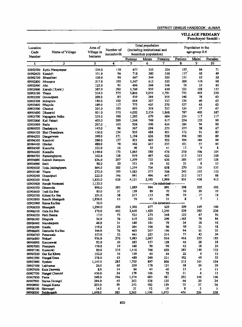
DISTRICT CENSUS HANDBOOK: ALWAR
VILLAGE PRIMARY Panchayat Samiti -
Location Area of Total population
Population in the
Code Name of Village Village in Number of (including institutional and
age-group 0-6
Number hectares households houseless population)
Persons Males Females Persons Males Females ,2 3 4 5 6 7 8 9 10
00902500 K~thi Narayanpur '234,0 110 677 353 324 155 84 71 00902600 Kandoli 131.0 96 718 380 338 117 68 49 00902700 Bhankhari 120.0 94 647 344 303 121 63 58 00902800 Moonpur 217,0 192 1,147 612 535 208 110 98 00902900 Alei 125,0 91 496 248 248 76 33 43 00903000 Karotb ( Rural) 387,0 292 1,769 939 830 321 168 153 00903100 Thana 334.0 575 3,846 2,055 1,791 732 402 330 00903200 Govindpura 208.0 85 539 284 255 140 78 62 00903300 Indrapura 186.0 102 664 327 337 134 69 65 00903400 Bhajeda 189.0 117 775 405 370 127 65 62 00903500 Cheetos 201.0 103 695 358 337 124 57 67 00903600 Dhamred 931.0 570 4,002 2,134 1.868 787 400 387 00903700 Nayagaon Bolka 239.0 188 1,283 679 604 234 117 117 00903800 Kali Pahari 405.0 209 1.366 749 617 254 155 99 00903900 Barla 207,0 165 924 490 434 184 94 90 00904000 Daulatpura 143.0 96 567 294 273 125 58 67 00904100 Shri Chandpura 150.0 154 935 484 451 173 91 82 00904200 Dangarwara 598.0 171 1.194 636 558 194 lOS 89 00904300 Kundroli 288.0 137 921 469 452 194 104 90 00904400 Dholan 488.0 70 482 247 235 101 57 44 00904500 Kooncha 322.0 16 96 55 41 17 9 8 00904600 Koondla 1,140.0 173 1,065 589 476 210 106 104 00904700 Ramsinghpura 352.0 138 919 497 422 213 113 100 00904800 KakraJi Rampura 636.0 207 1,359 723 636 285 157 128 00904900 Berli 88.0 20 121 59 62 21 8 13 00905000 Toda Jaisinghpura 664.0 202 1,354 726 628 270 135 135 00905100 Thana 275.0 193 1.083 577 506 245 133 112 00905200 Doondpuri 222,0 146 941 494 447 215 117 98 00905300 Khoh 1,830.0 626 4,10] 2,102 ],999 851 438 413 00905400 Rundh Narayani 1,133.0 ------Un-inhabited------00905500 Dheeroda 896.0 285 1,889 994 895 398 205 193 00905600 Todi KaBas 83.0 31 159 89 70 30 20 10
00905700 Khirat Ka Bas 251.0 38 212 113 99 35 17 18 00905800 Rundh Bhangarh 1,826.0 13 76 45 31 8 7 I 00905900 Ratna Ka Bas 36.0 -------Un-inhabited-------00906000 Bhangarh 1,294.0 200 1,306 677 629 309 149 160 00906100 GolaKaBas 170.0 402 2,650 1,420 1,230 529 293 236 00906200 Patti Beena 17.0 75 521 273 248 123 67 56 00906300 Sitapura 34.0 76 619 320 299 ,162 78 84
00906400 Namdarpura 48.0 31 180 101 79 34 18 16 00906500 Keella 119.0 23 204 108 96 39 21 ]8 00906600 Damodar Ka Bas 166.0 76 463 267 196 94 61 33 00906700 Pemawala 157.0 52 441 227 214 77 43 34 00906800 Birkari 936.0 276 1,983 1,067 916 416 233 183 00906900 Kaniyawas 93,0 30 285 157 128 46 28 18 00907000 Prempura 150.0 19 180 90 90 42 18 24 00907100 Kootooki 89.0 219 1,416 766 650 282 149 133 00907200 GurKa Khera 152.0 16 129 65 64 22 9 13 00907300 NangalDasa 378.0 S3 480 249 231 102 49 53 00907400 Syaiuta 1,140.0 285 1,703 897 806 315 161 154 00907500 Lakhawas 26.0 65 329 178 151 58 29 29 00907600 Kala Deewala 8.0 14 84 44 40 15 4 11 00907700 Nangal Chandel 450.0 34 178 106 72 21 8. ]3 00907800 Paota 249.0 196 1,274 693 581 252 146 106 00907900 Barwa Doongri 294.0 45 263 138 125 44 20 24 00908000 Nangal.Kama 207.0 S9 342 183 159 73 37 36 00908100 Shivnagri 14.0 6 31 12 19 8 3 5 00908200 Baldeogarh 1,648.0 383 2,263 1,190 1,073 474 236 238
902
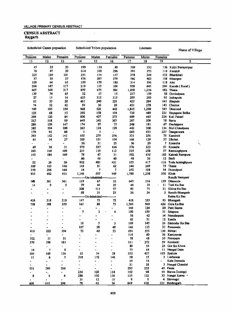
VILLAGE PRIMARY CENSUS ABSTRACT
CENSUS ABSTRACT Rajgarh
Scheduled Castes popuation Scheduled Tribes population Literates Name of Village
Persons Males Females Persons Males Females Persons Males Females 11 12 13 14 15 16 17 18 19 2
45 25 20 199 110 89 369 233 136 Kothi Narayanpur 76 47 29 614 318 296 391 273 118 Kandoli
225 124 101 231 114 117 378 246 132 Bhankhari 57 30 27 576 297 279 560 402 158 Moonpur
129 64 65 J59 179 180 314 196 118 Alei 264 147 117 219 115 104 939 645 294 Karoth ( Rural) 665 348 317 859 475 384 1,858 1,276 582 Thana 139 74 65 32 17 15 217 159 58 Govindpura 27 11 16 625 310 315 295 200 95 Indrapura 63 35 28 461 240 221 425 284 141 Bhajeda 74 32 42 59 30 29 421 278 143 Chcctos
749 395 354 968 526 442 1,845 1,298 547 Dhamrcd 123 68 55 292 158 134 720 489 231 Nayagaon Bolka 204 120 84 800 427 373 689 465 224 Kali Pahari 21.7 118 99 649 342 307 387 309 78 ~Ia 286 139 147 174 97 77 248 181 67 Daulatpura 382 194 188 263 134 129 442 308 134 Shri Chandpura 179 91 88 1 I 660 433 227 Dangarwara 293 152 141 555 279 276 331 256 75 Kundroli
61 34 27 305 151 154 166 129 37 Oholan 56 31 25 36 29 7 KoonchB '.
69 38 31 973 537 436 376 323 53 Koondla 243 134 109 231 119 112 315 258 57 Ramsinghpura 353 184 169 78 47 31 592 410 182 Kakrali Rampura
.86 46 40 48 36 12 Berti 52 26 26 902 481 421 533 417 116 Toda Jaisinghpura
309 163 146 143 81 62 344 269 75 Thana 370 206 164 14 7 7 252 198 54 Doondpuri 933 482 451 1,146 597 549 1,788 1,238 550 Khoh
----Un-inhabitcd----- Rundh Narayani 71ii 381 361 119 67 52 645 516 129 Dheeroda
14 9 5 79 44 35 46 35 11 TodiKaBas 208 111 97 92 71 21 Khirat Ka Bas
58 35 23 26 24 2 Rundh Bhangarh -----Un-inhabitcd-------- RatnaKaBas
428 218 210 147 7S 72 418 325 93 Bhangarh 738 388 350 161 88 73 1,366 940 426 GolaKaBas
144 124 20 Patti Bcena 7 3 4 190 159 31 Sitapura
56 42 14 Namdarpura 63 51 12 Keetla
10 5 5 169 145 24 Damodar Ka Bas 107 58 49 146 113 33 Pemawala
416 222 194 73 40 33 691 555 136 Birkari 116 80 36 KaniyawllS
102 51 51 78 48 30 Prcmpura 379 198 181 311 272 39 Kootooki
80 S4 26 GurKa Khera 16 7 9 75 64 II NangaJ Ossa
305 169 136 62 34 28 532 427 105 Syaluta 11 6 5 318 172 146 58 55 3 Lakhawas
16 16 Kala Decwala 31 28 3 Nangal Chandel
551 285 266 295 255 40 Paota 234 120 114 152 98 54 Barwa DoongJ;i
8 4 4 288 ISO 138 135 102 33 Nangal Kama • 31 12 19 9 5 4 Shivnagri
608 -'310 298 78 42 36 849 628 221 Baldeogarb
903
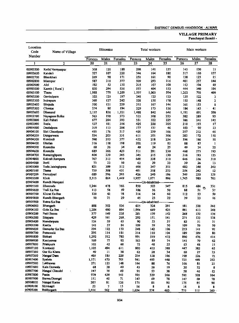
DISTRICT CENSUS HANDBOOK: ALWAR
VILLAGE PRIMARY Panchayat Samiti -
Location Illiterates Total workers Main workers
Code Name of Village Number
Persons Males Females Persons Males Females Persons Males Females 2 20 21 22 23 24 25 26 27 28
00902500 Kothi Narayanpur 308 120 188 298 141 157 145 130 IS 00902600 Kaildoli 327 107 220 344 164 180 317 160 157 00902700 Bhankhari 269 98 171 251 161 90 138 123 IS 00902800 Moonpur 587 210 377 509 293 216 401 257 144 00902900 Ale; 182 52 130 215 Iq7 108 153 104 49 00903000 Karoth ( Rural ) 830 294 536 557 404 153 444 340 104 00903100 Thana 1,988 779 1,209 1,597 1,003 594 1,202 793 409 00903200 Govindpura 322 125 197 245 122 123 125 122 3 00903300 Indrapura 369 127 242 328 150 178 150 148 2 00903400 Bhl\ieda 350 121 229 311 167 144 161 153 8 00903500 Chectos 274 80 194 329 173 156 184 143 41 00903600 Dhamred 2,157 836 1,321 1,488 842 646 1,191 691 500 00903700 Nayagaon Bolka 563 190 373 533 308 225 382 289 93 00903800 Kali Pabari 677 284 393 551 322 229 386 241 145 00903900 Barla 537 181 356 425 220 205 210 193 17 00904000 Daulatpura 319 113 206 177 131 46 103 90 13 00904100 Shri Chandpura 493 176 317 405 239 166 257 212 45 00904200 Dangarwara 534 203 331 611 305 306 282 172 110 00904300 Kundroli 590 213 377 452 218 234 196 186 10 00904400 Dholan 316 118 198 202 119 83 88 87 1 00904500 Kooncha 60 26 34 49 24 25 49 24 25 00904600 Koond1a 689 266 423 511 281 230 468 275 193 00904700 Ramsinghpura 604 239 365 345 215 130 316 193 123 00904800 Kakrali Rampura 767 313 454 648 338 310 646 336 310 00904900 Berli 73 23 50 62 29 33 39 26 13 00905000 TOOa Jaisinghpura 821 309 512 698 347 351 682 340 342 00905100 Thana 739 308 431 491 258 233 254 242 12 00905200 Doondpuri 689 296 393 426 240 186 349 220 129 00905300 Khoh 2,313 864 1,449 1,957 1,071 886 1,743 980 763 00905400 Rundh Narayani -------Un-inhabited------00905500 Dheeroda 1,244 478 766 850 503 347 815 484 ~ 331 00905600 TOOi KaBas Il3 54 59 106 56 50 88 51 37 00905700 Khirat Ku Bas 120 42 78 114 54 60 112 53 59 00905800 Rundh Bhangarh 50 21 29 45 23 22 39 23 16 00905900 RatnaKaBas --------Un-inhabited----------00906000 Bhangarh 888 352 536 615 324 291 581 320 261 00906100 GoluKaBas 1,284 480 804 1,094 669 425 881 613 268 00906200 Patti Becna 377 149 228 281 139 142 268 132 136 00906300 Sitapura 429 161 268 .. 292 151. 141 271 133 138 00906400 Namdarpura 124 59 65 90 S3 37 82 51 31 00906500 Kcetla 141 57 84 109 59 50 109 S9 SO 00906600 Damodar Ka Bas 294 122 172 248 142 106 233 141 92 00906700 Pemawahi 295 114 181 214 110 104 189 ·109 80 00906800 BirkBri 1,292 512 780 991 519 472 890 476 414 00906900 Kaniyawas 169 77 92 163 89 74 141 79 62 00907000 Prempura 102 42 60 73 48 25 63 48 15 00907100 Kootooki 1,105 494 611 800 412 388 447 382 65 00907200 GurKaKhera 49 11 38 62 28 34 60 27 33 00907300 Nanga! Dasa 405 185 220 234 128 106 198 126 72 00907400 Syaluta 1,171 470 701 941 493 448 721 469 252 00907500 Lakhawas 271 123 148 164 88 76 106 85 21 00907600 Kala Deewala 68 28 40 45 26 19 30 22 8 00907700 Nangal Chandel 147 78 69 91 53 38 58 46 ·12 00907800 Paota 979 438 541 595 329 266 592 328 264 00907900 Barwa Doongri 111 40 71 147 69 78 147 69 78 00908000 Nanga! Kama 207 81 126 175 85 90 175 85 90 00908100 Shivnagri 22 7 IS 16 8 8 16 8 8 00908200 Baldeogarh 1,414 562 852 1,034 574 460 775 515 260·
904
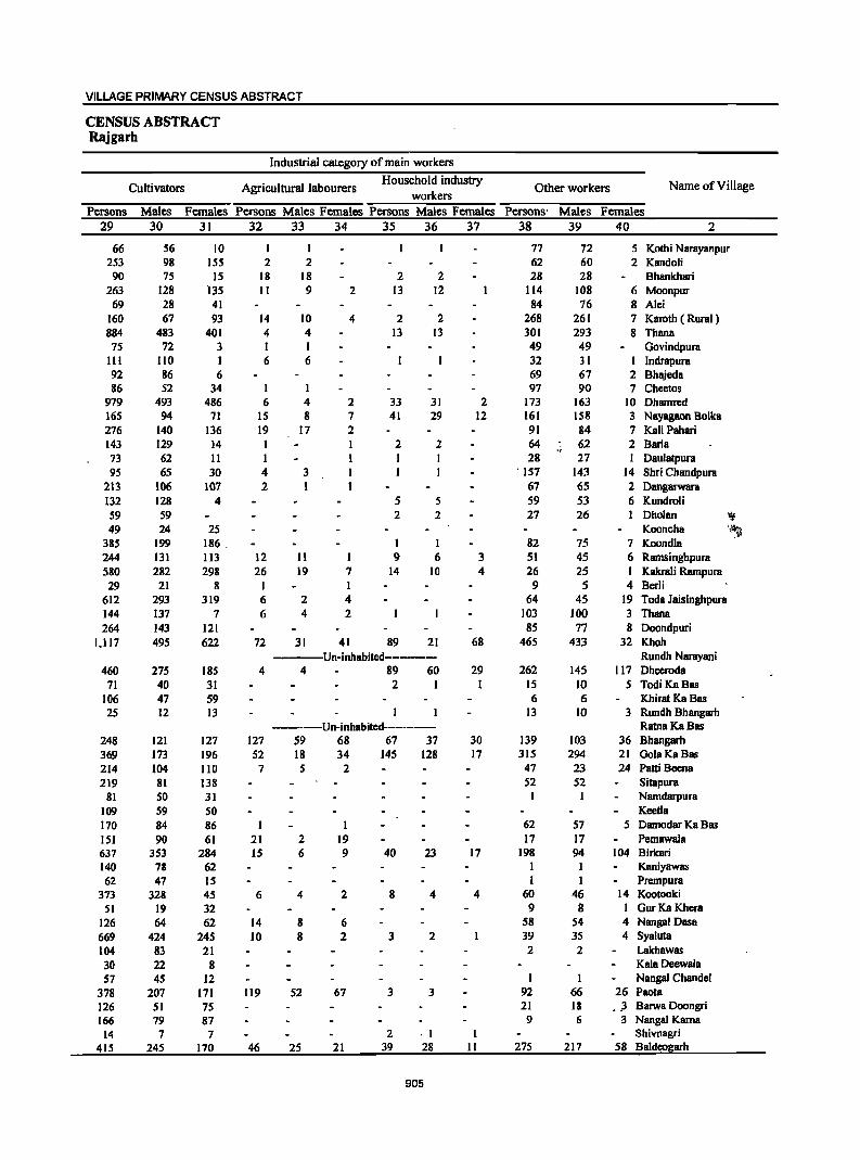
VILLAGE PRIMARY CENSUS ABSTRACT
CENSUS ABSTRACT Rajgarh
Industrial category of main workers
Cultivators Agricultural labourers Household industry
Other workers Name of Village workers
Persons Males Females Persons Males Females Persons Males Females Persons' Males Females 29 30 31 32 33 34 35 36 37 38 39 40 2
66 56 10 77 12 5 Kothi Narayanpur 253 98 ISS 2 2 62 60 2 Kandoli 90 75 IS 18 18 2 2 28 28 Bhankhari
263 128 135 II 9 2 13 12 114 108 6 Moonpur 69 28 41 84 76 8 Alci
160 67 93 14 10 4 2 2 268 261 7 Karoth ( Rural) 884 483 401 4 4 13 13 301 293 8 Thana
75 72 3 I I 49 49 Govindpura III 110 I 6 6 32 31 I Indrapura 92 86 6 69 67 2 Bhajcda 86 52 34 97 90 7 Chectos
979 493 486 6 4 2 33 31 2 173 163 10 Dhamrcd 165 94 71 15 8 7 41 29 12 161 158 3 Nayagaon Bolka 276 140 136 19 17 2 91 84 7 KaU Pahari 143 129 14 I I 2 2 64 62 2 Barla 73 62 II I I 28 27 Daulatpura 95 65 30 4 3 ' 157 143 14 Shri Chandpura
213 106 107 2 1 67 65 2 Dangarwara 132 128 4 5 5 59 53 6 Kundroli S9 S9 2 2 27 26 I Dholan ~ 49 24 25 Kooncha 11~
385 199 186 . I 1 82 75 7 Koondla 244 131 113 12 11 1 9 6 3 51 45 6 Ramsinghpura 580 282 298 26 19 7 14 10 4 26 25 I Kakrali Rampura 29 21 8 1 1 9 5 4 BcrU
612 293 319 6 2 4 64 45 19 Toda Jaisinghpura 144 137 7 6 4 2 103 100 3 Thana 264 143 121 85 77 8 Doondpuri
1,117 495 622 72 31 41 89 21 68 465 433 32 Khoh ---Un-inhabitcd-------- Rundh Narayani
460 275 185 4 4 89 60 29 262 145 117 Dhecroda 71 4D 31 2 I 1 15 10 5 TodiKaBas
106 47 59 6 6 Khirat Ka Bas 25 12 13 13 10 3 Rundh Bhangarh
-----Un-inhabitcd-------- RatnaKaBas 248 121 127 127 59 68 67 37 30 139 103 36 Bhangarh 369 173 196 52 18 34 145 128 17 315 294 21 GolaKaBas 214 104 110 7 5 2 47 23 24 Pani Becna 219 81 138 52 52 Sitapura
81 50 31 1 Namdarpura 109 59 50 Keetla 170 84 86 I I 62 57 5 Damodar Ka Bas 151 9D 61 21 2 19 17 17 Pemawala 637 353 284 15 6 9 40 23 17 198 94 104 Birkari 140 78 62 I I Kaniyawas 62 47 15 I I Prcmpura
373 328 45 6 4 2 8 4 4 60 46 14 Kootooki 51 19 32 9 8 I GurKa Khera
126 64 62 14 8 6 58 54 4 Nangal Dasa 669 424 245 10 8 2 3 2 39 35 4 Syaluta 104 83 21 2 2 Lakhawas 30 22 8 Kala Dcewala 57 45 12 I Nanga! Chandcl
378 207 171 119 52 67 3 3 92 66 26 Paota 126 51 75 21 18 • _3 Barwa Doongri 166 79 87 9 6 ;3 Nangal Kama
14 7 7 2 ·1 1 Shivnagri 41S 245 170 46 25 21 39 28 11 275 217 58 Baldeogarh
905
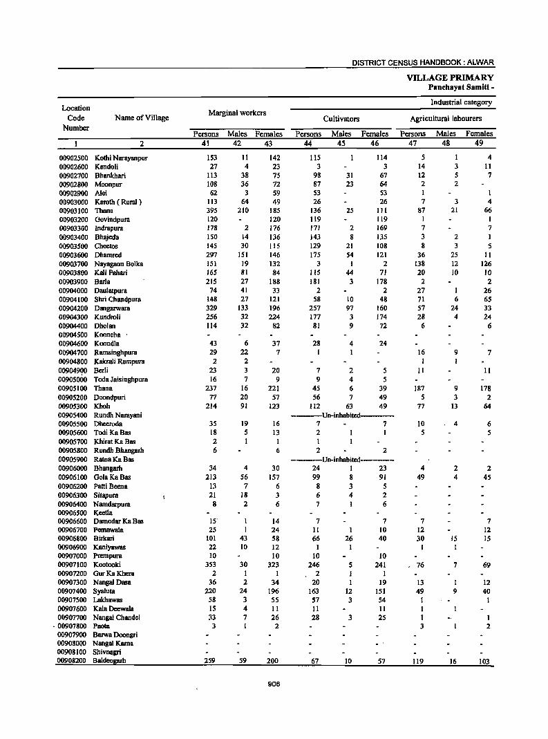
DISTRICT CENSUS HANDBOOK: ALWAR
VILLAGE PRIMARY Panchayat Samiti -
Location Industrial category
Code Name of Village Marginal workers
Cultivators Agricultural labourers Number
Persons Males Females Persons Males Females Persons Males Females
2 41 42 43 44 45 46 47 48 49
00902500 Kothi Narayanpur 153 11 142 115 114 5 I 4 00902600 Kandoli 27 4 23 3 3 14 3 11 00902700 Bhankhari 113 38 75 98 31 67 12 5 7 00902800 Moonpur J08 36 72 87 23 64 2 2 00902900 A1ei 62 3 59 53 53 1 00903000 Karoth ( Rural) 113 64 49 26 26 7 3 4 00903100 Thana 395 210 185 136 25 III 87 21 66 00903200 Govindpura 120 120 119 119 I 00903300 Indrapura 178 2 176 171 2 169 7 7 00903400 Bhajeda ISO 14 136 143 8 135 3 2 1 00903500 Cheetos 145 30 115 129 21 108 8 3 5 00903600 Dhamred 297 151 146 175 54 121 36 25 II 00903700 Nayagaon Bolka 151 19 132 3 I 2 138 12 126 00903800 Kali Pahari 165 81 84 115 44 71 20 10 10 00903900 Barla 215 27 188 181 3 178 2 2 00904000 Oaulatpura 74 41 33 2 2 27 I 26 00904100 Shri Chandpura 148 27 121 58 10 48 71 6 65 00904200 Oangarwara 329 133 196 257 97 160 57 24 33 00904300 Kundroli 256 32 224 177 3 174 28 4 24 00904400 Oholan 114 32 82 81 9 72 6 6 00904500 Kooncha 00904600 Koondla 43 6 37 28 4 24 00904700 Ramsinghpura 29 22 7 I I 16 9 7 00904800 Kakrali Rampura 2 2 I 00904900 Berli 23 3 20 7 2 5 11 II 00905000 Toda Jaisinghpura 16 7 9 9 4 5 00905100 Thana 237 16 221 45 6 39 187 9 178 00905200 Ooondpuri 77 20 57 56 7 49 5 3 2 00905300 Khoh 214 91 123 Il2 63 49 77 13 64 00905400 Rundh Narayani ------Un-inhabited-·-···-00905500 Ohecroda 35 19 16 7 7 10 4 6 00905600 Todi KaBas 18 5 13 2 I 5 5 00905700 Khirat Ka Bas 2 I I 00905800 Rundh Bhangarh 6 6 2 2 0090S900 RatnaKaBas _·····-·-Un·inhabited···--····· 00906000 Bhangarh 34 4 30 24 I 23 4 2 2 00906100 GolaKaBas 213 56 157 99 8 91 49 4 4S 00906200 Patti Beena 13 7 6 8 3 S 00906300 Sitapura 21 18 3 6 4 2 00906400 Namdarpura 8 2 6 7 6 00906500 Keetla 00906600 Oamodar Ka Bas IS' I 14 7 7 7 7 00906700 Pemawala 25 I 24 II I 10 12 12 00906800 Birkari 101 43 58 66 26 40 30 ]5 15 00906900 Kaniyawas 22 10 ]2 I I I I 00907000 Prempura 10 10 10 10 00907100 Kootooki 3S3 30 323 246 5 241 76 7 69 00907200 GurKaKhera 2 1 1 2 1 1 00907300 Nanga! Oasa 36 2 34 20 1 19 13 I 12 00907400 SyaIuta 220 24 196 163 12 151 49 9 40 00907500 Lakhawas 58 3 55 S7 3 54 I 1 00907600 Kala Deewala 15 4 11 11 11 I 00907700 Nangal Chandel 33 7 26 28 3 25 I I
·00907800 Paota 3 I 2 3 2 00907900 Barwa Doongri 00908000 Nangal Kama 00908100 Shivnagri 00908200 Baldeogarh 259 59 200 67 10 57 119 16 103
906
VILLAGE PRIMARY CENSUS ABSTRACT
CENSUS ABSTRACT Rajgarh
of marginal workers Location
Household industry Non-workers Name of Village Code Other workers
workers Number Persons Males Females Persons Males Females Persons Males Females
50 51 52 53 54 55 56 57 58 2
I 32 8 24 379 212 167 Kothi Narayanpur 00902500 3 3 7 I 6 374 216 158 Kandoli 00902600 I I 2 2 396 183 213 Bhankhari 00902700 5 5 14 6 8 638 319 319 Moonpur 00902800
8 3 5 281 141 140 Alei 00902900 80 61 19 1,212 535 677 Karoth ( Rural ) 00903000
6 2 4 166 162 4 2,249 1,052 1,197 Thana 00903100 294 162 132 Govindpura 00903200 336 177 159 Indrapura 00903300
4 4 464 238 226 Bhajeda 00903400 8 6 2 366 185 181 Cheetos 00903500
17 10 7 69 62 . 7 2,514 1,292 1,222 Dhamred 00903600 2 2 8 6 2 750 371 379 Nayagaon Bolka 00903700
30 27 3 81S 427 388 Kali Pahari 00903800 2 2 30 24 6 499 270 229 Barla 00903900
45 40 5 390 163 227 Daulatpura 00904000 19 11 8 530 245 285 Shri Chandpura 00904100 IS 12 3 583 331 252 Dangarwara 00904200
4 3 47 24 23 469 251 218 Kundroli 00904300 1 26 22 4 280 128 152 Dholan 00904400
47 31 16 Kooncha 00904500 15 2 13 554 308 246 Koondla 00904600 12 12 574 282 292 Ramsinghpura 00904700
711 385 326 Kakrali Rarnpura 00904800 5 I 4 59 30 29 Berli 00904900
4 4 3 3 656 379 277 Toda Jaisinghpura 00905000 2 2 3 I 2 592 319 273 Thana 00905100
16 10 6 SIS 254 261 Doondpuri 00905200 9 8 16 14 2 2,144 1,031 1,113 Khoh 00905300
----Un-inhabited----- Rundh Narayani 00905400 18 IS 3 1,039 491 S48 ~eeroda 00905500 10 4 6 53 33 20 Todi KaBas 00905600
1 98 59 39 Khirat Ka Bas 00905700 4 4 31 22 9 Rundh Bhangarh 00905800
----Un-inhabited-------- . RatnaKaBas 00905900 5 5 1 I 691 353 338 Bhangarh 00906000
17 8 9 48 36 12 1,556 751 805 Gala Ka Bas 00906100 5 4 240 134 106 Patti Beena 00906200
15 14 327 169 158 Sitapura 00906300 90 48 42 Narndarpura 00906400 95 49 46 Keetla 0°0906500
I 215 125 90 Damodar Ka Bas 00906600 2 2 227 117 110 Pemawala 00906700 5 2 3 992 548 444 Birkari 00906800
20 8 12 122 68 54 Kaniyawas 00906900 107 42 65 Prempura 00907000
11 4 7 20 14 6 616 354 262 Kootooki 00907100 67 37 30 Gur Ka Khera 00907200
3 3 246 121 125 NangalDasa 00907300 5 4 3 2 I 762 404 358 Syaluta 00907400
165 90 75 Lakhawas 00907500 3 3 39 18 21 Kala Deewala 00907600 4 4 87 53 34 Nangal Chandel 00907700
679 364 315 Paota 00907800 116 69 47 Barwa Doongri 00907900
JI67 98 69 Nangal Kama 00908000 15 4 II Shivnagri 00908100
23 7 16 50 26 24 1,229 616 613 Baldeogarh 00908200 ,
907
DISTRICT CENSUS HANDBOOK: ALWAR
VILLAGE PRIMARY Panchayat Samiti -
Location Area of Total population
Population in the
Code Name of Village Village in Number of (including institutional and
age-group 0-6
Number hectares households houseless population)
Persons Males Females Persons Males Females
2 3 4 5 6 7 8 9 10
00908300 Ghatra 644.0 342 2,131 1,112 1,019 496 268 228 00908400 Rundh Beegota 2,480.0 ----Un·inhabited·····---·· 00908500 8eeghota 2,478.0 433 2,924 1,582 1,342 615 332 283 00908600 Veerpur 456.0 113 761 410 351 160 85 75 00908700 Kherli 241.0 92 548 288 260 77 41 36 00908800 Deoti 390.0 107 807 424 383 148 79 69 00908900 Bandh Ramsagar 128.0 6 30 21 9 7 4 3 00909000 Lanki 173.0 134 859 444 415 170 86 84 00909100 Nathalwara 746.0 200 1,342 710 632 241 122 119 00909200 Narayanpur 323.0 218 1,676 848 828 361 173 188 00909300 Joneta 233.0 132 901 462 439 194 97 97 00909400 Thamawali 187.0 157 974 513 461 180 102 78 00909500 Shobhapura 175.0 74 479 250 229 66 29 37 00909600 Sakat 949.0 846 6,110 3,219 2,891 1,175 632 543 00909700 Mandawari 234.0 53 363 191 172 68 37 31 00909800 Narwas 75.0 (9 307 157 150 60 32 28 00909900 Murrata 95.0 40 246 145 101 47 27 20 00910000 Rajpur Bam 1,781.0 802 4,903 2,571 2,332 928 487 441 00910100 Todi 178.0 132 832 428 404 181 90 91 00910200 Guwara Ghesli 43.0 38 243 126 117 45 24 21 00910300 Motiwara 708.0 474 2,957 1,550 1,407 550 277 273 00910400 Rundh Dau1atpura 3,489.0 ----Un·inhabited·-·····-···· 00910500 Kharkhara 322.0 106 643 341 302 106 53 53 00910600 Shreenagar 202.0 137 810 426 384 146 83 63 00910700 Nayabas Haveli (Rural) 114.0 48 308 153 155 70 31 39 00910800 Goth 652.0 124 787 425 362 129 71 58 00910900 Ratanpura 156.0 86 539 291 248 84 42 42 00911000 Neemla 842.0 440 3,070 1,588 1,482 621 315 306 00911100 Prempura 192.0 107 726 394 332 128 62 66 00911200 Vijainagar 129.0 24. 166 88 78 29 16 13 00911300 Surer 1,235.0 526 3,377 1,798 1,579 660 348 312 00911400 Nangal Dharmoo 566.0 95 60S 327 278 134 66 68 00911500 Balloopura 99.0 175 1,283 674 609 266 133 133 00911600 Nangal Ataldas 30.0 41 262 135 127 43 25 18 00911700 Raj!ljarh (RuraQ 1,106.0 901 5,993 3,104 2,889 1,095 602 493
908
VILLAGE PRIMARY CENSUS ABSTRACT
CENSUS ABSTRACT Rajgarh
Scheduled Castes popuation Scheduled Tribes population Literates Name of Village
Persons Males Females Persons Males Females Persons Males Females II 12 13 14 15 16 17 18 19 2
289 152 137 264 144 120 702 552 ISO Ghatra -------Un-inhabited------------- Rundh Beegota
553 294 259 1,340 722 618 1,058 822 236 Beeghota 241 122 119 505 279 226 270 226 44 Veerpur 136 70 66 242 123 119 248 176 72 Khcrli 117 55 62 238 127 III 367 268 99 Dcoti 29 20 9 9 8 Bandh Ramsagar
467 238 229 363 191 172 300 247 53 Lanki 231 125 106 1,029 540 489 583 452 131 Nathalwara 284 148 136 89 47 42 564 448 116 Narayanpur 269 134 135 249 131 118 477 297 180 Joneta 520 275 245 244 126 118 468 328 140 Thamawali
315 195 120 Shobhapura 680 352 328 2,218 1,197 1,021 2,675 1,994 681 Sakat
56 29 27 ,144 70 74 193 133 60 Mandawari 257 128 129 189 109 80 Narwas
79 52 27 85 50 35 160 109 51 M,urrata 1,107 585 522 262 147 115 2,427 1,677 750 RajpurBara
213 106 107 262 222 40 Todi 243 126 117 133 81 52 Guwara Ghcsli • '1
1,035 535 500 326 163 163 1,418 1,006 412 Motiwara \~. ~ ---Un-inhabited------ Rundh Daulatpura
86 45 41 355 198 157 350 238 112 Kharkhara 118 67 51 5 3 2 395 275 120 Shrecnagar
6 2 4 ItO 76 34 Nayabas Haveli (Rural) 78 38 40 240 132 108 497 328 169 Goth
538 290 248 236 181 55 Ratanpura 645 327 318 766 408 358 1,310 984 326 Neemla
71 38 33 192 106 86 292 228 64 Prempura 151 81 70 81 58 23 Vijainagar
458 223 235 1,950 1,060 890 1,505 1,090 415 Surer 83 49 34 315 171 144 205 176 29 Nangal Dharmoo 64 37 27 138 72 66 593 437 156 Balloopura
261 134 127 113 84 29 Nangal Ataldas 143 77 66 1,554 824 730 3,128 2,150 978 Rajgarh (Rural)
909
DISTRICT CENSUS HANDBOOK: ALWAR
VILLAGE PRIMARY Panehayat Samiti -
Location Illiterates Total workers Main workers
Code Name of Village Number
Persons Males Females Persons Males Females Persons Males Females 2 20 21 22 23 24 25 26 27 28
00908300 Ghatra 1,429 560 869 1,216 619 597 980 539 441 00908400 Rundh Beegota -----Un-inhabited------------00908500 Beeghota 1,866 760 1,106 1,309 720 589 1,012 644 368 00908600 Veerpur 491 184 307 182 168 14 148 135 13 00908700 Kherli 300 112 188 295 147 148 293 147 146 00908800 Deoti 440 156 284 243 163 80 157 147 10 00908900 Bandh Ramsagar 21 13 8 16 10 6 10 10 00909000 Lanki 559 197 362 436 206 230 415 203 212 00909100 Natha1wara 759 258 501 613 299 314 592 287 305 00909200 Narayanpur 1,112 400 712 718 390 388 658 380 278 00909300 Joneta 424 165 259 416 208 208 75 61 14 00909400 Thamawali 506 185 321 501 264 237 289 203 86 00909500 Shobhapura 164 55 109 184 122 62 183 122 61 00909600 Sakat 3,435 1,225 2,210 2,716 1,459 1,317 1,783 1,280 503 00909700 Mandawari ;, 170 58 112 157 76 81 134 73 .,. 61 00909800 Narwas ,. 118 48 70 130 65 65 112 64
;, 48
00909900 Murrata 86 36 SO 96 52 44 93 51 42 00910000 RajpurBara 2,476 894 1,582 1,760 1,068 692 1,241 969 272 00910100 Todi 570 206 364 365 183 182 354 174 180 00910200 Guwara Ghesli 110 45 65 115 58 57 115 58 57 00910300 Motiwara 1,539 544 995 1,172 693 479 880 586 294 00910400 Rundh Dau1atpura ------Un-inhabited-----------00910500 Kharkhara 293 103 190 222 142 80 151 134 17 00910600 Shrccnagar 415 lSI 264 198 184 14 5S 53 2 00910700 Nayabas Haveli (Rural) 198 77 121 78 71 7 31 30 1 00910800 Goth 290 97 193 358 189 169 187 148 39 00910900 Ratanpura 303 110 193 359 193 166 131 84 47 00911000 Neem1a 1,760 604 1,156 1,272 698 574 903 577 326 00911100 Prempura 434 166 268 354 172 182 169 147 22 00911200 Vijainagar 85 30 55 80 39 41 48 30 18 00911300 Surer 1,872 708 1.164 1,675 893 782 1.060 659 401 00911400 Nangal Dharmoo 400 151. 249 211 122 89 103 9S 8 00911500 8aUoopura 690 237 453 372 309 63 300 267 33 00911600 Nanga! Ata1das 149 51 98 108 54 54 58 53 5 00911700 Raie:h @urall 2,865 954 1,911 21091 11417 674 1.404 1.281 123
910
VILLAGE PRIMARY CENSUS ABSTRACT
CENSUS ABSTRACT Rajgarh
Industrial cat~gory of main workers
Cultivators Agricultural labourers Household industry
Other workers Name of Village workers
Persons Males Females Persons Males Females Persons Males Females Persons Males Females
29 30 31 32 33 34 35 36 37 38 39 40 2
835 423 412 20 7 13 22 20 2 103 89 14 Ghatra ---------Un-inhabited------------ Rundh Beegota
766 418 348 40 33 7 17 13 4 189 180 9 Beeghota 129 118 11 3 2 1 15 15 Veerpur 278 140 138 2 2 7 4 3 6 3 3 Kherli
88 83 5 31 29 2 38 35 3 Dcoli 9 9 I I Bandh Ramsagar
374 176 198 19 8 11 5 2 3 17 17 Lanki 528 230 298 6 2 4 7 7 51 48 3 Nathalwara 500 296 204 I I I I 156 84 72 Narayanpur 48 39 9 5 3 2 I I 21 19 2 Joneta 69 38 31 3 2 10 8 2 207 155 52 Thamawali
139 80 59 II 10 33 32 1 Shobhapu~a 1,154 741 413 171 100 71 21 21 437 418 19 Sakat , 67 55 12 51 3 48 1 15 15 Mandawari
99 54 45 7 4 3 4 4 2 2 Narwas 88 48 40 4 2 2 I I Murrata
743 S04 239 31 26 5 5 4 462 435 27 RajpurBara 282 133 149 35 13 22 37 28 9 Todi 92 35 57 23 23 Guwara Ghesli . '
412 248 164 158 51 107 24 23 286 264 22 Motiwara -----Un-inhabitcd------- Rundh Daulatpura
~1-~: ...
103 88 15 48 46 2 Kharkhara 3 2 . 1 I 51 51 Shreenagar 9 8 I 3 3 19 19 Nayabas Haveli (Rural)
108 74 34 1 I 77 73 4 Goth 77 37 40 I 53 46 7 Ratanpura
674 373 301 37 25 12 9 4 5 183 175 8 Neemla 104 85 19 5 4 1 3 3 57 55 2 Prempura 39 21 18 !} 9 Vijainagar
726 382 344 94 45 49 16 13 3 224 219 5 Surer 92 86 6 I I 10 8 2 Nanga] Dharmoo
137 III 26 2 2 16 16 145 138 7 BaUoopura 49 45 4 9 8 I Nangal Ataldas
515 425 90 14 6 8 14 12 2 861 838 23 Rajgarh (Rural)
911
DISTRICT CENSUS HANDBOOK: ALWAR
VILLAGE PRIMARY Panchayat Samiti -
Location Industrial category
Code Name of Village Marginal workers
Cultivators Agricultural labourers Number
Persons Males Females Persons Males Females Persons Males Females
2 41 42 43 44 45 46 47 48 49
00908300 Ghatra 236 80 156 195 64 131 25 11 14 00908400 Rundh Beegota -------Un-inhabited-------00908500 Beeghota 297 76 221 2 I I 254 43 211 00908600 Veerpur 34 33 I I I 12 12 00908700 Kherli 2 2 2 2 00908800 Deoti 86 16 70 17 4 13 62 5 57 00908900 Bandh Ramsagar 6 6 00909000 Lanki 21 3 18 6 I 5 12 II 00909100 Nathalwara 2l 12 9 7 3 4 9 4 5 00909200 Narayanpur 120 10 110 34 8 26 6 6 00909300 Joneta 341 147 194 90 62 28 41 18 23 00909400 Thamawali 212 61 151 6 3 3 171 37 134 00909500 Shobhapura I I 00909600 Sakat 993 179 814 585 76 509 332 41 291 00909700 Mandawari 23 3 20 22 2 20 00909800 Narwas 18 I 17 16 15 2 2 00909900 Murrata 3 1 2 1 I 2 I 1 00910000 Rajpur Bam 519 99 420 89 6 83 398 65 333 00910100 Todi 11 9 2 00910200 Guwara Ghcsli 00910300 MotiwlIf8 292 107 185 11 5 6 177 48 129 00910400 Rundh Daulatpura ----Un-inhabited----------00910500 Kharkhara 71 8 63 59 1 58 5 5 00910600 Shreenagar 143 131 12 4 2 2 II 10 1 00910700 Nayabas Haveli (Rural) 47 41 6 3 3 00910800 Goth 171 41 130 127 27 100 31 6 25 00910900 Ratanpura 228 109 119 199 98 101 00911000 Neemla 369 121 248 260 59 201 61 27 34 00911100 Prempura 185 25 160 145 8 137 31 12 19 00911200 Vijainagar 32 9 23 26 4 22 I I 00911300 Surer 615 234 381 375 89 286 S4 25 29 00911400 Nangal Dharmoo 108 27 81 79 I 78 29 26 3 00911500 Balloopura 72 42 30 32 3 29 2 2 00911600 Nangal Ataldas 50 I 49 49 49 I 00911700 Rajgarh !RuraJ~ 687 136 551 527 45 482 53 6 47
'.1
912
VILLAGE PRIMARY CENSUS ABSTRACT
CENSUS ABSTRACT Rajgarh
of marginal workers Location
Household indusby Non-workers Name of ViII age Code Other workers
workers Number Persons Males 'Females Persons Males Females Persons Males Females
50 51 52 53 54 5S 56 57 58 2
7 3 4 9 2 7 915 493 422 Ghatra 00908300 -----Un-inhabited----------- Rundh Beegota 00908400
7 3 4 34 29 5 1,615 862 753 Bceghota 00908500 21 21 579 242 337 Vcerpur 00908600
253 141 112 Kherli 00908700 7 7 564 261 303 Ocoti 00908800
6 6 14 11 3 Bandh Ramsagar 00908900 3 2 423 238 185 Lanki 00909000
5 5 729 411 318 Nathalwara 00909100 30 30 50 2 4~ 898 458 440 Narayanpur 00909200 54 54 156 67 89 485 254 231 Joneta 00909300 8 7 27 20 7 473 249 224 Thamawali 00909400
295 128 167 Shobhapura 00909500 3 2 73 60 13 3,334 1,760 1,574 Sakat 00909600
. I I 206 115 91 Mandawari 00909700 177 92 85 Narwas 00909800 ISO 93 57 Murrata 00909900
2 2 30 26 4 3,143 1,503 1,640 RajpurBara 00910000 I 8 8 467 245 222 Todi 00910100
128 68 60 Guwara Ghesli 0091D200 64 26 38 40 28 12 1,785 857 928 Motiwara 009'1~300
-;----Un-inhabited------- Rundh Daulatpura 00910400 I 6 6 421 199 222 Kharkhara 00910500 2 126 118 8 612 242 370 Shreenagar 00910600
-44 38 6 230 82 148 Nayabas Haveli (Rural) 00910700 2 II 7 4 429 236 193 Goth 00910800
29 11 18 180 98 82 Ratanpura 00910900 7 3 4 41 32 9 1,798 890 908 Neemla 00911000 2 I I 7 4 3 372 222 150 Prempura 00911100 I I 4 4 86 49 37 Vijainagar 00911200
12 8 4 174 112 62 1,702 905 797 Surer 00911300 394 205 189 Nangal Dhannoo 00911400
2 2 36 35 911 365 546 Balloopura 00911500 154 81 73 Nangal Ataldas 00911600
9 2 7 98 83 15 3,902 1,687 2,215 RBjgarh Q!;ural~ 00911700
913
DISTRICT CENSUS HANDBOOK: ALWAR
VILLAGE PRIMARY Panchayat Samiti -
Location Area of Total population
Population in the
Code Name of Village Village in Number of (including institutional and
age-group 0-6
Number hectares households houseless population)
Persons Males Females Persons Males Females
2 3 4 5 6 7 8 9 10
0012 Reni (Total) 39,345.00 20,027 136,491 72,533 63,958 27,459 14,479 12,980 0012 Reni (Runl) 39,345.00 20,027 136,491 72,533 '63,958 27,459 14,479 12,980 0012 Reni (Urban)
Reni (Rural) 00899100 Morod Khurd 337.0 103 649 342 307 106 58 48 00899200 Kharkhari Chawandsingh 263.0 148 920 496 424 185 88 97 00899300 Morod Kalan 487.0 327 2,221 1,200 1,021 430 249 181 00899400 BooreKalan 112.0 36 204 120 84 30 19 11 00899500 BooreKhurd 195.0 137 827 441 386 193 108 85 00899600 Chhilodi 520.0 264 2,041 1,110 931 453 240 213" 00899700 Garh 155.0 149 1,055 555 500 220 109 III 00899800 Nangal Dhanna 102.0 9 66 35 31 15 8 7 00899900 Nangal Sanna 125.0 56 443 241 202 84 51 33 00900000 Rajpur Chhota 397.0 315 2,143 1,112 1,031 504 246 258 00900100 Binjari 597.0 233 1,640 879 761 345 182 163 00900200 Lalka 150.0 30 237 128 109 36 13 23 00900300 Toda Gyan Singh 205.0 130 880 474 406 174 82 92· 00900400 Khirni Khohra 181.0 93 592 324 268 123 71 52 00900500 Pundaraka 154.0 124 750 396 354 163 91 72 00900600 Gaonri 193.0 71 449 237 212 96 47 49 00900700 Adooka 125.0 100 591 290 301 142 65 77 00900800 Patan 313.0 276 1,562 819 743 299 159 140 00900900 Manpura 105.0 67 441 231 210 88 47 41 00901000 Bileta 477.0 283 2,179 1,200 979 445 240 205 00901100 Barh Bileta 170.0 52 404 215 189 95 53 42 00901200 Googrod 249.0 115 726 377 349 141 72 69 00901600 Odpur 259.0 110 668 352 316 115 50 65 00901700 Kharkhara 289.0 73 560 310 250 145 89 56 00911800 Ishwana 840.0 329 2,412 1,284 1,128 498 259 239 00911900 Machari 2,022.0 934 6,628 3,570 3,058 1,279 703 576 00912000 Dalalpura 389.0 99 587 327 260 108 62 46 00912100 Naya Gaon Machari 146.0 101 853 457 396 160 104 56 00912200 Andwari 309.0 121 844 438 406 189 106 83 00912300 Manaka 146.0 60 330 169 161 79 38 41 00912400 Doroli 550.0 403 2,492 1,303 1,189 449 244 205 00912500 Barh Doroli 32.0 14 104 65 39 26 17 9 009]2600 Nangal Gangaguroo ]24.0 47 340 183 157 54 26 28 00912700 Ghatwari 95.0 37 270 144 126 56 26 30 00912800 Pinan 1,714.0 1,131 7,860 4,127 3,733 1,679 887 792 00912900 Jhankra 625.0 303 1,833 993 840 336 180 156 00913000 Bhedoli 257.0 118 673 342 331 130 62 68 00913100 Kaneti 188.0 128 750 419 331 114 66 48 00913200 Nangal Sohan 325.0 165 1,111 596 515 221 120 101 00913300 Berawanda 113.0 96 757 394 363 138 70 68 00913400 Guriya 257.0 98 589 319 270 128 68 60 00913500 Bairer 556.0 311 2,091 1,080 1,011 456 231 225 00913600 Sabibabad 36.0 51 417 23] 186 71 41 30 00913700 Himoti 267.0 183 ],266 639 627 253 126 127 00913800 Lapala 251.0 194 1,296 692 604 248 130 118 00913900 Pada 429.0 235 1,701 913 788 311 158 153 00914000 Vabeli 465.0 296 1,852 1,000 852 314 169 145 00914100 Makroda 311.0 86 480 259 221 93 49 44 00914200 Barh Makroda 49.0 19 121 65 56 21 14 7 00914300 Tahtara 563.0 310 2,079 1,086 993 391 201 190 00914400 Buchpuri 579.0 218 1,505 816 689 286 155 ]3] 00914500 Saloli 453.0 368 2,422 1,290: 1,132 468 256 212 00914600 Kharkhari RBna 151.0 51 386 206 180 74 37 37 00914700 Khurd 140.0 51 362 188 174· 78 38 40
914
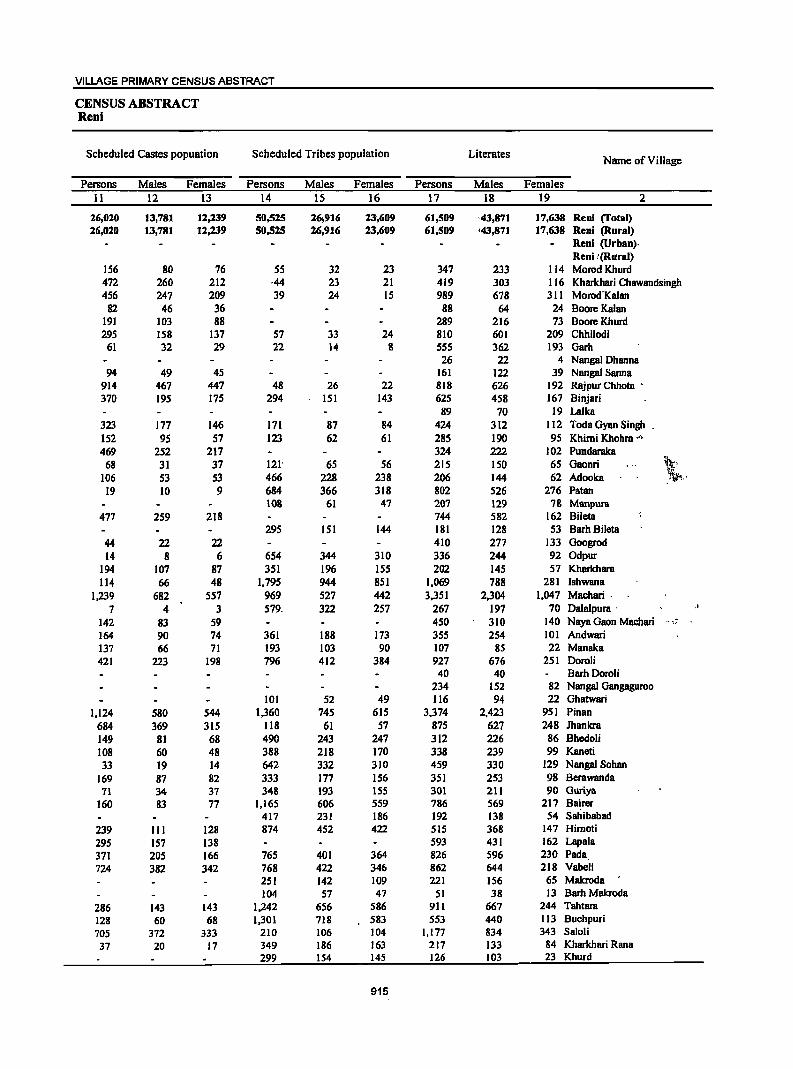
VILLAGE PRIMARY CENSUS ABSTRACT
CENSUS ABSTRACT Reni
Scheduled Castes popuation Scheduled Tribes population Literates Name of Village
Persons Males Females Persons Males Females Persons Males Females 11 12 13 14 15 16 17 18 19 2
26,020 13,781 12,239 50,525 26,916 23,609 61,509 '43,871 17,638 Reni (Total) 26,020 13,781 12,239 50,525 26,916 23,609 61,509 '43,871 17,638 Reni (Rural)
Reni (Urban). Reni !(Rural)
156 80 76 55 32 23 347 233 114 Morod Khurd 472 260 212 ,44 23 21 419 303 116 Kharkhari Chawandsingh 456 247 209 39 24 IS 989 678 311 Morod'Kalan
82 46 36 88 64 24 Boore Kalan 191 103 88 289 216 73 BooreKhurd 295 158 137 57 33 24 810 601 209 Chhilodi
61 32 29 22 14 8 55S 362 193 Garb 26 22 4 Nangal Dhanna
94 49 45 161 122 39 Nangal Sanna 914 467 447 48 26 22 818 626 192 Rajpur Chhota • 370 195 175 294 151 143 625 458 167 Binjari
89 70 19 Lalka 323 177 146 171 87 84 424 312 112 Toda Gyan Singh 152 95 57 123 62 61 285 190 9S Khimi Khohra _" 469 252 217 324 222 102 Pundaraka
68 31 37 121' 65 56 215 150 65 Gaonri ~, 106 53 53 466 228 238 206 144 62 Adooka .~ ..
19 10 9 684 366 318 802 526 276 Patan 108 61 47 207 129 78 Manpura
477 259 218 744 582 162 Bileta 295 151 144 181 128 53 BarhBileta
44 22 22 410 277 133 Googrod 14 8 6 654 344 310 336 244 92 Odpur
194 107 87 351 196 155 202 145 57 Kharkhara 114 66 48 1,795 944 851 1,069 788 281 Ishwana
1,239 682 557 969 527 442 3,351 2,304 1,047 Machari· 7 4 3 579, 322 257 267 197 70 Dalalpura . .f
142 83 59 450 310 140 Naya Gaon Machari .. ~".
164 90 74 361 188 173 355 254 101 Andwari 137 66 71 193 103 90 107 85 22 Manaka 421 223 198 796 412 384 927 676 251 Doroli
40 40 Barh Doroli 234 152 82 Nangal Gangaguroo
101 52 49 116 94 22 Ghatwari 1,124 580 544 1,360 745 615 3,374 2,423 951 Pinan
684 369 315 118 61 57 875 627 248 Jhankra 149 81 68 490 243 247 312 226 86 Bhedoli 108 60 48 388 218 170 338 239 99 Kaneti 33 19 14 642 332 310 459 330 129 Nangal Sohan
169 87 82 333 177 156 351 253 98 Berawanda 71 34 37 348 193 155 301 211 90 Guriya
160 83 77 1,165 606 559 786 569 217 Bairer 417 231 186 192 138 54 Sahibabad
239 III 128 874 452 422 SIS 368 147 Himoti 295 157 138 593 431 162 Lapala 371 205 166 765 401 364 826 596 230 Pada
724 382 342 768 422 346 862 644 218 Vabeli 251 142 109 221 156 65 Makroda 104 57 47 51 38 13 Barh Makroda
286 143 143 1,242 656 586 911 667 244 Tahtara
128 60 68 1,301 718 583 553 440 113 Buchpuri
705 372 333 210 106 104 1,177 834 343 Saloli
37 20 17 349 186 163 217 133 84 Kharkhari Rana 299 154 145 126 103 23 Khurd
915
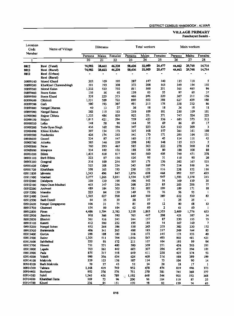
DISTRICT CENSUS HANDBOOK: ALWAR
VILLAGE PRIMARY Panehayat Samiti -
Location Illiterates Total workers Main workers Code Name of Village
Number Persons Males Females Persons Males Females Persons Males Females
2 20 21 22 23 24 25 26 27 28
0012 Reni (Total) 74,982 28,662 46,320 58,436 32,959 25,477 44,462 29,748 14.714 0012 Reni (Rural) 74,981 18.661 46,320 58.436 32,959 25,477 44,461 19.748 14.714 0012 Reni (Urban)
Reni (Rural) 00899100 Morod Khurd 302 109 193 287 147 140 liS 110 5 00899200 Kharkhari Chawandsingh 501 193 308 373 208 165 349 194 ISS 00899300 Morod Kalan 1,232 522 710 811 560 251 561 465 96 00899400 BooreKalan 116 56 60 120 65 5S 97 60 37 00899500 BooreKhurd 538 225 313 466 246 220 367 211 156 00899600 Chhilodi 1,231 509 722 890 502 388 627 439 188 00899700 Garh 500 193 307 491 313 178 338 252 86 00899800 Nangal Dhanna 40 13 27 36 18 18 36 18 18 00899900 Nanga1 Sanna 282 119 163 210 109 101 210 109 101 00900000 Rajpur Chhota 1,325 486 839 922 551 371 747 524 223 00900100 Binjari 1,015 421. 594 759 423 336 685 373 312 00900200 Lalka 148 58 90 164 95 69 86 69 17 00900300 Toda Gyan Singh 456 162 294 347 223 124 212 209 3 00900400 Khimi Khohra 307 134 173 325 168 157 261 161 100 00900500 Pundaraka 426 174 252 341 170 171 295 164 131 00900600 Gaonri 234 87 147 160 ll5 45 154 III 43 00900700 Adooka 385 146 239 290 142 148 lIS 113 2 00900800 Patan 760 293 467 585 363 222 278 260 18 00900900 Manpura 234 102 132 188 108 80 188 108 80 00901000 Bileta 1,435 618 817 965 560 405 749 471 278 00901100 Barh Bileta 223 87 136 126 95 31 110 90 20 00901200 Googrod 316 100 216 307 171 136 302 167 135 00901600 Odpur 332 108 224 343 169 174 214 160 54 00901700 Kharkhara 358 165 193 238 122 116 238 122 116 00911800 Ishwana 1,343 496 847 1,076 608 468 992 557 435 00911900 Machari 3,277 1,266 2,011 2,534 1,587 947 1,583 1,370 213 00912000 Dalalpura 320 130 190 196 142 54 169 139 30 00912100 Naya Gaon Machari 403 147 256 298 213 85 283 206 77 00912200 Andwari 489 184 305 381 182 199 189 171 18 00912300 Manaka 223 84 139 149 73 76 56 55 I 00912400 Doroli 1,565 627 938 849 560 289 612 530 82 00912500 BarhDoroli 64 25 39 28 27 1 25 25 00912600 Nangal Gangaguroo 106 31 75 81 69 12 80 68 12 00912700 Ghatwari 154 SO 104 62 60 2 61 60 I 00912800 Pinan 4,4~6 1,704 2,782 3,218 1,863 1,355 2,409 1,776 633 00912900 Jhanlcra 958 366 592 765 467 298 421 387 34 00913000 Bhedoli 361 116 245 244 157 87 230 155 7S 00913100 Kaneti 412 180 232 195 181 14 167 160 7 00913200 Nanga! Sohan 652 266 386 538 263 275 382 230 152 00913300 Berawanda 406 141 265 400 183 217 249 164 85 00913400 Goriya 288 108 180 318 173 145 173 133 40 00913500 Bairer 1,305 511 794 1,056 563 493 902 481 421 00913600 Sahibabad 225 93 132 211 107 104 193 99 94 00913700 Himoti 751 271 480 580 309 271 454 263 191 00913800 Lapala 703 261 442 603 307 296 475 294 181 00913900 Pada 875 317 558 649 411 238 427 374 53 00914000 Vabeli 990 356 634 624 408 216 588 389 199 00914100 Makroda 259 103 156 187 114 73 104 90 14 00914200 Barb Makroda 70 27 43 52 24 28 18 17 1 00914300 Tahtara 1,168 419 749 952 478 474 819 446 373 00914400 Buchpuri 952 376 576 751 370 381 745 368 377 00914500 Saloli 1,245 456 789 ,_ 1,192 648 544 920 552 368 00914600 Kharkhari Rana 169 73 96 200 96 104 119 87 32 00914700 Khurd 236 85 151 170 78 92 139 74 65
916
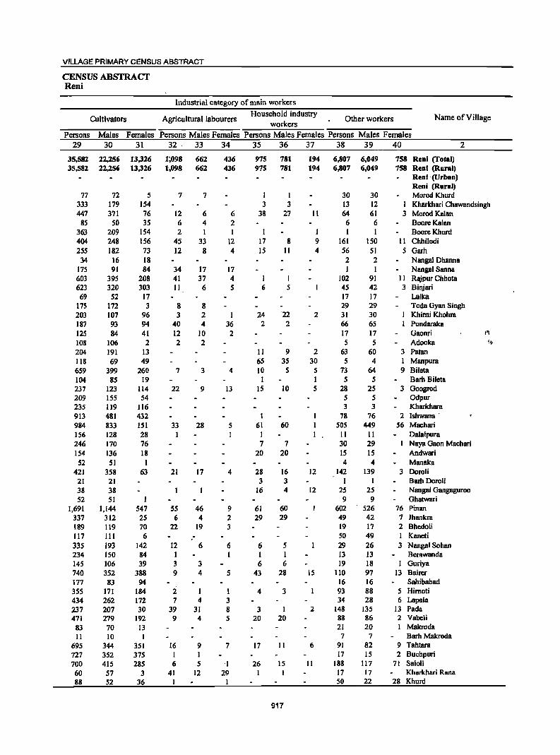
VILLAGE PRIMARY CENSUS ABSTRACT
CENSUS ABSTRACT Reni
Industrial category of main workers
Cultivators Agricultural labourers Household industry
Other workers Name of Village workers
Persons Males Females Persons Males Females Persons Males Females Persons Males Females
29 30 31 32 33 34 35 36 37 38 39 40 2
35,582 22,256 13,326 1;098 662 436 975 781 194 6,807 6,049 758 Reni (fotal) 35,582 22,256 13,326 1',098 662 436 975 781 194 6,807 6,049 758 Reni (Rural)
Reni '(Urban) Reni (Rural)
77 72 5 7 7 I I 30 30 Morod Khurd 333 179 154 3 3 13 12 I Kharkhari Chawandsingh 447 371 76 12 6 6 38 27 II 64 61 3 Morod Kalan
85 50 35 6 4 2 6 6 Boore Kalan 363 209 154 2 1 I I I 1 1 BooreKhurd 404 248 156 45 33 12 17 8 9 161 150 11 Chhilodi 255 182 73 12 8 4 15 II 4 56 51 5 Garh
34 16 18 2 2 Nangal Dhanna 175 91 84 34 17 17 1 1 Nangal Sanna 603 395 208 41 37 4 I I 102 91 II Rajpur Chhota 623 320 303 11 6 5 6 5 45 42 3 Binjari
69 52 17 17 17 Lalka 175 172 3 8 8 29 29 Toda Gyan Singh 203 107 96 3 2 1 24 -22 2 31 30 Khimi Khohra 187 93 94 40 4 36 2 2 66 65 Pundaraka 125 84 41 12 10 2 17 17 Gaonri fit
108 106 2 2 2 5 5 Adooka '~
204 191 13 II 9 2 63 60 3 Patan 118 69 49 65 35 30 5 4 I Manpura 659 399 260 7 3 4 10 5 5 73 64 9 Bileta 104 85 19 I I 5 5 Barh Bileta 237 123 114 22 9 13 15 10 5 28 25 3 Googrod 209 155 54 5 5 Odpur 235 119 116 3 3 Kharkhara 913 481 432 1 78 76 2 lshwana' 984 833 151 33 28 5 61 60 505 449 56 Machari 156 128 28 I II II Dalalpura 246 170 76 7 7 30 29 Naya Gaon Machari 154 136 18 20 20 15 15 Andwari
52 51 1 4 4 Manaka 421 358 63 21 17 4 28 16 12 142 139 3 Doroli
21 21 3 3 I Barb DoroU 38 38 16 4 12 25 25 Nanga1 Gangaguroo 52 51 9 9 Ghatwari
1,691 1,144 547 55 46 9 61 60 602 526 76 Pinan 337 312 25 6 4 2 29 29 49 42 7 Ihankra 189 119 70 22 19 3 19 17 2 Bhedoli 117 III 6 50 49 I Kaneti
335 193 142 12 6 6 6 5 29 26 3 Nangal Sohan 234 150 84 I 1 1 1 13 13 Berawanda 145 106 39 3 3 6 6 19 18 1 Guriya 740 352 388 9 4 5 43 28 15 110 97 13 Bairer 177 83 94 16 16 Sahibabad 355 171 184 2 1 1 4 3 93 88 5 Himoti 434 262 172 7 4 3 34 28 6 Lapala 237 207 30 39 31 8 3 1 2 148 135 J3 Pada 471 279 192 9 4 5 20 20 88 86 2 Vabeli
83 70 13 21 20 Makroda
II 10 I 7 7 Barh Makroda
695 344 351 16 9 7 17 II 6 91 82 9 Tahtara
727 352 375 I 17 15 2 Buchpuri 700 415 285 6 5 'I- 26 15 11 188 117 71 SaloH
60 57 3 41 12 29 17 17 Kharkhari Rana 88 52 36 1 50 22 28 Khurd
917
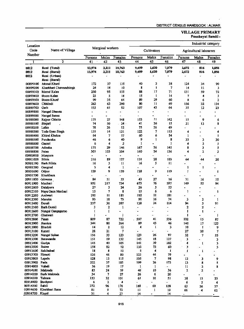
DISTRICT CENSUS HANDBOOK: ALWAR
VILLAGE PRIMARY Panehayat Samiti -
Location Industrial category
Code Name of Village Marginal workers
Cultivators Agricultumllabourers Number
Persons Males Females Persons Males Females Persons Males Females 2 41 42 43 44 45 46 47 48 49
0012 Reni (Total) 13,974 3,211 10,763 9,499 1,620 7.)'>79 2,672 8Ui 1,856 0012 Reni (Rural) 13,974 3,211 10,763 9,499 1,620 7.)'>79 2,672 816 1,856 0012 Reni (Urban)
Reni (Rural) 00899100 Morod Khurd 172 37 135 40 2 38 124 34 90 00899200 Kharkhari Chawandsingh 24 14 10 8 I 7 14 11 3 0089930Q Morod Kalan 250 95 155 88 17 71 131 59 72 00899400 Boore Kalan 23 5 18 IS 1 14 7 4 3 00899500 BooreKhurd 99 35 64 89 29 60 8 6 2 00899600 Chhilodi 263 63 200 80 II 69 156 32 124 00899700 Garh 153 61 92 107 43 64 35 12 23 00899800 Nangal Dhanna 00899900 Nangal Sanna 00900000 Rajpur Chhota 175 27 148 153 11 142 15 9 6 00900100 Binjari 74 50 _ 24· 41 26 15 21 13 8 00900200 Lalka 78 26 52 75 26 49 00900300 Toda Gyan Singh 135 14 121 122 7 115 4 4 00900400 Khimi Khohra 64 7 57 60 6 54 1 I 00900500 Pundaraka 46 6 40 9 8 33 3 30 00900600 Gaonri 6 4 2 I I 4 3 I 00900700 Adooka 175 29 146 167 26 141 8 3 5 00900800 Patan 307 103 204 160 24 136 4 2 2 00900900 Manpura 00901000 Bileta 216 89 127 131 28 103 64 44 20 00901100 BarhBileta 16 5 II 16 5 II 00901200 Googrod 5 4 00901600 Odpur 129 9 120 128 9 119 00901700 Kharkhara 0091 ]800 ·Ishwana 84 51 33 43 27 16 31 16 IS 00911900 Machari 951 217 734 673 76 597 149 55 94 00912000 Dalalpura 27 3 24 26 3 23 00912100 Naya Gaon Machari 15 7 8 12 6 6 00912200 Andwari 192 11 181 192 II 181 00912300 Manaka 93 18 75 90 16 74 3 2 I 00912400 Doroli 237 30 207 138 24 114 94 3 91 00912500 Barh Doroli 3 2 I 2 2 00912600 Nangal Oangaguroo 1 I I 1 00912700 Ghatwari 1 1 ] 1 00912800 Pinan 809 87 722 597 41 556 102 15 87 00912900 Jhankra 344 80 264 89 43 46 140 17 123 00913000 Bhedoli 14 2 12 4 1 3 10 1 9 00913100 Kaneti 28 21 7 27 20 7 00913200 Nangal Sohan 156 33 123 123 26 97 32 7 25 00913300 Berawanda 151 19 132 ]45 18 127 3 3 00913400 Ouriya 145 40 105 141 39 102 4 3 00913500 Bairer 154 82 72 133 73 60 3 3 00913600 Sahibabad 18 8 10 5 4 I I 00913700 Himoti 126 46 80 123 44 79 00913800 Lapala 128 13 115 105 7 98 12 3 9 00913900 Pada 222 37 185 199 26 173 13 8 5 00914000 Vabeli 36 19 17 I 1 11 3 8 00914100 Makroda 83 24 59 46 10 36 2 2 00914200 Barb Makroda 34 7 27 26 6 20 00914300 Tahtara 133 32 101 61 10 51 38 15 23 00914400 Buchpuri 6 2 4 6 2 4 00914500 Saloli 272 96 176 188 60 128 63 26 37 00914600 Kharkhari Rana 81 9 72 11 10 66 4 62 00914700 Khurd 31 4 27 14 14
918
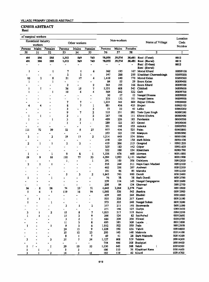
VILLAGE PRIMARY CENSUS ABSTRACT
CENSUS ABSTRACT Reni
of marginal workers Location
Household industry Non-workers Name of Village Code Other workers
workers Number Persons Males Females Persons Males Females Persons Males Females
50 51 52 53 54 55 56 57 58 2
491 206 285 1,312 569 743 78,055 39,574 38,481 Reni (Total) 0012 491 206 285 1,312 569 743 78,055 39,574 38,481 Reni (Rural) 0012
Reni (Urban) 0012 Reni (Rural)
7 I 6 362 195 167 Morod Khurd 00899100 2 2 547 288 259 Kharkhari Chawandsingh 00899200
10 2 8 21 17 4 1,410 640 770 Morod Kalan 00899300 I I 84 55 29 Boore Kalan 00899400
2 2 361 195 166 Boore Khurd 00899500 26 19 7 1;151 608 543 Chhilodi 00899600 10 6 4 564 242 322 Garh 00899700
30 17 13 Nangal Dhanna 00899800 233 132 101 Nangal Sanna 00899900
7 7 1,221 561 660 RlVpur Chhota 00900000 4 4 8 7 1 881 456 425 Binjari 00900100
3 3 73 33 40 Lalka 00900200 9 7 2 533 251 282 Toda Gyan Singh 00900300 2 2 267 156 III Khimi Khohra 00900400 3 2 I 409 226 183 Pundaraka 00900500
289 122 167 Gaonri 00900600 301 148 153 Adooka 00900700
111 72 39 32 5 27 977 456 521 Patan 00900800 253 123 130 Manpura 00900900
2 2 19 17 2 1,214 640 574 Bileta 00901000 278 120 158 Barb Bileta 00901100
2 2 2 419 206 213 Googrod " 00901200 325 183 142 Odpur 00901600 322 188 134 Kharkhara 00901700
1 9 8 1 1,336 676 660 lshwana 00911800 19 9 10 110 77 33 4,094 1,983 2,111 Machari 00911900
I 391 185 206 Dalalpura 00912000 2 555 244 311 Naya Gaon Machari 00912100
463 256 207 Andwari 00912200 181 96 85 Manaka 00912300
5 3 2 1,643 743 900 Doroli 00912400 76 38 38 Barh Doroli 00912500
259 114 145 Nangal Gangaguroo 00912600 208 84 124 Ghatwari 00912700
36 8 28 74 23 . 51 4,642 2,264 2,378 Pinan 00912800 5 4 I 110 16 94 1,068 526 542 lhankra 00912900
429 185 244 Bhedoli 00913000 555 238 317 Kaneti 00913100 573 333 240 Nangal Sohan 00913200
3 2 357 211 146 Berawanda 00913300 271 146 125 Guriya 00913400
3 2 15 8 7 1,035 517 518 Bairer 00913500 I II 2 9 206 124 82 Sahibabad 00913600
3 2 I 686 330 356 Himoti 00913700 II 3 8 693 385 308 Lapala 00913800 9 3 6 1,052 502 550 Pads 00913900
24 15 9 1,228 592 636 Vabeli 00914000 35 12 23 293 145 148 Makroda 00914100 8 I 7 69 41 28 Barh Makroda 00914200
3 3 31 7 24 1,127 608 519 Tahtara 00914300 754 446 308 BuchpiJri 00914400
I " 20 10 10 1,230 642 588 SaloH 00914500 I 3 3 186 110 76 Kharkhari Rana 00914600 3 2 14 3 11 192 110 82 Khurd 00914700
919
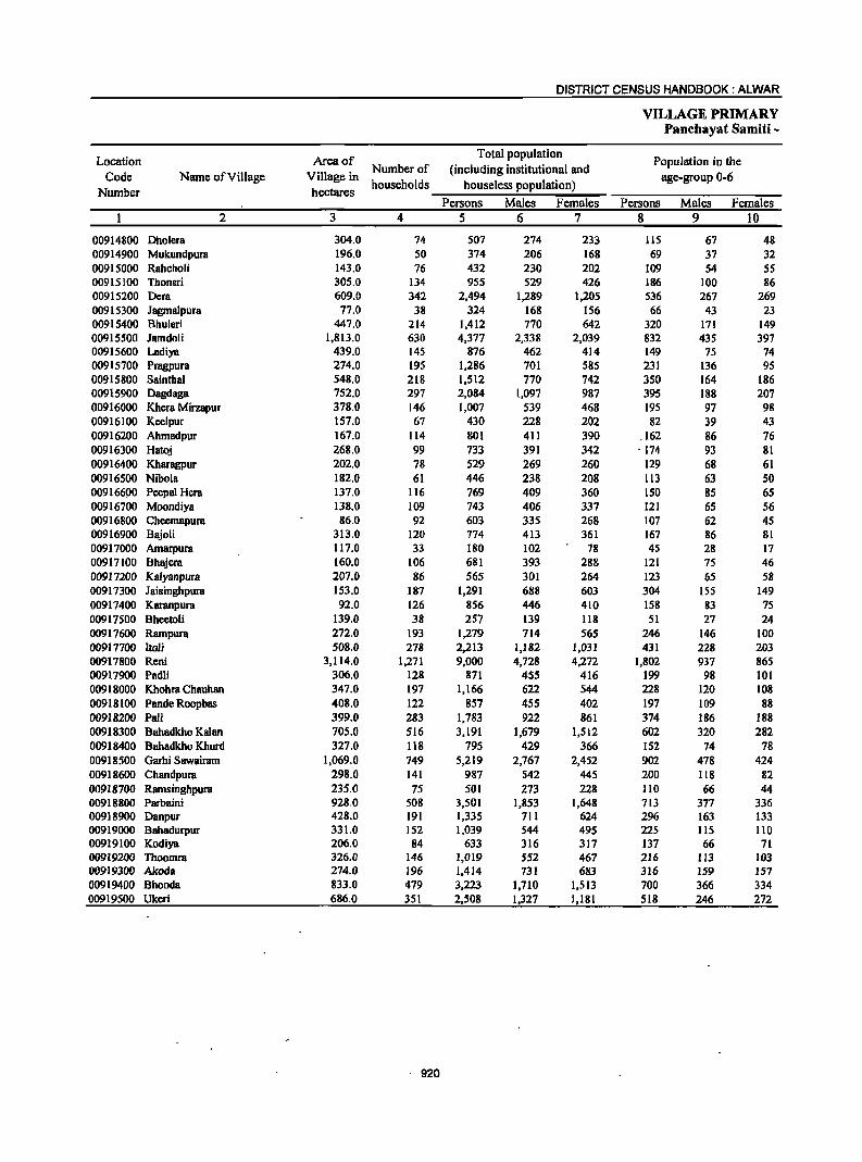
DISTRICT CENSUS HANDBOOK: ALWAR
VILLAGE PRIMARY Panchayat Samiti -
Location Area of Total population
Population in the Code Name of Village Village in
Number of (including institutional and age-group 0-6
Number hectares households houselcss population)
Persons Males Females Persons Males Females 2 3 4 5 6 7 8 9 10
00914800 Dholera 304.0 74 507 274 233 115 67 48 00914900 Mukundpura 196.0 50 374 206 168 69 37 32 00915000 Rahcholi 143.0 76 432 230 202 109 54 5S 00915100 Thonsri 305.0 134 955 529 426 186 100 86 00915200 Dera 609.0 342 2,494 1,289 1,205 536 267 269 00915300 Jagmalpura 77.0 38 324 168 156 66 43 23 00915400 Bhuleri 447.0 214 1,412 770 642 320 171 149 00915500 Jamdoli 1,813.0 630 4,377 2,338 2,039 832 435 397 00915600 Ladiya 439.0 145 876 462 414 149 75 74 00915700 Pragpura 274.0 195 1,286 701 585 231 136 9S 00915800 Sainthal 548.0 218 1,512 770 742 350 164 186 00915900 Dagdaga 752.0 297 2,084 1,097 987 395 188 207 00916000 Khera Mirzapur 378.0 146 1,007 539 468 195 97 98 00916100 Keelpur 157.0 67 430 228 202 82 39 43 00916200 Ahmadpur 167.0 114 801 411 390 .162 86 76 00916300 Hatoj 268.0 99 733 391 342 ' 174 93 81 00916400 Kharagpur 202.0 78 529 269 260 129 68 61 00916500 Nibola 182.0 61 446 238 208 Il3 63 SO 009166PO Peepal Hera 137.0 116 769 409 360 150 as 6S 00916700 Moondiya 138.0 109 743 406 337 121 65 56 00916800 Cheemapura 86.0 92 603 335 268 107 62 45 00916900 Bajoli 313.0 120 774 413 361 167 86 81 00917000 Amarpura 117.0 33 180 102 78 45 28 17 00917100 Bhajera 160.0 106 681 393 288 121 75 46 00917200 Kalyanpura 207.0 86 56S 301 264 123 65 58 00917300 Jaisinghpura 153.0 187 1,291 688 603 304 155 149 00917400 Karanpura 92.0 126 856 446 410 158 83 75 00917500 Bheetoli 139.0 38 257 139 118 51 27 24 00917600 Rampura 272.0 193 1,279 714 565 246 146 100 00917700 ItoU 508.0 278 2,213 1,182 1,031 431 228 203 00917800 Reni 3,114.0 1,271 9,000 4,728 4,272 1,802 937 865 00917900 Padli 306.0 128 871 455 416 199 98 101 00918000 Khohra Chauhan 347.0 197 1,166 622 544 228 120 108 00918100 Pande Roopbas 408.0 122 857 455 402 197 109 88 00918200 Pali 399.0 283 1,783 922 861 374 186 188 00918300 Bahadkho Kalan 705.0 516 3,191 1,679 1,512 602 320 282 00918400 Bahadkho Khurd 327.0 118 795 429 366 152 74 78 00918500 Garhi Sawairam 1,069.0 749 5,219 2,767 2,452 902 478 424 00918600 Chandpura 298.0 141 987 542 445 200 118 82 00918700 Ramsinghpura 235.0 75 501 273 228 110 66 44 00918800 Parbaini 928.0 508 3,501 1,853 1,648 713 377 336 00918900 Danpur 428.0 191 1,335 711 624 296 163 133 00919000 Bahadurpur 331.0 152 1,039 544 495 225 115 lIO 00919100 Kodiya 206.0 84 633 316 317 137 66 71 00919200 Thoomra 326.0 146 1,019 552 467 216 113 103 00919300 Akoda 274.0 196 1,414 731 683 316 159 157 00919400 Bhooda 833.0 479 3,223 1,710 1,513 700 366 334 00919500 Ukeri 686.0 351 2,508 1,327 1,181 SIS 246 272
. 920

VILLAGE PRIMARY CENSUS ABSTRACT
CENSUS ABSTRACT Reni
Scheduled Castes popuation Scheduled Tribes population Literates Name of Village
Persons Males Females Persons Males Females Persons Males Females 11 12 13 14 15 16 17 18 19 2
92 46 46 414 227 187 203 150 53 Dholera 367 202 165 165 131 34 Mukundpura
25 14 11 72 40 32 139 100 39 Rahcholi 51 22 29 66 38 28 464 342 122 Thonsri
337 151 186 554 295 259 1,109 771 338 Dera 153 93 60 Jagmalpura
20 12 8 898 497 401 584 445 139 Bhu1eri 654 345 309 2,476 1,342 1,134 1,957 1,427 530 Jamdoli
383 305 78 Ladiya 166 89 77 827 448 379 686 473 213 Pragpura 677 348 329 124 68 56 626 462 164 Sainthal 588 301 287 230 125 105 1,009 709 300 Dagdaga 144 70 74 781 420 361 362 280 82 Khera Mirzapur
16 11 5 307 154 153 164 122 42 Keelpur 75 41 34 603 312 291 344 250 94 Ahmadpur
276 146 130 430 229 201 331 230 101 Hatoj 45 21 24 441 229 212 324 173 151 Kharagpur
277 145 132 230 147 83 Nibola 107 56 51 600 324 276 407 262 145 Peepal Hera 127 67 60 58 31 27 451 308 143 Moondiya
19 12 7 532 293 239 272 201 71 Cheemapura 268 141 127 394 210 184 308 240 68 Bl\ioli 149 86 63 12 8 4 82 64 18 Amarpura
6 4 2 491 278 213 331 249 82 Bhajera 52 26 26 428 234 194 275 189 86 Kalyanpura
437 237 200 647 344 303 523 399 124 Jaisinghpura 810 426 384 471 304 167 Karanpura
44 25 19 146 93 53 Bheetoli 216 III 105 862 491 371 642 461 181 Rampura 451 247 204 1,300 674 626 978 713 265 ltoli
2,076 1,088 988 2,127 1,106 1,021 4,341 2,956 1,385 Reni 116 61 55 305 158 147 389 280 109 Padli 65 37 28 770 409 361 491 368 123 Khohra Chauhan
584 306 278 330 238 92 Pande Roopbas 298 156 142 520 266 254 713 509 204 Pali 397 204 193 1,798 951 847 1,355 969 386 Bahadkho Kalan 235 134 101 495 259 236 398 276 122 Bahadkho Khurd
1.653 881 772 871 445 426 2.956 1,955 1,001 Garhi Sawairam 136 70 66 782 431 351 395 306 89 Chandpura 43 23 20 345 190 . 155 133 III 22 Ramsinghpura
616 338 278 2.243 1.179 1,064 1,533 1,107 426 Parbaini 104 64 40 763 410 353 620 436 184 Danpur
993 521 472 434 321 113 Bahadurpur 170 87 83 346 177 169 321 211 110 Kodiya 453 241 212 147 82 65 514 374 140 Thoomra 274 151 123 75 46 29 388 332 56 Akoda 818 438 380 1,449 764 685 1.353 1,033 320 Bhooda 199 100 99 2,022 1.072 950 1.218 866 352 Ukeri
921
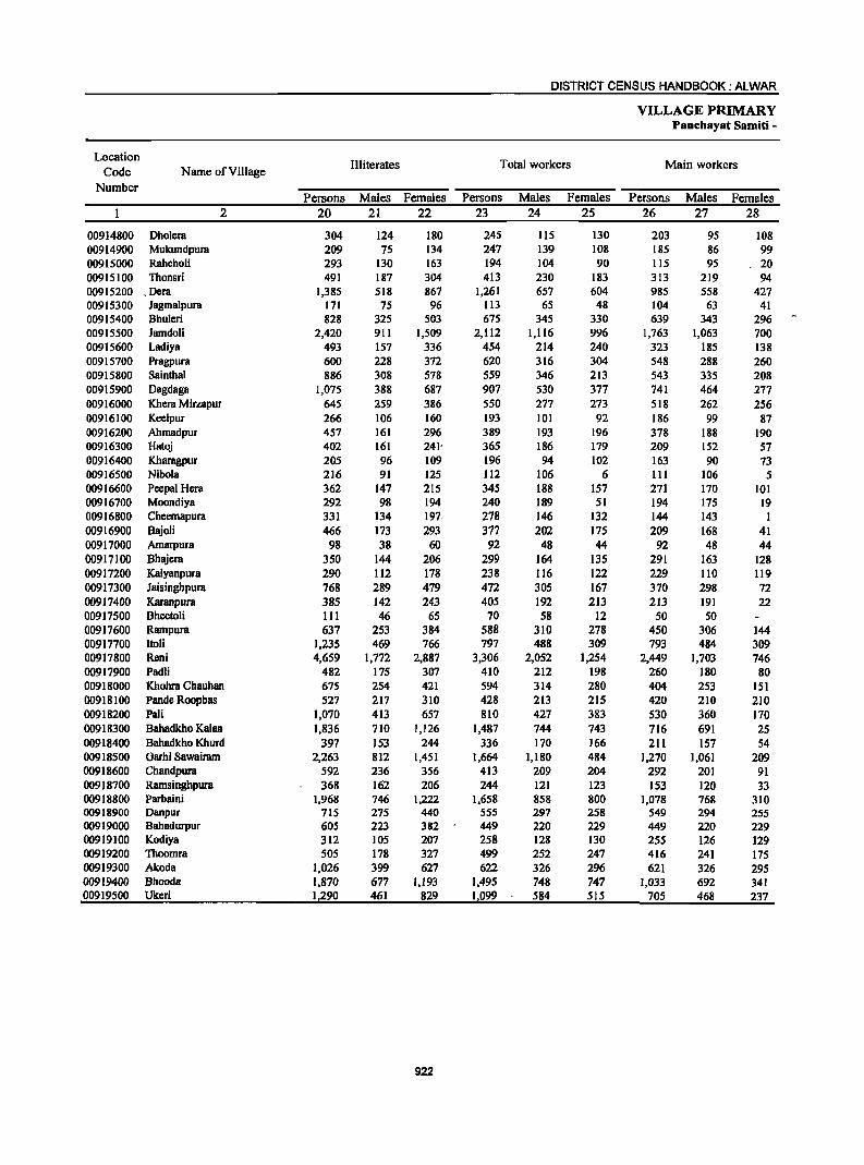
DISTRICT CENSUS HANDBOOK: ALWAR
VILLAGE PRIMARY Panchayat Samiti -
Location III iterates Total workers Main workers
Code Name of Village Number
Persons Males Females Persons Males Females Persons Males Females 2 20 21 22 23 24 25 26 27 28
00914800 Dholera 304 124 180 245 115 130 203 95 108 00914900 Mukundpura 209 75 134 247 139 108 185 86 99 00915000 Rahcholi 293 130 163 194 104 90 115 95 . 20 00915100 Thonsri 491 187 304 413 230 183 313 219 94 00915200 . Dera 1,385 518 867 1,261 657 604 985 558 427 00915300 Jagmalpura 171 75 96 113 65 48 104 63 41 00915400 Bhulcri 828 325 503 675 345 330 639 343 296 00915500 Jamdoli 2,420 9[1 1,509 2,112 [,116 996 1,763 1,063 700 00915600 Ladiya 493 157 336 454 214 240 323 185 138 00915700 Pragpura 600 228 372 620 316 304 548 288 260 00915800 Sainthal 886 308 578 559 346 213 543 335 208 009[5900 Dagdaga 1,075 388 687 907 530 377 741 464 277 00916000 Khera Mirzapur 645 259 386 550 277 273 5[8 262 256 009[6[00 Keclpur 266 [06 160 193 101 92 186 99 87 00916200 Ahmadpur 457 161 296 389 193 196 378 188 190 00916300 Hatoj 402 161 241' 365 186 179 209 152 57 00916400 Kharagpur 205 96 109 196 94 102 163 90 73 00916500 Nibola 216 91 125 112 106 6 111 106 5 00916600 Pcepal Hera 362 147 215 345 188 157 271 170 101 00916700 Moondiya 292 98 194 240 189 51 194 175 19 00916800 Checmapura 331 134 197. 278 146 132 144 143 I 00916900 Bajoli 466 173 293 377 202 175 209 168 41 00917000 Amarpura 98 38 60 92 48 44 92 48 44 00917100 Bhajera 350 144 206 299 164 135 291 163 128 00917200 Kalyanpura 290 112 178 238 116 122 229 110 119 00917300 Jaisinghpura 768 289 479 472 305 167 370 298 72 00917400 Karanpura 385 142 243 405 192 213 213 191 22 00917500 Bheetoli 111 46 65 70 58 12 50 50 00917600 Rampura 637 253 384 588 310 278 450 306 144 00917700 ltoli 1,235 469 766 797 488 309 793 484 309 00917800 Reni 4,659 1,772 2,887 3,306 2,052 1,254 2,449 1,703 746 00917900 Padli 482 175 307 410 212 198 260 180 80 00918000 Khohra Chauhan 675 254 421 594 314 280 404 253 151 00918100 Pande Roopbas 527 217 310 428 213 215 420 210 210 00918200 Pali 1,070 413 657 810 427 383 530 360 170 00918300 Bahadkho Kalan 1,836 710 1,126 1,487 744 743 716 691 25 00918400 Bahadkho Khurd 397 153 244 336 170 166 211 157 54 00918500 Garhi Sawairam 2,263 812 1,451 1,664 1,180 484 1,270 1,061 209 00918600 Chandpura 592 236 356 413 209 204 292 201 91 00918700 Ramsinghpura 368 162 206 244 121 123 153 120 33 00918800 Parbaini 1,968 746 1,222 1,658 858 800 1,078 768 310 00918900 Danpur 715 275 440 555 297 258 549 294 255 00919000 Bahadurpur 605 223 382 449 220 229 449 220 229 00919100 Kodiya 312 105 207 258 128 130 255 126 129 00919200 Thoomra 505 178 327 499 252 247 416 241 175 00919300 Akoda 1,026 399 627 622 326 296 621 326 295 00919400 Bhooda 1,870 677 1,193 1,495 748 747 1,033 692 341 00919500 Ukeri 1,290 461 829 1,099 584 515 705 468 237
922
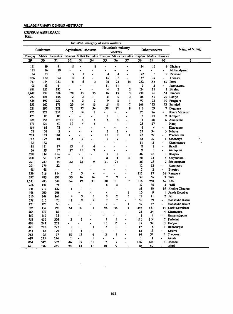
VILLAGE PRIMARY CENSUS ABSTRACT
CENSUS ABSTRACT Reni
Industrial category of main workers
Cultivators Agricultural labourers Household industry
Other workers Name ofViIlage workers
Persons Males Females Persons Males Females Persons Males Females Persons Males Females 29 30 31 32 33 34 35 36 37 38 39 40 2
171 80 91 8 8 24 15 9 Dholera 185 86 99 Mukundpura 84 83 I 5 5 4 4 22 3 19 Rahcholi
256 162 94 4 4 16 16 37 37 Thonsri 717 374 343 8 6 2 38 23 15 222 155 67 Dera 90 49 41 II II 3 3 JagmaJpura
611 320 291 4 2 2 24 21 3 Bhuleri 1,447 839 608 70 35 35 16 13 3 230 176 54 lamdoli
227 121 106 2 2 8 5 3 86 57 29 LadiYB 436 199 237 6 3 3 9 8 I 97 78 19 Pragpura 333 160 173 29 14 IS IS 8 7 166 153 13 Sainthal 524 296 228 71 37 34 30 22 8 116 109 7 Dagdaga 476 222 254 16 14 2 26 26 Khera Mirzapur 170 85 85 I I 15 13 2 Keelpur 328 152 176 12 4 8 4 4 34 28 6 Ahmadpur 171 121 50 10 4 6 28 27 I Hatoj 159 86 73 4 4 Kharagpur 72 70 2 2 2 37 34 3 Nibola
239 139 100 10 9 22 22 Peepal Hera 147 129 18 2 2 7 7 38 37 Moondiya 133 132 I II II Cheemapura 188 151 37 13 9 4 8 8 Bajoli 66 29 37 17 10 7 9 9 Amarpura
238 114 124 7 6 I 46 43 3 Bhajera 200 91 109 I I 8 4 4 20 14 6 Kalyanpura 291 237 54 22 13 9 21 21 36 27 9 Jaisinghpura 201 179 22 12 12 Karanpura
48 48 2 2 Bheetoli 330 216 114 7 3 4 113 87 26 Rampura 697 405 292 30 16 14 7 7 59 56 3 ltoli
1,543 903 640 52 19 33 38 31 7 816 750 66 Reni 218 140 78 5 5 37 35 2 Padli 345 213 132 58 39 19 Khohra Chauhan 406 200 206 4 I 3 10 9 I Pande Roopbas 510 344 166 4 3 3 2 13 II 2 Pali 639 616 23 II 9 2 7 7 59 59 Bahadkho Kalan 173 120 53 1 37 37 Bahadkho Khurd 625 432 193 54 53 96 95 495 481 14 Garhi Sawairam 264 177 87 28 24 4 Chandpura 152 119 33 I I Ramsinghpura 953 650 303 2 2 2 2 121 114 7 Parbaini 499 247 252 15 15 35 32 3 Danpur 428 201 227 3 3 17 16 1 Bahadurpur 241 112 129 13 13 Kodiya 362 195 167 18 12 6 2 2 34 32 2 Thoomra 619 325 294 1 1 1 1 Akoda 854 547 307· 46 IS 31 7 7 126 123 3 Bhooda 621 396 225 24 13 II 10 9 50 50 Ukeri
923
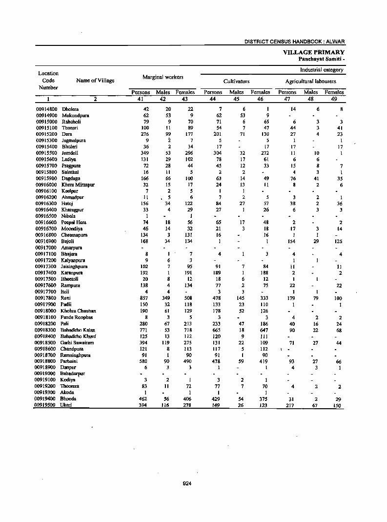
DISTRICT CENSUS HANDBOOK: ALWAR
VILLAGE PRIMARY Panchayat Samiti -
Location Industrial category
Code Name of Village Marginal workers
Cultivators Agricultural labourers Number
Persons Males Females Persons Males Females Persons Males Females 2 41 42 43 44 45 46 47 48 49
00914800 Dholera 42 20 22 7 6 I 14 6 8 00914900 Mukundpura 62 53 9 62 53 9 00915000 Rahcholi 79 9 70 71 6 65 6 3 3 00915100 Thonsri 100 11 89 54 7 47 44 3 41 00915200 Dera 276 99 177 201 71 130 27 4 23 00915300 Jagmalpura 9 i 7 5 5 00915400 Bhu1eri 36 2 34 17 17 17 17 00915500 Jamdoli 349 53 296 304 32 272 II 10 00915600 Ladiya 131 29 102 78 17 61 6 6 00915700 Pragpura 72 28 44 45 12 33 15 8 7 00915800 Sainthal 16 11 5 2 2 4 3 I 00915900 Dagdaga 166 66 100 63 14 49 76 41 35 00916000 Khera Mirzapur 32 15 17 24 13 II 8 2 6 00916100 Keelpur 7 2 5 1 00916200 Ahmadpur 11 5 6 7 2 5 3 2 1 00916300 Hatoj 156 34 122 84 27 57 38 2 36 00916400 Kharagpur 33 4 29 27 1 26 6 3 3 00916500 Nibola I I 00916600 Peepal Hera 74 18 56 6S 17 48 2 2 00916700 Moondiya 46 14 32 21 3 18 17 3 14 00916800 Cheemapura 134 3 131 16 16 I I 00916900 Bajoli 168 34 134 I I 154 29 125 00917000 Amarpura 00917100 Bhajera 8 I 7 4 3 4 4 00917200 Kalyanpura 9 6 3 00917300 Jaisingbpura 102 7 95 91 7 84 II 11 00917400 Karanpura 192 I 191 189 I 188 2 2 00917500 Bheetoli 20 8 12 18 6 12 I 00917600 Rampura 138 4 134 77 2 75 22 22 00917700 ltoli 4 4 3 3 1 1 00917800 Reni 857 349 508 478 145 333 179 79 100 00917900 Padli 150 32 118 133 23 110 1 1 00918000 Khohra Chauhan 190 61 129 178 52 126 00918100 Pande Roopbas 8 3 5 3 3 4 2 2 00918200 Pali 280 67 213 233 47 186 40 16 24 00918300 Bahadkho Kalan 771 53 718 665 18 647 90 22 68 00918400 Bahadkho Khurd 125 13 1I2 120 9 III 00918500 Garbi Sawairam 394 119 275 131 22 109 71 27 44 00918600 Chandpura 121 8 113 117 5 112 i -00918700 Ramsinghpura 91 I 90 91 1 90 00918800 Parbaini 580 90 490 478 59 419 93 27 66 00918900 Danpur 6 3 3 1 4 3 1 00919000 Bahadufllur 00919100 Kodiya 3 2 I 3 2 I 00919200 Thoomra 83 11 72 77 7 70 4 2 2 00919300 Akoda 1 1 1 1 00919400 Bhooda 462 56 406 429 54 375 31 2 29 00919500 Ukeri 394 116 278 149 26 123 217 67 150
924
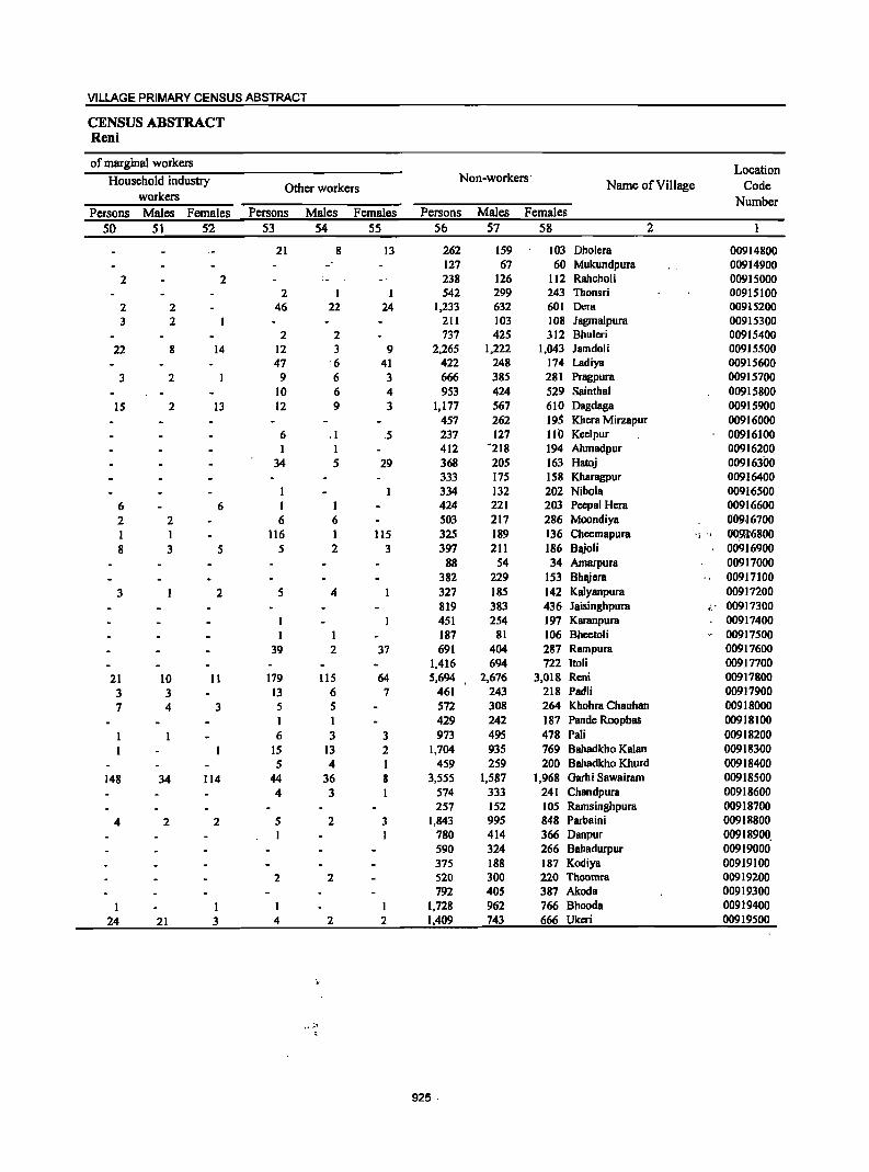
VILLAGE PRIMARY CENSUS ABSTRACT
CENSUS ABSTRACT Reni
of marginal workers Location
Household industry Non-workers' Other workers Name of Village Code
workers Number Persons Males Females Persons Males Females Persons Males Females
50 51 52 53 54 55 56 57 58 2
21 8 13 262 159 103 Dholera 00914800 127 67 60 Mukundpura 00914900
2 2 .- 238 126 112 Rahcholi 00915000 2 I 542 299 243 Thonsri 00915100
2 2 46 22 24 1,233 632 601 Dera 00915200 3 2 211 103 108 Jagmalpura 00915300
2 2 737 425 312 Bhuleri 00915400 22 8 14 12 3 9 2,265 1,222 1,043 Jamdoli 00915500
47 6 41 422 248 174 Ladiya 00915600 3 2 9 6 3 666 385 281 Pragpura 00915700
10 6 4 953 424 529 Sainthal 00915800 15 2 13 12 9 3 1,177 567 610 Dagdaga 00915900
457 262 195 Khera Mirzapur 00916000 6 .1 .5 237 127 110 Keelpur 00916100 1 I 412 -218 194 Ahmadpur 00916200
34 5 29 368 205 163 Hatoj 00916300 333 175 158 Kharagpur 00916400 334 132 202 Nibola 00916500
6 6 I I 424 221 203 Peepal Hera 00916600 2 2 6 6 503 217 286 Moondiya 009·16700 1 1 116 1 115 325 189 136 Cheemapura " ',1 OOg;r6800 8 3 5 5 2 3 397 211 186 Bajoli 00916900
88 54 34 Amarpura 00917000 382 229 153 Bhajcra 00917100
3 2 5 4 327 185 142 Kalyanpura 00917200 819 383 436 Jaisinghpura 00917300 451 254 197 Karanpura 00917400
I I 187 81 106 Bhcetoli .- 00917500 39 2 37 691 404 287 Rampura 00917600
1,416 694 722 ItoH 00917700 21 10 11 179 lIS 64 5,694 2,676 3,018 Reni 00917800 3 3 13 6 7 461 243 218 Padli 00917900 7 4 3 5 5 572 308 264 Khohra Chauhan 00918000
1 1 429 242 187 Pande Roopbas 00918100 6 3 3 973 495 478 Pali 00918200
IS 13 2 1,704 935 769 Bahadkho Kalan 00918300 5 4 I 459 259 200 Bahadkho Khurd 00918400
148 34 114 44 36 8 3,555 1,587 1,968 Garhi Sawairam 00918500 4 3 574 333 241 Chandpura 00918600
257 152 105 Ramsinghpura 00918700 4 2 2 5 2 3 1,843 995 848 Parbaini 00918800
780 414 366 Danpur 00918900. 590 324 266 Bahadurpur 00919000 375 188 187 Kodiya 00919100
2 2 520 300 220 Thoomra 00919200 792 405 387 Akoda 00919300
I I I 1,728 962 766 Bhooda 00919400 24 21 3 4 2 2 1,409 743 666 Ukeri 00919500
925·
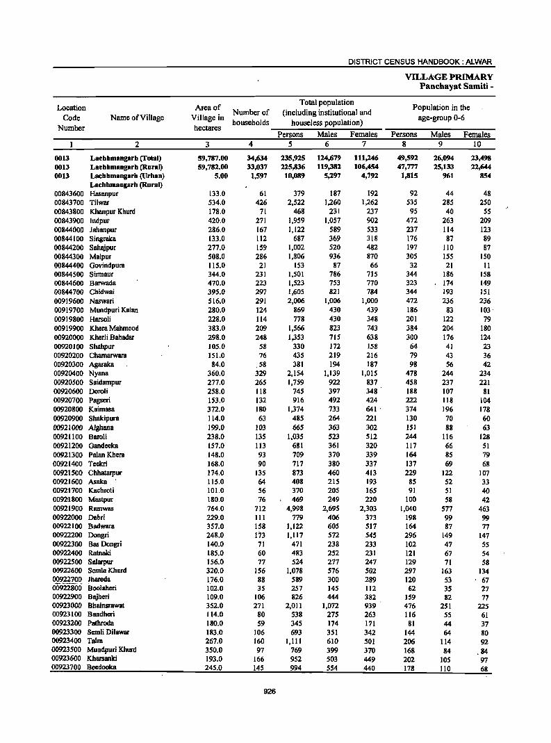
DISTRICT CENSUS HANDBOOK: ALWAR
VILLAGE PRIMARY Panchayat Samiti -
Location Area of Total population
Population in the Code Name of Village Village in
Number of (including institutional and age-group 0-6
Number hectares households houseless population)
Persons Males Females Persons Males Females 2 3 4 5 6 7 8 9 10
0013 Lachhmangarh (Total) 59,787.00 34,634 235,925 124,679 111,246 49,592 26,094 23,498 0013 Lachhmangarh (Rural) 59,782.00 33,037 225,836 119,382 106,454 47,777 25,133 22,644 0013 Lachhmangarh (Urban) 5.00 1,597 10,089 5,297 4,792 1,815 961 854
Lachbmangarh (Rural) 00843600 Hasanpur 133.0 61 379 187 192 92 44 48 00843700 Tilwar 534.0 426 2,522 1,260 1,262 535 285 250 00843800 Khanpur Khurd 178.0 71 468 231 237 95 40 55 00843900 Indpur 420.0 271 1,959 1,057 902 472 263 209 00844000 Jahanpur 286.0 167 1,122 589 533 237 114 123 00844100 Singraka 133.0 112 687 369 318 176 87 89 00844200 Sahajpur 277.0 159 1,002 520 482 197 110 B7 00844300 Malpur 508.0 286 1,806 936 870 305 155 ISO 00844400 Govindpura 115.0 21 153 87 66 32 21 II 00844500 Sirmaur 344.0 231 1,501 786 715 344 186 158 00844600 Barwada 470.0 223 1,523 753 770 323 174 149 00844700 Chidwai 395.0 297 1,605 821 784 344 193 151 00919600 Naswari 516.0 291 2,006 1,006 1,000 472 236 236 00919700 Mundpuri Kalan 280.0 124 869 430 439 186 83 103 . 00919800 Harsoli 228.0 114 778 430 348 201 122 79 00919900 Khera Mahmood 383.0 209 1,566 823 743 384 204 180 00920000 Kherli Bahadar 298.0 248 1,353 71S 638 300 176 124 00920100 Shahpur 105.0 58 330 172 158 64 41 23 00920200 Chamarwara 1S1.0 76 435 219 216 79 43 36 00920300 Agaraka 84.0 58 381 194 187 98 56 42 00920400 Nyana 360.0 329 2,154 1,139 1,015 478 244 234 00920500 Saidampur 277.0 265 1,759 922 837 458 237 221 00920600 Doroli 258.0 1I8 745 397 348 188 107 81 00920700 pagseri 153.0 132 916 492 424 222 1I8 104 00920800 Kaimasa 372.0 180 1,374 733 641 ' 374 196 178 00920900 Shakipura 114.0 63 485 264 221 130 70 60 00921000 Alghana 199.0 103 665 363 302 151 88 63 00921100 Baroli 238.0 135 1,035 523 512 244 116 128 00921200 Gandeeka 157.0 113 681 361 320 117 66 51 00921300 Palan Khera 148.0 93 709 370 339 164 85 79 00921400 Teekri 168.0 90 717 380 337 137 69 68 00921500 Chhatarpur 174.0 135 873 460 413 229 122 107 00921600 Asaka 115.0 64 408 215 193 85 52 33 00921700 Kachroti 101.0 56 370 205 165 91 51 40 0092-1800 Mastpur 180.0 76 469 249 220 100 58 42 00921900 Ramwas 764.0 712 4,998 2,695 2,303 1,040 577 463 00922000 Dabri 229.0 III 779 406 373 198 99 99 00922100 Badwara 357.0 158 1,122 605 517 164 87 77 00922200 Dongri 248.0 173 1,117 572 545 296 149 147 00922300 Bas Dongri 140.0 71 471 238 233 102 47 55 00922400 Ratnaki 185.0 60 483 252 231 121 67 54 00922500 Salarpur 156.0 77 524 277 247 129 71 58 00922600 SemlaKhurd 320.0 156 1,078 576 502 297 163 134 00922700 JharedB 176.0 88 589 300 289 120 53 67 00922800 Boolaheri 102.0 35 257 145 112 62 35 27 00922900 Bajheri 109.0 106 826 444 382 159 82 77 00923000 BhainsrawBt 352.0 271 2,011 1,072 939 476 251 225 00923100 Bandheri 114.0 80 538 275 263 116 55 61 00923200 Pathroda 180.0 59 345 174 171 81 44 37 00923300 Semli Dilawar 183.0 106 693 351 342 144 64 80 00923400 Taira 267.0 160 1,111 610 501 206 114 92 00923500 Mundpuri Khurd 350.0 97 769 399 370 168 84 ,84 00923600 Kharsanki 193.0 166 952 503 449 202 105 97 00923700 Beedooka 245.0 145 994 554 440 178 1I0 68
926
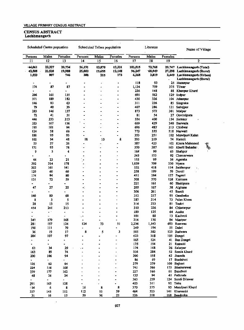
VILLAGE PRIMARY CENSUS ABSTRACT
CENSUS ABSTRACT Lacbhmangarh
Scheduled <?astes popuation Scheduled Tribes population Literates Name of Village
Persons Males Females Persons Males Females Persons Males Females II 12 13 14 15 16 17 18 19 2
'44,061 23,327 20,734 26,191 13,870 12,321 102,515 72,768 29,747 Lachhmangarh (Total) 42,508 22,520 19,988 25,803 13,655 12,148 96,247 '68,949 27,298 Lachhmangarh (Rural)
1,553 .. 807 746 388 21S 173 6,268 3,819 2,449 Lachhmangarh (Urban) LachhmaDg8rh (Rural)
118 93 25 Hasanpur 174 87 87 1,134 759 375 Tilwar
236 148 88 Kh8npur Khurd 296 161 135 691 562 129 Indpur 371 189 182 430 326 104 Jahanpur 146 83 63 311 226 85 Singrak8 79 40 39 407 286 121 Sahajpur
283 146 137 873 572 301 Malpur 72 41 31 81 54 27 Govindpura
446 233 213 554 400 154 Sirmaur 323 167 156 669 429 240 Barwada 195 101 94 696 483' 213 Chidwai 124 58 66 773 555 218 Naswari 188 95 93 353 251 102 MlDldpuri Kalan 102 54 48 18 10 8 293 219 74 H8rsoli 53 27 26 587 425 162 Khera Mahmood. '\. 171 93 78 550 387 163 Kherli Bahadar: . 9 5 4 164 99 65 Shahpur
24S 153 92 Chamarwara 44 23 21 155 99 56 Agarak8
392 214 178 1,039 709 330 Nyan8 302 161 141 532 418 114 SBidBmpur 120 60 60 258 199 59 Doroli 174 94 80 411 284 127 Pagseri 131 72 59 508 370 138 Kaimasa
221 161 60 Shakipura 47 27 20 -. 205 167 38 Aighana
306 261 4S Baroli 140 80 60 312 217 95 Gandeeka
8 3 5 287 214 73 Palan Khera 28 13 15 314 233 81 Teekri
454 241 213 310 226 84 Chhatarpur 189 125 64 Asaka 101 88 13 Kachroti
347 179 168 214 130 84 Mastpur 281 157 124 124 73 51 2,236 1.543 693 Ramwas 190 III 79 249 194 55 Dabri 36 19 17 8 5 3 505 382 123 Badwara
204 107 97 423 318 105 Dongri 165 124 41 Bas Dongri 175 154 21 Ratnaki
63 34 29 174 148 26 Salarpur 163 89 74 336 284 52 SemlaKhurd 200 106 94 200 158 42 Jhareda
86 69 17 Boo1aheri 126 62 64 379 279 100 Bajheri 224 116 108 741 566 175 Bhainsrawat
~39 177 162 227 166 61 ~andheri
48 24 24 135 94 41 Pathroda 363 239 124 Semli Dilawar
291 163 128 403 311 92 Taira ;14 6 8 16 8 8 370 275 95 Mundpuri Khurd 257 145 112 112 53 59 464 323 141 Kharsanki
31 16 15 59 36 23 526 358 168 Bccdooka
927
DISTRICT CENSUS HANDBOOK: ALWAR
VILLAGE PRIMARY Panchayat Samiti -
Location Illiterates Total workers Main workers
Code Name of Village Number
Persons Males Females Persons Males Females Persons Males Females 2 20 21 22 23 24 25 26 27 28
0013 Lachhmangarh (rotal) 133,410 51,911 81,499 134,148 73,009 61,139 87,748 55,395 32,353 0013 Lacbhmangarb (Rural) 129,589 50,433 79,156 130,330 70,280 60,050 84,911 53,043 31,868 0013 Lachhmangarh (Urban) 3,811 1,478 2,343 3,818 2,719 1,089 2,837 2,352 485
Lachhmangarh (Rural) 00843600 Hasanpur 261 94 167 95 76 19 81 69 12 00843700 Tilwar 1,388 501 887 1,098 601 497 775 522 253 00843800 Khanpur Khurd 232 83 149 229 109 120 116 96 20 00843900 lndpur 1,268 495 773 978 484 494 860 454 406 00844000 Jahanpur 692 263 429 523 266 257 304 234 70 00844100 Singraka 376 143 233 414 223 191 304 172 132 00844200 Sahajpur 595 234 361 508 257 251 387 248 139 00844300 Malpur 933 364 569 835 443 392 527 390 137 00844400 Govindpura 72 33 39 93 51 42 70 41 29 00844500 Sirmaur 947 386 561 628 345 283 334 277 57 00844600 8arwada 854 324 530 730 358 372 627 335 292 00844700 Chidwai 909 338 571 786 375 41 J<. 505 353 152 00919600 Naswari 1,233 451 782 1,209 605 604 794 461 333 00919700 Mundpuri Kalan 516 179 337 512 261 251 345 201 144 00919800 Harsoli 485 211 274 448 233 215 291 181 110 00919900 Khera Mahmood 979 398 581 1,003 535 468 560 324 236 00920000 KherIi 8ahadar 803 328 475 888 447 441 678 353 325 00920100 Shahpur 166 73 93 236 124 112 117 84 33 00920200 Chamarwara 190 66 124 318 161 157 122 115 7 00920300 Agaraka 226 95 131 84 80 4 84 80 4 00920400 Nyana 1,115 430 685 1,171 668 503 576 494 82 00920500 Saidampur 1,227 504 723 915 459 456 482 430 52 00920600 DoroJi 487 198 289 416 219 197 220 194 26 00920700 Pagseri 505 208 297 416 226 190 253 209 44 00920800 Kaimasa 866 363 503 654 337 317 367 296 71 00920900 Shalcipura 264 103 161 274 148 126 183 120 63 00921000 Aighana 460 196 264 359 165 194 314 153 161 00921100 BaraH 729 262 467 543 254 289 335 231 104 00921200 Gandeeka 369 144 225 497 263 234 381 199 182 00921300 PalanKhc:ra 422 156 266 400 194 206 294 192 102 00921400 Teekri 403 147 256 402 208 194 380 200 180 00921500 Chhatarpur 563 234 329 514 262 252 396 206 190 00921600 Asalca 219 90 129 290 145 145 92 88 4 00921700 Kachroti 269 117 152 161 99 62 127 87 40 00921800 Mastpur 255 119 136 355 191 164 216 119 97 00921900 Ramwas 2,762 1,152 1,610 2,153 1,295 858 1,760 1,177 583 00922000 Dabri 530 212 318 470 247 223 308 201 107 00922100 Badwara 617 223 394 647 332 315 328 284 44 00922200 Dongri 694 254 440 600 289 311 279 231 48 00922300 Bas Dongri 306 114 192 305 163 142 230 114 116 00922400 Ratnalci 308 98 210 300 147 153 105 105 00922500 Salarpur 350 129 221 3S0 183 167 208 117 91 00922600 SemlaKhurd 742 292 450 594 298 296 417 237 180 00922700 JharedB 389 142 247 346 163 183 260 149 III 00922800 Boolaheri 171 76 95 ISS 87 68 68 62 6 00922900 Bajheri 447 165 282 526 267 259 219 195 24 00923000 Bhainsrawat 1.270 506 764 1,096 597 499 606 381 225 00923100 Bandheri 311 109 202 302 159 143 142 140 2 00923200 Pathroda 210 80 130 181 90 91 98 72 26 00923300 Semli Dilawar 330 112 218 454 235 219 201 171 30 00923400 Taira 708 299 409 680 363 317 534 279 255 00923500 Mundpuri Khurd 399 124 275 381 210 171 311 ";,0' 174 137 00923600 Kharsanki 488 180 308 518 263 255 447 221 226 00923700 BeedookB 468 196 272 581 307 274 50S 268 237
928
VILLAGE PRIMARY CENSUS ABSTRACT
CENSUS ABSTRACT Lachhmangarh
Industrial category of main workers
Cultivators Agricultural labourers Household industry
Other workers Name of Village workers
Persons Males Females Persons Males Females Persons Males Females Persons Males Females 29 30 31 32 33 34 35 36 37 38 39 40 2
68,750 39,368 29;382 2;898 1,771 1,127 1,246 943 303 14,854 13,313 1,541 Laehhmangarh (Total) '68,101 38,903 29;198 2;848 1,751- 1,097 1,131 863 268 12,831 11,526 1,305 Laehhmangarh (Rural)
649 465 '184 50 20 30 115 80 35 2,023 1,787 236 'Laehhmangarh (Urban) Laebhmangarh (Rural)
68 56 12 2 2 I 10 10 Hasanpur _ 415 207 208 80 43 37 2 2 278 272 6 Tilwar
93 74 19 4 3 I ,19 19 Khanpur Khurd 678 332 346 71 46 25 7 5 2 104 71 33 Indpur 253 188 65 7 3 4 5 5 39 38 I Jahanpur 232 108 124 13 7 6 59 57 2 Singraka 266 160 106 50 21 29 3 2 68 6S 3 Sahajpur '_ 361 253 108 40 21 19 3 3 123 113 10 Malpur
57 29 28 9 -8 I 4 4 Govindpura 207 159 48 21 18 3 1 I 105 99 6 Sinnaur 533 263 270 41 24 17 2 2 51 46 5 Barwada 286 170 116 74 50 24 I " 144 132 12 Chidwai 710 392 3L8 14 14 70 55 15 Naswari 283 146 137 11 9 2 I I 50 45 5 Mundpuri Kalan 234 142 92 27 II 16 3 2 27 26 I Harsoli 495 272 223 8 8 3 2 54 50 4 Khem Mahmood, 1\-574 274 300 28 17 11 3 3 73 59 14 Kherli Bahadar' -~ 89 57 32 I 27 26 I Shahpur 87 84 3 4 4 2 2 29 2S 4 Chamarwam' 68 64 4 2 2 14 14 Agaraka
226 185 41 77 6S 12 SO 50 223 194 29 Nyana 395 352 43 S6 48- 8 5 4 26 26 Saidampur-IS3 133 20 24 22 2 43 39 4 Doroli 163 135 28 55 42 13 5 5 30 27 3 Pagseri 268 209 59 35 30 5 64 57 7 Kaimasa 153 92 61 2 I I 28 27 I Shakipura 251 106 145 24 12 12 39 35 4 Alghana 215 113 102 15 14 I 104 103 I Baroli 201 76 125 95 40 55 85 83 2 Gandeeka 272 171 101 22 21 I PalanKhem 379 199 180 Teekri 309 139 170 52 34 18 35 33 2 Chhatarpur 52 48 4 7 7 4 4 29 29 Asaka 83 59 24 19 7 12 25 21 4 Kaehroti
213 116 97 3 3 Mastpur 938 459 479 25 6 19 119 78 41 678 634 44 Ramwas 214 112 102 I I I I 92 88 4 Dabri 270 233 37 I I 57 50 7 Badwara 247 204 43 7 6 6 3 3 19 18 I Dongri 197 82 115 2 2 31 30 1 Bas Dongri 43 43 I 1 I I 60 60 Ratnaki
186 96 90 13 12 I I 8 8 Salarpur 375 203 172 7 2 5 3 2 32 31 I Semla Khurd 206 100 106 5 3 2 49 46 3- Jhareda
57 51 6 10 10 Boolaheri ISO 132 18 69 63 6 Bajheri 373 190 183 16 13 3 II 8 3 206 170 36 Bhainsrawat I17 116 I 14 14 11 10 I Bandheri 61 39 22 26 22 4 II 11 Pathroda
147 118 29 15 14 39 39 Semli Dilawar 496 249 247 I I 13 8 5 24 21 3 Talm 277 141 136 2 ' I 3 3 29 -,-1- 29 Mundpuri Khurd 388 180 208 39 22 17 20 19 Kharsanki 437 211 226 13 7 6 20 20 35_ 30 S Bccdooka
929
DISTRICT CENSUS HANDBOOK: ALWAR
VILLAGE PRIMARY Panchayat Samiti -
Location Industrial category
Code Name of Village Marginal workers
Cultivators Agricultural labourers Number
Persons Males Females Persons Males Females Persons Males Females 2 41 42 43 44 45 46 47 48 49
0013 Lacbhmangarh (Total) 4(J,400 17,614 28,786 39,199 15,132 24,067 4,795 1,225 3,570 0013 Lachhmangarh (Rural) 45,419 17,237 28,182 38,782 15,005 23,777 4,614 1,196 3,418 0013 Lachhmangarh (Urban) 981 377 604 417 127 290 181 29 152
Lachhmangarh (Rural) 00843600 HlISanpur 14 7 7 2 1 1 9 3 6 00843700 Tilwar 323 79 244 204 36 168 89 18 71 00843800 Khanpur Khurd 113 13 100 83 2 81 27 8 19 00843900 Indpur 118 30 88 37 8 29 71 19 52 00844000 Jahanpur 219 32 187 16 5 II 200 2S 175 00844100 Singraka 110 51 59 88 46 42 16 16 00844200 Sahajpur 121 9 112 99 5 94 16 I 15 00844300 Malpur 308 53 255 246 23 223 49 24 25 00844400 Govindpura 23 10 13 21 8 13 2 2 00844500 Sinnaur 294 68 226 145 17 128 127 31 96 00844600 Barwada 103 23 80 82 16 66 .21 7 14 00844700 Chidwai 281 22 259 179 10 169 86 7 79 00919600 Nsswari 415 144 271 401 141 260 4 4 00919700 Mundpuri Kalan 167 60 107 132 42 90 14 6 8 00919800 Harsoli 157 52 lOS 127 44 83 14 3 II 00919900 Khera Mahmood 443 211 232 380 182 198 56 25 31 00920000 KherU Bahadar 210 94 116 188 85 103 16 5 11 00920100 Shahpur 119 40 79 102 35 67 7 7 00920200 Chamarwara 196 46 150 189 46 143 3 3 00920300 Agaraks 00920400 Nyana 595 174 421 301 83 218 231 59 172 00920500 Saidampur 433 29 404 348 28 320 78 78 00920600 Doroli 196 25 171 157 22 135, 38 3 35 00920700 Pagseri 163 17 146 136 13 123 20 1 19 00920800 Kaimsss 287 41 246 244 31 213 39 7 32 00920900 Shakipura 91 28 63 84 26 58 5 5 00921000 Alghana 45 12 33 6 2 4 13 4 9 00921100 BaroU 208 23 185 150 11 139 54 9 45 00921200 Gandeeka 116 64 52 80 43 37 35 20 15 00921300 Palan Khera 106 2 104 103 2 101 1 1 00921400 Teekri 22 8 14 22 8 14 00921500 Chhatarpur 118 56 62 95 51 44 22 4 18 00921600 Asaka 198 57 141 177 49 128 19 6 13 00921700 Kachroti 34 12 22 29 11 18 00921800 MlL'ltpur 139 72 67 137 71 66 2 1 1 00921900 Ramwas 393 118 275 202 40 162 92 17 75 00922000 DBbri 162 46 116 146 39 107 8 1 7 00922100 Badwara 319 48 271 270 32 238 45 12 33 00922200 Dongri 321 58 263 268 44 224 49 14 35 00922300 Bas Dongri 75 49 26 72 48 24 00922400 Ratnaki 195 42 153 193 42 151 2 2 00922500 Salarpur ' J42 66 76 107 53 54 34 12 22 00922600 SemlaKhurd 177 61 116 76 26 50 76 21 55 00922700 Jhareda 86 14 72 83 14 69 3 3 00922800 Boolaheri 87 25 62 84 24 60 I I 00922900 B~hcri ,307 72 235 278 60 218 8 8 00923000 Bhainsrawat 490 216 274 45 16 29 326 138 188 00923100 Bandhcri 160 19 141 151 19 132 9 9 00923200 Pathroda 83 18 65 58 '13 45 18 17 00923300 Semli Dilawar 253 64 189 248 63 185 2 2 00923400 Taira 146 84 62 97 55 42 2S 13 12 00923500 Mundpuri Khurd 70 36 34 ""Ji2 28 34 6 6 00923600 Kharsanki 71 42 29 58 38 20 13 4 9 00923700 Beedooka 76 39 37 71 39 32 5 5
930

VILLAGE PRIMARY CENSUS ABSTRACT
CENSUS ABSTRACT Lachhmangarh
of marginal workers Location
Household industry Non-workers Name of Village Code Other workers
workers Number -Persons Males Females Persons Males Females Persons Males Females
50 51 52- S3 S4 55 S6 57 58 2
521 209 -312 1,885 1,048 837 101,777 51,670 50,107 Laehhmangarh (Total) 0013 475 195 280 1,548 841 707 95,506 49,102 46,404 Laehhmangarh (Rural) 0013 46 14 32 -337 207 130 6,271 2,568 3,703 Laehhmangarh (Urban) 0013
Lachhmangarh (Rural) 3 3 284 III 173 Hasanpur 00843600
30 2S 5 1,424 659 765 Tilwar 00843700 3 3 239 122 117 Khanpur Khurd 00843800 9 2 7 981 573" 408 Indpur 00843900 2 2 599 323 276 Jahanpur 00844000 6 5 I 273 146 127 Singraka 00844100
I I 5 3 2 494 263 231 Sahajpur 00844200 6 5 7 5 2 971 493 478 Malpur 00844300
60 36 24 Govindpura 00844400 22 20 2 873 441 432 Sinnaur 00844500
793 395 .. 398 8arwada 00844600 "- " 16 5 II 819 446 373 Chidwai 00844700
10 3 7 797 401 396 Naswari 00919600 1 1 20 12 8 357 169 188 Mundpuri Kalan 00919700 3 2 13 4 9 330 197 133 Harsoli 00919800
7 '4 3 563 288 275 Khera Mahmood 00919900 2 4 3 1 465 268 197 Kherli Bahadar 00920000
10 5 5 94 48 46 Shahpur 00920100 3 3 117 58 S9 Chamarwara 00920200
297 114 183 Agaraka 00920300 II 7 4 52 25 27 983 471 512 Nyana 00920400 2 2 5 I 4 844 463 381 Saidampur 00920500
1 1 329 178 151 Doroli 00920600 3 3 4 3 I 500 266 234 Pagseri 00920700
4 3 1 720 396 324 Kaimasa 00920800 2 2 211 116 95 Shakipura 00920900
26 6 20 306 198 108 Aighana 00921000 4 3 492 269 223 Baroli 00921100 1 1 184 98 86 Gandeeka 00921200 2 2 309 176 133 Palan Khera 00921300
315 172 143 Teekri 00921400 I I 359 198 161 Chhatarpur 00921500 2 2 118 70 48 Asaka 00921600
3 2 2 2 209 106 103 Kachroti 00921700 114 58 56 Mastpur 00921800
48 17 31 51 44 7 2,845 1,400 1,445 Ramwas 00921900 2 2 6 6 309 159 ISO Dabri 00922000
4 4 475 273 202 Badwara 00922100 4 4 517 283 234 Dongri 00922200
3 2 166 75 91 Bas Dongri 00922300 183 105 78 Ratnaki 00922400
1 174 94 80 Salarpur 00922500 3 3 22 14 8 484 278 206 Semla Khurd 00922600
243 137 106 Jhareda 00922700 1 I 102 58 44 Boolaheri 00922800 9 8 12 11 1 300 177 123 Bajheri 00922900
30 12 18 89 50 39 915 475 440 Bhainsrawat 00923000 236 116 120 Bandheri 00923100
6 3 3 164 84 80 Pathroda 00923200 3 2 239 116 123 Semli Dilawar 00923300
9 5 4 IS 11"' 4 431 247 184 Taira 00923400 2 2
'. i 388 189 199 Mundpuri Khurd 00923500 434 240 194 Kharsanki 00923600 413 247 166 Beedooka 00923700
931
DISTRICT CENSUS HANDBOOK: ALWAR
VILLAGE PRIMARY Panchayat Sarniti -
Location Area of Total population Population in the Number of (including institutional and Code Name of Village Village in
households houseless population) age-group 0-6 Number hectares
Persons Males Females Persons Males Females 2 3 4 5 6 7 8 9 10
00923800 Phahri 374.0 192 1,238 639 599 289 153 136 00923900 Itka 229.0 113 683 349 334 171 88 83 00924000 Marakpur 180.0 100 687 387 300 137 71 66 00924100 Jaisinghpura 349.0 275 1,752 934 818 443 243 200 00924200 Nizamnagar 393.0 206 1,407 741 666 3\4 \70 144 00924300 Bhayari 202.0 138 1,035 542 493 256 123 133 00924400 Chak Bhayari 114.0 53 341 167 174 113 53 60 00924500 BarodaMeo 1,089.0 1,161 7,863 4,179 3,684 1,670 869 801 00924600 Peepal Khera 326.0 191 1,343 723 620 341 197 144 00924700 1m1ali 227.0 122 999 504 495 233 112 121 00924800 Chimanpum 54.0 54 327 170 157 59 29 30 00924900 Baorika 204.0 106 784 394 390 140 64 76 00925000 Kherla 161.0 105 853 444 409 216 107 109 00925100 Butyana 435.0 246 1,739 929 810 360 194 166 00925200 Khorpuri 266.0 149 1,030 557 473 246 136 110 00925300 Bedha 286.0 119 840 436 404 192 96 96 00925400 Seetal 323.0 181 1,484 768 716 336 179 157 00925500 Mahlakpur 170.0 74 552 290 262 139 72 67 00925600 Ronpur 418.0 261 1,999 1,054 945 449 229 220 00925700 Kherli Veeran 110.0 54 462 242 220 76 37 39 00925800 Dhand 387.0 176 1,278 677 601 293 161 132 00925900 Chhangalki 130.0 75 649 332 317 146 72 74 00926000 Dusrahera 403.0 192 1,481 783 698 283 161 122 00926100 Nibhera 497.0 143 1,016 521 495 176 91 85 00926200 Bandka 238.0 110 762 409 353 175 91 84 00926300 Moliya 396.0 271 1,773 - 943 830 315 156 159 00926400 Item 820.0 414 3,002 1,547 1,455 564 284 280 00926500 Imiya 481.0 233 1,448 768 680 286 145 141 00926600 Hajipur 252.0 94 800 436 364 146 80 66 00926700 Patchpur @ Khudiyana 252.0 66 426 227 199 70 44 26 00926800 Nangli TarfBayra 131.0 53 383 196 187 81 38 43 00926900 Khudiyana 662.0 362 2,395 1,272 1,123 454 244 210 00927000 Ma11aKaBas 226.0 122 1,007 525 482 241 126 lJ5 00927100 Gaonri 97.0 33 280 155 125 39 21 18 00927200 JawJi 1,121.0 507 3,408 1,836 1,572 650 345 305 00927300 Mahrana 171.0 107 824 424 400 212 108 104 00927400 Kareeriya 303.0 195 1,143 614 529 241 131 110 00927500 Ratawaii 93.0 63 425 230 i95 36 17 19 00927600 Kher1i Chandrawat 453.0 250 1,805 973 832 , 410 217 193 00927700 Badka 117.0 84 649 369 280 106 59 47 00927800 Mokalheri 141.0 66 444 239 205 77 40 37 00927900 Melkheri 382.0 119 933 510 423 165 85 80 00928000 Resti 108.0 43 400 218 182 47 21 26 00928100 Deenar 599.0 326 2,095 1,109 986 346 188 158 00928200 Barawas 297.0 145 1,024 559 465 179 104 75 00928300 Hadarhera 222.0 142 1,057 547 510 263 128 135 00928400 Nenapur 215.0 124 864 450 414 206 107 99 00928500 Ghat 734.0 348 2,528 1,356 1,172 551 283 268 00928600 BaiKaBas 399.0 147 1,003 541 ' 462 184 91 93 00928700 Boontoli 787.0 416 2,821 1,466 1,355 554 267 287 00928800 Sahadka 350.0 164 1,510 839 671 367 115 152 00928900 Badh Goojar Khohm 109.0 49 387 193 194 91 50 41 00929000 Jamalpur 284.0 142 1,205 632 573 290 153 137 00929100 Ahmadabas 71.0 46 335 186 149 87 49 38 00929200 Sorai 369.0 156 1,073 589 484 269 147 122 00929300 Raghunath Bas 126.0 56 352 187 165 81. 38 43 00929400 Gandoora 635.0 485 2,903 1,578 1,325 513 284 229 00929500 Hingota 294.0 138 989 516 473 247 131 )]6
932
VILLAGE PRIMARY CENSUS ABSTRACT
CENSUS ABSTRACT Lachhmangarh
Scheduled Castes popuation Scheduled Tribes population Literates Name of Village
Persons Males Females Persons Males Females Persons Males Females 11 12 13 14 15 16 17 18 ]9 2
235 119 116 555 392 163 Phahri 404 206 198 288 193 95 Itka 36 20 16 290 2I1 79 Marakpur
1,037 557 480 662 502 160 Jaisinghpura 1,017 533 484. 583 422 161 Nizamnagar
574 300 274 326 265 61 Bhayari 341 167 174 100 75 25 Chak Bhayari
1,754 957 797 253 130 123 3,976 2,604 1,372 Baroda,Meo 396 224 172 431 357 74 Peepal Khera 170 84 86 -62 34 28 385 287 98 Imlali 48 26 22 119 61 58 151 103 48 Chiml1llpura
629 319 310 512 297 215 Baorika 376 205 171 340 249 91 Kherla 174 89 85 276 141 135 826 565 261 Butyana. 569 303 266 462 320 142 Khorpuri 402 219 183 329 232 97 Bedha 138 78 60 618 430 188 Seetal 52 24 28 231 161 70 Mahllikpur
910 475 435 51 25 26 819 604 215 Ronpur 219 158 61 Kherli Veeran ,~
681 362 319 226 ' Il9 107 556 381 175 Dhand ;1.
255 180 75 Chhangalki 224 110 114 353 187 166 624 439 185 Dusrahera 324 161 163 546 348 198 Nibhera
68 34 34 53 31 22 275 224 51 Bandka 317 159 158' 48 24 24 855 635 220 Motiya 745 378 367 821 432 389 1,383 955 428 ltera 201 99 102 68 41 27 649 476 173 Imiya 121 65 56 547 300 247 316 227 89 Hajipur
210 136 74 Fatehpur @ Khudiyana 2 2 9S 49 46 198 133 65 Nangli TarfBayra
518 265 253 468 263 205 1,076 787 289 Khudiyana 10 3 7 Il2 57 55 306 246 60 Malia KaBas
216 124 92 138 101 37 Gaonri 634 334 300 316 166 150 1,664 1,161 503 Jawli 154 81 73 83 42 41 296 219 77 Mahrana 359 196 163 21 9 12 523 356 167 Kareeriya 48 26 22 265 178 87 Ratawali
302 161 141 155 83 72 641 495 146 Kherli Chandrawat 67 40 27 315 244 71 Badka 33 20 13 22 14 8 231 153 78 Moka1heri 23 16 7 321 168 153 468 328 140 Melkheri 11 4 7 229 158 71 Resti
712 375 337 64 39 25 998 702 296 Decnar 190 106 84 458 353 105 Barawas 467 248 219 182 93 89 472 326 146 Hadarhera 142 68 74 303 168 135 320 242 78 Nenapur
1,287 677 610 858 652 206 Ghat 69 42 27 369 289 80 BaiKaBas
288 157 131 1,247 922 325 Boontoli 194 112 82 538 410 128 Sahadka
,- 118 98 20 Badh Goojar Khohra 147 79 68 358 283 75 Jamalpur 118 62 56 134 98 36 Ahmadabas 106 65 41 359 301 58 Sorai 55 30 2S l'
~- 128 102 26 Raghunath Bas 1,137 609 528 96 53 43 1,335 956 379 Gandoora
42 23 19 346 262 84 Hingota
933
DISTRICT CENSUS HANDBOOK: ALWAR
VILLAGE PRIMARY Panchayat Samiti -
Location Illiterates Total workers Main workers
Code Name of Village Number
Persons Males Females Persons Males Females Persons Males Females 2 20 21 22 23 24 25 26 27 28
00923800 Phahri 683 247 436 937 484 453 532 313 219 00923900 Itka 395 156 239 445 231 214 172 153 19 00924000 Marakpur 397 176 221 509 292 217 201 199 2 00924100 Jaisinghpura 1,090 432 658 969 511 458 641 380 261 00924200 Nizamnagar 824 319 505 958 512 446 716 381 335 00924300 Bhayari 709 277 432 516 267 249 357 225 132 00924400 Chak Bhayari 241 92 149 169 80 89 79 74 5 00924500 BarodaMco 3,887 1,575 2,312 3,680 2,273 1,407 2,164 1,895 269 00924600 Peepal Khera 912 366 546 785 404 381 504 291 213 00924700 Imlali 614 217 397 684 346 338 402 255 147 00924800 Chimanpura 176 67 109 222 123 99 155 80 75 00924900 Baorika 272 97 175 583 304 279 381 200 181 00925000 Kherla 513 195 318 533 291 242 375 196 179 00925100 Butyana 913 364 549 1,036 545 491 893 455 438 00925200 Khorpuri 568 237 331 783 424 359 493 247 246 00925300 Bedha 511 204 307 528 284 244 340 195 145 00925400 Seetal 866 338 528 661 359 302 376 324 52 00925500 Mahlakpur 321 129 192 323 167 156 109 108 1 00925600 Ronpur 1,180 450 730 1,004 495 509 538 404 134 00925700 Kherli Vccran 243 84 159 326 176 150 107 107 00925800 Dhand 722 ' 296 426 916 492 424 437 295 142 00925900 Chhangalki 394 152 242 403 201 202 317 146 171 00926000 Dusrahera 857 344 513 989 518 471 733 351 382 00926100 Nibhera 470 173 297 558 308 250 350 274 76 00926200 Bandka 487 185 302 405 213 192 361 210 151 00926300 Moliya 918 308 610 1,234 674 560 636 394 242 00926400 Itera ,1,619 592 1,027 1,595 779 816 1,377 710 667 00926500 Imiya 799 292 507 843 438 405 626 338 288 00926600 Hajipur 484 209 275 535 297 238 291 194 97 00926700 Fatehpur @ Khudiyana 216 91 125 163 132 31 117 116 1 00926800 Nangli TarfBayra 185 63 122 241 123 118 209 111 98 00926900 Khudiyana 1,319 485 834 1,334 740 594 754 5S7 197 00927000 Malia KaBas 701 279 422 692 354 338 349 204 145 00927100 Gaonri 142 54 88 204 108 96 138 65 73 00927200 Jawli 1,744 675 1,069 1,645 945 700 1,251 805 446 00927300 Mahrana 528 205 323 378 187 191 293 181 112 00927400 Kareeriya 620 258 362 579 309 270 288 262 26 00927500 Ratawali 160 52 108 190 112 78 187 111 76 00927600 Kherli Chandrawat 1,164 478 686 1,126 599 527 ' 866 426 440 00927700 Badka 334 125 209 478 276 202 343 184 159 00927800 Mokalheri 213 86 127 337 187 150 233 120 113 00927900 Melkheri 465 182 283 708 395 313 500 2S5 245 00928000 Resti 171 60 III 279 156 123 216 " 114 102 00928100 Occnm 1,097 407 690 1,53~ 881 657 593 522 71 00928200 Barawas 566 206 360 804 441 363 403 256 147 00928300 Hadarhera 585 221 364 527 272 255 277 223 54 00928400 Nenapur 544 208 336 581 298 283 268 175 93 00928500 Ghat 1,670 704 966 1,556 854 702 1,044 645 399 00928600 Bai KaBas 634, 252 382 786 442 344 529 275 254 00928700 Boontoli 1,574 544 1,030 1,831 997 834 1,157 656 501 00928800 Sahadka 972 429 543 1,094 599 495 563 338 225 00928900 Badh Goojar Khohra 269 95 174 283 140 143 249 121 128 00929000 Jamalpur •• 847 349 498 614 348 266 399 288 " III 00929100 Ahmadabas 201 88 113 215 115 100 170 82 88 00929200 Sorai 714 288 426 614 317 297 454 242 212 00929300 Raghunath Bas i 224 85 139 226 124 102 160 84 ~'r 76 00929400 Gandoora 1,568 622 946 1,661 897 764 1,340 713 627 00929500 Hingota 643 254 389 700 367 333 259 237 22
934
VILLAGE PRIMARY CENSUS ABSTRACT
CENSUS ABSTRACT Lachhmangarh
Industrial category of main workers
Cultivators Agricultural labourers Household industry
Other workers Name of Village workers
Persons Males Females Persons 'Males Females Persons Males Females Persons Males Females 29 30 31 32 33 34 3S 36 37 38 39 40 2
421 216 205 12 2 10 '98 95 3 Phahri 129 ' 1I0 19 43 43 Itka 151 ISO I 3 3 I ,46 45 Marakpur 506 282 224 60 45 15 14 3 11 61 50 11 Jaisingbpura 632 317 315 39 23 16 2 I 43 40 3 Nizamnagar 339 209 130 3 1 2 15 15 Bhayari
58 53 5 4 4 I I ,16 16 Chak Bhayari 947 770 177 116 95 21 26 21 5 1,075 1,009 66 BarodaMeo ,441 234 207 35 29 6 28 28 Peepal Khera 329 196 133 20 7 13 2 2 51 50 Imlali 149 74 75 I I 5 5 Chimanpura 357 185 172 I I 23 15 8 Baorika 305 145 160 39 20 19 31 31 Kherla 837 405 432 2 2 4 4 50 46 4 Butyana 465 222 243 28 2S 3 Khorpuri 265 133 132 20 13 7 28 22 6 27 27 Bcdha 299 251 48 17 IS 2 60 58 2 Sectal 86 85 I 6 6 I I 16 16 Mahlakpur,
444 329 115 36 24 12 9 6 3 49 45 4 Ronpur 90 90 17 17 Kherli Veeran
401 262 139 3 2 I 33 31 2 Dhand . 294 132 162 6 3 3 16 II 5 Chhangalki 658 283 375 11 6 5 63 62 1 Dusrahera 330 259 71 I 19 14 5 Nibhera 352 203 149 9 7 2 Bandka 580 345 235 4 3 3 3 49 43 6 Moliya
1,200 568 632 63 34 29 7 7 107 101 6 Itera 597 320 277 22 II 11 7 7 Imiya 285 190 95 6 4 2 Hajipur 117 116 I Fatehpur @ Khudiyana 200 lOS 95 4 2 2 5 4 Nangli Tar{ Bayra 575 401 174 8 4 4 40 32 8 131 120 11 Khudiyana 285 147 138 12 6 6 52 51 I Malia Ka Bas 131 58 73 ,7 7 Gaonri 943 523 420 20 12 8 17 17 271 253 18 Jawli 277 168 109 5 5 3 I 2 8 7 I Mahrana 172 156 16 31 24 7 85 82 3 Kareeriya 163 89 74 I I 23 22 I Ratawali 804 377 427 9 5 4 7 4 3 46 40 6 Kherli ChBndrawat 284 133 lSI 6 4 2 53 47 6 Badka 229 116 113 2 2 2 2 Mokalheri 475 232 243 24 23 1 Melkheri 207 107 100 2 1 I 7 6 I Resti 500 440 60 26 22 4 6 3 3 61 57 4 Deenar 394 248 146 I I 8 7 I Barawas 244 190 54 7 7 26 26 Hadarhera 249 158 91 8 7 11 10 Nenapur 947 568 379 39 26 13 4 3 54 48 6 Ghat 495 250 245 7 3 4 27 22 5 Bai KaBas 831 380 451 64 29 35 72 72 190 175 IS Boontoli 541 318 223 22 20 2 Sahadka
~ 246 119 127 2 I I I I Badh Goojar Khohra 347 241 106 6 4 2 8 8 38 35 3 Jamalpur 138 63 75 14 3 11 18 )6 2 Ahmadabas
., 366 162 204 18 12 6 70 68 2 Sorai ~ 66 57 9 2 I ') 92 26 • 66 Raghunath Bas 1,152 583 569 69 34 35 2 117 9S 22 Gandoora
209 193 16 9 8 41 36 .5 Hingota
935
DISTRICT CENSUS HANDBOOK: ALWAR
VILLAGE PRIMARY Panchayat SaRliti -
Location Industrial category
Code Name of Village Marginal workers
Cultivators Agricultural labourers Number
Persons Males Females Persons Males Females Persons· Males Females 2 41 42 43 44 45 46 47 48 49
00923800 Phahri 405 171 234 386 160 226 6 4 2 00923900 Itka 273 78 195 264 75 189 8 3 5 00924000 Marakpur 308 93 215 297 91 206 5 5 00924100 Jaisinghpura 328 131 . 197 286 123 163 31 5 26 00924200 Nizamnagar 242 131 III 201 104 97 37 24 13 00924300 Bhayari 159 42 117 146 38 108 13 4 9 00924400 Chak Bhayari 90 6 84 82 6 76 7 7 00924500 BarodaMeo 1,516 378 1,138 1,168 313 8S5 240 27 213 00924600 Peepal Khera 281 113 168 222 84 138 53 26 27 00924700 Imlali 282 91 191 253 86 167 20 J 17 00924800 Chimanpura 67 43 24 66 43 23 -00924900 Baorika 202 104 98 201 104 97 00925000 Kherla 158 95 63 ISO 92 58 8 J 5 00925100 Butyana 143 90 53 98 68 30 34 14 20 00925200 Khorpuri 290 177 113 290 177 113
, 00925300 Bedha 188 89 99 IS3 77 76 14 3 II 00925400 Seetal 285 35 250 249 31 218 22 4 18 00925500 Mahlakpur 214 59 155 199 50 149 9 3 6· 00925600 Ronpur 466 91 375 341 58 283 113 29 84 00925700 Kherli Veeran 219 69 150 218 68 150 00925800 Dhand 479 197 282 475 195 280 4 2 2 00925900 Chhangalki 86 55 31 83 52 J1 2 2 00926000 Dusrahera 256 167 89 255 167 88 00926100 Nibhera 208 34 174 206 34 172 00926200 Bandka 44 3 41 44 3 41 00926300 Moliya 598 280 318 587 275 312 6 2 4 00926400 ltera 218 69 149 164 55 109 50 11 39 00926500 Imiya 217 100 117 203 91 112 13 8 5 00926600 Hajipur 244 103 141 239 101 138 3 3 00926700 Fatehpur @ Khudiyana 46 16 30 46 16 30 00926800 NangJi TarfBayra 32 It 20 32 12 20 00926900 Khudiyana 580 183 397 557 179 378 8 I 7 00927000 MaUaKaBas 343 150 193 324 142 182 17 6 11 00927100 Gaonri 66 43 23 66 43 23 00927200 Jawli 394 140 254 338 101 237 18 7 11 00927300 Mahrana 85 6 79 83 6 77 2 2 00927400 Kareeriya 291 47 244 136 23 113 135 22 113 00927500 Ratawali 3 I 2 2 2 00927600 Kherli Chandrawat 260 173 87 248 166 82 4 3 00927700 Badb 135 92 43 135 92 43 00927800 Mokalheri 104 67 37 102 67 35 00927900 Mclkheri 208 140 68 200 139 61 I I 00928000 Resti 63 42 21 60 41 19 3 1 2 00928100 Deenar 945 359 586 886 341 545 40 11 29 00928200 Barawas 401 185 216 399 185 214 2 2 00928300 Hadarhera 250 49 201 194 41 153 53 6 47 00928400 Nenapur 313 123 190 298 115 183 8 4 4 00928500 Ghat 512 209 303 500 208 292 8 7 00928600 BaiKaBas 257 167 90 251 165 86 4 4 00928700 Boontoli 674 341 333 597 312 285 59 15 44 00928800 Sahadka 531 261 270 531 261 270 00928900 Badh Goojar Khohra 34 19 15 15 9 6 19 10 9 00929000 Jamalpur 215 60 ISS 198 53 145 6 2 4 00929100 Ahmadabas 45 33 12· 36 26 10 4 3 1 00929200 Sorai 160 75 85 127 57 70 23 8 IS 00929300 . 'Raghunath Bas 66 40 26 2 1 1 .. 00929400 Gandoora 321 184 137 222 133 89 79 35 44 00929500 Hingota 441 130 311 421 129 292 14 13
936

VILLAGE PRIMARY CENSUS ABSTRACT
CENSUS ABSTRACT Lachhmangarh
of marginal workers Location
Household industry Non-workers Name of Village Code Other workers
workers Number Persons Males Females Persons Males Females Persons Males Females
50 51 52, 53 54 55 56 57 58 2
5 4 8 6 2 301 ISS 146 Phahri 00923800 I 1 238 118 120 Itka 00923900 4 2 2 2 2 178 95 83 Marakpur 00924000 4 2 2 7 I 6 783 423 360 Jaisinghpura 00924100
4 3 I 449 229 220 Nizamnagar 00924200 519 275 244 Bhayari 00924300
I I 172 87 85 Chak Bhayari 00924400 9 3 6 99 35 64 4,183 1,906 2,277 BarodaMeo 00924500
6 3 3 558 319 239 Peepal Khera 00924600 2 2 7 2 5 315 158 157 Imlali 00924700
lOS 47 58 Chimanpura 00924800 201 90 111 Baorika 00924900 320 153 167 Kherla 00925000
10 8 2 703 384 319 Butyana 00925100 247 133 114 Khorpuri 00925200
18 6 12 3 3 312 152 160 Bedha 00925300 14 14 823 409 414 Seetal 00925400 5 5 229 123 106 Mahlakpur 00925500
11 3 8 995 559 436 Ronpur 00925600 I I 136 66 70 Kherli Veeran 00~25700
362 185 177 Dhand OO~5800 246 131 115 Chhangalki 00925900 492 265 227 Dusrahera 00926000 458 213 24S Nibhera 00926100 357 196 161 Bandka 00926200
5 3 2 539 269 270 Moliya 00926300 2 2 2 I 1 1,407 768 639 Itera 00926400
1 I 605 330 275 Imiya 00926500 1 I 265 139 126 Hajipur 00926600
263 95 168 Fatehpur @ Khudiyana 00926700 142 73 69 Nangli TarfBayra 00926800
5 2 3 10 9 1,061 532 529 Khudiyana 00926900 2 2 315 171 144 Malia Ka Bas 00927000
76 47 29 Gaonri 00927100 10 10 28 22 6 1,763 891 872 Jawli 00927200
446 237 209 Mahrana 00927300 20 2 18 564 305 259 Kareeriya 00927400 I I 23S 118 117 Ratawali 00927500 8 4 4 679 374 305 Kherli Chandrawat 00927600
171 93 78 Badka 00927700 2 2 107 52 55 Mokalheri 00927800 7 7 225 liS 110 Melkheri 00927900
121 62 59 Resti 00928000 3 2 16 6 10 557 228 329 Deenar 00928100
220 118 102 Barawas 00928200 2 I 530 275 255 Hadarhera 00928300
7 4 3 283 152 131 Nenapur 00928400 3 3 972 502 470 Ghat 00928500 2 2 217 99 118 Bai KaBas 00928600
18 14 4 990 469 521 Boontoli 00928700 416 240 176 Sahadka 00928800 104 53 51 Badh Goojar Khohra 00928900
3 3 8 5 3 591 284 307 Jamalpur 00929000 I 4 3 120 71 49 Ahmadabas 00929100
9 9 459 272 187 Sorai 00929200 64 39 25 126 63 63 Raghunath Bas 00929300 20 16 4 1,242 681 ,; 561 Gandoora 00929400 6 6 289 149. 140 Hingota 00929500
937

DISTRICT CENSUS HANDBOOK: ALWAR
VILLAGE PRIMARY Panchayat Samiti -
Location Area of Total population
Population in the Code Name of Village Village in
Number of (including institutional and age-group 0-6
Number hectares households houseless population)
Persons Males Females Persons Males Females 2 3 4 5 6 7 8 9 IO
00929600 Daulatpura 96.0 38 258 153 105 74 45 29 00929700 Kafanwara 259.0 132 935 485 450 202 113 89 00929800 Kharsanki 109.0 57 453 267 186 102 60 42 00929900 Nangal Khanjlidi 473.0 189 1,500 795 70S 358 200 158 00930000 Barcli 321.0 155 1,186 616 570 264 143 121 00930100 Todarbas 119.0 64 387 213 174 87 51 36 00930200 Kanwara 466.0 192 1,515 762 753 327 161 166 00930300 Lilee 398.0 275 1,835 995 840 326 176 ISO 00930400 Gopalpura 235.0 106 854 443 411 176 92 84 00931000 Raipur 191.0 52 466 257 209 87 46 41 00931100 Babarpuri 247.0 52 424 232 192 88 45 43 00931200 Saj~puri 123.0 82 556 288 268 150 75 75 00931300 Lachhmangarh 845.0 1,515 9,493 5,106 4,387 1,678 901 777 00931400 Soorajgarh 130.0 55 375 197 178 72 39 33 009315!)0 GorPahari 336.0 159 1,269 668 601 274 143 131 00931600 Roneejajat 183.0 199 1,299 681 618 252 128 124 00931700 Kherli Mahlak 147.0 --------Un-inhabited---------00931800 Roneeja Pabar 142.0 34 282 154 128 74. 41 33 00931900 Goojar Khohra 235.0 S3 449 230 219 99 48 51 00932000 Gothri Purohitan 186.0 119 807 432 375 181 98 83 00932100 Dwarkpur 209.0 95 655 377 278 125 74 51 00932200 Thumrela 378.0 237 1,640 866 774 355 173 182 00932300 Gothri Guru 320.0 143 1,043 538 505 257 131 126 00932400 Berla 745.0 385 2,468 1,321 1,147 514 272 242 00932500 Rundh Maujpur 355.0 ----------Un-inhabited-----------00932600 ChhiiaChhoh 302.0 102 720 394 326 114 60 54 00932700 Chimrawali Sikh 334.0 171 1,060 555 505 187 91 96 00932800 Chimrawali Gorb 362.0 219 1,660 900 760 351 183 168 00932900 Bas Dhekda 61.0 77 611 321 290 122 66 56 00933000 Mojpur 2,615.0 1,129 8,296 4,446 3,850 1,898 1,046 852 00933100 Kherli Lodha 193.0 78 578 312 266 133 70 63 00933200 Sem1a 81.0 48 320 154 166 64 25 39 00933300 Manjapta 229.0 67 587 310 277 110 60 50 00933400 Hasanpur 700.0 208 1,320 699 621 292 146 146 00934400 Mundjori 196.0 61 403 208 195 66 39 27 00934500 Harsana 1,437.0 773 5,323 2,827 2,496 1,106 587 519 00934600 Jona Khera Pahar 441.0 206 1,330 700 630 284 136 148 00934700 Jona Khera Bhai 259.0 123 935 494 441 255 121 134 00934800 Deewli 576.0 294 1,854 943 911 449 230 219 00934900 Moondiya Khera 149.0 69 514 251 263 136 70 66 00935000 Malawali 644.0 318 1,955 1,018 937 401 211 190 00935100 Kajota 474.0 227 1,744 864 880 442 219 223 00935200 Khohra 1,075.0 565 3,703 1,933 1,770 764 394 370 00935300 Fatehpur Tarf Malawali 171.0 91 624 304 320 120 52 68 00935400 Kachawa 391.0 197 1,237 665 572 206 120 86 00935500 Jodhpura 107.0 35 271 142 129 47 28 19 00935600 TodaNagar 331.0 242 1,450 759 691 312 165 147 00935700 Rasoolpur 349.0 141 997 547 450 215 115 100 00935800 Shekhpur 159.0 59 382 195 187 77 43 34 00935900 Salimpur 155.0 114 70S 384 321 123 59 64 00936000 Dcorajpura 117.0 29 177 98 79 47 25 22 00936100 Bichgaon 770.0 511 3,476 1,834 1,642 710 372 338 00936200 Tilakpur 314.0 157 860 469 391 170 89 81 00937000 NamolKhurd 381.0 III 870 474 396 167 84 83 00937100 Baseri 330.0 76 533 281 252 .92 44 48 00937200 Uchhar 299.0 99 .,?49 - 399 350 150 74 76 00937300 Bhoor Pabari 170.0 70 465 242 223 109 64 45 00937400 Sehra 331.0 201 1,091 571 520 224 114 110
938
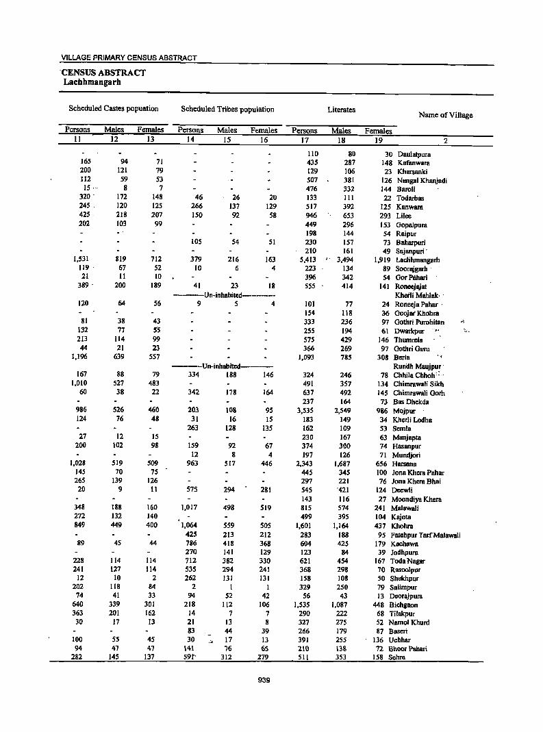
VILLAGE PRIMARY CENSUS ABSTRACT
-CENSUS ABSTRACT Lachhmangarh
Scheduled Castes popuation Scheduled Tribes population Literates Name of Village
Persons Males Females Persons Males Females Persons Males Females II 12 13 14 15 16 17 18 19 2
110 80 30 Daulatpura 165 94 71 435 287 148 Kafanwara 200 121 79 129 106 23 Kharsanki 112 59 53 507 381 126 Nangal Khanjadi 15,-- 8 7 476 332 144 Baroli
320 - 172 148 46 26 20 133 III 22 Todarbas 245 . 120 125 266 137 129 517 392 125 Kanwara 425· 218 207 150 92 58 946 653 293 Lilee 202 103 99 449 296 153 Gopalpura
198 144 54 Raipur 105 54 51 230 157 73 8aharpuri
210 161 49 Sajanpuri' 1,531 819 712 379 216 163 5,413 " 3,494 1,919 LacHhmangarh
119· 67 52 10 6 4 223 134 89 Soorajgarh -21 II 10 396 342 54 Gor Pihari
389 - 200 189 41 23 18 S55 414 141 Roneejajat -----Un-inhllbited------- Kbetli Mahlak·
120 64 56 9 5 4 101 77 24 Roneeja Pahar ' 154 118 36 Gooja( Khohra
81 38 43 333 236 97 Gothri Purohitan :'S.
132 77 5'S 255 194 61 Dwarlqiur -'#,f ~.
213 114 99 575 429 146 Thumrcla 44 21 23 366 269 97 Gothri Guru
1,196 639 557 1,093 785 308 Berla "<
----Un-inhabited----- Runilh Maqjpur-167 88 79 334 188 146 324 246 78 Chhila Chholi:; ..
1,010 527 483 491 357 134 Chimrawali Sikh 60 38 22 342 178 164 637 492 145 Chimrawa1i Garb
237 164 73 Bas Dhekdll 986 526 460 203 108 95 3,53S 2,549 986 Mojpur 124 76 48 31 16 15 183 149 34 Kherli Lodha
263 128 135 162 109 53 Semla 27 12 15 230 167 63 Manjapta
200 102 98 159 92 67 374 300 74 Hasanpur 12 8 4 197 126 71 Mundjori
1,028 519 509 963 517 446 2,343 1,687 656 Harsana 145 70 75 445 345 100 Jona Khcra Pahar 265 139 126 297 221 76 10na Khcra Bhai 20 9 11 575 294 2BI 545 '421 124 Deewli
143 116 27 Moondiya Khera 348 188 160 1,017 498 519 815 574 241 Malawali 272 132 140 499 395 104 Kajota 849 449 400 1,064 SS9 50S 1,601 1,164 437 Khohra
425 213 212 283 188 95 Fatehpur Tar.fMalawali 89 45 44 786 418 368 604 425 179 Kachawa
270 141 129 123 84 39 Jodhpura 228 114 114 712 382 330 621 454 167 TodaNagar 241 127 114 535 294 241 368 29B 70 Rasoolpur
12 10 2 262 131 131 158 108 SO Shekhpur 202 118 84 2 I 329 250 79 Salimpur
74 41 33 94 52 42 56 43 13 Deorajpura 640 339 301 218 112 106 1,535 1,087 448 Bichgaon 363 201 162 14 7 7 290 222 68 Tilakpur 30 17 13 21 13 8 327 275 52 NamolKhurd
83 44 39 266 179 87 Baseri ' -100 55 45 30
I ~I 17 13 391 255 136 Uchhar 94 47 47 141 76 65 210 138 72 Bhoor Pahari
282 145 137 59f' 312 279 511 353 158 Sehra
939
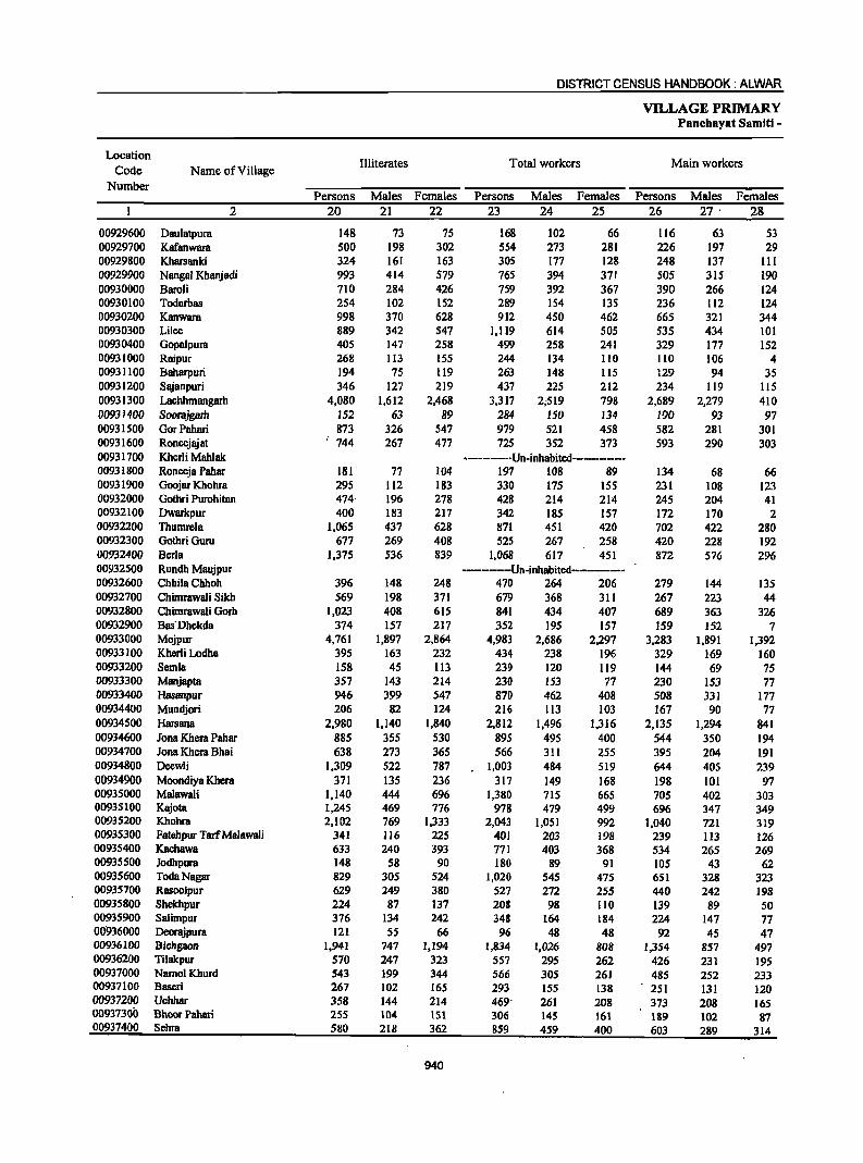
DISTRICT CENSUS HANDBOOK: ALWAR
VILLAGE PRIMARY Panchayat Samiti -
Location Illiterates Total workers Main workers
Code Name of Village Number
Persons Males Females Persons Males Females Persons Males Females 2 20 21 22 23 24 2S 26 27 ' 28
00929600 Daulatpura 148 73 75 168 102 66 116 63 53 00929700 Kafanwara 500 198 302 554 273 281 226 197 29 00929800 Kharsanki 324 161 163 305 177 128 248 137 III 00929900 Nangal Khanjadi 993 414 579 765 394 371 505 315 190 00930000 Barali 710 284 426 759 392 367 390 266 124 00930100 Todarbas 254 102 152 289 154 135 236 112 124 00930200 Kanwara 998 370 628 912 450 462 665 321 344 00930300 Lilee 889 342 547 1,119 614 505 535 434 101 00930400 Gopalpura 405 147 258 499 258 241 329 177 152 00931000 Raipur 268 113 155 244 134 110 110 106 4 00931100 Baharpuri 194 75 119 263 148 115 129 94 35 00931200 Sajanpuri 346 127 219 437 225 212 234 119 liS 00931300 Lachhmangarh 4,080 1,612 2,468 3,317 2;519 798 2,689 2,279 410 00931400 Soorajgath 152 63 89 284 150 134 190 93 97 00931500 GorPahari 873 326 547 979 521 458 582 281 301 00931600 Roneejajat 744 267 477 725 352 373 593 290 303 00931700 Khcrli Mahlak ----------Un-inhabited--·-•• -.-----00931800 Roneeja Pahar 181 77 104 197 108 89 134 68 66 00931900 Goojar Khohra 295 112 183 330 175 155 231 108 123 00932000 Gothri Purahitan 474- 196 278 428 214 214 245 204 41 00932100 Dwarkpur 400 183 217 342 185 157 172 170 2 00932200 Thumrela 1,065 437 628 871 451 420 702 422 280 00932300 GothriGuru 677 269 408 525 267 258 420 228 192 00932400 Becla 1,375 536 839 1,068 617 451 872 576 296 00932500 Rundh Maujpur -·-··_···-Un·inhabited--·-·-··_·· 00932600 ChhilaChhoh 396 148 248 470 264 206 279 144 135 00932700 Chimrawali Sikh 569 198 371 679 368 311 267 223 44 00932800 Chimrawali Gorh 1,023 408 615 841 434 407 689 363 326 00932900 Bus'Dhckda 374 157 217 352 195 157 159 152 7 00933000 Mojpur 4,761 1,897 2,864 4,983 2,686 2;1.97 3,283 1,891 1,392 00933100 Kherli Lodha 395 163 232 434 238 196 329 169 160 00933200 Semla 158 45 113 239 120 119 144 69 75 00933300 Manjapta 357 143 214 230 153 77 230 153 77 00933400 Hasanpur 946 399 547 870 462 408 508 331 177 00934400 Mundjori 206 82 124 216 113 103 167 90 77 00934500 Harsana 2,980 1,140 1,840 2,812 1,496 1,316 2,135 1,294 841 00934600 Jona Khera Pahar 885 355 530 895 495 400 544 350 194 00934700 Jona Khera Bhai 638 273 365 566 311 255 395 204 191 00934800 Deewli 1,309 522 787 1,003 484 519 644 405 239 00934900 Moondiya Khera 371 135 236 317 149 168 198 101 97 00935000 Malawali 1,140 444 696 1,380 715 665 705 402 303 00935100 Kajota 1,245 469 776 978 479 499 696 347 349 00935200 Khohra 2,102 769 1,333 2,043 1,051 992 1,040 721 319 00935300 Fatehpur TarfMalawali 341 116 225 401 203 198 239 113 126 00935400 Kaehawa 633 240 393 771 403 368 534 265 269 00935500 Jodhpura 148 58 90 180 89 91 105 43 62 00935600 TodaNagar 829 305 524 1,020 545 475 651 328 323 00935700 RusooJpur 629 249 380 527 272 255 440 242 198 00935800 Shekhpur 224 87 137 208 98 110 139 89 50 00935900 Salimpur 376 134 242 348 164 184 224 147 77 00936000 Deorajpura 121 55 66 96 48 48 92 45 47 00936100 Bicbgaon 1,941 747 1,194 1,834 1,026 808 1,354 857 497 00936200 Tilakpur 570 247 323 557 295 262 426 231 195 00937000 NamolKhurd 543 ]99 344 566 305 261 485 252 233 00937100 Baseri 267 102 165 293 155 138 2S1 I3l 120 00937200 Uchhar 358 144 214 469' 261 208 373 208 165 00937300 Bhoor Pahari 255 104 151 306 145 161 189 102 87 00937400 Sehra 580 218 362 SS9 459 400 603 289 314
940
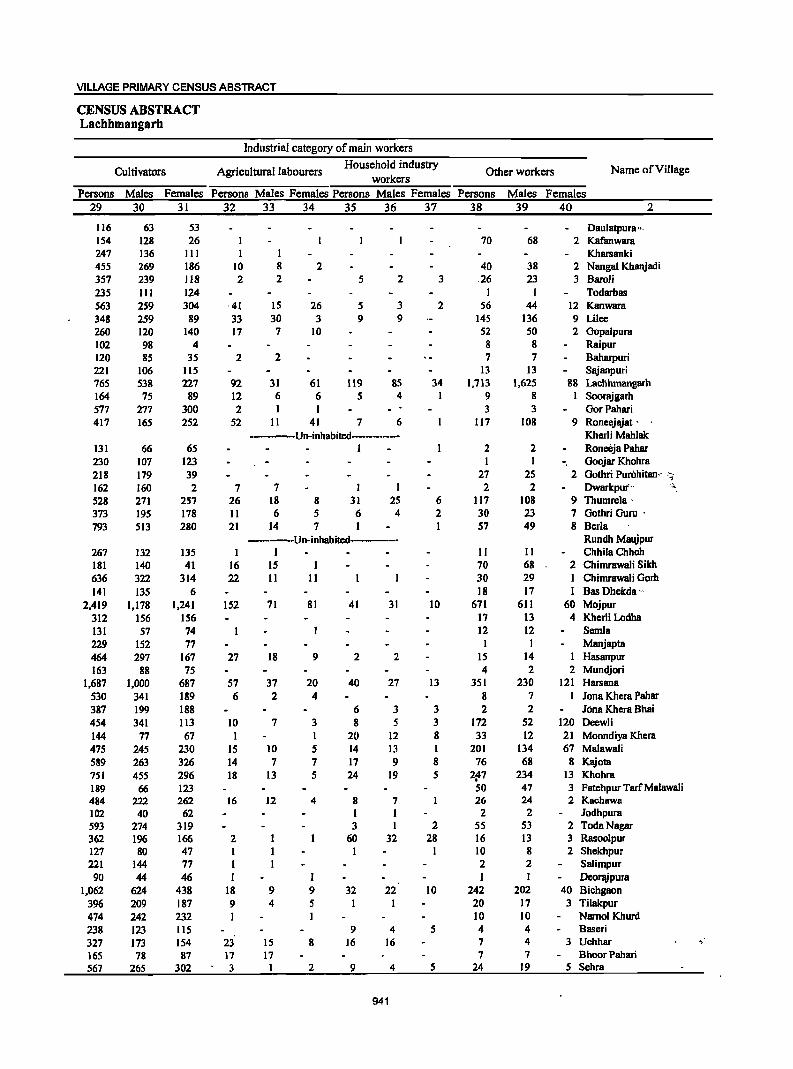
VILLAGE PRIMARY CENSUS ABSTRACT
CENSUS ABSTRACT Lachhmangarh
Industrial category of main workers
Cultivators Agricultural labourers Household industry
Other workers Name ofVilJage workers
Persons Males Females Persons Males Females Persons Males Females Persons Males Females 29 30 31 32 33 34 3S 36 37 38 39 40 2
116 63 53 Daulatpura ", 154 128 26 I 70 68 2 Kafanwara 247 136 III I Kharsanki 455 269 186 10 8 2 40 38 2 Nangal Khanjadi 357 239 118 2 2 5 2 3 26 23 3 Barali 235 III 124 I I Todarbas 563 259 304 '41 15 26 5 3 2 56 44 12 Kanwara 348 259 89 33 30 3 9 9 145 136 9 Lilee 260 120 140 17 7 10 52 50 2 Gopalpura 102 98 4 8 8 Raipur 120 85 35 2 2 7 7 Baharpuri 221 106 115 13 13 Sajanpuri 765 538 227 92 31 61 119 85 34 1,713 1,625 88 Lachhmangarh 164 75 89 12 6 6 5 4 I 9 8 I Soorajgarh 577 277 300 2 I I 3 3 GorPahari 417 165 252 52 II 41 7 6 117 108 9 Roncejajat '
Un-inhabited---------- Kherli Mahlak 131 66 65 I 2 2 Roneeja Pahar 230 107 123 I I - Goojar Khohra 218 179 39 27 25 2 Gothri Purohitan,· ,".
~
162 160 2 7 7 I I 2 2 Dwarkpui" 528 271 257 26 18 8 31 25 6 117 108 9 Thumrela' 373 195 178 II 6 5 6 4 2 30 23 7 Gothri Guru ' 793 513 280 21 14 7 I I 57 49 8 Berla
-----Un-inhabited----- Rundh Maujpur 267 132 135 I I II II ChhiiaChhoh 181 140 41 16 15 I 70 68 2 Chimrawali Sikh 636 322 314 22 11 11 30 29 I Chimrawali Gorh 141 135 6 18 17 I Bas Dhekda '"
2,419 1,178 1,241 152 71 81 41 31 10 671 611 60 Mojpur 312 156 156 17 13 4 Khcrli Lodha 131 57 74 12 12 Semi a 229 152 77 I I Manjapta 464 297 167 27 18 9 2 2 15 14 I Hasanpur 163 88 75 4 2 2 Mundjori
1,687 1,000 687 57 37 20 40 27 13 351 230 121 Harsana 530 341 189 6 2 4 8 7 I Jona Khcra Pahar 387 199 188 6 3 3 2 2 Jona Khcra Bhai 454 341 113 10 7 3 8 S 3 172 52 120 Deewli 144 77 67 I I 20 12 8 33 12 21 Moondiya Khera 475 245 230 15 10 5 14 13 I 201 134 67 Malawali 589 263 326 14 7 7 17 9 8 76 68 8 Kajota 751 455 296 18 13 5 24 19 5 ¥7 234 13 Khohra 189 66 123 50 47 3 Fatehpur Tar( Malawali 484 222 262 16 12 4 8 7 26 24 2 Kachawa 102 40 62 I I 2 2 Jodhpura 593 274 319 3 I 2 55 53 2 TodaNagar 362 196 166 2 60 32 28 16 13 3 Rasoolpur 127 80 47 I 1 1 10 8 2 Shekhpur 221 144 77 1 2 2 Salimpur 90 44 46 I I I I Deorajpura
1,062 624 438 18 9 9 32 22 10 242 202 40 Bichgaon 396 209 187 9 4 5 I I 20 17 3 Tilakpur 474 242 232 I I 10 10 Namol Khurd 238 123 115 9 4 5 4 4 Baseri 327 173 154 23 15 8 16 16 7 4 3 Uchhar , 165 78 87 17 17 7 7 Shoor Pabari 567 265 302 3 I 2 9 4 5 24 19 5 Sehra
941
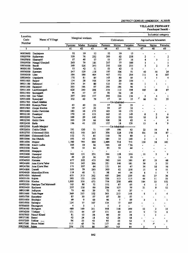
DISTRICT CENSUS HANDBOOK: ALWAR
VILLAGE PRIMARY Panchayat Samiti -
Location Industrial category
Code Name of Village Marginal workers
Cultivators Agricultural labourers Number
Persons Males Females Persons Males Females Persons Males Females 2 41 42 43 44 45 46 47 48 49
00929600 Daulatpura 52 39 13 52 39 13 00929700 Kafanwara 328 76 252 300 62 238 2 2 00929800 Kharsanki 57 40 17 53 37 16 4 3 I 00929900 Nangal Khanjadi 260 79 181 257 77 180 1 I 00930000 BaroH 369 126 243 355 120 235 5 2 3 00930100 Todarbas 53 42 11 53 42 11 00930200 Kanwara 247 129 1'18 197 106 91 40 16 24 00930300 Lilee 584 180 404 467 173 294 III 4 107 00930400 Gopalpura 170 81 89 165 80 85 5 I 4 00931000 Raipur 134 28 106 134 28 106 00931100 Baharpuri 134 54 80 133 53 80 I 00931200 Sajanpuri 203 106 97 202 106 96 1 1 00931300 Lachhmangarh 628 240 388 310 112 198 105 18 87 00931400 Soorajgarh 94 57 37 92 56 36 00931500 GorPahari 397 240 157 392 236 156 5 4 1 00931600 Roneejajat 132 62 70 57 24 33 :f 66 31 35 00931700 Kherli Mahlak ---------Un-inhabitcd----------00931800 Ronecja Pahar 63 40 23 57 36 21 00931900 Goojar Khohra 99 67 32 99 67 32 00932000 Gothri Purohitan 183 10 173 183 10 173 00932100 Dwarkpur 170 15 155 162 13 149 8 2 6 00932200 Thumrela 169 29 140 124 22 102 18 2 16 00932300 Gothri Guru 105 39 66 100 38 62 4 4 00932400 Berla 196 41 155 157 18 139 13 4 9 00932500 Rundh MBujpur -------Un-inhBbited----------00932600 ChhilaChhoh 191 120 71 169 106 63 22 14 8 00932700 Chimrawali Sikh 412 145 267 306 128 178 101 14 87 00932800 Chimrawali Gorh 152 71 81 150 70 80 I 00932900 Bas Dhekda 193 43 150 184 35 149 2 1 00933000 Mojpur 1,700 795 905 1,489 718 771 139 38 101 00933100 Kherli Lodha 105 69 36 105 69 136 00933200 Semla 95 51 44 95 5'1 44 00933300 Manjapta 00933400 Hasanpur 362 131 231 344 128 216 11 2 9 00934400 Mundjori 49 23 26 35 16 19 00934500 Harsana 677 202 475 542 161 381 87 19 68 00934600 Jona Khera Pahar 351 145 206 321 140 181 30 5 25 00934700 Jona Khera Bhai 171 107 64 131 84 47 34 18 16 00934800 Deewli 359 79 280 300 62 238 15 4 11 00934900 Moondiya Khera 119 48 71 98 44 54 8 1 7 00935000 Malawali 675 313 362 485 246 239 63 27 36 00935100 Kajota 282 132 150 228 113 115 44 11 33 00935200 Khohra 1,003 330 673 756 258 498 184 32 152 00935300 Fatehpur TarfMalawali 16.2 90 72 152 87 65 4 1 3 00935400 Kachawa 237 138 99 206 127 79 21 9 12 00935500 Jodhpura 75 46 29 72 45 27 00935600 TodaNagar 369- 217 152 361 213 148 5 4 00935700 Rasoolpur 87 30 57 87 30 57 00935800 Shekhpur 69 9 60 66 7 59 2 00935900 Salimpur 124 17 107 124 17 107 00936000 Deorajpura 4 3 1 2 2 00936100 Bichgaon 480 169 311 448 158 290 12 2 10 00936200 Tilakpur 131 64 67 121 60 61 9 ;3 6 00937000 NamolKhurd 81 53 28 80 52 28 1 00937100 Baseri 42 24 18 42 24 18 00937200 Uchhar I*~ 96 53 43 95 S3 42
' -' 00937300 Bhoor Paliari 117 43 74 117 43 74 .1' 00937400 Sehra 256 170 86 247 163 84 2
942
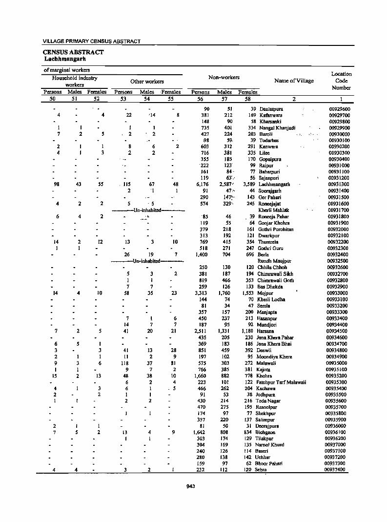
VILLAGE PRIMARY CENSUS ABSTRACT
CENSUS ABSTRACT Lachhmangarh
of marginal workers Location
Household industry Non-workers Other workers Name of ViII age Code
workers Number
Persons Males Females Persons Males 'Females Persons Males Females 50 51 52 53 54 55 56 57 58 2
90 51 39 Daulatpura 00929600 4 4 22 "14 8 381 212 169 Kafanwara 00929700
148 90 58 Kharsanki 00929800 I I 735 401 334 Nangal Khanjadi 00929900 7 2 5 2 , 2 427 224 203 Baroli "I. " 00930000
.98 59, 39 Todarbas 00930100 2 1 8 6 2 603 312 291 Kanwara 00930200 4 3 2 2 716 381 335 Lilee 00930300
355 185 170 Gopalpura 00930400 '222 12l 99 Raipur 00931000 161 84· 77 Baharpuri 00931100 119 63'-· 56 Sajanpuri 00931200
98 43 55 lIS 67 48 6,176 2,587' 3,589 Lachhmangarh 00931300 2 'I I 91 47,', 44 Soo~garh 00931400
290 147:' 143 GorPahari 00931500 4 2 2 5 - 5 574 329'- 245 Roneejajat 00931600
----Un-inhabitcd------ Kherli Mahlak 00931700 6 4 2 ,l. -85 46 39 Roneeja Pahar 00931800
[[9 55 64 Goojar Khohra 00931900 379 218 161 Gothri Purohitan 00932000 313 192 121 Dwarkpur 00932100
14 2 12 13 3 10 769 415 354 Thumre[a 00932200 1 1 518 271 247 Gothri Guru 00932300
26 19 7 1,400 704 696 Berla 00932400 -----Un-inhabited----- Rundh Maujpur 00932500
250 130 120 ChhiiaChhoh 00932600 5 3 2 381 187 194 Chimrawali Sikh 00932700 I I 819 466 353 Chimrawali Gorb 00932800 7 7 259 126 133 Bas Dhekda 00932900
14 4 10 58 35 23 3,313 1,760 1,553 Mojpur 00933000 144 74 70 Kherli Lodha 00933100 81 34 47 Semla 00933200
357 157 200 Manjapta 00933300 7 I 6 450 237 213 Hasanpur 00933400
14 7 7 187 95 92 Mundjori 00934400 7 2 5 41 20 21 2,511 1,331 1.180 Harsana 00934500
435 205 230 Jona Khera Pahar 00934600 6 5 1 369 183 186 Jona Khera Bhai 00934700 3 3 41 13 28 851 459 392 Deewli 00934800 2 I I II 2 9 197 102 95 Moondiya Khera 00934900 9 3 6 118 37 81 575 303 272 Malawali 00935000 I I 9 7 2 766 385 381 Kajota 00935100
15 2 13 48 38 10 1,660 882 778 Khohra 00935200 6 2 4 223 101 122 Fatehpur TarfMalawali 00935300
4 3 6 I . 5 466 262 204 Kachawa 00935400 2 2 I I 91 53 38 Jodhpura 00935500
2 2 430 214 216 TodaNagar 00935600 470 275 195 Rasoolpur 00935700 174 97 77 Shekhpur 00935800 357 220 137 Salimpur 00935900
2 I I 81 50 31 Deorajpura 00936000 7 5 2 13 4 9 1,642 808 834 Bichgaon 00936100
I 303 174 129 Tilakpur 00936200 304 169 135 Namol Khurd 00937000 240 126 114 Baseri 00937100 280 138 142 Uchhar 00937200 159 97 62 BhoorPahari 00937300
4 4 3 2 232 112 120 Sehra 00937400
943
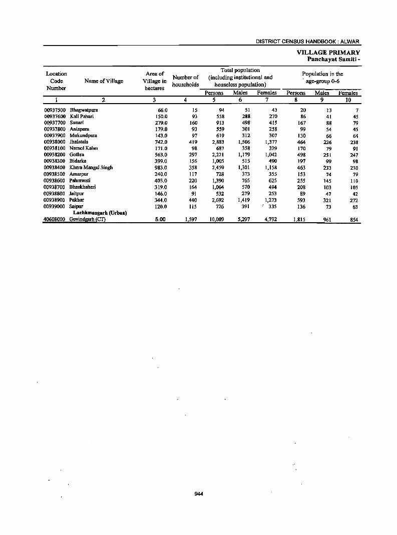
DISTRICT CENSUS HANDBOOK: ALWAR
VILLAGE PRIMARY Panchayat Samiti -
Location Area of Total population
Population in the Number of (including institutional and
Code Name of Village Village in households houseless population)
age-group 0-6 Number hectares
Persons Males Females Persons Males Females 2 3 4 5 6 7 8 9 10
00937500 Bhagwatpura 66.0 15 94 51 43 20 13 7 00937600 Kali Pahari 150.0 93 558 288 270 86 41 45 0()_937700 Sunan 279.0 160 913 498 415 167 88 79 00937800 Antapara 179.0 93 559 301 258 99 54 45 00937900 Mukundpura 143.0 97 619 312 307 130 66 64 00938000 Ihalatala 742.0 419 2,883 1,506 1,377 464 226 238 00938100 Namol Kalan 171.0 98 687 358 329 170 79 91 00938200 Gothra 563.0 297 2,221 1,179 1,042 498 251 247 00938300 Bidarka 399.0 156 1,005 515 490 197 99 98 00938400 Khera Mangal Singh 983.0 358 2,459 1,301 1,158 463 233 230 00938500 Amarpur 240.0 117 728 373 355 153 74 79 00938600 Pahrawati 403.0 220 1,390 765 625 255 145 110 00938700 Bheekhaheri 319.0 164 1,064 570 494 208 103 105 00938800 Jaitpur 146.0 91 532 279 253 89 47 42 00938900 Pakhar 344.0 440 2,692 1,419 1,273 593 321 272 00939000 Saipur 120.0 115 726 391 .. 335 136 73 63
Lachhmangarh (Urban) 40608000 Govindllarh ~£!2 5.00 1,597 10,089 5,297 4,792 1,815 961 854
944
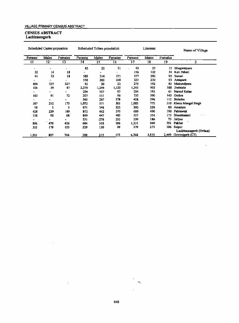
VILLAGE PRIMARY CENSUS ABSTRACT
CENSUS ABSTRACT Lachhmangarh
Scheduled Castes popuation Scheduled Tribes population Literates Name ofVilJage
Persons Males Females Persons Males . Females Persons Males Females 11 12 . 13 14 15 16 17 18 19 2
43 22 21 42 27 IS Bhagwatpura 32 14 18 156 122 34 Kali Pahari 41 23 18 585 314 271 377 282 95 Sunari
558 300 258 323 230 93 Antapara 454 227 227 43 20 23 275 192 83 Mukundpura 106 59 47 2,379 1,244 1,135 1,341 953 388 Jhalatala
204 107 97 254 193 61 NamolKalan 163 91 72 207 III 96 735 590 145 Gothra
565 287 278 408 296 112 Bidarka 387 212 175 1,072 571 501 1,082 772 3 IO : Khera Mangol.Singh
10 5 5 671 348 323 300 220 80 Amarpur 428 239 189 812 442 370 680 490 190 Pahrawati 158 90 68 849 447 402 527 3S4 173 Bheekhaheri
531 .278 253 259 186 73 Jaitpur 896 470 426 604 318 286 1,331 940 391 Pakhar 332 179 IS3 229 130 99 379 273 106 Saipur
Laehhmangarh (Urban) 1,553 807 746 388 215 173 6,268 3,819 2,449 Govindgarh (CT)
~'-
945
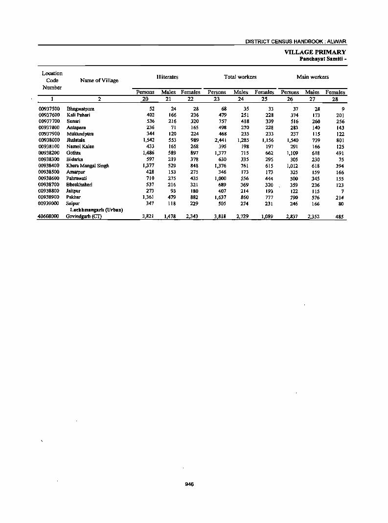
DISTRICT CENSUS HANDBOOK: ALWAR
VILLAGE PRIMARY Panchayat Samiti -
Location Illiterates Total workers Main workers
Code Name of Village Number
Persons Males Females Persons Males Females Persons Males Females 2 20 21 22 23 24 25 26 27 28
00937500 Bhagwatpura 52 24 28 68 35 33 37 28 9 00937600 Kali Pahari 402 166 236 479 251 228 374 173 201 00937700 Sunari 536 216 320 757 418 339 516 260 256 00937800 Antapara 236 71 165 498 270 228 283 140 143 00937900 Mukundpura 344 120 224 468 235 233 237 115 122 00938000 Jhalatala 1,542 553 989 2,441 1,285 1,156 1,540 739 801 00938100 Namol Kalan 433 165 268 395 198 197 291 166 125 00938200 Gothra 1,486 589 897 1,377 715 662 1,109 618 491 00938300 Bidarka 597 219 378 630 335 295 305 230 75 00938400 Khera Mangal Singh 1,377 529 848 1,376 761 615 1,012 618 394 00938500 Amarpur 428 153 275 346 173 173 325 159 166 00938600 Pahrawati 710 275 435 1,000 556 444 500 345 155 00938700 Bheekhaheri 537 216 321 689 369 320 359 236 123 00938800 Jaitpur 273 93 180 407 214 193 122 liS 7 00938900 Pakhar 1,361 479 882 1,637 860 777 790 576 214 00939000 Saipur 347 118 229 505 274 231 246 166 80
Laehhmangarll (Urban) 40608000 Govjnd~arh {f!2 3,821 1,478 2,343 3,818 2,729 1,089 2,837 2,352 485
946
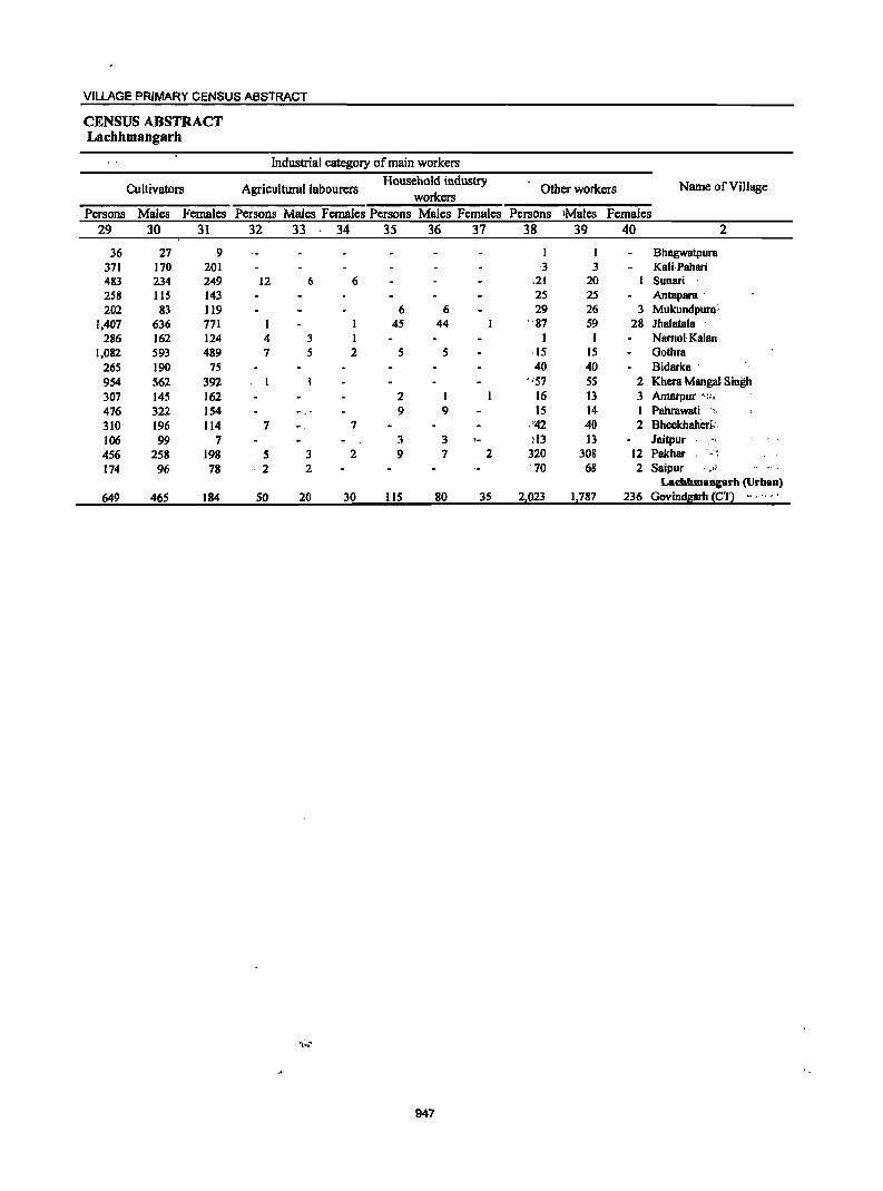
VILLAGE PRIMARY CENSUS ABSTRACT
CENSUS ABSTRACT Lachhmangarb
Industrial category of main workers
Cultivators Agricultural labourers Household industry
Other workers Name ofViIlage workers
Persons Males Females Persons Males· Females Persons Males Females Persons IMaies Females 29 30 31 32 33 34 35 36 37 38 39 40 2
36 27 9 I Bhagwatpura 371 170 201 ,3 3 Kali·Pahari 483 234 249 12 6 6 .21 20 Sunari 258 115 143 25 25 Antapara ' 202 83 119 6 6 29 26 3 Mukundpura;
1,407 636 771 45 44 "87 59 28 Ihalatala ' 286 162 124 4 3 1 1 I Namol' Kalan
1,082 593 489 7 5 2 5 5 ·15 15 Gothra 265 190 75 40 40 Bidarka . 954 562 392 "57 55 2 Khera Mangal Singh 307 145 162 2 1 16 13 3 Amarpur ',;1;'
476 322 154 9 9 15 14 1 Pahrawati ", 310 196 114 7 7 ,'42 40 2 Bheekhaheri: . 106 99 7 . 3 3 ~13 13 Jaitpur . ., 456 258 198 5 3 2 9 7 2 320 308 12 Pakhar ' '.'~
174 96 78 ·2 2 . 70 68 2 Saipur "_ ~11
LadlhmangBrh (Urban) 649 465 184 50 20 30 11S 80 3S 2,023 1,787 236 Govindsam {Cn ",'" ,
947
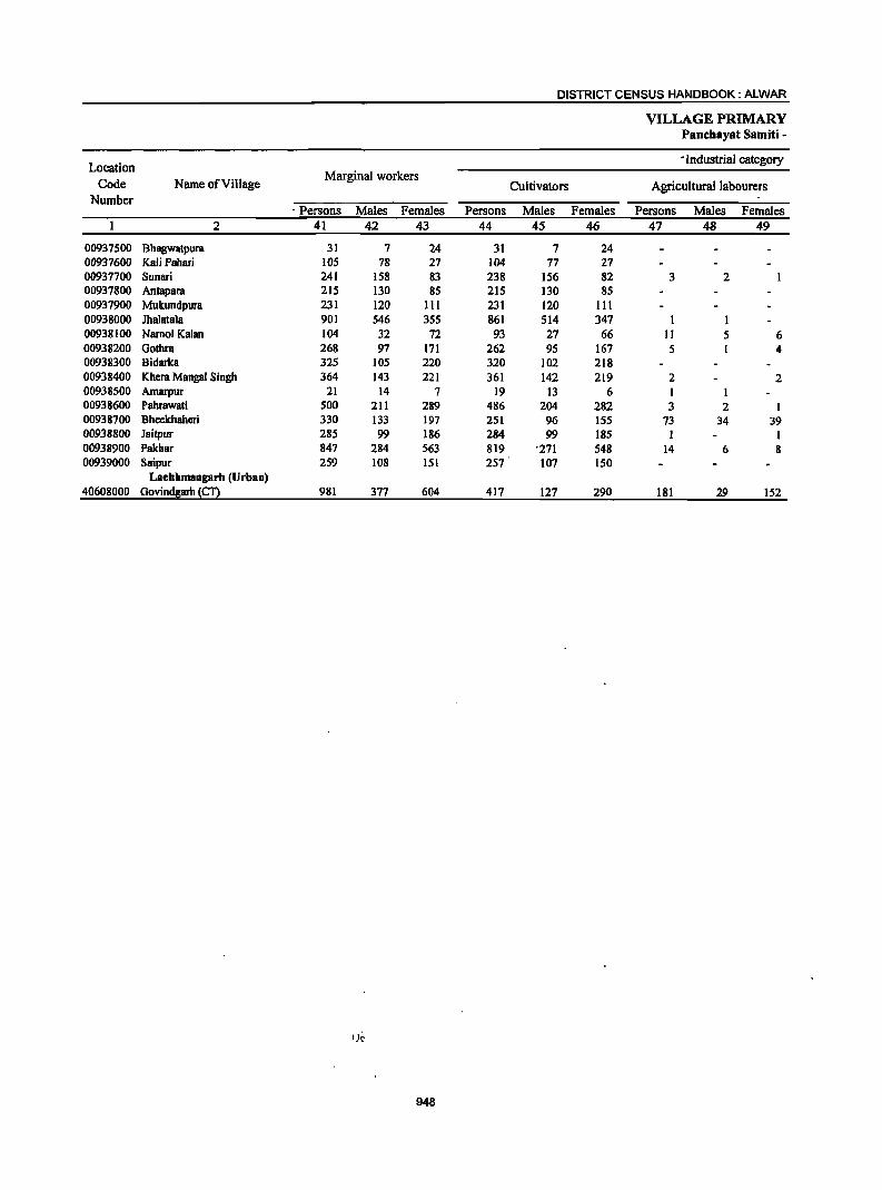
DISTRICT CENSUS HANDBOOK: ALWAR
VILLAGE PRIMARY PaDchayat Samiti -
Location • Industrial category
Code Name of ViII age Marginal workers
Cultivators Agricultural labourers Number
. Persons Males Females Persons Males Females Persons Males Females 2 41 42 43 44 45 46 47 48 49
00937500 Bhagwatpura 31 7 24 31 7 24 00937600 Kali PabBri 105 78 27 104 77 27 00937700 Sunari 241 158 83 238 156 82 3 2 00937800 Antapara 215 130 85 215 130 85 00937900 Mukundpura 231 120 III 231 120 III 00938000 Jhalatala 901 546 355 861 514 347 I 00938100 Namol Kalan 104 32 72 93 27 66 II 5 6 00938200 Gothra 268 97 171 262 95 167 5 1 4 00938300 Bidarka 325 105 220 320 102 218 00938400 Khera Mangal Singh 364 143 221 361 142 219 2 2 00938500 Amarpur 21 14 7 19 13 6 00938600 Pahrawati 500 211 289 486 204 282 3 2 00938700 Bheekhaheri 330 133 197 251 96 155 73 34 39 00938800 Jaitpur 285 99 186 284 99 185 1 I 00938900 Pakhar 847 284 563 819 "271 548 14 6 8 00939000 Saipur 259 108 151 257 107 150
Laebbmangarh (Urban) 40608000 Govindllarh ~Cn 981 377 604 417 127 290 181 29 152
, ;e
948
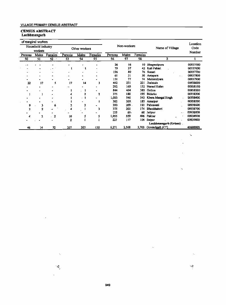
VILLAGE PRIMARY CENSUS ABSTRACT
CENSUS ABSTRACT Lachhmangarh
of marginal workers Location
Household industry Non-workers Name of Village Code Other workers
workers Number Persons Males Females Persons Males Females Persons Males Females
50 51 52 53 54 55 56 57 58 2
26 16 10 Bhagwatpura 00937500 . '1 19 37 42 Kali Pahari 00937600 156 80 16 Sunari 00937700 61 31 30 Antapara 00937800
lSI 17 14 Mukundpura 00937900 22 17 5 17 14 3 442 221 221 Ihalatala 00938000
292 160 132 NamolKalan 00938100 I 844 464 380 Gothra 00938200
4 2 2 375 180 195 Bidarka 00938300 I . I 1,083 540 543 Khera Mangal Singh 00938400 I 382 200. 182 Amarpur 00938500
9 3 6 2 2 390 209 . 181 Pahrawati 00938600 2 2 4 3 375 201 ]74 Bheekhaheri 00938700
]25 65, 60 laitpur 00938800 4 2 2 10 5 5 I,OS5 559 496 Pakhar 00938900
2 1 1 221 117 104 Saipur 00939000 Laebhmangarb (Urban) c.
46 14 32 337 207 130 6,271 2,568 3,703 Govindgarh (Cn 40608000
.
'.
949
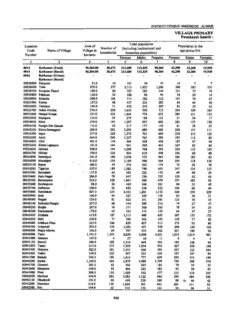
DISTRICT CENSUS HANDBOOK: ALWAR
VILLAGE PRIMARY Panchayat Samiti -
Location Area of Total population
Population in the Code Name of Village Village in
Number of (including institutional and age-group 0-6
Number hectares households houseless population)
Persons Males Females Persons Males Females 2 3 4 5 6 7 8 9 10
0014 Katbumar (Total) 56,504.00 30,473 211,689 113,325 98,364 42,290 22,360 19,930 0014 Katbumar (Rural) 56,504.00 30,473 211,689 113,325 98,364 42,290 22,360 19,930 0014 Katbumar (Urbao)
Katbumar (Roral) 00930500 Haripura 31.0 16 101 S4 47 14 7 7 00930600 Toda 879.0 377 2,713 1,427 1,286 540 285 255 00930700 Roopbas Thekri 149.0 80 727 383 344 lSI 75 76 00930800 Patakpur 120.0 29 188 94 94 34 20 14 00930900 Makreta 298.0 106 714 382 332 141 74 67 00933500 Kemla 157.0 48 427 224 203 84 44 40 00933600 Teentpur 194.0 71 452 245 207 81 39 42 00933700 Nabar Khohra 376.0 220 1,613 900 713 354 169 185 00933800 Nangal Roopa 357.0 202 1,446 774 672 284 151 133 00933900 Napapara 134.0 39 275 154 121 51 34 17 00934000 Khoh 379.0 195 1,297 697 600 285 157 128 00934100 Nangla Bas Guman 113.0 30 317 177 140 61 38 23 00934200 Khera Sarangpuri 388.0 203 1,295 689 606 258 147 III 00934300 Jagro 377.0 228 1,372 703 669 238 113 125 00936300 Adoli 464.0 240 1,357 761 596 195 113 82 00936400 Uksi 491.0 144 964 508 456 187 97 90 00936500 Khera Laganpur 191.0 144 941 500 441 167 83 84 00936600 Jatwara 298.0 194 1,299 704 595 238 133 105 00936700 Nithari 190.0 126 816 418 398 156 68 88 00936800 Santokpur 341.0 140 1,036 572 464 186 103 83 00936900 Manakpur 416.0 154 1,160 596 564 254 1I8 136 00939100 Bayra 186.0 49 376 202 174 72 42 30 00939200 Tigariya 535.0 189 1,383 748 635 247 134 ]]3 00939300 Boolaberi 137.0 63 392 222 170 69 40 29 00939400 Ram Nagar 286.0 79 647 324 323 128 62 66 00939500 Bamanpura 333.0 128 1,067 588 479 197 105 92 00939600 Baldeopura 98.0 56 469 248 221 84 35 49 00939700 Jodhpura 196.0 56 450 238 212 104 60 44 00939800 Barodakan 807.0 335 2,453 1,281 1,172 468 239 229 00939900 Itola 100.0 46 327 169 158 69 38 31 00940000 Rajpur 139.0 81 632 351 281 125 70 55 00940100 Sedooka Nangla 257.0 68 416 200 216 74 27 47 00940200 Beejla 207.0 74 571 308 263 78 S4 24 00940300 Hanumanta 175.0 45 325 172 153 64 37 27 00940400 Sitahara 415.0 187 1,313 688 625 287 135 152 00940500 Bisli 238.0 77 709 366 343 159 77 82 00940600 Mathura Hera 237.0 106 839 427 412 172 92 80 00940700 Ind!.awaJi 293.0 154 1,205 657 548 246 120 126 00940800 NaglaMatwa 196.0 84 797 435 362 201 109 92 00940900 Tasai 1,741.0 1,195 8,859 4,808 4,051 1,915 1,014 901 00941000 Manpur 147.0 4 27 16 II 8 4 4 00941100 Samoli 346.0 182 1,154 . 648 506 192 108 84 00941200 Tusari 613.0 271 1,950 1,034 916 427 229 198 00941300 Hulyana 422.0 181 1,253 660 593 227 123 104 00941400 Teekri 330.0 122 957 523 434 197 107 90 00941500 Barada 340.0 186 1,416 777 639 295 ISS 140 00941600 Sonlch 1,100.0 564 3,879 2,080 1,799 758 388 370 00941700 Dheewri 361.0 63 392 207 185 70 35 3S 00941800 Bhadeera 248.0 55 406 223 183 95 SO 45 00941900 Pisai 298.0 150 ],029 552 477 215 110 105 00942000 Maithna 496.0 283 2,082 1,122 960 395 20S 190 00942100 Dhailkroli 192.0 60 418 229 189 88 '~l~ 46 42 00942200 Haneepur 218.0 138 1,024 561 463 204 III 93 00942300 Reti 169.0 52 312 170 142 59, 28 31
950
VILLAGE PRIMARY CENSUS ABSTRACT
CENSUS ABSTRACT Kathumar
Scheduled Castes popuation Scheduled Tribes population Literates Name of Village
Persons Males ,Females Persons Males Females Persons Males _Females '11 12 13 14 15 16 17 18 19. .2
51,024 . 27,186 23,838 27,457 14,622 12;835 99,111 69,967 29,144 Katburnar (Total) 51,024 _ 27,186 23,838 27,457 14;622 12;835 99,111 69,967 29,144 Ka~bu!Dar (Rural)
Katburnar (Utban) Katburnar'(Rural)
43 19 24 44 37 7 Haripura 503 270- 233 608 318 290 1,235 863 372 Toda
320 235 85 Roopbas Tbeki'i 107 58 49 Patakpur
8S 42 43 618 334 284 326 222 104 Makreta 144 - 74 70 194 143 51 Kernla
172 121 SI Teentpur 676 528 148 Nahai Khohra
241 120 121 67 36 31 508 391 117 Nangai'Roopa_ I, I - 157 lOS 52 Napapara
467 261 206 _ 592 411 181 Khoh 137 105 32 ' Nangla Bas Gilman
142 77 65 10 6 4 542 371 171 Khera Sarangpui'i -420-. 204 216 26 17 9 574 420 154 Jagru 296,- 166 130- 607 337 270 651 476 175 Adoli
71 35 36. 10 4 6 500 322 178 Uksi .\,.._. 303 152 151" '81 40 41 475 332 143 Khera Laganpup -'11(-'
120 67 53 82 52 30 636 466 170 Jatwara 141 71 70 654 33S 319 332 242 90 Nithari
14 1 7 356 183 113 550 311 113 Santokpur 90 43 41 448 333 115 Manakpur 8 5 3 169 125 44 Bayra
158 88 70 580 303 277 729 504 225 Tigariya 63 36 27 35 21 14 184 136 48 Boolaheri
144 67 77 14 9 5 361 243 118 Ram Nagar 16 10' 6 .18 10 8 485 357 128 Bamanpura
110 135 35 Daldeopura 243 157 86 Jodhpura
432 227 205 132 74 58 987 686 301 Darodakan- . " 128 68 60 86 40 46 118 105 73 ltola
7 4- 3 373 214 IS9 243 188 55 Rajpur_ 331 158 173 198 123 15 Sedo6ka Nangla
318 216 102 Beejla 13 1 6 177 110 67 Hanumanta
276 146 130 58 32 26 597 426 171 Sitahara 85 48 31 352 246 106 Disli
343 176 167 13 8 5 414 269 145 Mathura Hera 344 172 172 8 4 4 522 419 103 Indrawali 134 76 58 380 263 117 NaglaMatwa
1,445 140 705 50 27 23 3,666 2,711 955 Tasai 2 2 Manpur
401 226 175 51 24 27 605 434 111 Samoli 416 223 193 110 63 47 882 606 276 Tusari 226 111 115 643 439 204 Hu1yana 107 60 47 458 354 104 Teekri 389 209 180 91 50 41 658 478 180 Barada 680 375 305 100 56 44 1,937 1,305 632 Sonkh
58 32 26 54 32 22 237 153 84 Dheewri 194 100 94 12 6 6 203 141 62 Bhadeera 297 168 129 469 345 124 Pisai 434 224 210 839 629 210 Maithna 101 S5 46 185 130 55 Dhankroli 222 128 94 71 40 31 475 363 112 Haneepur 121 67 S4 168 88 80 166 116 50 Reti
951
DISTRICT CENSUS HANDBOOK: ALWAR
VILLAGE PRIMARY Panehayat Samiti -
Location III iterates Total workers Main workers
Code Name of Village Number
Persons Males Females Persons Males Females Persons Males Females 2 20 21 22 23 24 25 26 27 28
0014 KathumBr (Total) 112,578 43,358 69,220 113,202 61,460 51,742 75,486 50,248 25,238 0014 KathumBr (Rural) 112,578 43,358 69,220 113,202 61,460 51,742 75,486 50,248 25,238 0014 KBthumBr (Urban)
KBthumBr (Rural) 00930500 Haripura 57 17 40 56 30 26 28 24 4 00930600 Toda 1,478 564 914 972 668 304 844 579 265 00930700 Roollbas Thekri 407 148 259 375 209 166 221 176 45 00930800 Patakpur 81 36 45 61 45 16 42 39 3 00930900 Makreta 388 160 228 558 304 254 355 214 141 00933500 Kernla 233 81 152 230 110 120 203 96 107 00933600 Teentpur 280 124 156 274 150 124 232 129 103 00933700 Nabar Kbohra 937 372 565 890 491 399 485 425 60 00933800 Nangal Roopa 938 383 555 966 524 442 527 327 200 00933900 Napapara 118 49 69 147 75 72 147 75 72 00934000 Khoh 705 286 419 617 356 261 337 296 41' 00934100 Nangla Bas Guman 180 72 108 189 98 91 173 91 82 00934200 Khera Sarangpuri 753 318 435 900 465 435 458 310 148 00934300 Jagro 798 283 SIS 900 467 433 594 328 266 00936300 Adoli 706 285 421 976 552 424 417 394 23 00936400 Uksi 464 186 278 422 270 152 265 215 50 00936500 Khera Laganpur 466 168 298 539 289 250 271 204 67 00936600 Jatwara 663 238 425 721 436 285 530 313 217 00936700 Nithari 484 176 308 486 259 227 365 186 179 00936800 Santokpur 486 195 291 591 314 277 525 279 246 00936900 Manakpur 712 263 449 735 375 360 267 256 11 00939100 Bayra 207 77 130 229 112 117 203 106 97 00939200 Tigariya 654 244 410 807 437 370 382 345 37 00939300 Boolaheri 208 86 122 244 144 100 130 III 19 00939400 Ram Nagar 286 81 205 386 205 181 153 147 6 00939500 Bamanpura 582 231 351 637 350 287 395 294 101 00939600 Baldeopura 299 113 186 360 200 160 194 123 71 00939700 Jodbpura 207 81 126 305 154 151 184 108 76 00939800 Barodakan 1,466 595 871 1,262 683 579 1,038 614 424 00939900 ltola 149 64 85 204 III 93 85 76 9 00940000 Rajpur 389 163 226 390 208 182 349 176 173 00940100 Sedooka Nangla 218 77 141 213 102 111 166 88 78 00940200 Beejla 253 92 161 304 157 147 166 147 19 00940300 Hanumanta 148 62 86 189 97 92 167 94 73 00940400 Sitahara 716 262 454 712 386 326 387 298 89 00940500 Bisli 357 120 237 493 259 234 286 176 110 00940600 Mathura Hera 425 158 267 394 199 195 329 171 158 00940700 Indrawali 683 238 445 679 367 312 496 281 215 00940800 NaglllMatwa 417 172 245 467 244 223 292 167 125 0094~900 Tasm 5,193 2,097 3,096 4,769 2,589 2,180 3,012 2,083 929 00941000 Manpur 25 14 11 18 11 7 12 7 5 00941100 Samoli 549 214 335 811 457 354 587 303 284 00941200 Tusari 1,068 428 640 1,062 555 507 421 368 53 00941300 Hulyana 610 221 389 643 325 318 485 274 211 00941400 Teekri 499 169 330 661 359 302 378 215 163 00941500 Barada 758 299 459 859 477 382 614 370 244 00941600 Sonkb 1,942 775 1,167 2,021 1,066 955 1,405 909 496 00941700 Dbeewri 155 54 101 207 120 87 175 112 63 00941800 Bbadeera 203 82 121 209 121 8S" 133 95 38 00941900 Pisai 560 207 353 573 303 270 355 261 94 00942000 Maithoa 1,243 493 750 1,161 607 554 670 520 150 00942100 Dhankroli 233 99 134 208 106 102.· 94 88 6 00942200 Haneepur 549 198 351 451 2S1 20d' 347 242 lOS 00942300 Reti 146 54 92 151 77 74 80 75 5
952
VILLAGE PRIMARY CENSUS ABSTRACT
CENSUS ABSTRACT Kathumar
Industrial category of main workers
Cultivators Agricultural labourers Household industry
Other workers Name of ViII age workers
Persons Males Females Persons Males 'Females Persons Males Females Persons Males Females 29 30 31 32 33 34 35 36 37 38 39 40 2
,57;529 36,992 20,537 4,010 2,380 1,630 ,1,203 '840 363 12;744 10,036 2.708 Kathumar (Total) ,S7~29 36,992 20,537 4,010 Z,380 1,630 '1;203 840 ,363 12,744 10,036 2,708 Kathumar"(Rural)
Kathumar (Urban) , Kllthumar (Rural)
23 19 4 4 4 Haripura 668 415 253 36 29 7 4 3 136 132 4 Toda 145 125 20 76 51 25 ' Roopbas\Thekri 31 29 2 II 10 I Patakpur' ,
345 204 141 3 3 7 7 Makreta ' 202 95 107 1 1 Kemla 221 118 103 3 3 S 5 3 3 Teentpur 393 340 53 10 4 6 4 4 78 77 Nahar Khohra 456 263 193 5 5 15 14 51 45 6 Nangal'Roopa 129 60 69 I I 17 14 3 Napapara " 124 108 16 75 60 IS 13 10 3 125 118 7 Khoh 173 91 82 Nangla Bas Guman 413 268 145 1 ,1 6 6 38 35 3 Khera Sarangpuri 448 227 221 89 55 34 20 16 4 37 30 7 Jagru 369 350 19 22 20 2, 26 24 2 Adoli 217 170 47 3 3 8 7 37 35 2 Uksi 198 135 63 10 9 I 2 2 61 58 3 Khera Laganpur->",t> ,
441 239 202 4 I 3 II 9 2 74 64 10 Jatwara " 328 156 172 7 5 2 30 25 5 Nithari 496 254 242 4 4 25 21 4 Santokpur 256 248 8 8 5 3 3 3 Manakpur ' 179 88 91 10 8 2 14 10 4 8ayra 357 323 34 18 IS 3 7 7 Tigariya 126 107 19 4 4 8oo1aheri 114 III 3 38 35 3 Ram Nagar. 345 250 95 4 4 7 7 39 33 6 8amanpura 168 101 67 26 22 4 Baldeopura ' 166 92 74 18 16 2 Jodhpura 918 519 399 26 19 7 3 2 91 74 17 8arodakan
75 66 9 5 5 5 5 Ito1a 346 173 173 2 2 I Rajpur 156 80 76 5 3 2 5 5 Sedooka Nangla 145 130 15 6 3 3 15 14 8eejla 160 88 72 2 I I 5 5 Hanumanta 213 172 41 76 42 34 7 7 91 77 14 SitahllAl 244 145 99 12 4 8 6 6 24 21 3 Bisli 212 106 106 45 11 34 3 3 69 54 15 Mathura Hera 442 245 197 S 3 2 3 2 1 46 31 15 Indrawali 264 152 112 22 10 12 6 5 1 NaglaMatwa
2,221 1,499 722 309 214 95 65 48 17 417 322 95 Tasai 7 3 4 3 2 I 2 2 Manpur
544 267 277 9 5 4 1 33 30 3 Samoli 352 304 48 30 27 3 12 11 1 27 26 I Tusari 346 224 122 10 7 3 13 7 6 116 36 80 Hulyana 331 180 151 14 8 6 9 4 5 24 23 1 Teekri 494 286 208 61 33 28 13 II 2 46 40 6 Barada
1,081 686 395 107 75 32 26 24 2 191 124 67 Sankh III 90 21 4 4 -.. 60 18 42 Dheewri 126 89 37 6 5 1 1 Bhadeera 323 230 93 3 3 29 28 I Pisai 511 390 121 36 32 4 7 6 1 116 92 24 Maithna
.' "e.'I:
-13 12 1 Dhankroli 81 76 5 -~ 210 145 65 28 23 5 75 45 30 34 29 5 Haneepur
71 67 4 9 8 I Reti
953
DISTRICT CENSUS HANDBOOK: ALWAR
VILLAGE PRIMARY Panchayat Samiti -
Location Industrial category
Code Name of Village Marginal workers
Cultivators Agricultural labourers Number
Persons Males Females Persons Males Females Persons Males Females 2 41 42 43 44 45 46 47 48 49
0014 Kathumar (Total) 37,716 11,212 26,504 28,631 8,883 19,748 5,168 1,119 4,039 0014 Kathumar (Rural) 37,716 11-.111 26,504 28,631 8,883 19,748 5,268 1,119 4,039 0014 Kathumar (Urban)
Kathumar (Rural) 00930500 Haripura 28 6 22 11 1 10 17 5 12 00930600 Toda 128 89 39 63 42 21 23 8 15 00930700 Roopbas Thekri 154 33 121 121 27 94 00930800 Patakpur 19 6 13 13 I 12 4 3 00930900 Makreta 203 90 113 203 90 113 00933500 Kemla 27 14 13 27 14 13 00933600 Teentpur 42 21 21 39 20 19 1 I 00933700 Nahar Khohra 405 66 339 311 49 262 90 13 77 00933800 Nanga! Roopa 439 197 242 386 169 217 18 8 10 00933900 Napapara 00934000 Khoh 280 60 220 109 21 88 155 32 123 00934100 Nangla Bas Guman 16 7 9 11 3 8 5 4 1 00934200 Khera Sarangpuri 442 155 287 423 148 275 8 5 3 00934300 Jagro 306 139 167 272 125 147 15 6 9 00936300 Adoli 559 158 401 526 147 379 17 4 13 00936400 Uksi 157 55 102 137 48 89 3 3 00936500 Khera Laganpur 268 85 183 235 72 163 25 8 17 00936600 Jatwara 191 123 68 182 115 67 5 4 1 00936700 Nithari 121 73 48 97 63 34 12 2 10 00936800 Santokpur 66 35 31 66 35 31 00936900 Manakpur 468 119 349 292 85 207 174 34 140 00939100 Bayra 26 6 20 24 5 19 00939200 Tigariya 425 92 333 403 90 313 19 18 00939300 Boolaheri 114 33 81 112 33 79 1 1 00939400 Ram Nagar 233 58 175 226 56 170 4 3 00939500 Bamanpura 242 56 186 236 55 181 5 5 00939600 Ba!deopura 166 77 89 68 43 25 I I 00939700 Jodhpura 121 46 75 118 45 73 00939800 Barodakan 224 69 155 211 67 144 10 I 9 00939900 Itola 119 35 84 113 32 81 5 2 3 00940000 Rajpur 41 32 9 41 32 9 00940100 Sedooka Nangla 47 14 33 46 13 33 00940200 Beej1a 138 10 128 136 10 126 2 2 00940300 Hanumanta 22 3 19 3 2 1 19 I 18 00940400 Sitahara 325 88 237 264 66 198 39 9 30 00940500 Bis1i 207 83 124 192 76 116 3 3 00940600 Mathura Hera 65 28 37 54 24 30 8 1 7 00940700 Indrawali 183 86 97 116 51 65 25 10 IS 00940800 NagJaMatwa 175 77 98 165 73 92 9 4 5 00940900 Tasai 1,757 506 1,251 1,329 391 938 246 72 174 00941000 Manpur 6 4 2 3 I 2 3 3 00941100 Samoli 224 154 70 216 152 64 8 2 6 00941200 Tusari 641 187 454 457 136 321 143 41 102 00941300 Hu1yana 158 51 107 75 26 49 43 14 29 00941400 Teekri 283 144 139 272 138 134 8 4 4 00941500 'Barada '245 107 138 205 94 III 31 9 22 00941600 Sonkh 616 157 459 506 126 380 89 24 65 00941700 Dheewri 32 8 24 20 6 14 6 2 4 00941800 Bhadeera 76 26 " 50 65 24 41 11 2 9, 00941900 Pisai 218 42 176 211 42 169 1 I 00942000 Maithna 491 87 404 408 75 333 69 12 S7 00942100 Dhankroli 114 18 :~ 96 55 5S 00942200 Haneepur 104 9 .. 95 38 37 63 8 SS 00942300 Reti 71 2 69 62 61 7 7
954
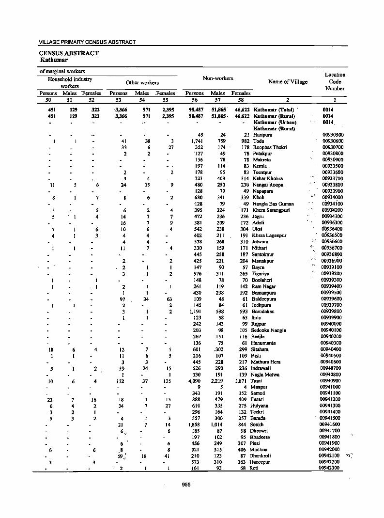
VILLAGE PRIMARY CENSUS ABSTRACT
CENSUS ABSTRACT Kathumar
of marginal workers Location
Household industry Non-workers Other workers Name of Village Code
workers Number Persons Males 'Females Persons Males ,Females Persons Males Females
50 51 52 53 54 55 56 57 58 2
451 129 322 '3,366 971 2,395 98,487 51,865 46,622 Kathumar (Total) , 0014 451 129 322 3,366 971 2,395 981487 51,865. 46,622 Kathumar (Rural) 0014
Kathumar (Urban) , I 0014 Kathumar (Rural)
45 24 21 Haripura 00930500 41 38 3 1,741 759 982 Toda 00930600
- 33 6 27 352 174 ' 178 Roopbas Thekri 00930700 2 2 '127 49 78 Patakpur 00930800
156 78 78 Makreta 00930900 197 114 83 Kemla 00933500
2 2 178 95 83 Teentpur 00933~00
4 4 723 409 314 Nahar Khohra ,',
OQ93~700
11 5 6 24 15 9 480 250 230 Nanga! Roopa " 00933800 128 79 49 Napapara 00933900
8 7 8 6 2 680 341 339 Khoh :J 00934000 -128 79 49 Nangla Bas Guman 00934ioo
5 5 6 2 4 '395 224 171 Khera Sarangpuri 00934200 5 I 4 14 7 7 472 236 236 Jagru " \ 00934,300
16 7 9 381 209 172 Adoli 00936300 7 6 10 6 4 542 238 304 Uksi 0(l936400 4 3 4 4 402 211 19] Khera Laganpur 009365'00
4 4 578 268 3]0 Jatwara I,; 00936600 11 7 4 330 159 171 Nithari .~<, 00936700
445 258 187 Santokpur 00936800 2 2 425 221 204 Munakpur - I',t' 00936900 2 I 147 90 57 Buyru 00939100 3 2 576 311 265 Tigariya '1, 00939200
I 148 78 70 Boolaheri 00939300 , I 2 261 119 142 Ram Nagar 00939400
I I 430 238 192 Bamanpura 00939500 97 34 63 109 48 61 Baldeopura 00939600 2 2 145 84 61 Jodhpura 00939700 3 2 1,191 598 593 Barodukan 00939800 I 123 58 65 Itola 00939900
242 143 99 Rajpur 00940000 203 98 105 Sedooka Nanglu 00940100 267 151 116 Beejla 00940200 136 75 61 Hanumanta 00940300
10 6 4 12 7 5 601 .302 299 Sitahara 00940400 I I 11 6 5 216 107 109 Bisli 00940500
3 3 445 228 217 Mathura Hera 00940600 3 2 39 24 IS 526 290 236 Indrawali 00940700
I 1 330 191 139 NaglaMatwa 00940800 10 6 4 172 37 135 4,090 2,219 i,871 Tasai 00940900
9 5 4 Manpur 00941000 343 191 152 Samoli 00941100
23 7 16 18 3 15 888 479 409 Tusari 00941200 6 4 2 34 7 27 610 335 275 Hulyana 00941300 3 2 1 296 164 132 Teckri 00941400 5 3 2 4 1 3 557 300 257 Barada 00941500
21 7 14 1,858 1,014 844 Sonkh 00941600 6 OJ 6 185 87 98 Dheewri 00941700
197 102 95 Bhadeera 00941800 6 6 456 249 207 Pisai 00941900
6 6 8 8 921 515 406 Maithna 00942000 59 t
" 18 41 210 123 87 Dhankroli 00942100 'f) :'
3 3 573 310 263 Huneepur 00942200 2 161 93 68 Reti 00942300
955
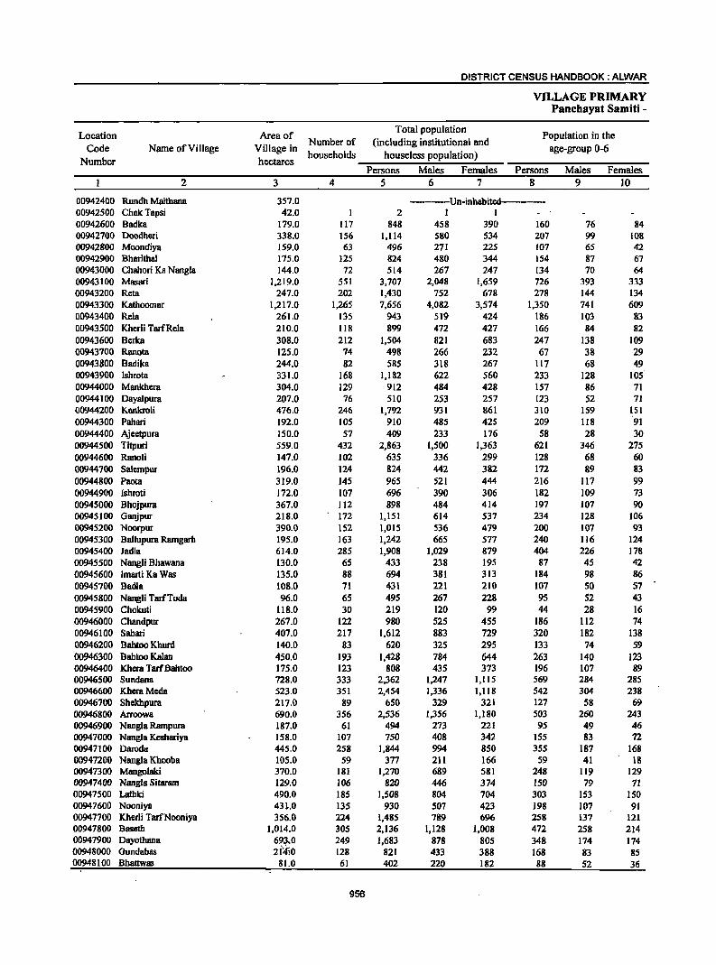
DISTRICT CENSUS HANDBOOK: ALWAR
VILLAGE PRIMARY Panchayat Samiti -
Location Area of Total population
Population in the Code Name of Village Village in
Number of (including institutional and age-group 0-6
Number hectares households houseless popUlation)
Persons Males Females Persons Males Females 2 3 4 5 6 7 8 9 10
00942400 Rundh Maithana 357.0 ---------Un-inhabited---------00942500 ChakTapsi 42.0 2 1 1 00942600 Badka 179.0 117 848 458 390 160 76 84 00942700 Doodheri 338.0 156 1,114 580 534 207 99 108 00942800 Moondiya 159.0 63 496 271 225 107 65 42 00942900 Bharithal 175.0 125 824 480 344 154 87 67 00943000 Chahori Ka Nangla 144.0 72 514 267 247 134 70 64 00943100 Masari 1,219.0 551 3,707 2,048 1,659 726 393 333 00943200 Reta 247.0 202 1,430 752 678 278 144 134 00943300 Kathoomar 1,217.0 1,265 7,656 4,082 3,574 1,350 741 609 00943400 Rela 261.0 135 943 519 424 186 103 83 00943500 Kherli TarfRela 210.0 118 899 472 427 166 84 82 00943600 Berka 308.0 212 1,504 821 683 247 138 109 00943700 Ranota 125.0 74 498 266 232 67 38 29 00943800 Badika 244.0 82 585 318 267 117 68 49 00943900 Ishrota 331.0 168 1,182 622 560 233 128 105 00944000 Mankhera 304.0 129 912 484 428 157 86 71 00944100 Dayalpura 207.0 76 510 253 257 123 52 71 00944200 Kankroli 476.0 246 1,792 931 861 310 159 151 00944300 Pahari 192.0 105 910 485 425 209 118 91 00944400 Ajeetpura 150.0 57 409 233 176 58 28 30 00944500 Titpuri 559.0 432 2,863 1,500 1,363 621 346 275 00944600 Ranoli 147.0 102 635 336 299 128 68 60 00944700 Sa1empur 196.0 124 824 442 382 172 89 83 00944800 Paota 319.0 145 965 521 444 216 117 99 00944900 Ishroti 172.0 107 696 390 306 182 109 73 00945000 Bhojpura 367.0 112 898 484 414 197 107 90 00945100 Ganjpur 218.0 172 1,151 614 537 234 128 106 00945200 Noorpur 390.0 152 1,015 536 479 200 107 93 00945300 8allupura Ramgarh 195.0 163 1,242 665 577 240 116 124 00945400 Jadla 614.0 285 1,908 1,029 879 404 226 178 00945500 Nangli Bhawana 130.0 65 433 238 195 87 45 42 00945600 Imarti Ka Was 135.0 88 694 381 313 184 98 86 00945700 Badia 108.0 71 431 221 210 107 SO 57 00945800 Nangli TarfToda 96.0 65 495 267 228 95 52 43 00945900 Chokuti 118.0 30 219 120 99 44 28 16 00946000 Chandpur 267.0 122 980 525 455 186 112 74 00946100 Sahari 407.0 217 1,612 883 729 320 182 13.8 00946200 Bahtoo Khurd 140.0 83 620 325 295 133 74 59 00946300 Bahtoo Kalan 450.0 193 1,428 784 644 263 140 123 00946400 Khera TarfBahtoo 175.0 123 808 435 373 196 107 89 00946500 Sundana 728.0 333 2,362 1,247 1,1l5 569 284 285 00946600 KheraMeda 523.0 351 2,454 1,336 1,118 542 304 238 00946700 Shekhpura 217.0 89 650 329 321 127 58 69 00946800 Arroowa 690.0 356 2,536 1,356 1,180 503 260 243 00946900 Nangla Rampura 187.0 61 494 273 221 95 49 46 00947000 Nangla Keshariya 158.0 107 750 408 342 155 83 72 00947100 Daroda 445.0 258 1,844 994 850 355 187 168 00947200 Nangla Khooba 105.0 59 377 211 166 59 41 18 00947300 Mangolaki 370.0 181 1,270 689 581 248 119 129 00947400 Nangla Sitaram 129.0 106 820 446 374 150 79 71 00947500 Lathki 490.0 185 1,508 804 704 303 153 150 00947600 Nooniya 431.0 135 930 507 423 198 107 91 00947700 Kherli TarfNooniya 356.0 224 1,485 789 696 258 137 121 00947800 Baseth 1,014.0 305 2,136 1,128 1,008 472 258 214 00947900 Dayothana 693.0 249 1,683 878 805 348 174 174 00948000 Gundabas 21;(,0 128 821 433 388 168 83 85 00948100 Bhattwas 81.0 61 402 220 182 88 52 36
956
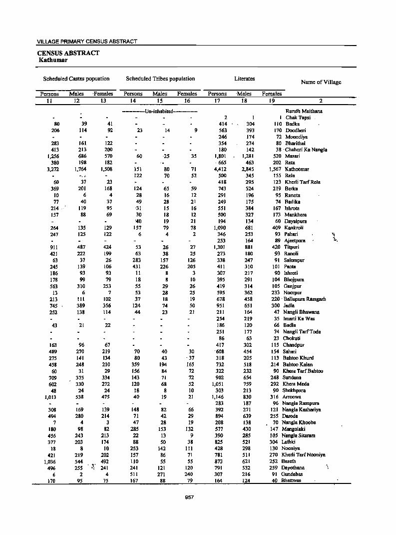
VILLAGE PRIMARY CENSUS ABSTRACT
CENSUS ABSTRACT Kathumar
Scheduled Castes popuation Scheduled Tribes population Literates Name of Village
Persons Males ,Females Persons Males Females Persons -Males Females 11 12 13 14 15 16 17 18 19 2
----------Un-inhabited------------ Rundh Maithana 2 I Chak 'Papsi
80 39 41 414 304 110 Badka 206 114 92 23 14 9 563 393 170 Doodheri
246 174 72 Moondiya 283 161 122 354 274 80 Bharithal 413 213 200 180 142 38 -Chahori Ka Nangla
1,256 686 570 60 '25 35 1,801 1,281 520 Masari 380 198 182 ,665 463 202 Reta
3,272 1,764 1.508 151 80 71 4.412 2.845 1,567 Kathobmar 122 70 52 500 345 155 Rela
60 37 23 418 295 123 Kherli TarfRela 369 201 168 124 65 59 743 524 219 Berka
10 6 4 28 16 12 291 196 95 Ranota 77 40 37 49 28 21 249 175 74 Badika
214 119 95 -31 15 16 551 384 167 Ishrota 157 88 69 30 18 12 500 327 173 Mankhera
'40 19 21 194 134 60 Dayalpura 264 135 129 157 79 78 1,090 681 409 Kankroli 247 125 122 6 4 2 346 253 93 Pahari '~t
253 164 89 Ajcctpura 1,. ..
911 487 424 53 26 27 1,301 881 420 Titpuri 421 222 199 63 38 25 273 180 93 Ranoli
63 37 26 283 157 126 338 247 91 Salcmpur 245 139 106 431 226 205 411 310 101 Paota 186 93 93 11 8 3 307 217 90 Ishroti 178 99 79 18 8 10 395 291 104 Bhojpura 563 310 253 55 29 26 419 314 105 Ganjpur
13 6 7 53 28 25 595 362 233 Noorpur 213 111 102 37 18 19 678 458 220 -Ballupura Ramgarb 745 389 356 124 74 50 951 651 300 Jadla 252 138 114 44 23 21 211 164 47 Nangli Bhawana
254 219 35 Imarti Ka Was 43 21 22 186 120 66 Badia
251 177 74 Nangli TarfToda 86 63 23 Chokuti
163 96 67 417 302 liS Chandpur 489 270 219 70 40 30 '608 454 154 Sahari 275 141 134 80 43 -37 318 205 113 Bahtoo Khurd 458 248 210 359 194 165 732 518 214 Bahtoo Kalan
60 31 29 156 84 72 322 232 90 Khera TarfBahtoo 709 375 334 143 71 72 902 654 248 Sundana 602 330 272 120 68 52 1,051 759 292 Khera Meda 48 24 24 18 8 10 303 213 90 Shekhpura
1,013 538 475 40 19 21 1,146 830 316 Arroowa 283 187 96 Nangla Rampura
308 169 139 148 82 66 392 271 121 Nangla Kcshariya 494 280 214 71 42 29 894 639 255 Daroda
7 4 3 47 28 19 208 138 70 Nangla Khooba 180 98 82 285 153 132 577 430 147 Mangolaki 456 243 213 22 13 9 390 285 lOS Nangla Sitaram 377 203 174 88 50 38 825 521 304 Lathki
18 8 10 253 142 III 428 298 130 Nooniya
421 219 202 157 86 71 781 511 270 Kherli TarfNooniya 1,036 544 492 110 55 5S 873 621 252 Baseth , ,.
496 255 ,.1 241 241 121 120 791 532 259 Dayothana 6 2 4 511 271 240 307 216 91 Gundabas
170 95 7S 167 88 79 164 124 40 Bhattwas
957
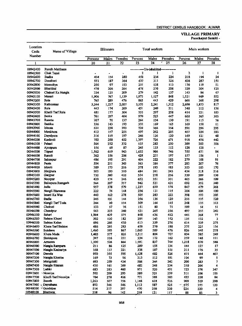
DISTRICT CENSUS HANDBOOK: ALWAR
VILLAGE PRIMARY Panchayat Samiti -
Location III iterates Total workers Main workers
Code Name of Village Number
Persons Males Females Persons Males Females Persons Males Females 2 20 21 22 23 24 I 25 26 27 28
00942400 Rundh Maithana ------Un-inhabited----------00942500 ChakTapsi 2 1 1 :2 1 1 00942600 Badka 434 154 280 458 234 224 218 194 24 00942700 Doodheri 551 187 364 637 311 326 438 287 151 00942800 Moondiya 250 97 153 251 138 113 170 119 51 00942900 Bharithal 470 206 264 478 270 208 329 204 125 00943000 Chahori Ka Nangla 334 125 209 279 142 137 143 96 47 00943100 Masari 1,906 767 1,139 1,975 1,127 848 1,521 969 552 00943200 Reta 765 289 476 863 443 420 666 368 298 00943300 Kathoomar 3,244 1,237 2,007 3,553 2,241 1,312 2,690 1,873 817 00943400 Rela 443 174 269 451 240 211 348 212 136 00943500 Kherli Tarf Rela 481 177 304 555 297 258 414 23l 183 00943600 Berka 761 297 464 970 523 447 668 365 303 00943700 Ranota 207 70 137 264 134 130 191 115 76 00943800 Badika 336 143 193 332 169 163 169 158 11 00943900 Ishrota 631 238 393 720 366 354 591 296 295 00944000 Mankhera 412 157 255 497 292 205 407 224 183 00944100 Dayalpura 316 119 197 246 126 120 169 121 48 00944200 Kankroli 702 250 452 1,397 726 671 918 476 442 00944300 ' Pahari 564 232 332 532 282 250 309 203 106 00944400 Ajeetpura 156 69 87 245 133 112 128 128 00944500 Titpuri 1,562 619 943 1,652 906 74~ 755 67l 84 00944600 Ranoli 362 156 206 428 231 197 157 156 I 00944700 Salempur 486 195 291 404 222 182 279 188 91 00944800 Paota 554 211 343 563 286 277 283 207 76 00944900 Ishroti 389 173 216 378 193 185 353 183 170 00945000 Bhojpura 503 193 310 484 241 243 434 218 216 00945100 Ganjpur 732 300 432 534 278 256 339 209 130 00945200 Noorpur 420 174 246 652 351 301 465 266 199 00945300 Ballupura Ramgarh 564 207 357 942 521 421 692 352 340 00945400 Jadla 957 378' 579 1,237 659 578 847 479 368 00945500 Nangli Bhawana 222 74 148 236 121 115 204 104 100 00945600 Imarti Ka Was 440 162 278 505 283 222 398 193 205 00945700 Badia 245 101 144 256 136 120 255 135 120 00945800 Nangli TarfToda 244 90 154 309 164 145 248 135 113 00945900 Chokuti 133 57 76 151 80 71 109 58 51 00946000 Chandpur 563 223 340 521 265 256 497 255 242 00946100 Sahari 1,004 429 575 848 436 412 445 368 77 00946200 Bahtoo Khurd 302 120 182 295 143 152 135 132 3 00946300 Bahtoo Kalan 696 266 430 615 339 276 614 339 275 00946400 Khera TarfBahtoo 486 203 283 458 270 188 375 221 154 00946500 Sundana 1,460 593 867 1,065 589 476 826 548 278 00946600 KheraMeda 1,403 577 826 1,511 804 707 834 585 249 00946700 Shekhpura 347 116 231 334 172 162 259 148 III 00946800 Arroowa 1,390 526 864 1,581 837 744 1,218 670 548 00946900 Nangla Rampura 211 86 125 289 155 134 144 127 17 00947000 Nangia Keshariya 358 137 221 338 187 151 211 176 35 00947100 Daroda 950 355 595 1,128 602 526 871 464 407 00947200 Nang1a Khooba 169 73 96 213 112 101 104 99 5 00947300 Mangolaki 693 259 434 586 344 242 290 283 7 00947400 Nangia Sitaram 430 161 269 482 248 234 210 206 4 00947500 Lathki 683 283 400 971 520 451 723 376 347 00947600 cNooniya 502 209 293 580 321 259 311 206 105 00947700 Kherli TarfNooniya 704 278 426 771 38B 383 422 338 84 00947800 Baseth 1,263 507 756 1,144 618 526 909 519 390 0094 7900 "" Dayothana 892 346 546 1,112 587 525 -, '475 355 120 00948000 ';:Oundabas 514 217 297 470 250 220 '214 220 4 00948100 Bhattwas 238 96 142 238 121 II7 88 85 3
958
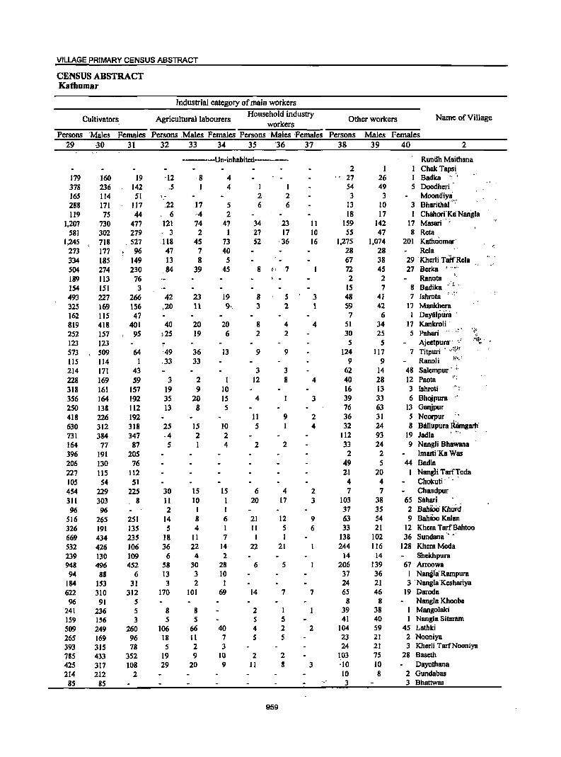
VILLAGE PRIMARY CENSUS ABSTRACT
CENSUS ABSTRACT Kathumar
Industrial category of main workers
Cultivators Agricultural labourers Household industry
Other workers Name of Village workers
Persons Males Females Persons ,Males Females Persons 'Males 'Females Persons Males Females '29 30 31 32 33 34 35 36 37 38 39 40 2
------Un-inhabited------------ Rundh Maithana 2 I I ChakTapsi,
179 160 19 '12 ,8 4 27 26 1 Badka 378 236 142 ,5 1 4 1 1 54 49 5 Doodheri 165 114 51 ',- 2 2 3 3 Moontiiyli 288 171 117 ,22 17 5 6 6 13 10 3 Bharjtha('~
119 75 44 , 6 -4 2 18 17 1 Chilhori,'~1i Nangla 1,207 730 477 121 74 47 34 23 II 159 142 17 Masari
581 302 279 - 3 2 I 27 17 10 55 47 8 Reta 1,245 718 .527 -118 45 73 52 ,36 16 1,275 1,074 201 Katho'omar'
273 177 96 47 7 40 28 28 Rela 334 185 149 13 8 5 67 38 29 Kherli nitrRela 504 274 230 ,84 39 45 8 I" 7 72 45 27 Berka ~ " .. ' ~
189 113 76 , - 2 2 RaDota ,
154 151 3 15 7 8 Badika -,;.-
493 227 266 42 23 19 8 5 3 48 41 7 Ishrota . "
325 169 156 ,20 11 9·, 3 2 1 59 42 1'1 Mankbera 162 115 47 7 6 I Daylilpura '
819 418 401 40 20 20 8 4 4 51 34 17 KankroH' )25 19 6 Pahari
-.' J i~
252 157 95 2 2 30 25 5 "
123 123 5 5 Ajeetpunr' '-' 'Ii.:, • -
573 509 64 '49 36 13 9 9 124 117 7 Titpuri .. .'~I
lIS 114 I ,33 33 9 9 RanoH E-'t .. ~
214 171 43 3 3 62 14 48 Salempur ' .,.
228 169 59 3 2 I 12 8 4 40 28 12 Paota ~J _
318 161 157 19 9 10 16 13 3 Ishroti -~, ~
356 164 192 35 20 15 4 3 39 33 6 Bhojpura ,',
250 138 112 13 8 5 76 63 13 Ganjpur
418 226 192 11 9 2 36 31 5 Noorpur '.
630 312 318 25 IS 10 5 1 4 32 24 8 Blillujlura R~mgarh' 731 384 347 ,4 2 2 112 93 19 ladla ' ~-.
164 77 87 5 1 4 2 2 33 24 9 Nangli Bhawana 396 191 205 2 2 Imarti'Ka Was 206 130 76 49 5 44 BadIa 227 115 112 21 20 I Nang1i Tatf~oda 105 54 51 4 4 Chokuti" ,
454 229 225 30 IS IS 6 4 2 7 7 Chandpur
3ll 303 8 11 10 I 20 17 3 103 38 65 SBhari 96 96 2 I I 37 3S 2 BahiCi; Khurd
516 265 251 14 8 6 21 12 9 63 54 9 Bahtoo Kalan
326 191 135 5 4 I II 5 6 33 21 12 Khera TarfBahtoo
669 434 235 18 II 7 1 I 138 102 36 Sundana" ,,'
532 426 106 36 22 14 22 21 244 116 128 KheraMcda 239 130 109 6 4 2 14 14 Shckhpura 948 496 452 58 30 28 6 5 206 139 67 Arroowa 94 88 6 13 3 10 37 36 I Nanglil Rampura
184 153 31 3 2 I 24 21 3 'Nangla'Kcshariya 622 310 312 170 101 69 14 7 7 65 46 19 Daroda 96 91 5 8 8 Nangla Khooba
241 236 5 8 8 2 I 39 38 Mangolaki 159 156 3 5 5 5 5 41 40 Nangla Sitararn
509 249 260 106 66 40 4 2 2 104 59 45 Lathki
265 169 96 18 11 7 5 5 23 21 2 Nooniya
393 315 78 5 2 3 24 21 3 Kherli TarfNooniya
785 433 352 19 9 10 2 2 103 75 28 Bascth
425 317 108 29 20 9 11 8 3 '10 10 Dayothana
214 212 2 10 8 2 Gundabas 85 85 3 3 Bhattwas
959
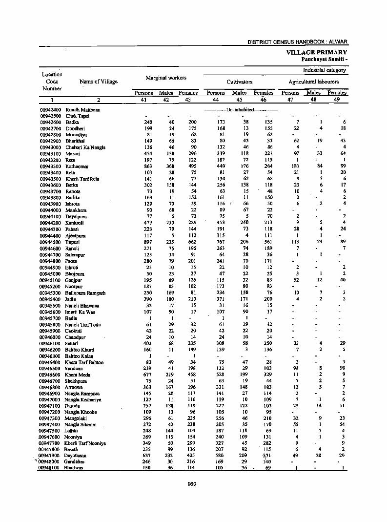
DISTRICT CENSUS HANDBOOK: ALWAR
VILLAGE PRIMARY Pancbayat Samiti -
Location Industrial category
Code Name of Village Marginal workers
Cultivators Agricultural labourers Number
Persons Males Females Persons Males Females Persons Males Females
2 41 42 43 44 45 46 47 48 49
00942400 Rundh Maithana ---------Un-inhabited------------00942500 ChakTapsi 00942600 Badka 240 40 200 173 38 135 7 I 6 00942700 Doodheri 199 24 175 168 13 155 22 4 18 00942800 Moondiya 81 19 62 81 19 62 00942900 Bharithal 149 66 83 80 45 35 62 19 43 00943000 Chabori Ka Nangla 136 46 90 132 46 86 4 4 00943100 Masari 454 158 296 339 118 221 97 33 64 00943200 Reta 197 75 122 187 72 liS 1 I 00943300 Kathoomar 863 368 495 440' 176 264 183 84 99 00943400 Rela 103 28 75 81 27 54 21 L 20 00943500 Kherli TarfRela 141 66 75 130 62 68 9 3 6 00943600 Berka 302 158 144 256 138 118 23 6 17 00943700 Ranota 73 19 54 63 15 48 10 4 6 00943800 Badika 163 II 152 161 II 150 2 2 00943900 Ishrota 129 70 59 116 66 50 6 2 4 00944000 Mankhera 90 68 22 89 67 22 00944100 Dayalpura 77 5 72 75 5 70 2 2 00944200 Kankroli 479 2S0 229 453 240 213 9 5 4 00944300 Pahari 223 79 144 191 73 118 28 4 24 00944400 Ajeetpura 117 5 112 115 4 III I 00944500 Titpuri 897 235 662 767 206 561 113 24 89 00944600 RanoH 271 75 196 263 74 189 7 7 00944700 Salempur 125 34 91 64 28 36 00944800 Paota 280 79 201 241 70 171 00944900 Ishroti 2S 10 15 22 10 12 2 2 00945000 Bhojpura 50 23 27 47 22 2S 3 1 2 00945100 Ganjpur 195 69 126 115 32 83 52 12 40 00945200 Noorpur 187 85 102 173 80 93 00945300 Ballupura Rarngarh 250 169 81 234 158 76 10 7 3 00945400 Jadla 390 180 210 371 171 200 4 2 2 00945500 Nangli Bhawana 32 17 IS 31 16 15 00945600 Imarti Ka Was 107 90 17 107 90 17 00945700 Badia I 1 1 I 00945800 Nangli TarfToda 61 29 32 61 29 32 00945900 Chokuti 42 22 20 42 22 20 00946000 Chandpur 24 10 14 24 10 14 00946100 Sabari 403 68 335 308 58 250 33 4 29 00946200 Bahtoo Khurd 160 II 149 139 3 136 7 2 5 00946300 Bahtoo Kalan 1 I 00946400 Khera TarfBahtoo 83 49 34 7S 47 28 3 3 00946500 SlDldana 239 41 198 132 29 103 98 8 90 00946600 KheraMeda 677 219 458 528 199 329 II 2 9 00946700 Shekhpura 75 24 51 63 19 44 7 2 5 00946800 Arroowa 363 167 196 331 148 183 12 5 7 00946900 Nangla Rampura 145 28 111 141 21 114 2 2 00947000 Nangla Keshariya 127 II 116 119 10 109 7 I 6 00947100 Daroda 257 1311 119 227 122 105 25 14 11 00947200 Nangla Khooba 109 13 96 105 10 95 00947300 Mangolaki 296 61 235 256 46 210 32 9 23 00947400 Nangla Sitaram 272 42 230 205 35 170 SS I 54 00941500 Lathki 248 144 104 187 ll8 69 II 7 4 .00947600 Nooniya 269 ll5 154 240 109 131 4 I 3 00947700 Kherli TarfNooniya 349 50 299 327 45 282 9 9 00947800 Baseth 235 99 136 207 92 115 6 4 2 00947900 Dayotbana 637 232 405 580 209 3,71 49 20 29
"00948000 Gundabas 246 30 216 169 29 140 00948100 Bhattwas 150 36 114 105 36 69
960

VILLAGE PRIMARY CENSUS ABSTRACT
CENSUS ABSTRACT Katbumar
of marginal workers Location
Household industIy Other workers
Non-workers Name of Village Code workers Number
Persons Males Females Persons Males Females Persons Males Females 50 51 52 53 54 55 56 57 58 2
--------Un-inhabited-------- Rundh Maithana 00942400 ChakTapsi 00942500
60 .1 59 390 224 166 Badka '~,,-\ 00942600 9 7 2 477 269 208 Doodheri 00942700
245 133 112 Moondiya " 00942800 7 2 5 346 210 136 Bharithal 00942900
235 125 110 Chahori Ka Nangla 00943000 9 I 8 9 6 3 1,732 921 811 Masari 00943100 8 2 6 I I 567 309 258 Reta 00943200
29 15 14 211 93 118 4,103 1,841 2,262 Kathoomar 00943300 I I 492 279 213 Rela 00943400 2 I I 344 175 169 Kherli TarfRela 00943500
23 14 9 "534 298', 236 Berka 00943600 234 132 102 Ranota 00943700
-, 253 149 104 Badika 00943800 6 . I 5' 462 256 206 Ishrota 00943900 1 1 415 192 223 Mankhera 00944000
264 127 137 Dayalpura 00944100 17 5 12 395 205 190 Kankroli 00944200 4 2 2 378 203 175 Pahari 00944300
I 164 100 64 Ajeetpura / 009~00 2 2 15 3 12 1,211 594 617 Titpuri 00944500
1 1 207 lOS 102 Ranoli " 00944600 59 4 55 420 220 200 Salcmpur ., .. 00944700
4 3 35 8 27 402 235 167 Paota 00944800 1 I 318 197 12[ [shroti 00944900
414 243 171 Bhojpura 00945000 28 25 3 617 336 281 Ganjpur 00945100
8 2 6 6 3 3 363 [85 178 Noorpur 00945200 6 4 2 300 144 156 Ballupura Ramgarh 00945300
15 7 8 671 370 30[ Jadla 00945400 197 117 80 Nangli Bhawana 00945500 189 98 91 Imarti Ka Was ,00945600 175 85 90 Badia 00945700 186 103 83 Nangli TarfToda 00945800 68 40 28 Chokuti 00945900
459 260 199 Chandpur 00946000 10 10 52 6 46 764 447 317 Sahari 00946100
14 6 8 325 182 143 Bahtoo Khurd 00946200 I 1 813 445 368 Bahtoo Kalan 00946300 5 2 3 350 165 185 Khera TarfBahtoo 00946400
9 4 5 1,297 658 639 Sundana 00946500 137 18 119 943 532 ,411 Khera Mcda 00946600
5 3 2 316 [57 159 Shekhpura 00946700 20 14 6 955 519 436 Arroowa 00946800 2 I I 205 118 87 Nangla Rampura 00946900 I I 412 221 191 Nangla Kcshariya 00947000 5 2 3 716 392 324 Daroda 00947100 4 3 I 164 99 65 Nang1a Khooba 00947200 8 6 2 684 345 339 Mangolaki 00947300
7 2 5 5 4 I 338 198 140 Nangla Sitaram 00947400 50 19 31 537 284 253 Lathki 00947500
5 5 20 20 350 186 164 Nooniya 00947600 13 5 8 714 401 313 Kherli TarfNooniya 00947700 22 3 19 992 510 482 Bascth 00947800
3 2 S 2 3 S71 291 280 Dayothana 00947900 I 76 I 7S 351 183 168 Gundabas 00948000
44 44 164 99 65 Bhattwas 00948100
961
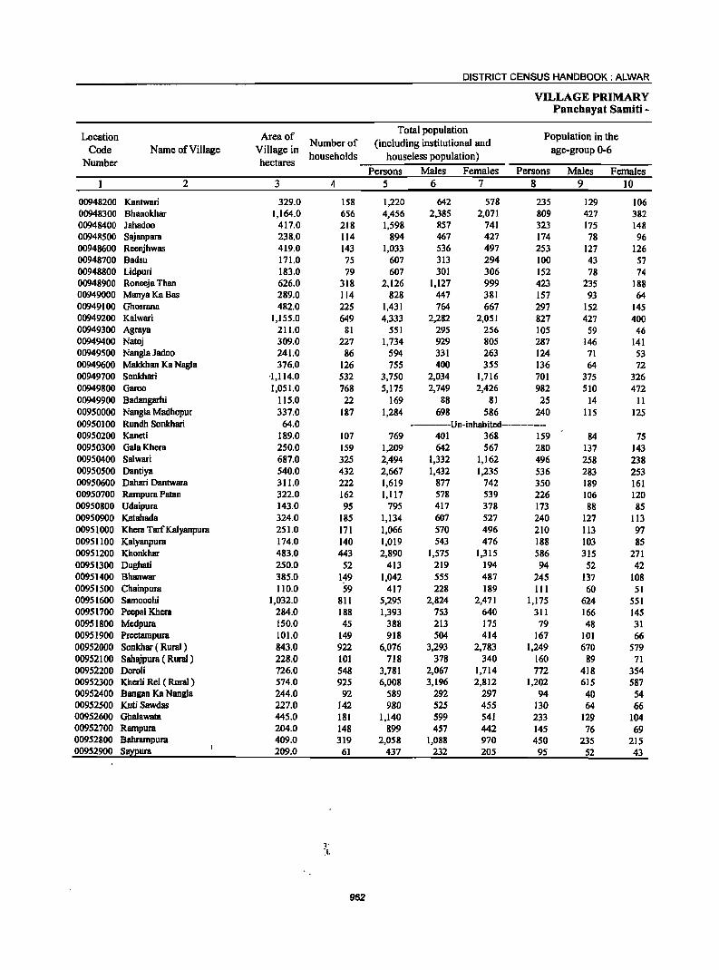
DISTRICT CENSUS HANDBOOK: ALWAR
VILLAGE PRIMARY Panchayat Samiti -
Location Area of Total population
Population in the Code Name of Village Village in
Number of (including institutional and age-group 0-6
Number hectares households houseless population)
Persons Males Females Persons Males Females 2 3 4 5 6 7 8 9 10
00948200 Kantwari 329.0 158 1,220 642 578 235 129 106 00948300 Bhanokhar 1,164.0 656 4,456 2,385 2,071 809 427 382 00948400 lahadoo 417.0 218 1,598 857 741 323 175 148 00948500 Sajanpara 238.0 114 894 467 427 174 78 96 00948600 Reenjhwas 419.0 143 1,033 536 497 253 127 126 00948700 Badsu 171.0 75 607 313 294 100 43 57 00948800 Lidpuri 183.0 79 607 301 306 152 78 74 00948900 Roneeja Than 626.0 318 2,126 1,127 999 423 235 188 00949000 ManyaKaBas 289.0 114 828 447 381 157 93 64 00949100 Ghosrana 482.0 225 1,431 764 667 297 152 145 00949200 Kalwari 1,155.0 649 4,333 2,282 2,051 827 427 400 00949300 Agraya 211.0 81 551 295 256 105 S9 46 00949400 Natoj 309.0 227 1,734 929 805 287 146 141 00949500 Nangla Jadoo 241.0 86 594 331 263 124 71 53 00949600 Makkhan Ka Nagla 376.0 126 755 400 355 136 64 72 00949700 Sonkhari '1,114.0 532 3,750 2,034 1,716 701 375 326 00949800 Garoo 1,051.0 768 5,175 2,749 2,426 982 510 472 00949900 Badangarhi 115.0 22 169 88 81 25 14 11 00950000 Nangla Madhopur 337.0 187 1,284 698 586 240 115 125 00950100 Rundh Sonkhari 64.0 ------Un-inhabited--------00950200 Kaneti 189.0 107 769 401 368 159 84 75 00950300 Gala Khera 250.0 159 1,209 642 567 280 137 143 00950400 Salwari 687.0 325 2,494 1,332 1,162 496 258 238 00950500 Dantiya 540.0 432 2,667 1,432 1,235 536 283 253 00950600 Dahari Dantwara 311.0 222 1,619 877 742 350 189 161 00950700 Rampura Patsn 322.0 162 1,117 578 539 226 106 120 00950800 Udaipura 143.0 95 795 417 378 173 88 85 00950900 Katahada 324.0 185 1,134 607 527 240 127 113 00951000 Khera Tarf Kalyanpura 251.0 171 1,066 570 496 210 113 97 00951100 Kalyanpura 174.0 140 1,019 543 476 188 103 85 00951200 Khonkhar 483.0 443 2,890 1,575 1,315 586 315 271 00951300 Dughati 250.0 52 413 219 194 94 52 42 00951400 Bhanwar 385.0 149 1,042 555 487 245 137 108 00951500 Chainpura 110.0 59 417 228 189 111 60 51 00951600 Samoochi 1,032.0 811 5,295 2,824 2,471 1,175 624 551 00951700 Peepal Khera 284.0 188 1,393 753 640 311 166 145 00951800 Mcdpura 150.0 45 388 213 175 79 48 31 00951900 Prcetampura 101.0 149 918 504 414 167 101 66 00952000 Sonkhar ( Rural ) 843.0 922 6,076 3,293 2,783 1,249 670 579 00952100 Sahajpura ( Rural) 228.0 101 718 378 340 160 89 71 00952200 DOTOli 726.0 548 3,781 2,067 1,714 772 418 354 00952300 Kherli Rei ( Rural ) 574.0 925 6,008 3,196 2,812 1,202 615 587 00952400 Bangan Ka Nangla 244.0 92 589 292 297 94 40 54 00952500 Kuti Sawdas 227.0 142 980 525 455 130 64 66 00952600 Ghalawata 445.0 181 1,140 599 541 233 129 104 00952700 Rampura 204.0 148 899 457 442 145 76 69 00952800 Bahrampura 409.0 319 2,058 1,088 970 450 235 215 00952900 Sa~ura 209.0 61 437 232 205 95 52 43
962
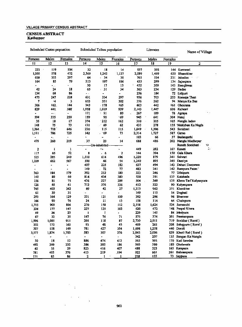
VILLAGE PRIMARY CENSUS ABSTRACT
CENSUS ABSTRACT Kathumar
Scheduled Castes popuation Scheduled Tribes popUlation Literates Name of ViII age
Persons Males Females Persons Males Females Persons Males Females II 12 13 14 15 16 17 .18 19 2
223 119 104 32 .18 14 537 393 144 Kantwari 1,050 578 472 2,369 1,242 1,127 2,089 1,469 620 Bhanokhar
630 333 297 64 34 30 765 534 231 Jahadoo 164 85 79 213 '107 106 433 299 134 Sajanpara
30 17 13 452 309 143 Rcenjhwas 42 24 18 65 31 34 363 234 129 Badsu
154 68 86 256 184 72 Lidpuri 475 247 228 631 334 297 956 703 253 Roneeja Than
7 '4 3 653 351 302 356 262 94 ManyaKaBas 306 162. 144 343 . 178 165 603 442 161 Ghosrana 829 441. 388 1,958 1,019 939 2,143 1,447 696 Kalwari
17] : 9] 80 267 189 78 Agraya 594 335 259 ]59 90 '69 945 64] 304 Natoj 35 ]8 ]7 374 . 212 162 310 205 lOS Nangla Jadoo
148 75 73 ]31 69 62 433 278 155 'Makkhan Ka Nagla 1,364 . 7]8 . 646 230 115 115 1,849 1,306 543 Sonkhari I,SIl 786 725 142 ' '69 73 2,314 1,727 587 Garoo
103 66 37 8adangarfli 479 260 219 .37 23 14 688 486 202 Nangla Madhopur
-,.---Un-inhabited-------- Rundh Sonkbari . \'lJ
2 ] I ""i"!' 449 282 167 Kaneti ~'.
117 65 52 8 ' 6 2 S44 394 150 Gala Khera 525 285 240 1,110 614 496 1,220 879 341 Salwari
1,229 662 567 100 46 54 1,240 895 345 Dantiya 407 225 182 637 494 143 Dahari Dantwara 149 72 77 483 341 142 Rampura Patan '
363 184 179 392 212 180 323 246 77 Udaipura 140 80 60 814 434 380 528 391 137 Katahada 156 81 75 436 227 209 504 369 135 Khera Tare Kalyanpura 126 6S 61 712 376 336 412 322 90 Kalyanpura 745 403 342 69 42 27 1,313 962 351 Khonkhar
61 30 31 169 115 54 Dughati 293 164 129 221 121 100 392 296 96 Bhanwar 166 90 76 24 11 13 158 114 44 Chainpura
1,715 909 806 270 158 Jl2 2,158 1,624 534 Samoochi 324 177 147 227 125 102 620 472 148 Peepal Khera 49 26 23 1 I 229 145 84 Medpura 67 32 35 147 76 71 575 374 201 Preetampura
1,996 1,085 911 205 118 87 2,730 2,Oll 719 Sonkhar ( Rural) 332 172 160 93 48 45 469 261 208 Sahajpura ( Rural) 307 158 149 781 427 354 1,698 1,258 440 Doroli
3,577 1,874 1,703 583 307 276 2,845 2,006 839 Kherli Rei ( Rural) 342 207 135 8angan Ka Nangla
30 18 12 886 474 412 565 395 170 Kuti Sawdas 492 260 232 386 200 186 560 380 180 Ghalawata 62 33 29 823 416 407 488 323 165 Rampura
781 405 376 413 219 .194 922 661 261 8ahrampura 171 85 86 2 I 1 228 155 73 Saxpura
963
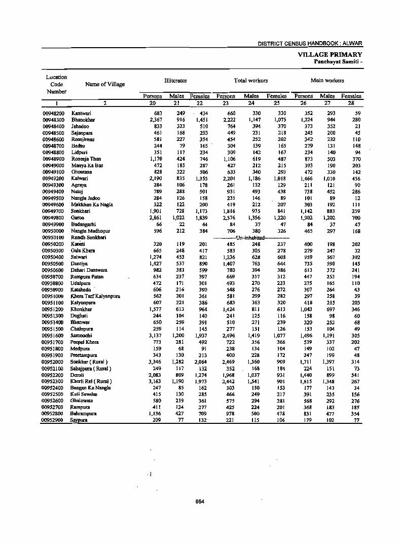
DISTRICT CENSUS HANDBOOK: ALWAR
VILLAGE PRIMARY Panchayat Samiti -
Location Illiterates Total workers Main workers
Code Name of Village Number
Persons Males Females Persons Males Females Persons Males Females 2 20 21 22 23 24 25 26 27 28
00948200 Kantwari 683 249 434 660 330 330 352 293 59 00948300 Bhanokhar 2,367 916 1,451 2,222 1,147 1,075 1,224 944 280 00948400 Jahadoo 833 323 510 764 394 370 373 352 21 00948500 Sajanpara 461 168 293 449 231 218 245 200 45 00948600 ReenjhwBS 581 227 354 454 252 202 342 232 110 00948700 Badsu 244 79 165 304 139 165 279 131 148 00948800 Lidpuri 351 117 234 309 142 167 234 140 94
·00948900 Roneeja Than 1,170 424 746 1,106 619 487 873 503 370 00949000 ManyaKaBas 472 185 287 427 212 215 393 190 203 00949100 Ghosrana 828 322 506 633 340 293 472 330 142 00949200 Kalwari 2,190 835 1,355 2,204 1,186 1,018 1,466 1,010 456 00949300 Agraya 284 106 178 261 132 129 211 121 90 00949400 Natoj 789 288 501 931 493 438 738 452 286 00949500 Nangla Jadoo 284 126 158 235 146 89 101 89 12 00949600 Makkhan Ka Nagla 322 122 200 419 212 207 303 192 III 00949700 Sonkhari 1,901 728 1,173 1,816 975 841 1,142 883 259 00949800 Garoo 2,861 1,022 1,839 2,576 1,356 1,220 1,902 1,202 700 00949900 Badangarhi 66 22 44 84 37 47 84 37 47 00950000 Nangla Madhopur 596 212 384 706 380 326 465 297 168 00950100 Rundh Sonkhari -----Un-inhabited---------00950200 Kanim 320 119 201 485 248 237 400 198 202 00950300 GalaKbera 665 248 417 583 305 278 279 247 32 00950400 Salwari 1,274 453 821 1,236 628 608 959 567 392 00950500 Dantiya 1,427 537 890 1,407 763 644 735 590 145 00950600 Dahari Dantwara 982 383 599 780 394 386 613 372 241 00950700 Rampura Patan 634 237 397 669 357 312 447 253 194 00950800 Udaipura 472 171 301 493 270 223 275 165 110 00950900 Katahada 606 216 390 548 276 272 307 264 43 00951000 Khera TarfKa1yanpura 562 201 361 581 299 282 297 258 39 00951100 Kalyanpura 607 221 386 683 363 320 418 215 203 00951200 Khonkhar 1,577 613 964 1,424 811 613 1,043 697 346 00951300 Dughati 244 104 140 241 125 116 158 98 60 00951400 Bhanwar 650 259 391 510 271 239 320 252 68 00951500 Chainpura 259 114 145 277 151 126 153 104 49 00951600 Samoochi 3,137 1,200 1,937 2,496 1,419 1,077 1,496 1,191 305 00951700 Peepal Khera 773 281 492 722 356 366 539 337 202 00951800 Medpura 159 68 91 238 134 104 149 102 47 00951900 Preetampura 343 130 213 400 228 172 247 199 48 00952000 Sonkhar ( Rural) 3,346 1,282 2,064 2,469 1,560 909 1,711 1,397 314 00952100 Sahajpura ( Rural ) 249 117 132 352 168 184 224 151 73 00952200 Doroli 2,083 809 1,274 1,968 1,037 931 1,440 899 541 00952300 Kherli Rei ( Rural ) 3,163 1,190 1,973 2,442 1,541 901 1,615 1,348 267 00952400 Bangan Ka Nangla 247 85 162 303 ISO 153 177 143 34 00952500 Kuti Sawdas 415 130 285 466 249 217 391 235 156 00952600 Ohalawata 580 219 361 575 294 281 568 292 276 00952700 Rampura 411 134 277 425 224 201 368 183 185 00952800 Bahrampura 1,136 427 709 978 500 478 831 477 354 00952900 S!!XI!urB 209 77 132· 221 115 106 179 102 77
964
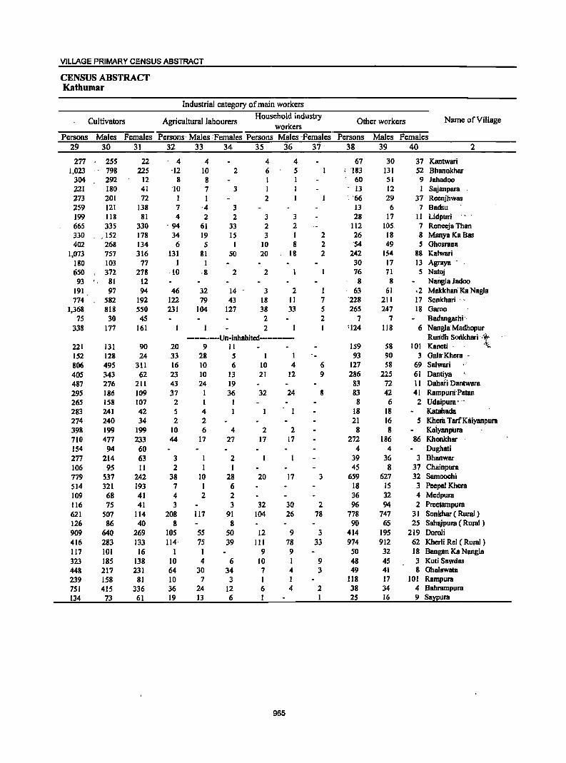
VILLAGE PRIMARY CENSUS ABSTRACT
CENSUS ABSTRACT Kathumar
Industrial category of main workers
Cultivators Agricultural labourers Household industry
Other workers Name ofVilJage workers
Persons Males Females Persons' Males :Females Persons Males -Females Persons Males Females 29 30 31 32 33 34 3S 36 37 38 39 40 2
277 255 22 4 4 4 4 67 30 37 Kantwari 1,023 798 225 ·12 10 2 6 5 : '183 131 52 Bhanokhar
304 292 12 8 8 I 60 51 9 Jahadoo 221 180 41 '10 7 3 I -13 12 I Sajanpara 273 201 72 I I 2 . '66 29 37 Reenjhwas 259 121 138 7 ·4 3 13 6 7 Badsu 199 118 81 4 2 2 3 3 28 17 11 Lidpuri 665 335 330 . 94 61 33 2 2 112 105. 7 Roneeja Than 330 , 152 178 34 19 IS 3 I 2 26 18 8 ManyaKaBas 402 268 134 6 5 I 10 8 2 '54 49 S Ghosrana
1,073 757 316 131 81 50 20 18 2 242 154 88 Kalwari 180 103 17 I I 30 17 13 Agraya .
650 , 372 218 ·10 ·8 2 2 16 11 S Natoj 93 81 12 8 8 Narigla Jadoo
191 97 94 46 32 14 3 2 I 63 61 .2 Makkhan' Ka Nagla 774 582 192 122 79 43 18 II 1 '228 211 17 Sonkhari '. >
1,368 818 550 231 104 121 38 33 S 265 247 18 Garoo 7S 30 4S 2 2 7 7 Badangarhi '.
338 177 161 2 '124 118 6 Nangla'Madhopur ------Un-inhabited-------- Runilh SOIikhari -:,r
221 131 90 20 9 II IS9 S8 101 Kaneti . ,~
152 128 24 33 28 5 I I 93 90 3 Gala-Khera -
806 495 311 16 10 6 10 4 6 127 58 69 Salwari .-405 343 62 23 10 13 21 12 9 286 225 61 Dantiya 487 276 211 43 24 19 83 72 11 Dahari Dantwara 295 186 109 37 I 36 32 24 8 83 42 41 Rampuni'Patan 265 158 107 2 1 I 8 6 2 Udaipura' -. 283 241 42 5 4 18 18 Katahada 274 240 34 2 2 21 16 5 I<heril TarfKalyanpura 398 199 199 10 6 4 2 2 8 8 Kaiyanpora 710 477 233 44 17 27 17 17 272 186 86 Khonkhar 154 94 60 4 4 Dughati 277 214 63 3 I 2 39 36 3 Bhanwar 106 95 II 2 I I 45 8 37 Chainpura 779 537 242 38 10 28 20 17 3 659 627 32 Samoochi 514 321 193 7 I 6 18 15 3 Peepsl Khera 109 68 41 4 2 2 36 32 4 Mcdpura 116 75 41 3 3 32 30 2 96 94 2 Preetampura 621 507 114 208 117 91 104 26 78 778 747 31 Sonkhar ( Rural ) 126 86 40 8 8 90 6S 2S SabBjpura ( Rural) 909 640 269 105 5S 50 12 9 3 414 19S 219 Doroli 416 283 133 114- 75 39 111 78 33 974 912 62 Kherli Rei ( Rural) 117 101 16 I I 9 9 50 32 18 Bangan Ka Nangla 323 185 138 10 4 6 10 I 9 48 45 3 Kutj Sawdas 448 217 231 64 30 34 7 4 3 49 41 8 Gha1awata 239 158 81 10 7 3 I I 118 17 101 Rampura 751 415 336 36 24 12 6 4 2 38 34 4 Bahrampura 134 73 61 19 13 6 I I 25 16 9 SaYJ?ura
965
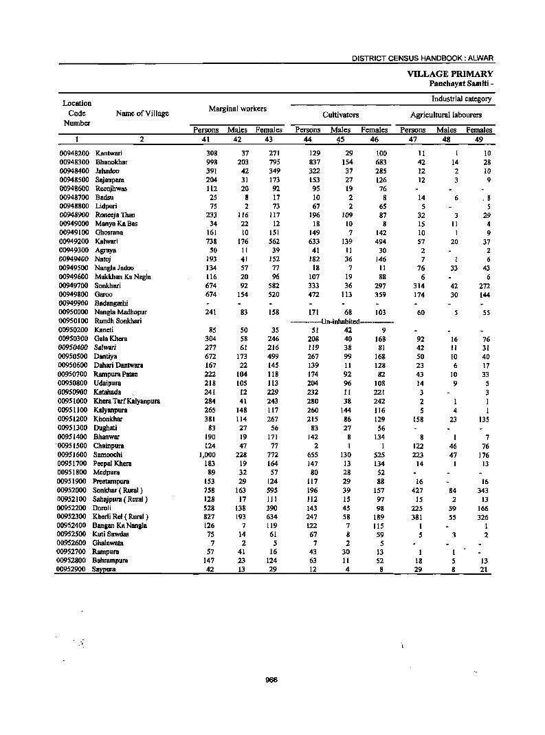
DISTRICT CENSUS HANDBOOK: ALWAR
VILLAGE PRIMARY Panchayat Samiti -
Location Industrial category
Code Name of Village ~arginal vvorkers
Cultivators Agricultural labourers Number
Persons ~ales Females Persons Males Females Persons Males Females 2 41 42 43 44 45 46 47 48 49
00948200 Kantwari 308 37 271 129 29 100 II 10 00948300 Bhanokhar 998 203 795 837 154 683 42 14 28 00948400 Jahadoo 391 42 349 322 37 285 12 2 10 00948500 Sajanpara 204 31 173 153 27 126 12 3 9 00948600 Reenjhwas 112 20 92 95 19 76 00948700 Badsu 25 8 17 10 2 8 14 6 . 8 00948800 Lidpuri 75 2 73 67 2 65 5 5 00948900 Roneeja Than 233 116 117 196 109 87 32 3 29 00949000 ManyaKa8as 34 22 12 18 10 8 15 II 4 00949100 Ghosrana 161 10 151 149 7 142 10 I 9 00949200 Kalwari 738 176 562 633 139 494 57 20 37 00949300 Agraya 50 II 39 41 II 30 2 2 00949400 Natoj 193 41 152 182 36 146 7 1 6 00949500 Nangla Jadoo 134 57 77 18 7 11 76 33 43 00949600 Makkhan Ku Naglu 116 20 96 107 19 88 6 6 00949700 Sonkhari 674 92 582 333 36 297 314 42 272 00949800 Garoo 674 154 520 472 113 359 174 30 144 00949900 Badangarhi 00950000 Nang1a Madhopur 241 83 158 171 68 103 60 5 55 ·00950100 Rundh Sonkhari -----------Un-inhabited---------00950200 Kaneti 85 50 35 51 42 9 00950300 Gala Khera 304 58 246 208 40 168 92 16 76 00950400 Salwari 277 61 216 119 38 81 42 11 31 00950500 Dantiya 672 173 499 267 99 168 50 10 40 00950600 Dahari Dantwara 167 22 145 139 11 128 23 6 17 00950700 Rampura Patan 222 104 118 174 92 82 43 10 33 00950800 Udaipura 218 105 113 204 96 108 14 9 5 00950900 Katahada 241 12 229 232 II 221 3 3 00951000 Khera TarfKalyanpura 284 41 243 280 38 242 2 1 1 00951100 Kalyanpura 265 148 117 260 144 116 5 4 1 00951200 Khonkhar 381 114 267 215 86 129 158 23 135 00951300 Dughati 83 27 56 83 27 56 00951400 Bhanwar 190 19 171 142 8 134 8 I 7 ·00951500 Chainpura 124 47 77 2 I 122 46 76 00951600 Samoochi 1,000 228 772 655 130 525 223 47 176 00951700 Peepal Khera 183 19 164 147 13 134 14 I 13 00951800 Medpura 89 32 57 80 28 52 00951900 Preetampura 153 29 124 117 29 88 16 16 00952000 Sonkhar ( Rural ) 758 163 595 196 39 157 427 84 343 00952100 SahBjpura ( Rural) 128 17 III 112 15 97 15 2 13 00952200 Doroli 528 138 390 143 45 98 225 59 166 00952300 Kherli Rei ( Rural) 827 193 634 247 58 189 381 55 326 00952400 Bangan Ka Nangla 126 7 119 122 7 115 1 I 00"952500 Kuti Sawdas 75 14 61 67 8 59 5 3 2 00952600 Ghalawata 7 2 5 7 2 5 00952700 Rampura 57 41 16 43 30 13 1 1 00952800 Bahrampura 147 23 124 63 11 52 18 5 13 00952900 S~ura 42 13 29 12 4 8 29 8 21
-,
966
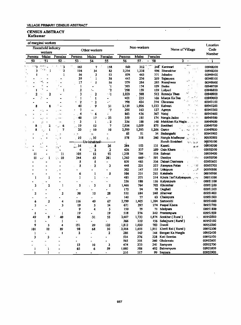
VILLAGE PRIMARY CENSUS ABSTRACT
CENSUS ABSTRACT Kathumar
of marginal workers Location
Household industry Non-workers Name of Village Code . Other workers workers Number
Persons 'Males Females Persons Males 'Females Persons Males Females 50 _" '51 52.- 53 -. 54 55 56 57· -- '58 2 -- I -. ¥3 "3 165 7 158, 560 3Ii" ..... -- 248- Kantwari 00948200
_ ..... 11'6 1,238 BhBnokhar
- .. "
3 '2 34 82 2,234 996 00948300 _ .. I I 56 3 53 83~ 463 371 JBhadoo 00948400
39 1 38 445 236 209 SBjBnpBra , 00948500 -"~J 17 1 16 '579 284 295 ReenjhwBS
,. .-; 00948600 -I '1 -303 174 129 Badsu 00948700
1 2 '- "2 '298 159 139 Lidpuri 00948800 2 2 3 2 . -'I 1,020 508 512 Roneeja Than ,:
00948900 I 1 '401 235 166 ManyaKaBas _r o!" 00949000 2 . 2 798 424 374 Ghosrana 00949100
8 8 40 9 31 2;129 1,096 1,033 Kalwari 00949200 7 '7 290 163 127 Agraya 00949300
,4 " 4 803 436 367 Natoj 00949400 ,,' - , . .. - ·40 17 , 23 359 185 174 Nangla Jadoo 00949500
.' 3 1 ,2 336 188 148 Makkhan KaNagla'" 00949600 8 2 ., 6 . __ 19 12 7 i,934 1,059 875 Sonkhari 'I.: : ',' 00949700 8
" 1 7 20 10 10 2,59:9 1,393 1,206 Garoo t. 1'";;. ,_. ,~ 00949800
- 85 51 34 Badangarhi " ,; 00949900 '. - , 10 :-,10 578 318 260 Nangla Madhopur :,_. _" ' 00950000
---Un-inhabited Rundh Sonkhari H l I !.~:,;''; 00950100 "
~ ;t- .:,,34 , 8 26 284 153 131 Kaneti U~-~'.f' 00950200 4 2 2 626 337 289 Gala Khera 00951>300
II 11 105 12 93 1,258 704 554 Salwari 00950400 11 .. ~-, :.;. 10 344 63 281 1,260 669- , 591 Dantiya ~:, - 00950500
5 5 839 483 356 Dahari Dantwara 00950600 5 2 3 448 221 227 Rampura Patan . .: ·l,~ 00950700
302 147 155 Udaipura . . )i 00950800 6 5 586 331 255 Katahada 00950900 1 485 271 214 Khera TarfKalyanpura .. ", 00951000
336 180 156 Kalyanpura 00951100 3 2 5 3 2 1,466 764 702 Khonkhar 00951200
172 94 78 Dughati 00951300 2 2 38 10 28 532 284 248 Bhanwar 00951400
140 77 63 Chainpura 00951500 6 2 4 116 49 67 2,799 1,405 1,394 Samoochi 00951600 3 3 19 5 14 671 397 274 Peepal Khera 00951700
9 4 5 150 79 71 Medpura 00951800 1 I 19 19 518 276 242 Preetampura 00951900
49 9 40 86 -31 55 3,607 1,733 1,874 Sonkhar ( Rural) 0095ioOO I I 366 210 156 Sahajpura ( Rural) 00952100 9 5 4 151 29 122 .1,813 1,030 783 Doroli 00952200
101 12 89 98 68 30 3,566 1,655 1,911 Kherli Rei ( Rural) 00952300 1 2 2 286 142 144 Bangan Ka Nangla 00952400 3 3 514 276 238 Kuti Sawdas 00952500
565 305 260 GhBlawata 00952600 13 10 3 474 233 241 Rampura 00952700 65 6 59 1,080 588 492 Bahrampura 00952800
216 117 99 Sa;n!ura 00952900
967
Location Code
Number
40601000 0001 0002 0003 0004 0005 0006 0007 0008 0009 0010 0011 0012 0013 0014 0015 0016 0017 0018 0019 0020
40602000 0001 0002 0003 0004 0005 0006 0007 0008 0009 0010 0011 0012 0013 0014 0015 0016 0017 0018 0019 0020 0021 0022 0023 0024
Name of TownlWard
Behror{M) Ward No. I Ward No. 2
. WardNo.3
Ward No. 4 Ward No,S Ward No. 6 Ward No. 7 Ward No. 8 Ward No. 9 Ward No. 10 Ward No. II Ward No. 12 Ward No. 13 Ward No. 14 Ward No. IS Ward No. 16 Ward No. 17
Ward No. 18 Ward No. 19 Ward No. 20
2
Bhiwadi (CI') Ward No. I Ward No. 2 Ward No. 3 Ward No. 4 Ward No. 5 Ward No. 6 Ward No. 7 Ward No. 8 Ward No. 9 Ward No. 10 Ward No. II Ward No. 12 Ward No. 13 Ward No. 14 Ward No. IS Ward No. 16 Ward No. 17 Ward No. 18 Ward No. 19 Ward No. 20 Ward No. 21 Ward No. 22 Ward No. 23 Ward No. 24
0025 Ward No. 25 0026 Ward No. 26 0027 Ward No. 27 0028 Ward No. 28 0029 Ward No. 29 0030 Ward No. 30 0031 Ward No. 31
40603000 Tijara (M) 0001 Ward No. I
Area of Town! Ward Number of
in square households Kilometre
3
15.12
20.00
10.00
4
3,977 224 190 138 193 106 141 135 141 183 219 127 222 250 203 202 225 300 215 382 181
9,143 233 363 112 242 184 738 128 535 553 812 495
276 412
55 91
157 30
315 448 602 496 114 191 195 83
244 394
71 298 189 87
3,056 209
968
DISTRICT CENSUS HANDBOOK: ALWAR
Total population (including institutional and
houseless population)
Persons
5
22,856 1,337 1,336
952 1,199
651 888
1,026 865
1,323 1,283
592 1,078 1,316,. 1,033 1,177 1,198 1,560 1,064 1,950 1,028
33,877 972
1,587 687 894 774
2,649 646
2,103 1,748 2,739 1,946
1,130 1,573
128 258 521 98
1,127 1,740 2,152 1,633
413 689 774 301 963
1,344 331
1,093 538 326
19,921 1,518
Males Females 6 7
12,297 712 703 513 632 347 471 541 458 672 682 318 586 672 . 552 612 674 938 599
1,056 559
21,483 538 919 357 536 451
1,700 377
1,223 1,113 1,745 1,109
639 902 86
183 335 62
721 1,148 1,463 1,182
259 404 490 214 678 983 204 854 391 217
10,490 793
10,559 "625 633 439 567 304 417 485 407 651 601 274 492 644 481
565 524 622 465 894 469
12;394 434 668 330 358 323 949 269 880 635 994 837 491 671 42 75
186 36
406 592 689 451 154 285 284
87 285 361 127 239 147, 109
9,431 725
URBAN PRIMARY
Population in the age-group 0-6
Persons
8
3,696 217 213 157 208
97 135 147 103 254 222 110 193 218 147 202 220
253 152 301 147
5,902 191 267 147 182 175 500 100 418 318 542 340
175 261
17 36 86 18
219 268 347 252 60
163 137 37
149 205
75 123 58 36
3,563 273
Males
9
1,995 132 111 86
101 48 78 78 52
127 120 66
103 98 82
101 124 151 88
154 95
3,269 109 163 79
103 108 287
55 221 165 271 210 107 131
9 22 41 II
124 153 197 145 34 86 65 20 79
119 39 68 27 21
1,874 142
Females
10
1,701 85
102 71
107 49 57 69 51
127 102 44 90
120 65
101
96 102 64
147 52
2,633 82
104 68 79 67
213 45
197 153 271 130 68
130 8
14 45
7 9S
lIS 150 107 26 77 72 17
70 86 36 55 31 15
1,689 131
URBAN PRIMAR,Y CENSUS ABSTRACT
CENSUS ABSTRACT
Scheduled Castes population
Persons . Males
11 12
3,575 36
586 174 II 48
792 750 32 30 84 93 30
550 123 54,
153 29
2,839 27 35
186 192 72
152 7
97 76
139 8 9
28 11 24 17
53 670
69 209 36
255 107
14 75
107 76 17 46 2S
3,647 95
1,906 21
315 97,
8 27
398 38S,
18. 17 46 4S 18
306 77 32. 80, 16
1,684, 14 21 95
111 39 95 4
57 50 95
5 6
13 7
11 12
39 396 38
124 18
138 63 10 45 75 40 12 35 16
1,850 44
Females
13
1,669, ' 15
271 77 3,
21
394 365
14 13 38. 48, 12', '
244 46 22 73 13
,1,155 13 14 91 81 33 57 3
40 26 44 3 3
15 4
13 5
14 274
31 85 18
117 44 4
30 32 36 5
11 9
1,7')7 51
Scheduled Tribes population
Persons
14
419 6 8
-ll I
101
11 15
·26 21
152 4 2
9 7
55 S 3
s
9 I I
19 4
14 5 3 4
80
Males
15 '227
3 4 5 I
.-57
112 2 1 9
10 12 11
93 3 2
5 3
30 2
4
6
17 1
7 4 2 2
47
Females
16
192 3 4 6
44
102 2
2 5
14 10
59
4 4
25 3 2
3
2 3
7
I 2
969
Persons
17
.15,759 .1,001
918 621 852 509 688 778 669 682 753 398 730 872 776 759
·745 1,016
792 1,477
723
22,610 677
1,002 373 454 555
1,720 476
1,521 1,244 1,823 1,561
92S 1,266
106 184 290
76 696
1,029 1,386 1,080
306 280 492 223 556 754 110 844 373 228
12,291 903
Literates Name ofTownlWard
Males Females
1-8 19 2
·9;473 569 553 397 501 292 386 450 389 426 488 239 441 519
" 451 457 480 669 483 851 432
16,161 400 639 257 334
·327 1,305
307 965 912
1,366 891 523 766 75
146 231
51 526 795
1,117 896 210 200 362 176 455 642 105 725 294 163
7,520 541
6,286 432 365 224 351 217 302 328 280 256 265 159 289 353 325 302 265 347 309 626 291
Behror(M) Ward No. 1 Ward No. 2 Ward No. 3 Ward No.-4 Ward No. 5 Ward No: 6 Ward No. 7. Ward No.'8 Ward No. 9 Ward No. 10 Ward No. II . Ward No.·'12 Ward NO.·13 Ward No. '14 Ward No. 15 Ward No. 16 Ward No.Q7 Ward No. 18 ". Ward No.·' 19 " ". Ward No. 20
6,449 Bhiwadi (Cf) . 277 Ward No. I 363 Ward No.2 116 Ward No.3 120 Ward No.4 228 Ward No.5 415 Ward No.6 169 Ward No. 7 556 Ward No.8 332 Ward No.9 457 Ward No. 10 670 Ward No. 11 402 Ward No. 12 500 Ward No. 13 31 Ward No. 14 38 Ward No. 15 59 Ward No. 16 25 Ward No. 17
170 Ward No. 18 234 Ward ~o. 19 269 Ward No. 20 184 Ward.No.21 96 Ward No. 22 80 Ward No. 23
130 Ward No. 24 47 Ward No. 25
101 Ward~o. 26 112 Ward No. 27
5 Ward No. 28 119 Ward No. 29 79 Ward No. 30 65 . Ward No. 31
4,771 Tijara eM) 362 Ward No. I
Location
Code
Number
40601000 0001 0002 0003 0004 0005 0006 0007 0008 0009 0010 0011 0012 0013 0014 0015 0016 0017 0018 0019 0020
40602000 0001 0002 0003 0004 0005 0006 0007 0008 0009 0010 0011 0012 0013 0014 Oot5 0016 0017 0018 0019 0020 0021 0022 0023 0024 0025 0026 0027 0028 0029 0030 0031
40603000 0001
Name ofTown/Ward
Bebror(M) Ward No. I Ward No. 2 Ward No. 3 Ward No. 4 Ward No. 5 Ward No. 6 Ward No. 7 Ward No. 8 Ward No. 9 Ward No. 10 Ward No. 11 Ward No. 12 Ward No. 13 Ward No. 14 Ward No. 15 Ward No. 16 Ward No. 17 Ward No. 18 Ward No. 19 Ward No. 20
2
Bbiwadi (CT)
Ward No. 1 Ward No. 2 Ward No. 3 Ward No. 4 Ward No. 5 Ward No. 6 Ward No. 7 Ward No. 8 Ward No. 9 Ward No. 10 Ward No. II Ward No. 12 Ward No. 13 Ward No. 14 Ward No. 15 Ward No. 16 Ward No. 17 Ward No. 18 Ward No. 19 Ward No. 20 , Ward No. 21 Ward No. 22 Ward No. 23 Ward No. 24 Ward No. 25 Ward No. 26 Ward No. 27 Ward No. 28 Ward No. 29 Ward No. 30 Ward No. 31
Tijara (M) Ward No. 1
Persons
20
7,097 336 418 331 347 142 200 248 196 641 530 194 348 444 257 418 453 544 272 473 305
11,267 295 585 314 440 219 929 170 582 504 916 385 205 307 22 74
231 22
431 711 766 553 107 409 282
78 407 590 221 249 165 98
7,630 615
DISTRICT CENSUS HANDBOOK: ALWAR
Illiterates Total workers
Males Females Persons Males Females
21 22 23 24 25
2,824 4,273 8,087 6,164 1,923 143 193 349 281 68 150 268 344 328 16 116 215 307 241 66 131 216 367 300 67 55 85 91 69
246 194 79
145 153 101 155 194 269 116 205 127
5,322 138 280 100 202 124 395
70 258 201 379 218 116 136
11 37
104 II
195 353 346 286 49
204 128 38
223 341 99
129 97 54
2,970 252
87 115 157 127 395 336 115 203 291 156 263 259 275 156 268 178
5,945 157 305 214 238
95 534 100 324 303 537 167 89
171 11 3'7
127 II
236 358 420 26'7 58
205 154 40
184 249 122 120 68 44
4,660 363
970
1S8 170 257 203 320 245 259 225 344 261 330 307 221 171 379 315 673 405 409 296 663 376 667 398 638 561 361 309 674 529 337 243
15,898 14,053 361 275 669 499 259 167 422 329 273 239
1,214 1,076 226 197 775 725 904 776
1,476 1,263 663 606 412 366 618 547
73 61 151 137 283 229
44 37 521 498 828 739
1,083 1,022 936 887 174 159 286 227 386 334 169 160 564 517 818 . 764 126 115 675 649 333 309 176 144
8,532 5,469 743 408
18 54 75 34 83 23 50 64
268 113 287 269
77 52
145 94
1,845 86
170 92 93 j4
138 29 50
128 213
57 46 71 12 14 54
7 23 89 61 49 15 59 52 9
47 54 11 26 24 32
3,063 335
URBAN PRIMARY
Main workers
Persons Males Females
26 27 28
6,169 5,514 655 326 279 47 334 321 13 178 165 13 303 280 23 175 164 220 200 254 233 210 207 284 231 298 286 180 151 345 298 409 328 261 239 328 311 355 291 571 531 284 269 556 493 298 237
14,975 13,709 308 260 516 439 164 IS8 398 318 260 237
1,114 1,062 218 193 770 724 806 734
1,378 1,213 662 60S 408 364 606 543 62 56
ISO 137 260 226
34 32 480 471 804 725
1,063 1,018 933 886 173 159 276 226 333 302 165 159 543 506 808 756 126 115 665 645 324 301 168 139
5,779 4,667 508 331
II
~O 21 3
53 12 29 47 81 22 17 64 40 15 63 61
1,266 48 77 6
80 23 52 25 46 72
165 57 44 63
6 13 34
2 9
79 45 47 14 50 31
6 37 52 11 20 23 29
1,112 177
URBAN PRIMARY CENSUS ABSTRACT
CENSUS ABSTRACT
Industrial category of main workers
Cultivators Agricultural labourers Household industry
workers Other workers Name ofTownlWard
Persons Males Females ,Persons Males Females Persons Males Females Persons Males Females
29 30 31 32 33 34 3S 36 37 38 39 40 2
720 34 15 28 16
5 25 39
9
3 12 40
118 27
108 69 17 II 59 85
163 16 26 45 3
3 5
2 5
I 26 15 7
2
4
535 28 13 19 16 5
16 35 8
3 4
19 62 26
104 47 17 11 38 64
139 16 25 44 3
2 5
2 4
14 12 3
2
4
1,928 1,259 288 137
185 6 2 9
9 4
8 21 56
4 22
21 21
24
, I
I
12 3 4
669 151
61
2 2
21 2
1 24
4
3
32
6 3
6
2
8
3 3
227 11
48
2 2
15 2
17 4
3
32
6 3
6
2
8
3 3
155 8
13
72 3
6
7
185
1 6
3 28
5 5 2
20 8
19 13 4 7 2 2
21 39
108
5
23 1
10
2 16 I
2 11
16 2 4
4 5
4
112 10
I 6
25 5 3 2
13 6
19 13 4 4
2 21 27
81
5
17 1
10
2 11 1
5
13
4
3 3
4
85 5
971
'32
2 3
2
7 2
3
12
27
6
5
1 6
3 2
I 2
27 5
5;203 292 317 144 287 169 192 187 196 279 291 '146 276 270 221 215 255 548 271 476 171
14,672 292 479 116 372 259
1,101 213 769 802
1,351 661 408 60S
62 148 249
33 461 776
1,036 926 173 276 332 164 536 798 125 661 320 168
4,778 251 306 140 264 158 183 173 194 228 279 132 258 245 200 202 223 509 256 434 143
13,457 244 403 111 298 236
1,050 188 723 730
1,192 604 364 542
56 136 221
31 455 711 994 883 159 226 302 158 500 748 115 641 297 139
3,512 3,168 199 181
425 Behror (M) 41 Ward No. 1 11 Ward'No. 2 4 Ward No. j
23 WardNo..4 11 Ward No. 5 9 Ward'No.6
14 Ward No. 7 2 Ward No, 8
51 Ward·No."9 12 Ward'No: 10 14 Ward'No. 11 18 Ward'No.12 25 Watd No. 13 21 Ward No. 14 13 Ward No. 15 32 Ward No. 16 39 Ward No. 17 IS Ward No. 18 42 Ward No. 19 28 Ward No. 20
1,215 'Bhiw8di (Cf) 48 Ward No. 1 76 Ward No. 2 5 Ward No. 3
74 Ward No. 4 23 Ward No. 5 51 Ward No. 6 25 Ward No. 7 46 Ward No. 8 72 Ward No. 9
159 Ward No. 10 57 Ward No. 11 44 Ward No. 12 63 Ward No. 13 6 Ward No. 14
12 Ward No. IS 28 Ward No. 16
2 Ward No. 17 6 Ward No. 18
6S Ward No. 19 42 Ward No. 20 43 Ward No. 21 14 Ward No. 22 SO Ward No. 23 30 Ward No. 24
6 Ward No. 25 36 Ward No. 26 50 Ward No. 27 10 Ward No. 28 20 Ward No. 29 23 Ward No. 30 29 Ward No. 31
344 Tijara (M) 18 Ward No. 1
"
, ..
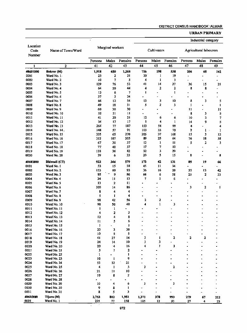
Location Code
Number
40601000 0001 0002 0003 0004 0005 0006 0007 0008 0009 0010 0011 0012 0013 0014 0015 0016 0017 0018 0019 0020
40602000 0001 0002 0003 0004 0005 0006 0007 0008 0009 0010 0011 0012 0013 0014 0015 0016 0017 0018 0019 0020 0021 0022 0023 0024 0025 0026 0027 0028 0029 0030 0031
40603000 0001
Name of Town/Ward
Behror (M)
Ward No. I· Ward No. 2 Ward No. 3 Ward No. 4 Ward No. 5 Ward No. 6 Ward No. 7
Ward No. 8 Ward No. 9 Ward No. 10 Ward No. 11 Ward No. 12 Ward No. 13 Ward No. 14, Ward No. IS Ward No. 16 Ward No. 17 Ward No. 18 Ward No. 19 Ward No. 20
2
Bhiwadi (CT) Ward No. I Ward No. 2 Ward No. 3 Ward No. 4 Ward No. 5 Ward No. 6
Ward No. 7 Ward No. 8 Ward No. 9 Ward No. 10 Ward No. 11 Ward No. 12 Ward No. 13 Ward No. 14 Ward No. 15 Ward No. 16 Ward No. 17 Ward No. 18 Ward No. 19 Ward No. 20 Ward No. 21 Ward No. 22 Ward No. 23 Ward No. 24 Ward No. 25 Ward No. 26 Ward No. 27 Ward No. 28 Ward No. 29 Ward No. 30 Ward No. 31
Tijara(M) Ward No. 1
Marginal workers
Persons Males Females 41 42 43 1,918
23 10
129 64 13 37 66 49 60 32 41 34
264 148 335 312 67 77
118 39
923 53
153 95 24 13
100 8 5
98 98
I 4
12 II I
23 10 41 24 20 3 I
10 53 4
21 10
10 9 8
2,753 235
650 2 7
76 20
6 3
12 18 30 21 20 17 77 57 65
107 30 40 36 6
344 IS 60
- 9 11 2
14 4
42 50
1 2 4 5
3 5
27 14 4 1
I 32
11 8
4 8 5
802 77
1,268 21 3
53 44
7 34 54 31 30 II 21 17
187 91
270 205 37 37 82 33
579 38 93 86 13 II 86 4 4
56 48
2 8 6 I
20 5
14 10 16 2 I 9
21 3
10 2
6 I 3
1,951 158
972
DISTRICT CENSUS HANDBOOK :ALWAR
Cultivators
Persons Males Females 44 4S 46
736 20 4
41 4 I
13 5
12 5
153 103 205
89 12 17 32 20
173 45 36 64 7
2 4
3 3 4
2
3
1,371 lOS
198
1 14 2
3 2
6 4
S4 33 37 25
I 7 3 5
42 11 16 6
2
3
378 12
538 19 3
27 2
10 3
6 1
99 70
168 64 II 10 29 15
131 34 20 58 6
3
2
3
2
3
993 93
URBAN PRIMARY
Industrial category
Agricultural labourers
Persons Males Females 47 48 49
206
36 8
8
II 8
10 14 4 2
15 76
5
8
85
55 25
3
2
279 27
65
15 8
3
3 3 9
I 3
18 2
19
13 2
2
2
67 4
141
21
5
11 S 7 5
4 I
12 58
3
8
66
42 23
212 23
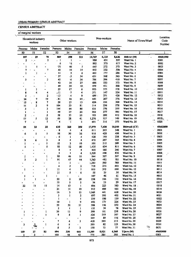
URBAN PRIMARY CENSUS ABSTRACT
CENSUS ABSTRACT
of marginal workers ~----~--------------------------------
Household industry workers
Other workers
Persons Males Females Persons
50 51 52 53
107 ,29 2 " ,-
7
3
I 8 4 2
26 7 15 8 11 2 3 I 2
17 5 7
55 23
6
9 6
5
3 2
22 11
3
109 3
27 , 3
78 2
7
3
4 2
19 7 9 3
2 12 7
32
5
3 I 5
11
82
869 , I
6 '51 45 II
, 37
42 43 49 23
c,1l ~13 ,81 28
104 144 49 58 69
." 4
610 8
56 • 6
,8 1-2 92
8 5
95 91
I 4
11 II
22 10 14 21 16 3 I
10 53 2
20 9
7 6 8
994 100
Males Females
54 55
358 'I ~6
46 10 5
,3 ~6
16 30 17
'1 '.4 16 \5, 23 64 27 33 28 ''I'
260 4
30
4 2
12 4 I
40 47
2 4 5
2 5
13 11 3 I
I 32
11 8
4 6 5
330 58
511
5 35
6 34 36 27 19, 6 4 9
65 . 13 81 80 22 25 41 3
350 4
26 5 4
10 80 4 4
55 44
2 7 6
20 5 I
10 13 2 I 9
21 I 9
3
3
664 42
Non-workers Name ofTownlWard
Location Code
Number
Persons Males Females
56 57
14.769 6.133 988 431 992 375 645 272 832 332 463 177 631 268 706 296 606 233 979 411 953 375 371 147 699 ' 271 643 267 624· 256 514 236 531 276 922 377 703 290
1,276 527 691 316
17,979 7,430 611 263 918 420 428 190 472 207 501 212
1,435 624 420 180
1,328 498 844 337
1,263 482 1,283 503
718 273 955 355
55 25 107 46 238 106
54 25 606 223 912 409
1,069 697 239 403 388 132 399 526 205 418 205 ISO
11,389 775
973
441 295 100 177 156 54
161 219
89 205
82 73
5,021 385
58
8,636 Dehror (M) 557 Ward No. I 617 Ward No, 2 373 Ward No, 3 500 Ward NO.4 286 Ward No.5 363 Ward No, 6 410 Ward No.7 373 Ward No, 8 568 Ward No.9 578 Ward No. 10 224 Ward No, II 428 Ward No, 12 376 Ward No. 13 368 Ward No. 14 278 Ward No. 15 25S Ward No. 16 54S Ward No, 17 413 WarelNo, 18 749 Ward No, 19 375 Ward No. 20
10.549 Dhiwadi (CT) 348 Ward No. I 498 Ward No.2 238 Ward No, 3 265 Ward No, 4 289 Ward No.5 8ll Ward No.6 240 Ward No. 7 830 Ward No.8 507 Ward No, 9 781 Ward No, 10 780 Ward No. II 445 Ward No. 12 600 Ward No. 13 30 Ward No. 14 61 Ward No. 15
132 Ward No. 16 29 Ward No. 17
383 Ward No. 18 ' 503 Ward No. 19 628 Ward No. 20 402 Ward No. 21 139 Ward No. 22 226 Ward No. 23 232 Ward No. 24 78 Ward No. 25
238 Ward No. 26 307 Ward No. 27 116 Ward No. 28 213 Ward No. 29 123 Ward No. 30 77 Ward No. 31
6,368 Tijara (M) 390 Ward No. I
2
40601000 0001 0002 0003 0004 0005 0006 0007 0008 0009 0010 0011 0012 0013
,," 0014 0015 0016 0017
,.; 0018
,-,; 00,1.',1,,_ " 0020
40602000 0001 0002
" 0003 0004 0005 0006 0007
0008" 0009 0010 0011 0012 0013 0014 0015 0016 0017 0018 0019 0020 0021 0022 0023 0024 0025 0026 0027 0028 0029 0030 0031
40603000 0001
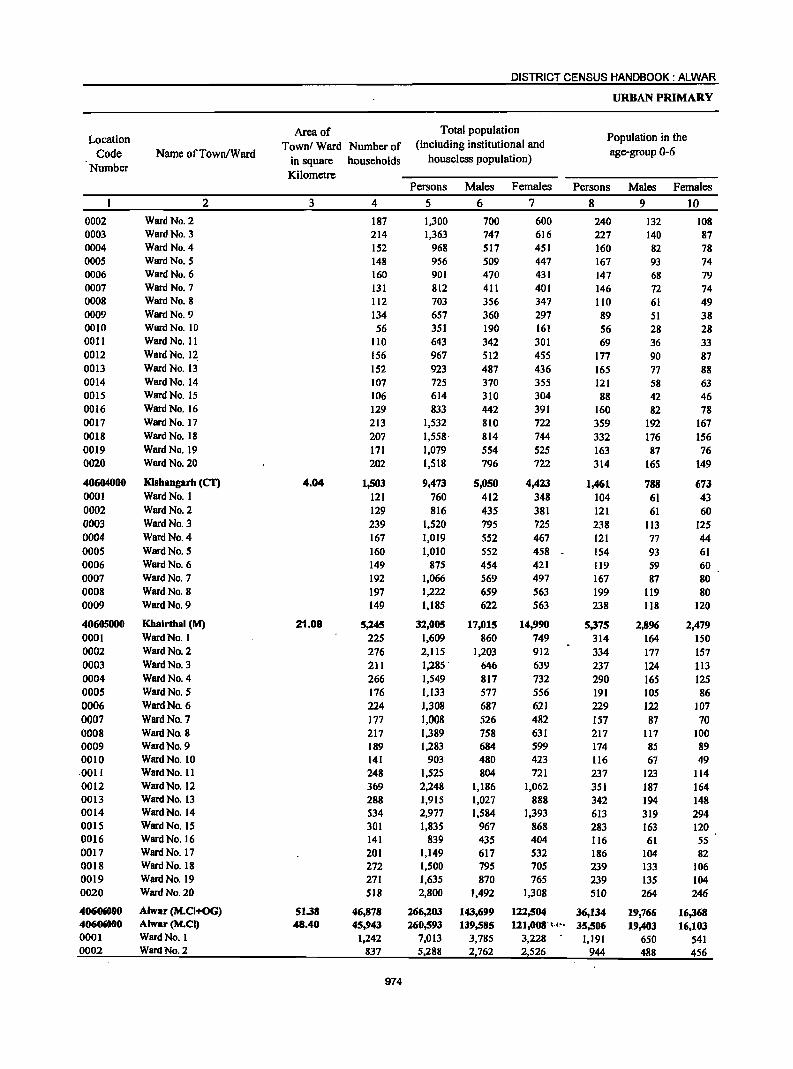
Location
Code Number
0002 0003 0004 0005 0006 0007 0008 0009 DOlO 0011 0012 0013 0014 0015 0016 0017 0018 0019 0020
40604000 0001 0002 0003 0004 0005 0006 0007 0008 0009
40605000 0001 0002 0003 0004 0005 0006 0007 0008 0009 0010 0011 0012 0013 0014 0015 0016 0017 0018 0019 0020
406()(jOOO 40606000 0001 0002
Name ofTown/Ward
Ward No. 2 Ward No. 3 Ward No. 4 Ward No. 5 Ward No. 6 Ward No. 7 Ward No.8 Ward No. 9 Ward No. 10 Ward No. 11 Ward No. 12. Ward No. 13 Ward No. 14 Ward No. 15 Ward No. 16 Ward No. 17 Ward No. 18 Ward No. 19 Ward No. 20
2
Klshangarh (Cf) Ward No. I Ward No. 2 Ward No. 3 Ward No. 4 Ward No. 5 Ward No. 6 Ward No. 7 Ward No. 8 Ward No. 9
Khairthal (M) Ward No. I Ward No. 2 Ward No. 3 Ward No. 4 Ward No. 5 Ward No. 6 Ward No. 7 Ward No. 8 Ward No. 9 Ward No. 10 Ward No. II Ward No. 12 Ward No. 13 Ward No. 14 Ward No. IS Ward No. 16 Ward No. 17 Ward No. 18 Ward No. 19 Ward No. 20
Alwar (M.CI+OG) Alwar (MoCI) Ward No. 1 Ward No. 2
Area of
Town! Ward Number of
in square households
Kilometre
3
4.04
21.09
51.38 48.40
4
187 214 152 148 160 131 112 134 56
110 156 152 107 106 129 213 207 171 202
1,503 121 129 239 167 160 149 192 197 149
5,145 225 276 211 266 176 224 177 217 189 141 248 369 288 534 301 141 201 272 271 518
46,878 45,943
1,242 837
974
DISTRICT CENSUS HANDBOOK: ALWAR
Total population (including institutional and
houseless population)
URBAN PRIMARY
Population in the
age-group 0-6
Persons Males Females Persons Males Females
5 6 7 8 9 10
1,300 1,363
968 956 901 812 703 657 351 643 967 923 725 614 833
1,532 1,558' 1,079 1,518
9,473 760 816
1,520 1,019 1,010
875 1,066 1,222 1,185
32,005 1,609 2,115 1,285 .
1,549 1,133 1,308 1,008 1,389 1,283
903 1,525 2,248 1,915 2,977 1,835
839 1,149 1,500 1,635 2,800
266,203 260,593
7,013 5,288
700 747 517 509 470 411 356 360 190 342 512 487 370 310 442 810 814 554 796
5,050 412 435 795 552 552 454 569 659 622
17,015 860
1,203 646 817 577 687 526 758 684 480 804
1,186 1,027 1,584
967 435 617 795 870
1,492
143,699 139,585
3,785 2762
600 616 451 447 431 401 347 297 161 301 455 436 355 304 391 722 744 525 722
4,423 348 381 725 467 458 421 497 563 563
14,990 749 912 639 732 556 621 482 631 599 423 721
1,062 888
1,393 868 404 532 705 765
1,308
122,504 121,008' t.".
3,228 2,526
240 227 160 167 147 146 110 89 56 69
177 165 121 88
160 359 332 163 314
1,461 104 121 238 121 154 119 167 199 238
5,375 314 334 237 290 191 229 157 217 174 116 237 351 342 613 283 116 186 239 239 510
36,134 35,506
1,191 944
132 140 82 93 68 72 61 51 28 36 90 77 58 42 82
192 176 87
165
788 61 61
113 77 93 59 87
119 118
2,896 164 177 124 165 105 122 87
117 85 67
123 187 194 319 163 61
104 133 135 264
19,766 19,403
650 488
108 87 78 74 79 74 49 38 28 33 87 88 63 46 78
167 156 76
149
673 43 60
125 44 61 60 80 80
120
2,479 150 157 113 125 86
107 70
100 89 49
114 164 148 294 120 55 82
106 104 246
16,368 16,103
541 456
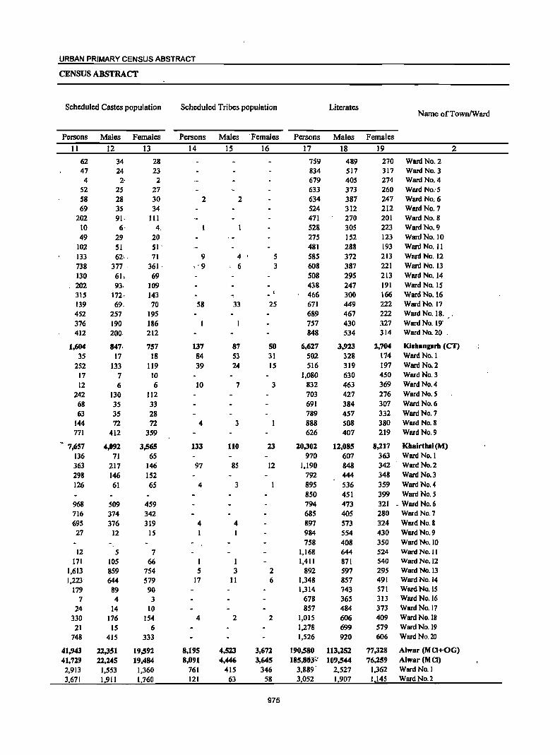
URBAN PRIMARY CENSUS ABSTRACT
CENSUS ABSTRACT
Scheduled Castes population Scheduled Tribes population Literates Name ofTownIWard
Persons Males Females Persons Males 'Females Persons Males Females
11 12 13 14 15 16 17 18 19 2
62 34 28 759 489 210 Ward No. 2 47 24 23 834 517 317 Ward No. 3 4 2- 2 619 405 274 Ward No:4
52 25 27 633 313 260 Ward No: 5 58 28 30 2 2 634 387 247 Ward No. 6 69 35 34 524 312 212 Ward No. 7
202 91· III 471 270 201 Ward No. 8 10 6- 4. 528 30S 223 Ward No. 9
49 29 20 275 152 123 Ward No. 10 102 51 SI . 481 288 193 Ward No. 11 133 62, . 71 9 4 S 585 372 213 Ward No. 12 738 377 . 361 . , '9 , 6 3 608 387 221 Ward No. 13
130 61, 69 508 295 213 Ward No. 14 202 93· 109 438 247 191 Ward No. 15 315 172, 143 466 300 166 Ward No. 16 139 69. 70 58 33 25 671 449 222 Ward No. 17 452 257 195 689 467 222 Ward No. 18.
376 190 186 757 430 327 Ward No. 19' 412 200· 212 848 534 314 Ward No. 20 .
1,604 847, 757 137 87 SO 6,627 3,923 2,704 Kisbangarb (Cf)
35 17 18 84 53 31 502 328 174 Ward No. I
252 133 119 39 24 15 516 319 197 Ward No. 2 17 7 10 1,080 630 450 Ward No.3
12 6 6 10 7 3 832 463 369 Ward No.4
242 130 112 103 427 276 Ward No. 5
68 35 33 691 384 307 Ward No. 6
63 3S 28 789 457 332 Ward No. 7 144 72 72 4 3 888 508 380 Ward No.8 771 412 359 626 407 219 Ward No.9
~ 7,657 4,092 3,565 133 110 23 20,302 12,085 8,217 KbairtbBI (M)
136 71 65 970 607 363 Ward No. I
363 217 146 97 85 12 1,190 848 342 Ward No.2
298 146 152 792 444 348 Ward No.3
126 61 65 4 3 895 536 359 Ward No.4 850 451 399 Ward No. 5
968 S09 459 794 473 321 - Ward No. 6 716 374 342 685 405 280 Ward No. 7
695 316 319 4 4 897 513 324 Ward No. & 27 12 IS 984 554 430 Ward No. 9
758 408 350 Ward No. 10 12 5 7 1,168 644 524 WarelNo.11
171 105 66 1 I 1,411 871 540 Ward No. 12 1,613 859 754 5 3 2 892 597 295 Ward No. 13 1,223' 644 579 17 11 6 1,348 857 491 Ward No. 14
179 89 90 1,314 743 511 Ward No. IS 7 4 3 678 365 313 Ward No. 16
24 14 10 857 484 373 Ward No. 17 330 176 154 4 2 2 1,015 606 409 Ward No. 18
21 15 6 1,278 699 579 Ward No. 19 748 415 333 1,526 920 606 Ward No. 20
41,943 22,351 19,592 8,195 4,523 3,672 190,580 113,252 77,328 Alwar (M CI+OG) 41,729 22,245 19,484 8,091 4,446 3,645 185,803-;: 109,544 76,259 Alwar(MCI)
2,913 1,553 1,360 761 415 346 3,889 2,527 1,362 Ward No. I 3,671 1,911 1,760 121 63 58 3052 1,907 I 145 Ward No.2
975
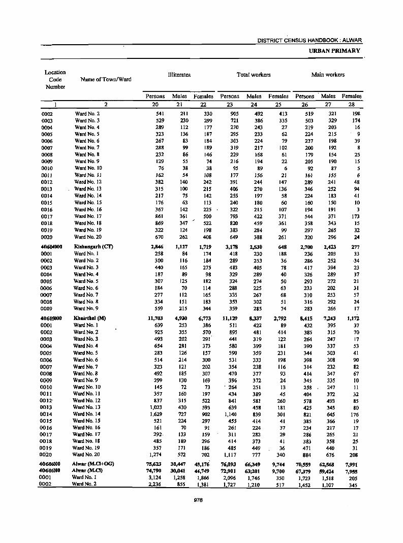
Location Code
Number
0002 0003 0004 0005 0006 0007 0008 0009 0010 0011 0012 0013 0014 0015 0016 0017 0018 0019 0020
40604000 0001 0002 0003 0004 0005 0006 0007 0008 0009
40605000 0001 0002 0003 0004 0005 0006 0007 0008 0009 0010 0011 0012' 0013 0014 0015 0016 0017 0018 0019 0020
406(NOOO 40606000 0001 0002
Name ofTownlWard
Ward No. 2 Ward No. 3 Ward No. 4 Ward No. 5 Ward No. 6 Ward No. 7 Ward No. 8 Ward No. 9 Ward No. 10 Ward No. 11 Ward No. 12 Ward No. 13 Ward No. 14 Ward No. 15 Ward No. 16 Ward No. 17 Ward No. 18 Ward No. 19 Ward No. 20
2
KishBngBrh (CT)
WardNo. I Ward No. 2 Ward No. 3 Ward No. 4 Ward No. 5 Ward No. 6 Ward No. 7 Ward No. 8 Ward No. 9
Khairthal (M) WardNo. I Ward No. 2 Ward No. 3 Ward No. 4 Ward No. 5 Ward No. 6
Ward No. 7 Ward No. 8 Ward No. 9 Ward No. 10 Ward No. II Ward No. 12 Ward No. 13 Ward No. 14 Ward No. 15 Ward No. 16 Ward No. 17 Ward No. 18 Ward No. 19 Ward No. 20
Alwar (M.CI+OG) Alwar (M.CI) Ward No. 1 Ward No. 2
Persons
20
541 529 289 323 267 288 232 129 76
162 382 315 217 176 367 861 869 322 670
2,846 258 300 440 187 307 184 277 334 559
11,703
639 925 493 654 283 514 323 492 299 145 357 837
1,023 1,629
521 161 292· 485 357
1,274
75,623 74,790 3,124 2,236
Illiterates
Males Females
21 22
2i1 230 112 136 83 99 86 55 38 54
140 100 75 63
142 361 347 124 262
1,127 84
116 165 89
125 70
112 151 215
4,930 253 355 202 281 126 214 121 185 130 72
160 315 430 727 224
70 133 189 171 572
30,447 30,041
1,258 855
330 299 177 187 184 189 146 74 38
108
242 215 142 113 225 500 522 198 408
1,719 174 184 275 98
182 114 165 183 344
6,773 386 570 291 373 157 300 202 307 169 73
197 522 593 902 297
91 159 296 186 702
45,176. 44,749
1,866 1,381
976
DISTRICT CENSUS HANDBOOK: ALWAR
Total workers
Persons
23
905 721 270 295 303 319 229 216
95 177 391 406 255 240 322 793 820 383 649
3,178 418 289 483 329 324 288 335 353 359
11,129 511 895 441 580 590 531 354 470 396
'264 434 841 639
1,140 45S 261 311 414 485
1,117
76,093 72,901
2,096 1,727
Males Females
24 25
492 386 243 233 224 217 168 194 89
156 244 270 197 180 215 422 459 284 388
2,530 230 253 405 289 274 225 267 302 285
8,337 422 481 319 399 359 333 238 377 372 251 389 581 458 839 414 224 282 373 449 777
66,349 63;201
1,746 1,210
413 335 27 62 79
102 61 22
6 21
147 136 58 60
107 371 361 99
261
648 188 36 78 40 50 63 68 51 74
2,792 89
414 122 181 231 198 116 93 24 13 45
260 181 301
41 37 29 41 36
340
9,744 9,700
350 517
URBAN PRIMARY
Main workers
Persons Males Females
26 27 28
519 503 219 224 237 200 179 205 92
161 289 346 224 160 194 544 358 297 320
2,700 236 286 417 326 293 233 310 316 283
8,41S 432 385 264 390 344 398 314 414 345 258 404 578 425 821 385 234 286 383 471 884
70,559 67,379
1,723 1,452
321 329 203 215 198 192 154 190 87
155 241 252 183 150 191 371 343 265 296
2,423 203 252 394 289 272 202 253 292 266
7,243 395 315 247 337 303 308 232 347 335 247 372 493 345 645 366 217 265 358 440 676
62,568 59,424
1,518 1,107
198 174 16 9
39 8
25 15 5 6
48 94 41 10 3
173 15 32 24
277 33 ·34 23 37 21 31 57 24 17
1,172
37 70 17 53 41 90 82 67 10 11 32 85 80
176 19 17 21 25 31
208
7,991 7,955
205 345
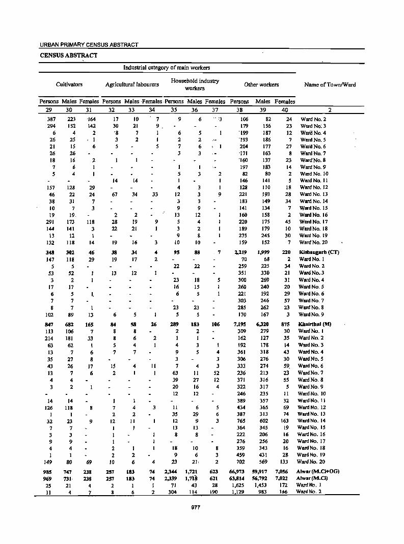
URBAN PRIMARY CENSUS ABSTRACT
CENSUS ABSTRACT
Cultivators
Industrial category of main workers
Agriculturallabourcrs Household industry
workers Other workers Name ofTownlWard
Persons Males Females Persons Males ·Females ,Persons Males Females Persons Males Females
29 30 31 32 33 34 35 36 37 38 39 40 2
387 294
6 26 21 26 18 7 5
157 46 38 10 19
291 144
13 132
348 147
5 53 3
17 6 7 &
102
847 113 214
63 13 35 43 13 4 3
14 126
1 32 7 3 9 4 1
149
985 969 25 Il
223 152
4 25 15 26 16 6 4
128 22 31 7
19. 173 141
12 118
302 118
5 52 2
17 5 7 7
89
682 106 181 62
7 27 26 7 4 2
14 118
I 23 7 3 9 4 1
80
747 731· 21
4
'164 142
2 . I
6
2
29 24
7 3
118 3
14
46 29
I,
13
HiS 7
33 1 6 8
17 6
8
9
69
138 138
4 7
17 30 '8 3 5
14
67
2 28 22
19
38 19
13
6
84 8 8 5 7
15 2
7 2
12
I 2 2
10
257 257
2 8
10 21 7 2
14
34
2 19 21
16
34 17
12
5
58 8 6 4 7
4 I
4 2
II I
1 2 6
183 183
I 6
7 9. I 1 5
33
9
6 2 7 3
5 I 4
12 3 9
,-13 5 3 9
10
9
3
4 2
26
2
Jl I
3
4
74 74 I 2
95
22
23 16 6
23 5
289 2
4 9 3 7
63 39 20 12
11
35 12
13 8
18 9
23
2,344 2,339
71 304
6 .. :3
5 2 6 ,I
3
3
3 3 3 9
12 4 2 8
10
88
22
18 15
5
23 5
183 2 I 3 5
4 II 27 16 12
6 29 9
13 8
10 6
21,
1,721 1,7t~
43 114
977
2
I 9
.7
5
106
4 3 3
52 12 4
5 6 3
8 3 2
623 621 28
190
106 179
'199 '193 204 'l7I '160 197 82
146 128 221 183 141 160 220 189 275 159
82 156 187 186 177 163 137 183 80
141 110 193 149 134 158 175 179 245 152
~,219 1,999 70 68
259 225 351 330 300 269 260 221 303 285 170
240 192 246 262 167
7,195 6,320 309 279 162 127 192 178 361 318 306 276 333 274 236 213 371 316 322 317 246 389 434 387 765 364 222 276 359 459 702
66,973 63,814
1,625 1,129
235 357 365 313
602 345 206 256 343 431 569
59,917 56,792
1,453 983
24 Ward No.2 23 Ward No: 3 12 Waril No. 4 7 Ward No. 5
27 Ward No. 6 8 Ward No. 7
23 Ward'No.8 14 Ward No.9' 2 WardNo.1O 5 Ward No. II
18 Ward No. 12 28 Ward No. 13 34 Ward No. 14
7 Ward No. 15 2 Ward No. 16
45 Ward No. 17 10 Ward No. 18 30 WlITd No. 19
7 WlITd No. 20
220 Kisbangarh (CT) 2 WardNo. I
34 Ward No. 2 21 WlITd No .. 3 31 Ward No. 4 20 Ward No. 5 29 Ward No. 6 57 Ward No. 7 23 Ward No. 8
3 Ward No. 9
875 Kbairthal (M) 30 WardNo. I 35 Ward No. 2 14 Ward No. 3 43 Ward No. 4 30 Ward No. 5 59. Ward No.6 23 Ward No. 7 S5 Ward No. 8 5 Ward No. 9
II Ward No. 10 32 69 74
163 19 16 20 16 28
133
7,056 7,022
172 146
Ward No. 11 Ward No. 12 Ward No. 13 Ward No. 14 Ward No. 15 Ward No. 16 Ward No. 17 Ward No. 18 Ward No. 19 Ward No. 20
Alwar (M.CI+OG) Alwar (M.CI) WardNo. I Ward No. 2
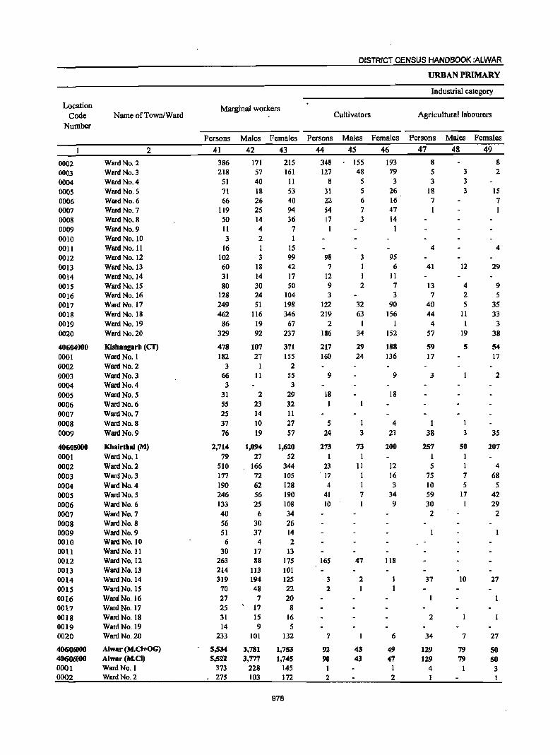
Location
Code
Number
0002 0003 0004 0005 0006 0007 0008 0009 0010 001l 0012 0013 0014 0015 0016 0017 0018 0019 0020
40604000 0001 0002 0003 0004 0005 0006 0007 0008 0009
40605000 0001 0002 0003 0004 0005 0006 0007 0008 0009 0010 0011 0012 0013 0014 0015 0016 0017 0018 0019 0020
40606000 406"'000 0001 0002
Name ofTown/Ward
2
Ward No. 2 Ward No. 3 Ward No. 4 Ward No. 5 Ward No. 6 Ward No. 7 Ward No. 8 Ward No. 9 Ward No. 10 Ward No. 11 Ward No. 12 Ward No. 13 Ward No. 14 Ward No. IS Ward No. 16 Ward No. 17 Ward No. 18 Ward No. 19 Ward No. 20
Kishangarh (cr) Ward No. 1 Ward No. 2 Ward No. 3 Ward No. 4 Ward No. 5 Ward No. 6 Ward No. 7 Ward No. 8 Ward No. 9
Khairtbal (M) Ward No. I Ward No. 2 Ward No. 3 Ward No. 4 Ward No. 5 Ward No. 6 Ward No. 7 Ward No. 8 Ward No. 9 Ward No. 10 Ward No. 11 Ward No. 12 Ward No. 13 Ward No. 14 Ward No. IS Ward No. 16 Ward No. 17 Ward No. 18 Ward No. 19 Ward No. 20
Alwar (M.CI+OG) Alwar (M.CI) Ward No. I Ward No. 2
Marginal workers
Persons
41
386 218
51 71 66
119 50 11 3
16 102 60 31 80
128 249 462
86 329
478 182
3 66 3
31 55 25 37 76
2,714 79
510 177 190 246 133 40 56 51
6 30
263 2-14 319
70 27 25 31 14
233
5,534 5,5l2
373 . 275
Males Females
42 43
171 57 40 18 26 25 14 4 2 1 3
18 14 30 24 51
116
19 92
107 27
1 II
2 23 14 10 19
1,094 27
166 72 62 56 25
6 30 37
4 17 88
113 194 48 7
17 IS 9
101
3,781 3,777
228 103
215 161
11
53 40 94 36 7
IS 99 42 17 SO
104 198 346
67 237
371 155
2 55 3
29 32 II 27 57
1,620 52
344 105 128 190 108 34 26 14 2
13 175 101 125 22 20 8
16 5
132
1,753 1,745
145 172
978
Persons
44
348 127
8 31 22 54 17 1
98 7
12 9 3
122 219
2 186
217 160
9
18
5 24
273 1
23 . 17
4 41 10
165
3 2
7
92 90
2
DISTRICT CENSUS HANDBOOK :ALWAR
Cultivators
Males Females
45 46
155 48
5 5 6 7 3
3
I 2
32 63
34
29 24
1 3
73 1
II
7
47
2
43 43
193 79 3
26 16 47 14 I
95 6
II 7 3
90 156
152
188 136
9
18
4 21
200
12 16 3
34 9
118
6
49 47
I 2
URBAN PRIMARY
Industrial category
Agricultural labourers
Persons
47
8 5 3
18 7 1
4
41
13 7
40 44 4
57
59 17
3
1 38
257
I 5
75 10 59 30 2
37
2
34
129 129
4
Males Females
48 49
3 3 3
12
4 2 5
11
19
5
1 3
50 1 1 7 5
17 I
10
7
79 79
8 2
15 7
4
29
9 5
35 33 3
38
S4
17
2
35
207
4 68
5 42 29
2
27
27
SO 50 3
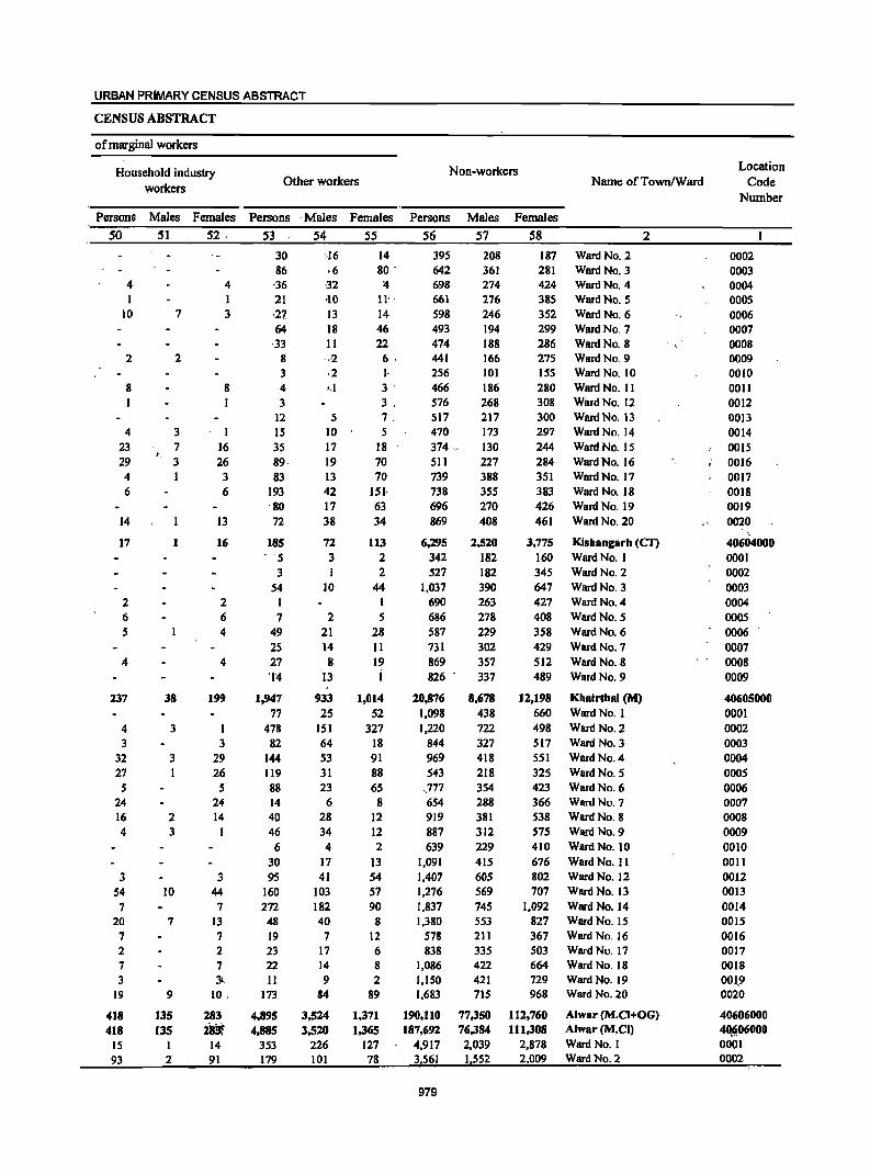
URBAN PRIMARY CENSUS ABSTRACT
CENSUS ABSTRACT
of marginal workers
Non-workers Household industry workers
Other workers Name ofTownlWard
Persons Males Females Persons . Males Females Persons Males Females
50 51 52 . 53 - S4 S5 S6 S7 58 2
4 1
10
2
8
4 23 29 4 6
14
17
2
6 5
4
237
4 3
32 27 5
24 16 4
3 54 7
20 7 2 7 3
19
418 418
15 93
7
2
3 7
v. 3
I
38
3
3 1
2 3
10
7
9
135 135
2
4 1 3
8
16 26 3 6
13
16
2 6 4
4
199
3 29 26
5 24 14
1
3 44 7
13 7 2 7 3l
10.
283 iBt
14 91
30 86 ·36 21 ·27 64
·33 8 3-
4 3
12 15 35 89· 83
193 80 72
185 .. 5
3 54
1 7
49 2S 27 '1'4
1,947 77
478 82
144 119 88 14 40 46
6 30 95
160 272 48 19 23 22 11
173
4,895 4,885
353 179
-·16 ,6 -32 ,10 13 18 11 ·,·2 .2 ·.1
S
1.0 17 19 13 42 17 38
72 3
10
2 21 14 8
13
933 25
151 64 53 31 23
6 28 34 4
17 41
103 182 40
7 17 14 9
84
3,524 3,520
226 101
14 80 '
:tI U· 14 46 22 6. I· 3' 3 . 7. 5
18 70 70
151· 63 34
113 2 2
44
5 28 11 19 i
1,014 52
327 18 91 88 65
8 12 12 2
13 54 57 90 8
12 6 8 2
89
1,371 1,365
127 78
395 642 698 661 598 493 474 441 256 466 576 517 470 374 511 739 738 696 869
6,295 342 527
1,037 690 686 587 731 869 826
20,876 1,098 1,220
844 969 543
.,777 654 919 887 639
1,091 1,407 1,276 1,837 1,380
578 838
1,086 1,150 1,683
190,110 187,692
4,917 3,561
979
208 361 274 276 246 194 188 166 101 186 268 217 173 130 227 388 355 270 408
2,520 182 182 390 263 278 229 302 357 337
8,678 438 722 327 418 218 354 288 381 312 229 415 605 569 745 553 211
335 422 421 715
77,350 76,384 2,039 1,552
187 Ward No.2 281 Ward No.3 424 Ward NO.4 385 Ward No.5 352 Ward NO.6 299 Ward No.7 286 Ward No. 8 275 Ward No.9 155 280 308 300 297 244 284 351 383 426 461
3,775 160 345 647 427 408 358 429 512 489
12,198 660 498 517 551 325 423 366 538 575 410 676 802 707
1,092 827 367 503 664 729 968
112,760 111,308
2,878 2,009
Ward No. 10 Ward No. 11 Ward No. 12 Ward No. 13 Ward No. 14
Ward No. 15 Ward No. 16 Ward No. 17 Ward No. 18 Ward No. 19 Ward No. 20
Kisbangarh (CI1 WardNo. I Ward No. 2 Ward No, 3 Ward No. 4 Ward No. 5 Ward No. 6 Ward No. 7 Ward No. 8 Ward No. 9
Khairthal (M) Ward No. 1 Ward No. 2 Ward No. 3 Ward No. 4 Ward No. 5 Ward No. 6 Ward No. 7 Ward No. 8 Ward No. 9 Ward No. 10 Ward No. II Ward No. 12 Ward No. 13 Ward No. 14 Ward No. 15 Ward No. 16 Ward No. 17 Ward No. 18 Ward No. 19 Ward No. 20
Alwar (M.CI+OG) Alwar (M.CI) Ward No.1 Ward No. 2
. ,
Location Code
Number
0002 0003 0004 0005 0006 0007 0008 0009 0010 0011 0012 0013 0014 001S 0016 00]7 0018 0019 0020
40604000 0001 0002 0003 0004 0005 0006 0007 0008 0009
40605000 0001 0002 0003 0004 0005 0006 0007 0008 0009 0010 0011 0012 0013 0014 0015 0016 0017 0018 001.9 0020
40606000 4O§.06000 0001 0002
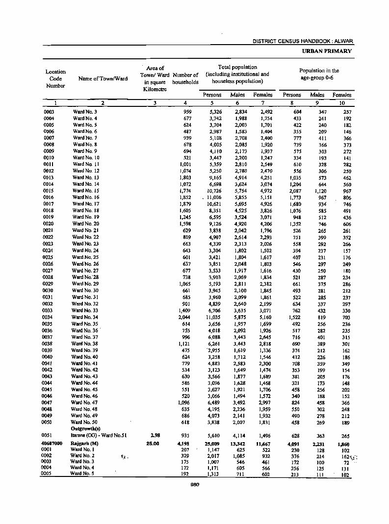
DISTRICT CENSUS HANDBOOK: ALWAR
URBAN PRIMARY
Location Area of Total population
Population in the Town/Ward Number of (including institutional and
Code Name ofTown/Ward in square households houseless population)
age-group 0-6
Number Kilometre
Persons Males Females Persons Males Females
2 3 4 5 6 7 8 9 10
0003 Ward No. 3 959 5,326 2,834 2,492 604 34'7 257 0004 Ward No. 4 677 3,742 1,988 1,754 433 241 192 0005 Ward No. 5 624 3,704 2,003 1,701 422 240 182 0006 Ward No. 6 487 2,987 1,583 1,404 355 209 146 0007 Ward No. 7 939 5,108 2,708 2,400 777 411 366 0008 Ward No. 8 678 4,005 2,085 1,920 739 366 373 0009 Ward No. 9 694 4,110 2,173 1,937 575 303 272 0010 Ward No. 10 521 3,447 2,200 1,247 334 193 141 001l Ward No. 11 1,001 5,359 2,810 2,549 610 328 282 0012 Ward No. 12 1,074 5,250 2,780 2,470 556 306 250 0013 Ward No. 13 1,803 9,165 4,914 4,251 1,035 573 462 0014 Ward No. 14 1,072 6,698 3,624 3,074 1,204 644 560 0015 Ward No. IS 1,774 10,726 5,754 4,972 2,087 1,120 967 0016 Ward No. 16 1,852 11,006 5,855 5,151 1,773 967 806 0017 Ward No. 17 1,879 10,621 5,695 4,926 1,680 934 746 0018 Ward No. 18 1,605 8,351 4,525 3,826 1,076 585 491 0019 Ward No. 19 1,245 6,595 3,524 3,071 948 512 436 0020 Ward No. 20 1,598 9,126 4,920 4,206 1,352 746 606 0021 Ward No. 21 629 3,838 2,042 1,796 526 265 261 0022 Ward No. 22 809 4,907 2,614 2,293 751 399 352 0023 Ward No. 23 663 4,339 2,313 2,026 558 292 266 0024 Ward No. 24 643 3,304 1,802 1,502 394 237 157 0025 Ward No. 25 601 3,421 1,804 1,617 407 231 176 0026 Ward No. 26 637 3,851 2,048 1,803 546 297 249 0027 Ward No. 27 677 3,533 1,917 1,616 430 250 180 0028 Ward No: 28 738 3,903 2,069 1,834 521 287 234 0029 Ward No. 29 1,065 5,193 2,811 2,382 661 375 286 0030 Ward No. 30 661 3,945 2,100 1,845 493 281 212 0031 Ward No. 31 685 3,960 2,099 1,861 522 285 237 0032 Ward No. 32 901 4,839 2,640 2,199 634 337 297 0033 Ward No. 33 1,409 6,706 3,635 3,071 762 432 330 0034 Ward No. 34 2,044 11,035 5,875 5,160 1,522 819 703 0035 Ward No. 35 614 3,656 1,957 1,699 492 256 236 0036 Ward No. 36 755 4,018 2,092 1,926 517 282 235 0037 Ward No. 37 996 6,088 3,443 2,645 716 401 315 0038 Ward No. 38 1,121 6,261 3,443 2,818 690 389 301 0039 Ward No. 39 475 '2,955 1,619 1,336 374 212 162 0040 Ward No. 40 624 3,258 1,712 1,546 412 226 186 0041 Ward No. 41 779 4,883 2,583 2,300 708 359 349 0042 Ward No. 42 534 3,123 1,649 1,474 353 199 154 0043 Ward No. 43 630 3,566 1,877 1,689 381 205 176 0044 Ward No. 44 586 3,096 1,628 1,468 321 173 148 0045 Ward No. 45 551 3,627 1,921 1,706 458 256 202 0046 Ward No. 46 520 3,066 1,494 1,572 340 188 152 0047 Ward No. 47 1,096 6,489 3,492 2,997 824 458 366 0048 Ward No. 48 635 4,19~ 2,236 1,959 550 302 248 0049 Ward No. 49 686 4,073 2,141 1,932 490 278 212 0050 Ward No. 50 618 3,838 2,007 1,831 458 269 189
Outgfowth(s) 0051 Itarane (00) - Ward No.51 1.98 935 5,610 4,114 1,496 628 363 265
40607000 Rajgarh (M) 25.00 4,198 25,009 13,342 n,667 4,091 2,231 1,860 0001 Ward No. 1 207 1,147 625 522 230 128 102 0002 Ward No. 2 .y;~ . 329 2,017 I.Q85 932 376 214 162·'.f: 0003 Ward No. 3 175 1,007 546 461 172 100 72 0004 Ward No. 4 172 1,171 605 566 256 125 131 0005 Ward No. 5 192 1,313 711 602 213 III 102
980
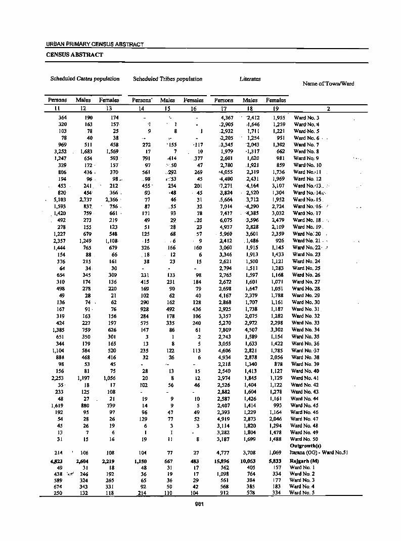
URBAN PRIMARY CENSUS ABSTRACT
CENSUS ABSTRACT
Scheduled Castes population Scheduled Tribes population Literates Name ofTownIWard
Persons Males Females Persons' Males Females Persons Males Females
11 12 13 14 15 16 17 18 19 2
364 190 174 ._ 4,367 '2,412 1,955 Ward No. 3 320 163 157, 'I . 1 .2,905 ,1,646 1,259 Ward 'No. '4 103 78 25 9 8 ,2,932 1,711 1,221 Ward ,No. 5 78 40 38 ,2,205 1,254 951 Ward No. 6 '
969 511 458 272 'ISS -117 .·3,345 '2,043 1,302 Ward No. 7 3,252 1,683 1,569 17 7 10 1,979 ·1,317 662 Ward'No.8 1,247 654 593 ' 791 ,414 .377 2,601 1,620 981 WardNQ;9
329 172 ' 157 97 ···.50 47 2,780 .1,921 859 Ward 'No. 10 806 436, 370 561 .. 292 269 '4,055 2,319 1,736 Ward NO.·ll 194 96, 98 .. , .98 ... :53 45 -4,400 2,431 1,969 Ward NO.'12 453 241 212 455 - 254 201 ·7,271 -4,164 3,107 Ward No.'13 __ :. 820 454' 366., 93 48 45 3,824 2,520 1,304 Ward No.·14;~·
5,103 2,737 2,366 ' 77 46 31 .5;664 3,712 1,952 Ward·No •. 15 ' 1,593 837. 756. 87 ,55 32 7,014 -4,290 2,724 Ward No. '16· ;
.1,420 759, 661 171 93 78 7,417 '4~385 3,032 Ward No.' 17 492 273 219 49 29 .20 6,075 -3,596 2,479 Ward No. 18, '.' 278 155 123 51 '28 23 4,937 2,828 2,109 WardNo.'19.
1,227 679 548 125 68 57 ' 5,960 3,601 2,359 Ward No:,20 2,357 1,249 1,108' ,IS ;6 9 2,412 .1,486 926 Ward 'No. 21 . , 1,444 765 679 326 166 160 3,060 1,915 1,145 Ward No.·22· I
154 88 , 66 .18 12 6 3,346 1,913 1,433 Ward No. 23 376 215 161 38 23 15 2,621 1,500 1,121 Ward No. 24 64 34· 30 2,794 1,511 1,283 Ward No. 25
654 345 309 231 133 98 2,765 1,597 1,168 WBrdNo.26 310 174 136 415 231 184 2,672 1,601 1,071 Ward No. 27 498 278 220 169 90 79 2,698 1,647 1,051 Ward No. 28
49 28 21 102 62 40 4,167 2,379 1,788 Ward No. 29 136 74 62 290 162 128 2,868 1,707 1,161 Ward No. 30 167 91· 76 928 492 436 2,925 1,738 1,187 Ward No. 31, 319 163 156 284 178 106 3,357 2,075 1,282 Ward No. 32 424 227 197 575 335 240 5,270 2,972 2,298 Ward No. 33
1,385 759 626 147 86 61 7,809 4,507 3,302 Ward No. 34 651 350 301 3 I 2 2,743 1,589 1,154 Ward No. 35 344 179 165 13 8 5 3,055 1,633 1,422 Ward No. 36
1,104 584 520 235 122 113 4,606 2,821 1,785 Ward No. ,37 884 468 416 32 26 6 4,934 2,878 2,056 Ward No. 38 98 53 45 2,218 1,340 878 Ward No. 39
156 81 75 28 13 15 2,540 1,413 1,127 Ward No. 40 2,253 1,197 1,056 20 8 12 2,974 1,845 1,129 Ward No. 41
35, 18 17 102 56 46 2,526 1,404 1,122 Ward No. 42 233 125 108 2,882 1,604 1,278 Ward No. 43,
48 27 21 19 9 10 2,587 1,426 1,161 Ward No. 44 1,619 880 739 14 9 5 2,407 1,414 993 WllrdNo.45
192 95 97 96 47 49 2,393 1,229 1,164 Ward No. 46 54 28 26 129 77 52 4,919 2,873 2,046 Ward No. 47 45 26 19 6 3 3 3,114 1,820 1,294 Ward No. 48 13 7 6 3,282 1,804 1,478 Ward No. 49 31 IS 16 19 II 8 3,187 1,699 1,488 Ward No. SO
Outgrowth(s) 214 106 108 104 77 27 4,777 3,708 1,069 ltarana (00) • Ward NO.51
4,823 2,604 2,219 1,150 667 483 15,896 10,063 5,833 Rajgarh(M) 49 31 18 48 31 17 562 405 157 Ward No, I
438 =;.=-t!J 246 192 36 19 17 1,098 764 334 Ward No, 2 589 324 265 65 36 29 561 384 177 Ward No. 3 674 343 331 92 SO 42 568 385 183 Ward No. 4 250 132 118 214 110 104 912 578 334 Ward No. 5
981
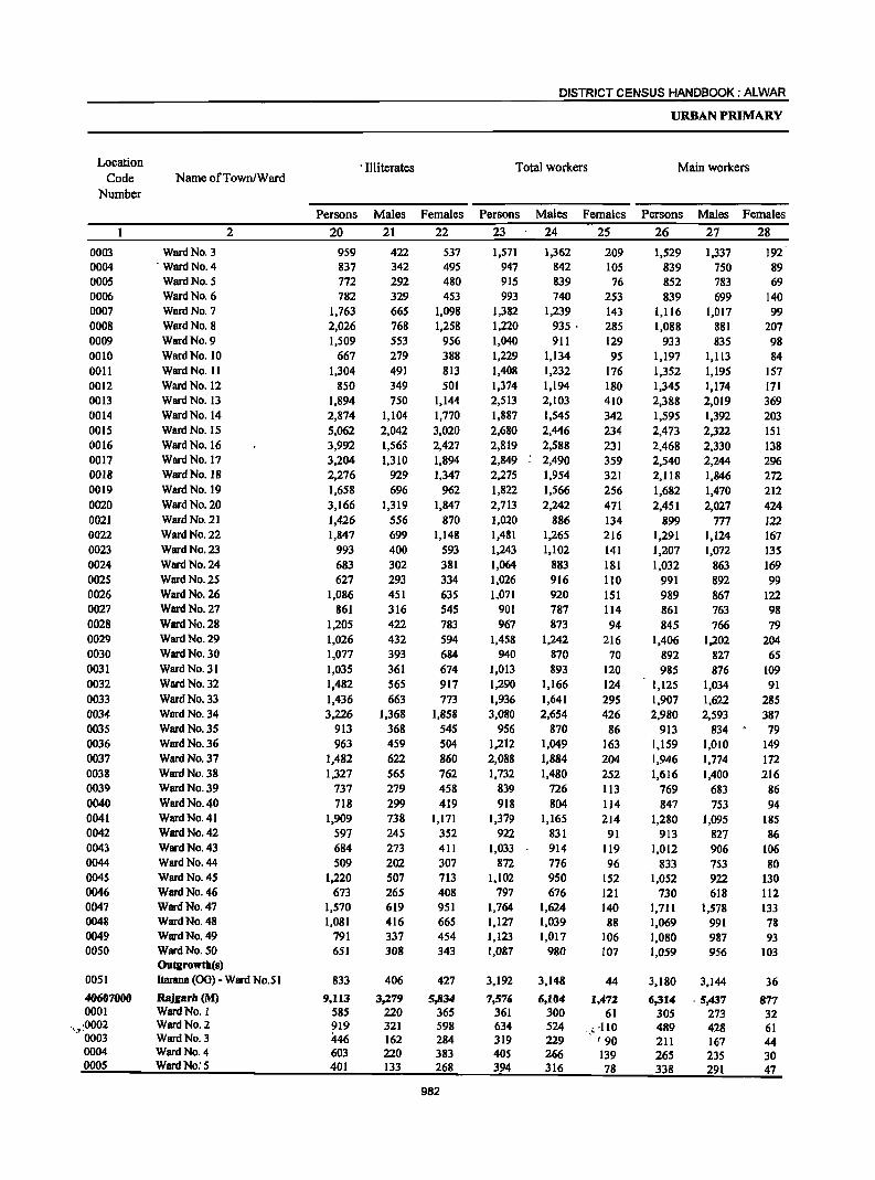
Location
Code Number
0003 0004 0005 0006 0007 0008 0009 0010 0011 0012 0013 0014 0015 0016 0017 0018 0019 0020 0021 0022 0023 0024 0025 0026 0027 0028 0029 0030 0031 0032 0033 0034 0035 0036 0037 0038 0039 0040 0041 0042 0043 0044 0045 0046 0047 0048 0049 0050
0051
40607000 0001
.•.• :0002 0003 0004 0005
Name ofTown/Ward
Ward No. 3 . Ward No. 4
Ward No. 5 Ward No. 6 Ward No. 7 Ward No. 8 WlirdNo.9 WlirdNo.IO Ward No. II Ward No. 12 WlirdNo.13 Ward No. 14 Ward No. 15 Ward No. 16 Ward No. 17 Ward No. 18 Ward No. 19 Ward No. 20 Ward No. 21 Ward No. 22 Ward No. 23 Ward No. 24 Ward No. 25 Ward No. 26 Ward No. 27 Ward No. 28 Ward No. 29 Ward No. 30 Ward No. 31 Ward No. 32
Ward No. 33 Ward No. 34 Ward No. 35 Ward No. 36 Ward No. 37 Ward No. 38 Ward No. 39 Ward No. 40 Ward No. 41 Ward No. 42 Ward No. 43 Ward No. 44 Ward No. 45 Ward No. 46 Ward No. 47 Ward No. 48 Ward No. 49 Ward No. 50 Outgrowtb(s)
2
Itarana (00) - Ward No.SI
Rajgarll (M) Ward No. I Ward No. 2 Ward No. 3 Ward No. 4 Ward No: 5
DISTRICT CENSUS HANDBOOK: ALWAR
URBAN PRIMARY
. Illiterates Total workers Main workers
Persons Males Females Persons Males Females Persons Males Females
20
959 837 772 782
1,763 2,026 1,509
667 1,304
850 1,894 2,874 5,062 3,992 3,204 2,276 1,658 3,166 1,426 1,847
993 683 627
1,086 861
1,205 1,026 1,077 1,035 1,482 1,436 3,226
913 963
1,482 1,327
737 718
1,909 597 684 509
1,220 673
1,570 1,081
791 651
833
9,113 585 919 446 603 401
21
422 342 292 329 665 768 553 279 491 349 750
1,104 2,042 1,565 1,310
929 696
1,319 556 699 400 302 293 451 316 422 432 393 361 565 663
1,368 368 459 622 565 279 299 738 245 273 202 507 265 619 416 337 308
406
3,279 220 321 162 220 133
22
537 495 480 453
1,098 1,258
956 388 813 501
1,144 1,770 3,020 2,427 1,894 1,347
962 1,847
870 1,148
593 381 334 635 545 783 594 684 674 917 773
1,858 545 504 860 762 458
419 1,171
352 411 307 713 408 951 665 454 343
427
5,834 365 598 284 383 268
982
23
1,571 947 915 993
1,382 1,220 1,040 1,229 1,408 1,374 2,513 1,887 2,680 2,819 2,849 2,275 1,822 2,713 1,020 1,481 1,243 1,064 1,026 1,071
901 967
1,458 940
1,013 1,290 1,936 3,080
956 1,212 2,088 1,732
839 918
1,379 922
1,033 872
1,102 797
1,764 1,127 1,123 1,087
3,192
7,576 361 634 319 405 394
24
1,362 842 839 740
1,239 935 . 911
1,134 1,232 1,194 2,103 1,545 2,446 2,588 2,490 1,954 1,566 2,242
886 1,265 1,102
883 916 920 787 873
1,242 870 893
1,166 1,641 2,654
870 1,049 1,884 1,480
726 804
1,165 831 914 776 950 676
1,624 1,039 1,017
980
3,148
6,104 300 524 229 266 316
2S 209 105 76
253 143 285 129 95
176 180 410 342 234 231 359 321 256 471 134 216 141 181 110 151 114 94
216 70
120 124 295 426
86 163 204 252 113 1J4 214
91 119 96
152 121 140 88
106 107
44
1,472 61
'.; ·1l0 , 90
139 78
26
1,529 839 852 839
1,116 1,088
933 1,197 1,352 1,345 2,388 1,595 2,473 2,468 2,540 2,118 1,682 2,451
899 1,291 1,207 1,032
991 989 861 845
1,406 892 985
1,125 1,907 2,980
913 1,159 1,946 1,616
769 847
1,280 913
1,012 833
1,052 730
1,711 1,069 1,080 1,059
3,180
6,314 305 489 211 265 338
27
1,337 750 783 699
1,017 881 835
1,113 1,195 1,174 2,019 1,392 2,322 2,330 2,244 1,846 1,470 2,027
777 1,124 1,072
863 892 867 763 766
1,202 827 876
1,034 1,622 2,593
834 1,010 1,774 1,400
683 753
1,095 827 906 753 922 618
1,578 991 987 956
3,144
·5,437 273 428 167 235 291
28
192-
89 69
140 99
207 98 84
157 171 369 203 lSI 138 296 272 212 424 122 167 13S 169 99
122 98 79
204 65
109 91
285 387
79 149 172 216
86 94
18S 86
106 80
130 112 133 78 93
103
36
877 32 61 44 30 47
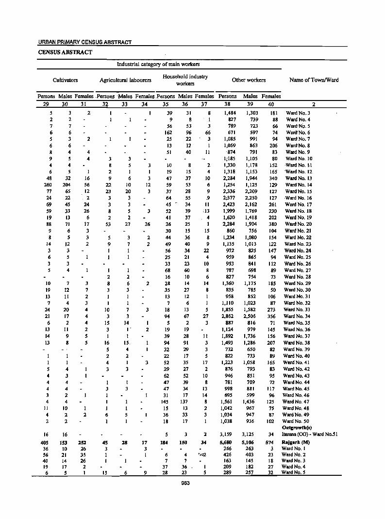
URBAN PRIMARY CENSUS ABSTRACT
CENSUS ABSTRACT
Industrial category of main workers
Cultivators Agricultural labourers Household industry
workers Other workers Name ofTownlWard
Persons Males Females ,Persons 'Males Females ,Persons Males Females Persons 29 30 31 32 33 34 35 36 37 38
5 2 7 6 5 6 8 9 4 6
48 260
77
24 69 59 19 88 9 8
14 3 6 3 5
10 19 13 7
24 21 6
13 14 13
I 5 4 4 4 3 4
II 4 2
16
405 36 56 40 19 6
3 2 7 6 3 6 4 5 4 5
32 204
6S 22 45 33 13 71 6 5
12 3 5 3 4
7 12 II 4
20 17 2
II 9 8
I 4 3 4 4 2 4
10 2 2
16
153 10 21 14 17 5
2
2
4 4
16 56 12 2
24 26
6 17 3 3 2
3 7 2 3 4 4 4 2 5 5
I 2
2S1 26 35 26
2 I
3 8 2 9
22 23
3 3 8 2
53
5 9
I
2 8 3
I 10 3
15 3
16 5 2 4 3
3
I 6
4S 3 I I
IS
3 5 I 6
10 20 3 3 5 2
27
3 7
2 6 3
7 3
14 I'
I 15 4 2 I 3
3
5
28
6
3 I 3
12 3
3
26
2 2
2
3
2
3
17 3 I
9
39 31 9 8
56 53 162 96 25 22 13 12 51 40
10 8 19 15 47 37 59 53 37 28 64 55 45" 34 52 39 41 37 26 25 30 15 44 36 49 40 56 34 25 21 33 23 68 60 16 10 28 14 35 27 13 12 7 6
18 13 94 67 5 2
19 19 39 28 94 91 32 29 22 17 52 35 29 27 62 52 47 39 47 34 31 17
145 137 15 13 36 33 18 17
5 3
184 150
6 4 7 7
37 36 28 23
983
8 I 3
66 3
II
2 4
10 6 9 .9
11 :13
4
15 8 9
22 4
10 8
6 14 8
5 27 3
II 3 3 5
17 2
10 8
13 14 8 2 3
2
34
I 5
1,484 827 789 671
1,085 1,069 '874
1;185 1,330 1,318 2,284 1;254 2,336 2;377 2,423 1;999 1,620 2,284
860 1,234 1,135
972 959 953 787 827
1,360 835 958
1,110 1,855 2,862
887 1,124 1,892 1,493
732 822
1,223
876 946 781 998 695
1,561 1,042 1,034 1,038
3,159
5,680 266 426 163 209 289
Males Females 39 40
1,303 739 723 597 991 863 791
1,105 1,178 1,153 1,944 1,125 2,209 2,250 2,162 1,769 1,418 1,904
756 1,080 1,013
825 865 841 698 754
1,175 785 852
1,023 1,582 2,506
816 979
1,736 1,286
650 733
1,058 793 851 709 881 599
1,436 967 947 936
181 Ward No .. 3 88 Ward No. 4 66 Ward'No.5 74 Ward'No. 6 94 Ward'No.'7
206 Ward·No.8 83 Ward No. 9 80 Ward No, 10
152 Ward No. J.I 165 'Ward No. 12 340 Ward No. 13
129 Ward'No. 14 127 Ward'No. 15 127 ,Ward No. 16 261 Ward No. 17 230 Ward No. 18 202 Ward No. 19 380 Ward'No. 20 104 Ward No. 21 154 Ward No. 22 122 Ward No. 23 147 Ward No. 24 94 Ward'No. 25
112 Ward No. 26 89 Ward No, 27 73 Ward No. 28
185 Ward No. 29 50 Ward No. 30
106 Ward No. 31 87 Ward No. 32
273 Ward No. 33 356 Ward No. 34
71 Ward No. 35 145 Ward No. 36 156 Ward No. 37 207 Ward No. 38
82 Ward No. 39 89 Ward No. 40
165 Ward No. 41 83 Ward No. 42 95 Ward No. 43 72 Ward No. 44
II? Ward No. 45 96 Ward No. 46
125 Ward No. 47 75 Ward No, 48 87 Ward No. 49
102 Ward No. 50 Outgrowth(s}
2
3,125
5,106 263 403 145 182 257
34 ltarana (OG) - Ward No.51
574 Rajgarh (M) 3 Ward No. 1
23 Ward No. 2 18 Ward No. 3 27 Ward No. 4 32 Ward No. 5
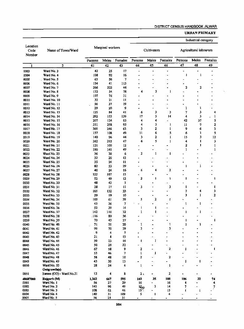
DISTRICT CENSUS HANDBOOK :ALWAR
URBAN PRIMARY
Industrial category
Location Marginal workers Code Name ofTown/Ward Cultivators Agricultural labourers
Number
Persons Males . Females Persons Males Females Persons Males Females
2 41 42 43 44 45 46 47 48 49
0003 Ward No. 3 42 25 17
0004 Ward No. 4 108 92 16 0005 . Ward No. 5 63 56 7 0006 Ward No. 6 154 41 113 0007 Ward No. 7 266 222 44 2 2 0008 Ward No. 8 132 54 78 4 3
0009 Ward No. 9 107 76 31 0010 Ward No. 10 32 21 II 0011 Ward No. 11 56 37 19 0012 'Ward No. 12 29 20 9 0013 Ward No. 13 125 84 41 6 3 3 7 3 4 0014 Ward No. 14 292 153 139 17 3 14 4 3 1 0015 Ward No. 15 207 124 83 4 4 42 37 5 0016 Ward No. 16 351 258 93 4 3 11 9 2 0017 Ward No. 17 309 246 63 3 2 9 6 3 0018 Ward No. 18 157 108 49 11 6 5 6 5 0019 Ward No. 19 140 96 44 3 2 15 3 12 0020 Ward No. 20 262 215 47 6 5 4 3 0021 Ward No. 21 121 109 12 2
0022 Ward No. 22 190 141 49 I 0023 Ward No. 23 36 30 6 2 0024 Ward No. 24 32 20 12 0025 Ward No. 25 35 24 II 0026 Ward No. 26 82 53 29 0027 Ward No. 27 40 24 16 6 4 2
0028 Ward No. 28 122 107 15 0029 Ward No. 29 52 40 12 2
0030 Ward No. 30 48 43 5 0031 Ward No. 31 28 17 II 3 3 I I 0032 Ward No. 32 165 132 33 7 4 3
0033 Ward No. 33 29 19 10 3 2
0034 Ward No. 34 100 61 39 3 2
0035 Ward No. 35 43 36 7 0036 Ward No. 36 53 39 14 0037 Ward No. 37 142 110 32 0038 Ward No. 38 .116 80 36 0039 WardNo.~9 70 43 27 0040 Ward No. 40 71 51 20 0041 Ward No. 41 99 70 29 3 3 0042 Ward No. 42 9 4 5 0043 Ward No. 43 21 8 13 0044 Ward No. 44 39 23 16 0045 Ward No. 45 50 28 22 0046 Ward No. 46 67 58 9 2 2 0047 Ward No. 47 53 46 7 0048 Ward No. 48 58 48 10 2 2 0049 Ward No. 49 43 30 13 0050 Ward No. SO 28 24 4
Outgrowth(s) 0051 Itarana (OG) - Ward No.51 12 4 8 2, 2
40607000 Rajgarh(M) 1,262 667 595 143 35 108 106 32 74 0001 Ward No. I 56 27 29 16 16 4 4 0002 Ward No. 2 145 96 49 liIHi'> 3 14 7 7 0003 Ward No. 3 108 62 46 15': 15 0004 Ward No. 4 140 31 109 5 4 0005 Ward No. 5 56 25 31
984
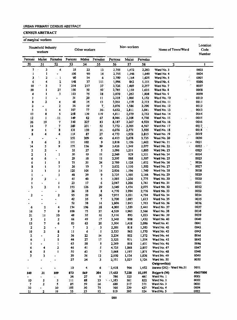
URBAN PRIMARY CENSUS ABSTRACT
CENSUS ABSTRACT
of marginal workers
Household industry workers
Other workers
Persons Males Females Persons
,50 '51 52 53
7 1 3 6
10 28
4
8 2 5
13 12 26 14 9 8
8 14 2 2 6 6 8 2
3 I 3
2
6 16 21 3
13 2
10 2 6
6 6 3
140
10 7
30 21
3 I 2 4 3
I 2
1 8 I
19 7
4
6 5 2 1 6 I
3
2
2 7
II 1 7 2 2
4 5 3
31
5 2
2
4
1 2 7
27 3
6 2 4 5
·11 7 7 iI 4
2 9
5 7
2
4 9
10 2 6
8 2 5
2
109
5 5
30 19
35 106 '60
148 254 '100
103 31 48 26
107 258 149 310 283 131 114 252 111 175 32 30 29 7S 26
120 48 4S 23
ISS 26 9S 42 52
134 100 48 66 83 7
11 36 44 63 46 50 39 27
10
873 36
III 85
105 35
Males Females
54 55
22 90 '54 37
217 '50
75 '20 35 19 77
139 82
227 231 .
1~0 87
209 102 136 27 19 18 51 19
106 39 40 17
126 18 59 35 38
106 73 32 49 63 2 6
22 27 58 41 43 26 24
4
569 27 88 59 30 23
13 16 6
111 37 ' 50' 28 11 13 7
30,
119 67 83 52 31. 27 43 9
39 5
11 11 24 7
14 9 5 6
29 8
36 7
14 28 27 16 17 20 5 5
14 17 5 5 7
13 3
6
304 9
23 26 75 12
Non-workers
Persons
56
3,755 2,795 2,789 1,994 3,726 2,785 3,070 2,218 '
3,951 3,876 6,652. 4,811 8,046 -8,187 7,772 . 6,076 4,773 6,413 2,818 3,426 3,096 2,240 2,395 2,780 2,632 2,936 3,735 3,005 2,947 3,549 4,770 7,955 2,700 2,806 4,000 4,529 2,116 2,340 3,504 2,201 2,533 2,224 2,525 2,269 4,725 3,068 2,950 2,751
. 2,418
17,433 786
'. '-1,383 688 766 919
985
Males
57
1,472 1,146 1,164
843 1,469 1,150 1,262 1,066 1,578 1,586 2,811 2,079 3,308 3,267 .3,205 2,571 1,95B 2,67B 1,156 1,349 1,211
919 888
1,128 1,130 1,196 1,569 1,230 1,206 1,474 1,994 3,221 I,OB7 1,043 1,559 1,963
893 908
1,418 818 963 852 971 B18
1,868 1,197 1,124 1,027
966
7,238 325 561 317 339 395
Females
58
2,283 1,649 1,625 1,151 2,257 1,635 1,808 1,152 2,373 2,290 3,841 2,732 4,738 4,920 4,567 3,505 2,815 3;735 1,662 2,077 1,885 1,321 1,507 1,652 1,502 1,740 2,166 1,775 1,741 2,075 2,776 4,734 1,613 1,763 2,MI 2,566 1,223 1,432 2,086 1,383 1,570 1,372 1,554 1,451 2,857 1,871 1,826 1,724
1,452
10,195 461 822 371 427 524
Name ofTownlWard Location
Code Number
Ward No. 3 Ward No. 4 Ward No. 5 Ward No. 6 Ward No. 7 Ward No. 8 Ward No. 9 Ward No. 10 Ward No. II Ward No. 12 Ward No. 13 Ward No. 14 Ward No. 15 Ward No. 16 Ward No. 17 Ward No. 18 Ward No. 19 Ward No. 20 Ward No. 21 Ward No. 22 Ward No. 23 Ward No. 24 Ward No. 25 Ward No. 26 Ward No. 27 Ward No. 28 Ward No. 29 Ward No. 30 Ward No. 31 Ward No. 32 Ward No. 33 Ward No. 34 Ward No. 35 Ward No. 36 Ward No. 37 Ward No. 38 Ward No. 39 Ward No. 40 Ward No. 41 Ward No. 42 Ward No. 43 Ward No. 44 Ward No. 45 Ward No. 46 Ward No. 47 Ward No. 48 Ward No. 49 Ward No. 50 Outgrowth(s)
2
Itarana (OG) - Ward No.5 1
Rajgarh (M) WardNo. I Ward No. 2 Ward No. 3 Ward No. 4 Ward No. 5
i'
0003 0004 0005 0006 0007 0008 0009 0010 0011 0012 0013 0014 0015 0016 OQP. _ 0018 0019 0020
;;,' 0021
0022 0023
" 0024 0025 0026 0027 0028 0029 0030 0031 0032 0033 0034 0035 003l? 0037 0038 0039 0040 0041 0042 0043 0044 0045 0046 0047 0048 0049 0050
0051
40607000 0001 0002 0003 0004 OOOS
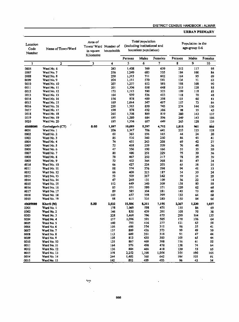
DISTRICT CENSUS HANDBOOK: ALWAR
URBAN PRIMARY
Location Area of Total population
Population in the Townl Ward Number of (including institutional and
Code Name ofTown/Ward in square households houseless population)
age-group 0-6
Number Kilometre
Persons Males Females Persons Males Females
2 3 4 5 6 7 g 9 10
0006 Ward No. 6 283 1,408 769 639 212 117 95 0007 Ward No. 7 236 1,240 685 555 184 100 84 0008 Ward No. 8 250 1,313 711 602 164 95 69 0009 Ward No. 9 204 1,111 570 541 134 71 63 0010 Ward No. 10 207 1,237 652 585 198 108 90 0011 Ward No. 11 201 1,306 658 648 213 128 85 0012 Ward No. 12 172 1,113 590 523 199 118 81 0013 Ward No. 13 164 939 536 403 118 70 48 0014 Ward No. 14 156 878 480 398 101 60 41 0015 Ward No. 15 169 1,044 547 497 157 73 84 0016 Ward No. 16 238 1,563 820 743 274 144 130 0017 Ward No. 17 190 878 492 386 98 55 43 0018 Ward No. 18 265 1,708 889 819 280 143 137 0019 Ward No. 19 195 1,280 684 596 249 143 106 0020 Ward No. 20 193 1,336 . 687 649 263 128 135
40608000 Govindgarh (CI') 6.00 1,597 10,089 5,297 4,792 1,815 961 854 0001 Ward No. 1 206 1,347 706 641 253 125 128 0002 Ward No. 2 60 361 196 165 44 24 20 0003 Ward No. 3 85 510 260 250 86 45 41 0004 Ward No. 4 74 451 243 208 69 42 27 0005 Ward No. 5 72 458 229 229 76 40 36 0006 Ward No. 6 47 356 190 166 55 35 20 0007 Ward No. 7 80 480 251 229 75 39 36 0008 Ward No. 8 78 467 250 217 78 39 39 0009 Ward No. 9 72 452 244 208 81 47 34 0010 Ward No. 10 66 427 224 203 63 38 25 0011 Ward No. 11 88 574 276 298 94 41 53 0012 Ward No. 12 66 400 213 187 54 30 24 0013 Ward No. 13 72 509 267 242 59 31 28 0014 Ward No. 14 47 240 131 109 36 22 14 0015 Ward No. 15 112 649 340 309 138 80 58 0016 Ward No. 16 85 551 280 271 130 62 68 0017 Ward No. 17 89 585 304 281 142 73 69 0011 Ward No. 18 100 657 358 299 132 64 68 0019 Ward No. 19 98 615 335 280 150 84 66
40609000 Kherli(M) 5.00 2,532 15,506 8,311 7,195 2,267 1,230 1,037 0001 Ward No. I 178 1,069 598 471 155 86 69 0002 Ward No. 2 146 830 439 391 108 70 38 0003 Ward No. 3 228 1,468 796 672 299 164 135 0004 Ward No. 4 157 1,096 591 505 170 106 64 0005 Ward No. 5 140 793 416 377 121 63 58 0006 Ward No. 6 106 686 374 312 96 55 41 0007 Ward No. 7 137 809 436 373 99 49 50 0008 Ward No. 8 113 669 351 318 91 47 44 0009 Ward No. 9 128 813 430 383 109 65 44 0010 Ward No. 10 135 867 469 398 116 61 55 0011 Ward No. II 164 976 498 478 138 74 64 0012 Ward No. 12 136 884 466 418 120 55 65 0013 Ward No. 13 378 2,252 1,198 1,054 355 190 165 0014 Ward No. 14 244 1,402 760 642 194 103 91 0015 Ward No. 15 142 892 489 403 96 42 54
986

URBAN PRIMARY CENSUS ABSTRACT
CENSUS ABSTRACT
Scheduled Castes population Scheduled Tribes population Literates Name ofTownlWard
Persons Males . Females Persons Males Females Persons Males Females
11 12 13 14 15 16 17 18 19 2 97 50 47 173 . 109 64 1,020 620 400 Ward No. 6 72 40 32 90 65 25 856 548 308 Ward No. 7 8 6 2 14 ,. 10 4 1,091 607 484 Ward No. 8
IS 9 6 38 26 12 926 494 432 Ward No. 9 244 132 112 14 11 3 883 509 374 Ward No. 10 683 366 317 104 ", 4 100 73S 450 28S Ward No. 11 906 485 421 690 444 246 Ward No. 12 99 66 33 91 74 17 719 455 264 Ward No. 13 31 19 12 4 3 I 725 410 315 Ward No. 14 24 23 1 8 6 2 821 463 358 Ward No. 15
343 171 172 .72 ·40 .32 84S 581 264 Ward No. 16 I I '67 , 60 7 727 432 295 Ward No. 17
147 78 69 20 13 7 92S ., 624 301 Ward No. 18 IS3 82 71 632 463 169 Ward No. 19
.~. '. 600 447 153 WardN6:20
1,553 807 746 .. 388 .,215 173 6,268 '3;&19 2,449 Govindgatb (C1) 2S IS 10 42 ·,22 20 794 530 264 Ward No. I"
198 115 83 Ward No. 2 346 203 143 Ward No:3 352 198 154 Ward No. 4· 342 182 160 Ward No. S 270 151 119 Ward No.' 6 .
18 8 10 84 46 38 338 200 138 Ward No. 7 341 198 143 Ward No: 8 . 334 190 144 Ward No. 9
63 34 29 336 182 154 Ward No. 10 19 11 8 323 185 138 Ward No. 11 5 3 2 321 180 141 Ward No. 12·
54 29 25 6 3 3 353 210 143 Ward No. 13 101 53 48 167 102 65 Ward No. 14 138 74 64 8 3 5 313 194 119 Ward No. IS 412 208 204 230 158 72 Ward No. 16 548 284 264 267 195 72 Ward No. 17 98 50 48 360 244 116 Ward No. 18 71 37 34 248 141 107 283 202 81 Ward No. 19
968 526 442 398 230 168 11,269 6,648 4,621 Kherli (M) 66 44 22 56 35 21 787 487 300 Ward No. I 83 47 36 12 9 3 637 349 288 Ward No. 2.
276 152 124 31 18 I 13 752 497 255 Ward No. 3 19 14 5 8 4 4 749 451 298 Ward No. 4 13 7 6 7 . 4 3 531 315 216 Ward No. 5
114 63 51 2 1 I 505 300 205 Ward No. 6 5 3 2 644 376 268 Ward No. 7
532 296 236 Ward No. 8 18 13 5 644 362 282 Ward No. 9 16 7 9 15 10 5 657 396 261 Ward No. 10 34 16 18 11 6 5 788 419 369 Ward No. II 45 22 23 16 9 7 694 401 293 Ward No. 12
265 130 135 151 78 73 1,566 947 619 Ward No. 13 14 8 6 62 35 27 1,088 637 451 Ward No. 14
27 21 6 695 415 280 Ward No. 15
987
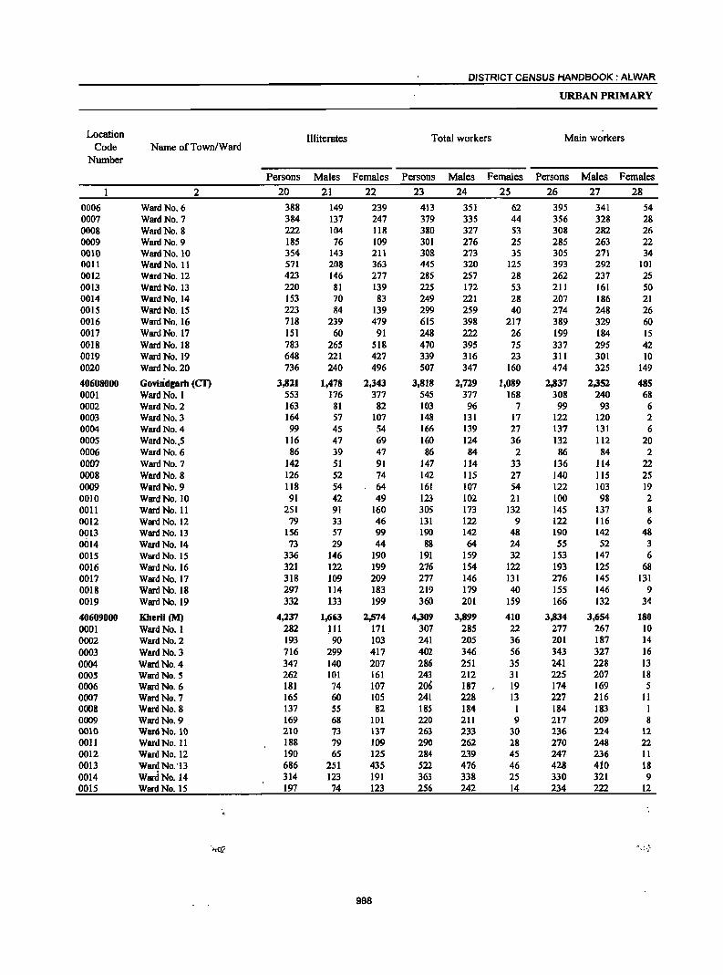
DISTRICT CENSUS HANDBOOK: ALWAR
URBAN PRIMARY
Location Illiterates Total workers Main workers Code Nwne ofTown/Ward
Number
Persons Males Females Persons Males Females Persons Males Females
2 20 21 22 23 24 25 26 27 28 0006 Ward No. 6 388 149 239 413 351 62 395 341 54 0007 Ward No. 7 384 137 247 379 335 44 356 328 28 0008 Ward No. 8 222 104 118 380 327 S3 308 282 26 0009 Ward No. 9 185 76 109 301 276 2S 285 263 22 0010 Ward No. 10 354 143 211 308 273 35 305 271 34 001l Ward No. II 571 208 363 44S 320 125 393 292 101 0012 Ward No. 12 423 146 277 285 257 28 262 237 2S 0013 Ward No. 13 220 81 139 225 172 53 211 161 50 0014 Ward No. 14 153 70 83 249 221 28 207 186 21 0015 Ward No. IS 223 84 139 299 259 40 274 248 26 0016 Ward No. 16 718 239 479 615 398 217 389 329 60 0017 Ward No. 17 151 60 91 248 222 26 199 184 15 0018 Ward No. 18 783 265 518 470 395 75 337 295 42 0019 Ward No. 19 648 221 427 339 316 23 311 301 10 0020 Ward No. 20 736 240 496 507 347 160 474 325 149
40608000 Govindgarh (eT) 3,821 1,478 2,343 3,818 2,729 1,089 2,837 2,352 485 0001 Ward No. I 553 176 377 545 377 168 308 240 68 0002 Ward No. 2 163 81 82 103 96 7 99 93 6 0003 Ward No. 3 164 57 107 148 131 17 122 120 2 0004 Ward No. 4 99 45 54 166 139 27 137 131 6 0005 Ward NO.,5 116 47 69 160 124 36 132 112 20 0006 Ward No. 6 86 39 47 86 84 2 86 84 2 0007 Ward No. 7 142 51 91 147 114 33 136 114 22 0008 Ward No. 8 126 52 74 142 115 27 140 115 25 0009 Ward No. 9 118 54 64 161 107 54 122 103 19 0010 Ward No. 10 91 42 49 123 102 21 100 98 2 00 II Ward No. 11 251 91 160 305 173 132 145 137 8 0012 Ward No. 12 79 33 46 131 122 9 122 116 6 0013 Ward No. 13 156 57 99 190 142 48 190 142 48 0014 Ward No. 14 73 29 44 88 64 24 55 52 3 0015 Ward No. 15 336 146 190 191 159 32 153 147 6 0016 Ward No. 16 321 122 199 276 154 122 193 125 68 0017 Ward No. 17 318 109 209 277 146 131 276 145 131 0018 Ward No. 18 297 114 183 219 179 40 ISS 146 9 0019 Ward No. 19 332 133 199 360 201 159 166 132 34
40609000 Kherli 1M) 4,237 1,663 2,574 4,30' 3,899 410 3,834 3,654 180 0001 Ward No. I 282 PI 171 307 285 22 277 267 10 0002 Ward No. 2 193 90 103 241 205 36 201 187 14 0003 Ward No. 3 716 299 417 402 346 56 343 327 16 0004 Ward No. 4 347 140 207 286 251 35 241 228 13 0005 Ward No. 5 262 101 161 243 212 31 225 207 18 0006 Ward No. 6 181 74 107 206 187 19 174 169 5 0007 Ward No. 7 165 60 105 241 228 13 227 216 II 0008 Ward No. 8 137 55 82 185 184 1 184 183 I 0009 Ward No. 9 169 68 101 220 211 9 217 209 8 0010 Ward No. 10 210 73 137 263 233 30 236 224 12 0011 Ward No. II 188 79 109 290 262 28 270 248 22 0012 Ward No. 12 190 65 125 284 239 45 247 236 II 0013 Ward No .. 13 686 251 435 522 476 46 428 410 18 0014 ward No. 14 314 123 191 363 338 25 330 321 9 0015 Ward No. 15 197 74 123 256 242 14 234 222 12
'.
~02 .. ""'~"~.
988
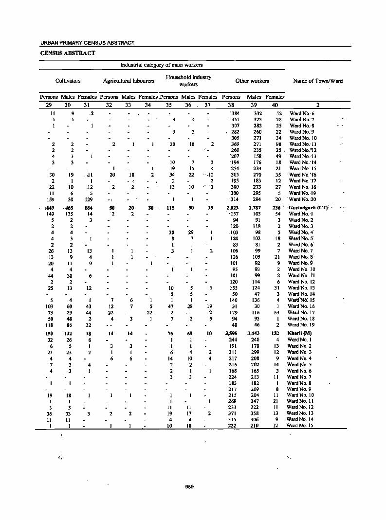
URBAN PRIMARY CENSUS ABSTRACT
CENSUS ABSTRACT
Industrial category of main workers
Cultivators Agricultural labourers Household industry
workers
Persons Males Females Persons Males Females ,Persons Males Females
29
11 1 I
2 2 4 3
30 2
22 II
159
1649 149
5 2 4 4 2
26 13 20 4
44 2
2S
5 103 73 50
118
150 32 6
2S 4
'7
4
19 I 3
36 II I
, ' .,
30
9 1
2 2 3 3
19 I
10 6
30
,'465 135
2 2 4 3 2
13 9
11 4
38 2
13
4 60 29 48 86
132 26
5 23
4 3 3
18 I 3
33 11 I
31 32
.2
2
I .11 20
I .12 2
5 129 -1
184 50 14 '2 3
13 4 9
6
12
1 7 43 12 44 22
2 4 32
18 14 6 I 3 2 I
6 4 I
3 2
33 34 35 36 37
4 4
3 3
20 18 2
10 7 3 1 19 15 4
18 2 34 22 ' .12 - ! 2 2
2 13 10 r· '3
1
20. 30 115 80 35 2
30 29 8 7 1 1 3 1 2
10 S S 5 5
6 1 1 7 5 47 28 19
22 2 2 3 I 7 2 S
14 75 65 10 I I
3 I I I 6 4 2 6 14 10 4
2 2 2 I 3 3
I I
II II 2 19 17 2
4 4 10 10
989
Other workers Name ofTownlWard
Persons Males Females
38 39 40 2
'384 332 52 Ward No.·6 "'351 323 28 Ward No." 7
307 282 25 Ward NO.'8 282 260 22 Ward No.;9 305 271 34 Ward No. 10 369 271 98 Ward NO.·II 260 235 25. Ward No.'i12
'207 158 49 . Ward No. '13 '194 176 18 Ward No:t4 '254 233 21 Ward No. 15 305 270 35 'Ward No. '1'6 195 183 12 Ward No.' 17 300 273 27 Ward No. i8 300 295 5 Ward No.'19
. '314 294 20 . Ward No. 20
2,023 1,787 236 ' 'Govindgarh (CT): --"157 103 54 Ward No, ,I
94 91 3 Ward No. 2 120 118 2 Ward No. 3
. 103 98 5 Ward No. 4' 120 102 18 Ward No. 5 83 81 2 Ward No. i;
106 99 7 WartlNo.7 126 105 21 Ward No. S'· 101 92 9 Ward No. 9' 95 93 2 Ward No. 10-
101 99 2 Ward No. 1'1 120 114 6 Ward No. 12 ISS 124 31 WardNo. l'3 50 47 3 Ward·No. 1-4
140 136 4 WariJ'No: 15 31 30 I Ward No. 16
179 116 63 Ward No. 17 94 93 I Ward No. 18 48 46 2 Ward No. 19
3,595 3,443 152 Kherli (M) 244 240 4 Ward' No. I 191 178 13 Ward No. 2 311 299 12 Ward No. 3 217 208 9 Ward No. 4 216 202 14 Ward No. 5 168 165 3 Ward No. 6 224 213 11 Ward No. 7 183 182 1 Ward No. 8 217 209 8 Ward No. 9 215 204 II Ward No. 10 268 247 21 Ward No. II 233 222 II Ward No. 12 371 358 13 Ward No. 13 315 306 9 Ward No. 14 222 210 12 Ward No. IS
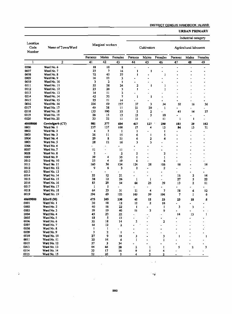
DISTRICT CENSUS HANDBOOK :ALWAR
URBAN PRIMARY
Industrial category
Location Marginal workers Code Name ofTown/Ward Cultivators Agricultural labourers
Number
Persons Males Females Persons Males Females Persons Males Females
2 41 42 43 44 45 46 47 48 49 0006 Ward No. 6 18 10 8 0007 Ward No. 7 23 7 16 0008 Ward No. 8 72 45 27 0009 Ward No. 9 16 13 3 0010 Ward No. 10 3 2 1 0011 Ward No. 11 52 28 24 2 0012 Ward No. 12 23 20 3 I 0013 Ward No. 13 14 II 3 0014 Ward No. 14 42 35 7 0015 Ward No. 15 25 II 14 0016 Ward No. 16 226 69 157 37 3 34 52 16 36 0017 Ward No. 17 49 38 II 21 20 I 0018 Ward No. 18 133 100 33 2 2 41 14 27 0019 Ward No. 19 28 IS 13 13 3 10 0020 Ward No. 20 33 22 II II II
40608000 Govindgarh (CT) 981 377 604 417 127 290 181 29 152 0001 Ward No. I 237 137 100 17 4 13 84 13 71 0002 Ward No. 2 4 3 I I I 0003 Ward No. 3 26 II IS 6 I 5 0004 Ward No. 4 29 8 21 6 2 4 0005 Ward No. 5 28 12 16 3 3 0006 Ward No. 6 0007 Ward No. 7 II 11 0008 Ward No. 8 2 2 2 2 0009 Ward No. 9 39 4 35 1 I 0010 Ward No. 10 23 4 19 6 6 0011 Ward No. II 160 36 124 134 28 106 16 16 0012 Ward No. 12 9 6 3 2 2 0013 Ward No. 13 0014 Ward No. 14 33 12 21 16 2 14 0015 Ward No. 15 38 12 26 1 1 27 5 22 0016 Ward No. 16 83 29 54 64 25 39 13 2 11 0017 Ward No. 17 1 I 0018 Ward No. 18 64 33 31 II 4 7 18 6 12 0019 Ward No. 19 194 69 125 163 59 104 7 I 6
40609000 Kherli (M) 475 245 230 4S 12 33 13 18 5 0001 Ward No. 1 30 18 12 12 2 10 0002 Ward No. 2 40 18 22 1 I 3 3 0003 Ward No. 3 59 19 40 II 2 9 0004 Ward No. 4 45 23 22 14 13 0005 Ward No. 5 18 5 13 0006 Ward No. 6 32 18 14 2 2 0007 Ward No. 7 14 12 2 0008 Ward No. 8 I I 0009 Ward No. 9 3 2 1 0010 Ward No. 10 27 9 18 3 3 0011 Ward No. II 20 14 6 I I 0012 Ward No. 12 37 3 34 0013 Ward No. 13 94 66 28 2 1 1 5 2 3 0014 Ward No. 14 33 17 16 9 5 4 0015 Ward No. 15 22 20 2 4 2 2
990
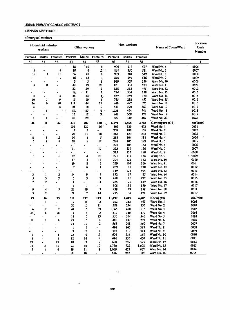
URBAN PRIMARY CENSUS ABSTRACT
CENSUS ABSTRACT
of marginal workers
Household industry Non-workers Location
workers Other workers Name ofTownlWard Code
Number
Persons Males Females Persons Males Females Persons Males Females
50 51 52 53 54 55 56 57 58 2 18 . 10 8 995 418 577 Ward No. 6 0006
4 4' 18 . '6 12 '. ' 861 350 511 Ward No. 7 0007 15 5 10 56 40 16 933 384 549 Ward No. 8 0008
16 13 3 810 294 516 Ward No. 9 0009 3 2 I 929 379 550 Ward No. 10 0010
8 8 42 19 23 861 338 523 Ward No. II 0011 22 20 2 828 333 495 Ward No. 12 0012 14, II 3 714 364 350 Ward No. 13 0013
3 3 38 34 4.' 629 259 370 Ward No. 14 0014 10 I 9 IS 10 5 745 288 457 Ward No. IS 0015 26 6 20 III 44 67 948 422 526 War(INo.16 0016 4 4 24 18 6 630 270 360 Wari:I No. 17 0017 1 ·89,. ' 83 6" 1,238 494 744 Ward No. 18 0018
IS .. 12 3 941 368 573 WardJ'"o.19 0019 20 20 829 340 489 Ward No. 20 0020
46 14 3~ 337 207 130 " 6,271 2,568 3,703 GOvindgarh (CT) 40608000 136 120 16 " ,< 802 329 473 Ward No, 1 0001
3 3 258 100 158 WafdNo.2 0002 20 10 10 362 129 233 Ward No, 3 0003
13 12 10 5 5 285 104 181 Ward No. 4 0004 5 4 20 8 12 298 105 193 Ward No. 5 0005
270 106 164 Ward No. 6 0006 11 11 333 137 196 Ward No. 7 0007
325 135 190 Ward No. 8 0008 6 6 32 4 28 291 137 154 Ward No. 9 00D9
17 4 13 304 122 182 Ward No. 10 DOlO 10 8 2 269 103 166 Ward No. 11 0011 7 6 I 269 91 178 Ward No. 12 0012
319 125 194 Ward No. 13 0013 3 1 2 14 9 5 152 67 85 Ward No. 14 ,0014 5 3 2 5 3 2 458 181 277 Ward No. IS 0015 2 2 4 4 275 126 149 Ward No. 16 0016
1 1 308 158 150 Ward No. 17 0017 9 4 5 26 19 7 438 179 259 Ward No. 18 0018 3 2 1 21 7 14 255 134 121 Ward No. 19 0019
89 16 73 318 199 119 11,197 4,412 6,785 Kherli (M) 40609000 I I 17 15 2 762 313 449 Ward No. I 0001
36 15 21 589 234 355 Ward No. 2 0002 4 2 2 44 IS 29 1,066 450 616 Ward No. 3 0003
24 6 18 7 4 3 810 340 470 Ward No. 4 0004 . 18 5 13 550 204 346 Ward No. 5 0005
11 3 8 19 15 4 480 187 293 Ward No. 6 0006 14 12 2 568 208 360 Ward No. 7 0007
1 484 167 317 Ward No. 8 0008 3 2 I 593 219 374 Ward No. 9 0009
1 1 22 9 13 604 236 368 Ward No. 10 0010 I I 18 14 4 686 236 450 Ward No. 11 0011
27 27 10 3 7 600 227 373 Ward No. 12 0012 IS 3 12 72 60 12 1,730 722 1,008 Ward No. 13 0013 5 I 4 19 11 8 1,039 422 617 Ward No. 14 0014
18 18 636 247 389 Ward No. 15 0015
991
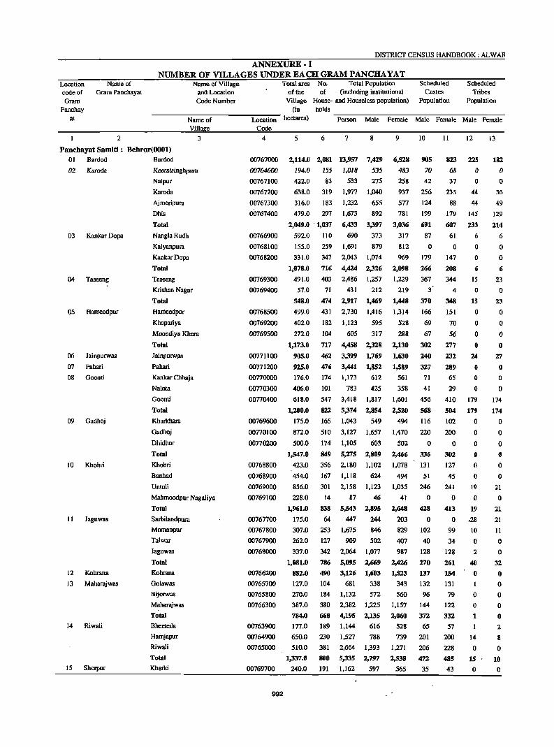
DISTRICf CENSUS HANDBOOK: ALWAR
ANNEXURE· I NUMBER OF VILLAGES UNDER EACH GRAM PANCHA YAT
Location code of Gram
Panchay at
Name of Gram Panchayat
2
Name of Village and Location Code Number
Name of Villa e
3
Panchayat Samiti: Behror(OOOI) 01 Bardod Bardod
02 Kamda
03
04
05
06
07
08
09
10
II
12
13
14
15
Kankar Dopa
Taseeng
Hameedpur
Jainpurwas
Pahari
Goonti
Gadhoj
Khohri
Jaguwas
Kohrana
Maharajwas
Riwali
Sherpur
KeeclilSinghpurn
Nalpur
Karoda
Ajrneripura
Dhis
Total
NanglaRudh
Kalyanpura
KallkarDopa
Total
Taseeng
Krishan Nagar
Total
Hanteedpur
Khapariya
Moondiya Khera
Total
Jainpurw~
Pahari
Kankar Chhaja
Nalota
Goonti
Total
Kharkhara
Gadhoj
Dhidhor
Total
Khohri
Banhad
Untoli
Mahmoodpur Nagaliya
Total
Sarbilandpura
Momanpur
Talwar
Jaguwas
Total
Kohrana
Golawas
Bijorwas
Maharajwas
Total
Bheeteda
Hamjapur
Riwali
Total
Kherki
Total area No. Total Population of the of (including institutional
Village House- and Houseless population) (in holds
Scheduled Castes
Population
Scheduled Tribes
Population
Location hectares)
Code
-P-e-rs-o-n-M-al-e-F-em-al-e-M-a-Ie-F-ema--Ie-M-a-Ie-F-e-m-ale
4
00767000
00764600
00767100
00767200
00767300
00767400
00766900
00768100
00768200
00769300
00769400
00768500
00769200
00769500
00771100
00771200
00770000
G0770300
00770400
00769600
00770100
00770200
00768800
00768900
00769000
00769100
00767700
00767800
00767900
00768000
00766200
00765700
00765800
00766300
00763900
00764900
00765000
00769700
992
5 6 7 8
2,114.0 2,081 13,957 7,429
535
275
1,040
655
892
3,397
194.0 155 1.018
422.0 83 533
638.0
316.0
319
183
479.0 297
2,049.0 . 1,037
592.0 110
155.0
331.0
1,078.0
491.0
57.0
548.0
499.0
402.0
272.0
1,173.0
905.0
925.0
176.0
406.0
618.0
1,200.0
175.0
872.0
500.0
t.S47.0
423.0
454.0
856.0
228.0
1,961.0
175.0
307.0
262.0
337.0
1,081.0
882.0
127.0
270.0
387.0
784.0 177.0
650.0
510.0
1,337.0
240.0
259
347
716
403
71
474
431
182
104
717
462
476
174
101
547
822
165
510
174
849
356
167
301
14
8.18
64
253
127
342
786
490
104
184
380
668
189
230
381
800
191
1.977
1.232
1.673
6,4.13
690
1.691
2,043
4,424
2,486
431
2,917
2,730
1.123
60S
4,458
3,399
3,441
1,173
783
3,418
5,374
1,043
3,127
1,105
5,275
2.180
1,118
2,158
87
5,543
447
373
879
1,074
2,326
1,257
212
1,469
1,416
595
317
2,328
1,769
1,852
612
425
1,817
2,854
549
1.657
603
2,809
1,102
624
1,123
46
2,895
244
1,675 846
909 502
2,064 1,077
5,095 2,669
3,126 1,603
681 338
1,132 S72
2.382 1.225
4,195 2,135
1.144 616
1,527 788
2,664 1.393
5,335 2,797
1,162 597
9
6,528
483
258
937
577
781
3,036
317
812
969
2,098
1,229
219
1,448
1,314
528
288
2,130
1,630
1,589
561
358
1.601
2,520
494
1,470
502
2,466
1.078
494
1,035
41
2,648
203
829
407 987
2,426
1,523
343
560
1.157
2,060
528
739
1.271
2,538
565
10
90S
70
42
256
124
199
691
87
o 179
266
367
3'
370
166
69
67
302
240
327 71
41
456
568
116
220
o 336
131
51
246
o 428
o 102
40
128
270
137 132
96
144
372
65
201
206
472
35
11
823 68
37
235
88
179
607
61
o 147
208
344
4
348
151
70
56
277
232
289
65
29
410
504
102
200
o 302
127
45
241
o 413
o 99
34
128
261
154
131
79 122
332
57
200
228
485
43
12
225 o o
44
44
145
233
6
o o 6
15
o 15
o o o o
24
o o o
179
179
o o o o o o
19
o 19
.28
10
o 2
40
o
o o 1
14
o 15
o
13
182
o o
36
49
129
214
6
o o 6
23
o 23
o o o o
27
o o o
174
174
o o o o o o
21
o 21
21
II
o o
32
o o o o o 2
8
o 10
o
ANNEXURE
Location Name of code of Gram Panchayat Gram
ANNEXURE-I NUMBER OF VILLAGES UNDER EACH GRAM PANCHA YAT
Name of Village and Location Code Number
Total area No. Total Population of the of (including institutional
Village House- and Houseless population) (in holds
Scheduled -Castes
Population
Scheduled Tribes
Population Pancnay
at ------~N~a-m-e-o~f~-------L-o-ca-t~io--n hectar~) ~P~~--o-n--M~~-e~F~e-mW~e~M~~-e--F~e-m-a-le--M--~-e~Fe-m-a-le-
2
16 Dhoondhariya
17 Basai
18 Khohar
Villa e Code
3 4
Gok~pura
Sherpur
Shyampur
Shimla
Total
KaliyaHoda
Beeghana
Chandi Chana
Dhoondhariya
Dooghera
Total
'Baw
Googhriya
Total
Shyodansinghpura
K110har
Banesinghpura
Total .
00769800
00769900
00770500
00770600
00762000
00762100
00764000
00764100
00764800
00762700
00763700
00760200
00760300
00762800
19 Mohammadpur Goojar Mohammadpur Goojar
Mosampur @ Kankara
00770900
00771000
20 Gujarwas
21 Bhagwari Khurd
22 lat Gaonra
23 Ramsinghpura
24 Gandala
25 Boorhwal
Total
Jahilpur
Shahzadpur Nang~iya
Gujarwas
Islampur
Total
Bhagwari Khurd
Bhagwari ~an
Balpura
Kureli
Total
lat Gaonra
Guwana
Total
Kbatan Khera
Sorwa
Sagli
Mawri
Ramsinghpura
Jaisinghpura
Jharoda
Nareda Kalan
Nasarpur
Total
Chak Muradpur
Gandala
Jamalpur
Total
Dawani
00767500
00767600
00770700
00770800
00763200
00763300
00763400
00763500
00763000
00763100
00765100
00765300
00766400
00766500
00766600
00768300
00768400
00768600
00768700
• 00762200
00762300
00762400
00762500
993
5 260.0
'302.0
192.0
270.0
1,264.0
91.0
195.0
219.0
446.0
489.0
1,440.0
1,066.0
368.0
1,434.0
245.0
733.0
161.0
1,139.0
518.0
440.0
958.0
195.0
186.0
264.0
257.0
902.0
335.0
325.0
162.0
190.0
1,012.0
413.0
434.0
847.0
188.0
120.0
6
226
311
73
91
892
61
144
170
288
289
952
451
177
628
183
457
58
698
287
168
455
118
201
183
83
585
242
201
103
84
630
388
274
662
156
92
148.0 16
106_0 102
178.0 82
137.0 13
155.0 14
2920
167.0
1,491.0
262.0
147
125
747
28
857.0 972
169.0 8
1,288.0 1,008
181.0 171
7
1,408
2,146
523
8
693
1,122
281
695 364
5,934 3,057
449 209
888 453
1,086
1,907
1,783
6,113
2,699
1,146
3,845
1,112
580
967
911
3,120
1,403
585
1,988
575 2,730 1,443
407 199,
4,249 2,217
2,254 1,190
1,247 676
3,501 1,866
785 397
1,223 602
1,221 667
606
3,835
1,489
1,204
634
550
3,877
2,140
1,561
3,701
967
568
130
703
557
103
96
966
716
4,806
200
331
1,997
770
643
343
287
2,043
1,086
812
1,898
488
289
69
349
294
52
55
505 371
2,472
93
5,869 3,034
56 23
6,125 3,150
964 482
9
715
1,024
242
331
2,877
240
435
506
940
872 2,993
1,296
561
1;857
537
1,287
208
2,032
1,064
571
1,635
388 621
554
275
1,838
719
561
291
263
1,834
1,054
749
1,803
479
279
61
354
263
51
41
461
345
2,334
107
2,835
33
2,975
482
10 .11
181 175
189 204
44 45
82
531
24
o 168
54
89
335
366
48
414
74
452
26
552
278
66
344
109
109
129
89
436
137
124
28
43
332
132
93
225
34
o 60
26
o o
55
41
217
18
449
o 467
23
80
547
35
o 150
74
97
356
346
43
389
73
395
27
495
266
64.
330
106
127
86
79
398
135
105
23
39
302
132
69
201
38
o o
62
24
o o
60
32
216
25
399
o 424
24
12
41
33
o o
74
o o 2
3
o 5
31
o 31
o o o
:0
o o o
o o o 1
o o o o o o o o o o o o o o o
16
o 16
o o o o o
13
45
20
o o
65
o o
2
o 3
26
o 26
o o o o o o o o o o o o o o o o o o o o o o o o o o o
II
o 11
o o o o o
Location code of Gram
Panchay at
26
27
28
29
Name of Gram Panchayat
2
Nagai Khodiya
Jakhrana Kalan
Machal
Antpurn
DISTRICT CENSUS HANDBOOK: ALWAR
ANNEXURE-I NUMBER OF VILLAGES UNDER EACH GRAM PANCHA YAT
Name of Village and Location Code Number
Total area No. Total Population Scheduled of the of (including institutional Castes
Village House- and Houseless population) Population
Scheduled Tribes
Population
----":"N=-a-m-e-o":"f -----:Lo-ca~t:-io-n- heC~~reS) holds -P-e-r-so-n--M-a-Ie---P-em-al-e-M-a-I-e---P-erna-I-e-M-a-Ie---p""'e-ma-""'-Ie
Villa e Code 3 . 4 5 6 7 8 9 10
Bhoopseda
Boorhwal
Milakpur
Total
Naglisadh
Nagli Jageer
Nagai Khodiya
Total
Jakhrana Kalan
Jakhrana Khurd
Total
Machal
Dahmi
Total
Laksiwas
Nibhor
Antpura
Total
00762600
00763800
00765200
00765400
00765500
00765600
00762900
00763600
00766700
00766800
00765900
00766000
00766100
210.0
255.0
290.0
936.0
19.0
243.0
249.0
511.0
75io 483.0
1,235.0
337.0
405.0
742.0'
156.0
421.0
212
330
173
886
17
78
424
519
721 20
741
335
396
731
78
145
1,211
1,983
1,136
5,294
123
521
2,586
3,230
4.301
119
4,420
2,055
2,619
4,674
494
1,088
619
1,004
587
2,692
61
266
1,322
1,649
2,240
68
2,308
1,052
1,408
2,460
268
568
592
979
549
2,602
62
255
1,264
1,581
2.061
51
2,112 1,003
1,211
2,214
226
520
166
63
40
292
o 79
111
190
399
o 399
III
237
348
o 93
186.0 223 1,345 692 653 46
763.0 446 2,927 1,528 1,399 139
II
140
55
45
264
o 76
94
170
419
o 419
116 212
328
o 76
45
121
12
o o o o o o o o o o o o o o o o o o
13
o o o o o o o o o o o o o o o o o o
l'anchayat Samiti: Nianrana (0002)
o 1 Doomroli Doomroli
02 Akleempura
03
04
05
06
07
08
09
Kaysa
Raiwana
Dausod
Beechpuri
KolilaJoga
Pratapsinghpura
Daulatsinghpura
Naisarana
Total
Akleempura
Nihalpura
Nareda Khurd
Total
Kaysa
Raiwalla
Talwana
Total
Dausod
Banthala
Total
8eechpuri
Peepli
Patehpura
Total
KolilaSanga
KolilaJoga
Kolila Rawad
Bantkhani
Total
Kalipahari
Majrakath
Mohalariyan
Pratapsinghpura
Total
Umraogarh '!{
Kundansinghpura
00759700
00760100
00759800
00759900
00760000
00759600
00759400
00759500
00759200
00759300
00761800
00761900
00764200
00764300
00764400
00764500
00764700
00761400
00'161500
00761600
00761700
00758400
00760700
994
1,085.0
730.0
1,815.0
179.0
195.0
228.0
602.0
1,403.0
608.0
482.0
1,090.0
959.0
168.0
1,127.0
318.0
567.0
126.0
1,011.0
373.0
489.0
374.0
319.0
1,555.0
188.0
557
254
811
166
142
165
473
550
309 303
612 483
123
606
267
314
151
732
278
330 113
167
888
67
3,362
1,711
5,073
838 793
928
2,559
3,515
1,889
1,945
3,834
3,016
741
3,757
1,639
1,966
722
4,327
1,639
1,901
758
1,018
5,316
476
578.0 142 878
342.0 192 1,127
399.0
1,507.0
84.0
328.0
215
616
40
81
1,456
3,937
262
566
1,790
885
2,tn5
401
398
455
1,254
1,776
974
976
1,950
1,567
390
1,957
864
994 388
2,246
861
1,015
385 514
2,775
267
451
603
729
2,050
134
280
1,572
826
2,398
437
395
473
1,.105
1,739
915
%9
1,884
1,449
351
I,SOO
775
972
334
2,081
778
886
373 504
2,541
209
427
524
727
1,887
·128
286
188
156
344
4
96
57
157
186
221
166
387
329
105
434
37
279
228
544
1I5
128
7
39
289
o o
69
o 69
o o
158
148
306
7
98
49
154
183
226
IS6
382
320
92
412
29
277 197
503
93
112
9
30 244
o o
72
o 72 o o
o o o o o o o 8
o o o o o o o o o o o o o o o o o o o o o o
o o o o o o o
17
o o o o o o o o o o o o o o o o o o o Ii o o
ANNEXURE
Location code of Gram
Name of Gram Panchayat
Panchay at
10
II
12
13
14
15
16
17
18
19
20
21
22
23
2
Majri Kalan
Majra
Rodwal
Nanagwas
Kanhawas
Salarpur
Neemrana
Mandhan
Gheelut
Dabarwas
Pauladpur
Shahjahanpur
Jonaycha Khurd
GoogalKota
Kuteena
ANNEXURE-! NUMBER OF VILLAGES UNDER EACH·GRAM PANCHA YAT
Name of Village and Location Code Number
Total area No. Total Population of the of (including institutional
Village House- and Houseless population) (in holds
Scheduled Castes
Population
Scheduled Tribes
Population
------.,N"'"a-m-e-o-:'f----"'"Lo-ca-:ti,-on- hectares) ""P::"e-rs-o-n---:M:-:-:aI'-e---"F=-e-maI--:-e---"M-:'aI-:'e-=Fe-ma--:-le---:M:-:-:aI'-e--=Fe'-m-a"'"1e-
Villa e Code
3 4
Daulatsinghpura 00760800
Madhosinghpura 00760900
Total
Majari Khurd
. Khatiwas
Majri Kalan
Total
Majra
Basai BhopaIsingh
Total
Bheemsinghpura .
Muk:andsinghpura
Heeragarh
Rodwal
Bijaisinghpura
Total
Adeend
Nanagwas
Chawadi
Total
Dheek:war
Kanhawas
Total
Salarpur
Naghori
Total
Neemrana
Mandhan
Pratappur Chak No. 1
Gheelot
Pratappur Chak No.3
Total
Dabarwas
Beeranwas
Total
Fauladpur
Baori
Isrisinghpura
Total
Shahjahanpur
Jonaycha Khurd
Bani Jonaycha
Total
Googal Kota
Chaubara
Total
Kuteena
Kankar
Total
00759100
00760400
00760500
00756400
00756500 .
00758700
00758800
00758900
00759000
00760600
00754700
00755500
00755600
00756200
00756300
00758500
00758600
00758300
00754600
00756700
00756800
00756900
00755700
• 00755800
00761100
00761200
00761300
00758000
00757700
00757800
00757300
00757900
00757100
00757200'
995
5 6 7 8 9 10 11 12
.446.0 288 1,915 975
717
940 0 o 0
462.0 191 1,357 640 155 130
130
202
1,320.0
242.0
142.0
'504'.0
'888.0
369.0
564.0
933.0
236.0
167.0.
600 4,100 2,106 1,994
885 276 1,844 959
3 12 6 ·6
'1,671
2,562
1,051
585 3,484 1,813
864 5,340 2,778
378 2,056 I,OOS
44.0
411.0
241.0
1,099.0
317.0
274.0
601.0
1,192.0
401.0
566.0
967.0
350.0
294.0
644.0
725.0
930.0
429.0
1,351.0
176.0
1,956,0
669.0
385.0
1,054.0
519.0
363.0
345
723
147
43
365
231
786
190
300
198
688
287
399
686
321
280
601
777
602
79
441
41
561 367
306
673 480
85
188.0 71
1,070.0 636
989.0 1,528
528.0 453
38.0 52
566.0 505
835.0 415
480.0
1,315.0
934.0
750.0
361
776
547
477
2,059 1,059 1,000
4,115 2,064 2,051
811 421 .390
251 119 132
UnInhabited
2,221 1,163 1,058
1,180 632 548
4,463 2,335 2,128
1,109 586 523
1,845 925
1,209 616
4,163 2,127
1,757 901
920
593
2,036
856
2,241 1,166 1,075
3,998 2,067 1,931
2,035 1,049 986
1,651 865 786
3,686 1,914 1,772
4,217 2,276 1,941
3,514
453
2,859
1,854
242
1,493
260 140
3,572' 1,875
2,436 1,778
1,867 950
4,303 2,228
3,035 1,548
488 244
441 221
3,964 2,013
8,682 4,594
2,834 1,424
273 142
3,107 1,566
2,601 1,337
2,049
4,650
3,357
2,908
1,100
2,437 1,729
1,551
1,660
211
1,366
120
1,697
1,158
917
2,075
1,487
244 220
1,951
4,088
1,410
131
1,541
1,264
949
2,213
1,628
1,357
155 200
o 307
507
78
120
198
57
o
126
230
413
149
86
121
356
184
151
335
164
88
252
726
293
II
231
46
288
112
61
173
156
32
54
242
669
126
12
138 292
o 282
484
90
131
221
50
o
133
190
373
115
78
124
317 157
158
315
145
79
224
645
299
7
216
26
249
115
66
181 141
28
52
221
587
98
7
105
254
253 '216
545 470
164 153
339 '~.1317
1,684.0 1,024 6,265 3,280 2,985 . 503 470
3
3
o o
.46
46
o o o o o
o 4
4
o o o o 7
o 7
o 9
II
1
o o o o o o o o 6
o o 6
794
69
o 611
87
5
92
23
23
46
13
o 3
3
o o
40
40
o o o o o
o 3
3
o o o o
13
o 13 o 8
8
3
o o o o o o o o
13
o o
13
781
63
o 63
86
4
90
27
21
48
DISTRlcrCENSUS HANDBOOK: ALWAR
ANNEXURE-I NUMBER OF VILLAGES UNDER EACH GRAM PANCHA YAT
Location Name of Name of Village and Location Code Number
Total area No. Total Population Scheduled Scheduled code of Gram Panchayat of the of (including institutional Castes Tribes Gram Village House- and Houseless population) Population Population
(in holds Panchay at -----:N~a-m-e-o-:f----~Loca-~ti~on- hectares) -:P=-ers-o-n--:M-:a-:l-e--:F:-em--:al~e~M-:-al-:-e--:F=-e-ma-:-le~M-:-a-:-lc--:F=-e-m-a:-"Ie
Villa e Code
1 2 3 4 5 6 7 8 9 10 11 12 13
25 Giglana Giglana
26 Shliyani Batana
27 Jonaycha Kalan
28 Santo
29 Mahtawas
30 Khoondrot
31 Hudiya Kalan
32 Kathoowas
33 Partapur
Shriyani
Sansedi
Total
Pratappur Chak No.2
Jonaycha Kalan
Dhodhakari
Belni
Janaksinghpura
Total
Porula
Santo
Bccghana Jat
Raisarana
Total
Mahtawas
NagliBalai
Total
Anandpur
Vijaynagar
Khoondrot
Total
Jaitpur
Hudiya Kalan
ChaIt Ramdas
Total
Hudiya Khurd
Kathoowas
Mangalpur .
Total
Ramehandrapura
Raghunatbpura
Beenjhpur
Partapur
Total
Panehayat Samld: Mandawar(0003)
OJ Behror Jat BehrorJat
02 Jalwas Manethi
Jalwas
Molawas
Total
03 MWidanwara Kalan Hulmana Kburd
Bhojpuri
04 Palawa
Mundanwm'a Kalan
Shahjadpur
Total
~irzapur
Beerod
00755400
00757000
00757400
00757600
00756600
00757500
00758100
00758200
00761000
00754900
00755100
C0755200
00755300
00754800
00755000
00755900
00756000
00756100
00754000
00754100
00754200
00754300
00754400
00754500
00753600 , 00753700
00753800
00753900
00773000
00772700
00772800
00772900
00772500
00772600
00773300
00773500
00771700
00771800
996
991.0
333.0
453.0
178.0
964.0
173.0
288.0
256.0
395.0
230.0
1,342.0
168.0
402.0
439.0
585.0
1,594.0
550.0
880.0
1,430.0
471.0
395.0
836.0
1,702.0
281.0
362.0
44.0
687.0
320.0
387.0
173.0
880.0
156.0
114.0
372.0
253.0
664
69
348
263
680
53
223
56
136
81
549
112
249
129
297
787
425
469
894 223
189
469
881
236
333
569
327
251
134
712
180
47
167
234
4,176
404
2,173
1,416
3,993
390
1,288
336
940
634
3,588
738
1,484
1,026
1,818
5,066
2,606
2,878
5,484
1,278
1,216
2,227
203
1,159
755
2,117
210
671
170
487
345
1,883
385
749
538
947
2,619
1,387
1,482
2,869
660
626
1,949
201
1,014
661
1,876
180
617
166
453
289
1,705
353
735
488
871
2,447
1,219
1,396
2,615
618
590
2,983 1,555 1,428
5,477 2,841 2,636
1,327 702 625
1,955 991 964
UnInhabited
3,282 1,693 1,589
1,810 931 879
1,623
773
4,206
1,002
298
1,025
1,275
835
380
2,146
514
149
522
651
788
393
2,060
488
149
503
624
300
33
261
63
357
14
134
122
112
3
385
62
119
141
205
527
304
229
533
214
91
419
724
192
136
328
136
249
40
425
96
o 67
163
895.0 618 3,600 1,836 1,764 326
581.0
264.0
269.0
269.0
802.0
281.0
280.0
404.0
221.0
1,186.0
391.0
368.0
528
147
253
333
733
123
112
320
112
667
227
196
3,116
988
1,542
1.842
4,372
860
766
2,133
1,657
511
786
965
2,262
449
401
1,088
194 413
4,553 2,351
1,383 728
1,337 725
1,45.9
477
756
877
2,110
411
365
1.045
381
2,202
655
612
270
39
110
283
432
45
111
117
63
336
117
96
228
34
224
58
31(i
11
126
113
92
4
346
56
118
112
182
468
267 223
490
199
84
395
678
149
III
260
122
216
52
390
96
o 71
161
328
260
36
125
241 402
39
108
125
52
324
89
81
o o
11
o 11
o 11
o o o
11
o o o 6
6
o o o o o o o 3
2
5
1
o 2
o o o o o
o 24
9
17
50
o o
17,
3 ,
20
21:
12
o o 9
o 9
o 15
o o o
15
o o o 5
5
o o o o o o o 3
3
6
o o o o o o o I
1
o 17
8
12
37
o o
11
5
16
22
12
ANNEXURE
Location code of Gram
Name of Gram Panchayat
Panchay .at
2
05 Beejwad Chauhan
06 Gadoowas
07 KamiKot
08 Majri Khola
09 Bhoongara Aheer
10 SeelGaon
II Manka
12 Bawad
13 Khaopur Aheer
14 Ajarka
15 Darbarpur
16 Sihali Khurd
ANNEXURE·] NUMBER OF VILLAGES UNDER EACH GRAM PANCHA YAT
Name of Village and Location Code Number
Total area No. Total Population of the of (including institutional
Village House- and Houseless population) (in holds
Scheduled Castes
Population
Scheduled Tribes
Population
------~N~a-m-e-o-f---------L-o-ca-ti-o--n ~) ~P~~--o-n~M~a!~e~F~e-nm-l~e~M~a1~e--F~e-m-a!7e~M~a1~e--F~e-maI~e
Villae Code
3 4
Palawa
Total
Gadli
Beejwad Chauhan' .
. Hulmana Kalan
"Total
Dad~ya
• Gadoowas
Total
Mundanwara Khurd
'KamiKot
Swaroop Sarai
Total •.
Padmara' Kalan
Padmara Khurd
Bapdoli
, Majri Khola
'.Total
'Sanoli
Bhooogara Thethar
Bhoongara Aheer
Khohri
,Total
Seel Gaon
Bhagolajat
Total
Ramsinghpura
Manka
Total
Bawad
Lanmchpur
Total
Khanpur Aheer
Mandha
Garhi
Total
Sirod Kalan
Nanga! Siya
Ajarka
Total
Bhagola Aheer
Darbarpur
Total
NaharKhera
Sihali Khurd
Hada Heri
Sihali Kalan
Radwa
Total
00771900
00772000
00772300
00772400
00772100,
00772200
00773400
00776100
00776500
00776400
00779000
00779100
00779200
00773100
00773200
00776200
00776300
00774400
00774800
00771400
00771500
00771300
00771600
00777700
00777800
00778000
00774000
00774100
00774200
00774300
00774900
00777200
00777300
00777400
00777500
00777600
997
5
505:0
"1;264.0
262.0
1;131.0
327.0
1,720.0
,288.0
617.0
905;0
296.0
'811.0
182.0
1,289.0
'396.0
'302.0
412.0
227.0
1,337.0
399.0
377.0
328.0
372.0
1,476.0
1.236.0
413.0
1,649.0
198.0
1,072.0
1,270.0
391.0
277.0
668.0
399.0
329.0
170.0
898.0
216.0
177.0
342.0
735.0
283.0
434.0
717.0
134.0
409.0
229.0
561.0
229.0
6
341
764
184
608
94
886
250
357
607
108
420
180
708
145
292
75
227
739
342
7
193
110
652 381
192
573
135
327
462
472
86
558
287
199
153
639
123
95
244
462
IfJ 313
496
122
7
2,295
5,015
1,166
4,163
547
5,876
1,443
2,470
3,913
621
2,645
1,200
4,466
926
1,838
473
1,377
4,614
1,983
44
8 1,194
2,647
616
2,166
9 l,rOl
2,368
550
1,997
290 257
3,072 ' 2,804
761., ,682
1,280 1,190
2,041' 1;872
300, 321
1,378 1,267
607 . .' , " ,593
2,285 ',2,181
471, 455
955. 883
248 225
699 678
2,373 2,241
1,021,. 962
19. 25
1,381 722 . 659
763 399 364
4,171 2,161 2,010
2,300
1,364
3,664
797
1,826
2,623
2,980
522
3,502 1,740
1,286
939
3,%5
751
582 1,476
2,809
1,404
1,911
3,315
749
1,199
721 •
1,920
428
980
1,408
1,564
256
1,820
891
677
471
2,039
398
306
780
1,484
745
998
1,101
643
1,744
369
846
1,215
1,416
266
1,682
849
609
468
1,926
353
276
696
1,325
659
913
288 1,644
1,743
389
822
507
553
738
1,572
360
822
463
531
674
155 970
171
213
1,084
1,412
10
158
371
153
315
79
547
125
242
367
13
239
60
312
47
193
69
131
440
141
o 50
52
243
665
106
771
108
340
448
244
43
287
79
65
145
54
67
156
277
48
86
134
33
82
122
56
123
1,562.0 949 5,859 3,009 2,850 416
11
,150
320
133
288
63
484
103
220
323
19
239
52
310
50
191
61
144
446· 132
o 55
47
234
606
99
70S
88
282
370
214
48
262
69
46
o 115
41
58
lSI
250
29
90
119
42
84
110
54
118
408
12
o 33
17
168
18
203
63
43
.106
10
2
248
260
79" o o o
79
o o o o o o o o o
92
92
o o o
29
o o
29
o o o o o o o o
19
o o o
19
, 13
o 34 11
181
13
205
75
38
113
12
6
243
261
76
o o o
76
o o o o o o o o o
72
72
o o o
27
o o
'1,7
o o o o o o o o
20
o o. o
20
".
Location Name of code of Gram Panchayat Gram
Panchay at
2
17 Mundawar
18 Shyopur
19 Shanot
20 Sarai Kalan
21 Balloowas
22 Ulaheri
23 Rajwara
24 Jasai
25 Chandpur
26 Hatoondi
27 Peepli
DISTRICT CENSUS HANDBOOK: ALWAR
ANNEXURE· I NUMBER OF VILLAGES UNDER EACH GRAM PANCHAYAT
Name of Village and Location Code Number
Total area No. Total Population Scheduled Scheduled of the of (including institutional Castes Tribes
Village House- and Houseless population) Population Population (in holds
------:N:-:'a-m-e-o-=f-----:-Lo-c-a'::ti-on- hectares) -P-e-rs-o-n-M-a-I-e ---F-em-al-e-M-a-:-Ie---:F:-e-m-a-Ie-M-a-Ie-F-et-nal-e
Villa e Code
Gandhi Nagar
Mundawar
Total
Tinkiruri
Shyopur
Renagiri
Mohammadpur
Total
Sundarwari
Bhanot
Majra
Jogawad
Total
Sarai Kalan
Sirod Khurd
Todarpur
Total
GolaHera
Munpur
Jagiwara
Balloowas
Amoth
Total
Shekhawas
Birsangwas
Nangal Raniya
Vlaheri
Totul
Rajwara
Majri Bhanda
Toml
Jasai
Nangal Udiya
Bheelchawas
Total
Chandpur
Surajpura
Mau
Total
Hatoondi
Cheeruni
Choodla
Total
Mundiya Khera
Rambas
Bheenwada
Kalooka
Peepli
Total
3 4
00778100
00778200
00777900
00780500
00780600
00780800
00775000
00775100
00775200
q0777000
00773800
00773900
00775300
00775400
00775500
00775600
00776900
00777100
00775700
00776800
00778300
00778400
00775900
00776000
00773600
00773700
00775800
00776700
00778500
00778600
00779700
00779900
00782200
00776600
00778700
W778800
Q0778900
00780000
998
5 6 7 8
689.0 304 1,819 941
1,878.0 891
2,567.0 1,11)5
437.0 242
5,682 2,963
7,501 3,904
1,527 792
237.0 156 1,149 596
618
715
471.0 172 1,180
334.0 209
1,479.0 779
242.0 157
510.0 146
297.0 177
254.0 140
1,303.0 620
382.0. 275
247.0 184
219.0 160
848.0 619
193.0 102
205.0 59
233.0 2J'J7
239.0 221
182.0 148
1,052.0 737
157.0 98
149.0 102
155.0 89
1,341
5,197
934
915
1,165
989
4,003
1,709
1,201
1,017
3,rn7
712
393 1,414
1,460
908
4,887
630
740
728
2,721
489
451
600
514
2,054
875
627
521
2,023
348
210
743
747
453
2,501
346
391
354 416.0
877.0
390.0
400.0
790.0
401.0
417.0
132.0
950.0
417.0
206.0
279.0
902.0
483.0
272 1,850 980
.915.0
359.0
561 3,948 2,071
286 1,787 932
2J'J2 1,252 638
488 3,039 1,570
259 1,683 865
201 1,470 767
91
SSl 312
104
174
590
229
347
124
700
181
147
639
3,792
1,992
551
322
1,954
1,016
276
1,238 652
~,781 1,944
1,515 820
2,254 1,128
804 430
4,573 2,378
1,233 648
1,100 586
9 IO
878 40
2,719
3,597
735
553
562
626
2,476
445
464
565
475
1,949
834
574
496
1,904
364
183
671
713
455
2,386
284
349
374
595
635
413
10
74
178
675 62
88
77
75
302
165
99
72
336'
98
19
158
45
56
376
24
103
2
870 '169
l,ff17 298
855 108
614 114
1,469 222
818 148
703 133
317
1,838
976
275
586
1,837
695
1,126
374
2,195
585
514
45
326
120
o 198
318
142
124
116
382 62
1,757.0
234,0
321.0
267.0
227.0
465.0
162 1,250 661 589
3
109
50
129
353
145 945 500 445
292 1,924" 991 933
1,514.0 927 6,452 3,386 3,066
11 12
25 16
559
584
418
8
69
162
657
49
98
72
67
286
158
94
68
320
105
20
134
46
45
350 12
76
5
151
244
120
120
240
142
126
43
311
102
o 170
272
110
107
102
319
53
2
99
45 136
335
308
324
o 22
o o
22
o IS
12
o 27
186
o o
186
o o o o o o o o o o o 5
3
8
37
50
o 87
o o o o
19
135
o 154 130
289
62
o 9
490
13
15
264
279
o IS
o o
15
o 16
11
o 27
199
o o
199
o o o o o o o o o o o 6
3
9
34
41
o 75 o o o o
16
146
o 162
115
241
61
o 2
419

ANNEXURE
Location Name of code of Gram Panchayat Gram
Panchay at
I 2
28 Sodawas
29
30
31
32
33
34
35
36
37
Menpur
Shamda
Gopipura
Tatarpur
Pehal
Ranoth
Resgan
Behroj
Jeendoli
ANNEXURE-I NUMBER OF VILLAGES UNDER EACH GRAM PANCHA YAT
Name of Village and Location Code Number
Total area No. Total Population of the of (including institutional
Village House- and Houseless population) (in holds
Scheduled Castes
Population
Scheduled Tribes
Population
--------N-ame---o-f---------L-o~--ti-on--hea~) ~P~e-m-o-n--M~al~e~F~e-ma-~le~M~a~re--F=em--a~le~M~a~l--e=Fe-m-a--Ie
Villa e Code
3 4 Chhapur
Dhlikal Nagar
Sodawas
Kokawas
Jhajharpur
Brnuanawas
Badheen
Doonwas
Total Siya 10mb
Menpur
Shreekrlshan Nagar
Total Jellvan Singhpura
Tcjpura
Lakheernpur
Chbabriwas
Qyara
Shamda
Total Sabalgarh
Kali Pahari
Tchadka
Gopipura
Jalpiwas
Tehadki
DbaiIawas
Total Tatarpur
Pcbal
Nangal Baola
Raipur
Ranoth
Badli
Total Nangal Santokara
Rcsgan
DantIa
Shahpur
Agwani
Total Azizpur
Bebroj
Nangal Si'llgal
Khanpur Mewan
Khareta
Total leendoli
Kadar Nagar
00779300
00779400
00779500
00779600
00779800
00782500
00782600
00782800
00780100
00780200
00780300
00782300
00782400
00782700
00782900
00783000
00783100
00780400
00781800
00781900
00782000
00782100
00783200
00783300
00783400
00780700
00781500
00781600
00781700
00783500
00780900
00781000
00781100
00781200
00784000
00784700
00784800
00784900
00785000
00785100
00784300
00784400
999
5 6 7 8
290.0 167 1,020 550
100.0
517.0
125.0
447.0
226.0
91 588 304
401 2,871 1.513
63 463 .232
311 1,984 1,028
58 366 193
345.0 97
524.0 67
.2;574.0 1,255
639.0 354
934.0 256
665.0 295
2,238.0 905
195.0 143
188.0 90
55.0 38
102.0 57
190.0 76
619
474
8,385
1,995
1,566
2,104
5,665 1,133
614
229
411
579
325
247
4,3!12
1,071
SOO I,U3.
2,984
577-
345
125
222
280
1,413.0
2,143.0
642.0
324.0
302.0
408
812
142
133
141
3,295 1,693
6,261 3,242.
1,221 633
922 501
967 512
287.0 130 843
504 178.0 82
353.0
190.0
2,2:76.0
1,676.0
1,626.0
193.0
198.0
534.0
380.0
130 882
100 805
858 6,144
926 6,193
836 5,423
140 986
147 1,021
238 1,566
219' 1,553
144 5,126
141 987
518 3,173
450
252
466
417
3,231
3,202
2,856
540
530
817
800
2,681
501
1,654
1,305.0
155.0
1,009.0
200.0
111.0
348 2,035 1,040
54 338 177
217.0 169
1,692.0 1,230
301.0 171
1,710.0 579
89.0 19
199.0 106
492.0 181
2,791.0 1,056
841.0 561
206.0 130
1,164
1,691
1,239
3,851
139
649
1,196
1,074
3,718
711
602
3,974
636
2,069
68
343
612
3,128
1,967
359
9 10
470 66
284
1,358
'231
956
173
294
227
3,993
924
766
991
2,681
556
269
104
189
299
1,602
3,019
588
421
455
393
252
416
388
2,913
2,991
2,567
446
491
749
753
2,439
486
1,519
34
388
49
266
86
38
14
941
186
248
42
476
18
94
o 35
o 363
510
o 62
121
60
47
114
60
464
640
768
135
171
78
238
622
290
635
995 413
161 133
562 142
3,723 1,613
603 98
1,782 342
71 6
306 280
584 56
3,346 182
1,751 . 461
352 3
II 12
56 9
34
382
53
258
83
58
19
943
143
258
41
442
13
88
o 33
o J09
443
o 59
105
53
48 101
70
436
649
692
108
171
73
209
561
278
594
398
118
133
1,521
85
302
7
244
55
693
426
3
o 48
o 76
o 17
10
160
o o o o o 3
o o
197
27
7.27
o o o o o o o o
170
78
o o o
87
tr1
o 8
I
o o 9
3
22
o o o
25
75
o
13
10
o 49
o 67
o 14
7
147
o o o o o 1
o o
210
37
248
o o o o o o o II
161
78
o o o
90
!IO
o 9
5
o o
14
2
20
o o o
22
64
o
Location Name of code of Gram Panchayar Gram
Panchay at
38
39
40
2
Mator
Sorkha Kalan
Basni
DISTRICT CENSUS HANDBOOK: ALWAR
ANNEXURE-I NUMBER OF VILLAGES UNDER EACH GRAM PANCHA YAT
Name of Village and Location Code Number
Total area No. Total Population of the of (including institutional
Village House- and Houseless population) (in holds
Scheduled Castes
Population
Scheduled Tribes
Population
------~N~a-m-e-o~f--------~Lo--ca~ti~on--h~tares) ~P~e-rn-o-n~M~al~e~F~e-m-a~le~M~w~e-F~e-rna~le~M~a~le~F~e-m-a~le
Villa e Code
Suheta
Total
Nangali Ojha
Sukhman Heri
Mator
Total
Ikrotiya
Naredi
Sorkha Khurd
BinoH
Bari
Khushalwas
Rundh
Sorkha Kalan
Chakoliya
Total
Sallchod
Alipur
Baslli
Total
3 4
00785200
00781300
00781400
00783900
00783600
00783700
00783800
00784100
00784200
00784500
00784600
007~.~300
C0785400
00774500
00774600
00774700
5 488.0
1,535.0
313.0
300.0
882.0
1,495.0
75.0
214.0
207.0
169.0
461.0
97.0
222.0
535.0
255.0
2,235.0
644.0
296.0
729.0
1,669.0
6 7
1,490
5,919
1,599
1.236
8
765
3,091
848
643
192
883 243
186
528
957
4,039 2,092
6,874 3,583
51 347 185
87 536
98 659
80 579
153 943
62 295
144 857
177 1.199
56
908
158
399
5,814
1.030
152 . 997
324 2.047
634 4,074
279
335
306
459
166
467
628
217
3,042
550
553
1.122
2,225
9
725
2,828
751
593
10
27
491
374
129
1,947 546
3,291 1,049
162 6
257 51
324 119
273 0
484 129
129 79
390 149
571 231
182
2,772
480
444
925
1,849
21
785
127
95
510
732
11
30
459
317
131
518
966
7
43
128
o 142
55
106
191
26
698
117
91
380
588
12
o 75
1
56
2
59
o o
13
o o
13
20
20
o 66
o o o o
13
o (j4
o 59
4
63
o o
10
o o
17
16
16
o 59
o o o o
Panchayal Sarniti: Kishangarhbas{OO(4)
01 Kishangarhbas Kisbangarh C.T.
02 Mancha
03 MoosaKhera
04 Langarwas
05 Bambora
06 Mahond
Dayalpur
Total
Mancha
Odra
DeOla
Total
Molhooka
Jaistika
Moosa Khera
Nyana
ChorBasai
Total
Bolni
Teetarka
Faizpur
Mandwapur
Bhatkol
Langarwas
Khojaka
Total
Bambora
CheetGhana
Pahar Samlat
RanoH
Baghor
Total
Poondraka
40604000
00822300
404.0 1,503 9,473 5.050 4,423 847 757
00819800
00821200
00822200
00822000
00822100
00823600
00825000
00825300
00819300
00819400
00819500
00819600
00821300
00821400
00821500
180.0 67 545
584.0 1,570 10,018
784.0
434.0
474.0
1,692.0
541.0
212.0
328.0
400 3,103
2S7 2.066
287 1,766
944 6,935
340 2,412
67 479
330 2.198
423.0 161 1,320
805.0 178 1.278
2,.109.0 1,076 7,687
572.0 249 1,734
163,0 113 812
331
5,381
1,643
1.076
923
3,642
1,274
242
1,149
663
665
3,993
882
429
56.0
108,0
213.0
499.0
42
29
'78
262 139
257
42
810
464
6S
261 130
464 232
1,687 872
228 105
5,448 2,78'J
3,154
507
1,656
26~
214
4,637
1,460
990
843
3,293
1.138
237
1,049
657
613
3,694
852
383
123
131
232
815
123
2,6S'J
1,498
239
00823400.
00823500
00826300
00826500
96.0
1,707.0
709.0
255.0
1,442.0
125.0.
Uninhabited
00826600 ,409.0
2,940.0
00818900 141.0
1000
63 489 266 223
230 1,663 870
822 5,813 3,060
69 499 245
793
2,753
254
73
920
249
271
243
763
250
11
189
103
105
6SS
110
54
o o
, 35
238
43
480
270
24
11
197
502
56
63
820
211
290
212
713
208
12
180
98
98
S96 113
54
o o
35
231
39
472
246
24
9
175
454'
62
87
o 87
o o
21
21
1
o o o o 1
o o o o o o o o o o
o o o o
50
o SO
o o
12
12
o o o o o o o o o o o o o o o o
o o o o
ANNEXURE
Location Name of code of Gram Panchayat Gram
Pancbay at
2
07 Bas Kripalnagar
08 NoorNagar
09 Tarwala
10 Bagheri Kalan
II MachhRoli
12 Ismalpur
'13 PatanMewan
ANNEXURE-I NUMBER OF VILLAGES UNDER EACH GRAM PANCHA VAT
Name of Village and Location Code Number
Name of Villa e
Gotbari
Baglhala
Chamroda
Nangli Pathan
Mahond
Sahoowas
3
Kankra (Islam Nagar)
Jatka
Total
Tanka Heri
Bas Kripalnagar
Chhatarpur
Total
Lisana
NoorNagar
Nangal Maujiya
Raipur Mcwan
Dadarhera
Total
Tohri
NangliMewan
Mcerka
BasaiKalan
Isepur
Tarwala
Total
Fatiyabad
Jharjheela
Googal Heri
Kaushalpur
Bagheri Kalan
Alamdeeka
Total
Khem
NayaGaon
Jhamoowas
Rundh Jhamoowas
Basai Beerthal
MachhRoli
Nagliya
Seokhera
Santhalka
Total
Rundh Ismailpur
Bhadook
Ismalpur
Bajhot
Total
Nangla Doongar
Total area No. Total Population Scheduled of the of (including institutional Castes
Village House- and Houseless population) Population (in holds
Scheduled Tribes
Population
Location hectares)
Code
""'P:-er-so-n-M:-:-:al-e --::'Fe-m-al':"'e-M-al':"'e--::F-em-a-Ie-M-a-Ie--::'Fe-ma-Ie
4
00819000
00819100
00819200
00819700
00819900
00820000
00821000
00821100
C0822400
00822500
00823000
00820600
00822600
00822700
00822800
00827000
00820300
00820400
00820500
00820700
00820800
00820900
00818000
00818100
00818200
00818500
00818600
00818700
00817600
00817700
00817800
00817900
00818300
00818400
00818800
00820100
00820200
00826200
00826400
00826700
00827900
00827100
1001
5 6 7 8
99.0 68 462
679
230
352 175.0
594.0
256.0
161.0
147.0
544.0
263.0
2,380.0
110.0
572.0
140.0
8Z2.0
114.0
384.0
222.0
216.0
150.0
1,086.0
230.0
115.0
261.0
211.0
131.0
332.0
1,%80.0
99
283
90
51
15
168
109
952
129
468
22
619
88
343
275
88
166
960
126
21
131
127
60
181
64(j
1,981
650
315
132
1,170
786
6,674
767
2,751
134
3,65Z
539
2,161
1,044
355
164
66
608
428
3,492
404
1,432
77
1,913
274
1.117
1,861 962
570 295
1,115 578
6,Z46 3,n6
801 433
159 87
957 507
738 388
353 166
1,508 782
4,516 2,363
361.0 238 1,465 748
238
257
272
805
207.0 68 435
220.0 71 468
129.0
525.0
477.0
283.0
i69.0
241.0
176.0
279.0
396.0
251.0
90 545
206 1,626
135
808
122
826 426
5,365 '1.,746
789 423
116 644
66 391
122 776
123 823 168 1,039
74 518
335
203 420
432
538
258
9 10
232 178
327
937
295
151
66
562
358
3,182
363
1,319
57
1,739
265
1.044
20
112
12
77
o 169
110
734
o 359
o 359
22
635
899 463
275 154
537 383
3,OZO 1,657
368 217
72 5
450 8
350 119
187 14
726 III
2,153 474
717
197
211
273
821
400
Z,619
366
309
188
356 391 501
260
68
15
76
30
165
149
503
50
29
28
115
107
65
149.0 44 266 144 122
o 34
216
644
145.0 104
2,089.0 939
1,043.0
112.0 2
714.0 843
911.0 228
Z, 780,0 1.073
416.0 272
765 398 367
6,011 3,151 '1.,860
Uninhabited
16 12' 4
5,083 2,627 2,456
1,727 9i7.i 800
6,826 3,566 3.260
1,977 1,058 . 919
o 728
50
778
232
II 12 13
181 0 0
24
III
IS
60
o 171
103
727
o 332
o 332
23
574
411
130
372
1,510
188
4
3
105
13
103
416
72
7
68
24
188
146
505
45
28
32
92
97
63
o 26
179
562
o 683 35
718
202
o o o o o o o
° o o o o o o o o o
° o o o o o o
° 3
o o o o o 3
o o o
16
o 4
o o o
20
o 2
o 2
o
o o o o o o o
° o o o
° o o o o o o o o o o o o
° 3
o o o o
.0
3
o o o
17
o
o o o
18
o o o o o
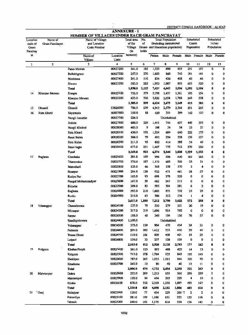
Location eodeof Gram
Panehay at
14
15
Name of Gram Panehayat
2
Khanpur Mewan
Ghasoli
16 Rata Khurd
17 Baghora
18 Vrisangpur
19 Kolgaon
20 Mabrampur
21 "Ganj
DISTRICT CENSUS HANDBOOK: ALWAR
ANNEXURE-I NUMBER OF VILLAGES UNDER EACH GRAM PANCHAYAT
Name of Village and Location Code Number
Total area No. Total Population Scheduled Scheduled of the of (including institutional Castes Tribes
Village House- and Houseless population) Population Population (in holds
--------N-am--e-o~f--------~Lo--ca~ti-on---hectare~ ~Pers--o-n--M~w~e~F~e-ntal~e~M~w~e--F~e-m-u~e~M~w~e--F~e-m-a~le
Viliae Code
3 4
PatanMewan
Ballabhgram
Nimbhera
Siwana
Total
Dongra
Khanpur Mewan
Total
Ghasoli
Shyamaka
NangJi Janardar
leelota
NangJi Khaleel
Rata Khurd
Basai Balan
Rata Kalan
Basai Jagla
Total
Chachaka
Dhamookar
Manothadi
Husepur
KutiyaPur
Nangw Mohammadpur
Bidarka
Baghora
Raoka
Total
Chaundawata
Mirzapur
Sarpur
OOS27200
00827300
OOS27400
00827500
00825100
00825200
(0826000
00827600
00827700
00827800
00828000
00828100
00828200
00828300
00828400
00821600
00821700
00821800
00821900
00823700
00823800
00823900
COS24000
00824900
00824100
00824200
00824300
5 6 7
341.0
257.0
185 1,323
270 1,603
241.0 110
583.0 285
1,838.0 I,U2
752.0 379
633.0 520
1,385.0 899
784.0 639
834
1,900
7,637
2,798
3,826
6,624
4,943
8
690
860
426
1,007
4,041
1,437
2,038
3,475
2,579
9 10
633 231
743 181
408 43
893 605
3,596 1,292
1,361 166
1,788 249
3,149 415
2,364 291
258.0
224.0
600.0
463.0
430.0
306.0
211.0
677.0
88 620 321 299 142
3,169.0
381.0
376.0
125.0
229
9
192
79
95
231
923
159
187
66
284.0 128
165.0 93
167.0 59
309.0 85
595.0 210
215.0 63
2,617.0 1,050
127.0 79
217.0 219
18S.0 48
Uninhabited
1,441 744
108 54
1,324 684
492 254
802 414
1,487 775
6;1.74 3;1.46
996 506
1,172 603
368 198
932
698
462
595
1,603
386
7;1.12
530
1,6%
340
471
378
247
304
871
212
3,790
279
914
184
697 449
54 23
640 222
238 139
388 54
712 270
3,028 . 1,299
490 169
569 23
170 2
461
320
215
291
732
174
3,422
251
782
156
38
o o 6
33
I
272
20
o 76
Rundhgidawara
Vrispngpur
00824400 1.100.0 Uninhabited
Padasala
ThanaGhora
Lalpuri
Total
Khohra PeepJi
Koigaon
Shekhpur
Khudeena
Tolal
DDbra
Mahrampur
Khoha
Total
Kultajpur
Ihirandiya
TaJ:mDIi
00824500 373.0 129
00824600
00824700
00824800
00825400
oo82550~
00825600
00825700
00825800
00825900
00826100
00822900
00823100
00823200
1002
291.0
IIS.O
139.0
2,553.0
261.0
713.0
787.0
245.0
2,006.0
222.0
128.0
870.0
1,220.0
120.0
281.0
248.0
203
101
33
812
123
278
263
10
674
209
84
332
625
77
189
182
904 470 434 24
39
18
1,412
809
237
5,928
893
1,784
1,955
80
4,712
1,215
752
408
128
3,135
468
935
1,011
40
2,454
655
494 265
2,329 1,232
4,038 2,152
434 229
1,186 631
1,170 616
660
401
109
2,793
425'
849
944
40
2,258
560
o 177
14
195
100
12
321
286
229 4
1,097 193
1,886 483
205 rJ 2
555 155
554 156
11 12 13
197 0 0
141 0 0
46
520
1,106
154
228
382
265
127
393
27
179
127
49
250
1,152
165
21
4
37
o o 2
25
4
258
19
o 57
21
40
25
o 162
13
149
70
II
243
239
10
167
416
2
118
143
o o o o o o o o
o o o o o o o o o o o o o o o o o o o o
o o o o o o o o o o o o o o o o o
o o o o o o o o
o o o o o o o o o o o o o o o o o o o o
o o o o o o o o o o o o o o o o o
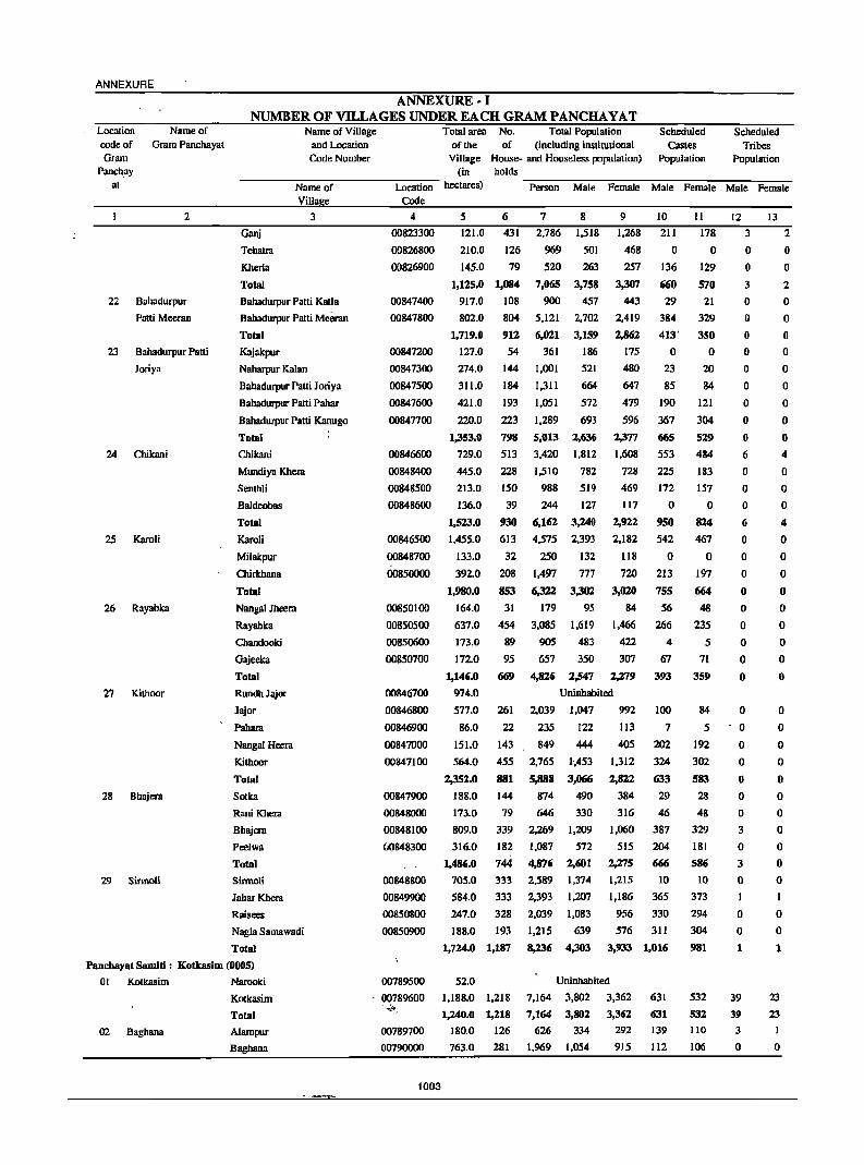
ANNEXURE
Location Name of code of Gram Panchayat Gram
Panch.ay at
2
22 8ahadurpur
Patti Meeran
23 Bahadurpur Patti
Joriya
24 Chikani
25 Karoli
26 Rayabka
27 Kithoor
28 Bhajera
29 Sirmoli
ANNEXURE·I NUMBER OF VILLAGES UNDER EACH GRAM PANCHA YAT
Name of Village and Location Code Number
Total area No. Total Population Scheduled Scheduled of the of (including institutional Castes Tribes
Village House- and Houseless population) Population Population (in holds
----N-a-rn-e-o-f-----L-oc-a-:ti-on- hectares) -:P::-e-rs-o-n~M:-;-:a1:-e--:F:;-e-rn-a1:-e--:M-;a-:le-F:::e-rna-:-le~M:-:-:al-:e--=Fe-rna-:-Ie
Villae Code
Ganj
Tehatra
Kherla
Total
3
Bahadurpur Patti Kalla
Bahadurpur Patti Meeran
Total
Kajakpur
Naharpur Kalan
Bahadurpur Patti Joriya
Bahadurpur Patti Pahar
Bahadurpur Patti Kanugo
Total
Chikani
Mundiya Khera
Senthli
Baldeobas
Total
KaroH
Milakpur
Chirthana
Total
Nangal Jheera
Rayabka
Chandooki
Gajeeka
Total
Rundh Jajor
Jajor
Pahara
Nangal Heera
Kithoor
Total
Sotka
Rani Khera
Bbajera
Peelwa
Total
Sirmoli
lahar Khera
Raisees
Nagla Sarnawadi
Total
4
00823300
OD8268oo
00826900
00847400
00847800
00847200
00847300
00847500
00847600
00847700
00846600
00848400
00848500
00848600
00846500
00848700
00850000
00850100
00850500
00850600
00850700
00846700
00846800
00846900
00847000
00847100
00847900
00848000
00848100
(J()8483oo
00848800
00849900
00850800
00850900
5 6 7 8 9 10
121.0 431 2,786 1,518 1,268 211
210.0 126 969
520
7,065
900
5,121
6,021
361
501
263
3,758
457
2,702
3,159
186
145.0 79
1,125.0 1,084
917.0 108
802.0 804
1,719.0 912
127.0 54
274.0
311.0
421.0
220.0
1,353.0
729.0
445.0
213.0
136.0
144 1,001
184 1,311
521
664
193 1,051 572
223 1,289 693
798 5,013 2,636
513 3,420 1,812
228 1,510 782
150 988 519
39 244 127
930 6,162 3,240
613 4,575 2,393
32 250 132
468
257
3,307
443
2,419
2,862
175
480
647
479
596
2,377
1,608
728
469
117
2,922
2,182
118
1,523.0
1,455.0
133.0
392.0 208 1,497 777 720
1,980.0
164.0
637.0
173.0
172.0
853 6,322 3,302 3,020
31 179 95 84
454 3,085 1,619 1,466
89 90S 483 422
95 657 350 307
1,146.0
974.0
577.0
86.0
151.0
669 4,826 2,547 2;1.79
Uninhabited
261 2,039 1,047 992
22 235 122 113
143 849 444 405
564.0 455
2,352.0 881
188.0 144
173.0 79
809.0 339
316.0 182
1,486.0 744
705.0 333
584.0 333
247.0 328
188.0 193
2,765
5,888
874
646
2,269
1',453
3,066
490
330
1,209
572
2,601
1,374
1,207
1,083
639
1,312
2,822
384
316
1,060
515
2;J.75
1,215
1,186
956
576
o 136
660
29
384
413'
o 23
85
190
367
fi65
553
225
172
o 950
542
o 213
755
56
266
4
67
393
100
7
202
324
633
29
46
387
204
666
10
365
330
311
1,724.0 1,187
1,087
4,876
2,589
2,393
2,039
1,215
8,236 4,303 3,933 1,016
11 12 13
178 3 2
o 129
570
21
329
350
o 20
84
121
304
519
484
183
157
o 824
467
o 197
664
48
235
5
71
359
84
5
192
302
583
28
48
329
181
586
10
373
294
304
981
o o 3
o o o o o o o o II
6
o o o 1'1
o o o o o o o o o
o o o o II
o o 3
o 3
o
o o 1
o o 2
o o II
o o o o o o 4
o o o 4
o o o o o o o o o
o o o o o o o o o o o I
o o 1
Pancbayat Samili: Kotkasim (0005)
01 Kotkasim Narooki
02 Baghana
Kotkasim
Total
Alampur
8aghana
00789500
00789600 ''';~.
00789700
00790000
1003
52.0
1,188.0 1,218
1,240.0 1,218
180.0 126
763.0 281
7,164
7,164
626
1,969
Uninhabited
3,802 3,362 631
3,802
334
1,054
3,362
292
915
631
139
112
532
532
110
106
39
39
3
o
23
23
I
o
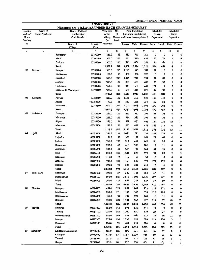
Location code of Gram
Panchay at
'03
04
05
06
07
08
09
10
Name of Gram Panchayat
2
Beelaheri
Kanharka
Makdawa
Ujoli
Burhi Bawal
Bhonkar
Teuwas
KutubpUT
DISTRICfCENSUS HANDBOOK: ALWAR
ANNEXURE· I NUMBER OF VILLAGES UNDER EACH GRAM PANCHA VAT
Name of Village and~lion
Code Number
Total atea No. Total Population Scheduled Scheduled of the of (including institutional Castes. Tribes
Village House- and Houseless population) Population Population (in holds
--------N-a-m-e-o-f---------Lo--~~ti~on--h~ate~ ~P~~---n~M~al~e~F~e-m-al~e--Mal--e--F~e-m-a~k--M-a-le--F~e-ma---~
Vill e Code
3 4
Kasimpur
Meoli
Badsara
Total
Rampur
Beeliyawas
Beelaheri
Jakopur
Goojriwas
Maswasi @ Madhopuri
Total
Narwas
Anaka
Kanharka
Total
Jamalpur
Matalwas
Si1pata
Makdawa
Total
Akoli
Hajnaka
Lalpur Beeranwas
JokhaW3S
Ujoli
Deoseeka
Jatoowas
Hajipur
Total
Kaririwas
Burhi Bawal
Majri
Total
.Nasopur
Modhoopur
Bhamoowas
Bhonkar
Total
Dalawas
Teuwas
Berawas Kalan
Meerpur
Chawandi
Total
Kayampura Jokhawas
Kutubpur
Chowiti
Sherpur
00790200 00790400 00791300
00788100 00788200
00788300
00789800
00789900 00790100
00788400 .' 00788500
00788600
00787500
00787600
00787700
00787800
00785500 00785700
00785800 00785900
00786000
00786100
00786200
00787900
00788000
00785600
00786400 00786500
)
00786600
00786700 00786800
00786900
00787000 00787100 00787200
00787300 00789200
00786300 00787400 00788700 00788800
1004
5
189.0 390.0
305.0
1,827.0
313.0 189.0
393.0
205.0
351.0
278.0
1,729.0
220.0
190.0 609.0
1,019.0
267.0
261.0
293.0
299.0
1,120.0
335.0
151.0 596.0
297.0
103.0 630.0
115.0
320.0 296.0
2,843.0
105.0
892.0 160.0
1,157.0
454.0 283.0
185.0 329.0
1;251.0
150.0
224.0
180.0 275.0
220.0
1,049.0
486.0 '572.0 161.0 183.0
6
S3
167
115
742
195 90
246
122
143
90
886
182
85 352
619 106
116 141
156
519
191
S3
132
62
S9
185
12
184
94
97Z
57
625 115
797
323
17l
94
298
886
143 165
140
196 79
723
102
324
73
146
7
482
951 772
4,800
1,197 482
1,475
859
941
589
5,543 1,131
519 2,102
3,752
623
774
838
897
3,132
1,077
337
912
410
365
1,207
117
1,168
525
6,118 342
3,676
662 4,680 1,881
1,103 539
1,784
5,307
974
1,200
883 1,236
485
4,778
605
1,997
404 777
8
265
520 401
2,574
645 262
741
453
500
316
2,917
599
261
1,098
1,958
332
383
437
469
1,621
545
169
469
208
197
628
67
589 281
3,153
188
1,900
343
2,431
1,009
565 271
967
2,812
530
630
460
636
259
2,515
331
1,039
228
376
9 10
217 0
431
371
2,226
5S2 220
734
406
441
273
2,626
532
258
1,004
1,794
291
391
401
428
1,511
532
168
443
202
168
579
50
579
244
2,965 154
1,776
319
2,249
872
538
268 817
2,495
444
570
423
600
226
2,263
274
958 176
401
187
76
514
132
3
81
33
127
42
418 168
52
259
479
58
35
134
145
372
145
77
91
9
64
94
o 193
12
685 47
307 57
411 216
122
16
115
469
o 23
70
133
o 226
76
90
41
87
11 12 o 0
174
67
457
l15
2
83
33
119
37
389 142
52 263
457 53
36
132
117
338
137
66
95
11
53
89
o 192
14
657
41
307
59 407
178
108
11
97
394
o 27 66
130
o 223
67
93
2S
103
o 4
o o o o o o o o o o o o o
83
o 8..1
o o o o o 2
o o o 2
o o o o o o o
48
48 o o
22
3
48
73
o 32
o 2
13 o o o 1
o o o o o o o o o o o o o
71
o 71 o o o o o 2
o o o 2
o o o o o o o
37
37
o o
16
3
42
61 o
23 o 2
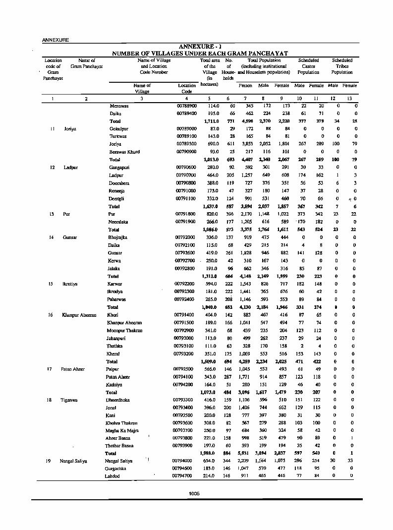
ANNEXURE
Location code of Gram
Name of Gram Panchayat
Panchayat
2
II loriya
12 Ladpur
13 Pur
14 Gunsar
15 Ikrotiya
16 Khanpur Aheeran
17 Patao Ahccr
18 Tiganwa
19 Nangal Saliya
ANNEXURE·} NUMBER OF VILLAGES UNDER EACH GRAM PANCHA YAT
Name of Village and Location Code Number
Name of Villa e
Menawas
Daika
Totni
Gokulpur
Turkwas
Joriya
Berawas Khurd
Total
Gangapuri
Ladpur
Doomhera
Ronccja
Deelfgli
Total
Pur
Neemlaka
Totni
Bhojrajka
Oaika
Gunsar
Kerwa
Jalaka
Totni
Karwar
Ikrotiya
Paharwas
Total
Kheri
3
Khanpur Aheeran
Moonpur Thakran
Jabanpuri
Thathka
Kheral
Total
Palpur
PatanAheer
Kadaiya
Total
Oheerdhoka
lonal
Kani
Khohra Tbakran
Magha Ka Majra
AbcerBasna
lbetbar Basna
Total
Nangal Saliya
Gurgachka
Lahdod
Total area No. Total Population of the of (including institutional
Village House· and Houscless population)
Scheduled Castes
Population
Scheduled Tribes
Population (in holds _________________ _
Location hectares) Person Male Female Male Female Male Female Code
4 5 6 7 8 9 10 II 12 13
00788900 114.0 60 345 172 173 22 20 0 0
00789400
00789000
00789100
00789300
00790900
00790600
00790700
00790800
00791000
00791100
00791800
00791900
00792000
00792100
00792600
00792700
00792800
195.0
1,711.0
87.0
143.0
690.0
93.0
1,013.0
280.0
464.0
388.0
173.0
332.0
1,637.0
820.0
266.0
1,086.0
336.0
115.0
419.0
250.0
191.0
1,311.0
66 462 224
771 4,590 2,370
29 172 88
28 165 84
611 3,853 2,052
25 217 116
693 4,407 2,340
92 592 301
205 1,257 649
119 727 376
47
124
587
396
177
573
137
327
991
3,894
2,170
1,205
3,375
919
68 429
261 1,828
42 310
96 662
180
531
2,037
1,14&
616
1,764
475
215
946
167
346
00792200 594.0
604 4,148 2,149
222 1,543 826
00792300
00792400
00791400
00791500
00792900
00793000
00793100
00793200
00792500
00794100
00794200
00793300
00793400
00793500
00793600
00793700
00793800
00793900
00794000
00794600
00794700
1005
181.0
265.0
1,040.0
404.0
189.0
341.0
113.0
111.0
351.0
1,509.0
566.0
343.0
164.0
1,073.0
416.0
396.0
222
208
652
142
166
68
80
63
175
694
146
287
51
484
159
200
200.0 128
308.0 82
250.0
221.0
197.0
1,988.0
654.0
183.0
214.0
97
158
60
884
344
146
146
1,441
1,146
4,130
883
765
593
2,184
467
1,041 547
439 235
499 262
328 170
1,069 553
4,259 2,234
1,045
1,771
280
3,096
1,106
1,406
777
567
684
998
393
5,931
2,239
1,047
911
552
914
151
1,617
596
744
397
279
360
519
199
3,094
1,t"64
570
465
238
2,220
84
81
1,801
101
2,067
291
608
351
147
460
1,857
1,022
589
1,611
444
214
882
143
316
1,999
717
676
553
1,946
416
494
204
237
158
516
2,025
493
857 129
1,479
510
662
61
377
o o
267
o 267
30
174
56
37
70
367
373
'170
543
o 4
141
o 85
230
182
60
89
331
87
77
123
29
2
153
471
61
123
46
230
151
129
380 31
288 103
324
479
194
2,837
1,075
477
446
58
90
35
597
296
118
77
71
379
o o
289
o 289
33
162
53
28
66
342
342
182
524
o 8
128
o 87
223
148
42
84
274
65
74
112
24
4
143
422
49
118
40
207
122
115
30
100
42
89
42
540 254
95 84
o 34
o o
100
o 100
o
6
o o 7
23
o 23
o o o o o o o o o o o o o o o o o o o o o o o o o o o o o
30
o o
o 25
o o
79
o 79
o 3
3
o <; 0
6
22
o 22
o o o o o o o o o o o o o o o o o o o o o o o o o o
o 1
33
o o
Location Name of code of Gram Panchayat Gram
Panchayat
2
20 Baghel'i Khurd
21 Harsoli
22 Pataliya
23 Jatiyana
24 Gheekaka
DISTRICT CENSUS HANDBOOK: ALW AR
ANNEXURE· I NUMBER OF VILLAGES UNDER EACH GRAM PANCHA YAT
Total area No. Total Population Scheduled Scheduled of the of (including institutional Castes Tribes
Name of Village and Location Code Number Village House- and Houseless population) Population Population.
(in holds ------:'N':"a-m-e-o':"f -----=L,.-o-c-au.,...· o-n hectares) -:P=-e-rs-o-n--=M~al-e --=P=-em--=al"-e---:'M':"al"!'"e--=P=-e-ma'_""'le---:'M"!'"a"!'"le--=P=-e-m-a-=-le
Villa e Code
3 4 5 6 7 8 9 10 11 12 13
Raipur latan
Mirzapur
Total
Beraheri
Bagheri Khurd
Salkhar
Koompur
Daula! Nagar Majra
Moonpur Mewan
Shorwa
Total
Harsoli
Jharka
Pataliya
Nallgli Jatan
Hanspur Kalan
Hallspur Khurd
Kharola
Total
Shahjadpur
Sadhooka
Jhiryana
Shahpur
Jatiyana
Rarnnagar
Kirwari
Lisani
Girwas
Bhojpur
Total
Raniyawas
Begampur
Gheekaka
Chaclliyawas
Sanoda
Total
00794800
00795000
00794300
00794400
00794500
00795100
00795200
00795300
00795400
00796400
01)794900
00796600
00796700
00796800
00796900
00797000
00795500
00795600
00795700
00795800
00795900
00796000
00796100
00796200
00796300
00796500
C0790300
00790500 .
00791200
00791600
00791700
312.0
291.0
1,654.0
159.0
594.0
269.0
190.0
179.0
113.0
153.0
1,657,0
145 1,131 578 553
40 250 133 I17
821 5,578 2,910 2,668
81 527 293 234
186 1,349 735 614
96 672 345 327
71 445 229 216
108 714 377 337
24 240 117 123
80 501 270 231
M6 4,448 2,366 2,082
1,464.0 1,276
349.0 240
8,060, 4,279
1,537 790
3,781
747
754
221
318
305
488
399.0 231
97.0
152.0
153.0
186.0
1,336.0
75
96
112
131
885
1,611 857
464
699
680
243
381
375
573
2,833
43
51
585
15
112
35
133
81
30
71
477
773
113
222
15
56
o 17
42.'\
38
51
522
14
83
41
125
87
24
56
430
677
112
209
18
41
o 15
395
144.0 38
1,061
6,052
266
335
400
947
3,219
139
176
206
500
668
215
723
127 0 0
165.0 41
105.0 52
48.0 151
356.0
137.0
196.0
89.0
355.0
70.0
1,665.0
163.0
99.0
402.0
96.0
191
77
185
30
230
50
1,045
28
32
279
37
1,310
415
1,420
186
1,629
369
7.277
223
223
1.745
258
164.0 I12 719
924.0 488 3,168
94
801
189
3,711
113
121
919
136
366
1,655
159 13 6
194 72 74
447 363 331
642 44
200 31
697 162
92 0
828 716
180 175
3,566 1,576
110 0
102 26
826 201
122 42
353 75
1,513 344
44
31
161
o 752
167
1,566
o 21
167
38.
65
291
o o
30
o o o o o o o o
47
o o o o o o o o o o o o o o o o o o o o o o o o
o o
33
o o o o o o o o
36
o o o o o o o o o o o o o o o o o o o o o o o o
Panchayat Samiti : Tijara(0006)
OJ Santhalka Milakpur Goojar
Santhalka
02 Khijooriwas
03 Seethal
Harchandpur
BeelaHeri
Khijarpur
Total
Khanpur
Khijooriwas
. Total
Seethal
Udaipur
'Thara
00797400
00797500
00797600
00798100
00798200
00797300
00798300
00797100
0:J7972oo
00799600
1006
482.0 941 4,415
221.0 1.375 5.130
211.0 1,021 3,583
66.0 2D9 1.022
142.0 39 312
1,122.0 3,5S5 14,462
209.0 333 1.892
2,504
3,515
2,489
630
166
9,304
1,005
685.0
894.0
275.0
167.0
181.0
5S2 3.154 1,795
885 5,046' 2,800
215 1.332 704
71l 3,137 2,240
138 762 395
1,911 477
1,615 433
1,094 519
392 107
146 0
5,158 1.536
887 205
1.359
2,246
628
897
367
133
338
42
188
34
405
303
413
92
o 1,213
186
115
301
40
86
30
2
36
3
o o
41
o 1
o o o
o 16
2
o o
18
" 1
o 1
:; 0
o o
ANNEXURE
Location Name of code of Gram Panchayat Gram
Panchayat
2
04 Tapookra
05 Salarpur
06 ·Mahesara
07 Ihiwana
08 Guwalda
09 Chooharpur
10 Joriya
ANNEXURE-I NUMBER OF VILLAGES UNDER EACH GRAM PANCHA YAT
Total
Tapookra
Basai
Ladamka
Kamalpur
Total
Tatarpur
Kalaka
Shahpur
Huseengpur
Salarpur
Total
Karampur
Burera
Rabadka
Mahesara
Dhamawas
Karmsiwas
Khuskara
Karoli
Total
Jhiwana
Banban
Banbeerpur
Bibipur
Ladiya
Total
Gandhola
Guwwda
Nibaheri
Banjhra
Total
Sare Khurd
Malmndika
Udhanwas
Kulawat
Chooharpur
Ladpuri
Gandwa
Indor
Rundh Indor
Total
Karenda
Joriya
Pakaruddinka
Pathredi
Chaupanki
Bandapur
Husaipur
Name of Village and Location Code Number
Name of Villa e
3
Total area No. Total Population Scheduled Scheduled Tribes
Population of the of (including institutional Castes
Village House- and Houseless population) Population (in holds
LoClltion hectares)
Code
-P~~--o-n~M~al~e~F~e-m-a~le~M~a~l-e-=Fe-ma~le~M~w-e-=F-em-a~le-
4 5 6 7 8
00803700
OOS05000
00805100
OOS052OO
00799500
00799700
1:00799800
00799900
00809100
00802800
00802900
00803100
00803200
00803300
00S034OO
00803500
00803600
00799300
00799400
00800000
00800100
00802600
00802200
00802300
00803900
00804000
00801300
00801400
00801500
00801600
00801700
623.0 1,064
407.0 1,057
47.0
138.0
286.0
878.0
157.0
IS
73
195
1,343
401
197.0 106
253.0 102
113.0 74
5,231
6,271
107
372
1,184
7,934
1,763
601
601
412
3,339
3,264
5S
192
624
4,135
993
317
312
229
183.0
903.0
144
81.7
74
198
942 482
6S.0
228.0
294.0
349.0
4,319 2,333
337 '. 179
1,215 623
218 1,261
241 1,283
82.0 38 243
94.0 12
228.0 92
606.0 293
1,949.0 1,166
718.0 576
144.0 87
141.0 190
137.0 103
159.0 91
1.299.0 1,047
268.0 156
1,387.0 886
616.0 429
74
497
1,668
6,578
3,875
61S
898
778
621
6,790
I,~
6,619
3,102
134.0 19 77
2,465.0 1,490 11,022
330.0 152 866
97.0 21 120
95.0 74 394
186.0 52 375
411.0 202 1,518
675
726
115
37
331
998
3,684
1,972
3IB
520
425
342
3,577
623
3,489
1,643
37
5,792
462
62
251
189
787
9 10
1,892 264
3,007 776
52
180
560
3,799
770
284
289
183
460
1,986
158
592
586
557
128
37
166
670
2,894
1,903
300
378
353
279
3,213
601
3,130
1,459
40
5,230
404
58
143
186
731
o o
137
913
102
88
95
84
153
522
27
112
168
186
o 14
33
260
ROO 310
99
124
o 17
610
84
377
98
a 559
34
o o
19
21
00801800 171.0 30 113 88 85 a 00801900 172.0 97 663 353 310 46
00802000 542.0 187 1,362 730 632 189
00802100 2,277.0 Uninhabited
4,281.0
00798900 202.0
00799200 191.0
00800500 95.0
00800600 99.0
00800700 454.0
00800800
00800900
1007
15S.0
182.0
815 5,471 2,922
222 1,560 826
103 993 SIS
140 1,006 518
145 1,081 563
152 1,150 618
98
93
722
730
382
391
2,549 309
734 82
415· 29
488 24
518 96
532 99
340 a 339 138
11 12
156 0
753 5
o o
124
877
93
78
81
55
128
435
19
106
157
165
o 10
37
115
669
344
95
100
o 19
558
75
325
103
a 503
18
o o
15
33
a 36
IS9
291
66
3S
17
86
107
a 136
o a o 5 5
o o o o 5
a o o o o o o I
1
o o o o o o o o o o o o o o o o o o o
o a o o o o o o
13
o 4
o a o 4
o o o o a o o o a o o o o o o o o o o o o o o o o o o o o o o o o o
o o o o o o o a
Location Name of code of Gram Panchayat Gram
Panchayat
2
II Mayapur
12 Kahrani
13 Maseet
14 MilakpurTurlc
15 Khidarpur
........
DISTRICT CENSUS HANDBOOK: ALWAR
ANNEXURE-I NUMBER OF VILLAGES UNDER EACH GRAM PANCHAYAT
Name of Village and Location Code Number
Name of Villa e
Kheri
Kharkhari
Sare Kalan
Total
Chhapar
Khatiwas
Khohri Khurd
Khohri Kalan
Mayapur
Daganheri
Lakhnol'
Total
Rampura
Shahdod
Amlaki
MundanaMeo
Godhall
Kahrani
Glldpur
Karendi
Bahadari
Phalsa
Bhoodli
Total
Musari
Mirchooni
Jhundpuri
Dheeriyawas
Naugawan
Maseet
Hasanpur
Gelpur
Total
Bhalesar
Ubamka
Dholi Pahari
Jakhopur
Bub Ka Hera
Meethiyawas
Patan Khurd
Milakpur Turk
Total
Bharnraka
Paton Kalan
Adeepur
GOlOli
Khidarpur
Abhanpur
Bhatkol
3
Total area No. Total Population Scheduled of the of (including institutional Castes
Village House- and Houseless population) Population
Scheduled Tribes
Population
(in holds __ -----___ ---..,.-=----..,.-___ --:-Location hectares) Person Male Female Male Female Male Female
Code
4 5 6 7 8
00801000
00801100
00801200
00800200
00800300
00800400
00802400
00802500
00802700
00803800
00797700
00797800
00797900
00798000
00798400
00798500
00798600
00798700
00798800
00799000
00799100
00804700
00804800
00804900
00805300 , . 00805400
00805500
00805600
00805700
00804100
00804200
00804300
00804400
00804500
00804600
00806000
00806100
00805800
00805900
00806200
00806300
00806400
00807500
00807600
1008
176.0
203.0
189 1,154
69 552
376.0 270 1,957
2,136.0 1,481 10,985
198.0 105 722
98.0
238.0
448.0
152.0
183,0
95 658
100 782
207 1,406
173 1,315
115 621
532.0 320 2,533
8,037
1,789
1,376
1,849,0 1,115
128.0 385
154.0 181
67.0 38
2551.0
288.0
488.0
62.0
479
89
333
99
307
2,303
689
2,114
875
102.0 111 847
62.0 71 549
82.0 62 380
72.0 33 272
1,760.0 1,881 11,501
100.0 135 916
83.0 108 754
44.0 SO 282
593
279
1,011
5,699
378
341
412
719
667
321
1,302
4,140
1,120
739
152
1,556
378
1,093
468
453
299
201
150
6,609
463
372
150
269.0 214 1,539 780
89.0
224.0
143.0
168.0
1,120.0
376.0
193.0
310.0
249.0
240.0
245.0
282.0
53 386 205
143 952 504
123 698 374
133 878 470
959 6,405 3,318
85 617 318
95 698
95 599
168 1,050
121 751
lSO 915
118 941
358
311
550
393
465
500
1,305.0 291
3,200.0 1,123
1,968 989
7,539 3,884
223.0 199 1,293 667
313.0 106 729 373
491.0
957.0
828.0
249.0
205.0
8 61
191 1,349
264 1,600
69 516
131 783
33
715
839
262
399
9
561
273
946
10
33
5
62
568
6
11
29
o 71
550
3
5,206
344
317
370
687
648
300
45 37
o 0
81 68
4 I
70. 65
1,231
3,897
669
637
155
747
311
1,021
407
394
250
179
122
4,892
453
382
132
759
181
448
324
408
3,087
299
99
305
238
105
o 115
o 208
17
2
o 59
35
779
o 89
o o O.
47
51
82
269
o 340 18
288 62
500 19
358 165
450 32
441 47
979
3,655
626
356
168
511
87
136
80
254
185
94
o 53
o 196
10
2
o 61
24
625
o 84
o o o
37'
42
79
242
o 14
48
14
127
27
36
160
426
96
103
12
o o o o o o o o o o o o 7
o o o o
o o o o o 8
o o o o o o o o o o o o o o o o o o o o
28
634
761
254
384
o 0 0
188 151 110
195 . 171 0
o 0 0
o 0 0
13
o o o o o o o o o o o o 1
o o o o o o o o o o 1
o o o o o o o o o o o o o o o o o o o o o
117
o o o
ANNEXURE
Location code of Gram
Name of Gram Panchayat
Panchayat
2
16 Rabhana
17 BicWlala
18 Ishroda
19 Hameeraka
20 Palpur
21 Luhadera
22 Virampur
23 Mundana
ANNEXURE-I NUMBER OF'VILLAGES UNDER EACH GRAM PANCHA YAT
Name of Village and Location Code Number
Total area No. Total Population Scheduled Scheduled of the of (including institutional Castes Tribes
Village House- and Houseless population) Population Population (in holds
------~N~a-m-c-o~f--------~Lo-c-au~·on--hectarcs) ~P~erso---n~M~w-c~F~e-ma~l~c~M~ru~e~F~c-mru~c~M~ru~e--~Fe-m-ill--e
Villa e Code
Shadipur
Paharsamiat@
Roondhroopbas
Total
3
Jagmal Heri
Matawas
Chawandi Khurd
Nanagheri
Rabbana
Pavti
Total
Dabhera
Binoliya
Salahera
Bichhala
Total
Shekhpur Aheer
IsllfOda
Total
Siroli Kalan
Siroli Khurd
AmeerNagar
Peeplana
NabiNagar
Jojaka
Tajalka
Kharkhara
Hameeraka
Total
Sruarpur
Milakpuri
Alapurmeo
Palpur
Baliyawas
Total
BamanThedi
Rambas Jhonpri
Luhadera
Total
Udaipur
Dhaki
Bhoodki
Rajdhoki
Asleempur
Ibrahimpur @
Virampur
Total Bhojawas
Sarkanpur
4
00807800
00809600
00806500
00806600
00806700
00807200
00807300
00807400
00806800
00806900
00807000
00807100
00808400
00808500
00807700
00807900
00808000
00808100
00808200
00808300
00809300
00809400
00809500
00803000
00809200
00810200
00810300
00810400
00808900
00809000
00810500
00811100
()0811200
Q0811700
00811800
00811900
00812000
00808600
00808700
1009
5 6 7 8 9 IO II 12 13
419.0 23 209 100 109 0 0 0 0
700.0 Uninhabited
4,385.0
95.0
105.0
213.0
180.0
991 6,540 3,388
73 455 232
44 297 155
III 863 483
105 733 368
173.0 149 1,069 527
173.0
939.0
214.0
78 463 248
560 3,880 2,013
70 588 305
315.0 155 1.043 564
262
735
384.0 93 543
263.0
1,176.0
134.0
1,085.0
1,219.0
695.0
185.0
267.0
534.0
260
578
106
587
693
216
1.429
3,603
835
3,588
4,423
1.627
53 360
88 562
147 1,008
256.0 129 835
909
460
616
1,866
433
1,874
2,307
847
175
300
543
442
441
240
308
165.0 139
194.0 62
194.0 91
720.0 368 2,691
9,068
1,982
1,414
4,710
1,049
3,210.0 1,293
579.0 339
205.0 97 663 336
590 552.0 125 1,109
528.0
286.0
2,150.0
264.0
356.0
379.0
999.0
204.0
172.0
49.0
102.0
259.0
163.0
949.0
254.0
162.0
203 1,781 927
154 1,061 558
918 6,596 3,460
120 661 330
213 1,275 646
251 1,664 883
584 3,600 1,859
110 627 321
156 911 500
26
74
231
121
139
461
1,454
725
. 67
237 . 739
398
718 4,317 ,(1'1,262
101 570 308
104 581 302
3,152
223
142
380
365
542
215
1,867
283
479
281
694
1,737
402
1,714
2,116
780
185
262
465
393
468
220
308
1,277
4,358
933
327
519
854
503
3,136
331
629
781
1,741
306
411
72
224
715
327
606
8
o 3
60
o 60
131
99
18
47
195
359
75
299
374
94
42
72
76
203
146
9
16
101
759
154
o o
17
115
286
87
69
214
370
105
36
9
o 220
61
2,055' 431
262 21
279 23
521
7
o I
55
o 52
115
86
10
45
157
298
62
302
364
88
42
53
64
184
146
6 34
98
71S
122
o o
18
97
237
81
66 191
338
95
37
5
o 193
42
372
15
20
110
o o o o o o o o o o o o o o o o o o o o o o o o o o o o o o o o o o o o o o o o o
o o o
117
o o o o o o o o o o o o o o o o o o o o o o o o o o o o o o o o o o o o o o o o o
o o o
Location code of Gram
Panchayat
24
2S
26
27
28
29
30
31
32
Name of Gram Panchayat
2
Heengwahera
Shahbad
RaiKhera
Bhindoosi
Gahankhar
Gothra
Chawandi Kalan
Jairoli
Phullabas
DISTRICT CENSUS HANDBOOK: ALWAR
ANNEXURE-I NUMBER OF VILLAGES UNDER EACH GRAM PANCHA VAT
Name of Village and Location Code Number
Total area No. Total Population Scheduled Scheduled of the of (including institutional Castes Tribes
Village House- and Houseless population) Population Population (in holds
------~N~am--e-o~f------~Loca~-u~·o--n hea~) ~B~e-r~--n~~~I~e~R~e-nm~l~e~~~le~F~e-~~le~M7a7~~R~e-m-a~Ie
Villa e Code
3 4 5 6 7 8 Majra Peepli
Mundana
Jalalpur
Total
Heengwahera
Kalgaon
Majri Goojar
Total
Shahbad
Mainaki
Tohra
lbrahimpur Mafi
Maharajpura
Naurllngabad
Shahmat Nagar
Total
Bandra
Majra Mahaniya
Rai Khera
Teehli
Total
Soorawas
Raml'lagar
Bhindoosi
Bichpuri
Naugawan
Total
Mandha
Gahankhar
Total
Mosampur
Alawalpur
Kakrali
Gothra
Total
Berla
Chawandi Kalan
Bai
Barhera
Total
Rundhgol
Gol
ShekhpUljatt
AlapurJatt
Thons
Jairoli
Andhaka
Total Bilaspur
00808800
00810700
00810800
00810600
00810900
00811000
00811400
00811500
00811600
'00813600
158.0 108
496.0 117
457.0
1,527.0
450.0
621.0
256.0
1,327.0
770.0
186..0
39.0
101.0
206
636
386
224
198
808
689
119
12
6
724
803
1,446
4,124
2,241
1,533
1,290
5,064
3,969
363
441
744
2,158
1,148
784
705
2,637
008137001 245.0 115
885
69
30
657
659
227
2,049
469
37
19
332
00813900 199.0 93 335
119 00814100 172.0 34
1,712.0 1,068
00811300 229.0 188
6,496
1,190
3,360
643
00814000
00814200
00814300
00813800
00815000
00815100
00815200
00815300
00814400
00814500
, 00814600
00814700
00814800
00814900
00816900
00817000
00817100
00817200
00815800
00816300
00816500
00816800
00817300
00817400
00817500
00813400
1010
124.0
262.0
249.0
864.0
247.0
176
173
168
705
67
1,033 533
1,085 55Q
1,203 631
4,511 2,357
349 180
349.0 174 1,251 654
603 393.0 206 1,189
113.0
344.0
1,446.0
504.0
491.0
995.0
271.0
162.0
286.0
388.0
1,107.0
664.0
32
94
573
311
332
643
141
55
135
367
618 221
234 111
547 297
3,570 1,845
2,146 1,130
2,371 1,243
4,517 2,373
893 472
337 184
949 499
2,467 1,270
4,646 2,425
1,677 870
635.0 246 1,634 865
405 313.0 110 764
232.0
1,844.0
365.0
491.0
132.0
131.0
lOS 690 377
682 4,765 2,517
8 66 33
94 660 357
72
193
445.0 140
1,997.0 628
531.0 . ]48
4,092.0 1,083
254.0 165.
520
591
268
304
965 518
4,061 2.209
433 227
7,296 3,916
1,234 634
9
361
362
702
1,966
1.093
749
585
2,427
1,920
416
32
11
325
324
lOS
3,136
547
500
535
572
2,154
169
10
20
44
59
167
227
326
51
604
546
o o o
27
3
o 576
195
41
88
44
368
35
597 105
586 58
123
250
1,725
1,016
1,128
2,144
421
153
450
1,197
2,221
807
769
359
313
2,248
33
303
252
287
447
1.852
206
3,380
600
o 101
2IJIJ
247
259
506
25
38
103
259
42S
116
54
59
104
333
o 75
37
o 61
350
15
538
43
11
18
46
48
147
232
303
45
580
498
o o o
21
4
o 523
183
31
93
45
352
45
100
40
o 78
263
229
193
422
19
32
104
254
409
97
37
46
90
270
o 63
41
o 48
293
8
453
33
12
o 18
o 18
o o o o 2
o o o o o o 2
o o o o o o o 4
o o 4
o o o o o o o o o o o o o o o o o o o o· o o
13
o 21
o 21
o o o I)
o o o o o o o o o o o o
° o o 4
o o 4
o o
° o o o o o o o o o o o o o o o o o o o
ANNEXURE
LocatIon code of Gram
Name of Gram Panchayat
Panchayal
2
33 Hasanpur Mafi
34 Baghor
35 Sarhheta
36 Roopbas
37"* Bhiwadi
38·· Alampur
ANNEXURE-I NUMBER OF VILLAGES UNDER EACH GRAM PANCHA YAT
Name of Village and Location Code Number
Total area No. Total Population Scheduled Scheduled of the of (including institutional Castes Tribes
Village House- and Houseless population) Population Population (in holds
------~N~a-m-e-m~-------L~o-~-b~·o-n-hectares) ~P~erso---n~M~w-e~F~e-m-al~e~M~a~l-e-=Fe-rna~le~M~a~l-e-F=e-ma~Ie
Villa e Code
Baijalhera
Ahamlaka
Began Heri
Raipur
Phullabas
Musepur
Dotana
Totw
Palasali
Daika
Ladhawara
Husaipur
Elaka
Hasanpur Mafi
Maliyar Jatt
Khalilpuri
Total
Maliyar Gurjar
Baghor
Neemli
Paharsamlat @
Rundhbaghor
Total
Muradwas
Sarhheta
Rahmatnagar
Baloj
Lapwa
Total
Damdama
Dhakpuri
Kultajpur
Nangw
Roopbas
Arandka
Total
Bhiwadi (C.T.)
Alampur With
Bhiwadi (C.T.)
3 4 5 6 7 8 9 10 11 12 13
00815400 170.0 65 482 245 237 0 0 0 0
00815500
00815600
00815700
00816400
00816600
00816700
00812700
00812800
00812900
00813000
00813100
00813200
00813300
00813500
00815900
00816000
00816100
00816200
00812100
00812300
00812400
G0812500
00812600
00809700
00809800
00809900
00810000
00810100
00812200
40602000
146.0
462.0
339.0
415.0
164.0
257.0
2,207.0
320.0
100.0
145.0
206.0
208.0
604.0
875.0
419.0
2,877.0
70.0
613.0
1,139.0
0.0
1,822.0
160.0
343.0
325.0
444.0
505.0
1,777.0
164.0
122.0
142.0
49.0
314.0
74 575 275
632
428
540
309
446
300
521
389
502
259
394
147 1,153
114
127
73
108
873
213
24
17
817
1,042
568
840
6,711
1,553
194
134
3,509
8 46
797
94
67
TI
3,202
756
100
67
19
63 447 224
958
691
223
901
670
256 1,859
195 1,361
207
983 46
432
353
831 64
206
98
10
241
619
74
148
58
21
196
1,479
7,073
339
3,334
2,439
783 696
3,641 3,432
178 161
1,788 1,546
1,323 1,116
Uninhabited
6,112 3,289
484 262
1,399 700
746 398
97 51
1,747 903
4,473 2,314
478 254
1,046 533
453 235
138 75
1,464 757
2,823
222
699
348
46
844
2,159
224
513
218
63
707
37
o o
62
104
20
266
75
o o o
51
159
59
139
483
o 163
109
272
o 84
75
o 138
297
16
7
37
o 79
32
o o
70
77
21
233
79
o o o
51
157
59
128
474
o 133
83
216
o 81
58
o 129
268
17
6
32
o 80
140.0 104 770 401 369 0 0
931.0 601 4,349 2,255 2,094 139 135
20.0 9,143 33,877 21,483 12,394 1,684 '1,155
o o o o o o o o o o o o o o o o o 2
o
2
o o o o o o o o o o o o o
93
o o o o o
.0
o o o o o o o o o o o o o
o o o o o o o o o o o o o o
59
Population of Village Panchayat Bhiwadi (37) and Alampur (38) were included in Census town Bhiwadi.
Panchayat Sarniti: Ramgarh(0007)
01
02
Alawara
Untwal
Alawarn
Kareeriya
Nakachpur
Untwal
Badi Pokhar
Bera Was
Bere
Total
00843500
00832200
00832300
00832490 00832500
,.~ 00835000
00835100
1011
1,078.0
398.0
225.0
585.0
216.0
373.0
520.0
2,317.0
800 5,619 3,031
139 887 473
103 786 445
253 1,757 918
133
116
91
835
1,112 588
749 403
596 320
5,887 3,147
2,588
414
341
839
524
346
276
2,740
464
138
140
188
47
68
62
643
408
122
108
221
43
59
55
608
o o o o o o o o
o o o o o o o o
Location code of Gram
P:mchayat
03
04
05
06
07
08
09
Name of Gram Panchayat
2
Khunteta Kalan
Kheri
Peeproli
Khilora
Dohli
Khoh
Cheerwa
DISTRICT CENSUS HANDBOOK: ALWAR
ANNEXURE-I NUMBER OF VILLAGES UNDER EACH GRAM PANCHAYAT
Total area No. Total Population Scheduled Scheduled of the of (including institutional Castes Tribes
Name of Village and Location Code Number Village House- and Houseless population) Population Population
(in holds ------~N~a-m-e-o~f------~Lo~c-at~io-n-h~~) ~P~e-~-o-n--M~al~e~F~e-ma~le~M~a~le--=Fe-ma~le~M~a~le~F~e-m-a~le
Villa e Code
3 4
GoojarBas
Khunteta Kalan
Khunteta Khurd
Nangal Tappa
Pali
Nasopur
Total
Kheri
Doli
Khanpur Kalan
MastaBad
Meo Khera
Total
Peeproli
Chowki
Goha
NagJa Balaiya
Sarhela
Total
AdeeNaka
Khilora
Sonagarh
Chandigarll
Niwali
Khojaka
Total
Todli
Mukandwas
KotaKhurd
Baghori
Bardod
Dohli
Total
Khoh
Warispur
Tismar
Rasoolpur
Bandholi
Nangal Nangali
Total
Naharpur Khurd
Alampur
Bahripur
Cheerwa
Sherpur
Kherthala
Bakayanka
Sunhera
Khushpuri
00841800 00841900
00842000
00842100 00842200
00842400
00840500 00840600
00840700
00840800
00840900
00834700
00835200 00835300 00835400
00835500
00831800
00831900
00835900
00836000 00836100 00836200
00828500
00832000 00832100
00835600
00835700 00835800
00828600 00828700 00828800
00828900 00831600
00831700
00837600 00837700
00837800 00837900 00838000 00838600 00838100 00838800 00838900
1012
5
329.0 443.0
190.0
347.0 301.0 332.0
1,942.0 453.0 424.0
251.0
342.0
284.0
1,754.0 600.0
274.0 245.0 159.0
199.0
1,477.0 176.0
676.0 . 177.0
208.0
483.0 260.0
1,980.0
320.0
320.0 397.0
137.0
235.0 620.0
2,029.0
546.0 83.0
133.0 188.0
541.0 248.0
1,739.0
97.0 255.0
157.0 160.0
356.0 92.0
118.0 328.0 258.0
6 7
99 819 180 1,299
80 630
202 159 254
974
202 206
114
113
98
733
322
59 126
48
106
661 63
310
94
78
247 68
860 101
109 158
12
140
312
832
97
88 49 38
1,711 1,011
1,815
7,285 1,505 1,802
772
749
724
5,552 2,545
479 866 404
648
4,942 470
2,058
539 527
1.905 472
5,971
732
927 1,284
83
879 2,135
6,040
821 790 382 296
8
429 691
348
924
532 945
3,869
790
948
411
397
372
2,918 1,333
242
457 214
316
2,S62
248 1,080
283 283
1.005 244
3,143
392
489 691
41
475
1.113
3,201
428 402 188
156 234 1,280 659
56 351 172 562 3,920 2,005
49 320 170 140 1,056
123 878 114 836 178 1,226
S6 332 36 251
134 1,057
117 870
525
452 432
635 181
125 581
435
9 10 390 5
608 189
282 0
787 479 870
3,416
715 854
361
352
352
2,634
1.212
237 409 190 332
2,380
222
978
256
244
900
228
2,828
340
438 593
42
404
1,022
2,839 393
388 194 140 621
179
1,915 150 531 426
404
591 151
126 476
435
142 218
302
856 118 102
.56
43
191
510
86
58 241
o 28
413
5
157
43
o 126
14
345
o o o 3
64
541
608
164
o 62
o 73
o 299
o 232
199 151 172 100
o 119
29
11 12 4 0
150
o 132 213
276
775
105
97
50
41
174
467
63
68 216
o 29
376
149
32
o 106
14
302
o o o 5
56 513
574
158 o
63
o 69
o 290
o 225
188 127
142 78
o 96
27
73
o o o 5
78
o o o 9
o I)
o o o o o o o o
34
o o o
34
o o o o o o o o o o o o o o o o o o o o {)
o o
13 o
80
o o o 4
84
o o o
13
o 13
o o o o o o o o
27
o o o
27 o o o o o o o o o o o o o o o o o o o o O·
o o
ANNEXURE
Location code of Gram
Name of Gram Panchayat
Panchayat
10
II
12
13
14
IS
16
17
2
Choroti Pahar
Jatpur
Danwari
NagliMegha
Neekach
Garbi Dhaneta
Naugawan
Pata
ANNEXURE· I NUMBER OF VILLAGES UNDER EACH GRAM PANCHA VAT
Name of Village and Location Code Number
Total area No. Total Population of the of (including institutional
Village House- and Houseless population) (in holds
Scheduled Castes
Population
Scheduled Tribes
Population
------~N7a-m-e-o~f--------I~~-ca~tion--h~tares) ~Pe-n-o-n~M~al~e~F~e-m-a~~~M~ru-e~Fenm--~le--M--al-e--Fe-m-a-le-
Villa e . Code
3 4
Rabbaka
Mansheerpur
Teekri
Karoli J ageer
Total
Loharwari
Choroti Pahar
Batesra
Total
Chak Meena Pura
Meenapura
Mundpuri
Lalpuri
Jatpur
Choroti Istmurar
Total
Shekhpur
Meghawas
Podipur
Baramda
Danwari
Total
Runtlh Dhooninath
Agyara
BagarMeo
Nagli Megha
Moonpur
Sahajpur
Total
KotaKalan
Neekach
Nakhnol
Khohra Karmali
Total
Kharkhari
Garhi
Dllaneta
Boojaka
Parawada
Newadi
Akleempur
Newada
Sammanpur
Goojarpur Kalan
Total
Naugawan
Nangla Chira\Jlipda
Pata
Roopbas
00839000
00839100
00839200
00839500
00832600
00832700
00833500
00834000
00834100
00841400
00841600
00841700
00842300
00836400
00836600
00836700
00836800
00836900
00833900
00834200
00834500
00841300
00842500
00842600
00829300
00829500
00829600
00829700
Q0829000
00829100
00829200
00829400
00831000
00831100
00831200
00831300
00831400
00831500
00837500
00830400
00830500
00830600
1013
5 6 7 8 9 10 11 12 13
122.0 45 436 230 206 14 14 0 0
120.0
207.0
56
84
1220 44
2,392.0 1,176
315.0 126
327
113
471
574
257
294
342 187
8,649 4,504
1,204 591
2,342
756
1,238
383
214
280
28
55
155 0
4,145 1,099
613 50
1,104
373
451.0
171.0
937.0
126.0
212.0
294.0
255.0
653.0
336.0
566 4,302 2,212 2,090
375
174
599
10 73 35 38
1,876.0
349.0
121.0
135.0
255.0
393.0
1,253.0
654.0
558.0
524.0
588.0
292.0
523.0
3,139.0
172.0
628.0
330.0
690.0
1,820.0
127.0
305.0
373.0
448.0
173.0
95.0
166.0
224.0
95.0
119.0
2,125.0
168 1,383 • 761
58 460 240
92 653 329
266 1,879 982
237 1,822 977
831
222
117
29
257
155
780
8
103
319
321
140
308
1,199
85
389
138
343
955
53
6,270
1,155
657
214
1,505
1,015
4,546
40
648
2,215
3,314
596
311
112
786
5S4
2,359
20
345
1,172
2,033 1,037
1,141 615
2,128 1,095
8,205 4,284
617 319
2,645 1,380
741 393
2,586 1,343
6,589 3,435
345 179
88 515 266
176 1,028 530
77 635 340
58 479 251
42 254 125'
lOS 760 407
80 636 349
41 283 156
37 230 116
757 5,16S 2,719
1,610.0 1,358 9,113
823'
1,901
649
4,881
438
991
338
910.0 111
734.0 301
143.0 89
622
220
324
897
845
2,946
559
346
102
719
461
2,187
20
303
1,043
996
526
1,033
3,921
298
1,265
348
1,243
3,154
166
249
498
295
228
129
353
287
127
114
2,446
4,231
385
910
311
o 30
4
81
114
386
615
o o o
II
o 11
8
77
151
137
61
321
755
22
99
3
312
436
o 2
16
o o
S9 . 0
115
o o
192
945
27
124
58
18
50
o 965
42
316
150
508
o 23
6
85
115
337
o o o o o o o o
35
70S
138
o 157
7
566 1,043
o 0
o 0 o 0
16 0
o 0
16 0
7 0
65 174
124 36
154
53
305
708
28
92
2
267
389
o o
18
o o
56
o 89
o o
163
771
25
103
52
97
45
2
354
o o o o o o o o o o o o o o o o
17
o o o
o o o o o o o o
38
578
118
o 132
7
873
o o o o o o o
157
39
94
36
o 326
o o o o o o o o o o o o o o o o
11
o o o
DISTRICT CENSUS HANDBOOK: ALW AR
ANNEXURE· I NUMBER OF VILLAGES UNDER EACH GRAM PANCHA YAT
Location Name of Total area No. Total Population Scheduled Scheduled code of Gram Panchayal
Name of Village and Location Code Number
of the of (including institutional Castes Tribes Gram
Panchayat
18
19
20
21
22
23
24
25
26
27
28
2
Bahala
KesroIi
Bamboli
Bagar Rajput
Nangla Banjeerlca
Beejwa
Chauma
Milalcpm
Mubarikpur
Ramgarb
Rasgan
Village House- and Houseless population) Population Population (in holds
------~N~a-m-e-o~f------~Lo~~-t~ion--hectare~ ~P~e-~-o-n~M~al~e~F~e-ma~l~e~M~a~le~=Fe-ma~~~M~a~l-e-F=e-m-a~le
Villa e : Code
Raswada
Kharkhara
Total
Dhadholi
Kamalpur
Sankhala
Bahala
Total
Chaprada
. Balwandka
Kesroli
Goleta
Total
Bamboli
Gugdod
Bagar Rajput
Jugrawar
Kanor
Total
Narka
3
Sadan KaBas
Nangla Banjeerka
Total
Beejwa
Mandapur
Odell!
Jakopur
Karoli Khalsa
Total
Chauma
Manki
GoojarpurKhurd
Total Mandla Kalan
Mandla Khurd
Lalawandi
Poothi
Bilaspm
NangalAlaf
Milakpur
Total
Nangli Mubarikpur
Mubarikpur
\ Total
Ramgarh
Gollci
';O,'Khedli Jhanda
AlawalPur
M~npurKannala
4
00830800
00830900
00833700
00833800
00834300
00834400
00833200
00833300
00833400
00833600
00841500
00841100
00841200 I
W842700
00842800
00834600
00834800
00834900
00836300
00836500
00839400
00839600
00839700
00839300
00839800
00839900
Q084~
00840100
00840200
00840300
00843200
00843300
00843400
00830700
00837000
00840400
00838100
00838200
00838300
00838400
1014
5 6
217.0 121
180.0 51
2,184.0 673
200.0 194
233.0 111
124.0 90
764.0 651
1,321.0 1,046
341.0 134
281.0 186
209.0
306.0
1,137.0
800.0
367.0
671.0
637.0
145.0
1,820.0
373.0
342.0
697.0
1,412.0
432.0
233.0
301.0
101.0
152.0
1,219.0
635.0
516.0
125.0
1,276.0
210.0
288,0
620.0
215
145
'80
532
193
414
244
69
920
237
198
158
5113
206
100
77
64
55
502
386
144
87
'17 83
70
293
7
816
296
4,485 1,167
643
492
3,707
6,009
984
1,248
1,309
929
4,470
3,1102
1,451
2,799
1,875
458
',583
1,795
1,596
1,296
4,687
1,227
584
598
391
387
3,187
2,735
1 .. 035
666
4,436
585
497
1,783
629.0 301 1,839
274.0 80 458
145.0 23 114
710.0 419 2,540
2,87'.0 1,2(;11 7,81'
67.0 15 93
1,363.0 842 5,060
1,430.0 857 5,153
452.0 1,883 11,347
145.0 40 278
155.0. 76 386
315.0 150 1,043
656.0 153 1,234
8
424
157
2,348
631
352
269
1,981
3,233
502
654
682
488
2,326
2,119
759
1,465
1,001
236
3,461
932
838
674
2,444
651
294
312
202
199
1;658
1,434
546
351
2,331
316
251
922
971
244
60
1,362
4,m 50
2,608
2,658
',018
131
204
527
634
9 10
392 65
139 3
2,137 277
536 283
291 52
223 53
1,726 799
2,776 1,187
482 25
594 124
627
441
2,144
1,783
692
1,334
874
222
3,122
863
758
622
2,243
576
290
286
189
188
1,529
1,301
489
315
2,105
269
246
861
230
87
4" 515
156
276
159
83
674
99
215
69
383
42
18
6
o o
66
143
41
o 184
28
21
160
868 684
214 33
54 0 1,178 198
3,"0 1,124
43 0 2,452 478
2,4115 478
5,329 1,206
147 0
182 0
516 18
600 16
11
70
2
252 233
41
31
701
1,006
18
113
216
86
433
459
129
264
178
73
644
98
203
63
364
46
15
5
o o
66
135
31
o 166
22
17
129
601
26
o 163
958
o 444
444
1,108
o o 5
17
12
o o o o 4
o o 4
o o o o o
153
o 318
297
134
749
o o o o o o o o o o
25
o o
25
o o o
17
2
o o
19
o 2
2.
107 .
o ';0:
o o
13
o o o
2
o .o 3
o o o o o
115
o 269
258
131
658
o o o o o o o o o o
14
o o
14
o o o
18
o o o
18
o 1
1
71
o o o o
ANNEXURE
Location code of Gram
Name of Gram Panchayat
Panchayat
2
29 Raghunathgarh
30 Sahdoli
31 Senthli
32 Hajipur
33 Kakrali
34 Desoola
35 Goondpur
36 Bhajeet
37 Kherli Saiyad
ANNEXURE-I NUMBER OF VILLAGES UNDER EACH GRAM PANCHAYAT
Name of Village and Location Code Nwnber
Name of Villae
Rasgan
Total
Odaka
Balrampur
Palan Bhan
Kala Ghata
Kalsawara
Raghunathgarh
Total
Thegi KaBas
DaharKaBas
Mandu KaBas
Sahdoli
Total
Bamni Khera
Ladpur
NayaBas
Senthli
ladoli
Mangleshpur
Total
Nagliwal
Khohar
Hajipur
Mohammadpur
Total
Siraska
Kakrali
Bhoowaka
Mojdeeka
Total
Kemala
Ghegholi
Desoola
Naharpur
Total
Goondpur
Khanpur Jat
Ihareda
Total
Bhajeet
Salpuri
Goojooki
Total
Doomera
Kherli Saiyad
Nagli Rajawal
Dada
Kakrali 1at
3
Total area No. Total Population Scheduled Castes
Population
Scheduled Tribes
Population of the of (including institutional
Village House- and Houseless population) (in holds
Location hectares) ~P;:'erso--n--:M:-:-:al:-e--:P;:-e-ma1-:-e--:M~al-;-e -:::Pe-m-a7Ie--:M:-:-:al-e -:::Pe-ma"""'7""le
Code
4
00838500
00829800
00829900
00830000
00830100
00830200
00830300
00832800
00832900
00833000
00833100
00841000
00842900
00843000
00843100
5
1,250.0
2,521,0
134.0
108.0
193.0
188.0
190.0
1,2920
2.105.0
195.0
148.0
283.0
428.0
1,054.0
279.0
6
366
785
43
47
57
37
55
395
634
216
113
172
283
784
104
7
2,510
5,451
297
338
400
302
395
3,102
4,834
1,551
855
1,484
1,911!
5,808
774
212.0 81 691
542.0 187 1,229
358.0 240 1,656
8
1,295
2,791
156
174
211
153
203 1,614
2,511
815
440
777
999
3,031
402
360
665
888
00844800 312.0 162 1,150 596
00844900 321.0 165 1,055 565
2.024.0
00837100 238.0
939 6,555 3,476
148 986 525
00837200
00837300
00837400
00848200
00850200
00850300
00850400
00853900
1,'08~40q_o
00854100
00854200
00854300
00856700
00856800
00854400
00854500
00856500
00856900
00857000
00857200
00857300
00857400
1015
379.0
357.0
284.0
1,258.0
250.0
382.0
132.0
254.0
142
210
151
651 4
419
106
153
682
196
803
1,454
1,009
4,252
28
3,545
903
1,124
5,600
1,358
398
758
550
2,231
16
1,840
463
599
2,918
714
1,018.0
279.0
433.0
514.0
514 3,132 1,722
849 4,815 2,635
287.0 161 797 446
5,517
1,277
277
366
1,920
1,513.0 1,710 10,101
462.0 332 2,178
204.0
490.0
1,156.0
807.0
75
106
513
525
206.0 244
363.0 248
1,376.0 1,017
326.0 156
592.0
111.0
170.0
187.0
347
66
82
115
526
664
3,368
3,473 1,844
1,519 787
1,665 899
6,657 3,530
1.088 575
2,370
367
659
625
1,249
196 313
334
9
1.215
2,660
141
164
189
149
192
1.488
2.323 736
415
707
919
2.777
372
JO
149
183
15
o o o o
193
208
159
o o
142
301
269
II
140
162
9
o o o o
154
163
147
o o
141
288
260
12
o o o o o o o o o o o o o o 5
331 31 30 0
564 I o 660
768 336 330 111
554 68
490 295
3,079 1,000
461 6
405
696
459
2,021
12
1,705
440
525
2,682
644
1,410
2,180
o 99
80
1~
o 70
49
o 119
386
609
848
351 15
4,585 1,858
901 339
249
298
1,448
1,629
49
148
536
485
72
239
931
5
o 83
57
145
o 68
47
o 115
375
531
762
20
1,688
296
40
108
444
406
732 493 464
766 250 220
3,127 1,228 1,090
513 125 120
1,121
.;!.71 346
291
377
71
98
22
319
70
119
17
17
96
889
o o o o o o o o o o o 4
1
6
10
o o
10
o o o o o
112
102
o 300
13
o o o o o o o o o o o o o o 5
o 563
90
9
93
760
o o o o o o o o o o o
o 2
9
o o 9
o o o o o
160
85
o 267
DISTRICfCENSUS HANDBOOK: ALWAR ANNEXURE-I
NUMBER OF VILLAGES UNDER EACH GRAM PANCHA YAT Localion code of Gram
Panchayat
Name of Gram Panchayat
Name of Village and Location Code Number
Total area No. Total Population Scheduled ScI:redulecl
of the of (including institutional Castes Tribes Village House- and Houseless population) Population Population
(in holds ---""""N":"a-m-e-o"""f-------'Lo""'-ca-t":"io-n hectares) ""p""e-rs-o-n----'M""'-:al-e--:F:"e-m""'al'-e""""M"""a"""le----'F""e-ma-:-le---:'M":"al":"e----'F:-e-m-al:-e
Villa e Code
2 3 4 5 6 7 8 9 10
KerwaJat
Total
Panchayat Samiti : Umren(0008)
01 Umren Barh Kesharpur
Umren
02 Kesharpur
03 Palkhari
04 Akbarpur
05 Madhogarh
06 Bakhtpura
07 Dhahalawas
08 Shahpur
Total
Bhakhera
Rundll Bhakhera
Kesharpur
Liwari
Ballana
Total Sahori
Machri
Palkhari
Nangal Ratawat
Alapur
Total
Akbarpur
Dhanwala
Kherka
Dharmpura
Gopalpura
'Dabli
Total Rundh Madhogarh
Madhogarh
KaIaChhara
Indok
Rundh Kushalgarh
Rundh Kraska
Kraska
Kushalgarh
Total
Bakhtpum Kishanpur
Shyodanpura
Paitpur
RundhBinak
Rundh Kali KIIoI
KaliKhol
Total Rundh Sirawas
Sirawas Rundh Sundarwas Rogra Ramnagar
Dhahalawas SamJalChak
Total Naglasedoo
00857500 737.0 323 2,353 1,272 1,081 369
2,123,0 1,089 7,462 3,939 3,523 1,062
00854900
00855000
00852900
00852800
00854700
00854800
00856200
00855900
00856000
00856100
00858200
00858500
116.0
1,096.0
1,212,0
2,775.0
2,853.0
344.0
286.0
338.0
6,596.0
621.0
315.0
299.0
267.0
415.0
6 77
462 2,904
468 2,981
127 860
79 566
176 1,329
252 1,491
255 1,813
889 6,059
614 3,786
224 1,658
170 1,358
176 1,575
269 1,900
34
1,535
1,569
458
296
695
788
930
3,167
1,915
932
744
824
988
43 0
1,369 152
1,412 152
402 6
270 19
634 106
703 63
883 208
2,892 402
1,871 624
726 230
614 163
751 57
912 340
1,917.0 1,453 10,277 5,403
1,836
266
424
4,874 1,414
00855700
00855800
00858600
00858900
00859000
00859900
561.0 539 3,503 1,667 451
351.0 71 482 216 19
131.0 120 809 385 277
00855400
00859100
00859200
00859300
00859400
00859500
00859600
00859~00
726.0
205.0
404.0
2,378.0
396.0
3,022.0
328.0
2,399.0
672.0
1,315.0
2,242.0
1,182.0
11,556.0
00852500 346.0
00852700
00855100
00855200
00855300
00855500
00855600
00851800
00851900
00852000
00852100
00852200
774.0
164.0
753.0
5,473.0
32.0
265.0
7,807.0
368.0
6,805.0
3,684.0
486.0
285.0
00852300 954.0
00852400 140.0
12,722.0
00845800 247.0
1016
141 966 529 437
93
57
2,855
28 202 109
27 156 99
916 6,118 3,263
Uninhabited
349 2,204 1,189 1,015
23 155 78 77
385 2,309 1,202 1,107
83
95
936
142
196
46
166
29
208
787
94
83
69
43
22
o Uninhabited
487 277 210
621 335 286
5,777
686 1,426
319
911
182
3,082
359
768
165
491
100
2,695
327
658
154
420
82
Uninhabit'ed
1,156 648
4,680 2,531
688 373
605 341
508
2,149
315
264
412 220 192
398 211 187
174 90 84
61
6
o 814
188
o 257
o
o 4
449
99 5
3
296
o
234
637
5
4
220
o 5
245 1,533 834 699 82
56 409 219
612 4,219 2,288
130 932 480
190 0;,
1,931 316 452 . 68
11 12
309 7 954 581
o lSI
lSI
3
II
76
48
203
341 615
~~ 49
289
1,270
430
12
233
54
5
o 734
175
o 241
o
o 5
421
94 2
1
262
o
203
562
5
3
192
o 6
69
o 275
76
o o o
22
2
12
o I
37 45
o o o 8
53
44
o o
57
2
o 103
68
o 434
o
27
20
549
13
15
o o o
o 28
362
o o o o
19
o 381
o
13
11
523
o o o
17
4
5
o I
27
47
o o o
12
59
49
o o
45
9 o
103
54
o 397
o
19
18
488
10
9
o o o
o 19
305
o o o o
14
o 319
o
ANNEXURE
Location Name of code of Gram Panchayat Gram
Panchayat
09
10
11
12
13
14
15
16
2
Toolera
Chandoli
Kasba Dahra
Jatiyana
Ghatla
Bhandwara
Diwakari
Mala KIlera
ANNEXURE-J NUMBER OF VILLAGES UNDER EACH GRAM PANCHAYAT
Name of Village and Location Code Number
Name of Villa e
Nadanheri
Rundh Shahpur
Shahpur
Dilawarpur
Dhokri
BalaDahra
Total
Toolera
Mannaka
Total
Chandoli
NangaJi Munshi
KasbaDahra
RundhMadar
Teharpur
Rundh Nidani
RundhManch
Todiyar
Hajipur
3
Dadhikar ( Dadikar )
Rundh Hajipur
Rundh Dadikar
Alwar (Rural)
Total
Kadooki
Them Ulaheri
Dholi Doob
Jatiyana
Total
Ghatla
Bhurari
Sahanpuri
Jhadoli
Total
Barwara
Bijopur
Dhoolpuri
Bhandwara
Parisal
Naurangabad
Total
Itama ( Rural)
Berka
Palka
Belaka
Diwakari
Total
MalaKilcra
Total area No. Total Population Scheduled of the of (including institutional Castes
Village House- and Houseless population) Population
Scheduled Tribes
Population
(in holds __ --~,-:-__::------___ .....,..---___ -Location hectares) Person Male Female Male Female Male Female
Code
4 5 6 7 8 9 10 11 00845900
00846000
00846100
00846200
00849200
00849400
00853700
00853800
00845700
00849000
00849100
00849300
00849500
00851200
00851300
00851400
00851500
00851600
00851700
00852600
00853000
00849600
00849700
00849800
00851000
00851100
00845000
00845100
00845200
00845300
00845400
00845500
00845600
00846300
00846400
00848900
00853200
00853300
00853400
00853500
00853600
00863900
1017
500.0
135.0
264.0
310.0
1,030.0
1,973.0
4,459.0
939.0
321.0
1,260.0
1,663.0
75.0
233.0
181.0
129 1,019
104 671
241
152
73 148
977
496
213
709
716
55
176
2
1,713
1.137
654
865
6,991
3.938
1.780
5,718
5,654
342
1,137
18
574.0 187 1,179
524
351
909
610
340
458
3,672
2,079
944
3,023
2,957
187
586
II
655
495 54
320 253
804
527
314
407
3,319
1,859
836
2,695
2,697
155
551
7
270
79
9
143
876
434
o 434
300
8
210
11
524 269
36.
227
237
57
4
143
780 386
o 386
273
5
195
7
212
335.0
20.0
Uninhabited
35 229 130 99 73 57
27
506
206
o
449.0 89
897.0 308
3,335.0 194
844.0 6
191.0 18
3.0 48
7,137.0 1,118
218.0 99
358.0 186
254.0 98 173.0 204
567.0 297
1,570.0 884
849.0 290
173.0 88
166.0 32
344.0 116
1,532.0
122.0
478.0
240.0
509.0
196.0
461.0
526
47
159
128
167
125
131 757
122
711 389
2,246 1.175
1,508 822
37 16
140 72
236 140
7,783 4,183
695 365
1,340 676
749 387
1,408 741
2,421 1,304
6,613 3,473
2,092 1,101
572 296
230 126
811 444
3,705
313
1,167
902
1,140
688
917
5,127
905
1,967
164
601
474
596
377
472
2,684 467
322 42
I.071 529
686 240
21 0
68 0
96 I
3,600 1,383
330 199
664 22
362 75
667 182
1,117 148
3,140 626
991 357
276 139
104 93
367 254
1,738
149
566
428
544
311
445
2,443
438
843
69 188
101
43 2
116
519
123
o o
1,215
175
34
59
174
125
567
350
139
78
204
771
62
169
86
45
o 107
469
100
2,006.0
398.0
69.0
134.0
. Uninhabited
87 183.0 575
282.0 1,196
593 312
3,438 1,836
6,870 3,725
1,066.0 1,980 11,806 6,340
1,570.0 1,315 9,502 5,051
281 132 118
1,602 895 779
3,145 1,612 1,392
5,466 2,762 2,389
4,451 785 757
12
o o
90
o o o
90
o o o o o o o o
o o o o o o o o o o o o 5
5
o o o o o o o o o 2
o 2
o
o 93
31
124 647
13
o o
74
o o o
74
o o o o o o o o
o o o o o o o o o o o o 6
6
o o o o o o o o o o o o o
o 82
20 102
593
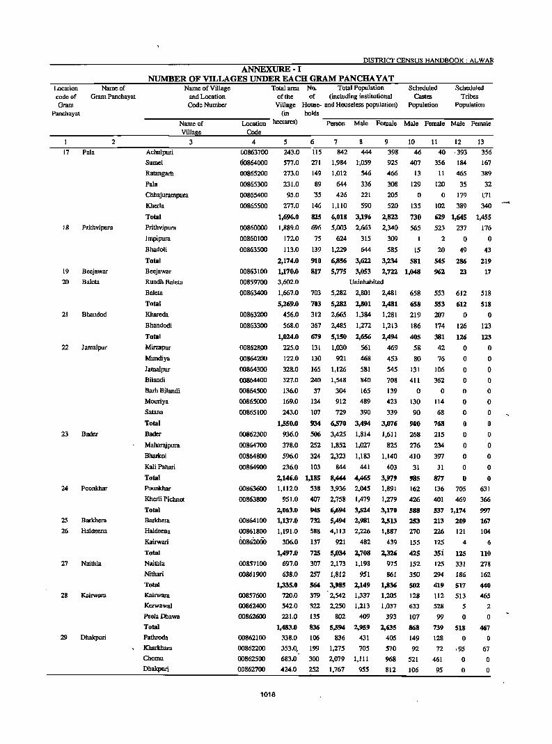
Location code of Gram
Panchayat
17
18
19
20
21
22
23
24
25
26
27
28
29
Name of Gram Panchayat
2
Pala
Prithvipura
Beejawar
Baleta
Bhandod
Jamalpur
Bader
Poonkhar
Bal'khera
Haldeena
Naithla
Kairwara
Dhakpuri
DISTRICT CENSUS HANDBOOK: ALWAR
ANNEXURE-I NUMBER OF VILLAGES UNDER EACH GRAM PANCHA YAT
Name of Village and Location Code Number
Total area No. Total Population Scheduled Scheduled of the of (including institutional Castes Tribes
Village House- and Houseless population) Population Population (in holds
-------:N":'"a-m-e-o":'f----Lo=--c-au..,.·o-n- hectares) ~P::-e-rs-o-n--:M:-:-:al-e-:F:-e-m~al:-e~M-:a-:le--:F::'e-m-a':"'le~M-:a'7le--:F::-e-m-a:-'Ie
Villa e Code
Achalpuri
Sumel
Ratangarh
Pala
Chhajurampura
Kherla
Total
Prithvipura
Impipura
Bhadoli
Total
Beejawar
Rundh Baleta
Baleta
Total
Khareda
Bhandodi
Total
Mirzapur
Mundiya
Jamalpur
Bilandi
BarhBilandi
Mouriya
Satana
Total
Bader
MahaTl\ipum
Bharkol
Kali PabBri
Total
Poonkhar
Kherli Pichnot
Total
Barkhera
Haldeena
Kairwari
Total
Naithla
NithBri
Total Kairwara
Kerwawal
PeeiaDhawa
Total Pathroda
Kharkhara
Chomu
Dhakpuri
3 4
00863700
00864000
00865200
00865300
00865400
00865500
00860000
00860100
00863500
00863100
00859700
00863400
00863200
00863300
00862800
00864200
00864300
00864400
00864500
00865000
00865100
00862300
00864700
00864800
00864900
00863600
00863800
00864100
00861800
00862000
00857100
00861900
00857600
00862400
00862600
00862100
00862200
00862500
00862700
1018
5
243.0
577.0
273.0
231.0
6
115
271
149
89
7
842
1,984
1,012
644
8
444 9
398
925
466
308
10
46
407
13
129
95.0 '55 426
1",059
546
336
221
590
205 0
277.0 146 UIO 520 135
1,696.0
1.889.0
172.0
113.0
2,174.0
1,170.0
3.602.0
1,667.0
5,269.0
456.0
568.0
825 696
75
139
910
817
703
703
312
367
679
131
6,018 3,196
5,003 2.663
624 315
1.229 644
2,822
2.340
309
585
730
565
15
6,856 3,622 3,234 581
5,775 3,053 2,722 1,048
Uninhabited
5,282 2,801
5,282 2,801
2,481
2,481
658
658
2.665 1,384 1.281 219
2,485 1,272 1,213 186
5,150
1,030
1,024.0
225.0
122.0
328.0
327.0
136.0
169.0
243.0
130 921
2,656
561
468
581
2,494
469
453
545
708
139
423
339
405
58
80
131
411
o
165 1.126
1,550.0
936.0
378.0
596.0
240
37
124
107
934
506
252
324
236.0 103
2,146.0 1,185
1.112.0 538
951.0 407
2,063.0 945
1,137.0 732
1,191.0 588
306.0 137
1,497.0 725
697.0 307
638.0 257
1,335.0
720.0
542.0
221.0
1,483.0
338.0
353.0,
683.0
424.0
S64
379
322
135
836
106
199
300
252
1,548 840
304 165
912 489
729 390
6,570 3,494
3,425 1,814
1,852 1,027
2,323 1,183
844
8,444 3.936
2.758
6,694
5,494
4,113
921
5,034
2,173
1,812
441
4,465
2.045
1.479
3,524
2,981
2,226
482
2,708
1,198
951
3,985 2,149
2,542 1,337
2,250 1,213
802 409
5,594 2,959
836 431
1,275 705
2.079 1,111
1.767 955
3,076
1,611
825
1,140
403
3,!179
1,891
1,279
3,170
2,513
1,887
439
2,326
975
861
1,836
1,205
1,037
393
2,635
405
570
968
812
130
90
900
268
276
410
31
985
162
426
588
253
270
155
425
152
350
502
128
633
107
868
149
92
521
106
11
40
356
11
120
12
,393
184
465
35
o 179
102 389
629 1,645
523 237
2 0
20
545
962
553
553
207
174
381
42
76
106
362
o 114
68
768
215
234
397
49
286
2..1
612
612
o 126
126
o o o o o o o o o o o
31 0
877 0
136 705
401 469
537 1,174
213 209
226 121
125 4
35i 125
125 331
294 186
419
112
528
99
739
128
n 461
95
517
513
5
o 518
o ,95
o o
13
356
167
389
32
~71
340
1,455
176
o 43
219
17
518
518
o 123
123
o o o o o o o o o o o o o
631
366
997
167
104
6
110
278
162
440
465
2
o 467
o 67
o o
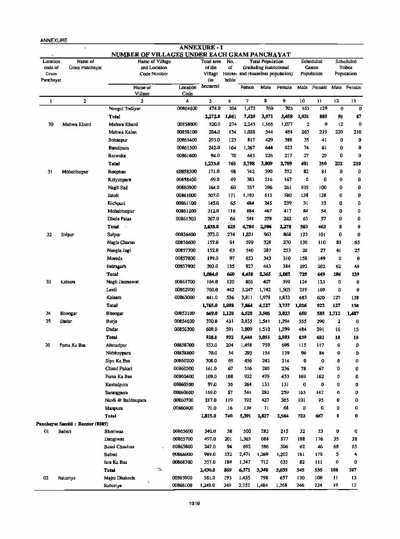
ANNEXURE
Location Name of code of Gram Panchayat Gram
Panchayat
2
30 Mahwa Khurd
31
32
33
34
35
36
Mohabbatpur
Salpur
Kalsara
Bhoogar
Dadar
PafSa Ka Bas
ANNEXURE-I NUMBER OF VILLAGES UNDER EACH GRAM PANCHA YAT
Name of Village and Location Code Number
Total area No. Total Population Scheduled Scheduled of the of (including institutional Castes Tribes
Village House- and Houseless population) Population Population (in holds
----N-a-m-e-o":"f----Lo-c-atl.,-·o-n- hectares) ...,P~ers-o-n_.,M""'""'al...,e-F~e-ma-l:-e-M-a...,l-e--=-Fe-maI-e----:M""'""'al-e--=-Fe-m-a-Ie-
Villa e Code
3 4 Nangal Todiyar
Total
MahwaKhurd
MahwaKalan
Sohanpur
Bandipura
Ratwaka
Total
Roopbas
Kalyanpura
NagliSad
Jatoli
Bichpuri
Mohabbatpur
DholaPaias
Total
Salpur
Nagla Charan
NanglaJogi
Moreda
Indragarh
Total
Nagli Jhamawat
Leeli
Kalsara
Total
Bhoogar
Burja
Dadar
Total
Ahmadpur
Nirbhaypura
Siya KaBas
Chand Pahari
Parsa Ka Bas
Kushalpura
Sarangpura
Navli @ Baldeopura
Manpura
Total
00864600
00858000
00858100
00861400
00861500
00861600
00858300
00858400
00860900
00861000
00861100
00861200
00861300
00856400
00856600
00857700
00857800
00857900
00861700
00862900
00863000
00853100
00854600
00856300
00858700
00858800
00860200
00860300
00860400
00860500
00860600
00860700
00860800
5 6 474.0 204
2,27:z.0 1,061
320.0 274
284.0 134
293.0 123
242.0 164
94.0 70
765
98
49
60
7
1,472
7,429
2.243
1,028
817
1,267
443
5,798
742
383
557
8
769
3,971
1,166
544
429
644
226
1,233.0
171.0
69.0
164.0
507.0
145.0
3120
267.0
171 1,193
3,0IW
390
216
296
613
24S 65 484
116 884 467
66 541 279
1,635.0
373.0
625 4,784 2,506
274 1,831 963
157.0 91
152.0 63
199.0 97
203.0 135
1,084.0 MO
164.0 120
760.0 442
841.0 536
1,765.0 1,098
(j(j9.0 1,120
320.0 431
608.0 501
9Z8.0 931
553.0 204
70.0 54
308.0 69
161.0 67
169.0
97.0
169.0
217.0
71.0
1,815.0
108
36
67
119
16
740
599 329
540 287
653 343
827 443
4,450 2,365
806 407
3,247 1,742
3,811 1,978
7,864 4,1Z7
6,518 3,505
2,835 1,541
2,809 1,510
5,644 3,051
1.458 759
293 154
456 242
516 280
932
264
541
792
139
5,391
479
133
282
427
71
2,827
9 10
703 163
3,458 1,031
1,077 2
484 263
388 35
623 74
217
2,789
352
167
261
580
239
417
262
2,278
868
270
253
310
384
2,085
399
1,505
1,833
3,737
3,023
1,294
1,299
2,593
699
139
214
236
453
131
259
365
68
2,564
27
401 82
o 105
138
31
84
63
503
123
130
26
158
292
729
124
219
683
1,026
650
355
484
839
115
96
o 78
169
o 163
101
o 722
11
129
885
o 219
41
61
29
350
81
o 100
138
33
54
57
463
101
12 o
95
12
220
o o o
232
o o o o o o o o o
110 83
27 41
149 0
262 62
649 186
133 0
169 0
620 127
922 127
585 1,712
290 2
391 16
681 18
117 0
84 0
o 0
67 '0
162
o 142
95
o 667
o o o o o o
13
o 67
o 210
o o o
210
o o o o o o o o o
65
25
o 49
139
o o
138
138
1,487
o IS
15
o o o o o o o o o o
Panchayat Smniti: Bansur (0009)
01 Baberi Bheriwas
02 Babariya
Dangiwas
Basai Chauhan
Baberi
Isra Ka Bas
Total
Majm Dhakoda
Babariya
00865600
00865700
00865800
00866000
00868300
00865900
340.0
497.0
247.0
989.0
357.0
2,430.0
581.0
58
201
94
332
184
869
193
500
1,365
692
2,471
1,347
6,375
1,455
285
688
386
1,269
712
3,.140
798
215
677
306
1,:?02 635
:3,035
657
32
188
62
lSI
82
545
130
00866100 1,249.0 349 2.752 1,484 1,268 246
1019
23
176
46
179
III
535
100
234
o 35
68
5
o 108
11
19
o 38
65
4
o 107
13 12
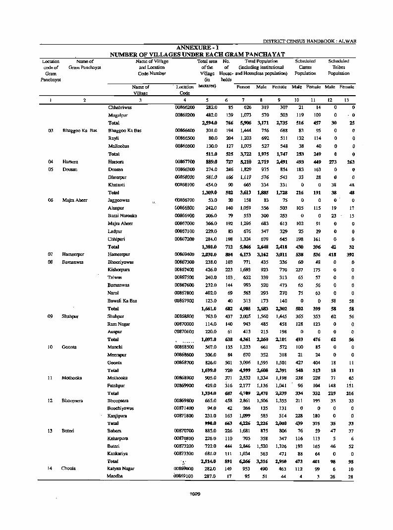
Location Name of code of Gram Panchayat Gram
Panchayat
2
03 Bhaggoo Ka Bas
04
05
06
07
08
09
10
II
12
13
14
Harsora
Deosan
Majra Aheer
Hameerpur
Bamanwas
Shahpur
Goonta
Mothooka
Bhoopsera
Buten
Choola
DISTRICT CENSUS HANDBOOK: ALWAR
ANNEXURE-] NUMBER OF VILLAGES UNDER EACH GRAM PANCHA YAT
Name of Village and Location Code Number
Total area No. Total Population or'the of (including institutional
Village House- and Houseless population) (in holds
Scheduled Castes
Population
Scheduled Tribes
Population
------~N~a-me--o~f------~-~Lo~~-ti~·o-n-h~S) -P~e-~-o-n~M~al~e~F~e-m-al~e~M~a~le~F~e-m-a~le~M~a~le--F~e-m-a~le
Villa e Code
3 4
Chhabriwas
Mugalpur
Total
Bhaggoo Ka Bas
RayJi
Malloobas
Total
Harsora
Deosan
Dlleerpur
Khatauti
Total
Jaggoowas
Alanpur
Basai Narooka
MajraAheer
Ladpur
Chhipari
Total
Hameerpur
Bhooriyawas
Kishorpura
Talwas
Bamanwas
Narol
Bawali KaBas
Total
Shaltpur
Ram Nagar
Auspur
Total
Manchi
Meerapur
Goonta
Total
Mothooka
Fatehpur
Total
Bhoopsera
Boochiyawas
Kanjipura
Total
Babera
Keharpura
Buteri
Kankariya
Total
Kalyan Nagar
Mandha
~ "
00866200
00868200
00866400
00866500
00866600
00867700
00866300
00868000
00868100
00866700
00866800
00866900
00867000
00867100
00867200
00869400
00867300
00867400
00867500
00867600
00867800
00867900
00868800
00870000
00870100
, " .. _ ... 00868500
00868600
00868700
00868900
00869900
00869800
00871400
00871800
00870700
00871!800
00873200
00873300
, . . : 00869000
00869100
1020
5 282.0
482.0
2,594.0
301.0
80.0
130.0
511.0
889.0
274.0
581.0
454.0
1,309.0
53.0
242.0
206.0
366.0
229.0
284.0
1,380.0
2,030.0
238.0
426.0
240.0
232.0
402.0
123.0
1,661.0
763.0
114.0
220.0
l,mJ7.0
567.0
306.0
826.0
1,699.0
905.0
429.0
1,334.0
665.0
94.0
231.0
990.0
885.0
226.0
722.0
681.0
2,514.0
282.0
287.0
6 85
139
766
194
204
127
525
727
246
166
90
502
20
140
79
7 8 626 319
1,073 570
5,906 3,171
1,444 756
1,203 692
1,075
3,722
5,210
1,829
1,119
665
3,613
158
1,059
553
527
1,975
2,719
975
576
334
1,885
192 1,296
83
556
300
683
347 83 676
198 1,324 679
712 5,066 2,648
884 6,173 3,162
103 771 435
223 1,693 923
103 652 339
144 993 520
69 563 293
40 313 113
682 4,985 2,683
437 3,005 1,560
140 943 485
61
638
135
84
501
720
371
316
687
458
42
163
663
226
110
444 III
891
149
17
413 215
4,361 2,260
1,233 661
670 352
3,096 1,595
4,999 2,608
2,532 1,334
2,177 1,136
4,709 2,470
2,861 1,506
266 135
1,099 585
4,226
1,681
705
2,846
1,034
6,266
953
95
2,226
875
358
1,520
563
3,316
490
51
9
307
503
2,735
68g
511
548
1,747
2,491
854
543
331
1,728
75
503
253
613
329
645
2,418
3,011
336
770
313
473
270
140
2,302
1,445
458
198
2,101
572
318
1,501
2,391
1,198
1,041
2,239
1,355
131
514
2,000
806
347
1,326
471
2,950
463
44
10 11 12 13
21 14 0 0
119 109 0 0
516 457 30 25
83
132
38
253
493
183
JJ o
216
o lOS
o 102
25
198
430
538
60
237
65
65
75
o 592
365
128
o 493
100
21
427
548
238
96
334
211
o 228
439
76
116
193
88
473
112
4
95
114
40
249
449
163
28
o 191
o 115
o 91
29
161
396
536
48
175
57
56
63
o 399
353
123
o 476
85
24
404
513
228
104
332
195
o 180
375
59
113
165
64
401
99
3
o o o o
273
o o
38
38
o 19
23
o o o
42
418
o o o o o
58
58
62
o o
62
o o
18
18
71
148
219
35
o o
35
47
5
46
o 98
6
26
o o o o
263
o o
48
48
o 17
15
o o o
32.
392
o o o o o
58
58
56
o o
56
o o
11
11
65
lSI
2.16
33
o o
33
37
6
52
o 95
10
28
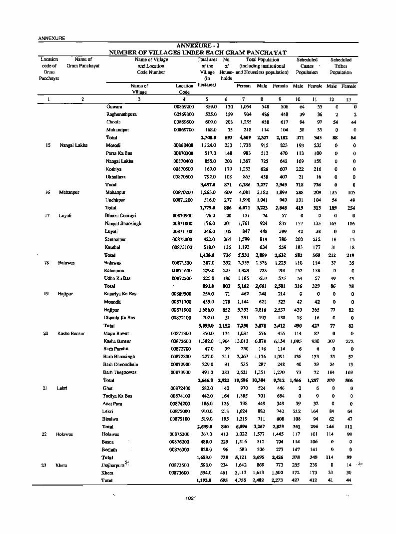
ANNEXURE
Location code of Gram
Name of Gram Panchayat
Panchayat
2
15 Nangal Lakba
16 Mahanpur
17 Loyati
18 Balawas
19 Hajipur
Kasba Bansur
21 Lekri
22 Holawas
23 Khera
ANNEXURE-I NUMBER OF VILLAGES UNDER EACH GRAM PANCHA YAT
Name of Village
and Location Code Number
Total area No. Total Population Scheduled Scheduled of the of (including institutional Castes' Tribes
Village House- and Houseless population) Population Population (in holds
------~N~a-m-e-o~f------~Lo~c-ab~·o-n-~ctare~ ~P~e-r~~n~M~a1~e~F~e-mm-l~e~M~a~l-e~Fe-m-a~re~M~al-e~Fe-nm~Ie-
Villa e Code
Guwara
Raghunalhpura
Choola
Mukandpur
Total
Morodi
ParsaKaBas
Nangal Lakba
Kothiya
Ukhalhelll
Total
Mahanpur
Unchhpur
Total
3
Bhoori Doongri
Nangal Bhaosingh
Loyati
Santhalpur
Kauthal
Total
Balawas
Ratanpura
UdhoKaBas
Total
Katariya Ka Bas
Moondli
Hajipur
4
00869200
OOS69300
00869600
00869700
00868400
00870300
00870400
00870500
00870600
00870200
00871200
00870900
00871000
00871100
00873000
00873100
00871500
00871600
00872500
00869500
00871700
00871900
00872100
00871300
5
859.0
535.0
609.0
168.0
2,740.0
1,124.0
517.0
855.0
169.0
792.0
3,457.0
1,263.0
516.0
1,779.0
76.0
176.0
246.0
422.0
518.0
1,438.0
387.0
279.0
225.0
891.0
256.0
455.0
6 130
159
203
35
693
233
148
203
179
108
871
7 8 1,054 548
934 486
1,255 638
218 114
4,509 2,327
1,738 915
983
1,367
1,233
865
6,186
513
725
626
458
3,237
609 4,081 2,182
277 1,990 1,041
886 6,071 3,223
20 131 74
201 1,761 924
105 847 448
264 1,599 819
136 1,193 634
726 5,531 2,899
392 2,553 1,328
225 1,424 723
186 1,185 610
803 5,162 2,661
71 462 248
178 1,144 621
1,686.0 852 5,353
331
7,290
1,031
2,816
193
3,878
576
702.0 51
3,099.0 1,152
350.0 134
9 506
448
617
104
2,182
823
470
642
607
407
2,949
1,899
949
2,848
57
837
399
780
559
2,632
1.225
701
575
2,501
214
523
2,537
138
3,412
455
10
64
39
94
58
371
193
113
169
222
21
718
288
131
419
o 157
42
200
183
582
110
152
54
316
o 42
430
18
490
114
Dhamla Ka Bas
Total
MajraRawat
Kasba Bansur
Barb Purohit
Barh Bhaosingh
Barh Dhoondhala
Barb Thegoowas
Total
00872600 1.302.0 1,964 13.012 6,878 6,134 1.095
Ghat
Todiya Ka Bas
AnatPura
Lekri
Bisalwa
Total
Holawas
Basna
Bee1ath
Total
Jhajharpura ~. Khera
Total
00872700
00872800
00872900
00873900
00872400
00874100
00874200
00875000
00875100
00875200
00876200
00876300
00873500
47.0
227.0
229.0
39
31l
91
230
2,267
535
116
1,176
287
491.0 383 2.621 1,351
2,646.0 2,922 19,696 10,.184
582.0 142 970 524
442.0
186.0
910.0
519.0
2,639.0
367.0
488.0
828.0
1,683.0
598.0
164
126
213
195
840
413
229
96
738
234
1,385
798
1,624
1,319
6,096
3.022
1,516
583
5,121
1,642
701
449
882
711
3,267
1,577
812
306
2,695
869
00873600 594.0 461 3,II3 1,613
695 4,755 2,482 1,192.0
1021
114
1,091
248
6
138
40
1,270 73
9,312 1,466
446 2
684
349
742
608
2,829
1,445
704
277
2,426
773
1,500
2,273
o 39
212
108
361
117
114
147
378
255
172
427
II 55
36
97
53
343
235
100
159
216
16
726
209
104
313
o 133
38
212
177
560
114
158
57
329
o 42
365
16
423
87
12
o 2
54
o 88
o o o o o o
135
54
189
o 163
o 18
31
212
37
o 49
86
o o
77
o 77
o 930 307
6
133
29
n 1,257
6
o 32
164
94
296
IOI
106
141
348
239
173
412
o 55
24
184
570
o o o
84
62
146
114
o o
114
8
33
41
13
o 2
44
o 84
o o o o o o
105
49
154
o 186
o 15
18
219
35
o 43
78
o o
82
o 82
o 272
o 52
13
169
506
o o o
64
47
111 99
o o
99 14 .,')..
30
44

DISTRICT CENSUS HANDBOOK: ALW AR
ANNEXURE-I NUMBER OF Vll..LAGES UNDER EACH GRAM PANCHA YAT
Location Name of Total area No. Total Population Scheduled Scheduled code of Gram Panchayat
Name of Village and Location Code Number
of the of (including institutional Castes Tribes Gram
Panchayat
I 2
24 Giroodi
25 Shyampura
26 Khohri
Village House- and Houseless population) Population Population (in holds
----N..,..a-m-e-o-f----L"...oc-at..,..io-n- hectares) ""P::-e-rso-n--:M:-:-:al:-e--:p""'e-rn:-al:-e--:Ma"':"'7le-r:e::--rnal-:-e-M-a"""le--:P::-e-rna-le
Viii e Code
3 4
Mandceja Basai 00873800
Giroodi 00874000
Indrada 00875300
Total
Shyampura
Nawalpura
Total
Kheewaheri
Khobri
Total
00873700
00875400
00875800
00876100
5 6
440.0' 197
674.0
672.0
1,786.0
8320
290.0
1,122.0
7
1,440
3,398
1.846
6,684
3.314
8
763
1,757
962
3,482
1.728
473
2,201
9 10
677 55
1,641
884
3,202
1,586
415
2,001
384
63
502
284
49
333
11 12
53 6
360
46
459
267
125
72
203
o I
1
o 6
6
13
8
105
76
189
o o o o
10
27
28
Ratanpura @ Karaoa Ratanpura @ Karann 00878600
00872200
00872300
00874300
00874400
00874500
00874600
00874700
00874800
00874900
404.0
1.513.0
1,917.0
525.0
158.0
309.0
336.0
347.0
229.0
509
263
969
508
153
661
156
515
671
655
121
113
370
291
282
888
4,202
1,045
3.756
4,801
4,863
543
1.984
2,527
2,634
502
1,772
2,274
2,229
99
307
406
748
41
308
108
260
368
675 49
o o o o
10
24 Rampur
29 Chatarpura
30 Neemoochwla
31 BilaH
32 NayaBas
33 Gyanpura
34 Chheend
Balba Ka Bas
Mangalwa
Bahram Ka Bas
Kali Pahari
Gurha Bhankharwala
Kalyanpur
Rarnpur
Roondh Rarnpur
Nathoosar
Total
Chatarpura
Prithvipura
Bas Narbad
Total
Neemoochana
Jhagdet Kalan
Total
Jaitpur
Bilali
Bara Gaon
Total
Mancili
Toorana
Lalpura
Chainpura
NayaBas
Kundli Total
Borja
Gympura
Basdi
Bas Gordhan
,. Kharkhari Khurd
Kool
Kharwa
Pali
Total
Chheend
00876400
00877700
00877800
00876500
00876600
00878300
00818400
00878700
00876800
00876900
00877000
00877100
00877200
00877300
00877400
00877500
00877600
00877900
00878000
00878100
00878200
00878500
00872000
1022
396.0 122
834
826
2,383
2.026
1.818
848
6,326
429
441
1,260
1,067
983
446
3,337
405
385
l,l23
959
835
402
2,989 2,308.0 1.006
2,308.0 Uninhabited
1,413.0 96
7,804.0 2,401
693 367 326
15,754 8,330 7,424
1,086.0 674 4,284 2,226 2,058
283.0 292 1,728 877 851
93.0 154 1,092
7,104
3,079
1,462.0 1,120
1,404.0 506
383.0
1,787.0
128.0
682.0
850.0
1,660.0
320.0
126
632
56
426
361
843
114
929
4,008
462
3,338
2,777
6,577
714
647.0 200 1.564
155.0 139 987
329.0
645.0
172.0
2,268.0
309.0
558.0
177 1,217
237 1.694
96 589
963 6,765
96 • 850
324 2,046
48 237
133 927
50 436
41 355
220 1.355
554
3,657
1,602
495
2.097
233
1.772
1,417
3,422
371
802
514
636
888
321
3,532
445
1,024
125 487
235
183
695
85.0
134.0
114.0
123.0
387.0
128.0 51
963
199
350 178
1,838.0
1,947.0
6,556 3,372
1,738 943
538
3,447
1,477
434
1,911
229
1,566
1.360
3,155
343
762
473
581
806
268
3,233
405
1,022
112
440
201
172
660
172
3,184
795
80
o 7
40
6
o 578
o 711
224
192
108
524
506
3
509
o 86
60
146
9
96
65
30
284
88
572
36
185
o 51
68
o 173
112
625
5
76
o 6
38
4
o 486
o 610
205
187
95
487
487
3
490
o 71
53
124
15
176
o 425
34
635
306
13
o 319
19
o 19
o 22
51
73
14
103 150
68 69
34
264
64 548
40
170
o 44
60
o 191
110
615
9
1
o 61
295
o 71
o o o o o o
71 .
6
o o o o
148
o 411
23
582
268
9
o 277
12
o 12
o 15
41
56
12
141
60
o O·
58
271
o 78
o o o o o o
78
7
ANNEXURE
Location Name of code of Gram Panchayat Gram
Panchayat
I 2
35 Bas Dayal
36 Alampur
ANNEXURE-I NUMBER OF VILLAGES UNDER EACH GRAM PANCHA YAT
Name of Village and Location
Code Number
Total area No. Total Population Scheduled Scheduled of the of (including institutional Castes Tribes
Village House- and Houseless population) Population Population (in holds
-----:N':"am-e-o""f----""Lo-c-a":'tio-n- hectares) -P::"e-rso-n---'M:-:""aI:-e--:F::"e-ma-:-le--:M""""al'-e-"'F'-em-aI""e-M:-:""aI:-e--::F-em-a-:l-e
Villa e Code
Bas Dayal
Bas Karnawat
Bas Shekhawat
Total
Alwnpur
Kharkhara
Rasnali
Milakpur
Total
3 4
00875900
00876000
C0876700
00873400
00875500
00875600
00875700
5
339.0
379.0
253.0
• 971.0
669.0
586.0
522.0
115.0
1,892.0
6 7
206 1,345
181
213
600
244
1,186
1,533
4,064
1,543
8
717
623
789
2,129
791
210 1,478 761
243 1,778 958
57 408 228
754 5,207 2,738
9 10
628 134
563
744
1,935
752
711
820
180
2,469
54
81
275
156
175
188
o 519
11 12
126 103
56
89
271
150
111
170
o 491
30
20
153
3
o 35
o 38
13
90
36
17
143
2
o 32
o 34
Panwayat Samiti: Tbanagazi (0010)
01 Lalpura : Toda
02 Samra
03 Jhiri
04 Pratapgarh
05 Padale Qlhapli
06 Agar
Lalpura
Runelll Pacllpadi
Pachpadi
MadIlogarb
Nagel
ChahaKaBas
Runelll Lalpura
Lothawas
Rundb Lothawas
Total
Rundb Hameerpur
Hameerpur
Jaitpur Goojran
Nitata
Kaler
Samra
Total
Bhooriyawas
RundbJhiri
Sanwatsar
Jlliri
Chandpura
Jagannatbpura
Total
Pratapgarh
Goojron Ka Guwara
Rundb Pratapgarh
Total
Bhadach
Amlca
Narhat
Padalc Chhapli
Chosla
Total
RundhAgar
Agar
Bhanwata
Total
00887200
00889300
00889400
00889500
00889600
00889700
00889800
00889900
00890000
00890100
312.0
501.0
27.0
3520
578.0
396.0
426.0
73.0
300.0
39.0
3,064.0
0.0
1,487.0
346.0
169 1,222 647
251 1,520· 817
100
219
27
94
86
702
1,233
166
589
558
Uninhabited
376
609
91
317
Uninhabited
301
Uninhabited
575
703
326
624
75
272
257
946 5,990 3,158 2,832
Uninhabited
352 2,160 1,136 1,024
101 515 270 245
00890300
00890400
00890500
00890600
00890700
00890800
971.0 138 911
1,811
2,195
7,598
1,683
477 434
00887300
00881500
00881600
00888900
00889000
00890900
00889100
00889200
1,373.0
2,057.0
fi,234.0
701.0
328.0
410.0
1,615.0
276.0
595.0
3,925.0
686.0
498.0
00890200 27,426.0
28,610.0
00886700 599.0
00886800
00886900
00881000
00887100
00886500
00886600
00887400
430.0
851.0
458.0
413.0
2,751.0
163.0
1,700.0
221.0
2,084.0
1023
279
351
1,221
254
75
467
43
19
918
661
95
452
2,804
283
611
5,833
4,393
160
993 824
1,124 1,071
4,000 3,598
899 784
Uninhabited
239 213
1,488
137
305
3,068
2,340
388
1,316
146
306
2,765
2,053
312
Uninhabited
756 5,153 2,728 2,425
129 757 377 380
102 762 398 364
376 2,410 1,284 1,126
186
102
895
613
69
682
1,249
699
674
363
575
336
5,877 3,096 2,781
Uninhabited
4,041 2,102 '" 1,945
411 227 190
4,464 2,329 2,135
111
202
175
III
o 9
61
675
198
29
62
229
139
657
89
40
171
42
o 348
478
o
478
77
16
573
92
o 818
501
79
580
95
189
155
118
o 13
63
633
183
26
o 413
43
8
o 280
188
932
535
o 54 359
185 599
116 562
564 2,055
13 95
45 192
114 732
44 94
o 184
336 1,297
426 373
o o
426 373
18 192
76 0
482 214
15
o 711
448
66
514
299
o 70S
531
o 531
o 331
38
8
o 234
154
765
488
o 338
499
555
1,880
75
163
644
102
114
1,158
319
o
319
182 o
185
269
o 6.16
479
o 479
Location Name of code of Gram Panchayat Gram
Panchayat
2
07 Saleta
08
09
10
II
12
13
14
Nathoosar
Hamer
Thanagazi
Basai Jogiyan
Ouhar
Chaugan
Bhoodiyawas
Dwarapur
IS Malootana
16 GarhBasai
17 Bhangdoli
DISTRICT CENSUS HANDBOOK: ALWAR
ANNEXURE-I NUMBER OF VILLAGES tnIDEREACH GRAM PANCHA YAT
Name of Village and Location Code Number
Total area No. Total Population Scheduled Scheduled of the of (including institutional Castes Tribes
Village House- and Houscless population) Population Population (in holds
----..,.N-:-a-m-c-o":'r -----=L:-o-ca-t":"io-n hectares) -:P::-erso--n--=M:":a-:le--:P:-em--=al:-e --:"M-:-a-:-Ie--:P::-e-m-al:-e--:"M-:-a":""le--=R::-e-m-al:-"e
Villa e Code
Bakhatpura
Heensla
Mankot
Saleta
Total
Biharisar
Dhigariya
Nathoosar
Total
Laha Ka Bas
Hamer
Ohaital
Roopu KaBas
Mundiyawas
Total
Thanagazi
Basai Jogiyan
Barh Goojran
Total
Ouharmala
Ouhar Chaugan
Total
Bas Boosa BarhDoli
Kola KaBas
Bhoodiyawas
Total
3 4
00881800
00881900
00882000
00883300
00883100
00883200
00883500
00884200
li0884300
00884500
00884600
00885500
00883600
00880900
00882500
00880700
00882700
00882200
00882300
00882400
00882600
0088?!.0!1
00882800
00882900
00883000
5
86.0
544.0
308.0
323.0
1,261.0
265.0
237.0
231.0
733.0
255.0
134.0
224.0
103.0
614.0
1,330.0
6
40
337
164
195
736
238
170
175
583
59.
7
260
2,224
1.21B
1.300
5,002
1.717
1.138
1.245
4,100
403
137 1,047
112 652
84 537
134 874
526 3,513
8
141
1,135
662
677
2,615
904
625
625
2,154
221
562
347
270
462
1,668.0 1,736 11 .. 185
1,8li2
5,950
2,037
1,026
3,063
652.0 539 3,886
312.0
964.0
2.218.0
776.0
307 1,988
846 5,874
138 892 469
684
822
125
4,604 2,344
5,496 2,813
858 427
2,994.0
236.0
200.0
318.0
148 846 407
610 190 1,252
651.0 195
1,405.0 658
339.0 168
125.0. 42
235.0 235
100.0 132
799.0 577
1,237 620
4,193 2,064 1,157 605
286 140
1,613 837
902 464
3,958 2,046
9
119
1,089
556
623
2,387
813
513
620
1,946
IB2
485
305
267
412
1,651
5,435
1,849
962
2,811
423
2,260
2,683
431
439
642
617
2,129
552
146
776
438
1,912
10
6
224
44
186
460
116
75
6 197
31
33
84
18
58
224
553
144
260
404
129
133
262
18
12
147
30
207
81
50
84
o 215
Swjanpur
Basai.Abhairam
Dwarapur
Rajpura Jageer
Total
Malootana
Daln
00881500 1,042.0 271 1,857 982
972
1,149
3,103
657
875 262
00881600 449.0 279 1,795 823 259
Bandrol
Total
Gowari
GarhBasai
Total
Siraska
Kundalka
00881700
00884700
00884800
00883700
00883800
Kama Ka Bas 00883900
Ganehspura With Rundh Kaligha 00884000
Amra Ka Bas 00884100
Bhangdoli
Jodhawas
Todi Luharan
Todi NcejIaJI
Kharrika
Total
00884400
00885600
00885700
00885800
00885900
1024
925.0
2,416.0
399.0
963.0
1,362.0
449.0
644.0
467.0
3,762.0
296.0
455.0
572.0
458.0
32.0
17.0
7,152.0
316
8li6
174
411
585 108
82
52
25 331
117
71
7
794
2,119
5,771
1,244
2,358
3,602 451
447
5
289
205
1,199
1,856
281
237
5 147
118.
970
2,668
587
1,159
~,746
170
210
o 142
87
2,154 1,157 997
717 376 341
433 225 208
51 28 23
Uninllabited
4,752 2,574 2,178
192
713
o 226
226
16
2
o 1
11
496
79
3 ~, 0
608
11
7
233
36
160
436
122
58
4
184
25
29
87
13
46
200
512
154
262
416
140
134
274
23
15
178
28
244
76
52
80
o 208
208
213
185
606
o 192
192
7
4
o o
12
12
o 347
53
113
513
103
86
59
248
3
28
22
20
378
451
209
53
176
229
5
50
S5 38
36
47
10
131
39
16
145
94
294
71
40
80
191
o 140
140
9
44
1 o 2
445' 15
88 0
8 156
o 0
564 227
13
o 306
48
112
466
99
58
63
220
3
24
21
26
335
409
234
43
158
201
4
50
54
48
39
67
10
164
33
18
115
84
250
62
42
80
184
o 141
141 2
39
o o o
10
o 141
o
192
ANNEXURE ANNEXURE-I
NUMBER OF VILLAGES UNDER EACH GRAM PANCHA YAT Location code of Gram
Name of Gram Panchayat
Panchayat
18
19
20
21
22
23
24
25
26
27
2
Vijaypura
Narayanpur
Ajabpura
Mundawara
Bamanwas Kankar
Kolahera
Chandpuri
Kharkhari Kalan
Garhi
Kishori
Name of Village and Location Code Number
Name of VilJae
Lila Marha
Turkiyawas
Vijaipura
Total
Narayanpur
3
Rundh Narayanpur
Total
Prempurn
Ajabpurn
Total
Kanpura ( Loj )
Manawas
Mundawara
Total
Bamanwas Kankar
Roo KaMala
Bairawas
Nangalheri
Tolawas
Total
Kolahera
Jodhpura
Total
Chandpuri
Rajpura Sikh
Shyampura Jageer
Doonga Ka Bas
Total
Bas Booriya
Ladoowas
Kharkhari Kalan
Total
Garhi
Raipura
Hodayli
Banchhri
Kishori
Total
28 Bamanwas Chaugan Shyampura
KabliGarh
Kalalanka
29 Piplai
Bamanwas Chaugan
Total
Piplai
Balloowas
Kundla
Guwara Sadaram
Guwara Naidoli
Total
Total area No. Total Population Scheduled Scheduled Tribes
Population of the of (including institutional Castes
Village House- and Houseless population) Population (in holds
Location hectares) Code
~Pe=--rs-o-n~M~al~e--:F""'ern-a1~e--:M""'a""'l-e-=Fe-m-a""'le~M~al~e-=Fe-ma-"'"le-
456 7 8 9 10
00881000 27 1.0 204 1.411 716
521
1,010
2,247
8,515
695 6
00881100 156.0 134 1,026 505 33
CQ881100 463.0 266 1.883 873 216
890.0 604 4,320 2,073 255
00881200 2,513.0 2,414 16,383 7.868 1,060
00881400
00879300
00879400
00879800
00879900
00880000
00880300
00880400
00880500
00880600
00880800
00880100
00880200
00878900
00879000
00879100
00879200
008795pO
0087%00
00879700
00878800
00886000
00888100
00888200
00888300
00886100
00887700
00887900
0.0 Uninlwbited
2,513.0 2,414 16,383 8,515 7,868 1,060
128.0 99 781 394 387 0
246.0 488 3,214 1,649 1,565 442
374.0
949.0
472.0
2.283.0
3,704.0
862.0
689.0
1,674.0
1,057.0
856.0
5,138.0
454.0
156.0
610.0
378.0
235.0
128.0
112.0
853.0
72.0
346.0
1.739.0
2,157.0
1,963.0
310.0
155.0
154.0
894.0
1,513.0
445.0
911.0
373.0
587
310 147
838
1,295
340
34
205
78
201
858
365
286
651
255
224
90
56
62S
60
137 403
600
714
80
13
100
463
656
17 142
124
3,995
2,252
1,002
5,803
9,057
2,456
256
1,349
491
1,473
6,025
2,559
1.876
4,435
1,929
1,426
2,043
1,181
531
3,070
4,782
1,268
133
743
281
763
3,188
1,353
980
2,333
993
766
732 385
485 247
4,57Z 2,391
468 250
1,176 609
2.759 1,468
4,403 2,327
5,306 2,841
468 246
87 45
677
2,884
360
1,490
4,116 2,141
88 43 870 455
860 477
1,952
1,071 471
2,733
4,275
1,188
123
606
210
710
2,837
1,206
896
2,102
936
660
347
238
2,181
218
567
1,291
2,076
2,465
222
42
317
1,394
1,975
45
415
383
442
1
95
384
480
85
o 10
19
o 114
91
126
217
96
114
23
o 233
o 41
244
285
478
71
o 13
109
1'3 o
39
13
00888000 489.0 345 2.169 1,144 1,025 258
00891000
00891100
00891400
00891500
2,218.0
1.533.0
495.0
399.0
271.0
00891600 238.0
2,!l36.0
1025
628 3,987 2,119 1,868 310
353
132
74
66
2.309
888 496
454
1,251
464
268
252
1,058
424
228
202
215
20
47
76 511 265 246 27
701 4,658 2,500 2,158 310
II 12 13
3 42 52
31 0 0
224 57 46
258 99 98
969 469
969
o 400
400
o 72
322
394
74
o 5
15
o 94
83
128
211
93
108
22
o 223
o 46
235
281
409
55
o 12
100
167
o 54
17
469
o 50
SO
27
44
23
94
316
o o
17
53
386
138
49
187
17
10
107
o 134
o o o o
268
o 17
302
308
61.7
3
246
348
219 160
290 757
170
16
388
149
41 158
5 206
25 159
257 1,060
423
423 o
41
41
31
46
21
98
305
o o
II
53
369
110
56
166
17
8
95
o 120
o o o o
237
o 19
269
291
57!1
4
201 270
147
622
319
132 119
143.
145
858
Location code of Gram
Panchayat
30
31
32
33
34
35
Name of Gram Panchayat
2
Gurha Churani
Nangal Bani
Kyara
Angari
Ajabgarh
Seeli Baori
DlSTRICI' CENSUS HANDBOOK: ALWAR
ANNEXURE-I NUMBER OF Vll..LAGES UNDER EACH GRAM PANCHA YAT
Name of Village and Location Code Number
Name of Villa
Churani
Gurha
3
Gurha Kishordas
Mejod
Total
Nangal Bani
Jhankri
Total
Gopalpura
Bheekampum
Daulatpura
Kyara
Suratgarh
Govindpura
Total
Angari
Jaisinghpura
Doomeda
Oera
Total
Guwara Bhopala
Guwara Kunda!
Guwara
Bhooriyawali
Guwara Birkari
Ajabgarh
Rundh Ajabgarh
Guwara Dulawa
Guwara Bandipul
GuwaraGugJi
GuwaraRadi
Guwara Leswa
Guwara Nirbha
Guwara Ramji
Total
Jaitpur Brahmnan
Guwara Kalyan
Guwara Pakhal
Seeli Baori
Guwara Seeli Baori
Guwara Dabar
Guwara Seera
Guwara Dhasi
Guwara Lala Bhaiya
Guwara Hanuman
Guwara Sahiba
Guwara Kalot
Guwara Bhagwan
Guwara lanawat
Location Code
4
00885200
00885300
00885400
00886200
00884900
00885100
00888400
q08885W
00888600
00888700
00888800
00891200
00885000
00886300
00886400
00887800
00883400
00892100
00892200
00893600
00893700 -.
00893800
00893900
00894000
00894100
00894200
00894300
00894400
00894500
00891300
00891700
00891800
00891900
00892000
00892300
00892400
00892500
00892600
00892700
00892800
00892900
00893000
00893100
Total area No. Total Population Scheduled Castes
Population
Sclleduled Tribes
Population of the of (including institutional
Village House- and Houseless population) (in holds
hectares) ...,P"'"er-s-o-n----,Mal~:-e--:F"'"e-ma-l:-e--:M":'a-:le-=Fe-ma--:-le--:M":'a":'le----,F:::-e-m-a:--Ie
5
559.0
134.0
344.0
584.0
1,621.0
1,063.0
502.0
1,565.0
360.0
260.0
259.0
654.0
589.0
257.0
2,379.0
1,176.0
188.0
257.0
223.0
1,844.0
341.0
248.0
256.0
225.0
516.0
240.0
56.0
64.0
267.0
118.0
4.0
84.0
167.0
2,586.0
401.0
221.0
27.0
385.0
5.0
14.0
119.0
136.0
13.0
58.0
20.0
.s~.0
56.0
15.0
6 7 8 9 10 11 12 13
180 1,193 652 541 61 50 415 351
20S
101
252
738
276
199
475
97
1,314
619
1,61S
4,741
1,867
1,382
3,249
581
688
311
870
2,521
997
723
155 1,043
1,720
282
552
301
589
576
169
84 610
171 1,069
164
52
723
289
62
81
146
578
185
14
45
1,063
295
4,661
1,898
2,469
1,016
394 219
539 274
960 514
3,791 2,023
1,424 752
113 60
340 193
62 387 206
760
8
16
41
274
255 1,420
3 8
10 36
10 68
77 487
35
II
2
83
792
127
39
259 147
67 39
16 9
560 318
5,185 2,823
829 414
297 167
19 132 70
755 190 1,411
626
308
745
2,220
870
659
1,529
299
152
46
89
348
84
62
146
29
491 200
309 37
480 219
487
126
2,192
882
175
265
446
1,768
672
53
147
181
660
o 20
27
213
112
28
7
242
2,362
415
130
293
25
803
113
34
143
94
384
o o o
4
305
o o o 2
o o o 8
319
118
o 62 0
656 279
Uninhabited
22
28
22
25
15
6
20
8
21
163 87 76
188
147
209
158
45
132
56
144
105
87
115
84
26
72
29
78
83
60
94
74
19
60
27
66
o o o o o o o o o
132 160
45 5
91 658
318 1,238
59 119
53
112
35
626
745
173
181 91
40 35
173 337
253
25
707
108
79
142
857
830
31 152
129 84
68 199
336 1,265
o 242
o 54
o 163
4 202
270 85
o 0
o 0
o I
133
o 147
o 0
o 9
5 305
280 1.341
108 52
o 97
o 0
232 370
o o o 105
o 78
o 0
o 11
o 0 o 72
o 29
o 0
131
3
544
1,029
118
578
696
186
89
39
274
64
97
749
710
124
88
197
1,119
228
49
128
176
89
o o o
114
112
o 7
237
1,140
45
71
o 331
o 83
58
o 7
o 60
27
o
1026
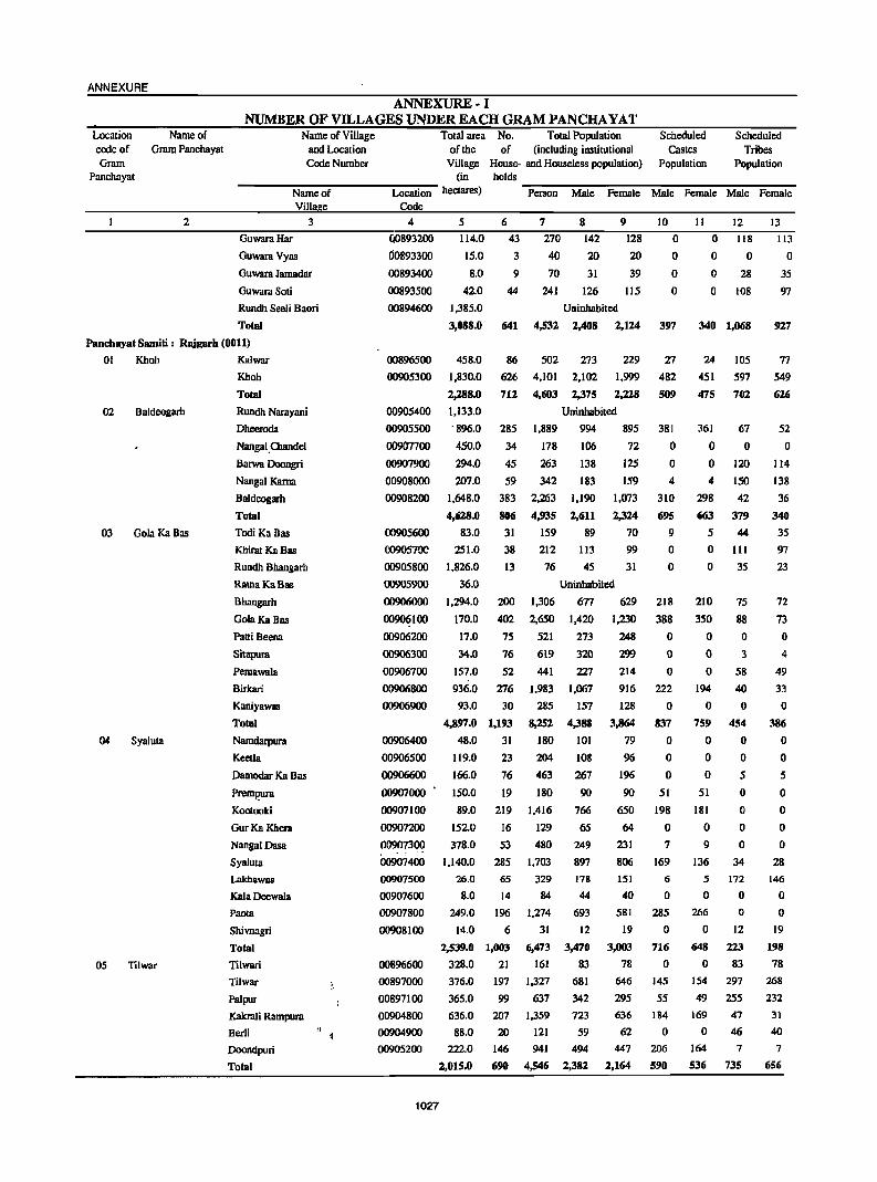
ANNEXURE
Location Name of code of Gram Panchayat Gram
Panchayat
2
ANNEXURE-I NUMBER OF VILLAGES UNDER EACH GRAM PANCHA YAT
Namc of VilIagc and Location Code Number
Total area No. Total Population Schcduled Schcdulcd of the of (including institutional Castes Tribes
Village House- and Housclcss population) Population Population (in holds
----N-a-m-c-o"""f---"'"""'Lo,......ca-tl"""·o-n- hcctares) -p""c-rs-o-n"'"""'M"'-al-c---'p""c-ma-I""'c-M-a-l-e_""'Pe-mal"""'c-M--al-c-=Pc-ma-Ic-
Villa e Codc
3 4 5 6 7 8 9 10 11 12 13
GuwaraHar
Guwara Vyas
Guwara Jamadar
Guwara Soti
Rundh SeeH Baori
Total
(j0893200
d0893300
00893400
00893500
114.0
15.0
8.0
420
43
3
9
44
270
40
70
241
142
20
31
126
00894600 1,385.0 Uninhabited
128
20
39
115
o o o o
3,088.0 641 4,532 2,408 2,124 397
o 118
o 0 o 28
o 108
340 1,068
113
o 35
97
927
Panchayat Samiti: Rajgarh (0011)
01 Khob Kalwar
02 Baldeogarh
03 Gola KaBas
04 Syaluta
05 Tilwar
Khob
Total
Rundh Narayani
Dlleeroda
Nangal.Chandcl
Barwa Ooongri
Nangal Kama
Baldeogarh
Total
Todi Ka Bas
Khirat Ka Bas
Rundh Bbangarh
RatnaKaBas
Bhangarh
GolaKaBas
PaniBeena
Sitapura
Pemawala
Birkari
Kaniyawas
Total
Namdarpura
Kcetla
Damodar Ka Bas
Prem~ra
Kootooki
GurKa Khcra
NangalDasa
Syaluta
Lakhawas
Kala Deewa1a
PaOla
Shivnagri
Total
Tilwari
Tilwar
Palpur
Kakrali Rampura
Berli
Doondpuri
Total
00896500
00905300
00905400
00905500
00907700
00907900
00908000
00908200
00905600
458.0
1,830.0
2,288.0
1,133.0
'896.0
450.0
294.0
207.0
1,648.0
4,628.0
83.0
0090570C 251.0
00905800 1.826.0
36.0
1,294.0
170.0
86 502 273 229
626 4,101 2,102 1,999
712 4,603 2,375 2,228
Uninhabited
285 1,889 994 895
34 178 106 72
45
59
383
806
31
38
13
200
402
263
342
2,263
4,935
159
212
76
1,306
2,650
138
183
1,190
2,611
89
113
45
125
159
1,073
2,324
70
99
31
Uninhabited
677 629
1,420 1,230
27
482
509
381
o o 4
310
695
9
o o
218
388
00905900
00906000
00906100
00906200
00906300
00906700
00906800
00906900
17.0 75 521 273 248 0
34.0 76 619 320 299 0
157.0 52 441 227 214 0
936.0 276 1,983 1,067 916 222
00906400
00906500
00906600
00907000
00907100
00907200
00907300 .. -00907400
00907500
00907600
00907800
00908100
00896600
93.0 30 285 157
4,897.0 1,193 8,252 4,388
48.0 31 180 101
119.0 23 204 108
166.0 76 463 267
150.0 19 180 90
89.0
152.0
378.0
1,140.0
26.0
8.0
249.0
14.0
219 1,416
16 129
53 480
285 1,703
65 329
14 84
196 1,274
6 31
2,539.0 1,003 6,473
161 328.0 21
766
65
249
897 178
44
693
12
3,470
83
128
3,864
79
96
196
90
650
64
231
806
151
40 581
19
3,003
78
00897000 376.0 197 1,327 681 646
00897100 365.0 99 637 342 295
00904800 636.0 207 1,359 723 636
00904900 88.0 20 121 59 62
00905200 222.0 146 941 494 447
2,015.0 690 4,546 2,382 2,164
1027
o 837
o o o
51
198
o 7
169
6
o 285
o 716
o 145
55
184
o 206
590
24
451
475
361
o o 4
298
663
5
105
597
702
67
o 120
ISO
42
379
44
o III
o 35
210
350
o o o
194
o 759
o o o
51
181
o 9
136
5
o 266
o 648
o
75
88
o 3
58
40
o 454
o o 5
o o o o
34
172
o o
12
223
83
154 297
49 255
169 47
o 46
164 7
536 735
77
549
626
52
o 114
138
36
340
35
97
23
72
73
o 4
49
33
o 386
o o 5
o o o o
28
146
o o
19
198
78
268
232
31
40
7
656
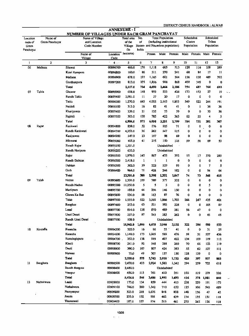
Location Name of code of Gram Panchayat Gram
Panchayat
2
06 Mallana
07 Tahla
08 Rajor
09 Talab
10 Koondla
II Beeghota
12 Natllal wara
DISTRICT CENSUS HANDBOOK: ALWAR
ANNEXURE-I NUMBER OF VILLAGES UNDER EACH GRAM PANCBAYAT
Name of Village and Location Code Number
Total area No. Total Population of the of (including institutional
Village House- and Houseless population) (in holds
Scheduled Castes
Population
Scheduled Tribes
Population
-----:N7"a-m-e-o':'"f -----:Lo:--ca-t7"io-n- hectares) -P .... e-rs-o-n-M--al-e--:F:-e-ma-l-e-M-a""le-F::'e-m-a-le-M-a-le---,F::'e-m-a-Ie
Villa e Code 3 . 4--- 5 6 7 8 9 10
Sitawat
Kotri Rarnpura
Mallana
Gordhanpura
Total
Ghewar
Rundh Tahla
Tahla
Naidoli
Khariyawas
Rajdoli
Total
Kankwnri
Rundh Kankwari
Kaniyawas
Mitrawat
Rundh Rajor
Rundh Haripura
Rajor
Rundh Dabkan
Dabkan
Garh
Total
Nadoo
RundhNadoo
Murlipura
ChawaKaBas
Talab
Roopbas
Losal
Umri Deori
Rundh Urnri Deori
Total
Kooncha
Koondla
Ramsinghpura
Kherli
Deoti
Narwas
Total
Beeghota
Rundh Beegota
Veerpur
Total
Lanki
Nathalwara
Narayanpur
Joneta
Tharnawali
00896700
00896800
00896900
00897200
00895900
00895400
00896000
00896100
00897400
00897500
466.0
160.0
678.0
813.0
2,117.0
698.0
3,981.0
1.270.0
313.0
339.0
303.0
6,904.0
176
86
197
275
734
148
II
645
16
21
130
1,118
511
1,165
1,856
4,650
959
37
4.055
82
132
785
605
270
601
988
2,464
533
20
2,162
41
73
422
513
241
564
868
2,186
426
17
1,893
41
59
363
128
68
156
402
754
173
o 549
o o
62
971 6,050 3,251 2,799 784
00894800 859.0 32 176 105 71 0
00894700
00894900
00895000
00895100
00895200
00895300
00896200
4,353.0
147.0
105.0
1,551.0
632.0
1,970.0
2,418.0
302.0
36
23
41
145
262
167
275
867
147
98
150
Uninhabited
Uninhabited
115
69
125
00896300
00896400 964.0
13,301.0
00895600 1,301.0
00895500 11,250.0
39
71
388
109
5
222
428
2,398
709
5
475
1
129
246
1,351
377
5
392
o 93
182
1,047
332
o 150
76
1,703
228
381
00895700
00895800
00897300
00897600
00897700
00897800
00897900
00904500
00904600
00904700 .
00908700
00908800
00909800
00908500
00908400
00908600
188.0
236.0
44 296 146
28 163 87
1,555.0
253.0
814.0
237.0
108.0
522 3,569 1,866
63 521 293
138 870 489
97
15,942.0 1,006
322.0 16
1,140.0 173
352.0 138
241.0 92
390.0
75.0
2,520.0
2,478.0
2,480.0
456.0
5,414.0
173.0
107 49
575
433
113
546
134
545 283 262
6,678
96
1,065
919
548
807
307
Uninhabited
3,546 55 .
589
497
288
424
157
3,132
41
476
422
260
383
150
3,742 2,010' 1,732
2,924 1,582 1,342
Uninhabited
761 410 351
3,685
859
1,992
444
1,693
415
o o
59
15
o o o
74
o o o o
266
o 56
o
322
o 38
134
70
55
128
425
294
122
416
238 00909000
00909100
00909200
00909300
00909400
746.0 200 1.342 710 632 125
323.0 218 1,676 848 828 148
233.0 132 901 462 439 134
187.0 157 974 513 461 275
1028
1J
116
84
138
349
687
153
o 522
o 55
12
338
17
409
o 764
27
o 244
36
70
4
731 381
o O·
o o
56
17
o o o
73
o o
o o
69
370
o 7
94
S40
o 5
o 0
o 0
247 435
o 105
47 0 o
294
o 31
109
66
45
590
31
537
119
123 62 127
129 0
397 937
259 722
119 279
378 1,001
229 191
106 540
136 47
135 131
245 126
13
289
II
392
o 692
19
o 191
36
56
5 307
o o o
53
293
o 5
64
415 o o o o
401
87
o 45
533
25
436
112
119
III
o 803
618
226
844
172
489
42
118
118
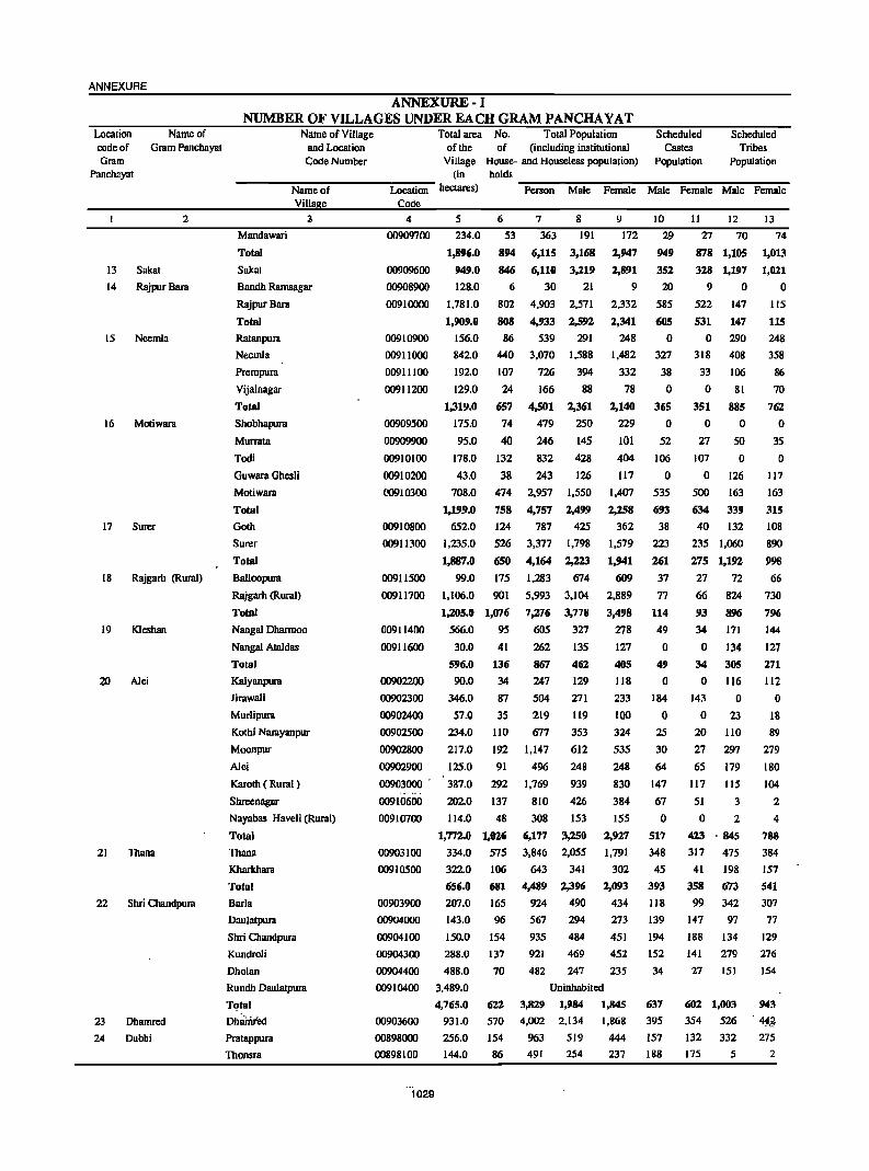
ANNEXURE
Location Name of code of Gram Panchayat Gram
Panchayat
13
14
15
2
Sakat
Rajpur Bam
Neemla
16 Motiwam
17 Surer
18 Rajgarh (Rural)
19 Kleshan
20 Alei
21
22
23
24
TIlana
Shri Chandpura
Dhamred
Dubbi
ANNEXURE-I NUMBER OF VILLAGES UNDER EACH GRAM PANCHA YAT
Name of Village Total area No. Total Population Scheduled Scheduled and Location of the of (including institutional Castes Tribes Code Number Village House- and Houseless population) Population Population
(in holds Name of Location hectares) ~P:::-ers-o-n~M~al:-e--:F:::-e-maJ-:-e--:M~al-e -:::Fe-m-a-:-le~M~a!:-e-:::F~em-a!-:-e-
Villa e Code
Mandawari
Total
Sakal
Bandh Rarnsagar
Rajpur Bam
Total
Ratanpura
Neemla
Prempura
Vijainagar
Total
Shobhapura
Murrata
Todi
Guwara Ghesli
Motiwam
Total
Goth
Surer
Total
Balloopura
Rajgarh (Rural)
Total
Nangal Dharmoo
Nanga! Ataldas
Total
Kalyanpura
lirawali
Murlipura
Kothi Narayanpur
Moonpur
Alei
Karoth ( Rural)
Shreenagar
Nayabas Haveli (Rural)
Total
Thana
Kharkhara
Total
Barla
Daulatpura
Shri Cbandpura
Kundroli
Dholan
Rundh Daulatpura
T~tal
Dhamied Pratappura
Thonsra
4
00909700
00909600
00908900
00910000
00910900
00911000
00911100
00911200
00909500
00909900
00910100
00910200
(10910300
00910800
00911300
00911500
00911700
00911400
00911600
00902200
00902300
00902400
00902500
00902800
00902900
00903000 .
00910600
00910700
00903100
00910500
00903900
00904000
00904100
00904300
00904400
00910400
00903600
00898000
00898100
"1029
5 6 7 8 9 IO
234.0 53 363 191 172 29
1,896.0
949.0
128.0
1,781.0
1,909.0
156.0
894 6,115 3,168 2,947
2,891
9
2,332
2,341
248
949
352
20
585
605
o
846 6,110 3,219
6 30 21
842.0
192.0
129.0
1,319.0
175.0
95.0
802
808
86
440
107
24 (i57
74
40
178.0 132
43.0 38
708.0 474
1,199.0 758
652.0 124
1,235.0 526
1,887.0 650
99.0 175
1,106.0 901
1,lO5.0 1,076
566.0 95
30.0 41
596.0 136
90.0 34
346.0
57.0
234.0
217.0
125.0
387.0
202.0
87
35
110
192
91
292
137
114.0 48
1,772.0 1,02.6
334.0 575
322.0 106
656.0 681
207.0 165
143.0
150.0
288.0
488.0
3,489.0
4,765.0
931.0
256.0
144.0
96
154
137
70
612
570
154
86
4,903 2,571
4,933 2,592
539 291
3,070 1,588
726 394
166 88
4,501 2,361
1,482
332
78
1,140
229
101
327
38
o 365
o 52
479
246 832
243
250
145
428
126
404 106
117 0
2,957
4,757
787
3,377
4,164
1,283
5,993
7,276
605
262
867
247 504
219
677
1,147
496
1,769
810
308
6,177
3,846
643 4,489
924
567
935
921
482
1,550
2,499
425
1,798
2,223
674
3,104
3,778
327
135
462
129
271
ll9
353
612
248
939
426
153
3,250
2,055
341
2,396
490
294
484
469
247
1,407
2,258
362
1,579
1,941
609
2,889
3,498
278
127
405
118
233
100
324
535
248
830
384
155
1,927
1,791
302
2,093
434
273
451
452
235
Uninhabited
3,829 1,984 1,845
4,002 2,134 1,868
963 519 444
491 254 237
535
693
38
223
261
37
77
114
49
o 49
o 184
o 25
30
64
147
67 o
S17
348
45
393
118
139
194
152
34
637
395
151
188
II 12 13
27 70 74
878 1,105 1,013
328 1,197 1,021
9 0 0
522
531
o 318
33
o 351
o 27
147
147
290
408
106
81
885
o 50
107 0
o 126
500 163
634 339
40 132
235 1,060
275 1,192
27 72
66 824
93 896
34 171
o 134
34 30S
o 116
143
o 20
27
65
111
51
o 23
110
297
119
115
3
o 2
423 ·845
317 475
41 198
358 673
99 342
147 97
188 134
141 279
27 151
602 1,003
354 526
132 332
175 5
115
115
248
358
86
70
762
o 35
o 117
163
31S
108
890
99S
66
730
196
144
127
271
112
o 18
89
279
ISO 104
2
4
788
384
157
541
307
77
129
276
154
943
,¥g 275
2
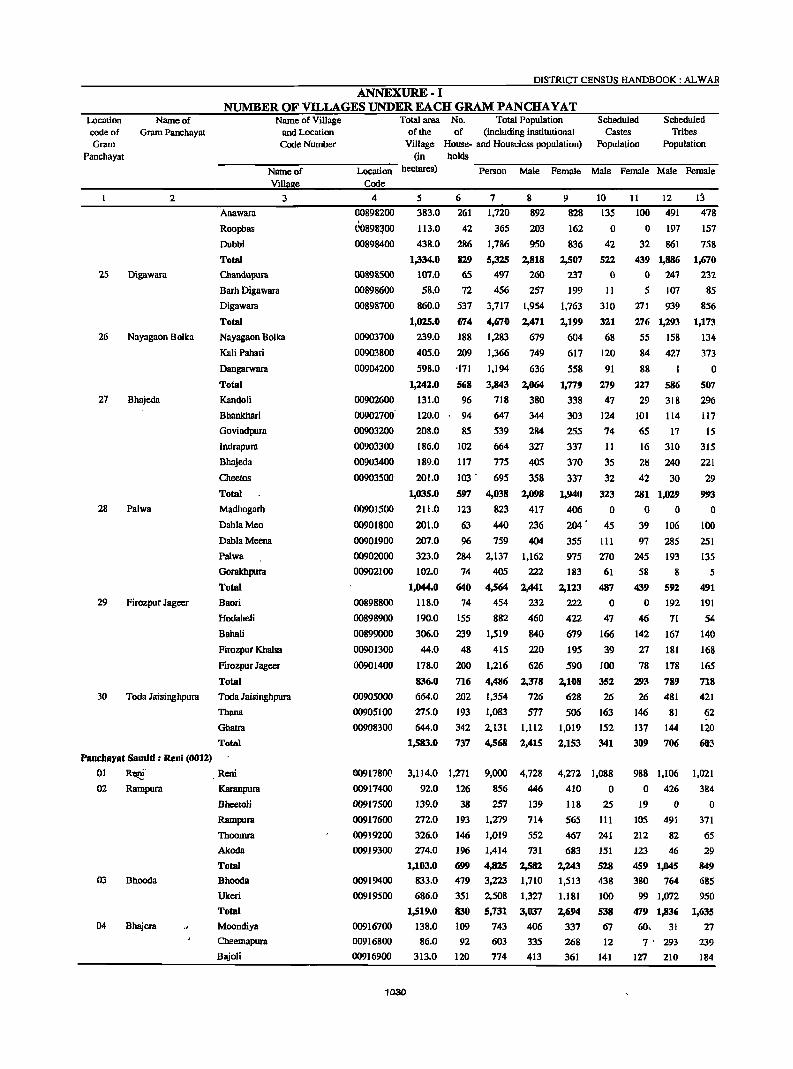
Location code of Gram
Panchayat
25
26
27
28
29
30
Name of Gram Panchayat
2
Digawara
Nayagaon Bolka
Bhajeda
Palwa
Firozpur Jageer
Toda Jaisinghpura
PanchQYllt SlImiti : ReDi (0012)
DISTRICT CENSUS HANDBOOK: ALWAR
ANNEXURE-I NUMBER OF VD..LAGES UNDER EACH GRAM PANCHA YAT
Name of Village and Location
Code Number
Total area No. Total Population Scheduled Scheduled of the of (including institutional Castes Tribes
Village House- and Houseless population) Population Population (in holds
-----:N"":"a-m-e-07f------:Lo=--c-au"":"·o-n- hectares) -P-ers-o-n-M-al-e-P-e-m-al-e-M-a-Ie-P-e-ma-Ie-M-a-Ie-P-et-n-al-e
Villa e Code
3 4
Anawam
Roopbas
Dubbi
Total
Chandupura
Barh Digawara
Digawara
Total
Nayagaon Bolka
Kali Pahari
Dangarwara
Total
Kandoli
Bhankhari
Govindpura
Indrapura
Bhajeda
Cheetos
Total
Madhogarh
DablaMeo
DablaMeena
Palwa
Goralchpura
Total
Baari
Hodaheli
Bahali
Pirozpur Khalsa
Firozpur Jageer
Total
Toda Jaisinghpura
Thana
Ghatra
Total
00898200
ro898~00 00898400
00898500
00898600
00898700
00903700
00903800
00904200
00902600
00902700'
00903200
00903300
00903400
0090350D
00901500
00901800
00901900
00902000
00902100
00898800
00898900
00899000
00901300
00901400
00905000
00905100
00908300
5 6 7 8
383.0 261 1,720 892
113.0
438.0
1,334.0
107.0
58.0
860.0
1,025.0
239.0
405.0
598.0
1,242.0
131.0
120.0
208.0
186.0
189.0
201.0
1,035.0
211.0
201.0
42
286
829
65
72
537
674
188
209
·171
568
96
365 203
1.786 950
5,325 2,818
497 260
456 257
3,717 1,954
4,670 2,471
1,283 679
1,366 749
1,194 636
3,843
718
94 647
2,064
380
344
284
327
405
358
85 539
102 664
117 775
103 - 695
597 4,038
123 823
63 440
2,098
417
236
207.0 96 759 404
323.0 284 2,137 1,162
102.0
1,044.0
118.0
190.0
306.0
44.0
178.0
836.0
664.0
275.0
644.0
1,583.0
74 405 222
640 4,564 2,441
74 454 232
155 882 460
239 1,519 840
48
200
716
202
193
342
737
415 220
1,216 626
4,486 2,378
1,354 726
1,083 577
2,131 1,112
4,568 2,415
9 10
828 135
162
836
2,507
237
199
1,763
2,199
604
617
558
1,779
338
303
255
337
370
337
1,940
406 204 .
o 42
522
o II
310
321
68
120
91
279
47
124
74
11
35
32
323
o 45
355 III
975 270
183
2,123
222
422
679
195
590
2,108
628
506
1,019
2,153
61
487
o 47
166
39
100
352
26
163
152
341
11 12
100 491
o 197
32 861
439 1,886
o 247
5 107
271 939
276 1,293
55 158
84 427
88 I
227
29
586
318
101 114
65 17
16 310
28 240
42 30
281 1,029
o 0
39 106
97 285
245 193
58
439
o 46
142
27
78
293
26
146
137
309
8
592
192
71
167
181
178
789
481
81
144
706
13 478
157
758
1,670
232
85
856
1,173
134
373
o 507
296
117
15
315
221
29
993
o 100
251
135
5
491
191
54
140
168
165
718
421
62
120
603
01 R~' Reni 00917!!00
00917400
00917500
00917600
00919200
00919300
3,114.0 1,271 9,000 4,728 4,272 1,088 988 1,106 1,021
02 Rampura Karanpura
03 Bhooda
04 Bhajera
Bheetoli
Rampura
Thoomra
A1coda
Total
Bhooda
Ukeri
Total
Moondiya
Cheemapura
Bajoli
00919400
00919500
00916700
00916800
00916900
1030
92.0 126 856 446
139.0 38 257 139
272.0 193 1,279 714
552
731
326.0
274.0
1,103.0
833.0
686.0
1,519.0
138.0
86.0
313.0
146
196
699
479
351
830
109
92
120
1,019
1,414
4,825
3,223
2.508
5,731
743
603
774
2,582
1,710
1,327
3,037
406
335
413
410 0
118 25
565 111
467
683
2,243
1,513
1,181
2,694
337
268
361
241
151
528
438
100
538
67
12
141
o 426 384
19 0 0
105 491
212 82
123 46
459 1,1145
380 764
99 1,072
479 1,836
60. 31
7' 293
127 210
371
65
29
849
685
950
1,635
27
239
184
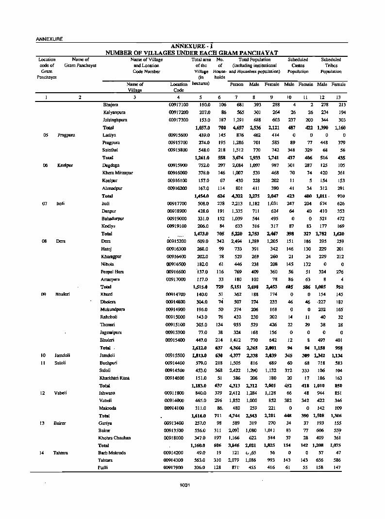
ANNEXURE
Location code of Gram
Name of Gram Panchayat
Panchayat
05
06
07
08
09
10
II
12
13
14
Pragpura
Keelpur
ltoli
Oem
Bhuleri
Jamdoli
Saloli
Vabeli
Bairer
Tahlara
2
ANNEXURE-I NUMBER OF VILLAGES UNDER EACH GRAM PANCHA VAT
Name of Village and Location Code Number
Total area No. Total Population of the of (including institutional
Village House- and Houseless population) (in holds
Scheduled Castes
Population
Scheduled Tribes
Population
------::N":""a-m-e-o":'f -----Lo:--ca-b-:"· o-n- hectares) -:P=-ers-o-n--:M:":a-:I-e --:F:-e-m-:al~e---::M-:-al-:-e--F::-e-m-a-:-Ie--:M-:-al-:e-=Fe-m-a-:-Ie
Villa e Code
Bhajera
Kalyanpura
Jaisinghpura
Total
Ladiya
Pragpura
Sainthal
Total
Dagdaga
Khera Mirzapur
Keelpur
Ahmadpur
Total
Itoli
Danpur
Bahadurpur
Kodiya
Total
Oera
Hatoj
Kharagpur
Nibola
Peepal Hera
Amarpura
Total
Khurd
Dholera
Mukundpura
Rahcholi
Thonsri
Jagmalpura
Bhuleri
Total .
Jamdoli
Buchpuri
Saloli
Kharkhari Rana
Total
Ishwana
Vabeli
Makroda
Total
Guriya
Bairer
Khohra Chauhan
Total
Barh Makroda
Tahtara
Padli
3 4
00917100
00917200
00917300
00915600
00915700
00915800
00915900
00916000
00916100
00916200
00917700
00918900
00919000
00919100
00915200
00916300
00916400
00916500
00916600
00917000
00914700
00914800
00914900
00915000
00915100
00915300
00915400
00915500
00914400
00914500
00914600
00911800
00914000
00914100
00913400
00913500
00918000
00914200
00914300
00917900
1031
5 6 7 8
160.0 106 681
565
1,291
4,657
393
301
688
207.0 86
153.0
1,057.0
439.0
274.0
548.0
1,161.0
752.0
378.0
157.0
167.0
1,454.0
508.0
428.0
331.0
206.0
1,473.0
609.0
268.0
202.0
182.0
'137.0
117.0
1,515.0
140.0
304.0
196.0
143.0
305.0
77.0
447.0
1,612.0
1,813_0
579.0
453.0
151.0
1,183.0
840.0
465.0
311.0
1,616.0
257.0
556.0
347.0
1,160.0
49.0
563.0
187
700
145
195
218
558
297
146
67
114
624
278
191
152
84
705
342
99
78
61
116
876
1,286
1,512
3,674
2,084
1,007
430
2,536
462
701
770
1.933
1,097
539
228
801 411
4,322 2,275
2,213 1,182
1,335 711
1,039 544
633 316
5,220 2,753
2,494 1,289
733 391
529 269
446 238
769 409
33 180 102
729 5,151 2,698
51 362 188
74 507 274
50 374 206
76 432 230
134 955 529
38
214
637
630
218
368
51
637
324 168
1,412 770
4,366 2,365
4,377 2,338
1,505 816
2,422 1,290
386 206
4,313 2,312
329 2,412 1,284
1,000
259
2,543
319
1,080
296 1,852
86. 480
711 4,744
98 589
311 2,09i
197 1,166
606 3,846
19 121
310 2,079
622
2,021
,:".~65
1,086
306.0 128 871' 455
9
288
264
603
2,121
414
585
742
1.741
987
468
202
390
2,047
1,031
624
495
317
2,467
1,205
342
260
208
360
78
2,453
174
233
168
202
426
156
642
2,001
2,039
689
1,132
180
2,001
1,128
852
221
2,201
270
1,011
544
1,825
56
993
416
10
4
26
237
487
o 89
348
437
301
70
11
41
423
247
64
o 87
398
lSI
146
21
145
56
86
605
o 46
o 14
22
o 12
94
345
60
372
20
452
66
382
o 448
34
83
37
154
o 143
61
II 12
2 278
26 234
200 344
422 1,390
o 0
77 448
329 68
406 516
287 125
74 420
5 154
34 312
400 1,011.
204 674
40 410
o 521
83 177
327 1,782
186 295
130 229
24 229
132 0
51 324
63 8
586 1,OS5
o 154
46 ·227
o 202
11 40
29 38
o 0
8 497
94 1,158
309 1,342
68 718
333 106
17 186
418 1.010
48 944
342 422
o 142
390 1,508
37 193
77 606
28 409
142 1,208
o 57
143 656
55 158
13 213
194
303
1,160
o 379
56
435
105
361
153
291
910
626
353
472
169
1,620
259
201
212
o 276
4
952
145
187
165
32
28
o 401
95!!
1,134
583
104
163
850
851
346
109
1,306
155
559
361
1,075
47
586
147
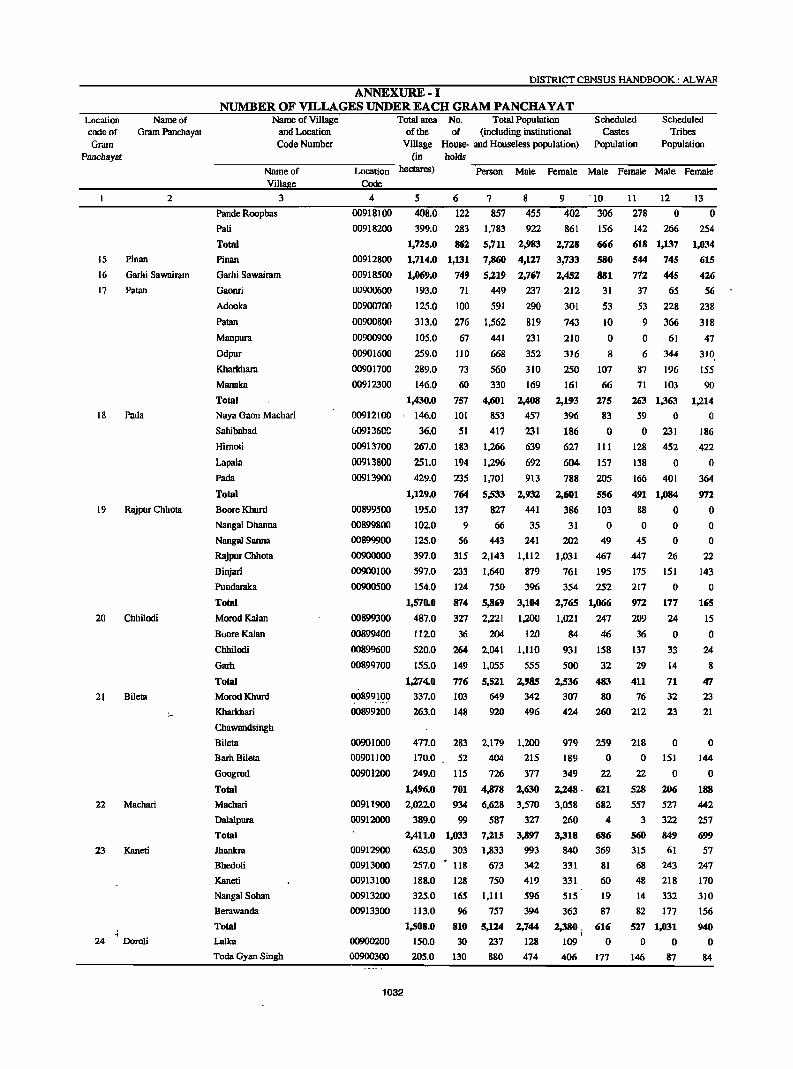
Location code of Gram
Panchaya!
15
16
17
18
19
20
21
22
23
24
Name of Gram Panchayat
2
Pinan
Garhi Sawairam
Palan
Pada
Rajpur Chhota
Chhilodi
Bileta
Machari
Kaneti
Doroli
DISTRICT CENSUS HANDBOOK: ALW AR
ANNEXURE-I NUMBER OF Vll..LAGES UNDER EACH GRAM PANCHA YAT
Name of Village and Location Code Number
Total area No. Total Population of the of (including institutional
Village House- and Houseless population) (in holds
Scheduled Castes
Population
Scheduled Tribes
Population
------~N7am--e-o~f--------~Lo-~-t~io-n-hecta~) ~P~e-~--n~M~a1-e~F~e-m-al~e~M~a~le--=Fe-ma~le~M~a~le--=Fe-m-a~le
Viii e Code
3 4 5 6 7 8
Pande Roopbas
Pali
Total
Pinan
Garhi Sawairam
Gaonri
Adooka
Palan
Manpura
Odpur
Kharkhara
Manaka
Total
Naya Gaon Machari
Sahibabad
Hirnoti
Lapala
Pada
Total
BooreKburd
Nangal Dbanna
Nangal Sanna
Rajpur Chhota
Billjari
Pundaraka
Total
MorodKaian
BooreKalan
Chhilodi
Garh
Total
MorodKhurd
Kharkhari
Chawandsingh
Bileta
Barh Bilela
Googrod
Total
Machari
Dalalpura
Total
Jhankra
Bhedoli
Kaneti
NangalSohan
Berawancla
Total
Lalka
Tocla Gyan Singh
00918100
00918200
00912800
00918500
00900600
00900700
00900800
00900900
00901600
00901700
408.0 122
399.0 283
1,725.0 862
1,714.0 1,131
1,069.0 749
193.0 71
125.0 100
313.0 276
105.0 67
259.0 110
289.0 73
857
1,783
5,711
7,860
5,219
449
591
1,562
441
668
560
455
922
2,983
4,127
2,767
237
290
819
231
352
310
00912300 146.0 60 330 169
1,430.0
00912100 146.0
W91J6CC 36.0
00913700
00913800
00913900
00899500
00899800
00899900
00900000
00900100
00900500
00899300
00899400
00899600
00899700
00899100
00899200
267.0
251.0
429.0
1,129.0
195.0
1020
125.0
397.0
597.0
154.0
1,570.0
487.0
112.0
520.0
155.0
1,274.0
337.0
263.0
757 4,601 2,408
101 853 457
51 417 231
183 1,266 639
692 194 1,296
235
764
137
9
56
315
233
124
874
327
36
264
149
776
103
148
1,701 913
5,533 2,932
827 441
66
443
2,143
1,640
750
5,869
2,221
204
2,041
1,055
5,521
649
920
35
241
1,112
879
396
3,104
1,200
120
1,110
555
2,985
342
496
00901000
00901100
00901200
477.0 283 2,179 1,200
00911900
00912000
00912900
170.0
249.0
1,496.0
2,0220
389.0
2,411.0
625.0
00913000 257.0
00913100 188.0
00913200 325.0
00913300 113.0
1,508.0
00900200 150.0
00900300 205.0
1032
52
115
701
934
99
1,033
303
404
726
4,878 6,628
587
7,21S
1,833
215
377
2,630
3,570
327
3,897
993
118 673 342
128 750 419
165 1,111 596
96 757 394
810 5,124 2,744
30 237 128
130 880 474
9 '10
402 306
861
2,728
3,733
2,452
212
301
743
156
666
580
881
31
53
10
210 0
316 8
250 107
161
2,193
396
186
66
275
83
o 627 III
604· 157
788
2,601
386
31
202
205
5S6
103
o 49
1,031 467
761 195
354 252
2,765 1,066
1,021 247
84 46
931 158
500
2,536
307
424
32
48.' 80
260
979 259
189
349
2,248 .
3,058
260
3,318
840
o 22
621
682
4
686
369
331 81
331 60
515 19
363 87
2,380. 616 •
109 0
406 177
II 12
278 0
142 266
618 1,137
544 745
772 445
37 65
53 228
9 366
o 61
6 344
87 196
13
o 254
1,034
615
426
56
238
318
47
310.
155
71 103 90
263 1,363 1,214
59 0 0
o 231 186
128 452
138 0
166 401
491 1,084
88 0
o 45
447
175
217
972
209
36
137
29
411
76
212
218
o 22
528
557
3
560
315
o o
26
151
o 177
24
o 33
14
71
32
23
o 151
o 206
527
322
849
61
68 243
48 218
14 332
82 177
527 1,031
o 0
146 87
422
o 364
972
o o o
22
143
o 165
15
o 24
8
47
23
21
o 144
o 188
442
257
699
57
247
170
310
156
940
o 84
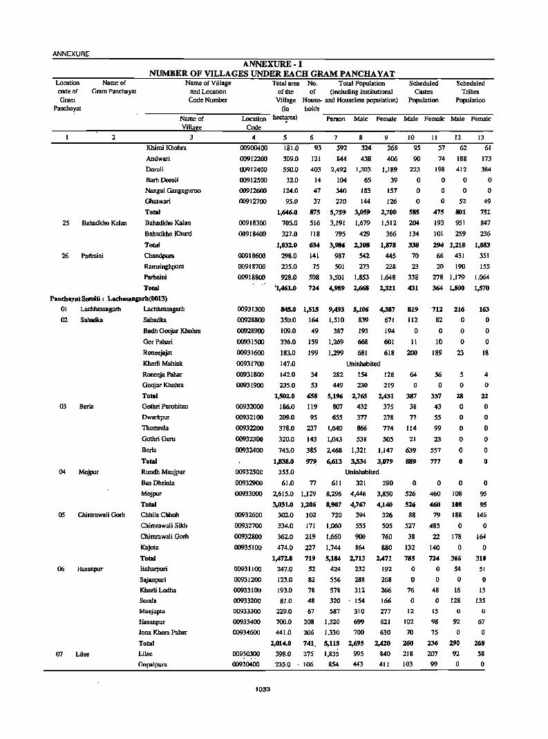
ANNEXURE
ANNEXURE-I NUMBER OF VILLAGES UNDER EACH GRAM PANCHA VAT
Location code of Gram
Panchayat
25
26
Name of Gram Panchayat
2
Bahadkbo Kalan
Patbaini
Name of Village and Location Code Number
Name of Villa e
Khimi Khohra
Andwari
Doroli
BarhDoroJi
3
Nangal Gangaguroo
Ghatwari
Total
Bahadkho Kalan
Bahadkho Khurd
Total
Chandpum
Ramsingbpura
Parbaini
Total
Panchayat Sarniti: Lachmanprh(OOI3)
01 Laclthmangarh Lacbbmangarh
02 Sabadka Sahadka
03 Berla
04 Mojpur
05 Chimrawali Gorh
06 Hasanpur
07 Lilee
Badh Goojar Khobra
GorPahari
Roneejajat
Kherli Mahlak
Roneeja Pahar
Goojar Kbobra
Total
Gothri Purobitan
Dwarkpur
Thumre1a
Gothri Guru
Ber1a
Total
Rundh Maujpur
Bas Dhckda
Mojpur
Total
ChbiIaCbboh
Chimrawali Sikh
Chimrawali Gorh
Kajola
Total
Baharpuri
Sajanpuri
Kberli Lodba
Semla
Manjapta
Hasanpur
Jona Kbera Pabar
Total
Lilee
Gopalpura
Location Code
4
00900400
00912200
00912400
00912500
00912600
00912700
00918300
00918400
00918600
00918700
00918800
00931300
00928800
00928900
00931500
00931600
00931700
Total area No. Total Population Scheduled Scheduled of the of (including institutional Castes Tribes
Village House- and Houseless population) Population Population (in bolds
~--~~--~--~~~--~~~~--hect~) Person Male Female Male Female Male Female
5 6 7 8 9 10
181.0 93 592 324 268 95
309.0
550.0
32.0
124.0
95.0
1,646.0
705.0
327.0
1,032.0
298.0
121
403
14
47
37
875
516
118
Ii34
141
235.0 75
928.0 508
'1,461.0 724
845.0 1,515
350.0 164
844 438
2,492 1,303
104 65
340 183
270 144
5,759 3,059
3,191 1,679
795 429
3,986 2,108
987 542
501
3.501
4,989
9,493
1.510
273
1,853
2,668
5,106
839
406
1,189
39
157
126
2,700
1,512
366
1,878
44S
228
1,648
2,321
4,387
671
109.0
336.0
183.0
147.0
49 387 193 194
159 1,269 668 601
199 1.299 681 618
Uninhabited
90
223
o o o
58S
204
134
338
70
23
338
431
819
112
o 1 !
200
I I 12 13
57 62 61
74 188
198 412
o 0
o 0
o 52
475 801
193 951
101 259
294 1,210
66 431
20 190
278 1,179
364 1,800
712 216
82 0
o 10
189
o o
23
173
384
o o
49
751
847
236
1,083
351
155
1,064
1,570
163 o o o
18
00931800 142.0 34 282 154 128
219
64
o S6 o
5
o 4
o 00931900 235.0 53 449 230
1,502.0
00932000 186.0
658 5,196 2,765
119 807 432
2,431
375
278
774
505
00932100
00932200
00932300
00932400
00932500
00932900
00933000
00932600
00932700
00932800
00935100
00931100
00931200
00933100
00933200
00933300
00933400
00934600
00930300
00930400
1033
209.0
378.0
320.0
745.0
95
237
143
385
979.
655
1.640
1,043
2,468
6,613
377
866
538
1,321
3,534
1,147
3,079 1,838.0
355.0
61.0
Uninhabited
77 611 321 290
2,615.0 1,129
3,031.0 1,206
3020 102
334.0 171
362.0 219
474.0 227
1,472.0 71!1
247.0 52
123.0 82
8,296 4,446
8,907 4,767
720 394
1,060 555
1,660 900
1,744 864
5,184 2,713
424 232
556 288
193.0
81.0
229.0
700.0
441.0
78 578 312
154
310
699
700
2,014.0
398.0
48 320
67 587
208 1,320
206 1,330
741, 5,115
275 1,835
235.0 . 106 854
2,695
995
443
3,850
4,140
326
505
760
880
2,471
192
268
266
166
277
621
630
2,420
840
411
387
38
77
114
21
639
889
o 526
526
88
527
38
132
785
o o
76
o 12
102
70
260
218
103
337
43
55
99
23
557
777
o 460
460
79
483
22
140
724
o o
48
o 15
98
75
236
207 99
28
o o o o o o
o 108
108
188
o 178
o 366
54
o 16
128
o 92
o 290
92
o
22
o o o o o o
o 95
95
146
o 164
o 310
51
o 15
135
o 67
o 268
58
o
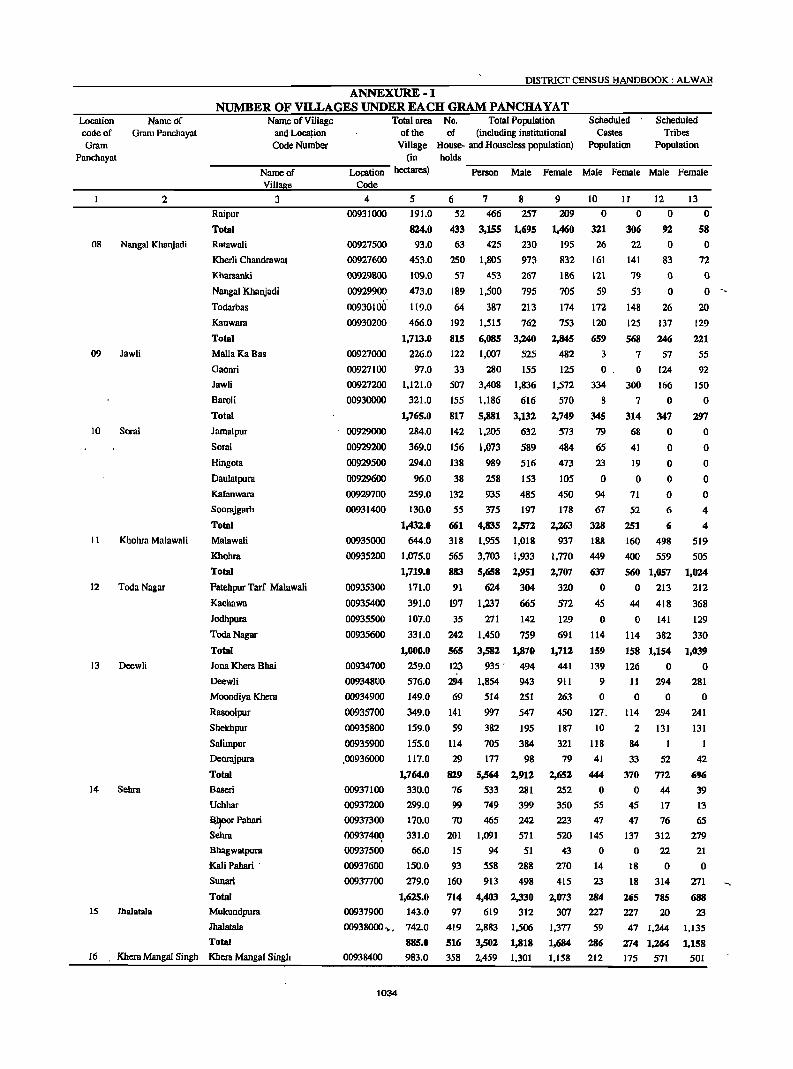
DISTRICT CENSUS HANDBOOK: ALWAR
ANNEXURE-I NUMBER OF VILLAGES UNDER EACH GRAM PANCHA YAT
Location Name of code of Gram Pancbayat Gram
Panchayat
2
08 Nangal Khanjadi
09 Jawli
10 Sorai
II Khohra Malawali
12 Toda Nagar
13 Deewli
14 Sebra
15 Ihalatala
Name of Village and Loca~ion Code Number
Name of Villa e
Raipur
Total
Ratawali
3
Kherli Chandrawat
Kharsanki
Nangal Khanjadi
Todarbas
Kanwara
Tolal
Malia Ka Bas
Gaonri
Jawli
BaraH
Total
Jamalpur
Sorai
Ringola
Daulatpura
Kafanwara
Soorajgarh
Total
Malawali
Khohm
Total
Patehpur Tarf Malawali
Kachawa
Jodhpura
TodaNagar
Total
Jona Khera Bhai
Deewli
Moondiya Khera
Rasoolpur
Shekhpur
Salimpur
Deorajpura
Total
Baseri
Uchhar
-~rPahari
Sehra
Bhagwatpura
Kali Pahari .
Sunari
Total
Mukundpura
JhalataIa
Total
16 Khcra Mangal Singh Khcra Mangal Singh
Total area No. Total Population Scheduled Castes
Population
Scheduled Tribes
Population of the of (including institutional
Village House- and Rouseless population) (in holds --------------------------------Location heaares) Person Male Female Male Female Male Female
Code
4
00931000
00927500
00927600
00929800
00929900
00930100
00930200
00927000
00927100
00927200
00930000
00929000
00929200
00929500
00929600
00929700
00931400
00935000
00935200
00935300
00935400
00935500
00935600
00934700
00934800
00934900
00935700
00935800
00935900
.00936000
00937100
00937200
00937300
0093740Q
00937500
00937600
00937700
00937900
5 191.0
1124.0 93.0
453.0
6
52
433 63
250
7 466
3,155
425
1,805
8
257
109.0 57 453
1,695
230
973
267
795
213
762
473.0 189 1,500
119.0 64 387
466.0
1,713.0
226.0
97.0
1,121.0
321.0
1,765.0
284.0
369.0
192
815
122
33
507
155
817
142
156
294,0 138
96.0 38
259.0 132
55
661
318
565
883
91
197
1,515
6,085
1,007
280
3,408
1,186
5,881
1,205
1,073
3,240
525
155
1,836
616
3,132
632
589
989 516
258 153
935 485
375
4,835
1,955
3,703
5,658
624
1,237
197
2,572
1,018
1,933
2,951
130.0
1,432.0
644.0
1,075.0
1,719.0
171.0
391.0
107.0
331.0
35 271
304
665
142
759
1,000.0
259.0
576.0
149.0
349.0
159.0
155.0
117.0
1,764.0
330.0
299.0
170.0
331.0
66.0
150.0
279.0
1,625.0
143.0
242 1,450
565
123
294
69
141
59
114
29
819
76
99
70
201
15
93
160
714
3,582
935 .
1,854
514
997
1,870
494
943
251
547
382 195
705 384
177 98
5,564 2,912
533 281
749 399
465 242
1,091 571
94 51
558 288
913 498
4,403 2,330
619 312
00938000 .• , 742.0
885.0
97
419
516
358
2,883 1,506
3,502 1,818
2,459 1,301 00938400 983.0
1034
9 209
1,460
195
832
10
o 321
26
161
If 12
o
186 121
306 22
141
79
53
o 92
o 83
o o
26
137
246
705 59
174 172 148
753
2,845
482
125
1,572
570
2,749
573
484
473
105
450
178
2,263
937
1,770
2,707
320
572
129
691
1,712
441
911
263
450
187
321
79
2,652
252
350
223
520
43
270
415
2,073
307
1,377
1,684
1,158
120 125
659 568
3 7 57
124
166
o . 0
334 300
8 7 o 345 314 347
o o o o o
79 68
65 41
23
o 94
67
328
188
449
637
o 45
o 114
159
139
9
o 127.
10
118
41
444
o 55
47
145
o 14
23
284
227
59
286
212
19
o 71
52 6
251 6
160 498
400 559
560 1,057
o 213
44 418
o 141
114 382
158 1,154
126 0
11 294
o 0
114 294
2 131
84
33 52
370 772
o 44
45 17
47 76
137 312
o 22
18 0
18 314
265 785
227 20
47 1,244
274 1,264
175 571
13
o 58
o 72
o o
20
129
221
55
92
150
o 297
o o o o o 4
4
519
505
1,024
212
368
129
330
1,039
o 281
o 241
131
1
42
696
39
13
65
279
21
o 271
688
23
1,135
1,158
501
ANNEXURE
Location code of Gram
Name of Gram Panchayat
Panchayat
2
17 Saipur
18 Bichgaon
19 Gothra
20 Khudiyana
21 Ghat
22 Deenar
23 Boontoli
24 Gandoora
25 Itera
26 Harsana
27 Chidwai
ANNEXURE-I NUMBER OF VILLAGES UNDER EACH GRAM PANCIIA YAT
Name of Village and Location Code Number
Name of Villae
Amarpur
Pahrawali
Bheekhaheri
Total
Jaitpur
Pakhar
Saipur
Total
Bichgaon
Tilakpur
Total
Namol Khurd
Antapara
Namol Kalan
Gothra
Bidarka
Total
Hajipur
3
Fatehpur @ Khudiyana
Khudiyana
Total
Kherli Vccran
Hadarhera
Nenapur
Ghat
Bai KaBas
Total
Kherla
Dhand
Chhangalki
Resti
Dccnar
Toflll
Barawas
Boontoli
Total
AIlmadabas
Raghunath Bas
Gandoora
Total
Itera
Irniya
Nangli TarfBayra
Total
Mundjori
Harsana
Total . 4., ,
Govindpura
Sirmaur
:.-ocation Code
4
00938500
00938600
00938700
00938800
00938900
00939000
00936100
00936200
00937000
00937800
00938100
00938200
00938300
00926600
00926700
00926900
00925700
00928300
00928400
00928500
00928600
00925000
00925800
00925900
00928000
00928100
0092!!2oo
00928700
00929100
00929300
00929400
00926400
00926500
00926800
00934400
00934500
00844400
00844500
Total area No. Total Population Scheduled Scheduled of the of (including institutional Castes Tribes
Village House- and Houseless population) Population Population (in holds
hectares) ....,P,...ers-o-n--M~a1e-=Fe-ma-l:-c---:-M::-a,...le-=Fc-ma----:-lc--..,....M:-al:-e -F"'"e-m"""'al:--e
5 6 7 8 9 10 II 12 13
240.0 11 7 728 373 355 5 5 348 323
403.0
319.0
1.945.0
146.0
344.0
120.0
610.0
770.0
314.0
1,084.0
381.0
179.0
171.0
563.0
399.0
1,693.0
252.0
252.0
662.0
1,166.0
110.0
222.0 215.0
734.0
399.0
1,680.0
161.0
387.0
130.0
108.0
599.0
1,385.0
297.0
787.0
1,084.0
71.0
126.0
635.0
832..0
820.0
481.0
131.0
1,432.0
196.0
1.437.0
1,633.0
115.0
344.0
220 164
859
91
440
115
646
511
157
668
III
93
98
297
1,390
1,064
5,641
532
2,692
726
3,950
3,476
860
4,336
870
559 687
2,221
765
570
3,009
279
1,419
391
2,089
1,834
469
2.,303
474
301
358
1,179 156 1.005 515
755 5,342 2,827
94 800 436
66 426 227
362 2.395 1.272
Sl2 3,621 1,935
54 462 242
142
124
348
147
815
105
176
75
43
326
725
145
416
561
46
56
485
587
414
233
53
700
61
773
834
21
231
1,057
864
2,528
1,003
5,914
853
1,278
649
547
450
1,356
541
3,136
444
677
332 400 218
2.095 1.109
5;1.75 2.,780
1,024 559
2,821 1,466
3,845 2.,025
335 186
352 2.903
3,590
3,002
1,448
383
4,833
403
5,323
5,726
153
1,501
187
1,578
;1.,951
1,547
768
196
2,511
208
2,827
3,035
87
786
625
494
2,632
253
1,273
335
1,861
1,642
391
2,033
396
258
329
1,042
490
2,515
364
199
1,123
1,686
220
510
414
1,172
239
90
546
o 470
179
649
339
201
540
17
o o
91
189 442
68 447
437 1,808
o 278
426 318
153 130
579 726
301 112
162 7
463 119
13 J3
o o
72
o 0
300
107
111 287
818
300
108 8S
65 56
o 0
265 253
330· 309
o 0 248
68
677
219 74
610
462 42 27
930
171
319
o 263
563
o 93
168
o 1
262 2,778 1,035
409 205
601 362
317 0
182
986
2,495
465
1,355
1,820
149
165
1,325
1,639
1,455
680 187
2,322
195
2,496
2,691
66
715
4
375
946
106
157
263
62
30
609
701
378
99
o 477
o 519
519
41
233
o 7
337
834
84
131
215
56
2S
528
609
367
102
2
471
o 509 509
31
213
o 119
o o
39
158
o o o o o
53
53
432 41 49
52Z
8
517
525
o o
370
402
1,596
253
286
99
638
106
7
113
8
258
97
96
218
737
247
o 205
452
o 89
135
o o
224
o 107
o o
25
132
o o o o o
43
43
389
27
46
462
4
446 450
o o
... 1035
Location code of Gram
Panchayat
28
29
30
31
32
33
34
35
Name of Gmm Panchayat
2
Indpur
Malpur
Naswari
Nizamnagar
Phahri
Khcra Mahmood
Ramwas
Bhainsrawat
DISTRICT CENSUS HANDBOOK: ALWAR
ANNEXURE-I NUMBER OF VILLAGES UNDER EACH GRAM PANCHA YAT
Name of Village and Location Code Number
Name of Villa e
Barwada
Chidwai
Total
Hasanpur
Tilwar
Khal1pur Khurd
Indpur
Total
Jahal1pur
Singrak::!
Sahajpur
Malpur
Total
3
Naswari
Mundpuri Kalan
HarsoH
Itka
Marakpur
Total
Jaisinghpura
Nizamnagar
Bhayari
Chalc Bhayari
Khorpuri
Bedha
Total
Chhatarpur
Asaka
Mastpur
Beedooka
Phahri
Total
Khera Mahmood
Kherli Bahadar
Shahpur
Palan Khera
Teekri
Kachroti
Total Ramwas
Taira
Mundpuri Khurd
Kharsanki
Total
Total area No. Total Population' Scheduled Castes
Population
Scheduled Tribes
Population of the of (including institutional
Village House- and Houseless population) (in holds
~----~~~~~~~~~~--Location hectares) Person Male Female Male Female Male Female
Code
4
00844600
00844700
00843600
00843700
00843800
00843900
00844000
00844100 ,
W84420e
00844300
00919600
00919700
00919800
00923900
00924000
00924100
00924200
00924300
00924400
00925200
00925300
00921500
00921~,oq 00921800
00923700
00923800
00919900
00920000
00920100
00921300
00921400
00921700
00921900
00923400
00923500
00923600
00922900
00923QQO
00923100
5
470.0
395.0
1,324.0
133.0
534.0
178.0
420.0
1,265.0
286.0
133.0
277.0
508.0
6
223 297
772
61
426
71
271
829
167
lI2
IS9
286
724
291
124
114
7
1,523
1,605
4,782
379
2,522
468
8
753
821
2,447
187
1,260
231
1,959 1,057
5,328 2,135
1,122 589
687 369
1.002 520
1,806 936
4,617 2,414
2,006 1,006
869 430
778 430
1,204.0
516.0
280.0
228.0
229.0
180.0
113 683 349
100 687 387
1,433.0
349.0
393.0
202.0
114.0
266.0
286.0
742 5,023 2,602
275 1,752 934
206 1.407 741
138 1,035 542
167
557
S3 341
149 1,030
1,610.0
174.0
115.0
180.0
245.0
374.0
1,088.0
383.0
119
940 135
64
76
145
192
612
209
840 436
6,405 3,377
873 460
408 215
469
994
1,238
3,982
1.566
249
554
639
2,117
823
298.0 248 1,353 115
105.0 58 330 '172
148.0 93 709 370
168.0 90
101.0 56
1,203.0 754
764.0 712
267.0 160
350.0 97
193.0 166
1.S74.0 1,135
109.0 106
352.0 271
114.0 80
717
370
5,Cl45 4,998
1.111
769
952
7,830
826
380
205
2,665 2,695
610
399
503
4,207
444
9 10 11 12 13
770
784
2,335
192
1,262
237
902
167 156 0 0
2,593
533 318
482
870
2,203 1,000
439
348
334 300
2,421
818
666
101
542
o 87
o 161
248
189
83
40
146
458
S8
95
54
206
20
433
557
533
94
494
o 87
o 135
222
182
63
39
137
421
66
93
48
198
16
421
480
484 493 300 274
174 167 '174
473 303 266
404 219
3,028 2,079
413 241
193 0
220
440
599
1,865
743
638 158
339
337
165
2,380
2,303
501
370
449
179
16
119
555
27
93
5 3
13
o 141
157
163 6
145
471
183
1,861
213
o 168
15
116
512
26
78
4
5
15
o 128
124
128 8
112
372
o o o o o o o o o o o o o o
10
o o
10
o o o o o o o o o o
36
o 36 o o o o o o o
73
o 8
53
o o o o o ' o o o o o o o o o 8
o o 8 o o o o o o o o o o
23
o 23
o o o o o o o
51
o 8
59
Bajheri
Bhainsrawat
Bandheri
Pathroda ).,.,1 00923200 180.0 59
2,01l
538
345
6g3
1,072
275
174
351
3,623
382
939
263
171
342
62 116
177
24
o
64
108
162
24
134
o o o o o o
118
o o o o o o
SemJi Dilawar
Total 00923300
1036
183.0 106
938.0 6%2 4,413 2,316 2,097 379
o 358
ANNEXURE ANNEXURE·- I
NUMBER OF VILLAGES UNDER EACH GRAM PANCHA YAT Location Name of . code of Gram Panchayat Gram
Panchayat
2
36 Salema Khurd
37 Dongri
38 Saidampur
·1
39 Nyana
40 BarodaMeo
41 Butyana
42 Badka
43 Moliya
Name of Village and Location Code Number
Name of Villae
Ramalci
Salarpur
SemIa Khurd
Boolalleri
Total
Dabri
Badwara
Dongri
BasDongri
Jhareda
Total
.Saidampur
Doroli
Pagseri
Kaimasa
Total
Chamarwara
Agaraka
Nyana
Shakipura
Alghana
Baroli
Gandeeka
Total
BarodaMeo
PeepaI Khera
Total
Butyana
l!eetal
Mahlakpur
Ronpur
Total
ImIali
Chimanpura
Baorika
Dusrahera
Badka
Mokalheri
Melkheri
Total
Nibhera
Bandka
Moliya
Mahrana
Kareeriya
Total
3
44" Govindgarh Qqvindgarh (C.T.)
Panchayat Samiti: Kathumar (0014)
01 Kathoomar Kathoomar
Total area No.' Total Population Scheduled of the of (including institutional Castes
Village House- and Houseless population) Population (in holds
Scheduled Tribes
Population
Location hectares)
Code
~P=-e-rs-on-~M~a1~e--:F::-e-maI-:-e--:M:-:-:al-e-::Fe-m-a1-:-e~M~a1~e-::F~em-a1-:-e-
4 5
00922400
00922500
C0922600
00922800
00922000
00922100
00922200
00922300
00922700
00920500
00920600
00920700
00920800
00920200
00920300
00920400
00920900
00921000
00921100
00921200
00924500
00924600
00925100
00925400
00925500
00925600
00924700
00924800
00924900
00926000
00927700
185.0
156.0
320.0
102.0
763.0
229.0
357.0
248.0
140.0
176.0
1,150.0
277.0
258.0
153.0
372.0
1,060.0
151.0
84.0
360.0
114.0
199.0
238.0
157.0
1,303.0
1.089.0
326.0
1,415.0
435.0
323.0
170.0
418.0
1,346.0
227.0
54.0
204.0
403.0
117.0
00927800 141.0
00927900 382.0
1,528.0
00926100 497.0
00926200 238.0
00926300
00927300
00927400
396.0
171.0
303.0
6
60
77
7
483
524
156 1,078
35 257
328 111
158
2,342 779
1,122
173 1.117
71 471
8
252
277
576
145
1,150
406
605
572
238
9
231
247
502
112
88 589 300
1,092
373
517
545
233
289
601 4.078 2,121 1,957
837
348
424
265 1,759 922
118 745 397
132 916 492
180
695
76
58
329
1,374
4,794
435
381
2,154
63 485
103 665
135 1,035
113 681
733 641
2,S44 2,150
219 216
194 187
1.139' 1,015
264
363
523
361
221
302
512
320
10
o 34
89
o 123
111
19
107
o 106
343
161
60
94
72
387
o 23
214
o 27
o 80
fr17
1,161
191
5,836
7,863
1,343
9,lO6
1,739
1,484
3,063 2,n3 344
4,179 . 3,684 957
723 620 224
1,352
246
181
74
4,lI02 4,304 1,181
929 810 89
261
762
122
552
1,999
5,n4
999
54 327
106 784
192 1,481
84 649
768
290
1,054
3,041
504
170
394
783
369
66 444 239
119 933 510
743 5,617 2,969
143 1,016 521
110 762 409
271 1.773
107 824
195 1,143
943
424
614
716
262
945 2,733
495
157
390
698
280
205
423
2,648
495
353
830
400
529
78
24
475
666
84
26
o 110
40
20
16
296
161
34 159
81
196
11
o 29
74
o 103
79
17
97
o 94
287
141
6d i 80
59
340
o 21
178
o 20
o 60
279
797
172
969
85
60
28
435
608
86
12
o o o o o o 5 o o o 5
o o o o o o o o o o o o o
130
o 130
141
o o
25
166
34
22 61
o 319
11~ 187
27 0
13
7
269
163
34
158
73
163
14
168
783 o
31
24
42
9
13
o o o o o o 3
o o o 3
o o o o o o o o o o o o o
123
o 123
135
o o
26
161
28
58
310
166
o 8
153
123
o 22
24
41
12
1,605.0 826 5,518 2,911 2,607 631 591 106 99
215 ,~~ .. 173 40608000 500,0 1~97 10,089 5;1.97 4,792 807 746
00943300 1;1.17.0 1,265 7,656 4,082 3,574 1,764 1,508 80 71
1037
Location Name of
code of Gram Panchayat Gram
Panchayat
2 02 Samooehi
03 Sonkhar ( Rural )
04 Reta
05 Salwari
06 Baseth
07 Maithna
08 Dantiya
09 Sonkhari
10
II
12
Tasai
Titpuri
Tusari .~ . :,
DISTRICf CENSUS HANDBOOK: ALWAR
ANNEXURE·I NUMBER OF VILLAGES UNDER EACH GRAM PANCHA YAT
Name of Village and Location Code Number
Total area No. Total Population Scheduled Scheduled of the of (including institutional Castes Tribes
Village House- and Houseless population) Population Population (in holds
------~N~a-m-e-o~f------~Lo~c~M~io--n hectares) ~Pe~B-o-n~M~aI~e~F~e-rna~l~e~M7a7w~F~e-rna~le~M7a~le~F~e-m-a~Ie
Villa e Code
3 4 5 6 7 8 9 10 11 12 13
Samoochi
Bangan Ka Nangla
Total
Preetampura
Sonkhar ( Rural)
Total
Haneepur
Reti
Doodheri
Moondiya
Bharithal
Rela
Total
Gala Khera
Salwari
Peepal Khera
Medpura
Total
Nangla Silaram
Lathki
Noooiya
Baseth
Total
Pisai
Maithna
Dhankroli
Rundh Maithana
ChakTapsi
Badka
Total
Dantiya
Dahari Dantwara
Bhanwar
Total
Mango1aki
Makkhan Ka Nagla
Sonkhari .
Rundh Sonkhari
Kaneti
Total
Tasai
Sedooka Nang1a
Beej1a
Sitahara
Titpuri
Total
Manpur
Samoli
Tusari
cp951600
00952400
00951900
00952000
00942200
00942300
00942700
00942800
00942900
00943200
00950300
00950400
00951700
00951800
00947400 I . 1o,'
Q0947500
00947600
00947800
00941900
00942000
00942100
00942400
00942500
00942600
00950500
00950600
00951400
00941300
00949600
1,032.0
244.0
1,276.0
101.0
843.0
811
92
5,295
589
2,824 . 2,471 909
o 292 297
903 5,884 3,116
149 918 504
922 6,076 3,293
2,768 909
414 32
944.0 1,071
218.0 138
6,994
1,024
312
1,114
496
824
1,430
3,71)7
561
110
580
271
480
752
2,783 1,085
3,197 1,117
463 128
169.0
338.0
159.0
175.0
247.0
1,306.0
250.0
687.0
284.0
150.0
1,371.0
129.0
490.0
431.0
1,014.0
2,064.0
298.0
496.0
192.0
357.0
42.0
179.0
1,564.0
540.0
311.0
385.0
1,236.0
310.0
376.0
52
156
63
125
202
736
159
325
188
45
717
106
185
135
305
731
150
5,200
1,209
2,494
1,393
388
5,484
820
1,508
930
2,136
5,394
1,029
283 2,082
60 418
2,814
642
1,332
753
213
2,940
446
804
507
1,128
2,885
552 1,122
229
142
534
225 344
678
2,386
'567
1,162
640
175
2,S44
374
704
423
1,008
2,509
477
%0
189
Uninhabited
2 1
117 848 458
611 4,379 2,362
432 2,667 1,432
222
149
803
1,619
1,042
5,328
181 1,210
126 755
877
555
2,864
689
400
1
390
2,017
1,235
742
487
2,464
581
355
67
114
o 161
198
668
65
285
177
26
553
243 203
8
544
998
168
224
55
o 39
486
662
'0
164
826
98
75
806
o 806
35
911
946
94
54
92
o 122
182
544
52
240
141
23
462
213 174
10
492
889
129
210
46
o 41
426
567
o 129
696
158
o 158
76
118
194
40
88
14
o o o
142
6
614
125
746
13
50
142
55
260
o o o
o o o
46
225
121
392
82 153
73 69
00949700 1,114.0 532 3,750 2,034 1,716 718 646 115
00950100 64.0 Uninhabited
00950200
00940900
00940100
00940200
00940400
00944500
00941000
00941100
00941200
1038
189.0 107
2,113.0 946
1,741.0 1,19S
257.0 68
769 401
6,544 3,524
8,859 4.808
416 200
207.0 74 571 308
688 415.0 187 1,313
559.0
1,438.0
147.0
346.0
432 2,863 1,500
161 5,163 2,696
4 27 16
182 1,154 648
613.0 271 1,950 1,034
368
3,020
4,051
216
892
740
o 263 0
802
70S
o o
130 625 146
1,363
2,467
11
506
487 424
633 554
O· "'.~ 0 226 175
916 223 193
o 337
27
158
o 32
26
216
o 24
63
112
o 112
71
87
158
31
80
9
o o o
120
2
496
102
o 600
9
38
111
55
213
o o o
o o o
54
Ig2
100
336
132
62 liS
o 309
23
173
o 26
27
226
o 27
47
ANNEXURE
Location code of Gram
Panchayat
Name of Gram Panchayat
2
ANNEXURE-J NUMBER OF VILLAGES UNDER EACH GRAM PANCHA YAT
Name of Village and Location Code Number
Total area No. Total Population of the of (including institutional
Village House- and Houseless population) (in holds
Scheduled Castes
Population
Scheduled Tribes
Population
------~N~a-m-e-m~------~L~o-c-at~ion--h~~) -P~eno---n--M--al-e--F~e-m-a-Ie--M--al-e--Fe-m-w-e--M--al-e--Fe-m-a--Ie
Hulyana
Teekri
Total
Villa e Code 3 . 4
00941300
00941400
5
422.0
330.0
6 7 8
660
523
9
593
434
10
111
60
620
11 12 13
13 Kbera Tarf Kalyanpun Rampura Patan
Udaipura
Katahada
00950700
00950800
00950900
00951000
00951100
1,858.0
322.0
143.0
324.0
251.0
174.0
181
122
760
162
95
185
171
140
753
224
227
1,253
957
5,341
1,117
795
1,134
1,066
1,019
5,131
1,485
1,734
2,881
578
417
607
570
543
2,460
539
378
527
496
476
o 184
80
81
65
115
47
530
o 179
60
o o
87
72
212
434
o o
74
77
180
380
209
336
14 Naloj (14)
15 Kalwari
16 KheraMeda
I7 Apronwa
18 Kherli Rei
19 Sonkh
20 Khonkhar
21 Garon
22 Daroda
Khera Tarf Kalyanpura
Kalyanpura
Total
Kherli Tart Nooniya
Natoj
Nangla Jadoo
Total
Kalwari
Agraya
Total
Dhojpura
Sundana
KheraMeda
Total
Rela
Kherli Tarf Rela
Berka
Ranola
Arroowa
Total
Kherli Rei ( Rural )
Kuti Sawdas
Ghalawata
Total
Darada
Sonkh
Dheewri
Dhadeera
Total
Khonkhar
Dughati
Chainpura
Total
Nangla Rampura
Garoo
Total
Shekhpura
Nangla Keshariya
Daroda Nangla Khooba
Badangarhi
Nangla Madhopur
Total
00947700
00949400
00949500
00949200
00949300
00945000
00946:;00
00946600
00943400
00943500
00943600
00943700
1,214.0
356.0
309.0
241.0
906.0
1.155.0
211.0
1,366.0
367.0
728.0
523.0
1,618.0
261.0
210.0
308.0
125.0
86
537
649
81
730
112
594
3,813
4,333
551
4,884
898
2,715
789
929
331
2,049
2,282
295
2,577
484
333 2,362 1,247
351 2,454 1,336
796 5,714 3,067
135 943 519
118 899 472
212 1,504
74 498
821
266
00946800 690.0 356 2,536 1,356
1,594.0 895 6,380 3,434
00952300 574.0 925 6,008 3,196
00952500
00952600
00941500
00941600
00941700
00941800
00951200
00951300
00951500
00946900
00949800
00946700
00947000
00947100
00947200
00949900
00950000
1039
227.0 142 980
1,140
'11,128
1,416
525
599
4,320
777
445.0 181
1,246.0 l,248
340.0 186
1,100.0
361.0
248.0
2,049.0
483.0
250.0
110.0
843.0
187.0
1,051.0
1,238.0
217.0
158.0
445.0
105.0
115.0
337.0
1,377.0
564
63
55
868
443
52
59
554 61
768
829
89
3,879 2,080
392 207
406 223
6,093 3,287
2,890
413
417
3,720
494
5,175
5,669
650
1,575
219
228
2,022
273
2,749
3,022
329
107 750, 408
258 1,844 994
59 377 211
22 16~. 88
187 1,284' 698
722 5,074 2,728
2,416
696
805
263
1,764
2,051
256
2,307
414
1,1l5
1,118
2,647
424
427
683
232
410
219
335
18
572
441
o 441
99
375
330
804
o 37
201
6
75 227
61 376
375 1,321
202 86
259 90
17 212
478 ,388
388 1,019
o 91
388 1,110
79 8
334
272
685
o 23
168
4
71
68
147
70
1,180 538 475
o 65
16
19
2,946 782 670
2,812 1,874 1,703
455
541
3,808
639
1,799
185
183
2,806
1,315
194
189
1,698
221
2,426
2,647
321
342
850
166
81
586
2,346
18
260
2,152
209
375
32
100
716
403
30
90
523
o 786
786
24
169
280
4
o 260
737
12
232
1,947
180
305
26
94
605 342
31
76
449
o 725
725
24
139
214
3
o 219
599
170
307 474
200
981
50
56
32
6
144 42
o II
53
o 69
69
8
82
42
28
o 23
183
1,182
71
69
162
302
939
80
1,019
10
72
52
134
52
o 59
12
21
144
276
412
186
874
41
44
22
6
113
27
o 13
40
o 73
73
10
66
29
19
o 14
138
Location Name of COde of Gram Panchayat Gram
Panchayat
I 2
23 Jahadoo
24
25
26
27
28
29
30
31
32
33
DoroH
8ahrampura
Bhanokhar
Ishrota
Roneeja Than
Masari
Mathura Hera
Noorpur
Tigariya
Toda
DISTRICfCENSUS HANDBOOK, ALWAR
ANNEXURE-I NUMBER OF VILLAGES UNDER EACH GRAM PANCHA YAT
Name of Village and Location Code Number
Total area No. Total Population of the of (including institutional
Village House- and Houseless population) (in holds
Scheduled Castes
Population
Scheduled Tribes
Population
----N-a-m-e-o":'f -----:r~ hectares) -P-er-s-o-n---'M:--a1'--e---'P:-e-ma-l:"'e--"M-a"""le-P::'ernaI-""'e--"M""'a"""le---'P:-e-ma-""'-Ie
Villa e Code
3 4
Jahadoo
Sajanpara
Recnjhwas
Badsu
Total
Sahajpura ( Rural)
DoroH
Total
Rampura
Bahrampura
Saypura
Total
Bhanokhar
Badika
Ishrota
Mankhera
Kankroli
Ishroti
Tobil
Lidpuri
Roneeja Than
ManynKnBas
Ghosrana
Total
Masari
Chahori Ka Nangla
Total
Hanumanta
Bisli
Mathura Hera
IndrawaH
NaglaMatwa
Dayalpura
Pahari
Ajeetpurn
Total
RanoH
Salempur
Paola
Ganjpur
Noorpur
Total Bayra
Tigariya
Boolaheri
Ram Nagar
Bamanpura
Total Haripura
00948400
00948500
00948600
00948700
00952100
00952200
00952700
00952800
00952900
00948300
00943800
~943900
C0944000
00944200
00944900
00948800
00948900
00949000
00949100
00943100
00943000
00940300
00940500
00940600
00940700
00940800
00944100
0Q9443oo
00944400
00944600
00944700
00944800
00945100
00945200
00939100
00939200
00939300
00939400
00939500
00930500
1040
5
417.0
238.0
419.0
171.0
1,145.0
228.0
726.0
954.0
204.0
409.0
209.0
822.0
1,164.0
244.0
331.0
304.0
476.0
172.0
1,527.0
183.0
626.0
289.0
482.0
1,580.0
1,219.0
144.0
1,363.0
175.0
238~0
237.0
293.0
196.0
207.0
192.0
150.0
1,688.0
147.0
196.0
319.0
218.0
390.0
1,270.0
186.0
535.0
137.0
286.0
333.0
1,477.0
31.0
6
218
114
143
75
550
101
548
649
148
319
61
528
656
82
168
7
1,598
894
1.033
8
857
467
536
607 313
4,132 2,173
718 378
3,781
4.499
899
2,058
437
3,394
4.456
585
1,182
2,067
2,445
457
1,088
232
1,777
2,385
318
129 912
622
484
931
390
246 1,792
107
732
79
318
114
225
736 551
72
623
45
77
696
5,167
607
2,126
828
1,431
4,992
3,707
514
4,221
325
709
2,745
301
1,127
447
764
2,639
2,048
267
106 839
154 1,205
2,315
172
366
427
657
435
253
485
84 797
76 510
105 910
57
704
102
124 145
172
152
695
49
189
63
79
128
568
16
409 233
5,704_ 3,028
635 336
824 442
965 521
1,151 614
1,015 536
4,590 2,449
376 202
1.383 748
392
647
1,067
3,865
101
222
324
588 ;.
2,084
54
9
741
427
497
294
1,959
340
1,714
2.054
442
970
205
1,617
2,071
267
560
428
861
306
2,422
306
999
381
667
2,353
1,659
247
1,906
153
343
412
548 362
257
425
176
2,676
299
382
444
537
479
2,141
174
635
170
323
479
1,781
47
10
333
85
o 24
442
172
158
330
33
405
85
523
578
40
119
88
135
93
475
68
247
4
162
481
686
213
'899
7
48
176
172
76
o 125
o 604
222
37
139
310
6
714
5
88
36
67
10
206
o
11
297
79
o 18
394
160
12
34
107
17
31
189
48
149 427
309 475
29 416
376 219
86
491 636
472 1,242
37 28
95 15
69
129
93
423
86
228
3
144
461
570
200
770
6
37
167
172
58
o 122
o 562
199
26
106
253
7
591
3
70
27
77
6
183
o
18
79
8
148
o 334
351
178
863
25
o 25
o o 8
4
o 19
4
o 35
38
157
226
29
28
478
o 303
21
9
10
343
19
13
30
106
13
34
183 45 -,
354
399 407
194
602
1,127
21
16
12
78
3
130
o 297
302 165
764
35
o 35
o o 5
4
o 21
2
o 32
25
126
205.
26
25
407
o 277
14
5
8
304
24
ANNEXURE
Location code of Gram
Name of Gram Panchayat
Panchayat
2
34 N:i.harKhohm
35 Khoh
36 Jatwam
37 Adoli
38 Jadla
39 Barodakan
40 Balltoo Kalan
41 Sabari
** Census Town
ANNEXURE-! NUMBER OF VILLAGES U!'ol"DER EACH GRAM PANCHA YAT
Name of Village and Location Code Number
Total area No. Total Population Scheduled Scheduled of the of (including institutional Castes Tribes
Village House- and Houseless population) Population Population (in holds
----..,.N-:-a-m-e-o":-f -----,Lo:--c-ali-:-· o-n- hectares) ""p""'e-rs-o-D--'M~aJ~e--:F""'e-m~a1:-e--:M-:-a-:-le-F=emaI--:-e--:M-:-a1""'e-F=e-ma-""'-Ie
Villa e Code
Toda
R!IOpbas Thekri
Total
Patakpur
Makreta
Kemla
Teentpur
Nallar Khohm
Nangal Roopa
Napapara
Tolal
Khoh
3
Nangla Bas Guman
Khem Sarangpuri
Jagro
Total
Khera Laganpur
Jatwara
Nithari
Santokpur
Total
Adoli
Uksi
Manakpur
Total
Jadla
Nangli Bbawana
lmarti Ka Was
Badia
Nangli Tarf Toda
Cholcuti
. Total Baldeopura
Jodhpura
Barodakan
Itola
Rajpur
Total
BalJupura Ramgarh
Chandpur
Bahtoo Khurd
Bahtoo Kalan
Khera Tarf Bahtoo
Tolal
Sahari
Dayothana
Gundabas
Bhallwas
Kantwari
Total
4
00930600 00930700
00930800
00930900 00933500 00933600 00933700 00933800 00933900
W93400G 00934100
00934200 00934300
00936500
00936600 00936700 00936800
00936300
00936400 00936900
00945400
00945500
00945600 0!}945700 fJ094S8Q()
00945900
00939600 00939700
00939800 00939900
00940000
00945300 00946000 00946200 00946300 00946400
00946100 00947900
00948000 009118100
00948200
1041
5 879.0 149.0
6
377
80 473
29
106
7
2,713
727 3,541
188 714
8 1,427
383 1,864 1,059.0
120.0
298.0 157.0
194.0 376.0 357.0 134.0
48 427
94 382 224 245
900 774 154
71 452 220 1.613
1,636.0 379.0 113.0 388.0
377.0
1,257.0 191.0 298.0 190.0 341.0
1,020.0 464.0
491.0 416.0
1,371.0 614.0 130.0
135.0 108.0 96.0
118.0
1,201.0 98.0
196.0
807.0 100.0
139.0
1,340.0 195.0 267.0 140.0 450.0 175.0
1,227.0 407.0 693.0 214.0
202 39
715
195 30
203 228 (iS6
144
194 126 140
604
240 144 154
538 285
65 88 71 65 30
604
56
56 335 46
81 574
163 122 83
193 123
684 217
249 128
81.0 61 329.()'.~." 158
1,724.0 813
1.446 275
5,115
1.297 317
1,295 1,372
4,281 941
1,299
816 1,036
4,092 1,357
964
1,160
3,481 1,908
433
694 431 495 219
4,180 469
450 2,453
327
632 4,331
1,242
980 620
1,428 808
5,078 1,612 1,683
821
2,773
697 177
689 703
2,2(j(j
500 704
418 572
2,194 761
508 596
1,865 1,029
238
381 221 267 120
2,256
248 238
1,281
169
351 2,287
665
525
325
784 435
2,734 883
878 433
402 220 1,220 642 5,738 3,056
9
1,286
344 1,677
94
332
203
207
713
672
121 2,342
600 140 606
669
2,015 441 595 398 464
1,898 596
456
564
1,616 879
195 313
210 228
99
1,924
221
212 1,172
158 281
2,044
577 455 295 644
373
2,344
729 805 388 182 578
2,682
10 270
o 270
o 42 74 o o
120
I
237
261
o 77
204
542
152 67
71 7
297 166
35 43
244
389
138 o
21
o o
548
o o
227 68
4
299
111 96
141 248
31
627 270 255
2
95 119 741
II
233
o 233
o 43 70 o o
121 o
234 206
o 65
216
487 151 53 70 7
281 130
36 47
213 356 114
o 22 o o
491 o o
205 60
3
268
102 67
134
210 29
542 219 241
4
75 104
643
12 318
o 337
o 334
o o o
36 o
370 o o 6
17
23
40 52
335 183
610 337
4
o 341 74
23
o o o o
97
o o
74 40
214 328
18 o
43 194 84
339
40 121 271
88 18
538
13 290
o 314
o 284
o o o
31 o
315
o o
" 9
13 41
30 319 173
563 270
6
o 276 50
21
o o o o
71 o o
58 46
159
263
19 o
37 165 72
293
30 120
240
79 14
483
DISTRICT CENSUS HANDBOOK: ALWAR
ANNEXURE-II: FERTILITY-MORTALITY present, number of children ever born alive and any MEASURES child born alive during last one year were asked. The
Fertility is a major component of population first three questions were asked to all ever-married'
growth. In 1991 Census, questions on fertility related women and last question related to currently married
to age at marriage, number of children surviving at women.
AGE SPECIFIC MARITAL FERTILITY LEVEL, 1991 CENSUS
Alwar Age-Group
Total Rural
2 3
15-19 174.65 171.86
20-24 292.77 299.79
25-29 250.29 259.99
30-34 173.48 185.37
35-39 101.98 109.02
40-44 64.49 71.48
45-49 40.91 44.16
The ASMFR has been calculated at seven different age groups. The highest ASMFR of the district 292.77 has been found in the age group of 20-24 followed by 250.29 in the age group 25-29. The lowest ASMFR of 40.91 has been found in the
Rajasthan
Urban Total Rural Urban
4 5 6 7
210.87 99.82 99.10 103.46
245.69 217.18 227.01 182.20
197.16 197.71 214.81 144.55
106.93 141.09 158.38 85.69
62.95 90.43 104.11 47.40
22.17 53.37 61.51 25.15
19.49 27.36 30.37 15.81
age-group 45-49. In comparison to state, ASMFR of the district is lower than that of state in all age groups. Similar trends found in rural areas. It can be seen from the table.
ESTIMATES OF CHILD MORTALITY, 1991 CENSUS
AI,¥ar Rajasthan Mortality Indicators
Persons Males Females Persons Males Females
q2 106 fa3
q3 115 112
q5 124 119
Information on the question on children ever born and children surviving canvassed for all ever-married women has been tabulated by age of the mother. From this, estimates of child mortality have been worked,: out by using Brass Technique.
1042
112 97 95 99
119 100 98 106
128 110 103 117
From the estimates of child mortality (Number , of death by ages 2, 3 and 5 given as q2, q3 and q5) it is observed that the child mortality in the Alwar district is higher as compared to the state among males and females. It can be seen from the table.
ANNEXURE
ANNEXURE·HI: VARIOUS MEASURES OF FERTIUTY AND MEAN AGE AT MARRIAGE, 1991
SI. State/Dishict No.
2
RAJASl'HAN
Gangana!Jlrl HanurnangadJ '"
2 Bikaner
3 ChURl
4 Jhunjhunun
5 Alwar
6 Bharatpur
7 Dhaulpur
8 Sawai MlKIhopurl Kamuli'"
9 Jaipurl J
Dausa'"
10 Sikar
11 . Nagaur
12 Jodhpur
13 J aisalmer
14 Barmer
15 Jalor
16 Sirohi
17 Pall
18 Ajrner
19 Tonk
20 Bundi
21 Bhilwara
22 Udaipurl Raj sarnand*
23 Dungalpur
24 Banswara
25 Chittaurgarh
26 Kotal Baran'"
27 Jhalawar
CBR TFR TMFR GFR GMFR No.ofchildren Child-woman
3 4 5
35.75 5.01 5.59
32.75 4.22 5.11
35.36 4.99 5.66
28.53 4.14 4.57
34.48 4.83 5.35
35.00 5.04 5.73
6
162
150
165
133
159
164
34.96
40.38
5.30
6:36
6.03 169
7.04 '-"204 40.01 ., 5:9'5 6.37 187
35.26 4.88 5.55 158
37.64 5.41 5.81 174
34.68 4.78 5:14 157
34.67 5.05 5.79 162
34.01 5.48 6.14 175
36.03 5.57 6.11 174
34.95 5.23 5.95 165
33.33 4.73 5.46 148
33.84 4.88 5.55 153
34.99 4.75 5.41 152
35.50 4.99 5.37 159
35.70 5.03 5.35 160
35.23 4.80 5.11 150 34.69 4.62 5.17 145
40.24 5.16 5.86 166
38.41 5.13 6.04 167
33.00 4.41 4.77 139 36.60 5.00 5.52 163
32.62 4.47 4.82 143
7
184
176
'189
148
179
187
194
229 '206
183
192
172
190
202
201
193
176
176
178
175
175
164 167
197
196
155 184
158
e\er born per Ratio (0-4) woman age
woup45- 49
8
5.07
5.22
5.39
5.71
5.32
5.55
5.35
5.64 5.27
5.08
5.36
5.17
5.02
5.48
5.18
5.44
5.02
5.07
4.80
5.06
4.98
4.31 4.60
4.92
5.22
4.41 4.88
4.87
9
608
595
622
666
639
673
706
770 646
611
683
618
610
662
638
662
589
591
535
586
617
529 511
541
610
498 607
566 Swrce: Occasional paper No.1 of 1997 officeoftlieRegisn-ar General India and Raj8lt1Jan state district profile 1991. Note: .. NewlY Oeated districts after 1991 Census.
Mean age at marriage of currently
married women
10
16.67
17.57
16.48
16.01
16.42
16.86
17.21
16.76 16.35
16.34
16.15
16.38
17.55
17.81
18.23
18.28
18.00
17.43
16.41
14.91
15.31
15.32 16.79
17.54
17.71
15.58 16.29
15.65
The gross fertility rate of the district has been reported as 164 as against 162 of the State. Similarly the GMFR and TFR and TMFR,. of the district are also higher than that of State being 187, 5.04 and .' 5.73 as against 184, 5.01 aI'l:d 5.59 of the state respectively. The crude birth ;il'fe of the district is lower than that of the State at 35.75.
However the number of children even born per woman in the age group of 45-49 is 5.55 which is higher than the State average, of 5.07. The mean age at marriage of females in the district (16.86) is higher than that of State (16.67) as can be seen from the table. CWR (child woman ratio) 0-4 of-the district is '. higher than state. It can be seen from the table.
1043
DISTRICT CENSUS HANDBOOK: ALWAR
ANNEXURE-IV(a) : PERCENTAGE DISTRIBUTION OF MIGRANTS BY PLACE OF BIRTH, 1991 CENSUS
SI. Place of Birth 1991 Census 2001 Census
No. Persons Males Females Persons Males Females
I 2 3
(A) Migrants born within the state of 506,082 Enumeration (76.07)
(i) Migrants born elsewhere in district of 378.108 Enumeration (56.83)
(ii) Migrants born in other district of the 127,974 State (19.24)
(B) Migrants born in other states of India 143,780
(21.61)
(C) Migrants born in other countries 15,400
(2.32)
Total Migrants 665.,262 (100.00)
(a) By Place of Birth
It was seen that a sizeable portion of migrants in Alwar District i.e. 76.07 percent in 1991 and 7~.24 percent in 2001 were migrants whose place of birth was within the state of enumeration. Out of this major portion where migrants who were born elsewhere in the district of enumeration.
The migrant whose place of birth was in other states of India was 21.61 percent in 1991and 20.64 percent in 2001 Census.
Migrant to the district whose place of birth was in other countries was 2.32 percent in 1991, whereas the proportion was marginally less Le. i,11 percent in 2001 Census.
ANNEXURE-IV(b) : RURAL AND URBAN COMPOSITION OF INTERNAL MIGRANTS BY
PLACE OF BIRTH, 1991 CENSUS Place of Birth
Total Internal Migrants within the State
In other states of India
Total! Rural! Urban
2 Total
Rural
Urban
Total
Rural
Urban
Place of Enumeration
Total Rural Urban
3' 4 5 506,082 425,630 80,452
(100.00) (87.10) (15.90)
443,912 390,250 53,662 (87.22) (77.11) (10.61)
. 48,058 24,230 23,828 (9.50) (4.79) (4.71)
143,780 104,918 38,862 (100.00). (72.97) (27.03)
111,340 91,348 19,992 (77.44) (63.53) (13.91)
29,i1O i:i,350 17,360 (20.66) (8.59) (12.07)
4 5 6 7 8
83,712 422,370 643,254 86,263 556,991
(68.89) (77.68) (78.24) (68.21) (80.07)
64,074 314,034 499,710 65,902 433,808
(52.73) (57.76) (60.78) (52.11) (62.36)
19,638 108,336 143,544 20,361 123,183 (16.16) (19.92) (17.46) (16.10) (17.71)
29,157 114,623 169,725 35,475 134,250 .~
(23.99) (21.08) (20.64) (28.05) (19.30)
8,650 6,750 9,135 4,732 4,403
(7.12) (1.24) (1.11) (3.74) (0.63)
121,519 543,743 822,114 126,470 695,644 (100.00) (100.00) (100.00) (100.00) (100.00)
(b) Internal Migrants (Rural/Urban)
Majority of the internal migrants Le.87.10 per cent whose places of birth were within Rajasthan belonged to the rural areas of the sta.te. The same trend also reflects in case of migrants born in other state of India as can be seen from the table.
ANNEXVRE-IV(c): INTER·STATE MIGRANTS, 1991 CENSUS
Place of Birth 1991 Census Migrants %age to total migrants
1 2 3 Bihar 5,351 3.72 Haryana 100,074 69.60 Madhya Pradesh 1,869 1.30 Punjab 3,340 2.32 Uttar Pradesh 20,666 14.38 Delhi 5,980 4.16 Total for six States 137,280 95.48 Other States 6,500 4.52 Total 143z780 100.00
ANNEXURE-IV(c) : INTER-STATE MIGRANTS, 2001 CENSUS
Place of Birth .' . .... ~. . .2001 Densus
Migrants %age'to total migrants
1 2 3 Haryana 119,509 70.41 Uttar Pradesh 21,413 12.62 Bihar 9,556 5.63 Delhi 5,347 3.15 .P.unjab 3,024 1.78 Madhl:a Pradesh 2,103 1.24
. Total for six States 160,952 94.83 OtIier . States 8,773 5.17 Total 169,725 100.00
1044
ANNEXURE
(c) Inter-state Migrants
In the case ofInter-state migrants they are mainly from Haryana and Uttar Pradesh as their percentages are 69.60 and 14.38 respectively in 1991 census. In
2001 census main migrants are from Haryana and Uttar Pradesh and their percentage are 70.41 and 12.64 respectively. Percentage of six. states to total migrants is 94.83 in 2001.
ANNEXURE·IV (d) : PERCENTAGE DISTRIBUTION OF MIGRANTS BY P-LACE OF LAST RESIDENCE, 1991-2001 CENSUS
SI.No. Place of Last Residence 1991 Census 2001 Census
Persons
2
(A) Within the State of Enumeration but 520,502 outsioe the place of Enumeration (76.73)
(i) Elsewhere in the District of 389,448 Enumeration (57.41)
(ii) In- other districts 'of the state of 131,054 Enumeration (19.32)
(B) Statesin India beyond the state of 145,415 Enumeration (21.44)
(C) Last Residence outside India 12,410
(1.83)
Total Migrants 678;327
(100.00)
(d) Migration 'by Place of Last Residence
In the percentage distribution of migrants by place of last residence in the district it was seen that in 1991 census, the highest proportion of migrants i.e. 76.73 percent were from within the state of enumeration but outside the place of enumeration. In 2001 Census this proportion increased to 79.02 percent in the same category. Surprisingly it was seen that the proportion of female migrants . were
Males Females Persons Males Females
3 4 2 3 4
87,782 432,720 670,162 97,633 572,529
(70.03) (78.25) (79.02) (70.76) (80.62)
66,544 322,904 523,959 75,197 ,448,762
(53.09) (58.39) (61.78) (54.50) (63.19)
21,238 109,816 146,203 22,436 123,767
(16.94) (19.86) (17.24) (16.26) (17.43)
30,587 114,828 171,188 n6,540 134,648
(24.40) (20.77) (20.18) (26.48) (18.96)
6,980 5,430 6,781 3,800 2,981
(5.57) (0.98) (0.80) (2.7~) (0.42)
125,349 552,978 848,131 137,973 710,158
(100.00) (100.00) (100.00) (100.00) (100.00)
higher than the male migrants in both censuses.
The migrants in the district that were from states in India beyond the state of enumeration were 21.44 percent in 1991 as compared to 20.18 percent in 2001 census.
Persons whose last residence was outside India were 1.83 percent in 1991 census while there was a marginal reduction to 0.80 percent in 2001.census.
ANNEXURE-IV(e) : RURAL AND URBAN COMPOSITION OF INTERNAL MIGRANTS BY PLACE OF LAST RESIDENCE, 1991 CENSUS
Place of last Residence Total! Place of Enumeration Rurall Urban Total Rural Urban
2 3 4 5
Total Internal Migrants within the State Total 520,502 436,425 84,077
(100.00) (83.85) (16.15)
Rural 451,257 396,510 54,747
(86.70) (76.18) (10.52)
Urban 51,288 25,540 25,748 ". (9.85) (4.91) (4.94)
1045
DISTRICT CENSUS HANDBOOK: ALWAR
ANNEXURE·IV(e) : RURAL AND URBAN COMPOSITION OF INTERNAL MIGRANTS . BY.PLACE OF LAST RESIDENCE, 1991 CENSUS Place of last Residence Totall
Rurall Urban
2
In other states oflndia Total
Rural
Urban
(e) Migration by Place of Last Residence (Rurall . Urban)
Majority of the internal migrants i.e 83.85 per cent whose place of last residence were within
Place of Enumeration
Total Rural Urban
3 4 5
145,415 108,008 37,407
(100.00) (74.28) (25.72)
110,260 92,218 18,Q42
(75.82) (63.41) (12.41)
31,765 14,260 17,505
(21.84) (9.80) (12.04)
Rajasthan belonged to rural areas. The same trends also reflects in case of migrants whose place of last residence were in other state of India as can be seen' from the table.
ANNEXURE· V : RELIGIONWISE DISTRIBUTION OF TOTAL POPULATION, 19.91·2001 CENSUS
District Religion 1991 2001 Population Percentage Percentage Percentage Population Percentage Percentage Percentage
to total Rural Urban to tot~ . to total
Rural Urb to total Population PopulatIOn Population an Population
Rajasthan Rajasthan
2 3 4 5 6 7 3 4 5 6 7 Alwar Total Population 2,296,580 100.00 86.05 13.95 100.00 2,992,592 100.00 85.47 14.53 100.00
Hindu 1,982,837 86.34 85.02 14.98 89.08 2.535.155 84.71 84.24 15.76 88.75
Muslim 255,436 11.12 97.00 3.00 8.01 383,204 12.81 96.49 3.51 8.47
Sikh 44,46Q 1.94 82.98 17.02 1.48 55,530 1.86 79.52 20.48 1.45
Jain 10,345 0.45 34.21 65.79 1.28 12.859 0.43 27.55 72.45 1.15
Christian 886 0.04 10.84 89.16 0.11 1,034 0.03 15.09 84.91 0.13
Buddhist 1,889 0.08 96.66 ' 3.34 0.01 4,251 0.14 96.71 3.29 0.02
Other Religions and 104 N - 100.00 N 10 0.00 50.00 50.00 0.01 persuations
Religion not stated 623 0.03 67.42 32.58 0.03 549 0.02 76.68 23.32 0.02
RELIGION
Religion is an important basic cultural characteristic of the population. It provides an interesting picture of the society. The data on religion projects the unity and diversity of the country. The data is great importance to the public as well as Government, NGO and Minorities Commission.
Among the followers of six major religions in Alwar District it was seen that the proportion of Hindus had marginally decreased from 86.34 percent.
1046
in 1991 to 84.71 percent in 2001 Census. Whereas the proportion of Muslims increased from 11.12 to
12.81 percent, in the case of Jain and Sikh Communities during the same 'period showed a marginal decreased. The Christian community also registered a marginal decreased from 0.04 to 0.03 from 1991·2001.
At the state level however the proportion of Hindus, Sikhs and Iains decreas~p whereas those of Muslims Christians and Buddhist increased.
ANNEXURE
Age Group
ANNEXURE· VI : MARITAL STATUS OF POPULATION AS PER, 1991 CENSUS
Total Population
Never Married
Males Females Males Females
2 3 4 5
Marital Status (1991)
Married Widowed Divorced or Separated
Unspecified Status
Males Females Males Females Males Females Males Females
6 7 8 9 10 11 12 13
RajaslhanTolal 23,042,180 20,963,210 12,220,436 9,177,875 1O,3ll,054 10,546,394 484,080
1,060
1,215,486 26,470 23,166 740
70
289
0-14
15-29
30-44
45-59
60+& Age not stated
Rural
0-14
15-29
30-44
45-59
60+& Age net stated
Urban
0-14
15-29
30-44
45-59
60+& Age not stated
AlwarTotal
0-14
15-29
30-44
45-59
60+& Age Not stated
Rural
0-14
15-29
30-44
45-59
60+& Age Not staled
Urban
0-14
15-29
30-44
45-59
60+ & Age Not staled
9,421,509 8,527,039 9,235,765 8,181,236 184,154 343,733
5,893,525 5,396,377 2,692,560 933,239 3,163,915 4,427,592 27,140
3,990,424 3,558,722 124,392
2,249,101 2,064;944 52,633
8,400 3,777,645 3,417.046 78,507
3,720 2,059,454 1,753,643 132,254
1.488,221 1,416,128 115,086 51,280 1,125,886 604,380 245,119
17,686,463 16,252,414 9,288,430 6,990,391 7,968,lll 8,275,810 406,422
7,413,159 6,706,162 7,246,780 6,398,607 165,109 305,765 900
4,359,909 4,062,514 1,826,207 560,714 2,502,442 3,474,368 22,800
2,975,389 2,720,337
1,748,397 1,641,110
1,189,609 1,122,291
94-,984
43;593
76,866
3,460 2,804,894 2,612,827 66,861
2,020 1,587,942 h398,177 112,682
25,590 907,724 484,673 203,179
5.356,317 4,710,796 2,932,006 2,187,484 2,342,943 2.270,584 77,658
2,008,350 1,820,877 1,988,985 1,782,629 19,045 37,968 160
1.533.616 1,333,863 866,353 372.525
1.015,035 838,385
500,704 423,834
298,612 293,837
29,408
9,040
38,220
4,940
1,700
25,690
1,2.2.1,534 1,075,046 666,604 496,466
509,562 454,310 502,012 442,636
317,007 273,976 145,872 49,680
195,679 174,983 6,860 260
112,859 - 100,770 3,540 180
86,427 71,007 8,320 3,710
1,046,601 929,692. 571,252 426,409
448,674 399,451 441,454 388,307
263,281 232,040 114,798 35,912
161,835 148,860 5,930 130
97,664 88,205 3,330 140
75,147 61,136 5,740 1,920
174,933 145,354 95,352 70,057
60,888 54,859 60,558 54,329
53,726 41,936 31,074 13,768
33,844 26,123 930 130
15,195 12,565 210 40
11,280 9,871 2,580 1,790
661.473
972,751
471,512
218,162
52.2.,010
953,224 4,340
804,219 11,646
355,466 19,572
119,707 41,940
529,171 32,260
7,520 11,614 30
169,375 222,926 1,490
183,909 169,363 4,660
100,979 88,755 8,280
60,227 36,513 17,800
445,709 460,348 29,040
7,190 11,094 30
146,913 194,988 1,320
151,475 144,060 4,200
86,794 77,850 7,500
53,337 32,356 15,990
76,301 68,823 3,2.20
330 520 0
22,462 27,938 170
32,434 25,303 460
14,185 10,905 780
6,890 4,157 1,810
1047
1,380 460 660 30
o o o
25,671 9,650 9,875 260
124,995 9,800 8,281 80
304,981 4,720 2,600 40
758,459 1,840 1,750 290 259
968,659 23,000 17,424 500 130
1,210 330 560 40
19,968 8,300 7,464 160
20
o o o
98,030 8,590 6,020 60
238,913 4,150 2,000 30
610,538 1,630 1,380 210 110
246,827 3,470 5,742 240 159
170 130 100'- 30 10
5,703 1,350 2,411 100 o 26,965 1,210 2,261 20 0
66,068 570 600 10 0
147,921 210 370 80 149
48,92.9 630 470 30 10
40 0 20 0 0
1,170 250 200 20 0
5,190 240 170 10 0
11,765 60 70 0 0
30,764 80 10 0 10
42,525 570 410 30 0
30 0 20 0 0
980 230 160 20 0
4,500 220 170 10 0
10,165 40 50 0 0
26,850 80 10 0 0
6,404 60 60 0 10
10 0 o 0 0
190 20 40 0 0
690 20 o 0 0
1,600 20 20 0 0
3,914 0 o 0 10
Age Group
DISTRICT CENSUS HANDBOOK: ALWAR
ANNEXURE-VI: MARITAL STATUS OF POPULATION AS PER, 2001 CENSUS
Total Population Marital Status (2001)
Never Married Married
Males Females Males Females Males Females
2 3 4 5 6 7
Widowed Divorced or Separated
Unspecified Status
Males Females Males Females Males Females
8 9 10 11 12 13 Rajasthan Total 29,420,011 27,087,177 15,958,506 12,256,195 12,879,824 13,191,712 538,972
1,304
1,589,726 42,709 49,544 0 o
o o o o o
0-14
15-29
30-44
45-59
60+& Age Not Stated
Rural
0-14
15-29
30-44
45-59
60+ & Age Not Stated
Urban
0-14
15-29
30-44
45-59
60+ & Age Not Stated
AlwarTotal
0-14
15-29
30-44
45-59
60+ & Age Not Stated
Rural
0-14
15-29
30-44
45-59
60+ & Age Not Stated
Urban
0-14
15-29
30-44
45-59
60+ & Age ,·.)~ot Stated
11,870,980 10,672,251 11,742,573 10,423,325 126,250 244,251
7,586,436 6,850,367 3,891,490 1,730,496 3,651,554 5,055,240 29,012
5,182,164 4,853,122 145,541
2,804,282 2,589,730 47,464
1,976,149 2,121,707 131,438
21,360 4,934,180 4,625,622 85,114
6,342 2,617,611 2,210,433 132,356
74,672 1,550,229 1,056,166 291,186
3,777 853 898 0
44,726 14,380 19,905 0
186,676 17,329 19,464 0
366,574 6,851 6,381 0
987,973 3,296 2,896 0
22,426,640 20,866,173 12,138,272 9,390,144 9,80~,370 10,197,253 444,526 1,244,074 35,472 34,702 0
9,404,339 8,485,285 9,286,980 8,259,958 115,668 221,743 1,106
5,552,785 5,087,9io 2,606,107 1,060,010 2,909,863 3,978,776 24,602
3,812,055 3.620.639 103,383 10,717 3,623,253 3.456,317 71,242
2,091,782 1.984,902 38,218 2,860 1,937,336 1,697,418 110,547
1,565,679 1,687,437 103,584 56.599 1,222,250 842,999 237,029
6,993,371 6,221,004.3,820,234 2,866,051 3,071,454 2,994,459 94,446
2,466,641 2.186,966 2,455,593 2,163,367 10,582 22,508 198.
2,033,651 1.762,457 1,285,383 670,486 741,691 1,076,464 4,410
1,370,109 1,232,483
712,500 604,828
410,470 434,270
42,158
9,246
27,854
10,643 1,310,927 1,169,305 13,872
3,482 680,275 513,015 21,809
18,073 327,979 213,167 54,157
2,935 585 649 0
34,689 12,213 14,435 0
140,557 14,177 13,048 0
280,240 5,681 4,384 0
785,653 2,816 2,186 0
345,652 7,237 14,842 0
842 268 249 0
10,037 . 2,167 5,470 0
46,119 3,152 6,416 0
86.334 1,170 1,997 0
202,320 480 71 0 0
1,586,752 1,405,840 876,603 656,029 676,598 680,185 32,302 68,439 1,249 1,187 0
655.561 576.909 649.887 566,270 5.569 10.446 58 149 47 44 0
419,979 356,391 209,259 86,827 208,765 267,041 1,585 2,131 370 392 0
265,893 244,969 8,712 851 252,278 234,670 4,441 8,967 462 481 0
139,651 125,704 3,352 257 128,856 109,720 7,211 15,531 232 196 0
105,668 101,867 5,393 1,824 81,130 58,308 19,007 41,661 138 74 0
1,349,768 1,207,885 747,961 565,165 572,074 583,626 28,700 58,205 1,033 889 0
576,096 510,013 570,722 499,920 5,281 9,931 51 127 42 35 0
348,160 ~99,399 162,429 63,127 184,000 234,123 1,422 1,860 309 289 0
217,095 203,879 7.139 574 205,671 195,419 3,917 7,526 368 360 0
116,167 106,421 3,040 161 106,551 93,081 6,382 13,031 194 148 0
92,250 88,173 4.631 1,383 70,571 51,072 16,928 35,661 120 57 0
236,984 197,955 128,642 90,864 104,524 CJ6,s59 3,602 10,234 ZI6 298 0
79,465 66,896 79,165 66,350 288 515 7 22 5 9 0
71,819 56,992 46,830 23,700 24,765 32,918 163 271 61 103 0
48,798 41,090 1,573 277 4(1,607 39,251 524 1,441 94 . 121 0
23,484 19,283 312 96 22,305 16,639 829 2,500 38 48 0
13,418 13,694 762 441 10,559 7,236 2,079 6,000 18 17 0
1048
o o o o o o
o o o o o o
o o o o o o
o o o o o o
o o o
o o o
ANNEXURE
MARITAL STATUS OF POPULATION
Majority of-the population of the district in 1991 census is 50.64 percent in never marred followed by married and widowed i.e. 45.77 and 3.53 percent respectively. Out of the. male total population of the district 54.57 percent males are never married and of female never married is 46.18 percent, the proportion of widowed females is higher 4.55 'percent than the 'males 2.64 percent. Married males'are 42.73 percent while 49.22 percent females are married at the district level. Divorced or separateci:is not so widely-practiced, only 0.05 males and 0.04 females are reported in this catego~ which are al~ost half to the state average.
The same trend was found in rural as well as urban areas. In 2001 census 51.21 is never married. There after comes married persons whose percentage to total population comes to 45.34 widowed persons in absolute numbers are 100741 which is 3.37 percent to total population. Sexwise, males have higher population of never'married 55:24'percent as compared to females whose population is 46:66 percent. On the other hand females have higher proportion of married (48.38 percent) than males (42.64 percent) females have a phenomenal higher number 68439 of widows than male widowers 32302 in the district. It can be seen from Annexure VI.
ANNEXURE-Vn : AGE, SEX AND EDUCATION IN TIm DISTRICf, 1991 CENSUS
Stlfel TotaY 1991 District . RumY Litemcy rate for the age group Pen::ent of population in the age group 20+ who are
Urban 10-14 15-19 Matrie but belo~ gmduate . Graduate and above
P M' F P M F P M F P M F
2 3 4 5 6 7 B 9 10 11 12 13 14 Rai8stban Toml 54.3 72.1 34.0 53.1 72.3 29.7 7.8 12.4 2.8 3.7 5.5 1.7
Rum) 47.8 68.4 24.2 45.4 67.7 18.4 4.5 8.2 0.7 1.3 2.3 0.2
Urban 77.4 85.6 68.3 75.8 85.8 63.5 18.2 25.4 10.0 11.5 15.5 6.B
Ahwr Total 63.1 80.B 41.9 60.4 B1.2 33.2 9.1 14.8 2.8 3.8 5.8 1.6
Rural 59.8 79.1 36.5 56.4 '79.5 26.2 6.6 11.8 1.0 1.9 3.3 0.3
Urban 85.9 92.3 78.5 83.5 91.4 73.4 22.8 30.5 13.0 14.5 18.5 9.5
ANNEXUREvn: AGE, SEX AND EDUCATION IN THE DISTRICf, 2001 CENSUS
Statel TotaY 2001 District RumY Litemcy rate for the age group Pen::ent of population in the age group 20+ who are
Urban 10-14 15-19 MatIie but below gmduate Graduate and above
p M F P M F P M F P M F
2 3 4 5 6 7 8 9 10 11 12 13 14 Rlliasthan Tom) 80.9 90.4 70.1 75.5 88.2 60.3 10.7 16.4 4.7 5.2 7.5 2.8
Ruml 79.0 90.2 66.3 71.9 87.3 53.5 7.2 12.5 1.8 2.2 3.8 0.5
Urban 87.5 91.1 83.4 85.8 91.0 79.6 21.1 27.6 13.8 14.2 18.1 9.9
Alwar Total 83.7 93.6 72.2 78.4 92.2 60.9 12.9 20.2 4.9 5.1 7.8 2.2
Rural 82.3 93.4 69.5 76.0 91.7 56.1 10.8 18.1 2.9 3.1 5.5 0.6
Urban 92.7 95.1 89.8 90.8 94.5 86.1 23.6 30.3 15.7 15.2 18.9 10.9
AGE, SEX AND EDUCATIONAL LEVEL,1991- the literacy slightly lower in the total i.e. 60.4 percent 2001 and the same trend was found as in the earlier age
Literacy in the age-group 10-14 years in 1991 in group except that the female literacy in this age group
the district was 63.1 percent in the total which was 15-19 years was as low as 33.2 percent. In general higher aniong the males 80.8 percent and females it was seen that the literacy rate,. in the urban areas
~ ... 41.9 percent. In the total in the age-group 15-19 years was much higher both among males and females. The
1049
proportion of metric but below graduate was however not very high. In the total there were 9.1 percent
metric but below graduate persons. Here also the male proportion was higher i.e. 14.8 percent compared to females 2.8 percent. Graduate and above in the age group 20+ years followed the same trend but in lesser proportion. In 2001 census the-total population of the Alwar district was 2992592 of which 61.74 percent
are literates. As per the definition of literacy in the
2001 Census the entire population in the age-group 0-6 was considered to be illiterates. The total literacy
rate in the district Alwar in the age-group 10-14 years was 83.7 percent and among males and females it
DISTRICT CENSUS HANDBOOK: ALWAR
was 93.6 and 72.2 percent respectively which is higher as compared to the -state in the same age group. Similarly literacy rate in the age group of 15-19 years 92.2 percent males and 60.9 percent females were reported in the district which is also higher than that of the state.
It is a general trend of the literacy at the state as well as district level, female literacy is lower than the male literacy. The percentage showed a decline at Metric but below Graduate 20.02 percent as male and 4.9 percent as female while at the graduate and above level 7.8 percent males and 2.2 percent are females. It can be seen from the Annexure VII.
ANNEXURE-VIII : DISTRIBUTION OF DIFFERENT MOTHER TONGUES -RETURNED, 1991 CENSUS
SI. Mother tongue Number of persons who returned the mother tongue as their mother tongue No. Total Percentage to Rural Urban Proportion
total population Rural Urban
2 3 4 5 6 7. 8
Hindi 2,.159,252 94.02 1,861,510 297,742 86.21 13.79
2 Punjabi 58,581 2.55 48,355 10,226 82.54 17.46
3 Mewati 48,898 2.13 48,575 323 99.34 0.66
4 Sindhi 8,765 0.38 4,441 4,324 50.67 49.33
5 Urdu 6,181 0.27 5,456 725 88.27 11.73
6 Bhoj Puri 1,599 0.07 288 1,311 18.01 81.99
7 Rajasthani 1,294 0.06 521 773 40.26 59.74
8 Malayalam 1,094 0.05 60 1,034 5_48 94.52
9 Braj-Bhasha 945 0.04 877 68 92.80 7.20
10 Marwari 704 0.03 589 115 83.66 16.34
11 Oriya 697 0.03 395 302 56.67 43.33
12 Tamil 684 0.03 63 621 9.21 90.79
13 Bengali 603 0.03 58 545 9.62 90.38
14 Telugu 399 0.02 11 388 2.76 97.24
15 Haryanvi 355 0.02 111 244 31.27 68.73
16 Nepali 318 O.ot 12 306 3.77 96.23
Total of.Other Mother Tongu.es 6,211 '0.27 4,971 1,240 80.04 19.96
All M~~er Tongues Total 2,296,580 '-'.00.00 1,976~93 320,287 86.05 13.95
1050
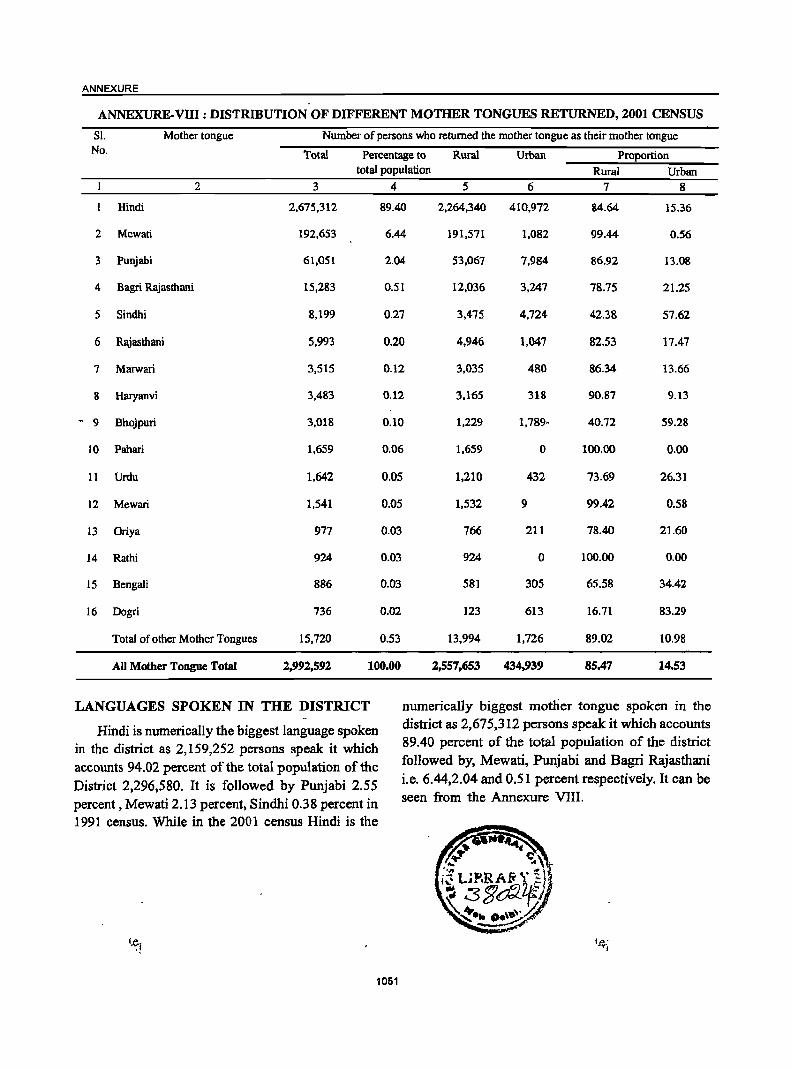
ANNEXURE
ANNEXURE-VIII: DISTRIBUTION OF DIFFERENT MOTHER TONGUES RETURNED, 2001 CENSUS
SI. Mother tongue Number of persons who returned the mother tongue as their mother tongue No. Total Percentage to Rural Urban Proportion
total population Rural Urban 2 3 4 5 6 7 8
Hindi 2,675,312 89.40 2,264,340 410,972 84.64 15.36
2 Mewati 192,653 6.44 191,571 1,082 99.44 0.56
3 Punjabi 61,051 2.04 53,067 7,984 86.92 13.08
4 Bagri Rajasthani 15,283 0.51 12,036 3,247 78.75 21.25
5 Sindhi 8,199 0.27 3,475 4,724 42.38 57.62
6 Rajasthani 5,993 0.20 4.946 1,047 82.53 17.47
7 Marwari 3,515 0.12 3,035 480 86.34 13.66
8 Haryanvi 3,483 0.12 3,165 318 90.87 9.13
- 9 Bhojpuri 3,018 0.10 1,229 1,789- 40.72 59.28
10 Pahari 1,659 0.06 1.659 0 100.00 0.00
11 Urdu 1,642 0.05 1.210 432 73.69 26.31
12 Mewari 1,541 0.05 1,532 9 99.42 0.58
13 Oriya 977 0.03 766 211 78.40 21.60
14 Rathi 924 0.03 924 0 100.00 0.00
15 Bengali 886 0.03 581 305 65.58 34.42
16 Dogri 736 0.02 123 613 16.71 83.29
Total of other Mother Tongues 15.720 0.53 13.994 1,726 89.02 10.98
All Mother Tongue Total 2,992,592 100.00 2,557,653 434,939 85.47 14,53
LANGUAGES SPOKEN IN THE DISTRICT numerically biggest mother tongue spoken in the
Hindi is numerically the biggest language spoken district as 2,675,312 persons speak it which accounts
in the district as 2,159,252 persons speak it which 89.40 percent of the total population of the district
accounts 94.02 percent of the total population of the followed by, Mewati, Punjabi and Bagri Rajasthani
District 2,296,580. It is followed by Punjabi 2.55 i.e. 6.44,2.04 and 0.51 percent respectively. It can be
percent, Mewati 2.13 percent, Sindhi 0.38 percent in seen from the Annexure VIII.
1991 census. While in the 2001 census Hindi is the
1051

to"
Related Documents