http://www.cl.cam.ac.uk/research/dtg/ Computer Laboratory Distributed, vehicular computation for map generation Jonathan J. Davies Alastair R. Beresford {jjd27,arb33}@cam.ac.uk University of Cambridge Computer Laboratory

Welcome message from author
This document is posted to help you gain knowledge. Please leave a comment to let me know what you think about it! Share it to your friends and learn new things together.
Transcript

http://www.cl.cam.ac.uk/research/dtg/
Computer Laboratory
Distributed, vehicular computationfor map generation
Jonathan J. Davies
Alastair R. Beresford{jjd27,arb33}@cam.ac.uk
University of Cambridge Computer Laboratory

http://www.cl.cam.ac.uk/research/dtg/
Computer Laboratory
When SatNav goes wrong
Satellite Navigation units are becoming increasingly popular
But their maps don’t always match up with reality
Errors in the data
Recent changes to theroad network
Temporary changes
Can be disconcerting…or dangerous
http://www.cl.cam.ac.uk/research/dtg/
Computer Laboratory
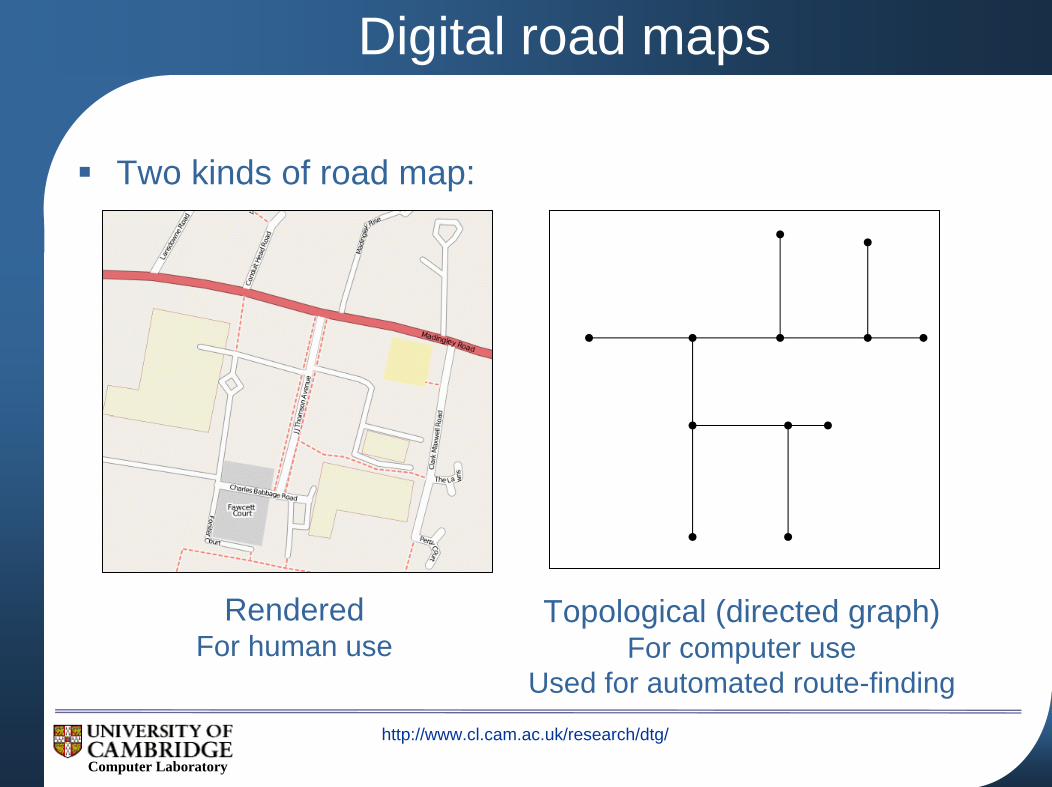
Digital road maps
Two kinds of road map:
RenderedFor human use
Topological (directed graph)For computer use
Used for automated route-finding

http://www.cl.cam.ac.uk/research/dtg/
Computer Laboratory
How are digital road maps produced?
Two major producers: Navteq, Tele Atlas
Aerial photographsExpensive to update frequentlySome road features not obvious from the sky
Data from local councils, building contractorsPoor spatial and temporal accuracy
Probe vehiclesExpensiveTele Atlas drove 3.5 million miles in 2004
Navteq spend over $10m per year keeping their databases up to date
http://www.cl.cam.ac.uk/research/dtg/
Computer Laboratory
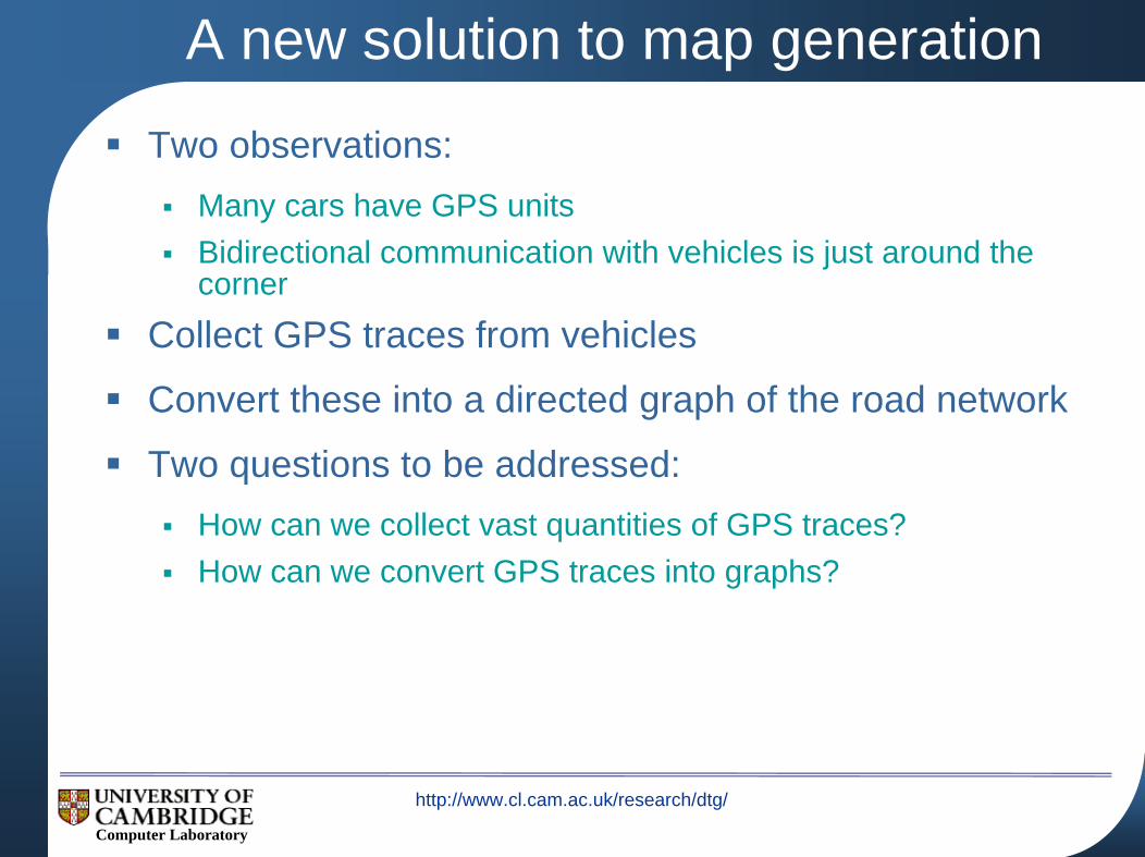
A new solution to map generation
Two observations:Many cars have GPS unitsBidirectional communication with vehicles is just around the corner
Collect GPS traces from vehicles
Convert these into a directed graph of the road network
Two questions to be addressed:How can we collect vast quantities of GPS traces?How can we convert GPS traces into graphs?
http://www.cl.cam.ac.uk/research/dtg/
Computer Laboratory
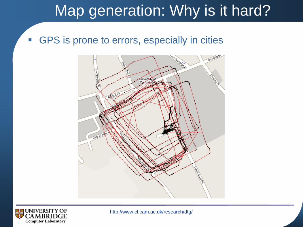
Map generation: Why is it hard?
GPS is prone to errors, especially in cities
http://www.cl.cam.ac.uk/research/dtg/
Computer Laboratory
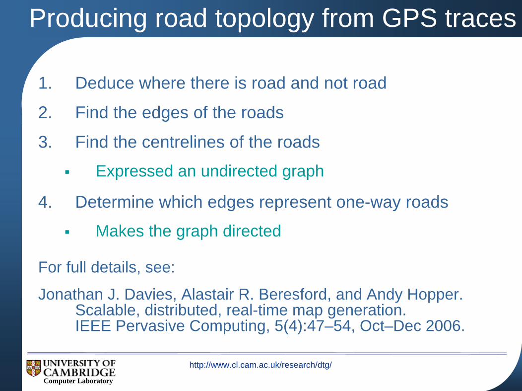
Producing road topology from GPS traces
1. Deduce where there is road and not road
2. Find the edges of the roads
3. Find the centrelines of the roads
Expressed an undirected graph
4. Determine which edges represent one-way roads
Makes the graph directed
For full details, see:
Jonathan J. Davies, Alastair R. Beresford, and Andy Hopper.Scalable, distributed, real-time map generation.IEEE Pervasive Computing, 5(4):47–54, Oct–Dec 2006.
http://www.cl.cam.ac.uk/research/dtg/
Computer Laboratory
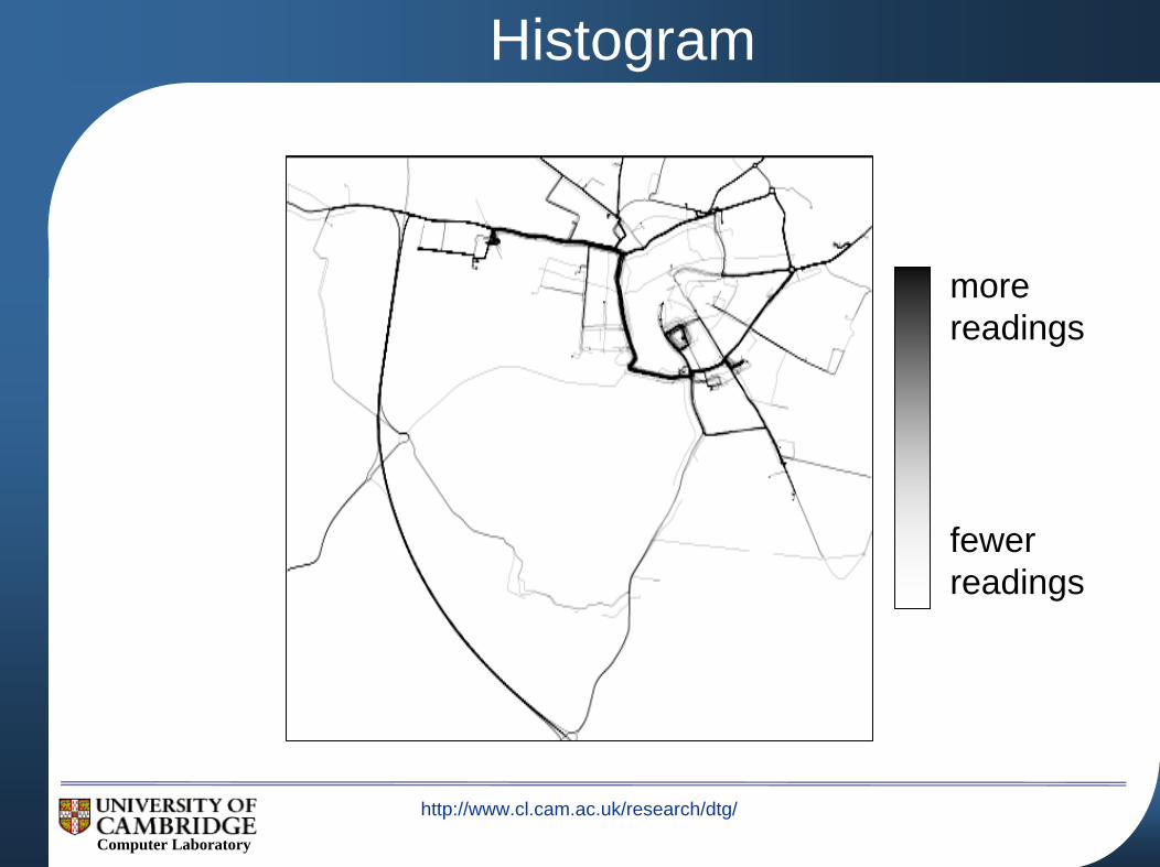
morereadings
fewerreadings
Histogram

http://www.cl.cam.ac.uk/research/dtg/
Computer Laboratory
Blur
http://www.cl.cam.ac.uk/research/dtg/
Computer Laboratory
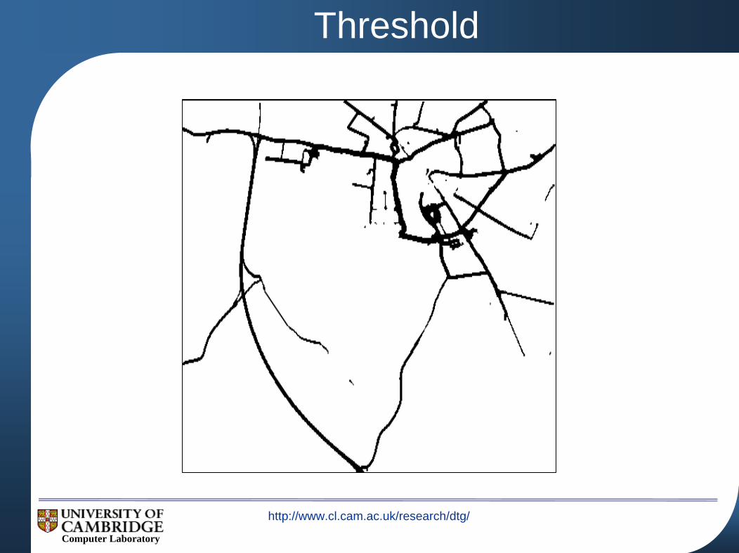
Threshold

http://www.cl.cam.ac.uk/research/dtg/
Computer Laboratory
Find Road Edges

http://www.cl.cam.ac.uk/research/dtg/
Computer Laboratory
Find Road Centrelines
http://www.cl.cam.ac.uk/research/dtg/
Computer Laboratory
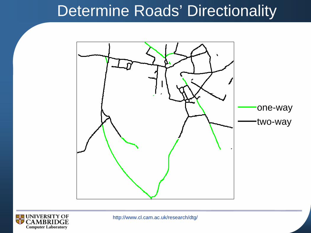
one-waytwo-way
Determine Roads’ Directionality
http://www.cl.cam.ac.uk/research/dtg/
Computer Laboratory
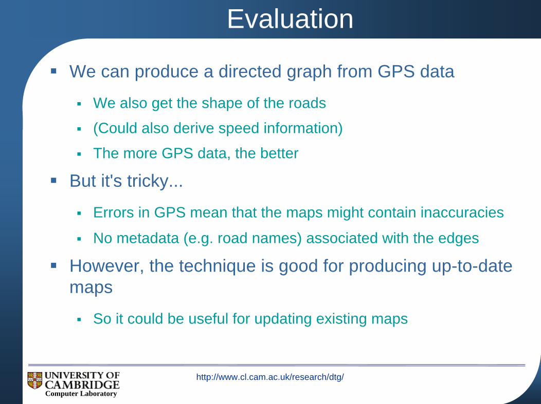
Evaluation
We can produce a directed graph from GPS data
We also get the shape of the roads
(Could also derive speed information)
The more GPS data, the better
But it's tricky...
Errors in GPS mean that the maps might contain inaccuracies
No metadata (e.g. road names) associated with the edges
However, the technique is good for producing up-to-date maps
So it could be useful for updating existing maps
http://www.cl.cam.ac.uk/research/dtg/
Computer Laboratory
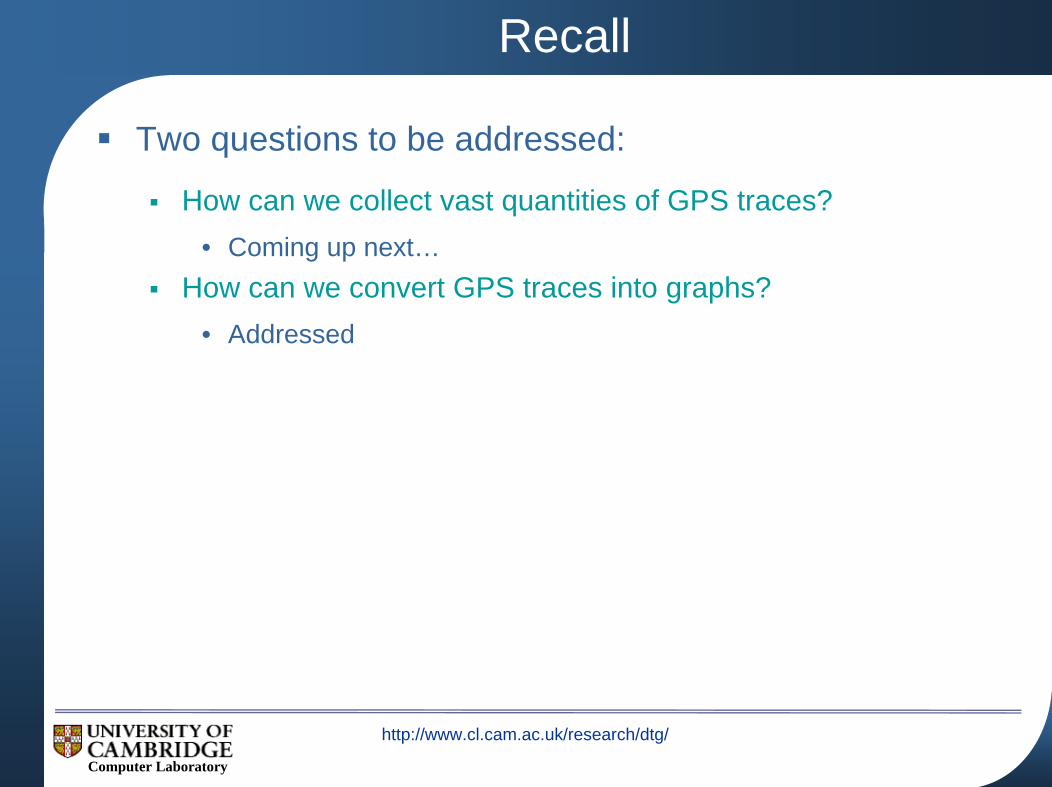
Recall
Two questions to be addressed:
How can we collect vast quantities of GPS traces?• Coming up next…
How can we convert GPS traces into graphs?• Addressed
http://www.cl.cam.ac.uk/research/dtg/
Computer Laboratory
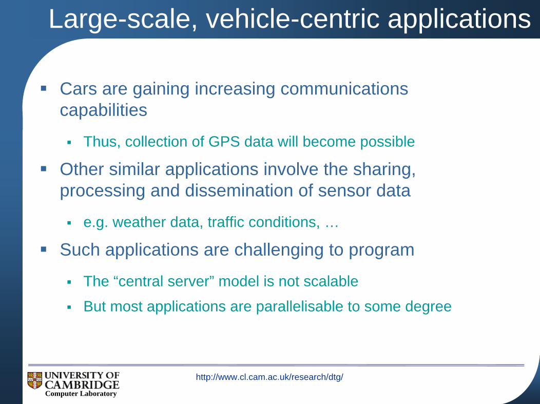
Large-scale, vehicle-centric applications
Cars are gaining increasing communications capabilities
Thus, collection of GPS data will become possible
Other similar applications involve the sharing, processing and dissemination of sensor data
e.g. weather data, traffic conditions, …
Such applications are challenging to program
The “central server” model is not scalable
But most applications are parallelisable to some degree
http://www.cl.cam.ac.uk/research/dtg/
Computer Laboratory
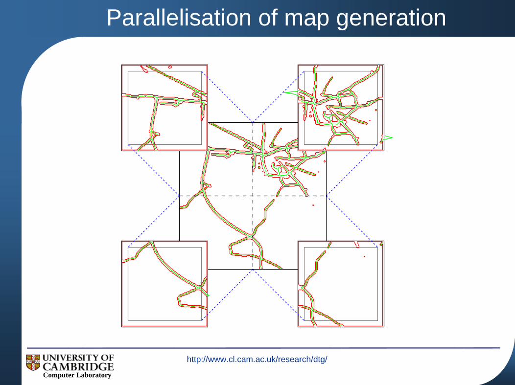
Parallelisation of map generation
http://www.cl.cam.ac.uk/research/dtg/
Computer Laboratory
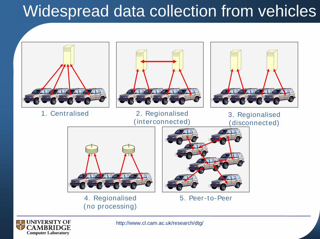
Widespread data collection from vehicles
1. Centralised 2. Regionalised(interconnected)
3. Regionalised(disconnected)
4. Regionalised(no processing)
5. Peer-to-Peer
http://www.cl.cam.ac.uk/research/dtg/
Computer Laboratory
Automated task partitioning
Can we automatically determine the best way for the application to execute?
Splitting the application into tasks
Determining which processing nodes are best employed for each task
Distributing the tasks
Dealing with failure and changes in the network
What metrics should we optimise against?
Execution time
Privacy
Quality of result
http://www.cl.cam.ac.uk/research/dtg/
Computer Laboratory
Conclusions
Generating maps from GPS traces is tricky
Errors in GPS mean that the maps might contain inaccuracies
However, the technique is good for producing up-to-date maps
Programming parallel applications is hard
Currently finalising theory of task partitioning
Future work will involve writing a compiler and modifying Java to support such applications
http://www.cl.cam.ac.uk/research/dtg/
Computer Laboratory
Distributed, vehicular computationfor map generation
Jonathan J. Davies
Alastair R. Beresford{jjd27,arb33}@cam.ac.uk
University of Cambridge Computer Laboratory
Related Documents