1 Disaster Risk Assessment and Preparedness Plan for Ward No. 18 Of Lalitpur Sub- Metropolitan City 1. INTRODUCTION 1. Background Nepal is a landlocked country characterized by a rugged topography, very high relief, variable climatic conditions, complex geological structure with active tectonic process and continued seismic activities. It is situated in central part of the Himalayan belt. The elevation of the country rises from 60m Terai (Kechanakalan, Jhapa) to 8,848 m Mount Everest in the north within a short horizontal distance of 90 to 120 sq.miles. Such a sharp vertically renders the country highly vulnerable to potential water induced disasters like landslide, slope failure, soil erosion and debris flow etc. The mountains and hills of the country occupy about 83% of the total area whereas remaining 17% is covered by low and flat land stretching in the southern part of the country up to the Indian border. Flood, landslide, fire are the most frequent natural disaster in Nepal and epidemic like diarrhea have also affected the country. These disasters occur almost every year in one part of the country or the other causing loss of life and heavy damage to physical properties. Nepal has unfavorable natural conditions like fragile geology and steep topography make as one of the most disaster prone country in the world. It faces high magnitudes and intensities of a multitude of natural hazards such as flood, landslide, earthquake, fire, hailstone, windstorm, avalanches, thunderbolt, and Glacier lake outburst flood (GLOF), cloudburst, drought and epidemics. The identification of disaster prone areas and making the information available to the inhabitants of the city should be a priority to raise awareness and to conduct preparedness and mitigation programs which can help to reduce the loss of lives and properties due to the earthquake. It can also help to make arrangements for security, relief, rehabilitation and temporary settlement of the disaster victims. Hence this study has been proposed and conducted to evaluate the disaster scenario of ward no. 18 of LSMC. 1.2 Terms related to Disaster 1.2.1 Hazard: ISDR defines hazard as “A potentially damaging physical event, phenomenon or human activity that may cause the loss of life or injury, property damage, social and economic disruption or environmental degradation.” 1.2.2 Risk: ISDR defines risk as “The probability of harmful consequences, or expected losses (deaths, injuries, property, livelihoods, economic activity disrupted or environment

Disaster Risk Assessment and Preparedness Plan for Ward No 18
Jan 12, 2016
Disaster Risk Assessment and Preparedness Plan for Lalitpur Sub-Metropolitian City Ward No 18
Welcome message from author
This document is posted to help you gain knowledge. Please leave a comment to let me know what you think about it! Share it to your friends and learn new things together.
Transcript

1
Disaster Risk Assessment and Preparedness Plan for Ward No. 18
Of
Lalitpur Sub- Metropolitan City
1. INTRODUCTION
1. Background
Nepal is a landlocked country characterized by a rugged topography, very high relief,
variable climatic conditions, complex geological structure with active tectonic process
and continued seismic activities. It is situated in central part of the Himalayan belt.
The elevation of the country rises from 60m Terai (Kechanakalan, Jhapa) to 8,848 m
Mount Everest in the north within a short horizontal distance of 90 to 120 sq.miles.
Such a sharp vertically renders the country highly vulnerable to potential water
induced disasters like landslide, slope failure, soil erosion and debris flow etc. The
mountains and hills of the country occupy about 83% of the total area whereas
remaining 17% is covered by low and flat land stretching in the southern part of the
country up to the Indian border.
Flood, landslide, fire are the most frequent natural disaster in Nepal and epidemic like
diarrhea have also affected the country. These disasters occur almost every year in
one part of the country or the other causing loss of life and heavy damage to physical
properties. Nepal has unfavorable natural conditions like fragile geology and steep
topography make as one of the most disaster prone country in the world. It faces high
magnitudes and intensities of a multitude of natural hazards such as flood, landslide,
earthquake, fire, hailstone, windstorm, avalanches, thunderbolt, and Glacier lake
outburst flood (GLOF), cloudburst, drought and epidemics.
The identification of disaster prone areas and making the information available to the
inhabitants of the city should be a priority to raise awareness and to conduct
preparedness and mitigation programs which can help to reduce the loss of lives and
properties due to the earthquake. It can also help to make arrangements for security,
relief, rehabilitation and temporary settlement of the disaster victims. Hence this study
has been proposed and conducted to evaluate the disaster scenario of ward no. 18 of
LSMC.
1.2 Terms related to Disaster
1.2.1 Hazard: ISDR defines hazard as “A potentially damaging physical event, phenomenon or
human activity that may cause the loss of life or injury, property damage, social and
economic disruption or environmental degradation.”
1.2.2 Risk: ISDR defines risk as “The probability of harmful consequences, or expected losses
(deaths, injuries, property, livelihoods, economic activity disrupted or environment
2
damaged) resulting from interactions between natural or human-induced hazards and
vulnerable conditions.”
Conventionally risk is expressed by the notation
Risk = Hazards x Vulnerability. Some disciplines also include the concept of
exposure to refer particularly to the physical aspects of vulnerability.
1.2.3 Vulnerability Vulnerability is the characteristics of any community or object which determines the
level of risk due to any hazard. ISDR defines vulnerability as “The conditions
determined by physical, social, economic, and environmental factors or processes,
which increase the susceptibility of a community to the impact of hazards.”
1.2.4 Disaster: ISDR defines disaster as “A serious disruption of the functioning of a community or a
society causing widespread human, material, economic or environmental losses which
exceed the ability of the affected community or society to cope using its own
resources.”
1.2.5 Preparedness: ISDR defines preparedness as “Activities and measures taken in advance to ensure
effective response to the impact of hazards, including the issuance of timely and
effective early warnings and the temporary evacuation of people and property from
threatened locations.”
1.2.6 Human Development Index (HDI) The Human Development Index (HDI) is a composite statistic of life expectancy,
education, and income indices to rank countries into four tiers of human development.
According to the UNDP Human Development Report 2011, Nepal's HDI now stands
at 0.458 points, which is still below the regional average of 0. 0.548.
1.3 Disaster in World.
In the period 1970-2010, the world population increased by 87 per cent. During the
same period, the population growth in flood-prone river basins increased by 114 per
cent, and in cyclone-prone coastlines by 195 per cent. Hence, economic and
productive assets are accumulating in the most hazard-exposed areas, particularly in
low- and lower-middle-income countries. To reverse these trends, development plans
and investment choices must be informed by risk information and addressed through
an applied disaster risk reduction framework.
The floods in Australia, the earthquake in Christchurch, New Zealand, and the
earthquake, tsunami and nuclear disasters wreaking havoc in north-eastern Japan are
stark reminders that developed countries and their economies are also exposed and
cities are at risk. Hundreds of smaller disasters associated with climate variability
have caused enormous damage in many countries, revealing how risk is linked to
unsound development practices and growth in economic and population exposure.
Economic risk related to floods and tropical cyclones is indeed increasing faster than
GDP per capita in many countries, meaning that the risk of losing wealth in a disaster
is increasing faster than wealth is being created. Low-income countries have less
capacity to absorb and recover from economic losses owing to disasters. In general,
3
larger economies are more able to absorb losses than smaller ones, such as small
island developing States, because they tend to be more geographically and
economically diverse.
Drought leads to stress and insecurity for rural and pastoralist populations. Disaster
data reported nationally and internationally fail to capture the extent of drought
impacts. For example, only four drought-related deaths were reported globally
between July 2010 and June 2011, while 32,482,102 people were reported affected by
droughts, more than by any other hazard.2
Natural hazards, as illustrated by the Great East Japan Earthquake and tsunami, can
have devastating sequential and collateral impact — not only for nuclear facilities, but
also for infrastructural complexes such as hydropower dams, industry, bridges and
highways. These considerations must motivate new efforts for integrated, over-the-
horizon thinking and planning for design standards, preparedness, early warning and
response.
1.4 Disaster in Nepal
Some of the most common and frequent natural hazards that occur in Nepal are:
1.4.1 Landslides: Among the natural hazards that occur regularly in Nepal, floods and landslides are by
far the most serious ones. They claim many human lives every year and cause other
damages such as destruction and blockages of highways, losses of livestock, crops,
and agricultural land.
Based on a reconnaissance study, Laban (1979) estimated that at least 75 percent of
all landslides in Nepal were natural, Brundsen et al. (1981).
1.4.2 Earthquakes: Geologically, Nepal is considered to lie on a seismic zone which experiences frequent
earthquakes. As a result, earthquakes of various magnitudes occur almost every year
and have caused heavy losses of lives on several occasions. Based on the data
available from the Department of Mines and Geology, CBS (1998) concludes that
earthquakes of more than or equal to 5.0 on the Richter scale have occurred at least
once every year in Nepal since 1987, with the exception of 1989 and 1992 when no
such events were recorded. Scientists attribute the occurrence of frequent earthquakes
in Nepal to the disturbances occurring due to the continuous encroachment of the
Indian sub continental plate into the main Asian plate. At the same time, two major
parallel fault systems called the Main Boundary Thrust (MBT) and Central Boundary
Thrust (CBT) cross Nepal longitudinally. Constant adjustments and readjustments
taking place in these fault systems are known to trigger earthquakes in the country as
well.
1.4.3 Windstorms, hailstorms, thunderbolts: Windstorms, hailstorms and thunderbolts (lightning strikes) also occur frequently in
Nepal and affect many areas of the country on a regular Disaster Hazards in Nepal

4
basis. Although not as serious as floods, landslides, and earthquakes these events,
nevertheless, cause loss of human lives and damages to properties. Analyzing the
available data (DPTC, 1997), CBS (1998) concludes that in 1995, forty-five districts
of Nepal were affected by hailstorms, windstorms and thunderbolts. These events,
particularly the hailstorms, cause considerable damages to the standing crops in the
fields.
1.4.4 Forest Fire Every year forest fires occur in many places of the country and cause heavy loss of
property as well as loss of many species of wildlife. Nepal has no statistics on the
occurrence of forest fires, and no assessment of impact on the economy or on the
environment of the country is available. There is no record of forest fires caused by
natural events like thunderbolts. About 45 percent of forest fires with known causes
are due to burning for new grass to graze cattle and to smokers. About 64 percent of
forest fires are set intentionally by local people. The share of accidental cause of
forest fire is only 32 percent. The Department of Forest is the main responsible
government organization to control forest fire. But progress on this field is yet to be
achieved due because of lack of resources, lack of specific fire control rules and
regulations, etc. (Source: CBS, 1998).
1.4.5 Glacial lake outburst flood events: Apart from landslides and river erosion, the high mountains or Himalayas of Nepal,
covering about 15 percent of the country, are quite susceptible to land degradation
caused by glacial lake outburst floods (GLOF). The moraine dams are not
geologically consolidated enough and a slight disturbance can break the balance of the
structure, resulting in an abrupt release of a great amount of water and generating
floods. These floods can cause serious damage to infrastructure, houses, and the
environment along the flood path downstream. This phenomenon is called a glacial
lake outburst flood (GLOF).
In Nepal, GLOF events have been occurring for many decades, but this catastrophic
glacier phenomenon came into the limelight only after 1985, when the Dig Tsho
glacier outburst took place. In 1996, the Water and Energy Commission Secretariat
(WECS) of Nepal reported that five lakes were potentially dangerous, namely, Dig
Tsho, Imja, Lower Barun, Tsho Rolpa, and Thulagi, all lying above 4100m. Their
extent ranges from 0.6 to 1.39 sq. km. The maximum depth ranges from 81 to 131m,
with ages above 30 years. A recent study done by ICIMOD and UNEP (UNEP, 2001)
reported 27 potentially dangerous lakes in Nepal.
1.5 Legislations: In 1982 A.D, the first disaster management policy was developed, Natural Disaster
Relief Act, in 1982 A.D. It has already been amended twice in 1989 A.D. and 1992
A.D. Natural Disaster Relief Act, 1982 A.D. defines Natural Disaster Relief Work as
any relief work to be carried out in the area affected or likely to be affected by the
natural disaster in order to remove the grief and inconvenience caused to the people,
to rehabilitate the victims of the natural disaster, to protect the public property and life
and property of the people, to control and prevent the natural disaster and to make
advance preparation thereof.
5
The Ministry of Home Affairs is the key agency for immediate response during
disasters and has to play a leading role in managing the natural disasters in the
country.
At present, only CNDRC and DNDRC are very active. Besides, as the NDRA, 1982
does not describe the functions and duties of all district management related agencies.
The following legislation provides the legal framework that assigns roles and
responsibilities to different disaster management entities:
• Constitution of the Kingdom of Nepal, 1990
• Natural Calamity Relief Act, 1982
• Local Administration Act, 1971
• HMG Rules for allocation of functions, second amendment, 1996
• Local Self Governance Act, 1999
• Kathmandu Valley Town Development Act, 2000
• Building Act, 1998 or Draft building Council Act, 1994
1.6 Disaster in LSMC
Lalitpur District has observed different disasters relating to flood, landslide,
earthquake, fire, epidemic to Windstorms, hailstorms, thunderbolts: and suffered loss
of life and property at great extent. According to the data from DesInventar(Annex II)
highest loss of property have caused due to fire and highest recorded affected
populations have been due to flood while till date highest number of recorded houses
have been damaged due to the earthquake.
According to the report obtained from the 41 VDCs within Lalitpur district, District
preparedness plan of Lalitpur has categorized the VDCs into High Risk, Medium Risk
and Low Risk on the basis of its population and the total loss of life to date due to
different disasters.
Among which LSMC and Chapagaun have been categorized as having the highest
vulnerability to earthquake and fire hazards. The detail data is given in appendix III.
According to the present norms specified by the Central Committee, Rs.10,000/- shall
be provided as relief assistance to the family of a dead victim. Injured persons shall be
provided the facility of treatment in the nearest governmental hospital or health post.
Provision of a Central Natural Disaster Aid Fund has been made under the control of
the Central Natural Disaster Relief Committee.

6
2. LITERATURE REVIEW
For this project work I have found out some relevant literature and articles. There are
many research have been carried out on this related topics. Some of them are as follows;
In the article, “DISASTER PREPAREDNESS,” Published on The Republica daily on
2013-02-06, by HARI KRISHNA NIBANUPUDI, gives his view in the increasing
magnitude and frequency of natural disasters around the world, there is a need to review
the international humanitarian system designed to respond to these types of events to
ensure it is prepared for future challenges. He claims that, “Regarding assistance, it is
believed that Western countries are driven by geo-politics than by humanitarian needs”.
Another major concern in disaster response is delays in the delivery of assistance. The
current process of issuing humanitarian grants is lengthy, and involves an appeal process
between humanitarian agencies and donors. There is an urgent need for donors and
national governments to understand the compelling need and infallibility of disaster
preparedness and risk reduction as well as efforts to build the resilience of communities at
risk. According to him more attention must be paid to the development of early recovery
systems, infrastructure rehabilitation, and ensuring the basic services.
On the 14th World Conference on Earthquake Engineering, October 12-17, 2008,
Beijing, China, a paper on “SEISMIC VULNERABILITY AND CAPACITY
ASSESSMENT: A CASE STUDY OF LALITPUR SUB-METROPOLITAN CITY,
NEPAL”, was presented by G.K. Jimee, C.J. van Westen, and V. Botero. They put their,
efforts to identify an appropriate method for assessment of seismic vulnerability and
capacity to cope with earthquake disasters, which can be easily adopted by municipal
authorities. They made estimation of building collapse probability and casualties due to
different scenario earthquakes, and measuring the capacity of local people to cope with
the earthquake disaster in Lalitpur Sub-Metropolitan City (LSMC), Nepal. Building
damage and collapse probabilities are estimated for individual buildings considering their
conditions in addition to height, construction types and earthquake intensity using an
existing damage matrix. They also accessed the level of public awareness; preparedness
and capacity are analyzed from the information received by interviewing local people.

7
“Disaster Preparedness for Natural Hazards: Current Status in Nepal.” A book
published by International Centre for Integrated Mountain Development is very useful in
context of Nepal .This book gives the detail scenario about the disaster risk management
in Nepal. Since it covers almost all the terminology, plans, preparedness, and every
aspects of disaster risk management so it could be helpful for all level of disaster risk
management from preparedness plan to the post disaster activities like recoveries and
rehabilitations.
In a Research published on GISdevelopment.net ---> Application ---> Natural Hazard
Management “Seismic loss estimation for Lalitpur, Nepal” Cees J. van Westen used
the RADIUS tool to calculate loss estimation for the city of Lalitpur in Nepal, for
buildings and for population losses. The results from the earthquake loss estimation for
Lalitpur Sub-Metropolitan City in Nepal illustrates the urgent need to support local
authorities in developing countries with methods to collect and manage information used
for risk assessment in order to be able to implement strategies for vulnerability reduction
and disaster preparedness. He had pointed out one of the priority areas for the application
of the municipal GIS in the framework of vulnerability reduction is the development of a
building permit issuing and control system. There are some similar research work found
and other related project works has been done by individual as well as by institutions in
Nepal. Articles available in Internet are the main source towards completion of this small
project work.

8
3 Historical profile of Disaster in LSMC
Lalitpur sub-metropolitan city, popularly known as Patan is currently one of the most
vibrant cities of the kingdom of Nepal. It is located in about 5 kilometers south-east of
Kathmandu. With its urban history dating back to as far as 2300 years, Lalitpur sub
metropolitian city is one of the three major cities located inside the Kathmandu valley,
besides Kathmandu and Bhaktapur. Among the fifty-eight municipalities of Nepal,
Lalitpur is the third largest city. The city is highly influenced by Rich historic past,
centuries old living culture of the people and thriving city development. Lalitpur is
extremely rich in its arts and architecture and boasts on the largest community of artisans,
especially metal and wood workers. In fact, the literary meaning of Lalitpur means the
city of fine arts. It nurtures a large number of sacred buildings, temples, pagodas, Stupas
and Shikharas, monasteries, math and Chaitya. The city is renowned the world over for
its art and craftsmanship and has produced number of famous artists and master
craftsmen, the most famous being Arniko, who spread the legacy of this city far and wide.
3.1 Earthquake History
Kathmandu valley, with an area of 667 km2 and population of about 2 million, is the
exclusive center of politics, economy, education and administration of Nepal. Three cities
in valley viz., Kathmandu, Bhaktapur and Patan (lalitpur) were old city-states and
presently they house world heritage sites in the city cores. Due to increased population,
poor subsoil condition and haphazard development, seismic vulnerability of the valley has
been increasing.
The major historical earthquakes recorded in Kathmandu valley include 1255, 1408,
1681, 1810, 1833, 1866, and 1934 A.D. During the 1255 earthquake, one-third of people
including reigning King Abhaya Malla died. Many palaces, temples and dwellings were
badly damaged. It is said that aftershocks continued for three years (Bilham 1995). The
1934 earthquake, magnitude of 8.4 in Richter scale with an epicenter some 10 kilometers
south of Mt. Everest, claimed 16,875 lives and destroyed 3,18,139 houses. Kathmandu
valley was severely affected with 4,296 deaths and 55,793houses damaged. Many
heritage monuments were damaged or destroyed during the earthquake .The analysis of
historical data suggests that a great earthquake in the Himalayan region generally occurs
in an interval of 80 to 100 years. The 1934 earthquake is the largest disaster event in
terms of death toll and property loss (serious damages to 60% of the buildings in the
Kathmandu Valley) in 20th century.
Seismologists are predicting a severe earthquake in the near future If a major earthquake
occurs similar to that of the 1934 (magnitude 8.4 Richter scale), the situation is likely be
very catastrophic. An estimate by National Society of Earthquake Technology (NSET)
has predicted about 40,000 deaths with a hundreds of thousands people rendering
homeless if earthquake similar to the 1934 Nepal earthquake occurs in the Kathmandu
valley (NSET 1998). This will severely imperil the ability of the nation to operate
effectively following the disaster.Most of the buildings in the cities were built before the

9
application of the building codes was enforced by the state they are supposed to be of
high vulnerability.

10
4 STUDY METHODOLOGY
4.1 Methodology
To obtain the objectives determined, We have applied the following methodology.
4.2 Survey Methods
Data were collected from a sample population of ward no. 18, LSMC and a cross-
sectional sample of communities through a two-pronged study approach utilizing the
Questionnaire Approach (QA) for both the people and the buildings. This is aimed at
addressing causes losses issues at both people and properties in the community levels.
This approach has been necessitated by the understanding that some causes losses are
human induced and as such require concerted efforts by both the government and the
community for their remedial actions. To achieve this, the survey will employ 2 survey
instruments for data collection namely, the personal questionnaire and household
infrastructure checklist.
4.3 Process of data collection
To collect primary data, we have used the following procedure:
i. We went to field and visualize physical condition of the house and their location.
ii. We have taken information from the local administration.
iii. We went to Ward no-18 of LSMC for observation and analyzed the condition of
vulnerability.
iv. We have prepared questionnaire about building vulnerability and distributed to the
owners to fill up that form.
v. After collecting the sufficient information about the vulnerability, we have
interpreted the data by using RADIUS Tool and calculated the risks.

11
5 ANALYSIS AND PRESENTATION OF DATA
5.1 Analysis and Interpretation of Data
The collected data was analyzed and interpreted comparatively with the help of tables and
charts etc. The collected information will be entered into the computer and analysis of it will
be done with graphic, tabular and explanatory form. Similarly, the qualitative data will also
be analyzed and interpreted descriptively. The results obtained from the survey is presented
in the annex.
5.2 HAZARD ASSESSMENT
Hazard
Ranking
Hazard Fire
Urban
Flood Epedimic Earthquake
Fire x Fire Fire Earthquake
Urban Flood x x Urban Flood Earthquake
Epedimic x x x Earthquake
Earthquake x x x x
Ranking 2 1 0 3
Historical Record
Disaster History (1971-2011) of Ward No. 18 Lalitpur Sub-Metropolitan City
Event Date Location Deaths
Injured
Houses
Destroyed
Houses
Damaged
Property
Loss (Rs) Comments
STRUCTU
RE
COLLAPS
E 09/08/1973 Ward 18 1 - - - -
FIRE 29/10/1973 Jhatapole - - 1 - - NRs 1000 loss
EPIDEMIC 03/04/1976 Bubahal 6 - - - -
Children below 12 were mostly
affected.
FIRE 27/03/1986 Gabahal - - 3 - - Loss value was not mentioned
STRUCTU
RE
COLLAPS
E 27/05/1989
Swatha
Narayan - 2 - 1 -
Second storey of Krishna Mandir
was collapsed due to heavy rainfall
FIRE 16/03/2009
Bangalamukhi
temple - - - 1 -
FIRE 27/09/2010 Mangalbazar - - - 1 100000

12
Source: http://www.desinventar.net/DesInventar/results.jsp (accessed on 4 March 2013)
The historical data presented above depicts fire as most frequently occurring hazard. At least one case of fire is recorded
every year.
5.3 TOOL FOR HAZARD ASSESSMENT
SCORE CRITERIA
Potential Damage: Range 1 - 5
1 = No damage or surface damage.
2 = Minor damage. Won't disrupt day-to-day operations.
3 = Moderate damage. Causes some disruption.
4 = Significant damage. Buildings not usable.
5 = Destroyed or nearly destroyed. Must find a new long-term or permanent location.
Frequency: Range 1 - 5
1 = Has not occurred in last 100 years.
2 = Happens at least once every fifty years.
3 = Happens at least once every ten years.
4 = Happens at least once every five years.
5 = Annual event, or more often.
Secondary Problems: Range 1 – 5
Secondary effects include loss of services such as power and phone services. It may affect roadways and access
to other areas of the city. Secondary effects may interfere with food and medical supplies being delivered to the
area.
HAZARD POTENTIAL
DAMAGE FREQUENCY
SECONDARY
PROBLEMS
TOTAL
SCORE
REMARKS
Earthquake 5 3 5 75 Serious
Fire 5 5 4 100 Serious
Flood 1 2 2 4 Low
Epidemic 3 1 2 6 Low
13
1 = No secondary effects or problems likely.
2 = At least one secondary effect, short-term in nature.
3 = Multiple secondary effects. May last 2 or 3 days. (Begins to be a problem.)
4 = Significant secondary effect(s). May last a week. (Is a problem.)
5 = Significant secondary effects last more than a week. (Long-term and/or big problem.)
From the above table, it is clear that fire and earthquake has the most potential
for damage.
5.4 EARTHQUAKE HAZARD ASSESSMENT
Significance – Potential to occur large damage exceeding the recovering capacity of the
community or even the nation
History – The last major earthquake occurred in 1988 of magnitude 6.4 Richter scale with
721 deaths nationwide. Earthquake of 2011 had an insignificant damage.
Frequency – Medium earthquakes every 8-10 years. Major earthquakes every 70-80 years
Severity – Impacts include loss of life, property. Utilities and services are also severely
damaged.
Duration – Few seconds
Signs – Reliable early warning is not available. Change in animal behavior is often accepted
as a sign.
5.5 FIRE HAZARD ASSESSMENT
Significance – Most frequently occurring. Resources to mitigate the hazard is extremely
insufficient.
Frequency – At least one incident every year.
Severity – Potential to fully damage a building and spread to neighboring buildings. Huge
financial loss.
Duration – Few hours to few days.

14
5.6 VULNERABILITY ASSESSMENT
Hazard – Earthquake
Element At
Risk
Impact on Element at
Risk
Possible vulnerabilities which allow this impact
Houses Damage to Houses Unreinforced brick masonry buildings
Greater height to width ratio
Old buildings
Utilities Severe disruption Water lines, sewage lines close to fault
line
Old and rusted pipelines
Hazard – Fire
Element At
Risk
Impact on Element at
Risk
Possible vulnerabilities which allow this impact
Houses Damage to Houses Location of building out of reach of fire
brigade
Old houses with wooden members
Utilities Severe disruption Electric poles and lines close to impact
zone
5.7 CAPACITY ASSESSMENT
SN ENTITY AVAILABILITY STATE SOURCE
1 Fire Brigade Yes Insufficient Municipality
2 Dozer Yes Sufficient
3 Excavator Yes Insufficient
4 Medical personnel Yes Sufficient
5 Engineer Yes Sufficient
6 Volunteer Yes Sufficient
7 Emergency driver Yes Sufficient
8 Emergency supply store Yes Insufficient DDC,
Redcross
9 Transportation facility Yes Sufficient Private sector
10 Rescue personnel Yes Insufficient DDRC,
I/NGO

15
11 Hospitals and Health
center
Yes Unavailability of emergency
medicine
MoH
12 Schools Yes Vulnerable in themself DEO
16
6 Preparedness Plan
Each and every community should be aware and prepared for the upcoming disasters which
has no certainty in date and magnitude .The residents of these communities should gain
information about the past disaster at present for the future instant of occurrence. We have
identified earthquake and fire as two major hazards. So our preparedness plan is focused for
these two hazards.
The identification of open spaces in very significant in development of preparedness plan.
There are open spaces for just only gathering of people in less number and local level only
such as courtyards, road junctions, etc. But there are two major open spaces identified nearby
Ward-18 where many people can gather. They are Pulchowk Campus Boundary and Bagmati
River Corridor with approximated area of 91000 sq m and 288000 square m respectively.We
prefer for Pulchowk Campus because in Bagmati River there is cultivated land and also a
Sewage treatment Plan.
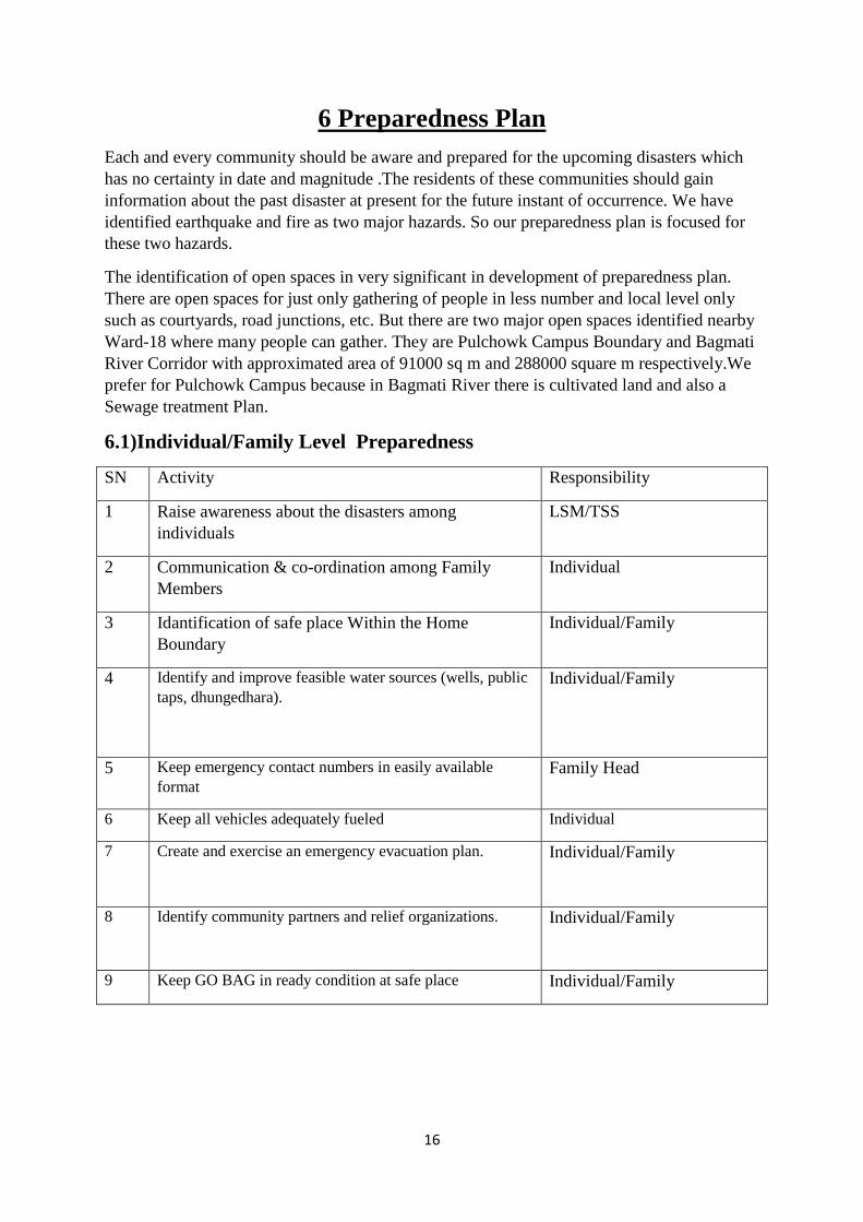
6.1)Individual/Family Level Preparedness
SN Activity Responsibility
1 Raise awareness about the disasters among
individuals
LSM/TSS
2 Communication & co-ordination among Family
Members
Individual
3 Idantification of safe place Within the Home
Boundary
Individual/Family
4 Identify and improve feasible water sources (wells, public
taps, dhungedhara).
Individual/Family
5 Keep emergency contact numbers in easily available
format
Family Head
6 Keep all vehicles adequately fueled Individual
7 Create and exercise an emergency evacuation plan. Individual/Family
8 Identify community partners and relief organizations.
Individual/Family
9 Keep GO BAG in ready condition at safe place Individual/Family

17
6.2 Institutional Preparedness
Necessary action in priority
SN Activities Responsibility Time
1 Formation of different Committes
*Ward Search and Rescue Team/Committee Establishment of
Ward Communication Co ordination Center and allocation of
Contact person
LSM Within 1
month
2 Development and Management of Human Resources –Ward
Level
*Preparation of trained rescuers and paramedic
*Perform necessary action for community based DRM
committies to bring them to meanstream
*Identification and listing of the volunteers
DDRC and
LSM,Ward-18
Within 3
month
3 Implementation of Building Code strictly for those who are
constructing without it and motivation scheme for
construction of EQ resistant building
LSM Within 1
month
4 Establishment of Ward Disaster risk Management Fund and
its Regulation Document
Ward-18 Within 2
month
5 Preparing for organization of Disaster Preparedness
Workshop in the ward for *Identification of emergency safe
open space within the ward and nerby locality
*Preparation of list of NGO/INGOs activate in the ward to
cooperate with them
*Formulation of Plan for development of services and
physical structures in these emergency open spaces
Ward
Chairman
Baisakh of
each year

18
6.3 Response plan
Though there may be different types of hazards and risk conditions in a society. But in the
scenario of Lalitpur Submetropolitan,Ward-18, the identified two major two hazards are
earthquake and fire .So. our focused plans are over these two topics.
Space for data analysis
SN Response activities Responsibility Helping agencies Time
1 Assess the situation
- what happened
- how many people need help and
what kind of help
- number of helpers
- available equipment
- the urgency and the need for help
DDRC
LSM,WARD,WS
RT
After just EQ has
stopped
2 2. Rescue
- approach a dangerous target with
caution
-Clear the exit route
- first rescue those whose lives are
in danger
- move patients to the nearest safe
location
- do not endanger your own life or
that of others
Security
Agencies,Red
Cross,
Community, Immeditely
3 Prevent further accidents
- assess the danger of further
accidents (voltages,
concentrations)
DDRC WSRT Immediately
4 4. Administer emergency first aid
- begin emergency first aid
immediately and continue with it
until
professional rescue workers arrive
- take care of other injuries only
after administering emergency first
aid
Red
Cross,Paramedic
s
Community Within 6 hour
5 Shift victims safely to evacuation
places or to the hospital
Security
Agencies
Community Within 12 hour
6 Manage shelter ,food ,clothes and Red Security Agencies Within 18 hour

19
other fundamental services(special
priority to
disabled,pregnant,children)
Cross,NGO,ING
O
7 Co ordination and meeting with
humanitarian organizations
DDRC LSM Within 2 days
8 Regular inspection of distribution
of goods and services
CDO DDRC Regular
9 Formation of Camp Management
Committee
DDRC LSM,Helping
Organization
After
establishment of
Camp
10 Preparation of Report and
distribution to all concerned
authorities
DDRC LSM,RedCross weekly
6.4 Rehabilition Plan:An Integrated Programme The Programme will deliver a comprehensive package of combined services, including
shelter-construction combined with income-raising activities; health, nutrition and
psychological maximise stress improvement with education and disaster preparedness.
To the combined resources of these programs and to ensure that they translate into long-
term security, theplan we prepare will work with five principal actors in the region:
Communities partnering in the implementation of the Programme,
Implementing agencies and donor partners,
Private providers who work in the areas,
Other NGOs working in the areas,
Local government agencies.
SPECIAL REHABILITIES ACTION
Housing and Sanitation
Managing Cultural heritages and their reconstruction
Health and Hygiene Promotion
Education
Disaster Preparedness and Management Capabilities related to fire and
earthquake.

20
Lifeline facilities such as, road networks, telecommunication, hospitals, Water
supply, etc.
Objectives
The objectives of the Plan are to:
• provide an overview of the management issues associated with the process of
Post-disaster recovery and rehabilitation for residents who area affected by earthquake and
fire;
• Specifically address immediate and short-term rehabilitation of disturbance resulting from
firefighting operations;
• outline a range of immediate and longer-term measures to upgrade the harmful impacts on
environment and infrastructure
• launch appropriate management and reporting systems.
General Principles
In planning for and implementing rehabilitation and protection works the following general
principles will be adopted:
• Priorities for rehabilitation and recovery works are based on an objective assessment of the
values of the areas, the extent and impact of fire suppression and damage due to earthquake
and the risks to the values of the area;
• The requirements of relevant legislation, guidelines and codes of practice that apply to the
management of public land will be addressed. The World Heritage Site guidelines (Patan
Durbar Square) guidelines relating to heritage sites, and existing Temples standards will be
adopted where these are relevant;
• rehabilitation works will not, in themselves, lead to any further loss of values or
significance ;
• relevant local Indigenous communities will be involved in assessments of suppression
works prior to any rehabilitation to prevent any further damage, and in assessments of
damaged or unrecorded sites;
• specialist advice will be sought where necessary with respect to matters involving, cultural
heritage, structure design protection;
• roads will be restored to their previous status consistent with approved management plans;
new roads and other infrastructure will be established
• procedures will be adopted to prevent the introduction of epedemic diseases, and addition
of other hazards.

21
22
7 Recommendations:
On the basis of our study we recommended the followings:
Building code should be implemented strongly and strictly.
Old building should be retrofitted.
Building assessment committee should be formed.
Relevant trainings should be given to the public.
Proper coordination between the Government and locals is lacking, there should be
strong coordination between them.
8 Results and Conclusion:
After carring out the survey and analyzing the data (if earthquake of intensity 9 MMI
happen during night) the following results were obtained.
Out of 5681 people approx. 2.5% people die and about 16% people will be
injured.
About 50% buildings will be damage.
On the basis of field suryed data and analysis we conclude that the area Bubhal,Daubhal
and kumbeshor are highly vulnerable to building damage while as Gabahal area is less
vulnerable to building damage. Haugal and kumbeswor area are highly vulnerable to human
loss and Bubhal are is suspected to less vulnerable to the human loss.

23
ANNEX I
During the survey the following results were obtained. The actual findings from
household survey are presented below in chart form;
Load bearing structures are obtained
in higher proportion, About 24%
structures using 9*9 column and Very
few structures about 2% consists of
12*12 and 9*12 column respectively.
Very few buildings are found to have
an age more than 100 yrs, 49% of
building have age less than 50 yrs
while as about 40% buildings have
age in between 50 and 100yrs.
People in higher percentage reply that
they hadn’t identified the place , while
about 20% people replied yes and
10% people replied their answer as
they will meet at courtyard.
About 60% of people are replied that
they will run to the safer place, while
about 30% people replied that they
will hide under the table/bed etc and
10% of people have different opinion
about that.

24
42% people don’t know the
emergency numbers but 27% of
people knows the number , about 10%
people only knows the number of fire
brigade ,15% of people can call the
police frequently while about 10%
replied that they don’t know now but
they had written the numbers.
risk at In the reply about 40% of
people replied NO they had not
identified Fire the risk.all While 60%
of people had identified
About 30% of people replied that their
members don’t know while 69% of
people replied that yes we know what
to do.
About 65% of people had their
opinion that their Neighbors will come
first to help them, 16% voted for the
police, 12% for tole improvement
committee while 6% replied that they
can’t say.

25
More than 60% of people don’t have
First aid while about 40% people were
prepared for the first aid.
More than 80% of people don’t have
stored the dry food water etc while
About 40% people were prepared with
it.
60% of people replied as yes they had
identified while 40% of people don’t
know about the safe places inside their
houses.
In reply more than 70% reply yes and
about 30% replied no they hadn’t
heard about them.

26
People in higher proportion replied no
risk at all while more than 30% replied
that yes there is risk against
earthquake.
About 30% people gave their opinion
about fire as past disaster while more
than 70% replied for earthquake.
About 70% of people were concerned
to business(handicraft), about 20%
replied that house rent is their
source,8% were involved in
farming,2% were involved in wages
while 5% were involved in other
occupation.
42% of people voted for
earthquake,32% for fire,13% gave
priority for urban flooding while as
rest 13% have no idea about it.

27
About 45% of people had passed slc,
27% were literate,15% were
graduate,6% were post graduate while
8% were illiterate.
From survey result it was found that
the area contains male and female in
equal proportion.
More than 15% people had age more
than 65 yrs, 15% were in between 5 to
14 yrs, more than 60% were of mid
age and about 10% were childrens.

28
Among the buildings surveyed, 47%
of the buildings showed pounding
possibility showing higher
vulnerability of the earthquake.
Among the surveyed houses 15% of the
buildings did not have access to fire brigade
which were vulnerable to fire hazards. 51% of
the buildings had access to fire brigade and the
34% of the buildings had access to 200m
water hose.
Majority of the buildings were four
storey high (48%), five storey
buildings were 25%, three storey
buildings were 11%, two storey
buildings were 9% and rest were six
storey buildings (7%).
From the surveyed buildings 66% of
the buildings had overhead water
tanks increasing the vulnerability
towards earthquake.

29
Only 17% of the buildings had
overhang and cantilever while the rest
of the buildings were regular in
elevation.
The majority of the buildings were
Load Bearing Mud mortar type (58%),
335% were RCC framed structure,
remaining 7% building were Load
bearing mud mortar type.
Yes 17%
No 83%
HEAVY OVERHANG AND CANTILEVER

30
36% of the building had satisfactory
visible physical condition, 32%
building had good visible physical
condition and remaining 32% of the
building had poor visible condition.
From the data obtained from the
survey 85% of the building were
rectangular in plan, 11% of the
building were Narrow rectangular in
plan (L>3B) and remaining 4% of the
buildings was equally divided in
Irregular and L- shaped building.
From the data obtained from the
survey 76% of the buildings were
regular in the elevation, other building
were vulnerable to earthquake risk out
of which 11% were narrow tall(H>3B)
and 13% of the building were
Irregular in elevation.

31
Annex II:
Table 1: data for loss recorded due to different disaster till 2010 S.N Disaster Huma
n
Death
Injure
d
Affected
Populatio
n
Damage
d Houses
Domesti
c animal
Effect on
educatio
n
Economic
loss
Damaged
land (Ha)
1 Earthquake 1 25 2052 517 20 25 140000 0
2 Flood 100 18 1857 376 62 5555000 131
3 Landslide 21 6 173 1 5 0 2109020
4 Fire 37 34 424 223 180 0 9421524
8
0
5 Epidemic 16 2 752 0 0 0 0 0
6 Windstorms, 1 2 0 1 0 1 100000 0
7 Thunderbolt
s
14 13 0 3 2 0 429000 0
Total 190 100 5358 1121 207 88 1021199
68
131
Source: DesInventar
2 EM-DAT: the OFDA/CRED International Disaster Database.

32
Annex III

33

34
ANNEX IV BUILDING TYPOLOGY SURVEY
1 Location of the Building
GENERAL BULDINGS
Bldg. Map ID: Street name:
House No. Tole
Ward Municipality/ VDC
2 Category of Building
I. Individual Private Buildings
II. Commercial/ Industrial Buildings
III. Public and community buildings
IV. Historical, Religious or Cultural Buildings
V. Temporary Buildings
3 No. of Floors
4 Building Use (Multiple Possible)
1. Residential
2. Commercial
3. Partly Commercial/Institutional
4. Social/ Community Public/ Government
5. Religious
6. Industrial Institutional (Private)
7. Educational
8. Others, specify ...............................
5 Structure Type
1. RCC Frame Structures
2. Load Bearing Mud Mortar
3. Stone Wall
4. Temporary Structure
5. Load Bearing Cement Mortar
6. Others, specify ..........................
6 Roof Type
1. RCC Slab
2. Steel Truss
3. Wooden Truss
4. Others, specify
7 Shape of Building in Plan
1. Narrow Rectangular (L>3B)
2. Irregular
3. Rectangular
4. Circular
8 Shape in Elevation
1. Regular
2. Setback (inverted pyramid)
3. Narrow tall (H>3B)
4. Irregular
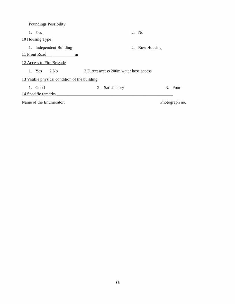
9 Vulnerability Factors
Roof Top Water Tank, heavy machinery or other large mass long susceptible to fail in earthquake
1. Yes 2. No
Heavy Overhangs and Cantilever
1. Yes 2. No
35
Poundings Possibility
1. Yes 2. No
10 Housing Type
1. Independent Building 2. Row Housing
11 Front Road ___________m
12 Access to Fire Brigade
1. Yes 2.No 3.Direct access 200m water hose access
13 Visible physical condition of the building
1. Good 2. Satisfactory 3. Poor
14 Specific remarks _______________________________________________________
Name of the Enumerator: Photograph no.

36
Vulnerability Assessment in Ward No. 18 of Lalitpur Sub-metropolitan City
Household Survey checklist
Location: Tole:…………………………………. Ward No.:…………
House owner: ……………………………….
1. Demographic Information
Male Female <5 pop 6-14 15-65 >65 Disabled Pregnant
2. Education Status
Iliterate SLC Grad Post grad
3. Source of livelihood
Service Business Farming Wages House rent Others
4. Hazard related
4.1 What disasters your family experienced in previous years?
…………………………………………………….……………………………………………
4.2 What was the damage of these disasters?
…………………………………………………….……………………………………………
4.3 If you are to say any two, which hazards do you think most probable in your area?
…………………………………………………….……………………………………………
4.4 Have you heard anything about earthquake risk in your area?
…………………………………………………….……………………………………………
5. Earthquake preparedness
5.1 What you will do if earthquake happen now?
…………………………………………………….……………………………………………
5.2 Have you heard about duck, cover and hold exercise? ☐Yes ☐No
5.3 Do all your family members know what they have to do at the time of earthquake?
☐Yes ☐No
5.4 Do you have identified safe places inside your home? ☐Yes ☐No
5.5 Do you have identified place to meet your family members incase earthquake during daytime?
☐Yes ☐No
5.6 Do you have placed dry food, water etc. for emergency, in case earthquake happens?
☐Yes ☐No
5.7 First aid? ☐Yes ☐No
5.8 If your family gets into emergency situation due to earthquake, who will come to help you?
…………………………………………………….……………………………………………

37
Related Documents