1 • DEVELOPMENT PLAN: ACCESSIBILITY TO PERI-URBAN AREAS Presentation By Maulana Azad National Institute of Technology Bhopal , Madhya Pradesh

Development Plan- Planning interventions by (MANIT) Maulana Azad National Institute of Technology.
Jul 16, 2015
Welcome message from author
This document is posted to help you gain knowledge. Please leave a comment to let me know what you think about it! Share it to your friends and learn new things together.
Transcript

1
• DEVELOPMENT PLAN: ACCESSIBILITY TO PERI-URBAN AREAS
Presentation By
Maulana Azad National Institute of Technology
Bhopal , Madhya Pradesh
ACCESSIBILITY IN PERI URBAN AREAS
DEVELOPMENT PLAN
Maulana Azad National Institute of Technology
Bhopal , Madhya Pradesh2

Transition from rural to urban land use located between the outer l imits of urban and regional centers.
The boundaries of Peri -urban areas are porous and transitory
Can provide essential l i fe support services for urban residents.
ACCESSIBILITY IN PERI URBAN AREAS
Peri-Urbanization
( Rural-Urban fringe)
Qualitative (e.g. diffusion of
urban lifestyle) sense
Quantitative (e.g. new
residential zones) sense
ACCESSIBILITY
INFRASTRUCTURE REACHABILITY AFFORDABILITY SERVICES
3

A Master Plan is the long term perspective plan for guiding the sustainable planned development of the city.
MASTER PLAN
Bhopal development Plan 2005 –
Draft development plan of Bhopal was published on 17-10-94, under
the provision of section 23(2) read with section 18(1) of the M.P Nagar
Tatha Gram Nivesh Adhiniyam 1973.
Objectives of Master Plan of Bhopal
To integrate various units of Bhopal Capital Region
Development of inter city transportation and communication network.
Give shape to the urban structure along with the city function
Gradual removal of existing disorder.4

BHOPAL
• Bhopal city : State capital of Madhya
Pradesh.
• One of the 21 Fastest Growing Cities in
India.
• As a million plus city Bhopal has rapid
transition in the urban fringe areas.
• Bhopal is the 20th largest urban
agglomeration in India.
5

CHRONOLOGICAL EVOLUTION
Source : Developing Low Carbon Cities in Asia: A Study of Bhopal, India 6

REGIONAL SETTING
The region comprises of following districts : Sehore, Guna, Raisen, Bhopal, Vidisha
The regional setting of Bhopal dominates over the other urban settlements of the region.
The NH12 and NH86 intersect each other at Bhopal connecting Jaipur, Jabalpur, Raisen and Dewas.
Bhopal is a transit point to travel between Indore, Hoshangabad, Sehore, Raisen , Kolar, Vidisha and Sanchi.
The area of Bhopal Municipal Corporation is 285kmsq. And that of Bhopal planning area is 601 Kmsq.
The area of Bhopal Municipal Corporation is 285kmsq. And that of Bhopal planning area is 601 Kmsq. 7

The district is highly urbanized with nearly 80% of its
population marked as urban.
SOCIO-CULTURAL BACKGROUND
Source : Census of India
Bhopal comprises of the literacy
rate of about 69.12%.
about 14.5% of Bhopal
population is in 0-6 year of age. (
Census of India).
8
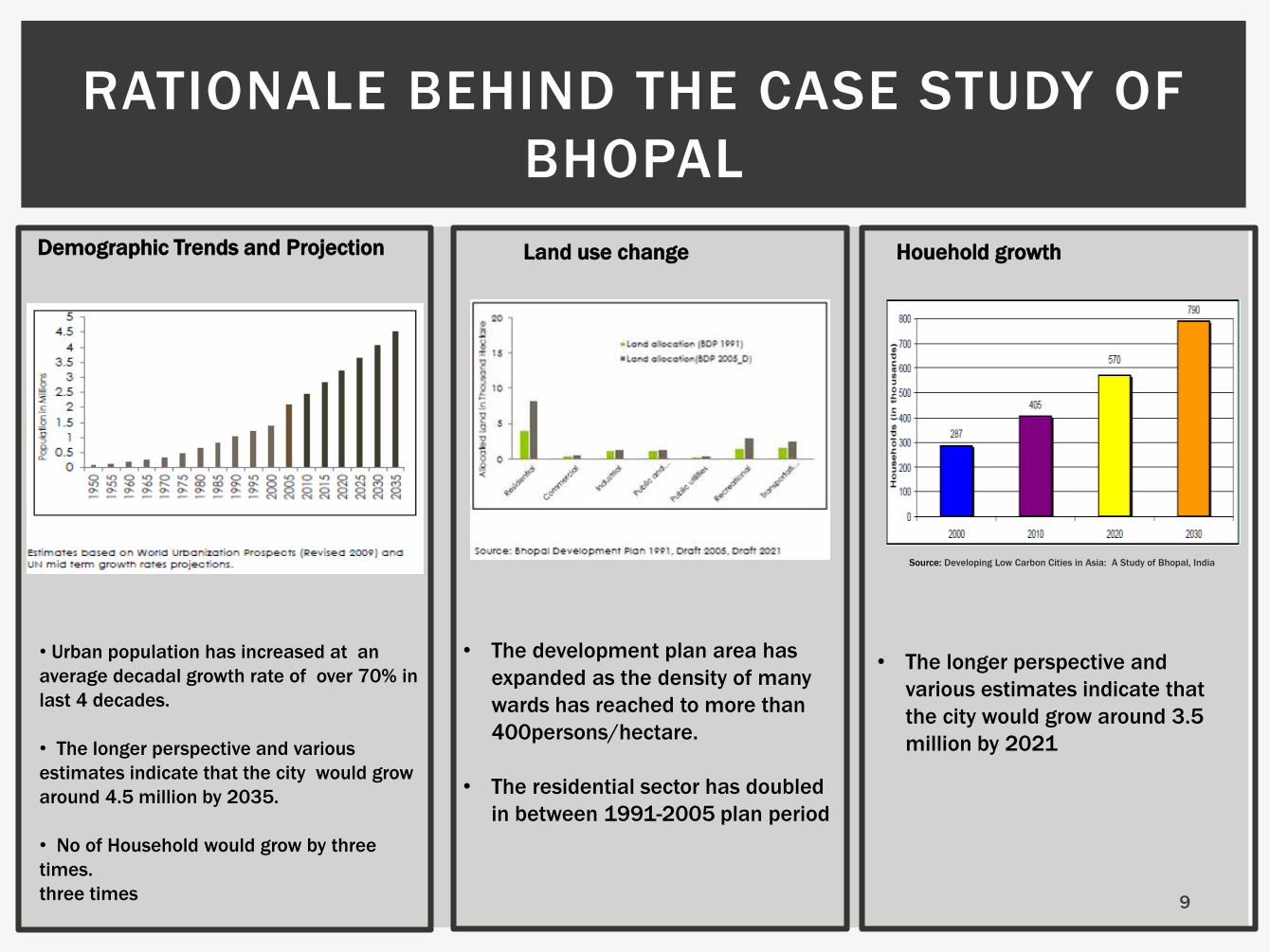
RATIONALE BEHIND THE CASE STUDY OF
BHOPAL
• Urban population has increased at an
average decadal growth rate of over 70% in
last 4 decades.
• The longer perspective and various
estimates indicate that the city would grow
around 4.5 million by 2035.
• No of Household would grow by three
times.
three times
Demographic Trends and Projection Land use change
• The development plan area has
expanded as the density of many
wards has reached to more than
400persons/hectare.
• The residential sector has doubled
in between 1991-2005 plan period
Houehold growth
• The longer perspective and
various estimates indicate that
the city would grow around 3.5
million by 2021
Source: Developing Low Carbon Cities in Asia: A Study of Bhopal, India
9
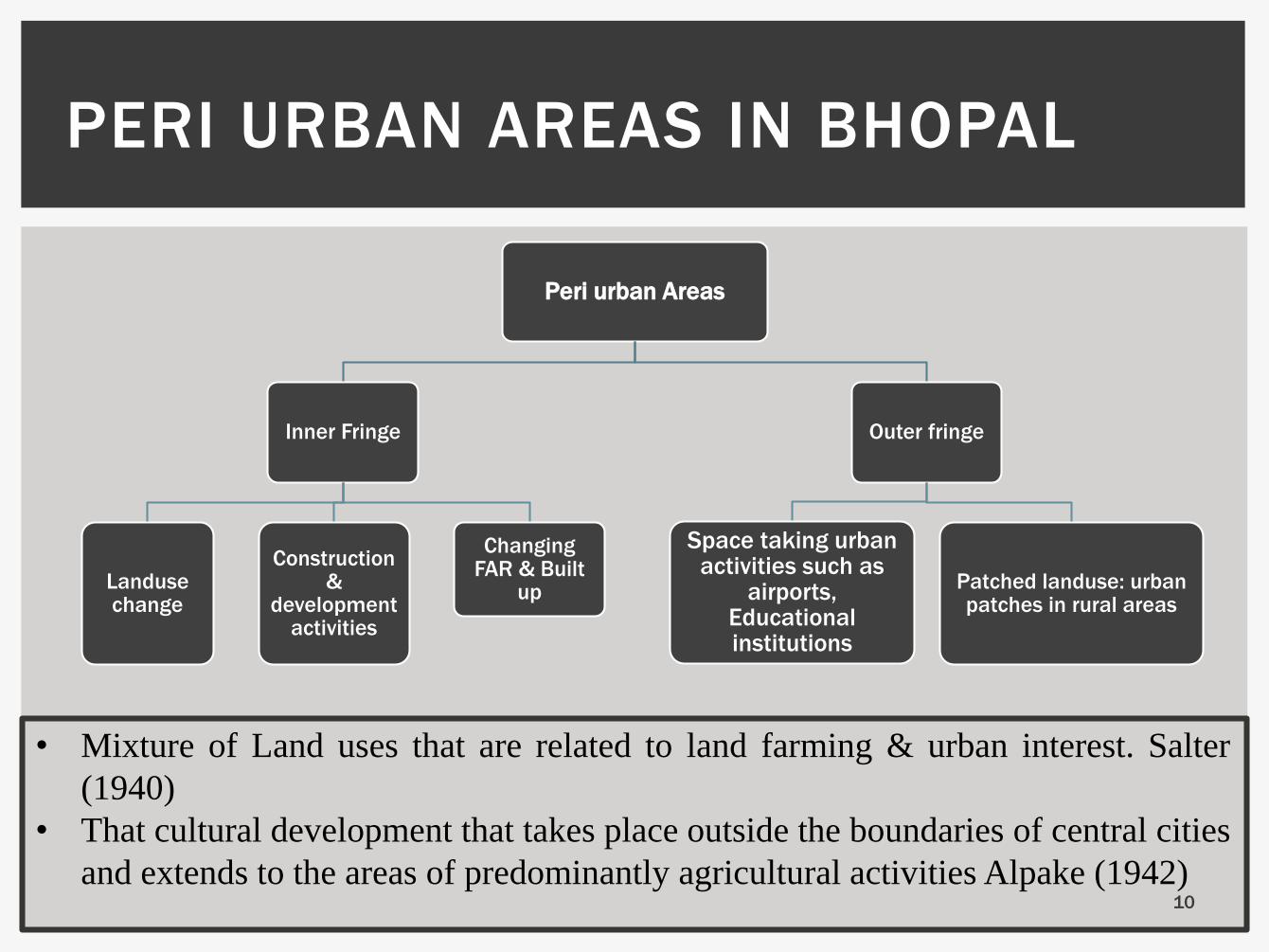
PERI URBAN AREAS IN BHOPAL
Peri urban Areas
Inner Fringe
Landusechange
Construction &
development activities
Changing FAR & Built
up
Outer fringe
Space taking urban activities such as
airports, Educational institutions
Patched landuse: urban patches in rural areas
• Mixture of Land uses that are related to land farming & urban interest. Salter
(1940)
• That cultural development that takes place outside the boundaries of central cities
and extends to the areas of predominantly agricultural activities Alpake (1942)10

INNER & OUTER FRINGES
Inner Fringe Outer Fringe
Position in
Urban
context
Area immediately outside to
the urban municipal
boundary
Area in the outer region towards
agriculturally predominant areas
Activities Ongoing development &
construction activities
Space taking activities which can not be
located within urban boundaries
Land use Land use Transition from
Agriculture to Urban
Patched Land use: Patches of urban
activity areas in agriculturally predominant
areas
Requirement
of planning
strategy
Requires immediate planning
interventions for controlled
development
Requires development guidelines for
location of Space taking activities
11

Factors Indicating Peri urban
areas
Administration
Ongoing development
& Construction
activities
Landusechange
Patched Landuse
Location of Space taking
activities
Factors Discription
Administration Peri urban areas must be outside
urban boundary & thus lie outside
area under municipal corporate
Ongoing
development
& Construction
Housing, Real estate, Commercial
area development outside of
municipal boundary
Location of
Space taking
activities
Presence of space taking activities
which can not be provided within
Urban boundary such as Airport,
Patched Land
use
Patched Land use: Patches of urban
activity areas in agriculturally
predominant areas
Land use
change
Rapid transition in land use from
agriculture to urban land uses
FACTORS INDICATING PERI URBAN AREAS
12

INDICATORS FOR PERI
URBAN AREAS
LIST OF SUB CITIES
CONTAINING PERI URBAN
AREAS OF BHOPAL
• Neori
• Misrod
• Bairagarh
Source: Master Plan 2005, Bhopal
13
PROVISIONS OF MASTER
PLAN BHOPAL 2005
14
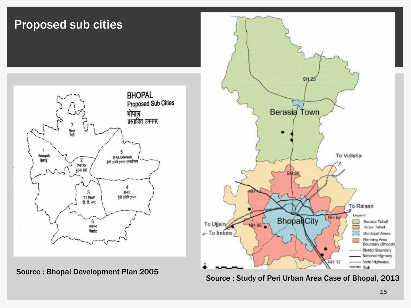
Source : Bhopal Development Plan 2005
Proposed sub cities
15
Source : Study of Peri Urban Area Case of Bhopal, 2013
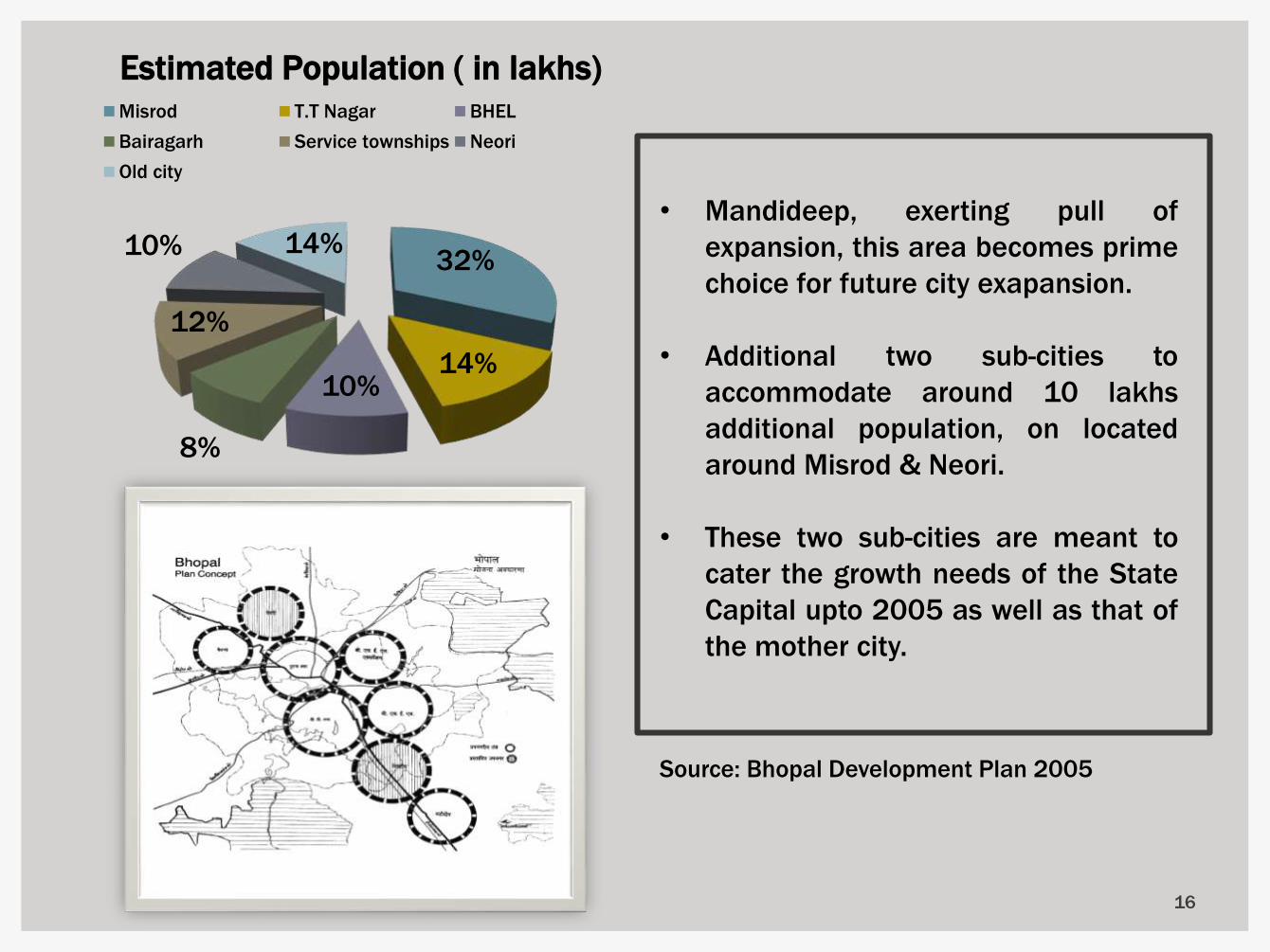
32%
14%10%
8%
12%
10% 14%
Estimated Population ( in lakhs) Misrod T.T Nagar BHEL
Bairagarh Service townships Neori
Old city
• Mandideep, exerting pull of
expansion, this area becomes prime
choice for future city exapansion.
• Additional two sub-cities to
accommodate around 10 lakhs
additional population, on located
around Misrod & Neori.
• These two sub-cities are meant to
cater the growth needs of the State
Capital upto 2005 as well as that of
the mother city.
16
Source: Bhopal Development Plan 2005

• The strategic location of Bhopal,
along the main transport system
of the country
• The existence of the
establishment of large industrial
undertaking like BHELI
Mandideep, Railway
• Bhopal: a nerve centre of
Regional Trade and Commerce-
cum Industrial centre.
• Regional transport network
would facilitate provision of
mass transport corridor inter
linked with the overall city road
network, integrating the sub-
cities movement network.
17
Built Up Growth of City
Source: Bhopal Development Plan 2005
Source : Study of Peri Urban Area Case of Bhopal, 2013

CHANGING
OCCUPATIONAL
PATTERN
•The occupation in tertiary sector has grown from
64% in 1971 to 87% 2001.
•The distribution of workers in secondary sector has
moved up from 33% to 36% in 1991 which saw
steep decline to 15% in 2001.
PROPOSED ROAD NETWORK
AND WIDTHS
Roads could not be developed due to topographicaL configurations
and site conditions are:—
• Road from village Chunabhatti to Bhadbhada
• Road from Asha Niketan to the proposed Ring Road along
Bhopal-Itarsi Railway line.
• Ring Road from ObeduLlahganj Road to Bhopal Bilkisganj
road.
• Road from Obedullahgaj to Raisen road 18
Source : Developing Low Carbon Cities in Asia: A Study of
Bhopal, India
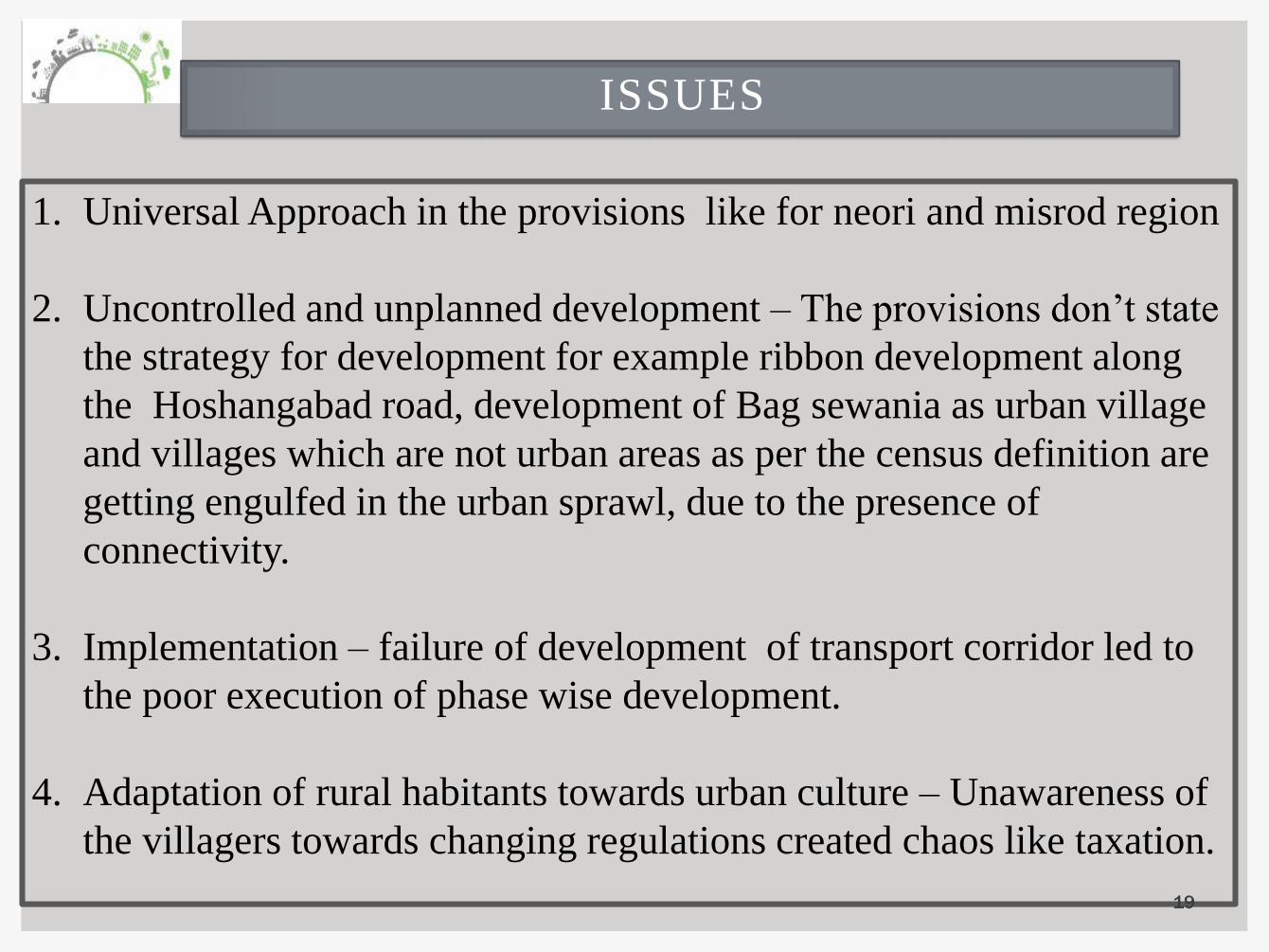
ISSUES
1. Universal Approach in the provisions like for neori and misrod region
2. Uncontrolled and unplanned development – The provisions don’t state
the strategy for development for example ribbon development along
the Hoshangabad road, development of Bag sewania as urban village
and villages which are not urban areas as per the census definition are
getting engulfed in the urban sprawl, due to the presence of
connectivity.
3. Implementation – failure of development of transport corridor led to
the poor execution of phase wise development.
4. Adaptation of rural habitants towards urban culture – Unawareness of
the villagers towards changing regulations created chaos like taxation.
19

20
Case of South- Eastern Bhopal

SELECTED VILLAGES
•Samarda Kaliysot lies
on NH-12, with many
other
locational benefits.
•Deepdi village is 2 kms
away from Samarda
Kaliyasot, connected
with a kutcha (non
paved) road. Deepdi
village is connected to
Bhojpur road, which is
further connected with
NH-12.
21Source : Study of Peri Urban Area Case of Bhopal, 2013

DEEPDI VILLAGE
22

DEEPDI SCENARIO
percentage of small land holding sizes is very high at 78.8 per cent.
infrastructural conditions show a lesser degree of urbanity
Only eight per cent of the total workforce works in rural non-farm employment.
Rural culture dominates the area.
23
24

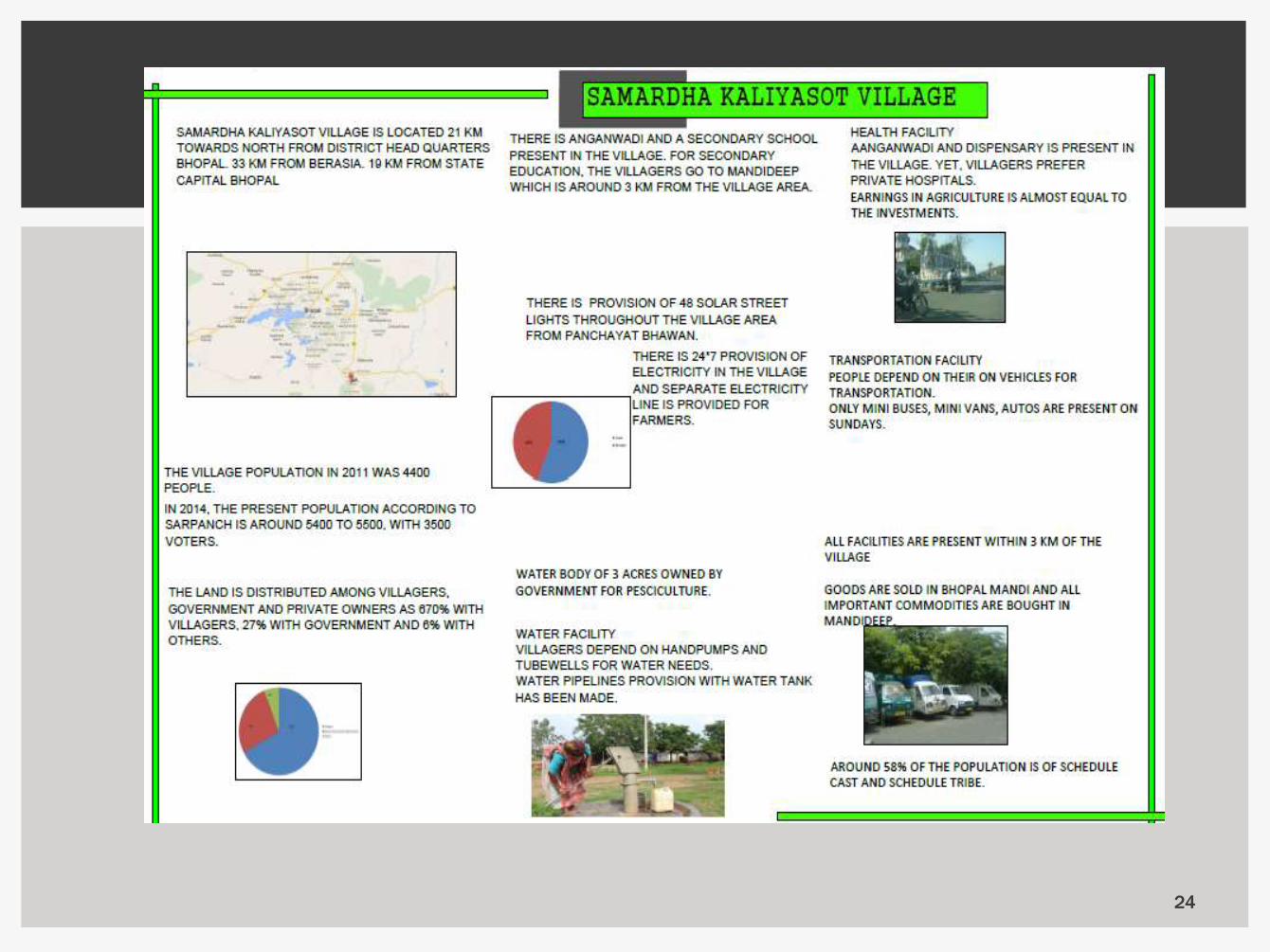
Samarda Kaliyasot Village
urban sprawl and urban-rural merger has totally
transformed the economy of the village
approximately 50 shops, all of which are privately-
owned
No autos or rickshaws ply upto the villages from Bhopal or Mandideep
only small buses travel from Bhopal to
Hoshangabad via Mandideep and vice
versa every two minutes.
no state government undertaking for bus
transport, all the buses are private.
sudden increase in the population in private
colonies
25
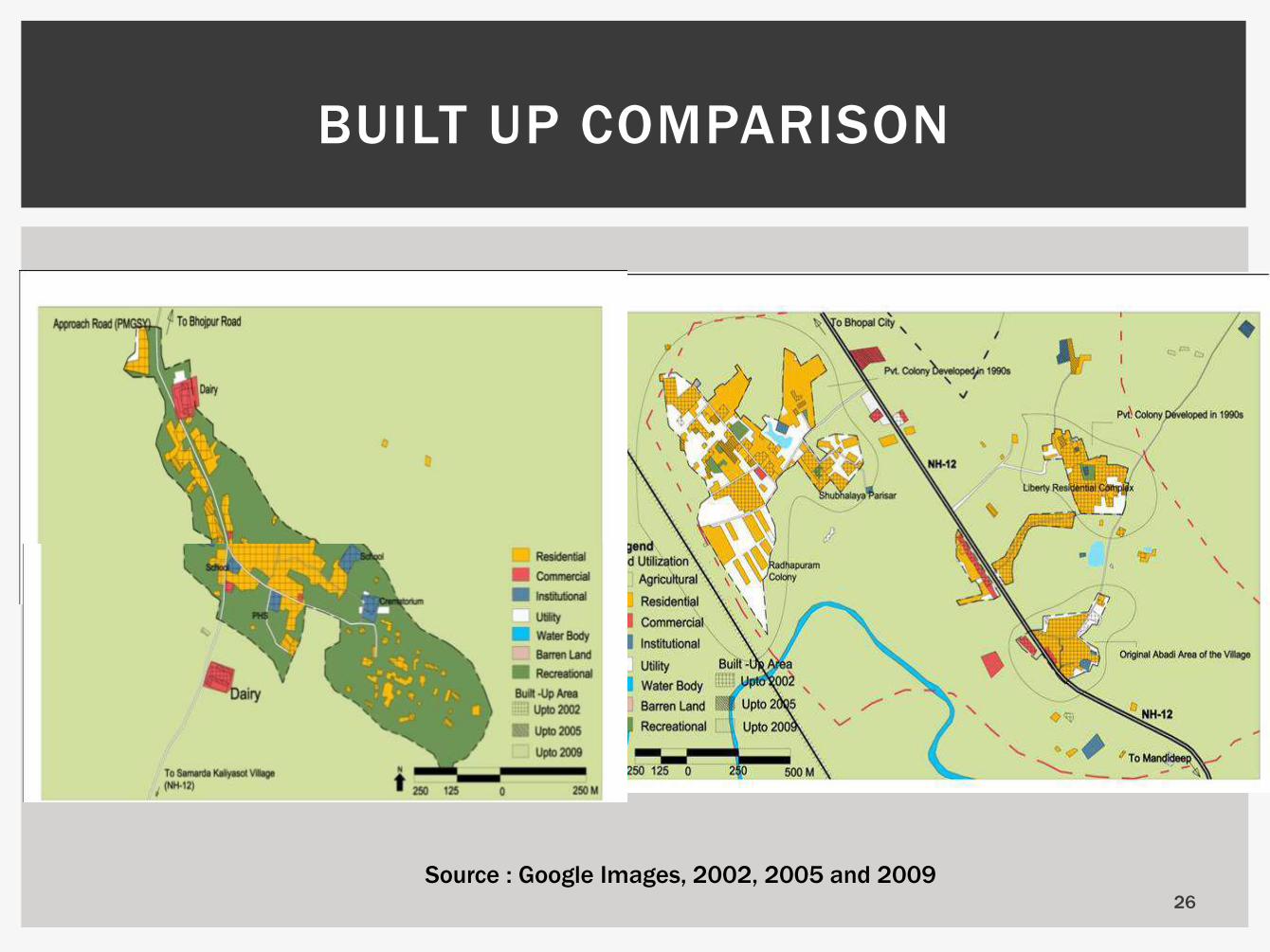
BUILT UP COMPARISON
Source : Google Images, 2002, 2005 and 200926
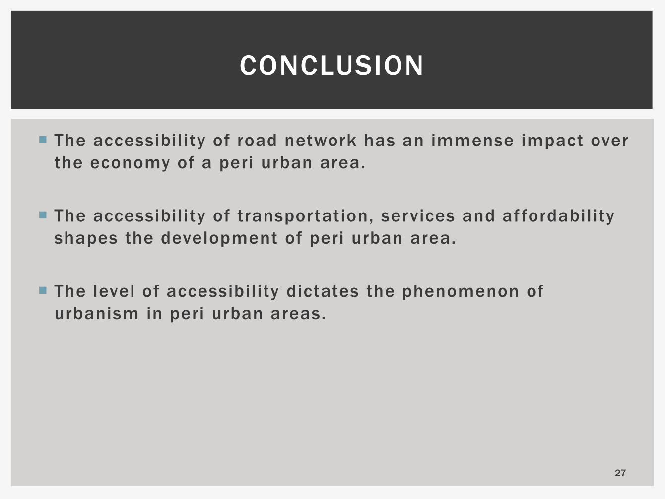
CONCLUSION
The accessibility of road network has an immense impact over
the economy of a peri urban area.
The accessibility of transportation, services and affordability
shapes the development of peri urban area.
The level of accessibility dictates the phenomenon of
urbanism in peri urban areas.
27
28

29
30
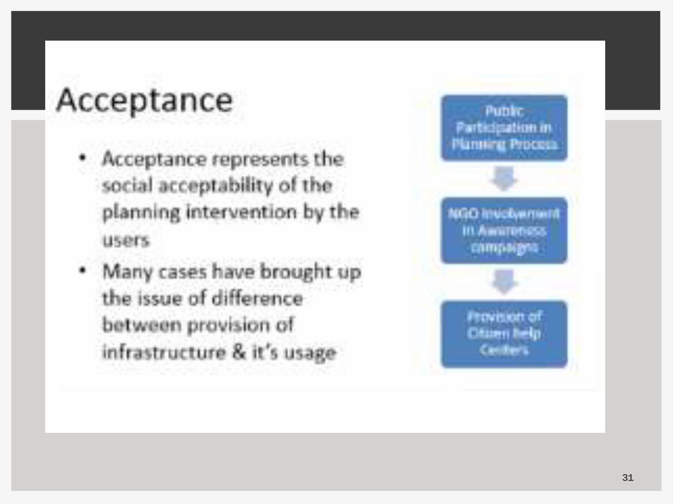
31

32
Related Documents