Developing Health Geographic Information Systems (HGIS) for Khorasan Province in Iran (Technical Report) S.H. Sanaei-Nejad, (MSc, PhD) Ferdowsi University of Mashhad, Iran, [email protected] www.um.ac.ir/~sanaei H.A.Faraji Sabokbar, (PhD) Tehran University, Iran, [email protected]

Developing Health Geographic Information Systems (HGIS) for Khorasan Province in Iran (Technical Report) S.H. Sanaei-Nejad, (MSc, PhD) Ferdowsi University.
Jan 15, 2016
Welcome message from author
This document is posted to help you gain knowledge. Please leave a comment to let me know what you think about it! Share it to your friends and learn new things together.
Transcript
Developing Health Geographic Information Systems (HGIS) for Khorasan Province in
Iran (Technical Report)
S.H. Sanaei-Nejad, (MSc, PhD)Ferdowsi University of Mashhad, Iran,
[email protected]/~sanaei
H.A.Faraji Sabokbar, (PhD)Tehran University, Iran,[email protected]

• Data acquisition,
• Preprocessing,
• Data management,
• Data manipulation and analysis and
• Product generation (Oranga, 1995).
The essential components of a GIS
Based on the above components, GIS can be used to investigate questions about location, condition, trends, routing and patterns of attributes.

The above characteristics of GIS make it essential
for the health service and management.
Because the health service facility, immunization,
demographic, health personnel, hydrological
system, and improved water supply facility
databases have different geographically defined
information. (Savigny, et. al., 1995).
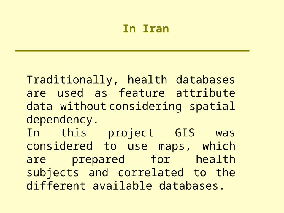
Traditionally, health databases are used as feature attribute data without considering spatial dependency. In this project GIS was considered to use maps, which are prepared for health subjects and correlated to the different available databases.
In Iran
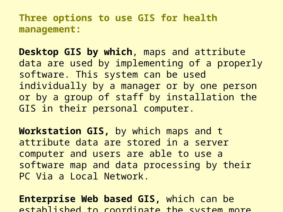
Three options to use GIS for health management:
Desktop GIS by which, maps and attribute data are used by implementing of a properly software. This system can be used individually by a manager or by one person or by a group of staff by installation the GIS in their personal computer.
Workstation GIS, by which maps and t attribute data are stored in a server computer and users are able to use a software map and data processing by their PC Via a Local Network.
Enterprise Web based GIS, which can be established to coordinate the system more efficiently by using World Wide Web as a platform to access the map and related attribute data

System Architecture of the K-HGIS plan
The main structure of the K-HGIS is a Content Management Systems (CMS) to construct network accessibility to the health databases and also to the maps and related attribute data.
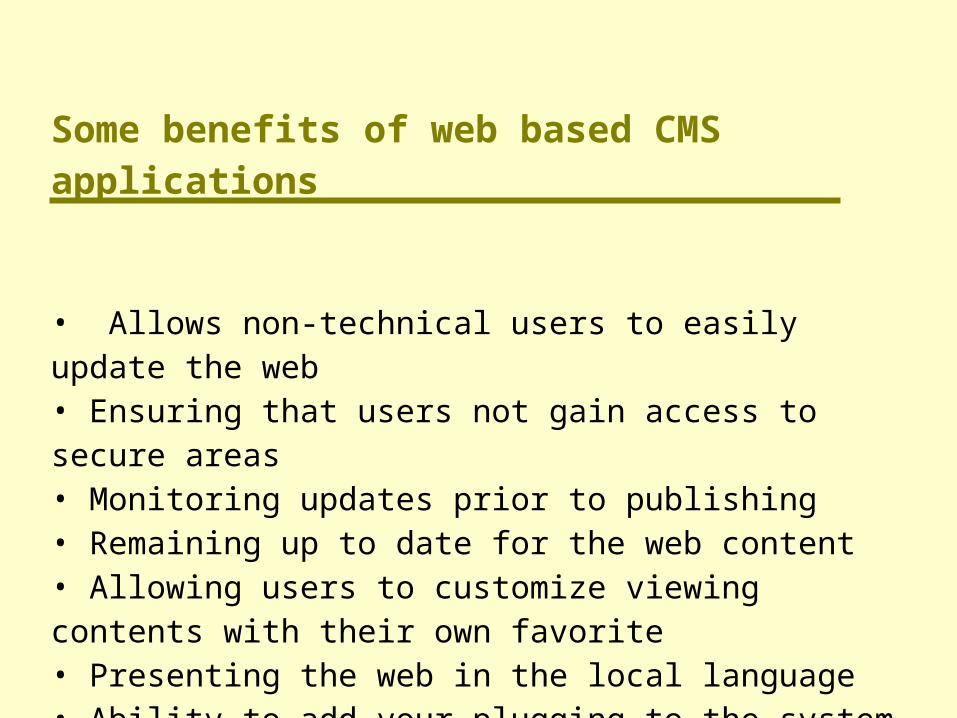
Some benefits of web based CMS applications
• Allows non-technical users to easily update the web• Ensuring that users not gain access to secure areas• Monitoring updates prior to publishing• Remaining up to date for the web content • Allowing users to customize viewing contents with their own favorite• Presenting the web in the local language• Ability to add your plugging to the system when needed, and the system will detect and enables them automatically

• Spatial data preparing
• Feature attribute data preparing
• processing and management and spatially
relating of the feature attribute databases.
In the CMS, there are three main branches that we worked on them:
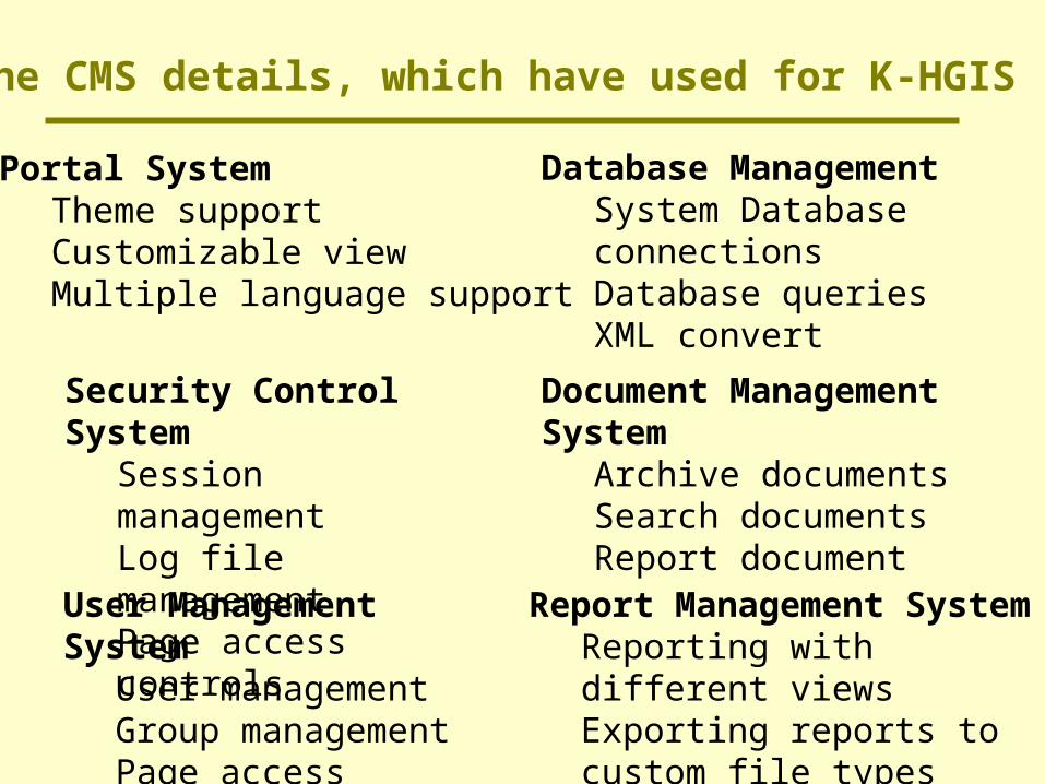
The CMS details, which have used for K-HGIS
Portal SystemTheme supportCustomizable viewMultiple language support
Security Control SystemSession managementLog file managementPage access controls
User Management SystemUser managementGroup managementPage access controls
Database Management System Database connectionsDatabase queriesXML convert
Document Management System
Archive documentsSearch documentsReport document
Report Management SystemReporting with different viewsExporting reports to custom file types

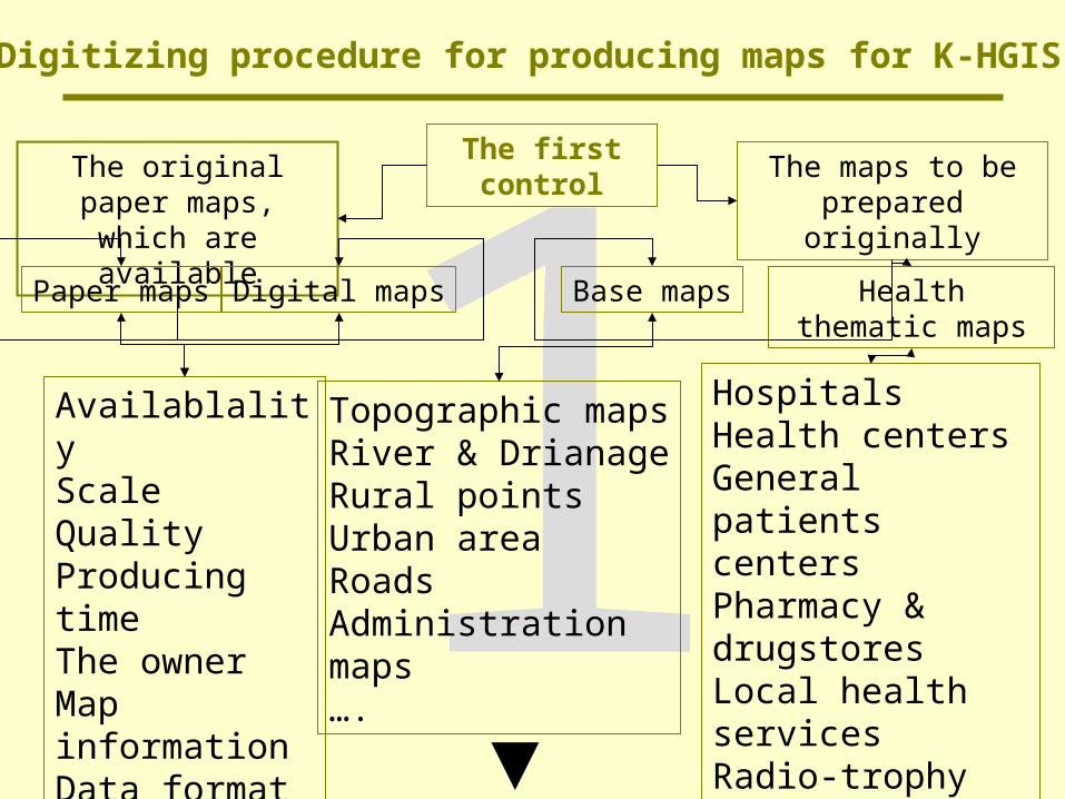
Map preparing and difficulties
Preparing thematic maps and related attribute data is the main problem in establishing enterprise GIS. This is more difficult task in developing countries and become more problematic when the enterprise GIS is for health service and management.
•Maps and spatial data sources, traditionally, are not used in this section. •There are limited map sources available in other governmental organization that can be used as basically thematic maps for HGIS, in Khorasan province.•Some other maps should have been prepared by fieldwork using GPS and also address matching procedure.

DigitizerScanner
Digital camera
GPS
Time & Cost
CAD OverlayArc ViewArc Info
R2V&...
Hardware Software
Selecting
Of
Digitizing
Procedure
1The first control
The original paper maps, which are available
The maps to be prepared originally
Digital maps Base maps Health thematic maps
AvailablalityScaleQualityProducing timeThe ownerMap informationData format….
Topographic mapsRiver & DrianageRural pointsUrban areaRoadsAdministrationmaps….
HospitalsHealth centersGeneral patients centersPharmacy & drugstoresLocal health servicesRadio-trophy centers….
Paper maps
Digitizing procedure for producing maps for K-HGIS

2Collecting the available
maps
Digitizing procedure for producing maps for K-HGIS
Digitizing methods
Scanning the paper maps
Investigating into digital methods
Selecting the most convenience method
Scanning the paper maps
Producing the reference grid
Transforming of the reference codes
Coordinate conversion
Vectorizing
Final map ediGeographic coordinate of the gridt
Projection
Text correction
The first editing to omit back ground
Filtering
Converting to binary codes
SavingFinal control and saving

The structure of traditional databases in the health service and management of Khorasan were analyzed. The analyses showed that the number of fields in the data bases are very high, which organized into different relational tables, but the architecture of the data bases are very simple.

The structure of traditional databases in the health service and management of Khorasan were analyzed. The analyses showed that the number of fields in the data bases are very high, which organized into different relational tables, but the architecture of the data bases are very simple.
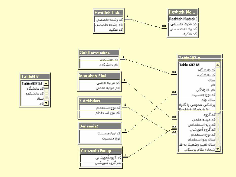

This traditional databases are static and update procedure is time consuming and also bureaucratically complicate. The new database
We used some open sources software and developed it according to the K-HGIS needs. The software appropriately meets the needs and is ready to install in the server. It is well developed to support native languages and also the related feature attribute data.
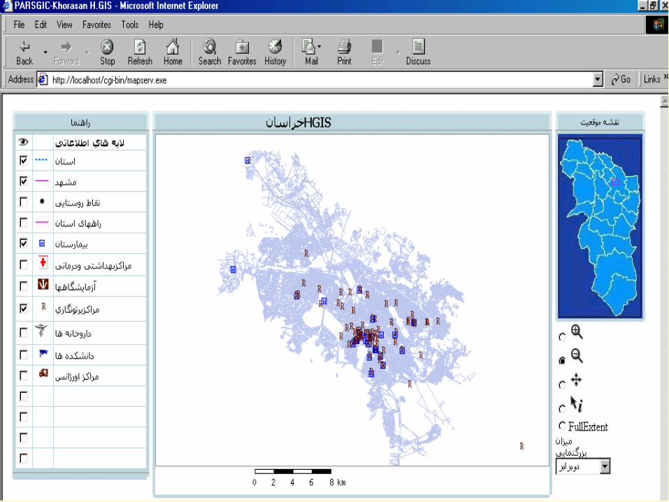
Designing the web map service

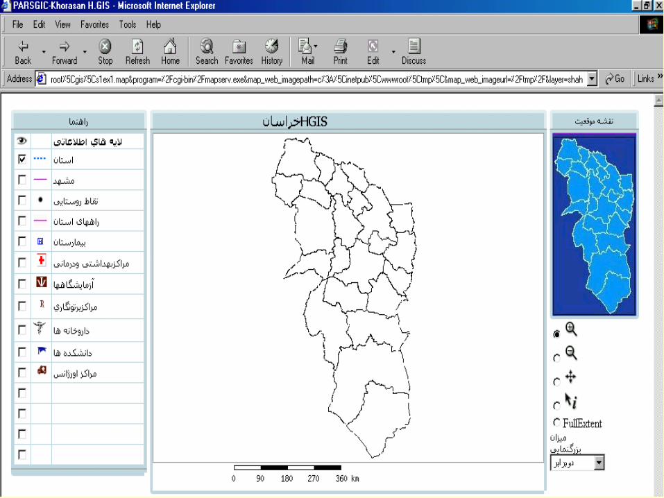
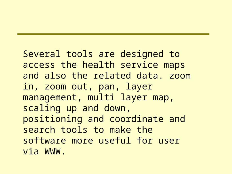
Several tools are designed to access the health service maps and also the related data. zoom in, zoom out, pan, layer management, multi layer map, scaling up and down, positioning and coordinate and search tools to make the software more useful for user via WWW.

Related Documents