Welcome message from author
This document is posted to help you gain knowledge. Please leave a comment to let me know what you think about it! Share it to your friends and learn new things together.
Transcript
Project: Description:
APPROVED: DATE:
APPROVED: DATE:
APPROVED: DATE:
Workbook updated September 9, 2019
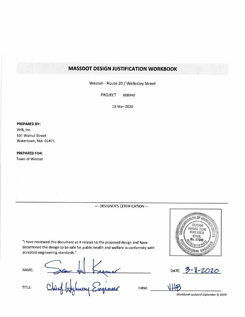
MassDOT Design Justification Workbook
608940 Weston - Route 20 / Wellesley Street
SUMMARY OF JUSTIFICATIONS
The Designer shall complete this workbook in its entirety prior to preparing the Summary of Justifications. The
summary should be a concise narrative of the project with a description of the criteria that requires supplemental
documentation and a brief justification of why the criteria were not met. If the project does not require
supplemental documentation, the designer shall not fill out this summary page.
The summary narrative must be brief, concise, and fit in the space provided. Do not attach additional sheets for this
Executive Summary. Additional detail will be provided in the applicable sections of the Workbook.
(Note that, if after completing this Workbook it is determined that no Criteria have been violated, the Workbook
should still be submitted to document the Designer's decision-making process.)
(Secretary / CEO of MassDOT)
--- FOR MASSDOT/FHWA USE ONLY ---
(Chief Engineer, MassDOT)
(FHWA)
Project: Description:
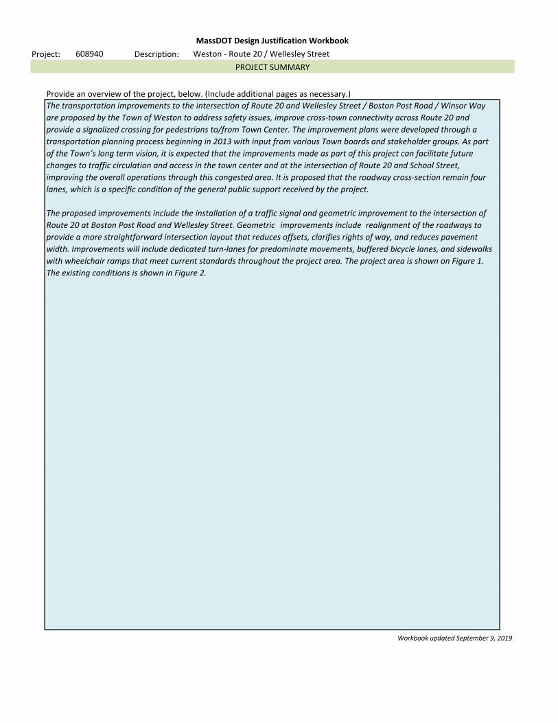
Provide an overview of the project, below. (Include additional pages as necessary.)
Workbook updated September 9, 2019
MassDOT Design Justification Workbook
608940 Weston - Route 20 / Wellesley Street
PROJECT SUMMARY
The transportation improvements to the intersection of Route 20 and Wellesley Street / Boston Post Road / Winsor Way
are proposed by the Town of Weston to address safety issues, improve cross-town connectivity across Route 20 and
provide a signalized crossing for pedestrians to/from Town Center. The improvement plans were developed through a
transportation planning process beginning in 2013 with input from various Town boards and stakeholder groups. As part
of the Town’s long term vision, it is expected that the improvements made as part of this project can facilitate future
changes to traffic circulation and access in the town center and at the intersection of Route 20 and School Street,
improving the overall operations through this congested area. It is proposed that the roadway cross-section remain four
lanes, which is a specific condi/on of the general public support received by the project.
The proposed improvements include the installation of a traffic signal and geometric improvement to the intersection of
Route 20 at Boston Post Road and Wellesley Street. Geometric improvements include realignment of the roadways to
provide a more straightforward intersection layout that reduces offsets, clarifies rights of way, and reduces pavement
width. Improvements will include dedicated turn-lanes for predominate movements, buffered bicycle lanes, and sidewalks
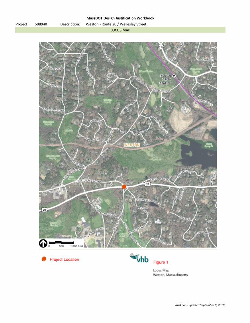
with wheelchair ramps that meet current standards throughout the project area. The project area is shown on Figure 1.
The existing conditions is shown in Figure 2.
Project: Description:
Workbook updated September 9, 2019
(Provide a Locus Map on this sheet, or by replacing the page in the PDF document.)
MassDOT Design Justification Workbook
608940 Weston - Route 20 / Wellesley Street
LOCUS MAP

Description:
Facility:
NHS: Design Speed: Functional Classification:
Roadway Owner:
(After completing the workbook, this sheet will serve as a summary for any Controlling Criteria not met.)
Workbook updated September 9, 2019
Provide a description of the existing roadway and its context, and summarize why the Controlling Criteria above
cannot be met. Provide information on alternatives considered; comparison of the safety and operational
performance of the roadway and other impacts such as right-of-way, community, environmental, cost, and
usability by all modes of transportation; proposed mitigation measures; and compatibility with adjacent sections
of roadway. Attach additional pages as necessary.
Controlling criteria for the above can be met with the proposed design.
Route 20
MassDOT Design Justification Workbook
Project: 608940 Weston - Route 20 / Wellesley Street
FACILITY INFORMATION
40 MPHYes
Pedestrian Facilities
Bicycle Facilities
PRINCIPAL ARTERIAL
MassDOT
Design Speed
(Any criteria that is not considered a "Controlling Criteria" is still a design criteria; the applicable worksheet should
still be filled out to document the Designer's decision-making process when selecting these values.)
Based on this information, the following design criteria are considered Controlling Criteria for this facility.
(This list will also add or remove entries based on the responses in other sheets.)

Project: Description:
Workbook updated September 9, 2019
MassDOT Design Justification Workbook
608940 Weston - Route 20 / Wellesley Street
FIGURES AND PHOTOGRAPHS
(Provide photographs, an existing Typical Section, and a proposed Typical Section on this sheet, or by replacing the page in the
PDF document.)

Route 20
Boston
Wel
lesl
ey S
tree
t
Route 20
Winsor W
ay
Post Road
\\vhb\proj\Wat-TE\14360.00 Weston-Rte 20\Graphics\FIGURES\LOCUS.dwg
Figure 1Intersection Locus Map
Road Safety Audit
Route 20 at Boston Post Road / Wellesley Street
Weston, Massachusetts
0 75 150 Feet
Existing Conditions - Figure 2

Description:
Facility:
If pedestrians are not legally allowed on the facility, check this box and do not fill out this sheet.
(Fill in information about the proposed Pedestrian Accommodations on this facility.)
(For the purposes of this Workbook, the entries for this criterion have been split into several "subcriteria".)
Type of Pedestrian Accommodation:
Subcriterion: Width
Minimum: FT Existing: FT Proposed: FT
(If the width varies, provide a minimum.)
Source used for minimum:
Justify the proposed width.
The pedestrian counts indicate very minimal pedestrian traffic. As such, 6.0 foot sidewalk is a reasonable width.
Subcriterion: Presence
Pedestrian facilities exist on of the facility.
Pedestrian facilities are proposed on of the facility.
(Check the boxes if any of the following apply:)
The roadway is in an urbanized area, an urban cluster, or a rural village.
The project involves work on or underneath a bridge.
The roadway is identified as having a High Potential of Walkable Trips in the Pedestrian Plan.
Justify the proposed number of sidewalks.
MassDOT Design Justification Workbook
Project: 608940 Weston - Route 20 / Wellesley Street
PEDESTRIAN FACILITIES
MassDOT Controlling Criteria
6.04.05.0
SIDEWALK
Route 20
BOTH SIDES
ONE SIDE
Sidewalk exists on Route 20 only on the north side and has not been maintained over the years. The proposed
intersection improvement project will reconstruct the sidewalk on the north side. In addition, new sidewalk is
proposed on the south side, but only within the immediate intersection area to faciliate pedestrian crossing of Route
20 and crosswalks on all four approaches. The sidewalk on the south side is not proposed to the limit of work as
there are existing right of way constraints on the south side of Route 20 to the east of Wellesey Street. This was
discussed with MassDOT District 6 in a meeting on February 6, 2020. It was agreed that the sidewalk on the south
side should be limited to the intersection area to facilitate the crossing of Route 20.
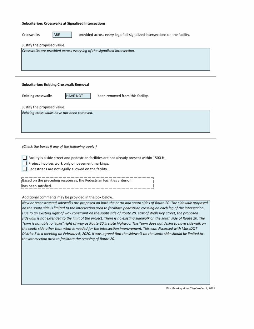
Subcriterion: Crosswalks at Signalized Intersections
Crosswalks provided across every leg of all signalized intersections on the facility.
Justify the proposed value.
Subcriterion: Existing Crosswalk Removal
Existing crosswalks been removed from this facility.
Justify the proposed value.
(Check the boxes if any of the following apply:)
Facility is a side street and pedestrian facilities are not already present within 1500-ft.
Project involves work only on pavement markings.
Pedestrians are not legally allowed on the facility.
Based on the preceding responses, the Pedestrian Facilities criterion
has been satisfied.
Additional comments may be provided in the box below.
Workbook updated September 9, 2019
Existing cross walks have not been removed.
New or reconstructed sidewalks are proposed on both the north and south sides of Route 20. The sidewalk proposed
on the south side is limited to the intersection area to facilitate pedestrian crossing on each leg of the intersection.
Due to an existing right of way constraint on the south side of Route 20, east of Wellesley Street, the proposed
sidewalk is not extended to the limit of the project. There is no existing sidewalk on the south side of Route 20. The
Town is not able to "take" right of way as Route 20 is state highway. The Town does not desire to have sidewalk on
the south side other than what is needed for the intersection improvement. This was discussed with MassDOT
District 6 in a meeting on February 6, 2020. It was agreed that the sidewalk on the south side should be limited to
the intersection area to facilitate the crossing of Route 20.
ARE
HAVE NOT
Crosswalks are provided across every leg of the signalized intersection.

Description:
Facility:
If bicyclists are not legally allowed on the facility, check this box and do not fill out this sheet.
(Fill in information about the proposed Bicycle Accommodations on this facility.)
(For the purposes of this Workbook, the entries for this criterion have been split into several "subcriteria".)
Subcriterion: Type
Type of Bicycle Accommodation:
Posted or statutory speed of facility: MPH
Facility volume (vehicles per day):
Number of travel lanes (in each direction): (If this varies, use the higher number.)
The roadway is classified as a corridor with a High Potential for Everyday Biking in the Bike Plan.
Justify the proposed value.
A buffered bike lane is proposed on either side of Route 20.
Subcriterion: Width
(Width excludes any buffer areas.)
Minimum: FT Existing: FT Proposed: FT
(If the width varies, provide a minimum.)
Source used for minimum:
Justify the proposed value.
19600
2
5 foot width for a one way buffered bike lane is reasonable and consistent with design standards. The design
includes a 2' buffer, making the buffered bike lane a total of 7 feet (including buffer).
BUFFERED BICYCLE LANE
MassDOT Controlling Criteria
5.00.05.0
40
Route 20
MassDOT Design Justification Workbook
Project: 608940 Weston - Route 20 / Wellesley Street
BICYCLE FACILITIES
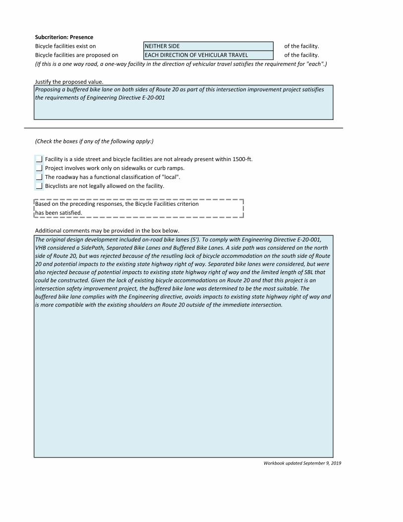
Subcriterion: Presence
Bicycle facilities exist on of the facility.
Bicycle facilities are proposed on of the facility.
(If this is a one way road, a one-way facility in the direction of vehicular travel satisfies the requirement for "each".)
Justify the proposed value.
(Check the boxes if any of the following apply:)
Facility is a side street and bicycle facilities are not already present within 1500-ft.
Project involves work only on sidewalks or curb ramps.
The roadway has a functional classification of "local".
Bicyclists are not legally allowed on the facility.
Based on the preceding responses, the Bicycle Facilities criterion
has been satisfied.
Additional comments may be provided in the box below.
Workbook updated September 9, 2019
The original design development included on-road bike lanes (5'). To comply with Engineering Directive E-20-001,
VHB considered a SidePath, Separated Bike Lanes and Buffered Bike Lanes. A side path was considered on the north
side of Route 20, but was rejected because of the resutling lack of bicycle accommodation on the south side of Route
20 and potential impacts to the existing state highway right of way. Separated bike lanes were considered, but were
also rejected because of potential impacts to existing state highway right of way and the limited length of SBL that
could be constructed. Given the lack of existing bicycle accommodations on Route 20 and that this project is an
intersection safety improvement project, the buffered bike lane was determined to be the most suitable. The
buffered bike lane complies with the Engineering directive, avoids impacts to existing state highway right of way and
is more compatible with the existing shoulders on Route 20 outside of the immediate intersection.
NEITHER SIDE
Proposing a buffered bike lane on both sides of Route 20 as part of this intersection improvement project satisifies
the requirements of Engineering Directive E-20-001
EACH DIRECTION OF VEHICULAR TRAVEL

Description:
Facility:
(Check the boxes if any of the following apply:)
Project is not within the service district of any of the RTAs or of the MBTA.
There are no existing or proposed RTA/MBTA transit services on the roadway.
Pedestrians are not legally allowed on the facility.
Service District:
Based on the previous responses, Transit Accommodation is not applicable. Do not fill out this sheet.
(Fill in information about the proposed Transit Accommodations on this facility.)
(For the purposes of this Workbook, the entries for this criterion have been split into several "subcriteria".)
Subcriterion: Coordination Standard not met.
The 25 Percent Design plans were sent the applicable RTA or the MBTA.
Subcriterion: Crosswalks Standard not met.
Crosswalks or other means of facilitating pedestrian access across the road provided
within 250 feet of all bus stops.
Justify the proposed value.
Subcriterion: Amenities
(Check the boxes if any of the following apply:)
There is a bus stop present within the project limits with 100 or more boardings per day.
All bus stops with 100 or more boardings per day have a bench or shelter.
Justify the proposed value.
ARE NOT
METROWEST REGIONAL TRANSIT AUTHORITY (MWRTA)
MassDOT Design Justification Workbook
Project: 608940 Weston - Route 20 / Wellesley Street
TRANSIT ACCOMMODATION
Criterion not applicable.
Route 20

Subcriterion: Transit Priority
Transit route headways: (Consider ALL buses that use the corridor, not just a single route.)
Some form of transit priority treatment is provided on the corridor.
Describe the type of transit priority treatments that are provided on the corridor.
Justify the proposed value.
Based on the preceding responses, the Transit Accommodation criterion
is not applicable.
Additional comments may be provided in the box below.
Workbook updated September 9, 2019
mins
This project is an intersection safety improvement project which provides a new traffic signal and pedestrian cross
walks on each leg of the intersection. In the future and if MWRTA desired, a bus stop at this intersection could be
accommodated. Note, a bus stop is not currently part of the project.
20

Description:
Facility:
(Check the boxes if any of the following apply:)
Project does not involve work at an interchange.
Work on the on- or off-ramp does not constitute new construction or major reconstruction/reconfiguration.
Based on the previous responses, Ramp Length is not applicable. Do not fill out this sheet.
(Fill in information about the proposed Ramp Length on this facility.)
Minimum Ramp Length: FT
Existing Ramp Length: FT
Proposed Ramp Length: FT Standard not met.
Based on the preceding responses, the Ramp Length criterion
is not applicable.
Ad
dit
Workbook updated September 9, 2019
Criterion not applicable.
MassDOT Design Justification Workbook
Project: 608940 Weston - Route 20 / Wellesley Street
RAMP LENGTH
(Reference Project Development and Design Guide, Section 7.6.0.)
Route 20
1000
0
0

Description:
Facility:
(Fill in all known information about the proposed Design Speed on this facility.)
Minimum Design Speed: Maximum Design Speed:
Source used for range:
Justify use of this source for the range of design speeds.
Existing Design Speed: Posted Speed Limit:
Proposed Design Speed: Statutory Speed Limit:
Based on the preceding responses, the Design Speed criterion
has been satisfied.
Ad
dit
Workbook updated September 9, 2019
MassDOT Design Justification Workbook
Project: 608940 Weston - Route 20 / Wellesley Street
DESIGN SPEED
Route 20
MPH
MPH
MPH40
40
(Violations of this criterion should be extremely rare. When not met, provide (at a minimum) the following additional
justification:
- Length of section with reduced design speed compared to overall length of project
- Measures used in transitions to adjacent sections with higher or lower design or operating speeds.
If not met, summarize the decision-making process that led to the selection of the proposed Design Speed. This
should include a discussion of alternatives evaluated to ensure the project meets the intended purpose/need, while
minimizing or mitigating associated impacts to the maximum extent feasible. The evaluation may include an
incremental comparison of costs, design impacts, etc. Attach additional pages as necessary.
Reference Project Development and Design Guide, Section 3.6.5.)
35
35 MPH
MPH
45 MPH
Project Development and Design Guide, Section 3.6.5.
(Attach additional sheets as necessary.)

Description:
Facility:
If there are no bridges or structures in the project, check this box and do not fill out this sheet.
(Fill in information about the proposed Design Loading Structural Capacity on this facility.)
Minimum Loading: Proposed Loading:
Source used for minimum:
Justify use of this source for the minimum loading.
Based on the preceding responses, the Design Loading criterion
is not applicable.
Ad
dit
Workbook updated September 9, 2019
Criterion not applicable.
MassDOT Design Justification Workbook
Project: 608940 Weston - Route 20 / Wellesley Street
DESIGN LOADING STRUCTURAL CAPACITY
(Violations of this criterion should be extremely rare. When not met, provide (at a minimum) the following additional
justification:
- Verification of safe load-carrying capacity (load rating) for all State unrestricted legal loads or routine permit loads,
and in the case of bridges and tunnels on the Interstate, all Federal legal loads.
If not met, summarize the decision-making process that led to the selection of the proposed structural capacity. This
should include a discussion of alternatives evaluated to ensure the project meets the intended purpose/need, while
minimizing or mitigating associated impacts to the maximum extent feasible. The evaluation may include an
incremental comparison of costs, design impacts, etc. Attach additional pages as necessary.
Reference the latest approved editions with any interims of the MassDOT LRFD Bridge Design Manual.)
(Attach additional sheets as necessary.)
Route 20
AASHTO LRFD, Table XX

Description:
Facility:
(Fill in information about the proposed Lane Width on this facility.)
Minimum Lane Width: Proposed Lane Width:
Maximum Lane Width:
Source used:
Justify the value and the use of this source (if not the PDDG) for the lane width.
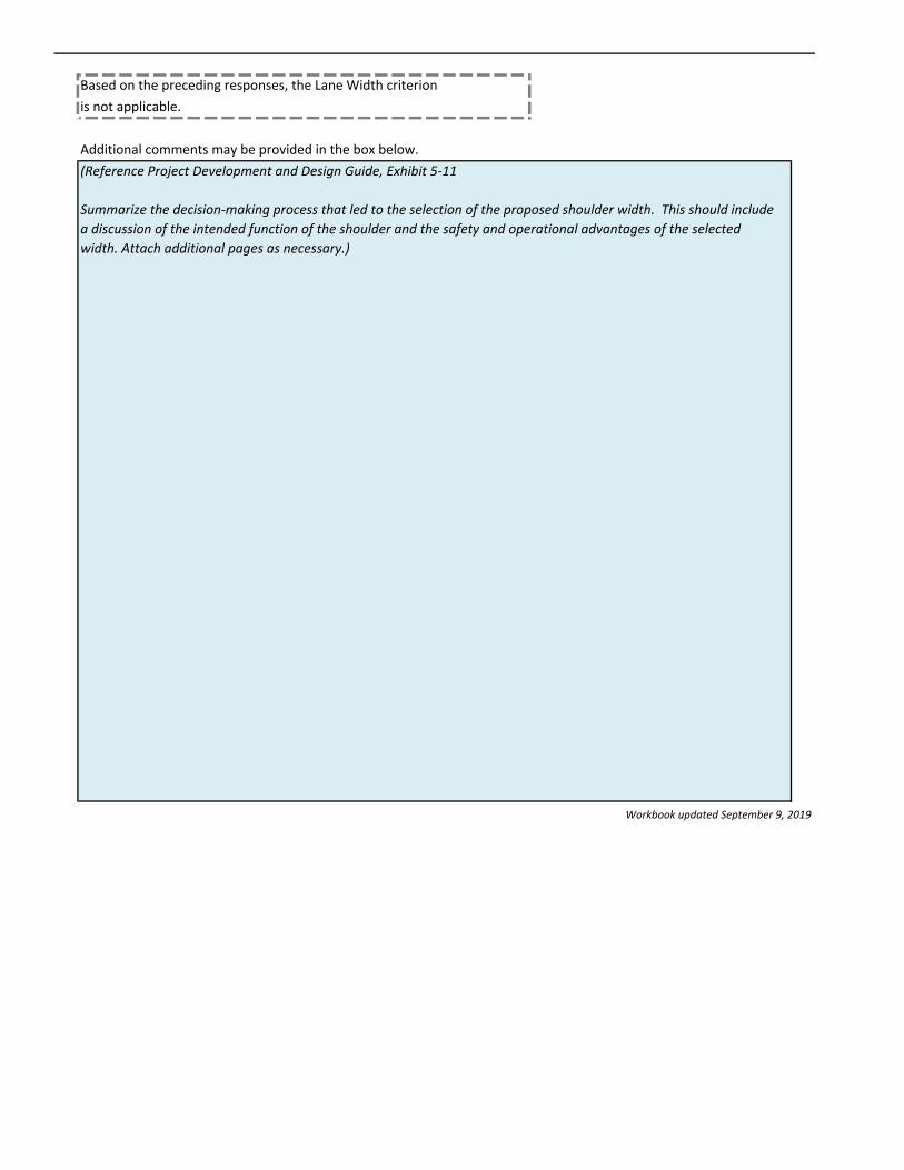
Based on the preceding responses, the Lane Width criterion
is not applicable.
Additional comments may be provided in the box below.
Workbook updated September 9, 2019
Criterion not applicable.
MassDOT Design Justification Workbook
Project: 608940 Weston - Route 20 / Wellesley Street
LANE WIDTH
(Reference Project Development and Design Guide, Exhibit 5-14.
Summarize the decision-making process that led to the selection of the proposed lane width. This should include a
discussion of alternatives evaluated to ensure the project meets the intended purpose/need, while minimizing or
mitigating associated impacts to the maximum extent feasible. The evaluation may include an incremental
comparison of costs, design impacts, etc. Attach additional pages as necessary.)
Route 20
MassDOT PDDG, Exhibit 5-14
(Attach additional sheets as necessary.)
FT11.0FT11.0
12.0 FT
Description:
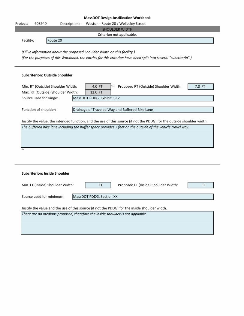
Facility:
(Fill in information about the proposed Shoulder Width on this facility.)
(For the purposes of this Workbook, the entries for this criterion have been split into several "subcriteria".)
Subcriterion: Outside Shoulder
Min. RT (Outside) Shoulder Width: (1) Proposed RT (Outside) Shoulder Width:
Max. RT (Outside) Shoulder Width:
Source used for range:
Function of shoulder:
Justify the value, the intended function, and the use of this source (if not the PDDG) for the outside shoulder width.
(1)
Alo
Subcriterion: Inside Shoulder
Min. LT (Inside) Shoulder Width: Proposed LT (Inside) Shoulder Width:
Source used for minimum:
Justify the value and the use of this source (if not the PDDG) for the inside shoulder width.
MassDOT PDDG, Exhibit 5-12
MassDOT Design Justification Workbook
Project: 608940 Weston - Route 20 / Wellesley Street
SHOULDER WIDTH
Criterion not applicable.
Route 20
4.0 FT 7.0 FT
12.0 FT
Drainage of Traveled Way and Buffered Bike Lane
FT FT
MassDOT PDDG, Section XX
There are no medians proposed, therefore the inside shoulder is not appliable.
The buffered bike lane including the buffer space provides 7 feet on the outside of the vehicle travel way.
Based on the preceding responses, the Lane Width criterion
is not applicable.
Additional comments may be provided in the box below.
Workbook updated September 9, 2019
(Reference Project Development and Design Guide, Exhibit 5-11
Summarize the decision-making process that led to the selection of the proposed shoulder width. This should include
a discussion of the intended function of the shoulder and the safety and operational advantages of the selected
width. Attach additional pages as necessary.)

Description:
Facility:
If there are no horizontal curves in the project, check this box and do not fill out this sheet.
(Fill in information about the proposed horizontal curvature on this facility.)
Min. Horizontal Curve Radius FT Proposed Horizontal Curve Radius FT
(If there are multiple curves, provide the smallest radius used and attach the alignment report.)
Source used for minimum:
Justify use of this source for the horizontal curve radius.
Based on the preceding responses, the Curve Radius criterion
is not applicable.
Additional comments may be provided in the box below.
Workbook updated September 9, 2019
Criterion not applicable.
MassDOT Design Justification Workbook
Project: 608940 Weston - Route 20 / Wellesley Street
HORIZONTAL CURVE RADIUS
(Reference Project Development and Design Guide, Exhibits 4-8 and 4-9.
If an alignment report is provided, note that here.
For compound curves, the radius of the tighter curve should be no less than 50% of the radius of the flatter curve.
Summarize the decision-making process that led to the selection of the proposed horizontal curve radius. This should
include a discussion of alternatives evaluated to ensure the project meets the intended purpose/need, while
minimizing or mitigating associated impacts to the maximum extent feasible. The evaluation may include an
incremental comparison of costs, design impacts, etc. Attach additional pages as necessary.)
(Attach additional sheets as necessary.)
800.0765
Route 20
MassDOT PDDG, Section 4.2.4, Exhibit 4-9

Description:
Facility:
If there are no superelevated curves in the project, check this box and do not fill out this sheet.
(Fill in information about the proposed Superelevation Rate on this facility.)
Maximum Superelevation Rate: % Proposed Superelevation Rate: %
(If there are multiple superelevated curves, provide the largest rate used and attach the alignment report.)
Source used for minimum:
Justify use of this source for the superelevation rate.
Based on the preceding responses, the Superelevation criterion
is not applicable.
Additional comments may be provided in the box below.
Workbook updated September 9, 2019
(Reference Project Development and Design Guide, Section 4.2. Check required values for superelevation rates,
transitioning, runoff, banking, etc. for all lanes and shoulders.
If an alignment report is provided, note that here.
Summarize the decision-making process that led to the selection of the proposed superelevation rate. This should
include a discussion of alternatives evaluated to ensure the project meets the intended purpose/need, while
minimizing or mitigating associated impacts to the maximum extent feasible. The evaluation may include an
incremental comparison of costs, design impacts, etc. Attach additional pages as necessary.)
MassDOT Design Justification Workbook
Project: 608940 Weston - Route 20 / Wellesley Street
SUPERELEVATION RATE
There is existing superelevation along Route 20 near the easterly limit of the proposed project. The pavement in this
area is a proposed mill and overlay. The existing superelevation will be retained.
Criterion not applicable.
Route 20
5 5.0
MassDOT PDDG, Section 4.2.4, Exhibit 4-8

Description:
Facility:
(Fill in information about the proposed SSD on this facility.)
(For the purposes of this Workbook, the entries for this criterion have been split into several "subcriteria".)
Subcriterion: SSD
Minimum SSD: FT Proposed SSD: FT
Source used for minimum:
Justify the use of this source for the stopping sight distance.
Subcriterion: SSD Middle Ordinate
Minimum SSD: 305.0 FT Proposed SSD: 461.9 FT
(If the middle ordinate is not applicable, leave blank.)
Source used for minimum:
Justify use of this source for the SSD middle ordinate.
Route 20
MassDOT PDDG, Section 3.7.1.1, Exhibit 3-8
MassDOT Design Justification Workbook
Project: 608940 Weston - Route 20 / Wellesley Street
STOPPING SIGHT DISTANCE
Criterion not applicable.
MassDOT PDDG, Section 4.2.2
(Attach additional sheets as necessary.)
305.0 461.9
(Attach additional sheets as necessary.)

Based on the preceding responses, the SSD criterion
is not applicable.
Additional comments may be provided in the box below.
Workbook updated September 9, 2019
(Reference Project Development and Design Guide: Exhibit 3-8, Section 3.7, and Exhibit 4-5 (for sight distance on a curve).
Summarize the decision-making process that led to the selection of the proposed superelevation rate. This should include
a discussion of alternatives evaluated to ensure the project meets the intended purpose/need, while minimizing or
mitigating associated impacts to the maximum extent feasible. The evaluation may include an incremental comparison of
costs, design impacts, etc. Attach additional pages as necessary.)

Description:
Facility:
(Fill in information about the proposed grade on this facility.)
Maximum Grade: % Proposed Grade: %
(Where the grade varies, provide the maximum value used.)
Source used for minimum:
Justify use of this source for the grade.
Based on the preceding responses, the maximum grade criterion
is not applicable.
Additional comments may be provided in the box below.
Workbook updated September 9, 2019
(Reference Project Development and Design Guide, Exhibit 4-21.
Summarize the decision-making process that led to the selection of the proposed superelevation rate. This should
include a discussion of alternatives evaluated to ensure the project meets the intended purpose/need, while
minimizing or mitigating associated impacts to the maximum extent feasible. The evaluation may include an
incremental comparison of costs, design impacts, etc. Attach additional pages as necessary.)
MassDOT Design Justification Workbook
Project: 608940 Weston - Route 20 / Wellesley Street
MAXIMUM GRADE
(Attach additional sheets as necessary.)
Criterion not applicable.
Route 20
7 2.5
MassDOT PDDG, Section 4.3.1, Exhibit 4-21

Description:
Facility:
(Fill in information about the proposed roadway cross slope on this facility.)
Proposed surface:
Maximum Cross Slope (HMA): % Proposed Cross Slope: %
Maximum Cross Slope (Conc): % (Where the grade varies, provide the maximum value used.)
Source used for minimum:
Justify use of this source for the cross slope.
Based on the preceding responses, the cross slope criterion Standard not met.
is not applicable.
Additional comments may be provided in the box below.
Workbook updated September 9, 2019
Criterion not applicable.
MassDOT Design Justification Workbook
Project: 608940 Weston - Route 20 / Wellesley Street
CROSS SLOPE
Existing cross slope of the roadway (Route 20) varies. At the easterly project limit, Route 20 is superelevated and the
cross slope varies between 2% and 5%. On Route 20, west of Boston Post Road, the existing cross slope is generally
3%. There is also a small area of flood plain that crosses Route 20 west of Boston Post Road. Give that the proposed
pavement treatment is mill and overlay and the desire to minimize any filling within the flood plain, the cross slope is
proposed to match the existing cross slope, which is 3% west of Wellesley Street and varies up to 5% east of Wellesley
Street to match the existing cross slope within the superelevated area.
Route 20
2.0 2 to 5
MassDOT PDDG, Section 5.5.2
Route 20 is controlled by MassDOT and therefore it is approriate to use the Project Development Design Guide to
establish design criteria.
1.6
HMA
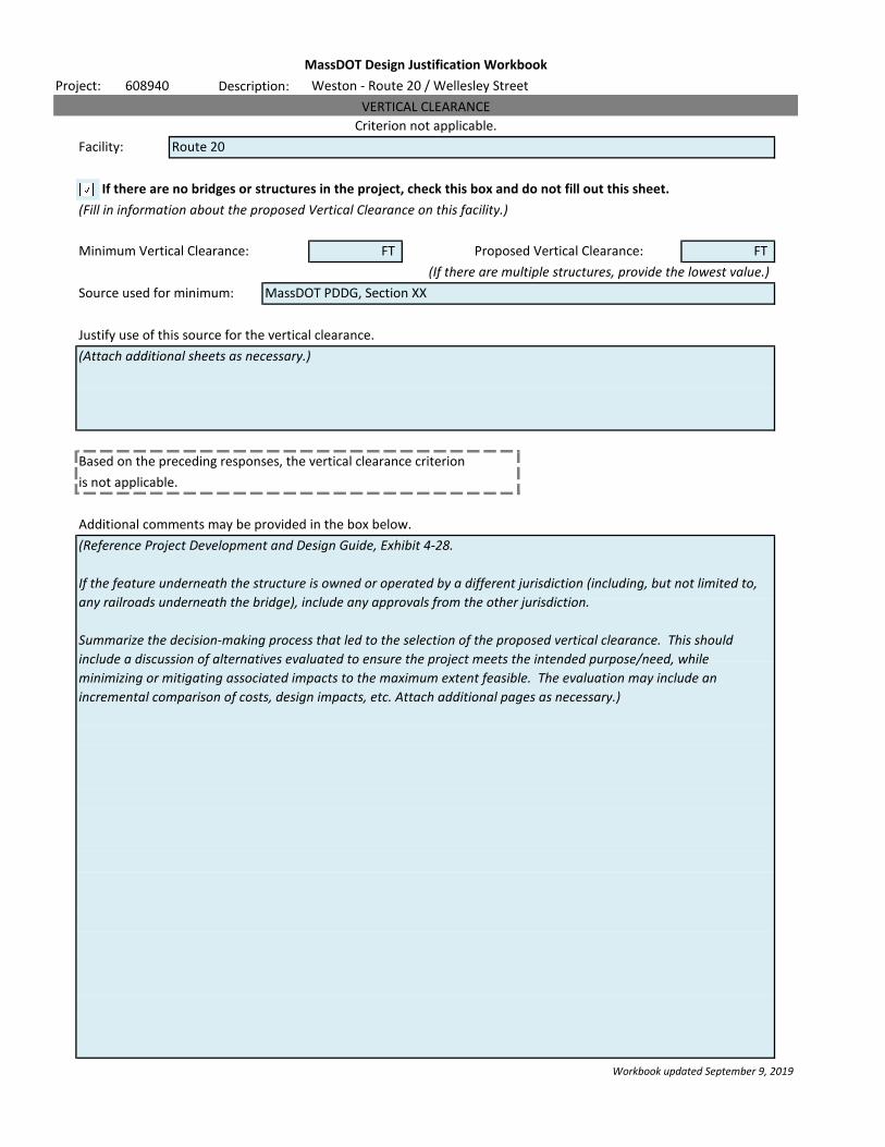
Description:
Facility:
If there are no bridges or structures in the project, check this box and do not fill out this sheet.
(Fill in information about the proposed Vertical Clearance on this facility.)
Minimum Vertical Clearance: FT Proposed Vertical Clearance: FT
(If there are multiple structures, provide the lowest value.)
Source used for minimum:
Justify use of this source for the vertical clearance.
Based on the preceding responses, the vertical clearance criterion
is not applicable.
Additional comments may be provided in the box below.
Workbook updated September 9, 2019
(Reference Project Development and Design Guide, Exhibit 4-28.
If the feature underneath the structure is owned or operated by a different jurisdiction (including, but not limited to,
any railroads underneath the bridge), include any approvals from the other jurisdiction.
Summarize the decision-making process that led to the selection of the proposed vertical clearance. This should
include a discussion of alternatives evaluated to ensure the project meets the intended purpose/need, while
minimizing or mitigating associated impacts to the maximum extent feasible. The evaluation may include an
incremental comparison of costs, design impacts, etc. Attach additional pages as necessary.)
MassDOT Design Justification Workbook
Project: 608940 Weston - Route 20 / Wellesley Street
VERTICAL CLEARANCE
(Attach additional sheets as necessary.)
Criterion not applicable.
Route 20
MassDOT PDDG, Section XX
Related Documents