Deepwater Oil Exploration in the Gulf of Mexico A Spatial Model Provides Clues for Undiscovered Potential Rafael Sandrea Peter Stark July 2020

Welcome message from author
This document is posted to help you gain knowledge. Please leave a comment to let me know what you think about it! Share it to your friends and learn new things together.
Transcript
Deepwater Oil Exploration in the Gulf of MexicoA Spatial Model Provides Clues for Undiscovered Potential
Rafael SandreaPeter Stark
July 2020
ABOUT THIS REPORT
Oil and gas development throughout the U.S. outer continental shelf (OCS) provides a large portion of the nation’s oil and gas supply. Oil and gas reservoirs are found under the sea in both state and federal lands offshore from Louisiana, Texas, California, and Alaska. However, it is the resources located in the Gulf of Mexico that have proved the most prolific. According to the Energy Information Administration, Gulf of Mexico federal offshore oil production accounts for 17% of total U.S. crude oil production. In calendar year 2019, the U.S. Department of Interior reported that bonus bids, rents, and royalties from offshore oil and development generated over $5 billion USD in revenues to the U.S. Treasury.
Authors Rafael Sandrea and Peter Stark bring long experience and unique expertise in evaluating the resource potential of geologic basins worldwide. Their paper on the isoOIP model demonstrates how simple and inexpensive decision support tools can continue to contribute to cost effective development of the nation’s oil and gas resources.
© Copyright 2020 Energy Policy Research Foundation, Inc. 1031 31st Street, NW Washington, DC 20007 ▶ +1 202.944.333 ▶ eprinc.org
ABOUT THE AUTHORS
Philip H. “Pete” Stark retired as Executive Director Upstream Research for IHS Markit during December 2017. Prior to joining IHS in 1969, Stark was an exploration geologist for Mobil Oil. Dr. Stark has authored papers on E&P databases, hydrocarbon shows, horizontal drilling, US natural gas, global oil and gas resources, global E&P trends, giant fields, and unconventional O&G. He co-authored IHS studies of North American gas supplies, unconventional gas supplies, North American and global tight oil, and global Super Basins.
Pete participated in the AAPG Resources Committee and AAPG-SPE and Hedberg oil and gas resource conferences. He also served on the AAPG Corporate Advisory Board and boards of the AAPG International Pavilion and PPDM. Previously, he was chairman of the Board of Visitors for the University of Wisconsin Department of Geology and Geophysics.
Dr. Stark holds a BSc in geology from the University of Oklahoma and MSc and PhD degrees in geology from the University of Wisconsin.
Rafael Sandrea is President of IPC Petroleum Consultants, Inc., a Tulsa based international petroleum consulting firm which specializes in oil and gas reserves appraisals and risk analysis for international upstream petroleum investments. He is very active giving Webinars, Masterclasses online, and speaking on the themes of reserves, IOR/EOR, shale oil and gas assessment, and global oil & gas supply, around the world.
Dr. Sandrea is a life-member of the SPE, and member of the UN Ad Hoc Group of Experts on Fossil Resources — Geneva. He has published over 40 technical papers covering areas such as risk analysis for international upstream petroleum investments; appraisal of global oil and gas reserves – conventional and unconventional; development of algorithms for estimating the production capacity of new oil and gas fields, for estimating the reserves of mature oil & gas fields; global offshore oil reserves potential; assessment of global oil and gas resources, and their potential for enhanced oil recovery – EOR. Together with Dr. Ralph Nielsen, he has published the book: “Dynamics of Petroleum Reservoirs under Gas Injection,” Gulf Publishing, which has been used in petroleum engineering schools worldwide. He recently co-authored the book: “Mexico-History of Oil Exploration,” PennWellBooks.com, Sept. 2018. He is a member of the Penn Energy Research Emissary expert marketplace program: [email protected].
He holds a PhD in petroleum engineering from Penn State University.
ABOUT EPRINC
The Energy Policy Research Foundation, Inc. (EPRINC) was founded in 1944 and is a not-for-profit, non-partisan organization that studies energy economics and government policy initiatives with special emphasis on oil, natural gas, and petroleum product markets. EPRINC is routinely called upon to testify before Congress as well to provide briefings for government officials and legislators. Its research and presentations are circulated widely without charge through posts on its website. EPRINC’s popular Embassy Series convenes periodic meetings and discussions with the Washington diplomatic community, industry experts, and policy makers on topical issues in energy policy.
EPRINC has been a source of expertise for numerous government studies, and both its chairman and president have participated in major assessments undertaken by the National Petroleum Council. In recent years, EPRINC has undertaken long-term assessments of the economic and strategic implications of the North American petroleum renaissance, reviews of the role of renewable fuels in the transportation sector, and evaluations of the economic contribution of petroleum infrastructure to the national economy. Most recently, EPRINC has been engaged on an assessment of the future of U.S. LNG exports to Asia and the growing importance of Mexico in sustaining the productivity and growth of the North American petroleum production platform.
EPRINC receives undirected research support from the private sector and foundations, and it has undertaken directed research from the U.S. government from both the U.S. Department of Energy and the U.S. Department of Defense. EPRINC publications can be found on its website: www.eprinc.org.
EPRINC Deepwater Oil Exploration in the Gulf of MexicoPage 1
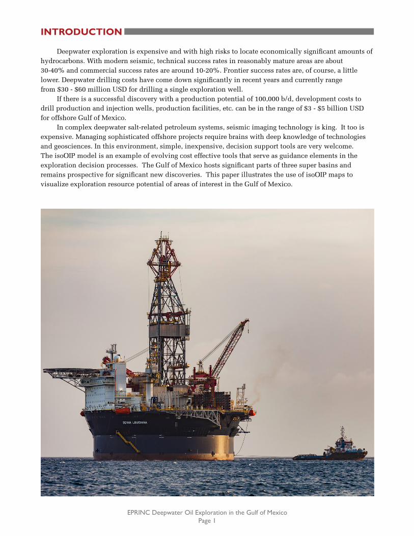
Deepwater exploration is expensive and with high risks to locate economically significant amounts of hydrocarbons. With modern seismic, technical success rates in reasonably mature areas are about 30-40% and commercial success rates are around 10-20%. Frontier success rates are, of course, a little lower. Deepwater drilling costs have come down significantly in recent years and currently range from $30 - $60 million USD for drilling a single exploration well.
If there is a successful discovery with a production potential of 100,000 b/d, development costs to drill production and injection wells, production facilities, etc. can be in the range of $3 - $5 billion USD for offshore Gulf of Mexico.
In complex deepwater salt-related petroleum systems, seismic imaging technology is king. It too is expensive. Managing sophisticated offshore projects require brains with deep knowledge of technologies and geosciences. In this environment, simple, inexpensive, decision support tools are very welcome. The isoOIP model is an example of evolving cost effective tools that serve as guidance elements in the exploration decision processes. The Gulf of Mexico hosts significant parts of three super basins and remains prospective for significant new discoveries. This paper illustrates the use of isoOIP maps to visualize exploration resource potential of areas of interest in the Gulf of Mexico.
INTRODUCTION
EPRINC Deepwater Oil Exploration in the Gulf of MexicoPage 2
OFFSHORE GULF OF MEXICO
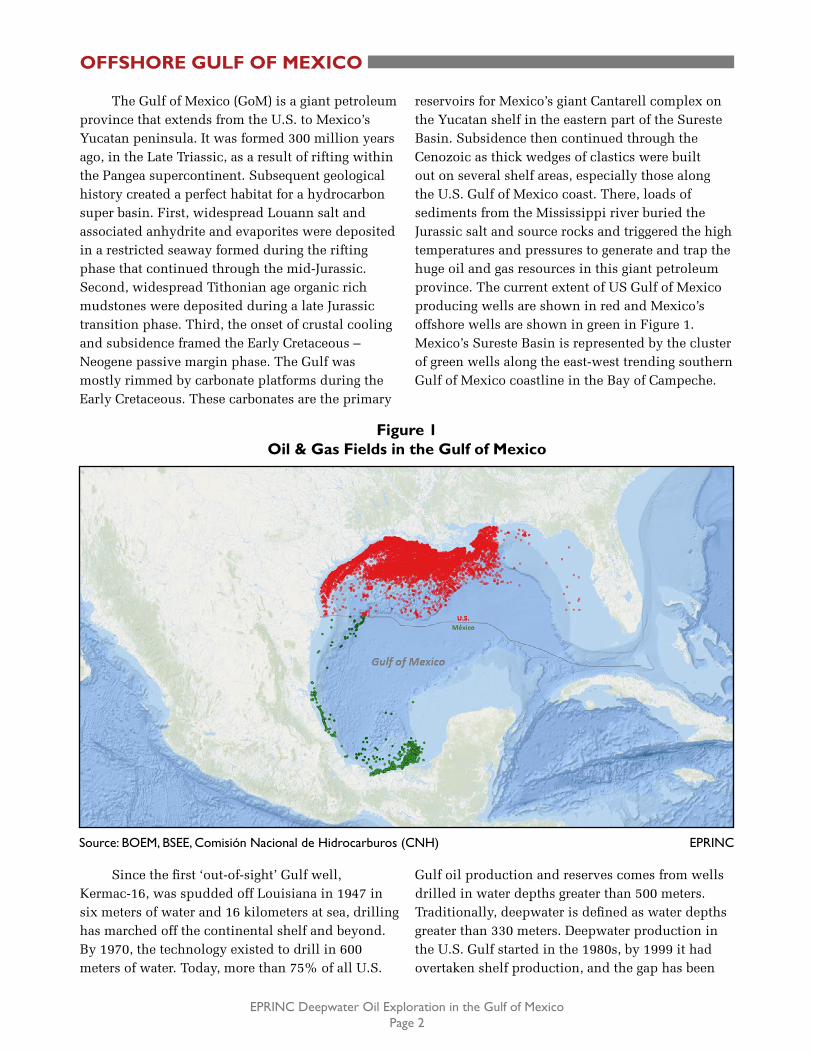
Figure 1Oil & Gas Fields in the Gulf of Mexico
Source: BOEM, BSEE, Comisión Nacional de Hidrocarburos (CNH) EPRINC
The Gulf of Mexico (GoM) is a giant petroleum province that extends from the U.S. to Mexico’s Yucatan peninsula. It was formed 300 million years ago, in the Late Triassic, as a result of rifting within the Pangea supercontinent. Subsequent geological history created a perfect habitat for a hydrocarbon super basin. First, widespread Louann salt and associated anhydrite and evaporites were deposited in a restricted seaway formed during the rifting phase that continued through the mid-Jurassic. Second, widespread Tithonian age organic rich mudstones were deposited during a late Jurassic transition phase. Third, the onset of crustal cooling and subsidence framed the Early Cretaceous – Neogene passive margin phase. The Gulf was mostly rimmed by carbonate platforms during the Early Cretaceous. These carbonates are the primary
reservoirs for Mexico’s giant Cantarell complex on the Yucatan shelf in the eastern part of the Sureste Basin. Subsidence then continued through the Cenozoic as thick wedges of clastics were built out on several shelf areas, especially those along the U.S. Gulf of Mexico coast. There, loads of sediments from the Mississippi river buried the Jurassic salt and source rocks and triggered the high temperatures and pressures to generate and trap the huge oil and gas resources in this giant petroleum province. The current extent of US Gulf of Mexico producing wells are shown in red and Mexico’s offshore wells are shown in green in Figure 1. Mexico’s Sureste Basin is represented by the cluster of green wells along the east-west trending southern Gulf of Mexico coastline in the Bay of Campeche.
Since the first ‘out-of-sight’ Gulf well, Kermac-16, was spudded off Louisiana in 1947 in six meters of water and 16 kilometers at sea, drilling has marched off the continental shelf and beyond. By 1970, the technology existed to drill in 600 meters of water. Today, more than 75% of all U.S.
Gulf oil production and reserves comes from wells drilled in water depths greater than 500 meters. Traditionally, deepwater is defined as water depths greater than 330 meters. Deepwater production in the U.S. Gulf started in the 1980s, by 1999 it had overtaken shelf production, and the gap has been
EPRINC Deepwater Oil Exploration in the Gulf of MexicoPage 3
OFFSHORE GULF OF MEXICO
growing ever since. Today deepwater accounts for more than 95% of total U.S. Gulf production. Some 55,000 wells have been drilled across the entire Gulf of Mexico. The deepest water depth in which a discovery has been made is 3,040 meters at Lloyd Ridge 370 in 2008. The challenges of deep drilling are formidable as experienced with the Macondo blowout in 2010. High pressures and temperatures (HPHT) complicate drilling and platform technologies.
U.S. Gulf oil is deep and essentially all is Tertiary in age. The only exception being the Shell/CNOOC Appomattox field located 130 kilometers offshore Louisiana in 2,250 meters of water. This field went on production in 2019, first production ever from a Jurassic reservoir in the U.S. Gulf. Most of the U.S. Gulf oil lies in federal waters which begin approximately 17 kilometers seaward of the states’ coastline. The federal offshore has been divided into three areas: the western Gulf includes offshore Texas, the central Gulf includes offshore Louisiana, Mississippi, and Alabama, and the eastern Gulf covers the Gulf Coast Florida. The eastern Gulf has never been a petroleum-producing area.
According to the BOEM 2019-026 report which covers federal waters, the central Gulf accounts for 95% of the total 24 billion barrels of oil reserves discovered so far in the three areas. Almost 20.7 billion barrels of these reserves have already been produced, leaving about two billion barrels of remaining reserves. Production is about 650 million barrels per year even though discoveries decreased after years of reduced activity following the Macondo incident. Exploration is at a critical crossroads. Oil has driven the economy of the U.S. Gulf Coast for the past half century and accounts for 16 % of total U.S. crude oil production.
Mexico’s Gulf had its startup in 1959 with its first discovery, the Santa Ana field in the Sureste superbasin in 10 meters of water. This discovery was small, the well was abandoned and offshore exploration efforts cooled off. But it was the 1976 Chac discovery, a world-class oil field located 80 kilometers offshore Yucatan in water depths of 50 meters, that fueled Mexico’s explorers. Chac opened a new major carbonate producing province: Cantarell. The following year the supergiant
Akal field (56 billion barrels of oil-in-place) was discovered in Cantarell in 60 meters of water. By the end of 1980, four more giant fields were discovered: Ku, Maloob, Zaap, and Abkatun in water depths of 100 meters. It was a fiesta of discoveries all in the Campeche Sound of the Sureste basin.
During 1999, Mexico’s first deepwater well, Chuktah-201, was drilled in 400 meters of water, also in the Campeche area. The well reached the Tertiary at 1,400 meters but was dry. Mexico then turned its eyes beyond Campeche towards the Perdido Fold Belt in the western Gulf of Mexico, bordering the U.S. Gulf. Between 2000 and 2018, a total of 28 deepwater wells were drilled in water depths up between 600 - 2,968 meters targeting the Tertiary and salt-related prospects. Five wells resulted in oil discoveries, 10 in gas, and the rest were dry. The Trion field, located in 2,564 meters of water, was the first successful oil discovery under this new strategy. First production at Trion is targeted for 2024. The Perdido Fold Belt is estimated to have 3.1 Bboe of prospective resources but significant production volumes may be delayed if low oil and gas prices persist.
Overall, in the offshore Sureste super basin some 34 billion barrels of oil reserves have been discovered in 109 oil fields including 11 giants. The Zama field, a 2017 Tertiary discovery in water depths of 165 meters, was the first giant oil field discovered since the 1980s. Its importance lies in that it provided new insights for offshore Tertiary exploration in Mexico’s Gulf. It has the same rich Tithonian oil-prone source rock, a salt canopy, and other geological similarities with the Tertiary in the U.S. Gulf. Until now, naturally fractured carbonate reservoirs of Cretaceous and Jurassic age account for almost 97% of Mexico’s oil production while Tertiary sandstones are the predominant gas reservoirs. Mexico has produced to date 45 billion barrels of oil including 26 billion barrels offshore and has only 6.4 billion barrels of remaining reserves. Current production is about 610 million barrels per year, of which 80% comes from offshore. Exploration is a high priority and deepwater Tertiary is the main goal. In fact, 90% of Mexico’s portion of its Gulf of Mexico province remains unexplored.
continued
EPRINC Deepwater Oil Exploration in the Gulf of MexicoPage 4
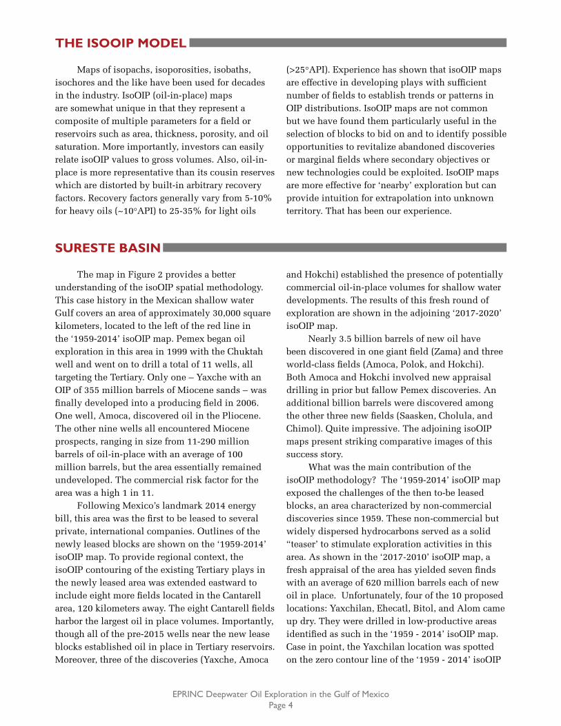
THE ISOOIP MODEL
Maps of isopachs, isoporosities, isobaths, isochores and the like have been used for decades in the industry. IsoOIP (oil-in-place) maps are somewhat unique in that they represent a composite of multiple parameters for a field or reservoirs such as area, thickness, porosity, and oil saturation. More importantly, investors can easily relate isoOIP values to gross volumes. Also, oil-in-place is more representative than its cousin reserves which are distorted by built-in arbitrary recovery factors. Recovery factors generally vary from 5-10% for heavy oils (~10°API) to 25-35% for light oils
(>25°API). Experience has shown that isoOIP maps are effective in developing plays with sufficient number of fields to establish trends or patterns in OIP distributions. IsoOIP maps are not common but we have found them particularly useful in the selection of blocks to bid on and to identify possible opportunities to revitalize abandoned discoveries or marginal fields where secondary objectives or new technologies could be exploited. IsoOIP maps are more effective for ‘nearby’ exploration but can provide intuition for extrapolation into unknown territory. That has been our experience.
SURESTE BASIN
The map in Figure 2 provides a better understanding of the isoOIP spatial methodology. This case history in the Mexican shallow water Gulf covers an area of approximately 30,000 square kilometers, located to the left of the red line in the ‘1959-2014’ isoOIP map. Pemex began oil exploration in this area in 1999 with the Chuktah well and went on to drill a total of 11 wells, all targeting the Tertiary. Only one – Yaxche with an OIP of 355 million barrels of Miocene sands – was finally developed into a producing field in 2006. One well, Amoca, discovered oil in the Pliocene. The other nine wells all encountered Miocene prospects, ranging in size from 11-290 million barrels of oil-in-place with an average of 100 million barrels, but the area essentially remained undeveloped. The commercial risk factor for the area was a high 1 in 11.
Following Mexico’s landmark 2014 energy bill, this area was the first to be leased to several private, international companies. Outlines of the newly leased blocks are shown on the ‘1959-2014’ isoOIP map. To provide regional context, the isoOIP contouring of the existing Tertiary plays in the newly leased area was extended eastward to include eight more fields located in the Cantarell area, 120 kilometers away. The eight Cantarell fields harbor the largest oil in place volumes. Importantly, though all of the pre-2015 wells near the new lease blocks established oil in place in Tertiary reservoirs. Moreover, three of the discoveries (Yaxche, Amoca
and Hokchi) established the presence of potentially commercial oil-in-place volumes for shallow water developments. The results of this fresh round of exploration are shown in the adjoining ‘2017-2020’ isoOIP map.
Nearly 3.5 billion barrels of new oil have been discovered in one giant field (Zama) and three world-class fields (Amoca, Polok, and Hokchi). Both Amoca and Hokchi involved new appraisal drilling in prior but fallow Pemex discoveries. An additional billion barrels were discovered among the other three new fields (Saasken, Cholula, and Chimol). Quite impressive. The adjoining isoOIP maps present striking comparative images of this success story.
What was the main contribution of the isoOIP methodology? The ‘1959-2014’ isoOIP map exposed the challenges of the then to-be leased blocks, an area characterized by non-commercial discoveries since 1959. These non-commercial but widely dispersed hydrocarbons served as a solid “teaser’ to stimulate exploration activities in this area. As shown in the ‘2017-2010’ isoOIP map, a fresh appraisal of the area has yielded seven finds with an average of 620 million barrels each of new oil in place. Unfortunately, four of the 10 proposed locations: Yaxchilan, Ehecatl, Bitol, and Alom came up dry. They were drilled in low-productive areas identified as such in the ‘1959 - 2014’ isoOIP map. Case in point, the Yaxchilan location was spotted on the zero contour line of the ‘1959 - 2014’ isoOIP

EPRINC Deepwater Oil Exploration in the Gulf of MexicoPage 5
SURESTE BASIN
map and, in reality, came up empty. The new explorationists clearly could have benefitted from the early and periodic updates to isoOIP images of
the area. On the other hand, they certainly asserted their skills with seven important discoveries. That is the essence of exploration.
continued
Figure 2IsoOIP Images of Tertiary Plays in the First Leased Area in Mexico’s Gulf of Mexico: 2014 (million barrels of oil)
1959-2014
Source: Comisión Nacional de Hidrocarburos (CNH) EPRINC
2017-2020

EPRINC Deepwater Oil Exploration in the Gulf of MexicoPage 6
U.S. DEEPWATER GULF
Let us now take a cursory look at the southern portion of the federal U.S. Gulf which hosts a number of ultra-deepwater (water depths greater than 1,660 meters) oil fields. Figure 3 illustrates the isoOIP map of a sample of 26 major fields extending east-west over 800 kilometers, as well as six ultra-deepwater wells drilled in the Perdido Corridor of Mexico’s Gulf. The criteria for selecting the sample fields were world-class fields (with OIP values greater than 800 million barrels), with a good spread across the area, and availability of public data.
The isoOIP map includes other valuable information such as the 3,000-meter isobath of the
entire Gulf and the U.S./Mexico border line. Four important remote wildcat wells in the southern part of Mexican Gulf province also are posted. Two, the Chibu-1 and Yaxchilan-1, are deepwater locations recently (2018-2020) drilled by international companies. The Puskon-1 well, drilled by Pemex during 2011 in 647 meters of water, is Mexico’s deepest deepwater well. It was abandoned at 7,700 meters after reporting Tertiary gas shows. All three targeted the Tertiary and came up empty. A third location, Max-1, also targeting the Tertiary, is about to be spudded at this writing.
Figure 3IsoOIP Images of the U.S /Mexico GoM Border Area:
Tertiary Plays (million barrels of oil)
The isoOIP contours frame a broad favorable area across the deepwater Gulf and distinguish three prominent highs over four giant oil fields: Tiber, Julia, and the duo Mars and Thunder Horse with an average OIP of 4,800 billion barrels. The Perdido Fold Belt is the only area on the map where the isoOIP values are less than one billion barrels. The OIP values decrease to the south into Mexico where Pemex made five discoveries before 2014. A sixth well, Etzil-1, was spudded this year (2020) and came up dry. One can imagine several potentially
attractive areas throughout the region covered but one needs to keep in mind that the isoOIP tool is not designed to identify prospects, but, in the best case, admonitions. It is just another of many techniques and tools used by explorationists, in combination with the fundamentals of geology and geophysics, to achieve success in a highly risky business. It is also a pragmatic tool when estimating the potential of undiscovered resources, especially in areas with unique constraints such as water depths, country borders, license areas and the like.
Source: BOEM, Company Press Reports, Comisión Nacional de Hidrocarburos (CNH). EPRINC

EPRINC Deepwater Oil Exploration in the Gulf of MexicoPage 7
CONCLUSION
In closing, deepwater exploration is tantamount with deep pockets. The isoOIP model is an interesting, low cost way to obtain a valuable first pass understanding of hydrocarbon potential in
areas of interest. Some of its features are highlighted in the offshore Gulf of Mexico examples that are presented in this paper.
REFERENCES
Estimated Oil and Gas Reserves, Gulf of Mexico OCS Region, BOEM 2019-026 Report, Dec. 31, 2017. www.boem.gov/sites/default/files/oil-and-gas-energy-program/Resource-Evaluation/Reserves-Inventory/BOEM-2019-026.pdf
Ivan Sandrea et al, Mexico, History of Oil Exploration, PennWell, 2018.
Rafael Sandrea, Understanding the Challenges to Mexico’s Oil & Gas Future, EPRINC, July 2019. Eprinc.org.
Huge Potential Still Waiting in the Gulf of Mexico, GEO ExPro report, September 2006.
ACKNOWLEDGEMENTS
Particular thanks to Ivan Sandrea for his valuable time and contributions, and to Athenea
Castillo who provided the outstanding graphics.
Related Documents