Decoding Glaciers on Topographic Maps

Welcome message from author
This document is posted to help you gain knowledge. Please leave a comment to let me know what you think about it! Share it to your friends and learn new things together.
Transcript
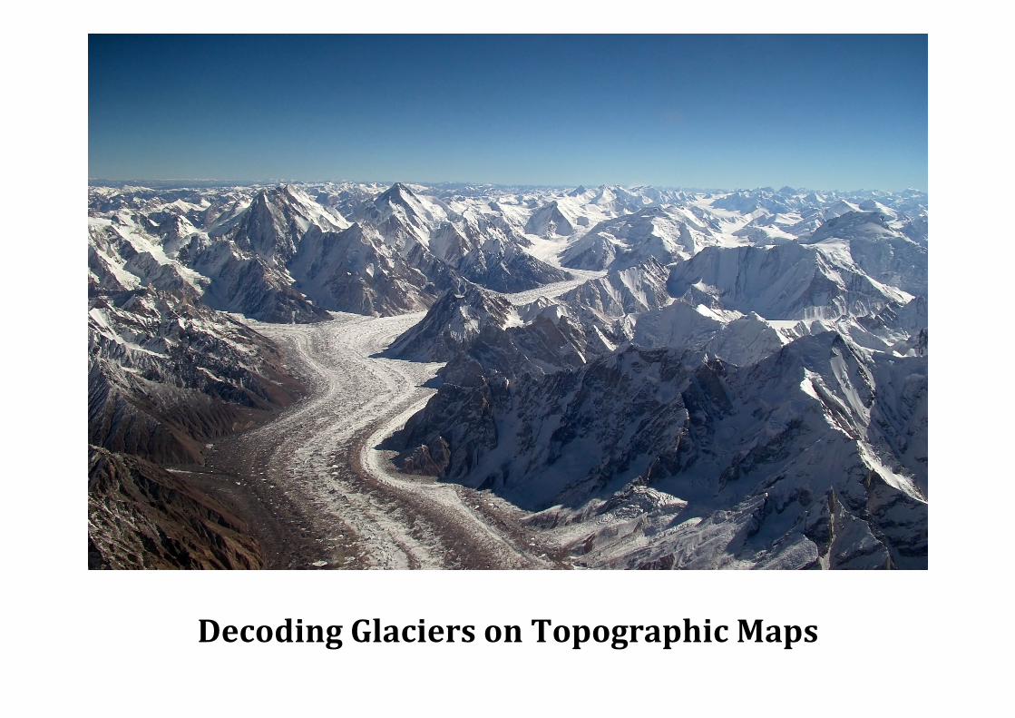
Decoding Glaciers on Topographic Maps

A hanging valley is a tributary valley left higher than the floor of the main valley. It is left 'hanging' above the main U-shaped valley. A waterfall can often be seen spilling over the edge.
Truncated spurs are formed when glaciers move through the main valley and cut off mountain spurs. They are often rounded at the top but steep at the bottom.
Contours: Look for a glacial trough with a small valley “hanging” above it, often with a waterfall.
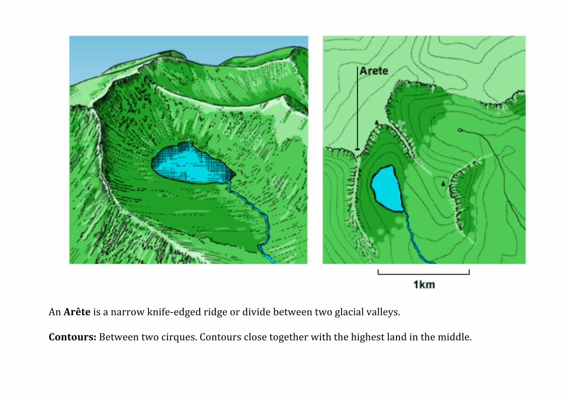
An Arête is a narrow knife-‐edged ridge or divide between two glacial valleys. Contours: Between two cirques. Contours close together with the highest land in the middle.
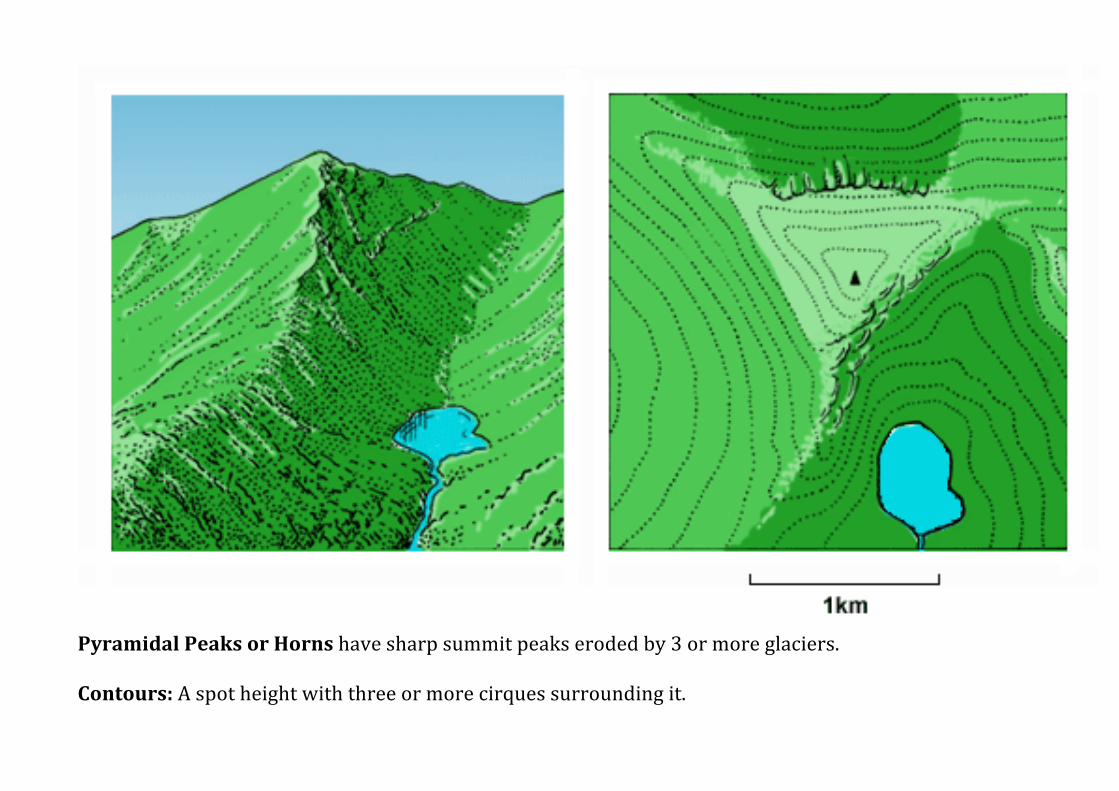
Pyramidal Peaks or Horns have sharp summit peaks eroded by 3 or more glaciers. Contours: A spot height with three or more cirques surrounding it.
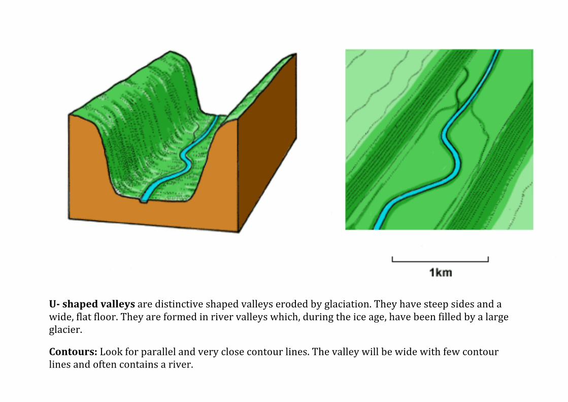
U-‐ shaped valleys are distinctive shaped valleys eroded by glaciation. They have steep sides and a wide, flat floor. They are formed in river valleys which, during the ice age, have been filled by a large glacier.
Contours: Look for parallel and very close contour lines. The valley will be wide with few contour lines and often contains a river.
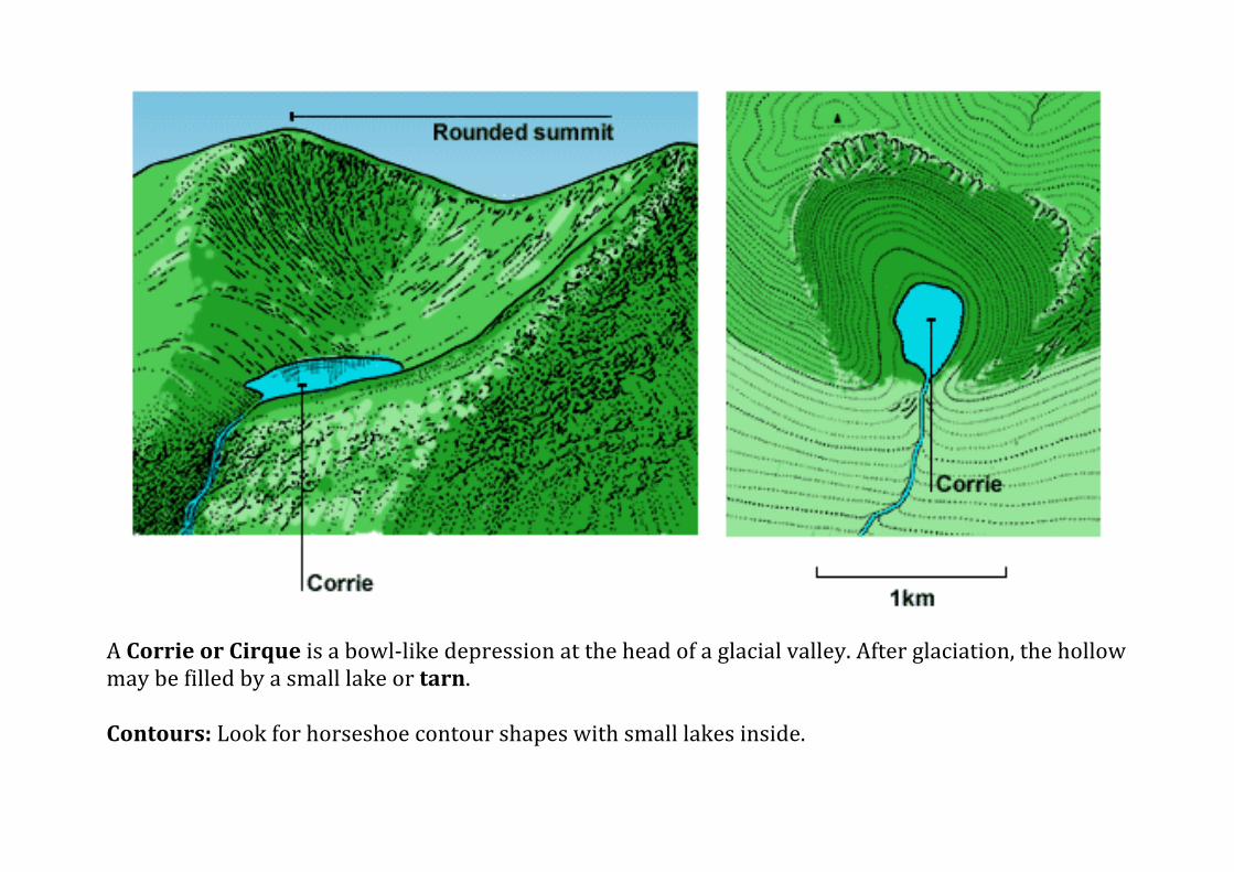
A Corrie or Cirque is a bowl-‐like depression at the head of a glacial valley. After glaciation, the hollow may be filled by a small lake or tarn. Contours: Look for horseshoe contour shapes with small lakes inside.
Related Documents