Dawes Arboretum Internship Luanne Hendricks Columbus State Community College GIS 290 Spring, 2004

Dawes Arboretum Internship Luanne Hendricks Columbus State Community College GIS 290 Spring, 2004.
Dec 15, 2015
Welcome message from author
This document is posted to help you gain knowledge. Please leave a comment to let me know what you think about it! Share it to your friends and learn new things together.
Transcript

Dawes Arboretum Internship
Luanne HendricksColumbus State Community College
GIS 290
Spring, 2004

Presentation Outline
• Arboretum Background/Overview
• GIS Overview/Requirements
• My Internship
• Observations/Learning

Arboretum Background
• Non Profit Foundation established 1929 by Dawes Family
• Mission
– promote study and appreciation of trees & shrubs
– foster scientific education in horticulture, natural history and Arboretum history
• Free and open to the public
Beman and Bertie Dawes ->

Arboretum Overview
• Plant collections cover 1600+ acres near Newark, Ohio
• Hiking Trails, Nature Center, Historic Structures, Bird Boxes
• Additional surrounding property owned
• 16,000+ labeled plants on grounds
• about 1,000 new plants added to collection each year
• about 500 plants removed from collection each year
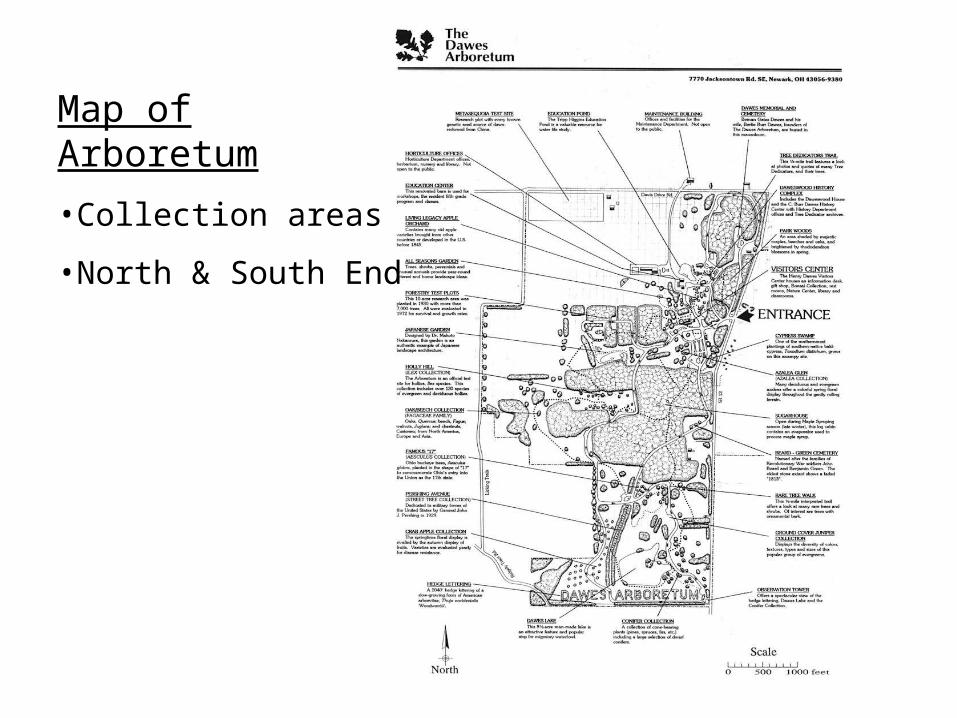
Map of Arboretum
•Collection areas
•North & South End

Arboretum GIS Overview
• Background/Requirements
• Applications
• Data
• Processes
• People Involved
• Software/Hardware
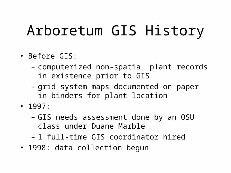
Arboretum GIS History
• Before GIS:
– computerized non-spatial plant records in existence prior to GIS
– grid system maps documented on paper in binders for plant location
• 1997:
– GIS needs assessment done by an OSU class under Duane Marble
– 1 full-time GIS coordinator hired
• 1998: data collection begun
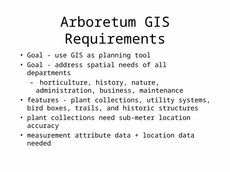
Arboretum GIS Requirements
• Goal - use GIS as planning tool
• Goal - address spatial needs of all departments
– horticulture, history, nature, administration, business, maintenance
• features - plant collections, utility systems, bird boxes, trails, and historic structures
• plant collections need sub-meter location accuracy
• measurement attribute data + location data needed
Arboretum GIS Current Status
• Original Data Collection being fine-tuned
• Data Collection maintenance
• Application Development and Analysis to come

Applications • Future
• Ability of staff & visitors to generate their own maps
– Plant collections, trails, etc.
– Utilities
• Analysis
– detect patterns in poor plant growth and analyze reasons
• And more…

Data• OrthoPhotos - 1998
• GPS data files
– differentially corrected location data
• Some location data obtained using surveyed control points
• Features
– Plant Attributes: Measurements, label-type, Accession Number, GridLocation
– Other Features - trails, trail markers, birdboxes, grid corner pins

Data - GPS Limitations• Canopied Environment
• Need line of sight to at least 4 satellites
• Multipath - signal will bounce off nearby objects (trees)
• Need differential correction for sub-meter accuracy
• Reference stations - Fish Hatchery, Miami U.
• Used post-processing

Processes
• GPS Data Collection Fine Tuning – Field Map Generation in ArcView– Field Checking - ensure data agrees with reality– Re-GPS work– Correcting/updating location & attribute data
• Ongoing Plant Addition & Removal Processes
People Involved
• GIS Coordinator
• GIS interns
• Plant Records Specialist
• Labeling Specialist
• Horticulture & Maintenance Staff
• Other departments - Nature, History
• Director & Board of Trustees

Software
• GIS Software
– Current - ArcView 3.2 / ArcGIS Desktop 8.3
– Planned - ArcGIS Desktop 9.0 + ArcReader & ArcPublisher
• Non-spatial Plant database - In House application built on FoxPro
– ArborbaseConnect - available to all staff via network
• GPS data processing software - Pathfinder 2.10
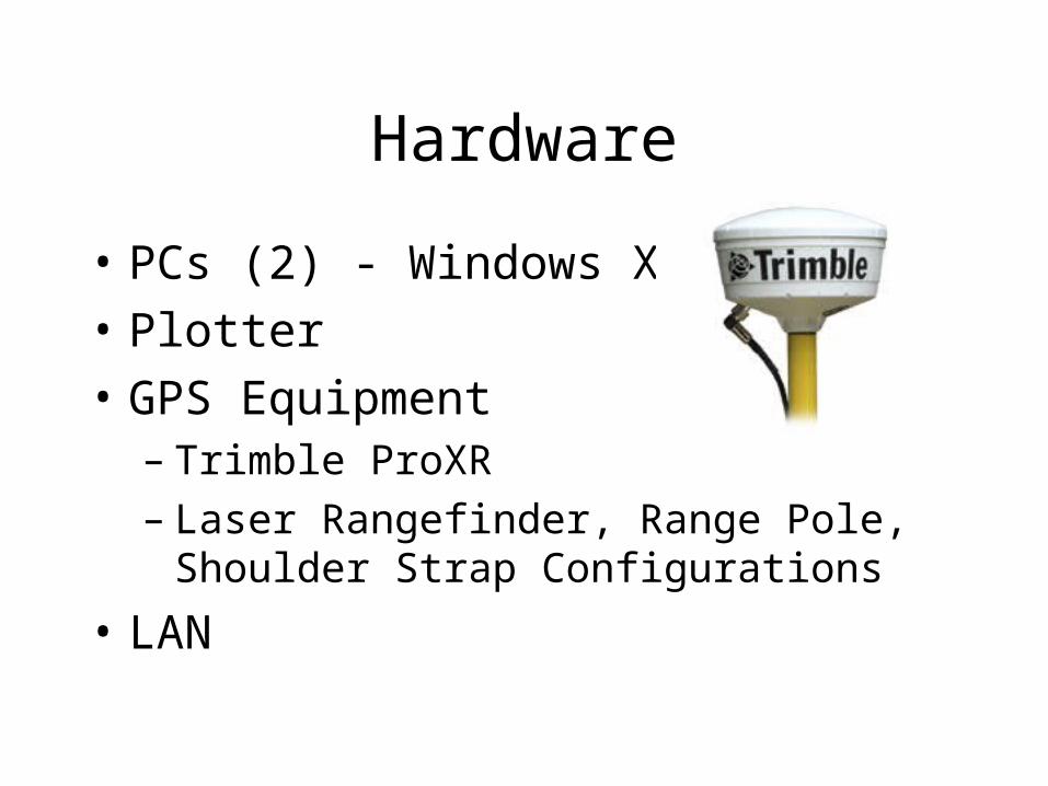
Hardware
• PCs (2) - Windows XP
• Plotter
• GPS Equipment – Trimble ProXR– Laser Rangefinder, Range Pole, Shoulder Strap
Configurations
• LAN

My Internship

Internship - Data Collection
• Learning the Grounds
• GPS – Setup/takedown, care of equipment
– Positioning equipment in the field; awareness of PDOP
– Rangepole - small plants, no canopy interference
– Rangefinder - tall plants, near canopy
– Shoulder Strap - polyline features - beds
• Plant Measurement – Height, Width, Canopy, Caliper, Dbh

Internship - Software Use
• Using ArcView 3.2 – making field maps– viewing Orthophoto for plant location
• Pathfinder 2.10– uploading GPS files from GPS data logger – editing files– generating an Almanac - SVs & PDOP– differential correction

Internship - Quality Control
• Field Checking - maps vs. plants on grounds– existence or non-existence of plants– existence/correctness of labels– positional accuracy
• Researching unknown plants– ArborbaseConnect, Binders, Planting Sheets,
Removal Sheets

Internship - Quality Control (2)
• Documenting file corrections– Verifying needed changes in non-spatial and
spatial records– Make records on paper documents of each GPS
file for each change– update the GPS file - change attributes or delete
feature

Internship - Miscellaneous
• Attended staff meeting
• Tour of surrounding Arboretum property
• Application development for Field Map Application

Observations/Learning• Quality Data is a huge investment
– Cost and limitations of technology– Training– Ongoing data maintenance
• Importance of appropriate accuracy requirements– Understanding tradeoffs - accuracy vs. cost– For example - a display garden such as Inniswood, with
annual beds instead of individual specimens, might not need this level of accuracy for mapping plant collections.
Related Documents