Impact on policy from three severe weather events in the Omaha area in June, 2008 Daniel Nietfeld – NOAA/NWS/WFO Omaha NE (and many other issues raised) Kansas City IWT Workshop: Using the WAS*IS Approach January 22, 2009

Daniel Nietfeld – NOAA/NWS/WFO Omaha NE Kansas City IWT Workshop: Using the WAS*IS Approach January 22, 2009.
Dec 14, 2015
Welcome message from author
This document is posted to help you gain knowledge. Please leave a comment to let me know what you think about it! Share it to your friends and learn new things together.
Transcript
Impact on policy from three severe weather events in the Omaha area in June, 2008
Daniel Nietfeld – NOAA/NWS/WFO Omaha NE
(and many other issues raised)
Kansas City IWT Workshop: Using the WAS*IS Approach January 22, 2009

Is this something you would want to be warned about? Would you expect the sirens to be blown?

What was that ? Did it seem dangerous, or even life-
threatening? Rear flank downdraft (straight-line
winds) Behind a tornadic supercell (Hallam, NE) What would be the best way to handle
this scenario with a warning, and any associated siren blowing ???
What would be a good polygon solution for this scenario ???
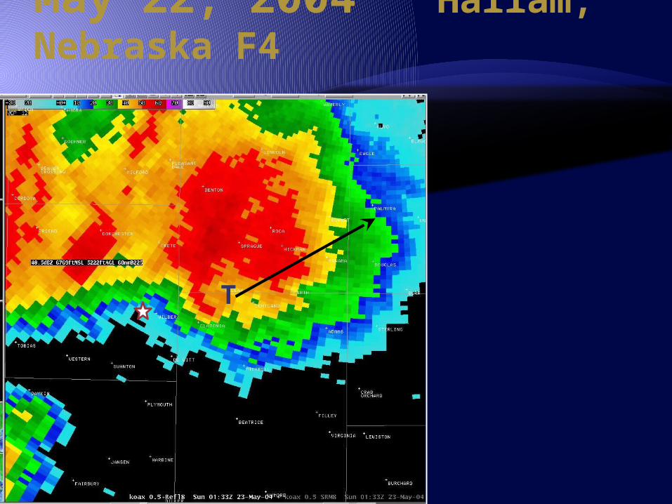
May 22, 2004 Hallam, Nebraska F4
T

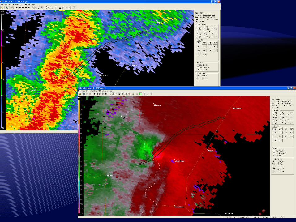
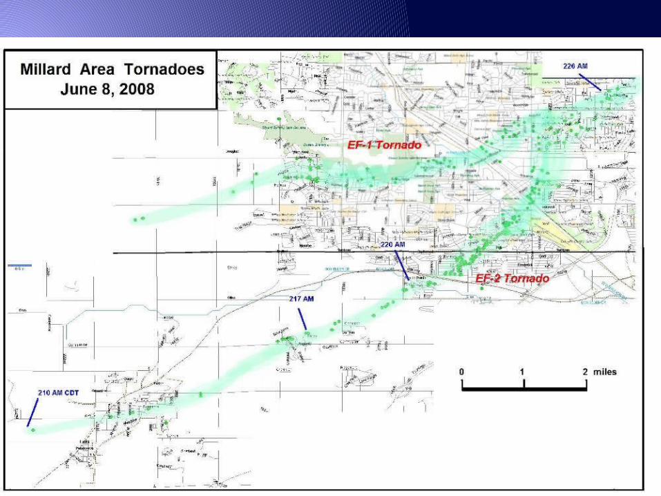
June 8 2008: Omaha, Nebraska(mid-morning)
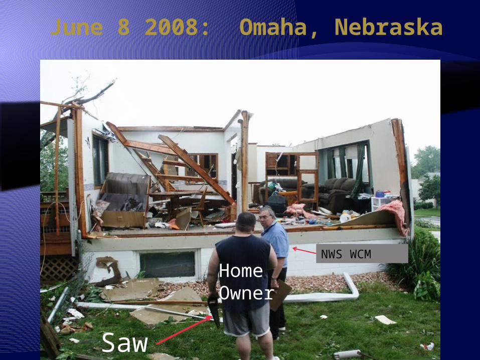
June 8 2008: Omaha, Nebraska
NWS WCM
Home Owner
Saw
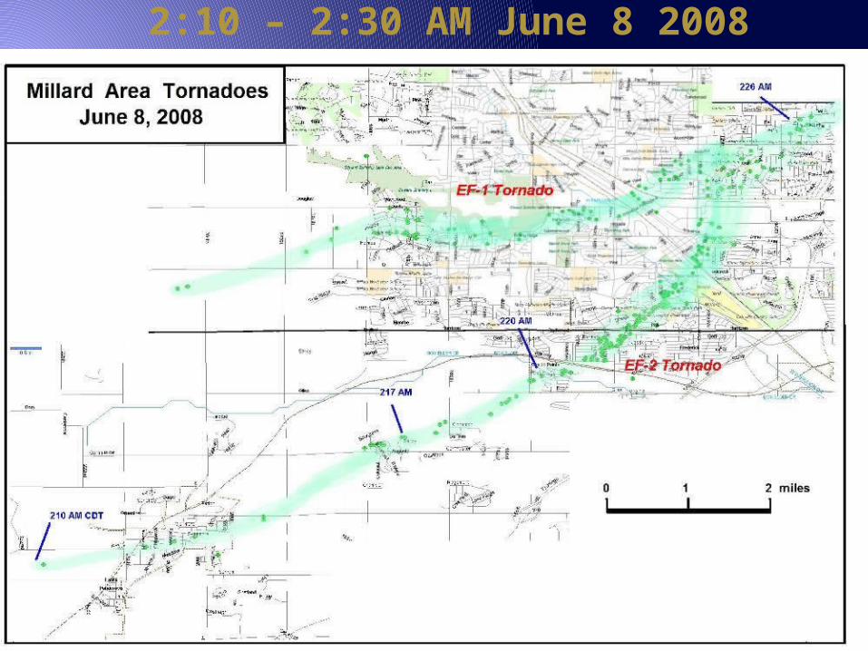
2:10 – 2:30 AM June 8 2008
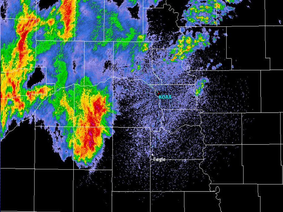

Storm-Relative Velocity
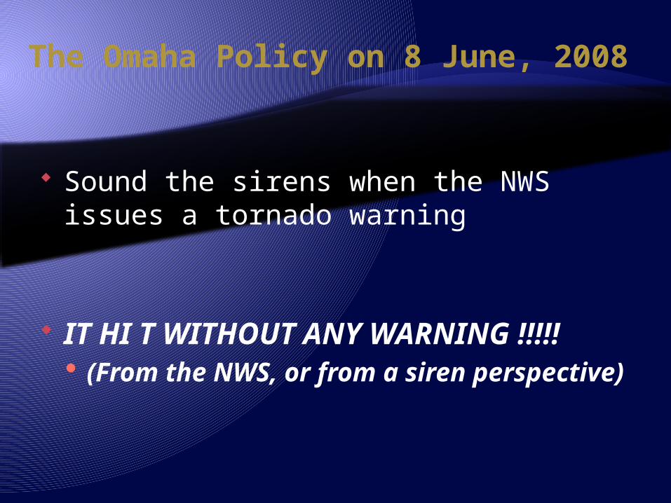
The Omaha Policy on 8 June, 2008
Sound the sirens when the NWS issues a tornado warning
IT HI T WITHOUT ANY WARNING !!!!! (From the NWS, or from a siren
perspective)

June 8 2008: Omaha, Nebraska
NWS WCM
Home Owner
Saw

The Aftermath of 8 June Significant outcry Meeting with the Mayor and Staff Press Conference 3 days of news coverage
Google “Omaha” “Tornadoes” “June 8”
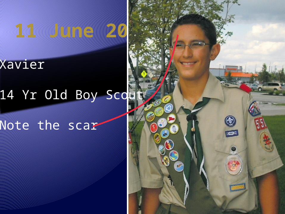
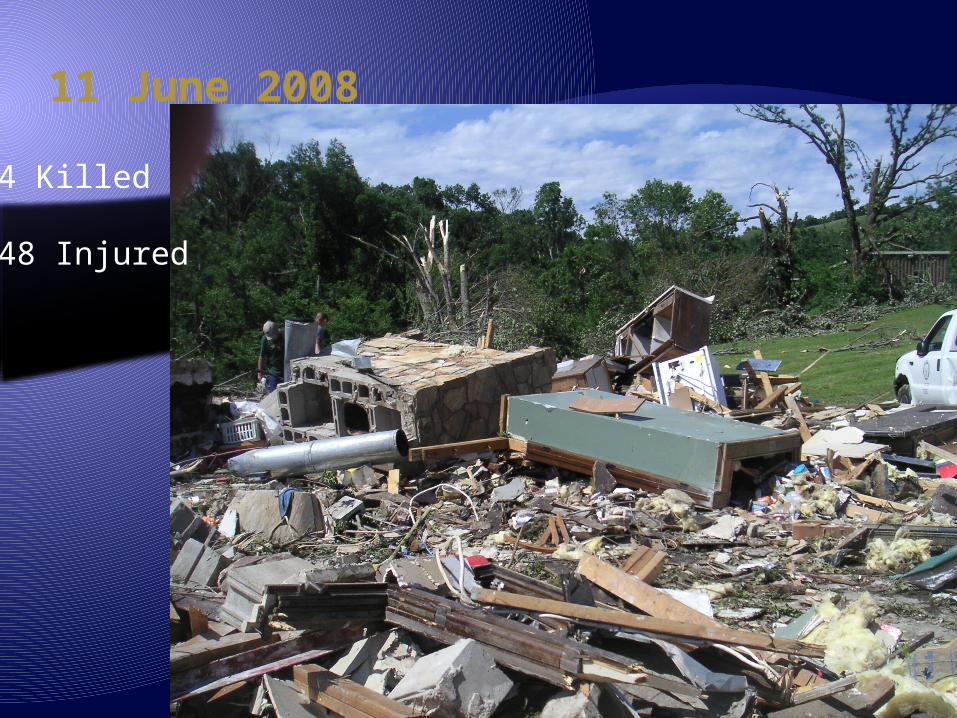
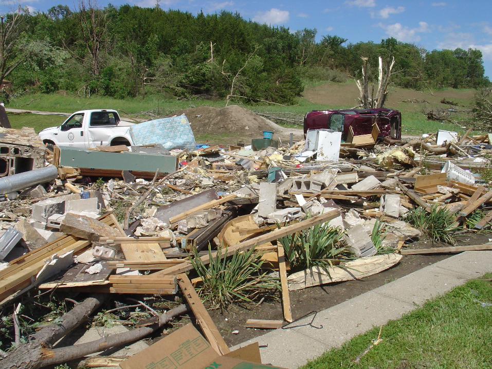
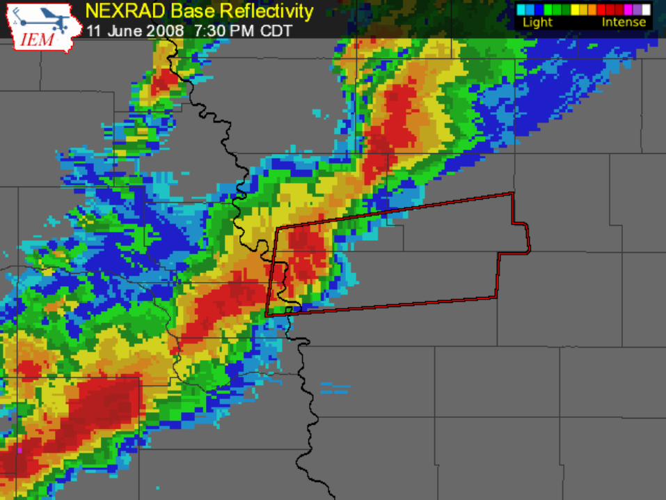
11 June 2008
Xavier
14 Yr Old Boy Scout
Note the scar


11 June 2008
• 4 Killed
• 48 Injured

Had an “outdoor warning device” and NOAA Weather Radio
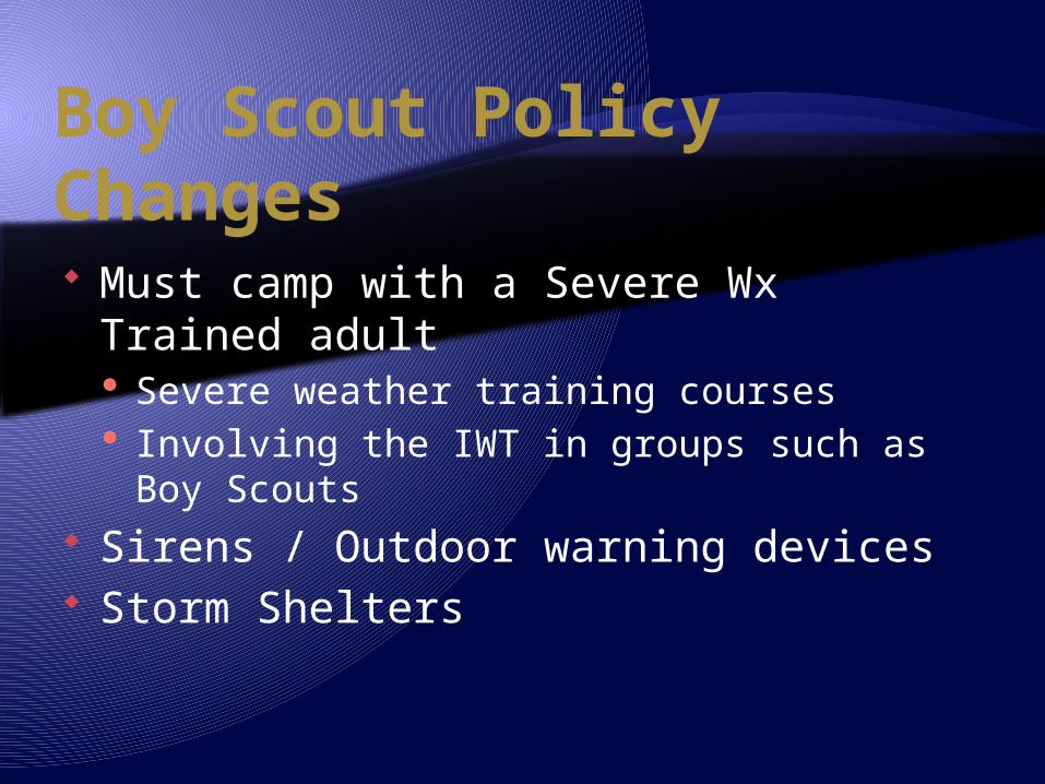
Boy Scout Policy Changes Must camp with a Severe Wx Trained
adult Severe weather training courses Involving the IWT in groups such as Boy
Scouts Sirens / Outdoor warning devices Storm Shelters


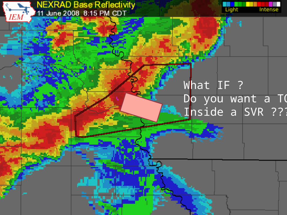
What IF ? Do you want a TOR Inside a SVR ???

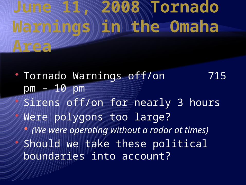
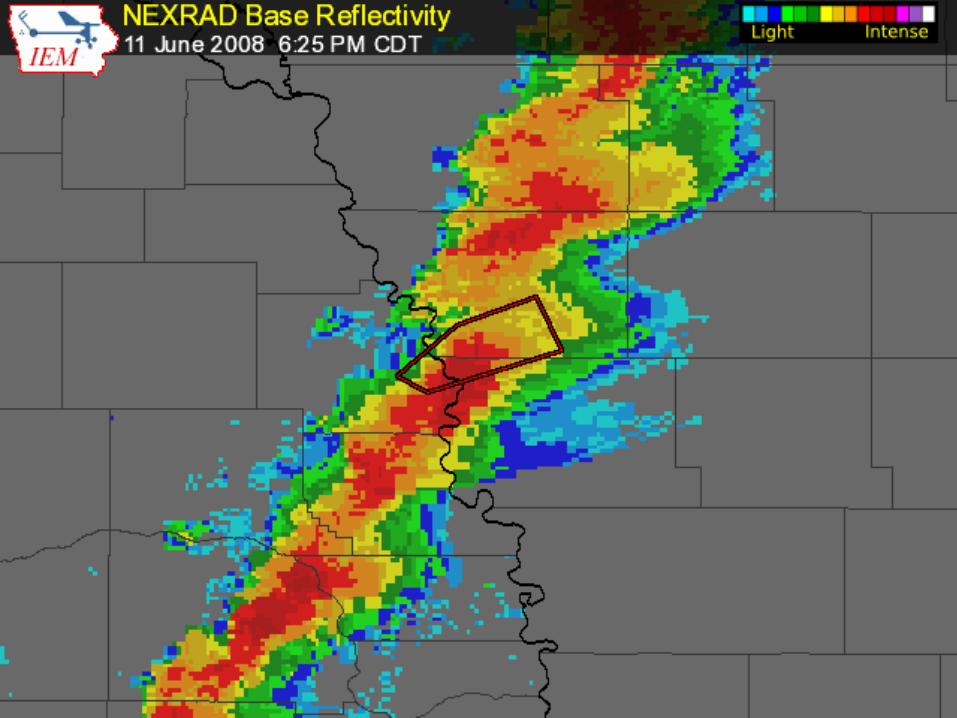
June 11, 2008 Tornado Warnings in the Omaha Area
Tornado Warnings off/on 715 pm – 10 pm
Sirens off/on for nearly 3 hours Were polygons too large?
(We were operating without a radar at times)
Should we take these political boundaries into account?
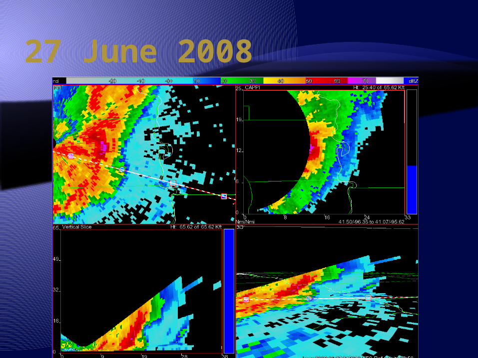
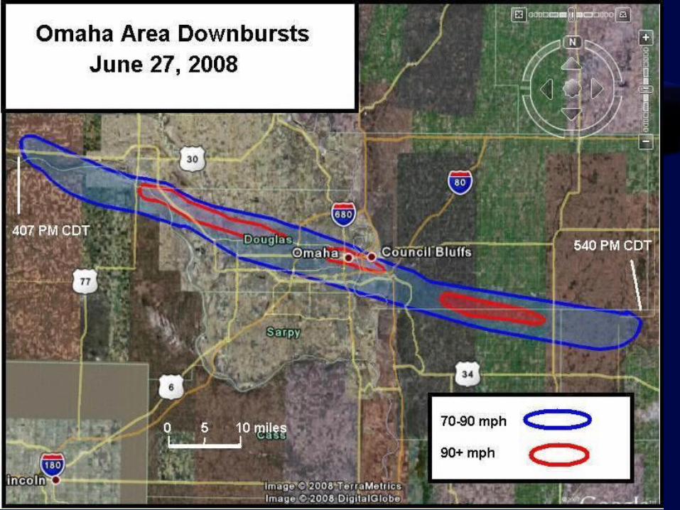
27 June 2008
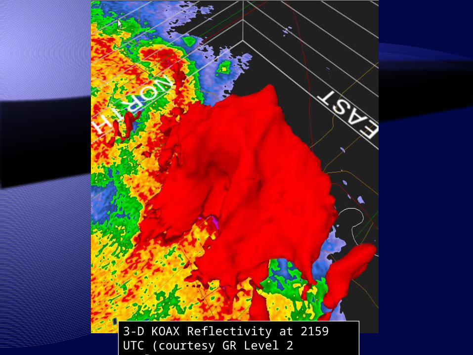
3-D KOAX Reflectivity at 2159 UTC (courtesy GR Level 2 Analyst)


June 27, 2008

June 27 Severe Thunderstorm Hurricane force winds Lasting for several minutes Damage and debris was widespread NO TORNADOES
(?What is the best product for this scenario?)
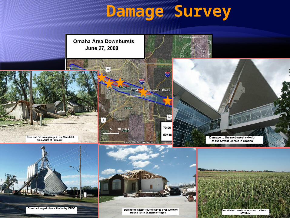
Damage Survey
Event ImpactsStorm statistics:•Path length: 90 miles•Path width: 4 to 6 miles•Estimated maximum wind speeds: 110-115 mph (EF2)•One fatality (tree fell on car in Council Bluffs, IA) and several minor injuries•Damage estimate: $53+ million in Douglas County (Omaha)

MOTIVATION! New Policy from Lessons
Learned! … When to activate: When the National Weather Service initiates a
Tornado Warning for any portion of Douglas County. When a public safety official or trained storm-spotter
states that s/he is in site of a rotating funnel cloud or tornado within Douglas County.
When Douglas County 911 receives credible reports of damage or the eminent threat of hurricane-force sustained winds equal to or greater than 74 mph.

New Policy… During night-time conditions or in the
absence of adequate warning, the on-duty 911 supervisor can direct an activation of the outdoor warning sirens if he/she determines that lives may be saved and injuries averted by alerting the public to the severe weather condition.Getting a bit vague here…
Conclusions Original Policy was product driven and
failed when the science did not permit the proper product to be issued
Revised Policy was more impact driven, and worked when a life-threatening (but non-tornadic) weather event occurred
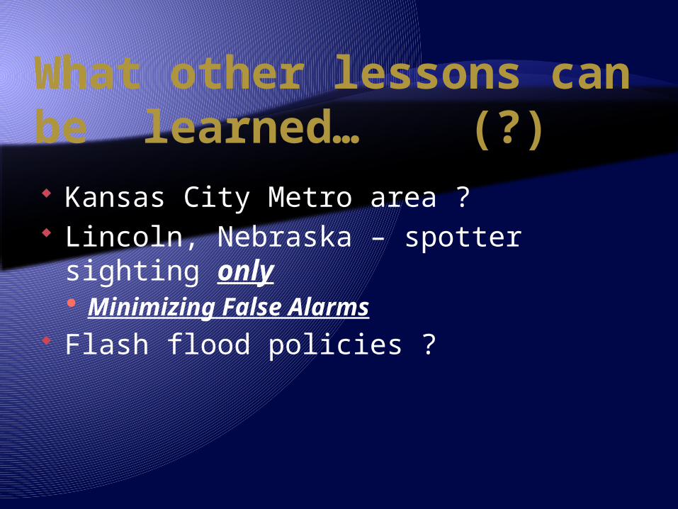
What other lessons can be learned… (?) Kansas City Metro area ? Lincoln, Nebraska – spotter sighting
only Minimizing False Alarms
Flash flood policies ?
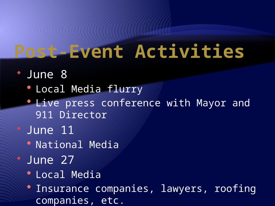
Post-Event Activities June 8
Local Media flurry Live press conference with Mayor and 911
Director June 11
National Media June 27
Local Media Insurance companies, lawyers, roofing
companies, etc.


Discussion Questions Siren Policies
Scout Camp issues Shelters Sirens Should NWS Warnings have GIS data? (camps, etc…)
Polygon methodologies Products that fit the event (wide range of Severe)

Impact on policy from three severe weather events in the Omaha area in June, 2008
Daniel Nietfeld – NOAA/NWS/WFO Omaha NE
(and many other issues raised)
Kansas City IWT Workshop: Using the WAS*IS Approach January 22, 2009
Related Documents