CURRENT RECOMMENDATIONS FROM MWDL GEOSPATIAL DISCOVERY TASK FORCE Liz Woolcott Utah State University, Merrill-Cazier Library Jeremy Myntti University of Utah, J. Willard Marriott Library Sandra McIntyre Mountain West Digital Library

Welcome message from author
This document is posted to help you gain knowledge. Please leave a comment to let me know what you think about it! Share it to your friends and learn new things together.
Transcript

CURRENT RECOMMENDATIONS FROMMWDL GEOSPATIAL DISCOVERY TASK FORCE Liz Woolcott Utah State University, Merrill-Cazier LibraryJeremy Myntti University of Utah, J. Willard Marriott LibrarySandra McIntyre Mountain West Digital Library

Ohio Memory Project, “Then and Now” maps

Estimated Total Annual Building Energy Consumption at the Block and Lot Level for NYC


Digital Public Library of America, search on “Chicago”

Digital Public Library of America, app: “DPLA State by State”
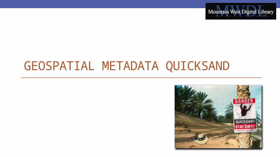
GEOSPATIAL METADATA QUICKSAND

Misinterpreted locationA Salt Lake City landmark
is placed in South Dakota

Location information or not?

Ambiguous place names• Washington County, UT• Washington County, ID• Washington County, OH• Washington County, MD• Washington County, GA• Washington County, MS• Washington County, NC• Washington County, PA
• Boulder, CO• Boulder, MT• Boulder, UT• Boulder City, NV

More problemsReport by MWDL metadata intern

Variances in coordinate formats•Numbers:•decimal degrees•degrees/minutes/seconds
•Directions:•(+) and -•W, N, E, and S•westlimit, northlimit, eastlimit, and southlimit
•Placement:•In same field•In different fields
Xena and Callisto in quicksand

Variances in field mapping•Dublin Core •coverage•spatial•subject
Jean Dujardin sinks into quicksand in a still from The Artist.

GEOSPATIAL DISCOVERY TASK FORCE

Task Force Charge1. Identify existing geospatial metadata practices2. Develop guidelines for standardizing3. Creating map-based search interfaces4. Identify and share tools
https://sites.google.com/site/mwdlgeospatial/

Phase 1Three subgroups:1.Review previous report2.Identify low hanging fruit3.Identify map-based interfaces

Phase 2Three more subgroups:1.Controlled vocabularies2.Coordinate data and GIS perspectives3.Map-based Interfaces

Current Recommendation: 1All standards and practices adopted by the metadata review board should be compliant with the ISO 19115:2003* Geographic Information--Metadata standard. *Task Force will review the latest released standard ISO 19115-1:2014 in the coming months.

Current Recommendation: 2Since MWDL contributors may need to use varied controlled vocabularies, we recommend that a geospatial metadata format and selected controlled vocabulary be highly recommended but not enforced.

Current Recommendation: 3There is a clear preference for expressing coordinates in latitude-longitude as decimal degrees over the degrees-minutes-seconds format.
Ex. Mount McKinley:Latitude: N 63° 32' 26.7972"Longitude: W 151° 43' 25.0108"
Latitude: 63.540777Longitude: -151.723614

Current Recommendation: 4It is recommended that partners keep all the elements of a single term within a single iteration of the field. For example, don’t split latitude and longitude. Repeat spatial field for each new entity.

Current Recommendations: 4 exampleFor example: Mt. McKinleyLat/Long expressed:
<dcterms:spatial>63.540777, -151.723614</dcterms:spatial>Controlled Vocab expressed:
<dcterms:spatial>Mount McKinley, Denali National Park and Preserve, Alaska, United States</dcterms:spatial>
URI expressed:<dcterms:spatial>http://geonames.org/5868589</dcterms:spatial>
All together:<dcterms:spatial>63.540777, -151.723614; Mount McKinley, Denali
National Park and Preserve, Alaska, United States; http://geonames.org/5868589</dcterms:spatial>

Current Recommendation: 5Partners should map geospatial metadata field(s) to the Dublin Core spatial refinement of coverage (dcterms:spatial), which can be done at the collection level. The OAI provider for the repository hosting the collection should support provision of qualified Dublin Core if possible.

Current Recommendation: 6The spatial coverage refinement (dcterms:spatial) is highly recommended for all new collections harvested by MWDL.

Current Recommendation: 7Where converting legacy data may be too difficult, partners can add an additional separate field mapped to the Dublin Core term spatial (dcterms:spatial) with basic, minimal geospatial metadata (at least at country and state level), in accordance with upcoming recommendations for controlled vocabulary.

Current Recommendations: Resources•To see a complete list of the current recommendations, visit: http://goo.gl/ZHMgtu
•To see all the meeting minutes and reports created by the task force, please visit: https://sites.google.com/site/mwdlgeospatial/home/meeting-minutes

Use Case ScenariosDLF Forum 2014 session: gathered and shared “user stories” of complicated geospatial metadata decisions•Groups formed then discussed scenarios, input selected in use case survey
•Survey results available

Recurring Cases•Use of neighborhoods in geospatial metadata
• Historical and informal• Immigrant neighborhood with multiple and changing ethnicities
•Deciding when a location is “near enough” to add to metadata
•Changing political boundaries: what to call an area•Distinguishing which geospatial metadata to include: about a specific location or from a specific location• Adding a geospatial layer to browse content by location subject matter
• Location where photo taken or locations in the photo?

Infographic•Providing a visual overview of the work of the Controlled Vocabulary subgroup
•http://my.visme.co/projects/mwdl-geospatial-task-f

Phase 3 – Next steps1. Select a recommended controlled
vocabulary.2. Review the DCMI Box/Point Encoding
Schemes: a. DCMI Box Encoding Scheme at
http://dublincore.org/documents/dcmi-box/ Example: name=Western Australia; northlimit=-13.5; southlimit=-35.5; westlimit=112.5; eastlimit=129
b. DCMI Point Encoding Scheme at http://dublincore.org/documents/dcmi-point/Example: name=Perth, W.A.; east=115.85717; north=-31.95301Example: east=148.26218; north=-36.45746; elevation=2228; name=Mt. Kosciusko

Phase 3 – Next steps3. Make recommendations
for modifying the MWDL Dublin Core Application Profile.
4. Finalize the infographic.

Phase 4 – Future plans1.Develop regional gazetteer.2.Develop actionable plans to deal with
legacy data.

Want to stay informed?Join the listserv: https://www.lists.utah.edu/wws/info/mwdl-geospatial
To subscribe, send an email message to [email protected] with this subject: subscribe mwdl-geospatial firstname lastnameNote: replace “firstname” and “lastname” above with your first and last names. Do not put anything in the body of the message.
Contact Kristen Jensen ([email protected]) or
Liz Woolcott ([email protected])
Want to get involved?

Questions?•Liz WoolcottDigital Discovery LibrarianUtah State University, Merrill-Cazier [email protected]
•Jeremy MynttiHead, Cataloging and Metadata ServicesUniversity of Utah, J. Willard Marriott [email protected]
•Sandra McIntyreDirector, Mountain West Digital [email protected]
Related Documents