Creating Mosaic Datasets and Publishing Image Services using Python Jie Zhang, Jamie Drisdelle Session Offering ID: 305

Welcome message from author
This document is posted to help you gain knowledge. Please leave a comment to let me know what you think about it! Share it to your friends and learn new things together.
Transcript

Creating Mosaic Datasets and Publishing Image Services using
Python Jie Zhang, Jamie Drisdelle
Session Offering ID: 305
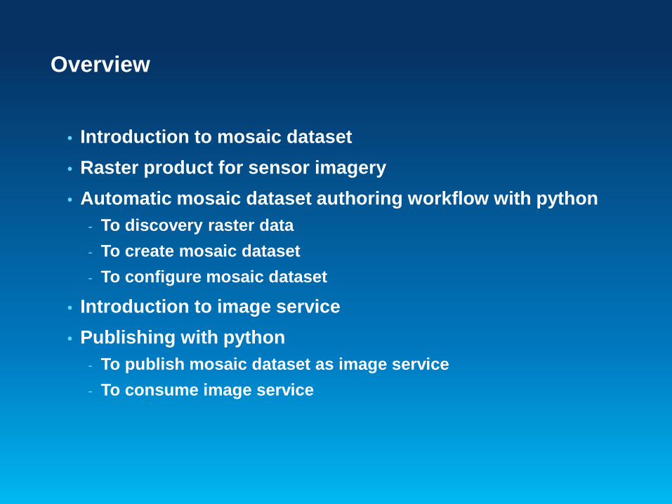
Overview
• Introduction to mosaic dataset • Raster product for sensor imagery • Automatic mosaic dataset authoring workflow with python
- To discovery raster data - To create mosaic dataset - To configure mosaic dataset
• Introduction to image service • Publishing with python
- To publish mosaic dataset as image service - To consume image service
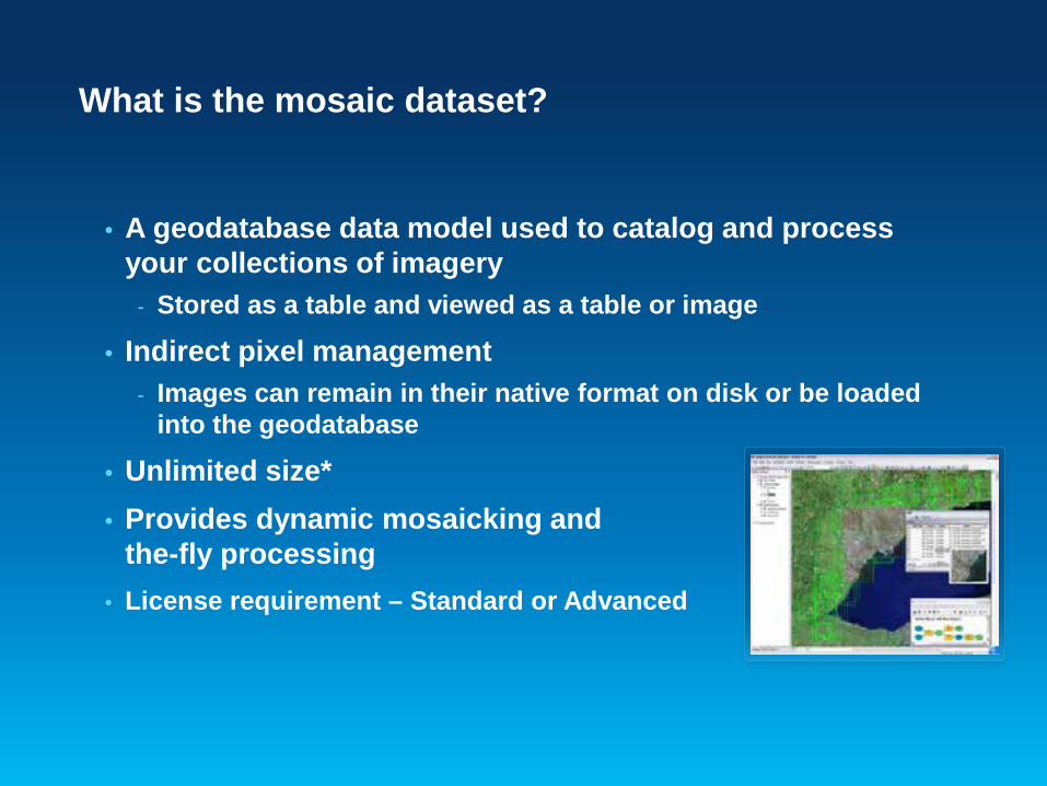
What is the mosaic dataset?
• A geodatabase data model used to catalog and process your collections of imagery
- Stored as a table and viewed as a table or image
• Indirect pixel management - Images can remain in their native format on disk or be loaded
into the geodatabase
• Unlimited size* • Provides dynamic mosaicking and on-
the-fly processing • License requirement – Standard or Advanced
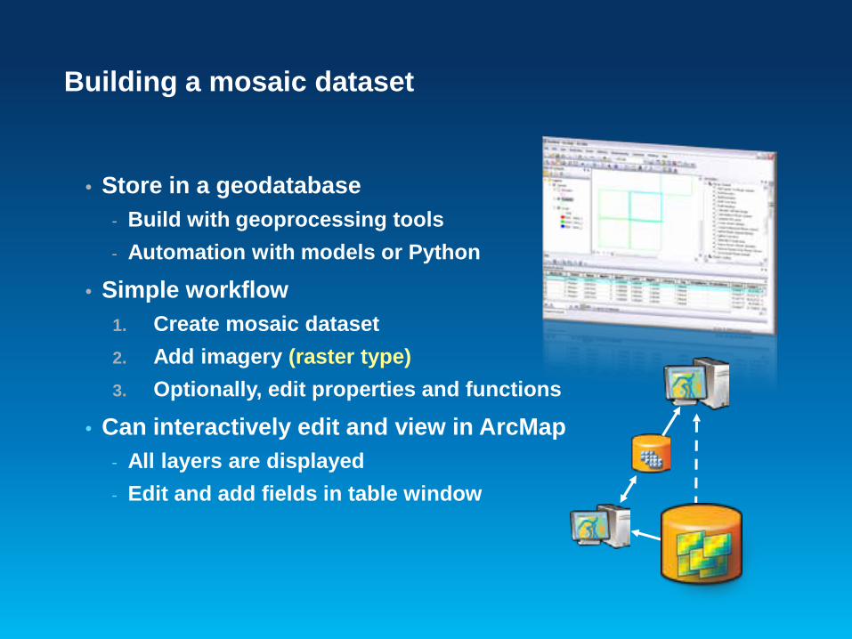
Building a mosaic dataset
• Store in a geodatabase - Build with geoprocessing tools - Automation with models or Python
• Simple workflow 1. Create mosaic dataset 2. Add imagery (raster type) 3. Optionally, edit properties and functions
• Can interactively edit and view in ArcMap - All layers are displayed - Edit and add fields in table window
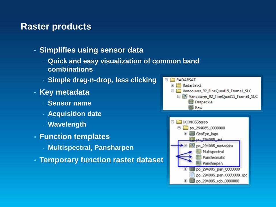
Raster products
• Simplifies using sensor data - Quick and easy visualization of common band
combinations - Simple drag-n-drop, less clicking
• Key metadata - Sensor name - Acquisition date - Wavelength
• Function templates - Multispectral, Pansharpen
• Temporary function raster dataset

Creating mosaic datasets with geoprocessing
• Mosaic Dataset toolset - Creation
- Create Mosaic Dataset - Add Rasters To Mosaic Dataset …
- Modify - Define Mosaic Dataset Nodata - Build Footprints …
- Enhancement - Build Seamlines - Color Balance Mosaic Dataset …
• All tools are accessible through arcpy
Jie Zhang
Creating Mosaic Datasets with Python
Demo

Raster data management methods in arcpy
• Where are the APIs supports raster data? - arcpy.<ToolName> provides access to all raster GP tool - arcpy.ListRasters list raster datasets in the workspace - arcpy.Describe object for mosaic dataset and raster
dataset - arcpy.da.<cursor> object to access mosaic dataset table
like feature class - arcpy.sa.* for Image Analysis functionalities
• Look up API reference on ArcGIS Resource Center - http://bit.ly/ZKXqML

Discover imagery data with python
• Find raster data in your workspace
• Check sensor name property
• Add Rasters to Mosaic Dataset
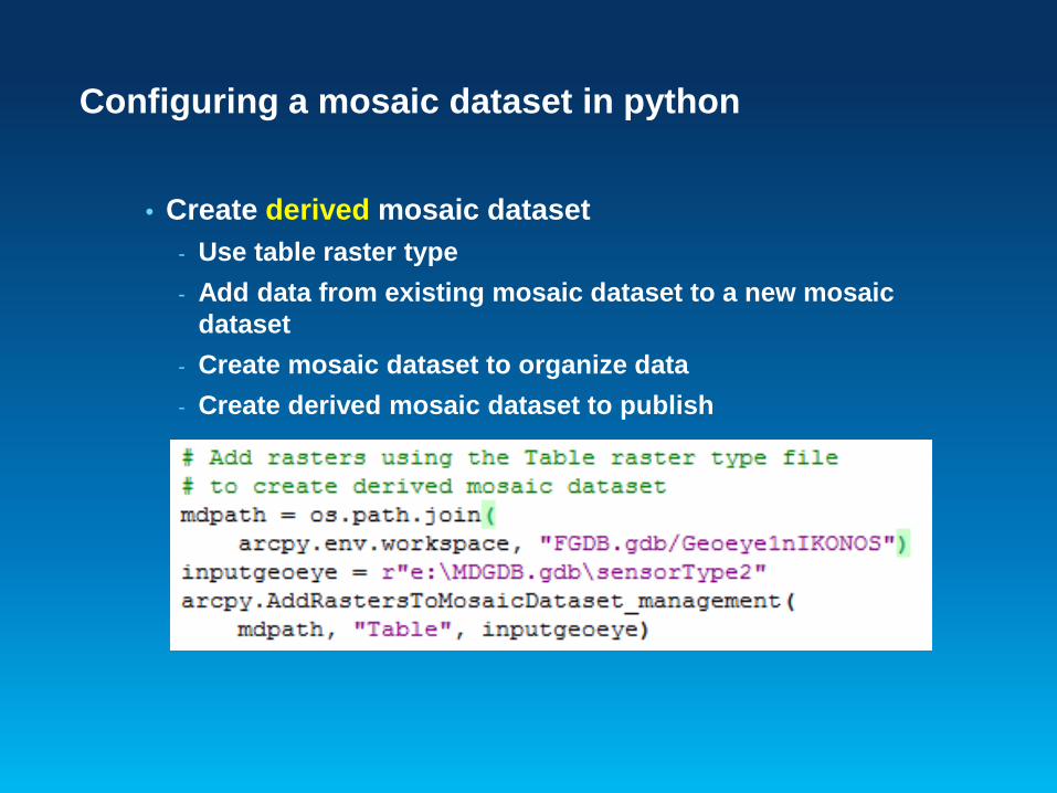
Configuring a mosaic dataset in python
• Create derived mosaic dataset - Use table raster type - Add data from existing mosaic dataset to a new mosaic
dataset - Create mosaic dataset to organize data - Create derived mosaic dataset to publish
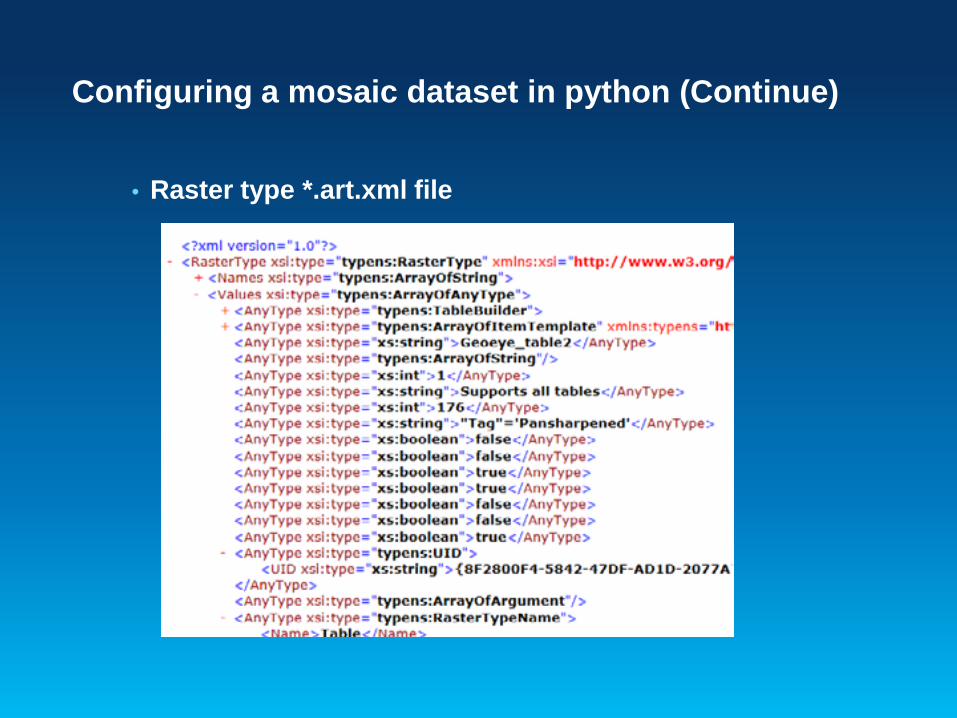
Configuring a mosaic dataset in python (Continue)
• Raster type *.art.xml file
Configuring a mosaic dataset in python (Continue)
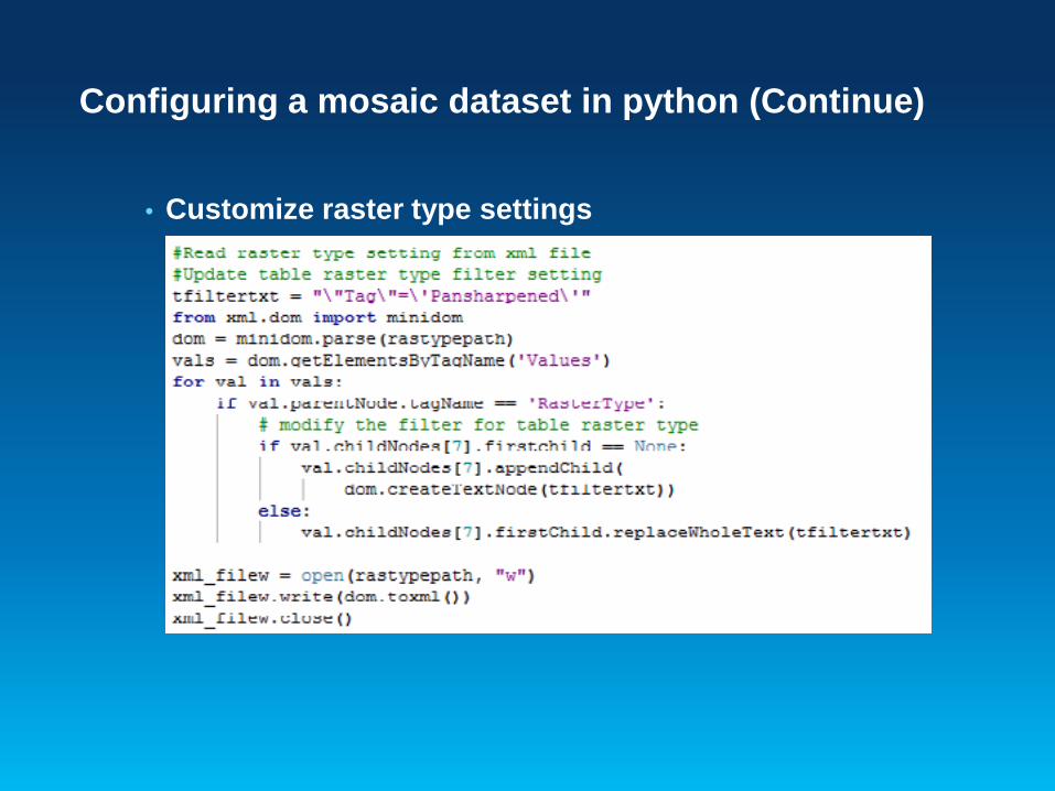
• Customize raster type settings

Configuring a mosaic dataset in python (Continue)
• Add/Join/Query fields to mosaic dataset tables
• Access mosaic dataset raster item
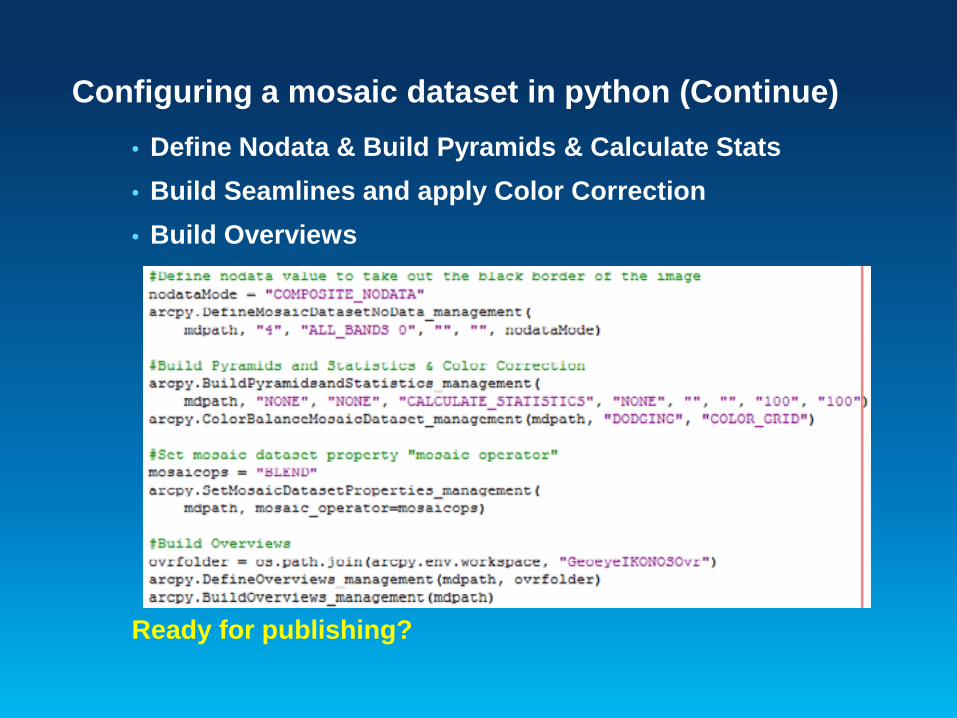
Configuring a mosaic dataset in python (Continue) • Define Nodata & Build Pyramids & Calculate Stats • Build Seamlines and apply Color Correction • Build Overviews
Ready for publishing?
What is an image service?
• It is imagery or raster data made available by a server to a client application
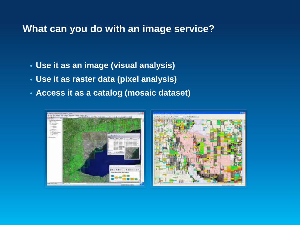
What can you do with an image service?
• Use it as an image (visual analysis) • Use it as raster data (pixel analysis) • Access it as a catalog (mosaic dataset)
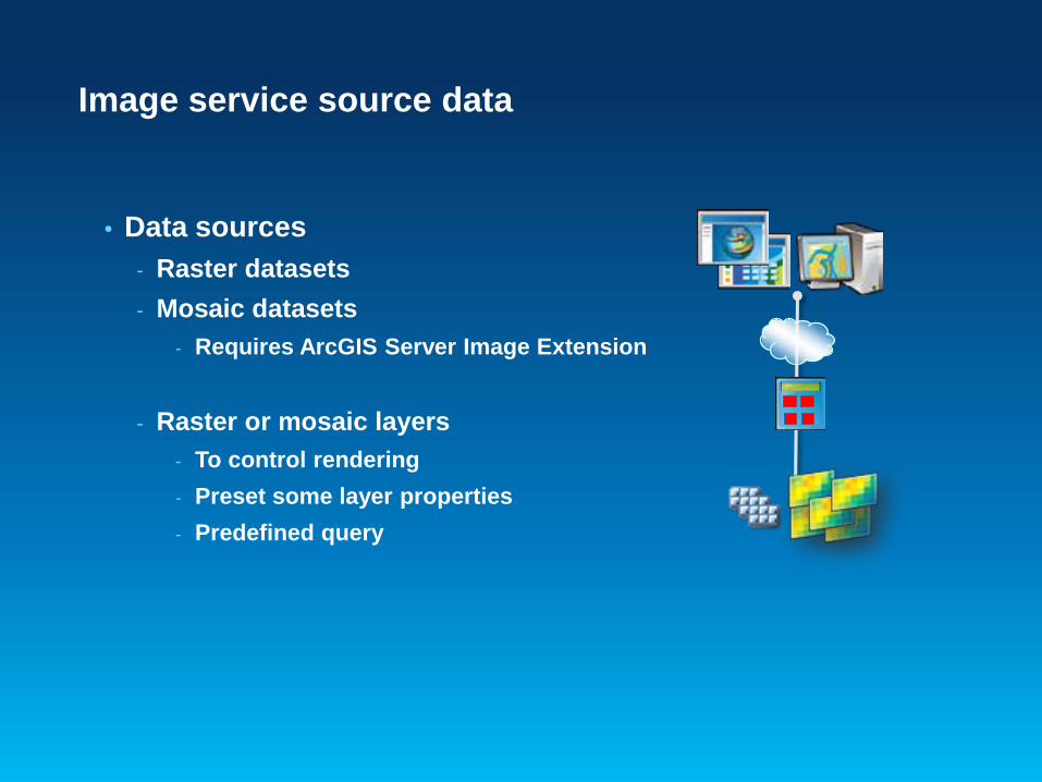
Image service source data
• Data sources - Raster datasets - Mosaic datasets
- Requires ArcGIS Server Image Extension
- Raster or mosaic layers - To control rendering - Preset some layer properties - Predefined query
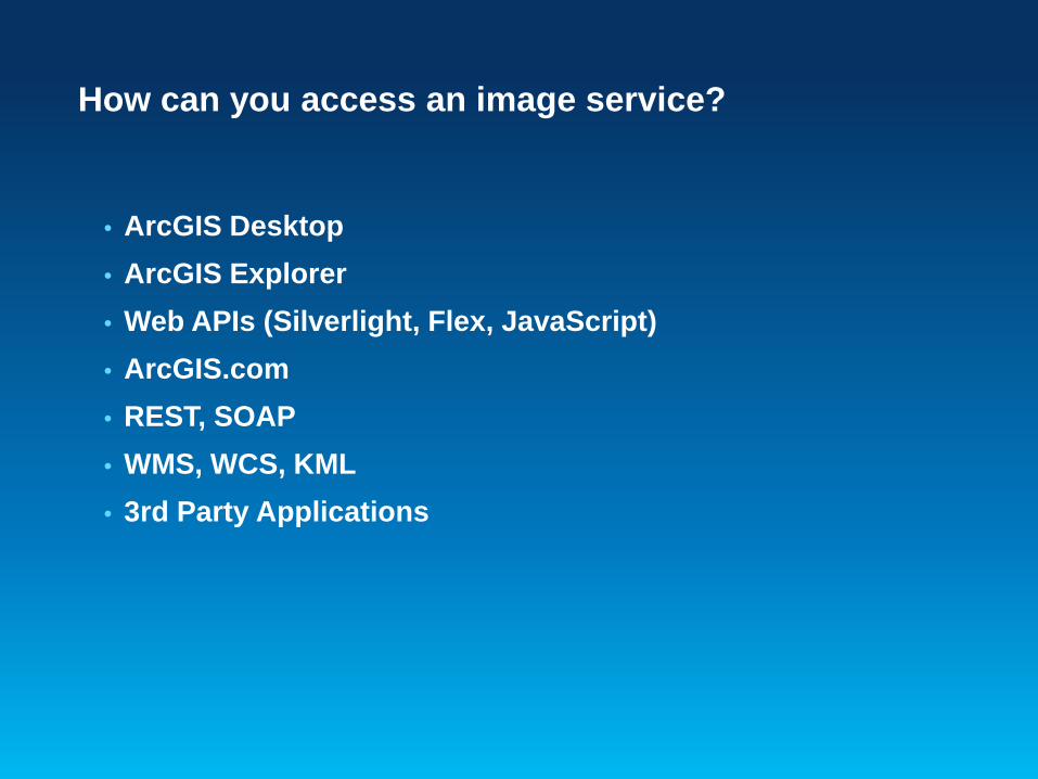
How can you access an image service?
• ArcGIS Desktop • ArcGIS Explorer • Web APIs (Silverlight, Flex, JavaScript) • ArcGIS.com • REST, SOAP • WMS, WCS, KML • 3rd Party Applications
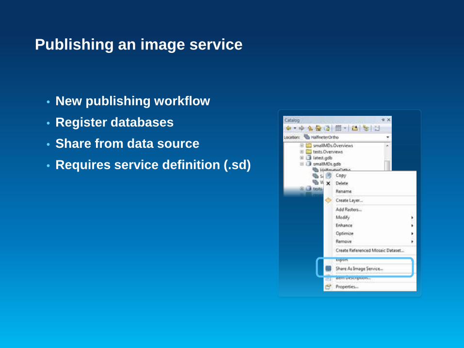
Publishing an image service
• New publishing workflow • Register databases • Share from data source • Requires service definition (.sd)
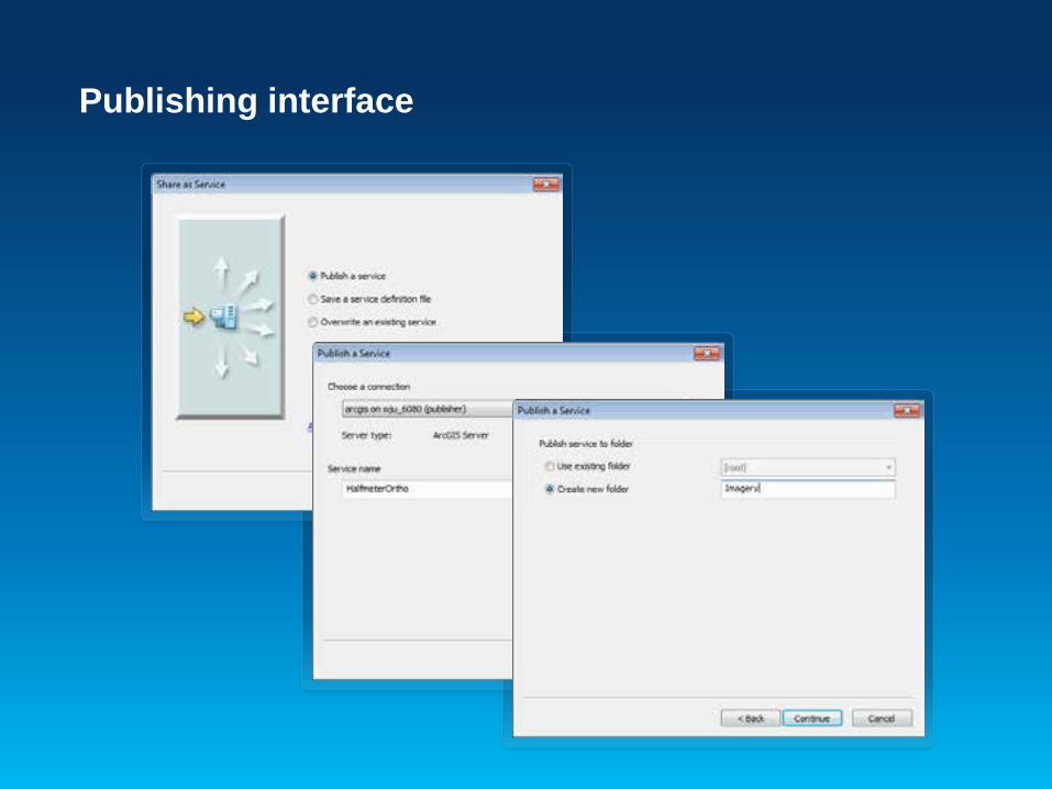
Publishing interface
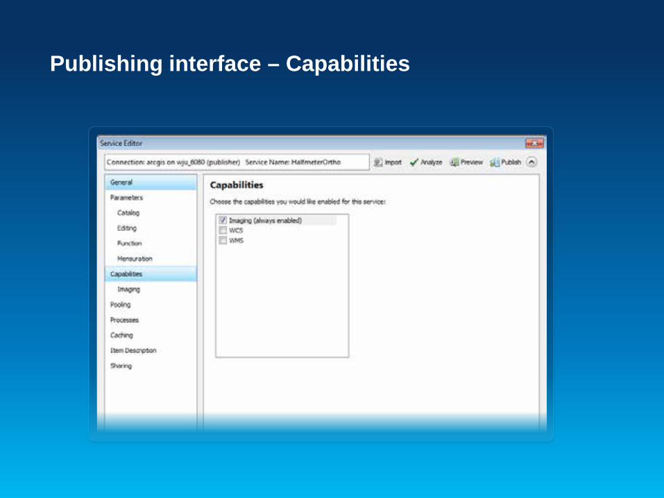
Publishing interface – Capabilities
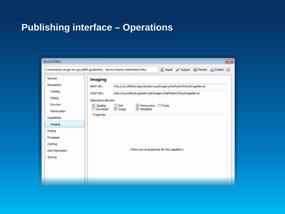
Publishing interface – Operations
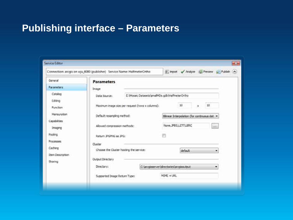
Publishing interface – Parameters

Publishing interface – Parameters
Image service caching
• Caching is use to improve the access speed • Generally used on a visualization product, such
as and three-band natural color image or hillshaded DEM
• Interchangeable with a map service cache • Improve the performance for slow formats

Jie Zhang
Publishing Image Service with Python
Demo
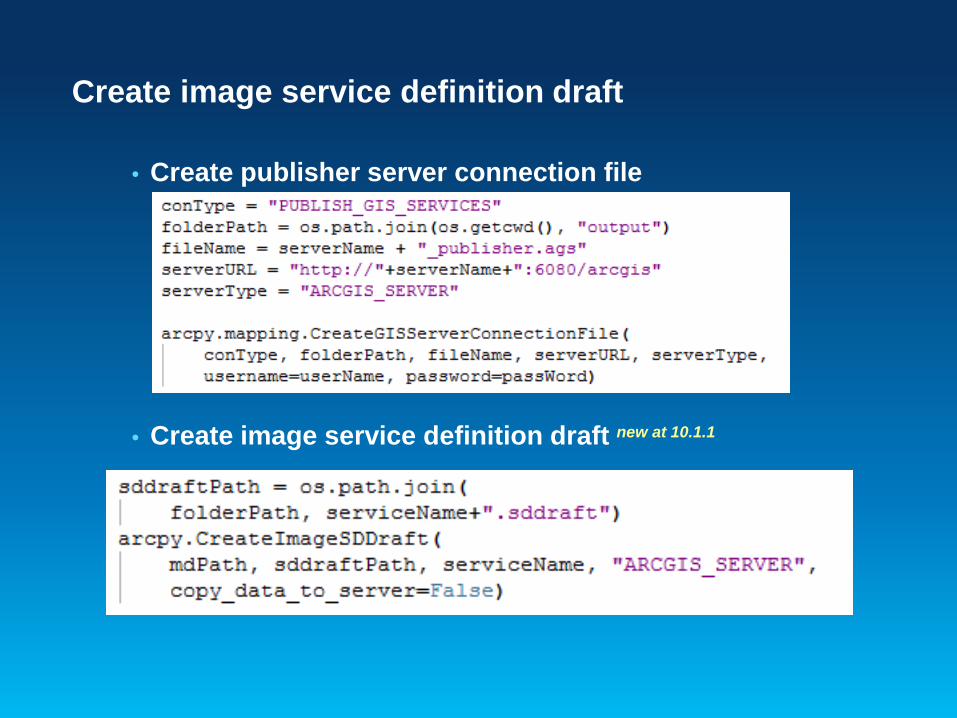
Create image service definition draft
• Create publisher server connection file
• Create image service definition draft new at 10.1.1
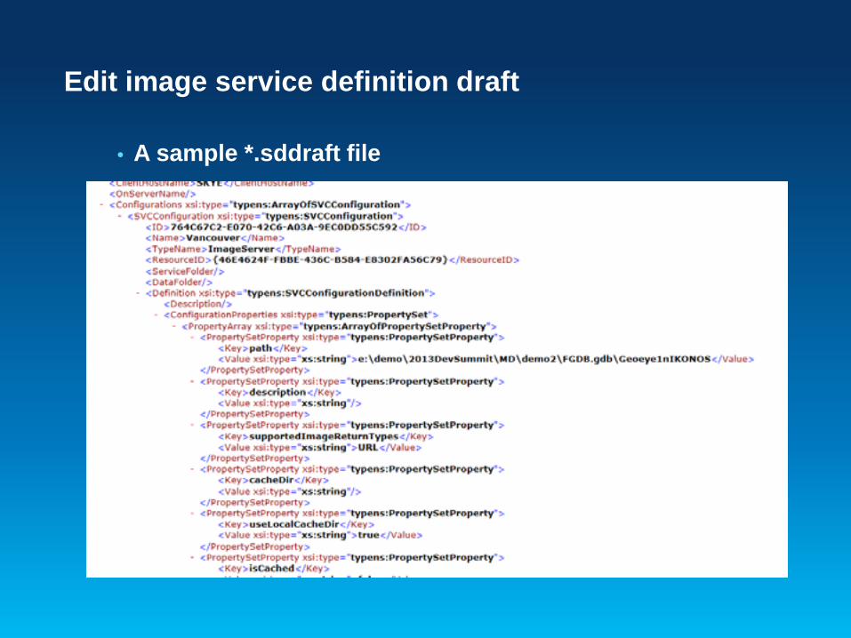
Edit image service definition draft
• A sample *.sddraft file

Edit image service definition draft
• Upload a custom raster function template
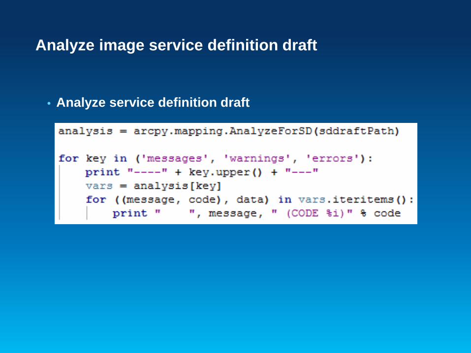
Analyze image service definition draft
• Analyze service definition draft

Stage and publish image service definition
• Stage *.sddraft file to service definition *.sd file • Publish service definition file to ArcGIS Server

Jie Zhang
Use Image Service with Python – clip and ship
Demo

Making REST request in python
• Construction request in JSON
• Submit request and get response with urllib2
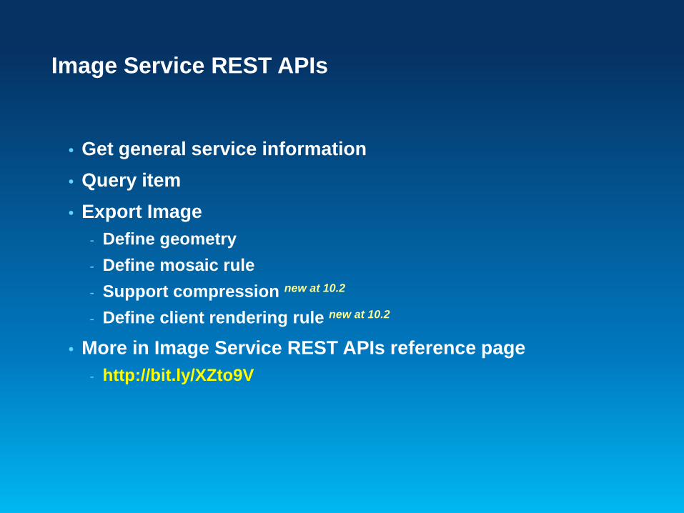
Image Service REST APIs
• Get general service information • Query item • Export Image
- Define geometry - Define mosaic rule - Support compression new at 10.2
- Define client rendering rule new at 10.2
• More in Image Service REST APIs reference page - http://bit.ly/XZto9V

Questions?
Thank you for listening! Please remember to fill in the survey.
Session Offering ID: 305
Python sample code are available at: http://www.arcgis.com/home/item.html?id=8e2ae1384eca46699d16a19adbabe
5ba

Related Documents