Creating Historical Digital Census Boundary Maps for Canada - a pilot project Andrey Petrov, Laine Ruus, Data and GIS Services, University of Toronto Presented at CAPDU & IASSIST 2007 (r 3 ) May 16, 2007

Creating Historical Digital Census Boundary Maps for Canada - a pilot project Andrey Petrov, Laine Ruus, Data and GIS Services, University of Toronto Presented.
Dec 23, 2015
Welcome message from author
This document is posted to help you gain knowledge. Please leave a comment to let me know what you think about it! Share it to your friends and learn new things together.
Transcript
Creating Historical Digital Census Boundary Maps for Canada
- a pilot project
Andrey Petrov, Laine Ruus,
Data and GIS Services,
University of Toronto
Presented at CAPDU & IASSIST 2007 (r3)
May 16, 2007
Outline
Background
The project
The result
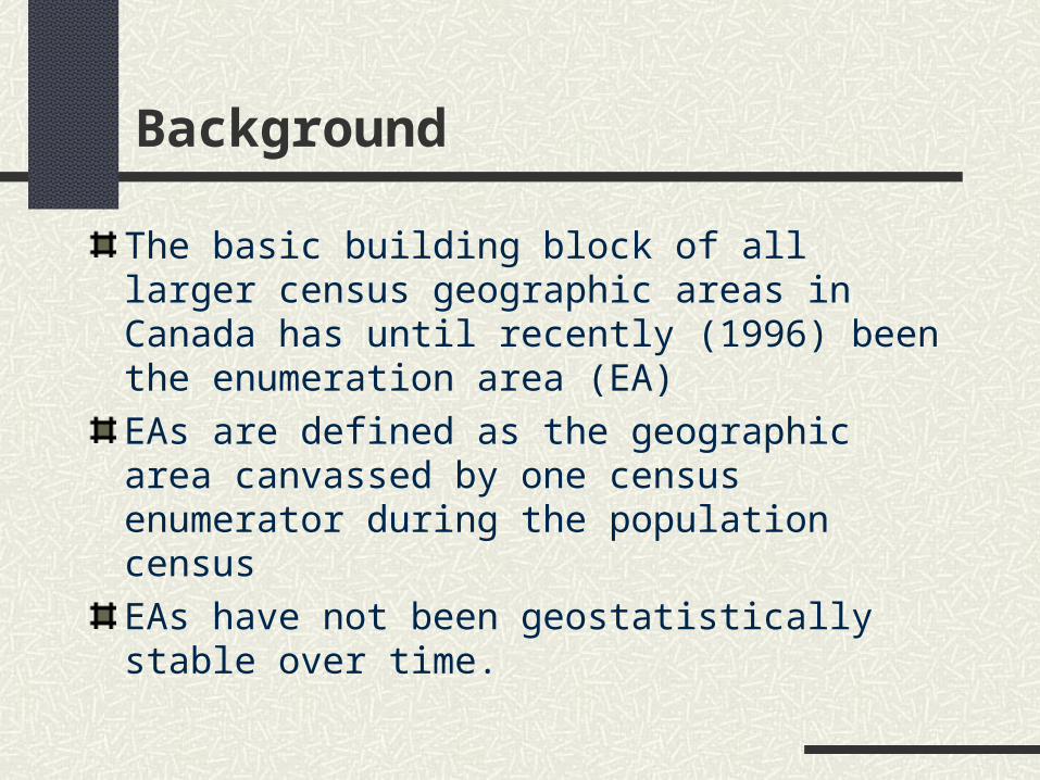
Background
The basic building block of all larger census geographic areas in Canada has until recently (1996) been the enumeration area (EA)
EAs are defined as the geographic area canvassed by one census enumerator during the population census
EAs have not been geostatistically stable over time.
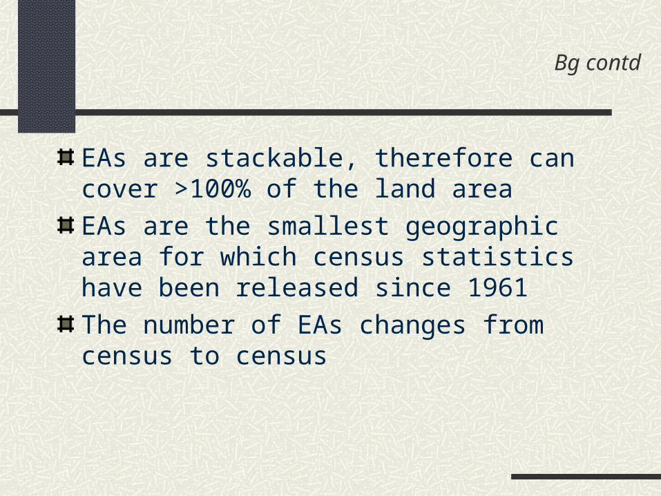
Bg contd
EAs are stackable, therefore can cover >100% of the land area
EAs are the smallest geographic area for which census statistics have been released since 1961
The number of EAs changes from census to census

Bg contd
EA-level aggregate statistics have been produced and disseminated by Statistics Canada since 1961

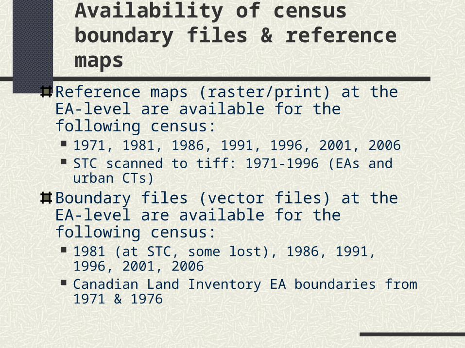
Availability of census boundary files & reference maps
Reference maps (raster/print) at the EA-level are available for the following census: 1971, 1981, 1986, 1991, 1996, 2001, 2006 STC scanned to tiff: 1971-1996 (EAs and urban
CTs)
Boundary files (vector files) at the EA-level are available for the following census: 1981 (at STC, some lost), 1986, 1991, 1996,
2001, 2006 Canadian Land Inventory EA boundaries from
1971 & 1976

Bg contd
Demand for historical census data revitalized with release of each new census

Requests for historic aggregate census data at UT/DLS, by census year
010203040506070
2006
-200
7
2005
-200
6
2004
-200
5
2003
-200
4
2002
-200
3
2001
-200
2
2000
-200
1
1999
-200
0
1998
-199
9
1997
-199
8
1996
-199
7
1995
-199
6
1994
-199
5
1993
-199
4
1992
-199
3
Academic year
File
s 1961
1971
1976
1981
1986
1991
bg contd
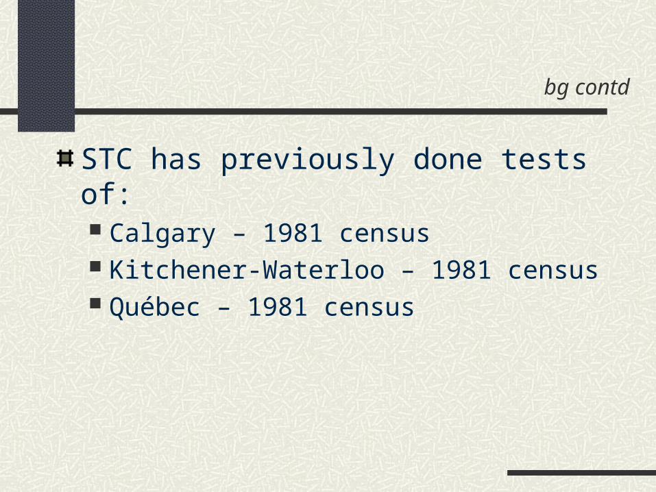
STC has previously done tests of: Calgary – 1981 census Kitchener-Waterloo – 1981 census Québec – 1981 census
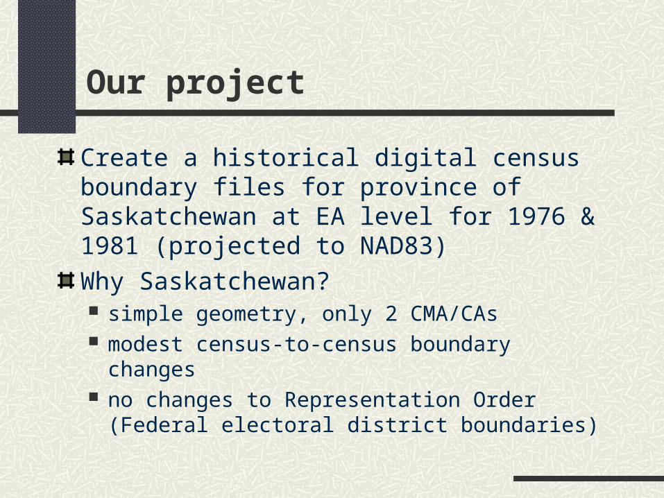
Our project
Create a historical digital census boundary files for province of Saskatchewan at EA level for 1976 & 1981 (projected to NAD83)
Why Saskatchewan? simple geometry, only 2 CMA/CAs modest census-to-census boundary changes no changes to Representation Order (Federal
electoral district boundaries)
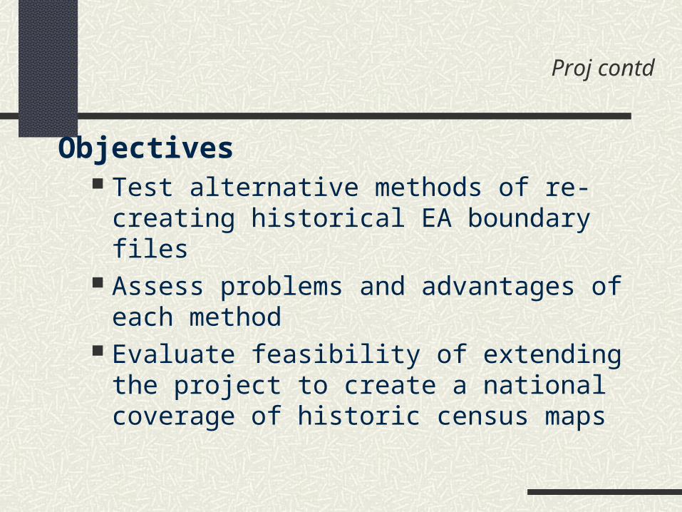
Proj contd
Objectives Test alternative methods of re-creating
historical EA boundary files Assess problems and advantages of each
method Evaluate feasibility of extending the project
to create a national coverage of historic census maps
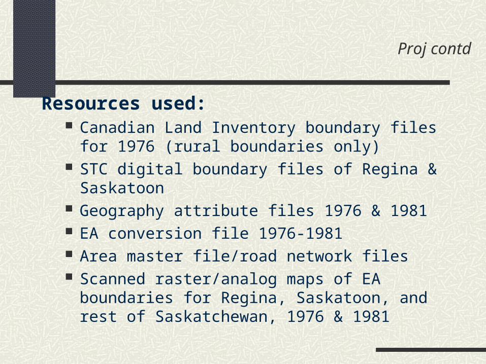
Proj contd
Resources used: Canadian Land Inventory boundary files for 1976
(rural boundaries only) STC digital boundary files of Regina & Saskatoon Geography attribute files 1976 & 1981 EA conversion file 1976-1981 Area master file/road network files Scanned raster/analog maps of EA boundaries for
Regina, Saskatoon, and rest of Saskatchewan, 1976 & 1981

Proj contd
Design requirements Use only existing data available for the
entire country Develop a repeatable, time & resource
efficient method Miminize manual components Provide GIS-ready digital output Ensure compatibility with other STC
datasets (1996 geographic base)
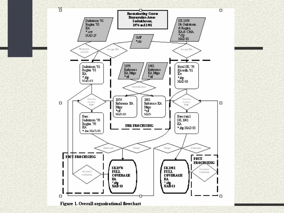

And the result
Vectorizing from raster maps proved not feasible
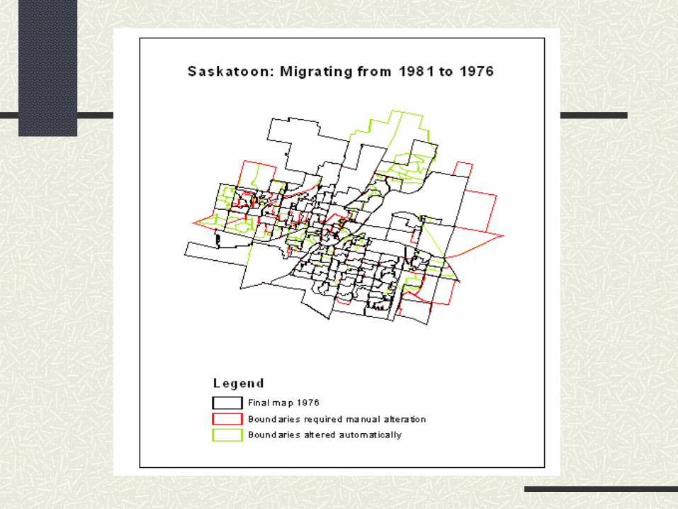
Project successfully produced EA boundary files for 1976 and 1981 for Regina and Saskatoon CMAs Remainder of the province:
58 CSDs missing in 1976 78 CSDs missing in 1981
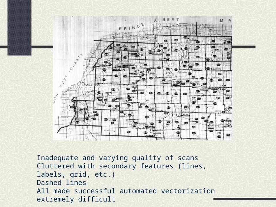
Inadequate and varying quality of scansCluttered with secondary features (lines, labels, grid, etc.)Dashed linesAll made successful automated vectorization extremely difficult
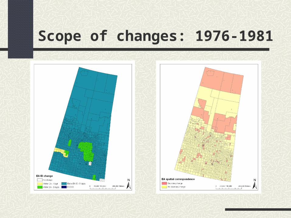
Scope of changes: 1976-1981
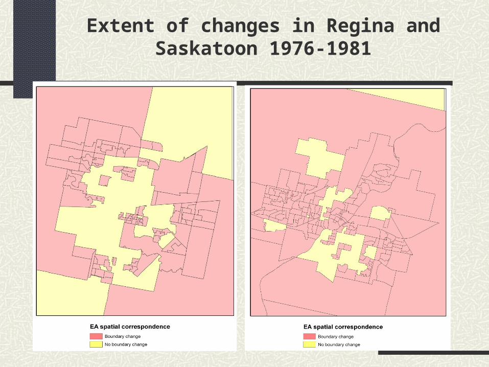
Extent of changes in Regina and Saskatoon 1976-1981

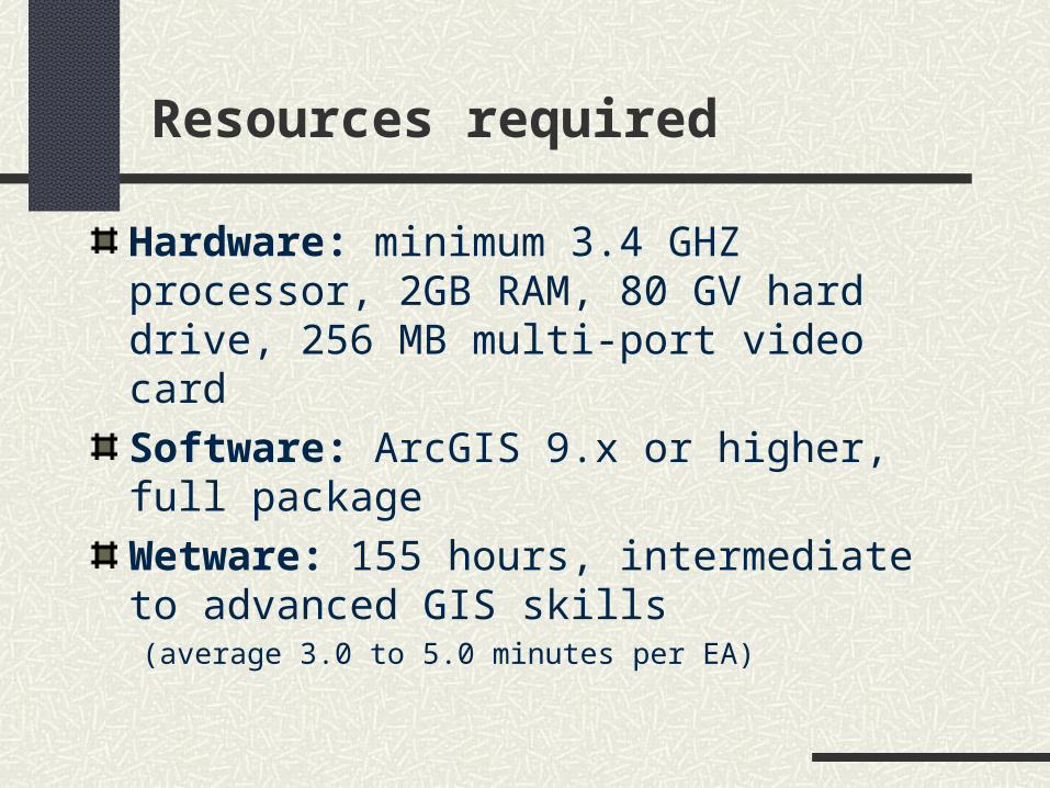
Resources required
Hardware: minimum 3.4 GHZ processor, 2GB RAM, 80 GV hard drive, 256 MB multi-port video card
Software: ArcGIS 9.x or higher, full package
Wetware: 155 hours, intermediate to advanced GIS skills (average 3.0 to 5.0 minutes per EA)

Where does the project go from here?
Whatever Paula Hurtubise said this morning………..

Project materials
Report:http://www.chass.utoronto.ca/~datalib/hurtubise/ReportStatcanr2_060331.doc
Zip file of all project files, including outputs:http://www.chass.utoronto.ca/~datalib/hurtubise/
Saskatchewan_EA_projectr.zip
Related Documents