Corby Strategic Flood Risk Assessment Level 1 Strategic Map Document Northamptonshire County Council February 2019

Welcome message from author
This document is posted to help you gain knowledge. Please leave a comment to let me know what you think about it! Share it to your friends and learn new things together.
Transcript
Corby Strategic Flood Risk Assessment
Level 1
Strategic Map Document Northamptonshire County Council
February 2019
Corby Borough Council Level 1 SFRA Update (February 2019) 2
Revision Schedule
Corby Strategic Flood Risk Assessment Level 1: Strategic Map Document
Revision Date Details Prepared by Reviewed by Approved by
01 28th
February
2018
Draft SFRA Level 1:
Strategic Map
Document
Josie Bateman
and Aiden
Grist
Phil Jones Alison Parry
02 1st May
2018
Draft SFRA Level 1
Strategic Map
Document version
2 following partner
consultation
Josie Bateman
and Aiden
Grist
Phil Jones Alison Parry
03 4th June
2018
Final SFRA Level 1
Strategic Map
Document
Josie Bateman
and Aiden
Grist
Phil Jones Alison Parry
04 20th
February
2019
Updated
Groundwater
Mapping
Aiden Grist Phil Jones Alison Parry
Northamptonshire County Council Place Directorate
Flood and Water Management One Angel Square
4 Angel Street Northampton
NN1 1ED
Corby Borough Council Level 1 SFRA Update (February 2019) 3
Contents
Map 1: Study Area ........................................................................................................................................................................................................................... 4
Map 2: Topography .......................................................................................................................................................................................................................... 5
Map 3: Bedrock Geology .................................................................................................................................................................................................................. 6
Map 4: Recorded Flood Incidents .................................................................................................................................................................................................... 7
Map 5: Flood Alert and Warning Areas ........................................................................................................................................................................................... 8
Map 6: Fluvial Flood Zones .............................................................................................................................................................................................................. 9
Map 7: Flood Zone 3a and 3b ........................................................................................................................................................................................................ 10
Map 8: Risk of Flooding From Rivers and Seas .............................................................................................................................................................................. 11
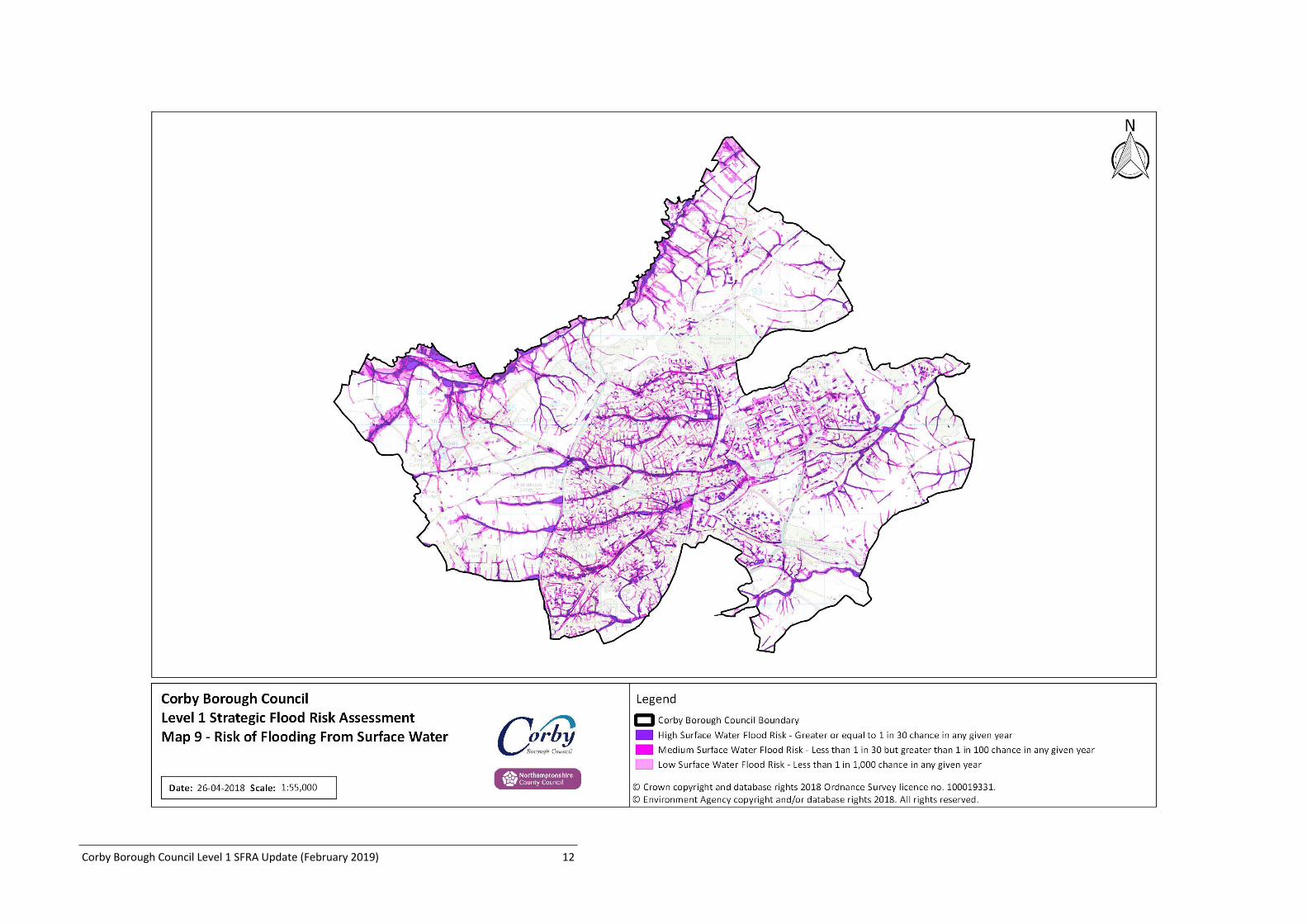
Map 9: Risk of Flooding From Surface Water ................................................................................................................................................................................ 12
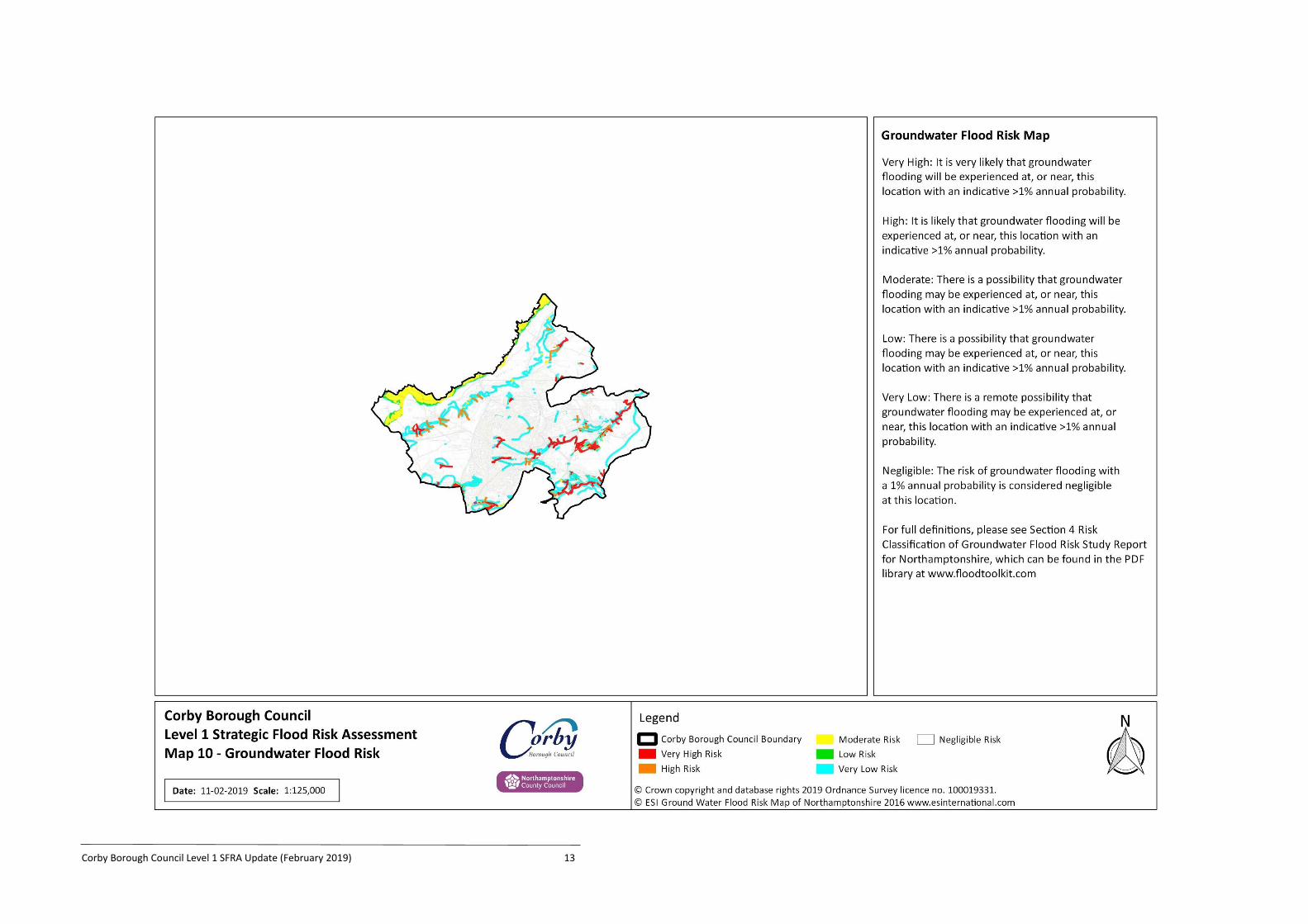
Map 10: Groundwater Flood Risk .................................................................................................................................................................................................. 13
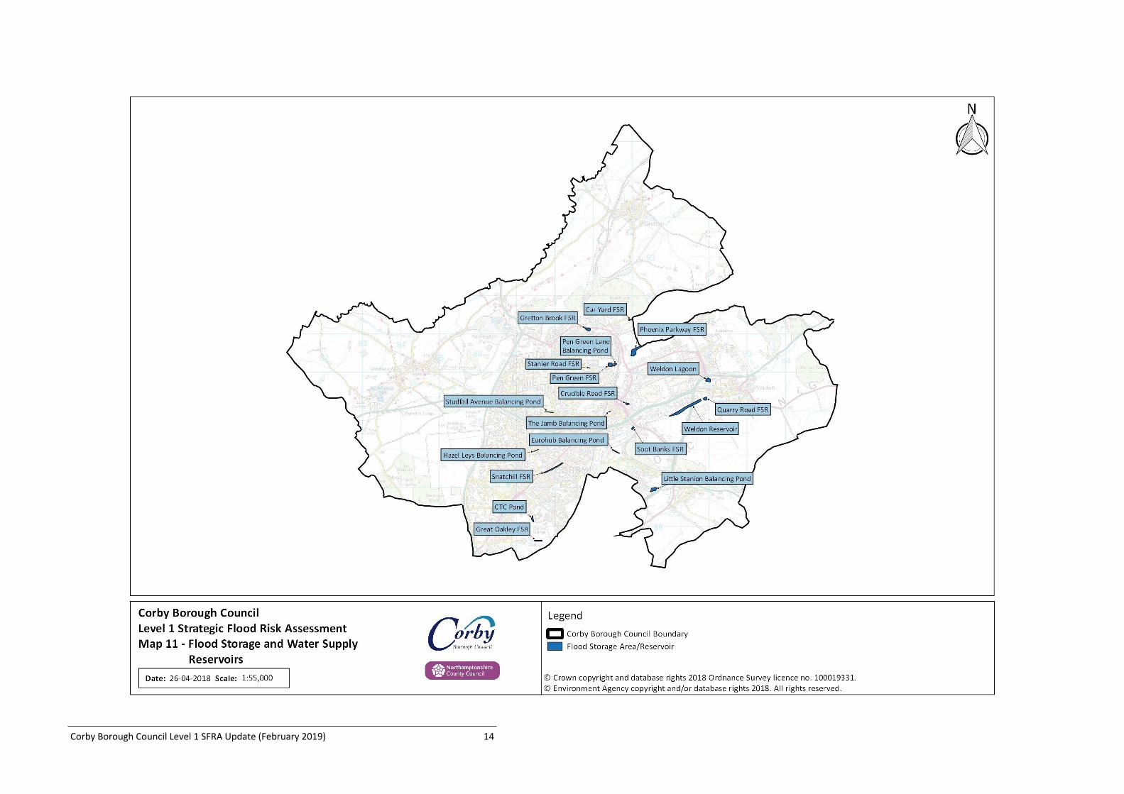
Map 11: Flood Storage and Water Supply Reservoirs ................................................................................................................................................................... 14
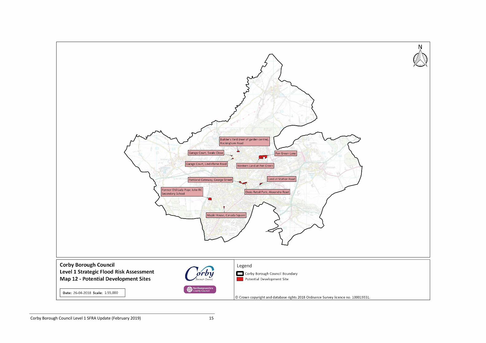
Map 12: Potential Development Sites ........................................................................................................................................................................................... 15
Map 13: Watercourse and Canal Network .................................................................................................................................................................................... 16
Corby Borough Council Level 1 SFRA Update (February 2019) 4
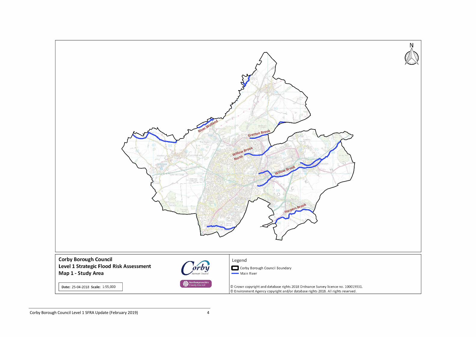
Map 1: Study Area
Corby Borough Council Level 1 SFRA Update (February 2019) 5
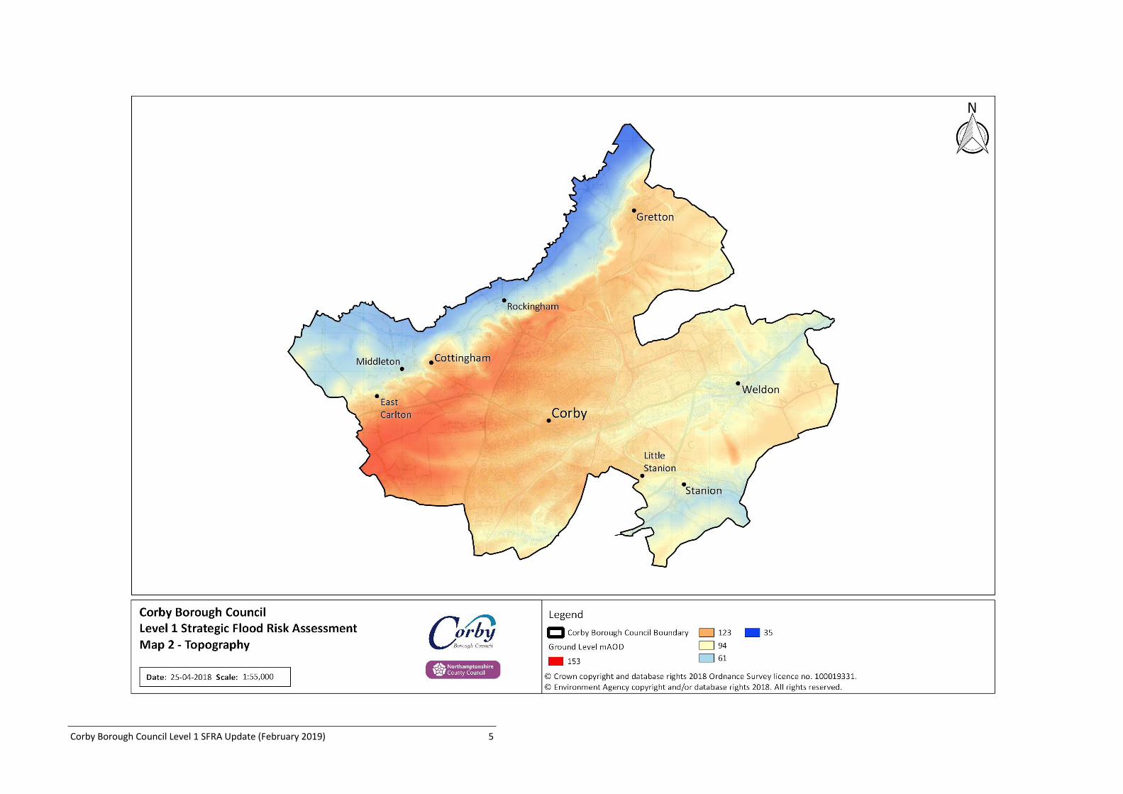
Map 2: Topography
Corby Borough Council Level 1 SFRA Update (February 2019) 6
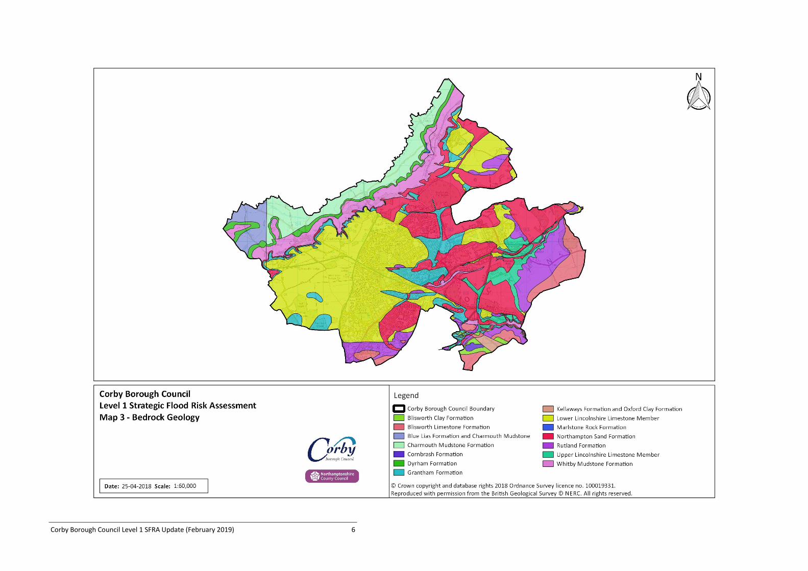
Map 3: Bedrock Geology
Corby Borough Council Level 1 SFRA Update (February 2019) 7
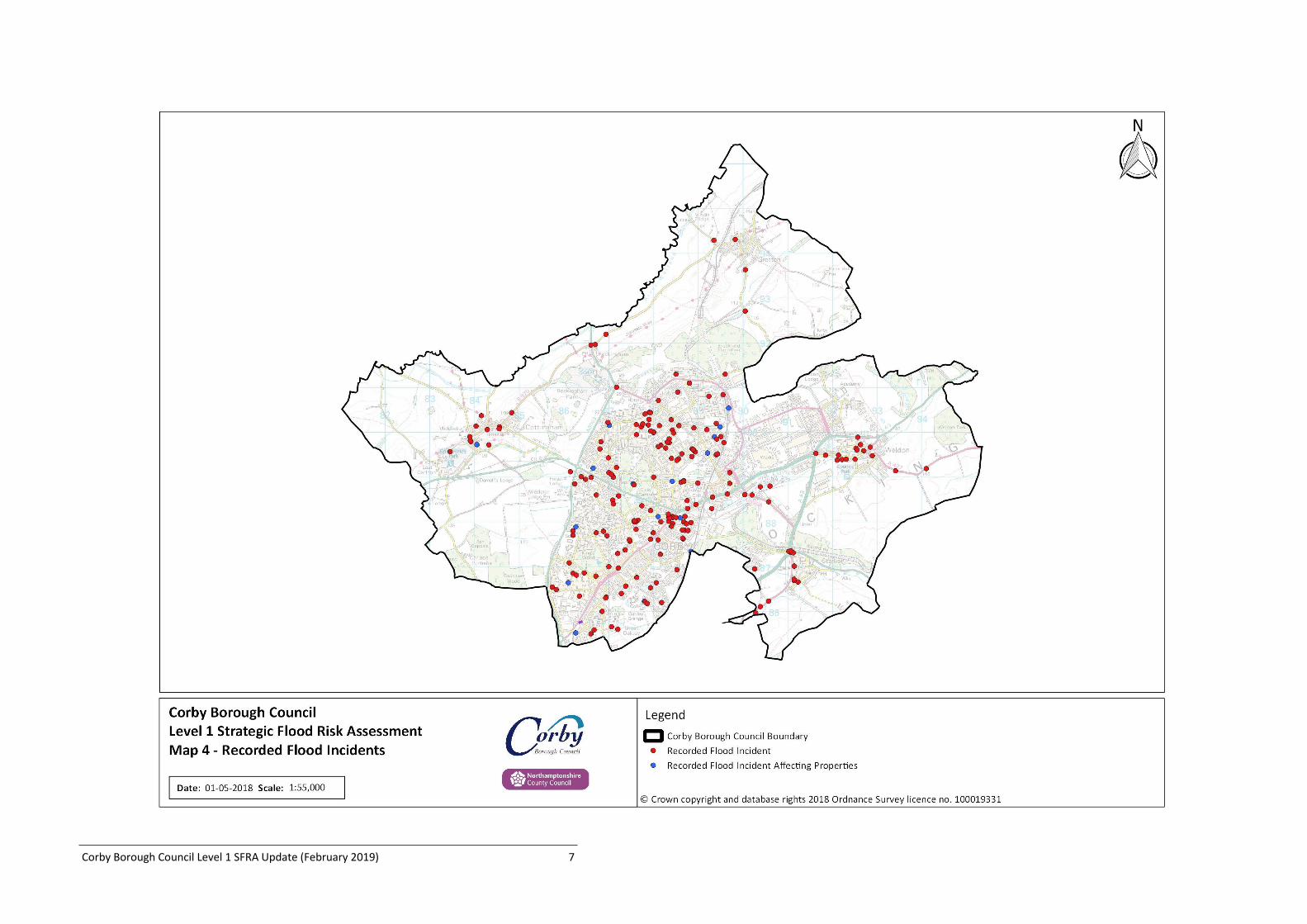
Map 4: Recorded Flood Incidents
Corby Borough Council Level 1 SFRA Update (February 2019) 8
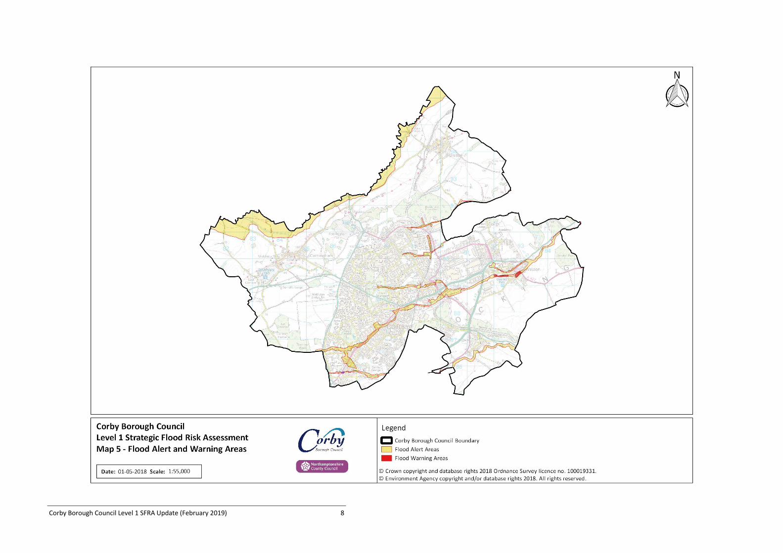
Map 5: Flood Alert and Warning Areas
Corby Borough Council Level 1 SFRA Update (February 2019) 9
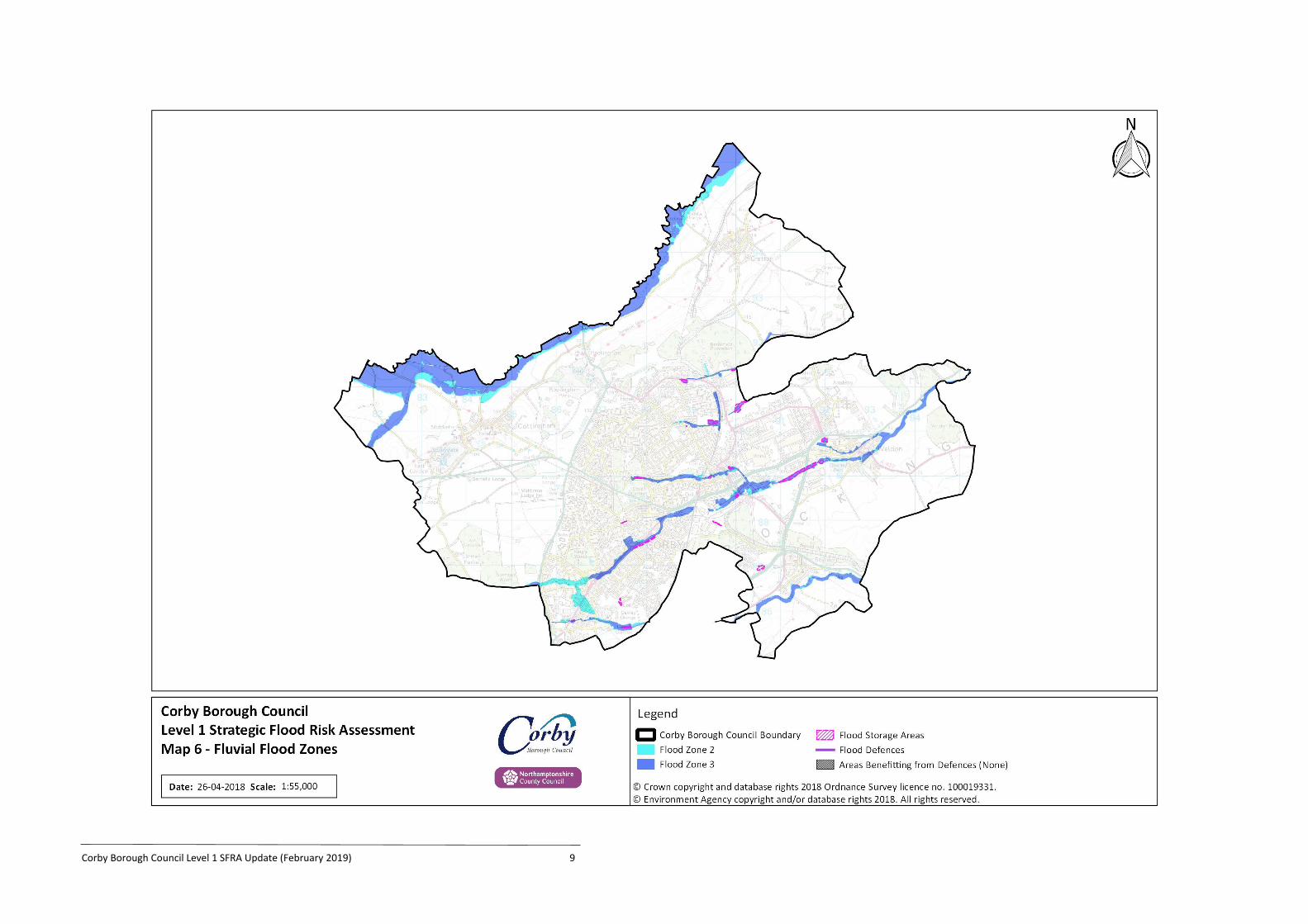
Map 6: Fluvial Flood Zones
Corby Borough Council Level 1 SFRA Update (February 2019) 10
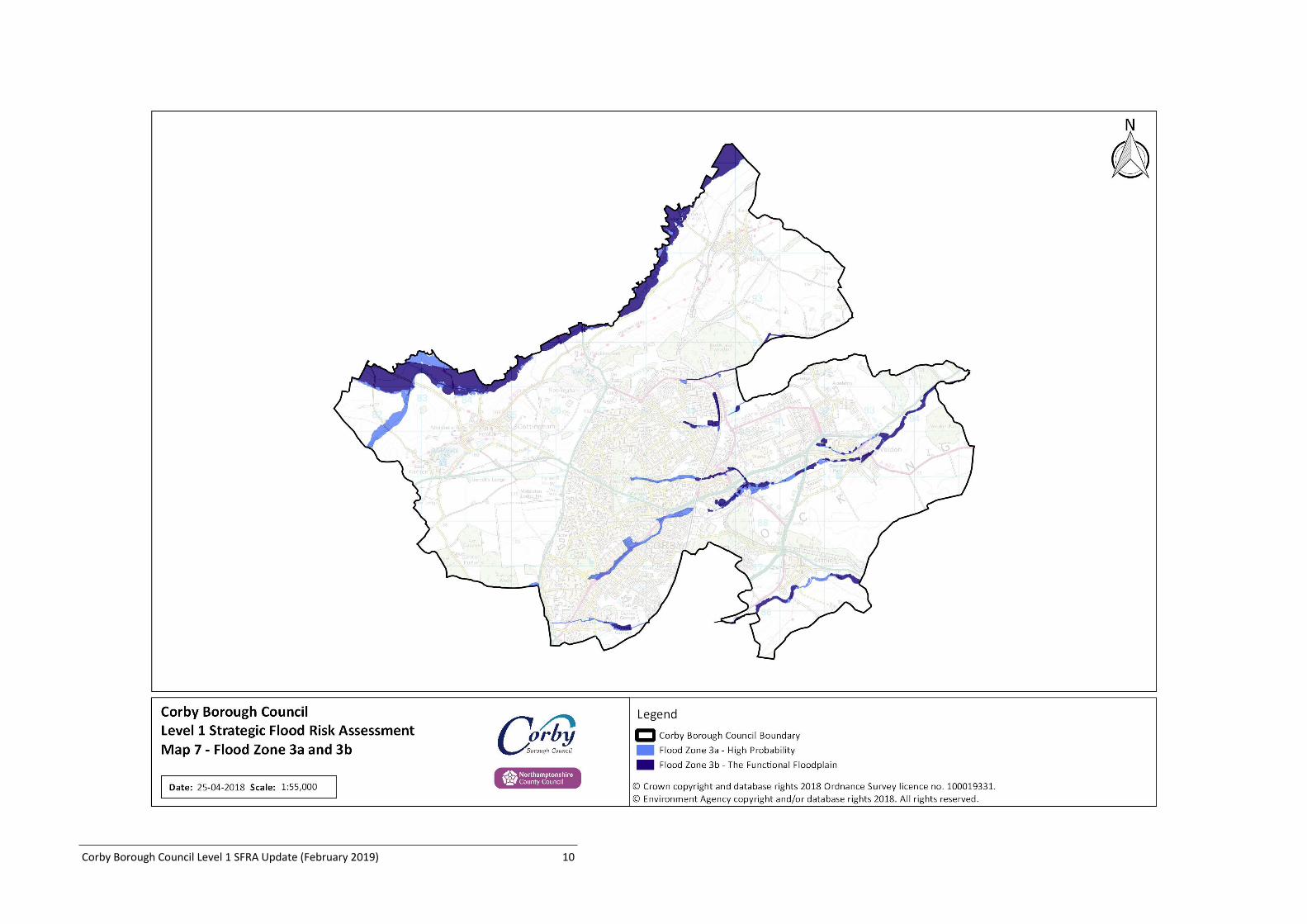
Map 7: Flood Zone 3a and 3b
Corby Borough Council Level 1 SFRA Update (February 2019) 11
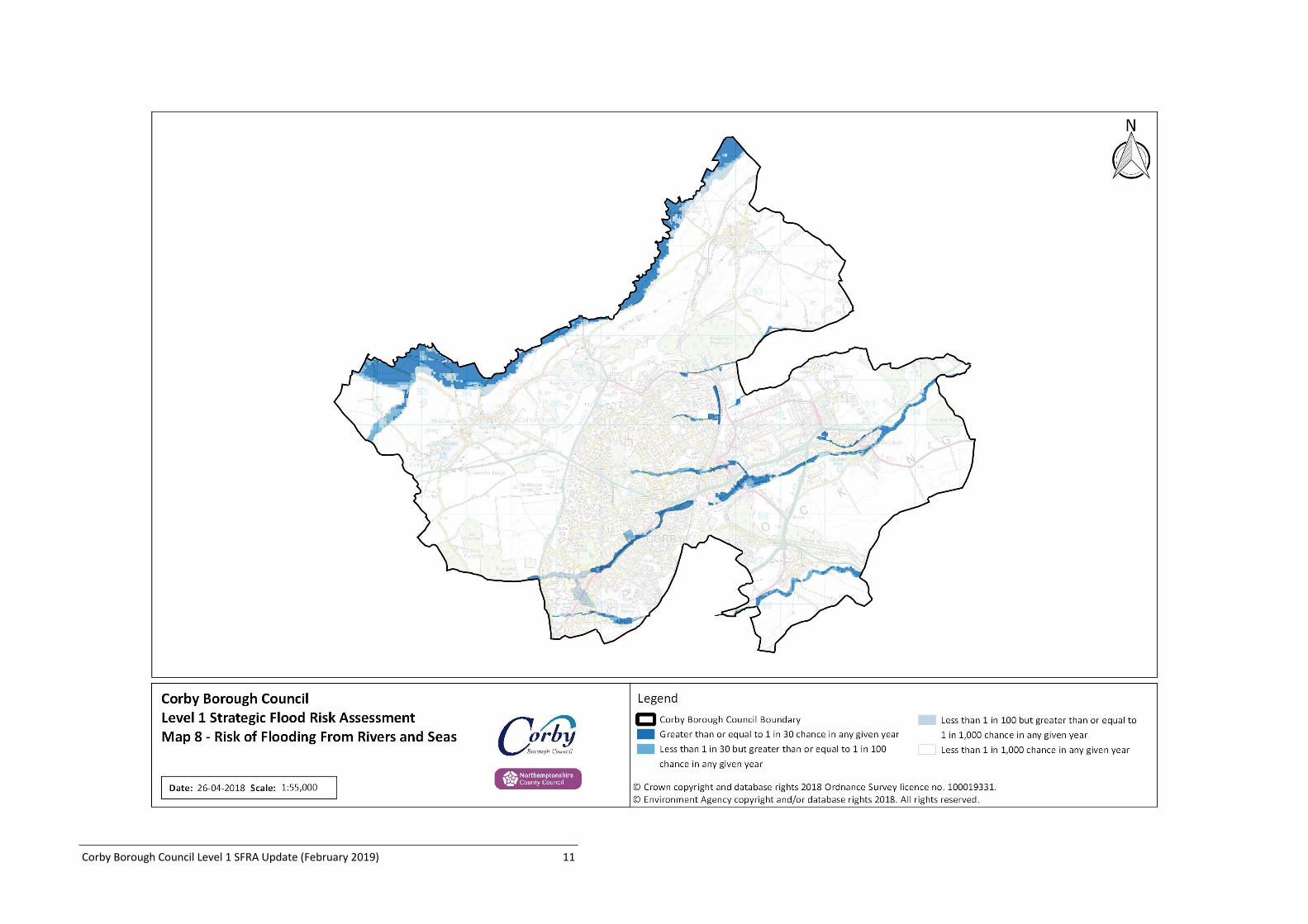
Map 8: Risk of Flooding From Rivers and Seas
Corby Borough Council Level 1 SFRA Update (February 2019) 12
Map 9: Risk of Flooding From Surface Water
Corby Borough Council Level 1 SFRA Update (February 2019) 13
Map 10: Groundwater Flood Risk
Corby Borough Council Level 1 SFRA Update (February 2019) 14
Map 11: Flood Storage and Water Supply Reservoirs
Corby Borough Council Level 1 SFRA Update (February 2019) 15
Map 12: Potential Development Sites
Corby Borough Council Level 1 SFRA Update (February 2019) 16
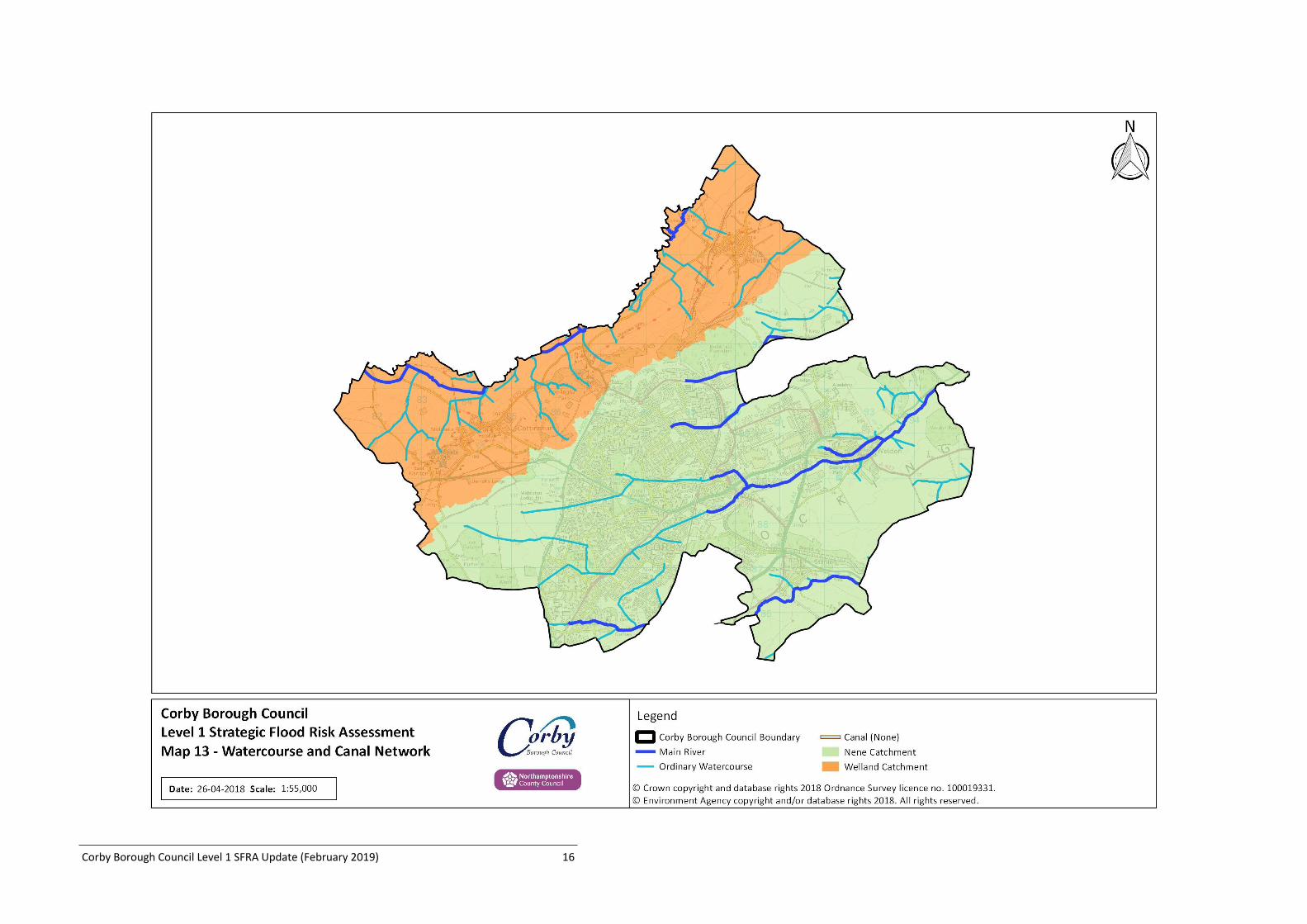
Map 13: Watercourse and Canal Network
Related Documents