Connecting people, society and the economy to a location UNSC Learning Centre 25 February 2013 Peter Harper Deputy Australian Statistician Australian Bureau of Statistics

Connecting people, society and the economy to a location UNSC Learning Centre 25 February 2013 Peter Harper Deputy Australian Statistician Australian Bureau.
Dec 18, 2015
Welcome message from author
This document is posted to help you gain knowledge. Please leave a comment to let me know what you think about it! Share it to your friends and learn new things together.
Transcript

Connecting people, society and the economy to a location
UNSC Learning Centre25 February 2013
Peter HarperDeputy Australian StatisticianAustralian Bureau of Statistics

Background
• Establishment of the Global Geographic Information Management (GGIM) initiative by the UN Economic and Social Council.
• Increasing demand for small area statistics.• Recognition of the value of linking socio-
economic information to location.

The UN Economic and Social Council says
“The work on global geospatial information management over the past two to three years has confirmed that one of the
key challenges is a better integration of geospatial and statistical information as a basis for sound and evidence-based decision-making.”
Secretary-General, UN Economic and Social Council (2012)
International Drivers

Other International Drivers
• Post – 2015 Development Agenda• Sustainable Development (Rio+20)

SpatialData
Statistics &Administrative
Data
Evidence used forPolicy Decisions
FundingLevels
Information SupportingGovernment Decision Making
Built and NaturalEnvironment Focus
(primarily spatial attributes)
People & Economic FocusHealth, Education, Welfare
(primarily non-spatial attributes)
Spatial Community
Moving towards LOCATION
Moving towards PEOPLE
Statistical Community

GGIM August 2012
• Identified 9 thematic issues.– One issue is the “linking of statistics to location”.
• UNSD recommended a Programme Review of national spatial activities and spatial activities of NSO.– Australian Bureau of Statistics offered to undertake
Review
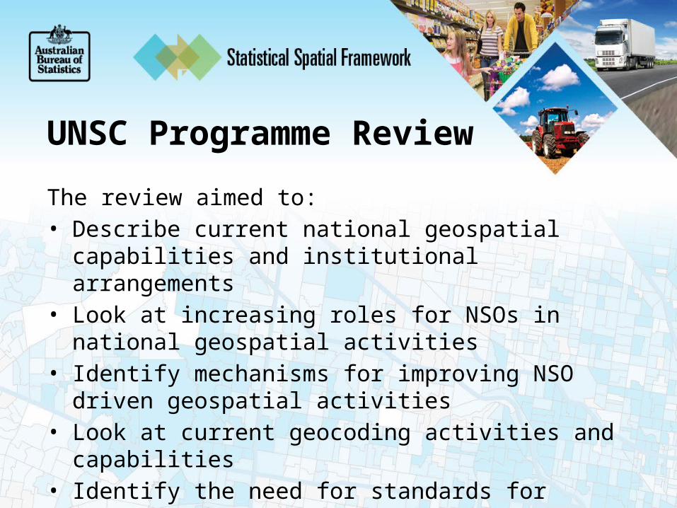
UNSC Programme Review
The review aimed to:• Describe current national geospatial capabilities and
institutional arrangements• Look at increasing roles for NSOs in national geospatial
activities• Identify mechanisms for improving NSO driven geospatial
activities• Look at current geocoding activities and capabilities• Identify the need for standards for linking statistics to
location
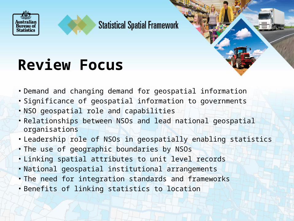
Review Focus
• Demand and changing demand for geospatial information• Significance of geospatial information to governments• NSO geospatial role and capabilities• Relationships between NSOs and lead national geospatial organisations• Leadership role of NSOs in geospatially enabling statistics• The use of geographic boundaries by NSOs• Linking spatial attributes to unit level records• National geospatial institutional arrangements• The need for integration standards and frameworks• Benefits of linking statistics to location
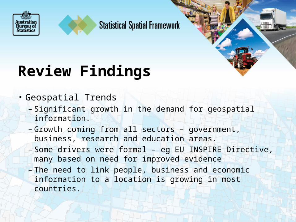
Review Findings
• Geospatial Trends– Significant growth in the demand for geospatial information.– Growth coming from all sectors – government, business,
research and education areas.– Some drivers were formal – eg EU INSPIRE Directive, many
based on need for improved evidence– The need to link people, business and economic information
to a location is growing in most countries.

Review Findings
• NSO geospatial capability– A broad range of geospatial capabilities existed across NSOs from
highly sophisticated and capable to very basic capabilities and almost non existent.
• Spatial and Statistical Institutional Arrangements – three broad categories:– Fully integrated eg Mexico and Brazil– Separate agencies but closely linked– Separate agencies with minimal interaction
Review Findings
• Benefits of linking statistics to location– Most governments and NSOs recognised the
benefits of linking socio-economic information to location
– “the geographic dimension enriched statistical data to generate better information that was essential to support Government decisions”
Review Findings
• Common Themes– Most countries used formal geographic boundaries to
link statistics to• Most were existing administrative boundaries – local
government areas etc. Not population based boundaries
– Many NSOs undergoing infrastructure transformations providing an opportunity to add the geospatial dimension to statistics business activities.
Most Significant Findings
– Overwhelming agreement of the need to link socio-economic information to location
– NSOs expressed concern at the lack of standards for linking statistical information to location
– NSOs recognised the need for the development of relevant standards and the significant benefits that would result from such a standard

Proposed Future Directions
• Greater collaboration between geospatial and statistical communities at national and international levels through:
• Outreach – relevant conferences• Best practice guidelines• Partnerships between statistical and geospatial
agencies

Proposed Future Directions
• Adopt a common approach to linking statistics to location• Establish an international statistical geospatial framework
– Establish an expert group• review current practises especially the ABS developed Statistical
Spatial Framework.
– Hold a conference focussed on the linkage of statistics to location.

What is Required?
A bridge linking the spatial andstatistical communities
SpatialCommunity
StatisticsCommunity

An International Framework
• What might this look like?• What elements might be required?• ABS Statistical Spatial Framework as an
example.

ABS Statistical Spatial FrameworkAims to:– Provide the statistical context equivalent of topography, roads,
rivers and boundaries – Provide a consistent approach to ‘people-centric decision
making and service delivery focussed activities
– Add value to administrative data by providing a common location based methodology

ABS Statistical Spatial FrameworkA Spatial Statistical Framework will establish a series of layers of socio-economicinformation on topof the traditional spatial data layers

Metadata
Common geographic boundaries
Data management: geo-referenced unit record data
Agreed and authoritative geocoding
Best Practice
Stat
istic
al S
patia
l Fra
mew
ork

Issues
• Establishing internationally agreed approach to building a population-centric set of national geographic boundaries.
• Developing capability to geocode addresses.• Integrating spatial and statistical metadata.

Benefits of a Common Approach
• Provide the ability to make comparisons on geographic areas with similar population numbers at national and international levels.
• Improve information for decision making for government, commercial and research communities.

Benefits of a Common Approach
• Provide a consistent statistical geospatial integration approach, enabling shared capability development.
• Simplify the integration of socio-economic information using a consistent geospatial methodology.

Conclusion
• The need to link statistics to location is overwhelming.
• The lack of a common approach needs to be resolved.
• The use of the ABS developed SSF could provide a simple, and useful approach supporting both developed and developing countries
Related Documents