COMPUTERS AND COMPUTERS AND STATISTICS IN STATISTICS IN ARCHAEOLOGY ARCHAEOLOGY Week 5. Geographic Week 5. Geographic Information Systems Information Systems (GIS) - 3 (GIS) - 3 © Richard Haddlesey www.medievalarchitecture.net

COMPUTERS AND STATISTICS IN ARCHAEOLOGY Week 5. Geographic Information Systems (GIS) - 3 © Richard Haddlesey .
Mar 27, 2015
Welcome message from author
This document is posted to help you gain knowledge. Please leave a comment to let me know what you think about it! Share it to your friends and learn new things together.
Transcript
COMPUTERS AND COMPUTERS AND STATISTICS IN STATISTICS IN
ARCHAEOLOGYARCHAEOLOGY
Week 5. Geographic Week 5. Geographic Information Systems (GIS) - 3Information Systems (GIS) - 3
© Richard Haddlesey www.medievalarchitecture.net
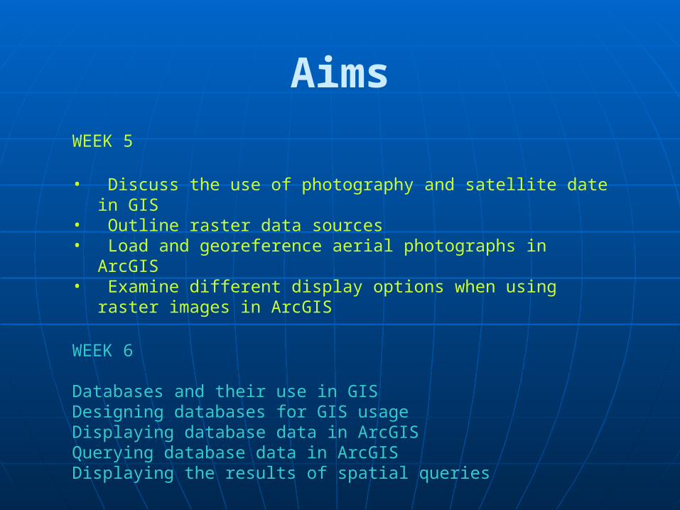
Aims
WEEK 5
• Discuss the use of photography and satellite date in GIS• Outline raster data sources• Load and georeference aerial photographs in ArcGIS• Examine different display options when using raster images in ArcGIS
WEEK 6
Databases and their use in GISDesigning databases for GIS usageDisplaying database data in ArcGISQuerying database data in ArcGISDisplaying the results of spatial queries
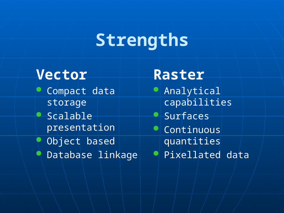
Strengths
Vector Compact data storage Scalable presentation Object based Database linkage
Raster Analytical capabilities Surfaces Continuous quantities Pixellated data
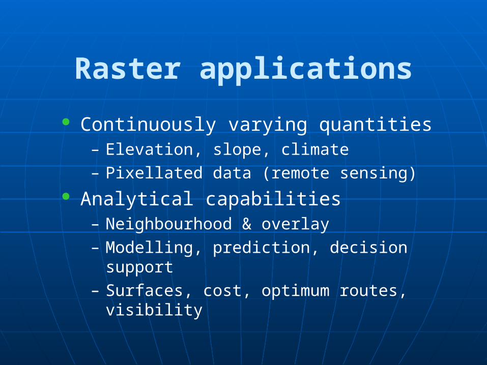
Raster applications
Continuously varying quantities– Elevation, slope, climate
– Pixellated data (remote sensing) Analytical capabilities
– Neighbourhood & overlay
– Modelling, prediction, decision support
– Surfaces, cost, optimum routes, visibility
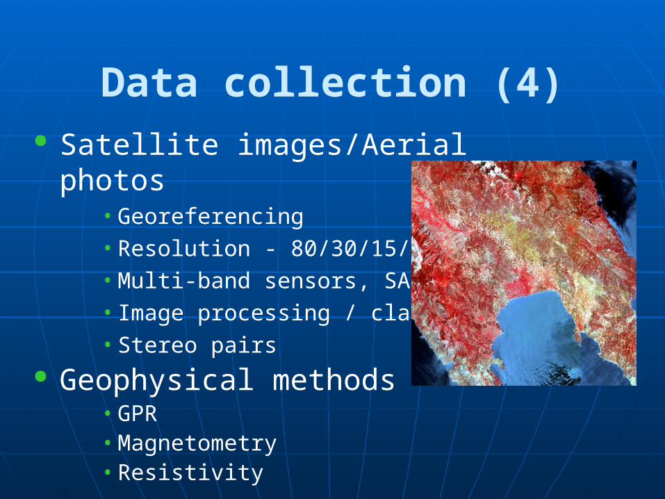
Data collection (4) Satellite images/Aerial photos
• Georeferencing
• Resolution - 80/30/15/10/5/3/2
• Multi-band sensors, SAR
• Image processing / classification
• Stereo pairs Geophysical methods
• GPR• Magnetometry• Resistivity
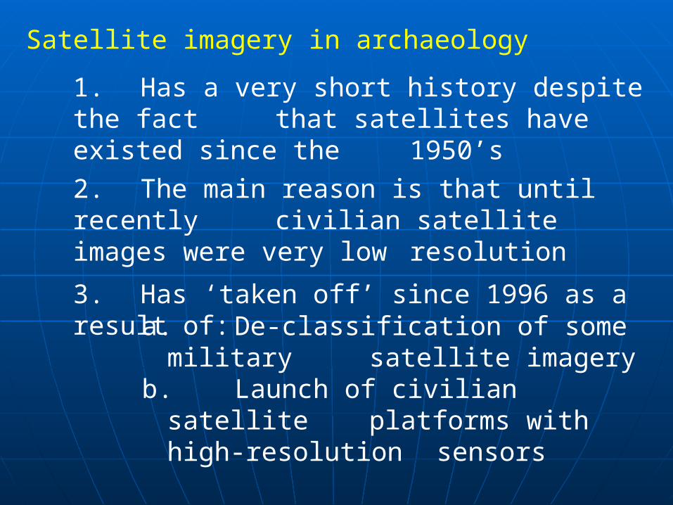
Satellite imagery in archaeology
1. Has a very short history despite the fact that satellites have existed since the
1950’s
2. The main reason is that until recently civilian satellite images were very low resolution
3. Has ‘taken off’ since 1996 as a result of: a. De-classification of some
military satellite imageryb. Launch of civilian satellite
platforms with high-resolution sensors
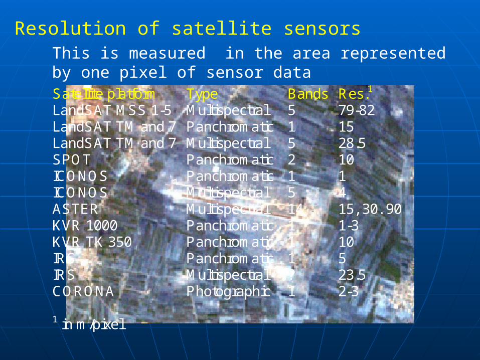
Resolution of satellite sensorsThis is measured in the area represented by one pixel of sensor dataSatellite platform Type Bands Res.1 LandSAT MSS 1-5 Multispectral 5 79-82 LandSAT TM and 7 Panchromatic 1 15 LandSAT TM and 7 Multispectral 5 28.5 SPOT Panchromatic 2 10 ICONOS Panchromatic 1 1 ICONOS Multispectral 5 4 ASTER Multispectral 14 15, 30. 90 KVR 1000 Panchromatic 1 1-3 KVR TK 350 Panchromatic 1 10 IRS Panchromatic 1 5 IRS Multispectral ? 23.5 CORONA Photographic 1 2-3 1 in m/pixel

1st May 1960
Gary Powers was shot down over Sverdlovsk
The US could not afford to suffer the same embarrassment again and
needed a means of acquiring high resolution photographs with limited risks. An upgraded CORONA was the answer
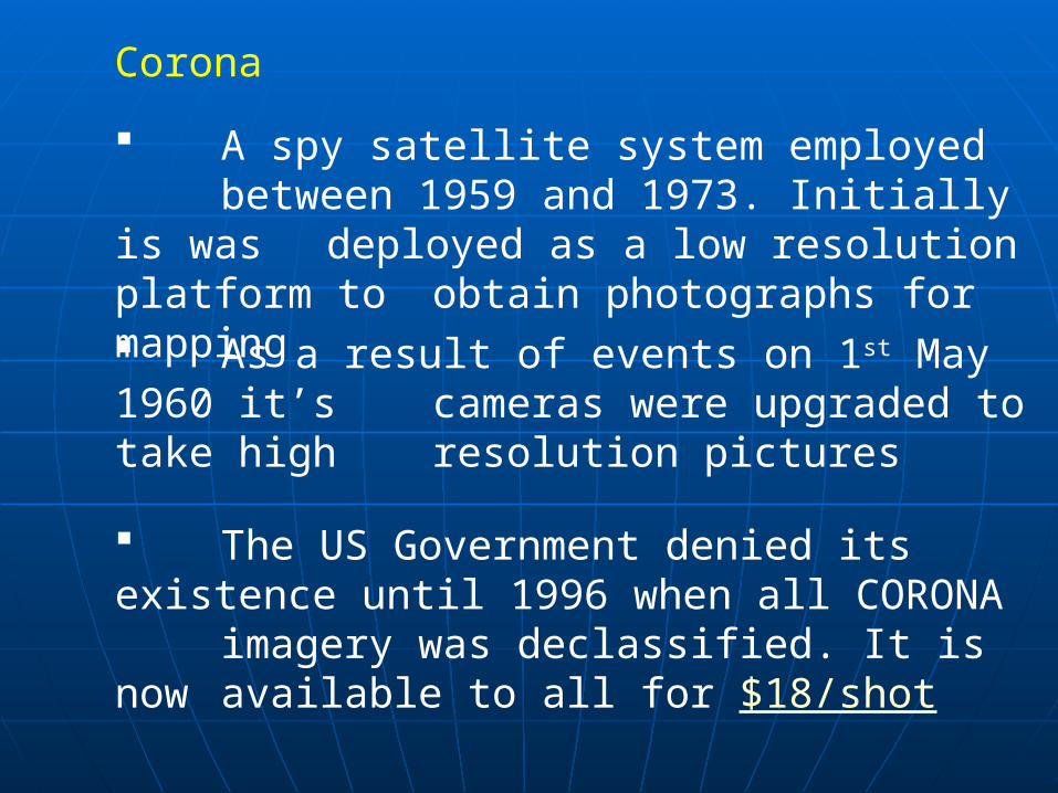
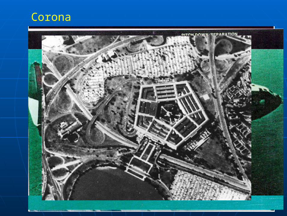
Corona
A spy satellite system employed between 1959 and 1973. Initially is was deployed as a low resolution platform to obtain photographs for mapping As a result of events on 1st May 1960 it’s cameras were upgraded to take high
resolution pictures
The US Government denied its existence until 1996 when all CORONA imagery was declassified. It is now available to all for $18/shot
Corona
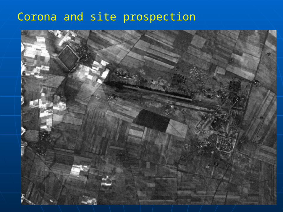
Corona and site prospection
CORONA satellites were mainly depoloyed over the Soviet Union and Warsaw Pact until 1967. Between 1967 and 1973 they were also deployed over the Middle East
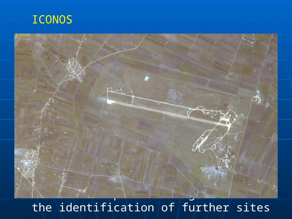
ICONOS
In 2002 imagery was commissioned from the ICONOS platform
ICONOS is the first of a new generation of civilian satellites able to acquire high-resolution multispectral data (EROS and Quickbird are two others)
ICONOS enables us to look at landscape changes in the last 20 years and to determine whether the additional spectral range enables the identification of further sites
Related Documents