KCI Technologies, Inc. October 1999 COMMUNITY SUMMARY SHEET Community Name: Alta Vista City/County: Montgomery Transportation Association: Trolley: Georgetown and Rockville Electric Railway Chronological/Development Periods: A.D. 1680-1815 A.D. 1815-1870 A.D. 1870-1930 A.D. 1930-Present specific dates (if known): 1901 Residential Property Types: Unplanned Suburban Neighborhoods Planned Suburban Neighborhoods developer planned / owner built) Planned Suburban Development (developer planned and built) Non-residential Property Types: Commercial and Industrial Properties Community Buildings Recreation/Conservation Areas Not Applicable Associated International/National Trends: early suburbs/Picturesque Movement Elite suburb planning Industrial town planning post-World War I WPA housing post-World War II Associated Local/Regional Trends: retreat for wealthy expanding industry returning veterans expanding government (post-Civil War) expanding government (post-WW II) expansion of existing communities association with transportation mode Narrative: The Alta Vista neighborhood is located north of Bethesda in Montgomery County. Alta Vista was developed beginning in 1901 along the Georgetown and Rockville Electric Railway. The suburb was developed by J. H. Miller of the American Security and Trust Company and owned by the Bethesda Land Company. Alta Vista originally consisted of 222 acres divided into lots ranging from two to eight acres (Offutt 1996, 284). The streets are arranged in a discontinuous grid pattern and named after trees (Ibid.). During the first decades of the twentieth century, the lots in Alta Vista were re- subdivided several times to accommodate prospective buyers of modest means (Ibid.). Housing types found in Alta Vista include the four-square and the bungalow (Ibid.). The area north and east of Alta Vista, which is characterized by curvilinear streets, developed during the 1940s and 1950s. Bibliography: Crawford, Catherine. 1986. The Early Suburban Communities of Washington, D.C. Located in Montgomery County, Maryland.

Welcome message from author
This document is posted to help you gain knowledge. Please leave a comment to let me know what you think about it! Share it to your friends and learn new things together.
Transcript

KCI Technologies, Inc. October 1999
COMMUNITY SUMMARY SHEET Community Name: Alta Vista City/County: Montgomery Transportation Association: Trolley: Georgetown and Rockville Electric Railway
Chronological/Development Periods:
A.D. 1680-1815 A.D. 1815-1870 A.D. 1870-1930 A.D. 1930-Present
specific dates (if known): 1901 Residential Property Types:
Unplanned Suburban Neighborhoods Planned Suburban Neighborhoods
developer planned / owner built) Planned Suburban Development
(developer planned and built) Non-residential Property Types:
Commercial and Industrial Properties Community Buildings Recreation/Conservation Areas Not Applicable
Associated International/National Trends:
early suburbs/Picturesque Movement Elite suburb planning Industrial town planning post-World War I WPA housing post-World War II
Associated Local/Regional Trends:
retreat for wealthy expanding industry returning veterans expanding government (post-Civil War) expanding government (post-WW II) expansion of existing communities association with transportation mode
Narrative: The Alta Vista neighborhood is located north of Bethesda in Montgomery County. Alta Vista was developed beginning in 1901 along the Georgetown and Rockville Electric Railway. The suburb was developed by J. H. Miller of the American Security and Trust Company and owned by the Bethesda Land Company. Alta Vista originally consisted of 222 acres divided into lots ranging from two to eight acres (Offutt 1996, 284). The streets are arranged in a discontinuous grid pattern and named after trees (Ibid.). During the first decades of the twentieth century, the lots in Alta Vista were re-subdivided several times to accommodate prospective buyers of modest means (Ibid.). Housing types found in Alta Vista include the four-square and the bungalow (Ibid.). The area north and east of Alta Vista, which is characterized by curvilinear streets, developed during the 1940s and 1950s. Bibliography: Crawford, Catherine. 1986. The Early Suburban Communities of Washington, D.C. Located in Montgomery County,
Maryland.

KCI Technologies, Inc. October 1999
COMMUNITY SUMMARY SHEET Community Name: Alta Vista Bibliography: (continued) Offutt, William. 1996. Bethesda, A Social History of the Area through World War Two. Bethesda, MD: The Innovation
Game. Real Estate Atlas of Montgomery County, Maryland. Situs Ownership Volume - Subdivisions. Recorded Subdivision
Maps. Vol 1, pp. 2-4. United States Geological Survey (USGS). 1965. Kensington Quadrangle. Washington, D.C.: USGS.

KCI Technologies, Inc. November 1999
COMMUNITY SUMMARY SHEET Community Name: Bannockburn Heights City/County: Montgomery Transportation Association: Trolley: Washington and Glen Echo Railroad, West Washington and Great Falls Railroad.
Chronological/Development Periods:
A.D. 1680-1815 A.D. 1815-1870 A.D. 1870-1930 A.D. 1930-Present
specific dates (if known): 1917, 1936 Residential Property Types:
Unplanned Suburban Neighborhoods Planned Suburban Neighborhoods
developer planned / owner built) Planned Suburban Development
(developer planned and built) Non-residential Property Types:
Commercial and Industrial Properties Community Buildings Recreation/Conservation Areas Not Applicable
Associated International/National Trends:
early suburbs/Picturesque Movement Elite suburb planning Industrial town planning post-World War I WPA housing post-World War II
Associated Local/Regional Trends:
retreat for wealthy expanding industry returning veterans expanding government (post-Civil War) expanding government (post-WW II) expansion of existing communities association with transportation mode
Narrative: Bannockburn Heights is located southwest of Bethesda in Montgomery County. The Bannockburn Heights Improvement Company under Henry A. Lewis acquired a large parcel of land from William McGeorge, Jr. et al. in 1917. The Bannockburn Country Club and Bannockburn Golf Cub were established on nearby sites around the same time, and trolley lines operated by the Washington and Glen Echo Railroad and West Washington and Great Falls Railroad were a short distance away (Offutt 1996, 87-89, 115). The Bannockburn Heights Improvement Company did not file subdivision plats until 1936, however houses had already been constructed on many of the lots by that time. Bannockburn Heights featured discontinuous, curving streets lined with approximately 50 lots. The lots ranged in size from 0.4 to 2 acres. Most of the community developed between 1917 and 1945, however not all of the streets depicted on the plats were constructed. The two communities to the west of Bannockburn Heights, Bannockburn and Bannockburn Estates, developed between 1945 and 1965. Bibliography: Offut, William. 1996. Bethesda, A Social History of the Area through World War II. 3d. ed. Bethesda, MD: The
Innovation Game.

KCI Technologies, Inc. November 1999
COMMUNITY SUMMARY SHEET Community Name: Bannockburn Heights Bibliography: (continued) Real Estate Atlas of Montgomery County, Maryland. Situs Ownership Volume – Subdivisions. Recorded Subdivision
Maps. Vol 1, pp. 611, 635, 732. United States Geological Survey (USGS). 1917. Washington and Vicinity Topographic Map. Washington, D.C.:
USGS. ------. 1944. Washington and Vicinity Topographic Map. Washington, D.C.: USGS. ------. 1965. Falls Church, VA-DC-MD Quadrangle Map. Washington, D.C.: USGS.

KCI Technologies, Inc. October 1999
COMMUNITY SUMMARY SHEET Community Name: Battery Park City/County: Montgomery County Transportation Association: Trolley: Georgetown and Rockville Electric Railway; Automobile: Old Georgetown Road
Chronological/Development Periods:
A.D. 1680-1815 A.D. 1815-1870 A.D. 1870-1930 A.D. 1930-Present
specific dates (if known): 1923 Residential Property Types:
Unplanned Suburban Neighborhoods Planned Suburban Neighborhoods
developer planned / owner built) Planned Suburban Development
(developer planned and built) Non-residential Property Types:
Commercial and Industrial Properties Community Buildings Recreation/Conservation Areas Not Applicable
Associated International/National Trends:
early suburbs/Picturesque Movement Elite suburb planning Industrial town planning post-World War I WPA housing post-World War II
Associated Local/Regional Trends:
retreat for wealthy expanding industry returning veterans expanding government (post-Civil War) expanding government (post-WW II) expansion of existing communities association with transportation mode
Narrative: Battery Park was the first project of Maddux, Marshall and Company. This company, created by retired Army officers Henry Cabell Maddux, Richard C. Marshall, Jr., James A. Moss and C. K. Mallory, developed middle class suburbs during the 1920s in Montgomery County. The company acquired the land on which Battery Park was located in 1922 and filed subdivision plats in 1923. Battery Park featured a system of curving, discontinuous streets lined with approximately 200 lots. Maddux, Marshall and Company offered eight house types ranging from Bungalow to Spanish Revival to Colonial Revival. Clients were also free to submit their own plans for approval. A clubhouse was constructed in 1923, and a commercial area developed along Old Georgetown Road. Advertisements for Battery Park targeted military veterans through journals and magazines. Lots sold quickly, and the subdivision was almost completely constructed by 1940. Maddux, Marshall and Company also constructed houses in Edgemoor and Garrett Park (Offutt 1996, 318-323; Hiebert and MacMaster 1976, 268). Bibliography: Hiebert, Ray Eldon and Richard K. MacMaster. 1976. A Grateful Remembrance, The Story of Montgomery County,
Maryland. Rockville, MD: Montgomery County Government and Montgomery County Historical Society.

KCI Technologies, Inc. October 1999
COMMUNITY SUMMARY SHEET Community Name: Battery Park Bibliography: (continued) Offutt, William. 1996. Bethesda, A Social History of the Area through World War II. 3d. ed. Bethesda, MD: The
Innovation Game. Real Estate Atlas of Montgomery County, Maryland. Situs Ownership Volume – Subdivisions. Recorded Subdivision
Maps. Vol. 1, pp. 416. Rebeck, Andrea. 1987. Montgomery County in the Early Twentieth Century. Silver Spring, MD: Montgomery County
Preservation Commission and the Maryland Historical Trust.

KCI Technologies, Inc. October 1999
COMMUNITY SUMMARY SHEET Community Name: Bethesda City/County: Montgomery Transportation Association: Trolley: Georgetown and Rockville Electric Railway.
Chronological/Development Periods:
A.D. 1680-1815 A.D. 1815-1870 A.D. 1870-1930 A.D. 1930-Present
specific dates (if known): Residential Property Types:
Unplanned Suburban Neighborhoods Planned Suburban Neighborhoods
developer planned / owner built) Planned Suburban Development
(developer planned and built) Non-residential Property Types:
Commercial and Industrial Properties Community Buildings Recreation/Conservation Areas Not Applicable
Associated International/National Trends:
early suburbs/Picturesque Movement Elite suburb planning Industrial town planning post-World War I WPA housing post-World War II
Associated Local/Regional Trends:
retreat for wealthy expanding industry returning veterans expanding government (post-Civil War) expanding government (post-WW II) expansion of existing communities association with transportation mode
Narrative: Bethesda began as a 19th-century rural village at the intersection of Rockville Pike and Georgetown Road. Following the opening of the Georgetown and Rockville Electric Railway in 1891, Bethesda began grow as the center of a group of residential subdivisions. Among the subdivisions closely associated with Bethesda in this period were Sonoma (1912), Huntington Terrace (1910), Edgemoor (1912), and Bradley Hills (1912). These subdivisions generally attracted upper-middle class and affluent residents. During the period between World War I and World War II, building in Bethesda and Montgomery County boomed. Subdivisions such as Greenwich Forest (1932), Battery Park (1923), and Kenwood (1928) continued to grow around Bethesda, and the community began to develop a central business district around Old Georgetown Road and Wisconsin Avenue. Construction of the National Institutes of Health in 1938 spurred further residential and commercial development into the 1940s. Continued development through the 1950s ensured that Bethesda would remain a suburban center. Following the opening of the Bethesda Metro stop in 1984, many older buildings in Bethesda were replaced with modern buildings. The central business district emerged as a regional retail and business center during the 1990s (M-NCPPC 1994, 236-237).

KCI Technologies, Inc. October 1999
COMMUNITY SUMMARY SHEET Community Name: Bethesda Bibliography: Allman, William G. 1991. Bethesda Park: “The Handsomest Park in the United States.” The Montgomery County
Story. 34 (3): 165-176. Hiebert, Ray Eldon and Richard K. MacMaster. 1976. A Grateful Remembrance, The Story of Montgomery County,
Maryland. Rockville, MD: Montgomery County Government and Montgomery County Historical Society. Hopkins, G. M. [1879] 1975. Atlas of Montgomery County, Maryland, 1879. Philadelphia: G.M. Hopkins. Rockville,
MD: Montgomery County Historical Society. Maryland – National Capital Park and Planning Commission (M-NCPPC), Montgomery County Planning Department.
1994. The Bethesda Central Business District Sector Plan. Silver Spring, MD: M-NCPPC. Offutt, William. 1996. Bethesda: A Social History. Bethesda, MD: The Innovation Game. United States Geological Survey (USGS). 1917. Washington and Vicinity Topographic Map. Washington, D.C.:
USGS. ------. 1944. Washington and Vicinity Topographic Map. Washington, D.C.: USGS. ------. 1951. Washington West, MD Quadrangle Map. Washington, D.C.: USGS. ------. 1956. Kensington, MD Quadrangle Map. Washington, D.C.: USGS. ------. 1965. Kensington, MD Quadrangle Map. Washington, D.C.: USGS. ------. 1965. Washington West, MD Quadrangle Map. Washington, D.C.: USGS.

KCI Technologies, Inc. October 1999
COMMUNITY SUMMARY SHEET Community Name: Bradley Hills Grove City/County: Montgomery Transportation Association: Automobile: Bradley Boulevard
Chronological/Development Periods:
A.D. 1680-1815 A.D. 1815-1870 A.D. 1870-1930 A.D. 1930-Present
specific dates (if known): 1935 Residential Property Types:
Unplanned Suburban Neighborhoods Planned Suburban Neighborhoods
developer planned / owner built) Planned Suburban Development
(developer planned and built) Non-residential Property Types:
Commercial and Industrial Properties Community Buildings Recreation/Conservation Areas Not Applicable
Associated International/National Trends:
early suburbs/Picturesque Movement Elite suburb planning Industrial town planning post-World War I WPA housing post-World War II
Associated Local/Regional Trends:
retreat for wealthy expanding industry returning veterans expanding government (post-Civil War) expanding government (post-WW II) expansion of existing communities association with transportation mode
Narrative: Bradley Hills Grove is located west of Bethesda in Montgomery County. The subdivision was created in 1935 by the Bradley Boulevard Development Corporation under J. Barrett Carter. Bradley Boulevard, constructed in 1913, made previously undeveloped land west of Bethesda accessible by both streetcar and automobile (Offutt 1996, 260-261). Although streetcar service ended in 1921, the area continued to develop through the 1950s. Bradley Hills Grove, located south of Bradley Boulevard, featured discontinuous, curving streets and lots of about one acre. About 10 houses had been constructed by 1945. Between 1945 and 1955, Bradley Hills Grove expanded to the west and south, growing to include approximately 130 houses. Growth slowed during the late 1950s. Bibliography: Offutt, William. 1996. Bethesda, A Social History of the Area through World War II. 3d. ed. Bethesda, MD: The
Innovation Game. Real Estate Atlas of Montgomery County, Maryland. Situs Ownership Volume – Subdivisions. Recorded Subdivision
Maps. Vol. 1, pp. 545, 553.

KCI Technologies, Inc. October 1999
COMMUNITY SUMMARY SHEET Community Name: Bradley Hills Grove Bibliography: (continued) United States Geological Survey (USGS). 1944. Washington and Vicinity Topographic Map. Washington, D.C.:
USGS. ------. 1956. Falls Church, VA-MD Quadrangle Map. Washington, D.C.: USGS. ------. 1956. Rockville, MD Quadrangle Map. Washington, D.C.: USGS. ------. 1965. Falls Church, VA-DC-MD Quadrangle Map. Washington, D.C.: USGS. ------. 1965. Rockville, MD Quadrangle Map. Washington, D.C.: USGS.

KCI Technologies, Inc. October 1999
COMMUNITY SUMMARY SHEET Community Name: Bradley Hills City/County: Montgomery Transportation Association: Trolley: Washington and Great Falls Railway.
Chronological/Development Periods:
A.D. 1680-1815 A.D. 1815-1870 A.D. 1870-1930 A.D. 1930-Present
specific dates (if known): 1912 Residential Property Types:
Unplanned Suburban Neighborhoods Planned Suburban Neighborhoods
(developer planned / owner built) Planned Suburban Development
(developer planned and built) Non-residential Property Types:
Commercial and Industrial Properties Community Buildings Recreation/Conservation Areas Not Applicable
Associated International/National Trends:
early suburbs/Picturesque Movement Elite suburb planning Industrial town planning post-World War I WPA housing post-World War II
Associated Local/Regional Trends:
retreat for wealthy expanding industry returning veterans expanding government (post-Civil War) expanding government (post-WW II) expansion of existing communities association with transportation mode
Narrative: Bradley Hills is located west of Bethesda in Montgomery County. The subdivision was the project of several development corporations, including the Great Falls Land Company and the Real Estate Trust Company. It was the largest subdivision in metropolitan Washington D.C. at the time. Bradley Hills was laid out on 80 acres of land acquired by M. Willson Offutt of Bethesda in 1888. The subdivision plats, filed from 1912 to 1922, show a pattern of discontinuous, curving streets. Large houses on large lots were to line Bradley Avenue, the main street of the subdivision, while smaller houses and lots were to be located on the outskirts. Bradley Avenue and the Washington and Great Falls Railway trolley line opened in 1913, by which time six large houses had been constructed at the eastern edge of the development. Plans for future development included a school, a 150-acre country club, and a small development laid out in the style of an “English Village.” However, due to the depression of the late 1910s and World War I, very little of Bradley Hills was completed as planned. The founding corporations bowed out in the late 1910s, and streetcar service was discontinued in 1921. During the building boom of the 1920s, new developers invested in unbuilt areas of Bradley Hills. Other areas were developed as apartment housing during World War II (Offutt 1996, 258-265).

KCI Technologies, Inc. October 1999
COMMUNITY SUMMARY SHEET Community Name: Bradley Hills Bibliography: Offut, William. 1996. Bethesda, A Social History of the Area through World War II. 3d. ed. Bethesda, MD: The
Innovation Game. Real Estate Atlas of Montgomery County, Maryland. Situs Ownership Volume – Subdivisions. Recorded Subdivision
Maps. Vol. 1, pp. 11-18, 230. United States Geological Survey (USGS). 1917. Washington and Vicinity Topographic Map. Washington, D.C.:
USGS. ------. 1944. Washington and Vicinity Topographic Map. Washington, D.C.: USGS. ------. 1965. Falls Church, VA-DC-MD Quadrangle Map. Washington, D.C.: USGS.

KCI Technologies, Inc. October 1999
COMMUNITY SUMMARY SHEET Community Name: Bradmoor City/County: Montgomery Transportation Association: Automobile: Bradley Boulevard
Chronological/Development Periods:
A.D. 1680-1815 A.D. 1815-1870 A.D. 1870-1930 A.D. 1930-Present
specific dates (if known): 1940 Residential Property Types:
Unplanned Suburban Neighborhoods Planned Suburban Neighborhoods
developer planned / owner built) Planned Suburban Development
(developer planned and built) Non-residential Property Types:
Commercial and Industrial Properties Community Buildings Recreation/Conservation Areas Not Applicable
Associated International/National Trends:
early suburbs/Picturesque Movement Elite suburb planning Industrial town planning post-World War I WPA housing post-World War II
Associated Local/Regional Trends:
retreat for wealthy expanding industry returning veterans expanding government (post-Civil War) expanding government (post-WW II) expansion of existing communities association with transportation mode
Narrative: Bradmoor is located northwest of Bethesda in Montgomery County. The subdivision was established in 1940 on land owned by Philip and Sadie Milestone. William Yost managed construction of the houses. Bradmoor featured a loose grid of curving streets lined with lots of about 0.1 to 0.2 acres. Development initially concentrated around the 8500 blocks of Bradmoor Drive, Irvington Avenue and Hempstead Avenue. By the late 1950s, Bradmoor had expanded to Folkstone Road on the north and Ewing Drive on the west. The community included an elementary school and attracted employees of the nearby National Institutes of Health, which was established in 1938 (Offutt 1996, 400, 482). Bibliography: Offutt, William. 1996. Bethesda, A Social History of the Area through World War II. 3d. ed. Bethesda, MD: The
Innovation Game. Real Estate Atlas of Montgomery County, Maryland. Situs Ownership Volume – Subdivisions. Recorded Subdivision
Maps. Vol. 1, p. 1177.

KCI Technologies, Inc. October 1999
COMMUNITY SUMMARY SHEET Community Name: Bradmoor Bibliography: (continued) United States Geological Survey (USGS). 1944. Washington and Vicinity Topographic Map. Washington, D.C.:
USGS. ------. 1951. Washington West, DC-MD-VA Quadrangle Map. Washington, D.C.: USGS. ------. 1965. Washington West, DC-MD-VA Quadrangle Map. Washington, D.C.: USGS.

KCI Technologies, Inc. November 1999
COMMUNITY SUMMARY SHEET Community Name: Burnt Mills Hills City/County: Montgomery Transportation Association: Automobile: Colesville Road, New Hampshire Avenue
Chronological/Development Periods:
A.D. 1680-1815 A.D. 1815-1870 A.D. 1870-1930 A.D. 1930-Present
specific dates (if known): 1934 Residential Property Types:
Unplanned Suburban Neighborhoods Planned Suburban Neighborhoods
developer planned / owner built) Planned Suburban Development
(developer planned and built) Non-residential Property Types:
Commercial and Industrial Properties Community Buildings Recreation/Conservation Areas Not Applicable
Associated International/National Trends:
early suburbs/Picturesque Movement Elite suburb planning Industrial town planning post-World War I WPA housing post-World War II
Associated Local/Regional Trends:
retreat for wealthy expanding industry returning veterans expanding government (post-Civil War) expanding government (post-WW II) expansion of existing communities association with transportation mode
Narrative: Burnt Mills Hills is located in the Burnt Mills community of Montgomery County. The subdivision was a project of the R. E. Latimer Land Company. The subdivision plats, filed beginning in 1934, show a central, circular drive with roads radiating out from it. Many of the roads ended in cul-de-sacs. Most of the lots in Burnt Mills Hills were about 1 acre, although those along Edelblut Drive measured 2 acres or more. Approximately 40 houses had been constructed by 1945. Burnt Mills Hills itself grew little after World War II, however other subdivisions, including Burnt Mills Knolls and Burnt Mills Village, were constructed around it during the 1950s and 1960s. Bibliography: Maryland – National Capital Park and Planning Commission. 1964. Hillandale & Vicinity Preliminary Master Plan. Silver
Spring, MD: M-NCPPC. Real Estate Atlas of Montgomery County, Maryland. Situs Ownership Volume – Subdivisions. Recorded Subdivision
Maps. Vol. 1, pp. 467, 498, 519, 698, . United States Geological Survey (USGS). 1944. Washington and Vicinity Topographic Map. Washington, D.C.:
USGS.

KCI Technologies, Inc. November 1999
COMMUNITY SUMMARY SHEET Community Name: Burnt Mills Hills Bibliography: (continued) ------. 1951. Beltsville, MD Quadrangle Map. Washington, D.C.: USGS ------. 1956. Kensington, MD Quadrangle Map. Washington, D.C.: USGS. ------. 1965. Beltsville, MD Quadrangle Map. Washington, D.C.: USGS ------. 1965. Kensington, MD Quadrangle Map. Washington, D.C.: USGS.

KCI Technologies, Inc. November 1999
COMMUNITY SUMMARY SHEET Community Name: Burnt Mills City/County: Montgomery Transportation Association: Automobile: Colesville Road, New Hampshire Avenue
Chronological/Development Periods:
A.D. 1680-1815 A.D. 1815-1870 A.D. 1870-1930 A.D. 1930-Present
specific dates (if known): Residential Property Types:
Unplanned Suburban Neighborhoods Planned Suburban Neighborhoods
developer planned / owner built) Planned Suburban Development
(developer planned and built) Non-residential Property Types:
Commercial and Industrial Properties Community Buildings Recreation/Conservation Areas Not Applicable
Associated International/National Trends:
early suburbs/Picturesque Movement Elite suburb planning Industrial town planning post-World War I WPA housing post-World War II
Associated Local/Regional Trends:
retreat for wealthy expanding industry returning veterans expanding government (post-Civil War) expanding government (post-WW II) expansion of existing communities association with transportation mode
Narrative: Burnt Mills was a rural agricultural community and mill seat from the late-18th century through the early 20th century. The suburbanization of the community began in 1934 with the creation of the Burnt Mills Hills subdivision. Other subdivisions followed in the mid-20th century, including Burnt Mills Village in 1948, Burnt Mills Gardens in 1948, Burnt Mills Knolls in 1952 and Burnt Mills Manor in 1954. The subdivisions are predominantly made up of single-family houses along curving, discontinuous streets. Schools and parks are located within the subdivisions, while commercial establishments line Colesville Road and New Hampshire Avenue. Burnt Mills was largely developed by the mid-1960s. (See also Community Summary for Burnt Mills Hills.) Bibliography: Cook, Eleanor M. V. 1992. The Story of Burnt Mills. The Montgomery County Story. 35 (4): 225-233. Maryland – National Capital Park and Planning Commission. 1997. Comprehensive Amendment to 1981 Eastern
Montgomery County Master Plan. Silver Spring, MD: M-NCPPC.

KCI Technologies, Inc. November 1999
COMMUNITY SUMMARY SHEET Community Name: Burnt Mills Bibliography: (continued) Real Estate Atlas of Montgomery County, Maryland. Situs Ownership Volume – Subdivisions. Recorded Subdivision
Maps. Vol. 2, pp. 190, 262, 292, 1074, 1640-1642, United States Geological Survey (USGS). 1917. Washington and Vicinity Topographic Map. Washington, D.C.:
USGS. ------. 1944. Washington and Vicinity Topographic Map. Washington, D.C.: USGS. ------. 1951. Beltsville, MD Quadrangle Map. Washington, D.C.: USGS ------. 1956. Kensington, MD Quadrangle Map. Washington, D.C.: USGS. ------. 1965. Beltsville, MD Quadrangle Map. Washington, D.C.: USGS ------. 1965. Kensington, MD Quadrangle Map. Washington, D.C.: USGS.

KCI Technologies, Inc. October 1999
COMMUNITY SUMMARY SHEET Community Name: Cabin John City/County: Montgomery Transportation Association: Trolley: Washington and Glen Echo Railroad (formerly Glen Echo Railroad), West Washington and Great Falls Railroad.
Chronological/Development Periods:
A.D. 1680-1815 A.D. 1815-1870 A.D. 1870-1930 A.D. 1930-Present
specific dates (if known): 1873, 1914 Residential Property Types:
Unplanned Suburban Neighborhoods Planned Suburban Neighborhoods
developer planned / owner built) Planned Suburban Development
(developer planned and built) Non-residential Property Types:
Commercial and Industrial Properties Community Buildings Recreation/Conservation Areas Not Applicable
Associated International/National Trends:
early suburbs/Picturesque Movement Elite suburb planning Industrial town planning post-World War I WPA housing post-World War II
Associated Local/Regional Trends:
retreat for wealthy expanding industry returning veterans expanding government (post-Civil War) expanding government (post-WW II) expansion of existing communities association with transportation mode
Narrative: Cabin John began as a popular weekend and summer resort for wealthy and well-known Washingtonians. The Cabin John Hotel, built in 1873 by the Bobinger family, included the hotel, summer houses, a theatre, and eventually an amusement park (Offutt 1996, 88-91). The resort reached its peak in the 1890s when streetcars from the Washington and Glen Echo Railroad (formerly the Glen Echo Railroad) and West Washington and Great Falls Railroad traveled between Cabin John and Washington, D.C. (MHT 1978b; Offutt 1996, 88). The Cabin John Hotel burned in 1931 after a long period of decline that was in part the result of competition from the neighboring Glen Echo Park (Offutt 1996, 120). The residential community had its beginnings in 1912 when J. S. Tomlinson of the American Land Company in Washington, D.C. bought 600 acres in Cabin John (Ibid., 120-123). In 1914, Tomlinson subdivided 155.9 acres of the property into lots of various sizes arranged along discontinuous, winding streets (MHT 1978b). Known as “Cabin John Park,” the subdivision attracted middle-class buyers, particularly government workers (Ibid.). The houses are varied in style and include an experimental “rammed earth” house built by the Humphrey family in 1923 (Ibid.). Cabin John’s greatest period of growth occurred between World War I and World War II (USGS 1917, 1944). However, in part because it was accessible mainly by trolley lines, the community never became very large (Offutt 1996, 131-132). With the exception of temporary housing constructed during World War II, the community grew little after the mid-20th century (Hiebert and MacMaster 1976, 331).

KCI Technologies, Inc. October 1999
COMMUNITY SUMMARY SHEET Community Name: Cabin John Bibliography: Hiebert, Ray Eldon and Richard K. MacMaster. 1976. A Grateful Remembrance, The Story of Montgomery County,
Maryland. Rockville, MD: Montgomery County Government and Montgomery County Historical Society. Maryland Historical Trust (MHT). 1978a. Maryland Historic Trust Inventory for State Historic Sites Inventory. Cabin
John Hotel Gas House. M:35-23. Crownsville, MD. ------. 1978b. Maryland Historic Trust Inventory for State Historic Sites Inventory. Rammed Earth House. M:35-22.
Crownsville, MD. Offut, William. 1996. Bethesda, A Social History of the Area through World War II. 3d. ed. Bethesda, MD: The
Innovation Game. United States Geological Survey (USGS). 1917. Washington and Vicinity Topographic Map. Washington, D.C.:
USGS. ------. 1944. Washington and Vicinity Topographic Map. Washington, D.C.: USGS. ------. 1965. Falls Church, VA-DC-MD Quadrangle Map. Washington, D.C.: USGS.

KCI Technologies, Inc. October 1999
COMMUNITY SUMMARY SHEET Community Name: Capitol View Park City/County: Montgomery Transportation Association: Baltimore and Ohio Railroad Metropolitan Branch.
Chronological/Development Periods:
A.D. 1680-1815 A.D. 1815-1870 A.D. 1870-1930 A.D. 1930-Present
specific dates (if known): 1887 Residential Property Types:
Unplanned Suburban Neighborhoods Planned Suburban Neighborhoods
developer planned / owner built) Planned Suburban Development
(developer planned and built) Non-residential Property Types:
Commercial and Industrial Properties Community Buildings Recreation/Conservation Areas Not Applicable
Associated International/National Trends:
early suburbs/Picturesque Movement Elite suburb planning Industrial town planning post-World War I WPA housing post-World War II
Associated Local/Regional Trends:
retreat for wealthy expanding industry returning veterans expanding government (post-Civil War) expanding government (post-WW II) expansion of existing communities association with transportation mode
Narrative: Capitol View Park is located east of Kensington in Montgomery County. The subdivision was first platted in 1887 on 123.5 acres of land owned by Mary Hart (MHT, Capitol View Park, 1979). The plat shows narrow, deep lots lining a loose grid of streets. The Capitol View Park railroad station of the Baltimore and Ohio Railroad Metropolitan Branch was constructed to the west circa 1890 (Ibid). Trolley lines never reached the subdivision (Clark 1987, 17). Capitol View Park grew slowly through the late 1880s with only a few Queen Anne-style dwellings constructed on large lots (MHT, Capitol View Park, 1980). In 1892, Hart and business partners Frederick Pratt, Alexander Proctor, and Martin Proctor began building houses to sell, however this venture was also unsuccessful, and the partners disbanded in 1895 (Clark 1987, 21). Although several bungalows were constructed during the 1920s, less than one-fourth of the lots had been developed by 1930 (Crawford, 1986, 12). A building boom occurred during the 1940s, and approximately 50 new houses were constructed. Development resumed its slow pace during the 1950s and continues to the present (MHT, Capitol View Park, 1980). All growth has been contained within the original boundaries of the 1887 plat. Bibliography: Capitol View Park Citizens Association. 1983. The Capitol View Revue. Clark, Judith Fisher. 1987. Capitol View Park: A Study of a Sequestered Suburb. College Park, Maryland. University
of Maryland.

KCI Technologies, Inc. October 1999
COMMUNITY SUMMARY SHEET Community Name: Capitol View Park Bibliography: (continued) Crawford, Catherine. 1986. The Early Suburban Communities of Washington, D.C. Located in Montgomery County,
Maryland. Maryland Historical Trust. 1979. Maryland Historical Trust Inventory Form. Capitol View Park. M:31-7. Crownsville,
MD. -----. 1980. Maryland Historical Trust Inventory Form. Capitol View Park. M:31-7. Crownsville, MD. Real Estate Atlas of Montgomery County, Maryland. Situs Ownership Volume – Subdivisions. Recorded Subdivision
Maps. Vol. 1, p. 24.

KCI Technologies, Inc. October 1999
COMMUNITY SUMMARY SHEET Community Name: Chevy Chase Terrace City/County: Montgomery Transportation Association: Trolley: Georgetown and Rockville Electric Railway; Early Automobile: Wisconsin Avenue
Chronological/Development Periods:
A.D. 1680-1815 A.D. 1815-1870 A.D. 1870-1930 A.D. 1930-Present
specific dates (if known): 1922 Residential Property Types:
Unplanned Suburban Neighborhoods Planned Suburban Neighborhoods
developer planned / owner built) Planned Suburban Development
(developer planned and built) Non-residential Property Types:
Commercial and Industrial Properties Community Buildings Recreation/Conservation Areas Not Applicable
Associated International/National Trends:
early suburbs/Picturesque Movement Elite suburb planning Industrial town planning post-World War I WPA housing post-World War II
Associated Local/Regional Trends:
retreat for wealthy expanding industry returning veterans expanding government (post-Civil War) expanding government (post-WW II) expansion of existing communities association with transportation mode
Narrative: The Chevy Chase Terrace neighborhood is located west of Chevy Chase in Montgomery County. Chevy Chase Terrace was developed beginning in 1922 along Wisconsin Avenue and the Georgetown and Rockville Electric Railroad. The developers were Massux and Starney of Rockville. This trolley and early-automobile suburb consists of narrow, deep lots arranged along a discontinuous grid street system. Several streets, such as Norwood Place and Chevy Chase Boulevard, were designed with parking areas in the medians. Most of Chevy Chase Terrace developed during the 1930s. Bibliography: Maryland Geological Survey (MGS). 1927. Map of Montgomery County. Real Estate Atlas of Montgomery County, Maryland. Situs Ownership Volume - Subdivisions. Recorded Subdivision
Maps. Vol. 1, pp. 242-243. United States Geological Survey (USGS). 1944. Washington and Vicinity Topographic Map. Washington D.C.: USGS.

KCI Technologies, Inc. October 1999
COMMUNITY SUMMARY SHEET Community Name: Chevy Chase View City/County: Montgomery Transportation Association: Trolley: Rock Creek Railway; Early Automobile: Connecticut Avenue
Chronological/Development Periods:
A.D. 1680-1815 A.D. 1815-1870 A.D. 1870-1930 A.D. 1930-Present
specific dates (if known): 1910, 1924 Residential Property Types:
Unplanned Suburban Neighborhoods Planned Suburban Neighborhoods
developer planned / owner built) Planned Suburban Development
(developer planned and built) Non-residential Property Types:
Commercial and Industrial Properties Community Buildings Recreation/Conservation Areas Not Applicable
Associated International/National Trends:
early suburbs/Picturesque Movement Elite suburb planning Industrial town planning post-World War I WPA housing post-World War II
Associated Local/Regional Trends:
retreat for wealthy expanding industry returning veterans expanding government (post-Civil War) expanding government (post-WW II) expansion of existing communities association with transportation mode
Narrative: The Chevy Chase View municipality is located south of Kensington in Montgomery County. Chevy Chase View was developed beginning in 1910 around Connecticut Avenue and the Rock Creek Railway. The suburb was incorporated in 1924. Chevy Chase View was developed by John L. Whitmore and Harry E. Smith (Crawford 1986, 37). The suburb consists of narrow, deep lots arranged along a grid street system. The municipality retains the boundaries of the original subdivision. They are: Kensington municipality on the north, Kensington Parkway on the east, Saul Road on the south and Cedar Lane on the west. Bibliography: Crawford, Catherine. 1986. The Early Suburban Communities of Washington, D.C. Located in Montgomery County,
Maryland. Real Estate Atlas of Montgomery County, Maryland. Situs Ownership Volume - Subdivisions. Recorded Subdivision
Maps. Vol. 1, p. 46.

KCI Technologies, Inc. October 1999
COMMUNITY SUMMARY SHEET Community Name: Chevy Chase City/County: Montgomery Transportation Association: Carriage: Connecticut Avenue; Trolley: Rock Creek Railway
Chronological/Development Periods:
A.D. 1680-1815 A.D. 1815-1870 A.D. 1870-1930 A.D. 1930-Present
specific dates (if known): 1893 Residential Property Types:
Unplanned Suburban Neighborhoods Planned Suburban Neighborhoods
developer planned / owner built) Planned Suburban Development
(developer planned and built) Non-residential Property Types:
Commercial and Industrial Properties Community Buildings Recreation/Conservation Areas Not Applicable
Associated International/National Trends:
early suburbs/Picturesque Movement Elite suburb planning Industrial town planning post-World War I WPA housing post-World War II
Associated Local/Regional Trends:
retreat for wealthy expanding industry returning veterans expanding government (post-Civil War) expanding government (post-WW II) expansion of existing communities association with transportation mode
Narrative: Chevy Chase is located in Montgomery County immediately northwest of the District of Columbia. The suburb was developed by Francis G. Newlands, a Senator from Nevada. In 1890, Newlands and Senator William M. Stewart, also of Nevada, created the Chevy Chase Land Company (MNCPPC 1997, 2). The Company acquired 1,712 acres of land along the proposed extension of Connecticut Avenue in the District and Montgomery County (Crawford 1986, 21). Engineer W. Kesley Schoepf, landscape architect Nathan F. Barrett and architect Lindley Johnson designed a suburb for the wealthy, with lots measuring 70 feet by 100 feet arranged along a grid of streets (Ibid.; George 1989, 188). The first lots were sold in 1893. The most expensive lots were located along Connecticut Avenue, while less expensive lots lined side streets perpendicular to the avenue (Levy 1980, 178). Chevy Chase grew slowly, with only 50 dwellings having been constructed by the turn of the century. By 1916, 145 dwellings had been constructed (MNCPPC 1997, 3; Crawford 1986, 22). These early dwellings were largely architect-designed and display a range of styles, including Queen Anne, Tudor Revival, Neo-Classical, Colonial Revival, and Shingle (MNCPPC 1997; 1-4). Residents of the new suburb were provided with water, electricity, and sewage. A trolley line to the city, known as the Rock Creek Railway, had been operating since 1892 (MNCPPC 1997, 2; Levy 1980, 178). Although

KCI Technologies, Inc. October 1999
COMMUNITY SUMMARY SHEET Community Name: Chevy Chase Narrative: (continued) commercial development was forbidden in Chevy Chase, Newlands did allow the development of institutions such as churches, schools, a library, and the Chevy Chase Club (Levy 1980, 178-180). Between World War I and 1930, as the automobile became common, Chevy Chase experienced a building boom and expanded in all directions (MNCPPC 1997, 4). The new residents were largely middle-class government and military employees (MHT M:35-13, 1996). They bought smaller lots along loosely-gridded streets surrounding the original Chevy Chase development. Craftsman, Colonial Revival, Mediterranean and Tudor Revival dwellings were common during this era (Ibid). Building activity slowed during the Great Depression and World War II. Following World War II, Chevy Chase again expanded, this time to the east and northwest. The loosely-gridded street pattern continued. Contemporary ranch and split level houses, as well as traditional designs were constructed at this time (MHT M:35-13, 1996). Development continued around the periphery of Chevy Chase through the 1960s and 1970s. Chevy Chase includes a historic district listed in the National Register of Historic Places. Bibliography: Crawford, Catherine. 1986. The Early Suburban Communities of Washington, D.C. Located in Montgomery County,
Maryland. George, Mary Roselle. 1986. Developer Influence in the Suburbanization of Washington, D.C.: Francis Newlands and
Chevy Chase. Master's Thesis, Univ. of Maryland. Levy, Anneli Moucka. 1980. Washington, D.C. and the Growth of its Early Suburbs, 1860-1920. Master's Thesis, Univ.
of Maryland. Maryland Historical Trust (MHT). 1996. State Historic Sites Inventory Form. Chevy Chase Village Survey District,
Montgomery County, Maryland. M:35-13. Crownsville, MD. Maryland Historical Trust (MHT). 1997. Maryland Inventory of Historic Properties Form. Chevy Chase Survey District
(Phase II), Montgomery County, Maryland. M:35-13-4. Crownsville, MD. Maryland National Capital Parks and Planning Commission. 1997. Approved and Adopted Amendment to the
Master Plan for Historic Preservation in Montgomery County, Maryland. Chevy Chase Village Historic District Expansion. Silver Spring, MD.

KCI Technologies, Inc. October 1999
COMMUNITY SUMMARY SHEET Community Name: Crestview City/County: Montgomery Transportation Association: Automobile: Massachusetts Avenue, Western Avenue
Chronological/Development Periods:
A.D. 1680-1815 A.D. 1815-1870 A.D. 1870-1930 A.D. 1930-Present
specific dates (if known): 1920, 1935 Residential Property Types:
Unplanned Suburban Neighborhoods Planned Suburban Neighborhoods
developer planned / owner built) Planned Suburban Development
(developer planned and built) Non-residential Property Types:
Commercial and Industrial Properties Community Buildings Recreation/Conservation Areas Not Applicable
Associated International/National Trends:
early suburbs/Picturesque Movement Elite suburb planning Industrial town planning post-World War I WPA housing post-World War II
Associated Local/Regional Trends:
retreat for wealthy expanding industry returning veterans expanding government (post-Civil War) expanding government (post-WW II) expansion of existing communities association with transportation mode
Narrative: Crestview is located in Montgomery County immediately northwest of the District of Columbia. It was developed at the same time as neighboring subdivisions Green Acres, Glen Cove, Westgate, and Westmoreland Hills. Crestview was first platted in 1920. The subdivision had a grid of streets in its south side with curving streets radiating to the north and east. The lots were narrow and deep. Part of Crestview was resurveyed in 1935, although the street and lot configuration remained the same. Crestview included one church and was close to community and recreational facilities. Bibliography: Real Estate Atlas of Montgomery County, Maryland. Situs Ownership Volume – Subdivisions. Recorded Subdivision
Maps. Vol. 1, pp. 49, 462. United States Geological Survey (USGS). 1917. Washington and Vicinity Topographic Map. Washington, D.C.:
USGS. ------. 1944. Washington and Vicinity Topographic Map Quadrangle Map. Washington, D.C.: USGS.

KCI Technologies, Inc. October 1999
COMMUNITY SUMMARY SHEET Community Name: Crestview Bibliography: (continued) ------. 1951. Washington West, DC-MD-VA Quadrangle Map. Washington, D.C.: USGS ------. 1965. Washington West, DC-MD-VA Quadrangle Map. Washington, D.C.: USGS

KCI Technologies, Inc. October 1999
COMMUNITY SUMMARY SHEET Community Name: Drummond City/County: Montgomery Transportation Association: Trolley: Georgetown and Rockville Electric Railway.
Chronological/Development Periods:
A.D. 1680-1815 A.D. 1815-1870 A.D. 1870-1930 A.D. 1930-Present
specific dates (if known): 1903, 1916 Residential Property Types:
Unplanned Suburban Neighborhoods Planned Suburban Neighborhoods
developer planned / owner built) Planned Suburban Development
(developer planned and built) Non-residential Property Types:
Commercial and Industrial Properties Community Buildings Recreation/Conservation Areas Not Applicable
Associated International/National Trends:
early suburbs/Picturesque Movement Elite suburb planning Industrial town planning post-World War I WPA housing post-World War II
Associated Local/Regional Trends:
retreat for wealthy expanding industry returning veterans expanding government (post-Civil War) expanding government (post-WW II) expansion of existing communities association with transportation mode
Narrative: The Drummond municipality is located west of Chevy Chase in Montgomery County. Drummond was developed beginning in 1903 along the Georgetown and Rockville Electric Railway. The suburb was incorporated in 1916. Drummond was created by the Drummond Land Company on land formerly owned by General Richard Coulter Drum, a Civil War Union Army officer. The suburb consisted of 45 large lots arranged in a linear fashion along Drummond Avenue and Warwick Lane. The suburb was intended to attract upper-middle class Washington residents. The developers used phrases such as "leave the dust and discomfort of the city" and "absolutely free from malaria and typhoid" to attract Washingtonians. Drummond developed continuously from the time of its creation to the present, and therefore contains a wide variety of housing types and styles. The suburb contains only residential properties (Crawford 1986, 37; MCHS Vertical Files; Real Estate Atlas of Montgomery County, Vol. 1 p. 51). Bibliography: Crawford, Catherine. 1986. The Early Suburban Communities of Washington, D.C. Located in Montgomery County, Maryland.

KCI Technologies, Inc. October 1999
COMMUNITY SUMMARY SHEET Community Name: Drummond Bibliography: (continued) Montgomery County Historical Society. Vertical Files. "Communities A-F." Rockville, Maryland. Real Estate Atlas of Montgomery County, Maryland. Situs Ownership Volume - Subdivisions. Recorded Subdivision
Maps. Vol. 1 p. 51. Rockville, MD.

KCI Technologies, Inc. October 1999
COMMUNITY SUMMARY SHEET Community Name: Edgemoor City/County: Montgomery Transportation Association: Trolley: Georgetown and Rockville Electric Railway, Chevy Chase to Great Falls Electric and Power Company
Chronological/Development Periods:
A.D. 1680-1815 A.D. 1815-1870 A.D. 1870-1930 A.D. 1930-Present
specific dates (if known): 1912 Residential Property Types:
Unplanned Suburban Neighborhoods Planned Suburban Neighborhoods
developer planned / owner built) Planned Suburban Development
(developer planned and built) Non-residential Property Types:
Commercial and Industrial Properties Community Buildings Recreation/Conservation Areas Not Applicable
Associated International/National Trends:
early suburbs/Picturesque Movement Elite suburb planning Industrial town planning post-World War I WPA housing post-World War II
Associated Local/Regional Trends:
retreat for wealthy expanding industry returning veterans expanding government (post-Civil War) expanding government (post-WW II) expansion of existing communities association with transportation mode
Narrative: The Edgemoor Land Company under Walter Tuckerman filed the first plat for Edgemoor (originally called Edgewood) in 1912 (Crawford 1986, 37). The plat covered 183.5 acres and included 250 lots as well as open land. Edgemoor was advertised as having water, sewers, gas, electricity, telephone service, and paved roads. Five mansions, including one owned by Tuckerman, were built during the early years of Edgemoor (Offutt 1996, 298-301). The value of property in Edgemoor reached $1000 an acre during the 1920s, precluding all but wealthy buyers (Hiebert and MacMaster 1976, 266). The plans for Edgemoor were redrawn in 1924 (Hiebert and MacMaster 1976, 267). The redesigned plan had narrow, deep lots arranged on a loose grid of streets. Tuckerman developed many of the new lots with brick Colonial Revival dwellings (Offutt 1996, 299). Commercial and community buildings as well as recreational areas developed around the periphery of Edgemoor. Bibliography: Crawford, Catherine. 1986. The Early Suburban Communities of Washington, D.C. Located in Montgomery County
Maryland.

KCI Technologies, Inc. October 1999
COMMUNITY SUMMARY SHEET Community Name: Edgemoor Bibliography: (continued) Hiebert, Ray Eldon and Richard K. MacMaster. A Grateful Remembrance: the Story of Montgomery County, Maryland.
Rockville, MD: Montgomery County Government and Montgomery County Historical Society, 1976. Offutt, William. 1996. Bethesda, A Social History of the Area through World War Two. 3d ed. Bethesda, Maryland:
The Innovation Game. Real Estate Atlas of Montgomery County, Maryland. Situs Ownership Volume – Subdivisions. Recorded Subdivision
Maps. Vol. 1, p. 276.

KCI Technologies, Inc. October 1999
COMMUNITY SUMMARY SHEET Community Name: Fairway Hills City/County: Montgomery Transportation Association: Trolley: Washington and Glen Echo Railroad, West Washington and Great Falls Railroad.
Chronological/Development Periods:
A.D. 1680-1815 A.D. 1815-1870 A.D. 1870-1930 A.D. 1930-Present
specific dates (if known): 1917, 1938 Residential Property Types:
Unplanned Suburban Neighborhoods Planned Suburban Neighborhoods
developer planned / owner built) Planned Suburban Development
(developer planned and built) Non-residential Property Types:
Commercial and Industrial Properties Community Buildings Recreation/Conservation Areas Not Applicable
Associated International/National Trends:
early suburbs/Picturesque Movement Elite suburb planning Industrial town planning post-World War I WPA housing post-World War II
Associated Local/Regional Trends:
retreat for wealthy expanding industry returning veterans expanding government (post-Civil War) expanding government (post-WW II) expansion of existing communities association with transportation mode
Narrative: Fairway Hills is located immediately north of Glen Echo in Montgomery County. The land on which the subdivision was built was formerly part of the Baltzley holdings (see Glen Echo Community Summary). After the collapse of the Glen Echo Chautauqua, William McGeorge Jr. of Philadelphia bought most of the Baltzley’s land and resold it for subdivision (Offutt 1996, 99). In 1917, the Bannockburn Heights Improvement Company bought several parcels from McGeorge, one of which became Fairway Hills. Fairway Hills was located east of the Bannockburn Golf Club and a short distance from the Washington and Glen Echo Railroad and West Washington and Great Falls Railroad. The subdivision featured a grid of streets lined with small lots. The subdivision plats were not filed until 1938, however most of the houses had been constructed by then. Bibliography: Offut, William. 1996. Bethesda, A Social History of the Area through World War II. 3d. ed. Bethesda, MD: The
Innovation Game. Real Estate Atlas of Montgomery County, Maryland. Situs Ownership Volume – Subdivisions. Recorded Subdivision
Maps. Vol. 1, pp. 833, 866.

KCI Technologies, Inc. October 1999
COMMUNITY SUMMARY SHEET Community Name: Fairway Hills Bibliography: (continued) United States Geological Survey (USGS). 1944. Washington and Vicinity Topographic Map. Washington, D.C.:
USGS. ------. 1965. Falls Church, VA-DC-MD Quadrangle Map. Washington, D.C.: USGS.

KCI Technologies, Inc. October 1999
COMMUNITY SUMMARY SHEET Community Name: Forest Glen City/County: Montgomery Transportation Association: Railroad: Baltimore and Ohio Metropolitan Branch; Trolley: Washington, Woodside and Forest Glen Railway
Chronological/Development Periods:
A.D. 1680-1815 A.D. 1815-1870 A.D. 1870-1930 A.D. 1930-Present
specific dates (if known): 1887 Residential Property Types:
Unplanned Suburban Neighborhoods Planned Suburban Neighborhoods
developer planned / owner built) Planned Suburban Development
(developer planned and built) Non-residential Property Types:
Commercial and Industrial Properties Community Buildings Recreation/Conservation Areas Not Applicable
Associated International/National Trends:
early suburbs/Picturesque Movement Elite suburb planning Industrial town planning post-World War I WPA housing post-World War II
Associated Local/Regional Trends:
retreat for wealthy expanding industry returning veterans expanding government (post-Civil War) expanding government (post-WW II) expansion of existing communities association with transportation mode
Narrative: Forest Glen is located east of Kensington in Montgomery County. The community was the project of the Forest Glen Investment Company, founded in 1887 by Joseph R. Herford and John T. Knott of Washington, D.C., and W. H. Carr, Frank Higgins and John C. Muncaster of Rockville (Crawford 1986, 8). In that same year, the Forest Glen Investment Company filed a plat for the 166-acre site with 26 blocks linked by discontinuous, curving streets near the Baltimore and Ohio Railroad Metropolitan Branch. The investors intended Forest Glen to be a summer community for the wealthy and envisioned cottages surrounding a resort hotel. The investors targeted Washington businessmen and government officials as clients (Ibid, 10). Several Queen Anne-style dwellings and the Forest Inn were constructed, and the community enjoyed a few years of success during the late 1880s. By 1894, though, the Forest Inn was struggling financially (Ibid.). The property was sold to the National Park Seminary, which operated a finishing school for girls from wealthy families until the Walter Reed Army Hospital acquired the site in 1942. The Seminary constructed the eclectic buildings for which the site is now known (Getty 1969, 3). Outside the Seminary, Forest Glen continued to grow slowly throughout the late-19th and early-20th centuries. Small businesses, churches, and schools were constructed. Although the Washington, Woodside and Forest Glen Railway began operating in 1897 (Crawford 1986, 11; MCPD 1992, 5), the residential community did not prosper, and many lots were not developed until the late-1940s (Crawford 1986, 11).

KCI Technologies, Inc. October 1999
COMMUNITY SUMMARY SHEET Community Name: Forest Glen Bibliography: Crawford, Catherine. 1986. The Early Suburban Communities of Washington, D. C. Located in Montgomery County,
Maryland. Getty, Mildred. 1969. The Silver Spring Area. The Montgomery County Story. XII (2): 1-9. Montgomery County Planning Department (MCPD) and Maryland National Capital Park and Planning Commission.
1992. Amendment to the Approved and Adopted Master Plan for Historic Preservation in Montgomery County, Maryland. Silver Spring, MD.

KCI Technologies, Inc. October 1999
COMMUNITY SUMMARY SHEET Community Name: Forest Grove City/County: Montgomery Transportation Association: Automobile: Georgia Avenue
Chronological/Development Periods:
A.D. 1680-1815 A.D. 1815-1870 A.D. 1870-1930 A.D. 1930-Present
specific dates (if known): 1936 Residential Property Types:
Unplanned Suburban Neighborhoods Planned Suburban Neighborhoods
developer planned / owner built) Planned Suburban Development
(developer planned and built) Non-residential Property Types:
Commercial and Industrial Properties Community Buildings Recreation/Conservation Areas Not Applicable
Associated International/National Trends:
early suburbs/Picturesque Movement Elite suburb planning Industrial town planning post-World War I WPA housing post-World War II
Associated Local/Regional Trends:
retreat for wealthy expanding industry returning veterans expanding government (post-Civil War) expanding government (post-WW II) expansion of existing communities association with transportation mode
Narrative: Forest Grove is located east of Forest Glen in Montgomery County. The subdivision occupies land acquired by William J. Brown in 1928. The subdivision plat for the three-block development was filed in 1936, but several houses had already been constructed by that time. Forest Grove has a grid of curving streets lined with lots of about 0.15 acre each. There are seven types of brick, Colonial Revival houses in the community, mostly constructed in the late 1930s and early 1940s. The community is surrounded by commercial areas and a 1950s subdivision. Bibliography: Real Estate Atlas of Montgomery County, Maryland. Situs Ownership Volume – Subdivisions. Recorded Subdivision
Maps. Vol. 1, p. 749 United States Geological Survey (USGS). 1944. Washington and Vicinity Topographic Map. Washington, D.C.:
USGS. ------. 1956. Kensington, MD Quadrangle Map. Washington, D.C.: USGS. ------. 1965. Kensington, MD Quadrangle Map. Washington, D.C.: USGS.
KCI Technologies, Inc. October 1999
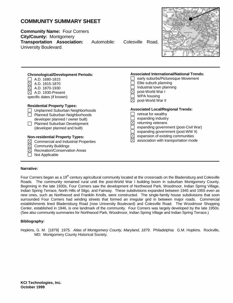
COMMUNITY SUMMARY SHEET Community Name: Four Corners City/County: Montgomery Transportation Association: Automobile: Colesville Road, University Boulevard.
Chronological/Development Periods:
A.D. 1680-1815 A.D. 1815-1870 A.D. 1870-1930 A.D. 1930-Present
specific dates (if known): Residential Property Types:
Unplanned Suburban Neighborhoods Planned Suburban Neighborhoods
developer planned / owner built) Planned Suburban Development
(developer planned and built) Non-residential Property Types:
Commercial and Industrial Properties Community Buildings Recreation/Conservation Areas Not Applicable
Associated International/National Trends:
early suburbs/Picturesque Movement Elite suburb planning Industrial town planning post-World War I WPA housing post-World War II
Associated Local/Regional Trends:
retreat for wealthy expanding industry returning veterans expanding government (post-Civil War) expanding government (post-WW II) expansion of existing communities association with transportation mode
Narrative: Four Corners began as a 19th-century agricultural community located at the crossroads on the Bladensburg and Colesville Roads. The community remained rural until the post-World War I building boom in suburban Montgomery County. Beginning in the late 1930s, Four Corners saw the development of Northwood Park, Woodmoor, Indian Spring Village, Indian Spring Terrace, North Hills of Sligo, and Fairway. These subdivisions expanded between 1945 and 1955 even as new ones, such as Northwood and Franklin Knolls, were constructed. The single-family house subdivisions that soon surrounded Four Corners had winding streets that formed an irregular grid in between major roads. Commercial establishments lined Bladensburg Road (now University Boulevard) and Colesville Road. The Woodmoor Shopping Center, established in 1946, is one landmark of the community. Four Corners was largely developed by the late 1950s. (See also community summaries for Northwood Park, Woodmoor, Indian Spring Village and Indian Spring Terrace.) Bibliography: Hopkins, G. M. [1879] 1975. Atlas of Montgomery County, Maryland, 1879. Philadelphia: G.M. Hopkins. Rockville,
MD: Montgomery County Historical Society.

KCI Technologies, Inc. October 1999
COMMUNITY SUMMARY SHEET Community Name: Four Corners Bibliography: (continued) Maryland – National Capital Park and Planning Commission (M-NCPPC). 1996. Four Corners Master Plan. Silver
Spring, MD: M-NCPPC. United States Geological Survey (USGS). 1917. Washington and Vicinity Topographic Map. Washington, D.C.:
USGS. ------. 1944. Washington and Vicinity Topographic Map. Washington, D.C.: USGS. ------. 1956. Kensington, MD Quadrangle Map. Washington, D.C.: USGS. ------. 1965. Kensington, MD Quadrangle Map. Washington, D.C.: USGS.

KCI Technologies, Inc. October 1999
COMMUNITY SUMMARY SHEET Community Name: Friendship Heights City/County: Montgomery Transportation Association: Trolley: Georgetown and Rockville Electric Railway
Chronological/Development Periods:
A.D. 1680-1815 A.D. 1815-1870 A.D. 1870-1930 A.D. 1930-Present
specific dates (if known): 1901 Residential Property Types:
Unplanned Suburban Neighborhoods Planned Suburban Neighborhoods
developer planned / owner built) Planned Suburban Development
(developer planned and built) Non-residential Property Types:
Commercial and Industrial Properties Community Buildings Recreation/Conservation Areas Not Applicable
Associated International/National Trends:
early suburbs/Picturesque Movement Elite suburb planning Industrial town planning post-World War I WPA housing post-World War II
Associated Local/Regional Trends:
retreat for wealthy expanding industry returning veterans expanding government (post-Civil War) expanding government (post-WW II) expansion of existing communities association with transportation mode
Narrative: Friendship Heights is located in Montgomery County between the District of Columbia and Somerset. Henry W. Offutt of Washington, D.C. developed the subdivision beginning in 1901. Frienship Heights originally had an irregular grid of streets with narrow, deep lots of about 0.15 acres. The construction company Richard Ough & Son built many of the early Colonial Revival houses. Friendship Heights was moderately priced and appealed to middle-class city workers. The subdivision was convenient to the Georgetown and Rockville Electric Railway (Offutt 1996, 218-231). Friendship Heights prospered as a residential area through the first half of the 20th century. Following incorporation in 1951, commercial establishments and businesses began moving in and rebuilding Friendship Heights. The Chevy Chase Shopping Center, Lord & Taylor, and GEICO were among the first to replace existing houses with large commercial buildings and parking lots. Other businesses and high-rise apartment buildings soon followed. Most of the remaining houses in Friendship Heights were demolished in the early 1970s.

KCI Technologies, Inc. October 1999
COMMUNITY SUMMARY SHEET Community Name: Friendship Heights Bibliography: Bonner, Alice. 1974. Growth Limited at Friendship. Washington Post. Wednesday, May 29: A1. Dash, Leon. 1973. The Crunch Comes to Friendship Heights. Washington Post. Monday, March 26: C-1 Jones, William H. 1973. Friendship Heights Plan Set. Washington Post. Thursday, June 21: G10. Maryland – National Capital Park and Planning Commission (M-NCPPC). 1997. Frienship Heights Sector Plan. Silver
Spring, MD: M-NCPPC. Offutt, William. 1996. Bethesda, A Social History of the Area through World War II. 3d. ed. Bethesda, MD: The
Innovation Game. Real Estate Atlas of Montgomery County, Maryland. Situs Ownership Volume – Subdivisions. Recorded Subdivision
Maps. Vol. 1, p. 57. Willmann, John B. 1969. Friendship Heights – Emerging Little City. Washington Post. Sunday, March 16: F1.

KCI Technologies, Inc. October 1999
COMMUNITY SUMMARY SHEET Community Name: Garrett Park City/County: Montgomery Transportation Association: Baltimore and Ohio Railroad Metropolitan Branch
Chronological/Development Periods:
A.D. 1680-1815 A.D. 1815-1870 A.D. 1870-1930 A.D. 1930-Present
specific dates (if known): 1887, 1898 Residential Property Types:
Unplanned Suburban Neighborhoods Planned Suburban Neighborhoods
developer planned / owner built) Planned Suburban Development
(developer planned and built) Non-residential Property Types:
Commercial and Industrial Properties Community Buildings Recreation/Conservation Areas Not Applicable
Associated International/National Trends:
early suburbs/Picturesque Movement Elite suburb planning Industrial town planning post-World War I WPA housing post-World War II
Associated Local/Regional Trends:
retreat for wealthy expanding industry returning veterans expanding government (post-Civil War) expanding government (post-WW II) expansion of existing communities association with transportation mode
Narrative: The Garrett Park municipality is located west of Kensington in Montgomery County. Garrett Park was developed beginning in 1887 around the pre-existing Garrett Park station of the Baltimore and Ohio Railroad's Metropolitan Branch. The suburb was incorporated in 1898. Garrett Park was created by Henry Copp, a lawyer from Washington D.C. and founder of the Metropolitan Investment and Building Company. The Company acquired 500 acres in the Garrett Park area and filed the first plat in 1887 (Crawford 1986, 15-16). Engineer John T. Freeman and horticulturist William Saunders designed the suburb (Ibid; (NPS, Garrett Park, 1974). One of the premier horticulturists in the United States during the late 19th century, Saunders also designed the National Cemetery at Gettysburg and an arbor on the Capitol Hill Mall (now replanted). His design for Garrett Park consisted of winding streets in the northwest and gridded streets in the southeast, all lined with thick plantings (NPS, Garrett Park, 1974). The northwest section of Garrett Park developed during the late 19th century with Queen Anne-style residences for middle-class Washingtonians (NPS, Garrett Park, 1974). Advertisements from this time emphasized that the suburb included water, gas, and sewers and provided a healthful environment for families (Crawford 1986, 16-17). The second phase of development in Garrett Park began after World War I, when four veterans formed Maddux, Marshall and Company and began marketing small, mass-produced cottages aimed at low-level government employees. The cottages frequently came with a Chevrolet automobile and therefore became known as “Chevy” houses. The cottages were constructed as infill around existing development (Crawford 1986, 17-18; NPS, Garrett Park, 1974).

KCI Technologies, Inc. October 1999
COMMUNITY SUMMARY SHEET Community Name: Garrett Park Narrative: (continued) Following World War II, the southeast section of Garrett Park was developed with several contemporary residences designed by Howard University professor Alexander Richter. Richter’s designs were influenced by the work of Louis Sullivan and Frank Lloyd Wright (NPS, Garrett Park, 1974). Infill development continued throughout Garrett Park through the twentieth century and included examples of the International style, Techbuilt houses, and Sears-Roebuck houses. Aside from one store and one church/community center, the community remains entirely residential (Ibid). Bibliography: Crawford, Catherine. 1986. The Early Suburban Communities of Washington, D.C. Located in Montgomery County,
Maryland. Montgomery County Planning Department. 1992. North Bethesda – Garrett Park Master Plan (Interim Reference
Edition). Silver Spring, MD. National Park Service. U.S. Department of the Interior. 1974. National Register of Historic Places Inventory –
Nomination Form. Garrett Park. Laura C. Pratt. Washington, D. C. Rebeck, Andrea. 1987. Montgomery County in the Early Twentieth Century. Silver Spring, MD: Montgomery County
Historic Preservation Commission and Maryland Historical Trust.
KCI Technologies, Inc. October 1999
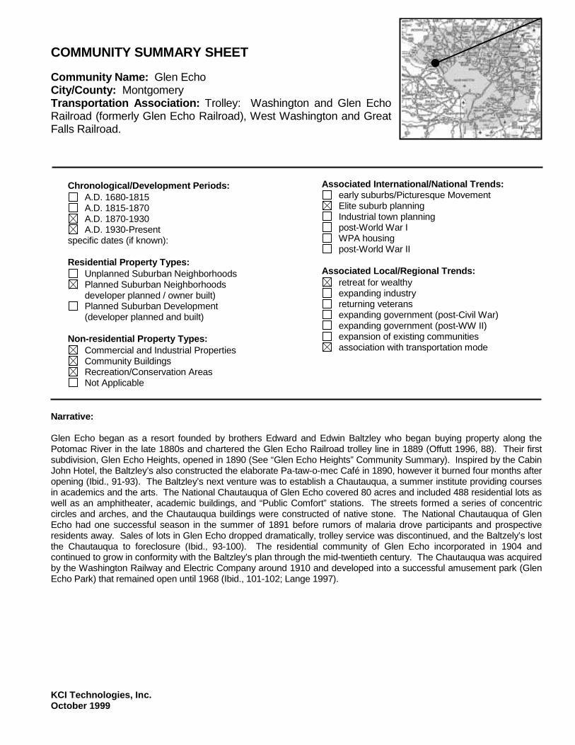
COMMUNITY SUMMARY SHEET Community Name: Glen Echo City/County: Montgomery Transportation Association: Trolley: Washington and Glen Echo Railroad (formerly Glen Echo Railroad), West Washington and Great Falls Railroad.
Chronological/Development Periods:
A.D. 1680-1815 A.D. 1815-1870 A.D. 1870-1930 A.D. 1930-Present
specific dates (if known): Residential Property Types:
Unplanned Suburban Neighborhoods Planned Suburban Neighborhoods
developer planned / owner built) Planned Suburban Development
(developer planned and built) Non-residential Property Types:
Commercial and Industrial Properties Community Buildings Recreation/Conservation Areas Not Applicable
Associated International/National Trends:
early suburbs/Picturesque Movement Elite suburb planning Industrial town planning post-World War I WPA housing post-World War II
Associated Local/Regional Trends:
retreat for wealthy expanding industry returning veterans expanding government (post-Civil War) expanding government (post-WW II) expansion of existing communities association with transportation mode
Narrative: Glen Echo began as a resort founded by brothers Edward and Edwin Baltzley who began buying property along the Potomac River in the late 1880s and chartered the Glen Echo Railroad trolley line in 1889 (Offutt 1996, 88). Their first subdivision, Glen Echo Heights, opened in 1890 (See “Glen Echo Heights” Community Summary). Inspired by the Cabin John Hotel, the Baltzley’s also constructed the elaborate Pa-taw-o-mec Café in 1890, however it burned four months after opening (Ibid., 91-93). The Baltzley’s next venture was to establish a Chautauqua, a summer institute providing courses in academics and the arts. The National Chautauqua of Glen Echo covered 80 acres and included 488 residential lots as well as an amphitheater, academic buildings, and “Public Comfort” stations. The streets formed a series of concentric circles and arches, and the Chautauqua buildings were constructed of native stone. The National Chautauqua of Glen Echo had one successful season in the summer of 1891 before rumors of malaria drove participants and prospective residents away. Sales of lots in Glen Echo dropped dramatically, trolley service was discontinued, and the Baltzely’s lost the Chautauqua to foreclosure (Ibid., 93-100). The residential community of Glen Echo incorporated in 1904 and continued to grow in conformity with the Baltzley’s plan through the mid-twentieth century. The Chautauqua was acquired by the Washington Railway and Electric Company around 1910 and developed into a successful amusement park (Glen Echo Park) that remained open until 1968 (Ibid., 101-102; Lange 1997).

KCI Technologies, Inc. October 1999
COMMUNITY SUMMARY SHEET Community Name: Glen Echo Narrative: (continued) In 1970, the Chautauqua/amusement park grounds were acquired by the National Park Service and rehabilitated as an arts institute (Lange 1997). Bibliography: Lange, Deborah. 1997. History of Glen Echo. Potomac River Media. Available at www.mdmunicpal.org. National Park Service. U.S. Department of the Interior. 1984. National Register of Historic Places Nomination Form.
Glen Echo Park Historic District by Gary Scott and Bill Brabham. Washington, D.C. Offut, William. 1996. Bethesda, A Social History of the Area through World War II. 3d. ed. Bethesda, MD: The
Innovation Game. Real Estate Atlas of Montgomery County, Maryland. Situs Ownership Volume – Subdivisions. Recorded Subdivision
Maps. Vol. 1, pp. 65-67. United States Geological Survey (USGS). 1885. Washington and Vicinity Topographic Map. Washington, D.C.:
USGS. ------. 1917. Washington and Vicinity Topographic Map. Washington, D.C.: USGS. ------. 1944. Washington and Vicinity Topographic Map. Washington, D.C.: USGS. ------. 1965. Falls Church, VA-DC-MD Quadrangle Map. Washington, D.C.: USGS.

KCI Technologies, Inc. October 1999
COMMUNITY SUMMARY SHEET Community Name: Glen Cove City/County: Montgomery Transportation Association: Automobile: River Road
Chronological/Development Periods:
A.D. 1680-1815 A.D. 1815-1870 A.D. 1870-1930 A.D. 1930-Present
specific dates (if known): 1893, 1938 Residential Property Types:
Unplanned Suburban Neighborhoods Planned Suburban Neighborhoods
developer planned / owner built) Planned Suburban Development
(developer planned and built) Non-residential Property Types:
Commercial and Industrial Properties Community Buildings Recreation/Conservation Areas Not Applicable
Associated International/National Trends:
early suburbs/Picturesque Movement Elite suburb planning Industrial town planning post-World War I WPA housing post-World War II
Associated Local/Regional Trends:
retreat for wealthy expanding industry returning veterans expanding government (post-Civil War) expanding government (post-WW II) expansion of existing communities association with transportation mode
Narrative: Glen Cove is located in Montgomery County immediately northwest of the District of Columbia border. It developed at the same time as neighboring subdivisions Green Acres, Westgate, Crestview, and Westmoreland Hills. The subdivision was a project of the Southern Investment Company. A plat Glen Cove was filed in 1893, however no construction took place. The subdivision plat was filed again in 1938, by which time roads were laid out and construction of houses had begun. Glen Cove had a crooked grid of streets and lots of about 0.15 to 0.2 acres. Bibliography: Real Estate Atlas of Montgomery County, Maryland. Situs Ownership Volume – Subdivisions. Recorded Subdivision
Maps. Vol. 1, p.676. United States Geological Survey (USGS). 1917. Washington and Vicinity Topographic Map. Washington, D.C.:
USGS. ------. 1944. Washington and Vicinity Topographic Map Quadrangle Map. Washington, D.C.: USGS.

KCI Technologies, Inc. October 1999
COMMUNITY SUMMARY SHEET Community Name: Glen Cove Bibliography: (continued) ------. 1965. Washington West, DC-MD-VA Quadrangle Map. Washington, D.C.: USGS. ------. 1965. Washington West, DC-MD-VA Quadrangle Map. Washington, D.C.: USGS.

KCI Technologies, Inc. October 1999
COMMUNITY SUMMARY SHEET Community Name: Glen Echo Heights City/County: Montgomery Transportation Association: Trolley: Washington and Glen Echo Railroad
Chronological/Development Periods:
A.D. 1680-1815 A.D. 1815-1870 A.D. 1870-1930 A.D. 1930-Present
specific dates (if known): 1890 Residential Property Types:
Unplanned Suburban Neighborhoods Planned Suburban Neighborhoods
developer planned / owner built) Planned Suburban Development
(developer planned and built) Non-residential Property Types:
Commercial and Industrial Properties Community Buildings Recreation/Conservation Areas Not Applicable
Associated International/National Trends:
early suburbs/Picturesque Movement Elite suburb planning Industrial town planning post-World War I WPA housing post-World War II
Associated Local/Regional Trends:
retreat for wealthy expanding industry returning veterans expanding government (post-Civil War) expanding government (post-WW II) expansion of existing communities association with transportation mode
Narrative: Glen Echo Heights was founded by brothers Edward and Edwin Baltzley of Ohio in 1890. The subdivision was part of the brothers’ plans to develop a major resort along the Potomac River. Glen Echo Heights had winding streets, some connecting to form a loose grid and some not connecting. The narrow, deep lots came with covenants dictating setbacks, building materials, and minimum building cost. The Baltzley brothers hoped the community would become the “American Rhine.” They built their own stone, Gothic Revival mansions on the bluffs over the Potomac and encouraged customers to do the same. Lots sold quickly during 1890 and 1891 until rumors of malaria brought the subdivision to a standstill. Glen Echo Heights did not begin to develop again until the World War I era when the Bannockburn Country Club opened nearby. Summer cottages were built on the lots where mansions had never materialized. The community continued to grow through the mid-20th century (Offutt 1996, 91-93, 114, 151). (See also Community Summary for Glen Echo.) Bibliography: Offut, William. 1996. Bethesda, A Social History of the Area through World War II. 3d. ed. Bethesda, MD: The
Innovation Game.
KCI Technologies, Inc. October 1999
COMMUNITY SUMMARY SHEET Community Name: Glen Echo Heights Bibliography: (continued) Real Estate Atlas of Montgomery County, Maryland. Situs Ownership Volume – Subdivisions. Recorded Subdivision
Maps. Vol. 1, pp. 69-74. United States Geological Survey (USGS). 1917. Washington and Vicinity Topographic Map. Washington, D.C.:
USGS. ------. 1944. Washington and Vicinity Topographic Map. Washington, D.C.: USGS. ------. 1965. Falls Church, VA-DC-MD Quadrangle Map. Washington, D.C.: USGS.

KCI Technologies, Inc. October 1999
COMMUNITY SUMMARY SHEET Community Name: Glen Haven City/County: Montgomery Transportation Association: Automobile: Georgia Avenue
Chronological/Development Periods:
A.D. 1680-1815 A.D. 1815-1870 A.D. 1870-1930 A.D. 1930-Present
specific dates (if known): 1951 Residential Property Types:
Unplanned Suburban Neighborhoods Planned Suburban Neighborhoods
developer planned / owner built) Planned Suburban Development
(developer planned and built) Non-residential Property Types:
Commercial and Industrial Properties Community Buildings Recreation/Conservation Areas Not Applicable
Associated International/National Trends:
early suburbs/Picturesque Movement Elite suburb planning Industrial town planning post-World War I WPA housing post-World War II
Associated Local/Regional Trends:
retreat for wealthy expanding industry returning veterans expanding government (post-Civil War) expanding government (post-WW II) expansion of existing communities association with transportation mode
Narrative: Glen Haven is located southeast of Wheaton in Montgomery County. The subdivision first appears on maps in 1944 with a street plan of concentric quarter circles lined with closely spaced houses. Beginning in 1947, the Army maintained this group of houses for personnel at the Walter Reed Army Hospital Annex (Farquhar 50). The area northeast of the original Glen Haven developed beginning in 1951 with the resubdivision of several properties. Winding, discontinuous streets led from the Army property north to University Boulevard. Construction of new houses in this area continued into the 1960s. The Glen Haven community included a park and elementary school. Bibliography: Farquhar, Roger Brooke. Old Homes and History of Montgomery County, Maryland. Silver Spring, MD. Real Estate Atlas of Montgomery County, Maryland. Situs Ownership Volume – Subdivisions. Recorded Subdivision
Maps. Vol. 2, pp. 721, 923, 1367, 1852, 2004. United States Geological Survey (USGS). 1944. Washington and Vicinity Topographic Map. Washington, D.C.:
USGS.

KCI Technologies, Inc. October 1999
COMMUNITY SUMMARY SHEET Community Name: Glen Haven Bibliography: (continued) ------. 1956. Kensington, MD Quadrangle Map. Washington, D.C.: USGS. ------. 1965. Kensington, MD Quadrangle Map. Washington, D.C.: USGS.

KCI Technologies, Inc. October 1999
COMMUNITY SUMMARY SHEET Community Name: Greenacres City/County: Montgomery Transportation Association: Automobile: River Road
Chronological/Development Periods:
A.D. 1680-1815 A.D. 1815-1870 A.D. 1870-1930 A.D. 1930-Present
specific dates (if known): 1938 Residential Property Types:
Unplanned Suburban Neighborhoods Planned Suburban Neighborhoods
developer planned / owner built) Planned Suburban Development
(developer planned and built) Non-residential Property Types:
Commercial and Industrial Properties Community Buildings Recreation/Conservation Areas Not Applicable
Associated International/National Trends:
early suburbs/Picturesque Movement Elite suburb planning Industrial town planning post-World War I WPA housing post-World War II
Associated Local/Regional Trends:
retreat for wealthy expanding industry returning veterans expanding government (post-Civil War) expanding government (post-WW II) expansion of existing communities association with transportation mode
Narrative: Greenacres is located southwest of Somerset in Montgomery County. It developed at the same time as neighboring subdivisions Glen Cove, Westgate, Crestview, and Westmoreland Hills. The subdivision was a project of the Loughborough Development Corporation. Greenacres had a system of parallel streets lined with small lots of about 0.1 acre. Many houses had been constructed by the time the subdivision plats were filed in 1938. Greenacres was located adjacent to the Little Falls Branch Park and the Westbrook Elementary School. Bibliography: Real Estate Atlas of Montgomery County, Maryland. Situs Ownership Volume – Subdivisions. Recorded Subdivision
Maps. Vol. 1, pp. 846, 943 . United States Geological Survey (USGS). 1944. Washington and Vicinity Topographic Map. Washington, D.C.:
USGS. ------. 1951. Washington West, DC-MD-VA Quadrangle Map. Washington, D.C.: USGS ------. 1965. Washington West, DC-MD-VA Quadrangle Map. Washington, D.C.: USGS

KCI Technologies, Inc. October 1999
COMMUNITY SUMMARY SHEET Community Name: Greenwich Forest City/County: Montgomery Transportation Association: Automobile: Bradley Boulevard
Chronological/Development Periods:
A.D. 1680-1815 A.D. 1815-1870 A.D. 1870-1930 A.D. 1930-Present
specific dates (if known): 1932 Residential Property Types:
Unplanned Suburban Neighborhoods Planned Suburban Neighborhoods
developer planned / owner built) Planned Suburban Development
(developer planned and built) Non-residential Property Types:
Commercial and Industrial Properties Community Buildings Recreation/Conservation Areas Not Applicable
Associated International/National Trends:
early suburbs/Picturesque Movement Elite suburb planning Industrial town planning post-World War I WPA housing post-World War II
Associated Local/Regional Trends:
retreat for wealthy expanding industry returning veterans expanding government (post-Civil War) expanding government (post-WW II) expansion of existing communities association with transportation mode
Narrative: Greenwich Forest is located west of Bethesda in Montgomery County. The subdivision was constructed on land conveyed to Shirley R. Kaplan by the Ardhave Development Company in 1931. The street plat, filed in 1932, shows an irregular pattern of curving streets east of Bradley Avenue on both sides of Huntington Parkway. Alvin Aubinoe of Bethesda designed many of the houses for the subdivision’s upper-middle class customers. Most of the houses were built in the mid 1930s when the neighborhood was at its peak popularity, however infill construction continued through the mid-20th century (Offutt 1996, 396). Bibliography: Offutt, William. 1996. Bethesda, A Social History of the Area through World War II. 3d. ed. Bethesda, MD: The
Innovation Game. Real Estate Atlas of Montgomery County, Maryland. Situs Ownership Volume – Subdivisions. Recorded Subdivision
Maps. Vol. 1, pp. 416. United States Geological Survey (USGS). 1944. Washington and Vicinity Topographic Map. Washington, D.C.:
USGS.

KCI Technologies, Inc. October 1999
COMMUNITY SUMMARY SHEET Community Name: Greenwich Forest Bibliography: (continued) ------. 1951. Washington West, DC-MD-VA Quadrangle Map. Washington, D.C.: USGS. ------. 1965. Washington West, DC-MD-VA Quadrangle Map. Washington, D.C.: USGS.

KCI Technologies, Inc. October 1999
COMMUNITY SUMMARY SHEET Community Name: Hillandale City/County: Montgomery Transportation Association: Automobile: New Hampshire Avenue
Chronological/Development Periods:
A.D. 1680-1815 A.D. 1815-1870 A.D. 1870-1930 A.D. 1930-Present
specific dates (if known): 1938 Residential Property Types:
Unplanned Suburban Neighborhoods Planned Suburban Neighborhoods
developer planned / owner built) Planned Suburban Development
(developer planned and built) Non-residential Property Types:
Commercial and Industrial Properties Community Buildings Recreation/Conservation Areas Not Applicable
Associated International/National Trends:
early suburbs/Picturesque Movement Elite suburb planning Industrial town planning post-World War I WPA housing post-World War II
Associated Local/Regional Trends:
retreat for wealthy expanding industry returning veterans expanding government (post-Civil War) expanding government (post-WW II) expansion of existing communities association with transportation mode
Narrative: Hillandale is located east of Burnt Mills in Montgomery County. The subdivision was laid out in 1934. Hillandale featured winding, discontinuous streets lined with lots of about 0.5 to 1 acre. The subdivision grew slowly, with approximately 70 houses constructed by 1945 and approximately 100 by 1950. Hillandale expanded to the north and east during the late 1950s and early 1960s. Infill development continues to the present. Parklands, community facilities, and commercial establishments are located along New Hampshire Avenue and Powder Mill Road. Bibliography: Maryland – National Capital Park and Planning Commission. 1964. Hillandale & Vicinity Preliminary Master Plan. Silver
Spring, MD: M-NCPPC. Real Estate Atlas of Montgomery County, Maryland. Situs Ownership Volume – Subdivisions. Recorded Subdivision
Maps. Vol. 1, pp. 527, 1051. United States Geological Survey (USGS). 1944. Washington and Vicinity Topographic Map. Washington, D.C.:
USGS.

KCI Technologies, Inc. October 1999
COMMUNITY SUMMARY SHEET Community Name: Hillandale Bibliography: (continued) ------. 1951. Beltsville, MD Quadrangle Map. Washington, D.C.: USGS ------. 1965. Beltsville, MD Quadrangle Map. Washington, D.C.: USGS

KCI Technologies, Inc. October 1999
COMMUNITY SUMMARY SHEET Community Name: Huntington Terrace City/County: Montgomery Transportation Association: Georgetown and Rockville Electric Railway
Chronological/Development Periods:
A.D. 1680-1815 A.D. 1815-1870 A.D. 1870-1930 A.D. 1930-Present
specific dates (if known): 1910 Residential Property Types:
Unplanned Suburban Neighborhoods Planned Suburban Neighborhoods
developer planned / owner built) Planned Suburban Development
(developer planned and built) Non-residential Property Types:
Commercial and Industrial Properties Community Buildings Recreation/Conservation Areas Not Applicable
Associated International/National Trends:
early suburbs/Picturesque Movement Elite suburb planning Industrial town planning post-World War I WPA housing post-World War II
Associated Local/Regional Trends:
retreat for wealthy expanding industry returning veterans expanding government (post-Civil War) expanding government (post-WW II) expansion of existing communities association with transportation mode
Narrative: Huntington Terrace is located north of Bethesda in Montgomery County. The subdivision was platted in 1910. It had narrow, deep lots on gridded streets named after Presidents. A 15-acre parcel bounded by Lincoln and McKinley Streets was the site of a circa 1900 farmhouse which later became the property of Suburban Hospital. Early development of Huntington Terrace clustered along Old Georgetown Road. Lots further west, in the areas of Grant, Jefferson and Garfield Streets developed during the 1920s (Offutt 1996, 292-293). Bibliography: Offutt, William. 1996. Bethesda, A Social History of the Area through World War Two. 3d ed. Bethesda, Maryland: The
Innovation Game. Real Estate Atlas of Montgomery County, Maryland. Situs Ownership Volume – Subdivisions. Recorded Subdivision
Maps. Vol. 1, p. 87.

KCI Technologies, Inc. October 1999
COMMUNITY SUMMARY SHEET Community Name: Indian Spring Terrace City/County: Montgomery Transportation Association: Automobile: Bladensburg Road, Colesville Road
Chronological/Development Periods:
A.D. 1680-1815 A.D. 1815-1870 A.D. 1870-1930 A.D. 1930-Present
specific dates (if known): 1926 Residential Property Types:
Unplanned Suburban Neighborhoods Planned Suburban Neighborhoods
developer planned / owner built) Planned Suburban Development
(developer planned and built) Non-residential Property Types:
Commercial and Industrial Properties Community Buildings Recreation/Conservation Areas Not Applicable
Associated International/National Trends:
early suburbs/Picturesque Movement Elite suburb planning Industrial town planning post-World War I WPA housing post-World War II
Associated Local/Regional Trends:
retreat for wealthy expanding industry returning veterans expanding government (post-Civil War) expanding government (post-WW II) expansion of existing communities association with transportation mode
Narrative: Indian Spring Terrace is located in the Four Corners community of Montgomery County. The subdivision was developed beginning in 1926 by John M. Faulconer and Frank B. Proctor. Indian Spring Terrace originally had an irregular grid of streets leading south from the Indian Spring Golf Club. Initial development took place from the late 1920s to the early 1940s along Granville, Normandy, and Indian Spring Drives. The subdivision expanded south toward Franklin Avenue during the late 1940s and early 1950s. The golf club and part of the subdivision were removed during construction of the Capital Beltway. Bibliography: Real Estate Atlas of Montgomery County, Maryland. Situs Ownership Volume – Subdivisions. Recorded Subdivision
Maps. Vol. 1, pp. 316, 375, 397. United States Geological Survey (USGS). 1944. Washington and Vicinity Topographic Map. Washington, D.C.:
USGS.

KCI Technologies, Inc. October 1999
COMMUNITY SUMMARY SHEET Community Name: Indian Spring Terrace Bibliography: (continued) ------. 1956. Kensington, MD Quadrangle Map. Washington, D.C.: USGS. ------. 1965. Kensington, MD Quadrangle Map. Washington, D.C.: USGS.

KCI Technologies, Inc. October 1999
COMMUNITY SUMMARY SHEET Community Name: Indian Spring Village City/County: Montgomery Transportation Association: Automobile: Bladensburg Road, Colesville Road
Chronological/Development Periods:
A.D. 1680-1815 A.D. 1815-1870 A.D. 1870-1930 A.D. 1930-Present
specific dates (if known): 1936 Residential Property Types:
Unplanned Suburban Neighborhoods Planned Suburban Neighborhoods
developer planned / owner built) Planned Suburban Development
(developer planned and built) Non-residential Property Types:
Commercial and Industrial Properties Community Buildings Recreation/Conservation Areas Not Applicable
Associated International/National Trends:
early suburbs/Picturesque Movement Elite suburb planning Industrial town planning post-World War I WPA housing post-World War II
Associated Local/Regional Trends:
retreat for wealthy expanding industry returning veterans expanding government (post-Civil War) expanding government (post-WW II) expansion of existing communities association with transportation mode
Narrative: Indian Spring Village is located in the Four Corners community of Montgomery County. The subdivision was developed beginning in 1936 by Indian Spring Village, Inc. Indian Spring Village had a grid of streets lined with lots of about 0.15 to 0.25 acres. Approximately 100 houses had been constructed by 1945. Indian Spring Village expanded to the east during the late-1940s. The subdivision Franklin Knolls was constructed to the south during the 1950s. Bibliography: Real Estate Atlas of Montgomery County, Maryland. Situs Ownership Volume – Subdivisions. Recorded Subdivision
Maps. Vol. 1, pp. 715, 912, 1122. United States Geological Survey (USGS). 1944. Washington and Vicinity Topographic Map. Washington, D.C.:
USGS. ------. 1956. Kensington, MD Quadrangle Map. Washington, D.C.: USGS. ------. 1965. Kensington, MD Quadrangle Map. Washington, D.C.: USGS.

KCI Technologies, Inc. October 1999
COMMUNITY SUMMARY SHEET Community Name: Kemp Mill City/County: Montgomery Transportation Association: Automobile: Arcola Avenue (formerly Kemp Mill Road)
Chronological/Development Periods:
A.D. 1680-1815 A.D. 1815-1870 A.D. 1870-1930 A.D. 1930-Present
specific dates (if known): 1955 Residential Property Types:
Unplanned Suburban Neighborhoods Planned Suburban Neighborhoods
developer planned / owner built) Planned Suburban Development
(developer planned and built) Non-residential Property Types:
Commercial and Industrial Properties Community Buildings Recreation/Conservation Areas Not Applicable
Associated International/National Trends:
early suburbs/Picturesque Movement Elite suburb planning Industrial town planning post-World War I WPA housing post-World War II
Associated Local/Regional Trends:
retreat for wealthy expanding industry returning veterans expanding government (post-Civil War) expanding government (post-WW II) expansion of existing communities association with transportation mode
Narrative: Kemp Mill refers to an area north of Four Corners in Montgomery County. The area developed beginning in 1955 with the opening of Kemp Mill Estates off of Arcola Avenue. Between 1955 and 1965 other subdivisions opened around Kemp Mill Estates, including Forest Knolls, Kemp Mill Farms, and Grey Estates. The subdivisions generally have winding streets and are made up of single-family houses. Community buildings and parks are located within the subdivisions, while commercial establishments are located along Arcola Avenue (formerly Kemp Mill Road). Bibliography: Real Estate Atlas of Montgomery County, Maryland. Situs Ownership Volume – Subdivisions. Recorded Subdivision
Maps. Vol. 3, p. 2116. United States Geological Survey (USGS). 1944. Washington and Vicinity Topographic Map. Washington, D.C.:
USGS. ------. 1956. Kensington, MD Quadrangle Map. Washington, D.C.: USGS. ------. 1965. Kensington, MD Quadrangle Map. Washington, D.C.: USGS.

KCI Technologies, Inc. October 1999
COMMUNITY SUMMARY SHEET Community Name: Ken-Gar City/County: Montgomery Transportation Association: Railroad: Baltimore and Ohio Metropolitan Branch
Chronological/Development Periods:
A.D. 1680-1815 A.D. 1815-1870 A.D. 1870-1930 A.D. 1930-Present
specific dates (if known): 1887 Residential Property Types:
Unplanned Suburban Neighborhoods Planned Suburban Neighborhoods
developer planned / owner built) Planned Suburban Development
(developer planned and built) Non-residential Property Types:
Commercial and Industrial Properties Community Buildings Recreation/Conservation Areas Not Applicable
Associated International/National Trends:
early suburbs/Picturesque Movement Elite suburb planning Industrial town planning post-World War I WPA housing post-World War II
Associated Local/Regional Trends:
retreat for wealthy expanding industry returning veterans expanding government (post-Civil War) expanding government (post-WW II) expansion of existing communities association with transportation mode
Narrative: Ken-Gar is an historically African-American community located between Kensington and Garrett Park in Montgomery County. Founded founded in 1887 along the tracks of the Baltimore and Ohio Railroad’s Metropolitan Branch, the community had approximately 30 buildings by the end of World War I and 70 by the end of World War II, all arranged on a four-block grid. The community was predominantly made up of small, frame dwellings, although there was at least one market and two churches. Although some early buildings remain, much of Ken-Gar was demolished during an urban renewal project begun in 1972 (Dash 1972). Bibliography: Dash, Leon. 1972. Ken-Gar Renewal Plan Approved. Washington Post. December 13. United States Geological Survey (USGS). 1917. Washington and Vicinity Topographic Map. Washington, D.C.:
USGS. ------. 1944. Washington and Vicinity Topographic Map. Washington, D.C.: USGS. ------. 1956. Kensington, MD Quadrangle Map. Washington, D.C.: USGS.

KCI Technologies, Inc. October 1999
COMMUNITY SUMMARY SHEET Community Name: Ken-Gar Bibliography: (continued) ------. 1965. Kensington, MD Quadrangle Map. Washington, D.C.: USGS.

KCI Technologies, Inc. October 1999
COMMUNITY SUMMARY SHEET Community Name: Kensington City/County: Montgomery Transportation Association: Railroad: Baltimore and Ohio Railroad Metropolitan Branch; Trolley: Kensington Electric Railway Company, Kensington Railway and Electric Company.
Chronological/Development Periods:
A.D. 1680-1815 A.D. 1815-1870 A.D. 1870-1930 A.D. 1930-Present
specific dates (if known): 1890 Residential Property Types:
Unplanned Suburban Neighborhoods Planned Suburban Neighborhoods
developer planned / owner built) Planned Suburban Development
(developer planned and built) Non-residential Property Types:
Commercial and Industrial Properties Community Buildings Recreation/Conservation Areas Not Applicable
Associated International/National Trends:
early suburbs/Picturesque Movement Elite suburb planning Industrial town planning post-World War I WPA housing post-World War II
Associated Local/Regional Trends:
retreat for wealthy expanding industry returning veterans expanding government (post-Civil War) expanding government (post-WW II) expansion of existing communities association with transportation mode
Narrative: The Kensington municipality is located north of the Capital Beltway in Montgomery County. Kensington began as the farm of George Knowles. Knowles sold right-of-way to the Baltimore and Ohio Railroad’s Metropolitan Branch, and the Knowles Station opened in 1873 (MHT, Kensington Historic District, 1978). Subdivision of the Knowles property began in 1880. Brainard H. Warner of Washington, D.C. bought 125 acres around this time, and in 1890 he filed a subdivision plat entitled Kensington Park for the land. The plat featured curvilinear streets with narrow, deep lots (Crawford 1986, 19-20). A minimum required improvement of $2000 limited the development to upper middle class buyers (Ibid). The community originally consisted of summer houses for Washingtonians. Baltimore, Prospect, and Washington Streets developed first with large Queen Anne residences (Ibid). Other blocks developed from the late-19th through the mid-20th centuries with a variety of styles. Later residences tended to be smaller than the original residences, and the community became a year-round suburb for commuters. A small commercial center developed in the northeast corner of the community adjacent to the railroad (MHT, Kensington Historic District, 1978). The Baltimore and Ohio railroad opened its Kensington Park Station in 1893, and the Chevy Chase and Kensington Electric Railway Company began serving the community in 1895. The Kensington Railway and Electric Company began operating in 1899 (Crawford 1986, 19-20). Kensington’s current boundaries correspond closely to those of the 1890 plat, with only a small section having been annexed on the northwest. Infill and redevelopment continue to this day.

KCI Technologies, Inc. October 1999
COMMUNITY SUMMARY SHEET Community Name: Kensington Bibliography: Beck, Jo. “Train Stations and Suburban Development along the Old Baltimore and Ohio Railroad.” The Montgomery
County Story. Vol. 37, No. 1 (February) 1994. Crawford, Catherine. 1986. The Early Suburban Communities of Washington, D.C. Located in Montgomery County,
Maryland. Hiebert, Ray Eldon and Richard K. MacMaster. A Grateful Remembrance: the Story of Montgomery County, Maryland.
Rockville, MD: Montgomery County Government and Montgomery County Historical Society, 1976. Maryland Historical Trust (MHT). 1978. Maryland Historical Trust Worksheet: Nomination Form for
the National Register of Historic Places, National Parks Service. Kensington Historic District, Montgomery County. M:31-6. Crownsville, MD.
Montgomery County Historical Society (MCHS). MacMaster Papers. “Suburbanization.” -----. Vertical Files. “Kensington.”

KCI Technologies, Inc. October 1999
COMMUNITY SUMMARY SHEET Community Name: Kenwood City/County: Montgomery Transportation Association: Automobile: Bradley Boulevard
Chronological/Development Periods:
A.D. 1680-1815 A.D. 1815-1870 A.D. 1870-1930 A.D. 1930-Present
specific dates (if known): 1928 Residential Property Types:
Unplanned Suburban Neighborhoods Planned Suburban Neighborhoods
developer planned / owner built) Planned Suburban Development
(developer planned and built) Non-residential Property Types:
Commercial and Industrial Properties Community Buildings Recreation/Conservation Areas Not Applicable
Associated International/National Trends:
early suburbs/Picturesque Movement Elite suburb planning Industrial town planning post-World War I WPA housing post-World War II
Associated Local/Regional Trends:
retreat for wealthy expanding industry returning veterans expanding government (post-Civil War) expanding government (post-WW II) expansion of existing communities association with transportation mode
Narrative: Kenwood is located southwest of Bethesda in Montgomery County. This exclusive subdivision, founded in 1928, was a project of Bethesda developer Edgar S. Kennedy. Kennedy began buying land east of River Road in 1926. In 1927 he formed the Kennedy Chamberlain Development Company with his partner, engineer Donald L. Chamberlain. The original plan for Kenwood had a grid of streets and uniform, small lots. At the request of Kennedy and sales manager Charles H. Jerman, Chamberlain redesigned the plan to have a loose grid of curving streets and lots ranging from 0.2 to 0.48 acres. Owners of lots could either hire their own architects or utilize the services of Alexander H. Sonnemann, architect of the model houses in the subdivision. Covenants and an architectural review board insured that the houses would be stylistically consistent. The early houses tended to be constructed of brick or stone in the Colonial Revival, Tudor Revival, or French Provencial styles. After covenants were relaxed in the mid 1930s, smaller houses and a few Modernist houses were constructed. West of Kenwood, a large country club was constructed with a golf course, tennis courts, swimming pool, and club house. Membership in the country club came with purchase of a house in Kenwood. Most of Kenwood had developed by the end of the 1940s (Offutt 1996, 266-271).

KCI Technologies, Inc. October 1999
COMMUNITY SUMMARY SHEET Community Name: Kenwood Bibliography: Offutt, William. 1996. Bethesda, A Social History of the Area through World War II. 3d. ed. Bethesda, MD: The
Innovation Game. Real Estate Atlas of Montgomery County, Maryland. Situs Ownership Volume – Subdivisions. Recorded Subdivision
Maps. Vol. 1, pp. 620, 655, 1319, 1320. United States Geological Survey (USGS). 1944. Washington and Vicinity Topographic Map. Washington, D.C.:
USGS. ------. 1951. Washington West, DC-MD-VA Quadrangle Map. Washington, D.C.: USGS. ------. 1965. Washington West, DC-MD-VA Quadrangle Map. Washington, D.C.: USGS.

KCI Technologies, Inc. October 1999
COMMUNITY SUMMARY SHEET Community Name: Linden City/County: Montgomery Transportation Association: Railroad: Baltimore and Ohio Metropolitan Branch; trolley: Washington, Woodside and Forest Glen Railway
Chronological/Development Periods:
A.D. 1680-1815 A.D. 1815-1870 A.D. 1870-1930 A.D. 1930-Present
specific dates (if known): 1873 Residential Property Types:
Unplanned Suburban Neighborhoods Planned Suburban Neighborhoods
developer planned / owner built) Planned Suburban Development
(developer planned and built) Non-residential Property Types:
Commercial and Industrial Properties Community Buildings Recreation/Conservation Areas Not Applicable
Associated International/National Trends:
early suburbs/Picturesque Movement Elite suburb planning Industrial town planning post-World War I WPA housing post-World War II
Associated Local/Regional Trends:
retreat for wealthy expanding industry returning veterans expanding government (post-Civil War) expanding government (post-WW II) expansion of existing communities association with transportation mode
Narrative: Linden is an unincorporated suburb located immediately east of the Walter Reed Army Medical Center Annex in Montgomery County. Charles M. Keys of Washington, D.C. founded Linden in 1873, the year service by the Baltimore and Ohio Railroad’s Metropolitan Branch began. The suburb occupied 12 acres and included approximately 20 lots arranged along a grid of streets east of the railroad tracks (M-NCPPC 1992, 1). About five houses had been built in Linden by 1889, and about 12 had appeared by 1900 (Crawford 1986, 4). The houses include examples of the Gothic Revival, Second Empire, Queen Anne, and Colonial Revival styles (M-NCPPC 1992, 1). The Washington, Woodside and Forest Glen Railway provided streetcar service to Linden between 1897 and 1930 (Crawford 1986, 4). A commercial area developed on the west end of Linden Lane, and a residential area developed along Sharon Lane to the north. Other residential growth was limited to infill. Infill development continued through the 20th century (Ibid., 4-5). Bibliography: Crawford, Catherine. 1986. The Early Suburban Communities of Washington, D.C. Located in Montgomery County,
Maryland. Getty, Mildred. 1969. The Silver Spring Area. The Montgomery County Story. XII (2): 1-9.

KCI Technologies, Inc. October 1999
COMMUNITY SUMMARY SHEET Community Name: Linden Bibliography: (continued) Maryland – National Capital Park and Planning Commission, Montgomery County Planning Department. 1992.
Amendment to the Approved and Adopted Master Plan for Historic Preservation in Montgomery County, Maryland: Linden Historic District, Forest Glen Historic District, Linden/Forest Glen Individual Sites. Silver Spring, MD.
Real Estate Atlas of Montgomery County, Maryland. Situs Ownership Volume – Subdivisions. Recorded Subdivision
Maps. Vol. 1, pp. 103, 1632. Rebeck, Andrea. 1987. Montgomery County in the early twentieth century. Silver Spring, MD: Montgomery County
Historic Preservation Commission and the Maryland Historic Trust. United States Geological Survey (USGS). 1917. Washington and Vicinity Topographic Map. Washington, D.C.: USGS. ------. 1944. Washington and Vicinity Topographic Map. Washington, D.C.: USGS. ------. 1965. Washington West, DC-MD-VA Quadrangle Map. Washington, D.C.: USGS.

KCI Technologies, Inc. October 1999
COMMUNITY SUMMARY SHEET Community Name: Locust Hill City/County: Montgomery Transportation Association: Automobile: Wisconsin Avenue
Chronological/Development Periods:
A.D. 1680-1815 A.D. 1815-1870 A.D. 1870-1930 A.D. 1930-Present
specific dates (if known): 1941 Residential Property Types:
Unplanned Suburban Neighborhoods Planned Suburban Neighborhoods
developer planned / owner built) Planned Suburban Development
(developer planned and built) Non-residential Property Types:
Commercial and Industrial Properties Community Buildings Recreation/Conservation Areas Not Applicable
Associated International/National Trends:
early suburbs/Picturesque Movement Elite suburb planning Industrial town planning post-World War I WPA housing post-World War II
Associated Local/Regional Trends:
retreat for wealthy expanding industry returning veterans expanding government (post-Civil War) expanding government (post-WW II) expansion of existing communities association with transportation mode
Narrative: Locust Hill is located northeast of Bethesda in Montgomery County. The subdivision occupies land acquired by the Straight Improvement Company during the 1920s. A subdivision plat, filed in 1941, shows a pattern of curving, discontinuous streets and lots of about 0.25 acres. By 1944, approximately 20 houses had been constructed along Locust Hill Road and Broad Brook Drive. During the 1950s, Broad Brook Drive was extended to the north and Elmhurst Drive was extended to the south. Bibliography: Real Estate Atlas of Montgomery County, Maryland. Situs Ownership Volume – Subdivisions. Recorded Subdivision
Maps. Vol. 1, p. 1348. United States Geological Survey (USGS). 1944. Washington and Vicinity Topographic Map. Washington, D.C.:
USGS. ------. 1956. Kensington, MD Quadrangle Map. Washington, D.C.: USGS. ------. 1965. Kensington, MD Quadrangle Map. Washington, D.C.: USGS.

KCI Technologies, Inc. October 1999
COMMUNITY SUMMARY SHEET Community Name: Luxmanor City/County: Montgomery Transportation Association: Automobile: Old Georgetown Road
Chronological/Development Periods:
A.D. 1680-1815 A.D. 1815-1870 A.D. 1870-1930 A.D. 1930-Present
specific dates (if known): 1934 Residential Property Types:
Unplanned Suburban Neighborhoods Planned Suburban Neighborhoods
developer planned / owner built) Planned Suburban Development
(developer planned and built) Non-residential Property Types:
Commercial and Industrial Properties Community Buildings Recreation/Conservation Areas Not Applicable
Associated International/National Trends:
early suburbs/Picturesque Movement Elite suburb planning Industrial town planning post-World War I WPA housing post-World War II
Associated Local/Regional Trends:
retreat for wealthy expanding industry returning veterans expanding government (post-Civil War) expanding government (post-WW II) expansion of existing communities association with transportation mode
Narrative: Luxmanor is located west of Garrett Park in Montgomery County. Luxmanor was constructed on 38 acres of land acquired by the Luchs family in 1925. The land was transferred to the Luxmanor Corporation, owned by the Luchs family, in 1934. Luxmanor featured winding, discontinuous streets lined with lots of about 0.5 acres. Development in the 1930s and 1940s concentrated around Tilden Lane, Sedgwick Lane, and Roseland Drive. During the late 1950s and early 1960s, the community spread north to Neilwood Drive and south to Tuckerman Lane. Approximately 800 houses were constructed over the years. The community included a park and an elementary school. Bibliography: Morton Luchs, A Founder of Shannon and Luchs. Potomac Almanac. April 13, 1988. Real Estate Atlas of Montgomery County, Maryland. Situs Ownership Volume – Subdivisions. Recorded Subdivision
Maps. Vol. 1, p. 386. United States Geological Survey (USGS). 1944. Washington and Vicinity Topographic Map. Washington, D.C.:
USGS.

KCI Technologies, Inc. October 1999
COMMUNITY SUMMARY SHEET Community Name: Luxmanor Bibliography: (continued) ------. 1956. Kensington, MD Quadrangle Map. Washington, D.C.: USGS. ------. 1956. Rockville, MD Quadrangle Map. Washington, D.C.: USGS. ------. 1965. Kensington, MD Quadrangle Map. Washington, D.C.: USGS. ------. 1965. Rockville, MD Quadrangle Map. Washington, D.C.: USGS.
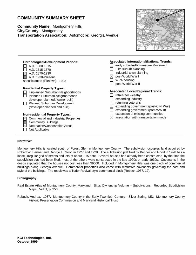
KCI Technologies, Inc. October 1999
COMMUNITY SUMMARY SHEET Community Name: Montgomery Hills City/County: Montgomery Transportation Association: Automobile: Georgia Avenue
Chronological/Development Periods:
A.D. 1680-1815 A.D. 1815-1870 A.D. 1870-1930 A.D. 1930-Present
specific dates (if known): 1928 Residential Property Types:
Unplanned Suburban Neighborhoods Planned Suburban Neighborhoods
developer planned / owner built) Planned Suburban Development
(developer planned and built) Non-residential Property Types:
Commercial and Industrial Properties Community Buildings Recreation/Conservation Areas Not Applicable
Associated International/National Trends:
early suburbs/Picturesque Movement Elite suburb planning Industrial town planning post-World War I WPA housing post-World War II
Associated Local/Regional Trends:
retreat for wealthy expanding industry returning veterans expanding government (post-Civil War) expanding government (post-WW II) expansion of existing communities association with transportation mode
Narrative: Montgomery Hills is located south of Forest Glen in Montgomery County. The subdivision occupies land acquired by Robert W. Benner and George E. Good in 1927 and 1928. The subdivision plat filed by Benner and Good in 1928 has a loose, irregular grid of streets and lots of about 0.15 acre. Several houses had already been constructed by the time the subdivision plat had been filed; most of the others were constructed in the late 1920s or early 1930s. Covenants in the deeds stipulated that the houses not cost less than $9000. Included in Montgomery Hills was one block of commercial buildings along Georgia Avenue. Commercial properties also came with restrictive covenants governing the cost and style of the buildings. The result was a Tudor Revival-style commercial block (Rebeck 1987, 12). Bibliography: Real Estate Atlas of Montgomery County, Maryland. Situs Ownership Volume – Subdivisions. Recorded Subdivision
Maps. Vol. 1, p. 353. Rebeck, Andrea. 1987. Montgomery County in the Early Twentieth Century. Silver Spring, MD: Montgomery County
Historic Preservation Commission and Maryland Historical Trust.

KCI Technologies, Inc. October 1999
COMMUNITY SUMMARY SHEET Community Name: Montgomery Hills Bibliography: (continued) United States Geological Survey (USGS). 1944. Washington and Vicinity Topographic Map. Washington, D.C.:
USGS. ------. 1956. Kensington, MD Quadrangle Map. Washington, D.C.: USGS. ------. 1965. Kensington, MD Quadrangle Map. Washington, D.C.: USGS.

KCI Technologies, Inc. October 1999
COMMUNITY SUMMARY SHEET Community Name: North Bethesda Grove City/County: Montgomery Transportation Association: Automobile: Old Georgetown Road
Chronological/Development Periods:
A.D. 1680-1815 A.D. 1815-1870 A.D. 1870-1930 A.D. 1930-Present
specific dates (if known): 1947 Residential Property Types:
Unplanned Suburban Neighborhoods Planned Suburban Neighborhoods
developer planned / owner built) Planned Suburban Development
(developer planned and built) Non-residential Property Types:
Commercial and Industrial Properties Community Buildings Recreation/Conservation Areas Not Applicable
Associated International/National Trends:
early suburbs/Picturesque Movement Elite suburb planning Industrial town planning post-World War I WPA housing post-World War II
Associated Local/Regional Trends:
retreat for wealthy expanding industry returning veterans expanding government (post-Civil War) expanding government (post-WW II) expansion of existing communities association with transportation mode
Narrative: North Bethesda Grove is located between I-495 and I-270 in Montgomery County. The subdivision was constructed on land acquired by Austin F. and Gertrude M. Canfield from Edward C. and Sylvia G. Ostrow in 1946. The plat, filed in 1947, shows a grid pattern of streets with 161 lots of about 0.1 acre each. All of the streets shown on the plat were constructed. North Bethesda Grove is roughly bounded by Lone Oak Drive, Fleming Avenue, Grosvenor Lane, and Old Georgetown Road. It includes community properties such as churches and schools. Bibliography: Real Estate Atlas of Montgomery County, Maryland. Situs Ownership Volume – Subdivisions. Recorded Subdivision
Maps. Vol. 2, pp. 42-43. United States Geological Survey (USGS). 1956. Kensington, MD Quadrangle Map. Washington, D.C.: USGS. ------. 1965. Kensington, MD Quadrangle Map. Washington, D.C.: USGS.

KCI Technologies, Inc. October 1999
COMMUNITY SUMMARY SHEET Community Name: North Chevy Chase City/County: Montgomery Transportation Association: Trolley: Rock Creek Railway
Chronological/Development Periods:
A.D. 1680-1815 A.D. 1815-1870 A.D. 1870-1930 A.D. 1930-Present
specific dates (if known): Residential Property Types:
Unplanned Suburban Neighborhoods Planned Suburban Neighborhoods
developer planned / owner built) Planned Suburban Development
(developer planned and built) Non-residential Property Types:
Commercial and Industrial Properties Community Buildings Recreation/Conservation Areas Not Applicable
Associated International/National Trends:
early suburbs/Picturesque Movement Elite suburb planning Industrial town planning post-World War I WPA housing post-World War II
Associated Local/Regional Trends:
retreat for wealthy expanding industry returning veterans expanding government (post-Civil War) expanding government (post-WW II) expansion of existing communities association with transportation mode
Narrative: The North Chevy Chase municipality is located north of Chevy Chase in Montgomery County. North Chevy Chase was developed beginning in 1895 along Connecticut Avenue and the Rock Creek Railway trolley line. The suburb was originally known as Kenilworth (Offutt 1996, 188). It was incorporated in 1896. North Chevy Chase was developed by Redford W. Walker, and originally included 64.5 acres with 118 lots arranged along a curvilinear street system consisting of Inverness Way, Kensington Parkway, and Kenilworth Driveway (Ibid.). The suburb originally provided water to its residents, but no electricity (Ibid.). Approximately 15 families had settled in North Chevy Chase by the turn of the century (Ibid.). The curvilinear street system was expanded to the east during the late 1930s, and the suburb continued to develop into the 1950s. North Chevy Chase includes the 1910 home of horticulturist Dr. David Fairchild, who introduced the Japanese cherry tree to the United States (Ibid., 188-189). Bibliography: Montgomery County Historical Society. Vertical Files. "Chevy Chase A-Z."

KCI Technologies, Inc. October 1999
COMMUNITY SUMMARY SHEET Community Name: North Chevy Chase Bibliography: (continued) Offutt, William. 1996. Bethesda, A Social History of the Area through World War Two. 3d ed. Bethesda, Maryland: The Innovation Game. Real Estate Atlas of Montgomery County, Maryland. Situs Ownership Volume - Subdivisions. Recorded Subdivision Maps. Vol. 1, pp. 837, 1007; Vol. 2, p. 739.

KCI Technologies, Inc. October 1999
COMMUNITY SUMMARY SHEET Community Name: North Takoma City/County: Montgomery Transportation Association: Railroad: Baltimore and Ohio Metropolitan Branch
Chronological/Development Periods:
A.D. 1680-1815 A.D. 1815-1870 A.D. 1870-1930 A.D. 1930-Present
specific dates (if known): Residential Property Types:
Unplanned Suburban Neighborhoods Planned Suburban Neighborhoods
developer planned / owner built) Planned Suburban Development
(developer planned and built) Non-residential Property Types:
Commercial and Industrial Properties Community Buildings Recreation/Conservation Areas Not Applicable
Associated International/National Trends:
early suburbs/Picturesque Movement Elite suburb planning Industrial town planning post-World War I WPA housing post-World War II
Associated Local/Regional Trends:
retreat for wealthy expanding industry returning veterans expanding government (post-Civil War) expanding government (post-WW II) expansion of existing communities association with transportation mode
Narrative: North Takoma is located within the municipal boundaries of Takoma Park in Montgomery County. Benjamin Franklin Gilbert, founder of Takoma Park, subdivided North Takoma circa 1890. The subdivision appears on the USGS Washington and Vicinity quadrangle in 1917 as a grid of streets leading northeast from the Baltimore and Ohio Railroad Metropolitan Branch. The Bliss Electrical School (now part of Montgomery College) occupied one block beginning in 1894, while single family houses lined the others (M-NCPPC 1992, 5; M-NCPPC 1982, 18). The areas northwest and northeast of North Takoma developed between 1918 and 1945. Bibliography: Maryland - National Capital Park and Planning Commission (M-NCPPC). 1982. City of Takoma Park Master Plan.
Silver Spring, MD. ------. 1992. Amendment to Master Plan for Historic Preservation in Montgomery County, Maryland: Takoma Park
Historic District and Carroll Manor/Douglas House. Silver Spring, MD.

KCI Technologies, Inc. October 1999
COMMUNITY SUMMARY SHEET Community Name: North Takoma Bibliography: (continued) United States Geological Survey (USGS). 1917. Washington and vicinity topographic map. Washington, D.C.: USGS. ------. 1944. Washington and vicinity topographic map. Washington, D.C.: USGS. ------. 1965. Washington West, DC-MD-VA Quadrangle Map. Washington, D.C.: USGS.

KCI Technologies, Inc. October 1999
COMMUNITY SUMMARY SHEET Community Name: Northbrook Estates City/County: Montgomery Transportation Association: Automobile: Georgia Avenue
Chronological/Development Periods:
A.D. 1680-1815 A.D. 1815-1870 A.D. 1870-1930 A.D. 1930-Present
specific dates (if known): 1950 Residential Property Types:
Unplanned Suburban Neighborhoods Planned Suburban Neighborhoods
developer planned / owner built) Planned Suburban Development
(developer planned and built) Non-residential Property Types:
Commercial and Industrial Properties Community Buildings Recreation/Conservation Areas Not Applicable
Associated International/National Trends:
early suburbs/Picturesque Movement Elite suburb planning Industrial town planning post-World War I WPA housing post-World War II
Associated Local/Regional Trends:
retreat for wealthy expanding industry returning veterans expanding government (post-Civil War) expanding government (post-WW II) expansion of existing communities association with transportation mode
Narrative: Northbrook Estates is located south of Wheaton in Montgomery County. The subdivision occupies land acquired by Joseph D. Clagett and Julius P. Stadler in 1942. The subdivision plats, filed in 1950, show a pattern of discontinuous streets and lots of about 0.2 acres. Most of Northbrook Estates was developed during the 1950s and early 1960s. Some infill development has continued to the present. Northbrook Estates consists of parts of Glenhaven Drive, Dunkirk Drive and Cascade Place. Bibliography: Real Estate Atlas of Montgomery County, Maryland. Situs Ownership Volume – Subdivisions. Recorded Subdivision
Maps. Vol. 2, p. 544 United States Geological Survey (USGS). 1944. Washington and Vicinity Topographic Map. Washington, D.C.:
USGS. ------. 1956. Kensington, MD Quadrangle Map. Washington, D.C.: USGS. ------. 1965. Kensington, MD Quadrangle Map. Washington, D.C.: USGS.

KCI Technologies, Inc. October 1999
COMMUNITY SUMMARY SHEET Community Name: Northwood Park City/County: Montgomery Transportation Association: Automobile: Bladensburg Road, Colesville Road.
Chronological/Development Periods:
A.D. 1680-1815 A.D. 1815-1870 A.D. 1870-1930 A.D. 1930-Present
specific dates (if known): 1936 Residential Property Types:
Unplanned Suburban Neighborhoods Planned Suburban Neighborhoods
developer planned / owner built) Planned Suburban Development
(developer planned and built) Non-residential Property Types:
Commercial and Industrial Properties Community Buildings Recreation/Conservation Areas Not Applicable
Associated International/National Trends:
early suburbs/Picturesque Movement Elite suburb planning Industrial town planning post-World War I WPA housing post-World War II
Associated Local/Regional Trends:
retreat for wealthy expanding industry returning veterans expanding government (post-Civil War) expanding government (post-WW II) expansion of existing communities association with transportation mode
Narrative: Northwood Park is located in the Four Corners community of Montgomery County. The subdivision was established in 1936 by Louise Vonne, although it was deeded to the R. E. Latimer Land Company in 1938. Northwood Park featured a grid of curved streets and lots of about 0.15 to 0.3 acres. The subdivision grew quickly with approximately 130 houses constructed by 1945. New subdivisions such as North Hills, Northwood Park View, and Northwood grew around Northwood Park during the 1950s. Northwood Park is roughly bounded by Colesville Road, West University Boulevard, Dennis Avenue and Eastwood Avenue. Bibliography: Real Estate Atlas of Montgomery County, Maryland. Situs Ownership Volume – Subdivisions. Recorded Subdivision
Maps. Vol. 1, pp. 675, 1241. United States Geological Survey (USGS). 1944. Washington and Vicinity Topographic Map. Washington, D.C.:
USGS. ------. 1956. Kensington, MD Quadrangle Map. Washington, D.C.: USGS. ------. 1965. Kensington, MD Quadrangle Map. Washington, D.C.: USGS.

KCI Technologies, Inc. October 1999
COMMUNITY SUMMARY SHEET Community Name: Oakmont City/County: Montgomery Transportation Association: Trolley: Georgetown and Rockville Electric Railway
Chronological/Development Periods:
A.D. 1680-1815 A.D. 1815-1870 A.D. 1870-1930 A.D. 1930-Present
specific dates (if known): 1903 Residential Property Types:
Unplanned Suburban Neighborhoods Planned Suburban Neighborhoods
developer planned / owner built) Planned Suburban Development
(developer planned and built) Non-residential Property Types:
Commercial and Industrial Properties Community Buildings Recreation/Conservation Areas Not Applicable
Associated International/National Trends:
early suburbs/Picturesque Movement Elite suburb planning Industrial town planning post-World War I WPA housing post-World War II
Associated Local/Regional Trends:
retreat for wealthy expanding industry returning veterans expanding government (post-Civil War) expanding government (post-WW II) expansion of existing communities association with transportation mode
Narrative: Oakmont is an incorporated suburb located north of Bethesda. In 1901, E. Baker Evans acquired 18 acres along the Georgetown and Rockville Electric Railway. The land had been the site of the Bethesda Park amusement park during the late-19th century. Evans filed a subdivision plat in 1903 which showed two long, straight streets (Oak Place and Cedar Avenue) connected by a cross street which was never constructed. Narrow, deep lots lined both sides of Oak Place and the south side of Cedar Avenue. Approximately 15 houses had been constructed by the time the subdivision plat was filed. Most of the other houses were constructed around World War I. Oakmont was incorporated in 1918 (Offutt 1996, 79, 292). Bibliography: Offut, William. 1996. Bethesda, A Social History of the Area through World War Two. 3d ed. Bethesda, Maryland: The
Innovation Game. Real Estate Atlas of Montgomery County, Maryland. Situs Ownership Volume – Subdivisions. Recorded Subdivision
Maps. Vol. 1, p. 120.

KCI Technologies, Inc. October 1999
COMMUNITY SUMMARY SHEET Community Name: Oakmont Bibliography: United States Geological Survey (USGS). 1917. Washington and Vicinity Topographic Map. Washington, D.C.:
USGS. ------. 1944. Washington and Vicinity Topographic Map. Washington, D.C.: USGS.

KCI Technologies, Inc. October 1999
COMMUNITY SUMMARY SHEET Community Name: Rock Creek Forest City/County: Montgomery Transportation Association: Automobile: East West Highway
Chronological/Development Periods:
A.D. 1680-1815 A.D. 1815-1870 A.D. 1870-1930 A.D. 1930-Present
specific dates (if known): 1938 Residential Property Types:
Unplanned Suburban Neighborhoods Planned Suburban Neighborhoods
developer planned / owner built) Planned Suburban Development
(developer planned and built) Non-residential Property Types:
Commercial and Industrial Properties Community Buildings Recreation/Conservation Areas Not Applicable
Associated International/National Trends:
early suburbs/Picturesque Movement Elite suburb planning Industrial town planning post-World War I WPA housing post-World War II
Associated Local/Regional Trends:
retreat for wealthy expanding industry returning veterans expanding government (post-Civil War) expanding government (post-WW II) expansion of existing communities association with transportation mode
Narrative: Rock Creek Forest is located immediately northwest of the District of Columbia. The subdivision is located on land acquired by Jacob and Esther Zellan and Sam and Esther Eig during the late 1920s. The first subdivision plats were filed in 1938. The earliest part of Rock Creek Forest, located south of East West Highway, had a grid of streets and standard lots of 5000 square feet (0.1 acres). The area around Colston Drive, Blaine Drive, and Washington Avenue was fully developed by 1945. Between 1945 and 1950, Spencer and Ross Roads developed north of East West Highway. Rock Creek Forest expanded further to the north and east between 1950 and 1965. The community was adjacent to Rock Creek Park and included the Rock Creek Forest Elementary School. Bibliography: Real Estate Atlas of Montgomery County, Maryland. Situs Ownership Volume – Subdivisions. Recorded Subdivision
Maps. Vol. 1, pp. 959, 990. United States Geological Survey (USGS). 1944. Washington and Vicinity Topographic Map. Washington, D.C.:
USGS.

KCI Technologies, Inc. October 1999
COMMUNITY SUMMARY SHEET Community Name: Rock Creek Forest Bibliography: (continued) ------. 1951. Washington West, MD Quadrangle Map. Washington, D.C.: USGS. ------. 1965. Washington West, MD Quadrangle Map. Washington, D.C.: USGS.

KCI Technologies, Inc. October 1999
COMMUNITY SUMMARY SHEET Community Name: Rock Creek Hills City/County: Montgomery Transportation Association: Automobile: Rock Creek Hills
Chronological/Development Periods:
A.D. 1680-1815 A.D. 1815-1870 A.D. 1870-1930 A.D. 1930-Present
specific dates (if known): 1938 Residential Property Types:
Unplanned Suburban Neighborhoods Planned Suburban Neighborhoods
developer planned / owner built) Planned Suburban Development
(developer planned and built) Non-residential Property Types:
Commercial and Industrial Properties Community Buildings Recreation/Conservation Areas Not Applicable
Associated International/National Trends:
early suburbs/Picturesque Movement Elite suburb planning Industrial town planning post-World War I WPA housing post-World War II
Associated Local/Regional Trends:
retreat for wealthy expanding industry returning veterans expanding government (post-Civil War) expanding government (post-WW II) expansion of existing communities association with transportation mode
Narrative: Rock Creek Hills is located immediately southeast of Kensington in Montgomery County. The subdivision is located on land acquired by the Continental Life Insurance Company in 1938. Rock Creek Hills has winding, discontinuous streets and is bordered on three sides by Rock Creek Park. By 1944, approximately 40 houses had been constructed along Stanhope Road, Bexhill Drive, and Kensington Parkway. During the late 1940s, Rock Creek Hills expanded to the east to Old Spring Road. During the 1950s and into the 1960s, the subdivision expanded further to the north and east toward the former Baltimore and Ohio Railroad Metropolitan Branch tracks. The Kensington Junior High School, now Rock Creek Hills Park, was located in the subdivision. Bibliography: Real Estate Atlas of Montgomery County, Maryland. Situs Ownership Volume – Subdivisions. Recorded Subdivision
Maps. Vol. 1, p. 850. United States Geological Survey (USGS). 1944. Washington and Vicinity Topographic Map. Washington, D.C.:
USGS.

KCI Technologies, Inc. October 1999
COMMUNITY SUMMARY SHEET Community Name: Rock Creek Hills Bibliography: (continued) ------. 1956. Kensington, MD Quadrangle Map. Washington, D.C.: USGS. ------. 1965. Kensington, MD Quadrangle Map. Washington, D.C.: USGS.

KCI Technologies, Inc. October 1999
COMMUNITY SUMMARY SHEET Community Name: Silver Spring City/County: Montgomery Transportation Association: Railroad: Baltimore and Ohio Metropolitan Branch; Trolley: Washington, Woodside and Forest Glen Railway
Chronological/Development Periods:
A.D. 1680-1815 A.D. 1815-1870 A.D. 1870-1930 A.D. 1930-Present
specific dates (if known): Residential Property Types:
Unplanned Suburban Neighborhoods Planned Suburban Neighborhoods
developer planned / owner built) Planned Suburban Development
(developer planned and built) Non-residential Property Types:
Commercial and Industrial Properties Community Buildings Recreation/Conservation Areas Not Applicable
Associated International/National Trends:
early suburbs/Picturesque Movement Elite suburb planning Industrial town planning post-World War I WPA housing post-World War II
Associated Local/Regional Trends:
retreat for wealthy expanding industry returning veterans expanding government (post-Civil War) expanding government (post-WW II) expansion of existing communities association with transportation mode
Narrative: Silver Spring is an unincorporated suburb located immediately northeast of the Washington, D.C. border. Francis Preston Blair of Washington, D.C. founded the community in 1842 and built his country estate there (Sentinel 1967). Although the Baltimore and Ohio Railroad Metropolitan Branch began stopping at the Silver Spring station in 1878, the community remained a rural village throughout most of the late 19th century (Silver Spring Chamber of Commerce 1973, 1; M-NCPPC 1993a, 1). In 1898, the Washington, Woodside and Forest Glen Railway began trolley service to Silver Spring (Sentinel 1967). A grid of streets extended northeast from the Silver Spring station by 1910 (MGS 1910). The pace of growth increased after World War I when Col. E. Brooke Lee, great-grandson of Francis Preston Blair, began subdividing large sections his old estate (Sentinel 1967). Colonial Revival and Moderne garden apartment complexes were constructed on some sections (Walston 1984, 7-10). Silver Spring expanded to the north and east, and the street pattern became increasingly discontinuous (USGS 1944). As growth accelerated through the 1930s due to an influx of government workers under the New Deal, a commercial area developed along Georgia Avenue between the Metropolitan Branch tracks and Wayne Avenue (M-NCPPC 1993 Amendment to Master Plan, 1). The Silver Theatre and Shopping Center, which opened in 1938, is one example of the Art Deco and Moderne commercial complexes constructed during this period (M-NCPPC 1993a, 1-2). Following World War II, the increasing suburbanization of Montgomery County ensured that Silver Spring would remain an active commercial center. High-rise office buildings, hotels and apartments, were added to the central business district during the late 1960s (M-NCPPC 1993b, 4). The construction of a Metro stop in the 1970s spurred additional large-scale commercial development.

KCI Technologies, Inc. October 1999
COMMUNITY SUMMARY SHEET Community Name: Silver Spring Bibliography: Maryland Geological Survey (MGS). 1910. Map of Montgomery County and District of Columbia Showing the Topography and Election Districts. Washington, D.C.: USGS. Maryland – National Capital Park and Planning Commission (M-NCPPC). 1993a. Amendment to the Approved and Adopted Master Plan for Historic Preservation in Montgomery County, Maryland: Silver Theatre and Shopping Center and Tastee Diner. Silver Spring, MD. ------. 1993b. Silver Spring CBD Sector Plan. Silver Spring, MD. Sentinel. 1967. Silver Spring History Is Long and Colorful. Thursday 8 June: C4. Silver Spring Chamber of Commerce. 1973. Silver Spring Handbook. Silver Spring, MD. United States Geological Survey (USGS). 1885. Washington and Vicinity Topographic Map. Washington, D.C.: USGS. ------. 1917. Washington and Vicinity Topographic Map. Washington, D.C.: USGS. ------. 1944. Washington and Vicinity Topographic Map. Washington, D.C.: USGS. Walston, Mark. 1984. Montgomery County’s First Garden Apartments. The Montgomery County Story. 27 (1): 89-100.

KCI Technologies, Inc. October 1999
COMMUNITY SUMMARY SHEET Community Name: Somerset City/County: Montgomery Transportation Association: Trolley: Georgetown and Rockville Electric Railway
Chronological/Development Periods:
A.D. 1680-1815 A.D. 1815-1870 A.D. 1870-1930 A.D. 1930-Present
specific dates (if known): 1890, 1906 Residential Property Types:
Unplanned Suburban Neighborhoods Planned Suburban Neighborhoods
developer planned / owner built) Planned Suburban Development
(developer planned and built) Non-residential Property Types:
Commercial and Industrial Properties Community Buildings Recreation/Conservation Areas Not Applicable
Associated International/National Trends:
early suburbs/Picturesque Movement Elite suburb planning Industrial town planning post-World War I WPA housing post-World War II
Associated Local/Regional Trends:
retreat for wealthy expanding industry returning veterans expanding government (post-Civil War) expanding government (post-WW II) expansion of existing communities association with transportation mode
Narrative: The Somerset municipality, originally known as Somerset Heights, is located west of Chevy Chase in Montgomery County. Somerset Heights was developed beginning in 1890 along the Georgetown and Rockville Electric Railway. The suburb was incorporated in 1906. Somerset Heights was created by the Somerset Heights Colony Company, an organization created by five scientists from the United States Department of Agriculture. The scientists were Harvey Wiley, Charles Crampton, Daniel Salmon, Miles Fuller, and Horage Horton. They hoped to develop a healthful, pleasant suburb within commuting distance of the city (Crawford 1986, 23-24). Somerset Heights originally consisted of 50 acres with lots arranged along a gridded street system. The suburb was intended to attract professionals and their families, including scientists, doctors, and lawyers from Washington D.C. (MHT, M:35-36, 1976). The original suburb consisted of rambling, Queen Anne-style dwellings. There was no commercial area, although parks, recreational areas, and a school were developed in the eastern end of the municipality. Brochures advertising the suburb promised sewage, water, electricity, and sidewalks, however these were not a reality until after incorporation (Ibid.). Although the 1906 municipal boundaries of Somerset included 192 acres, the land outside the original 50-acre tract was owned solely by the Bergdoll family of Philadelphia until 1946 (O'Brien and Jaszi 1977, 9). As a result, the original lots have been continually resubdivided, and architectural styles dating from 1890 to the present

KCI Technologies, Inc. October 1999
COMMUNITY SUMMARY SHEET Community Name: Somerset Narrative: (continued) can be found. After 1946, the land west and south of the original suburb was developed with Colonial Revival and contemporary houses arranged along a fragmented grid of streets (MHT, M:35-36, 1976). Two-thirds of the housing stock in Somerset Heights was constructed between 1950 and 1970 (MCHS Vertical Files). Southeast of the municipal limits, an 18-acre fragment of the Bergdoll tract remains undeveloped (O'Brien and Jaszi 1977, 9). The town of Somerset is listed in the National Register of Historic Places. Bibliography: Allman, William G. 1991. Bethesda Park: "The Handsomest Park in the United States." The Montgomery County
Story. Vol. 34, No. 3. Crawford, Catherine. 1986. The Early Suburban Communities of Washington, D.C. Located in Montgomery County,
Maryland. Maryland Historical Trust (MHT). 1976. Maryland Historical Trust State Historic Sites Inventory Form. Somerset
Historic District, Montgomery County. M:35-36. Crownsville, MD. O'Brien, Dorothy and Helen H. Jaszi. 1977. The Town of Somerset. The Montgomery County Story. Vol. 20, No. 2. Real Estate Atlas of Montgomery County, Maryland. Situs Ownership Volume - Subdivisions. Recorded Subdivision
Maps. Vol. 1, p. 136. Rockville, MD.

KCI Technologies, Inc. October 1999
COMMUNITY SUMMARY SHEET Community Name: Sonoma City/County: Montgomery Transportation Association: Georgetown and Rockville Electric Railway
Chronological/Development Periods:
A.D. 1680-1815 A.D. 1815-1870 A.D. 1870-1930 A.D. 1930-Present
specific dates (if known): 1912 Residential Property Types:
Unplanned Suburban Neighborhoods Planned Suburban Neighborhoods
developer planned / owner built) Planned Suburban Development
(developer planned and built) Non-residential Property Types:
Commercial and Industrial Properties Community Buildings Recreation/Conservation Areas Not Applicable
Associated International/National Trends:
early suburbs/Picturesque Movement Elite suburb planning Industrial town planning post-World War I WPA housing post-World War II
Associated Local/Regional Trends:
retreat for wealthy expanding industry returning veterans expanding government (post-Civil War) expanding government (post-WW II) expansion of existing communities association with transportation mode
Narrative: Sonoma is an unincorporated subdivision located north of Bethesda in Montgomery County. The subdivision was surveyed in May 1912 and occupied 35 acres of land along the Georgetown and Rockville Electric Railway. The land was formerly part of the Bethesda Park Amusement Park (Offutt 1996, 79, 87). The Sonoma subdivision plat, filed in 1913, includes approximately 100 narrow lots along gridded streets. Several houses already existed by that time. Sonoma is roughly bounded by the Oakmont municipal boundary, Sonoma Lane, Greentree Road, and Old Georgetown Road. Bibliography: Offut, William. 1996. Bethesda, A Social History of the Area through World War Two. 3d ed. Bethesda, Maryland: The
Innovation Game. Real Estate Atlas of Montgomery County, Maryland. Situs Ownership Volume – Subdivisions. Recorded Subdivision
Maps. Vol. 1, p. 137.

KCI Technologies, Inc. October 1999
COMMUNITY SUMMARY SHEET Community Name: Takoma Park City/County: Montgomery Transportation Association: Railroad: Baltimore and Ohio Metropolitan Branch
Chronological/Development Periods:
A.D. 1680-1815 A.D. 1815-1870 A.D. 1870-1930 A.D. 1930-Present
specific dates (if known): 1883 Residential Property Types:
Unplanned Suburban Neighborhoods Planned Suburban Neighborhoods
(developer planned / owner built) Planned Suburban Development
(developer planned and built) Non-residential Property Types:
Commercial and Industrial Properties Community Buildings Recreation/Conservation Areas Not Applicable
Associated International/National Trends:
early suburbs/Picturesque Movement Elite suburb planning Industrial town planning post-World War I WPA housing post-World War II
Associated Local/Regional Trends:
retreat for wealthy expanding industry returning veterans expanding government (post-Civil War) expanding government (post-WW II) expansion of existing communities association with transportation mode
Narrative: Takoma Park is located immediately northeast of Washington, D.C. in Montgomery County. Benjamin Franklin Gilbert of Washington, D.C. founded Takoma Park in 1883 after buying 90 acres of land along the Baltimore and Ohio Railroad Metropolitan Branch. Several vacation houses already existed in the area (MNCPPC 1992, Amendment to Master Plan, 4). The plat filed by Franklin had gridded streets lined with narrow, deep lots. Franklin promoted Takoma Park to upper middle-class families, particularly officials and scientists in the expanding Department of Agriculture. Brochures for the suburb emphasize its healthful environment (MNCPPC 1982, ix). The first houses constructed included examples of the Queen Anne, Stick, Italianate, and Shingle styles (MNCPPC 1992, Amendment to Master Plan, 9). Takoma Park grew quickly after the opening of streetcar lines. The Baltimore and Washington Transit Company line opened in 1897, and the Washington and Maryland line opened in 1910 (Ibid., 9). In 1907, the Seventh Day Adventist Church moved its national headquarters to Takoma Park, and by 1916, one-third of the residents were associated with the Church (Ibid, 8). Schools, churches, and businesses opened along Carroll Avenue. The city of Takoma Park, which had incorporated in 1890, quickly began annexing subdivisions to the north, east, and south. As the city grew outward, the street pattern became more discontinuous and curving. Modest cottages and bungalows on small lots lined the streets and housed middle- and working-class families. The first double houses and garden apartments in Montgomery County also were constructed during this time (Walston 1984, 3). Growth continued through the 1930s and 1940s with the construction small Colonial Revival and Tudor Revival houses along winding streets (MNCPPC 1992, Amendment to Master Plan, 11). Construction continued at a much slower pace from the end of World War II to the present (Ibid).

KCI Technologies, Inc. October 1999
COMMUNITY SUMMARY SHEET Community Name: Takoma Park Bibliography: Crawford, Catherine. 1986. The Early Suburban Communities of Washington, D.C. Located in Montgomery County,
Maryland. Levy, Anneli Moucka. 1980. Washington, D.C. and the Growth of its Early Suburbs: 1860-1920. Master’s Thesis, Univ.
of Maryland. Maryland - National Capital Park and Planning Commission (M-NCPPC). 1962. A Preliminary Plan for Planning Area
Takoma Park – Langley Park and vicinity. Silver Spring, MD. ------. 1982. City of Takoma Park Master Plan. Silver Spring, MD. ------. 1992a. Amendment to Master Plan for Historic Preservation in Montgomery County, Maryland: Takoma Park
Historic District and Carroll Manor/Douglas House. Silver Spring, MD. ------. 1992b. Takoma Park, Maryland: An Historic District Study. Silver Spring, MD. Rebeck, Andrea. Montgomery County in the Early Twentieth Century. Silver Spring, MD: Montgomery County Historic
Preservation Commission and Maryland Historical Trust. Walston, Mark. Montgomery County’s First Garden Apartments. The Montgomery County Story. 27 (1): 89-100.

KCI Technologies, Inc. October 1999
COMMUNITY SUMMARY SHEET Community Name: Twinbrook City/County: Montgomery Transportation Association: Automobile: Veirs Mill Road
Chronological/Development Periods:
A.D. 1680-1815 A.D. 1815-1870 A.D. 1870-1930 A.D. 1930-Present
specific dates (if known): 1947 Residential Property Types:
Unplanned Suburban Neighborhoods Planned Suburban Neighborhoods
developer planned / owner built) Planned Suburban Development
(developer planned and built) Non-residential Property Types:
Commercial and Industrial Properties Community Buildings Recreation/Conservation Areas Not Applicable
Associated International/National Trends:
early suburbs/Picturesque Movement Elite suburb planning Industrial town planning post-World War I WPA housing post-World War II
Associated Local/Regional Trends:
retreat for wealthy expanding industry returning veterans expanding government (post-Civil War) expanding government (post-WW II) expansion of existing communities association with transportation mode
Narrative: Twinbrook is located within the municipality of Rockville in Montgomery County. This subdivision was one of the first large-scale developments created for returning veterans in Montgomery County. Twinbrook opened in 1947 in the southeast end of Rockville. The subdivision had an irregular pattern of curving streets, several bearing names such as “Coral Sea Drive” and “Okinawa Place.” Within the development was a school and park. Commercial establishments lined Veirs Mill Road and Rockville Pike. Construction of houses in Twinbrook continued into the early 1950s. Neighboring subdivisions such as Twinbrook Forest and Rockcrest developed during the late 1950s. Bibliography: Siveen, Jane C. 1984. Montgomery County: Two Centuries of Change. Woodland Hills, CA: Windsor Publications. United States Geological Survey (USGS). 1944. Washington and Vicinity Topographic Map. Washington, D.C.:
USGS. ------. 1956. Kensington, MD Quadrangle Map. Washington, D.C.: USGS.

KCI Technologies, Inc. October 1999
COMMUNITY SUMMARY SHEET Community Name: Twinbrook Bibliography: (continued) ------. 1956. Rockville, MD Quadrangle Map. Washington, D.C.: USGS. ------. 1965. Kensington, MD Quadrangle Map. Washington, D.C.: USGS. ------. 1965. Rockville, MD Quadrangle Map. Washington, D.C.: USGS.

KCI Technologies, Inc. October 1999
COMMUNITY SUMMARY SHEET Community Name: Veirs Mill Village City/County: Montgomery Transportation Association: Automobile: Connecticut Avenue, Veirs Mill Road, Randolph Road
Chronological/Development Periods:
A.D. 1680-1815 A.D. 1815-1870 A.D. 1870-1930 A.D. 1930-Present
specific dates (if known): 1948 Residential Property Types:
Unplanned Suburban Neighborhoods Planned Suburban Neighborhoods
developer planned / owner built) Planned Suburban Development
(developer planned and built) Non-residential Property Types:
Commercial and Industrial Properties Community Buildings Recreation/Conservation Areas Not Applicable
Associated International/National Trends:
early suburbs/Picturesque Movement Elite suburb planning Industrial town planning post-World War I WPA housing post-World War II
Associated Local/Regional Trends:
retreat for wealthy expanding industry returning veterans expanding government (post-Civil War) expanding government (post-WW II) expansion of existing communities association with transportation mode
Narrative: Veirs Mill Village is located southeast of Rockville on the former Selfridge Farm in Montgomery County. This subdivision of more than 300 acres was developed beginning in 1948 for returning veterans in need of affordable housing. Houses in Veirs Mill Village originally sold for $8,700 with 90% mortgages from the Veterans Administration. Approximately 1000 identical houses were constructed on lots of about 0.15 acre. The one-and-one-half-story, three-bay, balloon-frame houses were derived from the Cape Cod type. The houses originally contained a living room, kitchen and two bedrooms. Over the years, attics and basements were finished and substantial additions were added to many of the houses. Houses in Veirs Mill Village were constructed from 1948 through the early 1950s. The subdivision included an elementary school and was bordered by Rock Creek Park and the commercial establishments along Veirs Mill Road (Scharfenberg 1969). Bibliography: Callcott, George H. 1985. Maryland & America 1940 to 1980. Baltimore: The Johns Hopkins University Press. Rebeck, Andrea. 1987. Montgomery County in the early twentieth century. Silver Spring, MD: Montgomery County
Historic Preservation Commission and Maryland Historical Trust.

KCI Technologies, Inc. October 1999
COMMUNITY SUMMARY SHEET Community Name: Veirs Mill Village Bibliography: (continued) Scharfenberg, Kirk. 1969. Slum Forecast Faulty for Veirs Mill Village. The Washington Post. Thursday, November 13:
G-1. United States Geological Survey (USGS). 1944. Washington and Vicinity Topographic Map. Washington, D.C.:
USGS. ------. 1956. Kensington, MD Quadrangle Map. Washington, D.C.: USGS. ------. 1965. Kensington, MD Quadrangle Map. Washington, D.C.: USGS.

KCI Technologies, Inc. October 1999
COMMUNITY SUMMARY SHEET Community Name: Westgate City/County: Montgomery Transportation Association: Automobile: Massachusetts Avenue
Chronological/Development Periods:
A.D. 1680-1815 A.D. 1815-1870 A.D. 1870-1930 A.D. 1930-Present
specific dates (if known): 1933 Residential Property Types:
Unplanned Suburban Neighborhoods Planned Suburban Neighborhoods
developer planned / owner built) Planned Suburban Development
(developer planned and built) Non-residential Property Types:
Commercial and Industrial Properties Community Buildings Recreation/Conservation Areas Not Applicable
Associated International/National Trends:
early suburbs/Picturesque Movement Elite suburb planning Industrial town planning post-World War I WPA housing post-World War II
Associated Local/Regional Trends:
retreat for wealthy expanding industry returning veterans expanding government (post-Civil War) expanding government (post-WW II) expansion of existing communities association with transportation mode
Narrative: Westgate is located in Montgomery County immediately northwest of the District of Columbia. It developed at the same time as neighboring subdivisions Greenacres, Glen Cove, Crestview, and Westmoreland Hills. The subdivision, started in 1933, was a project of Westgate, Inc. and the Loughborough Development Corporation. Westgate had a loose grid of curving streets and lots of about 0.15 to 0.2 acres. Westgate was located adjacent to Little Falls Branch Park and Westbrook Elementary School. Bibliography: Real Estate Atlas of Montgomery County, Maryland. Situs Ownership Volume – Subdivisions. Recorded Subdivision
Maps. Vol. 1, pp. 406, 551, 755, 787. United States Geological Survey (USGS). 1917. Washington and Vicinity Topographic Map. Washington, D.C.:
USGS. ------. 1944. Washington and Vicinity Topographic Map Quadrangle Map. Washington, D.C.: USGS.

KCI Technologies, Inc. October 1999
COMMUNITY SUMMARY SHEET Community Name: Westgate Bibliography: (continued) ------. 1951. Washington West, DC-MD-VA Quadrangle Map. Washington, D.C.: USGS ------. 1965. Washington West, DC-MD-VA Quadrangle Map. Washington, D.C.: USGS

KCI Technologies, Inc. October 1999
COMMUNITY SUMMARY SHEET Community Name: Westmoreland Hills City/County: Montgomery Transportation Association: Automobile: Massachusetts Avenue, Western Avenue
Chronological/Development Periods:
A.D. 1680-1815 A.D. 1815-1870 A.D. 1870-1930 A.D. 1930-Present
specific dates (if known): 1932 Residential Property Types:
Unplanned Suburban Neighborhoods Planned Suburban Neighborhoods
developer planned / owner built) Planned Suburban Development
(developer planned and built) Non-residential Property Types:
Commercial and Industrial Properties Community Buildings Recreation/Conservation Areas Not Applicable
Associated International/National Trends:
early suburbs/Picturesque Movement Elite suburb planning Industrial town planning post-World War I WPA housing post-World War II
Associated Local/Regional Trends:
retreat for wealthy expanding industry returning veterans expanding government (post-Civil War) expanding government (post-WW II) expansion of existing communities association with transportation mode
Narrative: Westmoreland Hills is located in Montgomery County immediately northwest of the District of Columbia. The subdivision was begun in 1932 as a project of the Loughborough Development Corporation. It developed around the same time as the neighboring subdivisions Greenacres, Glen Cove, Westgate, and Crestview. Westmoreland Hills had a pattern of curving, often discontinuous streets lined with lots of about 0.15 acres. The subdivision was almost completely developed by 1945, with approximately 150 houses having been constructed. Westmoreland Hills also included parklands and community buildings. Bibliography: Real Estate Atlas of Montgomery County, Maryland. Situs Ownership Volume – Subdivisions.
Recorded Subdivision Maps. Vol. 1, pp. 421, 727. United States Geological Survey (USGS). 1917. Washington and Vicinity Topographic Map. Washington, D.C.:
USGS. ------. 1944. Washington and Vicinity Topographic Map Quadrangle Map. Washington, D.C.: USGS.

KCI Technologies, Inc. October 1999
COMMUNITY SUMMARY SHEET Community Name: Westmoreland Hills Bibliography: (continued) ------. 1951. Washington West, DC-MD-VA Quadrangle Map. Washington, D.C.: USGS ------. 1965. Washington West, DC-MD-VA Quadrangle Map. Washington, D.C.: USGS

KCI Technologies, Inc. October 1999
COMMUNITY SUMMARY SHEET Community Name: Wheaton City/County: Montgomery Transportation Association: Automobile: Georgia Avenue
Chronological/Development Periods:
A.D. 1680-1815 A.D. 1815-1870 A.D. 1870-1930 A.D. 1930-Present
specific dates (if known): Residential Property Types:
Unplanned Suburban Neighborhoods Planned Suburban Neighborhoods
developer planned / owner built) Planned Suburban Development
(developer planned and built) Non-residential Property Types:
Commercial and Industrial Properties Community Buildings Recreation/Conservation Areas Not Applicable
Associated International/National Trends:
early suburbs/Picturesque Movement Elite suburb planning Industrial town planning post-World War I WPA housing post-World War II
Associated Local/Regional Trends:
retreat for wealthy expanding industry returning veterans expanding government (post-Civil War) expanding government (post-WW II) expansion of existing communities association with transportation mode
Narrative: Wheaton began as a 19th-century rural village located at the crossroads of what is now Georgia Avenue and University Boulevard. While subdivisions began appearing in the area around Wheaton during the early 20th century, the crossroads itself remained undeveloped until the post-World War II suburban expansion of Montgomery County. Between 1945 and 1955, the subdivisions Monterey Village, Wheaton Hills, Wheaton Crest, and Wheaton Forest were constructed around the Wheaton crossroads. Glenmont Forest, Glenmont Village, Glenmont Hills, Connecticut Estates, and Connecticut Gardens were located nearby. These subdivisions predominantly consisted of single-family homes located along curving streets, although apartment buildings and complexes were constructed along major roads. Wheaton also became a major retail center with the opening of Wheaton Plaza in 1955. Wheaton Plaza originally included two department stores, specialty stores, a restaurant, and a movie theater. Within a decade it was a major regional shopping center and office complex (Hiebert and MacMaster 1976, 356). Commercial and residential growth in Wheaton has continued through the end of the 20th century.

KCI Technologies, Inc. October 1999
COMMUNITY SUMMARY SHEET Community Name: Wheaton Bibliography: Hiebert, Ray Eldon and Richard K. MacMaster. 1976. A Grateful Remembrance, The Story of Montgomery County,
Maryland. Rockville, MD: Montgomery County Government and Montgomery County Historical Society. Hopkins, G. M. [1879] 1975. Atlas of Montgomery County, Maryland, 1879. Philadelphia: G.M. Hopkins. Rockville,
MD: Montgomery County Historical Society. Maryland – National Capital Park and Planning Commission (M-NCPPC), Montgomery County Planning Department.
1990. Comprehensive Amendment to the Sector Plan for the Wheaton CBD and Vicinity. Silver Spring, MD: M-NCPPC.
United States Geological Survey (USGS). 1917. Washington and Vicinity Topographic Map. Washington, D.C.:
USGS. ------. 1944. Washington and Vicinity Topographic Map. Washington, D.C.: USGS. ------. 1956. Kensington, MD Quadrangle Map. Washington, D.C.: USGS. ------. 1965. Kensington, MD Quadrangle Map. Washington, D.C.: USGS.

KCI Technologies, Inc. October 1999
COMMUNITY SUMMARY SHEET Community Name: White Oak City/County: Montgomery Transportation Association: Automobile: New Hampshire Avenue, Colesville Road
Chronological/Development Periods:
A.D. 1680-1815 A.D. 1815-1870 A.D. 1870-1930 A.D. 1930-Present
specific dates (if known): Residential Property Types:
Unplanned Suburban Neighborhoods Planned Suburban Neighborhoods
developer planned / owner built) Planned Suburban Development
(developer planned and built) Non-residential Property Types:
Commercial and Industrial Properties Community Buildings Recreation/Conservation Areas Not Applicable
Associated International/National Trends:
early suburbs/Picturesque Movement Elite suburb planning Industrial town planning post-World War I WPA housing post-World War II
Associated Local/Regional Trends:
retreat for wealthy expanding industry returning veterans expanding government (post-Civil War) expanding government (post-WW II) expansion of existing communities association with transportation mode
Narrative: White Oak began as a late-19th-century rural crossroads village at the intersection of the Colesville Turnpike and the Columbia Road. The community remained rural until the post-World War II suburban expansion of Montgomery County. The former Naval Surface Warfare Center, constructed between 1945 and 1955, dominates White Oak. Nearby are the commercial establishments at the intersection of Colesville Road and New Hampshire Avenue. The Burnt Mills and Hillandale communities are located to the south, while other residential subdivisions of the 1940s and 1950s, such as Springbrook and Quaint Acres are located to the north. The commuunity also includes low-rise and high-rise apartment housing. Development of White Oak continues to the present. Bibliography: Maryland – National Capital Park and Planning Commission. 1997. Comprehensive Amendment to 1981 Eastern
Montgomery County Master Plan. Silver Spring, MD: M-NCPPC. United States Geological Survey (USGS). 1917. Washington and Vicinity Topographic Map. Washington, D.C.:
USGS.

KCI Technologies, Inc. October 1999
COMMUNITY SUMMARY SHEET Community Name: White Oak Bibliography: (continued) ------. 1944. Washington and Vicinity Topographic Map. Washington, D.C.: USGS. ------. 1951. Beltsville, MD Quadrangle Map. Washington, D.C.: USGS ------. 1956. Kensington, MD Quadrangle Map. Washington, D.C.: USGS. ------. 1965. Beltsville, MD Quadrangle Map. Washington, D.C.: USGS ------. 1965. Kensington, MD Quadrangle Map. Washington, D.C.: USGS.

KCI Technologies, Inc. October 1999
COMMUNITY SUMMARY SHEET Community Name: Woodmont City/County: Montgomery Transportation Association: Trolley: Georgetown and Rockville Electric Railway; Early Automobile: Georgetown and Rockville Road
Chronological/Development Periods:
A.D. 1680-1815 A.D. 1815-1870 A.D. 1870-1930 A.D. 1930-Present
specific dates (if known): 1894 Residential Property Types:
Unplanned Suburban Neighborhoods Planned Suburban Neighborhoods
developer planned / owner built) Planned Suburban Development
(developer planned and built) Non-residential Property Types:
Commercial and Industrial Properties Community Buildings Recreation/Conservation Areas
Associated International/National Trends:
early suburbs/Picturesque Movement Elite suburb planning Industrial town planning post-World War I WPA housing post-World War II
Associated Local/Regional Trends:
retreat for wealthy expanding industry returning veterans expanding government (post-Civil War) expanding government (post-WW II) expansion of existing communities association with transportation mode
Narrative: The Woodmont neighborhood is located in the Bethesda vicinity, Montgomery County. Woodmont was developed beginning in 1894 along the Georgetown and Rockville Road and Georgetown and Rockville Electric Railway. It was created by the Wood and Harmon Suburban Real Estate Company of Washington D.C. The subdivision originally consisted of 584 narrow, deep lots arranged on a grid street pattern. The street pattern remains, although the lot pattern has been altered. Woodmont did not have zoning restrictions, and several businesses operated there during the 1920s (Offutt 1996, 317). In part because of its lack of zoning, Woodmont did not have the prestigious reputation of the surrounding suburbs (Offutt 1996, 396-399). Woodmont was demolished during an urban renewal project of the 1950s. The area is now part of the Northwest Park community. Bibliography: Crawford, Catherine. 1986. The Early Suburban Communities of Washington, D.C. Located in Montgomery County,
Maryland. Offutt, William. 1996. Bethesda, A Social History of the Area through World War Two. Bethesda, MD: The Innovation
Game.

KCI Technologies, Inc. October 1999
COMMUNITY SUMMARY SHEET Community Name: Woodmont Bibliography: (continued) Real Estate Atlas of Montgomery County, Maryland. Situs Ownership Volume - Subdivisions. Recorded Subdivision
Maps. Vol. 1, p. 192.

KCI Technologies, Inc. October 1999
COMMUNITY SUMMARY SHEET Community Name: Woodmoor City/County: Montgomery Transportation Association: Automobile: Bladensburg Road, Colesville Road
Chronological/Development Periods:
A.D. 1680-1815 A.D. 1815-1870 A.D. 1870-1930 A.D. 1930-Present
specific dates (if known): 1937 Residential Property Types:
Unplanned Suburban Neighborhoods Planned Suburban Neighborhoods
developer planned / owner built) Planned Suburban Development
(developer planned and built) Non-residential Property Types:
Commercial and Industrial Properties Community Buildings Recreation/Conservation Areas Not Applicable
Associated International/National Trends:
early suburbs/Picturesque Movement Elite suburb planning Industrial town planning post-World War I WPA housing post-World War II
Associated Local/Regional Trends:
retreat for wealthy expanding industry returning veterans expanding government (post-Civil War) expanding government (post-WW II) expansion of existing communities association with transportation mode
Narrative: Woodmoor is located in the Four Corners community of Montgomery County. The subdivision was founded in 1937 by the Moss Realty Company (later renamed Woodmoor, Inc.). The original part of Woodmoor had an irregular grid of curving streets and lots of about 0.15 to 0.25 acres. Approximately 150 houses had been constructed by 1945. During the early 1950s, Woodmoor expanded to the northeast. The Woodmoor Shopping Center at Four Corners was at the southwest corner of the subdivision. Woodmoor also included a park and elementary school. Bibliography: Maryland – National Capital Park and Planning Commission (M-NCPPC). 1996. Four Corners Master Plan. Silver
Spring, MD: M-NCPPC. Real Estate Atlas of Montgomery County, Maryland. Situs Ownership Volume – Subdivisions. Recorded Subdivision
Maps. Vol. 1, pp. 692, 701, 760, 815, 1235. United States Geological Survey (USGS). 1944. Washington and Vicinity Topographic Map. Washington, D.C.:
USGS.

KCI Technologies, Inc. October 1999
COMMUNITY SUMMARY SHEET Community Name: Woodmoor Bibliography: (continued) ------. 1956. Kensington, MD Quadrangle Map. Washington, D.C.: USGS. ------. 1965. Kensington, MD Quadrangle Map. Washington, D.C.: USGS.

KCI Technologies, Inc. October 1999
COMMUNITY SUMMARY SHEET Community Name: Woodside Park City/County: Montgomery Transportation Association: Automobile: Georgia Avenue
Chronological/Development Periods:
A.D. 1680-1815 A.D. 1815-1870 A.D. 1870-1930 A.D. 1930-Present
specific dates (if known): 1923 Residential Property Types:
Unplanned Suburban Neighborhoods Planned Suburban Neighborhoods
developer planned / owner built) Planned Suburban Development
(developer planned and built) Non-residential Property Types:
Commercial and Industrial Properties Community Buildings Recreation/Conservation Areas Not Applicable
Associated International/National Trends:
early suburbs/Picturesque Movement Elite suburb planning Industrial town planning post-World War I WPA housing post-World War II
Associated Local/Regional Trends:
retreat for wealthy expanding industry returning veterans expanding government (post-Civil War) expanding government (post-WW II) expansion of existing communities association with transportation mode
Narrative: Woodside Park is located north of Silver Spring in Montgomery County. The subdivision was a project of the Woodside Development Corporation and occupies 182 acres of land that was formerly the estate of Crosby S. Noyes. Woodside Park had an irregular grid of curving streets. Subdivision plats filed in 1923 indicated that most lots were about one acre. Advertisements for Woodside Park were aimed at city dwellers and promote the open space, trees, and fresh air found in the suburbs. A minimum building cost of $6000 and other restrictive covenants reassured potential buyers of the quality of the community. Most of the houses in Woodside Park were constructed during the 1920s and 1930s. Architects including Jules Henri de Sibour and Rodier & Kundzen were brought in to design houses, generally in the Colonial Revival or Tudor Revival style. Some infill development continued through the mid-20th century (Hiebert and MacMaster 1976, 269-270; Oshel 1997, 434-435; Rebeck 1987, 4). Bibliography: Hiebert, Ray Eldon and Rickard K. MacMaster. 1976. A Grateful Remembrance, The Story of Montgomery County,
Maryland. Rockville, MD: Montgomery County Government and Montgomery County Historical Society.
KCI Technologies, Inc. October 1999
COMMUNITY SUMMARY SHEET Community Name: Woodside Park Bibliography: (continued) Oshel, Robert E. 1997. The Selling of Woodside Park. The Montgomery County Story. 40(2): 429-440) Real Estate Atlas of Montgomery County, Maryland. Situs Ownership Volume – Subdivisions. Recorded Subdivision
Maps. Vol. 1, pp. 263- 267, 351, 450-451. Rebeck, Andrea. 1987. Montgomery County in the Early Twentieth Century. Silver Spring, MD:
Montgomery County Historic Preservation Commission and Maryland Historical Trust. United States Geological Survey (USGS). 1944. Washington and Vicinity Topographic Map. Washington, D.C.:
USGS. ------. 1956. Kensington, MD Quadrangle Map. Washington, D.C.: USGS. ------. 1965. Kensington, MD Quadrangle Map. Washington, D.C.: USGS.

KCI Technologies, Inc. October 1999
COMMUNITY SUMMARY SHEET Community Name: Woodside City/County: Montgomery Transportation Association: Railroad: Baltimore and Ohio Metropolitan Branch.
Chronological/Development Periods:
A.D. 1680-1815 A.D. 1815-1870 A.D. 1870-1930 A.D. 1930-Present
specific dates (if known): 1889, 1890, 1891 Residential Property Types:
Unplanned Suburban Neighborhoods Planned Suburban Neighborhoods
developer planned / owner built) Planned Suburban Development
(developer planned and built) Non-residential Property Types:
Commercial and Industrial Properties Community Buildings Recreation/Conservation Areas Not Applicable
Associated International/National Trends:
early suburbs/Picturesque Movement Elite suburb planning Industrial town planning post-World War I WPA housing post-World War II
Associated Local/Regional Trends:
retreat for wealthy expanding industry returning veterans expanding government (post-Civil War) expanding government (post-WW II) expansion of existing communities association with transportation mode
Narrative: Woodside is located north of Silver Spring in Montgomery County. In 1889, Washingtonian Benjamin F. Leighton acquired 100 acres of farmland along the Baltimore and Ohio Railroad Metropolitan Branch (Beck 1994, 293). He filed the first plat for Woodside in the same year. An area southwest of Woodside was annexed in 1890. The subdivision had gridded streets with narrow, deep lots. Leighton offered the lots unimproved or with a house (Crawford 1986, 13). Lots in Woodside were modestly priced compared to surrounding suburbs, and the community appealed to middle-class government workers from Washington, D.C (Rebeck, 1987, 8). The Washington, Woodside and Forest Glen Railway provided streetcar service from 1897 to 1930 (Crawford 1986, 14). Early dwellings included examples of the Queen Anne, Stick, and Colonial Revival styles. Several bungalows were constructed as summer houses during the 1920s, although they eventually became year-round residences (Crawford 1986, 14). The development of Woodside continued through the 1940s, when a developer by the name of Draper built several brick, Colonial Revival houses. Bibliography: Beck, Joe. 1994. Train Stations and Suburban Development along the Old Baltimore and Ohio Railroad. The
Montgomery County Story. XXXVII (1): 285-295.

KCI Technologies, Inc. October 1999
COMMUNITY SUMMARY SHEET Community Name: Woodside Bibliography: (continued) Crawford, Catherine. 1986. The Early Suburban Communities of Washington, D.C. Located in Montgomery County,
Maryland. Getty, Mildred. 1969. The Silver Spring Area. The Montgomery County Story. XII (2): 1-9. Rebeck, Andrea. 1987. Montgomery County in the Early Twentieth Century. Montgomery County Historic Preservation
Commission and Maryland Historical Trust. Silver Spring, MD. Real Estate Atlas of Montgomery County, Maryland. Situs Ownership Volume – Subdivisions. Recorded Subdivision
Maps. Vol. 1, pp. 193-194.
Related Documents