Allston-Brighton Back Bay/Beacon Hill Central Boston Charlestown Dorchester East Boston Fenway/Kenmore Hyde Park Jamaica Plain Mattapan Roslindale Roxbury South Boston South End West Roxbury PART 3 COMMUNITY OPEN SPACE & RECREATION MISSION The Neighborhoods PART 3 • COMMUNITY OPEN SPACE & RECREATION MISSION/THE NEIGHBORHOODS BOSTON PARKS AND RECREATION DEPARTMENT

Welcome message from author
This document is posted to help you gain knowledge. Please leave a comment to let me know what you think about it! Share it to your friends and learn new things together.
Transcript

Allston-Brighton
Back Bay/Beacon Hill
Central Boston
Charlestown
Dorchester
East Boston
Fenway/Kenmore
Hyde Park
Jamaica Plain
Mattapan
Roslindale
Roxbury
South Boston
South End
West Roxbury
PART 3
COMMUNITY OPEN SPACE &RECREATION MISSION
The Neighborhoods
PART 3 • COMMUNITY OPEN SPACE & RECREATION MISSION/THE NEIGHBORHOODS
B O S T O N PA R K S A N D R E C R E A T I O N D E PA R T M E N T

OPEN SPACE PLAN 2002-2006
5 6 B O S T O N PA R K S A N D R E C R E A T I O N D E PA R T M E N T

B O S T O N PA R K S A N D R E C R E A T I O N D E PA R T M E N T 5 7
PART 3 • COMMUNITY OPEN SPACE & RECREATION MISSION
THE NEIGHBORHOODS:
Central BostonTHE SETTING
History
Included within the BRA-designated Central Boston planningdistrict discussed here are “Downtown:” the Financial District,
Downtown Crossing, the Waterfront, Government Center, andthe Bullfinch Triangle; and the discrete residential areas of theNorth End, West End, and Chinatown.
Downtown
Originally known as the Shawmut Peninsula, the city’s civic,commercial and financial core has been located at the site
of modern-day downtown Boston since the city’s founding. TheOld State House, at the junction of State and Washington Streets,had served as the center of public life since the 17th century. Theoriginal Faneuil Hall was built in 1742; today with the renovationof Quincy Market as a pedestrian-oriented public space withrestaurants and retail shops, the area is a major tourist draw.Christopher Columbus Park, located between the market and thewaterfront, provides passive and active recreation for tourists andNorth End residents alike.
Financial District and Downtown Crossing
Throughout the 18th century, increasing development resultedin dense street patterns encircling Fort Hill and eventually
reaching the Boston Common. Fort Hill was leveled in 1872,the same year a fire destroyed much of downtown Boston. Nowmost of the financial district’s office towers are located in the area.Post Office Square Park provides critical open space, a greenoasis in the built-up and paved-over downtown area. Thepark itself is the product of a public/private partnership and
PART 3 • COMMUNITY OPEN SPACE & RECREATION MISSION • THE NEIGHBORHOODS: CENTRAL BOSTON

OPEN SPACE PLAN 2002-2006
5 8 B O S T O N PA R K S A N D R E C R E A T I O N D E PA R T M E N T
exemplifies the advantages of corporate abutters participating inthe management of public spaces in the downtown core. CentralBoston’s retail district is centered on Downtown Crossing. Aportion of Washington Street here is closed off to traffic flow,allowing pedestrians to have more space for movement, espe-cially during rush hours and lunchtime. This has created a livelystreet scene that has strengthened this retail district.
The Waterfront
A major influence in the growth of downtown Boston hasbeen the development of its harbor. At the beginning of the
18th century, Boston’s position as a prominent maritime com-munity was secured with the addition of Long Wharf and thebuilding of nearly 40 wharves, more than a dozen shipyards,and six ropewalks. With the decline of the shipping industry inthe early 1900s, Boston’s wharves began to be abandoned. Somebuildings remained vacant or underutilized until the currentCentral Artery was constructed in the 1950s. Today, wharfrenovation and urban renewal have created one of Boston’snewest mixed use districts. Harborwalk, a continuous pedestrianpath being created along the water’s edge from the South Stationarea to the North End, will link all the publicly accessible openspaces along the waterfront, including those at Rowes Wharf.
Government Center
During the urban renewal era of the 1950s and 1960s, thedilapidated Scollay Square area was leveled to make space
for Government Center, a new building complex to accommo-date expanding city, state, and federal offices. An 11-acre brick-paved plaza in front of the new City Hall was built as the centerof this complex. The plaza is regularly used for concerts, politi-cal rallies, civic celebrations, and a farmer’s market.
Bulfinch Triangle
The Bulfinch Triangle is the area between Government Centerand the North Station complex. So-called because of
Charles Bulfinch’s street plan for a triangular area created by the19th century filling-in of the marshy North Cove, it consists ofwarehouse structures now converted for mostly office uses.
Today, wharf renovationand urban renewal havecreated one of Boston’snewest mixed use districts.

B O S T O N PA R K S A N D R E C R E A T I O N D E PA R T M E N T 5 9
The Coming Transformation
The coming two decades will again transform the characterof downtown Boston. Major factors in this transformation
will include the completion of wharf restoration, the ongoinglinkage of the Harborwalk system, and the depression of theCentral Artery. The Central Artery depression will create at thesurface both a linear park (almost 12 acres worth) and a boulevard-style thoroughfare.
The Residential Neighborhoods
North End
The North End, one of Boston’s oldest neighborhoods, was“wharfed-out” early and inhabited by wealthy merchants
and humble seamen. In the early 1800s came the Irish who builthouses abutting the narrow streets and alleys that to this daydistinguish the North End. Since the 1890s the area has beenlargely Italian. In the 1950s, with the building of the CentralArtery, the North End became isolated from the downtown area.The neighborhood contains several sites which are on the Free-dom Trail and local residents have accepted the resulting influxof tourists. In fact, the number of restaurants and retail shopshave gradually increased over the years.
West End
The West End was once a neighborhood of residential structures, shops, and commercial enterprises, an “urban village”
much like the North Slope of Beacon Hill appears today. Theurban renewal movement of the 1950s and 1960s razed theWest End. In its place is the Charles River Park luxury housingcomplex, a self-contained mega-development that exemplifies LeCorbusier’s “tower-in-the-park” urban design philosophy. Tracesof bitterness remain from the vast displacement of residents andbusinesses that took place in the name of “slum clearance.”One legacy of this phenomenon is the vigilance and oppositiondisplayed by residents in other parts of the city when proposalscall for the wholesale demolition of older structures that have givenneighborhoods their character and livable appearance. Anotherlegacy is the awareness among city planners that preservationand adaptive re-use of existing structures – and landscapes –should be a key strategy, and a first resort, in neighborhoodrevitalization.
Chinatown
Chinatown/South Cove is located on landfill built on tidalflats to provide additional housing in the early 1800s for
Boston’s expanding middle-class population. In the 1840s, thisarea’s original residents began to move out of the city. Newcomerswere mainly Chinese, Irish, Italian, Jewish, and Syrian immi-grants who converted the homes to multi-unit tenements.
PART 3 • COMMUNITY OPEN SPACE & RECREATION MISSION • THE NEIGHBORHOODS: CENTRAL BOSTON
Puopolo Playground, North End

OPEN SPACE PLAN 2002-2006
6 0 B O S T O N PA R K S A N D R E C R E A T I O N D E PA R T M E N T
Non-residential uses developed on the edges of Chinatown.South Station, the railroad lines serving it, and the elevated linealong Washington Street, were constructed in 1899. Manytenements were razed for expansion of the garment industry.After World War II, Chinese restaurants and specialty shopsbegan to occupy ground floors of residential buildings and atourist industry began to evolve.
Subsequently, many more housing units were lost due to urbanrenewal programs. Creation of the Southeast Expressway andthe Massachusetts Turnpike, and an increase in traffic alongEssex Street, isolated the Chinese residents in the South Endfrom those in South Cove. Old rowhouses were replaced withinstitutional-scale buildings and high-rise housing towers.Community isolation increased further following the 1974creation of the “Combat Zone” adult entertainment district. Thishad perceptually cut off Chinatown from the Central BusinessDistrict as well as from Boston Common and the Public Garden.
Today, Chinatown exists on approximately one-half the landmass it once had, with a population that had tripled between1950 and 1987. The 1990s have been critical years for theneighborhood in terms of pressures from without and within.The Combat Zone is now a fading memory. The Millenniumproject is a high-rise mixed use residential/ hotel/commercial/entertainment complex that has recently increased the down-town business and residential population to the west and northof Chinatown. Gains and losses to open land on the east andsouth of Chinatown are possible with transportation projectsstill in the design or planning stage: the Central Artery/ThirdHarbor Tunnel project, and the development of air rights overthe Massachusetts Turnpike.
Meanwhile, the community struggles to provide housing fornew immigrants, growing families, elder residents, and non-Asians attracted by the proximity to downtown Boston.
DEMOGRAPHICS/HOUSING
L ike much of the rest of the city, Central Boston experienceda rapid decline in its residential population after the Second
World War. It finally stabilized in the 1980s due to an influx ofyoung professionals looking for “walk-to-work” residentialaccommodation. For example, by the 1920s, with the lasttenements completed, 35,000 people lived in the North Endalone. The 1980 census showed a population total of about9,000. The 1990 population total in the North End sub-neigh-borhood showed an increase to 10,935.
There was a slight drop in Central Boston’s population from1980 to 1990 of -0.88%, but in the 1990s, the populationincrease was dramatic: from 21,669 in 1990 to 25,173 in 2000,a 16% increase.
Central Boston Demographicand Housing Profile
POPULATION2000 Census 25,1731990 Census 21,6691980 Census 21,862
Population Growth/Decline,1990-2000 16.17%Population Growth/Decline,1980-1990 -0.88%

B O S T O N PA R K S A N D R E C R E A T I O N D E PA R T M E N T 6 1
Of course, the daytime population of the neighborhood swells,as close to 200,000 persons come to work at downtown offices.In addition, thousands of tourists and business visitors swarmthe downtown area.
The largest minority group in Central Boston is Asian/PacificIslander at 21% in 2000 (versus 7.5% in Boston). Whitesremain predominant at 70% of the total neighborhood popula-tion in 2000.
The median age (per the 1990 census) is high (36.1) comparedto the citywide figure (30.4), with very few persons under 25years of age (19.9% in Central Boston vs. 36.3% in the city as awhole [in 2000, 7% of Central Boston were youth 17 years ofage and younger while for Boston, they were 20%]). Thisneighborhood has a large elderly population (17.5% for CentralBoston versus 11.5% for the city as a whole), including many ofItalian ancestry.
Multi-family housing dominates the residential sections ofCentral Boston. High-rise residential towers now make up theformer West End, as well as the Harbor Towers and RowesWharf complexes on the waterfront. The North End and theWaterfront districts now have many newly converted condo-miniums; and buildings typically have mixed uses with shops onthe ground floor.
While citywide, 33% of Boston’s residents are immigrants, inChinatown, 66% were born abroad. The population of 5,000 is
RACE 1980 Census 1990 Census 2000 CensusWhite 17,166 79% 15,982 74% 17,516 70%Black 638 3% 641 3% 1024 4%Hispanic 377 2% 725 3% 941 4%Asian or Pacific Islander 3520 16% 4285 20% 5280 21%Other 161 1% 36 less than 1% 412 2%
AGE
2000 Census0-17 years 1,761 7%18 and over 23,412 93%
1990 Census0-4 years 636 3%5-9 years 345 2%10-14 years 384 2%15-17 years 279 1%18-20 years 600 3%21-24 years 2232 10%25-29 years 3550 16%30-34 years 2593 12%35-44 years 3359 15%45-54 years 2154 10%55-59 years 974 4%60-64 years 1035 5%65-74 years 1869 9%75-84 years 1306 6%85 years and over 375 2%
Average Age (1990 Census) 40.9
SOCIO-ECONOMIC/HOUSING/DENSITY
Population 16 Years and Older,by Employment Status(1990 Census) %
Employed in armed forces 3Employed civilians 61Unemployed civilians 3Not in labor force 33
Median Household Income $31,014(1990 Census)
Occupied Units Ownership (1990 Census) % Units
Owner occupied 21Renter occupied 79
Number of Year Round Units in Structure(1990 Census) % Units
Single units 1Double units 13-9 units 3410-19 units 920-49 units 850 or more units 46All other 1
Single/Multiple Unit Ratio 0.01
Households by Age and Poverty Status(1990 Census) % Households
Above poverty, under age 65 68Above poverty, age 65 and over 17Below poverty, under age 65 10Below poverty, age 65 and over 5
Household by Number of Vehicles(1990 Census) % Households
No vehicles 571 vehicles 372 or more vehicles 6
Population DensityPersons per Square Mile
1980 Census 16,766.901990 Census 16,051.30
Density Change 1980 to 1990 -715.6
PART 3 • COMMUNITY OPEN SPACE & RECREATION MISSION • THE NEIGHBORHOODS: CENTRAL BOSTON

OPEN SPACE PLAN 2002-2006
6 2 B O S T O N PA R K S A N D R E C R E A T I O N D E PA R T M E N T
HOUSEHOLDS
Households1990 Census 11,7991980 Census 10,917
Household Growth/Decline,1980-1990 8.08%
91% Chinese, from either the mainland, Hong Kong, or Taiwan.Vietnamese, Cambodians, and other Asians account for another2%. Six of every ten households are families. Of all families,48% have children living with them and 21% of the children areage five or younger. Also, 41% of the families include at leastone elder, and 18% have two or more. Compared to the city asa whole, Chinatown has more families, children, and elder resi-dents. According to available data (1987), 42% of Chinatownhouseholds earned incomes below $10,000 per year, while onlyseven percent reported income above $20,000. This comparesto a citywide median income (1985) of $21,031 (that is, 50%of Boston’s households earned more than $21,031).
The many 3- to 5-story brick, 19th century residential build-ings are characterized by shops and restaurants on the groundfloor. Later and larger loft buildings frame the district on BeachStreet, Hudson Street, Kneeland Street, and Harrison Avenue. In1980, the area’s median housing value was 87% greater than thecity median. Over 95% of Chinatown’s residential units arerental. Chinatown, by most measures of housing and popula-tion density, ranks the highest for overcrowding among Boston’sneighborhoods. In 1985, households in Chinatown averaged3.6 persons compared to 2.5 persons city-wide. Unit sharing byfamilies and adults is common with 25% of units containing fiveor more people; 94% of these same units have only one bed-room. When the population tripled from 1950 to 1987, theproduction of housing units during this period only increasedthe existing stock by half.
Households with Children by Type(1990 Census) %
Married couple families 79Other family, male head 5Other family, female head 15Non-family 1
Family Type(1990 Census) % Families
Married couple 77Other family, male head 7Other family, female head 16
Families as a % of All Households 32%
Population by Household Type(1990 Census) % Persons
Family households 47%Non-family households 45%Group quarters 8%
Households w/ One or MorePersons Under 18 Years(1990 Census) %
All households 11,766No one under 18 10,764One or more under 18 1,002
Persons in Households(1990 Census) Households %
1 person households 6574 562 person households 3510 303 person households 921 84 person households 501 45 or more person hshlds 293 3
Average Persons per Household 1.69(1990 Census)

B O S T O N PA R K S A N D R E C R E A T I O N D E PA R T M E N T 6 3
THE OPEN SPACE SYSTEM TODAY
Equity and Investment
In comparison with the rest of the city, the Central Boston areais underserved in terms of open space available to local residents.
With a total of 56 acres of parks, playgrounds, squares, andmalls (only 47 acres are protected), this open space must cater tothe outdoor needs of the local population (25,173 in CentralBoston per the 2000 Census) as well as those of office workers,shoppers, and tourists. For Central Boston, there are 1.86 acresof protected open space per thousand residents, substantiallybelow both the ratio for most other neighborhoods in Bostonand the overall city ratio of 7.43 acres per thousand residents.Yet in accordance with the South End Open Space Study by theBoston Urban Gardeners (1988), a ratio of 2.5 acres per thou-sand population may be the more appropriate guideline forinner core urban neighborhoods like Central Boston.
The Boston Parks and Recreation Department has madecapital improvements to several facilities in Central Boston,including a significant re-design of Elliot Norton Park inChinatown from an “urban bunker” style that seemed to en-courage crime to a more open landscape that provides spatialrespite and an opportunity for children’s play; an historicrestoration of Olmsted’s Copp’s Hill Terrace in the North End;and a renewal of the play lot and courts at DeFilippo Play-ground in the North End. Other important projects include arenewed play lot and other features in Christopher ColumbusPark in the Waterfront and North End sub-neighborhoods; there-design of Samuel Adams Park, the “front yard” of FaneuilHall; and the transformation of Union Park from a bufferbetween Government Center and the historic Blackstone Blockto the city’s Holocaust Memorial. In addition to the aboveexpenditures, many other improvements were made to thepublic realm throughout the Central Boston area by the publicsector as well as through public/private partnerships like the onethat built Post Office Square Park.
Assessment
The pedestrian environment in Central Boston benefits fromits context – the area is at once the civic, historic, and
economic core of the city. Accordingly, its open spaces provide arich diversity of experiences. While existing squares, pedestrianmalls, passive seating areas, and plazas are well distributed, theycould be better linked in a coherent, intelligible manner – forexample, the waterfront should be easily accessible from PostOffice Square and City Hall Plaza. Comprehensive programs toensure the perpetual maintenance of all existing and proposed
CAPITAL PROJECTS 1993-2000/CENTRAL BOSTON
Eliot Norton Park $ 300,000
Tai Tung Park $ 122,400
Christopher Columbus Park $ 489,000
Copp’s Hill Cemetery $ 250,000
Copp’s Hill Terrace $ 224,400
DeFilippo Playground $ 379,902
Polcari Playground $ 125,000
Samuel Adams Park $ 1,132,000
Holocaust Memorial Park $ 100,000
Total $3,122,702
PART 3 • COMMUNITY OPEN SPACE & RECREATION MISSION • THE NEIGHBORHOODS: CENTRAL BOSTON
Post Office Square Park

OPEN SPACE PLAN 2002-2006
6 4 B O S T O N PA R K S A N D R E C R E A T I O N D E PA R T M E N T
public spaces have not yet been instituted. There continues to bea lack of indoor public gardens for year-round use and for theuse of day care centers.
On the other hand, the residential population located alongthe waterfront and in the North End urgently requires newplaygrounds to accommodate current demands. Also limited arethe neighborhood’s indoor recreation areas, critical spaces inthese dense areas, especially during the winter months.
The elevated Central Artery now severely limits access to thewaterfront, both from the financial district and GovernmentCenter. During this decade, the current effort to depress theartery will eliminate the problem of isolation and greatly im-prove the open space network here. On the restored surfaceabove the depressed artery, the resulting open space will contrib-ute 30 acres of parks, plazas, and public pedestrian ways toCentral Boston. Almost 12 acres of the 30 will be parkland.Together the entire 30 acres will be known as the Rose KennedyGreenway in tribute to the matriarch of the Kennedy family whogrew up in the North End.
City Hall Plaza itself has been the focus of much attention byadvocates for its transformation into a livelier space. An ideascompetition sponsored by the Parks and Recreation Departmentcreated renewed public interest in the health of this space,originally conceived as the civic heart of the city. Panel discus-sions followed, as did the formation of a non-profit group, theTrust for City Hall Plaza, to spearhead action to improve the“brick desert.” A variety of ideas and plans have been floated.An arcade for use by farmer’s markets and other vendors andfestivals has been built, under the auspices of the Boston Rede-velopment Authority, with assistance from the Trust. It will linkup with a new outdoor garden to be developed by the federalGeneral Services Administration, landlord of the John F. KennedyFederal Building, at one end, and to a new headhouse for theGovernment Center Green Line station to be developed by theMBTA. However, more work remains on the rest of the plaza –physically, and in terms of “activation:” “Real urban plazas, theones that vibrate with life, are surrounded by a rich mix of uses,not merely civic but also commercial. Think of European classicslike the Piazza San Marco in Venice or the Piazza Navona inRome, their edges lined with shops and cafes along withchurches and other public uses.” (Robert Campbell, ArchitectureReview, The Boston Globe, February 1, 2001, page A13.)
Squeezed within the downtown area, Chinatown is a commu-nity with extremely challenging land use demands, very littlegreen space, and few public recreational facilities. There are
City Hall Plaza

B O S T O N PA R K S A N D R E C R E A T I O N D E PA R T M E N T 6 5
lot. Statler Park, Lincoln Square, and Elliot Norton Park ac-count for an additional 1.3 acres, but they are shared with thegreater downtown community. There are the 75 acres of BostonCommon and the Public Garden; however, they are separatedfrom Chinatown by what’s left of the Combat Zone and theyserve virtually all of Boston’s residents and many of its visitors.
In Chinatown, the only public park that contains a children’splay area is Gateway Park. Similarly, the elderly have virtuallyno public place to congregate that is safe, secure, and easilyaccessible. When vagrants dominate Gateway Park, mostcommunity users stay away. For security reasons, managementauthorities must control the use of facilities in the housingcomplexes. Pagoda Park, just south of Kneeland Street, addsanother 1.47 acres with three courts and a modest amount ofgreen space. Due to Pagoda Park’s location next to a highwayramp and across a major thoroughfare from Chinatown proper,teens are the primary user group. Owned by the MassachusettsTurnpike Authority, the park’s accessibility may be furtherlimited by pending transportation projects. Yet the potentialexists for new recreation and open space facilities and betterconnections arising from these same transportation projects.
One hopeful development on the horizon is the implementa-tion of the master planning for the Central Artery Project’sparks. The open space of Chinatown will expand with multi-purpose plazas, woonerfs (pedestrianized streets), and expandedsidewalks between Essex and Kneeland Streets.
Another hopeful sign is the BRA’s A Civic Vision for TurnpikeAir Rights in Boston. Released in 2000, this plan calls for amulti-purpose neighborhood park in the Chinatown area. Sucha park would be developed in one section of the decking overthe Turnpike Extension in this area.
PART 3 • COMMUNITY OPEN SPACE & RECREATION MISSION • THE NEIGHBORHOODS: CENTRAL BOSTON
compelling needs for additional passiveand active recreational areas for extendedfamily groups including young children,adolescents, and the elderly.
In addition to Gateway Park, Chinatownpossesses several other open spaces. OakStreet has a small community garden. OnTai Tung Street, a small passive area wasrecently transferred from the BRA to theParks Department after benches wereremoved to discourage vagrancy. OxfordStreet has a pocket park. Both Tai TungVillage and Mass Pike Towers have court-yards. Acorn Day Care Center has a tot
On Tai Tung Street, a smallpassive area was recentlytransferred from the BRA tothe Parks Department.
OPEN SPACE PLAN 2002-2006
6 6 B O S T O N PA R K S A N D R E C R E A T I O N D E PA R T M E N T
Location , Location, Location!
One benefit of living in Central Boston is the proximity tothe ferries that access the Harbor Islands, a regional open
space resource for swimming, nature study, historical interpreta-tion, fishing, boating, and kayaking. As the National ParkService and the various partners proceed with their plans,further use and development will likely generate a public regardfor these spaces as deep as is held for the Emerald Necklace andthe Charles River Reservation. For Central Boston, the HarborIslands will likely become a richly rewarding “backyard.” (Pleasesee the Harbor Open Space chapter in the part titled ResourceProtection Mission for further discussion of the Harbor Islands.)
THE NEXT FIVE YEARS
While characterized by mature and well-distributed publicspaces, Boston’s historic inner core has only 52 acres of
open space, a quarter of which are hard-scaped plazas, malls,and squares. Future generations of North End, Bay Village, andChinatown residents, tourists, and downtown office workersstand to benefit from a radically transformed public realm onceboth the new Central Artery and the Massachusetts TurnpikeAir Rights are realized. A diversity of open space types shouldbe created in these corridors with discrete connections to theneighborhoods and the waterfront (in the spirit of the “walk-to-the-sea” concept) and in tandem with supportive land uses.Such a vision, however, should be informed by a study of thefeasibility of maintaining and operating the parkland.
Opportunities
Chinatown
• Support the open space objectives of the BRA’s 1990Chinatown Community Plan.
• Create additional open space along Hudson Street and nearthe I-90/I-93 interchange through the Central Artery designand review process.
• Use air rights over the Massachusetts Turnpike to create alarge, green park serving the Josiah Quincy School and severalnearby housing complexes.
• Create active and passive community open space along streets,on rooftops, and in plazas and courtyards in partnership withinstitutional, housing, and commercial developers in and nearChinatown.
• Promote the planting and care of outdoor urban plant materi-als, including those of Asian origin. Introduce programs toAdopt-a-Tree and Adopt-a-Window Box. Compile a guide-book and conduct workshops as part of implementation.
• Work with the BHA and the housing complexes to raise thestandard of routine maintenance around properties.
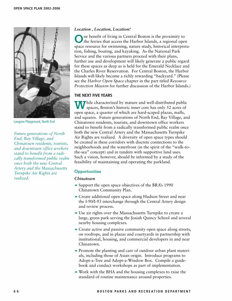
Future generations of NorthEnd, Bay Village, andChinatown residents, tourists,and downtown office workersstand to benefit from a radi-cally transformed public realmonce both the new CentralArtery and the MassachusettsTurnpike Air Rights arerealized.
Langone Playground, North End

B O S T O N PA R K S A N D R E C R E A T I O N D E PA R T M E N T 6 7
• Re-design Elliot Norton Park to better meet community needsfor green space and active recreation.
• Encourage all planning initiatives and development projects inand around Chinatown, such as the Midtown Cultural Dis-trict, to provide additional open space for the community.
North End
• Use adjacent Central Artery air rights parcels for a neighbor-hood park, indoor court facilities, and supporting pocketparks in accordance with the recommendations of the BRA’sreport Boston 2000: A Plan for the Central Artery. Workwith the Mayor’s Central Artery Completion Task Force asthe corridor’s citizen advisory council to implement the Boston2000 and Central Corridor Master Plan recommendations.
• Seek from all proposed developments on Sargent’s and LewisWharves a commitment to protect the water in the vicinity oftheir projects from pollution, and to provide public access asdetermined by abutters and the local community.
• Complete Harborwalk along the North End piers and exam-ine the possibility of docking small craft for community usealong Puopolo or Langone Parks. Support the developmentof the Historic Piers Network, a system of physical andprogrammatic historic interpretation to attract year-round usealong Harborwalk and to protect public access.
Downtown
• Develop the new Artery corridor as a new boulevard andlinear parkland with a minimum of 75% open space. Supportthe recommendations in the BRA report Boston 2000: A Plan forthe Central Artery. Work through the Mayor’s Central ArteryCompletion Task Force and the Master Plan implementationprocess to implement the Boston 2000 recommendations.
• Enhance the “Walk-to-the-Sea” concept (from the State Houseto Long Wharf along State Street) with the creation of adestination use on the relevant new Central Artery parcel.
• Support the BRA and the Trust for City Hall Plaza in theeffort to transform the physical environment of City HallPlaza as well as the mix of uses and activities within andsurrounding the Plaza. Make the Plaza a lively focus ofdowntown life through programming events, arts programs,and festivals.
• Select parcels from the new Central Artery corridor and fromthe Midtown Cultural District to develop a system of “wintergardens,” indoor/protected outdoor open spaces for year-round public activity. Support the Massachusetts Horticul-tural Society’s Winter Garden proposal on the Dewey SquareArtery air rights parcel.
• Develop underutilized pockets of land in Dewey Square forpassive open spaces in the financial district similar to the School
PART 3 • COMMUNITY OPEN SPACE & RECREATION MISSION • THE NEIGHBORHOODS: CENTRAL BOSTON
OPEN SPACE PLAN 2002-2006
6 8 B O S T O N PA R K S A N D R E C R E A T I O N D E PA R T M E N T
Continue to encourage corporate support for downtown openspaces.
Community Priorities
Chinatown
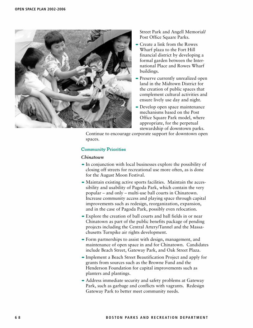
• In conjunction with local businesses explore the possibility ofclosing off streets for recreational use more often, as is donefor the August Moon Festival.
• Maintain existing active sports facilities. Maintain the acces-sibility and usability of Pagoda Park, which contain the verypopular – and only – multi-use ball courts in Chinatown.Increase community access and playing space through capitalimprovements such as redesign, reorganization, expansion,and in the case of Pagoda Park, possibly even relocation.
• Explore the creation of ball courts and ball fields in or nearChinatown as part of the public benefits package of pendingprojects including the Central Artery/Tunnel and the Massa-chusetts Turnpike air rights development.
• Form partnerships to assist with design, management, andmaintenance of open space in and for Chinatown. Candidatesinclude Beach Street, Gateway Park, and Oak Street Plaza.
• Implement a Beach Street Beautification Project and apply forgrants from sources such as the Browne Fund and theHenderson Foundation for capital improvements such asplanters and plantings.
• Address immediate security and safety problems at GatewayPark, such as garbage and conflicts with vagrants. RedesignGateway Park to better meet community needs.
Street Park and Angell Memorial/Post Office Square Parks.
• Create a link from the RowesWharf plaza to the Fort Hillfinancial district by developing aformal garden between the Inter-national Place and Rowes Wharfbuildings.
• Preserve currently unrealized openland in the Midtown District forthe creation of public spaces thatcomplement cultural activities andensure lively use day and night.
• Develop open space maintenancemechanisms based on the PostOffice Square Park model, whereappropriate, for the perpetualstewardship of downtown parks.

B O S T O N PA R K S A N D R E C R E A T I O N D E PA R T M E N T 6 9
• Redesign the open space across from Tai Tung Village (Tai TungStreet Seating Area on the corner of Tyler Street) to make it moreusable. Consider playground facilities for pre-school and schoolchildren and seating for adults and elders. Repair paving.
North End
• Use targeted capital improvement funds for DeFilippo Play-ground with the new design to be determined through acommunity process.
• Provide Paul Revere Mall (aka the Prado) with better manage-ment and install signs to enforce the dog ordinance. Installadditional facilities for the elderly and explore reopening ofthe comfort station.
• Improve security for North End parks through lighting,programmed year-long uses, signage, and, at Polcari, theconstruction of bollards to eliminate motorcycle access.
• Determine the future of the Foster Street Playground which iscurrently used as a parking lot.
• Support the Massachusetts Turnpike Authority plans toimprove parcels at Richmond and North Streets adjacent tothe harbor tunnel portals.
Downtown
• Analyze the feasibility of the proposed parkland in the newCentral Artery corridor with respect to its maintenance andmanagement.
• Adopt sliver open spaces, such as medians, through mainte-nance and management agreements with tenants in adjacentbuildings.
• Implement a tree planting program in downtown area withcorporate funding and support.
PART 3 • COMMUNITY OPEN SPACE & RECREATION MISSION • THE NEIGHBORHOODS: CENTRAL BOSTON
DeFilippo Playground,North End

OPEN SPACE PLAN 2002-2006
7 0 B O S T O N PA R K S A N D R E C R E A T I O N D E PA R T M E N T
FACILITIESCENTRAL BOSTON
Malls, Squares & Plazas
Site Name Acreage P Ownership BB SB LL FB SC BK TN SH PL WS CS CR FH FN HB HS LC PA PK RG VB AR CG NT Other
Angell Memorial Square 0.18 • Parks 1 1
Aquarium Harborwalk 0.36 • Private 1
Aquarium Plaza 0.52 Private
Ausonia Plaza 0.20 COB/BRA 1
Broad Street Park 0.07 COB
Cardinal Cushing Park 0.41 • Parks 1
City Hall Plaza 5.92 • COB/BRA Stage, Arcade
Copp’s Hill Terrace 0.61 • Parks 1 Scenic Overlook
Curley Memorial Plaza 0.10 • Parks (BRA) 1 1
Faneuil Square 1.04 • Parks 1 1
Grain Exchange Plaza 0.05 Private
Jenney Plaza 0.13 Private 1
Liberty Square 0.03 COB/PWD
Lincoln Square 0.06 • Parks 1
Long Wharf 3.31 • COB/BRA 1 Shelter
Marketplace Plaza 0.37 COB/BRA+Private
North Square 0.08 COB/PWD 1
Old City Hall Grounds 0.23 COB/BRA
Paul Revere Mall 0.78 • Parks 1 1 1
Pemberton Square 1.30 COB 1
Quincy Market Square 2.26 Private (BRA) 1 1
Rachel Revere Square 0.08 • Parks
School Street Park 0.08 COB/BRA 1 1
Statler Park 0.25 • Parks 1 1 1
Union Park 0.42 NPS (BRA) 1 1(Holocaust Memorial)
Curley Memorial Plaza

B O S T O N PA R K S A N D R E C R E A T I O N D E PA R T M E N T 7 1
Parkways, Reservations & Beaches
Site Name Acreage Ownership BB SB LL FB SC BK TN SH PL WS CS CR FH FN HB HS LC PA PK RG VB AR CG NT Other
Charles River Reservation 14.88 • MDC 1 1 1 1 4
New Charles River Reservation 2.03 • MDC Path
Prince Street Park 2.31 • MDC 2 Ice Rink
Cemeteries & Burying Grounds
Site Name Acreage Ownership BB SB LL FB SC BK TN SH PL WS CS CR FH FN HB HS LC PA PK RG VB AR CG NT Other
Copp’s Hill Burying Ground 2.04 • Parks
King’s Chapel Burying Ground 0.43 • Parks
Parks, Playgrounds & Athletic Fields
Site Name Acreage Ownership BB SB LL FB SC BK TN SH PL WS CS CR FH FN HB HS LC PA PK RG VB AR CG NT Other
Bay Village Neighborhood Park 0.08 • Parks 1
Charter Street Playground 0.25 • Parks 1
Christopher Columbus Park 4.74 • Parks (BRA) 1 1 1 1 3 1 Trellis, Rose Garden
Cutillo Park 0.29 • Parks 1.5 1 1
DeFilippo Playground 1.13 • Parks 1.0 1 1 1
Eliot Norton Park 0.99 • Parks 1 1
Foster Street Play Area 0.11 • Parks
Gateway Park 0.13 Parks (MHD) 1 1 1
Langone Park 2.34 • Parks 1 1 Bocce Court
Pagoda Park 0.40 MTA 1.0 1 1 2
Pine Street Park 0.63 COB/BRA 2.0
Polcari Park 0.29 • Parks 1.0 1
Post Office Square Park 1.54 Private (BRA) 1 1 1 1
Puopolo Playground 2.09 • Parks 1 1 1.0 1 1 1
Richmond & North Streets Park 0.10 Parks (MTA) 1
Tai Tung Tot Lot 0.03 • Parks 1 1
LegendP ProtectedBB Baseball FieldSB Softball FieldLL Little League FieldFB Football FieldSC Soccer FieldBK Basketball Court
FN FountainHB HandballHS HorseshoesLC LacrossePA Passive AreaPK Parking AreaRG Rugby Field
TN Tennis CourtSH Street HockeyPL Children’s Play LotWS Water Spray FeatureCS ConcessionsCR Cricket FieldFH Field House
VB Volleyball AreaAR Artwork/MonumentsCG Community GardenNT Nature Trail
PART 3 • COMMUNITY OPEN SPACE & RECREATION MISSION • THE NEIGHBORHOODS: CENTRAL BOSTON
Quincy Market Square

Charle
s Rive
rBoston Harbor
Fort
Poin
t Cha
nnel
Myrtle Street PlaygroundMyrtle Street PlaygroundMyrtle Street PlaygroundMyrtle Street PlaygroundMyrtle Street PlaygroundMyrtle Street PlaygroundMyrtle Street PlaygroundMyrtle Street PlaygroundMyrtle Street Playground
Eliot Norton ParkEliot Norton ParkEliot Norton ParkEliot Norton ParkEliot Norton ParkEliot Norton ParkEliot Norton ParkEliot Norton ParkEliot Norton Park
Bay Village Neighborhood ParkBay Village Neighborhood ParkBay Village Neighborhood ParkBay Village Neighborhood ParkBay Village Neighborhood ParkBay Village Neighborhood ParkBay Village Neighborhood ParkBay Village Neighborhood ParkBay Village Neighborhood Park
Charles River ReservationCharles River ReservationCharles River ReservationCharles River ReservationCharles River ReservationCharles River ReservationCharles River ReservationCharles River ReservationCharles River Reservation
Jenney PlazaJenney PlazaJenney PlazaJenney PlazaJenney PlazaJenney PlazaJenney PlazaJenney PlazaJenney Plaza
Grain Exchange PlazaGrain Exchange PlazaGrain Exchange PlazaGrain Exchange PlazaGrain Exchange PlazaGrain Exchange PlazaGrain Exchange PlazaGrain Exchange PlazaGrain Exchange Plaza
Broad Street ParkBroad Street ParkBroad Street ParkBroad Street ParkBroad Street ParkBroad Street ParkBroad Street ParkBroad Street ParkBroad Street Park
Aquarium PlazaAquarium PlazaAquarium PlazaAquarium PlazaAquarium PlazaAquarium PlazaAquarium PlazaAquarium PlazaAquarium Plaza
Union ParkUnion ParkUnion ParkUnion ParkUnion ParkUnion ParkUnion ParkUnion ParkUnion Park
Curley Memorial PlazaCurley Memorial PlazaCurley Memorial PlazaCurley Memorial PlazaCurley Memorial PlazaCurley Memorial PlazaCurley Memorial PlazaCurley Memorial PlazaCurley Memorial Plaza
Quincy Market SquareQuincy Market SquareQuincy Market SquareQuincy Market SquareQuincy Market SquareQuincy Market SquareQuincy Market SquareQuincy Market SquareQuincy Market Square
Faneuil SquareFaneuil SquareFaneuil SquareFaneuil SquareFaneuil SquareFaneuil SquareFaneuil SquareFaneuil SquareFaneuil Square
Christopher Columbus ParkChristopher Columbus ParkChristopher Columbus ParkChristopher Columbus ParkChristopher Columbus ParkChristopher Columbus ParkChristopher Columbus ParkChristopher Columbus ParkChristopher Columbus Park
Ausonia PlazaAusonia PlazaAusonia PlazaAusonia PlazaAusonia PlazaAusonia PlazaAusonia PlazaAusonia PlazaAusonia Plaza
Richmond & North Streets ParkRichmond & North Streets ParkRichmond & North Streets ParkRichmond & North Streets ParkRichmond & North Streets ParkRichmond & North Streets ParkRichmond & North Streets ParkRichmond & North Streets ParkRichmond & North Streets Park
North SquareNorth SquareNorth SquareNorth SquareNorth SquareNorth SquareNorth SquareNorth SquareNorth Square
Paul Revere MallPaul Revere MallPaul Revere MallPaul Revere MallPaul Revere MallPaul Revere MallPaul Revere MallPaul Revere MallPaul Revere Mall
Charter Street PlaygroundCharter Street PlaygroundCharter Street PlaygroundCharter Street PlaygroundCharter Street PlaygroundCharter Street PlaygroundCharter Street PlaygroundCharter Street PlaygroundCharter Street Playground
Foster Street Play AreaFoster Street Play AreaFoster Street Play AreaFoster Street Play AreaFoster Street Play AreaFoster Street Play AreaFoster Street Play AreaFoster Street Play AreaFoster Street Play Area
DeFilippo PlaygroundDeFilippo PlaygroundDeFilippo PlaygroundDeFilippo PlaygroundDeFilippo PlaygroundDeFilippo PlaygroundDeFilippo PlaygroundDeFilippo PlaygroundDeFilippo Playground
Copp's Hill Burying GroundCopp's Hill Burying GroundCopp's Hill Burying GroundCopp's Hill Burying GroundCopp's Hill Burying GroundCopp's Hill Burying GroundCopp's Hill Burying GroundCopp's Hill Burying GroundCopp's Hill Burying Ground
Puopolo PlaygroundPuopolo PlaygroundPuopolo PlaygroundPuopolo PlaygroundPuopolo PlaygroundPuopolo PlaygroundPuopolo PlaygroundPuopolo PlaygroundPuopolo PlaygroundLangone ParkLangone ParkLangone ParkLangone ParkLangone ParkLangone ParkLangone ParkLangone ParkLangone Park
Boston CommonBoston CommonBoston CommonBoston CommonBoston CommonBoston CommonBoston CommonBoston CommonBoston Common
Public GardenPublic GardenPublic GardenPublic GardenPublic GardenPublic GardenPublic GardenPublic GardenPublic Garden
Granary Burying GroundGranary Burying GroundGranary Burying GroundGranary Burying GroundGranary Burying GroundGranary Burying GroundGranary Burying GroundGranary Burying GroundGranary Burying Ground
Phillips Street ParkPhillips Street ParkPhillips Street ParkPhillips Street ParkPhillips Street ParkPhillips Street ParkPhillips Street ParkPhillips Street ParkPhillips Street Park
Louisburg SquareLouisburg SquareLouisburg SquareLouisburg SquareLouisburg SquareLouisburg SquareLouisburg SquareLouisburg SquareLouisburg Square
Saltonstall PlazaSaltonstall PlazaSaltonstall PlazaSaltonstall PlazaSaltonstall PlazaSaltonstall PlazaSaltonstall PlazaSaltonstall PlazaSaltonstall Plaza
State House ParkState House ParkState House ParkState House ParkState House ParkState House ParkState House ParkState House ParkState House Park
Copley SquareCopley SquareCopley SquareCopley SquareCopley SquareCopley SquareCopley SquareCopley SquareCopley Square
Prudential Center PlazaPrudential Center PlazaPrudential Center PlazaPrudential Center PlazaPrudential Center PlazaPrudential Center PlazaPrudential Center PlazaPrudential Center PlazaPrudential Center Plaza
Clarendon Street TotlotClarendon Street TotlotClarendon Street TotlotClarendon Street TotlotClarendon Street TotlotClarendon Street TotlotClarendon Street TotlotClarendon Street TotlotClarendon Street Totlot
Somerset Street PlazaSomerset Street PlazaSomerset Street PlazaSomerset Street PlazaSomerset Street PlazaSomerset Street PlazaSomerset Street PlazaSomerset Street PlazaSomerset Street Plaza
Temple Street MallTemple Street MallTemple Street MallTemple Street MallTemple Street MallTemple Street MallTemple Street MallTemple Street MallTemple Street Mall
Copp's Hill TerraceCopp's Hill TerraceCopp's Hill TerraceCopp's Hill TerraceCopp's Hill TerraceCopp's Hill TerraceCopp's Hill TerraceCopp's Hill TerraceCopp's Hill Terrace
Polcari ParkPolcari ParkPolcari ParkPolcari ParkPolcari ParkPolcari ParkPolcari ParkPolcari ParkPolcari Park
Cutillo ParkCutillo ParkCutillo ParkCutillo ParkCutillo ParkCutillo ParkCutillo ParkCutillo ParkCutillo Park
City Hall PlazaCity Hall PlazaCity Hall PlazaCity Hall PlazaCity Hall PlazaCity Hall PlazaCity Hall PlazaCity Hall PlazaCity Hall Plaza
Cardinal Cushing ParkCardinal Cushing ParkCardinal Cushing ParkCardinal Cushing ParkCardinal Cushing ParkCardinal Cushing ParkCardinal Cushing ParkCardinal Cushing ParkCardinal Cushing Park
King's Chapel Burying GroundKing's Chapel Burying GroundKing's Chapel Burying GroundKing's Chapel Burying GroundKing's Chapel Burying GroundKing's Chapel Burying GroundKing's Chapel Burying GroundKing's Chapel Burying GroundKing's Chapel Burying Ground
Old City Hall GroundsOld City Hall GroundsOld City Hall GroundsOld City Hall GroundsOld City Hall GroundsOld City Hall GroundsOld City Hall GroundsOld City Hall GroundsOld City Hall Grounds
Post Office Square ParkPost Office Square ParkPost Office Square ParkPost Office Square ParkPost Office Square ParkPost Office Square ParkPost Office Square ParkPost Office Square ParkPost Office Square Park
Douglas Court Play AreaDouglas Court Play AreaDouglas Court Play AreaDouglas Court Play AreaDouglas Court Play AreaDouglas Court Play AreaDouglas Court Play AreaDouglas Court Play AreaDouglas Court Play Area
Statler ParkStatler ParkStatler ParkStatler ParkStatler ParkStatler ParkStatler ParkStatler ParkStatler Park
Pemberton SquarePemberton SquarePemberton SquarePemberton SquarePemberton SquarePemberton SquarePemberton SquarePemberton SquarePemberton Square
Angell Memorial SquareAngell Memorial SquareAngell Memorial SquareAngell Memorial SquareAngell Memorial SquareAngell Memorial SquareAngell Memorial SquareAngell Memorial SquareAngell Memorial Square
School Street ParkSchool Street ParkSchool Street ParkSchool Street ParkSchool Street ParkSchool Street ParkSchool Street ParkSchool Street ParkSchool Street Park
Lincoln SquareLincoln SquareLincoln SquareLincoln SquareLincoln SquareLincoln SquareLincoln SquareLincoln SquareLincoln Square
Long WharfLong WharfLong WharfLong WharfLong WharfLong WharfLong WharfLong WharfLong Wharf
Prince Street ParkPrince Street ParkPrince Street ParkPrince Street ParkPrince Street ParkPrince Street ParkPrince Street ParkPrince Street ParkPrince Street Park
Rachel Revere SquareRachel Revere SquareRachel Revere SquareRachel Revere SquareRachel Revere SquareRachel Revere SquareRachel Revere SquareRachel Revere SquareRachel Revere Square
Tai Tung Tot LotTai Tung Tot LotTai Tung Tot LotTai Tung Tot LotTai Tung Tot LotTai Tung Tot LotTai Tung Tot LotTai Tung Tot LotTai Tung Tot Lot
Pine Street ParkPine Street ParkPine Street ParkPine Street ParkPine Street ParkPine Street ParkPine Street ParkPine Street ParkPine Street Park
Winthrop SquareWinthrop SquareWinthrop SquareWinthrop SquareWinthrop SquareWinthrop SquareWinthrop SquareWinthrop SquareWinthrop Square
City SquareCity SquareCity SquareCity SquareCity SquareCity SquareCity SquareCity SquareCity Square
Harvard MallHarvard MallHarvard MallHarvard MallHarvard MallHarvard MallHarvard MallHarvard MallHarvard Mall
Paul Revere Landing ParkPaul Revere Landing ParkPaul Revere Landing ParkPaul Revere Landing ParkPaul Revere Landing ParkPaul Revere Landing ParkPaul Revere Landing ParkPaul Revere Landing ParkPaul Revere Landing Park
Rutherford Avenue PlaygroundRutherford Avenue PlaygroundRutherford Avenue PlaygroundRutherford Avenue PlaygroundRutherford Avenue PlaygroundRutherford Avenue PlaygroundRutherford Avenue PlaygroundRutherford Avenue PlaygroundRutherford Avenue Playground
Charlestown Naval Shipyard ParkCharlestown Naval Shipyard ParkCharlestown Naval Shipyard ParkCharlestown Naval Shipyard ParkCharlestown Naval Shipyard ParkCharlestown Naval Shipyard ParkCharlestown Naval Shipyard ParkCharlestown Naval Shipyard ParkCharlestown Naval Shipyard Park
Flaherty ParkFlaherty ParkFlaherty ParkFlaherty ParkFlaherty ParkFlaherty ParkFlaherty ParkFlaherty ParkFlaherty Park
Buckley PlaygroundBuckley PlaygroundBuckley PlaygroundBuckley PlaygroundBuckley PlaygroundBuckley PlaygroundBuckley PlaygroundBuckley PlaygroundBuckley Playground
Sweeney PlaygroundSweeney PlaygroundSweeney PlaygroundSweeney PlaygroundSweeney PlaygroundSweeney PlaygroundSweeney PlaygroundSweeney PlaygroundSweeney Playground
Orton FieldOrton FieldOrton FieldOrton FieldOrton FieldOrton FieldOrton FieldOrton FieldOrton Field
Hayes ParkHayes ParkHayes ParkHayes ParkHayes ParkHayes ParkHayes ParkHayes ParkHayes Park
Peters ParkPeters ParkPeters ParkPeters ParkPeters ParkPeters ParkPeters ParkPeters ParkPeters Park
Rotch PlaygroundRotch PlaygroundRotch PlaygroundRotch PlaygroundRotch PlaygroundRotch PlaygroundRotch PlaygroundRotch PlaygroundRotch Playground
Ringgold ParkRinggold ParkRinggold ParkRinggold ParkRinggold ParkRinggold ParkRinggold ParkRinggold ParkRinggold Park
Blackstone SquareBlackstone SquareBlackstone SquareBlackstone SquareBlackstone SquareBlackstone SquareBlackstone SquareBlackstone SquareBlackstone Square
Franklin SquareFranklin SquareFranklin SquareFranklin SquareFranklin SquareFranklin SquareFranklin SquareFranklin SquareFranklin Square
South End South Burying GroundSouth End South Burying GroundSouth End South Burying GroundSouth End South Burying GroundSouth End South Burying GroundSouth End South Burying GroundSouth End South Burying GroundSouth End South Burying GroundSouth End South Burying Ground
Worcester SquareWorcester SquareWorcester SquareWorcester SquareWorcester SquareWorcester SquareWorcester SquareWorcester SquareWorcester Square
Titus Sparrow ParkTitus Sparrow ParkTitus Sparrow ParkTitus Sparrow ParkTitus Sparrow ParkTitus Sparrow ParkTitus Sparrow ParkTitus Sparrow ParkTitus Sparrow Park
Union Park Play AreaUnion Park Play AreaUnion Park Play AreaUnion Park Play AreaUnion Park Play AreaUnion Park Play AreaUnion Park Play AreaUnion Park Play AreaUnion Park Play Area
Waltham SquareWaltham SquareWaltham SquareWaltham SquareWaltham SquareWaltham SquareWaltham SquareWaltham SquareWaltham Square
Concord SquareConcord SquareConcord SquareConcord SquareConcord SquareConcord SquareConcord SquareConcord SquareConcord Square
Rutland GardenRutland GardenRutland GardenRutland GardenRutland GardenRutland GardenRutland GardenRutland GardenRutland Garden
Ramsay ParkRamsay ParkRamsay ParkRamsay ParkRamsay ParkRamsay ParkRamsay ParkRamsay ParkRamsay Park
Worcester Street GardenWorcester Street GardenWorcester Street GardenWorcester Street GardenWorcester Street GardenWorcester Street GardenWorcester Street GardenWorcester Street GardenWorcester Street Garden
Bradford Street Play AreaBradford Street Play AreaBradford Street Play AreaBradford Street Play AreaBradford Street Play AreaBradford Street Play AreaBradford Street Play AreaBradford Street Play AreaBradford Street Play Area
Castle Square ParksCastle Square ParksCastle Square ParksCastle Square ParksCastle Square ParksCastle Square ParksCastle Square ParksCastle Square ParksCastle Square Parks
Berkeley Street GardenBerkeley Street GardenBerkeley Street GardenBerkeley Street GardenBerkeley Street GardenBerkeley Street GardenBerkeley Street GardenBerkeley Street GardenBerkeley Street Garden
Watson ParkWatson ParkWatson ParkWatson ParkWatson ParkWatson ParkWatson ParkWatson ParkWatson Park
Warren & Clarendon Street GardenWarren & Clarendon Street GardenWarren & Clarendon Street GardenWarren & Clarendon Street GardenWarren & Clarendon Street GardenWarren & Clarendon Street GardenWarren & Clarendon Street GardenWarren & Clarendon Street GardenWarren & Clarendon Street Garden
Unity Towers GardenUnity Towers GardenUnity Towers GardenUnity Towers GardenUnity Towers GardenUnity Towers GardenUnity Towers GardenUnity Towers GardenUnity Towers Garden
Piano Craft GardenPiano Craft GardenPiano Craft GardenPiano Craft GardenPiano Craft GardenPiano Craft GardenPiano Craft GardenPiano Craft GardenPiano Craft Garden
Northampton GardenNorthampton GardenNorthampton GardenNorthampton GardenNorthampton GardenNorthampton GardenNorthampton GardenNorthampton GardenNorthampton Garden
Dartmouth GardenDartmouth GardenDartmouth GardenDartmouth GardenDartmouth GardenDartmouth GardenDartmouth GardenDartmouth GardenDartmouth Garden
Wellington GreenWellington GreenWellington GreenWellington GreenWellington GreenWellington GreenWellington GreenWellington GreenWellington Green
Blackwood/Claremont GardenBlackwood/Claremont GardenBlackwood/Claremont GardenBlackwood/Claremont GardenBlackwood/Claremont GardenBlackwood/Claremont GardenBlackwood/Claremont GardenBlackwood/Claremont GardenBlackwood/Claremont Garden
Braddock Park GardenBraddock Park GardenBraddock Park GardenBraddock Park GardenBraddock Park GardenBraddock Park GardenBraddock Park GardenBraddock Park GardenBraddock Park Garden
East Brookline Street GardenEast Brookline Street GardenEast Brookline Street GardenEast Brookline Street GardenEast Brookline Street GardenEast Brookline Street GardenEast Brookline Street GardenEast Brookline Street GardenEast Brookline Street GardenChester ParkChester ParkChester ParkChester ParkChester ParkChester ParkChester ParkChester ParkChester Park
Msgr. Reynolds PlaygroundMsgr. Reynolds PlaygroundMsgr. Reynolds PlaygroundMsgr. Reynolds PlaygroundMsgr. Reynolds PlaygroundMsgr. Reynolds PlaygroundMsgr. Reynolds PlaygroundMsgr. Reynolds PlaygroundMsgr. Reynolds Playground
West Rutland SquareWest Rutland SquareWest Rutland SquareWest Rutland SquareWest Rutland SquareWest Rutland SquareWest Rutland SquareWest Rutland SquareWest Rutland Square
Hiscock ParkHiscock ParkHiscock ParkHiscock ParkHiscock ParkHiscock ParkHiscock ParkHiscock ParkHiscock Park
New Charles River ReservationNew Charles River ReservationNew Charles River ReservationNew Charles River ReservationNew Charles River ReservationNew Charles River ReservationNew Charles River ReservationNew Charles River ReservationNew Charles River Reservation
O'Day PlayroundO'Day PlayroundO'Day PlayroundO'Day PlayroundO'Day PlayroundO'Day PlayroundO'Day PlayroundO'Day PlayroundO'Day Playround
Fan Pier PlazaFan Pier PlazaFan Pier PlazaFan Pier PlazaFan Pier PlazaFan Pier PlazaFan Pier PlazaFan Pier PlazaFan Pier Plaza
Children's Wharf ParkChildren's Wharf ParkChildren's Wharf ParkChildren's Wharf ParkChildren's Wharf ParkChildren's Wharf ParkChildren's Wharf ParkChildren's Wharf ParkChildren's Wharf Park
Harcourt/West Canton GardenHarcourt/West Canton GardenHarcourt/West Canton GardenHarcourt/West Canton GardenHarcourt/West Canton GardenHarcourt/West Canton GardenHarcourt/West Canton GardenHarcourt/West Canton GardenHarcourt/West Canton Garden
Gateway ParkGateway ParkGateway ParkGateway ParkGateway ParkGateway ParkGateway ParkGateway ParkGateway Park
Pagoda ParkPagoda ParkPagoda ParkPagoda ParkPagoda ParkPagoda ParkPagoda ParkPagoda ParkPagoda Park
Mt. Vernon Street Tot LotMt. Vernon Street Tot LotMt. Vernon Street Tot LotMt. Vernon Street Tot LotMt. Vernon Street Tot LotMt. Vernon Street Tot LotMt. Vernon Street Tot LotMt. Vernon Street Tot LotMt. Vernon Street Tot Lot
Rutland GreenRutland GreenRutland GreenRutland GreenRutland GreenRutland GreenRutland GreenRutland GreenRutland Green
Follen GardenFollen GardenFollen GardenFollen GardenFollen GardenFollen GardenFollen GardenFollen GardenFollen Garden
Wellington CommonWellington CommonWellington CommonWellington CommonWellington CommonWellington CommonWellington CommonWellington CommonWellington Common
Goldweitz ParkGoldweitz ParkGoldweitz ParkGoldweitz ParkGoldweitz ParkGoldweitz ParkGoldweitz ParkGoldweitz ParkGoldweitz Park
Copley Place PlazaCopley Place PlazaCopley Place PlazaCopley Place PlazaCopley Place PlazaCopley Place PlazaCopley Place PlazaCopley Place PlazaCopley Place Plaza
Aquarium HarborwalkAquarium HarborwalkAquarium HarborwalkAquarium HarborwalkAquarium HarborwalkAquarium HarborwalkAquarium HarborwalkAquarium HarborwalkAquarium Harborwalk
Marketplace PlazaMarketplace PlazaMarketplace PlazaMarketplace PlazaMarketplace PlazaMarketplace PlazaMarketplace PlazaMarketplace PlazaMarketplace Plaza
Liberty SquareLiberty SquareLiberty SquareLiberty SquareLiberty SquareLiberty SquareLiberty SquareLiberty SquareLiberty Square
Children's Museum PlazaChildren's Museum PlazaChildren's Museum PlazaChildren's Museum PlazaChildren's Museum PlazaChildren's Museum PlazaChildren's Museum PlazaChildren's Museum PlazaChildren's Museum Plaza
Boston Medical Center CampusBoston Medical Center CampusBoston Medical Center CampusBoston Medical Center CampusBoston Medical Center CampusBoston Medical Center CampusBoston Medical Center CampusBoston Medical Center CampusBoston Medical Center Campus
Frederick Douglass GreenFrederick Douglass GreenFrederick Douglass GreenFrederick Douglass GreenFrederick Douglass GreenFrederick Douglass GreenFrederick Douglass GreenFrederick Douglass GreenFrederick Douglass Green
New Chardon SquareNew Chardon SquareNew Chardon SquareNew Chardon SquareNew Chardon SquareNew Chardon SquareNew Chardon SquareNew Chardon SquareNew Chardon Square
Chandler/Tremont PlazaChandler/Tremont PlazaChandler/Tremont PlazaChandler/Tremont PlazaChandler/Tremont PlazaChandler/Tremont PlazaChandler/Tremont PlazaChandler/Tremont PlazaChandler/Tremont Plaza
Navy Yard GroundsNavy Yard GroundsNavy Yard GroundsNavy Yard GroundsNavy Yard GroundsNavy Yard GroundsNavy Yard GroundsNavy Yard GroundsNavy Yard Grounds
City of BostonCentral Boston Open Space
Protected Open SpaceCity of Boston, Parks DepartmentCity of Boston, Other AgencyMDCDepartment of Environmental ManagementLand TrustCommonwealth of MassachusettsFederalPrivate
NORTHNORTHNORTHNORTHNORTHNORTHNORTHNORTHNORTH0 1/4
mile
1/2
Produced by the Boston Parks and Recreation Department
Related Documents