COASTAL ZONE ASSESSMENT SURVEY FIRTH OF CLYDE PROJECT 1309 A desk-based and walkover assessment carried out on behalf of Historic Scotland, Firth of Clyde Forum and The SCAPE Trust

Welcome message from author
This document is posted to help you gain knowledge. Please leave a comment to let me know what you think about it! Share it to your friends and learn new things together.
Transcript
COASTAL ZONE
ASSESSMENT SURVEY FIRTH OF CLYDE
PROJECT 1309
A desk-based and walkover assessment carried out on behalf of
Historic Scotland, Firth of Clyde Forum
and The SCAPE Trust
Contents 1.0 Executive Summary
7
2.0 Introduction
2.1 Background 2.2 Survey Area 2.3 Survey Conditions
7
7 7 7
3.0 Aims and Objectives
7
4.0 Methodology
4.1 Introduction 4.2 oastal Zones 4.3 Desk Based Assessment 4.4 Field Survey: Archaeology and Built Heritage 4.5 Geology/Geomorphology and Erosion Class Survey 4.6 Public Outreach and Training of Shorewatch Groups
8
8 8 8 9 9 10
5.0 Report Format
5.1 Built Heritage and Archaeology 5.2 Erosion Class
10
10 12
6.0 Background to the Archaeology of the Survey Area
6.1 Cowal Peninsula 6.2 Great Cumbrae 6.3 Ayrshire
13
13 13 13
7.0 Physical Background to the Coastal Zone of the Firth of Clyde
7.1 Coastal Cells 7.2 The Quaternary Inheritance 7.3 Sea Level Changes 7.4 Sediment Provenance 7.5 Wave Climate – Firth of Clyde 7.6 Human Development and Interference
14
14 14 16 17 18 18
8.0 Summary of Results
8.1 Archaeology and Built Heritage 8.2 Erosion Class 8.3 Erosion and Archaeology/Built Heritage 8.4 Public Outreach and Training of Shorewatch Groups
19
19 23 24 24
9.0 Recommendations and Discussion
9.1 Recommendations
24
24
10.0 Conclusion
26
11.0 Maps and Gazetteers
27
12.0 Site Descriptions
12.1 Cowal Peninsula 12.2 Great Cumbrae Island 12.3 Ayrshire Coast
187
187 200 208
13.0 Acknowledgements
241
14.0 Bibliography
241
15.0 Appendices
15.1 Appendix 1: List of Map Sources 15.2 Appendix 2: List of AP’s Consulted 15.3 Appendix 3: Archaeology and Built Heritage Plates 15.4 Appendix 4: Erosion and Geomorphology Plates 15.5 Appendix 5: Archaeological Site Record Sheet 15.6 Appendix 6: Shorewatch Recording Sheet
244
244 245 245 255 261 262
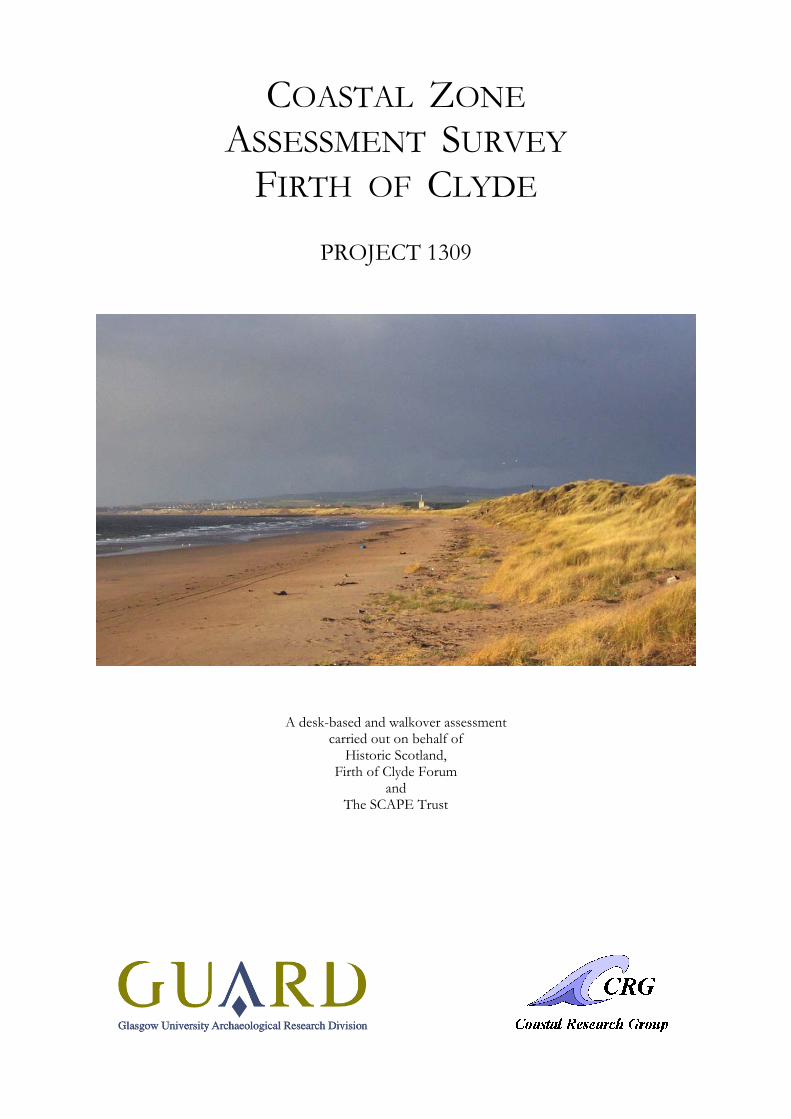
Front cover:
Irvine Bay from the south.
© Glasgow University 2003
This report is one of a series published by GUARD, Gregory Building,
Lilybank Gardens, Glasgow, G12 8QQ
COASTAL ZONE
ASSESSMENT SURVEY FIRTH OF CLYDE
PROJECT 1309
by
David Sneddon
With contributions by Alistair Rennie (CRG),
Jim Hansom (CRG) and
Ingrid Shearer (GUARD)
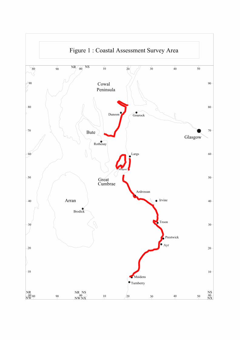
1.0 Executive Summary A rapid coastal zone assessment survey was conducted by Glasgow University Archaeological Research Division (GUARD) along three areas of the Firth of Clyde coastline. The sections included areas of Ayrshire, the Cowal Peninsula and the whole of Great Cumbrae Island (Figure 1). The desk-based assessment and walkover survey produced a total of 104 new sites and 195 known archaeological sites, of which 21 were Listed Buildings and 11 were Scheduled Ancient Monuments. The field survey was carried out by a team of two archaeologists from GUARD and two geomorphologists from the Coastal Research Group (CRG), Department of Geography and Topographic Science, University of Glasgow. A Public Outreach and Training Officer also helped train and guide newly established Shorewatch groups in the survey areas. The work was commissioned by the SCAPE Trust (Scottish Coastal Archaeology & Palaeo-Environment) and the Firth of Clyde Forum and was funded by Historic Scotland. The work was carried out in accordance with Historic Scotland’s Procedure Paper 4: Coastal Zone Assessment Survey (Historic Scotland, 1996).
A wide variety of sites are located within eroding areas of the coastline. Of these sites a total of 20 were recommended for further survey. These sites included two fort/dun sites, several Medieval castles on the Ayrshire coast, a probable pre-Improvement settlement, sites related to the industrial past of Ayrshire, a previously unrecorded jetty/harbour on Great Cumbrae Isle and three post-Medieval sites on the Cowal Peninsula (Table 11).
The survey concluded that the Ayrshire coast is the worst affected by coastal erosion, especially the area between Troon and Portencross, while the Isle of Great Cumbrae proves to be the most stable.
2.0 Introduction 2.1 Background This report is one of a series that have been produced by various archaeological contractors, funded by Historic Scotland, to characterise the state of coastal erosion and the threat it poses to archaeology in Scotland. This report presents the results of a rapid coastal zone assessment carried out between October and December 2002 of three areas within the Firth of Clyde. 2.2 Survey Area The survey area comprised three sections of coastline in the Firth of Clyde (Figure 1). These sections included the entire coast of the Island of Great Cumbrae (18.5 km), the southern and eastern coasts of the Cowal Peninsula from Ardyne point to Strone Point (28.2 km) and a stretch of the Ayrshire coast from Largs to Maidens (77.5 km). This was a total distance of 124.2 km (based on 1:10,000 base maps viewed within ArcView GIS software package). The area around Hunterston Power Station and Ore Terminal, to the south of Fairlie, was not included in the survey area. 2.3 Survey Conditions Carrying out the survey in the winter months was useful in that plant growth over the coastal areas was at a minimum. This increases the chance of identifying archaeological remains that may otherwise have been obscured by vegetation during the summer months. The effects of erosion are also more visible in winter because of the increased wind and wave action. However, the often adverse weather conditions, including heavy rain and wind, compounded by very short daylight hours, significantly slowed the field survey. Despite this, no full days were lost to bad weather.
3.0 Aims and Objectives The main aims of the survey were:
• to increase knowledge of coastal archaeological sites and to identify those sites that are at risk, either presently or potentially, from erosional processes on the coastline, and
• to establish and train Shorewatch groups within the local community, to record archaeological sites and to monitor the effects of erosion in the longer term.
Gourock
Largs
Ardrossan
Irvine
Troon
Ayr
Prestwick
Maidens
Turnberry
Brodick
Rothesay
Dunoon
Glasgow
Arran
CowalPeninsula
Bute
GreatCumbrae
Millport
Figure 1 : Coastal Assessment Survey Area
NSNR
NX
NSNR00
10
20
30
40
50
60
70
80 90 00 10 20 30 40 50
80
90
NSNR80 90 00 10 20 30 40 50
00
10
20
30
40
50
60
70
80
90
NW
The objectives were:
• to undertake a desk-based assessment that would identify all known archaeological sites within the intertidal zone and a landward strip of between 50 and 100 metres;
• to undertake a walkover survey in order to record the condition of the known archaeological sites and to record any new sites found;
• to undertake a geomorphological and erosional survey to inform the study about the rates of erosion and highlight any specific areas where erosion is particularly rapid, and
• to contact the local community in order to set up and train local Shorewatch groups.
4.0 Methodology 4.1 Introduction The methodology was based on that set out in Historic Scotland’s Procedure Paper 4: Coastal Zone Assessment Survey (Historic Scotland, 1996) and discussions in Archaeology and the Coastal Erosional Zone: Towards a Historic Scotland Policy (Ashmore, 1994). 4.2 Coastal Zones The survey area consisted of two specific zones: the intertidal zone (defined by the area between Mean High Water Springs, MHWS, and Mean Low Water Springs, MLWS), the coastal edge (from the MHWS to a few metres inland) and a landward strip varying in width between 50 m and 100 m from the coast edge. The desk based assessment included all of the above areas. Field survey of the intertidal zone was undertaken only where access and the state of the tide allowed. High tides occasionally prevented access to a few small bays and inlets in the area between Culzean Bay and the Heads of Ayr. These were surveyed instead from a higher viewpoint. In urban areas the field survey was restricted to the coastal edge and intertidal zone; in particular, access could not be gained to parts of Ayr Harbour and Ardrossan Harbour because of commercial and industrial properties. 4.3 Desk Based Assessment GIS data were provided by The West of Scotland Archaeology Service (WoSAS). This consisted of a Microsoft Access database of the relevant sites within the survey areas extracted from the local Sites and Monuments Record (SMR). The map base was also provided by WoSAS in ArcView and consisted of the 1:10,000 OS maps, 1:50,000 OS maps and the first edition OS maps (fitted to the National Grid). This greatly aided the production of the maps and data included in this report.
The desk-based assessment involved a thorough search of documentary and cartographic sources listed below (Sections 13.0, 14.1 and 14.2 for full list).
• Examination of documentary sources held in various libraries, including Glasgow University Library, the National Library of Scotland and local libraries within the survey area.
• A search of the National Monuments Record of Scotland (NMRS) held at the Royal Commission on the Ancient and Historical Monuments of Scotland (RCAHMS), Edinburgh, which contains information on all known archaeological sites in Scotland.
• An examination of the available documentary and cartographic sources regarding processes of erosion and coastal geology/geomorphology. This allowed identification of areas where processes of erosion were most likely to be adversely affecting archaeologically sensitive areas.
• An examination of available cartographic sources held at the National Map Library Scotland (NMLS) in Edinburgh, including the first and second edition 1:10,560 scale OS maps and a variety of historic maps from the seventeenth and eighteenth centuries.
• An examination of available aerial photographs held at the RCAHMS.
4.4 Field Survey: Archaeology and Built Heritage The field survey was undertaken by two archaeologists. Due to health and safety issues the team always remained as a single unit and did not split up between the coastal zones. To allow maximum coverage of the coastal zone this generally meant surveying the coast edge and intertidal zone in transects on the outward journey and then surveying the hinterland 50 m – 100 m strip on the return leg. As mentioned above, very small areas of the coast edge and intertidal zones could not be accessed. Where feasible these areas were surveyed from a distance. While the marine zone was not part of this project, if a marine feature was noted from either the desk-based assessment or the field survey its location was recorded.
While individual sites were numbered separately, groups of closely located, interrelated sites were numbered together as a complex.
A large portion of the survey area was classified as urban where assessment in the field was confined to the inter tidal zone, coast edge and buildings immediately abutting the coast edge.
Each archaeological site was allocated a unique number in the field to be used as its identification in the text, photographs and maps. Each known site visited or new site located during the field survey was recorded by written description on survey sheets designed specifically for this project (Section 15.5 and 15.6). They were also recorded by sketch, including dimensions and locational data where appropriate. All sites were photographed on black and white print and colour slide. The location of each site was established using a hand held Garmin Global Positioning Satellite (GPS) instrument. This gave a ten-figure grid reference, which is presented in this report. It is important to note that only the eight figure grid reference can be taken to be accurate. The location of the sites was also marked on hard copies of the Ordnance Survey 1:10,000 edition maps. Written notes and photographs were also kept on the erosional status of the coastline, the geomorphology and geology of the coast and the general landscape character of the coast in areas not covered in detail by the geomorphologists.
The dates of sites referred to in this report were derived from the WoSAS SMR and the NMRS. The dates assigned to new sites were derived from their material composition, visible appearance in the field and from documentary sources. As no intrusive or destructive work was carried out during the survey, many of the sites could not be accurately dated (Section 5.1.2).
The recommendations for action for each site were ‘survey’, ‘monitor’ or ‘nil’. These were proposed as a guide to future action that may be taken to help preserve the cultural heritage of the survey area. Issues that influenced the recommendation category assigned to each site included the significance of the site and the rate of coastal erosion (Section 5.1.4). 4.5 Geology/Geomorphology and Erosion Class Survey A comprehensive review of the available documentary and cartographic sources regarding the coastal geology/geomorphology and erosional aspects of the coast was undertaken by geomorphologist Alistair Rennie, assisted by Dr Jim Hansom, of the CRG. This enabled the geomorphologist to highlight areas to the archaeological team where the rate of erosion was likely to be high and also enable the archaeologists to identify archaeological sites that required further attention by the geomorphological team. These areas were then targeted for detailed field inspection by the geomorphologists. This involved detailed field notes and digital photographs on coastal processes in specific areas of the coastline. The maps of the hinterland geology, coastal geomorphology and erosion class for the areas of the Cowal Peninsula and the central and southern sections of the Ayrshire coast were prepared from notes taken by the geomorphologist. A broad field survey of the remaining coastline was also undertaken by the geomorphologists and the maps were prepared after consultation with the geomorphologist. 4.5.1 Extension of the Classification
The classification of the coastline by Historic Scotland (1996) has been used in this report for consistency and continuity. However, the classification includes little reference to rates of erosion and to the time periods over which shoreline erosion has occurred. We have addressed this by classifying the status of the shoreline for long-term and short-term effects (supplemented by an erosion rate indicator) and embedded this within the Historic Scotland Classification. An example would Culzean cliffs, which are by definition an erosional feature. However, the rate of erosion is very low, so low that in the short term they may be regarded as stable. Thus a hard rock cliff coast with minimal short-term erosion is classified as: Long term – Erosional, Short term – Stable to Erosional, Low rate of change. The table below shows the range of possibilities. Long term is taken to mean in excess of a few hundred years, short term is taken to mean less than two years.
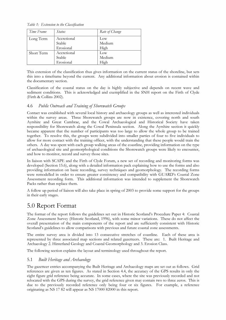
Table 1: Extension to the Classification
Time Frame Status Rate of Change
Long Term Accretional Stable Erosional
Low Medium High
Short Term Accretional Stable Erosional
Low Medium High
This extension of the classification thus gives information on the current status of the shoreline, but sets this into a timeframe beyond the current. Any additional information about erosion is contained within the documentary section.
Classification of the coastal status on the day is highly subjective and depends on recent wave and sediment conditions. This is acknowledged and exemplified in the SNH report on the Firth of Clyde (Firth & Collins 2002). 4.6 Public Outreach and Training of Shorewatch Groups Contact was established with several local history and archaeology groups as well as interested individuals within the survey areas. Three Shorewatch groups are now in existence, covering north and south Ayrshire and Great Cumbrae, and the Cowal Archaeological and Historical Society have taken responsibility for Shorewatch along the Cowal Peninsula section. Along the Ayrshire section it quickly became apparent that the number of participants was too large to allow the whole group to be trained together. To resolve this, the groups were subdivided into smaller parties of four to five individuals to allow for more contact with the training officer, with the understanding that these people would train the others. A day was spent with each group walking areas of the coastline, providing information on the type of archaeological site and geomorphological conditions the Shorewatch groups were likely to encounter, and how to monitor, record and survey those sites.
In liaison with SCAPE and the Firth of Clyde Forum, a new set of recording and monitoring forms was developed (Section 15.6), along with a detailed information pack explaining how to use the forms and also providing information on basic recording, survey techniques and geomorphology. The recording forms were remodelled in order to ensure greater consistency and compatibility with GUARD’s Coastal Zone Assessment recording form. This additional information was intended to supplement the Shorewatch Packs rather than replace them.
A follow up period of liaison will also take place in spring of 2003 to provide some support for the groups in their early stages.
5.0 Report Format The format of the report follows the guidelines set out in Historic Scotland’s Procedure Paper 4: Coastal Zone Assessment Survey (Historic Scotland, 1996), with some minor variations. These do not affect the overall presentation of the main components of the report and are sufficiently consistent with Historic Scotland’s guidelines to allow comparisons with previous and future coastal zone assessments.
The entire survey area is divided into 13 consecutive stretches of coastline. Each of these area is represented by three associated map sections and related gazetteers. These are: 1. Built Heritage and Archaeology 2. Hinterland Geology and Coastal Geomorphology and 3. Erosion Class.
The following section explains the layout and terminology used throughout the report. 5.1 Built Heritage and Archaeology The gazetteer entries accompanying the Built Heritage and Archaeology maps are set out as follows. Grid references are given as ten figures. As stated in Section 4.4, the accuracy of the GPS results in only the eight figure grid reference being accurate. In some cases, where the site was previously recorded and not relocated with the GPS during the survey, the grid reference given may contain two to three zeros. This is due to the previously recorded reference only being four or six figures. For example, a reference originating as NS 17 82 will appear as NS 17000 82000 in this report.
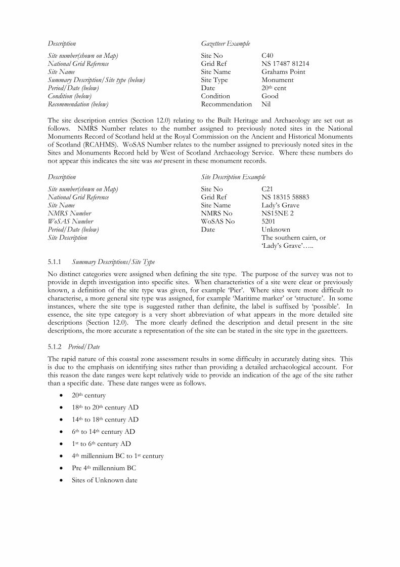
Description Gazetteer Example
Site number(shown on Map) Site No C40 National Grid Reference Grid Ref NS 17487 81214 Site Name Site Name Grahams Point Summary Description/Site type (below) Site Type Monument Period/Date (below) Date 20th cent Condition (below) Condition Good Recommendation (below) Recommendation Nil The site description entries (Section 12.0) relating to the Built Heritage and Archaeology are set out as follows. NMRS Number relates to the number assigned to previously noted sites in the National Monuments Record of Scotland held at the Royal Commission on the Ancient and Historical Monuments of Scotland (RCAHMS). WoSAS Number relates to the number assigned to previously noted sites in the Sites and Monuments Record held by West of Scotland Archaeology Service. Where these numbers do not appear this indicates the site was not present in these monument records. Description Site Description Example
Site number(shown on Map) Site No C21 National Grid Reference Grid Ref NS 18315 58883 Site Name Site Name Lady’s Grave NMRS Number NMRS No NS15NE 2 WoSAS Number WoSAS No 5201 Period/Date (below) Date Unknown Site Description The southern cairn, or ‘Lady’s Grave’….. 5.1.1 Summary Descriptions/Site Type
No distinct categories were assigned when defining the site type. The purpose of the survey was not to provide in depth investigation into specific sites. When characteristics of a site were clear or previously known, a definition of the site type was given, for example ‘Pier’. Where sites were more difficult to characterise, a more general site type was assigned, for example ‘Maritime marker’ or ‘structure’. In some instances, where the site type is suggested rather than definite, the label is suffixed by ‘possible’. In essence, the site type category is a very short abbreviation of what appears in the more detailed site descriptions (Section 12.0). The more clearly defined the description and detail present in the site descriptions, the more accurate a representation of the site can be stated in the site type in the gazetteers. 5.1.2 Period/Date
The rapid nature of this coastal zone assessment results in some difficulty in accurately dating sites. This is due to the emphasis on identifying sites rather than providing a detailed archaeological account. For this reason the date ranges were kept relatively wide to provide an indication of the age of the site rather than a specific date. These date ranges were as follows.
• 20th century
• 18th to 20th century AD
• 14th to 18th century AD
• 6th to 14th century AD
• 1st to 6th century AD
• 4th millennium BC to 1st century
• Pre 4th millennium BC
• Sites of Unknown date
The new sites located during the survey were dated on appearance and any evidence provided by the desk based assessment. The information provided by the desk based assessment proved more relevant to sites of post eighteenth century. It should be noted that within the boundaries of this survey, with regards to the lack of investigative archaeological work, assigning a date range to a site can be very subjective. Many of the sites categorised as eighteenth to twentieth century may prove to be older but showed no sign of this during the survey. Sites where the date range could not be narrowed down to one of the above were categorised as of unknown date. Any date assigned to these sites would have been entirely speculative. 5.1.3 Condition
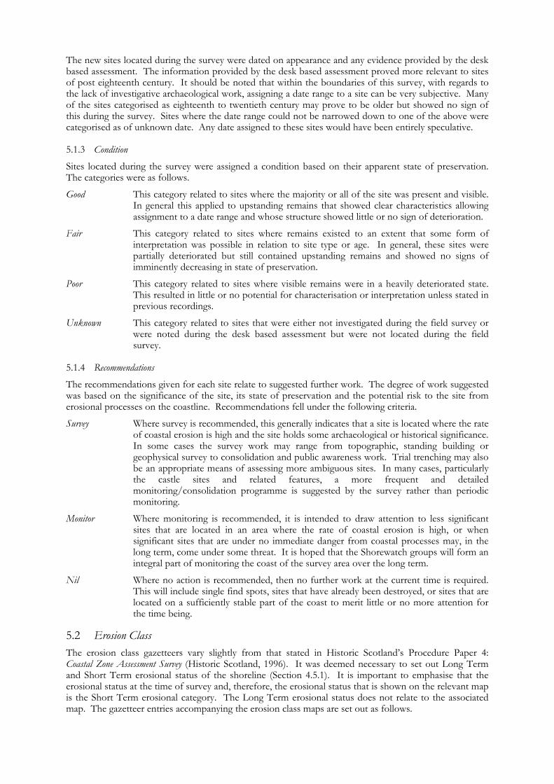
Sites located during the survey were assigned a condition based on their apparent state of preservation. The categories were as follows.
Good This category related to sites where the majority or all of the site was present and visible. In general this applied to upstanding remains that showed clear characteristics allowing assignment to a date range and whose structure showed little or no sign of deterioration.
Fair This category related to sites where remains existed to an extent that some form of interpretation was possible in relation to site type or age. In general, these sites were partially deteriorated but still contained upstanding remains and showed no signs of imminently decreasing in state of preservation.
Poor This category related to sites where visible remains were in a heavily deteriorated state. This resulted in little or no potential for characterisation or interpretation unless stated in previous recordings.
Unknown This category related to sites that were either not investigated during the field survey or were noted during the desk based assessment but were not located during the field survey.
5.1.4 Recommendations
The recommendations given for each site relate to suggested further work. The degree of work suggested was based on the significance of the site, its state of preservation and the potential risk to the site from erosional processes on the coastline. Recommendations fell under the following criteria.
Survey Where survey is recommended, this generally indicates that a site is located where the rate of coastal erosion is high and the site holds some archaeological or historical significance. In some cases the survey work may range from topographic, standing building or geophysical survey to consolidation and public awareness work. Trial trenching may also be an appropriate means of assessing more ambiguous sites. In many cases, particularly the castle sites and related features, a more frequent and detailed monitoring/consolidation programme is suggested by the survey rather than periodic monitoring.
Monitor Where monitoring is recommended, it is intended to draw attention to less significant sites that are located in an area where the rate of coastal erosion is high, or when significant sites that are under no immediate danger from coastal processes may, in the long term, come under some threat. It is hoped that the Shorewatch groups will form an integral part of monitoring the coast of the survey area over the long term.
Nil Where no action is recommended, then no further work at the current time is required. This will include single find spots, sites that have already been destroyed, or sites that are located on a sufficiently stable part of the coast to merit little or no more attention for the time being.
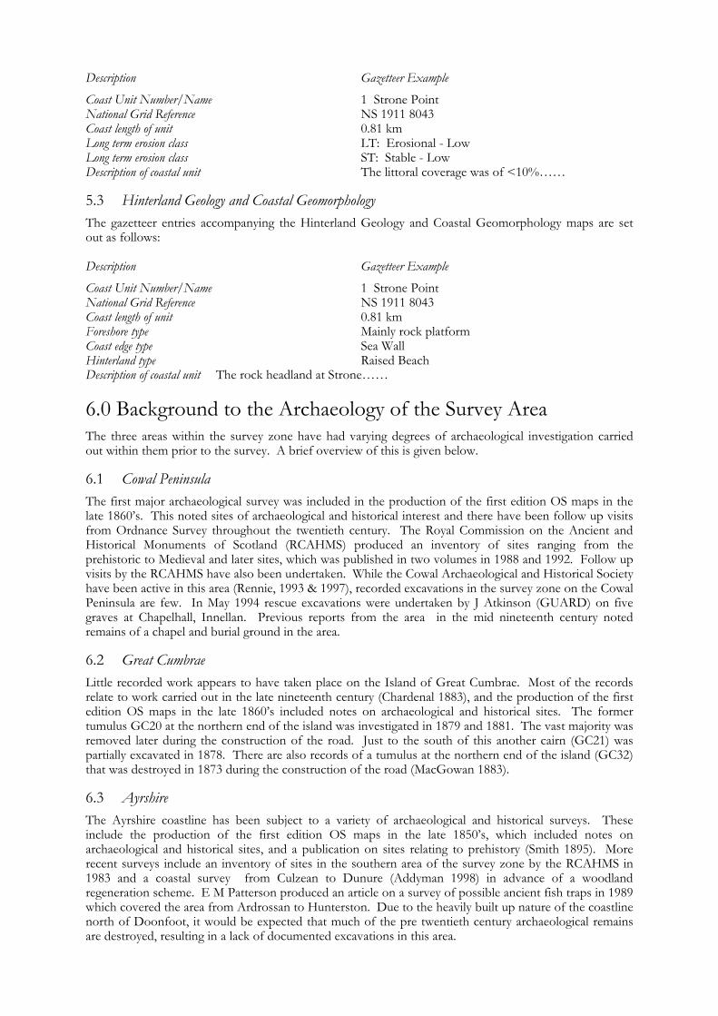
5.2 Erosion Class The erosion class gazetteers vary slightly from that stated in Historic Scotland’s Procedure Paper 4: Coastal Zone Assessment Survey (Historic Scotland, 1996). It was deemed necessary to set out Long Term and Short Term erosional status of the shoreline (Section 4.5.1). It is important to emphasise that the erosional status at the time of survey and, therefore, the erosional status that is shown on the relevant map is the Short Term erosional category. The Long Term erosional status does not relate to the associated map. The gazetteer entries accompanying the erosion class maps are set out as follows.
Description Gazetteer Example
Coast Unit Number/Name 1 Strone Point National Grid Reference NS 1911 8043 Coast length of unit 0.81 km Long term erosion class LT: Erosional - Low Long term erosion class ST: Stable - Low Description of coastal unit The littoral coverage was of <10%…… 5.3 Hinterland Geology and Coastal Geomorphology The gazetteer entries accompanying the Hinterland Geology and Coastal Geomorphology maps are set out as follows: Description Gazetteer Example
Coast Unit Number/Name 1 Strone Point National Grid Reference NS 1911 8043 Coast length of unit 0.81 km Foreshore type Mainly rock platform Coast edge type Sea Wall Hinterland type Raised Beach Description of coastal unit The rock headland at Strone……
6.0 Background to the Archaeology of the Survey Area The three areas within the survey zone have had varying degrees of archaeological investigation carried out within them prior to the survey. A brief overview of this is given below. 6.1 Cowal Peninsula The first major archaeological survey was included in the production of the first edition OS maps in the late 1860’s. This noted sites of archaeological and historical interest and there have been follow up visits from Ordnance Survey throughout the twentieth century. The Royal Commission on the Ancient and Historical Monuments of Scotland (RCAHMS) produced an inventory of sites ranging from the prehistoric to Medieval and later sites, which was published in two volumes in 1988 and 1992. Follow up visits by the RCAHMS have also been undertaken. While the Cowal Archaeological and Historical Society have been active in this area (Rennie, 1993 & 1997), recorded excavations in the survey zone on the Cowal Peninsula are few. In May 1994 rescue excavations were undertaken by J Atkinson (GUARD) on five graves at Chapelhall, Innellan. Previous reports from the area in the mid nineteenth century noted remains of a chapel and burial ground in the area. 6.2 Great Cumbrae Little recorded work appears to have taken place on the Island of Great Cumbrae. Most of the records relate to work carried out in the late nineteenth century (Chardenal 1883), and the production of the first edition OS maps in the late 1860’s included notes on archaeological and historical sites. The former tumulus GC20 at the northern end of the island was investigated in 1879 and 1881. The vast majority was removed later during the construction of the road. Just to the south of this another cairn (GC21) was partially excavated in 1878. There are also records of a tumulus at the northern end of the island (GC32) that was destroyed in 1873 during the construction of the road (MacGowan 1883). 6.3 Ayrshire The Ayrshire coastline has been subject to a variety of archaeological and historical surveys. These include the production of the first edition OS maps in the late 1850’s, which included notes on archaeological and historical sites, and a publication on sites relating to prehistory (Smith 1895). More recent surveys include an inventory of sites in the southern area of the survey zone by the RCAHMS in 1983 and a coastal survey from Culzean to Dunure (Addyman 1998) in advance of a woodland regeneration scheme. E M Patterson produced an article on a survey of possible ancient fish traps in 1989 which covered the area from Ardrossan to Hunterston. Due to the heavily built up nature of the coastline north of Doonfoot, it would be expected that much of the pre twentieth century archaeological remains are destroyed, resulting in a lack of documented excavations in this area.
7.0 Physical Background to the Coastal Zone of the
Firth of Clyde 7.1 Coastal Cells The concept of coastal cells was adopted in England and Wales in 1993 as a framework for strategic management of the coastline (MAFF 1993). The Scottish coastline was categorised in 1996 by Wallingford into 11 sediment cells. These cells defined lengths of coastline where the movement of sand and gravel was relatively self-contained and so any interruption to movement within one cell may affect other locations within the same cell but should not have a significant impact on adjacent cells. The boundaries of such cells were identified as two basic types:
1) Littoral drift divides which normally occur at a point where the coastal orientation changes direction abruptly, for example at a headland, or where a parting of sediment drift occurs, for example at an eroding beach where sediment on either side moves in both directions away from the eroding section. In some cases a less fixed drift divide may occur where there is no such dramatic change in coastal orientation, and whose position can vary with relatively small change in wave conditions; and
2) Sediment sinks, which are points where sand or gravel transport paths meet, such as in deeply indented bays, tidal inlets and estuaries. Sediment then tends to accumulate in such locations and may be complicated by tidal flows and currents in estuaries.
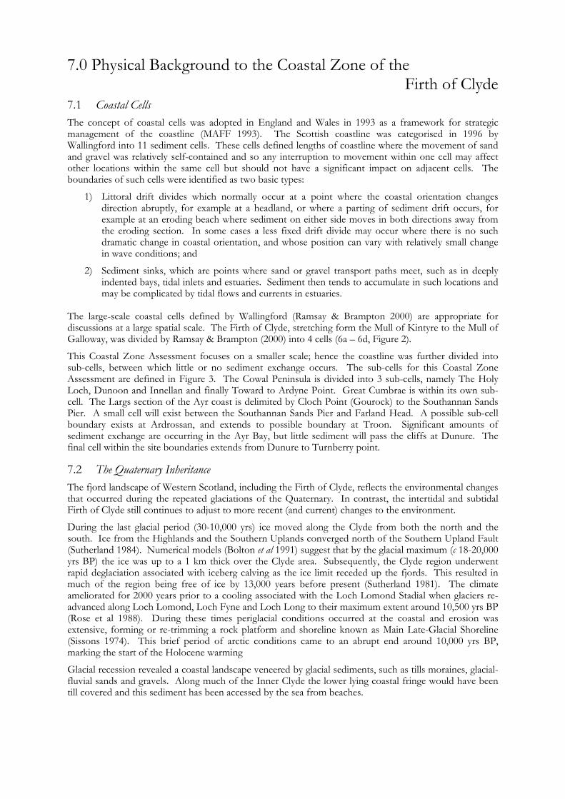
The large-scale coastal cells defined by Wallingford (Ramsay & Brampton 2000) are appropriate for discussions at a large spatial scale. The Firth of Clyde, stretching form the Mull of Kintyre to the Mull of Galloway, was divided by Ramsay & Brampton (2000) into 4 cells (6a – 6d, Figure 2).
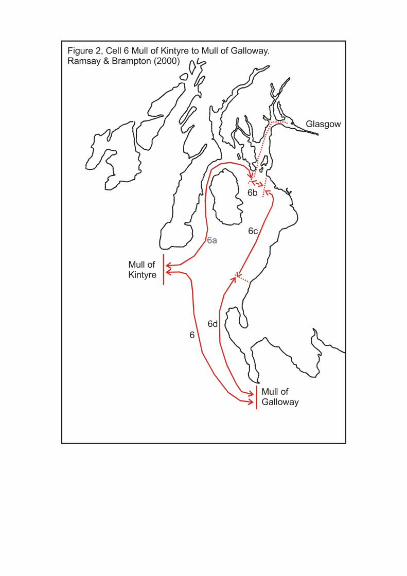
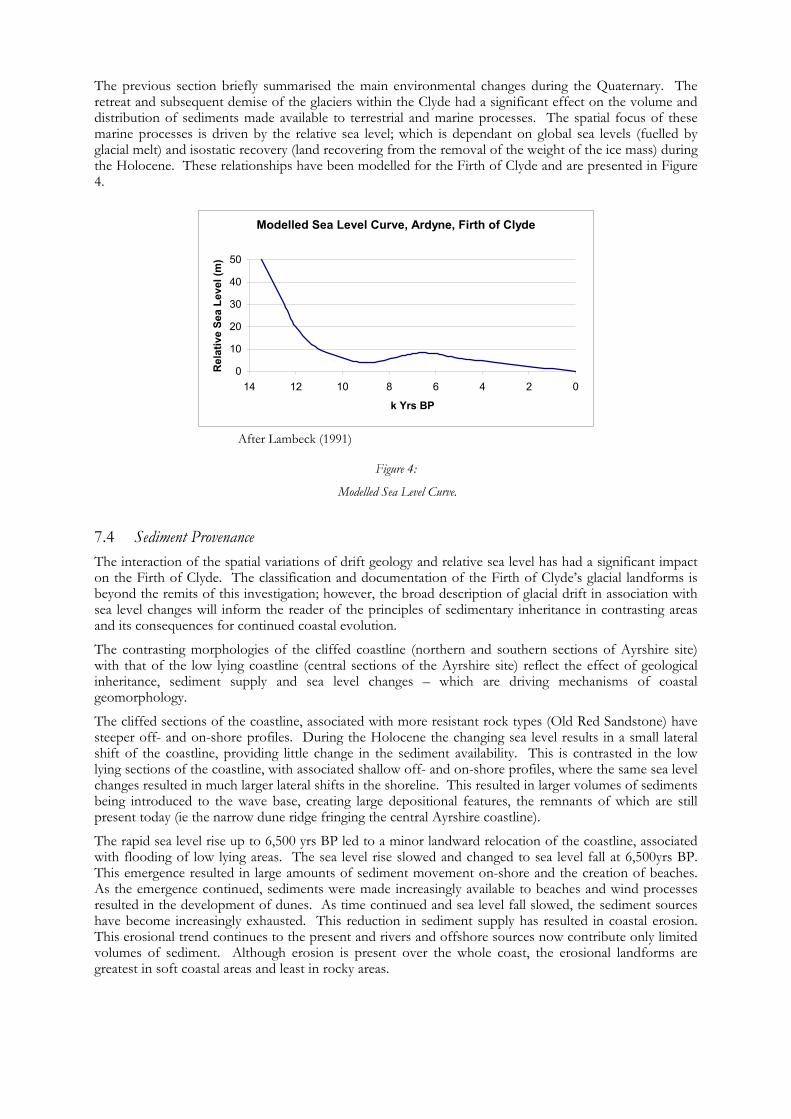
This Coastal Zone Assessment focuses on a smaller scale; hence the coastline was further divided into sub-cells, between which little or no sediment exchange occurs. The sub-cells for this Coastal Zone Assessment are defined in Figure 3. The Cowal Peninsula is divided into 3 sub-cells, namely The Holy Loch, Dunoon and Innellan and finally Toward to Ardyne Point. Great Cumbrae is within its own sub-cell. The Largs section of the Ayr coast is delimited by Cloch Point (Gourock) to the Southannan Sands Pier. A small cell will exist between the Southannan Sands Pier and Farland Head. A possible sub-cell boundary exists at Ardrossan, and extends to possible boundary at Troon. Significant amounts of sediment exchange are occurring in the Ayr Bay, but little sediment will pass the cliffs at Dunure. The final cell within the site boundaries extends from Dunure to Turnberry point. 7.2 The Quaternary Inheritance The fjord landscape of Western Scotland, including the Firth of Clyde, reflects the environmental changes that occurred during the repeated glaciations of the Quaternary. In contrast, the intertidal and subtidal Firth of Clyde still continues to adjust to more recent (and current) changes to the environment.
During the last glacial period (30-10,000 yrs) ice moved along the Clyde from both the north and the south. Ice from the Highlands and the Southern Uplands converged north of the Southern Upland Fault (Sutherland 1984). Numerical models (Bolton et al 1991) suggest that by the glacial maximum (c 18-20,000 yrs BP) the ice was up to a 1 km thick over the Clyde area. Subsequently, the Clyde region underwent rapid deglaciation associated with iceberg calving as the ice limit receded up the fjords. This resulted in much of the region being free of ice by 13,000 years before present (Sutherland 1981). The climate ameliorated for 2000 years prior to a cooling associated with the Loch Lomond Stadial when glaciers re-advanced along Loch Lomond, Loch Fyne and Loch Long to their maximum extent around 10,500 yrs BP (Rose et al 1988). During these times periglacial conditions occurred at the coastal and erosion was extensive, forming or re-trimming a rock platform and shoreline known as Main Late-Glacial Shoreline (Sissons 1974). This brief period of arctic conditions came to an abrupt end around 10,000 yrs BP, marking the start of the Holocene warming
Glacial recession revealed a coastal landscape veneered by glacial sediments, such as tills moraines, glacial-fluvial sands and gravels. Along much of the Inner Clyde the lower lying coastal fringe would have been till covered and this sediment has been accessed by the sea from beaches.
Mull ofKintyre
Mull of Galloway
Glasgow
6b
6c
6d 6
Figure 2, Cell 6 Mull of Kintyre to Mull of Galloway.Ramsay & Brampton (2000)
Glasgow
Figure 3, Sub-Cell Boundaries
Dunoon Gourock
Largs
Irvine
Troon
Turnberry
Ardrosson
Possible Sub-Cell Boundaries
Sub-Cell Boundaries
Farland Head Hunterston Coal Terminal Pier
Cloch Point
Ardrossan
Troon
Dunure
Turnberry Point
Grt. Cumbrae
7.3 Sea Level Changes Relative sea level rose initially reflecting eustatic inputs (the ice melt contribution form retreating ice masses), however as the ice melted isostatic rebound was initiated (the crustal uplift responding to the removal of the ice mass) which overtook eustatic contributions around 6000 Yrs BP Sea level has fallen since to its current location.
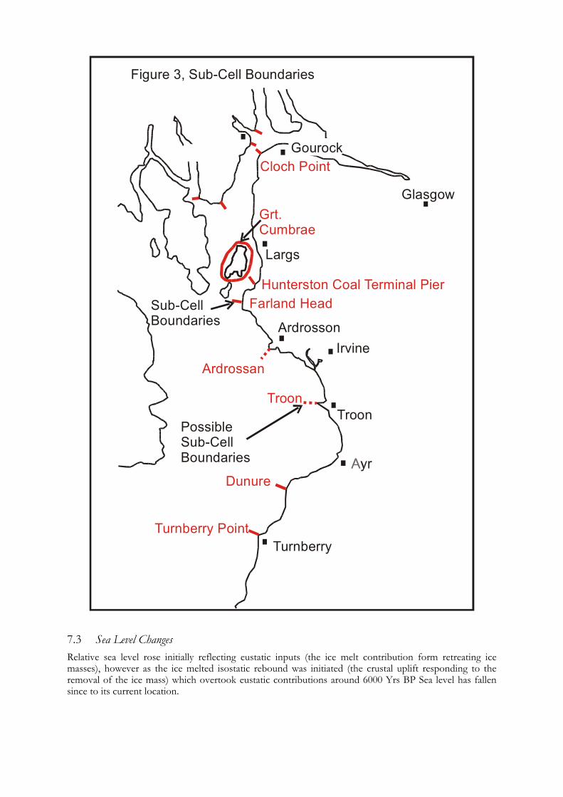
The previous section briefly summarised the main environmental changes during the Quaternary. The retreat and subsequent demise of the glaciers within the Clyde had a significant effect on the volume and distribution of sediments made available to terrestrial and marine processes. The spatial focus of these marine processes is driven by the relative sea level; which is dependant on global sea levels (fuelled by glacial melt) and isostatic recovery (land recovering from the removal of the weight of the ice mass) during the Holocene. These relationships have been modelled for the Firth of Clyde and are presented in Figure 4.
Modelled Sea Level Curve, Ardyne, Firth of Clyde
0
10
20
30
40
50
02468101214
k Yrs BP
Rel
ativ
e Se
a Le
vel (
m)
After Lambeck (1991)
Figure 4:
Modelled Sea Level Curve. 7.4 Sediment Provenance The interaction of the spatial variations of drift geology and relative sea level has had a significant impact on the Firth of Clyde. The classification and documentation of the Firth of Clyde’s glacial landforms is beyond the remits of this investigation; however, the broad description of glacial drift in association with sea level changes will inform the reader of the principles of sedimentary inheritance in contrasting areas and its consequences for continued coastal evolution.
The contrasting morphologies of the cliffed coastline (northern and southern sections of Ayrshire site) with that of the low lying coastline (central sections of the Ayrshire site) reflect the effect of geological inheritance, sediment supply and sea level changes – which are driving mechanisms of coastal geomorphology.
The cliffed sections of the coastline, associated with more resistant rock types (Old Red Sandstone) have steeper off- and on-shore profiles. During the Holocene the changing sea level results in a small lateral shift of the coastline, providing little change in the sediment availability. This is contrasted in the low lying sections of the coastline, with associated shallow off- and on-shore profiles, where the same sea level changes resulted in much larger lateral shifts in the shoreline. This resulted in larger volumes of sediments being introduced to the wave base, creating large depositional features, the remnants of which are still present today (ie the narrow dune ridge fringing the central Ayrshire coastline).
The rapid sea level rise up to 6,500 yrs BP led to a minor landward relocation of the coastline, associated with flooding of low lying areas. The sea level rise slowed and changed to sea level fall at 6,500yrs BP. This emergence resulted in large amounts of sediment movement on-shore and the creation of beaches. As the emergence continued, sediments were made increasingly available to beaches and wind processes resulted in the development of dunes. As time continued and sea level fall slowed, the sediment sources have become increasingly exhausted. This reduction in sediment supply has resulted in coastal erosion. This erosional trend continues to the present and rivers and offshore sources now contribute only limited volumes of sediment. Although erosion is present over the whole coast, the erosional landforms are greatest in soft coastal areas and least in rocky areas.
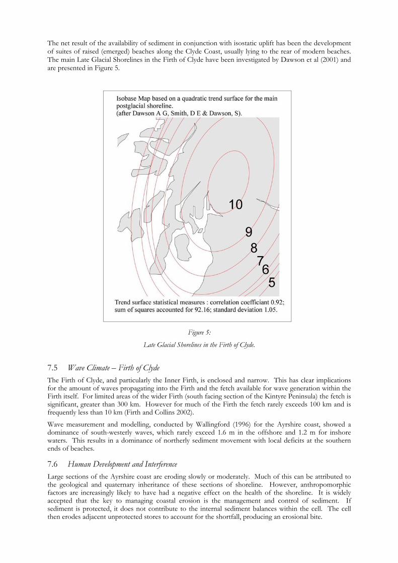
The net result of the availability of sediment in conjunction with isostatic uplift has been the development of suites of raised (emerged) beaches along the Clyde Coast, usually lying to the rear of modern beaches. The main Late Glacial Shorelines in the Firth of Clyde have been investigated by Dawson et al (2001) and are presented in Figure 5.
Figure 5:
Late Glacial Shorelines in the Firth of Clyde.
7.5 Wave Climate – Firth of Clyde The Firth of Clyde, and particularly the Inner Firth, is enclosed and narrow. This has clear implications for the amount of waves propagating into the Firth and the fetch available for wave generation within the Firth itself. For limited areas of the wider Firth (south facing section of the Kintyre Peninsula) the fetch is significant, greater than 300 km. However for much of the Firth the fetch rarely exceeds 100 km and is frequently less than 10 km (Firth and Collins 2002).
Wave measurement and modelling, conducted by Wallingford (1996) for the Ayrshire coast, showed a dominance of south-westerly waves, which rarely exceed 1.6 m in the offshore and 1.2 m for inshore waters. This results in a dominance of northerly sediment movement with local deficits at the southern ends of beaches. 7.6 Human Development and Interference Large sections of the Ayrshire coast are eroding slowly or moderately. Much of this can be attributed to the geological and quaternary inheritance of these sections of shoreline. However, anthropomorphic factors are increasingly likely to have had a negative effect on the health of the shoreline. It is widely accepted that the key to managing coastal erosion is the management and control of sediment. If sediment is protected, it does not contribute to the internal sediment balances within the cell. The cell then erodes adjacent unprotected stores to account for the shortfall, producing an erosional bite.
This principle is aggravated when large sections of the shoreline are protected, as in the case of Ayrshire, resulting in the focussing on fewer stores to supply the wider need of the cell/sub cell. This problematic situation is hindered further by the extraction of sediment from river mouths. Given the size and location of the rivers in question these are unlikely to contribute significant volumes of beach material to the cell; however, the dredged material is likely to beach material moving alongshore. The removal of this ‘beach sediment’ from the foreshore to an offshore dump below the wave base can be a significant loss to the cell.
60,000 tonnes of sediment are extracted annually from Ayr Harbour. A significant proportion of this sediment is likely to be beach grade material. If this could be fed to the near shore, the erosional problems would decrease.
8.0 Summary of Results A summary of results dealing with Archaeology and Built Heritage and Erosion Class is given below. 8.1 Archaeology and Built Heritage 8.1.1 Number of Sites
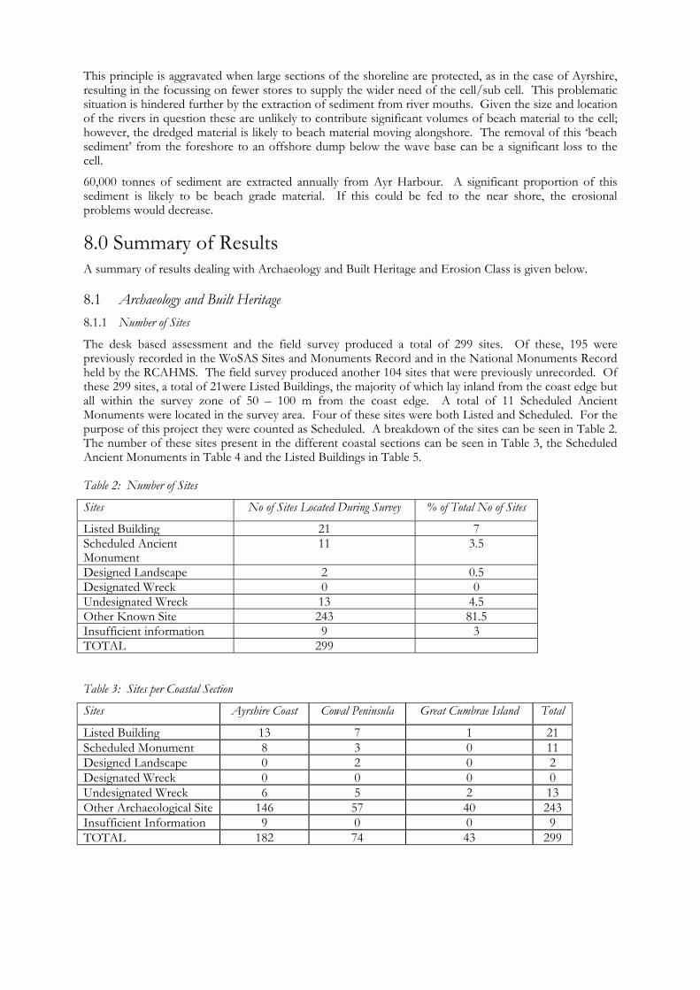
The desk based assessment and the field survey produced a total of 299 sites. Of these, 195 were previously recorded in the WoSAS Sites and Monuments Record and in the National Monuments Record held by the RCAHMS. The field survey produced another 104 sites that were previously unrecorded. Of these 299 sites, a total of 21were Listed Buildings, the majority of which lay inland from the coast edge but all within the survey zone of 50 – 100 m from the coast edge. A total of 11 Scheduled Ancient Monuments were located in the survey area. Four of these sites were both Listed and Scheduled. For the purpose of this project they were counted as Scheduled. A breakdown of the sites can be seen in Table 2. The number of these sites present in the different coastal sections can be seen in Table 3, the Scheduled Ancient Monuments in Table 4 and the Listed Buildings in Table 5. Table 2: Number of Sites
Sites No of Sites Located During Survey % of Total No of Sites
Listed Building 21 7 Scheduled Ancient Monument
11 3.5
Designed Landscape 2 0.5 Designated Wreck 0 0 Undesignated Wreck 13 4.5 Other Known Site 243 81.5 Insufficient information 9 3 TOTAL 299 Table 3: Sites per Coastal Section
Sites Ayrshire Coast Cowal Peninsula Great Cumbrae Island Total
Listed Building 13 7 1 21 Scheduled Monument 8 3 0 11 Designed Landscape 0 2 0 2 Designated Wreck 0 0 0 0 Undesignated Wreck 6 5 2 13 Other Archaeological Site 146 57 40 243 Insufficient Information 9 0 0 9 TOTAL 182 74 43 299
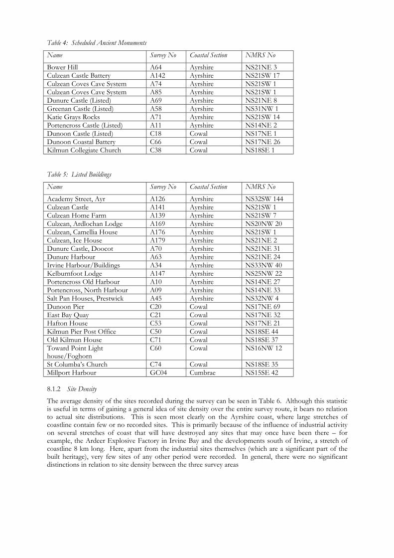
Table 4: Scheduled Ancient Monuments
Name Survey No Coastal Section NMRS No
Bower Hill A64 Ayrshire NS21NE 3 Culzean Castle Battery A142 Ayrshire NS21SW 17 Culzean Coves Cave System A74 Ayrshire NS21SW 1 Culzean Coves Cave System A85 Ayrshire NS21SW 1 Dunure Castle (Listed) A69 Ayrshire NS21NE 8 Greenan Castle (Listed) A58 Ayrshire NS31NW 1 Katie Grays Rocks A71 Ayrshire NS21SW 14 Portencross Castle (Listed) A11 Ayrshire NS14NE 2 Dunoon Castle (Listed) C18 Cowal NS17NE 1 Dunoon Coastal Battery C66 Cowal NS17NE 26 Kilmun Collegiate Church C38 Cowal NS18SE 1 Table 5: Listed Buildings
Name Survey No Coastal Section NMRS No
Academy Street, Ayr A126 Ayrshire NS32SW 144 Culzean Castle A141 Ayrshire NS21SW 1 Culzean Home Farm A139 Ayrshire NS21SW 7 Culzean, Ardlochan Lodge A169 Ayrshire NS20NW 20 Culzean, Camellia House A176 Ayrshire NS21SW 1 Culzean, Ice House A179 Ayrshire NS21NE 2 Dunure Castle, Doocot A70 Ayrshire NS21NE 31 Dunure Harbour A63 Ayrshire NS21NE 24 Irvine Harbour/Buildings A34 Ayrshire NS33NW 40 Kelburnfoot Lodge A147 Ayrshire NS25NW 22 Portencross Old Harbour A10 Ayrshire NS14NE 27 Portencross, North Harbour A09 Ayrshire NS14NE 33 Salt Pan Houses, Prestwick A45 Ayrshire NS32NW 4 Dunoon Pier C20 Cowal NS17NE 69 East Bay Quay C21 Cowal NS17NE 32 Hafton House C53 Cowal NS17NE 21 Kilmun Pier Post Office C50 Cowal NS18SE 44 Old Kilmun House C71 Cowal NS18SE 37 Toward Point Light house/Foghorn
C60 Cowal NS16NW 12
St Columba’s Church C74 Cowal NS18SE 35 Millport Harbour GC04 Cumbrae NS15SE 42 8.1.2 Site Density
The average density of the sites recorded during the survey can be seen in Table 6. Although this statistic is useful in terms of gaining a general idea of site density over the entire survey route, it bears no relation to actual site distributions. This is seen most clearly on the Ayrshire coast, where large stretches of coastline contain few or no recorded sites. This is primarily because of the influence of industrial activity on several stretches of coast that will have destroyed any sites that may once have been there – for example, the Ardeer Explosive Factory in Irvine Bay and the developments south of Irvine, a stretch of coastline 8 km long. Here, apart from the industrial sites themselves (which are a significant part of the built heritage), very few sites of any other period were recorded. In general, there were no significant distinctions in relation to site density between the three survey areas
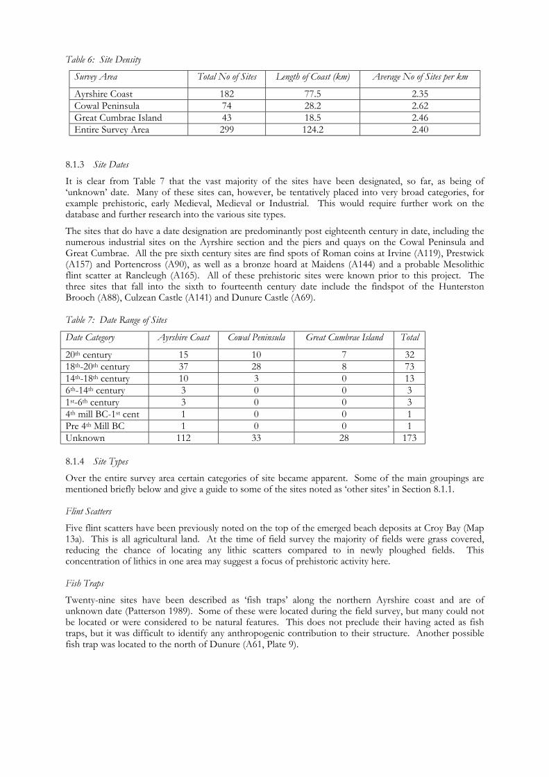
Table 6: Site Density
Survey Area Total No of Sites Length of Coast (km) Average No of Sites per km
Ayrshire Coast 182 77.5 2.35 Cowal Peninsula 74 28.2 2.62 Great Cumbrae Island 43 18.5 2.46 Entire Survey Area 299 124.2 2.40
8.1.3 Site Dates
It is clear from Table 7 that the vast majority of the sites have been designated, so far, as being of ‘unknown’ date. Many of these sites can, however, be tentatively placed into very broad categories, for example prehistoric, early Medieval, Medieval or Industrial. This would require further work on the database and further research into the various site types.
The sites that do have a date designation are predominantly post eighteenth century in date, including the numerous industrial sites on the Ayrshire section and the piers and quays on the Cowal Peninsula and Great Cumbrae. All the pre sixth century sites are find spots of Roman coins at Irvine (A119), Prestwick (A157) and Portencross (A90), as well as a bronze hoard at Maidens (A144) and a probable Mesolithic flint scatter at Rancleugh (A165). All of these prehistoric sites were known prior to this project. The three sites that fall into the sixth to fourteenth century date include the findspot of the Hunterston Brooch (A88), Culzean Castle (A141) and Dunure Castle (A69). Table 7: Date Range of Sites
Date Category Ayrshire Coast Cowal Peninsula Great Cumbrae Island Total
20th century 15 10 7 32 18th-20th century 37 28 8 73 14th-18th century 10 3 0 13 6th-14th century 3 0 0 3 1st-6th century 3 0 0 3 4th mill BC-1st cent 1 0 0 1 Pre 4th Mill BC 1 0 0 1 Unknown 112 33 28 173 8.1.4 Site Types
Over the entire survey area certain categories of site became apparent. Some of the main groupings are mentioned briefly below and give a guide to some of the sites noted as ‘other sites’ in Section 8.1.1. Flint Scatters
Five flint scatters have been previously noted on the top of the emerged beach deposits at Croy Bay (Map 13a). This is all agricultural land. At the time of field survey the majority of fields were grass covered, reducing the chance of locating any lithic scatters compared to in newly ploughed fields. This concentration of lithics in one area may suggest a focus of prehistoric activity here. Fish Traps
Twenty-nine sites have been described as ‘fish traps’ along the northern Ayrshire coast and are of unknown date (Patterson 1989). Some of these were located during the field survey, but many could not be located or were considered to be natural features. This does not preclude their having acted as fish traps, but it was difficult to identify any anthropogenic contribution to their structure. Another possible fish trap was located to the north of Dunure (A61, Plate 9).
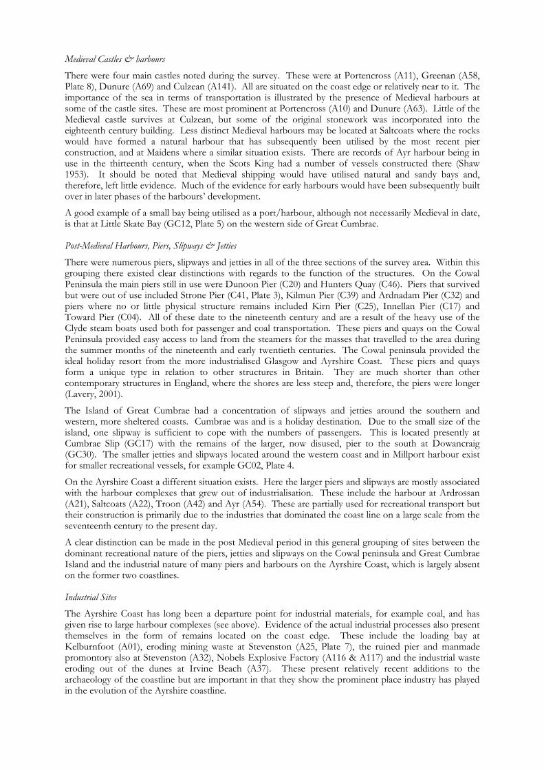
Medieval Castles & harbours
There were four main castles noted during the survey. These were at Portencross (A11), Greenan (A58, Plate 8), Dunure (A69) and Culzean (A141). All are situated on the coast edge or relatively near to it. The importance of the sea in terms of transportation is illustrated by the presence of Medieval harbours at some of the castle sites. These are most prominent at Portencross (A10) and Dunure (A63). Little of the Medieval castle survives at Culzean, but some of the original stonework was incorporated into the eighteenth century building. Less distinct Medieval harbours may be located at Saltcoats where the rocks would have formed a natural harbour that has subsequently been utilised by the most recent pier construction, and at Maidens where a similar situation exists. There are records of Ayr harbour being in use in the thirteenth century, when the Scots King had a number of vessels constructed there (Shaw 1953). It should be noted that Medieval shipping would have utilised natural and sandy bays and, therefore, left little evidence. Much of the evidence for early harbours would have been subsequently built over in later phases of the harbours’ development.
A good example of a small bay being utilised as a port/harbour, although not necessarily Medieval in date, is that at Little Skate Bay (GC12, Plate 5) on the western side of Great Cumbrae. Post-Medieval Harbours, Piers, Slipways & Jetties
There were numerous piers, slipways and jetties in all of the three sections of the survey area. Within this grouping there existed clear distinctions with regards to the function of the structures. On the Cowal Peninsula the main piers still in use were Dunoon Pier (C20) and Hunters Quay (C46). Piers that survived but were out of use included Strone Pier (C41, Plate 3), Kilmun Pier (C39) and Ardnadam Pier (C32) and piers where no or little physical structure remains included Kirn Pier (C25), Innellan Pier (C17) and Toward Pier (C04). All of these date to the nineteenth century and are a result of the heavy use of the Clyde steam boats used both for passenger and coal transportation. These piers and quays on the Cowal Peninsula provided easy access to land from the steamers for the masses that travelled to the area during the summer months of the nineteenth and early twentieth centuries. The Cowal peninsula provided the ideal holiday resort from the more industrialised Glasgow and Ayrshire Coast. These piers and quays form a unique type in relation to other structures in Britain. They are much shorter than other contemporary structures in England, where the shores are less steep and, therefore, the piers were longer (Lavery, 2001).
The Island of Great Cumbrae had a concentration of slipways and jetties around the southern and western, more sheltered coasts. Cumbrae was and is a holiday destination. Due to the small size of the island, one slipway is sufficient to cope with the numbers of passengers. This is located presently at Cumbrae Slip (GC17) with the remains of the larger, now disused, pier to the south at Dowancraig (GC30). The smaller jetties and slipways located around the western coast and in Millport harbour exist for smaller recreational vessels, for example GC02, Plate 4.
On the Ayrshire Coast a different situation exists. Here the larger piers and slipways are mostly associated with the harbour complexes that grew out of industrialisation. These include the harbour at Ardrossan (A21), Saltcoats (A22), Troon (A42) and Ayr (A54). These are partially used for recreational transport but their construction is primarily due to the industries that dominated the coast line on a large scale from the seventeenth century to the present day.
A clear distinction can be made in the post Medieval period in this general grouping of sites between the dominant recreational nature of the piers, jetties and slipways on the Cowal peninsula and Great Cumbrae Island and the industrial nature of many piers and harbours on the Ayrshire Coast, which is largely absent on the former two coastlines. Industrial Sites
The Ayrshire Coast has long been a departure point for industrial materials, for example coal, and has given rise to large harbour complexes (see above). Evidence of the actual industrial processes also present themselves in the form of remains located on the coast edge. These include the loading bay at Kelburnfoot (A01), eroding mining waste at Stevenston (A25, Plate 7), the ruined pier and manmade promontory also at Stevenston (A32), Nobels Explosive Factory (A116 & A117) and the industrial waste eroding out of the dunes at Irvine Beach (A37). These present relatively recent additions to the archaeology of the coastline but are important in that they show the prominent place industry has played in the evolution of the Ayrshire coastline.
First and Second World War military sites
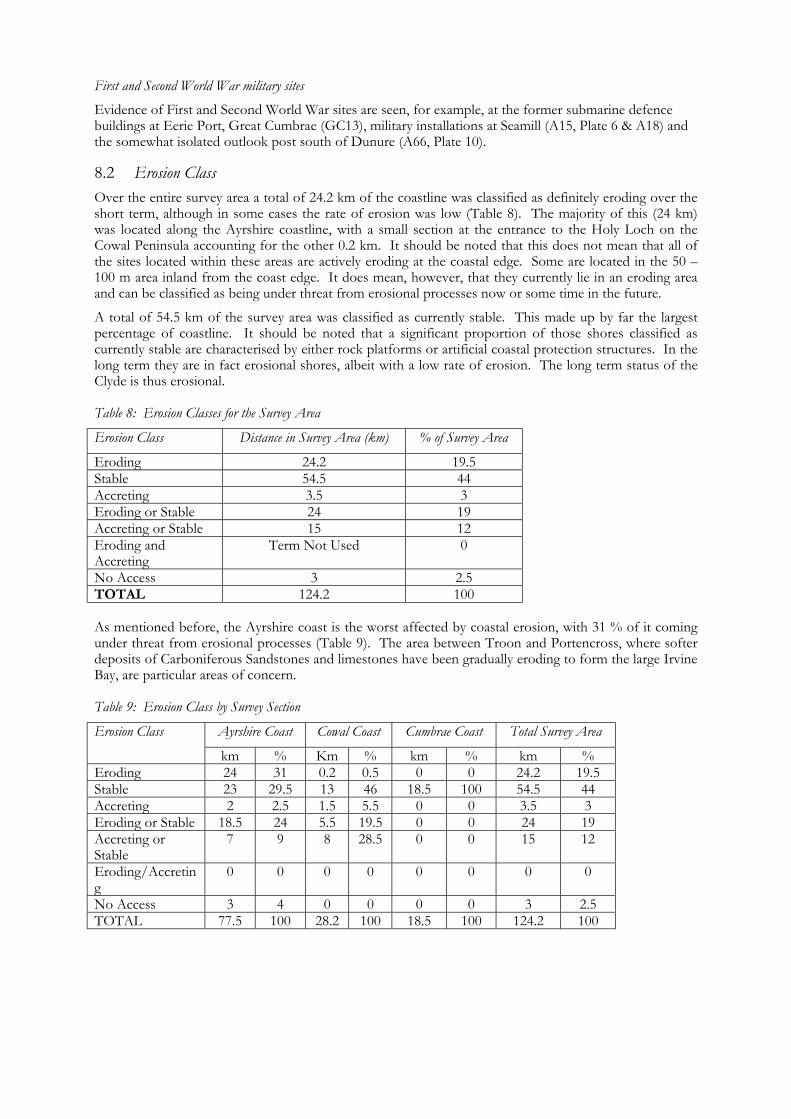
Evidence of First and Second World War sites are seen, for example, at the former submarine defence buildings at Eerie Port, Great Cumbrae (GC13), military installations at Seamill (A15, Plate 6 & A18) and the somewhat isolated outlook post south of Dunure (A66, Plate 10). 8.2 Erosion Class Over the entire survey area a total of 24.2 km of the coastline was classified as definitely eroding over the short term, although in some cases the rate of erosion was low (Table 8). The majority of this (24 km) was located along the Ayrshire coastline, with a small section at the entrance to the Holy Loch on the Cowal Peninsula accounting for the other 0.2 km. It should be noted that this does not mean that all of the sites located within these areas are actively eroding at the coastal edge. Some are located in the 50 – 100 m area inland from the coast edge. It does mean, however, that they currently lie in an eroding area and can be classified as being under threat from erosional processes now or some time in the future.
A total of 54.5 km of the survey area was classified as currently stable. This made up by far the largest percentage of coastline. It should be noted that a significant proportion of those shores classified as currently stable are characterised by either rock platforms or artificial coastal protection structures. In the long term they are in fact erosional shores, albeit with a low rate of erosion. The long term status of the Clyde is thus erosional. Table 8: Erosion Classes for the Survey Area
Erosion Class Distance in Survey Area (km) % of Survey Area
Eroding 24.2 19.5 Stable 54.5 44 Accreting 3.5 3 Eroding or Stable 24 19 Accreting or Stable 15 12 Eroding and Accreting
Term Not Used 0
No Access 3 2.5 TOTAL 124.2 100 As mentioned before, the Ayrshire coast is the worst affected by coastal erosion, with 31 % of it coming under threat from erosional processes (Table 9). The area between Troon and Portencross, where softer deposits of Carboniferous Sandstones and limestones have been gradually eroding to form the large Irvine Bay, are particular areas of concern. Table 9: Erosion Class by Survey Section
Ayrshire Coast Cowal Coast Cumbrae Coast Total Survey Area Erosion Class
km % Km % km % km % Eroding 24 31 0.2 0.5 0 0 24.2 19.5 Stable 23 29.5 13 46 18.5 100 54.5 44 Accreting 2 2.5 1.5 5.5 0 0 3.5 3 Eroding or Stable 18.5 24 5.5 19.5 0 0 24 19 Accreting or Stable
7 9 8 28.5 0 0 15 12
Eroding/Accreting
0 0 0 0 0 0 0 0
No Access 3 4 0 0 0 0 3 2.5 TOTAL 77.5 100 28.2 100 18.5 100 124.2 100
In contrast, the Isle of Great Cumbrae proves to be the most stable of the three areas, with 100 % of its coastline classified as stable. The Cowal Peninsula is also relatively stable, with 46% of the coastline being stable and only 0.5% eroding. The Cowal Peninsula and the Ayrshire coast have similar percentages of their coastline classified as eroding or stable, where both erosion and stable characteristics were identified. This suggests that, although not under an immediate and direct threat from coastal erosion, the archaeological sites in these areas may experience erosion periodically or over a long period of time.
Only the Cowal Peninsula has experienced significant accretion of material. A total of 28.5% of this survey section was termed accreting or stable, all of which was located on the east facing coastline. The head of the Holy Loch is an area of accretion, where the River Eachaig deposits much of its sediments. 8.3 Erosion and Archaeology/Built Heritage In Ayrshire there are 73 sites within eroding parts of the coast. These include the Listed Buildings at Portencross, the Castle (A11), the Old Harbour (A10) and the North Harbour (A09). Here the coast has been classified as eroding, but at a very slow rate. Kelburnfoot Lodge (A147), to the north of Portencross, is another Listed Building lying on the inland edge of the survey zone and, although in an eroding area of coast, it is under no direct immediate effect as the rates of erosion are suspected to be low.
The site where the Hunterston Brooch was found and the related early settlement is located is also situated in a stretch of coastline that has been classified as erosional. The site is, however, situated at the base of the Holocene cliff line some 80 – 100 m from the coast edge. The erosional rates at this area are not enough to pose any great threat to the site over the short term.
Outside Ayrshire, the only site in an area designated as eroding is the First World War Memorial Monument (C31) erected at Lazaretto Point at the entrance to the Holy Loch on the Cowal Peninsula. A stretch of approximately 200 m on the eastern side of the monument is visibly eroding and will eventually engulf the Memorial. The fish traps seen on the Ayrshire coast lie within the eroding section and are therefore under threat. However, their stone construction would reduce their vulnerability.
Industrial sites form a major part of the Ayrshire coast’s history and development, and these sites also lie within eroding areas of the coast. A number of these occur near Stevenston. Here a vast bingof mining waste (A25) is rapidly eroding out of the coast edge. Just to the south, only faint remains of a pier lie at the end of an eroding manmade promontory (A32). The vast industrial waste deposits that create the coast edge bank of the Ardeer Explosives works is also actively eroding (A30). There is clearly a wide variety of sites located within eroding areas of the coastline, primarily in the Ayrshire section. 8.4 Public Outreach and Training of Shorewatch Groups Shorewatch groups have been established with single individuals acting as the team leaders, providing a single contact for the group. This, it is hoped, will aid liaison with SCAPE and the Firth of Clyde Forum during subsequent phases, act as an organisational focus and provide the impetus for groups to continue Shorewatch once GUARD’s involvement is over. Although not a prerequisite, the team leaders all hold ACFA qualifications and have prior experience in archaeological survey.
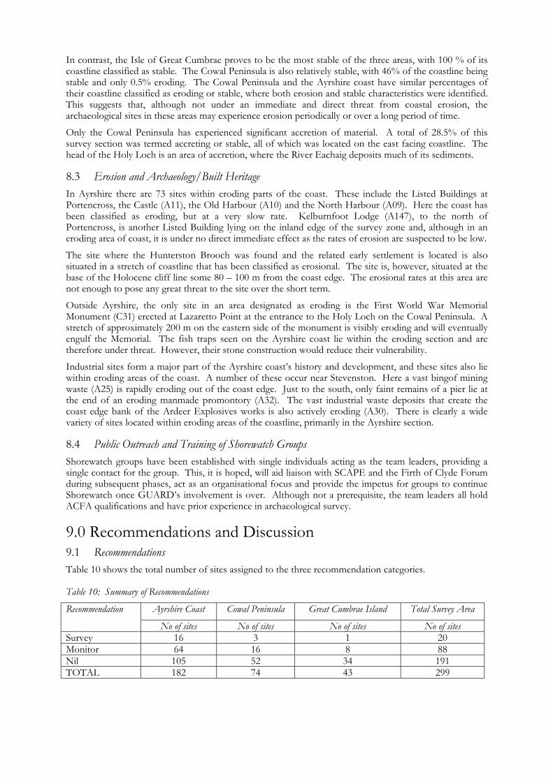
9.0 Recommendations and Discussion 9.1 Recommendations Table 10 shows the total number of sites assigned to the three recommendation categories. Table 10: Summary of Recommendations
Ayrshire Coast Cowal Peninsula Great Cumbrae Island Total Survey Area Recommendation
No of sites No of sites No of sites No of sites Survey 16 3 1 20 Monitor 64 16 8 88 Nil 105 52 34 191 TOTAL 182 74 43 299
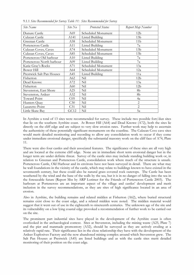
9.1.1 Sites Recommended for Survey Table 11: Sites Recommended for Survey
Site Name Site No Protected Status Report Map Number
Dunure Castle A69 Scheduled Monument 12b Culzean Castle A141 Listed Building 13b Greenan Castle A58 Scheduled Monument 11b Portencross Castle A11 Listed Building 7a Culzean Coves, Caves A74 Scheduled Monument 13b Culzean Coves, Caves A85 Scheduled Monument 13b Portencross Old harbour A10 Listed Building 7a Portencross North harbour A09 Listed Building 7a Katie Gray’s Rocks A71 Scheduled Monument 13a Bower Hill A64 Scheduled Monument 12a Prestwick Salt Pan Houses A45 Listed Building 11a Fisherton A62 Nil 12b Dead Knowe A72 Nil 13a Fisherton A60 Nil 12b Stevenston, East Shore A25 Nil 8b Stevenston, Ardeer A32 Nil 8b Toward Point C05 Nil 4a Hunters Quay C30 Nil 2 Lazaretto Point C31 Nil 2 Little Skate Bay GC12 Nil 5a In Ayrshire a total of 13 sites were recommended for survey. These include two possible fort/dun sites that lie on the southern Ayrshire coast. At Bower Hill (A64) and Dead Knowe (A72), both the sites lie directly on the cliff edge and are subject to very slow erosion rates. Further work may help to ascertain the authenticity of these potentially significant monuments on the coastline. The Culzean Cove cave sites would merit detailed monitoring and recording to allow any consolidation work to occur if they come under immediate erosional danger, specifically the substantial masonry work on the cliff face of A74, Plate 11.
There were also four castles and their associated features. The significance of these sites are all very high and are located at the extreme cliff edge. None are in immediate short term erosional danger but in the longer term are under definite threat. Survey of the castle sites may include standing building work or, in relation to Greenan and Portencross Castle, consolidation work where much of the structure is unsafe. Portencross Castle, Old Harbour and its environs have not been surveyed in detail. There are what may be wall foundations in the vicinity of the castle, which may relate to buildings known to have existed in the seventeenth century, but these could also be natural grass covered rock outcrops. The Castle has been weathered by the wind and the base of the walls by the sea, but it is in no danger of falling into the sea in the foreseeable future (Report Mss by ARP Lorimer for the Friends of Portencross Castle 2003). The harbours at Portencross are an important aspect of the village and castles’ development and merit inclusion in the survey recommendations, as they are sites of high significance located in an area of erosion.
Also in Ayrshire, the building remains and related midden at Fisherton (A62), where buried structural remains exist close to the coast edge, and a related midden were noted. The midden material would suggest that it went out of use in the eighteenth to nineteenth centuries. The unknown age of the site and its vulnerability on a low lying coastal edge provoked a recommendation of further work to be carried out on the site.
The prominent part industrial sites have played in the development of the Ayrshire coast is often overlooked in the archaeological context. Sites at Stevenston, including the mining waste (A25, Plate 7) and the pier and manmade promontory (A32), should be surveyed as they are actively eroding at a relatively rapid rate. Their significance lies in the close relationship they have with the development of the Ardeer Explosives Factory and the now abandoned mining complex around which Stevenston grew. The Salt Pan Houses at Prestwick (A45) are listed buildings and as with the castle sites merit detailed monitoring of their position on the coast edge.
Great Cumbrae Isle only contained one site recommended for survey. This was the previously unrecorded site at Little Skate Bay (GC12, Plate 12). The site consists of a small, stone-block built jetty which has the potential of being considerably older than the other piers and jetties on the island. More detailed monitoring and recording work is recommended.
The Cowal Peninsula contained three sites with a survey recommendation. The lime kiln (C05, Plate 1) at Toward Point should be closely monitored and recorded due to its position on a rock promontory only a few metres from the sea. The vaulted structure (C30) lying beneath the road at Hunters quay is not actively eroding at a fast rate but it shows signs of degrading and collapse. Its unique structure in terms of sites found in the coastal zone survey suggests that consolidation/recording work may be appropriate. The monument at Lazaretto Point (C31) merits detailed monitoring due to high erosion processes that are occurring on the adjacent coast. 9.1.2 Sites Recommended for Monitoring
On the Ayrshire coast the majority of the sites that were recommended for monitoring were the fish traps located between Ardrossan and Hunterston, discussed above. Some of these proposed boulder features were located during the field survey but many were not. Doubts over the authenticity of these boulder features exists, as naturally occurring boulders were often strewn across the intertidal rock platform where the fish traps are suggested to be. Boulder features do exist here, but more monitoring field work is needed to look into this interesting aspect of the archaeological environment.
Many of the sites proposed for monitoring on the coast of the Cowal Peninsula include piers, jetties and slipways. Some are either Scheduled or Listed, for example, Dunoon Pier (C20), while others appear to be degrading relatively quickly. Boulder alignments of unknown purpose were located in the intertidal zone on Cowal, including C09 & C72 along with the possible boulder defined slipway C15, Plate 2. Monitoring of these sites and research into their use, possibly by the Shorewatch groups, is recommended.
The island of Great Cumbrae also contained sites that were allocated the monitoring category. These include the possible prehistoric cairns in the north-east of the island (GC20 & 21), which both lie near the coast edge. A possible chapel site (GC31) should be monitored for any evidence of the true location of the site. An industrial midden (GC07) that is eroding from the coast edge in storm tides/waves may also be monitored to check for material evidence that may give an insight into its origin. 10.0 Conclusion It is clear from the coastal zone assessment that there exists a wide variety of sites within the survey area, ranging from prehistoric flint scatters in southern Ayrshire to cliff edge castle sites and remains of industrial processes. There was a clear distinction between the high level of industrial activity that occurred on the Ayrshire coastline compared to the low level in Cowal and Cumbrae. This also became apparent in the recorded sites; for example, the quays and piers recorded in Ayrshire were predominantly industry based, whereas the same features on Cowal were more recreational. It can be presumed that the survey areas in both Cowal and Ayrshire have had their archaeological and historical environment at the coast edge significantly altered over time by development relating to industry and housing.
Ayrshire clearly suffers from erosional problems in the northern and mid sections. This has been tackled to some extent by protection structures, including sea walls, gabion baskets and rip rap. This type of protection clearly has knock on effects on other areas of the coastline. In only one small section, that to the north of the Heads of Ayr, did coastal edge protection use materials that allowed active natural movement of sediments along the coast while still protecting the shoreline. The Cowal Peninsula, Great Cumbrae Island and the Ayrshire coast south of Greenan Castle are clearly more stable in the current climate. The Shorewatch groups and other interested local parties will, it is hoped, maintain a watch on the coastline, allowing proper assessment of this constantly changing environment.
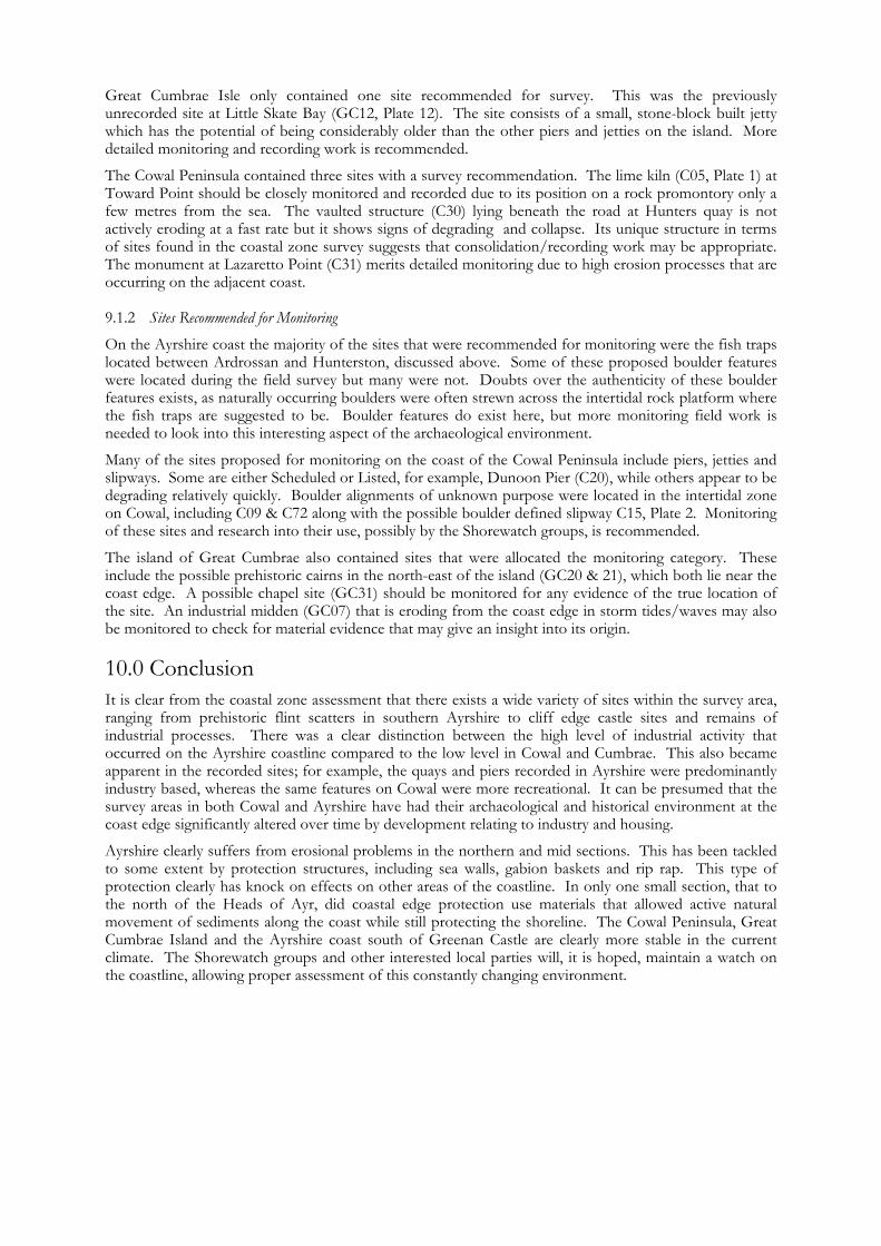
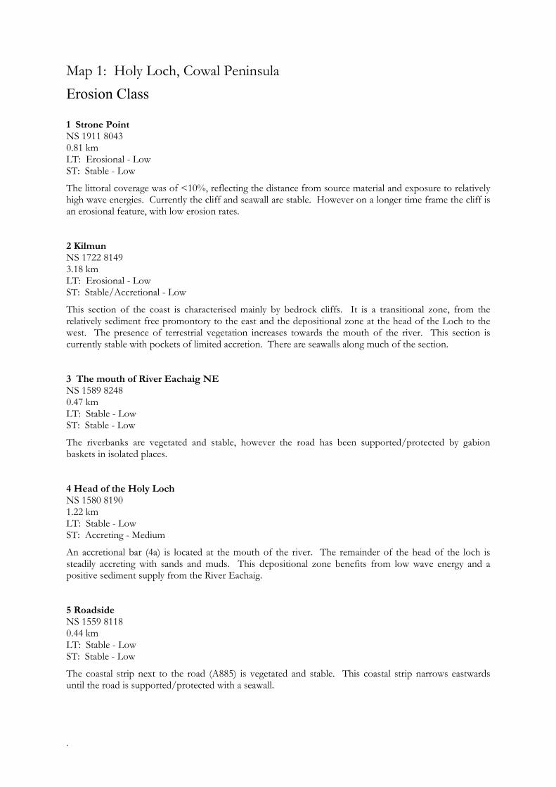
11.0 Maps and Gazetteers Map 1: Cowal Peninsula: Strone Point to Lazaretto Point Map Content Descriptions
1. Built Heritage and Archaeology
A total of twenty three sites were recorded in the area covered by Map 1. Of these fifteen were previously recorded and eight were new sites noted during the field survey. The majority of sites related to pier and jetty constructions on the coast edge and intertidal zone. A concentration of listed buildings occurred around the Kilmun area on the north side of the Holy Loch. Three of the previously recorded sites were wrecks located in the intertidal zone on the southern side of the Holy Loch. Only one of these (C36) was located during the field survey. There was an absence of sites in the accretional area at the head of the Holy Loch.
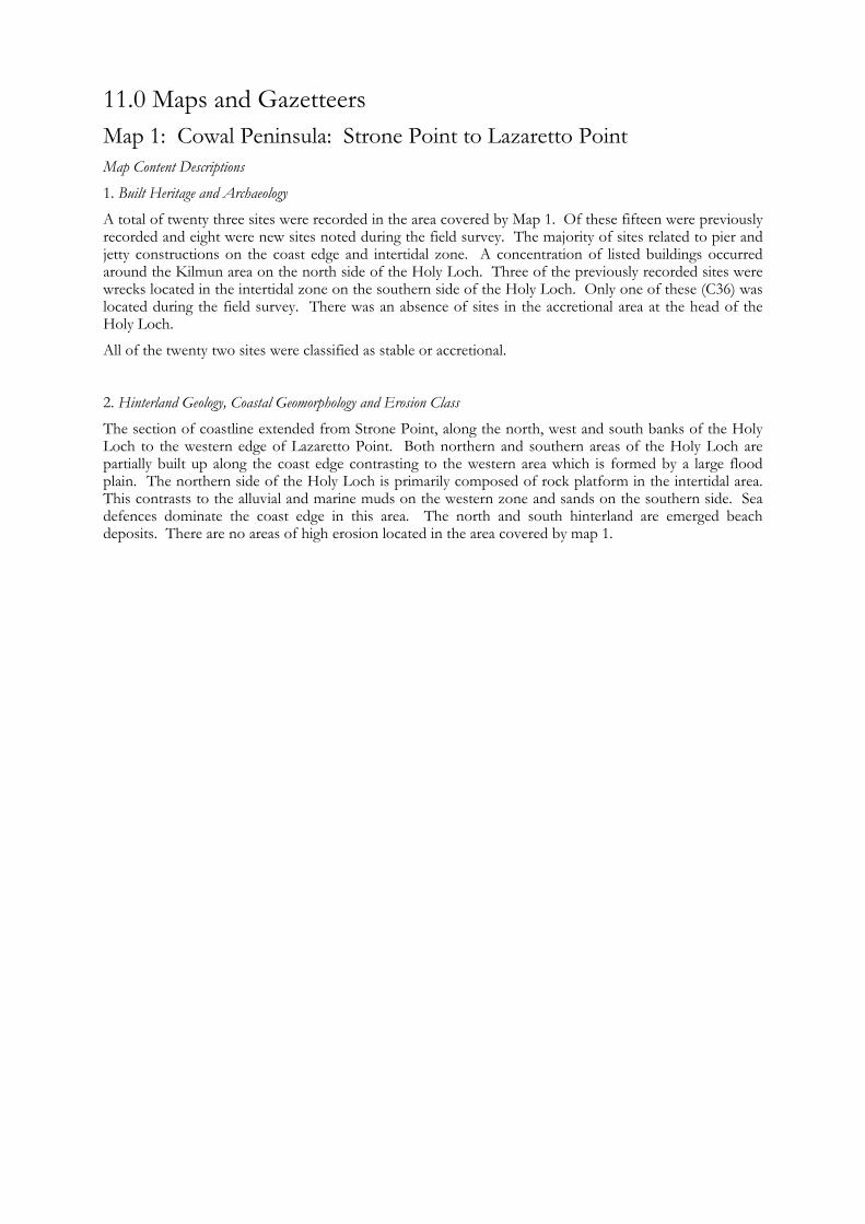
All of the twenty two sites were classified as stable or accretional. 2. Hinterland Geology, Coastal Geomorphology and Erosion Class
The section of coastline extended from Strone Point, along the north, west and south banks of the Holy Loch to the western edge of Lazaretto Point. Both northern and southern areas of the Holy Loch are partially built up along the coast edge contrasting to the western area which is formed by a large flood plain. The northern side of the Holy Loch is primarily composed of rock platform in the intertidal area. This contrasts to the alluvial and marine muds on the western zone and sands on the southern side. Sea defences dominate the coast edge in this area. The north and south hinterland are emerged beach deposits. There are no areas of high erosion located in the area covered by map 1.
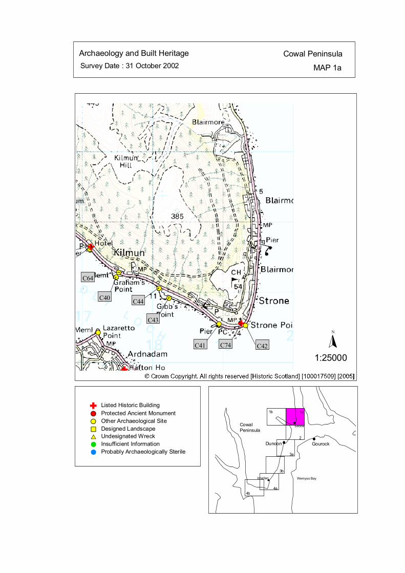
Survey Date : 31 October 2002 MAP 1a
Cowal PeninsulaArchaeology and Built Heritage
Strone
Wemyss Bay
Dunoon Gourock
CowalPeninsula
Innellan
4b4a
2
3a
3b
1a1b
#S
#S
#S
#S
#S
#S
#
C64 #
C40
#
C44#
C43#
C41
#
C42C74
N
1:25000
Listed Historic Building#S Protected Ancient Monument#S Other Archaeological Site%U Designed Landscape$T Undesignated Wreck# Insufficient Information# Probably Archaeologically Sterile
© Crown Copyright. All rights reserved. Licence No. PA01041C. 2003.
Ñ
Ñ
#S
#S
#SÑ##
#
Ñ
kat
horizontal

Map 1a: Built Heritage & Archaeology Gazetteer Site No C40 Grid Ref NS 17487 81214 Site Name Grahams Point Site Type Monument Date 20th cent Condition Good Recommendation Nil Site No C41 Grid Ref NS 18946 80545 Site Name Strone Pier Site Type Pier Date 18th-20th cent Condition Fair Recommendation Monitor Site No C42 Grid Ref NS 19323 80526 Site Name Strone Point Site Type Slipways Date Unknown Condition Fair Recommendation Nil Site No C43 Grid Ref NS 18236 80913 Site Name Gibb’s Point Site Type Jetties Date Unknown Condition Poor Recommendation Nil
Site No C44 Grid Ref NS 18096 81054 Site Name Rhubeg Site Type walkway (remains of) Date Unknown Condition Poor Recommendation Nil Site No C64 Grid Ref NS 17520 81280 Site Name Graham’s Point Site Type Cists Date Unknown Condition Unknown Recommendation Nil Site No C74 Grid Ref NS 19260 80550 Site Name St Columba’s Church Site Type Church Date 18th-20th cent. Condition Good Recommendation Nil
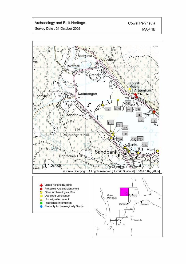
Survey Date : 31 October 2002 MAP 1bCowal PeninsulaArchaeology and Built Heritage
Strone
Wemyss Bay
Dunoon Gourock
CowalPeninsula
Innellan
4b4a
2
3a
3b
1a1b
#S#S
#S
#S#S#S
#S
#S
$T
#S
%U
$T
$T#
C32
#
C33
#
C52
#
C34#
C69
#
C35#
C51
#
C36
#
C37
#
C70
#
C45
C71 C38
C49
C39C50
Listed Historic Building#S Protected Ancient Monument#S Other Archaeological Site%U Designed Landscape$T Undesignated Wreck# Insufficient Information# Probably Archaeologically Sterile
© Crown Copyright. All rights reserved. Licence No. PA01041C. 2003.
1:25000N
Ñ
#S#SÑ
#
#
#
#
#
Ñ
kat
horizontal
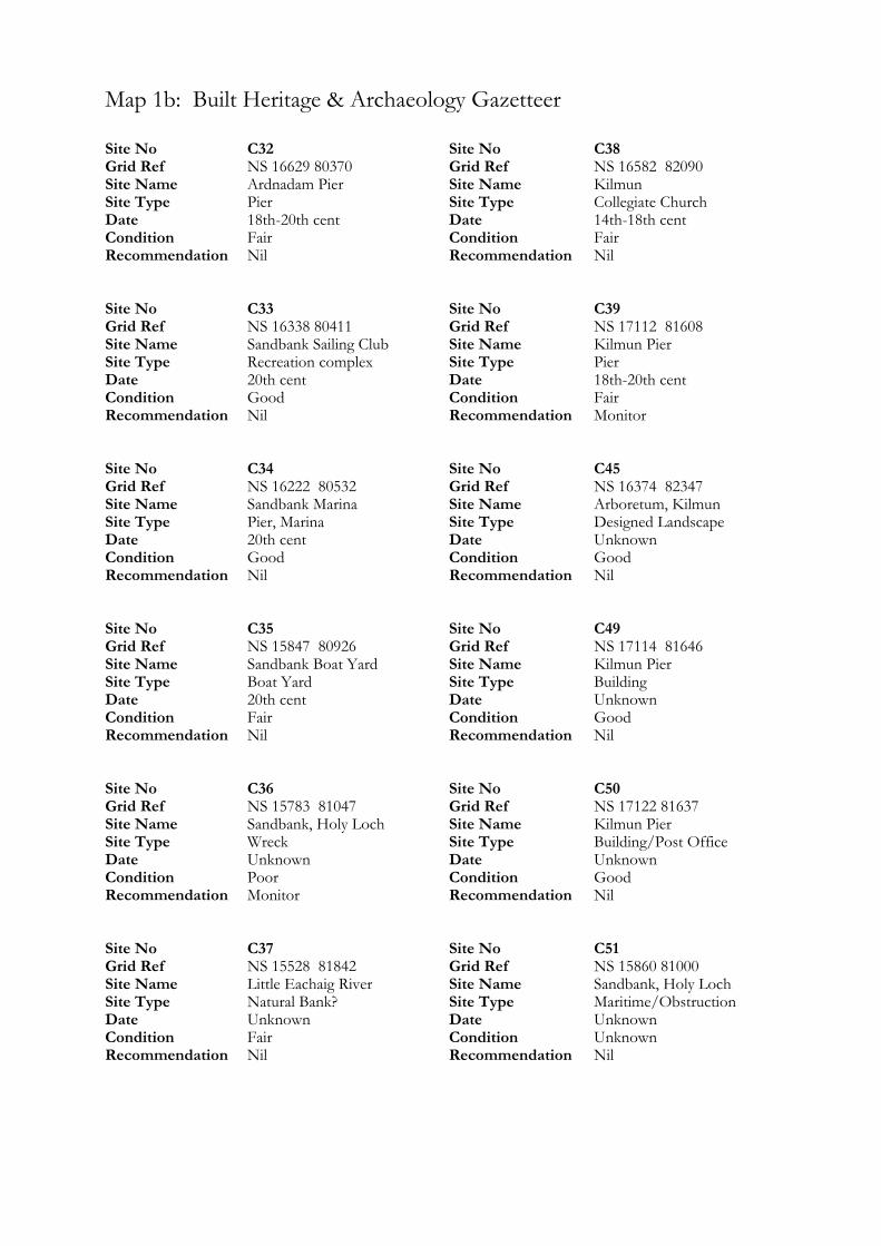
Map 1b: Built Heritage & Archaeology Gazetteer
Site No C32 Grid Ref NS 16629 80370 Site Name Ardnadam Pier Site Type Pier Date 18th-20th cent Condition Fair Recommendation Nil Site No C33 Grid Ref NS 16338 80411 Site Name Sandbank Sailing Club Site Type Recreation complex Date 20th cent Condition Good Recommendation Nil Site No C34 Grid Ref NS 16222 80532 Site Name Sandbank Marina Site Type Pier, Marina Date 20th cent Condition Good Recommendation Nil Site No C35 Grid Ref NS 15847 80926 Site Name Sandbank Boat Yard Site Type Boat Yard Date 20th cent Condition Fair Recommendation Nil Site No C36 Grid Ref NS 15783 81047 Site Name Sandbank, Holy Loch Site Type Wreck Date Unknown Condition Poor Recommendation Monitor Site No C37 Grid Ref NS 15528 81842 Site Name Little Eachaig River Site Type Natural Bank? Date Unknown Condition Fair Recommendation Nil
Site No C38 Grid Ref NS 16582 82090 Site Name Kilmun Site Type Collegiate Church Date 14th-18th cent Condition Fair Recommendation Nil Site No C39 Grid Ref NS 17112 81608 Site Name Kilmun Pier Site Type Pier Date 18th-20th cent Condition Fair Recommendation Monitor Site No C45 Grid Ref NS 16374 82347 Site Name Arboretum, Kilmun Site Type Designed Landscape Date Unknown Condition Good Recommendation Nil Site No C49 Grid Ref NS 17114 81646 Site Name Kilmun Pier Site Type Building Date Unknown Condition Good Recommendation Nil Site No C50 Grid Ref NS 17122 81637 Site Name Kilmun Pier Site Type Building/Post Office Date Unknown Condition Good Recommendation Nil Site No C51 Grid Ref NS 15860 81000 Site Name Sandbank, Holy Loch Site Type Maritime/Obstruction Date Unknown Condition Unknown Recommendation Nil

Site No C52 Grid Ref NS 16300 80500 Site Name Vesta, Sandbank Site Type Maritime/Steamship Date Unknown Condition Unknown Recommendation Nil Site No C69 Grid Ref NS 15800 80830 Site Name Sandbank Site Type Crane Date Unknown Condition Unknown Recommendation Nil
Site No C70 Grid Ref NS 16000 82000 Site Name Kilmun Site Type Burgh Date 14th-18th cent Condition Good Recommendation Nil Site No C71 Grid Ref NS 16540 82170 Site Name Old Kilmun House Site Type Country House Date 14th-18th cent Condition Unknown Recommendation Nil
ÒÒÒÒÒÒÒÒ Ò ÒÒ
# # # # # # # #
# # # # # # # # # # # # # # ######
###############
####
# # ########
# # #
ôó1
ôó2
ôó3
ôó4
ôó5
ôó6
ôó4a
N
1:50000
HINTERLAND GEOLOGY& COASTAL GEOMORPHOLOGY Cowal Peninsula
MAP 1Survey Date : 31 October 2002
4
Innellan
4
Gourock
CowalPeninsula
4
CowalPeninsula
Gourock
G t
Wemyss Bay
3
Dunoon222
Strone
1
© Crown Copyright. All rights reserved. Licence No. PA01041C. 2003.
Low edge <5 m tallCliff >5 m tallMan made barrier# # #Shingle/strom bank' ' 'Human disturbanceÒÒÒÒÒÒÒ
Mainly sandMainly rock platformMainly alluvial/marine mudMarsh
Drift, boulderclayDrift over visible rockRaised beach and marine depositsBlown sandGlacial sand and gravelAlluvium
kat
horizontal
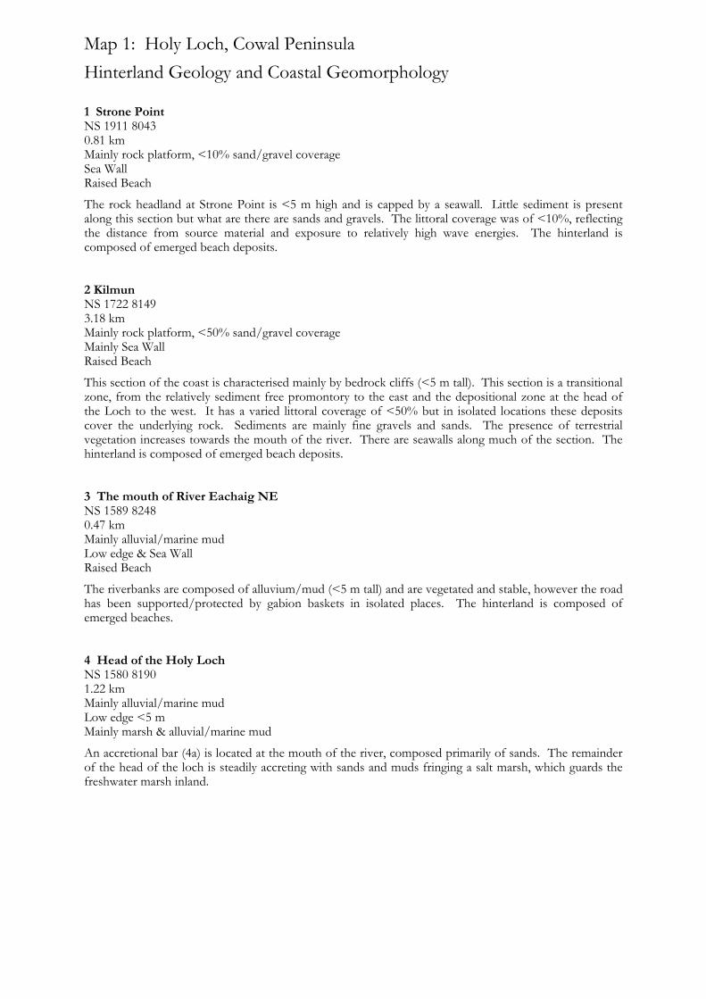
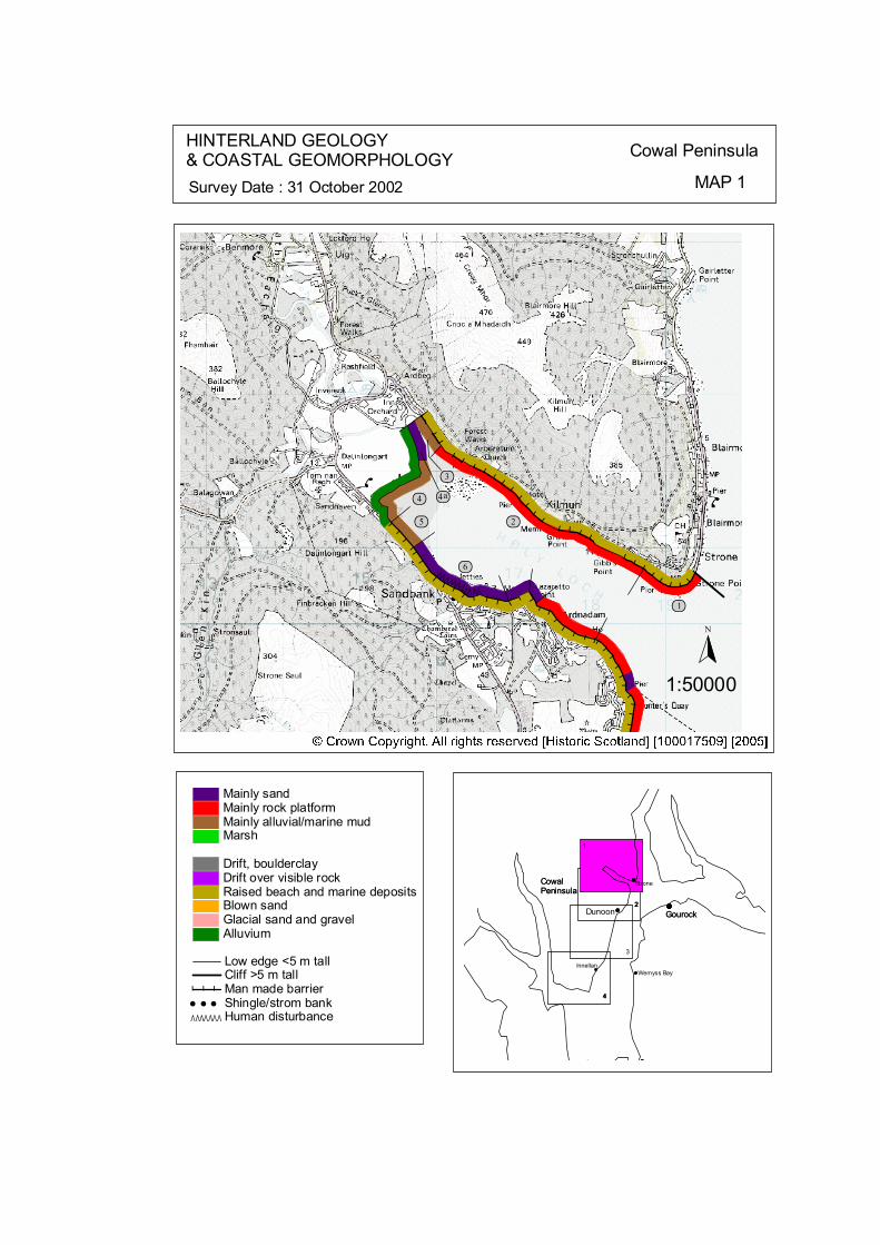
Map 1: Holy Loch, Cowal Peninsula Hinterland Geology and Coastal Geomorphology
1 Strone Point NS 1911 8043 0.81 km Mainly rock platform, <10% sand/gravel coverage Sea Wall Raised Beach
The rock headland at Strone Point is <5 m high and is capped by a seawall. Little sediment is present along this section but what are there are sands and gravels. The littoral coverage was of <10%, reflecting the distance from source material and exposure to relatively high wave energies. The hinterland is composed of emerged beach deposits. 2 Kilmun NS 1722 8149 3.18 km Mainly rock platform, <50% sand/gravel coverage Mainly Sea Wall Raised Beach
This section of the coast is characterised mainly by bedrock cliffs (<5 m tall). This section is a transitional zone, from the relatively sediment free promontory to the east and the depositional zone at the head of the Loch to the west. It has a varied littoral coverage of <50% but in isolated locations these deposits cover the underlying rock. Sediments are mainly fine gravels and sands. The presence of terrestrial vegetation increases towards the mouth of the river. There are seawalls along much of the section. The hinterland is composed of emerged beach deposits. 3 The mouth of River Eachaig NE NS 1589 8248 0.47 km Mainly alluvial/marine mud Low edge & Sea Wall Raised Beach
The riverbanks are composed of alluvium/mud (<5 m tall) and are vegetated and stable, however the road has been supported/protected by gabion baskets in isolated places. The hinterland is composed of emerged beaches. 4 Head of the Holy Loch NS 1580 8190 1.22 km Mainly alluvial/marine mud Low edge <5 m Mainly marsh & alluvial/marine mud
An accretional bar (4a) is located at the mouth of the river, composed primarily of sands. The remainder of the head of the loch is steadily accreting with sands and muds fringing a salt marsh, which guards the freshwater marsh inland.

5 Roadside NS 1559 8118 0.44 km Mainly alluvial muds Low edge & Sea Wall Raised Beach
The coastal strip next to the road (A885) is low (<5 m) vegetated and stable. The intertidal sediments are predominantly composed of alluvium. This coastal strip narrows eastwards until the road is supported/protected with a seawall. The hinterland is low and composed of emerged beach deposits. 6 Boat Yard to Ardnadam Bay NS 1637 8046 1.55 km Mainly sands Sea Walls Reclaimed land & Raised beach
This section of coastline has been significantly modified. Where present the intertidal area is narrow and composed of sands and gravels. Much of the recent development is on reclaimed land and hence is protected with a variety of seawalls, riprap and gabion baskets. The hinterland is composed of raised beach deposits.
ôó1
ôó2
ôó3
ôó4
ôó5
ôó6
ôó4a
N
1:50000
EROSION CLASS Cowal Peninsula
MAP 1Survey Date : 31 October 2002
2
3
1
CowalPeninsula
Gourock
1
3
2Dunoon
Wemyss Bay
StroneCowalPeninsula
GourockDunoon
Wemyss Bay
Strone
44
InnellanInnellan
No Access
Definitely AccretingAccreting and StableStableEroding and StableDefinintely ErodingAccreting and ErodingLand below 10 m
© Crown Copyright. All rights reserved. Licence No. PA01041C. 2003.
kat
horizontal
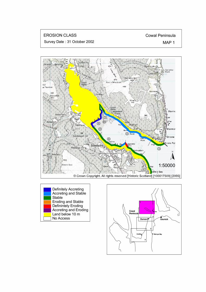
Map 1: Holy Loch, Cowal Peninsula Erosion Class
1 Strone Point NS 1911 8043 0.81 km LT: Erosional - Low ST: Stable - Low
The littoral coverage was of <10%, reflecting the distance from source material and exposure to relatively high wave energies. Currently the cliff and seawall are stable. However on a longer time frame the cliff is an erosional feature, with low erosion rates. 2 Kilmun NS 1722 8149 3.18 km LT: Erosional - Low ST: Stable/Accretional - Low
This section of the coast is characterised mainly by bedrock cliffs. It is a transitional zone, from the relatively sediment free promontory to the east and the depositional zone at the head of the Loch to the west. The presence of terrestrial vegetation increases towards the mouth of the river. This section is currently stable with pockets of limited accretion. There are seawalls along much of the section. 3 The mouth of River Eachaig NE NS 1589 8248 0.47 km LT: Stable - Low ST: Stable - Low
The riverbanks are vegetated and stable, however the road has been supported/protected by gabion baskets in isolated places. 4 Head of the Holy Loch NS 1580 8190 1.22 km LT: Stable - Low ST: Accreting - Medium
An accretional bar (4a) is located at the mouth of the river. The remainder of the head of the loch is steadily accreting with sands and muds. This depositional zone benefits from low wave energy and a positive sediment supply from the River Eachaig. 5 Roadside NS 1559 8118 0.44 km LT: Stable - Low ST: Stable - Low
The coastal strip next to the road (A885) is vegetated and stable. This coastal strip narrows eastwards until the road is supported/protected with a seawall.
.

6 Boat Yard to Ardnadam Bay NS 1637 8046 1.55 km LT: Stable - Low ST: Stable - Low
Much of the recent development is on reclaimed land and hence is protected with a variety of seawalls, riprap and gabion baskets. This section is currently stable.
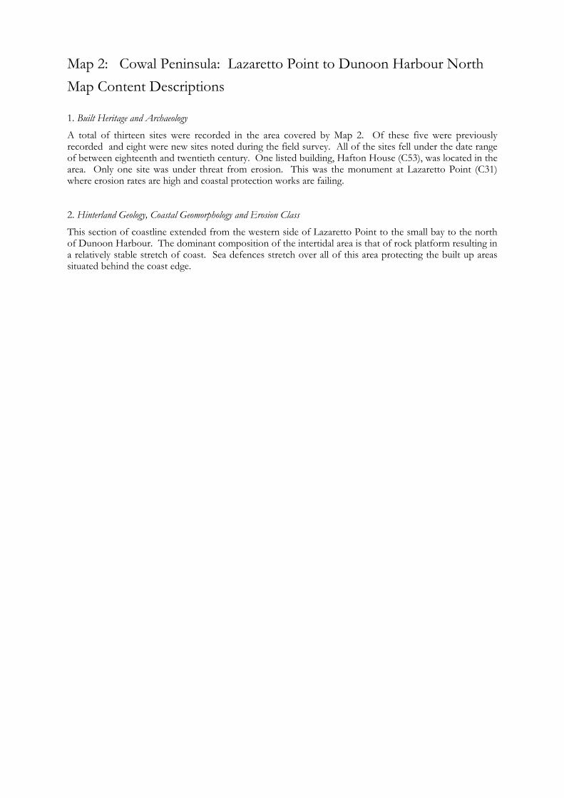
Map 2: Cowal Peninsula: Lazaretto Point to Dunoon Harbour North Map Content Descriptions
1. Built Heritage and Archaeology
A total of thirteen sites were recorded in the area covered by Map 2. Of these five were previously recorded and eight were new sites noted during the field survey. All of the sites fell under the date range of between eighteenth and twentieth century. One listed building, Hafton House (C53), was located in the area. Only one site was under threat from erosion. This was the monument at Lazaretto Point (C31) where erosion rates are high and coastal protection works are failing. 2. Hinterland Geology, Coastal Geomorphology and Erosion Class
This section of coastline extended from the western side of Lazaretto Point to the small bay to the north of Dunoon Harbour. The dominant composition of the intertidal area is that of rock platform resulting in a relatively stable stretch of coast. Sea defences stretch over all of this area protecting the built up areas situated behind the coast edge.
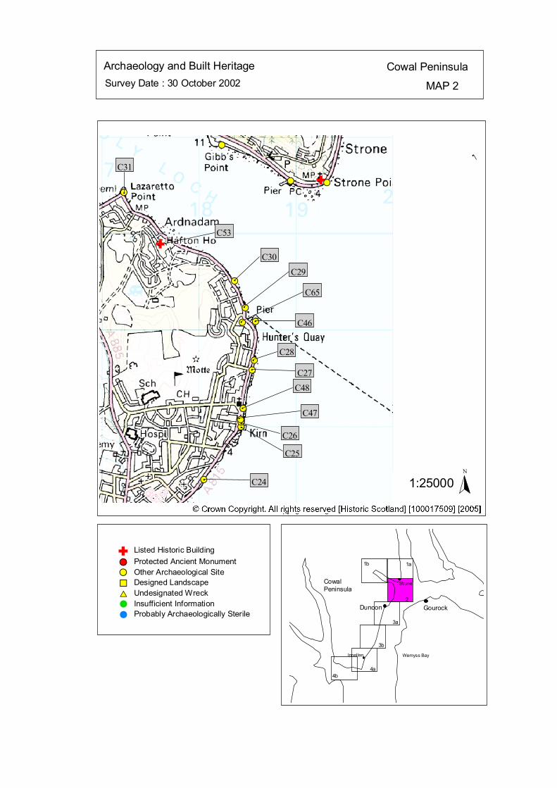
Survey Date : 30 October 2002 MAP 2
Cowal PeninsulaArchaeology and Built Heritage
Strone
Wemyss Bay
Dunoon Gourock
CowalPeninsula
Innellan
4b4a
2
3a
3b
1a1b
#S
#S
#S#S
#S#S
#S
#S
#S#S
#S
#S
#S#S
# C24
#
C25
#
C47#
C26
#
C48
# C27#
C28
# C46#
C65#
C29#
C30
C53
#
C31#
Listed Historic Building#S Protected Ancient Monument#S Other Archaeological Site%U Designed Landscape$T Undesignated Wreck# Insufficient Information# Probably Archaeologically Sterile
© Crown Copyright. All rights reserved. Licence No. PA01041C. 2003.
1:25000N
Ñ
Ñ
#S
#
Ñ
kat
horizontal
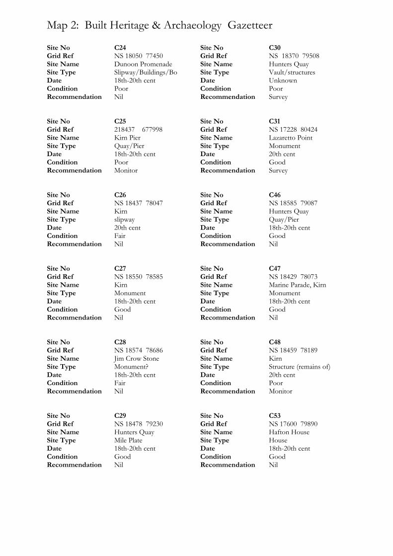
Map 2: Built Heritage & Archaeology Gazetteer
Site No C24 Grid Ref NS 18050 77450 Site Name Dunoon Promenade Site Type Slipway/Buildings/Bo Date 18th-20th cent Condition Poor Recommendation Nil Site No C25 Grid Ref 218437 677998 Site Name Kirn Pier Site Type Quay/Pier Date 18th-20th cent Condition Poor Recommendation Monitor Site No C26 Grid Ref NS 18437 78047 Site Name Kirn Site Type slipway Date 20th cent Condition Fair Recommendation Nil Site No C27 Grid Ref NS 18550 78585 Site Name Kirn Site Type Monument Date 18th-20th cent Condition Good Recommendation Nil Site No C28 Grid Ref NS 18574 78686 Site Name Jim Crow Stone Site Type Monument? Date 18th-20th cent Condition Fair Recommendation Nil Site No C29 Grid Ref NS 18478 79230 Site Name Hunters Quay Site Type Mile Plate Date 18th-20th cent Condition Good Recommendation Nil
Site No C30 Grid Ref NS 18370 79508 Site Name Hunters Quay Site Type Vault/structures Date Unknown Condition Poor Recommendation Survey Site No C31 Grid Ref NS 17228 80424 Site Name Lazaretto Point Site Type Monument Date 20th cent Condition Good Recommendation Survey Site No C46 Grid Ref NS 18585 79087 Site Name Hunters Quay Site Type Quay/Pier Date 18th-20th cent Condition Good Recommendation Nil Site No C47 Grid Ref NS 18429 78073 Site Name Marine Parade, Kirn Site Type Monument Date 18th-20th cent Condition Good Recommendation Nil Site No C48 Grid Ref NS 18459 78189 Site Name Kirn Site Type Structure (remains of) Date 20th cent Condition Poor Recommendation Monitor Site No C53 Grid Ref NS 17600 79890 Site Name Hafton House Site Type House Date 18th-20th cent Condition Good Recommendation Nil

Site No C65 Grid Ref NS 18450 79080 Site Name Hunter’s Quay Site Type Club House Date 18th-20th cent Condition Fair Recommendation Nil
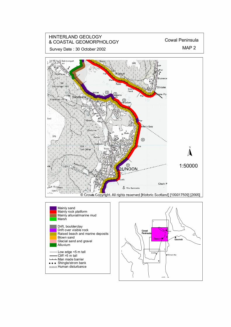
ÒÒÒÒÒÒÒÒÒÒ
ÒÒÒÒÒÒÒÒ ÒÒÒ
# # # # # # # #
# # # # # # # # # # # # # # #
#####
###############
####
# # # ## # ## # ## # #
#######
## ## # # # # #
#### # # #
# #
ôó2
ôó3
ôó4
ôó5
ôó1
N
1:50000
HINTERLAND GEOLOGY& COASTAL GEOMORPHOLOGY Cowal Peninsula
MAP 2Survey Date : 30 October 2002
4
Innellan
4
Gourock
CowalPeninsula
4
CowalPeninsula
Gourock
G t
Wemyss Bay
3
Dunoon222
Strone
1
© Crown Copyright. All rights reserved. Licence No. PA01041C. 2003.
Low edge <5 m tallCliff >5 m tallMan made barrier# # #Shingle/strom bank' ' 'Human disturbanceÒÒÒÒÒÒÒ
Mainly sandMainly rock platformMainly alluvial/marine mudMarsh
Drift, boulderclayDrift over visible rockRaised beach and marine depositsBlown sandGlacial sand and gravelAlluvium
kat
horizontal
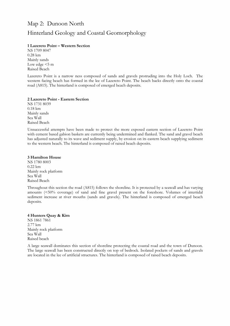
Map 2: Dunoon North Hinterland Geology and Coastal Geomorphology
1 Lazereto Point – Western Section NS 1709 8047 0.28 km Mainly sands Low edge <5 m Raised Beach
Lazereto Point is a narrow ness composed of sands and gravels protruding into the Holy Loch. The western facing beach has formed in the lee of Lazereto Point. The beach backs directly onto the coastal road (A815). The hinterland is composed of emerged beach deposits. 2 Lazereto Point - Eastern Section NS 1731 8039 0.18 km Mainly sands Sea Wall Raised Beach
Unsuccessful attempts have been made to protect the more exposed eastern section of Lazereto Point with cement based gabion baskets are currently being undermined and flanked. The sand and gravel beach has adjusted naturally to its wave and sediment supply, by erosion on its eastern beach supplying sediment to the western beach. The hinterland is composed of raised beach deposits. 3 Hamilton House NS 1780 8003 0.22 km Mainly rock platform Sea Wall Raised Beach
Throughout this section the road (A815) follows the shoreline. It is protected by a seawall and has varying amounts (<50% coverage) of sand and fine gravel present on the foreshore. Volumes of intertidal sediment increase at river mouths (sands and gravels). The hinterland is composed of emerged beach deposits. 4 Hunters Quay & Kirn NS 1861 7861 2.77 km Mainly rock platform Sea Wall Raised beach
A large seawall dominates this section of shoreline protecting the coastal road and the town of Dunoon. The large seawall has been constructed directly on top of bedrock. Isolated pockets of sands and gravels are located in the lee of artificial structures. The hinterland is composed of raised beach deposits.

5 Dunoon Harbour North NS 1771 7711 0.85 km Mainly sands Sea Wall Raised beach
Sands and gravels have collected in the lee of Dunoon harbour. The large seawall backs these intertidal sediments and continues to the jetty. The hinterland is composed of emerged beach deposits.
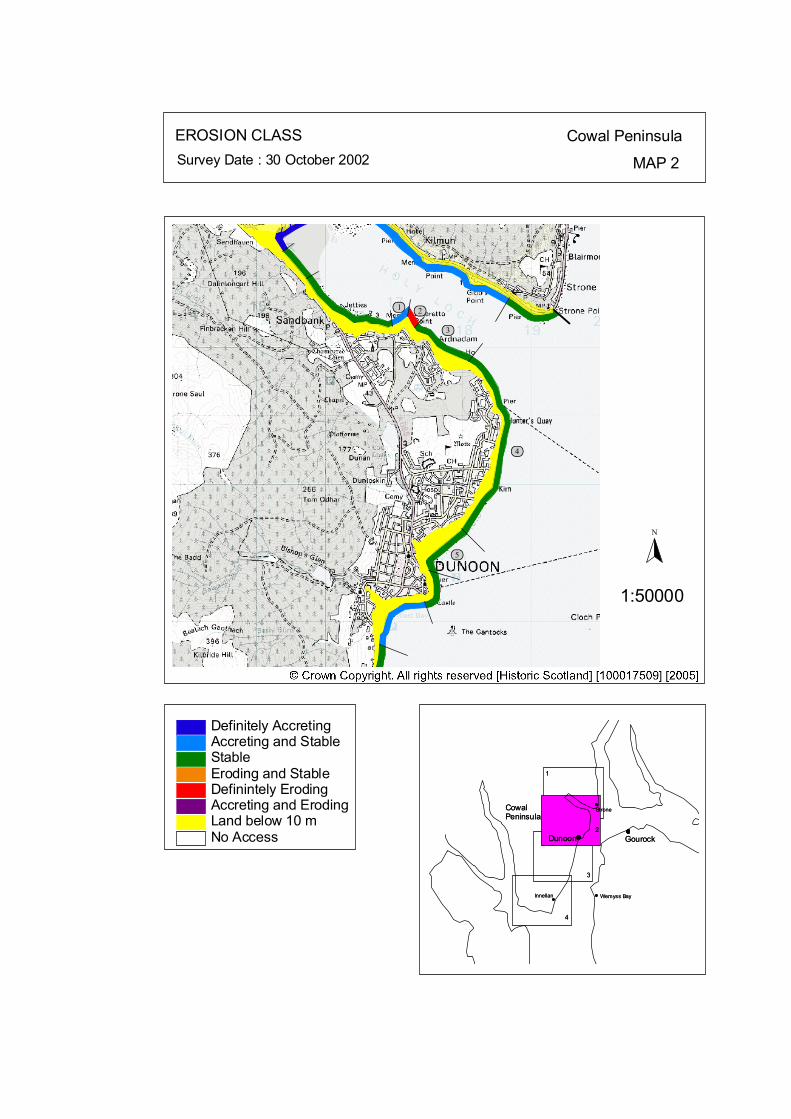
ôó2ôó1
ôó3
ôó4
ôó5
N
1:50000
EROSION CLASS Cowal Peninsula
MAP 2Survey Date : 30 October 2002
2
3
1
CowalPeninsula
Gourock
1
3
2Dunoon
Wemyss Bay
StroneCowalPeninsula
GourockDunoon
Wemyss Bay
Strone
44
InnellanInnellan
No Access
Definitely AccretingAccreting and StableStableEroding and StableDefinintely ErodingAccreting and ErodingLand below 10 m
© Crown Copyright. All rights reserved. Licence No. PA01041C. 2003.
kat
horizontal
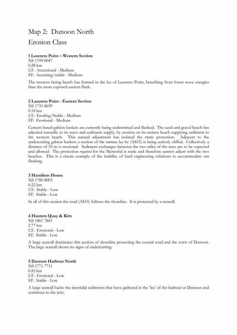
Map 2: Dunoon North Erosion Class
1 Lazereto Point – Western Section NS 1709 8047 0.28 km LT: Accretional - Medium ST: Accreting/stable - Medium
The western facing beach has formed in the lee of Lazereto Point, benefiting from lower wave energies than the more exposed eastern flank. 2 Lazereto Point - Eastern Section NS 1731 8039 0.18 km LT: Eroding/Stable - Medium ST: Erosional - Medium
Cement based gabion baskets are currently being undermined and flanked. The sand and gravel beach has adjusted naturally to its wave and sediment supply, by erosion on its eastern beach supplying sediment to the western beach. This natural adjustment has isolated the static protection. Adjacent to the undercutting gabion baskets a section of the tarmac lay-by (A815) is being actively cliffed. Collectively a distance of 35 m is erosional. Sediment exchanges between the two sides of the ness are to be expected and allowed. The protection required for the Memorial is static and therefore cannot adjust with the two beaches. This is a classic example of the inability of hard engineering solutions to accommodate out flanking. 3 Hamilton House NS 1780 8003 0.22 km LT: Stable - Low ST: Stable - Low
In all of this section the road (A815) follows the shoreline. It is protected by a seawall. 4 Hunters Quay & Kirn NS 1861 7861 2.77 km LT: Erosional - Low ST: Stable - Low
A large seawall dominates this section of shoreline protecting the coastal road and the town of Dunoon. The large seawall shows no signs of undercutting. 5 Dunoon Harbour North NS 1771 7711 0.85 km LT: Erosional - Low ST: Stable - Low
A large seawall backs the intertidal sediments that have gathered in the ‘lee’ of the harbour at Dunoon and continues to the jetty.
Map 3: Cowal Peninsula: Dunoon Harbour North to Cluniter Map Content Descriptions
1. Built Heritage and Archaeology
A total of fourteen sites were recorded in the area covered by Map 3. Of these ten were previously recorded and four were new sites noted during the field survey. The sites were concentrated around Dunoon where two listed buildings and two scheduled monuments were situated. These were Dunoon Castle and Coastal Battery (C18 & 63), Dunoon Pier (C20) and East Bay Quay and related building (C21). Eleven sites were situated around Dunoon at the northern end of Map 3 with only three other sites being located on the long stretch of coastline to the south of Dunoon. None of the sites were under threat from coastal erosional processes. 2. Hinterland Geology, Coastal Geomorphology and Erosion Class
The section of coastline extended from Dunoon Harbour in the north to Cluniter in the south. This is a relatively straight section of coastline. The area around Dunoon has been heavily modified by shore defences and Harbour/Pier constructions. The intertidal area to the south alternates between stretches of rock platform and sand deposits. Sea wall stretches along the majority of the coastline covered by Map 3. There were no areas subject to active erosion with the coastline being stable or accretional/stable.
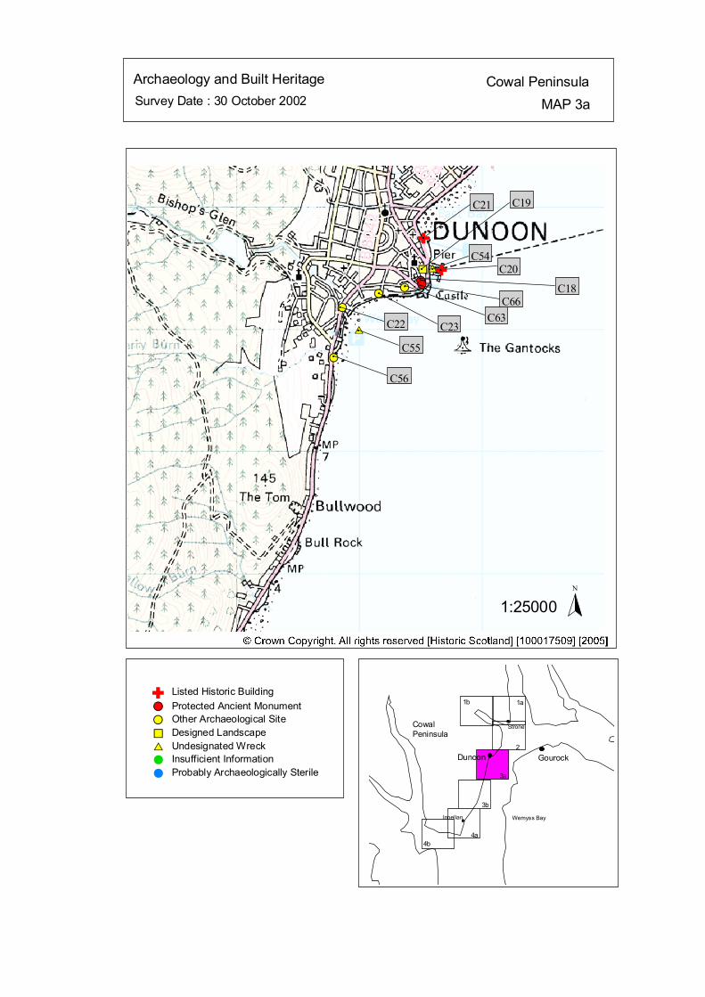
Survey Date : 30 October 2002 MAP 3aCowal PeninsulaArchaeology and Built Heritage
Strone
Wemyss Bay
Dunoon Gourock
CowalPeninsula
Innellan
4b4a
2
3a
3b
1a1b
#S#S #S
%U
#S#S
$T
$T
#S#
C56
#
C55
#
C22
#
C23
#
C63
#
C66
C20#
C18
#
C54#
C19C21
Listed Historic Building#S Protected Ancient Monument#S Other Archaeological Site%U Designed Landscape$T Undesignated Wreck# Insufficient Information# Probably Archaeologically Sterile
© Crown Copyright. All rights reserved. Licence No. PA01041C. 2003.
1:25000N
Ñ
Ñ
#
#
Ñ
kat
horizontal
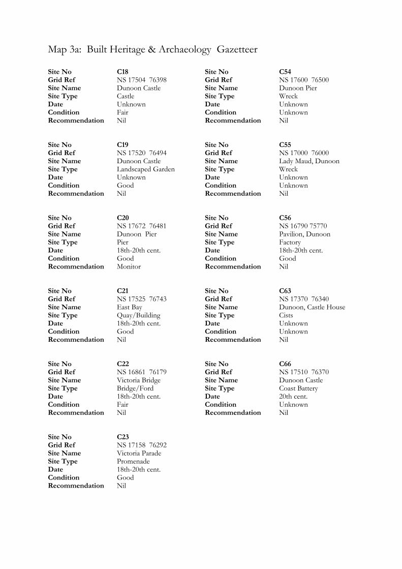
Map 3a: Built Heritage & Archaeology Gazetteer
Site No C18 Grid Ref NS 17504 76398 Site Name Dunoon Castle Site Type Castle Date Unknown Condition Fair Recommendation Nil Site No C19 Grid Ref NS 17520 76494 Site Name Dunoon Castle Site Type Landscaped Garden Date Unknown Condition Good Recommendation Nil Site No C20 Grid Ref NS 17672 76481 Site Name Dunoon Pier Site Type Pier Date 18th-20th cent. Condition Good Recommendation Monitor Site No C21 Grid Ref NS 17525 76743 Site Name East Bay Site Type Quay/Building Date 18th-20th cent. Condition Good Recommendation Nil Site No C22 Grid Ref NS 16861 76179 Site Name Victoria Bridge Site Type Bridge/Ford Date 18th-20th cent. Condition Fair Recommendation Nil Site No C23 Grid Ref NS 17158 76292 Site Name Victoria Parade Site Type Promenade Date 18th-20th cent. Condition Good Recommendation Nil
Site No C54 Grid Ref NS 17600 76500 Site Name Dunoon Pier Site Type Wreck Date Unknown Condition Unknown Recommendation Nil Site No C55 Grid Ref NS 17000 76000 Site Name Lady Maud, Dunoon Site Type Wreck Date Unknown Condition Unknown Recommendation Nil Site No C56 Grid Ref NS 16790 75770 Site Name Pavilion, Dunoon Site Type Factory Date 18th-20th cent. Condition Good Recommendation Nil Site No C63 Grid Ref NS 17370 76340 Site Name Dunoon, Castle House Site Type Cists Date Unknown Condition Unknown Recommendation Nil Site No C66 Grid Ref NS 17510 76370 Site Name Dunoon Castle Site Type Coast Battery Date 20th cent. Condition Unknown Recommendation Nil
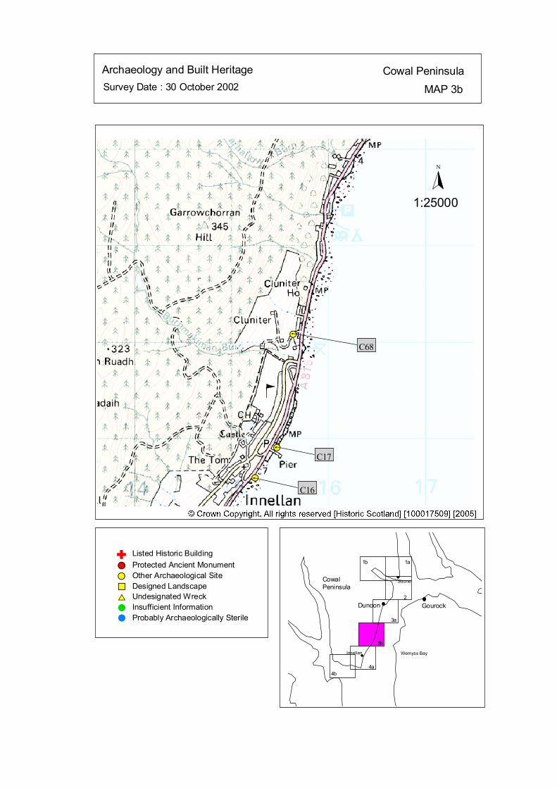
Survey Date : 30 October 2002 MAP 3bCowal PeninsulaArchaeology and Built Heritage
Strone
Wemyss Bay
Dunoon Gourock
CowalPeninsula
Innellan
4b4a
2
3a
3b
1a1b
#S
#S
#S#
C16
#
C17
#
C68
Listed Historic Building#S Protected Ancient Monument#S Other Archaeological Site%U Designed Landscape$T Undesignated Wreck# Insufficient Information# Probably Archaeologically Sterile
© Crown Copyright. All rights reserved. Licence No. PA01041C. 2003.
1:25000
N
Ñ
kat
horizontal
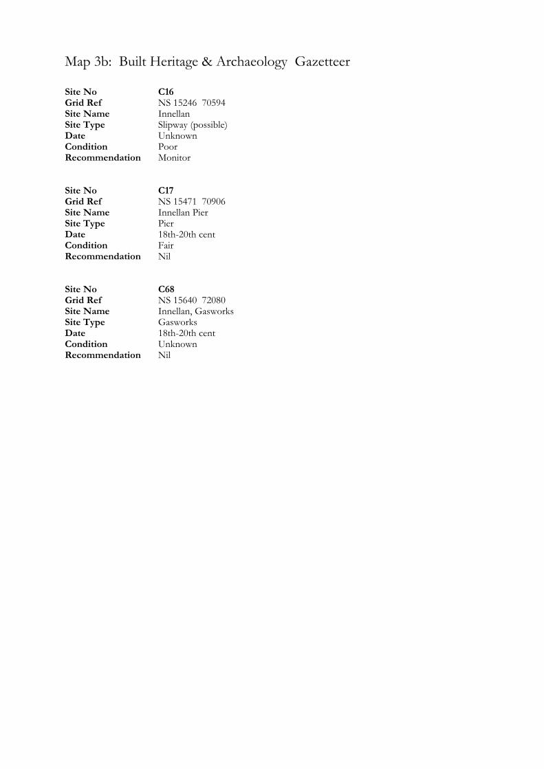
Map 3b: Built Heritage & Archaeology Gazetteer
Site No C16 Grid Ref NS 15246 70594 Site Name Innellan Site Type Slipway (possible) Date Unknown Condition Poor Recommendation Monitor Site No C17 Grid Ref NS 15471 70906 Site Name Innellan Pier Site Type Pier Date 18th-20th cent Condition Fair Recommendation Nil Site No C68 Grid Ref NS 15640 72080 Site Name Innellan, Gasworks Site Type Gasworks Date 18th-20th cent Condition Unknown Recommendation Nil
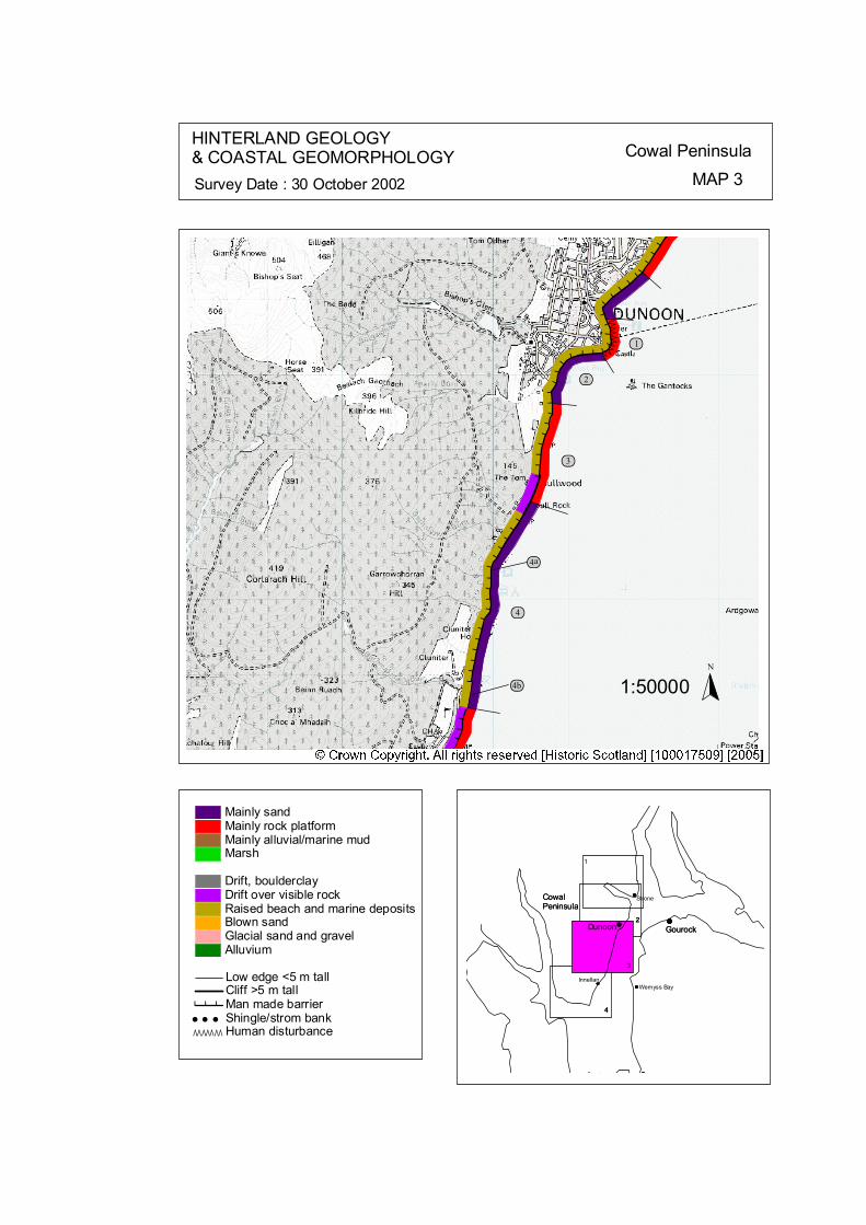
ÒÒÒÒÒÒÒÒÒÒ
# # # ##
# # ## # ##### # # #
# # # ##### #
# # #
# # ## # ## # ## ### # # ##
# # #
ôó1
ôó2
ôó3
ôó4
ôó4a
ôó4b
N
1:50000
HINTERLAND GEOLOGY& COASTAL GEOMORPHOLOGY Cowal Peninsula
MAP 3Survey Date : 30 October 2002
4
Innellan
4
Gourock
CowalPeninsula
4
CowalPeninsula
Gourock
G t
Wemyss Bay
3
Dunoon222
Strone
1
© Crown Copyright. All rights reserved. Licence No. PA01041C. 2003.
Low edge <5 m tallCliff >5 m tallMan made barrier# # #Shingle/strom bank' ' 'Human disturbanceÒÒÒÒÒÒÒ
Mainly sandMainly rock platformMainly alluvial/marine mudMarsh
Drift, boulderclayDrift over visible rockRaised beach and marine depositsBlown sandGlacial sand and gravelAlluvium
kat
horizontal
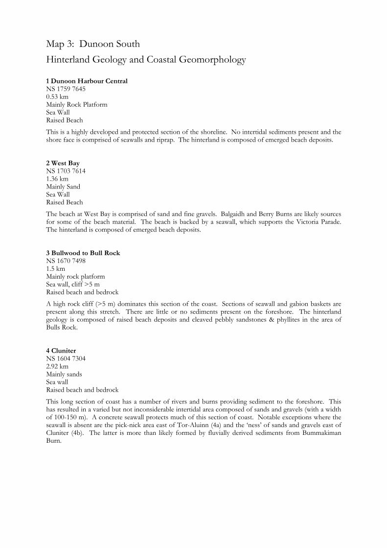
Map 3: Dunoon South Hinterland Geology and Coastal Geomorphology
1 Dunoon Harbour Central NS 1759 7645 0.53 km Mainly Rock Platform Sea Wall Raised Beach
This is a highly developed and protected section of the shoreline. No intertidal sediments present and the shore face is comprised of seawalls and riprap. The hinterland is composed of emerged beach deposits. 2 West Bay NS 1703 7614 1.36 km Mainly Sand Sea Wall Raised Beach
The beach at West Bay is comprised of sand and fine gravels. Balgaidh and Berry Burns are likely sources for some of the beach material. The beach is backed by a seawall, which supports the Victoria Parade. The hinterland is composed of emerged beach deposits. 3 Bullwood to Bull Rock NS 1670 7498 1.5 km Mainly rock platform Sea wall, cliff >5 m Raised beach and bedrock
A high rock cliff (>5 m) dominates this section of the coast. Sections of seawall and gabion baskets are present along this stretch. There are little or no sediments present on the foreshore. The hinterland geology is composed of raised beach deposits and cleaved pebbly sandstones & phyllites in the area of Bulls Rock. 4 Cluniter NS 1604 7304 2.92 km Mainly sands Sea wall Raised beach and bedrock
This long section of coast has a number of rivers and burns providing sediment to the foreshore. This has resulted in a varied but not inconsiderable intertidal area composed of sands and gravels (with a width of 100-150 m). A concrete seawall protects much of this section of coast. Notable exceptions where the seawall is absent are the pick-nick area east of Tor-Aluinn (4a) and the ‘ness’ of sands and gravels east of Cluniter (4b). The latter is more than likely formed by fluvially derived sediments from Bummakiman Burn.
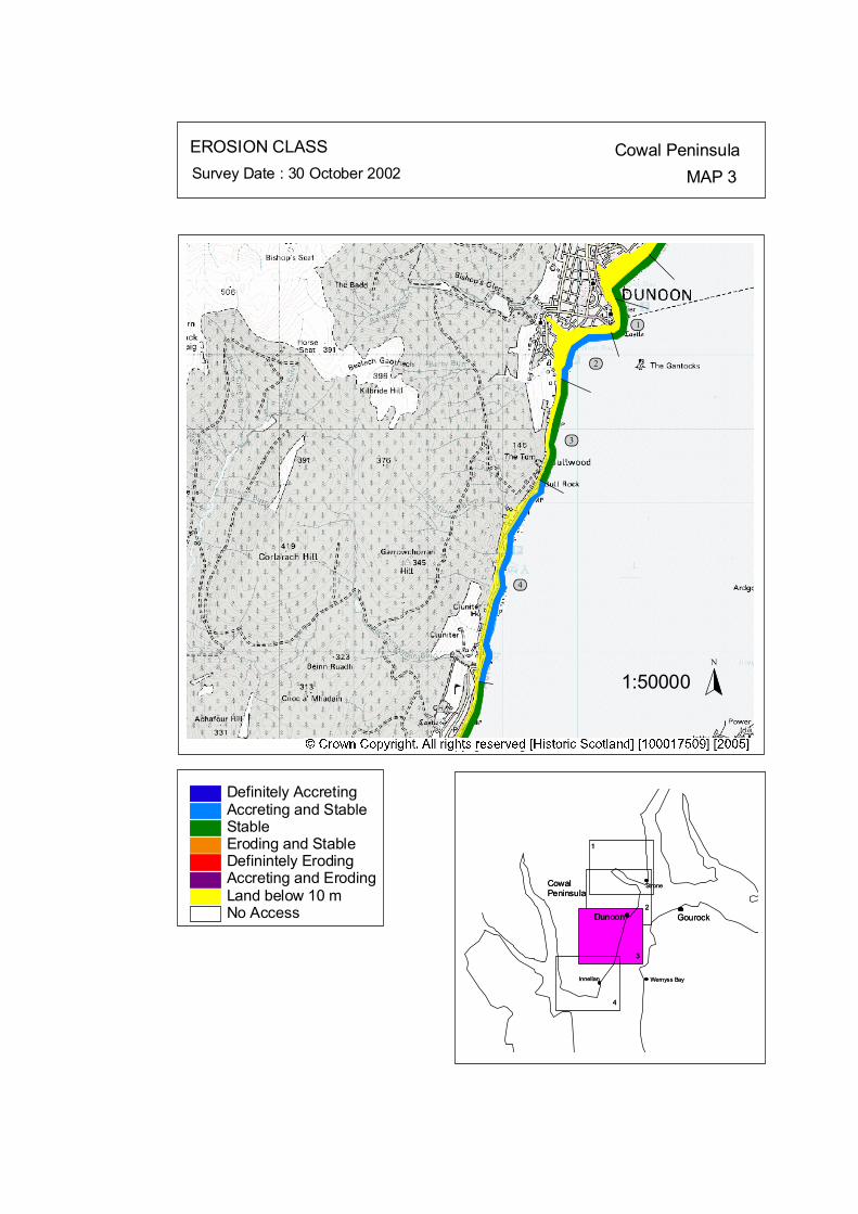
ôó1
ôó2
ôó3
ôó4
N
1:50000
EROSION CLASS Cowal PeninsulaMAP 3Survey Date : 30 October 2002
2
3
1
CowalPeninsula
Gourock
1
3
2Dunoon
Wemyss Bay
StroneCowalPeninsula
GourockDunoon
Wemyss Bay
Strone
44
InnellanInnellan
No Access
Definitely AccretingAccreting and StableStableEroding and StableDefinintely ErodingAccreting and ErodingLand below 10 m
© Crown Copyright. All rights reserved. Licence No. PA01041C. 2003.
kat
horizontal
Map 3: Dunoon South Erosion Class
1 Dunoon Harbour Central NS 1759 7645 0.53 km LT: Erosional - Low ST: Stable - Low
This is a highly developed and protected section of the shoreline. Seawalls and riprap show no signs of undercutting hence this section was classified as stable. 2 West Bay NS 1703 7614 1.36 km LT: Stable - Low ST: Stable/Accreting - Low
Balgaidh and Berry Burns are likely sources for some of the accreting beach material. The beach is backed by a seawall. This section of the coast may supply sediment to the sediments at ‘Dunoon North’. 3 Bullwood to Bull Rock NS 1670 7498 1.5 km LT: Erosional - Low ST: Stable - Low
Sections of seawall and gabion baskets are present along this stretch. There are little or no sediments present on the foreshore. 4 Cluniter NS 1604 7304 2.92 km LT: Erosional - Low ST: Stable/Accreting - Low
This section of coast has a number of rivers and burns providing sediment to the foreshore. A concrete seawall protects much of this section of coast.

Map 4: Cowal Peninsula: Cluniter to Ardyne Point Map Content Descriptions
1. Built Heritage and Archaeology
A total of twenty four sites were recorded in the area covered by Map 4. Of these six were previously recorded and eighteen were new sites noted during the field survey. Sites located on the eastern facing coastline were dominated by piers, jetties and boulder alignments located in the intertidal zone. Toward Point lighthouse and related structures form a complex of listed buildings at Toward Point. The southern facing coastline contrasts with the eastern facing coast in that the hinterland and coast edge of the former is less built up and the sites here relate to the hinterland area rather than the coast edge. The disused Lime Kiln (C05) is situated on a promontory and may be under threat from coastal processes due to it’s close proximity to the high tide mark. 2. Hinterland Geology, Coastal Geomorphology and Erosion Class
This section of coastline extended from Innellan on the eastern facing shore round Toward Point and along to Ardyne Point at the south western tip of the Cowal Peninsula. A mixture of sand deposits and rock platform shape the intertidal area of both the eastern and southern coasts. Sea wall defences are much more prominent on the eastern coast compared to the southern due to the majority of built up areas being located in this area. The majority of the coastline covered by Map 4 was categorised as erosional and stable. Only one small section of actively eroding coast was present south of Toward Farm and did not threaten any visible archaeological remains. The disused oil rig yard at Ardyne Point has heavily modified the natural coastline.
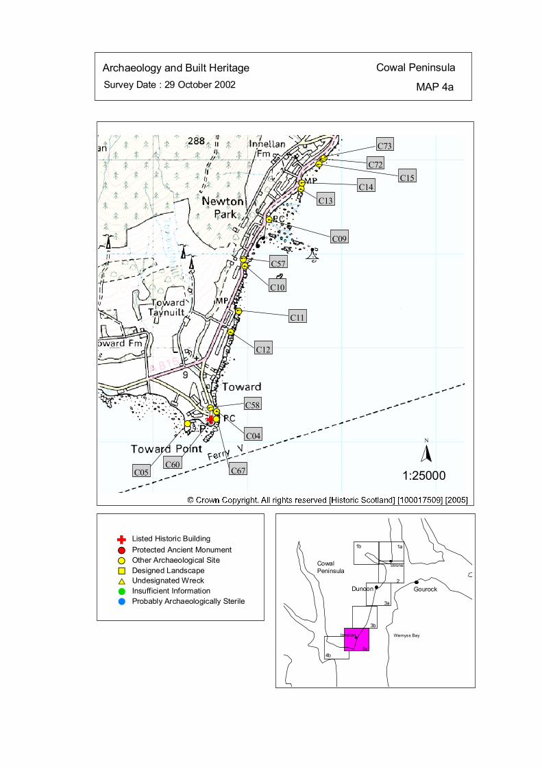
Survey Date : 29 October 2002 MAP 4a
Cowal PeninsulaArchaeology and Built Heritage
Strone
Wemyss Bay
Dunoon Gourock
CowalPeninsula
Innellan
4b4a
2
3a
3b
1a1b
#S#S
#S
#S
#S
#S
#S
#S
#S
#S
#S
#S
#S
#
C05C60
#
C67
#
C04
# C58
#
C12
#
C11
#
C10
#
C57
#
C09
#
C13
#
C14
#
C15
#
C72#
C73
Listed Historic Building#S Protected Ancient Monument#S Other Archaeological Site%U Designed Landscape$T Undesignated Wreck# Insufficient Information# Probably Archaeologically Sterile
© Crown Copyright. All rights reserved. Licence No. PA01041C. 2003.
1:25000
N
Ñ#S#
Ñ
kat
horizontal
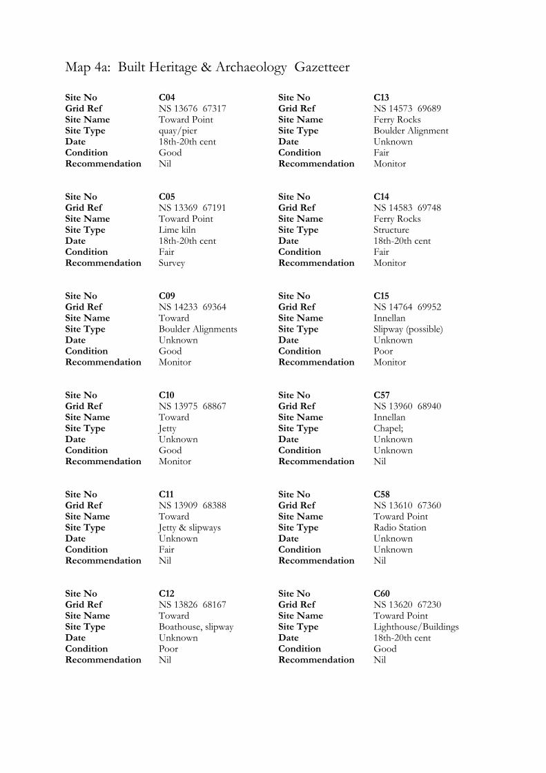
Map 4a: Built Heritage & Archaeology Gazetteer
Site No C04 Grid Ref NS 13676 67317 Site Name Toward Point Site Type quay/pier Date 18th-20th cent Condition Good Recommendation Nil Site No C05 Grid Ref NS 13369 67191 Site Name Toward Point Site Type Lime kiln Date 18th-20th cent Condition Fair Recommendation Survey Site No C09 Grid Ref NS 14233 69364 Site Name Toward Site Type Boulder Alignments Date Unknown Condition Good Recommendation Monitor Site No C10 Grid Ref NS 13975 68867 Site Name Toward Site Type Jetty Date Unknown Condition Good Recommendation Monitor Site No C11 Grid Ref NS 13909 68388 Site Name Toward Site Type Jetty & slipways Date Unknown Condition Fair Recommendation Nil Site No C12 Grid Ref NS 13826 68167 Site Name Toward Site Type Boathouse, slipway Date Unknown Condition Poor Recommendation Nil
Site No C13 Grid Ref NS 14573 69689 Site Name Ferry Rocks Site Type Boulder Alignment Date Unknown Condition Fair Recommendation Monitor Site No C14 Grid Ref NS 14583 69748 Site Name Ferry Rocks Site Type Structure Date 18th-20th cent Condition Fair Recommendation Monitor Site No C15 Grid Ref NS 14764 69952 Site Name Innellan Site Type Slipway (possible) Date Unknown Condition Poor Recommendation Monitor Site No C57 Grid Ref NS 13960 68940 Site Name Innellan Site Type Chapel; Date Unknown Condition Unknown Recommendation Nil Site No C58 Grid Ref NS 13610 67360 Site Name Toward Point Site Type Radio Station Date Unknown Condition Unknown Recommendation Nil Site No C60 Grid Ref NS 13620 67230 Site Name Toward Point Site Type Lighthouse/Buildings Date 18th-20th cent Condition Good Recommendation Nil

Site No C67 Grid Ref NS 13672 67239 Site Name Toward Point Site Type Jetty Date Unknown Condition Poor Recommendation Monitor Site No C72 Grid Ref NS 14796 70006 Site Name Innellan Site Type Boulder alignment Date Unknown Condition Poor Recommendation Monitor
Site No C73 Grid Ref NS 14817 70016 Site Name Innellan Site Type Slipway (possible) Date Unknown Condition Poor Recommendation Monitor
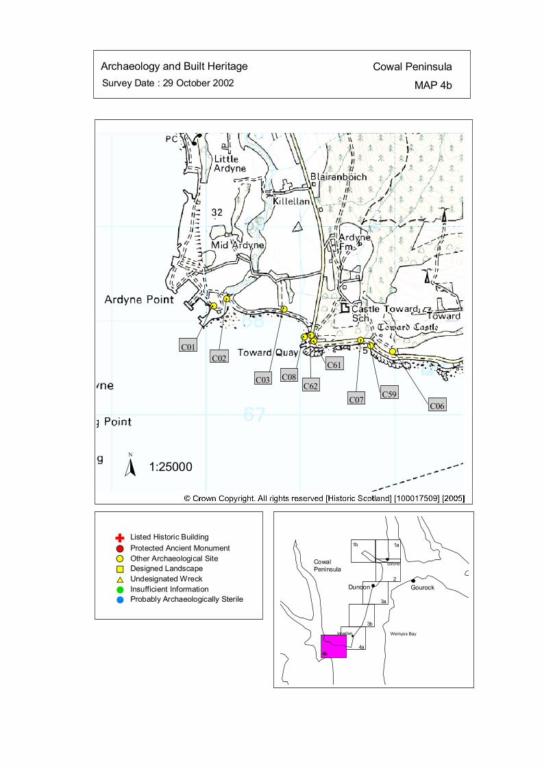
Survey Date : 29 October 2002 MAP 4b
Cowal PeninsulaArchaeology and Built Heritage
Strone
Wemyss Bay
Dunoon Gourock
CowalPeninsula
Innellan
4b4a
2
3a
3b
1a1b
#S
#S#S
#S
#S#S#S #S
#S
#
C01
#
C02
#
C03
#
C08
#
C62
#
C61
#
C07
#
C59
#
C06
Listed Historic Building#S Protected Ancient Monument#S Other Archaeological Site%U Designed Landscape$T Undesignated Wreck# Insufficient Information# Probably Archaeologically Sterile
© Crown Copyright. All rights reserved. Licence No. PA01041C. 2003.
1:25000N
Ñ
kat
horizontal
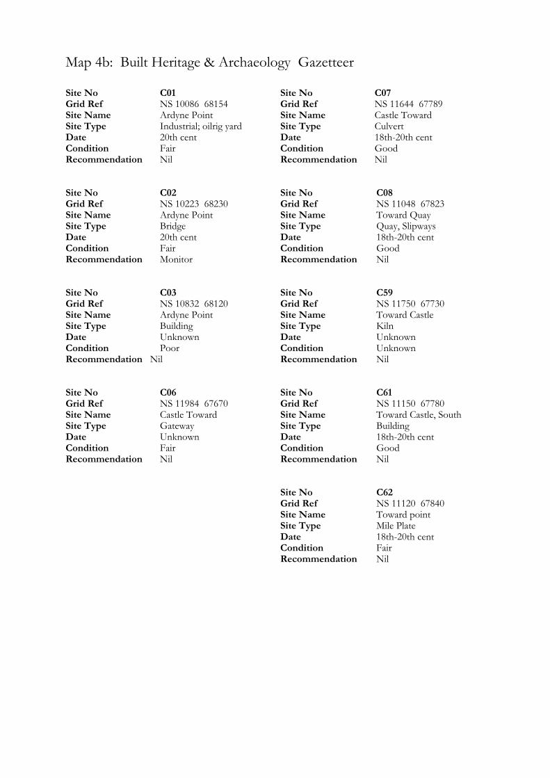
Map 4b: Built Heritage & Archaeology Gazetteer
Site No C01 Grid Ref NS 10086 68154 Site Name Ardyne Point Site Type Industrial; oilrig yard Date 20th cent Condition Fair Recommendation Nil Site No C02 Grid Ref NS 10223 68230 Site Name Ardyne Point Site Type Bridge Date 20th cent Condition Fair Recommendation Monitor Site No C03 Grid Ref NS 10832 68120 Site Name Ardyne Point Site Type Building Date Unknown Condition Poor Recommendation Nil Site No C06 Grid Ref NS 11984 67670 Site Name Castle Toward Site Type Gateway Date Unknown Condition Fair Recommendation Nil
Site No C07 Grid Ref NS 11644 67789 Site Name Castle Toward Site Type Culvert Date 18th-20th cent Condition Good Recommendation Nil Site No C08 Grid Ref NS 11048 67823 Site Name Toward Quay Site Type Quay, Slipways Date 18th-20th cent Condition Good Recommendation Nil Site No C59 Grid Ref NS 11750 67730 Site Name Toward Castle Site Type Kiln Date Unknown Condition Unknown Recommendation Nil Site No C61 Grid Ref NS 11150 67780 Site Name Toward Castle, South Site Type Building Date 18th-20th cent Condition Good Recommendation Nil Site No C62 Grid Ref NS 11120 67840 Site Name Toward point Site Type Mile Plate Date 18th-20th cent Condition Fair Recommendation Nil
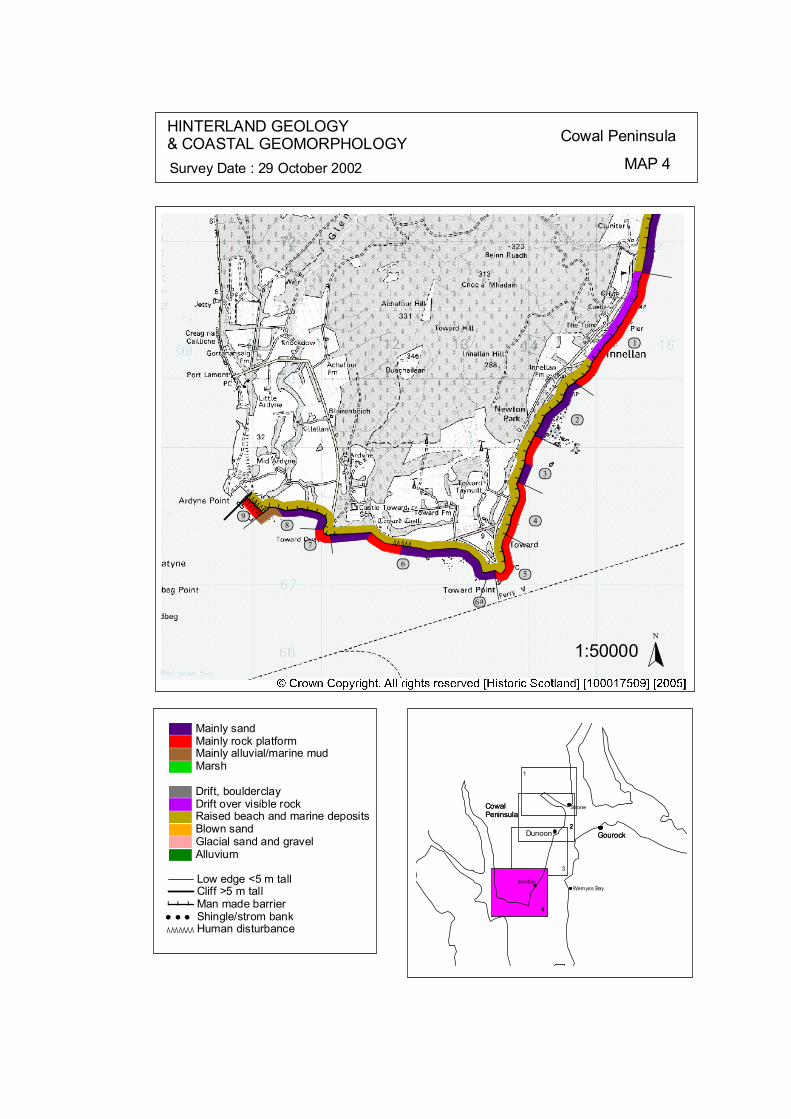
ÒÒÒÒÒÒ
ÒÒÒÒÒ
ÒÒÒÒÒÒ
# # ##
# # #
# # ## ### # ## # ## # # #
# # # ## # # ## #
### # # ## # # # # # ## # #
ôó1
ôó2
ôó3
ôó4
ôó5ôó6
ôó7ôó8
ôó9
ôó6a
N
1:50000
HINTERLAND GEOLOGY& COASTAL GEOMORPHOLOGY Cowal Peninsula
MAP 4Survey Date : 29 October 2002
4
Innellan
4
Gourock
CowalPeninsula
4
CowalPeninsula
Gourock
G t
Wemyss Bay
3
Dunoon222
Strone
1
© Crown Copyright. All rights reserved. Licence No. PA01041C. 2003.
Low edge <5 m tallCliff >5 m tallMan made barrier# # #Shingle/strom bank' ' 'Human disturbanceÒÒÒÒÒÒÒ
Mainly sandMainly rock platformMainly alluvial/marine mudMarsh
Drift, boulderclayDrift over visible rockRaised beach and marine depositsBlown sandGlacial sand and gravelAlluvium
kat
horizontal
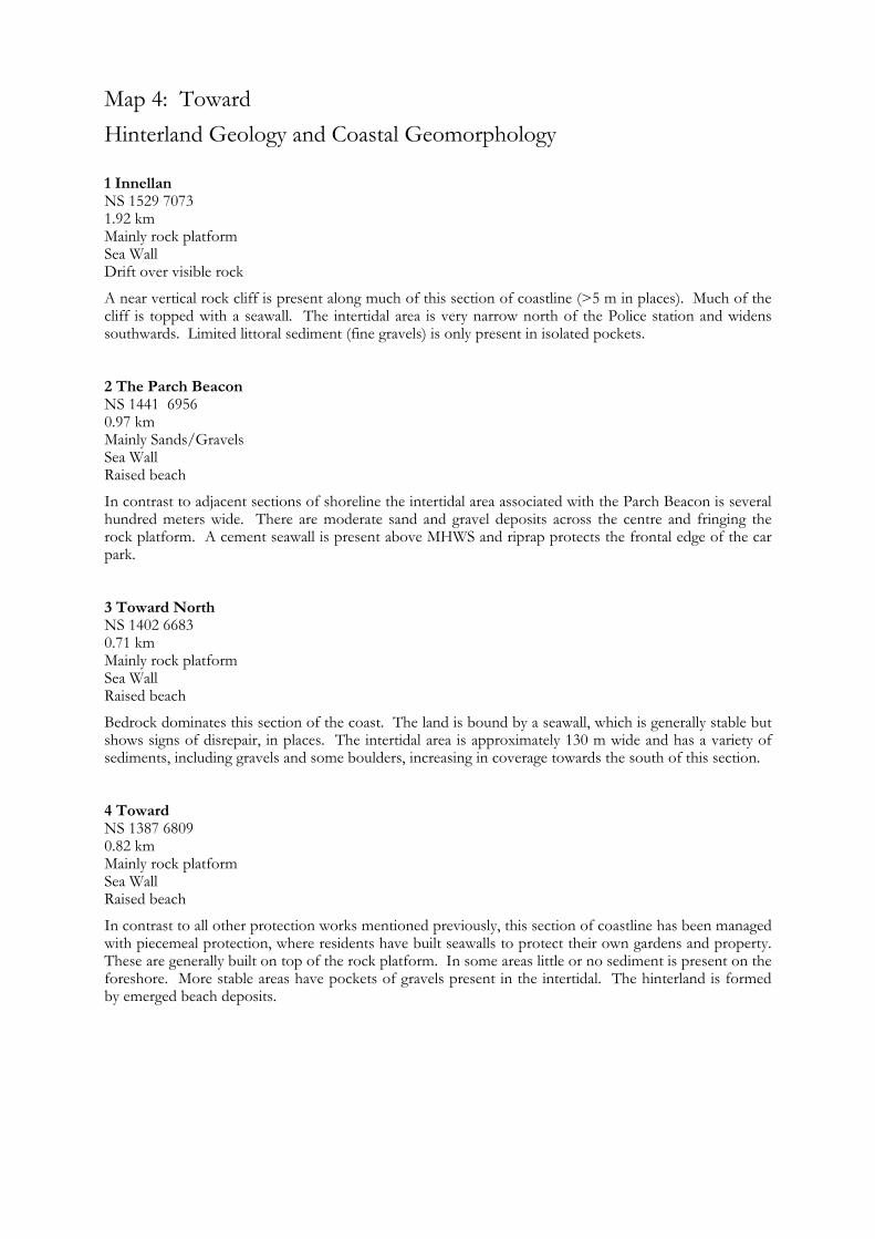
Map 4: Toward Hinterland Geology and Coastal Geomorphology
1 Innellan NS 1529 7073 1.92 km Mainly rock platform Sea Wall Drift over visible rock
A near vertical rock cliff is present along much of this section of coastline (>5 m in places). Much of the cliff is topped with a seawall. The intertidal area is very narrow north of the Police station and widens southwards. Limited littoral sediment (fine gravels) is only present in isolated pockets. 2 The Parch Beacon NS 1441 6956 0.97 km Mainly Sands/Gravels Sea Wall Raised beach
In contrast to adjacent sections of shoreline the intertidal area associated with the Parch Beacon is several hundred meters wide. There are moderate sand and gravel deposits across the centre and fringing the rock platform. A cement seawall is present above MHWS and riprap protects the frontal edge of the car park. 3 Toward North NS 1402 6683 0.71 km Mainly rock platform Sea Wall Raised beach
Bedrock dominates this section of the coast. The land is bound by a seawall, which is generally stable but shows signs of disrepair, in places. The intertidal area is approximately 130 m wide and has a variety of sediments, including gravels and some boulders, increasing in coverage towards the south of this section. 4 Toward NS 1387 6809 0.82 km Mainly rock platform Sea Wall Raised beach
In contrast to all other protection works mentioned previously, this section of coastline has been managed with piecemeal protection, where residents have built seawalls to protect their own gardens and property. These are generally built on top of the rock platform. In some areas little or no sediment is present on the foreshore. More stable areas have pockets of gravels present in the intertidal. The hinterland is formed by emerged beach deposits.
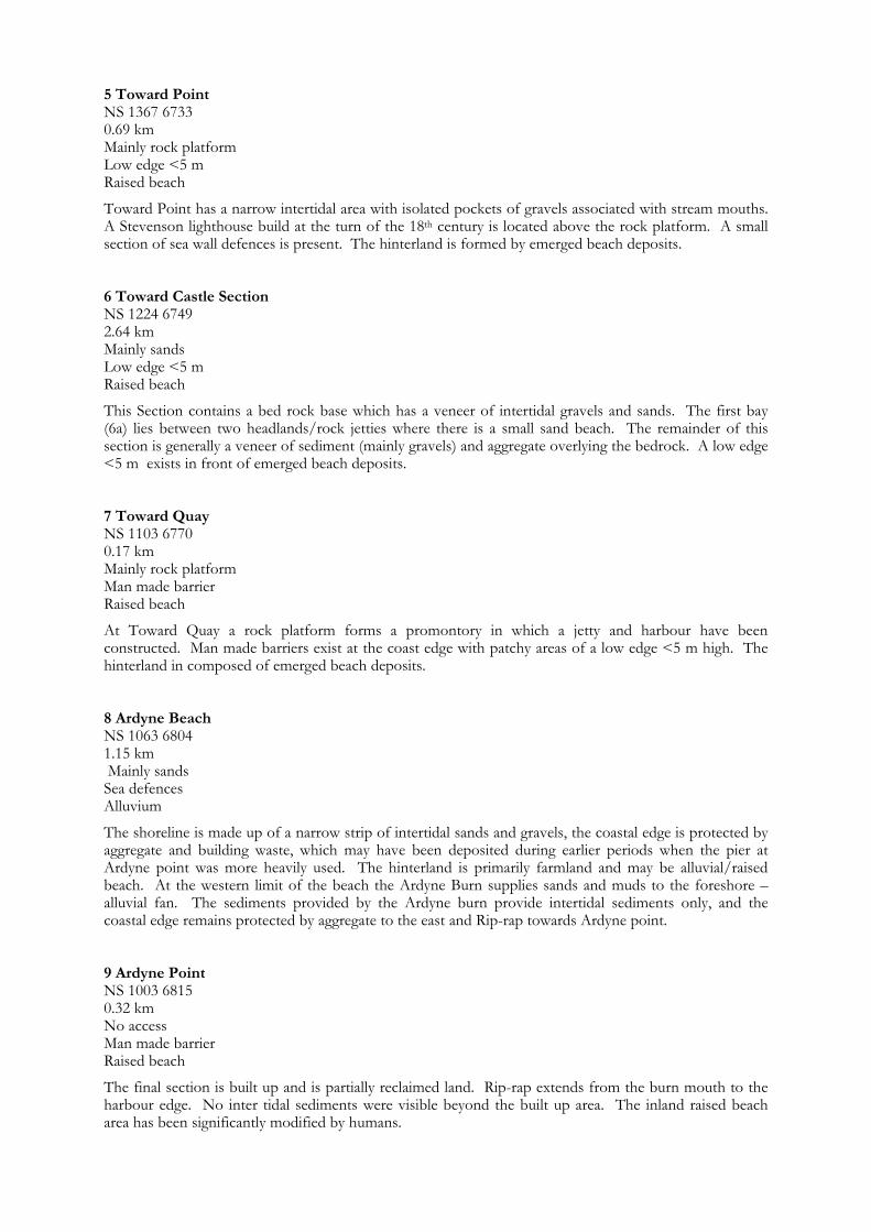
5 Toward Point NS 1367 6733 0.69 km Mainly rock platform Low edge <5 m Raised beach
Toward Point has a narrow intertidal area with isolated pockets of gravels associated with stream mouths. A Stevenson lighthouse build at the turn of the 18th century is located above the rock platform. A small section of sea wall defences is present. The hinterland is formed by emerged beach deposits. 6 Toward Castle Section NS 1224 6749 2.64 km Mainly sands Low edge <5 m Raised beach
This Section contains a bed rock base which has a veneer of intertidal gravels and sands. The first bay (6a) lies between two headlands/rock jetties where there is a small sand beach. The remainder of this section is generally a veneer of sediment (mainly gravels) and aggregate overlying the bedrock. A low edge <5 m exists in front of emerged beach deposits. 7 Toward Quay NS 1103 6770 0.17 km Mainly rock platform Man made barrier Raised beach
At Toward Quay a rock platform forms a promontory in which a jetty and harbour have been constructed. Man made barriers exist at the coast edge with patchy areas of a low edge <5 m high. The hinterland in composed of emerged beach deposits. 8 Ardyne Beach NS 1063 6804 1.15 km Mainly sands Sea defences Alluvium
The shoreline is made up of a narrow strip of intertidal sands and gravels, the coastal edge is protected by aggregate and building waste, which may have been deposited during earlier periods when the pier at Ardyne point was more heavily used. The hinterland is primarily farmland and may be alluvial/raised beach. At the western limit of the beach the Ardyne Burn supplies sands and muds to the foreshore – alluvial fan. The sediments provided by the Ardyne burn provide intertidal sediments only, and the coastal edge remains protected by aggregate to the east and Rip-rap towards Ardyne point. 9 Ardyne Point NS 1003 6815 0.32 km No access Man made barrier Raised beach
The final section is built up and is partially reclaimed land. Rip-rap extends from the burn mouth to the harbour edge. No inter tidal sediments were visible beyond the built up area. The inland raised beach area has been significantly modified by humans.
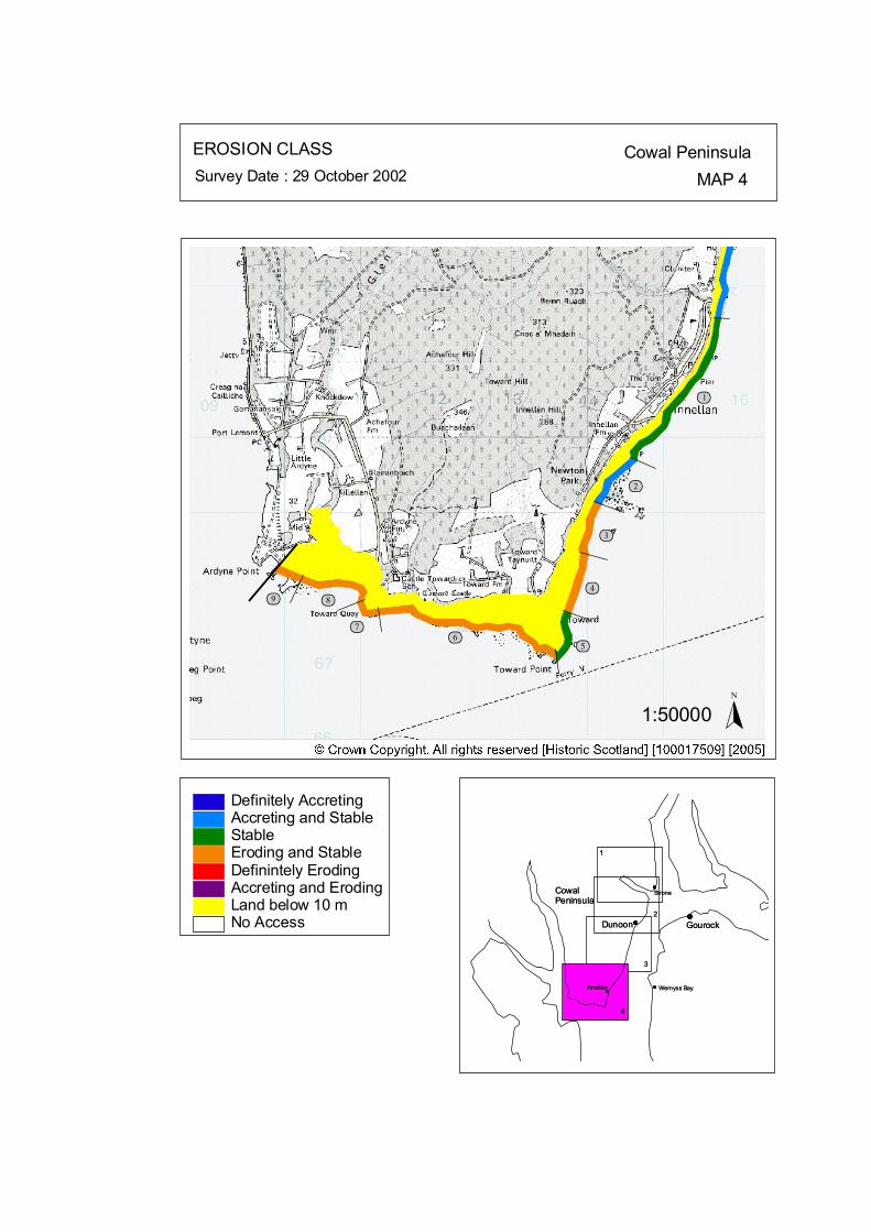
ôó1
ôó2
ôó3
ôó4
ôó5ôó6ôó7
ôó8ôó9
N
1:50000
EROSION CLASS Cowal PeninsulaMAP 4Survey Date : 29 October 2002
2
3
1
CowalPeninsula
Gourock
1
3
2Dunoon
Wemyss Bay
StroneCowalPeninsula
GourockDunoon
Wemyss Bay
Strone
44
InnellanInnellan
No Access
Definitely AccretingAccreting and StableStableEroding and StableDefinintely ErodingAccreting and ErodingLand below 10 m
© Crown Copyright. All rights reserved. Licence No. PA01041C. 2003.
kat
horizontal

Map 4: Toward Erosion Class
1 Innellan NS 1529 7073 1.92 km LT: Erosional - Low ST: Stable - Low
A near vertical rock cliff is present along much of this section of coastline which is currently stable but an erosional feature over the longer term. Much of the cliff is topped with a seawall. 2 The Parch Beacon NS 1441 6956 0.97 km LT: Stable/Erosional - Low ST: Stable/Accretional - Low
The intertidal area associated with the Parch Beacon is several hundred meters wide with moderate sand and gravel coverage. This shows a low wave energy environment. A cement seawall is present above MHWS and riprap protects the frontal edge of a car park. These protections are stable and show no signs of undercutting. 3 Toward North NS 1402 6683 0.71 km LT: Erosional - Low ST: Stable/Erosional - Low
Bedrock dominates this section of the coast. The land is bound by a seawall, which is generally stable but shows signs of disrepair. 4 Toward NS 1387 6809 0.82 km LT: Erosional - Low ST: Stable/Erosional - Low
Residents have built seawalls to protect their own gardens and property. In some cases vertical brick walls have been constructed at MHWS directly on top of bedrock, others have invested significantly with tall riprap walls. In some areas little or no sediment is present on the foreshore suggesting higher wave energies. More stable areas have pockets of gravels present in the intertidal. Adjacent to these ‘hard solutions’ some residents are protecting their gardens by depositing aggregate at MHWS. 5 Toward Point NS 1367 6733 0.69 km LT: Erosional - Low ST: Stable - Low
This section of the shoreline is currently stable. The lack of sediment reflects the higher wave energy associated with this promontory. Small pockets of sediment occur associated with stream mouths. A Stevenson lighthouse build at the turn of the 18th century is located above the rock platform; it shows no signs of being undercut.
6 Toward Castle Section NS 1224 6749 2.64 km LT: Erosional - Low ST: Stable/Erosional - Low
A bay lies in the east of the section, between two headlands/rock jetties. There is a small sand beach. No signs of undercutting are present along the back beach. The remainder of this section is generally a veneer of sediment (mainly gravels) and aggregate overlying the bedrock. The section is erosional and shows signs of slight undercutting and attempts of piecemeal protection. A tarmac area of ground to the west of the school is eroding and has an cliff face of approximately 1 m in height and 20 m in length. The material eroding in this area shows that the tarmac area is reclaimed land. 7 Toward Quay NS 1103 6770 0.17 km LT: Erosional - Low ST: Stable/Erosional - Low
The rock platform and harbour area shows no signs of undercutting at present. 8 Ardyne Beach NS 1063 6804 1.15 km LT: Erosional - Low ST: Stable/Erosional - Low
The coastal edge along the bay is protected by a vast amount of aggregate and building waste, which may have been deposited during earlier periods when the pier at Ardyne point was more heavily used. At the western limit the sediments provided by the Ardyne burn supplies intertidal sediments only, and the coastal edge remains protected by aggregate to the east and Rip-rap towards Ardyne point showing the erosional potential of the coast edge despite the deposition of alluvial sediments. 9 Ardyne Point NS 1003 6815 0.32 km LT: Erosional - Low ST: Stable/Erosional - Low
Rip-rap extends from the burn mouth to the harbour edge. Just to the north of the survey area the cement and tarmac ground levels around the harbours were being significantly undercut and result in a hazardous area.
Map 5: Great Cumbrae Island Map Content Descriptions
1. Built Heritage and Archaeology
A total of forty three sites were recorded in the area covered by Map 5 which covered the entire coastline of the Island of Great Cumbrae. Of these twenty three were previously recorded and twenty were new sites noted during the field survey. The highest density of sites occurred in the area in and around Millport Bay. Sites located on the coast edge consisted, primarily of small jetties and maritime features relating to the eighteenth to twentieth century and existed in varying states of preservation. Millport Harbour and Pier are Listed buildings. The northern half of the island is in contrast to the south. The coastline is less inhabited than in the south and there are the remains of possible prehistoric fort at Bell Craig (GC22) and cairn (GC21). The southern area did not exhibit any prehistoric sites still in existence. No sites in the area covered by Map 5 were under threat from coastal erosional processes. 2. Hinterland Geology, Coastal Geomorphology and Erosion Class
The section of coastline covered by Map 5 extended around the complete coastline of the Island of Great Cumbrae. The majority of the Great Cumbrae shoreline is characterised by emerged rock platform, with isolated pockets of sediment. The rock foreshore is currently stable with low rates of change. The hinterland is characterised by the Holocene cliff line which is prominent on the western coast, more subdued on the eastern coast and is not clear on the northern section and Millport bay area. Millport bay it the only large littoral section on the island, which can be subdivided into two sections. Namely Kames bay, with a stable sandy beach and the remainder of Millport shore, which has a sand and gravel veneer overlying bedrock. The protection work which lines sections of the soft and hard shorelines are currently stable and show no signs of being under cut.
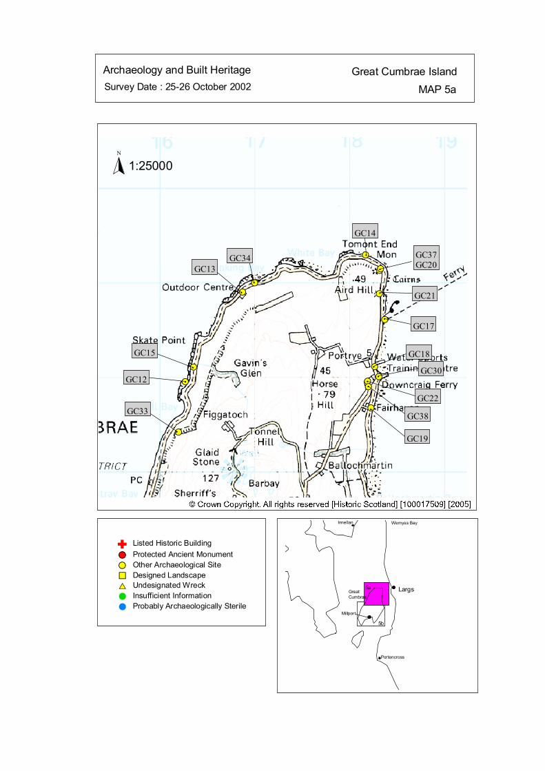
Survey Date : 25-26 October 2002 MAP 5aGreat Cumbrae IslandArchaeology and Built Heritage
GreatCumbrae
Millport
Wemyss Bay
Portencross
Largs
Innellan
5a
5b
#S#S
#S#S
#S
#S
#S#S
#S
#S
#S
#S
#S
#S
#S#GC12
#
GC15
#
GC13#
GC34 #
GC14
#
GC37GC20
# GC21
#
GC17
#
GC18
#
GC30#
GC22#
GC38#
GC19#
GC33
Listed Historic Building#S Protected Ancient Monument#S Other Archaeological Site%U Designed Landscape$T Undesignated Wreck# Insufficient Information# Probably Archaeologically Sterile
© Crown Copyright. All rights reserved. Licence No. PA01041C. 2003.
1:25000N
Ñ
kat
horizontal
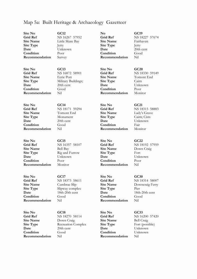
Map 5a: Built Heritage & Archaeology Gazetteer
Site No GC12 Grid Ref NS 16267 57952 Site Name Little Skate Bay Site Type Jetty Date Unknown Condition Poor Recommendation Survey Site No GC13 Grid Ref NS 16872 58901 Site Name Eerie Port Site Type Military Buildings; Date 20th cent Condition Good Recommendation Nil Site No GC14 Grid Ref NS 18171 59294 Site Name Tomont End Site Type Monument Date 20th cent Condition Good Recommendation Nil Site No GC15 Grid Ref NS 16357 58107 Site Name Bell Bay Site Type Rig and Furrow Date Unknown Condition Poor Recommendation Monitor Site No GC17 Grid Ref NS 18373 58611 Site Name Cumbrae Slip Site Type Slipway complex Date 18th-20th cent Condition Good Recommendation Nil Site No GC18 Grid Ref NS 18270 58114 Site Name Down Craig Site Type Recreation Complex Date 20th cent Condition Good Recommendation Nil
No GC19 Grid Ref NS 18227 57674 Site Name Fairhaven Site Type Jetty Date 20th cent Condition Good Recommendation Nil Site No GC20 Grid Ref NS 18330 59149 Site Name Tomont End Site Type Cairn Date Unknown Condition Poor Recommendation Monitor Site No GC21 Grid Ref NS 18315 58883 Site Name Lady’s Grave Site Type Cairn; Cists Date Unknown Condition Fair Recommendation Monitor Site No GC22 Grid Ref NS 18192 57959 Site Name Down Craig Site Type Fort Date Unknown Condition Poor Recommendation Nil Site No GC30 Grid Ref NS 18314 58007 Site Name Downcraig Ferry Site Type Pier Date 18th-20th cent Condition Good Recommendation Nil Site No GC33 Grid Ref NS 16200 57420 Site Name Bell Craig Site Type Fort (possible) Date Unknown Condition Unknown Recommendation Nil

Site No GC34 Grid Ref NS 17000 59000 Site Name Stinking Bay Site Type Cairn; Urn Date Unknown Condition Unknown Recommendation Nil Site Site No GC37 Grid Ref NS 18320 59130 Site Name ‘Lady’s Grave’ Site Type ‘Burial’ Date Unknown Condition Unknown Recommendation Nil
Site No GC38 Grid Ref NS 18200 57900 Site Name Down Craig Site Type Burials Date Unknown Condition Unknown Recommendation Nil
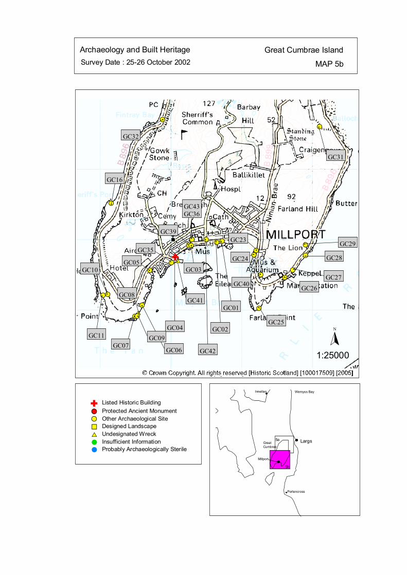
Survey Date : 25-26 October 2002 MAP 5b
Great Cumbrae IslandArchaeology and Built Heritage
GreatCumbrae
Millport
Wemyss Bay
Portencross
Largs
Innellan
5a
5b
#S
#S#S #S
#S
#S
#S
#S
#S#S
#S
#S
#S$T#S
#S#S
#S
#S
#S#S
#S
#S#S
#S
#S# GC29# GC28
#
GC27#
GC26
#
GC25
#
GC23
#
GC40
#
GC24
#
GC01
#
GC02
#
GC42
#
GC43GC36
#
GC03
#
GC39
GC41
GC04
#
GC35
#
GC05
#
GC06
#
GC08
#
GC09
#
GC07
#
GC11
#
GC10
#
GC16
#
GC31
#
GC32
Listed Historic Building#S Protected Ancient Monument#S Other Archaeological Site%U Designed Landscape$T Undesignated Wreck# Insufficient Information# Probably Archaeologically Sterile
© Crown Copyright. All rights reserved. Licence No. PA01041C. 2003.
1:25000
N
$TÑ#
#
Ñ
kat
horizontal
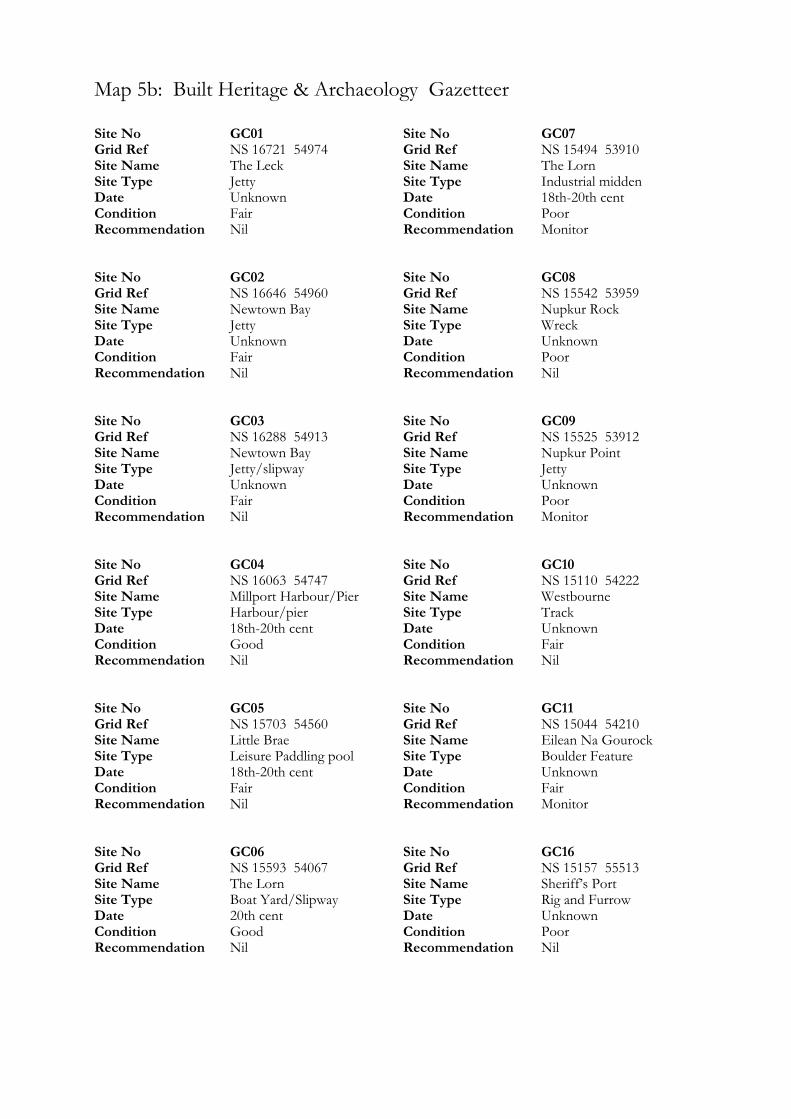
Map 5b: Built Heritage & Archaeology Gazetteer
Site No GC01 Grid Ref NS 16721 54974 Site Name The Leck Site Type Jetty Date Unknown Condition Fair Recommendation Nil Site No GC02 Grid Ref NS 16646 54960 Site Name Newtown Bay Site Type Jetty Date Unknown Condition Fair Recommendation Nil Site No GC03 Grid Ref NS 16288 54913 Site Name Newtown Bay Site Type Jetty/slipway Date Unknown Condition Fair Recommendation Nil Site No GC04 Grid Ref NS 16063 54747 Site Name Millport Harbour/Pier Site Type Harbour/pier Date 18th-20th cent Condition Good Recommendation Nil Site No GC05 Grid Ref NS 15703 54560 Site Name Little Brae Site Type Leisure Paddling pool Date 18th-20th cent Condition Fair Recommendation Nil Site No GC06 Grid Ref NS 15593 54067 Site Name The Lorn Site Type Boat Yard/Slipway Date 20th cent Condition Good Recommendation Nil
Site No GC07 Grid Ref NS 15494 53910 Site Name The Lorn Site Type Industrial midden Date 18th-20th cent Condition Poor Recommendation Monitor Site No GC08 Grid Ref NS 15542 53959 Site Name Nupkur Rock Site Type Wreck Date Unknown Condition Poor Recommendation Nil Site No GC09 Grid Ref NS 15525 53912 Site Name Nupkur Point Site Type Jetty Date Unknown Condition Poor Recommendation Monitor Site No GC10 Grid Ref NS 15110 54222 Site Name Westbourne Site Type Track Date Unknown Condition Fair Recommendation Nil Site No GC11 Grid Ref NS 15044 54210 Site Name Eilean Na Gourock Site Type Boulder Feature Date Unknown Condition Fair Recommendation Monitor Site No GC16 Grid Ref NS 15157 55513 Site Name Sheriff’s Port Site Type Rig and Furrow Date Unknown Condition Poor Recommendation Nil

Site No GC23 Grid Ref NS 17206 54845 Site Name Ninian Brae Site Type Jetty Date 18th-20th cent Condition Poor Recommendation Nil Site No GC24 Grid Ref NS 17173 54783 Site Name Ninian Brae Site Type Paddling Pool Date 18th-20th cent Condition Fair Recommendation Nil Site No GC25 Grid Ref NS 17243 54024 Site Name Farland Point Site Type Jetty Date Unknown Condition Fair Recommendation Nil Site No GC26 Grid Ref NS 17608 54459 Site Name Keppel Port Site Type Port/shipping complex Date 20th cent Condition Good Recommendation Nil Site No GC27 Grid Ref NS 17722 54565 Site Name Keppel Port Site Type Pier Date 20th cent Condition Good Recommendation Nil Site No GC28 Grid Ref NS 17903 54773 Site Name Keppel Port Site Type Boat mooring Date 20th cent Condition Good Recommendation Nil
Site No GC29 Grid Ref NS 17902 54923 Site Name The lion Site Type Natural Monument Date Unknown Condition Good Recommendation Monitor Site No GC31 Grid Ref NS 18100 56600 Site Name Craigengour Site Type Chapel (possible) Date Unknown Condition Fair Recommendation Monitor Site No GC32 Grid Ref NS 15880 56700 Site Name Fintry Bay Site Type Cairn; Cists Date Unknown Condition Unknown Recommendation Nil Site No GC35 Grid Ref NS 16010 54670 Site Name ‘Sheriff's Auld Ha’ Site Type House Date Unknown Condition Unknown Recommendation Nil Site No GC36 Grid Ref NS 16300 55000 Site Name The Garrison, Millport Site Type Oak Coffin Date Unknown Condition Unknown Recommendation Nil Site No GC39 Grid Ref NS 16250 54920 Site Name Millport Site Type Cross; Cist Date Unknown Condition Unknown Recommendation Nil

Site No GC40 Grid Ref NS 17270 54500 Site Name Farland Hill Site Type Cave Date Unknown Condition Fair Recommendation Nil Site No GC41 Grid Ref NS 16100 54700 Site Name Millport Bay Site Type Wreck Date Unknown Condition Unknown Recommendation Nil
Site No GC42 Grid Ref NS 16500 55000 Site Name Millport Site Type Cross-incised Stone Date Unknown Condition Unknown Recommendation Nil Site No GC43 Grid Ref NS 16300 55000 Site Name The Garrison Site Type Cairn Date Unknown Condition Unknown Recommendation Nil
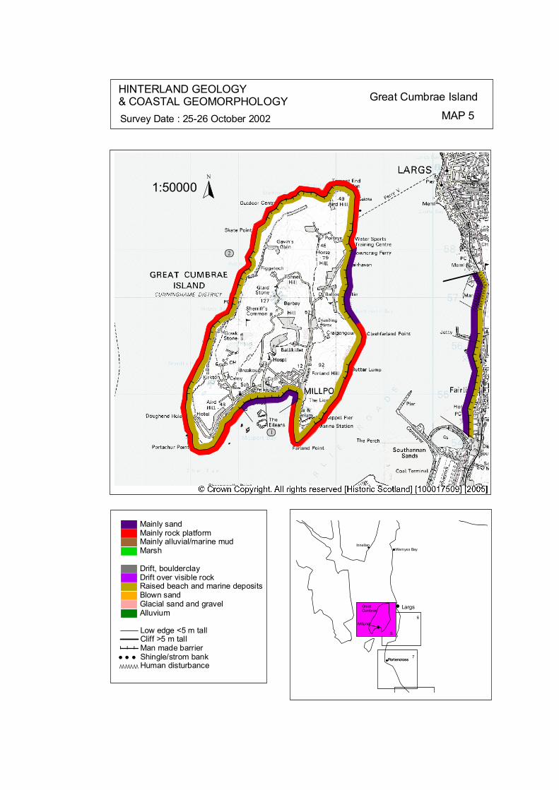
Ò ÒÒÒ ÒÒÒÒÒÒÒÒÒÒ
ÒÒÒÒÒÒÒÒÒÒÒÒÒÒÒ
# # # # # # # #
# # ####
######
######
#############
## ## #
#### # ###
# # #
# # #
# # # ##############
ôó1
ôó2
N
1:50000
HINTERLAND GEOLOGY& COASTAL GEOMORPHOLOGY Great Cumbrae Island
MAP 5Survey Date : 25-26 October 2002
Millport
Innellan
Portencross
Largs
6
5
7Portencross
Millport
GreatCumbrae
Wemyss Bay
© Crown Copyright. All rights reserved. Licence No. PA01041C. 2003.
Low edge <5 m tallCliff >5 m tallMan made barrier# # #Shingle/strom bank' ' 'Human disturbanceÒÒÒÒÒÒÒ
Mainly sandMainly rock platformMainly alluvial/marine mudMarsh
Drift, boulderclayDrift over visible rockRaised beach and marine depositsBlown sandGlacial sand and gravelAlluvium
kat
horizontal
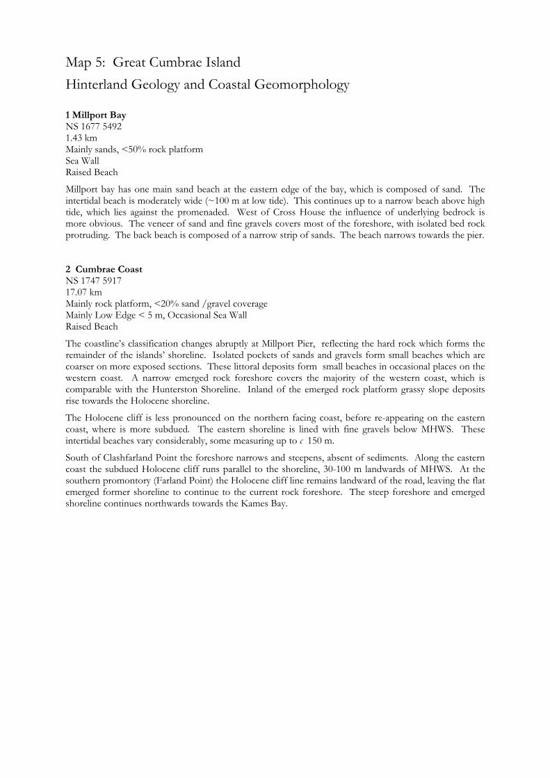
Map 5: Great Cumbrae Island Hinterland Geology and Coastal Geomorphology
1 Millport Bay NS 1677 5492 1.43 km Mainly sands, <50% rock platform Sea Wall Raised Beach
Millport bay has one main sand beach at the eastern edge of the bay, which is composed of sand. The intertidal beach is moderately wide (~100 m at low tide). This continues up to a narrow beach above high tide, which lies against the promenaded. West of Cross House the influence of underlying bedrock is more obvious. The veneer of sand and fine gravels covers most of the foreshore, with isolated bed rock protruding. The back beach is composed of a narrow strip of sands. The beach narrows towards the pier. 2 Cumbrae Coast NS 1747 5917 17.07 km Mainly rock platform, <20% sand /gravel coverage Mainly Low Edge < 5 m, Occasional Sea Wall Raised Beach
The coastline’s classification changes abruptly at Millport Pier, reflecting the hard rock which forms the remainder of the islands’ shoreline. Isolated pockets of sands and gravels form small beaches which are coarser on more exposed sections. These littoral deposits form small beaches in occasional places on the western coast. A narrow emerged rock foreshore covers the majority of the western coast, which is comparable with the Hunterston Shoreline. Inland of the emerged rock platform grassy slope deposits rise towards the Holocene shoreline.
The Holocene cliff is less pronounced on the northern facing coast, before re-appearing on the eastern coast, where is more subdued. The eastern shoreline is lined with fine gravels below MHWS. These intertidal beaches vary considerably, some measuring up to c 150 m.
South of Clashfarland Point the foreshore narrows and steepens, absent of sediments. Along the eastern coast the subdued Holocene cliff runs parallel to the shoreline, 30-100 m landwards of MHWS. At the southern promontory (Farland Point) the Holocene cliff line remains landward of the road, leaving the flat emerged former shoreline to continue to the current rock foreshore. The steep foreshore and emerged shoreline continues northwards towards the Kames Bay.
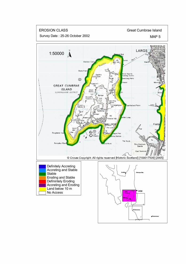
ôó2
ôó1
N
1:50000
EROSION CLASS Great Cumbrae Island
MAP 5Survey Date : 25-26 October 2002
Largs
Portencross
Wemyss Bay
Millport
GreatCumbrae
Largs
Portencross
Wemyss Bay
Millport
GreatCumbrae
InnellanInnellan
5
6
PortencrossPortencross7
Land below 10 mAccreting and ErodingDefinintely ErodingEroding and StableStableAccreting and StableDefinitely Accreting
No Access
© Crown Copyright. All rights reserved. Licence No. PA01041C. 2003.
kat
horizontal
Map 5: Great Cumbrae Island Erosion Class
1 Millport Bay NS 1677 5492 1.43 km LT: Erosional– Low ST: Stable – Low
The intertidal beach continues up to a narrow beach above high tide, which lies against the stable promenaded. The back beach is composed of a narrow strip of sands before the stable promenade. The beach narrows towards the pier, with MHWS located at the foot of the stable seawall. 2 Cumbrae Coast NS 1747 5917 17.07 km LT: Erosional– Low ST: Stable - Low
The coastline’s classification changes abruptly at Millport Pier, reflecting the hard rock which forms the remainder of the islands’ shoreline. Small erosional faces occur above the rock foreshore between the Pier and Nupkur Point. Seawalls have been use to protect isolated sections of the shore road these show no obvious signs of undercutting.
Isolated sections of the eastern shoreline are supported seawalls, larger sections include the Water Sports Centre, Stinking Goat Bay, Davy’s Rock and the Pier north of Keppel Rock.
Map 6: Ayrshire Coast: Largs to Fairlie Map Content Descriptions
1. Built Heritage and Archaeology
A total of nine sites were recorded in the area covered by Map 6. Of these four were previously recorded and five were new sites noted during the field survey. Kelburnfoot Lodge (A147) was the only Listed building situated in the area covered by Map 6. The remainder of the sites related to eighteenth to twentieth century activity with the exception of a fish trap (A86) and a slipway of unknown date (A04). 2. Hinterland Geology, Coastal Geomorphology and Erosion Class
The section of the coastline covered by Map 6 ran from the northern end of Largs Marina to the southern end of Fairlie. Much of the hinterland has been modified by modern human activity most prominently at the northern end where the construction of Largs Marina has significantly altered the coast edge. Where natural coastline existed the intertidal area was composed of sands with a hinterland of emerged beach deposits. The coastline was classified as stable throughout the section covered by Map 6. The southern area was not included in the survey area due to the existence of Hunterston Nuclear Power Station.
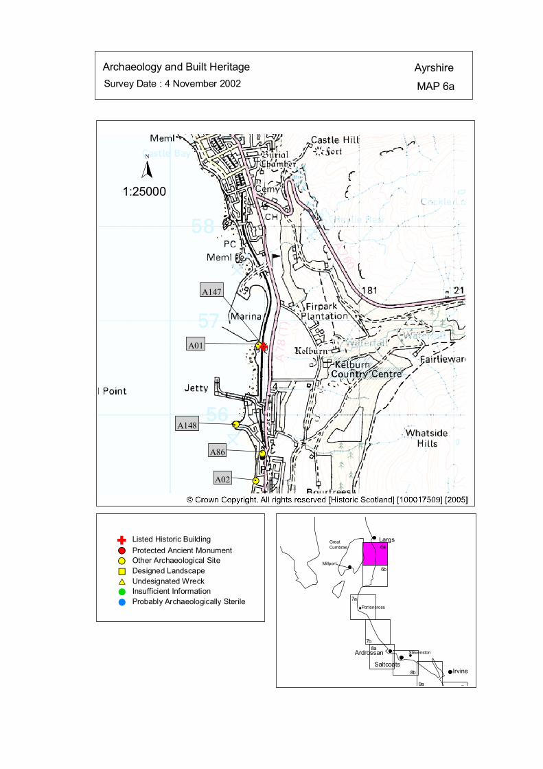
Survey Date : 4 November 2002 MAP 6a
AyrshireArchaeology and Built Heritage
GreatCumbrae
Millport
Stevenston
Portencross
IrvineSaltcoats
Ardrossan
Largs
6b
6a
7a
7b8a
9b9a
8b
#S
#S
#S
#S
A147
#A01
#A148
#A86
#A02
Listed Historic Building#S Protected Ancient Monument#S Other Archaeological Site%U Designed Landscape$T Undesignated Wreck# Insufficient Information# Probably Archaeologically Sterile
© Crown Copyright. All rights reserved. Licence No. PA01041C. 2003.
1:25000
N
Ñ#
Ñ
kat
horizontal
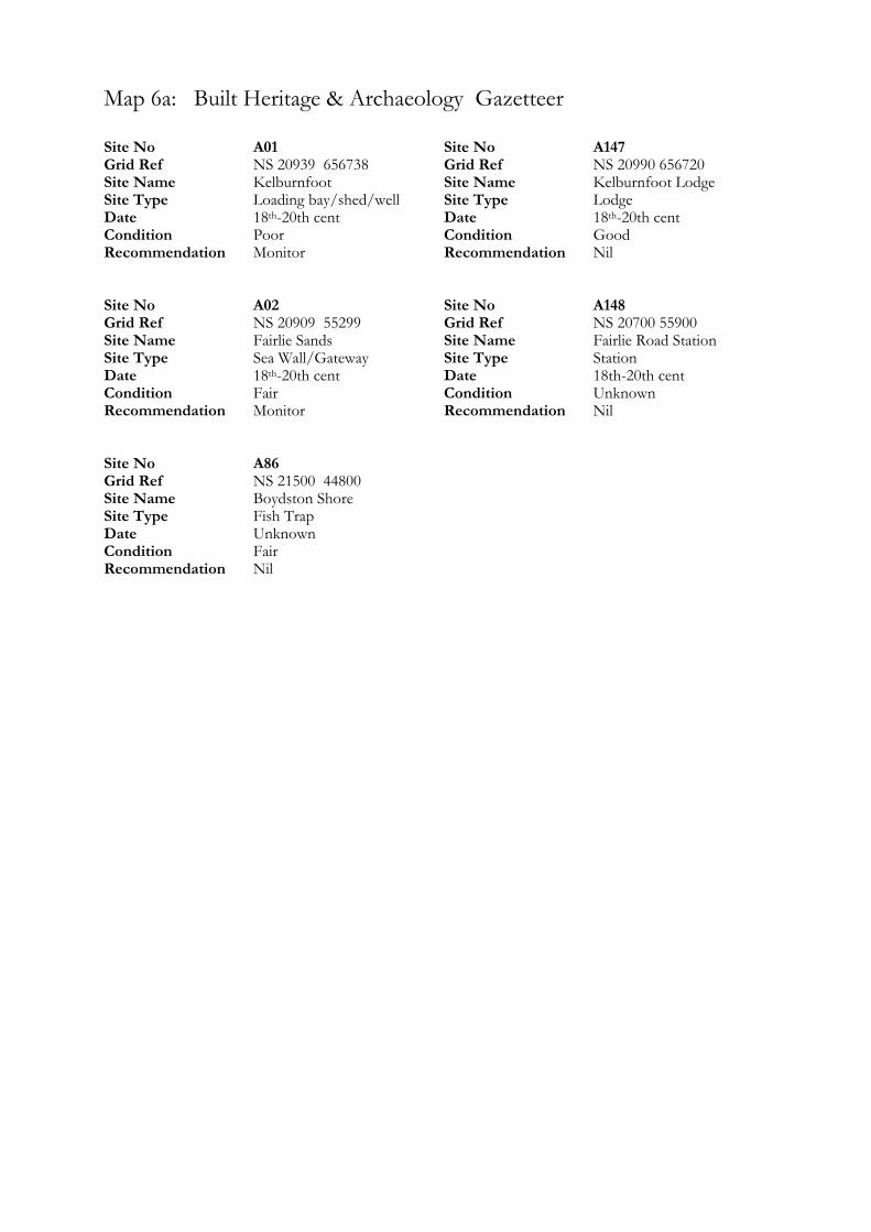
Map 6a: Built Heritage & Archaeology Gazetteer
Site No A01 Grid Ref NS 20939 656738 Site Name Kelburnfoot Site Type Loading bay/shed/well Date 18 -20th cent th
Condition Poor Recommendation Monitor Site No A02 Grid Ref NS 20909 55299 Site Name Fairlie Sands Site Type Sea Wall/Gateway Date 18 -20th cent th
Condition Fair Recommendation Monitor Site No A86 Grid Ref NS 21500 44800 Site Name Boydston Shore Site Type Fish Trap Date Unknown Condition Fair Recommendation Nil
Site No A147 Grid Ref NS 20990 656720 Site Name Kelburnfoot Lodge Site Type Lodge Date 18 -20th cent th
Condition Good Recommendation Nil Site No A148 Grid Ref NS 20700 55900 Site Name Fairlie Road Station Site Type Station Date 18th-20th cent Condition Unknown Recommendation Nil
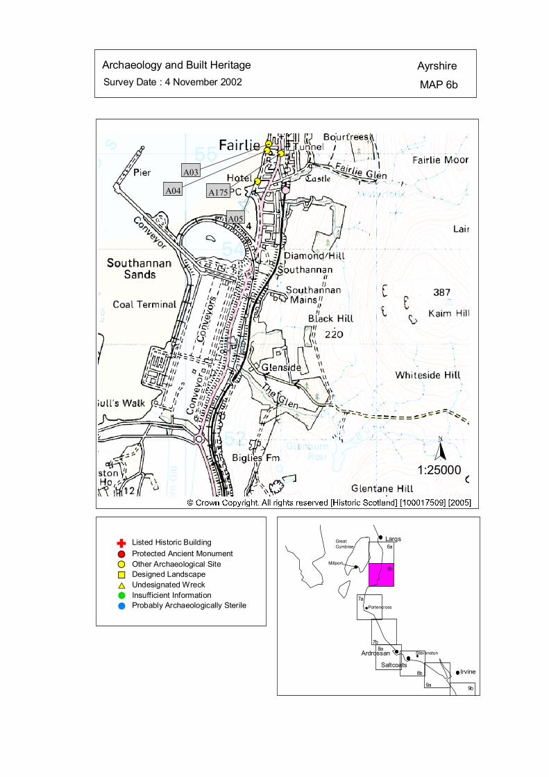
Survey Date : 4 November 2002 MAP 6b
AyrshireArchaeology and Built Heritage
GreatCumbrae
Millport
Stevenston
Portencross
IrvineSaltcoats
Ardrossan
Largs
6b
6a
7a
7b8a
9b9a
8b
#S#S#S
#S#
A05
#
A175
#
A04
#
A03
Listed Historic Building#S Protected Ancient Monument#S Other Archaeological Site%U Designed Landscape$T Undesignated Wreck# Insufficient Information# Probably Archaeologically Sterile
© Crown Copyright. All rights reserved. Licence No. PA01041C. 2003.
1:25000
N
Ñ
kat
horizontal

Map 6b: Built Heritage & Archaeology Gazetteer
Site No A03 Grid Ref NS 20873 55101 Site Name Fairwinds, Fairlie Site Type Slipways/Walling Date 18th-20th cent Condition Good Recommendation Nil Site No A04 Grid Ref NS 20853 55032 Site Name The Millstones, Fairlie Site Type Slipway Date Unknown Condition Fair Recommendation Nil
Site No A05 Grid Ref NS 20752 54708 Site Name Fairlie Sands Site Type Boat House Date 20th cent Condition Good Recommendation Nil Site No A175 Grid Ref NS 21000 55000 Site Name Fairlie Site Type Burgh; Town Date 14th-18th cent Condition Good Recommendation Nil
ÒÒÒÒÒÒÒÒÒÒÒÒÒÒ
ÒÒÒÒÒÒÒÒÒÒÒÒÒÒÒ
#
## ## #
#### # ###
# # #
# # # ####### #######
ôó1
ôó2
N
1:50000
HINTERLAND GEOLOGY& COASTAL GEOMORPHOLOGY Ayrshire
MAP 6Survey Date : 4 November 2002
Millport
Innellan
Stevenston
Portencross
Ardrossan
Largs
6
7
Ardrossan
Portencross
Stevenston
Millport
GreatCumbrae
Wemyss Bay
© Crown Copyright. All rights reserved. Licence No. PA01041C. 2003.
Low edge <5 m tallCliff >5 m tallMan made barrier# # #Shingle/strom bank' ' 'Human disturbanceÒÒÒÒÒÒÒ
Mainly sandMainly rock platformMainly alluvial/marine mudMarsh
Drift, boulderclayDrift over visible rockRaised beach and marine depositsBlown sandGlacial sand and gravelAlluvium
kat
horizontal
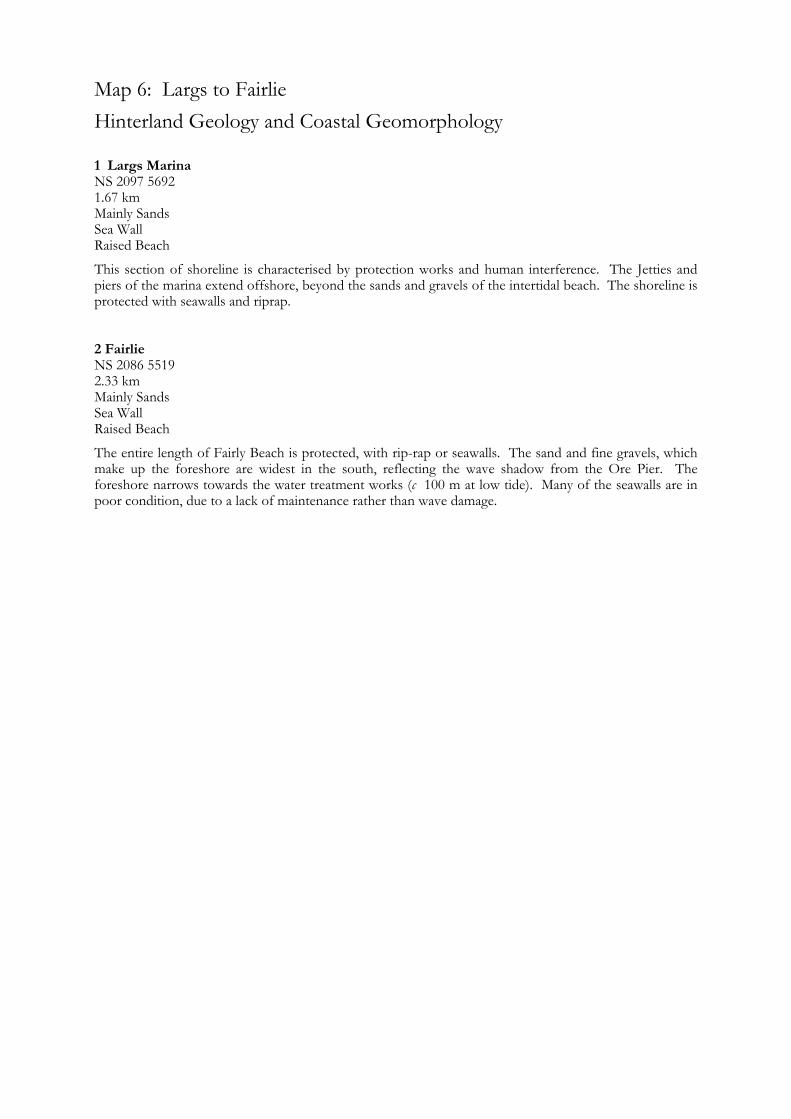
Map 6: Largs to Fairlie Hinterland Geology and Coastal Geomorphology
1 Largs Marina NS 2097 5692 1.67 km Mainly Sands Sea Wall Raised Beach
This section of shoreline is characterised by protection works and human interference. The Jetties and piers of the marina extend offshore, beyond the sands and gravels of the intertidal beach. The shoreline is protected with seawalls and riprap. 2 Fairlie NS 2086 5519 2.33 km Mainly Sands Sea Wall Raised Beach
The entire length of Fairly Beach is protected, with rip-rap or seawalls. The sand and fine gravels, which make up the foreshore are widest in the south, reflecting the wave shadow from the Ore Pier. The foreshore narrows towards the water treatment works (c 100 m at low tide). Many of the seawalls are in poor condition, due to a lack of maintenance rather than wave damage.
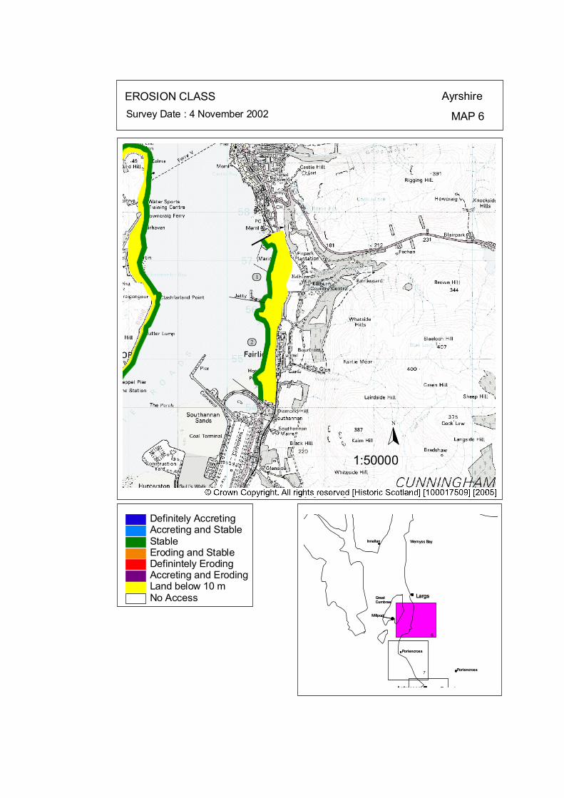
ôó1
ôó2
N
1:50000
EROSION CLASS Ayrshire
MAP 6Survey Date : 4 November 2002
Largs
Ardrossan
Portencross
Stevenston
Wemyss Bay
Millport
GreatCumbrae
Largs
Ardrossan
Portencross
Stevenston
Wemyss Bay
Millport
GreatCumbrae
InnellanInnellan
6
PortencrossPortencross7
No Access
Definitely AccretingAccreting and StableStableEroding and StableDefinintely ErodingAccreting and ErodingLand below 10 m
© Crown Copyright. All rights reserved. Licence No. PA01041C. 2003.
kat
horizontal

Map 6: Largs to Fairlie Erosion Class
1 Largs Marina NS 2097 5692 1.67 km LT: Erosional - Low ST: Stable – Low
This section of shoreline is characterised by protection works and human interference. The shoreline is protected with seawalls and riprap, which are currently stable. 2 Fairlie NS 2086 5519 2.33 km LT: Erosional - Low ST: Stable – Low
The entire length of Fairly Beach is protected, with rip-rap or seawalls. Many of the seawalls are in poor condition, due to a lack of maintenance rather than wave damage.
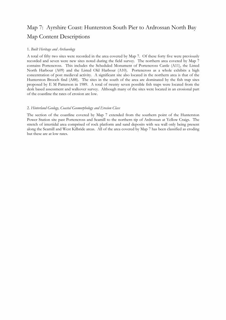
Map 7: Ayrshire Coast: Hunterston South Pier to Ardrossan North Bay Map Content Descriptions
1. Built Heritage and Archaeology
A total of fifty two sites were recorded in the area covered by Map 7. Of these forty five were previously recorded and seven were new sites noted during the field survey. The northern area covered by Map 7 contains Portencross. This includes the Scheduled Monument of Portencross Castle (A11), the Listed North Harbour (A09) and the Listed Old Harbour (A10). Portencross as a whole exhibits a high concentration of post medieval activity. A significant site also located in the northern area is that of the Hunterston Brooch find (A88). The sites in the south of the area are dominated by the fish trap sites proposed by E M Patterson in 1989. A total of twenty seven possible fish traps were located from the desk based assessment and walkover survey. Although many of the sites were located in an erosional part of the coastline the rates of erosion are low. 2. Hinterland Geology, Coastal Geomorphology and Erosion Class
The section of the coastline covered by Map 7 extended from the southern point of the Hunterston Power Station site past Portencross and Seamill to the northern tip of Ardrossan at Yellow Craigs. The stretch of intertidal area comprised of rock platform and sand deposits with sea wall only being present along the Seamill and West Kilbride areas. All of the area covered by Map 7 has been classified as eroding but these are at low rates.
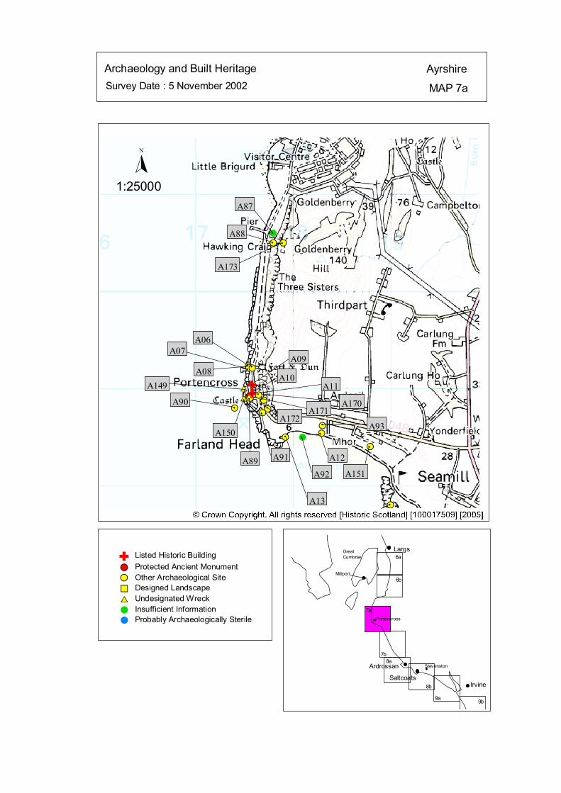
Survey Date : 5 November 2002 MAP 7a
AyrshireArchaeology and Built Heritage
GreatCumbrae
Millport
Stevenston
Portencross
IrvineSaltcoats
Ardrossan
Largs
6b
6a
7a
7b8a
9b9a
8b
#S#S#S#S
#S#S##S
#S
#S#S
#S##S
#S#S#S
$T$T
#S
#
A87
#
A88#
A173
#
A06
#
A08
#A149
#
A90 #
A150
A09
A10#
A11
A89
A170#
A171#
A91
#
A172
#
A13
#
A92
# A93#
A12#
A151
#
#
A07
Listed Historic Building#S Protected Ancient Monument#S Other Archaeological Site%U Designed Landscape$T Undesignated Wreck# Insufficient Information# Probably Archaeologically Sterile
© Crown Copyright. All rights reserved. Licence No. PA01041C. 2003.
1:25000
N
#SÑÑ#
#
#
#
Ñ
kat
horizontal
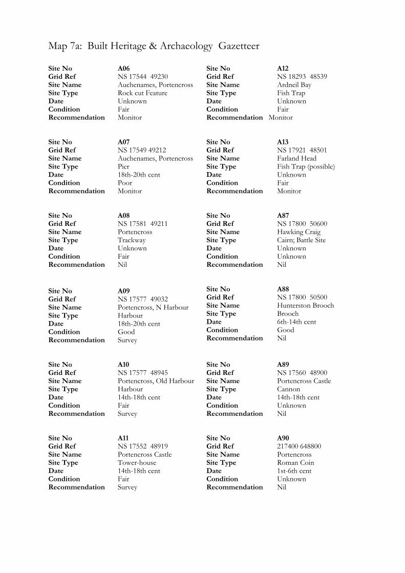
Map 7a: Built Heritage & Archaeology Gazetteer
Site No A06 Grid Ref NS 17544 49230 Site Name Auchenames, Portencross Site Type Rock cut Feature Date Unknown Condition Fair Recommendation Monitor Site No A07 Grid Ref NS 17549 49212 Site Name Auchenames, Portencross Site Type Pier Date 18th-20th cent Condition Poor Recommendation Monitor Site No A08 Grid Ref NS 17581 49211 Site Name Portencross Site Type Trackway Date Unknown Condition Fair Recommendation Nil Site No A09 Grid Ref NS 17577 49032 Site Name Portencross, N Harbour Site Type Harbour Date 18th-20th cent Condition Good Recommendation Survey Site No A10 Grid Ref NS 17577 48945 Site Name Portencross, Old Harbour Site Type Harbour Date 14th-18th cent Condition Fair Recommendation Survey Site No A11 Grid Ref NS 17552 48919 Site Name Portencross Castle Site Type Tower-house Date 14th-18th cent Condition Fair Recommendation Survey
Site No A12 Grid Ref NS 18293 48539 Site Name Ardneil Bay Site Type Fish Trap Date Unknown Condition Fair Recommendation Monitor Site No A13 Grid Ref NS 17921 48501 Site Name Farland Head Site Type Fish Trap (possible) Date Unknown Condition Fair Recommendation Monitor Site No A87 Grid Ref NS 17800 50600 Site Name Hawking Craig Site Type Cairn; Battle Site Date Unknown Condition Unknown Recommendation Nil Site No A88 Grid Ref NS 17800 50500 Site Name Hunterston Brooch Site Type Brooch Date 6th-14th cent Condition Good Recommendation Nil Site No A89 Grid Ref NS 17560 48900 Site Name Portencross Castle Site Type Cannon Date 14th-18th cent Condition Unknown Recommendation Nil Site No A90 Grid Ref 217400 648800 Site Name Portencross Site Type Roman Coin Date 1st-6th cent Condition Unknown Recommendation Nil

Site No A91 Grid Ref NS 17690 48750 Site Name Portencross Site Type Rig and furrow Date Unknown Condition Poor Recommendation Nil Site No A92 Grid Ref NS 18100 48500 Site Name Ardneil Bay Site Type Fish Trap Date Unknown Condition Unknown Recommendation Nil Site No A93 Grid Ref NS 18300 48620 Site Name Kirkfield House Site Type Enclosure Date Unknown Condition Unknown Recommendation Nil Site No A149 Grid Ref NS 17500 49000 Site Name Marion Site Type Wreck Date Unknown Condition Unknown Recommendation Nil Site No A150 Grid Ref NS 17500 48900 Site Name Portencross Galleon Site Type Wreck Date Unknown Condition Unknown Recommendation Nil
Site No A151 Grid Ref NS 18790 48400 Site Name Holland House Site Type Residential Date 18th-20th cent Condition Unknown Recommendation Nil Site No A170 Grid Ref NS 17650 48930 Site Name Portencross Site Type Rig and furrow Date Unknown Condition Poor Recommendation Nil Site No A171 Grid Ref NS 17700 48880 Site Name Portencross Site Type Rig and furrow Date Unknown Condition Poor Recommendation Nil Site No A172 Grid Ref NS 17740 48790 Site Name Portencross Site Type Rig and furrow Date Unknown Condition Poor Recommendation Nil Site No A173 Grid Ref NS 17900 50500 Site Name Hawking Craig Site Type Cists; Cinerary Urns Date Unknown Condition Unknown Recommendation Nil
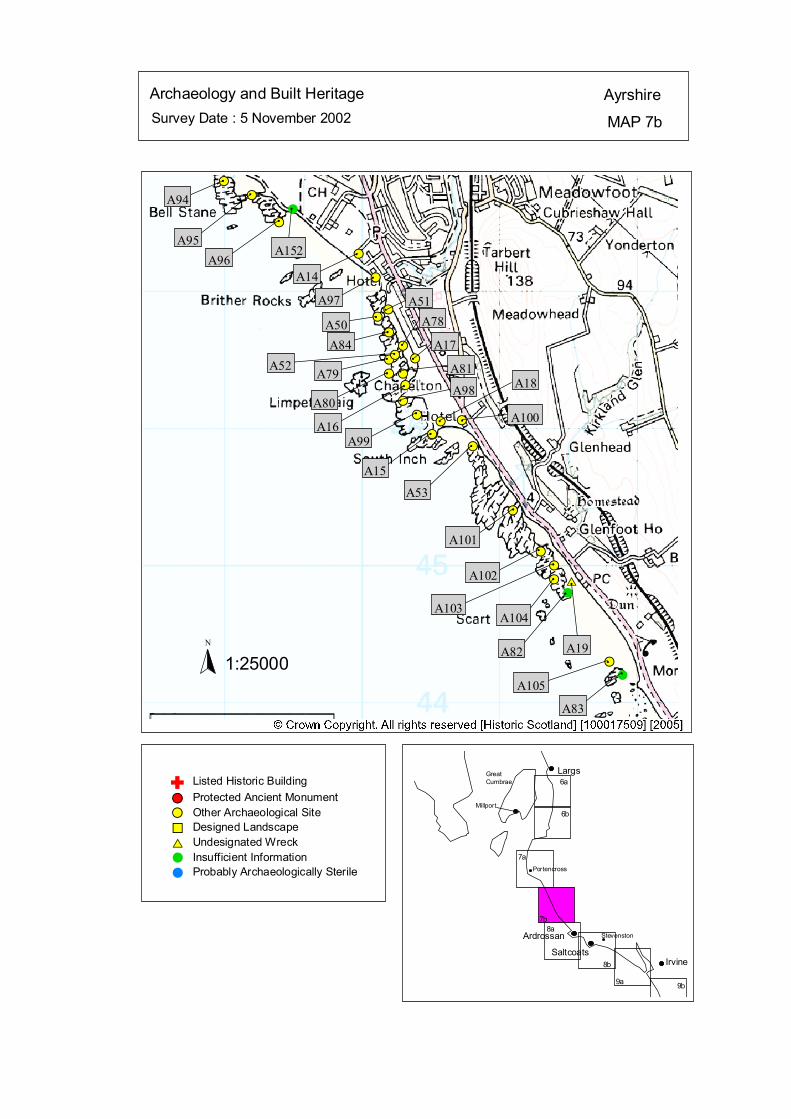
Survey Date : 5 November 2002 MAP 7b
AyrshireArchaeology and Built Heritage
GreatCumbrae
Millport
Stevenston
Portencross
IrvineSaltcoats
Ardrossan
Largs
6b
6a
7a
7b8a
9b9a
8b
#
##S
#S
#S#S#S
#S
#S#S
#S
#S#S
#S#S
#S#S#S
#S
#S
#S#S
#S
#S
#S
#S#S
$T
#S
#
#
A94#
A95
#
A96
#
A152 #
A14 #
A97#
A51#
A50#
A84 #
A78
#
A17#
A52#
A79 #
A80
# A81#
A16
#
A98#
A99
#
A18
# A100#
A15
#
A53#
A101#
A102#
A103
#
A104
#
A82
#
A19#
A105#
A83
Listed Historic Building#S Protected Ancient Monument#S Other Archaeological Site%U Designed Landscape$T Undesignated Wreck# Insufficient Information# Probably Archaeologically Sterile
© Crown Copyright. All rights reserved. Licence No. PA01041C. 2003.
1:25000N
Ñ
kat
horizontal
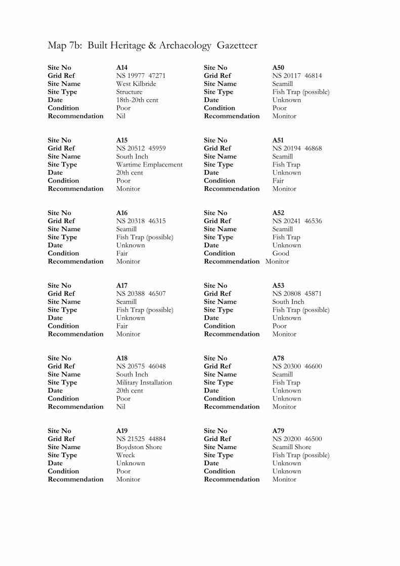
Map 7b: Built Heritage & Archaeology Gazetteer
Site No A14 Grid Ref NS 19977 47271 Site Name West Kilbride Site Type Structure Date 18th-20th cent Condition Poor Recommendation Nil Site No A15 Grid Ref NS 20512 45959 Site Name South Inch Site Type Wartime Emplacement Date 20th cent Condition Poor Recommendation Monitor Site No A16 Grid Ref NS 20318 46315 Site Name Seamill Site Type Fish Trap (possible) Date Unknown Condition Fair Recommendation Monitor Site No A17 Grid Ref NS 20388 46507 Site Name Seamill Site Type Fish Trap (possible) Date Unknown Condition Fair Recommendation Monitor Site No A18 Grid Ref NS 20575 46048 Site Name South Inch Site Type Military Installation Date 20th cent Condition Poor Recommendation Nil Site No A19 Grid Ref NS 21525 44884 Site Name Boydston Shore Site Type Wreck Date Unknown Condition Poor Recommendation Monitor
Site No A50 Grid Ref NS 20117 46814 Site Name Seamill Site Type Fish Trap (possible) Date Unknown Condition Poor Recommendation Monitor Site No A51 Grid Ref NS 20194 46868 Site Name Seamill Site Type Fish Trap Date Unknown Condition Fair Recommendation Monitor Site No A52 Grid Ref NS 20241 46536 Site Name Seamill Site Type Fish Trap Date Unknown Condition Good Recommendation Monitor Site No A53 Grid Ref NS 20808 45871 Site Name South Inch Site Type Fish Trap (possible) Date Unknown Condition Poor Recommendation Monitor Site No A78 Grid Ref NS 20300 46600 Site Name Seamill Site Type Fish Trap Date Unknown Condition Unknown Recommendation Monitor Site No A79 Grid Ref NS 20200 46500 Site Name Seamill Shore Site Type Fish Trap (possible) Date Unknown Condition Unknown Recommendation Monitor

Site No A80 Grid Ref NS 20200 46400 Site Name Seamill Site Type Fish Trap Date Unknown Condition Unknown Recommendation Monitor Site No A81 Grid Ref NS 20300 46400 Site Name Seamill Site Type Fish Trap Date Unknown Condition Unknown Recommendation Monitor Site No A82 Grid Ref NS 21500 44800 Site Name Boydston Shore Site Type Fish Trap Date Unknown Condition Unknown Recommendation Nil Site No A83 Grid Ref NS 21900 44200 Site Name Boydston Shore Site Type Fish Trap Date Unknown Condition Unknown Recommendation Nil Site No A84 Grid Ref NS 20200 46700 Site Name Seamill Site Type Fish Traps Date Unknown Condition Unknown Recommendation Monitor Site No A94 Grid Ref NS 19000 47800 Site Name Ardneil Bay Site Type Fish Trap Date Unknown Condition Unknown Recommendation Monitor
Site No A95 Grid Ref NS 19200 47700 Site Name Bastion Craig Site Type Fish Trap (possible) Date Unknown Condition Unknown Recommendation Monitor Site No A96 Grid Ref NS 19400 47500 Site Name Ardneil Bay Site Type Fish Trap Date Unknown Condition Unknown Recommendation Monitor Site No A97 Grid Ref NS 20100 47100 Site Name Seamill Bridge Site Type Fish Trap Date Unknown Condition Unknown Recommendation Monitor Site No A98 Grid Ref NS 20300 46200 Site Name Seamill Site Type Fish Trap Date Unknown Condition Unknown Recommendation Monitor Site No A99 Grid Ref NS 20400 46100 Site Name Seamill Site Type Fish Trap Date Unknown Condition Unknown Recommendation Monitor Site No A100 Grid Ref NS 20730 46060 Site Name Tarbet Site Type Meal Mill Date Unknown Condition Unknown Recommendation Nil

Site No A101 Grid Ref NS 21100 45400 Site Name Glenlea Site Type Fish Trap Date Unknown Condition Unknown Recommendation Monitor Site No A102 Grid Ref NS 21300 45100 Site Name Boydston Shore Site Type Fish Trap Date Unknown Condition Unknown Recommendation Monitor Site No A103 Grid Ref NS 21400 45000 Site Name Boydston Shore Site Type Fish Trap Date Unknown Condition Unknown Recommendation Monitor
Site No A104 Grid Ref NS 21400 44900 Site Name Boydston Shore Site Type Fish Trap Date Unknown Condition Unknown Recommendation Nil Site No A105 Grid Ref NS 21800 44300 Site Name Boydston Shore Site Type Fish Trap Date Unknown Condition Unknown Recommendation Monitor Site No A152 Grid Ref NS 19500 47600 Site Name Ardneil Bay Site Type Fish Trap (possible) Date Unknown Condition Unknown Recommendation Nil
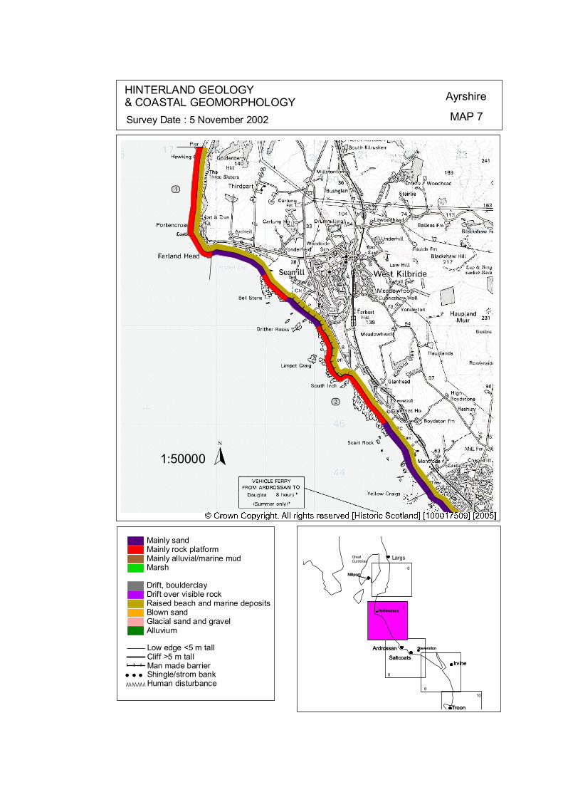
### # # # #
# # # #
# # # # # #
ôó1
ôó2
ô
N
1:50000
HINTERLAND GEOLOGY& COASTAL GEOMORPHOLOGY Ayrshire
MAP 7Survey Date : 5 November 2002
Millport
Stevenston
Portencross
Troon
IrvineSaltcoats
Ardrossan
Largs
6
9
8
7
Ardrossan
SaltcoatsIrvine
Troon
Portencross
Stevenston
Millport
GreatCumbrae
10
© Crown Copyright. All rights reserved. Licence No. PA01041C. 2003.
Low edge <5 m tallCliff >5 m tallMan made barrier# # #Shingle/strom bank' ' 'Human disturbanceÒÒÒÒÒÒÒ
Mainly sandMainly rock platformMainly alluvial/marine mudMarsh
Drift, boulderclayDrift over visible rockRaised beach and marine depositsBlown sandGlacial sand and gravelAlluvium
kat
horizontal
Map 7: Hunterston to Ardrossan Hinterland Geology and Coastal Geomorphology
1 Portencross NS 1677 5492 2.53 km Mainly rock platform Low edge < 5 m Raised Beach
The shoreline changes significantly at Pottencross from the protected littoral coastline present to the south, to a hard rock coastline with no littoral cover. An emerged rock platform extends from Farland head northwards to the pier at Hunterston power station. This extends landwards to the foot of the Holocene cliff line. 2 Seamill NS 2047 4611 7.49 km Mainly sands Mainly Low edge < 5 m, some sea wall Raised Beach
Rip-rap protection and groynes extend northwards beyond Burnfoot bridge. The foreshore is composed of sands and fine gravels with isolated rock outcrops, increasing in number northwards to Sea Mill. At this point the veneer of sediment increases to almost complete coverage and properties fringe the shoreline. Sea Mill Hotel and neighbouring properties have seawalls, which are constructed directly on to the beach. The Golf Course follows the shoreline separated from the beach with a low dune, which is protected by rip-rap. Isolated rocks are present at low tide, but sands and fine graves dominate the foreshore.
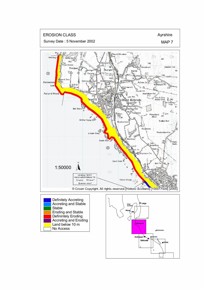
ôó1
ôó2
N
1:50000
EROSION CLASS Ayrshire
MAP 7Survey Date : 5 November 2002
8
Largs
Ardrossan
SaltcoatsIrvine
T
Portencross
Stevenston
Millport
GreatCumbrae
Largs
Ardrossan
SaltcoatsIrvine
Portencross
Stevenston
Millport
GreatCumbrae
6
PortencrossPortencross7
9
Land below 10 mAccreting and ErodingDefinintely ErodingEroding and StableStableAccreting and StableDefinitely Accreting
No Access
© Crown Copyright. All rights reserved. Licence No. PA01041C. 2003.
kat
horizontal
Map 7: Hunterston to Ardrossan Erosion Class
1 Portencross NS 1677 5492 2.53 km LT: Erosional - Low ST: Erosional – Low
The shoreline changes significantly at Pottencross from a protected littoral coastline, to a hard rock coastline with no littoral cover. An emerged rock platform extends from Farland head northwards to the pier at Hunterston power station (Plate 20). This section of coast has been classified as erosional but at very slow rates. 2 Seamill NS 2047 4611 7.49 km LT: Erosional - Low ST: Erosional – Low
The accretional section next to Ardrossan Harbour is spatially limited, as rip-rap protection and groynes extend northwards beyond Burnfoot bridge. The protection at the back beach is vegetated and moderately stable, however there are local areas of erosion feeding sediment to adjacent sections. The foreshore is composed of sands and fine gravels with isolated rock outcrops, increasing in number northwards to Sea Mill. Sea Mill Hotel and neighbouring properties have seawalls, which are constructed directly on to the beach. The walls of the southern properties are relatively stable, however a significant erosional bight is present up-coast (north) of the protection which highlights an erosional problem which continues along the shoreline beyond Sea Mill Golf Course.
Map 8: Ayrshire Coast: Ardrossan North Bay to Stevenston Pier Map Content Descriptions
1. Built Heritage and Archaeology
A total of twenty four sites were recorded in the area covered by Map 8. Of these sixteen were previously recorded and eight were new sites noted during the field survey. The majority of the sites relate to post eighteenth century industrial activity in and around Ardrossan, Saltcoats and Stevenston. The main sites, for example Ardrossan and Saltcoats Harbours (A21 & 22 respectively), were in relatively good condition. The former pier at Stevenston (A32) is, however, an area of very high erosion rates and the pier is now almost completely gone. The man made promontory from which it extended is actively eroding as is the mining ‘bing’ (A25). 2. Hinterland Geology, Coastal Geomorphology and Erosion Class
The section of coastline covered by Map 8 extended from North Bay Ardrossan, past Saltcoats and Stevenston Beach to the eastern side of the man made promontory at Stevenston. The presence of Ardrossan, Saltcoats and Stevenston have had a large influence on the appearance and make up of the coastline covered by Map 8. Heavy industry is, and was, closely related to these towns and has left its mark on the coastline. The intertidal area is formed by a mixture of rock platform headlands and small sandy bays. The majority of the area is built upon up to the coast edge and is, therefore, heavily defended by sea walls. The area to the south of Saltcoats is actively eroding whereas the area to the north consists of a more stable environment.
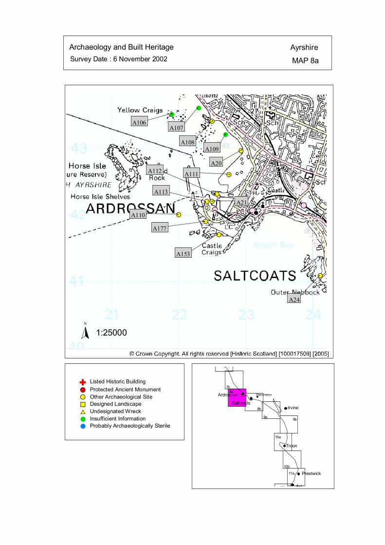
Survey Date : 6 November 2002 MAP 8a
AyrshireArchaeology and Built Heritage
Stevenston
Ayr
Prestwick
Troon
IrvineSaltcoats
Ardrossan
7b8a
10b
10a
9b9a
11b
11a
8b
#
#S
#S
#S
#S
#
#
#S
#S#S
#S
#S
#S
#
A106
#
A107#
A108#
A109 #
A20#A111
#
A112
# A21#
A113
#A110#
A177#
A153
#
A24
Listed Historic Building#S Protected Ancient Monument#S Other Archaeological Site%U Designed Landscape$T Undesignated Wreck# Insufficient Information# Probably Archaeologically Sterile
© Crown Copyright. All rights reserved. Licence No. PA01041C. 2003.
1:25000N
Ñ
kat
horizontal
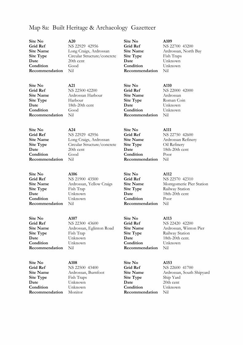
Map 8a: Built Heritage & Archaeology Gazetteer
Site No A20 Grid Ref NS 22929 42956 Site Name Long Craigs, Ardrossan Site Type Circular Structure/concrete Date 20th cent Condition Good Recommendation Nil Site No A21 Grid Ref NS 22500 42200 Site Name Ardrossan Harbour Site Type Harbour Date 18th-20th cent Condition Good Recommendation Nil Site No A24 Grid Ref NS 22929 42956 Site Name Long Craigs, Ardrossan Site Type Circular Structure/concrete Date 20th cent Condition Good Recommendation Nil Site No A106 Grid Ref NS 21900 43500 Site Name Ardrossan, Yellow Craigs Site Type Fish Trap Date Unknown Condition Unknown Recommendation Nil Site No A107 Grid Ref NS 22300 43600 Site Name Ardrossan, Eglinton Road Site Type Fish Trap Date Unknown Condition Unknown Recommendation Nil Site No A108 Grid Ref NS 22500 43400 Site Name Ardrossan, Burnfoot Site Type Fish Traps Date Unknown Condition Unknown Recommendation Monitor
Site No A109 Grid Ref NS 22700 43200 Site Name Ardrossan, North Bay Site Type Fish Traps Date Unknown Condition Unknown Recommendation Nil Site No A110 Grid Ref NS 22000 42000 Site Name Ardrossan Site Type Roman Coin Date Unknown Condition Unknown Recommendation Nil Site No A111 Grid Ref NS 22750 42600 Site Name Ardrossan Refinery Site Type Oil Refinery Date 18th-20th cent Condition Poor Recommendation Nil Site No A112 Grid Ref NS 22570 42310 Site Name Montgomerie Pier Station Site Type Railway Station Date 18th-20th cent Condition Poor Recommendation Nil Site No A113 Grid Ref NS 22420 42200 Site Name Ardrossan, Winton Pier Site Type Railway Station Date 18th-20th cent. Condition Unknown Recommendation Nil Site No A153 Grid Ref NS 22600 41700 Site Name Ardrossan, South Shipyard Site Type Ship Yard Date 20th cent Condition Unknown Recommendation Nil

Site No A177 Grid Ref NS 22400 41900 Site Name Ardrossan Shipyard Site Type Shipyard Date 18th-20th cent Condition Unknown Recommendation Nil
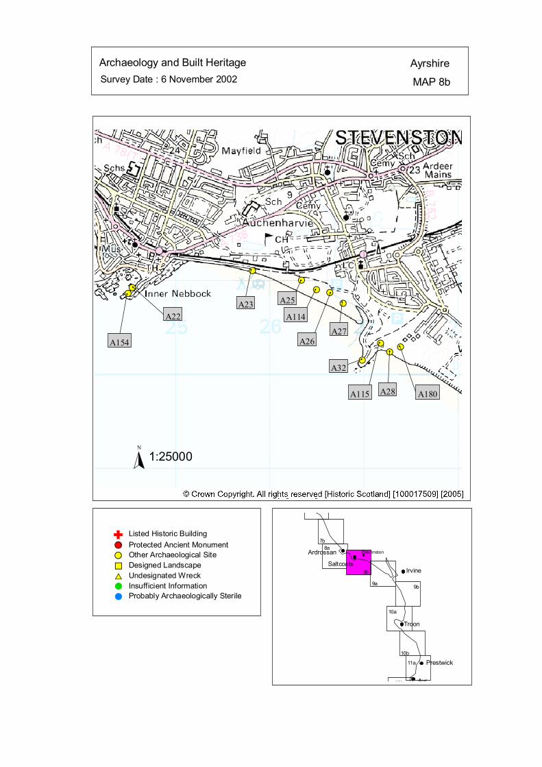
Survey Date : 6 November 2002 MAP 8b
AyrshireArchaeology and Built Heritage
Stevenston
Ayr
Prestwick
Troon
IrvineSaltcoats
Ardrossan
7b8a
10b
10a
9b9a
11b
11a
8b
#S#S
#S
#S#S
#S
#S
#S
#S#S
#S#
A154
#
A22
#
A23
#
A25#
A114
#
A26
#
A27
#
A32
#
A115
#
A28
#
A180
Listed Historic Building#S Protected Ancient Monument#S Other Archaeological Site%U Designed Landscape$T Undesignated Wreck# Insufficient Information# Probably Archaeologically Sterile
© Crown Copyright. All rights reserved. Licence No. PA01041C. 2003.
1:25000N
Ñ
kat
horizontal
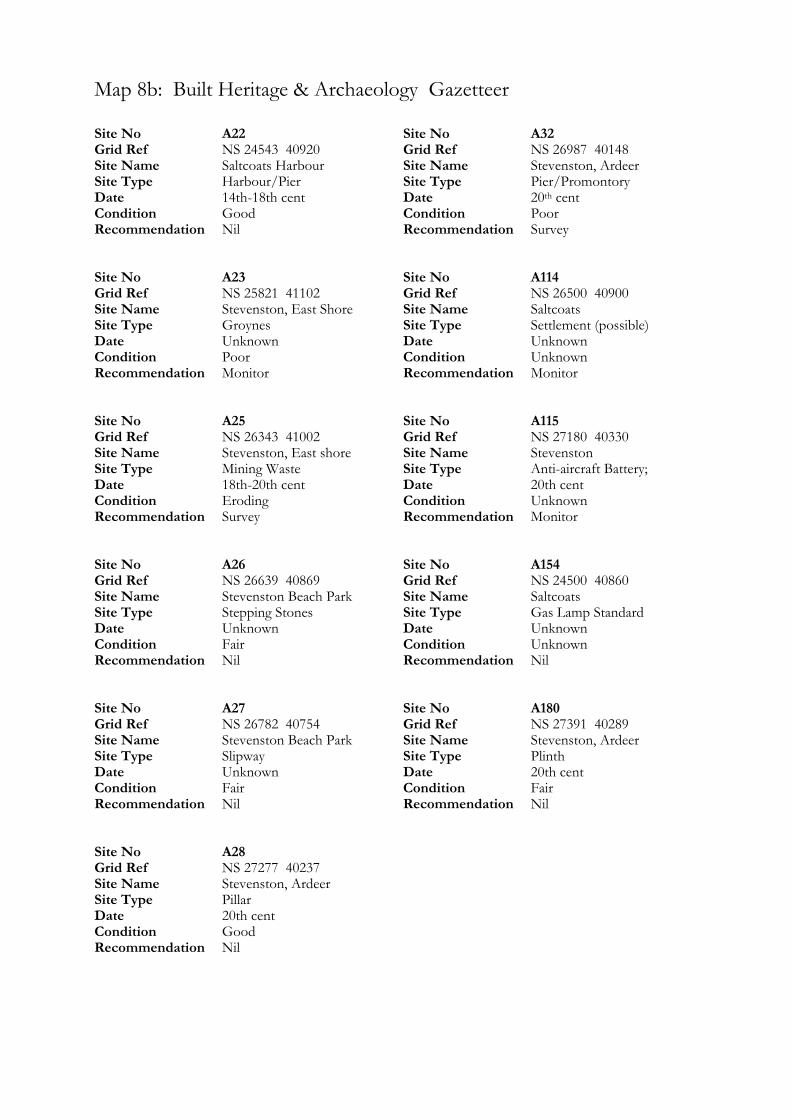
Map 8b: Built Heritage & Archaeology Gazetteer
Site No A22 Grid Ref NS 24543 40920 Site Name Saltcoats Harbour Site Type Harbour/Pier Date 14th-18th cent Condition Good Recommendation Nil Site No A23 Grid Ref NS 25821 41102 Site Name Stevenston, East Shore Site Type Groynes Date Unknown Condition Poor Recommendation Monitor Site No A25 Grid Ref NS 26343 41002 Site Name Stevenston, East shore Site Type Mining Waste Date 18th-20th cent Condition Eroding Recommendation Survey Site No A26 Grid Ref NS 26639 40869 Site Name Stevenston Beach Park Site Type Stepping Stones Date Unknown Condition Fair Recommendation Nil Site No A27 Grid Ref NS 26782 40754 Site Name Stevenston Beach Park Site Type Slipway Date Unknown Condition Fair Recommendation Nil Site No A28 Grid Ref NS 27277 40237 Site Name Stevenston, Ardeer Site Type Pillar Date 20th cent Condition Good Recommendation Nil
Site No A32 Grid Ref NS 26987 40148 Site Name Stevenston, Ardeer Site Type Pier/Promontory Date 20th cent Condition Poor Recommendation Survey Site No A114 Grid Ref NS 26500 40900 Site Name Saltcoats Site Type Settlement (possible) Date Unknown Condition Unknown Recommendation Monitor Site No A115 Grid Ref NS 27180 40330 Site Name Stevenston Site Type Anti-aircraft Battery; Date 20th cent Condition Unknown Recommendation Monitor Site No A154 Grid Ref NS 24500 40860 Site Name Saltcoats Site Type Gas Lamp Standard Date Unknown Condition Unknown Recommendation Nil Site No A180 Grid Ref NS 27391 40289 Site Name Stevenston, Ardeer Site Type Plinth Date 20th cent Condition Fair Recommendation Nil
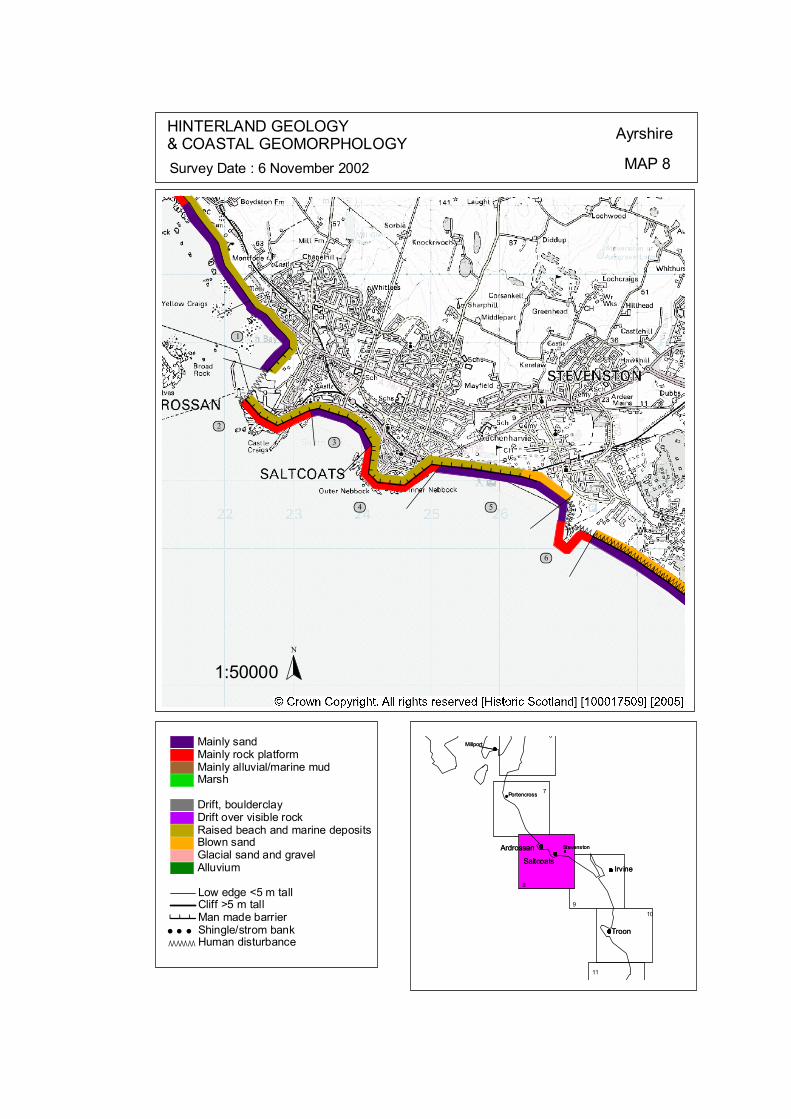
ÒÒÒÒÒÒÒÒÒÒÒÒÒÒÒÒÒÒÒÒÒÒÒÒÒÒÒÒÒ
ÒÒÒÒÒÒÒÒÒÒÒ
ÒÒÒÒÒÒÒÒÒ Ò ÒÒÒÒÒÒ # # # # # # # # # ## # #
### # # # # # # # # # # # # # # # # # #
# # # # # # # # # # # # # # # # #
####
ôó1
ôó2ôó3
ôó4 ôó5
ôó6
N
1:50000
HINTERLAND GEOLOGY& COASTAL GEOMORPHOLOGY Ayrshire
MAP 8Survey Date : 6 November 2002
Millport
Stevenston
Portencross
Troon
IrvineSaltcoats
Ardrossan
6
9
8
7
Ardrossan
SaltcoatsIrvine
Troon
Portencross
Stevenston
Millport
10
11
© Crown Copyright. All rights reserved. Licence No. PA01041C. 2003.
Low edge <5 m tallCliff >5 m tallMan made barrier# # #Shingle/strom bank' ' 'Human disturbanceÒÒÒÒÒÒÒ
Mainly sandMainly rock platformMainly alluvial/marine mudMarsh
Drift, boulderclayDrift over visible rockRaised beach and marine depositsBlown sandGlacial sand and gravelAlluvium
kat
horizontal
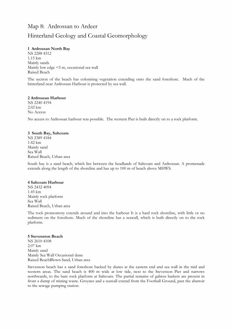
Map 8: Ardrossan to Ardeer Hinterland Geology and Coastal Geomorphology
1 Ardrossan North Bay NS 2288 4312 1.15 km Mainly sands Mainly low edge <5 m, occasional sea wall Raised Beach
The section of the beach has colonising vegetation extending onto the sand foreshore. Much of the hinterland near Ardrossan Harbour is protected by sea wall. 2 Ardrossan Harbour NS 2240 4194 2.02 km No Access
No access to Ardrossan harbour was possible. The western Pier is built directly on to a rock platform. 3 South Bay, Saltcoats NS 2389 4184 1.42 km Mainly sand Sea Wall Raised Beach, Urban area
South bay is a sand beach, which lies between the headlands of Saltcoats and Ardrossan. A promenade extends along the length of the shoreline and has up to 100 m of beach above MHWS. 4 Saltcoats Harbour NS 2432 4094 1.45 km Mainly rock platform Sea Wall Raised Beach, Urban area
The rock promontory extends around and into the harbour It is a hard rock shoreline, with little or no sediment on the foreshore. Much of the shoreline has a seawall, which is built directly on to the rock platform. 5 Stevenston Beach NS 2610 4108 2.07 km Mainly sand Mainly Sea Wall Occasional dune Raised BeachBlown Sand, Urban area
Stevenson beach has a sand foreshore backed by dunes at the eastern end and sea wall in the mid and western areas. The sand beach is 400 m wide at low tide, next to the Stevenson Pier and narrows northwards, to the bare rock platform at Saltcoats. The partial remains of gabion baskets are present in front a dump of mining waste. Groynes and a seawall extend from the Football Ground, past the abattoir to the sewage pumping station.

6 Stevenston Pier NS 2697 4018 0.98 km Mainly rock platform, overlying gravels Low edge <5 m Reclaimed land & Raised beach
This promontory was used as a pier during the Second World War. It was constructed with gravel and boulders. Recently the Council have armoured the tip with rip-rap and constructed a seawall and slipway on the eastern edge pier. The promontory from which the pier used to extend is constructed of man made dumps of substantial quantity.
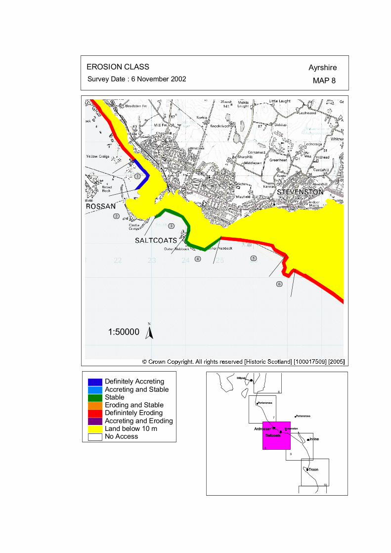
ôó1
ôó2
ôó3
ôó4 ôó5
ôó6
N
1:50000
EROSION CLASS AyrshireMAP 8Survey Date : 6 November 2002
8
Ardrossan
SaltcoatsIrvine
Troon
Portencross
Stevenston
Millport
Ardrossan
SaltcoatsIrvine
Troon
Portencross
Stevenston
Millport
6
PortencrossPortencross7
9
10
No Access
Definitely AccretingAccreting and StableStableEroding and StableDefinintely ErodingAccreting and ErodingLand below 10 m
© Crown Copyright. All rights reserved. Licence No. PA01041C. 2003.
kat
horizontal
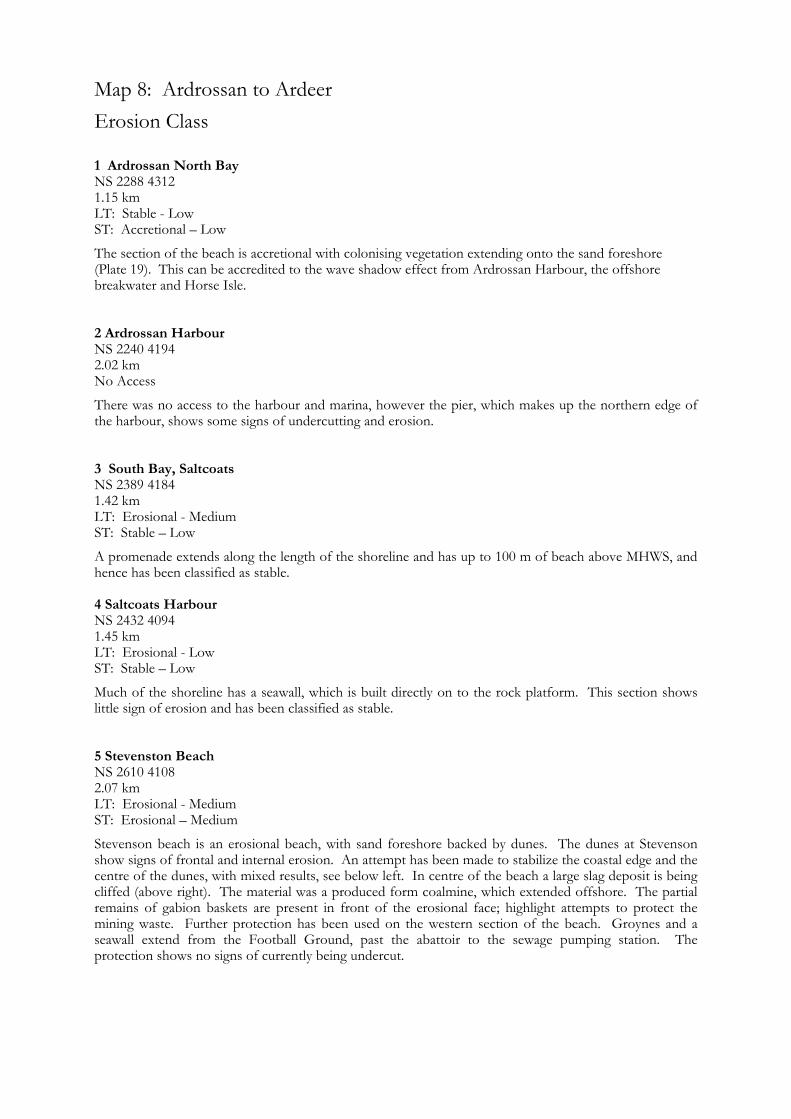
Map 8: Ardrossan to Ardeer Erosion Class
1 Ardrossan North Bay NS 2288 4312 1.15 km LT: Stable - Low ST: Accretional – Low
The section of the beach is accretional with colonising vegetation extending onto the sand foreshore (Plate 19). This can be accredited to the wave shadow effect from Ardrossan Harbour, the offshore breakwater and Horse Isle. 2 Ardrossan Harbour NS 2240 4194 2.02 km No Access
There was no access to the harbour and marina, however the pier, which makes up the northern edge of the harbour, shows some signs of undercutting and erosion. 3 South Bay, Saltcoats NS 2389 4184 1.42 km LT: Erosional - Medium ST: Stable – Low
A promenade extends along the length of the shoreline and has up to 100 m of beach above MHWS, and hence has been classified as stable. 4 Saltcoats Harbour NS 2432 4094 1.45 km LT: Erosional - Low ST: Stable – Low
Much of the shoreline has a seawall, which is built directly on to the rock platform. This section shows little sign of erosion and has been classified as stable. 5 Stevenston Beach NS 2610 4108 2.07 km LT: Erosional - Medium ST: Erosional – Medium
Stevenson beach is an erosional beach, with sand foreshore backed by dunes. The dunes at Stevenson show signs of frontal and internal erosion. An attempt has been made to stabilize the coastal edge and the centre of the dunes, with mixed results, see below left. In centre of the beach a large slag deposit is being cliffed (above right). The material was a produced form coalmine, which extended offshore. The partial remains of gabion baskets are present in front of the erosional face; highlight attempts to protect the mining waste. Further protection has been used on the western section of the beach. Groynes and a seawall extend from the Football Ground, past the abattoir to the sewage pumping station. The protection shows no signs of currently being undercut.

6 Stevenston Pier NS 2697 4018 0.98 km LT: Erosional - Medium ST: Erosional - High
This promontory was used as a pier during the Second World War. It was constructed with gravel and boulders and is experiencing erosion on all fronts. The eroded material is contributing to the gravel beach surrounding the promontory. Recently the Council have armoured the tip with rip-rap and constructed a seawall and slipway on the eastern edge pier, shown below, note the significant erosional bight.
Map 9: Ayrshire Coast: Stevenston Pier to Barassie Map Content Descriptions
1. Built Heritage and Archaeology
A total of thirteen sites were recorded in the area covered by Map 9. Of these five were previously recorded and eight were new sites noted during the field survey. The main concentration of sites occurred around the northern area of Map 9. The sites located to the north of the Garnock Estuary relate to Nobel’s Explosive factory which extends up to and forms the coast edge. These sites include Sea defences (A29) and a large section of eroding industrial waste (A30) that forms the large bank infront of the main factory site. The sites located in the southern area of the Garnock Estuary include the remains of a possible jetty (A33) and a stretch of industrial waste eroding from the sand dunes beneath a wooden walkway (A36). Listed buildings are included in the Irvine Harbour complex. All of the sites covered by Map 9 are situated in an erosional area of the coastline and, therefore, are potentially under threat. Sites A30 and A36 show visible signs of relatively rapid erosional rates. 2. Hinterland Geology, Coastal Geomorphology and Erosion Class
The section of coastline covered by Map 9 extended from the man made promontory at Stevenston to the Northern tip of Barassie. This encompassed all of Irvine Bay and the Garnock Estuary. All of the foreshore consisted of sand deposits and the hinterland comprised mostly of blown sand. Much of the coastline in this area had been modified significantly by human activity including Nobel’s Explosive Factory and activity to the south of the Garnock estuary. Large sea walls protect the northern end of Nobel’s Factory. Irvine Bay is an area of eroding coastline with much of the hinterland being below 10 m in height.
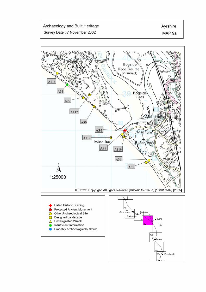
Survey Date : 7 November 2002 MAP 9a
AyrshireArchaeology and Built Heritage
Stevenston
Ayr
Prestwick
Troon
IrvineSaltcoats
Ardrossan
7b8a
10b
10a
9b9a
11b
11a
8b
#S#S
#S#S
#S
#S
#
#S
#S
#S
#
A29
#
A117
#
A30
#A118#
A119
#
A35
#A36
#
A31
#
A116
A34#
A33
Listed Historic Building#S Protected Ancient Monument#S Other Archaeological Site%U Designed Landscape$T Undesignated Wreck# Insufficient Information# Probably Archaeologically Sterile
© Crown Copyright. All rights reserved. Licence No. PA01041C. 2003.
1:25000
N
Ñ#
Ñ
kat
horizontal
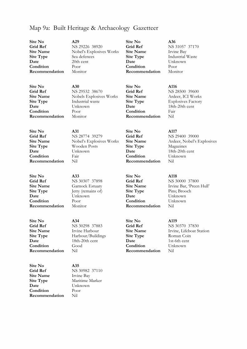
Map 9a: Built Heritage & Archaeology Gazetteer
Site No A29 Grid Ref NS 29226 38920 Site Name Nobel’s Explosives Works Site Type Sea defences Date 20th cent Condition Poor Recommendation Monitor Site No A30 Grid Ref NS 29532 38670 Site Name Nobels Explosives Works Site Type Industrial waste Date Unknown Condition Poor Recommendation Monitor Site No A31 Grid Ref NS 28774 39279 Site Name Nobel’s Explosives Works Site Type Wooden Posts Date Unknown Condition Fair Recommendation Nil Site No A33 Grid Ref NS 30307 37898 Site Name Garnock Estuary Site Type Jetty (remains of) Date Unknown Condition Poor Recommendation Monitor Site No A34 Grid Ref NS 30298 37883 Site Name Irvine Harbour Site Type Harbour/Buildings Date 18th-20th cent Condition Good Recommendation Nil Site No A35 Grid Ref NS 30982 37110 Site Name Irvine Bay Site Type Maritime Marker Date Unknown Condition Poor Recommendation Nil
Site No A36 Grid Ref NS 31057 37170 Site Name Irvine Bay Site Type Industrial Waste Date Unknown Condition Poor Recommendation Monitor Site No A116 Grid Ref NS 28500 39600 Site Name Ardeer, ICI Works Site Type Explosives Factory Date 18th-20th cent Condition Fair Recommendation Nil Site No A117 Grid Ref NS 29400 39000 Site Name Ardeer, Nobel’s Explosives Site Type Magazines Date 18th-20th cent Condition Unknown Recommendation Nil Site No A118 Grid Ref NS 30000 37800 Site Name Irvine Bar, ‘Preen Hull’ Site Type Pins; Brooch Date Unknown Condition Unknown Recommendation Nil Site No A119 Grid Ref NS 30370 37830 Site Name Irvine, Lifeboat Station Site Type Roman Coin Date 1st-6th cent Condition Unknown Recommendation Nil
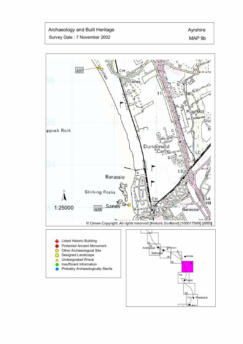
Survey Date : 7 November 2002 MAP 9b
AyrshireArchaeology and Built Heritage
Stevenston
Ayr
Prestwick
Troon
IrvineSaltcoats
Ardrossan
7b8a
10b
10a
9b9a
11b
11a
8b
#S
#S
#
A37
#
A38
Listed Historic Building#S Protected Ancient Monument#S Other Archaeological Site%U Designed Landscape$T Undesignated Wreck# Insufficient Information# Probably Archaeologically Sterile
© Crown Copyright. All rights reserved. Licence No. PA01041C. 2003.
1:25000
N
Ñ
kat
horizontal
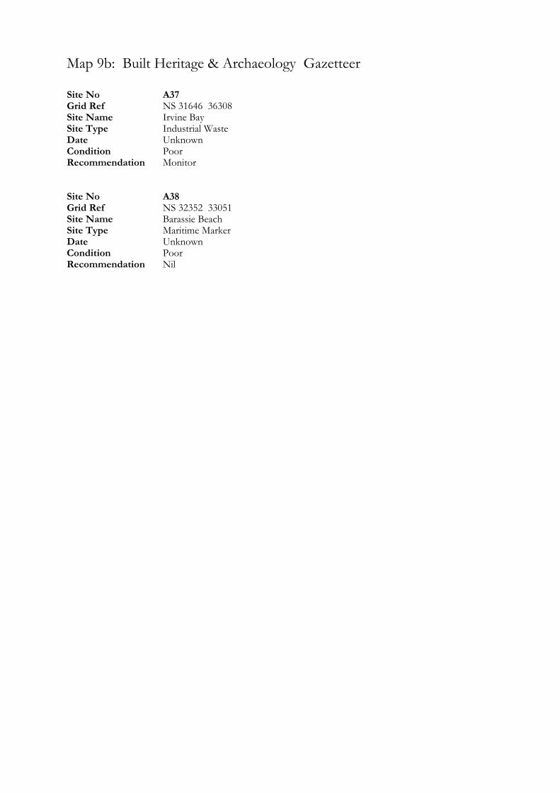
Map 9b: Built Heritage & Archaeology Gazetteer
Site No A37 Grid Ref NS 31646 36308 Site Name Irvine Bay Site Type Industrial Waste Date Unknown Condition Poor Recommendation Monitor Site No A38 Grid Ref NS 32352 33051 Site Name Barassie Beach Site Type Maritime Marker Date Unknown Condition Poor Recommendation Nil
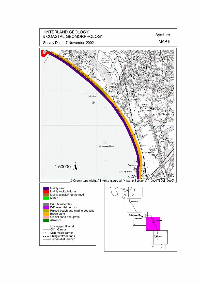
ÒÒÒÒÒÒÒÒÒÒÒÒÒÒÒÒÒÒÒÒÒÒÒÒÒÒÒÒÒÒÒÒÒÒÒÒÒÒÒÒÒÒÒÒÒÒÒÒÒÒÒÒÒÒÒÒ
ÒÒÒÒÒÒÒÒÒÒÒÒÒÒÒÒÒ
ÒÒ Ò ÒÒÒÒÒÒ # # # # # # # # # ## # # # # # # # # # # # ## # # #
# # # # # #
ôó1
N
1:50000
HINTERLAND GEOLOGY& COASTAL GEOMORPHOLOGY Ayrshire
MAP 9Survey Date : 7 November 2002
Millport
Stevenston
Portencross
Troon
IrvineSaltcoats
Ardrossan
6
9
8
7
Ardrossan
SaltcoatsIrvine
Troon
Portencross
Stevenston
Millport
10
11
© Crown Copyright. All rights reserved. Licence No. PA01041C. 2003.
Low edge <5 m tallCliff >5 m tallMan made barrier# # #Shingle/strom bank' ' 'Human disturbanceÒÒÒÒÒÒÒ
Mainly sandMainly rock platformMainly alluvial/marine mudMarsh
Drift, boulderclayDrift over visible rockRaised beach and marine depositsBlown sandGlacial sand and gravelAlluvium
kat
horizontal
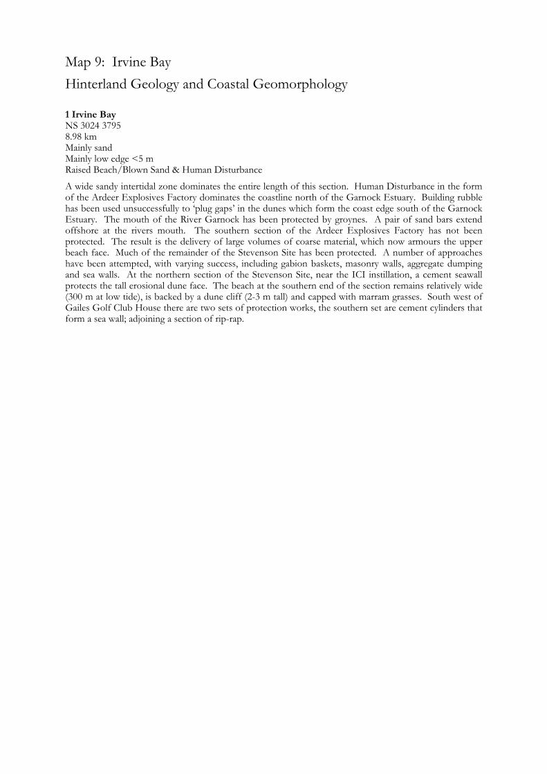
Map 9: Irvine Bay Hinterland Geology and Coastal Geomorphology
1 Irvine Bay NS 3024 3795 8.98 km Mainly sand Mainly low edge <5 m Raised Beach/Blown Sand & Human Disturbance
A wide sandy intertidal zone dominates the entire length of this section. Human Disturbance in the form of the Ardeer Explosives Factory dominates the coastline north of the Garnock Estuary. Building rubble has been used unsuccessfully to ‘plug gaps’ in the dunes which form the coast edge south of the Garnock Estuary. The mouth of the River Garnock has been protected by groynes. A pair of sand bars extend offshore at the rivers mouth. The southern section of the Ardeer Explosives Factory has not been protected. The result is the delivery of large volumes of coarse material, which now armours the upper beach face. Much of the remainder of the Stevenson Site has been protected. A number of approaches have been attempted, with varying success, including gabion baskets, masonry walls, aggregate dumping and sea walls. At the northern section of the Stevenson Site, near the ICI instillation, a cement seawall protects the tall erosional dune face. The beach at the southern end of the section remains relatively wide (300 m at low tide), is backed by a dune cliff (2-3 m tall) and capped with marram grasses. South west of Gailes Golf Club House there are two sets of protection works, the southern set are cement cylinders that form a sea wall; adjoining a section of rip-rap.
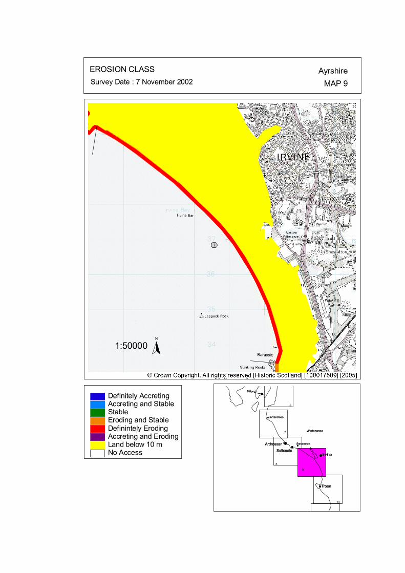
ôó1
N
1:50000
EROSION CLASS AyrshireMAP 9Survey Date : 7 November 2002
8
ArdrossanSaltcoats
Irvine
Troon
Portencross
Stevenston
Millport
ArdrossanSaltcoats
Irvine
Troon
Portencross
Stevenston
Millport
6
PortencrossPortencross7
9
10
No Access
Definitely AccretingAccreting and StableStableEroding and StableDefinintely ErodingAccreting and ErodingLand below 10 m
© Crown Copyright. All rights reserved. Licence No. PA01041C. 2003.
kat
horizontal
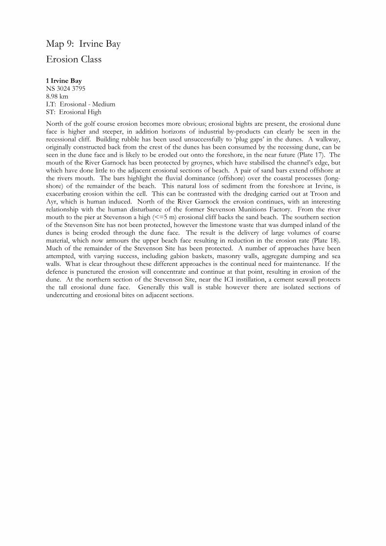
Map 9: Irvine Bay Erosion Class
1 Irvine Bay NS 3024 3795 8.98 km LT: Erosional - Medium ST: Erosional High
North of the golf course erosion becomes more obvious; erosional bights are present, the erosional dune face is higher and steeper, in addition horizons of industrial by-products can clearly be seen in the recessional cliff. Building rubble has been used unsuccessfully to ‘plug gaps’ in the dunes. A walkway, originally constructed back from the crest of the dunes has been consumed by the recessing dune, can be seen in the dune face and is likely to be eroded out onto the foreshore, in the near future (Plate 17). The mouth of the River Garnock has been protected by groynes, which have stabilised the channel’s edge, but which have done little to the adjacent erosional sections of beach. A pair of sand bars extend offshore at the rivers mouth. The bars highlight the fluvial dominance (offshore) over the coastal processes (long-shore) of the remainder of the beach. This natural loss of sediment from the foreshore at Irvine, is exacerbating erosion within the cell. This can be contrasted with the dredging carried out at Troon and Ayr, which is human induced. North of the River Garnock the erosion continues, with an interesting relationship with the human disturbance of the former Stevenson Munitions Factory. From the river mouth to the pier at Stevenson a high (<=5 m) erosional cliff backs the sand beach. The southern section of the Stevenson Site has not been protected, however the limestone waste that was dumped inland of the dunes is being eroded through the dune face. The result is the delivery of large volumes of coarse material, which now armours the upper beach face resulting in reduction in the erosion rate (Plate 18). Much of the remainder of the Stevenson Site has been protected. A number of approaches have been attempted, with varying success, including gabion baskets, masonry walls, aggregate dumping and sea walls. What is clear throughout these different approaches is the continual need for maintenance. If the defence is punctured the erosion will concentrate and continue at that point, resulting in erosion of the dune. At the northern section of the Stevenson Site, near the ICI instillation, a cement seawall protects the tall erosional dune face. Generally this wall is stable however there are isolated sections of undercutting and erosional bites on adjacent sections.
Map 10: Ayrshire Coast: Barassie to Prestwick North Map Content Descriptions
1. Built Heritage and Archaeology
A total of thirteen sites were recorded in the area covered by Map 10. Of these nine were previously recorded and four were new sites noted during the field survey. The concentration of sites occurred around Troon and, more specifically, Troon Harbour. These included the Harbour itself (A42), the large Ballast Bank (A43) and various remains of previous industrial activity. No sites were under immediate threat from coastal erosional processes. 2. Hinterland Geology, Coastal Geomorphology and Erosion Class
The section of coastline covered by Map 10 extended from Barassie to the northern tip of Prestwick. The majority of the inter tidal area was composed of sands with the exception of the rock headland at Troon Harbour. The hinterland is composed of both blown sand deposits and emerged beach. The erosional class of the section is varied. The headland at Troon Harbour has been classified as stable at the time of survey with a stretch of slightly accretional coastline to the south. Stable to erosional areas flank this area to the north and south. No areas of high erosion were located in the area covered by Map 10.
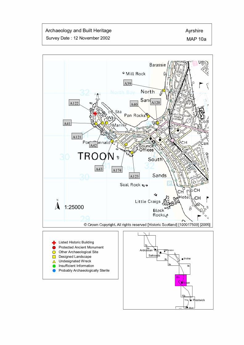
Survey Date : 12 November 2002 MAP 10a
AyrshireArchaeology and Built Heritage
Stevenston
Ayr
Prestwick
Troon
IrvineSaltcoats
Ardrossan
7b8a
10b
10a
9b9a
11b
11a
8b
#S
#S
#S
#S
#S
#S
#S#S#S
#
A39
#
A120
#
A40A122
#A41 #
A121
#
A42#
A43
#
A174
#
A123
Listed Historic Building#S Protected Ancient Monument#S Other Archaeological Site%U Designed Landscape$T Undesignated Wreck# Insufficient Information# Probably Archaeologically Sterile
© Crown Copyright. All rights reserved. Licence No. PA01041C. 2003.
1:25000N
Ñ#
Ñ
kat
horizontal

Map 10a: Built Heritage & Archaeology Gazetteer
Site No A39 Grid Ref NS 32351 32067 Site Name Troon, North Sands Site Type Maritime Marker Date Unknown Condition Poor Recommendation Nil Site No A40 Grid Ref NS 31984 31459 Site Name Troon, Pan Rocks Site Type Structure (remains of) Date Unknown Condition Poor Recommendation Monitor Site No A41 Grid Ref NS 30745 31283 Site Name Troon Harbour Site Type Slipway Date Unknown Condition Poor Recommendation Monitor Site No A42 Grid Ref NS 31000 31300 Site Name Troon Harbour Site Type Harbour Date 18th-20th cent Condition Good Recommendation Nil Site No A43 Grid Ref NS 31133 30863 Site Name Troon, Ballast Bank Site Type Ballast Mound Date 18th-20th cent Condition Good Recommendation Nil
Site No A120 Grid Ref NS 32200 31300 Site Name Troon, Gasworks Site Type Gasworks Date 18th-20th cent Condition Unknown Recommendation Nil Site No A121 Grid Ref NS 30900 31300 Site Name Troon, Ailsa Shipyard Site Type Shipyard Date 18th-20th cent. Condition Unknown Recommendation Nil Site No A122 Grid Ref NS 30730 31520 Site Name Troon, Harbour Site Type Cottages Date 18th-20th cent. Condition Good Recommendation Nil Site No A123 Grid Ref NS 31600 30600 Site Name Troon Site Type Flint Scraper Date Unknown Condition Unknown Recommendation Nil Site No A174 Grid Ref NS 31458 30788 Site Name Troon, 1 Welbeck Crescent Site Type Roman Coin Date Unknown Condition Unknown Recommendation Nil
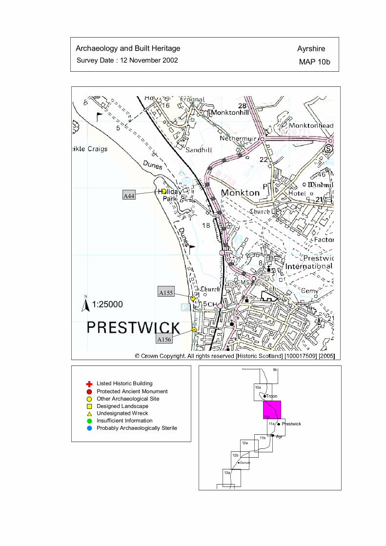
Survey Date : 12 November 2002 MAP 10b
AyrshireArchaeology and Built Heritage
Dunure
Ayr
Prestwick
Troon
10b
10a
9b
12b
12a11b
11a
13a
#S
#S
#S
#
A44
#
A155
#
A156
Listed Historic Building#S Protected Ancient Monument#S Other Archaeological Site%U Designed Landscape$T Undesignated Wreck# Insufficient Information# Probably Archaeologically Sterile
© Crown Copyright. All rights reserved. Licence No. PA01041C. 2003.
1:25000N
Ñ
kat
horizontal
Map 10b: Built Heritage & Archaeology Gazetteer
Site No A44 Grid Ref NS 34139 27949 Site Name Pow Burn Site Type Industrial Waste Date Unknown Condition Good Recommendation Nil Site No A155 Grid Ref NS 34570 26350 Site Name Prestwick Bathing Lake Site Type Recreation Date 20th cent Condition Good Recommendation Nil Site No A156 Grid Ref NS 34590 25880 Site Name Prestwick Esplanade Site Type Recreation Date 18th-20th cent Condition Good Recommendation Nil
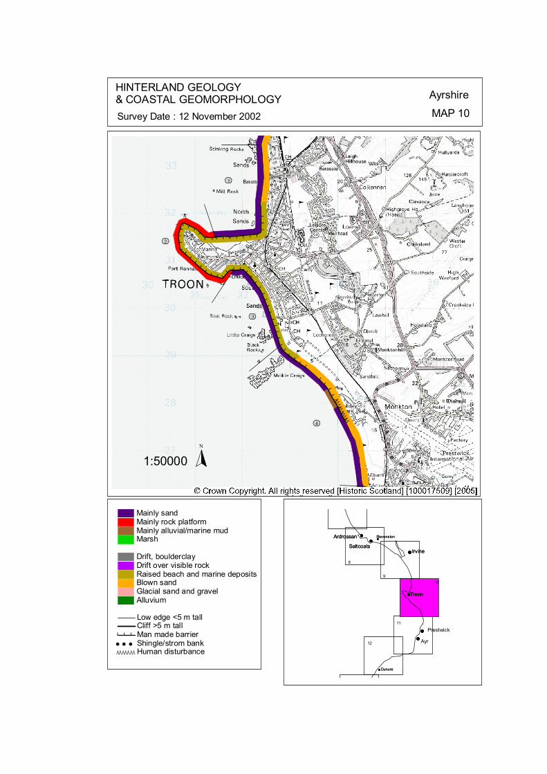
ÒÒÒÒÒÒÒÒÒÒ
#
# # # # # # # #
######## # # # # # # # # # # # # # # # # # # # # # # # # # # # # # # #
##########
ôó1
ôó2
ôó3
ôó4
N
1:50000
HINTERLAND GEOLOGY& COASTAL GEOMORPHOLOGY Ayrshire
MAP 10Survey Date : 12 November 2002
Dunure
Stevenston
Troon
IrvineSaltcoats
Ardrossan
9
8
Ardrossan
SaltcoatsIrvine
Troon
Prestwick
Ayr
Stevenston
Dunure
10
11
12
© Crown Copyright. All rights reserved. Licence No. PA01041C. 2003.
Low edge <5 m tallCliff >5 m tallMan made barrier# # #Shingle/strom bank' ' 'Human disturbanceÒÒÒÒÒÒÒ
Mainly sandMainly rock platformMainly alluvial/marine mudMarsh
Drift, boulderclayDrift over visible rockRaised beach and marine depositsBlown sandGlacial sand and gravelAlluvium
kat
horizontal
Map 10: Barassie to Prestwick Hinterland Geology and Coastal Geomorphology
1 Barassie Beach NS 3241 3242 2.7 km Mainly sand Sea Wall & Low edge <5 m Raised Beach/Blown Sand & Urban
The southern most section of Irvine Bay, adjacent to Barassie, is a wide (<300-500 m at low tide) sand beach. The shoreline moves inland towards Darley Burn, pushing up against North Shore Road. This section of the coastline is protected with riprap. North of the Darley Burn sand dunes are present, narrowing northwards towards Stinking Rocks, a rock platform that protrudes at low tide. The hinterland is residential area built on raised beach deposits. 2 Troon Harbour NS 3084 3113 3.11 km Mainly rock platform Mainly Sea Wall Raised Beach/Human Disturbance
Troon Harbour is constructed on the northern edge of a large, sediment free rock promontory. A seawall has been constructed directly onto the rocks. No access was available for the central section of the harbour. The hinterland is heavily disturbed by human constructions. 3 Troon Bay NS 3257 2993 2.29 km Mainly sand Sea Wall Raised Beach & Urban
The beach at Troon is composed of sand, it has a wide intertidal area (up to 200 m) and the vegetated back beach area has been managed, with a variety of techniques. The beach can be described in two sections, the southern bordering Royal Troon Golf Course and the northern section bordering the town. A 500 m section of Gabion baskets extend form the Black Rocks, in a northerly direction, armouring the dune that borders the golf course. The Troon Dune Restoration Project, set up in 1999, protected the seaward and landward edge of the dunes with fencing, thatching and planted marram grasses to promote dune growth.
4 Pow Burn & Prestwick NS 3436 2721 3.44 km Mainly sands Low edge <5 m Blown Sand/Human Disturbance
Dunes exists south of Black Rock, which is an intertidal rock platform visible at low tide. The intertidal area is 100-200 m wide, with occasional rock platform protruding. Much of this coast edge contains protection on the coast edge for Royal Troon Golf Club situated in the hinterland area. On the northern bank of the Pow Burn gabion baskets exist protecting the golf course situated in the inland area up to the coast edge. The mouth of the Pow Burn flows northwards behind the dune ridge on the southern side of the estuary for over a kilometre. A land raise site has been constructed within the northern tip of the dunes between the Pow Burn and the beach. Protection work (Gabion/riprap) are situated on the southern side of the river. Two interpretations can be made on the southern section of beach, either this unmanaged section is translating landwards, possibly as a result of the protection at Prestwick; or the car park has been constructed on partially reclaimed land. The section of shoreline beyond the Car Park, up to the Pow Burn consists of dunes and gentle slopes onto the sand beach. The intertidal zone is comparable with adjacent sections, up to 200 m wide.
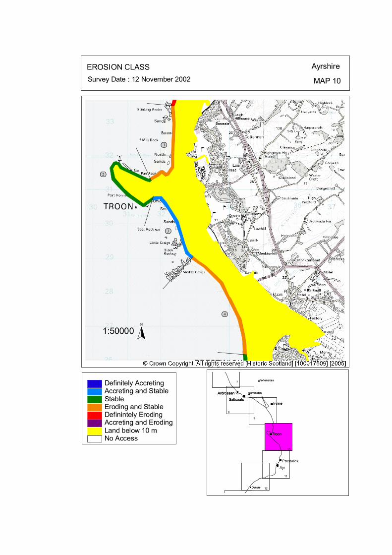
ôó1
ôó2
ôó3
ôó4N
1:50000
EROSION CLASS Ayrshire
MAP 10Survey Date : 12 November 2002
8
ArdrossanSaltcoats
Irvine
Troon
Prestwick
Ayr
Stevenston
Dunure
ArdrossanSaltcoats
Irvine
Troon
Stevenston
Dunure
PortencrossPortencross7
9
10
11
12
No Access
Definitely AccretingAccreting and StableStableEroding and StableDefinintely ErodingAccreting and ErodingLand below 10 m
© Crown Copyright. All rights reserved. Licence No. PA01041C. 2003.
kat
horizontal
Map 10: Barassie to Prestwick Erosion Class 1 Barassie Beach NS 3241 3242 2.7 km LT: Erosional - Low ST: Erosional /Stable – Medium
The southern most, west of Pan Rocks, is vegetated and stable, related to the wave shadow effect from Troon Harbour. However the shoreline moves inland towards the Darley Burn, pushing up against North Shore Road. This section of the coastline is protected with riprap, which may highlight stability question of sections of this shoreline. However it is currently showing no signs of being undercut. North of the Darley Burn sand dunes are present, narrowing northwards towards Stinking Rocks, a rock platform that protrudes at low tide. The dunes are showing signs of erosion with a small cliff at the foot of the dunes. The beach continues past Stinking Rocks towards the mouth of mouth of the River Irvine. The beach remains relatively wide (300 m at low tide), is backed by a dune cliff (2-3 m tall) and capped with marram grasses. South of Gailes Golf Club House there are two sets of protection works, the southern set are cement cylinders that form a sea wall; adjoining a section of rip-rap. Neither are showing signs of undercutting, or erosional bites on adjacent sections of unprotected sections. 2 Troon Harbour NS 3084 3113 3.11 km LT: Erosional – Low ST: Stable – Low
A seawall has been constructed directly onto the rocks, which shown no signs of undercutting. No access was available for the central section of the harbour, however the northern wall was stable, with no signs of undercutting. Approximately 10,000 metric tonnes are removed each year from Troon harbour mouth and dumped offshore. It is likely that the majority of the sediment dredged is coastal sediment rather than from fluvial sources. The removal of this sediment form the foreshore to an offshore dumping ground is likely to contribute to coastal erosion and recession elsewhere in the sediment cell. 3 Troon Bay NS 3257 2993 2.29 km LT: Erosional – Low ST: Stable/Accretional – Medium
The vegetated back beach area has been managed, with a variety of techniques. The beach can be described in two sections, the southern bordering Royal Troon Golf Course and the northern section bordering the town. A 500 m section of Gabion baskets extend form the Black Rocks, in a northerly direction, armouring the dune that borders the golf course. The 2 m high wall is currently stable, with vegetation at its base.
Towards the Car Park the management changes from ‘hard’ engineering to a ‘soft’ approach. Troon’s residents experienced significant problems with sand blowing from the beach into the town. The Troon Dune Restoration Project, set up in 1999, protected the seaward and landward edge of the dunes with fencing, thatching and planted marram grasses to promote dune growth (Plate 16). This project with its’ continued maintenance has resulted in the stabilisation of the dunes, the cessation of sand blow into the town and the development of a ‘vegetated foreshore’ opposed to the original flat intertidal sand beach. The success of this project has increased the stability of a formerly erosional beach. Other projects are currently being considered for Barassie and Irvine beaches. Each end of the stabilised dunes remain fragile (near Victoria Drive and near the Royal Troon Golf Course) however the maintenance form the Project’s supporters continues.
4 Pow Burn & Prestwick NS 3436 2721 3.44 km LT: Erosional – Low ST: Erosional/Stable – Low
The coastal protection, which extends from Ayr Harbour stops at the car park. Two interpretations can be made on the adjacent section of beach, either this unmanaged section is translating landwards, possibly as a result of the protection at Prestwick; or the car park has been constructed on partially reclaimed land – giving the impression that the dune has moved landwards. Without specific investigations this cannot be proven either way, however it is likely to be a combination of both factors. The section of shoreline beyond the Car Park, up to the Pow Burn is currently stable, with marram grasses extending from the dunes down gentle slopes onto the sand beach. Protection work (Gabion/riprap) to stop the erosion of the land raise site has now fixed the southern side of the river, shown below. The eroding dunes on the northern bank of the Pow Burn have been fixed with gabion baskets. The dune foot is currently stable with limited vegetation in front of the gabion baskets. Beyond the protection the dune slope is eroding. This can be seen by the change in slope within the dune. Brush wood fences (Plate 15) have been erected to try and stabilize the base of the dune, with limited success. Although the base of each section of the dunes is currently vegetated and show no signs of undercutting the location of hard protection at the burns mouth may be short sighted, if viewed within a medium to long time frame on an eroding shoreline. The dunes at the northern end of the section are currently stable.

Map 11: Ayrshire Coast: Prestwick North to Doonfoot Beach Map Content Descriptions 1.Built Heritage and Archaeology
A total of twenty one sites were located in the area covered by Map 11. Of these sixteen were previously recorded and five were new sites located during the field survey. Many of the sites related to industrial activity in and around Ayr including Ayr Harbour (A55). An area of salt panning activity was located at Bentfield (A45, 124 & 125). The southern area of Map 11 included the scheduled ancient monument of Greenan Castle (A58) and associated fort (A59). None of the sites were located in areas with high erosion rates. 2. Hinterland Geology, Coastal Geomorphology and Erosion Class
The area covered by Map 11 extended from Prestwick to Doonfoot beach, an area including all of Ayr. The vast majority of the inter tidal area was composed of sands with the hinterland being composed of blown sand with isolated areas of emerged beach and alluvium. Sea defences dominate the coast of Ayr and Prestwick. The area to the south of Ayr is less built up and, therefore, contains fewer sea walls. The area north of Ayr Harbour was classified stable with the area to the south being erosional to stable. An accretional area occurs at the mouth of Doonfoot River. No areas with high erosion rates were located in the area covered by Map 11.
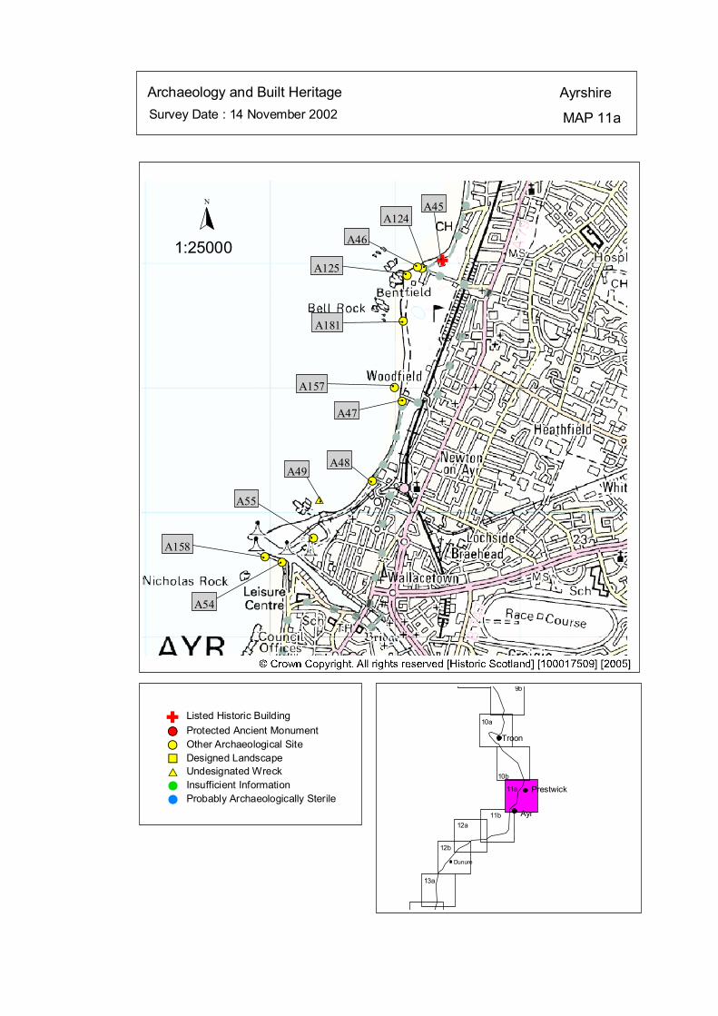
Survey Date : 14 November 2002 MAP 11a
AyrshireArchaeology and Built Heritage
Dunure
Ayr
Prestwick
Troon
10b
10a
9b
12b
12a11b
11a
13a
#S
#S
#S
#S
#S
#S
#S
#S
$T
#S
#S
A45
#
A124
#
A46
#A125
#A181
#A157#
A47
#
A48
#
A49
#
A55
#
A158#
A54
Listed Historic Building#S Protected Ancient Monument#S Other Archaeological Site%U Designed Landscape$T Undesignated Wreck# Insufficient Information# Probably Archaeologically Sterile
© Crown Copyright. All rights reserved. Licence No. PA01041C. 2003.
1:25000
N
Ñ#
Ñ
kat
horizontal

Map 11a: Built Heritage & Archaeology Gazetteer
Site No A45 Grid Ref NS 34381 25022 Site Name Prestwick, Salt Pan Houses Site Type Houses Date 18th-20th cent Condition Fair Recommendation Survey Site No A46 Grid Ref NS 34182 24966 Site Name Prestwick Site Type Boulder features Date Unknown Condition Poor Recommendation Monitor Site No A47 Grid Ref NS 34061 23889 Site Name Ayr Promenade Site Type Shore Defences Date Unknown Condition Poor Recommendation Monitor Site No A48 Grid Ref NS 33822 23249 Site Name Ayr Harbour Junction Site Type Jetty (remains of?) Date Unknown Condition Poor Recommendation Monitor Site No A49 Grid Ref NS 33400 23100 Site Name Kaffir: Monkey Pier, Ayr Site Type Wreck Date 20th cent Condition Unknown Recommendation Nil Site No A54 Grid Ref NS 33100 22600 Site Name Ayr Harbour Site Type Harbour Date 18th-20th cent Condition Good Recommendation Nil
Site No A55 Grid Ref NS 33350 22790 Site Name Ayr Site Type Dock Date 20th cent Condition Unknown Recommendation Nil Site No A124 Grid Ref NS 34220 24960 Site Name Prestwick, Maryborough Site Type Salt works Date Unknown Condition Unknown Recommendation Nil Site No A125 Grid Ref NS 34100 24900 Site Name New Prestwick Site Type Salt Pans Date Unknown Condition Unknown Recommendation Nil Site No A157 Grid Ref NS 34000 24000 Site Name Prestwick Golf Course Site Type Roman Coin Date 1st-6th cent Condition Unknown Recommendation Nil Site No A158 Grid Ref NS 32960 22640 Site Name Ayr South Pier Site Type Pier Date 18th-20th cent Condition Good Recommendation Nil Site No A181 Grid Ref NS 34069 24535 Site Name Prestwick Site Type Boulder features Date Unknown Condition Poor Recommendation Monitor
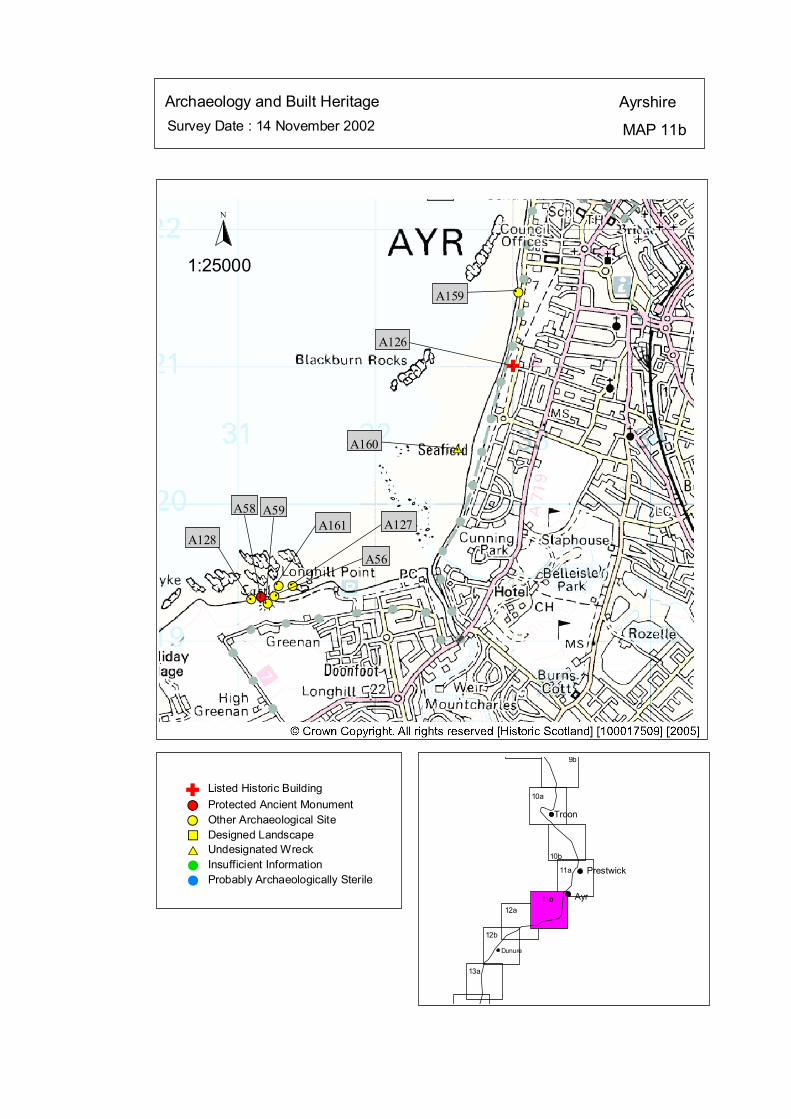
Survey Date : 14 November 2002 MAP 11b
AyrshireArchaeology and Built Heritage
Dunure
Ayr
Prestwick
Troon
10b
10a
9b
12b
12a11b
11a
13a
#S#S #S
#S#S
#S
$T
#S
#A159
A126
#A160
#
A161
#
A56
#
A59
#
A58
#
A128
#
A127
Listed Historic Building#S Protected Ancient Monument#S Other Archaeological Site%U Designed Landscape$T Undesignated Wreck# Insufficient Information# Probably Archaeologically Sterile
© Crown Copyright. All rights reserved. Licence No. PA01041C. 2003.
1:25000
N
Ñ#
Ñ
kat
horizontal

Map 11b: Built Heritage & Archaeology Gazetteer
Site No A56 Grid Ref NS 31269 19324
Site Name Greenan Castle
Site Type Fort
Date 18th-20th cent
Condition Unknown Recommendation Nil
Site No A128 Grid Ref NS 31100 19300 Site Name Greenan Castle Site Type Salt Pans Date Unknown Condition Unknown
Site Name Greenan Castle Site Type Walling Date Unknown Condition Fair Recommendation Monitor Site No A58 Grid Ref NS 31170 19320
Site Type Earthwork; Tower-house Date 14th-18th cent Condition Fair Recommendation Survey Site No A59 Grid Ref NS 31220 19270 Site Name Greenan Castle
Date Unknown Condition Unknown Recommendation Monitor Site No A126 Grid Ref NS 33000 21000 Site Name 20 - 22 Academy Street Site Type Building
Condition Unknown Recommendation Nil Site No A127 Grid Ref NS 31400 19400 Site Name Doonfoot Site Type Stone Implement; Core; Date Unknown
Recommendation Nil
Site No A159 Grid Ref NS 33040 21540 Site Name Ayr Esplanade Site Type Recreation Date 18th-20th cent Condition Good Recommendation Nil Site No A160 Grid Ref NS 32600 20400 Site Name Frey: Seafield, Ayr Site Type Wreck Date Unknown Condition Unknown Recommendation Nil Site No A161 Grid Ref NS 24650 11840 Site Name Rancleugh Site Type Flints Date Pre 4th mill BC Condition Unknown Recommendation Nil
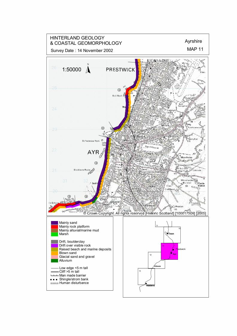
ÒÒÒÒÒÒÒÒ
######### ##############
# # # # ########## # # ###########
ôó1
ôó2
ôó3
ôó4ôó5
N
1:50000
HINTERLAND GEOLOGY& COASTAL GEOMORPHOLOGY Ayrshire
MAP 11Survey Date : 14 November 2002
Dunure
Maidens
Troon
9
Troon
Prestwick
Ayr
Maidens
Dunure
10
11
12
13
© Crown Copyright. All rights reserved. Licence No. PA01041C. 2003.
Low edge <5 m tallCliff >5 m tallMan made barrier# # #Shingle/strom bank' ' 'Human disturbanceÒÒÒÒÒÒÒ
Mainly sandMainly rock platformMainly alluvial/marine mudMarsh
Drift, boulderclayDrift over visible rockRaised beach and marine depositsBlown sandGlacial sand and gravelAlluvium
kat
horizontal
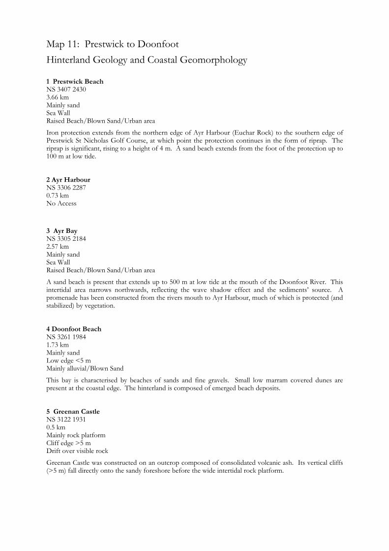
NS 3306 2287
A sand beach is present that extends up to 500 m at low tide at the mouth of the Doonfoot River. This intertidal area narrows northwards, reflecting the wave shadow effect and the sediments’ source. A promenade has been constructed from the rivers mouth to Ayr Harbour, much of which is protected (and stabilized) by vegetation.
1.73 km
Mainly rock platform
Map 11: Prestwick to Doonfoot Hinterland Geology and Coastal Geomorphology
1 Prestwick Beach NS 3407 2430 3.66 km Mainly sand Sea Wall Raised Beach/Blown Sand/Urban area
Iron protection extends from the northern edge of Ayr Harbour (Euchar Rock) to the southern edge of Prestwick St Nicholas Golf Course, at which point the protection continues in the form of riprap. The riprap is significant, rising to a height of 4 m. A sand beach extends from the foot of the protection up to 100 m at low tide. 2 Ayr Harbour
0.73 km No Access
3 Ayr Bay NS 3305 2184 2.57 km Mainly sand Sea Wall Raised Beach/Blown Sand/Urban area
4 Doonfoot Beach NS 3261 1984
Mainly sand Low edge <5 m Mainly alluvial/Blown Sand
This bay is characterised by beaches of sands and fine gravels. Small low marram covered dunes are present at the coastal edge. The hinterland is composed of emerged beach deposits.
5 Greenan Castle NS 3122 1931 0.5 km
Cliff edge >5 m Drift over visible rock
Greenan Castle was constructed on an outcrop composed of consolidated volcanic ash. Its vertical cliffs (>5 m) fall directly onto the sandy foreshore before the wide intertidal rock platform.
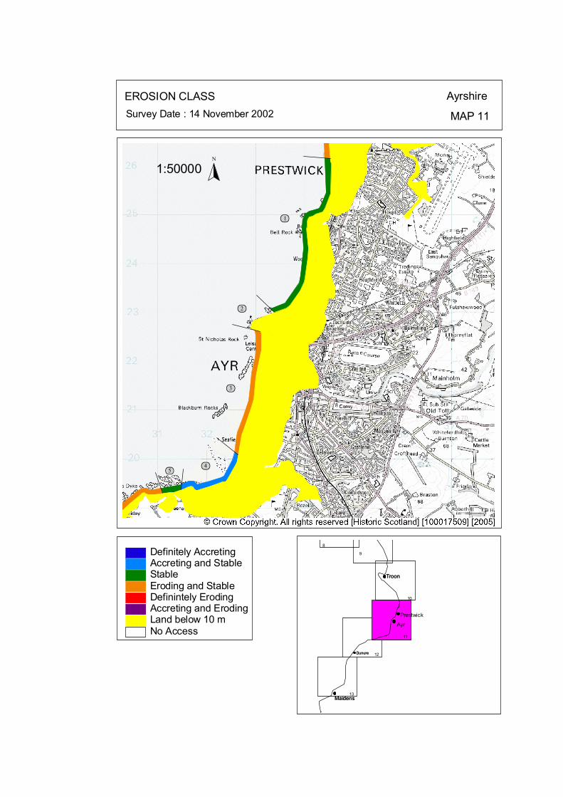
ôó1
ôó2
ôó3
ôó4ôó5
N
1:50000
EROSION CLASS Ayrshire
MAP 11Survey Date : 14 November 2002
8
Troon
Prestwick
Ayr
Maidens
Dunure
Troon
Maidens
Dunure
9
10
11
12
13
No Access
Definitely AccretingAccreting and StableStableEroding and StableDefinintely ErodingAccreting and ErodingLand below 10 m
© Crown Copyright. All rights reserved. Licence No. PA01041C. 2003.
kat
horizontal
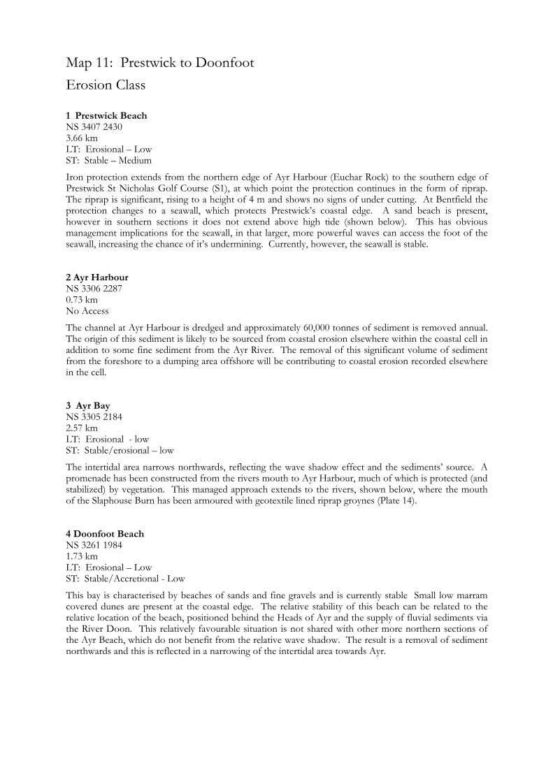
Map 11: Prestwick to Doonfoot Erosion Class
1 Prestwick Beach NS 3407 2430
LT: Erosional – Low
3.66 km LT: Erosional – Low ST: Stable – Medium
Iron protection extends from the northern edge of Ayr Harbour (Euchar Rock) to the southern edge of Prestwick St Nicholas Golf Course (S1), at which point the protection continues in the form of riprap. The riprap is significant, rising to a height of 4 m and shows no signs of under cutting. At Bentfield the protection changes to a seawall, which protects Prestwick’s coastal edge. A sand beach is present, however in southern sections it does not extend above high tide (shown below). This has obvious management implications for the seawall, in that larger, more powerful waves can access the foot of the seawall, increasing the chance of it’s undermining. Currently, however, the seawall is stable.
2 Ayr Harbour NS 3306 2287 0.73 km No Access
The channel at Ayr Harbour is dredged and approximately 60,000 tonnes of sediment is removed annual. The origin of this sediment is likely to be sourced from coastal erosion elsewhere within the coastal cell in addition to some fine sediment from the Ayr River. The removal of this significant volume of sediment from the foreshore to a dumping area offshore will be contributing to coastal erosion recorded elsewhere in the cell. 3 Ayr Bay NS 3305 2184 2.57 km LT: Erosional - low ST: Stable/erosional – low
The intertidal area narrows northwards, reflecting the wave shadow effect and the sediments’ source. A promenade has been constructed from the rivers mouth to Ayr Harbour, much of which is protected (and stabilized) by vegetation. This managed approach extends to the rivers, shown below, where the mouth of the Slaphouse Burn has been armoured with geotextile lined riprap groynes (Plate 14).
4 Doonfoot Beach NS 3261 1984 1.73 km
ST: Stable/Accretional - Low
This bay is characterised by beaches of sands and fine gravels and is currently stable Small low marram covered dunes are present at the coastal edge. The relative stability of this beach can be related to the relative location of the beach, positioned behind the Heads of Ayr and the supply of fluvial sediments via the River Doon. This relatively favourable situation is not shared with other more northern sections of the Ayr Beach, which do not benefit from the relative wave shadow. The result is a removal of sediment northwards and this is reflected in a narrowing of the intertidal area towards Ayr.

5 Greenan Castle NS 3122 1931 0.5 km
LT: Erosional – Low ST: Stable - Low
Greenan Castle was constructed on an outcrop composed of consolidated volcanic ash, which remains stable.
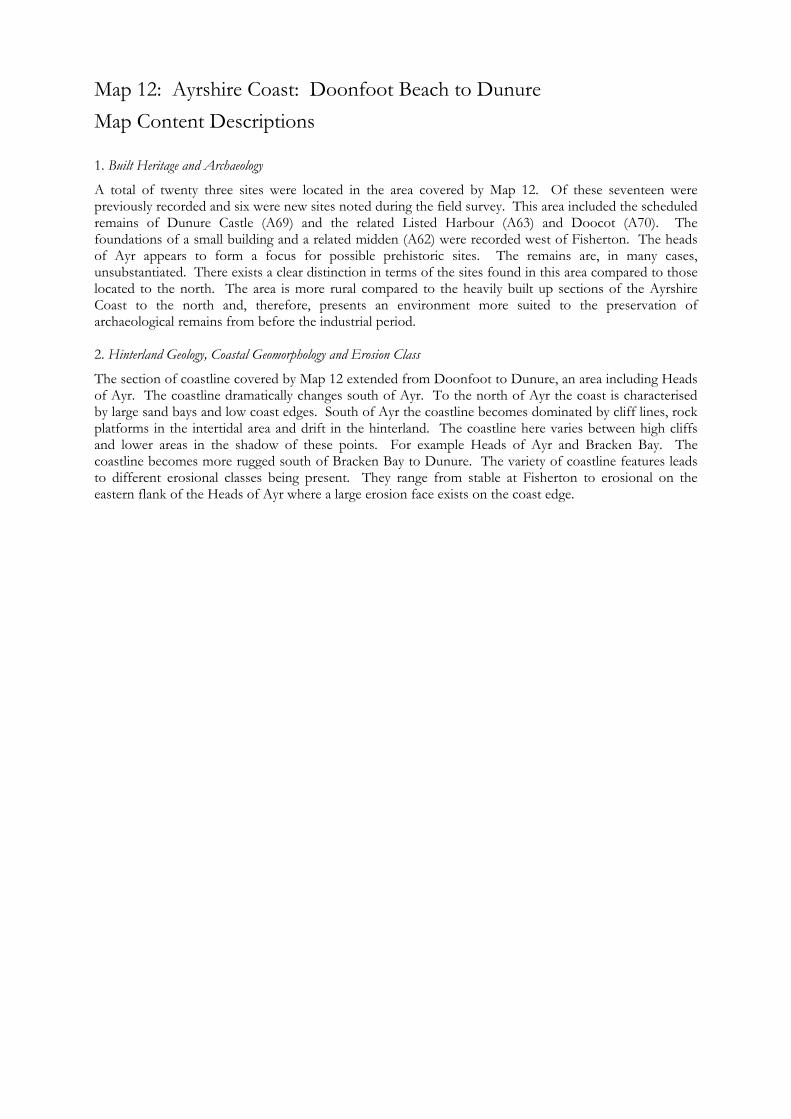
Map 12: Ayrshire Coast: Doonfoot Beach to Dunure Map Content Descriptions
1. Built Heritage and Archaeology
A total of twenty three sites were located in the area covered by Map 12. Of these seventeen were previously recorded and six were new sites noted during the field survey. This area included the scheduled remains of Dunure Castle (A69) and the related Listed Harbour (A63) and Doocot (A70). The foundations of a small building and a related midden (A62) were recorded west of Fisherton. The heads of Ayr appears to form a focus for possible prehistoric sites. The remains are, in many cases, unsubstantiated. There exists a clear distinction in terms of the sites found in this area compared to those located to the north. The area is more rural compared to the heavily built up sections of the Ayrshire Coast to the north and, therefore, presents an environment more suited to the preservation of archaeological remains from before the industrial period. 2. Hinterland Geology, Coastal Geomorphology and Erosion Class
The section of coastline covered by Map 12 extended from Doonfoot to Dunure, an area including Heads of Ayr. The coastline dramatically changes south of Ayr. To the north of Ayr the coast is characterised by large sand bays and low coast edges. South of Ayr the coastline becomes dominated by cliff lines, rock platforms in the intertidal area and drift in the hinterland. The coastline here varies between high cliffs and lower areas in the shadow of these points. For example Heads of Ayr and Bracken Bay. The coastline becomes more rugged south of Bracken Bay to Dunure. The variety of coastline features leads to different erosional classes being present. They range from stable at Fisherton to erosional on the eastern flank of the Heads of Ayr where a large erosion face exists on the coast edge.

Survey Date : 19-21 November 2002 MAP 12a
AyrshireArchaeology and Built Heritage
Dunure
Maidens
Ayr
Prestwick10b
12b
12a11b
11a
13a
13b
#S
#S
#S
#S
#S#S
#S
#S
#S
#S
#S
#
A129
#
A178
#
A130
#
A57
#
A131
#
A64
#
A65
#
A133
#
A134
#
A61
#
A132
Listed Historic Building#S Protected Ancient Monument#S Other Archaeological Site%U Designed Landscape$T Undesignated Wreck# Insufficient Information# Probably Archaeologically Sterile
© Crown Copyright. All rights reserved. Licence No. PA01041C. 2003.
1:25000
N
Ñ
kat
horizontal

Map 12a: Built Heritage & Archaeology Gazetteer
Site No A129
Site No A130 Grid Ref 229050 618670
Site No A131
Recommendation Monitor Site No A134 Grid Ref NS 26900 18000 Site Name Bracken Bay Site Type Stone Chisel
Unknown Condition Unknown Recommendation Nil
Grid Ref NS 29440 18450
Site No A57 Grid Ref NS 28990 18798 Site Name Heads of Ayr Site Type Boulder alignment Date Unknown Condition Poor Recommendation Monitor
Site No A61 Grid Ref NS 26446 17649 Site Name Fisherton cottage Site Type Fish Trap (possible) Date Unknown Condition Fair Recommendation Monitor
Site No A64 Grid Ref NS 28470 18730 Site Name Bower Hill Site Type Fort Date Unknown Condition Poor Recommendation Survey
Site No A65 Grid Ref NS 28155 18289 Site Name Bracken Bay Site Type Wall Date 18th-20th cent DateCondition Fair Recommendation Monitor
Grid Ref NS 29800 18800 Site Name Doonfoot Site Type Stone Implement Date Unknown Condition Unknown Recommendation Nil
Site Name Heads of Ayr Site Type Earthwork (possible) Date Unknown Condition Unknown Recommendation Monitor
Grid Ref NS 29000 19000 Site Name Point of Ayr Site Type Stone Axe Date Unknown Condition Unknown Recommendation Nil Site No A132 Grid Ref NS 28600 18800 Site Name Heads of Ayr Site Type Stone Scraper; Flake Date Unknown Condition Unknown Recommendation Nil
Site No A133 Grid Ref NS 28200 18200 Site Name Low Glenayes Site Type Flints; Pottery Date Unknown Condition Unknown
Site No A178
Site Name Laigh Kyleston Site Type Indeterminate Remains Date Unknown Condition Poor Recommendation Nil
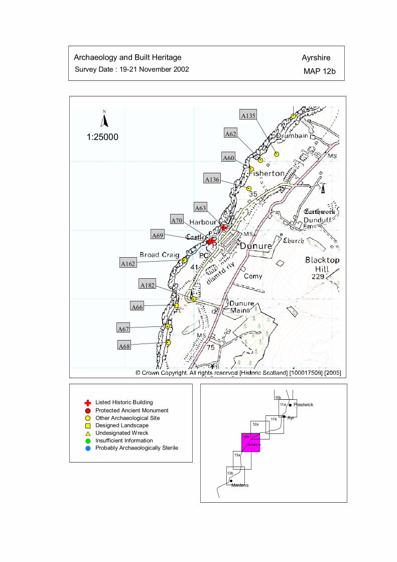
Survey Date : 19-21 November 2002 MAP 12b
AyrshireArchaeology and Built Heritage
Dunure
Maidens
Ayr
Prestwick10b
12b
12a11b
11a
13a
13b
#S
#S
#S
#S
#S
#S
#S
#S
#S
#S
#S
#
A135
#
A62
#
A60
#
A136
A63
A70
A69
#
A162
#A66
#A67
#
A68
#
#
A182
Listed Historic Building#S Protected Ancient Monument#S Other Archaeological Site%U Designed Landscape$T Undesignated Wreck# Insufficient Information# Probably Archaeologically Sterile
© Crown Copyright. All rights reserved. Licence No. PA01041C. 2003.
1:25000
N
Ñ
Ñ
#
##
Ñ
kat
horizontal

Map 12b: Built Heritage & Archaeology Gazetteer
Site No A60 Grid Ref NS 25834 16884 Site Name Fisherton Site Type Walling/Midden Date Unknown
Site Type Observation Tower Date 20th cent
Site Type Cave/Wall
Site Name Drumshang Site Type Cairn
Site Name Dunure Castle Site Type Castle
Site Name Dunure Castle, Doocot Doocot
Site Name Fisherton
Site Name Fisherton Site Type Flints
Site Name Scart Rock, Dunure Site Type Fish-Trap Date Unknown Condition Unknown Recommendation Monitor Site No A182 Grid Ref NS 25000 15000 Site Name Dunure
Condition Fair Recommendation Survey Site No A62 Grid Ref NS 25966 17013 Site Name Fisherton Site Type Building/Midden Site TypeDate Unknown Condition Poor Recommendation Survey Site No A63 Grid Ref NS 25434 16035 Site Name Dunure Harbour Site Type Harbour Date 18th-20th cent Condition Good Recommendation Monitor Site No A66 Grid Ref NS 24750 14900 Site Name Egg Knock
Condition Fair Recommendation Monitor Site No A67 Grid Ref NS 24620 14600 Site Name Dunure Mains
Date Unknown Condition Fair Recommendation Monitor Site No A68 Grid Ref NS 24636 14364
Date Unknown Condition Fair Recommendation Monitor
Site No A69 Grid Ref NS 25225 15825
Date 6th-14th cent Condition Fair Recommendation Survey Site No A70 Grid Ref NS 25265 15845
Date 14th-18th cent Condition Good Recommendation Monitor Site No A135 Grid Ref NS 26200 17100
Site Type Flints Date Unknown Condition Unknown Recommendation Monitor Site No A136 Grid Ref NS 25800 16600
Date Unknown Condition Unknown Recommendation Monitor Site No A162 Grid Ref NS 24870 15560
Site Type Bronze Terret Date Unknown Condition Unknown Recommendation Nil
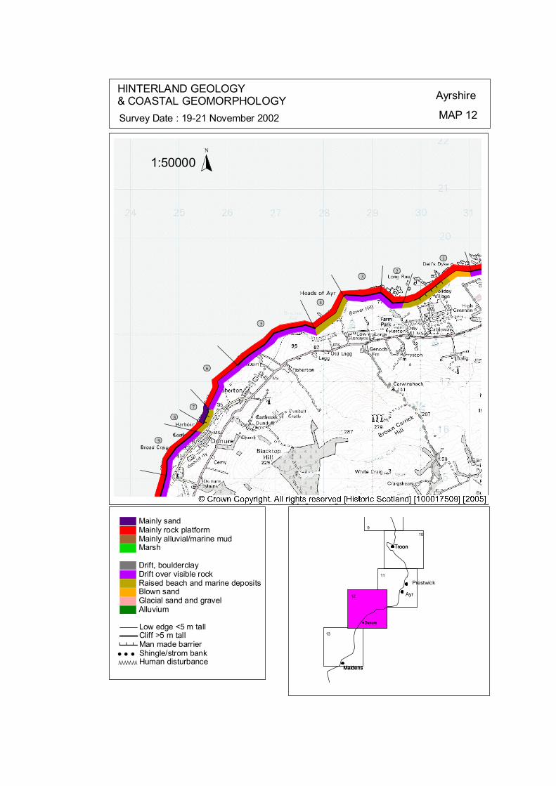
###
#####
ôó2ôó3
ôó4
ôó5
ôó6
ôó7ôó8
ôó9
ôó1
N
1:50000
HINTERLAND GEOLOGY& COASTAL GEOMORPHOLOGY Ayrshire
MAP 12Survey Date : 19-21 November 2002
Dunure
Maidens
Troon
9
Troon
Prestwick
Ayr
Maidens
Dunure
10
11
12
13
© Crown Copyright. All rights reserved. Licence No. PA01041C. 2003.
Low edge <5 m tallCliff >5 m tallMan made barrier# # #Shingle/strom bank' ' 'Human disturbanceÒÒÒÒÒÒÒ
Mainly sandMainly rock platformMainly alluvial/marine mudMarsh
Drift, boulderclayDrift over visible rockRaised beach and marine depositsBlown sandGlacial sand and gravelAlluvium
kat
horizontal
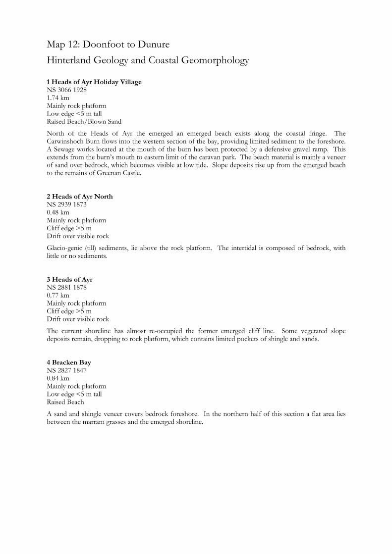
Map 12: Doonfoot to Dunure Hinterland Geology and Coastal Geomorphology
1 Heads of Ayr Holiday Village NS 3066 1928 1.74 km Mainly rock platform Low edge <5 m tall Raised Beach/Blown Sand
North of the Heads of Ayr the emerged an emerged beach exists along the coastal fringe. The Carwinshoch Burn flows into the western section of the bay, providing limited sediment to the foreshore. A Sewage works located at the mouth of the burn has been protected by a defensive gravel ramp. This extends from the burn’s mouth to eastern limit of the caravan park. The beach material is mainly a veneer of sand over bedrock, which becomes visible at low tide. Slope deposits rise up from the emerged beach to the remains of Greenan Castle.
The current shoreline has almost re-occupied the former emerged cliff line. Some vegetated slope deposits remain, dropping to rock platform, which contains limited pockets of shingle and sands.
A sand and shingle veneer covers bedrock foreshore. In the northern half of this section a flat area lies between the marram grasses and the emerged shoreline.
2 Heads of Ayr North NS 2939 1873 0.48 km Mainly rock platform Cliff edge >5 m Drift over visible rock
Glacio-genic (till) sediments, lie above the rock platform. The intertidal is composed of bedrock, with little or no sediments.
3 Heads of Ayr NS 2881 1878 0.77 km Mainly rock platform Cliff edge >5 m Drift over visible rock
4 Bracken Bay NS 2827 1847 0.84 km Mainly rock platform Low edge <5 m tall Raised Beach
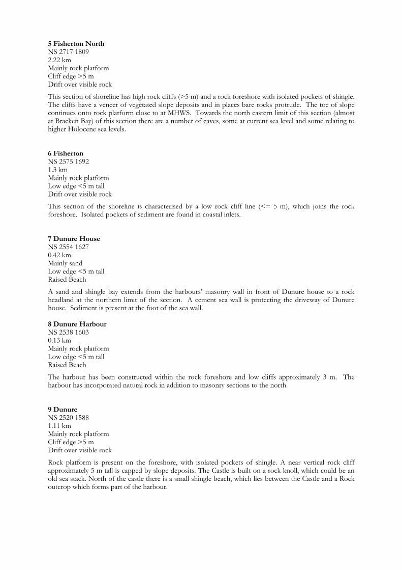
5 Fisherton North NS 2717 1809 2.22 km
NS 2575 1692 1.3 km
Mainly rock platform Cliff edge >5 m Drift over visible rock
This section of shoreline has high rock cliffs (>5 m) and a rock foreshore with isolated pockets of shingle. The cliffs have a veneer of vegetated slope deposits and in places bare rocks protrude. The toe of slope continues onto rock platform close to at MHWS. Towards the north eastern limit of this section (almost at Bracken Bay) of this section there are a number of caves, some at current sea level and some relating to higher Holocene sea levels. 6 Fisherton
Mainly rock platform Low edge <5 m tall Drift over visible rock
This section of the shoreline is characterised by a low rock cliff line (<= 5 m), which joins the rock foreshore. Isolated pockets of sediment are found in coastal inlets. 7 Dunure House NS 2554 1627 0.42 km Mainly sand Low edge <5 m tall Raised Beach
A sand and shingle bay extends from the harbours’ masonry wall in front of Dunure house to a rock headland at the northern limit of the section. A cement sea wall is protecting the driveway of Dunure house. Sediment is present at the foot of the sea wall. 8 Dunure Harbour NS 2538 1603 0.13 km Mainly rock platform Low edge <5 m tall Raised Beach
The harbour has been constructed within the rock foreshore and low cliffs approximately 3 m. The harbour has incorporated natural rock in addition to masonry sections to the north. 9 Dunure NS 2520 1588 1.11 km Mainly rock platform Cliff edge >5 m Drift over visible rock
Rock platform is present on the foreshore, with isolated pockets of shingle. A near vertical rock cliff approximately 5 m tall is capped by slope deposits. The Castle is built on a rock knoll, which could be an old sea stack. North of the castle there is a small shingle beach, which lies between the Castle and a Rock outcrop which forms part of the harbour.
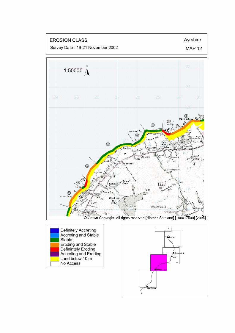
ôó1
ôó2ôó3
ôó4
ôó5
ôó6
ôó7ôó8
ôó9
N
1:50000
EROSION CLASS Ayrshire
MAP 12Survey Date : 19-21 November 2002
Troon
Prestwick
Ayr
Maidens
Dunure
Troon
Maidens
Dunure
10
11
12
13
No Access
Definitely AccretingAccreting and StableStableEroding and StableDefinintely ErodingAccreting and ErodingLand below 10 m
© Crown Copyright. All rights reserved. Licence No. PA01041C. 2003.
kat
horizontal
Map 12: Doonfoot to Dunure Erosion Class
1 Heads of Ayr Holiday Village NS 3066 1928 1.74 km LT: Erosional - Low ST: Stable/Erosional – low
The Carwinshoch Burn flows into the western section of the bay, providing limited sediment to the foreshore. A Sewage works located at the mouth of the burn has been protected by a defensive gravel ramp (Plate 13). Beyond these defences the coastal edge remains moderately stable, with vegetated slopes onto the beach. 2 Heads of Ayr North
LT: Erosional - Low ST: Stable - Low
ST: Stable - Low
The cliffs have a veneer of vegetated slope deposits and in places bare rocks protrude. The toe of slope continues onto rock platform close to at MHWS. Indicating a level of stability at present.
NS 2939 1873 0.48 km LT: Erosional - Low ST: Erosional – Medium
A near vertical cliff has been cut into the glacio-genic (till) sediments, which lie above the rock platform. The cliff is 4 m high at the western edge, which gently slopes to ground level towards the southeast(Plate 13). 3 Heads of Ayr NS 2881 1878 0.77 km LT: Erosional – low ST: Stable - Low
Vegetated slope deposits remain at the base of the cliff indicating some amount of stability at present. 4 Bracken Bay NS 2827 1847 0.84 km
A sand and shingle veneer covers bedrock foreshore which forms a stable sand beach, fixed with marram grass. In the northern half of this section a flat area lies between the marram grasses and the emerged shoreline. 5 Fisherton North NS 2717 1809 2.22 km LT: Erosional - Low
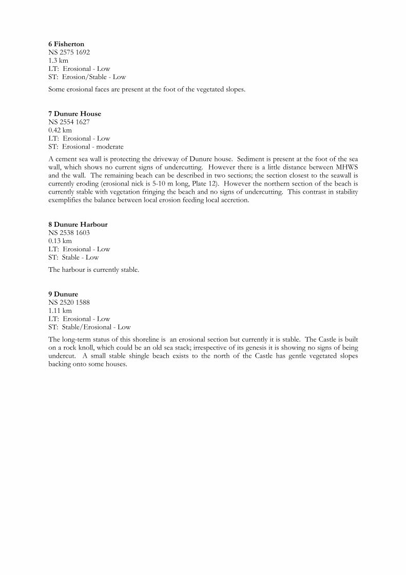
6 Fisherton
7 Dunure House NS 2554 1627 0.42 km
0.13 km
NS 2575 1692 1.3 km LT: Erosional - Low ST: Erosion/Stable - Low
Some erosional faces are present at the foot of the vegetated slopes.
LT: Erosional - Low ST: Erosional - moderate
A cement sea wall is protecting the driveway of Dunure house. Sediment is present at the foot of the sea wall, which shows no current signs of undercutting. However there is a little distance between MHWS and the wall. The remaining beach can be described in two sections; the section closest to the seawall is currently eroding (erosional nick is 5-10 m long, Plate 12). However the northern section of the beach is currently stable with vegetation fringing the beach and no signs of undercutting. This contrast in stability exemplifies the balance between local erosion feeding local accretion. 8 Dunure Harbour NS 2538 1603
LT: Erosional - Low ST: Stable - Low
The harbour is currently stable. 9 Dunure NS 2520 1588 1.11 km LT: Erosional - Low ST: Stable/Erosional - Low
The long-term status of this shoreline is an erosional section but currently it is stable. The Castle is built on a rock knoll, which could be an old sea stack; irrespective of its genesis it is showing no signs of being undercut. A small stable shingle beach exists to the north of the Castle has gentle vegetated slopes backing onto some houses.

Map 13: Ayrshire Coast: Dunure to Maidens Map Content Descriptions
1. Built Heritage and Archaeology
A total of twenty seven sites were recorded in the area covered by Map 13. Of these twenty four were previously recorded and three were new sites noted during the field survey. One of the most spectacular areas is Culzean Castle (A141) and related sites particularly the Culzean Coves (A74 & 85). Numerous flint scatters have been noted in the area to the north of Culzean at Croy Bay. The Harbour and pier (A75 & 76) at Maidens form the dominant feature in the southern extent of the survey zone. No sites were located in areas under immediate threat from coastal erosion processes.
2. Hinterland Geology, Coastal Geomorphology and Erosion Class
The section covered by Map 13 extended from south of Dunure at Drumshang, past Croy Bay, Culzean Castle and Maidens Bay to the small area of coast immediately to the west of Maidens Harbour where the survey zone ended. This section of coastline varied between rock platforms and sand deposits, low edges and high cliff lines and emerged beaches, blown sand and drift deposits in the hinterland. Small sections of sea defences were present at Maidens and Maidens Bay. The later may be contributing to an erosional face to the south of the wall. The erosional status of the coastline varied between stable and erosional to stable. The exceptions being the partly accretional are in the lee of Maidens Breakwater and the erosional area in the bay to the north.
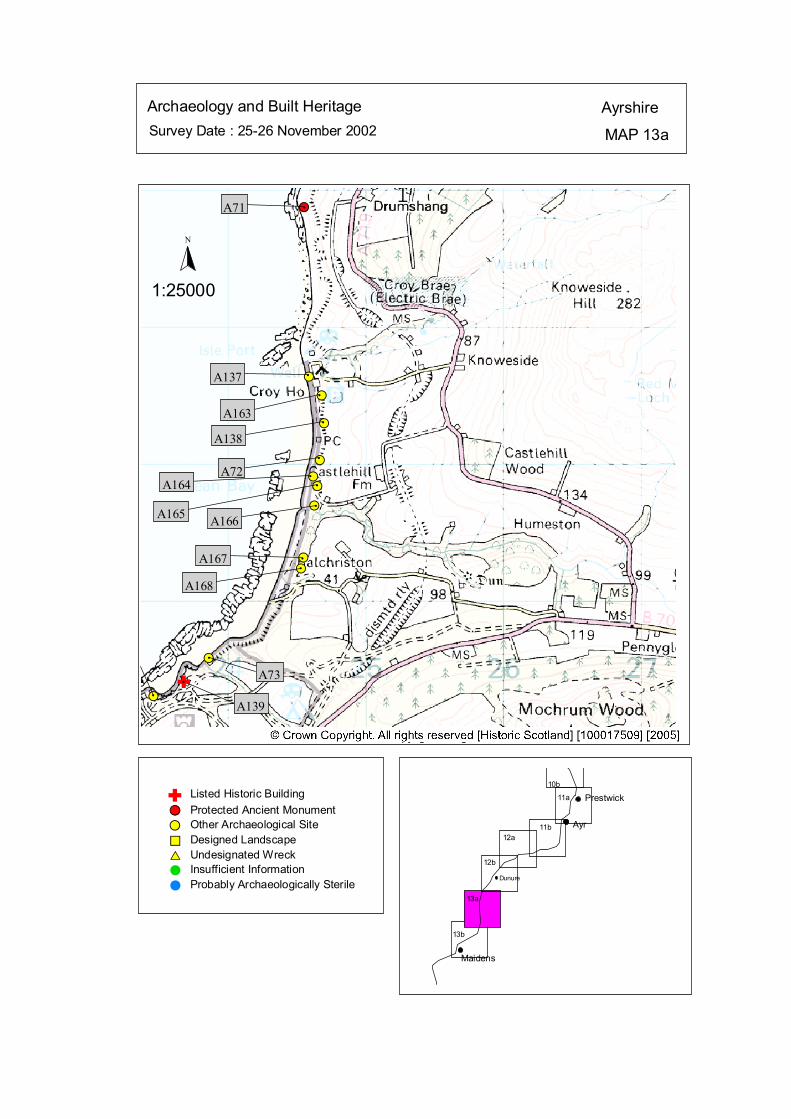
Survey Date : 25-26 November 2002 MAP 13a
AyrshireArchaeology and Built Heritage
Dunure
Maidens
Ayr
Prestwick10b
12b
12a11b
11a
13a
13b
#S
#S
#S
#S
#S#S
#S
#S
#S
#S
#S#S
#A71
#A137#
A163#
A138#
A72#
A164 #
A165#
A166
#A167#
A168
#
#
A73
A139
Listed Historic Building#S Protected Ancient Monument#S Other Archaeological Site%U Designed Landscape$T Undesignated Wreck# Insufficient Information# Probably Archaeologically Sterile
© Crown Copyright. All rights reserved. Licence No. PA01041C. 2003.
1:25000
N
Ñ#
Ñ
kat
horizontal

Map 13a: Built Heritage & Archaeology Gazetteer
Site No A71 Grid Ref NS 24555 13872 Site Name Katie Gray’s Rocks
Grid Ref NS 24669 12031 Site Name Dead Knowe, Castlehill
Grid Ref NS 23859 10588 Site Name Glenside Burn, Culzean
Grid Ref NS 24590 12640 Site Name St Patrick’s Well, Croy
Site No A139 Grid Ref NS 23680 10410
Site No A163 Grid Ref NS 24680 12500
Site No A164 Grid Ref NS 24620 11910
Site No A165 Grid Ref NS 24650 11840
Site No A166 Grid Ref NS 24630 11700
Date Unknown Condition Unknown
Site Type settlement Date 14th-18th cent Condition Poor Recommendation Survey Site No A72
Site Type Dun (possible) Date Unknown Condition Poor Recommendation Survey Site No A73
Site Type Pillar/bridge/building Date Unknown Condition Good Recommendation Nil Site No A137
Site Type Spring Date Unknown Condition Poor Recommendation Nil Site No A138 Grid Ref NS 24700 12300 Site Name Castlehill Farm, Dunure Site Type Flint Scatter Date Unknown Condition Unknown Recommendation Monitor
Site Name Home Farm Site Type Farmstead Date 18th-20th cent Condition Good Recommendation Nil
Site Name Croy Site Type Flints Date Unknown Condition Unknown Recommendation Monitor
Site Name Rancleugh Cottages Site Type Building Date Unknown Condition Poor Recommendation Nil
Site Name Rancleugh Site Type Flints Date Pre 4th mill BC Condition Unknown Recommendation Monitor
Site Name Rancleugh Burn Site Type Building Date Unknown Condition Poor Recommendation Nil Site No A167 Grid Ref NS 24550 11320 Site Name Balchriston Site Type Flints
Recommendation Monitor Site No A168 Grid Ref NS 24530 11240 Site Name Goalsgreen Site Type Flints Date Unknown Condition Unknown Recommendation Monitor
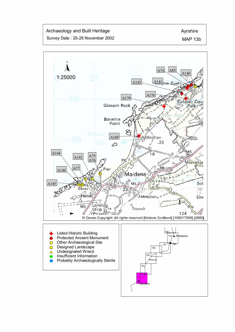
Survey Date : 25-26 November 2002 MAP 13b
AyrshireArchaeology and Built Heritage
Dunure
Maidens
Ayr
Prestwick10b
12b
12a11b
11a
13a
13b
#S
#S#S #S
#S
#S#S
$T#S
#S
#
A140
#
A85
#
A74
A141
#
A142
A176A179
A169
#
A75A76
#
A143
#
A77
#
A144
#
A146
#A145
Probably Archaeologically Sterile%Insufficient Information#Undesignated Wreck$TDesigned Landscape%U
Other Archaeological Site#SProtected Ancient Monument#S
Listed Historic Building
© Crown Copyright. All rights reserved. Licence No. PA01041C. 2003.
1:25000
N
Ñ
Ñ
Ñ
Ñ
#S#
#
#
#
Ñ
kat
horizontal

Map 13b: Built Heritage & Archaeology Gazetteer
Site No A74 Grid Ref NS 23289 10322 Site Name Culzean Coves Site Type caves Date Unknown Condition Fair Recommendation Survey Site No A75 Grid Ref NS 21134 08170 Site Name Maidens Breakwater Site Type Wreck Date 20th cent Condition Poor Recommendation Nil Site No A76 Grid Ref NS 21131 08171 Site Name Maidens Harbour Site Type Harbour/Breakwater Date 18th-20th cent Condition Good Recommendation Nil Site No A77 Grid Ref NS 20768 08034 Site Name Maidens Site Type Track/Slipway/Shed Date Unknown Condition Poor Recommendation Nil Site No A85 Grid Ref NS 23363 10348 Site Name Culzean Coves Site Type caves Date Unknown Condition Fair Recommendation Survey Site No A140 Grid Ref NS 23460 10310 Site Name Culzean Gas House Site Type Gasworks Date 18th-20th cent Condition Good Recommendation Nil
Site No A141 Grid Ref NS 23260 10270 Site Name Culzean Castle Site Type Country House; Date 6th-14th cent Condition Good Recommendation Survey Site No A142 Grid Ref NS 23130 10140 Site Name Culzean Castle Battery Site Type Battery Date 14th-18th cent Condition Good Recommendation Nil Site No A143 Grid Ref NS 20940 08040 Site Name Maidens Site Type Barking-pots Date Unknown Condition Unknown Recommendation Nil Site No A144 Grid Ref NS 20700 07900
Site Name Pan Knowes, Turnberry Site Type Salt Pans Date Unknown Condition Unknown Recommendation Nil Site No A146 Grid Ref NS 20660 07880 Site Name Pan Knowes Site Type Commemorative Cairn
Site Name Maidens, Port Murray Site Type Hoard; Flat Bronze Axes Date 4th mill BC- 1st cent Condition Unknown Recommendation Nil Site No A145 Grid Ref NS 20600 07900
Date Unknown Condition Fair Recommendation Nil

Site No A169 Grid Ref NS 22080 09090 Site Name Ardlochan Lodge Site Type Residential/ Lodge Site TypeDate 18th-20th cent Condition Good
Date 18th-20th cent
Ice-house Date 18th-20th cent
Recommendation Nil Site No A176 Grid Ref NS 23230 10010 Site Name Camellia House Site Type Building
Condition Unknown Recommendation Nil
Site No A179 Grid Ref NS 22690 09820 Site Name Culzean
Condition Good Recommendation Nil
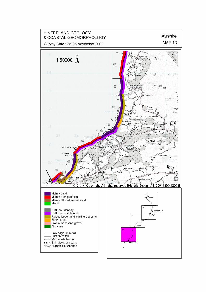
###
# # # # ##
####
#####
ôó1
ôó2
ôó3
ôó4
ôó5
ôó6
ôó7
ôó8
N
1:50000
HINTERLAND GEOLOGY& COASTAL GEOMORPHOLOGY Ayrshire
MAP 13Survey Date : 25-26 November 2002
Dunure
Maidens
TroonTroon
Prestwick
Ayr
Maidens
Dunure
10
11
12
13
© Crown Copyright. All rights reserved. Licence No. PA01041C. 2003.
AlluviumGlacial sand and gravelBlown sandRaised beach and marine depositsDrift over visible rockDrift, boulderclay
MarshMainly alluvial/marine mudMainly rock platformMainly sand
ÒÒÒÒÒÒÒ Human disturbance' ' ' Shingle/strom bank# # # Man made barrier
Cliff >5 m tallLow edge <5 m tall
kat
horizontal
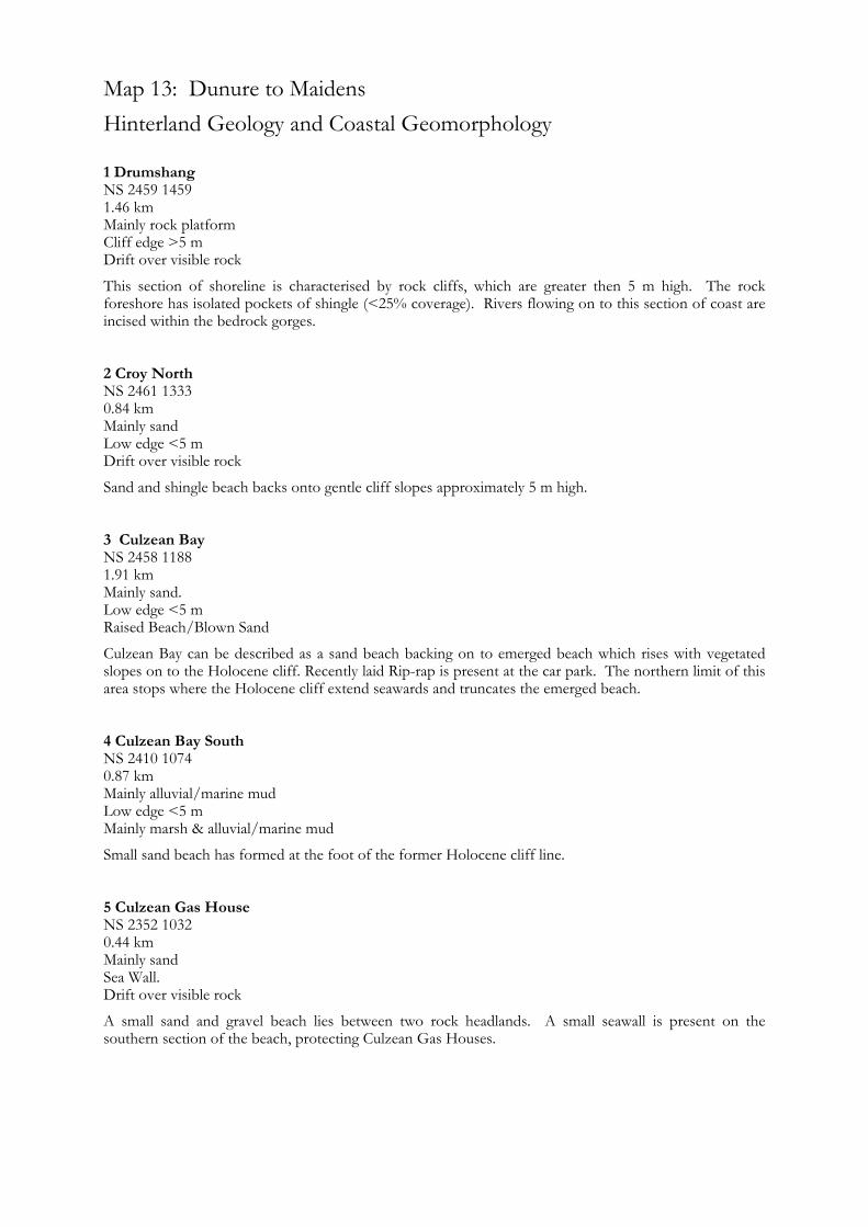
Map 13: Dunure to Maidens Hinterland Geology and Coastal Geomorphology
1 Drumshang NS 2459 1459 1.46 km
NS 2461 1333 0.84 km Mainly sand Low edge <5 m Drift over visible rock
Sand and shingle beach backs onto gentle cliff slopes approximately 5 m high. 3 Culzean Bay NS 2458 1188 1.91 km
Mainly marsh & alluvial/marine mud
Small sand beach has formed at the foot of the former Holocene cliff line.
Drift over visible rock
A small sand and gravel beach lies between two rock headlands. A small seawall is present on the southern section of the beach, protecting Culzean Gas Houses.
Mainly rock platform Cliff edge >5 m Drift over visible rock
This section of shoreline is characterised by rock cliffs, which are greater then 5 m high. The rock foreshore has isolated pockets of shingle (<25% coverage). Rivers flowing on to this section of coast are incised within the bedrock gorges. 2 Croy North
Mainly sand. Low edge <5 m Raised Beach/Blown Sand
Culzean Bay can be described as a sand beach backing on to emerged beach which rises with vegetated slopes on to the Holocene cliff. Recently laid Rip-rap is present at the car park. The northern limit of this area stops where the Holocene cliff extend seawards and truncates the emerged beach. 4 Culzean Bay South NS 2410 1074 0.87 km Mainly alluvial/marine mud Low edge <5 m
5 Culzean Gas House NS 2352 1032 0.44 km Mainly sand Sea Wall.

6 Culzean Cliffs NS 2305 1021
Mainly sands Sea Walls Reclaimed land & Raised beach
Raised beach/Blown Sand
This section of the shoreline is characterised by a wide sandy intertidal zone backing on to a low edge <5 m. Sea wall protects buildings at the northern end of the section. The hinterland is composed of emerged beach deposits.
1.44 km
The coastline at Culzean castle can be classified with cliffs greater than 5 m. A rocky foreshore is present, with isolated pocket of sediment forming 3 small shingle beaches. Caves are present within the cliff. 7 Maidens Bay NS 2193 0898 1.67 km Mainly sands Sea Walls & Low edge <5 m
8 Maidens Harbour NS 2115 0825 1.98 km Mainly marine mud and rock platform Sea Walls Reclaimed land & Raised beach
This section of coastline contains Maidens harbour. The northern pier and breakwater extend some 600 m from the coast edge. Fine deposits of marine mud and sands have gathered in the harbour due to the shelter this area provides. This has resulted in a very wide, flat intertidal zone. The eastern side of the harbour is characterised by a rocky shoreline with isolated pockets of sediment. A small section of sea wall protects a single building.
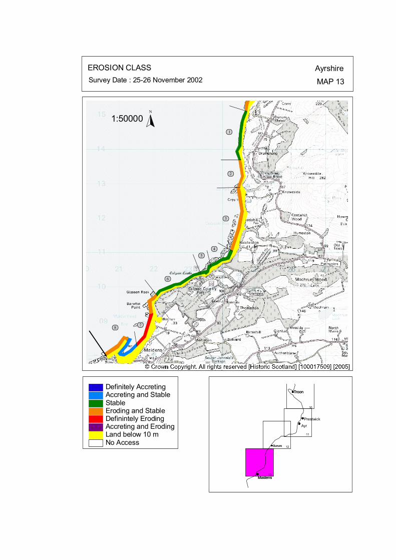
ôó1
ôó2
ôó3
ôó4ôó5
ôó6
ôó7ôó8
N
1:50000
EROSION CLASS AyrshireMAP 13Survey Date : 25-26 November 2002
Troon
Prestwick
Ayr
Maidens
Dunure
Troon
Maidens
Dunure
10
11
12
13
No Access
Definitely AccretingAccreting and StableStableEroding and StableDefinintely ErodingAccreting and ErodingLand below 10 m
© Crown Copyright. All rights reserved. Licence No. PA01041C. 2003.
kat
horizontal
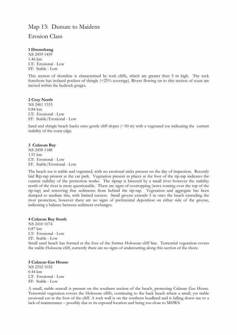
Map 13: Dunure to Maidens Erosion Class
1 Drumshang NS 2459 1459 1.46 km LT: Erosional - Low ST: Stable - Low
This section of shoreline is characterised by rock cliffs, which are greater then 5 m high. The rock foreshore has isolated pockets of shingle (<25% coverage). Rivers flowing on to this section of coast are incised within the bedrock gorges.
ST: Stable/Erosional - Low
Sand and shingle beach backs onto gentle cliff slopes (~50 m) with a vegetated toe indicating the current stability of the coast edge.
3 Culzean Bay NS 2458 1188 1.91 km LT: Erosional - Low ST: Stable/Erosional - Low
The beach toe is stable and vegetated, with no erosional nicks present on the day of inspection. Recently laid Rip-rap present at the car park. Vegetation present in places at the foot of the rip-rap indicates the current stability of the protection works. The riprap is bisected by a small river however the stability north of the river is more questionable. There are signs of overtopping (wave coming over the top of the rip-rap) and removing fine sediments from behind the rip-rap. Vegetation and aggregate has been dumped to mediate this, with limited success. Small groyne extends 5 m onto the beach extending the river protection, however there are no signs of preferential deposition on either side of the groyne, indicating a balance between sediment exchanges.
ST: Stable - Low Small sand beach has formed at the foot of the former Holocene cliff line. Terrestrial vegetation covers the stable Holocene cliff, currently there are no signs of undercutting along this section of the shore.
5 Culzean Gas House NS 2352 1032 0.44 km LT: Erosional - Low ST: Stable - Low
A small, stable seawall is present on the southern section of the beach, protecting Culzean Gas House. Terrestrial vegetation covers the Holocene cliffs, continuing to the back beach where a small, yet stable erosional cut at the foot of the cliff. A rock wall is on the southern headland and is falling down sue to a lack of maintenance – possibly due to its exposed location and being too close to MHWS.
2 Croy North NS 2461 1333 0.84 km LT: Erosional - Low
4 Culzean Bay South NS 2410 1074 0.87 km LT: Erosional - Low
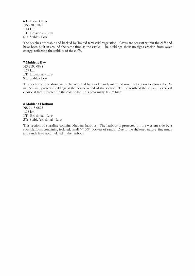
6 Culzean Cliffs NS 2305 1021 1.44 km LT: Erosional - Low ST: Stable - Low
The beaches are stable and backed by limited terrestrial vegetation. Caves are present within the cliff and have been built in around the same time as the castle. The buildings show no signs erosion from wave energy, reflecting the stability of the cliffs. 7 Maidens Bay NS 2193 0898 1.67 km LT: Erosional - Low
This section of the shoreline is characterised by a wide sandy intertidal zone backing on to a low edge <5 m. Sea wall protects buildings at the northern end of the section. To the south of the sea wall a vertical erosional face is present in the coast edge. It is proximally 0.7 m high.
ST: Stable - Low
8 Maidens Harbour NS 2115 0825 1.98 km LT: Erosional - Low ST: Stable/erosional - Low
This section of coastline contains Maidens harbour. The harbour is protected on the western side by a rock platform containing isolated, small (<10%) pockets of sands. Due to the sheltered nature fine muds and sands have accumulated in the harbour.
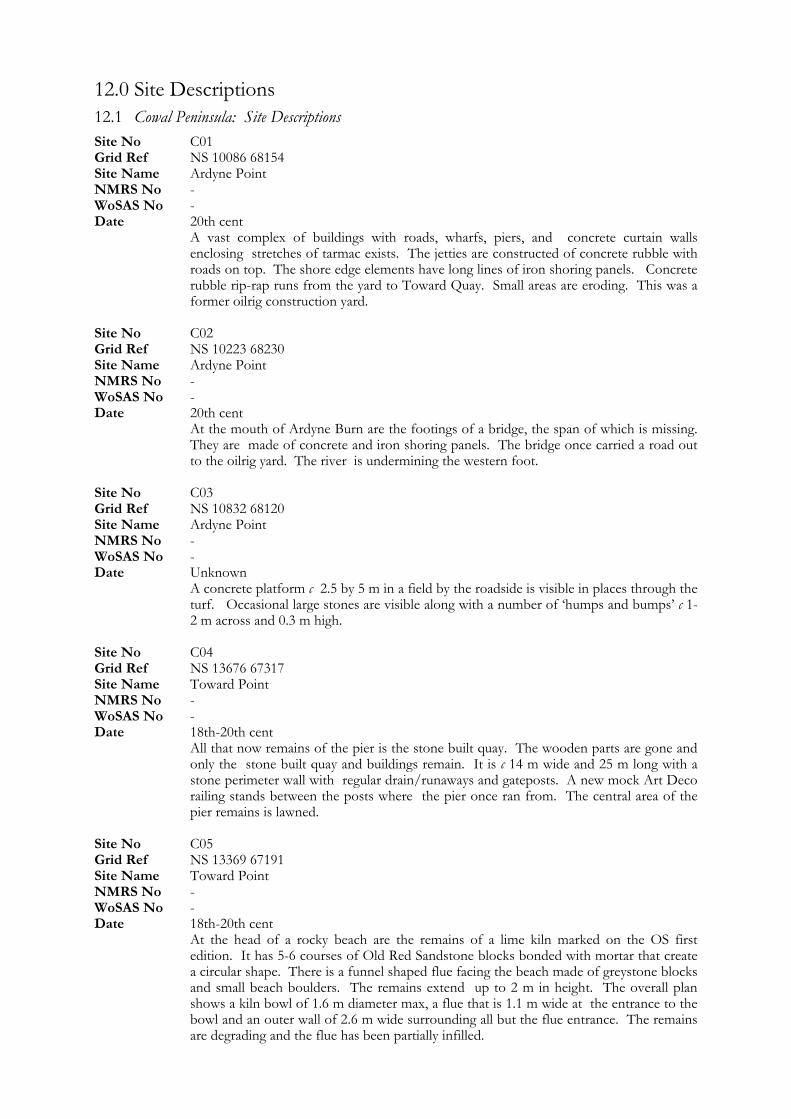
12.0 Site Descriptions 12.1 Cowal Peninsula: Site Descriptions Site No C01 Grid Ref NS 10086 68154 Site Name Ardyne Point NMRS No - WoSAS No - Date 20th cent A vast complex of buildings with roads, wharfs, piers, and concrete curtain walls
enclosing stretches of tarmac exists. The jetties are constructed of concrete rubble with roads on top. The shore edge elements have long lines of iron shoring panels. Concrete rubble rip-rap runs from the yard to Toward Quay. Small areas are eroding. This was a former oilrig construction yard.
Site No C02 Grid Ref NS 10223 68230 Site Name Ardyne Point NMRS No - WoSAS No - Date 20th cent At the mouth of Ardyne Burn are the footings of a bridge, the span of which is missing.
They are made of concrete and iron shoring panels. The bridge once carried a road out to the oilrig yard. The river is undermining the western foot.
Site No C03 Grid Ref NS 10832 68120 Site Name Ardyne Point NMRS No - WoSAS No - Date Unknown A concrete platform c 2.5 by 5 m in a field by the roadside is visible in places through the
turf. Occasional large stones are visible along with a number of ‘humps and bumps’ c 1-2 m across and 0.3 m high.
Site No C04 Grid Ref NS 13676 67317 Site Name Toward Point NMRS No - WoSAS No - Date 18th-20th cent All that now remains of the pier is the stone built quay. The wooden parts are gone and
only the stone built quay and buildings remain. It is c 14 m wide and 25 m long with a stone perimeter wall with regular drain/runaways and gateposts. A new mock Art Deco railing stands between the posts where the pier once ran from. The central area of the pier remains is lawned.
Site No C05 Grid Ref NS 13369 67191 Site Name Toward Point NMRS No - WoSAS No - Date 18th-20th cent At the head of a rocky beach are the remains of a lime kiln marked on the OS first
edition. It has 5-6 courses of Old Red Sandstone blocks bonded with mortar that create a circular shape. There is a funnel shaped flue facing the beach made of greystone blocks and small beach boulders. The remains extend up to 2 m in height. The overall plan shows a kiln bowl of 1.6 m diameter max, a flue that is 1.1 m wide at the entrance to the bowl and an outer wall of 2.6 m wide surrounding all but the flue entrance. The remains are degrading and the flue has been partially infilled.

Site No C06 Grid Ref NS 11984 67670 Site Name Castle Toward NMRS No - WoSAS No - Date Unknown A disused entrance to a driveway is set back from the A815. It consists of an ornate
gateway façade made of large decoratively carved blocks. The carvings are deep loops and hollows to give a brain lobe effect. The façade is semicircular with doorway size recesses, some of which are brick filled, others filled with carved stone, others flat cement. The structure is ruinous in places and some blocks are strewn around behind the wall.
Site No C07 Grid Ref NS 11644 67789 Site Name Castle Toward NMRS No - WoSAS No - Date 18th-20th cent A stone and mortar bridge and culvert conducts a stream under the A815. The bridge
arch is 1.5 m wide and 1 m high.
Site No C08 Grid Ref NS 11048 67823 Site Name Toward Quay NMRS No NS16NW 28 WoSAS No - Date 18th-20th cent A quay and related slipways situated by Castle Toward gatehouse are now owned by
Toward sailing club. The Quay is stone built with mortar and forms a harbour like feature. An old slipway of Red Sandstone sits beside the modern ones constructed of cement in front of the modern sailing club building.
Site No C09 Grid Ref NS 14233 69364 Site Name Toward NMRS No - WoSAS No - Date Unknown A series of linear boulder alignments constructed of sub-rounded boulders up to 0.7 m
in size were noted during the field survey. The features are roughly equally spaced over a distance of approx 400 m. The lines are c 20-40 m long, 1-2 m wide and 0.6 m high. The boulder alignments extend out over the pebble and rock intertidal zone from the coast edge seaward. There are a series of 6 alignments that extend from NS 14233 69364 to NS 14108 69173.
Site No C10 Grid Ref NS 13975 68867 Site Name Toward NMRS No - WoSAS No - Date Unknown A line of boulders, up to 0.7 m in diameter, extends from the foreshore into the sea.
They form a wall in places with up to 3 courses some 1.5 m high max. On one side of the wall is a boulder infill; the whole is some 35 m east-west by 10 m north-south.
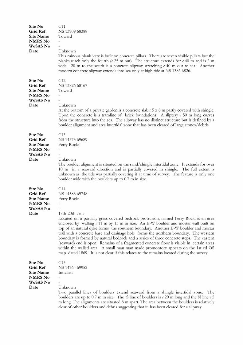
Site No C11 Grid Ref NS 13909 68388 Site Name Toward NMRS No - WoSAS No - Date Unknown This ruinous plank jetty is built on concrete pillars. There are seven visible pillars but the
planks reach only the fourth (c 25 m out). The structure extends for c 40 m and is 2 m wide. 20 m to the south is a concrete slipway stretching c 40 m out to sea. Another modern concrete slipway extends into sea only at high tide at NS 1386 6826.
Site No C12 Grid Ref NS 13826 68167 Site Name Toward NMRS No - WoSAS No - Date Unknown At the bottom of a private garden is a concrete slab c 5 x 8 m partly covered with shingle.
Upon the concrete is a tramline of brick foundations. A slipway c 50 m long curves from the structure into the sea. The slipway has no distinct structure but is defined by a boulder alignment and area intertidal zone that has been cleared of large stones/debris.
Site No C13 Grid Ref NS 14573 69689 Site Name Ferry Rocks NMRS No - WoSAS No - Date Unknown The boulder alignment is situated on the sand/shingle intertidal zone. It extends for over
10 m in a seaward direction and is partially covered in shingle. The full extent is unknown as the tide was partially covering it at time of survey. The feature is only one boulder wide with the boulders up to 0.7 m in size.
Site No C14 Grid Ref NS 14583 69748 Site Name Ferry Rocks NMRS No - WoSAS No - Date 18th-20th cent Located on a partially grass covered bedrock protrusion, named Ferry Rock, is an area
enclosed by walling c 11 m by 15 m in size. An E-W boulder and mortar wall built on top of an natural dyke forms the southern boundary. Another E-W boulder and mortar wall with a concrete base and drainage hole forms the northern boundary. The western boundary is formed by natural bedrock and a series of three concrete steps. The eastern (seaward) end is open. Remains of a fragmented concrete floor is visible in certain areas within the walled area. A small man man made promontory appears on the 1st ed OS map dated 1869. It is not clear if this relates to the remains located during the survey.
Site No C15 Grid Ref NS 14764 69952 Site Name Innellan NMRS No -
Date Unknown WoSAS No -
Two parallel lines of boulders extend seaward from a shingle intertidal zone. The boulders are up to 0.7 m in size. The S line of boulders is c 20 m long and the N line c 5 m long. The alignments are situated 8 m apart. The area between the boulders is relatively clear of other boulders and debris suggesting that it has been cleared for a slipway.
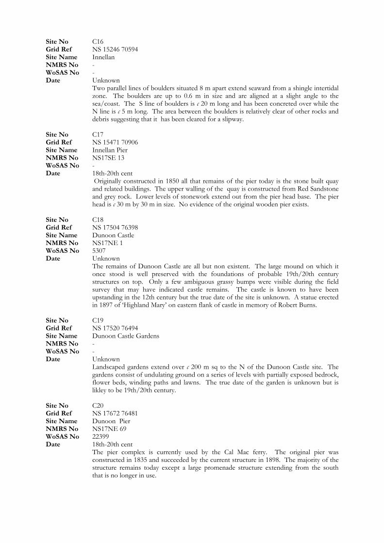
Site No C16 Grid Ref NS 15246 70594
Site Name Innellan Pier NMRS No NS17SE 13
NMRS No NS17NE 69
Site Name Innellan NMRS No - WoSAS No - Date Unknown Two parallel lines of boulders situated 8 m apart extend seaward from a shingle intertidal
zone. The boulders are up to 0.6 m in size and are aligned at a slight angle to the sea/coast. The S line of boulders is c 20 m long and has been concreted over while the N line is c 5 m long. The area between the boulders is relatively clear of other rocks and debris suggesting that it has been cleared for a slipway.
Site No C17 Grid Ref NS 15471 70906
WoSAS No - Date 18th-20th cent Originally constructed in 1850 all that remains of the pier today is the stone built quay
and related buildings. The upper walling of the quay is constructed from Red Sandstone and grey rock. Lower levels of stonework extend out from the pier head base. The pier head is c 30 m by 30 m in size. No evidence of the original wooden pier exists.
Site No C18 Grid Ref NS 17504 76398 Site Name Dunoon Castle NMRS No NS17NE 1 WoSAS No 5307 Date Unknown The remains of Dunoon Castle are all but non existent. The large mound on which it
once stood is well preserved with the foundations of probable 19th/20th century structures on top. Only a few ambiguous grassy bumps were visible during the field survey that may have indicated castle remains. The castle is known to have been upstanding in the 12th century but the true date of the site is unknown. A statue erected in 1897 of ‘Highland Mary’ on eastern flank of castle in memory of Robert Burns.
Site No C19 Grid Ref NS 17520 76494 Site Name Dunoon Castle Gardens NMRS No - WoSAS No - Date Unknown Landscaped gardens extend over c 200 m sq to the N of the Dunoon Castle site. The
gardens consist of undulating ground on a series of levels with partially exposed bedrock, flower beds, winding paths and lawns. The true date of the garden is unknown but is likley to be 19th/20th century.
Site No C20 Grid Ref NS 17672 76481 Site Name Dunoon Pier
WoSAS No 22399 Date 18th-20th cent The pier complex is currently used by the Cal Mac ferry. The original pier was
constructed in 1835 and succeeded by the current structure in 1898. The majority of the structure remains today except a large promenade structure extending from the south that is no longer in use.
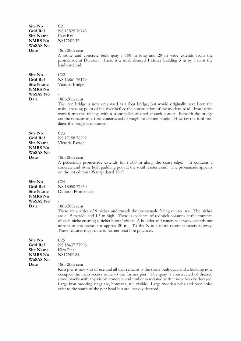
Site No C21 Grid Ref NS 17525 76743 Site Name East Bay NMRS No NS17NE 32 WoSAS No - Date 18th-20th cent A stone and concrete built quay c 100 m long and 20 m wide extends from the
promenade at Dunoon. There is a small disused 1 storey building 5 m by 5 m at the landward end.
Site No C22 Grid Ref NS 16861 76179 Site Name Victoria Bridge NMRS No - WoSAS No - Date 18th-20th cent The iron bridge is now only used as a foot bridge, but would originally have been the
main crossing point of the river before the construction of the modern road. Iron lattice work forms the railings with a stone pillar situated at each corner. Beneath the bridge are the remains of a ford constructed of rough sandstone blocks. How far the ford pre-dates the bridge is unknown.
Site No C23 Grid Ref NS 17158 76292 Site Name Victoria Parade NMRS No - WoSAS No - Date 18th-20th cent A pedestrian promenade extends for c 500 m along the coast edge. It contains a
concrete and stone built paddling pool at the south eastern end. The promanade appears on the 1st edition OS map dated 1869.
Site No C24 Grid Ref NS 18050 77450 Site Name Dunoon Promenade NMRS No - WoSAS No - Date 18th-20th cent There are a series of 9 niches underneath the promenade facing out to sea. The niches
are c 1.5 m wide and 1.5 m high. There is evidence of redbrick columns at the entrance of each niche creating a ‘ticket booth’ effect. A boulder and concrete slipway extends out infront of the niches for approx 20 m. To the N is a more recent concrete slipway. These features may relate to former boat hire practices.
Site No C25 Grid Ref NS 18437 77998 Site Name Kirn Pier NMRS No NS17NE 84 WoSAS No - Date 18th-20th cent Kirn pier is now out of use and all that remains is the stone built quay and a building now
occupies the main access route to the former pier. The quay is constructed of dressed stone blocks with any visible concrete and timber associated with it now heavily decayed. Large iron mooring rings are, however, still visible. Large wooden piles and post holes exist to the south of the pier head but are heavily decayed.
Site No C26 Grid Ref NS 18437 78047 Site Name Kirn NMRS No NS17NE 83 WoSAS No - Date 20th cent A concrete slipway, 1 m wide, extends c 30 m out to sea from the promenade. Site No C27 Grid Ref NS 18550 78585 Site Name Kirn NMRS No - WoSAS No - Date 18th-20th cent This cast iron monument consists of four vertical legs forming a 0.5 m square base. The
monument is c 2 m high with a domed top. Inscription reads “The gift of John Z Kay, Rosemount? To the commissioners of Dunoon 1877”
Site No C29
NMRS No -
Date 18th-20th cent
Site No C28 Grid Ref NS 18574 78686 Site Name Jim Crow Stone NMRS No - WoSAS No - Date 18th-20th cent A large glacial erratic is situated high in the intertidal zone near the HWM. It is
currently painted as a lizards head with the words Jim Crow. The Jim Crow Stone is marked in current position on the first edition OS map.
Grid Ref NS 18478 79230 Site Name Hunters Quay
WoSAS No -
This 19th century mile plate is set into stone wall. A pointing hand shows direction ‘Dunoon Pier 2 miles’.
Site No C30 Grid Ref NS 18370 79508 Site Name Hunters Quay NMRS No - WoSAS No - Date Unknown The site is situated beneath the current road level on a rocky coast edge. The extent of
site is c 20 m by 20 m and up to 4 m high. The site consists of two very large stone built pillars, one with a large corroded iron bracket and hinge. Behind/between these pillars is a barrel vaulted room. Roofing at the entrance is collapsed but chamber still runs back 10+ m and, therefore, under the current road. A Large wall constructed of horizontally placed stones extends off the north of the chamber entrance. The wall extends up to 4 m high up to a level current with the road. A small section of walling at the base appears to have been repaired with vertical aligned stones, as opposed to horizontal in main construction. A low wall c 0.2 m in height running parallel with the coast edge is situated 10 m in front of the main wall. This encloses an area of quarried natural rock platform creating a small pool. There are evidence of iron attachments built into the low wall and rock platform. The stone removed from here may have been used in the construction of the chamber/wall.
Site No C31 Grid Ref NS 17228 80424 Site Name Lazaretto Point NMRS No - WoSAS No - Date 20th cent A small section of reclaimed land exists at Lazaretto point. A first world War memorial c
10 m high with concrete base is situated at the tip of the promontory. Clear evidence of erosion on the coastal face to the south east of the memorial exists where gabion basket protection has failed and land is being removed from behind the baskets.
Site No C32 Grid Ref NS 16629 80370 Site Name Ardnadam Pier NMRS No NS18SE 48 WoSAS No - Date 18th-20th cent Ardnadam Pier was constructed in 1858. It was taken over by the navy during the
second world war and subsequently by the US Navy. It consists, today, of a long, wooden supported walkway extending out from a small area of reclaimed land. The pier is c 175 m long. It is heavily defended by mesh fences and barbed wire. There is a small compound at the pier head measuring 15 m by 20 m. The pier extends in a ‘T’ shape at its seaward end.
Site No C33 Grid Ref NS 16338 80411 Site Name Sandbank Sailing Club NMRS No NS18SE 48 WoSAS No - Date 20th cent Consists of a site complex including concrete slipway extending for 15-20 m from rip rap
shore defences. A sailing clubhouse is located on the foreshore c 125 m to the west of slipway.
Site No C34 Grid Ref NS 16222 80532 Site Name Sandbank Marina NMRS No - WoSAS No - Date 20th cent This concrete pier extends from a marina areawhich holds numerous ships and a crane.
The pier is c 200 m long. The Land from which pier extends is suspected to be reclaimed. No access to the site was available due to commercial property.
Site No C35 Grid Ref NS 15847 80926 Site Name Sandbank Boat Yard NMRS No - WoSAS No - Date 20th cent The site consists of a large area of reclaimed land built on top of rip rap boulders
containing a disused boat yard measuring c 140 m by 100 m with a concrete slipway extending off NE end. No access to site as it was fenced off.
Site No C36
Site No C37
Grid Ref NS 16582 82090
Site Name Grahams Point
Grid Ref NS 15783 81047 Site Name Sandbank, Holy Loch NMRS No NS18SE 8006 WoSAS No - Date Unknown A wooden frame of a maritime vessel exists partially covered by intertidal mud flats. It is
orientated NW-SE and measures c 16 m by 4 m. The full length of the vessel appears to be visible and consists of 22 ‘ribs’ of the frame, 11 on each side.
Grid Ref NS 15528 81842 Site Name Little Eachaig River NMRS No - WoSAS No - Date Unknown The possible site consists of a grassy covered, gradually curving, bank c 4.5 m wide and
up to 0.8 m high. It forms an arc next to a small stream with a maximum diameter of 16 m. The make up of the bank appears to be gravels. This along with its location on the flood plain and next to a small stream may suggest that it is a naturally formed river feature.
Site No C38
Site Name Kilmun NMRS No NS18SE 1 WoSAS No 5346 Date 14th-18th cent Constructed in 1442 by Duncan Campbell the remains of a church exist on a small area
of land situated just to the WNW of present day church. The church appears relitavley stable in its construction although in a partially ruined state.
Site No C39 Grid Ref NS 17112 81608 Site Name Kilmun Pier NMRS No NS18SE 43 WoSAS No - Date 18th-20th cent Constructed in 1827 the site consists of a pier measuring c 80 m by 25 m. No access to
the site was possible, therefore, measurement is an estimate. A stone quay with cobbled surface extends out from road. There is a surface of wooden planks at sea end for c 15 m. A right angled extension at seaward end consiss of wooden planks with wooden piles.
Site No C40 Grid Ref NS 17487 81214
NMRS No - WoSAS No - Date 20th cent The site consists of a monolith needle monument of polished grey and pink granite c 4 m
tall. It has a square base and contains small water features. A copper portrait plaque is present but contains no inscriptions.
Site No C41 Grid Ref NS 18946 80545 Site Name Strone Pier NMRS No NS18SE 42 WoSAS No - Date 18th-20th cent Strone Pier measures c 9-10 m wide. No access onto pierwas possible, therefore, length
could not be correctly assessed. A stone boulder quay with concreted surface exists with a wooden supported landing stage extending off the end of the quay. Metal fencing prevents access onto pier due to an electricity sub-station being sited on the landward end.
Site No C42 Grid Ref NS 19323 80526 Site Name Strone Point NMRS No - WoSAS No - Date Unknown Two concrete and boulder built slipways exist situated c 10 m apart. Both are 2 m wide.
The N most measures 5 m long and is in poor condition. The other is c 50 m long and in good condition with a wooden post marker at the seaward end. Steps lead down from the sea wall to the slipways. Their close proximity may suggest they are used as one unit. Alternatively the poor state of one and good condition of the other could suggest one has replaced the other.
Site No C43 Grid Ref NS 18236 80913 Site Name Gibb’s Point
NMRS No -
NMRS No - WoSAS No - Date Unknown Remains of three private jetties up to 30 m in length and 1.5 m wide extend from private
gardens at the rear of houses. Only the most northerly jetty is still in use and well maintained. The other two consist of the remains of iron supports extending for c 10 m.
Site No C44 Grid Ref NS 18096 81054 Site Name Rhubeg
WoSAS No - Date Unknown A series of wooden piles varying from 0.2-0.02 m in diameter and up to 0.3 m high
extend for 10 m along the front of private property. Some concrete is present around the bases of piles. They appear to have formed a small walkway along the front of the property which would have been over 10 m in length and 2 m wide.
Site No C45 Grid Ref NS 16374 82347 Site Name Arboretum, Kilmun NMRS No - WoSAS No - Date Unknown An extensive arboretum is built on the hillside slopes above and down to the coast. It
includes terraced pathways, well kept lawns and numerous tree species. It is an extensive site of which only some extends into ‘zone’ of coastal assessment.
Grid Ref NS 18585 79087 Site Name Hunters Quay NMRS No NS17NE 82
Grid Ref NS 18429 78073
Date 18th-20th cent
Site No C48
Grid Ref NS 17114 81646 Site Name Kilmun Pier NMRS No NS18SE 43 WoSAS No - Date Unknown A small one storey building is constructed partially on the stone quay of Kilmun pier. It
is still roofed and intact.
Site Name Sandbank, Holy Loch
Date Unknown
Site No C46
WoSAS No - Date 18th-20th cent The stone quay was constructed in 1829 with the addition of the wooden pile supported
extension in 1858. It currently measures c 80 m in length with the pier head being modified to accommodate Western Ferries service.
Site No C47
Site Name Marine Parade, Kirn NMRS No - WoSAS No -
The cast iron monument has four vertical legs forming a 0.5 m square base. The monument is 2 m high with a domed top. An inscription reads “The gift of the directors of the Kirn pier 1877”. This monument is almost identical to C27. The difference being the differing inscriptions which are placed on the main structure. The main structure of the two monuments would have originated from the same cast.
Grid Ref NS 18459 78189 Site Name Kirn NMRS No - WoSAS No - Date 20th cent Located on a very small promontory off the promenade at Kirn exists remains of a
structure. It consists of the patchy remains of a concrete floor and three visible steps leading down from the coast edge. The extent of the site is 10 m by 5 m. The concrete is set directly against the bare rock. Pre war photographs of the area show the structure as once being a form of substantial beach hut.
Site No C49
Site No C50 Grid Ref NS 17122 81637 Site Name Kilmun Pier NMRS No NS18SE 44 WoSAS No - Date Unknown A small one storey building is constructed partially on the stone quay of Kilmun pier. It
is still roofed and intact.It is not currently a post office. Site No C51 Grid Ref NS 15860 81000
NMRS No NS18SE 8003 WoSAS No -
There are previous reports of a wreck existing at this location. It was not located during field survey.
Site No C52 Grid Ref NS 16300 80500 Site Name Vesta, Sandbank NMRS No NS18SE 8011 WoSAS No - Date Unknown
Date 18th-20th cent
Grid Ref NS 13960 68940 Site Name Innellan
There are previous reports of a wreck existing at this location. It was not located during field survey.
Site No C53 Grid Ref NS 17600 79890 Site Name Hafton House NMRS No NS17NE 21 WoSAS No 11813
The listed building is now used as a residential lodge located in the grounds of a holiday park. It is in very good condition.
Site No C54 Grid Ref NS 17600 76500 Site Name Dunoon Pier NMRS No NS17NE 8006 WoSAS No - Date Unknown There are previous reports of a wreck existing at this location. It was not located during
field survey. Site No C55 Grid Ref NS 17000 76000 Site Name Lady Maud, Dunoon NMRS No NS17NE 8032 WoSAS No - Date Unknown There are previous reports of a wreck existing at this location. It was not located during
field survey. Site No C56 Grid Ref NS 16790 75770 Site Name Pavilion, Dunoon NMRS No NS17NE 56 WoSAS No - Date 18th-20th cent. The former Pavilion building is now used as the Highland Pottery Showroom. It was not
inspected during the field survey. Site No C57
NMRS No NS16NW 3 WoSAS No 5285 Date Unknown Nothing of significance was located in the vicinity of the previous excavations at
Chapelhall.
Site No C58 Grid Ref NS 13610 67360 Site Name Toward Point NMRS No NS16NW 25 WoSAS No - Date Unknown Records indicate a Public Services/ Radio Station at the above coordinates. It was not
located during the field survey. The building may no longer be used for this purpose. Site No C59 Grid Ref NS 11750 67730 Site Name Toward Castle NMRS No NS16NW 15 WoSAS No 15677 Date Unknown A lime Kiln is noted on the first edition OS map dated 1870 at NS 1175 6773. No trace
of the kiln was located during the survey. Site No C60 Grid Ref NS 13620 67230 Site Name Toward Point Lighthouse NMRS No NS16NW 12 WoSAS No 11702 Date 18th-20th cent Toward Point Lighthouse dates from 1812 and was constructed by the Stevenson family.
It is part of a complex of three other buildings including the house, assistants house and the foghorn. The lighthouse is now automated but the house is still in use. All are in good condition.
Site No C61 Grid Ref NS 11150 67780 Site Name Toward Castle, South Lodge NMRS No NS16NW 22 WoSAS No - Date 18th-20th cent The South Lodge is associated with the most recent Toward castle which was designed in
1821. The Lodge is currently used as an education centre and is in good condition. Site No C62 Grid Ref NS 11120 67840 Site Name Toward point NMRS No NS16NW 29 WoSAS No - Date 18th-20th cent A 19th centaury mile plate is set into a stone wall. A pointing hand shows the direction
to Dunoon. Site No C63 Grid Ref NS 17370 76340 Site Name Dunoon, Castle House MRS No NS17NE 5 WoSAS No 5322 Date Unknown Nothing of significance was located in the vicinity of the previously recorded skeletal
finds in 1822.
Site No C64 Grid Ref NS 17520 81280 Site Name Graham’s Point, Kilmun NMRS No NS18SE 2 WoSAS No 5349 Date Unknown In the early 1800’s cists burial were located here. No further information was gained
during the survey. Site No C65 Grid Ref NS 18450 79080 Site Name Hunter’s Quay NMRS No NS17NE 27 WoSAS No 21942 Date 18th-20th cent Built in 1888 this substantial ‘Tudor style house’ is located behind Hunter’s Quay. The
house is in relatively poor condition and is not currently inhabited. Site No C66 Grid Ref NS 17510 76370 Site Name Dunoon, Castle Gardens NMRS No NS17NE 26 WoSAS No 20022 Date 20th cent The site was not inspected during the field survey. Site No C67 Grid Ref NS 13672 67239 Site Name Toward Point NMRS No - WoSAS No - Date Unknown A jetty/slipway constructed of red sandstone blocks extends out to sea from a rocky
shoreline. It has been concreted over at the shore end. It measures c 50 m by 1 m but it was difficult to assess the true extent as the tide was in at time of survey. The mid section is partially collapsed.
Site No C68 Grid Ref NS 15640 72080 Site Name Innellan, Gasworks NMRS No NS17SE 3 WoSAS No 5329 Date 18th-20th cent Innellan Gasworks. Not inspected during the field survey. Site No C69 Grid Ref NS 15800 80830 Site Name Sandbank NMRS No NS18SE 11 WoSAS No 5348 Date Unknown The crane was not located during the field survey.
Site No C70 Grid Ref NS 16000 82000
Grid Ref NS 16540 82170 Site Name Old Kilmun House NMRS No NS18SE 37
Date 14th-18th cent Old Kilmun House dates to c 1705 and incorporates part of a late 16th century/early
17th century house or re-uses stonework from a building of that date. It still remains in good condition.
Located c 40 m from the protected coast edge St Columba’s Church is currently in use and in very good condition. The current building appears to have been constructed in the 19th century.
Date Unknown The fragmentary remains of a jetty extend c 10 m seaward from the coast edge. Built on
top of a rock platform the jetty consists of stone walling and concrete with remains of iron stakes and mooring rings. It measures c 5 m wide max.
Site Name Kilmun NMRS No NS18SE 12 WoSAS No 12717 Date 14th-18th cent Kilmun was erected burgh of barony in 1490. Site No C71
WoSAS No 22718
Site No C72 Grid Ref NS 14796 70006 Site Name Innellan NMRS No - WoSAS No - Date Unknown An alignment of boulders c 20 m long extends seawards across the intertidal zone. Site No C73 Grid Ref NS 14817 70016 Site Name Innellan NMRS No - WoSAS No - Date Unknown Two parallel lines of boulders situated c 8 m apart extend seaward from a shingle
intertidal zone. The boulders are up to 0.7 m in size. The area between the boulders is relatively clear of other boulders and debris suggesting that it may have been cleared for use as a slipway.
Site No C74 Grid Ref NS 19260 80550 Site Name St Columba’s Church NMRS No NS18SE 35 WoSAS No - Date 18th-20th cent
12.2 Great Cumbrae: Site Descriptions Site No GC01 Grid Ref NS 16721 54974 Site Name The Leck NMRS No - WoSAS No -
Site No GC02 Grid Ref NS 16646 54960 Site Name Newtown Bay NMRS No - WoSAS No - Date Unknown A stone and concrete built jetty extends for over 50 m into the sea and is c 4 m wide max.
It runs over rock and sand. The jetty is not linear in construction, turning at small angles numerous times. A large rock to the SE of feature has been painted as a dragon.
Site No GC03
Site No GC05
Grid Ref NS 16288 54913 Site Name Newtown Bay NMRS No NS15SE 34 WoSAS No - Date Unknown A rock and cement built jetty with numerous repairs is built on rock and a sandy shore.
The jetty has iron mooring rings. It extends for over 70 m but was partially under the sea during survey. It begins to ‘loop’ back around but, again, this was below water level at time of survey. A small concrete slipway is located immediately to the E.
Site No GC04 Grid Ref NS 16063 54747 Site Name Millport Harbour/Pier complex NMRS No NS15SE 42 WoSAS No - Date 18th-20th cent A site complex including a walled harbour measuring c 50 m by 50 m with the entrance
on the SE side. A pier extends off the SW corner of the Harbour. The pier is constructed of stone and concrete for the initial c 70 m before changing to wooden pillars and platform for the remaining 20 - 30 m. A modern passenger ramp is fitted to the wooden area of the pier. A disused ticket kiosk exists at the shore end of pier.
Grid Ref NS 15703 54560 Site Name Little Brae NMRS No - WoSAS No - Date 18th-20th cent A low walled paddling pool is built on flat rock at the coast edge. It is likely to date to
the 18/19th century. The walls are c 1.5 - 2 m thick with higher walling on the W side. It is constructed of stone and concrete. The pool is fed by sea and is 0.4 m deep max.
Site No GC06 Grid Ref NS 15593 54067 Site Name The Lorn NMRS No - WoSAS No - Date 20th cent A site complex extends over an area of c 125 m by 50 m located on rock platform shore
and grassy plain inland. The site includes a boat yard, a small slate roofed building measuring c 25 m by 10 m and a modern pier and slipway at the seaward side. No access was gained to the to internal area.
Site No GC07 Grid Ref NS 15494 53910 Site Name The Lorn
An area c 200 m- 250 m of coast edge where grassy plain meets rock platform has occasional sections of industrial and domestic midden eroding from the section. The midden material exists up to 0.8 m in height and consists of ceramic, glass, tile, slate and corroded iron. One area shows deposits 0.8 m deep of purely corroding iron. It is possibly industrial waste dumps used to level/reclaim land. The sections are under threat from erosion during very high tides/storms. The midden runs from NS 1549 5391 to the NS 1559 5406.
WoSAS No -
NMRS No -
Date Unknown
NMRS No - WoSAS No - Date 18th-20th cent
Site No GC08 Grid Ref NS 15542 53959 Site Name Nupkur Rock NMRS No -
Date Unknown A wooden raft measuring c 10 m by 2 m has been washed up on rocky shoreline during a
high tide/storm surge. Created from 3 layers of thick square planks it is held together by corroded iron bolts. The layers lie at 90 deg to layer above/below creating structure up to 1 m in height. The beam attachments include iron mooring rings and rods.
Site No GC09 Grid Ref NS 15525 53912 Site Name Nupkur Point
WoSAS No - Date Unknown A stone and rubble jetty measures c 20 m by 4 m and is up to 2 m high. It extends out to
sea on top of rock platform. The stone and rubble base has a concrete layer on top. It shows signs of collapse on the southern side. The jetty is now disused.
Site No GC10 Grid Ref NS 15110 54222 Site Name Westbourne NMRS No - WoSAS No - Date Unknown Situated on the flat grassy fields of a raised beach is a trackway. A section of the track
extending c 300 m to the south west of the GPS point consists of a flat raised area up to 5 m wide and 0.2 m high. The raised area is grass covered and shows no visible signs of a stone surface. The trackway extends for a further 500 m round the point S of the Lorn. Here the track is constructed of a rough pebble and gravel surface and may possibly be relatively modern compared to the raised grassy section.
Site No GC11 Grid Ref NS 15044 54210 Site Name Eilean Na Gourock NMRS No - WoSAS No -
Situated on a mainly shingle and pebble beach is a pile of rounded stones up to 0.3 m in size. The feature extends for 6 m in a seaward direction and is up to 1.5 m wide. Uncovered at low tide and partially covered at high tide, the feature is of unknown purpose.
Site No GC12 Grid Ref NS 16267 57952 Site Name Little Skate Bay NMRS No - WoSAS No - Date Unknown Situated on top of the rock platform on the western side of Little Skate Bay is a small
stone built jetty. It measures 10 m long, 7 m wide and extends up to 1 m in height. The side walls and top are constructed from large dressed blocks under which lies a rubble core. Ceramic field drains were noted within the rubble core. There is no evidence of metal fixings on jetty. It is partially collapsed on NW side. Almost totally covered at high tide, the placement of the jetty utilizes the bay as a natural harbour.
Site No GC13 Grid Ref NS 16872 58901 Site Name Eerie Port NMRS No NS15NE 3 WoSAS No - Date 20th cent Two single storey buildings are situated close to the shore at Port Eerie. These buildings
comprised a listening post for the underwater defences in the Clyde. In addition, the living quarters were in the large square blockhouse and a small machine gun emplacement for a lewis or bren gun was situated close by. It is currently used as an outdoor centre. The gun emplacement not located during field survey.
Site No GC14 Grid Ref NS 18171 59294 Site Name Tomont End NMRS No NS15NE 33 WoSAS No - Date 18th-20th cent The upstanding monument erected in memory of two drowned boys aged 17 & 10 was
erected in mid nineteenth century. The inscription is slightly eroded. It stands c 5 m tall and is 1.5 m wide at the base. Subsequent graffiti and bench mark are inscribed into monument.
Site No GC15 Grid Ref NS 16357 58107 Site Name Bell Bay NMRS No - WoSAS No - Date Unknown An area extends for c 500 m and is between 20 m and 50 m wide composed of
grass/marsh covered raised beach at the foot of a cliff face. Within this area are patchy remains of Rig and Furrow cultivation most prominent at the northern end. The site extends from GPS NS 1635 5810 to NS 1616 5754.
Site No GC16 Grid Ref NS 15157 55513 Site Name Sheriff’s Port NMRS No - WoSAS No - Date Unknown Possible traces of rig and furrow cultivation are visible in a 1 m wide strip extending for
10 m where a path has flattened overgrown area. A dry stone wall to the north defines the area of possible cultivation which measures up to 50 m by 20 m. The area was too overgrown to define accurately. Natural bedrock dykes may also explain the undulating features.
Site No GC17 Grid Ref NS 18373 58611 Site Name Cumbrae Slip NMRS No NS15NE 28 WoSAS No - Date 18th-20th cent The large concrete slipway is currently used as Cal Mac Ferry dock. The road has been
modified to accommodate traffic. The slipway extends for c 50 m out from the arteficial coast edge. The 1st ed OS map indicates Boat House on current slipway site.
Site No GC18 Grid Ref NS 18270 58114 Site Name Down Craig NMRS No - WoSAS No - Date 20th cent The site consists of a water sports complex extending over c 200 m by 150 m. Buildings
are situated on raised beach deposits. A concrete slipway extends into sea for c 50 m at northern end of site. A wood and metal jetty extends into sea for c 200 m at southern end of site. The wood and metal jetty bends at 90 deg In a northward direction.
Site No GC19 Grid Ref NS 18227 57674 Site Name Fairhaven NMRS No - WoSAS No - Date 20th cent A modern wood and metal jetty extends from sea wall for c 30 m. Thin metal legs and
wooden frame form the private jetty which is 1.5 m wide. Site No GC20 Grid Ref NS 18330 59149 Site Name Tomont End NMRS No NS15NE 6 WoSAS No 5210 Date Unknown No evidence of distinct cairn exists. A possible mound is present beneath heavy grass
and fern cover. It appears to have large portion removed on the NE side. This may relate to the previously recorded disturbance during the road building.
Site No GC21 Grid Ref NS 18315 58883 Site Name Lady’s Grave NMRS No NS15NE 2 WoSAS No 5201 Date Unknown The Southern Cairn, or “Lady’s Grave” is c 10 m in diameter and 1.2 m high (max). A
hollow is clearly visible in the centre. It is Bracken and turf covered. Site No GC22 Grid Ref NS 18192 57959 Site Name Down Craig NMRS No NS15NE 7 WoSAS No 5211 Date Unknown A NW-SE running rampart and ditch of the fort is clerly visible at the site. Both are c 3-
4 m wide and 1.2 m deep/high. There is also a possible SW-NE running rampart along edge of slope for c 30 m.
Site No GC23 Grid Ref NS 17206 54845 Site Name Ninian Brae NMRS No - WoSAS No - Date 18th-20th cent The stone and concrete pier/jetty is built on a rock platform. A high wall exists on the
southern and eastern side. The Eastern side also contains steps down from Road. The jetty foundations are constructed of rough stone blocks with a concrete capping and measure c 25 m by 5-10 m. Evidence exists on the southern wall of small shed like ‘lean-to’s’ from brick foundation marks. The structures appeared to have been c 1 m sq. Three courses of stairs lead down to sea at seaward end. Heavily corroded mooring attachments are visible on the jetty.
Site No GC24 Grid Ref NS 17173 54783 Site Name Ninian Brae, Millport NMRS No - WoSAS No - Date 18th-20th cent The slightly off square disused paddling pool measures 20 m by 20 m and 0.3 m deep.
Constructed of stone and concrete it is built on top of a rock platform which is partially covered at high tide. An Outlet drain and valve are visible at the SW end. Access steps at E end. Silting is occurring at pool base.
Site No GC25 Grid Ref NS 17243 54024 Site Name Farland Point
Grid Ref NS 17722 54565
NMRS No - WoSAS No - Date Unknown Located on rocky shoreline is a jetty of crudely shaped red sandstone blocks and lighter
granite held with concrete that may have been added later. It is c 1.5 m high max and stranded at low tide. Eroded tarmac road remains run over exposed bedrock to the jetty. There is a small wall that protrudes off the east end at the back of the jetty and runs for c 4 m.
Site No GC26 Grid Ref NS 17608 54459 Site Name Keppel Port NMRS No - WoSAS No - Date 20th cent Above the rocky shoreline is a complex of maritime structures now part of the University
of Glasgow field station. They may be ex II WW buildings. The complex includes a concrete slipway with iron rails that extend from a building into the sea and three single storey flat roofed buildings and a two storey command post.
Site No GC27
Site Name Keppel Port NMRS No NS15SE 43 WoSAS No - Date 20th cent This pier is made of large wooden beams that extend out to sea from a building on an
onshore concrete platform. The pier is c 8 m wide and runs for c 40 m before it turns a right angle to make a 15 m loading wharf. It is currently in use.
Site No GC28 Grid Ref NS 17903 54773 Site Name Keppel Port NMRS No - WoSAS No - Date 20th cent This disused concrete block is c 1 m high, with a tapered profile. It is 1.5 m square at the
base and 0.4 m square at the top. A large rusty iron loop is on the seaward side.
NMRS No -
Site No GC30
Date 18th-20th cent
WoSAS No 5207
Grid Ref NS 16200 57420
The possible site at Bell Craig was not inspected during the field survey.
Site No GC29 Grid Ref NS 17902 54923 Site Name The lion
WoSAS No - Date Unknown The site consits of a large dyke of bedrock shaped like a lion. It is c 8 m high and 40 m
long. This feature is of some importance to the island of Cumbrae.
Grid Ref NS 18314 58007 Site Name Downcraig Ferry NMRS No - WoSAS No -
This 20 m wide quay of Old Red Sandstone blocks extends c 80 m from the shoreline out to sea. The structure has a perimeter wall over 1 m high that curves out to form a flared landward end. The pier surface is now grassed over. The pier is shown on OS first edition map.
Site No GC31 Grid Ref NS 18100 56600 Site Name Craigengour, Great Cumbrae NMRS No NS15NE 20 WoSAS No 5202 Date Unknown The site is heavily overgrown. There are humps and bumps of a number of low natural
dykes on the point but no structural evidence visible.
Site No GC32 Grid Ref NS 15880 56700 Site Name Fintry Bay, Great Cumbrae NMRS No NS15NE 3
Date Unknown Nothing of significance was located in the vicinity of the three short cists that were
found at Fintry Bay where a tumulus (described as a sand hill 30-40ft long, 60ft in circumference and 10-12ft high) was dug through in August 1873 by men making a new road around the island.
Site No GC33
Site Name Bell Craig NMRS No NS15NE 8 WoSAS No 5212 Date Unknown
Site No GC34 Grid Ref NS 17000 59000 Site Name Stinking Bay NMRS No NS15NE 1 WoSAS No 5190 Date Unknown Nothing of significance was located in the vicinity of a tumulus,in which an urn was
found and broken, by a labourer building a dyke in 1881. Site No GC35 Grid Ref NS 16010 54670
Site Name The Garrison NMRS No NS15NE 11
Site Name ‘Sheriff's Auld Ha’ NMRS No NS15SE 12 WoSAS No 5227 Date Unknown The Site of Sheriff’s Auld Ha was not inspected during the field survey. Site No GC36 Grid Ref NS 16300 55000
WoSAS No 5192 Date Unknown Nothing of significance was located in the vicinity of where a body, buried in an oak
coffin in a sand-hill, was found in 1874. Site No GC37 Grid Ref NS 18320 59130 Site Name ‘Lady's Grave’ NMRS No NS15NE 5 WoSAS No 5209 Date Unknown The proposed grave was not located during the field survey. Site No GC38 Grid Ref NS 18200 57900 Site Name Down Craig NMRS No NS15NE 9 WoSAS No 5213 Date Unknown The boulder features or possible graves were not locted during the field survey. Site No GC39 Grid Ref NS 16250 54920 Site Name Millport NMRS No NS15SE 9 WoSAS No 5251 Date Unknown Nothing of significance was located in the vicinity of the mediaeval stone cross and stone
coffin found in 1823. Site No GC40 Grid Ref NS 17270 54500 Site Name Farland Hill NMRS No NS15SE 10 WoSAS No 5225 Date Unknown The cave was not inspected during field survey.
Site No GC41 Grid Ref NS 16100 54700 Site Name Millport Bay NMRS No NS15SE 8001 WoSAS No - Date Unknown The wreck was not Located during field survey. Site No GC42 Grid Ref NS 16500 55000 Site Name Millport NMRS No NS15NE 19 WoSAS No 5200 Date Unknown Nothing of significance was located in the vicinity of where a small flake or slab of stone
with an incised cross upon it has been found. Site No GC43 Grid Ref NS 16300 55000 Site Name The Garrison NMRS No NS15NE 10 WoSAS No 5191 Date Unknown Nothing of significance was located in the vicinity of where Stone coffins have been
found in a field near the Garrison. 12.3 Ayrshire: Site Descriptions Site No A01 Grid Ref NS 20939 56738 Site Name Kelburnfoot NMRS No - WoSAS No - Date 18th-20th cent The site complex includes coastal loading facilities, a small burnt down wooden building
and a disused stone well. Situated at NS 20939 56738 the loading facilities consist of a wide arc of low concrete walling extending into the intertidal zone. Two sets of rail tracks run across the walling into the sea. Situated c 15 m inland from the loading facilities at NS 20951 56702 is a disused stone well. The well is circular in plan and 1 m in diameter. Just to the south of the well are the remains of a burnt- out small building and further low walled concrete barriers with one visible entrance at the coast edge.
Site No A02 Grid Ref NS 20909 55299 Site Name Fairlie Sands NMRS No - WoSAS No - Date 18th-20th cent The old sea wall constructed from red sandstone and mortar holds a small gateway in
the wall with steep steps rising up to the higher ground level behind. The gateway contains a corroded iron gate. The red sandstone is heavily worn and a faded inscription slab is too eroded to read.
Site No A03 Grid Ref NS 20873 55101 Site Name Fairwinds, Fairlie NMRS No -
Date Unknown
The boat house is constructed on top of a brick platform measuring c 8 m by 4 m. The boathouse has a very steep slate roof. A large door measuring 2.5 m by 2.5 m exists on the seaward side from which a concrete slipway extends into the sea.
WoSAS No - Date 18th-20th cent A large stretch of sea/garden walling and associated features extends for c 300 m along
the coast edge. The walling appears to be of some age in areas and contains numerous gateways at the ends of gardens. The site includes numerous small slipways constructed of stone blocks. At the northern end of the complex there exists a disused slipway constructed of boulders and concrete, lined with stone blocks and held with iron pins. A series of rock cut drainage channels have been cut out of the natural bedrock at the base of the wall. A folly exists on the sea wall with an octagonal tower and still roofed. It appears to have been purely for decorative purposes.
Site No A04 Grid Ref NS 20853 55032 Site Name The Millstones, Fairlie NMRS No - WoSAS No -
A boulder constructed slipway measuring c 6 m by 5 m is situated at the N end of the A03 complex.
Site No A05 Grid Ref NS 20752 54708 Site Name Fairlie Sands NMRS No - WoSAS No - Date 20th cent
Site No A06 Grid Ref NS 17544 49230 Site Name Auchenames, Portencross NMRS No - WoSAS No - Date Unknown The square feature measures 3 m by 3 m and 1.5 m to 2 m deep. The feature is cut into
the natural rock platform in the intertidal zone. It has a floor of red brick. A rock cut channel extends from the SW corner extending seaward and drill holes are visible in the bedrock sides of the feature. The sea enters the rock cut area via the channel with the main ‘tank’ being almost full at high tide.
Site No A07 Grid Ref NS 17549 49212 Site Name Auchenames, Portencross NMRS No - WoSAS No - Date 18th-20th cent The decaying pier is constructed of concrete beams over wooden piles. There is a large
hole c 2 m by 2 m in the centre where beams have decayed. The pier measures c 40 m long by 5 m wide with a ‘T’-shaped extension at the seaward end.
Site No A08 Grid Ref NS 17581 49211 Site Name Portencross NMRS No - WoSAS No - Date Unknown A cobbled trackway extends for c 1.4 km along the coast edge from Portencross North
harbour to Hunterston Power Station complex. The best preserved area is that around Portencross where the cobbled surface of sub-rounded stones is clearly visible. Here the track cuts through a natural dyke. The northern end passes over boggy ground and it is difficult to say whether the cobbled surface has been covered by the waterlogged field or is not present.
Site No A09 Grid Ref NS 17577 49032 Site Name Portencross, North Harbour NMRS No NS14NE 33 WoSAS No 22569 Date 18th-20th cent The site consists of a small tidal harbour that utilises natural bedrock platforms. It
measures c 50 m by 20 m. The western quay is constructed of boulders capped with cement walling whereas the eastern quay is constructed of stone blocks varying in size and bonded by mortar. The harbour is still in use.
Site No A10 Grid Ref NS 17577 48945 Site Name Portencross, Old Harbour NMRS No NS14NE 27 WoSAS No 19157 Date 14th-18th cent The small harbour utilises natural bedrock platforms. The main harbour basin measures c
25 m by 25 m. A small channel through the bedrock leads to the main harbour which has stone block walling on it’s NE side 2 - 3 courses high. The harbour sits immediately N of Portencross Castle.
Site No A11 Grid Ref NS 17552 48919 Site Name Portencross Castle NMRS No NS14NE 2 WoSAS No 5176 Date 14th-18th cent The Tower House consists of a large roofed building, the walls of which are still in
relatively good condition. It is constructed of rough stone. The corner blocks are of white sandstone, differing from the rest of the castle material. No change from previous reports.
Site No A12 Grid Ref NS 18293 48539 Site Name Ardneil Bay NMRS No NS14NE 24 WoSAS No 5181 Date Unknown This possible fish trap consists of a double, possibly treble line of large boulders across a
tidal pond. The boulder alignment measured c 2 m by 5 m but could be partly hidden by the beach sand.
Site No A13 Grid Ref NS 17921 48501 Site Name Farland Head NMRS No NS14NE 13 WoSAS No 5169 Date Unknown The large alignment of boulders is only one coarse high and wide. The boulders are up
to 0.7 m in size. The alignment extends for c 45 m over rock and pebbles at the coast edge and appears to be related to a large pond situated on the western side of the alignment.
Site No A14 Grid Ref NS 19977 47271 Site Name West Kilbride NMRS No - WoSAS No - Date 18th-20th cent Red brick foundations built into the steep slope of the coast edge exist with a concrete
layer on top of bricks. Evidence of metal pipes is present in small extension on the northern side. Evidence of previous upstanding remains can be seen in the ‘ghost’ outline seen on the side of the abutting wall to the south. Long concrete steps visible at the base of the slope are now partially covered by gabion baskets.
Site No A15 Grid Ref NS 20512 45959 Site Name South Inch NMRS No - WoSAS No - Date 20th cent Situated on the small coastal promontory of South Inch is a rectangular concrete block
measuring 6 m by 15 m and 0.3 m high. On the surface of the block are three equally placed circular iron plates c 1 m in diameter with a series of iron fixings extending vertically out from the perimeter. The NW end of the concrete base has collapsed revealing a hollow interior. A grass covered area extending c 15 m to the east of the concrete feature may hide other features. The site may relate to Military Battery A18.
Site No A16 Grid Ref NS 20318 46315 Site Name Seamill NMRS No NS24NW 42 WoSAS No 5609 Date Unknown The possible fish trap consists of an oval shaped brackish pond measuring c 40 m by 60
m with a long channel running for c 20 m down to the sea. The channel cuts through a natural bedrock dyke onto the rock platform. The small channel is now partially filled with rubble.
Site No A17 Grid Ref NS 20388 46507 Site Name Seamill NMRS No NS24NW 43 WoSAS No 5610 Date Unknown The boulder alignment measures c 50 m by 1 m extending from the sand and shingle
shore onto the rock platform. It has a WSW - ENE orientation.
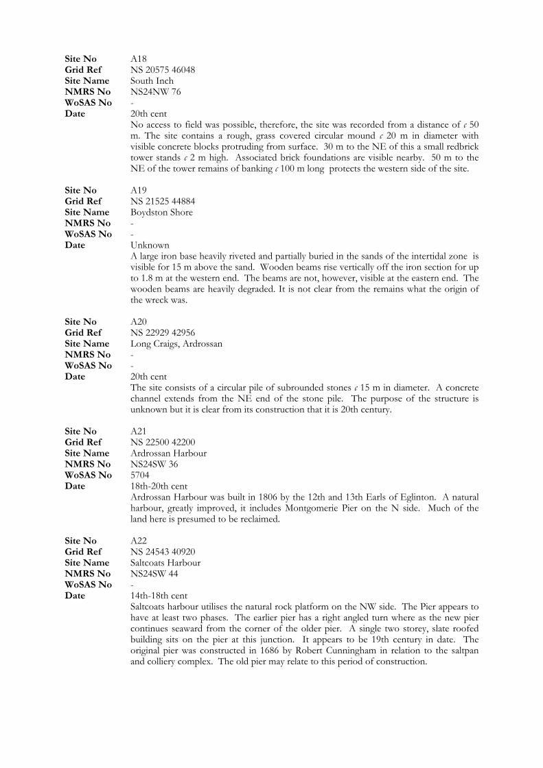
Site No A18
Site Name Boydston Shore
WoSAS No -
Ardrossan Harbour was built in 1806 by the 12th and 13th Earls of Eglinton. A natural harbour, greatly improved, it includes Montgomerie Pier on the N side. Much of the land here is presumed to be reclaimed.
Grid Ref NS 20575 46048 Site Name South Inch NMRS No NS24NW 76 WoSAS No - Date 20th cent No access to field was possible, therefore, the site was recorded from a distance of c 50
m. The site contains a rough, grass covered circular mound c 20 m in diameter with visible concrete blocks protruding from surface. 30 m to the NE of this a small redbrick tower stands c 2 m high. Associated brick foundations are visible nearby. 50 m to the NE of the tower remains of banking c 100 m long protects the western side of the site.
Site No A19 Grid Ref NS 21525 44884
NMRS No - WoSAS No - Date Unknown A large iron base heavily riveted and partially buried in the sands of the intertidal zone is
visible for 15 m above the sand. Wooden beams rise vertically off the iron section for up to 1.8 m at the western end. The beams are not, however, visible at the eastern end. The wooden beams are heavily degraded. It is not clear from the remains what the origin of the wreck was.
Site No A20 Grid Ref NS 22929 42956 Site Name Long Craigs, Ardrossan NMRS No -
Date 20th cent The site consists of a circular pile of subrounded stones c 15 m in diameter. A concrete
channel extends from the NE end of the stone pile. The purpose of the structure is unknown but it is clear from its construction that it is 20th century.
Site No A21 Grid Ref NS 22500 42200 Site Name Ardrossan Harbour NMRS No NS24SW 36 WoSAS No 5704 Date 18th-20th cent
Site No A22 Grid Ref NS 24543 40920 Site Name Saltcoats Harbour NMRS No NS24SW 44 WoSAS No - Date 14th-18th cent Saltcoats harbour utilises the natural rock platform on the NW side. The Pier appears to
have at least two phases. The earlier pier has a right angled turn where as the new pier continues seaward from the corner of the older pier. A single two storey, slate roofed building sits on the pier at this junction. It appears to be 19th century in date. The original pier was constructed in 1686 by Robert Cunningham in relation to the saltpan and colliery complex. The old pier may relate to this period of construction.
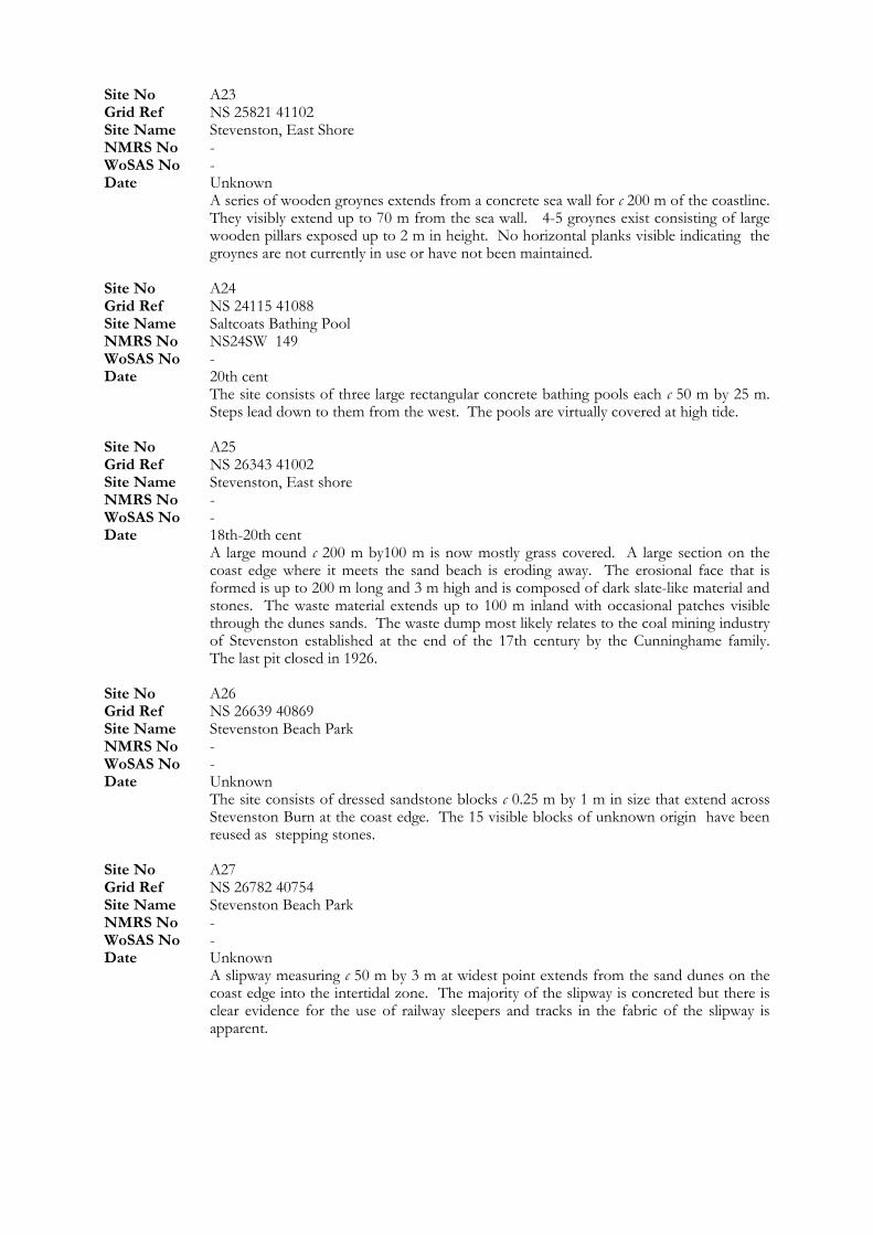
Site No A23 Grid Ref NS 25821 41102 Site Name Stevenston, East Shore NMRS No - WoSAS No - Date Unknown
Site No A24
Site Name Stevenston Beach Park
A series of wooden groynes extends from a concrete sea wall for c 200 m of the coastline. They visibly extend up to 70 m from the sea wall. 4-5 groynes exist consisting of large wooden pillars exposed up to 2 m in height. No horizontal planks visible indicating the groynes are not currently in use or have not been maintained.
Grid Ref NS 24115 41088 Site Name Saltcoats Bathing Pool NMRS No NS24SW 149 WoSAS No - Date 20th cent The site consists of three large rectangular concrete bathing pools each c 50 m by 25 m.
Steps lead down to them from the west. The pools are virtually covered at high tide. Site No A25 Grid Ref NS 26343 41002 Site Name Stevenston, East shore NMRS No - WoSAS No - Date 18th-20th cent A large mound c 200 m by100 m is now mostly grass covered. A large section on the
coast edge where it meets the sand beach is eroding away. The erosional face that is formed is up to 200 m long and 3 m high and is composed of dark slate-like material and stones. The waste material extends up to 100 m inland with occasional patches visible through the dunes sands. The waste dump most likely relates to the coal mining industry of Stevenston established at the end of the 17th century by the Cunninghame family. The last pit closed in 1926.
Site No A26 Grid Ref NS 26639 40869 Site Name Stevenston Beach Park NMRS No - WoSAS No - Date Unknown The site consists of dressed sandstone blocks c 0.25 m by 1 m in size that extend across
Stevenston Burn at the coast edge. The 15 visible blocks of unknown origin have been reused as stepping stones.
Site No A27 Grid Ref NS 26782 40754
NMRS No - WoSAS No - Date Unknown A slipway measuring c 50 m by 3 m at widest point extends from the sand dunes on the
coast edge into the intertidal zone. The majority of the slipway is concreted but there is clear evidence for the use of railway sleepers and tracks in the fabric of the slipway is apparent.
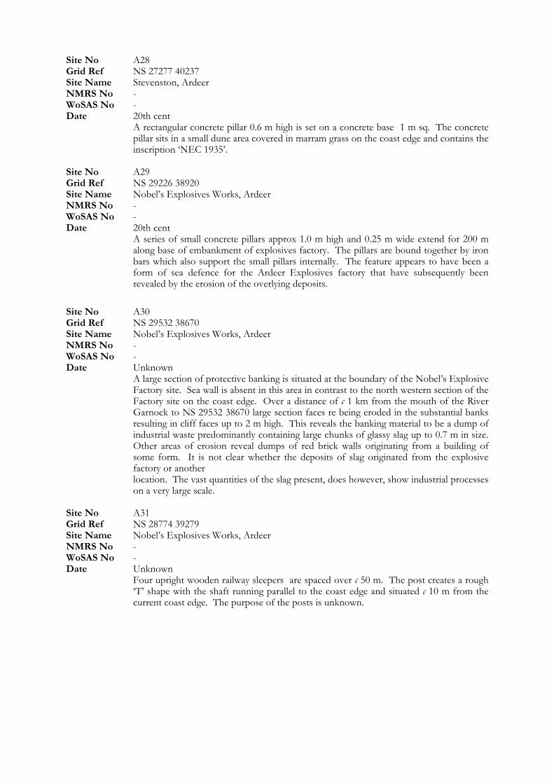
Site No A28
Date 20th cent
WoSAS No -
Grid Ref NS 27277 40237 Site Name Stevenston, Ardeer NMRS No - WoSAS No - Date 20th cent A rectangular concrete pillar 0.6 m high is set on a concrete base 1 m sq. The concrete
pillar sits in a small dune area covered in marram grass on the coast edge and contains the inscription ‘NEC 1935’.
Site No A29 Grid Ref NS 29226 38920 Site Name Nobel’s Explosives Works, Ardeer NMRS No - WoSAS No -
A series of small concrete pillars approx 1.0 m high and 0.25 m wide extend for 200 m along base of embankment of explosives factory. The pillars are bound together by iron bars which also support the small pillars internally. The feature appears to have been a form of sea defence for the Ardeer Explosives factory that have subsequently been revealed by the erosion of the overlying deposits.
Site No A30 Grid Ref NS 29532 38670 Site Name Nobel’s Explosives Works, Ardeer NMRS No - WoSAS No - Date Unknown A large section of protective banking is situated at the boundary of the Nobel’s Explosive
Factory site. Sea wall is absent in this area in contrast to the north western section of the Factory site on the coast edge. Over a distance of c 1 km from the mouth of the River Garnock to NS 29532 38670 large section faces re being eroded in the substantial banks resulting in cliff faces up to 2 m high. This reveals the banking material to be a dump of industrial waste predominantly containing large chunks of glassy slag up to 0.7 m in size. Other areas of erosion reveal dumps of red brick walls originating from a building of some form. It is not clear whether the deposits of slag originated from the explosive factory or another
location. The vast quantities of the slag present, does however, show industrial processes on a very large scale.
Site No A31 Grid Ref NS 28774 39279 Site Name Nobel’s Explosives Works, Ardeer NMRS No -
Date Unknown Four upright wooden railway sleepers are spaced over c 50 m. The post creates a rough
‘T’ shape with the shaft running parallel to the coast edge and situated c 10 m from the current coast edge. The purpose of the posts is unknown.
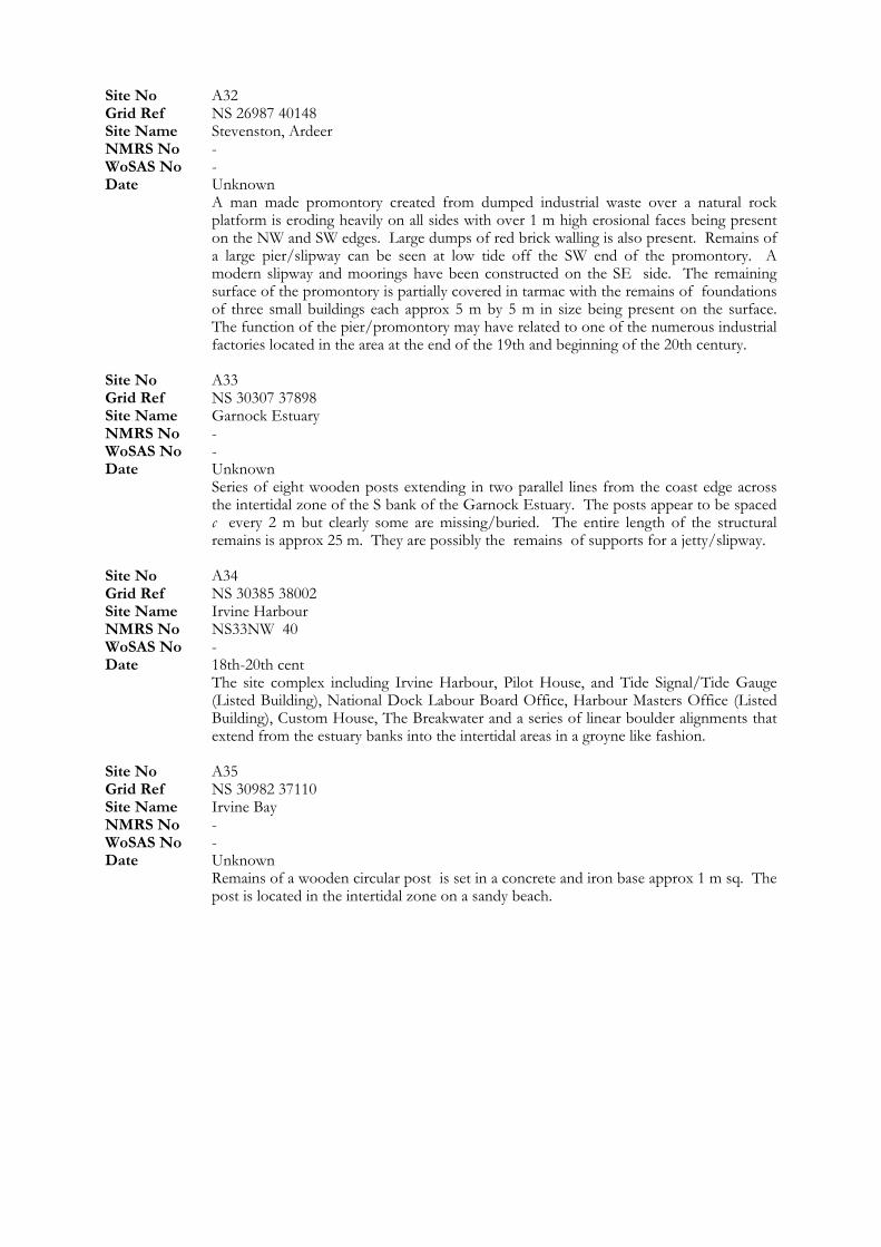
Site No A32 Grid Ref NS 26987 40148 Site Name Stevenston, Ardeer NMRS No -
Site No A33
Date Unknown
Site Name Irvine Harbour
WoSAS No - Date Unknown A man made promontory created from dumped industrial waste over a natural rock
platform is eroding heavily on all sides with over 1 m high erosional faces being present on the NW and SW edges. Large dumps of red brick walling is also present. Remains of a large pier/slipway can be seen at low tide off the SW end of the promontory. A modern slipway and moorings have been constructed on the SE side. The remaining surface of the promontory is partially covered in tarmac with the remains of foundations of three small buildings each approx 5 m by 5 m in size being present on the surface. The function of the pier/promontory may have related to one of the numerous industrial factories located in the area at the end of the 19th and beginning of the 20th century.
Grid Ref NS 30307 37898 Site Name Garnock Estuary NMRS No - WoSAS No -
Series of eight wooden posts extending in two parallel lines from the coast edge across the intertidal zone of the S bank of the Garnock Estuary. The posts appear to be spaced c every 2 m but clearly some are missing/buried. The entire length of the structural remains is approx 25 m. They are possibly the remains of supports for a jetty/slipway.
Site No A34 Grid Ref NS 30385 38002
NMRS No NS33NW 40 WoSAS No - Date 18th-20th cent The site complex including Irvine Harbour, Pilot House, and Tide Signal/Tide Gauge
(Listed Building), National Dock Labour Board Office, Harbour Masters Office (Listed Building), Custom House, The Breakwater and a series of linear boulder alignments that extend from the estuary banks into the intertidal areas in a groyne like fashion.
Site No A35 Grid Ref NS 30982 37110 Site Name Irvine Bay NMRS No - WoSAS No - Date Unknown Remains of a wooden circular post is set in a concrete and iron base approx 1 m sq. The
post is located in the intertidal zone on a sandy beach.
Site No A36 Grid Ref NS 31057 37170 Site Name Irvine Bay NMRS No -
Site No A37
Date Unknown
Site Name Barassie Beach
WoSAS No - Date Unknown A section of sand dune extends from NS 31057 37170 to NS 31308 36778 over approx
400 m. The dune material at the coast edge is eroding revealing deposits of industrial waste including slag and coal/clinker, concrete slabbing and iron and concrete waste. These deposits are being revealed at the uppermost levels of the dune material. A wooden walkway has been built over the majority of the industrial deposits and is also being undermined due to the movement of the dune material.
Grid Ref NS 31646 36308 Site Name Irvine Bay NMRS No - WoSAS No -
A small sandy path between sand dunes at coast edge has revealed in section deposits of industrial waste approx 2 m long and up to 0.3 m deep. The deposits contain a mixture of slag, coal/clinker and occasional stones. Up to 3 m of dune material has formed on top of the industrial waste deposits.
Site No A38 Grid Ref NS 32352 33051
NMRS No - WoSAS No - Date Unknown A wooden post with a square concrete base is set into a sandy beach. Another post is set
into the sand 4 m to the west of the first but no concrete base is visible. The posts are heavily degraded and only exist to c 0.3 m in height.
Site No A39 Grid Ref NS 32351 32067 Site Name Troon, North Sands NMRS No - WoSAS No - Date Unknown Two wooden posts with concrete bases are set into a sandy beach. The posts are situated
c 2 m apart. Site No A40 Grid Ref NS 31984 31459 Site Name Troon, Pan Rocks NMRS No - WoSAS No - Date Unknown The remains of ten wooden posts are set into the rock outcrop named Pan Rocks and set
with concrete. They form a linear arrangement over approx 25 m extending from the coast edge in a seaward direction. A large coil of iron rope was located at the seaward end of the structure.
Site No A41 Grid Ref NS 30745 31283 Site Name Troon Harbour NMRS No - WoSAS No - Date Unknown A disused concrete slipway extends for c 50 m from the coast edge over the natural rock
platform. The slipway is now collapsed in many areas. Two wooden posts set either side of the seaward end of the slipway are set into the natural rock platform. The slipway is 5 m wide.
Site No A42 Grid Ref NS 31000 31300 Site Name Troon Harbour NMRS No NS33SW 23 WoSAS No 6576 Date 18th-20th cent
Date 18th-20th cent
Site No A44 Grid Ref NS 34139 27949 Site Name Pow Burn NMRS No - WoSAS No - Date Unknown A large flat area of land, now partly derelict, is in use as a driving range. The material
used to level the top of the dune area consists of building rubble, slag and coal pieces. Possible land raise site.
Site No A45 Grid Ref NS 34381 25022 Site Name Prestwick, Salt Pan Houses NMRS No NS32NW 4 WoSAS No 19255 Date 18th-20th cent Built circa 1760 for the salt boiling industry the buildings were probably salt pans with
housing above. The blocks are 2-storey, rectangular in plan, gabled, with end stacks. The buildings are well preserved.
A site complex including harbour, pier, SeaCat ferry terminal and various industrial buildings is located at Troon Harbour. The harbour is stated to have been built by the Duke of Portland in 1808.
Site No A43 Grid Ref NS 31133 30863 Site Name Troon, Ballast Bank NMRS No NS33SW 21 WoSAS No 6574
The ‘Ballast Bank’, designed to shield the town from the prevailing winds is constructed from the earth and shingle ballast from sailing colliers. The bank is c 500 m long, up to 50 m wide and 6-7 m high.
Site No A46 Grid Ref NS 34182 24966
Site Name Ayr Promenade
NMRS No -
WoSAS No - Date 20th cent
Date Unknown A scattering of boulders 4 m long forms a slight arc and Runs between two small tidal
ponds.
Site Name Prestwick NMRS No - WoSAS No - Date Unknown An elongated pile of boulders up to 1 m in size is located in the intertidal area. Some
blocks may be dressed/quarried but it is difficult to ascertain as they are limpet covered and natural rock fractures in a regular fashion. The feature measures c 25 m by 10 m in an N-S orientation with a small E-W line of boulders off the S end.
Site No A47 Grid Ref NS 34061 23889
NMRS No - WoSAS No - Date Unknown A series of triangular shaped wooden structures extends from the base of the sea wall
beneath Ayr Promenade. Constructed of vertical wooden planks with metal supports. It creates a ‘V’ shape extending from the base of the sea wall c 1.5 - 2 m in height and 6 m wide. The series of these run for 400 m along the coast. These shore defences are in better condition at the southern end.
Site No A48 Grid Ref NS 33822 23249 Site Name Ayr Harbour Junction
WoSAS No - Date Unknown A series of two parallel lines of wooden posts, consisting of six post in each line, exist up
to 1 m in height and extend over 10 m. Set into shingle and sand in the intertidal zone they are possible remains of supports for a jetty.
Site No A49 Grid Ref NS 33400 23100 Site Name Kaffir: Monkey Pier, Ayr Harbour NMRS No NS32SW 8001
The KAFFIR was wrecked in Ayr harbour during bad weather. She is now in two sections and the anchor chain is run out to the reef. Not inspected as situated in marine zone.
Site No A50 Grid Ref NS 20117 46814 Site Name Seamill NMRS No NS24NW 52 WoSAS No 5619
Site No A51
Site No A53
Site No A54 Grid Ref NS 33100 22600 Site Name Ayr Harbour NMRS No NS32SW 123 WoSAS No 6331 Date 18th-20th cent Quay are situated on both sides of the River Ayr, with a mid 19th century breakwater
projecting from the S bank. There also exists a 2-storey harbourmaster’s office with a corner turret.
Site No A55 Grid Ref NS 33350 22790 Site Name Ayr NMRS No NS32SW 140
Date 20th cent
A large dressed stone wall extends from the E face of the base of the cliff at the edge of a sandy beach. Situated c 100 m to the east of Greenan Castle the walling takes the form of a 2 m high extension protruding 1.5 m from the current cliff face. A small annex exists off the NW corner and is 2 m wide.
Grid Ref NS 20194 46868 Site Name Seamill NMRS No NS24NW 53 WoSAS No 5620 Date Unknown A boulder alignment running E-W from a sandy beach in the intertidal zone was located
during the field survey. It measured c 10 m long and the boulders were spread to 2.5 m in width.
Site No A52 Grid Ref NS 20241 46536 Site Name Seamill NMRS No NS24NW 49 WoSAS No 5616 Date Unknown A 50 m long N-S running natural dyke holds a tidal pond of c 15 m by 15 m at time of
visit. Naturally scattered boulders do not appear to form any man made feature.
Grid Ref NS 20808 45871 Site Name South Inch NMRS No - WoSAS No - Date Unknown A small sandy gully within the rock platform of the intertidal zone contains a boulder
alignment of 10 m in length running N-S across the sandy area. The boulders are up to 0.8 m in size.
WoSAS No 20517
Visible on RCAHMS aerial photographs taken in 1994. No access during field survey. Site No A56 Grid Ref NS 31269 19324 Site Name Greenan Castle NMRS No - WoSAS No - Date Unknown
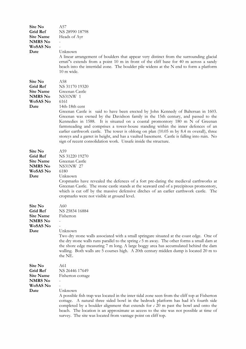
Site No A57
Site Name Fisherton NMRS No -
NMRS No -
Grid Ref NS 28990 18798 Site Name Heads of Ayr NMRS No - WoSAS No - Date Unknown A linear arrangement of boulders that appear very distinct from the surrounding glacial
errati’'s extends from a point 10 m in front of the cliff base for 40 m across a sandy beach into the intertidal zone. The boulder pile widens at the N end to form a platform 10 m wide.
Site No A58 Grid Ref NS 31170 19320 Site Name Greenan Castle NMRS No NS31NW 1 WoSAS No 6161 Date 14th-18th cent Greenan Castle is said to have been erected by John Kennedy of Baltersan in 1603.
Greenan was owned by the Davidson family in the 15th century, and passed to the Kennedies in 1588. It is situated on a coastal promontory 180 m N of Greenan farmsteading and comprises a tower-house standing within the inner defences of an earlier earthwork castle. The tower is oblong on plan (10.05 m by 8.4 m overall), three storeys and a garret in height, and has a vaulted basement. Castle is falling into ruin. No sign of recent consolidation work. Unsafe inside the structure.
Site No A59 Grid Ref NS 31220 19270 Site Name Greenan Castle NMRS No NS31NW 27 WoSAS No 6180 Date Unknown Cropmarks have revealed the defences of a fort pre-dating the medieval earthworks at
Greenan Castle. The stone castle stands at the seaward end of a precipitous promontory, which is cut off by the massive defensive ditches of an earlier earthwork castle. The cropmarks were not visible at ground level.
Site No A60 Grid Ref NS 25834 16884
WoSAS No - Date Unknown Two dry stone walls associated with a small springare situated at the coast edge. One of
the dry stone walls runs parallel to the spring c 5 m away. The other forms a small dam at the shore edge measuring 7 m long. A large boggy area has accumulated behind the dam walling. Both walls are 5 courses high. A 20th century midden dump is located 20 m to the NE.
Site No A61 Grid Ref NS 26446 17649 Site Name Fisherton cottage
WoSAS No - Date Unknown A possible fish trap was located in the inter tidal zone seen from the cliff top at Fisherton
cottage. A natural three sided bowl in the bedrock platform has had it’s fourth side completed by a boulder alignment that extends for c 20 m past the bowl and onto the beach. The location is an approximate as access to the site was not possible at time of survey. The site was located from vantage point on cliff top.
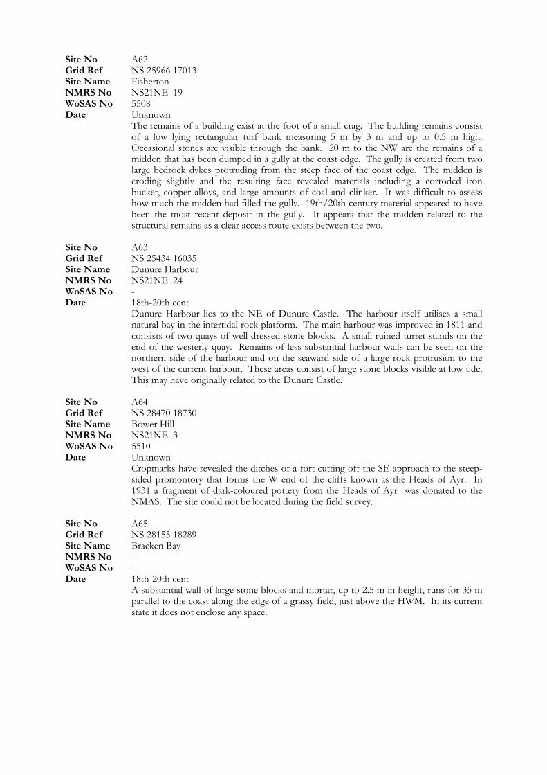
Site No A62
Site No A63 Grid Ref NS 25434 16035
Grid Ref NS 28470 18730 Site Name Bower Hill
Site Name Bracken Bay
Grid Ref NS 25966 17013 Site Name Fisherton NMRS No NS21NE 19 WoSAS No 5508 Date Unknown The remains of a building exist at the foot of a small crag. The building remains consist
of a low lying rectangular turf bank measuring 5 m by 3 m and up to 0.5 m high. Occasional stones are visible through the bank. 20 m to the NW are the remains of a midden that has been dumped in a gully at the coast edge. The gully is created from two large bedrock dykes protruding from the steep face of the coast edge. The midden is eroding slightly and the resulting face revealed materials including a corroded iron bucket, copper alloys, and large amounts of coal and clinker. It was difficult to assess how much the midden had filled the gully. 19th/20th century material appeared to have been the most recent deposit in the gully. It appears that the midden related to the structural remains as a clear access route exists between the two.
Site Name Dunure Harbour NMRS No NS21NE 24 WoSAS No - Date 18th-20th cent Dunure Harbour lies to the NE of Dunure Castle. The harbour itself utilises a small
natural bay in the intertidal rock platform. The main harbour was improved in 1811 and consists of two quays of well dressed stone blocks. A small ruined turret stands on the end of the westerly quay. Remains of less substantial harbour walls can be seen on the northern side of the harbour and on the seaward side of a large rock protrusion to the west of the current harbour. These areas consist of large stone blocks visible at low tide. This may have originally related to the Dunure Castle.
Site No A64
NMRS No NS21NE 3 WoSAS No 5510 Date Unknown Cropmarks have revealed the ditches of a fort cutting off the SE approach to the steep-
sided promontory that forms the W end of the cliffs known as the Heads of Ayr. In 1931 a fragment of dark-coloured pottery from the Heads of Ayr was donated to the NMAS. The site could not be located during the field survey.
Site No A65 Grid Ref NS 28155 18289
NMRS No - WoSAS No - Date 18th-20th cent A substantial wall of large stone blocks and mortar, up to 2.5 m in height, runs for 35 m
parallel to the coast along the edge of a grassy field, just above the HWM. In its current state it does not enclose any space.

Site No A66 Grid Ref NS 24750 14900 Site Name Egg Knock NMRS No - WoSAS No - Date 20th cent The site consists of a II WW observation tower constructed from concrete and red brick.
Four pillars 2 m high support a square boxed room 3 m by 3 m. Concrete steps lead up to the observation box with large window spaces and a flat roof. The overall dimensions are 3 m by 3 m and 4.5 m tall. The isolated location on a high cliff top provides commanding views over the southern Firth of Clyde.
A large opening in the cliff face at the coast edge leads to a wide cave/rock shelter with two chambers. A 1-1.5 m length of walling is present in each chamber although their function is not clear. Floor deposits of 19/20th century date are apparent on the surface of the chambers.
Site No A67 Grid Ref NS 24620 14600 Site Name Dunure Mains NMRS No NS21SW 13 WoSAS No - Date Unknown
Site No A68 Grid Ref NS 24636 14364 Site Name Drumshang NMRS No - WoSAS No - Date Unknown A partially grass covered stone cairn measuring 14 m E-W and 9 m N-S is located in a
grass covered field. Stones that are visible through the grass are c 0.4 m in size. It is possible that it is an old clearance cairn.
Site No A69 Grid Ref NS 25225 15825 Site Name Dunure Castle NMRS No NS21NE 8 WoSAS No 5515 Date 6th-14th cent This castle is situated on a rocky coastal promontory 240 m SW of Dunure harbour. The
earliest indentifiable portion comprises a tower and courtyard of probable late 14th-century date. During the late medieval period, the remains of this earlier castle were incorporated in a building of three principal storeys. The castle was the property of the Kennedys. Although in ruins the castle has been partially stabalised and public access is provided to limited areas.
Site No A70 Grid Ref NS 25265 15845 Site Name Dunure Castle, Doocot NMRS No NS21NE 31 WoSAS No - Date 14th-18th cent A well preserved Doocot situated c 80 m to the NE of Dunure Castle. It is still roofed
and contains well preserved internal stone work.
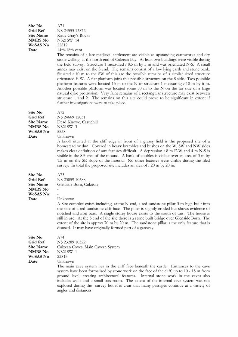
Site No A71
Site No A72 Grid Ref NS 24669 12031
Grid Ref NS 23859 10588 Site Name Glenside Burn, Culzean
Site Name Culzean Coves, Main Cavern System
Grid Ref NS 24555 13872 Site Name Katie Gray’s Rocks NMRS No NS21SW 14 WoSAS No 22812 Date 14th-18th cent The remains of a late medieval settlement are visible as upstanding earthworks and dry
stone walling at the north end of Culzean Bay. At least two buildings were visible during the field survey. Structure 1 measured c 8.5 m by 5 m and was orientated N-S. A small annex may exist on the S end. The remains consist of a low lying earth and stone bank. Situated c 10 m to the SW of this are the possible remains of a similar sized structure orientated E-W. A flat platform joins this possible structure on the S side. Two possible platform features were located 15 m to the N of structure 1 measuring c 10 m by 6 m. Another possible platform was located some 50 m to the N on the far side of a large natural dyke protrusion. Very faint remains of a rectangular structure may exist between structure 1 and 2. The remains on this site could prove to be significant in extent if further investigations were to take place.
Site Name Dead Knowe, Castlehill NMRS No NS21SW 3 WoSAS No 5538 Date Unknown A knoll situated at the cliff edge in front of a grassy field is the proposed site of a
homestead or dun. Covered in heavy brambles and bushes on the W, SW and NW sides makes clear definition of any features difficult. A depression c 8 m E-W and 4 m N-S is visible in the SE area of the mound. A bank of cobbles is visible over an area of 3 m by 1.5 m on the SE slope of the mound. No other features were visible during the filed survey. In total the proposed site includes an area of c 20 m by 20 m.
Site No A73
NMRS No - WoSAS No - Date Unknown A Site complex exists including, at the N end, a red sandstone pillar 3 m high built into
the side of a red sandstone cliff face. The pillar is slightly eroded but shows evidence of notched and iron bars. A single storey house exists to the south of this. The house is still in use. At the S end of the site there is a stone built bridge over Glenside Burn. The extent of the site is approx 70 m by 20 m. The sandstone pillar is the only feature that is disused. It may have originally formed part of a gateway.
Site No A74 Grid Ref NS 23289 10322
NMRS No NS21SW 1 WoSAS No 22813 Date Unknown The main cave system lies in the cliff face beneath the castle. Entrances to the cave
system have been formalised by stone work on the face of the cliff, up to 10 - 15 m from ground level, creating architectural features. Internal stone work in the caves also includes walls and a small box-room. The extent of the internal cave system was not explored during the survey but it is clear that many passages continue at a variety of angles and distances.
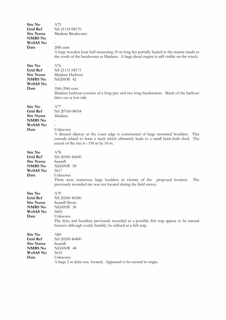
Site No A75 Grid Ref NS 21134 08170 Site Name Maidens Breakwater NMRS No - WoSAS No - Date 20th cent A large wooden boat hull measuring 10 m long lies partially buried in the marine muds to
the south of the breakwater at Maidens. A large diesel engine is still visible on the wreck. Site No A76 Grid Ref NS 21131 08171 Site Name Maidens Harbour NMRS No NS20NW 42 WoSAS No - Date 18th-20th cent Maidens harbour consists of a long pier and two long breakwaters. Much of the harbour
dries out at low tide. Site No A77 Grid Ref NS 20768 08034 Site Name Maidens NMRS No - WoSAS No - Date Unknown A disused slipway at the coast edge is constructed of large mortared boulders. This
extends inland to form a track which ultimately leads to a small brick-built shed. The extent of the site is c 150 m by 10 m.
Site No A78 Grid Ref NS 20300 46600 Site Name Seamill NMRS No NS24NW 50 WoSAS No 5617 Date Unknown There were numerous large boulders in vicinity of the proposed location. The
previously recorded site was not located during the field survey. Site No A79 Grid Ref NS 20200 46500 Site Name Seamill Shore NMRS No NS24NW 36 WoSAS No 5602 Date Unknown The dyke and boulders previously recorded as a possible fish trap appear to be natural
features although could, feasibly, be utilised as a fish trap. Site No A80 Grid Ref NS 20200 46400 Site Name Seamill NMRS No NS24NW 48 WoSAS No 5615 Date Unknown A large 2 m dyke was located. Appeared to be natural in origin.
Site No A81 Grid Ref NS 20300 46400 Site Name Seamill NMRS No NS24NW 47 WoSAS No 5614 Date Unknown This small tidal pond and N-S dyke of dolerite was not located during the field survey.
Site No A83
Site No A84 Grid Ref NS 20200 46700
Grid Ref NS 23363 10348 Site Name Culzean Coves, Stable Caves System NMRS No NS21SW 1
NMRS No NS25NW 29
Site No A82 Grid Ref NS 21500 44800 Site Name Boydston Shore NMRS No NS24SW 41 WoSAS No 5712 Date Unknown Not located during field survey.
Grid Ref NS 21900 44200 Site Name Boydston Shore NMRS No NS24SW 40 WoSAS No 5711 Date Unknown Not Located during field survey.
Site Name Seamill NMRS No NS24NW 51 WoSAS No 5618 Date Unknown Not Located during field survey. Site No A85
WoSAS No - Date Unknown The eastern cave system at Culzean consists of a small stone built entrance c 15 m in
from the cliff face. Entrance can also be gained from another fracture in the cliff face rock. Internal chambers and passages lead of in numerous directions and angles.
Site No A86 Grid Ref NS 20980 55590 Site Name Fairlie, ‘The Fairlie Stone’
WoSAS No 5752 Date Unknown Not inspected during field survey Site No A87 Grid Ref NS 17800 50600 Site Name Hawking Craig NMRS No NS15SE 6 WoSAS No 5248 Date Unknown Not Located during field survey
Site No A88 Grid Ref NS 17800 50500 Site Name Hunterston Brooch NMRS No NS15SE 5 WoSAS No 5247 Date 6th-14th cent The site where the Hunterston Brooch was located was not accessible due to heavy tree
and plant cover on the steep cliff slopes. The area is situated c 80 m inland from the coast edge and does not seem to be under any immediate threat from erosional processes.
Site No A89 Grid Ref NS 17560 48900 Site Name Portencross Castle NMRS No NS14NE 3 WoSAS No 5183 Date 14th-18th cent The iron cannon, about 8ft long, traditionally from “one of the large ships of the Spanish
Armada was not located during the field survey at Portencross. Site No A90 Grid Ref NS 17400 48800 Site Name Portencross
Grid Ref NS 17690 48750 Site Name Portencross NMRS No NS14NE 18 WoSAS No 5174
Aerial photographs of the coast at Portencross show rig and furrow markings in four sites on the raised beach. Only very faint remains were visible during the field survey.
Site No A92
A circular feature visible on aerial photographs taken by RCAHMS in 1984 was not located during the field survey.
NMRS No NS14NE 17 WoSAS No 5173 Date 1st-6th cent No significant remains were located in the vicinity of the findspot of a Roman coin. Site No A91
Date Unknown
Grid Ref NS 18100 48500 Site Name Ardneil Bay NMRS No NS14NE 25 WoSAS No 5182 Date Unknown Not Located during field survey. Site No A93 Grid Ref NS 18300 48620 Site Name Kirkfield House NMRS No NS14NE 22 WoSAS No 5179 Date Unknown
Site No A95
Site No A96 Grid Ref NS 19400 47500
Grid Ref NS 20100 47100 Site Name Seamill Bridge
Site Name Seamill NMRS No NS24NW 40
NMRS No NS24NW 56 WoSAS No 5623
Site No A94 Grid Ref NS 19000 47800 Site Name Ardneil Bay NMRS No NS14NE 15 WoSAS No 5171 Date Unknown The possible fish trap was not located during field survey
Grid Ref NS 19200 47700 Site Name Bastion Craig NMRS No NS14NE 14 WoSAS No 5170 Date Unknown The possible fish trap was not located during field survey.
Site Name Ardneil Bay NMRS No NS14NE 16 WoSAS No 5172 Date Unknown The possible fish trap was not located during field survey Site No A97
NMRS No NS24NW 54 WoSAS No 5621 Date Unknown The possible fish trap was not located during field survey Site No A98 Grid Ref NS 20300 46200 Site Name Seamill NMRS No NS24NW 41 WoSAS No 5608 Date Unknown The possible fish trap was not located during field survey Site No A99 Grid Ref NS 20400 46100
WoSAS No 5607 Date Unknown The possible fish trap was not located during field survey Site No A100 Grid Ref NS 20730 46060 Site Name Tarbet
Date Unknown Not located during field survey. The site has now been built over.

Site No A101 Grid Ref NS 21100 45400 Site Name Glenlea NMRS No NS24NW 46 WoSAS No 5613
Site No A103 Grid Ref NS 21400 45000
Date Unknown The possible fish trap was not located during field survey Site No A102 Grid Ref NS 21300 45100 Site Name Boydston Shore NMRS No NS24NW 45 WoSAS No 5612 Date Unknown The possible fish trap was not located during field survey
Site Name Boydston Shore NMRS No NS24NW 44 WoSAS No 5611 Date Unknown The possible fish trap was not located during field survey Site No A104 Grid Ref NS 21400 44900 Site Name Boydston Shore NMRS No NS24SW 42 WoSAS No 5713 Date Unknown The possible fish trap was not located during field survey Site No A105 Grid Ref NS 21800 44300 Site Name Boydston Shore NMRS No NS24SW 28 WoSAS No 5696 Date Unknown The possible fish trap was not located during field survey Site No A106 Grid Ref NS 21900 43500 Site Name Ardrossan, Yellow Craigs NMRS No NS24SW 39 WoSAS No 5707 Date Unknown The possible fish trap was not located during field survey Site No A107 Grid Ref NS 22300 43600 Site Name Ardrossan, Eglinton Road NMRS No NS24SW 38 WoSAS No 5706 Date Unknown The possible fish trap was not located during field survey
Site No A108 Grid Ref NS 22500 43400 Site Name Ardrossan, Burnfoot Bridge NMRS No NS24SW 26 WoSAS No 5694 Date Unknown The possible fish traps was not located during field survey Site No A109 Grid Ref NS 22700 43200 Site Name Ardrossan, North Bay NMRS No NS24SW 37 WoSAS No 5705 Date Unknown The possible fish trap was not located during field survey Site No A110 Grid Ref NS 22000 42000 Site Name Ardrossan NMRS No NS24SW 17 WoSAS No 5684 Date Unknown No significant remains were located in the vicinity of the findspot. An Alexandrian coin
of Maximian was found on the North Shore, Ardrossan (NS 22 42) before 1940. Site No A111 Grid Ref NS 22750 42600 Site Name Ardrossan Refinery NMRS No NS24SW 47 WoSAS No 19307 Date 18th-20th cent The oil refinery was not inspected during the field survey. Site No A112 Grid Ref NS 22570 42310 Site Name Montgomerie Pier NMRS No NS24SW 52 WoSAS No 22088 Date 18th-20th cent Ardrossan (Montomerie Pier) Station, opened 1890. No access was gained to the site
located in derelict, fenced off land. Site No A113 Grid Ref NS 22420 42200 Site Name Ardrossan, Winton Pier Station NMRS No NS24SW 51 WoSAS No 22087 Date 18th-20th cent This station formed the terminus of the Ardrossan Harbour branch of the Glasgow and
South-Western Railway. It was opened (as Ardrossan Pier Station) by that company on 27 July 1840, was renamed Ardrossan Winton Pier Station on 2 June 1924 and closed to regular passenger traffic on 6 May 1968. No access was gained to the site during the field survey.

Site No A114 Grid Ref NS 26500 40900 Site Name Saltcoats NMRS No NS24SW 14
NMRS No NS24SE 51 WoSAS No 21010
WoSAS No 15840 Date 18th-20th cent
Date 18th-20th cent
Date Unknown “Preen Hull” was not located during field survey.
No significant remains or finds were located at the findspot of a bronze coin of Constantine I (c 536), probably minted at Rome.
WoSAS No 5681 Date Unknown The proposed site lies in dunes near a large mining waste dump at the coast edge. No
traces of the settlement were located during the field survey. Site No A115 Grid Ref NS 27180 40330 Site Name Stevenston
Date 20th cent The four gun emplacement battery used to defend Ardeer Explosive Factory during
WWII was not located during the field survey. Upstanding remains of the site no longer exist.
Site No A116 Grid Ref NS 28500 39600 Site Name Ardeer, ICI Works, Nobel’s NMRS No NS23NE 1
Alfred Noble founded the Ardeer Explosives Factory in 1871. At one point it was the biggest explosives factory in the world and aided the foundation of ICI in 1926. The extensive site is fenced of and, therefore, no access was gained during the field survey.
Site No A117 Grid Ref NS 29400 39000 Site Name Nobel’s Explosives Works NMRS No NS23NE 1 WoSAS No 20087
The area of Ardeer Explosives Factory that housed the Magazines could not be accessed due to the area being fenced off.
Site No A118 Grid Ref NS 30000 37800 Site Name Irvine Bar, ‘Preen Hull’ NMRS No NS33NW 33 WoSAS No 6510
Site No A119 Grid Ref NS 30370 37830 Site Name Irvine, Lifeboat Station NMRS No NS33NW 1 WoSAS No 6484 Date 1st-6th cent
Site No A120
Site No A121 Grid Ref NS 30900 31300
Grid Ref NS 30730 31520 Site Name Troon, Harbour, Cottages & Harbour
Site Name Troon NMRS No NS33SW 19 WoSAS No 6571 Date Unknown Nothing of significance was located in the vicinity of the findspot of the flint scraper. Site No A124 Grid Ref NS 34220 24960 Site Name Prestwick, Maryborough Road NMRS No NS32SW 138 WoSAS No 12476
Grid Ref NS 32200 31300 Site Name Troon, Gasworks NMRS No NS33SW 18 WoSAS No 6570 Date 18th-20th cent The site of former Troon Gas Works was not inspected during the field survey.
Site Name Troon, Ailsa Shipyard NMRS No NS33SW 25 WoSAS No 13452 Date 18th-20th cent Troon Harbour was built from 1808 for coal shipment by the 3rd Duke of Portland. No
access was gained during the field survey due to commercial and industrial property occupying most of the site.
Site No A122
NMRS No NS33SW 22 WoSAS No 6575 Date 18th-20th cent A row of cottages exists as stated in HS Listed Buldings data. All in relatively good
condition and still inhabited. Site No A123 Grid Ref NS 31600 30600
Date Unknown The previously recorded location is on the same promontary as A45 Salt Pan Buildings.
This site was not located during the field survey. Site No A125 Grid Ref NS 34100 24900 Site Name New Prestwick NMRS No NS32SW 1 WoSAS No 6304 Date Unknown The previously recorded location is on the same promontary as A45 Salt Pan Buildings.
This site was not located during the field survey.

Site No A126 Grid Ref NS 33000 21000 Site Name Academy Street NMRS No NS32SW 144 WoSAS No 21032 Date 18th-20th cent The building is mid/later 18th century remodelled in 19th century. It consists of a 2-
storey and attic, rubble-built with painted margins, 3-windows at 1st floor, twin round-arched door pieces with key-blocks and steps to recessed doors and single window on right at ground floor as stated in HS Listed Buildings data. Not inspected during field survey.
Site No A127
Site No A129
Site No A130
Site No A131 Grid Ref NS 29000 19000 Site Name Point of Ayr NMRS No NS21NE 23 WoSAS No 19363 Date Unknown Nothing of significance was located in the vicinity of the findspot where a stone axe was
found.
Grid Ref NS 31400 19400 Site Name Doonfoot NMRS No NS31NW 36 WoSAS No 12758 Date Unknown Nothing of significance was located in the vicinity of the findspot where a small flint
core, flake and agate tool were found. Site No A128 Grid Ref NS 31100 19300 Site Name Greenan Castle NMRS No NS31NW 26 WoSAS No 6179 Date Unknown The salt Pans at Greenan Castle were not located during the field survey.
Grid Ref NS 29800 18800 Site Name Doonfoot NMRS No NS21NE 20 WoSAS No 12720 Date Unknown Nothing of significance was located in the vicinity of the findspot where a nosed
implement in agate, edge dressed was found.
Grid Ref NS 29050 18670 Site Name Heads of Ayr NMRS No NS21NE 17 WoSAS No 5506 Date Unknown Parchmarks in a pasture field on the summit of Bower Hill have revealed possible traces
of ditches cutting off an area measuring about 300 m from E to W by 150 m. This site was not located during the field survey.
Site No A132 Grid Ref NS 28600 18800 Site Name Heads of Ayr NMRS No NS21NE 21 WoSAS No 12721 Date Unknown Nothing of significance was located in the vicinity of the findspot where a scraper and
notched agate flake were found. Site No A133
Date Unknown Nothing of significance was located in the vicinity of the findspot where Eight flints,
including two cores and a trimmed flake were found.
Grid Ref NS 26900 18000 Site Name Bracken Bay NMRS No NS21NE 22 WoSAS No 12722 Date Unknown Nothing of significance was located in the vicinity of the findspot where an Agate burin
was found. Site No A135 Grid Ref NS 26200 17100 Site Name Fisherton NMRS No NS21NE 12 WoSAS No 5501 Date Unknown Nothing of significance was located in the vicinity of the findspot where Mesolithic flints
have been found. Site No A136 Grid Ref NS 25800 16600 Site Name Fisherton NMRS No NS21NE 16 WoSAS No 5505 Date Unknown Nothing of significance was located in the vicinity of the findspot where Fourteen flint
cores and flakes, some patinated, have been found.
Grid Ref NS 24590 12640
Grid Ref NS 28200 18200 Site Name Low Glenayes NMRS No NS21NE 15 WoSAS No 5504
Site No A134
Site No A137
Site Name St Patrick’s Well, Croy NMRS No NS21SW 2 WoSAS No 5537 Date Unknown The source of the spring appears to be under modern structures on the coast edge. The
spring has been piped.
Site No A138 Grid Ref NS 24700 12300 Site Name Castlehill Farm, Dunure NMRS No NS21SW 5 WoSAS No 5540 Date Unknown Nothing of significance was located in the vicinity of the findspot where Flint blades
have been discovered. Site No A139 Grid Ref NS 23680 10410 Site Name Home Farm NMRS No NS21SW 7 WoSAS No 5542 Date 18th-20th cent The range of Home Farm buildings (associated with Culzean Castle) was designed by
Robert Adam and built in 1777. It is currently used by the NTS as a centre for Culzean Country Park.
Site No A140 Grid Ref NS 23460 10310 Site Name Culzean Gas House NMRS No NS21SW 1 WoSAS No 21016 Date 18th-20th cent The Gas House used to supply gas to the castle and Home Farm from 1880 before
closing down in 1950. The coal used was unloaded from the small bay at the foot of the structures. The upstanding, roofed structures are in very good condition.
Site No A141 Grid Ref NS 23260 10270 Site Name Culzean Castle NMRS No NS21SW 1 WoSAS No 5536 Date 6th-14th cent From the 12th to the early 17th century, Culzean was one of a number of small castles
belonging to the Kennedy family. The castle is well maintained and in excellent condition throughout. Long term effects of erosion may be eventually felt at the cliff edge.
Site No A142 Grid Ref NS 23130 10140 Site Name Culzean Castle, Battery NMRS No NS21SW 17 WoSAS No 22285 Date 14th-18th cent A well preserved battery comprises of an earthen rampart facing NW across Culzean
Harbour to the Forth of Clyde. Guns are positioned along the rampart on stone settings. Site No A143 Grid Ref NS 20940 08040 Site Name Maidens NMRS No NS20NW 25 WoSAS No 5428 Date Unknown This site has been cited as being the location of ‘Barking Pots’. They were not located
during field survey.
Site No A144 Grid Ref NS 20700 07900 Site Name Maidens, Port Murray NMRS No NS20NW 8 WoSAS No 5435 Date 4th mill BC- 1st cent An Early Bronze Age hoard, consisting of five flat axes (three Coles’ type Ba, two type
Bb) and a bar armlet, were found in April 1883 at The Maidens, Port Murray. Nothing of significance was located in the vicinity of the findspot.
Site No A145 Grid Ref NS 20600 07900 Site Name Pan Knowes, Turnberry NMRS No NS20NW 13 WoSAS No 5415 Date Unknown Nothing of significance was located in the vicinity of the reported salt pans. Site No A146 Grid Ref NS 20660 07880 Site Name Pan Knowes NMRS No NS20NW WoSAS No 22360 Date Unknown On top of Pan Knowes, an outcrop knoll above Port Murray, stands a small stone-built
tower of unknown function. No change to WoSAS report. Site No A147 Grid Ref NS 20990 56720 Site Name Kelburnfoot Lodge NMRS No NS25NW 22 WoSAS No - Date 18th-20th cent Kelburnfoot Lodge is part of the Kelburnfoot Castle estate. It is a Listed Building and
currently occupied.
Site No A148 Grid Ref NS 20700 55900 Site Name Fairlie Road Station NMRS No NS25NW 129 WoSAS No - Date 18th-20th cent Not inspected during field survey. Site No A149 Grid Ref NS 17500 49000 Site Name Marion NMRS No NS14NE 8004 WoSAS No - Date Unknown No sign of the wreck was located during the field survey. Site No A150 Grid Ref NS 17500 48900 Site Name Portencross Galleon NMRS No NS14NE 8001 WoSAS No - Date Unknown No sign of the wreck was located during the field survey.
Site No A151 Grid Ref NS 18790 48400 Site Name Holland House NMRS No NS14NE 31 WoSAS No - Date 18th-20th cent Holland House is now demolished. Site No A152 Grid Ref NS 19500 47600 Site Name Ardneil Bay NMRS No NS14NE 23 WoSAS No - Date Unknown The possible fish trap was not located during the field survey. Site No A153 Grid Ref NS 22600 41700 Site Name Ardrossan, South Shipyard NMRS No NS24SW 63 WoSAS No - Date 20th cent No Access was gained to the shipyard during the field survey. Site No A154 Grid Ref NS 24500 40860 Site Name Saltcoats Gas-Lamp NMRS No NS24SW 157 WoSAS No - Date Unknown Not located during field survey. Site No A155 Grid Ref NS 34570 26350 Site Name Prestwick Bathing Lake NMRS No NS32NW 30 WoSAS No - Date 20th cent
Grid Ref NS 34000 24000
The bathing lake and play area located on the sea front at Prestwick are currently in use and in good condition.
Site No A156 Grid Ref NS 34590 25880 Site Name Prestwick, Esplanade NMRS No NS32NW 8 WoSAS No - Date 18th-20th cent The recreational Esplanade at Prestwick is well maintained and in good condition. Site No A157
Site Name Prestwick Golf Course NMRS No NS32SW 45 WoSAS No - Date 1st-6th cent Nothing of significance was located in the vicinity of the findspot where a sestertius of
Marcus Aurelius was found.
Site No A158 Grid Ref NS 32960 22640 Site Name Ayr South Pier NMRS No NS32SW 427 WoSAS No - Date 18th-20th cent Long concrete and stone built pieris situated at the entrance to Ayr Harbour. A Light
Beacon is located at the seaward end. Site No A159 Grid Ref NS 33040 21540 Site Name Ayr, Esplanade NMRS No NS32SW 181 WoSAS No - Date 18th-20th cent The recreational Esplanade at Ayr is well maintained and in good condition. Site No A160 Grid Ref NS 32600 20400 Site Name Frey: Seafield, Ayr NMRS No NS32SW 8002 WoSAS No - Date Unknown Wreck not located during field survey. Site No A161 Grid Ref NS 31300 19400 Site Name Greenan NMRS No NS31NW 122 WoSAS No - Date 14th-18th cent Nothing of significance was located in the vicinity of the findspot where a Lead badge,
bearing a male and a female figure in relief was found. Site No A162 Grid Ref NS 24870 15560 Site Name Scart Rock, Dunure NMRS No NS21NW 1 WoSAS No - Date Unknown Fish trap not located during field survey. Site No A163 Grid Ref NS 24680 12500 Site Name Croy NMRS No NS21SW 9 WoSAS No - Date Unknown The field was grass covered during field survey. No visible signs of a flint scatter was
present on the surface.
Site No A164 Grid Ref NS 24620 11910 Site Name Rancleugh Cottages NMRS No NS21SW 20 WoSAS No - Date Unknown One unroofed building is depicted on the 1st edition of the OS 6-inch map (Ayrshire
1859, sheet xxxviii), but it is not shown on the current edition of the OS 1:10000 map (1987). It was not located during the field survey. No upstanding features remain.
Site No A165 Grid Ref NS 24650 11840 Site Name Rancleugh NMRS No NS21SW 10 WoSAS No - Date Pre 4th mill BC The field was grass covered during field survey. No visible signs of flint flakes were
present on the surface. Site No A166 Grid Ref NS 24630 11700 Site Name Rancleugh Burn NMRS No NS21SW 19 WoSAS No - Date Unknown One unroofed building attached to a field wall is depicted on the 1st edition of the OS 6-
inch map (Ayrshire 1859, sheet xliv), but it is not shown on the current edition of the OS 1:10000 map (1987). An area of disturbed ground was located but no remains of the building remain above the surface.
Site No A167 Grid Ref NS 24550 11320 Site Name Balchriston NMRS No NS21SW 11 WoSAS No - Date Unknown The field was grass covered during field survey. No visible signs of a flint scatter was
visible on the surface.
Site No A169
NMRS No NS20NW 20
Date 18th-20th cent
Site No A168 Grid Ref NS 24530 11240 Site Name Goalsgreen NMRS No NS21SW 12 WoSAS No - Date Unknown Nothing of significance located in vicinity of the flint scatter during the field survey.
Grid Ref NS 22080 09090 Site Name Culzean Castle, Ardlochan Lodge
WoSAS No -
Ardlochan Lodge is situated on the Culzean Castle Estate. It was not inspected during the field survey.
Site No A170 Grid Ref NS 17650 48930 Site Name Portencross NMRS No NS14NE 18 WoSAS No 5174 Date Unknown Aerial photographs of the coast at Portencross show rig and furrow markings in four
sites on the raised beach. Only very faint remains were visible during the field survey. Site No A171 Grid Ref NS 17700 48880 Site Name Portencross NMRS No NS14NE 18 WoSAS No 5174 Date Unknown Aerial photographs of the coast at Portencross show rig and furrow markings in four
sites on the raised beach. Only very faint remains were visible during the field survey. Site No A172 Grid Ref NS 17740 48790 Site Name Portencross NMRS No NS14NE 18 WoSAS No 5174 Date Unknown Aerial photographs of the coast at Portencross show rig and furrow markings in four
sites on the raised beach. Only very faint remains were visible during the field survey. Site No A173 Grid Ref NS 17900 50500 Site Name Hawking Craig NMRS No NS15SE 8 WoSAS No 5250 Date Unknown Nothing of significance was located in the vicinity of the previously recorded graves. Site No A174 Grid Ref NS 31458 30788 Site Name Troon, 1 Welbeck Crescent NMRS No NS33SW 14 WoSAS No 6566 Date Unknown Nothing of significance was located in the vicinity of a previously found very slightly
worn dupondius of Nero. Site No A175 Grid Ref NS 21000 55000 Site Name Fairlie NMRS No NS25NW 33 WoSAS No 12725 Date 14th-18th cent Fairlie was erected burgh of barony in 1601.
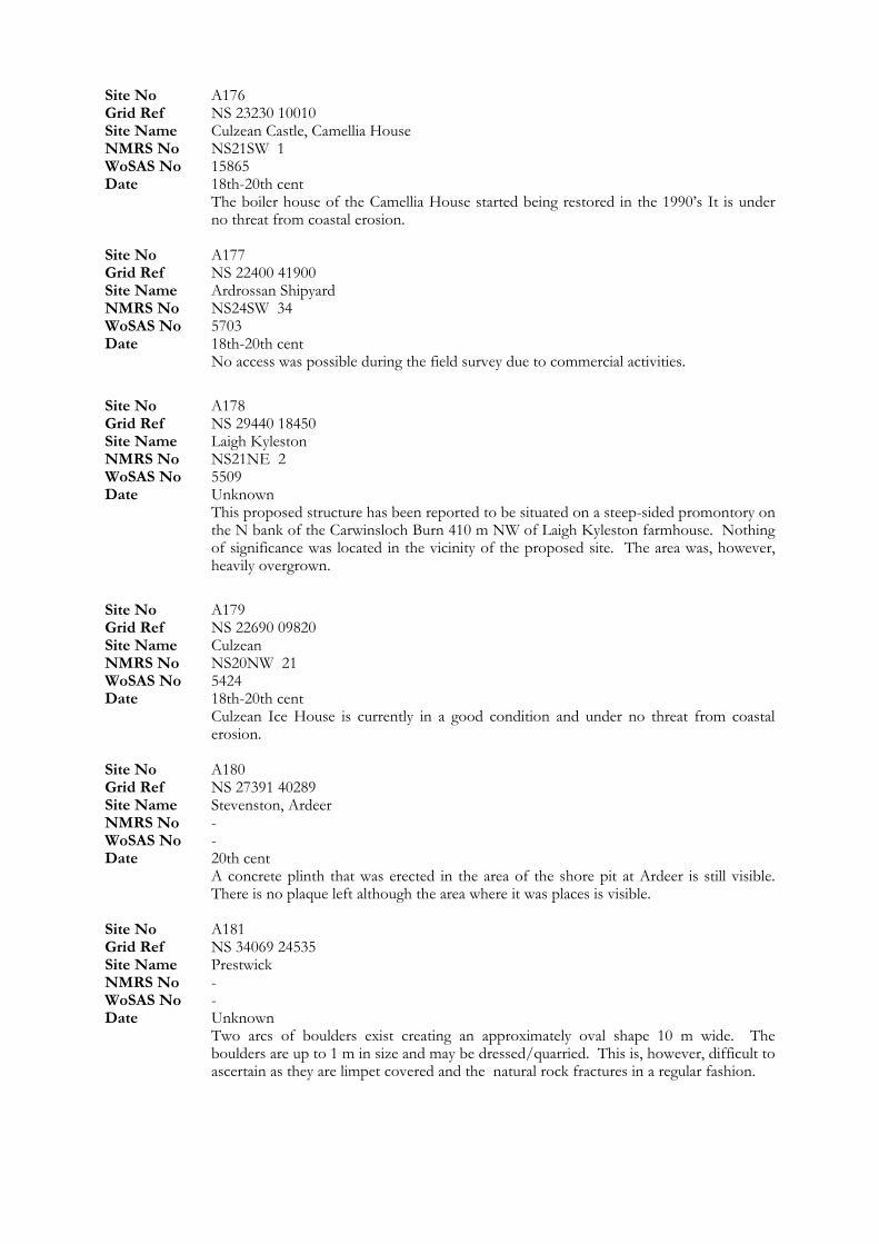
Site No A176 Grid Ref NS 23230 10010 Site Name Culzean Castle, Camellia House NMRS No NS21SW 1 WoSAS No 15865 Date 18th-20th cent The boiler house of the Camellia House started being restored in the 1990’s It is under
no threat from coastal erosion.
Site No A180
Site No A177 Grid Ref NS 22400 41900 Site Name Ardrossan Shipyard NMRS No NS24SW 34 WoSAS No 5703 Date 18th-20th cent No access was possible during the field survey due to commercial activities.
Site No A178 Grid Ref NS 29440 18450 Site Name Laigh Kyleston NMRS No NS21NE 2 WoSAS No 5509 Date Unknown This proposed structure has been reported to be situated on a steep-sided promontory on
the N bank of the Carwinsloch Burn 410 m NW of Laigh Kyleston farmhouse. Nothing of significance was located in the vicinity of the proposed site. The area was, however, heavily overgrown.
Site No A179 Grid Ref NS 22690 09820 Site Name Culzean NMRS No NS20NW 21 WoSAS No 5424 Date 18th-20th cent Culzean Ice House is currently in a good condition and under no threat from coastal
erosion.
Grid Ref NS 27391 40289 Site Name Stevenston, Ardeer NMRS No - WoSAS No - Date 20th cent A concrete plinth that was erected in the area of the shore pit at Ardeer is still visible.
There is no plaque left although the area where it was places is visible. Site No A181 Grid Ref NS 34069 24535 Site Name Prestwick NMRS No - WoSAS No - Date Unknown Two arcs of boulders exist creating an approximately oval shape 10 m wide. The
boulders are up to 1 m in size and may be dressed/quarried. This is, however, difficult to ascertain as they are limpet covered and the natural rock fractures in a regular fashion.
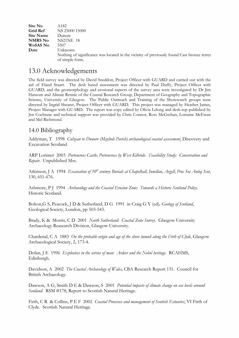
Site No A182 Grid Ref NS 25000 15000 Site Name Dunure NMRS No NS21NE 18 WoSAS No 5507 Date Unknown Nothing of significance was located in the vicinity of previously found Cast bronze terret
of simple form.
13.0 Acknowledgements The field survey was directed by David Sneddon, Project Officer with GUARD and carried out with the aid of Eland Stuart. The desk based assessment was directed by Paul Duffy, Project Officer with GUARD, and the geomorphology and erosional aspects of the survey area were investigated by Dr Jim Hansom and Alistair Rennie of the Coastal Research Group, Department of Geography and Topographic Science, University of Glasgow. The Public Outreach and Training of the Shorewatch groups were directed by Ingrid Shearer, Project Officer with GUARD. This project was managed by Heather James, Project Manager with GUARD. The report was copy edited by Olivia Lelong and desk-top published by Jen Cochrane and technical support was provided by Chris Connor, Ross McGrehan, Lorraine McEwan and Mel Richmond.
14.0 Bibliography Addyman, T 1998 Culzean to Dunure (Maybole Parish) archaeological coastal assessment, Discovery and Excavation Scotland.
Bolton,G S, Peacock, J D & Sutherland, D G 1991 in Craig G Y (ed), Geology of Scotland, Geological Society, London, pp 503-543.
ARP Lorimer 2003 Portencross Castle, Portencross by West Kilbride. Feasibility Study: Conservation and Repair. Unpublished Mss.
Atkinson, J A 1994 Excavation of 10th century Burials at Chapelhall, Innellan, Argyll, Proc Soc Antiq Scot, 130, 651-676. Ashmore, P J 1994 Archaeology and the Coastal Erosion Zone: Towards a Historic Scotland Policy. Historic Scotland.
Brady, K & Morris, C D 2001 North Sutherland: Coastal Zone Survey. Glasgow University Archaeology Reasearch Division, Glasgow University. Chardenal, C A 1883 On the probable origin and age of the shore tumuli along the Firth of Clyde, Glasgow Archaeological Society, 2, 173-4. Dolan, J E 1996 Explosives in the service of man: Ardeer and the Nobel heritage. RCAHMS, Edinburgh. Davidson, A 2002 The Coastal Archaeology of Wales, CBA Research Report 131. Council for British Archaeology. Dawson, A G, Smith D E & Dawson, S 2001 Potential impacts of climate change on sea levels around Scotland. RSM #178, Report to Scottish Natural Heritage. Firth, C R & Collins, P E F 2002 Coastal Processes and management of Scottish Estuaries, VI Firth of Clyde. Scottish Natural Heritage.
Gray, J M 1994 Influence of Southern Uplift ice on Glacio-isostatic rebound in Scotland: the Main Rock Platform in the Firth of Clyde. BOREAS Vol 24 pp 30-36. Historic Scotland 1996 Coastal Zone Assessment Survey: Historic Scotland Procedure Paper 4. Historic Scotland.
James, H 1996 The Firth of Forth from Dunbar to the border of Fife: Coastal Assessment Survey. Glasgow University Archaeology Reasearch Division, Glasgow University.
Mather, A S 1979 Beaches of Southwest Scotland, Volume 1, The Countryside Commission for Scotland.
RCAHMS 1988 Mid Argyll and Cowal, Prehistoric and Early Historic Monuments, Argyll: an inventory of the Monuments, Vol 6. Edinburgh. RCAHMS 1992 Mid Argyll and Cowal, Medieval and Later Monuments, Argyll: an inventory of the Monuments, Vol 7. Edinburgh. Rennie, E B 1993 Cowal: a Historical Guide..
Smith, J 1895 Prehistoric Man in Ayrshire, London.
Jackson, G 1983 The History and Archaeology of Ports. World’s Works Ltd.
Lambeck, K 1991 Glacial rebound and sea-level change in the British Isles, Terra Nova, Vol 3, # 4, 378-389. Leask, C 1996 Sea level variation and coastal sand movements in Scotland: Their inclusion in the Statistical Accounts of Scotland, Historic Scotland. Lavery, B 2001 Maritime Scotland. Historic Scotland, Batsford.
MacGowan, J 1883 Ancient Sepulture in Cumbrae. Trans Glasgow Archaeology Society, 2, 116-117. Macleay, J 2002 Old Dunoon and Cowal, Stenlake Publishing.
MAFF 1993 Strategy for Flood and Coastal Defence, MAFF, London.
Moore, H and Wilson, G 1997 Report on a Coastal Zone Assessment Survey of Orkney. EASE Archaeological Consultants. Patterson, E M 1989 Ancient Fish Traps on the North Ayrshire Coast: Ardrossan to Hunterston. Ayrshire Archaeological and natural History Society. Ayrshire Monographs. Ramsay, D L & Brampton, A H 2000 Coastal Cells in Scotland: Cell 6 Mull of Kintyre to the Mull of Galloway. Scottish Natural Heritage. RCAHMS 1983 The Archaeological Sites and Monuments of N Carrick, Kyle and Carrick District, Archaeological Sites and Monuments of Scotland series No 25.
Rennie, E B 1997 The Recessed Platforms of Argyll, Bute & Inverness. Oxford. Ritchie, W 1975 The Beaches of Cowal, Bute & Arran, The Countryside Commission for Scotland. Rose, J, Lowe, J J & Switsur, R 1988 A radiocarbon date on plant debris beneath till from the areas of the Loch Lomond Readvance. Scottish Journal of Geology. 24, 113-124. Shaw, J E 1953 Ayrshire 1745-1950: A social and industrial history of the county. Oliver and Boyd. Sissons, J B 1974 Late glacial marine erosion in Scotland. BOREAS, 3, 41-48.

Sutherland, D G 1981 The raised shorelines and deglaciation of the Loch Long/Loch Fyne area, western Scotland. PhD Thesis, University of Edinburgh. Sutherland, D G 1984 The quaternary deposits and landforms of Scotland and the neighbouring shelves: a review. Quaternary Science Reviews, 3, 157-254. Wallingford, H R 1996 Saltcoats to Troon: Coastal processes and development. HR Wallingford Report EX3327. Wallingford, H R 1996 Coastal cells in Scotland Scottish Natural Heritage Research, Survey and Monitoring, Report No 56.

15.0 Appendices
15.1 Appendix 1: List of Map Sources (arranged in chronological order) Nicolas de Nicolay 1583 Vraye & exacte description Hydrographique des costes martimes d’Ecosse & des Isles Orchades Hebrides avec partie d'Angleterre & d'Irelande servant a la navigation. Gordon R c 1636-52 Cuningham. Mss map. Pont T 1654 The northpart of Carrick Bleau. Pont T 1654 The province of Kyle. Bleau. Pont T 1654 Cunningham, Bleau Adair J 1685 A mape of the west of Scotland containing Clydsdail, Nithsdail, Ranfrew, Shyre of Ayre, & Galloway, authore Jo Adair. Mount J & Page T 1715 A New chart of the sea coast of Scotland with the islands thereof. Knapton et al 1728 A chart of the Coast of Scotland with all its islands: drawn according to the Globe Projection. Adair J 1731 A New and exact map of the River Clyde done by the late Mr John Adair, now published for the good of the publick by Geo Scott. Cowley J A 1734 Map of such part of his Grace the Duke of Argyle's heritable dukedom….. Herman M 1745 The South Part of the Shire of Air containing Kyle and Carrick. Herman M 1745 The Shire of Renfrew with Cuningham, The North Part of Air Mount T & Page T c 1748 A new chart of the sea coast of Scotland with the islands thereof. Bellin J N c 1753 Carte de la mer d'Ecosse contenant les isles et costes septentrionales st occidentales d'Ecosse… Armstrong A 1775 A New map of Ayrshire Johannes van Keulen c 1780 Nieuwe Caart van de Rivier van Glasgow in 't Groot. Huddart J 1794 A new chart of the West coast of Scotland from the Mull of Galloway to Dunan Point in Sky. Langlands G 1801 This map of Argyllshire. Depot Generale de la Marine, Paris 1803 Carte particuliere de la cote occidentale d'Escosse, depuis la Pointe d'Ardnamurchan jusqu'au Mull de Galloway. Paris Wood J 1818 Plan of the Town and Parishes of Ayre, Newtn upon Ayre & St Quivox. Wood J 1819 Plan of the Town of Irvine. Ainslie J 1821 Ainslie's Map of the Southern Part of Scotland Thompson J 1824 Northern Part of Argyll Shire. Southern Part. Thompson J 1828 Northern Part of Ayrshire. Southren Part. Ordnance Survey: Various First Edition Maps dated 1850’s to 1860’s
15.2 Appendix 2: List of AP's Consulted Sortie Frames Date Scale Lib
Fairey 7343/31 528-530 (Holy Loch) 1973 1:10,000 B769 Fairey 7343/44 531-525 (Dunoon) 1975 1:10,000 B783 Fairey 7343/30 392-403(Innellan) 1975 1:10,000 B768 Fairey 7343/45 585-588 (Toward) 1975 1:10,000 B784 Fairey 7343/30 413-419 1975 1:10,000 B768 Fairey 7343/12 276-282, 340-346 1973 1:10,000 B749 Fairey 7343/11 253-186 (Prestwick) 1973 1:10,000 B748 Fairey 7343 28 155-134 (Dunure) 1973 1:10,000 B767 Fairey 7343 28 129-124 (Culdean Bay) 1973 1:10,000 B767 Fairey 7343 27 593-585(Maidens) 1973 1:10,000 B766 15.3 Appendix 3: Archaeology and Built Heritage Plates
Plate 1:
C05: Disused lime kiln.
Plate 2:
C15: Possible boulder slipway.
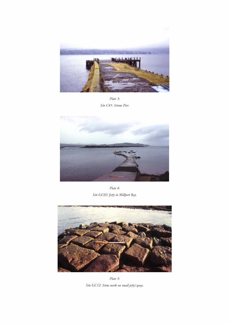
Plate 3:
Site C41: Strone Pier.
Plate 4:
Site GC02: Jetty in Millport Bay.
Plate 5:
Site GC12: Stone work on small jetty/quay.
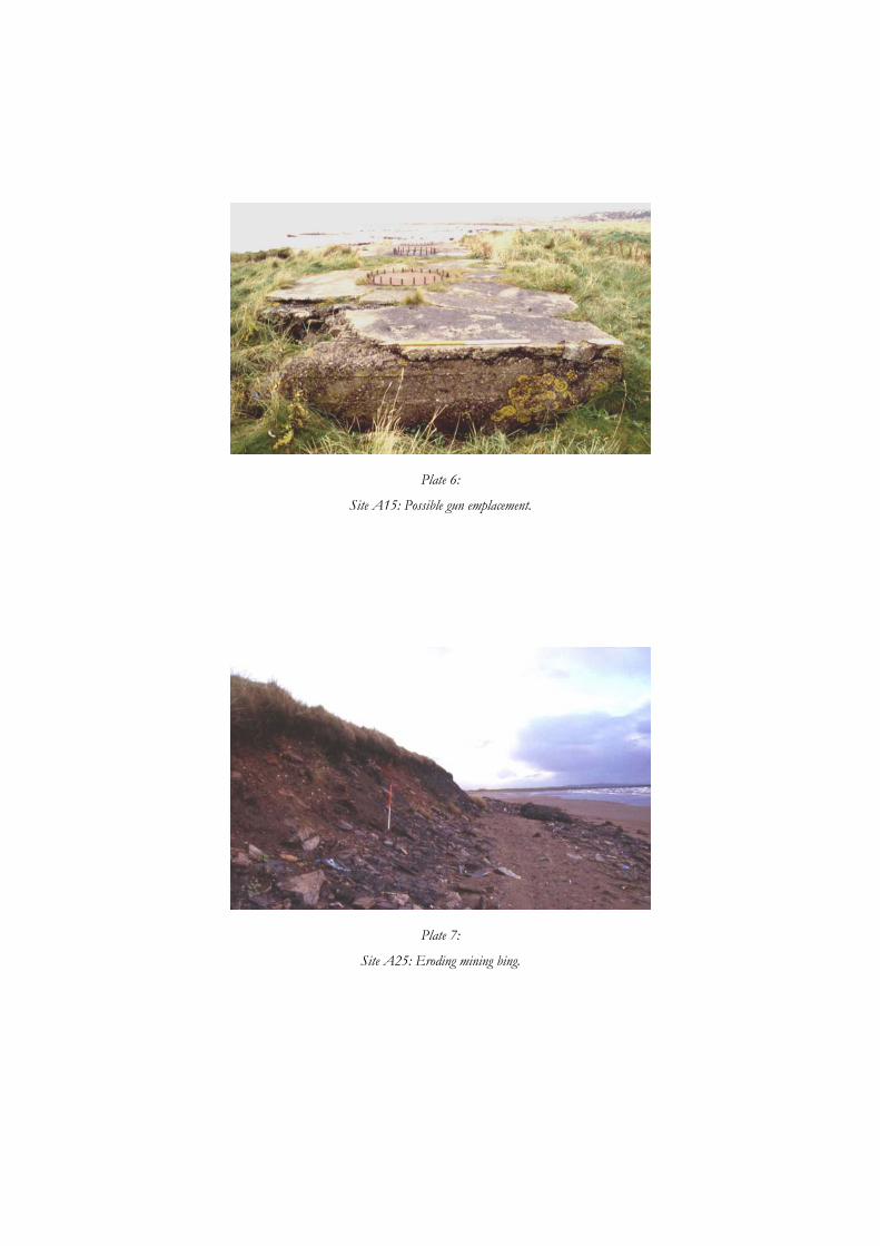
Plate 6:
Site A15: Possible gun emplacement.
Plate 7:
Site A25: Eroding mining bing.
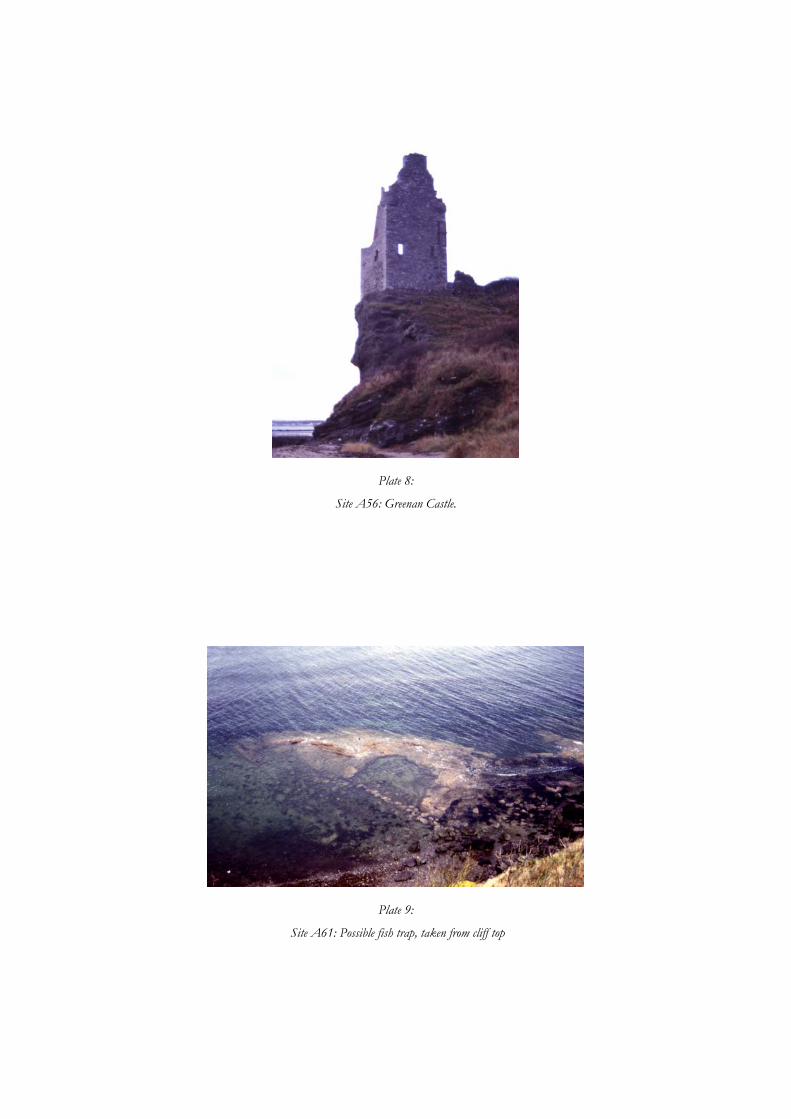
Plate 8:
Site A56: Greenan Castle.
Plate 9:
Site A61: Possible fish trap, taken from cliff top
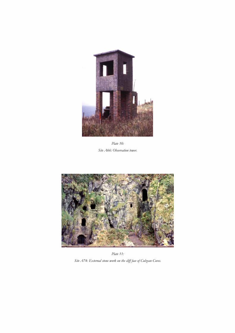
Plate 10:
Site A66: Observation tower.
Plate 11:
Site A74: External stone work on the cliff face of Culzean Coves.
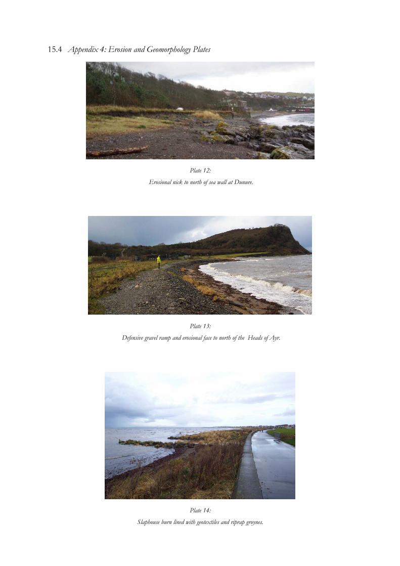
15.4 Appendix 4: Erosion and Geomorphology Plates
Plate 12:
Erosional nick to north of sea wall at Dunure.
Plate 13:
Defensive gravel ramp and erosional face to north of the Heads of Ayr.
Plate 14:
Slaphouse burn lined with geotextiles and riprap groynes.
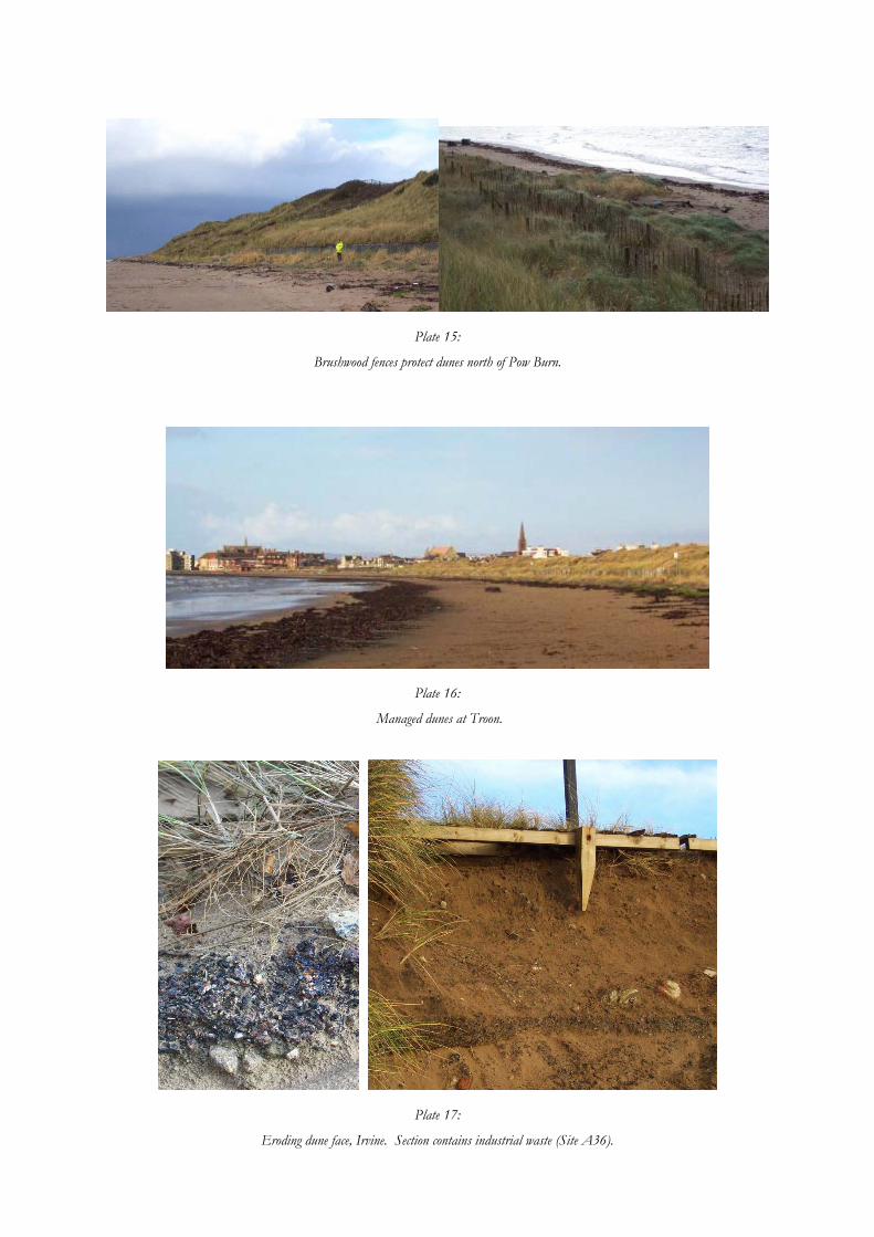
Plate 15:
Brushwood fences protect dunes north of Pow Burn.
Plate 16:
Managed dunes at Troon.
Plate 17:
Eroding dune face, Irvine. Section contains industrial waste (Site A36).
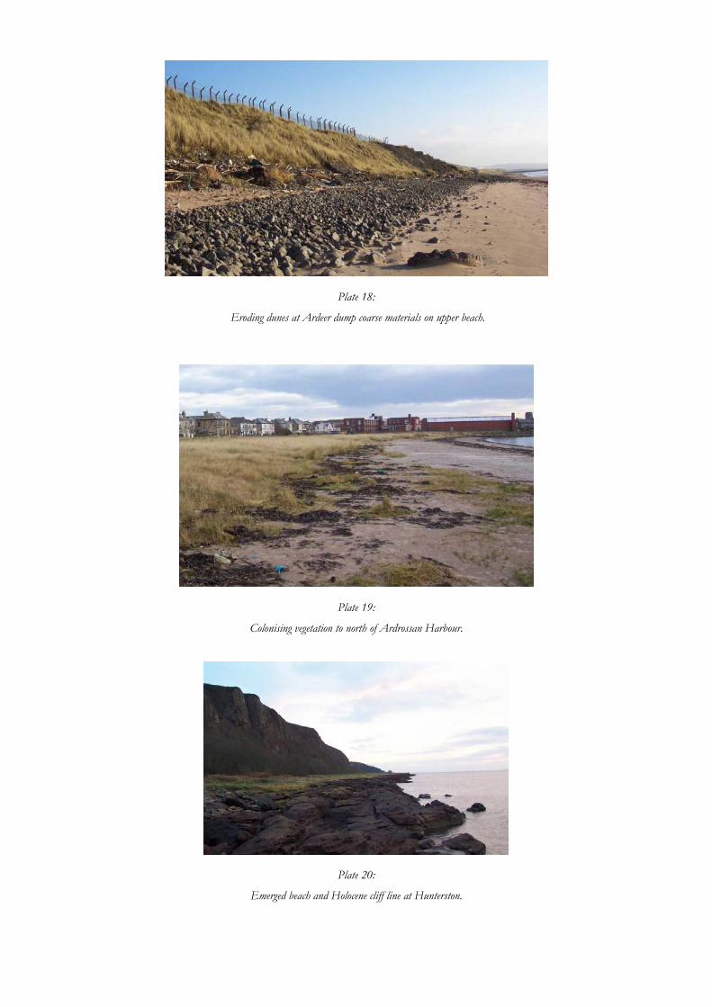
Plate 18:
Eroding dunes at Ardeer dump coarse materials on upper beach.
Plate 19:
Colonising vegetation to north of Ardrossan Harbour.
Plate 20:
Emerged beach and Holocene cliff line at Hunterston.

15.5 Appendix 5: Archaeological Site Record Sheet GUARD 1309, Firth of Clyde Coastal Survey
No: Date Area
Name: NMRS No: WoSAS Pin:
GPS: N__ E N Satellites available:
Marked on Map YES NO Scheduled/Listed YES NO
LANDSCAPE SETTING Topography, aspect and vegetation cover:, geomorphology etc State of Tide DESCRIPTION Extent of site: Morphology (including dimensions and character; sketch overleaf if necessary): Location (tick) Inter tidal zone Coast edge <50 m from coast edge <100 m from coast edge Interpretation: Date (tick) 4th – 3rd mill BC 3rd – 1st mill BC 1st mill BC – 1st mill AD 10th – 14th cent 14 18 20th – 18th cent. th – th cent 20th cent Unknown Condition (circle as appropriate): Good Fair Poor Eroding Land use: Erosion class of coast adjacent to site (tick one): Accreting or stable Definitely eroding Stable Both accreting and eroding Eroding or stable No access Recommendations: (tick) Photos Survey Film No Monitor Frame No Nil
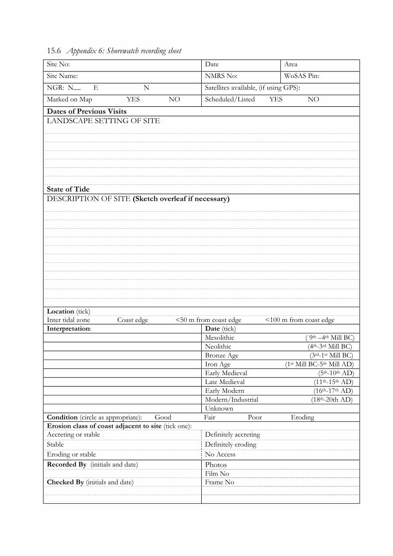
15.6 Appendix 6: Shorewatch recording sheet Site No: Date Area
Site Name: NMRS No: WoSAS Pin:
NGR: N__ E N Satellites available, (if using GPS):
Marked on Map YES NO Scheduled/Listed YES NO
Dates of Previous Visits LANDSCAPE SETTING OF SITE State of Tide DESCRIPTION OF SITE (Sketch overleaf if necessary) Location (tick) Inter tidal zone Coast edge <50 m from coast edge <100 m from coast edge Interpretation: Date (tick) Mesolithic ( 9th –4th Mill BC) Neolithic (4th-3rd Mill BC) Bronze Age (3rd-1st Mill BC) Iron Age (1st Mill BC-5th Mill AD) Early Medieval (5th-10th AD) Late Medieval (11th-15th AD) Early Modern (16th-17th AD) Modern/Industrial (18th-20th AD) Unknown Condition (circle as appropriate): Good Fair Poor Eroding Erosion class of coast adjacent to site (tick one): Accreting or stable Definitely accreting Stable Definitely eroding Eroding or stable No Access Recorded By (initials and date) Photos Film No Checked By (initials and date) Frame No
Additional Notes Sketches (please include a north arrow or cardinal points where appropriate)
Related Documents


