Coastal Waters Seminar Stacey Spooner John Hannah Tuesday, 5 July 2016 John Hannah, Vision NZ Ltd. 1

Welcome message from author
This document is posted to help you gain knowledge. Please leave a comment to let me know what you think about it! Share it to your friends and learn new things together.
Transcript

Coastal Waters Seminar
Stacey Spooner
John Hannah
Tuesday, 5 July 2016John Hannah, Vision NZ Ltd. 1
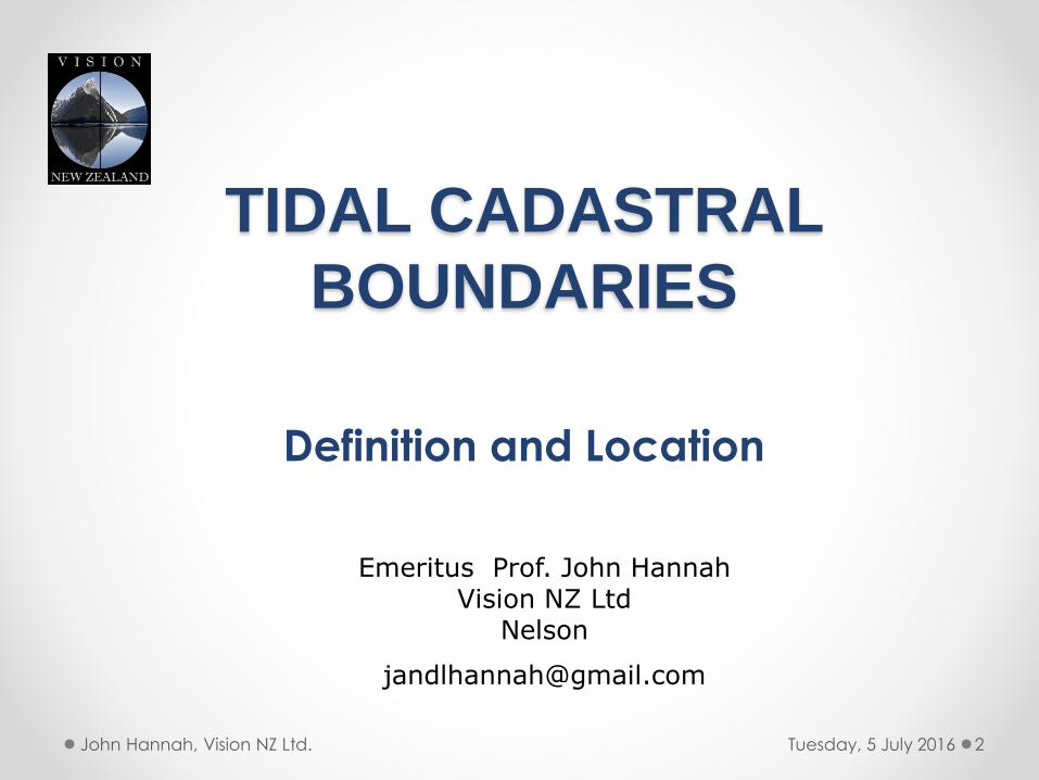
TIDAL CADASTRAL
BOUNDARIES
Definition and Location
Tuesday, 5 July 2016 2John Hannah, Vision NZ Ltd.
Emeritus Prof. John HannahVision NZ Ltd
Nelson
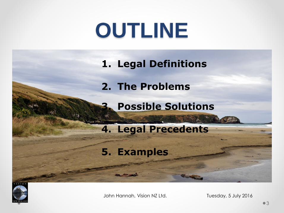
OUTLINE
Tuesday, 5 July 2016John Hannah, Vision NZ Ltd.
3
1. Legal Definitions
2. The Problems
3. Possible Solutions
4. Legal Precedents
5. Examples

LEGAL DEFINITIONSAlmost always refer to one of two tidal boundaries
Mean High Water Mark (MHWM) under the Crown
Grants Act, 1866. “The mean height of all high waters.
Mean High Water Springs (MHWS) under the Resource
Management Act, 1991. “The mean height of each pair
of successive high waters during the 24 hour period in each
semi-lunation (approx. 14 days) when the range of tide is at
the greatest.”
In theory these tidal measurements should be taken over a complete
lunar cycle of 18.6 yrs.
Tuesday, 5 July 2016John Hannah, Vision NZ Ltd.
4

THE PROBLEMS1. The boundary is ambulatory:
(a) In the short term due to seasonal processes. A summer survey favours the landowner, while a winter survey favours the crown. Baker & Watkins (1991) note changes at Milford Beach of up to 17 m between summer and winter.
Tuesday, 5 July 2016John Hannah, Vision NZ Ltd.
5
Line of MHWS
Winter beach profile
Summer beach profile
Winter boundary
Summer boundary

THE PROBLEMS ctd(b) In the long term due to:
- accretion
- storm driven coastal erosion
- sea level change
Notes:
(i) Climate change is expected to produce more extreme storm events as well as an acceleration in sea level rise.
(ii) To what extent will the test of being, “gradual and imperceptible” apply?
Tuesday, 5 July 2016John Hannah, Vision NZ Ltd.
6
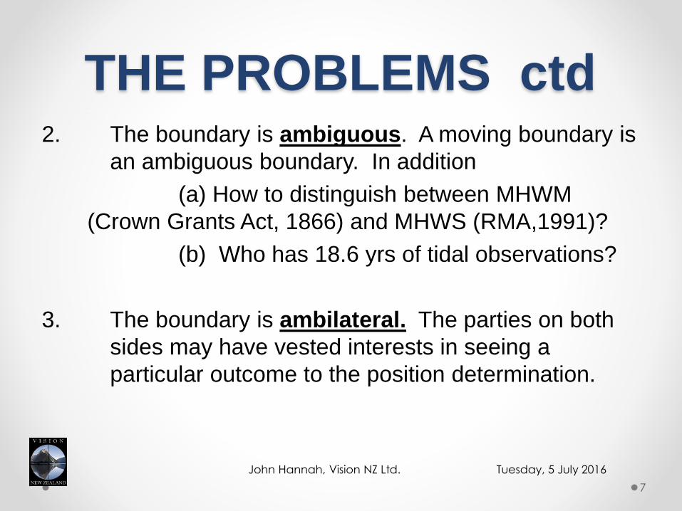
THE PROBLEMS ctd1. A
2. The boundary is ambiguous. A moving boundary is
an ambiguous boundary. In addition
(a) How to distinguish between MHWM
(Crown Grants Act, 1866) and MHWS (RMA,1991)?
(b) Who has 18.6 yrs of tidal observations?
3. The boundary is ambilateral. The parties on both
sides may have vested interests in seeing a
particular outcome to the position determination.
Tuesday, 5 July 2016John Hannah, Vision NZ Ltd.
7
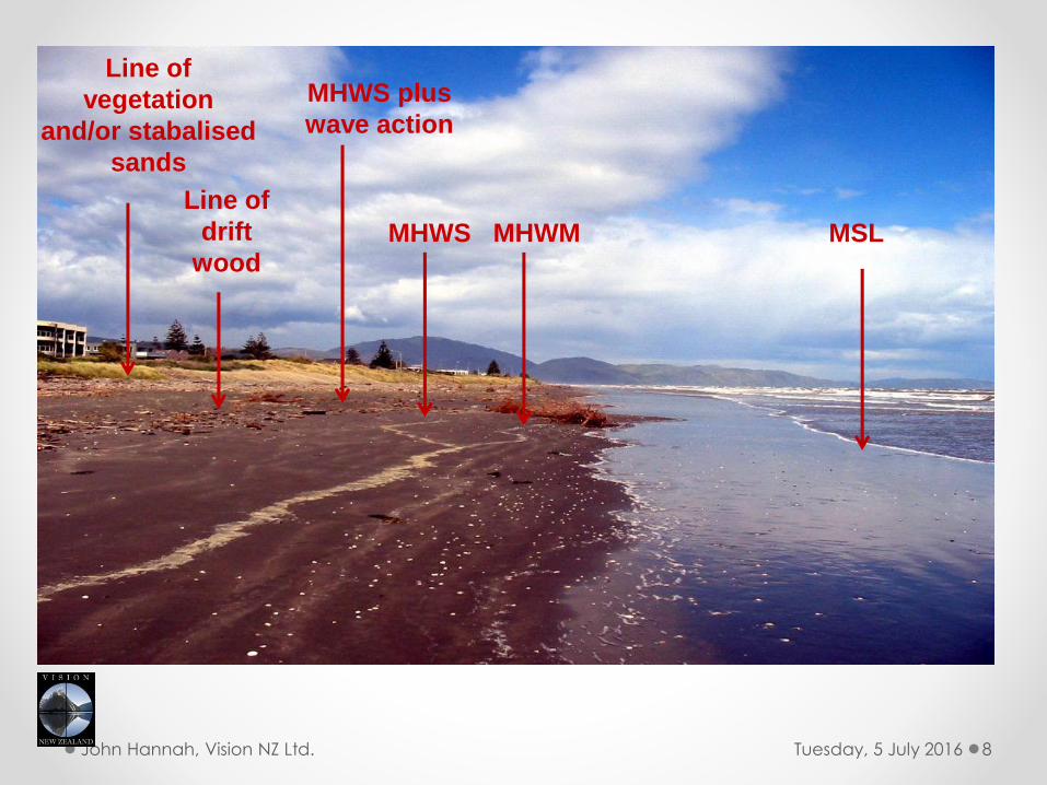
Tuesday, 5 July 2016John Hannah, Vision NZ Ltd. 8
Line of
vegetation
and/or stabalised
sands
Line of
drift
wood
MHWS plus
wave action
MHWS MHWM MSL
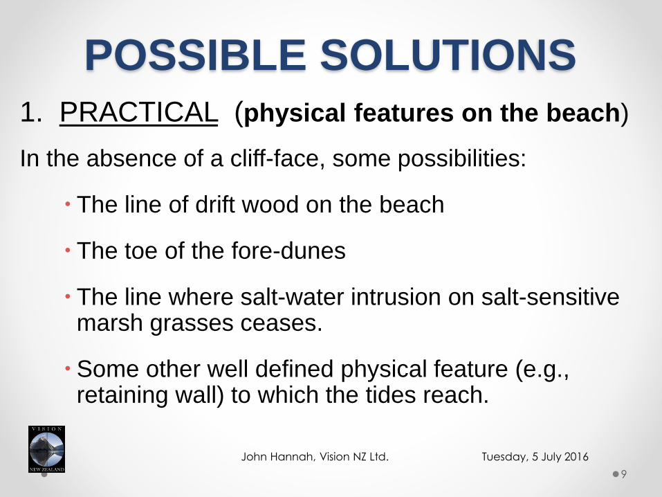
POSSIBLE SOLUTIONS1. PRACTICAL (physical features on the beach)
In the absence of a cliff-face, some possibilities:
The line of drift wood on the beach
The toe of the fore-dunes
The line where salt-water intrusion on salt-sensitive marsh grasses ceases.
Some other well defined physical feature (e.g., retaining wall) to which the tides reach.
Tuesday, 5 July 2016John Hannah, Vision NZ Ltd.
9
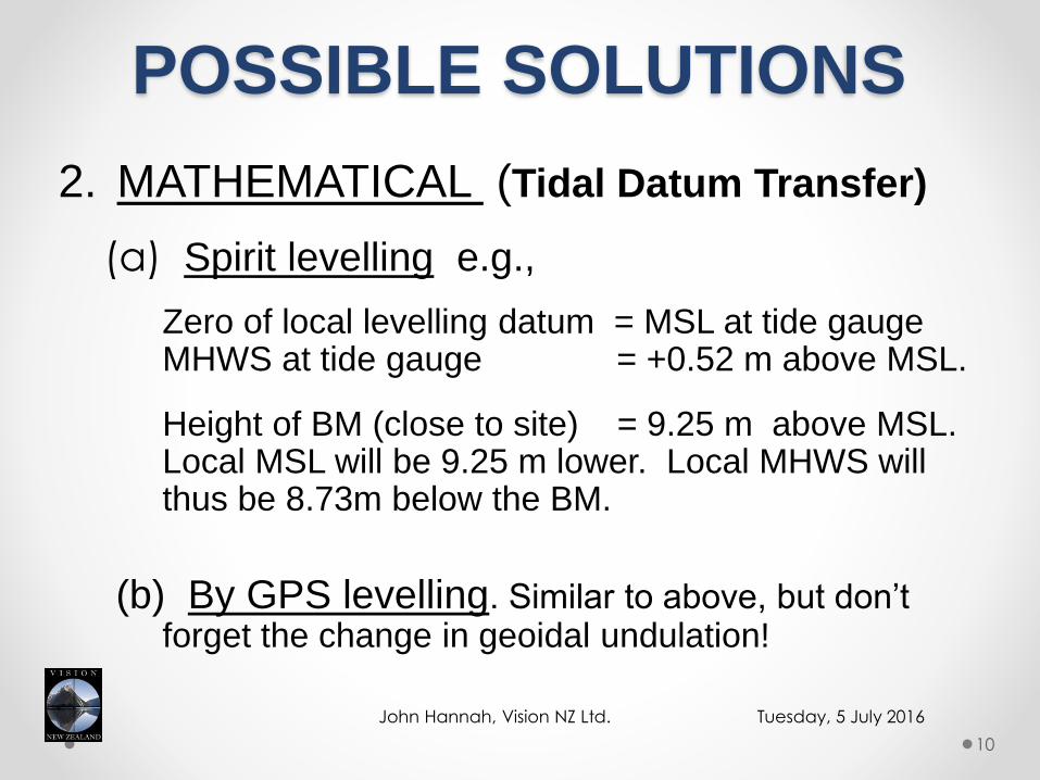
POSSIBLE SOLUTIONS
2. MATHEMATICAL (Tidal Datum Transfer)
(a) Spirit levelling e.g.,
Zero of local levelling datum = MSL at tide gauge MHWS at tide gauge = +0.52 m above MSL.
Height of BM (close to site) = 9.25 m above MSL. Local MSL will be 9.25 m lower. Local MHWS will thus be 8.73m below the BM.
(b) By GPS levelling. Similar to above, but don’t forget the change in geoidal undulation!
Tuesday, 5 July 2016John Hannah, Vision NZ Ltd.
10

POSSIBLE SOLUTIONS1. A
2. b
(c) Establish an Secondary Tide Gauge (needs at
least 3–6 days of data).
Important Assumptions:
(i) The tidal regime is the same at both sites.
(ii) The same weather conditions at both sites.
(iii) The same tidal cycles are used at both sites.
(iv) Use only the identical time period of tidal data.
Note: See Baker and Watkins, (1991)
Tuesday, 5 July 2016John Hannah, Vision NZ Ltd.
11
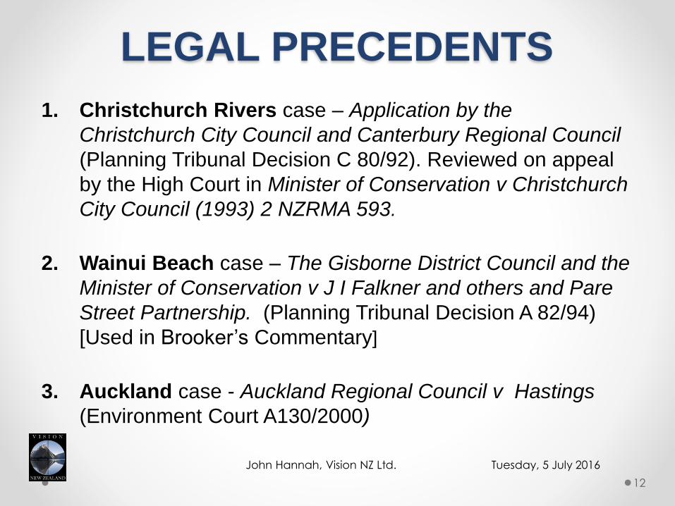
LEGAL PRECEDENTS
1. Christchurch Rivers case – Application by the
Christchurch City Council and Canterbury Regional Council
(Planning Tribunal Decision C 80/92). Reviewed on appeal
by the High Court in Minister of Conservation v Christchurch
City Council (1993) 2 NZRMA 593.
2. Wainui Beach case – The Gisborne District Council and the
Minister of Conservation v J I Falkner and others and Pare
Street Partnership. (Planning Tribunal Decision A 82/94)
[Used in Brooker’s Commentary]
3. Auckland case - Auckland Regional Council v Hastings
(Environment Court A130/2000)
Tuesday, 5 July 2016John Hannah, Vision NZ Ltd.
12
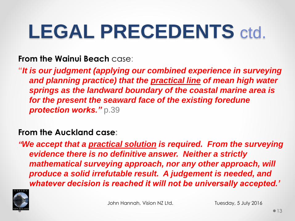
LEGAL PRECEDENTS ctd.
From the Wainui Beach case:
“It is our judgment (applying our combined experience in surveying
and planning practice) that the practical line of mean high water
springs as the landward boundary of the coastal marine area is
for the present the seaward face of the existing foredune
protection works.” p.39
From the Auckland case:
“We accept that a practical solution is required. From the surveying
evidence there is no definitive answer. Neither a strictly
mathematical surveying approach, nor any other approach, will
produce a solid irrefutable result. A judgement is needed, and
whatever decision is reached it will not be universally accepted.’
Tuesday, 5 July 2016John Hannah, Vision NZ Ltd.
13

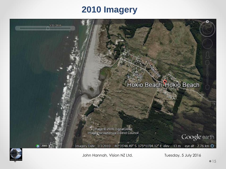
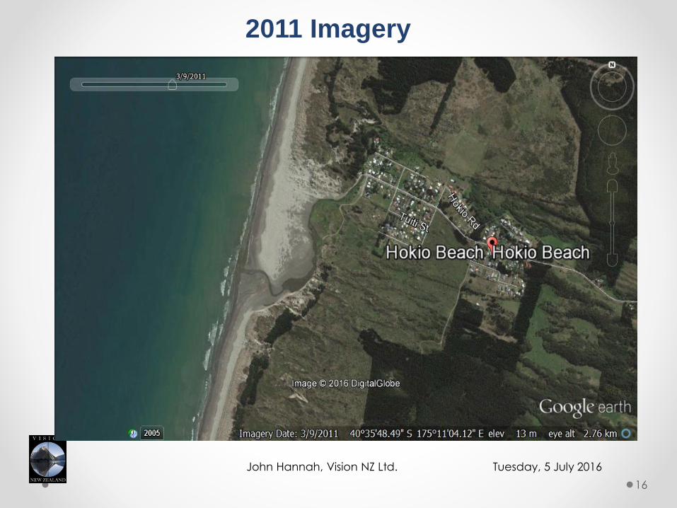
HOKIO BEACH ACCRETION CLAIM
2005 Imagery from Goggle Earth
Tuesday, 5 July 2016John Hannah, Vision NZ Ltd.
14
Tuesday, 5 July 2016John Hannah, Vision NZ Ltd.
15
2010 Imagery
Tuesday, 5 July 2016John Hannah, Vision NZ Ltd.
16
2011 Imagery
Tuesday, 5 July 2016John Hannah, Vision NZ Ltd. 17
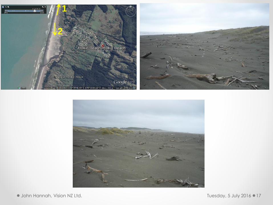
1
2
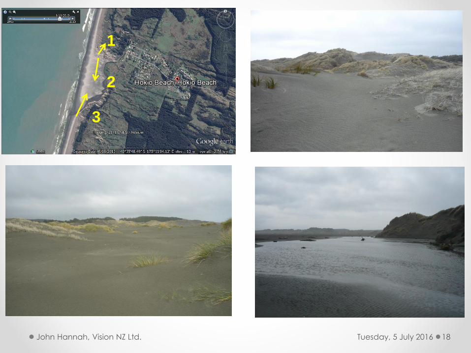
Tuesday, 5 July 2016John Hannah, Vision NZ Ltd. 18
1
2
3
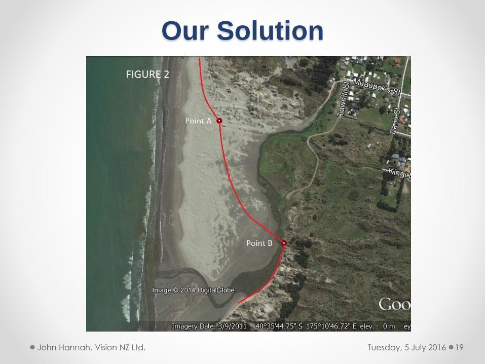
Our Solution
Tuesday, 5 July 2016John Hannah, Vision NZ Ltd. 19

Explanation
• To the north MHWS toe of fore-dunes, MHWM, 4-5 m to the seaward side (in driftwood).
• To the south – both at the toe of the dunes.
• Across the embayment – problematic.o Option 1. As defined in 1923
o Option 2. Line on beach roughly equivalent to the MHWM wetting line.
o Option 3. Hybrid. MHWS generally at the toe of the new dunes being formed with MHWS 5m to seaward side.
Tuesday, 5 July 2016John Hannah, Vision NZ Ltd. 20
Tuesday, 5 July 2016John Hannah, Vision NZ Ltd.
21
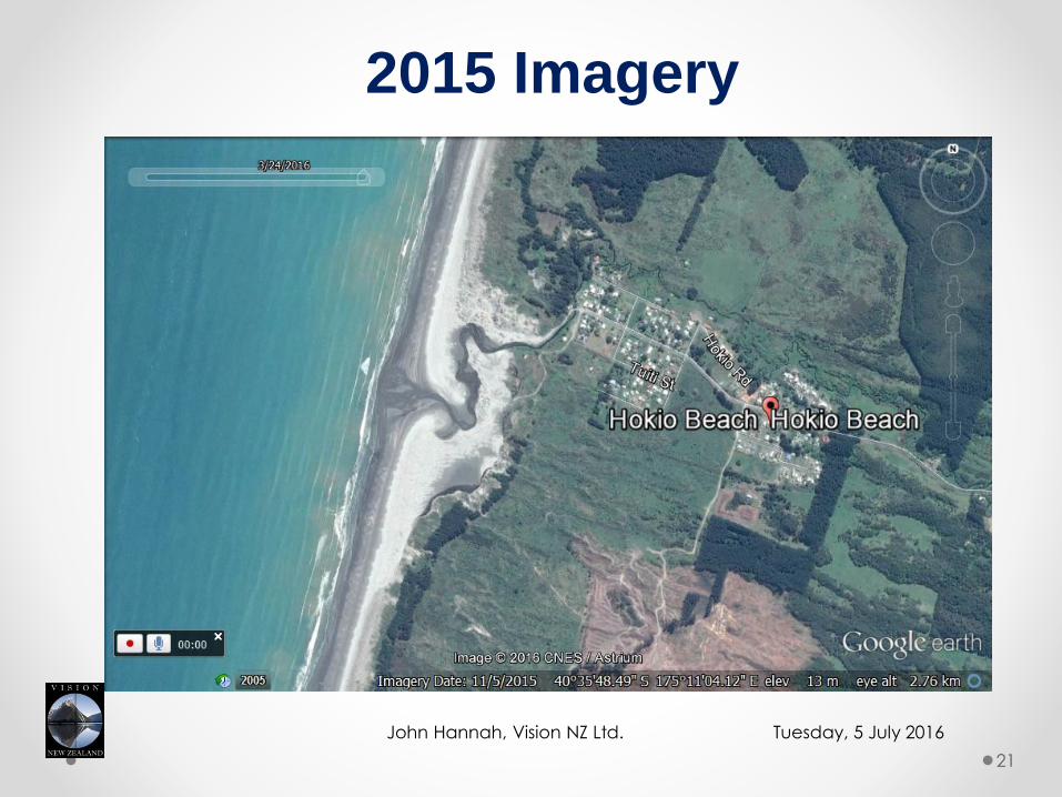
2015 Imagery
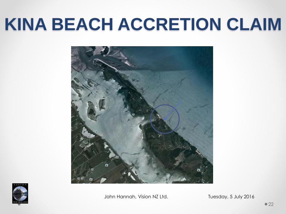
KINA BEACH ACCRETION CLAIM
Tuesday, 5 July 2016John Hannah, Vision NZ Ltd.
22
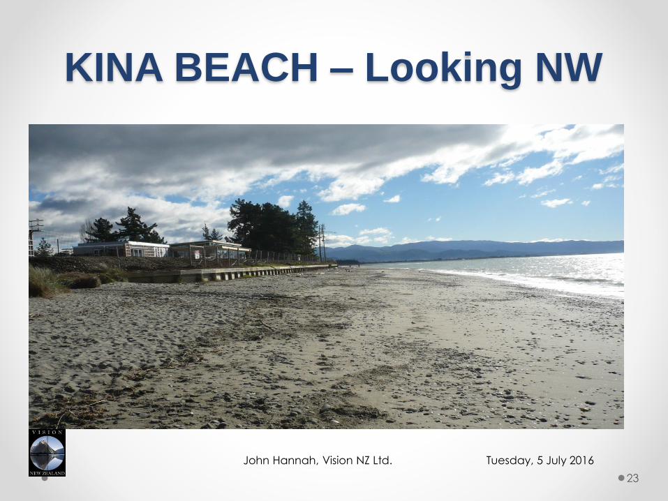
KINA BEACH – Looking NW
Tuesday, 5 July 2016John Hannah, Vision NZ Ltd.
23
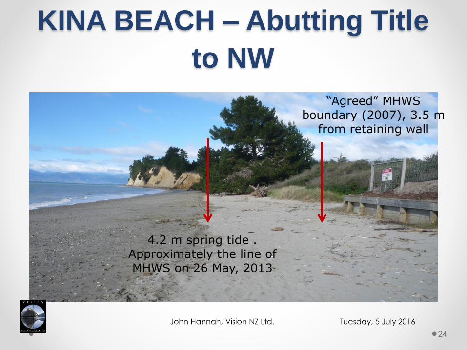
KINA BEACH – Abutting Title
to NW
Tuesday, 5 July 2016John Hannah, Vision NZ Ltd.
24
4.2 m spring tide . Approximately the line of MHWS on 26 May, 2013
“Agreed” MHWS boundary (2007), 3.5 m
from retaining wall
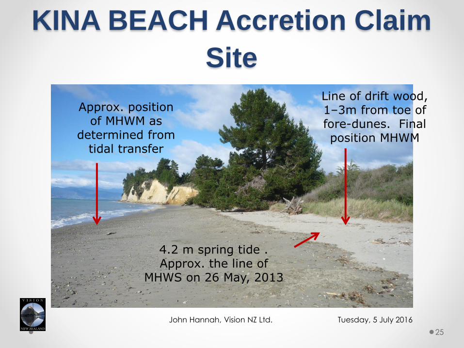
KINA BEACH Accretion Claim
Site
Tuesday, 5 July 2016John Hannah, Vision NZ Ltd.
25
4.2 m spring tide . Approx. the line of
MHWS on 26 May, 2013
Line of drift wood, 1–3m from toe of fore-dunes. Final position MHWM
Approx. position of MHWM as
determined from tidal transfer

KINA BEACH – Underlying
Issues
• The local council (TDC) wanted the wider beach open to public access.
• The landowner wanted certainty of title, any land that had accreted and room to undertake protection works.
• LINZ needs a solution that meets legislative requirements as well as the CSD rules for Landonline.
• The courts expect a practical, and if possible, reproducible boundary.
ALL of the Above = COMPROMISE!!!!
Tuesday, 5 July 2016John Hannah, Vision NZ Ltd.
26

KINA BEACH – Residual Issues
• Strictly speaking, surveyors have rarely observed the legal definitions for coastal cadastral boundaries, preferring to use “practical” solutions.
• The Kina Beach “solution” has not used the theoretical MHWM boundary, but then where is that boundary?
• Was it the intention of the law that the landward side of the boundary be subject to regular inundation?
• To the best of my knowledge, these arguments have yet to be tested in the high court.
• What about the enduring liability of Surveyors under Sec 52 of the Cadastral Survey Act ?
Tuesday, 5 July 2016 27John Hannah, Vision NZ Ltd.
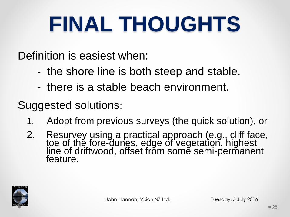
FINAL THOUGHTS
Definition is easiest when:
- the shore line is both steep and stable.
- there is a stable beach environment.
Suggested solutions:
1. Adopt from previous surveys (the quick solution), or
2. Resurvey using a practical approach (e.g., cliff face, toe of the fore-dunes, edge of vegetation, highest line of driftwood, offset from some semi-permanent feature.
Tuesday, 5 July 2016John Hannah, Vision NZ Ltd.
28
FINAL THOUGHTS ctd.
In sheltered estuarine land where there is little wave action a tidal datum transfer could be considered. Alternatively,
In tidal mudflats, the seaward edge of salt-grass Salicornia Australis appears to be is a reasonable indicator of MHWS. Consider other saltwater sensitive species.
Typically historical titles used practical solutions based upon physical features as a proxy for both MHWM and MHWS.
Tuesday, 5 July 2016John Hannah, Vision NZ Ltd.
29
REFERENCES
1. Baker, R.F., and M. Watkins, (1991). “Guidance Notes for the Determination of Mean High Water Mark for Land Title Surveys”, available from the NZIS, PO Box 831, Wellington.
2. Dewar, P.R., (2003). “The Accuracy of Tidal Datum Transfer Procedures Using Dunedin Wharf to Port Chalmers as a Case Study”, BSurv (Hons) Dissertation, University of Otago.
3. Grant S.T., and C.T. O’Reilly, (1986). A New Look at Tidal datum Transfers”, The Canadian Surveyors, Vol.40, No.4.
Tuesday, 5 July 2016John Hannah, Vision NZ Ltd.
30
Related Documents