CITY OF WHITEHORSE POST-1945 HERITAGE STUDY THEMATIC ENVIRONMENTAL HISTORY; CITATIONS FOR PLACES & PRECINCTS Prepared by Built Heritage Pty Ltd ADOPTED BY COUNCIL : 27 JUNE 2016 P O B o x 2 2 2 E m e r a l d 3 7 8 2 w w w . b u i l t h e r i t a g e . c o m . a u p h o n e 9 0 1 8 9 3 1 1

Welcome message from author
This document is posted to help you gain knowledge. Please leave a comment to let me know what you think about it! Share it to your friends and learn new things together.
Transcript
CITY OF WHITEHORSE
POST-1945 HERITAGE STUDY
THEMATIC ENVIRONMENTAL HISTORY;
CITATIONS FOR PLACES & PRECINCTS
Prepared by Built Heritage Pty Ltd
ADOPTED BY COUNCIL : 27 JUNE 2016
P O B o x 2 2 2 E m e r a l d 3 7 8 2 w w w . b u i l t h e r i t a g e . c o m . a u p h o n e 9 0 1 8 9 3 1 1
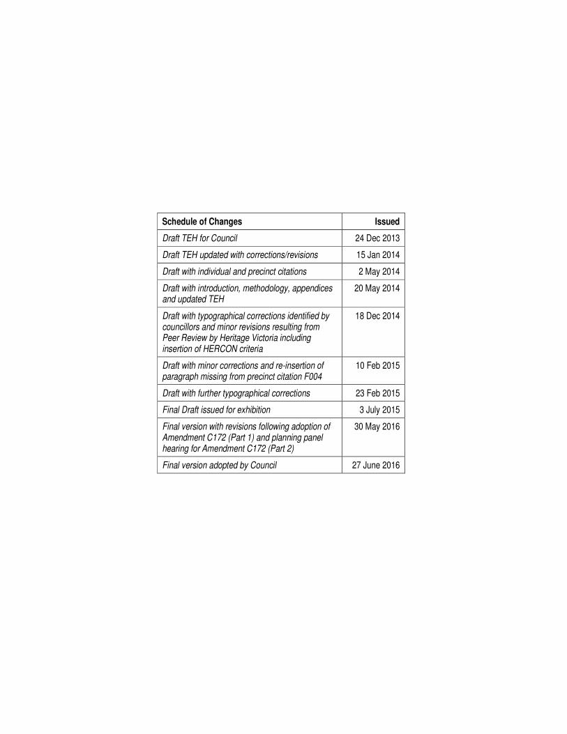
Schedule of Changes Issued
Draft TEH for Council 24 Dec 2013
Draft TEH updated with corrections/revisions 15 Jan 2014
Draft with individual and precinct citations 2 May 2014
Draft with introduction, methodology, appendices and updated TEH
20 May 2014
Draft with typographical corrections identified by councillors and minor revisions resulting from Peer Review by Heritage Victoria including insertion of HERCON criteria
18 Dec 2014
Draft with minor corrections and re-insertion of paragraph missing from precinct citation F004
10 Feb 2015
Draft with further typographical corrections 23 Feb 2015
Final Draft issued for exhibition 3 July 2015
Final version with revisions following adoption of Amendment C172 (Part 1) and planning panel hearing for Amendment C172 (Part 2)
30 May 2016
Final version adopted by Council 27 June 2016
C I T Y O F W H I T E H O R S E P O S T – 1 9 4 5 H E R I T A G E S T U D Y [ J U N E 2 0 1 6 ] 3
TABLE OF CONTENTS
A Executive Summary 7
B Background & Brief 9
C Methodology 11
D Thematic Environmental History 19
1.0 SHAPING VICTORIA’S ENVIRONMENT 21
1.1 Tracing climate and topographical change
1.2 Tracing the emergence of Victoria’s plants and animals
1.3 Understanding scientifically diverse environments 1.4 Creation stories and defining country
1.5 Living with natural processes
1.6 Appreciating and protecting Victoria’s natural wonders
2.0 PEOPLING VICTORIA’S PLACES AND LANDSCAPES 23
2.1 Living as Victoria’s original inhabitants 2.2 Exploring, surveying and mapping
2.3 Adapting to diverse environments 2.4 Arriving in a new land
2.5 Migrating and making a home
2.6 Maintaining distinctive cultures
2.7 Promoting settlement 2.8 Fighting for identity
3.0 CONNECTING VICTORIANS BY TRANSPORT AND COMMUNICATIONS 27
3.1 Establishing pathways
3.2 Travelling by water
3.3 Linking Victorians by rail
3.4 Linking Victorians by road in the twentieth century
3.5 Travelling by tram
3.6 Linking Victorians by air
3.7 Establishing and maintaining communications
4.0 TRANFORMING AND MANAGING LAND AND NATURAL RESOURCES 35
4.1 Living off the land
4.2 Living from the sea 4.3 Grazing and raising livestock
4.4 Farming (Horticulture)
4.5 Gold mining
4.6 Exploiting other mineral, forest and water resources
4.7 Transforming the land and waterways
4 C I T Y O F W H I T E H O R S E P O S T – 1 9 4 5 H E R I T A G E S T U D Y [ J U N E 2 0 1 6 ]
5.0 BUILDING VICTORIA’S INDUSTRIES AND WORKFORCE 39
5.1 Processing raw materials
5.2 Developing a manufacturing capacity
5.3 Marketing and retailing
5.4 Exhibiting Victoria’s innovation and products
5.5 Banking and finance
5.6 Entertaining and socialising
5.7 Catering for tourists
5.8 Working
6.0 BUILDING TOWNS, CITIES AND THE GARDEN STATE 49
6.1 Establishing Melbourne Town, Port Phillip District
6.2 Creating Melbourne 6.3 Shaping the suburbs
6.4 Making regional centres 6.5 Living in country towns
6.6 Marking significant phases in development of Victoria’s settlements, towns and cities
6.7 Making homes for Victorians
6.8 Living on the fringes
7.0 GOVERNING VICTORIANS 61
7.1 Developing institutions for self-government and democracy
7.2 Struggling for political rights
7.3 Maintaining law and order
7.4 Defending Victoria and Australia
7.5 Protecting Victoria’s heritage
8.0 BUILDING COMMUNITY LIFE 65
8.1 Maintaining spiritual life
8.2 Educating people
8.3 Providing health and welfare services
8.4 Forming community organisations
8.5 Preserving traditions and commemorating
8.6 Marking the phases of life
9.0 SHAPING CULTURAL AND CREATIVE LIFE 83
9.1 Participating in sport and recreation
9.2 Nurturing a vibrant arts scene
9.3 Achieving distinction in the arts
9.4 Creating popular culture
9.5 Advancing knowledge
Note: The above represents a complete list of all themes contained in Victoria’s Framework of Historic Themes. Only those themes indicated by bold/italic text are discussed in the Thematic Environmental History
C I T Y O F W H I T E H O R S E P O S T – 1 9 4 5 H E R I T A G E S T U D Y [ J U N E 2 0 1 6 ] 5
E Citations for Individual Places 93
E001 House, 24 Arnott Street, Mont Albert North 95
E002 Mount Scopus Memorial College, 245 Burwood Highway, Burwood 99
E003 Dental surgery (former FLER display house), 150 Canterbury Road, Blackburn South 103
E004 Telecommunications relay tower, 728 Canterbury Road, Surrey Hills 107
E005 House, 31 Fowler Street, Box Hill South 111
E006 House, 18 Gilmour Street, Burwood 115
E007 House, 1 Gracefield Drive, Box Hill North 119
E008 House, 17 Grange Street, Mont Albert 123
E009 House, 4 Ian Grove, Burwood 127
E010 House, 1 Laurencia Court, Mont Albert 133
E011 Yarra Valley Water Eastern Area Office, 25-35 Lucknow Street, Mitcham 137
E012 House, 111 Main Street, Blackburn 143
E013 House, 7 Norris Court, Blackburn 147
E014 House, 1163 Riversdale Road, Box Hill South 153
E015 Flats (Indiana), 96 Severn Street, Box Hill 157
E016 House, 17 Sheehans Road, Blackburn 163
E017 House, 40 Somers Street, Burwood 167
E018 Office building (former ES&A Bank), 153-155 Springvale Road, Nunawading 171
E019 House, 12 Sunhill Avenue, Burwood 177
E020 House, 1 Verona Street, Vermont South 181
E021 House (Wildwood), 3 Villa Mews, Vermont 185
E022 Former E G Greenway Pty Ltd pottery factory, 127 Whitehorse Road, Blackburn 189
E023 House, 359 Whitehorse Road, Nunawading 193
E024 House, 453 Whitehorse Road, Mitcham 197
E025 Sculpture (Tristan’s Journey), 666 Whitehorse Road, Mitcham 201
F Citations for Precincts and Group Listings 207
F001 A V Jennings Estate (Precinct), Spencer Street/Springvale Road, Nunawading 209
F002 Burwood Skyline Drive-in Cinema (Group listing), Burwood Highway, Burwood 215
F003 Blue Flame Project (Precinct), Shalimar Court/Parkleigh Court, Vermont South 225
F004 Concept Constructions Display Homes (Precinct), Canterbury Road, Forest Hill 235
F005 Housing Commission of Victoria Estate (Precinct), Cadorna Street, Box Hill South 243
G Bibliography 251
APPENDICES
1 Remaining Outline Citations 253
2 Masterlist of Places 275
3 Masterlist of Precincts 283

6 C I T Y O F W H I T E H O R S E P O S T – 1 9 4 5 H E R I T A G E S T U D Y [ J U N E 2 0 1 6 ]
C I T Y O F W H I T E H O R S E P O S T – 1 9 4 5 H E R I T A G E S T U D Y [ J U N E 2 0 1 6 ] 7
A: EXECUTIVE SUMMARY
The areas that comprise the City of Whitehorse, which was created in the mid-1990s by the amalgamation of the former municipalities of Box Hill and Nunawading, have a long and multi-layered history that encapsulates many different phases of human settlement and interactions. While some parts of the municipality provide physical evidence dating back as far as the 1850s (such as the Wesleyan Church in Box Hill North), there are other parts that are largely if not entirely characterised by more recent development from the post-Second World War period. Although a modest number of post-war heritage places have been identified and documented in various heritage reviews undertaken since council amalgamation, the City of Whitehorse Post-1945 Heritage Study represented the first time that the potential heritage significance of the city’s post-war building stock was considered in a broader municipality-wide context.
The project began with the preparation of a Thematic Environmental History (TEH) specifically devoted to post-war development. This, which reviewed and supplemented the thematic history prepared for the original City of Whitehorse Heritage Review (1999), provides a context for the identification of post-war heritage places across the municipality. Following completion of the TEH, places and areas of potential significance were identified by various means including a comprehensive review of previous heritage studies, desktop research, engagement with stakeholder groups including local historical societies and other bodies concerned with post-war heritage places (eg National Trust, Art Deco & Modernism Society and the Robin Boyd Foundation) and a limited amount of focused fieldwork. The outcome was a master-list of more than 400 individual sites (and 12 precincts) of potential significance. In order to create a short-list of places deemed to represent the highest priority for more detailed investigation, each place in the master-list was given a score out of 10. The top forty places and areas (that is, the highest scoring places) were then subject to a first round of documentation as two-page outline citations. Each of these provided basic historical and descriptive notes as well as an indication of the potential significance of the place or area. Following a further phase of review, the top thirty places and areas were selected from this short-list to be documented in greater detail as full-length citations, with complete historical documentation, comparative analysis and a Statement of Significance.
The thirty full-length citations, which comprised 25 individual places and five precincts, covered a broad gamut of post-war heritage across the City of Whitehorse. Almost three-quarters of the individual places were private houses, which encapsulated a number of architect’s own houses as well as several examples of project housing – both of which had been identified as significant sub-themes in the TEH. The remaining individual places, which also related very strongly to themes discussed in the TEH, included one of the municipality’s earliest surviving post-war factories, in Whitehorse Road, Blackburn (1947), a purpose-built private school campus in Burwood (1951 onwards), an early and innovative development of flats in Box Hill (1961), an important suburban telecommunications facility in Surrey Hills (1963) and an MMBW regional depot in Mitcham (1970). With the exception of a group heritage listing proposed for the surviving infrastructure of a former drive-in cinema in Burwood (which, dating from 1954, was the first of its type in Australia), the citations for precincts related to the specific post-war phenomena of planned estates and project housing. These included the most intact remaining portion of the estate of concrete houses developed in Box Hill South by the Housing Commission of Victoria (1948-53), a group of houses in Nunawading that represented the first post-war foray into estate housing by industry leaders A V Jennings (1955), and two display villages of architect-designed housing: a row of three dwellings in Forest Hill built by a private company (1969-70) and a cluster of twenty dwellings in Vermont South that represented an ambitious publicity exercise co-sponsored by the RAIA and the Gas & Fuel Corporation (1970-71).
While the City of Whitehorse Post-1945 Heritage Study recommends that these 25 places and 5 precincts be included on the heritage overlay schedule to the planning scheme, it has also flagged a considerable number of other places and areas for possibly future investigation, and, even more broadly, establishes a valuable context for the assessment of any further post-war heritage places or areas that might be yet identified in the future.
The following table summarises the heritage status of the 25 places and 5 precincts/group listings that the study recommended for inclusion on the heritage overlay schedule to the planning scheme.
8 C I T Y O F W H I T E H O R S E P O S T – 1 9 4 5 H E R I T A G E S T U D Y [ J U N E 2 0 1 6 ]
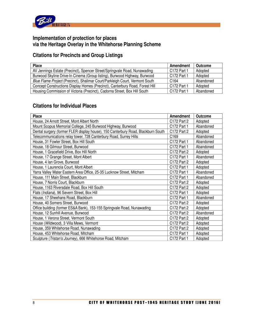
Implementation of protection for places via the Heritage Overlay in the Whitehorse Planning Scheme
Citations for Precincts and Group Listings
Place Amendment Outcome AV Jennings Estate (Precinct), Spencer Street/Springvale Road, Nunawading C172 Part 1 Adopted Burwood Skyline Drive-In Cinema (Group listing), Burwood Highway, Burwood C172 Part 1 Adopted Blue Flame Project (Precinct), Shalimar Court/Parkleigh Court, Vermont South C164 Abandoned Concept Constructions Display Homes (Precinct), Canterbury Road, Forest Hill C172 Part 1 Adopted Housing Commission of Victoria (Precinct), Cadorna Street, Box Hill South C172 Part 1 Abandoned
Citations for Individual Places
Place Amendment Outcome House, 24 Arnott Street, Mont Albert North C172 Part 2 Adopted Mount Scopus Memorial College, 245 Burwood Highway, Burwood C172 Part 1 Abandoned Dental surgery (former FLER display house), 150 Canterbury Road, Blackburn South C172 Part 2 Adopted Telecommunications relay tower, 728 Canterbury Road, Surrey Hills C169 Abandoned House, 31 Fowler Street, Box Hill South C172 Part 1 Abandoned House, 18 Gilmour Street, Burwood C172 Part 1 Abandoned House, 1 Gracefield Drive, Box Hill North C172 Part 2 Adopted House, 17 Grange Street, Mont Albert C172 Part 1 Abandoned House, 4 Ian Grove, Burwood C172 Part 2 Adopted House, 1 Laurencia Court, Mont Albert C172 Part 1 Adopted Yarra Valley Water Eastern Area Office, 25-35 Lucknow Street, Mitcham C172 Part 1 Abandoned House, 111 Main Street, Blackburn C172 Part 1 Abandoned House, 7 Norris Court, Blackburn C172 Part 2 Adopted House, 1163 Riversdale Road, Box Hill South C172 Part 2 Adopted Flats (Indiana), 96 Severn Street, Box Hill C172 Part 1 Adopted House, 17 Sheehans Road, Blackburn C172 Part 1 Abandoned House, 40 Somers Street, Burwood C172 Part 2 Adopted Office building (former ES&A Bank), 153-155 Springvale Road, Nunawading C172 Part 2 Adopted House, 12 Sunhill Avenue, Burwood C172 Part 2 Abandoned House, 1 Verona Street, Vermont South C172 Part 2 Adopted House (Wildwood), 3 Villa Mews, Vermont C172 Part 2 Adopted House, 359 Whitehorse Road, Nunawading C172 Part 2 Adopted House, 453 Whitehorse Road, Mitcham C172 Part 1 Adopted Sculpture (Tristan’s Journey), 666 Whitehorse Road, Mitcham C172 Part 1 Adopted
C I T Y O F W H I T E H O R S E P O S T – 1 9 4 5 H E R I T A G E S T U D Y [ J U N E 2 0 1 6 ] 9
B: BACKGROUND & BRIEF
B1 Project Background & Brief
Background
Since the City of Whitehorse was created in the mid-1990s by the amalgamation of the former City of Box Hill and City of Nunawading, a succession of heritage studies has been undertaken, including reviews by Allom Lovell & Associates (1999), Andrew Ward (2001), Graeme Butler (2003) and Coleman Architects (2012). While all of these studies considered some places dating from the post-Second World War period, the lack of a comprehensive municipality-wide investigation of these places has made it difficult to place individual examples in a broader context.
In 2008, the City of Whitehorse Potential Heritage Framework Plan identified the city’s post-war buildings as a theme worthy of further investigation. Certain parts of the municipality are strongly characterised by that era of development, and as a result were under-represented on the current heritage overlay schedule, and earmarked as potentially significant foci for future investigation. That same year, Heritage Victoria released Stage One of its Survey of Post-War Built Heritage in Victoria, which identified several hundred post-Second World War places and areas of potential significance at the state level, including several in the City of Whitehorse. Following the completion of a heritage review by Coleman Architects in 2012, which updated the 2008 framework plan and assessed a number of post-war places identified in the Heritage Victoria survey, council resolved to commission a dedicated survey of post-war heritage across the entire municipality. The objectives of this project were identified thus:
• To provide a comprehensive review of post-1945 development in the municipality
• To address recommendations of the 2001 Ward Review in relation to post war development and heritage.
• To respond to the 2008 Heritage Framework Plan and subsequent 2012 Draft Heritage Review
• To provide a strong basis on which to seek protection of post-1945 places
• To inform targeted stakeholders of the study
Although a small number of local councils in the Melbourne metropolitan area (notably the Cities of Port Phillip and Bayside) have previously undertaken thematic studies devoted to twentieth century heritage places, the City of Whitehorse Post-1945 Heritage Study is only the second such study (following one recently undertaken by the City of Frankston) to be dedicated solely to heritage places from the post-Second World War period.
Brief
The project was to comprise three principal tasks, which were to be undertaken as three discrete stages:
• Undertake a thematic study of post 1945 development in Whitehorse
• Identify all post-1945 places of potential heritage significance and provide a prioritized list for assessment;
• Assess and document post-war heritage places considered a high priority for inclusion in a future Heritage Overlay (HO), either as individual heritage places or as heritage precincts.
The study area is defined as the entire City of Whitehorse: that is, the extent of the former Cities of Box Hill and Nunawading, comprising all of the suburbs of Blackburn (incorporating Laburnum), Blackburn North, Blackburn South, Box Hill, Box Hill North (incorporating Kerrimuir), Box Hill South, Burwood East, Forest Hill, Mitcham, Mont Albert, Mont Albert North, Nunawading, Vermont, Vermont South, and parts of the suburbs of Balwyn North, Burwood (incorporating Bennettswood) and Surrey Hills.
10 C I T Y O F W H I T E H O R S E P O S T – 1 9 4 5 H E R I T A G E S T U D Y [ J U N E 2 0 1 6 ]
B2 Study Team
The study was undertaken by Simon Reeves, director and principal of Built Heritage Pty Ltd.
B3 Acknowledgements
The consultants would like to thank the following for their contributions to the project:
Mr Geoff Austin, Manager of Heritage Planning, Heritage Victoria
Mr William Orange and Ms Robyn Doble (Box Hill Historical Society)
Mr Peter Simmenauer (President, Whitehorse Historical Society)
Mr Robin Grow (President, Art Deco & Modernism Society)
Mr Tony Lee (Executive Director, Robin Boyd Foundation)
Mr Paul Roser (National Trust of Australia (Victoria))
One of the benefits of researching heritage places from the post-war period is that contact can be made with the people who were involved in their creation and early occupation. For this project, attempts were made to locate the architects, designers and clients of the various buildings being researched. Acknowledgement is made to those who shared their recollections and, in some cases, documentation and memorabilia from their private collections. We would like to thank the original clients of several houses: Mrs Pauline Noble, Mrs Joan Green and Mrs Jean McIntosh. Gratitude is also expressed to the designers who provided valuable first-hand accounts of the places that they created in what is now the City of Whitehorse: architects Des Bloink, David Chancellor, Kenneth Edmonds, Neil Clerehan, John Herniman, Michael Jan, John Reid, Phyllis Murphy, Rex Patrick, Frances Seidel and Rod Thorley, and artist/sculptor John Krzywokulski.
A number of other individuals provided useful information and research leads during the course of the project, including Jane (McIntosh) Aagaard, Geoff Bridges (Weg’s World), Peter Marinick (ANZ Group Archives), Helen Cadzow (Historical Services Manager, National Australia Bank), Ian Symons and Steven Coverdale.
C I T Y O F W H I T E H O R S E P O S T – 1 9 4 5 H E R I T A G E S T U D Y [ J U N E 2 0 1 6 ] 11
C PROJECT METHODOLOGY
C1 Project Methodology
Thematic Environmental History
The Thematic Environmental History (hereafter referred to as TEH) has been prepared to document and illustrate how various themes (and the many aspects of human intervention associated with them) have manifested themselves in the City of Whitehorse since the end of the Second World War, and, consequently, how these themes have shaped the environment and culture of the municipality as it is today. In this way, the TEH provides a context for post-war heritage places and areas that have been identified (and will continue to be identified) across the entire City of Whitehorse. By its very nature, a TEH is arranged thematically, and not chronologically. It is not intended as an exhaustive history of the entire municipality, and thus will not include reference to every individual, group or organisation that has played some part in the development of the study area. Rather, it seeks to identify broader patterns that explain how the physical environment has been shaped from 1945 to approximately the close of the twentieth century.
The themes themselves are drawn from Victoria’s Framework of Historic Themes, which has now been adopted by Heritage Victoria as the industry standard. This framework is divided into eight broad themes (designated sequentially as 1.0 to 8.0 inclusive), each of which is further divided into sub-themes (designated numerically by one decimal place eg 8.1, 8.2, 8.3, etc). However, not all of the sub-themes are discussed in this TEH. Certain sub-themes are not pertinent to post-contact European settlement in general, such as the evolution of landforms and geology (1.1) and Aboriginal spiritual traditions (1.4). Other sub-themes are demonstrably not relevant to the story of post-Second World War settlement in the City of Whitehorse, such as surveying and mapping (2.2), travel by water (3.2) and goldmining (4.5). There are also those sub-themes that, while they may have been manifest in the study area during the post-war era, they were not discussed here because they were deemed to be merely representative of ordinary suburban development rather than particularly significant sub-themes within the City of Whitehorse. In addition to the numbered themes and sub-themes that follow Victoria’s Framework of Historic Themes, this TEH had also introduced another rung of (unnumbered) sub-headings. This expands the framework to allow for a discussion of some more specific manifestations of those themes within the City of Whitehorse – what might be referred to as ‘sub-sub-themes’.
The TEH for this project draws from, and can be considered as a supplement to, the existing thematic history contained in the original City of Whitehorse Heritage Review prepared by Allom Lovell & Associates in 1999. Excerpts from this earlier document that pertain to the municipality’s post-war development have been quoted verbatim in the new TEH, thus forming a springboard for more detailed discussion. In many cases, it was necessary to prepare entirely new text to discuss themes that were not addressed in the earlier study. Aside from the existing thematic history in the City of Whitehorse Heritage Review, and from other heritage studies, the new TEH draws largely from published secondary sources. These chiefly comprised what might be described as the standard local history publications: Andrew Lemon’s Box Hill (1978), Robin da Costa’s Blackburn: A Picturesque History (1978), Diane Sydenham’s Windows on Nunawading (1990) and Leslie Alves’s Suburban Heartland: A History of the City of Whitehorse (2010). As some of the older published histories provided only limited coverage of the post-war period, a number of smaller-scaled but more specific publications were also consulted, such as Oswald Green’s From Orchard to Brick Veneer: Malcolm Street, Blackburn & Environs, 1955-1985 (1987) and Gordon Moyes’s When Box Hill was a Village (1991). However, as research for the new TEH must remain focused and concise, it did not involve reference to every available book that has ever been written about the history and development of the study area, or pertaining to every school, church, institution or community group that has ever been active within it.
Due to limitations on time and budget, the use of primary sources was restricted to those that were readily available online, including the local history database maintained by the Whitehorse Manningham Heritage Network, digitised material held by the State Library of Victoria (including historic photographs, maps and subdivision plans) and archival newspapers that can be searched online. Extensive use was also made of the in-house database of post-war Australian architecture, maintained by Built Heritage Pty Ltd, which provided references to buildings in contemporary publications such as the Australian Home Beautiful, Australian House & Garden, Architecture & Arts, Architecture in Australia, Cross Section and the respective property columns of the Age, Argus and Herald newspapers.
12 C I T Y O F W H I T E H O R S E P O S T – 1 9 4 5 H E R I T A G E S T U D Y [ J U N E 2 0 1 6 ]
Identification of Post-War Places of Significance
Places and areas of potential significance were identified by the following four means: by a review of existing heritage studies, by additional desktop research, by stakeholder consultation, and by a limited amount of what might best be described as focused fieldwork. The review of existing documentation, including the previous heritage studies and heritage reports specifically nominated in the brief, was a straightforward matter – not least of all because of this consultant’s prior involvement in compiling the lists of places for the reports produced by Allom Lovell & Associates (1999) and Heritage Alliance (2008). The identification of additional places and areas through desktop research was largely achieved from references to contemporary published sources indexed in the aforementioned computer database maintained by Built Heritage Pty Ltd. This contains almost 35,000 references to contemporary published sources and, when filtered according to suburb and street address, provided over 350 entries relating to places within what is now the City of Whitehorse. In some cases, a single place was subject to more than one database reference (and in one case, as many as seven).
Given the somewhat specialised nature of a post-war heritage study, it is not considered that consultation through public meetings or seminars would be a particularly fruitful means of identifying these types of places. Rather, engagement with selected stakeholders was undertaken in a more focused manner. The following five groups were identified as the key stakeholders in a project devoted to assessment of post-war heritage places
• The Box Hill Historical Society (covering the former City of Box Hill)
• The Whitehorse Historical Society (covering the former City of Nunawading)
• The National Trust of Victoria (Australia)
• The Art Deco & Modernism Society, Inc
• The Robin Boyd Foundation
Each of these five groups was initially contacted by email in November 2013, in most cases with follow-up telephone calls. The background and intent of the post-1945 heritage study was outlined, and nominations were sought for specific places or areas for possible inclusion in the study. Although the consultation period fell over the Christmas break, when both local historical societies were closed to the public and some of the other stakeholder representatives were less readily contactable than they might otherwise be, a number of places were duly nominated for inclusion in the study.
While the brief specifically stated that a windscreen survey of the entire municipality was not required as part of the process of identifying new post-war places and areas of potential significance, it is considered by the consultants that a limited amount of very focused surveying would be worth undertaking, as it would provide an opportunity to identify places that are not likely to be identifiable through any other means. Based on the consultant’s existing knowledge of post-war development in the City of Whitehorse, a number of specific areas were targeted for focused fieldwork. These included the Housing Commission estate in Box Hill South, the former heartland of display housing along Canterbury Road in Blackburn South and Forest Hill, and the large post-war architect designed houses in Terrara Road and Morack Road, Vermont. With the notable exception of the Housing Commission estate, this focused fieldwork was not found to be especially fruitful, as only one place – an unusual A-framed house at Churinga Avenue, Mitcham – was recorded that had not previously been identified either through desktop research or stakeholder consultation.
Prioritising places of potential significance
The potential places of significance that were identified through documentation review, desktop research, stakeholder consultation and focused fieldwork formed the basis for a tabulated master-list. For the sake of completeness, this list also included all of the post-war places already included on the heritage overlay schedule to the City of Whitehorse Planning scheme, and those recently recommended for inclusion (ie by the 2012 Heritage Review by Coleman Architects). This master-list provided street addresses, dates of construction (where known), architectural attribution (where known), and the source/s through which it had been identified. One of the columns in the table provided details of various factors that might inform further assessment of each place. This noted, for example, whether a particular place could not be conclusively located, whether it was already known to have been demolished or significantly altered, or if it was not visible from the street. A comment was also made if the place might conceivably form part of a broader precinct (that is, if there were several places listed in the same street or general area).
C I T Y O F W H I T E H O R S E P O S T – 1 9 4 5 H E R I T A G E S T U D Y [ J U N E 2 0 1 6 ] 13
The master-list also noted if a building appeared to date from before 1945 or after 1990. Places erected prior to 1945 obviously fell outside the scope of this post-1945 heritage study (although a notable exception was made to this rule, where a seminal skillion-roofed house of 1940 was deemed to relate more strongly to the development of post-war modernist architecture). Conversely, the year 1990 was set as a cut-off point for the inclusion of places in this study. Although a number of more recent architect-designed buildings had been flagged in earlier heritage studies (notably by Andrew Ward in 2001), it was considered that these were less vulnerable than those buildings from the 1950s, ‘60s and ‘70s and might be earmarked for further assessment as part of a future study.
The master-list ultimately comprised more than 400 individual places, and a technique was required to filter this to identify what might be considered the highest priority places for more detailed assessment as part of Stage Three of the project. To achieve this, each of the places in the master-list was given a score out of 10, which was determined by providing a certain number of points for each of these four criteria: rarity, vulnerability, extent of existing documentation and potential significance (that is, at face value). This scoring system can be summarised thus:
• Rarity was scored out of three as follows: three points for a place that was very rare or seemingly unique, two points for a place that was uncommon or particularly notable, one point for a place that was above average, and zero points for a place that was only a representative or unremarkable example of its type.
• Potential significance was scored out of three as follows: three points for a place that was likely to be of significance across the entire municipality, two points for a place likely to be of significance across an entire suburb, one point for a place of significance only within a smaller or more localised context (such as a single street or group of contiguous streets) and zero points for a place that appeared to be of little or no interest in the context of post-war development.
• Vulnerability was scored out of two as follows: two points for high vulnerability (eg an intact privately-owned residence, which was considered the most threatened type of post-war building stock in the municipality), one point for medium vulnerability (typically, a public building such as a school or church) and zero points for low vulnerability (typically, a council-owned property, or any building that had already been significantly altered/extended and thus would represent a lower priority for demolition and further redevelopment).
• Documentation was scored out of two as follows: one point for documentation in a primary source (such as a contemporary newspaper or magazine article) and one point for documentation in a secondary source (including classification by the National Trust, acknowledgement by a local historical society, or inclusion in an earlier heritage study).
It must be stated that this scoring system was adopted by the consultants as a rudimentary tool to filter a very long list of places of potential heritage significance to create a short-list of places for further consideration. The scoring system was not intended, nor should it be construed, as the equivalent of rigorous assessment of individual places based on site fieldwork, research and comparative analysis. While it indeed proved a useful means of providing a ballpark idea of which places might be the most worthy candidates for further assessment and documentation, it does not follow that those places that scored lower are necessarily of little or no significance. For example, a place that scored 7 out of 10 in the master-list might, when subject to more detailed individual investigation, be found to be a more worthy candidate for heritage listing than a place that scored 8 out of 10. Ultimately, the scoring system must be considered as this particular consultant’s ballpark indication of potential significance, and not as a canon. The fact remains that many of the lower-scoring places in the list might still warrant review as part of a future project.
In any event, when the master-list of places was filtered according to this scoring system, it identified four places that scored the maximum amount of points for each of the four criteria (ie a total score of ten out of ten), 24 places that scored nine out of ten, and 25 that scored eight out of ten. At the other end of the scale, almost ninety places scored four points or fewer in total, while the remaining places on the master-list (numbering well over 300) each scored between five and seven points.
14 C I T Y O F W H I T E H O R S E P O S T – 1 9 4 5 H E R I T A G E S T U D Y [ J U N E 2 0 1 6 ]
Prioritising precincts of potential significance
The phases of documentation review, desktop research, stakeholder consultation and focused fieldwork identified twelve post-war precincts of potential heritage significance. As these precincts exhibited a certain amount of diversity, it was not considered that the application of a comparable scoring system would be a particularly useful means of prioritising them for future assessment. Rather, the twelve precincts were simply prioritised by selecting those deemed to have the strongest prima facie case for heritage significance at the local level. Selection was also informed by the knowledge that three of the potential precincts already had some support for inclusion in the heritage overlay from either local residents or historical societies.
Research and Assessment of Heritage Places
The budget for this project allowed for the preparation of forty outline citations for those places and areas that were considered to represent the highest priority for further assessment. Each of these two-page citations would provide a current photograph/s of a place or area along with its full address, date of construction and architectural attribution (where already established), basic descriptive and historical notes (again, as known prior to more detailed investigation being undertaken) and a brief comment on its potential significance. Skeleton citations for potential precincts or group listings would also include a rough map, showing the nominal boundary.
These forty outline citations, comprising 32 citations for individual places and eight citations for precincts, were presented to council’s planning staff in March 2014. Discussion ensued regarding which of these were deemed to represent the most worthwhile candidates for expansion into full-fledged citations with complete history, description, comparative analysis and Statement of Significance. As the brief allowed that full-fledged citations would only be prepared for 25 individual places and five precincts, the outline citations for seven of the individual places and three of the precincts were set aside for the time being. In each case, the outline citation was amended to include a brief explanation of why that particular place or area was deemed to be a lower priority. It is conceivable that some of these may yet be expanded into full-fledged citations in the future.
To expand the remaining outline citations into full-fledged counterparts, each place or area was subjected to a return site visit, in which the property (or properties) was surveyed in greater detail than in the initial visit. Additional photographs were taken (in all cases, from the street or other public vantage points) and field notes made to record the description, condition and intactness of the property. In the case of precincts, fieldwork included mapping to identify the proportion of contributory and non-contributory elements within the proposed boundary of each precinct. For the individual citations, a small location map, showing the extent of the proposed HO, was also provided.
The provisional two-page outline citations were otherwise expanded to create four- or five-page citations, with detailed description, historical overview, comparative analysis and Statement of Significance. The historical components were completed following extensive research of primary and secondary sources that included building permit files held by the City of Whitehorse as well as council rate books, directories, maps, subdivision plans, and certificates of title. Oral history interviews (with original architects and/or clients of buildings) were also undertaken wherever this could be facilitated. Comparative analysis was informed by reference to the master-list of places, as well as previous heritage studies and the consultant’s own knowledge of post-war places and architects, both within and beyond the City of Whitehorse. Statements of Significance were prepared in the standard tripartite form (identifying what is significant, how it is significant and why it is significant). Thresholds for cultural significance were defined using the eight standard HERCON criteria as follows:
• Criterion A: Importance to the course, or pattern, of our cultural or natural history.
• Criterion B: Possession of uncommon, rare or endangered aspects of our cultural or natural history.
• Criterion C: Potential to yield information that will contribute to an understanding of our cultural or natural history.
• Criterion D: Importance in demonstrating the principal characteristics of a class of cultural or natural places or environments.
C I T Y O F W H I T E H O R S E P O S T – 1 9 4 5 H E R I T A G E S T U D Y [ J U N E 2 0 1 6 ] 15
• Criterion E: Importance in exhibiting particular aesthetic characteristics.
• Criterion F: Importance in demonstrating a high degree of creative or technical achievement at a particular period.
• Criterion G: Strong or special association with a particular community or cultural group for social, cultural or spiritual reasons. This includes the significance of a place to Indigenous peoples as part of their continuing and developing cultural traditions.
• Criterion H: Special association with the life or works of a person, or group of persons, of importance in our history
These criteria were cited, where applicable, in the Statement of Significance for each place or precinct.
Peer Review by Heritage Victoria
On 16 June 2014, the consultants met with Geoff Austin, Manager of Heritage Planning at Heritage Victoria, to participate in a peer review of the heritage study. Prior to the meeting date, Mr Austin was given access to a digital copy of the most recent draft report, dated 20 May 2014. At the meeting, Mr Austin provided general feedback and presented the consultants with a marked-up hard copy of the report that identified a very small number of suggested revisions. These included such things as correcting mapping errors and clarifying the extent of significance in the opening paragraph of Statements of Significance relating to places where there were multiple elements on the site.
Revision of Report
The first draft of the complete report was issued to Council on 20 May 2014. The document was revised towards the end of December 2014 to correct a number of typographical errors identified by Councillors, and also to incorporate revisions suggested by Geoff Austin during the peer review at Heritage Victoria. The HERCON criteria were also inserted into the Statements of Significance at that time. A second round of revision, picking up further typographical errors, took place in February 2015.
C2 Limitations
Stakeholder Consultation
While the stakeholder consultation process identified a number of places for inclusion in the study (some of which had not been identified through any other means), it should be noted that neither of the two local historical societies were able to devote much attention to the nomination of places due to the unfortunate timing of the consultation period, which took place between December 2013 and January 2014. The Box Hill Historical Society was closed to the public between 10 December and 21 January, while the Whitehorse Historical Society was similarly closed from early December until mid-January.
While representatives of both societies made some useful contributions to the project, their nominations should in no way be considered to be exhaustive. Had the consultation taken place at any other time of the year, wider awareness of the heritage study could have been made through each society’s newsletter or regular meetings, with the result that additional nominations might have been forthcoming from other society members.
Property Access
A number of places included in the original master-list were not graded (and thus not subject to further assessment) simply due to the fact that they were not visible form the street. This should not be misconstrued as an indication that they are not considered of potential heritage significance.
16 C I T Y O F W H I T E H O R S E P O S T – 1 9 4 5 H E R I T A G E S T U D Y [ J U N E 2 0 1 6 ]
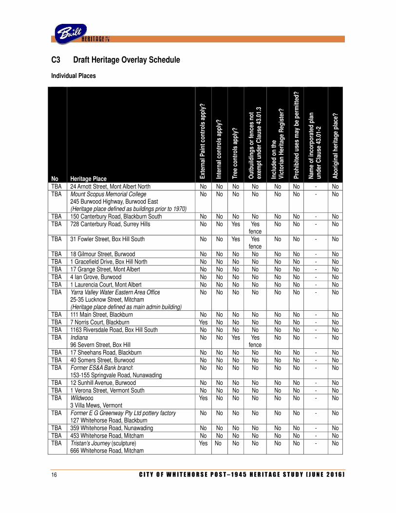
C3 Draft Heritage Overlay Schedule
Individual Places
No
Heritage Place E
xter
nal
Pai
nt
con
tro
ls a
pp
ly?
Inte
rnal
co
ntr
ols
ap
ply
?
Tree
co
ntr
ols
ap
ply
?
Ou
tbu
ildin
gs
or
fen
ces
no
t
exem
pt
un
der
Cla
use
43.
01.3
Incl
ud
ed o
n t
he
V
icto
rian
Her
itag
e R
egis
ter?
Pro
hib
ited
use
s m
ay b
e p
erm
itte
d?
Nam
e o
f in
corp
ora
ted
pla
n
un
der
Cla
use
43.
01-2
Ab
ori
gin
al h
erit
age
pla
ce?
TBA 24 Arnott Street, Mont Albert North No No No No No No - No TBA Mount Scopus Memorial College
245 Burwood Highway, Burwood East (Heritage place defined as buildings prior to 1970)
No No No No No No - No
TBA 150 Canterbury Road, Blackburn South No No No No No No - No TBA 728 Canterbury Road, Surrey Hills No No Yes Yes
fence No No - No
TBA 31 Fowler Street, Box Hill South No No Yes Yes fence
No No - No
TBA 18 Gilmour Street, Burwood No No No No No No - No TBA 1 Gracefield Drive, Box Hill North No No No No No No - No TBA 17 Grange Street, Mont Albert No No No No No No - No TBA 4 Ian Grove, Burwood No No No No No No - No TBA 1 Laurencia Court, Mont Albert No No No No No No - No TBA Yarra Valley Water Eastern Area Office
25-35 Lucknow Street, Mitcham (Heritage place defined as main admin building)
No No No No No No - No
TBA 111 Main Street, Blackburn No No No No No No - No TBA 7 Norris Court, Blackburn Yes No No No No No - No TBA 1163 Riversdale Road, Box Hill South No No No No No No - No TBA Indiana
96 Severn Street, Box Hill No No Yes Yes
fence No No - No
TBA 17 Sheehans Road, Blackburn No No No No No No - No TBA 40 Somers Street, Burwood No No No No No No - No TBA Former ES&A Bank branch
153-155 Springvale Road, Nunawading No No No No No No - No
TBA 12 Sunhill Avenue, Burwood No No No No No No - No TBA 1 Verona Street, Vermont South No No No No No No - No TBA Wildwood
3 Villa Mews, Vermont Yes No No No No No - No
TBA Former E G Greenway Pty Ltd pottery factory 127 Whitehorse Road, Blackburn
No No No No No No - No
TBA 359 Whitehorse Road, Nunawading No No No No No No - No TBA 453 Whitehorse Road, Mitcham No No No No No No - No TBA Tristan’s Journey (sculpture)
666 Whitehorse Road, Mitcham Yes No No No No No - No

C I T Y O F W H I T E H O R S E P O S T – 1 9 4 5 H E R I T A G E S T U D Y [ J U N E 2 0 1 6 ] 17
Precincts and Group Listings
No
Heritage Place E
xter
nal
Pai
nt
con
tro
ls a
pp
ly?
Inte
rnal
co
ntr
ols
ap
ply
?
Tree
co
ntr
ols
ap
ply
?
Ou
tbu
ildin
gs
or
fen
ces
no
t
exem
pt
un
der
Cla
use
43.
01.3
Incl
ud
ed o
n t
he
V
icto
rian
Her
itag
e R
egis
ter?
Pro
hib
ited
use
s m
ay b
e p
erm
itte
d?
Nam
e o
f in
corp
ora
ted
pla
n
un
der
Cla
use
43.
01-2
Ab
ori
gin
al h
erit
age
pla
ce?
TBA A V Jennings Estate Precinct, Nunawading No No No No No No - No TBA Former Burwood Skyline Drive-in Cinema
(Group listing defined as walk- in shelter, BBQ area, Maori Hut/Steakhouse, ticket booth, driveway, lampposts and mature trees)
No No Yes Yes No No - No
TBA Blue Flame Project Precinct, Vermont South No No No No No No - No TBA Concept Constructions Precinct, Forest Hill No No Yes Yes
fences No No - No
TBA Housing Commission of Victoria Precinct, Box Hill South
Yes No No No No No - No

18 C I T Y O F W H I T E H O R S E P O S T – 1 9 4 5 H E R I T A G E S T U D Y [ J U N E 2 0 1 6 ]

C I T Y O F W H I T E H O R S E P O S T – 1 9 4 5 H E R I T A G E S T U D Y [ J U N E 2 0 1 6 ] 19
D: THEMATIC ENVIRONMENTAL HISTORY

20 C I T Y O F W H I T E H O R S E P O S T – 1 9 4 5 H E R I T A G E S T U D Y [ J U N E 2 0 1 6 ]

C I T Y O F W H I T E H O R S E P O S T – 1 9 4 5 H E R I T A G E S T U D Y [ J U N E 2 0 1 6 ] 21
1.0 SHAPING VICTORIA’S ENVIRONMENT
1.1 Tracing climate and topographical change
This sub-theme is not applicable to the study area in the post-war period
1.2 Tracing the emergence of Victoria’s plants and animals
This sub-theme is not applicable to the study area in the post-war period
1.3 Understanding scientifically diverse environments
This sub-theme is not applicable to the study area in the post-war period
1.4 Creation stories and defining country
This sub-theme is not applicable to the study area in the post-war period
1.5 Living with natural processes
Responding to fires
While the City of Box Hill erected a modern fire station in the late 1930s, it was not until the early post-war period that the first counterpart appeared in the City of Nunawading. Opened in 1951, the new fire station was built at 364 Whitehorse Road, alongside the pre-war shire offices.1 During the second half of the twentieth century, the former City of Box Hill experienced what might be described as typical suburban demand for local fire protection services. Perhaps the most serious example took place in February 1961, when employees of the Woolworth’s store in Station Street discovered a small fire in a storeroom that soon flared out of control and threatened to engulf the entire retail precinct.2 The local fire brigade, assisted by others from adjacent districts, brought the situation under control, with severe damage to Woolworths but relatively little damage to surrounding shops. By contrast, the former City of Nunawading stands out as one of the few parts of the inner metropolitan area where bushfires remain a real threat. The major bushfire that devastated Warrandyte in January 1962 spread across the Mullum Mullum Creek into Mitcham, causing damage to houses as far south as the railway station.3 It also spread through the remnant bushland that now constitutes Yarran Dheran and Antonio Park, destroying the modest dwelling then still occupied by the Antonio family. Many of the bushland reserves within the former City of Nunawading have experienced bushfires over subsequent decades. In the mid-1980s, fires caused damage to Bellbird Dell, the Ronald E Gray Reserve, Wandinong Sanctuary, Trove Park and – on three separate occasions – the Blackburn Lake Sanctuary.4 The last of these was affected again in 1994 and 1997.5 Also in the 1990s, bushfires at Antonio Park and Yarran Dheran threatened to engulf surrounding houses.6
1 Diane Sydenham, Windows on Nunawading, p 223. 2 Andrew Lemon, Box Hill, p 207. 3 Lesley Alves, Suburban Heartland: A History of the City of Whitehorse, p 156. 4 Diane Sydenham, Windows on Nunawading, p 207. 5 Lesley Alves, Suburban Heartland: A History of the City of Whitehorse, p 195. See also James Everett, Steven Kocienski and
Nataniel Lobel, ‘Effective Communication of Bushfire Risk in the Urban-Parkland Interface: A Case Study of Bushfire Communication in the Community Surrounding the Blackburn Lake Sanctuary’. Interactive Qualifying Project submitted to the Faculty of the Worcester Polytechnic Institute in partial fulfilment of the requirements for the Degree of Bachelor of Science, May 2012. Available online at <<www.bushfirecrc.com/publications/citation/bf-3197>>
6 Diane Sydenham, Windows on Nunawading, p 207.
22 C I T Y O F W H I T E H O R S E P O S T – 1 9 4 5 H E R I T A G E S T U D Y [ J U N E 2 0 1 6 ]
As part of a large-scale consolidation and re-organisation of MFB infrastructure in the 1990s, a new fire station was erected in Vermont South at 721 Highbury Road. Designated as Station No 28, this accommodated a brigade that was formerly headquartered in an older fire station on High Street Road, Mount Waverley.
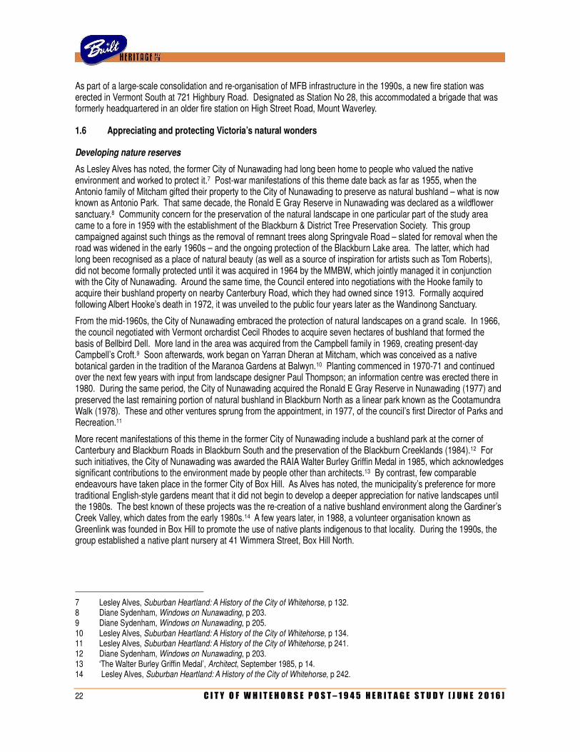
1.6 Appreciating and protecting Victoria’s natural wonders
Developing nature reserves
As Lesley Alves has noted, the former City of Nunawading had long been home to people who valued the native environment and worked to protect it.7 Post-war manifestations of this theme date back as far as 1955, when the Antonio family of Mitcham gifted their property to the City of Nunawading to preserve as natural bushland – what is now known as Antonio Park. That same decade, the Ronald E Gray Reserve in Nunawading was declared as a wildflower sanctuary.8 Community concern for the preservation of the natural landscape in one particular part of the study area came to a fore in 1959 with the establishment of the Blackburn & District Tree Preservation Society. This group campaigned against such things as the removal of remnant trees along Springvale Road – slated for removal when the road was widened in the early 1960s – and the ongoing protection of the Blackburn Lake area. The latter, which had long been recognised as a place of natural beauty (as well as a source of inspiration for artists such as Tom Roberts), did not become formally protected until it was acquired in 1964 by the MMBW, which jointly managed it in conjunction with the City of Nunawading. Around the same time, the Council entered into negotiations with the Hooke family to acquire their bushland property on nearby Canterbury Road, which they had owned since 1913. Formally acquired following Albert Hooke’s death in 1972, it was unveiled to the public four years later as the Wandinong Sanctuary.
From the mid-1960s, the City of Nunawading embraced the protection of natural landscapes on a grand scale. In 1966, the council negotiated with Vermont orchardist Cecil Rhodes to acquire seven hectares of bushland that formed the basis of Bellbird Dell. More land in the area was acquired from the Campbell family in 1969, creating present-day Campbell’s Croft.9 Soon afterwards, work began on Yarran Dheran at Mitcham, which was conceived as a native botanical garden in the tradition of the Maranoa Gardens at Balwyn.10 Planting commenced in 1970-71 and continued over the next few years with input from landscape designer Paul Thompson; an information centre was erected there in 1980. During the same period, the City of Nunawading acquired the Ronald E Gray Reserve in Nunawading (1977) and preserved the last remaining portion of natural bushland in Blackburn North as a linear park known as the Cootamundra Walk (1978). These and other ventures sprung from the appointment, in 1977, of the council’s first Director of Parks and Recreation.11
More recent manifestations of this theme in the former City of Nunawading include a bushland park at the corner of Canterbury and Blackburn Roads in Blackburn South and the preservation of the Blackburn Creeklands (1984).12 For such initiatives, the City of Nunawading was awarded the RAIA Walter Burley Griffin Medal in 1985, which acknowledges significant contributions to the environment made by people other than architects.13 By contrast, few comparable endeavours have taken place in the former City of Box Hill. As Alves has noted, the municipality’s preference for more traditional English-style gardens meant that it did not begin to develop a deeper appreciation for native landscapes until the 1980s. The best known of these projects was the re-creation of a native bushland environment along the Gardiner’s Creek Valley, which dates from the early 1980s.14 A few years later, in 1988, a volunteer organisation known as Greenlink was founded in Box Hill to promote the use of native plants indigenous to that locality. During the 1990s, the group established a native plant nursery at 41 Wimmera Street, Box Hill North.
7 Lesley Alves, Suburban Heartland: A History of the City of Whitehorse, p 132. 8 Diane Sydenham, Windows on Nunawading, p 203. 9 Diane Sydenham, Windows on Nunawading, p 205. 10 Lesley Alves, Suburban Heartland: A History of the City of Whitehorse, p 134. 11 Lesley Alves, Suburban Heartland: A History of the City of Whitehorse, p 241. 12 Diane Sydenham, Windows on Nunawading, p 203. 13 ‘The Walter Burley Griffin Medal’, Architect, September 1985, p 14. 14 Lesley Alves, Suburban Heartland: A History of the City of Whitehorse, p 242.

C I T Y O F W H I T E H O R S E P O S T – 1 9 4 5 H E R I T A G E S T U D Y [ J U N E 2 0 1 6 ] 23
2.0 PEOPLING VICTORIA’S PLACES AND LANDSCAPES
2.1 Living as Victoria’s original inhabitants
This sub-theme is not applicable to the study area in the post-war period
2.2 Exploring, surveying and mapping
This sub-theme is not applicable to the study area in the post-war period
2.3 Adapting to diverse environments
This sub-theme is not applicable to the study area in the post-war period
2.4 Arriving in a new land
Providing accommodation
Australia’s post-war migration boom dates right back to 1945, when the Labour Government initiated a scheme to provide subsidised or free passage to British nationals, expanding the programme two years later to include migrants from continental Europe.1 New arrivals were initially accommodated in a reception camp north of the Exhibition Buildings (opened in 1949) before being transferred to one of several outer suburban migrant hostels. These were invariably located in fringe industrial areas (ostensibly to provide a source of employment for migrants who chose to settle in the area) and often close to residential estates created by the Housing Commission of Victoria. With most of Melbourne’s migrant hostels being established in what were then considered the city’s less desirable western and northern fringes (such as Broadmeadows, Altona and Maribyrnong), the one that opened at Nunawading in 1950 was one of only two in the outer east. Located on the west side of Rooks Road, the hostel was otherwise much like the others: rows of Nissen huts with notoriously rudimentary facilities. With a capacity for over 800 people, the Nunawading hostel was originally intended for unmarried British migrants, but ultimately accommodated many families, both from Britain and the Continent.2 A primary school was established at the hostel site in 1952, which operated until it was superseded by a new state school at Nunawading South that opened in 1958.
Like all of Melbourne’s migrant hostels, the one at Nunawading was subject to little maintenance or improvement over the years, and acquired a reputation as something of a slum. In the mid-1960s, the Commonwealth government commenced a programme of consolidation and improvement, which saw all but three of the migrant hostels closed. The facility at Nunawading was one of the three (along with those at Maribyrnong and Altona) slated for retention and upgrading. In 1966, a cluster of 24 residential flats, designed by architect Reg Grouse, was erected, which were described as being ‘warmer and more attractive’ than the Nissen huts.3 Rebadged as the Eastbridge Migrant Hostel, the upgraded facility continued to function for another two decades. During this period, the demographic shifted from British and continental European migrants to south-east Asian refugees. The hostel was closed in 1987 when the Commonwealth-owned property was earmarked as the location for a new mail sorting centre. The site (which reportedly still included some remnant Nissen huts at the time of its closure) was cleared and redeveloped, although some interpretative signage has been erected.
1 Heritage Alliance, Survey of Post War Built Heritage in Victoria: Stage One. Volume 1, p 9. 2 Diane Sydenham, Windows on Nunawading, p 149. 3 Diane Sydenham, Windows on Nunawading, p 150.
24 C I T Y O F W H I T E H O R S E P O S T – 1 9 4 5 H E R I T A G E S T U D Y [ J U N E 2 0 1 6 ]
2.5 Migrating and making a home
Creating migrant communities
A recurring theme associated with Melbourne’s post-war migrant hostels was a ‘ripple effect’. When migrants left the hostels, they tended to settle in the surrounding area, creating identifiable communities. Following a familiar pattern, former residents of the Nunawading Migrant Hostel were attracted by the availability of employment in the large factories that appeared in the area, and by the promise of plentiful land for housing (not to mention a Housing Commission estate at Box Hill South). It has been noted that British nationals represented the largest group of migrants to settle in the former City of Box Hill in the 1950s, followed by Latvians, Poles and Dutch.4 In the former City of Nunawading, British and Dutch migrants were the most common, along with a number of Hungarians.5 A small Italian community developed in Box Hill in the 1950s and ‘60s, and an even smaller one in Nunawading.6 By 1971, the proportion of migrants in Box Hill’s population was 18%; of those that had arrived in the past decade, more than half were British, with smaller numbers of Italians, Greeks and Eastern Europeans.7 During the 1970s, Greek families began to move out to Burwood East, while the huge influx of Indo-Chinese migrants was drawn to Box Hill, Mitcham and Nunawading.8
Dutch community
During the 1950s, Dutch people represented the largest non-British migrant group in both Box Hill and Nunawading.9 Such was their presence in Box Hill that some local businesses, such as the ANZ Bank, ran newspaper advertisements in the Dutch language.10 Dutch migrants formed a Lutheran congregation in the area as early as 1948, with services held in a private house until a purpose-built church was erected at the corner of Station Street and Elland Road in 1954. The Reformed Church of Australia, founded by Dutch migrants in 1951, also established an outpost in Box Hill (see section 8.1). Alle Kost, a Dutch national who also settled in Box Hill in 1951, established a chain of butcher’s shops that specialised in European products such as bratwurst sausages, with outlets in both Box Hill and Nunawading.11 Dutch presence in the study area was still strong in the 1980s, when a specialist grocery shop, De Winkel van Sinkel, operated on Burwood Highway in Vermont South. It has since closed down.
Greek and Italian community
The influence of Mediterranean migrants in the study area was evident as early as the late 1940s, when Gordon Moyes noted the presence of Zigouras’s Greek Café in Box Hill.12 However, it was not until the later 1960s that the community became more prominent, with a proliferation of continental delicatessens as well as Box Hill’s first pizza restaurant – the Vesuvio – which opened in 1970.13 A Greek Orthodox parish was established in 1968, with services initially held in the hall of St Francis Xavier’s Church until a new purpose-built place of worship was built in Hopetoun Parade in 1977.14 A second congregation was founded in Vermont South, based in the Greek Orthodox Church of St Andrew at 201 Mahoneys Road (see section 8.1). For some years, a Greek language school has also operated from the nearby Weeden Heights Primary School on Friday evenings and Saturday mornings.
4 Andrew Lemon, Box Hill, p 200. 5 Lesley Alves, Suburban Heartland: A History of the City of Whitehorse, p 157, 162. 6 Lesley Alves, Suburban Heartland: A History of the City of Whitehorse, p 162. 7 Andrew Lemon, Box Hill, p 217. 8 Lesley Alves, Suburban Heartland: A History of the City of Whitehorse, p 165, 201. 9 Lesley Alves, Suburban Heartland: A History of the City of Whitehorse, p 162. 10 Andrew Lemon, Box Hill, p 200. 11 Lesley Alves, Suburban Heartland: A History of the City of Whitehorse, p 159. 12 Gordon Moyes, When Box Hill was a Village, p 40. 13 Andrew Lemon, Box Hill, p 217. 14 Andrew Lemon, Box Hill, p 217.
C I T Y O F W H I T E H O R S E P O S T – 1 9 4 5 H E R I T A G E S T U D Y [ J U N E 2 0 1 6 ] 25
Indo-Chinese community
Lesley Alves notes that one of the first Chinese migrants to settle in Box Hill was Dr Gordon Low, who arrived from Hong Kong in 1970 and, after joining a medical practice on Whitehorse Road, rose to become its senior partner.15 As Asian migration boomed during the 1970s, so too did its physical presence in the study area. A Chinese Community Social Centre was established in Box Hill. Amongst other services, it provided meals supplied by what was then the suburb’s only Asian restaurant – the Yang-Tse Café at 984 Whitehorse Road, which had opened around 1961.16 Many more restaurants followed (along with grocery shops and other specialist retailers geared to the Asian community), resulting in the distinctive precinct that characterises Box Hill’s commercial strip to the present day.
Similar retail development has taken place in both Mitcham and Nunawading. Asian presence in the latter suburb has been otherwise demonstrated by several language schools – including two Chinese and one Vietnamese – that operated in the evenings or at weekends from Nunawading High School.17 Other developments in the former City of Nunawading include the Louise Multicultural Community Centre, which was established to provide welfare assistance to Indo-Chinese migrants residing at the Eastbridge Hostel in Rooks Road. The centre began operation in 1984 in a house in Humphreys Avenue that was provided by the council. Four years later, the City of Nunawading took a further initiative itself when it appointed a full-time social worker for the Indo-Chinese community.18 From the late 1970s, places of worship for the Asian community have also appeared across the study area. These encapsulate those both within the Western tradition, such as Chinese-speaking Christian congregations, as well as those in the Eastern Tradition. Melbourne’s first Buddhist temple was established in Forest Hill in 1984, and the municipality now contains the highest percentage of Buddhists in the eastern suburbs. A Sikh temple has existed in the study area since 1993, when it moved from its original home in Ferntree Gully to a former pottery factory in Whitehorse Road, Blackburn (see section 8.1).
2.6 Maintaining distinctive cultures
Links to homelands
One of the first local groups established in the post-war period as a link to homeland was the Mitcham Scottish Society. Founded in 1955, the society promptly established a pipe band and, by the following year, had begun to hold Scottish country dancing events.19 The pipe band later split from the society to become a discrete entity, the Box Hill Pipe Band. A rival group, the Nunawading Highland Pipe Band, was established in 1956. Prominent on the international competition circuit, its name was changed to the Australian Highlanders in 2006.
Although it may not be considered as a link with a homeland in the stricter sense, the City of Box Hill maintained a sister-city relationship with Matsudo, a Japanese city in the Chiba prefecture that forms part of the Greater Tokyo Area. This connection dates back to the late 1960s, when Mayor Ronald Gleghorn suggested it as a reflection of ‘the indisputable growth of trading links between the two countries’.20 The relationship was formalised in 1971, when Gleghorn (by then a Councillor) visited Japan with his mayoral successor and several other members of the Council. The party took various gifts with them (including Australian paintings) and, whilst there, planted gum trees to symbolise the connection between the two cities. The favour was retuned in May 1979, when Yutala Oshigamo, the Chairman of the Mastudo Council, visited Box Hill to mark the eighth anniversary of the sister-city relationship, and planted two Gingko trees near the Box Hill Town Hall. The trees are still there, marked by a small brass plaque.
15 Lesley Alves, Suburban Heartland: A History of the City of Whitehorse, p 204. 16 Lesley Alves, Suburban Heartland: A History of the City of Whitehorse, p 205. 17 Lesley Alves, Suburban Heartland: A History of the City of Whitehorse, p 226. 18 Lesley Alves, Suburban Heartland: A History of the City of Whitehorse, p 202. 19 Diane Sydenham, Windows on Nunawading, p 168. 20 Andrew Lemon, Box Hill, p 217.
26 C I T Y O F W H I T E H O R S E P O S T – 1 9 4 5 H E R I T A G E S T U D Y [ J U N E 2 0 1 6 ]
2.7 Promoting settlement
This sub-theme is not applicable to the study area in the post-war period
2.8 Fighting for identity
This sub-theme is not applicable to the study area in the post-war period
C I T Y O F W H I T E H O R S E P O S T – 1 9 4 5 H E R I T A G E S T U D Y [ J U N E 2 0 1 6 ] 27
3.0 CONNECTING VICTORIANS BY TRANSPORT & COMMUNICATIONS
3.1 Establishing pathways
This sub-theme is not applicable to the study area in the post-war period
3.2 Travelling by water
This sub-theme is not applicable to the study area in the post-war period
3.3 Linking Victorians by rail
Improving the suburban rail network after 1945
From the 1999 Thematic History:
The railway was electrified in 1923, whilst the construction of two additional stations – Laburnum and Heatherdale – in 1958 reflected the demands of post-war commuters. In 1983, the Box Hill shopping centre, incorporating a new underground railway station and rooftop bus interchange, was completed: it remains an unusual example of a shopping centre and public transport terminus.1
The footprint of the railway line through the study area – comprising the part of the Belgrave/Lilydale line between Mont Albert and Heatherdale stations – has not significantly changed in the post-war era, apart from the closure of sidings that once provided private access to industrial sites such as the Standard Brickworks in Box Hill (1944), the Co-operative Brickworks in Blackburn (1950), the Australian Tessellated Tile Company in Mitcham (1957) and the Blackburn cool stores (1979). Nevertheless, the railway has exerted a strong influence over the physical development of the study area in the second half of the twentieth century. An early concern to emerge soon after the Second World War was the provision of additional railway stations to promote residential settlement in hitherto underdeveloped areas. The construction of a new station between Box Hill and Blackburn was mooted as early as 1946, but over a decade passed before Laburnum station opened on 13 July 1958.2 Two months later, on 7 September, another station began operation at Heatherdale, between Mitcham and Ringwood. Otherwise, improvements to the railway line during this period were typical of those made to any other part of the suburban network. They included the construction of new gatekeeper’s cabins at the level crossings on Middleborough Road (1953) and Heatherdale Road (1957) and the eventual replacement of manually-operated swinging gates with automatic boom barriers at Springvale Road (1956), Elgar Road (1957), Middleborough Road (1958) and Heatherdale Road (1958).
A recurring theme throughout the post-war era (and indeed for some years prior) has been community pressure for grade separation of the railway line – that is, the elimination of level crossings by replacement by road bridges and/or railway overpasses. As Box Hill’s commercial hub burgeoned, pressure grew for the grade separation of the level crossing at Station Street. While the council acknowledged this as an important issue, repeated approaches to the state government brought no results; in the late 1950s, the City of Box Hill considered financing the project itself and even engaged an engineering consultant.3 It was proposed that the railway line be lowered to run below Station Street, with additional shops and car-parking areas built across it.4
1 Allom Lovell & Associates, City of Whitehorse Heritage Review: Volume 1, Thematic History, p 26. 2 Andrew Lemon, Box Hill, p 185. 3 Andrew Lemon, Box Hill, p 211. 4 Lesley Alves, Suburban Heartland: A History of the City of Whitehorse, p 167.
28 C I T Y O F W H I T E H O R S E P O S T – 1 9 4 5 H E R I T A G E S T U D Y [ J U N E 2 0 1 6 ]
Nothing eventuated and, during the 1960s, local retailers continued to identify the level crossing as one of the factors contributing to the apparent decline of the shopping precinct.5 The state government responded in 1968 by replacing the swinging gates at the crossing with boom barriers. Two years later, the level crossing at Blackburn Road was similarly upgraded. That same year, it was also announced that a railway overpass would be provided to eliminate a level crossing at Box Hill – although, to the astonishment of local residents, this was proposed at Elgar Road rather than Station Street. The project, however, was abandoned following strong objections from both the City of Box Hill and the Chamber of Commerce. Meanwhile, a significant improvement to the local railway network was the construction of a third track between East Camberwell and Box Hill, which opened in 1971.
It was in early 1973 that the state government announced that, on the recommendation of the Metropolitan Transportation Committee, Box Hill’s railway station was to be redeveloped as a major regional transport interchange, which would include placing the station underground.6 Slated to commence in 1975 and be completed to coincide with the opening of the new city rail loop in 1977, the project was repeatedly delayed. Construction did not begin until 1979, and the completed transport hub was officially opened by the Premier, John Cain, in November 1984.7
In 1987, the Metropolitan Transit Authority proposed to establish a railway maintenance depot at Nunawading, to replace the one at Jolimont that was rendered defunct in the late 1970s. This, however, did not proceed due to objections from the council and the local community.8 Since that time, community pressure for grade separation has continued to be the most dominant concern, evidenced by the construction of a railway underpass at Middleborough Road (2007) and the $120 million redevelopment of Nunawading station (2008-09).
3.4 Linking Victorians by road in the 20th century
The influence of the motor car on Victoria’s way of life
At the end of the Second World War, private car ownership had exerted relatively little impact over the physical development of the study area. As late as 1947, the level of traffic along Middleborough Road was reportedly so low that the railway gates were kept locked overnight.9 However, the burgeoning local automotive industry (with the first Australian-made Holden rolling off the assembly lines in 1948), followed by the abolition of petrol rationing in 1950, saw the number of motor registrations in Melbourne treble between 1947 and 1954.10 This was reflected in the study area, where Box Hill’s first traffic lights were unveiled in December 1948 at the corner of Whitehorse Road and Station Street.11 Parking meters were also first installed in that same area in 1957, only two years after they had been introduced in central Melbourne.12 Local retailers became increasingly concerned about the lack of car-parking and, during the 1960s, many solutions were explored including the use of the central medians on Whitehorse Road.13
Meanwhile, motor traffic along major roads increased dramatically. In 1959, the Country Roads Board calculated that 16,000 cars travelled along Whitehorse Road, between Station Street and Middleborough Road; by 1964, this figure had boomed to 20,000.14 During the intervening years, it was deemed necessary to construct a new road bridge over the Koonung Creek at Middleborough Road.15
5 Andrew Lemon, Box Hill, p 223. 6 Andrew Lemon, Box Hill, p 224. 7 Lesley Alves, Suburban Heartland: A History of the City of Whitehorse, p 212. 8 Diane Sydenham, Windows on Nunawading, p 168. 9 Andrew Lemon, Box Hill, p 207. 10 Heritage Alliance, Survey of Post War Built Heritage in Victoria: Stage One. Volume 1, p 12. 11 Andrew Lemon, Box Hill, p 193. 12 Andrew Lemon, Box Hill, p 203. 13 Andrew Lemon, Box Hill, p 211. 14 Andrew Lemon, Box Hill, p 207. 15 Andrew Lemon, Box Hill, p 207.
C I T Y O F W H I T E H O R S E P O S T – 1 9 4 5 H E R I T A G E S T U D Y [ J U N E 2 0 1 6 ] 29
From the early 1950s, the number of local service stations also increased, with new American-style single-branded facilities replacing the older style independent motor garages of the pre-war era.16 Inevitably, most of these appeared along the district’s principal thoroughfares; in 1953, one was erected on the south-west corner of the prominent intersection of Whitehorse and Elgar Road.17 By 1962, new service stations had been built on three of the four corners of Whitehorse and Springvale Roads in Nunawading, including the prominent two-storey example at 344-348 Whitehorse Road. The increasing use of motor vehicles in the study area was otherwise reflected by the opening of a drive-in cinema at Burwood – the first in Australia – in 1954 (see citation F002). The increase in road traffic was inevitably accompanied by an increase in car accidents. In1954, it was reported that the portion of Whitehorse Road that curved and sloped near Frederick Street in Blackburn had acquired the nickname of ‘suicide alley’ due to the number of fatal (or near-fatal) accidents that had occurred there over the past few years.18
Away from the district’s major thoroughfares, the most pressing car-related issue for ratepayers in the early post-war era was the sealing of unmade roads in residential areas. Prior to 1956, the City of Box Hill had managed to construct only about five streets per year.19 Streets identified by Andrew Lemon as ‘notorious trouble spots’ included Box Hill Crescent and Allison Road in Mont Albert North, and those near Box Hill North Primary School.20 However, in 1960, the council secured a bank loan that, in the words of one councillor, meant that ‘the end of the era of unmade streets in this City is now in the foreseeable future’. At that time, some forty miles (64 kilometres) of road was still unsealed in the municipality. This, however, had dropped to only nine miles (14 kilometres) by 1964. Two years later, ‘only a miscellaneous group of short streets’ remained unmade in the City of Box Hill. Much the same progress took place in the City of Nunawading, where, by 1967, only 10% of the municipality’s roads had not been sealed.21 Moreover, those that remained unsealed were at the specific request of residents, such as parts of the Bellbird Estate in Blackburn.
Building highways and freeways
Although the MMBW had envisaged in 1929 that a major traffic corridor through Melbourne’s eastern suburbs might be provided by upgrading Doncaster Road and Canterbury Road, it was not until the Melbourne Metropolitan Planning Scheme was published in 1954 that a major arterial was proposed. Designated as Route No 19, this was to extend from Alexandra Parade (Collingwood/Clifton Hill) all the way to Ringwood, running along the Mullum Mullum Creek valley along the northern fringes of what are now the Cities of Boroondara and Whitehorse. Construction of the Eastern Freeway (as it was eventually named) did not commence until 1971, with the first stage, reaching Bulleen Road, completed seven years later. During the 1970s, concerned residents of Box Hill formed a number of action groups to oppose extension of the freeway through the Koonung Valley corridor. One such group, the Koonung & Mullum Valley Action Group, went as far as to engage landscape designers Randall Champion and Paul Thompson to provide an alternative scheme for the development of the site as public parkland.22 While the scheme was awarded an RAIA citation, it was never implemented and the second stage of the Eastern Freeway went ahead, opening in 1982.
Plans for the third stage of the freeway, extending along the northern fringes of the study area to Springvale Road, met with similar opposition in the 1980s. Following its earlier lead, the Blackburn & District Tree Preservation Society proposed an alternative use of the freeway reserve as a linear park. Notwithstanding conservation concerns (and a number of protests and heated public meetings), most residents of Nunawading were reportedly in favour of the freeway project.23 The third stage of the freeway commenced in 1994 and was completed in 1997. Its infrastructure included new road bridges at Elgar Road, Station Street, Middleborough Road and Blackburn Road, and several footbridges.
16 Heritage Alliance, Survey of Post War Built Heritage in Victoria: Stage One. Volume 1, p 12. 17 Andrew Lemon, Box Hill, p 191. 18 ‘Another victim in Suicide Alley’, Argus, 11 February 1954, p 3. 19 Andrew Lemon, Box Hill, p 204. 20 Andrew Lemon, Box Hill, p 204. 21 Diane Sydenham, Windows on Nunawading, p 135. 22 Andrew Lemon, Box Hill, p 226. 23 Lesley Alves, Suburban Heartland: A History of the City of Whitehorse, p 221.
30 C I T Y O F W H I T E H O R S E P O S T – 1 9 4 5 H E R I T A G E S T U D Y [ J U N E 2 0 1 6 ]
Two particularly distinctive footbridges, at Koonung Road and Cabena Street in Nunawading, were designed by Gazzard Sheldon Architects.24 The final stage of the freeway, connecting Springvale Road to the Frankston Freeway via the Eastlink tunnel (just outside the boundaries of the City of Whitehorse), was completed in 2008.
The alignment of the Healesville Freeway, which was proposed in 1969 but has not yet been realised, passes through the southern part of the study area. The freeway was to commence at the eastern end of Riversdale Road in Box Hill South and extend through Blackburn South, Forest Hill and Vermont before exiting the study area where Boronia Road crosses the Dandenong Creek. In 2011, the portion of the freeway reserve between Springvale Road and Boronia Road was designated by VicRoads as being no longer required for roadbuilding, and has since been partly redeveloped for other purposes including public parkland and, most recently, a new police station.
3.5 Travelling by tram
From the 1999 Thematic History:
For fifty years, the Hawthorn Tramways Trust service along Toorak Road, from Camberwell Depot to Warrigal Road, stopped just short of the municipality’s western boundary. It was not until 1976 that this route was extended along Burwood Highway to Middleborough Road, and in 1994 to Blackburn Road, connecting East Burwood with the city.25
The study area represents one of the few parts of the eastern metropolitan area where the provision of an electric tram network is almost entirely a post-war phenomenon. While tram routes were laid out through the contiguous suburbs of Balwyn, Surrey Hills and Camberwell during the 1920s and ‘30s, these stopped short of what was then the City of Box Hill. The Whitehorse Road tram, for example, terminated at Union Road, and the Burwood Road tram at Warrigal Road. The sole exception was Riversdale Road where, in the mid- 1920s, the tramline was extended from Warrigal Road to Elgar Road in Box Hill South.
Expansion of the tramway network further into the study area was on the agenda as early as 1946, when Box Hill’s Town Clerk appeared before a Parliamentary Committee to urge ‘in the strongest terms’ that the Whitehorse Road tram route be extended at least as far as Station Street, in order to assist those who had recently settled in the area.26 While the committee agreed, the government did not. Such decisions, however, did not stop canny property developers from using the possible future extension of tram routes as a lure for potential purchasers. One former resident of Burwood, who bought land there in the 1950s, recalled being told by the developer that the tram route along Burwood Road would one day be extended, although this did not actually come to fruition for many years.27
It was not until the early 1970s that there was a resurgence of interest in the expansion of the tram network in the study area. This commenced in 1970, when the district’s original tramline along Riversdale Road – then one of the last remaining stretches of single tram track left in Melbourne – was duplicated.28 In 1973, the City of Nunawading (rather than the City of Box Hill) approached the MMTB regarding the possible extension of the Toorak Road tramline from its terminus at Warrigal Road. The Council was duly advised that the Board was planning to extend the line along Burwood Highway as far as Middleborough Road – a project that was completed in 1978.29 The route was subsequently extended even further, initially to Blackburn Road (early 1990s) and then as far as Vermont South (2005).30 During the intervening period, the Whitehorse Road tramline was finally extended from Union Road all the way to Box Hill Central shopping centre.31 This new line, constructed at a cost of $28 million, opened in June 2003.
24 ‘Two concrete footbridges’, Constructional Review, February 1997, pp 16-21. 25 Allom Lovell &Associates, City of Whitehorse Heritage Review: Volume 1, Thematic History, p 26. 26 Andrew Lemon, Box Hill, p 185. 27 Lesley Alves, Suburban Heartland: A History of the City of Whitehorse, p 156. 28 Andrew Lemon, Box Hill, p 225. 29 Lesley Alves, Suburban Heartland: A History of the City of Whitehorse, p 156. 30 Lesley Alves, Suburban Heartland: A History of the City of Whitehorse, p 210. 31 Lesley Alves, Suburban Heartland: A History of the City of Whitehorse, p 217.
C I T Y O F W H I T E H O R S E P O S T – 1 9 4 5 H E R I T A G E S T U D Y [ J U N E 2 0 1 6 ] 31
3.6 Linking Victorians by air
This sub-theme is not applicable to the study area in the post-war period
3.7 Establishing and maintaining communications
Improving postal services after 1945
While the early twentieth century saw purpose-built post offices erected at Box Hill (1910) and Mitcham (1924), the counterpart service in Nunawading was temporarily accommodated in various premises (including a local general store) until as late as 1954, when it was relocated to a prefabricated aluminium building at the corner of Springvale Road and Silver Grove.32 In December 1951, Blackburn’s postal service transferred to similarly temporary premises in a fibro-cement shed at the intersection of Chapel Street and Railway Road.33 Over the next few years, new post offices emerged in retail strips in those parts of the study area undergoing post-war residential expansion. In 1954, a post office opened at Bennettswood and, the following year, two more began operation in Box Hill’s developing northern fringe – one at Kerrimuir (April) and another in Box Hill North (August). In Blackburn South, the new post office at 128-130 Canterbury Road was accommodated in a portable building that had been relocated from the Olympic Village in Heidelberg.34 Another opened in Vicki Street in 1960. Around that same time, Blackburn’s temporary post office on Chapel Street was replaced by a new flat-roofed building on the same site, which opened on 12 September 1960. A photograph of the building later appeared in the journal Architecture Australia as part of an illustrated feature on recent buildings designed by the Commonwealth Department of Works. In 1961, the old fibro-cement shed was relocated from Blackburn to Nurlendi Road in Vermont, where it continued to serve as a post office well into the 1970s.35
In November 1962, a post office opened at Laburnum. However, there appears to have been little further expansion of local postal infrastructure until 1970, when the prefabricated aluminium post office at Nunawading – always intended as a temporary home for the postal service – was replaced by a large two-storey brick building, erected on the same site.36 Four years later, a post office opened at Vermont South. In 1975, a new mail sorting centre was established in Blackburn, in a former factory at 127 Whitehorse Road (see citation E022).37 This, in turn, was replaced by the new Eastern Mail Centre, erected in 1992 on the former site of the Eastbridge Migrant Hostel in Rooks Road, Nunawading.38
Developing electronic means of communication after 1945
In the early post-war period, telephone services in the study area were limited to the area around Box Hill, where an automatic exchange was established in 1930. Located on the north-west corner of Whitehorse Road and Station Street, this was designed with a capacity of 10,000 lines and was trunked to a parent exchange at Hawthorn opened that same year. The large Hawthorn facility supported several other branch exchanges that emerged in the eastern suburbs in the post-war era, including those at Kew East (1941) and Camberwell (1946). These branches were collectively designated as the W Group, with each having a different prefix for the telephone numbers of its subscribers. The code for the Box Hill exchange was WX, which remained the telephone number prefix for residents of the study area, from Mont Albert to Mitcham, well into the 1950s. While some residents of Nunawading also had telephone numbers starting with WX, others had the prefix WU, which referred to the branch exchange at nearby Ringwood.
32 Diane Sydenham, Windows on Nunawading, p 122. 33 Robin da Costa, Blackburn: A Picturesque History, p 17. 34 O S Green, From Orchard to Brick Veneer: Malcom Street, Blackburn & Environs, 1955-1985, p 7. 35 Robin da Costa, Blackburn: A Picturesque History, p 17. 36 Diane Sydenham, Windows on Nunawading, p 122. 37 Diane Sydenham, Windows on Nunawading, p 224. 38 Lesley Alves, Suburban Heartland: A History of the City of Whitehorse, p 208.
32 C I T Y O F W H I T E H O R S E P O S T – 1 9 4 5 H E R I T A G E S T U D Y [ J U N E 2 0 1 6 ]
It was not until 1959 that a branch exchange was established in the City of Nunawading, erected alongside St John’s Anglican Church on Whitehorse Road, Mitcham. While it was technically part of the W Group trunked to Hawthorn, a new two-letter prefix was never coined for subscribers to the Mitcham branch exchange, as a new system of six-digit telephone numbers had recently been introduced. In this way, Box Hill’s area code became 89. In 1961, following the introduction of the 88 prefix, the capacity of the Box Hill branch exchange was doubled to 20,000 phone lines. The early 1960s saw another significant development in telecommunications technology in the study area, albeit one with less direct advantage to the local residents. In July 1961, the Postmaster General’s Department announced that an elevated site in Canterbury Road, Surrey Hills, would be the site for a new microwave radio repeater station to transfer signals from the City West Telephone Exchange to other suburban stations. Taking advantage of what was one of the highest points in the metropolitan area, the station would comprise a tall tower and what was described at the time as ‘a contemporary styled building designed to blend with the surrounding area. Enhanced by a landscaped setting’.39 The project was a controversial one, with objections received – principally on aesthetic grounds – from local residents as well as the National Trust and Professor Brian Lewis of the University of Melbourne. Nevertheless, the project went ahead and, as Lemon noted, ‘in time, people grew used to it and some even considered it rather sculptural’ (see citation E004).
A unique addition to electronic telecommunications infrastructure in the study area was the Aussat Earth Satellite Station – the first of its kind in Australia – which commenced operation in the mid-1980s on an elevated site to the rear of what was then the ABC building on Highbury Road (see following section).40 The satellite station now operates under the auspices of Optus.
Making, printing and distributing newspapers after 1945
For many years, the local press in the study area was dominated by the almighty Box Hill Reporter, which began publication in 1889 and was still going strong at the end of the Second World War. However, as the district’s population increased in the early post-war era, rival publications began to appear including the Box Hill Community News (1951), the Eastern Times (1953), the Box Hill Gazette (1953) and the Balwyn & Box Hill Observer (1954). While some of these were relatively short-lived ventures, they were sufficient to challenge the monopoly that the Box Hill Reporter had maintained on newspaper advertising. As Andrew Lemon notes, the Reporter dealt with this by making radical changes, including altering its weekly publication date (1961), introducing a new masthead (1962), switching from broadsheet to tabloid format (1964) and from letterpress to offset printing (1965).41 These modifications, however, merely delayed the inevitable, and the Box Hill Reporter ceased publication in 1968.
During this period, other local newspapers followed a typical pattern of consolidation. In 1959, the Box Hill Observer merged with the Burwood Observer and, four years later, the Eastern Times joined the Box Hill Gazette to create the Eastern Times Gazette. The latter was renamed the Box Hill Gazette in 1967, and remained in publication until it was absorbed into the Progress Press in 1978. That same year, Melbourne’s largest publisher of local newspapers, the Leader Community Newspapers, established a presence in the study area when it took over the former Cottee’s cordial factory in Whitehorse Road, Blackburn, as its new printing headquarters.42 The building was demolished in 2009.
The principal local newspaper in the former City of Nunawading was the pre-war Blackburn & Mitcham Reporter, which, following the municipality’s change of name and status in 1945, was re-badged as the Nunawading Reporter. Published under that name until 1964, when it became the Nunawading Gazette, the newspaper finally ceased publication in 1995. That same year, the Whitehorse Post was formed from a merger of two other local newspapers, the Box Hill Post and the Nunawading Post, reflecting the recent council amalgamation.
39 Quoted in Andrew Lemon, Box Hill, pp 208-209. 40 Lesley Alves, Suburban Heartland: A History of the City of Whitehorse, pp 209-10. 41 Andrew Lemon, Box Hill, p 213. 42 Lesley Alves, Suburban Heartland: A History of the City of Whitehorse, p 208.
C I T Y O F W H I T E H O R S E P O S T – 1 9 4 5 H E R I T A G E S T U D Y [ J U N E 2 0 1 6 ] 33
Broadcasting after 1945
During the post-war period, radio broadcasting made one minor but memorable foray into the study area when, in 1971, the Australian Broadcasting Commission (ABC) acquired land in Burwood East for its new administrative centre.43 Another decade passed, however, before the modern multi-storey building was completed at the site. Originally, it was proposed that the new centre would accommodate all of the ABC’s administrative functions, which were then based in the city. Due to internal opposition, only the staff of Radio Australia was transferred to Burwood East, and the service commenced broadcasting from its new location in 1982.44 It remained there until 1994, when the ABC consolidated its administrative functions in a new building at the redeveloped Southbank precinct.45
43 Diane Sydenham, Windows on Nunawading, p 224. 44 Diane Sydenham, Windows on Nunawading, p 224. 45 Lesley Alves, Suburban Heartland: A History of the City of Whitehorse, p 209.

34 C I T Y O F W H I T E H O R S E P O S T – 1 9 4 5 H E R I T A G E S T U D Y [ J U N E 2 0 1 6 ]
C I T Y O F W H I T E H O R S E P O S T – 1 9 4 5 H ER I T A G E S T U D Y [ J U N E 2 0 1 6 ] 35
4.0 TRANSFORMING AND MANAGING LAND AND WATER RESOURCES
4.1 Living off the land
This sub-theme is not applicable to the study area in the post-war period
4.2 Living from the sea
This sub-theme is not applicable to the study area in the post-war period
4.3 Grazing and raising livestock
This sub-theme is not applicable to the study area in the post-war period
4.4 Farming
Growing fruit, vegetables and plants / developing Victoria’s dairy industry after 1945
The agricultural activity that so strongly characterised the study area in the nineteenth and early twentieth centuries persisted, to a limited extent, into the post-war period. Local orchardists, for example, found their efficiency actually improved as tractors replaced horses after the Second World War.1 Poultry farming also continued to thrive and, in 1946, the newly-formed Victorian Egg & Pulp Board opened an egg grading depot in a disused warehouse at Box Hill.
Notwithstanding technological improvements, local farmers of all kinds inevitably found that they could not compete with the encroaching suburban development of the 1950s and ‘60s. In Blackburn, Gill’s orchard was sold off for residential subdivision as early as 1950 and, three years later, Watt’s dairy farm ceased production as local retail dairies began to source their milk from further afield. The egg grading depot at Box Hill closed in 1954 and, the following year, a huge poultry farm on the south side of Canterbury Road at Forest Hill was sold off for the construction of Nunawading High School. In 1956, a portion of Pearce’s orchard in Blackburn North was similarly redeveloped for a new high school, while the remaining portion later became the site of a small retail development (1967) that, in homage to the land’s former use, took on the name of the Old Orchard Shopping Centre. During the 1960s, the Matheson family of Forest Hill donated part of their orchard for the Strathdon Home for the Aged; the remaining six acres were later presented to the City of Nunawading for preservation as a living museum of local orcharding, although this did not eventuate.2
Such was the decline of orcharding in the study area during the 1960s that the Blue Moon company’s cool stores in Blackburn began to store fruit grown from outside the municipality, as there was not enough local produce to sustain it. In 1974, the facility finally ceased storing fruit altogether, and was adapted for the storage of meat and egg products.3 By that time, local poultry farming had long since disappeared, with the sole remaining example in the City of Box Hill – on Highbury Road in Burwood – closing down in 1968. The Goold family’s 36-acre market garden, also on Highbury Road, remained in operation until as late as 1983 – the last of the Burwood farms, and one of the last in the entire study area.
1 Lesley Alves, Suburban Heartland: A History of the City of Whitehorse, p 140. 2 Lesley Alves, Suburban Heartland: A History of the City of Whitehorse, p 141. 3 Robin da Costa, Blackburn: A Picturesque History, p 118.
36 C I T Y O F W H I T E H O R S E P O S T – 1 9 4 5 H ER I T A G E S T U D Y [ J U N E 2 0 1 6 ]
Developing Victoria’s wine industry after 1945
A unique manifestation of this sub-theme in the study area was the Vermont Winery at 593-595 Burwood Road, Vermont South, which was established around 1975. Wine tastings were regularly held there and, at one such event in May 1979, leading Australian vintner John Potts was present to launch an exclusive bulk release of a 1976 shiraz/cabernet from his Bleasdale Winery in South Australia. By the early 1980s, the Vermont Winery had risen to become one of Melbourne’s major bulk wine specialists.
The winery property was partly subdivided for housing in the 1990s, creating Silverene Court. The winery ceased operation in the early 2000s and the remaining land developed for residential use.
4.5 Gold mining
This sub-theme is not applicable to the study area in the post-war period
4.6 Exploiting other mineral, forest and water resources
Exploiting natural resources for building materials
From the 1999 Thematic History:
The clay industries continued to thrive into the 1960s, but with changing technology and market demands most of the clay belt sites gradually closed down.4
Manifestations of extractive industry, notably brick and tile making, had maintained a significant presence in the study area from the nineteenth century. While virtually all of the local brickworks were forced to close down for the duration of the Second World War, they re-opened afterwards and experienced renewed vigour in the 1950s and ‘60s as the demand for building materials increased with the post-war housing boom.5 The Standard Brickworks in Box Hill re-opened in 1946 and its machinery was electrified in 1952.6 When the former New Northcote Brick Company works in Middleborough Road re-opened in 1948, it boasted new wire-cut brick making machinery; the first bricks bearing the Burwood stamp became available in 1950.7 Eight years later, the company installed Australia’s first tunnel kilns, and added more in 1961. The Blackburn works of Brick & Pipe Industries (formerly Commonwealth Pottery), which were similarly upgraded with tunnel kilns in 1969, further expanded through the acquisition of adjoining land owned by orchardist Vic Lawford.
During this period, several local manufacturers embraced demand for new products. The Daniel Robertson works in Mitcham, originally established in 1928 to make terracotta tiles, expanded in the 1950s to manufacture textured bricks. The Commonwealth Pottery in Blackburn began manufacturing clay sewerage pipes for local authorities and, by 1971, claimed to be the largest manufacturer of these products in the southern hemisphere. The 1960s was also characterised by consolidation as smaller manufacturers were acquired by larger ones. Brick Industries Ltd in Burwood took over the Standard Brickworks in Box Hill, the Commonwealth Pottery site in Blackburn and the premises of the Blackburn Tile Company, eventually becoming Victoria’s largest brick company.8
Ironically, while the post-war housing boom had prompted this huge demand for building materials, it was the resulting encroachment of suburbia that rang the death knell for local brick and tile manufacturers as new residents complained about the noise and the pollution. At the same time, local clay deposits were running out; as manufacturers started to source raw materials from outside the study area, the justification for maintaining factories in their present locations was becoming more tenuous.
4 Allom Lovell &Associates, City of Whitehorse Heritage Review: Volume 1, Thematic History, p 15. 5 Lesley Alves, Suburban Heartland: A History of the City of Whitehorse, p 137. 6 Andrew Lemon, Box Hill, p 184. 7 Lesley Alves, Suburban Heartland: A History of the City of Whitehorse, p 139. 8 Lesley Alves, Suburban Heartland: A History of the City of Whitehorse, p 139.

C I T Y O F W H I T E H O R S E P O S T – 1 9 4 5 H ER I T A G E S T U D Y [ J U N E 2 0 1 6 ] 37
The Australian Tessellated Tile Company in Mitcham, latterly taken over by Rocla, closed down in 1965. By 1977, only five clay product manufacturers were still operating in the study area: two in Nunawading and one each in Vermont, Burwood and Blackburn.9 The Standard Brickworks in Box Hill ceased production in 1988 and the Nubrick (former Brick Industries Ltd) site in Burwood in the early 1990s.10 The last remaining brickworks in the study area, operated by Daniel Robertson in Mitcham has only recently ceased production.
4.7 Transforming the land and waterways
This sub-theme is not applicable to the study area in the post-war period
9 Lesley Alves, Suburban Heartland: A History of the City of Whitehorse, p 140. 10 Lesley Alves, Suburban Heartland: A History of the City of Whitehorse, p 207.

38 C I T Y O F W H I T E H O R S E P O S T – 1 9 4 5 H ER I T A G E S T U D Y [ J U N E 2 0 1 6 ]
C I T Y O F W H I T E H O R S E P O S T – 1 9 4 5 H ER I T A G E S T U D Y [ J U N E 2 0 1 6 ] 39
5.0 BUILDING VICTORIA’S INDUSTRIES AND WORKFORCE
5.1 Processing raw materials
This sub-theme is not applicable to the study area in the post-war period
5.2 Developing a manufacturing capacity
Industrial expansion after 1945
From the 1999 Thematic History:
Post war industrial complexes established in the area included a large factory for Holeproof in Whitehorse Road, Box Hill, begun in 1948, and the Turner Industries Factory in Nunawading (designed by Grounds, Romberg & Boyd in 1957) and the Bowater Scott (now Carter Holt Harvey) complex in Box Hill South... In general, industrial development in the region was more concentrated further to the south and east, in Bayswater and Dandenong. In spite of this Lemon notes that by 1978 there were 162 manufacturing establishments employing nearly 7,000 people in Box Hill alone.1
As noted by Leslie Alves, industrial activity across the study area remained on a small scale prior to the Second World War, when it was ‘largely geared to serving the local population’.2 This all changed after 1945, when production expanded to embrace the metropolitan, state or even national market. Decentralisation of industry was a significant theme in the early post-war era, with many of Melbourne’s pre-war manufacturers, already well-established in the inner suburbs, looking eastward for expansion opportunities.3 The study area was no exception and, while the municipalities of Box Hill and Nunawading were both subject to major industrial expansion from the late 1940s, the theme was most strongly manifest in the latter, where large tracts of vacant land were especially plentiful.4 One of the earliest inklings of a post-war industrial boom in that area was a new factory for the British United Shoe Company on Whitehorse Road, Mitcham, proposed (but evidently not realised) in 1947. A year later, clothing manufacturers Holeproof began building a new factory further east along Whitehorse Road at Box Hill.5 It was soon followed by the new premises of art pottery manufacturers E G Greenway Pty Ltd, which relocated from small premises in Fitzroy to a large architect-designed factory on Whitehorse Road in Blackburn (see citation E022). Many other manufacturers were attracted to sites along Whitehorse Road, including Cottee’s cordials at Blackburn (1950), Turner Industries at Nunawading (1951) and K G Luke Pty Ltd at Mitcham (1952).6 Befitting their prominent positions along the district’s principal commercial thoroughfare, many of these factories were attractive buildings that challenged the traditional notion of the ugly and utilitarian factory. When the new Nunawading premises of Mobilco Ltd opened at 410 Whitehorse Road in the early 1950s, it was lauded by the Argus newspaper as a ‘modern building symbolic of the newness that pervades Box Hill and Nunawading’.7
One notable early exception to this trend was the North Blackburn factory established in 1950 by Belgian-born textile manufacturer Roger de Stoop. Through a business associate who happened to live in that area, de Stoop became aware of a 39-acre former tannery site overlooking the Koonung Creek.8 The company, Baekert Australia Pty Ltd, developed the site over the next decade to include staff housing and a new weaving shed, added in 1962.
1 Allom Lovell &Associates, City of Whitehorse Heritage Review: Volume 1, Thematic History, pp 15, 16. 2 Lesley Alves, Suburban Heartland: A History of the City of Whitehorse, p 146. 3 Heritage Alliance, Survey of Post War Built Heritage in Victoria: Stage One. Volume 1, p 15. 4 Lesley Alves, Suburban Heartland: A History of the City of Whitehorse, p 146. 5 Andrew Lemon, Box Hill, p 184. 6 Lesley Alves, Suburban Heartland: A History of the City of Whitehorse, p 150. 7 ‘A young city that’s going somewhere’, Argus, 20 July 1954, p 18. 8 Lesley Alves, Suburban Heartland: A History of the City of Whitehorse, p 148.

40 C I T Y O F W H I T E H O R S E P O S T – 1 9 4 5 H ER I T A G E S T U D Y [ J U N E 2 0 1 6 ]
During the 1950s, several other large factories were established on comparably isolated sites in the study area. In 1954, architect John Rivett prepared a scheme for a factory complex on 3½ acres at Highbury Road, Burwood, which provided staff recreation facilities including a swimming pool, tennis courts, squash courts and playground.9 Five years later, paper manufacturers Bowater Scott established a vast new factory on thirty acres off Middleborough Road at Box Hill South, overlooking the Gardiners Creek. During the 1960s, all three of these areas attracted other manufacturers, developing into identifiable industrial precincts. For example, the Baekert factory in Joseph Street, Blackburn North, was joined by the new Dominion Press printing works (designed by architects Rosman, Hastings & Sorel in 1965) and later by the premises of Aubedal Pty Ltd and others. In Burwood, the portion of Highbury Road to either side of Gardiners Creek attracted numerous large factories, with many smaller ones being built in the side-streets extending north towards Burwood Road. Similar development also spread north of the Bowater Scott factory in Box Hill South, with smaller factories extending as far as Canterbury Road.
Elsewhere in the study area, comparable precincts of industrial development remained focused on Whitehorse Road. The well-established Luke & Singer complex on the corner of Cook Street expanded with the construction of a new administration block in the late 1950s as several other factories appeared either alongside or fronting Cook Street, including the new premises of the Terry Engineering Company, designed by architects Meldrum & Partners in 1960. The most dominant local industrial precinct, however, was that between Whitehorse Road and the railway line, extending from Railway Road in Blackburn to Rooks Road in Nunawading. At its eastern edge, this precinct extended south across the railway line, between Norcal Road and Simla Street in Mitcham – where architects Middleton & Talbot designed a new factory for Masonite Fabricators Pty Ltd in 1960 – and even further along Rooks Road.
As had been the case with brickworks, the 1960s and ‘70s was a period of consolidation for industry in the study area. During that time, many of the manufacturers that had been based there since the early 1950s including Baekert Australia, Cottees and Turner Industries were taken over by overseas corporations. By 1977, there were still more than sixty factories operating in the City of Nunawading.10 But, as new offshore owners consolidated their facilities spread around the world, many factories in the study area eventually became surplus to requirements and were closed. Some, such as the Cottee’s factory in Blackburn, were adapted for other uses. But, with strong pressure for redevelopment of commercial sites along Whitehorse Road, many others were simply demolished. Some manufacturers left of their own volition to find more suitable sites elsewhere, as when Holeproof closed its Box Hill factory in 1992 to relocate to a larger and more modern facility in Norcal Road, Nunawading.11 The new complex, conceived as the company’s national headquarters, was awarded a Certificate of Merit by the Building Owners & Managers Association of Australia in 1993.12
5.3 Marketing and retailing
From the 1999 Thematic History:
The enormous post-war growth in the municipality gave rise to a massive proliferation of shopping centres of all sizes. Many housing estates incorporated rows of four or five shops, often on corner sites, and shopping strips along major arterials grew. At Forest Hill, one of Melbourne’s first American-style shopping centres opened in 1964. In Box Hill, Whitehorse Plaza was constructed on the site of the old market in 1974, whilst the Box Hill Central Shopping Centre and public transport interchange was completed in 1983. Australia’s first Kmart department store was built in East Burwood in April 1969. Other medium-scale developments in this period were the shopping centres at Vermont South, Brentford Square (Forest Hill), Burwood East and North Blackburn Square. Major retailers were also attracted to the Whitehorse Road corridor.13
9 ‘Factory features a sporting centre’, Herald, 28 January 1955, p 10. 10 Lesley Alves, Suburban Heartland: A History of the City of Whitehorse, p 151. 11 Lesley Alves, Suburban Heartland: A History of the City of Whitehorse, p 208. 12 ‘BOMA Recognition for New Holeproof Headquarters’, Architect, July 1993, pp 29-30. 13 Allom Lovell &Associates, City of Whitehorse Heritage Review: Volume 1, Thematic History, p 18.
C I T Y O F W H I T E H O R S E P O S T – 1 9 4 5 H ER I T A G E S T U D Y [ J U N E 2 0 1 6 ] 41
Serving local needs (corner and local shops)
In the study area, as with many comparable parts of suburban Melbourne, the pre-war tradition of local strip shopping continued well into the 1950s.14 The creation of new shopping strips in developing parts of the City of Box Hill, most notably at Box Hill North, Kerrimuir and Bennettswood, was a direct result of ongoing advocacy by Councillor John Gawler, who was an architect and town planner of considerable repute.15 During the same period, rows of shops also appeared near existing railway stations. Some particularly evocative examples in the former City of Nunawading, with distinctive recessed glass shopfronts between tapering slate-clad party-walls, can still be seen near the stations at Nunawading (2-6 Wood Street) and Mitcham (365-367 Mitcham Road). Such expressions of smart contemporary design, indicative of a new approach to consumer-oriented retail architecture, were typical. One row of six shops at 102-112 Middleborough Road, Blackburn, completed in the late 1950s, was even published in an architectural journal in 1960 for its bold use of Mount Gambier stonework. The new railway stations that opened at Laburnum and Heatherdale in 1958 each attracted some retail development nearby. By the mid-1960s, no fewer than twelve commercial premises were listed along the east side of Salisbury Avenue, within walking distance of Laburnum station.
Larger strip shopping developments, providing their own carparks and a broader range of facilities, began to appear in the study area from the late 1950s. One of the first was Brentford Square on the south side of Canterbury Road, Forest Hill, which had a Woolworths supermarket, banks and shops laid out on an L-shaped configuration. The Old Orchard Shopping Centre in Blackburn North, initially conceived as a massive retail and residential development that would be ‘the biggest thing that has ever happened to the City of Nunawading’, was ultimately realised on a more modest scale.16 Opened in 1967, it provided 31 shops that included a SupaValue supermarket and a branch of Broadford’s Hardware of Box Hill. Later examples include the Vermont South Shopping Centre on the Burwood Highway (c.1975).
Creating car-based centres in the post-war era
Upgrading existing shopping strips
Before the end of the Second World War, Box Hill’s principal commercial precinct – loosely defined by the junction of Station Street and Whitehorse Road – was already well-established as the pre-eminent hub of retail and commercial activity in the entire study area.17 From the early 1950s, existing shops began to upgrade their facilities. One of the first of these was the Cox Brothers drapery store on Whitehorse Road, remodelled in 1950 with a ‘luxurious interior and natural fluorescent lights’ that, as Andrew Lemon noted, ‘triggered the establishment of a number of big modern shops at Box Hill in the next few years’.18
Like many of Melbourne’s other major suburban shopping areas, the sudden and dramatic shift towards car-based consumerism in the post-war era meant that radical changes would be required. In 1954, the MMBW master plan identified Box Hill’s commercial hub as one of several in the metropolitan area that warranted upgrading to include larger shops and department stores along with adequate car-parking and public transport interchanges.19 While this proposal met with some local criticism, it was otherwise instrumental in attracting several larger retailers to the area, including outlets of the Rockman’s and Paterson’s chains. In a move to further update the image of the strip, the City of Box Hill ordered the removal of posted verandahs in 1954. Other improvements to Box Hill’s retail hub included the conversion of the old market building (latterly used as an egg grading depot) into a small shopping arcade (1954-55), the opening of Brayshaw’s Record Bar (1955) and the conversion of the local branch of the Moran & Cato grocery store into a self-service (1956).20 When the old Rialto Cinema closed a few years later, it was promptly converted into Palmer’s Arcade, described by Andrew Lemon as ‘an unimaginative collection of small shops’.21
14 Lesley Alves, Suburban Heartland: A History of the City of Whitehorse, p 166. 15 Andrew Lemon, Box Hill, p 202. 16 Lesley Alves, Suburban Heartland: A History of the City of Whitehorse, p 169. 17 Lesley Alves, Suburban Heartland: A History of the City of Whitehorse, p 167. 18 Andrew Lemon, Box Hill, p 193. 19 Andrew Lemon, Box Hill, p 202. 20 Andrew Lemon, Box Hill, p 194. 21 Andrew Lemon, Box Hill, p 211.
42 C I T Y O F W H I T E H O R S E P O S T – 1 9 4 5 H ER I T A G E S T U D Y [ J U N E 2 0 1 6 ]
The smaller pre-war retail centres at Surrey Hills, Blackburn, Nunawading and Mitcham were all similarly upgraded during this period. In 1954, Commonwealth Floors Pty Ltd opened ‘spacious new showrooms’ at 556 Whitehorse Road, Surrey Hills, with a recessed shopfront of huge plate glass windows and bold signage. Four years later, the prominent north-east corner of Mitcham and Whitehorse Roads became the site of a small retail development known as Mirama Court. Designed by Conarg Architects, the two-storey building comprised a row of eight shops that opened off an external glass-walled arcade, with a reception room upstairs and a rear parking area for thirty cars.22
Creating regional shopping centres
In 1954, the Myer Emporium purchased 86 acres at Burwood on which the retailers planned to establish a modern American-style drive-in shopping centre – a type not yet seen in Victoria. The site, however, was not developed as such as, four years later, it was announced that a comparable centre – proposed by a rival company – would be constructed on Canterbury Road at Forest Hill, providing seventy shops, two service stations, office space and parking for 1,400 cars.23 Plans for the centre, by leading commercial architect Leslie M Perrott, were not completed until mid-1959, with construction commencing in January 1960. In the interim, the Myer Emporium had found a new location for their earlier proposal. The result was the Chadstone Shopping Centre, which opened in October 1960. While this usurped the title of the first modern shopping centre in Victoria, the development at Forest Hill can nevertheless be credited with introducing this new and enduring type of retail activity into what is now the City of Whitehorse. Officially opened in June 1964 by Graham Kennedy, the new Forest Hill Shopping Centre provided forty more shops than Chadstone, including branches of the McEwen’s hardware and Moores of Prahran department store chains, and Australia’s first Safeway supermarket.24
Needless to say, news of the proposed Forest Hill Shopping Centre concerned retailers in Box Hill, who saw the project as a threat to their own precinct’s reputation as a pre-eminent suburban commercial hub. The City of Box Hill had already acknowledged that the precinct lacked a large department store and, furthermore, that little space was available even if one was proposed.25 The only underdeveloped site in the vicinity large enough for such redevelopment – a former timber yard in Clisby Street – was slated for the purpose in 1961. However, the project was fraught with delays. The establishment of several other large regional shopping centres towards the end of that decade – most notably Eastland at Ringwood (October 1967) and the Westfield Shoppingtown at Doncaster (September 1969) – served only to increase the concerns of Box Hill’s retailers.26 The new K-mart store that opened at Burwood in 1969 – the first of its kind in Australia – was even closer to home. Finally, in 1973, tenders were called for the construction of a new shopping centre and multi-story carpark at Clisby Street, Box Hill. Known as the Whitehorse Plaza, the $3.5 million project was unveiled in November 1974.27
Ironically, while the construction of huge shopping centres at Forest Hill and Doncaster had been perceived as a threat by retailers in Box Hill, the owners of those two complexes would formally object when a similar project was proposed at Box Hill in the early 1980s. Conceived as an integral part of the redevelopment of Box Hill’s commercial precinct as a major public transport interchange, the project was to provide a four-storey retail and office complex with twin cinemas and ample car-parking for both shoppers and commuters.28 It was designed by Loder & Bayly, an interdisciplinary firm of planners, designers, engineers and landscape architects. The new transport interchange opened in November 1984, and the retail centre – known as the Market Street Mall – in January 1985. The rival Forest Hill Shopping Centre, which had already been enlarged in 1974, underwent even more radical transformation from 1987, when the original strip mall portion was demolished and replaced by a new three-storey block, providing space for several large chain stores and a Hoyts multiplex cinema. The rival centres at Forest Hill and Box Hill have each been considerably enlarged and refurbished since then, as has the K-mart complex at Burwood East.
22 ‘Outer suburbs shops develop’, Herald, 6 June 1958, p 19. 23 ‘Shopping centre’, Herald, 19 July 1957, p 13. 24 Lesley Alves, Suburban Heartland: A History of the City of Whitehorse, p 168. 25 Andrew Lemon, Box Hill, p 212. 26 Andrew Lemon, Box Hill, p 212. 27 Andrew Lemon, Box Hill, p 221. 28 Lesley Alves, Suburban Heartland: A History of the City of Whitehorse, p 211.
C I T Y O F W H I T E H O R S E P O S T – 1 9 4 5 H ER I T A G E S T U D Y [ J U N E 2 0 1 6 ] 43
The Mega Mile
One of the most significant retail redevelopments in the study area since the supermarket era of the 1960s has been the transformation of the stretch of Whitehorse Road between Blackburn and Mitcham into a specialty retail precinct now known as the Mega Mile. Previously characterised by relatively small-scale retail development and (particularly along the south side) by industrial complexes, this part of the study area’s principal east-west thoroughfare has been transformed with larger retail outlets with a strong emphasis on furniture and homewares. This redevelopment boom can be traced back to 1984, when an outlet of the Capt’n Snooze bedding chain opened near Rooks Road.29 Subsequent developments included Melbourne’s second IKEA store, which was erected on the former site of the Whitehorse Hotel in 1989. The closure of several larger factories along the strip, such as Turner Industries (1991) and Agfa (2005) provided even more space for expansion.
5.4 Exhibiting Victoria’s innovation and products
Demonstration Houses
While the construction of project housing prototypes and display houses has been a significant theme in parts of the study area, a related sub-theme is the appearance of demonstration houses – that is, dwellings built by manufacturers to showcase innovations in building materials or technology. This phenomenon can be traced back to the second half of the 1950s, when leading Melbourne architect Neil Clerehan designed two much-publicised examples on Whitehorse Road in Blackburn. The first, completed in 1955, was commissioned by James Hardie & Company to showcase cement sheeting with the brand name of Fibrolite and the second, built two years later, by Australian Plaster Industries Pty Ltd to demonstrate Victorboard Insulwool lining boards. Standing on opposite corners of Linden Road, these two houses were open for public inspection and generated considerable publicity in the architectural and daily press. The plans of both dwellings were subsequently introduced into the Age Small Homes Service, of which Clerehan was then the director. The Fibrolite Demonstration House has since been demolished, while the Victorboard Insulwool House still stands in a considerably altered state at 231 Whitehorse Road.
In 1957, another demonstration house was erected at 453 Whitehorse Road, Nunawading, to raise funds for a missionary charity (see citation E024). Intended to be open to the public and later raffled, the building was deliberately conceived to attract attention. Not only was it built using a prize-winning design by architects Smith, Tracey, Lyon & Brock, but its construction incorporated innovations rarely seen in domestic architecture at that time, including concrete slab floors, steel framing and exposed trussed roof beams.
A few more manifestations of this sub-theme appeared in the study area in the early 1960s. In 1962, James Hardie & Company unveiled a second demonstration house, at 531 Mitcham Road, Vermont, which used different types of cement sheeting for its exterior cladding, interior walls and ceilings.30 The following year, a much-anticipated exhibition house, sponsored by Women’s Day magazine, was unveiled in Benwerrin Drive, Burwood East. This incorporated many innovations that had never been seen before in Melbourne, including bricks with a textured finish of crushed ceramic tiles, a rubber-backed woollen carpet that was barely 3mm thick, timber-faced fireproof doors and new types of heating and kitchen cupboard latches.31 In 1964, architect Howard Hodgins designed a house for himself in Gilmour Street, Burwood, which was effectively a private demonstration house, as it represented the prototype for an innovative new structural system of his own devising (see citation E006)
29 Lesley Alves, Suburban Heartland: A History of the City of Whitehorse, p 210. 30 ‘Cutting costs’, Herald, 15 February 1963, p 25. 31 ‘The most criticized House of the Year’, Age, 9 December 1963, p10.
44 C I T Y O F W H I T E H O R S E P O S T – 1 9 4 5 H ER I T A G E S T U D Y [ J U N E 2 0 1 6 ]
5.5 Banking and finance
Establishing branch banks in the suburbs after 1945
The establishment of branch banks in the study area after the Second World War followed a similar pattern to those in other parts of the metropolitan area. Changes in legislation, namely the Banking Act 1947, brought about the nationalisation of private trading banks and the establishment of savings bank subsidiaries. The result was a boom in the establishment of branch banks, with the government-run State Savings Bank of Victoria expanding its own facilities to keep up with the growth of the private banks. Accompanying this boom was a tendency to adopt a more progressive approach to the design of banks; this, as reported in one contemporary architectural journal, was indicative of a desire on the part of banks to ‘fall in line with modern architectural trends ... [and] also an outward reflection of the new relationship between Bank and Community’.32
While many of these banks engaged the services of noted architects in the post-war era, it was the ES&A Bank that represented what has been described as ‘the leading patron of modern bank architecture’.33 This was evident in the study area from 1951, when architect Horace Tribe designed new manager’s residences for the existing branches at Blackburn and Mitcham. An entirely new branch at Blackburn, designed by architects Barlow, van Rompaey & Kerr, was subsequently erected in 1956. A particularly striking example at 153-55 Springvale Road, Nunawading (see citation E018), dating from the late 1950s, was designed by the ES&A Bank’s in-house architect Stuart McIntosh, a resident of the study area who lived in a house of his own design in Mont Albert North (see citation E001). Also during the 1960s, the ES&A Bank took advantage of the developing industrial precinct along Whitehorse Road, Nunawading, and erected its new stationery store at No 262, designed by architects Montgomery, King & Trengove.
5.6 Entertaining and socialising
Establishing and expanding licensed premises after 1945
From the 1999 Thematic History:
No hotels have been built in the Box Hill ‘Dry Area’ since the Liquor Ban, although they have appeared elsewhere. In 1929, the Traveller’s Rest Hotel in Blackburn was renamed the Blackburn Hotel, which was demolished in the 1980s for the present hotel. The Reserve Hotel in Mitcham, although considerably altered, remains as one of the earliest surviving hotels in the municipality. Two completely new hotels were erected in the 1960s – the Burvale in East Burwood [sic] and the bravely named Whitehorse Hotel on the corner of Whitehorse and Moncrieff Roads, Nunawading. The latter, like its famous namesake, has since been demolished.34
Following a statewide referendum in 1921, the City of Box Hill became one of two municipalities in Victoria (along with the adjacent City of Camberwell) that declared itself as a Dry Area, where existing hotels and other licensed premises were closed and no new ones permitted. The situation changed after the end of the Second World War, and these local option polls were abolished in 1946. Although this theoretically meant that licensed premises could once again be established in the City of Box Hill, pressure from conservative residents and church groups continued to prevent this.35 Gordon Moyes, who grew up in Box Hill in the late 1940s, recalled that ‘if a man wanted a drink, he had to drive to Doncaster or to Blackburn’.36 But liquor was still available locally to those who knew where to look for it. Moyes further recalled that his alcoholic father ‘knew you could buy beer at the back of the billiard saloon and from the old ramshackle wooden house off Turner Street, where a man always had bottles in his laundry, for a price’.
32 "The new banks have a new look", Architecture & Arts, August 1955, p 27. 33 Heritage Alliance, Survey of Post War Built Heritage in Victoria: Stage One. Volume 1, p 18. 34 Allom Lovell &Associates, City of Whitehorse Heritage Review: Volume 1, Thematic History, p 38. 35 Andrew Lemon, Box Hill, pp 189-90. 36 Gordon Moyes, When Box Hill was a Village, p 16.

C I T Y O F W H I T E H O R S E P O S T – 1 9 4 5 H ER I T A G E S T U D Y [ J U N E 2 0 1 6 ] 45
In the early post-war period, several attempts were made to break the Dry Area. In 1951, a company purchased land on the southwestern corner of Whitehorse and Elgar Roads with the intent of erecting a new hotel, although public opposition prevented this from proceeding. A subsequent proposal to establish a licensed club premises in Dorking Road was similarly overturned. Not long afterwards, Dry Areas were abolished following a 1954 revision to the Licensing Act. However, an amendment to the Act required that any new licensed premises in former Dry Areas still required a poll of electors living in the immediate vicinity of the site. The first venue to take advantage of this was the Box Hill Golf Club, which, in 1956, became the first licensed premises to operate in the City of Box Hill for over thirty years.37 Soon afterwards, two local grocery stores were also granted liquor licenses.
Although the adjacent City of Nunawading was unhindered by the Dry Area legacy, the municipality saw relatively little expansion of its hotel infrastructure in the second half of the twentieth century. The Blackburn Hotel at 111 Whitehorse Road, erected in 1929 to replace an even earlier nineteenth century counterpart on the same site, was refurbished in 1955 to the design of architects Seabrook, Hunt & Dale. Four years later, a proposal to include a hotel as part of the new Forest Hill Shopping Centre was rejected by the City of Nunawading on planning grounds. Similar fates befell two applications for new hotels on Whitehorse Road: one on the corner of Moncrieff Road and another at Springvale Road. The former application, however, was approved a few years later, and the new venue, known as the Whitehorse Hotel, become well-known as the ‘gayest, brightest, most up-to-date nightlife spot for music dancing and entertainment’.38 The most notable addition to the coterie of local hotels was the new Burvale Hotel-Motel at the corner of Burwood Highway and Springvale Road, which opened in 1969. In the late 1980s, the existing hotels at Blackburn and Mitcham were both extensively refurbished. The former was virtually rebuilt from scratch ‘to create a playful and bright image in keeping with a more family-oriented market’, and reopened in 1990.39 By this time, the Whitehorse Hotel at Nunawading had ceased operation; its site was redeveloped for Melbourne’s second IKEA furniture store.
In the meantime, little had changed in the City of Box Hill, where the local RSL Club found it necessary to mount a legal challenge against the outcome of the local poll before it was finally granted a liquor license in 1965.40 As late as 1976, opposition from local church groups (together with the Victorian Temperance Alliance and a group known as the Dry Area Preservation Movement) prevented a liquor license being granted to the Pizza Hut restaurant in Mont Albert.41 Even in the mid-1990s, there were only four licensed premises in the former City of Box Hill – the clubrooms of the RSL and golf clubs, the Tudor Motel, and a restaurant at Box Hill TAFE set up for the training of hospitality students. 42 In 1999, residents voted to allow licensed restaurants, but not hotels.
Dining out: developing culinary, café and bar culture after 1945
Relatively little appears to be recorded about the emergence of post-war restaurant and café culture in the study area. It would seem that such development initially followed a familiar pattern seen in many other parts of the metropolitan area at that time. In the late 1950s, the opening of a modern American-style milk bar in Box Hill was a source of considerable local attention.43 Around the same time, the Rendezvous Café on the corner of Whitehorse and Mitcham Roads was reportedly a popular and much-loved venue under proprietor Mrs Winifred Hunter, a foundation member of the Mitcham Repertory Society.44 As was the case elsewhere in suburbia, more exotic eateries emerged in the study area from the 1960s. The first of Box Hill’s many Chinese restaurants was the Yang-Tse Café at 984 Whitehorse Road, which opened as early as 1961.45 By the end of that decade, several others had followed including the Dragon Palace in Blackburn. This anticipated the boom of Asian migration over the remainder of that decade, which saw innumerable Asian restaurants appear along the retail strip of Station Street and the adjacent parts of Whitehorse Road.
37 Lesley Alves, Suburban Heartland: A History of the City of Whitehorse, p 176. 38 Lesley Alves, Suburban Heartland: A History of the City of Whitehorse, p 183. 39 Diane Sydenham, Windows on Nunawading, p 138. 40 Andrew Lemon, Box Hill, pp 210-11. 41 Lesley Alves, Suburban Heartland: A History of the City of Whitehorse, p 177. 42 Lesley Alves, Suburban Heartland: A History of the City of Whitehorse, p 218. 43 Andrew Lemon, Box Hill, p 194. 44 Diane Sydenham, Windows on Nunawading, p 168. 45 Lesley Alves, Suburban Heartland: A History of the City of Whitehorse, p 212.
46 C I T Y O F W H I T E H O R S E P O S T – 1 9 4 5 H ER I T A G E S T U D Y [ J U N E 2 0 1 6 ]
Similar development took place in both Nunawading and Mitcham, where Asian restaurants were established both in retail strips and as purpose-built freestanding buildings. The latter were sometimes designed in a whimsical pseudo-oriental manner, such as Emperor Court at 370 Mitcham Road (c.1980) and the later Formosa House at 86 Springvale Road. Other eateries indicative of local migrant influence included Box Hill’s first pizza restaurant, the Pizzeria Vesuvio, which commenced business at 15 Carrington Road in 1970.46
American-style takeaway food restaurants began to establish a presence in the study area from the early 1970s, much as they did elsewhere in the metropolitan area. In 1971, the Red Barn chain (known for its striking glass-fronted barn-shaped buildings) established an outlet in Nunawading, at 287 Whitehorse Road (demolished). Around the same time, one of Melbourne’s first Pizza Hut restaurants opened in Mont Albert, at the corner of Whitehorse Road and Laing Street (demolished). The Kentucky Fried Chicken franchise also established a presence along Whitehorse Road with restaurants in Box Hill (at No 845) and Nunawading (at No 296) both in operation by 1972. A McDonald’s restaurant also opened in Nunawading during this period, although its original premises on the north side of Whitehorse Road would be superseded in the 1980s by a new and much larger one at the corner of Springvale Road – at the time, said to be the biggest McDonald’s restaurant in Melbourne.
From the 1980s, the study area witnessed the introduction of several entirely new restaurant franchises. In December 1982, the first Australian outlet of the US-based Denny’s restaurant chain opened on Springvale Road at Forest Hill, near the Channel 10 Studios.47 In the early 1990s, the first two Melbourne outlets of the Smorgy’s franchise (later to become famous for their striking Tiki-style architecture) both emerged in the study area: one in Burwood at 415 Warrigal Road and the other in Burwood East at 299 Burwood Highway. The franchise has since become defunct; the Burwood branch has since been demolished while its counterpart in Burwood East remains in operation as a restaurant, albeit under a different name.
Creating picture theatres after 1945
From the 1999 Thematic History:
The first drive in cinema in Australia was opened in Burwood in 1954. The introduction of television in 1956 saw the gradual closure of many Australian cinemas and the Rialto in Box Hill closed three years later... Its long-time competitor, the Regent, survived until 1970. Like most drive-ins in metropolitan Melbourne, the one at Burwood closed in the 1980s. The first purpose-built picture theatre in the Nunawading area was erected in Mahoneys Road, Forest Hill, in the 1960s. A multi-screen Hoyts cinema complex was built when the Forest Hill Shopping Centre, on the opposite side of Mahoneys Road, was remodelled in the 1980s.48
The first new picture theatre to open in the study area after the Second World War was a more notable first on a nationwide scale: Australia’s earliest American-style drive-in cinema, which opened on Burwood Highway in April 1954. A venture of a company known as Auto Theatres Australia Ltd, the facility was designed by architectural firm of A C Leith & Bartlett, whose principal, Arthur Leith, was a director of the development company. The complex, with parking for 652 cars and a children’s playground in front of the screen, originally comprised a main building (with diner, projection room and toilets), a ticket booth, substation and storeroom. It subsequently expanded to include a Polynesian-themed communal dining room known as the Maori Hut (1955), a walk-in shelter (1959), a western-themed BBQ area (1960s) and a new ticket booth (1975). Although the drive-in closed in the early 1980s and its site was redeveloped as an electricity depot, a number of its structures still remain extant, including the former Maori Hut, walk-in shelter, BBQ area and replacement ticket booth (see citation F002).
46 Andrew Lemon, Box Hill, p 217. 47 ‘Down to earth food is Ansett restaurant plan’, Age, 22 July 1982, p 17. 48 Allom Lovell &Associates, City of Whitehorse Heritage Review: Volume 1, Thematic History, p 39.
C I T Y O F W H I T E H O R S E P O S T – 1 9 4 5 H ER I T A G E S T U D Y [ J U N E 2 0 1 6 ] 47
Notwithstanding the successive closures of those two established pre-war picture theatres in Box Hill (in 1961 and 1970), demand for recreational facilities in the developing south-eastern part of the study area prompted the erection of a new cinema in the burgeoning commercial strip on Mahoneys Road, opposite the Forest Hill Shopping Centre. Opened in 1968, the Forest Hill Cinema had a capacity of 362. Originally independently run, it was later taken over by Dendy (1970) and then Village (1978) before reverting to independent. It finally closed in 1989, following the completion of the new Hoyts multi-screen complex at the shopping centre on the other side of the street. The proposal for a huge multiplex cinema at Forest Hill had also caused plans to be shelved for a similar venue at Box Hill, which was to be erected on the corner of Station Street and Carrington Road.49
5.7 Catering for tourists
Accommodating tourists
Victoria’s first modern American-style motel opened in Oakleigh in 1957. While many others appeared in the metropolitan area over the next few years, this boom effectively sidestepped the study area, where the first example did not open until 1963: the Motel Maroondah at 768 Whitehorse Road, Box Hill. Following the opening of the much-heralded Burvale Hotel-Motel in 1969, several other motels emerged on or near Burwood Highway over the next few years, including the Sunstrip Motel (now Box Hill Motel) at 177 Station Street (c.1971) and the Burwood East Motel at 355 Blackburn Road. During the 1980s, these were supplemented by venues geared towards commercial travellers rather than casual holidaymakers, offering motel-style accommodation with licensed restaurants and facilities for conferences or receptions. Mostly located along Whitehorse Road, these new-generation motels include the Tudor in Box Hill, the Nunawading Motor Inn and the Quality Hotel Manor in Mitcham.
Visiting tourist attractions
Not surprisingly for a landlocked area on Melbourne’s outer eastern suburban fringe, relatively few tourist attractions developed in the study area in the post-war period. These, moreover, tended to emerge and thrive in the last quarter of the twentieth century. One of the first was the small-scale children’s theme park in Forest Hill known as Wobbie’s World, which opened in 1978 and closed in the mid-1990s. Another local tourist attraction that still remains in operation after more than thirty years is the miniature steam railway at Elgar Park in Mont Albert North. This was a project of the Box Hill Miniature Steam Railway Society, a non-profit organisation formed in 1981. Construction of the railway, comprising 1.25 kilometres of track, commenced in early 1983 and the project was completed in 1985.
5.8 Working
Working in an office
From the 1999 Thematic History:
Non-retail commercial development is a relatively recent theme in the history of the municipality, and it has only really been from the 1980s that major office developments have appeared in the areas… Box Hill is well established as a commercial centre, with higher density office buildings, most dating from the 1980s, complementing the retail core near the railway station.50
During the early post-war period, purpose-built office buildings were a relatively unusual occurrence in the study area. Typically located within or very close to existing retail or commercial strips, these buildings tended to be small in scale – generally no more than two storeys – and with some attempt to create an attractive streetscape presence. When building company F T Jeffrey Pty Ltd erected its own headquarters in Station Street, Box Hill, in 1961, the three-level building (comprising two storeys and a half-basement carpark underneath) was set back behind a landscaped front
49 Lesley Alves, Suburban Heartland: A History of the City of Whitehorse, p 214. 50 Allom Lovell &Associates, City of Whitehorse Heritage Review: Volume 1, Thematic History, p 18.
48 C I T Y O F W H I T E H O R S E P O S T – 1 9 4 5 H ER I T A G E S T U D Y [ J U N E 2 0 1 6 ]
garden, and had a façade enlivened by charcoal-coloured ceramic tiles highlighted with white pointing.51 A typical smaller scaled example, erected in Canterbury Road, Box Hill South in 1962, comprised a shop at ground level with office space and a residential flat above. Designed by architects Brine Wierbowski, the building was also set back from the street (in this case, to allow for future widening of Canterbury Road) and had a façade with arched concrete beams and gold-coloured brickwork laid in a decorative stack bond.52
Office buildings would become more ubiquitous in the study area from the early 1970s, when demand increased for commercial premises near major retail centres such as Box Hill. The impact of the growing trend towards decentralisation, which saw city-based companies starting to relocate their headquarters to the eastern suburbs, was also apparent. As early as 1974, Hewlett Packard erected a new office block in Joseph Street, Blackburn North – an area previously associated with industrial development.53 From the late 1970s, as work progressed on the redevelopment of Box Hill’s central commercial and transport hub, identifiable corporate precincts emerged along nearby streets including Prospect Road, Carrington Road, Rutland Road and Ellingworth Parade.54 Dating from the mid-1980s, the first of many new office buildings along Prospect Road was the premises of a local legal firm, which was officially opened by Melbourne’s Anglican Archbishop.55 A three storey example at 20 Prospect Road, completed in 1988, represented an early application of tilt-up concrete slab construction in office building design in Melbourne.56
The subdivision of land in Burwood East, formerly occupied by the Tally Ho Boys’ Farm, provided further opportunity for corporate expansion. A commercial estate, initially known as the Tally Ho Technology Park, was developed by the Lend Lease Corporation, with its first new building (for Phillips Australia) opening in 1988. Subsequent additions to the estate have included the new headquarters of World Vision (Lawrence Harkin & Ziersch, 1992) and the Eastern Regional office of VicRoads (Synman Justin Bialek, 1997).
51 ‘Offices at Box Hill’, Herald, 30 March 1962, p 22. 52 ‘Shop flat’, Herald, 3 May 1963, p 26. 53 Lesley Alves, Suburban Heartland: A History of the City of Whitehorse, p 209. 54 Lesley Alves, Suburban Heartland: A History of the City of Whitehorse, p 213. 55 Lesley Alves, Suburban Heartland: A History of the City of Whitehorse, p 213. 56 ‘New Directions in Tilt-up’, Constructional Review, November 1988, pp 48-49.
C I T Y O F W H I T E H O R S E P O S T – 1 9 4 5 H ER I T A G E S T U D Y [ J U N E 2 0 1 6 ] 49
6.0 BUILDING TOWNS, CITIES AND THE GARDEN STATE
6.1 Establishing Melbourne Town, Port Phillip District
This sub-theme is not applicable to the study area in the post-war period
6.2 Creating Melbourne
This sub-theme is not applicable to the study area in the post-war period
6.3 Shaping the suburbs
Developing urban services and infrastructure after 1945
Gas supply
From the 1999 Thematic History
Although it was one of the last gasworks to be established in Victoria, the Box Hill works was extended several times to keep up with the demand for gas during the 1940s. Natural gas was introduced to most of the municipality in 1969 and the Box Hill gasworks finally stopped production of coal gas in November of that year.1
The Colonial Gas Association, which had maintained a presence in the study area for many years, was absorbed by the Gas & Fuel Corporation in 1974. The gasworks site on Elgar Road was decommissioned and, a few years later, redeveloped as the new home of the Box Hill TAFE College. A gas holder in Vermont, on the north-west corner of Canterbury Road and Rooks Road, stood until as late as 1978, when it was razed and the site redeveloped as new administrative offices for the Gas & Fuel Corporation. By the mid-1990s, it was also a regional headquarters for Skiltech, a subcontracting company responsible for reading gas meters. Following the privatisation of the Gas & Fuel Corporation in 1997, the building was adapted as the core of a new commercial/industrial precinct, the Vermont Centre.
Electricity supply
Founded in 1914, the Box Hill Electricity Company was one of eleven electricity companies in Melbourne that were wholly owned and operated by the local authorities in which they were located. The State Electricity Commission (SEC) remained responsible for the provision of larger infrastructure such as terminal stations, and two of these were established in developing parts of the study area during the post-war period. One, off Eram Road in Blackburn North, dates from the late 1960s and the other, on the south-west corner of Morack Road and Burwood Highway in Vermont South, appeared about a decade later. In 1984, Box Hill Electricity relocated its service centre from Station Street to the recently-closed drive-in cinema in Burwood.2 A new building was erected there, and several of the original structures associated with the drive-in were retained and adapted, including the former walk-in shelter (converted into a maintenance shed) and the former dining room known as the Maori Hut (which became the employee’s lunchroom).3 When the SEC was dismantled and privatised in the mid-1990s, so too were Melbourne’s eleven municipal electricity companies, including Box Hill Electricity. The latter’s premises in Burwood was taken over by a new company, United Energy, which, in turn, was absorbed by another company, Alinta Energy in 2003. Since the privatisation of the SEC, the former terminal station at Vermont South has been decommissioned and its site redeveloped, initially as a golf driving range and more recently with a branch of the Bunnings hardware chain.
1 Allom Lovell &Associates, City of Whitehorse Heritage Review: Volume 1, Thematic History, p 23. 2 Lesley Alves, Suburban Heartland: A History of the City of Whitehorse, p 250. 3 ‘Burwood Skyline (Hoyts)’, Drive-ins Downunder, <www.drive-insdownunder.com.au/australian/vic_burwood.htm>
50 C I T Y O F W H I T E H O R S E P O S T – 1 9 4 5 H ER I T A G E S T U D Y [ J U N E 2 0 1 6 ]
Rubbish disposal
As was the case with other parts of suburban Melbourne, the study area saw some significant changes in the treatment of municipal refuse collection during the post-war era. In the late 1940s, the old pre-war garbage incinerator on Canterbury Road, erected by the City of Box Hill in 1927, was still being used, although it appears to have been decommissioned by 1950. In 1944, the Shire Engineer to the Shire of Mitcham & Blackburn (very soon to become the City of Nunawading) proposed re-organisation of domestic refuse collection, including a new rubbish tip to be established at the corner of Junction and Springvale Roads.4 Despite protests from those who lived nearby, the tip was established, but soon became inadequate for the municipality’s burgeoning residential areas. By the late 1960s, the City of Nunawading had established a considerably larger rubbish tip in a suitably remote location off Morack Road, Vermont South, overlooking the Dandenong Creek in the extreme south-eastern corner of the municipality. In the early 1980s, the site was redeveloped as a recycling centre and waste transfer station, where the municipality’s rubbish was stored prior to relocation to a regional landfill in the City of Berwick.
Drainage and sewerage
While parts of the City of Box Hill (such as Mont Albert, Surrey Hills and Box Hill proper) were connected to the MMBW sewerage system in the 1890s, some of the more underdeveloped areas remained unsewered well into the post-war period. Gordon Mayes, who grew up in Box Hill South in the late 1940s, recalls that night-carts were still being used in that area at that time.5 In 1949, the Council proposed the establishment of its own sewerage treatment plant in the Koonung Valley, although this independent venture was understandably opposed by the MMBW.6 Although night-carts were gradually replaced by septic tanks, there were still more than two thousand unsewered properties in Box Hill North in the mid-1950s. Expansion of the sewerage infrastructure continued in earnest over the next decade and virtually all of the City of Box Hill had been sewered by 1966.7 The situation was slightly different in the City of Nunawading, which was only connected to the MMBW sewerage system as late as 1934.8 Septic tanks remained in use in certain parts of the municipality, such as Vermont South, well into the 1970s, and some still exist there today.
From the 1960s until its demise in the 1990s, the Melbourne Metropolitan Board of Works (MMBW) maintained a particularly prominent presence in the study area. From its inception in 1891, the MMBW had maintained its headquarters in Melbourne, with suburban branches later established at Box Hill and Preston. In the mid-1960s, incoming MMBW chairman, Alan Croxford, instigated a major corporate restructure. Influenced by a new policy of decentralisation, it was proposed to establish four new regional depots on the north, south, east and west fringes of the metropolitan area. The first of these, opened in 1970, was located in Mitcham on a site in Lucknow Street adjacent to the existing MMBW reservoir. The complex, which provided administrative offices, a customer service centre and maintenance workshops, was designed by architects A K Lines, McFarlane & Marshall (see citation E011).
During this period, the MMBW also constructed a number of retarding basins in the study area to provide protection from massive influxes of stormwater. One was provided at Sparks Reserve on Middlebourgh Road, Box Hill South, when the parkland was reconstructed with playing fields in 1965.9 Another basin existed on the south side of Eley Road in Burwood East, and still another in Vermont South, formed in the early 1970s, on the site of what subsequently became Billabong Park. For much of the post-war period, the MMBW also maintained a reserve in Forest Hill, on the north side of Burwood Highway between Springvale and Mahoneys Roads. The western half of this large property became the site of the new Eastern Geriatric Centre in 1985, and the remainder has since been redeveloped as a commercial precinct.
4 Diane Sydenham, Windows on Nunawading, p 119. 5 Gordon Moyes, When Box Hill was a Village, pp 28, 31. 6 Andrew Lemon, Box Hill, p 203. 7 Andrew Lemon, Box Hill, p 206. 8 Diane Sydenham, Windows on Nunawading, p 223. 9 Andrew Lemon, Box Hill, p 213.
C I T Y O F W H I T E H O R S E P O S T – 1 9 4 5 H ER I T A G E S T U D Y [ J U N E 2 0 1 6 ] 51
Residential subdivision after 1945
From the 1999 Thematic History:
Suburban development of Blackburn, Nunawading and Mitcham stretched north towards Koonung Creek. South of the railway line, East Burwood expanded eastwards towards Vermont South. The 1970s and 80s saw the last rural frontiers of the municipality subdivided as housing pressed up against parklands along the Mullum Mullum and Dandenong Creeks to the north and east. A small part of the municipality in which the suburban development retained a somewhat rural feel was in Vermont and Vermont South, where land along Terrara, Moore and Morack Roads was carved up into larger blocks usually exceeding an acre.10
At the end of the Second World War, parts of the study area were already defined by extensive residential subdivision. The 1945 edition of Collin’s Street Directory of Melbourne & Suburbs shows dense networks of suburban streets in Surrey Hills and Mont Albert, and in Box Hill from Belmore Road and Woodhouse Grove in the north, south across Canterbury Road and as far as Gardiner’s Creek. By contrast, a large triangular tract of land across the creek, bounded by Eley Road and Middleborough Road, contained only a single local road: Ailsa Street. East of Middleborough Road, subdivision was concentrated around Blackburn station, becoming sparser as it radiated outward to the north, south and east. Land south of Canterbury Road, Blackburn South, was dominated by the north-south roads of Orchard Grove, Shawlands Avenue, Holland Road and Bakers Road (now part of Blackburn Road) intersected by less than a dozen smaller cross-streets. Northwards, the map extended only as far as Springfield Road. A similar pattern was evident in Mitcham and Nunawading, where dense residential subdivision was limited to the north-western corner of Springvale and Whitehorse Roads, and the southeast corner of Whitehorse and Mitcham Roads. Subdivision was otherwise sparse, petering out beyond Canterbury Road to the south and Springfield Road to the north. While the 1945 street directory does not even include the areas now known as Burwood East and Vermont South, contemporaneous aerial photographs indicate that these parts of the study area remained entirely rural at that time, with large farming properties delineated only by the major regional thoroughfares of Burwood Highway, Blackburn Road, Springvale Road and Highbury Road.
After 1946, when the City of Box Hill revised its land valuation system, residential subdivision started to boom across the municipality. As Lesley Alves has noted, subdivision of rural holdings followed a somewhat random pattern, depending merely on which family decided to sell next.11 Undeveloped land near railway stations was the first to be subdivided, typified in Nunawading by the Nunawading Estate (1949) between Springfield Road and Luckie Street, the Rosedale Estate (1951) bounded by Milton Street, Joyce Street and Springvale Road, and the Sunnyside Estate off Springvale Road (1955), and in Mitcham by the Central Hill Estate (1953) defined by Rooks Road, Gibson Street and Grace Court. The opening of new railway stations at Laburnum and Heatherdale in 1958 also prompted subdivisions nearby.
By the late 1950s, residential subdivision had spread even further north and south of the established settlements of Box Hill, Mitcham, Blackburn and Nunawading. These varied from small developments such as the 28-lot Best Estate on Middleborough Road in Blackburn (1957) to larger ones such as the 51-lot Highbury Crest Estate in Burwood, or the 62-lot Lakeview Estate in Blackburn (both 1958). Much larger estates were atypical, with the huge Parkmore Estate on the south side of Canterbury Road in Forest Hill (1957) being exceptional. Developed by the Southern Construction Company, this was publicised as ‘a complete new community for 500 families with every essential facility provided’.
The Collins Street Directory for 1960 shows that residential subdivision in the City of Box Hill was virtually complete by that time. Box Hill South and Burwood were both almost fully subdivided, as was the portion of Box Hill North beyond Belmore Road and Woodhouse Grove. While there had been further expansion in Blackburn North and Nunawading, there were still only a few streets in the area bounded by Springfield, Middleborough and Koonung Roads, and north of Junction Road. The bulk of unsubdivided land, however, was to the south of the municipality. Most of the area of Fulton Road and Eley Road in Blackburn South remained undeveloped, as was the area south of Hawthorn Road and along Mahoneys Road in present-day Forest Hill.
10 Allom Lovell & Associates, City of Whitehorse Heritage Review: Volume 1, Thematic History, p 10. 11 Lesley Alves, Suburban Heartland: A History of the City of Whitehorse, p 153.
52 C I T Y O F W H I T E H O R S E P O S T – 1 9 4 5 H ER I T A G E S T U D Y [ J U N E 2 0 1 6 ]
At that time, the land bounded by Blackburn Road, Highbury Road and Burwood Highway (partly occupied by the Tally Ho Boys Farm) still did not contain a single side street, while Terrara Road and Stanley Road were virtually the only roads in what is now Vermont. As noted by local historian Niall Brennan, these were the parts of the study area where ‘the speculators moved in and carved up the orchards, put in new roads and the open paddocks of Nunawading were drowned under a flood-tide of red brick’.12
For the most part, the boom of residential subdivision across the study area abated during the 1960s. By the end of that decade, the City of Box Hill had been fully subdivided – the last of the large rural properties, located on Highbury Road, was subdivided in 1968 as the Hillside Estate.13 Development was otherwise focused on the fringes of the City of Nunawading, where new subdivisions included the Grovedale Estate to the south of Canterbury Road (1964). As noted by Lesley Alves, Burwood East and Vermont South were the last parts of the study area to be transformed from rural areas to suburbs.14 The first edition of the Melway Street Directory, published in 1968, shows virtually no subdivision between Jolimont Road in Forest Hill and the municipal boundary at Highbury Road. Terrara and Morack Roads were still the only major streets in Vermont, along with some subdivision off Boronia Road and a few isolated side streets (including Moore Road, East Road, Verona Street and Rose Street). By 1972, the area behind the new Burvale Hotel-Motel had been subdivided as far east as Livingstone Road, along with the corresponding land on the opposite side of Burwood Highway. By 1976, virtually all of Vermont South had been developed.
Establishing public housing estates
From the 1999 Thematic History:
A minor theme in the history of the municipality was the building of public housing in Box Hill South in the immediate post-war period. In early 1947, the Victorian premier announced that the Housing Commission would acquire land for one thousand house sites in Box Hill South. Despite industrial disputes (not to mention a change of government), the project went ahead and the estate was laid out in the south-east corner of Elgar and Riversdale Roads. A small amount of public housing has been erected in the municipality in the 1980s and 90s.15
During 1947, as part of a broader post-war programme of expansion of its housing estates across the metropolitan area, the Housing Commission of Victoria (HCV) acquired land in Box Hill South and Burwood. It was proposed to erect more than 500 dwellings, spread across a large area loosely bounded by Gardiners Creek and Elgar Road, partially extending further south-east to Evans Street and Highbury Road, west to Warrigal Road (south of Wattle Park) and north to Canterbury Road. The principal focus, however, was a large but relatively underdeveloped residential estate in the south-east corner of Elgar and Riversdale Roads.
The estate at Box Hill South represented the HCV’s only foray into the study area during the peak period of its operation in the 1940s and ‘50s. Today, many of these early concrete houses have been demolished or enlarged; there are few places in Box Hill South where cohesive streetscapes still remain; a notable exception is the row of nine houses in Cadorna Street (see citation F005). In the 1960s, the HCV gradually moved away from the concept of single-dwelling estates towards multi-unit developments such as row housing, walk-up flats and, later, high-rise blocks. The study area attracted little of this sort of development, although a U-shaped cluster of two-storey walk-up flats is known to have been erected in Luckie Street, Nunawading, by the late 1960s. Aside from that, the Commission evidently made no further forays into the study area until the 1980s. By that time, it had been re-badged as the Department of Housing and had entirely rejected its previous policy of concrete houses and flats in favour of architect-designed townhouses, cluster housing and low-rise apartments. Examples of this new-generation public housing are known to have been proposed in Burwood East and Blackburn South (Sandra Street) in 1986.16 That same year, a block of ten units in Glenmore Street, Box Hill, designed by the Reid Partnership, was profiled in Architecture Australia journal.
12 Niall Brennan, A History of Nunawading, p 131. 13 Andrew Lemon, Box Hill, p 206. 14 Lesley Alves, Suburban Heartland: A History of the City of Whitehorse, p 165. 15 Allom Lovell &Associates, City of Whitehorse Heritage Review: Volume 1, Thematic History, p 10. 16 Lesley Alves, Suburban Heartland: A History of the City of Whitehorse, p 198.
C I T Y O F W H I T E H O R S E P O S T – 1 9 4 5 H ER I T A G E S T U D Y [ J U N E 2 0 1 6 ] 53
Creating public landscapes
During the post-war period, the residents of many parts of suburban Melbourne became increasingly aware of the importance of the provision of public open space such as parklands and reserves. This, however, presented a problem in the City of Box Hill, where little vacant land remained available for this type of development by the 1960s.17 A few small reserves had been established in the developing Box Hill North area in the early post-war era, including the recreation reserve at the corner of Springfield and Dorking Roads (by 1954) and the Box Hill Memorial Park along the Bushy Creek at Station Street (by 1957). There was little scope, however, for larger reserves even in that area. Elgar Park, overlooking the Koonung Valley in Box Hill North, was created only because the land had originally been set aside in 1961 for a high school that was subsequently erected elsewhere.18
By contrast, this was far from the case in the City of Nunawading, where plenty of vacant land remained to create public landscapes well into the post-war period. As early as 1966, the Council had commissioned a specialist consultant, Alan J Brown & Partners, to undertake a study of open spaces in the municipality.19 That same year, leading landscape designer Ellis Stones was engaged to prepare a scheme of native plants for a median strip on Springvale Road.20 Stones was subsequently involved in the landscaping of the new municipal offices at Nunawading (1968), the municipal library at Box Hill (1973) and another native-themed median strip at Vermont (1974). He also undertook some work at the PLC campus in Burwood.
Halliday Park in Mitcham, which dated back to 1938, was extended in the late 1960s, while Antonio Park, which had been acquired by the Council in 1963, was enlarged in 1975. By that time, a number of entirely new local parks had also been created as residential subdivision filled out across Vermont and Vermont South, including Terrara Park, Charlesworth Park and Billabong Park. Such was the Council’s concern for the provision of public open space that, in 1977, a Director of Parks & Recreation was appointed.21 Several new reserves were created during this period, including Ballyshannassy Park in Burwood East (1975) – formerly a quarry site – and Slater Reserve in Blackburn North (1979). The City of Nunawading Open Space Study was commissioned in 1985.22
6.4 Making regional centres
This sub-theme is not applicable to the study area in the post-war period
6.5 Living in country towns
This sub-theme is not applicable to the study area in the post-war period
6.6 Marking significant phases in development of Victoria’s settlements, towns and cities
This sub-theme is not applicable to the study area in the post-war period
17 Andrew Lemon, Box Hill, p 217. 18 Andrew Lemon, Box Hill, p 206. 19 Diane Sydenham, Windows on Nunawading, p 206. 20 Lesley Alves, Suburban Heartland: A History of the City of Whitehorse, p 133. 21 Lesley Alves, Suburban Heartland: A History of the City of Whitehorse, p 241. 22 Diane Sydenham, Windows on Nunawading, p 206, 224.
54 C I T Y O F W H I T E H O R S E P O S T – 1 9 4 5 H ER I T A G E S T U D Y [ J U N E 2 0 1 6 ]
6.7 Making homes for Victorians
From the 1999 Thematic History:
From the 1950s, the City of Nunawading underwent its most rapid period of residential development. In the context of the overall development of the municipality, the grand subdivisions of the 1880s cover a very small area set against the vast acreages which were transformed by building activity in the post-war period.23
Post-war residential development in these hitherto underdeveloped parts of the study area – Box Hill North, Blackburn North, Blackburn South, Burwood East, Nunawading, Forest Hill and Vermont – was characterised by such new innovations in homebuilding as the Age Small Homes Service and the emergence of project housing.
The Age Small Homes Service
A popular source of middle-class dwellings in the early post-war period was the Small Homes Service (hereafter SHS) that was initiated in 1947 by the Age newspaper and the Royal Victorian Institute of Architects (RVIA) as a means of providing modern architect-designed houses for people who might not otherwise afford to engage an architect. With Robin Boyd as its foundation director, the SHS sought to build up a catalogue of house designs that were provided (anonymously) by many leading architects of the day, including Boyd himself. The range expanded to include more than 250 designs for two- or three-bedroom dwellings in timber, brick or brick veneer, with each individual scheme designated by a code number. Prospective home-builders needed only to select their preferred design, purchase a set of plans and specifications for a mere £8, and engage a builder to undertake the construction.
A bold and innovative venture in its time, the SHS was extremely popular in the 1950s. Those parts of suburban Melbourne that experienced major residential expansion during that decade were often acknowledged as hotspots for SHS houses, and the study area was no exception. Examples are known to have been erected there as early as 1947, when 46 examples of plan type T219 were reportedly erected ‘from Nunawading to Nar-nar-goon’.24 The earliest individual example identified to date is a timber house that still stands at 111 Main Street, Blackburn, erected in 1948 using standard plan T22, which was the first SHS design ever published (see citation E012). Another, using plan T25, was proposed to be built in Vermont in 1952, although its exact address remains unverified. An undated example at 19 Loraine Avenue in Box Hill North (plan number not known) was cited in a 1956 architectural guidebook as a particularly notable example of an SHS dwelling in the entire metropolitan context.25 It still stands, but has been much altered.
Otherwise, most SHS houses identified to date seem to be located in the Blackburn area, which was clearly an important epicentre for such development in the 1950s. A strikingly modern example in Marchiori Road (1955) was built to plan T256 by architects Bernard Joyce and Bernard Slawik, but has evidently been demolished. Another, still standing at 17 Sheehans Road (1956), used plan T2124 by Neil Clerehan, who succeeded Boyd as director of the SHS in 1953 (see citation E016). Around the same time, Clerehan designed two demonstration houses on opposite corners of Whitehorse Road and Linden Street (see 5.4), the designs for which were subsequently incorporated into the SHS range as T2143 and V271. Writing in his weekly Age column in 1959, Clerehan mentioned that an entire estate of SHS dwellings (including examples of plans T219, T386 and T394) was then being developed in Nunawading, although this has not yet been located. Another example of plan T394 was reported to have been built in Blackburn South in 1960, although its exact location has not been verified.
23 Allom Lovell &Associates, City of Whitehorse Heritage Review: Volume 1, Thematic History, p 10. 24 ‘1947 to 1969 – a look at 22 years of housing progress’, Age, 17 March 1969, p 15. 25 D C Ward (ed), Guide to Victorian Architecture (1956), p 46.
C I T Y O F W H I T E H O R S E P O S T – 1 9 4 5 H ER I T A G E S T U D Y [ J U N E 2 0 1 6 ] 55
Although the SHS continued into the 1960s (under directors Jack Clarke, Daryl Jackson and Graham Whitford), it was competing against a growing number of project housing companies that also offered affordable contemporary houses. However, it underwent renowned popularity from the late 1960s, when it was re-badged as the RAIA Housing Service. During this time, fresh designs were introduced into the range by holding annual competitions for local architects and students, with winning entries sometimes erected at suburban display villages. This culminated in 1970, when entries in the previous year’s competition formed the basis for a display village of twenty houses at Vermont South (see citation F003). Co-sponsored by the Gas & Fuel Corporation, it became known as the Blue Flame Project and included houses by noted architects such as Albert Ross, Ronald Monsbourgh, Sergei Halafoff, John Herniman and John Reid.
Project housing
Contemporary Homes Pty Ltd
Founded by builder/developer Albert Croft in 1955, Contemporary Homes Pty Ltd was Australia’s first project housing company. Croft had initially engaged architect Robin Boyd (who had then recently resigned from his post as director of the SHS) to develop a standard dwelling type known as the Peninsula house. With its modular plan and factory-made components, the Peninsula could be erected quickly and cheaply and, after several prototypes were erected in Beaumaris (where Croft lived), it became a success. Croft and Boyd parted ways after the architect’s designs were adapted without his approval, although Contemporary Homes continued to market the Peninsula, along with several derivatives, well into the 1960s. During the company’s heyday in the late mid-1950s, at least a dozen examples are known to have been built (or proposed) in developing parts of the study area such as Forest Hill, Mitcham, Burwood East and particularly Blackburn. Several are still standing, in various states of alteration, including 24 Jackson Street in Forest Hill, 3 Ottawa Avenue in Blackburn and the notably intact example at 4 Ian Grove, Burwood (see citation E009).
Display house prototypes
During the later 1950s and the 1960s, many other project housing companies emerged in Melbourne to compete with Contemporary Homes Pty Ltd. One of the first of these rivals was Olympia Home Constructions, which, as its name suggests, was established in 1956 – the year that Melbourne hosted the Olympic Games. Following the earlier lead, the company engaged a noted Melbourne architect to design its standard dwelling – in this case, the firm of Seabrook, Hunt & Dale. Given the association that Blackburn already had with project housing by that time, it is hardly surprising that the company chose to erect the prototype Olympia house in that suburb, on a prominent corner site at 317 Canterbury Road. Designed on a compact rectangular plan with a low gabled roof, the Olympia house bore a superficial resemblance to the contemporaneous Peninsula. It was officially opened in February 1959 by no less than Professor Brian Lewis, Dean of Architecture at the University of Melbourne. It is not known how many other examples of the Olympia were erected in the study area (or indeed anywhere else), and the prototype itself has only recently been demolished.
From the late 1950s other project housing companies began to erect their display houses along the same stretch of Canterbury Road, between Blackburn and Forest Hill. In 1958, long before the term ‘display house’ had even gained widespread usage, one company erected what it described as a ‘sample house’ at 65 Canterbury Road, Blackburn, designed by architects Leith & Bartlett. Around the same time, the Fler Company – then Melbourne’s leading designers of contemporary furniture – expanded into the project housing market, engaging Robin Boyd to design the first Fler house, which was erected at 150 Canterbury Road, Blackburn South (see citation E003). Many more companies followed suit. In 1964, the Sands & McDougall Directory specifically identified six properties along Canterbury Road, Forest Hill as display houses: Nos 222, 224, 319, 321, 329 and 426. More would soon appear. In 1969, the Realty Development Corporation Pty Ltd built a display house at 67 Canterbury Road, Forest Hill. This was joined, the following year, by the prototype of the so-called Model 51 house at No 337 (erected by Lewis Coote Homes) and a row of three especially striking architect-designed display houses at Nos 234-238 (erected by Concept Constructions Pty Ltd; see citation F004).
56 C I T Y O F W H I T E H O R S E P O S T – 1 9 4 5 H ER I T A G E S T U D Y [ J U N E 2 0 1 6 ]
From the late 1950s, display homes also appeared elsewhere. In 1957, A S L’Hullier Pty Ltd built a gable-roofed weatherboard dwelling, the Leader house, at 121 Rooks Road in Nunawading. The Berger’s Group Construction Company built a display house in Blackburn in 1959, Consolidated Homes Industries built one at 10 Latham Court, Nunawading, in 1961, and Exposition Homes built one at 38 Middleborough Road, Burwood East, in 1963. Later examples include the Canberra Premier in Beenak Court, Forest Hill (Holwerda & Hayes Homes, 1967), the Oakwood Rustic at 56 Morack Road, Vermont (Inge Brothers, 1969), the Theme 71 at 394 Blackburn Road, Burwood East (Stewart Craig Pty Ltd, 1970), the Imperial at 410 Burwood Highway, Vermont South (Realty Development Corporation, 1970) and the Riviera at 419 Burwood Highway, Vermont South (Hayes Homes, 1971). These last two examples were indicative of the shifting trend towards large-scale residential development in Vermont South, which saw the area emerge as a noted epicentre for display houses in the 1970s. Amongst the many examples built there during that decade were the Clareville at 546 Burwood Highway (Individual Homes, 1977), the Homestead at 31 Highmont Drive (Character Homes, 1977), the Glenregent at 554 Burwood Highway (Glenvill Homes, 1978) and the Macquarie Lodge at 1 Colonial Drive (Macquarie Builders, 1978). In the late 1970s, it was confidentially asserted by one newspaper journalist that ‘Vermont South is certainly one of the most popular areas for display homes in the eastern suburbs’.26
Display villages
A step up from individual display houses was the establishment of an entire group of display houses. The concept of the ‘display village’ of project housing had been introduced in Melbourne in early 1959, when the Futurama estate was unveiled in Glen Waverley. Occupying six acres on the southwest corner of Highbury and Middleborough Roads – just outside the boundary of the study area – the estate showcased fifteen dwellings erected by three different project housing companies. Not long afterwards, a second display village – the Parade of Homes – opened further east along Highbury Road, on the south-west corner of Blackburn Road. Even larger than Futurama, this comprised no fewer than forty individual dwellings, representing 27 different project housing companies as well as the Age/RAIA Small Homes Service. The first display village to actually open within the boundaries of the study area was rather more modest in scale: a small group of timber dwellings in Henwood Street, Blackburn, which was erected in 1959 by Mutual Constructions (Melbourne) Pty Ltd. Two years later, Carmel Builders Pty Ltd built a similar development in Douglas Street, Box Hill South.
Display villages that included examples by multiple housing companies appear to have emerged in the study area from the mid-1960s. Homesville, on the west side of Springvale Road at Forest Hill, included display houses by Beaumaris Constructions Pty Ltd, Holwerda & Hayes Homes, and others. Other examples, dating from the later part of that decade, included groups of houses in Minerva Crescent, Burwood East (representing Moorehouse Construction Company and P D Pastellas Pty Ltd), Ritz Street, Vermont (representing Spaceline and Stewart Craig Pty Ltd) and Stanley Road, Vermont South (representing Tompkins Homes, Williams Quality Homes and Holwerda & Hayes). In early 1971, Inge Brothers opened its Granada display village on Burwood Highway, Vermont South, with a series of Spanish-flavoured house designs designated as La Costa Rustic, La Granja Spanish, the Ponderosa Spanish and the Supreme Spanish. Well into the 1970s, Burwood Highway remained a significant focus for such smaller-scaled display villages, including one at Beacon Street (Glenvill Homes Pty Ltd), two on opposite corners of Fortescue Road (one by Deva Ideal Homes and the other by Executive Homes & Associates) and another at the junction of Terrara Road (Civic Constructions).
House and land packages
While some project housing companies merely sold house designs that were erected on land purchased separately by the prospective homeowner, other firms offered the complete house and land package – that is, a completed house on an estate that was developed by the company itself. In Victoria, this type of suburban development actually pre-dated the modern project housing phenomenon, having been popularised by A V Jennings from the early 1930s. Ironically, that company had discontinued this type of work during the early 1940s, when it embraced general construction projects, and it was not until 1955 that the decision was made to return to estate housing.27
26 ‘Clareville at South Vermont has the lot’, Age, 10 March 1977, p 2 (home supplement). 27 Don Garden, Builders to the Nation: The A V Jennings Story, pp 150-51.
C I T Y O F W H I T E H O R S E P O S T – 1 9 4 5 H ER I T A G E S T U D Y [ J U N E 2 0 1 6 ] 57
Fittingly, the company selected a site in the study area to establish what would become its first new housing estate since 1941. In Spencer Street, Nunawading, A V Jennings erected a group of weatherboard houses that essentially used the same plan, but with some variation introduced into the external elevations (see citation F001). While the houses were sold, the venture was ultimately not considered a success. It was felt that the standardised dwellings did not offer enough choice for residents, and were somewhat reminiscent of public housing – at that time, still an unpleasant connotation for aspiring middle-class homeowners. While A V Jennings subsequently created many successful housing estates throughout the metropolitan area, the company does not appear to have made another foray into the study area until as recently as 1984, when a relatively modest development of 34 houses was established on Morack Road in Vermont.28
Probably the most ambitious example of the house-and-land package in the study area was the Parkmore Estate on the south side of Canterbury Road in Forest Hill (1957). Developed by the Southern Construction Company, this project was publicised as ‘a complete new community for 500 families with every essential facility provided’. Later examples included the Forest Close development, also at Forest Hill (1968), which comprised 53 dwellings on a 12 acre site. This was developed by Inge Brothers, a project housing company that had started out, some years earlier, by erecting individual houses in Mitcham. In Vermont South, the phenomenon of the house-and-land package thrived well into the 1970s. Typical examples included Pioneer Ridge in and around Coachmans Court and Stockmans Drive (Macquarie Builders, 1975) and Wingwood Close in Morack Road, Verona Street and Delacombe Drive (Lend Lease Homes, 1977). The latter comprised forty residential allotments developed with project houses of standard design including the gable-roofed Courtline, and the hip-roofed Mosshaven.
Establishing private gardens and backyards after 1945
The establishment and maintenance of private gardens has continued to be a significant theme for residents of the study area. Several local horticultural societies were formed during the inter-war period, including those at Blackburn, East Burwood and Box Hill, with others emerging later at Mitcham (c.1947) and Vermont (1950). All thrived in the immediate post-war period, which might be considered the heyday of domestic landscaping in the study area. In the late 1940s, several local gardens were illustrated in the Australian Home Beautiful, including those of W Travers-Weston in Station Street, Box Hill (1947), Colin Penney in Parer Street, Burwood (1949) and C W Peters in The Avenue, Blackburn (1949) – the last of these being designed by Olive Mellor.
By the mid-1950s, it could be asserted that ‘most of Box Hill’s 36,000 residents do not surprise by being horticulturalists’.29 Gordon Moyes, who grew up in the area in the early post-war period, recalled the Churchill Street garden of local dentist Marshall Tweedie, who was then president of both the horticultural society and the rose society.30 Eric Hammond, a prominent landscaping contractor who often collaborated with Edna Walling, resided in Box Hill from the 1920s until his death in the 1990s. In 1978, the Box Hill Residents Association sought to reclaim the municipality’s reputation as a garden suburb by reviving the tradition of the local garden competition.31
Lesley Alves has drawn a distinction between garden lovers in each of the two former municipalities: those in the City of Box Hill were more interested in traditional English-style landscaping while those in the City of Nunawading tended to embrace native plantings, long before it became fashionable.32 In 1965, when a garden at 213 Central Road, Nunawading, was profiled in the Australian Home Beautiful, it was duly noted that its owner happened to be the president of the Native Plant Preservation Society. While noted landscape designer Ellis Stones carried out public landscaping projects in Box Hill, Burwood, Nunawading and Vermont (see 6.3), his private commissions in the study area were largely restricted to the City of Nunawading. These included residential gardens for the Linch family in Blackburn (18 Halley Street), the Robinsons in Mitcham (Fuller Street), the Plehns in Vermont (30 The Mews) and the Smiths in Nunawading (8 Caversham Court).
28 Diane Sydenham, Windows on Nunawading, p 158. 29 ‘Box Hill and Nunawading: Beauty is here’, Argus, 20 July 1954, p 17. 30 Gordon Moyes, When Box Hill was a Village, p 10. 31 Lesley Alves, Suburban Heartland: A History of the City of Whitehorse, p 190. 32 Lesley Alves, Suburban Heartland: A History of the City of Whitehorse, p 242.
58 C I T Y O F W H I T E H O R S E P O S T – 1 9 4 5 H ER I T A G E S T U D Y [ J U N E 2 0 1 6 ]
In the early 1980s, an innovative project that challenged the traditional notion of the private residential garden was the Vermont Horticultural Centre.33 Developed on the site of a former flower farm on Jolimont Road, this was a community garden providing individual allotments that could be cultivated by residents – a concept widely used in the United Kingdom but not previously attempted in Australia. The project was a great success, and other community gardens were subsequently established elsewhere in the study area, including at Slater Reserve in Blackburn North, at Combarton Street in Box Hill (1988) and Sinnott Street, Bennettswood (1994).
Developing higher density living after 1945
Apartments and villa units
The City of Box Hill experienced a boom in the construction of apartments after 1960, when strata titling was introduced into Victoria in 1960.34 Initially, this phenomenon was most noticeable in the more well-established eastern fringe of the municipality, around Mont Albert and Surrey Hills.35 The two-storey blocks of flats at 18 Alexandra Avenue (1960) and 394 Mont Albert Road (1961), both designed by architect George Campbell and respectively providing fourteen and eight residential units, were typical of this new development. Larger and more ambitious developments, representing new types of multi-unit dwellings, began to emerge over the next few years. In 1960-61, retired architect and former city councillor John Gawler proposed an ambitious development of two-storey maisonettes on a large site in Severn Street, Box Hill (see citation E015). Designed by his firm Gawler, Churcher & Boardman (then under the direction of his son, David Gawler), the project was realised in three stages over several years and attracted considerable attention.36 Another new development in higher density living was the introduction of the villa unit; one early local manifestation in the study area was the block of five units at 4 Albion Road, Box Hill, designed by Ben Alexander in 1970.
Concerned about the increasing number of flats being built in the municipality, the council had appointed a Flats Committee in 1967 to provide guidelines for appropriate development.37 Changes to strata title legislation in 1968 prompted a boom in the construction of flats around Melbourne, and the study area was no exception. By 1971, there were reportedly 1,000 flats in the City of Box Hill, compared to 14,600 occupied single dwellings, and the municipality underwent an ‘unmistakable flat building boom’ during 1973-74.38 By that time, the proliferation of flats in the area had become a sensitive issue, and, in 1976, the City of Box Hill adopted policies to control the location, scale and density of flat development. Certain parts of the municipality still remain strongly characterised by flats. Townhouses and villa units proliferate along the east-west thoroughfares to the north of Whitehorse Road (eg Thames Street, Severn Street, Medway Street and beyond) while numerous larger blocks of flats can be found south of Whitehorse Road (eg Albion Road, Ashted Road and Merton Street). Similar patterns are evident in the City of Nunawading, where villa units define entire streetscapes along Surrey Road, Mount Pleasant Road, Mitcham Road and elsewhere.
Cluster Housing
A parallel development in the early 1970s was the emergence of cluster housing, where individual dwellings were sited in a landscaped setting with communal pathways and vehicular access. This type of higher density living was effectively introduced into Melbourne by Merchant Builders, a building company that was formed in 1965. After creating innovative project housing estates at Glen Waverley (1965) and Rosanna (1968) that were praised for their skilful integration of architecture, planning and landscape, Merchant Builders developed its first cluster housing estate, Winter Park, at Doncaster (1970-74).
33 Lesley Alves, Suburban Heartland: A History of the City of Whitehorse, pp 246-47. 34 Andrew Lemon, Box Hill, p 214. 35 Lesley Alves, Suburban Heartland: A History of the City of Whitehorse, p 193. 36 ‘Flats that are different’, Herald, 10 February 1961, p 21. 37 Andrew Lemon, Box Hill, p 214. 38 Andrew Lemon, Box Hill, p 217, 220-21.
C I T Y O F W H I T E H O R S E P O S T – 1 9 4 5 H ER I T A G E S T U D Y [ J U N E 2 0 1 6 ] 59
This proved such a success that a larger and more ambitious estate was subsequently established in Vermont.39 Known as Vermont Park, it was initially based around the so-called Open House (OH), a system-built dwelling designed by Sydney architect Terry Dorrough that later won an architectural award. Five variations of this design were erected at Vermont Park in 1977, together with examples of other standardised designs known as the Corner House (CR) and the Long House (LR). A fourth design, the Pavilion House, was introduced in 1978. Eventually, the estate comprised more than fifty individual dwellings in a landscaped setting with connecting pathways, roadways and communal facilities including a swimming pool and barbecue area.
While Vermont Park has been described as a unique development in the City of Whitehorse, a number of comparable and contemporaneous cluster housing projects are known to have been realised in the study area. The Vermont Village, located at 457-467 Canterbury Road, comprised 92 dwellings (as two- and three-bedroom units and three-bedroom townhouses) in an open landscaped setting with communal hall, swimming pool and two tennis courts.40 Commenced in 1975 and completed by 1977, it was designed by architects Clive Fredman and John Malina, who had then recently created similar cluster housing developments in Dandenong, Frankston and Ringwood.41 A slightly later example, Blackburn Rise, is located in Burwood East at 313 Blackburn Road. Completed in 1979, this comprised 17 dwellings on a 2.5 acre site, also with a communal hall and swimming pool.42
Architects making homes for themselves
Amongst those who were attracted to the study area during the residential boom of the early post-war period were a number of leading architects. This theme was evident even before the War, when architect Leslie Mitchell designed an eye-catching house for himself at 1163 Riversdale Road, Box Hill South (1940) that, according to Robin Boyd, represented the earliest appearance of the modern skillion roof in Victorian residential architecture (see citation E014). Just as Leslie Mitchell’s skillion roof would be much replicated after the Second World War, so too was the phenomenon of architects designing houses for themselves in the study area. Most, like Mitchell, were initially attracted to plentiful land in the developing northern and southern fringes of the City of Box Hill. Stephen Dorling built a house for himself at 5 Byron Street, Box Hill South (demolished), which was published in the Australian Home Beautiful in 1948. The following year, Robert van Rompaey enlarged his existing house at 9 Marlborough Street, Mont Albert, to include a home drafting office. In 1954, Charles Weight (then employed in the office of Grounds, Romberg & Boyd) designed a pair of almost identical flat-roofed and glass-walled modernist houses in Gracefield Drive, Box Hill North, one of which was intended for himself (see citation E007). Around the same time, Stuart McIntosh, who had recently been appointed Chief Architect of the ES&A Bank, designed a similarly stark house for himself at 24 Arnott Street, Mont Albert North, which represented a rare residential commission for an architect who almost single-handedly introduced modernist bank architecture in the second half of the 1950s (see citations E001 and E018).
This sub-theme of architects building houses for themselves boomed in the later 1950s. Leading practitioners Llewellyn Bawden (of Buchan, Laird & Bawden) and Leslie Brock (of Smith, Tracey, Lyon & Brock) built new houses for themselves in Blackburn in 1958, while David Chancellor (of Chancellor & Patrick) erected his in Box Hill South around the same time (see citation E005). All three dwellings attracted attention and were profiled in contemporary journals and newspapers. The April 1959 issue of the Australian Home Beautiful included a two-page advert for Stramit building products that illustrated fifteen houses that architects had recently designed for themselves. Of these, four were located in the study area: the respective residences of John Reeve in Burwood, Stuart McIntosh in Mont Albert (see citation E001), Alan Niven in Box Hill and John Gawler in Nunawading. This interesting sub-theme appears to have abated a little during the 1960s, although architects Howard Hodgens and Conrad Theodore designed houses for themselves, respectively in Gilmour Street, Burwood (1964) and Menin Road, Forest Hill (1966). Both were profiled in the Herald property column, with the former attracting particular attention for the fact that it was built using an innovative new structural system that the architect had devised and patented himself (see citation E006).
39 Allom Lovell & Associates, City of Whitehorse Heritage Review. Vol 2, Part 1: Datasheets A-K, unpaginated. 40 ‘92 units in new cluster group’, Age, 15 November 1977, p 30. 41 ‘A Village Winner’, Age, 5 May 1975, p 12. 42 ‘Community housing is neat, well located’, Age, 2 March 1979, p 16.

60 C I T Y O F W H I T E H O R S E P O S T – 1 9 4 5 H ER I T A G E S T U D Y [ J U N E 2 0 1 6 ]
6.8 Living on the fringes
This sub-theme is not applicable to the study area in the post-war period
C I T Y O F W H I T E H O R S E P O S T – 1 9 4 5 H ER I T A G E S T U D Y [ J U N E 2 0 1 6 ] 61
7.0 GOVERNING VICTORIANS
7.1 Developing institutions of self-government and democracy
Municipal expansion after 1945
From the 1999 Thematic History:
Despite questions as to whether City status would genuinely improve council services, the City of Nunawading was proclaimed on 30 May 1945, prompting the suburb of Tunstall to change its name to Nunawading accordingly. By the mid-1960s, the council had outgrown its 1928 offices and in 1964, a limited architectural competition was held to select a design for the new complex, on a large site which encompassed the site formerly occupied by the council’s original bungalow premises. The winning design, by Gerd & Renate Block, was opened in 1968.1
The creation of the City of Nunawading in 1945 was highly unusual in that it required the passing of a special Act of Parliament so that it could be upgraded from a shire to a city without first becoming a borough.2 This, in itself, was indicative of the highly optimistic attitude towards the municipality’s future development. The construction of a town hall was mooted as early as 1953, although the project fell through due to lack of finance.3 During the 1950s, the old pre-war council offices on Whitehorse Road were remodelled several times, including the installation of heating, lighting, carpets and a security system.4 Plans for a purpose-built municipal complex formalised in the early 1960s, prompting Council’s decision to obtain the best possible design by holding a limited architectural competition – a bold and unprecedented move for a local authority. The brief was similarly ambitious, requiring not only administrative offices but also two halls, a swimming pool, library and art gallery.
First prize was awarded to the German-born husband-and-wife team of Gerd & Renate Block, against five other entrants that included such eminent practitioners as Chancellor & Patrick, Berg & Alexandra, Holgar & Holgar and Howlett & Bailey. The outcome of the competition attracted much attention; all six entries were published in Architecture Australia journal, and the winners, Gerd & Renate Block, were subsequently engaged by an adjacent municipality, the City of Doncaster & Templestowe, to design the new municipal complex there.
The Blocks’ prize-winning scheme for the new Nunawading Civic Centre was revised for construction, eliminating several components including the large hall. Construction commenced in late 1966 and the complex was officially opened in March 1968. At the time, it generated considerable publicity for what was described as ‘a new concept in office planning’ – namely, the use of open-planned office space that was zoned by movable partitions and potted plants rather than permanent walls.5 Landscaping was developed over the next few years, to the design of leading landscape architect Ellis Stones. The library wing was added in 1972, to the design of original architects Gerd & Renate Block.
Municipal amalgamation
From the 1999 Thematic History:
The City of Whitehorse was created in 1994 by the merger of the Cities of Box Hill and Nunawading as part of the State Government’s council amalgamation program. The first council elections in the new municipality were held in March 1997.6
1 Allom Lovell &Associates, City of Whitehorse Heritage Review: Volume 1, Thematic History, p 22. 2 Lesley Alves, Suburban Heartland: A History of the City of Whitehorse, p 124. 3 Lesley Alves, Suburban Heartland: A History of the City of Whitehorse, p 126. 4 Diane Sydenham, Windows on Nunawading, p 188. 5 Diane Sydenham, Windows on Nunawading, p 190. 6 Allom Lovell &Associates, City of Whitehorse Heritage Review: Volume 1, Thematic History, p 23.
62 C I T Y O F W H I T E H O R S E P O S T – 1 9 4 5 H ER I T A G E S T U D Y [ J U N E 2 0 1 6 ]
As early as the 1970s, it had been proposed that the City of Box Hill and City of Nunawading (which, prior to 1925, had comprised the single Shire of Nunawading) should re-join to create a single municipality.7 However, more than two decades passed before this became a reality. The amalgamation had various impacts on the physical environment of the study area, not least of all the consolidation of municipal administration into a single building. It was originally envisaged that the Box Hill Town Hall would become the administrative centre for the new City of Whitehorse and that the council offices in Nunawading would be adapted for another use or even sold.8 However, the decision was reversed due to numerous factors, including the lack of space for carparking and future expansion at Box Hill (two problems not evident at Nunawading) and the fact that the Nunawading building had then only recently been extended and refurbished.
No longer required for everyday council purposes, the former Box Hill Town Hall was ‘revitalized for community and artistic activity’.9 The main hall was restored in 2006 for use for public and private functions, the administrative offices gutted to create an enlarged exhibition area for the municipal art collection, and the rear annexe refurbished to accommodate a council service centre and space for the Box Hill Historical Society and other community groups.
7.2 Struggling for political rights
This sub-theme is not considered to have been especially dominant in the study area in the post-war period
7.3 Maintaining law and order
Creating a judicial system in Victoria / policing Victoria
At the start of the twentieth century, the study area was served by four police stations dating back to the 1880s, located in existing buildings at Box Hill (1883), Burwood (c.1886), Mitcham (1888) and Surrey Hills (1889). Upgraded facilities were subsequently provided at Burwood (1904) and Box Hill (1914). The latter, the first purpose-built police station in the study area, stood alongside the new court house, which had been built at the corner of Whitehorse and Kangerong Roads three years earlier. The Box Hill police station was enlarged just before the Second World War, with two new front rooms and a lobby (in the fashionable Moderne style) completed in 1938.
Expansion in the early post-war period included a new police station at Surrey Hills, which was erected in 1947 at 383 Canterbury Road (just outside the boundary of the study area) and another at the corner of Whitehorse Road and Surrey Road in Blackburn, completed in 1951 (since demolished). Mitcham’s original police station, located on the south side of Whitehorse Road adjacent to St John’s Church, was acquired by the church in 1956 as the site for its new presbytery.10 A replacement was erected on the opposite side of the church reserve, at 508 Whitehorse Road. This period also saw new police stations erected at both Burwood and Box Hill, with the latter located at 1 Kangerong Road, just around the corner from its pre-war counterpart on Whitehorse Road. The Box Hill court house, located on the corner itself, had become so overcrowded by the late 1960s that witnesses in some court houses were obliged to wait outside the building.11 Extensive alterations were proposed and, in early 1968, tenders were called for works that effectively obliterated the original building and provided two new courtrooms, magistrate’s rooms and greatly improved public facilities. The new court house opened in 1969.
7 Andrew Lemon, Box Hill, p 220. 8 Lesley Alves, Suburban Heartland: A History of the City of Whitehorse, p 258. 9 Lesley Alves, Suburban Heartland: A History of the City of Whitehorse, p 263. 10 Joan Adamson & Nance Cotter, Our Parish, Our Story: the Story of St John’s, Mitcham 1952- 2002, p 6. 11 ‘Improved suburban courts planned’, Age, 5 January 1968.
C I T Y O F W H I T E H O R S E P O S T – 1 9 4 5 H ER I T A G E S T U D Y [ J U N E 2 0 1 6 ] 63
In 1973, a new regional police complex was erected on Whitehorse Road at Nunawading. Police presence in the study area was subsequently consolidated; in the late 1980s, the station at Mitcham was closed and its counterpart at Burwood reduced to a one-man ‘shopfront’ facility, with its remaining staff transferred to Box Hill. In 2008, the judicial precinct at the corner of Whitehorse and Kangerong Roads (comprising two former police stations and the court house) was entirely razed for the construction of a new regional police complex. At the time of writing, a similar centre is nearing completion at Forest Hill, on the former site of Wobbie’s World theme park.
7.4 Defending Victoria and Australia
This sub-theme is not considered to have been especially dominant in the study area in the post-war period
7.5 Protecting Victoria’s heritage
Creating the National Trust
Established in 1956, the Victorian branch of the National Trust of Australia can be considered entirely as a post-war phenomenon. While the classification of buildings around Melbourne began in earnest at that time, it was not until November 1961 that the National Trust first classified a building in the study area – the former Wesleyan Chapel in Woodhouse Grove, Box Hill North, which dated back to 1856. The only other building in the study area to achieve this distinction during the 1960s was Schwerkolt’s Cottage in Mitcham, which was classified in February 1964 after being narrowly saved from demolition by the action of the City of Nunawading. Lydswood, a red brick Victorian mansion at 12 Stanhope Street, Mont Albert, was classified in April 1970, but historic sites in the study area did not otherwise seem to attract much interest from the National Trust until 1980, when St Andrew’s Uniting Church on Whitehorse Road, Box Hill – a building relocated there from West Melbourne – was classified.
Since the 1980s, the National Trust has become more active in classifying places in the study area, including the former Standard Brickworks in Federation Street, Box Hill (September 1988), Blood’s Cottage in Station Street (August 1993; since demolished), the original portion of the Vermont State School (June 1990), the Box Hill Town Hall (June 1996) and the Wunderlich Terracotta Roof Tile Company’s site in Vermont (August 1998). From the 1990s, the Trust also began to classify significant trees, and several examples have been noted in the study area. Since 2000, the Trust has turned its attention to more recent buildings, classifying the Chapel of St Joseph in Mont Albert North designed by Edmond & Corrigan in the mid-1970s. As of December 2013, the National Trust has classified a total of seventeen buildings in the study area (while maintaining files on a further eight places) along with six trees, four landscape areas, three historic pipe organs, and one piece of public sculpture. These places have variously been deemed to be of cultural significance at the local, regional, state or even (in the case of the Chapel of St Joseph) the national level.
Designating historic sites
Independent of the work of the National Trust, local interest in the preservation of historic sites was a theme that emerged in the early 1960s. In both Box Hill and Nunawading, the establishment of historical societies was brought about by the threatened demolition of a cherished local landmark. Upton House in Nelson Road, former residence of pioneer Arundel Wrighte, was acquired by the Box Hill District Hospital in 1962 and demolished, prompting the formation of Box Hill Historical Society in 1963.12 Two years later, a counterpart in Nunawading was established after Schwerkolt’s Cottage in Mitcham was similarly threatened with demolition. In that case, intervention by the local council prevented the loss of what was then considered to be the oldest surviving building in the municipality. In what was then a notable project, the Council engaged architects John & Phyllis Murphy – at that time, virtually the only practitioners in Victoria working in the specialist field of historic conservation – to repair and restore the building. In October 1964, it was officially opened by the Governor of Victoria as a public museum.13
12 Andrew Lemon, Box Hill, p 208. 13 Lesley Alves, Suburban Heartland: A History of the City of Whitehorse, pp 134-35.
64 C I T Y O F W H I T E H O R S E P O S T – 1 9 4 5 H ER I T A G E S T U D Y [ J U N E 2 0 1 6 ]
From the early 1970s, community interest in the preservation of the historic environment increased at a rapid rate. Around that time, the newly-formed Box Hill Association expressed its concern about the demolition of older houses in the area for higher-density apartment development.14 The application of planning controls to protect significant places in the study area dates back to 1985, when the City of Nunawading introduced Special Residential (Nunawading) Zone No 5, covering six streets in the Bellbird Area of Blackburn that had previously been deemed by the National Trust to possess ‘a quiet almost rural character unique to Melbourne’.15 The City of Box Hill was the first of the two councils to commission a heritage study covering the entire municipality – the City of Box Hill Heritage & Conservation Study, completed by Andrew Ward in 1990. Four years later, the City of Nunawading Heritage Survey Project was completed by Context Pty Ltd. Following council amalgamation in the mid-1990s, the recommendations of both of these heritage studies were re-visited in the City of Whitehorse Heritage Review (1999) by Allom Lovell & Associates.
14 Andrew Lemon, Box Hill, p 221. 15 Lesley Alves, Suburban Heartland: A History of the City of Whitehorse, p 195.

C I T Y O F W H I T E H O R S E P O S T – 1 9 4 5 H ER I T A G E S T U D Y [ J U N E 2 0 1 6 ] 65
8.0 BUILDING COMMUNITY LIFE
8.1 Maintaining spiritual life
Places of worship that illustrate key phases of a community
Establishing new churches and parishes after 1945
From the 1999 Thematic History:
The post-war period saw even more new congregations being established, as denominations expanded into areas where there had previously been no churches. In the late 1940s and early 1950s, there were new Presbyterian churches at Wattle Park and Vermont, a new Church of England in Forest Hill, Baptist churches in North and South Blackburn, and a Catholic Church in Box Hill North.1
Opened in February 1948 at the corner of Riversdale Road and Lyndoch Street, the Wattle Park Presbyterian Church was one of the first new churches to appear in the study area after the Second World War. The following year, another new church emerged in the Wattle Park area when the Holy Trinity Church of England parish in Surrey Hills established a branch congregation there, which held its services in a modest hall erected at the corner of Broughton Road and Beech Street. Around the same time, the existing Box Hill Baptist Church expanded into the comparably burgeoning Blackburn North area by providing a bus that acted as a mobile church and Sunday school. In 1951, this service was replaced by what was described as a ‘simple timber hall’ erected on Middleborough Road.2 With wartime restrictions on labour and building materials still in place, virtually all of the congregations to emerge in the study area at this time were obliged to occupy similarly modest premises, often intended as a temporary solution. The Lutheran congregation in Box Hill, formed in 1948, held services in a house until these restrictions were lifted. Between 1952 and 1954, a new building was erected at 711 Station Street, using volunteer labour provided by the congregation itself.
From the mid-1950s, new congregations spread even further outwards into previously underdeveloped parts of the study area – invariably as offshoots of existing churches and parishes. St Mark’s Church of England in Forest Hill, for example, was established as a branch of St Luke’s at Vermont.3 Plans for a new church were approved in 1957, and a separate parish was declared five years later. In 1955, the Parish of St Phillip acquired two acres on Junction Road in North Blackburn, although another decade passed before a church (and associated parish school) was erected there in 1965.4 A new Anglican congregation, St Alfred’s, also emerged in Blackburn North during the 1950s, with a new hall built in 1962. The Anglican Church of the Ascension was formed in 1964 and held services in the East Burwood State School until a site was developed on Blackburn Road, Blackburn South, comprising a vicarage (1967) and church (1969). From the late 1960s, the establishment of new parishes and congregations largely remained focused on the south-eastern fringe of the study area, where residential development was still booming. These included St Timothy’s Roman Catholic Church in Vermont (1968) and the Holy Name Anglican Church in Vermont South.
Upgrading, enlarging or replacing existing churches after 1945
From the 1999 Thematic History:
By the late 1950s, many of the long established congregations had once again outgrown their buildings and once again, a rebuilding programme took place. New churches, most designed by noted contemporary architects, replaced the older ones at Christ Church Mitcham (1958) and St James Presbyterian, Wattle Park (1964).5
1 Allom Lovell &Associates, City of Whitehorse Heritage Review: Volume 1, Thematic History, p 30. 2 Lesley Alves, Suburban Heartland: A History of the City of Whitehorse, p 174. 3 Diane Sydenham, Windows on Nunawading, p 230. 4 Diane Sydenham, Windows on Nunawading, p 231. 5 Allom Lovell &Associates, City of Whitehorse Heritage Review: Volume 1, Thematic History, p 30.
66 C I T Y O F W H I T E H O R S E P O S T – 1 9 4 5 H ER I T A G E S T U D Y [ J U N E 2 0 1 6 ]
One of the first places of worship in the study area to be replaced after the Second World War was St Peter’s Church in Box Hill. This, however, was the result of a fire: the pre-war church was destroyed in 1949 and rebuilt as St Peter’s Peace Memorial Church, which opened in June 1953.6 Around the same time, the Roman Catholic congregation of St John the Evangelist in Mitcham briefly considered enlarging its eighty-year-old timber church before opting instead to replace it entirely.7 With very little money available, the congregation obtained a prefabricated Quonset hut and engaged architect Alan Robertson to adapt it as a place of worship. Notwithstanding these limitations, the result was so striking that the building, with its distinctive curved roofline, was published in various architectural journals. However, it was not until the mid-1950s, as congregations grew and finances became more assured, that local churches began to replace their outgrown pre-war buildings (eg Christ Church at Mitcham, which erected a large new building on Whitehorse Road in 1958) or newer ones that had been conceived as temporary homes in the austere climate of the late 1940s (eg Wattle Park Presbyterian Church, which erected its new church in 1964).
Amongst the other congregations to replace earlier buildings during this period were St Luke’s Church of England in Vermont, St Benedict’s Roman Catholic Church in Warrigal Road, Burwood (1957), The Avenue Presbyterian Church in Blackburn (1959), St Augustine’s Church of England in Mont Albert North (1960), the Church of Christ in Surrey Road, Blackburn (1961) and the East Burwood Methodist Church at the corner of Blackburn Road and Burwood Highway (1961). One especially notable example, towards the end of that decade, was the new building at 561-63 Whitehorse Road, Mitcham, built in 1967 for the joint use of the local Methodist and Presbyterian congregations. Predating the creation of the Uniting Church a decade later, this was reportedly the first time that a church had been specifically designed to be shared by Presbyterians and Methodists.8
From the 1970s onwards, the upgrading of church infrastructure in the study area followed a rather more anomalous pattern. The Roman Catholic Church of St Thomas the Apostle in Blackburn was erected in 1972 on a site in Central Road that had been occupied by the parish school since the mid-1950s.9 The Chapel of St Joseph in Mont Albert North was erected in 1977-78 to replace a modest timber church associated with the Parish of the Holy Redeemer in Surrey Hills. Designed by architects Edmond & Corrigan, this highly unusual building attracted considerable attention and is considered as one of the earliest Australian manifestations of the emerging Post-Modernist style. By this time, some of the earliest post-war churches in the study area were already in need of upgrading and expansion. For example, the distinctive Quonset hut church of St John the Evangelist in Mitcham was demolished for the construction of a new and much larger place of worship, opened in June 1980, although the original freestanding brick bell tower was retained.10
Places of worship that illustrate shifting demographics
The emergence of new Christian denominations
From the 1999 Thematic History:
New denominations such as the Seventh Day Adventists (Centre Road, Blackburn) and the Mormons (Whitehorse Road, Blackburn) built completely new churches in this period.11
Another sub-theme in the post-war period was the establishment of Christian denominations that had not previously been represented in the study area. One of the first of these appears to have been the Brethren Assembly at Box Hill, which held its meetings in a small timber hall in the late 1940s.12
6 Andrew Lemon, Box Hill, p 189. 7 Joan Adamson & Nance Cotter, Our Parish, Our Story: the Story of St John’s, Mitcham 1952- 2002, p 3. 8 Diane Sydenham, Windows on Nunawading, p 231. 9 Robin da Costa, Blackburn: A Picturesque History, p 72 10 Joan Adamson & Nance Cotter, Our Parish, Our Story: the Story of St John’s, Mitcham 1952- 2002, p 13. 11 Allom Lovell &Associates, City of Whitehorse Heritage Review: Volume 1, Thematic History, p 30. 12 Gordon Moyes, When Box Hill was a Village, p 21.
C I T Y O F W H I T E H O R S E P O S T – 1 9 4 5 H ER I T A G E S T U D Y [ J U N E 2 0 1 6 ] 67
The Seventh Day Adventists had held a few of their annual ‘canvas camps’ in the study area prior to the Second World War, including one at Box Hill in 1909 and another in Williams Road, Blackburn in 1932.13 However, it was not until the 1950s that the denomination established a notable presence on a large site on Central Road. This not only provided a permanent home for the annual ‘canvas camp’, but also a new church (c.1955), a home for the aged (c.1956) and a denominational primary school (c.1960).
Other manifestations of this sub-theme include the Church of Latter Day Saints on Whitehorse Road at Blackburn – built in the mid-1950s to a standard design that was used for the group’s churches throughout Australia – and the Blackburn South Co-operating Church at 46 Orchard Road. There is also a Christian Science Reading Room in Mitcham. In 1967, the Christian Brethren Association erected a place of worship, the Nunawading Gospel Chapel, at the corner of Burwood Highway and Blackburn Road.14 This later became an outreach centre for the Uniting Church.
Places of worship as a marker of ethnic origin
Providing churches for migrants after 1945
From the 1999 Thematic History:
The post-war influx of migrants saw the establishment of numerous churches for hitherto unrepresented denominations, including the Dutch Reformed and Greek Orthodox churches in Box Hill. 15
The sub-theme of new churches being established by migrants has closely reflected the changing ethnic origins of migrants from the late 1940s to the 1980s and beyond. With Dutch nationals representing one of the largest non-British migrant groups in the study area by the early 1950s, it was no surprise that a Lutheran congregation should emerge in Box Hill as early as 1948. Meetings were originally held in a private residence until a purpose-built church was erected on Station Street in 1954. The Reformed Churches of Australia, founded by Dutch migrants in 1951, established a church in Watt Street, Box Hill, in the early 1960s.
The presence of Greek and Italian migrants, which became more pronounced in the study area during the later 1950s and ‘60s, brought about the creation of a Greek Orthodox Parish in Box Hill in 1968. Services were originally held in the hall of St Francis Xavier’s Church until a new purpose-built place of worship was erected at 1 Hopetoun Parade, dedicated in April 1977 by Australia’s Greek Orthodox primate, Archbishop Stylianos.16 A second congregation was subsequently founded in Vermont South, where the Greek Orthodox Church of St Andrew opened at 201 Mahoneys Road.
Since the late 1970s, Asian migration has had a significant impact on religious culture in the study area. A congregation calling itself the Melbourne Eastern Suburbs Chinese Christian Fellowship (MESCCF) held its first service in August 1978 in the hall at St Andrew’s Uniting Church, Box Hill. That same year, the Salvation Army formed a Chinese Corps at Box Hill, which was followed five years later by a South East Asian Corps that was established at Mitcham by an officer who was himself a Vietnamese refugee.17 In 1982, the MESCCF formalised itself as the Evangelical Chinese Church, and now maintains discrete congregations in Box Hill and Blackburn South. Other Chinese-language Christian congregations in the study area include the True Jesus Church, which commenced in Box Hill North in 1987, and St Thomas’s Anglican Church in Burwood, which holds weekly services in English, Cantonese and Mandarin. Typically, these congregations occupy existing church buildings (some even of pre-war origin) rather than purpose-built ones.
13 Diane Sydenham, Windows on Nunawading, p 230. 14 Diane Sydenham, Windows on Nunawading, p 231. 15 Allom Lovell &Associates, City of Whitehorse Heritage Review: Volume 1, Thematic History, p 30. 16 Andrew Lemon, Box Hill, p 217. 17 Lesley Alves, Suburban Heartland: A History of the City of Whitehorse, p 231, 233.
68 C I T Y O F W H I T E H O R S E P O S T – 1 9 4 5 H ER I T A G E S T U D Y [ J U N E 2 0 1 6 ]
Providing places of worship outside the Western Tradition
From the 1999 Thematic History:
Even more recently, a Sikh temple in Blackburn and a Buddhist Temple in Forest Hill have been officially recognised as places of worship. 18
Since the early 1980s, several places of worship outside the Western tradition have appeared in the study area. Sikhs are known to have held meetings in Box Hill Primary School in the late 1970s, but it was not until 1981 that a formal Sikh organisation, the Sri Guru Nakak Satsang Sabha, was established in Melbourne. Its first place of worship, or Gurdwara, was established at Ferntree Gully in 1984. Toward the end of 1993, this relocated to a large building at 127 Blackburn Road that had originally been built as a pottery factory (see citation E022) and had more recently been adapted for use as a mail sorting centre (rendered defunct that year by a new purpose-built facility in Rooks Road).
The formalised representation of Buddhism in the study area can be traced back as far as 1986, when Melbourne’s first Buddhist temple, the Wat Dhammangaree Mahamakut, started in a leased house in Forest Hill.19 The premises expanded in 1998, when a large hall was added. Two other Buddhist temples are known to operate in the study area: the Wat Lao in Whitehorse Road, Mitcham, includes a monastery, while the Er You in Rutland Road, Box Hill, includes a tea house and a vegetarian restaurant that are open to the public. Other evidence of local Buddhist presence includes the Chan Meditation Centre in McDowall Street, Mitcham and the Melbourne headquarters of the Tzu Chi Foundation (a Buddhist welfare organisation) in Ellingsworth Parade, Box Hill. Buddhism remains the largest religious persuasion in the City of Whitehorse, after Christianity.
8.2 Educating people
From the 1999 Thematic History:
The high post-war birth rate caused overcrowding in schools. In 1955, new high schools were built at Nunawading and Burwood – the first since the one at Box Hill almost thirty years earlier. In the decade that followed, no fewer than fifteen new public schools were built comprising six high schools (including Blackburn, Mitcham, Wattle Park and Vermont), three technical schools (Burwood, Blackburn and Mitcham) and six state primary schools (including Blackburn North, Nunawading South, Antonio Park and Laburnum).20
Making education universal: free secular state education after 1945
As early as 1947, there were complaints of overcrowding at the Box Hill State School.21 Gordon Moyes, who attended Box Hill South State School in the late 1940s, recalled the prefabricated ex-army huts that were brought in to cope with increasing enrolments.22 Notwithstanding, the first entirely new school to be established in the study area after the Second World War was not specifically geared towards addressing this problem: rather, it was opened in 1952 at the migrant hostel in Nunawading for the education of residents’ children.23 The issue of overcrowded state schools in the City of Box Hill was finally addressed in 1954, when three new schools – at Box Hill North, Koonung Heights and Bennettswood – simultaneously opened in October.24 Earlier that year, another began operation at Blackburn North.25
18 Allom Lovell &Associates, City of Whitehorse Heritage Review: Volume 1, Thematic History, p 30. 19 Lesley Alves, Suburban Heartland: A History of the City of Whitehorse, p 232. 20 Allom Lovell &Associates, City of Whitehorse Heritage Review: Volume 1, Thematic History, p 31. 21 Andrew Lemon, Box Hill, p 217. 22 Gordon Moyes, When Box Hill was a Village, p 37. 23 Diane Sydenham, Windows on Nunawading, p 223. 24 Lesley Alves, Suburban Heartland: A History of the City of Whitehorse, p 171. 25 Diane Sydenham, Windows on Nunawading, p 223.
C I T Y O F W H I T E H O R S E P O S T – 1 9 4 5 H ER I T A G E S T U D Y [ J U N E 2 0 1 6 ] 69
The late 1950s and early 1960s saw a record boom in the establishment of state schools across the study area. Over a relatively brief period of eight years, no fewer than twelve new schools commenced operation: Blackburn East No 4800 (1958), Nunawading South No 4808 (1958), Kerrimuir No 4816 in Box Hill North (1959), Warrawong No 4835 in Blackburn South (1960), Antonio Park No 4844 in Mitcham (1960), Middlefield No 4878 in Blackburn North (1962), Parkmore No 4881 in Forest Hill (1962), Mirrabooka No 4907 in Blackburn South (1962), Heatherdale No 4904 (1963), Laburnum No 4863 (1964), Blackburn Lake No 4860 (1964), Springview No 4912 in Nunawading (1964) and Burwood Heights No 4932 (1965). This boom abated by the later 1960s, when provision of state schools focused on developing suburbs to the southern and south-eastern fringes of the study area. New schools opened in that area included Narmara No 4953 on Highbury Road, Burwood East (1968), Verdale No 4987 off Heatherdale Road, Mitcham (1969) and Killoura No 5001 on Eley Road, Burwood (1971). This pattern continued into the 1970s and beyond, with the opening of Livingstone Primary School (1977) and Weedon Heights Primary School (1980), both in Vermont South.
In contrast to the intensive expansion of local primary schools from the 1950s to the ‘70s, the later 1980s and ‘90s were characterised by a period of closure and consolidation. The first state school to cease operation was the pre-war Forest Hill Primary School, which closed in 1987 as it marked its sixtieth anniversary.26 In 1991, three post-war primary schools in the Blackburn area (Mirrabooka, Killoura and Warrawong) merged with Blackburn South Primary School to create the multi-campus Orchard Grove Primary School – the first amalgamated primary school in Victoria.27 The three campuses later merged into one, which remains in operation on the Mirrabooka State School site. Several other local primary schools closed during the 1990s, including Middlefield in Box Hill North and Narmara in Burwood East.
Providing secondary education after 1945
While the City of Box Hill gained its first high school in 1930 – said to be the only one between Melbourne and Lilydale – more than two decades passed before the second one opened at Burwood in February 1955.28 The City of Nunawading was not far behind, with the Nunawading High School (actually located on Canterbury Road in Forest Hill) opening that same year, followed by others at Blackburn (1955), Blackburn South (1959) and Mitcham (1959).29 During the same period, new technical schools also commenced operation at Burwood (1957) and Blackburn (1959).
There was further expansion in the early 1960s, when two new high schools opened in the City of Box Hill: the Wattle Park High School on Warrigal Road, and Koonung Heights High School in Box Hill North (both 1962).30 In February of that same year, Vermont High School commenced with classes temporarily accommodated at Parkmore State School, until a new purpose-built campus in Morack Road was ready for occupation in December. In much the same manner, the new Mitcham Technical School occupied portable classrooms at Blackburn and Ringwood during 1965 before transferring into permanent premises in Dunlavin Street – the last new government secondary school to be built in the study area – at the end of that year. The subsequent growth of these high schools was phenomenal – and particularly in the eastern half of the study area, where, by the late 1960s, those at Nunawading and Blackburn had amongst the highest enrolments of high schools across Victoria.31 In the City of Box Hill, the Girls’ Technical School on Whitehorse Road, which was the first of its kind when it opened in the 1930s, was substantially enlarged in 1971.32
As was the case with government primary schools, these secondary schools were subject to closure and consolidation from the late 1980s. In 1988, Nunawading High School amalgamated with Blackburn South High School, Burwood Heights High, and Burwood Technical School to create a single entity known as Forest Hill College.33 Three of these campuses later closed, and school was consolidated at the former Burwood Heights site. Since the 1990s, several other high schools in the study area have ceased operation, including Wattle Park High School, Blackburn Technical School and Mitcham Technical School.
26 Diane Sydenham, Windows on Nunawading, p 225. 27 Lesley Alves, Suburban Heartland: A History of the City of Whitehorse, p 228. 28 Andrew Lemon, Box Hill, p 201. 29 Diane Sydenham, Windows on Nunawading, p 223. 30 Andrew Lemon, Box Hill, p 206. 31 Lesley Alves, Suburban Heartland: A History of the City of Whitehorse, p 172. 32 Andrew Lemon, Box Hill, p 222. 33 Lesley Alves, Suburban Heartland: A History of the City of Whitehorse, p 227.
70 C I T Y O F W H I T E H O R S E P O S T – 1 9 4 5 H ER I T A G E S T U D Y [ J U N E 2 0 1 6 ]
Establishing private education after 1945
Denominational schools
From the 1999 Thematic History:
Because land was plentiful, the municipality was also attractive to private schools from other municipalities who were outgrowing their premises. Presbyterian Ladies College had relocated from East Melbourne to Burwood in 1938; their lead was followed by Mount Scopus College, the first Jewish day school in Australia, which moved to Burwood from St Kilda in 1951. In the early 1960s, Camberwell Grammar purchased land near Blackburn Lake for a proposed school, although it never eventuated.34
The decentralization of private education in the metropolitan area has been a significant theme from the 1930s onwards, with many established schools in the inner suburbs gradually transferring further eastwards – initially to Hawthorn and Kew, then Box Hill and Burwood, and then out to Bulleen, Doncaster, Ringwood and beyond. While Presbyterian Ladies College (PLC) and Mount Scopus College (see citation E002), both located on the Burwood Highway in Burwood, can be considered the key manifestations of this theme in the study area, Lesley Alves has drawn an interesting distinction between them. While PLC chose to relocate to Burwood because it was observed that an increasing number of students resided in the eastern suburbs, Mount Scopus College was simply attracted by the availability of plentiful vacant land rather than any particularly strong Jewish community already established in the area.35
Although the PLC acquired land at Burwood in 1938, development of the 38-acre site was halted by the onset of the Second World War and did not resume until building restrictions were lifted in the early 1950s. Thus, both PLC and the new Mount Scopus College can essentially be considered post-war developments. Each institution had an ambitious masterplan prepared by an eminent Melbourne architectural firm who, not coincidentally, was of the faith represented by the school. Leading Jewish architects Anatol Kagan and Ernest Fooks worked in association on the design of Mount Scopus College, while Presbyterian architect John Scarborough (best known for his work at Scotch College in Hawthorn) worked on PLC. Masterplans unfolded gradually as funding became available. Mount Scopus began with a temporary classroom block (1951), followed by a junior classroom block (realised in four stages in 1953, 1955 and 1960-61), a cafeteria (1958) and a senior block and administrative offices (1958-60). Development of the PLC site commenced in 1954 and the campus was officially opened by the Prime Minister, Robert Menzies, in February 1958. Both schools attracted publicity for their modern design and facilities, and were published in the architectural press.
While the Burwood campuses of PLC and Mount Scopus College continued to expand during the 1960s, they ultimately represented the end as well as the start of the sub-theme of decentralized private education in the study area. In 1964, Camberwell Church of England Grammar School acquired sixteen acres adjacent to Blackburn Lake as the site for a future campus. However, there was ongoing community pressure for this area to be retained as a bushland reserve.36 In 1980, the school sold the still-undeveloped site to the City of Nunawading.
Since the late 1950s, relatively few entirely new denominational schools have otherwise emerged in the study area. St Leo’s College, a secondary school off Canterbury Road in Box Hill South, opened in 1957 as an adjunct to the nearby seminary operated by the Christian Brothers since 1952.37 The school closed in 1993, and its site redeveloped. Later manifestations of this theme included Chavoin College in Burwood (1966) and St Thomas More College in Vermont South (1969) – respectively accommodating female and male students. Both schools closed at the end of 1979, merging to form two campuses of the new Emmaus College that commenced operation in February 1980. This was reportedly the first time in Melbourne that a co-educational denominational school had been created by the amalgamation of a girls’ school and a boys’ school.
34 Allom Lovell &Associates, City of Whitehorse Heritage Review: Volume 1, Thematic History, p 32. 35 Lesley Alves, Suburban Heartland: A History of the City of Whitehorse, p 174. 36 Diane Sydenham, Windows on Nunawading, pp 198-199. 37 Andrew Lemon, Box Hill, p 201.
C I T Y O F W H I T E H O R S E P O S T – 1 9 4 5 H ER I T A G E S T U D Y [ J U N E 2 0 1 6 ] 71
A pre-war denominational school that underwent significant expansion in the post-war era was Kingswood College, also in Box Hill South. In contrast to the decentralised inner-suburban schools mentioned above, this was an entirely local venture that could trace its origins back to a private boys’ school that opened in Rose Street in 1890. Taken over by the Methodist church in 1928, the school (then known as Box Hill Grammar School) relocated to a large site in Piedmont Street the following year and, in 1933, became the first co-educational church school in Victoria. Renamed Kingswood College in 1965, it expanded its facilities over the next decade with new buildings including a principal’s residence (1965), junior school (1971) and senior school (1975). Designed by the architectural firm of Earle, Shaw & Partners, the buildings were lauded in the architectural press of the day.
Catholic parish schools
The creation of new Roman Catholic parishes in the study area after 1945 had a twofold outcome: the establishment not only of churches but also of parish schools. In some cases, the opening of a school even predated that of a church itself. One of the first parish schools to emerge after the Second World War was St John’s in Mitcham, which commenced in 1952 in temporary accommodation at the church site.38 A former timber yard alongside was later purchased, and a new school opened there in 1959. The 1950s and early ‘60s witnessed a minor boom of new parish schools, with such examples as St Clare’s in Box Hill North (1953), St Thomas’s in Blackburn (1954), Our Lady’s in Erasmus Street, Surrey Hills (1957), St Timothy’s in Forest Hill (1958), St Scholastica’s in Burwood (1959) and St Luke the Evangelist’s in Blackburn South (1962). Existing pre-war parish schools were also enlarged during this time, with St Francis Xavier in Box Hill being extended in 1955.39 As with other community facilities, such as churches and government schools, the demand for parish schools had shifted towards the developing suburbs of Burwood East, Vermont and Vermont South by the late 1960s. In 1968, the portable classrooms at St Timothy’s in Forest Hill (which had been moved from St John’s in Mitcham in 1958) were replaced by a new purpose-built complex. Entirely new parish schools to open subsequently included St James in Vermont (1970) and Holy Saviour in Vermont South (1977).
Establishing universities and colleges of advanced education after 1945
From the 1999 Thematic History:
Burwood Teachers College, later the State College of Victoria, opened in 1954. It is now a campus of Deakin University and has expanded to take over the adjacent Bennettswood Primary and Burwood High School sites. A technical college, now Box Hill TAFE, was built in 1977 on the old gasworks site in Elgar Road. The institute, which grew out of two technical schools in Box Hill, has since established several other campuses elsewhere in the municipality.40
The first tertiary institution to appear in the study area after the Second World War was St Leo’s College in Box Hill South, a teachers’ college established by the Christian Brothers in 1952.41 A secular equivalent emerged soon afterwards when, in October 1954, the Burwood Teachers’ College began to hold classes in a church hall in Oxford Street. A large site on Burwood Highway was acquired where a new facility, designed along the lines of a regular government high school, opened in 1955.42 The college used several local primary schools for training purposes – most notably the adjacent Bennettswood State School, where five rural schoolhouses and a country infants’ room were erected to recreate different teaching environments. Renamed Burwood State College in 1973, the facility continued to expand and eventually absorbed the contiguous sites of Bennettswood Primary School, Burwood High School and the Princess Elizabeth School for the Deaf. Additions made during that time included the Phoenix Theatre (1977), an aquatic centre (1977), gymnasium (1978), and new lecture theatre (1980).
38 Lesley Alves, Suburban Heartland: A History of the City of Whitehorse, p 173. 39 Andrew Lemon, Box Hill, p 201. 40 Allom Lovell &Associates, City of Whitehorse Heritage Review: Volume 1, Thematic History, p 32. 41 Lesley Alves, Suburban Heartland: A History of the City of Whitehorse, p 173. 42 Lesley Alves, Suburban Heartland: A History of the City of Whitehorse, p 173.
72 C I T Y O F W H I T E H O R S E P O S T – 1 9 4 5 H ER I T A G E S T U D Y [ J U N E 2 0 1 6 ]
A parallel development elsewhere in the municipality was the Box Hill Technical College, which was proposed in the early 1970s to relieve pressure at the overcrowded Box Hill Boys’ Technical School.43 Formally announced in late 1977, construction of the new college (on the old gasworks site) was scheduled to start early the following year. Completed at a cost of $25 million, the complex opened in April 1981.
The early 1980s brought changes for tertiary education in Victoria and, only six months after opening, the Box Hill Technical College was re-badged as Box Hill College of TAFE. At the same time, the Whitehorse Technical College (formerly the Box Hill Girls’ Technical School) similarly became Whitehorse TAFE. Also that year, after new legislation required that State Colleges must merge with Colleges of Advanced Educations (CAE), the Burwood State College joined forces with counterparts at Toorak and Rusden and, together with the Prahran CAE, created a new entity, Victoria College. In 1984, the Whitehorse TAFE was similarly absorbed by the larger Box Hill College of TAFE. Further expansion took place, with a third campus established at Doncaster (1991) and then another in Box Hill (1994) in the former Holeproof factory on Whitehorse Road.44 In the early 1990s, Victoria College at Burwood became a campus of Deakin University and was significantly redeveloped by the addition of new buildings by architects Wood Marsh (1997), later joined by the Activity Centre (H20 Architects, 2001) and Science & Technology Building T (DesignInc, 2002). Since the 1990s, Box Hill Institute of TAFE (as it is now known) has also expanded its presence with some architect-designed buildings, many of which were published in journals and some even receiving architectural awards. These include the enlargement of the Nelson Campus and a new building for the automotive school (both by Lyons Architects, 2000), Building 8 (Spowers Architects, 2005) and a new trades facility (Paul Morgan, 2007).
Providing education for children with disabilities
From the 1999 Thematic History:
The establishment of welfare institutions picked up in the post-war period… Facilities for disabled children also began to appear including several special schools as well as the Alkira Day Training Centre in Box Hill (1955) and the NADRASCA Centre in Nunawading (1967).45
The provision of education for children with special needs has been a minor but consistently recurring sub-theme in the study area since the Second World War. The earliest manifestations of this, both located in Burwood, were the Princess Elizabeth Kindergarten for the Deaf on Elgar Road (1950) and the RVIB School for the Blind on Burwood Highway (1951). Not long afterwards, a site in Thurston Street, Box Hill, was donated to establish a school for mentally disabled children. Initially known as the Alkira Day Training Centre, it opened in 1955.46 It later relocated elsewhere before moving out to Vermont South in the early 1970s, where it was re-badged as Burwood East Special School (and where it continues to operate as Vermont South Special School).
Comparable developments emerged slightly later in the former City of Nunawading. The Mitcham Special School commenced in 1962 and, five years later, a public meeting was held that led to the establishment of the Nunawading & District Retarded & Spastic Children’s Association (NADRASCA).47 The provision of a special development school was high on the association’s agenda, and one was soon erected on donated land at the corner of Springvale Road and High Street. Originally founded and managed by the community, the school was taken over by the Education Department in 1977. NADRASCA, which now has a much broader remit of caring for disabled people in the community, maintains its head office in Rooks Road, other premises in Nunawading and Mitcham, and a community farm in Morack Road, Vermont. The former school on Spingvale Road, latterly known as the Nunawading Adult Training Service, now accommodates one of the NADRASCA community options programmes.
43 Andrew Lemon, Box Hill, p 222. 44 Lesley Alves, Suburban Heartland: A History of the City of Whitehorse, pp 229-30. 45 Allom Lovell &Associates, City of Whitehorse Heritage Review: Volume 1, Thematic History, p 33. 46 Andrew Lemon, Box Hill, p 196. 47 Diane Sydenham, Windows on Nunawading, pp 162, 223.
C I T Y O F W H I T E H O R S E P O S T – 1 9 4 5 H ER I T A G E S T U D Y [ J U N E 2 0 1 6 ] 73
Kindergartens
The post-war expansion of pre-school education in the study area began as early as 1947, when the City of Box Hill provided funding for the erection of a non-denominational kindergarten at the rear of St Peter’s Church on Whitehorse Road, and three others in Surrey Hills.48 This was exceptional at that time, given the wartime shortages of finance, labour and materials that still persisted in the late 1940s and early 1950s. The City of Nunawading was not in a position to fund similar projects, and when the new Blackburn North Baptist Church proposed to erect a small timber hall on Middleborough Road in 1951, Council approval was granted only on the condition that the facility was also made available as a pre-school.49
During this period of austerity, kindergartens would only otherwise be erected through the efforts of the local community, who would form committees and raise funds. Established in 1948, the Blackburn Preschool Centre Committee managed to raise sufficient support (not to mention money) to have erected two kindergartens by 1952. The second of these, located on Pope Road, was erected on land donated by the City of Nunawading, and was designed on a voluntary basis by architecture students from Melbourne University.50 In much the same way, Mitcham physician Dr Stanley Cochrane was the driving force behind the provision of a kindergarten in the area in the early 1950s. It was not until after his death in 1953 that plans were prepared by honorary architect Robert Rolfe, who also happened to be the Mayor of Nunawading at the time. Opened in 1955, it was (and remains) known as the Dr Stanley Cochrane Memorial Kindergarten. The Blackburn Progress Association was not so fortunate and, although it launched a fundraising campaign for a new pre-school in 1954, it was not realised until 1962.51 Located on land in Larch Street provided by the Council, the City of Nunawading Kindergarten (as it was named) was designed by Croydon architect Hank Romyn.
During the later 1960s and ‘70s, new kindergartens proliferated across the study area. One significant development was the Sir Edgar and Lady Coles Kindergarten in Neil Court, Blackburn, which was established by the Victorian Society for Cripple Children & Adults. Opened in April 1966, the building was specially designed to accommodate disabled pupils, ‘with a minimum of architectural obstacles for the children… there are no steps and the entrance is covered to permit cars and other vehicles to drive to the door’.52
Participating in self-improvement
Local libraries
The provision of municipal libraries was streamlined in the early post-war period with the establishment of the Free Library Services Board in 1947. As Lesley Alves has pointed out, the City of Box Hill was one of the first local authorities in Melbourne to take advantage of this.53 Opened in October 1950, the Box Hill Library was initially accommodated in a temporary structure on Bank Street, to the rear of the Town Hall, before relocating the following year to the building formerly occupied by the RSL Club.54 In 1953, the Council purchased a two-ton Chevrolet truck to provide what was reportedly the first mobile library service in Victoria.
It was also in 1953 that the Nunawading Progress Association began to campaign for a local library in their district, but this would not come to fruition for over a decade.55 A mobile library service was initiated in 1963 and, the following year, Council appointed its first municipal librarian, Constance Pavey. With plans already in hand for a new civic centre that would eventually include a library, it was decided to proceed instead with the erection of a branch library at Blackburn, which would serve the entire community until the civic centre was completed. Located on the edge of Morton Park – a site formerly occupied by a pre-war public hall – the new library opened on 21 November 1966. It was designed by architects Drayton & Coleman, whose offices were located in nearby Laburnum.
48 Andrew Lemon, Box Hill, p 196. 49 Lesley Alves, Suburban Heartland: A History of the City of Whitehorse, p 174. 50 ‘Blackburn gets kindergarten’, Argus, 11 June 1952, p 6. 51 Diane Sydenham, Windows on Nunawading, p 227. 52 ‘Handicapped are helped’, Age, 15 April 1966, p 14. 53 Lesley Alves, Suburban Heartland: A History of the City of Whitehorse, p 129. 54 Andrew Lemon, Box Hill, p 196. 55 Diane Sydenham, Windows on Nunawading, p 227.
74 C I T Y O F W H I T E H O R S E P O S T – 1 9 4 5 H ER I T A G E S T U D Y [ J U N E 2 0 1 6 ]
The new library at Blackburn proved an enormous success and became the first municipal library in Victoria to open on Saturday mornings.56 However, having been conceived only as a branch library, it quickly became too overcrowded to service the whole municipality, which increased pressure for the provision of a central library at Nunawading. Designed by architects Gerd & Renate Block (who had previously been responsible for the prize-winning civic centre design), the new Nunawading Library opened in 1972. By that time, there were also plans for a new library building at Box Hill, where the service was still housed in the former RSL premises on Whitehorse Road. This had long since become inadequate and, after strong community pressure, a new library, also on Whitehorse Road, was officially opened by the Governor of Victoria in May 1973. The project was partly funded by the City of Doncaster & Templestowe, with whom the City of Box Hill had shared library services since 1961. Subsequent developments in the expansion of library infrastructure include the establishment of a small branch library at Vermont South, which opened in October 1990. Following council amalgamation in the mid-1990s, all public libraries in the study area have been united under the umbrella of the Whitehorse Manningham Library Service – a continuation of the association that has been maintained with the former City of Doncaster & Templestowe since the early 1960s.
8.3 Providing health and welfare services
Providing public and private health care after 1945
The emergence of medical clinics
The long-established pre-war tradition of resident doctors, who ran medical practices from home and often made personal visits to their patients, continued into the early post-war era. Gordon Moyes, who grew up in Box Hill in the late 1940s, recalled the typical example of Dr W A Kemp – an ‘old-fashioned physician’ who settled in Box Hill in 1923 and was still practising after the Second World War from his large house at 380 Mont Albert Road.57 Even more enduring was Dr Walter Craig, who commenced practice in Box Hill in 1894 and was reportedly still seeing patients at the time of his death in 1946 at the age of 81 years.58 Even in the mid-1950s, local doctors still made house calls to developing suburbs such as Blackburn North, where one former resident recalls her doctor parking his car at the top of her barely trafficable unsealed road and then walking down to the house.59
By the mid-1950s, the first local medical clinics had already begun to appear in the study area. In 1954, leading architect Raymond Berg (later responsible for the new Christ Church at Mitcham) designed a flat-roofed medical clinic at the corner of Mitcham Road and Harrison Street for a group of local physicians headed by Dr Verner Threlkeld. Five years later, another opened at the opposite end of Mitcham Road, near the corner of Grove Street in Vermont. Designed by architect L R Sward, it was not dissimilar in style, with a flat roof and glazed façade that expressed its progressive function as a community-oriented place of healing. Interestingly, neither of these early medical clinics remains in use for the purpose, having since been converted, respectively, into commercial offices and a private residence.
Public hospitals
From the 1999 Thematic History:
After many delays, the foundation stone of the new Box Hill & District Hospital was laid in 1950. The new hospital, designed by noted hospital architects Stephenson & Turner [sic], was officially opened six years later. It was the only public hospital in the municipality until the Dunstaffage Private Hospital became the Burwood & District Community Hospital. With only 18 beds, it was the smallest public hospital in Melbourne until its closure in 1996.60
56 Robin da Costa, Blackburn: A Picturesque History, p 128. 57 Gordon Moyes, When Box Hill was a Village, p 102. 58 Andrew Lemon, Box Hill, p 196. 59 Lesley Alves, Suburban Heartland: A History of the City of Whitehorse, p 155. 60 Allom Lovell &Associates, City of Whitehorse Heritage Review: Volume 1, Thematic History, p 32.
C I T Y O F W H I T E H O R S E P O S T – 1 9 4 5 H ER I T A G E S T U D Y [ J U N E 2 0 1 6 ] 75
Only one purpose-built public hospital has operated in the whole study area, and it emerged almost entirely as a product of the post-war era. While planning and fundraising took place just before and during the Second World War, it was not until June 1946 that drawings for the new Box Hill & District Hospital were completed by leading hospital specialists Leighton Irwin & Partners (not Stephenson & Turner, as suggested above). Although construction was slated to start the following year, excavation of the site did not commence until the end of 1948, with the foundation stone being laid in August 1950.61 The new Box Hill & District Hospital finally opened in April 1956, with a nurses’ school commencing operation the following year.62
While the Box Hill & District Hospital had been mooted as early as 1937, the prolonged delays in its planning and construction meant that it was actually predated by the Burwood & District Community Hospital. Occupying a former Victorian mansion near the corner of Warrigal and Highbury Roads, this had originally commenced in 1922 as the Dunstaffage Private Hospital.63 In 1950, the building was acquired by the Hospital & Charities Commission to serve as a temporary facility until the new hospital opened at Box Hill. Enlarged in 1953, it was subsequently re-badged as the Burwood & District Community Hospital. It became a campus of the Inner Eastern Health Care Network in1995, only to close at the end of the following year. The building was demolished in 2000 and the site redeveloped.
Since the 1990s, the Box Hill & District Hospital – now known simply as the Box Hill Hospital – remains in operation as the only public hospital in the study area. It now forms part of the Eastern Health network, which includes other hospitals at Ferntree Gully, Healesville and East Ringwood, as well as the Peter James Geriatric Centre at Burwood East.
Private hospitals
From the 1999 Thematic History:
Private hospitals have since been established at Blackburn South and the Mitcham Hospital has been rebuilt on a new site. The Surrey Private Hospital (formerly the Mont Albert and Surrey Hills Hospital) in Broughton Road, was built adjacent to the old Kinross Private Hospital, which has been remodelled as a nursing home; both have now closed.64
A number of older-style private hospitals of pre-war origin were still operating in the study area in the early post-war period. The Fairbank Private Hospital, on Station Street at Box Hill, was run by two spinster sisters until 1950, when it relocated to the former residence of the late Dr William Craig in Clisby Street. The Elgar Private Hospital, similarly accommodated in a large Victorian dwelling at 366 Elgar Road, was still operating from that address as late as the mid-1970s. Others still operating at that time included Hill View at 764 Canterbury Road, Surrey Hills, Glenalwyn at 36 Watt Street, Box Hill, Linden House at 3 Albert Street, Blackburn, and Girrawheen at 614 Whitehorse Road in Mitcham.
The first of the new-generation private hospitals in the study area was probably the Mitcham & District Hospital, which was established around 1964 at 27 Doncaster East Road. In 1970, it was joined by the Bellbird Private Hospital in Blackburn South, on the south-west corner of Canterbury and Blackburn Roads. Both facilities still remain in operation.
Helping others: missions and charity work after 1945
From the 1999 Thematic History:
The establishment of welfare institutions picked up in the post-war period. Apart from the Orana Orphanage in Burwood (1953), these tended to be more specialised than they had been in the past. The Eastbridge Migrant Hostel (1950) and the Winlaton girls’ training centre (1954) were both built in Nunawading and the Royal Victorian Institute for the Blind and the Princes Elizabeth School for Deaf Children, both in Burwood, became important regional facilities.65
61 Andrew Lemon, Box Hill, pp 185-86. 62 Lesley Alves, Suburban Heartland: A History of the City of Whitehorse, pp 179, 180. 63 MarJo Angelico, ‘The Life and Times of the Iconic Burwood Hospital’, Burwood Bulletin, No123 (Summer 2011-2012). 64 Allom Lovell &Associates, City of Whitehorse Heritage Review: Volume 1, Thematic History, p 32. 65 Allom Lovell &Associates, City of Whitehorse Heritage Review: Volume 1, Thematic History, p 32.

76 C I T Y O F W H I T E H O R S E P O S T – 1 9 4 5 H ER I T A G E S T U D Y [ J U N E 2 0 1 6 ]
Welfare institutions maintained a particularly prominent presence in the study area – and especially in the former City of Box Hill – during the twentieth century. As with certain private schools, these charitable bodies invariably occupied cramped suburban premises and, attracted by the availability of vacant land in the outer east, embarked upon decentralisation. Some of the earliest manifestations of this theme, such as the Tally Ho Boys’ Village in Burwood East (established in 1903 by the Methodist Church) and the Salvation Army Home for Boys in Box Hill South (1913) thrived well into the post-war area and underwent expansion during that time. The architectural firm of Bates, Smart & McCutcheon prepared a masterplan for the expansion of Tally Ho in 1949 and new buildings were still being added in the early 1960s, when Earle & Partners designed a smartly modern gymnasium block. The Kildonan Children’s Home on Elgar Road, established by the Presbyterian Church in 1936, similarly expanded in the early post-war era with a new administrative block (1945), cottage accommodation (1946) and, later, a recreation hall (1955).
One of the first entirely new institutions of this nature to appear after 1945 was the Orana Methodist Peace Memorial Home, located on Elgar Road almost directly opposite the slightly earlier Kildonan Children’s Home. Mooted just prior to the Second World War, plans for the complex were prepared in 1945 by the office of Bates, Smarts & McCutcheon. Planned on an innovative concept that contrasted with its pre-war counterparts, the new children’s home was made up of individual cottages in a pleasant landscaped setting. Construction commenced in 1950, with the first stage unveiled in March 1953. Subsequent expansion of the complex included a memorial chapel (1958), a hall (1960) and staff accommodation (1961). Comparable facilities were less common, but not entirely unknown, in the City of Nunawading. Atypically for the study area, one of these was wholly secular in origin: the Winlaton Girls’ Training Centre on Springvale Road. Conceived by the Social Welfare Department to accommodate young females who were on remand or under sentence for criminal offence, the centre opened in 1956 with facilities that included its own school. Subsequent developments included the provision of a health and welfare centre at the Seventh Day Adventists’ property in nearby Central Road, which opened in 1958 to provide food, clothing and other support for needy families in the municipality.66 Later still was the St Vincent de Paul Hostel in Strabane Avenue, Mont Albert North, which dates from the mid-1970s.
From the 1960s onwards, changing attitudes towards institutionalisation would bring about significant changes, and ultimately the closure, of these types of facilities. As early as 1960, the Kildonan Children’s Home in Burwood was taken over by the State Government and re-badged as the Allambie Reception Centre, which temporarily accommodated displaced children until they could be placed with families. In the early 1970s, the Burwood Boys’ Home on Warrigal Road broadened its charter to include females, and was renamed the Burwood Children’s Home. Around the same time, a portion of the vast acreage of the Tally Ho Boys’ Farm was sold off for private development, and the farm itself ceased operation in 1976.67 This was followed by the successive closures of the Burwood Children’s Home (1986), the Orana Peace Methodist Home (1988), the Allambie Reception Centre (1990) and the Winlaton Girls’ Hostel in Nunawading (1993). The sites of these institutions have all since been redeveloped for residential and commercial use, although, in a few cases, original buildings remain amidst the subsequent overlay of suburbia.
One of the few post-war charitable institutions in the study area that still maintains a major presence is geared towards the welfare of animals rather than humans. Before the Second World War, the RSPCA (founded in 1871 as the Victorian Society for the Prevention of Cruelty to Animals) operated a boarding kennel on Burwood Highway, Burwood East.68 In 1964, this became the site of the organisation’s first dog adoption centre. Ten years later, the RSPCA moved its administrative centre to a new building at the corner of Burwood Highway and Middleborough Road, which expanded in the 1980s with a veterinary clinic and animal adoption centre, followed by a new animal welfare centre in 1997.
An unusual post-war manifestation of charitable and mission work in the study area was a house at 453 Whitehorse Road, Mitcham, erected in 1957 by a Roman Catholic organisation to raise funds for a Franciscan mission church to be built in New Guinea (see citation E024). Designed by the leading Catholic architectural firm of Smith, Tracey, Lyon & Brock (one of the partners of which, Les Brock, was a local resident), the house was designed in a strikingly modern style with innovative construction methods, in an attempt to create maximum public appeal. Opened for public inspection, it was ultimately intended to be auctioned, with the proceeds going to the mission charity.
66 Lesley Alves, Suburban Heartland: A History of the City of Whitehorse, p 179. 67 Diane Sydenham, Windows on Nunawading, pp 91, 224. 68 ‘History’, RSPCA Victoria, <http://rspcavic.org/about-us/history/>
C I T Y O F W H I T E H O R S E P O S T – 1 9 4 5 H ER I T A G E S T U D Y [ J U N E 2 0 1 6 ] 77
8.4 Forming community organisations
From the 1999 Thematic History:
The number of progress associations in the Nunawading area increased dramatically from the 1950s, when ‘new people moved into the area, determined to develop it into a modern, thriving community with all the amenities Australians were coming to expect after the lean years of the war’. Citizens groups formed in the post-war period included the Blackburn North, Box Hill South and Heatherdale District Progress Associations, as well as the Malcolm Street (Blackburn) Citizens Group and the Blackburn & District Tree Preservation Society 69
Forming associations of mutual aid and self-help after 1945
Andrew Lemon has observed that relatively few community associations emerged in the City of Box Hill in the early post-war period, with one noted exception being the Box Hill Luncheon Club (1948), which later become the Box Hill Businessmen’s Club and later still simply the Box Hill Club.70 From the early 1950s, the usual external organisations formed branches in Box Hill, including the Jaycees (1954), Apex (1955), Rotary (1957) and Lions (1960). This trend gradually spread eastwards over the following years. The Rotary Club of Box Hill, for example, sponsored the club that was subsequently founded in Nunawading (1964), which in turn sponsored those formed at Forest Hill (1975) and Mitcham (1979). While these local organisations maintain a clear physical presence in the study area – through events, markets and premises such as opportunity shops – few actually maintain purpose-built meeting places of their own. The Loyal Orange Lodge erected a hall in Station Street, Box Hill South, in the 1950s, and there is also a Jaycees Hall at 12 Silver Grove, Nunawading, which appears to date from the 1970s.
Progress associations are a twentieth century phenomenon; they were established in Box Hill and Blackburn as early as 1900 and 1906, respectively, with others at Mont Albert, Box Hill South, Nunawading and even Vermont appearing during the inter-war years.71 After the Second World War, as residential settlement expanded beyond these areas, progress associations emerged at Heatherdale (1946) and Blackburn North (1950).72 Having achieved their aims, most of these local associations had disbanded by the late 1960s. Nevertheless, a few like-minded groups still emerged after that, characteristically focused on the still-expanding south-eastern corner of the study area. These included the East Burwood Recreation Association (1967) and the Vermont South Community Association (1971).73
Pursuing special interests of all kinds
Developing RSL Clubs
The Returned & Services League of Australia (RSL) traces its origins back to 1916, when an organisation was formed to provide support for military personnel returning from the First World War. Originally known as the Returned Sailors’ &Soldiers’ Imperial League of Australia (RSSILA), the name of the group was slightly revised in 1940, 1965 and again in 1990. Most Victorian sub-branches were formed in the late 1910s and early 1920s, including three in the study area at Box Hill, Blackburn and Mitcham. These invariably met in existing local premises; the Mitcham sub-branch, for example, used the district’s memorial hall, while the Box Hill sub-branch occupied a building on Whitehorse Road. In 1951, the Box Hill RSL took over Upton House in Nelson Road, former residence of pioneer Arundel Wrighte, which was refurbished for the purpose.74 The building was later sold to the hospital and demolished, and the RSL erected a new purpose-built clubroom further along Nelson Road in 1953.75
69 Allom Lovell &Associates, City of Whitehorse Heritage Review: Volume 1, Thematic History, p 34. 70 Andrew Lemon, Box Hill, p 196. 71 Lesley Alves, Suburban Heartland: A History of the City of Whitehorse, p 163. 72 Diane Sydenham, Windows on Nunawading, p 226. 73 Lesley Alves, Suburban Heartland: A History of the City of Whitehorse, pp 163, 180. 74 Andrew Lemon, Box Hill, p 194. 75 Andrew Lemon, Box Hill, p 208.
78 C I T Y O F W H I T E H O R S E P O S T – 1 9 4 5 H ER I T A G E S T U D Y [ J U N E 2 0 1 6 ]
In the mid-1960s, Mitcham RSL erected a building at the corner of McDowell and Harrison Streets, while the Blackburn RSL followed suit in the 1970s with a new premises and bowling green at 66 South Parade. The former has been significantly remodelled in relatively recent times, while the latter has been altered by the selling off of the former bowling green for the site of a small supermarket.
Developing other special interest groups
The post-war period has seen the establishment of a broad range of community groups, clubs and societies geared towards specific recreational or social interests. Aside from the horticultural and historical societies previously mentioned (and the sporting clubs and cultural groups discussed in section 9.0), examples that emerged during the 1950s alone include the Mitcham Scottish Society (1955), the Blackburn & Mitcham Film Society (1958) and the Blackburn & District Tree Preservation Society (1959).
Providing places for young people to meet and socialise
Creating youth clubs
Post-war concern with the social development of younger residents of the study area can be traced back to 1944, when the Nunawading Youth Club was founded. In the City of Box Hill, a number of church-based youth clubs existed in the early post-war era, but it was not until 1956 that the local RSL Club pushed for the establishment of a secular counterpart.76 This led to the creation of the Box Hill Memorial Youth Club, which was accommodated in ‘two disreputable army huts’ that were relocated to a site in Bank Street and officially opened in June 1959 by leading athletics coach Percy Cerutty. In the early 1970s, residents campaigned for this temporary building to be replaced, and funding for the purpose become available a few years later.77
Expanding facilities for Boy Scouts and Girl Guides
As was the case with many suburban municipalities, the scouting and guide movements experienced considerable expansion in the study area after the Second World War. As Andrew Lemon noted of Box Hill, ‘a large number of new troops were formed and scout halls built in the post-war years’.78 Many of these emerged in the developing northern fringes of the municipality. Amongst the troops to emerge and erect new halls for themselves in that area during the 1950s and ‘60s were the 3rd Box Hill (Middleborough Road) 4th Box Hill (corner Elgar Road and Box Hill Crescent, Mont Albert North), 10th Box Hill (Boondara Road, Mont Albert North), 11th Box Hill (Tyne Street, Box Hill North) and 17th Box Hill (Elizabeth Street, Box Hill North). Scout halls evidently did not emerge in Box Hill South until as late as the late 1970s, when the 9th Box Hill troop built one in the John Stubbs Reserve off Station Street.
Comparable development took place in the City of Nunawading. The original 1st Blackburn troop, dating back to 1919, had disbanded in 1940, but another local troop emerged three years later. Initially known as 2nd Blackburn, it took over the former 1st Blackburn scout hall in Lake Road and, later, took over its name as well. The troop relocated to the Box Hill District in 1947 but returned to the Nunawading District in 1953, erecting its own hall in 1957-60.79 By that time, the 1st Blackburn troop (and its pre-war counterpart in Vermont) had been joined by several new troops including 1st Heatherdale (1957) and 1st Nunawading (1958). The latter built a hall at Tunstall Park shortly after its establishment, while the former did not follow suit until the early 1960s, when a hall was built in Heatherdale Park to be shared with the newly-formed 11th Nunawading troop. The 10th Nunawading troop, established in the interim, met in various local halls until it erected its own in Laburnum in 1967 (prompting a change in name to 2nd Blackburn). Around the same time, 7th Nunawading built a hall in Koonung Road, Blackburn North, and 14th Nunawading built one off Nunkeri Street, Vermont.
76 Andrew Lemon, Box Hill, p 209. 77 Andrew Lemon, Box Hill, p 209. 78 Andrew Lemon, Box Hill, pp 220, 222. 79 Robin da Costa, Blackburn: A Picturesque History, pp 119, 121.
C I T Y O F W H I T E H O R S E P O S T – 1 9 4 5 H ER I T A G E S T U D Y [ J U N E 2 0 1 6 ] 79
During this boom period, Girl Guide Halls were erected in Clarke Street, Blackburn (c.1958), Garie Street, Blackburn (c.1962), Luckie Street, Nunawading (c.1961), Welfare Court, Box Hill South (c.1964), Brunswick Street, Mitcham (c.1966), off Nunkeri Street in Vermont (c.1966) and at Eley Park in Blackburn South (1974).
Providing local meeting places
Well into the 1960s, pre-war public halls, such as those in Mitcham, Blackburn and Forest Hill, retained their long-established function as significant local meeting places. The more familiar post-war concept of community houses did not emerge in the study area until 1974, when the Nunawading North Neighbourhood Centre commenced in a house on Mountain View Road that was rented from the Presbyterian Church.80 The first of its type in either municipality, it was soon joined by others including the Koonung Cottage Community House in Blackburn North (1978), The Avenue Neighbourhood House in Blackburn (1982) and the Vermont South Community House (1987). During this period, a few larger purpose-built community centres also appeared, notably the Box Hill Community Centre on Whitehorse Road (1977) and the Eley Park Community Centre in Burwood (1979).
8.5 Preserving traditions and commemorating
Remembering the impact of war
War memorials after 1945
While the study area contains a number of First World War Memorials that date from the early 1920s, one highly atypical example, located in Wattle Park, was erected as late as 1948. A stone cairn that incorporates a clock, it was dedicated to the memory of Royden Louis Charles Bennett, who served in France with the 7th Battalion of the AIF and was killed at Pozieres on 18 August 1916. It was donated by his mother, Mrs Zilpah Bennett (1862-1954), then living opposite Wattle Park at 312 Riversdale Road. Gordon Moyes, who grew up in Box Hill in the 1940s, recalls that in the complete absence of any memorials specifically intended for the Second World War, those who had lost friends or family members during that conflict would simply lay wreaths at any of the First World War memorials that existed in the area.81 It was not until 1952 that the study area obtained its first – and so far only – dedicated Second World War memorial in a public area, located on Nelson Road, Box Hill. This comprised a large inscribed granite wall and a life-size bronze statue by Wallace Anderson entitled Kokoda Trail, depicting a soldier carrying a wounded comrade.
The Second World War is otherwise commemorated in the study area by a few local churches. St Peter’s Anglican Church in Box Hill has a plaque that was unveiled on 9 March 1952, while the Orana Peace Memorial Home in Burwood erected a chapel in 1958 that was conceived in its entity as a war memorial. The original First World War memorials at Box Hill and Blackburn have been amended to record the contributions of those who fought in Korea (1950-53), Malaya (1955-65), South East Asia (1964-66), Vietnam (1962-72) and peacekeeping operations since 1947. In 1995, a small stone cairn was erected in the East Burwood Reserve to commemorate the fiftieth anniversary of the end of the Second World War, and to mark the location of the Field Survey Training Depot that operated there during the early 1940s. In recent years, the Mitcham RSL installed memorial plaques to fallen Second World War servicemen after whom local streets were named: Brian Street, Ross Street, Ronald Street, Owen Street and Alwyn Street. The Salvation Army Memorial Rose Garden at the Inala Village in Blackburn South commemorates members of that church who fought in various twentieth century conflicts, from the Second Boer War (1899-1902) right through to East Timor (1999).
80 Lesley Alves, Suburban Heartland: A History of the City of Whitehorse, pp 180-81. 81 Gordon Moyes, When Box Hill was a Village, p 11.
80 C I T Y O F W H I T E H O R S E P O S T – 1 9 4 5 H ER I T A G E S T U D Y [ J U N E 2 0 1 6 ]
Remembering significant events and people
Remembering significant events
While many significant events have taken place in the study area during the post-war period, few of these have left any lasting imprint on the physical environment. In the City of Box Hill, the centenary of local government was celebrated in 1957 by a dinner, a ball, an art exhibition and a commissioned history by author Ivan Southall.82 However, the only tangible marker was a memorial cairn that was erected in front of the Town Hall using stones salvaged from the chimney of Beaudesert, the long-demolished homestead of district pioneer Arundel Wrighte. Twenty years later, the municipality celebrated the fiftieth anniversary as a city. Aside from special events including a mayoral coach ride, the milestone was marked by the unveiling of another cairn – this time near the site of the original Whitehorse Hotel at the corner of Whitehorse and Elgar Roads.83 Ten years later, the Diamond Anniversary of the City of Box Hill was marked by a further celebration, and the installation of a memorial plaque and a time capsule, scheduled for opening in 2027. The City of Nunawading celebrated its own centenary in 1972 with a festival and a special issue of the Nunawading Gazette.
Remembering significant people
Individual monuments to significant local people are rare in the study area, and even more so in the post-war era. One notable example that has been classified by the National Trust is a relief sculpture at the PLC campus in Burwood, which commemorates a much-loved former vice-principal, Miss F E Virtue. After her death in 1961, the school commissioned Hungarian émigré sculptor Andor Meszaros to create a symbolic memorial, which was unveiled in 1963.
Otherwise, significant people have tended to be commemorated through the naming of local reserves rather than individual monuments. Hagenauer Reserve in Box Hill North, for example, took its name from the clergymen, Reverend F A Hagenauer, who formerly owned the land, while the R H L Sparks Reserve in Box Hill South was named in honour of a particularly active local councillor.84 In the City of Nunawading, Ronald E Gray Reserve was so called after an assistant council engineer who first drew attention to its proliferation of native wildflowers, while the Bill Sewart Athletics Track in East Burwood Reserve commemorates a long-time City Engineer who oversaw much of the municipality’s physical development in the post-war period.85
In 2001, the City of Whitehorse unveiled Pioneer Park in Station Street, Box Hill as a tribute to significant people associated with the history of the district. Amongst the memorials to be seen here are the 1957 centenary cairn made up of stones from Arundel Wrighte’s house (relocated from its former site in front of the Town Hall) and a sculpture entitled The Performers, dating from 1985, which commemorates the centenary of the artists’ camp set up in Box Hill by Tom Roberts and Frederick McCubbin.
8.6 Marking the phases of life
Growing old and retiring
Accommodating senior citizens
A relatively modern phenomenon, the provision of dedicated and purpose-built accommodation for senior citizens emerged in the study area as early as 1948, when a local branch of the Loyal Orange Lodge started to build a facility adjacent to what was then the Box Hill Grammar School (now Kingswood College).86 During the 1950s, the Seventh Day Adventist church in Blackburn began developing a similar facility at their large property on Central Road, with new buildings (including a hospital and dormitory blocks) designed by architects John & Phyllis Murphy.
82 Andrew Lemon, Box Hill, p 200. 83 Andrew Lemon, Box Hill, p 226. 84 Andrew Lemon, Box Hill, pp 200, 213. 85 Lesley Alves, Suburban Heartland: A History of the City of Whitehorse, p 239. 86 Andrew Lemon, Box Hill, p 182.
C I T Y O F W H I T E H O R S E P O S T – 1 9 4 5 H ER I T A G E S T U D Y [ J U N E 2 0 1 6 ] 81
Numerous other centres emerged in the study area in the 1960s, virtually all of which were similarly associated with religious affiliations. In 1963, the Brotherhood of St Laurence established a nursing home in Kangerong Road, Box Hill, and, two years later, the Methodist Church opened Annerley Homes for the Aged on Whitehorse Road.87 Chief amongst the counterparts in the former City of Nunawading was the Strathdon Aged People’s Settlement at 17-19 Jolimont Road, Forest Hill, which was established by the Presbyterian Church of Victoria and comprised buildings designed by architects Earle, Shaw & Partners. The Inala Old People’s Home on Middleborough Road represented a redevelopment of the existing Salvation Army men’s hostel that had operated on the site for many years.88 By the 1970s, new establishments of this type tended to be wholly secular in origin. In 1976, the City of Box Hill provided the funding for Gowanlea, a block of self-contained flats for elderly people erected on Whitehorse Road.89
Providing other facilities for senior citizens
Recreational, social and other facilities for senior citizens represent an even more recent development in the study area. In the mid-1950s, the City of Nunawading established a committee to consider the provision of services for older residents, including home help and social clubrooms.90 Although the Town Clerk did select a site for the latter at that time (in Brunswick Road, Mitcham), the project was fraught with delays and the completed building did not open until 1964. An equivalent in the City of Box Hill was not far behind and, following fundraising by the local Elderly Citizens’ Club, new premises in Carrington Road were officially opened by the Premier, Henry Bolte, in May 1965.91 Amongst other things, it became the base for a Meals-on-Wheels service that commenced operation a month later. In 1967, the City of Nunawading formed a Senior Citizens’ Welfare Committee to oversee further developments of this nature.92 By the early 1970s, the Council had provided another senior citizen’s clubroom, at 2 Silver Grove, Nunawading.
87 Andrew Lemon, Box Hill, p 209. 88 Diane Sydenham, Windows on Nunawading, p 182. 89 Andrew Lemon, Box Hill, p 222. 90 Diane Sydenham, Windows on Nunawading, p 182. 91 Andrew Lemon, Box Hill, p 209. 92 Diane Sydenham, Windows on Nunawading, p 224.

82 C I T Y O F W H I T E H O R S E P O S T – 1 9 4 5 H ER I T A G E S T U D Y [ J U N E 2 0 1 6 ]
C I T Y O F W H I T E H O R S E P O S T – 1 9 4 5 H ER I T A G E S T U D Y [ J U N E 2 0 1 6 ] 83
9.0 SHAPING CULTURAL AND CREATIVE LIFE
9.1 Participating in sport and recreation
Enjoying outdoor leisure activities after 1945
From the 1999 Thematic History:
The post-war growth of the municipality included the establishment of many new sporting facilities in newly-subdivided areas, and the expansion of existing clubs. Wembley Park in Box Hill was established as a major soccer venue and in 1951 the Box Hill Football Club joined the VFA; this prestige was apparently a selling-point for local real estate. The municipality now caters for a wide variety of sports including rugby, gridiron, cycling, basketball, athletics, tenpin bowling, netball and volleyball.1
Establishing and upgrading local sports fields
Like most other municipalities in suburban Melbourne, the study area has a long-established tradition of organised outdoor sports. Box Hill’s football club, founded in 1936, had reached a level of proficiency by the early post-war period that it applied, in 1950, to join the Victorian Football Association (VFA). The club was accepted, on condition that facilities were upgraded at its home ground at the Box Hill City Oval.2 These improvements, including new committee rooms, kiosk and scoreboard, have been followed by numerous others including a coterie room (1970), social rooms (1976), new scoreboard (1983) and new kiosk (1989). A local soccer club was formed in 1922 but was not provided with a playing field until 1956, when the grandly-named Wembley Park was created on the former Council Pound reserve on the south side of Canterbury Road. The municipal incinerator, which had stood nearby since 1927 (and idle since c.1950), was adapted as a dressing room. Gordon Moyes, who grew up in Box Hill in the 1940s and ‘50s, credits the increased popularity of soccer in the post-war era to the local influx of European migrants; he recalled playing the sport at school ‘with kids with unpronounceable names from Spain, Italy, Greece, Holland, Yugoslavia and Great Britain’.3
From the 1950s onwards, several other new outdoor sporting venues would be provided across both municipalities. In 1964, an eight acre site on Middleborough Road was reconstructed to create playing fields, which were named after city councillor R H L Sparks.4 This is now the home ground of the Box Hill Rugby Union League, which was founded in 1958. In the late 1960s, Koonung Park was created on Springfield Road in Blackburn North, which included premises for the local tennis and lawn bowling clubs.
Around the same time, the existing Hagenauer Reserve in Box Hill North was upgraded to provide ‘a top-grade athletics track with clubrooms’, and a new rubberised bitumen running track was added three years later.5 The Burwood East Reserve was also improved during this time and, by the mid-1970s, the existing football oval was supplemented by tennis courts, cycling track and an indoor basketball stadium. It was redeveloped further in the early 1980s when, following the increasing popularity of the Little Athletics movement (with branches formed at Box Hill in 1968 and several others in Nunawading), a committee was formed to lobby for improved facilities.6 The result was a major refurbishment of East Burwood Reserve, including a new all-weather Olympic-standard running track that opened in November 1983.
1 Allom Lovell &Associates, City of Whitehorse Heritage Review: Volume 1, Thematic History, p 41. 2 Andrew Lemon, Box Hill, p 195. 3 Gordon Moyes, When Box Hill was a Village, p 119. 4 Andrew Lemon, Box Hill, p 213. 5 Andrew Lemon, Box Hill, p 217. 6 Lesley Alves, Suburban Heartland: A History of the City of Whitehorse, p 239.
84 C I T Y O F W H I T E H O R S E P O S T – 1 9 4 5 H ER I T A G E S T U D Y [ J U N E 2 0 1 6 ]
Swimming
At the end of the Second World War, there was only one public swimming pool in the study area: the municipal baths at Box Hill that had been built alongside the Surrey Dive in 1939. The Nunawading Memorial Swimming Pool, located on the edge of the Forest Hill Reserve, opened in 1960. Originally an outdoor pool, a building was erected around it in 1976, which was the first time in Victoria that an existing public pool had been enclosed in this way.7 Shortly afterwards, a new indoor aquatic centre was built in Box Hill alongside its outmoded pre-war counterpart.8
Playing lawn bowls
Lawn bowling clubs have also maintained a modest presence in the study area over the post-war period. A few clubs, such as those in Box Hill and Blackburn, were formed prior to the Second World War, but upgraded or expanded their facilities afterwards. In 1953, the Box Hill Bowling Club relocated from its original green in Watts Street to new premises on Whitehorse Road.9 The Mitcham Bowling Club was founded in 1958 and a site for a green and clubhouse in Halliday Park, off Mitcham Road, was provided by the City of Nunawading. It occupied a makeshift shed until a purpose-built clubroom was completed in the 1960s. The RSL clubs in Box Hill and Blackburn established associated bowling clubs in the post-war era, each with its own green.
Playing golf
The Box Hill Golf Club traces its origins back to the 1890s but did not establish a course in its present location, off Station Street in Box Hill South, until 1938. Thirty years later, the original nine-hole course was expanded to a full eighteen-hole course by the acquisition of a further 26 acres. Laid out by golf course architect Jock Williams, the enlarged course opened in December 1968.10 In the early 1970s, the City of Nunawading acquired a large tract of land in Vermont South, between Morack Road and the Dandenong Creek, which became the site of a public golf course. It opened in 1975 as a nine-hole course with space for further expansion, and the remaining nine holes were completed in the early 1980s. A small golf driving range was also established nearby in the 1990s, on the site of the former SEC terminal station. This has since closed, and its site redeveloped for a branch of the Bunnings hardware chain.
Enjoying indoor leisure activities after 1945
Participation in indoor sports and leisure activities is largely a post-war phenomenon, and the study area was no exception. One of the first facilities of this nature was the Box Hill Squash Bowl, an indoor sports centre in Dunloe Avenue, Mont Albert. Opened in 1961, the two-storey building included squash courts, swimming pool and even several tenpin bowling lanes. The last of these sports had then only very recently been introduced in Australia, with Melbourne’s first American-style bowling alley opened at Hawthorn in January of that same year. Several years passed, however, before a similarly-scaled centre appeared in the study area. Opened on Whitehorse Road just before Christmas 1963, the 24-lane Box Hill Bowl was actually one of the last to be erected in Victoria during the sport’s initial boom of popularity in the early 1960s. Nevertheless, it operated successfully for several decades – outlasting many of its counterpart bowling centres – before its eventual closure and demolition in the mid-2000s.
From the mid-1960s, several new indoor sporting venues opened in the City of Nunawading, such as the Nunawading Squash Courts off Market Street (c.1963), the Nunawading Basketball Stadium in East Burwood Reserve (c.1973) and the Nunawading Community Youth Centre in Silver Grove (c.1976). By the mid-1980s, younger residents of that municipality could also pass the time at an indoor skating ring, the Nunawading Skate Ranch, which operated in Moncrief Road.
7 Diane Sydenham, Windows on Nunawading, pp 179, 223. 8 Lesley Alves, Suburban Heartland: A History of the City of Whitehorse, p 241. 9 Andrew Lemon, Box Hill, p 202. 10 ‘Golf with Ken Knox’, Age, 10 December 1968, p 26.
C I T Y O F W H I T E H O R S E P O S T – 1 9 4 5 H ER I T A G E S T U D Y [ J U N E 2 0 1 6 ] 85
9.2 Nurturing a vibrant arts scene
Creating visual arts and literature after 1945
From the 1999 Thematic History:
Artists have thrived in Whitehorse. The Mitcham Arts Association was formed in 1962, and they established their headquarters (which include clubrooms, gallery and pottery studio) at 16 Humphreys Street. Facilities such as the Box Hill Community Arts Centre (designed by noted architect Greg Burgess) and the Whitehorse Centre remain foci for the art community.11
The experience of local writers and artists
Some noteworthy post-war artists and authors resided in what is now the City of Whitehorse. Painter and dramatist Edith Boyd (1881-1960) lived in Burwood East from 1950 until her death, in a house designed by her famous son, architect Robin Boyd. German-born Theodor Scharf (1899-1987), a prodigious etcher and printmaker who exhibited in Melbourne as a teenager, settled in Box Hill in the early 1950s after returning from a stint in his homeland as a professor at the State College of Applied Art in Munich. William ‘Weg’ Green (1923-2008), one of Melbourne’s best known cartoonists, lived in Somers Street, Burwood, during the 1950s (see citation E017). Amongst the important writers with links to Box Hill were novelist Ivan Southall (1921-2008), who grew up in Mont Albert and attended Box Hill Grammar School (now Kingswood College), and was later commissioned to write the municipality’s first local history, A Tale of Box Hill (1957). Russian-born writer Judah Waten (1911-1985) took up residence in the suburb in 1951 and published his first and best known work, a collection of short stories titled Alien Son, the following year.12 After his death, the Box Hill Library initiated the Judah Waten National Storywriting Award, which continued into the early 2000s under the auspices of the Whitehorse-Manningham Regional Library Corporation.
More enduring than these fleeting links, however, has been the nurturing of a visual art scene by talented amateurs who resided in the study area. This was a notably early post-war development in the City of Box Hill, where a special committee was formed in 1945 to consolidate interest in the establishment of local cultural organisations. The Box Hill Art Group, founded in 1952, was one of the groups to emerge from this initiative. The aforementioned Theodor Scharf, who lived in Simpsons Road, was appointed as the group’s first tutor. Another decade passed, however, before something similar formalised in the City of Nunawading, when an art exhibition held to raise funds for the construction of a local kindergarten prompted the establishment of the Mitcham Arts Association.13 In 1966, this became one of several local groups to be united under the umbrella of the newly-formed Nunawading Arts Council. Five years later, the Mitcham Arts Association obtained a permanent home of its own when it acquired the lease to a council-owned house in Humphreys Avenue.14 A similar group, the Eastern Suburbs Art & Craft Group, was formed in the late 1960s by a group of housewives in Forest Hill.15 By the early 1970s, the group was holding classes not only in Forest Hill but also North Balwyn, Bentleigh and Frankston, and staging an annual exhibition at the Mount Pleasant Hall on Canterbury Road.16
By 1980, a few small private galleries had opened in Nunawading, including the Zodiac Gallery at 160 Springvale Road and the Nunawading Gallery at 9 Market Street. One rather more unusual venture was the Ken Morgan Art Trust, established in 1983 by the prominent local car dealer of that name. Morgan exhibited artworks in his Whitehorse Road showrooms, with the 10% commission on those pieces that sold being donated to the Trust to further encourage young Australian artists.17 Also during the 1980s, the Box Hill Rotary Club organised outdoor art exhibitions on the Whitehorse Road median strip, the City of Box Hill sponsored an art and craft market in the nearby Box Hill Mall, and the RSPCA held an annual art exhibition at its premises in Burwood.
11 Allom Lovell &Associates, City of Whitehorse Heritage Review: Volume 1, Thematic History, p 40. 12 Lesley Alves, Suburban Heartland: A History of the City of Whitehorse, p 131. 13 Lesley Alves, Suburban Heartland: A History of the City of Whitehorse, p 182. 14 Diane Sydenham, Windows on Nunawading, p 224. 15 ‘Arts and crafts for mothers’, Age, 5 November 1968, p 15. 16 ‘Housewives’ art sale’, Age, 2 December 1971, p 18. 17 ‘For art’s sake’, Age, 28 April 1983, p 2.
86 C I T Y O F W H I T E H O R S E P O S T – 1 9 4 5 H ER I T A G E S T U D Y [ J U N E 2 0 1 6 ]
By the late 1980s, local art and craft groups had flourished to the point that the City of Box Hill appointed a Community Arts Officer and provided the former electricity depot in Station Street for adaptation as a place where these groups could meet and work. The building was not ideal for the purpose and architect Greg Burgess, who had been engaged for the refurbishment, suggested that an entirely new purpose-built facility could be erected elsewhere for the same amount of money. The result was the new Box Hill Community Centre (1990), which was designed by Burgess with the participation of local artists and the community itself.
Collecting and commissioning artwork
A noted aspect of the cultural life of the study area has been the creation and development of a municipal art collection. Although the City of Box Hill had commissioned a portrait of a retiring Town Clerk back in 1927, it was not until the 1950s that the donation of six more paintings formed the basis of a collection.18 This burgeoned during the 1960s under Town Clerk Andrew Walls, who acquired works from dealers as well as local art shows and exhibitions. Curatorship of the collection formalised in 1983 with the establishment of the Box Hill Art Advisory Committee, which not only broadened the collection’s scope by acquiring works in many different media, but also began to commission public art. The first of these was a bronze sculpture by Anthony Pryor, entitled Performers, which was installed in the Box Hill Mall in 1985.19
During this same period, the City of Nunawading also commissioned works of public art, notably the stained glass windows at the new Nunawading Arts Centre (1985) and a bronze sculpture by Inge King, Dervish, at the entrance to the Nunawading Civic Centre (1998). Following council amalgamation in the mid-1990s, the two municipal art collections merged to form the City of Whitehorse Art Collection and a permanent exhibition space was provided at the former Box Hill Town Hall. To mark the creation of the new municipality, two works of public art were commissioned: Unity by Stephen Glassborrow (on the Whitehorse Road median at Box Hill) and the Spirit of Whitehorse by Graham Radcliffe (at the council offices in Nunawading). This tradition of commissioned public artwork has continued into the twenty-first century with such examples as Anderson Hunt’s sculpture, Nesting (2007), on the Mega Mile retail strip at Nunawading.
Less common, but nevertheless still represented in the study area, was the phenomenon of public sculpture being commissioned by private organisations. An early manifestation of this was the F E Virtue memorial at PLC in Burwood, which was crafted by sculptor Andor Meszaros in 1963 (see 8.5). In 1974, a welded alloy supplier in Mitcham, Eutectic of Australia Pty Ltd, held a national competition for a metal sculpture to be placed in front of its new headquarters at 666 Whitehorse Road. The competition, judged by leading artists James Gleeson, Clifford Last and Frank Watters, was won by a young German-born artist, John Krzywokulski, for a piece entitled Tristan’s Journey. Although the premises are no longer occupied by the original firm, Krzywokulski’s eye-catching abstract sculpture still remains in place in front of the building (see citation E025).
Forming local drama and performing groups after 1945
From the 1999 Thematic History:
An arts centre had been part of the original brief for the Nunawading Civic Centre in 1964, but it was eliminated from the masterplan when residents baulked at rising costs. The present Whitehorse Centre, which includes a 400-seat auditorium, was built as the Nunawading Arts Centre in 1985 to the design of local architect David Gawler. The Phoenix Theatre is located within the confines of the Deakin University site at Burwood; amongst others things, it is the base of the Whitehorse Musical Theatre Company.20
18 Lesley Alves, Suburban Heartland: A History of the City of Whitehorse, pp 130-31. 19 Lesley Alves, Suburban Heartland: A History of the City of Whitehorse, p 237. 20 Allom Lovell &Associates, City of Whitehorse Heritage Review: Volume 1, Thematic History, p 40.
C I T Y O F W H I T E H O R S E P O S T – 1 9 4 5 H ER I T A G E S T U D Y [ J U N E 2 0 1 6 ] 87
As with visual arts, the performing arts have had a prominent presence in the study area since the Second World War. One of the first inklings was the revival of the Box Hill Operatic Society; defunct since its pre-war heyday, it was re-launched by local accountant Murray Rawlings in 1946 with a production of Noel Coward’s High Spirits.21 Gordon Moyes, who grew up in Box Hill in the late 1940s, recalls that a minor stage actress, Miss Elizabeth Apsley, held deportment and drama classes in rooms above his mother’s shop in Station Street, and would showcase her pupils at an annual concert.22 The special committee formed by the City of Box Hill in 1945, which had prompted the establishment of the Box Hill City Art Group (1952), similarly brought about the Box Hill City Ballet Group (1951) and the Box Hill City Drama Group (c.1955).23 Other groups, such as the Box Hill South Square Dance Club (1953) and the Box Hill Musical Comedy Society (1958), emerged independently.
Groups of this nature were slower to form in the City of Nunawading where, as Lesley Alves has pointed out, the Council was too preoccupied with the provision of community facilities and infrastructure to provide much support for arts-based recreational groups.24 Consequently, the few performance groups that emerged there did so entirely through the enthusiasm of local residents. The Mitcham Repertory Group, formed in 1952, held its meetings in the Warnes Road residence of Cecil and Daphne Powell.25 With a complete absence of suitable performance spaces in the City of Nunawading, the company staged its first play (a production of Esther McCracken’s Quiet Weekend) in the city, in a church hall in Latrobe Street. By the 1960s, however, the municipality had caught up with the City of Box Hill in this regard. New additions included the Utassy Ballet Company, founded in 1961 by Hungarian migrant Eugene Utassy. Five years later, it was brought under the umbrella of the new Nunawading Arts Council, together with the Mitcham Repertory Society, Mitcham Arts Association, Blackburn Film Society, and the Blackburn branch of the Musical Society of Victoria.26
Performance or dramatic groups that have emerged since the mid-1960s include The Avenue Church Players, which was founded in 1965 by the Blackburn Presbyterian Church and later re-badged simply as the Blackburn Players. In the early 1970s, the existing Box Hill Musical Comedy Society and the Box Hill Light Opera Company were similarly updated and re-badged, respectively, as Whitehorse Musical Theatre and NOVA Music Theatre. At that time, there were still very few local venues where such groups could perform. The Whitehorse Musical Theatre mounted its first show, Brigadoon, at the J H Charles Memorial Hall at Box Hill High School in 1971, while the Nova Music Theatre looked beyond the municipal boundaries and found a more suitable venue in the Alexander Theatre at Monash University, where it staged its premiere production of Camelot in 1972. This, however, was not conducive to attracting audiences from the Box Hill district, and the company eventually transferred its performance base to the Lindsay Young Theatre at the Nunawading High School. During the 1970s, the Whitehorse Musical Theatre relocated to the Burwood Teachers College, where a new performance venue, the Phoenix Theatre, was built towards the end of the decade.
It was not until May 1986 that a major performing arts venue was provided in the study area, with the opening of the Nunawading Arts Centre. Although such a building had been proposed as part of the original brief for the Nunawading Civic Centre in 1964, the idea was not taken up until the later 1970s, when the Nunawading Arts Council proposed to erect a rotunda building with operable walls for use as a sound shell. Plans were prepared in 1978 but another six years passed before approval was granted for work to commence as a Victorian sesquicentenary project. Erected at the rear of the existing civic offices, the building was designed by David Gawler and included a time capsule (interred by the Mayor in June 1985) and a leadlight mural designed by artists David Wright and Graham Stone, depicting the historical development of the municipality. The venue subsequently became the performance base for groups including the Whitehorse Musical Theatre, NOVA Music Theatre and the Babirra Musical Theatre. The last of these, founded in Jordanville in 1957, was formerly based at Monash University’s Alexander Theatre but had been associated with the study area from early as 1966, when it joined the Nunawading Festival of Arts.
21 Andrew Lemon, Box Hill, p 196. 22 Gordon Moyes, When Box Hill was a Village, pp 55-62. 23 Lesley Alves, Suburban Heartland: A History of the City of Whitehorse, p 130. 24 Lesley Alves, Suburban Heartland: A History of the City of Whitehorse, p 131. 25 Diane Sydenham, Windows on Nunawading, p 168. 26 Lesley Alves, Suburban Heartland: A History of the City of Whitehorse, p 135.
88 C I T Y O F W H I T E H O R S E P O S T – 1 9 4 5 H ER I T A G E S T U D Y [ J U N E 2 0 1 6 ]
Making music: local orchestras, bands and choral societies after 1945
The emergence of musical and vocal groups in the post-war period followed a similar pattern. In Box Hill, a choral society and an orchestra were both formed soon after the Second World War, while the Box Hill City Band (dating back to 1889) was revived in 1949.27 The Maroondah Singers was founded in 1968 following a public meeting at the Old Orchard Shopping Centre in Blackburn North. Rehearsals were held at the Mountview Uniting Church hall (where the group still meets) and its first public performance took place in December of that year. A few years later, in 1973, the Whitehorse Youth Orchestra was founded by Hungarian-born flautist Anthony Czakacs-Cook.28 The latter, now known as the Whitehorse Orchestra, rehearses weekly at the Box Hill Community Art Centre and performs at various venues.
9.3 Achieving distinction in the arts
Designing fine buildings
Many architects who were prominent in the post-war era are represented in the study area. The eminent Robin Boyd is known to have designed at least two houses in Vermont (including the Noble Residence of 1964-66; see citation E021), two in Blackburn, one in Blackburn South (the Fler display house of 1958; see citation E003), one in Mitcham and another in Burwood (for his mother), while his one-time colleague Roy Grounds is represented by houses in Vermont, Blackburn and Mont Albert. Chancellor & Patrick were responsible for several houses, of which the most notable are David Chancellor’s own residence in Fowler Street, Box Hill South (see citation E005) and another that Rex Patrick designed for the Hayes family in Verona Street, Vermont South (see citation E020). The study area otherwise contains fine examples of the residential work of such eminent contemporaries as Douglas Alexandra, Kevin Borland, Kenneth McDonald, Bernard Joyce (see citation E008), Neil Clerehan, Geoffrey Woodfall, Stuart McIntosh (the architect’s own house in Mont Albert; see citation E001) and Smith, Tracey Lyon & Brock (see citation E024). There are also excellent examples of the work of some lesser-known architects, including an elevated butterfly-roofed house by John Rivett at 359 Whitehorse Road, Nunawading (1954; see citation E023) and an elegant Scandinavian-style residence at 7 Norris Court, Blackburn, designed by a recent graduate, Miss Frances Seidel (1967; see citation E013).
Amongst the larger non-residential buildings designed by noted post-war architects were important works by J F D Scarborough, Leighton Irwin, Ernest Fooks and Anatol Kagan (who worked together on the Mount Scopus College; see citation E002), Leslie Perrott, Raymond Berg, Gerd & Renate Block, John & Phyllis Murphy and Conarg Architects. More recent architecture is represented by key examples of the work of Daryl Jackson, Edmond & Corrigan and Greg Burgess. Notably, one of Peter Corrigan’s few early projects from the 1960s, completed before he left for extended study and travel in the USA, is a house in Sunhill Avenue, Burwood (see citation E019)
Winning architectural awards
In the post-war period, a number of architect-designed buildings in the study area (and even a few landscapes) have received architectural awards or other industry plaudits. The earliest example of this was the Channel O television studios in Forest Hill, which won the Gold Medal in the General Buildings category at the 1965 Victorian Architectural Awards held by the Royal Australian Institute of Architects (RAIA). At the corresponding awards for 1972, the new junior school building at Kingswood College in Box Hill (designed by Earle, Shaw & Partners) received an Award of Merit. From the mid-1970s, as the award categories broadened in their scope and diversity, still more local projects would be praised. The Koonung-Mullum Freeway Action Plan by Randall Champion and Paul Thompson, although unrealised, was awarded a Robin Boyd Environmental Award citation in 1976. The following year, architects Cocks & Carmichael won an Age/RAIA House of the Year citation for their Civic Growth House in Vermont and, in 1978, the Vermont Park cluster housing project, by Merchant Design and Tract Consultants, won the Group Housing Award. In the early 1980s, the Blackburn Lake Sanctuary received a Merit Award in the environmental category and the Chapel of St Joseph in Mont Albert North, by Edmond & Corrigan, in the New Buildings category.
27 Andrew Lemon, Box Hill, p 196. 28 Lesley Alves, Suburban Heartland: A History of the City of Whitehorse, p 183.
C I T Y O F W H I T E H O R S E P O S T – 1 9 4 5 H ER I T A G E S T U D Y [ J U N E 2 0 1 6 ] 89
No more local places would be represented at the RAIA awards until 1991, when the then recently-completed Box Hill Community Arts Centre, by Greg Burgess, won the Merit Award in the new institutional buildings category. Two other projects in the study area would win the same award over the next few years: the new buildings at Box Hill TAFE by Perrott Lyon Mathieson (1996) and at Deakin University by Wood Marsh (1997). In 1999, a group housing development in Burwood East, the Arthur Preston Residential Services by Kerr Lewitt Clark & Kidd, won the special Access Award. The following year, further extension to the Box Hill TAFE campus won a commendation for Lyons Architects in the institutional additions/extensions category.
9.4 Creating popular culture
Creating Australian film and television
It has been suggested that the 1906 movie The Story of the Kelly Gang – not only the first full-length feature film ever produced in Australia, but in the entire world – may have been partly filmed in the Mitcham area.29 However, modern film and television production did not arrive in the study area for another six decades, with the 1965 opening of the new Channel O (later Channel 10) Studios in Forest Hill. Designed by architects Hassell & McConnell, the building accommodated what was then Melbourne’s fourth (and last) TV network, and only the second with its own entirely purpose-built studio facility.
Over the following decades, innumerable television programmes would be created, rehearsed and filmed at Forest Hill. Filming not only took place in the studios, but also in the extensive grounds that surround the building – perhaps most famously when rows of false windows were attached to a blank side wall to represent the fictitious Wentworth Detention Centre in the cult drama series Prisoner (1979-81). Some of the sequences in Prisoner were also filmed on location in the surrounding suburbs. Amongst the locations identified by one indefatigable blogger were the Forest Hill Shopping Centre, the Burvale Hotel-Motel, the Box Hill Hospital, the Laburnum railway station, the Princess Elizabeth School for the Deaf in Burwood (demolished) and the Winlaton Youth Training Centre in Nunawading (demolished).30 An Edwardian timber villa at 27 Howard Street, Box Hill, was also used to depict the private residence of one of the series’ most popular characters, vindictive prison officer Joan ‘The Freak’ Ferguson (played by Maggie Kirkpatrick).
In 1981, a tropical resort set was erected in the grounds of the Channel 10 studios for the filming of Holiday Island, a new drama series created by Crawford Productions. It was possibly this connection, or at least the general proximity of the Forest Hill studios, that prompted Crawford Productions to relocate from its own premises in Abbotsford to a new site in Box Hill South. The company acquired an eight-acre site in the industrial precinct on the west side of Middleborough Road, where a new office and studio complex opened in 1981.31 Aside from the short-lived Holiday Island, productions that emerged during Crawford’s time at Box Hill South included Carson’s Law (1983-84) and The Flying Doctors (1986-93). In 1987, an ailing Hector Crawford sold his entire company including its name, film library and the property in Box Hill South. The latter was subsequently upgraded with new studios that opened in April 1988.32
The year 1988 also marked the start of a new Channel Ten TV series destined for noted longevity: a teen-oriented soap opera simply titled Neighbours. It was filmed at the Forest Hill studios, where the old Holiday Island set was recycled to represent the fictitious Lasseter’s Hotel complex. Location filming was otherwise focused on a nearby cul-de-sac, Pin Oak Court in Vermont South, which has now represented the fictitious Ramsay Street for a quarter of a century. During that time, exterior scenes have been filmed at many other places around the study area. Examples catalogued on one fan website include a house in Huskey Court and blocks of flats in Alexander Road, Box Hill, and Saxonwood Drive, Vermont South. Other local places filmed to represent counterparts in the fictitious suburb of Erinsborough include the Weedon Heights Primary School (‘Erinsborough Primary School’), the former Killoura Primary School in Burwood East (‘Erinsborough High School’), the Forest Hill Chase Shopping Centre (‘Erinsborough Plaza’), the Eley Park Community Centre (‘Erinsborough & District Community Hall’) and the former Box Hill Town Hall (‘Erinsborough Court House’).
29 Eric Reade, The Australian Screen (1975), p 28. 30 ‘Prisoner locations’, Prisoner Cell Block H: On the Inside <www.prisoner-cellblockh.co.uk/reference/locations.html> 31 Lesley Alves, Suburban Heartland: A History of the City of Whitehorse, p 208. 32 ‘Ruling two houses is playing to the gallery’, Age, 30 March 1988, p 14.
90 C I T Y O F W H I T E H O R S E P O S T – 1 9 4 5 H ER I T A G E S T U D Y [ J U N E 2 0 1 6 ]
The early 1990s saw significant changes to television production in the study area. In 1991, the Box Hill South studios were taken over by WIN Television, which had acquired Crawford Productions. The following year, Channel Ten vacated the Forest Hill studios when it relocated its administrative functions to the Como Centre in South Yarra. Both studios, however, remained in use. While ownership of the Forest Hill property passed to a private company, Global Television, in 1995, Channel Ten continued to lease the facilities for the filming of many programmes, including Neighbours. The old Holiday Island set in the studio grounds was substantially rebuilt in 2005, following its spectacular destruction in a scripted ‘fire’ that constituted a major plot point of the series. Since the 1990s, several Australian feature films have also been produced using the studio facilities at both Box Hill South and Forest Hill. These include The Interview (1998) and You and Your Stupid Mate (2005), which were both filmed at what is now known as Global Television Studios, and the highly successful film The Dish (2000), which was partly filmed at the former Crawford studios. The latter facility closed in 2005 and was demolished the following year for the construction of a Bunnings hardware store.
Making local music
The culture of local bands and recorded music had a minor, but not insignificant, presence in the study area in the post-war period. In 1960, a rock band known as the Phantoms was formed by four young English migrants then staying at the Nunawading Migrant Hostel: Alan ‘Ollie’ Fenton, Dave Lincoln, Gene Taylor and Peter Watson.33 The band was signed to the W&G label in 1962 and had released four instrumental singles by 1964, when they achieved fleeting fame as a support act for the Beatles’ Australian tour. The blue lamé suits used for the tour were reportedly made for them by a local tailor, Richard Hellis of Mitcham. The group disbanded after releasing their only LP, Two Sides of the Phantoms in 1965. Drummer ‘Ollie’ Fenton went on to became a foundation member of a more well-known rock group, Jigsaw, and remained living in Vermont until his early death in a car accident in 1969.
One of the first live music venues to emerge in the study area in the 1960s was the Peppermint Lounge in Box Hill.34 Established by Jeff Land and Ron Hudson in 1964, the cabaret-style venue occupied rooms above a shop at 39 Station Street (demolished). The two proprietors engaged the Mustangs as the lounge’s house band, and were able to book several other prominent acts for the opening night. Through extensive radio advertising, the venue became a huge success and, operating four nights a week with multiple floorshows every Friday and Saturday night, hosted such popular performers of the day as Bobby & Laurie, Normie Rowe, Grantley Dee, Pat Carroll and many others. The success of the Peppermint Lounge in Box Hill led to the opening of similar live music venues in the eastern suburbs, including a coffee lounge known as the Mitcham Rendezvous. The City of Nunawading had one advantage over the City of Box Hill in that it had several hotels that could develop as live music venues. When the new Whitehorse Hotel opened in Nunawading, it was touted as ‘the gayest, brightest, most up-to-date nightlife spot for music, dancing and entertainment’.35 Numerous major acts appeared there in the 1970s and early ‘80s, including Rose Tattoo and Skyhooks (who recorded some of their 1976 live album, Live and let live, at the hotel) as well as such lesser-known names as Azlan, Bandit, Lady Snake, Night Hawks, the Rockabilly Rebels and Stars. The Burvale Hotel-Motel was also popular as a live music venue during this period; performances there included a concert by AC/DC in December 1975. Following refurbishment in the late 1980s, the Mitcham Hotel reopened with Puccini’s Nightspot and Mitch’s Bar, where musicians also regularly appeared. During the 1980s, another local venue for live music was the Nunawading Skate Ranch in Moncrief Road which, as unlikely as it may seem, hosted a concert in August 1984 by touring British heavy metal band Motörhead. A popular Australian band, Geisha, also performed at the Skate Ranch in April 1986.
During the 1960s and ‘70s, Fidelis Records operated in Vermont from what appeared to be an ordinary triple-fronted brick veneer house at 97 Betula Avenue. The LP records and 7-inch singles recorded and released on the Fidelis label were predominantly gospel music (eg Heaven Country Style by Volley Topperwien), instrumental works (eg Tom Mitchell at the Dendy Theatre Wurlitzer) and sacred choral singing by such now-forgotten performers as Pat Molloy, the Yukana Singers and the King’s Crusaders Male Chorus. Alan Rowe, a minor TV actor, comedian and impressionist, released a number of recordings on the Fidelis label, including two LPs of train-related songs, several novelty singles and a children’s album based around the character of Kimbo the Talking Koala.
33 Lesley Alves, Suburban Heartland: A History of the City of Whitehorse, p 183. 34 Andrew Lemon, Box Hill, p 215. 35 Lesley Alves, Suburban Heartland: A History of the City of Whitehorse, p 183.
C I T Y O F W H I T E H O R S E P O S T – 1 9 4 5 H ER I T A G E S T U D Y [ J U N E 2 0 1 6 ] 91
9.5 Advancing knowledge
Establishing research facilities in science and technology
The establishment of research facilities has not been an especially prominent theme in the study area. Those few examples that exist or existed, moreover, tend to be of quite recent date. One of the earliest of these was the headquarters of the Australian Road Research Board (ARRB), which was developed from the late 1960s on a fifteen acre site in Vermont South. The large building, designed by architects Mockridge Stahle & Mitchell, comprised office space, workshops, laboratories and other facilities for the ARRB, which conducts research into fields related to traffic transport and the use of roads.36 Part of the large site has since been subdivided and redeveloped as a retirement village.
36 Allom Lovell & Associates, City of Whitehorse Heritage Review. Vol 2, Part 1: Datasheets A-K, unpaginated.

92 C I T Y O F W H I T E H O R S E P O S T – 1 9 4 5 H ER I T A G E S T U D Y [ J U N E 2 0 1 6 ]
C I T Y O F W H I T E H O R S E P O S T – 1 9 4 5 H E R I T A G E S T U D Y [ J U N E 2 0 1 6 ] 93
E: CITATIONS FOR INDIVIDUAL PLACES

94 C I T Y O F W H I T E H O R S E P O S T – 1 9 4 5 H E R I T A G E S T U D Y [ J U N E 2 0 1 6 ]
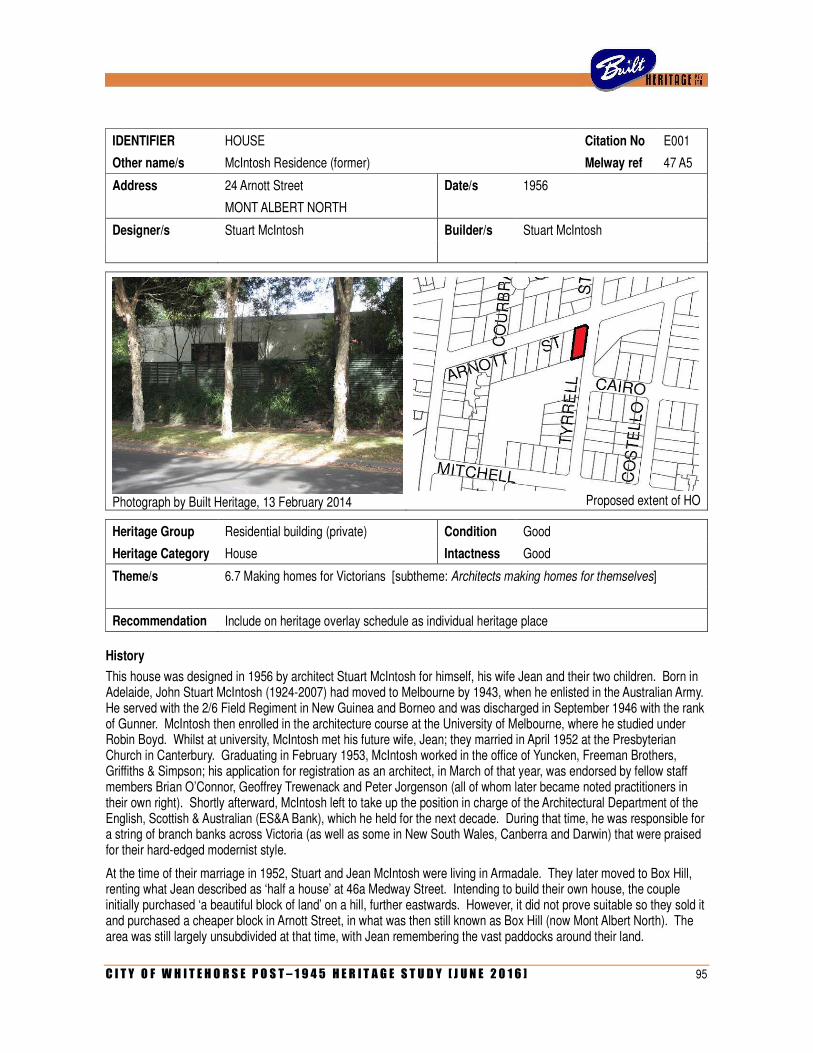
C I T Y O F W H I T E H O R S E P O S T – 1 9 4 5 H E R I T A G E S T U D Y [ J U N E 2 0 1 6 ] 95
IDENTIFIER HOUSE Citation No E001
Other name/s McIntosh Residence (former) Melway ref 47 A5
Address 24 Arnott Street Date/s 1956
MONT ALBERT NORTH
Designer/s Stuart McIntosh Builder/s Stuart McIntosh
Photograph by Built Heritage, 13 February 2014
Proposed extent of HO
Heritage Group Residential building (private) Condition Good
Heritage Category House Intactness Good
Theme/s 6.7 Making homes for Victorians [subtheme: Architects making homes for themselves]
Recommendation Include on heritage overlay schedule as individual heritage place
History
This house was designed in 1956 by architect Stuart McIntosh for himself, his wife Jean and their two children. Born in Adelaide, John Stuart McIntosh (1924-2007) had moved to Melbourne by 1943, when he enlisted in the Australian Army. He served with the 2/6 Field Regiment in New Guinea and Borneo and was discharged in September 1946 with the rank of Gunner. McIntosh then enrolled in the architecture course at the University of Melbourne, where he studied under Robin Boyd. Whilst at university, McIntosh met his future wife, Jean; they married in April 1952 at the Presbyterian Church in Canterbury. Graduating in February 1953, McIntosh worked in the office of Yuncken, Freeman Brothers, Griffiths & Simpson; his application for registration as an architect, in March of that year, was endorsed by fellow staff members Brian O’Connor, Geoffrey Trewenack and Peter Jorgenson (all of whom later became noted practitioners in their own right). Shortly afterward, McIntosh left to take up the position in charge of the Architectural Department of the English, Scottish & Australian (ES&A Bank), which he held for the next decade. During that time, he was responsible for a string of branch banks across Victoria (as well as some in New South Wales, Canberra and Darwin) that were praised for their hard-edged modernist style.
At the time of their marriage in 1952, Stuart and Jean McIntosh were living in Armadale. They later moved to Box Hill, renting what Jean described as ‘half a house’ at 46a Medway Street. Intending to build their own house, the couple initially purchased ‘a beautiful block of land’ on a hill, further eastwards. However, it did not prove suitable so they sold it and purchased a cheaper block in Arnott Street, in what was then still known as Box Hill (now Mont Albert North). The area was still largely unsubdivided at that time, with Jean remembering the vast paddocks around their land.
96 C I T Y O F W H I T E H O R S E P O S T – 1 9 4 5 H E R I T A G E S T U D Y [ J U N E 2 0 1 6 ]
With very little money to spend, McIntosh came up with a simple scheme a flat-roofed dwelling of timber-framed construction, clad with Masonite sheeting and finished with a type of textured stucco known as Conite. Laid out on a four-foot modular grid, the open-planned interior provided two bedrooms, a study, a combined bathroom/laundry and a large L-shaped space that served as a living/dining area with integrated galley kitchen. From this space, a full-height window wall opened onto a wide covered patio, with a north-facing ‘sun porch’ to Arnott Street. Overall, the house was expressed as a box-like volume, elevated on a recessed stone plinth. As McIntosh’s wife recalled, ‘we never discussed it – he just produced the plan’. The original drawings are undated, but a building permit was issued by the City of Box Hill on 25 July 1956. The accompanying documentation reveals that the estimated cost of the project was £3,000, and that McIntosh intended to build the house himself.
The building was completed by April 1959, when a photograph appeared in the Australian Home Beautiful as part of a two-page advertisement for Stramit, which illustrated fifteen recent examples of architect’s own houses that used the product. Aside from its stark form and open planning, McIntosh’s house was thoroughly modern in its finishes and fitout. The window wall was of quarter-inch plate glass, and the front patio screened from the street by a new type of proprietary fibreglass sheeting known as Cascalite, which had only recently been introduced in Australia. Inside, the house was furnished with modern furniture, including pieces by leading local designer Grant Featherstone (whom McIntosh knew personally) and BKF Chairs (aka Butterfly Chairs) by Argentinian designer Jorge Ferrari Hardoy. McIntosh’s interest in modern design was also reflected by the use of Marimekko fabrics from Finland, which would not become widely popular in Melbourne until the later 1960s. His daughter Jane remembers terrazzo tiling across the front patio, which was also highly unusual in Melbourne at the time. Jean McIntosh was responsible for the landscaped setting, which she described as ‘a very very pretty garden’, with English roses and bougainvilleas.
With its bold expression as a stark box-like volume hovering above a recessed plinth, the house attracted attention locally. Jean McIntosh recalls that her husband would joke, on windy nights, that their seemingly floating house might blow off its foundations. McIntosh’s daughter recalls the family residence as a ‘house in progress’ that was never quite finished during their time there, due to limited finances. While the original plans indicate a ‘garage to future detail’ at the rear, with a driveway off Tyrrell Street, this was never built by them. Instead, cars were parked in front of the sun porch facing Arnott Street. The house was sold in 1963, when the family moved to Brisbane after McIntosh won first prize in a competition for the new Great Hall at the University of Queensland (which, sadly, was ultimately not built to his design). McIntosh did not design another house for his family; instead, he took up residence in an old Queenslander overlooking the river at Yeronga. Establishing private practice, McIntosh eschewed residential commissions and worked instead on larger projects. He was consulting architect for several bridges designed by state government engineers and, through his friendship with Reg Ansett, was responsible for the new Ansett terminal at Brisbane Airport (1970) as well as upgrading the airline’s premises at several regional airports such as Mount Isa. McIntosh died in Brisbane in 2007.
Description
Occupying a corner site, the house at Arnott Street, Box Hill, is a single-storey flat-roofed modernist house on a squat rectangular plan. A brick wall, with a bagged and painted finish, has been erected along the Arnott Street frontage, which conceals the original sun porch and covered patio area. The east facade of the house, fronting Tyrell Street, remains visible. Corresponding with the original architectural drawings, this elevation has a long rectangular window bay in the centre and a rough textured finish (possibly the original Conite, as specified on the drawings). The recessed plinth, over which the house seemingly hovers, is clad with bluestone. A small addition has been made to the rear (south) side of the house, and a detached garage erected, with access off Tyrell Street (a position corresponding, coincidentally, with the garage proposed on McIntosh’s original drawings).
Comparative Analysis
Stuart McIntosh is well-known and highly regarded for his bank architecture. His former ES&A Bank in Malvern is included on the Victorian Heritage Register, while a counterpart in Canberra received the RAIA (ACT Chapter) 25-Year Award in 1996. The architect, however, appears to have undertaken very few residential commissions during his career.
C I T Y O F W H I T E H O R S E P O S T – 1 9 4 5 H E R I T A G E S T U D Y [ J U N E 2 0 1 6 ] 97
During his tenure as architect-in-charge of the ES&A Bank, McIntosh worked almost exclusively on branch banks, although he is known to have designed a residence for a bank manager at Darwin (c.1958; demolished). This building, published in various journals as well as Neil Clerehan’s book Best Australian Houses (1960), illustrates the architect’s fondness for slick international modernism. The flat-roofed and open-planned dwelling was expressed as an elongated rectilinear volume, elevated above the ground on slender columns and a small off-centre service core. There was full-height glazing along front and rear walls, the former facade screened by horizontal battens. At ground level, an outdoor living area below the house opened onto a courtyard enclosed by a curving wall of hit-and-miss brickwork.
McIntosh did not formally maintain a private practice during this time with the ES&A Bank, but he is known to have undertaken a few private residential commissions for close friends. A typical example was the one that he designed in the mid-1950s for Swiss émigré Urs Marfurt (whose wife, Heidi, was a friend of Jean’s), which still stands at 44 Greenways Road, Glen Waverley. This was very much in the same hard-edged modernist mode as his own house, with volumetric massing, flat roof with broad eaves, and full-height window walls opening onto an enclosed court. In 1957, McIntosh designed an experimental steel-framed house at Moe for Allan Ormond, which similarly had a flat roof with broad eaves and full-height glazing. McIntosh worked on this project in association with Alexander Harris, an assistant in the Architectural Department of the ES&A Bank who was responsible for documentation.
McIntosh’s own house in Arnott Street is the only example of his residential architecture in the City of Whitehorse. His work is otherwise represented in the municipality by a former branch of the ES&A Bank at 153-155 Springvale Road, Nunawading (1959) and by St Benedict’s Church in Warrigal Road, Surrey Hills. The latter was another rare private commission undertaken at the time he was employed by the ES&A Bank. His wife recalls that he was recommended for the job by a colleague, a quantity surveyor, who also happened to be a member of the congregation. As with the house at Moe, McIntosh was assisted on the project by Alexander Harris. The church followed the same hard-edged modernist vein, with a bold skillion roof projecting over a plain façade to create a raked porch on metal-pipe columns.
Ultimately, few 1950s houses in the City of Whitehorse evoke the starkness and minimalism of international modernism as confidently as McIntosh’s own house in Arnott Street. Several noteworthy examples, also designed by architects for their own use, have been demolished or substantially altered, including Lionel King’s own house at 12 Glendale Street, Surrey Hills (1951), Llew Bawden’s own house at 147a Blackburn Road, Blackburn (1958) and Leslie Brock’s own house at 39 Laburnum Street, Blackburn (1958). The most pertinent surviving comparator is the glass-fronted box that Charles Weight designed for himself at 1 Gracefield Court, Box Hill North. Like McIntosh, Weight was an admirer of Robin Boyd (and was, in fact, working in Boyd’s office at the time). Weight’s house, which also dates from the mid-1950s, is similarly expressed as a floating volume with fully-glazed front wall and projecting eaves. Others houses in the municipality that demonstrate these qualities, albeit in a less adroit manner, include Alan Niven’s own house at 2 Chilcote Court, Box Hill South (c.1958) and the Kunciunas House at 65 Esdale Street, Nunawading (Bolius Kunciunas, c.1960).
Statement of Significance
What is significant?
The McIntosh House at 24 Arnott Street, Mont Albert North, is a flat-roofed timber-framed house expressed in the pure modernist manner as a stark box-like volume elevated above a recessed plinth. It was designed in 1956 by architect Stuart McIntosh, then in charge of the Architectural Department of the ES&A Bank, for himself and his family.
The detached garage fronting Tyrell Street, which was added later (not to McIntosh’s design, although he allowed for a garage in that position in his original drawings) is not considered to be significant.
The brick screen wall across the Arnott Street frontage, which does not appear in a photograph of the house published in 1958, is not considered to be significant.
How is it Significant?
The house is of architectural and aesthetic significance to the City of Whitehorse.
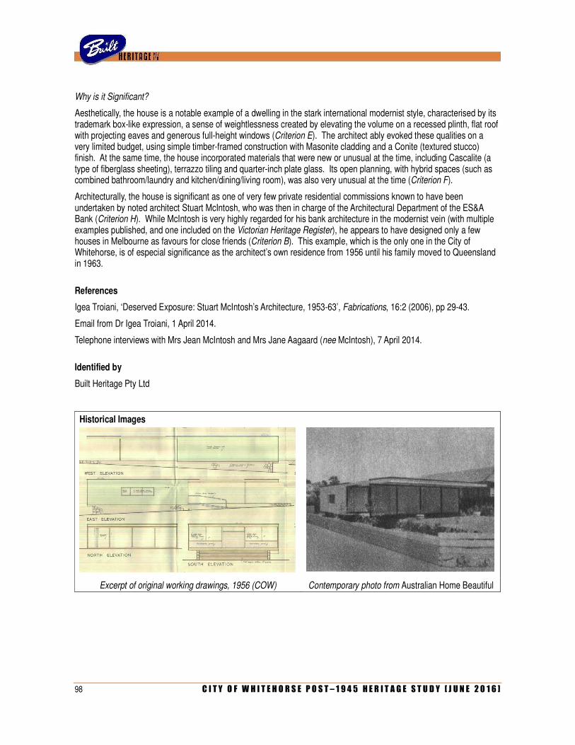
98 C I T Y O F W H I T E H O R S E P O S T – 1 9 4 5 H E R I T A G E S T U D Y [ J U N E 2 0 1 6 ]
Why is it Significant?
Aesthetically, the house is a notable example of a dwelling in the stark international modernist style, characterised by its trademark box-like expression, a sense of weightlessness created by elevating the volume on a recessed plinth, flat roof with projecting eaves and generous full-height windows (Criterion E). The architect ably evoked these qualities on a very limited budget, using simple timber-framed construction with Masonite cladding and a Conite (textured stucco) finish. At the same time, the house incorporated materials that were new or unusual at the time, including Cascalite (a type of fiberglass sheeting), terrazzo tiling and quarter-inch plate glass. Its open planning, with hybrid spaces (such as combined bathroom/laundry and kitchen/dining/living room), was also very unusual at the time (Criterion F).
Architecturally, the house is significant as one of very few private residential commissions known to have been undertaken by noted architect Stuart McIntosh, who was then in charge of the Architectural Department of the ES&A Bank (Criterion H). While McIntosh is very highly regarded for his bank architecture in the modernist vein (with multiple examples published, and one included on the Victorian Heritage Register), he appears to have designed only a few houses in Melbourne as favours for close friends (Criterion B). This example, which is the only one in the City of Whitehorse, is of especial significance as the architect’s own residence from 1956 until his family moved to Queensland in 1963.
References
Igea Troiani, ‘Deserved Exposure: Stuart McIntosh’s Architecture, 1953-63’, Fabrications, 16:2 (2006), pp 29-43.
Email from Dr Igea Troiani, 1 April 2014.
Telephone interviews with Mrs Jean McIntosh and Mrs Jane Aagaard (nee McIntosh), 7 April 2014.
Identified by
Built Heritage Pty Ltd
Historical Images
Excerpt of original working drawings, 1956 (COW) Contemporary photo from Australian Home Beautiful
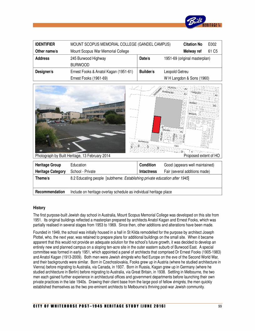
C I T Y O F W H I T E H O R S E P O S T – 1 9 4 5 H E R I T A G E S T U D Y [ J U N E 2 0 1 6 ] 99
IDENTIFIER MOUNT SCOPUS MEMORIAL COLLEGE (GANDEL CAMPUS) Citation No E002
Other name/s Mount Scopus War Memorial College Melway ref 61 C5
Address 245 Burwood Highway Date/s 1951-69 (original masterplan)
BURWOOD
Designer/s Ernest Fooks & Anatol Kagan (1951-61) Builder/s Leopold Getreu
Ernest Fooks (1961-69) W H Langdon & Sons (1960)
Photograph by Built Heritage, 13 February 2014
Proposed extent of HO
Heritage Group Education Condition Good (appears well maintained)
Heritage Category School - Private Intactness Fair (several additions made)
Theme/s 8.2 Educating people [subtheme: Establishing private education after 1945]
Recommendation Include on heritage overlay schedule as individual heritage place
History
The first purpose-built Jewish day school in Australia, Mount Scopus Memorial College was developed on this site from 1951. Its original buildings reflected a masterplan prepared by architects Anatol Kagan and Ernest Fooks, which was partially realised in several stages from 1953 to 1969. Since then, other additions and alterations have been made.
Founded in 1949, the school was initially housed in a hall in St Kilda remodelled for the purpose by architect Joseph Plottel, who, the next year, was retained to prepare plans for additional buildings on the small site. When it became apparent that this would not provide an adequate solution for the school’s future growth, it was decided to develop an entirely new and planned campus on a sloping ten-acre site in the outer eastern suburb of Burwood East. A special committee was formed in early 1951, which appointed a panel of architects that comprised Dr Ernest Fooks (1905-1983) and Anatol Kagan (1913-2009). Both men were Jewish émigrés who fled Europe on the eve of the Second World War, and their backgrounds were similar. Born in Czechoslovakia, Fooks grew up in Austria (where he studied architecture in Vienna) before migrating to Australia, via Canada, in 1937. Born in Russia, Kagan grew up in Germany (where he studied architecture in Berlin) before migrating to Australia, via Great Britain, in 1938. Settling in Melbourne, the two men each gained further experience in architectural offices and government departments before launching their own private practices in the late 1940s. Drawing their client base from the large pool of fellow émigrés, the men quickly established themselves as the two pre-eminent architects to Melbourne’s thriving post-war Jewish community.
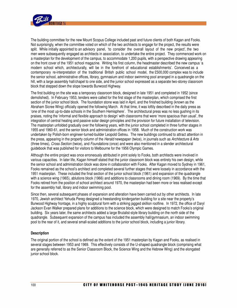
100 C I T Y O F W H I T E H O R S E P O S T – 1 9 4 5 H E R I T A G E S T U D Y [ J U N E 2 0 1 6 ]
The building committee for the new Mount Scopus College included past and future clients of both Kagan and Fooks. Not surprisingly, when the committee voted on which of the two architects to engage for the project, the results were split. While initially appointed to an advisory panel, ‘to consider the overall layout of the new project’, the two men were subsequently engaged as architects in association, to undertake the entire project. They commenced work on a masterplan for the development of the campus, to accommodate 1,200 pupils, with a perspective drawing appearing on the front cover of the 1951 school magazine. Writing his first column, the headmaster described the new campus ‘a modern school which, architecturally, will be in the forefront of educational establishments’. Conceived as a contemporary re-interpretation of the traditional British public school model, the £500,000 complex was to include the senior school, administrative offices, library, gymnasium and indoor swimming pool arranged in a quadrangle on the hill, with a large assembly hall/chapel to one side, and the junior school expressed as a separate two-storey classroom block that stepped down the slope towards Burwood Highway.
The first building on the site was a temporary classroom block, designed in late 1951 and completed in 1952 (since demolished). In February 1953, tenders were called for the first stage of the masterplan, which comprised the first section of the junior school block. The foundation stone was laid in April, and the finished building (known as the Abraham Sicree Wing) officially opened the following March. At that time, it was loftily described in the daily press as ‘one of the most up-to-date schools in the Southern Hemisphere’. The architectural press was no less gushing in its praises, noting the ‘informal and flexible approach to design’ with classrooms that were ‘more spacious than usual’, the integration of central heating and passive solar design principles and the provision for future installation of television. The masterplan unfolded gradually over the following years, with the junior school completed in three further stages in 1955 and 1960-61, and the senior block and administration offices in 1958. Much of the construction work was undertaken by Polish-born engineer-turned-builder Leopold Getreu. The new buildings continued to attract attention in the press, appearing in the property column of the Herald newspaper (twice), in journals such as Architecture & Arts (three times), Cross Section (twice), and Foundations (once) and were also mentioned in a slender architectural guidebook that was published for visitors to Melbourne for the 1956 Olympic Games.
Although the entire project was once erroneously attributed in print solely to Fooks, both architects were involved in various capacities. In later life, Kagan himself stated that the junior classroom block was entirely his own design, while the senior school and administration block was done in collaboration with Fooks. After Kagan moved to Sydney in 1961, Fooks remained as the school’s architect and completed several further stages that were loosely in accordance with the 1951 masterplan. These included the final section of the junior school block (1961) and expansion of the quadrangle with a science wing (1965), ablutions block (1966) and additions to classrooms and dining room (1969). By the time that Fooks retired from the position of school architect around 1970, the masterplan had been more or less realised except for the assembly hall, library and indoor swimming pool.
Since then, several subsequent phases of expansion and alteration have been carried out by other architects. In late 1970, Jewish architect Yehuda Pereg designed a freestanding kindergarten building for a site near the property’s Burwood Highway frontage, in a highly sculptural form with a striking jagged skillion roofline. In 1972, the office of Daryl Jackson Evan Walker prepared plans for additions to the science block, which were designed to match Fooks’s original building. Six years later, the same architects added a large Brutalist-style library building on the north side of the quadrangle. Subsequent expansion of the campus has included the assembly hall/gymnasium, an indoor swimming pool to the rear of it, and several small-scaled additions to the junior school block, including a junior library.
Description
The original portion of the school is defined as the extent of the 1951 masterplan by Kagan and Fooks, as realised in several stages between 1953 and 1969. This effectively consists of the U-shaped quadrangle block (comprising what are generally referred to as the Senior Classroom Block, the Science Wing and the Hebrew Wing) and the elongated junior school block.
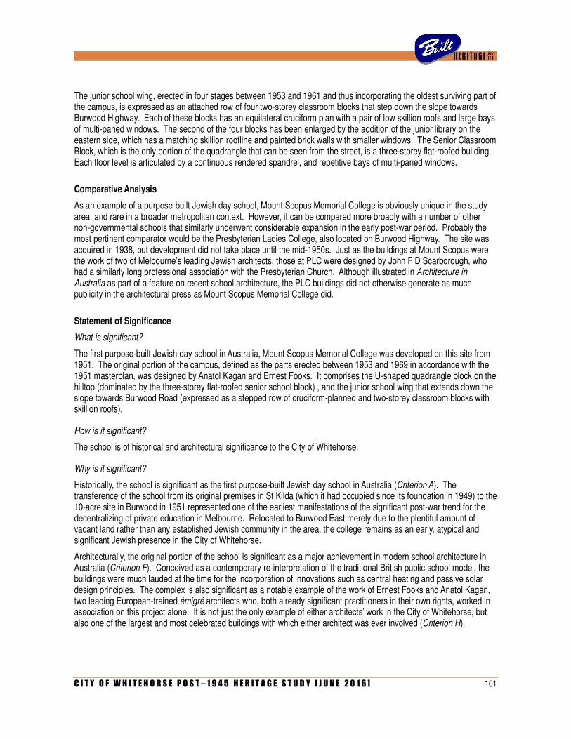
C I T Y O F W H I T E H O R S E P O S T – 1 9 4 5 H E R I T A G E S T U D Y [ J U N E 2 0 1 6 ] 101
The junior school wing, erected in four stages between 1953 and 1961 and thus incorporating the oldest surviving part of the campus, is expressed as an attached row of four two-storey classroom blocks that step down the slope towards Burwood Highway. Each of these blocks has an equilateral cruciform plan with a pair of low skillion roofs and large bays of multi-paned windows. The second of the four blocks has been enlarged by the addition of the junior library on the eastern side, which has a matching skillion roofline and painted brick walls with smaller windows. The Senior Classroom Block, which is the only portion of the quadrangle that can be seen from the street, is a three-storey flat-roofed building. Each floor level is articulated by a continuous rendered spandrel, and repetitive bays of multi-paned windows.
Comparative Analysis
As an example of a purpose-built Jewish day school, Mount Scopus Memorial College is obviously unique in the study area, and rare in a broader metropolitan context. However, it can be compared more broadly with a number of other non-governmental schools that similarly underwent considerable expansion in the early post-war period. Probably the most pertinent comparator would be the Presbyterian Ladies College, also located on Burwood Highway. The site was acquired in 1938, but development did not take place until the mid-1950s. Just as the buildings at Mount Scopus were the work of two of Melbourne’s leading Jewish architects, those at PLC were designed by John F D Scarborough, who had a similarly long professional association with the Presbyterian Church. Although illustrated in Architecture in Australia as part of a feature on recent school architecture, the PLC buildings did not otherwise generate as much publicity in the architectural press as Mount Scopus Memorial College did.
Statement of Significance
What is significant?
The first purpose-built Jewish day school in Australia, Mount Scopus Memorial College was developed on this site from 1951. The original portion of the campus, defined as the parts erected between 1953 and 1969 in accordance with the 1951 masterplan, was designed by Anatol Kagan and Ernest Fooks. It comprises the U-shaped quadrangle block on the hilltop (dominated by the three-storey flat-roofed senior school block) , and the junior school wing that extends down the slope towards Burwood Road (expressed as a stepped row of cruciform-planned and two-storey classroom blocks with skillion roofs).
How is it significant?
The school is of historical and architectural significance to the City of Whitehorse.
Why is it significant?
Historically, the school is significant as the first purpose-built Jewish day school in Australia (Criterion A). The transference of the school from its original premises in St Kilda (which it had occupied since its foundation in 1949) to the 10-acre site in Burwood in 1951 represented one of the earliest manifestations of the significant post-war trend for the decentralizing of private education in Melbourne. Relocated to Burwood East merely due to the plentiful amount of vacant land rather than any established Jewish community in the area, the college remains as an early, atypical and significant Jewish presence in the City of Whitehorse.
Architecturally, the original portion of the school is significant as a major achievement in modern school architecture in Australia (Criterion F). Conceived as a contemporary re-interpretation of the traditional British public school model, the buildings were much lauded at the time for the incorporation of innovations such as central heating and passive solar design principles. The complex is also significant as a notable example of the work of Ernest Fooks and Anatol Kagan, two leading European-trained émigré architects who, both already significant practitioners in their own rights, worked in association on this project alone. It is not just the only example of either architects’ work in the City of Whitehorse, but also one of the largest and most celebrated buildings with which either architect was ever involved (Criterion H).
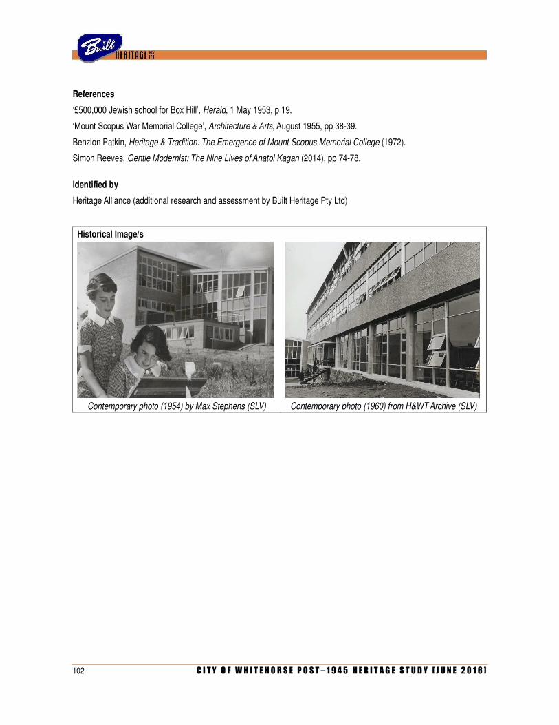
102 C I T Y O F W H I T E H O R S E P O S T – 1 9 4 5 H E R I T A G E S T U D Y [ J U N E 2 0 1 6 ]
References
‘£500,000 Jewish school for Box Hill’, Herald, 1 May 1953, p 19.
‘Mount Scopus War Memorial College’, Architecture & Arts, August 1955, pp 38-39.
Benzion Patkin, Heritage & Tradition: The Emergence of Mount Scopus Memorial College (1972).
Simon Reeves, Gentle Modernist: The Nine Lives of Anatol Kagan (2014), pp 74-78.
Identified by
Heritage Alliance (additional research and assessment by Built Heritage Pty Ltd)
Historical Image/s
Contemporary photo (1954) by Max Stephens (SLV) Contemporary photo (1960) from H&WT Archive (SLV)
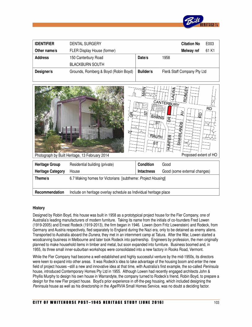
C I T Y O F W H I T E H O R S E P O S T – 1 9 4 5 H E R I T A G E S T U D Y [ J U N E 2 0 1 6 ] 103
IDENTIFIER DENTAL SURGERY Citation No E003
Other name/s FLER Display House (former) Melway ref 61 K1
Address 150 Canterbury Road Date/s 1958
BLACKBURN SOUTH
Designer/s Grounds, Romberg & Boyd (Robin Boyd) Builder/s Fler& Staff Company Pty Ltd
Photograph by Built Heritage, 13 February 2014
Proposed extent of HO
Heritage Group Residential building (private) Condition Good
Heritage Category House Intactness Good (some external changes)
Theme/s 6.7 Making homes for Victorians [subtheme: Project Housing]
Recommendation Include on heritage overlay schedule as Individual heritage place
History
Designed by Robin Boyd, this house was built in 1958 as a prototypical project house for the Fler Company, one of Australia’s leading manufacturers of modern furniture. Taking its name from the initials of co-founders Fred Lowen (1919-2005) and Ernest Rodeck (1919-2013), the firm began in 1946. Lowen (born Fritz Lowenstein) and Rodeck, from Germany and Austria respectively, fled separately to England during the Nazi era, only to be detained as enemy aliens. Transported to Australia aboard the Dunera, they met in an internment camp at Tatura. After the War, Lowen started a woodcarving business in Melbourne and later took Rodeck into partnership. Engineers by profession, the men originally planned to make household items in timber and metal, but soon expanded into furniture. Business boomed and, in 1955, its three small inner-suburban workshops were consolidated into a new factory in Rooks Road, Vermont.
While the Fler Company had become a well-established and highly successful venture by the mid-1950s, its directors were keen to expand into other areas. It was Rodeck’s idea to take advantage of the housing boom and enter the new field of project houses –still a new and innovative idea at that time, with Australia’s first example, the so-called Peninsula house, introduced Contemporary Homes Pty Ltd in 1955. Although Lowen had recently engaged architects John & Phyllis Murphy to design his own house in Warrandyte, the company turned to Rodeck’s friend, Robin Boyd, to prepare a design for the new Fler project house. Boyd’s prior experience in off-the-peg housing, which included designing the Peninsula house as well as his directorship in the Age/RVIA Small Homes Service, was no doubt a deciding factor.
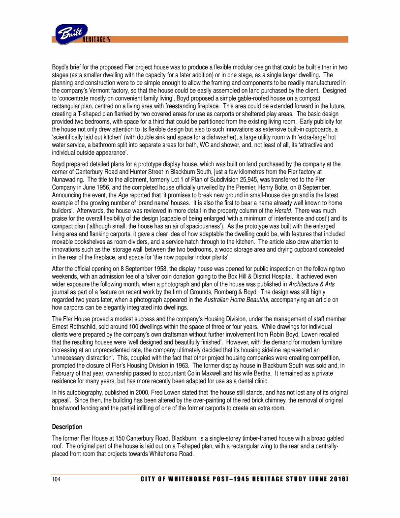
104 C I T Y O F W H I T E H O R S E P O S T – 1 9 4 5 H E R I T A G E S T U D Y [ J U N E 2 0 1 6 ]
Boyd’s brief for the proposed Fler project house was to produce a flexible modular design that could be built either in two stages (as a smaller dwelling with the capacity for a later addition) or in one stage, as a single larger dwelling. The planning and construction were to be simple enough to allow the framing and components to be readily manufactured in the company’s Vermont factory, so that the house could be easily assembled on land purchased by the client. Designed to ‘concentrate mostly on convenient family living’, Boyd proposed a simple gable-roofed house on a compact rectangular plan, centred on a living area with freestanding fireplace. This area could be extended forward in the future, creating a T-shaped plan flanked by two covered areas for use as carports or sheltered play areas. The basic design provided two bedrooms, with space for a third that could be partitioned from the existing living room. Early publicity for the house not only drew attention to its flexible design but also to such innovations as extensive built-in cupboards, a ‘scientifically laid out kitchen’ (with double sink and space for a dishwasher), a large utility room with ‘extra-large’ hot water service, a bathroom split into separate areas for bath, WC and shower, and, not least of all, its ‘attractive and individual outside appearance’.
Boyd prepared detailed plans for a prototype display house, which was built on land purchased by the company at the corner of Canterbury Road and Hunter Street in Blackburn South, just a few kilometres from the Fler factory at Nunawading. The title to the allotment, formerly Lot 1 of Plan of Subdivision 25,945, was transferred to the Fler Company in June 1956, and the completed house officially unveiled by the Premier, Henry Bolte, on 8 September. Announcing the event, the Age reported that ‘it promises to break new ground in small-house design and is the latest example of the growing number of ‘brand name’ houses. It is also the first to bear a name already well known to home builders’. Afterwards, the house was reviewed in more detail in the property column of the Herald. There was much praise for the overall flexibility of the design (capable of being enlarged ‘with a minimum of interference and cost’) and its compact plan (‘although small, the house has an air of spaciousness’). As the prototype was built with the enlarged living area and flanking carports, it gave a clear idea of how adaptable the dwelling could be, with features that included movable bookshelves as room dividers, and a service hatch through to the kitchen. The article also drew attention to innovations such as the ‘storage wall’ between the two bedrooms, a wood storage area and drying cupboard concealed in the rear of the fireplace, and space for ‘the now popular indoor plants’.
After the official opening on 8 September 1958, the display house was opened for public inspection on the following two weekends, with an admission fee of a ‘silver coin donation’ going to the Box Hill & District Hospital. It achieved even wider exposure the following month, when a photograph and plan of the house was published in Architecture & Arts journal as part of a feature on recent work by the firm of Grounds, Romberg & Boyd. The design was still highly regarded two years later, when a photograph appeared in the Australian Home Beautiful, accompanying an article on how carports can be elegantly integrated into dwellings.
The Fler House proved a modest success and the company’s Housing Division, under the management of staff member Ernest Rothschild, sold around 100 dwellings within the space of three or four years. While drawings for individual clients were prepared by the company’s own draftsman without further involvement from Robin Boyd, Lowen recalled that the resulting houses were ‘well designed and beautifully finished’. However, with the demand for modern furniture increasing at an unprecedented rate, the company ultimately decided that its housing sideline represented an ‘unnecessary distraction’. This, coupled with the fact that other project housing companies were creating competition, prompted the closure of Fler’s Housing Division in 1963. The former display house in Blackburn South was sold and, in February of that year, ownership passed to accountant Colin Maxwell and his wife Bertha. It remained as a private residence for many years, but has more recently been adapted for use as a dental clinic.
In his autobiography, published in 2000, Fred Lowen stated that ‘the house still stands, and has not lost any of its original appeal’. Since then, the building has been altered by the over-painting of the red brick chimney, the removal of original brushwood fencing and the partial infilling of one of the former carports to create an extra room.
Description
The former Fler House at 150 Canterbury Road, Blackburn, is a single-storey timber-framed house with a broad gabled roof. The original part of the house is laid out on a T-shaped plan, with a rectangular wing to the rear and a centrally-placed front room that projects towards Whitehorse Road.
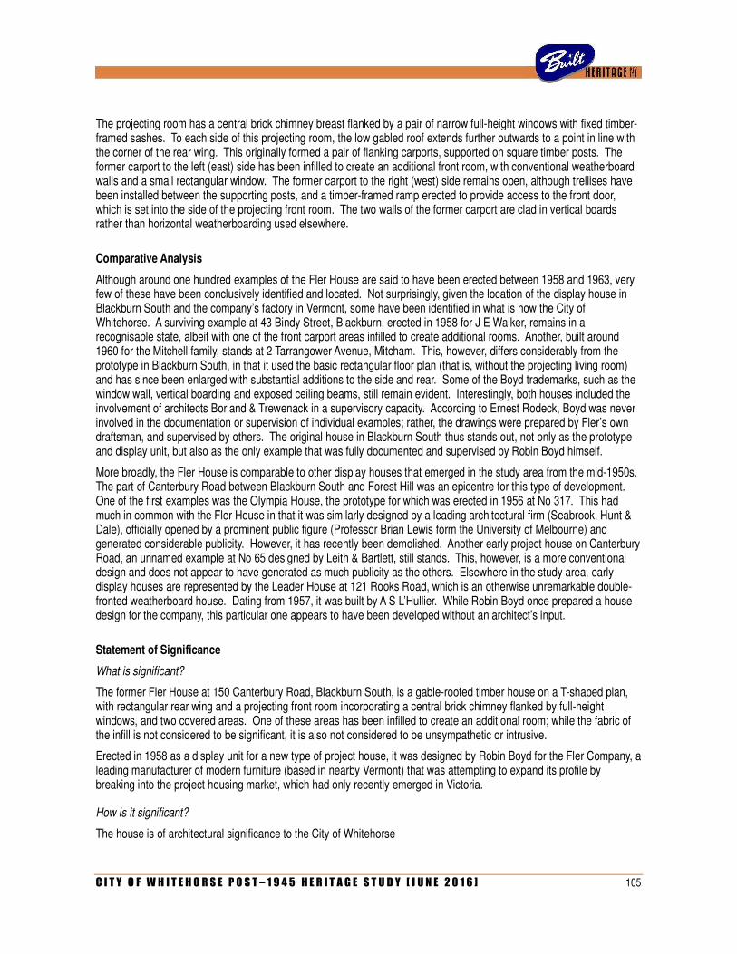
C I T Y O F W H I T E H O R S E P O S T – 1 9 4 5 H E R I T A G E S T U D Y [ J U N E 2 0 1 6 ] 105
The projecting room has a central brick chimney breast flanked by a pair of narrow full-height windows with fixed timber-framed sashes. To each side of this projecting room, the low gabled roof extends further outwards to a point in line with the corner of the rear wing. This originally formed a pair of flanking carports, supported on square timber posts. The former carport to the left (east) side has been infilled to create an additional front room, with conventional weatherboard walls and a small rectangular window. The former carport to the right (west) side remains open, although trellises have been installed between the supporting posts, and a timber-framed ramp erected to provide access to the front door, which is set into the side of the projecting front room. The two walls of the former carport are clad in vertical boards rather than horizontal weatherboarding used elsewhere.
Comparative Analysis
Although around one hundred examples of the Fler House are said to have been erected between 1958 and 1963, very few of these have been conclusively identified and located. Not surprisingly, given the location of the display house in Blackburn South and the company’s factory in Vermont, some have been identified in what is now the City of Whitehorse. A surviving example at 43 Bindy Street, Blackburn, erected in 1958 for J E Walker, remains in a recognisable state, albeit with one of the front carport areas infilled to create additional rooms. Another, built around 1960 for the Mitchell family, stands at 2 Tarrangower Avenue, Mitcham. This, however, differs considerably from the prototype in Blackburn South, in that it used the basic rectangular floor plan (that is, without the projecting living room) and has since been enlarged with substantial additions to the side and rear. Some of the Boyd trademarks, such as the window wall, vertical boarding and exposed ceiling beams, still remain evident. Interestingly, both houses included the involvement of architects Borland & Trewenack in a supervisory capacity. According to Ernest Rodeck, Boyd was never involved in the documentation or supervision of individual examples; rather, the drawings were prepared by Fler’s own draftsman, and supervised by others. The original house in Blackburn South thus stands out, not only as the prototype and display unit, but also as the only example that was fully documented and supervised by Robin Boyd himself.
More broadly, the Fler House is comparable to other display houses that emerged in the study area from the mid-1950s. The part of Canterbury Road between Blackburn South and Forest Hill was an epicentre for this type of development. One of the first examples was the Olympia House, the prototype for which was erected in 1956 at No 317. This had much in common with the Fler House in that it was similarly designed by a leading architectural firm (Seabrook, Hunt & Dale), officially opened by a prominent public figure (Professor Brian Lewis form the University of Melbourne) and generated considerable publicity. However, it has recently been demolished. Another early project house on Canterbury Road, an unnamed example at No 65 designed by Leith & Bartlett, still stands. This, however, is a more conventional design and does not appear to have generated as much publicity as the others. Elsewhere in the study area, early display houses are represented by the Leader House at 121 Rooks Road, which is an otherwise unremarkable double-fronted weatherboard house. Dating from 1957, it was built by A S L’Hullier. While Robin Boyd once prepared a house design for the company, this particular one appears to have been developed without an architect’s input.
Statement of Significance
What is significant?
The former Fler House at 150 Canterbury Road, Blackburn South, is a gable-roofed timber house on a T-shaped plan, with rectangular rear wing and a projecting front room incorporating a central brick chimney flanked by full-height windows, and two covered areas. One of these areas has been infilled to create an additional room; while the fabric of the infill is not considered to be significant, it is also not considered to be unsympathetic or intrusive.
Erected in 1958 as a display unit for a new type of project house, it was designed by Robin Boyd for the Fler Company, a leading manufacturer of modern furniture (based in nearby Vermont) that was attempting to expand its profile by breaking into the project housing market, which had only recently emerged in Victoria.
How is it significant?
The house is of architectural significance to the City of Whitehorse
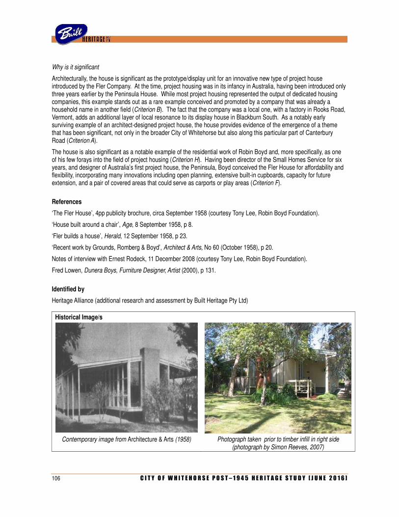
106 C I T Y O F W H I T E H O R S E P O S T – 1 9 4 5 H E R I T A G E S T U D Y [ J U N E 2 0 1 6 ]
Why is it significant
Architecturally, the house is significant as the prototype/display unit for an innovative new type of project house introduced by the Fler Company. At the time, project housing was in its infancy in Australia, having been introduced only three years earlier by the Peninsula House. While most project housing represented the output of dedicated housing companies, this example stands out as a rare example conceived and promoted by a company that was already a household name in another field (Criterion B). The fact that the company was a local one, with a factory in Rooks Road, Vermont, adds an additional layer of local resonance to its display house in Blackburn South. As a notably early surviving example of an architect-designed project house, the house provides evidence of the emergence of a theme that has been significant, not only in the broader City of Whitehorse but also along this particular part of Canterbury Road (Criterion A).
The house is also significant as a notable example of the residential work of Robin Boyd and, more specifically, as one of his few forays into the field of project housing (Criterion H). Having been director of the Small Homes Service for six years, and designer of Australia’s first project house, the Peninsula, Boyd conceived the Fler House for affordability and flexibility, incorporating many innovations including open planning, extensive built-in cupboards, capacity for future extension, and a pair of covered areas that could serve as carports or play areas (Criterion F).
References
‘The Fler House’, 4pp publicity brochure, circa September 1958 (courtesy Tony Lee, Robin Boyd Foundation).
‘House built around a chair’, Age, 8 September 1958, p 8.
‘Fler builds a house’, Herald, 12 September 1958, p 23.
‘Recent work by Grounds, Romberg & Boyd’, Architect & Arts, No 60 (October 1958), p 20.
Notes of interview with Ernest Rodeck, 11 December 2008 (courtesy Tony Lee, Robin Boyd Foundation).
Fred Lowen, Dunera Boys, Furniture Designer, Artist (2000), p 131.
Identified by
Heritage Alliance (additional research and assessment by Built Heritage Pty Ltd)
Historical Image/s
Contemporary image from Architecture & Arts (1958) Photograph taken prior to timber infill in right side
(photograph by Simon Reeves, 2007)
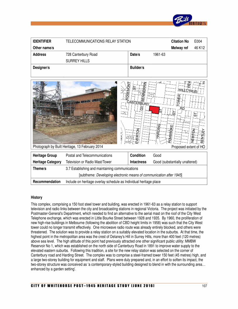
C I T Y O F W H I T E H O R S E P O S T – 1 9 4 5 H E R I T A G E S T U D Y [ J U N E 2 0 1 6 ] 107
IDENTIFIER TELECOMMUNICATIONS RELAY STATION Citation No E004
Other name/s Melway ref 46 K12
Address 728 Canterbury Road Date/s 1961-63
SURREY HILLS
Designer/s Builder/s
Photograph by Built Heritage, 13 February 2014
Proposed extent of HO
Heritage Group Postal and Telecommunications Condition Good
Heritage Category Television or Radio Mast/Tower Intactness Good (substantially unaltered)
Theme/s 3.7 Establishing and maintaining communications
[subtheme: Developing electronic means of communication after 1945]
Recommendation Include on heritage overlay schedule as Individual heritage place
History
This complex, comprising a 150 foot steel tower and building, was erected in 1961-63 as a relay station to support television and radio links between the city and broadcasting stations in regional Victoria. The project was initiated by the Postmaster-General's Department, which needed to find an alternative to the aerial mast on the roof of the City West Telephone exchange, which was erected in Little Bourke Street between 1928 and 1935. By 1960, the proliferation of new high-rise buildings in Melbourne (following the abolition of CBD height limits in 1958) was such that the City West tower could no longer transmit effectively. One microwave radio route was already entirely blocked, and others were threatened. The solution was to provide a relay station on a suitably elevated location in the suburbs. At that time, the highest point in the metropolitan area was the crest of Delaney's Hill in Surrey Hills, more than 400 feet (120 metres) above sea level. The high altitude of this point had previously attracted one other significant public utility: MMBW Reservoir No 1, which was established on the north side of Canterbury Road in 1891 to improve water supply to the elevated eastern suburbs. Following this tradition, a site for the new relay station was selected on the corner of Canterbury road and Harding Street. The complex was to comprise a steel-framed tower 150 feet (45 metres) high, and a large two-storey building for equipment and staff. Plans were duly prepared and, in an effort to soften its impact, the two-storey structure was conceived as ‘a contemporary-styled building designed to blend in with the surrounding area… enhanced by a garden setting’.
108 C I T Y O F W H I T E H O R S E P O S T – 1 9 4 5 H E R I T A G E S T U D Y [ J U N E 2 0 1 6 ]
When a perspective drawing of the proposed development was published in July 1961, community reaction was far from enthusiastic. Residents of Harding Street immediately (and ironically) dispatched a telegraphed request to the Postmaster-General, Charles Davidson, demanding that the project be halted. When Davidson responded that the project would proceed regardless (adding ‘if any further particulars were desired, he would be happy to furnish them’), the residents organised a petition that, by early August, had 43 signatures. The issues with which the community was concerned (or, as one article put it, ‘bitterly angry’) included a perceived reduction in property values (quoted as ‘up to fifty percent’) and compromise of the ‘70 mile wide panorama which those with homes on the higher grounds enjoy’. In the petition, the proposed tower was likened to a coal mine derrick, with the agglomeration of communications equipment at its apex referred to as ‘that slovenly top, with the utensils splattered over it, as big as a two-storey house’.
Notwithstanding such emotive statements, it appeared that residents were largely if not entirely concerned with questions of aesthetics and did not oppose the provision of the infrastructure per se. The chairman of the protest committee, Stanley Morrison, who lived directly opposite the proposed site, at 3 Harding Street, told the Age that if the project was to proceed, ‘it should be redesigned by a panel of architects after the engineers had stated their requirements’. This position was echoed by Melbourne University's Professor of Architecture, the outspoken Brian Lewis, who was quoted as saying ‘I think the design, as illustrated, stinks…. It would be hard to imagine anything worse than what is proposed’. Concerns were also expressed by the Landscape Preservation Council of the National Trust. In a letter to the Postmaster General, spokesman Neville Roennfeldt described the tower as ‘a gaunt and skeletal structure, with its array of dish antennas [sic] staring glassily from a top-heavy platform’. The structure, he asserted, ‘is likely to become the most prominent and dominating eyesore in all of Melbourne’s eastern suburbs’. To prevent this, Roennfeldt suggested that the building should be screened by ‘a complete perimeter of large trees’, and the tower itself (an ‘unavoidable prominence’), be redesigned ‘so that a less glaringly ugly edifice be imposed on the city’.
Towards the end of August 1961, the incoming Director-General of Posts & Telegraphs, F P O’Grady, told the press that the PMG Department ultimately intended to discontinue the use of towers of this type, stating that ‘high-flying balloons, city rooftops and mountain tops offered great promise for television and radio transmission instead of towers’. However, he also noted that it was too late to halt the project at Surrey Hills, which was already under construction. In early September, architect Neil Clerehan reported in his weekly column in the Age that a resolution of sorts had finally been reached: ‘when the PMG Department asked the neighbours what they would like done to the steel shape to preserve the beauty of our eastern suburbs, their only suggestion was for a Lilydale stone base’.
Construction proceeded and was nearing completion twelve months later, when it was reported that PMG workmen were installing the first of several directional aerials at the top of the tower. It was pointed out that this bell-shaped object, more properly referred to as a horn antenna or horn reflector, was then the only one of its type in Australia. It was stated that any one of the tower’s single radio beams was capable of transmitting 4,800 telephone channels, or five separate TV pictures. Upon completion in early 1963, the facility was intended to handle all radio, telephone and telegraph outlets from Melbourne for at least the next decade. Those residents who had protested against its construction appear to have been placated by the feature wall of Lilydale stone along the Harding Street frontage. As local historian Andrew Ward observed two decades later, ‘in time, people grew used to it and some even considered it rather sculptural. At least, unlike a freeway, it neither smells nor makes a noise’. Today, the facility is operated by Telstra and supports mobile telephone services as well as transmitters for HF and FM radio.
Description
The relay station at 728 Canterbury Road occupies a large corner site, roughly the equivalent of three standard residential allotments. The building is a two-storey structure of orange brick construction, with a low gabled roof penetrated by a vented belvedere. Set well back from Canterbury Road, its street facade is broken up into a series of narrow full-height bays that contain metal-framed double-hung sash windows between textured pre-cast concrete spandrels. The third bay from the right (west) end is recessed, forming a porch that opens onto a small area enclosed by a low wall clad with random-coursed Lilydale stone. The bay at the extreme left (east) end incorporates the main entrance, with a glazed door opening onto a terrazzo porch and sheltered by a cantilevered awning. The Canterbury Road façade is otherwise screened by a tall row of Italian Cypress trees (and other smaller shrubs) planted hard up against the building, in a continuous planter box defined by a low brick wall.
C I T Y O F W H I T E H O R S E P O S T – 1 9 4 5 H E R I T A G E S T U D Y [ J U N E 2 0 1 6 ] 109
The more utilitarian Harding Street elevation has two full-height bays: one with metal-framed windows, and the other with a tall access doorway to the first floor. The rear elevation, facing the tower yard, has elongated horizontal bays of windows at the upper level, with tinted glazing. The tower yard is enclosed by a screen wall clad in random-coursed Lilydale stone, with a vehicle gateway at the far end. The tower itself is a tall tapering steel-trussed structure on a square plan. It incorporates several platforms, connected by open flights of steps. The communications equipment affixed to the uppermost level of the tower includes a number of circular dishes as well as tall vertical antennae for mobile phone services. Some of the items that were evident on the tower in early photographs have since been removed.
Comparative Analysis
The relay station at 728 Canterbury Road is unique in the municipality, and rare in a broader metropolitan context. As such, it has few comparators in the City of Whitehorse. As a local example of the post-war theme of the expansion of broadcasting and telecommunications infrastructure, it can be broadly compared with such sites as the new branch telephone exchange at 463-65 Whitehorse Road, Mitcham (1959). This is not only analogous in date but also in its architectural expression, with its stark orange brick walls and low gabled roof, and its decisive attempt to soften its streetscape impact by setback and landscaping. As an example of post-war broadcasting infrastructure that was considered innovative at its time of construction, comparisons could also be drawn between the Surrey Hills tower and the Aussat earth satellite station in Burwood East, which dates from the mid-1950s.
Ultimately, the relay station at Surrey Hills needs to be considered in the much broader statewide context of the expansion of telecommunications infrastructure from the late 1950s, which included the introduction of STD service (1960), the completion of the Sydney-to-Melbourne coaxial cable (1962) and the opening of Victoria's first automatic postal station (1962).
Statement of Significance
What is significant?
The relay station at 728 Canterbury Road, Surrey Hills, comprises a large two-storey gable-roofed orange brick building with a façade (screened from the street by Italian Cypress trees and smaller shrubs) of narrow bays with pre-cast spandrels and metal-framed windows. To the rear, in a yard enclosed by a screen wall of Lilydale stonework, is a steel framed tower, 150 feet (45 metres) tall. Erected in 1961 -63, the facility was a response to the increased demand for telephone and telegraphic services in the post-war period, as well as the introduction of television broadcasting and, specifically, to relay signals to regional TV stations
How is it significant?
The relay station is of historic and aesthetic significance to the City of Whitehorse.
Why is it significant?
Historically, the relay station is significant for associations with the expansion of broadcasting and telecommunications infrastructure that took place in Victoria from the late 1950s. At that time, the boom of residential and commercial development saw the demand for telephone and telegraph services increase to an unprecedented extent and this, coupled with the introduction of television broadcasting in 1956, prompted a massive upgrade of facilities. Intended to replace the aerial mast at the City West Telephone Exchange (which was losing efficacy due to the increased number of high-rise city buildings), the relay station at Surrey Hills was a major step in linking communications between the CBD and regional Victoria.
Aesthetically, the relay station is significant as a landmark on the highest point of what was then the entire Melbourne metropolitan area (since eclipsed, only slightly, by Mount Cooper in Bundoora). Although residents at the time were concerned that the new facility would be an eyesore, attempts were made to soften the appearance of the building through setback, landscaping and, notably, by the incorporation of a feature wall of Lilydale stonework that was
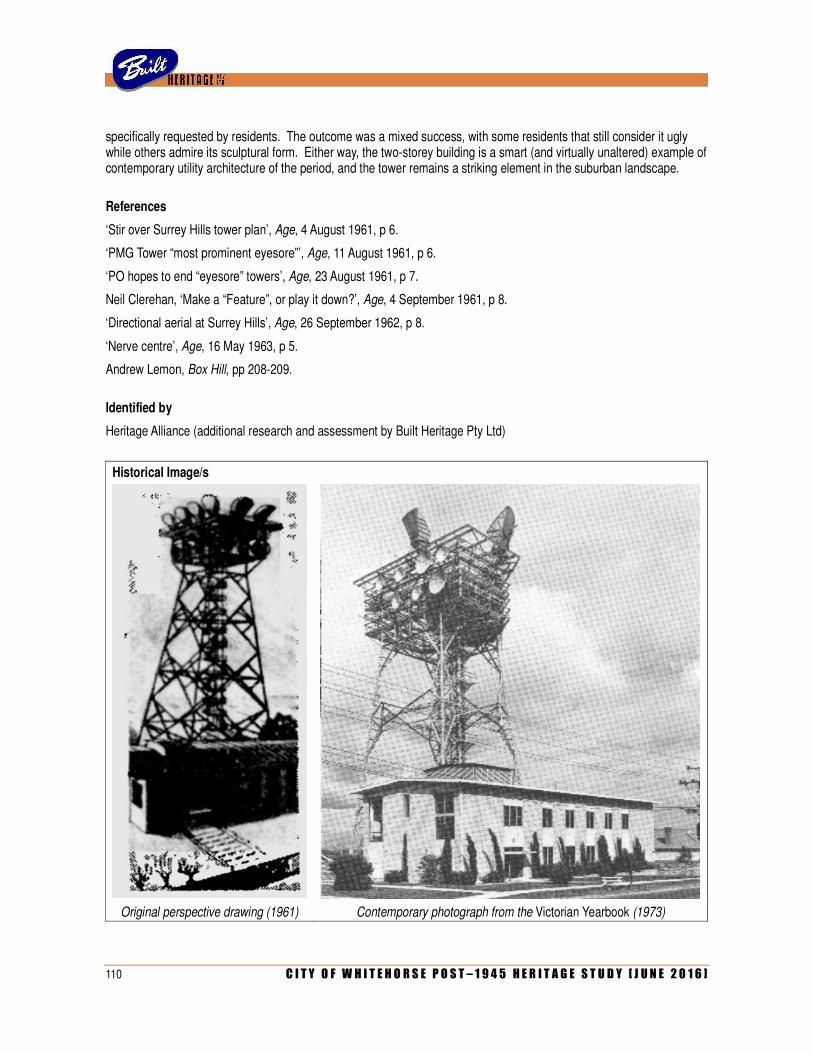
110 C I T Y O F W H I T E H O R S E P O S T – 1 9 4 5 H E R I T A G E S T U D Y [ J U N E 2 0 1 6 ]
specifically requested by residents. The outcome was a mixed success, with some residents that still consider it ugly while others admire its sculptural form. Either way, the two-storey building is a smart (and virtually unaltered) example of contemporary utility architecture of the period, and the tower remains a striking element in the suburban landscape.
References
‘Stir over Surrey Hills tower plan’, Age, 4 August 1961, p 6.
‘PMG Tower “most prominent eyesore”’, Age, 11 August 1961, p 6.
‘PO hopes to end “eyesore” towers’, Age, 23 August 1961, p 7.
Neil Clerehan, ‘Make a “Feature”, or play it down?’, Age, 4 September 1961, p 8.
‘Directional aerial at Surrey Hills’, Age, 26 September 1962, p 8.
‘Nerve centre’, Age, 16 May 1963, p 5.
Andrew Lemon, Box Hill, pp 208-209.
Identified by
Heritage Alliance (additional research and assessment by Built Heritage Pty Ltd)
Historical Image/s
Original perspective drawing (1961) Contemporary photograph from the Victorian Yearbook (1973)
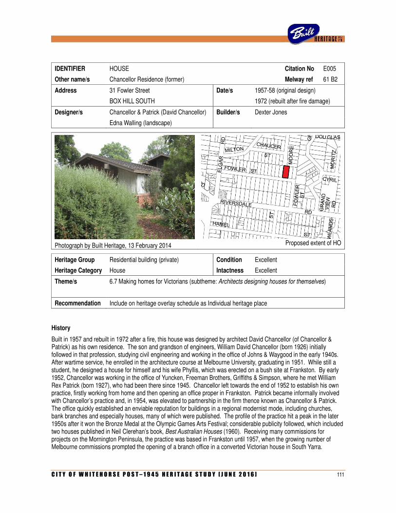
C I T Y O F W H I T E H O R S E P O S T – 1 9 4 5 H E R I T A G E S T U D Y [ J U N E 2 0 1 6 ] 111
IDENTIFIER HOUSE Citation No E005
Other name/s Chancellor Residence (former) Melway ref 61 B2
Address 31 Fowler Street Date/s 1957-58 (original design)
BOX HILL SOUTH 1972 (rebuilt after fire damage)
Designer/s Chancellor & Patrick (David Chancellor) Builder/s Dexter Jones
Edna Walling (landscape)
Photograph by Built Heritage, 13 February 2014
Proposed extent of HO
Heritage Group Residential building (private) Condition Excellent
Heritage Category House Intactness Excellent
Theme/s 6.7 Making homes for Victorians (subtheme: Architects designing houses for themselves)
Recommendation Include on heritage overlay schedule as Individual heritage place
History
Built in 1957 and rebuilt in 1972 after a fire, this house was designed by architect David Chancellor (of Chancellor & Patrick) as his own residence. The son and grandson of engineers, William David Chancellor (born 1926) initially followed in that profession, studying civil engineering and working in the office of Johns & Waygood in the early 1940s. After wartime service, he enrolled in the architecture course at Melbourne University, graduating in 1951. While still a student, he designed a house for himself and his wife Phyllis, which was erected on a bush site at Frankston. By early 1952, Chancellor was working in the office of Yuncken, Freeman Brothers, Griffiths & Simpson, where he met William Rex Patrick (born 1927), who had been there since 1945. Chancellor left towards the end of 1952 to establish his own practice, firstly working from home and then opening an office proper in Frankston. Patrick became informally involved with Chancellor’s practice and, in 1954, was elevated to partnership in the firm thence known as Chancellor & Patrick. The office quickly established an enviable reputation for buildings in a regional modernist mode, including churches, bank branches and especially houses, many of which were published. The profile of the practice hit a peak in the later 1950s after it won the Bronze Medal at the Olympic Games Arts Festival; considerable publicity followed, which included two houses published in Neil Clerehan’s book, Best Australian Houses (1960). Receiving many commissions for projects on the Mornington Peninsula, the practice was based in Frankston until 1957, when the growing number of Melbourne commissions prompted the opening of a branch office in a converted Victorian house in South Yarra.
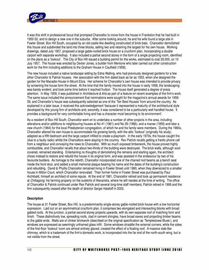
112 C I T Y O F W H I T E H O R S E P O S T – 1 9 4 5 H E R I T A G E S T U D Y [ J U N E 2 0 1 6 ]
It was this shift in professional focus that prompted Chancellor to move from the house in Frankston that he had built in 1950-52, and to design a new one in the suburbs. After some looking around, he and his wife found a large site in Fowler Street, Box Hill South, occupied by an old castle-like dwelling constructed of brick-bats. Chancellor demolished this house and subdivided the land into three blocks, selling two and retaining the largest for his own house. Working drawings, dated July 1957, proposed a large gable-roofed brick house on a cruciform plan, incorporating a double carport with separate workshop. It also included a partial second storey in the form of a single projecting room, identified on the plans as a ‘lookout’. The City of Box Hill issued a building permit for the works, estimated to cost £8,000, on 10 July 1957. The house was erected by Dexter Jones, a builder from Mentone who later carried out other construction work for the firm including additions to the Graham House in Caulfield (1958).
The new house included a native landscape setting by Edna Walling, who had previously designed gardens for a few other Chancellor & Patrick houses. Her association with the firm dated back as far as 1953, when she designed the garden for the Macadie House in Mount Eliza. Her scheme for Chancellor’s own house was intended to provide privacy by screening the house form the street. At the time that the family moved into the house in early 1958, the landscaping was barely evident, and took some time before it reached fruition. The house itself generated a degree of press attention. In May 1959, it was published in Architecture & Arts as part of a feature on recent examples of the firm’s work. The same issue included the announcement that nominations were sought for the magazine’s annual awards for 1958-59, and Chancellor’s house was subsequently selected as one of the ‘Ten Best Houses’ from around the country. As explained in a later issue, it received this acknowledgement ‘because it represented a maturity of the architectural style developed by this young firm of architects and, secondly, it was considered to be a particularly well-handled house. It provides a background for very comfortable living and has a character most becoming to its environment’.
As a resident of Box Hill South, Chancellor went on to undertake a number of other projects in the area, including alterations and/or additions to neighbouring houses at No 41 (1961) and No 29 (1966), and a manse (1959) and later a new church (1964) for the local Presbyterian congregation, of which he and his family were members. During the 1960s, Chancellor altered his own house to accommodate his growing family, with the attic ‘lookout’ (originally his study) adapted as a fifth bedroom and the large carport infilled to create a playroom. In the early 1970s, the house caught fire (due to a faulty radio) whilst the Chancellors were staying in the country. Rex Patrick recalls getting a frantic phone call from a neighbour and conveying the news to Chancellor. With so much exposed timberwork, the house proved highly combustible, and Chancellor recalls that about two-thirds of the building were destroyed. The brick walls, although soot-covered, remained standing. Entertaining no thoughts of demolishing the remains and starting again, the architect chose instead to restore and rebuild the house in its original form, and was assisted in the endeavour by two of his favourite builders. As homage to the rebirth, Chancellor incorporated one of the charred roof beams as a bench seat inside the front door, and added a small memorial plaque bearing his name and the dates of the building’s construction and rebuilding. David & Phyllis Chancellor remained living in Fowler Street until 1980, when they downsized to a smaller house in Milton Court, which Chancellor renovated. Their former home in Fowler Street was purchased by Paul Archibald, himself an architect of some repute. At the end of 1981, Chancellor retired and took up permanent residence at Chittagong, his farming property on the outskirts of Alexandra, where he still resides at the time of writing. The office of Chancellor & Patrick continued under Rex Patrick and several long-time staff members; Patrick retired in 1999 and the firm subsequently ceased after the death of director Sergei Halafoff in 2003.
Description
The house at 31 Fowler Street, Box Hill, is a predominantly single-storey gable-roofed brick house with a low horizontal expression. Laid out on an asymmetrical cruciform plan, it comprises two elongated and intersecting blocks with broad gabled roofs. At the junction, a partial second storey projects upwards, with its own separate roof of matching form and finish. These distinctively low, spreading roofs, clad in cement shingles, have broad eaves and projecting timber beams to the gable ends. Walls are of clinker brickwork (described on the original specification as ‘Templestowe Blues’), and windows are expressed as seemingly unframed glass infill. Some windows straddle the external corners, while the sides of the first-floor ‘lookout’ room are almost entirely glazed, created the effect of a floating roof. A massive slab-like chimney, which is a trademark of the firm’s domestic work, is incorporated into the far end of the north-south wing, but is not visible from the street.
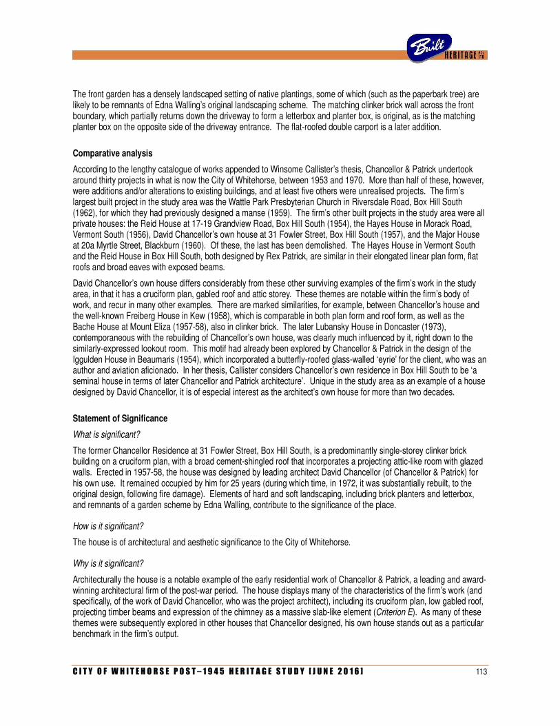
C I T Y O F W H I T E H O R S E P O S T – 1 9 4 5 H E R I T A G E S T U D Y [ J U N E 2 0 1 6 ] 113
The front garden has a densely landscaped setting of native plantings, some of which (such as the paperbark tree) are likely to be remnants of Edna Walling’s original landscaping scheme. The matching clinker brick wall across the front boundary, which partially returns down the driveway to form a letterbox and planter box, is original, as is the matching planter box on the opposite side of the driveway entrance. The flat-roofed double carport is a later addition.
Comparative analysis
According to the lengthy catalogue of works appended to Winsome Callister’s thesis, Chancellor & Patrick undertook around thirty projects in what is now the City of Whitehorse, between 1953 and 1970. More than half of these, however, were additions and/or alterations to existing buildings, and at least five others were unrealised projects. The firm’s largest built project in the study area was the Wattle Park Presbyterian Church in Riversdale Road, Box Hill South (1962), for which they had previously designed a manse (1959). The firm’s other built projects in the study area were all private houses: the Reid House at 17-19 Grandview Road, Box Hill South (1954), the Hayes House in Morack Road, Vermont South (1956), David Chancellor’s own house at 31 Fowler Street, Box Hill South (1957), and the Major House at 20a Myrtle Street, Blackburn (1960). Of these, the last has been demolished. The Hayes House in Vermont South and the Reid House in Box Hill South, both designed by Rex Patrick, are similar in their elongated linear plan form, flat roofs and broad eaves with exposed beams.
David Chancellor’s own house differs considerably from these other surviving examples of the firm’s work in the study area, in that it has a cruciform plan, gabled roof and attic storey. These themes are notable within the firm’s body of work, and recur in many other examples. There are marked similarities, for example, between Chancellor’s house and the well-known Freiberg House in Kew (1958), which is comparable in both plan form and roof form, as well as the Bache House at Mount Eliza (1957-58), also in clinker brick. The later Lubansky House in Doncaster (1973), contemporaneous with the rebuilding of Chancellor’s own house, was clearly much influenced by it, right down to the similarly-expressed lookout room. This motif had already been explored by Chancellor & Patrick in the design of the Iggulden House in Beaumaris (1954), which incorporated a butterfly-roofed glass-walled ‘eyrie’ for the client, who was an author and aviation aficionado. In her thesis, Callister considers Chancellor’s own residence in Box Hill South to be ‘a seminal house in terms of later Chancellor and Patrick architecture’. Unique in the study area as an example of a house designed by David Chancellor, it is of especial interest as the architect’s own house for more than two decades.
Statement of Significance
What is significant?
The former Chancellor Residence at 31 Fowler Street, Box Hill South, is a predominantly single-storey clinker brick building on a cruciform plan, with a broad cement-shingled roof that incorporates a projecting attic-like room with glazed walls. Erected in 1957-58, the house was designed by leading architect David Chancellor (of Chancellor & Patrick) for his own use. It remained occupied by him for 25 years (during which time, in 1972, it was substantially rebuilt, to the original design, following fire damage). Elements of hard and soft landscaping, including brick planters and letterbox, and remnants of a garden scheme by Edna Walling, contribute to the significance of the place.
How is it significant?
The house is of architectural and aesthetic significance to the City of Whitehorse.
Why is it significant?
Architecturally the house is a notable example of the early residential work of Chancellor & Patrick, a leading and award-winning architectural firm of the post-war period. The house displays many of the characteristics of the firm’s work (and specifically, of the work of David Chancellor, who was the project architect), including its cruciform plan, low gabled roof, projecting timber beams and expression of the chimney as a massive slab-like element (Criterion E). As many of these themes were subsequently explored in other houses that Chancellor designed, his own house stands out as a particular benchmark in the firm’s output.
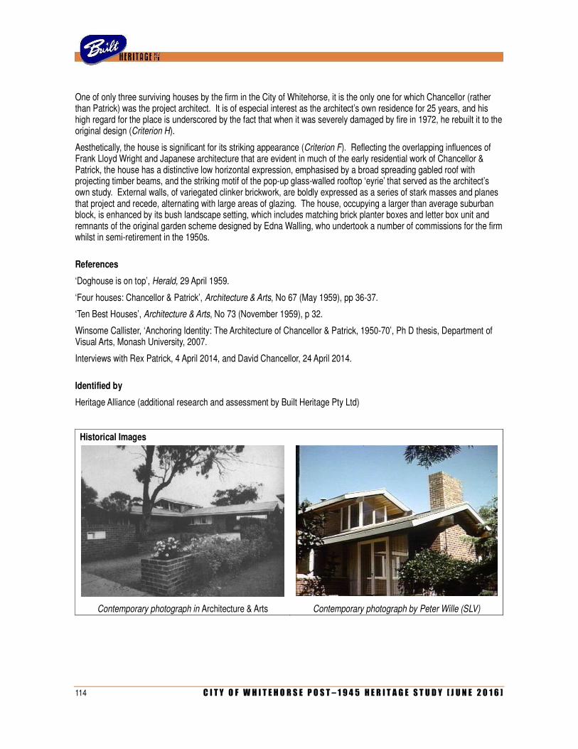
114 C I T Y O F W H I T E H O R S E P O S T – 1 9 4 5 H E R I T A G E S T U D Y [ J U N E 2 0 1 6 ]
One of only three surviving houses by the firm in the City of Whitehorse, it is the only one for which Chancellor (rather than Patrick) was the project architect. It is of especial interest as the architect’s own residence for 25 years, and his high regard for the place is underscored by the fact that when it was severely damaged by fire in 1972, he rebuilt it to the original design (Criterion H).
Aesthetically, the house is significant for its striking appearance (Criterion F). Reflecting the overlapping influences of Frank Lloyd Wright and Japanese architecture that are evident in much of the early residential work of Chancellor & Patrick, the house has a distinctive low horizontal expression, emphasised by a broad spreading gabled roof with projecting timber beams, and the striking motif of the pop-up glass-walled rooftop ‘eyrie’ that served as the architect’s own study. External walls, of variegated clinker brickwork, are boldly expressed as a series of stark masses and planes that project and recede, alternating with large areas of glazing. The house, occupying a larger than average suburban block, is enhanced by its bush landscape setting, which includes matching brick planter boxes and letter box unit and remnants of the original garden scheme designed by Edna Walling, who undertook a number of commissions for the firm whilst in semi-retirement in the 1950s.
References
‘Doghouse is on top’, Herald, 29 April 1959.
‘Four houses: Chancellor & Patrick’, Architecture & Arts, No 67 (May 1959), pp 36-37.
‘Ten Best Houses’, Architecture & Arts, No 73 (November 1959), p 32.
Winsome Callister, ‘Anchoring Identity: The Architecture of Chancellor & Patrick, 1950-70’, Ph D thesis, Department of Visual Arts, Monash University, 2007.
Interviews with Rex Patrick, 4 April 2014, and David Chancellor, 24 April 2014.
Identified by
Heritage Alliance (additional research and assessment by Built Heritage Pty Ltd)
Historical Images
Contemporary photograph in Architecture & Arts Contemporary photograph by Peter Wille (SLV)
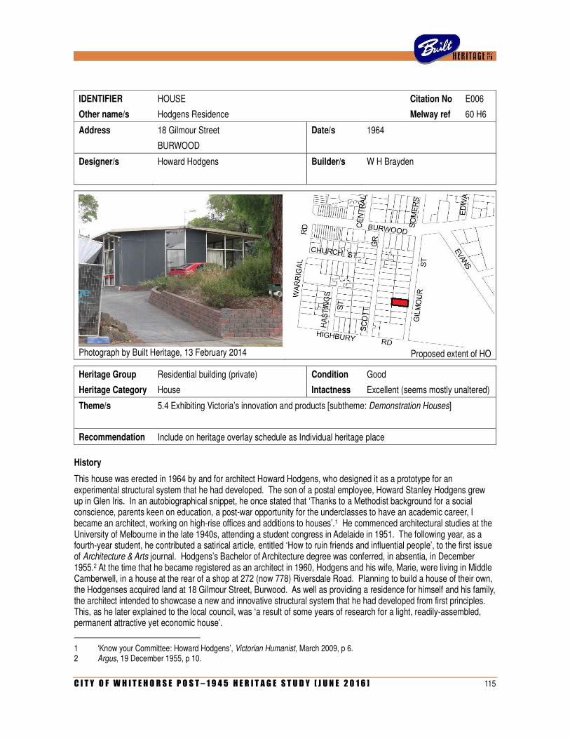
C I T Y O F W H I T E H O R S E P O S T – 1 9 4 5 H E R I T A G E S T U D Y [ J U N E 2 0 1 6 ] 115
IDENTIFIER HOUSE Citation No E006
Other name/s Hodgens Residence Melway ref 60 H6
Address 18 Gilmour Street Date/s 1964
BURWOOD
Designer/s Howard Hodgens Builder/s W H Brayden
Photograph by Built Heritage, 13 February 2014
Proposed extent of HO
Heritage Group Residential building (private) Condition Good
Heritage Category House Intactness Excellent (seems mostly unaltered)
Theme/s 5.4 Exhibiting Victoria’s innovation and products [subtheme: Demonstration Houses]
Recommendation Include on heritage overlay schedule as Individual heritage place
History
This house was erected in 1964 by and for architect Howard Hodgens, who designed it as a prototype for an experimental structural system that he had developed. The son of a postal employee, Howard Stanley Hodgens grew up in Glen Iris. In an autobiographical snippet, he once stated that ‘Thanks to a Methodist background for a social conscience, parents keen on education, a post-war opportunity for the underclasses to have an academic career, I became an architect, working on high-rise offices and additions to houses’.1 He commenced architectural studies at the University of Melbourne in the late 1940s, attending a student congress in Adelaide in 1951. The following year, as a fourth-year student, he contributed a satirical article, entitled ‘How to ruin friends and influential people’, to the first issue of Architecture & Arts journal. Hodgens’s Bachelor of Architecture degree was conferred, in absentia, in December 1955.2 At the time that he became registered as an architect in 1960, Hodgens and his wife, Marie, were living in Middle Camberwell, in a house at the rear of a shop at 272 (now 778) Riversdale Road. Planning to build a house of their own, the Hodgenses acquired land at 18 Gilmour Street, Burwood. As well as providing a residence for himself and his family, the architect intended to showcase a new and innovative structural system that he had developed from first principles. This, as he later explained to the local council, was ‘a result of some years of research for a light, readily-assembled, permanent attractive yet economic house’.
1 ‘Know your Committee: Howard Hodgens’, Victorian Humanist, March 2009, p 6. 2 Argus, 19 December 1955, p 10.
116 C I T Y O F W H I T E H O R S E P O S T – 1 9 4 5 H E R I T A G E S T U D Y [ J U N E 2 0 1 6 ]
Hodgens’s system effectively comprised a light steel framework into which modular four-foot (760mm) panels were inserted to create solid walling or windows as required. The steel framing, of 1⅝ inch (41mm) sections, was connected using a patented locking nut, and the panels attached with steel ties and small wedge-like pieces of timber, sealed with mastic (a waterproof sealant paste). The solid panels were of two-inch (50mm) chipboard clad with asbestos sheeting and sealed with autoclaved baked enamel to provide a ‘permanent colour finish’. Known by the proprietary name of OKAL board, these panels had been used in commercial buildings (especially multi-storey office blocks) for some time, but had not yet been applied to suburban-scale detached dwellings. Hodgens referred to his system as ‘Okalstrut’.
According to the Certificate of Title, ownership of the Gilmour Street site was transferred to Howard and Marie Hodgens in July 1963. Working drawings for the house, dated early August of that year, proposed a three-bedroom dwelling on a compact rectangular plan generated by the crucial four-foot module. A degree of flexibility was included, with the largest bedroom designated as a ‘future family room’ (an early use of that term), and two extra bedrooms shown at the far end of the house as a future stage. In applying for his building permit, Hodgens provided considerable supporting documentation, including structural computations and results of various tests that had been conducted on OKAL board by bodies including the Department of Health, the Commonwealth Experimental Building Research Station and the Forestry Products and Building Research divisions of the CSIRO. On 23 September, the City of Box Hill issued a building permit for what was described in the specification as a ‘steel-framed panel-type house’, estimated to cost £3,500. The builder was identified as W H Brayden of Rosamond Court, East Doncaster.
Swiftness of construction was one of the qualities inherent in Hodgens’s system, and it was later reported that ‘once the floor slab was set and the components delivered, the external shell of the house was erected in several days’. In August 1964, the building was profiled in the weekly column of the Age/RAIA Small Homes Service (then under the directorship of architect Jack Clarke). In this article, Clarke praised Hodgens’s ingenuity, stating that his system, ‘if adopted, could revolutionise the industry and bring it in line with other major Australian industries which became fully industrialised years ago’. Attention was drawn to the many innovations, which included the concealment of electrical wiring in tubular ducts in the chipboard panels, and the embedding of hot water reticulation pipes in the concrete slab so as to provide central heating as well as ‘unlimited hot water’. It was pointed out that the two-inch thick walls created an additional 1,750 feet of floor area when compared to a traditional brick veneer house of the same perimeter, and that the cost of construction could have been reduced even further had Hodgens specified a plainer type of panel, available from the same manufacturer, rather than the enamel-finished type. Notwithstanding its experimental construction, the house did not look out of place in the suburban context, with the photograph accompanying Clarke’s article bearing a caption observing that ‘the only hint of unconventional construction is given by the regular four-foot division of window and wall’.
At the time he applied for a building permit, Hodgens informed the council that a number of interested parties had already expressed a desire to inspect the finished house, including the State Savings Bank, the Housing Commission of Victoria and the Commonwealth Experimental Building Research Station. While it has not yet been established how influential Hodgens’s system was, and if any other examples were ever built, the architect himself championed the idea for many years afterwards. In 1967, he attended a building industry congress at Monash University and predicted that there would be ‘significant expansion in lightweight systems’. Presumably in anticipation of this, in June 1969 he applied for an Australian patent for his own system (AU 1560766 A). Four months later, he published a lengthy article in Architecture in Australia, the RAIA’s national journal, entitled ‘Industrialised building: lightweight systems’, in which he outlined its advantages and cited recent examples from Great Britain, Germany, Italy and Sweden, as well as a few local manifestations by other architects.
Hodgens subsequently undertook postgraduate study at Melbourne University, completing a thesis entitled ‘Town Planning and Political Support’ in 1971 and receiving his Diploma of Town &Regional Planning the following year. He served as executive planner of the Melbourne Underground Rail Loop Authority until December 1974. Hodgens’s inventive mind saw him develop other bold ideas, and, in 1989, he applied for a US patent for a new type of building component described as ‘a louvre screen or blind comprising a number of blades located in side by side parallel relationship extending between two spaced apart framework members’ (US 07/432,524). As recently as August 2000, Hodgens applied for another Australian patent for ‘a co-ordinated lightweight industrial panel system’ (PQ 9451).
C I T Y O F W H I T E H O R S E P O S T – 1 9 4 5 H E R I T A G E S T U D Y [ J U N E 2 0 1 6 ] 117
Description
The house at 18 Gilmour Street, Burwood, is a single-storey steel-framed house on a compact rectangular plan with a low-pitched gabled roof with broad eaves along the two side walls. Laid out on a modular plan based on a module of four feet (1200mm), the elevational treatment is necessarily regular and repetitive. The street façade, which is six modules wide, is balanced without being fully symmetrical: it comprises two solid panels, one window, one solid panel, then two windows. The window bays are full-height, each having a tripartite arrangement with a central awning sash and smaller fixed sashes above and below. Window frames are painted white, while the operable sashes (and the solid panels) are finished in a dark grey. The front door is set into a recessed porch along the side (south) elevation, opening off a flat-roofed carport. This carport is an original element, as it is shown on the 1963 plans.
Comparative Analysis
As an experimental house that was erected to demonstrate a new structural system devised by the architect himself, this house has few, if any, direct comparators in the City of Whitehorse. Architects’ own houses are traditionally boldly innovative and often experimental, as the designer is not curtailed by the requirements of a client. In this broad sense, the house is comparable to other architect’s own houses in the study area, notably Charles Weight’s house at 1 Gracefield Drive, Box Hill North (1954) and Stuart McIntosh’s house at 24 Arnott Street, Mont Albert North (1956).
As a dwelling that was built to demonstrate a particular construction system, this house can also be broadly compared to the exhibition houses that were erected by the manufacturers of building products from the mid-1950s to the early 1960s. These include the houses erected at 235 Whitehorse Road, Blackburn (Fibrolite, 1955), 231 Whitehorse Road, Blackburn (Victorboard Insulwool, 1958) and 531 Mitcham Road, Vermont (James Hardie & Company, 1962). None of these, however, remains particularly demonstrative of this tradition. The first has been demolished, the second altered beyond recognition and the third reclad in weatherboard, removing the asbestos cement cladding that it was originally intended to showcase. The only other house that is somewhat comparable to Hodgens’s in this respect is the former exhibition house at 453 Whitehorse Road, Mitcham (1957), which incorporated some innovations such as steel framing, open-web steel roof joists and structural plasterwork. However, it was not an entirely new and experimental structural system, as was the case with Hodgens’s own house. Ultimately, steel framed houses would not become more common in Melbourne until the 1970s, demonstrated in the study area by some of the houses on the Merchant Builders development in Vermont South (1970s).
Statement of Significance
What is significant?
The house at 18 Gilmour Street, Burwood, is a single-storey modernist house on a modular rectangular plan, with a low gabled roof. Erected in 1964, it used an innovative new construction system based on prefabricated sandwich panels that were inserted into a light steel framework, which was devised and patented by its architect owner, Howard Hodgens.
How is it significant?
The house is of architectural and scientific (technological) significance to the City of Whitehorse.
Why is it significant?
Architecturally, the house is significant as a notably early manifestation of a burgeoning trend towards industrialised building systems in post-war residential architecture, which would not become more widely accepted until the later 1960s and ‘1970s (Criterion A). Considered more broadly as an example of an architect’s own residence erected using a constructional system of his own devising, the house has few, if indeed any, direct comparators in the municipality.
Technologically, the house is significant as for its innovative construction system, involving a light steel frame into which factory-made chipboard panels are inserted and fixed to create solid walls (Criterion F). At the time of its construction, this technology had been used for commercial and industrial buildings but never before applied to a detached private residence.

118 C I T Y O F W H I T E H O R S E P O S T – 1 9 4 5 H E R I T A G E S T U D Y [ J U N E 2 0 1 6 ]
References
Documentation for former City of Box Hill Building Permit No 18,422, issued 23 September 1963. City of Whitehorse.
Jack Clarke, ‘The Building Industry Skeleton’, Age, 17 August 1964, p 8.
Howard Hodgens, ‘Industrialised building: Lightweight systems’, Architecture in Australia, October 1969, pp 841-857.
Identified by
Built Heritage Pty Ltd
Historical Image
Contemporary photograph from the Age newspaper(1964)
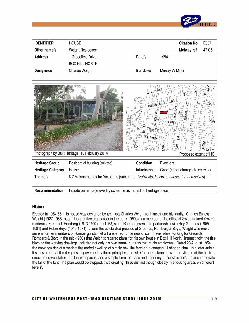
C I T Y O F W H I T E H O R S E P O S T – 1 9 4 5 H E R I T A G E S T U D Y [ J U N E 2 0 1 6 ] 119
IDENTIFIER HOUSE Citation No E007
Other name/s Weight Residence Melway ref 47 C5
Address 1 Gracefield Drive Date/s 1954
BOX HILL NORTH
Designer/s Charles Weight Builder/s Murray W Miller
Photograph by Built Heritage, 13 February 2014
Proposed extent of HO
Heritage Group Residential building (private) Condition Excellent
Heritage Category House Intactness Good (minor changes to exterior)
Theme/s 6.7 Making homes for Victorians (subtheme: Architects designing houses for themselves)
Recommendation Include on heritage overlay schedule as Individual heritage place
History
Erected in 1954-55, this house was designed by architect Charles Weight for himself and his family. Charles Ernest Weight (1927-1968) began his architectural career in the early 1950s as a member of the office of Swiss-trained émigré modernist Frederick Romberg (1913-1992). In 1953, when Romberg went into partnership with Roy Grounds (1905-1981) and Robin Boyd (1919-1971) to form the celebrated practice of Grounds, Romberg & Boyd, Weight was one of several former members of Romberg’s staff who transferred to the new office. It was while working for Grounds, Romberg & Boyd in the mid-1950s that Weight prepared plans for his own house in Box Hill North. Interestingly, the title block to the working drawings included not only his own name, but also that of his employers. Dated 28 August 1954, the drawings depict a modest flat-roofed dwelling of simple box-like form on a compact H-shaped plan. In a later article, it was stated that the design was governed by three principles: a desire for open planning with the kitchen at the centre, direct cross-ventilation to all major spaces, and a simple form for ‘ease and economy of construction’. To accommodate the fall of the land, the plan would be stepped, thus creating ‘three distinct though closely interlocking areas on different levels’.
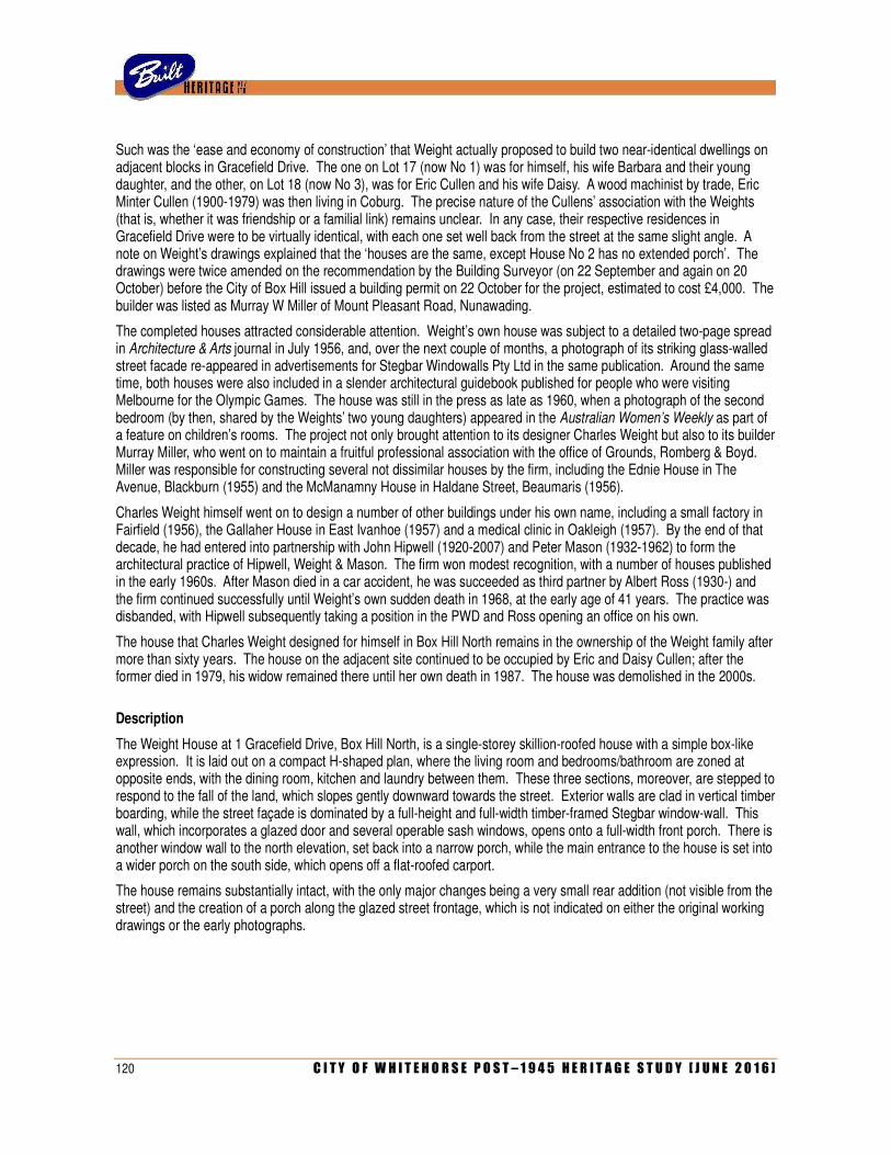
120 C I T Y O F W H I T E H O R S E P O S T – 1 9 4 5 H E R I T A G E S T U D Y [ J U N E 2 0 1 6 ]
Such was the ‘ease and economy of construction’ that Weight actually proposed to build two near-identical dwellings on adjacent blocks in Gracefield Drive. The one on Lot 17 (now No 1) was for himself, his wife Barbara and their young daughter, and the other, on Lot 18 (now No 3), was for Eric Cullen and his wife Daisy. A wood machinist by trade, Eric Minter Cullen (1900-1979) was then living in Coburg. The precise nature of the Cullens’ association with the Weights (that is, whether it was friendship or a familial link) remains unclear. In any case, their respective residences in Gracefield Drive were to be virtually identical, with each one set well back from the street at the same slight angle. A note on Weight’s drawings explained that the ‘houses are the same, except House No 2 has no extended porch’. The drawings were twice amended on the recommendation by the Building Surveyor (on 22 September and again on 20 October) before the City of Box Hill issued a building permit on 22 October for the project, estimated to cost £4,000. The builder was listed as Murray W Miller of Mount Pleasant Road, Nunawading.
The completed houses attracted considerable attention. Weight’s own house was subject to a detailed two-page spread in Architecture & Arts journal in July 1956, and, over the next couple of months, a photograph of its striking glass-walled street facade re-appeared in advertisements for Stegbar Windowalls Pty Ltd in the same publication. Around the same time, both houses were also included in a slender architectural guidebook published for people who were visiting Melbourne for the Olympic Games. The house was still in the press as late as 1960, when a photograph of the second bedroom (by then, shared by the Weights’ two young daughters) appeared in the Australian Women’s Weekly as part of a feature on children’s rooms. The project not only brought attention to its designer Charles Weight but also to its builder Murray Miller, who went on to maintain a fruitful professional association with the office of Grounds, Romberg & Boyd. Miller was responsible for constructing several not dissimilar houses by the firm, including the Ednie House in The Avenue, Blackburn (1955) and the McManamny House in Haldane Street, Beaumaris (1956).
Charles Weight himself went on to design a number of other buildings under his own name, including a small factory in Fairfield (1956), the Gallaher House in East Ivanhoe (1957) and a medical clinic in Oakleigh (1957). By the end of that decade, he had entered into partnership with John Hipwell (1920-2007) and Peter Mason (1932-1962) to form the architectural practice of Hipwell, Weight & Mason. The firm won modest recognition, with a number of houses published in the early 1960s. After Mason died in a car accident, he was succeeded as third partner by Albert Ross (1930-) and the firm continued successfully until Weight’s own sudden death in 1968, at the early age of 41 years. The practice was disbanded, with Hipwell subsequently taking a position in the PWD and Ross opening an office on his own.
The house that Charles Weight designed for himself in Box Hill North remains in the ownership of the Weight family after more than sixty years. The house on the adjacent site continued to be occupied by Eric and Daisy Cullen; after the former died in 1979, his widow remained there until her own death in 1987. The house was demolished in the 2000s.
Description
The Weight House at 1 Gracefield Drive, Box Hill North, is a single-storey skillion-roofed house with a simple box-like expression. It is laid out on a compact H-shaped plan, where the living room and bedrooms/bathroom are zoned at opposite ends, with the dining room, kitchen and laundry between them. These three sections, moreover, are stepped to respond to the fall of the land, which slopes gently downward towards the street. Exterior walls are clad in vertical timber boarding, while the street façade is dominated by a full-height and full-width timber-framed Stegbar window-wall. This wall, which incorporates a glazed door and several operable sash windows, opens onto a full-width front porch. There is another window wall to the north elevation, set back into a narrow porch, while the main entrance to the house is set into a wider porch on the south side, which opens off a flat-roofed carport.
The house remains substantially intact, with the only major changes being a very small rear addition (not visible from the street) and the creation of a porch along the glazed street frontage, which is not indicated on either the original working drawings or the early photographs.
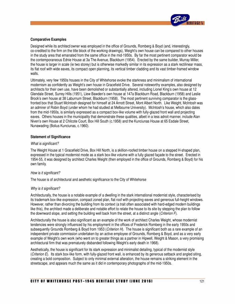
C I T Y O F W H I T E H O R S E P O S T – 1 9 4 5 H E R I T A G E S T U D Y [ J U N E 2 0 1 6 ] 121
Comparative Examples
Designed while its architect/owner was employed in the office of Grounds, Romberg & Boyd (and, interestingly, co-credited to the firm on the title block of the working drawings), Weight’s own house can be compared to other houses in the study area that emanated from the same office in the mid-1950s. By far the most pertinent comparator would be the contemporaneous Ednie House at 3a The Avenue, Blackburn (1954). Erected by the same builder, Murray Miller, the house is larger in scale (ie two storey) but is otherwise markedly similar in its expression as a stark rectilinear mass, its flat roof with wide eaves, its compact open planning, its vertical timber cladding and its vast timber-framed window walls.
Ultimately, very few 1950s houses in the City of Whitehorse evoke the starkness and minimalism of international modernism as confidently as Weight’s own house in Gracefield Drive. Several noteworthy examples, also designed by architects for their own use, have been demolished or substantially altered, including Lionel King’s own house at 12 Glendale Street, Surrey Hills (1951), Llew Bawden’s own house at 147a Blackburn Road, Blackburn (1958) and Leslie Brock’s own house at 38 Laburnum Street, Blackburn (1958). The most pertinent surviving comparator is the glass-fronted box that Stuart McIntosh designed for himself at 24 Arnott Street, Mont Albert North. Like Weight, McIntosh was an admirer of Robin Boyd (under whom he had studied at Melbourne University). McIntosh’s house, which also dates from the mid-1950s, is similarly expressed as a compact box-like volume with fully-glazed front wall and projecting eaves. Others houses in the municipality that demonstrate these qualities, albeit in a less adroit manner, include Alan Niven’s own House at 2 Chilcote Court, Box Hill South (c.1958) and the Kunciunas House at 65 Esdale Street, Nunawading (Bolius Kunciunas, c.1960).
Statement of Significance
What is significant?
The Weight House at 1 Gracefield Drive, Box Hill North, is a skillion-roofed timber house on a stepped H-shaped plan, expressed in the typical modernist mode as a stark box-like volume with a fully glazed façade to the street. Erected in 1954-55, it was designed by architect Charles Weight (then employed in the office of Grounds, Romberg & Boyd) for his own family.
How is it significant?
The house is of architectural and aesthetic significance to the City of Whitehorse
Why is it significant?
Architecturally, the house is a notable example of a dwelling in the stark international modernist style, characterised by its trademark box-like expression, compact zoned plan, flat roof with projecting eaves and generous full-height windows. However, rather than divorcing the building from its context (a trait often associated with hard-edged modern buildings like this), the architect made a deliberate and notable effort to relate the house to its site by stepping the plan to follow the downward slope, and setting the building well back from the street, at a distinct angle (Criterion F).
Architecturally the house is also significant as an example of the work of architect Charles Weight, whose modernist tendencies were strongly influenced by his employment in the offices of Frederick Romberg in the early 1950s and subsequently Grounds Romberg & Boyd from 1953 (Criterion H). The house is significant both as a rare example of an independent private commission undertaken by an active employee of Grounds, Romberg & Boyd, and as a very early example of Weight’s own work (who went on to greater things as a partner in Hipwell, Weight & Mason, a very promising architectural firm that was prematurely disbanded following Weight’s early death in 1968).
Aesthetically, the house is significant for its stark expression and minimalist detailing, typical of the modernist style (Criterion E). Its stark box-like form, with fully-glazed front wall, is enhanced by its generous setback and angled siting, creating a bold composition. Subject to only minimal external alteration, the house remains a striking element in the streetscape, and appears much the same as it did in contemporary photographs of the mid-1950s.
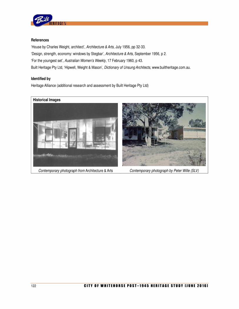
122 C I T Y O F W H I T E H O R S E P O S T – 1 9 4 5 H E R I T A G E S T U D Y [ J U N E 2 0 1 6 ]
References
‘House by Charles Weight, architect’, Architecture & Arts, July 1956, pp 32-33.
‘Design, strength, economy: windows by Stegbar’, Architecture & Arts, September 1956, p 2.
‘For the youngest set’, Australian Women’s Weekly, 17 February 1960, p 43.
Built Heritage Pty Ltd, ‘Hipwell, Weight & Mason’, Dictionary of Unsung Architects, www.builtheritage.com.au.
Identified by
Heritage Alliance (additional research and assessment by Built Heritage Pty Ltd)
Historical Images
Contemporary photograph from Architecture & Arts Contemporary photograph by Peter Wille (SLV)
C I T Y O F W H I T E H O R S E P O S T – 1 9 4 5 H E R I T A G E S T U D Y [ J U N E 2 0 1 6 ] 123
IDENTIFIER HOUSE Citation No E008
Other name/s Gibson Residence (former) Melway ref 47 A10
Address 17 Grange Street Date/s 1967
MONT ALBERT
Designer/s Bernard Joyce & Associates Builder/s Alan Gibson
(Max Hamilton, associate in charge)
Photograph by Built Heritage, 13 February 2014
Proposed extent of HO
Heritage Group Residential building (private) Condition Excellent (seems well maintained)
Heritage Category House Intactness Excellent (seems largely unaltered)
Theme/s 6.7 Making homes for Victorians
Recommendation Include on heritage overlay schedule as Individual heritage place
History
This house was erected in 1965-66 for builder Alan Gibson, and was designed by architects Bernard Joyce & Associates. Born in Queensland, Alan Martin Gibson (1915-1987) had settled in Victoria by the late 1930s, when he was working as a labourer in Warracknabeal. He later lived in Beaumaris, where, in 1943, he married Elizabeth Rose Leverington (1923-1965). During the Second World War, Gibson served with the 22 Australian Infantry Battalion before being discharged in November 1945 with the rank of Corporal. After the War, he and his wife continued to reside in Beaumaris, where he worked as a sawyer. In the mid-1950s, the Gibson family (by then including three young children) relocated to Ringwood, with electoral rolls listing Alan’s profession as a builder.
Elizabeth Gibson died suddenly in March 1965 and, later that year, her husband decided to build a new house in Grange Street, Mont Albert. This, however, was not intended for his own occupation but rather as a ‘new speculative house for the upper middle-income market’. To design the new house, Gibson turned to the architectural firm of Bernard Joyce Associates, which had only been founded the previous year. Bernard Joyce (1929-1993) was an Englishman who had worked as an architect in London before migrating to Australia in 1950. Resuming his studies at the University of Melbourne, he graduated in 1955 and, over the next few years, achieved success in several design competitions, often in collaboration with fellow graduates David Brunton and John Thornes-Lily.
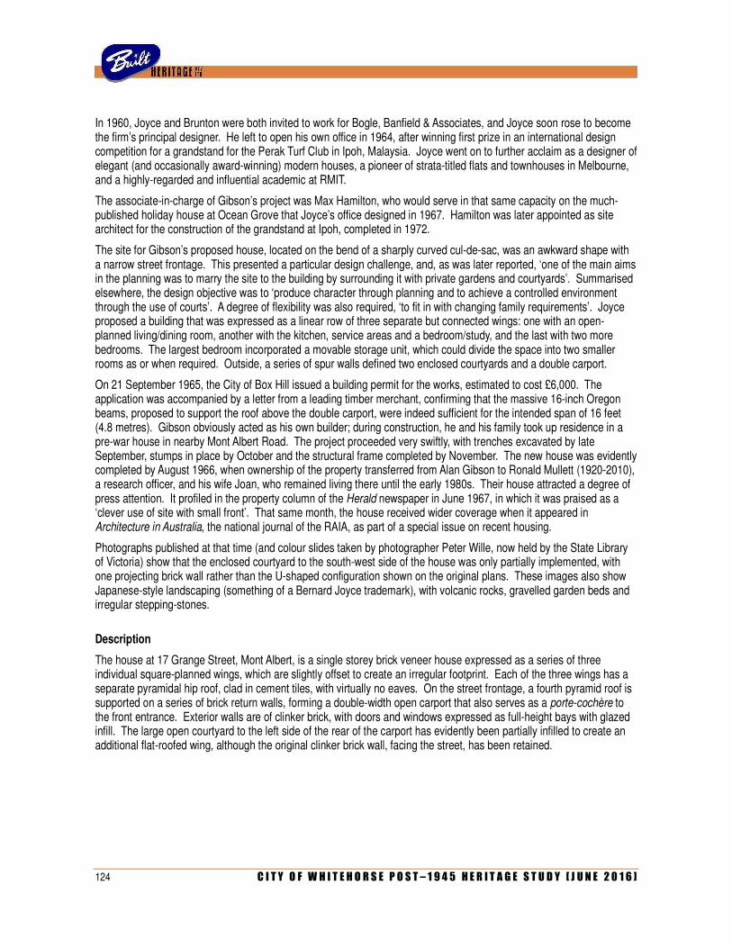
124 C I T Y O F W H I T E H O R S E P O S T – 1 9 4 5 H E R I T A G E S T U D Y [ J U N E 2 0 1 6 ]
In 1960, Joyce and Brunton were both invited to work for Bogle, Banfield & Associates, and Joyce soon rose to become the firm’s principal designer. He left to open his own office in 1964, after winning first prize in an international design competition for a grandstand for the Perak Turf Club in Ipoh, Malaysia. Joyce went on to further acclaim as a designer of elegant (and occasionally award-winning) modern houses, a pioneer of strata-titled flats and townhouses in Melbourne, and a highly-regarded and influential academic at RMIT.
The associate-in-charge of Gibson’s project was Max Hamilton, who would serve in that same capacity on the much-published holiday house at Ocean Grove that Joyce’s office designed in 1967. Hamilton was later appointed as site architect for the construction of the grandstand at Ipoh, completed in 1972.
The site for Gibson’s proposed house, located on the bend of a sharply curved cul-de-sac, was an awkward shape with a narrow street frontage. This presented a particular design challenge, and, as was later reported, ‘one of the main aims in the planning was to marry the site to the building by surrounding it with private gardens and courtyards’. Summarised elsewhere, the design objective was to ‘produce character through planning and to achieve a controlled environment through the use of courts’. A degree of flexibility was also required, ‘to fit in with changing family requirements’. Joyce proposed a building that was expressed as a linear row of three separate but connected wings: one with an open-planned living/dining room, another with the kitchen, service areas and a bedroom/study, and the last with two more bedrooms. The largest bedroom incorporated a movable storage unit, which could divide the space into two smaller rooms as or when required. Outside, a series of spur walls defined two enclosed courtyards and a double carport.
On 21 September 1965, the City of Box Hill issued a building permit for the works, estimated to cost £6,000. The application was accompanied by a letter from a leading timber merchant, confirming that the massive 16-inch Oregon beams, proposed to support the roof above the double carport, were indeed sufficient for the intended span of 16 feet (4.8 metres). Gibson obviously acted as his own builder; during construction, he and his family took up residence in a pre-war house in nearby Mont Albert Road. The project proceeded very swiftly, with trenches excavated by late September, stumps in place by October and the structural frame completed by November. The new house was evidently completed by August 1966, when ownership of the property transferred from Alan Gibson to Ronald Mullett (1920-2010), a research officer, and his wife Joan, who remained living there until the early 1980s. Their house attracted a degree of press attention. It profiled in the property column of the Herald newspaper in June 1967, in which it was praised as a ‘clever use of site with small front’. That same month, the house received wider coverage when it appeared in Architecture in Australia, the national journal of the RAIA, as part of a special issue on recent housing.
Photographs published at that time (and colour slides taken by photographer Peter Wille, now held by the State Library of Victoria) show that the enclosed courtyard to the south-west side of the house was only partially implemented, with one projecting brick wall rather than the U-shaped configuration shown on the original plans. These images also show Japanese-style landscaping (something of a Bernard Joyce trademark), with volcanic rocks, gravelled garden beds and irregular stepping-stones.
Description
The house at 17 Grange Street, Mont Albert, is a single storey brick veneer house expressed as a series of three individual square-planned wings, which are slightly offset to create an irregular footprint. Each of the three wings has a separate pyramidal hip roof, clad in cement tiles, with virtually no eaves. On the street frontage, a fourth pyramid roof is supported on a series of brick return walls, forming a double-width open carport that also serves as a porte-cochère to the front entrance. Exterior walls are of clinker brick, with doors and windows expressed as full-height bays with glazed infill. The large open courtyard to the left side of the rear of the carport has evidently been partially infilled to create an additional flat-roofed wing, although the original clinker brick wall, facing the street, has been retained.
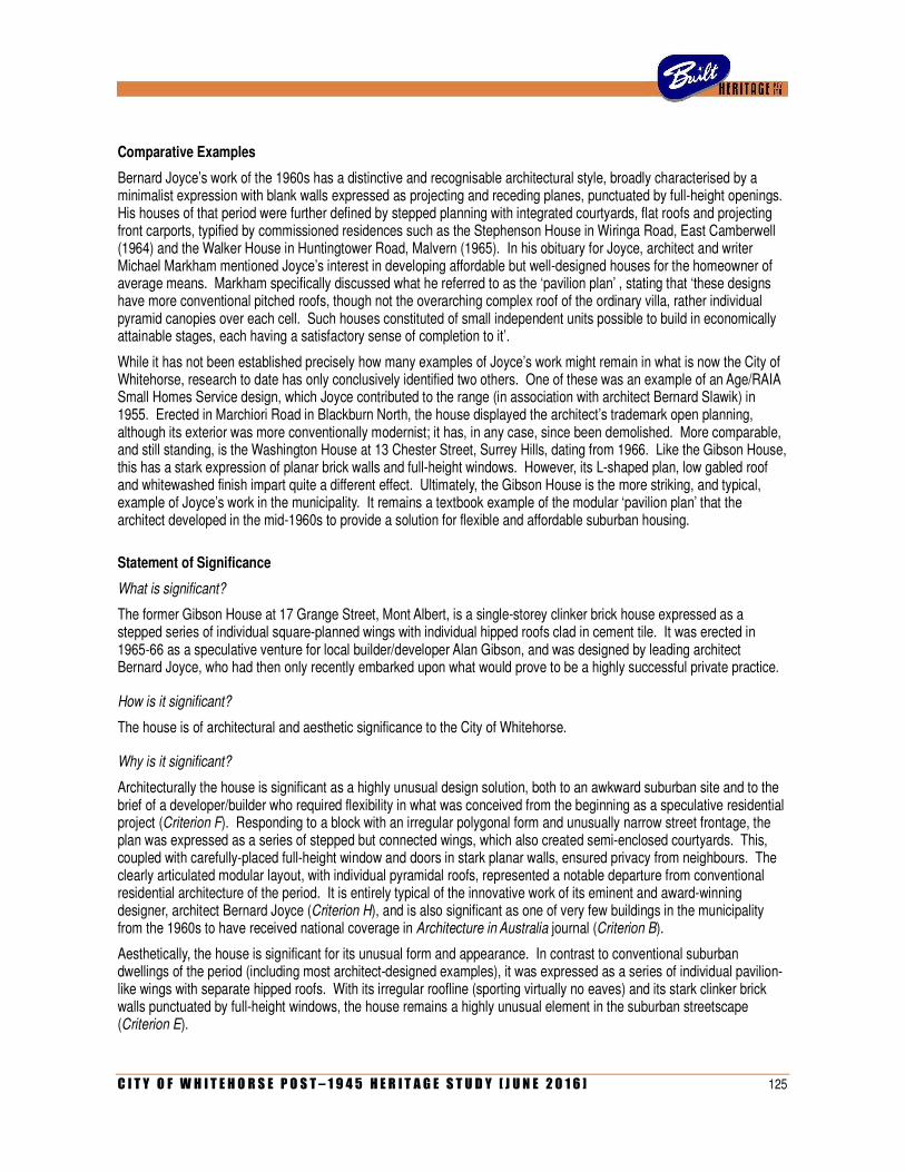
C I T Y O F W H I T E H O R S E P O S T – 1 9 4 5 H E R I T A G E S T U D Y [ J U N E 2 0 1 6 ] 125
Comparative Examples
Bernard Joyce’s work of the 1960s has a distinctive and recognisable architectural style, broadly characterised by a minimalist expression with blank walls expressed as projecting and receding planes, punctuated by full-height openings. His houses of that period were further defined by stepped planning with integrated courtyards, flat roofs and projecting front carports, typified by commissioned residences such as the Stephenson House in Wiringa Road, East Camberwell (1964) and the Walker House in Huntingtower Road, Malvern (1965). In his obituary for Joyce, architect and writer Michael Markham mentioned Joyce’s interest in developing affordable but well-designed houses for the homeowner of average means. Markham specifically discussed what he referred to as the ‘pavilion plan’ , stating that ‘these designs have more conventional pitched roofs, though not the overarching complex roof of the ordinary villa, rather individual pyramid canopies over each cell. Such houses constituted of small independent units possible to build in economically attainable stages, each having a satisfactory sense of completion to it’.
While it has not been established precisely how many examples of Joyce’s work might remain in what is now the City of Whitehorse, research to date has only conclusively identified two others. One of these was an example of an Age/RAIA Small Homes Service design, which Joyce contributed to the range (in association with architect Bernard Slawik) in 1955. Erected in Marchiori Road in Blackburn North, the house displayed the architect’s trademark open planning, although its exterior was more conventionally modernist; it has, in any case, since been demolished. More comparable, and still standing, is the Washington House at 13 Chester Street, Surrey Hills, dating from 1966. Like the Gibson House, this has a stark expression of planar brick walls and full-height windows. However, its L-shaped plan, low gabled roof and whitewashed finish impart quite a different effect. Ultimately, the Gibson House is the more striking, and typical, example of Joyce’s work in the municipality. It remains a textbook example of the modular ‘pavilion plan’ that the architect developed in the mid-1960s to provide a solution for flexible and affordable suburban housing.
Statement of Significance
What is significant?
The former Gibson House at 17 Grange Street, Mont Albert, is a single-storey clinker brick house expressed as a stepped series of individual square-planned wings with individual hipped roofs clad in cement tile. It was erected in 1965-66 as a speculative venture for local builder/developer Alan Gibson, and was designed by leading architect Bernard Joyce, who had then only recently embarked upon what would prove to be a highly successful private practice.
How is it significant?
The house is of architectural and aesthetic significance to the City of Whitehorse.
Why is it significant?
Architecturally the house is significant as a highly unusual design solution, both to an awkward suburban site and to the brief of a developer/builder who required flexibility in what was conceived from the beginning as a speculative residential project (Criterion F). Responding to a block with an irregular polygonal form and unusually narrow street frontage, the plan was expressed as a series of stepped but connected wings, which also created semi-enclosed courtyards. This, coupled with carefully-placed full-height window and doors in stark planar walls, ensured privacy from neighbours. The clearly articulated modular layout, with individual pyramidal roofs, represented a notable departure from conventional residential architecture of the period. It is entirely typical of the innovative work of its eminent and award-winning designer, architect Bernard Joyce (Criterion H), and is also significant as one of very few buildings in the municipality from the 1960s to have received national coverage in Architecture in Australia journal (Criterion B).
Aesthetically, the house is significant for its unusual form and appearance. In contrast to conventional suburban dwellings of the period (including most architect-designed examples), it was expressed as a series of individual pavilion-like wings with separate hipped roofs. With its irregular roofline (sporting virtually no eaves) and its stark clinker brick walls punctuated by full-height windows, the house remains a highly unusual element in the suburban streetscape (Criterion E).
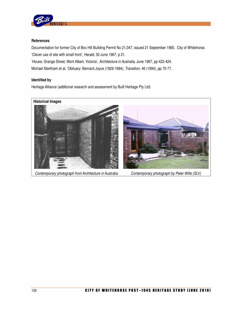
126 C I T Y O F W H I T E H O R S E P O S T – 1 9 4 5 H E R I T A G E S T U D Y [ J U N E 2 0 1 6 ]
References
Documentation for former City of Box Hill Building Permit No 21,047, issued 21 September 1965. City of Whitehorse.
‘Clever use of site with small front’, Herald, 30 June 1967, p 21.
‘House, Grange Street, Mont Albert, Victoria’, Architecture in Australia, June 1967, pp 422-424.
Michael Markham et al, ‘Obituary: Bernard Joyce (1929-1994), Transition, 46 (1994), pp 70-77.
Identified by
Heritage Alliance (additional research and assessment by Built Heritage Pty Ltd)
Historical Images
Contemporary photograph from Architecture in Australia Contemporary photograph by Peter Wille (SLV)

C I T Y O F W H I T E H O R S E P O S T – 1 9 4 5 H E R I T A G E S T U D Y [ J U N E 2 0 1 6 ] 127
IDENTIFIER HOUSE Citation No E009
Other name/s Peninsula House; Tandy Residence (former) Melway ref 48 G12
Address 4 Ian Grove Date/s 1955-56
BURWOOD
Designer/s Grounds, Romberg & Boyd (Robin Boyd) Builder/s Contemporary Homes Pty Ltd
Photograph by Built Heritage, 30 April 2014
Proposed extent of HO
Heritage Group Residential building (private) Condition Good
Heritage Category House Intactness Good (seems mostly unaltered)
Theme/s 6.7 Making homes for Victorians [subtheme: Project Housing]
Recommendation Include on heritage overlay schedule as Individual heritage place
History
Erected in 1956 for Keith and Ailsa Tandy, this dwelling was an example of Australia’s first project house, the Peninsula, which was introduced the year before by Contemporary Homes Pty Ltd. The company sprang from the homebuilding enterprise of Albert Granado Croft (1919-?), an accountant-turned-builder from Beaumaris. In March 1955, Croft engaged Robin Boyd to design the first in what would be a series of standardised low-cost house designs. Known as the Peninsula, it was a simple gable roofed three-bedroomed dwelling on a compact rectangular plan of 11.5 squares. Designed to be partly prefabricated, the house was planned on a standard module with simple repetitive fenestration and vertical timber cladding to allow for seamless connections. According to the firm’s own publicity, a Peninsula house was ready for occupation within six weeks of receiving an order, at an all-inclusive cost of only £3,140. Evidently following the tradition of the Small Homes Service, the designers of the house were initially not identified in the press, with one of the earliest published reports (in September 1955) noting only that ‘the designs have been prepared by a leading firm of architects’. It was not until the following year that the designers were publicly revealed as the firm of Grounds, Romberg & Boyd. By September 1955, a small group of prototype Peninsula houses had been erected in Beaumaris, not far from the company’s offices and factory at Advantage Road, Highett. Orders promptly flooded in, and many other dwellings were built in Melbourne’s developing suburbs. Boyd followed up his original Peninsula design with several variations referred to as the Peninsula II, Peninsula III and Peninsula IV, and an entirely new design for a similar but larger four bedroom dwelling known as the Sou’ Easter (1956).
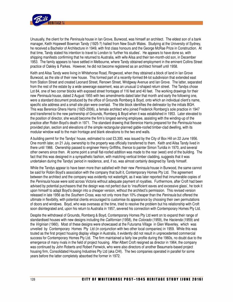
128 C I T Y O F W H I T E H O R S E P O S T – 1 9 4 5 H E R I T A G E S T U D Y [ J U N E 2 0 1 6 ]
Unusually, the client for the Peninsula house in Ian Grove, Burwood, was himself an architect. The eldest son of a bank manager, Keith Hopewell Bowman Tandy (1925-?) hailed from New South Wales. Studying at the University of Sydney, he received a Bachelor of Architecture in 1949, with first class honours and the George McRae Prize in Construction. At that time, Tandy stated his intention to travel to London to ‘further his studies’. He appears to have done so, with shipping manifests confirming that he returned to Australia, with wife Ailsa and their ten-month-old son, in December 1953. The family appears to have settled in Melbourne, where Tandy obtained employment in the eminent Collins Street practice of Oakley & Parkes. However, he did not become registered as an architect himself until 1958.
Keith and Ailsa Tandy were living in Whitehorse Road, Ringwood, when they obtained a block of land in Ian Grove Burwood, as the site of their new house. This formed part of a recently-formed 84-lot subdivision that extended east from Station Street and created Leonard Street, Renown Street, Wridgway Avenue and Ian Grove. The latter, separated from the rest of the estate by a wide sewerage easement, was an unusual U-shaped return street. The Tandys chose Lot 84, one of two corner blocks with exposed street frontages of 116 feet and 40 feet. The working drawings for their new Peninsula house, dated 2 August 1955 with two amendments dated later that month and early the following one, were a standard document produced by the office of Grounds Romberg & Boyd, onto which an individual client’s name, specific site address and a small site plan were overlaid. The title block identifies the delineator by the initials BGH. This was Berenice Ghera Harris (1925-2006), a female architect who joined Frederick Romberg’s sole practice in 1947 and transferred to the new partnership of Grounds, Romberg & Boyd when it was established in 1953. Later elevated to the position of director, she would become the firm’s longest-serving employee, assisting with the winding-up of the practice after Robin Boyd’s death in 1971. The standard drawing that Berenice Harris prepared for the Peninsula house provided plan, section and elevations of the simple rectangular-planned gable-roofed timber-clad dwelling, with its modular window wall to the main frontage and blank elevations to the two end walls.
A building permit for the Tandys’ house, estimated to cost £3,300, was issued by the City of Box Hill on 22 June 1956. One month later, on 21 July, ownership to the property was officially transferred to them. Keith and Ailsa Tandy lived in there until 1966. Ownership passed to engineer Henry Griffiths, thence to painter Simon Turidia in 1970, and several other owners since then. At some point a small flat-roofed addition was made to the rear (west) end of the building. The fact that this was designed in a sympathetic fashion, with matching vertical timber cladding, suggests that it was undertaken during the Tandys’ period in residence, and, if so, was almost certainly designed by Tandy himself.
While the Tandys appear to have been more than satisfied with their new Peninsula house in Burwood, the same cannot be said for Robin Boyd’s association with the company that built it, Contemporary Homes Pty Ltd. The agreement between the architect and the company was evidently not watertight, as it was later reported that innumerable copies of the Peninsula house were sold across Victoria without adequate payment of royalties. Furthermore, after Croft had been advised by potential purchasers that the design was not perfect due to ‘insufficient eaves and excessive glass’, he took it upon himself to adapt Boyd’s design into a cheaper version, without the architect’s permission. This revised version released in late 1956 as the Southern Cross, was not only more than 10% cheaper than the Peninsula but offered the ultimate in flexibility, with potential clients encouraged to customise its appearance by choosing their own permutations of doors and windows. Boyd, who was overseas at the time, tried to resolve the problem but his relationship with Croft soon disintegrated and, upon his return to Australia in 1957, severed his connection with Contemporary Homes Pty Ltd.
Despite the withdrawal of Grounds, Romberg & Boyd, Contemporary Homes Pty Ltd went on to expand their range of standardised houses with new designs including the Californian (1958), the Colorado (1959), the Hacienda (1959) and the Virginian (1960). Most of these designs were showcased at the Futurama Village in Glen Waverley, which was unveiled by Contemporary Homes Pty Ltd (in conjunction with two other local companies) in 1959. While this was touted as the first project housing display village in Australia, it evidently did not result in unprecedented commercial success for Contemporary Homes Pty Ltd. The firm maintained a fairly low profile during the 1960s, no doubt due to the emergence of many rivals in the field of project housing. After Albert Croft resigned as director in 1964, the company was continued by John Roberts and Robert Fenwick, who were also directors of another Beaumaris-based project housing firm, Consolidated Housing Industries Pty Ltd (aka CHI). The two companies operated in parallel for some years before the latter completely absorbed the former in 1972.
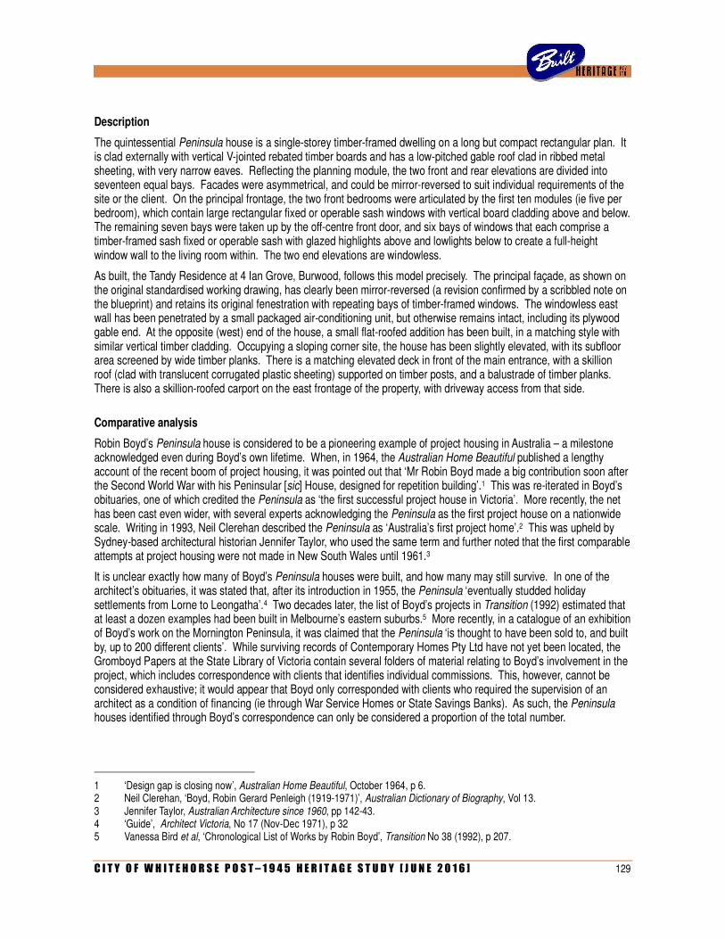
C I T Y O F W H I T E H O R S E P O S T – 1 9 4 5 H E R I T A G E S T U D Y [ J U N E 2 0 1 6 ] 129
Description
The quintessential Peninsula house is a single-storey timber-framed dwelling on a long but compact rectangular plan. It is clad externally with vertical V-jointed rebated timber boards and has a low-pitched gable roof clad in ribbed metal sheeting, with very narrow eaves. Reflecting the planning module, the two front and rear elevations are divided into seventeen equal bays. Facades were asymmetrical, and could be mirror-reversed to suit individual requirements of the site or the client. On the principal frontage, the two front bedrooms were articulated by the first ten modules (ie five per bedroom), which contain large rectangular fixed or operable sash windows with vertical board cladding above and below. The remaining seven bays were taken up by the off-centre front door, and six bays of windows that each comprise a timber-framed sash fixed or operable sash with glazed highlights above and lowlights below to create a full-height window wall to the living room within. The two end elevations are windowless.
As built, the Tandy Residence at 4 Ian Grove, Burwood, follows this model precisely. The principal façade, as shown on the original standardised working drawing, has clearly been mirror-reversed (a revision confirmed by a scribbled note on the blueprint) and retains its original fenestration with repeating bays of timber-framed windows. The windowless east wall has been penetrated by a small packaged air-conditioning unit, but otherwise remains intact, including its plywood gable end. At the opposite (west) end of the house, a small flat-roofed addition has been built, in a matching style with similar vertical timber cladding. Occupying a sloping corner site, the house has been slightly elevated, with its subfloor area screened by wide timber planks. There is a matching elevated deck in front of the main entrance, with a skillion roof (clad with translucent corrugated plastic sheeting) supported on timber posts, and a balustrade of timber planks. There is also a skillion-roofed carport on the east frontage of the property, with driveway access from that side.
Comparative analysis
Robin Boyd’s Peninsula house is considered to be a pioneering example of project housing in Australia – a milestone acknowledged even during Boyd’s own lifetime. When, in 1964, the Australian Home Beautiful published a lengthy account of the recent boom of project housing, it was pointed out that ‘Mr Robin Boyd made a big contribution soon after the Second World War with his Peninsular [sic] House, designed for repetition building’.1 This was re-iterated in Boyd’s obituaries, one of which credited the Peninsula as ‘the first successful project house in Victoria’. More recently, the net has been cast even wider, with several experts acknowledging the Peninsula as the first project house on a nationwide scale. Writing in 1993, Neil Clerehan described the Peninsula as ‘Australia’s first project home’.2 This was upheld by Sydney-based architectural historian Jennifer Taylor, who used the same term and further noted that the first comparable attempts at project housing were not made in New South Wales until 1961.3
It is unclear exactly how many of Boyd’s Peninsula houses were built, and how many may still survive. In one of the architect’s obituaries, it was stated that, after its introduction in 1955, the Peninsula ‘eventually studded holiday settlements from Lorne to Leongatha’.4 Two decades later, the list of Boyd’s projects in Transition (1992) estimated that at least a dozen examples had been built in Melbourne’s eastern suburbs.5 More recently, in a catalogue of an exhibition of Boyd’s work on the Mornington Peninsula, it was claimed that the Peninsula ‘is thought to have been sold to, and built by, up to 200 different clients’. While surviving records of Contemporary Homes Pty Ltd have not yet been located, the Gromboyd Papers at the State Library of Victoria contain several folders of material relating to Boyd’s involvement in the project, which includes correspondence with clients that identifies individual commissions. This, however, cannot be considered exhaustive; it would appear that Boyd only corresponded with clients who required the supervision of an architect as a condition of financing (ie through War Service Homes or State Savings Banks). As such, the Peninsula houses identified through Boyd’s correspondence can only be considered a proportion of the total number.
1 ‘Design gap is closing now’, Australian Home Beautiful, October 1964, p 6. 2 Neil Clerehan, ‘Boyd, Robin Gerard Penleigh (1919-1971)’, Australian Dictionary of Biography, Vol 13. 3 Jennifer Taylor, Australian Architecture since 1960, pp 142-43. 4 ‘Guide’, Architect Victoria, No 17 (Nov-Dec 1971), p 32 5 Vanessa Bird et al, ‘Chronological List of Works by Robin Boyd’, Transition No 38 (1992), p 207.
130 C I T Y O F W H I T E H O R S E P O S T – 1 9 4 5 H E R I T A G E S T U D Y [ J U N E 2 0 1 6 ]
The Gromboyd Papers identify 65 commissions for houses from Contemporary Homes Pty Ltd between 1955 and 1956, which included the four variations of the Peninsula as well as Boyd’s later Sou’ Easter design. Not surprisingly, the epicentre for these houses seems to have remained in Beaumaris, where the company’s first six prototypes were built, followed by at least another ten for private clients. The proximity to the company’s factory (initially in Highett but moved to Moorabbin in 1957) was probably another factor. Examples of the Peninsula can not only be found in Highett and Moorabbin, but also in the nearby bayside suburbs of Cheltenham, Mentone, Mordialloc and Seaford. The developing outer-eastern suburbs were another hotspot, with examples recorded in Blackburn, Forest Hill, Mitcham, Nunawading, Syndal, Glen Waverley, Mount Waverley, Templestowe, Ringwood, Park Orchards, Mooroolbark and Croydon.
Of the 65 examples documented in the Gromboyd Papers, seven (just over 10%) were located in what is now the City of Whitehorse. These comprise two in Burwood, two in Blackburn and one each in Mitcham, Forest Hill and Nunawading. One (at 22 Salisbury Avenue, Blackburn) has been demolished in recent times and others survive in varying degrees of intactness. Reflecting a trend that has been observed elsewhere in the metropolitan area, Peninsula houses are invariably subjected to significant enlargement, alteration and/or remodelling in later years, and it is rare to find examples with little or no external changes. The surviving ones at 74 Burwood Highway, Burwood, and 226 Canterbury Road, Blackburn, have both been enlarged with partial second storeys. The one on Burwood Highway, along with another at 32 Cresswell Crescent in Mitcham, have both been re-clad, with the distinctive vertical timber boards replaced by conventional weatherboards. The house at 3 Ottawa Avenue, Nunawading, was substantially renovated and extended in the early 1970s to the design of leading architect Gregory Burgess – a transformation that is of considerable interest in its own right. Aside from the subject building at 4 Ian Grove, the only other one that appears to remain largely intact is the one at 24 Jackson Street, Forest Hill. While aerial photographs suggest that it has not been enlarged at all (ie, retaining its original rectangular plan form), the house is set back from the street on a densely landscaped block, and it has not been possible to confirm whether its elevations do, indeed, remain unaltered. If, in the future, this is confirmed to be the case, this house would also be a worthwhile candidate for an individual heritage overlay.
It is worth noting that a number of houses have been identified in the City of Whitehorse that were built by Contemporary Homes Pty Ltd, but these date from after 1956 – that is to say, the period after which Boyd severed his connection with the company. Although some of these houses bear more than passing resemblance to the Peninsula house and its authorised variations, these were adapted from Boyd’s designs without the architect’s approval. As such, they are not considered to have the same degree of significance, either in a historical sense (ie as evidence of the first phase of Australia’s first project house) or in an architectural sense (ie, as authentic examples of Boyd’s work). These sort of houses are represented in the City of Whitehorse by examples in Mitcham at 22 Wattle Valley Road and 32 Dudley Street (both dating from 1958). At least three variations on stepped plans, also dating from 1958 or later, are known to have existed in the municipality: one at the corner of Highbury Road and Springvale Road, another at 4 Felicia Grove in Forest Hill and a third at 205 Dorking Street, Box Hill North (recently demolished). A variation of the standard rectangular plan, in brick veneer construction rather than timber, also exists at 26 Abelia Street, Forest Hill (1958).
Statement of Significance
What is significant?
The former Tandy Residence at 4 Ian Grove, Burwood, is a standardised single-storey timber-framed house on a rectangular plan with a low gabled roof and a modular fenestration. Erected in 1956 (based on a standard design prepared the previous year), it is an example of Australia’s first project house, the Peninsula house, introduced by Contemporary Homes Pty Ltd and designed for the company by Robin Boyd.
How is it significant?
The house is of historical and architectural significance to the City of Whitehorse.
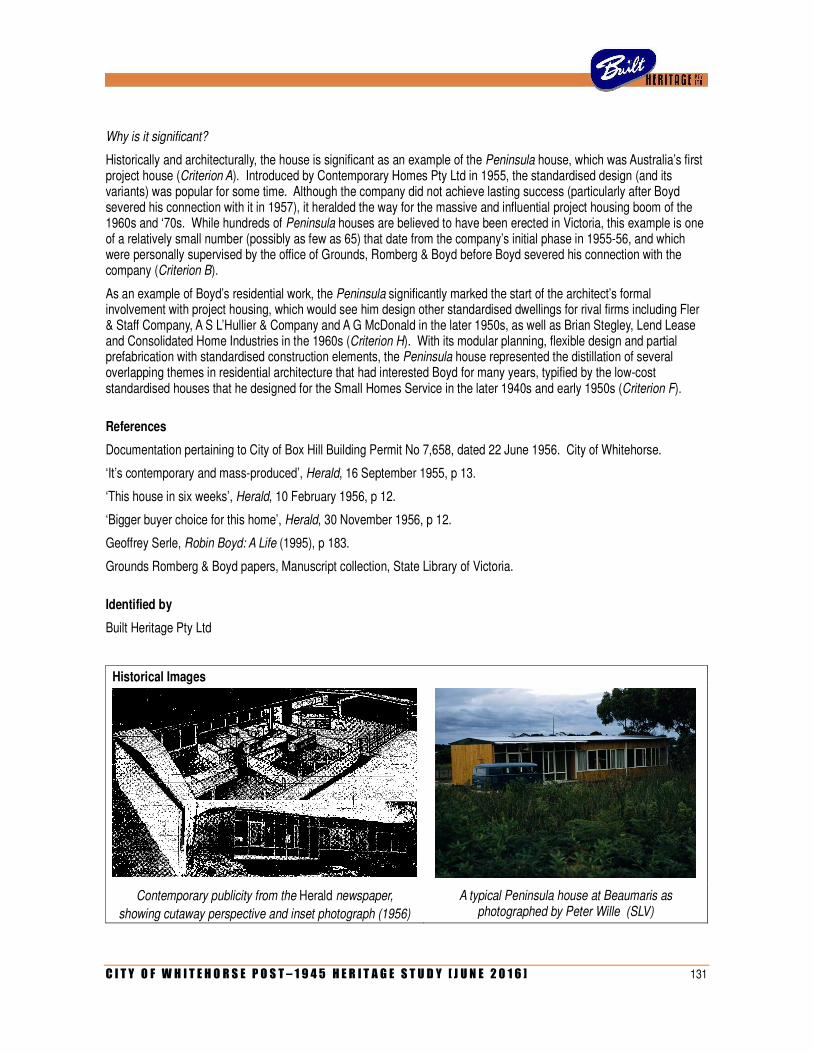
C I T Y O F W H I T E H O R S E P O S T – 1 9 4 5 H E R I T A G E S T U D Y [ J U N E 2 0 1 6 ] 131
Why is it significant?
Historically and architecturally, the house is significant as an example of the Peninsula house, which was Australia’s first project house (Criterion A). Introduced by Contemporary Homes Pty Ltd in 1955, the standardised design (and its variants) was popular for some time. Although the company did not achieve lasting success (particularly after Boyd severed his connection with it in 1957), it heralded the way for the massive and influential project housing boom of the 1960s and ‘70s. While hundreds of Peninsula houses are believed to have been erected in Victoria, this example is one of a relatively small number (possibly as few as 65) that date from the company’s initial phase in 1955-56, and which were personally supervised by the office of Grounds, Romberg & Boyd before Boyd severed his connection with the company (Criterion B).
As an example of Boyd’s residential work, the Peninsula significantly marked the start of the architect’s formal involvement with project housing, which would see him design other standardised dwellings for rival firms including Fler & Staff Company, A S L’Hullier & Company and A G McDonald in the later 1950s, as well as Brian Stegley, Lend Lease and Consolidated Home Industries in the 1960s (Criterion H). With its modular planning, flexible design and partial prefabrication with standardised construction elements, the Peninsula house represented the distillation of several overlapping themes in residential architecture that had interested Boyd for many years, typified by the low-cost standardised houses that he designed for the Small Homes Service in the later 1940s and early 1950s (Criterion F).
References
Documentation pertaining to City of Box Hill Building Permit No 7,658, dated 22 June 1956. City of Whitehorse.
‘It’s contemporary and mass-produced’, Herald, 16 September 1955, p 13.
‘This house in six weeks’, Herald, 10 February 1956, p 12.
‘Bigger buyer choice for this home’, Herald, 30 November 1956, p 12.
Geoffrey Serle, Robin Boyd: A Life (1995), p 183.
Grounds Romberg & Boyd papers, Manuscript collection, State Library of Victoria.
Identified by
Built Heritage Pty Ltd
Historical Images
Contemporary publicity from the Herald newspaper,
showing cutaway perspective and inset photograph (1956)
A typical Peninsula house at Beaumaris as photographed by Peter Wille (SLV)

132 C I T Y O F W H I T E H O R S E P O S T – 1 9 4 5 H E R I T A G E S T U D Y [ J U N E 2 0 1 6 ]
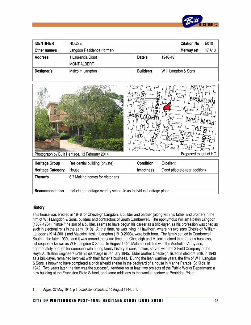
C I T Y O F W H I T E H O R S E P O S T – 1 9 4 5 H E R I T A G E S T U D Y [ J U N E 2 0 1 6 ] 133
IDENTIFIER HOUSE Citation No E010
Other name/s Langdon Residence (former) Melway ref 47 A10
Address 1 Laurencia Court Date/s 1946-49
MONT ALBERT
Designer/s Malcolm Langdon Builder/s W H Langdon & Sons
Photograph by Built Heritage, 13 February 2014
Proposed extent of HO
Heritage Group Residential building (private) Condition Excellent
Heritage Category House Intactness Good (discrete rear addition)
Theme/s 6.7 Making homes for Victorians
Recommendation Include on heritage overlay schedule as Individual heritage place
History
This house was erected in 1946 for Chesleigh Langdon, a builder and partner (along with his father and brother) in the firm of W H Langdon & Sons, builders and contractors of South Camberwell. The eponymous William Hoskin Langdon (1887-1954), himself the son of a builder, seems to have begun his career as a bricklayer, as his profession was cited as such in electoral rolls in the early 1910s. At that time, he was living in Hawthorn, where his two sons Chesleigh William Langdon (1914-2001) and Malcolm Hoskin Langdon (1919-2003), were both born. The family settled in Camberwell South in the later 1930s, and it was around the same time that Chesleigh and Malcolm joined their father’s business, subsequently known as W H Langdon & Sons. In August 1940, Malcolm enlisted with the Australian Army and, appropriately enough for someone with a long family history in construction, served with the 2 Field Company of the Royal Australian Engineers until his discharge in January 1945. Elder brother Chesleigh, listed in electoral rolls in 1943 as a bricklayer, remained involved with their father’s business. During the lean wartime years, the firm of W H Langdon & Sons is known to have completed a brick air-raid shelter in the backyard of a house in Marine Parade, St Kilda, in 1942. Two years later, the firm was the successful tenderer for at least two projects of the Public Works Department: a new building at the Frankston State School, and some additions to the woollen factory at Pentridge Prison.1
1 Argus, 27 May 1944, p 3; Frankston Standard, 10 August 1944, p 1.
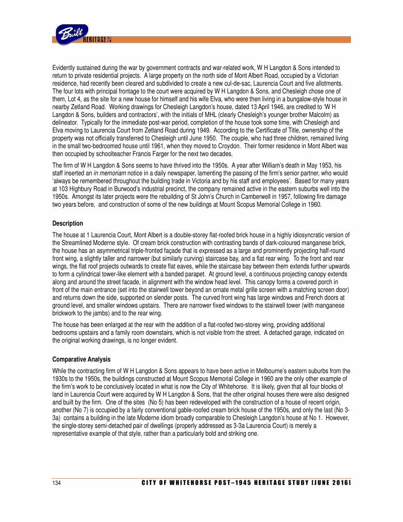
134 C I T Y O F W H I T E H O R S E P O S T – 1 9 4 5 H E R I T A G E S T U D Y [ J U N E 2 0 1 6 ]
Evidently sustained during the war by government contracts and war-related work, W H Langdon & Sons intended to return to private residential projects. A large property on the north side of Mont Albert Road, occupied by a Victorian residence, had recently been cleared and subdivided to create a new cul-de-sac, Laurencia Court and five allotments. The four lots with principal frontage to the court were acquired by W H Langdon & Sons, and Chesleigh chose one of them, Lot 4, as the site for a new house for himself and his wife Elva, who were then living in a bungalow-style house in nearby Zetland Road. Working drawings for Chesleigh Langdon’s house, dated 13 April 1946, are credited to ‘W H Langdon & Sons, builders and contractors’, with the initials of MHL (clearly Chesleigh’s younger brother Malcolm) as delineator. Typically for the immediate post-war period, completion of the house took some time, with Chesleigh and Elva moving to Laurencia Court from Zetland Road during 1949. According to the Certificate of Title, ownership of the property was not officially transferred to Chesleigh until June 1950. The couple, who had three children, remained living in the small two-bedroomed house until 1961, when they moved to Croydon. Their former residence in Mont Albert was then occupied by schoolteacher Francis Farger for the next two decades.
The firm of W H Langdon & Sons seems to have thrived into the 1950s. A year after William’s death in May 1953, his staff inserted an in memoriam notice in a daily newspaper, lamenting the passing of the firm’s senior partner, who would ‘always be remembered throughout the building trade in Victoria and by his staff and employees’. Based for many years at 103 Highbury Road in Burwood’s industrial precinct, the company remained active in the eastern suburbs well into the 1950s. Amongst its later projects were the rebuilding of St John’s Church in Camberwell in 1957, following fire damage two years before, and construction of some of the new buildings at Mount Scopus Memorial College in 1960.
Description
The house at 1 Laurencia Court, Mont Albert is a double-storey flat-roofed brick house in a highly idiosyncratic version of the Streamlined Moderne style. Of cream brick construction with contrasting bands of dark-coloured manganese brick, the house has an asymmetrical triple-fronted façade that is expressed as a large and prominently projecting half-round front wing, a slightly taller and narrower (but similarly curving) staircase bay, and a flat rear wing. To the front and rear wings, the flat roof projects outwards to create flat eaves, while the staircase bay between them extends further upwards to form a cylindrical tower-like element with a banded parapet. At ground level, a continuous projecting canopy extends along and around the street facade, in alignment with the window head level. This canopy forms a covered porch in front of the main entrance (set into the stairwell tower beyond an ornate metal grille screen with a matching screen door) and returns down the side, supported on slender posts. The curved front wing has large windows and French doors at ground level, and smaller windows upstairs. There are narrower fixed windows to the stairwell tower (with manganese brickwork to the jambs) and to the rear wing.
The house has been enlarged at the rear with the addition of a flat-roofed two-storey wing, providing additional bedrooms upstairs and a family room downstairs, which is not visible from the street. A detached garage, indicated on the original working drawings, is no longer evident.
Comparative Analysis
While the contracting firm of W H Langdon & Sons appears to have been active in Melbourne’s eastern suburbs from the 1930s to the 1950s, the buildings constructed at Mount Scopus Memorial College in 1960 are the only other example of the firm’s work to be conclusively located in what is now the City of Whitehorse. It is likely, given that all four blocks of land in Laurencia Court were acquired by W H Langdon & Sons, that the other original houses there were also designed and built by the firm. One of the sites (No 5) has been redeveloped with the construction of a house of recent origin, another (No 7) is occupied by a fairly conventional gable-roofed cream brick house of the 1950s, and only the last (No 3-3a) contains a building in the late Moderne idiom broadly comparable to Chesleigh Langdon’s house at No 1. However, the single-storey semi-detached pair of dwellings (properly addressed as 3-3a Laurencia Court) is merely a representative example of that style, rather than a particularly bold and striking one.
C I T Y O F W H I T E H O R S E P O S T – 1 9 4 5 H E R I T A G E S T U D Y [ J U N E 2 0 1 6 ] 135
No other private residential projects by W H Langdon & Sons, comparable in style to Chesleigh’s own house in Mont Albert, have yet been identified in the study area, or indeed anywhere else. William Langdon presumably designed and built his own house at 8 Crown Avenue, South Camberwell (c.1937), which was occupied after his death by his other son Malcolm, but this house has since been demolished.
Ultimately, Chesleigh Langdon’s house needs to be seen in the broader context of suburban houses of the later 1930s and ‘40s erected by prolific local builder/developers who, while not qualified as architects, were keenly attuned to the prevailing tastes in fashionable domestic architecture, and thus capable of producing handsome residences. This phenomenon, which was common in Melbourne’s leafy middle-class eastern suburbs from the 1930s into the early 1950s, is demonstrated by the work of such men as J A E Humphries (father of satirist Barry Humphries), who designed large brick houses in the Camberwell area in various fashionable styles, and F J Sanders, who undertook similar work in the Balwyn and North Balwyn area in the late 1940s and early 1950s. Sanders’s houses represent a particular pertinent comparison to the one that W H Langdon & Sons built in Laurencia Court, in that he also adopted an idiosyncratic approach that freely combined elements and details from various fashionable styles of the day, combined with a confidence that belied the designer’s lack of architectural qualifications. The single-storey cream brick house that Sanders designed at 13 Porter Street, Balwyn (1949) is especially akin to Chesleigh Langdon’s own house in its unusual triple fronted curving façade.
Statement of Significance
What is significant?
The house at 1 Laurencia Court, Mont Albert, is a double-storey orange brick house in the Streamlined Moderne style. It has a flat roof with projecting eave and a turret-like stairwell, and triple-fronted façade comprising a series of curved bays, articulated by contrasting brick stringcourses and a continuous canopy at ground level. The house was erected in 1946 for builder Chesleigh Langdon, whose family firm, W H Langdon & Sons, evidently developed several of the sites in Laurencia Court.
How is it significant?
The house is of aesthetic significance to the City of Whitehorse
Why is it significant?
Aesthetically, the house is a notable, if somewhat late, example of a house in the Streamlined Moderne style (Criterion E). It displays most of the trademark characteristics of that style, including compact planning, flat roof, curved corners and stark face brickwork with contrasting trim. Its boldly-articulated triple-fronted façade is especially unusual, with multiple curving bays (including the stairwell that rises above the parapet line to form a cylindrical tower-like feature) and a continuous projecting canopy at the lower level that forms a curvilinear porch to the front entrance. The house remains a striking example of a style that, while experiencing its peak of popularity in the later 1930s, was still considered to be fashionable by many homebuilders even a decade later.
References
Documentation pertaining to City of Box Hill Building Permit No 1946/457. City of Whitehorse.
Identified by
Andrew Ward (additional research and assessment by Built Heritage Pty Ltd)
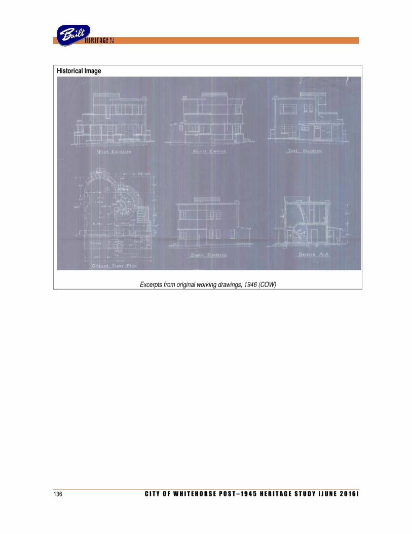
136 C I T Y O F W H I T E H O R S E P O S T – 1 9 4 5 H E R I T A G E S T U D Y [ J U N E 2 0 1 6 ]
Historical Image
Excerpts from original working drawings, 1946 (COW)
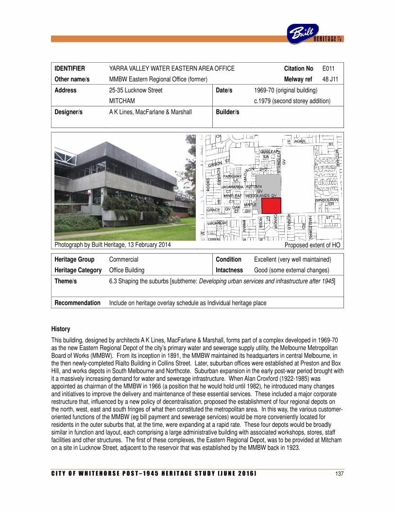
C I T Y O F W H I T E H O R S E P O S T – 1 9 4 5 H E R I T A G E S T U D Y [ J U N E 2 0 1 6 ] 137
IDENTIFIER YARRA VALLEY WATER EASTERN AREA OFFICE Citation No E011
Other name/s MMBW Eastern Regional Office (former) Melway ref 48 J11
Address 25-35 Lucknow Street Date/s 1969-70 (original building)
MITCHAM c.1979 (second storey addition)
Designer/s A K Lines, MacFarlane & Marshall Builder/s
Photograph by Built Heritage, 13 February 2014
Proposed extent of HO
Heritage Group Commercial Condition Excellent (very well maintained)
Heritage Category Office Building Intactness Good (some external changes)
Theme/s 6.3 Shaping the suburbs [subtheme: Developing urban services and infrastructure after 1945]
Recommendation Include on heritage overlay schedule as Individual heritage place
History
This building, designed by architects A K Lines, MacFarlane & Marshall, forms part of a complex developed in 1969-70 as the new Eastern Regional Depot of the city’s primary water and sewerage supply utility, the Melbourne Metropolitan Board of Works (MMBW). From its inception in 1891, the MMBW maintained its headquarters in central Melbourne, in the then newly-completed Rialto Building in Collins Street. Later, suburban offices were established at Preston and Box Hill, and works depots in South Melbourne and Northcote. Suburban expansion in the early post-war period brought with it a massively increasing demand for water and sewerage infrastructure. When Alan Croxford (1922-1985) was appointed as chairman of the MMBW in 1966 (a position that he would hold until 1982), he introduced many changes and initiatives to improve the delivery and maintenance of these essential services. These included a major corporate restructure that, influenced by a new policy of decentralisation, proposed the establishment of four regional depots on the north, west, east and south fringes of what then constituted the metropolitan area. In this way, the various customer-oriented functions of the MMBW (eg bill payment and sewerage services) would be more conveniently located for residents in the outer suburbs that, at the time, were expanding at a rapid rate. These four depots would be broadly similar in function and layout, each comprising a large administrative building with associated workshops, stores, staff facilities and other structures. The first of these complexes, the Eastern Regional Depot, was to be provided at Mitcham on a site in Lucknow Street, adjacent to the reservoir that was established by the MMBW back in 1923.
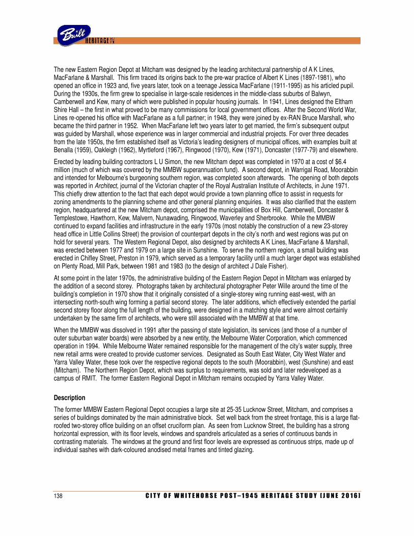
138 C I T Y O F W H I T E H O R S E P O S T – 1 9 4 5 H E R I T A G E S T U D Y [ J U N E 2 0 1 6 ]
The new Eastern Region Depot at Mitcham was designed by the leading architectural partnership of A K Lines, MacFarlane & Marshall. This firm traced its origins back to the pre-war practice of Albert K Lines (1897-1981), who opened an office in 1923 and, five years later, took on a teenage Jessica MacFarlane (1911-1995) as his articled pupil. During the 1930s, the firm grew to specialise in large-scale residences in the middle-class suburbs of Balwyn, Camberwell and Kew, many of which were published in popular housing journals. In 1941, Lines designed the Eltham Shire Hall – the first in what proved to be many commissions for local government offices. After the Second World War, Lines re-opened his office with MacFarlane as a full partner; in 1948, they were joined by ex-RAN Bruce Marshall, who became the third partner in 1952. When MacFarlane left two years later to get married, the firm’s subsequent output was guided by Marshall, whose experience was in larger commercial and industrial projects. For over three decades from the late 1950s, the firm established itself as Victoria’s leading designers of municipal offices, with examples built at Benalla (1959), Oakleigh (1962), Myrtleford (1967), Ringwood (1970), Kew (1971), Doncaster (1977-79) and elsewhere.
Erected by leading building contractors L U Simon, the new Mitcham depot was completed in 1970 at a cost of $6.4 million (much of which was covered by the MMBW superannuation fund). A second depot, in Warrigal Road, Moorabbin and intended for Melbourne’s burgeoning southern region, was completed soon afterwards. The opening of both depots was reported in Architect, journal of the Victorian chapter of the Royal Australian Institute of Architects, in June 1971. This chiefly drew attention to the fact that each depot would provide a town planning office to assist in requests for zoning amendments to the planning scheme and other general planning enquiries. It was also clarified that the eastern region, headquartered at the new Mitcham depot, comprised the municipalities of Box Hill, Camberwell, Doncaster & Templestowe, Hawthorn, Kew, Malvern, Nunawading, Ringwood, Waverley and Sherbrooke. While the MMBW continued to expand facilities and infrastructure in the early 1970s (most notably the construction of a new 23-storey head office in Little Collins Street) the provision of counterpart depots in the city’s north and west regions was put on hold for several years. The Western Regional Depot, also designed by architects A K Lines, MacFarlane & Marshall, was erected between 1977 and 1979 on a large site in Sunshine. To serve the northern region, a small building was erected in Chifley Street, Preston in 1979, which served as a temporary facility until a much larger depot was established on Plenty Road, Mill Park, between 1981 and 1983 (to the design of architect J Dale Fisher).
At some point in the later 1970s, the administrative building of the Eastern Region Depot in Mitcham was enlarged by the addition of a second storey. Photographs taken by architectural photographer Peter Wille around the time of the building’s completion in 1970 show that it originally consisted of a single-storey wing running east-west, with an intersecting north-south wing forming a partial second storey. The later additions, which effectively extended the partial second storey floor along the full length of the building, were designed in a matching style and were almost certainly undertaken by the same firm of architects, who were still associated with the MMBW at that time.
When the MMBW was dissolved in 1991 after the passing of state legislation, its services (and those of a number of outer suburban water boards) were absorbed by a new entity, the Melbourne Water Corporation, which commenced operation in 1994. While Melbourne Water remained responsible for the management of the city’s water supply, three new retail arms were created to provide customer services. Designated as South East Water, City West Water and Yarra Valley Water, these took over the respective regional depots to the south (Moorabbin), west (Sunshine) and east (Mitcham). The Northern Region Depot, which was surplus to requirements, was sold and later redeveloped as a campus of RMIT. The former Eastern Regional Depot in Mitcham remains occupied by Yarra Valley Water.
Description
The former MMBW Eastern Regional Depot occupies a large site at 25-35 Lucknow Street, Mitcham, and comprises a series of buildings dominated by the main administrative block. Set well back from the street frontage, this is a large flat-roofed two-storey office building on an offset cruciform plan. As seen from Lucknow Street, the building has a strong horizontal expression, with its floor levels, windows and spandrels articulated as a series of continuous bands in contrasting materials. The windows at the ground and first floor levels are expressed as continuous strips, made up of individual sashes with dark-coloured anodised metal frames and tinted glazing.
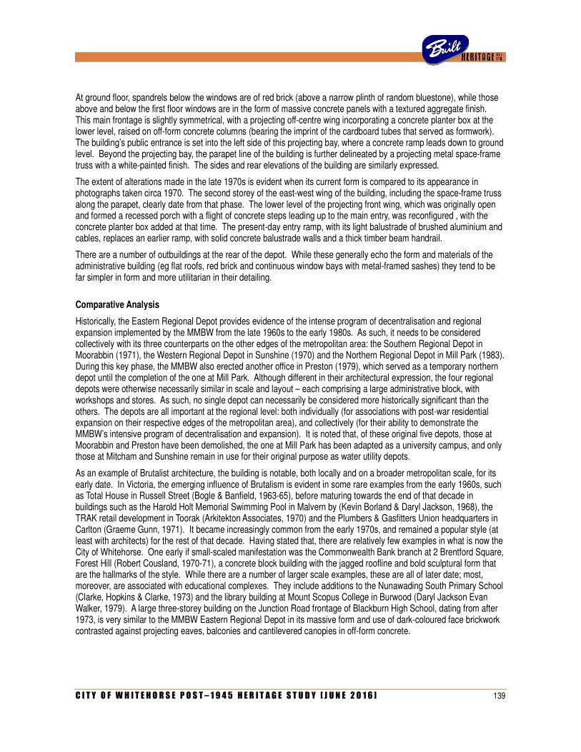
C I T Y O F W H I T E H O R S E P O S T – 1 9 4 5 H E R I T A G E S T U D Y [ J U N E 2 0 1 6 ] 139
At ground floor, spandrels below the windows are of red brick (above a narrow plinth of random bluestone), while those above and below the first floor windows are in the form of massive concrete panels with a textured aggregate finish. This main frontage is slightly symmetrical, with a projecting off-centre wing incorporating a concrete planter box at the lower level, raised on off-form concrete columns (bearing the imprint of the cardboard tubes that served as formwork). The building’s public entrance is set into the left side of this projecting bay, where a concrete ramp leads down to ground level. Beyond the projecting bay, the parapet line of the building is further delineated by a projecting metal space-frame truss with a white-painted finish. The sides and rear elevations of the building are similarly expressed.
The extent of alterations made in the late 1970s is evident when its current form is compared to its appearance in photographs taken circa 1970. The second storey of the east-west wing of the building, including the space-frame truss along the parapet, clearly date from that phase. The lower level of the projecting front wing, which was originally open and formed a recessed porch with a flight of concrete steps leading up to the main entry, was reconfigured , with the concrete planter box added at that time. The present-day entry ramp, with its light balustrade of brushed aluminium and cables, replaces an earlier ramp, with solid concrete balustrade walls and a thick timber beam handrail.
There are a number of outbuildings at the rear of the depot. While these generally echo the form and materials of the administrative building (eg flat roofs, red brick and continuous window bays with metal-framed sashes) they tend to be far simpler in form and more utilitarian in their detailing.
Comparative Analysis
Historically, the Eastern Regional Depot provides evidence of the intense program of decentralisation and regional expansion implemented by the MMBW from the late 1960s to the early 1980s. As such, it needs to be considered collectively with its three counterparts on the other edges of the metropolitan area: the Southern Regional Depot in Moorabbin (1971), the Western Regional Depot in Sunshine (1970) and the Northern Regional Depot in Mill Park (1983). During this key phase, the MMBW also erected another office in Preston (1979), which served as a temporary northern depot until the completion of the one at Mill Park. Although different in their architectural expression, the four regional depots were otherwise necessarily similar in scale and layout – each comprising a large administrative block, with workshops and stores. As such, no single depot can necessarily be considered more historically significant than the others. The depots are all important at the regional level: both individually (for associations with post-war residential expansion on their respective edges of the metropolitan area), and collectively (for their ability to demonstrate the MMBW’s intensive program of decentralisation and expansion). It is noted that, of these original five depots, those at Moorabbin and Preston have been demolished, the one at Mill Park has been adapted as a university campus, and only those at Mitcham and Sunshine remain in use for their original purpose as water utility depots.
As an example of Brutalist architecture, the building is notable, both locally and on a broader metropolitan scale, for its early date. In Victoria, the emerging influence of Brutalism is evident in some rare examples from the early 1960s, such as Total House in Russell Street (Bogle & Banfield, 1963-65), before maturing towards the end of that decade in buildings such as the Harold Holt Memorial Swimming Pool in Malvern by (Kevin Borland & Daryl Jackson, 1968), the TRAK retail development in Toorak (Arkitekton Associates, 1970) and the Plumbers & Gasfitters Union headquarters in Carlton (Graeme Gunn, 1971). It became increasingly common from the early 1970s, and remained a popular style (at least with architects) for the rest of that decade. Having stated that, there are relatively few examples in what is now the City of Whitehorse. One early if small-scaled manifestation was the Commonwealth Bank branch at 2 Brentford Square, Forest Hill (Robert Cousland, 1970-71), a concrete block building with the jagged roofline and bold sculptural form that are the hallmarks of the style. While there are a number of larger scale examples, these are all of later date; most, moreover, are associated with educational complexes. They include additions to the Nunawading South Primary School (Clarke, Hopkins & Clarke, 1973) and the library building at Mount Scopus College in Burwood (Daryl Jackson Evan Walker, 1979). A large three-storey building on the Junction Road frontage of Blackburn High School, dating from after 1973, is very similar to the MMBW Eastern Regional Depot in its massive form and use of dark-coloured face brickwork contrasted against projecting eaves, balconies and cantilevered canopies in off-form concrete.
140 C I T Y O F W H I T E H O R S E P O S T – 1 9 4 5 H E R I T A G E S T U D Y [ J U N E 2 0 1 6 ]
Statement of Significance
What is significant?
The main building of the former MMBW Eastern Regional Depot, at 25-35 Lucknow Street, Mitcham, is a double-storey flat-roofed building in the Brutalist style, with a bluestone plinth, red brick spandrel wall and continuous window bays alternating with precast concrete panels. Erected in 1969-70 (as a single-storey building, with a second storey added later), it was the first of four regional depots established by the MMBW at the outer northern, southern eastern and western edges of the metropolitan area during the 1970s and early 1980s.
The other structures and buildings on the site are not considered to contribute to the significance of the place.
How is it significant?
The building is of historical, architectural and aesthetic significance to the City of Whitehorse
Why is it significant?
Historically, the complex is significant for associations with an ambitious phase of expansion implemented by the MMBW from the late 1960s to the early 1980s, which saw its public functions decentralised and disbursed amongst four regional depots on the north, south, east and west suburban fringes (Criterion A). This move acknowledged that post-war residential development, and therefore the demand for associated water and sewerage supply services, had by then shifted to the outer suburbs on all four sides of metropolitan area. The first of the four to be erected, the Eastern Regional Depot was clearly seen as the highest priority, to serve the rapidly-expanding eastern suburbs of Vermont South, Ringwood, Croydon and beyond. Aside from being the earliest of the four MMBW regional depots, it remains as one of the most intact and extensive of the three that now survive, and one of only two that currently remain in use for a related function.
Architecturally, the building is significant as a notable example of the work of the firm of A K Lines, MacFarlane & Marshall (Criterion H). The partnership, founded by Albert K Lines in 1923 with an initial emphasis on high-class houses, expanded in the post-war era and, under the influence of Bruce Marshall (who joined in 1948 and became partner in 1952), became one of Victoria’s leading specialists in the design of municipal offices. While the firm is well represented in the eastern suburbs by municipal offices at Ringwood (1970), Kew (1971) and Doncaster (1977-79), as well as private residences in Kew, Balwyn and Balwyn North, this appears to be the only major example of their work in the City of Whitehorse.
Aesthetically, the building is significant as an excellent and notable early example of the Brutalist style (Criterion E). The building demonstrates many of the trademarks of that style, including its simple composition of massive volumes, its clear articulation of raw concrete finishes and its anodised metal-framed windows with tinted glazing. The space-frame truss along the parapet line and the off-form concrete columns below the overscaled planter box, although all added when the building was enlarged in the late 1970s, are also reflections of the rugged industrial aesthetic of Brutalism. As a textbook manifestation of an architectural style that was widespread in Melbourne during the 1970s, the building stands out as example that is notably early in a local context, as well as larger, more prominently-sited and more accessible than the relatively few others known to exist in the City of Whitehorse (Criterion B).
References
‘MMBW’, Architect, No 14 (May-June 1971), pp 7-8.
Tony Dingle and Carolyn Rasmussen, Vital Connections: Melbourne and its Board of Works 1891-1991 (1991).
Context Pty Ltd, ‘Regional Water Supply Heritage Study: Melbourne Region’, unpublished report , January 2010.
Identified by
Built Heritage Pty Ltd
C I T Y O F W H I T E H O R S E P O S T – 1 9 4 5 H E R I T A G E S T U D Y [ J U N E 2 0 1 6 ] 141
Historical Images
Contemporary photograph by Peter Wille (SLV) Contemporary photograph by Peter Wille (SLV)

142 C I T Y O F W H I T E H O R S E P O S T – 1 9 4 5 H E R I T A G E S T U D Y [ J U N E 2 0 1 6 ]
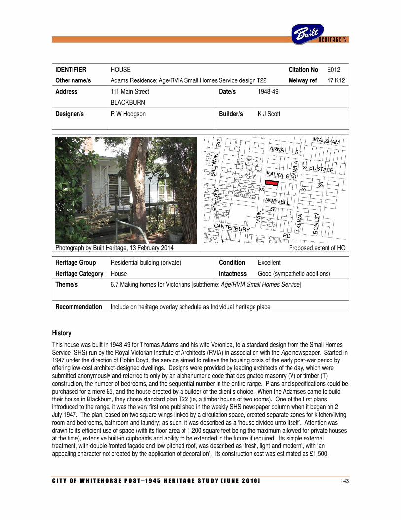
C I T Y O F W H I T E H O R S E P O S T – 1 9 4 5 H E R I T A G E S T U D Y [ J U N E 2 0 1 6 ] 143
IDENTIFIER HOUSE Citation No E012
Other name/s Adams Residence; Age/RVIA Small Homes Service design T22 Melway ref 47 K12
Address 111 Main Street Date/s 1948-49
BLACKBURN
Designer/s R W Hodgson Builder/s K J Scott
Photograph by Built Heritage, 13 February 2014
Proposed extent of HO
Heritage Group Residential building (private) Condition Excellent
Heritage Category House Intactness Good (sympathetic additions)
Theme/s 6.7 Making homes for Victorians [subtheme: Age/RVIA Small Homes Service]
Recommendation Include on heritage overlay schedule as Individual heritage place
History
This house was built in 1948-49 for Thomas Adams and his wife Veronica, to a standard design from the Small Homes Service (SHS) run by the Royal Victorian Institute of Architects (RVIA) in association with the Age newspaper. Started in 1947 under the direction of Robin Boyd, the service aimed to relieve the housing crisis of the early post-war period by offering low-cost architect-designed dwellings. Designs were provided by leading architects of the day, which were submitted anonymously and referred to only by an alphanumeric code that designated masonry (V) or timber (T) construction, the number of bedrooms, and the sequential number in the entire range. Plans and specifications could be purchased for a mere £5, and the house erected by a builder of the client’s choice. When the Adamses came to build their house in Blackburn, they chose standard plan T22 (ie, a timber house of two rooms). One of the first plans introduced to the range, it was the very first one published in the weekly SHS newspaper column when it began on 2 July 1947. The plan, based on two square wings linked by a circulation space, created separate zones for kitchen/living room and bedrooms, bathroom and laundry; as such, it was described as a ‘house divided unto itself’. Attention was drawn to its efficient use of space (with its floor area of 1,200 square feet being the maximum allowed for private houses at the time), extensive built-in cupboards and ability to be extended in the future if required. Its simple external treatment, with double-fronted façade and low pitched roof, was described as ‘fresh, light and modern’, with ‘an appealing character not created by the application of decoration’. Its construction cost was estimated as £1,500.
144 C I T Y O F W H I T E H O R S E P O S T – 1 9 4 5 H E R I T A G E S T U D Y [ J U N E 2 0 1 6 ]
Although not publicised as such at the time, plan T22 was designed by Geelong architect R W Hodgson. Like many young architects of that era, Robert Wallis ‘Wally’ Hodgson (1920-2009) was a recently returned serviceman. During the Second World War, he served with the 3rd Field Survey Company (through which he met Robin Boyd) and later the 60th Field Park Company before being discharged in April 1946 with the rank of Lieutenant. Hodgson had clearly completed his qualifications prior to that, as he was registered as an architect in Victoria during 1945. He maintained his private practice in Geelong, with an office in the Bank of NSW building on Moorabool Street. Little else is known of his career, beyond the fact that he seems to have been one of the most enthusiastic contributors to the SHS range during its early years. He was not only responsible for plan T22, but also T211 and T212 (both published in October 1947) and later V231 (January 1949, V229 (February 1949), T236 (June 1949), T239 (June 1949), T13 (July 1949), T17 (July 1949), V240 (August 1949) and T316 (November 1949). Hodgson’s plans proved popular and remained in the range for some years, with some being re-published in the weekly SHS column well into the 1950s. Plan T22 also appeared in Australian House & Garden in July 1949, illustrating an article by Robin Boyd on the work of the SHS.
Although the original plans for the T22 house at 111 Main Street have not been located in council archives, it is recorded that a building permit for the works (to cost £1,150, which was cheaper than Clerehan’s original estimate) was issued by the City of Nunawading on 19 March 1948. The builder was identified as K J Scott, of 19 Frederick Street, Balwyn. Some of the building materials might have been obtained through Thomas Adam’s own professional contacts; he was employed as a clerk with Strahan & Davies, a timber supply company based in Arden Street, North Melbourne.
In April 1950, the house was profiled in the weekly SHS column – an unusual occurrence, as the service tended to avoid bringing attention to built examples in order to respect the privacy of clients. The Adamses’ house was the first of relatively few built examples ever to be reported and illustrated in the newspaper column. The article noted that the house had been ‘completed early last year’ (ie 1949) and that its owners ‘spared the native trees on the site and have been rewarded with a cooler, more inviting house, one of the most charming in the district’. The benefits of the design were re-iterated, emphasising the simple plan form ‘making for economy in wall and roof construction’, and the zoning of ‘day and night activities’ at either end of the dwelling. The caption to an accompanying photograph noted that ‘the light grey walls of this Blackburn home are shaded and cool behind a veil of young gum trees’.
Thomas and Veronica Adams remained living in the house into the 1980s. During this long period of occupancy, they made a few additions. At some point prior to 1969, an additional bedroom and a study were built to the rear, in the positions that had been indicated on the original 1947 plans for a ‘future bedroom’ and ‘future sleepout’. Then, in 1969, the kitchen was slightly enlarged by extending its south wall.
Description
Occupying a corner site, the house at 111 Main Street, Blackburn, is a single-storey double-fronted timber house on a stepped rectilinear plan, with a low gabled roof penetrated by a plain red brick chimney. External walls are clad with weatherboards, the sub-floor area screened with wide planks, and the roof clad in Decromastic sheeting (ie pressed metal in imitation of terracotta tiles). The asymmetrical frontage to Main Street has a small recessed porch to the extreme right side and a large corner window to the left, which returns down the Kalka Street façade. The main entrance, on the latter frontage, is set into a recessed alcove off a timber-framed porch with a simple trabeated balustrade and matching stair handrail. The porch roof is supported by a timber trellis with zig-zag bracing, which is an original element that is evident on the 1949 photograph. There are tall windows to the front living areas, with double-hung sashes divided into three vertical panels. Bedroom windows are smaller, but similarly detailed.
Comparative analysis
Although a certain amount of research has been done on the SHS, individual examples are notoriously difficult to identify in the field. The original SHS receipt book, which would have identified the names and addresses of specific clients, has reportedly been lost, and there are far too many plans in the range for examples to be identified merely by inspection. While the Age column illustrated plans and perspectives of a different design each week, photographs and descriptions of built examples were very rarely included.
C I T Y O F W H I T E H O R S E P O S T – 1 9 4 5 H E R I T A G E S T U D Y [ J U N E 2 0 1 6 ] 145
Research by the present author has identified only 25 built houses mentioned in the column between 1947 and 1960. Many of these, however, cannot be conclusively located due to the lack of information such as complete addresses or client names. Several that have been located have since been demolished, including two in Beaumaris (1952 and 1956), two in Balwyn North (1951 and 1952) and one in Montmorency (1954).
Of these 25 built examples published in the SHS column between 1947 and 1960, one-third (eight houses) were located in what is now the City of Whitehorse. Of these eight, two have been confirmed as demolished (one in Marchiori Road, Blackburn North and another on Whitehorse Road, Nunawading), another altered beyond recognition (also on Whitehorse Road), threes others are unlocatable (in Vermont, Nunawading and Blackburn South) and the remaining two are still standing, in substantially intact states, in Blackburn (at 19 Sheehans Road and 111 Main Street).
Research of building permit records for the present project has serendipitously identified a few other early examples of SHS dwellings in the municipality. These include a house for R G McConnell at 5 Francis Street, Blackburn, for which a permit was issued on January 1948, and another for K T Coghlan at 278 Springfield Road, Nunawading, for which a permit was issued in September 1949. The latter house has been demolished, and the former is still standing, albeit in an altered condition. Their plan codes have not been identified. During the 1950s, SHS dwellings became much more widespread across the municipality. Surviving examples from that period include those at 108 Morack Road, Vermont South (T259), 2 Ireland Avenue, Mitcham (T377) and 15 Abelia Street, Nunawading (V344).
Statement of Significance
What is significant?
The house at 111 Main Street, Blackburn, is a single-storey double-fronted weatherboard house with a low gabled roof and recessed entry porches to the front and side elevations. Erected in 1948-49 for Thomas and Veronica Adams, it was built using plan T22 of the Age/RVIA Small Homes Service (SHS), which had first been published in July 1947. Although not credited at the time, the plan was designed by Geelong architect R W Hodgson. Subsequently extended at the rear (in accordance with the original 1947 plan, which allowed for future expansion) and slightly altered in 1969, the house remains a substantially intact example of its type. These changes are not considered to be intrusive.
How is it significant?
The house is of architectural significance to the City of Whitehorse
Why is it significant?
Architecturally, the house is significant as an intact and notably early surviving example of a dwelling built from a standard plan offered by the Age/RVIA Small Homes Service (Criterion A). When the service was initiated in July 1947 under the directorship of Robin Boyd, the first plan to be published in the weekly newspaper column was T22. This plan was subsequently purchased by the Adams family and built at Blackburn and, upon completion, the house was illustrated and profiled in the Age column. The house is not only significant as an early surviving SHS dwelling in the City of Whitehorse (an area that was once a significant epicentre for such houses), but also as a surviving example of the service’s very first published design, and one of the first completed SHS houses ever to be illustrated and publicised in the weekly column (which was an extremely rare occurrence). (Criterion B)
References
Robin Boyd, ‘A house divided’, Age, 2 July 1947, p 5.
Robin Boyd, ‘Planning for better living’, Australian House & Garden, July 1949, pp 22-23.
Robin Boyd, ‘House behind the trees’, Age, 5 April 1950, p 4.
Identified by
Built Heritage Pty Ltd
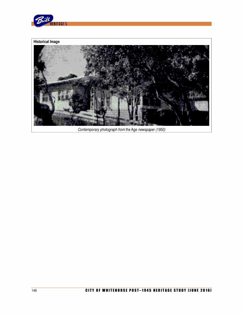
146 C I T Y O F W H I T E H O R S E P O S T – 1 9 4 5 H E R I T A G E S T U D Y [ J U N E 2 0 1 6 ]
Historical Image
Contemporary photograph from the Age newspaper (1950)

C I T Y O F W H I T E H O R S E P O S T – 1 9 4 5 H E R I T A G E S T U D Y [ J U N E 2 0 1 6 ] 147
IDENTIFIER HOUSE Citation No E013
Other name/s Kristiansen Residence (former); Oberman Residence (former) Melway ref 48 A12
Address 7 Norris Court Date/s 1967-68
BLACKBURN
Designer/s Frances Seidel Builder/s R Q Evans
Photograph by Built Heritage, 13 February 2014
Proposed extent of HO
Heritage Group Residential building (private) Condition Excellent (very well maintained)
Heritage Category House Intactness Excellent (few apparent changes)
Theme/s 6.7 Making homes for Victorians
Recommendation Include on heritage overlay schedule as Individual heritage place
History
This house was erected in 1967-68 for Danish-born couple Skjold & Bente Kristiansen, and was designed for them by Miss Frances Seidel, a recent graduate then employed in the office of Roy Grounds. Frances Ute Seidel (1939-) was the daughter of Dr Alfred Erich Seidel (1900-1966), a German businessman whose company manufactured prefabricated timber houses. In 1950, he and two colleagues travelled to Australia to interview representatives of housing authorities in state capitals; obviously struck by the potential market, Seidel decided to settle permanently in Melbourne, where his daughter commenced the Bachelor of Architecture course at Melbourne University around 1957. During her first year, she became aware of a scheme offered by the Commonwealth Department of Works, which would pay for the education of architectural students if they took employment there for five years after graduation. Miss Seidel took up the offer and, in March 1958, was appointed a cadet architect in the department. However, as a final year student in 1962, she decided that she no longer wished to pursue a career in that direction, stating that ‘since first year I have developed a keen interest in domestic architecture and housing settlements. There is no scope for this within the Department of Works’. Her decision to break the bond and repay the cost of her tuition was unprecedented and controversial; it generated press attention and was ultimately resolved only after the intervention of the Prime Minister, Robert Menzies.
148 C I T Y O F W H I T E H O R S E P O S T – 1 9 4 5 H E R I T A G E S T U D Y [ J U N E 2 0 1 6 ]
Completing the final year of her course in 1962, Miss Seidel embarked upon a Diploma of Town & Regional Planning. Her degree was conferred on 14 April 1965. Although she had initially expressed her desire to’ work in a small private office specialising in home design’, her first job was in the large city practice of Roy Grounds, which was then concentrating on the huge project for the new National Gallery of Victoria. Miss Seidel recalls not seeing much of Grounds himself, who frequently came and went. Working under senior architects such as Fritz Suendermann, she was involved in projects that included the Swan Hill Folk Museum (1966) and buildings for the City of South Melbourne, such as the new baby health centre next to the Town Hall (1967) and an elderly person’s home. While the practice rarely undertook residential projects at that time, Miss Seidel remembers that the general manager, Alan Nelson, was approached privately by some friends, Danish couple Skjold and Bente Kristiansen, to design a house for them. Unable to accept the commission, Nelson introduced the Kristiansens to Miss Seidel, who proceeded with the project under her own name. It was only her second independent commission after designing a small holiday house for her brother at Blairgowrie.
Skjold Emil Kristiansen (1927-?), his wife Bente Amalie Kristiansen (1932-?) and their three young children Mette, Jens and Christine, arrived in Australia in 1963 under an assisted passage scheme. Described as ‘expert cooks’ the couple had run a restaurant in Copenhagen; after settling in Melbourne, Skjold gained employment in the Peter’s Ice Cream factory at Clayton. Living for a time in Warrigal Road, Burwood, the couple acquired the title to vacant land in Norris Court, Blackburn, in August 1966. A sloping and wedged-shaped allotment at the end of an angled cul-de-sac, the site was a challenging one for its young architect. Envisaging a house that would effectively sit on a floating concrete slab, she sought technical assistance from engineer Hamish Ramsay, who had previously been engaged by Roy Grounds’ office to resolve the tricky foundation requirements for the National Gallery project.
Miss Seidel recalls that the Kristiansens wanted a house with a ‘typically Scandinavian natural look’. She proposed an open-planned dwelling on a centralized cruciform plan, with enclosed courtyards to each corner. The house was dominated by a landlocked open-planned living area in the centre, lit from above by a hipped skylight roof; the architect recalls that certain elements of the design, such as the freestanding fireplace that faced the front door from the opposite end of the house, were reflections of Skjold Kristiansen’s bold personality. The fact that Skjold was very tall, while his wife was more petit, prompted a careful consideration of proportion and scale throughout the dwelling. The architect also gave much attention to detailing and interior finishes: brick walls were painted white, floors were lined in brown quarry tiles from Sweden, and the ceilings in varnished Mountain Ash slats (which also concealed built-in stereo speakers). In wet areas, brick walls were given a special waterproof coating rather than tiled. Full-height glass doors slid into recessed alcoves, and the floor level of the courtyards was made equal to that of the interior, without a step down, to allow doors to be thrown open to create continuous indoor/outdoor living space. The house was constructed by R Q Evans, who, around the same time, was also building Heide II, the new home of John & Sunday Reed at Bulleen, designed by McGlashan & Everist, which would win the RAIA Bronze Medal award for 1968.
The Kristiansen House appears to have been completed during the latter half of 1968. Remarkably for what was effectively the first independent commission of a recent graduate, the new house attracted a flurry of publicity in the press. In October 1968, it was profiled in the Australian Women’s Weekly as ‘House of the Week’ and, a month later, written up in the property column of the Herald newspaper. Then, in early 1969, it appeared in Cross Section, the broadsheet of Melbourne University’s School of Architecture. All three sources were unanimous in their praise for this unusual house. Much attention was drawn to its formality and to its natural expression of materials, with Cross Section describing it as a house ‘which conjures up a meeting of William Morris and Palladio’. The hipped roof, with glazed gable-ends, was perceived as ‘a suggestion of a pediment’, while the interior was defined by an ‘insistence on natural materials – albeit sophisticated ones’, where ‘the browns of the timber and quarry tiles form a conscious and warm contrast to the stark white brick walls which so carefully delineate the formally composed spaces’. The Women’s Weekly drew attention to the treatment of the four corner courtyards, which were themed according to the rooms from which they were accessed: one as a barbecue area, one as a herb garden, one in a Japanese style and another in a Mexican style. The reviewer for the Herald was impressed by the open-planned central entertaining area and also by the complete absence of windows to the street, ‘to give privacy and reduce street noise’.
C I T Y O F W H I T E H O R S E P O S T – 1 9 4 5 H E R I T A G E S T U D Y [ J U N E 2 0 1 6 ] 149
Sadly, the Kristiansens would not occupy their house for long. They appear to have experienced financial difficulties and, towards the end of 1968, were issued with writs for non-payment of debts to the builder, Rod Evans, and one other contractor. As a result, the house was placed on the market in November 1968 and the family subsequently returned to Denmark. Despite this sad outcome, their former home in Blackburn found a keen and sympathetic new resident in businessman Michael Oberman, to whom ownership was formally transferred in early 1969. Since 1964, he and his brother Max had been proprietors of the Mobler Décor & Design Centre, a retail business in Camberwell that specialised in modern Scandinavian design. Oberman’s explicitly Danish-style house in Norris Court formed the ideal backdrop for his extensive private collection of modern furniture, which included rare pieces from the Bauhaus and two original Barcelona Chairs by Ludwig Mies van der Rohe. The house was still held in high esteem in 1973 when, five years after its completion, it received an Age/RAIA citation award as ‘House of the Week’. Once again, there was much praise for the elegant planning, dominated by the ‘unique architectural space which somehow succeeds without any conventional windows’. Michael Oberman, who was still living there at that time, commented that, with its open planning, privacy and excellent acoustics, it was a house perfect for entertaining. He was to remain living there until 1980.
With her first commission attracting so much publicity, Miss Seidel recalls friends encouraging her to take advantage of this and establish her own architectural practice. However, at that time, she wanted to travel overseas and subsequently spent several years in France, working in an architect’s office in Paris. During that time, she recalls, a potential client travelled there to persuade her to return to Melbourne to design a house on land he had bought in the Raheen Estate at Kew. This did not eventuate, and Miss Seidel would not return to Melbourne until 1975. She later established her own architectural practice, working from home, primarily on residential projects.
Description
The former Kristiansen House at 7 Norris Court, Blackburn, is a single-storey brick house laid out on a Greek cruciform plan, with courtyards at each corner that are partly enclosed by solid walling. The central part of the house is sheltered by broad gambrel roof, clad in metal tray decking, with glazed infill to the two gable ends, while the surrounding wings have flat roofs. With most of the interior spaces obtaining natural lighting through glazed doorways opening onto the enclosed courtyards, the house presents a windowless frontage to the street. The façade is symmetrical, with a central recessed entrance flanked by the blank walls of the master bedroom and study, and thence by the slightly projecting blank walls of the two front courtyards. Beyond, the timber framing of the courtyard pergolas are evident, while the glazed gable end of the gambrel roof forms a central pediment in alignment with the front door.
Set back from the street, the house has a wide brick-paved driveway to the left side, and garden bed with volcanic rocks. These elements, which are all evident in contemporary photographs from the late 1960s, are clearly original. Otherwise, only a few minor changes have been made to the street frontage, including the replacement of the letterbox, the addition of the giant number 7 to the front wall and the repainting of external timberwork from a pale grey (as shown in early colour photographs) to a light beige. Aerial photographs suggest that the distinctive plan form of the house, with its centralised cruciform and four corner courtyards, still remains intact, including what was originally a small plant room to the west side of the north-west courtyard.
Comparative Analysis
With its elegant centralised plan, minimalist detailing and limited palette of high-quality materials and finishes, this overtly Scandinavian-themed house represents a striking contrast to the prevailing modes of contemporary residential architecture in Melbourne of the later 1960s. Highly unusual in a broader metropolitan context, it has virtually no pertinent comparators in the City of Whitehorse. The serene character of the house has much in common with the work of idiosyncratic architects such as Bernard Joyce and Guilford Bell. Joyce’s work of the same period is similarly characterised by a preference for flowing plans with integrated courtyards that blur the boundaries between interior and exterior space. Broad similarities are apparent when the Kristiansen House is compared with the finest example of Joyce’s work in the City of Whitehorse, which is the Gibson House in Grange Street, Mont Albert (1967). This also has an elegant courtyard plan with stark brick walls (albeit unpainted), concealed full-height windows and an unusually accentuated roofline (albeit with separate pyramid-like hips, rather than one single gambrel).
150 C I T Y O F W H I T E H O R S E P O S T – 1 9 4 5 H E R I T A G E S T U D Y [ J U N E 2 0 1 6 ]
The Kristiansen House has rather more in common with Guilford Bell’s houses, which tend to turn their backs on the street frontage, often with entirely blank walls. They typically have stylish open plans with enclosed courtyards, and display a similarly sophisticated juxtaposition of high-class finishes. The only known example of Bell’s work in the study area, namely the so-called Garden house that was erected at 238 Canterbury Road, Forest Hill, as part of the Concept Constructions display village, is eerily similar to the Kristiansen House, especially in its virtually blank street façade with central entrance, and a pyramidal hipped roof set back towards the centre of the house.
Statement of Significance
What is significant?
The former Kristiansen House at 7 Norris Court, Blackburn, is a single-storey white-painted brick house on a centralized cruciform plan, with walled courtyards at each corner, a spreading gambrel roof over the central living area (with glazed infill to the ridge and two gable ends) and flat roofing to the adjoining wings. Erected in 1967-68 for Danish couple Skjold & Bente Kristiansen, it was designed by Miss Frances Seidel, a recent graduate architect then employed in the office of Roy Grounds.
How is it significant?
The house is of architectural and aesthetic significance to the City of Whitehorse.
Why is it significant?
Architecturally and aesthetically, the house is significant as an unusual example of residential architecture of the later 1960s (Criterion F). With its highly formalised planning based on a Greek cross with walled courtyards at each corner, and a roofline dominated by a single central gambrel with glazed gable ends and ridge, the house represented a striking contrast to the prevailing trends in contemporary residential design of that period. Designed for a Danish migrant family who specifically wanted a house with a Scandinavian flavour, the house integrated many distinctive features and finishes that were uncommon at the time, including painted brick interior walls, quarry tiled floors, timber-lined ceilings, a freestanding fireplace and full-height sliding glass door opening into themed courtyards (Criterion E). With its entirely windowless façade, incorporating a recessed central entrance and pediment-like glazed gable end, the house remains a striking element in the streetscape. Subject to a certain amount of press attention at the time of its completion in 1968, the house represented a notable achievement for its designer, a young female architect who had only recently graduated and was still yet to establish a private practice of her own.
References
‘Student asked to pay £500 for bond breach’, Age, 12 July 1962, p 3.
‘Action deferred on student’s bond’, Age, 18 July 1962, p 3.
‘Designed for a Danish family’, Australian Women’s Weekly, 30 October 1968, pp 75-77.
‘The Blackburn House’, Age, 11 November 1968, p 21.
Cross Section, No 198 (April 1969), p 2.
‘Light and space blend in this bellbird area’, Age, 29 October 1973, p 14.
Interview with Miss Frances Seidel, 4 April 2014.
Identified by
Andrew Ward (architectural attribution and additional research by Built Heritage Pty Ltd)
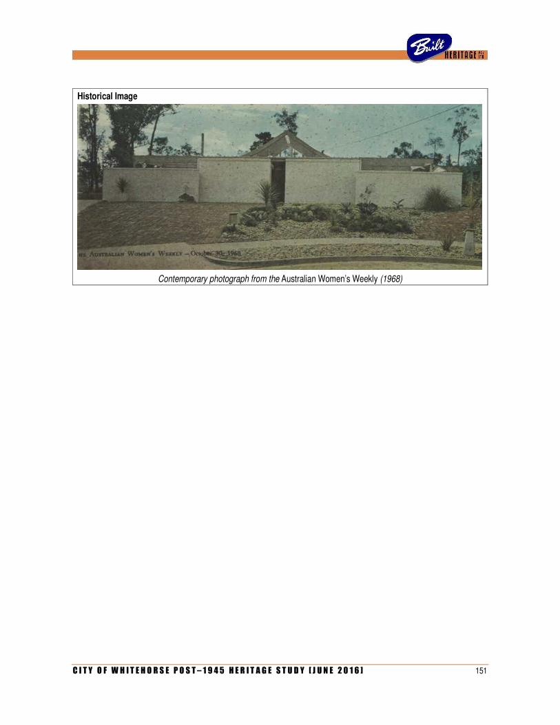
C I T Y O F W H I T E H O R S E P O S T – 1 9 4 5 H E R I T A G E S T U D Y [ J U N E 2 0 1 6 ] 151
Historical Image
Contemporary photograph from the Australian Women’s Weekly (1968)

152 C I T Y O F W H I T E H O R S E P O S T – 1 9 4 5 H E R I T A G E S T U D Y [ J U N E 2 0 1 6 ]
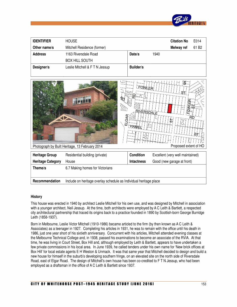
C I T Y O F W H I T E H O R S E P O S T – 1 9 4 5 H E R I T A G E S T U D Y [ J U N E 2 0 1 6 ] 153
IDENTIFIER HOUSE Citation No E014
Other name/s Mitchell Residence (former) Melway ref 61 B2
Address 1163 Riversdale Road Date/s 1940
BOX HILL SOUTH
Designer/s Leslie Mitchell & F T N Jessup Builder/s
Photograph by Built Heritage, 13 February 2014
Proposed extent of HO
Heritage Group Residential building (private) Condition Excellent (very well maintained)
Heritage Category House Intactness Good (new garage at front)
Theme/s 6.7 Making homes for Victorians
Recommendation Include on heritage overlay schedule as Individual heritage place
History
This house was erected in 1940 by architect Leslie Mitchell for his own use, and was designed by Mitchell in association with a younger architect, Neil Jessup. At the time, both architects were employed by A C Leith & Bartlett, a respected city architectural partnership that traced its origins back to a practice founded in 1890 by Scottish-born George Burridge Leith (1858-1937).
Born in Melbourne, Leslie Victor Mitchell (1910-1986) became articled to the firm (by then known as A C Leith & Associates) as a teenager in 1927. Completing his articles in 1931, he was to remain with the office until his death in 1986, just one year short of his sixtieth anniversary. Concurrent with his articles, Mitchell attended evening classes at the Melbourne Technical College and, in 1938, passed his examinations to become an associate of the RVIA. At that time, he was living in Court Street, Box Hill and, although employed by Leith & Bartlett, appears to have undertaken a few private commissions in his local area. In June 1939, he called tenders under his own name for ‘New brick offices at Box Hill’ for local estate agents E H Weston & Unmack. It was that same year that Mitchell decided to design and build a new house for himself in the suburb’s developing southern fringe, on an elevated site on the north side of Riversdale Road, east of Elgar Road. The design of Mitchell’s own house has been co-credited to F T N Jessup, who had been employed as a draftsman in the office of A C Leith & Bartlett since 1937.
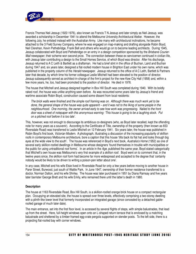
154 C I T Y O F W H I T E H O R S E P O S T – 1 9 4 5 H E R I T A G E S T U D Y [ J U N E 2 0 1 6 ]
Francis Thomas Neil Jessup (1922-1976), also known as Francis T N Jessup and later simply as Neil Jessup, was awarded a scholarship in December 1941 to attend the Melbourne University Architectural Atelier. However, the following July, he enlisted instead with the Australian Army. Like many with architectural inclinations, he became attached to the 3 Field Survey Company, where he was engaged on map-making and drafting alongside Robin Boyd, Neil Clerehan, Kevin Pethebridge, Frank Bell and others who would go on to become leading architects. During 1945, Jessup collaborated with Boyd and Pethebridge on an entry in a design competition sponsored by the Brisbane Courier-Mail newspaper; their scheme won second prize. The connection between these ex-servicemen continued in civilian life, with Jessup later contributing a design to the Small Homes Service, of which Boyd was director. After his discharge, Jessup returned to A C Leith & Bartlett as a draftsman. He had a brief stint in the office of Buchan, Laird and Buchan during 1947 and, six years later, designed a flat-roofed modern house in Brighton East under his own name, which was published in the property column of the Herald newspaper. Jessup returned to the office of A C Leith, Bartlett & Partners later that decade, by which time his former colleague Leslie Mitchell had been elevated to the position of director. Jessup subsequently served as architect-in-charge of the firm’s project for the new Kew City Hall (1958) and, within a few more years, he, too, had been promoted to the position of director. He died in 1976.
The house that Mitchell and Jessup designed together in Box Hill South was completed during 1940. With its boldly raked roof, the house was unlike anything seen before. As was recounted some years later by Jessup’s friend and wartime associate Robin Boyd, construction caused some dissent from local residents:
The brick walls were finished and the simple roof framing was on. Although there was much work yet to be done, the general shape of the house was quite apparent – and it was not to the liking of some people in the neighbourhood. One morning, the owner arrived early to see how work was progressing. Nailed to the front door was a sheet of notepaper with this anonymous warning: ‘This house is going to be a laughing stock. Put on a pitched roof before it is too late’.
This, however, was not enough to discourage its ambitious co-designers (who, as Boyd later recalled, kept the offending note for many years as a souvenir). According to the Certificate of Title, ownership of the property (then known as 653 Riversdale Road) was transferred to Leslie Mitchell on 12 February 1941. Six years later, the house was published in Robin Boyd’s first book, Victorian Modern. A photograph, illustrating a discussion of the increasing popularity of skillion roofs in contemporary Melbourne architecture, bore a caption that this house ‘tilts back its flat hat and looks through big eyes at the wide view to the south’. The house was referenced in Boyd’s next book, Australia’s Home (1952) as one of several early skillion-roofed dwellings in Melbourne whose designers ‘found themselves in trouble with municipalities or the public for using untraditional roof forms’. In an article in the Age, published the same year, Boyd stated categorically that Mitchell’s own house was Melbourne’s very first example of a skillion roof. Boyd went on to comment that, in the twelve years since, the skillion roof form had become far more widespread and accepted to the degree that ‘certainly nobody would be likely to be driven to writing a poison-pen letter about one’.
In any case, Mitchell and his wife Elsie lived in Riversdale Road for only a few years before moving to another house in Parer Street, Burwood, just south of Wattle Park. In June 1947, ownership of their former residence transferred to a doctor, Norman Dalton, and his wife Shirley. The house was later purchased in 1951 by Diana Ramsay and five years later barrister George Brett and his wife Emily, who remained there until the latter’s death in 1980.
Description
The house at 1163 Riversdale Road, Box Hill South, is a skillion-roofed orange brick house on a compact rectangular plan. Occupying an elevated site, the house is spread over three levels, effectively comprising a two-storey dwelling with a plinth-like lower level that formerly incorporated an integrated garage (since concealed by a detached gable-roofed garage of much later date).
The main entrance, set into the first floor level, is accessed by several flights of steps, with simple balustrades, that lead up from the street. Here, full-height windows open onto an L-shaped return terrace that is enclosed by a matching balustrade and sheltered by a timber-framed egg-crate pergola supported on slender posts. To the left side, there is a projecting flat-roofed bay with corner windows.
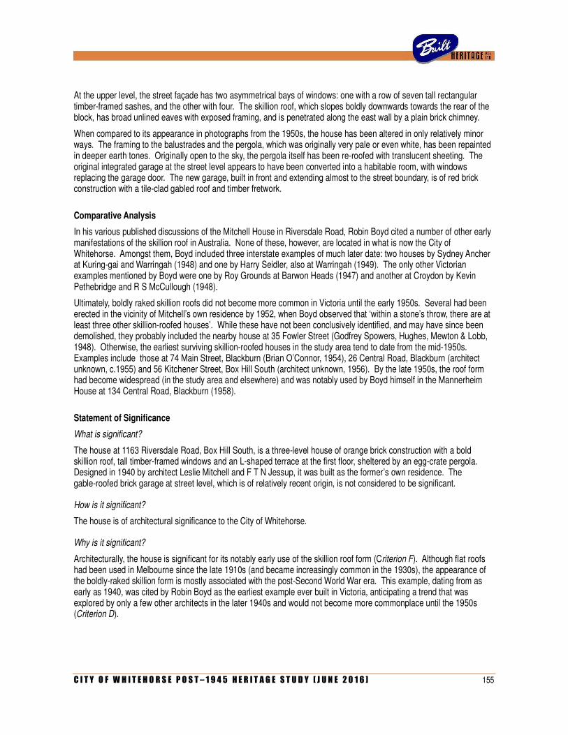
C I T Y O F W H I T E H O R S E P O S T – 1 9 4 5 H E R I T A G E S T U D Y [ J U N E 2 0 1 6 ] 155
At the upper level, the street façade has two asymmetrical bays of windows: one with a row of seven tall rectangular timber-framed sashes, and the other with four. The skillion roof, which slopes boldly downwards towards the rear of the block, has broad unlined eaves with exposed framing, and is penetrated along the east wall by a plain brick chimney.
When compared to its appearance in photographs from the 1950s, the house has been altered in only relatively minor ways. The framing to the balustrades and the pergola, which was originally very pale or even white, has been repainted in deeper earth tones. Originally open to the sky, the pergola itself has been re-roofed with translucent sheeting. The original integrated garage at the street level appears to have been converted into a habitable room, with windows replacing the garage door. The new garage, built in front and extending almost to the street boundary, is of red brick construction with a tile-clad gabled roof and timber fretwork.
Comparative Analysis
In his various published discussions of the Mitchell House in Riversdale Road, Robin Boyd cited a number of other early manifestations of the skillion roof in Australia. None of these, however, are located in what is now the City of Whitehorse. Amongst them, Boyd included three interstate examples of much later date: two houses by Sydney Ancher at Kuring-gai and Warringah (1948) and one by Harry Seidler, also at Warringah (1949). The only other Victorian examples mentioned by Boyd were one by Roy Grounds at Barwon Heads (1947) and another at Croydon by Kevin Pethebridge and R S McCullough (1948).
Ultimately, boldly raked skillion roofs did not become more common in Victoria until the early 1950s. Several had been erected in the vicinity of Mitchell’s own residence by 1952, when Boyd observed that ‘within a stone’s throw, there are at least three other skillion-roofed houses’. While these have not been conclusively identified, and may have since been demolished, they probably included the nearby house at 35 Fowler Street (Godfrey Spowers, Hughes, Mewton & Lobb, 1948). Otherwise, the earliest surviving skillion-roofed houses in the study area tend to date from the mid-1950s. Examples include those at 74 Main Street, Blackburn (Brian O’Connor, 1954), 26 Central Road, Blackburn (architect unknown, c.1955) and 56 Kitchener Street, Box Hill South (architect unknown, 1956). By the late 1950s, the roof form had become widespread (in the study area and elsewhere) and was notably used by Boyd himself in the Mannerheim House at 134 Central Road, Blackburn (1958).
Statement of Significance
What is significant?
The house at 1163 Riversdale Road, Box Hill South, is a three-level house of orange brick construction with a bold skillion roof, tall timber-framed windows and an L-shaped terrace at the first floor, sheltered by an egg-crate pergola. Designed in 1940 by architect Leslie Mitchell and F T N Jessup, it was built as the former’s own residence. The gable-roofed brick garage at street level, which is of relatively recent origin, is not considered to be significant.
How is it significant?
The house is of architectural significance to the City of Whitehorse.
Why is it significant?
Architecturally, the house is significant for its notably early use of the skillion roof form (Criterion F). Although flat roofs had been used in Melbourne since the late 1910s (and became increasingly common in the 1930s), the appearance of the boldly-raked skillion form is mostly associated with the post-Second World War era. This example, dating from as early as 1940, was cited by Robin Boyd as the earliest example ever built in Victoria, anticipating a trend that was explored by only a few other architects in the later 1940s and would not become more commonplace until the 1950s (Criterion D).
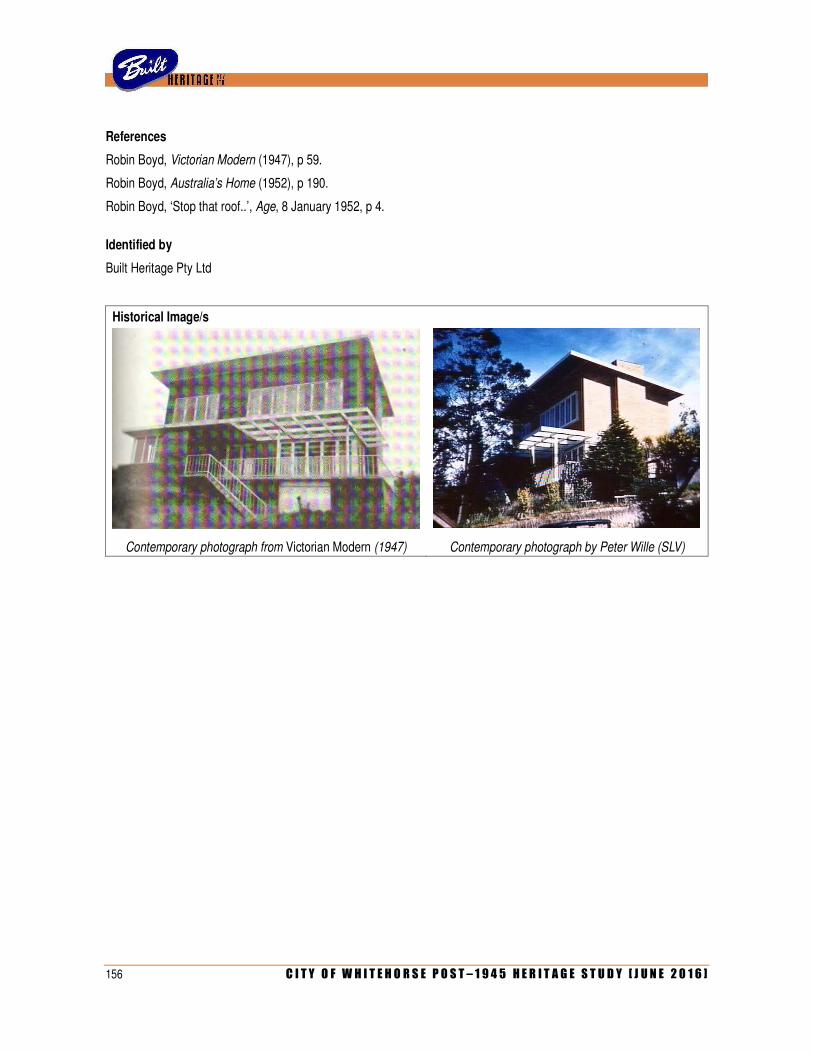
156 C I T Y O F W H I T E H O R S E P O S T – 1 9 4 5 H E R I T A G E S T U D Y [ J U N E 2 0 1 6 ]
References
Robin Boyd, Victorian Modern (1947), p 59.
Robin Boyd, Australia’s Home (1952), p 190.
Robin Boyd, ‘Stop that roof..’, Age, 8 January 1952, p 4.
Identified by
Built Heritage Pty Ltd
Historical Image/s
Contemporary photograph from Victorian Modern (1947) Contemporary photograph by Peter Wille (SLV)
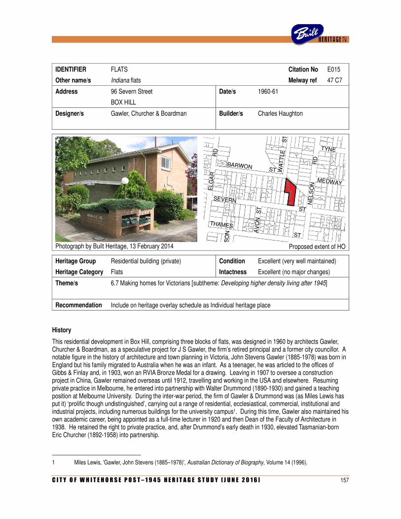
C I T Y O F W H I T E H O R S E P O S T – 1 9 4 5 H E R I T A G E S T U D Y [ J U N E 2 0 1 6 ] 157
IDENTIFIER FLATS Citation No E015
Other name/s Indiana flats Melway ref 47 C7
Address 96 Severn Street Date/s 1960-61
BOX HILL
Designer/s Gawler, Churcher & Boardman Builder/s Charles Haughton
Photograph by Built Heritage, 13 February 2014
Proposed extent of HO
Heritage Group Residential building (private) Condition Excellent (very well maintained)
Heritage Category Flats Intactness Excellent (no major changes)
Theme/s 6.7 Making homes for Victorians [subtheme: Developing higher density living after 1945]
Recommendation Include on heritage overlay schedule as Individual heritage place
History
This residential development in Box Hill, comprising three blocks of flats, was designed in 1960 by architects Gawler, Churcher & Boardman, as a speculative project for J S Gawler, the firm’s retired principal and a former city councillor. A notable figure in the history of architecture and town planning in Victoria, John Stevens Gawler (1885-1978) was born in England but his family migrated to Australia when he was an infant. As a teenager, he was articled to the offices of Gibbs & Finlay and, in 1903, won an RVIA Bronze Medal for a drawing. Leaving in 1907 to oversee a construction project in China, Gawler remained overseas until 1912, travelling and working in the USA and elsewhere. Resuming private practice in Melbourne, he entered into partnership with Walter Drummond (1890-1930) and gained a teaching position at Melbourne University. During the inter-war period, the firm of Gawler & Drummond was (as Miles Lewis has put it) ‘prolific though undistinguished’, carrying out a range of residential, ecclesiastical, commercial, institutional and industrial projects, including numerous buildings for the university campus1. During this time, Gawler also maintained his own academic career, being appointed as a full-time lecturer in 1920 and then Dean of the Faculty of Architecture in 1938. He retained the right to private practice, and, after Drummond’s early death in 1930, elevated Tasmanian-born Eric Churcher (1892-1958) into partnership.
1 Miles Lewis, 'Gawler, John Stevens (1885–1978)', Australian Dictionary of Biography, Volume 14 (1996).
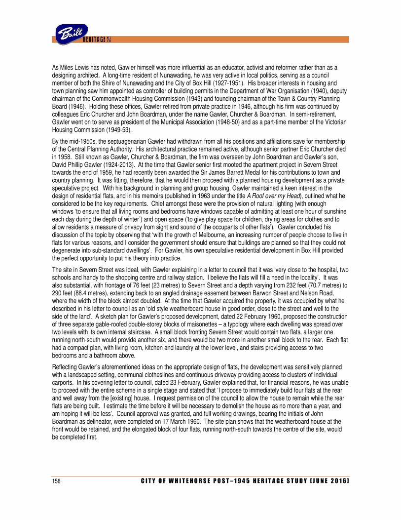
158 C I T Y O F W H I T E H O R S E P O S T – 1 9 4 5 H E R I T A G E S T U D Y [ J U N E 2 0 1 6 ]
As Miles Lewis has noted, Gawler himself was more influential as an educator, activist and reformer rather than as a designing architect. A long-time resident of Nunawading, he was very active in local politics, serving as a council member of both the Shire of Nunawading and the City of Box Hill (1927-1951). His broader interests in housing and town planning saw him appointed as controller of building permits in the Department of War Organisation (1940), deputy chairman of the Commonwealth Housing Commission (1943) and founding chairman of the Town & Country Planning Board (1946). Holding these offices, Gawler retired from private practice in 1946, although his firm was continued by colleagues Eric Churcher and John Boardman, under the name Gawler, Churcher & Boardman. In semi-retirement, Gawler went on to serve as president of the Municipal Association (1948-50) and as a part-time member of the Victorian Housing Commission (1949-53).
By the mid-1950s, the septuagenarian Gawler had withdrawn from all his positions and affiliations save for membership of the Central Planning Authority. His architectural practice remained active, although senior partner Eric Churcher died in 1958. Still known as Gawler, Churcher & Boardman, the firm was overseen by John Boardman and Gawler’s son, David Phillip Gawler (1924-2013). At the time that Gawler senior first mooted the apartment project in Severn Street towards the end of 1959, he had recently been awarded the Sir James Barrett Medal for his contributions to town and country planning. It was fitting, therefore, that he would then proceed with a planned housing development as a private speculative project. With his background in planning and group housing, Gawler maintained a keen interest in the design of residential flats, and in his memoirs (published in 1963 under the title A Roof over my Head), outlined what he considered to be the key requirements. Chief amongst these were the provision of natural lighting (with enough windows ‘to ensure that all living rooms and bedrooms have windows capable of admitting at least one hour of sunshine each day during the depth of winter’) and open space (‘to give play space for children, drying areas for clothes and to allow residents a measure of privacy from sight and sound of the occupants of other flats’). Gawler concluded his discussion of the topic by observing that ‘with the growth of Melbourne, an increasing number of people choose to live in flats for various reasons, and I consider the government should ensure that buildings are planned so that they could not degenerate into sub-standard dwellings’. For Gawler, his own speculative residential development in Box Hill provided the perfect opportunity to put his theory into practice.
The site in Severn Street was ideal, with Gawler explaining in a letter to council that it was ‘very close to the hospital, two schools and handy to the shopping centre and railway station. I believe the flats will fill a need in the locality’. It was also substantial, with frontage of 76 feet (23 metres) to Severn Street and a depth varying from 232 feet (70.7 metres) to 290 feet (88.4 metres), extending back to an angled drainage easement between Barwon Street and Nelson Road, where the width of the block almost doubled. At the time that Gawler acquired the property, it was occupied by what he described in his letter to council as an ‘old style weatherboard house in good order, close to the street and well to the side of the land’. A sketch plan for Gawler’s proposed development, dated 22 February 1960, proposed the construction of three separate gable-roofed double-storey blocks of maisonettes – a typology where each dwelling was spread over two levels with its own internal staircase. A small block fronting Severn Street would contain two flats, a larger one running north-south would provide another six, and there would be two more in another small block to the rear. Each flat had a compact plan, with living room, kitchen and laundry at the lower level, and stairs providing access to two bedrooms and a bathroom above.
Reflecting Gawler’s aforementioned ideas on the appropriate design of flats, the development was sensitively planned with a landscaped setting, communal clotheslines and continuous driveway providing access to clusters of individual carports. In his covering letter to council, dated 23 February, Gawler explained that, for financial reasons, he was unable to proceed with the entire scheme in a single stage and stated that ‘I propose to immediately build four flats at the rear and well away from the [existing] house. I request permission of the council to allow the house to remain while the rear flats are being built. I estimate the time before it will be necessary to demolish the house as no more than a year, and am hoping it will be less’. Council approval was granted, and full working drawings, bearing the initials of John Boardman as delineator, were completed on 17 March 1960. The site plan shows that the weatherboard house at the front would be retained, and the elongated block of four flats, running north-south towards the centre of the site, would be completed first.
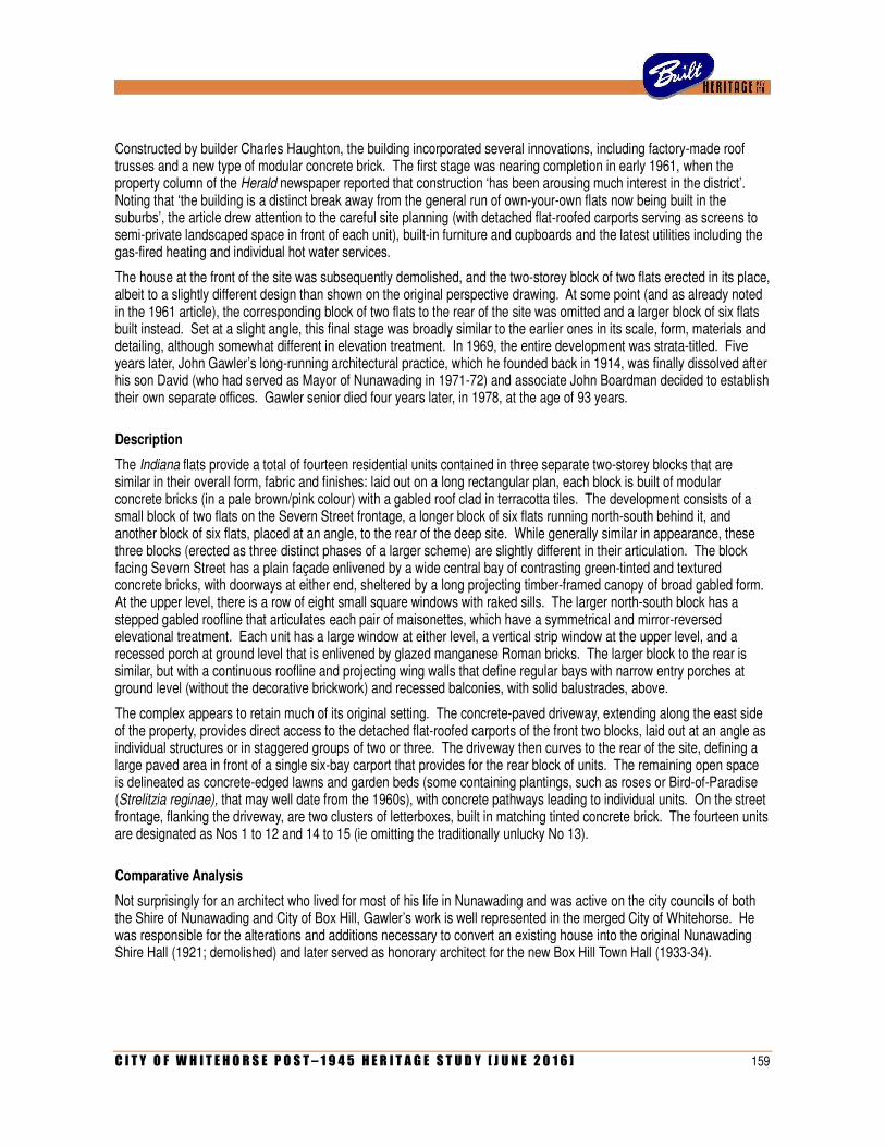
C I T Y O F W H I T E H O R S E P O S T – 1 9 4 5 H E R I T A G E S T U D Y [ J U N E 2 0 1 6 ] 159
Constructed by builder Charles Haughton, the building incorporated several innovations, including factory-made roof trusses and a new type of modular concrete brick. The first stage was nearing completion in early 1961, when the property column of the Herald newspaper reported that construction ‘has been arousing much interest in the district’. Noting that ‘the building is a distinct break away from the general run of own-your-own flats now being built in the suburbs’, the article drew attention to the careful site planning (with detached flat-roofed carports serving as screens to semi-private landscaped space in front of each unit), built-in furniture and cupboards and the latest utilities including the gas-fired heating and individual hot water services.
The house at the front of the site was subsequently demolished, and the two-storey block of two flats erected in its place, albeit to a slightly different design than shown on the original perspective drawing. At some point (and as already noted in the 1961 article), the corresponding block of two flats to the rear of the site was omitted and a larger block of six flats built instead. Set at a slight angle, this final stage was broadly similar to the earlier ones in its scale, form, materials and detailing, although somewhat different in elevation treatment. In 1969, the entire development was strata-titled. Five years later, John Gawler’s long-running architectural practice, which he founded back in 1914, was finally dissolved after his son David (who had served as Mayor of Nunawading in 1971-72) and associate John Boardman decided to establish their own separate offices. Gawler senior died four years later, in 1978, at the age of 93 years.
Description
The Indiana flats provide a total of fourteen residential units contained in three separate two-storey blocks that are similar in their overall form, fabric and finishes: laid out on a long rectangular plan, each block is built of modular concrete bricks (in a pale brown/pink colour) with a gabled roof clad in terracotta tiles. The development consists of a small block of two flats on the Severn Street frontage, a longer block of six flats running north-south behind it, and another block of six flats, placed at an angle, to the rear of the deep site. While generally similar in appearance, these three blocks (erected as three distinct phases of a larger scheme) are slightly different in their articulation. The block facing Severn Street has a plain façade enlivened by a wide central bay of contrasting green-tinted and textured concrete bricks, with doorways at either end, sheltered by a long projecting timber-framed canopy of broad gabled form. At the upper level, there is a row of eight small square windows with raked sills. The larger north-south block has a stepped gabled roofline that articulates each pair of maisonettes, which have a symmetrical and mirror-reversed elevational treatment. Each unit has a large window at either level, a vertical strip window at the upper level, and a recessed porch at ground level that is enlivened by glazed manganese Roman bricks. The larger block to the rear is similar, but with a continuous roofline and projecting wing walls that define regular bays with narrow entry porches at ground level (without the decorative brickwork) and recessed balconies, with solid balustrades, above.
The complex appears to retain much of its original setting. The concrete-paved driveway, extending along the east side of the property, provides direct access to the detached flat-roofed carports of the front two blocks, laid out at an angle as individual structures or in staggered groups of two or three. The driveway then curves to the rear of the site, defining a large paved area in front of a single six-bay carport that provides for the rear block of units. The remaining open space is delineated as concrete-edged lawns and garden beds (some containing plantings, such as roses or Bird-of-Paradise (Strelitzia reginae), that may well date from the 1960s), with concrete pathways leading to individual units. On the street frontage, flanking the driveway, are two clusters of letterboxes, built in matching tinted concrete brick. The fourteen units are designated as Nos 1 to 12 and 14 to 15 (ie omitting the traditionally unlucky No 13).
Comparative Analysis
Not surprisingly for an architect who lived for most of his life in Nunawading and was active on the city councils of both the Shire of Nunawading and City of Box Hill, Gawler’s work is well represented in the merged City of Whitehorse. He was responsible for the alterations and additions necessary to convert an existing house into the original Nunawading Shire Hall (1921; demolished) and later served as honorary architect for the new Box Hill Town Hall (1933-34).
160 C I T Y O F W H I T E H O R S E P O S T – 1 9 4 5 H E R I T A G E S T U D Y [ J U N E 2 0 1 6 ]
When the eponymous White Horse Hotel was demolished in 1934, Gawler designed the new display plinth for its famous statue. He was also responsible for at least four houses in the Mont Albert area, including two in Laing Street for members of his family, and after the War, designed a new house for himself at 116 Springvale Road, Nunawading (1958; demolished). In its post-war incarnation as Gawler, Churcher & Boardman, his practice does not seem to have been very prolific, either in the study area or elsewhere. Amongst its few known projects are the refurbishment and enlarging of two city office buildings located in Queen Street (1959) and Lonsdale Street (1960). Gawler’s name has also been linked with a strip shopping centre, of unusual arc-like plan form, at the corner of Woodhouse and Station Streets in Box Hill North; although he had advocated for the provision of shops in the area in his capacity as a city councillor, it has not been confirmed whether he actually designed them himself. In later years, Gawler’s son David was also active as an architect in the study area, most notably as the designer of the community arts centre at Nunawading (1985).
Considered more broadly as an early local manifestation of post-war flat construction, the complex needs to be seen in the context of the apartment boom that took place in the former City of Box Hill after the introduction of strata titling in 1960. This was initially concentrated on the well-established suburbs to the western fringe of the municipality, notably Mont Albert and Surrey Hills, where large sites occupied by Victorian or Edwardian houses were ideal for this type of redevelopment. Early examples, such as the flat-roofed two-storey blocks at 18 Alexandra Avenue (1960) and 394 Mont Albert Road (1961), both by architect George Campbell, are typical. Respectively providing fourteen and eighteen residential units, these two developments were comparable in their elongated rectilinear plan form, with individual units spread over two levels. These utilitarian and box-like developments, typical of many that proliferated in the area during the later 1960s, represent a marked contrast to Gawler’s project in Severn Street, which attempted to introduce a more innovative and user-friendly approach through careful planning, both of the site (with staggered blocks, angled carports and semi-private open space) and the units themselves (each spread over two levels).
Statement of Significance
What is significant?
The Indiana Flats at 96 Severn Street, Box Hill, is a development of fourteen maisonettes, laid out as three detached two-storey gable-roofed blocks of tinted concrete brick construction, in a carefully planned setting that incorporates a wide concrete driveway with communal letterbox unit, individual and grouped flat-roofed carports, and semi-private open space with lawns, garden beds and pathways. All of these elements of hard and soft landscaping are considered to contribute to the overall significance of the place. Designed in 1960 and realised in three stages over the course of a few years, the project was commissioned by retired architect and former city councillor John Gawler, and was designed by his own firm, then known as Gawler, Churcher & Drummond.
How is it significant?
The flats are of historical and architectural significance to the City of Whitehorse.
Why is it significant?
Historically, the flats are significant for their ability to demonstrate the emergence of modern apartment development in the former City of Box Hill, parts of which would remain very strongly characterised by this typology throughout the 1960s, ‘70s and ‘80s (Criterion A). This trend burgeoned following the introduction of strata titling in 1960, and peaked in the eastern suburbs where population was rapidly increasing and large suburban sites occupied by outmoded Victorian or Edwardian houses were ideal for higher-density redevelopment.
Architecturally, this particular example of post-war flat design is notable not only for its innovative form (with detached blocks of maisonettes in a carefully planned landscaped setting, rather than simply a block-like development) but also for its innovative use of materials, including a new type of modular concrete brick (Criterion F). It is also significant as a substantial example of the work of architectural firm of Gawler, Churcher & Boardman, whose founding principal, John Gawler, has an important local resonance as a long-time resident (living for much of his long life in both Mont Albert and Nunawading) and as an influential councillor in both the Shire of Nunawading and the City of Box Hill (Criterion H).
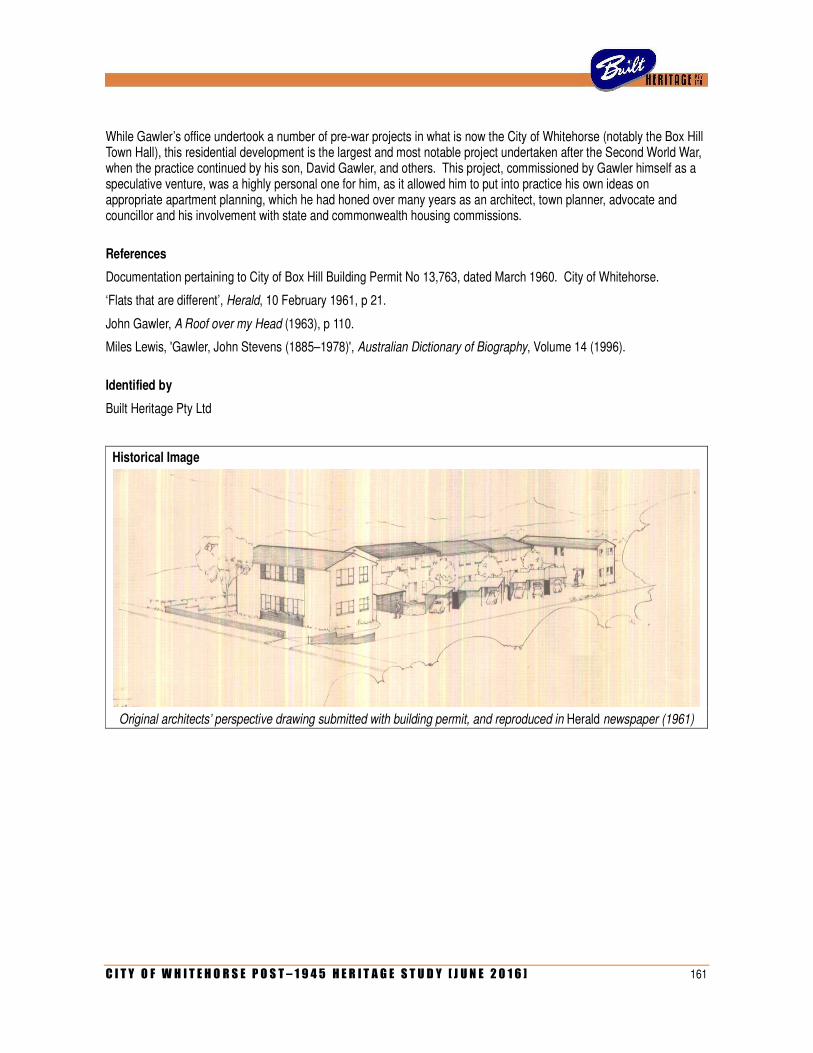
C I T Y O F W H I T E H O R S E P O S T – 1 9 4 5 H E R I T A G E S T U D Y [ J U N E 2 0 1 6 ] 161
While Gawler’s office undertook a number of pre-war projects in what is now the City of Whitehorse (notably the Box Hill Town Hall), this residential development is the largest and most notable project undertaken after the Second World War, when the practice continued by his son, David Gawler, and others. This project, commissioned by Gawler himself as a speculative venture, was a highly personal one for him, as it allowed him to put into practice his own ideas on appropriate apartment planning, which he had honed over many years as an architect, town planner, advocate and councillor and his involvement with state and commonwealth housing commissions.
References
Documentation pertaining to City of Box Hill Building Permit No 13,763, dated March 1960. City of Whitehorse.
‘Flats that are different’, Herald, 10 February 1961, p 21.
John Gawler, A Roof over my Head (1963), p 110.
Miles Lewis, 'Gawler, John Stevens (1885–1978)', Australian Dictionary of Biography, Volume 14 (1996).
Identified by
Built Heritage Pty Ltd
Historical Image
Original architects’ perspective drawing submitted with building permit, and reproduced in Herald newspaper (1961)

162 C I T Y O F W H I T E H O R S E P O S T – 1 9 4 5 H E R I T A G E S T U D Y [ J U N E 2 0 1 6 ]
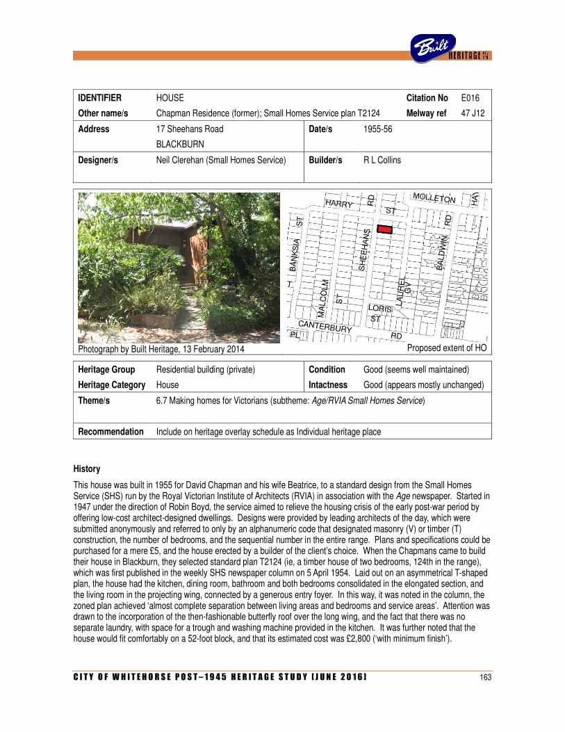
C I T Y O F W H I T E H O R S E P O S T – 1 9 4 5 H E R I T A G E S T U D Y [ J U N E 2 0 1 6 ] 163
IDENTIFIER HOUSE Citation No E016
Other name/s Chapman Residence (former); Small Homes Service plan T2124 Melway ref 47 J12
Address 17 Sheehans Road Date/s 1955-56
BLACKBURN
Designer/s Neil Clerehan (Small Homes Service) Builder/s R L Collins
Photograph by Built Heritage, 13 February 2014
Proposed extent of HO
Heritage Group Residential building (private) Condition Good (seems well maintained)
Heritage Category House Intactness Good (appears mostly unchanged)
Theme/s 6.7 Making homes for Victorians (subtheme: Age/RVIA Small Homes Service)
Recommendation Include on heritage overlay schedule as Individual heritage place
History
This house was built in 1955 for David Chapman and his wife Beatrice, to a standard design from the Small Homes Service (SHS) run by the Royal Victorian Institute of Architects (RVIA) in association with the Age newspaper. Started in 1947 under the direction of Robin Boyd, the service aimed to relieve the housing crisis of the early post-war period by offering low-cost architect-designed dwellings. Designs were provided by leading architects of the day, which were submitted anonymously and referred to only by an alphanumeric code that designated masonry (V) or timber (T) construction, the number of bedrooms, and the sequential number in the entire range. Plans and specifications could be purchased for a mere £5, and the house erected by a builder of the client’s choice. When the Chapmans came to build their house in Blackburn, they selected standard plan T2124 (ie, a timber house of two bedrooms, 124th in the range), which was first published in the weekly SHS newspaper column on 5 April 1954. Laid out on an asymmetrical T-shaped plan, the house had the kitchen, dining room, bathroom and both bedrooms consolidated in the elongated section, and the living room in the projecting wing, connected by a generous entry foyer. In this way, it was noted in the column, the zoned plan achieved ‘almost complete separation between living areas and bedrooms and service areas’. Attention was drawn to the incorporation of the then-fashionable butterfly roof over the long wing, and the fact that there was no separate laundry, with space for a trough and washing machine provided in the kitchen. It was further noted that the house would fit comfortably on a 52-foot block, and that its estimated cost was £2,800 (‘with minimum finish’).
164 C I T Y O F W H I T E H O R S E P O S T – 1 9 4 5 H E R I T A G E S T U D Y [ J U N E 2 0 1 6 ]
Although not publicised as such at the time, plan T2124 was designed by architect Neil Clerehan, who took over as director of the SHS in late 1953, after Robin Boyd resigned to enter into partnership with Roy Grounds and Frederick Romberg. Clerehan (born 1922) was a close friend of Boyd, and had been an enthusiastic contributor of plans to the SHS range. Starting with plan T226 in November 1948, Clerehan prepared ten designs before he took over as director. He also served as temporary SHS director during 1950, while Boyd was overseas; when he took over permanently in 1953, Clerehan himself had recently returned from the USA. Plan T2124, published in the column in April 1954, had actually been a prize-winning entry in a design competition held by the SHS six months earlier, before Clerehan took over as director. For this reason, it remained a personal favourite of the designer. During his tenure as director, T2124 would be re-published in the column in May 1956, June 1956, April 1957 and June 1959, and also appear in Architecture & Arts in April 1955 as part of a feature on the work of the SHS. Ultimately, Clerehan contributed 130 plans to the SHS range between 1953 and 1960, when he was succeeded as director of the service by architect Jack Clarke.
A building permit for the house in Sheehans Road was issued by the City of Nunawading on 13 July 1955. The builder was identified as R L Collins, of 46 Fellows Street, Kew, and the cost estimated at £3,350, which was rather higher than the figure Clerehan had previously quoted in his column. In August of that same year, the title to the property was officially transferred to David Chapman, salesman, and Beatrice Chapman, married woman, both formerly of 148 Orrong Road, Toorak. The land, designated as Lot 19, measured 56 feet by 131 feet – precisely the right width for T2124, as Clerehan had suggested in his column. Construction was nearing completion in early 1956 when Chapman received news that he was to be transferred from Melbourne. Unable to live in their new house, he and Beatrice offered it for sale in June. Advertised in the Age as an ‘ultra-modern timber villa’, it was succinctly described as ‘architect-designed, 5 rooms and large entrance hall, stone terrace, gravel road, provision for sewerage coming soon’. The sale, and the listed selling price of £4,600, prompted Clerehan to discuss the house in that week’s SHS column. Addressing the question of why the selling price was considerably greater than the original estimated cost of construction, Clerehan explained that ‘the house itself is unusual… it is, as its plan shows, an advanced design using modern techniques in planning and construction’. He also pointed out that the estimated cost of £3,100 had been for a house with ‘minimum finish’ (his original costing of £2,800, quoted two years earlier, having been increased for inflation) whereas ‘the house, as built, is “quality” finish’. Clerehan articulated the distinction, noting that the Chapman’s house used expensive Cypress pine cladding, flagstone paving, vermillion tiling in the bathroom (with a fashionable black bathtub), as well as providing considerably more power points, lights and built-in cupboards than had been indicated on the original working drawings. In conclusion, Clerehan stated that ‘the price asked is not a homebuyer’s nightmare, but rather is a dream to anyone looking for a clean-cut, handsome example of relative building costs’.
The ‘dream’ house was subsequently purchased by police officer Barry Dawes (1932-1995) and his wife Mary, who acquired the title to the property in January 1957. They only lived there until 1961, and the house then had another short-term owner before it was acquired in 1962 by Mrs Dawn Searle, who remained there for more than three decades. During that long period, the only major change to the house was the addition of a simple skillion-roofed carport with timber gates, which was erected in 1966 at the north end of the living room wing, in front of an earlier detached garage.
Description
The house at 17 Sheehans Road, Blackburn, is a single-storey modernist house of timber construction, clad externally with vertical boarding. Laid out on an asymmetrical T-shaped plan, the house comprises two perpendicular wings and thus presents a double-fronted façade to the street. The longer and narrower wing, to the south, has a low-pitched butterfly roof (that is, paired skillions that slope inward towards a box gutter), while the shorter and squatter living room wing, to the north, has a conventional skillion roof. In both cases, the roofs have broad eaves supported on exposed beams. The south wing has a full-height multi-paned window wall to the street, while the north wing has a narrower horizontal strip window to the street, with larger windows to the rear. The front entrance, set into a recess between the two wings, is also in the form of a fully-glazed window wall. A short flight of concrete steps, finished with crazy stone paving, leads down to ground level. The pathway to the street, and the low masonry wall along the front property line, are similarly lined in crazy stonework.
C I T Y O F W H I T E H O R S E P O S T – 1 9 4 5 H E R I T A G E S T U D Y [ J U N E 2 0 1 6 ] 165
Comparative Analysis
Although a certain amount of research has been done on the SHS, individual examples are notoriously difficult to identify in the field. The original SHS receipt book, which would have identified the names and addresses of specific clients, has reportedly been lost, and there are far too many plans in the range for examples to be identified merely by inspection. While the Age column illustrated plans and perspectives of a different design each week, photographs and descriptions of built examples were very rarely included. Research by the present author has identified only 25 built houses mentioned in the column between 1947 and 1960. Many of these, however, cannot be conclusively located due to the lack of information such as complete addresses or client names. Several that have been located have since been demolished, including two in Beaumaris (1952 and 1956), two in Balwyn North (1951 and 1952) and one in Montmorency (1954).
Of these 25 built examples published in the SHS column between 1947 and 1960, one-third (eight houses) were located in what is now the City of Whitehorse. Of these eight, two have been confirmed as demolished (one in Marchiori Road, Blackburn North and another on Whitehorse Road, Nunawading), another altered beyond recognition (also on Whitehorse Road), three others are unlocatable (in Vermont, Nunawading and Blackburn South) and the remaining two are still standing, in substantially intact states, in Blackburn (at 17 Sheehans Road and 111 Main Street). Research of building permits has serendipitously identified a few more local examples from the later 1950s, including those at 108 Morack Road, Vermont (T259), 2 Ireland Avenue, Mitcham (T377) and 15 Abelia Street, Nunawading (V344).
The T2124 at Blackburn stands out for several reasons. Firstly, it is notable as one of relatively few built examples of SHS dwellings to be profiled in the weekly Age column. While some of those others cited above were mentioned only fleetingly, this one was subject to an extensive discussion by its original architect, Neil Clerehan, illustrated by plan, perspective and recent exterior photograph. Its innovative design, which had won a prize in a 1953 SHS competition, was clearly one of Clerehan’s personal favourites. At the time, it was unusual for the more overtly modernist houses in the range to be purchased for construction, as a perception existed that more conventional gable-roofed houses were cheaper and/or more user-friendly. Clerehan has pointed out that these more basic designs were the ones most commonly purchased, while some of the most striking modernist designs were never purchased at all. This is apparent when considering other known examples in the study area, such as the aforementioned ones in Abelia Street, Ireland Avenue and Morack Road, all of which are far more conventional gable-roofed double-fronted suburban houses. With its zoned planning and butterfly roof, the T2124 in Blackburn thus stands out as a rare built example of one of the more strikingly modernist plans in the range, with its prestige heightened by the fact that its owners spent more money than usual to achieve an uncommonly high quality fitout.
Statement of Significance
What is significant?
The house 17 Sheehans Road, Blackburn, is a single-storey timber house on a T-shaped plan, with a skillion roof over one wing and a butterfly roof over the other, vertical board cladding and generous multi-paned windows. Erected in 1955-56 for David and Beatrice Chapman, it was built using plan T2124 of the Age/RVIA Small Homes Service (SHS), which was first published in its weekly column in April 1954. Although not credited at the time, the plan was designed by Neil Clerehan, who took over from Robin Boyd as director of the SHS in late 1953. Subject to few external changes, the house remains in substantially intact condition.
How is it significant?
The house is of architectural and aesthetic significance to the City of Whitehorse.
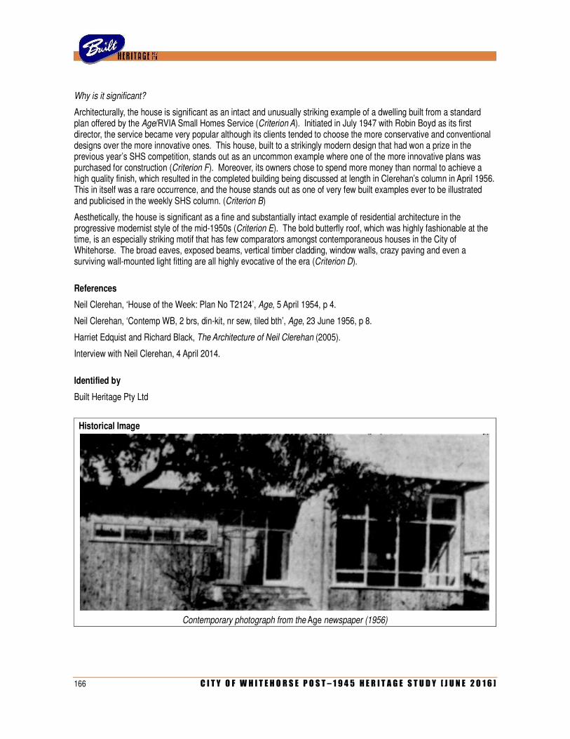
166 C I T Y O F W H I T E H O R S E P O S T – 1 9 4 5 H E R I T A G E S T U D Y [ J U N E 2 0 1 6 ]
Why is it significant?
Architecturally, the house is significant as an intact and unusually striking example of a dwelling built from a standard plan offered by the Age/RVIA Small Homes Service (Criterion A). Initiated in July 1947 with Robin Boyd as its first director, the service became very popular although its clients tended to choose the more conservative and conventional designs over the more innovative ones. This house, built to a strikingly modern design that had won a prize in the previous year’s SHS competition, stands out as an uncommon example where one of the more innovative plans was purchased for construction (Criterion F). Moreover, its owners chose to spend more money than normal to achieve a high quality finish, which resulted in the completed building being discussed at length in Clerehan’s column in April 1956. This in itself was a rare occurrence, and the house stands out as one of very few built examples ever to be illustrated and publicised in the weekly SHS column. (Criterion B)
Aesthetically, the house is significant as a fine and substantially intact example of residential architecture in the progressive modernist style of the mid-1950s (Criterion E). The bold butterfly roof, which was highly fashionable at the time, is an especially striking motif that has few comparators amongst contemporaneous houses in the City of Whitehorse. The broad eaves, exposed beams, vertical timber cladding, window walls, crazy paving and even a surviving wall-mounted light fitting are all highly evocative of the era (Criterion D).
References
Neil Clerehan, ‘House of the Week: Plan No T2124’, Age, 5 April 1954, p 4.
Neil Clerehan, ‘Contemp WB, 2 brs, din-kit, nr sew, tiled bth’, Age, 23 June 1956, p 8.
Harriet Edquist and Richard Black, The Architecture of Neil Clerehan (2005).
Interview with Neil Clerehan, 4 April 2014.
Identified by
Built Heritage Pty Ltd
Historical Image
Contemporary photograph from the Age newspaper (1956)
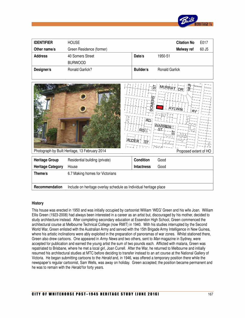
C I T Y O F W H I T E H O R S E P O S T – 1 9 4 5 H E R I T A G E S T U D Y [ J U N E 2 0 1 6 ] 167
IDENTIFIER HOUSE Citation No E017
Other name/s Green Residence (former) Melway ref 60 J5
Address 40 Somers Street Date/s 1950-51
BURWOOD
Designer/s Ronald Garlick? Builder/s Ronald Garlick
Photograph by Built Heritage, 13 February 2014
Proposed extent of HO
Heritage Group Residential building (private) Condition Good
Heritage Category House Intactness Good
Theme/s 6.7 Making homes for Victorians
Recommendation Include on heritage overlay schedule as Individual heritage place
History
This house was erected in 1950 and was initially occupied by cartoonist William ‘WEG’ Green and his wife Joan. William Ellis Green (1923-2008) had always been interested in a career as an artist but, discouraged by his mother, decided to study architecture instead. After completing secondary education at Essendon High School, Green commenced the architectural course at Melbourne Technical College (now RMIT) in 1940. With his studies interrupted by the Second World War, Green enlisted with the Australian Army and served with the 15th Brigade Army Intelligence in New Guinea, where his artistic inclinations were ably exploited in the preparation of panoramas of war zones. Whilst stationed there, Green also drew cartoons. One appeared in Army News and two others, sent to Man magazine in Sydney, were accepted for publication and earned the young artist the sum of two pounds each. Afflicted with malaria, Green was repatriated to Brisbane, where he met a local girl, Joan Currell. After the War, he returned to Melbourne and initially resumed his architectural studies at MTC before deciding to transfer instead to an art course at the National Gallery of Victoria. He began submitting cartoons to the Herald and, in 1946, was offered a temporary position there while the newspaper’s regular cartoonist, Sam Wells, was away on holiday. Green accepted; the position became permanent and he was to remain with the Herald for forty years.
168 C I T Y O F W H I T E H O R S E P O S T – 1 9 4 5 H E R I T A G E S T U D Y [ J U N E 2 0 1 6 ]
Meanwhile, Green remained in touch with Joan Currell in Brisbane; the couple became engaged in May 1948 and married twelve months later. Settling in Melbourne, they took up residence in a small two-bedroomed brick house in Oakleigh South, which Green had purchased ‘almost sight unseen’, as Joan put it. After the birth of their first daughter, they decided to look for a larger house. Joan further recalls that she and her husband, along with some friends, happened to be driving through the Burwood area and saw a new house nearing completion in Somers Street. She recalls that her husband was particularly attracted to its modern design, so they made enquiries and purchased it. According to the Certificate of Title, ownership of the property was transferred to William Ellis Green and Joan Hettie Green on 21 September 1951.
According to Joan Green, the house that she and her husband purchased was erected by a local builder/developer named Garlick, who lived ‘around the corner’. Electoral rolls confirm that one Ronald Thomas Garlick, builder, did indeed live around the corner, at 3 Eyre Street. The Greens’ house was a speculative undertaking, and Mrs Green recalls that Garlick was responsible for three other dwellings in the same street of similar scale but different style. One of these houses, at No 46, was occupied by Frank Daly, another Herald employee. Little else is known of the elusive Ronald Garlick (1917-2001). Mrs Green remembers that he and his wife moved away from the area, and they lost touch with them. By 1954, Garlick was living in Gilbert Road, Reservoir (and employed as a shopkeeper) but evidently working again as a builder by the late 1960s, by which time he was residing in a flat in Riversdale Road, Hawthorn.
Bill and Joan Green lived in the compact three-bedroom house for some years, but, following the births of two more children, soon began to outgrow it. In 1954, it was decided to add a separate drawing studio for Bill, who, as his wife recalls, had previously taken over the dining table for his cartooning. Plans were prepared for a simple one-roomed structure, 20 feet (6 metres) by 12 feet (3.6 metres), to be erected on the far side of the attached garage on the property’s Aylwin Avenue frontage. The studio was to have a steep skillion roof, side walls of cream brick (with porthole windows to match the main house) and weatherboarding to the front and rear, with large steel-framed windows. Inside, there were built-in cupboards (designed by Joan Green) to accommodate the children’s toys.
In 1963, the Greens sold the house to move further eastwards to Heathmont, where they built a new and much larger house to accommodate their growing family. By that time, Green’s professional activities had expanded to include contributing illustrations to the Australian Home Beautiful. With a burgeoning awareness of trends in contemporary residential architecture, he and his wife engaged the leading architectural firm of Chancellor & Patrick to design their new house, which was itself published in that magazine in May 1965. After the Greens moved, their former residence in Burwood was occupied by William Harper, a bank officer, and his wife Marjorie. Harper died in 1979 and his widow remained in the house until her own death in 1989. Following another change of ownership in 2012, a number of elements were demolished including the attached garage (latterly converted into a family room and workshop), Bill Green’s former drawing studio, and the tall brick walls that enclosed the rear garden.
Description
The house at 40 Somers Street, Burwood, is a two-storey skillion-roofed cream brick house in the Functionalist style. Occupying a corner site, it has a compact rectilinear plan and a stark block-like expression. The principal façade, to Aylwin Street, is asymmetrical, dominated by a wide chimney breast towards the left side, integrated with a projecting wall that supports the flat slab roof of a small entry canopy. The front entrance, opening off a concrete slab porch, is flanked by narrow projecting piers and contains a panelled timber door. Above the canopy, there is a pair of circular louvred vents with projecting rendered surrounds. All of the other window openings, to all four sides, are similarly framed by projecting rendered surrounds.
Comparative Analysis
As little is known of the work of builder Ronald Garlick, it is difficult to place this house in the broader context of his work in the local area, or indeed elsewhere. According to Mrs Joan Green, Garlick was responsible for three other two-storey brick houses in Somers Street, including one occupied by fellow Herald employee Frank Daly. Based on this testimony, and on the fact that Daly has been confirmed as a resident of No 44, it seems likely that Garlick built these four houses in a row, at what are now Nos 40, 42, 44 and 46 Somers Street.
C I T Y O F W H I T E H O R S E P O S T – 1 9 4 5 H E R I T A G E S T U D Y [ J U N E 2 0 1 6 ] 169
There certainly do not appear to be any other double-storey houses of contemporaneous date, or similar style, anywhere else along Somers Street. While the four houses are broadly similar in their double-storey scale, brick construction and compact plan forms, the three others at Nos 42, 44 and 46 are all of much more ordinary design. They all have hipped or gabled roofs clad in terracotta tiles, and more conventional fenestration and detailing (the one at No 44, for example, having a decidedly Neo-Georgian flavour). By contrast, the Green House at No 40 stands out for its much bolder modernist expression, with low-pitched skillion roof and window openings with projecting surrounds. Ronald Garlick’s own house, located nearby at 3 Eyre Street, is also a much simpler building: a basic triple-fronted weatherboard dwelling with tile-clad gabled roof.
More broadly, the house can be compared with some other examples of Functionalist architecture in the City of Whitehorse. The Mitchell House at 1163 Riversdale Road, Box Hill South (Leslie Mitchell and F T N Jessup, 1940) is somewhat comparable in its stark rectilinear form, compact planning, light-coloured brickwork, balcony and skillion roof. The house at 47 Kitchener Street, Box Hill (P H Keys, 1945), although having a rendered finish, is otherwise similar in its bold rectilinear massing, low roofline, fenestration and projecting canopy to the front entrance. The same can be said of the semi-detached pair of rendered houses at 40-40a Harold Street, Blackburn (architect unknown, c.1949).
Statement of Significance
What is significant?
The house at 40 Somers Street, Burwood, is a two-storey skillion-roofed orange brick house in the Functionalist style, incorporating windows framed by projecting rendered surrounds, a projecting canopy above the front door, and a line of porthole windows. Erected by local builder Ronald Garlick in 1950-51 as a speculative venture, the house was originally occupied by noted cartoonist William ‘WEG’ Green, who added a studio (recently demolished) in 1954.
How is it significant?
The house is of aesthetic significance to the City of Whitehorse.
Why is it significant?
Aesthetically, the house is a striking, if somewhat late example of the Functionalist style that was popular in Melbourne during the later 1930s and ‘40s (Criterion E). The house displays all of the hallmarks of that style, including its stark rectilinear massing, compact planning, low-pitched skillion roof (atypically expressed with projecting eaves, rather than concealed behind a parapet), porthole windows, cantilevered porch canopy, and slightly projecting first floor balcony with light metal balustrade. The projecting rendered surrounds to the groups of doors and windows (which included several corner windows) is a detail that is more unusual and particularly striking. Notwithstanding the recent demolition of the matching garage and studio wing (added in 1954), the house remains a prominent and eye-catching element on this corner site.
References
Vane Lindesay, ‘WEG: William Ellis Green (1923-2008)’, Latrobe Journal, No 86 (December 2010), pp 131-136.
Interview with Mrs Joan Green, 4 April 2014.
Identified by
Andrew Ward (additional research and assessment by Built Heritage Pty Ltd)
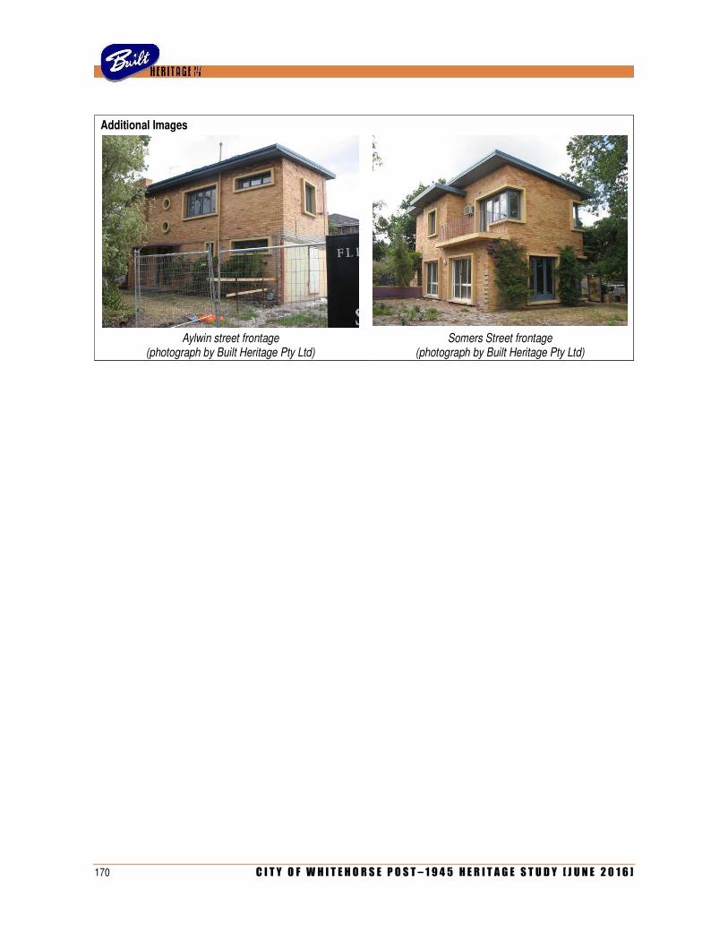
170 C I T Y O F W H I T E H O R S E P O S T – 1 9 4 5 H E R I T A G E S T U D Y [ J U N E 2 0 1 6 ]
Additional Images
Aylwin street frontage (photograph by Built Heritage Pty Ltd)
Somers Street frontage (photograph by Built Heritage Pty Ltd)

C I T Y O F W H I T E H O R S E P O S T – 1 9 4 5 H E R I T A G E S T U D Y [ J U N E 2 0 1 6 ] 171
IDENTIFIER OFFICE BUILDING Citation No E018
Other name/s ES&A Bank branch (former); ANZ Bank (former) Melway ref 48 F10
Address 153-155 Springvale Road Date/s c.1957-59
NUNAWADING
Designer/s Stuart McIntosh Builder/s
Photograph by Built Heritage, 13 February 2014
Proposed extent of HO
Heritage Group Commercial Condition Excellent (very well maintained)
Heritage Category Bank Intactness Excellent (seems largely unaltered)
Theme/s 5.5 Banking and finance [subtheme: Establishing branch banks in the suburbs after 1945]
Recommendation Include on heritage overlay schedule as Individual heritage place
History
Designed around 1957 but not completed until 1959, this was erected as a branch of the English, Scottish & Australian (ES&A) Bank Ltd. Founded by Royal Charter in 1852 at the time of the Gold Rush, the bank underwent mixed fortunes (including a complete restructure after the financial crisis of 1892) but thrived into the twentieth century, merging with other banks along the way. After changes to banking legislation in the early post-war era, the ES&A Bank was one of many to increase its physical presence by opening new branches in the suburbs and regional centres. There was a tendency to move away from the pre-war notion of standardised design, with banks engaging leading modern architects to design more individualistic buildings. The ES&A Bank was the acknowledged leader of this trend, with one contemporary article noting that ‘since 1952, the ES&A Bank has pursued a policy of friendly atmosphere and eye-catching design in the field of small office buildings’. Another reported that its new branches ‘provide an interesting departure from the conventional type architecture common to banking premises for decades’. This trend can be credited to Stuart McIntosh, who was appointed to take charge of the ES&A Bank’s Architectural Department in 1953. Born in Adelaide, John Stuart McIntosh (1924-2007) was discharged from the Australian Army in 1946 and enrolled in the architecture course at Melbourne University, where he studied under Robin Boyd. Graduating in February 1953, McIntosh worked in the office of Yuncken, Freeman Brothers, Griffiths & Simpson and was registered as an architect the following month. Later that year, he left to take up the position of Staff Architect at the ES&A Bank, which he held until he moved to Queensland in 1963.
172 C I T Y O F W H I T E H O R S E P O S T – 1 9 4 5 H E R I T A G E S T U D Y [ J U N E 2 0 1 6 ]
As Staff Architect, McIntosh was responsible for most architectural work carried out for the ES&A Bank in Victoria, which not only included new branches but also alterations and additions to existing buildings. By his own account, he was solely responsible for design, while detailing and documentation was executed by staff including architects Geoffrey Danne (1920-1985), Robert Garner (1931-2004) and Alexander Harris. Another architect, Lituano Samero (1888-1968) was responsible for the preparation of presentation drawings. McIntosh’s department was extremely busy during the 1950s and, over the period 1955-56 alone, called tenders for ten bank-related projects that included new branches in Victoria, New South Wales and Darwin, renovations to existing premises in Bourke Street, and new staff quarters and manager’s residence, also in Darwin. These, and other projects, were all realised over the course of several years.
While the original drawings for the ES&A Bank branch in Nunawading have not been located, the design of the building can be attributed to McIntosh with considerable certainty. The ES&A Bank occasionally engaged private firms at the time, including Chancellor & Patrick (which designed a city branch in Elizabeth Street and others in Cheltenham, Frankston and Colac) Barlow, van Rompaey & Kerr (eg Mildura and Blackburn) and Montgomery, King & Trengove (eg Clayton). However, the Nunawading building has nothing in common with the examples by those architects and, conversely, bears a strong resemblance to other ES&A branch banks known to have been designed by McIntosh, especially those at Traralgon and Broken Hill (see comparative analysis). Likewise, the exact date of the building has also not been established. The Certificate of Title indicates that ownership of the land (originally Lot 2, Plan of Subdivision 11,153) was transferred to the ES&A Bank in June 1954. However, telephone directories reveal that the branch did not relocate from its former Nunawading address at 143 Springvale Road until 1959. This seems to follow a pattern, as tender notices indicate that many new ES&A Banks were designed in the mid-1950s, but were not actually completed until towards the end of the decade. Originally addressed as 127 Springvale Road, the new Nunawading branch became No 153-155 when this portion of the road was renumbered in the later 1960s.
Although a number of McIntosh’s ES&A Bank branches were published in architectural journals of the day (notably those in Ringwood, Malvern and Canberra), this particular example was not. However, a contemporary photograph, held in the ANZ Group Archives, shows the building as it appeared shortly after completion. The windowless stone-clad façade at the upper level was emblazoned with the bank’s circular symbol and lettering spelling out ES&A BANK, with its full name across one of the flanking brick walls at ground level. The glass entry doors opened onto a paved area flanked by two small shrubs, while a concrete pathway led across a gravelled bed towards the main footpath proper. A freestanding sign, with two raked metal posts, announced the presence of the bank to passers-by. The building remained occupied by the ES&A Bank Ltd until the company merged with the ANZ bank in 1970. Its services were then consolidated in a new and larger purpose-built banking premises erected nearby at 161 Springvale Road, designed by the architectural firm of R S Demaine, Russell, Trundle, Armstrong & Orton. The older building at No 153-155 remained in the bank’s ownership until November 1972, when it was acquired by businessmen Burton and Noel Terry. For some years, it retained the function for which it was built, as a branch of the National Bank of Australia. In more recent years, the building has served as the office of the State Member of Parliament for the Eastern Metropolitan Region.
Description
The former ES&A Bank at 153-155 Springvale Road is a double-storey building of highly unusual form and appearance. Occupying a double-width commercial allotment, the building has a plan based on a stretched hexagon, set well back from the street. Its Springvale Road frontage is stark and symmetrical. Its central ground floor entry, with angled glazed walls and a single door, is flanked by a pair of brick walls at the same angle, while the upper level is expressed as a hovering windowless volume with a canted prow-like form, clad in stone panels. The bold sculptural form of the façade is heightened by a contrast in materials and finishes. The angled walls at ground level, in red brick with deeply raked horizontal joints, contrast with the tall rectangular stone panels at the upper level, with their smooth-grained pale finish.
The building appears mostly intact from the exterior, although comparison with a vintage photograph reveals a number of minor changes. The gravelled bed and the openings for two shrubs have been infilled. All original signage including lettering and the bank symbol, has long gone, A metal pole sign, of different design to the one shown in the photograph, still stands at the public footpath level. The recessed letter box with polished metal surround, is original.
C I T Y O F W H I T E H O R S E P O S T – 1 9 4 5 H E R I T A G E S T U D Y [ J U N E 2 0 1 6 ] 173
Comparative Analysis
Of his time as Staff Architect to the ES&A Bank, Stuart McIntosh himself once noted that ‘my endeavour is to produce individual buildings and not mere variations’. He used a particularly unusual design method, influenced by Surrealist art, which involved drawing diagonal lines at random to generate bold forms that were developed into sculptural buildings. Consequently, there is considerable variety amongst his branch banks. Early examples such as Ringwood, Bayswater, Lockhart and Bairnsdale were single-storey buildings with fully glazed facades, sometimes (as with Ringwood and Bairnsdale) with the strong-room expressed as a projecting solid mass. For two-storey banks, the lower level was glazed and the upper level expressed either as a solid mass (eg Traralgon, Parkdale, Sunshine) or glazing partially concealed by vertical louvres (eg Taree), horizontal louvres (eg Darwin) or a diagonal grid (eg Broken Hill). The Nunawading building represents an amalgam of themes that McIntosh explored in various other branches. Its symmetrical massing, for example, echoes the banks at Traralgon and Broken Hill. Both buildings have their upper levels expressed in a similar prow-like form; the former, however, was done as a gridded screen rather than a solid mass, while the latter, while comparable solid and massive, has the ridge running horizontally rather than vertically. Most of McIntosh’s banks, like Nunawading are set back from the footpath to create a forecourt. The radiating wing walls, however, were less common, although they were also used at Traralgon and, to a lesser extent, at Parkdale. While the Bayswater and Broken Hill banks used some small areas of feature stone cladding, the stone panels at the upper storey of the Nunawading bank is more unusual in McIntosh’s work. He did, however, use polished black granite for the lower levels of the ES&A Bank branches at Sunshine (1956) and Malvern (1959).
Only one other branch of the ES&A Bank was erected in the study area during the 1950s, located at 19 Main Street, Blackburn. It was not designed by McIntosh but, rather, by the firm of Barlow, van Rompaey & Kerr. Completed around 1956, the building had a fully glazed wall with a surround of black terracotta tiles, but has since been remodelled beyond recognition. This seems to be the pattern for many contemporaneous branches of other banks. The former National Bank at 550 Whitehorse Road, Mitcham (Meldrum & Noad, 1955) was remodelled or entirely rebuilt in the 1990s, while the former Commonwealth Bank across the road, at No 505 (Ray Berg, 1958) has been converted to a medical centre and much altered. The former State Savings Bank at 141 Springvale Road, Nunawading (Robert Cousland, 1959), now a shopfront, has been altered by overpainting its feature wall of Castlemaine slate and other changes. While they were all perfectly confident manifestations of the prevailing modernist style, none of these mid-century branch banks, even in their heyday, were as visually arresting as the boldly sculptural former ES&A Bank at Nunawading.
As an example of McIntosh’s work, the former ES&A Bank at Nunawading also has a particular local resonance, in that the architect was himself a local resident at the time. From the early 1950s until he moved to Queensland in 1963, he lived in the Box Hill area and, for much of that time, in a striking modern house of his own design in Arnott Street, Mont Albert North (qv). His work in the study area is represented not only by his own house and this bank, but also by St Benedict’s Church in Warrigal Road, Surrey Hills (1959), which represented a rare private commission that was undertaken in association with Alexander Harris, one of his assistants in the Architectural Department of the ES&A Bank.
Statement of Significance
What is significant?
Set back from the street, the former ES&A Bank at 153-155 Springvale Road, Nunawading, is a two-story building on a stretched hexagonal plan, with a symmetrical street frontage comprising a central glazed entrance flanked by angled brick walls, with a prow-like and windowless upper storey clad in rectangular stone panels.
How is it significant?
The building is of architectural and aesthetic significance to the City of Whitehorse.
174 C I T Y O F W H I T E H O R S E P O S T – 1 9 4 5 H E R I T A G E S T U D Y [ J U N E 2 0 1 6 ]
Why is it significant?
Architecturally, the building is significant as a fine and substantially intact example of the progressive and highly distinctive bank architecture introduced in the post-war period by the ES&A Bank, and specifically by Stuart McIntosh, who was Staff Architect from 1953 to 1963. While most banking groups embraced the modernist style when designing new branches from the early 1950s, the ES&A Bank was acknowledged at the time as the leaders of this trend, creating ‘eye-catching designs’ that represented ‘an interesting departure from the conventional type architecture’. McIntosh’s output, reportedly influenced by Surrealist design techniques, was particularly idiosyncratic, characterised by contrasting finishes, projecting and receding planes and bold massing of sculptural forms (Criterion E).
While the building is unique as the only example of McIntosh’s bank architecture in the City of Whitehorse (and one of only a handful in Victoria that still remain substantially intact), it has an additional layer of local significance in that McIntosh himself was a local resident at the time of its construction (Criterion H). He lived in the Box Hill area from the early 1950s until 1963; his work in the study area is otherwise represented by his own house in Arnott Street, Mont Albert North, and St Benedict’s Church at 299 Warrigal Road, Burwood, both of which represent rare private commissions undertaken while he was Staff Architect to the ES&A Bank.
Aesthetically, the building is significant for its atypically sculptural form, of a type rarely seen in mid-century architecture in Victoria (Criterion F). With an unusual plan form based on a stretched hexagon (set well back from the footpath to create a small forecourt) and a stark symmetrical façade that juxtaposes two projecting angled brick walls at the lower level and a prow-like windowless stone-clad volume hovering above, the building stands out as a particularly striking and eye-catching element in a commercial streetscape that is otherwise characterised by far more conventional buildings of rectilinear form, built right to the footpath.
References
‘The Banks have a new look’, Architecture & Arts, August 1955, pp 27-29.
‘Small bank buildings’, Architecture & Arts, May 1958, pp 28-33.
‘Camera report’, Foundations, No 2 (January 1960), pp 24-25.
Igea Troiani, ‘Deserved Exposure: Stuart McIntosh’s Architecture, 1953-63’, Fabrications, 16:2 (2006), pp 29-43.
Information provided by Peter Marinick, ANZ Group Archives, Melbourne.
Identified by
Heritage Alliance (additional research, assessment and corrected attribution by Built Heritage Pty Ltd)
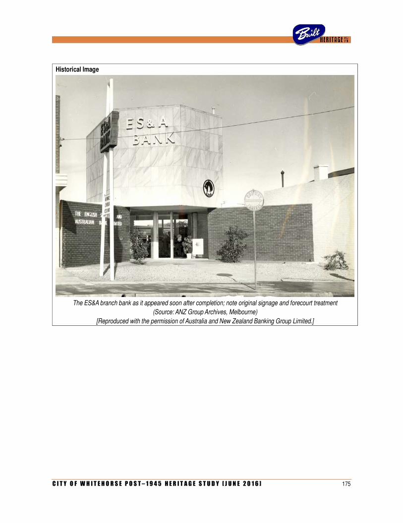
C I T Y O F W H I T E H O R S E P O S T – 1 9 4 5 H E R I T A G E S T U D Y [ J U N E 2 0 1 6 ] 175
Historical Image
The ES&A branch bank as it appeared soon after completion; note original signage and forecourt treatment
(Source: ANZ Group Archives, Melbourne)
[Reproduced with the permission of Australia and New Zealand Banking Group Limited.]

176 C I T Y O F W H I T E H O R S E P O S T – 1 9 4 5 H E R I T A G E S T U D Y [ J U N E 2 0 1 6 ]
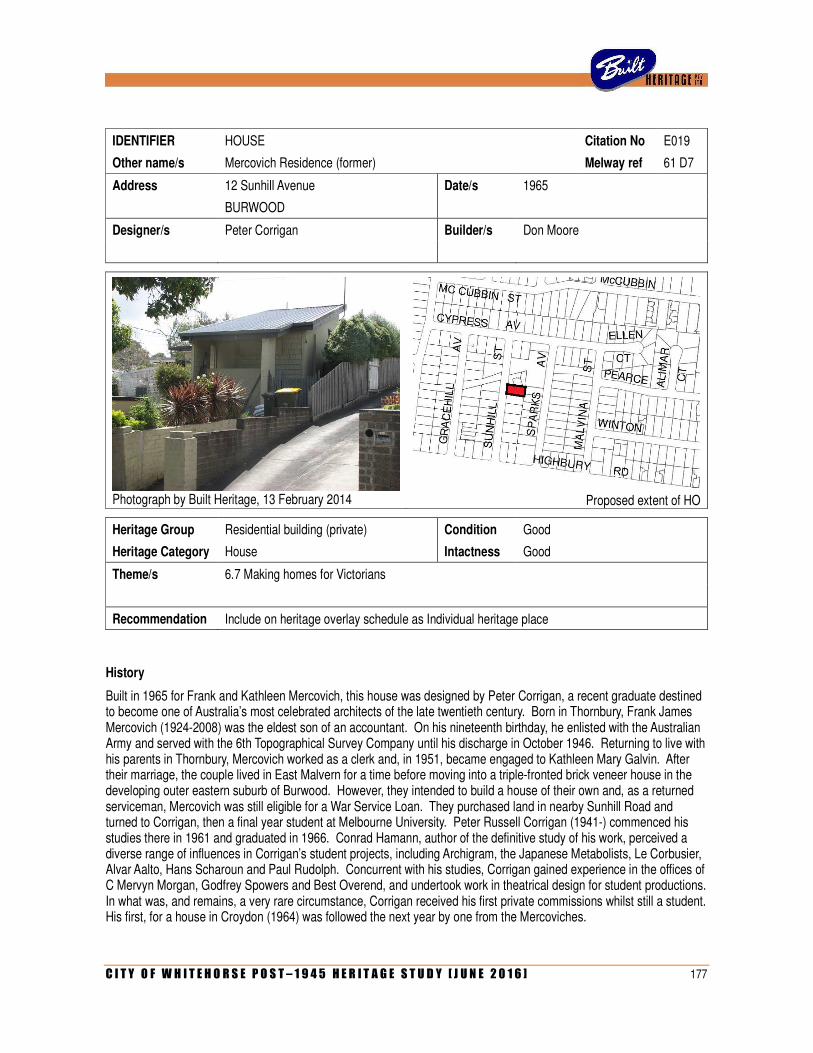
C I T Y O F W H I T E H O R S E P O S T – 1 9 4 5 H E R I T A G E S T U D Y [ J U N E 2 0 1 6 ] 177
IDENTIFIER HOUSE Citation No E019
Other name/s Mercovich Residence (former) Melway ref 61 D7
Address 12 Sunhill Avenue Date/s 1965
BURWOOD
Designer/s Peter Corrigan Builder/s Don Moore
Photograph by Built Heritage, 13 February 2014
Proposed extent of HO
Heritage Group Residential building (private) Condition Good
Heritage Category House Intactness Good
Theme/s 6.7 Making homes for Victorians
Recommendation Include on heritage overlay schedule as Individual heritage place
History
Built in 1965 for Frank and Kathleen Mercovich, this house was designed by Peter Corrigan, a recent graduate destined to become one of Australia’s most celebrated architects of the late twentieth century. Born in Thornbury, Frank James Mercovich (1924-2008) was the eldest son of an accountant. On his nineteenth birthday, he enlisted with the Australian Army and served with the 6th Topographical Survey Company until his discharge in October 1946. Returning to live with his parents in Thornbury, Mercovich worked as a clerk and, in 1951, became engaged to Kathleen Mary Galvin. After their marriage, the couple lived in East Malvern for a time before moving into a triple-fronted brick veneer house in the developing outer eastern suburb of Burwood. However, they intended to build a house of their own and, as a returned serviceman, Mercovich was still eligible for a War Service Loan. They purchased land in nearby Sunhill Road and turned to Corrigan, then a final year student at Melbourne University. Peter Russell Corrigan (1941-) commenced his studies there in 1961 and graduated in 1966. Conrad Hamann, author of the definitive study of his work, perceived a diverse range of influences in Corrigan’s student projects, including Archigram, the Japanese Metabolists, Le Corbusier, Alvar Aalto, Hans Scharoun and Paul Rudolph. Concurrent with his studies, Corrigan gained experience in the offices of C Mervyn Morgan, Godfrey Spowers and Best Overend, and undertook work in theatrical design for student productions. In what was, and remains, a very rare circumstance, Corrigan received his first private commissions whilst still a student. His first, for a house in Croydon (1964) was followed the next year by one from the Mercoviches.
178 C I T Y O F W H I T E H O R S E P O S T – 1 9 4 5 H E R I T A G E S T U D Y [ J U N E 2 0 1 6 ]
The drawings for the Mercovich House, dated 8 June 1965, were prepared while Corrigan was still a student. At the time, he was living in Blessington Street, St Kilda, and working in the office of Best Overend in nearby Fitzroy Street. He proposed a split-level dwelling on an elongated stepped rectangular plan with an irregular roofline of separate flat and skillion roof. Mostly of brick construction, its street frontage was distinguished by a cladding of timber shingles – as Hamann observes, ‘ a material that was reasonably unfamiliar in Australia other than as a gable treatment in the early twentieth century’. On 17 June, the City of Box Hill issued a building permit for the works, estimated to cost £4,750. The builder was Don Moore of Mahoneys Road, Forest Hill, who would go on to build another Corrigan project, for a house at Donvale (1967). The Mercovich House was evidently completed during 1966, and, early the following year, was one of two recent buildings by Corrigan to be published in Cross-Section, the newsletter of Melbourne University’s School of Architecture. Contrasted against the ‘vernacular calm’ of Corrigan’s first private commission, the Kenyon House in Croydon (1964), the Mercovich House was described as ‘contrarily ingenuously complex: roof planes sheer off in all directions and even some wood shingle clad walling is introduced. Inside, the views from rooms at various levels are lively and the appreciation of spaces as three dimensional, including up and down as well as through, is keen’. In a prescient understatement, the review concluded that ‘when Corrigan gets around to working out the diverging tendencies shown in these two houses, his work is likely to be remarkably personal and thoroughly remarkable’.
After the Mercovich House, Corrigan went on to design a few other houses before he left Australia in 1967. Spending the next eight years in the USA, he gained a master’s degree at Yale and he worked for a string of leading East Coast firms including Roche Dinkerloo, Paul Rudolph, Gruen Associates and Johnson Burgee, as well as undertaking more stage design. Returning to Australia in 1974 to design John Bell’s production of Don Giovanni, Corrigan entered into partnership with Maggie Edmond in 1975. The firm achieved acclaim for churches in Keysborough (1975) and Box Hill North (1976) in the emerging post-modernist mode. Over the next three decades, they received over 30 RAIA Awards for projects including private and public housing, educational buildings and fire stations, which were widely published locally and internationally. During that time, Corrigan also maintained his early interest in stage design and, by the early 1990s, had designed over one hundred productions for more than a dozen theatre companies around Australia.
Frank and Kathleen Mercovich lived in their Burwood house for fifteen years. During that time, they remained in contact with Corrigan and, in the early1970s, introduced him to Father Barry Moran, priest of the Parish of the Resurrection in Keysborough, for whom Corrigan would design a string of celebrated buildings, including a parish centre (1974), church (1975) and school (1975-78). When the Mercoviches decided to sell the Burwood house and move to Glen Waverley, they engaged their original architect to design another house for them. Located at 67 Marykirk Drive in Wheelers Hill, the second Mercovich House was designed in 1981 and completed the following year. As Conrad Hamann observed, the sketches for the new dwelling ‘have elements of the earlier Burwood house imbedded in them, so that in one sense they could take their old house with them’. Clearly more than satisfied with the result, Frank Mercovich remained living in the Wheelers Hill house for another 25 years, until his death in April 2008 at the age of 83 years.
Description
The former Mercovich House at 12 Sunhill Avenue, Burwood, is a split-level brick house on an elongated and stepped rectangular plan. Anticipating international developments in post-modernist architecture, the dwelling is highly irregular and idiosyncratic in its form, finishes and detailing. It is expressed as a fragmented series of individual volumes, of variable size and height, that project, recede and intersect both horizontally and vertically. Each element has its own individual roof, consistently clad in metal tray decking but otherwise variously flat or skillion, thereby creating an irregularly stepped roofline.
The asymmetrical street frontage is dominated by a projecting wing with a bold skillion roof that slopes towards the street, projecting to create a front porch supported on wide piers. A door and a long rectangular window open onto the porch; both appear to have been infilled, although their outlines remain evident. The recessed portion of the street frontage is windowless, with a projecting bay containing an enclosed staircase that leads up to the front entrance. While much of the exterior of the house is of brickwork with a bagged and painted finish, the east and north sides of the projecting front wing, and the front wall of the entry staircase, are clad entirely with timber shingles, painted to match. The detached garage, a flat-roofed painted brick structure on an irregular polygonal plan, is original.
C I T Y O F W H I T E H O R S E P O S T – 1 9 4 5 H E R I T A G E S T U D Y [ J U N E 2 0 1 6 ] 179
Comparative analysis
The Mercovich House in Burwood has very few direct comparators in the City of Whitehorse. As an example of an early residential commission undertaken by an architecture student who went on to considerable acclaim in later life, it is comparable to the house in Elmhurst Road, Blackburn, designed by Evan Walker around 1959. Walker, whose father was principal of Box Hill College, also spent time in North America before returning to a celebrated and award-winning partnership with Daryl Jackson that thrived until 1979, when Walker embarked on a political career. However, in contrast to the Mercovich House, which anticipates Corrigan’s later work in the post-modernist vein, Walker’s house in Elmhurst Road was a far more conventional gable-roofed cream brick dwelling, albeit on an unusual H-shaped plan. In this regard, the Mercovich House can also be compared with the Kristiansen House at 7 Norris Court, Blackburn, which was designed by recent university graduate Frances Seidel – one of only two private commissions before she, too, left for an extended period working overseas. However, Seidel’s subsequent career in Melbourne did not reach the same exalted heights as either Corrigan or Walker.
One of only five known houses in Melbourne built to Corrigan’s design before he left for the USA in 1967, the Mercovich House is also one of only two examples of his work in the study area. The other, dating from a decade later, is the much-publicised Chapel of St Joseph in Strabane Street, Box Hill North (1976). As a fine example of the architect’s mature work in the post-modernist vein, it forms a valuable counterpoint to the Mercovich House, which explored a number of themes and motifs that recurred in his later work. These two projects also share an interesting degree of separation, in that it was Frank and Kathleen Mercovich who introduced Corrigan to Father Moran, who commissioned the church at Keysborough, which in turn prompted Father Burke in Surrey Hills to commission the chapel at Box Hill.
Ultimately, the Mercovich House can only be compared to those other examples of Corrigan’s work from the mid-1960s. The Kenyon House in Croydon (1964) and the Hume House in Kew (1965) both combined compact rectilinear plans with wildly jagged rooflines and contrasting materials. The Hosking House at Donvale (1965-66) was more akin to the Mercovich House, with a spreading linear plan and roofline of intersecting skillions. The architect departed considerably from his earlier projects in the McCarthy House at Lilydale (1966), which had a jagged radial plan form with stepped roofline, exposed ductwork and projecting wing walls. This highly individualistic approach was developed further in Corrigan’s subsequent projects for the Schmidt House at Eltham (1966) and the Trinder House in Corio (1966-67), although neither of these was built. As Conrad Hamann notes, the Mercovich House stands out as the only one of Corrigan’s early commissions to be located on a relatively flat site in conventional suburban context, as opposed to the hilly bush or garden sites of his other realised houses in Croydon, Kew, Donvale and Lilydale. Hamann considered the project to be ‘strongly individual, mixing forms from the new suburbs with other imagery’. It was an important marker in the development of the architect’s mature style.
Statement of Significance
What is significant?
The former Mercovich House at 12 Sunhill Avenue, Burwood, is a split-level brick and shingled house with an irregular plan form and jagged roofline of flat and skillion-roofed areas clad in metal decking. Designed in 1965 for Frank and Kathleen Mercovich, it was one of the first residential projects ever undertaken by Peter Corrigan, later to become famous as one-half of the celebrated and award-winning architectural partnership of Edmond & Corrigan.
How is it significant?
The house is of architectural and aesthetic significance to the City of Whitehorse.
Why is it significant?
Architecturally, the house is significant as an early example of the work of noted architect Peter Corrigan (Criterion H). Designed while he was a final year student at Melbourne University, it is rare as one of only five realised projects that Corrigan designed before he left Australia in 1967 for an extended period of study and work experience in the USA (Criterion B).
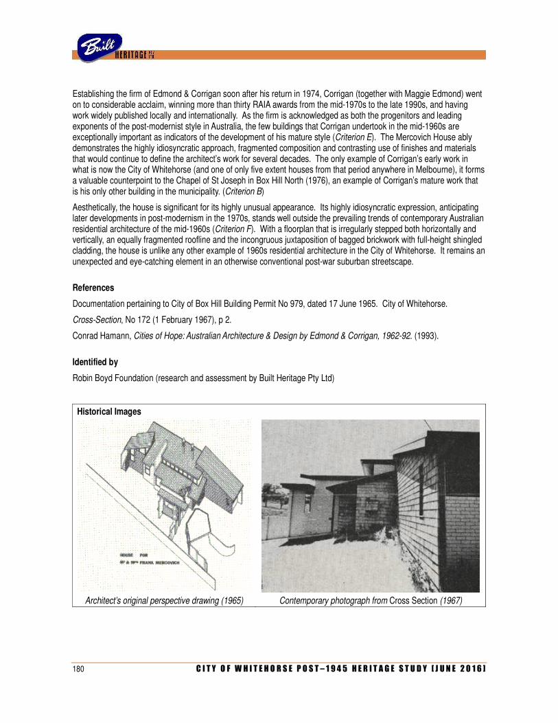
180 C I T Y O F W H I T E H O R S E P O S T – 1 9 4 5 H E R I T A G E S T U D Y [ J U N E 2 0 1 6 ]
Establishing the firm of Edmond & Corrigan soon after his return in 1974, Corrigan (together with Maggie Edmond) went on to considerable acclaim, winning more than thirty RAIA awards from the mid-1970s to the late 1990s, and having work widely published locally and internationally. As the firm is acknowledged as both the progenitors and leading exponents of the post-modernist style in Australia, the few buildings that Corrigan undertook in the mid-1960s are exceptionally important as indicators of the development of his mature style (Criterion E). The Mercovich House ably demonstrates the highly idiosyncratic approach, fragmented composition and contrasting use of finishes and materials that would continue to define the architect’s work for several decades. The only example of Corrigan’s early work in what is now the City of Whitehorse (and one of only five extent houses from that period anywhere in Melbourne), it forms a valuable counterpoint to the Chapel of St Joseph in Box Hill North (1976), an example of Corrigan’s mature work that is his only other building in the municipality. (Criterion B)
Aesthetically, the house is significant for its highly unusual appearance. Its highly idiosyncratic expression, anticipating later developments in post-modernism in the 1970s, stands well outside the prevailing trends of contemporary Australian residential architecture of the mid-1960s (Criterion F). With a floorplan that is irregularly stepped both horizontally and vertically, an equally fragmented roofline and the incongruous juxtaposition of bagged brickwork with full-height shingled cladding, the house is unlike any other example of 1960s residential architecture in the City of Whitehorse. It remains an unexpected and eye-catching element in an otherwise conventional post-war suburban streetscape.
References
Documentation pertaining to City of Box Hill Building Permit No 979, dated 17 June 1965. City of Whitehorse.
Cross-Section, No 172 (1 February 1967), p 2.
Conrad Hamann, Cities of Hope: Australian Architecture & Design by Edmond & Corrigan, 1962-92. (1993).
Identified by
Robin Boyd Foundation (research and assessment by Built Heritage Pty Ltd)
Historical Images
Architect’s original perspective drawing (1965) Contemporary photograph from Cross Section (1967)
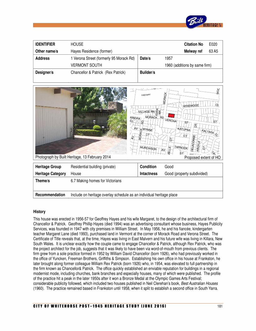
C I T Y O F W H I T E H O R S E P O S T – 1 9 4 5 H E R I T A G E S T U D Y [ J U N E 2 0 1 6 ] 181
IDENTIFIER HOUSE Citation No E020
Other name/s Hayes Residence (former) Melway ref 63 A5
Address 1 Verona Street (formerly 95 Morack Rd) Date/s 1957
VERMONT SOUTH 1960 (additions by same firm)
Designer/s Chancellor & Patrick (Rex Patrick) Builder/s
Photograph by Built Heritage, 13 February 2014
Proposed extent of HO
Heritage Group Residential building (private) Condition Good
Heritage Category House Intactness Good (property subdivided)
Theme/s 6.7 Making homes for Victorians
Recommendation Include on heritage overlay schedule as an individual heritage place
History
This house was erected in 1956-57 for Geoffrey Hayes and his wife Margaret, to the design of the architectural firm of Chancellor & Patrick. Geoffrey Phillip Hayes (died 1994) was an advertising consultant whose business, Hayes Publicity Services, was founded in 1947 with city premises in William Street. In May 1956, he and his fiancée, kindergarten teacher Margaret Lane (died 1993), purchased land in Vermont at the corner of Morack Road and Verona Street. The Certificate of Title reveals that, at the time, Hayes was living in East Malvern and his future wife was living in Killara, New South Wales. It is unclear exactly how the couple came to engage Chancellor & Patrick, although Rex Patrick, who was the project architect for the job, suggests that it was likely to have been via word-of-mouth from previous clients. The firm grew from a sole practice formed in 1952 by William David Chancellor (born 1926), who had previously worked in the office of Yuncken, Freeman Brothers, Griffiths & Simpson. Establishing his own office in his house at Frankston, he later brought along former colleague William Rex Patrick (born 1926) who, in 1954, was elevated to full partnership in the firm known as Chancellor& Patrick. The office quickly established an enviable reputation for buildings in a regional modernist mode, including churches, bank branches and especially houses, many of which were published. The profile of the practice hit a peak in the later 1950s after it won a Bronze Medal at the Olympic Games Arts Festival; considerable publicity followed, which included two houses published in Neil Clerehan’s book, Best Australian Houses (1960). The practice remained based in Frankston until 1958, when it split to establish a second office in South Yarra.
182 C I T Y O F W H I T E H O R S E P O S T – 1 9 4 5 H E R I T A G E S T U D Y [ J U N E 2 0 1 6 ]
The house at Vermont that Chancellor & Patrick designed for Geoffrey and Margaret was erected by G W McComb, a builder from Frankston. In June 1957, the house (apparently not yet completed) was profiled in the Australian Homemaker as part of a regular series entitled ‘Parade of Plans’. It was noted that the elongated and narrow linear plan had been placed across the block ‘to get full advantage from a bush or mountain setting’, with all major rooms having windows towards the easterly views, opening onto a full-width terrace. The house turned its back on the Morack Road frontage, where there was a detached garage linked by a covered walkway; the driveway and paved pathway to the front door were both off Verona Street. The plan included a barbecue, integrated into a planter box that extended into the outdoor living area on the east side, and a freeform pond that straddled the corner window of the living room. Photographs of the completed house, taken by Peter Wille, indicate that the barbeque/planter box was realised, but the ornamental pool was not.
The house was evidently completed by October 1957, when the Certificate of Title was amended to reflect Margaret Hayes’s married name. Pleased with their architects’ work, the family engaged Chancellor & Patrick for several subsequent commissions. In 1960, substantial additions were made to the house in Vermont and, the following year, the firm undertook an office fitout for the new city premises of Hayes Publicity Services in the recently-completed State Bank building on Swanston Street. Geoffrey and Margaret Hayes sold the Vermont house in late 1966, although they remained in the area, taking up residence in an existing house in Terrara Road. That house was extended in 1966 and again in 1968, in both cases to the design of Chancellor & Patrick.
Since the 1990s, the Hayeses’ original property has been subdivided. Two new houses, designated as 95 Morack Road and 1a Verona Street, have been erected to the west and east side of the original house, which is now addressed as 1 Verona Street, Vermont South.
Description
The house at 1 Verona Street, Vermont South (formerly 95 Morack Road), is a single-storey flat-roofed house. Originally designed with an elongated linear plan and a detached garage connected by a covered walkway, the house has since been enlarged to create a U-shaped courtyard plan with an attached double garage. The original 1956-57 house, which constitutes the eastern wing of the current building, has large windows on the west side and even larger full-height windows to the east, in both cases with broad eaves on exposed timber beams. The front door is set into a recessed alcove on the west side wall. The south wall, facing Verona Street, is dominated by a massive slab-like stone chimney of uncoursed random rubble.
The rear (north) wing of the house is concealed from public view by a screen of vertical timber flats, which runs in alignment with the covered walkway that connects the original house to the later double carport wing. The latter is clad with vertical timber boards and has a matching flat roof with broad eaves on exposed beams, and a double-width tilt-up metal door facing the street. The driveway, and the path leading to the walkway and front door, is paved in brick.
Comparative Analysis
In her thesis on the work of Chancellor & Patrick, Winsome Callister noted that the defining qualities of the firm’s early work included ‘modular planning, fenestration and interest in structure, horizontality, extension and sheltering’. According to Dr Callister, the use of the flat roof was a distinct sub-theme largely associated with the work of Rex Patrick. She specifically cited the Hayes House in Vermont South, with its flat roof, rectilinear planning and expression of projecting and receding elements, as a typical example of this sub-theme. Contemporaneous houses reflective of this sub-theme included the Miller House in Frankston (1956; demolished), the Sharp House in Hawthorn (1956), the Burgess House in Beaumaris (1956) and the Doe House in Rye (1957).
According to the lengthy catalogue of works appended to Dr Callister’s thesis, Chancellor & Patrick undertook around thirty projects in what is now the City of Whitehorse between 1953 and 1970. More than half of these, however, were additions and/or alterations to existing buildings, and at least five others were unrealised projects. The firm’s largest built project in the study area was the Wattle Park Presbyterian Church in Riversdale Road, Box Hill South (1962), for which they had previously designed a manse (1959).
C I T Y O F W H I T E H O R S E P O S T – 1 9 4 5 H E R I T A G E S T U D Y [ J U N E 2 0 1 6 ] 183
The firm’s other built projects in the study area were all private houses: the Reid House at 17-19 Grandview Road, Box Hill South (1954), the Hayes House in Morack Road, Vermont (1956), David Chancellor’s own house at 31 Fowler Street, Box Hill South (1957), and the Major House at 20a Myrtle Street, Blackburn (1960). Of these, the last has been demolished. Chancellor’s own house, for which he was obviously project architect, differs considerably from Rex Patrick’s Hayes House in that it has a cruciform plan, gabled roof and attic storey. The Reid House in Box Hill South is more akin to the Hayes House, with an elongated plan form, flat roof and broad eaves with exposed beams. However, it is ultimately a smaller and rather less visually striking example, lacking the huge windows and massive stone chimney seen at Vermont.
Statement of Significance
What is significant?
The house at 1 Verona Street, Vermont South, is a flat-roofed house on a U-shaped courtyard plan, clad in vertical timber boarding with a massive stone chimney at the end of one wing, large windows and wide eaves on exposed beams. It was erected in 1956-57 for Geoffrey and Margaret Hayes, to the design of the leading architectural firm of Chancellor & Patrick (who were subsequently engaged to enlarge the house in 1960). The additions made to the house, including the double garage, are considered to be sympathetic in their form, finishes and materials, and not to detract from the significance of the original fabric.
How is it significant?
The house is of architectural and aesthetic significance to the City of Whitehorse.
Why is it significant?
Architecturally the house is a notable example of the early residential work of Chancellor & Patrick, a leading and award-winning architectural firm of the post-war period (Criterion H). The house displays many of the typical characteristics of the firm’s work (and specifically, of the work of Rex Patrick, who was the project architect), including its flat roof with broad eaves and exposed rafters, large windows, and expression of the chimney as a massive slab-like element. Originally erected as a three-bedroom house on an elongated linear plan (to take advantage of views to the east) with a detached garage, the house was subsequently (and sympathetically) enlarged to Chancellor & Patrick’s design. One of only three surviving houses by the firm in the City of Whitehorse, it remains as a substantial and intact example of their distinctive regional modernist style.
Aesthetically, the house is significant as a fine example of residential architecture of the late 1950s, in a regional modernist style that demonstrates the pervasive influence of American and Japanese precedents (Criterion E). With its low expression, elongated form, low-pitched roof with broad eaves and exposed rafters, and a massive stone chimney articulated as a sculptural feature on the Verona Street frontage, the house remains a striking element in this residential streetscape.
References
‘Parade of Plans: timber teams with stone’, Australian Home Maker, June 1957, pp 12-13.
Winsome Callister, ‘Anchoring Identity: The Architecture of Chancellor & Patrick, 1950-70’, Ph D thesis, Department of Visual Arts, Monash University, 2007.
Interview with Rex Patrick, 4 April 2014.
Identified by
Andrew Ward (architectural attribution and additional research and assessment by Built Heritage Pty Ltd)
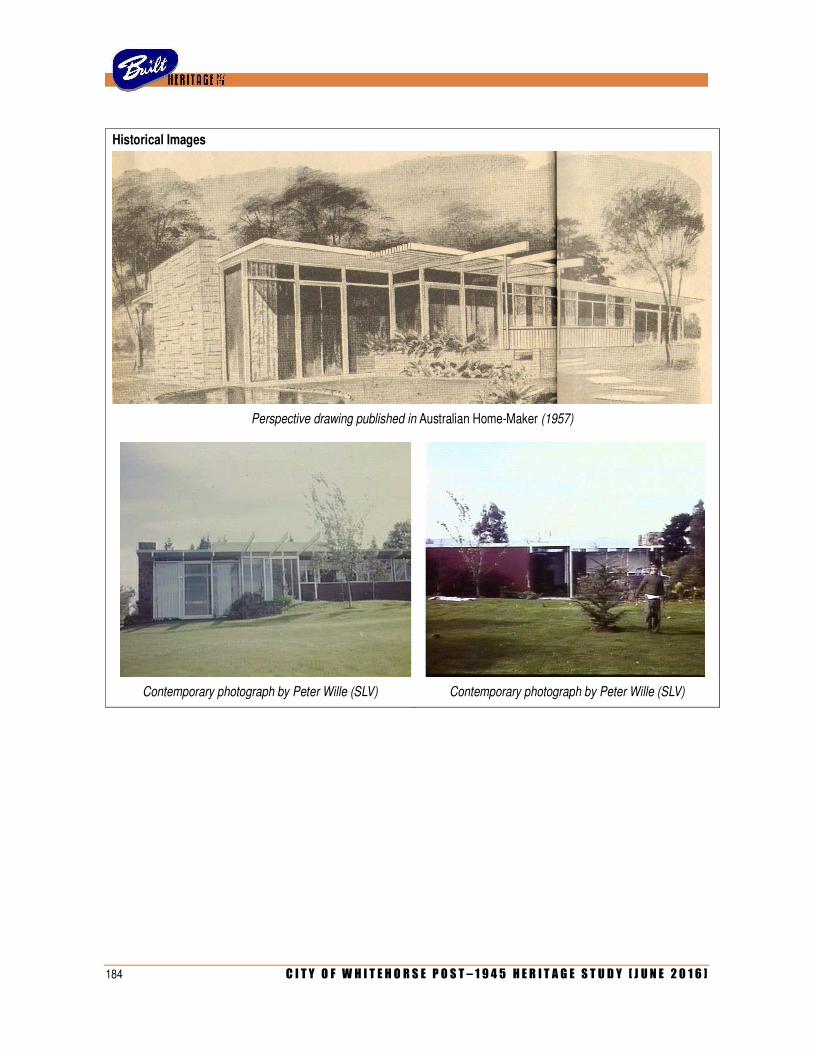
184 C I T Y O F W H I T E H O R S E P O S T – 1 9 4 5 H E R I T A G E S T U D Y [ J U N E 2 0 1 6 ]
Historical Images
Perspective drawing published in Australian Home-Maker (1957)
Contemporary photograph by Peter Wille (SLV) Contemporary photograph by Peter Wille (SLV)
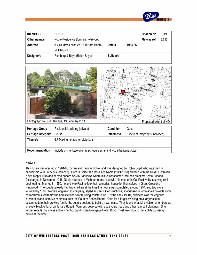
C I T Y O F W H I T E H O R S E P O S T – 1 9 4 5 H E R I T A G E S T U D Y [ J U N E 2 0 1 6 ] 185
IDENTIFIER HOUSE Citation No E021
Other name/s Noble Residence (former); Wildwood Melway ref 62 J3
Address 3 Villa Mews (was 27-33 Terrara Road) Date/s 1964-66
VERMONT
Designer/s Romberg & Boyd (Robin Boyd) Builder/s
Photograph by Built Heritage, 13 February 2014
Proposed extent of HO
Heritage Group Residential building (private) Condition Good
Heritage Category House Intactness Excellent (property subdivided)
Theme/s 6.7 Making homes for Victorians
Recommendation Include on heritage overlay schedule as an individual heritage place
History
This house was erected in 1964-66 for Ian and Pauline Noble, and was designed by Robin Boyd, who was then in partnership with Frederick Romberg. Born in Colac, Ian McMullen Noble (1924-1991) enlisted with the Royal Australian Navy in April 1945 and served aboard HMAS Lonsdale, where his fellow seamen included architect Kevin Borland. Discharged in November 1946, Noble returned to Melbourne and lived with his mother in Caulfield whilst studying civil engineering. Married in 1950, he and wife Pauline later built a modest house for themselves in Grant Crescent, Ringwood. The couple already had two children at the time the house was completed around 1954, and two more followed by 1960. Noble’s engineering company, styled as Janus Constructions, specialised in large-scale projects such as roadworks, earthmoving and site works for building construction. By the early 1960s, business was thriving with substantial and lucrative contracts from the Country Roads Board. Keen for a larger dwelling on a larger site to accommodate their growing family, the couple decided to build a new house. They found what Mrs Noble remembers as a ‘lovely block of land’ on Terrara Road in Vermont, covered with eucalyptus trees and other remnant plantings. She further recalls that it was entirely her husband’s idea to engage Robin Boyd, most likely due to the architect’s rising profile at the time.
186 C I T Y O F W H I T E H O R S E P O S T – 1 9 4 5 H E R I T A G E S T U D Y [ J U N E 2 0 1 6 ]
An eminent architect who needs no introduction, Robin Boyd (1919-1971) was then in partnership with Frederick Romberg (1913-1992), as former associate Roy Grounds had left the firm (originally founded in 1953 as Grounds, Romberg & Boyd) in 1962. While Grounds worked on his purloined project for the National Gallery of Victoria, the re-badged partnership of Romberg & Boyd, thrived. In December 1963, the firm’s work was subject to a 15-page spread in the journal Architecture & Arts, which included two recent houses in Warrandyte. Several larger projects, notably Domain Park Towers in Toorak (1960-62) and the John Batman Motor Inn on Queens Road (1962-63), continued to garner press attention. Boyd had recently authored a slender booklet entitled The New Architecture (1963) and, during 1963-64, was regularly contributing articles to publications as diverse as Nation, Architectural Review, Walkabout and the Australian. At the time that he was commissioned by Ian and Pauline Noble in the second half of 1964, the architect had just returned from an extensive overseas tour of Europe and the USA.
Today, Mrs Noble can recall little of the evolution of the design for the house at Vermont. For the most part, she and her husband deferred to their talented architect: ‘what we wanted was more or less what he was happy to do’. Apart from providing enough space for their large family, the couple wanted the house to blend in with its bush surroundings, retaining as many mature trees as possible. Both were keenly interested in conservation; in May 1965, while their new house was under construction, Ian Noble was appointed inaugural chairman of the Aireys Inlet Progress Association, and remained a vocal supporter of conservation and foreshore management in the district for the rest of his life.
A sketch plan prepared by Boyd himself, dated October 1964, depicted a courtyard house on a J-shaped plan, with a central corridor forming a continuous spine from the front porch to the carport at the rear. The living areas and kitchen (opening onto a walled kitchen garden) were clustered in the north arm of the plan, and the five bedrooms in the shorter south arm. A row of three bedrooms formed what was labelled on the plan as ‘boys’ wing’, with stairs leading down to a large playroom below. Opening off the playroom was a bathroom and small space designated as a ‘mud porch’, with storage for sports equipment. Boyd’s plan allowed for a ‘future bed sitting room’ at the end of the boys’ wing, with an enlarged playroom at the lower level. He also indicated a ‘future pool’ to the south of the kitchen garden. Construction was undertaken by builders affiliated with Noble’s company, Janus Constructions. As Mrs Noble recalls, the family moved into the finished house (which they named Wildwood, for obvious reasons) in early 1966, around the time that Australia switched to decimal currency. The proposed tennis court, which had been the reason for the provision of the mud-porch off the playroom, was never built, although a site was cleared for it. Following the birth of the couple’s fifth and final child in 1969, an extra bedroom was needed. However, rather than adding an entire new section to the house (as Boyd had indicated on his original sketch plans), the couple simply converted the mud-porch at the lower level. This, Mrs Noble recalls, was the only major change they ever made to the house during their period in residence.
Although not published in architectural journals at the time of its completion, the house was photographed by leading architectural photographers Mark Strizic and Peter Wille. In 1970, one of Strizic’s photographs of the Noble House appeared in the book Living in Australia, co-authored by Boyd and the photographer. This formed part of a two-page spread illustrating four recent residential projects by Romberg & Boyd that, according to the caption, were ‘houses designed for different people with different requirements in about as many different environments as the Melbourne region can offer’. Also in 1970, images of the Noble House appeared in the book Australian Style, co-written by Sydney-based interior designer Babette Hayes, illustrating a chapter on the work of Robin Boyd.
The Noble family lived in their new house for less than a decade. After the tragic death of their teenage son Stephen in 1973, the family decided to sell the property and move on. They purchased 20 acres at Seville and commissioned another large architect-designed house. Their former home in Vermont had several other owners before the property was subdivided in 2001. This completely obliterated its original street frontage, creating a new cul-de-sac (Condev Court) off Terrara Road and another (Villa Mews) to the rear, off Locksey Chase. The house was retained on a quarter acre block (Lot 2 of the twelve-lot estate) with street access via a very narrow frontage on Villa Mews. In this way, the address of the former Noble House, originally 27-33 Terrara Road, became 3 Villa Mews. This reconfiguration, where the rear of the house now effectively became the front, necessitated the demolition of Boyd’s carport. The house itself otherwise remains largely intact to the present day.
C I T Y O F W H I T E H O R S E P O S T – 1 9 4 5 H E R I T A G E S T U D Y [ J U N E 2 0 1 6 ] 187
Description
The former Noble House at 3 Villa Mews (originally 27-33 Terrara Road), Vermont, is a predominantly single-storey skillion-roofed brick house. Laid out on a rectilinear but stepped J-shaped plan, it comprises a large wing for the living areas and a small one for the bedrooms; there is a narrow courtyard space between the two wings, overlooked by a covered walkway defined by a row of massive brick piers. This articulation of piers is echoed along the elevations, defining regular bays that are variously infilled by full-height windows or smaller windows with timber spandrels above and/or below. Where the land falls away towards the bedroom wing, there is a partial lower storey. The roofline is irregular, stepped both vertically and horizontally according to the projecting and receding elements of the plan. Eaves are broad, with exposed timber beams. Exterior brickwork has a bagged and painted finish, in a pale beige scheme.
Comparative Analysis
While the municipality contains a number of important surviving examples of Robin Boyd’s work, virtually all of these date from the earlier part of his career. The first building that he ever designed in what is now the City of Whitehorse appears to have been a house for his friend Jack Harrison, located at 457 Mitcham Road, Mitcham. Completed in 1946, this was one of Boyd’s few executed projects from his short-lived post-war partnership with former army colleagues Kevin Pethebridge and Frank Bell. Leaving that firm to become foundation director of the Age/RVIA Small Homes Service, Boyd maintained what proved to be his only stint as a sole practitioner, from 1947 to 1953. During that time, he designed a house for his mother Susan Boyd, at 132 Burwood Highway, Burwood. Dating from 1948, this was based on a standard plan he had prepared for the Small Homes Service. While it is still standing, it has been enlarged with a substantial front addition that virtually obscures the original house. Boyd’s celebrated partnership with Roy Grounds and Frederick Romberg, which existed from 1953 to 1962, is well represented in the City of Whitehorse by the Ednie House at 3A The Avenue, Blackburn (1955), the Pearce House at 34-40 Moore Road, Vermont (1957), the Mannerheim House at 134 Central Road, Blackburn (1958) and the prototypical Fler Display House at 150 Canterbury Road, Blackburn South (1958). These are all fine examples of his work from that period; the first three are already included on the heritage overlay schedule, and the last has been recommended for inclusion as part of the present study.
By contrast, Robin Boyd’s subsequent output from the final period of his career, from 1962 until his death in 1971, is not well represented in the City of Whitehorse. He probably undertook some small-scale alteration work in the area, of which one example is known: additions to a large house at 91 Morack Road (1967) that was designed by his former associates, Kevin Pethebridge and Frank Bell, a decade earlier. While Boyd undertook a number of new residential projects in the developing outer eastern suburbs during that time, including houses at Ringwood, Heathmont, Glen Waverley and Wheelers Hill, the Noble House at Vermont remains as the only example in what is now the City of Whitehorse. The house can be considered entirely typical of what the architect was doing at the time. The aesthetic of white-painted brickwork, multiple skillion roofs and projecting fin-like wall elements was explored in several other houses of the period, including the Appletree Hill project houses at Glen Waverley (1965-66), the Moore House in Wheelers Hill (1965-66), the Simon House in Narre Warren (1965-68) and the Milne House in Glenbervie Road, Toorak (1966-70). The articulation of a double storey with tall brick piers defining regular bays, as seen at the Noble House, is also evident in the Moore House. With five bedrooms, the Noble House stands out as almost certainly the largest house Boyd ever designed in the later part of his career. Notwithstanding the changes to its context by the subdivision of its large block, it remains a very important example of his residential work of the 1960s.
Statement of Significance
What is significant?
The former Noble House at 3 Villa Mews, Vermont, is a predominantly single-storey skillion-roofed house of bagged and painted brickwork, laid out on a stepped J-shaped plan with elevations articulated by rows of piers that define regular full-height window bays. Erected in 1964-66 for civil engineer Ian Noble, his wife Pauline and their large family, the five-bedroomed house was designed by Robin Boyd, then in partnership with Frederick Romberg as Romberg & Boyd.
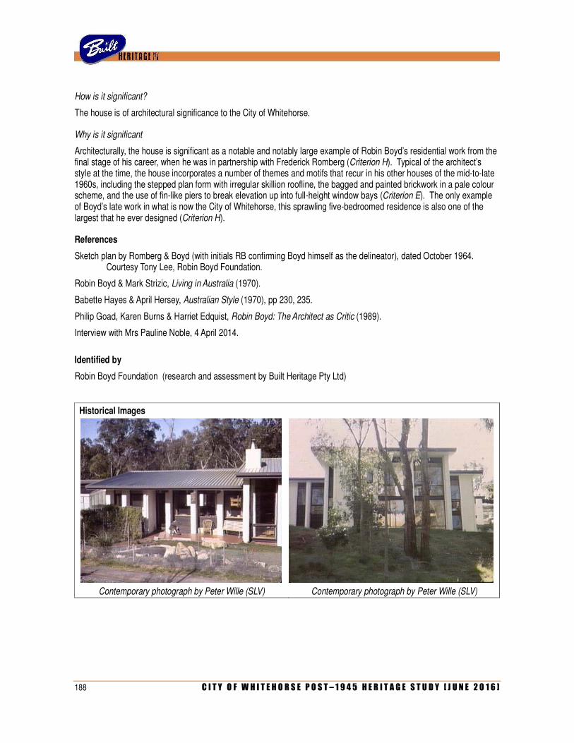
188 C I T Y O F W H I T E H O R S E P O S T – 1 9 4 5 H E R I T A G E S T U D Y [ J U N E 2 0 1 6 ]
How is it significant?
The house is of architectural significance to the City of Whitehorse.
Why is it significant
Architecturally, the house is significant as a notable and notably large example of Robin Boyd’s residential work from the final stage of his career, when he was in partnership with Frederick Romberg (Criterion H). Typical of the architect’s style at the time, the house incorporates a number of themes and motifs that recur in his other houses of the mid-to-late 1960s, including the stepped plan form with irregular skillion roofline, the bagged and painted brickwork in a pale colour scheme, and the use of fin-like piers to break elevation up into full-height window bays (Criterion E). The only example of Boyd’s late work in what is now the City of Whitehorse, this sprawling five-bedroomed residence is also one of the largest that he ever designed (Criterion H).
References
Sketch plan by Romberg & Boyd (with initials RB confirming Boyd himself as the delineator), dated October 1964. Courtesy Tony Lee, Robin Boyd Foundation.
Robin Boyd & Mark Strizic, Living in Australia (1970).
Babette Hayes & April Hersey, Australian Style (1970), pp 230, 235.
Philip Goad, Karen Burns & Harriet Edquist, Robin Boyd: The Architect as Critic (1989).
Interview with Mrs Pauline Noble, 4 April 2014.
Identified by
Robin Boyd Foundation (research and assessment by Built Heritage Pty Ltd)
Historical Images
Contemporary photograph by Peter Wille (SLV) Contemporary photograph by Peter Wille (SLV)
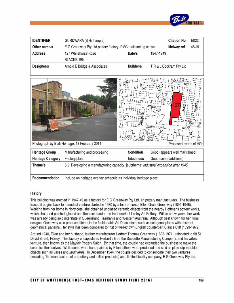
C I T Y O F W H I T E H O R S E P O S T – 1 9 4 5 H E R I T A G E S T U D Y [ J U N E 2 0 1 6 ] 189
IDENTIFIER GURDWARA (Sikh Temple) Citation No E022
Other name/s E G Greenway Pty Ltd pottery factory; PMG mail sorting centre Melway ref 48 J9
Address 127 Whitehorse Road Date/s 1947-1949
BLACKBURN
Designer/s Arnold E Bridge & Associates Builder/s T R & L Cockram Pty Ltd
Photograph by Built Heritage, 13 February 2014
Proposed extent of HO
Heritage Group Manufacturing and processing Condition Good (appears well maintained)
Heritage Category Factory/plant Intactness Good (some additions)
Theme/s 5.2 Developing a manufacturing capacity [subtheme: Industrial expansion after 1945]
Recommendation Include on heritage overlay schedule as individual heritage place
History
This building was erected in 1947-49 as a factory for E G Greenway Pty Ltd, art pottery manufacturers. The business traced it origins back to a modest venture started in 1930 by a former nurse, Ellen Grant Greenway (1894-1946). Working from her home in Northcote, she obtained unglazed ceramic objects from the nearby Hoffmans pottery works, which she hand-painted, glazed and then sold under the trademark of Lesley Art Pottery. Within a few years, her work was already being sold interstate in Queensland, Tasmania and Western Australia. Although best known for her floral designs, Greenway also produced items in the fashionable Art Deco idiom, such as octagonal plates with abstract geometrical patterns. Her style has been compared to that of well-known English counterpart Clarice Cliff (1899-1972)
Around 1940, Ellen and her husband, leather manufacturer Herbert Thomas Greenway (1893-1971), relocated to 98 St David Street, Fitzroy. This factory encapsulated Herbert’s firm, the Suedette Manufacturing Company, and his wife’s venture, then known as the Mayfair Pottery Salon. By that time, the couple had expanded the business to make the ceramics themselves. While some were hand-painted by Ellen, others were produced and sold as plain slip-moulded objects such as vases and jardinières. In December 1944, the couple decided to consolidate their two ventures (including ‘the manufacture of art pottery and milled products’) as a limited liability company, E G Greenway Pty Ltd.
190 C I T Y O F W H I T E H O R S E P O S T – 1 9 4 5 H E R I T A G E S T U D Y [ J U N E 2 0 1 6 ]
The company’s main intent was to provide a new purpose-built factory, conceived as ‘a handsomely designed pottery in a garden setting’. However, Ellen died in January 1946 before a site was chosen. Her husband resolved to proceed regardless, and, acquiring 4.5 acres at Blackburn, declared that the complex would be a memorial to his late wife: ‘It must be lovely. Everything about it must be expressive of the inspiring life of Ellen Grant Greenway – a beautiful building in a beautiful setting with ideal conditions for the workpeople’. He duly instructed his architect, Arnold E Bridge, to ‘produce something different’. Bridge’s scheme proposed a factory with production area of 27,000 square feet, offices and ‘spacious dining rooms in pastel tints, lockers, showers and a first aid room isolated from all factory and traffic noise’. In accordance with Greenway’s vision, it was to be modern in every regard. The open-planned factory floor had a continuous sawtooth roof, providing south-facing anti-glare natural light through mechanically-operated windows. Press reports made much of these modern touches, which included drinking fountains for staff and a buff colour scheme ‘reputed to have better psychological effect than the dark walls, which are depressing, and white walls, which tire the eyes’. The landscaped setting was conceived as public parkland on a grand scale, as Greenway negotiated with the Council and a neighbour to acquire a further 5.5 acres around the factory site. Externally, the building itself was described as being ‘of unusual design’, with a stark block-like expression dominated by a massive vertical tower (which was later omitted). Any resemblance to the award-winning and much-published Heidelberg Town Hall (Leith & Bartlett with Peck & Kemter, 1937) may not be coincidental, given that the Greenway’s daughter, Eunice, had held her wedding reception there a few years before, in 1941. Eunice and her husband Ronald Charles Rowe (1918-2004) were both appointed directors of E G Greenway Pty Ltd in December 1947, just after the building permit for the new factory was issued.
Arnold Ernest Bridge (1904-1980) was articled to H V Gillespie and studied at the Workingmen’s College (1919-21) Swinburne Technical College (1922), Footscray Technical School (1922-23) and the Melbourne University Architectural Atelier (1924-27). With his father and two brothers trained as engineers, Bridge also undertook studies in structural mechanics, thus qualifying as both an engineer and an architect. He worked for a time in the drawing office of Victorian Railways before being elected an associate of the RVIA in 1939 and starting his own practice. Although a block of flats that he designed appeared on the front cover of the Australian Home Beautiful in 1945, he was best known for factories, including premises for Morris & Walker at Heidelberg (1950), Warburton Franki at 140 Burwood Road, Burwood (1952; demolished) and the Spicer Shoe Company in Fitzroy North (1954). This trend continued after 1954 when Bridge elevated employee Tony Hayden (1921-1984), into partnership of the firm thereafter known as Bridge, Hayden & Associates.
A building permit for Greenway’s factory, to cost £23,500, was issued on 17 November 1947 and construction started by Melbourne’s oldest building firm, T R & L Cockram Pty Ltd. With so little building activity during and just after the War, the Blackburn factory was a notable project for the Cockrams, and helped re-establish them as major players in the subsequent post-war building boom. The complex was reportedly ‘nearing completion’ in April 1949 and, four months later, the registered office of E G Greenway Pty Ltd officially transferred there from Fitzroy. As noted in one report, the firm was ‘almost inundated with applications for employment in Australia’s most modern plant in the realm of clay products’. Under Greenway’s managing directorship, it continued to produce art pottery. With Ellen obviously no longer available for hand-painting, its emphasis shifted to mass-produced slip-moulded ceramics. Popular items included vases in the form of fans, seashells and logs, glazed in fashionable pastel tones. In 1953, they produced pint tankards to celebrate Queen Elizabeth’s Coronation. Changing tastes saw the demand decline in the 1960s and the company was voluntarily wound up in 1975, four years after Greenway’s death. Nevertheless, art pottery by E G Greenway Pty Ltd (and its forerunners Lesley Art Pottery and Mayfair Pottery Studio) still remain keenly sought-after by today’s collectors.
E G Greenway Pty Ltd had actually ceased production some years before the company was wound up. By that time, the factory’s street frontage had already been partly subdivided for other buildings, including a petrol station. In the early 1970s, the factory was taken over by the Postmaster General’s Department for use as a mail sorting centre. This continued until a new purpose-built mail sorting centre opened in Rooks Road, Nunawading, in 1993. The former factory then became the new Gurdwara (Temple) for a Sikh community founded in Melbourne back in 1981, which had occupied buildings in Carlton, Ferntree Gully and elsewhere before moving to Blackburn. Building permit records indicate that various works have been undertaken to the building since then, including kitchen renovations (2000), other alterations (2001), new garages and storerooms (2003) and other internal changes (2009, 2011 and 2012).
C I T Y O F W H I T E H O R S E P O S T – 1 9 4 5 H E R I T A G E S T U D Y [ J U N E 2 0 1 6 ] 191
Description
The former E G Greenway factory is a large brick building comprising a sprawling sawtooth-roofed production area to the rear (north) and a flat-roofed office block to the front (south). External walls are predominately of cream brick (typical of the late 1940s) with contrasting red brick to the plinth courses and some window spandrels, and rendered parapet coping. Some parts of the building, to the rear, have been rendered. The principal facade of the office block, divided into three bays, is balanced without being symmetrical. The central bay, with a flat-roofed porch on slender columns and red brick planter box at one end, has a large central window, a larger projecting corner window and a recessed entry with glazed doors, sidelights and highlights. This entry is marked by a squat tower with a canted face achieved by toothed brickwork. The central bay is flanked to the left side by a narrower recessed bay with tall rectilinear windows and to the right side by a wider projecting bay with smaller windows with red brick spandrels above and below. All of these windows have multi-paned metal-framed sashes. The front wall of the production area, visible above and beyond the office block, has alternating bays of windows (with rendered spandrels above, projecting concrete lintels and multi-paned sashes) and solid walling (which repeat the distinctive canted profile, with toothed brickwork, seen on the front tower).
The main frontage of the factory, somewhat concealed from the street by later buildings, remains mostly intact. A small single-storey addition to the far east of the facade end, with curved plan and glass blocks, is sensitively designed and not considered intrusive. The rear of the complex, not visible from Whitehorse Road, is more utilitarian in treatment, with delivery docks and flat-roofed vehicle bays, some of which presumably date from the 1973 PMG conversion.
Comparative Analysis
In the early post-war years, the part of Whitehorse Road through Blackburn, Nunawading and Mitcham was still defined by relatively sparse residential settlement with scattered shops, public buildings and remnant agricultural activity such as poultry farms. Industrial development was limited to a handful of pre-war businesses that included Stephenson Case Makers Pty Ltd, Variety Manufacturing Company, Insulwool Products Pty Ltd and F J Thatcher & Company, engineers. With large tracts of vacant land available, the thoroughfare soon began to attract more manufacturers, often intending to decentralize from long-held inner-suburban sites. However, with wartime restrictions on private building construction still in place after the war itself had ended, it is not surprising that few new factories were actually built in the area in the second half of the 1940s, although a few companies did express interest in doing so. The British United Shoe Machinery Company, of Fitzroy, obtained a permit for a new factory on Whitehorse Road, Mitcham as early as July 1947, but construction did not proceed. A month later, Box Hill-based agricultural implement makers Daniel Harvey Ltd was also granted a permit for a factory at 384 Whitehorse Road, Nunawading, designed by Bernard Sutton & Associates. While allusions to the project were reported by the press on several occasions in 1948, it, too, failed to materialize at that time. It was not until the later 1950s that the company finally built a new factory at 286-292 Whitehorse Road.
With a permit granted in October 1947, the new E G Greenway factory at Blackburn was the first major post-war industrial complex to actually be erected in what is now the City of Whitehorse. As construction continued, several others followed. In August 1948, a permit was granted for the Turner Manufacturing Company to erect its new factory and bulk store at 494 Whitehorse Road, designed by the firm’s in-house engineer, E T Lees. Also in 1948, work started on the new Holeproof factory in Box Hill, which opened in early 1949. Others to follow included the premises of Cottee’s Passiona Ltd in Blackburn (160 Whitehorse Road) and the Boma Manufacturing Company in Mitcham (570 Whitehorse Road), both of which were in operation by 1950.
Today, virtually nothing remains of the earliest burst of post-war industrial development along Whitehorse Road. The Turner factory in Nunawading, which was enlarged on several occasions (in 1949 and again in 1957 to the design by Robin Boyd) was entirely demolished in the 1990s. The Cottee’s factory in Blackburn (latterly occupied by Leader newspapers) has also been razed and its site redeveloped. The only surviving comparator to the E G Greenway factory is the former Holeproof factory in Box Hill, which is slightly later in date and has been much altered, both externally and internally, as part of Box Hill TAFE. By comparison, the E G Greenway factory is not only earlier (having been commenced in late 1947) and more externally intact, but also more architecturally distinguished.
192 C I T Y O F W H I T E H O R S E P O S T – 1 9 4 5 H E R I T A G E S T U D Y [ J U N E 2 0 1 6 ]
Architecturally, the E G Greenway factory is in a distinctive hybrid style typical of the late 1940s and early 1950s where the influence of the pre-war Moderne idiom was freely combined with the emerging modernist movement. The use of cream brickwork, rendered trim and porches with narrow white-painted columns, creating a stark and almost Neo-Classical sensibility, can be seen in such contemporaneous buildings as the Babel Building at Melbourne University (Godfrey Spowers, Hughes Mewton & Lobb, 1946-47) and the W G Apps & Sons funeral parlour in Carlisle Street, St Kilda (Muir & Shepherd, 1952-53). There do not appear to be any public buildings of comparable style in the City of Whitehorse, although a similar aesthetic is apparent in contemporaneous houses such as the Green Residence in Burwood (c.1948), with its block-like form, cream brickwork and rendered trim. The most distinctive feature of the E G Greenway factory, namely the canted facade bays with toothed brickwork, is a motif that is rare in Melbourne’s Moderne architecture (eg BYFAS factory in Abbotsford, 1937) and most likely unique in the City of Whitehorse.
Significance
What is Significant?
The former E G Greenway factory at 127 Whitehorse Road, Blackburn is a large cream brick factory, comprising a sawtooth-roofed production area and a flat-roofed front office block with a façade that incorporates a narrow colonnaded porch and canted bays with toothed brickwork. Designed by specialist industrial architect Arnold E Bridge, the factory was built between 1947 and 1949 for one of Melbourne’s leading art pottery manufacturers, conceived as a monument to the client’s wife, pottery artist Ellen Greenway (1894-1946), who died during the very early stages of the project.
How is it Significant?
The factory is of historic and aesthetic significance to the City of Whitehorse.
Why is it Significant?
Historically, the former factory is significant for its ability to provide rare evidence of the earliest phase of post-war industrial development along Whitehorse Road (Criterion A). During the 1950s and ‘60s, the thoroughfare was entirely transformed by a proliferation of new factories, creating a major industrial precinct in the eastern suburbs. With so many of these factories since demolished by more recent retail development, little evidence now remains of this significant phase (Criterion B). The former E G Greenway factory, commenced in late 1947, is the earliest surviving post-war factory along Whitehorse Road. It is also of historic interest for its associations with E G Greenway Pty Ltd, a leading producer of art pottery in Melbourne in the mid-twentieth century.
Architecturally and aesthetically, the former factory is significant as one of the more outstanding industrial buildings to be erected in the municipality in the post-war period (Criterion F). In accordance with the client’s personal conviction that the building be a memorial to his recently-deceased wife Ellen, it was conceived to be attractive and modern in every respect. This was not only evident in its external form, which exhibits a level of architectural finesse rarely seen in the early post-war period, but also in its cutting-edge appointments (in regard to staff amenities, natural lighting and ventilation, etc) and the proposed (if only partially realised) parkland setting. Although the tall tower, shown in an early perspective drawing, was omitted from the design, the factory remains as a striking example of modern industrial architecture, distinguished by its stark volumetric massing, its light porch with slender columns and highly unusual canted bays with toothed brickwork (Criterion E).
References
Clay Products Journal of Australia, March 1949.
Age, 20 April 1949.
Geoff Ford, Encyclopedia of Australian Potter’s Marks (2002), pp 111-112.
Built Heritage Pty Ltd, ‘Bridge, Hayden & Associates’, Dictionary of Unsung Architects, www.builtheritage.com.au
Identified by
Built Heritage Pty Ltd.
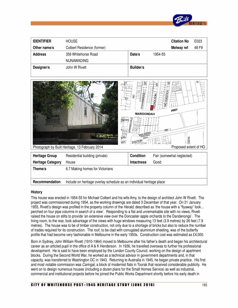
C I T Y O F W H I T E H O R S E P O S T – 1 9 4 5 H E R I T A G E S T U D Y [ J U N E 2 0 1 6 ] 193
IDENTIFIER HOUSE Citation No E023
Other name/s Colbert Residence (former) Melway ref 48 F9
Address 359 Whitehorse Road Date/s 1954-55
NUNAWADING
Designer/s John W Rivett Builder/s
Photograph by Built Heritage, 13 February 2014
Proposed extent of HO
Heritage Group Residential building (private) Condition Fair (somewhat neglected)
Heritage Category House Intactness Good
Theme/s 6.7 Making homes for Victorians
Recommendation Include on heritage overlay schedule as an individual heritage place
History
This house was erected in 1954-55 for Michael Colbert and his wife Amy, to the design of architect John W Rivett. The project was commissioned during 1954, as the working drawings are dated 3 December of that year. On 21 January 1955, Rivett’s design was profiled in the property column of the Herald, described as ‘the house with a “flyaway” look… perched on four pipe columns in search of a view’. Responding to a flat and unremarkable site with no views, Rivett raised the house on stilts to provide ‘an extensive view over the Doncaster apple orchards to the Dandenongs’. The living room, to the rear, took advantage of the views with huge windows measuring 13 feet (3.9 metres) by 26 feet (7.9 metres). The house was to be of timber construction, not only due to a shortage of bricks but also to reduce the number of trades required for its construction. The roof, to be clad with corrugated aluminium sheeting, was of the butterfly profile that had become very fashionable in Melbourne in the early 1950s. Construction cost was estimated as £4,000.
Born in Sydney, John William Rivett (1910-1964) moved to Melbourne after his father’s death and began his architectural career as an articled pupil in the office of A & K Henderson. In 1936, he travelled overseas to further his professional development. He is said to have been employed by the London County Council, working on the design of apartment blocks. During the Second World War, he worked as a technical advisor in government departments and, in that capacity, was transferred to Washington DC in 1943. Returning to Australia in 1945, he began private practice. His first and most notable commission was Caringal, a block of modernist flats in Toorak that received considerable publicity. He went on to design numerous houses (including a dozen plans for the Small Homes Service) as well as industrial, commercial and institutional projects before he joined the Public Works Department shortly before his early death in
194 C I T Y O F W H I T E H O R S E P O S T – 1 9 4 5 H E R I T A G E S T U D Y [ J U N E 2 0 1 6 ]
1964.
According to the Certificate of Title, the title to the site at 359 Whitehorse Road (originally Lot 1 of Plan of Subdivision 31,720) was transferred to Michael and Amy Colbert on 6 April 1955. Their professions were identified respectively as a steward and a married woman, and their previous address cited as 109b Glen Iris Road, Glen Iris. The son of a miner, Michael Henry Colbert (1908-1974) was born in Carisbrook. He enlisted with the Australian Army in May 1940 and served with the 3 Royal Australian Engineers Training Battalion, discharged in May 1944 with the rank of Lance Corporal. In 1955, at the age of 47 years, he married divorcee Amy Beatrice Pipkin (1902-1992). Born in London, she had migrated to Australia in 1922 with her first husband, Thomas Eardley (1900-1969), eventually settling in Box Hill. The Eardleys had two children, but their marriage appears to have ended by the 1940s. She later met Michael Colbert, and the house in Whitehorse Road, Nunawading, was erected as their new marital residence (with Michael taking belated advantage of his right to a war service loan). The Colberts, who had no children together, remained living in the two-bedroomed house until Michael’s death in September 1974. By the following January, his widow had sold the property to John Harkness, a sales representative, and his wife Desiree. They lived there for only a few years before ownership passed to schoolteacher Dennis Walsh in 1978.
Description
Effectively double-storeyed, the house at 359 Whitehorse Road, Nunawading, consists of a box-like upper level elevated on steel pipe columns, with a partial ground floor. The upper level has a low-pitched butterfly roof (ie, two skillions sloping inwards to a concealed box gutter) with broad eaves to the street frontage, but no eaves to the sides. Externally, it is clad with vertical timber boards, and had large windows with multi-paned sashes. The Whitehorse Road frontage, where the bedrooms and bathroom are situated, has a small central window flanked by two larger ones. The rear frontage, which is not visible from the street but is depicted on the perspective drawing published in 1955, has a considerably large central window. There are smaller windows to the side elevations, and a doorway at the upper level accessed by an open staircase on the west side. The enclosed portion of the ground floor level is located towards the Whitehorse Road side, thereby creating an open undercroft to the rear. This partial ground floor, which originally contained the laundry, tool store and a ‘garden room’, is clad with timber boards that were fixed diagonally rather than vertically. The supporting structure, of metal pipe columns and open-web steel pipe joists, remains exposed.
Comparative Analysis
While John Rivett is known to have undertaken several other commissions in what is now the City of Whitehorse, all of these were larger-scale industrial projects. He designed a factory for G M Seward Pty Ltd at 315 Whitehorse Road, Nunawading (1951; demolished) and was also engaged by Russell Burrows on at least four occasions (in 1950, 1958, 1960 and 1964) to make alterations or additions to their premises at 889 Whitehorse Road, Box Hill (demolished). Two other projects, for a new Russell Burrows factory at Nunawading (1951) and another at Burwood for Leggo & Company (1954), appeared to have been unrealised.
Considered more broadly as an example of a house in the modernist tradition of a box-like volume elevated above the ground, the house has a number of comparators in the study area. Examples such as 4 Murray Drive, Burwood, 28 Briggs Street, Mont Albert North and 22 Jackson Street, Mont Albert North are clearly in the same tradition, with their box-like expression, vertical timber boarding and large windows taking advantage of elevated views. However, none of these houses express the characteristic modernist sense of weightlessness as explicitly and confidently as the example at Nunawading. There are also a few comparable modern houses in the study area that are partially elevated, such as the former Stevens Residence at 57 Orchard Grove, Mont Albert (John & Phyllis Murphy, 1954) and the Coull Residence at 58 Diosma Grove, Nunawading (architect unknown, 1958)
At the local level, the Colbert Residence is further distinguished by the striking motif of the butterfly roof. Introduced to Melbourne in the house that architect Kenneth McDonald designed for himself in Balwyn North (1952; demolished), the motif became fashionable for a time in the 1950s. However, relatively few examples are recorded in what is now the City of Whitehorse. As the butterfly roof form was liable to leaking, and has been considered dated in more recent times, it is not surprising that several local manifestations have been demolished including one at 10 Irvine Street, Mitcham, and
C I T Y O F W H I T E H O R S E P O S T – 1 9 4 5 H E R I T A G E S T U D Y [ J U N E 2 0 1 6 ] 195
another at Ian Grove, Nunawading (both 1958). One contemporaneous survivor is the house at 17 Sheehans Road, Blackburn South, built to standard plan T2124 of the Age/RVIA Small Homes Service, designed by Neil Clerehan.
Statement of Significance
What is significant?
The former Colbert Residence at 359 Whitehorse Road, Nunawading, is a two-storey timber-framed modernist house expressed as a butterfly-roofed rectilinear volume elevated on metal poles, with only a partial ground floor. It was erected in 1954-55 for middle-aged newlyweds Michael and Amy Colbert, to the design of architect John W Rivett.
How is it significant?
The house is of architectural significance to the City of Whitehorse
Why is it significant?
Architecturally, the house is significant as a notable and substantially intact example of a house erected in the specific modernist theme of a rectilinear volume, raised up on slender posts to create the effect of a hovering mass, evoking a sense of weightlessness (Criterion E). Emerging in Australia in the late 1940s through the work of Harry Seidler and others, the theme remained popular into the 1950s, although individual manifestations display contrasting degrees of confidence and sophistication. This one, with its spindly metal poles, recessed lower level and butterfly roof, is an especially assured example by a Melbourne architect who, having spent nine years overseas from 1936-45, would have had first-hand experience of modern residential architecture of this type in Europe, England and the USA (Criterion F).
References
‘Simple design solves outlook problem’, Age, 21 January 1955, p 9.
Blair Gardiner, ‘J W Rivett’, B Arch thesis, RMIT, 1989.
Identified by
Built Heritage Pty Ltd
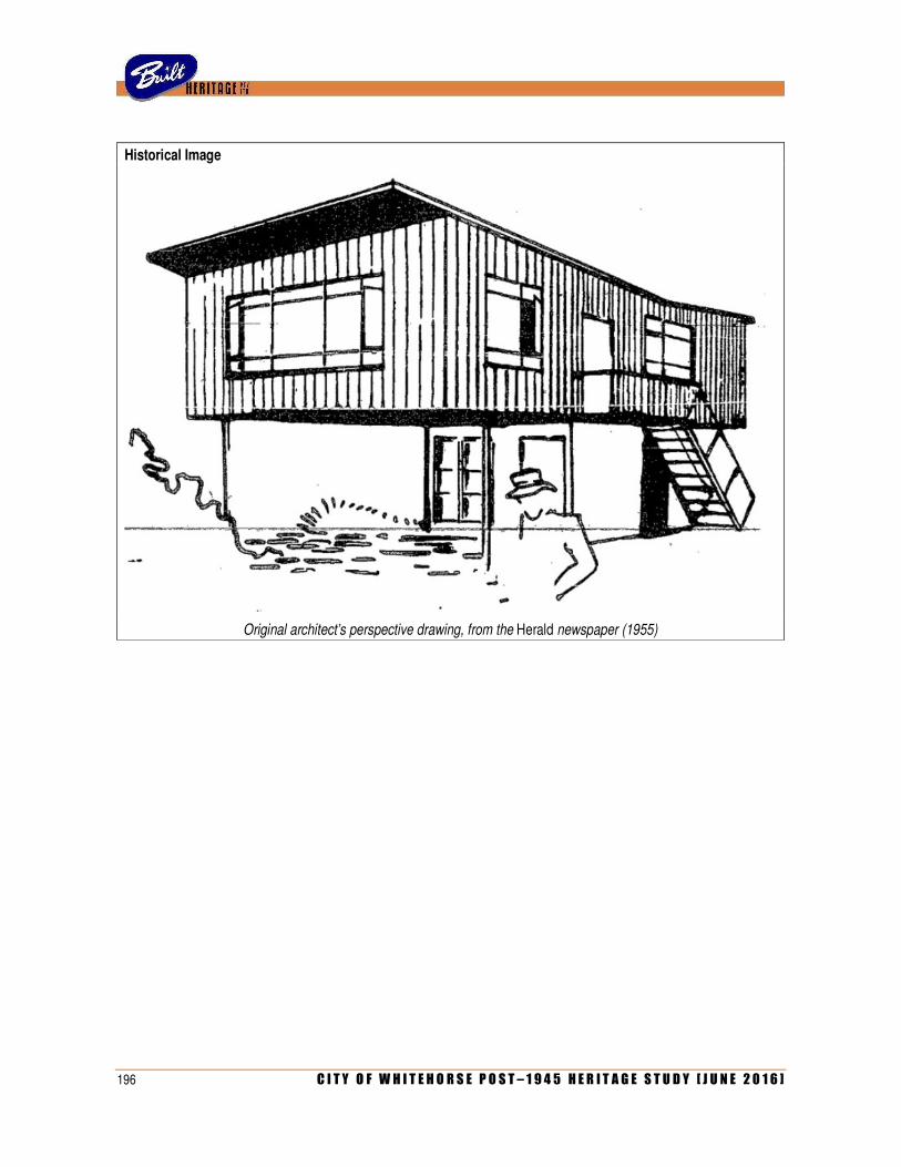
196 C I T Y O F W H I T E H O R S E P O S T – 1 9 4 5 H E R I T A G E S T U D Y [ J U N E 2 0 1 6 ]
Historical Image
Original architect’s perspective drawing, from the Herald newspaper (1955)
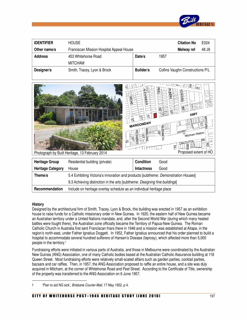
C I T Y O F W H I T E H O R S E P O S T – 1 9 4 5 H E R I T A G E S T U D Y [ J U N E 2 0 1 6 ] 197
IDENTIFIER HOUSE Citation No E024
Other name/s Franciscan Mission Hospital Appeal House Melway ref 48 J9
Address 453 Whitehorse Road Date/s 1957
MITCHAM
Designer/s Smith, Tracey, Lyon & Brock Builder/s Collins Vaughn Constructions P/L
Photograph by Built Heritage, 13 February 2014
Proposed extent of HO
Heritage Group Residential building (private) Condition Good
Heritage Category House Intactness Good
Theme/s 5.4 Exhibiting Victoria’s innovation and products [subtheme: Demonstration Houses]
9.3 Achieving distinction in the arts [subtheme: Designing fine buildings]
Recommendation Include on heritage overlay schedule as an individual heritage place
History Designed by the architectural firm of Smith, Tracey, Lyon & Brock, this building was erected in 1957 as an exhibition house to raise funds for a Catholic missionary order in New Guinea. In 1920, the eastern half of New Guinea became an Australian territory under a United Nations mandate, and, after the Second World War (during which many heated battles were fought there), the Australian zone officially became the Territory of Papua-New Guinea. The Roman Catholic Church in Australia first sent Franciscan friars there in 1946 and a mission was established at Aitape, in the region’s north-east, under Father Ignatius Doggett. In 1952, Father Ignatius announced that his order planned to build a hospital to accommodate several hundred sufferers of Hansen’s Disease (leprosy), which affected more than 5,000 people in the territory.1
Fundraising efforts were initiated in various parts of Australia, and those in Melbourne were coordinated by the Australian New Guinea (ANG) Association, one of many Catholic bodies based at the Australian Catholic Assurance building at 118 Queen Street. Most fundraising efforts were relatively small-scaled affairs such as garden parties, cocktail parties, bazaars and car raffles. Then, in 1957, the ANG Association proposed to raffle an entire house, and a site was duly acquired in Mitcham, at the corner of Whitehorse Road and Peel Street. According to the Certificate of Title, ownership of the property was transferred to the ANG Association on 6 June 1957.
1 ‘Plan to aid NG sick’, Brisbane Courier-Mail, 17 May 1952, p 4.
198 C I T Y O F W H I T E H O R S E P O S T – 1 9 4 5 H E R I T A G E S T U D Y [ J U N E 2 0 1 6 ]
The project was entrusted to the architectural firm of Smith, Tracey, Lyon & Brock. Founded in 1948 by recent university graduates Daniel Tracey (1916-1992) and Desmond Smith (1918-2003), the firm was originally known as Smith & Tracey until 1952, when Eric Lyon (1918-2006) and Leslie Brock (1920-2004) were admitted as partners. The two founding partners were both Catholics, and their practice rose to become leading architectural firm to the church in the 1950s and ‘60s. At the time that it was commissioned to design the exhibition house for the ANG Association, the office had recently completed a homeless men’s shelter in North Melbourne for the St Vincent de Paul Society (1954) and St Joseph’s Christian Brothers College in Pascoe Vale (1956), both of which attracted considerable attention in the press.
In a contemporary report, it was noted that the house on Whitehorse Road was ‘a prize winning design in a competition’. This implies that it was not an entirely new design prepared especially for the ANG Association but, rather, the realisation of an earlier unbuilt project by the architects (who, given the charitable nature of the project, were probably working in an honorary capacity). While the competition in which the design was placed has not been conclusively identified, it could have been either the one held by the Age/RAIA Small Homes Service in 1953, or the one associated with the Ideal Home Show in 1956. In any case, the architects are known to have made a scale model of the house at some stage, as its appearance is recorded in a series of coloured slides by indefatigable architectural photographer Peter Wille, who happened to be employed in their office at the time. (Wille later also photographed the finished building).
A building permit for the house, to cost £5,000, was issued by the City of Nunawading on 1 July 1957 (barely a month after ownership of the site was transferred to the ANG Association). The builders were identified as Collins Vaughan Constructions Pty Ltd, a Carlton-based firm of relatively recent origin, established in 1955 by K A Vaughan. Befitting its status as an exhibition house to generate public interest, construction included several innovations. The house had a concrete slab floor and lightweight steel framework (both highly unusual in residential architecture at that time), and a skillion roof on open-web steel joists. The roof itself was built up from two-inch slabs of insulating material, covered with bituminous roofing and finished in white gravel. Internally, partition walls were of ‘a new type of precast reinforced solid plaster, 2½ inches thick’. Completed in less than five months, the house was profiled in the property column of the Herald newspaper in November 1957. Needless to say, there was much discussion of the construction innovations. Of the open-web roof joists, which were exposed internally, readers were reassured that ‘although they might appear strange to many, they have a decorative value when seen in conjunction with the room colour schemes’. The article’s author also deemed it necessary to explain that the concrete slab floor was not exposed, but ‘will be carpeted or covered with linoleum tiles’. There was also praise for the neatly zoned planning, with a combined living/dining area at one end, and three bedrooms at the other, clustered around a small circulation area with direct access to a shower, WC and compact bathroom expressed as three separate spaces. It was further noted that ‘the carport is a feature of the house, with a low side wall forming a break between it and the house and between the front garden and driveway’.
While it was stated in the same article that the house was to be raffled for the ‘Franciscan Mission Hospital New Guinea Appeal’ (with tickets selling for 2/- each), it is unclear if this actually eventuated. According to the Certificate of Title, ownership of the property remained with the ANG Association until as late as September 1963, when it was transferred to Charles Haselgrove (1907-1989) and his wife Ada. They lived there until the late 1970s. The house has had several other residential occupants since then, but, in recent years, has been adapted for use as a hairdresser’s premises.
Description
The house at 453 Whitehorse Road, Mitcham, is a single-storey brick veneer house in the modernist style, with a low skillion roof now clad in metal tray decking. Occupying a corner site, it has a squat rectangular plan with a projecting central bay towards Peel Street. The former terrace area, to the right side of the projecting bay, has been infilled with glazing to create additional enclosed space.
The Whitehorse Road facade is asymmetrical, with a large timber-framed window wall (made up of five tripartite bays) taking up about two-thirds of the elevation, with a narrower bay of solid beige-coloured brickwork to the right. Window walls, similarly detailed, also extend across the Peel Street elevation. The front door was originally set into a recessed porch between the projecting room and the terrace; this has since been infilled and a new doorway created in the projecting room itself. The original carport has been demolished.
C I T Y O F W H I T E H O R S E P O S T – 1 9 4 5 H E R I T A G E S T U D Y [ J U N E 2 0 1 6 ] 199
Comparative Analysis
While the modern notion of the display house or exhibition house became increasingly popular in the later 1950s, the specific idea of erecting an architect-designed modern house as a fundraising exercise, then charging admission for public inspection and/or raffling it for charity, was particularly innovative at that time. The Franciscan Mission Hospital Appeal House in Mitcham was a notably early manifestation of this trend, which subsequently recurred in such examples as the Heart’s Desire House in the city (built by the Australian Heart Foundation in 1961) and another house in St Kilda Road (built for the Royal Melbourne Hospital in 1959).
More broadly, the house can be compared with others in the study area built to showcase the latest ideas in contemporary design and/or construction techniques. A minor theme in what is now the City of Whitehorse, it can be traced back to 1955, when James Hardie & Company erected the Fibrolite Demonstration House at 235 Whitehorse Road, Mitcham (1955; demolished). Other examples followed, including the Victorboard Insulwool House at nearby No 231 (1958; much altered), another by James Hardie & Company at 531 Mitcham Road, Vermont (1962; reclad) and the Women’s Day Dream Home at 10 Benwerrin Drive, Burwood East (1963; much altered). Although slightly altered by the infilling of the terrace and the demolition of the carport, the Franciscan Mission Hospital Appeal House in Mitcham is still the most intact and evocative of the few surviving examples of this theme in the municipality.
Comparisons can also be drawn with other modernist houses in the study area designed by Smith, Tracey, Lyon & Brock. A slightly earlier example in Blackburn, at 35 The Avenue (1956) has a similar stepped rectangular plan, but is otherwise more conventionally suburban, with cream brick walls and a gabled roof. The same can be said of an example at Burwood, which was published in the Argus in November 1956 but has not been located. The most pertinent comparator would be the striking modernist house that one of the firm’s principals, Les Brook, designed and built for himself in the late 1950s. Located at 39 Laburnum Street, Blackburn, this was markedly similar to the Franciscan Mission Hospital Appeal House in its use of a low skillion roof with brick walls that framed contiguous bays of full-height windows. However, the house has since been demolished.
Statement of Significance
What is significant?
The former Franciscan Mission Hospital Appeal House at 453 Whitehorse Road, Mitcham, is a single-storey brick veneer steel-framed modernist house with a skillion roof and timber-framed window walls. Erected in 1957 as an exhibition house to raise funds for a Catholic missionary order in New Guinea, it was designed by the leading Catholic architectural firm of Smith, Tracey, Lyon & Brock, derived from an earlier scheme that had won a prize in a competition.
How is it significant?
The house is of historical, architectural, scientific (technological) significance to the City of Whitehorse
Why is it significant?
Historically, the house is significant as a rare surviving example of a post-war house that was conceived and realised as a charitable fundraising exercise (Criterion A). While several architect-designed modernist dwellings were erected in the study area in the 1950s and ‘60s as display or exhibition houses for public inspection, this example is unique in that it was specifically intended to be raffled to raise funds for the construction of a mission hospital in Papua New Guinea (as part of a broader public appeal initiated in the early 1950s).
Architecturally, the house is significant as a striking and innovative example of modernist residential architecture (Criterion F). Based on a design that had won its architects a prize in an earlier competition, the design was lauded at the time for its open planning, its minimalist form with low-pitched roof and generous window walls, and its innovative construction methods (see below). It is also significant as an excellent example of the work of architects Smith, Tracey, Lyon & Brock, whose best work of the time in a hard-edged modernist style defined by simple but bold forms and minimalist detailing (Criterion H).
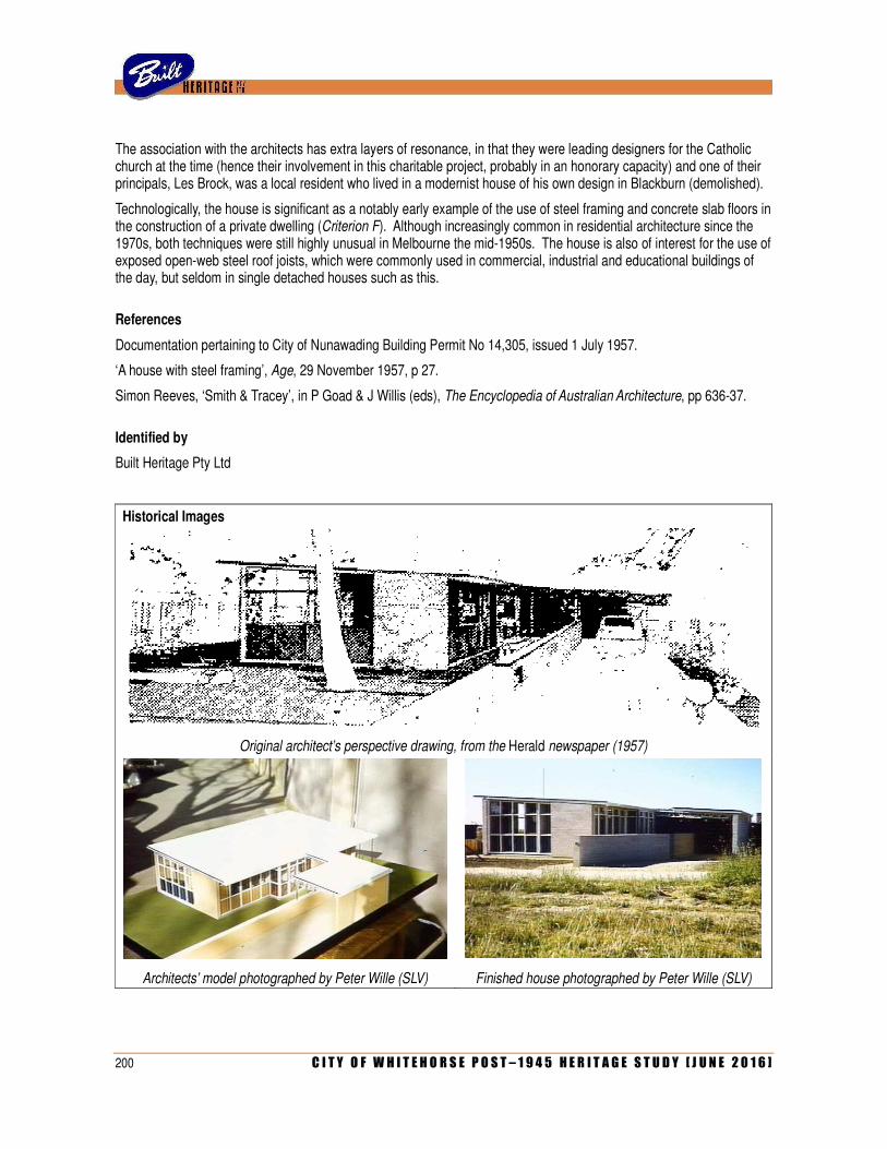
200 C I T Y O F W H I T E H O R S E P O S T – 1 9 4 5 H E R I T A G E S T U D Y [ J U N E 2 0 1 6 ]
The association with the architects has extra layers of resonance, in that they were leading designers for the Catholic church at the time (hence their involvement in this charitable project, probably in an honorary capacity) and one of their principals, Les Brock, was a local resident who lived in a modernist house of his own design in Blackburn (demolished).
Technologically, the house is significant as a notably early example of the use of steel framing and concrete slab floors in the construction of a private dwelling (Criterion F). Although increasingly common in residential architecture since the 1970s, both techniques were still highly unusual in Melbourne the mid-1950s. The house is also of interest for the use of exposed open-web steel roof joists, which were commonly used in commercial, industrial and educational buildings of the day, but seldom in single detached houses such as this.
References
Documentation pertaining to City of Nunawading Building Permit No 14,305, issued 1 July 1957.
‘A house with steel framing’, Age, 29 November 1957, p 27.
Simon Reeves, ‘Smith & Tracey’, in P Goad & J Willis (eds), The Encyclopedia of Australian Architecture, pp 636-37.
Identified by
Built Heritage Pty Ltd
Historical Images
Original architect’s perspective drawing, from the Herald newspaper (1957)
Architects’ model photographed by Peter Wille (SLV) Finished house photographed by Peter Wille (SLV)
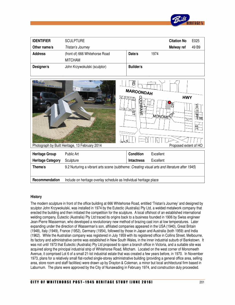
C I T Y O F W H I T E H O R S E P O S T – 1 9 4 5 H E R I T A G E S T U D Y [ J U N E 2 0 1 6 ] 201
IDENTIFIER SCULPTURE Citation No E025
Other name/s Tristan’s Journey Melway ref 49 B9
Address (front of) 666 Whitehorse Road Date/s 1974
MITCHAM
Designer/s John Krzywokulski (sculptor) Builder/s
Photograph by Built Heritage, 13 February 2014
Proposed extent of HO
Heritage Group Public Art Condition Excellent
Heritage Category Sculpture Intactness Excellent
Theme/s 9.2 Nurturing a vibrant arts scene (subtheme: Creating visual arts and literature after 1945)
Recommendation Include on heritage overlay schedule as Individual heritage place
History
The modern sculpture in front of the office building at 666 Whitehorse Road, entitled ‘Tristan’s Journey’ and designed by sculptor John Krzywokulski, was installed in 1974 by the Eutectic (Australia) Pty Ltd, a welded metalwork company that erected the building and then initiated the competition for the sculpture. A local offshoot of an established international welding company, Eutectic (Australia) Pty Ltd traced its origins back to a business founded in 1906 by Swiss engineer Jean-Pierre Wasserman, who developed a revolutionary new method of brazing cast iron at low temperatures. Later expanding under the direction of Wasserman’s son, affiliated companies appeared in the USA (1940), Great Britain (1948), Italy (1949), France (1952), Germany (1954), followed by those in Japan and Australia (both 1959) and India (1962). While the Australian company was registered in July 1959 with its registered office in Collins Street, Melbourne, its factory and administrative centre was established in New South Wales, in the inner industrial suburb of Bankstown. It was not until 1973 that Eutectic (Australia) Pty Ltd proposed to open a branch office in Victoria, and a suitable site was acquired along the principal industrial strip of Whitehorse Road, Mitcham. Located on the west corner of Monomeeth Avenue, it comprised Lot 6 of a small 21-lot industrial estate that was created a few years before, in 1970. In November 1973, plans for a relatively small flat-roofed single-storey administrative building (providing a general office area, selling area, store room and staff facilities) were drawn up by Drayton & Coleman, a minor but local architectural firm based in Laburnum. The plans were approved by the City of Nunawading in February 1974, and construction duly proceeded.
202 C I T Y O F W H I T E H O R S E P O S T – 1 9 4 5 H E R I T A G E S T U D Y [ J U N E 2 0 1 6 ]
In June 1974, Eutectic (Australia) Pty Ltd placed an advertisement in the daily newspapers announcing the launch of what was described as the Eutectic Design Competition, open to ‘all Australian artists, sculptors and students’. The company (described as ‘national leaders in maintenance welding techniques and equipment’) would award prize-money of $3,000 ‘for the design of a welded metal sculpture to be on permanent display and to enhance the grounds of its new premises in Mitcham, Victoria’. The competition was to be judged by ‘a panel drawn predominantly from nationally known art critics and directors’, later revealed as sculptor Clifford Last (1918-1991), painter and critic James Gleeson (1915-2008) and Sydney-based gallery owner Frank Watters (1934-). The opening date for submission of entries was cited as 1 July 1974, and the closing date as 30 August. A total of 239 entries were received, reportedly ‘reflecting a very high standard of work by artists from every Australian state’. The submissions were judged in Melbourne and, on 20 September, it was reported in the daily press that the coveted prize had been awarded to John Krzywokulski, a 27 year-old artist then living in the small town of Gembrook, south-east of Melbourne.
Of Russian and Polish descent, John Krzywokulski (1947-) was born in Germany and arrived in Australia with his family in 1950. His talent in the visual arts emerged early, and a sculpture that he made during a high school art class was later installed in the foyer of the Education Building at Monash University. After completing a Diploma of Art at the Caulfield Institute of Technology from 1965 to 1968, he embraced a career as a full-time artist. As reported in a later article, ‘it wasn’t easy, but he persisted, even though at first success came slowly’. The artist was fortunate to obtain enthusiastic and early support from leading art patrons John and Sunday Reed, who played a significant part in his career until their deaths in 1981; their adopted son Sweeney, a gallery director, served as Krzywokulski’s agent for a time. His first one-man show, held in 1969 at Sweeney Reed’s Strines Gallery in Rathdowne Street, Carlton, was praised by critics in both Melbourne and Sydney; one applauded his ‘capacity for invention which results in a satisfactory unity of free rhythms and Euclidean forms and places his work a notch above ordinary run-of-the-mill hard edge abstracts’. Krzywokulski also exhibited at the 4th Mildura Sculpture Triennial (1970) and held further one-man exhibitions at the Tolarno Gallery (1970) and Southern Cross Galleries (1971). His work received wider and noted exposure when, also in 1971, his mentor John Reed published a lengthy article about him in Art & Australia journal. Although Krzywokulski was (in the words of one later observer) ‘equally at home in painting and sculpture’, he tended to produce more of the former than the latter in his early career, although it was noted that his paintings were similar in theme and form to his sculptures. By the time that he entered the Eutectic Design Competition in 1974, Krzywokulski’s work was already represented at the Australian National Gallery in Canberra, the State Gallery of Western Australia and in private collections in Australia and overseas (England, USA, Germany and Poland).
Although the Eutectic Design Competition had been announced in the daily newspapers, Krzywokulski remembers being made aware of it via a press release that arrived in the post. At that time, young artists were inundated by such material, and Krzywokulski recalls pulling out the document from a pile of similar invitations that he had recently received. The prize-money of $3,000, which was substantial at the time, was especially appealing to him. He and his wife Trish had recently finished building a new house in Gembrook, and their newborn son, Tristan, had arrived on 10 August 1974. Like most new parents, the Krzywokulskis were kept up at nights, and John decided to channel these idle hours into preparing an entry for the competition. However, as he had become aware of it only five days before the deadline, he worked day and night to complete the maquette. He remembers that the company provided few guidelines for entrants, beyond the fact that the full-scale version would be of welded metal construction and must be suitable for exposure to all weather conditions. Krzywokulski visited the proposed site in Mitcham and decided that the low block-like office building required a sculpture with a horizontal flow, with a hint of verticality. He experimented with a number of small cardboard mock-ups before finalising the design and producing a larger-scale maquette, measuring 30 inches (76cm) long by 16 inches (40cm) wide, made of fibreglass over a chipboard substrate with a sprayed finish of automotive duco to create a metallic effect. The sculpture was a jagged configuration of angled rectilinear elements that created a lively interplay of positive and negative space, evoking a sense of movement and dynamism when viewed from different angles. These qualities, which the artist considers akin to a narrative or a journey, recurred through much of this work; as a reflection of this, he named the piece Tristan’s Journey, after his newborn son. Completing the piece at virtually the last minute, Krzywokulski phoned the Eutectic people on the day of the deadline and asked for someone to stay back after 5pm, as he was driving from Gembrook to deliver it.
C I T Y O F W H I T E H O R S E P O S T – 1 9 4 5 H E R I T A G E S T U D Y [ J U N E 2 0 1 6 ] 203
Four decades later, the artist still recalls the sense of disbelief and delight when, some weeks after submitting his entry, a company representative telephoned him and advised him to open the champagne because he has won first prize in the Eutectic Design Competition. The news came as a complete shock to him as, despite his rising profile, he considered himself a relative unknown. At that time, he recalls, the modern sculpture movement in Australia was focused on artists emerging from Sydney rather than Melbourne, and he (and others) fully expected any of one of a number of Sydneysiders to scoop the coveted prize. The news of his triumph was widely reported in the daily press and journals as diverse as Building & Construction and Architecture in Australia, as well as prompting a lavish two-page spread in the artist’s own local newspaper, the Pakenham Gazette. A selection of the other submissions was exhibited in Melbourne for a fortnight, but, as the Herald pointed out, ‘some fine pieces are amongst the entries, but none has quite the authority nor the suitability as an architectural feature as the Krzywokulski work’.
The realisation of the full-scale counterpart, however, was fraught with problems. The artist remembers that the company had originally intended to produce the piece in stainless steel but, as this proved too expensive, it was made using ordinary steel with an aluminium powder-coated finish – apparently a notable early use of powder coating, which the artist himself had never seen before. Krzywokulski recalls having a brief discussion with the company regarding the final size of the piece, which would be fifteen feet (4.5 metres) by eight feet (2.4 metres) but, apart from that, his maquette was simply handed over to the fabricators without any further involvement from the artist. He recalls being disappointed when he first saw the piece during its construction, as it had been somewhat roughly produced with scant respect for the original geometry, thereby losing the subtleties of the design. Clifford Last, one of the competition judges and a noted sculptor in his own right, stepped in and provided much assistance and support, serving as a middleman between artist and fabricator. Krzywokulski wryly recalls Last telling him that this was entirely typical, and a sobering lesson why sculptors should closely supervise their own work, or fabricate it themselves. While Krzywokulski would have preferred that the sculpture be re-created from scratch, it was completed as it was. The company had previously announced that there would be an unveiling ceremony when the new building was officially opened on 20 November 1974, but the artist does not recall that this ever took place.
Krzywokulski has subsequently maintained a high profile on the Australian art scene, participating in more than fifty group exhibitions (and four individual exhibitions) over four decades from 1974. He won two purchase awards and his work has appeared in numerous publications, including a biographical entry in Ken Scarlett’s definitive book Australian Sculptors, illustrated by a photograph of Tristan’s Journey in Whitehorse Road, Mitcham. As it turned out, the new premises were occupied by Eutectic (Australia) Pty Ltd for only a few years. In November 1978, the company rebadged itself as the Centre for Terotechnology of Australia Pty Ltd and relocated its Victorian headquarters, initially to a nearby shopfront at 697 Whitehorse Road and later to a larger factory in Forster Road, Glen Waverley. Krzywokulski is still surprised that the company did not take the sculpture with them; he further recalls, some years after the competition, his maquette was returned to him without any explanation or covering letter. Since then, the former office has been occupied by a succession of tenants, some of which (to the artist’s exasperation) have re-painted the sculpture in their own corporate colours. The company that commissioned the sculpture reverted to its original name in 1994 but later changed it again, to Linebacker Australia Pty Ltd, in 2008 before it was finally deregistered in March 2012. John Krzywokulski, still living in Gembrook, continues to work as an artist. His son Tristan, after whom the sculpture was named, followed in the same vocation, but died in 2004.
Description
The sculpture, Tristan’s Journey, stands in open space in front of the single-storey office building at 666 Whitehorse Road, Mitcham. Of steel construction with an aluminium powder-coated finish, the sculpture is approximately 4.5 metres long, 2.4 metres wide and 2 metres high. It effectively consists of a continuous metal tube of variable rectangular section, fashioned into a jagged twisted form with eight angles of different size. As originally designed, the sculpture displayed a complex interplay with angles, planes and positive/negative spaces in careful alignment. As constructed, however, much of this precision was lost, resulting in what the artists considers to be a damaging loss of subtlety.

204 C I T Y O F W H I T E H O R S E P O S T – 1 9 4 5 H E R I T A G E S T U D Y [ J U N E 2 0 1 6 ]
Nevertheless, the sculpture still evokes the strong sense of motion and dynamism that the artist intended, and creates unexpected and sharply contrasting forms when viewed from different directions. Located in the extreme north-west corner of this corner site, the sculpture sits in a grassed area, mounted by three points on an irregularly-shaped tiled area that incorporates a row of recessed uplights. There is no plaque to identify the name of the sculpture or its artist and date (and, according to the artist himself, there never was one).
Comparative Examples
This sculpture is effectively unique in the study area. By his own admission, John Krzywokulski’s only other foray into the field of public art was the sculpture that he produced while an art student at high school in 1965, which (evidently through the efforts of his art teacher) was later installed in the foyer of the Education Building at Monash University. A smaller piece of considerably different style (‘more organic’, the artist recalls), the piece remained there for many years but has since disappeared. While Krzywokulski has created many sculptures (especially in late 1960s and the early 1970s), these are largely held in private collections. None of them, moreover, were of the scale of Tristan’s Journey, which, being an unusually high-profile public commission from a large company, represented an atypical project in his entire oeuvre. These sorts of commissions, he notes, were very rare at the time.
Considered more broadly in a municipal context, Tristan’s Journey occupies a special place in the history of public art in the City of Whitehorse. It remained an unusual phenomenon in the early post war period, with a rare example being a sculpture at Presbyterian Ladies’ College in Burwood, created by leading sculptor Andor Meszaros, which was unveiled in 1963 as a memorial to former vice principal F E Virtue. This, however, was a relatively small-scale and wall-mounted relief sculpture; while it still exists, it remains within the school grounds and is not accessible to the public. Although the City of Box Hill began to develop a municipal art collection in the 1950s, it was not until the 1980s that this expanded to include the commissioning of public artwork. This trend began in 1985, when a bronze sculpture by Anthony Pryor, entitled Performers, was erected in the Box Hill Mall. It has since been relocated to the Pioneer Park in Station Street. The adjacent City of Nunawading followed suit with a piece by noted sculptor Inge King, titled Dervish, which was erected outside the civic centre in 1991. After the municipalities amalgamated in 1994, two pieces of public artwork were commissioned to mark the milestone: Unity, by Stephen Glassborrow (at Box Hill) and Spirit of Whitehorse by Graham Radcliffe (at Nunawading). This tradition of commissioned public artwork has continued into the twenty-first century with such examples as Anderson Hunt’s sculpture, Nesting (2007), on the Mega Mile retail strip at Nunawading.
Statement of Significance
What is significant?
The sculpture, Tristan’s Journey, in the grounds of the office building at 666 Whitehorse Road, Mitcham, is a powder-coated steel structure in the form of an elongated rectangular section tube, bent into a jagged angled configuration and supported by three points on a tiled area with uplights. Commissioned by welding company Eutectic Australia Pty Ltd as a focal point for its new Victorian premises (built to the design of architects Drayton & Coleman in 1973-74), the sculpture was the outcome of a national competition won by Melbourne artist John Krzywokulski.
How is it significant?
The sculpture is of aesthetic and historical significance to the City of Whitehorse.
Why is it significant?
Aesthetically, the sculpture is significant as a notable example of public art in the City of Whitehorse. The result of a high-profile nationwide competition that was judged by three leading figures in Australian contemporary art (sculptor Clifford Last, painter James Gleeson and gallery owner Frank Watters), the winning design was selected from over 200 entries received nationwide (Criterion F). It is an important work of Melbourne artist John Krzywokulski, a long-time protégé of John & Sunday Reed who, at the time of the competition, had distinguished himself in a number of group and individual competitions, and whose work was represented in major galleries and private collections locally and overseas (Criterion H).
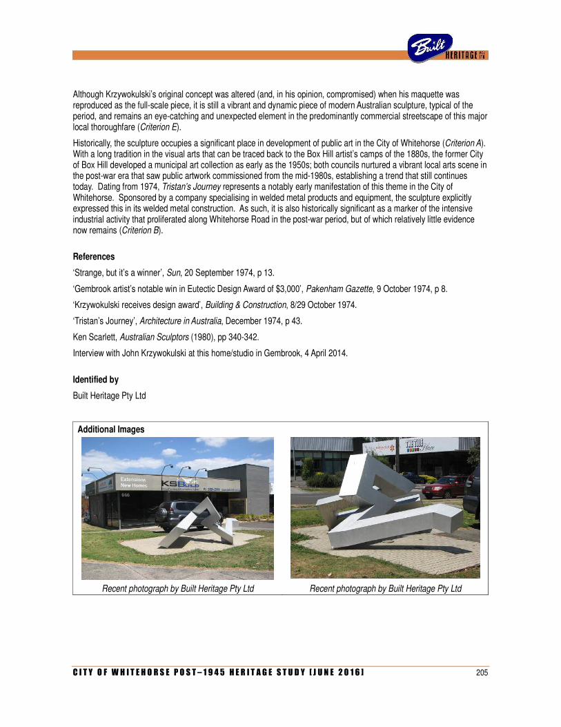
C I T Y O F W H I T E H O R S E P O S T – 1 9 4 5 H E R I T A G E S T U D Y [ J U N E 2 0 1 6 ] 205
Although Krzywokulski’s original concept was altered (and, in his opinion, compromised) when his maquette was reproduced as the full-scale piece, it is still a vibrant and dynamic piece of modern Australian sculpture, typical of the period, and remains an eye-catching and unexpected element in the predominantly commercial streetscape of this major local thoroughfare (Criterion E).
Historically, the sculpture occupies a significant place in development of public art in the City of Whitehorse (Criterion A). With a long tradition in the visual arts that can be traced back to the Box Hill artist’s camps of the 1880s, the former City of Box Hill developed a municipal art collection as early as the 1950s; both councils nurtured a vibrant local arts scene in the post-war era that saw public artwork commissioned from the mid-1980s, establishing a trend that still continues today. Dating from 1974, Tristan’s Journey represents a notably early manifestation of this theme in the City of Whitehorse. Sponsored by a company specialising in welded metal products and equipment, the sculpture explicitly expressed this in its welded metal construction. As such, it is also historically significant as a marker of the intensive industrial activity that proliferated along Whitehorse Road in the post-war period, but of which relatively little evidence now remains (Criterion B).
References
‘Strange, but it’s a winner’, Sun, 20 September 1974, p 13.
‘Gembrook artist’s notable win in Eutectic Design Award of $3,000’, Pakenham Gazette, 9 October 1974, p 8.
‘Krzywokulski receives design award’, Building & Construction, 8/29 October 1974.
‘Tristan’s Journey’, Architecture in Australia, December 1974, p 43.
Ken Scarlett, Australian Sculptors (1980), pp 340-342.
Interview with John Krzywokulski at this home/studio in Gembrook, 4 April 2014.
Identified by
Built Heritage Pty Ltd
Additional Images
Recent photograph by Built Heritage Pty Ltd Recent photograph by Built Heritage Pty Ltd
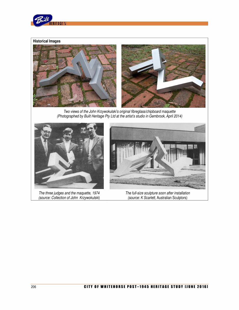
206 C I T Y O F W H I T E H O R S E P O S T – 1 9 4 5 H E R I T A G E S T U D Y [ J U N E 2 0 1 6 ]
Historical Images
Two views of the John Krzywokulski’s original fibreglass/chipboard maquette
(Photographed by Built Heritage Pty Ltd at the artist’s studio in Gembrook, April 2014)
The three judges and the maquette, 1974 (source: Collection of John Krzywokulski)
The full-size sculpture soon after installation (source: K Scarlett, Australian Sculptors)
C I T Y O F W H I T E H O R S E P O S T – 1 9 4 5 H E R I T A G E S T U D Y [ J U N E 2 0 1 6 ] 207
F: CITATIONS FOR PRECINCTS / GROUPS

208 C I T Y O F W H I T E H O R S E P O S T – 1 9 4 5 H E R I T A G E S T U D Y [ J U N E 2 0 1 6 ]
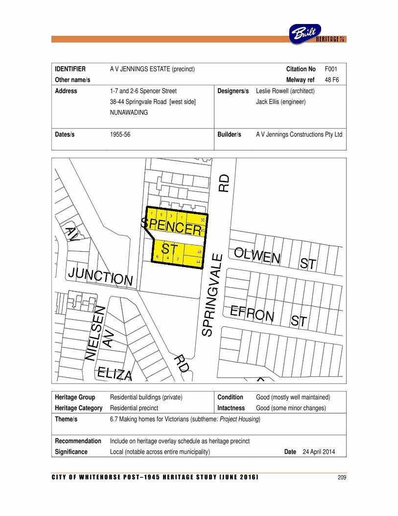
C I T Y O F W H I T E H O R S E P O S T – 1 9 4 5 H E R I T A G E S T U D Y [ J U N E 2 0 1 6 ] 209
IDENTIFIER A V JENNINGS ESTATE (precinct) Citation No F001
Other name/s Melway ref 48 F6
Address 1-7 and 2-6 Spencer Street Designers/s Leslie Rowell (architect)
38-44 Springvale Road [west side] Jack Ellis (engineer)
NUNAWADING
Dates/s 1955-56 Builder/s A V Jennings Constructions Pty Ltd
Heritage Group Residential buildings (private) Condition Good (mostly well maintained)
Heritage Category Residential precinct Intactness Good (some minor changes)
Theme/s 6.7 Making homes for Victorians (subtheme: Project Housing)
Recommendation Include on heritage overlay schedule as heritage precinct
Significance Local (notable across entire municipality) Date 24 April 2014
210 C I T Y O F W H I T E H O R S E P O S T – 1 9 4 5 H E R I T A G E S T U D Y [ J U N E 2 0 1 6 ]
History
This small estate of twelve houses, along both sides of Spencer Street and part of the western side of Springvale Road, Nunawading, was created by housing company A V Jennings in 1955-56 as the firm’s first post-war foray into estate development. Founded in 1932 by the eponymous Albert Victor Jennings (1896-1993), the company began on a modest scale providing individual dwellings designed by architect Edgar Gurney (1911-1988) and erected by builder William Wine (1891-1967). It soon expanded into larger multi-dwelling developments, winning much publicity at the time for such examples as the Hillcrest Estate (1933) and Beauville Estate (1934), both in Caulfield, and the Beaumont Estate (1936) and Beauview Estate (1938), both in Ivanhoe. By that time, the firm (then known as the A V Jennings Construction Company) had already become Melbourne’s largest and most successful home building company.
When private residential building was curtailed in 1942 due to the increasing gravity of the Second World War, A V Jennings began to tender for government contracts and the business subsequently underwent considerable expansion as a general construction company. In the early 1950s, the firm’s Housing Division undertook a limited number of private residential commissions for individual clients, but plans to resume larger-scale estate development were hampered by several factors including problems obtaining materials, difficulties in dealing with utility authorities and a restrictive finance market. By 1954, however, some of these issues had abated and this, coupled with a booming demand for new housing in developing suburbs, prompted the company to consider establishing a few small-scaled estates to test the market. As noted in Don Garden’s published history of the firm, this decision to return to estate housing ‘in an experimental way’ was made in March 1955, when it was resolved to develop small areas of suburban land with ‘low-cost, low-deposit homes ready for sale to intending home owners’. The first of these estates was to be located at Nunawading.
A housing estate at Nunawading appears to have been on the company’s cards since at least the late 1940s, when it acquired a large piece of land on the corner of Springvale Road and Junction Road. This site formed part of a larger subdivision along the west side of Springvale Road, extending from Junction Road all the way to Koonung Creek. In the late 1940s, the land had been carved up to create 22 allotments, each with a depth of 330 feet (91 metres) and frontages to Springvale Road that mostly varied from 63 feet (19 metres) to 70 feet (21 metres). In May 1949, ownership of the southernmost eight allotments (designated as Lots 1 to 8) was transferred to Victor Edward Jennings of Burke Road, North Ivanhoe. The eldest son of A V Jennings, Vic Jennings (1927-2011) qualified as a civil engineer at Melbourne University before joining his father’s company on a full-time basis in 1951. The firm was then concentrating on large-scale commercial and industrial projects, and Vic Jennings worked as an engineer on several of these projects in northern Tasmania, Victoria and New South Wales.
The Nunawading project was revived towards the end of 1952, when the A V Jennings Construction Company placed an advertisement in the Argus announcing a ‘special offer’ of ‘17 only timber houses to be erected to suit purchasers’ on Springvale Road, Tunstall’ (as Nunawading was then still popularly known, even though its name had officially changed in 1945). These houses would include ‘all latest conveniences’ and were priced from £2,750, including land.1 In 1955, six years after it had been acquired under Vic Jennings’s name, the Nunawading land was subdivided to create 17 residential allotments with frontage to Springvale Road, Junction Road, and a new east-west dead end street, Spencer Street. The fact that the far end of Spencer Street ended abruptly, rather than as a curving cul-de-sac, suggests that the developers may have entertained the notion of further subdivision to the west in the future. The eight allotments fronting Spencer Street, designated as Lots 3 to 10, were identical in size, each with a frontage of 55 feet (16.7 metres) and a depth of 118 feet, 9 inches (36 metres). Four blocks facing Springvale Road were wider but shorter, each measuring 59 feet by 110 feet. The remaining five blocks, facing Springvale Road and Junction Road, were oddly-shaped, with angled boundaries due to the adjacent creek easement. Ultimately, these blocks were never built upon and, during the 1960s, lost their street frontages when the alignment of Junction Road was altered to run at an angle parallel to the creek.
1 ‘Houses, land for sale’, Argus, 1 November 1952, p 23.
C I T Y O F W H I T E H O R S E P O S T – 1 9 4 5 H E R I T A G E S T U D Y [ J U N E 2 0 1 6 ] 211
The new Nunawading estate was planned by Vic Jennings with architect Les Rowell and engineer Jack Ellis, with another member of the family, Doug Jennings, responsible for its marketing. Leslie Edward Rowell (1921-2008) joined A V Jennings in 1938 as an office boy, assisting the in-house architect Edgar Gurney in the design section. In addition to receiving on-the-job training in design and construction, Rowell commenced studies in architecture and, during the Second World War, was seconded to the US Army to work on design and construction projects. Afterwards, he completed a Diploma of Architecture at the University of Melbourne, and became registered as an architect in 1950. While Rowell had been associated with A V Jennings for almost twenty years by the time that work started on the Spencer Street estate, engineer Jack Ellis was a relative newcomer, having joined in 1953. Doug Jennings (1929-1987), Vic’s younger brother, had been employed in their father’s company since 1947, working in various different sections to gain a broad understanding of its operations.
As noted by Don Garden, the houses on the Nunawading estate ‘were mainly spec built and had essentially the same floorplan, using sections pre-cut at [the firm’s factory in] Springvale but with different elevations to give variety in appearance’. The estate appears to have been completed by February 1956, when ownership of the twelve developed allotments was transferred to the A V Jennings Construction Company of Trent Street, Burwood. Individual properties appear to have sold promptly, with the Certificate of Title revealing that eight of the lots were transferred to new owners between February and August 1956, and the remainder during 1957. Typically, the houses were belatedly recorded in the Sands & McDougall Directory, with Spencer Street being listed for the first time in the edition for 1959. At that time, all eight houses (at Nos 1-7 and 2-8) were already occupied. Of the four other houses on the contiguous stretch of Springvale Road, only No 44 was occupied, with the others at Nos 38, 40 and 42 listed in the directory as ‘not available’, suggesting that they were either vacant or still under construction. The following year, all of these three houses had similarly become occupied.
Electoral rolls reveal that the occupations of the original residents of the estate represented a typical cross-section of comfortable middle-class suburbia. They included clerk William Bruce (2 Spencer Street), manager Alan Frederick (3 Spencer Street), inspector Albert Crockett (7 Spencer Street), cleaner Kenneth Timms (38 Springvale Road) and contractor Ernest Holwill (44 Springvale Road). At least four of the original families (the Bruces, Fredericks, Crocketts and Holwills) were still living in their houses in the early 1970s. Although this low turnover would indicate that the estate was considered to be successful as far as the residents themselves were concerned, this opinion was not shared by A V Jennings. In the firm’s official history, Don Garden pointed out that the company did not consider the estate to represent a viable template for future developments, apparently due to perceptions that the standardised designs did not offer enough choice to prospective purchasers.
Nevertheless, the venture was sufficient to demonstrate to the A V Jennings that there was a new market for estate housing. In 1956, the company acquired much larger tracts of vacant land in the Mulgrave area, which were developed as four separate estates made up of architect-designed dwellings of more appealing brick veneer construction. These developments ushered in the company’s new era as the acknowledged leaders of post-war estate housing in Melbourne, which would encapsulate such celebrated examples as the Trentwood Estate in Balwyn (1957-58) and the Karingal Estate at Frankston (1961-62) and the Cooinda Estate at Glen Waverley (1965-66). The staff members who were involved in that first experimental estate at Nunawading went on to play more significant roles in the company’s later housing estates, with Les Rowell appointed as Manager of Jennings Estates & Finance, and Jack Ellis promoted to the position of the firm’s Chief Engineer.
Description
As originally completed in 1956, the estate comprised twelve detached single-storey dwellings. All but one still remain standing; the exception, at 8 Spencer Street, has been replaced by a newer house of comparable scale and form. All but two of the original houses (comprising the seven remaining in Spencer Street and two at 38 and 40 Springvale Road) are of timber construction. The others, at 42 and 48 Springvale Road, are of brick construction.
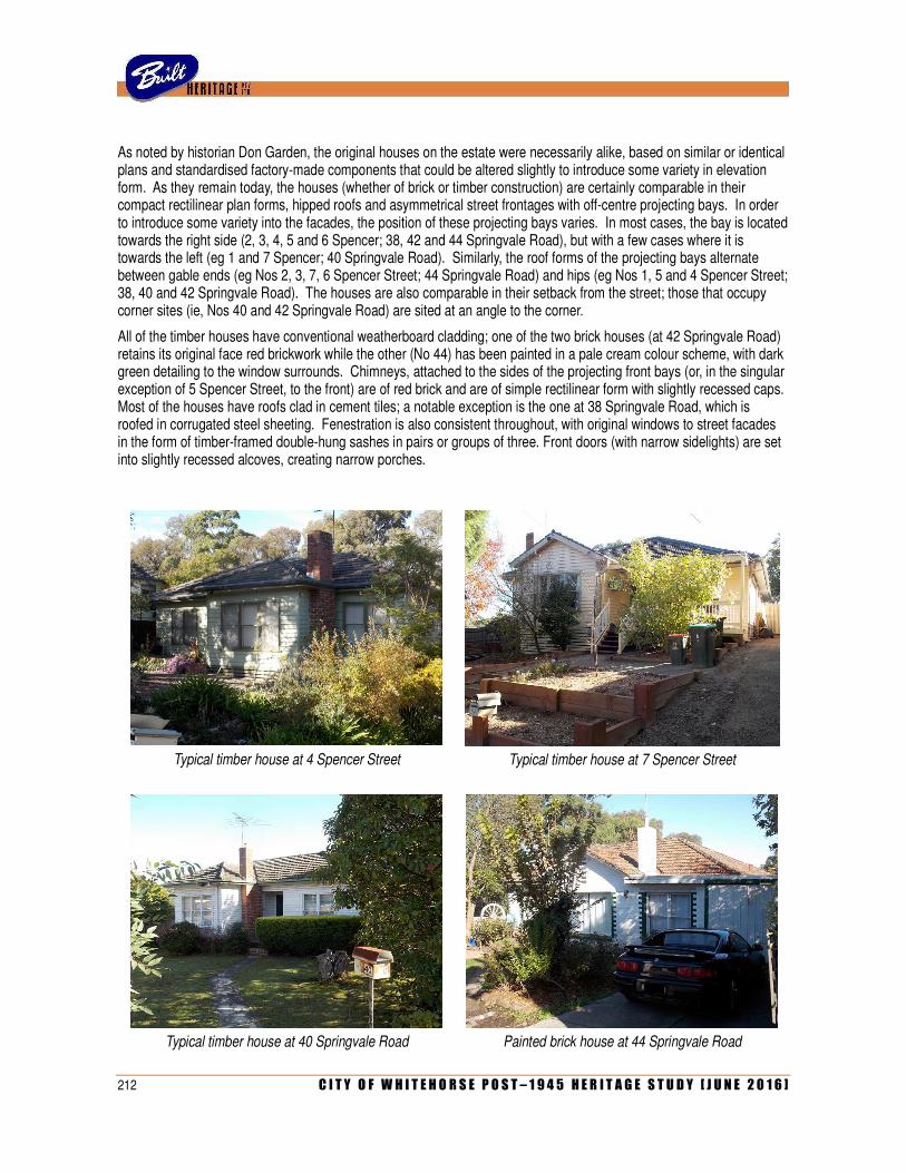
212 C I T Y O F W H I T E H O R S E P O S T – 1 9 4 5 H E R I T A G E S T U D Y [ J U N E 2 0 1 6 ]
As noted by historian Don Garden, the original houses on the estate were necessarily alike, based on similar or identical plans and standardised factory-made components that could be altered slightly to introduce some variety in elevation form. As they remain today, the houses (whether of brick or timber construction) are certainly comparable in their compact rectilinear plan forms, hipped roofs and asymmetrical street frontages with off-centre projecting bays. In order to introduce some variety into the facades, the position of these projecting bays varies. In most cases, the bay is located towards the right side (2, 3, 4, 5 and 6 Spencer; 38, 42 and 44 Springvale Road), but with a few cases where it is towards the left (eg 1 and 7 Spencer; 40 Springvale Road). Similarly, the roof forms of the projecting bays alternate between gable ends (eg Nos 2, 3, 7, 6 Spencer Street; 44 Springvale Road) and hips (eg Nos 1, 5 and 4 Spencer Street; 38, 40 and 42 Springvale Road). The houses are also comparable in their setback from the street; those that occupy corner sites (ie, Nos 40 and 42 Springvale Road) are sited at an angle to the corner.
All of the timber houses have conventional weatherboard cladding; one of the two brick houses (at 42 Springvale Road) retains its original face red brickwork while the other (No 44) has been painted in a pale cream colour scheme, with dark green detailing to the window surrounds. Chimneys, attached to the sides of the projecting front bays (or, in the singular exception of 5 Spencer Street, to the front) are of red brick and are of simple rectilinear form with slightly recessed caps. Most of the houses have roofs clad in cement tiles; a notable exception is the one at 38 Springvale Road, which is roofed in corrugated steel sheeting. Fenestration is also consistent throughout, with original windows to street facades in the form of timber-framed double-hung sashes in pairs or groups of three. Front doors (with narrow sidelights) are set into slightly recessed alcoves, creating narrow porches.
Typical timber house at 4 Spencer Street
Typical timber house at 7 Spencer Street
Typical timber house at 40 Springvale Road Painted brick house at 44 Springvale Road
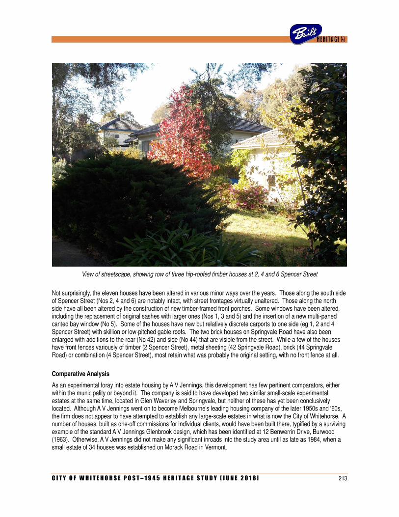
C I T Y O F W H I T E H O R S E P O S T – 1 9 4 5 H E R I T A G E S T U D Y [ J U N E 2 0 1 6 ] 213
View of streetscape, showing row of three hip-roofed timber houses at 2, 4 and 6 Spencer Street
Not surprisingly, the eleven houses have been altered in various minor ways over the years. Those along the south side of Spencer Street (Nos 2, 4 and 6) are notably intact, with street frontages virtually unaltered. Those along the north side have all been altered by the construction of new timber-framed front porches. Some windows have been altered, including the replacement of original sashes with larger ones (Nos 1, 3 and 5) and the insertion of a new multi-paned canted bay window (No 5). Some of the houses have new but relatively discrete carports to one side (eg 1, 2 and 4 Spencer Street) with skillion or low-pitched gable roofs. The two brick houses on Springvale Road have also been enlarged with additions to the rear (No 42) and side (No 44) that are visible from the street. While a few of the houses have front fences variously of timber (2 Spencer Street), metal sheeting (42 Springvale Road), brick (44 Springvale Road) or combination (4 Spencer Street), most retain what was probably the original setting, with no front fence at all.
Comparative Analysis
As an experimental foray into estate housing by A V Jennings, this development has few pertinent comparators, either within the municipality or beyond it. The company is said to have developed two similar small-scale experimental estates at the same time, located in Glen Waverley and Springvale, but neither of these has yet been conclusively located. Although A V Jennings went on to become Melbourne’s leading housing company of the later 1950s and ‘60s, the firm does not appear to have attempted to establish any large-scale estates in what is now the City of Whitehorse. A number of houses, built as one-off commissions for individual clients, would have been built there, typified by a surviving example of the standard A V Jennings Glenbrook design, which has been identified at 12 Benwerrin Drive, Burwood (1963). Otherwise, A V Jennings did not make any significant inroads into the study area until as late as 1984, when a small estate of 34 houses was established on Morack Road in Vermont.
214 C I T Y O F W H I T E H O R S E P O S T – 1 9 4 5 H E R I T A G E S T U D Y [ J U N E 2 0 1 6 ]
Architecturally, there is nothing especially remarkable per se about the design of the houses on the Jennings estate at Nunawading, and they can be considered as typical examples of the basic low-cost timber dwellings that proliferated in suburbia in the 1950s. There are countless houses of comparable type across the study area. In Blackburn, there are similarly-scaled groups along both sides of Stewart Street (1958) and in Henwood Street (1959), the latter being a small development by Mutual Constructions Pty Ltd. Notable individual examples include the double-fronted hip-roofed weatherboard display house that was erected at 121 Rooks Road, Mitcham (1957) by early project housing company A S L’Huillier Ltd.
Statement of Significance
What is significant?
The eleven houses at 1-7 and 2-6 Spencer Street, and 38-44 Springvale Road, Nunawading, constitute the remains of a cohesive development of twelve dwellings that were planned and constructed in 1955-56 by A V Jennings as the company’s first foray into estate housing in the post-war era. Based on standard plans and similar components, the houses are necessarily similar in form: asymmetrical triple-fronted hip-roofed dwellings, mostly of timber construction but with two examples (on Springvale Road) in brick.
How is it significant?
The houses are of historical and architectural significance to the City of Whitehorse.
Why is it significant?
Historically and architecturally, the houses are significant for associations with the A V Jennings Construction Company, one of Australia’s leading providers of house-and-land packages in the post-war period (Criterion H). Although the company excelled in that field for a decade following its foundation in 1932, wartime restrictions on private building saw the firm turn to larger-scale government projects and establish itself as leading general contractors. It was not until the early 1950s that the company decided to re-establish itself in the field of estate housing, and this small-scale estate at Nunawading represented its first foray (Criterion A).
A somewhat experimental venture based around the replication of standardised plans and components, the small estate at Nunawading did not prove to be a particularly influential model, but it otherwise paved the way for the company to expand further and corner the market in the post-war era, creating huge residential estates in developing outer suburbs such as Glen Waverley, Mulgrave and Frankston.
References
Don Garden, Builders to the Nation: The A V Jennings Story, pp 147-151.
Identified by
Heritage Alliance (additional research and assessment by Built Heritage Pty Ltd)
Revised 19 November 2015
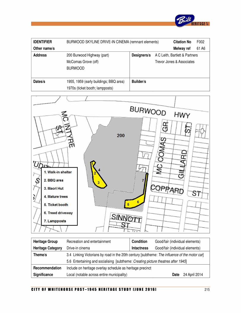
C I T Y O F W H I T E H O R S E P O S T – 1 9 4 5 H E R I T A G E S T U D Y [ J U N E 2 0 1 6 ] 215
IDENTIFIER BURWOOD SKYLINE DRIVE-IN CINEMA (remnant elements) Citation No F002
Other name/s Melway ref 61 A6
Address 200 Burwood Highway (part) Designers/s A C Leith, Bartlett & Partners
McComas Grove (off) Trevor Jones & Associates
BURWOOD
Dates/s 1955, 1959 (early buildings; BBQ area) Builder/s
1970s (ticket booth; lampposts)
Heritage Group Recreation and entertainment Condition Good/fair (individual elements)
Heritage Category Drive-in cinema Intactness Good/fair (individual elements)
Theme/s 3.4 Linking Victorians by road in the 20th century [subtheme: The influence of the motor car]
5.6 Entertaining and socialising [subtheme: Creating picture theatres after 1945]
Recommendation Include on heritage overlay schedule as heritage precinct
Significance Local (notable across entire municipality) Date 24 April 2014
216 C I T Y O F W H I T E H O R S E P O S T – 1 9 4 5 H E R I T A G E S T U D Y [ J U N E 2 0 1 6 ]
History
These scattered structures off Burwood Highway and McComas Grove in Burwood East constitute the remnants of the former Skyline Drive-in Cinema which, at the time of its opening in early 1954, represented the very first example of its type not only in Victoria, but in Australia. This was one of many initiatives to emerge in the early post-war period as a reflection of a new fascination for the potential for a car-oriented society. Since the end of the Second World War, private car ownership in Australia increased at a phenomenal rate, with the first locally-made cars produced at Fisherman’s Bend in 1948, and wartime petrol rationing abolished two years later. During the early 1950s, there was much discussion on the implications of motoring, which saw entrepreneurs return from trips to the USA enamoured by the possibilities for the local introduction of motels, drive-in shopping centres, drive-in banks and other hitherto unseen car-oriented building types.
One such entrepreneur was George Griffith junior, southern division manager of Hoyts Theatre Ltd, who returned to Melbourne in September 1952 after six months in the USA. Griffith, who had worked for the firm since the 1920s and regularly visited the USA to follow the latest trends in movie-going, decided that open-air drive-in picture theatres, so popular in California and elsewhere, would be similarly successful in Australia’s warm climate. With the Hoyts management initially unenthusiastic about Griffith’s plan, he decided to form a syndicate and proceed with the project himself. The syndicate, subsequently incorporated in July 1953 under the name of Auto Theatres Australia Pty Ltd, included amongst its directors Arthur Cedric Leith (1896-1972), principal of the prominent city architectural firm then known as A C Leith, Bartlett & Partners. In March 1953, Leith had sought permission from the local council to proceed with the project and was promptly advised by the Town Clerk that ‘the proposal contained in your letter for a drive-in theatre on an area of land in the vicinity of Burwood Road [as it was then known] and McComas Grove was considered by my Council at its last meeting when I was directed to inform you that the Council will raise no objections to the proposal’. Approval was also sought, and granted, from both the Country Roads Board (CRB) and the MMBW
The firm of A C Leith, Bartlett & Partners proceeded to prepare its scheme for the development of the site. Occupying sloping land overlooking the Gardiner’s Creek on the south side of Burwood Highway, the ten acre site formed a natural amphitheatre that allowed the projection screen to be erected on the edge of the creek without needing to be elevated on a frame. The vast wedge-shaped parking area, with space for 652 cars arranged in eleven radiating arcs, was to be accessed off McComas Grove, with an exit to Burwood Highway. The original buildings, as documented in working drawings finalised in September 1953, comprised the concession building (an elongated flat-roofed block in the centre of the site, containing the cafeteria, toilet facilities and projection rooms), a ticket booth at the McComas Street entry (also serving as an office for the manager/cashier), a combined storeroom and staff cloakroom, and a substation on the Burwood Highway frontage. With the exception of the brick substation, the buildings were of timber-framed construction, with vertical timber board cladding and broad-eaved skillion roofs. The playground in front of the projection screen was to be enclosed by a low picket fence, and the two access roadways along either side of the parking area were to be illuminated with rows of floodlights mounted on poles 35 feet (10.6 metres high).
Site development had commenced by early September 1953, when the architects advised the CRB that the ‘construction of the drive-in theatre is now well advanced’. A few weeks later, the working drawings were submitted to the Department of Public Health for approval. Approval, however, was delayed due to some new concerns raised by the CRB regarding vehicular access and egress from the property. The CRB stressed that it ‘does not wish to prevent the arrival of drive-in theatres, but thinks this is a particularly bad location for the first experiment. It is situated near suburban development and cannot be regarded as an open country site. There is insufficient land available to permit proper carriageway and roundabout development to dissipate traffic problems, as is usual with the American type theatre’. Concerns were also raised about the suggestion that multiple exits might be in operation at once. The matter was finally resolved when the CRB agreed to approve the project on the condition that only two gateways would be used at a time, and the others only for emergencies. Approval was confirmed at the end of October, and construction of the buildings began soon afterwards.
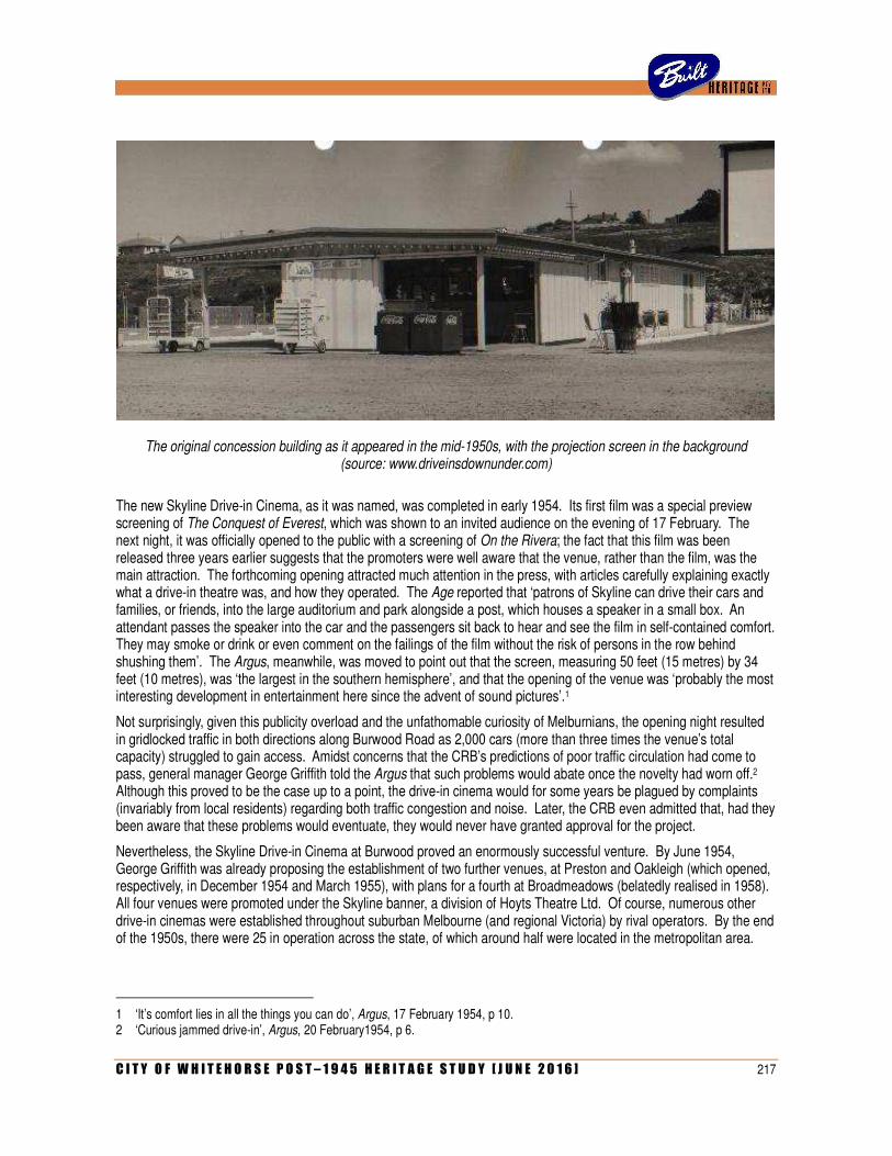
C I T Y O F W H I T E H O R S E P O S T – 1 9 4 5 H E R I T A G E S T U D Y [ J U N E 2 0 1 6 ] 217
The original concession building as it appeared in the mid-1950s, with the projection screen in the background (source: www.driveinsdownunder.com)
The new Skyline Drive-in Cinema, as it was named, was completed in early 1954. Its first film was a special preview screening of The Conquest of Everest, which was shown to an invited audience on the evening of 17 February. The next night, it was officially opened to the public with a screening of On the Rivera; the fact that this film was been released three years earlier suggests that the promoters were well aware that the venue, rather than the film, was the main attraction. The forthcoming opening attracted much attention in the press, with articles carefully explaining exactly what a drive-in theatre was, and how they operated. The Age reported that ‘patrons of Skyline can drive their cars and families, or friends, into the large auditorium and park alongside a post, which houses a speaker in a small box. An attendant passes the speaker into the car and the passengers sit back to hear and see the film in self-contained comfort. They may smoke or drink or even comment on the failings of the film without the risk of persons in the row behind shushing them’. The Argus, meanwhile, was moved to point out that the screen, measuring 50 feet (15 metres) by 34 feet (10 metres), was ‘the largest in the southern hemisphere’, and that the opening of the venue was ‘probably the most interesting development in entertainment here since the advent of sound pictures’.1
Not surprisingly, given this publicity overload and the unfathomable curiosity of Melburnians, the opening night resulted in gridlocked traffic in both directions along Burwood Road as 2,000 cars (more than three times the venue’s total capacity) struggled to gain access. Amidst concerns that the CRB’s predictions of poor traffic circulation had come to pass, general manager George Griffith told the Argus that such problems would abate once the novelty had worn off.2 Although this proved to be the case up to a point, the drive-in cinema would for some years be plagued by complaints (invariably from local residents) regarding both traffic congestion and noise. Later, the CRB even admitted that, had they been aware that these problems would eventuate, they would never have granted approval for the project.
Nevertheless, the Skyline Drive-in Cinema at Burwood proved an enormously successful venture. By June 1954, George Griffith was already proposing the establishment of two further venues, at Preston and Oakleigh (which opened, respectively, in December 1954 and March 1955), with plans for a fourth at Broadmeadows (belatedly realised in 1958). All four venues were promoted under the Skyline banner, a division of Hoyts Theatre Ltd. Of course, numerous other drive-in cinemas were established throughout suburban Melbourne (and regional Victoria) by rival operators. By the end of the 1950s, there were 25 in operation across the state, of which around half were located in the metropolitan area.
1 ‘It’s comfort lies in all the things you can do’, Argus, 17 February 1954, p 10. 2 ‘Curious jammed drive-in’, Argus, 20 February1954, p 6.
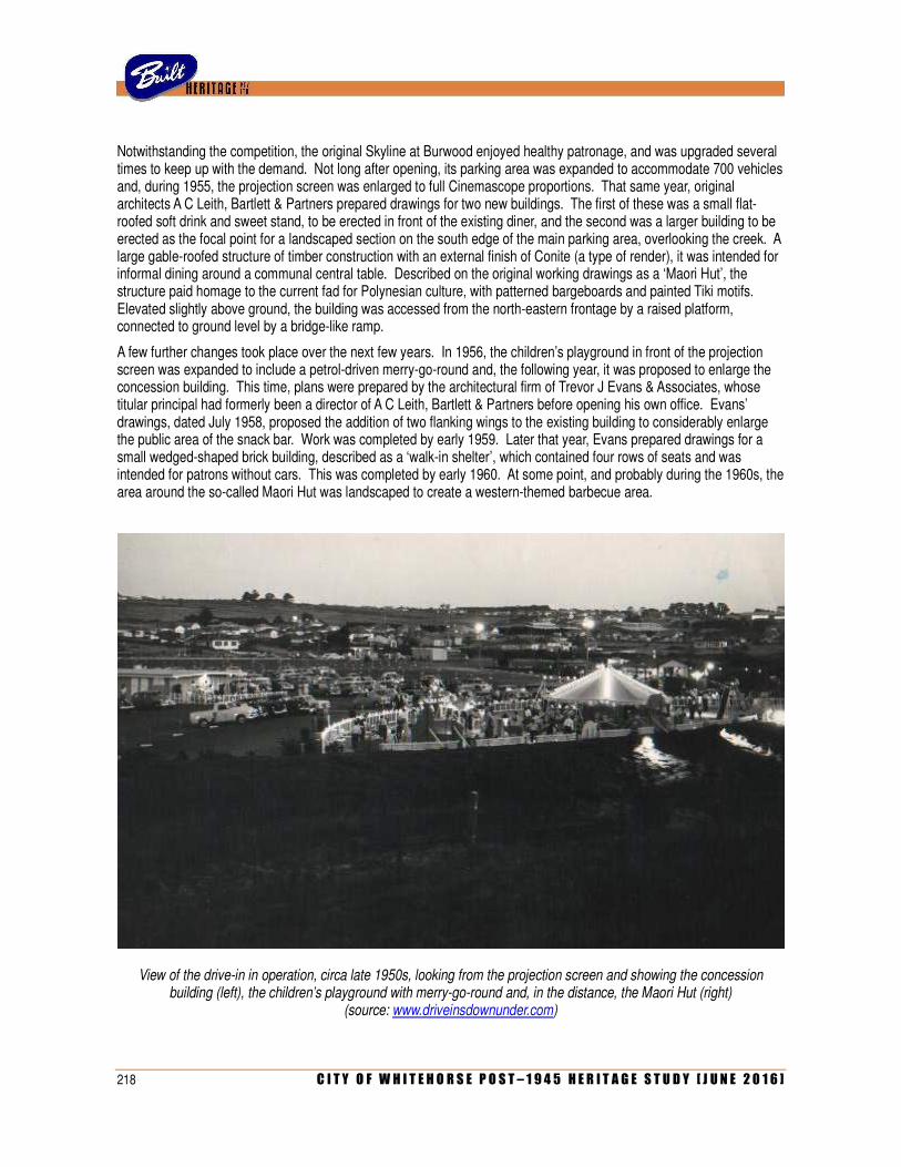
218 C I T Y O F W H I T E H O R S E P O S T – 1 9 4 5 H E R I T A G E S T U D Y [ J U N E 2 0 1 6 ]
Notwithstanding the competition, the original Skyline at Burwood enjoyed healthy patronage, and was upgraded several times to keep up with the demand. Not long after opening, its parking area was expanded to accommodate 700 vehicles and, during 1955, the projection screen was enlarged to full Cinemascope proportions. That same year, original architects A C Leith, Bartlett & Partners prepared drawings for two new buildings. The first of these was a small flat-roofed soft drink and sweet stand, to be erected in front of the existing diner, and the second was a larger building to be erected as the focal point for a landscaped section on the south edge of the main parking area, overlooking the creek. A large gable-roofed structure of timber construction with an external finish of Conite (a type of render), it was intended for informal dining around a communal central table. Described on the original working drawings as a ‘Maori Hut’, the structure paid homage to the current fad for Polynesian culture, with patterned bargeboards and painted Tiki motifs. Elevated slightly above ground, the building was accessed from the north-eastern frontage by a raised platform, connected to ground level by a bridge-like ramp.
A few further changes took place over the next few years. In 1956, the children’s playground in front of the projection screen was expanded to include a petrol-driven merry-go-round and, the following year, it was proposed to enlarge the concession building. This time, plans were prepared by the architectural firm of Trevor J Evans & Associates, whose titular principal had formerly been a director of A C Leith, Bartlett & Partners before opening his own office. Evans’ drawings, dated July 1958, proposed the addition of two flanking wings to the existing building to considerably enlarge the public area of the snack bar. Work was completed by early 1959. Later that year, Evans prepared drawings for a small wedged-shaped brick building, described as a ‘walk-in shelter’, which contained four rows of seats and was intended for patrons without cars. This was completed by early 1960. At some point, and probably during the 1960s, the area around the so-called Maori Hut was landscaped to create a western-themed barbecue area.
View of the drive-in in operation, circa late 1950s, looking from the projection screen and showing the concession building (left), the children’s playground with merry-go-round and, in the distance, the Maori Hut (right)
(source: www.driveinsdownunder.com)

C I T Y O F W H I T E H O R S E P O S T – 1 9 4 5 H E R I T A G E S T U D Y [ J U N E 2 0 1 6 ] 219
View of the drive-in following alterations and addition to the concession building in the early 1970s (source: www.drive-insdownunder.com.au)
Trevor Evans was still associated with the facility more than a decade later and, in 1972, was engaged to enlarge the concession building. This time, the snack bar was reconfigured to allow the toilets to be enlarged, and an H-shaped brick wing added to accommodate a new servery, food preparation area, cool room and so on. While this work was ostensibly undertaken to mark the venue’s 21st birthday, it also coincided with the death of its original architect/promoter A C Leith, who died on 6 January that year. A brief obituary in the Age newspaper, simply headlined ‘Drive-ins pioneer dead’, drew particular attention to his role as the man who ‘designed, built and financed Australia’s first drive-in theatre at Burwood’.
One of the last additions made to the Burwood Drive-in was the replacement of the original timber-framed ticket booth at the McComas Grove entrance with a larger counterpart of brick construction, which took place in 1975. By that time, the popularity of the venue was starting to decline. The former Maori Hut in the corner of property, latterly adapted as an eatery referred to as the steak-house, had fallen into disuse, with patrons preferring instead to purchase fast food from the refurbished snack bar. With the introduction of colour television in Australia, also in 1975, and the emergence of multiplex cinemas from the early 1980s, the popularity of drive-in cinemas plummeted. The Burwood Drive-in was one of fourteen such venues in the Melbourne metropolitan area alone that ceased operation between 1980 and 1984. It closed on 22 June 1983 following a final screening of a double feature of Local Hero and We of the Never Never.
The three-hectare site was purchased by the City of Box Hill in what was described at the time as ‘a million dollar deal which will allow it to centralise its electricity supply company’. Following a further outlay of a reported $3million, the site was redeveloped as an electricity depot, with a new building erected on the site of the original snack bar and projection booth. While the projection screen was removed, the barbecue area and steak-house were retained (for staff use), and the walk-in shelter was adapted for use as a storeroom. On the McComas Grove side of the property, a small area was set aside for a public park, with the former ticket booth converted into a barbecue shelter. Box Hill’s electricity company ceased to exist when the SEC was privatised in the mid-1990s. The Burwood depot was taken over by a new company, United Energy, which, in turn, was absorbed by another company, Alinta Energy in 2003.
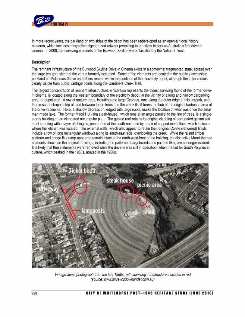
220 C I T Y O F W H I T E H O R S E P O S T – 1 9 4 5 H E R I T A G E S T U D Y [ J U N E 2 0 1 6 ]
In more recent years, the parkland on two sides of the depot has been redeveloped as an open-air local history museum, which includes interpretive signage and artwork pertaining to the site’s history as Australia’s first drive-in cinema. In 2008, the surviving elements of the Burwood Skyline were classified by the National Trust.
Description
The remnant infrastructure of the Burwood Skyline Drive-in Cinema exists in a somewhat fragmented state, spread over the large ten-acre site that the venue formerly occupied. Some of the elements are located in the publicly-accessible parkland off McComas Grove and others remain within the confines of the electricity depot, although the latter remain clearly visible from public vantage points along the Gardiners Creek Trail.
The largest concentration of remnant infrastructure, which also represents the oldest surviving fabric of the former drive-in cinema, is located along the western boundary of the electricity depot, in the vicinity of a long and narrow carparking area for depot staff. A row of mature trees, including one large Cypress, runs along the outer edge of this carpark, and the crescent-shaped strip of land between these trees and the creek itself forms the hub of the original barbecue area of the drive-in cinema. Here, a shallow depression, edged with large rocks, marks the location of what was once the small man-made lake. The former Maori Hut (aka steak-house), which runs at an angle parallel to the line of trees, is a single-storey building on an elongated rectangular plan. The gabled roof retains its original cladding of corrugated galvanised steel sheeting with a layer of shingles, penetrated at the south-east end by a pair of capped metal flues, which indicate where the kitchen was located. The external walls, which also appear to retain their original Conite (rendered) finish, include a row of long rectangular windows along its south-east side, overlooking the creek. While the raised timber platform and bridge-like ramp appear to remain intact at the north-west front of the building, the distinctive Maori-themed elements shown on the original drawings, including the patterned bargeboards and painted tikis, are no longer evident. It is likely that these elements were removed while the drive-in was still in operation, when the fad for South Polynesian culture, which peaked in the 1950s, abated in the 1960s.
Vintage aerial photograph from the late 1960s, with surviving infrastructure indicated in red (source: www.drive-insdownunder.com.au)
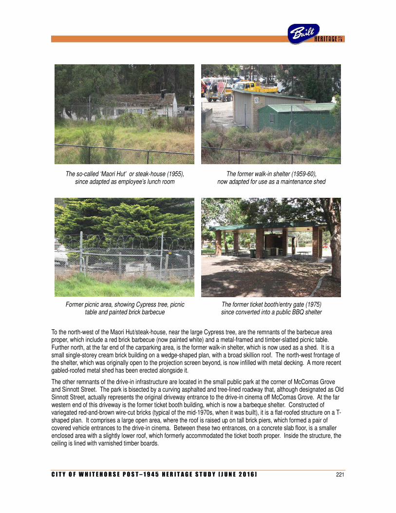
C I T Y O F W H I T E H O R S E P O S T – 1 9 4 5 H E R I T A G E S T U D Y [ J U N E 2 0 1 6 ] 221
The so-called ‘Maori Hut’ or steak-house (1955), since adapted as employee’s lunch room
The former walk-in shelter (1959-60), now adapted for use as a maintenance shed
Former picnic area, showing Cypress tree, picnic table and painted brick barbecue
The former ticket booth/entry gate (1975) since converted into a public BBQ shelter
To the north-west of the Maori Hut/steak-house, near the large Cypress tree, are the remnants of the barbecue area proper, which include a red brick barbecue (now painted white) and a metal-framed and timber-slatted picnic table. Further north, at the far end of the carparking area, is the former walk-in shelter, which is now used as a shed. It is a small single-storey cream brick building on a wedge-shaped plan, with a broad skillion roof. The north-west frontage of the shelter, which was originally open to the projection screen beyond, is now infilled with metal decking. A more recent gabled-roofed metal shed has been erected alongside it.
The other remnants of the drive-in infrastructure are located in the small public park at the corner of McComas Grove and Sinnott Street. The park is bisected by a curving asphalted and tree-lined roadway that, although designated as Old Sinnott Street, actually represents the original driveway entrance to the drive-in cinema off McComas Grove. At the far western end of this driveway is the former ticket booth building, which is now a barbeque shelter. Constructed of variegated red-and-brown wire-cut bricks (typical of the mid-1970s, when it was built), it is a flat-roofed structure on a T-shaped plan. It comprises a large open area, where the roof is raised up on tall brick piers, which formed a pair of covered vehicle entrances to the drive-in cinema. Between these two entrances, on a concrete slab floor, is a smaller enclosed area with a slightly lower roof, which formerly accommodated the ticket booth proper. Inside the structure, the ceiling is lined with varnished timber boards.
222 C I T Y O F W H I T E H O R S E P O S T – 1 9 4 5 H E R I T A G E S T U D Y [ J U N E 2 0 1 6 ]
Although as yet unverified in documentary sources, the row of four colonial-style lamp-posts along McComas Grove, made up of cast iron columns with Corinthian capitals, is likely to be another remnant of the drive-in cinema, probably also dating from the 1970s. It is worth noting also that the main driveway into the electricity depot, off Burwood Highway, also follows the exact alignment of the cinema’s original exit roadway.
Interpretative elements added in recent years include a large blue-painted metal frame bearing the words ‘DRIVE IN’ (evoking an entrance gate), a car sculpture representing an F J Holden (by artist Salvatore Amato, 1993), playground equipment in the form of a car in front of a small projection screen (bearing the sign ‘Burwood Skyline Drive-in’), and an illustrated signboard (part of the Whitehorse Heritage Trail, 2001).
Comparative Analysis
As only one drive-in cinema was ever established in what is now the City of Whitehorse, the remnant infrastructure of the Skyline ultimately remains as unique evidence of this typology in the municipality. Comparisons can be drawn, on various levels, with other drive-in cinemas that existed, or still exist, elsewhere in the metropolitan area.
As one of four venues that were established and maintained under the banner of Hoyts Skyline, the Burwood site is comparable to the other three, located at Preston, Oakleigh and Broadmeadows. All four cinemas appear to have been built to a similar design, with buildings of the same type and form as those documented by A C Leith & Bartlett for Burwood. However, no evidence remains of any of them. The Broadmeadows Skyline closed in 1972 and its site served as a caravan sales yard for some years. The original street signage remained until the late 1980s, when the site was cleared and subdivided as an industrial estate. The Skyline cinemas at Preston and Oakleigh, which closed in 1984 and 1990 respectively, were both cleared and redeveloped for retirement homes. The latter venue is known to have once had a western-themed barbecue area, presumably identical to that at Burwood.
Ultimately, very little evidence remains of early (pre-1960) drive-in cinemas in Victoria. Other suburban examples from the mid-1950s, including those at Croydon (1954), Essendon (1955), Maribyrnong (1955) and Rowville (1956) have all been obliterated by subsequent redevelopment. Vacant and derelict for many years, the last remaining buildings at the Clayton drive-in (1957) have been razed since 1990. The Dandenong drive-in (1957), which closed in 1984, re-opened in 2002 and currently remains in operation. The venue was much upgraded for its new incarnation, including the erection of two more projection screens (complementing the existing one, itself rebuilt in 1973) and the refurbishment of the diner. It remains as Melbourne’s only other pre-1960 drive-in to retain any significant elements. Apart from the much-altered diner, these include the original ticket booth, a row of cypress trees and a walk-in shelter for patrons without cars – according to the National Trust, the only other surviving example of that particular typology. Two other drive-in cinemas also remain in operation in Victoria. Located at Dromana and Coburg, these opened in 1961 and 1965 respectively, and thus are later developments when compared to the Burwood Skyline. Some physical evidence also remains at the sites of long-defunct drive-in cinemas of the 1960s, including those at Bulleen (1963), Wantirna (1968) and Sunshine (c.1969) in the metropolitan area, and a few others in regional Victoria.
Statement of Significance
What is significant?
The remnant infrastructure of the former Burwood Skyline Drive-in Cinema is located within the boundaries of the electricity depot at 200 Burwood Highway, Burwood East, and in a small park off nearby McComas Grove. It is all that remains of what was Australia’s first drive-in cinema, which opened in early 1954 and operated for nearly thirty years before its closure in June 1983. The original tree-lined entrance driveway off McComas Grove represents the only surviving fabric from 1953-54, with other elements providing evidence of later expansion and upgrading from the mid-1950s to the mid-1970s. These comprise a former detached dining building referred to as the Maori Hut (1955), the former walk-in shelter (1959-60), a tree-lined barbecue area with barbecue, picnic tables, man-made lake and remnant landscaping, and the replacement ticket booth/entry building (1975) and lampposts.
The identified landscaping elements, namely the mature trees along the former driveway entrance and the north-west edge of the barbecue area, are considered to contribute to the significance of the place.
C I T Y O F W H I T E H O R S E P O S T – 1 9 4 5 H E R I T A G E S T U D Y [ J U N E 2 0 1 6 ] 223
How is it significant?
The surviving infrastructure of the Burwood Skyline Drive-in Cinema is of historic and social significance to the City of Whitehorse.
Why is it significant?
Historically, the surviving infrastructure is significant for associations with the emergence and early development of drive-in cinemas in Australia (Criterion A). While it is of note as a unique example of that typology in what is now the City of Whitehorse, it is of broader historical significance as the very first example to be erected anywhere in Australia. Immediately popular, the Burwood Skyline ushered in the era of drive-in cinemas that would see two dozen others established in Victoria before the end of the 1950s, and more than fifty by the early 1970s. As most of these venues closed during the 1980s, and their sites were redeveloped, the remnant infrastructure at Burwood provides extremely rare evidence of this once-widespread but now almost disappeared aspect of post-war recreation (Criterion B). It is one of only five drive-in cinema sites in Victoria to retain at least some of their elements, and one of only two where those elements date from the 1950s. The walk-in shelter is also confirmed as one of only two surviving examples in Victoria. The former Maori Hut, which provides evidence of the fad for South Polynesian culture in the 1950s, is likely to be a unique survivor of its type in Victoria as well as a very rare example demonstrating that particular fad.
Socially, the surviving infrastructure is significant as evidence of a post-war cultural phenomenon that is fondly remembered by several generations of Melburnians from the mid-1950s to the 1980s (Criterion G). These venues catered to a wide audience including families with young children, teenagers wishing to socialise away from their parents, and young adults attracted to particular film genres and the intimate private space provided by the car. One of the more successful drive-in cinemas in Melbourne (as well as one of the longest running, for almost thirty years), the Burwood Skyline placed a particular emphasis on wholesome family-oriented entertainment, demonstrated by the children’s playground with merry-go-round (no longer evident) and the landscaped barbeque area (which still remains partially intact).
References
Documentation pertaining to City of Box Hill Building Permit No 5931, dated 4 May 1955. City of Whitehorse.
Public Building File No 10040, Unit 1170, VRPS 7882/P1, Public Record Office Victoria.
Lee Pierce, ‘Silver screen goes dark’, Progress Press, 15 June 1983, p 2.
Susan Webster, ‘Stars under the Stars at Burwood Drive-in’, Burwood Bulletin, No 122 (Spring 2011).
Building File No B7374, National Trust of Australia (Victoria).
Drive-ins Downunder. <<www.drive-insdownunder.com.au>>
Identified by
Andrew Ward (additional research and assessment by Built Heritage Pty Ltd)

224 C I T Y O F W H I T E H O R S E P O S T – 1 9 4 5 H E R I T A G E S T U D Y [ J U N E 2 0 1 6 ]
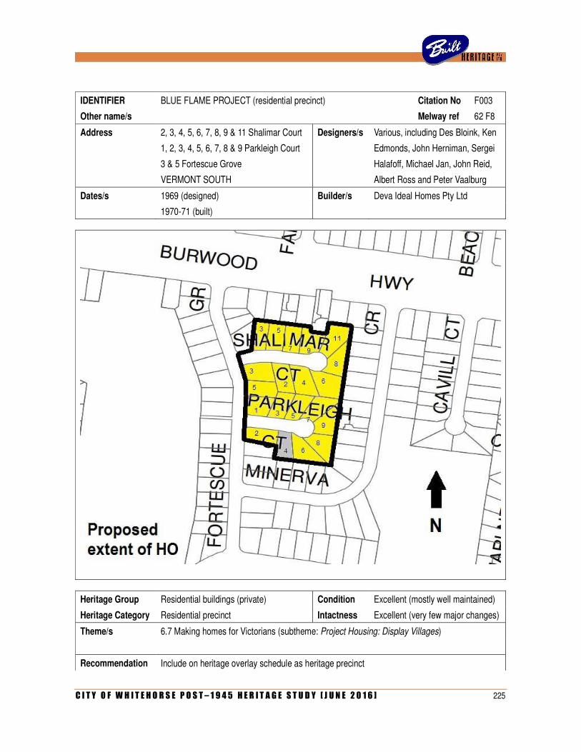
C I T Y O F W H I T E H O R S E P O S T – 1 9 4 5 H E R I T A G E S T U D Y [ J U N E 2 0 1 6 ] 225
IDENTIFIER BLUE FLAME PROJECT (residential precinct) Citation No F003
Other name/s Melway ref 62 F8
Address 2, 3, 4, 5, 6, 7, 8, 9 & 11 Shalimar Court Designers/s Various, including Des Bloink, Ken
1, 2, 3, 4, 5, 6, 7, 8 & 9 Parkleigh Court Edmonds, John Herniman, Sergei
3 & 5 Fortescue Grove Halafoff, Michael Jan, John Reid,
VERMONT SOUTH Albert Ross and Peter Vaalburg
Dates/s 1969 (designed) Builder/s Deva Ideal Homes Pty Ltd
1970-71 (built)
Heritage Group Residential buildings (private) Condition Excellent (mostly well maintained)
Heritage Category Residential precinct Intactness Excellent (very few major changes)
Theme/s 6.7 Making homes for Victorians (subtheme: Project Housing: Display Villages)
Recommendation Include on heritage overlay schedule as heritage precinct
226 C I T Y O F W H I T E H O R S E P O S T – 1 9 4 5 H E R I T A G E S T U D Y [ J U N E 2 0 1 6 ]
Significance Local (notable across entire municipality) Date 16 April 2014
History
The group of twenty houses in Shalimar Court and Parkleigh Court, off Fortescue Grove, was built 1970-71 as a display village known as the Blue Flame Project, co-sponsored by the Gas & Fuel Corporation and the Housing Service of the Royal Australian Institute of Architects (RAIA). The latter, originally known as the Small Homes Service, was formed in 1947 by the then Royal Victorian Institute of Architects (RVIA) in association with the Age newspaper. With Robin Boyd as its first director, the service aimed to provide low-cost housing by selling plans prepared by leading architects. The service was very popular under Boyd and his successor Neil Clerehan, who took over in 1953. However, after Clerehan left in 1961, it was competing with an increasing number of project housing firms that similarly offered affordable architect-designed dwellings. Nevertheless, it continued under the directorship of architects Jack Clarke (1962-65), Daryl Jackson (1965-69), Graham Whitford (1969-71) and finally John Barker. In April 1968, the name of the service was revised, dropping the word ‘small’ to acknowledge the changing needs of modern families that required larger houses.
From the early 1950s, a popular feature of the housing service was the semi-regular design competition, which allowed architects to submit plans for possible inclusion in the range. During the later 1960s, this competition became an ambitious affair co-sponsored by the Gas & Fuel Corporation and often with the participation of a leading project housing company, such as A V Jennings or Inge Brothers, which would sometimes erect prize-winning designs as display houses in outer suburban estates. In this way, the competition would not only publicise the role of the RAIA Housing Service but also the products of a range of manufacturers and suppliers.
In 1969, the Housing Service was approached by a company, Lifemaker Pty Ltd, which proposed to build a small display village in what is now Vermont South. By having the project co-sponsored by the Housing Service and the Gas & Fuel Corporation, the project would attract considerable publicity for all parties, with the admission fees slated to go to charity. An agreement was made and, in June 1969, the Housing Service launched a competition to obtain the designs, with separate categories for registered architects and students. Participants were given only four weeks to prepare their entries, which would be judged by a panel comprising leading residential architect Charles Duncan along with Graham Whitford and Jack Clarke, respectively the current and former director of the Housing Service. The top three place-getters in each category were announced in the weekly Age column on 25 August 1969. The architects’ section, with prize money donated by the Gas & Fuel Corporation, was won by John Adam (first prize), Peter Vaalburg (second prize) and J K Thompson (third prize) and the student section, with prize money donated by Inge Brothers, by Noel McKernan and Peter Brown (first prize), Michael Jan (second prize) and John Herniman (third prize).1
As was standard practice, most of the competition entries were introduced into the service’s range, thus making them available for public purchase. The winning designs, which were also exhibited in the Housing Service’s offices in Princes Gate Arcade (part of the new Gas & Fuel building in Flinders Street), attracted much attention. A week after the results were announced, Graham Whitford reported that the designs ‘have already created a lot of interest among potential home builders, judging from the inquiries received at the Housing Service office’.2
At that time, it was officially announced that the three winners in the architects’ section, along with twenty other entries from both sections, had been chosen ‘for erection in a display village sponsored by the Gas & Fuel Corporation under the name Blue Flame Project’.
3 At some point (for reasons not yet established), the list of 23 shortlisted designs was
reduced by the elimination of the prize-winning entries of John Adam, Ken Thompson and Peter Vaalburg. The twenty designs that remained, including a second unplaced entry by Vaalburg, were published in a glossy brochure that also illustrated the proposed site in Vermont South (at that time, still referred to as East Burwood) and a site plan, showing the houses on Lots 38 to 58, along Fortescue Grove and both sides of Shalimar Court and Parkleigh Court. The plan not only indicated the architects of each house, but also the code by which it was known in the Housing Service range.
1 ‘These took RAIA housing honours this year’, Age, 25 August 1969, p 11. 2 ‘Prizes for students’, Age, 1 September 1969, p 10. 3 ‘For display’, Age, 1 September 1969, p 10.
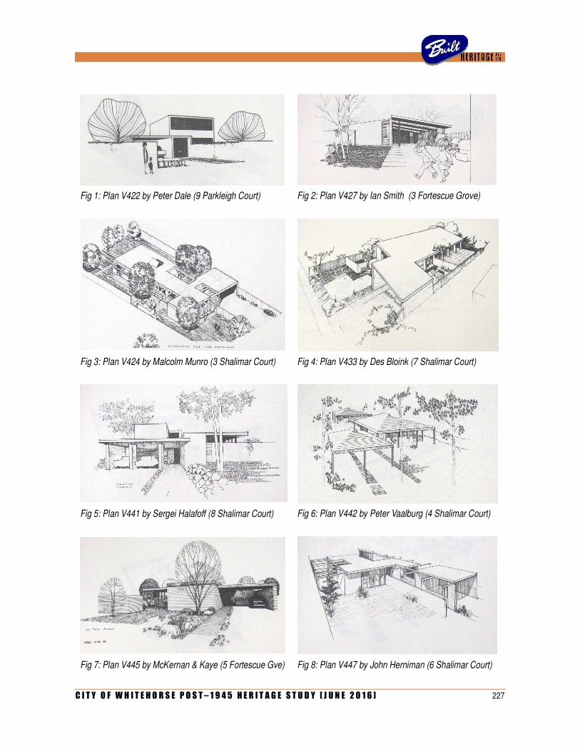
C I T Y O F W H I T E H O R S E P O S T – 1 9 4 5 H E R I T A G E S T U D Y [ J U N E 2 0 1 6 ] 227
Fig 1: Plan V422 by Peter Dale (9 Parkleigh Court)
Fig 2: Plan V427 by Ian Smith (3 Fortescue Grove)
Fig 3: Plan V424 by Malcolm Munro (3 Shalimar Court)
Fig 4: Plan V433 by Des Bloink (7 Shalimar Court)
Fig 5: Plan V441 by Sergei Halafoff (8 Shalimar Court)
Fig 6: Plan V442 by Peter Vaalburg (4 Shalimar Court)
Fig 7: Plan V445 by McKernan & Kaye (5 Fortescue Gve) Fig 8: Plan V447 by John Herniman (6 Shalimar Court)
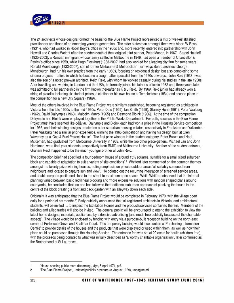
228 C I T Y O F W H I T E H O R S E P O S T – 1 9 4 5 H E R I T A G E S T U D Y [ J U N E 2 0 1 6 ]
The 24 architects whose designs formed the basis for the Blue Flame Project represented a mix of well-established practitioners and those of an emerging younger generation. The elder statesman amongst them was Albert W Ross (1931-), who had worked in Robin Boyd’s office in the 1950s and, more recently, entered into partnership with John Hipwell and Charles Weight after the sudden death of their original third partner, Peter Mason, in 1967. Sergei Halafoff (1935-2003), a Russian immigrant whose family settled in Melbourne in 1949, had been a member of Chancellor & Patrick’s office since 1959, while Hugh Flockhart (1933-2002) had also worked for a leading city firm for some years. Ronald Monsbourgh (1933-2007), son of former Melbourne & Metropolitan Tramways Board architect George Monsbourgh, had run his own practice from the early 1960s, focusing on residential design but also completing some cinema projects – a field in which he became a sought-after specialist from the 1970s onwards. John Reid (1938-) was also the son of a noted pre-war architect, Keith Reid, with whom he worked casually during his studies in the late 1950s. After travelling and working in London and the USA, he formally joined his father’s office in 1962 and, three years later, was admitted to full partnership in the firm known thereafter as K & J Reid. By 1969, Reid junior had already won a string of plaudits including six student prizes, a citation for his own house at Templestowe (1964) and second place in the competition for a new City Square (1969).
Most of the others involved in the Blue Flame Project were similarly established, becoming registered as architects in Victoria from the late 1950s to the mid-1960s: Peter Dale (1959), Ian Smith (1959), Stanley Hunt (1961), Peter Vaalburg (1962), David Dalrymple (1963), Malcolm Munro (1965) and Desmond Bloink (1966). At the time of the competition, Dalrymple and Bloink were employed together in the Public Works Department. For both, success in the Blue Flame Project must have seemed like déjà vu. Dalrymple and Bloink each had won a prize in the Housing Service competition for 1966, and their winning designs erected on outer suburban housing estates, respectively in Frankston and Yallambie. Peter Vaalburg had a similar prior experience, winning the 1965 competition and having his design built at Glen Waverley as a ‘Gas & Fuel Project House’. The first prize winners in the student category, Peter Brown and Noel McKernan, had graduated from Melbourne University in 1968, while the two other place-getters, Michael Jan and John Herniman, were final year students, respectively from RMIT and Melbourne University. Another of the student entrants, Graham Reid, happened to be the much younger brother of John Reid.
The competition brief had specified ‘a four bedroom house of around 15½ squares, suitable for a small sized suburban block and capable of adaptation to suit a variety of site conditions’.1 Whitford later commented on the common themes amongst the twenty prize-winning houses, noting emphasis on private outdoor areas ‘all suitably screened from neighbours and located to capture sun and view’. He pointed out the recurring integration of screened service areas, and double carports positioned close to the street to maximum open space. While Whitford observed that the internal planning varied between basic rectilinear blocking and ‘more expensive solutions with random shaped plans around courtyards’, he concluded that ‘no one has followed the traditional suburban approach of plonking the house in the centre of the block creating a front and back garden with an alleyway down each side’.
Originally, it was anticipated that the Blue Flame Project would be completed in February 1970, with the village open daily for a period of six months.2 Early publicity announced that ‘all registered architects in Victoria, and architectural students, will be invited … to inspect the Exhibition Homes and the products/services contained therein. Members of the building and allied trades will also be invited. The general public will be encouraged to attend the exhibition to view the latest home designs, materials, appliances, by extensive advertising (and much free publicity because of the charitable aspect)’. The village would be enclosed by fencing with entry via a purpose-built reception building on the north-east corner of Fortescue Grove and Shalimar Court. This temporary building would also contain a ‘Purchasing Information Centre’ to provide details of the houses and the products that were displayed or used within them, as well as how their plans could be purchased through the Housing Service. The entrance fee was set at 20 cents for adults (children free), with the proceeds being donated to what was initially described as ‘a worthy charitable organisation’’, later confirmed as the Brotherhood of St Laurence.
1 ‘House seeking public more discerning’, Age, 5 April 1971, p 6. 2 ‘The Blue Flame Project’, undated publicity brochure (c. August 1969), unpaginated.
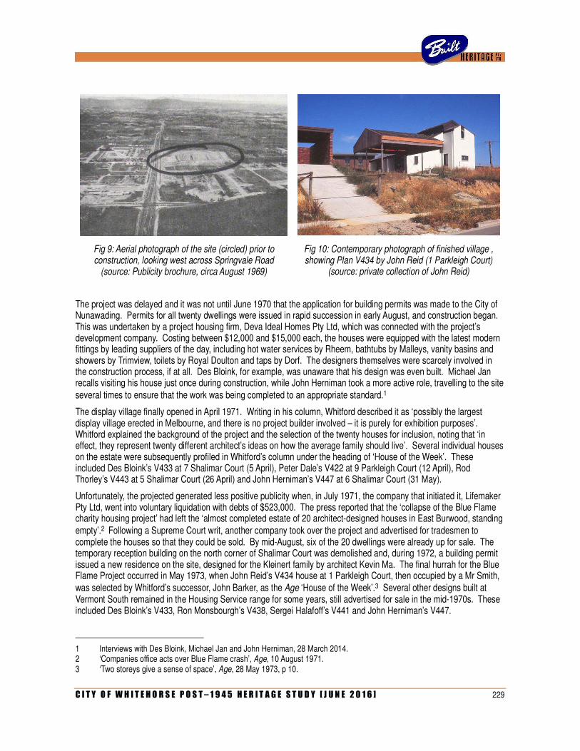
C I T Y O F W H I T E H O R S E P O S T – 1 9 4 5 H E R I T A G E S T U D Y [ J U N E 2 0 1 6 ] 229
Fig 9: Aerial photograph of the site (circled) prior to construction, looking west across Springvale Road
(source: Publicity brochure, circa August 1969)
Fig 10: Contemporary photograph of finished village , showing Plan V434 by John Reid (1 Parkleigh Court)
(source: private collection of John Reid)
The project was delayed and it was not until June 1970 that the application for building permits was made to the City of Nunawading. Permits for all twenty dwellings were issued in rapid succession in early August, and construction began. This was undertaken by a project housing firm, Deva Ideal Homes Pty Ltd, which was connected with the project’s development company. Costing between $12,000 and $15,000 each, the houses were equipped with the latest modern fittings by leading suppliers of the day, including hot water services by Rheem, bathtubs by Malleys, vanity basins and showers by Trimview, toilets by Royal Doulton and taps by Dorf. The designers themselves were scarcely involved in the construction process, if at all. Des Bloink, for example, was unaware that his design was even built. Michael Jan recalls visiting his house just once during construction, while John Herniman took a more active role, travelling to the site
several times to ensure that the work was being completed to an appropriate standard.1
The display village finally opened in April 1971. Writing in his column, Whitford described it as ‘possibly the largest display village erected in Melbourne, and there is no project builder involved – it is purely for exhibition purposes’. Whitford explained the background of the project and the selection of the twenty houses for inclusion, noting that ‘in effect, they represent twenty different architect’s ideas on how the average family should live’. Several individual houses on the estate were subsequently profiled in Whitford’s column under the heading of ‘House of the Week’. These included Des Bloink’s V433 at 7 Shalimar Court (5 April), Peter Dale’s V422 at 9 Parkleigh Court (12 April), Rod Thorley’s V443 at 5 Shalimar Court (26 April) and John Herniman’s V447 at 6 Shalimar Court (31 May).
Unfortunately, the projected generated less positive publicity when, in July 1971, the company that initiated it, Lifemaker Pty Ltd, went into voluntary liquidation with debts of $523,000. The press reported that the ‘collapse of the Blue Flame charity housing project’ had left the ‘almost completed estate of 20 architect-designed houses in East Burwood, standing empty’.2 Following a Supreme Court writ, another company took over the project and advertised for tradesmen to complete the houses so that they could be sold. By mid-August, six of the 20 dwellings were already up for sale. The temporary reception building on the north corner of Shalimar Court was demolished and, during 1972, a building permit issued a new residence on the site, designed for the Kleinert family by architect Kevin Ma. The final hurrah for the Blue Flame Project occurred in May 1973, when John Reid’s V434 house at 1 Parkleigh Court, then occupied by a Mr Smith, was selected by Whitford’s successor, John Barker, as the Age ‘House of the Week’.3 Several other designs built at Vermont South remained in the Housing Service range for some years, still advertised for sale in the mid-1970s. These included Des Bloink’s V433, Ron Monsbourgh’s V438, Sergei Halafoff’s V441 and John Herniman’s V447.
1 Interviews with Des Bloink, Michael Jan and John Herniman, 28 March 2014. 2 ‘Companies office acts over Blue Flame crash’, Age, 10 August 1971. 3 ‘Two storeys give a sense of space’, Age, 28 May 1973, p 10.
230 C I T Y O F W H I T E H O R S E P O S T – 1 9 4 5 H E R I T A G E S T U D Y [ J U N E 2 0 1 6 ]
Description
The former Blue Flame Project comprises two parallel cul-de-sacs that extend off the eastern side of Fortescue Grove. The longer of the two, Shalimar Court, has eleven properties fronting it, while the smaller one, Parkleigh Court, has nine. A single house with frontage only to Fortescue Grove (No 5) also forms part of the original development. Of the twenty houses built for the Blue Flame Project, nineteen still remain (Michael Jan’s V446, formerly at 4 Parkleigh Court, has been demolished and replaced by a large two-storey house in recent years). The site of the temporary reception building, built on the north corner of Fortescue Grove and Shalimar Court to control public access to the display village, is now occupied by a house from 1972. Although somewhat similar in appearance to the other houses, it was not part of the Blue Flame Project and was designed by another architect as a private family residence.
Reflecting the conditions of the 1969 competition, the nineteen surviving houses are of comparable size, each having been built with four bedrooms. With the exception of the partly two-storeyed houses at 8 Shalimar Court and 1 and 9 Parkleigh Court, the houses were all originally single-storeyed, although one (at 7 Parkleigh Court) has had a second storey added in more recent years. Also in accordance with the competition brief, all houses were of brick veneer construction. There is, some variation in brick colour, which include beige (eg 4, 5, 6 and 11 Shalimar Court; 9 Parkleigh Court), dark brown (eg 2 and 8 Shalimar Court), red (eg 7 Shalimar Court) and a variegated clinker brick (eg 3 Shalimar Court; 2 and 5 Parkleigh Court; 3 and 5 Fortescue Grove). A few houses have a bagged and painted finish (eg 1 and 3 Parkleigh Court; 9 Shalimar Court), while another, with unusual texture bricks, is simply painted (7 Parkleigh Court). All of the houses have double carports close to the street frontage, which are sometimes integrated into the main house (eg 3 Parkleigh Court; 8 Shalimar Court), but more commonly projecting outward from either the front (eg 4, 6, 7 and 9 Shalimar Court; 1, 6, 7 and 8 Parkleigh Court) or one side (eg 3, 11 Shalimar Court; 4 and 9 Parkleigh Court).
Not surprisingly, given that they represent the work of multiple architects unaware of each other’s designs at the time, the houses are considerably different in their planning, form, finishes and detailing. At the same time, they demonstrate some common themes. Planning is rectilinear, with most houses having a stepped footprint identifiable as a J-shape (eg 3 Shalimar Court; 3 Fortescue Grove), C-shape (eg 5 Parkleigh Court; 7 Fortescue Grove) or H-shape (eg 4 and 6 Shalimar Court). Several houses have more compact plans (eg 9 Shalimar Court; 1, 3 and 9 Parkleigh Court), a few have long rectangular plans (eg 11 Shalimar Court; 7 and 8 Parkleigh Court). Most houses have flat or low-pitched roofs, although few have gables (1, 3 and 5 Parkleigh Court; 3 Fortescue Grove). Several are distinguished by other profiles including a steep skillion (7 and 9 Shalimar Court), gambrel (4 Shalimar Court) or hip (6 Parkleigh Court). Two flat-roofed houses have a pop-up skillion clerestory (3 Shalimar Court; 8 Parkleigh Court), while another has a pyramid hip over part of the house (2 Parkleigh Court). Windows tend to be generous, typically full-height bays with timber-framed sashes (eg 2, 3, 4, 5 and 8 Shalimar Court; 3, 7 and 9 Parkleigh Court). Other motifs that recur throughout the exterior form of the houses include verandahs and/or pergolas (eg 3, 6 and 11 Shalimar Court; 5, 7 and 8 Parkleigh Court) and the use of projecting brick spur walls or wing walls to define enclosed courts, yards or terraces. Large fin-like brick piers are also used in a few cases (eg 7, 8 and 9 Shalimar Court) to define porches, verandahs or carports.
Comparative Analysis
In its early years, the Age/RAIA Small Homes Service (SHS) occasionally erected one of its designs for the purpose of public display. Examples included Robin Boyd’s ‘House of Tomorrow’ and ‘Sunshine House (T2103), which were exhibited at home shows in 1949 and 1951 respectively. Another notable example was the Age Dream Home, built in Surrey Hills in 1954 to Neil Clerehan’s design; while originally included in the SHS range, it was withdrawn at the client’s request. Over the next few years, two other Clerehan plans were realised as exhibition houses in Whitehorse Road, Blackburn. Co-sponsored by manufacturers, these used SHS standard plans T2143 (1955) and V231 (1959). Clerehan recalls that there had always been talk of creating a display village of SHS houses during his tenure, but the plan never came to fruition. In 1959, the Age column did announce a scheme for an entire estate of SHS houses at Nunawading, but only two or three dwellings appear to have been built. When Victoria’s first housing display village was established at Glen Waverley in 1959, the houses built by various companies included a few examples drawn from the SHS range.
C I T Y O F W H I T E H O R S E P O S T – 1 9 4 5 H E R I T A G E S T U D Y [ J U N E 2 0 1 6 ] 231
Fig 11: Recent photograph of 8 Shalimar Court (Plan V441; Sergei Halafoff)
Fig 12: Recent photograph of 2 Shalimar Court (Plan V432; Jon Friedrich)
Fig 13: Recent photograph of 1 Parkleigh Court (Plan V434; John Reid)
Fig 14: Recent photograph of 9 Parkleigh Court (Plan V422; Peter Dale)
In 1957, the Gas & Fuel Corporation erected a display house of its own in Bentleigh East. Anticipating later developments, the design was obtained via a competition co-sponsored by the Herald newspaper, which was won by husband-and-wife architects John & Helen Holgar. From the mid-1960s, when the Gas & Fuel Corporation became more closely affiliated with the SHS, more decisive efforts were made to create exhibition houses that would provide publicity for both parties. In 1965, a housing competition co-sponsored by both groups was won by Peter Vaalburg, and his winning design (T3121) erected by A V Jennings at Glen Waverley. The following year, the top three place-getters were Ian Smith, David Dalrymple and Des Bloink; this time, all three houses were built by A V Jennings, respectively at Waverley, Frankston and Yallambie. For the 1968 competition, four different categories were defined, and the first prize winners in each category were constructed by Inge Brothers in a single cul-de-sac in Doncaster. These houses were designed by Whitford & Peck (V3193), Hugh Flockhart (V3146), David Dalrymple (V3181) and Sergei Halafoff.
This ambitious scheme would be dwarfed, in turn, by the Blue Flame Project the following year, where the total number of display houses increased to twenty. After the company that initiated the latter project went into liquidation, the Housing Service never attempted to create a display village of that type again, although it did continue to regularly hold design competitions well into the early 1970s.
232 C I T Y O F W H I T E H O R S E P O S T – 1 9 4 5 H E R I T A G E S T U D Y [ J U N E 2 0 1 6 ]
As a display village created using designs from the SHS range, the Blue Flame Project is unique in the City of Whitehorse (and rare in a broader metropolitan context). While many individual examples of SHS dwellings are known to have been built in the municipality from the late 1940s, these were one-off commissions; with the exception of a semi-legendary and as yet unlocated group of SHS houses said to exist in Nunawading (apparently comprising only two or three examples), there is nothing comparable to the Blue Flame Project, with 20 dwellings, of which 19 survive. While display housing has been a significant theme in the study area in the post-war era (and especially in the former City of Nunawading), most surviving examples exist as isolated specimens or as considerably smaller groups.
Statement of Significance
What is Significant?
The Blue Flame Project, in Shalimar Court, Parkleigh Court and Fortescue Grove, is a former display village of nineteen (originally twenty) architect-designed houses. The project sprung from a 1969 design competition co-sponsored by the RAIA Housing Service and the Gas & Fuel Corporation of Victoria, with the prize-winning entries, and a selection of others that were highly commended, being erected in Vermont South in 1970-71 by Deva Ideal Homes Pty Ltd. The individual designs, which were available for public purchase through the Housing Service, were all for four-bedroomed dwellings of brick construction with double carports.
How is it Significant?
The Blue Flame Project is of historical and architectural significance to the City of Whitehorse.
Why is it Significant?
Architecturally, the precinct is significant for associations with the development of the RAIA Housing Service (formerly the Age/RVIA Small Homes Service) in the later 1960s, when it was competing with the increasing number of emerging project housing companies (Criterion A). The project represented the realisation of a long-held ambition, dating back to the 1950s, to create a display village of houses drawn from the service’s range of standard designs. From the mid-1960s, the service held design competitions, co-sponsored by the Gas & Fuel Corporation with the involvement of project housing companies, that resulted in winning designs being built in outer suburban housing estates. This began in a modest way, with only a few isolated houses being built, increasing to a cul-de-sac-development of four houses in 1968. The Blue Flame Project, originally comprising twenty houses, represented the culmination of this theme. As the company that initiated the project went into voluntarily liquidation before the houses were completed, the RAIA Housing Service would never attempt to create a display village of this type ever again (Criterion B).
Architecturally the project is also significant as a tangible expression of the important theme of design competitions, which was very strong in post-war Australian architecture (Criterion A). This was a period that not only saw regular competitions sponsored by the RAIA Housing Service and others (eg SEC, Gas & Fuel Corporation, Tasmanian Timber Association and various manufacturers), but also the Sydney Opera House (1957), Perth Town Hall (1960), Reserve Bank of Australia (1962), Nunawading Civic Centre (1965), Australian National Gallery (1968) and Melbourne City Square (1969). While most competitions sought only a single winning entry to be constructed, the Blue Flame Project had the exceptional outcome of multiple prize winners, in two different categories, being built along with a selection of unplaced but highly commended entries.
Architecturally, the competition was notable for the diversity of its entrants, which included such leading architects as Albert Ross (of Hipwell, Weight & Ross), Ron Monsbourgh (later well known for his cinema designs), John Reid (of K & J Reid) and Sergei Halafoff (of Chancellor & Patrick), others employed in the PWD (David Dalrymple, Des Bloink) and students such as Michael Jan, John Herniman and Graham Reid, who went on to become notable practitioners and remain in practice today (Criterion H). Notably, most of the competition entrants had already achieved success in earlier competitions, and several would go on to win subsequent ones.
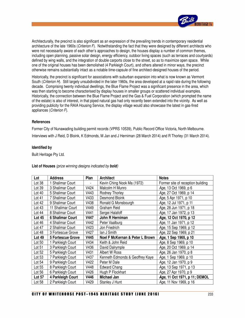
C I T Y O F W H I T E H O R S E P O S T – 1 9 4 5 H E R I T A G E S T U D Y [ J U N E 2 0 1 6 ] 233
Architecturally, the precinct is also significant as an expression of the prevailing trends in contemporary residential architecture of the late 1960s (Criterion F). Notwithstanding the fact that they were designed by different architects who were not necessarily aware of each other’s approaches to design, the houses display a number of common themes, including open planning, passive solar design, energy efficiency, outdoor living spaces (such as terraces and courtyards) defined by wing walls, and the integration of double carports close to the street, so as to maximize open space. While one of the original houses has been demolished (4 Parkleigh Court), and others altered in minor ways, the precinct otherwise remains substantially intact as a notable time-capsule of fine architect-designed houses of the period.
Historically, the precinct is significant for associations with suburban expansion into what is now known as Vermont South (Criterion H). Still largely unsubdivided in the later 1960s, the area developed at a rapid rate during the following decade. Comprising twenty individual dwellings, the Blue Flame Project was a significant presence in the area, which was then starting to become characterised by display houses in smaller groups or scattered individual examples. Historically, the connection between the Blue Flame Project and the Gas & Fuel Corporation (which prompted the name of the estate) is also of interest, in that piped natural gas had only recently been extended into the vicinity. As well as providing publicity for the RAIA Housing Service, the display village would also showcase the latest in gas-fired appliances (Criterion F).
References
Former City of Nunawading building permit records (VPRS 10539), Public Record Office Victoria, North Melbourne.
Interviews with J Reid, D Bloink, K Edmonds, M Jan and J Herniman (28 March 2014) and R Thorley (31 March 2014).
Identified by
Built Heritage Pty Ltd.
List of Houses (prize winning designs indicated by bold)
Lot Address Plan Architect Notes Lot 38 1 Shalimar Court - Kevin Ching Nook Ma (1972) Former site of reception building Lot 39 3 Shalimar Court V424 Malcolm H Munro Age, 13 Oct 1969, p 6 Lot 40 5 Shalimar Court V443 Rodney Thorley Age, 27 Oct 1969, p 14 Lot 41 7 Shalimar Court V433 Desmond Bloink Age, 5 Apr 1971, p 10 Lot 42 9 Shalimar Court V438 Ronald G Monsbourgh Age, 12 Jul 1971, p 11 Lot 43 11 Shalimar Court V449 Graham Reid Age, 28 Jun 1971, p 18 Lot 44 8 Shalimar Court V441 Sergei Halafoff Age, 17 Jan 1972, p 13 Lot 45 6 Shalimar Court V447 John R Herniman Age, 12 Oct 1970, p 12 Lot 46 4 Shalimar Court V442 Peter Vaalburg Age, 11 Jan 1971, p 12 Lot 47 2 Shalimar Court V423 Jon Friedrich Age, 15 Sep 1969, p 12 Lot 48 3 Fortescue Grove V427 Ian J Smith Age, 22 Sep 1969, p 21 Lot 49 5 Fortescue Grove V445 Noel F McKernan & Peter L Brown Age, 1 Sep 1969, p 10 Lot 50 1 Parkleigh Court V434 Keith & John Reid Age, 8 Sep 1969, p 10 Lot 51 3 Parkleigh Court V436 David Dalrymple Age, 20 Oct 1969, p 14 Lot 52 5 Parkleigh Court V431 Albert W Ross Age, 26 Jan 1970, p 8 Lot 53 7 Parkleigh Court V437 Kenneth Edmonds & Geoffrey Kaye Age, 1 Sep 1969, p 10 Lot 54 9 Parkleigh Court V422 Peter M Dale Age, 12 Jan 1970, p 9 Lot 55 8 Parkleigh Court V448 Edward Chang Age, 13 Sep 1971, p 13 Lot 56 6 Parkleigh Court V426 Hugh P Flockhart Age, 27 Apr 1970, p 9 Lot 57 4 Parkleigh Court V446 Michael Jan Age, 11 Oct 1971, p 11; DEMOL Lot 58 2 Parkleigh Court V429 Stanley J Hunt Age, 11 Nov 1969, p 16

234 C I T Y O F W H I T E H O R S E P O S T – 1 9 4 5 H E R I T A G E S T U D Y [ J U N E 2 0 1 6 ]
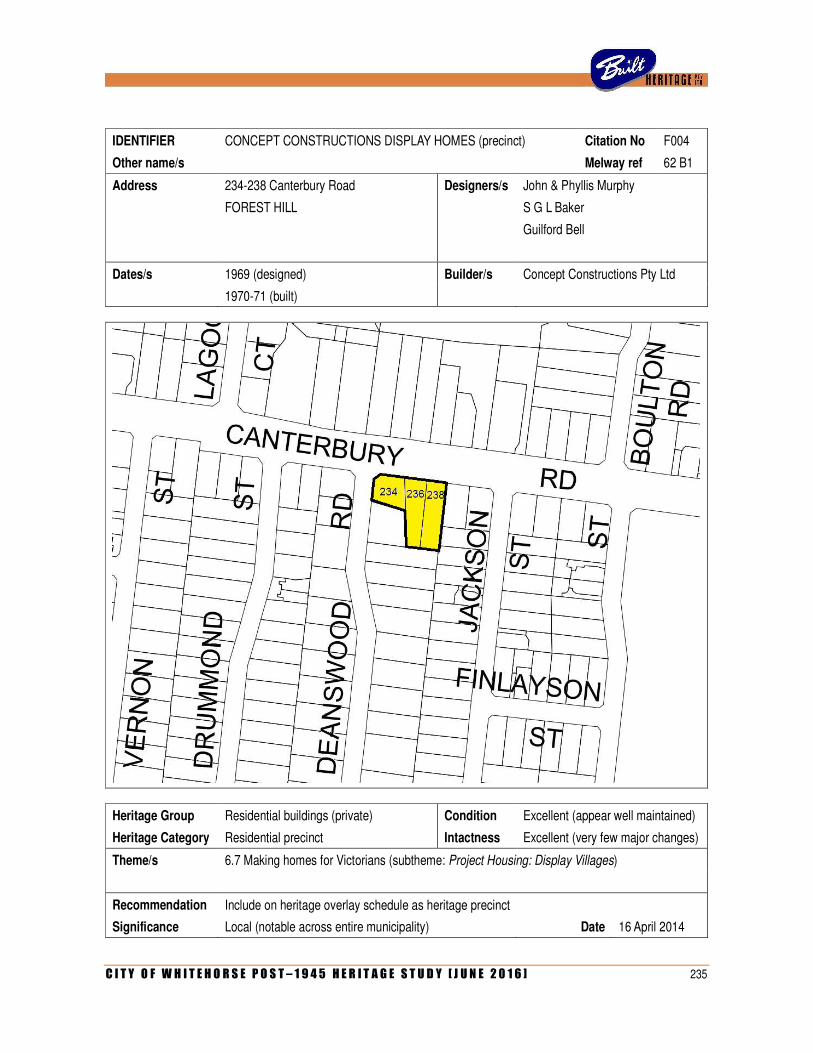
C I T Y O F W H I T E H O R S E P O S T – 1 9 4 5 H E R I T A G E S T U D Y [ J U N E 2 0 1 6 ] 235
IDENTIFIER CONCEPT CONSTRUCTIONS DISPLAY HOMES (precinct) Citation No F004
Other name/s Melway ref 62 B1
Address 234-238 Canterbury Road Designers/s John & Phyllis Murphy
FOREST HILL S G L Baker
Guilford Bell
Dates/s 1969 (designed) Builder/s Concept Constructions Pty Ltd
1970-71 (built)
Heritage Group Residential buildings (private) Condition Excellent (appear well maintained)
Heritage Category Residential precinct Intactness Excellent (very few major changes)
Theme/s 6.7 Making homes for Victorians (subtheme: Project Housing: Display Villages)
Recommendation Include on heritage overlay schedule as heritage precinct
Significance Local (notable across entire municipality) Date 16 April 2014
236 C I T Y O F W H I T E H O R S E P O S T – 1 9 4 5 H E R I T A G E S T U D Y [ J U N E 2 0 1 6 ]
History
This group of three architect-designed houses was built in 1969-70 as a display village for project housing company Concept Constructions Pty Ltd. The firm has a somewhat tangled history, with a lineage that can be traced back through several other early project housing companies in Melbourne. Originally known as CHI Finance Pty Ltd, the company was registered on 30 June 1964 as an offshoot of Consolidated Homes Industries, which, in turn, emerged from the ashes of A G Croft & Company, the parent company of Australia’s first project housing firm, Contemporary Homes Pty Ltd. Founded by Albert Croft in 1955, Contemporary Homes achieved success with its standardised Peninsula and Sou-Easter houses, both designed for the company by Robin Boyd. However, the architect’s association with the company ended on an unpleasant note when, while Boyd was absent overseas, Croft adapted his designs without permission. In 1962, Contemporary Homes was taken over by a rival firm, Consolidated Home Industries Pty Ltd, which was founded by estate agent John Harris Roberts and accountant Robert Fenwick, both from Beaumaris.
Consolidated Home Industries proved a great success and, by the mid-1960s, the firm was reportedly producing 600 dwellings, in thirty different designs, each year. Three new houses, designed by leading Melbourne architect Geoffrey Woodfall, were launched in 1966 at the company’s display centre in Glen Waverley, lauded by Australian Home Beautiful as ‘architect-designed quality project homes in the mid and upper price brackets’. After Woodfall discontinued his association the following year, the company turned to Sydney architect S G L Baker, who had previously designed a number of project houses for Lynton Homes. Born in Sydney, Stanley George Lister ‘Bill’ Baker (1920-2003) had commenced his architectural practice later in life, following a successful career as a pilot. Working as a flying instructor before the War, he enlisted with the RAAF in August 1943 and served with the No 2 Flying Squadron until he was discharged in March 1946 with the rank of Flying Officer. Although he became qualified as an architect after the War, he worked as a commercial pilot for QANTAS for thirteen years before finally commencing architectural practice in 1966. Engaged by Consolidated Home Industries in Melbourne, Baker designed at least a dozen different houses for the firm. Three of these were erected at the Homemaker Display Centre on Warrigal Road, Cheltenham (since demolished), and at least one other formed part of a smaller display estate off Oleander Court, Glen Waverley. One of Baker’s designs, the Casa Seville, was exhibited at the Ideal Home Show at the Royal Exhibition Building and awarded the distinction of ‘Ideal Home for 1968’. He also went on to design a new house at Beaumaris for company director John Roberts.
While Consolidated Home Industries was active and prominent in the second half of the 1960s, the offshoot firm of CHI Finance Pty Ltd appears to have remained largely if not entirely inactive until early 1969, when its name was changed to Concept Constructions Pty Ltd. The company intended to challenge the prevailing project housing industry by providing ‘a unique service to the home buyer who wants a top quality architect-designed home’. What made the service unique was that Concept Construction intended its display houses to indicate possibilities, rather than to showcase a standard design for mass replication. Within the broad parameters of a particular architectural style, each design could be customised to suit a client’s specific needs. As was summarised in a later article, ‘Concept’s philosophy is directed at building off-standard houses from orders on display homes, in the belief that every client’s requirements are peculiar to him and his family’. In this way, homebuilders could obtain ‘what is practically a one-off architect designed house, without many of the costs normally associated with those houses’.
As later explained in an advertisement, ‘the company briefed leading architects to design three houses which would allow buyers freedom to adapt them to their own requirements’. Bill Baker, who had already done much work for CHI, designed one of the houses, and the other two were designed by Melbourne-based practitioners Guilford Bell and the husband-and-wife partnership of John & Phyllis Murphy. Unlike Baker, neither of the two Melbourne offices had any prior experience with project housing, although both could claim considerable expertise in the design of private dwellings. Bell (1912-1992) had worked in London in the 1930s and then served as architect for Ansett Travel Industries in the 1940s before starting his own practice in Melbourne. An idiosyncratic and aloof character, he developed an elegant minimalist style geared for privacy; his houses (often designed for wealthy clients as beach houses or country retreats) were characterised by stark expression with planar walls and full-height windows, with open plans around courtyards and loggias. John (1920-2004) and Phyllis Murphy (1924-) had acquired early fame as co-designers (with Peter McIntyre and Kevin Borland) of the prize-winning scheme for Melbourne’s Olympic Swimming Stadium (1952-56). The couple maintained a successful private practice, concentrating on private houses in the regional modernist mode, before becoming architects to the newly-formed Victorian branch of the National Trust of Australia in 1958.
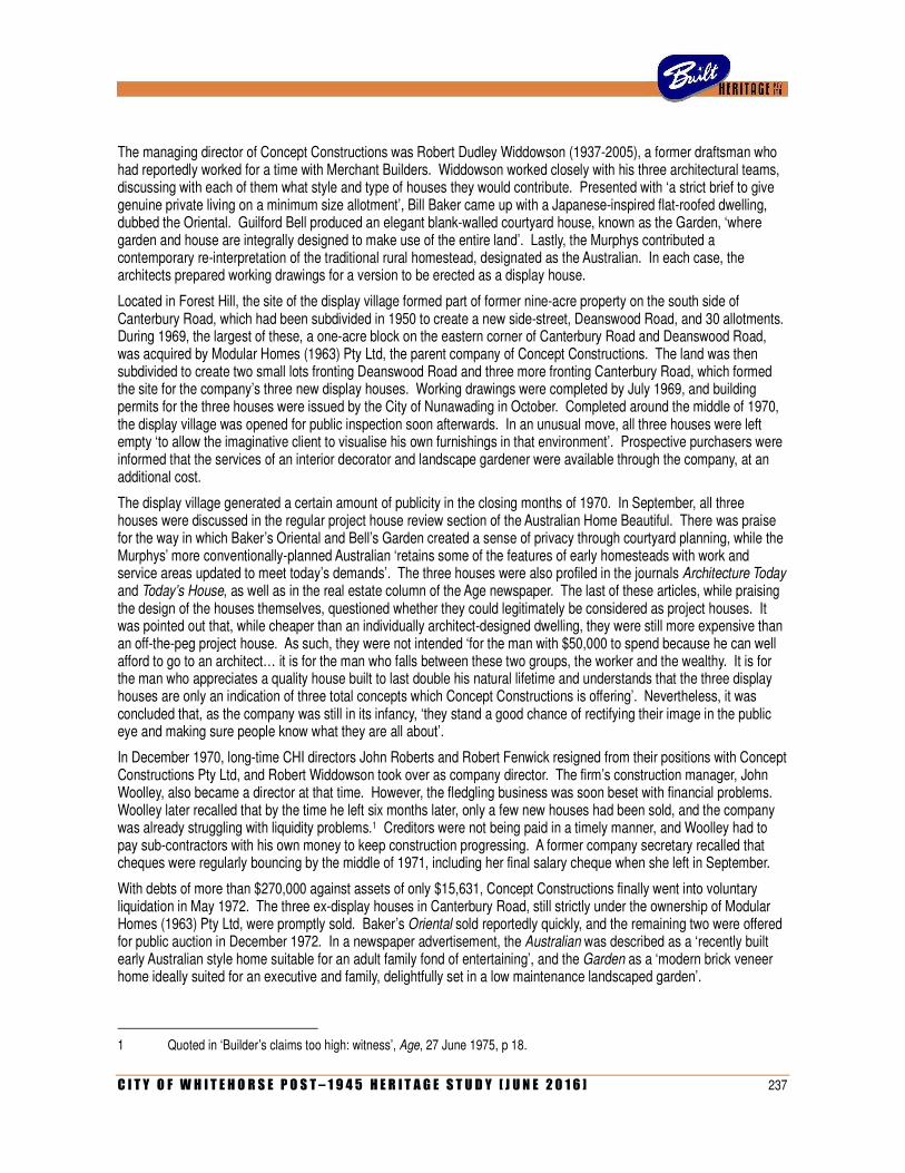
C I T Y O F W H I T E H O R S E P O S T – 1 9 4 5 H E R I T A G E S T U D Y [ J U N E 2 0 1 6 ] 237
The managing director of Concept Constructions was Robert Dudley Widdowson (1937-2005), a former draftsman who had reportedly worked for a time with Merchant Builders. Widdowson worked closely with his three architectural teams, discussing with each of them what style and type of houses they would contribute. Presented with ‘a strict brief to give genuine private living on a minimum size allotment’, Bill Baker came up with a Japanese-inspired flat-roofed dwelling, dubbed the Oriental. Guilford Bell produced an elegant blank-walled courtyard house, known as the Garden, ‘where garden and house are integrally designed to make use of the entire land’. Lastly, the Murphys contributed a contemporary re-interpretation of the traditional rural homestead, designated as the Australian. In each case, the architects prepared working drawings for a version to be erected as a display house.
Located in Forest Hill, the site of the display village formed part of former nine-acre property on the south side of Canterbury Road, which had been subdivided in 1950 to create a new side-street, Deanswood Road, and 30 allotments. During 1969, the largest of these, a one-acre block on the eastern corner of Canterbury Road and Deanswood Road, was acquired by Modular Homes (1963) Pty Ltd, the parent company of Concept Constructions. The land was then subdivided to create two small lots fronting Deanswood Road and three more fronting Canterbury Road, which formed the site for the company’s three new display houses. Working drawings were completed by July 1969, and building permits for the three houses were issued by the City of Nunawading in October. Completed around the middle of 1970, the display village was opened for public inspection soon afterwards. In an unusual move, all three houses were left empty ‘to allow the imaginative client to visualise his own furnishings in that environment’. Prospective purchasers were informed that the services of an interior decorator and landscape gardener were available through the company, at an additional cost.
The display village generated a certain amount of publicity in the closing months of 1970. In September, all three houses were discussed in the regular project house review section of the Australian Home Beautiful. There was praise for the way in which Baker’s Oriental and Bell’s Garden created a sense of privacy through courtyard planning, while the Murphys’ more conventionally-planned Australian ‘retains some of the features of early homesteads with work and service areas updated to meet today’s demands’. The three houses were also profiled in the journals Architecture Today and Today’s House, as well as in the real estate column of the Age newspaper. The last of these articles, while praising the design of the houses themselves, questioned whether they could legitimately be considered as project houses. It was pointed out that, while cheaper than an individually architect-designed dwelling, they were still more expensive than an off-the-peg project house. As such, they were not intended ‘for the man with $50,000 to spend because he can well afford to go to an architect… it is for the man who falls between these two groups, the worker and the wealthy. It is for the man who appreciates a quality house built to last double his natural lifetime and understands that the three display houses are only an indication of three total concepts which Concept Constructions is offering’. Nevertheless, it was concluded that, as the company was still in its infancy, ‘they stand a good chance of rectifying their image in the public eye and making sure people know what they are all about’.
In December 1970, long-time CHI directors John Roberts and Robert Fenwick resigned from their positions with Concept Constructions Pty Ltd, and Robert Widdowson took over as company director. The firm’s construction manager, John Woolley, also became a director at that time. However, the fledgling business was soon beset with financial problems. Woolley later recalled that by the time he left six months later, only a few new houses had been sold, and the company was already struggling with liquidity problems.1 Creditors were not being paid in a timely manner, and Woolley had to pay sub-contractors with his own money to keep construction progressing. A former company secretary recalled that cheques were regularly bouncing by the middle of 1971, including her final salary cheque when she left in September.
With debts of more than $270,000 against assets of only $15,631, Concept Constructions finally went into voluntary liquidation in May 1972. The three ex-display houses in Canterbury Road, still strictly under the ownership of Modular Homes (1963) Pty Ltd, were promptly sold. Baker’s Oriental sold reportedly quickly, and the remaining two were offered for public auction in December 1972. In a newspaper advertisement, the Australian was described as a ‘recently built early Australian style home suitable for an adult family fond of entertaining’, and the Garden as a ‘modern brick veneer home ideally suited for an executive and family, delightfully set in a low maintenance landscaped garden’.
1 Quoted in ‘Builder’s claims too high: witness’, Age, 27 June 1975, p 18.
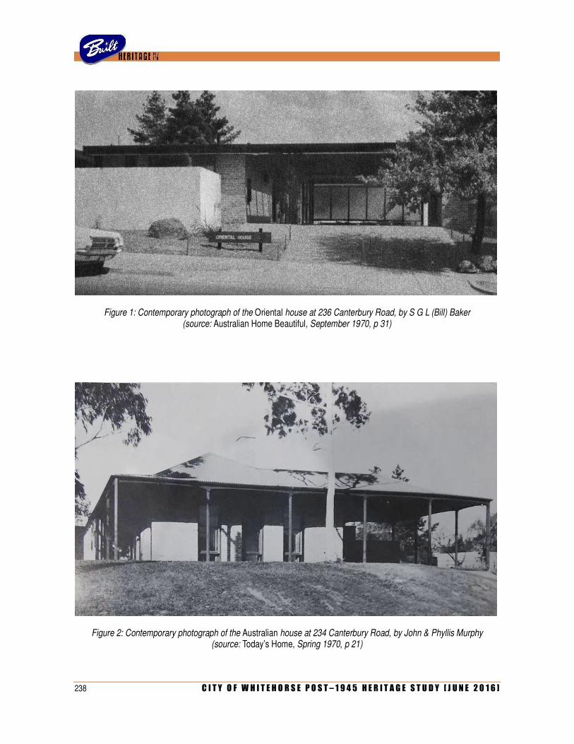
238 C I T Y O F W H I T E H O R S E P O S T – 1 9 4 5 H E R I T A G E S T U D Y [ J U N E 2 0 1 6 ]
Figure 1: Contemporary photograph of the Oriental house at 236 Canterbury Road, by S G L (Bill) Baker (source: Australian Home Beautiful, September 1970, p 31)
Figure 2: Contemporary photograph of the Australian house at 234 Canterbury Road, by John & Phyllis Murphy (source: Today’s Home, Spring 1970, p 21)
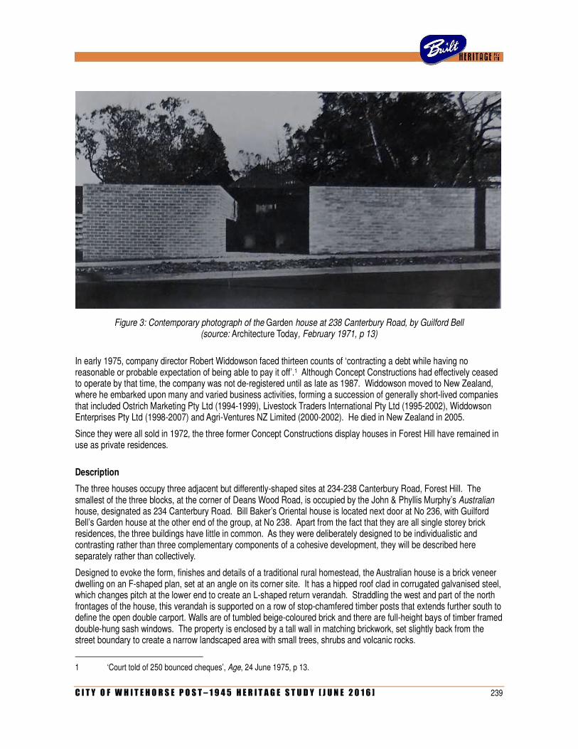
C I T Y O F W H I T E H O R S E P O S T – 1 9 4 5 H E R I T A G E S T U D Y [ J U N E 2 0 1 6 ] 239
Figure 3: Contemporary photograph of the Garden house at 238 Canterbury Road, by Guilford Bell (source: Architecture Today, February 1971, p 13)
In early 1975, company director Robert Widdowson faced thirteen counts of ‘contracting a debt while having no reasonable or probable expectation of being able to pay it off’.1 Although Concept Constructions had effectively ceased to operate by that time, the company was not de-registered until as late as 1987. Widdowson moved to New Zealand, where he embarked upon many and varied business activities, forming a succession of generally short-lived companies that included Ostrich Marketing Pty Ltd (1994-1999), Livestock Traders International Pty Ltd (1995-2002), Widdowson Enterprises Pty Ltd (1998-2007) and Agri-Ventures NZ Limited (2000-2002). He died in New Zealand in 2005.
Since they were all sold in 1972, the three former Concept Constructions display houses in Forest Hill have remained in use as private residences.
Description
The three houses occupy three adjacent but differently-shaped sites at 234-238 Canterbury Road, Forest Hill. The smallest of the three blocks, at the corner of Deans Wood Road, is occupied by the John & Phyllis Murphy’s Australian house, designated as 234 Canterbury Road. Bill Baker’s Oriental house is located next door at No 236, with Guilford Bell’s Garden house at the other end of the group, at No 238. Apart from the fact that they are all single storey brick residences, the three buildings have little in common. As they were deliberately designed to be individualistic and contrasting rather than three complementary components of a cohesive development, they will be described here separately rather than collectively.
Designed to evoke the form, finishes and details of a traditional rural homestead, the Australian house is a brick veneer dwelling on an F-shaped plan, set at an angle on its corner site. It has a hipped roof clad in corrugated galvanised steel, which changes pitch at the lower end to create an L-shaped return verandah. Straddling the west and part of the north frontages of the house, this verandah is supported on a row of stop-chamfered timber posts that extends further south to define the open double carport. Walls are of tumbled beige-coloured brick and there are full-height bays of timber framed double-hung sash windows. The property is enclosed by a tall wall in matching brickwork, set slightly back from the street boundary to create a narrow landscaped area with small trees, shrubs and volcanic rocks.
1 ‘Court told of 250 bounced cheques’, Age, 24 June 1975, p 13.
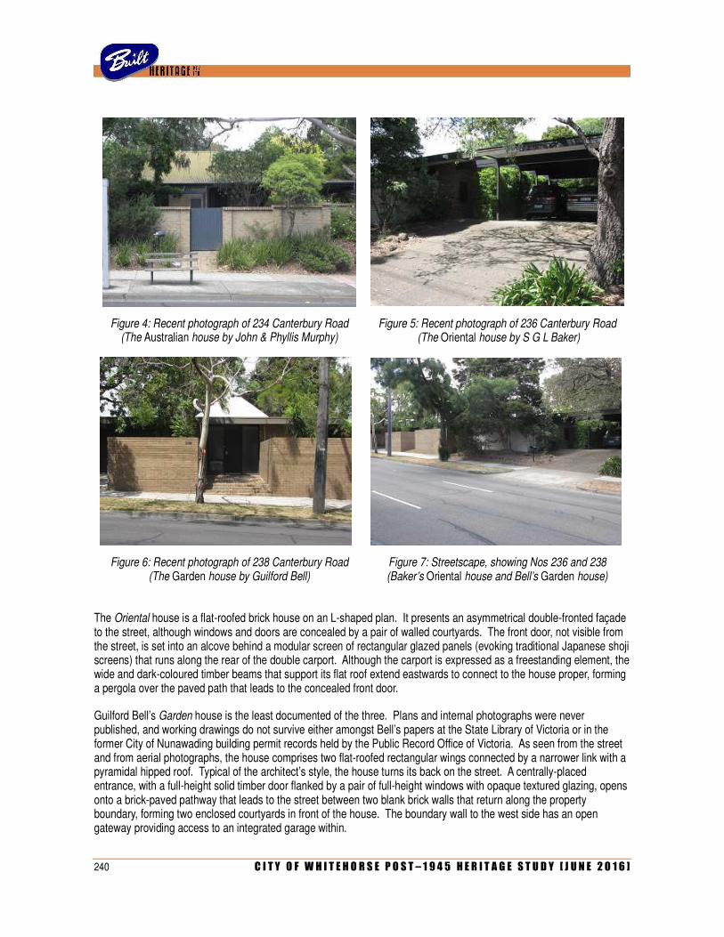
240 C I T Y O F W H I T E H O R S E P O S T – 1 9 4 5 H E R I T A G E S T U D Y [ J U N E 2 0 1 6 ]
Figure 4: Recent photograph of 234 Canterbury Road (The Australian house by John & Phyllis Murphy)
Figure 5: Recent photograph of 236 Canterbury Road (The Oriental house by S G L Baker)
Figure 6: Recent photograph of 238 Canterbury Road (The Garden house by Guilford Bell)
Figure 7: Streetscape, showing Nos 236 and 238 (Baker’s Oriental house and Bell’s Garden house)
The Oriental house is a flat-roofed brick house on an L-shaped plan. It presents an asymmetrical double-fronted façade to the street, although windows and doors are concealed by a pair of walled courtyards. The front door, not visible from the street, is set into an alcove behind a modular screen of rectangular glazed panels (evoking traditional Japanese shoji screens) that runs along the rear of the double carport. Although the carport is expressed as a freestanding element, the wide and dark-coloured timber beams that support its flat roof extend eastwards to connect to the house proper, forming a pergola over the paved path that leads to the concealed front door.
Guilford Bell’s Garden house is the least documented of the three. Plans and internal photographs were never published, and working drawings do not survive either amongst Bell’s papers at the State Library of Victoria or in the former City of Nunawading building permit records held by the Public Record Office of Victoria. As seen from the street and from aerial photographs, the house comprises two flat-roofed rectangular wings connected by a narrower link with a pyramidal hipped roof. Typical of the architect’s style, the house turns its back on the street. A centrally-placed entrance, with a full-height solid timber door flanked by a pair of full-height windows with opaque textured glazing, opens onto a brick-paved pathway that leads to the street between two blank brick walls that return along the property boundary, forming two enclosed courtyards in front of the house. The boundary wall to the west side has an open gateway providing access to an integrated garage within.
C I T Y O F W H I T E H O R S E P O S T – 1 9 4 5 H E R I T A G E S T U D Y [ J U N E 2 0 1 6 ] 241
All three houses appear to have been subject to few external changes since they were completed in 1970. With the exception of the inevitable changes to their landscape settings, they largely appear the same as they did in the photographs taken at that time, reproduced in the various journals. Some of the landscaping elements evident in these early photographs, such as the eucalypt trees in front of the Australian house and the large rocks scattered in front of the Oriental house, remain in place today.
Comparative Analysis
Comparators for the three houses can be cited on three levels: other examples of houses by Concept Constructions, other project housing from the same period by other companies, and other examples of the work of the three architectural practices represented. As the display village for Concept Constructions, the group of three houses is unique in the study area. As the company underwent financial problems and went into liquidation in 1972, very few houses were ever built following the successful unveiling of the display village. It was reported that seven houses had been built, or were at least under construction, at the time the company folded. These, however, have not been conclusively identified. To date, the only other example of the company’s work to be located is another group of three houses in Syndal, which was erected during 1970. This appears to have been a speculative project rather than a display village per se, as the houses were auctioned in August of that year. They still stand at the corner of Blackburn Road and Glenarm Place. The group similarly comprises an Australian (10 Glenarm Place), an Oriental (12 Glenarm Place), and a Garden (123 Blackburn Road). Another example of an Oriental exists, in a somewhat altered state, at 3 Glenarm Place.
Considered in a broader sense as collection of architect-designed display houses from the late 1960s, the Concept Constructions buildings can be compared locally to the Blue Flame Project in Vermont South, which was notable for its scale (comprising 20 dwellings) and for the participation of a number of leading architects. Other local display villages, however, tended to be much smaller and less cohesive (often, merely a few houses scattered here and there in a new estate) and were rarely designed by architects who were household names. The Concept Constructions site also marked the continuation of a significant theme of display houses along this part of Canterbury Road. This dates back to 1956, when Olympia Home Constructions unveiled their prototypical Olympia house at No 317 (by Seabrook, Hunt & Dale; demolished), which was followed in 1958 by the Fler House at No 150 (by Robin Boyd). Later examples, contemporaneous with the Concept Constructions dwellings, include one at No 67 by the Realty Development Corporation (1969) and the Model 51 by Lewis Coote Constructions at No 337 (1970). Both of these, however, were far more conventional in design that their striking counterparts at Nos 234-38.
Based in Sydney (where he lived in a Japanese-inspired house of his own design at St Ives), S G L Baker was responsible for relatively few houses in Melbourne. Three of his designs for Consolidated Home Industries were erected at the Homemaker Display Centre on Warrigal Road, Cheltenham (since demolished), and at least one other formed part of a smaller display estate off Oleander Court, Glen Waverley. Baker’s work in Melbourne is also represented by the Japanese-influenced house at 1 Hutchinson Street, Beaumaris, which he designed in 1970 for J H Roberts, managing director of CHI. Guilford Bell was not an especially prolific architect. With so many of his clients being drawn from Melbourne’s wealthy social elite, his houses tend to be located in the blue-chip suburbs of South Yarra and Toorak, or in places where these same clients required country retreats or beach dwellings, such as the Mornington Peninsula or in regional Victoria. Bell’s Concept house in Forest Hill is not only the only recorded example of his work in the City of Whitehorse but one of very few known to exist anywhere in the entire northern, north-eastern and eastern part of the metropolitan area. By contrast, John & Phyllis Murphy are known to have undertaken a number of commissions in what is now the City of Whitehorse, including institutional buildings for the Seventh Day Adventist site in Central Avenue, Blackburn, as well as several private residences. These houses, dating from the 1950s, include the Cook House at 64 Kenmare Street, Mont Albert (1952), the Stevens House at 57 Orchard Crescent in Mont Albert North (1954), the Morley House at 20 Naughton Grove, Blackburn (1954) and the Dunbar House at 43 Boondara Road, Mont Albert North (1956). All of these houses are typical of the couple’s slick modernist style of the period, characterised by volumetric massing, flat or low-pitched roofs, vertical timber board cladding and strip windows. The Australian house, however, is a complete and notable departure. Representing the couple’s first foray into new domestic architecture in over a decade (since they became architects to the National Trust in 1958), it demonstrates the pervasive influence of the historic buildings that they had recently restored, such as the Emu Bottom homestead in Sunbury.
242 C I T Y O F W H I T E H O R S E P O S T – 1 9 4 5 H E R I T A G E S T U D Y [ J U N E 2 0 1 6 ]
Statement of Significance
What is significant?
The group of three houses at 234-238 Canterbury Road, Forest Hill, was erected in 1969-70 as a small display village for a new project housing company, Concept Constructions, which was an off-shoot of the highly successful group Consolidated Home Industries. Intending to provide for the higher end of the project housing market, the company offered customised houses based on themed concepts by three leading architectural practices: the Colonial-style Australian house by John & Phyllis Murphy (234 Canterbury Road), the Japanese-influence Oriental house by S G L Baker (236 Canterbury Road) and the modern Garden house by Guilford Bell (238 Canterbury Road). The houses are enhanced by their landscaped settings, which contributes to their significance.
How is it significant?
The houses are of historical and architectural significance to the City of Whitehorse.
Why is it significant?
Historically, the houses are significant as evidence of a brave (if ultimately unsuccessful) attempt to radically transform the project housing market during its peak period of popularity (Criterion A). Rather than simply selling standardised designs for mass replication, Concept Constructions offered three themed architect-designed concepts that formed the basis of customised solutions, geared towards the specific needs of individual clients. This approach was a direct response to the project housing boom of the late 1960s, when the market was flooded with so many companies competing against each other, and bold innovations, such as more luxurious designs, began to emerge in an effort to challenge public preconceptions of project housing.
Architecturally, the houses are significant for associations with three leading architectural practices of the day, which was unusual in project housing at the time (Criterion H). A prominent Sydney-based architect, S G L Baker undertook much work for project housing companies in NSW, Victoria and Queensland. His Oriental house is typical of his output, characterised by a strong Japanese influence that, fashionable in the later 1960s, was informed by his travels to Asia and Hawaii as a commercial airline pilot. For Guilford Bell and the office of John & Phyllis Murphy, these houses represented their only ever forays into project housing (Criterion B). Bell’s Garden house, which is the only example of his work in the City of Whitehorse, is typical of his minimalist modernist style that characterised the fine inner suburban residences, country retreats and beach houses for wealthy society clients, for which he is best known. While the Murphys are represented in the municipality by some earlier houses from the 1950s, their Australia house was a notable return to domestic architecture after more than a decade as architects to the National Trust, which in itself influenced its notable homestead-like form and detailing (Criterion E).
While individually notable as examples of their respective designers’ work, the houses are collectively significant as a notable cross-section of three very different trends in contemporary residential architecture of the late 1960s, united by the fact that they were designed for the same project housing company as prototypes of three distinct architectural themes that would characterise the firm’s output (Criterion F).
References
‘Now style is for sale’, Age, 22 August 1970, p 27.
‘Doing your own thing’, Australian Home Beautiful, September 1970, pp 31.
‘Abandonment of conformity’, Today’s House, Spring 1970, pp 21-24.
‘Abandonment of conformity’, Architecture Today, February 1971, pp 12.
‘Opportunity to buy display houses’, Camberwell Progress Press, 6 December 1972, p 36
Interview with Phyllis Murphy, 22 November 2013.
Identified by
Heritage Alliance (additional research and assessment by Built Heritage Pty Ltd)
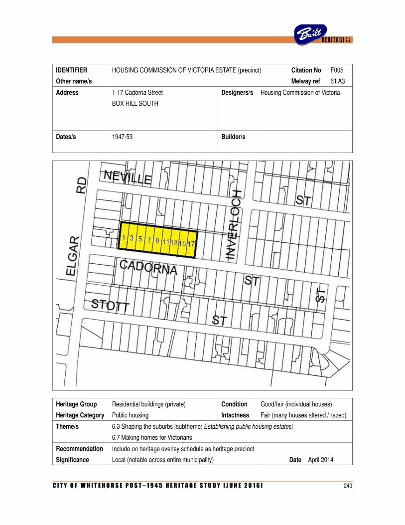
C I T Y O F W H I T E H O R S E P O S T – 1 9 4 5 H E R I T A G E S T U D Y [ J U N E 2 0 1 6 ] 243
IDENTIFIER HOUSING COMMISSION OF VICTORIA ESTATE (precinct) Citation No F005
Other name/s Melway ref 61 A3
Address 1-17 Cadorna Street Designers/s Housing Commission of Victoria
BOX HILL SOUTH
Dates/s 1947-53 Builder/s
Heritage Group Residential buildings (private) Condition Good/fair (individual houses)
Heritage Category Public housing Intactness Fair (many houses altered / razed)
Theme/s 6.3 Shaping the suburbs [subtheme: Establishing public housing estates]
6.7 Making homes for Victorians
Recommendation Include on heritage overlay schedule as heritage precinct
Significance Local (notable across entire municipality) Date April 2014
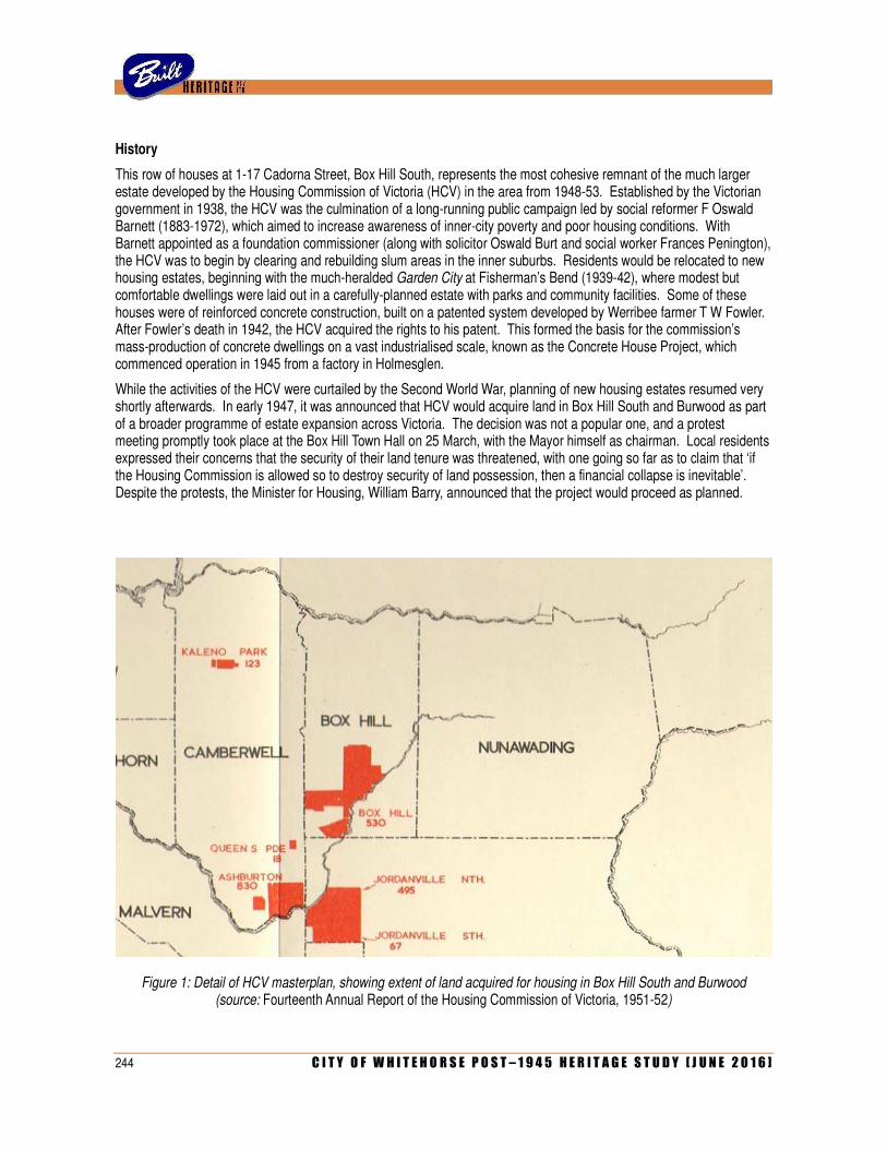
244 C I T Y O F W H I T E H O R S E P O S T – 1 9 4 5 H E R I T A G E S T U D Y [ J U N E 2 0 1 6 ]
History
This row of houses at 1-17 Cadorna Street, Box Hill South, represents the most cohesive remnant of the much larger estate developed by the Housing Commission of Victoria (HCV) in the area from 1948-53. Established by the Victorian government in 1938, the HCV was the culmination of a long-running public campaign led by social reformer F Oswald Barnett (1883-1972), which aimed to increase awareness of inner-city poverty and poor housing conditions. With Barnett appointed as a foundation commissioner (along with solicitor Oswald Burt and social worker Frances Penington), the HCV was to begin by clearing and rebuilding slum areas in the inner suburbs. Residents would be relocated to new housing estates, beginning with the much-heralded Garden City at Fisherman’s Bend (1939-42), where modest but comfortable dwellings were laid out in a carefully-planned estate with parks and community facilities. Some of these houses were of reinforced concrete construction, built on a patented system developed by Werribee farmer T W Fowler. After Fowler’s death in 1942, the HCV acquired the rights to his patent. This formed the basis for the commission’s mass-production of concrete dwellings on a vast industrialised scale, known as the Concrete House Project, which commenced operation in 1945 from a factory in Holmesglen.
While the activities of the HCV were curtailed by the Second World War, planning of new housing estates resumed very shortly afterwards. In early 1947, it was announced that HCV would acquire land in Box Hill South and Burwood as part of a broader programme of estate expansion across Victoria. The decision was not a popular one, and a protest meeting promptly took place at the Box Hill Town Hall on 25 March, with the Mayor himself as chairman. Local residents expressed their concerns that the security of their land tenure was threatened, with one going so far as to claim that ‘if the Housing Commission is allowed so to destroy security of land possession, then a financial collapse is inevitable’. Despite the protests, the Minister for Housing, William Barry, announced that the project would proceed as planned.
Figure 1: Detail of HCV masterplan, showing extent of land acquired for housing in Box Hill South and Burwood (source: Fourteenth Annual Report of the Housing Commission of Victoria, 1951-52)
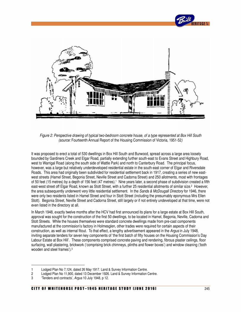
C I T Y O F W H I T E H O R S E P O S T – 1 9 4 5 H E R I T A G E S T U D Y [ J U N E 2 0 1 6 ] 245
Figure 2: Perspective drawing of typical two-bedroom concrete house, of a type represented at Box Hill South (source: Fourteenth Annual Report of the Housing Commission of Victoria, 1951-52)
It was proposed to erect a total of 530 dwellings in Box Hill South and Burwood, spread across a large area loosely bounded by Gardiners Creek and Elgar Road, partially extending further south-east to Evans Street and Highbury Road, west to Warrigal Road (along the south side of Wattle Park) and north to Canterbury Road. The principal focus, however, was a large but relatively underdeveloped residential estate in the south-east corner of Elgar and Riversdale Roads. This area had originally been subdivided for residential settlement back in 1917, creating a series of new east-west streets (Hamel Street, Begonia Street, Neville Street and Cadorna Street) and 250 allotments, most with frontages of 50 feet (15 metres) by a depth of 156 feet (47 metres).1 Nine years later, a second phase of subdivision created a fifth east-west street off Elgar Road, known as Stott Street, with a further 25 residential allotments of similar size.2 However, the area subsequently underwent very little residential settlement. In the Sands & McDougall Directory for 1946, there were only two residents listed in Hamel Street and four in Stott Street (including the presumably eponymous Mrs Ellen Stott). Begonia Street, Neville Street and Cadorna Street, still largely or if not entirely undeveloped at that time, were not even listed in the directory at all.
In March 1948, exactly twelve months after the HCV had first announced its plans for a large estate at Box Hill South, approval was sought for the construction of the first 50 dwellings, to be located in Hamel, Begonia, Neville, Cadorna and Stott Streets. While the houses themselves were standard concrete dwellings made from pre-cast components manufactured at the commission’s factory in Holmesglen, other trades were required for certain aspects of their construction, as well as internal fitout. To that effect, a lengthy advertisement appeared in the Argus in July 1948, inviting separate tenders for seven key components of ‘the first batch of fifty houses on the Housing Commission’s Day Labour Estate at Box Hill’. These components comprised concrete paving and rendering, fibrous plaster ceilings, floor surfacing, wall plastering, brickwork (‘comprising brick chimneys, plinths and flower boxes’) and window cleaning (‘both wooden and steel frames’).3
1 Lodged Plan No 7,124, dated 26 May 1917. Land & Survey Information Centre. 2 Lodged Plan No 11,900, dated 13 December 1926. Land & Survey Information Centre. 3 ‘Tenders and contracts’, Argus 10 July 1948, p 12.
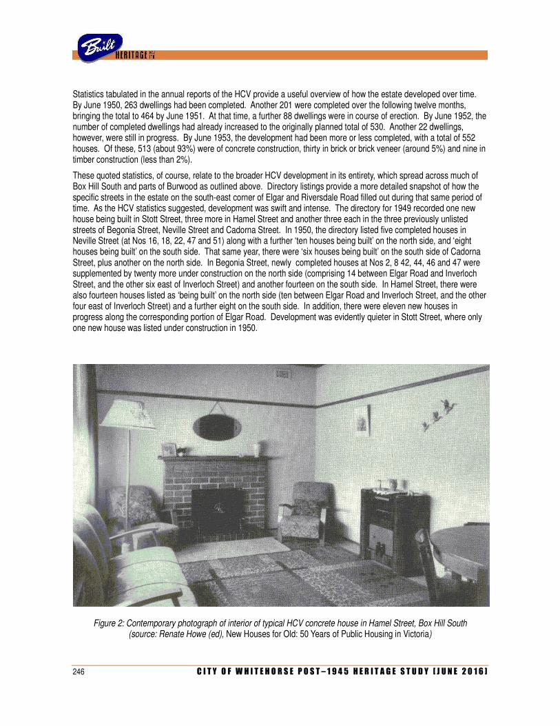
246 C I T Y O F W H I T E H O R S E P O S T – 1 9 4 5 H E R I T A G E S T U D Y [ J U N E 2 0 1 6 ]
Statistics tabulated in the annual reports of the HCV provide a useful overview of how the estate developed over time. By June 1950, 263 dwellings had been completed. Another 201 were completed over the following twelve months, bringing the total to 464 by June 1951. At that time, a further 88 dwellings were in course of erection. By June 1952, the number of completed dwellings had already increased to the originally planned total of 530. Another 22 dwellings, however, were still in progress. By June 1953, the development had been more or less completed, with a total of 552 houses. Of these, 513 (about 93%) were of concrete construction, thirty in brick or brick veneer (around 5%) and nine in timber construction (less than 2%).
These quoted statistics, of course, relate to the broader HCV development in its entirety, which spread across much of Box Hill South and parts of Burwood as outlined above. Directory listings provide a more detailed snapshot of how the specific streets in the estate on the south-east corner of Elgar and Riversdale Road filled out during that same period of time. As the HCV statistics suggested, development was swift and intense. The directory for 1949 recorded one new house being built in Stott Street, three more in Hamel Street and another three each in the three previously unlisted streets of Begonia Street, Neville Street and Cadorna Street. In 1950, the directory listed five completed houses in Neville Street (at Nos 16, 18, 22, 47 and 51) along with a further ‘ten houses being built’ on the north side, and ‘eight houses being built’ on the south side. That same year, there were ‘six houses being built’ on the south side of Cadorna Street, plus another on the north side. In Begonia Street, newly completed houses at Nos 2, 8 42, 44, 46 and 47 were supplemented by twenty more under construction on the north side (comprising 14 between Elgar Road and Inverloch Street, and the other six east of Inverloch Street) and another fourteen on the south side. In Hamel Street, there were also fourteen houses listed as ‘being built’ on the north side (ten between Elgar Road and Inverloch Street, and the other four east of Inverloch Street) and a further eight on the south side. In addition, there were eleven new houses in progress along the corresponding portion of Elgar Road. Development was evidently quieter in Stott Street, where only one new house was listed under construction in 1950.
Figure 2: Contemporary photograph of interior of typical HCV concrete house in Hamel Street, Box Hill South (source: Renate Howe (ed), New Houses for Old: 50 Years of Public Housing in Victoria)
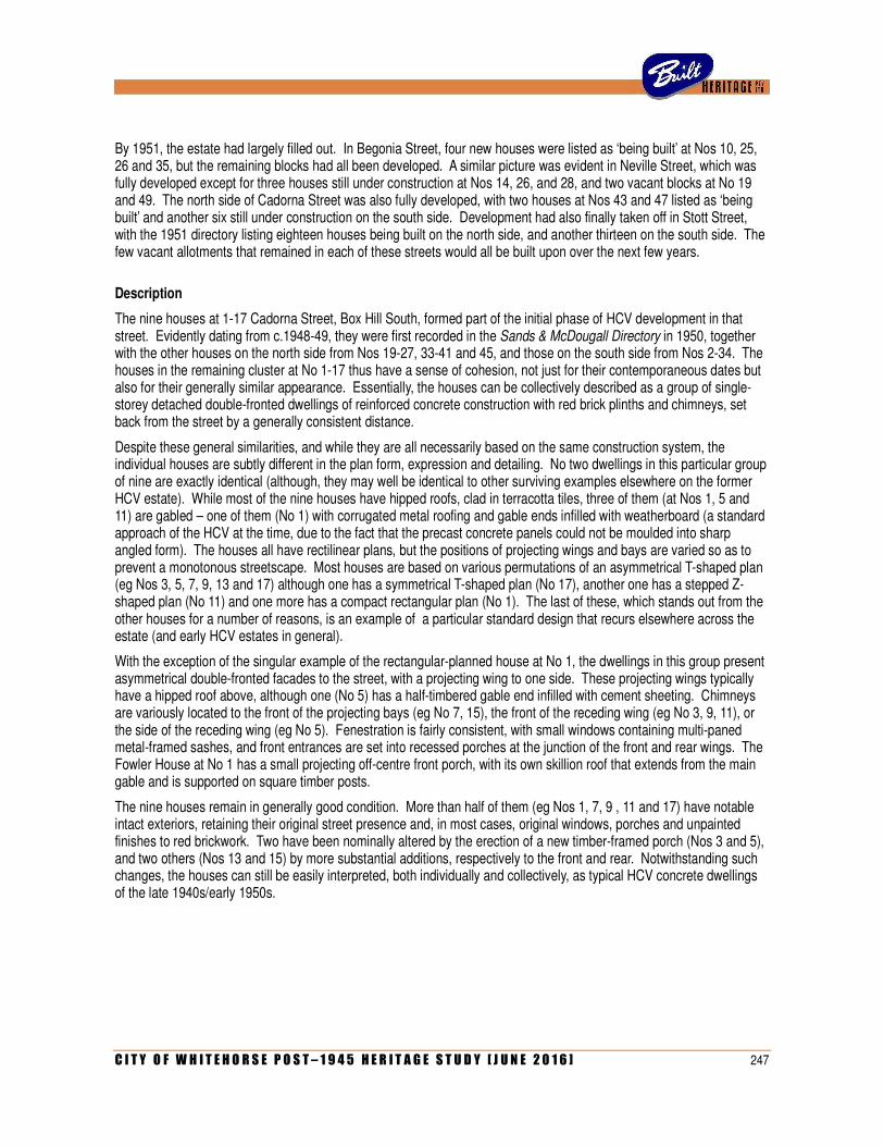
C I T Y O F W H I T E H O R S E P O S T – 1 9 4 5 H E R I T A G E S T U D Y [ J U N E 2 0 1 6 ] 247
By 1951, the estate had largely filled out. In Begonia Street, four new houses were listed as ‘being built’ at Nos 10, 25, 26 and 35, but the remaining blocks had all been developed. A similar picture was evident in Neville Street, which was fully developed except for three houses still under construction at Nos 14, 26, and 28, and two vacant blocks at No 19 and 49. The north side of Cadorna Street was also fully developed, with two houses at Nos 43 and 47 listed as ‘being built’ and another six still under construction on the south side. Development had also finally taken off in Stott Street, with the 1951 directory listing eighteen houses being built on the north side, and another thirteen on the south side. The few vacant allotments that remained in each of these streets would all be built upon over the next few years.
Description
The nine houses at 1-17 Cadorna Street, Box Hill South, formed part of the initial phase of HCV development in that street. Evidently dating from c.1948-49, they were first recorded in the Sands & McDougall Directory in 1950, together with the other houses on the north side from Nos 19-27, 33-41 and 45, and those on the south side from Nos 2-34. The houses in the remaining cluster at No 1-17 thus have a sense of cohesion, not just for their contemporaneous dates but also for their generally similar appearance. Essentially, the houses can be collectively described as a group of single-storey detached double-fronted dwellings of reinforced concrete construction with red brick plinths and chimneys, set back from the street by a generally consistent distance.
Despite these general similarities, and while they are all necessarily based on the same construction system, the individual houses are subtly different in the plan form, expression and detailing. No two dwellings in this particular group of nine are exactly identical (although, they may well be identical to other surviving examples elsewhere on the former HCV estate). While most of the nine houses have hipped roofs, clad in terracotta tiles, three of them (at Nos 1, 5 and 11) are gabled – one of them (No 1) with corrugated metal roofing and gable ends infilled with weatherboard (a standard approach of the HCV at the time, due to the fact that the precast concrete panels could not be moulded into sharp angled form). The houses all have rectilinear plans, but the positions of projecting wings and bays are varied so as to prevent a monotonous streetscape. Most houses are based on various permutations of an asymmetrical T-shaped plan (eg Nos 3, 5, 7, 9, 13 and 17) although one has a symmetrical T-shaped plan (No 17), another one has a stepped Z-shaped plan (No 11) and one more has a compact rectangular plan (No 1). The last of these, which stands out from the other houses for a number of reasons, is an example of a particular standard design that recurs elsewhere across the estate (and early HCV estates in general).
With the exception of the singular example of the rectangular-planned house at No 1, the dwellings in this group present asymmetrical double-fronted facades to the street, with a projecting wing to one side. These projecting wings typically have a hipped roof above, although one (No 5) has a half-timbered gable end infilled with cement sheeting. Chimneys are variously located to the front of the projecting bays (eg No 7, 15), the front of the receding wing (eg No 3, 9, 11), or the side of the receding wing (eg No 5). Fenestration is fairly consistent, with small windows containing multi-paned metal-framed sashes, and front entrances are set into recessed porches at the junction of the front and rear wings. The Fowler House at No 1 has a small projecting off-centre front porch, with its own skillion roof that extends from the main gable and is supported on square timber posts.
The nine houses remain in generally good condition. More than half of them (eg Nos 1, 7, 9 , 11 and 17) have notable intact exteriors, retaining their original street presence and, in most cases, original windows, porches and unpainted finishes to red brickwork. Two have been nominally altered by the erection of a new timber-framed porch (Nos 3 and 5), and two others (Nos 13 and 15) by more substantial additions, respectively to the front and rear. Notwithstanding such changes, the houses can still be easily interpreted, both individually and collectively, as typical HCV concrete dwellings of the late 1940s/early 1950s.
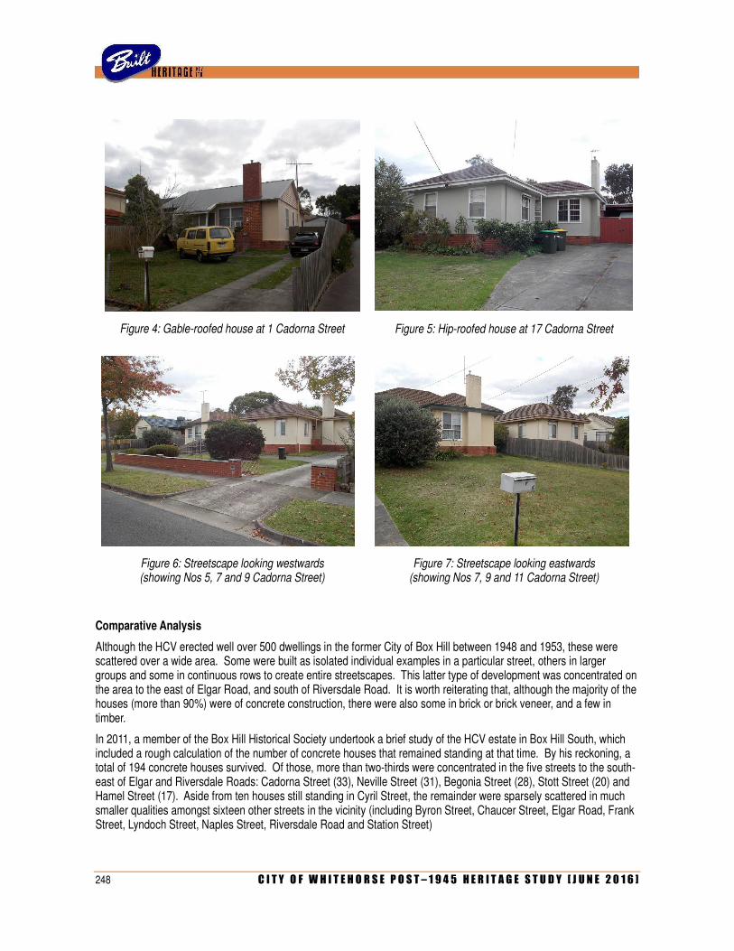
248 C I T Y O F W H I T E H O R S E P O S T – 1 9 4 5 H E R I T A G E S T U D Y [ J U N E 2 0 1 6 ]
Figure 4: Gable-roofed house at 1 Cadorna Street Figure 5: Hip-roofed house at 17 Cadorna Street
Figure 6: Streetscape looking westwards (showing Nos 5, 7 and 9 Cadorna Street)
Figure 7: Streetscape looking eastwards (showing Nos 7, 9 and 11 Cadorna Street)
Comparative Analysis
Although the HCV erected well over 500 dwellings in the former City of Box Hill between 1948 and 1953, these were scattered over a wide area. Some were built as isolated individual examples in a particular street, others in larger groups and some in continuous rows to create entire streetscapes. This latter type of development was concentrated on the area to the east of Elgar Road, and south of Riversdale Road. It is worth reiterating that, although the majority of the houses (more than 90%) were of concrete construction, there were also some in brick or brick veneer, and a few in timber.
In 2011, a member of the Box Hill Historical Society undertook a brief study of the HCV estate in Box Hill South, which included a rough calculation of the number of concrete houses that remained standing at that time. By his reckoning, a total of 194 concrete houses survived. Of those, more than two-thirds were concentrated in the five streets to the south-east of Elgar and Riversdale Roads: Cadorna Street (33), Neville Street (31), Begonia Street (28), Stott Street (20) and Hamel Street (17). Aside from ten houses still standing in Cyril Street, the remainder were sparsely scattered in much smaller qualities amongst sixteen other streets in the vicinity (including Byron Street, Chaucer Street, Elgar Road, Frank Street, Lyndoch Street, Naples Street, Riversdale Road and Station Street)
C I T Y O F W H I T E H O R S E P O S T – 1 9 4 5 H E R I T A G E S T U D Y [ J U N E 2 0 1 6 ] 249
It would appear that, following several decades of demolition and redevelopment (which seems to have intensified since the year 2000), the total number of concrete HCV dwellings in Box Hill South has decreased by more than half. Scattered individual examples can still be found throughout the area, typified by those at 79 Elgar Road, 10 Lyndoch Street, 4 Hiddleston Avenue, 5 Haughton Court, 59 Monash Street and elsewhere. While small groups of two or three houses in a row remain in Chaucer Street Linden Street, Riversdale Road (eg Nos 1187-1191) and elsewhere, the bulk of surviving fabric is still concentrated in the east-west streets to the east of Wattle Park. However, such has been the extent of redevelopment and rebuilding that cohesive streetscapes are now extremely rare. While many individual examples still remain in Begonia Street, they are increasingly interspersed with newer houses. Apart from an exceptional row of eight houses at Nos 12-26, they do not otherwise remain in groups any larger than five or six in a row (typified by Nos 1-9 and 30-40). The same is true in Neville Street (eg Nos 7-17 and 52-62), Stott Street (Nos 35-47) and much of Cadorna Street (eg Nos 30-42 and 51-61). The row of nine houses at Nos 1-17 Cadorna Street thus remains as the longest continuous streetscape of concrete HCV houses in Box Hill South.
Statement of Significance
What is significant?
The buildings at 1-17 Cadorna Street, Box Hill South, comprise a row of nine detached single-storey concrete houses erected in the late 1940s as part of a massive development undertaken by the Housing Commission of Victoria between 1948 and 1953, which spread across much of Box Hill South (and part of Burwood) and ultimately included more than 550 dwellings. Although broadly similar in their form and scale (as well as their distinctive concrete slab construction), the houses have been individualised by slight variations in roof form and facade composition.
How is it significant?
The precinct is of historical and architectural significance to the City of Whitehorse
Why is it significant?
Historically, the precinct is significant for its ability to provide evidence of the massive expansion programme undertaken by the Housing Commission of Victoria in the later 1940s and early 1950s (Criterion A). Although founded in 1938, the commission’s ambitious scheme to develop public housing estates was curtailed by the Second World War and it was not until 1947 that it was possible to resume this. Underdeveloped portions of Box Hill South and Burwood were amongst several sites in the outer metropolitan area (together with Ashburton, Sandringham, Moorabbin, Broadmeadows, Heidelberg and Maidstone) that were earmarked for intensive development with brick, timber and concrete dwellings. Comprising more than 500 dwellings erected between 1948 and 1953, the development in Box Hill South was one of the ten largest estates created by the HCV in the early post-war period.
Architecturally, the precinct is significant as a representative and largely intact sample of the modest housing that characterised HCV estates during the early post-war period (Criterion D). With their simple compact forms, brick plinths, tiled roofs and unmistakable concrete slab construction, the houses are similar enough to demonstrate the standardised planning that underpinned the efficiency of repetition design, while the variations introduced into individual examples (such as roof form, porch treatment and facade composition) demonstrate the considered attempt to avoid monotony and create a more irregular streetscape.
References
Annual reports of the Housing Commission of Victoria, Nos 9 (1946-47) to 17 (1954-55)
Renate Howe (ed), New Houses for Old: Fifty Years of Public Housing in Victoria, 1938-1988 (1988).
Norman C Hutchinson, ‘Concrete Houses in Victoria with emphasis on Box Hill South’, unpublished 5pp typescript, dated 16 June 2011. Courtesy Box Hill Historical Society.
Identified by
250 C I T Y O F W H I T E H O R S E P O S T – 1 9 4 5 H E R I T A G E S T U D Y [ J U N E 2 0 1 6 ]
Allom Lovell & Associates (additional research and assessment by Built Heritage Pty Ltd)
C I T Y O F W H I T E H O R S E P O S T – 1 9 4 5 H E R I T A G E S T U D Y [ J U N E 2 0 1 6 ] 251
G: SELECT BIBLIOGRAPHY
G1 Primary Sources
Manuscript Material
City of Nunawading Building Permit Records (1948-1972). VPRS 10,539/P0, Public Record Office Victoria.
City of Nunawading Building Permit Records (1972 onwards). Held by City of Whitehorse.
City of Box Hill Building Permit Records. Held by City of Whitehorse.
Newspaper articles
‘An Argus Souvenir of Box Hill and Nunawading’, Argus, 20 July 1954, pp 17-24.
G2 Secondary Sources
Books and Monographs
Lesley Alves. Suburban Heartland: A History of the City of Whitehorse. Richmond: Utbert & Patullo Publishing in conjunction with the City of Whitehorse, 2010.
Alyssa Clarkson. Ballyshanassy: A History of the Burwood District. Burwood: Burwood Neighbourhood House Inc, 1991.
Robin da Costa. Blackburn, A Picturesque History. Lilydale: Pioneer Design Studio, 1978.
Oswald Green. From Orchard to Brick Veneer: Malcolm Street, Blackburn & Environs, 1955-1985. Blackburn: Self-published, 1987.
Andrew Lemon. Box Hill. Box Hill: Box Hill City Council in conjunction with Lothian Publishing Company Pty Ltd, 1978.
Gordon Moyes. When Box Hill was a Village. Homebush West [NSW]: Anzea Publishers, 1991.
E M Ronaldson. A Short History of Nunawading. Nunawading: Nunawading Historical Society, 1971.
Diane Sydenham. Windows on Nunawading. North Melbourne: Hargreen Publishing Company in conjunction with the City of Nunawading, 1990.

252 C I T Y O F W H I T E H O R S E P O S T – 1 9 4 5 H E R I T A G E S T U D Y [ J U N E 2 0 1 6 ]
C I T Y O F W H I T E H O R S E P O S T – 1 9 4 5 H E R I T A G E S T U D Y [ J U N E 2 0 1 6 ] 253
APPENDIX 1: REMAINING OUTLINE CITATIONS

254 C I T Y O F W H I T E H O R S E P O S T – 1 9 4 5 H E R I T A G E S T U D Y [ J U N E 2 0 1 6 ]
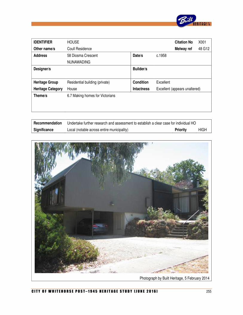
C I T Y O F W H I T E H O R S E P O S T – 1 9 4 5 H E R I T A G E S T U D Y [ J U N E 2 0 1 6 ] 255
IDENTIFIER HOUSE Citation No X001
Other name/s Coull Residence Melway ref 48 G12
Address 58 Diosma Crescent Date/s c.1958
NUNAWADING
Designer/s Builder/s
Heritage Group Residential building (private) Condition Excellent
Heritage Category House Intactness Excellent (appears unaltered)
Theme/s 6.7 Making homes for Victorians
Recommendation Undertake further research and assessment to establish a clear case for individual HO
Significance Local (notable across entire municipality) Priority HIGH
Photograph by Built Heritage, 5 February 2014
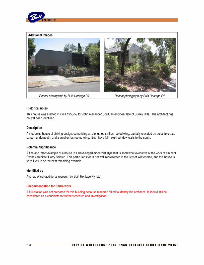
256 C I T Y O F W H I T E H O R S E P O S T – 1 9 4 5 H E R I T A G E S T U D Y [ J U N E 2 0 1 6 ]
Additional Images
Recent photograph by Built Heritage P/L Recent photograph by Built Heritage P/L
Historical notes
This house was erected in circa 1958-59 for John Alexander Coull, an engineer late of Surrey Hills. The architect has not yet been identified.
Description
A modernist house of striking design, comprising an elongated skillion-roofed wing, partially elevated on poles to create carport underneath, and a smaller flat-roofed wing. Both have full-height window walls to the south.
Potential Significance
A fine and intact example of a house in a hard-edged modernist style that is somewhat evocative of the work of eminent Sydney architect Harry Seidler. This particular style is not well represented in the City of Whitehorse, and this house is very likely to be the best remaining example.
Identified by
Andrew Ward (additional research by Built Heritage Pty Ltd)
Recommendation for future work
A full citation was not prepared for this building because research failed to identify the architect. It should still be considered as a candidate for further research and investigation.
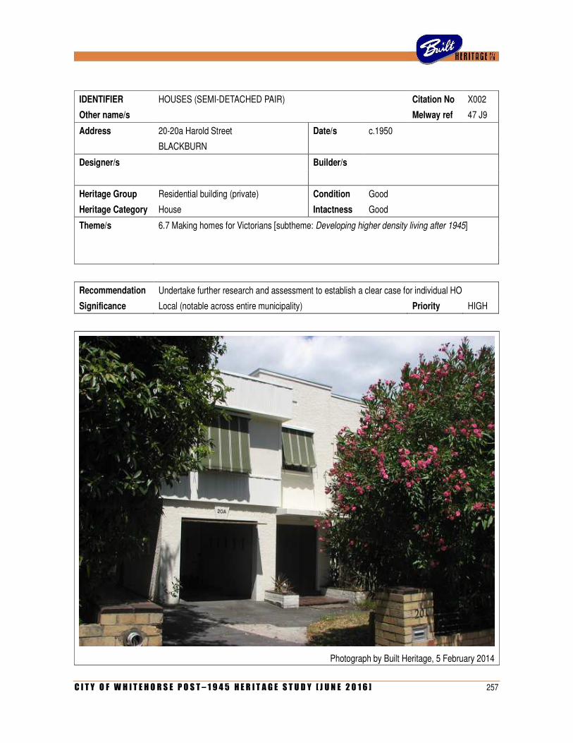
C I T Y O F W H I T E H O R S E P O S T – 1 9 4 5 H E R I T A G E S T U D Y [ J U N E 2 0 1 6 ] 257
IDENTIFIER HOUSES (SEMI-DETACHED PAIR) Citation No X002
Other name/s Melway ref 47 J9
Address 20-20a Harold Street Date/s c.1950
BLACKBURN
Designer/s Builder/s
Heritage Group Residential building (private) Condition Good
Heritage Category House Intactness Good
Theme/s 6.7 Making homes for Victorians [subtheme: Developing higher density living after 1945]
Recommendation Undertake further research and assessment to establish a clear case for individual HO
Significance Local (notable across entire municipality) Priority HIGH
Photograph by Built Heritage, 5 February 2014
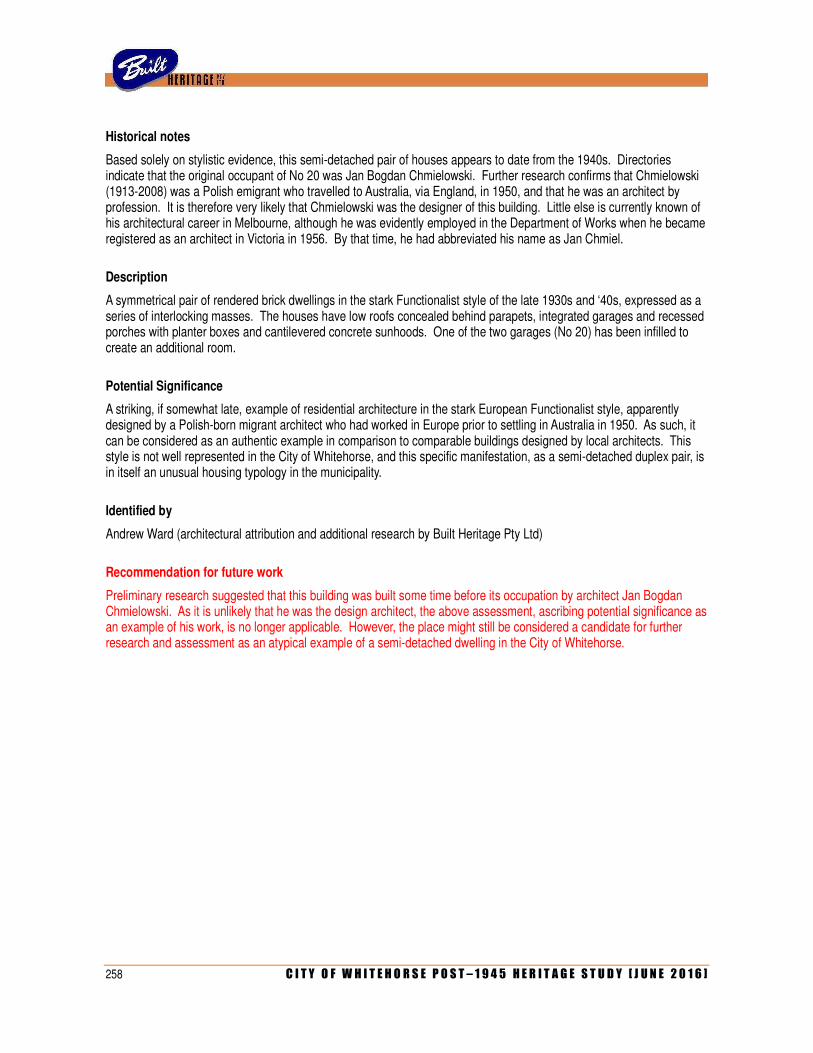
258 C I T Y O F W H I T E H O R S E P O S T – 1 9 4 5 H E R I T A G E S T U D Y [ J U N E 2 0 1 6 ]
Historical notes
Based solely on stylistic evidence, this semi-detached pair of houses appears to date from the 1940s. Directories indicate that the original occupant of No 20 was Jan Bogdan Chmielowski. Further research confirms that Chmielowski (1913-2008) was a Polish emigrant who travelled to Australia, via England, in 1950, and that he was an architect by profession. It is therefore very likely that Chmielowski was the designer of this building. Little else is currently known of his architectural career in Melbourne, although he was evidently employed in the Department of Works when he became registered as an architect in Victoria in 1956. By that time, he had abbreviated his name as Jan Chmiel.
Description
A symmetrical pair of rendered brick dwellings in the stark Functionalist style of the late 1930s and ‘40s, expressed as a series of interlocking masses. The houses have low roofs concealed behind parapets, integrated garages and recessed porches with planter boxes and cantilevered concrete sunhoods. One of the two garages (No 20) has been infilled to create an additional room.
Potential Significance
A striking, if somewhat late, example of residential architecture in the stark European Functionalist style, apparently designed by a Polish-born migrant architect who had worked in Europe prior to settling in Australia in 1950. As such, it can be considered as an authentic example in comparison to comparable buildings designed by local architects. This style is not well represented in the City of Whitehorse, and this specific manifestation, as a semi-detached duplex pair, is in itself an unusual housing typology in the municipality.
Identified by
Andrew Ward (architectural attribution and additional research by Built Heritage Pty Ltd)
Recommendation for future work
Preliminary research suggested that this building was built some time before its occupation by architect Jan Bogdan Chmielowski. As it is unlikely that he was the design architect, the above assessment, ascribing potential significance as an example of his work, is no longer applicable. However, the place might still be considered a candidate for further research and assessment as an atypical example of a semi-detached dwelling in the City of Whitehorse.
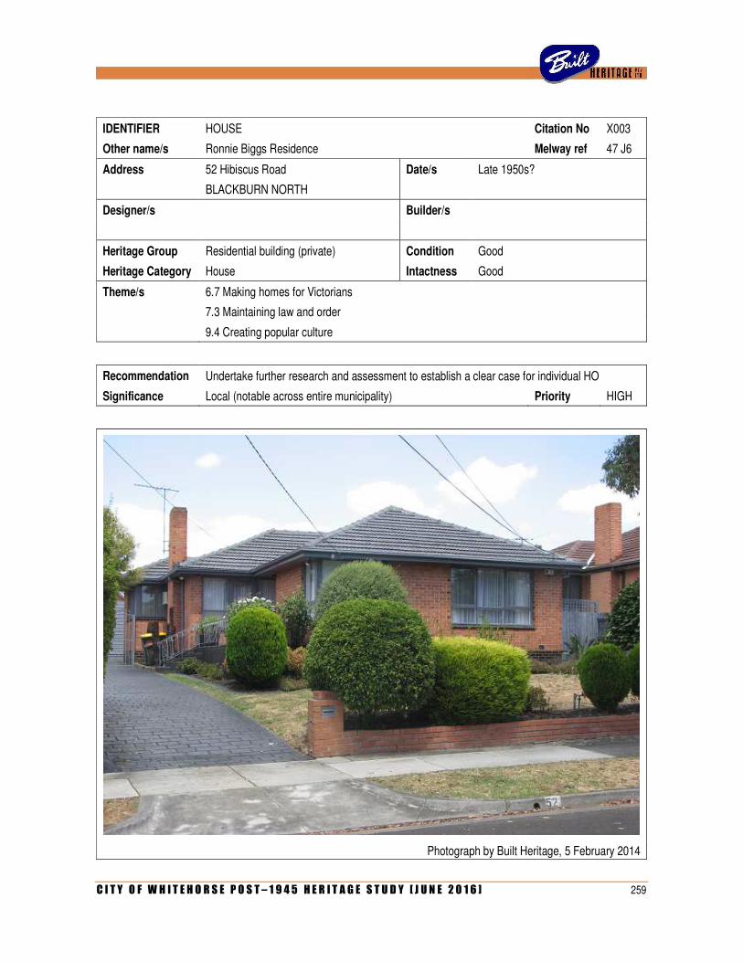
C I T Y O F W H I T E H O R S E P O S T – 1 9 4 5 H E R I T A G E S T U D Y [ J U N E 2 0 1 6 ] 259
IDENTIFIER HOUSE Citation No X003
Other name/s Ronnie Biggs Residence Melway ref 47 J6
Address 52 Hibiscus Road Date/s Late 1950s?
BLACKBURN NORTH
Designer/s Builder/s
Heritage Group Residential building (private) Condition Good
Heritage Category House Intactness Good
Theme/s 6.7 Making homes for Victorians
7.3 Maintaining law and order
9.4 Creating popular culture
Recommendation Undertake further research and assessment to establish a clear case for individual HO
Significance Local (notable across entire municipality) Priority HIGH
Photograph by Built Heritage, 5 February 2014
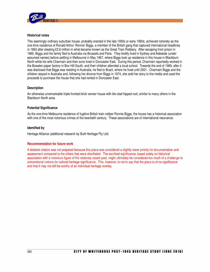
260 C I T Y O F W H I T E H O R S E P O S T – 1 9 4 5 H E R I T A G E S T U D Y [ J U N E 2 0 1 6 ]
Historical notes
This seemingly ordinary suburban house, probably erected in the late 1950s or early 1960s, achieved notoriety as the one-time residence of Ronald Arthur ‘Ronnie’ Biggs, a member of the British gang that captured international headlines in 1963 after stealing £2.6 million in what became known as the Great Train Robbery. After escaping from prison in 1965, Biggs and his family fled to Australia via Brussels and Paris. They briefly lived in Sydney and Adelaide (under assumed names) before settling in Melbourne in May 1967, where Biggs took up residence in this house in Blackburn North while his wife Charmain and their sons lived in Doncaster East. During this period, Charmain reportedly worked in the Bowater paper factory in Box Hill South, and their children attended a local school. Towards the end of 1969, after it was disclosed that Biggs was residing in Australia, he fled to Brazil, where he lived until 2001. Charmain Biggs and the children stayed in Australia and, following her divorce from Biggs in 1974, she sold her story to the media and used the proceeds to purchase the house that she had rented in Doncaster East.
Description
An otherwise unremarkable triple-fronted brick veneer house with tile-clad hipped roof, similar to many others in the Blackburn North area.
Potential Significance
As the one-time Melbourne residence of fugitive British train robber Ronnie Biggs, the house has a historical association with one of the most notorious crimes of the twentieth century. These associations are of international resonance.
Identified by
Heritage Alliance (additional research by Built Heritage Pty Ltd)
Recommendation for future work
A detailed citation was not prepared because this place was considered a slightly lower priority for documentation and assessment compared to the others that were shortlisted. The ascribed significance, based solely on historical association with a notorious figure of the relatively recent past, might ultimately be considered too much of a challenge to conventional notions for cultural heritage significance. This, however, is not to say that the place is of no significance and that it may not still be worthy of an individual heritage overlay.
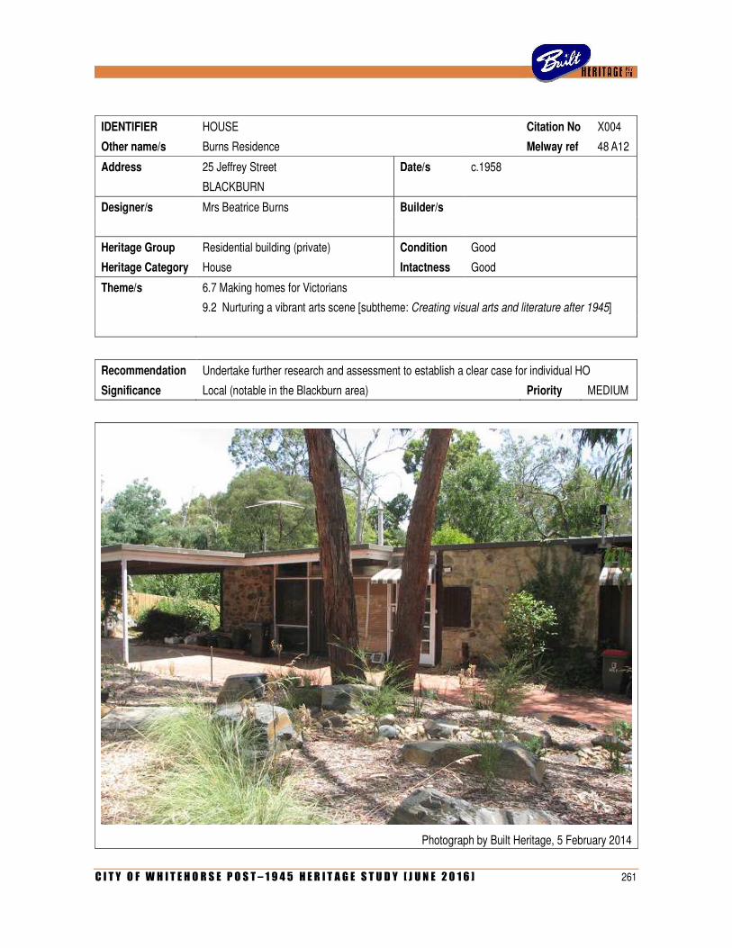
C I T Y O F W H I T E H O R S E P O S T – 1 9 4 5 H E R I T A G E S T U D Y [ J U N E 2 0 1 6 ] 261
IDENTIFIER HOUSE Citation No X004
Other name/s Burns Residence Melway ref 48 A12
Address 25 Jeffrey Street Date/s c.1958
BLACKBURN
Designer/s Mrs Beatrice Burns Builder/s
Heritage Group Residential building (private) Condition Good
Heritage Category House Intactness Good
Theme/s 6.7 Making homes for Victorians
9.2 Nurturing a vibrant arts scene [subtheme: Creating visual arts and literature after 1945]
Recommendation Undertake further research and assessment to establish a clear case for individual HO
Significance Local (notable in the Blackburn area) Priority MEDIUM
Photograph by Built Heritage, 5 February 2014
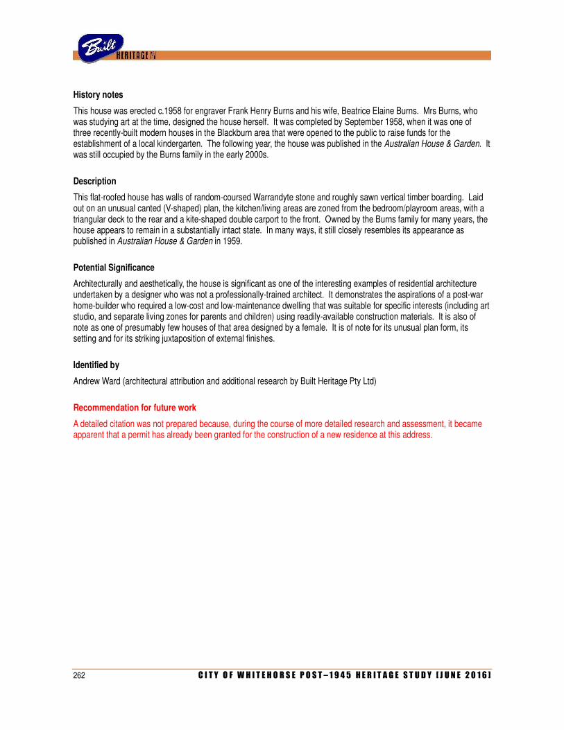
262 C I T Y O F W H I T E H O R S E P O S T – 1 9 4 5 H E R I T A G E S T U D Y [ J U N E 2 0 1 6 ]
History notes
This house was erected c.1958 for engraver Frank Henry Burns and his wife, Beatrice Elaine Burns. Mrs Burns, who was studying art at the time, designed the house herself. It was completed by September 1958, when it was one of three recently-built modern houses in the Blackburn area that were opened to the public to raise funds for the establishment of a local kindergarten. The following year, the house was published in the Australian House & Garden. It was still occupied by the Burns family in the early 2000s.
Description
This flat-roofed house has walls of random-coursed Warrandyte stone and roughly sawn vertical timber boarding. Laid out on an unusual canted (V-shaped) plan, the kitchen/living areas are zoned from the bedroom/playroom areas, with a triangular deck to the rear and a kite-shaped double carport to the front. Owned by the Burns family for many years, the house appears to remain in a substantially intact state. In many ways, it still closely resembles its appearance as published in Australian House & Garden in 1959.
Potential Significance
Architecturally and aesthetically, the house is significant as one of the interesting examples of residential architecture undertaken by a designer who was not a professionally-trained architect. It demonstrates the aspirations of a post-war home-builder who required a low-cost and low-maintenance dwelling that was suitable for specific interests (including art studio, and separate living zones for parents and children) using readily-available construction materials. It is also of note as one of presumably few houses of that area designed by a female. It is of note for its unusual plan form, its setting and for its striking juxtaposition of external finishes.
Identified by
Andrew Ward (architectural attribution and additional research by Built Heritage Pty Ltd)
Recommendation for future work
A detailed citation was not prepared because, during the course of more detailed research and assessment, it became apparent that a permit has already been granted for the construction of a new residence at this address.
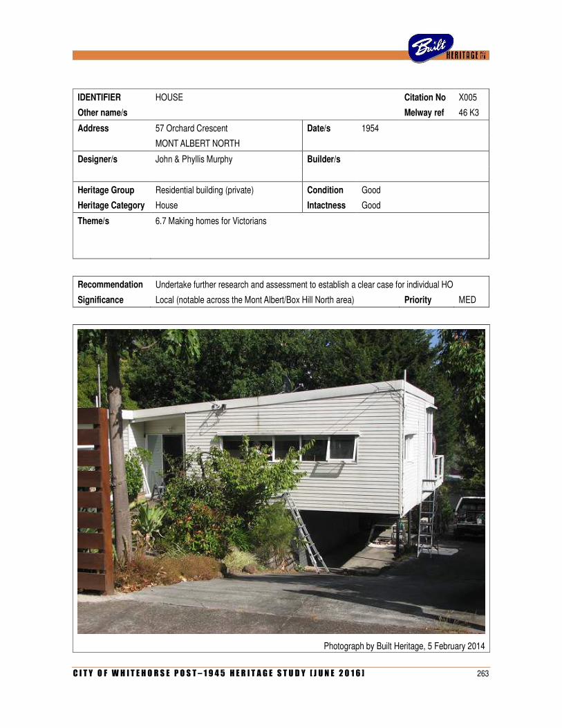
C I T Y O F W H I T E H O R S E P O S T – 1 9 4 5 H E R I T A G E S T U D Y [ J U N E 2 0 1 6 ] 263
IDENTIFIER HOUSE Citation No X005
Other name/s Melway ref 46 K3
Address 57 Orchard Crescent Date/s 1954
MONT ALBERT NORTH
Designer/s John & Phyllis Murphy Builder/s
Heritage Group Residential building (private) Condition Good
Heritage Category House Intactness Good
Theme/s 6.7 Making homes for Victorians
Recommendation Undertake further research and assessment to establish a clear case for individual HO
Significance Local (notable across the Mont Albert/Box Hill North area) Priority MED
Photograph by Built Heritage, 5 February 2014
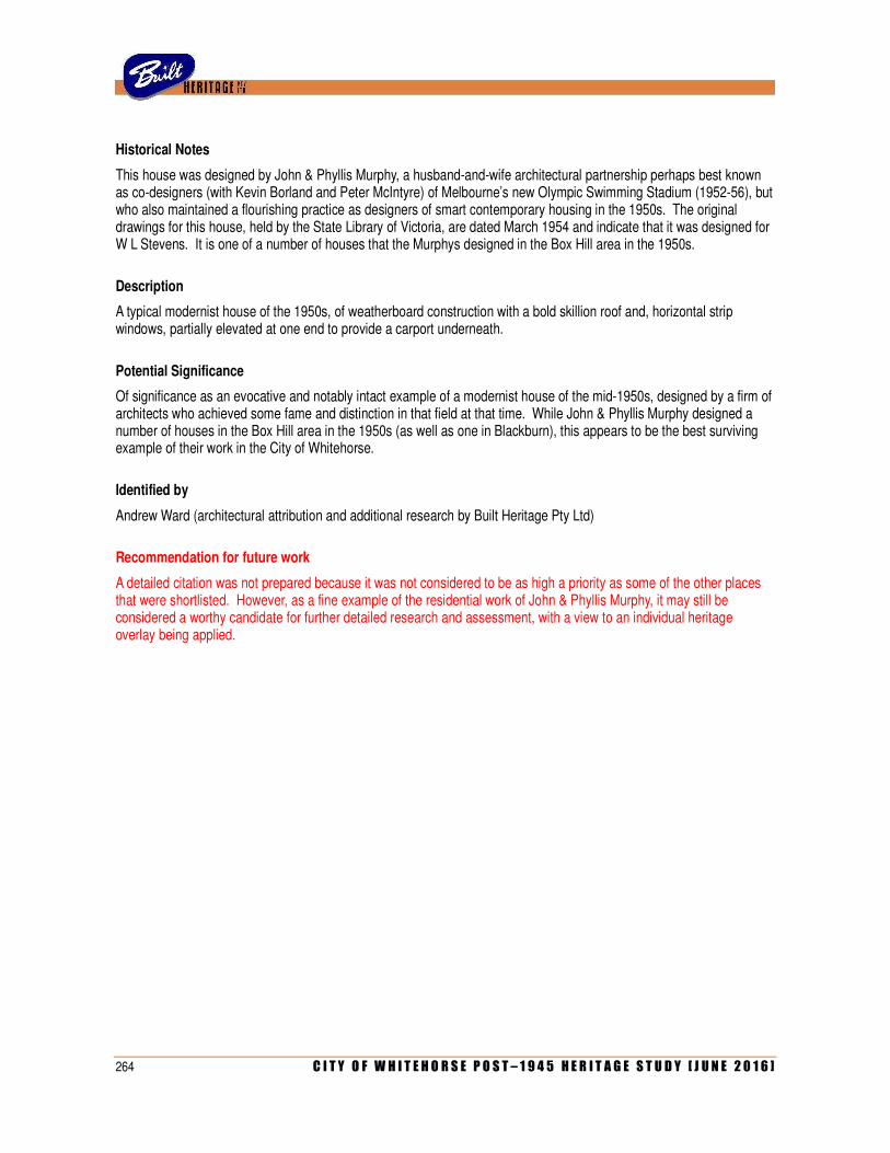
264 C I T Y O F W H I T E H O R S E P O S T – 1 9 4 5 H E R I T A G E S T U D Y [ J U N E 2 0 1 6 ]
Historical Notes
This house was designed by John & Phyllis Murphy, a husband-and-wife architectural partnership perhaps best known as co-designers (with Kevin Borland and Peter McIntyre) of Melbourne’s new Olympic Swimming Stadium (1952-56), but who also maintained a flourishing practice as designers of smart contemporary housing in the 1950s. The original drawings for this house, held by the State Library of Victoria, are dated March 1954 and indicate that it was designed for W L Stevens. It is one of a number of houses that the Murphys designed in the Box Hill area in the 1950s.
Description
A typical modernist house of the 1950s, of weatherboard construction with a bold skillion roof and, horizontal strip windows, partially elevated at one end to provide a carport underneath.
Potential Significance
Of significance as an evocative and notably intact example of a modernist house of the mid-1950s, designed by a firm of architects who achieved some fame and distinction in that field at that time. While John & Phyllis Murphy designed a number of houses in the Box Hill area in the 1950s (as well as one in Blackburn), this appears to be the best surviving example of their work in the City of Whitehorse.
Identified by
Andrew Ward (architectural attribution and additional research by Built Heritage Pty Ltd)
Recommendation for future work
A detailed citation was not prepared because it was not considered to be as high a priority as some of the other places that were shortlisted. However, as a fine example of the residential work of John & Phyllis Murphy, it may still be considered a worthy candidate for further detailed research and assessment, with a view to an individual heritage overlay being applied.
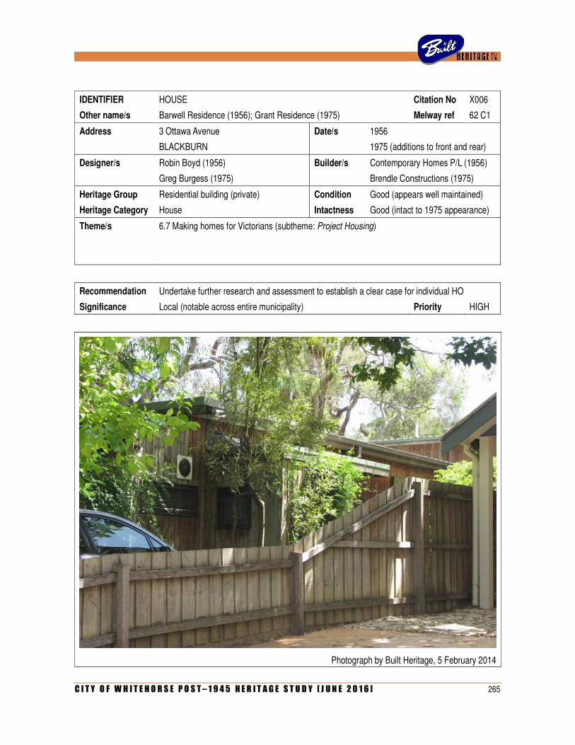
C I T Y O F W H I T E H O R S E P O S T – 1 9 4 5 H E R I T A G E S T U D Y [ J U N E 2 0 1 6 ] 265
IDENTIFIER HOUSE Citation No X006
Other name/s Barwell Residence (1956); Grant Residence (1975) Melway ref 62 C1
Address 3 Ottawa Avenue Date/s 1956
BLACKBURN 1975 (additions to front and rear)
Designer/s Robin Boyd (1956) Builder/s Contemporary Homes P/L (1956)
Greg Burgess (1975) Brendle Constructions (1975)
Heritage Group Residential building (private) Condition Good (appears well maintained)
Heritage Category House Intactness Good (intact to 1975 appearance)
Theme/s 6.7 Making homes for Victorians (subtheme: Project Housing)
Recommendation Undertake further research and assessment to establish a clear case for individual HO
Significance Local (notable across entire municipality) Priority HIGH
Photograph by Built Heritage, 5 February 2014
266 C I T Y O F W H I T E H O R S E P O S T – 1 9 4 5 H E R I T A G E S T U D Y [ J U N E 2 0 1 6 ]
Historical notes
This house is an early example of Australia’s first architect-designed project house, the Peninsula. Introduced in 1954 by a Beaumaris-based firm, Contemporary Homes Pty Ltd, the Peninsula was a gable-roofed timber dwelling on a modular plan, specially designed for the company by Robin Boyd. Prototypes were built in Beaumaris, and variations of the design (known as Peninsula 1, Peninsula 2 and the Sou-easter) sold over the next few years. This example, built in 1956 for G P Barwell, was of the Peninsula 1 design. In the mid-1970s, a later owner engaged architect Greg Burgess to enlarge the house. Burgess added a single-storey front wing and a two-storey rear one. The completed renovation, considered as a sensitive response to enlarging a mass-produced 1950s dwelling, was profiled in the architectural column of the Age newspaper, and later published in Norman Day’s 1975 book, Modern Houses Melbourne.
Description
The original Peninsula house, with its rectangular footprint, low gabled roof and weatherboard cladding, has been effectively engulfed by the additions to front and rear. The entire building is clad in vertical boards of sawn pine, thus creating a cohesive whole.
Potential Significance
Although of limited architectural significance as an individual example of the Peninsula house (of which more intact versions survive elsewhere in the municipality), this particular dwelling is otherwise notable for the way in which it demonstrates how a standardised project house of the 1950s could be sensitively enlarged to cope with an owner’s changing requirements two decades later. Heralded in two published sources at the time, the renovated house is of interest as an early example of the work of noted architect Greg Burgess, who is best known in the City of Whitehorse for his award-winning Box Hill Community Arts Centre, erected another twenty years later.
Identified by
Built Heritage Pty Ltd.
Recommendation for future work
A detailed citation was not prepared because it was not considered to be as high a priority as some of the other places that were shortlisted. However, as an interesting example of a Peninsula project house (a rare example in its own right) that was subsequently and sympathetically enlarged and remodelled by a well-known and award-winning Melbourne architect, it may still be considered a worthy candidate for further detailed research and assessment, with a view to an individual heritage overlay being applied.
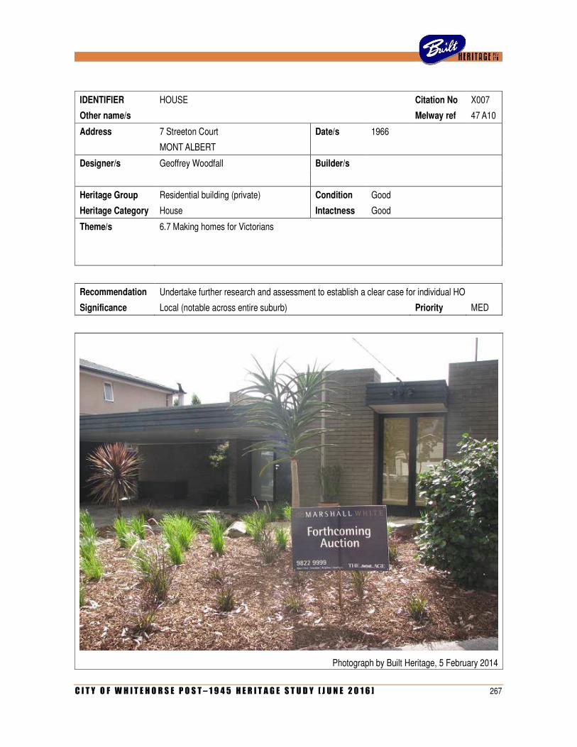
C I T Y O F W H I T E H O R S E P O S T – 1 9 4 5 H E R I T A G E S T U D Y [ J U N E 2 0 1 6 ] 267
IDENTIFIER HOUSE Citation No X007
Other name/s Melway ref 47 A10
Address 7 Streeton Court Date/s 1966
MONT ALBERT
Designer/s Geoffrey Woodfall Builder/s
Heritage Group Residential building (private) Condition Good
Heritage Category House Intactness Good
Theme/s 6.7 Making homes for Victorians
Recommendation Undertake further research and assessment to establish a clear case for individual HO
Significance Local (notable across entire suburb) Priority MED
Photograph by Built Heritage, 5 February 2014

268 C I T Y O F W H I T E H O R S E P O S T – 1 9 4 5 H E R I T A G E S T U D Y [ J U N E 2 0 1 6 ]
Additional Image
Contemporary photograph from the Herald newspaper (1966)
Historical notes
This house was designed in 1966 by architect Geoffrey Woodfall, who (along with David Godsell and Chancellor & Patrick) was one of Melbourne’s leading exponents of the organic style influenced by Frank Lloyd Wright. Woodfall designed a number of houses in what is now the City of Whitehorse, of which this appears to be the most noteworthy survivor. The house was published in the property column of the Herald newspaper in December 1966.
Description
A flat-roofed open-planned house of dark brown brick construction, with a stark expression of solid pier-like wall elements alternating with recessed full-height windows, and a horizontal roofline emphasized with wide panelled fascia. The house appears notably intact, although the solid brick wall that once enclosed a front courtyard (as seen in early photograph above) has been removed.
Potential Significance
A fine and substantially intact example of a house demonstrating the 1960s fashion for ‘organic architecture’ influenced by the work of Frank Lloyd Wright. It is also of interest as an typical example of the work of Geoffrey Woodfall, an award-winning Melbourne architect best known for fine residential projects such as this.
Identified by
Built Heritage Pty Ltd
Recommendation for future work
A full citation was not prepared because it was not considered to be as high a priority as some of the other places that were shortlisted. However, as a fine example of the work of Geoffrey Woodfall, it may still be considered a worthy candidate for further detailed research and assessment, with a view to an individual heritage overlay being applied.
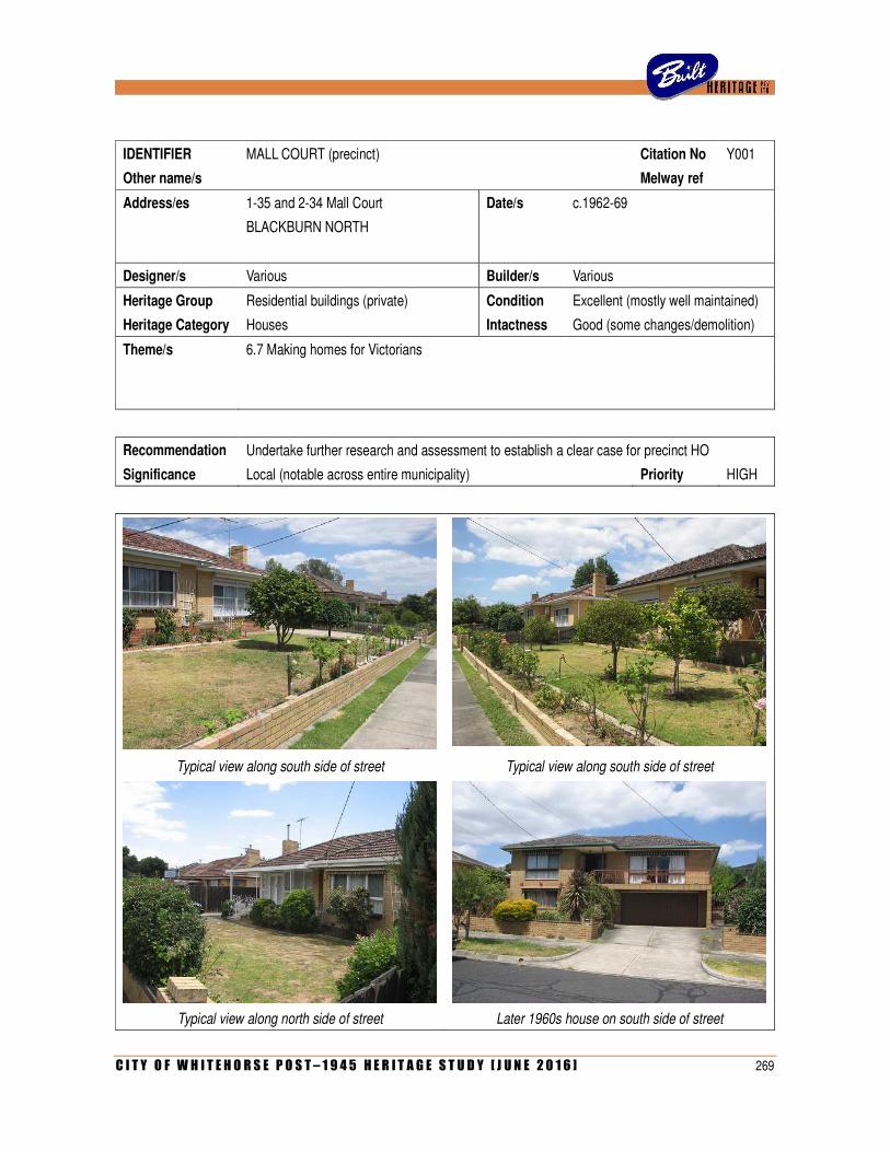
C I T Y O F W H I T E H O R S E P O S T – 1 9 4 5 H E R I T A G E S T U D Y [ J U N E 2 0 1 6 ] 269
IDENTIFIER MALL COURT (precinct) Citation No Y001
Other name/s Melway ref
Address/es 1-35 and 2-34 Mall Court Date/s c.1962-69
BLACKBURN NORTH
Designer/s Various Builder/s Various
Heritage Group Residential buildings (private) Condition Excellent (mostly well maintained)
Heritage Category Houses Intactness Good (some changes/demolition)
Theme/s 6.7 Making homes for Victorians
Recommendation Undertake further research and assessment to establish a clear case for precinct HO
Significance Local (notable across entire municipality) Priority HIGH
Typical view along south side of street Typical view along south side of street
Typical view along north side of street Later 1960s house on south side of street
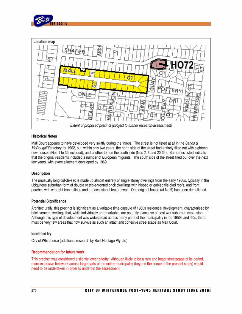
270 C I T Y O F W H I T E H O R S E P O S T – 1 9 4 5 H E R I T A G E S T U D Y [ J U N E 2 0 1 6 ]
Location map
Extent of proposed precinct (subject to further research/assessment)
Historical Notes
Mall Court appears to have developed very swiftly during the 1960s. The street is not listed at all in the Sands & McDougall Directory for 1962, but, within only two years, the north side of the street had entirely filled out with eighteen new houses (Nos 1 to 35 included), and another ten on the south side (Nos 2, 6 and 20-34). Surnames listed indicate that the original residents included a number of European migrants. The south side of the street filled out over the next few years, with every allotment developed by 1969.
Description
The unusually long cul-de-sac is made up almost entirely of single-storey dwellings from the early 1960s, typically in the ubiquitous suburban form of double or triple-fronted brick dwellings with hipped or gabled tile-clad roofs, and front porches with wrought iron railings and the occasional feature wall. One original house (at No 9) has been demolished.
Potential Significance
Architecturally, this precinct is significant as a veritable time-capsule of 1960s residential development, characterised by brick veneer dwellings that, while individually unremarkable, are potently evocative of post-war suburban expansion. Although this type of development was widespread across many parts of the municipality in the 1950s and ‘60s, there must be very few areas that now survive as such an intact and cohesive streetscape as Mall Court.
Identified by
City of Whitehorse (additional research by Built Heritage Pty Ltd)
Recommendation for future work
This precinct was considered a slightly lower priority. Although likely to be a rare and intact streetscape of its period, more extensive fieldwork across large parts of the entire municipality (beyond the scope of the present study) would need to be undertaken in order to underpin the assessment.
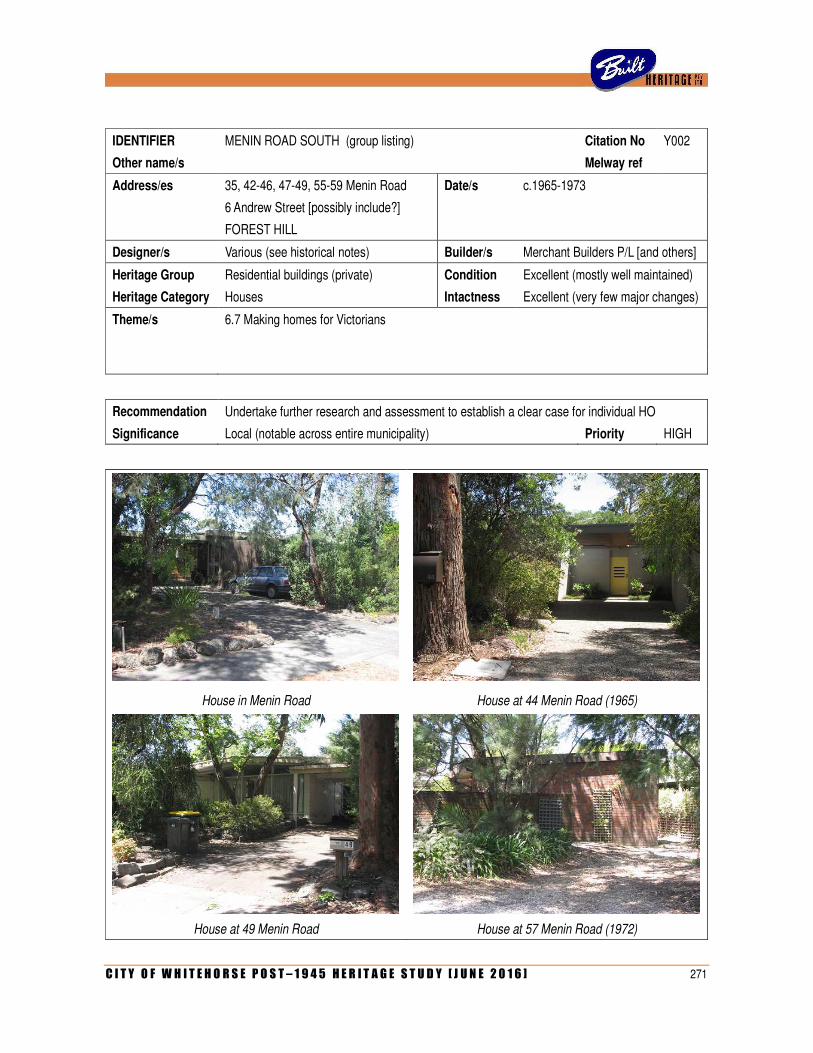
C I T Y O F W H I T E H O R S E P O S T – 1 9 4 5 H E R I T A G E S T U D Y [ J U N E 2 0 1 6 ] 271
IDENTIFIER MENIN ROAD SOUTH (group listing) Citation No Y002
Other name/s Melway ref
Address/es 35, 42-46, 47-49, 55-59 Menin Road Date/s c.1965-1973
6 Andrew Street [possibly include?]
FOREST HILL
Designer/s Various (see historical notes) Builder/s Merchant Builders P/L [and others]
Heritage Group Residential buildings (private) Condition Excellent (mostly well maintained)
Heritage Category Houses Intactness Excellent (very few major changes)
Theme/s 6.7 Making homes for Victorians
Recommendation Undertake further research and assessment to establish a clear case for individual HO
Significance Local (notable across entire municipality) Priority HIGH
House in Menin Road House at 44 Menin Road (1965)
House at 49 Menin Road House at 57 Menin Road (1972)
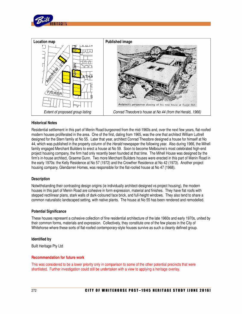
272 C I T Y O F W H I T E H O R S E P O S T – 1 9 4 5 H E R I T A G E S T U D Y [ J U N E 2 0 1 6 ]
Location map Published image
Extent of proposed group listing Conrad Theodore’s house at No 44 (from the Herald, 1966)
Historical Notes
Residential settlement in this part of Menin Road burgeoned from the mid-1960s and, over the next few years, flat-roofed modern houses proliferated in the area. One of the first, dating from 1965, was the one that architect William Luttrell designed for the Stern family at No 55. Later that year, architect Conrad Theodore designed a house for himself at No 44, which was published in the property column of the Herald newspaper the following year. Also during 1966, the Mihell family engaged Merchant Builders to erect a house at No 59. Soon to become Melbourne’s most celebrated high-end project housing company, the firm had only recently been founded at that time. The Mihell House was designed by the firm’s in-house architect, Graeme Gunn. Two more Merchant Builders houses were erected in this part of Menin Road in the early 1970s: the Kelly Residence at No 57 (1972) and the Crowther Residence at No 42 (1973). Another project housing company, Glendarren Homes, was responsible for the flat-roofed house at No 47 (1968).
Description
Notwithstanding their contrasting design origins (ie individually architect-designed vs project housing), the modern houses in this part of Menin Road are cohesive in form expression, material and finishes. They have flat roofs with stepped rectilinear plans, stark walls of dark-coloured face brick, and full-height windows. They also tend to share a common naturalistic landscaped setting, with native plants. The house at No 55 has been rendered and remodelled.
Potential Significance
These houses represent a cohesive collection of fine residential architecture of the late 1960s and early 1970s, united by their common forms, materials and expression. Collectively, they constitute one of the few places in the City of Whitehorse where these sorts of flat-roofed contemporary-style houses survive as such a cleanly defined group.
Identified by
Built Heritage Pty Ltd
Recommendation for future work
This was considered to be a lower priority only in comparison to some of the other potential precincts that were shortlisted. Further investigation could still be undertaken with a view to applying a heritage overlay.
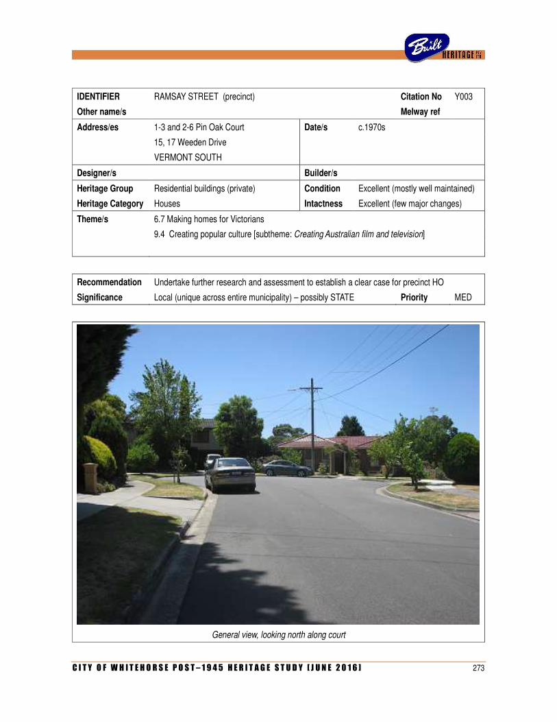
C I T Y O F W H I T E H O R S E P O S T – 1 9 4 5 H E R I T A G E S T U D Y [ J U N E 2 0 1 6 ] 273
IDENTIFIER RAMSAY STREET (precinct) Citation No Y003
Other name/s Melway ref
Address/es 1-3 and 2-6 Pin Oak Court Date/s c.1970s
15, 17 Weeden Drive
VERMONT SOUTH
Designer/s Builder/s
Heritage Group Residential buildings (private) Condition Excellent (mostly well maintained)
Heritage Category Houses Intactness Excellent (few major changes)
Theme/s 6.7 Making homes for Victorians
9.4 Creating popular culture [subtheme: Creating Australian film and television]
Recommendation Undertake further research and assessment to establish a clear case for precinct HO
Significance Local (unique across entire municipality) – possibly STATE Priority MED
General view, looking north along court
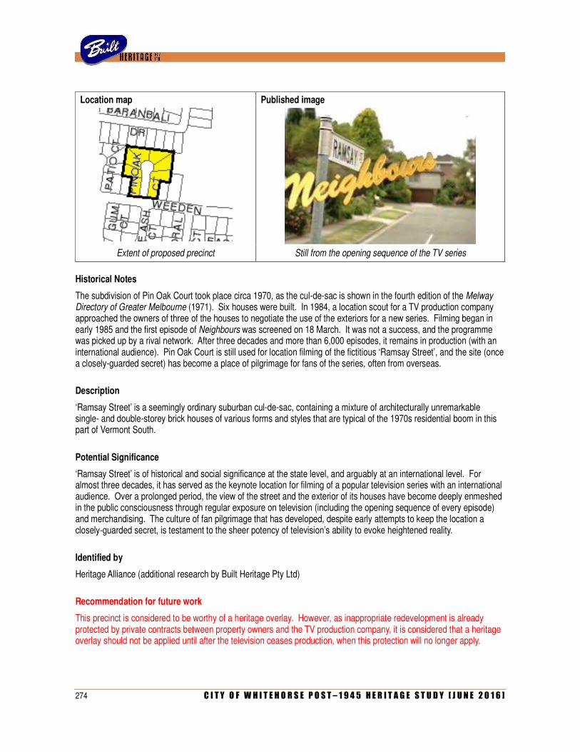
274 C I T Y O F W H I T E H O R S E P O S T – 1 9 4 5 H E R I T A G E S T U D Y [ J U N E 2 0 1 6 ]
Location map Published image
Extent of proposed precinct Still from the opening sequence of the TV series
Historical Notes
The subdivision of Pin Oak Court took place circa 1970, as the cul-de-sac is shown in the fourth edition of the Melway Directory of Greater Melbourne (1971). Six houses were built. In 1984, a location scout for a TV production company approached the owners of three of the houses to negotiate the use of the exteriors for a new series. Filming began in early 1985 and the first episode of Neighbours was screened on 18 March. It was not a success, and the programme was picked up by a rival network. After three decades and more than 6,000 episodes, it remains in production (with an international audience). Pin Oak Court is still used for location filming of the fictitious ‘Ramsay Street’, and the site (once a closely-guarded secret) has become a place of pilgrimage for fans of the series, often from overseas.
Description
‘Ramsay Street’ is a seemingly ordinary suburban cul-de-sac, containing a mixture of architecturally unremarkable single- and double-storey brick houses of various forms and styles that are typical of the 1970s residential boom in this part of Vermont South.
Potential Significance
‘Ramsay Street’ is of historical and social significance at the state level, and arguably at an international level. For almost three decades, it has served as the keynote location for filming of a popular television series with an international audience. Over a prolonged period, the view of the street and the exterior of its houses have become deeply enmeshed in the public consciousness through regular exposure on television (including the opening sequence of every episode) and merchandising. The culture of fan pilgrimage that has developed, despite early attempts to keep the location a closely-guarded secret, is testament to the sheer potency of television’s ability to evoke heightened reality.
Identified by
Heritage Alliance (additional research by Built Heritage Pty Ltd)
Recommendation for future work
This precinct is considered to be worthy of a heritage overlay. However, as inappropriate redevelopment is already protected by private contracts between property owners and the TV production company, it is considered that a heritage overlay should not be applied until after the television ceases production, when this protection will no longer apply.
C I T Y O F W H I T E H O R S E P O S T – 1 9 4 5 H E R I T A G E S T U D Y [ J U N E 2 0 1 6 ] 275
APPENDIX 2: MASTERLIST OF PLACES
KEY
Documentation
ALA Allom Lovell & Association, Whitehorse Heritage Review (1999) – identified only in appendix
ALA(C) Allom Lovell & Association, Whitehorse Heritage Review (1999) – full citation prepared
BHDB Built Heritage Database of Post-War Australian Architecture
BH Built Heritage (place identified through other research or fieldwork)
BHS Box Hill Historical Society
BUT Graham Butler, Whitehorse Heritage Review (2003)
COL Coleman Architects, Whitehorse Heritage Review (2012) –identified only in master list
COL(C) Coleman Architects, Whitehorse Heritage Review (2012) – full citation prepared
COL(N/C) Coleman Architects, Whitehorse Heritage Review (2012) – full citation not prepared
COW City of Whitehorse (place nominated by council staff)
HA Heritage Alliance, Survey of Post War Built Heritage in Victoria (2008)
HLCD Helen Lardner Conservation & Design/Samantha Westbrook heritage advice
NTV National Trust of Australia (Victoria)
PRO Public Record Office (City of Nunawading Building Permit files)
RBF Robin Boyd Foundation
SLV(D) State Library of Victoria (Architectural Drawings Collection)
SLV(W) State Library of Victoria (Peter Wille Slide Collection)
WHS Whitehorse Historical Society
WRD Andrew Ward, Whitehorse Heritage Review (2001)
Status
<1945 Property appears to date from before 1945
>1990 Property appears to date from later than 1990
ALT Property appears significantly altered when seen from the street
DEM Property has been demolished
HO Property is already included on heritage overlay schedule (as an individual heritage place)
N/L Property has not been located due to inadequate address details
N/V Property not visible from the street
PRE? Property could possibly form part of a precinct of similar places
Score
The final column provides the score out of 10 that was given to each place to assist in the filtering of the list to identify the higher priority places for further assessment. These scores were based on consideration of rarity, vulnerability, extent of documentation and potential significance at face value. Scores were not given where a building was already on the heritage overlay schedule, had been demolished, could not be located or seen from the street, or appeared to have been built prior to 1945 or after 1990.
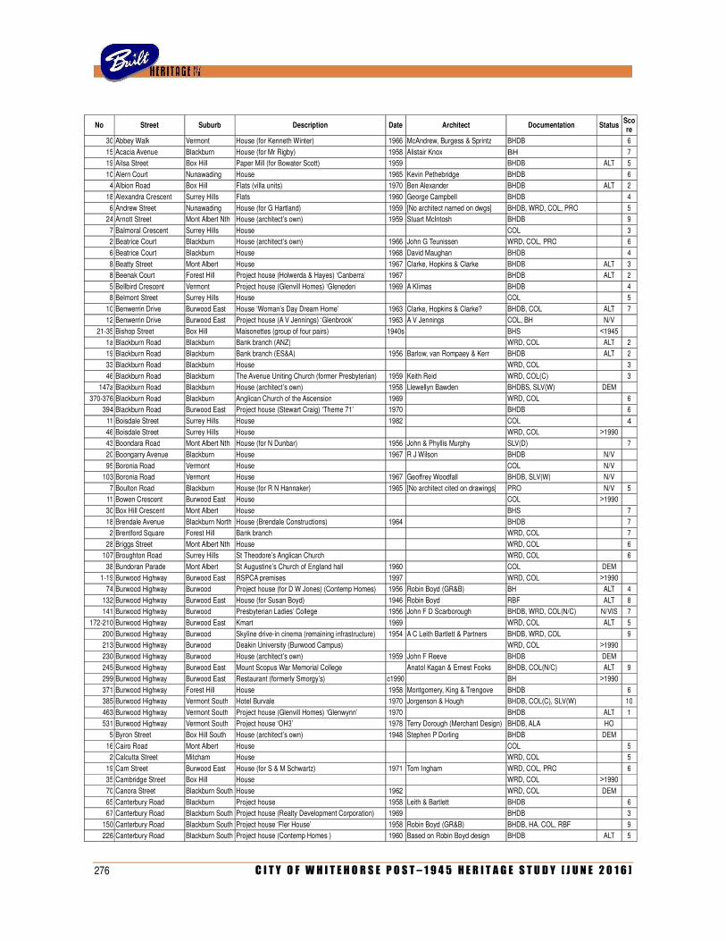
276 C I T Y O F W H I T E H O R S E P O S T – 1 9 4 5 H E R I T A G E S T U D Y [ J U N E 2 0 1 6 ]
No Street Suburb Description Date Architect Documentation Status Score
30 Abbey Walk Vermont House (for Kenneth Winter) 1966 McAndrew, Burgess & Sprintz BHDB
6
15 Acacia Avenue Blackburn House (for Mr Rigby) 1958 Alistair Knox BH
7 19 Ailsa Street Box Hill Paper Mill (for Bowater Scott) 1959
BHDB ALT 5
10 Alern Court Nunawading House 1965 Kevin Pethebridge BHDB
6 4 Albion Road Box Hill Flats (villa units) 1970 Ben Alexander BHDB ALT 2
18 Alexandra Crescent Surrey Hills Flats 1960 George Campbell BHDB
4
6 Andrew Street Nunawading House (for G Hartland) 1959 [No architect named on dwgs] BHDB, WRD, COL, PRO
5 24 Arnott Street Mont Albert Nth House (architect’s own) 1959 Stuart McIntosh BHDB
9
7 Balmoral Crescent Surrey Hills House
COL
3 2 Beatrice Court Blackburn House (architect’s own) 1966 John G Teunissen WRD, COL, PRO
6
6 Beatrice Court Blackburn House 1968 David Maughan BHDB
4
8 Beatty Street Mont Albert House 1967 Clarke, Hopkins & Clarke BHDB ALT 3 8 Beenak Court Forest Hill Project house (Holwerda & Hayes) ‘Canberra’ 1967
BHDB ALT 2
5 Bellbird Crescent Vermont Project house (Glenvill Homes) ‘Gleneden’ 1969 A Klimas BHDB
4 8 Belmont Street Surrey Hills House
COL
5
10 Benwerrin Drive Burwood East House ‘Woman’s Day Dream Home’ 1963 Clarke, Hopkins & Clarke? BHDB, COL ALT 7 12 Benwerrin Drive Burwood East Project house (A V Jennings) ‘Glenbrook’ 1963 A V Jennings COL, BH N/V
21-35 Bishop Street Box Hill Maisonettes (group of four pairs) 1940s
BHS <1945
1a Blackburn Road Blackburn Bank branch (ANZ)
WRD, COL ALT 2
19 Blackburn Road Blackburn Bank branch (ES&A) 1956 Barlow, van Rompaey & Kerr BHDB ALT 2
33 Blackburn Road Blackburn House
WRD, COL
3
46 Blackburn Road Blackburn The Avenue Uniting Church (former Presbyterian) 1959 Keith Reid WRD, COL(C)
3 147a Blackburn Road Blackburn House (architect’s own) 1958 Llewellyn Bawden BHDBS, SLV(W) DEM
370-376 Blackburn Road Blackburn Anglican Church of the Ascension 1969
WRD, COL
6
394 Blackburn Road Burwood East Project house (Stewart Craig) ‘Theme 71’ 1970
BHDB
6
11 Boisdale Street Surrey Hills House 1982
COL
4 46 Boisdale Street Surrey Hills House
WRD, COL >1990
43 Boondara Road Mont Albert Nth House (for N Dunbar) 1956 John & Phyllis Murphy SLV(D)
7
20 Boongarry Avenue Blackburn House 1967 R J Wilson BHDB N/V
95 Boronia Road Vermont House
COL N/V
103 Boronia Road Vermont House 1967 Geoffrey Woodfall BHDB, SLV(W) N/V
7 Boulton Road Blackburn House (for R N Hannaker) 1965 [No architect cited on drawings] PRO N/V 5 11 Bowen Crescent Burwood East House
COL >1990
30 Box Hill Crescent Mont Albert House
BHS
7
18 Brendale Avenue Blackburn North House (Brendale Constructions) 1964
BHDB
7 2 Brentford Square Forest Hill Bank branch
WRD, COL
7
28 Briggs Street Mont Albert Nth House
WRD, COL
6 107 Broughton Road Surrey Hills St Theodore’s Anglican Church
WRD, COL
6
38 Bundoran Parade Mont Albert St Augustine’s Church of England hall 1960
COL DEM
1-19 Burwood Highway Burwood East RSPCA premises 1997
WRD, COL >1990
74 Burwood Highway Burwood Project house (for D W Jones) (Contemp Homes) 1956 Robin Boyd (GR&B) BH ALT 4
132 Burwood Highway Burwood East House (for Susan Boyd) 1946 Robin Boyd RBF ALT 8 141 Burwood Highway Burwood Presbyterian Ladies’ College 1956 John F D Scarborough BHDB, WRD, COL(N/C) N/VIS 7
172-210 Burwood Highway Burwood East Kmart 1969
WRD, COL ALT 5
200 Burwood Highway Burwood Skyline drive-in cinema (remaining infrastructure) 1954 A C Leith Bartlett & Partners BHDB, WRD, COL
9 213 Burwood Highway Burwood Deakin University (Burwood Campus)
WRD, COL >1990
230 Burwood Highway Burwood House (architect’s own) 1959 John F Reeve BHDB DEM
245 Burwood Highway Burwood East Mount Scopus War Memorial College
Anatol Kagan & Ernest Fooks BHDB, COL(N/C) ALT 9
299 Burwood Highway Burwood East Restaurant (formerly Smorgy’s) c1990
BH >1990
371 Burwood Highway Forest Hill House 1958 Montgomery, King & Trengove BHDB
6 385 Burwood Highway Vermont South Hotel Burvale 1970 Jorgenson & Hough BHDB, COL(C), SLV(W)
10
463 Burwood Highway Vermont South Project house (Glenvill Homes) ‘Glenwynn’ 1970
BHDB ALT 1 531 Burwood Highway Vermont South Project house ‘OH3’ 1978 Terry Dorough (Merchant Design) BHDB, ALA HO
5 Byron Street Box Hill South House (architect’s own) 1948 Stephen P Dorling BHDB DEM
16 Cairo Road Mont Albert House
COL
5
2 Calcutta Street Mitcham House
WRD, COL
5
19 Cam Street Burwood East House (for S & M Schwartz) 1971 Tom Ingham WRD, COL, PRO
6 35 Cambridge Street Box Hill House
WRD, COL >1990
70 Canora Street Blackburn South House 1962
WRD, COL DEM
65 Canterbury Road Blackburn Project house 1958 Leith & Bartlett BHDB
6
67 Canterbury Road Blackburn South Project house (Realty Development Corporation) 1969
BHDB
3
150 Canterbury Road Blackburn South Project house ‘Fler House’ 1958 Robin Boyd (GR&B) BHDB, HA, COL, RBF
9 226 Canterbury Road Blackburn South Project house (Contemp Homes ) 1960 Based on Robin Boyd design BHDB ALT 5
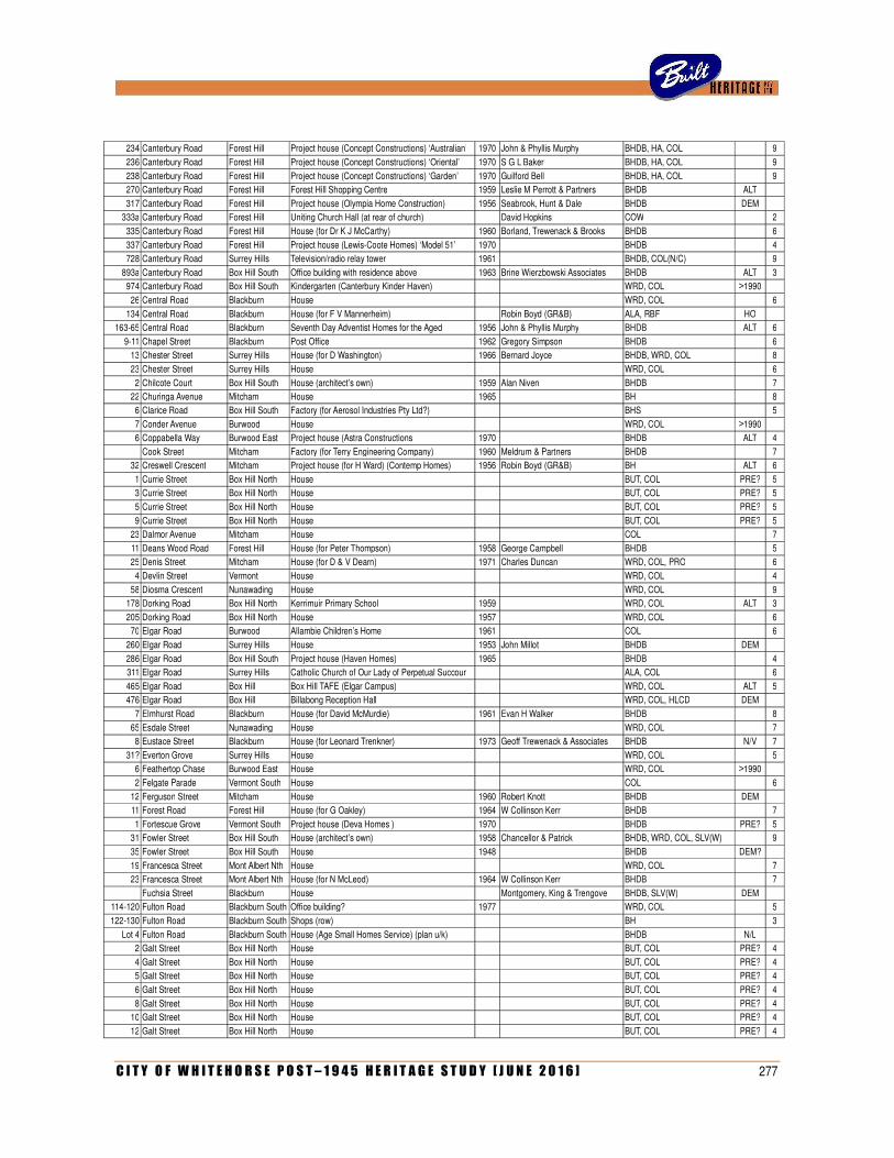
C I T Y O F W H I T E H O R S E P O S T – 1 9 4 5 H E R I T A G E S T U D Y [ J U N E 2 0 1 6 ] 277
234 Canterbury Road Forest Hill Project house (Concept Constructions) ‘Australian’ 1970 John & Phyllis Murphy BHDB, HA, COL
9
236 Canterbury Road Forest Hill Project house (Concept Constructions) ‘Oriental’ 1970 S G L Baker BHDB, HA, COL
9
238 Canterbury Road Forest Hill Project house (Concept Constructions) ‘Garden’ 1970 Guilford Bell BHDB, HA, COL
9 270 Canterbury Road Forest Hill Forest Hill Shopping Centre 1959 Leslie M Perrott & Partners BHDB ALT
317 Canterbury Road Forest Hill Project house (Olympia Home Construction) 1956 Seabrook, Hunt & Dale BHDB DEM
333a Canterbury Road Forest Hill Uniting Church Hall (at rear of church)
David Hopkins COW
2
335 Canterbury Road Forest Hill House (for Dr K J McCarthy) 1960 Borland, Trewenack & Brooks BHDB
6
337 Canterbury Road Forest Hill Project house (Lewis-Coote Homes) ‘Model 51’ 1970
BHDB
4 728 Canterbury Road Surrey Hills Television/radio relay tower 1961
BHDB, COL(N/C)
9
893a Canterbury Road Box Hill South Office building with residence above 1963 Brine Wierzbowski Associates BHDB ALT 3 974 Canterbury Road Box Hill South Kindergarten (Canterbury Kinder Haven)
WRD, COL >1990
26 Central Road Blackburn House
WRD, COL
6
134 Central Road Blackburn House (for F V Mannerheim)
Robin Boyd (GR&B) ALA, RBF HO
163-65 Central Road Blackburn Seventh Day Adventist Homes for the Aged 1956 John & Phyllis Murphy BHDB ALT 6
9-11 Chapel Street Blackburn Post Office 1962 Gregory Simpson BHDB
6 13 Chester Street Surrey Hills House (for D Washington) 1966 Bernard Joyce BHDB, WRD, COL
8
23 Chester Street Surrey Hills House
WRD, COL
6
2 Chilcote Court Box Hill South House (architect’s own) 1959 Alan Niven BHDB
7 22 Churinga Avenue Mitcham House 1965
BH
8
6 Clarice Road Box Hill South Factory (for Aerosol Industries Pty Ltd?)
BHS
5
7 Conder Avenue Burwood House
WRD, COL >1990
6 Coppabella Way Burwood East Project house (Astra Constructions 1970
BHDB ALT 4
Cook Street Mitcham Factory (for Terry Engineering Company) 1960 Meldrum & Partners BHDB
7
32 Creswell Crescent Mitcham Project house (for H Ward) (Contemp Homes) 1956 Robin Boyd (GR&B) BH ALT 6
1 Currie Street Box Hill North House
BUT, COL PRE? 5 3 Currie Street Box Hill North House
BUT, COL PRE? 5
5 Currie Street Box Hill North House
BUT, COL PRE? 5
9 Currie Street Box Hill North House
BUT, COL PRE? 5 23 Dalmor Avenue Mitcham House
COL
7
11 Deans Wood Road Forest Hill House (for Peter Thompson) 1958 George Campbell BHDB
5 25 Denis Street Mitcham House (for D & V Dearn) 1971 Charles Duncan WRD, COL, PRO
6
4 Devlin Street Vermont House
WRD, COL
4
58 Diosma Crescent Nunawading House
WRD, COL
9 178 Dorking Road Box Hill North Kerrimuir Primary School 1959
WRD, COL ALT 3
205 Dorking Road Box Hill North House 1957
WRD, COL
6 70 Elgar Road Burwood Allambie Children’s Home 1961
COL
6
260 Elgar Road Surrey Hills House 1953 John Millot BHDB DEM
286 Elgar Road Box Hill South Project house (Haven Homes) 1965
BHDB
4 311 Elgar Road Surrey Hills Catholic Church of Our Lady of Perpetual Succour
ALA, COL
6
465 Elgar Road Box Hill Box Hill TAFE (Elgar Campus)
WRD, COL ALT 5 476 Elgar Road Box Hill Billabong Reception Hall
WRD, COL, HLCD DEM
7 Elmhurst Road Blackburn House (for David McMurdie) 1961 Evan H Walker BHDB
8
65 Esdale Street Nunawading House
WRD, COL
7 8 Eustace Street Blackburn House (for Leonard Trenkner) 1973 Geoff Trewenack & Associates BHDB N/V 7
31? Everton Grove Surrey Hills House
WRD, COL
5 6 Feathertop Chase Burwood East House
WRD, COL >1990
2 Felgate Parade Vermont South House
COL
6
12 Ferguson Street Mitcham House 1960 Robert Knott BHDB DEM
11 Forest Road Forest Hill House (for G Oakley) 1964 W Collinson Kerr BHDB
7
1 Fortescue Grove Vermont South Project house (Deva Homes ) 1970
BHDB PRE? 5 31 Fowler Street Box Hill South House (architect’s own) 1958 Chancellor & Patrick BHDB, WRD, COL, SLV(W)
9
35 Fowler Street Box Hill South House 1948
BHDB DEM?
19 Francesca Street Mont Albert Nth House
WRD, COL
7 23 Francesca Street Mont Albert Nth House (for N McLeod) 1964 W Collinson Kerr BHDB
7
Fuchsia Street Blackburn House
Montgomery, King & Trengove BHDB, SLV(W) DEM
114-120 Fulton Road Blackburn South Office building? 1977
WRD, COL
5
122-130 Fulton Road Blackburn South Shops (row)
BH
3
Lot 4 Fulton Road Blackburn South House (Age Small Homes Service) (plan u/k)
BHDB N/L
2 Galt Street Box Hill North House
BUT, COL PRE? 4
4 Galt Street Box Hill North House
BUT, COL PRE? 4 5 Galt Street Box Hill North House
BUT, COL PRE? 4
6 Galt Street Box Hill North House
BUT, COL PRE? 4
8 Galt Street Box Hill North House
BUT, COL PRE? 4 10 Galt Street Box Hill North House
BUT, COL PRE? 4
12 Galt Street Box Hill North House
BUT, COL PRE? 4
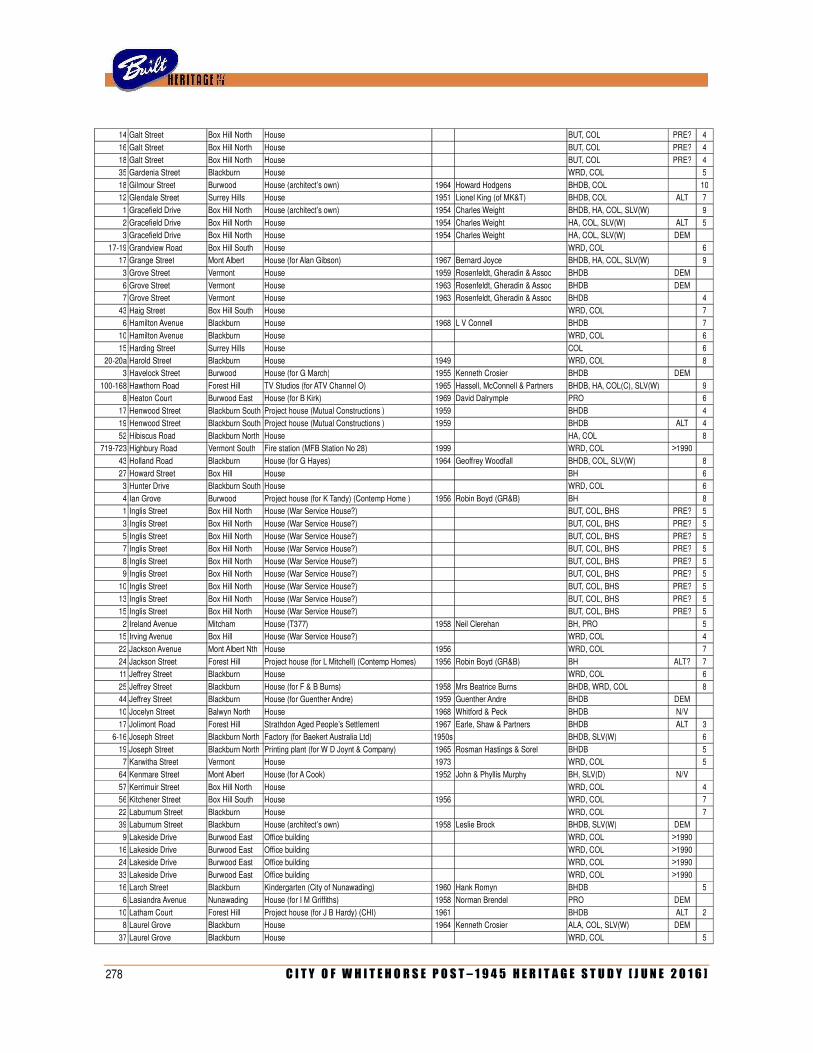
278 C I T Y O F W H I T E H O R S E P O S T – 1 9 4 5 H E R I T A G E S T U D Y [ J U N E 2 0 1 6 ]
14 Galt Street Box Hill North House
BUT, COL PRE? 4
16 Galt Street Box Hill North House
BUT, COL PRE? 4
18 Galt Street Box Hill North House
BUT, COL PRE? 4 35 Gardenia Street Blackburn House
WRD, COL
5
18 Gilmour Street Burwood House (architect’s own) 1964 Howard Hodgens BHDB, COL
10 12 Glendale Street Surrey Hills House 1951 Lionel King (of MK&T) BHDB, COL ALT 7
1 Gracefield Drive Box Hill North House (architect’s own) 1954 Charles Weight BHDB, HA, COL, SLV(W)
9
2 Gracefield Drive Box Hill North House 1954 Charles Weight HA, COL, SLV(W) ALT 5 3 Gracefield Drive Box Hill North House 1954 Charles Weight HA, COL, SLV(W) DEM
17-19 Grandview Road Box Hill South House
WRD, COL
6
17 Grange Street Mont Albert House (for Alan Gibson) 1967 Bernard Joyce BHDB, HA, COL, SLV(W)
9
3 Grove Street Vermont House 1959 Rosenfeldt, Gheradin & Assoc BHDB DEM
6 Grove Street Vermont House 1963 Rosenfeldt, Gheradin & Assoc BHDB DEM
7 Grove Street Vermont House 1963 Rosenfeldt, Gheradin & Assoc BHDB
4
43 Haig Street Box Hill South House
WRD, COL
7 6 Hamilton Avenue Blackburn House 1968 L V Connell BHDB
7
10 Hamilton Avenue Blackburn House
WRD, COL
6
15 Harding Street Surrey Hills House
COL
6 20-20a Harold Street Blackburn House 1949
WRD, COL
8
3 Havelock Street Burwood House (for G March) 1955 Kenneth Crosier BHDB DEM
100-168 Hawthorn Road Forest Hill TV Studios (for ATV Channel O) 1965 Hassell, McConnell & Partners BHDB, HA, COL(C), SLV(W)
9 8 Heaton Court Burwood East House (for B Kirk) 1969 David Dalrymple PRO
6
17 Henwood Street Blackburn South Project house (Mutual Constructions ) 1959
BHDB
4 19 Henwood Street Blackburn South Project house (Mutual Constructions ) 1959
BHDB ALT 4
52 Hibiscus Road Blackburn North House
HA, COL
8 719-723 Highbury Road Vermont South Fire station (MFB Station No 28) 1999
WRD, COL >1990
43 Holland Road Blackburn House (for G Hayes) 1964 Geoffrey Woodfall BHDB, COL, SLV(W)
8
27 Howard Street Box Hill House
BH
6 3 Hunter Drive Blackburn South House
WRD, COL
6
4 Ian Grove Burwood Project house (for K Tandy) (Contemp Home ) 1956 Robin Boyd (GR&B) BH
8 1 Inglis Street Box Hill North House (War Service House?)
BUT, COL, BHS PRE? 5
3 Inglis Street Box Hill North House (War Service House?)
BUT, COL, BHS PRE? 5
5 Inglis Street Box Hill North House (War Service House?)
BUT, COL, BHS PRE? 5 7 Inglis Street Box Hill North House (War Service House?)
BUT, COL, BHS PRE? 5
8 Inglis Street Box Hill North House (War Service House?)
BUT, COL, BHS PRE? 5 9 Inglis Street Box Hill North House (War Service House?)
BUT, COL, BHS PRE? 5
10 Inglis Street Box Hill North House (War Service House?)
BUT, COL, BHS PRE? 5
13 Inglis Street Box Hill North House (War Service House?)
BUT, COL, BHS PRE? 5 15 Inglis Street Box Hill North House (War Service House?)
BUT, COL, BHS PRE? 5
2 Ireland Avenue Mitcham House (T377) 1958 Neil Clerehan BH, PRO
5 15 Irving Avenue Box Hill House (War Service House?)
WRD, COL
4
22 Jackson Avenue Mont Albert Nth House 1956
WRD, COL
7
24 Jackson Street Forest Hill Project house (for L Mitchell) (Contemp Homes) 1956 Robin Boyd (GR&B) BH ALT? 7 11 Jeffrey Street Blackburn House
WRD, COL
6
25 Jeffrey Street Blackburn House (for F & B Burns) 1958 Mrs Beatrice Burns BHDB, WRD, COL
8 44 Jeffrey Street Blackburn House (for Guenther Andre) 1959 Guenther Andre BHDB DEM
10 Jocelyn Street Balwyn North House 1968 Whitford & Peck BHDB N/V
17 Jolimont Road Forest Hill Strathdon Aged People’s Settlement 1967 Earle, Shaw & Partners BHDB ALT 3
6-16 Joseph Street Blackburn North Factory (for Baekert Australia Ltd) 1950s
BHDB, SLV(W)
6
19 Joseph Street Blackburn North Printing plant (for W D Joynt & Company) 1965 Rosman Hastings & Sorel BHDB
5 7 Karwitha Street Vermont House 1973
WRD, COL
5
64 Kenmare Street Mont Albert House (for A Cook) 1952 John & Phyllis Murphy BH, SLV(D) N/V
57 Kerrimuir Street Box Hill North House
WRD, COL
4 56 Kitchener Street Box Hill South House 1956
WRD, COL
7
22 Laburnum Street Blackburn House
WRD, COL
7 39 Laburnum Street Blackburn House (architect’s own) 1958 Leslie Brock BHDB, SLV(W) DEM
9 Lakeside Drive Burwood East Office building
WRD, COL >1990
16 Lakeside Drive Burwood East Office building
WRD, COL >1990
24 Lakeside Drive Burwood East Office building
WRD, COL >1990
33 Lakeside Drive Burwood East Office building
WRD, COL >1990
16 Larch Street Blackburn Kindergarten (City of Nunawading) 1960 Hank Romyn BHDB
5
6 Lasiandra Avenue Nunawading House (for I M Griffiths) 1958 Norman Brendel PRO DEM
10 Latham Court Forest Hill Project house (for J B Hardy) (CHI) 1961
BHDB ALT 2 8 Laurel Grove Blackburn House 1964 Kenneth Crosier ALA, COL, SLV(W) DEM
37 Laurel Grove Blackburn House
WRD, COL
5
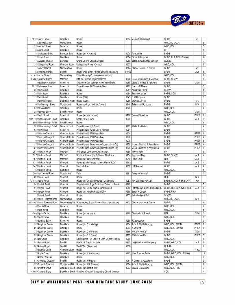
C I T Y O F W H I T E H O R S E P O S T – 1 9 4 5 H E R I T A G E S T U D Y [ J U N E 2 0 1 6 ] 279
Lot 13 Laurel Grove Blackburn House 1967 Moore & Hammond BHDB N/L
1 Laurencia Court Mont Albert House
WRD, BUT, COL
8
29 Leonard Street Burwood House
WRD, COL
5 3 Leons Court Blackburn House
BH
5
8 Lindisfarne Drive Burwood East House (for K Kunath) 1970 Tom Jacobi BHDB
7 17 Linum Street Blackburn House 1954 Richard Berryman BHDB, ALA, COL, SLV(W)
6
17 Livingston Close Burwood Orana Uniting Church Chapel 1958 Bates, Smart & McCutcheon COL(C)
7
39 Livingstone Road Vermont South Livingstone Primary School 1977
WRD, COL
5
Lorikeet Street Nunawading House 1964 Clarke, Hopkins & Clarke BHDB N/L
19 Lorraine Avenue Box Hill House (Age Small Homes Service) (plan u/k) c1956
BHDB ALT 5
41-49 Luckie Street Nunawading Flats (Housing Commission of Victoria)
WRD, COL
6
25-35 Lucknow Street Mitcham MMBW Eastern Regional Depot 1970 Lines, Macfarlane & Marshall BHDB, SLV(W)
8
McLaughlin Avenue Forest Hill Showroom (for Dunstan Home Furnishers) 1959 Leslie M Perrott & Partners BHDB DEM
121? Mahoneys Road Forest Hill Project house (N P Lewis & Son) 1966 Francis C Mason BHDB
5
38 Main Street Blackburn House 1954 Alexander Harris SLV(W)
5 74 Main Street Blackburn House 1954 Brian O’Connor BHDB, COW
7
111 Main Street Blackburn House (T22) 1949 R W Hodgson BHDB
9
Marchiori Road Blackburn North House (V256) 1955 Slawik & Joyce BHDB N/L
9 Marlborough Street Mont Albert House addition (architect’s own) 1949 Robert van Rompaey BHDB N/V 3
31 Masons Road Blackburn House 1978
WRD, COL
4
22 Medway Street Box Hill North House
WRD, COL DEM
44 Menin Road Forest Hill House (architect’s own) 1966 Conrad Theodore BHDB PRE? 7
102-110 Middleborough Road Blackburn Shops (row of five) 1960
BHDB ALT 3 595 Middleborough Road Box Hill North House
WRD, COL
5
38 Middleborough Road Burwood East Project house (J B Orioff) 1963 Walter Embleton BHDB
4 61 Mill Avenue Forest Hill Project house (Craig Davis Homes) 1964
BHDB
4
5 Minerva Crescent Vermont South Project house (P D Pastellas) 1970
BHDB PRE? 5
7 Minerva Crescent Vermont South Project house (P D Pastellas) 1970
BHDB PRE? 4 9 Minerva Crescent Vermont South Project house (P D Pastellas) 1970
BHDB PRE? 5
25 Minerva Crescent Vermont South Project house (Morehouse Constructions Co) 1970 Marcus Gottlieb & Associates BHDB PRE? 4 27 Minerva Crescent Vermont South Project house (Morehouse Constructions Co) 1970 Marcus Gottlieb & Associates BHDB PRE? 4
257 Mitcham Road Mitcham Dr Stanley Cochrane Kindergarten 1955 Robert Rolfe BH
5
327 Mitcham Road Mitcham Doctor’s Rooms (for Dr Verner Threlked) 1954 Raymond Berg BHDB, SLV(W) ALT 4 457 Mitcham Road Mitcham House (for Jack Harrison) 1946 Robin Boyd RBF ALT
531 Mitcham Road Vermont Demonstration house (James Hardie & Co) 1962
BHDB ALT 7
547 Mitcham Road Vermont Medical clinic 1959 L R Saward BHDB ALT 4
10 Molleton Street Blackburn House
WRD, COL
6
394 Mont Albert Road Mont Albert Flats 1961 George Campbell BHDB
3 28 Moore Road Vermont House
COL N/V
34-40 Moore Road Vermont House (for Dr David Pearce) ‘Mirrabooka’ 1957 Roy Grounds (GR&B) BHDB, ALA(C), RBF, SLV(W) HO
56 Morack Road Vermont Project house (Inge Brothers) ‘Oakwood Rustic’ 1969
BHDB
5
91 Morack Road Vermont House (for Dr Ian Martin) ‘Cricklewood’ 1958 Pethebridge & Bell (Robin Boyd) BHDB, RBF, ALA, WRD, COL ALT 6
108 Morack Road Vermont House (for Herbert Ross) (T259) 1958 Stuart P Calder BHDB, PRO
7
Morack Road Vermont House 1953 Pethebridge & Bell SLV(W)
59 Mount Pleasant Road Nunawading House
WRD, BUT, COL N/V
105-107 Mount Pleasant Road Nunawading Sth Nunawading South Primary School (additions) 1973 Clarke, Hopkins & Clarke BHDB
6
4 Murray Drive Burwood House
WRD, COL
7
10 Musk Street Blackburn House
WRD, COL
5 20a Myrtle Grove Blackburn House (for Mr Major) 1960 Chancellor & Patrick RBF DEM 3
50 Myrtle Grove Blackburn House
WRD, COL
5 16 Nandina Street Forest Hill House 1959 J Zackauskas BHDB
3
20 Naughton Grove Blackburn House (for C H Morley) 1954 John & Phyllis Murphy WRD, COL, SLV(D) PRE? 7
29 Naughton Grove Blackburn House 1964 K Veltjens WRD, COL, SLV(W) PRE? 6 33 Naughton Grove Blackburn House (for C W Porter) 1966 W Collinson Kerr BHDB DEM
37 Naughton Grove Blackburn House (for B B Cowie) 1965 W Collinson Kerr BHDB PRE? 5 20 Neil Court Blackburn Kindergarten (Sir Edgar & Lady Coles; Yooralla) 1966
WRD, COL
6
51 Nelson Road Box Hill Box Hill & District Hospital 1955 Leighton Irwin & Company BHDB, WRD, COL ALT 7
36 Nelson Road Box Hill World War 2 Memorial 1952
COL(C)
7 3 Ngumby Court Vermont South House
WRD, COL >1990
7 Norris Court Blackburn House (for K Kristiansen) 1967 Miss Frances Seidel BHDB, WRD, COL, SLV(W)
10
11 Norway Avenue Blackburn House
WRD, COL
3
51 Olympiad Crescent Box Hill House (for W Hoare) 1961 R Durran & Associates BHDB
3
57 Orchard Crescent Mont Albert Nth House (for W L Stevens) 1954 John & Phyllis Murphy WRD, COL, SLV(D)
8 36 Orchard Grove Blackburn South House (architect’s own) 1967 Donald G Graham WRD, COL, PRO
7
43-49 Orchard Grove Blackburn South Blackburn South Co-operating Church (former)
COL
4
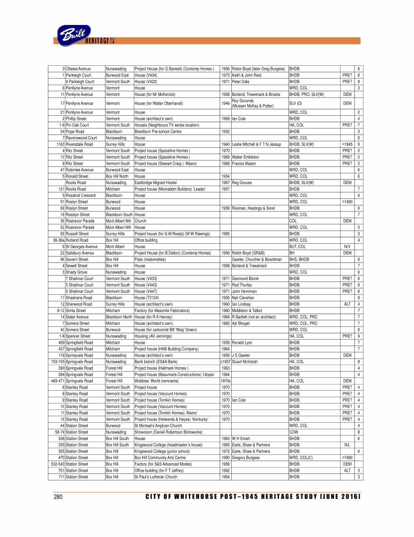
280 C I T Y O F W H I T E H O R S E P O S T – 1 9 4 5 H E R I T A G E S T U D Y [ J U N E 2 0 1 6 ]
3 Ottawa Avenue Nunawading Project House (for G Barwell) (Contemp Homes ) 1956 Robin Boyd (later Greg Burgess) BHDB
8
1 Parkleigh Court Burwood East House (V434) 1973 Keith & John Reid BHDB PRE? 8
9 Parkleigh Court Vermont South House (V422) 1971 Peter Dale BHDB PRE? 8
6 Penllyne Avenue Vermont House
WRD, COL
3
11 Penllyne Avenue Vermont House (for Mr McKenzie) 1958 Borland, Trewenack & Brooks BHDB, PRO, SLV(W) DEM
17 Penllyne Avenue Vermont House (for Walter Oberhansli) 1949 Roy Grounds (Mussen McKay & Potter) SLV (D) DEM
21 Penllyne Avenue Vermont House
WRD, COL
2
2 Phillip Street Vermont House (architect’s own) 1969 Ian Cole BHDB
4
1-6 Pin Oak Court Vermont South Houses (Neighbours TV series location)
HA, COL PRE? 7
54 Pope Road Blackburn Blackburn Pre-school Centre 1952
BHDB
3 7 Ravenswood Court Nunawading House
WRD, COL
6
1163 Riversdale Road Surrey Hills House 1940 Leslie Mitchell & F T N Jessup BHDB, SLV(W) <1945 9 4 Ritz Street Vermont South Project house (Spaceline Homes ) 1970
BHDB PRE? 5
10 Ritz Street Vermont South Project house (Spaceline Homes ) 1969 Walter Embleton BHDB PRE? 5
9 Ritz Street Vermont South Project house (Stewart Craig ) ‘Albany’ 1968 Francis Mason BHDB PRE? 5 47 Robinlee Avenue Burwood East House
WRD, COL
6
5 Ronald Street Box Hill North House 1954
WRD, COL
6
Rooks Road Nunawading Eastbridge Migrant Hostel 1967 Reg Grouse BHDB, SLV(W) DEM
121 Rooks Road Mitcham Project house (Moorabbin Builders) ‘Leader’ 1957
BHDB
7
5 Rosalind Crescent Blackburn House
WRD, COL
6 51 Roslyn Street Burwood House
WRD, COL >1990
69 Roslyn Street Burwood House 1958 Rosman, Hastings & Sorel BHDB
6
18 Rosslyn Street Blackburn South House
WRD, COL
7 36 Rostrevor Parade Mont Albert Nth Church
COL DEM
52 Rostrevor Parade Mont Albert Nth House
WRD, COL
5
69 Russell Street Surrey Hills Project house (for G M Ready) (M W Rawings) 1965
BHDB
3
36-36a Rutland Road Box Hill Office building
WRD, COL
4
6 St Georges Avenue Mont Albert House
BUT, COL N/V
22 Salisbury Avenue Blackburn Project House (for B Dalton) (Contemp Homes) 1956 Robin Boyd (GR&B) BH DEM
96 Severn Street Box Hill Flats (maisonettes)
Gawler, Churcher & Boardman BHS, BHDB
8 4 Sewell Street Box Hill House 1958 Borland & Trewenack BHDB
7
3 Shady Grove Nunawading House
WRD, COL
6
7 Shalimar Court Vermont South House (V433) 1971 Desmond Bloink BHDB PRE? 8
5 Shalimar Court Vermont South House (V443) 1971 Rod Thurley BHDB PRE? 8
6 Shalimar Court Vermont South House (V447) 1971 John Herniman BHDB PRE? 8
17 Sheehans Road Blackburn House (T2124) 1956 Neil Clerehan BHDB
9
12 Sherwood Road Surrey Hills House (architect’s own) 1960 Ian Lindsay BHDB ALT 4
8-12 Simla Street Mitcham Factory (for Masonite Fabricators) 1960 Middleton & Talbot BHDB
7 14 Slater Avenue Blackburn North House (for R A Harvey) 1964 R Bartlett (not an architect) WRD, COL, PRO
7
7 Somers Street Mitcham House (architect’s own) 1963 Ajit Bhogel WRD, COL, PRO
7 40 Somers Street Burwood House (for cartoonist Bill ‘Weg’ Green)
WRD, COL
8
1-8 Spencer Street Nunawading Housing (AV Jennings)
HA, COL PRE? 9
409 Springfield Road Mitcham House 1959 Ronald Lyon BHDB
7 437 Springfield Road Mitcham Project house (HAB Building Company) 1964
BHDB
7
116 Springvale Road Nunawading House (architect’s own) 1959 J S Gawler BHDB DEM
153-155 Springvale Road Nunawading Bank branch (ES&A Bank) c1957 Stuart McIntosh HA, COL
8
390 Springvale Road Forest Hill Project house (Hallmark Homes ) 1963
BHDB
4
394 Springvale Road Forest Hill Project house (Beaumaris Constructions) ‘Utopia’ 1964
BHDB
4 469-471 Springvale Road Forest Hill Wobbies’ World (remnants) 1970s
HA, COL DEM
6 Stanley Road Vermont South Project house 1970
BHDB PRE? 4
8 Stanley Road Vermont South Project house (Viscount Homes) 1970
BHDB PRE? 4
9 Stanley Road Vermont South Project house (Tomkin Homes) 1970 Ian Cole BHDB PRE? 4
10 Stanley Road Vermont South Project house (Viscount Homes) 1970
BHDB PRE? 4 11 Stanley Road Vermont South Project house (Tomkin Homes) ‘Alamo’ 1970
BHDB PRE? 4
19 Stanley Road Vermont South Project house (Holwerda & Hayes) ‘Kentucky’ 1970
BHDB PRE? 4 44 Station Street Burwood St Michael’s Anglican Church
WRD, COL
4
58-74 Station Street Nunawading Showroom (Daniel Robertson Brickworks)
COW
8
336 Station Street Box Hill South House 1963 W H Smart BHDB
6 335 Station Street Box Hill South Kingswood College (headmaster’s house) 1965 Earle, Shaw & Partners BHDB N/L
355 Station Street Box Hill Kingswood College (junior school) 1972 Earle, Shaw & Partners BHDB
6
470 Station Street Box Hill Box Hill Community Arts Centre 1990 Gregory Burgess WRD, COL(C) >1990
532-540 Station Street Box Hill Factory (for S&S Advanced Modes) 1958
BHDB DEM
701 Station Street Box Hill Office building (for F T Jeffrey) 1962
BHDB ALT 3 711 Station Street Box Hill St Paul’s Lutheran Church 1954
BHDB
3
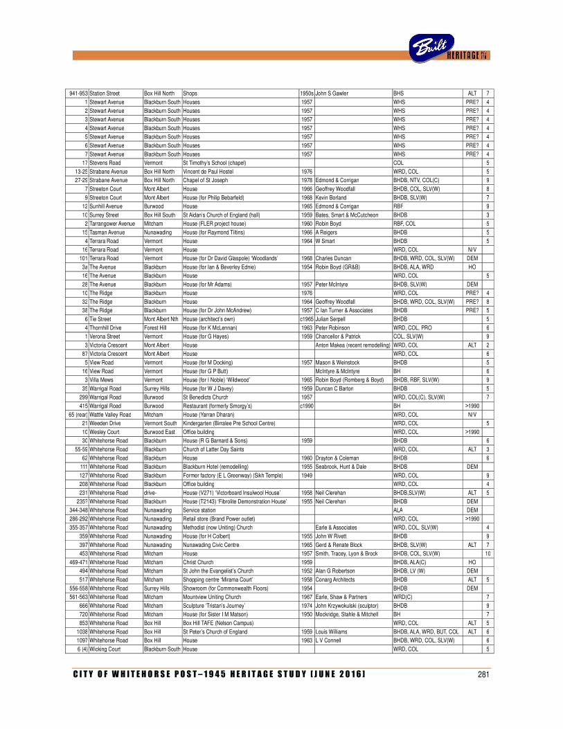
C I T Y O F W H I T E H O R S E P O S T – 1 9 4 5 H E R I T A G E S T U D Y [ J U N E 2 0 1 6 ] 281
941-953 Station Street Box Hill North Shops 1950s John S Gawler BHS ALT 7
1 Stewart Avenue Blackburn South Houses 1957
WHS PRE? 4
2 Stewart Avenue Blackburn South Houses 1957
WHS PRE? 4 3 Stewart Avenue Blackburn South Houses 1957
WHS PRE? 4
4 Stewart Avenue Blackburn South Houses 1957
WHS PRE? 4 5 Stewart Avenue Blackburn South Houses 1957
WHS PRE? 4
6 Stewart Avenue Blackburn South Houses 1957
WHS PRE? 4
7 Stewart Avenue Blackburn South Houses 1957
WHS PRE? 4 17 Stevens Road Vermont St Timothy’s School (chapel)
COL
5
13-25 Strabane Avenue Box Hill North Vincent de Paul Hostel 1976
WRD, COL
5 27-29 Strabane Avenue Box Hill North Chapel of St Joseph 1978 Edmond & Corrigan BHDB, NTV, COL(C)
9
7 Streeton Court Mont Albert House 1966 Geoffrey Woodfall BHDB, COL, SLV(W)
8
9 Streeton Court Mont Albert House (for Philip Bebarfeld) 1968 Kevin Borland BHDB, SLV(W)
7 12 Sunhill Avenue Burwood House 1965 Edmond & Corrigan RBF
9
10 Surrey Street Box Hill South St Aidan’s Church of England (hall) 1959 Bates, Smart & McCutcheon BHDB
3 2 Tarrangower Avenue Mitcham House (FLER project house) 1960 Robin Boyd RBF, COL
5
15 Tasman Avenue Nunawading House (for Raymond Tiltins) 1966 A Reigers BHDB
5
4 Terrara Road Vermont House 1964 W Smart BHDB
5 16 Terrara Road Vermont House
WRD, COL N/V
101 Terrara Road Vermont House (for Dr David Glaspole) ‘Woodlands’ 1968 Charles Duncan BHDB, WRD, COL, SLV(W) DEM
3a The Avenue Blackburn House (for Ian & Beverley Ednie) 1954 Robin Boyd (GR&B) BHDB, ALA, WRD HO
16 The Avenue Blackburn House
WRD, COL
5
28 The Avenue Blackburn House (for Mr Adams) 1957 Peter McIntyre BHDB, SLV(W) DEM
10 The Ridge Blackburn House 1976
WRD, COL PRE? 4
32 The Ridge Blackburn House 1964 Geoffrey Woodfall BHDB, WRD, COL, SLV(W) PRE? 8 38 The Ridge Blackburn House (for Dr John McAndrew) 1957 C Ian Turner & Associates BHDB PRE? 5
6 Tie Street Mont Albert Nth House (architect’s own) c1965 Julian Serpell BHDB
5
4 Thornhill Drive Forest Hill House (for K McLennan) 1963 Peter Robinson WRD, COL, PRO
6 1 Verona Street Vermont House (for G Hayes) 1959 Chancellor & Patrick COL, SLV(W)
9
3 Victoria Crescent Mont Albert House
Anton Makea (recent remodelling) WRD, COL ALT 2 87 Victoria Crescent Mont Albert House
WRD, COL
6
5 View Road Vermont House (for M Docking) 1957 Mason & Weinstock BHDB
5
16 View Road Vermont House (for G P Butt)
McIntyre & McIntyre BH
6 3 Villa Mews Vermont House (for I Noble) ‘Wildwood’ 1965 Robin Boyd (Romberg & Boyd) BHDB, RBF, SLV(W)
9
35 Warrigal Road Surrey Hills House (for W J Davey) 1959 Duncan C Barton BHDB
5 299 Warrigal Road Burwood St Benedicts Church 1957
WRD, COL(C), SLV(W)
7
415 Warrigal Road Burwood Restaurant (formerly Smorgy’s) c1990
BH >1990
65 (rear) Wattle Valley Road Mitcham House (Yarran Dharan)
WRD, COL N/V
21 Weeden Drive Vermont South Kindergarten (Birralee Pre School Centre)
WRD, COL
5
10 Wesley Court Burwood East Office building
WRD, COL >1990
30 Whitehorse Road Blackburn House (R G Barnard & Sons) 1959
BHDB
6
55-59 Whitehorse Road Blackburn Church of Latter Day Saints
WRD, COL ALT 3
62 Whitehorse Road Blackburn House 1960 Drayton & Coleman BHDB
6 111 Whitehorse Road Blackburn Blackburn Hotel (remodelling) 1955 Seabrook, Hunt & Dale BHDB DEM
127 Whitehorse Road Blackburn Former factory (E L Greenway) (Sikh Temple) 1949
WRD, COL
9
208 Whitehorse Road Blackburn Office building
WRD, COL
4
231 Whitehorse Road drive- House (V271) ‘Victorboard Insulwool House’ 1958 Neil Clerehan BHDB,SLV(W) ALT 5
235? Whitehorse Road Blackburn House (T2143) ‘Fibrolite Demonstration House’ 1955 Neil Clerehan BHDB DEM
344-348 Whitehorse Road Nunawading Service station
ALA DEM
286-292 Whitehorse Road Nunawading Retail store (Brand Power outlet)
WRD, COL >1990
355-357 Whitehorse Road Nunawading Methodist (now Uniting) Church
Earle & Associates WRD, COL, SLV(W)
4
359 Whitehorse Road Nunawading House (for H Colbert) 1955 John W Rivett BHDB
9
397 Whitehorse Road Nunawading Nunawading Civic Centre 1965 Gerd & Renate Block BHDB, SLV(W) ALT 7 453 Whitehorse Road Mitcham House 1957 Smith, Tracey, Lyon & Brock BHDB, COL, SLV(W)
10
469-471 Whitehorse Road Mitcham Christ Church 1959
BHDB, ALA(C) HO
494 Whitehorse Road Mitcham St John the Evangelist’s Church 1952 Alan G Robertson BHDB, LV (W) DEM
517 Whitehorse Road Mitcham Shopping centre ‘Mirama Court’ 1958 Conarg Architects BHDB ALT 5
556-558 Whitehorse Road Surrey Hills Showroom (for Commonwealth Floors) 1954
BHDB DEM
561-563 Whitehorse Road Mitcham Mountview Uniting Church 1967 Earle, Shaw & Partners WRD(C)
7
666 Whitehorse Road Mitcham Sculpture ‘Tristan’s Journey’ 1974 John Krzywokulski (sculptor) BHDB
9 720 Whitehorse Road Mitcham House (for Sister I M Matson) 1950 Mockridge, Stahle & Mitchell BH
7
853 Whitehorse Road Box Hill Box Hill TAFE (Nelson Campus)
WRD, COL ALT 5
1038 Whitehorse Road Box Hill St Peter’s Church of England 1959 Louis Williams BHDB, ALA, WRD, BUT, COL ALT 6 1097 Whitehorse Road Box Hill House 1963 L V Connell BHDB, WRD, COL, SLV(W)
6
6 (4) Wicking Court Blackburn South House
WRD, COL
5
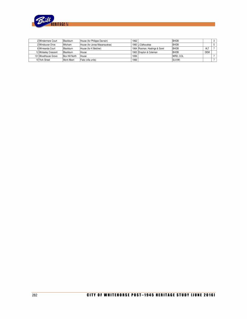
282 C I T Y O F W H I T E H O R S E P O S T – 1 9 4 5 H E R I T A G E S T U D Y [ J U N E 2 0 1 6 ]
2 Windermere Court Blackburn House (for Philippe Davrain) 1962
BHDB
3
2 Windouran Drive Mitcham House (for Jonas Masanauskas) 1960 J Zalkouskas BHDB
5
6 Wirreanda Court Blackburn House (for K Belcher) 1964 Rosman, Hastings & Sorel BHDB ALT 7 12 Wolseley Crescent Blackburn House 1963 Drayton & Coleman BHDB DEM
131 Woodhouse Grove Box Hill North House 1956
WRD, COL
7
18 York Street Mont Albert Flats (villa units) 1966
SLV(W)
7
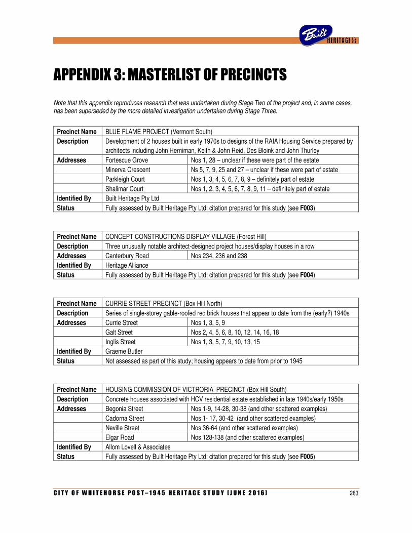
C I T Y O F W H I T E H O R S E P O S T – 1 9 4 5 H E R I T A G E S T U D Y [ J U N E 2 0 1 6 ] 283
APPENDIX 3: MASTERLIST OF PRECINCTS
Note that this appendix reproduces research that was undertaken during Stage Two of the project and, in some cases, has been superseded by the more detailed investigation undertaken during Stage Three.
Precinct Name BLUE FLAME PROJECT (Vermont South)
Description Development of 2 houses built in early 1970s to designs of the RAIA Housing Service prepared by
architects including John Herniman, Keith & John Reid, Des Bloink and John Thurley
Addresses Fortescue Grove Nos 1, 28 – unclear if these were part of the estate
Minerva Crescent Ns 5, 7, 9, 25 and 27 – unclear if these were part of estate
Parkleigh Court Nos 1, 3, 4, 5, 6, 7, 8, 9 – definitely part of estate
Shalimar Court Nos 1, 2, 3, 4, 5, 6, 7, 8, 9, 11 – definitely part of estate
Identified By Built Heritage Pty Ltd
Status Fully assessed by Built Heritage Pty Ltd; citation prepared for this study (see F003)
Precinct Name CONCEPT CONSTRUCTIONS DISPLAY VILLAGE (Forest Hill)
Description Three unusually notable architect-designed project houses/display houses in a row
Addresses Canterbury Road Nos 234, 236 and 238
Identified By Heritage Alliance
Status Fully assessed by Built Heritage Pty Ltd; citation prepared for this study (see F004)
Precinct Name CURRIE STREET PRECINCT (Box Hill North)
Description Series of single-storey gable-roofed red brick houses that appear to date from the (early?) 1940s
Addresses Currie Street Nos 1, 3, 5, 9
Galt Street Nos 2, 4, 5, 6, 8, 10, 12, 14, 16, 18
Inglis Street Nos 1, 3, 5, 7, 9, 10, 13, 15
Identified By Graeme Butler
Status Not assessed as part of this study; housing appears to date from prior to 1945
Precinct Name HOUSING COMMISSION OF VICTRORIA PRECINCT (Box Hill South)
Description Concrete houses associated with HCV residential estate established in late 1940s/early 1950s
Addresses Begonia Street Nos 1-9, 14-28, 30-38 (and other scattered examples)
Cadorna Street Nos 1- 17, 30-42 (and other scattered examples)
Neville Street Nos 36-64 (and other scattered examples)
Elgar Road Nos 128-138 (and other scattered examples)
Identified By Allom Lovell & Associates
Status Fully assessed by Built Heritage Pty Ltd; citation prepared for this study (see F005)
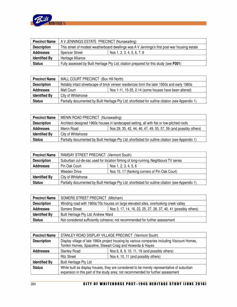
284 C I T Y O F W H I T E H O R S E P O S T – 1 9 4 5 H E R I T A G E S T U D Y [ J U N E 2 0 1 6 ]
Precinct Name A V JENNINGS ESTATE PRECINCT (Nunawading)
Description This street of modest weatherboard dwellings was A V Jennings’s first post-war housing estate
Addresses Spencer Street Nos 1, 2, 3, 4, 5, 6, 7, 8
Identified By Heritage Alliance
Status Fully assessed by Built Heritage Pty Ltd; citation prepared for this study (see F001)
Precinct Name MALL COURT PRECINCT (Box Hill North)
Description Notably intact streetscape of brick veneer residences form the later 1950s and early 1960s
Addresses Mall Court Nos 1-11, 15-35, 2-14 (some houses have been altered)
Identified By City of Whitehorse
Status Partially documented by Built Heritage Pty Ltd; shortlisted for outline citation (see Appendix 1)
Precinct Name MENIN ROAD PRECINCT (Nunawading)
Description Architect-designed 1960s houses in landscaped setting, all with flat or low-pitched roofs
Addresses Menin Road Nos 29, 35, 42, 44, 46, 47, 49, 55, 57, 59 (and possibly others)
Identified By City of Whitehorse
Status Partially documented by Built Heritage Pty Ltd; shortlisted for outline citation (see Appendix 1)
Precinct Name RAMSAY STREET PRECINCT (Vermont South)
Description Suburban cul-de-sac used for location filming of long-running Neighbours TV series
Addresses Pin Oak Court Nos 1, 2, 3, 4, 5, 6
Weeden Drive Nos 15, 17 (flanking corners of Pin Oak Court)
Identified By City of Whitehorse
Status Partially documented by Built Heritage Pty Ltd; shortlisted for outline citation (see Appendix 1)
Precinct Name SOMERS STREET PRECINCT (Mitcham)
Description Winding road with 1960s/70s houses on large elevated sites, overlooking creek valley
Addresses Somers Street Nos 3, 17, 14, 16, 22, 25, 27, 28, 37, 40, 41 (possibly others)
Identified By Built Heritage Pty Ltd; Andrew Ward
Status Not considered sufficiently cohesive; not recommended for further assessment
Precinct Name STANLEY ROAD DISPLAY VILLAGE PRECINCT (Vermont South)
Description Display village of late 1960s project housing by various companies including Viscount Homes, Tomkin Homes, Spaceline, Stewart Craig and Howerda & Hayes
Addresses Stanley Road Nos 6, 8, 9, 10, 11, 19 (and possibly others)
Ritz Street Nos 4, 10, 11 (and possibly others)
Identified By Built Heritage Pty Ltd
Status While built as display houses, they are considered to be merely representative of suburban expansion in this part of the study area; not recommended for further assessment

C I T Y O F W H I T E H O R S E P O S T – 1 9 4 5 H E R I T A G E S T U D Y [ J U N E 2 0 1 6 ] 285
Precinct Name STEWART AVENUE PRECINCT (Blackburn South)
Description Cluster of modest hip-roofed weatherboard houses dating from 1957
Addresses Stewart Avenue Nos 1, 2, 3, 4, 5, 6, 7 (several of the houses have been altered)
Identified By Whitehorse Historical Society
Status Houses display low level of intactness and are considered to be merely representative of suburban expansion in this part of the study area; not recommended for further assessment
Precinct Name THE RIDGE/NAUGHTON GROVE PRECINCT (Blackburn)
Description Modernist houses in bush landscaped setting, mostly dating from the mid-1950s and including examples by such architects as Geoffrey Woodfall, Ian Turner, W Collinson Kerr and Kurt Veltjens
Addresses Naughton Grove Nos 20, 29, 33, 35, 37 (and possibly others)
The Ridge No 10, 12, 13, 32, 43, 48 (and possibly others)
Identified By Built Heritage Pty Ltd
Status Interesting architect-designed houses are interspersed with less distinguished examples or newer dwellings; as such, streetscape is not deemed to display sufficient cohesion to be recommended as a heritage precinct. Some of the houses could conceivably be subject to further assessment in the future, with a view to applying individual heritage overlays.

286 C I T Y O F W H I T E H O R S E P O S T – 1 9 4 5 H E R I T A G E S T U D Y [ J U N E 2 0 1 6 ]
Related Documents