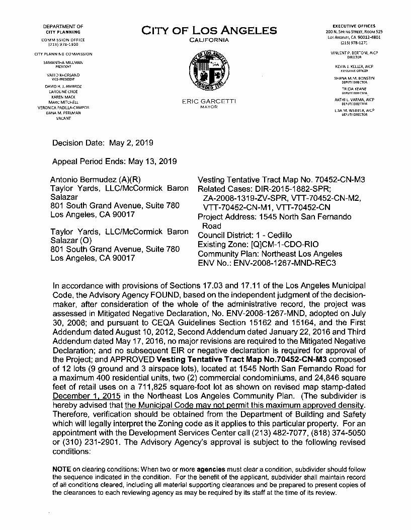
EXECUTIVE OFFICES 200 N. Spring Street, Room 525 Los Angeles, CA 90012-4801 (213)978-1271 DEPARTMENT OF CITY PLANNING City of Los Angeles CALIFORNIA COMMISSION OFFICE (213) 978-1300 lV-5 VINCENT P. BERTONI, AICP DIRECTOR CITY PLANNING COMMISSION Ik SAMANTHA MILLMAN PRESIDENT KEVIN J. KELLER, AICP EXECUTIVE OFFICER VAHID KHORSAND VICE-PRESIDENT SHANA M.M. BONSTIN DEPUTY DIRECTOR h2KV DAVID H.J.AMBROZ CAROLINE CHOE KAREN MACK MARC MITCHELL VERONICA PADILLA-CAMPOS DANA M. PERLMAN VACANT TRICIA KEANE DEPUTY DIRECTOR ARTHI L. VARMA, AICP DEPUTY DIRECTOR LISA M. WEBBER, AICP DEPUTY DIRECTOR ERIC GARCETTI MAYOR Decision Date: May 2, 2019 Appeal Period Ends: May 13, 2019 Antonio Bermudez (A)(R) Taylor Yards, LLC/McCormick Baron Salazar 801 South Grand Avenue, Suite 780 Los Angeles, CA 90017 Vesting Tentative Tract Map No. 70452-CN-M3 Related Cases: DIR-2015-1882-SPR; ZA-2008-1319-ZV-SPR, VTT-70452-CN-M2, VTT-70452-CN-M1, VTT-70452-CN Project Address: 1545 North San Fernando Road Council District: 1 - Cedillo Existing Zone: [QJCM-1-CDO-RIO Community Plan: Northeast Los Angeles ENV No.: ENV-2008-1267-MND-REC3 Taylor Yards, LLC/McCormick Baron Salazar (O) 801 South Grand Avenue, Suite 780 Los Angeles, CA 90017 In accordance with provisions of Sections 17.03 and 17.11 of the Los Angeles Municipal Code, the Advisory Agency FOUND, based on the independent judgment of the decision- maker, after consideration of the whole of the administrative record, the project was assessed in Mitigated Negative Declaration, No. ENV-2008-1267-MND, adopted on July 30, 2008; and pursuant to CEQA Guidelines Section 15162 and 15164, and the First Addendum dated August 10, 2012, Second Addendum dated January 22, 2016 and Third Addendum dated May 17, 2016, no major revisions are required to the Mitigated Negative Declaration; and no subsequent EIR or negative declaration is required for approval of the Project; and APPROVED Vesting Tentative Tract Map No.70452-CN-M3 composed of 12 lots (9 ground and 3 airspace lots), located at 1545 North San Fernando Road for a maximum 400 residential units, two (2) commercial condominiums, and 24,846 square feet of retail uses on a 711,825 square-foot lot as shown on revised map stamp-dated December 1, 2015 in the Northeast Los Angeles Community Plan. (The subdivider is hereby advised that the Municipal Code may not permit this maximum approved density. Therefore, verification should be obtained from the Department of Building and Safety which will legally interpret the Zoning code as it applies to this particular property. For an appointment with the Development Services Center call (213) 482-7077, (818) 374-5050 or (310) 231-2901. The Advisory Agency’s approval is subject to the following revised conditions: NOTE on clearing conditions: When two or more agencies must clear a condition, subdivider should follow the sequence indicated in the condition. For the benefit of the applicant, subdivider shall maintain record of all conditions cleared, including all material supporting clearances and be prepared to present copies of the clearances to each reviewing agency as may be required by its staff at the time of its review.

Welcome message from author
This document is posted to help you gain knowledge. Please leave a comment to let me know what you think about it! Share it to your friends and learn new things together.
Transcript
EXECUTIVE OFFICES200 N. Spring Street, Room 525
Los Angeles, CA 90012-4801 (213)978-1271
DEPARTMENT OF CITY PLANNING City of Los Angeles
CALIFORNIACOMMISSION OFFICE (213) 978-1300
lV-5 VINCENT P. BERTONI, AICP DIRECTOR
CITY PLANNING COMMISSION
IkSAMANTHA MILLMANPRESIDENT KEVIN J. KELLER, AICP
EXECUTIVE OFFICERVAHID KHORSAND
VICE-PRESIDENT SHANA M.M. BONSTIN DEPUTY DIRECTORh2KV
DAVID H.J.AMBROZ
CAROLINE CHOE
KAREN MACK
MARC MITCHELL
VERONICA PADILLA-CAMPOS
DANA M. PERLMAN
VACANT
TRICIA KEANE DEPUTY DIRECTOR
ARTHI L. VARMA, AICP DEPUTY DIRECTOR
LISA M. WEBBER, AICP DEPUTY DIRECTOR
ERIC GARCETTIMAYOR
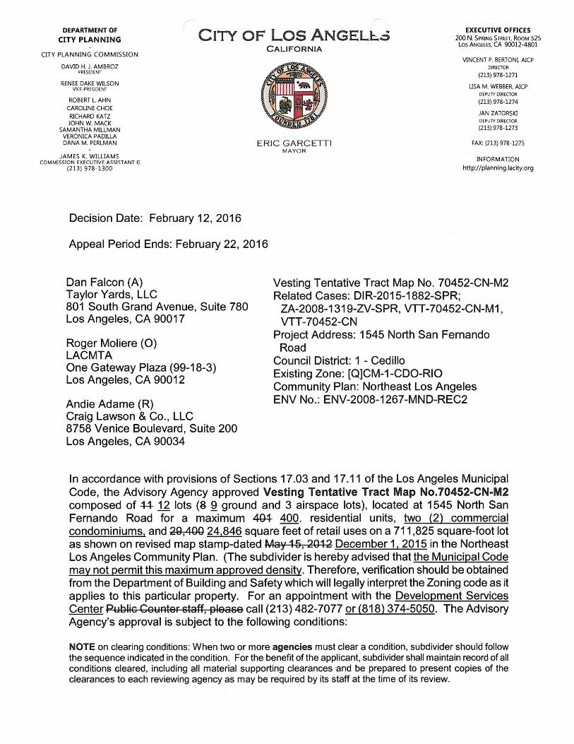
Decision Date: May 2, 2019
Appeal Period Ends: May 13, 2019
Antonio Bermudez (A)(R)Taylor Yards, LLC/McCormick Baron Salazar801 South Grand Avenue, Suite 780 Los Angeles, CA 90017
Vesting Tentative Tract Map No. 70452-CN-M3 Related Cases: DIR-2015-1882-SPR;
ZA-2008-1319-ZV-SPR, VTT-70452-CN-M2, VTT-70452-CN-M1, VTT-70452-CN
Project Address: 1545 North San Fernando Road
Council District: 1 - Cedillo Existing Zone: [QJCM-1-CDO-RIO Community Plan: Northeast Los Angeles ENV No.: ENV-2008-1267-MND-REC3
Taylor Yards, LLC/McCormick Baron Salazar (O)801 South Grand Avenue, Suite 780 Los Angeles, CA 90017
In accordance with provisions of Sections 17.03 and 17.11 of the Los Angeles Municipal Code, the Advisory Agency FOUND, based on the independent judgment of the decisionmaker, after consideration of the whole of the administrative record, the project was assessed in Mitigated Negative Declaration, No. ENV-2008-1267-MND, adopted on July 30, 2008; and pursuant to CEQA Guidelines Section 15162 and 15164, and the First Addendum dated August 10, 2012, Second Addendum dated January 22, 2016 and Third Addendum dated May 17, 2016, no major revisions are required to the Mitigated Negative Declaration; and no subsequent EIR or negative declaration is required for approval of the Project; and APPROVED Vesting Tentative Tract Map No.70452-CN-M3 composed of 12 lots (9 ground and 3 airspace lots), located at 1545 North San Fernando Road for a maximum 400 residential units, two (2) commercial condominiums, and 24,846 square feet of retail uses on a 711,825 square-foot lot as shown on revised map stamp-dated December 1, 2015 in the Northeast Los Angeles Community Plan. (The subdivider is hereby advised that the Municipal Code may not permit this maximum approved density. Therefore, verification should be obtained from the Department of Building and Safety which will legally interpret the Zoning code as it applies to this particular property. For an appointment with the Development Services Center call (213) 482-7077, (818) 374-5050 or (310) 231-2901. The Advisory Agency’s approval is subject to the following revised conditions:
NOTE on clearing conditions: When two or more agencies must clear a condition, subdivider should follow the sequence indicated in the condition. For the benefit of the applicant, subdivider shall maintain record of all conditions cleared, including all material supporting clearances and be prepared to present copies of the clearances to each reviewing agency as may be required by its staff at the time of its review.

PAGE 2VESTING TENTATIVE TRACT MAP NO. 70452-CN-M3
BACKGROUNDThe project site is located at 1545 San Fernando Road, is relatively flat and comprised of five irregularly-shaped parcels. The sum of the parcels forms a triangular-shaped site, and totals 17.8 net acres before dedication (771,685 square feet) and 16.3 net acres after dedication (708,005 square feet). In 2007, the City completed a zone change from M2- 1, M3-1, and PF-1 to CM-1 and a General Plan Amendment under Ordinance No. 179,390 to re-designate the site to Limited Industrial with corresponding zones of CM, M1, MR1, and P.
The Los Angeles County Metropolitan Transportation Authority (also known as METRO) is the owner of the project site. Taylor Yards, LLC (“the applicant”) has entered into a Joint Development Agreement (JDA) with METRO. METRO owns the underlying property known as Parcel C which includes 1545 North San Fernando Road, the project site.
On July 30, 2008, the Advisory Agency approved the Vesting Tentative Tract Map No. 70452 for the subdivision of eight ground and three airspace lots for a maximum 471 residential units and 29,400 square feet of retail uses on a 708,005 square-foot site. The original project consisted of 10 Joint Living and Work Quarter condominium units and 44 residential condominiums on ground Lot 1,200 residential condominium units on ground Lot 2, 67 affordable rental units and one non-restricted manager’s unit on ground Lot 3, 41 residential condominiums on ground Lot 4, and 107 affordable senior housing units and one non-restricted manager’s unit and two commercial condominiums comprised of 29,400 square feet of retail on ground Lot 5. The maximum building height was limited to 65 feet at four stories with a total floor area of 622,780 square feet.
On September 6,2012, the Advisory Agency approved a Modification to Vesting Tentative Tract Map No. 70452-CN-M1 composed of 11 lots (8 ground and 3 airspace lots) for a maximum 401 residential units and 29,400 square feet of retail uses on a 711,825 square- foot lot as shown on revised map stamp-dated May 15, 2012. This approval modified the project by reducing the floor area, buildable area and density while maintaining the amount of retail uses and building height. Several of the lots were reconfigured within the project site. Parking and open space provisions were reduced accordingly based on the number of residential units. The modified project consisted of a maximum 86 affordable rental units and one non-restricted manager’s unit on ground Lot 1; 97 residential condominiums on ground Lot 2; 67 affordable rental units and one non-restricted manager's unit on ground Lot 3; 41 residential condominiums on ground Lot 4; and 16,991 square feet of retail space in airspace Lot 9; 12,409 square feet of retail space in airspace Lot 10; and 107 affordable senior housing units and one non-restricted manager's unit in airspace Lot 11, where airspace Lots 9, 10, and 11 are located on ground Lot 5.
Phase One (1) of VTT-70452 has been recorded, and described as the recordation of six lots numbered 1-6 on the Final Map. These lots correspond to Lots 1, 3, 4, and 6, 7, and 8 on the approved Modified Phased Vesting Tentative Tract Map No. 70452-CN-M1. The two “Remainder Parcels” of recorded Final Map No. 70452-01 correspond with Lots 2 and
PAGE 3VESTING TENTATIVE TRACT MAP NO. 70452-CN-M3
5 of the previously modified Phased Vesting Tentative Tract Map No. VTT-70452-CN-M1. On February 12, 2016, the Advisory Agency approved VTT-70452-CN-M2 in order to divide Lot 2 into Lot 2A and 2B with a modified residential component; to reconfigure airspace Lots 9, 10, and 11 within master airspace Lot 5; and to reconfigure the two commercial condominium units on Lot 5.
On March 4, 2019, the Subdivider filed the third modification request for the unrecorded portions of the tract map. The Map approved under the second modification, map stamp dated December 1, 2015, is not changing. Rather, the Subdivider is requesting a modification to Condition No. 21, to opt into the Quimby Fee Deferral available to 100% affordable housing developments, based on the update of the Quimby Ordinance No. 184,505, effective January 11, 2017. The change requested and approved conditions herein pertain to these lots which have not yet been recorded. Therefore, the Revised Condition No. 21 shall read as follows (deletions in strikeout, additions in underline):
RECREATION AND PARKS
That the Quimby fee be based on the R3 Zone. (MM) That the Park Fee paid to the Department of Recreation and Parks be calculated as a Subdivision (Quimby in-lieu)21.
fee.
The following technical correction shall be made to Condition No. 28:
DEPARTMENT OF CITY PLANNING - SITE SPECIFIC CONDITIONS
REVISED Condition No. 28 shall read as follows:
Indemnification and Reimbursement of Litigation Costs.28.
Applicant shall do all of the following:
a. Defend, indemnify and hold harmless the City from any and all actions against the City relating to or arising out of, in whole or in part, the City’s processing and approval of this entitlement, including but not limited to, an action to attack, challenge, set aside, void or otherwise modify or annul the approval of the entitlement, the environmental review of the entitlement, or the approval of subsequent permit decisions or to claim personal property damage, including from inverse condemnation or any other constitutional claim.
b. Reimburse the City for any and all costs incurred in defense of an action related to or arising out of, in whole or in part, the City’s processing and approval of the entitlement, including but not limited to payment of all court costs and attorney’s fees, costs of any judgments or awards against the City (including an award of attorney’s fees), damages and/or settlement costs.
PAGE 4VESTING TENTATIVE TRACT MAP NO. 70452-CN-M3
c. Submit an initial deposit for the City’s litigation costs to the City within 10 days’ notice of the City tendering defense to the Applicant and requesting a deposit. The initial deposit shall be in an amount set by the City Attorney’s Office, in its sole discretion, based on the nature and scope of action, but in no event shall the initial deposit be less than $25,000$50,000. The City’s failure to notice or collect the deposit does not relieve the Applicant from responsibility to reimburse the City pursuant to the requirement in paragraph (b).
d. Submit supplemental deposits upon notice by the City. Supplemental deposits may be required in an increased amount from the initial deposit if found necessary by the City to protect the City’s interests. The City’s failure to notice or collect the deposit does not relieve the Applicant from responsibility to reimburse the City pursuant to the requirement, (b)
e. If the City determines it necessary to protect the City’s interests, execute an indemnity and reimbursement agreement with the City under terms consistent with the requirements of this condition.
The City shall notify the applicant within a reasonable period of time of its receipt of any action and the City shall cooperate in the defense. If the City fails to notify the applicant of any claim, action or proceeding in a reasonable time, or if the City fails to reasonably cooperate in the defense, the applicant shall not thereafter be responsible to defend, indemnify or hold harmless the City.
The City shall have the sole right to choose its counsel, including the City Attorney’s office or outside counsel. At its sole discretion, the City may participate at its own expense in the defense of any action, but such participation shall not relieve the applicant of any obligation imposed by this condition. In the event the Applicant fails to comply with this condition, in whole or in part, the City may withdraw its defense of the action, void its approval of the entitlement, or take any other action. The City retains the right to make all decisions with respect to its representations in any legal proceeding, including its inherent right to abandon or settle litigation.
For purposes of this condition, the following definitions apply:
“City” shall be defined to include the City, its agents, officers, boards commission, committees, employees and volunteers.
“Action” shall be defined to include suits, proceedings (including those held under alternative dispute resolution procedures), claims or lawsuits. Actions include actions, as defined herein, alleging failure to comply with any federal, state or local law.
Nothing in the definitions included in this paragraph are intended to limit the rights of the City or the obligations of the Applicant otherwise created by this condition.

PAGE 5VESTING TENTATIVE TRACT MAP NO. 70452-CN-M3
FINDINGS OF FACT (CEQA)
The Planning Staff issued a Third Addendum to the Mitigated Negative Declaration ENV-2008-1267-MND on May 17, 2016. No increase in the floor area, buildable area, density, amount of retail uses and building height is involved as part of VTT-70452-CN- M3 from the original tract determination and subsequent modifications.
The Deputy Advisory Agency certifies that Mitigated Negative Declaration No. ENV-2008- 1267-MND-REC3, the original MND and all previous addendum documents reflect the independent judgment of the lead agency and determined that this project would not have a significant effect upon the environment provided the potential impacts identified above are mitigated to a less than significant level through implementation of Condition Nos. 17a, 21, 22, 30 and 31 of the original Tract's approval. Other identified potential impacts not mitigated by these conditions are mandatorily subject to existing City ordinances, (Sewer Ordinance, Grading Ordinance, Flood Plain Management Specific Plan, Xeriscape Ordinance, Stormwater Ordinance, etc.) which are specifically intended to mitigate such potential impacts on all projects.
The project site, as well as the surrounding area, are presently developed with structures and do not provide a natural habitat for either fish or wildlife.
In accordance with Section 21081.6 of the Public Resources Code (AB3180), the Deputy Advisory Agency has assured that the above identified mitigation measures will be implemented by requiring reporting and monitoring as specified in Condition No. 29.
The custodian of the documents or other material which constitute the record of proceedings upon which the Advisory Agency’s decision is based are located with the City of Los Angeles, Planning Department, 221 North Figueroa Street, 13th Floor, Los Angeles, CA 90012.
FINDINGS OF FACT (SUBDIVISION MAP ACT)
In connection with the approval of Vesting Tentative Tract No. 70452-CN-M3, the Advisory Agency of the City of Los Angeles, pursuant to Sections 66473.1,66474.60, .61 and .63 of the State of California Government Code (the Subdivision Map Act), makes the prescribed findings as follows:
(a) THE PROPOSED MAP WILL BE/IS CONSISTENT WITH APPLICABLE GENERAL AND SPECIFIC PLANS.
The adopted Northeast Los Angeles Community Plan designates the subject property for Limited Industrial land use with the corresponding zones of CM, MR, M1, and P. The property contains approximately 16.3 net acres (711,825 net square feet after required dedication) and is presently zoned [Q]CM-1-CDO
The site is not subject to the Specific Plan for the Management of Flood Hazards,
PAGE 6VESTING TENTATIVE TRACT MAP NO. 70452-CN-M3
floodways, floodplains, mud prone areas, coastal high-hazard and flood-related erosion hazard areas.
The Subdivider's request for the unrecorded portions of the tract map does not change the Map approved under the second modification, map stamp dated December 1, 2015. The Subdivider is only requesting a modification to Condition No. 21, to opt into the Quimby Fee Deferral available to 100% affordable housing developments, based on the update of the Quimby Ordinance No. 184,505, effective January 11, 2017. The Board of Recreation and Parks Commissioners met on May 1, 2019 and voted to recommend approval of the changed condition. The modification includes a technical correction to Condition No. 28. All other conditions remain in full effect and are unchanged.
The site is not subject to any other Specific Plans. The project would meet the objectives of the General Plan. More specifically, the project would meet the Housing Element objectives which would include the following: encouraging production and preservation of an adequate supply of rental and ownership housing to meet the identified needs of persons of all income levels and special needs; encouraging the location of housing, jobs, and services in mutual proximity; and accommodation of a diversity of uses that support the needs of the City’s existing and future residents. Furthermore, the project would provide much- needed affordable units by creating 107 rental units for senior citizens, 194 affordable units for low and very low income households, and four non-restricted manager’s units.
Therefore, as conditioned, the proposed tract map is consistent with the intent and purpose of the applicable General and Specific Plans.
THE DESIGN AND IMPROVEMENT OF THE PROPOSED SUBDIVISION ARE CONSISTENT WITH APPLICABLE GENERAL AND SPECIFIC PLANS.
(b)
The proposed project will include a public street, a private street and private driveways. San Fernando Road is a designated Avenue I (formerly Major Highway Class II) dedicated to variable widths of 60 to 80-foot widths. The Bureau of Engineering (BOE) is required a 24-foot wide strip of land be dedicated along San Fernando Road adjoining Lot 5 of the subdivision in accordance with the proposed San Fernando Road Corridor Multimodal Transportation Infrastructure Program and a 34-foot wide strip of land be dedicated along San Fernando Road northerly of Arvia Street adjoining Lots 1 and 3 of the subdivision. BOE requested a 54-foot wide right-of-way be provided for the proposed Arvia Street including suitable turning area at the terminus and 20-foot radius property line returns at the intersection with San Fernando Road. BOE requested a 44-foot wide private street easement be provided including a suitable turning area at the terminus and 20-foot radius easement line returns at the intersection with San Fernando Road. Improvements will also be required. Improvement requests have also been made by BOE for the proposed private street and Arvia Street, and San Fernando Road. The Bureau of Engineering has reviewed the tract map and has issued their
VESTING TENTATIVE TRACT MAP NO. 70452-CN-M3 PAGE 7
conditions of approval to ensure the proposed streets and improvements are satisfactory to the City engineer. No modifications to the original requirements were made in conjunction with the third Modification to the subdivision map.
The Subdivider's request for the unrecorded portions of the tract map does not change the Map approved under the second modification, map stamp dated December 1, 2015. The Subdivider is only requesting a modification to Condition No. 21, to opt into the Quimby Fee Deferral available to 100% affordable housing developments, based on the update of the Quimby Ordinance No. 184,505, effective January 11, 2017. The Board of Recreation and Parks Commissioners met on May 1, 2019 and voted to recommend approval of the changed condition. The modification includes a technical correction to Condition No. 28. All other conditions remain in full effect and are unchanged.
Therefore, as conditioned, the design and improvements of the proposed project are consistent with the applicable General and Specific Plans.
(c) THE SITE IS PHYSICALLY SUITABLE FOR THE PROPOSED TYPE OF DEVELOPMENT.
The site is currently utilized as a storage facility for the Metropolitan Transportation Authority. A few temporary structures are present, underimproved properties in the vicinity. The development of this tract is an infill of an otherwise neighborhood filled with a mix of commercial, industrial, and open space uses.
It is one of the few
The project site is relatively flat with a slight slope at different portions of the site. However, the site is not located in a slope stability study area, high erosion hazard area, or a fault-rupture study zone.
On April 15, 2008, the Department of Building and Safety, Grading Division issued conditions of approval. No changes have been issued from that report since the project scope reduced. The approval of the tract map will be in accordance with the Grading Regulations, LAMC Section 91.3000.
The Subdivider's request for the unrecorded portions of the tract map does not change the Map approved under the second modification, map stamp dated December 1, 2015. The Subdivider is only requesting a modification to Condition No. 21, to opt into the Quimby Fee Deferral available to 100% affordable housing developments, based on the update of the Quimby Ordinance No. 184,505, effective January 11, 2017. The Board of Recreation and Parks Commissioners met on May 1, 2019 and voted to recommend approval of the changed condition. The modification includes a technical correction to Condition No. 28. All other conditions remain in full effect and are unchanged.
(d) THE SITE IS PHYSICALLY SUITABLE FOR THE PROPOSED DENSITY OF DEVELOPMENT.

PAGE 8VESTING TENTATIVE TRACT MAP NO. 70452-CN-M3
Adjacent uses include a regional park known as Rio de Los Angeles Park, to the north; restaurants, auto repair and service shops, a church, as well as manufacturing and warehouse uses to the east across San Fernando Road; active rail tracks the Metrolink Central Maintenance Facility, and a narrow strip of undeveloped Metrolink property to the south; and the Metrolink right-of-way and the portion of the Los Angeles River known as Glendale Narrows adjacent to a right-of-way to the west. The proposed project would be compatible with the existing neighborhood and provide an appropriate development within a neighborhood that includes a mix of commercial and residential uses. The site is currently used as a storage area for the Metropolitan Transportation Authority (MTA) with construction materials, temporary office trailers, and an art piece. The proposed project would remove the existing structures to construct a mixed use project that includes residential condominiums, senior housing, affordable rental units, retail, and open space.
The Subdivider's request for the unrecorded portions of the tract map does not change the Map approved under the second modification, map stamp dated December 1, 2015. The Subdivider is only requesting a modification to Condition No. 21, to opt into the Quimby Fee Deferral available to 100% affordable housing developments, based on the update of the Quimby Ordinance No. 184,505, effective January 11, 2017. The Board of Recreation and Parks Commissioners met on May 1, 2019 and voted to recommend approval of the changed condition. The modification includes a technical correction to Condition No. 28. All other conditions remain in full effect and are unchanged. As conditioned, the proposed tract map is physically suitable for the proposed density of the development.
(e) THE DESIGN OF THE SUBDIVISION AND THE PROPOSED IMPROVEMENTS ARE NOT LIKELY TO CAUSE SUBSTANTIAL ENVIRONMENTAL DAMAGE OR SUBSTANTIALLY AND AVOIDABLY INJURE FISH OR WILDLIFE OR THEIR HABITAT.
The project site is presently vacant and does not provide a natural habitat for either fish or wildlife. The surrounding area is presently developed with commercial and industrial structures, and is near the Los Angeles River and Rio de Los Angeles Park. The neighboring commercial and industrial sites do not provide a natural habitat for either fish or wildlife. The project has considered its impact on wildlife within the Los Angeles River and the park, and incorporated a mitigation measure to avoid potential impacts to nesting birds, including migratory birds and raptors in its original approval under Condition No. MM-7.
The Subdivider's request for the unrecorded portions of the tract map does not change the Map approved under the second modification, map stamp dated December 1,2015. The Subdivider is only requesting a modification to Condition No. 21, to opt into the Quimby Fee Deferral available to 100% affordable housing developments, based on the update of the Quimby Ordinance No. 184,505, effective January 11, 2017. The Board of Recreation and Parks Commissioners

PAGE 9VESTING TENTATIVE TRACT MAP NO. 70452-CN-M3
met on May 1,2019 and voted to recommend approval of the changed condition. The modification includes a technical correction to Condition No. 28. All other conditions remain in full effect and are unchanged.
THE DESIGN OF THE SUBDIVISION AND THE PROPOSED IMPROVEMENTS ARE NOT LIKELY TO CAUSE SERIOUS PUBLIC HEALTH PROBLEMS.
(f)
There appear to be no potential public health problems caused by the design or improvement of the proposed subdivision.
The development is required to be connected to the City's sanitary sewer system, where the sewage will be directed to the LA Hyperion Treatment Plant, which has been upgraded to meet Statewide ocean discharge standards. The Bureau of Engineering has reported that the proposed subdivision does not violate the existing California Water Code because the subdivision will be connected to the public sewer system and will have only a minor incremental impact on the quality of the effluent from the Hyperion Treatment Plant.
THE DESIGN OF THE SUBDIVISION AND THE PROPOSED IMPROVEMENTS WILL NOT CONFLICT WITH EASEMENTS ACQUIRED BY THE PUBLIC AT LARGE FOR ACCESS THROUGH OR USE OF PROPERTY WITHIN THE PROPOSED SUBDIVISION.
(g)
No such easements are known to exist. Needed public access for roads and utilities will be acquired by the City prior to recordation of the proposed tract.
The design of the map will include variable width easements which will be dedicated to the City of Los Angeles around public access ramps, driveways and walks where necessary to meet the American Disability Act compliance in the public right-of-way, as shown on the tentative tract map satisfactory to the City Engineer. A 44-foot easement will be provided for Chaucer Street, a private street, providing use and access rights to Lots 1,2,3,4,6,7 and 8.
(h) THE DESIGN OF THE PROPOSED SUBDIVISION WILL PROVIDE, TO THE EXTENT FEASIBLE, FOR FUTURE PASSIVE OR NATURAL HEATING OR COOLING OPPORTUNITIES IN THE SUBDIVISION. (REF. SECTION 66473.1)
In assessing the feasibility of passive or natural heating or cooling opportunities in the proposed subdivision design, the applicant has prepared and submitted materials which consider the local climate, contours, configuration of the parcel(s) to be subdivided and other design and improvement requirements.
Providing for passive or natural heating or cooling opportunities will not result in reducing allowable densities or the percentage of a lot which may be occupied by a building or structure under applicable planning and zoning in effect at the time the tentative map was filed.
VESTING TENTATIVE TRACT MAP NO. 70452-CN-M3 PAGE 10
In addition, prior to obtaining a building permit, the subdivider shall consider building construction techniques, such as overhanging eaves, location of windows, insulation, exhaust fans, planting of trees for shade purposes and the height of the buildings on the site in relation to adjacent development.
These findings shall apply to Vesting Tentative Tract Map No. 70452-CN-M3. All other conditions of approval and mitigation measures from the previously approved VTT-70452- CN-M2, VTT-70452-CN-M1 and VTT-70452-CN shall remain.
VINCENT P. BERTONI, AICP Advisory Agency
"x 'i
JANE J. CHOI, AICP Deputy Advisory Agency
Note: If you wish to file an appeal, it must be filed within 10 calendar days from the decision date as noted in this letter. For an appeal to be valid to the City Planning Commission, it must be accepted as complete by the City Planning Department and appeal fees paid, prior to expiration of the above 10-dav time limit. Such appeal must be submitted on Master Appeal Form No. CP-7769 at the Department’s Public Offices, located at:
Figueroa Plaza 201 North Figueroa
Street 4th Floor
Los Angeles, CA 90012 (213) 482-7077
Marvin Braude San Fernando Valley Constituent Service
Center6262 Van Nuys Boulevard
Room 251Van Nuys, CA 91401
(818) 374-5050
West Los Angeles Development Service
Center1828 Sawtelle Boulevard
2nd FloorLos Angeles, CA 90025
(310) 231-2901
Forms are also available on-line at www.planning.lacitv.org
If you seek judicial review of any decision of the City pursuant to California Code of Civil Procedure Section 1094.5, the petition for writ of mandate pursuant to that section must be filed no later than the 90th day following the date on which the City's decision became final pursuant to California Code of Civil Procedure Section1094.6. There may be other time limits which also affect your ability to seek judicial review.
If you have any questions, please call Public Counter staff at (213) 482-7077.

EXECUTIVE OFFICES 200 N. Spring Street, Room 525 Los Angeles, CA 90012-4801City of Los AngelesDEPARTMENT OF
CITY PLANNINGCALIFORNIA
CITY PLANNING COMMISSIONDAVID H, J.AMBROZ
PRESIDENT
RENEE DAKE WILSON VICE-PRESIDENT
ROBERT L. AHN CAROLINE CHOE RICHARD KATZ JOHN W. MACK
SAMANTHA MILLMAN VERONICA PADILLA-CAMPOS
DANA M. PERLMAN
VINCENT P. BERTON1, AICP DIRECTOR
(213) 978-1271
KEVIN J. KELLER, AICP DEPUTY DIRECTOR
(213)978-1272
\S9-1F3
LISA M. WEBBER, AICP DEPUTY DIRECTOR (213) 978-1274
JAN ZATORSKI DEPUTY DIRECTOR (213) 978-1273ROCKY WILES
COMMISSION OFFICE MANAGER (213) 978-1300
ERIC GARCETTIMAYOR
http://planning. lacity.org
December 16, 2016
Dan Falcon (A)Taylor Yards, LLC801 South Grand Avenue, Suite 780Los Angeles, CA 90017
Roger Moliere (O)LACMTAOne Gateway Plaza (99-18-3)Los Angeles, CA 90012
Andie Adame (R)Craig Lawson & Co., LLC 8758 Venice Boulevard, Suite 200 Los Angeles, CA 90034
RE: Vesting Tentative Tract Map No. 70452-CN-M2 Related Cases: DIR-2015-1882-SPR;
ZA-2008-1319-ZV-SPR, VTT-70452-CN-M1, VTT-70452-CN
Project Address: 1545 North San Fernando Road
Council District: 1 - Cedillo Existing Zone: [Q]CM-1-CDO-RIO Community Plan: Northeast Los Angeles ENV No.: ENV-2008-1267-MND-REC2
LETTER OF CLARIFICATION
On July 30, 2008, in accordance with the provisions of the Los Angeles Municipal Code (LAMC) Section 17.03 and 17.11, the Advisory Agency approved the Vesting Tentative Tract Map No. 70452-CN for the subdivision of eight ground and three airspace lots, located at 1545 North San Fernando Road. The approval would allow for a maximum of 471 residential units and 29,400 square feet of retail uses on a 708,005 square-foot site, as shown on map stamp-dated May 21, 2008, in the Northeast Los Angeles Community Plan. At the time of this original approval of the subdivision, the subdivider noted and the Advisory Agency acknowledged that its approval was for eight Unit Maps, corresponding to eight proposed lots.
On September 6,2012, the Advisory Agency approved a Modification to Vesting Tentative Tract Map No. 70452-CN (VTT-70452-CN-M1) composed of 11 lots (8 ground and 3 airspace lots) for a maximum 401 residential units and 29,400 square feet of retail uses on a 711,825 square-foot lot, as shown on revised map stamp-dated May 15, 2012. Subsequent to this approval, six (6) of the eight (8) lots were recorded as Phase 1 and numbered as Lots 1-6 on the Final Map. These lots, however, corresponded to Lots 1, 3, 4, and 6, 7, and 8 on the approved map, as was modified by the Advisory Agency’s September 6, 2012’s action (VTT-70452-CN-M1). Lots two (2) and five (5) were not recorded at this time.
On February 12, 2016, the Advisory Agency conditionally approved the Second Modification to Vesting Tentative Tract Map No. 70452-CN, (VTT-70452-M2), for 12 lots

Vesting Tentative Tract Map No. 70452-M2 PAGE 2
(9 ground and 3 airspace lots), for a maximum of 400 residential units, two (2) commercial condominiums, and 24,846 square feet of retail uses on a 711,825 square-foot lot as shown on revised map stamp-dated December 1, 2015. The subdivider filed VTT-70452- CN-M2 in order to divide Lot 2 into Lot 2A and Lot 2B with a modified residential component; to reconfigure airspace Lots 9, 10, and 11 within master airspace Lot 5; and to reconfigure the two commercial condominium units on Lot 5. This has resulted in three remaining tentative lots to be recorded.
Pursuant to Government Code Section 66456.1, “Multiple final maps relating to approved or conditionally approved tentative map may be filed prior to the expiration of the tentative map if: (a) the subdivider, at the time the tentative map is filed, informs the advisory agency of the local agency of the subdivider’s intention to file multiple final maps on such tentative map, or (b) after filing of the tentative map, the local agency and the subdivider concur in the filing of multiple final maps...The filing of a final map on a portion of an approved or conditionally approved tentative map shall not invalidate any part of such tentative map.”
Pursuant to Government Code Section 66456.1, this letter serves to clarify that the project is permitted to file multiple final maps. As a result, Lots 2A, 2B, and 5 may be recorded separately, as the tentative map’s original determination permitted.
All other terms and conditions of VTT-70542-M2 shall remain unchanged.
In order to effectuate this clarification of the grant, the applicant shall record with the Los Angeles County Recorder’s Office, a covenant and agreement to include this Letter of Clarification. A copy of the recorded document shall be submitted to the Advisory Agency for inclusion in the subject case file.
an
Vincent P. Bertoni, AICP Advisory Agency
'"VNICHOLAS HENDRICKS Deputy Advisory Agency
NH:JM
200 N. Spring Street, Room 525 Los Angeles, CA 90012-4801
EXECUTIVE OFFICESDEPARTMENT OF CITY PLANNING City of Los Angeles
CaliforniaCITY PLANNING COMMISSION
VINCENT P. BERTONI, AICP DIRECTOR
(213) 978-1271
USA M. WEBBER, AICP DEPUTY DIRECTOR
(213) 978-1274
JAN ZATORSKIDEPUTY DIRECTOR
(213)978-1273
DAVID H. J. AMBROZPRESIDENT
RENEE DAKE WILSONVICE-PRESIDENT
CyROBERT L. AHN
CAROLINE CHOE RICHARD KATZ JOHN W. MACK
SAMANTHA MILLMAN VERONICA PADILLA DANA M. PERLMAN ERIC GARCETTI
MAYOR
FAX: (213) 978-1275
JAMES K. WILLIAMS COMMISSION EXECUTIVE ASSISTANT II
(213) 978-1300
INFORMATIONhttp://planning.lacity.org
Decision Date: February 12, 2016
Appeal Period Ends: February 22, 2016
Dan Falcon (A)Taylor Yards, LLC801 South Grand Avenue, Suite 780Los Angeles, CA 90017
Vesting Tentative Tract Map No. 70452-CN-M2 Related Cases: DIR-2015-1882-SPR;
ZA-2008-1319-ZV-SPR, VTT-70452-CN-M1, VTT-70452-CN
Project Address: 1545 North San Fernando Road
Council District: 1 - Cedillo Existing Zone: [Q]CM-1-CDO-RIO Community Plan: Northeast Los Angeles ENV No.: ENV-2008-1267-MND-REC2
Roger Moliere (O)LACMTAOne Gateway Plaza (99-18-3) Los Angeles, CA 90012
Andie Adame (R)Craig Lawson & Co., LLC 8758 Venice Boulevard, Suite 200 Los Angeles, CA 90034
In accordance with provisions of Sections 17.03 and 17.11 of the Los Angeles Municipal Code, the Advisory Agency approved Vesting Tentative Tract Map No.70452-CN-M2 composed of 44 12 lots (8 9 ground and 3 airspace lots), located at 1545 North San Fernando Road for a maximum 404 400. residential units, two (2) commercial condominiums, and 29,400 24,846 square feet of retail uses on a 711,825 square-foot lot as shown on revised map stamp-dated May 15, 2012 December 1,2015 in the Northeast Los Angeles Community Plan. (The subdivider is hereby advised that the Municipal Code may not permit this maximum approved density. Therefore, verification should be obtained from the Department of Building and Safety which will legally interpret the Zoning code as it applies to this particular property. For an appointment with the Development Services Center Public Counter staff, please call (213) 482-7077 or (818) 374-5050. The Advisory Agency’s approval is subject to the following conditions:
NOTE on clearing conditions: When two or more agencies must clear a condition, subdivider should follow the sequence indicated in the condition. For the benefit of the applicant, subdivider shall maintain record of all conditions cleared, including all material supporting clearances and be prepared to present copies of the clearances to each reviewing agency as may be required by its staff at the time of its review.
VESTING TENTATIVE TRACT MAP NO. 70452-CN-M2 PAGE 2
BACKGROUND
The project site is located at 1545 San Fernando Road, is relatively flat and comprised of five irregularly-shaped parcels. The sum of the parcels forms a triangular-shaped site, and totals 17.8 net acres before dedication (771,685 square feet) and 16.3 net acres after dedication (708,005 square feet). In 2007, the City completed a zone change from M2-1, M3-1, and PF-1 to CM-1 and a General Plan Amendment under Ordinance No. 179,390 to re-designate the site to Limited Industrial with corresponding zones of CM, M1, MR1, andP.
The site is in the Cypress Park neighborhood and is located east of the Los Angeles River and the Metrolink and Union Pacific railroad tracks. The project site is within the boundaries of the Eastside State Enterprise Zone, the Cypress Park and Glassell Park Community Design Overlay and the River Improvement Overlay District and is bound roughly between Elm Street and Granada Street. Adjacent uses include a regional park known as Rio de Los Angeles Park, to the north; restaurants, auto repair and service shops, a church, as well as manufacturing and warehouse uses to the east across San Fernando Road; active rail tracks, the Metrolink Central Maintenance Facility and a narrow strip of undeveloped Metrolink property to the south; and the Metrolink right-of-way and the portion of the Los Angeles River known as Glendale Narrows adjacent to a right-of-way to the west. San Fernando Road is designated as an Avenue I (formerly Major Highway Class II) with a half roadway width of approximately 30 feet. The site is located approximately one mile north of an MTA Gold Line station.
The Los Angeles County Metropolitan Transportation Authority (also known as METRO) is the owner of the project site. Taylor Yards, LLC (“the applicant”) has entered into a Joint Development Agreement (JDA) with METRO. METRO owns the underlying property known as Parcel C which includes 1545 North San Fernando Road, the project site.
On July 30, 2008, the Advisory Agency approved the Vesting Tentative Tract Map No. 70452 for the subdivision of eight ground and three airspace lots for a maximum 471 residential units and 29,400 square feet of retail uses on a 708,005 square-foot site. The original project consisted of 10 Joint Living and Work Quarter condominium units and 44 residential condominiums on ground Lot 1,200 residential condominium units on ground Lot 2, 67 affordable rental units and one non-restricted manager’s unit on ground Lot 3,41 residential condominiums on ground Lot 4, and 107 affordable senior housing units and one non-restricted manager’s unit and two commercial condominiums comprised of 29,400 square feet of retail on ground Lot 5. The maximum building height was limited to 65 feet at four stories with a total floor area of 622,780 square feet.
On September 6,2012, the Advisory Agency approved a Modification to Vesting Tentative Tract Map No. 70452-CN-M1 composed of 11 lots (8 ground and 3 airspace lots) for a maximum 401 residential units and 29,400 square feet of retail uses on a 711,825 square- foot lot as shown on revised map stamp-dated May 15, 2012. This approval modified the project by reducing the floor area, buildable area and density while maintaining the amount of retail uses and building height. Several of the lots were reconfigured within the project site. Parking and open space provisions were reduced accordingly based on the number
VESTING TENTATIVE TRACT MAP NO. 70452-CN-M2 PAGE 3
of residential units. The modified project consisted of a maximum 86 affordable rental units and one non-restricted manager’s unit on ground Lot 1; 97 residential condominiums on ground Lot 2; 67 affordable rental units and one non-restricted manager's unit on ground Lot 3; 41 residential condominiums on ground Lot 4; and 16,991 square feet of retail space in airspace Lot 9; 12,409 square feet of retail space in airspace Lot 10; and 107 affordable senior housing units and one non-restricted manager's unit in airspace Lot 11, where airspace Lots 9, 10, and 11 are located on ground Lot 5.
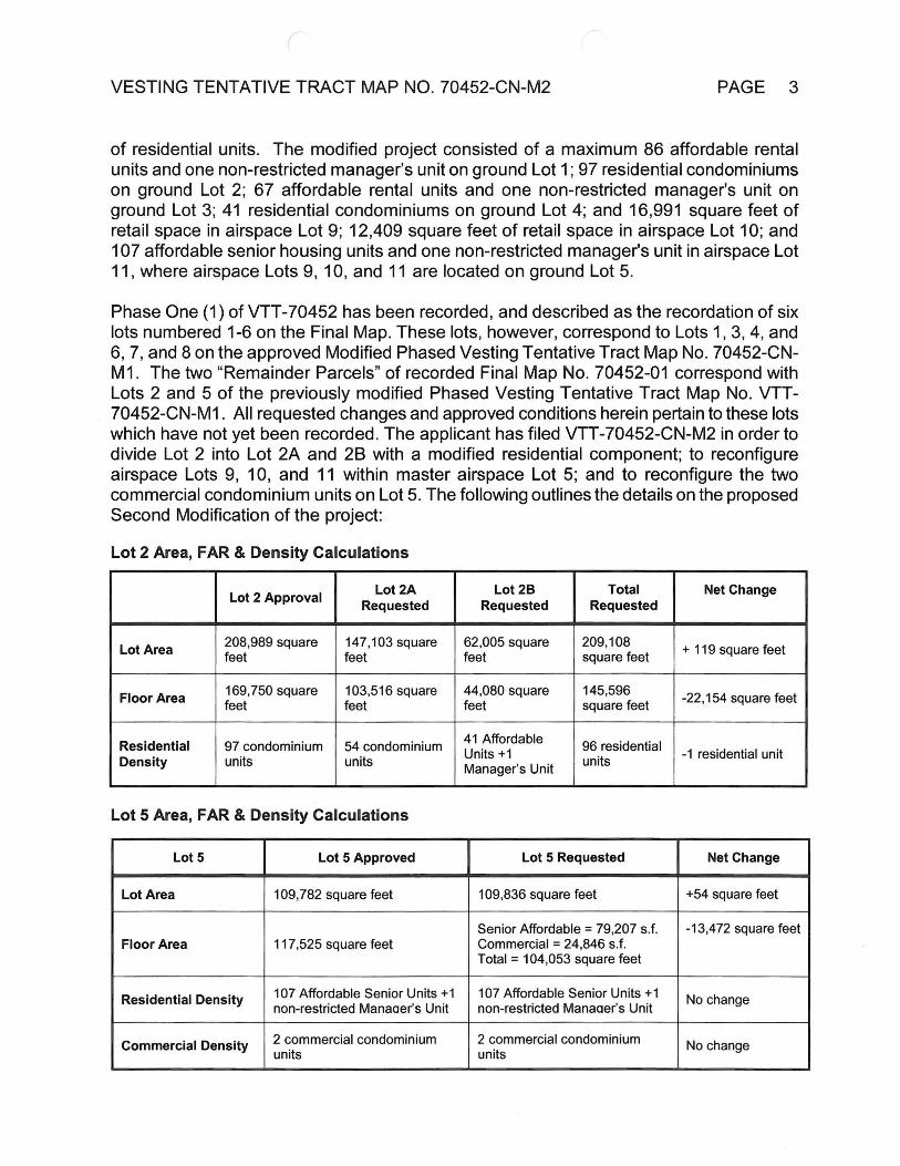
Phase One (1) of VTT-70452 has been recorded, and described as the recordation of six lots numbered 1-6 on the Final Map. These lots, however, correspond to Lots 1,3, 4, and 6, 7, and 8 on the approved Modified Phased Vesting Tentative Tract Map No. 70452-CN- M1. The two “Remainder Parcels” of recorded Final Map No. 70452-01 correspond with Lots 2 and 5 of the previously modified Phased Vesting Tentative Tract Map No. VTT- 70452-CN-M1. All requested changes and approved conditions herein pertain to these lots which have not yet been recorded. The applicant has filed VTT-70452-CN-M2 in order to divide Lot 2 into Lot 2A and 2B with a modified residential component; to reconfigure airspace Lots 9, 10, and 11 within master airspace Lot 5; and to reconfigure the two commercial condominium units on Lot 5. The following outlines the details on the proposed Second Modification of the project:
Lot 2 Area, FAR & Density Calculations
Lot 2B Requested
TotalRequested
Lot 2A Requested
Net ChangeLot 2 Approval
208,989 square 147,103 square 62,005 square 209,108 square feet + 119 square feetLot Area feet feet feet
145,596 square feet
169,750 square 44,080 square103,516 square -22,154 square feetFloor Area feet feetfeet
41 Affordable Units +1 Manager’s Unit
ResidentialDensity
97 condominium units
54 condominium units
96 residential units -1 residential unit
Lot 5 Area, FAR & Density Calculations
Lot5 Lot 5 Requested Net ChangeLot 5 Approved
109,836 square feet +54 square feet109,782 square feetLot Area
-13,472 square feetSenior Affordable = 79,207 s.f. Commercial = 24,846 s.f.Total = 104,053 square feet
117,525 square feetFloor Area
107 Affordable Senior Units +1 non-restricted Manaaer’s Unit
107 Affordable Senior Units +1 non-restricted Manaaer’s Unit
No changeResidential Density
2 commercial condominium units
2 commercial condominium units
No changeCommercial Density

VESTING TENTATIVE TRACT MAP NO. 70452-CN-M2 PAGE 4
Division of Lot 2 into two lots
Lot 2 of Modified Phased Vesting Tentative Tract Map 70452-CN-M1 is currently approved for 97 condominium units. The applicant proposes to divide Lot 2 into two lots. Lot 2A proposes to provide 54 market rate condominium units and Lot 2B proposes to provide 41 affordable apartments and one (1) non-restricted manager’s apartment. The addition of the affordable component necessitates the further subdivision of Lot 2 into two lots. Lot 2 had previously been proposed as a condominium lot.
Reconfiguration of Airspace Lots
The applicant proposes to reconfigure airspace Lots 9,10 and 11 within Master ground Lot 5. The purpose of this reconfiguration is to extract retail Lot 9 from the horizontal stack of airspace lots and relocate it to the southeast of the stack as a separate airspace lot within Master Lot 5 for commercial/retail use.
Residential Uses
Lot 2A, includes approximately 147,103 square feet of lot area and Lot 2B includes approximately 62,005 square feet of lot area for a total of approximately 209,108 square feet of lot area which comprises the entirety of previously approved Lot 2 of Modified Phased Vesting Tentative Tract Map 70452-CN-M1. The slight reduction of lot area was due to a survey correction.
Lot 2A and Lot 2B are located on the northwesterly corner of the approved phased vesting tentative tract map, west of Lots 1 and 7. Lot 2A is proposed to provide 54 market rate condominium units and Lot 2B is proposed to provide 41 affordable apartment units plus one (1) non rent-restricted manager’s unit for a combined total of 96 units. This modification results in a net reduction of one unit from the 97 condominium units previously approved for the site under Modified Phased Vesting Tentative Tract Map 70452-CN-M1.
Lot 5 is located on the southeastern-most end of the project site, with frontages on San Fernando Road and on Arvia Street, a dedicated public street. Lot 5 has a 109,836 square-foot lot area (after dedications) and proposes 104,053 square feet of floor area.
The residential building on Lot 5 includes 107 affordable senior residential apartment units and one (1) non-restricted manager’s unit within 4 stories with a maximum building height of 65 feet.
Commercial Uses
The commercial use for the proposed project will be located within the mixed-use building and adjacent to the residential uses within Master Lot 5. The commercial uses will total approximately 24,846 square feet of total floor area, which will serve the residents of the property and the surrounding community. The commercial component will be separated into two commercial condominium units Lots 9 and 10.

VESTING TENTATIVE TRACT MAP NO. 70452-CN-M2 PAGE 5
The applicant proposes to relocate approved 16,991 square foot airspace Lot 9 consisting of commercial/retail uses from within the previously approved mixed-use building to the southeast within Master Lot 5 as a standalone retail building. This retail component is slightly smaller at 16,690 square feet. The relocation of Lot 9 caused the subsequent reconfiguration of Lots 10 and 11. Consistent with previous approvals, commercial parking is to be provided at a rate of 1 parking space per 500 square feet or retail. The reduction in the number of commercial parking spaces is proportionate to the reduction of retail square footage see Table below.
Approved Retail Area
Approved Retail Parking
Proposed Retail Area
Proposed Retail Parking
Retail Lot 9 16,991 SF 34 Spaces 16,690 SF 34 Spaces17 Spaces 51 Spaces
Retail Lot 10 12,409 SF 25 Spaces 59 Spaces
8,156 SF29,400 SFTotal 24,846
Parking for the commercial portion of the project will be provided in a southeasterly adjacent surface parking lot. Pedestrian access will be provided from San Fernando Road and Arvia Street. The ground-floor commercial component of the mixed-use building creates a pedestrian-friendly environment by providing retail uses.
Consistent with the previous approval vehicular and pedestrian access will be provided from San Fernando Road and Arvia Street.
Airspace lot 9 was previously constrained to 18 foot in height because of the other airspace lots. In its proposed location airspace Lot 9 is now proposed to increase in height to 40 feet, consistent with the [Q]CM-1-CDO-RIO Zone.
Circulation and Parking
Vehicular access to the proposed project will be provided from San Fernando Road, one dedicated public street (Arvia Street), one proposed private street (Chaucer Street), and internal circulation provided by driveways.
Vehicular Circulation is achieved through an internal system consisting of a public street, a private street, and private driveways, all of which are not gated. Pedestrian circulation is achieved through sidewalks, walkways, and intersections identified through striping or other methods.
Internal vehicular and pedestrian circulation is proposed to change with reconfiguration of Lots 2 and 5 however the primary vehicular and pedestrian access to the site remains the same.
As a result of the requested second modification to Vesting Tentative Tract No. 70452, the following condition shall be modified. All other previously approved conditions shall remain the same.
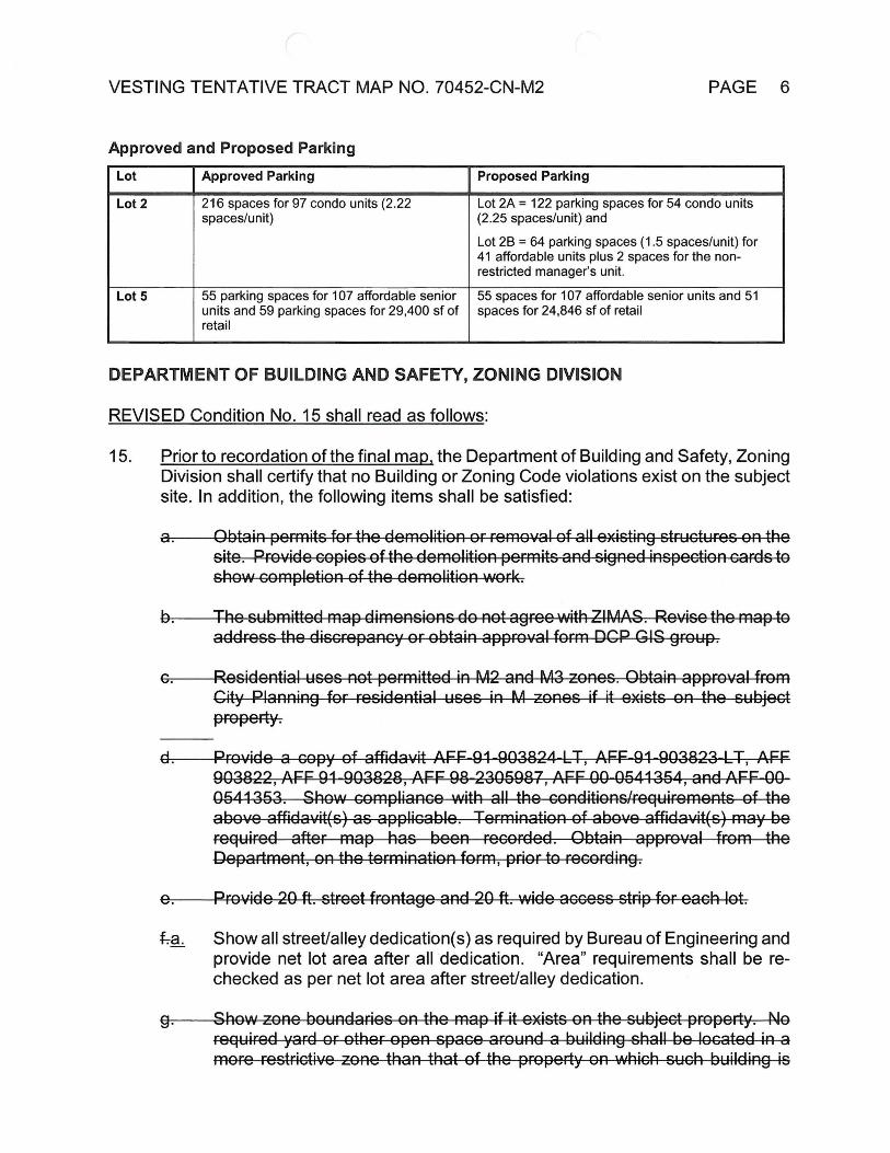
VESTING TENTATIVE TRACT MAP NO. 70452-CN-M2 PAGE 6
Approved and Proposed ParkingLot Approved Parking Proposed Parking
216 spaces for 97 condo units (2.22 spaces/unit)
Lot 2A = 122 parking spaces for 54 condo units (2.25 spaces/unit) and
Lot 2B = 64 parking spaces (1.5 spaces/unit) for 41 affordable units plus 2 spaces for the non- restricted manager’s unit.
Lot 2
55 spaces for 107 affordable senior units and 51 spaces for 24,846 sf of retail
55 parking spaces for 107 affordable senior units and 59 parking spaces for 29,400 sf of retail
Lot5
DEPARTMENT OF BUILDING AND SAFETY, ZONING DIVISION
REVISED Condition No. 15 shall read as follows:
Prior to recordation of the final map, the Department of Building and Safety, Zoning Division shall certify that no Building or Zoning Code violations exist on the subject site. In addition, the following items shall be satisfied:
15.
Obtain permits for the demolition or removal of all-existing structures on the site. Provide copies of the demolition permits and signed inspection cards to show completion of the demolition work.
ar
The submitted map dimensions do not agr-ee-with-ZIMASr--Revise the map to address the discrepancy or obtain approval form DCP GIS group.
Residential uses not permitted in M2 and M3 zones. Obtain approval from City Planning for residential uses in M zones if it exists on the subject pr-opertyr
&7
Provide a copy of affidavit AFF-91-903824-LT, AFF-91-903823-LT, AFF 903822, AFF 91-903828, AFF 98-2305987, AFF 00-9544354, and AFF-00- 05443537—Show compliance with all the conditions/requirements of the above affidavit(s) as applicable. Termination of above affidavit(s) may be required after map has been recorded. Obtain approval from the Department, on the termination form, prior to recording.
Provide 20 ft. street frontage and 20 ft. wide access strip foReach lot.Or
fra. Show all street/alley dedication(s) as required by Bureau of Engineering and provide net lot area after all dedication. “Area” requirements shall be rechecked as per net lot area after street/alley dedication.
Show zone boundaries on the map if it exists on the subject property. No required yard or other open space around a building-shall be located in a more restrictive zone than that of the property on which such building is
9-
VESTING TENTATIVE TRACT MAP NO. 70452-CN-M2 PAGE 7
located: Revise the map to show compliance with the above requirement or obtain approval from the-Department of City Planning.
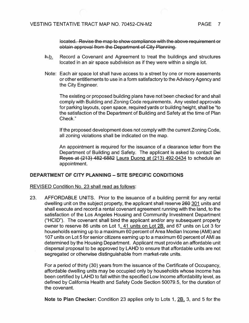
Record a Covenant and Agreement to treat the buildings and structures located in an air space subdivision as if they were within a single lot.
hbb.
Note: Each air space lot shall have access to a street by one or more easements or other entitlements to use in a form satisfactory to the Advisory Agency and the City Engineer.
The existing or proposed building plans have not been checked for and shall comply with Building and Zoning Code requirements. Any vested approvals for parking layouts, open space, required yards or building height, shall be “to the satisfaction of the Department of Building and Safety at the time of Plan Check.”
If the proposed development does not comply with the current Zoning Code all zoning violations shall be indicated on the map.
An appointment is required for the issuance of a clearance letter from the Department of Building and Safety. The applicant is asked to contact Del Reyes at (213) 482-6882 Laura Duong at (213) 492-0434 to schedule an appointment.
DEPARTMENT OF CITY PLANNING - SITE SPECIFIC CONDITIONS
REVISED Condition No. 23 shall read as follows:
AFFORDABLE UNITS. Prior to the issuance of a building permit for any rental dwelling unit on the subject property, the applicant shall reserve 260 301 units and shall execute and record a rental covenant agreement running with the land, to the satisfaction of the Los Angeles Housing and Community Investment Department (“HCID”). The covenant shall bind the applicant and/or any subsequent property owner to reserve 86 units on Lot 1, 41 units on Lot 2B, and 67 units on Lot 3 for households earning up to a maximum 60 percent of Area Median Income (AMI) and 107 units on Lot 5 for senior citizens earning up to a maximum 60 percent of AMI as determined by the Housing Department. Applicant must provide an affordable unit dispersal proposal to be approved by LAHD to ensure that affordable units are not segregated or otherwise distinguishable from market-rate units.
23.
For a period of thirty (30) years from the issuance of the Certificate of Occupancy, affordable dwelling units may be occupied only by households whose income has been certified by LAHD to fall within the specified Low Income affordability level, as defined by California Health and Safety Code Section 50079.5, for the duration of the covenant.
Note to Plan Checker: Condition 23 applies only to Lots 1, 2B^ 3, and 5 for the
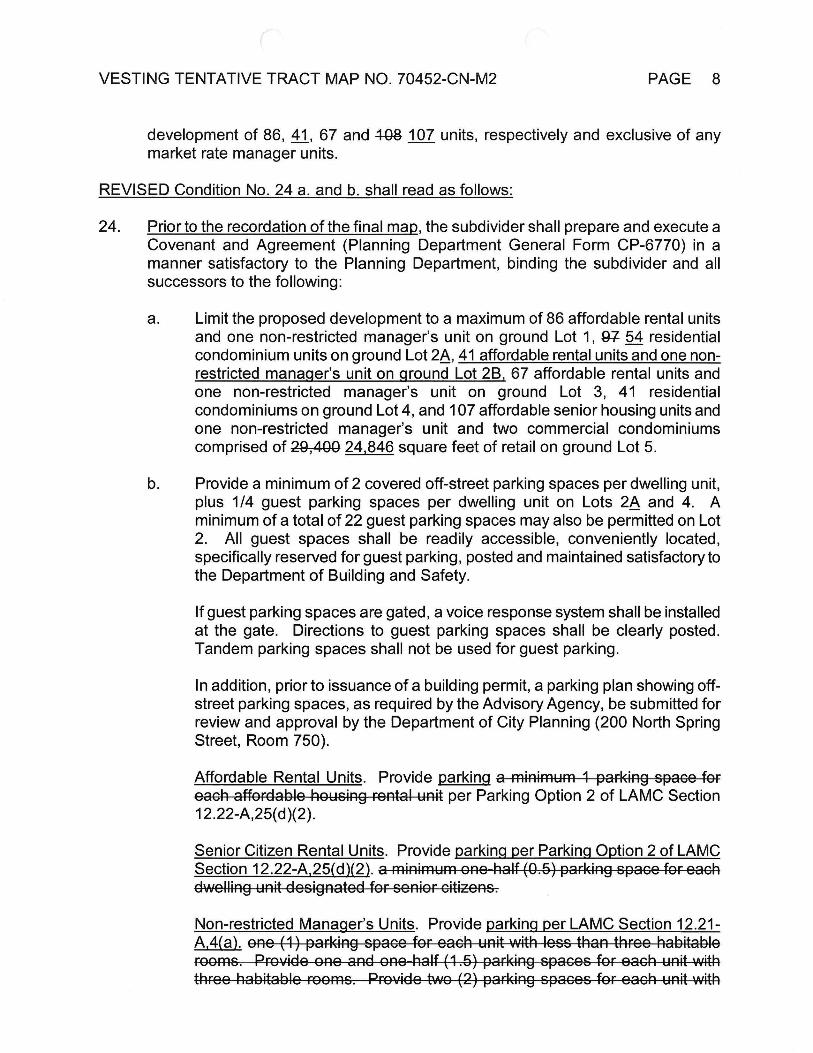
VESTING TENTATIVE TRACT MAP NO. 70452-CN-M2 PAGE 8
development of 86, 41_, 67 and 438 107 units, respectively and exclusive of any market rate manager units.
REVISED Condition No. 24 a. and b. shall read as follows:
24. Prior to the recordation of the final map, the subdivider shall prepare and execute a Covenant and Agreement (Planning Department General Form CP-6770) in a manner satisfactory to the Planning Department, binding the subdivider and all successors to the following:
Limit the proposed development to a maximum of 86 affordable rental units and one non-restricted manager’s unit on ground Lot 1, 87 54 residential condominium units on ground Lot 2A, 41 affordable rental units and one non- restricted manager’s unit on ground Lot 2B, 67 affordable rental units and one non-restricted manager’s unit on ground Lot 3, 41 residential condominiums on ground Lot 4, and 107 affordable senior housing units and one non-restricted manager’s unit and two commercial condominiums comprised of 29,400 24,846 square feet of retail on ground Lot 5.
a.
b. Provide a minimum of 2 covered off-street parking spaces per dwelling unit, plus 1/4 guest parking spaces per dwelling unit on Lots 2A and 4. A minimum of a total of 22 guest parking spaces may also be permitted on Lot 2. All guest spaces shall be readily accessible, conveniently located, specifically reserved for guest parking, posted and maintained satisfactory to the Department of Building and Safety.
If guest parking spaces are gated, a voice response system shall be installed at the gate. Directions to guest parking spaces shall be clearly posted. Tandem parking spaces shall not be used for guest parking.
In addition, prior to issuance of a building permit, a parking plan showing off- street parking spaces, as required by the Advisory Agency, be submitted for review and approval by the Department of City Planning (200 North Spring Street, Room 750).
Affordable Rental Units. Provide parking a minimum 1 parking space for each affordable housing rental unit per Parking Option 2 of LAMC Section 12.22-A, 25(d)(2).
Senior Citizen Rental Units. Provide parking per Parking Option 2 of LAMC Section 12.22-A,25(d)(2). a minimum one-half (0.6) parking space for each dwelling unit-designated for-senior citizens.
Non-restricted Manager’s Units. Provide parking per LAMC Section 12.21- A,4(a). one (1) parking space for each unit with4ess than three habitable rooms. Provide one and one-fratf (1.5) parking spaces for-each unit with three habitable rooms. Provide two (2) parking spaces for each unit with

VESTING TENTATIVE TRACT MAP NO. 70452-CN-M2 PAGE 9
more than three habitable rooms.
Commercial Retail- Municipal Code and to the satisfaction of the Department of Building and Safety. No variance from the parking requirements has been requested or granted herein. Provide a minimum two parking space for every 1,000 square feet of ground floor area.
Parking shall be provided in compliance with the
REVISED Condition No. 25 shall read as follows:
Prior to the issuance of the building permit or the recordation of the final map, a copy of the ZA-2008-1319-ZV-SPR and D1R-2Q15-1882-SPR shall be submitted to the satisfaction of the Advisory Agency. In the event that ZA-2008-1319-ZV-SPR and DIR-2015-1882-SPR is are not approved, the subdivider shall submit a tract modification.
25.
REVISED Condition No. 28 shall read as follows:
Indemnification Clause: The applicant shall defend, indemnify and hold harmless the City, its agents, officers, or employees from any claim, action, or proceeding against the City or its agents,--officersT-or-empteyees to attack, set aside, void or annul this approval which action is brought within the applicable limitation period. The City shall promptly notify the applicant of any claim, action, or proceeding and the Gity-sfraU-cooperate fully in the defense. If-the-City-fails-to- promptly notify the applicant of any claim action or proceeding, or if the City fails to cooperate fully in the defense, the applicant shall not thereafter be responsible to defend, indemnify, or hold harmless the City.
28.
Indemnification and Reimbursement of Litigation Costs.28.
Applicant shall do all of the following:
Defend, indemnify and hold harmless the City from any and all actions against the City relating to or arising out of, in whole or in part, the City’s processing and approval of this entitlement, including but not limited to. an action to attack, challenge, set aside, void or otherwise modify or annul the approval of the entitlement, the environmental review of the entitlement, or the approval of subsequent permit decisions or to claim personal property damage, including from inverse condemnation or any other constitutional claim.
a.
b. Reimburse the City for any and all costs incurred in defense of an action related to or arising out of, in whole or in part, the City’s processing and approval of the entitlement, including but not limited to payment of all court costs and attorney’s fees, costs of any judgments or awards against the City (including an award of attorney’s fees), damages and/or settlement costs.
VESTING TENTATIVE TRACT MAP NO. 70452-CN-M2 PAGE 10
Submit an initial deposit for the City’s litigation costs to the City within 10 days’ notice of the City tendering defense to the Applicant and requesting a deposit. The initial deposit shall be in an amount set by the City Attorney’s Office, in its sole discretion, based on the nature and scope of action, but in no event shall the initial deposit be less than $25,000. The City’s failure to notice or collect the deposit does not relieve the Applicant from responsibility to reimburse the City pursuant to the requirement in paragraph (b).
c.
Submit supplemental deposits upon notice by the City. Supplemental deposits may be required in an increased amount from the initial deposit if found necessary by the City to protect the City’s interests. The City’s failure to notice or collect the deposit does not relieve the Applicant from responsibility to reimburse the City pursuant to the requirement, (b)
d.
If the City determines it necessary to protect the City’s interests, execute an indemnity and reimbursement agreement with the City under terms consistent with the requirements of this condition.
e.
The City shall notify the applicant within a reasonable period of time of its receipt of any action and the City shall cooperate in the defense. If the City fails to notify the applicant of any claim, action or proceeding in a reasonable time, or if the City fails to reasonably cooperate in the defense, the applicant shall not thereafter be responsible to defend, indemnify or hold harmless the City.
The City shall have the sole right to choose its counsel, including the City Attorney’s office or outside counsel. At its sole discretion, the City may participate at its own expense in the defense of any action, but such participation shall not relieve the applicant of any obligation imposed by this condition. In the event the Applicant fails to comply with this condition, in whole or in part, the City may withdraw its defense of the action, void its approval of the entitlement, or take any other action. The City retains the right to make all decisions with respect to its representations in any legal proceeding, including its inherent right to abandon or settle litigation.
For purposes of this condition, the following definitions apply:
“City" shall be defined to include the City, its agents, officers, boards, commission, committees, employees and volunteers.
“Action” shall be defined to include suits, proceedings (including those held under alternative dispute resolution procedures), claims or lawsuits. Actions include actions, as defined herein, alleging failure to comply with any federal, state or local law.
Nothing in the definitions included in this paragraph are intended to limit the rights of the City or the obligations of the Applicant otherwise created by this condition.
VESTING TENTATIVE TRACT MAP NO. 70452-CN-M2 PAGE 11
FINDINGS OF FACT (CEQA)
The Planning Staff issued a Second Addendum (Reconsideration) to the Mitigated Negative Declaration ENV-2008-1267-MND on January 22,2016. No increase in the floor area, buildable area, density, amount of retail uses and building height is involved as part of this VTT-70452-CN-M2 from the original tract determination. Staff had previously found that potential negative impacts could occur from the project’s implementation due to:
■ Aesthetics
□ Agricultural Resources
■ Air Quality
■ Biological Resources
■ Cultural Resources
■ Hazards & Hazardous Materials
■ HydrologyAA/ater Quality
□ Land Use/Planning
□ Mineral Resources
■ Public Services
■ Recreation
■ T ransportation/T raffic
■ Utilities/Service Systems
□ Mandatory Findings of Significance■ Noise
■ Geology/Soils □ Population/Housing
The Deputy Advisory Agency certifies that Mitigated Negative Declaration No. ENV-2008- 1267-MND-REC2 reflects the independent judgment of the lead agency and determined that this project would not have a significant effect upon the environment provided the potential impacts identified above are mitigated to a less than significant level through implementation of Condition Nos. 17a, 21, 22, 30 and 31 of the original Tract's approval. Other identified potential impacts not mitigated by these conditions are mandatorily subject to existing City ordinances, (Sewer Ordinance, Grading Ordinance, Flood Plain Management Specific Plan, Xeriscape Ordinance, Stormwater Ordinance, etc.) which are specifically intended to mitigate such potential impacts on all projects.
The project site, as well as the surrounding area, are presently developed with structures and do not provide a natural habitat for either fish or wildlife.
In accordance with Section 21081.6 of the Public Resources Code (AB3180), the Deputy Advisory Agency has assured that the above identified mitigation measures will be implemented by requiring reporting and monitoring as specified in Condition No. 29.
The custodian of the documents or other material which constitute the record of proceedings upon which the Advisory Agency’s decision is based are located with the City of Los Angeles, Planning Department, 200 North Spring Street, Room 750, Los Angeles, CA 90012.
FINDINGS OF FACT (SUBDIVISION MAP ACT)
In connection with the approval of Vesting Tentative Tract No. 70452-CN-M2, the Advisory Agency of the City of Los Angeles, pursuant to Sections 66473.1,66474.60, .61 and .63 of the State of California Government Code (the Subdivision Map Act), makes the prescribed findings as follows:

PAGE 12VESTING TENTATIVE TRACT MAP NO. 70452-CN-M2
THE PROPOSED MAP WILL BE/IS CONSISTENT WITH APPLICABLE GENERAL AND SPECIFIC PLANS.
(a)
The adopted Northeast Los Angeles Community Plan designates the subject property for Limited Industrial land use with the corresponding zones of CM, MR, M1, and P. The property contains approximately 16.3 net acres (711,825 net square feet after required dedication) and is presently zoned [G]CM-1-CDO. On July 30, 2008, the Advisory Agency approved the Vesting Tentative Tract Map No. 70452-CN for the subdivision of eight grounds and three airspace lots for a maximum 471 residential units and 29,400 square feet of retail uses on a 708,005 square-foot lot. The original project consisted of a maximum building height of 65 feet at four stories with a total floor area of 622,780 square feet. As part of the project, the applicant had requested ZA-2008-1319-ZV-SPR, which included a request for a zone variance to provide 5,685 square feet of open space in lieu of the 9,650 square feet required on Lot 3, and a site plan review. Findings were made to grant the approval of the requested zone variance and site plan review.
The first Modification to the map permitted the subdivision of eight grounds and three airspace lots for a maximum 401 residential units and 29,400 square feet of retail uses. The modified project reduced the project in floor area, buildable area and density while maintaining the amount of retail uses and building height. Several of the lots were reconfigured within the project site. Parking and open space provisions were reduced accordingly based on the number of residential units.
The requested second Modification to the map is for the purposes of dividing tentative Lot 2, previously approved for 97 condominium units, into Lot 2A and 2B with a modified residential component; to reconfigure airspace Lots 9, 10, and 11 within tentative master airspace Lot 5; and to reconfigure the two commercial condominium units on Lot 5. The requested changes have resulted in the net decrease of one dwelling unit and reduction of 41,606 square feet of floor area.
Lot 2A proposes to provide 54 market rate condominium units and Lot 2B proposes to provide 41 affordable apartments and one (1) non-restricted manager’s apartment. The addition of the affordable component necessitates the further subdivision of Lot 2 into two lots.
The applicant proposes to reconfigure airspace Lots 9, 10 and 11 within Master ground Lot 5. The purpose of this reconfiguration is to extract retail Lot 9 from the horizontal stack of airspace lots and relocate it to the southeast of the stack as a separate airspace lot within Master Lot 5 for commercial/retail use.
The commercial use for the proposed project will be located within the mixed-use building and adjacent to the residential uses within Master Lot 5. The commercial uses will total approximately 24,846 square feet of total floor area, which will serve the residents of the property and the surrounding community. The commercial component will be separated into two commercial condominium units Lots 9 and 10.

VESTING TENTATIVE TRACT MAP NO. 70452-CN-M2 PAGE 13
The site is not subject to the Specific Plan for the Management of Flood Hazards, floodways, floodplains, mud prone areas, coastal high-hazard and flood-related erosion hazard areas.
The site is not subject to any other Specific Plans. The project would meet the objectives of the General Plan. More specifically, the project would meet the Housing Element objectives which would include the following: encouraging production and preservation of an adequate supply of rental and ownership housing to meet the identified needs of persons of all income levels and special needs; encouraging the location of housing, jobs, and services in mutual proximity; and accommodation of a diversity of uses that support the needs of the City’s existing and future residents. Furthermore, the project would provide much-needed affordable units by creating 107 rental units for senior citizens, 194 affordable units for low and very low income households, and four non-restricted manager’s units.
The project would meet the objectives of the Land Use and Transportation elements, which state the following: support development along mixed-use boulevards; provide for the stability and enhancement of multi-family residential neighborhoods; preserve and enhance access to scenic resources and regional open space and creation of a pedestrian-friendly environment.
The project site is located within the Los Angeles River Revitalization Master Plan. The project will be required to be in conformance with the goals, policies, and objectives of the plan (see Condition No. 27).
Therefore, as conditioned, the proposed tract map is consistent with the intent and purpose of the applicable General and Specific Plans.
(b) THE DESIGN AND IMPROVEMENT OF THE PROPOSED SUBDIVISION ARE CONSISTENT WITH APPLICABLE GENERAL AND SPECIFIC PLANS.
The proposed project will include a public street, a private street and private driveways. San Fernando Road is a designated Avenue I (formerly Major Highway Class II) dedicated to variable widths of 60 to 80-foot widths. The Bureau of Engineering (BOE) is required a 24-foot wide strip of land be dedicated along San Fernando Road adjoining Lot 5 of the subdivision in accordance with the proposed San Fernando Road Corridor Multimodal Transportation Infrastructure Program and a 34-foot wide strip of land be dedicated along San Fernando Road northerly of Arvia Street adjoining Lots 1 and 3 of the subdivision. BOE requested a 54-foot wide right-of-way be provided for the proposed Arvia Street including suitable turning area at the terminus and 20-foot radius property line returns at the intersection with San Fernando Road. BOE requested a 44-foot wide private street easement be provided including a suitable turning area at the terminus and 20-foot radius easement line returns at the intersection with San Fernando Road. Improvements will also be required. Improvement requests have also be made by BOE for the proposed private street and Arvia Street, and San Fernando Road. The Bureau of Engineering has reviewed the tract map and has issued their
VESTING TENTATIVE TRACT MAP NO. 70452-CN-M2 PAGE 14
conditions of approval to ensure the proposed streets and improvements are satisfactory to the City engineer. No modifications to the original requirements were made in conjunction with the second Modification to the subdivision map.
A total of 177 parking spaces will be provided for the proposed modified residential units. Lot 2A, containing the 54 condominium units, will provide a total of 122 residential parking spaces for units, in compliance with the Deputy Advisory Agency’s Residential Parking Policy that requires 2.25 spaces per unit located in a non-parking congested area. Lot 2B, containing 41 affordable and one (1) non- restricted manager’s units will provide a total of 64 residential parking spaces, exceeding the City’s Density Bonus Parking Option 2 requirement of one (1) space per unit and the Code requirement of 2 spaces for the manager’s unit. Lot 5, containing 107 senior affordable and one (1) non-restricted manager’s unit, will provide 55 parking spaces, in compliance with the City’s Density Bonus Option 2, which requires 0.5 spaces for each senior residential dwelling unit, and the standard requirement of 2 spaces for the manager’s unit. As conditioned, the design and improvements of the proposed project are consistent with the applicable General and Specific Plans.
(c) THE SITE IS PHYSICALLY SUITABLE FOR THE PROPOSED TYPE OF DEVELOPMENT.
The site is currently utilized as a storage facility for the Metropolitan Transportation Authority. A few temporary structures are present. It is one of the few underimproved properties in the vicinity. The development of this tract is an infill of an otherwise neighborhood filled with a mix of commercial, industrial, and open space uses.
The project site is relatively flat with a slight slope at different portions of the site. However, the site is not located in a slope stability study area, high erosion hazard area, or a fault-rupture study zone.
On April 15, 2008, the Department of Building and Safety, Grading Division issued conditions of approval. No changes have been issued from that report since the project scope reduced. The approval of the tract map will be in accordance with the Grading Regulations, LAMC Section 91.3000.
(d) THE SITE IS PHYSICALLY SUITABLE FOR THE PROPOSED DENSITY OF DEVELOPMENT.
Adjacent uses include a regional park known as Rio de Los Angeles Park, to the north; restaurants, auto repair and service shops, a church, as well as manufacturing and warehouse uses to the east across San Fernando Road; active rail tracks the Metrolink Central Maintenance Facility, and a narrow strip of undeveloped Metrolink property to the south; and the Metrolink right-of-way and the . portion of the Los Angeles River known as Glendale Narrows adjacent to a right-of- way to the west. The proposed project would be compatible with the existing

VESTING TENTATIVE TRACT MAP NO. 70452-CN-M2 PAGE 15
neighborhood and provide an appropriate development within a neighborhood that includes a mix of commercial and residential uses. The site is currently used as a storage area for the Metropolitan Transportation Authority (MTA) with construction materials, temporary office trailers, and an art piece. The proposed project would remove the existing structures to construct a mixed use project that includes residential condominiums, senior housing, affordable rental units, retail, and open space.
Since the approval of the first Modification to the map, the applicant has requested the approval of a Director’s Determination for Site Plan Review for a development with over 50 dwelling units. With appropriate findings made and the approval of concurrent case, DIR-2015-1882-SPR, and the previous case ZA-2008- 1319(ZV)(SPR), the project will comply with all LAMC requirements for parking, yards, and open space. As conditioned, the proposed tract map is physically suitable for the proposed density of the development.
(e) THE DESIGN OF THE SUBDIVISION AND THE PROPOSED IMPROVEMENTS ARE NOT LIKELY TO CAUSE SUBSTANTIAL ENVIRONMENTAL DAMAGE OR SUBSTANTIALLY AND AVOIDABLY INJURE FISH OR WILDLIFE OR THEIR HABITAT.
The project site is presently vacant and does not provide a natural habitat for either fish or wildlife. The surrounding area is presently developed with commercial and industrial structures, and is near the Los Angeles River and Rio de Los Angeles Park. The neighboring commercial and industrial sites do not provide a natural habitat for either fish or wildlife. The project has considered its impact on wildlife within the Los Angeles River and the park, and incorporated a mitigation measure to avoid potential impacts to nesting birds, including migratory birds and raptors in its original approval under Condition No. MM-7.
(f) THE DESIGN OF THE SUBDIVISION AND THE PROPOSED IMPROVEMENTS ARE NOT LIKELY TO CAUSE SERIOUS PUBLIC HEALTH PROBLEMS.
There appear to be no potential public health problems caused by the design or improvement of the proposed subdivision.
The development is required to be connected to the City's sanitary sewer system, where the sewage will be directed to the LA Hyperion Treatment Plant, which has been upgraded to meet Statewide ocean discharge standards. The Bureau of Engineering has reported that the proposed subdivision does not violate the existing California Water Code because the subdivision will be connected to the public sewer system and will have only a minor incremental impact on the quality of the effluent from the Hyperion Treatment Plant.
(9) THE DESIGN OF THE SUBDIVISION AND THE PROPOSED IMPROVEMENTS WILL NOT CONFLICT WITH EASEMENTS ACQUIRED BY THE PUBLIC AT LARGE FOR ACCESS THROUGH OR USE OF PROPERTY WITHIN THE
VESTING TENTATIVE TRACT MAP NO. 70452-CN-M2 PAGE 16
PROPOSED SUBDIVISION.
No such easements are known to exist. Needed public access for roads and utilities will be acquired by the City prior to recordation of the proposed tract.
The design of the map will include variable width easements which will be dedicated to the City of Los Angeles around public access ramps, driveways and walks where necessary to meet the American Disability Act compliance in the public right-of-way, as shown on the tentative tract map satisfactory to the City Engineer. A 44-foot easement will be provided for Chaucer Street, a private street, providing use and access rights to Lots 1,2,3,4,6,7 and 8.
(h) THE DESIGN OF THE PROPOSED SUBDIVISION WILL PROVIDE, TO THE EXTENT FEASIBLE, FOR FUTURE PASSIVE OR NATURAL HEATING OR COOLING OPPORTUNITIES IN THE SUBDIVISION. (REF. SECTION 66473.1)
In assessing the feasibility of passive or natural heating or cooling opportunities in the proposed subdivision design, the applicant has prepared and submitted materials which consider the local climate, contours, configuration of the parcel(s)to be subdivided and other design and improvement requirements.
Providing for passive or natural heating or cooling opportunities will not result in reducing allowable densities or the percentage of a lot which may be occupied by a building or structure under applicable planning and zoning in effect at the time the tentative map was filed.
In addition, prior to obtaining a building permit, the subdivider shall consider building construction techniques, such as overhanging eaves, location of windows, insulation, exhaust fans, planting of trees for shade purposes and the height of the buildings on the site in relation to adjacent development.
These findings shall apply to Vesting Tentative Tract Map No. 70452-CN-M2. All other conditions of approval and mitigation measures from the previously approved VTT-70452- CN-M1 and VTT-70452-CN shall remain.
Michael J. LoGrande Adviso/V Agency
/NICHOLAS HENDRICKS Deputy Advisory Agency
NH:JT:JM
VESTING TENTATIVE TRACT MAP NO. 70452-CN-M2 PAGE 17
Note: If you wish to file an appeal, it must be filed within 10 calendar days from the decision date as noted in this letter. For an appeal to be valid to the City Planning Commission, it must be accepted as complete by the City Planning Department and appeal fees paid, prior to expiration of the above 10-dav time limit. Such appeal must be submitted on Master Appeal Form No. CP-7769 at the Department’s Public Offices, located at:
Figueroa Plaza201 N. Figueroa St., 4th FloorLos Angeles, CA 90012213.482.7077
Marvin Braude San Fernando Valley Constituent Service Center
6262 Van Nuys Blvd., Room 251 Van Nuys, CA 91401 818.374.5050
Forms are also available on-line at www.planning.lacity.org
If you seek judicial review of any decision of the City pursuant to California Code of Civil Procedure Section 1094.5, the petition for writ of mandate pursuant to that section must be filed no later than the 90th day following the date on which the City's decision became final pursuant to California Code of Civil Procedure Section1094.6. There may be other time limits which also affect your ability to seek judicial review.
If you have any questions, please call Public Counter staff at (213) 482-7077.
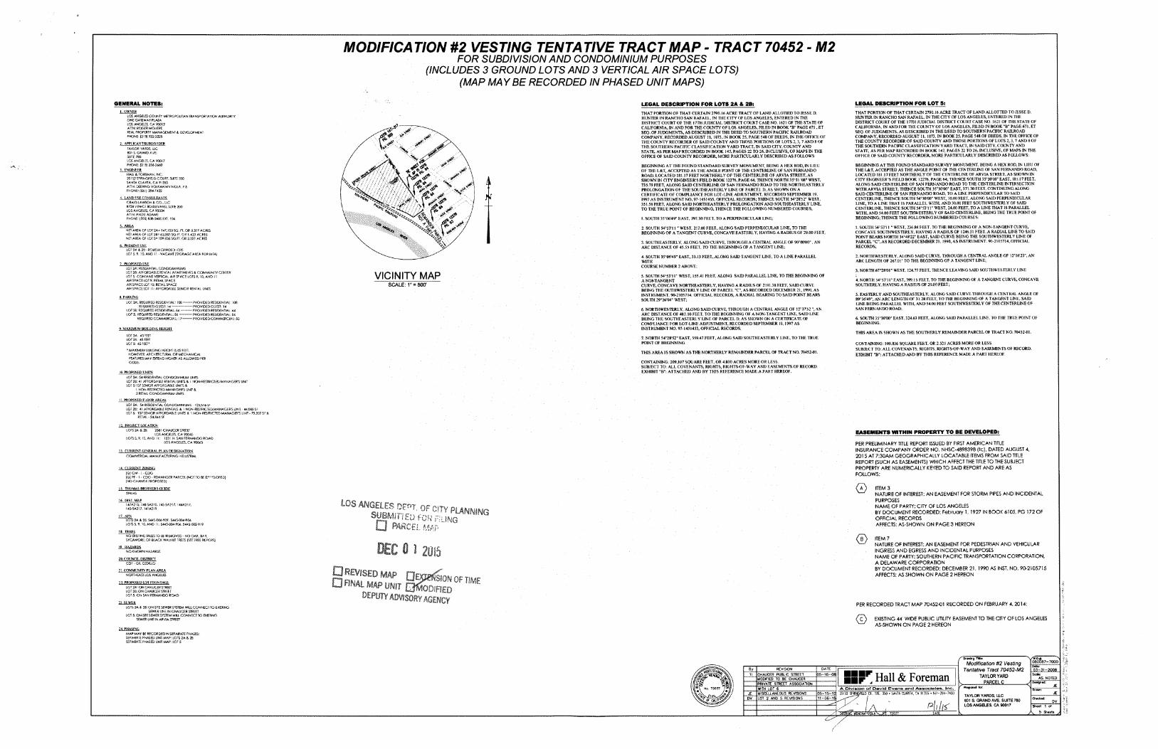
(MAP MAYBE RECORDED IN PHASED UNIT MAPS)
MODIFICATION #2 VESTING TENTATIVE TRACT MAP - TRACT 70452 - M2FOR SUBDIVISION AND CONDOMINIUM PURPOSES
(INCLUDES 3 GROUND LOTS AND 3 VERTICAL AIR SPACE LOTS)
LEGAL DESCRIPTION FOR LOT SiGENERAL NOTES: LEGAL DESCRIPTION FOR LOTS 2A A 2B;OWNER THAT PORTION OF THAT CERTAIN 2790.16 ACRE TRACT OF LAND ALLOTTED TO JESSE D.
HUNTER IN RANCHO SAN RAFAEL, IN THE CITY OF LOS ANGELES, ENTERED IN THE DISTRICT COURT OF THE I7TH JUDICIAL DISTRICT COURT CASE NO. 1621 OF THE STATE OF CALIFORNIA, IN AND FOR THE COUNTY OF LOS ANGELES. FILED IN BOOK ”B" PAGE 671. ET SEQ. OF JUDGMENTS, AS DESCRIBED IN THE DEED TO SOUTHERN PACIFIC RAILROAD COMPANY, RECORDED AUGUST 11, 1873, IN BOOK 25, PAGE 548 OF DEEDS. IN THE OFFICE OF THE COUNTY RECORDER OF SAID COUNTY AND THOSE PORTIONS OF LOTS 2, 3, 7 AND 8 OF THE SOUTHERN PACIFIC CLASSIFICATION YARD TRACT, IN SAID CITY, COUNTY AND STATE, AS PER MAP RECORDED IN BOOK 147, PAGES 22 TO 26, INCLUSIVE, OF MAPS IN THE OFFICE OF SAID COUNTY RECORDER, MORE PARTICULARLY DESCRIBED AS FOLLOWS:
THAT PORTION OF THAT CERTAIN 2790.16 ACRE TRACT OF LAND ALLOTIED TO JESSE D. HUNTER IN RANCHO SAN RAFAEL, IN THE CITY OF LOS ANGELES, ENTERED IN THE DISTRICT COURT OF THE 17TH JUDICIAL DISTRICT COURT CASE NO. 1621 OF THE STATE OF CALIFORNIA, IN AND FOR THE COUNTY OF LOS ANGELES, FILED IN BOOK "B“ PAGE 671 , ET SEQ. OF JUDGMENTS, AS DESCRIBED IN THE DEED TO SOUTHERN PACIFIC RAILROAD COMPANY, RECORDED AUGUST II, 1873, IN BOOK 25. PAGE 548 OF DEEDS, IN THE OFFICE OF THE COUNTY RECORDER OF SAID COUNTY AND THOSE PORTIONS OF LOTS 2, 3, 7 AND 8 OF THE SOUTHERN PACIFIC CLASSIF1CA TION YARD TRACT. IN SAID CITY, COUNTY AND STATE, AS PER MAP RECORDED IN BOOK 147, PAGES 22 TO 26, INCLUSIVE, OF MAPS IN THE OFFICE OF SAID COUNTY RECORDER, MORE PARTICULARLY DESCRIBED AS FOLLOWS:
LOS ANGRES COUNTY MfcTfrOKjUTAN ONE GATEWAY PLAZA LOS ANGRES. CA 90012 ATTN. ROGER MOL HERE.REAL PROPERTY MANAGEMENT f. DEVELOPMENT PHONE; |213] 922-2225
4SPORTATION AUTHORITY
4 .**..*■rw
2. APPl.lCANT/SLBDiVIDF.RTAYLOR YARDS, iLC 80' S. GRAND AVE.SUfTE 780LOS ANGELES. CA 900)7 PHONE: (2! 3] 234-2440
3, HVOINKKB
' X
^ ' -#(V.s-C^
BEGINNING AT THE FOUND STANDARD SURVEY MONUMENT, BEING A HEX ROD. IN LIEU OF THE L&T, ACCEPTED AS THP. ANGLE POINT OF THE CENTERLINE OF SAN FERNANDO ROAD, LOCATED 181.17 FEET NORTHERLY OF THE CENTERLINE OF ARVIA STREET. AS SHOWN IN CITY ENGINEER’S FIELD BOOK 12276, PAGE 64; THENCE SOUTH 35'>30,0(r EAST, 181.17 FEET, ALONG SAID CENTERLINE OF SAN FERNANDO ROAD TO THE CENTERLINE INTERSECTION WITH ARVIA STREET; THENCE SOUTH 35’30’00" EAST, 371.30 FEET. CONTINUING ALONG SAID CENTERLINE OF SAN FERNANDO ROAD, TO A LINE PERPENDICULAR TO SAID CENTERLINE. THENCE SOUTH 54"30'00" WEST, 30.00 FEET, ALONG SAID PERPENDICULAR LINE, TO A LINE THAT IS PARALLEL WITH. AND 30.00 FEET SOUTHWESTERLY OF SAID CENTERLINE, THENCE SOUTH 54°53'11" WEST, 24.00 FEET, TO A LINE THAT IS PARALLEL WITH, AND 54.00 FEET SOUTHWESTERLY OF SAID CENTERLINE, BEING THE TRUE POINT OF BEGINNING; THENCE THE FOLLOWING NUMBERED COURSES:
BEGINNING AT THE FOUND STANDARD SURVEY MONUMENT, BEING A HEX ROD, IN LIEU OF THE L&T, ACCEPTED AS THE ANGLE POINT OF THE CENTERLINE OF SAN FERNANDO ROAD, LOCATED 181.17 FEET NORTHERLY OF THE CENTERLINE OF ARVIA STREET, AS SHOWN IN CITY ENGINEER’S FIELD BOOK 12276, PAGE 64; THENCE NORTH 3543l ’08" WEST. 735.79 FEET, ALONG SAID CENTERLINE OF SAN FERNANDO ROAD TO THE NORTHEASTERLY PROI-ONGATTON OF THE SOUTHEASTERLY LINE OF PARCEL D. AS SHOWN ON A CERTIFICATE OF COMPLIANCE FOR LOT-LINE ADJUSTMENT, RECORDED SEPTEMBER 19, 1997 AS INSTRUMENT NO. 97-1451455. OFFICIAL RECORDS; THENCE SOUTH S4=28'52" WEST, 351.56 FEET. ALONG SAID NORTHEASTERLY PROLONGATION AND SOUTHEASTERLY LINE, TO THE TRUE POINT OF BEGINNING. THENCE THE FOLLOWING NUMBERED COURSES,
K FOREMAN. INC.25152 5PPNGfteo COURT, SUITE 350 SANTA CLARITA, C.A9I355 ATTN: OEEWNG VOUMANN-VIOIA. P.E. PHONE: (<54i)2S4-7422
A 1v N4. LAND I JSC. CONSULTANTSirf \ s'*CRAIG LAWSON S CO.. UC
8758 V&IC: BOULEVARD. SUITE 200LOS ANGElB, CA 90034ATTN: ANDIE ADAMEPHONE: (3101836-2400 EXT. 104
\ f\
p* V .\ ■u I. SOUTH 35'06’49" EAST, 397.30 FEET. TO A PERPENDICULAR LINE;rO\\5. AREA 1. SOUTH 54=53’ 11 " WEST, 236.84 FEET, TO THE BEGINNING OF A NON-TANGENT CURVE,
CONCAVE SOUTHWESTERLY, HAVING A RADIUS OF 1246.5! FEET, A RADIAL LINE TO SAID POINT BEARS NORTH 34*48'22" EAST, SAID CURVE BEING THE SOUTHWESTERLY LINE OF PARCEL “C". AS RECORDED DECEMBER 21, 1990, AS INSTRUMENT, 90-2105714, OFFICIAL RECORDS.
2. SOUTH 548S3'l 1 " WEST, 217.00 FEET, ALONG SAID PERPENDICULAR LINE, TO THE BEGINNING OF A TANGENT CURVE, CONCAVE EASTERLY. HAVING A RADIUS OF 29.00 FEET;
AREA OF LOT 2A= !47.i03SQ. a OR 3.3/7 ACRES NET AREA OF LOT 28= 42.005 SQ.FT. OR ! .423 ACRES NET AREA OF LOT 5= 109,834 SQ.FT. OR 2.52) ACRES a
3. SOUTHEASTERLY, ALONG SAiD CURVE, THROUGH A CENTRAL ANGLE OF 9OW00", AN ARC DISTANCE Of 45.55 [ELI. TO THE BEGINNING OF A TANGENT LINE;6. PRESENT USE.
LOT 2A 8, 28 - ROUGH GRADED LOTS LOT S. 9. 10.. I i - VACANT (STORAGE AREA FOR MTA] 2. NORTHWESTERLY, ALONG SAID CURVE, THROUGH A CENTRAL ANGLE OF 12"16’23", AN
ARC LENGTH OF 267.01 ’ TO THE BEGINNING OF A TANGENT LINE;4. SOUTH 35c06'49" EAST, 33.13 FEET , ALONG SAID TANGENT LINE, TO A LINE PARALLEL WITHCOURSE NUMBER 2 ABOVE;PROPOSED USE
: RESIDENTLOT 28: AFFORDABLE RENT LOT 5: CONTAINS VERTICAL AlR SPACE LOTS 9. 10, AND 11 AJR SPACE LOT 9: RETAIL SPACE AIR SPACE LOT 10: RETAIL SPACE AIRSPACE lOT ! 1: AFFORDABLE SENIOR RENTAL
.CONDOMINIUMS 3. NORTH 67a28'01" WEST, 124.77 FF.ET. THENCE LEAVING SAID SOUTHWESTERLY LINEPAtffMENlS 6 COMMUNITY CEWltR VICINITY MAP 5. SOUTH 54C53'11* WEST, 155.41 FEET. ALONG SAID PARALLEL LINE, TO THE BEGINNING OF A NONTANGENTCURVE, CONCAVE NORTHEASTERLY, HAVING A RADIUS OF 2191.38 FEET, SAID CURVE BEING THE OUTHWESTERLY LINE OF PARCEL "C°, AS RECORDED DECEMBER 21,1990. AS INSTRUMENT. 90-2105714. OFFICIAL RECORDS, A RADIAL BEARING TO SAID POINT BEARS SOUTH 29 =26’04" WEST;
4. NORTH S4=53’l I" EAST. 399.15 FEET, TO THE BEGINNING OF A TANGENT CURVE, CONCAVE SOUTHERLY, HAVING A RADIUS OF 20.00 FEET;SCALE: 1" = 500'5. EASTERLY AND SOUTHEASTERLY. ALONG SAID CURVE THROUGH A CENTRAL ANGLE OF 89t36'49", AN ARC LENGTH OF 31.28 FEET, TO THE BEGINNING OF A TANGENT LINE, SAID EJNE BEING PARALLEL WITH, AND 54.00 FEET SOUTHWESTERLY OF THE CENTERLINE OF SAN FERNANDO ROAD;
6 PARKINGi.OI 24.: REQUIRED RESIDENTIAL!(
REQUIRED GUEST: 14 LOT 28: REQUIRED RESIDENTIAL: 44 LO? 5: REQUIRED RESIDENTIAL: 54
REQUIRED COMMSZCIAL: 17-
-PROVIDED RESIDENTIAL. 108 -PROVIDED GUEST: 14 •PROVIDED RESIDENTIAL: •PROVIDEDRESIDENTIAL: 54 PROVIDED COMM SOCIAL: 50
6. NORTHWESTERLY, ALONG SAID CURVE, THROUGH A CENTRAL ANGLE OF 12=3752 ", AN ARC DISTANCE OF 483.10 FEET, TO THE BEGINNING OF A NON-TANGENT LINE, SAID LINE BEING THE SOUTHEASTER!,Y LINE OF PARCEL D. AS SHOWN ON A CERTIFICATE OF COMPLIANCE FOR LOT-LINE ADJUSTMENT, RECORDED SEPTEMBER 19, 1997 AS INSTRUMENT NO. 97-1451455, OFFICIAL RECORDS;
6. SOUTH 35°30'00" EAST, 324,63 FEET. ALONG SAID PARALLEL LINE. TO THE TREE POINT OF BEGINNING.
9 MAXIMUM BUILDING HEIGHTTHIS AREA IS SHOWN AS THE SOUTHERLY REMAINDER PARCEL OF TRACT NO. 70452-01.
l: 45 L££-T LOT 28; 45 FEB LOTS: 4SKCT*
lot:7. NORTH 54°28,52° EAST. 559.47 FEET. ALONG SAID SOUTHEASTERLY LINE. TO THE TRUE POINT OF BEGINNING. CONTAINING: 109,836 SQUARE FEET. OR 2.521 ACRES MORE OR LESS.
SUBJECT TO; ALL COVENANTS, RIGHTS, RJGHTS-OF-WAY AND EASEMENTS OF RECORD. EXHIBIT ”B”: ATTACHED AND BY THIS REFERENCE MADE A PART HEREOF.
• MAXIMUM BUILDING HEIGHT IS 45 FEET. HOWEVER. ARCHITECTURAL OR MECHANICAL ff ATURES,CODE.
THIS AREA IS SHOWN AS THE NORTHERLY REMAINDER PARCEL OF TRACT NO. 70452-01.EXTEND HIGHS? AS ALLOWED PER
CONTAINING: 209.107 SQUARE FEET, OR 4.800 ACRES MORE OR LESS.SUBJECT TO: ALL COVENANTS, RIGHTS, RIGHTS-OF-WAY AND EASEMENTS OF RECORD. EXHIBIT "B": ATTACHED AND BY THIS REFERENCE MADE A PART HEREOF.10 PROPOSED UNITS
LOT 2A: 54 RESIDENTIAL CONDOMINIUM UNITS LOT 28:LOT 5:507 SENIOR AFFORDABLE
f NON-RBTROED MANAGER'S UNIT &2 RETAIL CONDOMINIUM UNITS
AFFORDABLE RENTAL UNITS A I NON-RESTRlCTS) MANAGER'S UNIT
.!. PROPOSED FLOOR AREASLOT 2A: 54 RESIDENTIAL CONDOMINIUMS - 103,5)4 Sf LOT 28: 4! AFFORDABLE RENTALS & 1 NON-RESTRICTED MANAGERS LOTS; SENIOR AFFORDABLE UNITS 8. I NGN-RESTRICTED MANAGER'S UNIT - 79.207 SF S
RETAIL-24,844 SF
12. PROJECT IjOCAUONLOTS: A 23; 258! CHAUCER STREET
LOS ANGELES. CA 90045 LOTS 5,9.50, AND U; i23i N. SAN FERNANDO ROAD
LOS ANGELES. CA 90045
EASEMENTS WITHIN PROPERTY TO BE DEVELOPED;
PER PRELIMINARY TITLE REPORT ISSUED BY FIRST AMERICAN TITLE INSURANCE COMPANY ORDER NO. NHSC-4898398 (tc), DATED AUGUST 4, 2015 AT 7:30AM GEOGRAPHICALLY LOCATABLE ITEMS FROM SAID TITLE REPORT (SUCH AS EASEMENTS) WHICH AFFECT THE TITLE TO THE SUBJECT PROPERTY ARE NUMERICALLY KEYED TO SAID REPORT AND ARE AS FOLLOWS:
CURRENT GENERAL N DESIGNATIONCOMMERCIAL MANUFACTURING 1MDU5TRIAI
14. CURRENT ZONING[QS CM - 1 • CDOIQi PF - I - CDO - REMAINDER PARCEL (NOT TO BE Dt',FLOFED) (NO CHANGE PROPOSED]
<L> ITEM 3NATURE OF INTEREST: AN EASEMENT FOR STORM PIPES AND INCIDENTAL PURPOSESNAME OF PARTY: CITY OF LOS ANGELESBY DOCUMENT RECORDED: February 1. 1927 IN BOOK 6105, PG 172 OF OFFICIAL RECORDSAFFECTS: AS-SHOWN ON PAGE 3 HEREON
THOMAS BROTHERS GUIDE594 H5
14 OlVt MAP
LOS ANGELES Dt rn StJBhWlEU fc□ parch *
U7A215. 1485A215, 1455A217. 144A217, T45-5A257, 141A219 • OF 2'TY PLANNING
IT APT* l'' r • IMGLOTS 2A A LOTS 5. 9, 1
23: S445-004-909. 5445004-906 S.ANO 11:5445-004-904. 5442-002-919
18 TRUESNO EXISTING TREES TO BE REMOVED - NO OAK. BAY, SYCAMORE, a? BLACK. WALNUT TREES (SEE TREE REPORT) ITEM 7
NATURE OF INTEREST: AN EASEMENT FOR PEDESTRIAN AND VEHICULAR INGRESS AND EGRESS AND INCIDENTAL PURPOSES NAME OF PARTY: SOUTHERN PACIFIC TRANSPORTATION CORPORATION, A DELAWARE CORPORATIONBY DOCUMENT RECORDED: DECEMBER 21, 3990 AS INST. NO. 90-2105715 AFFECTS: AS SHOWN ON PAGE 2 HEREON
DEC 0 1 2m
DEPUTY ADVISORY AGENCY
HAZARDSNO KNOWN HAZARDS
20. COUNCIL DISTRICTCO! -GlLGDiUO
21, COMMUNITY PLAN AREANORTHEAST LOS ANGELS
PROPOSED LOT FRONTAGE ALOT 2A: ON CHAUCER STREET LOT 28; ON CHAUCER STREET LOT S; ON SAN FERNANDO ROAD
23. SE WER PER RECORDED TRACT MAP 70452-01 RECORDED ON FEBRUARY 4,2014:LOTS 2A & 28: ON-SITE SEWER SYSTEM WILL CONNECT TO EXISTING
SEWER LINE IN CHAUCER STREET LOTS. ON-SiTESEWER SYSTEM WIU CONNECT TO EXISTING
SEWS! LINE IN ARVIA STREET <D EXISTING 44' WIDE PUBLIC UTILITY EASEMENT TO THE CITY OF LOS ANGELES AS-SHOWN ON PAGE 2 HEREON
PHASINGMAP MAY 66 RECORDED IN SEPARATE PHASES: SEPARATE PHASH3 UNIT SEPARATE PHASED UNIT MAP: LOT 5
: LOTS 2A & 26f
'V'Ca*'..........."s*060087—7000
K DranYij THI*Modification #2 Vesting
Tentative 7racf 70452-M2 TAYLOR YARD
v_______PARCEL C_______
Dote:By_ REVISION date: 03-31-2008SSF! Hall & Foreman05-16-08 Seal*CHAUCER PUBLIC STREET
AS NOTEDMODIFIED TO BE CHAUCERPRIVATE STREET ASSOCIATION JEA. Division of David Evans and Associates. Inc.5. 7203? WITH LOT 6
UE05-t5—12 25152 SPRINCfleD CT, STL 350 * SANTA CLARITA, CA 91355 ♦ 66'-284-?<00MISCELLANEOUS REVISIONSJE TAYLOR YARDS. ILC801 S. GRAND AVE. SUITE 780LOS ANGELES, CA 90017
11-06-15DV LOT 2 AND 5 REVISIONS Check'd:DV
Ph h< Sheet 1 trf5 Sheet' yfleroi*r tcnona DATE7203?
(
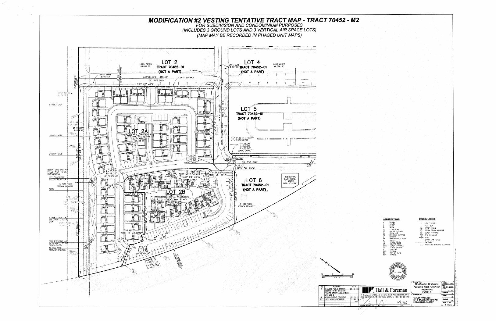
(MAP MAYBE RECORDED IN PHASED UNIT MAPS)
MODIFICATION #2 VESTING TENTATIVE TRACT MAP - TRACT 70452 - M2FOR SUBDIVISION AND CONDOMINIUM PURPOSES
(INCLUDES 3 GROUND LOTS AND 3 VERTICAL AIR SPACE LOTS)
I
LOT 2TRACT 70452-01
(NOT A PART)_
LOT 4* gutter tract 70452-01
(NOT A PART) -
1.025 ACRES 44.659 SF
1.058 ACRES 46,066 SF
I :XIST. CUR8
cco EX 24'SD\ o
ior'EXIST. CURB it GUTTER
/o S35‘06’49”E 419.47’ oCO EXIST. SIDEWALKCM-.
EX. PVT DWYoCO T 4m I TT T T T T T T T
...I.......CNhO V CM T _.T— S35* 06' 49 ”E
4r—?in
v73^=397.30'-j—z TJzri 's S'"
L. B
. 3Sm3L 12i ii ,r4 WI I 4 fI I ir-R uI I --I
ISTREET LIGHT
L0T5TRACT 70452—Of (NOT A PART)
OI H oI I % 1 I\ V. I lot front.
\ 05^ o inI v /J \ CM/ \ in \
!
F t;
. \L-L__At»o" *IT I•,ru _1 I in-T rcsyp', £CM1|64' R( ADWAY Vv.
_ LOT 2Aip —^-RESIDENTIAL CONDOMINIUM In %^3-STORY. MAX. HT. = 45'lU P 13,3/7 aCSeIJ I .
147.103 SFI .
um or C7uj *>.
KJ ? 2D 0-
EASI 4ENT \\I■li exj!_3fcJ
$ <IUTILITY MISC I i nu«n ii'l MS.xt ■0o PUBLIC UTILITY
EASEMENT "lbJ i wJ\*twn I
i I*1I *
■-lT== 38.00’ 1=59.69' R=38.00’
A=90*00’00”
Xi i I-- . ji ll *•!CMsetiin I
rpUiLfi/rr
.Orx 1: ;T" ID |T ^ ]
l 1I \UTILITY MISC \cnin V~l m m r T=29.00’
L=45.55' R=29.00’ f
A=90‘00’00”
33* • \ i 11 ..J! ITi \I \V rt 5^i
&I \\ EX. PVT QWY\l ■ \c 3®Qxl ^ 33.13’I N35‘ 06’ 49”W
I v
VI \ \' 3 T=15.07’V L=25.20’ ^
R=18.25* u A=79*06*00”V
BEGIN EXISTING ARTpTECE-TNorTcr'srrDEMOLISHED
*2” CONCRETE I BLOCK PLANTER I
4- at\ :—t^8o7o6', -159.60, WR-SOO.OO ;r
A=1125 481 —
IhW 25.56 HU N35‘ 29’ 39”W
sse? T=9.22’““ - 1=17.28’
, R=20.00’ r A=49*30’21 ’’ m
\ f\V34.92V*$= iN35' 06’ 49”W3I L=_.4I RESIDENTIAL
CLUB HOUSE 1-STORY,
MAX. HT.=35’LOT 6
TRACT 70452—01 (NOT A PART)
3S3J----------
I ^27.32'
"MP' 3»"E
zr ) h, o
H T.liiLOT 2I.rr^
i cc—! ii;~5‘ REAR YARD
SETBACK REQUIREDU o
SIGN I J. \__^N35‘ 29' 25"WI \
--iu: \
-fI fO^ \ in/•lt\
»«C&TAL filPARTMENTS t- . :3—STORY, MAX. HT.-45’~' V '
f%|l inI inU in
! I -SE.I\J 6’ SIDE YARD! I
r \ SETBACK REQUIRED/ IIi I _^L Lj.r-TC] -A^\\\mIrOI r»Ii : Ki \ vo r\CM rQ' 5m i
V->vISTREET LIGHT W/i ELECTRIC FtTlTTYi
1/ft Tl ” va3!L„™H i i|inI
^'s \ N,vj I \ SYMBOL LEGEND:ABBREVIATIONS:
,z #-nIBOX
i -i4rr-NORTHSOUTHEASTi\ESTCENTERLINE FINISHED FLOOR FLOW LINE FINISHED SURFACE LENGTHMAINTENANCE HOLERADIUSSTORM DRAINSQUARE FEETSEWER MANHOLESEWER SYSTEMTANGENTTYPICALTO? OF CURBTYPICAL
NII UTILITY =0l£PJLL BOX WATER VALVE
© STORM DRAIN MANHOLE ® SEWER MANHOLE
FRE HYDRANT
< s> A \ Eapj Ii X\ \ VA
vpio 48'^=
N55’ 11' 32C®Ta
I i FFI IS]
!i FLI i FS/I
\ \ nI ! Li} 7 SIGN28 59’03’ 43;’W
I MH\ V-\A. , vovVV^-u
ti5o4686' . \ vW^JR=18.60’ -VA
^32,49*24” \>-
CHAIN uINK FENCE EASEMENT
( } INDICATES EXISTING ELEVATION
I v Rit~rr
I '
END EXISTING AR‘ PIECE—NOt TO BE DEMOLISHED 15’ SIDE YARD
SDSFSMH
ni ss
t/kr
1 TSETBACK REQUIRED I o> TYP/I I TCiww
%\S5
' II-i TYPI I njyfii HiI
ii !iii
i <?
I - f "! I /jI J. ?2C3?
I 0 30 6030&
J CIV \I I feetr« 30' Or CAL'!
Vw*090067r?W
/” Dfoeei* TWe:Modification #2 Vesting
Tentative Tract 70452-M2 TAYLOR YARD
v PARCEL C_______
I Oate;I By REVISION OATE .0.3.-31-200.8.Scirie:Sir Hall & Foreman.35-16-06CHAUCER PUBLIC STREETn
'-30'Mooineo to be chaucerPRIVATE STREET ASSOCIATIONI _JE_I A Division of David Evans and Associates. Inc.WITH LOT 6
J£LD Cl. S1E. 3>0 • SANTA CURITA CA 91355 • 66T -204-740005-15-12 25152MISCELLANEOUS REVISIONSJE TAYLOR YARDS. LLC801 S. GRAND AVE. SUITE 780LOS ANGELES, CA 90017
LOT 2 AND 5 REVISIONSDV Checked:
idtlKDV
A' Sheet 2 erf
A sOEtfelMS' feNbSA MCLA/ 4s. 72037 SheeteDATE
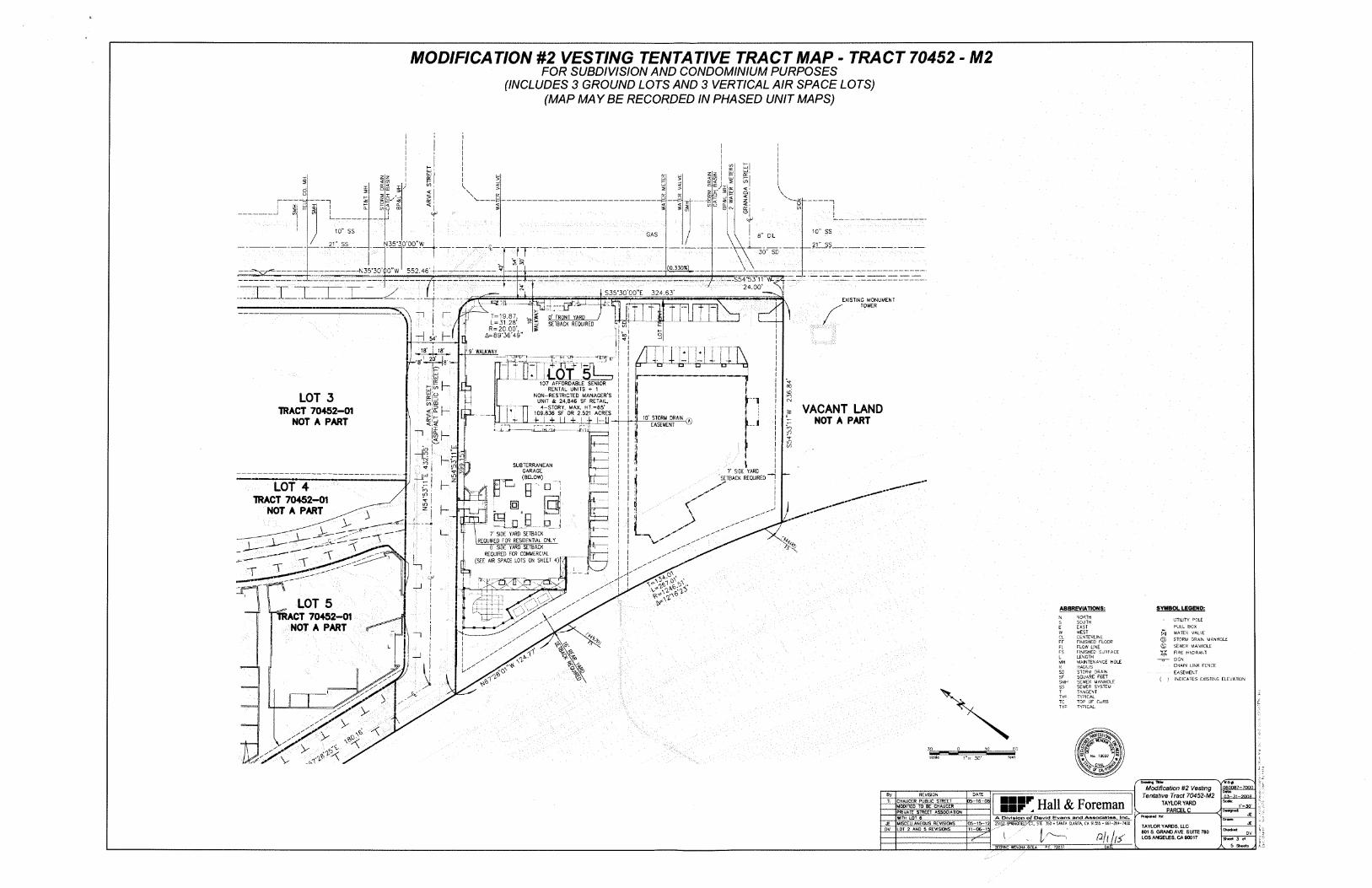
10” ss 10" ssGAS j 8” OIL
'J 35*30'00" W21” SS 21” SS
~n 30” SD*V oin \_______ (0.330%^t-------N35*30’O0"W 552.46-1—\/
5r^S54*53 n w:
/ 24.00’XSIUZ.J11 S35*30’00"E 324.63’EXISTING MONUMENT
TOWER—1-tJ T-jt......—
~^T=19.87, 1=31.28’
R = 2C.OO’, A=89*36’49”
Bi Tijj£.
* O' FRONT YARD| SETBACK REQUIRED
{o
s U IH sV b o03,
I!i i /ITUEi
□ np' ^ a ET ^
18' j 18’ 9’ WALKWAY->TC’'"T5r -JV ------17- |20’ !
b8’ I i
LOT 5,L. ! Iij-iI I
14 i i rUICO j-----
107 AFFORDABLE SENIOR RENTAL UNITS 4- 1
NON-RESTRICTED MANAGER'S | |UNIT & 24,846 SF RETAIL, | |
4-STORY, MAX. HT.=65' I I109,836 SF OR 2.521 ACRES I i
j-.J 4- ii.T ! -I- l--lj —j—Ii -irio*------------ -ivi
I I aof! Iui; ID
eg
5b-<;<
LOT 3TRACT 70452-01
NOT A PART
H IK>
MM VACANT LANDNOT A PARTHU[p-
*10’ STORM DRAIN y.
EASEMENT ^ MCCl
I I NOX| CL I]!Sb
I•4-I in
I (/),(J0 I
HbISi IiJ---- NO IK) i SUBTERRANEAN
GARAGE(BELOW)
cr> Iuo■3- lOT r SIDE YARD 'SETBACK REQUIRED
IuO I2 RTL i iLOT 4
TRACT 70452-01 NOT A PART
0 " □ I IvNO II1m rI
3i i j
< i
h*-j2
4 \is0.
i■I >iia i L
i
i11 7’ SIDE YARD SETBACK
1 REQUIRED FOR RESIDENTIAL ONLY O' SIDE YARD SETBACK
REQUIRED FOR COMMERCIAL (SEE AIR SPACE LOTS ON SHEET 4)f?
I \ .•V \>V.!
XIb IT I
T j IT I \ A' 0NA I
i ii»
i
LOT 5[ACT 70452-01
NOT A PART
' >I-
-J "H ai
SW1'L II N-
<VI18I I ✓ ?0&>.'0su-%
\ &
>
Vb\6V>• K> :'C
v
SYMBOL LEGENP:ABBREVIATIONS;NORTHSOUTHEASTWESTCENTERLINE FINISHED FLOOR FLOW LINE FINISHED SURFACE LENGTHMAINTENANCE HOLERADIUSSTORM DRAINSQUARE FEETSEWER MANHOLESEWER SYSTEMTANGENTTYPICALTOP OF CURBTYPICAL
UTILITY ^OLE PULL BOX WATER VALVE
@ STORM DRAIN MANHOLE ~ SEWER MANHOLE
Tp£ FIRE HYDRANT SIGNCHAIN LINK FENCE EASEMENT
( ) INDICATES EXISTING ELEVATION
SEWCLFFFIFSLMHKSDSFSMHSSTTYP.TCTYP
30 30 ec1M 52037!*« 3C
Civ£or CM'!
080087—7000/" Droning THJe:
Modification #2 Vesting Tentative Tract 70452-M2
TAYLOR YARD V PARCELC
03-31-2008
r=3o‘
<Detigne*
J£
j£TAYLOR YARDS, LLC801 S GRAND AVE. SUITE 780LOS ANGELES. CA 90017
Checked:DV
Sheet 3 of5 Sheets.A.WENONAAlOA P.E. 72037 OAi
(MAP MAYBE RECORDED IN PHASED UNIT MAPS)
MODIFICATION #2 VESTING TENTATIVE TRACT MAP - TRACT 70452 - M2FOR SUBDIVISION AND CONDOMINIUM PURPOSES
(INCLUDES 3 GROUND LOTS AND 3 VERTICAL AIR SPACE LOTS)
■■SF Hall & ForemanA Division of David Evans and Associates. Inc.25152 SPRtNGfiaBCT.. STE. 350 • SANTaTCLARITA, CA SI35S • 661-284-7400
t vh/tS
By REVISION DATE
JL CHAUCER PUBUC STREET . 35-16-06MODIFIED TO BE CHAUCERPRIVATE STREET ASSOCIATIONWITH LOT 6________________MISCELLANEOUS REVISIONS 05-15-12UELOT 2 AND 5 REVISIONS 11-06-15DV
I---------II
SIG
N
//
r GR
ANAD
A STR
EET
STO
RM
DRAI
N
CAT
CH
BASI
N
BP&L
MH
2 WAT
ER ’ME
TER
S
{sm
h!
WA~
IeR
VALV
E
WAI
TER
METE
R
IIIIIIIIIIIIIIII
WAT
ER VA
LVE
{//
ARVI
A STR
EET
! STORM
DRAI
N
1-----
CAT
^H BA
SIN
BP&L
MH
PT&T
MH
\--
I-----
SMHmiC
O. MH
SMH
|LI
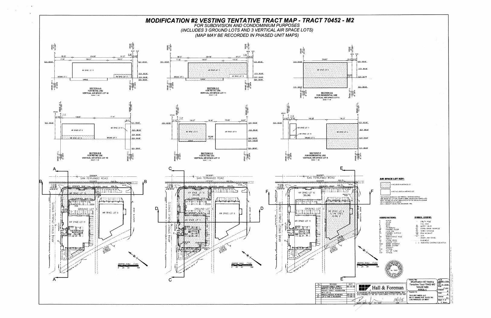
II SECTION E-EFOR RESIDENTIAL USE
VERTICAL AIR SPACE LOT 9
JCAftACE
SECTION C-CFOR RETAIL USE
VERTICAL AIR SPACE LOT 11SCAlf 1*-50
§' : s%
NEW OLDt
l?4.45j;4.oo|216-65’ELEV. 420.X'
! IX;;'V
I I-air'space'lct 9.'-'
WOUND LOT 5 ELEV. 345.00'
X'
ELEV. 295-00'El£V. 295.00'
ELEV. 363.00'
ELEV 345 00' ELEV. 333.00'
5isfd is
5
SPACE LOT 11
ELEV. 363.X'
aEV. 345.00' ELEV. 33300'JGARAGE
sgISSt3^SECTION A-A g
FOR RETAIL USE VERTICAL AIR SPACE LOT 10
SCALE 1'«53
lspNEW OLDt !1
5.39 I I '7124.001
lo ■3 O ",g -‘i
8 oNEW OLDg.1 ti5.39
24.0o| I204,59’ 87,27' 87.27’204.59'88.32'118.55*184,57' I 77.06' 184.57' 118.55’+ ELEV. A2D.00' ELEVELEV <20.QQ' ELEV. 420.X
I
SECTION F-F FOR RESIDENTIAL USE
VERTICAL AIR SPACE LOT S
S£5§s '.saIt- g
SECTION B-Blf|lFOR RETAIL USE
VERTICAL AIR SPACE LOT 101-*SB g
E
(MAP MAYBE RECORDED IN PHASED UNIT MAPS)
MODIFICATION #2 VESTING TENTATIVE TRACT MAP - TRACT 70452 - M2FOR SUBDIVISION AND CONDOMINIUM PURPOSES
(INCLUDES 3 GROUND LOTS AND 3 VERTICAL AIR SPACE LOTS)
S
3g g3 ARVIAl ARVIA ® Itf 7.13*•77.41'159.95’ I7.13’ '56.33'149.56’
36.87' !119.46' T,26.01’! 134,57’ 46.46’:v. 420-X'ELEV. 420.X' ELEV. 42Q.X' ELEV- 420.00’ELEV. 420.X
IAIR SPACE LOT 9- I ELEV. 385.00'\ ‘ -£L£y„ 365,X’AJR SPACE LOT 9 •AR SPACE LOT S.
II! ELEV- 363.X'
ELEV. 345.X'GROUND LOT SGROUND LOT 5 FI.FV. 345.X'1 ELEV. 34S.X'
ELEV. +333.00-
ELFV. ?95.X'
g
88.32'77,06'IELEV. 420.X’
j
GROUND LOT 5
3g
8ARVIA
£ * 7.13'
IELEV. 420-X'
I
gse *9E
3“sfeg
ASK’M'WEsjs-x'oyES35'3C'X*E SrSrSr
SAN FERNANDO ROADSAN FERNANDO ROAD------------------ S3S'30'X*E—
SAN FERNANDO ROAD----------------- $35‘3G'0G*E-------------------------- ---------------------------
........ 11 ’ " '1 1 11 ......... ... —-sm-sTi i -w=24.00'
AIR SPACE LOT KEY:______QLQJtr^_________' 1 — S54’53ln,*G
24.00’B -------6L5--%sr —
=T-----S54'531124 X =• INCLUDED <N AIRSPACE LO'T-19.EP,
L-31.2B,T-19.S7, L—31.2®*
-R-20.00'.- ip89’36’49”
mwt 32. 61- K
(BELOW)
T=19.S7, r- 1=31.2B \
—R=20.00’,-- ■VN35’06'49*W 159.95' NEWNEW,S35’3C'C0*E 324.63'
cXnuru
JTO']:iTy
fl=89'36'49"FT rr PFP .01’
FF\ l\ >T INCLUDED IN AIRSPACE LOTlie
((Pair space "cot jnX - Xf? SPACE _0T 10 % (BELOW)
YtTM
&.'nII/SSN54’53’!1*C
.67’•a EVATIONS SHOWN ON THE VERTICAL AIR space DETAILS ARE BASED ON CITY Of LA 8M# 12-25064, USC4GS DSK STMPDN-970 RBET '.976 38?, NE C* NE CURB ELM ST IN TOP Of THE SOUTH CGStSS OF A CONCRE1E CATCH BASIN.ELEV. a 352.40 FT; NGVD 1929, RECORDED
-*r~'H35'X;49>.128.S0‘^7^,
_ \ V-X'V--X V-' , 7
T
4TOTEfmM
VSt OTnfff^nCTnTrnfm^“■.ns4’53'ji "etj_LL j_L _=rr 1__ft tt II
..i..ta-ri aj |or |
IIUJ i ,x>.31.06' I Iii/ DD GROUND LOT 5|QCQC ! GROUND LOT 5GROUND LOT 5W516'OI }dM >a[r'space'l5t 9
■L-q. >46' GRES' ' ' 32,492'SF\'
II _TT"T1-rTT ;-r ] -;EMU <s> i(/) ,C/7 , !IAIR SPACE LOT 9 IAIR SPACE LOT S ! *! I Oy t5 Io La. i ! II I SYMBOL LEGEND:ABBREVIATIONS:CD 1 CDcd : I
X:; :a!r space lot. ) iX n3 : l5
'iAIR SPACE LOT 11 TXX' NORTH
SOUTHEASTWESTCENTERLINE FINISHED FLOOR ►LOW LINE FINISHED SURFACE LENGTHMAINTENANCE HOL£RADIUSSTORM DRAINSQUARE FEETSEWER MANHOLESEWER SYSTEMTANGENTTYPICALTOP OF CURBTYPICAL
NCL I Q. i UTILITY 30LE PJLL BOX WATER VALVE
Q STORM DRAIN MANHOLE SEWER MANHOLE
rr FIRE HYDRANT SIGNCHAIN JNK FENCE EASEMENT
( ) INDICATES EXISTING ELEVATION
AIR SPACE LOT 11 s■rr?I E
r ii r -is I i w
SUBTERRANEANGarage O
to (BELOW) ̂”.LLW—R..i
XLiJUJ I -CTT
)X
jv. fefv (8EL0W& _
IICLUJ 1
QL I or \ FFI tor rss« FL/ co !£ CO :to .\\'v“dw
FS! i •Xx=i L■'s
I i i 7 MH! l! i I> :> ! R
I XSX<X ^! I! I 02 ioror SDh—I < ' t-S< 1< SF^h35’06'49’Wf“ ''.'24.P'^BF
'zr-6.55^'. x SMH
* >! >n tgsas^«?^rj TJ3T5?r 3Ej . TYP•ii § TC49* tftf TYPV !Hi . II L,
I I JI I1 I GRAPHIC SCALE t‘=50'I GRAPHIC SCALE I'=50'GRAPHIC SCALE I »50' I^ fc<f I wmprni l"■ , <ik'<ik’'
Ji 0 25 50 100I0 25 50 tooi•T*0 25 50 100 ;<y *ii ;0 Iy*
W6 *1 \
EA C 080067-7000Modification #2 Vesting Tentative Tract 70452-M2
TAYLOR YARD> PARCEL C ............
Dote:By DATEREVISION 03-31-2006
Hall & ForemanCHAUCER PUBUC STREET .35-16-06T1 r=so' -MODIFIED TO BE CHAUCERDotgMd4PRIVATE STREET ASSOCIATION JEA Division of David Evans and Associates. Inc.WITH LOT 6
UE25152 ST?I^GfiaD CT.. STE. 350 • SANTA CUfllA, CA 91355 • €61-284-7400MISCELLANEOUS REVISIONS OS-15-12JE TAYLOR YARDS, LLC801 S. GRAND AVE. SUITE 780LOS ANGELES. CA 90017
LOT 2 AND 5 REVISIONS 11-06-15DV Check**
X7^ I^iEB^NC *SH?WA VIOLA
/ali/tf ovSheet 4 o1
5 Sheet* _yDATEP.E 72037
.AIR SPACE LOT
AIR SPACE LOT 10
SPACE LOT 11/
-AIR SPACE LOT 10
GROUND LOT 5
•AIR SPACE LOTAR SPACE LOT
•vC -AIR SPACE LOT TO. -.T
GROUND LO
T 5
L.E.
-TO
C
ENTE
S" ‘
X E«
?TH
GR
XN0 L
OT 5
LE
.-̂TO
OF E
WIT
H
Om
UJ
9§o0 ~i < a1 % «iPH? i 5
OmH V)
d>
GR
WN
D LO
T 5
_ LE.
=T0
“ CENTE
RO
F EAR
TH
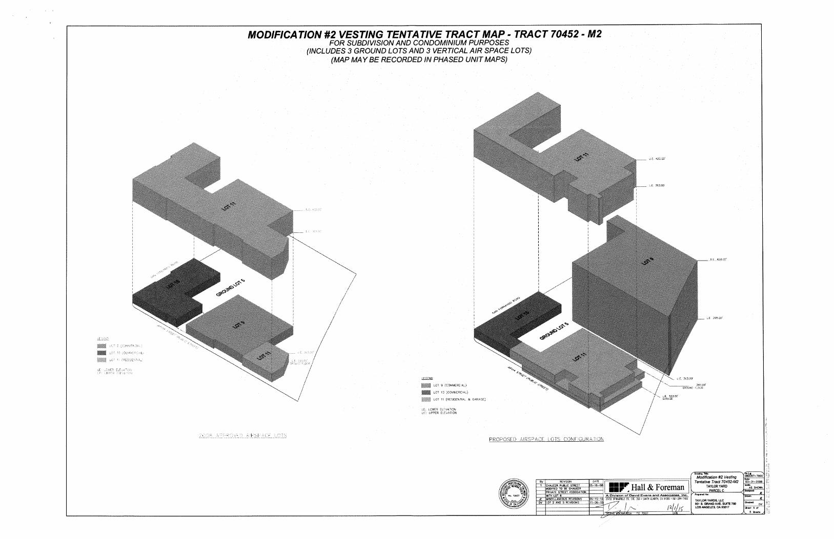
(MAP MA Y BE RECORDED IN PHASED UNIT MAPS)
MODIFICATION #2 VESTING TENTATIVE TRACT MAP - TRACT 70452 - M2FOR SUBDIVISION AND CONDOMINIUM PURPOSES
(INCLUDES 3 GROUND LOTS AND 3 VERTICAL AIR SPACE LOTS)
o.. U.£. 420.00'
L.E. 363.00'
II
i
. U s . 420 0"'
Vi
I
cXI/I c?5
/// w.E 295.00'
i
I/_L
/
f-r
LEGEND
/ 345.00'LOT 9 (COMMERCIAL)
LOT 10 (COMMERCIAL)
: . i LOT 11 (RESIDENTIAL & GARAGE)
/ iJOLR
/ 333.OC' GARA3L
E: LOWER ELEVATION -s': UPPER ELEVATIONL
PROPOSED AIRSPACE LOTS CONFIGURATION
/" Oroeinj TWr. ..........."Modification #2 l/esf/ng
Tentative Tract 70452-M2 TAYLOR YARD
V PARCEL C_______
37—7000
DATE_9y_ REVISION 03-31-2008
55Sr Hall & Foreman]35-16-08JL CHAUCER PUBLIC STREET MOOIFIEP TO BE CHAUCER AS SHOWN
i PRIVATE STREET ASSOPATION JLPrqttrcd fer:*r No. 72037 A Division of David Evans and Associates, Inc.WITH LOT 6 JL25152 SPRINGFIELD CT„ STE. 35C • SANTA CLARITA, CA 91355 • 661-284-740005-15-12MISCELLANEOUS REVISIONSJEftXcimXK' TAYLOR YARDS. LLC801 S. GRAND AVE. SUITE 780LOS ANGELES, CA 90017
LOT 2 AND 5 REVISIONS 11-06-15 Checked:DV DV
mu Sheet 5 ofX 5 Sheet*’il?knntL/a.k ?.E 72037 0A•^EERisC

EXECUTIVE OFFICESDEPARTMENT OF
CITY PLANNING200 N. Sprinc Street, Room 525
Los Angeles, CA 90012-4801 .AND
6262 Van Nuys Blvd., Suite 351 Van Nuys, CA 91401
CITY PLANNING COMMISSION
City of Los AngelesMICHAEL J. LOCRANDE
DIRECTOR
(213) 978-1271
ALAN BELL, AICPDEPUTY DIRECTOR
(213) 978-1272
LISA M. WEBBER, AICPDEPUTY DIRECTOR
(213) 978-1274
EVA YUAN-MCDANIELDEPUTY DIRECTOR
(213) 978-1273
CALIFORNIA
toWILLIAM ROSCHEN
PRESIDENTREGINA M. FREER
VICE-PRESIDENT
SEAN O. BURTON DIEGO CARDOSO
GEORGE HOVACUIMIAN JUSTIN KIM
ROBERT LESSIN DANAM. PERLMAN BARBARA ROMERO
\k s
O
Antonio R. VillaraigosaMAYOR FAX: (213) 978-1275
INFORMATIONwww.planning.lacity.orgJAMES WILLIAMS
COMMISSION EXECUTIVE ASSISTANT II
(213) 978-1300
Decision Date: September 6, 2012
Appeal Period Ends: September 17, 2012
Vesting Tentative Tract Map No. 70452-CN-M1 Related Case: ZA-2008-1319-ZV-SPR Project Address: 1545 North San Fernando
RoadCouncil District: 1 Existing Zone: [QJCM-1-CDO Community Plan: Northeast Los Angeles ENV No.: ENV-2008-1267-MND-REC1
Dan Falcon (A)Taylor Yards, LLC801 South Grand Avenue, Suite 780 Los Angeles, CA 90017
Roger Moliere (O)LACMTAOne Gateway Plaza (99-18-3) Los Angeles, CA 90012
Andie Adame (R)Craig Lawson & Co., LLC 8758 Venice Boulevard, Suite 200 Los Angeles, CA 90034
In accordance with provisions of Sections 17.03 and 17.11 of the Los Angeles Municipal Code, the Advisory Agency approved a Modification of Vesting Tentative Tract Map No. 70452-CN-M1 composed of 11 lots (8 ground and 3 airspace lots), located at 1545 North San Fernando Road for a maximum 401 residential units and 29,400 square feet of retail uses on a 711,825 square-foot lot as shown on revised map stamp-dated May 15, 2012 in the Northeast Los Angeles Community Plan. (The subdivider is hereby advised that the Municipal Code may not permit this maximum approved density. Therefore, verification should be obtained from the Department of Building and Safety which will legally interpret the Zoning code as it applies to this particular property.) For an appointment with the Public Counter staff, please call (213) 482-7077. The Advisory Agency’s approval is subject to the following conditions:
NOTE on clearing conditions: When two or more agencies must clear a condition, subdivider should follow the sequence indicated in the condition. For the benefit of the applicant, subdivider shall maintain record of all conditions cleared, including all material supporting clearances and be prepared to present copies of the clearances to each reviewing agency as may be required by its staff at the time of its review.

VESTING TENTATIVE TRACT MAP NO. 70452-CN-M1 PAGE 2
BACKGROUND
Previously, on July 30, 2008, the Advisory Agency approved the Vesting Tentative Tract Map No. 70452 for the subdivision of eight grounds and three airspace lots for a maximum 471 residential units and 29,400 square feet of retail uses on a 708,005 square-foot lot. The original project consisted of 10 Joint Living and Work Quarter condominium units and 44 residential condominiums on ground Lot 1,200 residential condominium units on ground Lot 2, 67 affordable rental units and one non-restricted manager’s unit on ground Lot 3, 41 residential condominiums on ground Lot 4, and 107 affordable senior housing units and one non-restricted manager's unit and two commercial condominiums comprised of 29,400 square feet of retail on ground Lot 5. The maximum building height was limited to 65 feet at four stories with a total floor area of 622,780 square feet.
The Applicant is herein requesting to modify the project by reducing the floor area, buildable area and density while maintaining the amount of retail uses and building height. Several of the lots will be reconfigured within the project site. Parking and open space provisions will be reduced accordingly based on the number of residential units. The modified project will consist of a maximum 86 affordable rental units and one non-restricted manager’s unit on ground Lot 1, 97 residential condominiums on ground Lot 2, 67 affordable rental units and one non-restricted manager's unit on ground Lot 3, 41 residential condominiums on ground Lot 4, and 16,991 square feet of retail space in airspace Lot 9, 12,409 square feet of retail space in airspace Lot 10, and 107 affordable senior housing units and one non-restricted manager's unit in airspace Lot 11, where airspace Lots 9, 10, and 11 are located on ground Lot 5. The Final Map is to be recorded in phased unit maps
The Applicant has provided the following details on the proposed Modification of the project:
Previously Approved Project Proposed Project Net Change
622,780 square feet (1.5 FAR)
536,008 square feet (1.5 FAR)Floor Area -86,772 square feet
Total Residential Density 471 units 401 units -70 units
Lot 1 Residential Density
86 affordable rental units 1 non-restricted manager’s unit
54 condominium units +33 units
Lot 2 Residential Density 200 condominium units 97 condominium units -103 units
Lot 3 Residential Density
67 affordable rental units 1 non-restricted manager's unit No change N/A
Lot 4 Residential Density 41 condominium units No change N/A
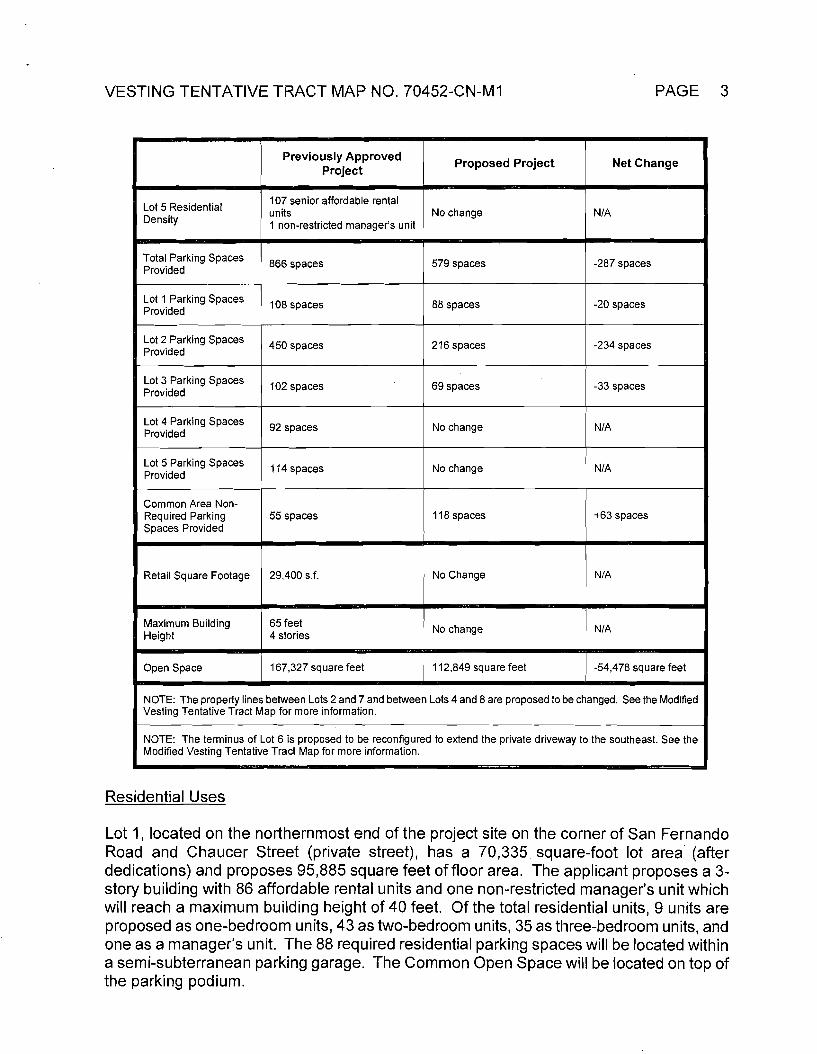
VESTING TENTATIVE TRACT MAP NO. 70452-CN-M1 PAGE 3
Previously Approved Project Net ChangeProposed Project
107 senior affordable rental units1 non-restricted manager’s unit
Lot 5 Residential Density
No change N/A
Total Parking Spaces Provided
-287 spaces579 spaces866 spaces
Lot 1 Parking Spaces Provided
-20 spaces108 spaces 88 spaces
Lot 2 Parking Spaces Provided
216 spaces -234 spaces450 spaces
Lot 3 Parking Spaces Provided -33 spaces102 spaces 69 spaces
Lot 4 Parking Spaces Provided No change N/A92 spaces
Lot 5 Parking Spaces Provided
N/A114 spaces No change
Common Area Non- Required Parking Spaces Provided
118 spaces +63 spaces55 spaces
29,400 s.f. No Change N/ARetail Square Footage
65 feet 4 stories
Maximum Building Height No change N/A
167,327 square feet 112,849 square feet -54,478 square feetOpen Space
NOTE: The property lines between Lots 2 and 7 and between Lots 4 and 8 are proposed to be changed. See the Modified Vesting Tentative Tract Map for more information.
NOTE: The terminus of Lot 6 is proposed to be reconfigured to extend the private driveway to the southeast. See the Modified Vesting Tentative Tract Map for more information.
Residential Uses
Lot 1, located on the northernmost end of the project site on the corner of San Fernando Road and Chaucer Street (private street), has a 70,335 square-foot lot area (after dedications) and proposes 95,885 square feet of floor area. The applicant proposes a 3- story building with 86 affordable rental units and one non-restricted manager’s unit which will reach a maximum building height of 40 feet. Of the total residential units, 9 units are proposed as one-bedroom units, 43 as two-bedroom units, 35 as three-bedroom units, and one as a manager’s unit. The 88 required residential parking spaces will be located within a semi-subterranean parking garage. The Common Open Space will be located on top of the parking podium.
PAGE 4VESTING TENTATIVE TRACT MAP NO. 70452-CN-M1
Lot 2, includes 208,989 square feet of lot area before and after dedications. It is located on the westerly corner of the project site, southwest of Lots 1 and 7, and will include 97 residential condominium units within 2 stories and a maximum building height of 35 feet. The 194 residential parking spaces are located within attached two car-parking garages and the 22 guest parking spaces will be provided on-site.
Lot 3 is located between Lot 1 and Lot 5 on the easterly side of the project site, with frontages on San Fernando Road and the proposed Arvia Street, a dedicated public street, and Chaucer Street (private street). The lot area is 80,511 square feet (after dedications) and 80,765 square feet of floor area is proposed. The residential building includes 67 affordable residential apartment units and one non-restricted manager’s unit (18 one- bedroom units, 18 two-bedroom units, and 32 three-bedroom units) within 3 stories and with a maximum building height of 40 feet. The building is comprised of two-story townhouse units located above ground level single story flats. This building includes 69 required residential parking spaces located at-grade, open to the sky, and within the interior of the block.
Lot 4 is located on the southernmost end of the project site, between Lot 8 and Lot 6 and has 84,247 square feet of lot area (after dedications). With 69,933 square feet of floor area proposed, a total of 41 two- and three-story townhouse-style attached condominium units will be provided (with a maximum building height of 40 feet). Each unit will have an attached 2-car parking garage, providing the required 82 residential parking spaces and the 10 guest parking spaces will be located on-site.
Lastly, Lot 5 is located on the south-easternmost end of the project site, with frontages on San Fernando Road and on Arvia Street, a dedicated public street. Lot 5 has a 109,782 square-foot lot area (after dedications) and proposes 117,525 square feet of floor area. The mixed-use building on Lot 5 includes 107 affordable senior residential apartment units and one non-restricted manager’s unit (102 one-bedroom units and 6 two-bedroom units) within 4 stories (with a maximum building height of 65 feet) and with approximately 29,400 square feet of ground-floor commercial uses. The 59 commercial parking spaces and 55 residential parking spaces will be located in a surface parking lot southeast of the building structure. The building would reach a maximum height of 65 feet.
Additional residential amenities available to all residents of the development and their guests are located on Lot 6, Lot 7, and Lot 8, which include a community pool, clubhouse, and green open space areas.
Commercial Uses
The commercial use for the proposed project will be located below the residential use in the proposed building on Lot 5, and will include approximately 29,400 square feet of total floor area, which will serve the residents of the property and the surrounding community. The commercial component will be separated into two commercial condominium units.
Parking for the commercial portion of the project will be provided in a southeasterly adjacent surface parking lot. Pedestrian access will be provided from San Fernando Road
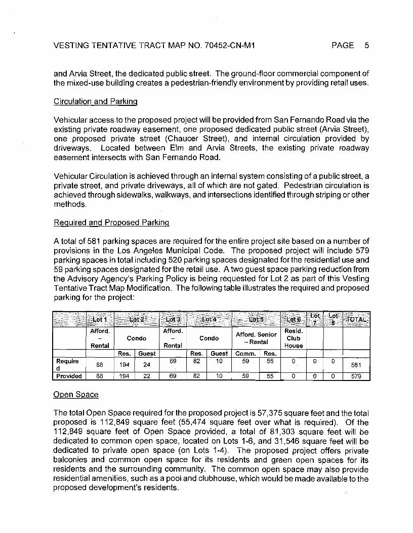
VESTING TENTATIVE TRACT MAP NO. 70452-CN-M1 PAGE 5
and Arvia Street, the dedicated public street. The ground-floor commercial component of the mixed-use building creates a pedestrian-friendly environment by providing retail uses.
Circulation and Parking
Vehicular access to the proposed project will be provided from San Fernando Road via the existing private roadway easement, one proposed dedicated public street (Arvia Street), one proposed private street (Chaucer Street), and internal circulation provided by driveways. Located between Elm and Arvia Streets, the existing private roadway easement intersects with San Fernando Road.
Vehicular Circulation is achieved through an internal system consisting of a public street, a private street, and private driveways, all of which are not gated. Pedestrian circulation is achieved through sidewalks, walkways, and intersections identified through striping or other methods.
Required and Proposed Parking
A total of 581 parking spaces are required for the entire project site based on a number of provisions in the Los Angeles Municipal Code. The proposed project will include 579 parking spaces in total including 520 parking spaces designated for the residential use and 59 parking spaces designated for the retail use. A two guest space parking reduction from the Advisory Agency’s Parking Policy is being requested for Lot 2 as part of this Vesting Tentative Tract Map Modification. The following table illustrates the required and proposed parking for the project:
Lot LotLot 4 Lot 6 TOTALLot 1 Lot 2 Lot 3 Lot5 87Afford. Afford. Resid.
ClubHouse
Afford. Senior - RentalCondo Condo
Rental RentalRes. Guest Res. Guest Comm. Res.
69 82 10Require 55 059 0 088 194 24 581d69 82 10Provided 88 22 59 0194 55 0 0 579
Open Space
The total Open Space required for the proposed project is 57,375 square feet and the total proposed is 112,849 square feet (55,474 square feet over what is required). Of the 112,849 square feet of Open Space provided, a total of 81,303 square feet will be dedicated to common open space, located on Lots 1-6, and 31,546 square feet will be dedicated to private open space (on Lots 1-4). The proposed project offers private balconies and common open space for its residents and green open spaces for its residents and the surrounding community. The common open space may also provide residential amenities, such as a pool and clubhouse, which would be made available to the proposed development’s residents.
VESTING TENTATIVE TRACT MAP NO. 70452-CN-M1 PAGE 6
BUREAU OF ENGINEERING - SPECIFIC CONDITIONS
REVISED “Note to Plan Checker” (on Page No. 3) shall read as follows:
Condition 2 does not apply to Unit Maps for Lots 1,2, § and 7. Conditions 5 and 6 do not apply to Unit Maps for Lots 1,2, 3, 4, 6, 7 and 8. Conditions 8,9,10,11,12 and 13 do not apply to Unit Maps for Lot 5.
REVISED “Note to Plan Checker” (on Page No. 27) shall read as follows:
Condition S-3(i)(1) does not apply to Unit Maps for Lot 5 of the subdivision. Condition S-3(i)(2) does not apply to Unit Maps for Lots 2,4 , §, 7 and 8. Condition S-3(i)(3) does not apply to Unit Maps for Lots 1, 2, § and 7.
DEPARTMENT OF CITY PLANNING - SITE SPECIFIC CONDITIONS
REVISED Condition No. 23 shall read as follows:
AFFORDABLE UNITS. Prior to the issuance of a building permit for any rental dwelling unit on the subject property, the applicant shall reserve 260 4T4 units and shall execute and record a rental covenant agreement running with the land, to the satisfaction of the Los Angeles Housing Department (“LAHD”). The covenant shall bind the applicant and/or any subsequent property owner to reserve 86 units on Lot 1 and 67 units on Lot 3 for households earning up to a maximum 60 percent of Area Median Income (AMI) and 107 units on Lot 5 for senior citizens earning up to a maximum 60 percent of AMI as determined by the Housing Department. Applicant must provide an affordable unit dispersal proposal to be approved by LAHD to ensure that affordable units are not segregated or otherwise distinguishable from market-rate units.
23.
For a period of thirty (30) years from the issuance of the Certificate of Occupancy, affordable dwelling units may be occupied only by households whose income has been certified by LAHD to fall within the specified Low Income affordability level, as defined by California Health and Safety Code Section 50079.5, for the duration of the covenant.
Note to Plan Checker: Condition 23 applies only to Lots 1, 3 and 5 for the development of 87, 68 and 108 units, respectively.
REVISED Condition No. 24 a. and b. shall read as follows:
Prior to the recordation of the final map, the subdivider shall prepare and execute a Covenant and Agreement (Planning Department General Form CP-6770) in a manner satisfactory to the Planning Department, binding the subdivider and all successors to the following:
24.

VESTING TENTATIVE TRACT MAP NO. 70452-CN-M1 PAGE 7
Limit the proposed development to a maximum of 86 affordable rental units and one non-restricted manager’s unit 10 Joint Living and Work Quarter condominium units an4-44 residential condominiums on ground Lot 1, 97 200 residential condominium units on ground Lot 2,67 affordable rental units and one non-restricted manager’s unit on ground Lot 3, 41 residential condominiums on ground Lot 4, and 107 affordable senior housing units and one non-restricted manager’s unit and two commercial condominiums comprised of 29,400 square feet of retail on ground Lot 5.
a.
Provide-a minimum-two parking spaces for each residential condominium onb.
Provide a minimum of 2 covered off-street parking spaces per dwelling unit, plus 1/4 guest parking spaces per dwelling unit on Lots 2 and 4. A minimum of a total of 22 guest parking spaces may also be permitted on Lot 2. All guest spaces shall be readily accessible, conveniently located, specifically reserved for guest parking, posted and maintained satisfactory to the Department of Building and Safety.
If guest parking spaces are gated, a voice response system shall be installed at the gate. Directions to guest parking spaces shall be clearly posted. Tandem parking spaces shall not be used for guest parking.
In addition, prior to issuance of a building permit, a parking plan showing off- street parking spaces, as required by the Advisory Agency, be submitted for review and approval by the Department of City Planning (200 North Spring Street, Room 750).
Affordable Rental Units. Provide a minimum 1 parking space for each affordable housing rental unit with three habitable rooms or less and 1.5 parking spaces for each affordable housing rental unit with more than three habitable rooms per Parking Option 2 of LAMC Section 12.22-A,25(d)(2).
Senior Citizen Rental Units. Provide a minimum one-half (0.5) parking space for each dwelling unit designated for senior citizens.
Non-restricted Manager’s Units. Provide one (1) parking space for each unit with less than three habitable rooms. Provide one and one-half (1.5) parking spaces for each unit with three habitable rooms. Provide two (2) parking spaces for each unit with more than three habitable rooms.
Commercial Retail. Provide a minimum two parking space for every 1,000 square feet of ground floor area.
PAGE 8VESTING TENTATIVE TRACT MAP NO. 70452-CN-M1
DEPARTMENT OF CITY PLANNING - STANDARD JOINT LIVING AND WORK CONDITIONS
DELETE Condition No. LW-1:
LW-1. In order to expedite the development, the applicant may apply for a building permit for a joint living and work building. However, prior to issuance of a building permit for joint living and workunits, the registered civil engineer, architect or licensed land surveyor shall certify in a letter to the-Advisory Agency feat all applicable tract conditions affecting the physical design of the building and/or site have been included into the building plans. Such letter is sufficient to clear this condition, |n addition-all of the applicable tract conditions shall be stated in full on The building clans and a copy of the plans shall be reviewed and approved by the Advisory Agency prior to submittal to the-Department of Building and Safety for a building permit.
OR
If a building permit for joint living-and work units will not be requested, the project civil engineer, architect or licensed land surveyor must certify in a letter to the Advisory Agency that the applicant will not request a permit for a joint living and work building and intends-to acquire a building permit for adjoint living and work condominium-bcilding(s). Such letter is sufficient to clear this condition.
FINDINGS OF FACT (CEQA)
The Planning Staff issued an Addendum (Reconsideration) to the Mitigated Negative Declaration ENV-2008-1267-MND on August 10, 2012. No increase in the floor area, buildable area, density, amount of retail uses and building height is involved as part of this VTT-70452-CN-M1 from the original tract determination. Staff had previously found that potential negative impacts could occur from the project’s implementation due to:
■ Aesthetics
□ Agricultural Resources
■ Air Quality
■ Biological Resources
■ Cultural Resources
■ Hazards & Hazardous Materials
■ Hydrology/Water Quality
□ Land Use/Planning
□ Mineral Resources
■ Public Services
■ Recreation
■ T ransportation/T raffic
■ Utilities/Service Systems
□ Mandatory Findings of Significance■ Noise
■ Geology/Soils □ Population/Housing
The Deputy Advisory Agency certifies that Mitigated Negative Declaration No. ENV-2008- 1267-MND-REC1 reflects the independent judgment of the lead agency and determined that this project would not have a significant effect upon the environment provided the potential impacts identified above are mitigated to a less than significant level through implementation of Condition Nos. 17a, 21,22, 30 and 31 of the original Tract's approval. Other identified potential impacts not mitigated by these conditions are mandatorily subject to existing City ordinances, (Sewer Ordinance, Grading Ordinance, Flood Plain

VESTING TENTATIVE TRACT MAP NO. 70452-CN-M1 PAGE 9
Management Specific Plan, Xeriscape Ordinance, Stormwater Ordinance, etc.) which are specifically intended to mitigate such potential impacts on all projects.
The project site, as well as the surrounding area, are presently developed with structures and do not provide a natural habitat for either fish or wildlife.
In accordance with Section 21081.6 of the Public Resources Code (AB3180), the Deputy Advisory Agency has assured that the above identified mitigation measures will be implemented by requiring reporting and monitoring as specified in Condition No. 29.
The custodian of the documents or other material which constitute the record of proceedings upon which the Advisory Agency’s decision is based are located with the City of Los Angeles, Planning Department, 200 North Spring Street, Room 750, Los Angeles, CA 90012.
FINDINGS OF FACT (SUBDIVISION MAP ACT)
In connection with the approval of Vesting Tentative Tract No. 70452-CN-M1, the Advisory Agency of the City of Los Angeles, pursuant to Sections 66473.1,66474.60, .61 and .63 of the State of California Government Code (the Subdivision Map Act), makes the prescribed findings as follows:
THE PROPOSED MAP WILL BE/IS CONSISTENT WITH APPLICABLE GENERAL AND SPECIFIC PLANS.
(a)
The adopted Northeast Los Angeles Community Plan designates the subject property for Limited Industrial land use with the corresponding zones of CM, MR, M1, and P. The property contains approximately 16.3 net acres (711,825 net square feet after required dedication) and is presently zoned [Q]CM-1-CDO. On July 30, 2008, the Advisory Agency approved the Vesting Tentative Tract Map No. 70452-CN for the subdivision of eight grounds and three airspace lots for a maximum 471 residential units and 29,400 square feet of retail uses on a 708,005 square-foot lot. The original project consisted of a maximum building height of 65 feet at four stories with a total floor area of 622,780 square feet. As part of the project, the applicant had requested ZA-2008-1319-ZV-SPR, which included a request for a zone variance to provide 5,685 square feet of open space in lieu of the 9,650 square feet required on Lot 3, and a site plan review. Findings were made to grant the approval of the requested zone variance and site plan review.
The Modification request herein is being requested to permit the subdivision of eight grounds and three airspace lots for a maximum 401 residential units and 29,400 square feet of retail uses. The modified project will essentially reduce the project in floor area, buildable area and density while maintaining the amount of retail uses and building height. Several of the lots will be reconfigured within the project site. Parking and open space provisions will be reduced accordingly based on the number of residential units.

PAGE 10VESTING TENTATIVE TRACT MAP NO. 70452-CN-M1
The site is not subject to the Specific Plan for the Management of Flood Hazards, floodways, floodplains, mud prone areas, coastal high-hazard and flood-related erosion hazard areas.
The site is not subject to any other Specific Plans. The project would meet the objectives of the General Plan. More specifically, the project would meet the Housing Element objectives which would include the following: encouragingproduction and preservation of an adequate supply of rental and ownership housing to meet the identified needs of persons of all income levels and special needs; encouraging the location of housing, jobs, and services in mutual proximity; and accommodation of a diversity of uses that support the needs of the City’s existing and future residents. Furthermore, the project would provide much-needed affordable units by creating 107 rental units for senior citizens, 153 affordable units for low and very low income households, and three non-restricted manager’s units.
The project would meet the objectives of the Land Use and Transportation elements, which state the following: support development along mixed-useboulevards; provide for the stability and enhancement of multi-family residential neighborhoods; preserve and enhance access to scenic resources and regional open space and creation of a pedestrian-friendly environment.
The project site is located within the Los Angeles River Revitalization Master Plan. The project will be required to be in conformance with the goals, policies, and objectives of the plan (see Condition No. 27).
Therefore, as conditioned, the proposed tract map is consistent with the intent and purpose of the applicable General and Specific Plans.
(b) THE DESIGN AND IMPROVEMENT OF THE PROPOSED SUBDIVISION ARE CONSISTENT WITH APPLICABLE GENERAL AND SPECIFIC PLANS.
The proposed project will include a public street, a private street and private driveways. San Fernando Road is a Major Highway Class II dedicated to variable widths of 60 to 80-foot widths. The Bureau of Engineering (BOE) is requiring a 24- foot wide strip of land be dedicated along San Fernando Road adjoining Lot 5 of the subdivision in accordance with the proposed San Fernando Road Corridor Multimodal Transportation Infrastructure Program and a 34-foot wide strip of land be dedicated along San Fernando Road northerly of Arvia Street adjoining Lots 1 and 3 of the subdivision. BOE is requesting a 54-foot wide right-of-way be provided for the proposed Arvia Street including suitable turning area at the terminus and 20-foot radius property line returns at the intersection with San Fernando Road. BOE is requesting a 44-foot wide private street easement be provided including a suitable turning area at the terminus and 20-foot radius easement line returns at the intersection with San Fernando Road. Improvements will also be required. Improvement requests have also be made by BOE for the proposed private street and Arvia Street, and San Fernando Road. The Bureau of Engineering has reviewed the tract map and has issued their conditions of approval to ensure the proposed streets and improvements are satisfactory to the City engineer.
VESTING TENTATIVE TRACT MAP NO. 70452-CN-M1 PAGE 11
The proposed project will have the capacity to provide a total of 697 parking spaces. Of this total, 579 parking spaces will be set aside for the residential and commercial uses and would be in conformance with parking requirements of the LAMC. For Lot 2, the subdivider has requested a deviation from the Advisory Agency’s Parking Policy for projects located within a non-congested area. Lot 2 proposes 22 guest parking spaces in lieu of the 24 guest parking spaces required for the 97 residential condominium units. To offset this deviation, and to ensure the project provides adequate parking, the project will provide an additional 118 parking spaces located along private driveways within the project site. As conditioned, the design and improvements of the proposed project are consistent with the applicable General and Specific Plans.
THE SITE IS PHYSICALLY SUITABLE FOR THE PROPOSED TYPE OF DEVELOPMENT.
(c)
The site is currently utilized as a storage facility for the Metropolitan Transportation Authority. A few temporary structures are present. It is one of the few underimproved properties in the vicinity. The development of this tract is an infill of an otherwise neighborhood filled with a mix of commercial, industrial, and open space uses.
The project site is relatively flat with a slight slope at different portions of the site. However, the site is not located in a slope stability study area, high erosion hazard area, or a fault-rupture study zone.
On April 15, 2008, the Department of Building and Safety, Grading Division issued conditions of approval. No changes have been issued from that report since the project scope reduced. The approval of the tract map will be in accordance with the Grading Regulations, LAMC Section 91.3000.
THE SITE IS PHYSICALLY SUITABLE FOR THE PROPOSED DENSITY OF DEVELOPMENT.
(d)
Adjacent uses include a regional park known as Rio de Los Angeles Park, to the north; restaurants, auto repair and service shops, a church, as well as manufacturing and warehouse uses to the east across San Fernando Road; active rail tracks the Metrolink Central Maintenance Facility, and a narrow strip of undeveloped Metrolink property to the south; and the Metrolink right-of-way and the portion of the Los Angeles River known as Glendale Narrows adjacent to a right-of- way to the west. The proposed project would be compatible with the existing neighborhood and provide an appropriate development within a neighborhood that includes a mix of commercial and residential uses. The site is currently used as a storage area for the Metropolitan Transportation Authority (MTA) with construction materials, temporary office trailers, and an art piece. The proposed project would remove the existing structures to construct a mixed use project that includes residential condominiums, senior housing, affordable rental units, retail, and open space.
PAGE 12VESTING TENTATIVE TRACT MAP NO. 70452-CN-M1
The project has requested a zone variance from the open space requirement for Lot 3 and a site plan review for a development with over 50 dwelling units. With appropriate findings made and the approval of concurrent case, ZA-2008-1319-ZV- SPR, the project will comply with all LAMC requirements for parking, yards, and open space. As conditioned, the proposed tract map is physically suitable for the proposed density of the development.
THE DESIGN OF THE SUBDIVISION AND THE PROPOSED IMPROVEMENTS ARE NOT LIKELY TO CAUSE SUBSTANTIAL ENVIRONMENTAL DAMAGE OR SUBSTANTIALLY AND AVOIDABLY INJURE FISH OR WILDLIFE OR THEIR HABITAT.
(e)
The project site is presently vacant and does not provide a natural habitat for either fish or wildlife. The surrounding area is presently developed with commercial and industrial structures, and is near the Los Angeles River and Rio de Los Angeles Park. The neighboring commercial and industrial sites do not provide a natural habitat for either fish or wildlife. The project has considered its impact on wildlife within the Los Angeles River and the park, and has incorporated a mitigation measure to avoid potential impacts to nesting birds, including migratory birds and raptors (See MM-7).
THE DESIGN OF THE SUBDIVISION AND THE PROPOSED IMPROVEMENTS ARE NOT LIKELY TO CAUSE SERIOUS PUBLIC HEALTH PROBLEMS.
(f)
There appear to be no potential public health problems caused by the design or improvement of the proposed subdivision.
The development is required to be connected to the City's sanitary sewer system, where the sewage will be directed to the LA Hyperion Treatment Plant, which has been upgraded to meet Statewide ocean discharge standards. The Bureau of Engineering has reported that the proposed subdivision does not violate the existing California Water Code because the subdivision will be connected to the public sewer system and will have only a minor incremental impact on the quality of the effluent from the Hyperion Treatment Plant.
(9) THE DESIGN OF THE SUBDIVISION AND THE PROPOSED IMPROVEMENTS WILL NOT CONFLICT WITH EASEMENTS ACQUIRED BY THE PUBLIC AT LARGE FOR ACCESS THROUGH OR USE OF PROPERTY WITHIN THE PROPOSED SUBDIVISION.
No such easements are known to exist. Needed public access for roads and utilities will be acquired by the City prior to recordation of the proposed tract.
The design of the map will include variable width easements which will be dedicated to the City of Los Angeles around public access ramps, driveways and walks where necessary to meet the American Disability Act compliance in the public right-of-way,
VESTING TENTATIVE TRACT MAP NO. 70452-CN-M1 PAGE 13
as shown on the tentative tract map satisfactory to the City Engineer. A 44-foot easement will be provided for Chaucer Street, a private street, providing use and access rights to Lots 1,2,3,4,6,7 and 8.
THE DESIGN OF THE PROPOSED SUBDIVISION WILL PROVIDE, TO THE EXTENT FEASIBLE, FOR FUTURE PASSIVE OR NATURAL HEATING OR COOLING OPPORTUNITIES IN THE SUBDIVISION. (REF. SECTION 66473.1)
(h)
In assessing the feasibility of passive or natural heating or cooling opportunities in the proposed subdivision design, the applicant has prepared and submitted materials which consider the local climate, contours, configuration of the parcel(s) to be subdivided and other design and improvement requirements.
Providing for passive or natural heating or cooling opportunities will not result in reducing allowable densities or the percentage of a lot which may be occupied by a building or structure under applicable planning and zoning in effect at the time the tentative map was filed.
In addition, prior to obtaining a building permit, the subdivider shall consider building construction techniques, such as overhanging eaves, location of windows, insulation, exhaust fans, planting of trees for shade purposes and the height of the buildings on the site in relation to adjacent development.
These findings shall apply to Vesting Tentative Tract Map No. 70452-CN-M1. All other conditions of approval and mitigation measures from the previously approved VTT-70452- CN shall remain.
Michael J. LoGrande Advisory Agency
4Z7.77-..
JIM TOKUNAGA f Deputy Advisory Agency
JT:JK:jq
PAGE 14VESTING TENTATIVE TRACT MAP NO. 70452-CN-M1
Note: If you wish to file an appeal, it must be filed within 10 calendar days from the decision date as noted in this letter. For an appeal to be valid to the City Planning Commission, it must be accepted as complete by the City Planning Department and appeal fees paid, prior to expiration of the above 10-dav time limit. Such appeal must be submitted on Master Appeal Form No. CP-7769 at the Department’s Public Offices, located at:
Marvin Braude San Fernando Valley Constituent Service Center
6262 Van Nuys Blvd., Room 251 Van Nuys, CA 91401 818.374.5050
Figueroa Plaza201 N. Figueroa St., 4th FloorLos Angeles, CA 90012213.482.7077
Forms are also available on-line at www.planning.lacitv.org
If you seek judicial review of any decision of the City pursuant to California Code of Civil Procedure Section 1094.5, the petition for writ of mandate pursuant to that section must be filed no later than the 90th day following the date on which the City's decision became final pursuant to California Code of Civil Procedure Section1094.6. There may be other time limits which also affect your ability to seek judicial review.
If you have any questions, please call Public Counter staff at (213) 482-7077.
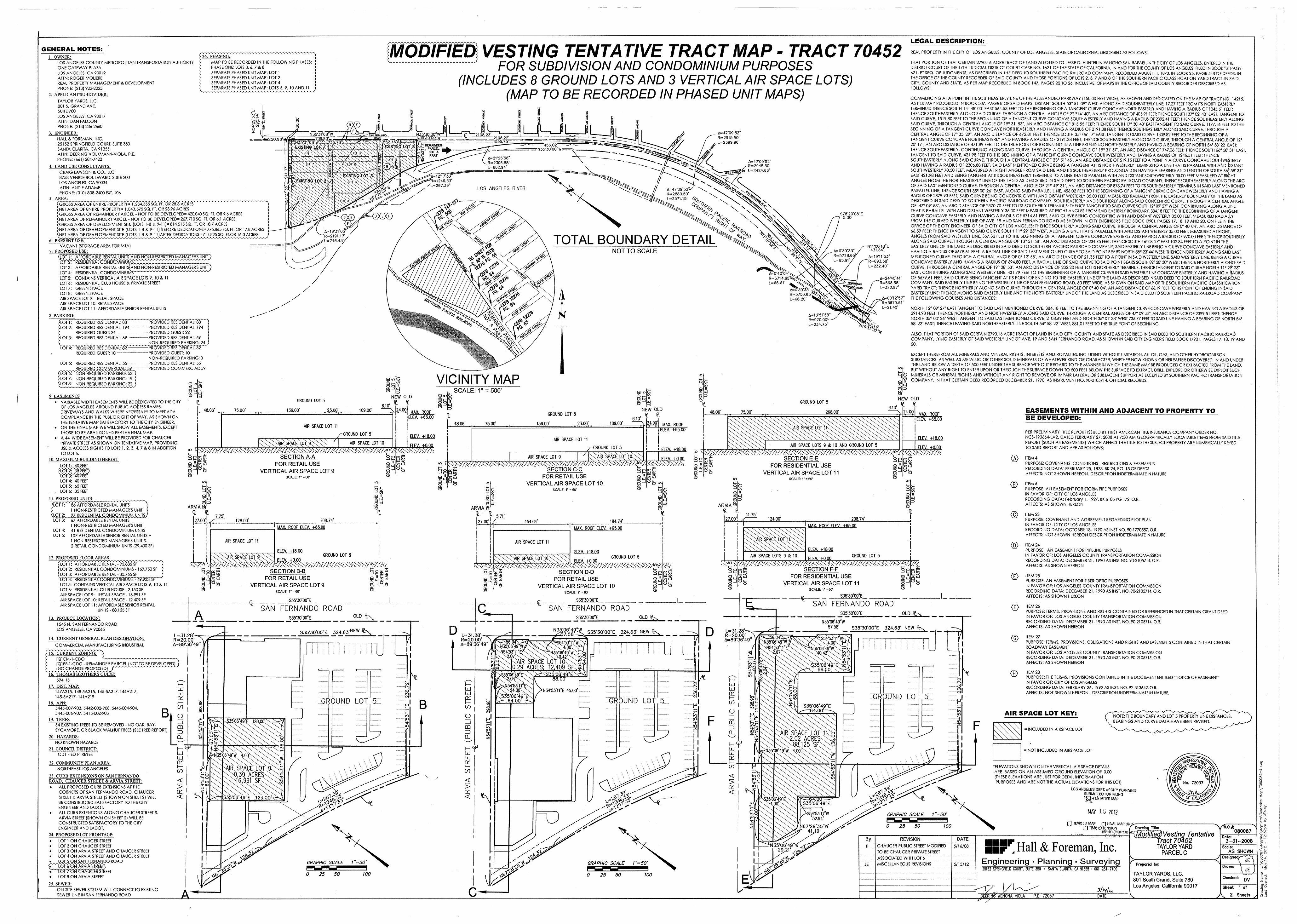
i
LEGAL DESCRIPTION:
MODIFIED VESTING TENTATIVE TRACT MAP - TRACT 70452----------------------- FOR SUBDIVISION AND CONDOMINIUM PURPOSES
(INCLUDES 8 GROUND LOTS AND 3 VERTICAL AIR SPACE LOTS)(MAP TO BE RECORDED IN PHASED UNIT MAPS)
GENERAL NOTES:REAL PROPERTY IN THE CITY OF LOS ANGELES, COUNTY OF LOS ANGELES, STATE OF CALIFORNIA, DESCRIBED AS FOLLOWS:
26. PHASING:1. OWNER:MAP TO BE RECORDED IN THE FOLLOWING PHASES:PHASE ONE: LOTS 3, 6, 7&8SEPARATE PHASED UNIT MAP: LOT 1SEPARATE PHASED UNIT MAP: LOT 2SEPARATE PHASED UNIT MAP: LOT 4SEPARATE PHASED UNIT MAP: LOTS 5, 9, 10 AND 11
LOS ANGELES COUNTY METROPOLITAN TRANSPORTATION AUTHORITY
ONE GATEWAY PLAZA LOS ANGELES, CA 90012 ATTN: ROGER MOLIERE,REAL PROPERTY MANAGEMENT & DEVELOPMENT
PHONE: (213) 922-2225
2. APPLICANT/SUBDIVIDER:
THAT PORTION OF THAT CERTAIN 2790.16 ACRE TRACT OF LAND ALLOTTED TO JESSE D. HUNTER IN RANCHO SAN RAFAEL, IN THE CITY OF LOS ANGELES, ENTERED IN THE DISTRICT COURT OF THE 17TH JUDICIAL DISTRICT COURT CASE NO. 1621 OF THE STATE OF CALIFORNIA, IN AND FOR THE COUNTY OF LOS ANGELES, FILED IN BOOK "B'1 PAGE 671, ET SEQ. OF JUDGMENTS, AS DESCRIBED IN THE DEED TO SOUTHERN PACIFIC RAILROAD COMPANY, RECORDED AUGUST 11, 1873, IN BOOK 25, PAGE 548 OF DE^DS, IN THE OFFICE OF THE COUNTY RECORDER OF SAID COUNTY AND THOSE PORTIONS OF LOTS 2, 3, 7 AND 8 OF THE SOUTHERN PACIFIC CLASSIFICATION YARD TRACT, IN SAID CITY, COUNTY AND STATE, AS PER MAP RECORDED IN BOOK 147, PAGES 22 TO 26, INCLUSIVE, OF MAPS IN THE OFFICE OF SAID COUNTY RECORDER DESCRIBED AS FOLLOWS:
COMMENCING AT A POINT IN THE SOUTHEASTERLY LINE OF THE ALLESANDRO PARKWAY (150.00 FEET WIDE), AS SHOWN AND DEDICATED ON THE MAP OF TRACT u6. 14215, AS PER MAP RECORDED IN BOOK 307, PAGE 8 OF SAID MAPS, DISTANT SOUTH 53° 51'09" WEST, ALONG SAID SOUTHEASTERLY LINE, 17.27 FEET FROM ITS NORTHEASTERLY TERMINUS; THENCE SOUTH 14° 48* 03" EAST 564.53 FEET TO THE BEGINNING OF A TANGENT CURVE CONCAVE NORTHEASTERLY AND HAVING A RADIUS OF 1045.51 FdET; THENCE SOUTHEASTERLY ALONG SAID CURVE, THROUGH A CENTRAL ANGLE OF 22 °14’ 40', AN ARC DISTANCE OF 405.91 FEET; THENCE SOUTH 37° 02* 43" EAST, TANGENT TO SAID CURVE, 1519.80 FEET TO THE BEGINNING OF A TANGENT CURVE CONCAVE SOUTHWESTERLY AND HAVING A RADIUS OF 2392.41 FEET; THENCE SOUTHEASTERLY.ALONG SAID CURVE, THROUGH A CENTRAL ANGLE OF 19° 31' 53", AN ARC DISTANCE OF 815.55 FEET; THENCE SOUTH 17° 30' 48" EAST TANGENT TO SAID CURVE, 1177.16 FEEY TO THE BEGINNING OF A TANGENT CURVE CONCAVE NORTHEASTERLY AND HAVING A RADIUS OF 2191.38 FEET; THENCE SOUTHEASTERLY ALONG SAID CURVE, THROUGH A CENTRAL ANGLE OF 17° 35' 29", AN ARC DISTANCE OF 672.81 FEET; THENCE SOUTH 35° 06' 1T EAST, TANGENT TO SAID CURVE, 1309.82 FEET TO THE BEGINNING OF A TANGENT CURVE CONCAVE NORTHEASTERLY AND HAVING A RADIUS OF 2191.38 FEET; THENCE SOUTHEASTERLY ALONG SAID CURVE, THROUGH A CENTRAL ANGLg OF 12° 20' 17", AN ARC DISTANCE OF 471.89 FEET TO THE TRUE POINT OF BEGINNING IN A LINE EXTENDING NORTHEASTERLY AND HAVING A BEARING OF NORTH 54° 58' 22' fcAST; THENCE SOUTHEASTERLY, CONTINUING ALONG SAID CURVE, THROUGH A CENTRAL ANGLE OF 19° 31'57", AN ARC DISTANCE OF 747.06 FEET; THENCE SOUTH 66* 58' 31" EAST, TANGENT TO SAID CURVE, 421.98 FEET TO THE BEGINNING OF A TANGENT CURVE CONCAVE SOUTHWESTERLY AND HAVING A RADIUS OF 1246.51 FEET; THENCE SOUTHEASTERLY ALONG SAID CURVE, THROUGH A CENTRAL ANGLE OF 23° 51'45", AN ARC DISTANCE OF 519.15 FEET TO A POINT IN A CURVE CONCAVE SOUTHWESTERLY AND HAVING A RADIUS OF 2306.88 FEET, SAID LAST MENTIONED CURVE BEING A TANGENT AT ITS NORTHWESTERLY TERMINUS TO A LINE THAT IS PARALLEL WITH AND DISTANT SOUTHWESTERLY 70.50 FEET, MEASURED AT RIGHT ANGLE FROM SAID LINE AND ITS SOUTHEASTERLY PROLONGATION HAVING A BEARING AND LENGTH OF SOUTH 66* 58' 31" EAST 421.98 FEET AND BEING TANGENT AT ITS SOUTHEASTERLY TERMINUS TO A LINE THAT IS PARALLEL WITH AND DISTANT SOUTHWESTERLY 35.00 FEET MEASURED AT Rl6HT ANGLES FROM THE NORTHEASTERLY LINE OF THE LAND AS DESCRIBED IN SAID DEED TO SOUTHERN PACIFIC RAILROAD COMPANY; THENCE SOUTHEASTERLY ALONG THE ARC OF SAID LAST MENTIONED CURVE, THROUGH A CENTRAL ANGLE OF 21° 49' 31", AN ARC DISTANCE OF 878.74 FEET TO ITS SOUTHEASTERLY TERMINUS IN SAID LAST MENTIONED PARALLEL LINE; THENCE SOUTH 35° 00’ 26" EAST, ALONG SAID PARALLEL LINE, 456.02 FEET TO THE BEGINNING OF A TANGENT CURVE CONCAVE WESTERLY AND HAVING A RADIUS OF 2879.93 FEEL SAID CURVE BEING CONCENTRIC WITH AND DISTANT WESTERLY 35.00 FEET, MEASURED RADIALLY FROM THE EASTERLY BOUNDARY OF THE LAND AS DESCRIBED IN SAID DEED TO SOUTHERN PACIFIC RAILROAD COMPANY, SOUTHEASTERLY AND SOUTHERLY ALONG SAID CONCENTRIC CURVE, THROUGH A CENTRAL ANGLE OF 47° 09' 53", AN ARC DISTANCE OF 2370.70 FEET TO ITS SOUTHERLY TERMINUS; THENCE TANGENT TO SAID CURVE SOUTH 12° 09* 27" WEST, CONTINUING ALONG A LINE THAT IS PARALLEL WITH AND DISTANT WESTERLY 35.00 FEET MEASURED AT RIGHT ANGLES FROM SAID EASTERLY BOUNDARY, 384.18 FEET TO THE BEGINNING OF A TANGENT CURVE CONCAVE EASTERLY AND HAVING A RADIUS OF 5714.61 FEET, SAID CURVE BEING CONCENTRIC WITH AND DISTANT WESTERLY 35.00 FEET, MEASURED RADIALLY FROM THE CURVED WESTERLY LINE OF AVE. 19 AND SAN FERNANDO ROAD AS SHOWN IN CITY ENGINEER'S FIELD BOOK 17901, PAGES 17, 18, 19 AND 20, ON FILE IN tNe OFFICE OF THE CITY ENGINEER OF SAID CITY OF LOS ANGELES; THENCE SOUTHERLY ALONG SAID CURVE, THROUGH A CENTRAL ANGLE OF0° 40* 04", AN ARC DISTANCE OF 66.59 FEET; THENCE TANGENT TO SAID CURVE SOUTH 11° 29' 23" WEST, ALONG A LINE THAT IS PARALLEL WITH AND DISTANT WESTERLY 35.00 FEET, MEASURED AT RlkHT ANGLES FROM SAID WESTERLY LINE, 357.32 FEET TO THE BEGINNING OF A TANGENT CURVE CONCAVE EASTERLY AND HAVING A RADIUS OF 970.00 FEET; THENCE SOUTHERLY ALONG SAID CURVE, THROUGH A CENTRAL ANGLE OF 13° 51'58", AN ARC DISTANCE OF 234.75 FEET; THENCE SOUTH 16° 08' 27' EAST 102.84 FEET TO A POINT IN THE EASTERLY LINE OF THE LAND AS DESCRIBED IN SAID DEED TO SOUTHERN PACIFIC RAILROAD COMPANY, SAID EASTERLY LINE BEING A CURVE CONCAVE EASTERLY ANb HAVING A RADIUS OF 5679.61 FEET, A RADIAL LINE OF SAID LAST MENTIONED CURVE TO SAID POINT BEARS NORTH 85° 23* 44" WEST; THENCE NORTHERLY ALONG SAID LAST MENTIONED CURVE, THROUGH A CENTRAL ANGLE OF 0° 12* 55", AN ARC DISTANCE OF 21.35 FEET TO A POINT IN SAID WESTERLY LINE, SAID WESTERLY LINE, BEING A CiURVE CONCAVE EASTERLY AND HAVING A RADIUS OF 694.80 FEET, A RADIAL LINE OF SAID CURVE TO SAID POINT BEARS SOUTH 82° 20‘ 3O' WEST; THENCE NORTHERLY ALONG SAID CURVE, THROUGH A CENTRAL ANGLE OF 19° 08' 53", AN ARC DISTANCE OF 232.20 FEET TO ITS NORTHERLY TERMINUS; THENCE TANGENT TO SAID CURVE NORTH 11° 2$' 23" EAST, CONTINUING ALONG SAID WESTERLY LINE, 431.79 FEET TO THE BEGINNING OF A TANGENT CURVE IN SAID WESTERLY LINE CONCAVE EASTERLY AND HAVING A RADIUS
OF 5679.61 FEET, SAID CURVE BEING TANGENT AT ITS POINT OF ENDING TO THE EASTERLY LINE OF THE LAND AS DESCRIBED IN SAID DEED TO SOUTHERN PACIFIC RAILROAD COMPANY, SAID EASTERLY LINE BEING THE WESTERLY LINE OF SAN FERNANDO ROAD, 60 FEET WIDE, AS SHOWN ON SAID MAP OF THE SOUTHERN PACIFIC CLASSIFlCAtlON YARD TRACT; THENCE NORTHERLY ALONG SAID CURVE, THROUGH A CENTRAL ANGLE OF 0° 40’ 04", AN ARC DISTANCE OF 66.19 FEET TO ITS POINT OF ENDING IN $AID EASTERLY LINE; THENCE ALONG SAID EASTERLY LINE AND THE NORTHEASTERLY LINE OF THE LAND AS DESCRIBED IN SAID DEED TO SOUTHERN PACIFIC RAILROAD COMPANY THE FOLLOWING COURSES AND DISTANCES:
TAYLOR YARDS, LLC 801 S. GRAND AVE.SUITE 780LOS ANGELES, CA 90017 ATTN: DAN FALCON PHONE: (213) 236-2660
3. ENGINEER:
HALL & FOREMAN, INC.25152 SPRINGFIELD COURT, SUITE 350 SANTA CLARITA, CA 91355 ATTN: DEERING VOLKMANN-VIOLA, P.E. PHONE: (661) 284-7422
4. LAND USE CONSULTANTS:
UJ3PO M
m io < <0>iO, J cm coGH
o iuJUUl indxeo lj-CM a
u jtf) <in A F
:Je A=47‘09'52’R=2915.50’L=2399.96’
' N 35*31’08” W.... ,.^735 80^3.
1N35*3^08 W^X.735
N35*30’,00” W N35*30 00 Wm £SAN
'2108.22’*555.75'=:50.961
&52.46> 2.78
/'456.02’““
^=rN35*30’00"W=\ UJ REMAINDER
, PARCEL NOT A PARTms Pin<X>L_
z■X 21*25*58”
R=2306.88’L=862.94*
x; vx6f=47‘09’52”-R=2945.50L=2424.66*
.O f‘A .Of i<l( bTo /XoCRAIG LAWSON & CO., LLC8758 VENICE BOULEVARD, SUITE 200LOS ANGELES, CA 90034ATTN: ANDIE ADAMEPHONE: (310) 838-2400 EXT. 106
isest*:
MX iXIStiN1 A=12*17*33” R=1246.33’
X=267.39*
x.of y
« x
//m LOS ANGELES RIVER A=47*09’52”^
R=2880.50’ L=2371.15* v$)
toKCM ax
5. AREA: G°0in
c%\X(GROSS AREA OF ENTIRE PROPERTY3 1,234,555 SQ. FT. OR 28.3 ACRES [NET AREA OF ENTIRE PROPERTY= 1,043,575 SQ. FT. OR 23.96 ACRES[GROSS AREA OF REMAINDER PARCEL - NOT TO BE DEVELOPED3 420,040 SQ. FT. OR 9.6 ACRES(NET AREA OF REMAINDER PARCEL - NOT TO BE DEVELOPED3 267,710 SQ. FT. OR 6.1 ACRES[GROSS AREA OF DEVELOPMENT SITE (LOTS 1-8 & 9-11)= 814,515 SQ. FT. OR 18.7 ACRES[NET AREA OF DEVELOPMENT SITE (LOTS 1-8 & 9-11) BEFORE DEDICATIONS3 775,865 SQ. FT. OR 17.8 ACRES\NETAREAOFDEVELOPWE^^
6. PRESENT USE:VACANT (STORAGE AREA FOR MTA) ==
7. PROPOSED USE:
iSf^X^ESICnENTiALSt^LOT 3: AFFORDABLE RENTAL UNITsCaND NON-RESTRICTED MANAGER'S UNIT}LOT 4: RESIDENTIAL CONDOMINIUMS^^^'^' " ^LOT 5: CONTAINS VERTICAL AIR SPACE LOTS 9, 10 & 11LOT 6: RESIDENTIAL CLUB HOUSE & PRIVATE STREETLOT 7: GREEN SPACELOT 8: GREEN SPACEAIR SPACE LOT 9: RETAIL SPACEAIR SPACE LOT 10: RETAIL SPACEAIR SPACE LOT 11: AFFORDABLE'SENIOR RENTAL UNITS
z to.# \At \
#/O S78‘20’08”E
5.00’
X>X- X,
dxeXfOXEv35#F
HiA=19*31WR=2191.17’y1=746.43/
%
\r>TOTAL BOUNDARY DETAIL V5? vx4*& N11*00’18"E
431.84’
A=19*11’53"R=693.58’L=232.40’
NOT TO SCALE &= 0*39*33” R=5728.65; L=65.91’/
£& #at&
&eg
% z.# &=0*40 04 R=5714.65 L=66.61’
*0,A=24*40’41R=668.58’L=322.97’
A=0*39’33”x^-« ^R=5753.65'^>AX/\ ^
L=66.20’ S&X . \
FERNp^00jROAnX
A A=00‘12’57" R=5679.61’ L=21.40’
S00o
NORTH 12° 09' 27" EAST TANGENT TO SAID LAST MENTIONED CURVE, 384.18 FEET TO THE BEGINNING OF A TANGENT CURVE CONCAVE WESTERLY AND HAVING A RADIUS OF 2914.93 FEET; THENCE,NORTHERLY AND NORTHWESTERLY ALONG SAID CURVE, THROUGH A CENTRAL ANGLE OF 47° 09' 53", AN ARC DISTANCE OF 2399.51 FEET; THENCE NORTH 35° 00’ 26" WEST TANGENT TO SAID LAST MENTIONED CURVE, 2108.69 FEET AND NORTH 35° 01'38" WEST 735.77 FEET TO SAID LINE HAVING A BEARING OF NORTH 54° 58' 22" EAST; THENCE LEAVING SAID NORTHEASTERLY LINE SOUTH 54° 58' 22* WEST, 881.01 FEET TO THE TRUE POINT OF BEGINNING.
* tv> N Af=13*51’58'R=970.00’-~L=234.75’
8. PARKING:%Of.tPROVIDED RESIDENTIAL: 88
PROVIDED RESIDENTIAL: 194 PROVIDED GUEST: 22 PROVIDED RESIDENTIAL: 69 INON-REQUIR^PROVIDED RESIDENTIAL: 82 PROVIDED GUEST: 10 NON-REQUIRED PARKING: 0 PROVIDED RESIDENTIAL: 55 PROVIDED COMMERCIAL: 59
REQUIRED RESIDENTIAL: 88 REQUIRED RESIDENTIAL: 194REQUIRED GUEST: 24-------------REQUIRED RESIDENTIAL: 69
LOT 1 : LOT 2:
%^1^•Tf7 f-s. .48 ALSO, THAT PORTION OF SAID CERTAIN 2790.16 ACRE TRACT OF LAND IN SAID CITY, COUNTY AND STATE AS DESCRIBED IN SAID DEED TO SOUTHERN PACIFIC RAILROAD
COMPANY, LYING EASTERLY OF SAID WESTERLY LINE OF AVE. 19 AND SAN FERNANDO ROAD, AS SHOWN IN SAID CITY ENGINEER'S FIELD BOOK 17901, PAGES 17,13, 19 AND✓O
LOT 3:
20.4 ^LOT 4: REQUIRED RESIDENTIAL: 8! REQUIRED GUEST: 10-------- 1ss EXCEPT THEREFROM ALL MINERALS AND MINERAL RIGHTS, INTERESTS AND ROYALTIES, INCLUDING WITHOUT LIMITATION, ALL OIL, GAS, AND OTHER HYDROCARBON
SUBSTANCES, AS WELL AS METALLIC OR OTHER SOLID MINERALS OF WHATEVER KIND OR CHARACTER, WHETHER NOW KNOWN OR HEREAFTER DISCOVERED, IN AND UNDER THE LAND BELOW A DEPTH OF 500 FEET UNDER THE SURFACE WITHOUT REGARD TO THE MANNER IN WHICH THE SAME MAY BE PRODUCED OR EXTRACTED FROM THE LAND, BUT WITHOUT ANY RIGHT TO ENTER UPON OR THROUGH THE SURFACE DOWN TO 500 FEET BELOW THE SURFACE TO EXTRACT, DRILL, EXPLORE OR OTHERWISE EXPLOIT SUCH MINERALS OR MINERAL RIGHTS AND WITHOUT ANY RIGHT TO REMOVE OR IMPAIR LATERAL OR SUBJACENT SUPPORT AS EXCEPTED BY SOUTHERN PACIFIC TRANSPORTATION COMPANY, IN THAT CERTAIN DEED RECORDED DECEMBER 21, 1990, AS INSTRUMENT NO. 90-2105714, OFFICIAL RECORDS.
mmLOT 5: REQUIRED RESIDENTIAL: 55 — ___JREQyjREDj03MME^LOT 6: NON-REQUIRED PARKING: 53 LOT 7: NON-REQUIRED PARKING: 19 LOT 8: NON-REQUIRED PARKING: 22
LO
XoLOVICINITY MAPX CO
r> i— o qon _j
X IIQ3X CO9 lo lJcoco lu II35» ZDO oSCALE: 1" = 500'O O l!.
—1 UJ
O orZD
3§ “rv~_l 1.1O -J
O9. EASEMENTS
• VARIABLE WIDTH EASEMENTS WILL BE DEDICATED TO THE CITY OF LOS ANGELES AROUND PUBLIC ACCESS RAMPS, DRIVEWAYS AND WALKS WHERE NECESSARY TO MEET ADA COMPLIANCE IN THE PUBLIC RIGHT OF WAY, AS SHOWN ON THE TENTATIVE MAP SATISFACTORY TO THE CITY ENGINEER.
• ON THE FINAL MAP WE WILL SHOW ALL EASEMENTS, EXCEPT THOSE TO BE ABANDONED PER THE FINAL MAP.
• A 44' WIDE EASEMENT WILL BE PROVIDED FOR CHAUCER PRIVATE STREET AS SHOWN ON TENTATIVE MAP, PROVIDING USE & ACCESS RIGHTS TO LOTS 1,2, 3, 4, 7 & 8 IN ADDITION
TO LOT 6.
10. MAXIMUM BUILDING HEIGHT
ZDoNEW OLD
\ 24.00——-
NEW OLDcm.GROUND LOT 5 o£ GROUND LOT 5
££ f?o6.10* ZD6.10’NEW OLD48.06’ 136.00’75.00’ 23.00’ 109.00’ EASEMENTS WITHIN AND ADJACENT TO PROPERTY TON, 24.00’48.06’ 75.00’ 268.00’MAX. ROOF
•ELEV. +65.00+ j GROUND LOT 5 MAX. ROOFI?. ££ + BE DEVELOPED:6. 0 i ELEV. +65.00
^ [24.00’III
109.00’.23.00’,136.00’48.06’ 75.00’ 1 11MAX. ROOF ELEV. +65.00
AIR SPACE LOT 11 AIR SPACE LOT 111
PER PRELIMINARY TITLE REPORT ISSUED BY FIRST AMERICAN TITLE INSURANCE COMPANY ORDER NO.NCS-190664-LA2, DATED FEBRUARY 27, 2008 AT 7:30 AM GEOGRAPHICALLY LOCATABLE ITEMS FROM SAID TITLE REPORT (SUCH AS EASEMENTS) WHICH AFFECT THE TITLE TO THE SUBJECT PROPERTY ARE NUMERICALLY KEYED TO SAID REPORT AND ARE AS FOLLOWS:
111 GROUND LOT 5 11 111ELEV. +18.00 ELEV. +18.QQAIR SPACE LOT 11' AIR SPACE LOT 10 ELEV +000
cciE SECTION A-A 3g<*^FOR RETAIL USE § &
VERTICAL AIR SPACE LOT 9 3 J
AIR SPACE LOTS 9 & 10 AND GROUND LOT 5
3ggi SECTION E-E Ti ^ § 2 FOR RESIDENTIAL USE
VERTICAL AIR SPACE LOT 11
I II ELEV. +0.00GROUND LOT 5 ELEV. +18.00xm /< L\\ X X X X XV^AIR SPACE LOT 9
<A>O O on ? ITEM 4
PURPOSE: COVENANTS, CONDITIONS , RESTRICTIONS & EASEMENTS RECORDING DATA" FEBRUARY 25, 1873, BK 24, PG. 15 OF DEEDS AFFECTS: NOT SHOWN HEREON. DESCRIPTION INDETERMINATE IN NATURE
ELEV. +0.00Q 'IZ LU3 -J
—• I— OHOH \a_< OHmo LU z? _J
Z LUZ LU />///<X\7>LOT 1: 40 FEET
(Sf2p|rFE|5
LOT 4: 40 FEET LOT 5: 65 FEET
. , LOT.6: 35 FEET
11. PROPOSED UNITS
s Z LUBu. SECTION C-C 32o o—• X
Q 'I.Z LU O J
o OHO oo OH oOH O O OOHOH FOR RETAIL USE VERTICAL AIR SPACE LOT 10
OH OHCDCD QZ LUX
SCALE: 1" = 60’ Z LUZ LU O Ll_
CD CDSCALE: I^SO1toLULU inCD Ll.m in ITEM 6PURPOSE: AN EASEMENT FOR STORM PIPE PURPOSES IN FAVOR OF: CITY OF LOS ANGELES RECORDING DATA: February I, 1927, BK 6105 PG 172, O.R. AFFECTS: AS SHOWN HEREON
m O 10O Xq xs« X oX x x Xo q ^HSCALE: i^eO1 GO3 o
S cnllocn oo llaLUll llQ Q II ll#Q a z LU
3=sZDlJ § ui
O 3LU ZDOLUZD ZD OHZDO ZD ZDO OLOT 1: 86 AFFORDABLE RENTAL UNITS )
1 NON-RESTRICTED MANAGER'S UNIT \
67 AFFORDABLE RENTAL UNITS 1 NON-RESTRICTED MANAGER'S UNIT 41 RESIDENTIAL CONDOMINIUM UNITS 107 AFFORDABLE SENIOR RENTAL UNITS +1 NON-RESTRICTED MANAGER'S UNIT &2 RETAIL CONDOMINIUM UNITS (29,400 SF)
gARVIA «
27.00'! /ARVIA S
<L t
27.00’
g OH gARVIA CDffi fP
T 5.71’ <c)11.75’ ITEM 23PURPOSE: COVENANT AND AGREEMENT REGARDING PLOT PLAN IN FAVOR OF: CITY OF LOS ANGELESRECORDING DATA: OCTOBER 18, 1990 AS INST NO. 90-1770557, O.R. AFFECTS: NOT SHOWN HEREON DESCRIPTION INDETERMINATE IN NATURE
iQLSiLOT 3:
7.75’ II 124.00’ 208.74’208.74’128.00’if
184.74'f27.00’ 154.04’ 41 I IMAX. ROOF ELEV. +65,00iMAX. ROOF ELEV. +65.00 i MAX. ROOF ELEV. +65.00LOT 4:
LOT 5: i ii iii AIR SPACE LOT 1i ii AIR SPACE LOT 11 ii AIR SPACE LOT 11 ii
<D> ITEM 24PURPOSE: AN EASEMENT FOR PIPEUNE PURPOSES IN FAVOR OF: LOS ANGELES COUNTY TRANSPORTATION COMMISSION RECORDING DATA: DECEMBER 21, 1990 AS INST NO. 90-2105714, O.R. AFFECTS: AS SHOWN HEREON
ELEV. +18.00iELEV. +18.00 iELEV. +18.00 ii ii
r—sgoZ LU3 _j
IIX X\AIR SPACE LOT GROUND LOT 5 GROUND LOT 5
airspace: lot 10 AIR SPACE LOTS 9 & 10I GROUND LOT 5i12. PROPOSED FLOOR AREAS ELEV. +0.00ELEV. +0.00
■“ ^ SECTION B-B 32*^
ELEV. +0.00LOT 1: AFFORDABLE RENTAL - 95,885 SFLOT 2: RESIDENTIAL CONDOMINIUMS -169,750 SFLOT 3: AFFORDABLE RENTAL - 80,765 SF
£ £SECTION F-Fcm 2 32a »Z LU3 _3
£SECTION D-D32o »Z LU 3 _J
32a HZ LU3 -J
32a «Z LU ZD _j O
5OH
1^5Z LU <D< ITEM 25PURPOSE: AN EASEMENT FOR FIBER OPTIC PURPOSES IN FAVOR OF: LOS ANGELES COUNTY TRANSPORTATION COMMISSION RECORDING DATA: DECEMBER 21, 1990 AS INST. NO. 90-2105714, O.R. AFFECTS: AS SHOWN HEREON
FOR RESIDENTIAL USE VERTICAL AIR SPACE LOT 11
SCALE: r = 6<y
II Z LU Z LUFOR RETAIL USE VERTICAL AIR SPACE LOT 9
SCALE: r = 60'
CD FOR RETAIL USE VERTICAL AIR SPACE LOT 10
CD LuZ'Ml 8LU LULU3 -JO Lu O OO o o
8LOT 5: CONTAINS VERTICAL AIR SPACE LOTS 9, 10 & 11 LOT 6: RESIDENTIAL CLUB HOUSE - 2,150 SF AIR SPACE LOT 9: RETAIL SPACE -16,991 SF AIR SPACE LOT 10: RETAIL SPACE - 12,409 SF AIR SPACE LOT 11: AFFORDABLE SENIOR RENTAL
UNITS-88,125 SF
O LuO OO O O OH OHOOH g OH CDCDOHCD CDCD SCALE: 1" = 60'S35*30’00”E
*S55'30’00'E ES35’30'00'E% SAN FERNANDO ROADc © ITEM 26
PURPOSE: TERMS, PROVISIONS AND RIGHTS CONTAINED OR REFERENCED IN THAT CERTAIN GRANT DEED IN FAVOR OF: LOS ANGELES COUNTY TRANSPORTATION COMMISSION RECORDING DATA: DECEMBER 21, 1990 AS INST. NO. 90-2105714, O.R.AFFECTS: AS SHOWN HEREON
SAN FERNANDO ROADS35‘30’00”E
SAN FERNANDO ROADA S35‘30’00*E _ _ 010 £^OLD £-\
S35*30,00”E 324.63’NEW _____
OLD £x
S35*30’00”E 324.63’ NEW £x____
S35*30’00”E13. PROJECT LOCATION:N35‘06*49"W
57.58’1545 N. SAN FERNANDO ROAD LOS ANGELES, CA 90065 S35*30’Q0”E 324.63’ NEW £x____D DN35.‘06’49’IW
-2^57.58’-^L=31.28’^R=20.00’Af=89*36’49
L=31.28’-—R=20.00’Afs89*36’49
L-31.28’-R=20.00’A=s89‘36'49
\ \ X©6.04’ ITEM 27
PURPOSE: TERMS, PROVISIONS, OBLIGATIONS AND RIGHTS AND EASEMENTS CONTAINED IN THAT CERTAIN ROADWAY EASEMENTIN FAVOR OF: LOS ANGELES COUNTY TRANSPORTATION COMMISSION RECORDING DATA: DECEMBER 21, 1990 AS INST. NO. 90-2105715, O.R.AFFECTS: AS SHOWN HEREON
^S5f53’irW\So/.oo’/i^
35*Q6’49”W\P< 40.42,x\\ foo
14. CURRENT GENERAL PLAN DESIGNATION: J i 6M 55*Q6’45*N54*53’11i54*53’1fWCOMMERCIAL MANUFACTURING INDUSTRIAL 35(06^9wW
54‘53'11’’E)f Iii
( .07’35‘06’49wWOFbf40,42/Ofoo
All? SPACE LOT 0.29 ACRES; 12,409 SF
15. CURRENT ZONING:.07 r—[QJCM-1-CDO
[Q]PF-l-CDO - REMAINDER PARCEL (NOT TO BE DEVELOPED ^^(NO^CHANQE^PROPOSED)/n-v^ ^
l^xfHOMAS^RQTHERSGlJIDE:
594 H5
17. DIST. MAP:I47A215, 148-5A215, 145-5A217, 144A217,145-5A217, 141A219
\tc mto2
nm^-oo
‘co n i . 35*06’49”£
88.00’ y- '‘j-coo S?CN
I c D c D
il Vc 3 D <H>Jfl>^35*06’f9^ITEM 28PURPOSE: THE TERMS, PROVISIONS CONTAINED IN THE DOCUMENT ENTITLED "NOTICE OF EASEMENT’ IN FAVOR OF: CITY OF LOS ANGELESRECORDING DATA: FEBRUARY 26, 1992 AS INST. NO. 92-313642, O.R.AFFECTS: NOT SHOWN HEREON. DESCRIPTION INDETERMINATE IN NATURE.
ini V 35*06’49 £ 88.00'
incnAl
.0 I— CNXCNCN I— LUh- lN54*5311”
\^4.00’x
35*06’49gA.QQ^
X>8iPodN- CD
COX LULULU toicnIN54*53’irE 45.00' co— co
UJL±J Odto I CNI
fO I CNI GROUND LOT 5OO"I—CdQd CD O
ooOGROUND LOT 51GROUND LOT 5 LJ00oo B inCO18. APN: oo> UJ S35*06’49”E -—64.00’
lu COCO od5445-007-903, 5442-002-908, 5445-004-904, 5445-006-907, 5415-002-903
oo
BiCDCD toO AIR SPACE LOT KEY:to to
—inTo LUoo NOTE: THE BOUNDARY AND LOT 5 PROPERTY LINE DISTANCES,
BEARINGS AND CURVE DATA HAVE BEEN REVISED.
to i s LU ^ZstoJHm»inLOz N*
F N*in9"IP19. TREES54 EXISTING TREES TO BE REMOVED - NO OAK, BAY, SYCAMORE, OR BLACK WALNUT TREES (SEE TREE REPORT)
20, HAZARDS:
NO KNOWN HAZARDS
UJ LUxS353Q6'49,,£ 128,00’Ll f\
inCD FN-N"ifinin CDCO 5?to s
if 3 INCLUDED IN AIRSPACE LOTW 3 AIR SPACE .L0J 1K§acres<\Sj
kx^xx^S,125 SFxX'S4/)’x X \XX
3 CLA 1 \Oj-XOto\ 1N-N-
Imin CLCL o inzXiPx CON- 1
Ox<f
hf■, in*r
i-r\to LU21. COUNCIL DISTRICT: 3 NOT INCLUDED IN AIRSPACE LOTLU LULUCD1 - ED P. REYES I35‘Q6’49”W 4.01 LULU Od * .
IOd Od22. COMMUNITY PLAN AREA: cr>"To 5LUh- (/) 7 ♦ELEVATIONS SHOWN ON THE VERTICAL AIR SPACE DETAILS
ARE BASED ON AN ASSUMED GROUND ELEVATION OF 0.00 (THESE ELEVATIONS ARE JUST FOR DETAIL INFORMATION PURPOSES AND ARE NOT THE ACTUAL ELEVATIONS FOR THIS LOT)
LOS ANGELES DEPT, of CITY PLANNING SUBMITTED TOR TILING ,^J+eftTATIVe MAP
AIR SPACE^LQT 9 XT3Q ACRESx; S>16,991 SFX
T7UJs &niNORTHEAST LOS ANGELES »i-1To /I7\ coco T—^
J“0too
N-X
\£ EmFa
tooiPc?)N-CO
< n23. CURB EXTENSIONS ON SAN FERNANDO ROAD, CHAUCER STREET & ARVIA STREET:
ALL PROPOSED CURB EXTENSIONS AT THE CORNERS OF SAN FERNANDO ROAD, CHAUCER STREET & ARVIA STREET (SHOWN ON SHEET 2) WILL BE CONSTRUCTED SATISFACTORY TO THE CITY ENGINEER AND LADOT.ALL CURB EXTENTIONS ALONG CHAUCER STREET & ARVIA STREET (SHOWN ON SHEET 2) WILL BE CONSTRUCTED SATISFACTORY TO THE CITY ENGINEER AND LADOT.
24. PROPOSED LOT FRONTAGE:
LOT 1 ON CHAUCER STREET LOT 2 ON CHAUCER STREET LOT 3 ON ARVIA STREET AND CHAUCER STREET LOT 4 ON ARVIA STREET AND CHAUCER STREET LOT 5 ON SAN FERNANDO ROAD
imWARViASTREEn•swo©
LOT 8 ON ARVIA STREET
xh oo\ \ mCO./ o
<< m8
•• ~ m o> roNo. 72037cn 00\
>o
> ★ ★inOd) ^ X-
inXT ❖OdOd < Cl
%o
;S35'06,49',E '124-00'' << uu ftS35'06'49 • xipo'''
sNtft >49”Elu O >S +J <l>
® OH- UJI MAY .15 201?T-Otnoi°tdD >S54*53’1,rW f 52.94’
^67*29’35"Vf v 41.19’ .
UGRAPHIC SCALE r=50'
.Jq, -Qo- eo Cl 2 CM XfOc’cM
G REVISED MAP ( J FINAL MAP UNLP-----------□ TIME EXTENSION f Drawtn
PERUIY ADVISORY AG* VCj '
m 0 25 50 100 Title:080087I Modified) Vesting Tentative
Tract 70452 TAYLOR YARD
PARCEL C
niViSfON- Date:By DATEREVISIONC^iS
29,21’
CL3-31-2008
HP^Hall & Foreman, Inc.CLO
CHAUCER PUBLIC STREET MODIFIED 5/16/08Tl Scale: CMr-~ o00 CM
Mooo
AS SHOWNTO BE CHAUCER PRIVATE STREET& I Ihi o
Designed?1111 ASSOCIATED WITH LOT 6\
I I Engineering ■ Planning - Surveying JEGRAPHIC SCALE 1"=50’ yGRAPHIC SCALE 1”=50’I I MISCELLANEOUS REVISIONSI I 5/15/12JE Prepared for.X
p Drawn: .. o
25152 SPRINGFIELD COURT, SUITE 350 • SANTA CLARITA, CA 91355 • 661-284-7400 JEr L. X vla kEET TAYLOR YARDS, LLC.
801 South Grand, Suite 780 Los Angeles, California 90017
0 25 50 100 <D1000 25 50 E £ x> o vZ c Vcn Qc O
V Checked: DV:25. SEWER:
Sheet 1 of
yV 2 Sheets jcON-SITE SEWER SYSTEM WILL CONNECT TO EXISTING SEWER LINE IN SAN FERNANDO ROAD
5 w O 10 oA WT WENONA VIOLA P.E. 72037 DATE Q _J
X
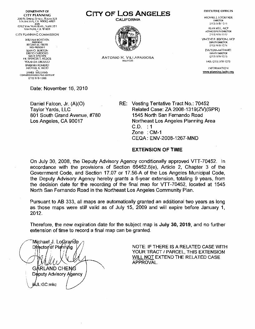
EXECUTIVE OFFICESDEPARTMENT OF CITY PLANNING
200 N. Spring Street, Room 525 Los ANGELES, CA 90012-4801
AND6262 Van Nuys Blvd., Suite 351
Van Nuys, CA 91401
CITY PLANNING COMMISSION
City of Los AngelesMICHAEL J. LOCRANDE
DIRECTOR
(213)978-1271
ALAN BELL, AICP ACTING DEPUTY DIRECTOR
(213) 978-1272
VINCENT P. BERTONI, AICPDEPUTY DIRECTOR
(213) 978-1274
EVA YUAN-MCDANIEL DEPUTY DIRECTOR
(213) 978-1273
FAX: (213) 978-1275
CALIFORNIA
a®-Z4&, Jr7 \tx
WILLIAM ROSCHENPRESIDENT
RECINAM. FREERVICE-PRESIDENT
SEAN O. BURTON DIEGO CARDOSO
MATT EPSTEIN FR. SPENCER T. KEZIOS YOLANDA OROZCO BARBARA ROMERO MICHAEL K. WOO
JAMES WILLIAMSCOMMISSION EXECUTIVE ASSISTANT
(213) 978-1300
Li
Antonio R. VillaraigosaMAYOR
INFORMATIONwww.planning.lacitv.org
Date: November 16, 2010
RE: Vesting Tentative Tract No.: 70452Related Case: ZA 2008-1319(ZV)(SPR) 1545 North San Fernando Road Northeast Los Angeles Planning Area C.D. : 1 Zone : CM-1CEQA: ENV-2008-1267-MND
Daniel Falcon, Jr. (A)(0)Taylor Yards, LLC801 South Grand Avenue, #780Los Angeles, CA 90017
EXTENSION OF TIME
On July 30, 2008, the Deputy Advisory Agency conditionally approved VTT-70452. In accordance with the provisions of Section 66452.6(e), Article 2, Chapter 3 of the Government Code, and Section 17.07 or 17.56-A of the Los Angeles Municipal Code, the Deputy Advisory Agency hereby grants a 6-year extension, totaling 9 years, from the decision date for the recording of the final map for VTT-70452, located at 1545 North San Fernando Road in the Northeast Los Angeles Community Plan.
Pursuant to AB 333, all maps are automatically granted an additional two years as long as those maps were still valid as of July 15, 2009 and will expire before January 1, 2012.
Therefore, the new expiration date for the subject map is July 30, 2019, and no further extension of time to record a final map can be granted.
Michael J. LoGrart Dj'r'ector/'of Planning NOTE: IF THERE IS A RELATED CASE WITH
YOUR TRACT / PARCEL, THIS EXTENSION WILL NOT EXTEND THE RELATED CASE APPROVAL.
/i
GARLAND CHENG Deputy Advisory ^gency
MJL:GC:mkc X"\
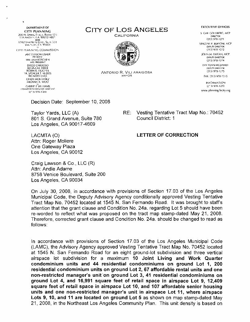
EXECUTIVE OFFICESDEPARTMENT OF CITY PLANNING
200 N. Spring Street, Room 525 LOS Ancmes, CA 90012-4801
AND6262 Van Nuys Bl vd., SuiTr 351
Van Nuys, CA 91401
City of Los AngelesS. GAIL COLDBERC, AICP
DIRECTOR
(213) 978-1271
VINCENT P. BERTONI, AICPDEPUTY DIRECTOR
(213) 978-1272
JOHN M. DUGAN, AICPDEPUTY DIRECTOR
(213) 978-1274
CALIFORNIA
** vL•c*;CITY PLANNING COMMISSION
JANE ELLISON USHERPRESIDENT
WILLIAM ROSCHENVICE-PRESIDENT
DIECO CARDOSO REGINA M. FREER
ROBIN R. HUGHES FR. SPENCER T. KFZIOS
RICARDO LARA CINDY MONTANEZ MICHAEL K. WOO
■ t *4 s* *i
#E,Y:yCo.
EVA YUAN-MCDANIELDEPUTY DIRECTOR
(213) 978-1273Antonio R. VillaraigosaMAYOR FAX: (213) 978-1275
INFORMATION (213) 978-1270
www.planning.lacity.org
GABRIELE WILLIAMSCOMMISSION EXECUTIVE ASSISTANT
(213) 978-1300
Decision Date: September 10, 2008
RE: Vesting Tentative Tract Map No.: 70452Council District: 1
Taylor Yards, LLC (A)801 S. Grand Avenue, Suite 780 Los Angeles, CA 90017-4609
LETTER OF CORRECTIONLACMTA (O)Attn: Roger Moliere One Gateway Plaza Los Angeles, CA 90012
Craig Lawson & Co., LLC (R)Attn: Andie Adame8758 Venice Boulevard, Suite 200Los Angeles, CA 90034
On July 30, 2008, in accordance with provisions of Section 17.03 of the Los Angeles Municipal Code, the Deputy Advisory Agency conditionally approved Vesting Tentative Tract Map No. 70452 located at 1545 N. San Fernando Road. It was brought to staff’s attention that the grant clause and Condition No. 24a. regarding Lot 5 should have been re-worded to reflect what was proposed on the tract map stamp-dated May 21, 2008. Therefore, corrected grant clause and Condition No. 24a. should be changed to read as follows:
In accordance with provisions of Section 17.03 of the Los Angeles Municipal Code (LAMC), the Advisory Agency approved Vesting Tentative Tract Map No. 70452 located at 1545 N. San Fernando Road for an eight ground-lot subdivision and three vertical airspace lot subdivision for a maximum 10 Joint Living and Work Quarter condominium units and 44 residential condominiums on ground Lot 1, 200 residential condominium units on ground Lot 2, 67 affordable rental units and one non-restricted manager’s unit on ground Lot 3, 41 residential condominiums on ground Lot 4, and 16,991 square feet of retail space in airspace Lot 9, 12,409 square feet of retail space in airspace Lot 10, and 107 affordable senior housing units and one non-restricted manager’s unit in airspace Lot 11, where airspace Lots 9, 10, and 11 are located on ground Lot 5 as shown on map stamp-dated May 21, 2008, in the Northeast Los Angeles Community Plan. This unit density is based on
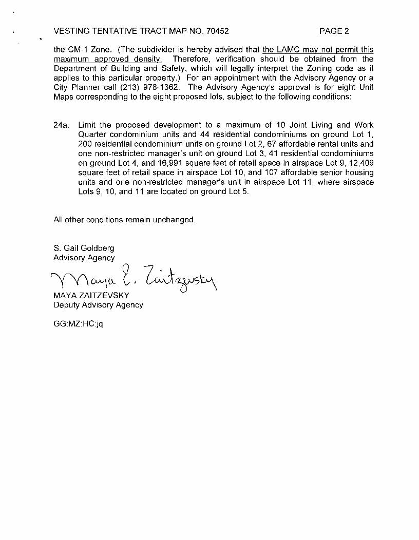
VESTING TENTATIVE TRACT MAP NO. 70452 PAGE 2
the CM-1 Zone. (The subdivider is hereby advised that the LAMC may not permit this maximum approved density. Therefore, verification should be obtained from the Department of Building and Safety, which will legally interpret the Zoning code as it applies to this particular property.) For an appointment with the Advisory Agency or a City Planner call (213) 978-1362. The Advisory Agency’s approval is for eight Unit Maps corresponding to the eight proposed lots, subject to the following conditions:
Limit the proposed development to a maximum of 10 Joint Living and Work Quarter condominium units and 44 residential condominiums on ground Lot 1, 200 residential condominium units on ground Lot 2, 67 affordable rental units and one non-restricted manager’s unit on ground Lot 3, 41 residential condominiums on ground Lot 4, and 16,991 square feet of retail space in airspace Lot 9, 12,409 square feet of retail space in airspace Lot 10, and 107 affordable senior housing units and one non-restricted manager’s unit in airspace Lot 11, where airspace Lots 9, 10, and 11 are located on ground Lot 5.
24a.
All other conditions remain unchanged.
S. Gail Goldberg Advisory Agency
MAYA ZAITZEVSKY Deputy Advisory Agency
GG:MZ:HC:jq
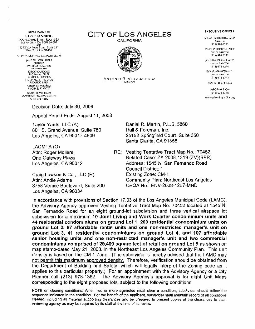
EXECUTIVE OFFICESDEPARTMENT OF CITY PLANNING City of Los Angeles
S. GAIL GOLDBERG, AICPDIRECTOR
(213) 978-1271
VINCE P. BERTONI, AICPDEPUTY DIRECTOR
(213) 978-1272
JOHN M. DUGAN, AICPDEPUTY DIRECTOR
(213) 978-1274
EVA YUAN-MCDANIELDEPUTY DIRECTOR
(213) 978-1273
200 N. Spring Street, Room 525 Los Angeles, Ca 90012-4801 CALIFORNIA
AND6262 Van Nuys Blvd., Suite 351
Van Nuys, CA 91401
*< rCITY PLANNING COMMISSION
JANE ELLISON USHERPRESIDENT
WILLIAM ROSCHENVICE-PRESIDENT
DIEGO CARDOSO REGINA M. FREER
ROBIN R. HUGHES FR. SPENCER T. KEZIOS
RICARDO LARA CINDY MONTANEZ MICHAEL K. WOO
cabriele'wiluamsCOMMISSION EXECUTIVE ASSISTANT
(213) 978-1300
p-4
Antonio R. VillaraigosaMAYOR FAX: (213) 978-1275
INFORMATION (213) 978-1270
www.planning.lacity.org
Decision Date: July 30, 2008
Appeal Period Ends: August 11, 2008
Taylor Yards, LLC (A)801 S. Grand Avenue, Suite 780 Los Angeles, CA 90017-4609
Danial R. Martin, P.L.S. 5860 Hall & Foreman, Inc.25152 Springfield Court, Suite 350 Santa Clarita, CA 91355
LACMTA (O)Attn: Roger Moliere One Gateway Plaza Los Angeles, CA 90012
Vesting Tentative Tract Map No.: 70452 Related Case: ZA-2008-1319 (ZV)(SPR) Address: 1545 N. San Fernando Road Council District: 1 Existing Zone: CM-1Community Plan: Northeast Los Angeles CEQA No.: ENV-2008-1267-MND
RE:
Craig Lawson & Co., LLC (R)Attn: Andie Adame 8758 Venice Boulevard, Suite 200 Los Angeles, CA 90034
In accordance with provisions of Section 17.03 of the Los Angeles Municipal Code (LAMC), the Advisory Agency approved Vesting Tentative Tract Map No. 70452 located at 1545 N. San Fernando Road for an eight ground-lot subdivision and three vertical airspace lot subdivision for a maximum 10 Joint Living and Work Quarter condominium units and 44 residential condominiums on ground Lot 1, 200 residential condominium units on ground Lot 2, 67 affordable rental units and one non-restricted manager’s unit on ground Lot 3, 41 residential condominiums on ground Lot 4, and 107 affordable senior housing units and one non-restricted manager’s unit and two commercial condominiums comprised of 29,400 square feet of retail on ground Lot 5 as shown on map stamp-dated May 21, 2008, in the Northeast Los Angeles Community Plan. This unit density is based on the CM-1 Zone. (The subdivider is hereby advised that the LAMC may not permit this maximum approved density. Therefore, verification should be obtained from the Department of Building and Safety, which will legally interpret the Zoning code as it applies to this particular property.) For an appointment with the Advisory Agency or a City Planner call (213) 978-1362. The Advisory Agency’s approval is for eight Unit Maps corresponding to the eight proposed lots, subject to the following conditions:
NOTE on clearing conditions: When two or more agencies must clear a condition, subdivider should follow the sequence indicated in the condition. For the benefit of the applicant, subdivider shall maintain record of all conditions cleared, including all material supporting clearances and be prepared to present copies of the clearances to each reviewing agency as may be required by its staff at the time of its review.
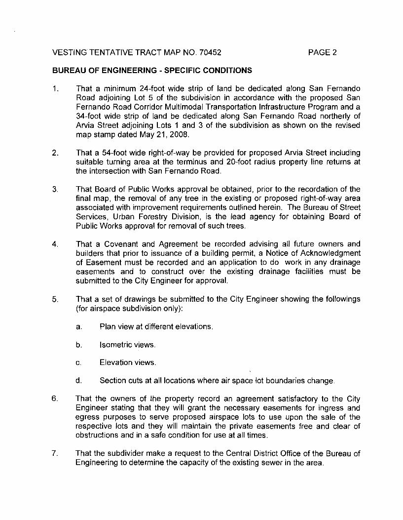
VESTING TENTATIVE TRACT MAP NO. 70452 PAGE 2
BUREAU OF ENGINEERING - SPECIFIC CONDITIONS
That a minimum 24-foot wide strip of land be dedicated along San Fernando Road adjoining Lot 5 of the subdivision in accordance with the proposed San Fernando Road Corridor Multimodal Transportation Infrastructure Program and a 34-foot wide strip of land be dedicated along San Fernando Road northerly of Arvia Street adjoining Lots 1 and 3 of the subdivision as shown on the revised map stamp dated May 21,2008.
1.
That a 54-foot wide right-of-way be provided for proposed Arvia Street including suitable turning area at the terminus and 20-foot radius property line returns at the intersection with San Fernando Road.
2.
3. That Board of Public Works approval be obtained, prior to the recordation of the final map, the removal of any tree in the existing or proposed right-of-way area associated with improvement requirements outlined herein. The Bureau of Street Services, Urban Forestry Division, is the lead agency for obtaining Board of Public Works approval for removal of such trees.
That a Covenant and Agreement be recorded advising all future owners and builders that prior to issuance of a building permit, a Notice of Acknowledgment of Easement must be recorded and an application to do work in any drainage easements and to construct over the existing drainage facilities must be submitted to the City Engineer for approval.
4.
That a set of drawings be submitted to the City Engineer showing the followings (for airspace subdivision only):
5.
Plan view at different elevations.a.
Isometric views.b.
Elevation views.c.
d. Section cuts at all locations where air space lot boundaries change.
6. That the owners of the property record an agreement satisfactory to the City Engineer stating that they will grant the necessary easements for ingress and egress purposes to serve proposed airspace lots to use upon the sale of the respective lots and they will maintain the private easements free and clear of obstructions and in a safe condition for use at all times.
That the subdivider make a request to the Central District Office of the Bureau of Engineering to determine the capacity of the existing sewer in the area.
7.

PAGE 3VESTING TENTATIVE TRACT MAP NO. 70452
That a 44-foot wide private street easement be provided, including a suitable turning area at the terminus and 20-foot radius easement line returns at the intersection with San Fernando Road.
8.
That an easement to the City of Los Angeles for sanitary sewer and public utility purposes be dedicated full-width of the proposed private street.
9.
That private street easement be part of Lot 6.10.
That prior to recordation of the final map the proposed name for the private street be approved by the City Engineer.
11.
That the owners of the property record an agreement satisfactory to the City Engineer stating that they will grant the necessary easements for ingress, egress and public facilities over the private street areas upon the sale of the respective lots and they will maintain the private streets, free and clear of obstructions and in a safe condition for vehicular use at all times.
12.
That a Covenant and Agreement be recorded stating that private street will be posted in a manner prescribed in Section 18.07 of the Los Angeles Municipal Code "Private Street Regulations”.
13.
Note to Plan Checker: Condition 2 does not apply to Unit Maps for Lots 1, 2, 6 and 7. Conditions 5 and 6 do not apply to Unit Maps for Lots 1, 2, 3, 4, 6, 7 and 8. Conditions 8,9,10,11,12, and 13 do not apply to Unit Maps for Lot 5.
DEPARTMENT OF BUILDING AND SAFETY, GRADING DIVISION
Prior to issuance of a grading or building permit, or prior to recordation of the final map, the subdivider shall make suitable arrangements to assure compliance, satisfactory to the Department of Building and Safety, Grading Division, with all the requirements and conditions contained in Inter-Departmental Letter dated April 15, 2008, Log No. 62559 and attached to the case file for Tract No. 70452.
14.
DEPARTMENT OF BUILDING AND SAFETY, ZONING DIVISION
Prior to recordation of the final map, the Department of Building and Safety, Zoning Division shall certify that no Building or Zoning Code violations exist on the subject site. In addition, the following items shall be satisfied:
15.
Obtain permits for the demolition or removal of all existing structures on the site. Provide copies of the demolition permits and signed inspection cards to show completion of the demolition work.
a.
b. The submitted map dimensions do not agree with ZIMAS. Revise the map to address the discrepancy or obtain approval form DCP GIS group.
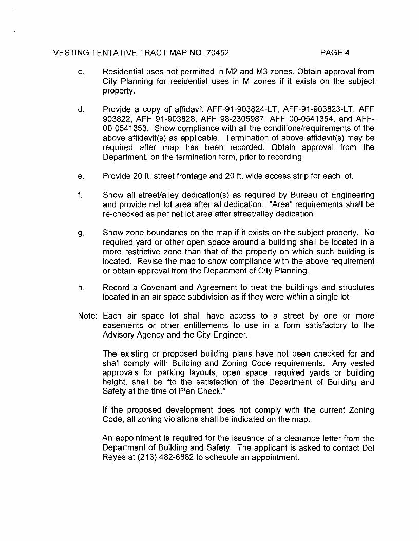
VESTING TENTATIVE TRACT MAP NO. 70452 PAGE 4
Residential uses not permitted in M2 and M3 zones. Obtain approval from City Planning for residential uses in M zones if it exists on the subject property.
c.
Provide a copy of affidavit AFF-91-903824-LT, AFF-91-903823-LT, AFF 903822, AFF 91-903828, AFF 98-2305987, AFF 00-0541354, and AFF- 00-0541353. Show compliance with all the conditions/requirements of the above affidavit(s) as applicable. Termination of above affidavit(s) may be required after map has been recorded. Obtain approval from the Department, on the termination form, prior to recording.
d.
Provide 20 ft. street frontage and 20 ft. wide access strip for each lot.e.
f. Show all street/alley dedication(s) as required by Bureau of Engineering and provide net lot area after all dedication. “Area" requirements shall be re-checked as per net lot area after street/alley dedication.
Show zone boundaries on the map if it exists on the subject property. No required yard or other open space around a building shall be located in a more restrictive zone than that of the property on which such building is located. Revise the map to show compliance with the above requirement or obtain approval from the Department of City Planning.
Record a Covenant and Agreement to treat the buildings and structures located in an air space subdivision as if they were within a single lot.
9-
h.
Each air space lot shall have access to a street by one or more easements or other entitlements to use in a form satisfactory to the Advisory Agency and the City Engineer.
Note:
The existing or proposed building plans have not been checked for and shall comply with Building and Zoning Code requirements. Any vested approvals for parking layouts, open space, required yards or building height, shall be “to the satisfaction of the Department of Building and Safety at the time of Plan Check.”
If the proposed development does not comply with the current Zoning Code, all zoning violations shall be indicated on the map.
An appointment is required for the issuance of a clearance letter from the Department of Building and Safety. The applicant is asked to contact Del Reyes at (213) 482-6882 to schedule an appointment.
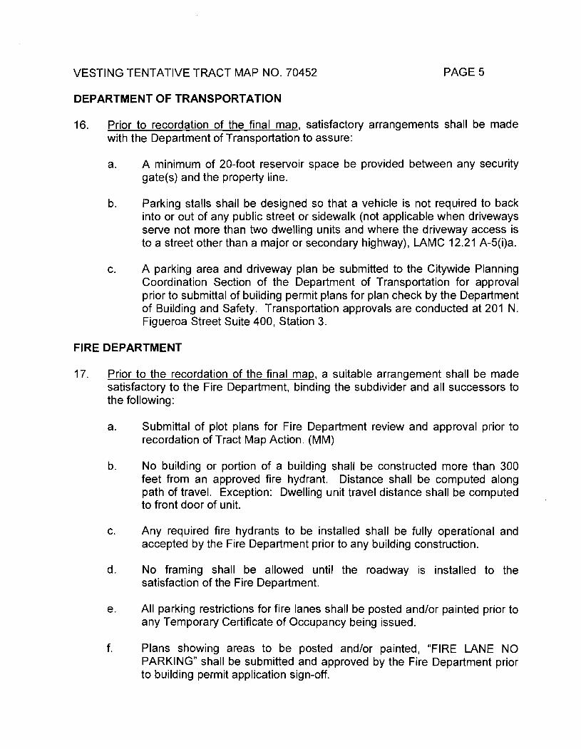
PAGE 5VESTING TENTATIVE TRACT MAP NO. 70452
DEPARTMENT OF TRANSPORTATION
Prior to recordation of the final map, satisfactory arrangements shall be made with the Department of Transportation to assure:
16.
A minimum of 20-foot reservoir space be provided between any security gate(s) and the property line.
a.
Parking stalls shall be designed so that a vehicle is not required to back into or out of any public street or sidewalk (not applicable when driveways serve not more than two dwelling units and where the driveway access is to a street other than a major or secondary highway), LAMC 12.21 A-5(i)a.
b.
A parking area and driveway plan be submitted to the Citywide Planning Coordination Section of the Department of Transportation for approval prior to submittal of building permit plans for plan check by the Department of Building and Safety. Transportation approvals are conducted at 201 N. Figueroa Street Suite 400, Station 3.
c.
FIRE DEPARTMENT
Prior to the recordation of the final map, a suitable arrangement shall be made satisfactory to the Fire Department, binding the subdivider and all successors to the following:
17.
Submittal of plot plans for Fire Department review and approval prior to recordation of Tract Map Action. (MM)
a.
No building or portion of a building shall be constructed more than 300 feet from an approved fire hydrant. Distance shall be computed along path of travel. Exception: Dwelling unit travel distance shall be computed to front door of unit.
b.
Any required fire hydrants to be installed shall be fully operational and accepted by the Fire Department prior to any building construction.
c.
d. No framing shall be allowed until the roadway is installed to the satisfaction of the Fire Department.
All parking restrictions for fire lanes shall be posted and/or painted prior to any Temporary Certificate of Occupancy being issued.
e.
f. Plans showing areas to be posted and/or painted, “FIRE LANE NO PARKING” shall be submitted and approved by the Fire Department prior to building permit application sign-off.
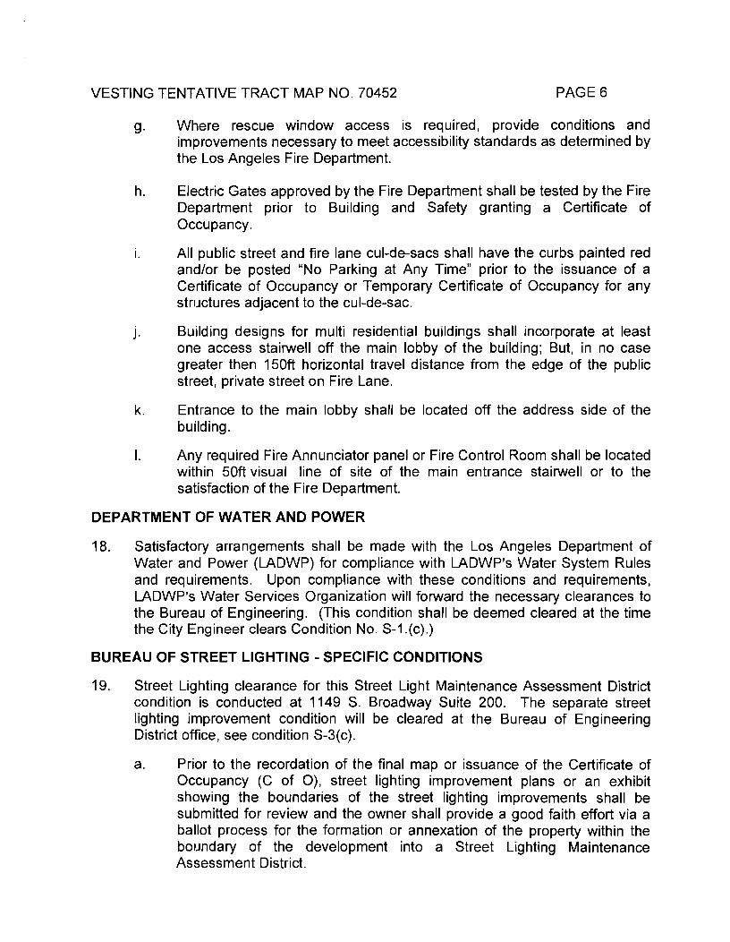
PAGE 6VESTING TENTATIVE TRACT MAP NO. 70452
Where rescue window access is required, provide conditions and improvements necessary to meet accessibility standards as determined by the Los Angeles Fire Department.
9-
Electric Gates approved by the Fire Department shall be tested by the Fire Department prior to Building and Safety granting a Certificate of Occupancy.
All public street and fire lane cul-de-sacs shall have the curbs painted red and/or be posted “No Parking at Any Time” prior to the issuance of a Certificate of Occupancy or Temporary Certificate of Occupancy for any structures adjacent to the cul-de-sac.
Building designs for multi residential buildings shall incorporate at least one access stairwell off the main lobby of the building; But, in no case greater then 150ft horizontal travel distance from the edge of the public street, private street on Fire Lane.
Entrance to the main lobby shall be located off the address side of the building.
Any required Fire Annunciator panel or Fire Control Room shall be located within 50ft visual line of site of the main entrance stairwell or to the satisfaction of the Fire Department.
DEPARTMENT OF WATER AND POWER
h.
i.
J-
k.
I.
Satisfactory arrangements shall be made with the Los Angeles Department of Water and Power (LADWP) for compliance with LADWP’s Water System Rules and requirements. Upon compliance with these conditions and requirements, LADWP’s Water Services Organization will forward the necessary clearances to the Bureau of Engineering. (This condition shall be deemed cleared at the time the City Engineer clears Condition No. S-1.(c).)
BUREAU OF STREET LIGHTING - SPECIFIC CONDITIONS
Street Lighting clearance for this Street Light Maintenance Assessment District condition is conducted at 1149 S. Broadway Suite 200. The separate street lighting improvement condition will be cleared at the Bureau of Engineering District office, see condition S-3(c).
Prior to the recordation of the final map or issuance of the Certificate of Occupancy (C of O), street lighting improvement plans or an exhibit showing the boundaries of the street lighting improvements shall be submitted for review and the owner shall provide a good faith effort via a ballot process for the formation or annexation of the property within the boundary of the development into a Street Lighting Maintenance Assessment District.
18.
19.
a.
PAGE 7VESTING TENTATIVE TRACT MAP NO. 70452
INFORMATION TECHNOLOGY AGENCY
That satisfactory arrangements be made in accordance with the requirements of the Information Technology Agency to assure that cable television facilities will be installed in the same manner as other required improvements. Refer to the LAMC Section 17.05-N. Written evidence of such arrangements must be submitted to the Information Technology Agency, 200 North Main Street, 12th Floor, Los Angeles, CA 90012, (213) 922-8363.
20.
DEPARTMENT OF RECREATION AND PARKS
That the Quirnby fee be based on the R3 Zone. (MM)21.
URBAN FORESTRY DIVISION AND THE DEPARTMENT OF CITY PLANNING
Prior to the issuance of a grading permit or building permit, a plot plan prepared by a reputable tree expert, indicating the location, size, type, and condition of all existing trees on the site shall be submitted for approval by the decision maker and the Urban Forestry Division of the Bureau of Street Services. All trees in the public right-of-way shall be provided per the current Urban Forestry Division standards (MM).
22.
The plan shall contain measures recommended by the tree expert for the preservation of as many trees as possible. Mitigation measures such as replacement by a minimum of 24-inch box trees in the parkway and on the site, on a 1:1 basis, shall be required for the unavoidable loss of desirable trees on the site, and to the satisfaction of the Urban Forestry Division of the Bureau of Street Services and the decision maker. (MM)
Note: Removal of all trees in the public right-of-way shall require approval of the Board of Public Works. Contact: Urban Forestry Division at: 213-485-5675.
DEPARTMENT OF CITY PLANNING-SITE SPECIFIC CONDITIONS
23. AFFORDABLE UNITS. Prior to the issuance of a building permit for any rental dwelling unit on the subject property, the applicant shall reserve 174 units and shall execute and record a rental covenant agreement running with the land, to the satisfaction of the Los Angeles Housing Department (“LAHD”). The covenant shall bind the applicant and/or any subsequent property owner to reserve 67 units for households earning up to a maximum 60 of Area Median Income (AMI) and 107 units for senior citizens earning up to a maximum 60 percent of AMI as determined by the Housing Department. Applicant must provide an affordable unit dispersal proposal to be approved by LAHD to ensure that affordable units are not segregated or otherwise distinguishable from market-rate units.

VESTING TENTATIVE TRACT MAP NO. 70452 PAGE 8
For a period of thirty (30) years from the issuance of the Certificate of Occupancy, affordable dwelling units may be occupied only by households whose income has been certified by LAHD to fall within the specified Low Income affordability level, as defined by California Health and Safety Code Section 50079.5, for the duration of the covenant.
Note to Plan Checker: Condition 23 applies only to Lots 3 and 5 for the development of 68 and 108 units, respectively.
Prior to the recordation of the final map, the subdivider shall prepare and execute a Covenant and Agreement (Planning Department General Form CP-6770) in a manner satisfactory to the Planning Department, binding the subdivider and all successors to the following:
24.
Limit the proposed development to a maximum of 10 Joint Living and Work Quarter condominium units and 44 residential condominiums on ground Lot 1, 200 residential condominium units on ground Lot 2, 67 affordable rental units and one non-restricted manager’s unit on ground Lot 3, 41 residential condominiums on ground Lot 4, and 107 affordable senior housing units and one non-restricted manager’s unit and two commercial condominiums comprised of 29,400 square feet of retail on ground Lot 5.
a.
Provide a minimum two parking spaces for each residential condominium on Lot 1.
b.
Provide a minimum of 2 covered off-street parking spaces per dwelling unit, plus 1/4 guest parking spaces per dwelling unit on Lots 2 and 4. All guest spaces shall be readily accessible, conveniently located, specifically reserved for guest parking, posted and maintained satisfactory to the Department of Building and Safety.
If guest parking spaces are gated, a voice response system shall be installed at the gate. Directions to guest parking spaces shall be clearly posted. Tandem parking spaces shall not be used for guest parking.
In addition, prior to issuance of a building permit, a parking plan showing off-street parking spaces, as required by the Advisory Agency, be submitted for review and approval by the Department of City Planning (200 North Spring Street, Room 750).
Affordable Rental Units. Provide a minimum 1 parking space for each affordable housing rental unit with three habitable rooms or less and 1.5 parking spaces for each affordable housing rental unit with more than three habitable rooms.
PAGE 9VESTING TENTATIVE TRACT MAP NO. 70452
Senior Citizen Rental Units. Provide a minimum one-half (0.5) parking space for each dwelling unit designated for senior citizens.
Non-restricted Manager’s Units. Provide one (1) parking space for each unit with less than three habitable rooms. Provide one and one-half (1.5) parking spaces for each unit with three habitable rooms. Provide two (2) parking spaces for each unit with more than three habitable rooms.
Commercial Retail. Provide a minimum two parking space for every 1,000 square feet of ground floor area.
That a solar access report shall be submitted to the satisfaction of the Advisory Agency prior to obtaining a grading permit.
c.
That the subdivider considers the use of natural gas and/or solar energy and consults with the Department of Water and Power and Southern California Gas Company regarding feasible energy conservation measures.
d.
Prior to the issuance of the building permit or the recordation of the final map, a25.copy of the ZA-2008-1319-ZV-SPR shall be submitted to the satisfaction of the Advisory Agency. In the event that ZA-2008-1319-ZV-SPR is not approved, the subdivider shall submit a tract modification.
Prior to the clearance of any tract map conditions, the applicant shall show proof that all fees have been paid to the Department of City Planning, Expedited Processing Section.
26.
That the subdivider shall make suitable arrangements for clearance with the Department of City Planning for the Los Angeles River Revitalization Master Plan.
27.
Indemnification Clause: The applicant shall defend, indemnify and hold harmless the City, its agents, officers, or employees from any claim, action, or proceeding against the City or its agents, officers, or employees to attack, set aside, void or annul this approval which action is brought within the applicable limitation period. The City shall promptly notify the applicant of any claim, action, or proceeding and the City shall cooperate fully in the defense. If the City fails to promptly notify the applicant of any claim action or proceeding, or if the City fails to cooperate fully in the defense, the applicant shall not thereafter be responsible to defend, indemnify, or hold harmless the City.
28.
PAGE 10VESTING TENTATIVE TRACT MAP NO. 70452
DEPARTMENT OF CITY PLANNING-ENVIRONMENTAL MITIGATION MEASURES
That prior to recordation of the final map, the subdivider shall prepare and execute a Covenant and Agreement (Planning Department General Form CP- 6770) in a manner satisfactory to the Planning Department requiring the subdivider to identify mitigation monitors who shall provide periodic status reports on the implementation of mitigation items required by Mitigation Condition Nos. 17a, 21, 22, 30 and 31 of the Tract’s approval satisfactory to the Advisory Agency. The mitigation monitors shall be identified as to their areas of responsibility, and phase of intervention (pre-construction, construction, postconstruction/maintenance) to ensure continued implementation of the above mentioned mitigation items.
29.
Prior to the recordation of the final map, the subdivider shall prepare and execute a Covenant and Agreement (Planning Department General Form CP-6770) in a manner satisfactory to the Planning Department, binding the subdivider and all successors to the following:
30.
All open areas not used for buildings, driveways, parking areas, recreational facilities or walks shall be attractively landscaped and maintained in accordance with a landscape plan, including an automatic irrigation plan, prepared by a licensed landscape architect to the satisfaction of the decision maker.
MM-1
A minimum of one 24-inch box tree (minimum trunk diameter of two inches and a height of eight feet at the time of planting) shall be planted for every four new surface parking spaces. The trees shall be dispersed within the parking area so as to shade the surface parking area and shall be protected by a minimum 6-inch high curb, and landscape. Automatic irrigation plan shall be approved by the City Planning Department. Palm trees shall not be considered in meeting this requirement.
MM-2
MM-3 Every building, structure, or portion thereof, shall be maintained in a safe and sanitary condition and good repair, and free from graffiti, debris, rubbish, garbage, trash, overgrown vegetation or other similar material, pursuant to LAMC Section 91.8104.
MM-4 On-site signs shall be limited to the maximum allowable under the LAMC. Multiple temporary signs in the store windows and along the building walls are not permitted.
MM-5 Outdoor lighting shall be designed and installed with shielding, so that the light source cannot be seen from adjacent residential properties.

PAGE 11VESTING TENTATIVE TRACT MAP NO. 70452
The applicant shall install air filters capable of achieving a Minimum Efficiency Rating Value (MERV) of at least 8 for residential uses and commercial uses or better in order to reduce the effects of diminished air quality on the occupants of the project.
To avoid potential significant impacts to nesting birds, including migratory birds and raptors, one of the following shall be implemented by the project applicant:
• Conduct vegetation removal associated with construction from September 1st through January 31st, when birds are not nesting. Initiate grading activities prior to the breeding season (which is generally February 1st through August 31st) and keep disturbance activities constant throughout the breeding season to prevent birds from establishing nests in surrounding habitat (in order to avoid possible nest abandonment); if there is a lapse in activities of more than five days, pre-construction surveys shall be necessary as described in the bullet below.
-OR-• Conduct pre-construction surveys for nesting birds if
vegetation removal or grading is initiated during the nesting season. A qualified wildlife biologist shall conduct weekly preconstruction bird surveys no more than 30 days prior to initiation of grading to provide confirmation on the presence or absence of active nests in the vicinity (at least 300 to 500 feet around the individual construction site, as access allows). The last survey should be conducted no more than three days prior to the initiation of clearance/construction work. If active nests are encountered, clearing and construction in the vicinity of the nest shall be deferred until the young birds have fledged and there is no evidence of a second attempt at nesting. A minimum exclusion buffer of 300 feet (500 feet for raptor nests) or as determined by a qualified biologist, shall be maintained during construction depending on the species and location. The perimeter of the nest-setback zone shall be fenced or adequately demarcated with staked flagging at 20- foot intervals, and construction personnel and activities restricted from the area. Construction personnel should be instructed on the sensitivity of the area. A survey report by the qualified biologist documenting and verifying compliance with the mitigation and with applicable state and federal regulations protecting birds shall be submitted to the City and County, depending on within which jurisdiction the construction activity is occurring. The qualified biologist shall serve as a construction monitor during those periods when construction activities would occur near active nest areas to ensure that no inadvertent impacts on these nests would occur.
MM-6
MM-7
VESTING TENTATIVE TRACT MAP NO. 70452 PAGE 12
If any archaeological materials are encountered during the course of the project development, the project shall be halted. The services of an archaeologist shall be secured by contacting the Center for Public Archaeology - Cal State University Fullerton, or a member of the Society of Professional Archaeologists (SOPA) or a SOPA-qualified archaeologist to assess the resources and evaluate the impact. Copies of the archaeological survey, study or report shall be submitted to the UCLA Archaeological Information Center. A covenant and agreement shall be recorded prior to obtaining a grading permit.
MM-8
If any paleontological materials are encountered during the course of the project development, the project shall be halted. The services of a paleontologist shall be secured by contacting the Center for Public Paleontology - USC, UCLA, Cal State Los Angeles, Cal State Long Beach, or the County Museum to assess the resources and evaluate the impact. Copies of the paleontological survey, study or report shall be submitted to the Los Angeles County Natural History Museum. A covenant and agreement shall be recorded prior to obtaining a grading permit.
If human remains are discovered at the project site during construction, work at the specific construction site at which the remains have been uncovered shall be suspended, and the City of Los Angeles Public Works Department and County coroner shall be immediately notified. If the remains are determined by the County coroner to be Native American, the Native American Heritage Commission (NAHC) shall be notified within 24 hours, and the guidelines of the NAHC shall be adhered to in the treatment and disposition of the remains.
MM-9
MM-10
MM-11 Projects involving the import/export of 1,000 cubic yards or more of soil shall obtain haul route approval by the Department of Building and Safety.
The developer shall install appropriate traffic signs around the site to ensure pedestrian and vehicle safety.
Fences shall be constructed around the site to minimize trespassing, vandalism, short-cut attractions and attractive nuisances.
Prior to the issuance of building or grading permits, the applicant shall submit a geotechnical report prepared by a registered civil engineer or certified engineering geologist to the written satisfaction of the Department of Building and Safety.
MM-12
MM-13
MM-14
MM-15 The design and construction of the Project shall conform to the Uniform Building Code seismic standards as approved by the Department of Building and Safety.
VESTING TENTATIVE TRACT MAP NO. 70452 PAGE 13
The project shall comply with the LAMC Chapter 18, Division 1, Section 1804.5, Liquefaction Potential and Soil Strength Loss, which requires the preparation of a geotechnical report. The geotechnical report shall assess potential consequences of any liquefaction and soil strength loss, estimation of settlement, lateral movement or reduction in foundation soil-bearing capacity, and discuss mitigation measures that may include building design consideration.
MM-16
Building design considerations shall include, but are not limited to: ground stabilization, selection of appropriate foundation type and depths, selection of appropriate structural systems to accommodate anticipated displacements or any combination of these measures.
MM-17
During project construction, relocation of the existing tower shall be completed by individuals with OSHA training.
MM-18
During project construction, all loose and peeling LBP shall be damp- broomed and tested for leachability prior to disposal.
MM-19
The project applicant shall consider and implement feasible engineering controls to prevent access to the tower, such as fencing installed around the tower to limit pedestrian access, or controls to assist with preventative maintenance, including prevention of future loose and peeling paint.
MM-20
Prior to occupancy of the project site, an Operations and Maintenance Plan shall be prepared for the tower.
MM-21
During operation of the project, all management and maintenance personnel at the site shall be provided annual awareness training in compliance with Cal/OSHA regulations.
MM-22
MM-23 During operation of the project, all work required in the tower that would impact LBP and/or identified ACMs shall be completed by licensed abatement contractors and properly trained individuals.
MM-24 Prior to issuance of any permit for demolition or alteration of the existing structure(s), a lead-based paint survey shall be performed to the written satisfaction of the Department of Building and Safety. Should lead-based pain materials be identified, standard handling and disposal practices shall be implemented pursuant to OSHA regulations.
PAGE 14VESTING TENTATIVE TRACT MAP NO. 70452
Prior to issuance of a grading permit, the project applicant shall prepare a hydrology and drainage analysis for the proposed project that assesses the ability of the existing local storm drain system to accommodate post-project flows based on a 10-year storm event. If detention is required to control discharge from the project site at or below existing discharge levels, a detention basin/facility shall be constructed in the southeastern portion of the project site where detention could be accommodated. The project applicant shall submit the hydrology and drainage study and the proposed drainage plans to the Bureau of Engineering for review and approval.
MM-25
Project applicants are required to implement stormwater BMPs to retain or treat the runoff from a storm event producing 3/4 inch of rainfall in a 24-hour period. The design of structural BMPs shall be in accordance with the Development Best Management Practices Handbook Part B Planning Activities. A signed certificate from a California licensed civil engineer or licensed architect that the proposed BMPs meet this numerical threshold standard is required.
MM-26
Post development peak stormwater runoff discharge rates shall not exceed the estimated pre-development rate for developments where the increase peak stormwater discharge rate will result in increased potential for downstream erosion.
MM-27
Maximize trees and other vegetation at each site by planting additional vegetation, clustering tree areas, and promoting the use of native and/or drought tolerant plants.
MM-28
Any connection to the sanitary sewer must have authorization from the Bureau of Sanitation.
MM-29
MM-30 Reduce impervious surface area by using permeable pavement materials where appropriate, including: pervious concrete/asphalt; unit pavers, i.e. turf block; and granular materials, i.e. crushed aggregates, cobbles.
MM-31 Install roof runoff systems where site is suitable for installation. Runoff from rooftops is relatively clean, provides groundwater recharge, and reduces excess runoff into storm drains.
MM-32 Promote natural vegetation by using parking lot islands and other landscaped areas.
PAGE 15VESTING TENTATIVE TRACT MAP NO. 70452
Paint messages that prohibit the dumping of improper materials into the storm drain system adjacent to storm drain inlets. Prefabricated stencils can be obtained from the Department of Public Works, Stormwater Management Division. Legibility of stencils and signs must be maintained.
MM-33
Materials with the potential to contaminate stormwater must be: (1) placed in an enclosure such as, but not limited to, a cabinet, shed, or similar stormwater conveyance system; or (2) protected by secondary containment structures such as berms, dikes, or curbs.
MM-34
Storage areas must be paved and sufficiently impervious to contain leaks and spills.
MM-35
Design an efficient irrigation system to minimize runoff including: drip irrigation for shrubs to limit excessive spray; shutoff devices to prevent irrigation after significant precipitation; and flow reducers.
MM-36
The owner(s) of the property shall prepare and execute a covenant and agreement (Planning Department General form CP-6770) satisfactory to the Planning Department binding the owners to postconstruction maintenance on the structural BMPs in accordance with the Standard Urban Stormwater Mitigation Plan and or per manufacturer’s instructions.
MM-37
The use of those pieces of construction equipment or construction methods with the greatest peak noise generation potential shall be minimized. Examples include the use of drills, jackhammers, and pile drivers.
MM-38
MM-39 Noise construction activities whose specific location on the site may be flexible (e.g., operation of compressors and generators, cement mixing, general truck idling) shall be conducted as far as possible from the nearest noise-sensitive land uses, and natural and/or manmade barriers (e.g., intervening construction trailers) shall be used to screen propagation of noise from such activities towards these land uses to the maximum extent possible.
MM-40 Flexible sound control curtains shall be placed around drilling apparatuses and drill rigs used within the project site, if sensitive receptors are located at, or within, 50 feet.
All construction truck traffic shall be restricted to truck routes approved by the City of Los Angeles Department of Building and Safety, which shall avoid residential areas and other sensitive receptors to the extent feasible.
MM-41
VESTING TENTATIVE TRACT MAP NO. 70452 PAGE 16
The project shall comply with the City of Los Angeles Building Regulations Ordinance No. 178,048, which requires a construction site notice to be provided that includes the following information: job site address, permit number, name and phone number of the contractor and owner or owner’s agent, hours of construction allowed by code or any discretionary approval for the site, and City telephone numbers where violations can be reported. The notice shall be posted and maintained at the construction site prior to the start of construction and displayed in a location that is readily visible to the public and approved by the City’s Department of Building and Safety.
All residential exterior windows within the project shall be constructed with double-pane glass. All exterior wall construction shall provide a Sound Transmission Class of 50 of greater as defined in LAMC No. 35-1, 1979 edition or any amendment thereto. As an alternative, the project applicant may submit evidence, along with the application for a building permit, of an alternative means of sound insulation sufficient to mitigate interior noise levels below a CNEL of 45 dBA in any habitable room.
MM-42
MM-43
Concrete, not metal, shall be used for construction of parking ramps.
The interior ramps shall be textured to prevent tire squeal at turning areas.
MM-44
MM-45
The project applicant shall submit a plot plan to the LAFD for approval either prior to the recordation of a final map or prior to the approval of a building permit. The plot plan shall include the following minimum design features: fire lanes, where required, shall be a minimum of 20 feet in width; all structures shall be within 300 feet of an approved fire hydrant; and entrances to any dwelling unit or guest room shall not be more than 150 feet in distance in horizontal travel from the edge of the roadway of an improved street or approved fire lane.
Water mains shall be installed on the project site to ensure that all structures are within 300 feet of an approved fire hydrant and that those fire hydrants are adequately served.
Sprinklers shall be installed on all buildings with five or more dwelling units.
MM-46
MM-47
MM-48
MM-49 Project design guidelines shall discuss access control to proposed structures, secured parking facilities, walls/fences with key systems, well-illuminated public and semi-public spaces with a minimum of dead space to eliminate areas of concealment, location of toilet facilities or building entrances in high-foot traffic areas, and provision of security guard patrol throughout the project site if needed. The Design out
VESTING TENTATIVE TRACT MAP NO. 70452 PAGE 17
Crime Guidelines: Crime Prevention Through Environmental Design, published by LAPD, shall be used for reference. These measures shall be approved by the Police Department prior to the issuance of building permits.
If any significant events would occur at the project site that would require police presence, the coordinators shall notify the Northeast Community Police Station of the planned coming event months in advance.
MM-50
The applicant shall pay school fees to the Los Angeles Unified School District to offset the impact of additional student enrollment at schools serving the project area.
Prior to issuance of an occupancy permit, in order to meet the library service demands generated by the residents of the proposed project, the project developer shall either: (1) provide 790 square feet of library facilities and 3,160 volumes of permanent collection on the project site for use by residents of the proposed project; or (2) pay library fees to the LAPL equivalent to the provision of 790 square feet of library facilities and 3,160 volumes of permanent collection, which would be used for the construction of a new or physically altered library, which would serve the project site; or (3) a combination thereof, or 4) another mitigation measure proposed by the applicant to the satisfaction of the LAPL.
The project applicant shall fund the installation of LADOT’s Automated Traffic Surveillance and Control (ATSAC) System and Adaptive Traffic Control System (ATCS) at the intersection of San Fernando Road/SR- 2 Freeway SB Ramps. ATSAC provides computer control of traffic signals allowing automatic adjustment of signal timing plans to reflect changing traffic conditions, identification of unusual traffic conditions caused by accidents, the ability to centrally implement special purpose short-term traffic timing changes in response to incidents, and the ability to quickly identify signal equipment malfunctions, provides real-time control of traffic signals, and the funding provided by the project includes additional loop detectors, closed-circuit television, an upgrade in the communications links, and a new generation of traffic control software. LADOT estimates that the ATSAC system would reduce the critical v/c ratios by seven percent (0.07). The ATCS upgrade further reduces the critical v/c ratios by three percent (0.03). Therefore, a reduction of 10 percent (0.10) was assumed in the calculation of the v/c ratios for this intersection. Thus, implementation of this mitigation measure would improve operation of this intersection to 0.819 (LOS D) from 0.919 (LOS E) during the AM peak hour and 0.801 (LOS D) from 0.901 (LOS E), which are better v/c ratios than is forecasted for the year 2010 without the proposed project.
MM-51
MM-52
MM-53
ATCS
VESTING TENTATIVE TRACT MAP NO. 70452 PAGE 18
As discussed previously, the timeline for the LACC Northeast Campus project and corresponding improvements to the San Fernando Road/SR-2 Freeway SB Ramps intersection is indeterminate at this time. Implementation of these improvements as a result of the LACC project was not assumed in the traffic analysis for the proposed project. In the event that the LACC project is built and occupied, and the corresponding improvements at the San Fernando Road/SR-2 Freeway SB Ramps intersection have been implemented prior to the completion of the proposed project, it would be appropriate for LADOT to conduct a re-evaluation of the intersection to determine if the project-related mitigation measure (i.e., the installation of LADOT’s ATSAC and ATCS) is deemed necessary.
Recycling bins shall be provided at appropriate locations to promote recycling of paper, metal, glass, and other recyclable materials.
MM-54
Construction Mitigation Conditions - Prior to the issuance of a grading or building permit, or the recordation of the final map, the subdivider shall prepare and execute a Covenant and Agreement (Planning Department General Form CP-6770) in a manner satisfactory to the Planning Department, binding the subdivider and all successors to the following:
31.
That a sign be required on site clearly stating a contact/complaint telephone number that provides contact to a live voice, not a recording or voice mail, during all hours of construction, the construction site address, and the tract map number. YOU ARE REQUIRED TO POST THE SIGN 7 DAYS BEFORE CONSTRUCTION IS TO BEGIN.
CM-1.
Locate the sign in a conspicuous place on the subject site or structure (if developed) so that the public can easily read it. The sign must be sturdily attached to a wooden post if it will be freestanding.
a.
b. Regardless of who posts the site, it is always the responsibility of the applicant to assure that the notice is firmly attached, legible, and remains in that condition throughout the entire construction period.
If the case involves more than one street frontage, post a sign on each street frontage involved. If a site exceeds five (5) acres in size, a separate notice of posting will be required for each five (5) acres or portion thereof. Each sign must be posted in a prominent location.
c.

PAGE 19VESTING TENTATIVE TRACT MAP NO. 70452
CM-2 All unpaved demolition and construction areas shall be wetted at least twice daily during excavation and construction, and temporary dust covers shall be used to reduce dust emissions and meet SCAQMD District Rule 403. Wetting could reduce fugitive dust by as much as 50 percent.
The owner or contractor shall keep the construction area sufficiently dampened to control dust caused by grading and hauling, and at all times provide reasonable control of dust caused by wind.
CM-3
All loads shall be secured by trimming, watering or other appropriate means to prevent spillage and dust.
CM-4
All materials transported off-site shall be either sufficiently watered or securely covered to prevent excessive amount of dust.
All clearing, grading, earth moving, or excavation activities shall be discontinued during periods of high winds (i.e., greater than 15 mph), so as to prevent excessive amounts of dust.
General contractors shall maintain and operate construction equipment so as to minimize exhaust emissions.
The project shall comply with the City of Los Angeles Noise Ordinances No. 144,331 and 161,574, and any subsequent ordinances, which prohibit the emission or creation of noise beyond certain levels at adjacent uses unless technically infeasible.
Construction and demolition shall be restricted to the hours of 7:00 a.m. to 6:00 p.m. Monday through Friday, and 8:00 a.m. to 6:00 p.m. on Saturday.
Construction and demolition activities shall be scheduled so as to avoid operating several pieces of equipment simultaneously, which causes high noise levels.
The project contractor shall use power construction equipment with state-of-the-are noise shielding and muffling devices.
The proposed project shall comply with the Noise Insulation Standards of Title 24 of the California Code of Regulations, which insure an acceptable interior noise environment.
Excavation and grading activities shall be scheduled during dry weather periods. If grading occurs during the rainy season (October 15 through April 1), diversion dikes shall be constructed to channel runoff around the site. Channels shall be lined with grass or roughened pavement to reduce runoff velocity.
CM-5
CM-6
CM-7
CM-8
CM-9
CM-10
CM-11
CM-12
CM-13
PAGE 20VESTING TENTATIVE TRACT MAP NO. 70452
Appropriate erosion control and drainage devices shall be provided to the satisfaction of the Building and Safety Department. These measures include interceptor terraces, berms, vee-channels, and inlet and outlet structures, as specified by LAMC Section 91.7013, including planting fast-growing annual and perennial grasses in areas where construction is not immediately planned.
CM-14
Stockpiles and excavated soil shall be covered with a secured tarps or plastic sheeting.
CM-15
All waste shall be disposed of properly. Use appropriately labeled recycling bins to recycle construction materials including: solvents, water-based paints, vehicle fluids, broken asphalt and concrete; wood, and vegetation. Non-recyclable materials/wastes shall be taken to an appropriate landfill. Toxic wastes shall be discarded at a licensed regulated disposal site.
CM-16
Leaks, drips and spills shall be cleaned up immediately to prevent surface contamination that can be washed away into the storm drains.
CM-17
Material spills at the project site shall not be hosed down. Dry cleanup methods shall be used whenever possible.
CM-18
Dumpsters shall be covered and maintained. Place uncovered dumpsters under a roof or cover with tarps or plastic sheeting.
CM-19
CM-20 Where truck traffic is frequent, gravel approaches shall be used to reduce soil compaction and limit the tracking of sediment into streets.
CM-21 All vehicle/equipment maintenance, repair, and washing shall be conducted away from storm drains. All major repairs shall be conducted off-site. Drip pans or drop cloths shall be used to catch drips and spills.
DEPARTMENT OF CITY PLANNING-STANDARD CONDOMINIUM CONDITIONS
C-1. That approval of this tract constitutes approval of model home uses, including a sales office and off-street parking. Where the existing zoning is (T) or (Q) for multiple residential use, no construction or use shall be permitted until the final map has recorded or the proper zone has been effectuated. If models are constructed under this tract approval, the following conditions shall apply:
PAGE 21VESTING TENTATIVE TRACT MAP NO. 70452
Prior to recordation of the final map, the subdivider shall submit a plot plan for approval by the Division of Land Section of the Department of City Planning showing the location of the model dwellings, sales office and off-street parking. The sales office must be within one of the model buildings.
1.
All other conditions applying to Model Dwellings under Section 12.22- A,10 and 11 and Section 17.05-0 of the LAMC shall be fully complied with satisfactory to the Department of Building and Safety.
2.
Prior to recordation of the final map, the subdivider shall record an “Agreement for Development of Units for Lease or Sale (“15% Ordinance”)” covenant, to benefit the Housing Authority, for certification of the development in accordance with LAMC Section 12.39-A. Arrangements shall be made with the Department of Building and Safety, Zoning Section - Subdivisions (213-482-0000) to approve the covenant format, prior to recording the covenant.
C-2.
Prior to the recordation of the final map, the subdivider shall pay or guarantee the payment of a park and recreation fee based on the latest fee rate schedule applicable. The amount of said fee to be established by the Advisory Agency in accordance with LAMC Section 17.12 and is to be paid and deposited in the trust accounts of the Park and Recreation Fund.
C-3.
Prior to obtaining any grading or building permits before the recordation of the final map, a landscape plan, prepared by a licensed landscape architect, shall be submitted to and approved by the Advisory Agency in accordance with CP-6730.
C-4.
In the event the subdivider decides not to request a permit before the recordation of the final map, a covenant and agreement satisfactory to the Advisory Agency guaranteeing the submission of such plan before obtaining any permit shall be recorded.
C-5. In order to expedite the development, the applicant may apply for a building permit for an apartment building. However, prior to issuance of a building permit for apartments, the registered civil engineer, architect or licensed land surveyor shall certify in a letter to the Advisory Agency that all applicable tract conditions affecting the physical design of the building and/or site, have been included into the building plans. Such letter is sufficient to clear this condition. In addition, all of the applicable tract conditions shall be stated in full on the building plans and a copy of the plans shall be reviewed and approved by the Advisory Agency prior to submittal to the Department of Building and Safety for a building permit.
OR
PAGE 22VESTING TENTATIVE TRACT MAP NO. 70452
If a building permit for apartments will not be requested, the project civil engineer, architect or licensed land surveyor must certify in a letter to the Advisory Agency that the applicant will not request a permit for apartments and intends to acquire a building permit for a condominium building(s). Such letter is sufficient to clear this condition.
DEPARTMENT OF CITY PLANNING-STANDARD JOINT LIVING AND WORK CONDITIONS
LW-1. In order to expedite the development, the applicant may apply for a building permit for a joint living and work building. However, prior to issuance of a building permit for joint living and work units, the registered civil engineer, architect or licensed land surveyor shall certify in a letter to the Advisory Agency that all applicable tract conditions affecting the physical design of the building and/or site have been included into the building plans. Such letter is sufficient to clear this condition. In addition, all of the applicable tract conditions shall be stated in full on the building plans and a copy of the plans shall be reviewed and approved by the Advisory Agency prior to submittal to the Department of Building and Safety for a building permit.
OR
If a building permit for joint living and work units will not be requested, the project civil engineer, architect or licensed land surveyor must certify in a letter to the Advisory Agency that the applicant will not request a permit for a joint living and work building and intends to acquire a building permit for a joint living and work condominium building(s). Such letter is sufficient to clear this condition.
DEPARTMENT OF CITY PLANNING - STANDARD COMMERCIAL CONDOMINIUM CONDITIONS
CC-1. In order to expedite the development, the applicant may apply for a building permit for a commercial/industrial building. However, prior to issuance of a building permit for a commercial/industrial building, the registered civil engineer, architect or licensed land surveyor shall certify in a letter to the Advisory Agency that all applicable tract conditions affecting the physical design of the building and/or site, have been included into the building plans. Such letter is sufficient to clear this condition. In addition, all of the applicable tract conditions shall be stated in full on the building plans and a copy of the plans shall be reviewed and approved by the Advisory Agency prior to submittal to the Department of Building and Safety for a building permit.
OR

PAGE 23VESTING TENTATIVE TRACT MAP NO. 70452
If a building permit for a commercial/industrial building will not be requested, the project civil engineer, architect or licensed land surveyor must certify in a letter to the Advisory Agency that the applicant will not request a permit for a commercial/industrial building and intends to acquire a building permit for a condominium building(s). Such letter is sufficient to clear this condition.
BUREAU OF ENGINEERING - STANDARD CONDITIONS
That the sewerage facilities charge be deposited prior to recordation of the final map over all of the tract in conformance with LAMC Section 64.11.2.
S-1. (a)
That survey boundary monuments be established in the field in a manner satisfactory to the City Engineer and located within the California Coordinate System prior to recordation of the final map. Any alternative measure approved by the City Engineer would require prior submission of complete field notes in support of the boundary survey.
(b)
That satisfactory arrangements be made with both the Water System and the Power System of the Department of Water and Power with respect to water mains, fire hydrants, service connections and public utility easements.
(c)
That any necessary sewer, street, drainage and street lighting easements be dedicated. In the event it is necessary to obtain off-site easements by separate instruments, records of the Bureau of Right-of-Way and Land shall verify that such easements have been obtained. The above requirements do not apply to easements of off-site sewers to be provided by the City.
(d)
(e) That drainage matters be taken care of satisfactory to the City Engineer.
(f) That satisfactory street, sewer and drainage plans and profiles as required, together with a lot grading plan of the tract and any necessary topography of adjoining areas be submitted to the City Engineer.
That any required slope easements be dedicated by the final map.
That each lot in the tract comply with the width and area requirements of the Zoning Ordinance.
That 1-foot future streets and/or alleys be shown along the outside of incomplete public dedications and across the termini of all dedications abutting unsubdivided property. The 1-foot dedications on the map shall include a restriction against their use of access purposes until such time as they are accepted for public use.
(g)
(h)
(i)

PAGE 24VESTING TENTATIVE TRACT MAP NO. 70452
That any 1-foot future street and/or alley adjoining the tract be dedicated for public use by the tract, or that a suitable resolution of acceptance be transmitted to the City Council with the final map.
(j)
That no public street grade exceeds 15%.(k)
That any necessary additional street dedications be provided to comply with the Americans with Disabilities Act (ADA) of 1990.
(I)
That the following provisions be accomplished in conformity with the improvements constructed herein:
S-2.
Survey monuments shall be placed and permanently referenced to the satisfaction of the City Engineer. A set of approved field notes shall be furnished, or such work shall be suitably guaranteed, except where the setting of boundary monuments requires that other procedures be followed.
(a)
(b) Make satisfactory arrangements with the Department of Transportation with respect to street name, warning, regulatory and guide signs.
(c) All grading done on private property outside the tract boundaries in connection with public improvements shall be performed within dedicated slope easements or by grants of satisfactory rights of entry by the affected property owners.
(d) All improvements within public streets, private street, alleys and easements shall be constructed under permit in conformity with plans and specifications approved by the Bureau of Engineering.
(e) Any required bonded sewer fees shall be paid prior to recordation of the final map.
S-3. That the following improvements be either constructed prior to recordation of the final map or that the construction be suitably guaranteed:
(a) Construct on-site sewers to serve the tract as determined by the City Engineer.
(b) Construct any necessary drainage facilities.
(c) Install street lighting facilities to serve the tract as required by the Bureau of Street Lighting.
VESTING TENTATIVE TRACT MAP NO. 70452 PAGE 25
Construct fourteen (14) new lights on San Fernando Road.(D
Construct four (4) new lights on Chaucer Street.(2)
Construct three (3) new lights on Arvia Street.(3)
Notes:
Each street lighting improvement plan shall follow the boundaries set forth by each street improvement plan and shall be approved together. See Note to Plan Checker below.
The quantity of street lights identified may be modified slightly during the plan check process based on illumination calculations and equipment selection.
Conditions set: 1) in compliance with a Specific Plan, 2) by LADOT, or 3) by other legal instrument excluding the Bureau of Engineering condition S-3 (i), requiring an improvement that will change the geometries of the public roadway or driveway apron may require additional or the reconstruction of street lighting improvements as part of that condition.
Plant street trees and remove any existing trees within dedicated streets or proposed dedicated streets as required by the Street Tree Division of the Bureau of Street Maintenance. All street tree planting’s shall be brought up to current standards. When the City has previously been paid for tree planting, the subdivider or contractor shall notify the Street Tree Division (213-485-5675) upon completion of construction to expedite tree planting.
Repair or replace any off-grade or broken curb, gutter and sidewalk satisfactory to the City Engineer.
(d)
(e)
Construct access ramps for the handicapped as required by the City Engineer.
(f)
Close any unused driveways satisfactory to the City Engineer.(9)
Construct any necessary additional street improvements to comply with the Americans with Disabilities Act (ADA) of 1990.
(h)
That the following improvements be either constructed prior to recordation of the final map or that the construction be suitably guaranteed:
(0
VESTING TENTATIVE TRACT MAP NO. 70452 PAGE 26
(D Improve the private street being provided by the construction of the following:
A concrete curb, a concrete gutter, and a 4-foot concrete sidewalk adjacent to the property line.
a.
Suitable curb extensions.b.
Suitable surfacing to provide a minimum 28-foot roadway, or a reduced width acceptable to the Fire Department.
c.
Any necessary removal and reconstruction of existing improvements.
d.
The necessary transitions to join the existing improvements.e.
Suitable improvements of the turning area.f.
Improve San Fernando Road being dedicated and adjoining the subdivision by the construction of the following:
(2)
A concrete curb, a concrete gutter, and a 10-foot full-width concrete sidewalk with tree wells.
a.
Suitable curb extensions.b.
Suitable surfacing to join the existing pavement and to complete a 40-foot half roadway, or alternative roadway section consistent with the San Fernando Road Corridor Multimodal Transportation Infrastructure Program approved by the Department of Transportation.Any necessary removal and reconstruction of existing improvements.
c.
d.
The necessary transitions to join the existing improvement.e.
Improve Arvia Street being provided by the construction of the following:
(3)
A concrete curb, a concrete gutter, and a 5-foot concrete sidewalk adjacent to the curb and landscaping of the parkway.
a.
b. Suitable surfacing to provide a 36-foot roadway.
PAGE 27VESTING TENTATIVE TRACT MAP NO. 70452
Any necessary removal and reconstruction of existing improvements.
c.
The necessary transitions to join the existing improvement.d.
Suitable improvements of the turning area.e.
Construct the necessary off-site and on-site mainline sewers satisfactory to the City Engineer.
(4)
Note to Plan Checker: Condition S-3(i)(1) does not apply to Unit Maps for Lot 5 of the subdivision. Condition S-3(i)(2) does not apply to Unit Maps for Lots 2, 4, 6, 7 and 8. Condition S-3(i)(3) does not apply to Unit Maps for Lots 1, 2, 6 and 7.
NOTES:
The Advisory Agency approval is the maximum number of units permitted under the tract action. However the existing or proposed zoning may not permit this number of units.
Approval from Board of Public Works may be necessary before removal of any street trees in conjunction with the improvements in this tract map through Bureau of Street Services Urban Forestry Division.
Satisfactory arrangements shall be made with the Los Angeles Department of Water and Power, Power System, to pay for removal, relocation, replacement or adjustment of power facilities due to this development. The subdivider must make arrangements for the underground installation of all new utility lines in conformance with LAMC Section 17.05-N.
The final map must record within 36 months of this approval, unless a time extension is granted before the end of such period.
The Advisory Agency hereby finds that this tract conforms to the California Water Code, as required by the Subdivision Map Act.
No building permit will be issued until the subdivider has secured a certification from the Housing Authority that the development complies with the requirements for low- and moderate- income housing, per LAMC Section 12.39-A.
The subdivider should consult the Department of Water and Power to obtain energy saving design features, which can be incorporated into the final building plans for the subject development. As part of the Total Energy Management Program of the Department of Water and Power, this no-cost consultation service will be provided to the subdivider upon his request.
VESTING TENTATIVE TRACT MAP NO. 70452 PAGE 28
FINDINGS OF FACT (CEQA)
The Department of City Planning issued Mitigated Negative Declaration No. ENV-2008- 1267-MND on June 16, 2008. The Planning Department found that potential negative impact could occur from the project’s implementation due to:
Aesthetics (visual character, light);Air Quality (construction, operational);Biological Resources (tree removal);Cultural Resources (archaeological, paleontological, human remains); Geology and Soils (construction, seismic);Hazards and Hazardous Materials (hazardous substances, asbestos, lead paint);Hydrology and Water Quality;Noise (construction, operational);Public Services (fire, police, schools, street improvements);Recreation (parks);Transportation and Traffic;Utilities and Service Systems (solid waste).
The Deputy Advisory Agency, certifies that Mitigated Negative Declaration No. ENV- 2008-1267-MND reflects the independent judgment of the lead agency and determined that this project would not have a significant effect upon the environment provided the potential impacts identified above are mitigated to a less than significant level through implementation of Condition Nos. 17a, 21, 22, 30 and 31 of the Tract's approval. Other identified potential impacts not mitigated by these conditions are mandatorily subject to existing City ordinances, (Sewer Ordinance, Grading Ordinance, Flood Plain Management Specific Plan, Xeriscape Ordinance, etc.) which are specifically intended to mitigate such potential impacts on all projects.
The Initial Study prepared for the project identifies no potential adverse impacts on fish or wildlife resources as far as earth, air, water, plant life, animal life and, risk of upset are concerned. Furthermore, the project site, as well as the surrounding area are presently developed with residential structures and do not provide a natural habitat for either fish or wildlife.
At the public hearing, the Deputy Advisory Agency determined the mitigation measure that required the exterior of the proposed buildings be constructed of materials such as high performance tinted non-reflective glass and pre-cast concrete or fabricated wall surfaces be removed. The mitigation measure is only applicable to high-rise construction and not the proposed wood construction (Type V) as proposed by the Applicant. The Deputy Advisory Agency has determined the removal of this mitigation measure will not lead to the project creating an adverse impact.

PAGE 29VESTING TENTATIVE TRACT MAP NO. 70452
In accordance with Section 21081.6 of the Public Resources Code (AB 3180), the Deputy Advisory Agency has assured that the above identified mitigation measures will be implemented by requiring reporting and monitoring as specified in Condition No. 29.
The custodian of the documents or other material which constitute the record of proceedings upon which the Advisory Agency’s decision is based are located with the City of Los Angeles, Planning Department, 200 North Spring Street, Room 750, Los Angeles, CA 90012.
FINDINGS OF FACT (SUBDIVISION MAP ACT)
In connection with the approval of Vesting Tentative Tract Map No. 70452-CN the Advisory Agency of the City of Los Angeles, pursuant to Sections 66473.1, 66474.60, .61 and .63 of the State of California Government Code (the Subdivision Map Act), makes the prescribed findings as follows:
THE PROPOSED MAP WILL BE/IS CONSISTENT WITH APPLICABLE GENERAL AND SPECIFIC PLANS.
(a)
The adopted Northeast Los Angeles Community Plan designates the subject property for Limited Industrial land use with the corresponding zones of CM, MR, M1, and P. The property contains approximately 16.3 net acres (708,005 net square feet after required dedication) and is presently zoned CM-1. As part of the project, the applicant has requested ZA-2008-1319-ZV-SPR, which includes a request for a zone variance to provide 5,685 square feet of open space in lieu of the 9,650 square feet required on Lot 3, and a site plan review. Appropriate findings will need to be made to grant the approval of the requested zone variance and site plan review. If the requested entitlements are not approved, a modification will be required for the subject tract (See Condition Nos. 25). The project is requesting no other deviations from the LAMC.
The site is not subject to the Specific Plan for the Management of Flood Hazards, floodways, floodplains, mud prone areas, coastal high-hazard and flood-related erosion hazard areas.
The site is not subject to any other Specific Plans. The project would meet the objectives of the General Plan. More specifically, the project would meet the Housing Element objectives which would include the following: encouragingproduction and preservation of an adequate supply of rental and ownership housing to meet the identified needs of persons of all income levels and special needs; encouraging the location of housing, jobs, and services in mutual proximity; and accommodation of a diversity of uses that support the needs of the City’s existing and future residents. Furthermore, the project would provide much-needed affordable units by creating 107 rental units for senior citizens, 67 affordable units for low and very low income households, and two non-restricted manager’s units.
VESTING TENTATIVE TRACT MAP NO. 70452 PAGE 30
The project would meet the objectives of the Land Use and Transportation elements, which state the following: support development along mixed-useboulevards; provide for the stability and enhancement of multi-family residential neighborhoods; preserve and enhance access to scenic resources and regional open space and creation of a pedestrian-friendly environment.
The project site is located within the Los Angeles River Revitalization Master Plan. The project will be required to be in conformance with the goals, policies, and objectives of the plan (see Condition No. 27).
Therefore, as conditioned, the proposed tract map is consistent with the intent and purpose of the applicable General and Specific Plans.
THE DESIGN AND IMPROVEMENT OF THE PROPOSED SUBDIVISION ARE CONSISTENT WITH APPLICABLE GENERAL AND SPECIFIC PLANS.
(b)
The proposed project will include a public street, a private street and private driveways. San Fernando Road is a Major Highway Class II dedicated to variable widths of 60 to 80-foot widths. The Bureau of Engineering (BOE) is requiring a 24-foot wide strip of land be dedicated along San Fernando Road adjoining Lot 5 of the subdivision in accordance with the proposed San Fernando Road Corridor Multimodal Transportation Infrastructure Program and a 34-foot wide strip of land be dedicated along San Fernando Road northerly of Arvia Street adjoining Lots 1 and 3 of the subdivision. BOE is requesting a 54-foot wide right-of-way be provided for the proposed Arvia Street including suitable turning area at the terminus and 20-foot radius property line returns at the intersection with San Fernando Road. BOE is requesting a 44-foot wide private street easement be provided including a suitable turning area at the terminus and 20-foot radius easement line returns at the intersection with San Fernando Road. Improvements will also be required. Improvement requests have also be made by BOE for the proposed private street and Arvia Street, and San Fernando Road. The Bureau of Engineering has reviewed the tract map and has issued their conditions of approval to ensure the proposed streets and improvements are satisfactory to the City engineer.
The proposed project will have the capacity to provide a total of 921 parking spaces. Of this total, 866 parking spaces will be set aside for the residential and commercial uses and would be in conformance with parking requirements of the LAMC. For Lot 1, the subdivider has requested a deviation from the Advisory Agency’s Parking Policy for projects located within a non-congested area. Lot 1 proposes no guest parking in lieu of the 13 guest parking spaces required for the 10 Joint Living and Work Quarter condominium units and 44 residential condominium units. To offset this deviation, and to ensure the project provides adequate parking, the project will provide an additional 55 parking spaces located along private driveways within the project site. As conditioned, the design and improvements of the proposed project are consistent with the applicable General and Specific Plans.

PAGE 31VESTING TENTATIVE TRACT MAP NO. 70452
THE SITE IS PHYSICALLY SUITABLE FOR THE PROPOSED TYPE OF DEVELOPMENT.
(c)
The site is currently utilized as a storage facility for the Metropolitan Transportation Authority. A few temporary structures are present. It is one of the few underimproved properties in the vicinity. The development of this tract is an infill of an otherwise neighborhood filled with a mix of commercial, industrial, and open space uses.
The project site is relatively flat with a slight slope at different portions of the site. However, the site is not located in a slope stability study area, high erosion hazard area, or a fault-rupture study zone.
The Department of Building and Safety, Grading Division, issued a previous approval dated December 6, 2005. On April 15, 2008, the Department of Building and Safety, Grading Division issued the same conditions of approval from the previous report since the project scope did not change. The approval of the tract map will be in accordance with the Grading Regulations, LAMC Section 91.3000.
THE SITE IS PHYSICALLY SUITABLE FOR THE PROPOSED DENSITY OF DEVELOPMENT.
(d)
Adjacent uses include a regional park known as Rio de Los Angeles Park, to the north; restaurants, auto repair and service shops, a church, as well as manufacturing and warehouse uses to the east across San Fernando Road; active rail tracks the Metrolink Central Maintenance Facility, and a narrow strip of undeveloped Metrolink property to the south; and the Metrolink right-of-way and the portion of the Los Angeles River known as Glendale Narrows adjacent to a right-of-way to the west. The proposed project would be compatible with the existing neighborhood and provide an appropriate development within a neighborhood that includes a mix of commercial and residential uses. The site is currently used as a storage area for the Metropolitan Transportation Authority (MTA) with construction materials, temporary office trailers, and an art piece. The proposed project would remove the existing structures to construct a mixed use project that includes residential condominiums, Joint Living and Work Quarters, retail, and open space.
The project has requested a zone variance from the open space requirement for Lot 3 and a site plan review for a development with over 50 dwelling units. With appropriate findings made and the approval of concurrent case, ZA-2008-1319- ZV-SPR, the project will comply with all LAMC requirements for parking, yards, and open space. As conditioned, the proposed tract map is physically suitable for the proposed density of the development.

PAGE 32VESTING TENTATIVE TRACT MAP NO. 70452
THE DESIGN OF THE SUBDIVISION AND THE PROPOSED IMPROVEMENTS ARE NOT LIKELY TO CAUSE SUBSTANTIAL ENVIRONMENTAL DAMAGE OR SUBSTANTIALLY AND AVOIDABLY INJURE FISH OR WILDLIFE OR THEIR HABITAT.
(e)
The project site is presently vacant and does not provide a natural habitat for either fish or wildlife. The surrounding area is presently developed with commercial and industrial structures, and is near the Los Angeles River and Rio de Los Angeles Park. The neighboring commercial and industrial sites do not provide a natural habitat for either fish or wildlife. The project has considered its impact on wildlife within the Los Angeles River and the park, and has incorporated a mitigation measure to avoid potential impacts to nesting birds, including migratory birds and raptors (See MM-7).
THE DESIGN OF THE SUBDIVISION AND THE PROPOSED IMPROVEMENTS ARE NOT LIKELY TO CAUSE SERIOUS PUBLIC HEALTH PROBLEMS.
(f)
There appear to be no potential public health problems caused by the design or improvement of the proposed subdivision.
The development is required to be connected to the City's sanitary sewer system, where the sewage will be directed to the LA Hyperion Treatment Plant, which has been upgraded to meet Statewide ocean discharge standards. The Bureau of Engineering has reported that the proposed subdivision does not violate the existing California Water Code because the subdivision will be connected to the public sewer system and will have only a minor incremental impact on the quality of the effluent from the Hyperion Treatment Plant.
THE DESIGN OF THE SUBDIVISION AND THE PROPOSED IMPROVEMENTS WILL NOT CONFLICT WITH EASEMENTS ACQUIRED BY THE PUBLIC AT LARGE FOR ACCESS THROUGH OR USE OF PROPERTY WITHIN THE PROPOSED SUBDIVISION.
(g)
No such easements are known to exist. Needed public access for roads and utilities will be acquired by the City prior to recordation of the proposed tract.
The design of the map will include variable width easements which will be dedicated to the City of Los Angeles around public access ramps, driveways and walks where necessary to meet the American Disability Act compliance in the public right-of-way, as shown on the tentative tract map satisfactory to the City Engineer. A 44-foot easement will be provided for Chaucer Street, a private street, providing use and access rights to Lots 1,2,3,4,6,7 and 8.
PAGE 33VESTING TENTATIVE TRACT MAP NO. 70452
THE DESIGN OF THE PROPOSED SUBDIVISION WILL PROVIDE, TO THE EXTENT FEASIBLE, FOR FUTURE PASSIVE OR NATURAL HEATING OR COOLING OPPORTUNITIES IN THE SUBDIVISION. (REF. SECTION 66473.1).
(h)
In assessing the feasibility of passive or natural heating or cooling opportunities in the proposed subdivision design, the applicant has prepared and submitted materials which consider the local climate, contours, configuration of the parcel(s) to be subdivided and other design and improvement requirements.
Providing for passive or natural heating or cooling opportunities will not result in reducing allowable densities or the percentage of a lot which may be occupied by a building or structure under applicable planning and zoning in effect at the time the tentative map was filed.
In addition, prior to obtaining a building permit, the subdivider shall consider building construction techniques, such as overhanging eaves, location of windows, insulation, exhaust fans, planting of trees for shade purposes and the height of the buildings on the site in relation to adjacent development.
These findings shall apply to both the tentative and final maps for Vesting Tentative Tract Map No. 70452-CN.
S. Gail Goldberg, AICP Advisory Agency
i, ~l,cuJc ^X>3"Yv\MAYA ZAITZEVSKY Deputy Advisory Agency
MZ: Tl: HC:jq
Note: If you wish to file an appeal, it must be filed within 10 calendar days from the decision date as noted in this letter. For an appeal to be valid to the City Planning Commission, it must be accepted as complete by the City Planning Department and appeal fees paid, prior to expiration of the above 10-dav time limit. Such appeal must be submitted on Master Appeal Form No. CP-7769 at the Department’s Public Offices, located at:
Figueroa Plaza201 N. Figueroa St., 4th FloorLos Angeles, CA 90012(213) 482-7077(818) 374-5050
Marvin Braude San Fernando Valley Constituent Service Center 6262 Van Nuys Blvd., Room 251 Van Nuys, CA 91401
VESTING TENTATIVE TRACT MAP NO. 70452 PAGE 34
Forms are also available on-line at www.lacitv.org/pln.
If you seek judicial review of any decision of the City pursuant to California Code of Civil Procedure Section 1094.5, the petition for writ of mandate pursuant to that section must be filed no later than the 90th day following the date on which the City's decision became final pursuant to California Code of Civil Procedure Section 1094.6. There may be other time limits which also affect your ability to seek judicial review.
If you have any questions, please call Subdivision staff at (213) 978-1362.
LEGAL DESCRIPTION:
REVISED VESTING TENTATIVE TRACT MAP - TRACT 70452FOR SUBDIVISION AND CONDOMINIUM PURPOSES
(INCLUDES 8 GROUND LOTS AND 3 VERTICAL AIR SPACE LOTS)
GENERAL NOTES: REAL PROPERTY IN THE CITY OF LOS ANGELES, COUNTY OF LOS ANGELES, STATE OF CALIFORNIA, DESCRIBED AS FOLLOWS:
1. OWNER:LOS ANGELES COUNTY METROPOLITAN TRANSPORTATION AUTHORITY
ONE GATEWAY PLAZA LOS ANGELES, CA 90012 ATTN: ROGER MO LI ERE,REAL PROPERTY MANAGEMENT & DEVELOPMENT PHONE: (2)3) 922-2225
2. APPLICANT/SUBDLV1PER:
TAYLOR YARDS, LLC 801 S. GRAND AVE.SUITE 780LOS ANGELES, CA 90017 ATTN: DAN FALCON PHONE: (213) 236-2660
3. ENGINEER:HALL & FOREMAN, INC.25152 SPRINGFIELD COURT, SUITE 350SANTA CLARITA, CA 91355ATTN: DEERING VOLKMANN-VIOLA, P.E.PHONE: (661) 284-7422
4. LAND USE CONSULTANTS:CRAIG LAWSON & CO„ LLC8758 VENICE BOULEVARD, SUITE 200LOS ANGELES, CA 90034ATTN: ANDIE ADAMEPHONE: (310) 838-2400 EXT. 106
THAT PORTION OF THAT CERTAIN 2790.16 ACRE TRACT OF LAND ALLOTTED TO JESSE D. HUNTER IN RANCHO SAN RAFAEL, IN THE CITY OF LOS ANGELES, ENTERED IN THE DISTRICT COURT OF THE 1 7TH JUDICIAL DISTRICT COURT CASE NO. 1621 OF THE STATE OF CALIFORNIA, IN AND FOR THE COUNTY OF LOS ANGELES, FILED IN BOOK "B" PAGE 671, ET SEQ. OF JUDGMENTS, AS DESCRIBED IN THE DEED TO SOUTHERN PACIFIC RAILROAD COMPANY, RECORDED AUGUST 11,1873, IN BOOK 25, PAGE 548 OF DEEDS, IN THE OFFICE OF THE COUNTY RECORDER OF SAID COUNTY AND THOSE PORTIONS OF LOTS 2, 3, 7 AND 8 OF THE SOUTHERN PACIFIC CLASSIFICATION YARD TRACT, IN SAID CITY, COUNTY AND STATE, AS PER MAP RECORDED IN BOOK 147, PAGES 22 TO 26, INCLUSIVE, OF MAPS IN THE OFFICE OF SAID COUNTY RECORDER DESCRIBED AS FOLLOWS:
COMMENCING AT A POINT IN THE SOUTHEASTERLY LINE OF THE ALLESANDRO PARKWAY (150.00 FEB WIDE), AS SHOWN AND DEDICATED ON THE MAP OF TRACT NO. 14215, AS PER MAP RECORDED IN BOOK 307, PAGE 8 OF SAID MAPS, DISTANT SOUTH 53° 51'09" WEST, ALONG SAID SOUTHEASTERLY LINE, 1 7.27 FEET FROM ITS NORTHEASTERLY TERMINUS; THENCE SOUTH 14° 48’ 03" EAST 564.53 FEET TO THE BEGINNING OF A TANGENT CURVE CONCAVE NORTHEASTERLY AND HAVING A RADIUS OF 1045.51 FEET: THENCE SOUTHEASTERLY ALONG SAID CURVE, THROUGH A CENTRAL ANGLE OF 22 °14' 40", AN ARC DISTANCE OF 405.91 FEET; THENCE SOUTH 37° 02 43" EAST, TANGENT TO SAID CURVE, 1519.80 FEET TO THE BEGINNING OF A TANGENT CURVE CONCAVE SOUTHWESTERLY AND HAVING A RADIUS OF 2392.41 FEET; THENCE SOUTHEASTERLY ALONG SAID CURVE, THROUGH A CENTRAL ANGLE OF 19° 3T 53", AN ARC DISTANCE OF 815.55 FEET; THENCE SOUTH 17° 30 48" EAST TANGENT TO SAID CURVE, 1177.16 FEET TO THE BEGINNING OF A TANGENT CURVE CONCAVE NORTHEASTERLY AND HAVING A RADIUS OF 2191.38 FEET; THENCE SOUTHEASTERLY ALONG SAID CURVE, THROUGH A CENTRAL ANGLE OF 1T 351 29", AN ARC DISTANCE OF 672.81 FEET: THENCE SOUTH 35° 06' 17" EAST, TANGENT TO SAID CURVE, 1309.82 FEET TO THE BEGINNING OF A TANGENT CURVE CONCAVE NORTHEASTERLY AND HAVING A RADIUS OF 2191.38 FEET; THENCE SOUTHEASTERLY ALONG SAID CURVE, THROUGH A CENTRAL ANGLE OF 12° 20 1 7", AN ARC DISTANCE OF 471.89 FEET TO THE TRUE POINT OF BEGINNING IN A LINE EXTENDING NORTHEASTERLY AND HAVING A BEARING OF NORTH 54° 581 22" EAST; THENCE SOUTHEASTERLY, CONTINUING ALONG SAID CURVE, THROUGH A CENTRAL ANGLE OF 19° 311 57", AN ARC DISTANCE OF 747.06 FEET; THENCE SOUTH 66° 58’ 31" EAST, TANGENT TO SAID CURVE, 421.98 FEET TO THE BEGINNING OF A TANGENT CURVE CONCAVE SOUTHWESTERLY AND HAVING A RADIUS OF 1246.51 FEET; THENCE SOUTHEASTERLY ALONG SAD CURVE, THROUGH A CENTRAL ANGLE OF 23° 5V 45", AN ARC DISTANCE OF 519.15 FEET TO A POINT IN A CURVE CONCAVE SOUTHWESTERLY AND HAVING A RADIUS OF 2306,88 FEET, SAID LAST MENTIONED CURVE BEING A TANGENT AT ITS NORTHWESTERLY TERMiNUS TO A LINE THAT IS PARALLEL WITH AND DISTANT SOUTHWESTERLY 70.50 FEET, MEASURED AT RIGHT ANGLE FROM SAID LINE AND ITS SOUTHEASTERLY PROLONGATION HAVING A BEARING AND LENGTH OF SOUTH 66° 58’ 31" EAST 421.98 FEET AND BEING TANGENT AT ITS SOUTHEASTERLY TERMINUS TO A LINE THAT IS PARALLEL WITH AND DISTANT SOUTHWESTERLY 35.00 FEET MEASURED AT RIGHT ANGLES FROM THE NORTHEASTERLY LINE OF THE LAND AS DESCRIBED IN SAID DEED TO SOUTHERN PACIFIC RAILROAD COMPANY; THENCE SOUTHEASTERLY ALONG THE ARC OF SAID LAST MENTIONED CURVE, THROUGH A CENTRAL ANGLE OF 210 49' 31", AN ARC DISTANCE OF 878.74 FEET TO ITS SOUTHEASTERLY TERMINUS IN SAID LAST MENTIONED PARALLEL LINE; THENCE SOUTH 35s 00' 26" EAST, ALONG SAID PARALLEL LINE, 456.02 FEET TO THE BEGINNING OF A TANGENT CURVE CONCAVE WESTERLY AND HAVING A RADIUS OF 2879.93 FEET, SAID CURVE BEING CONCENTRIC WITH AND DISTANT WESTERLY 35.00 FEET, MEASURED RADIALLY FROM THE EASTERLY BOUNDARY OF THE LAND AS DESCRIBED IN SAID DEED TO SOUTHERN PACIFIC RAILROAD COMPANY, SOUTHEASTERLY AND SOUTHERLY ALONG SAID CONCENTRIC CURVE, THROUGH A CENTRAL ANGLE OF 47s 09' 53", AN ARC DISTANCE OF 2370.70 FEET TO ITS SOUTHERLY TERMINUS; THENCE TANGENT TO SAID CURVE SOUTH 12° 09' 27" WEST, CONTINUING ALONG A LINE THAT IS PARALLEL WITH AND DISTANT WESTERLY 35.00 FEET MEASURED AT RIGHT ANGLES FROM SAID EASTERLY BOUNDARY, 384.18 FEET TO THE BEGINNING OF A TANGENT CURVE CONCAVE EASTERLY AND HAVING A RADIUS OF 5714.61 FEET, SAID CURVE BEING CONCENTRIC WITH AND DISTANT WESTERLY 35.00 FEET, MEASURED RADIALLY FROM THE CURVED WESTERLY LINE OF AVE. 19 AND SAN FERNANDO ROAD AS SHOWN IN CITY ENGINEER'S FIELD BOOK 17901, PAGES 1 7, 18, 19 AND 20, ON FILE IN THE OFFICE OF THE CITY ENGINEER OF SAID CITY OF LOS ANGELES: THENCE SOUTHERLY ALONG SAID CURVE, THROUGH A CENTRAL ANGLE OF 0° 40' 04", AN ARC DISTANCE OF 66.59 FEET; THENCE TANGENT TO SAID CURVE SOUTH 11° 29' 23" WEST, ALONG A LINE THAT IS PARALLEL WITH AND DISTANT WESTERLY 35.00 FEET, MEASURED AT RIGHT ANGLES FROM SAID WESTERLY LINE, 357.32 FEET TO THE BEGINNING OF A TANGENT CURVE CONCAVE EASTERLY AND HAVING A RADIUS OF 970.00 FEET; THENCE SOUTHERLY ALONG SAID CURVE, THROUGH A CENTRAL ANGLE OF 13° 51'58", AN ARC DISTANCE OF 234.75 FEET; THENCE SOUTH 16° 08* 27" EAST 102.84 FEET TO A POINT IN THE EASTERLY LINE OF THE LAND AS DESCRIBED IN SAID DEED TO SOUTHERN PACIFIC RAILROAD COMPANY, SAID EASTERLY LINE BEING A CURVE CONCAVE EASTERLY AND HAVING A RADIUS OF 5679.61 FEET, A RADIAL LINE OF SAID LAST MENTIONED CURVE TO SAID POINT BEARS NORTH 85° 23' 44" WEST; THENCE NORTHERLY ALONG SAID LAST MENTIONED CURVE, THROUGH A CENTRAL ANGLE OF 0° 12' 55", AN ARC DISTANCE OF 21.35 FEET TO A POINT IN SAID WESTERLY LINE, SAID WESTERLY LINE, BEING A CURVE CONCAVE EASTERLY AND HAVING A RADIUS OF 694.80 FEET, A RADIAL LINE OF SAID CURVE TO SAID POINT BEARS SOUTH 82° 20' 30" WEST; THENCE NORTHERLY ALONG SAID CURVE, THROUGH A CENTRAL ANGLE OF 19° Q81 53", AN ARC DISTANCE OF 232.20 FEET TO ITS NORTHERLY TERMiNUS; THENCE TANGENT TO SAID CURVE NORTH 11° 291 23" EAST, CONTINUING ALONG SAID WESTERLY LINE, 431.79 FEET TO THE BEGINNING OF A TANGENT CURVE IN SAID WESTERLY LINE CONCAVE EASTERLY AND HAVING A RADIUS OF 5679.61 FEET, SAID CURVE BEING TANGENT AT ITS POINT OF ENDING TO THE EASTERLY LINE OF THE LAND AS DESCRIBED IN SAID DEED TO SOUTHERN PACIFIC RAILROAD COMPANY, SAID EASTERLY LINE BEING THE WESTERLY LINE OF SAN FERNANDO ROAD, 60 FEET WIDE, AS SHOWN ON SAID MAP OF THE SOUTHERN PACIFIC CLASSIFICATION YARD TRACT; THENCE NORTHERLY ALONG SAID CURVE, THROUGH A CENTRAL ANGLE OF 0° 40’ 04", AN ARC DISTANCE OF 66.19 FEET TO ITS POINT OF ENDING IN SAID EASTERLY LINE; THENCE ALONG SAID EASTERLY LINE AND THE NORTHEASTERLY LINE OF THE LAND AS DESCRIBED IN SAID DEED TO SOUTHERN PACIFIC RAILROAD COMPANY
THE FOLLOWING COURSES AND DISTANCES:
3 UJLJ
V) vm 2- i
inotn
O g S 4
4yuj!% eO </» <Ao adxe lJs Ll la I
NSSGO’OO'lW-J *N35T50 00 W
3<If) ssAm &=47’09'52“
R=2915.50’ L=2399.96’
\Kz TreS’Ji'TTWgBTBl '2108.23’£SAM FERNANDO ■?ioa.22‘_-: 5j50.95^ tgS'/G*W ) 47-6.03 V 456.02’”
=-N35’30’00"WREMAINDER
517EXISTlFiG LOT 8
N. 1V 1
X *9PARCEL NOT A
_EARI_iff/vv-iYlj X.\\\
y ‘A=21 •25'58" ,R=2306.88' L=862.94’
V~~ %£f=47*09’52’19=2945.50L=2424.66’
x\ \ /vXCM%CO
S'/
JO\\\xX \ \ ^ZiF=24>3f46I
*^=1246.51' ✓"1=533.66*
//o
2^ X.05X.J XX XU \
//Ll) Xco | 6f=47'09'52*
R=2880,50’ L=2371.15’
XXXsX «X
x
.xxXx X"CM X X
fix' X5. AREA: ftin \ XGROSS AREA OF ENTIRE PROPERTY= 1,226,050 SQ. FT. OR 28.2 ACRES NET AREA OF ENTIRE PROPERTY3 1,038,112 SQ. FT. OR 23.8 ACRESGROSS AREA OF REMAINDER PARCEL - NOT TO BE DEVELOPED3 415,710 SQ. FT. OR 9.6 ACRESNET AREA OF REMAINDER PARCEL - NOT TO BE DEVELOPED3 266,431 SQ. FT. OR 6.1 ACRESGROSS AREA OF DEVELOPMENT SITE (LOTS 1-8 & 9-11)= 810,340 SQ. FT. OR 18.6 ACRESNET AREA OF DEVELOPMENT SITE (LOTS 1-8 & 9-11) BEFORE DEDICATIONS3 771,685 SQ, F. OR 17.7 ACRESNET AREA OF DEVELOPMENT SITE (LOTS 1-8 & 9-11) AFTER DEDICATIONS3 708,005 SQ. FT.OR 16.3 AC19ES
6. PRESENT USE:VACANT (STORAGE AREA FOR MTA)
7. PROPOSED USE:LOT 1: LIVE/WORK UNITS & RESIDENTIAL CONDOMINIUMS LOT 2; RESIDENTIAL CONDOMINIUMS LOT 3: AFFORDABLE RENTAL UNITS LOT 4: RESIDENTIAL CONDOMINIUMS LOT 5: CONTAINS VERTICAL AIR SPACE LOTS 9, 10 & 11 LOT 6: RESIDENTIAL CLUB HOUSE & PRIVATE STREET LOT 7: GREEN SPACE LOT 8: GREEN SPACE AIR SPACE LOT 9: RETAIL SPACE AIR SPACE LOT 10: RETAIL SPACE AIR SPACE LOT 11: AFFORDABLE SENIOR RENTAL UNITS
# XX. \ \ ^-X> \ S78*20’08“E
%\XxiSI 5.00’dxfXfX
dXe
, \F #3✓7/ A=19’3l’57*■ 19=2191.38’,, 0=747,06)
& TOTAL BOUNDARY DETAIL\ Ui\
NirOO’18’’E431.84’
6^1911 ’53” ’ R=693.58’ L=232.40’
,Xv-flA=0'39,33” R = 5728.6!v 1=65.91'/
NOT TO SCALE
WXX6f=0'40’04” 19=5714,65' L=66.61 ’ .
// eoX/// Zf=24'40’4l”
R=668.58'L=322.97’#TRACT 70452'
/////////
Zt=0’39 33 Xw/S, NS! R=5753.65’5xxX'' \ X
/ ,44 SAMtt&tAHDO£/ [Road/
A// & if=00*12’ 5 7" 19=5679.61’ L=21,40’
L=66.2Q’/ / n
////> NORTH 12° 09' 27" EAST TANGENT TO SAID LAST MENTIONED CURVE, 384.18 FEET TO THE BEGINNING OF A TANGENT CURVE CONCAVE WESTERLY AND HAVING A RADIUS OF 2914.93 FEET: THENCE NORTHERLY AND NORTHWESTERLY ALONG SAID CURVE, THROUGH A CENTRAL ANGLE OF 47° Q9r 53", AN ARC DISTANCE OF 2399,51 FEET: THENCE NORTH 35° 00' 26” WEST TANGENT TO SAID LAST MENTIONED CURVE, 2108.69 FEET AND NORTH 35° 01'38” WEST 735.77 FEET TO SAID LINE HAVING A BEARING OF NORTH 54° 58’ 22" EAST; THENCE LEAVING SAID NORTHEASTERLY LINE SOUTH 54° 58' 22" WEST, 881.01 FEET TO THE TRUE POINT OF BEGINNING.
A /c«x
H-S1-;fSHS
& N 6r= 13-51'58” R=970.00— L=234.75’
vu8. PARKING:1 #PROVIDED RESIDENTIAL: 108
PROVIDED GUEST: 0 PROVIDED RESIDENTIAL: 400 PROVIDED GUEST: 50 NON-REQUIRED PARKING: 7 PROVIDED RESIDENTIAL: 102 ■PROVIDED RESIDENTIAL: 82 PROVIDED GUEST: 10 NON-REQUIRED PARKING: 22 -PROVIDED RESIDENTIAL: 55 PROVIDED COMMERCIAL: 59
l»llglREQUIRED RESIDENTIAL: 108REQUIRED GUEST: 13-------------REQUIRED RESIDENTIAL; 400 REQUIRED GUEST: 50-------------
LOT 1: mm v
WxW ALSO, THAT PORTION OF SAID CERTAIN 2790.16 ACRE TRACT OF LAND IN SAID CITY, COUNTY AND STATE AS DESCRIBED IN SAID DEED TO SOUTHERN PACIFIC RAILROAD
COMPANY, LYING EASTERLY OF SAID WESTERLY LINE OF AVE. 19 AND SAN FERNANDO ROAD, AS SHOWN IN SAID CITY ENGINEER’S FIELD BOOK 17901, PAGES 17, 18, 19 ANDLOT 2:
20.
X ✓REQUIRED RESIDENTIAL; 102 REQUIRED RESIDENTIAL: 82- REQUIRED GUEST: 10-------------
LOT 3: LOT 4:
EXCEPT THEREFROM ALL MINERALS AND MINERAL RIGHTS, INTERESTS AND ROYALTIES, INCLUDING WITHOUT LIMITATION, ALL OIL, GAS, AND OTHER HYDROCARBON SUBSTANCES, AS WELL AS METALLIC OR OTHER SOLID MINERALS OF WHATEVER KIND OR CHARACTER, WHETHER NOW KNOWN OR HEREAFTER DISCOVERED, IN AND UNDER THE LAND BELOW A DEPTH OF 500 FEET UNDER THE SURFACE WITHOUT REGARD TO THE MANNER IN WHICH THE SAME MAY BE PRODUCED OR EXTRACTED FROM THE LAND, BUT WITHOUT ANY RIGHT TO ENTER UPON OR THROUGH THE SURFACE DOWN TO 500 FEET BELOW THE SURFACE TO EXTRACT, DRILL, EXPLORE OR OTHERWISE EXPLOIT SUCH
o ^ MINERALS OR MINERAL RIGHTS AND WITHOUT ANY RIGHT TO REMOVE OR IMPAIR LATERAL OR SUBJACENT SUPPORT AS EXCEPTED BY SOUTHERN PACIFIC TRANSPORTATION q 7 COMPANY, IN THAT CERTAIN DEED RECORDED DECEMBER 21, 1990, AS INSTRUMENT NO, 90-2105714, OFFICIAL RECORDS.
\ lOLOT 5: REQUIRED RESIDENTIAL: 55 —
REQUIRED COMMERCIAL: 59 NON-REQUIRED PARKING: 15 NON-REQUIRED PARKING: 10 NON-REQUIRED PARKING: 11
in
VICINITY MAP>-
ZD I—o oCCL —I
>-LOT 6 LOT 7 LOT 8
o00
§ 1__ C/>O O 11 OL —I
00tl ooLd SCALE: 1” = 500' >- O'Q in 5 . oo o o ",CC —I Ld
o C5>-
§ i- ^o o AOH —l td
IDLd IDO
NEW OLD
It t
N, 24.001
NEW OLD ff.
A, 124,00'
o on9. EASEMENTS 3 o GROUND LOT 5GROUND LOT 5It• VARIABLE WIDTH EASEMENTS WILL BE DEDICATED TO THE CITY
OF LOS ANGELES AROUND PUBLIC ACCESS RAMPS, DRIVEWAYS AND WALKS WHERE NECESSARY TO MEET ADA COMPLIANCE IN THE PUBLIC RIGHT OF WAY, AS SHOWN ON THE TENTATIVE MAP SATISFACTORY TO THE CITY ENGINEER,
• ON THE FINAL MAP WE WILL SHOW ALL EASEMENTS, EXCEPT THOSE TO BE ABANDONED PER THE FINAL MAP.
• A 44' WIDE EASEMENT WILL BE PROVIDED FOR CHAUCER PRIVATE STREET AS SHOWN ON TENTATIVE MAP, PROVIDING USE & ACCESS RIGHTS TO LOTS 1,2, 3, 4, 7 & 8 IN ADDITION
TO LOT 6.
10. MAXIMUM BUILDING HEIGHT
o6,10’6.10’ EASEMENTS WITHIN AND ADJACENT TO PROPERTY TOo NEW OLD 268.00’109.00’ 75.00’,23.00’, 48.06’136,00’75.00’48.06’ MAX. ROOFMAX. ROOF
ELEV. +65,00ftGROUND LOT 5 P BE DEVELOPED:ft i ELEV. +65.006.10’ ii
7v 2/°Q’l MAX. ROOFELEV."+B530
109,00’136.00’75,00’ 23,0048.06 SPACE LOTAlA!R SPACE LOT 11 +■PER PRELIMINARY TITLE REPORT ISSUED BY FIRST AMERICAN TITLE INSURANCE COMPANY ORDER NO.NCS-190664-LA2, DATED FEBRUARY 27, 2008 AT 7:30 AM GEOGRAPHICALLY LOCATABLE ITEMS FROM SAID TITLE REPORT (SUCH AS EASEMENTS) WHICH AFFECT THE TITLE TO THE SUBJECT PROPERTY ARE NUMERICALLY KEYED TO SAID REPORT AND ARE AS FOLLOWS:
i
GROUND LOT 5 tELEV. +18.00FLEV, +18.QQ
AIR SPACE LOT 11AIR SPACE LOTS 9 & 10 AND GROUND LOT 5AIR SPACE LOT 10AIR ELEV. +0.00L ^ \ \ ^ x x v x, -v \ X \ ___________ ■■ FLEV. +0.00
FOR RETAIUJSE VERTICAL AIR SPACE LOT 9
GROUND LOT 5 FI. EV. +18.00Yvxsx/y/yy/y^ A
o o —j h—
QZ Ld
77 />///<ELEV. +0.00
FOR RETAIL USE^ VERTICAL AIR SPACE LOT 10
° ° SCALE: 1" = 60*
/> /<ITEM 4PURPOSE: COVENANTS, CONDITIONS , RESTRICTIONS & EASEMENTS RECORDING DATA" FEBRUARY 25, 1873, BK 24, PG. 15 OF DEEDS AFFECTS: NOT SHOWN HEREON. DESCRIPTION INDETERMINATE IN NATURE
cn. SAIR SPACE LOT 95 Q o—J H
Q l!. Z Ld5 _j
on
co A■Z. dJ —do
on FOR RESIDENTIAL USE VERTICAL AIR SPACE LOT 11
SCALE: 1" = SO1
Z LdQ Z LdZ Ld
_lO Li-
LdLdLOT 1: 40 FEET LOT 2: 65 FEET LOT 3: 40 FEET LOT 4: 40 FEET LOTS: 65 FEET LOT 6: 35 FEET
Ld O L_8 O Ll. ooo oo onon onSCALE: 1” = 60‘on Oo oo mZ Ld Ld m <D ITEM 6PURPOSE: AN EASEMENT FOR STORM PIPE PURPOSES IN FAVOR OF: CITY OF LOS ANGELES RECORDING DATA; February 1- 1927, BK 6105 PG 172,O.R. AFFECTS: AS SHOWN HEREON
O Ll.(— v_o ^o ^in O
§5CO
-1 IJ, ^ LiJ
iOgon >- tn>- >~ o>- oo oo llCOonon COcncn cncn lloll llCOII QCO z oLd Ld OLd11. PROPOSED UNITS ID onDO on
ARVIA «
ft
27.00’!/
o10o o oo on10 LIVE WORK CONDOMINIUM UNITS 44 RESIDENTIAL CONDOMINIUM UNITS 200 RESIDENTIAL CONDOMINIUM UNITS 67 AFFORDABLE RENTAL UNITS + 1 NON-RESTRICTED MANAGER'S UNIT41 RESIDENTIAL CONDOMINIUM UNITS 107 AFFORDABLE SENIOR RENTAL UNITS +1 NON-RESTRICTED MANAGER'S UNIT &2 RETAIL CONDOMINIUM UNITS (29,400 SF)
12. PROPOSED FLOOR AREASLOT 1: RESIDENTIAL CONDOMINIUMS-79,215 SFLOT 2: RESIDENTIAL CONDOMINIUMS - 266,657 SFLOT 3: AFFORDABLE RENTAL-87,300 SFLOT 4: RESIDENTIAL CONDOMINIUMS - 69,933 SFLOT 5: CONTAINS VERTICAL AIR SPACE LOTS 9, 10 & 11LOT 6: RESIDENTIAL CLUB HOUSE - 2,150 SFAIR SPACE LOT 9: RETAIL SPACE - 16,991 SFAIR SPACE LOT 10: RETAIL SPACE - 12409 SFAIR SPACE LOT 11: RESIDENTIAL CONDOMINIUMS - 88,125 SF
on anLOT 1: ARVIAonARVIA ftoo a>©
CJ5 ITEM 23PURPOSE: COVENANT AND AGREEMENT REGARDING PLOT PLAN IN FAVOR OF: CITY OF LOS ANGELESRECORDING DATA: OCTOBER 18, 1990 AS INST NO. 90-1770557, O.R. AFFECTS: NOT SHOWN HEREON DESCRIPTION INDETERMINATE IN NATURE
11.75’* 5.71’ft I208.74’124.00’7.75’LOT 2:
LOT 3:I
27.00’!/I 184.74’208,74’ 154.04’128.00’27.00’ IVAX. ROOF ELEV. +65.00
MAX. ROOF ELEV. +65.00MAX. ROOF ELEV. +65.00LOT 4: LOT 5: AIR SPACE LOT 1
©AIR SPACE LOT 11AIR SPACE LOT 11 ITEM 24PURPOSE: AN EASEMENT FOR PIPELINE PURPOSES IN FAVOR OF; LOS ANGELES COUNTY TRANSPORTATION COMMISSION RECORDING DATA: DECEMBER 21, 1990 AS INST NO. 90-2105714, O.R. AFFECTS: AS SHOWN HEREON
ELEV. +18.00 iFI EV, +18.00ELEV. +18.00 i
GROUND LOT 5i AIR SPACE LOTS 9 k 10GROUND LOT 573; |s/s//\A(R SP^pZLOT JoyCS/yi fi fv +n nn GR0UN0 L0T 5
-K~ FOR RETAIL USEVERTICAL AIR SPACE LOT 10 | ^
77 ELEV. +0.00
°?|1 FOR RESIDENTIAL USE F?|g37=0 373
co 4
s©on ITEM 25
PURPOSE: AN EASEMENT FOR FIBER OPTIC PURPOSES IN FAVOR OF: LOS ANGELES COUNTY TRANSPORTATION COMMISSION RECORDING DATA: DECEMBER 21, 1990 AS INST, NO. 90-2105714, O.R. AFFECTS: AS SHOWN HEREON
FOR RETAIL USE VERTICAL AIR SPACE LOT 9
COZ Ld
8 Jo ll. VERTICAL AIR SPACE LOT 11Z Ld
O Ll.Z Ld O U-Z Ld
_lO Ll.
CO ",Z Ld ^ _i O U,
8JO LuUJz: ujz LJ oo8 J <_> Lt.
8JonSCALE: 1" = SO’O ono o ooo oonSCALE: 1" = 60‘SCALE: 1" = 60‘ on onon coco coo
S35'30’00’’E$S35’30'00J'ES35*30’00"E SAN FERNANDO ROAD
S35‘30’00’’E
$ © ITEM 26PURPOSE: TERMS, PROVISIONS AND RIGHTS CONTAINED OR REFERENCED IN THAT CERTAIN GRANT DEED IN FAVOR OF: LOS ANGELES COUNTY TRANSPORTATION COMMISSION RECORDING DATA: DECEMBER 21, 1990 AS INST. NO, 90-2105714, O.R.AFFECTS: AS SHOWN HEREON
ESAN FERNANDO ROAD13. PROJECT LOCATION: SAN FERNANDO ROADS35’30’00”E
c OLD ft~X1545 N. SAN FERNANDO ROAD LOS ANGELES, CA 90065 OLD ffrx____________
324.63’ NEW f&x
OLD S35’30'00”E
A"N35,06’49’’
57.58X^35,30’0Q’’E 324.63’ NEW fjSyD D14. CURRENT GENERAL PLAN DESIGNATION: ^06549’^35.30We L= 31.28 R=20.00’^89’36'49” /R^.Q6'4rw:
kSN54*53'trE
NEW ftx^S3 5’30’00” E 324.63’ ...7- 'k" XxS54‘5311 W © ITEM 27
PURPOSE: TERMS, PROVISIONS, OBLIGATIONS AND RIGHTS AND EASEMENTS CONTAINED IN THAT CERTAIN ROADWAY EASEMENTIN FAVOR OF: LOS ANGELES COUNTY TRANSPORTATION COMMISSION RECORDING DATA: DECEMBER 21, 1990 AS INST. NO. 90-2105715, O.R.AFFECTS: AS SHOWN HEREON
COMMERCIAL MANUFACTURING INDUSTRIAL L=31.28’-~=R=20.00’Af=89’36’49
56.04.1=31.28’^—R=20.00’ \/f-^89’36’49”
^S54‘53’11’’WO(
35’06’49*wF-b-40.42 x'*ra o
P*tLD'
4,00’\/J fi* S56.04b ..I35;06’.49"
*^5453’11
nPiDrO ^ 0O
15. CURRENT ZONING:N35‘G6’49”W
AO. 42^
1 j-O10 o p +^ CD
CM-1 (NO CHANGE PROPOSED) 1-07'] r
uiU .0716. THOMAS BROTHERS GUIDE: '-Is' 11
V>P r( TiX
AIR SPACE LOT fOxN" 0.29 ACRES; 12,409 SF
to594 H5
17. DIST. MAP:147A215, 148-5A215, 145-5A217, 144A217,145-5A217, 141A219
18. APN:5445-007-903, 5442-002-908, 5445-004-904, 5445-006-907, 5415-002-903
19. TREES54 EXISTING TREES TO BE REMOVED - NO OAK, BAY, SYCAMORE, OR BLACK WALNUT TREES (SEE TREE REP
35‘06’49"88.00)
LU p to Xy, 5. Kiin LJLU ITEM 28
PURPOSE: THE TERMS, PROVISIONS CONTAINED IN THE DOCUMENT ENTITLED "NOTICE OF EASEMENT"
IN FAVOR OF: CITY OF LOS ANGELESRECORDING DATA: FEBRUARY 26, 1992 AS INST. NO. 92-313642, O.R.AFFECTS: NOT SHOWN HEREON. DESCRIPTION INDETERMINATE IN NATURE.
XLU
x r---/---;>/xS3 5’06 ’ 49 "£88.00’
W crI y mUJVUJ A(X .0cn I 00.44[
.......mr ,N54'53H”I /44.00’x
i35’06’49’ _ _
^6A0Q,:-?x
-1- S' n oco'
if id:
CD toUl N54‘53’11”E 45.00’ U iOmi-
CMro <o GROUND LOT 5rOo CM fOLU
Oo CM -....LJ'.GROUND LOT 5Z Jm mGROUND LOT 5 oV>Bv> S35‘06’49”E —64.00’
Ld minO *- O) T_
ZDLd CD zDQ rom CL3
n 3
inm o ro[To rO LdO CL Fi CJ>
■Iin«CL CM *CD20. HAZARDS:
I-------------- U")
* F7 xI ro 3rO 7S35‘Q6,49"; 128.00)ro AIR SPACE LOT KEY:f
CMNO KNOWN HAZARDS CM
air space lot nxXc2.0'2 ACRES s 1
'S8',125
roUJroi— |!iIro Ld m
s V .—1 \r** liO21. COUNCIL DISTRICT: LUI 1
iLU iUJ
'-w/rX / //i///Jy?y\ —
p-yrxSPx
Ld cnCDl - ED P. REYES UJLd1!Ld ........4
CD’I i3 INCLUDED IN AIRSPACE LOTtO
f cn Iro.
Pcn cn22. COMMUNITY PLAN AREA:1]Too1— IS 35’06’4/W 4.00)ro in* mUl 1NORTHEAST LOS ANGELES tn00 5I x < /"+
35'p6’49’’W 4.0i in4v23. CURB EXTENSIONS ON SAN FERNANDO
ROAD, CHAUCER STREET & ARVIA STREET:• ALL PROPOSED CURB EXTENSIONS AT THE
CORNERS OF SAN FERNANDO ROAD, CHAUCER STREET & ARVIA STREET (SHOWN ON SHEET 2) WILL BE CONSTRUCTED SATISFACTORY TO THE CITY ENGINEER AND LADOT.
• ALL CURB EXTENTIONS ALONG CHAUCER STREET & ARVIA STREET (SHOWN ON SHEET 2) WILL BE CONSTRUCTED SATISFACTORY TO THE CITY ENGINEER AND LADOT.
in41< /5 sV. > s.
< = NOT INCLUDED IN AIRSPACE LOTi. V 7
■at ro 7cn> // in’ Exp. Eu1;> kAIR SPACE LOT 9 iLJ
•i; <r^cn 3//08to 3 0
rOOCOcn X X X X X u> o).39 ACRES
16,991 SEF< o3 0
to oSP (J) M- LD
’ELEVATIONS SHOWN ON THE VERTICAL AIR SPACE DETAILS ARE BASED ON AN ASSUMED GROUND ELEVATION OF 0.00 (THESE ELEVATIONS ARE JUST FOR DETAIL INFORMATION PURPOSES AND ARE NOT THE ACTUAL ELEVATIONS FOR THIS LOT)
< X oopLANNiNS ANGEL o
I SUBMITTED FOR FILING □ tentaTYE MAP
m \i Cl
1SJ
Ld'/
1 p*"n & 1. <cD v
otO
X
^ VO
V ■ft 0)ft- ■S35*Q6’49*
■x))'4.00'x-■64. UO
S35*06’49”E124-Oy HAY 2 1 20QBv ft oaft
o& c 2a? &boI°rO
I—. >VS54'53’irw
v52.94'
67,29’35”W'41.19’
GRAPHIC SCALE 1a=50’ Q FINAL MAP UNI
n timf ntTFMSIONI
1 r/T REVISED MAPUl ^24. PROPOSED LOT FRONTAGE:
I Aili.✓
rin• LOT 1 ON CHAUCER STREET
• LOT 2 ON CHAUCER STREET• LOT 3 ON ARVIA STREET AND CHAUCER STREET• LOT 4 ON ARVIA STREET AND CHAUCER STREET• LOT 5 ON SAN FERNANDO ROAD• LOT 6 ON CHAUCER STREET• LOT 7 ON CHAUCER STREET
• LOT 8 ON ARVIA STREET
WO0 25 50 Drawing Title: =lt m ___Revised Vesting Tentative
Tract 70452 TAYLOR YARD
PARCEL C
l*xS’ Date:3 L=9.65’
R=15.00’^ £=36*52’12
DATE 3-31-08By REVISION
Hall & Foreman, Inc.O-
L=9.65’ \ R=15.00’xT -
36*52’ 12" >L
aL=9.65’ '
R=15.00’x Af=36*52’12“
35’06’49”W v 29.21’
Scale: COCHAUCER PUBLIC STREET MODIFIED 5/16/08Tl
o -00O
AS SHOWN/ , TO BE CHAUCER PRIVATE STREETLd
4\i \i
> Designed:'VId MCASSOCIATED WITH LOT 6
n>j 3 COto COP o
Ld \ Engineering - Surveying - Planning ■ Landscape Architecture3 \ 'V Prepared forGRAPHIC SCALE 1"=50’GRAPHIC SCALE 1”=50’ Drawn: a3 00 ro tO lO O
3 00 ro CDIP o
5MC&25. SEWER:
ON-SITE SEWER SYSTEM WILL CONNECT TO EXISTING SEWER LINE IN SAN FERNANDO ROAD
3- x3 Suite 350 ■ §pnta Clarita, CA 91355 • 661-284-7400 ' SION OF:
25152 Springfield Cor
PREPARECX'WrJ TAYLOR YARDS, LLC.
801 South Grand, Suite 780 Los Angeles, California 90017
V3 mn t
?o 5 ^o Vi •— O O vJ
100 Checked:0 25 50WO0 25 50 suRfx DVmin z Ez: Sheet 1 of
i 2 Sheets■5/WCA OANIAL R. MARTIN DATEP.L.S. 5860
(INCLUDES 8 GROUND LOTS AND 3 VERTICAL AIR SPACE LOTS\in Ld! OL
LlIiLU ! N1 LJ
< O' 13u5- 1jJ
r £= Ljol n toso aUJ O o00!UJ CL cr <ax * Lu2 Q<U rxijj X
o: ss i <5 < z{cc o z1 I 3S5 q; o2r <<oX o ■inonfN< ; 1 l£2 o TMX: . /. ; > 'i i 1'.\ Lt ‘i, a ,r > “ 11 HUJ il r /v\ \I/ \ i
-7\ i
Xx1l/x i-L£ //X/ / / V /- W7 I 7*
t-xyfcrL: »j\ *X »■:_*. *J„ A. U ' ’ 500 / £f s* -10” ss3: :To“" ss"•nT s■1S"-SS—
* 8 OIL't > ^5f=-p8“ OIL—i-—- r^SC.-Jr-w-.J.
-18" SS "3 OIL
=GAST-GAS- U-xa-------X ^._=Ts. =^GAS=o = == c x / X.SAN FERNANDOx __=TH7
ROAD9"L
8* gm. 0T iy0 (J* i------21” SSX, X i—r-21 SS... r-N, iV35*3G’’0l0”Wj--------
—~X<X
^|^SSx0?kN35,30,00,,W
-' o*'i S'.-*---- i—— s* \ tA “ % —— t° \V —'—
'& \ **\^-r•-o. 0,-i—
- <A\C> 3£S
VXO*N35*31‘16”W XI £V-4^-s
' S/'-----X>xt//X/b-/ / T X/
'7V’- #6,-
- ^ / <b<v/<VA -30’ SD-»O -s&*5” SO -SCJU. xT- cv 36” SO_ y>vao>7 XS-XS
/Sor- / O/A 4^’ /o<c—■c- o<t O4-<£. srcss ij,i« VGAS•SO O/Vy/v~-. XT/Aj. „T.)2. ifj."
3C* gt&rTn dr-sin itf** ft? <V_ 19> Q l,__ X- / >• x *> /(V
r Xo _EXST CURB^s GUTTER —
v- oo X/AA* A
ij o ~:(0.813X)~
552.47'ii
vxco o X -T-(0.771 X), j__t*--r - -<\\ Oo o-XVA>
V?^
■ft *<V^=: “rNJ■ * *(0.330%) _:□o(1.11%)zxTSLE; •t— 1X1(0.293%)=:-4- r------(0.291%)
kr-Z-
m^ -oto -lO — r t’Xr X.:= =(1.66%), fOto4 wtitf jSt*t '^3j>has« fas' X'4—=N35*31’16"W 736.03’^V / m 5S»■pi
CURB EXTENSION (typ)-^ SEE GENERAL NOTE 23"P;
ON SHEET 1)
TT m sr TTT7X!■E—»■?V■ UK ir
_ rcOR3 extension (typTF 1|-x (SEE GENERAL NOTE 23~i
' ON SHEET 11 J
S54-53’irw 24.00XV /- A-VV v * JL\L4/ 7**— 7-4 7% i r _. ^ •*-3 7?
4 jio If*Xo -A — •'vPN54‘27’18” 34.00>
^35q,2 -j o 3.To.O |o / IEASEMENT BEHIND
CURB RAMP TO MEET ADA
r REQMT.’S (TYP)
ITMc,;^"S35‘30'00”E 324.63’X ■«^rrr: o) \
£fl f=/ I P "CM i^T77
IiSTREET LIGHT y I -L» iu TT?! 1/
4-;:! y.^.jA.A^N35,30'00’,W 133.6V “X^-g ^■
“^T=19.87,L=31.28’ ■*,n
* R=20.00’, 'A= 89'’36*49l" * • -154.04'' ‘
K) N35*31’16"W 272.55’— o_i
fF84,00’ xS35*31 ’16”E 379.45 Hr " /SIGN XX\/'q-o:g
-----TT-----
yx>tr i4o o16”w r/^t- : \N35*3SIGN cn f<* ”0 / ✓T=^“o ^
7 STtri
' to • •l-7J’ T=20.14, L=31.56 _* ■ w . R=20.00’, ^90*24’27
’ ' ■ 51.parkwa.itr-—Xh- 5r WALKWA?
.-j—u • ! “360.00’ • .
q ^^ ^ oLO ^-O
. ,J in
<<-—L /7 J—U ■ F-Q/ / <a ■*-—F •<powr pole t i—cT=19.86
L=31.27 1 • R=20.00’,
x^_A=89*35’33
T < T a_l^L, oo'cn f-r:r? If C3&*-.. j 'T ^ v\\1 \T-20.14, L=31.56
. . ' R=20.00’, A=90‘24’27” . ' (y oo y 7/ l1C X \/ Noo cc* ■ Q£ Z)V>/ \/ v l
-y&T = oj ------< CJ * • < orix < \\'X* •\ • .
67.14’^9.90
x* \ T ,« 26.71 *• rO
’ XL • ^o ic : ■
a_ . t-'c-i :X■ —*
/NCL , >- Lutrc a t/—EXISTING BUILDING v.TO BE RELOCATED i OFF-SITE ’
•'A/'’ /* . fth-iri.7 J» CN4- /O' ------------__^_L I 15 PARKWAY . ,52.WALKWAY ” ‘ ■
rX: -jr36"to
XLL. O 1C
* co q* ■«>£.
*X; ■ |v5 ,
o.CO/JBla> . . 5’ WALKWAY 18J■< .i
It • eUTILITY BOX - ' “* tp3*20* 8*8’i ..JlJ *»x.n
i-oIT. * -'438.92’ • -64.00’ ROADWAY
EASEMENT26.71 UOI
x:2T2j. T• t rl\ X- . -i Vs- a-sir**JU -Ah«A= /I o• . 1.00’ EASEMENT-^
' • 'BEHIND DRIVEWAY(TYP.)——
• . . X
ocn• <N ’ 10 UVE/WORK UNITS & 44 • .* -RESIDENTIAL CONDOMINIUM UNITS . .
• 3-STORY, MAX. HT.=40’ • .LOT 5 V X-\SIGN
IV
oo r ro mn a? UJ------------ro CNX X u Iro o CN2.487 ACRES7'
108,349 SF’ • 67 AFFORDABLE RENTAL UNITS + 1.
■ NON-RESTRICTED MANAGER'S UNIT3-STORY; MAX, HT.=40‘
15’ REAR YARD ro cn inM 10.00’ STORM bRAIN EASEMENT I
i /to LOT 1 j.
mi CNX CDSETBACK REQUIRED • TCURB EXTENSIONS (TYP)-^
(SEE GENERAL NOTE 23 •N ON SHEET 1) •
cn D Xin ■ CN O 26’no.I < CL X\ toUULITY MISC\:, •.
— n • .
a?L 1LOT 3 i
<i<
j22’ i r! I/ro1.615 ACRES,
70,334 SF
sro ro\ CN‘L CD inI \ t
t*v ro44 ■'H VACANT LAND
NOT A PARTto
jg= ’1.848 ACRES ’ '’80,512 SF ‘ '
?T7?rx ’? .:. It 26J CL'J36’ -—«-2-, in• ■ oo . ' x
-* /'■^r—^T T (jy 1"' COJL LU | . 22*; i< !, 5’ ’ • • . .WALKWAY. • • .
5’ PARKWAY- . ,
18’ 18'-tl
hi IMn ;LrUTILITY MISC l /'2068' 1
$< • 8’ tn iJ o !^1-35 r to* ro . 107 AFFORDABLE SENIOR . .
. RENTAL UNITS + 1 . NON-RESTRICTED MANAGER’S
, UNIT Sc 29,400 SF RETAIL,. ’ _ 4-STORY, MAX, HT. = 65’ .
’ 7* SIDE YARD ‘ ■ •’ SETBACK REQUIRED’ •FOR RESIDENTIAL OfcLY •
* 0J SIDE .YAiJD • *. ’SETBACK-REQUIRED ’ • ^
'FOR C0MMERP1AL ’ • • i
-riSEC- AIR-SPACE-LOTS^y- —ON SHEET .1) , ‘ ’ •
Tc x'” ♦I tn* xin a? i I• o21 V/l
JL t»- • \ i• • rxz2'’^=i
in T—in/ X • .I l 7’ SIDE YARD1 1 rr
-S35*06’49"Ev1 z398.26’ ‘ --r-.—r i446.15’ — .tox—S35*06 49 E LU
4 SETBACK REQUIRED-... 4-7 "bO S! \\SIGN I I X \ " 0 Xo>l O(ir\ o
* Xyy -X—GREEN SPACE X----------------------x-----------44M---------- X 20’ GREEN SPACE- /
hroSTREET LIGHT "■*rCL"ro . tQt- in, ',V-'x -44’ PROPOSED EASEMENT
£Q{? PRIVATE ST. (SEE GEN. NOTE 9)
LOT 7 CL =5 I ’ 1X“X—r
• • 3.
PULL BOX J VLOT 8nc CN\ o o \ JX< O %■H-: in !<37OO T=20.32, L=40.12’^
R=102.00’, A=22*32’19
i CLI inOL toX CDCO // N-)]• . Xccooo ooa? 0.818 ACRES 35,633 SF
LU /P- tn i LU tn o \<i a?* ^
ccooo i to <o 35,686 SFX \ til> &.y OL■ tn. ..- cccoOL <o LULU O 4-CCP|‘*o w ur~tnCL cn < a
a^; i rft< LUO >- /l~n CP->- 4--UJ UJ 4--T=91.^'' =179.67©=456.7^. 2= 22-32^9
OLLU S7 t' IN “XQ£ Ioc UJUJ ’ a9rx >9 Q I I/00 \js-
^ 4.-■*koZ
o in 7:0&,oin Uli
;X.S6^tn z< <C
f-fxto OO X
5—t CN XXI iONi L »«UJ t -vc y X,X‘/ I y.< “ LU—‘oTW S35*06’49”E 397.59' < 00CO S35*06’49t’E x, 223.54’I V’> o T
VTL r)ro TO Ul> CMCM
-
Tn to tn m
T' \ .-LU.
iflI O5* \ *■r toO'_a . - \\ X-J<
1>^
PRIVATE DRIVEWAY "j— -CL LXf\oo ——---- ;----s' | 1 CVX xy y4} />
yfi*. 7 • \i it /to \i ac
S\0^
Uo-X./ ■ a? <LU , ■Ss*5'>u-yX V"<1
-CURB EXTENSION (TYP)—s “(SEE GENERAL NOTE 23_|X
ON SHEET 1)■ . 139.50’ • •
I-Xooocr in 2LOT 41 U*q7- *7 rsCL
Y. ^ x
sO< N ■oI ~TT n -r. 'XJt: i er ooPuo
X S'LU X n 6 o‘X* • \2* \ '20.00’. r
-m— !
2’o• ■ 196.00’ 5.. .LU,: JL fcr
QE co..-Vox '
y:X-CN
3EXST CURB & GUTTER
■trp• . 100.00 y'
IfiHA 201 2.492 ACRES. C = 108,554 SF=j’
in t-• 100.00'____:Iour *n" • 3"_1 lU^A,
:, 49,50’ ^ >
, / -r \>?7?/ • , j ,LJY m Io \5-RESIDENTIAL CONDOMINIUM UNITS _
3-STORY, MAX. HT.=40’ topO
5-RESIDENTIAL ■ CONDOMINIUM UNITS Xto, 3-STORY, MAX. HT.=40’ 2- *
V^r^j *\<jSr
'M-
. /, o h-QC !*o ”CN >j o * „ cc I64* 20’ - o yLD \is 2? f
r:o•X-. ro 1
iotv ff 8f } cPn 4 X'r44’ to y,\V,, to t
51.67'36 /I *STREET LIGHT U2 40i Ml* •4T
■ * I . . f -4tJ. /1* y-/ 2-\•*s 118’ in.t \- o ! LU. i 7/ \- \ \oJl* T * •
To ro CNCllJ1.
iml m
y X.y*"'y o RESIDENTIAL j CONDOS :
3-STORY 4 HT=40’
' y*r-s oi \ro\%22’ =0y r!X
\'t to. -31.00': ^
vYfe" y
f OO- men
/ i° o' 'ten
v-m
♦I 07!i r yP^ ro -t-:K ' • CM
/* .. 60.00’; •*■r[ ro \ f'CN
6^ ,y
26.67^.26.67' .48.33)i
fa' 31 48■ -- VS"
36.00’/
XCO. . ■ . * -y. * CURB EXTENSIONS (TYP)<y"
. ‘(SEE GENERAL NOTE 23 A s * ON SHEET 1) \- 4^5
//■i yo 00 yi T IT O 3—RESIDEN?AL tv .
'to CONDOS 3—STORY}" - . MAX. HT.=40’
\T* \ y'•—. y36.00* . 36.00 • (o4y27
7-* /S, OJ'1T\l i ,y'1»< . t iX /x ■l x/.EXST CURB- <& GUTTER
! 64.00’ ROADWAY
y.|Umo= * n*0ro O CN o
\ -yy y x
< -o •+'II '
r** « - *LJ 3 O /
j 1
■'•VNAtI
‘3.Ny *3s’ y X'< i\ yA iv
Nf I X:
r ^^ ,y .\* X7--
\ o°:ll yy-7ENTEASETM
W|5 ■*4II XI a? X"'<£x
Z ^ v Ul ^ -§1gD< ■
^ o >■*8 g
i V" o \If yyo X x'
ftX - x yI. Sr*
4y, o o : />. C- L-i-
• if <re j o o Q* -5’ PARKWAY]. ’ -5‘ WALKWAY
* -x. . y"7 x''
y '>-;y-:UTILITY MISC *5g2 ■
i8gu
XO o y'x*' uJ -fti * ■v V
'x^ "<o - =
9omo
¥£ =
■c Q "XSOS' luq
\ y X^ r x;\♦COi xi*K ■Xjp 6' •% • . • • .\
’ 200 RESIDENTIAL CONDOMINIUM UNITS .• 4-STORY, MAX. HT.=65’
(it
Xj“r‘y '
, "V'
(.XrftcL
-w\ yXy.-V-y
V. -x' / IS'AZ XO cc .
o o
Z.-1o \s...O' X,yX' x;m V 'LU V yyXA■ Ml acp Q /X-Ar.#"
tn* n n7 <cQJ-O yXy'A- 'i,
zK* * \ or (/)3*Z§9
in > r.to* y LUQCTC) X yOtL .yyAui y-X /XXnI (O .ft ft-7y\-
A\ --
■9 Q
LOT 2 •s" //tn o j
• Q ;- -
yV*-sr yX~;pr74 <I
35,06’49”W 3.13’> Af yLX .X.y'*X 3>.UTILITY MISC -A
f'M FTFA Xyat y4.962 ACRES /* •
'216,144 SF * / • .1
y **' -ft"tn yX" x''
1*c •' AI y-'t
N54,53Aj1 “L 26.34f-u* T=38.00 * x L=59.69’
■ > R=38.00’ r~” Tf=90;00'00
,* ' PROPOSED * 'CONCRETE'
S35’06’49”E yt ~7 TT X X"y-'tftfl-
'8 Iff» t / QO> > >• ylyB
L13’ -/-y -y^A y* .Xy‘, /• .7' '
S35‘06’49',E 303.70’r
PRIVATE DRIVEWAY
V-7b 'X?y'...
CN —
--t \ yf i6 <>A0 ' * r :• O pi PRIVATEPRIVATE <0•x' C^i,oo yo .‘J * *AyI DRIVEWAYi ■STREET /X.< ■ CT) 00
7,.
• %>
■y4 y- ✓
'ABBREVIATIONS:infrftft;:
Q SYMBOL LEGEND:iBEGIN EXISTING ART I "'•y 'y 62.13 -y-"4N35'06 49”W 28.00’
y■*=f LOT 6i_....3kPIECE-NOT TO BE
DEMOLISHEDjS ...ftOO \■f....
■ 49.33" ;
’RESIDENTIAL ’ CLUB HOUSE • AS TORY, ’ MAX,* HT.=35y
NORTHSOUTHEASTWESTCENTERLINE FINISHED FLOOR FLOW LINE FINISHED SURFACE LENGTHMAINTENANCE HOLERADIUSSTORM DRAINSQUARE FEETSEWER MANHOLESEWER SYSTEMTANGENTTYPICALTOP OF CURBTYPICAL
Nft-',/i •* y%I I \ 1.212 ACRES/52,797 SF4. ** UTILITY POLE
PULL BOX
WATER VALVE
@ STORM DRAIN MANHOLE
SEWER MANHOLE
**• X,.4 sy'
Ay. yi 1 y
x' /12” CONCRETEftb -3t x*
Ev. yXLJr) 10-BLOCK PLANTER ft-' y••■*«■V-------
Turn i$0
E: ,x; . y'r - wv\ Is*V- Is
y \^
W: -*• >. • sy11 * y
-7i ,x••4.i a;\ o POOL CL\ \16’ REAR YARD Y .If i xI ro v... o ■■yV• \ • <•i \y U* FFy ymSETBACK REQUIRED l .xl ( \ o‘
> s ,.Xi 1.yft
Xi " \>>f * \ "y
mX X
FL\. -'X
-' , x -:
i•< ,Vx ' y
• >1'i \ y' X-S1GN \ ftX=?=? Ulint
7int ... ^P
3^5 FIRE HYDRANT\ FS\ ,-ft
ir. -i:* o ¥«•
\ r~y \ t7* • 5 y^1 \ \ *7 f9: /< / ( \ Lll
SIGNx' X” X'l Gf\ \h T74r xa MHI x y'
EXST CURB 8c GUTTER
EXST CONCRETE WALK
Xft
yX—X—X CHAIN LINK FENCE
EASEMENT
( ) INDICATES EXISTING ELEVATIONriO \ ym
Rv:i / I I\t / x'y* x /
\ ! 28.!*■
V * *SDv7/ X /■r" ~ ",.tr
y ■y,y ■■y Xl XVy\.~y ♦ \X
SF/ ,y.
1. ’... i ■ ■yr\ \i XX1—Jtf • *
/S'\. ft xx-■■4 \
1~1_ \ X1\ SMHS i\ £>\ /K y
!\nL \f \i i yy4\ ssV x"\x \ / y
* ft>v\ xr = EXISTING BUILDING/$0
\ wV. ■ftO TX<\17-u ■x ■
xftTo t y\ #.>SX y ft yftX \t TYP.- ft l \/ X1 "(ft
jPT:xXx!O x"'
[,fti20.toftx
y
TCr: y /■• y'X Xftft y y.
y/"
x' X! f X X PROPOSED BUILDINGt!7f/ y ; x-
■ y ..« yX' xy} \ t TYPSTREET LIGHT W/
ELECTRIC UTIUTY1 ft* \» X- ■-/2. x>4PJ
- 7 x' •y■*N y/ X x" ’7,X X y
'V< J .XXTT yy XX.XxXOyX yBOX yX yy y
X1 X* X xPOOLAREA
XXv
EXST CURB- & GUTTER
y Xl XX Xy yxv ^x*>-p» y
ft \o SZ o
■
Xl X XX yvI X • y y
x X’ F?ft Xb xX^x y x? y x-'X Xy\ /\ \v. y
-'X.-It yx --X" y\ , y* 1 'XftJL;>- X y1r,y y.y" yii Xxy ,X. - ft y X. -xft o y* n/X X y/ H3
;<7"'x.o;aii ■ ! r X.-’y x-2- yy y
VXn\^\*6l $
"" -tS?x '
x' U^f y ^I >7r \ ,I > y
) n X,o 0 xC'Xft ftx X'x^ \I ‘
ftt x XX
-7yX- \r--i. y.\ X x ^3CP //-ft
y x y y ,
yy >l Vft yftxfty’" X. y C?
' ftft • 7ft ft xXt x *’<2 X / ✓ - - y y
X ' ' " ' ^X^y^ ,
y
x¥>\ -O5\,
y/x • X y/ ' XO- ,-x yX--y f Xy -j
y CNXP
-//7ft X Xx'v XX E\X y XX y-r‘ yy y4£ ft y,-'A -1 tV 1 X X r>.END EXISTING ART PIECE—NOT TO BE DEMOLISHED
yi. S y,--y XX.\ \ co\ y X X. ‘ x"I y'
JV>ftN0.5860y&/'
s7 o■ I fiI XXI y /y . X X y ft . , O£
-ft?* :/J-ft Vy -'N
Xs y' ' y.o X y y
ft X'y y / /> X COX yX yy y yi > y*y o
y ;< X X¥ yy
><x ' ' y y'y< i x- v'ft ft x x-
x
ft.'XI? !
* ' ///ft' ■yft X
r. fs-C- ft v>
" 7/r' X ft
77’'Xftft'-yl
y* ay- ' y ft X y% .; ;
o,
ft X ft X' ft X X- vft ' .
y 0[ I '■X~
Xx' y y
/C y > X y//// ,,7 y //J
f/s/// X/-. -
y XI CD y/ y
R20‘ /■>; 7ii y 7^.y*‘ yy / >y
X■ 1 sU t\. 1 X /■ 1 y
C
/ft;/o-JOVx'' y j; o c £
>/ / / / yX ! *y Hix . O
/ X 'X{ y■jApCr- y
;xxx'X
^•existing ...RAILROAD TRACKS
r= 40'X Xft X
yy‘X GRAPHIC SCALE
H y/x. •. .Y ft ft XX yy ' X/
//X -
Xyy co
1 -6^CVA X iY!, Hj V
V ■ro XX'
71X /./■\
V) na r5 S2 3-
xxX’.,x/'-Xco / . y\ i! I y y xy 7\ ft x fty/ /•X s
"Vwia#*r■ .ft X ,.'■ ft' / >••••■ Xx »
XI / N - , yy y/
7yy/o. i ft x X- y- , Drawing Title:
Revised Vesting Tentative Tract 70452 TAYLOR YARD
PARCEL C
800 40v. :■y> / •'- /X / y y X 080087-EXISTING
RAILROAD //TRACKS '
/..XD y ft y X/7/ /
y/Vo /■ . y/ 'y y yy y\/ X'. '' Date:
3-31-2008/
m
y xX y- u /xft' y y DATE
5/16/08* ijP / f
/ /X X- — '■■A! / y a/./ / X
ft.yyX 0ft1 ft ft X\ Xx7 / /i Scale:/X COXx"i
Xx///\ X''-/ / X C o C: oy
.7X7l i y r=4o*.X. X y-
- TK^VX'/! ■ 00' / csX, o” xXX
Landscape ArchitectureDesigned: O -
CO U5 OX
1 ft_xbx?XF X MC7- ' y /
XXft / / ft ft/ y Xft Engineering ■ Surveying ■ Planning ■■ /y/ //
/ /y x -k /< ^ y/ >sPrepored forVj fty /.' X y/\ / r t / Drawn: O\/ t 2MCSuite 350 • Santa^Clarita, CA 91355 ■ 661-284-7400 ' N OF:
25152 Springfield Coi PREPAREDHJNgfE
TAYLOR YARDS, LLC.801 South Grand, Suite 780 Los Angeles, California 90017
1>E T? oz Ic Os *■o V3
CO _j
Checked:/SUPR, DV
Sheet 2 of
. 2 Sheetsc57/&/# &i
L\P.LS.^5860 DATEDANIAL R. MARTIN
IM PI RPDNinnq/ /pn/\//QREVISED VESTING TENTATIVE TRACT MAP - TRACT 70452
-tu
I
Ooo
L O
oooo
*
oodrO
boVCM
By REVISION
CHAUCER PUBLIC STREET MODIFIED
TO BE CHAUCER PRIVATE STREET
ASSOCIATED WITH LOT 6
Tl
i
roCDCJ’t
oo
oo
POOL
ooCN
oo
, Hall & Foreman, Inc.
\ *
5—R
ESID
ENTI
AL
‘ CONDO UNIT
S • 3
-STO
RY, MA
X. HT
.=40
* \ J0*
oLCO
.4O
J■A
LEGAL DESCRIPTION:
VESTING TENTATIVE TRACT MAP - TRACT 70452FOR SUBDIVISION AND CONDOMINIUM PURPOSES
(INCLUDES 8 GROUND LOTS AND 3 VERTICAL AIR SPACE LOTS)
GENERAL NOTES: REAL PROPERTY IN THE CITY OF LOS ANGELES, COUNTY OF LOS ANGELES, STATE OF CALIFORNIA, DESCRIBED AS FOLLOWS:
1. OWNER:LOS ANGELES COUNTY METROPOLITAN TRANSPORTATION AUTHORITY
ONE GATEWAY PLAZA LOS ANGELES, CA 90012 ATTN: ROGER MOLIERE,REAL PROPERTY MANAGEMENT & DEVELOPMENT
PHONE: (213) 922-2225
2. APPLICANT/SUBDIVIDER:
THAT PORTION OF THAT CERTAIN 2790.16 ACRE TRACT OF LAND ALLOTTED TO JESSE D. HUNTER IN RANCHO SAN RAFAEL, IN THE CITY OF LOS ANGELES, ENTERED IN THE DISTRICT COURT OF THE 17TH JUDICIAL DISTRICT COURT CASE NO. 1621 OF THE STATE OF CALIFORNIA, IN AND FOR THE COUNTY OF LOS ANGELES, FILED IN BOOK "B" PAGE 671, ET SEQ. OF JUDGMENTS, AS DESCRIBED IN THE DEED TO SOUTHERN PACIFIC RAILROAD COMPANY, RECORDED AUGUST 11, 1873, IN BOOK 25, PAGE 548 OF DEEDS, IN THE OFFICE OF THE COUNTY RECORDER OF SAID COUNTY AND THOSE PORTIONS OF LOTS 2, 3, 7 AND 8 OF THE SOUTHERN PACIFIC CLASSIFICATION YARD TRACT, IN SAID CITY, COUNTY AND STATE, AS PER MAP RECORDED IN BOOK 147, PAGES 22 TO 26, INCLUSIVE, OF MAPS IN THE OFFICE OF SAID COUNTY RECORDER DESCRIBED AS FOLLOWS:
COMMENCING AT A POINT IN THE SOUTHEASTERLY LINE OF THE ALLESANDRO PARKWAY (150.00 FEET WIDE), AS SHOWN AND DEDICATED ON THE MAP OF TRACT NO. 14215, AS PER MAP RECORDFD IN BOOK 307, PAGE 8 OF SAID MAPS, DISTANT SOUTH 53° 51'09" WEST, ALONG SAID SOUTHEASTERLY LINE, 17.27 FEET FROM ITS NORTHEASTERLY TERMINUS; THENCE SOUTH 14° 48' 03'1 EAST 564.53 FEET TO THE BEGINNING OF A TANGENT CURVE CONCAVE NORTHEASTERLY AND HAVING A RADIUS OF 1045.51 FEET; THENCE SOUTHEASTERLY ALONG SAID CURVE, THROUGH A CENTRAL ANGLE OF 22 °14* 40", AN ARC DISTANCE OF 405.91 FEET; THENCE SOUTH 37° 02 43" EAST, TANGENT TO SAID CURVE, 1519.80 FEET TO THE BEGINNING OF A TANGENT CURVE CONCAVE SOUTHWESTERLY AND HAVING A RADIUS OF 2392.41 FEET; THENCE SOUTHEASTERLY ALONG SAID CURVE, THROUGH A CENTRAL ANGLE OF 19° 3V 53", AN ARC DISTANCE OF 815.55 FEET; THENCE SOUTH 17° 30' 48" EAST TANGENT TO SAID CURVE, 1177.16 FEET TO THE BEGINNING OF A TANGENT CURVE CONCAVE NORTHEASTERLY AND HAVING A RADIUS OF 2191.38 FEET; THENCE SOUTHEASTERLY ALONG SAID CURVE, THROUGH A CENTRAL ANGLE OF 17° 351 29", AN ARC DISTANCE OF 672.81 FEET; THENCE SOUTH 35° 06' 17" EAST, TANGENT TO SAID CURVE, 1309.82 FEET TO THE BEGINNING OF A TANGENT CURVE CONCAVE NORTHEASTERLY AND HAVING A RADIUS OF 2191.38 FEET; THENCE SOUTHEASTERLY ALONG SAID CURVE, THROUGH A CENTRAL ANGLE OF 12° 20' 17", AN ARC DISTANCE OF 471.89 FEET TO THE TRUE POINT OF BEGINNING IN A LINE EXTENDING NORTHEASTERLY AND HAVING A BEARING OF NORTH 54° 58' 221 EAST; THENCE SOUTHEASTERLY, CONTINUING ALONG SAID CURVE, THROUGH A CENTRAL ANGLE OF 19° 311 57", AN ARC DISTANCE OF 747.06 FEET; THENCE SOUTH 66° 58' 31" EAST, TANGENT TO SAID CURVE, 421.98 FEET TO THE BEGINNING OF A TANGENT CURVE CONCAVE SOUTHWESTERLY AND HAVING A RADIUS OF 1246.51 FEET; THENCE SOUTHEASTERLY ALONG SAID CURVE, THROUGH A CENTRAL ANGLE OF 23° 511 45", AN ARC DISTANCE OF 519.15 FEET TO A POINT IN A CURVE CONCAVE SOUTHWESTERLY AND HAVING A RADIUS OF 2306.88 FEET, SAID LAST MENTIONED CURVE BEING A TANGENT AT ITS NORTHWESTERLY TERMINUS TO A LINE THAT IS PARALLEL WITH AND DISTANT SOUTHWESTERLY 70.50 FEET, MEASURED AT RIGHT ANGLE FROM SAID LINE AND ITS SOUTHEASTERLY PROLONGATION HAVING A BEARING AND LENGTH OF SOUTH 66° 58' 31" EAST 421.98 FEET AND BEING TANGENT AT ITS SOUTHEASTERLY TERMINUS TO A LINE THAT IS PARALLEL WITH AND DISTANT SOUTHWESTERLY 35.00 FEET MEASURED AT RIGHT ANGLES FROM THE NORTHEASTERLY LINE OF THE LAND AS DESCRIBED IN SAID DEED TO SOUTHERN PACIFIC RAILROAD COMPANY; THENCE SOUTHEASTERLY ALONG THE ARC OF SAID LAST MENTIONED CURVE, THROUGH A CENTRAL ANGLE OF 21° 49' 31", AN ARC DISTANCE OF 878.74 FEETTO ITS SOUTHEASTERLY TERMINUS IN SAID LAST MENTIONED PARALLEL LINE; THENCE SOUTH 35° 00' 26" EAST, ALONG SAID PARALLEL LINE, 456.02 FEET TO THE BEGINNING OF A TANGENT CURVE CONCAVE WESTERLY AND HAVING A RADIUS OF 2879.93 FEET, SAID CURVE BEING CONCENTRIC WITH AND DISTANT WESTERLY 35.00 FEET, MEASURED RADIALLY FROM THE EASTERLY BOUNDARY OF THE LAND AS DESCRIBED IN SAID DEED TO SOUTHERN PACIFIC RAILROAD COMPANY, SOUTHEASTERLY AND SOUTHERLY ALONG SAID CONCENTRIC CURVE, THROUGH A CENTRAL ANGLE OF 47° 091 53", AN ARC DISTANCE OF 2370.70 FEET TO ITS SOUTHERLY TERMINUS; THENCE TANGENT TO SAID CURVE SOUTH 12° 09' 27" WEST, CONTINUING ALONG A LINE THAT IS PARALLEL WITH AND DISTANT WESTERLY 35.00 FEET MEASURED AT RIGHT ANGLES FROM SAID EASTERLY BOUNDARY, 384.18 FEET TO THE BEGINNING OF A TANGENT CURVE CONCAVE EASTERLY AND HAVING A RADIUS OF 5714.61 FEET, SAID CURVE BEING CONCENTRIC WITH AND DISTANT WESTERLY 35.00 FEET, MEASURED RADIALLY FROM THE CURVED WESTERLY LINE OF AVE. 19 A.NDSAN FERNANDO ROAD AS SHOWN IN CITY ENGINEER'S FIELD BOOK 17901, PAGES 17, 18, 19 AND 20, ON FILE IN THE OFFICE OF THE CITY ENGINEER OF SAID CITY OF LOS ANGELES; THENCE SOUTHERLY ALONG SAID CURVE THROUGH A CENTRAL ANGLE OF 0° 40' 04", AN ARC DISTANCE OF 66.59 FEET; THENCE TANGENT TO SAID CURVE SOUTH 11° 29’ 23" WEST, ALONG A LINE THAT IS PARALLEL WITH AND DISTANT WESTERLY 35.00 FEET, MEASURED AT RIGHT ANGLES FROM SAID WESTERLY LINE, 357.32 FEET TO THE BEGINNING OF A TANGENT CURVE CONCAVE EASTERLY AND HAVING A RADIUS OF 970.00 FEET; THENCE SOUTHERLY ALONG SAID CURVE, THROUGH A CENTRAL ANGLE OF 13° 511 58", AN ARC DISTANCE OF 234.75 FEET; THENCE SOUTH 16° 08' 27” EAST 102.84 FEET TO A POINT IN THE EASTERLY LINE OF THE LAND AS DESCRIBED IN SAID DEED TO SOUTHERN PACIFIC RAILROAD COMPANY, SAID EASTERLY LINE BEING A CURVE CONCAVE EASTERLY AND HAVING A RADIUS OF 5679.61 FEET, A RADIAL LINE OF SAID LAST MENTIONED CURVE TO SAID POINT BEARS NORTH 85° 23' 44" WEST; THENCE NORTHERLY ALONG SAID LAST MENTIONED CURVE, THROUGH A CENTRAL ANGLE OF 0° 12‘ 55", AN ARC DISTANCE OF 21.35 FEET TO A POINT IN SAID WESTERLY LINE, SAID WESTERLY LINE, BEING A CURVE CONCAVE EASTERLY AND HAVING A RADIUS OF 694.80 FEET, A RADIAL LINE OF SAID CURVE TO SAID POINT BEARS SOUTH 82° 20‘ 30" WEST; THENCE NORTHERLY ALONG SAID CURVE, THROUGH A CENTRAL ANGLE OF 19° 08' 53", AN ARC DISTANCE OF 232.20 FEET TO ITS NORTHERLY TERMINUS; THENCE TANGENT TO SAID CURVE NORTH 110 29' 23" EAST, CONTINUING ALONG SAID WESTERLY LINE, 431.79 FEET TO THE BEGINNING OF A TANGENT CURVE IN SAID WESTERLY LINE CONCAVE EASTERLY AND HAVING A RADIUS OF 5679.61 FEET, SAID CURVE BEING TANGENT AT ITS POINT OF ENDING TO THE EASTERLY LINE OF THE LAND AS DESCRIBED IN SAID DEED TO SOUTHERN PACIFIC RAILROAD COMPANY, SAID EASTERLY LINE BEING THE WESTERLY LINE OF SAN FERNANDO ROAD, 60 FEET WIDE AS SHOWN ON SAID MAP OF THE SOUTHERN PACIFIC CLASSIFICATION YARD TRACT; THENCE NORTHERLY ALONG SAID CURVE, THROUGH A CENTRAL ANGLE OF 0° 40' 04"1, AN ARC DISTANCE OF 66.19 FEET TO ITS POINT OF ENDING IN SAID EASTERLY LINE; THENCE ALONG SAID EASTERLY LINE AND THE NORTHEASTERLY LINE OF THE LAND AS DESCRIBED IN SAID DEED TO SOUTHERN PACIFIC RAILROAD COMPANY THE FOLLOWING COURSES AND DISTANCES:
TAYLOR YARDS, LLC 801 S. GRAND AVE.SUITE 780LOS ANGELES, CA90017 ATTN: DAN FALCON PHONE: (213) 236-2660
3. ENGINEER:
HALL & FOREMAN, INC.25152 SPRINGFIELD COURT, SUITE 350 SANTA CLARITA, CA 91355 ATTN: DEERING VOLKMANN-VIOLA, P.E.. PHONE; (661) 284-7422
4. LAND USE CONSULTANTS:
CRAIG LAWSON & CO., LLC8758 VENICE BOULEVARD, SUITE 200LOS ANGELES, CA 90034ATTN: ANDIE ADAMEPHONE: (310) 838-2400 EXT. 106
UlU uro V tn t- s< <o ui< < 3
io
JusN35,30.00”„W-J N35*30 00 W
DXEoV<N3 ro
Am A=47*09’52' R=2915.50' L=2399.96'
FFJ3371TB" 9T 95TE1 (j; ■— 2108,23
2108.22*_T •1555.7b'—
7= =S25096- Sl£ /J ? REMAINDER
PARCEL . NOT A
- 456.02’=-N35,30’00”WLOT 8:
Oj- fJ'O ing -PAR
T
'A=2r25’58n.R=2306.88’L=862.94’
^47*09’52'■R=2945.50L=2424.66’
(A .. cn
CNCOh*- s^A=24’31 46
^R=1246.51’ ftL=533.66’
oCD
\US?Zf=47*09’52"
R=2880.50’ L—2371.15*
co \•S'K
%%5. AREA: $ N&SbSGROSS AREA OF ENTIRE PROPERTY= 1,226,050 SQ. FT. OR 28.2 ACRES
NET AREA OF ENTIRE PROPERTY= 1,038,112 SQ. FT. OR 23.8 ACRESGROSS AREA OF REMAINDER PARCEL - NOT TO BE DEVELOPED= 415,534 SQ. FT. OR 9.6 ACRESNET AREA OF REMAINDER PARCEL - NOT TO BE DEVELOPED= 266,431 SQ. FT. OR 6.1 ACRESGROSS AREA OF DEVELOPMENT SITE (LOTS 1-8 & 9-11)= 810,516 SQ. FT. OR 18.6 ACRESNET AREA OF DEVELOPMENT SITE (LOTS 1-8 & 9-11) BEFORE DEDICAT!ONS= 771,685 SQ. FT. OR 17.7 ACRESNET AREA OF DEVELOPMENT SITE (LOTS 1-8 & 9-11) AFTER DEDICAT!ONS= 682,980 SQ. FT.OR 15.7 ACSES
6. PRESENT USE:VACANT (STORAGE AREA FOR MTA)
7, PROPOSED USE:
LOT 1: LIVE/WORK UNITS & RESIDENTIAL CONDOMINIUMS LOT 2: RESIDENTIAL CONDOMINIUMS LOT 3: AFFORDABLE RENTAL UNITS LOT 4: RESIDENTIAL CONDOMINIUMS LOT 5; CONTAINS VERTICAL AIR SPACE LOTS 9, 10 & 11 LOT 6: RESIDENTIAL CLUB HOUSE LOT 7: GREEN SPACE LOT 8: GREEN SPACE AIR SPACE LOT 9: RETAIL SPACE AIR SPACE LOT 10: RETAIL SPACE AIR SPACE LOT 11: AFFORDABLE SENIOR RENTAL UNITS
z # \& S78‘20’08’,E
5.00’dXexfdXe
F #ft7/A=19'31 ’57 R= 2191.38’ 1=747.061
\& TOTAL BOUNDARY DETAIL/ 5^ i+55
/ r>i Nir00’l8"E431.84'
A=19*11 ’53’ ’ R=693.58’ L—232.. 40’
% &=0*39’33” R=5728.65 1=65.91 ’/
NOT TO SCALEMs* &
&/
//m/
fit0 ■ /
fp._A* 0*40 04" R=5714.65' L=66.61
/ # a># A=24*40’41R=668.58’L=322.97’
TRACT 70452A=0*39’33"^X \ ' R«5753.65’^>AA>ft\ L=66,20‘
S-jmmhAM ^^go/ROA0
/ * # A// / fit &=0OT2’57 R=5679.61’ L=21.40'#
/ANORTH 12° 09' 27" EAST TANGENT TO SAID LAST MENTIONED CURVE, 384.18 FEET TO THE BEGINNING OF A TANGENT CURVE CONCAVE WESTERLY AND HAVING A RADIUS OF 2914.93 FEET; THENCE NORTHERLY AND NORTHWESTERLY ALONG SAID CURVE, THROUGH A CENTRAL ANGLE OF 47° 09* 53", AN ARC DISTANCE OF 2399.51 FEET; THENCE NORTH 35° 00‘ 26" WEST TANGENT TO SAID LAST MENTIONED CURVE, 2108.69 FEET AND NORTH 35° 011 38" WEST 735.77 FEET TO SAID LINE HAVING A BEARING OF NORTH 54° 58' 22' EAST; THENCE LEAVING SAID NORTHEASTERLY LINE SOUTH 54° 58' 22 WEST, 881.01 FEET TO THE TRUE POINT OF BEGINNING.
& N &= 13*51’58" R=970.00l- L=234.75’
8. PARKING:
mv
#PROVIDED RESIDENTIAL:!08 PROVIDED GUEST: 0 PROVIDED RESIDENTIAL: 400 PROVIDED GUEST: 50 NON-REQUIRED PARKING: 7 PROVIDED RESIDENTIAL: 102 PROVIDED RESIDENTIAL: 82 PROVIDED GUEST: 10 NON-REQUIRED PARKING: 22 PROVIDED RESIDENTIAL: 55 PROVIDED COMMERCIAL: 59
REQUIRED RESIDENTIAL: 108REQUIRED GUEST: 13------------REQUIRED RESIDENTIAL: 400 REQUIRED GUEST: 50------------
LOT 1:
it ALSO, THAT PORTION OF SAID CERTAIN 2790.16 ACRE TRACT OF LAND IN SAID CITY, COUNTY AND STATE AS DESCRIBED IN SAID DEED TO SOUTHERN PACIFIC RAILROAD COMPANY, LYING EASTERLY OF SAID WESTERLY LINE OF AVE. 19 AND SAN FERNANDO ROAD, AS SHOWN IN SAID CITY ENGINEER'S FIELD BOOK 17901, PAGES 17, 18, 19 AND
✓OLOT 2:
20.
REQUIRED RESIDENTIAL: 102 REQUIRED RESIDENTIAL: 82- REQUIRED GUEST: 10------------
LOT 3: LOT 4:
EXCEPT THEREFROM ALL MINERALS AND MINERAL RIGHTS, INTERESTS AND ROYALTIES, INCLUDING WITHOUT LIMITATION, ALL OIL, GAS, AND OTHER HYDROCARBON SUBSTANCES, AS WELL AS METALLIC OR OTHER SOLID MINERALS OF WHATEVER KIND OR CHARACTER, WHETHER NOW KNOWN OR HEREAFTER DISCOVERED, IN AND UNDER THE LAND BELOW A DEPTH OF 500 FEET UNDER THE SURFACE WITHOUT REGARD TO THE MANNER IN WHICH THE SAME MAY BE PRODUCED OR EXTRACTED FROM THE LAND, BUT WITHOUT ANY RIGHT TO ENTER UPON OR THROUGH THE SURFACE DOWN TO 500 FEET BELOW THE SURFACE TO EXTRACT, DRILL, EXPLORE OR OTHERWISE EXPLOIT SUCH MINERALS OR MINERAL RIGHTS AND WITHOUT ANY RIGHT TO REMOVE OR IMPAIR LATERAL OR SUBJACENT SUPPORT AS EXCEPTED BY SOUTHERN PACIFIC TRANSPORTATION COMPANY, IN THAT CERTAIN DEED RECORDED DECEMBER 21, 1990, AS INSTRUMENT NO. 90-2105714, OFFICIAL RECORDS.
ID
LOT 5: REQUIRED RESIDENTIAL: 55 — REQUIRED COMMERCIAL: 59 NON-REQUIRED PARKING: 5 NON-REQUIRED PARKING: 10 NON-REQUIRED PARKING: 11
>-ow>
VICINITY MAP id>- OO
9 m >-id ooLOT 6: LOT 7: LOT 8:
cn id>- UJ359 m cn 13id Oocn UJO' —I SCALE: 1" = 500'n> J— >- cno 9 uoo o id o>-cn -j co9 lo oNEW OLD
24.00'
id NEW OLD P P
o cn9. EASEMENTS cn o q on —>3 i— oGROUND LOT 5 GROUND LOT 5o o
£ £o• VARIABLE WIDTH EASEMENTS WILL BE DEDICATED TO THE CITY OF LOS ANGELES AROUND PUBLIC ACCESS
.. RAMPS, DRIVEWAYS AND WALKS WHERE NECESSARY TO MEET ADA COMPLIANCE IN THE PUBLIC RIGHT OF WAY, AS SHOWN ON THE TENTATIVE MAP SATISFACTORY TO THE CITY ENGINEER.
• ON THE FINAL MAP WE WILL SHOW ALL EASEMENTS, EXCEPT THOSE TO BE ABANDONED PER THE FINAL
MAP.10. MAXIMUM BUILDING HEIGHT
cn6.10’ID 6.10’o EASEMENTS WITHIN AND ADJACENT TO PROPERTY TONEW OLDID
109.00’.23.00’,136.00’75.00’ 268.00’ \ 24.0048.06’ 75.00’48.06MAX. ROOF •ELEV. +65.00
MAX. ROOFGROUND LOT 5 PP BE DEVELOPED:6.10’ • ELEV. +65.00i
109.00’ \2+00 MAX, ROOF
ELEV. +65.00136.00’ .23.00’,75.00’ i48.06’
AIR SPACE LOT 11 IP ACE LOTAlPER PRELIMINARY TITLE REPORT ISSUED BY FIRST AMERICAN TITLE INSURANCE COMPANY ORDER NO.NCS-190664-LA2, DATED FEBRUARY 27, 2008 AT 7:30 AM GEOGRAPHICALLY LOCATABLE ITEMS FROM SAID TITLE REPORT (SUCH AS EASEMENTS) WHICH AFFECT THE TITLE TO THE SUBJECT PROPERTY ARE NUMERICALLY KEYED TO SAID REPORT AND ARE AS FOLLOWS:
GROUND LOT 5 iELEV. +18.00 ELEV. +18.00AIR SPACE LOT 117 AIR SPACE LOT 10
"section a-a
AIR SPACE LOTS 9 & 10 AND GROUND LOT 5ELEV. +0.00 ELEV. +0.00
FOR RESIDENTIAL USE VERTICAL AIR SPACE LOT 11
SCALE: 1 ” = 60'
iGROUND LOT 5 ELEV. +18.00
q o cn f
A\/v7m in/SxpXc£ [b'ho <A>AlAIR SPACE LOT 9 ITEM 4
PURPOSE: COVENANTS, CONDITIONS , RESTRICTIONS & EASEMENTS RECORDING DATA1' FEBRUARY 25, 1873, BK 24, PG. 15 OF DEEDS AFFECTS: NOT SHOWN HEREON. DESCRIPTION INDETERMINATE IN NATURE
LOTI: 40 FEET LOT 2: 65 FEET LOT 3: 40 FEET LOT 4: 40 FEET LOT 5: 65 FEET LOT 6: 35 FEET
ELEV. +0.00
O O Cd F=
Z U
SR O o —I fbFOR RETAIL USE
VERTICAL AIR SPACE LOT 9SCALE: 1" = 60'
ZUJ O Ll.
cn£5Z UJ O I*.
II / >o in a H.CD O^ _i O U. ^ _j3 -1 O
3gO fl.Z L_
O
oo ooo ooFOR RETAIL USE VERTICAL AIR SPACE LOT 10
SCALE: 1' = 60'
onon cnQ 11cn ono oo oz UJ mz ujUJ ino t— ITEM 6PURPOSE: AN EASEMENT FOR STORM PIPE PURPOSES IN FAVOR OF: CITY OF LOS ANGELES RECORDING DATA: February 1, 1927, BK 6105 PG 172, O.R. AFFECTS: AS SHOWN HEREON
o u.m o ^inin oO >-cn ocn*— id>- >-O>- cn>- o oo q11. PROPOSED UNITS o cnid ididid o llcn ocncncnll10 LIVE WORK CONDOMINIUM UNITS
44 RESIDENTIAL CONDOMINIUM UNITS 200 RESIDENTIAL CONDOMINIUM UNITS 67 AFFORDABLE RENTAL UNITS + 1 NON-RESTRICTED
MANAGER'S UNIT41 RESIDENTIAL CONDOMINIUM UNITS
107 AFFORDABLE SENIOR RENTAL UNITS +1 NON-RESTRICTED MANAGER'S UNIT &2 RETAIL CONDOMINIUM UNITS (29,400 SF)
12, PROPOSED FLOOR AREAS
LOT 1: RESIDENTIAL CONDOMINIUMS - 79,215 SFLOT 2: RESIDENTIAL CONDOMINIUMS - 266,657 SFLOT 3: AFFORDABLE RENTAL-87,300 SFLOT 4: RESIDENTIAL CONDOMINIUMS - 69,933 SFLOT 5: CONTAINS VERTICAL AIR SPACE LOTS 9, 10 & 11LOT 6: RESIDENTIAL CLUB HOUSE - 2,150 SFAIR SPACE LOT 9: RETAIL SPACE -16,991 SFAIR SPACE LOT 10: RETAIL SPACE -12,409 SFAIR SPACE LOT 11: RESIDENTIAL CONDOMINIUMS - 88,125 SF
13. PROJECT LOCATION:
1545 N. SAN FERNANDO ROAD -------LOS ANGELES, CA 90065
oll oLOT 1: ao 3 IDoUJ ocnID cno oID ARVIA
<L £
27.00’ !_X
oo CDcn cnLOT 2: LOT 3:
cncn ARVIAARVIA CD CDCDCD
©£^ 5.71ITEM 23PURPOSE: COVENANT AND AGREEMENT REGARDING PLOT PLAN IN FAVOR OF: CITY OF LOS ANGELESRECORDING DATA: OCTOBER 18, 1990 AS INST NO. 90-1770557, O.R. AFFECTS: NOT SHOWN HEREON DESCRIPTION INDETERMINATE IN NATURE
££ 11.75’7.75’ 208.74’124.00’J208.74’ 184.74’128.00’ 154.04’27.00’27.00’LOT 4:
LOT 5:
j x MAX, ROOF ELEV. +65.00i MAX, ROOF ELEV. +65.00MAX. ROOF ELEV. +65.00
AIR SPACE LOT 1iAIR SPACE LOT 11 iAIR SPACE LOT 11 ITEM 24
PURPOSE: AN EASEMENT FOR PIPELINE PURPOSES IN FAVOR OF: LOS ANGELES COUNTY TRANSPORTATION COMMISSION RECORDING DATA: DECEMBER 21, 1990 AS INST NO. 90-2105714, O.R, AFFECTS: AS SHOWN HEREON
ELEV. +18.00i iELEV. +18.00ELEV. +18.00 i i GROUND LOT 5AIR SPACE LOTS 9 & 10GROUND LOT 5 iFIFV. +0.00
GROUND LOT 5 ElEV. +0.00
X y ^ECTIONF^ ^q p
i AIR SPACE LOT .10IR SPACE LOT 9 __________________ ELEV. +Q.0Q................sy/KV/y; /<*? /v\ /v^\Yy\y / ,v
o o id f —> uj cnO >zu
O Ll.
OOdf
=7 75SECTION B-B SECTION D-D £O o-I p-
cncn£*5 FOR RESIDENTIAL USE
VERTICAL AIR SPACE LOT 11Z UJ
3R cn <DFOR RETAIL USE VERTICAL AIR SPACE LOT 9
SCALE: 1" * 60'
ITEM 25PURPOSE: AN EASEMENT FOR FIBER OPTIC PURPOSES IN FAVOR OF: LOS ANGELES COUNTY TRANSPORTATION COMMISSION RECORDING DATA: DECEMBER 21, 1990 AS INST. NO. 90-2105714, O.R. AFFECTS: AS SHOWN HEREON
FOR RETAIL USE VERTICAL AIR SPACE LOT 10
SCALE: 1* = 60'
uj cn «— < ZUJ
O U-
cncn o u.oZ UJZ UJ UJCDOQ Z LU CD LuCD U.LULU OOO3 _i OCD Lu5 _J 3 -1CD Ur SCALE: 1" = 60' cnoo o o cnooo oCDcncn cncn CD CDCD
S35*30’00BE£S35‘30'00"ES35*30’00”E SAN FERNANDO ROAD
S35‘30'00’,E* <E> ITEM 26
PURPOSE: TERMS, PROVISIONS AND RIGHTS CONTAINED OR REFERENCED IN THAT CERTAIN GRANT DEED IN FAVOR OF: LOS ANGELES COUNTY TRANSPORTATION COMMISSION RECORDING DATA: DECEMBER 21, 1990 AS INST. NO. 90-2105714, O.R.AFFECTS: AS SHOWN HEREON
ESAN FERNANDO ROADSAN FERNANDO ROAD c _ _ OLD £\
^35,30,00”E 324.63’ NEW
OLD fj^OLD S35‘30’00”E14. CURRENT GENERAL PLAN DESIGNATION: S35'30’00"EN35*06’49
57.581.COMMERCIAL MANUFACTURING INDUSTRIAL
D DN3^654?rtv£35-30-00”E L=31.28-R=20.00’Af=89’36’49
NEW £-\^ 324.63’ NEW fjS^ _ iS35’30’00”E 324.63’15. CURRENT ZONING: lZJTL=31.28’-=R=20.00’A=89*36’49
©N ITEM 27
PURPOSE: TERMS, PROVISIONS, OBLIGATIONS AND RIGHTS AND EASEMENTS CONTAINED IN THAT CERTAIN ROADWAY EASEMENTIN FAVOR OF: LOS ANGELES COUNTY TRANSPORTATION COMMISSION RECORDING DATA: DECEMBER 21, 1990 AS INST. NO. 90-2105715, O.R.AFFECTS: AS SHOWN HEREON
6^04L=31.28 —R=20.00’&=89*36’49
S54*53.’irW\::y
CM-1 (NO CHANGE PROPOSED)Nj^5*Q6’4^°
vsN54*53’11
\I 6.04 i54*53’irw^ 4.00'DSt ,
35*06,49”WO-b-’ 40.42’
^4“ CD'
35;06’^9’,W5453’ir
16. THOMAS BROTHERS GUIDE: 35‘06’49”40.42.^
8-0.or V) o.
^ CD
594 H5
17. DIST. MAP:147A215, 148-5A215, 145-5A217, 144A217,
145-5A217, 141A219
18. APN:5445-007-903, 5442-002-908, 5445-004-904,5445-006-907, 5415-002-903
19. TREES54 EXISTING TREES TO BE REMOVED - NO OAK. BAY, SYCAMORE, OR BLACK WALNUT TREES (SEE TREE REPORT)
.07ro 9 / ro
VroP *c
LUAIR SPACE LOT 1(0.29 ACRES; 12.409 SFC
■N54'53’11n \^4.Q0’s35'06’49
6yOQ’~
UJ 35*06’49
: gg-gov
^ • CT5\lO rO V
CO co o ‘ P^cs
inh- mUJ
I \UJUJ
(H>ITEM 28PURPOSE: THE TERMS, PROVISIONS CONTAINED IN THE DOCUMENT ENTITLED "NOTICE OF EASEMENT1 IN FAVOR OF: CITY OF LOS ANGELESRECORDING DATA: FEBRUARY 26, 1992 AS INST. NO. 92-313642, O.R.AFFECTS: NOT SHOWN HEREON. DESCRIPTION INDETERMINATE IN NATURE.
in 01UJ m
i V35*06 49 £
88.00'UJ Ifi 35*06 49 mcoA 5tnCC
\i005 nCO00 ro-
ro O i°cd’^ tO'
lON54*53’H”E 45.00’ Oto CNro fOLU GROUND LOT 5fOLU o ■■ ■ CM rOo CN OGROUND LOT 5 in LUGROUND LOT 5 co inv> oB N-*fO LU S35’06’49”E
—64.00’
in mLUO<7) ^
CD 3Ln uGS ANGELtS JEPT. Of GiTY PLANNING SUBMITTED FOR FILING □ TENTATIVE MAP
CD20. HAZARDS: N- m OCL3inB 3 inoNO KNOWN HAZARDS roO CL fO UJO F<J>w '4CL incnI
CN *21. COUNCIL DISTRICT: O F535*06*49' 128.00'ro -4 CN AIR SPACE LOT KEY:tnCNCD1 - ED P. REYES to ro lO
Firo APR 0 1 2008T lu m
us AIR SPACE LOT Ik® X>2,0? ACRES'/ ° ' 88,125 'SFX>9
LJLJ
iOiO\LJ22. COMMUNITY PLAN AREA: LJ CCUJ LJLJ CONORTHEAST LOS ANGELES p^SP\ OCC = INCLUDED IN AIRSPACE LpjREVISED MAP □ FINAL MAP UNIT
□ TIME EXTENSIONDEPUTY ADVISORV AGENCY
DIVISION OF LAND
CC inmto \‘lO ”23. CURB EXTENSIONS ON SAN FERNANDO ROAD, CHAUCER STREET & ARVIA STREET:
ALL PROPOSED CURB EXTENSIONS AT THE CORNERS OF SAN FERNANDO ROAD, CHAUCER STREET & ARVIA STREET (SHOWN ON SHEET 2) WILL BE CONSTRUCTED SATISFACTORY TO THE CITY ENGINEER AND LADOT.ALL CURB EXTENTIONS ALONG CHAUCER STREET & ARVIA STREET (SHOWN ON SHEET 2) WILL BE CONSTRUCTED SATISFACTORY TO THE CITY ENGINEER AND LADOT.
24. PROPOSED LOT FRONTAGE:
• LOT 1 ON CHAUCER STREET• LOT 2 ON CHAUCER STREET• LOT 3 ON ARVIA STREET AND CHAUCER STREET• LOT 4 ON ARVIA STREET AND CHAUCER STREET• LOT 5 ON SAN FERNANDO ROAD• LOT 6 ON CHAUCER STREET• LOT 7 ON CHAUCER STREET• LOT 8 ON ARVIA STREET
o iro 55J^49"W. 4.00’in00in m V/,00 <4 rlLING FEE:< Z35*06’49’*W in•.O' iin \
< iO'
>< \ 5= NOT INCLUDED IN AIRSPACE LOT\ /\ t
■o■p Exp.\ roU> CCI
> xtnIR SPACE LOT 9 EUJ"Iro' <CCe
CC ro ro O m/
N. \ N COiOn<39 ACRE 16,991 SF
in.J>S. No.5860>^)< Oro
roOiPcri
< \ o“ELEVATIONS SHOWN ON THE VERTICAL AIR SPACE DETAILS ARE BASED ON AN ASSUMED GROUND ELEVATION OF 0.00 (THESE ELEVATIONS ARE JUST FOR DETAIL INFORMATION PURPOSES AND ARE NOT THE ACTUAL ELEVATIONS FOR THIS LOT)
\ co\ o
in
X’-M-*1Clin VZ /
£/
Ohoo*•64.00
S35*06’49”E5'0§’49T 124.0? 4J C
> c ~ o£V £ 5 £
V-|| c ftU 3r o ro O ^ro
S54*53’irw ''52.94’
GRAPHIC SCALE 1U=50’ CO>N
'CL co £ 5 /
oo
)n67,29,35”W' L 41.19’
✓mWO0 25 50 Drawing Title:ft*
080087Vesting Tentative Tract 70452 TAYLOR YARD
PARCEL C
O' .. £ ^o.’-Date:L=9.65’ \\ \\
R=15.00’^; A=36,52’12^|CCcSj m
DATEBy REVISIONft" 3-31-2008
T Hall & Foreman, Inc.a.
L=9.65’ \
R=15.00’K -= 36*52’12>>r
ft oL=9.65 R= 15.00’-
^=36*52’12
ft 235*06’49”W y 29,21’
Scale: coft \% H-gAS SHOWN
Jo
ft < COLU \- o ^ft
<I Designed: o
>Ld V25. SEWER: ft\\
COLU MCft j- co ro LO p O
\ Engineering-Surveying-Planning-Landscape ArchitectureON-SITE SEWER SYSTEM WILL CONNECT TO EXISTING SEWER LINE IN SAN FERNANDO ROAD
ft. GRAPHIC SCALE GRAPHIC SCALE 1m=50' ftft Prepared forr oo ro co ^n b
r ooro LOp b
Drawn: ■ ■ oMCft
ft ■'d-I ft Clarita, CA 91355 • 661-284-7400rt, Suite 350 ■ San25152 Springfield
PREPARED \Ay ;
in TAYLOR YARDS, LLC.801 South Grand, Suite 780 Los Angeles, California 90017
UJ•<4 E -6o u
z £ C o
7 00 WO0 25 500 25 50■*+ Checked:UPERV^ION OF:m DVmz
4 Sheet 1 of
v 2 Sheets3/&//OS^4 s —o cn oCA Q _lP.LS. 5860 DATEDANIAL R. MARTI
FOR SUBDIVISION AND CONDOMINIUM PURPOSES (INCLUDES 8 GROUND LOTS AND 3 VERTICAL AIR SPAC£ LOTS)
h*cn LJ— OL LJLJ Uo < £LJ i—v LULd< Zz. zLd 3s LdLU Id£X >_>z z z Q_> < (/) COLO< CO 5 n£ X o<< QLLO Ld < oCO< <ql< Ldo < Q_?X OOL < CD 5 > <X OL> CuLd O XX I— «>> oXo X l UJs <2 Q\Ld \Oj 4 Lu2 X OLOLOLXOL <Z 5 h~Z OL
Z<O"5 X LULd(J UJQL O QLh- _ ULd $3 I— " XQLZ <« oQL O X
713
Ld T O<2 < t ^ X<< ClO < io XLi *< o< Cl2 O 5< $ O Vf— LO X< 2 l_ X XI$ LO CO2 oCD OCOX5 o o
/ VXLOLO \ rLO o« -r /V If
I :\\\\'I l/ n VV:
iV Arrr~:-r\'--
i * *,yS' \ / Ok\ /
X---------X< ¥-\
*”T*/ 1^ C3 ! / > .----^*/ ' A £/ D ♦/0 4.V
-~r -4S fflTss-10" ss-18" SS-
^8 OIL ”4- -<LT =GAS»
— 18: ss rAQ_3* Q|(_
--CAS--jry-2 ROAPFERNANDOSAN0
%I* gen. tLW‘~ Y"
■*
-
lAvOVdr~
-X •21" SS21__ SS—^,...tN3S~3Q'QO?-W^ —vOC>
N
—UA \ O sc >\<*
- - s\\ o
v> tA X An.x* r N35*31 16 W
V-A$W//N/'—
0: - —!—a_x AT N/y + -30” SD-^<C45” SO N >■•O &>sc >-sc a- -rfS.36” SD <C\7A ft>/ -scsc o ?/?•S5- V o»5' 4*-w^ji sr-nn «« £V GAS-sc- cr/>
-
S5-s;-
<C38* »to-Ti «!0!n oo> Q ^%#xi^d=4xr,: (o^l|SAL\A
^?An35,30'00”W 552.47’==^ca^
CURB" EX TEN SI ON (TYP) F /T^rr^-frCSEE GENERAL NOTE 23a
:i ,ll' ON SHEET 11 j
l’"':<' r N35*30'00”W 133.61’
A’ Ao EXST CURB^s Sc GUTTER -
Qy/So<r> os 8 CO o - 'A>
=L^Vo
-$> 7 ^ -
.a/o,- x
<vSl(0.771%) 4-',.<L To41 V’ - 3}(0.3_30%)^±;(1.11%)pTELEd ^(0.293%) A:<v *- (0,291 %)[8 ms r 0.564%);(1.66%)j. rOL£>* -nte 9i*t ia«nooe liar IA N35'31’16"W 736.03\ >
?=suT T
r55? iX54-53’11’'W 24.00Ts / 4"Tf*
A »
~ CURB EXTENSION (TYP)^ T" (SEE GENERAL NOTE 23o
! ON SHEET 1) j
* £is=¥=4iEASEMENT BEHIND
CURB RAMP TO MEET ADA
r REQMT.'S (TYP)
LL o A/ V e \ \n/ \A
/A T> —’ oi^r^N 54*27^8^3 4^0
--f^r o ▼QrCMo/ ro \r_r/.c7t »o S35*30’00 E 324.63Ws o
CSJ'A-
A3£Li CNSTREET LIGHT ± tn! <t N35*31 '16”W 272.55’
r>v+A. i o»x. 4i. \ uO~Ti S35*31>16”E 379.45 \ / iSIGN 0-t*q• O *-7 o\ ^ o
S’®S in
_.i. ;T^T=19.87.
L=31.28 ’ R=20.00’^=89*36’49” * • • 154 04’ ’ *
\i ft. ‘ in>-^2
X .SIGN \A> v/ N <■3 C V-_ or,
I_r io__ ;______ I---Ul ’ ! “
• . ’ 360.00’ • .
+ yT ru “>8 i¥.7T <. T=20.14, L=31.56 _. . R=20.00’, ^=90*24 27 .
■' ” ’ V~~5T PARKWAYWALKWA?
1 26.71’
<TL oPOWER POLE s
?T=19.86 L=31.27
1 • R=20.00 ^=89‘35’33
o< o * 'T Vo<-<=>m
Q_*p ki f4—*t.4-8
(7) N,in\ T=20.14’, L=31.55 R=20.00’. A=90*23’11
ix: o• m >V / SA OL' ' QL X iJL / \iri4-7 / N fO5^—------
al . \< of< \I /
^19.90 I.J. \< -'5• n a • .>- \» -C>- iMi^ s,.> \ ,TC -EXISTING BUILDING
. TO BE RELOCATED ‘ *
SM. 26.71’ ;
»» \/ * “7V- • :/ . ’ 8
m \■UJ Ip PARKWAY . . y|wALKWAY • * i. ’x wI A CD / \6,7,14 8* *
Ao.cn. . 5* WALKWANy/A
<X• cnOFF-SITE SSL 18’■<. ,I *□ • .
<C A CD FVUTILITY BOX /CP20’ 8;ROADWAY 8’• CO '!O$
• • 438.92’ • *64.00 IS) COJ. =h-vvr ■ '
iID Vs i,:EASEMENT r.mi...i..T~aw*irr>iTgiTrTfri,i*»T*M;i» n i n .r i nn
ti ~A* T
g|o.6.00’ EASEMENT o. Lul ~ Z f—• 53 • ♦ 1.00 EASEMENT
* • BEHIND DRIVEWAY-. (TYP.)—^ r
02' 10 UVE/WORK UNITS & 44 • •‘ 'RESIDENTIAL CONDOMINIUM UNITS . .
' 3-STORY, MAX. HT.=40
O o <LOT 5. BEHIND DRIVEWAY —;(TYP.)*
SIGN •- OOiij<ozo^Sp3^3SSS^iiX CD U
I•v* + /CO “ ' rO LOLO-' <J) /■j*—LJ
>: ’ roto CNLJro O CN* • 67 AFFORDABLE RENTAL UNITS + 1. * _j_ NON-RESTRICTED MANAGER’S UNIT
* • 3-STORY; MAX. HT.=40’ ,
*2.487 ACRES v 108.349 SF
rO£15’ REAR YARD in ■A i.
10.00’ STORM 6RAINeas:ment\
_iCD LOT 1 TV/I CN CDSETBACK REQUIRED ~~7 7CURB EXTENSIONS (TYP)
u-. (SEE GENERAL NOTE 23 . \ ON SHEET 1)
co• Xm oLJ• CM Ono.» ,JU——j* Cl<CDUTILITY MISC CD
LOT 3 y22’ If-.A A* V------ ^ *44^ , t-
26’1.615 ACRES. 70,334 SF
roro roa> XOL _| CN• CD < < in»Q. DRIVEWAY W=19.5’ jro VACANT LAND NOT A PART
..JL„_ro'1.848 ACRES ' *80.508 SF # *
x N*
LV >-»-iA 26X=3.0,Y=lT.4T n_ jCO —¥-—:—7f- m* \* <jy coa.I » Ld >
, 5’ ‘ - • . . WALKWAY^ • • .
5’ PARKWAY- . .
Ld 22<18’ 18’ £•\* •tmUTILITY MISC XI*-8’
f'* . *CD J
j O4. rO* X. ; roro . 107 AFFORDABLE SENIOR .. RENTAL UNITS + 1
. NON-RESTRICTED MANAGER’S UNIT Sc 29,400 SF RETAIL, '
. _ 4—STORY, MAX. HT.=65’ .
’ T SIDE YARD ' * •SETBACK REQUIRED* •
FOR RESIDENTIAL ONLY* ■' O’ SIDE .YARD * *
. 'SETBACK-REQUIRED *F0R COMMERCIAL * *
ySEl-AIR-'SPteE.LOTS^V . * ON SHEET .1) . * ’
Vs m pv• \ m cx• «-
it /• oCN\ 2 N-JL m ' 7’ SIDE YA^DLk m} x ♦ •A f1 "4Tr.jLL ‘ ‘ -FS35’06’49”E 398.26’ t .rOS35*06’49 E 446.15v u
't\ SETBACK REQUIRED
T? :SIGN x l O)ol Q\ / /\/v GREEN SPACE &/ / —GREEN SPACELJ /frnr 7V ro
n-STREET LIGHT \Q£“ K~~~*ro x'm»LOT 7 QL X -X-PULL BOX n LOT 8 ✓ ■yOf CN O •*:.1< a N- / -m\
>- Ld00 ■'I ? i
T=20.32, L=40.12’- R=102.00’, A=22*32’19
CsL
Ium TQLLJ CD / \
CD i// a N" jO . •<id /0.819 ACRES
35,686 SFoom o ooo> 0.818 ACRES
35,633 SFLd XLJ /u20 oo ^—
\< oX s: (J)\ CO
yOO CD <\ \Q iLUX lO r"
IsQL\ oCOQL <A UJQLJ I QL\ / COin .—OL ro in < \% ol-< Of k\ >- /
ltti in CP-LJ )ri fc.'T=91.19
4_=179.67 -r=456-75 , yjlUiliM____ _
UJ LJ - \\QL rtLd 149 VX g \>n Q >A
\CO oAid tn :0fc.
\cnLJ /in 1< <c1nLJ x\1 X* CNIDLJ &00/ O \X ~ I . I—in.__X- - j-
Ld 1 CD OcS35‘06 49 E 397.59
-PRIVATE DRIVEWAY
o CD CN1U-,
yo o S35,06’49 E x 223.54PRIVATE DRIVEWAY--------
in1^
X'm .. -X«N| to XCN CMCNmTn co CD ro
.v\LJ. I-a
V. ^Eg
£4'l , - v,A-. Xx
■ • X \rz ‘co\'rX- O<Z X'-rT X’V1ro N oJ' * .X
- XVul
JS&fcfrVex- ciO^ \\'o yy*\ NU
<> X "Xv7 c' X\<-CURB EXTENSION (TYP) —f “(SEE GENERAL NOTE 23_i
. ON SHEET 1) ^
x✓400cr Z / ! /X X "x* X
LOT 4 X47 *40/ ,xv11 xx8}
,y
CL • N .u .0Jr Vr971 x
f\
y*.^ o o9 in
/ x; x'Ld < \o -2* /• X2’ x■d\
EXST CURB-nJOCoo 8c GUTTER
20.00'' * 196.00’ ’ CN* ‘139.50’* • f v' XX'X\. 100.0020’«•; * T* 2.492 ACRES IT"
=108,554 SFn v- x\ * *-r ;-Z X .QL v 100.00’___
S'm ■tXIt Xv"S>t .•r" \LJ^; T5-RESIDENTIAL
CONDOMINIUM UNITS _ 3-STORY, MAX. HT.=40’ <d
XA'g
; cp\Xi 5-RESIDENTIAL
CONDOMINIUM UNITS 3-STORY, MAX. HT.=40’ 7
CN / ,
>e Xo>
49.50’ ,20 \Si1 so. >; cP. r2 S'..-,T
81/ 1 cPy / /s X
ron /•144’XA J
N%5: ^*§&>)
o \1/26 00' •*'*?
51.67’36" x*^*s /
ZJ.STREET LIGHT CO X XX*/N l1x^V X4SJJLi - /s\
• . .0 21£ !£•z 1
UlV 7 •7 \fO
, r 31.00’ 12X'I m csj
JSa
o fO RESIDENTIAL J CONDOS 7
3-STORY fl HT. = 40
22X• x ro \S. oro A•V ID»r~ coro CD
/'Pc>•' V CD
CT> \ \-rO&K • • , CN 14 / \ro
x ,9CN \
X'
. 60.00’ r :•1 1z X \26.67^x26.67' \ i48.33♦ r 2L48.s CD» <V,l> • • cno. CURB EXTENSIONS (TYP)<;
. '(SEE GENERAL NOTE 23 A ' ON SHEET 1) )
"71r>71 XS' _ 3-RESIDENT1AL -
'cdICONDOS 3—STORY ’ MAX. HT.—40’
\-36.007 -in-36.00’ > 36.00 2? / ?'.j. o~N ' ^l ■ <r~-<5>:u \\
77r4—JL"-* ■ - «, X roKt /V> ■S'* W'EXST CURB-s>L .Sc GUTTER N ,11 i , 1 ■! ii I
i 64.00 ROADWAY
••'e -u O _ ID O —mbrno cn o _ II O)
\z.
0°'^x VXX.
SX<\\ >
‘■tt'y
t >cX” -f s7?V o
•At ~* II
f*!x-ItOS
■ q4-f a -■ . \ ..i'lXx;r< * • «'C-^\0^
* • •> x X✓^ .
NS§*'Soi
V■ • \
( 'X• X x/ //
r ^ASEM
■ii£)
ENT ... ' -a\^*
/
'Sf2x.11 •cO O g .x-V(G43 N I
<y>o p .0 -yV .xx”'a\
z*i°§- LU -9 v “
O o
■gI r X*O O ; \•X. . f
UTILITY MISC o . oUl<& -
/ \Ul SI »9- * =Oo m o vm
X xQ d: '' ‘5’ WALKWAY y-' f y
n>'-></)\ cn y■'QL <a >♦ .% . tk .y<y
s,XUl
!- -1Ag^O oo QL yUJ
X 'r 2QL \Q* ‘ I CO• 200 RESIDENTIAL CONDOMINIUM UNITS . \ * 4-STORY, MAX. HT.=65’
• m m yQLO X'H •J,'-
\ xx* • \ < Ocri*Z§9
(A'i
« >-z . QL ITO y1 a y' X'-' '--- X (8v/ to ro . 7'.'* xZ-\ _y"/ ‘ O
-LOT 2<•\ V',
Xo /\ X ycn <r ■y>'S' IT y'‘ < ZJr -'c/. N35*06’49”W 3.13 * S></____• <d=P9 y .X X'-. x/ _ _xUTILITY MISC 4T// \
O Ld-..rEvni4.962 ACRES
'216.144 SF7. 0,' /
>> !*' •
•sp &' in yX' V
T=38.00’' -y L=59.69’
• > R=38.00^9o;oo’oo
.‘ ' PROPOSED ' 'CONCRETE'
*xN54*53 11 E 26.34 X ,x" ,.ivr /X
..... X* f :.z.v. X, \ XI X*
cr —cn S35,06’49”E 303.70PRIVATE DRIVEWAY
t _ro yy> J. .yCN yx.V
/*>ro FjO |
x-T XA
* o X1 Xx X.ro o XLo X
rvro " - -XXXO) LOCO ) N35'06 49 Wi
' 62.13’i <i xrrv LO SYMBOL LEGEND:ABBREVIATIONS:x XBEG N E^ISTNG ART
PIECE-N0T TO BE DEMOLISHED
■IQ LOT 6 i — 9k.XX X
3k ■y XX0028.00’ x» i y■ 49.33” _ ;
'residential*CLUB-HOUSE ’ T—STORY, * MAX.‘HT.=35>
y NORTHSOUTHEASTWESTCENTERLINE FINISHED FLOOR FLOW LINE FINISHED SURFACE LENGTHMAINTENANCE HOLERADIUSSTORM DRAINSQUARE FEETSEWER MANHOLESEWER SYSTEMTANGENTTYPICALTOP OF CURBTYPICAL
x NIT'
/ 0.638 ACRES/27,772 SF UTILITY POLE PBczi PULL BOX
X] WATER VALVE
® STORM DRAIN MANHOLE
SEWER MANHOLE
FIRE HYDRANT
yLX X
St ym X yK y'y12” CONCRETE /'fi S' xXX* x E'0S ii*0BLOCK PLANTER x70.00’ wvV WV \ X♦\ -v
. - \- • U .-•X-X\ yo y x XA CLk16’ REAR YARD \ o\ PO x\ X\ .y.yt FFo x\SETBACK REQUIRED zx‘N Aro N.J sro x* \ FLr^‘r\ m X
iioor"SIGN xd It N I V
I mx1 u X X\ X FSy XX X X y yy Ln x
o O 2 d
X'J SIGNX\ CD VMH,xX,VEXST CURB Sc GUTTER
EXST CONCRETE WALK
4 x4 XX // X—X—X CHAIN LINK FENCE
EASEMENT
( ) INDICATES EXISTING ELEVATION
y R/CMX y X« y1 yX / y» — 7 x♦ . • • 28.00 SD/A*/s’) X yyX y‘// v' x SFx yy X
iV\t J 4 X y'XA \X\ 7S SMHc y/
I * X X X"y1 jj: \V SSX
I*7 yVx EXISTING BUILDINGXo X ' / / /Xx 2.X <■'■2\ T-A,?c { ^71 yXXt100.00’
yI TYP.N£J1 X\ ^X ' y/'S X—N 5s* 2x y-**■77TT s96 TC. yS'\/ s7 y -X X/ PROPOSED BUILDINGr \ x
<d>'A TYP•c v VSTPEET IQHT h/
ELECTRIC UTILITY\ X yX X/X
V ys'A yV&-
/x: .2'/ y /X" 2 '« V xPOOL -
AREA "x X y
BOX yy y . yX yEXST CURB Sc GUTTER
X'
►PPX>-VN y
X Xi X2y x Z
V\?'y oV Vx-y X ry yX ✓y ,x X; y X» y zy x V
x X .X X
^ Zx 2X»nj: y/./■ft s
Ss* X /
F X ■X y
X ' y
sXx,/ Xv /:Co
yrl xy^x
X XX 2^ X.,X /y2- ✓ xx X Xy yCP x y'' ys, a>xxSx•<X 5‘O X/ yI ’ X✓ ~o1 X ✓ 'X ./ '* X /o.X
X/
XiX3
y y yX X
XX CMr X■' y✓ y, ✓✓ Ex z XX x"Xt < X X . y •> s* /'
y y yX X r--END Ex. STING APT XX //X Xy x ✓ y co» . Ul y oPIECE-N0T TO BE
DEMOLISHED56*
•x *\ z xx x X XZ^ oX > .sXXrm. X XX
?0, 'COX X
z-^ XxX xtssX -
/ X o2* " yy ->y^X y <%
X
X/XX Z X\ X
4-CC y d y xS s « Q.
c5 y X* o/ X/ Xy7cr*i
x * x^6
yyy -y y^ X yR20- ^ y y yI s. z -V
y V c > c Id o O £C —<v o
/ / X yyx X yX A/ 5/7 y /2y ' X
%Xz / X 7X /x/ /X /9 X/ / Xv> A4X XL i yX / / £>Ss* X X
r= 40’/ GRAPHIC SCALEX EXISTINGRAILROADTRACKS
<? ,z-~s
£0/ / / /10/ / d >.Dy4 x/■X
\ \ u
\x i 'A\ / xs x o-i/ XX/ X
> p2 CO
vto.*X Z X/X Drawing Title:/
s x y 80 120 16040J1 0 080087s•EXISTINGRAILROADTRACKS
X X X/ Vesting Tentative Tract 70452 TAYLOR YARD
PARCEL C
SS X / O' .. C CNQ.’-> .
y\yC /... Date:EDATEx. 3-31-2008/ a.V 2V.A" X X oV // / Scale: CO«• /- o/ r-4o* * ^\ X*s // oX.\ /
<*
>Designed: o/ &/ /\ MC* * yv / y y/ / Engineering■ Surveying ■ Planning■ Landscape ArchitectureXI // % Prepared for/* t / y Drawn: ■< o/ t\ /yvx MC
25152 Springfield Court, Suite 350 ■ Santa Clarita, CA 91355 • 661-284-7400 PREPARED UNDER THE SUPERVISION OF:
TAYLOR YARDS, LLC.801 South Grand, Suite 780 Los Angeles, California 90017
<0£ ■b o u Z cChecked: DV is
c oSheet 2 of
. 2 SheetsS -uo w'r O
DATE Q dP.LS. 5860DANIAL R. MARTIN
oo10ro
CO
OO
VESTING TENTATIVE TRACT MAP - TRACT 70452
oooro
OO
By REVISION
roo>CNN-
co
co
oooo
ooIDro
l\
8CN
OoCN
. Hall & Foreman, Inc.
5—RE
SIDE
NTIA
L*
CO
NDO
UNIT
S*
3-ST
ORY
. MAX.
HT=4
0' \ J0
-o
/ lo>'
OJ
67.0
0'
Related Documents