City Hall, 209 S. Main Street Marysville, Ohio 43040-1641 (937) 645-7350 FAX (937) 645-7352 www.marysvilleohio.org Board of Control Minutes April 2, 2020 Attendance Mayor/Board of Control Member Henk Berbee; City Manager/Board of Control Member Terry Emery; Finance Director/Board of Control Member Brad Lutz; Law Director Tim Aslaner; Senior Executive Assistant Anna Krutowskis; Public Service Director Mike Andrako; Water Superintendent Scott Sheppeard; City Engineer Jeremy Hoyt; Assistant City Engineer Chad Green. Call to Order Mr. Emery called the meeting to order at 10:00 a.m. Approval of Board of Control Minutes Mr. Lutz made a motion to approve minutes from the Board of Control meeting held on March 10, 2020. Mayor Berbee seconded the motion. The motion passed unanimously. Engineering Design Services for State Route 38 Improvements, Phase I Mr. Green made a recommendation to award the engineering design services contract for the State Route 38 Improvements, Phase I to Choice One Engineering Corporation in the amount of fifty-one thousand three hundred ninety dollars ($51,390.00) for Base engineering services. Mayor Berbee made a motion to award the contract to Choice One Engineering Corporation in the amount of $51,390.00. Mr. Emery seconded the motion. The motion passed unanimously. Construction Management and Inspection Services for Water Treatment Plant Mr. Hoyt made a recommendation to award the engineering design services for the construction management and inspection of the City’s upcoming Water Treatment Plant to Shoaf Consulting for a negotiated contract amount of $945,759.00. Mr. Emery made a motion to award the contract to Shoaf Consulting for $945,759.00. Mr. Lutz seconded the motion. The motion passed unanimously. There being no further business to come before the Board, Mr. Emery adjourned the meeting at 10:15 a.m.

Welcome message from author
This document is posted to help you gain knowledge. Please leave a comment to let me know what you think about it! Share it to your friends and learn new things together.
Transcript
City Hall, 209 S. Main Street Marysville, Ohio 43040-1641
(937) 645-7350 FAX (937) 645-7352
www.marysvilleohio.org
Board of Control Minutes April 2, 2020
Attendance Mayor/Board of Control Member Henk Berbee; City Manager/Board of Control Member Terry Emery; Finance Director/Board of Control Member Brad Lutz; Law Director Tim Aslaner; Senior Executive Assistant Anna Krutowskis; Public Service Director Mike Andrako; Water Superintendent Scott Sheppeard; City Engineer Jeremy Hoyt; Assistant City Engineer Chad Green. Call to Order Mr. Emery called the meeting to order at 10:00 a.m. Approval of Board of Control Minutes Mr. Lutz made a motion to approve minutes from the Board of Control meeting held on March 10, 2020. Mayor Berbee seconded the motion. The motion passed unanimously. Engineering Design Services for State Route 38 Improvements, Phase I Mr. Green made a recommendation to award the engineering design services contract for the State Route 38 Improvements, Phase I to Choice One Engineering Corporation in the amount of fifty-one thousand three hundred ninety dollars ($51,390.00) for Base engineering services. Mayor Berbee made a motion to award the contract to Choice One Engineering Corporation in the amount of $51,390.00. Mr. Emery seconded the motion. The motion passed unanimously. Construction Management and Inspection Services for Water Treatment Plant Mr. Hoyt made a recommendation to award the engineering design services for the construction management and inspection of the City’s upcoming Water Treatment Plant to Shoaf Consulting for a negotiated contract amount of $945,759.00. Mr. Emery made a motion to award the contract to Shoaf Consulting for $945,759.00. Mr. Lutz seconded the motion. The motion passed unanimously. There being no further business to come before the Board, Mr. Emery adjourned the meeting at 10:15 a.m.
Engineering, Planning and Zoning City Hall, 209 South Main Street
Marysville, Ohio 43040-1641 (937) 645-7350
FAX (937) 645-7351 www.marysvilleohio.org
March 20, 2020 To: Board of Control Subject: State Route 38 Improvements, Phase 1
Engineering Design Services
The City advertised a Request for Qualifications (RFQ) on January 14, 2020 for experienced consulting engineering firms to assist the City with the design of State Route 38 Improvements, Phase 1. The engineering services for this project includes the necessary survey and design to provide construction documents for roadway, sidewalk, shared use path, lighting, and drainage improvements along State Route 38. The project limits will extend from Greenwood Blvd. (on the north) to Timberview Dr. (on the south). The estimated project length is approximately 2,000 ft. (0.38 miles). Per the Ohio Revised Code, the City uses a Qualification Based Selection (QBS) process for design projects that are anticipated to exceed twenty-five thousand dollars ($25,000) in value. To validate or confirm this selection process, we have provided a brief timeline (outlined below):
Short listing of the five (5) qualified firms – January 9, 2020 o Only three (3) firms officially submitted on this project
Request for Qualifications – January 14, 2020
Final Firm Rankings – March 10, 2020 o Choice One Engineering was chosen as the firm to design the project
Scope and Contract Negotiations – March 19, 2020 The City has obtained Ohio Public Works Commission (OPWC) funding (48% match) to finance the infrastructure improvements (construction and design) that are needed for this project. Based on the funding submittal, the total current project budget (including engineering design, professional surveying services, construction and contingency) is $838,100.00 The negotiated contract amount for the engineering design services of the State Route 38 Improvements, Phase 1 project is fifty-one thousand three hundred ninety dollars ($51,390.00), for Base engineering services. Based on the standard protocol followed for the design services, we recommend awarding the engineering design services contract to Choice One Engineering Corporation. Respectfully, Chad Green, P.E. Assistant City Engineer
Request for Proposals
City of Marysville, Ohio
February 7, 2020

Dear Mr. Hoyt: Choice One Engineering (COEC), founded in 1994, is a civil engineering and surveying firm out to prove that the work involved in design and survey can be fulfilling, enjoyable, and fun. To us, a successful project isn’t just a superior, quality set of plans, but the ability to make the development process as efficient, smooth, and enjoyable as possible for our clients, stakeholders, subconsultants, review agencies, the traveling public, and ourselves. We take our work not as daily drudgery, but as an opportunity to provide quality service and a quality set of plans. Consequently, COEC recognizes the following factors that are important to this Marysville project. > Timeliness – We don’t miss deadlines. We work diligently to submit the final product before the
client expects it to be submitted. We understand that deadlines are crucial, and we work within OPWC timeframes and systems frequently. We won’t let you down.
> Enjoyment – We want to be fun to work with, and we want you to enjoy your experience. Part of what will [hopefully] make this project more enjoyable is our experience with similar projects. We will work diligently to make the development and design process as smooth as possible for the City, stakeholders, and the traveling public.
> Availability & Responsiveness – We get back to you within minutes or hours—not days or weeks. Additionally, our office is staffed from 5:00am to 5:00pm. Our availability and willingness to be responsive for this project is ideal.
> Opportunity – COEC has worked with many similar sized communities across Ohio including Sidney, Piqua, Troy, Wapakoneta, Van Wert, Loveland, and Mason. We are beyond excited for the opportunity to add Marysville to the list! Our company mission is to create a life changing experience people cannot wait to share, and we are eager to start this relationship with Marysville.
Thank you for your time and consideration of this Proposal. If you have any questions, please do not hesitate to contact us. Sincerely, Dane M. Sommer, P.E. Project Manager; [email protected]
Date Attention Address February 7, 2020 Jeremy Hoyt
City Engineer [email protected]
City of Marysville 209 South Main Street Marysville, OH 43040
Subject Proposal for Professional Services State Route 38 Improvements, Phase 1 City of Marysville, Ohio
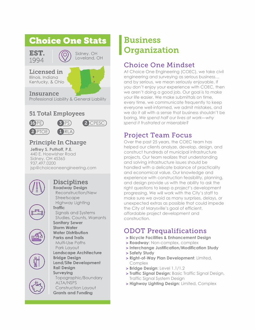
Business Organization
Choice One Mindset At Choice One Engineering (COEC), we take civil engineering and surveying as serious business… and by serious, we mean seriously enjoyable. If you don’t enjoy your experience with COEC, then we aren’t doing a good job. Our goal is to make your life easier. We make submittals on time, every time, we communicate frequently to keep everyone well-informed, we admit mistakes, and we do it all with a sense that business shouldn’t be boring. We spend half our lives at work—why spend it frustrated or miserable?
Project Team Focus Over the past 25 years, the COEC team has helped our clients analyze, develop, design, and construct hundreds of municipal infrastructure projects. Our team realizes that understanding and solving infrastructure issues should be handled with a delicate balance of practicality and economical value. Our knowledge and experience with construction feasibility, planning, and design provide us with the ability to ask the right questions to keep a project’s development progressing. We will work with the City’s staff to make sure we avoid as many surprises, delays, or unexpected extras as possible that could impede the City of Marysville’s goal of efficient, affordable project development and construction.
ODOT Prequalifications > Bicycle Facilities & Enhancement Design > Roadway: Non-complex, complex > Interchange Justification/Modification Study > Safety Study > Right-of-Way Plan Development: Limited,
Complex > Bridge Design: Level 1.1/1.2 > Traffic Signal Design: Basic Traffic Signal Design,
Traffic Signal System Design > Highway Lighting Design: Limited, Complex
Jeffrey S. Puthoff, P.E. 440 E. Hoewisher Road Sidney, OH 45365 937.497.0200 [email protected]
Project Team
Dane M. Sommer, P.E.
Project Manager/Roadway Jeffrey S. Puthoff, P.E.
QA/QC Craig C. Eley, P.E.
Traffic/Lighting Engineering
Mitchell J. Thobe, P.E.
Maintenance of Traffic QA/QC Jacqueline Huelskamp, RLA
Landscape Architect Wesley D. Goubeaux, P.S.
Survey/Right-of-Way
Dane M. Sommer, P.E. Project Manager | University of Dayton, 2010, BS in Civil Engineering
Project Experience: With EP Ferris: > Johnstown Road Roundabout, New Albany,
Ohio > North High St. at Chatham Green Widening,
New Albany, Ohio > Upper Arlington Street Reconstruction, Upper
Arlington, Ohio > CLA-70-10.55 (IR-70 Widening from US 68 to
SR 72), PID 83663, Clark County, Ohio
With COEC: > Yellow Springs-Fairfield Road Improvements,
PID 101498, Fairborn, Ohio > Gay Street and Maple Street Reconstructions,
Plain City, Ohio > MOT-W. Springfield St. Reconstruction,
Riverside, Ohio > Rich/Davis/Primrose Intersection, Deerfield
Township, Ohio > Northwoods Boulevard Reconstruction, Phase
1, Vandalia, Ohio > Jefferson Street Reconstruction, Phase 1 and
Phase 2, Bluffton, Ohio > South Ohio Street Full Depth Reclamation,
Greenville, Ohio Bio: Dane is a project manager and engineer with experience in ODOT-LPA roadway and bicycle facility design, bridge design, and roundabout design, specifically in urban corridors. Prior to working at COEC, Dane designed structures and roadways for various projects under EP Ferris & Associates, Columbus, Ohio. While at EP Ferris, Dane was heavily involved in the design of projects that ranged from interstate bridge replacements and reconstructions, to roundabouts, to simple guardrail installations. Dane began his career as a Transportation Engineer with ODOT District 5 (Jacksontown, Ohio), designing bridges and learning ODOT standards and processes. Specifically, while at ODOT, Dane gained experience in ODOT pavement design, drainage design, the ODOT design and review process, and ODOT construction estimating.

Page 4
More pertinent to this project, Dane is an unassuming and diligent project manager who takes pride in his designs and construction plan presentation. Dane understands that construction plans not only provide designs for the current project, but create hard-copy records displaying utilities, right-of-way, geometry, and other information to be used as a historical public record. In addition, Dane makes it a point to be available and considerate of a client’s or stakeholder’s time and is forthright and honest with potential construction complications. Dane understands the importance of communication throughout the development of a project. Weekly update emails from Dane would be sent to keep everyone abreast of the status of the project. COEC also encourages a multi-level communication structure with the City, ODOT, County, private utilities, etc., and encourages this process to allow the reviewer to speak directly with the designer versus going through the “channels” of project management and relying on information being relayed appropriately. Dane encourages communication with utility owners and stakeholders early and often to mitigate barriers to progress as much as possible, and to engage the community in the project to promote buy-in and cooperation towards the project’s success, as well as pride in their community and the finished reconstruction project. Recently, Dane managed similar projects including the reconstruction of Jefferson Street (S.R. 103), Phase 1 and Phase 2 in Bluffton, Ohio. This complete street reconstruction was partially funded through the OPWC and included meticulous construction coordination with ODOT detour routes, ODOT Urban Paving Program, right of way acquisition, and an ODOT bridge reconstruction project located at the midway point of the street reconstruction. Dane was in frequent contact with utilities, ODOT, bridge contractors, and the Village to ensure the construction schedules and bidding/award timeframes ensured a smooth construction process. Additionally, Dane was lead designer on Yellow Springs-Fairfield Road Improvements (PID: 101498) in Fairborn, Ohio. This project included removing of the existing four-foot asphalt paved shoulders and replacement with curb and gutter, improving pedestrian ADA facilities and connectivity, installing a 10-foot-wide multi-use trail, constructing dual left turn lanes at an intersection, analyzing traffic data for signal warrants, and coordinating maintenance of traffic plans with the City and local residents. Final tracings for this project were completed over a month ahead of time. Jeffrey S. Puthoff, P.E. Quality Assurance/Quality Control | The Ohio State University, 1993, BS in Civil Engineering
Project Experience: > National Road Streetscape, Phase 5,
Vandalia, Ohio > Engle Road Waterline, Butler Township,
Montgomery County, Ohio > Stonequarry Crossings Industrial Park,
Vandalia, Ohio > Ohio & Wright Reconstruction, Fairborn,
Ohio > S. CR 25-A Reconstruction, Phase I & II, PIDs
90852 & 93245, Tipp City, Ohio > East Auglaize Street Reconstruction, PID
83124, Wapakoneta, Ohio
> Ohio & Wright Reconstruction, Fairborn, Ohio
> North Market Street Reconstruction, Phase 2, Troy, Ohio
> Bethany Road/Mason-Montgomery Road Bike Path, PID No. 98857, Mason, Ohio
> State Route 73 Widening and Repaving PID 88873, Springboro, Ohio
> Iron Horse Trail Improvements, Phases I and II, Centerville, Ohio
> MOT – Upper Wolf Creek Bikeway, PID 93246, Clay Township, Ohio

Page 5
Bio: Jeff has gained 25+ years of practical experience through his current endeavors in roadway design, site development, utility design, and project management, as well as through his past experience working construction. All of this experience and knowledge combines into a project management style that includes working hard and knowing how to handle demanding situations and short project schedules. Jeff began his career with Worl & Associates in 1993 before co-founding COEC in 1994. Since then, Jeff has been involved in hundreds of projects ranging from simple site designs to major road widenings and reconstructions. Jeff’s particular skill with practical construction methods makes him an astute, meticulous reviewer of plans (he really enjoys wielding a giant red Sharpie). On a project such as this, Jeff will not be involved in the day-to-day design, but will step in as a “third-party” in-house review specialist to analyze the plans, estimate, and specifications from an “outside” the project’s daily design point of view. Also worth noting is Jeff’s relaxed, friendly attitude. Despite his fondness for hard work, Jeff is laidback and easy to talk to. He is straightforward, to-the-point, and always responsive. Craig C. Eley, P.E. Traffic and Highway Lighting| Wright State University, 1995, BS in Electrical Engineering
Project Experience: > SR 47 Safety Improvements, Phases 1 & 2, PIDs
93543 & 95244, Sidney, Ohio > MIA I-75 and CR 25A Exit 69 Safety Study, IMS,
Interchange redesign, and New Traffic Signal at SB Ramp, Tipp City, Ohio.
> MOT I-675 and Alex Bell Rd. Safety Study and Safety Project, Montgomery Co., Ohio
> SR 125 and Woodlands Roundabout, Amelia, Ohio
> MOT 741 and 725 Safety Studies, Signal operation, Safety Projects, ODOT
> SR 55 and Fenner/Clopay Signalization and Interconnect, Troy, Ohio
> State Route 103 Corridor Study, PID 95588, Bluffton, Ohio
> Rich/Davis/Primrose Intersection, Deerfield Township, Ohio
> MIA I-75 and CR 25A Exit 69 Safety Study, IMS, Interchange redesign, and New Traffic Signal at SB Ramp, Tipp City, Ohio.
> West Market Street Reconstruction, Phase 2, Traffic Study/Analysis, Troy, Ohio
Bio: In 1989, Craig left the U.S. Navy and began his career at the Ohio Department of Transportation, District 7; during this time he earned a degree in Electrical Engineering. Craig was promoted to a Transportation Engineer and worked as a Project Inspector/Engineer on several large traffic signal projects. He was then offered a position in the ODOT District 7 Planning Department where he was the District Traffic and Safety Engineer, functioning as the District Traffic Engineer and Safety Review Team Chairman. Craig retired from ODOT in 2014. In 2015, Craig joined COEC where he is part of a group of traffic engineers that work primarily on state and local traffic, roadway, pedestrian, and signal projects. Additionally, Craig works on highway and site lighting, traffic impact studies, and highway safety studies. With 30 years of traffic engineering experience, Craig is incredibly adept at various traffic and safety studies, recommendations, improvements, and enhancements. Over his career, Craig has witnessed the evolution of traffic engineering and highway lighting, which helps him understand legacy and existing technology, as well as the most efficient, cost-effective methods of enhancement, replacement, and reconstruction. Not to be missed is Craig’s friendly personality and willingness to create practical solutions.
Page 6
Mitchell J. Thobe, P.E. Maintenance of Traffic QA/QC | University of Toledo, 2010, BS in Civil Engineering Northwestern University Center for Public Safety, 2011
Project Experience: > I-75 and Northwoods Blvd. Signalization,
MOT-IR 75-22.73, PID 99200, Vandalia, Ohio > Ohio & Wright Reconstruction, Fairborn,
Ohio > State Route 47 Safety Improvements,
Phases 1 and 2, PID Nos. 93543 and 95244, Sidney, Ohio
> South Washington Street Reconstruction, Phase III, PID No. 96261, Van Wert, Ohio
> S. County Road 25-A Reconstruction, Phase I & II, PIDs 90852 & 93245, Tipp City, Ohio
> Bethany Road/Mason-Montgomery Road Bike Path, PID 98857, Mason, Ohio
> Replace this with the Fox Road and SR 118 Signalization, Van Wert, Ohio
> Main Street Improvements, PID 94791, > Enon, Ohio > Airstream Drive Roadway Improvements &
Signalization, Village of Jackson Center, Ohio West Auglaize Street Reconstruction, PID 93850, Wapakoneta, Ohio
> SR 55 and Fenner/Clopay Signalization and Interconnect, Troy, Ohio
> North Market Street Reconstruction, Phase 2, Troy, Ohio
> Chambersburg/Bellefontaine Intersection Improvements & Signalization, PID 90797, Huber Heights, Ohio
> Yellow Springs-Fairfield Road Improvements, PID 101498, Fairborn, Ohio
> Fourth Street Reconstruction, PID 84191 Minster, Ohio
> State Route 185 Relocation, PID 93852, Versailles, Ohio
> SR 118 Improvements in St. Henry. > Downtown Utilities and Streetscape, Tipp
City, Ohio > Wapakoneta Avenue Reconstruction,
Phases 1 & 2, PIDs 85324 & 89052 Sidney, Ohio
Bio: With experience in roadway design, traffic engineering, highway lighting, and utility design, as well as ODOT, and Federal Highway Standards, Mitch is a talented, detail-oriented professional engineer well-equipped to review and provide oversight during the project development process. In his role as Chief Production Officer, Mitch’s daily tasks are to ensure all employees of COEC are kept productive, involved in a multitude of designs, and most importantly, enjoying their time at work. Outside of his role as CPO, Mitch is an experienced and honest project manager with construction wisdom well beyond his peers. Recently, Mitch managed ODOT-LPA projects including the reconstruction of West and East Springfield Streets (PIDs 103653 and 105879) in the City of Riverside and is currently managing the reconstruction of Yellow Springs-Fairfield Road Improvements (PID 101498) in the City of Fairborn. Both projects include a detailed environmental engineering phase, complex construction work, detailed maintenance of traffic plans, and public involvement processes that Mitch successfully facilitated to create positive buy-in for the project, which is proceeding as planned.
Wesley D. Goubeaux, P.S. Survey/Right-Of-Way | The Ohio State University, 2000, BS in Geomatics Engineering
Project Experience: > N I-75 and Northwoods Blvd. Signalization,
MOT-IR 75-22.73, PID 99200, Vandalia, Ohio > South Washington Street Reconstruction,
Phase III, PID 96261, Van Wert, Ohio
> National Road Streetscape, Phase 5, Vandalia, Ohio
> Engle Road Waterline, Butler Township, Montgomery County, Ohio
Page 7
> S. County Road 25-A Reconstruction, Phase I & II, PIDs 90852 & 93245, Tipp City, Ohio
> Main Street Improvements, PID 94791, Enon, Ohio
> North Market Street Reconstruction, Phase 2, Troy, Ohio
> MOT-W. Springfield St. Reconstruction, PID 103653 Riverside, Ohio
Bio: Detail-oriented, resourceful, and proactive, Wes makes an exceptional surveyor. With many hands-on years in the field collecting field data and driving construction layout stakes, Wes has now been executing ODOT Right-of-Way plans and ALTA/NSPS Survey documents for over 18 years. Since 2013, Wes has been involved in well over 500 surveys for roadway and site projects. In addition, he develops easements, plats, and any other survey-related task thrown his way. Jacqueline L. Huelskamp, RLA Landscape Architecture| The Ohio State University, 2007, BS in Landscape Architecture; Minor in City & Regional Planning
Project Experience:For Jaccyn Design: > Donnell Middle School, Findlay, Ohio > Cedar Cliff K-12, Cedarville, Ohio > Brookside Park Master Plan, Sidney, Ohio > Kalida Streetscape Master Plan, Kalida, Ohio > Fort Loramie Village Square Park, Fort
Loramie, Ohio > West Milton Municipal Park, West Milton,
Ohio
> Cancer Care Healing Garden and Courtyard at UVMC, Troy, Ohio
> St. Michael Church Plaza, Fort Loramie, Ohio For COEC: > Hospice at Miami County, Troy, Ohio > Village of Bluffton Master Plan, Bluffton, Ohio > Schoolhouse Park Master Plan, Centerville-
Washington Park District, Montgomery County, Ohio
Bio: Jacqueline is a certified Landscape Architect with a large breadth of experience covering many facets of Landscape Architecture. She has experience with site/route analysis, conceptual design, client communication, and construction plans as they relate to master planning, roadway design, and site design. Prior to joining COEC, she worked for Garmann-Miller Architects & Engineers, a reputable architecture group in western Ohio, focusing mainly on educational projects. Most recently Jacqueline worked for Jaccyn Design Group, a Landscape Architecture firm in Quincy, Ohio designing sites ranging from small urban parks to a large K-12 school. Jacqueline provides another dimension of design to COEC’s engineering and surveying services. She understands how space is used in any publically traveled space, and can focus projects to create environmentally friendly design that respect and respond to the natural environment and vehicle/pedestrian flow, blending hard- and soft-scapes into a project with seamless quality. She can take a project from site analysis and concept development to construction documentation and observation.
Page 8
Project Experience
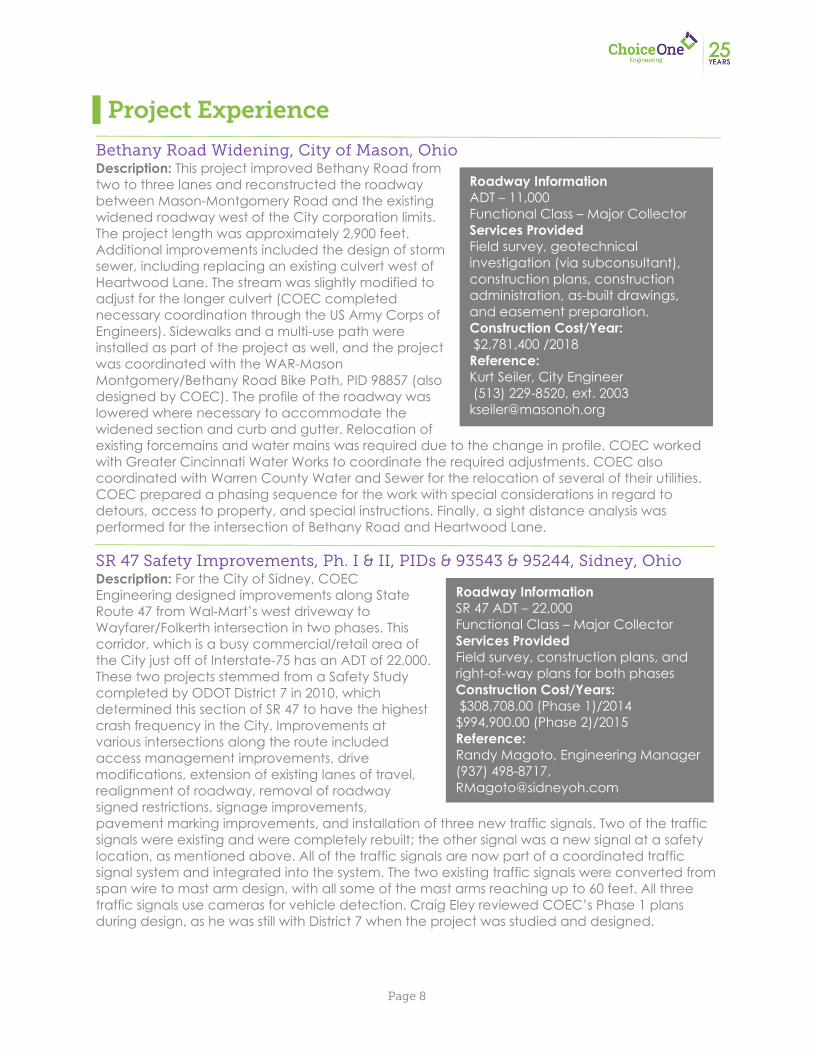
Bethany Road Widening, City of Mason, Ohio Description: This project improved Bethany Road from two to three lanes and reconstructed the roadway between Mason-Montgomery Road and the existing widened roadway west of the City corporation limits. The project length was approximately 2,900 feet. Additional improvements included the design of storm sewer, including replacing an existing culvert west of Heartwood Lane. The stream was slightly modified to adjust for the longer culvert (COEC completed necessary coordination through the US Army Corps of Engineers). Sidewalks and a multi-use path were installed as part of the project as well, and the project was coordinated with the WAR-Mason Montgomery/Bethany Road Bike Path, PID 98857 (also designed by COEC). The profile of the roadway was lowered where necessary to accommodate the widened section and curb and gutter. Relocation of existing forcemains and water mains was required due to the change in profile. COEC worked with Greater Cincinnati Water Works to coordinate the required adjustments. COEC also coordinated with Warren County Water and Sewer for the relocation of several of their utilities. COEC prepared a phasing sequence for the work with special considerations in regard to detours, access to property, and special instructions. Finally, a sight distance analysis was performed for the intersection of Bethany Road and Heartwood Lane. SR 47 Safety Improvements, Ph. I & II, PIDs & 93543 & 95244, Sidney, Ohio Description: For the City of Sidney, COEC Engineering designed improvements along State Route 47 from Wal-Mart’s west driveway to Wayfarer/Folkerth intersection in two phases. This corridor, which is a busy commercial/retail area of the City just off of Interstate-75 has an ADT of 22,000. These two projects stemmed from a Safety Study completed by ODOT District 7 in 2010, which determined this section of SR 47 to have the highest crash frequency in the City. Improvements at various intersections along the route included access management improvements, drive modifications, extension of existing lanes of travel, realignment of roadway, removal of roadway signed restrictions, signage improvements, pavement marking improvements, and installation of three new traffic signals. Two of the traffic signals were existing and were completely rebuilt; the other signal was a new signal at a safety location, as mentioned above. All of the traffic signals are now part of a coordinated traffic signal system and integrated into the system. The two existing traffic signals were converted from span wire to mast arm design, with all some of the mast arms reaching up to 60 feet. All three traffic signals use cameras for vehicle detection. Craig Eley reviewed COEC’s Phase 1 plans during design, as he was still with District 7 when the project was studied and designed.
Roadway Information ADT – 11,000 Functional Class – Major Collector Services Provided Field survey, geotechnical investigation (via subconsultant), construction plans, construction administration, as-built drawings, and easement preparation. Construction Cost/Year: $2,781,400 /2018 Reference: Kurt Seiler, City Engineer (513) 229-8520, ext. 2003 [email protected]
Roadway Information SR 47 ADT – 22,000 Functional Class – Major Collector Services Provided Field survey, construction plans, and right-of-way plans for both phases Construction Cost/Years: $308,708.00 (Phase 1)/2014 $994,900.00 (Phase 2)/2015 Reference: Randy Magoto, Engineering Manager (937) 498-8717, [email protected]
Page 9
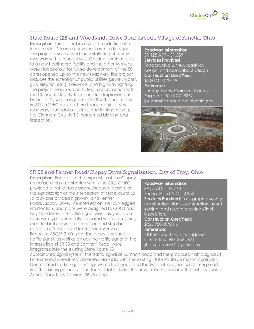
State Route 125 and Woodlands Drive Roundabout, Village of Amelia, Ohio Description: This project involved the addition of turn lanes to S.R. 125 and a new mast arm traffic signal. The project also involved the installation of a new roadway with a roundabout. One leg continued on to a new healthcare facility and the other two legs were stubbed out for future development of the 50 acres opened up by the new roadway. The project includes the extension of public utilities (sewer, water, gas, electric, etc.), sidewalks, and highway lighting. The project, which was installed in coordination with the Clermont County Transportation Improvement District (TID), was designed in 2018 with construction in 2019. COEC provided the topographic survey, roadway, roundabout, signal, and lighting design; the Clermont County TID performed bidding and inspection. SR 55 and Fenner Road/Clopay Drive Signalization, City of Troy, Ohio Description: Because of the expansion of the Clopay manufacturing organization within the City, COEC provided a traffic study and subsequent design for the signalization of the intersection of State Route 55 (a four-lane divided highway) and Fenner Road/Clopay Drive. The intersection is a four-legged intersection, and plans were designed to ODOT and City standards. The traffic signal was designed as a span wire type and is fully-actuated with radar being used for both advance detection and stop-bar detection. The installed traffic controller was Econolite ASC/3-2100 type. The newly designed traffic signal, as well as an existing traffic signal at the intersection of SR 55 and Barnhart Road, were integrated into the existing State Route 55 coordinated signal system; the traffic signal at Barnhart Road and the proposed traffic signal at Fenner Road were interconnected via radio with the existing State Route 55 master controller. Coordinated traffic signal timings were developed and the two traffic signals were integrated into the existing signal system. The model includes the new traffic signals and the traffic signals at Arthur, Dorset, NB 75 ramp, SB 75 ramp.
Roadway Information SR 125 ADT – 31,239 Services Provided Topographic survey, roadway design, and roundabout design Construction Cost/Year $1,800,000 /2019 Reference Jeremy Evans, Clermont County Engineer, (513) 732-8857 [email protected]
Roadway Information SR 55 ADT – 16,768 Fenner Road ADT – 2,359 Services Provided: Topographic survey, construction plans, construction layout staking, and record drawings/final inspection. Construction Cost/Year: $223,750.00/2016 Reference: Jill Rhoades, P.E., City Engineer City of Troy, 937-339-2641 [email protected] jh di @ thl b hi
Page 10
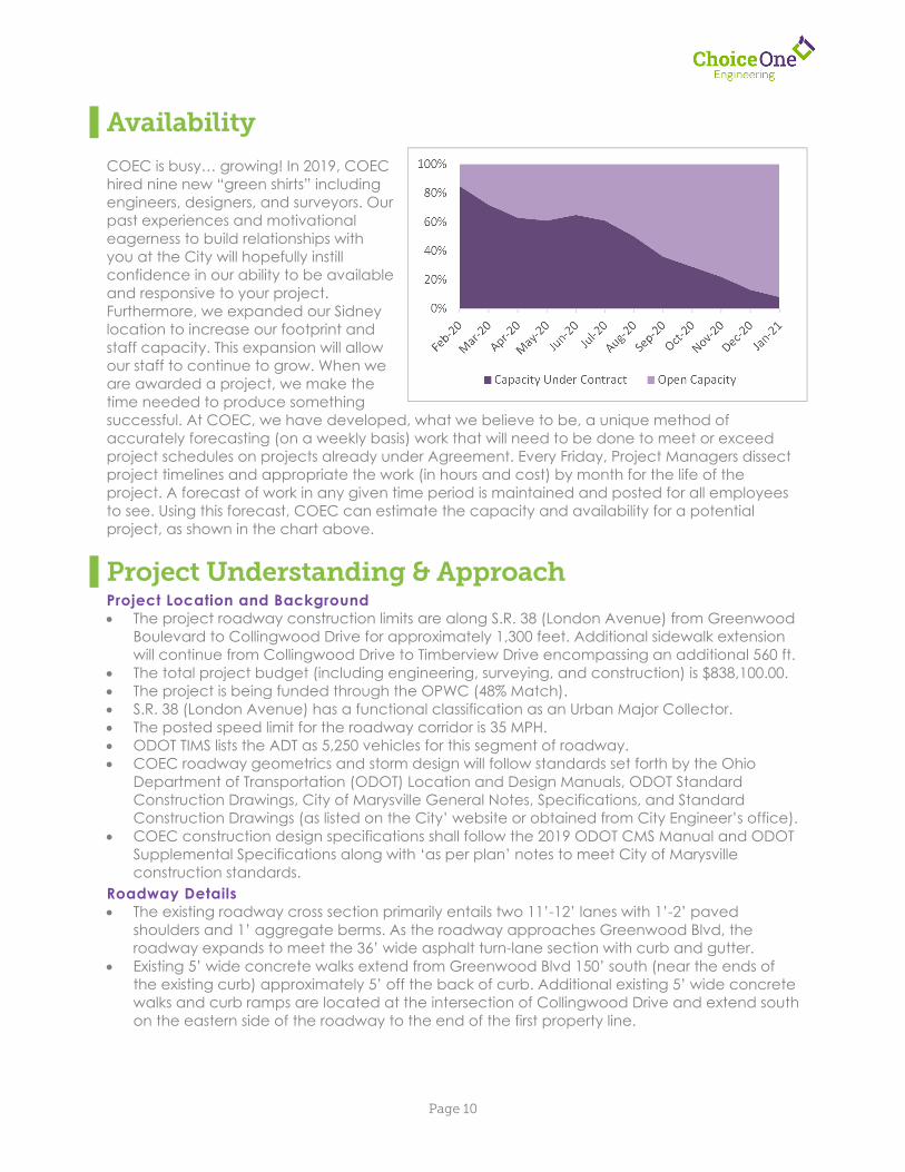
Availability COEC is busy… growing! In 2019, COEC hired nine new “green shirts” including engineers, designers, and surveyors. Our past experiences and motivational eagerness to build relationships with you at the City will hopefully instill confidence in our ability to be available and responsive to your project. Furthermore, we expanded our Sidney location to increase our footprint and staff capacity. This expansion will allow our staff to continue to grow. When we are awarded a project, we make the time needed to produce something successful. At COEC, we have developed, what we believe to be, a unique method of accurately forecasting (on a weekly basis) work that will need to be done to meet or exceed project schedules on projects already under Agreement. Every Friday, Project Managers dissect project timelines and appropriate the work (in hours and cost) by month for the life of the project. A forecast of work in any given time period is maintained and posted for all employees to see. Using this forecast, COEC can estimate the capacity and availability for a potential project, as shown in the chart above.
Project Understanding & Approach Project Location and Background The project roadway construction limits are along S.R. 38 (London Avenue) from Greenwood
Boulevard to Collingwood Drive for approximately 1,300 feet. Additional sidewalk extension will continue from Collingwood Drive to Timberview Drive encompassing an additional 560 ft.
The total project budget (including engineering, surveying, and construction) is $838,100.00. The project is being funded through the OPWC (48% Match). S.R. 38 (London Avenue) has a functional classification as an Urban Major Collector. The posted speed limit for the roadway corridor is 35 MPH. ODOT TIMS lists the ADT as 5,250 vehicles for this segment of roadway. COEC roadway geometrics and storm design will follow standards set forth by the Ohio
Department of Transportation (ODOT) Location and Design Manuals, ODOT Standard Construction Drawings, City of Marysville General Notes, Specifications, and Standard Construction Drawings (as listed on the City’ website or obtained from City Engineer’s office).
COEC construction design specifications shall follow the 2019 ODOT CMS Manual and ODOT Supplemental Specifications along with ‘as per plan’ notes to meet City of Marysville construction standards.
Roadway Details The existing roadway cross section primarily entails two 11’-12’ lanes with 1’-2’ paved
shoulders and 1’ aggregate berms. As the roadway approaches Greenwood Blvd, the roadway expands to meet the 36’ wide asphalt turn-lane section with curb and gutter.
Existing 5’ wide concrete walks extend from Greenwood Blvd 150’ south (near the ends of the existing curb) approximately 5’ off the back of curb. Additional existing 5’ wide concrete walks and curb ramps are located at the intersection of Collingwood Drive and extend south on the eastern side of the roadway to the end of the first property line.
0%
20%
40%
60%
80%
100%
Capacity Under Contract Open Capacity
Page 11
The proposed project will include the following: o Sawcutting along the existing white edge line and removing the asphalt shoulder from
Collingwood Drive to approximately 150’ south of Greenwood Blvd on both sides of the roadway.
o Installing combination curb and gutter (Std. Dwg. STR-05) along with full depth pavement construction outside of the sawcuts. The offset from centerline to the face of the gutter will create a minimum of two 12’-wide pavement lanes (11’ lane; 1’ paved shoulder) in accordance with L&D Vol. I Table 301-4. No edge lines will be re-striped in locations of curb and gutter. COEC will confirm the typical section with the City early in the design process.
o Full depth pavement construction/repairs will follow the Street Pavement Sections Std. Dwg. STR-13 pavement composition, Option A, for roadways over 1500 ADT.
o 4” underdrains will be installed beneath the curb and gutter in accordance with Std. Dwg. STR-05.
o Geotechnical borings are not mentioned in the RFP. As a result, discussions with the City will be made early in the design to determine a contingency quantity game plan to address unsuitable or unstable subgrades, i.e. geogrid or granular embankment replacement.
o S.R. 38 (London Avenue) will be milled and resurfaced (1.5” depth) from Collingwood Drive to Greenwood Blvd (1,500’ in length). Marysville Item 1540 – asphalt rejuvenating agent (reclamite) will be specified for all final pavement surface area.
o Center line, transverse lines, and turn lane pavement striping will be restriped on the project in a similar pattern as the existing striping. Pavement striping will be ODOT 644 in accordance with Note 7 of the Marysville Roadway Notes.
o On the east side of the roadway, a 5’ concrete sidewalk (with a 5’ curb lawn) will be installed on the inside of the existing utility poles. The concrete walk installation will follow Std. Dwg. STR-01. (4” concrete walk on 2” min. aggregate base).
o On the west side of the roadway, a multi-use asphalt trail will be installed from the intersection of Greenwood Blvd. to the access driveway of Timberview Golf Club. The existing 28’ to 30’ right-of-way on the west side of the roadway (along with utility poles) will dictate the curb lawn and trail width. No right-of-way acquisition is anticipated for the construction of the project.
o The asphalt trail pavement composition will be determined by previous trail pavement composition used throughout the City.
o Approximately 450’ of 5’-wide sidewalk-only construction will extend from just south of Collingwood Drive to the intersection of Timberview Drive. The offset to the face of the sidewalk will match the existing concrete walk. A lone curb ramp will be constructed at Timberview Drive to meet ADA requirements.
o For the sidewalk extension portion of the project, existing drive aprons will be reconstructed to ensure ADA cross slope requirements are met for the through route of travel for the walk.
Storm Water Details For most of the roadway corridor, existing storm water runs away from the centerline crown
of the roadway, across the shoulders and into the shallow ditches on either side of the roadway. Just prior to each driveway, where the ditch flowline gets compromised, yard drains or catch basins are present to collect ponding storm water in these locations.
On the east side of the roadway, an existing trunkline runs from 1140 London Avenue and heads north to its outlet location at the existing ditch near Greenwood Drive. As mentioned, either yard drains or catch basins are located just prior to each driveway to collect storm runoff.
On the west side of the roadway, an existing trunk line starts at the open ditch near the access drive to Timberview Golf Club and extends north to the final catch basin in the ditch
Page 12
near Greenwood Blvd. From here, it ties in with the storm system for the intersection, crosses beneath London Avenue (S.R. 38) and outlets as the existing ditch. As mentioned, either yard drains or catch basins are located just prior to each driveway to collect storm runoff.
For the sidewalk extension portion of the project, south of Collingwood, an undocumented (not shown on the GIS) existing drainage tile with yard drains runs near the location of the future sidewalk. Additional investigation will need completed to determine the tie-in and outlet location of the drainage tile for this location.
The proposed project will include the following: o For the curb and gutter roadway section, the storm water from the roadway surface will
no longer reach the ditch lines. Curb Inlet Catch Basins (Std. Dwg. STS-04 and STS-05) will be designed using the Inlet Spacing calculator from the ODOT CDSS Design Software. Inlet spacing will look to minimize the number of Curb Inlets required for the design.
o The proposed concrete walk and asphalt trail will sit above the existing surface, meaning storm water from private properties will have the ability to pond prior to each driveway location behind the walk/path. Similar to current conditions, yard drains will be installed at each low point and blind-tie into the new storm trunkline. The tie-ins will have designed fittings to ensure connectivity.
o Yard drains shall be a minimum 8” ductile iron grate with cast iron frame, manufactured by Nyloplast or an approved equal.
o Proposed storm mains will follow City of Marysville storm notes, specifically Note 2, which states storm pipe less than 12” shall be ODOT CMS 707.33 (CPSLP), and storm pipe greater than 12” shall be ODOT CMS 707.65 (Double Wall Pipe).
o To avoid storm utility crossings across the existing roadway, storm design shall look to install separate storm trunks (similar to existing conditions) on each side of the roadway, with outlet/tie-in points in the same locations as the existing. In addition, a cost savings option of installing a single storm trunk line on one side of the road will be evaluated.
o Storm sizing will follow the requirements set forth in Section 1103 and 1104 of the Location and Design Manual, Vol. 2 (two-year design for inlet spacing, 10-year design/25-year design hydraulic grade line for storm system). Storm calculations will be submitted with the 70% design submittal.
o In the project section south of Collingwood Drive, the proposed storm improvements will be limited to creating a shallow ditch/swale between the existing roadway edge and proposed concrete walk. At each drive location, a yard drain will be installed with a small (less than 12”) storm system that ties into the existing undocumented storm line.
Environmental, Right-of-Way, and Utilities The earth-disturbed area will be very near one acre. Therefore, a Notice of Intent (NOI)
permit, a Storm Water Pollution Prevention Plan (SWPPP), and post construction BMPs MAY BE required for the project. The initial proposal DOES NOT cover the additional fee to provide the SWPPP for the project. However, this initial proposal does cover the design and submittal of the NOI and post construction BMPs if required by the EPA.
Through preliminary research completed for the project, the existing right-of-way for the roadway corridor is mostly 56’ to 60’ wide. As it reaches Greenwood Blvd., the existing right-of-way extends outwards up to 120’ wide. It is NOT anticipated permanent right-of-way takes will be required for the roadway improvement. If it is determined in the design process that right of way takes will be required, COEC will negotiate additional fees to produce right-of-way take displays and necessary deeds for the City.
It is anticipated temporary work for grading, seeding, and minor storm water improvements will be required on private property. In these locations, it is anticipated the City will garner work agreements with the private property owners for the contractor to complete work on private property.
Page 13
COEC will coordinate utility relocation with the appropriate utility owners, if necessary. This is further discussed in the Special Considerations & Potential Challenges section.
Lighting and Landscape Architecture (Tree Planting) Streetlights (poles and luminaires) for the roadway corridor will match the existing lighting just
north of the intersection of Greenwood Blvd. Streetlights will be designed to meet lighting requirements set forth in the ODOT Traffic
Engineering Manual, Section 11: Highway Lighting. It is anticipated one existing light pole and luminaire just south of the existing curb termini
location on the east side of S.R. 38 will need removed/relocated and one overhead luminaire at the intersection of Collingwood Drive will need removed.
A tree planting plan will be included in the design of the project. Proposed trees will be planted within the curb lawns of the walk and asphalt trail. The tree type and size will be determined by the City and COEC’s in-house landscape architect. It is anticipated the proposed trees will match the existing trees in the curb lawns just north of the intersection of Greenwood Blvd.
Potential Challenges & Special Considerations Maintenance of Traffic A detailed maintenance of traffic plan will be completed for the roadway improvement. Maintaining two lanes of traffic (one in each direction) for the duration of the project will be
difficult as the existing 22’-24’ wide roadway will make construction of storm and curb challenging. As a result, COEC recommends closing one lane of traffic for the portions of the project when part-width curb and storm installation is being completed.
During these times, southbound traffic can be detoured at the intersection of East 9th Street (heading east) to Chestnut Street (turn right and head south). From here, vehicles would be detoured to Scottslawn Road (heading southwest) and sent back via S.R. 736 to S.R. 38.
It is anticipated that local traffic would meander through the neighboring subdivisions to bypass the signed detour.
Northbound traffic will be maintained for the entirety of the project. COEC will coordinate the signed detour route and other maintenance of traffic procedures
with ODOT, ODOT special hauling permits office, Union County, and the City throughout the project development process.
For the mill/fill portion of the project, the maintenance of traffic will consist of notes and referencing ODOT’s standard construction drawings for these type of work procedures.
Existing Utilities It is anticipated three existing fire hydrants will need relocated or adjusted to grade during
the construction process. All three hydrants are located on the east side of S.R. 38. The existing water main, located on the east side of S.R. 38, needs located and verified with
the City. In addition, any existing as-built construction plans for the existing water main will be very helpful during the design. Proposed storm system on the eastern side of the road will need to be designed to avoid conflict with this existing line. In addition, to meet Ohio EPA requirements, the proposed storm line shall be 10’ offset out/out diameter from the existing water main.
On the west side of the roadway, an existing gas main, overhead communication lines, and underground communication lines (owned by Sprint) will need verified and located. Proposed storm trunk lines on the western side of the project will need constructed to avoid any utility conflicts.
Contact with private utility companies will be completed at each phase submittal and a documented utility coordination log will be created for the project.
Page 14
It is anticipated the overhead communication lines and utility poles will need relocated for the construction of an 8’ wide multi-use trail if a curb lawn wide enough for trees is the desired outcome of the project.
Roadway Elevation vs. Neighboring Properties Elevation Difference: As briefly mentioned, the existing profile of the roadway is not anticipated to be adjusted, as the existing asphalt shoulders are to be removed and curb constructed in place. Due to this, the proposed concrete walk and asphalt multi-use trail (in most locations) are to be constructed above the existing surface adjacent to the roadway. In locations of driveways, the proposed drives and drive aprons will need to be built with a positive grade sloping upwards towards the pedestrian facilities. COEC does not recommend sloping the driveways downward (negative) away from the curb and gutter, as storm drainage will overtop the depressed curb in these locations and drain down the driveways. To combat this discrepancy in elevation, yard drains are to be proposed at each driveway behind the walks where the grading slopes back down to meet the existing surface. In our experiences, if the yard drains are not maintained or are constructed incorrectly (too high), private property owners are typically very vocal about ponding water in their yards. An innovative solution to solving this discrepancy in elevation difference is to lower the roadway profile by reconstructing the roadway. Since there are no utility manholes or water valves within the existing pavement, a cost-efficient way to complete this complete street reconstruction is to perform full-depth pavement reclamation on the roadway. The contractor would remove the existing asphalt shoulders as originally scoped, construct the curb and gutter according to plan elevations (much lower than the existing surface), and then pulverize the existing asphalt pavement accordingly. After pulverization, the contractor would excavate out the surplus pulverized material and grade the fines to the necessary elevations and grades. Next, the contractor would add the cement stabilization for the subgrade, allow to cure, and perform asphalt paving on top of the originally pulverized material, completing the lowering of the roadway.
Scope of Work
1. Topographic Survey (Roadway) a. Contact Ohio Utilities Protection Service (OUPS) for underground utility locations. b. Perform necessary deed and plat research. c. Establish horizontal and vertical survey control for the project area based on State
Plane coordinates and NAVD 88. d. Field reconnaissance and traverse of existing monumentation. e. Identify visible features from 25’ beyond right-of-way for both sides including utilities
and drainage. f. Provide roadway cross-sections every 50’, at driveways, and other critical areas. g. Inventory manholes and catch basins including type of construction, depth, pipe size,
and condition. h. Locate underground utilities as marked by the appropriate utility companies. i. Existing right of way lines and adjacent property lines will be established based on
existing monumentation, plats, deeds, and other readily available information. Full boundary resolution will not be performed.
j. Provide one (1) foot contour intervals. k. Completed topographic survey shall be provided in AutoCAD format.
Page 15
2. Construction Plans a. Design construction plans to include:
i. Title Sheet ii. Schematic Plan iii. Typical Sections iv. General Notes and Details v. Intersection Details vi. Quantity Summary and Engineer’s Estimate vii. Plan and Profile (scale 1” = 20’ horizontal, 1” = 5’ vertical) viii. Cross-Sections (scale 1” = 5’ horizontal, 1” = 5’ vertical) ix. Storm Sewer Plan x. Maintenance of Traffic Notes, Details and Plans xi. Pavement Calculations xii. Pavement Markings and Signage Plan xiii. Driveway Details
Compensation & Schedule
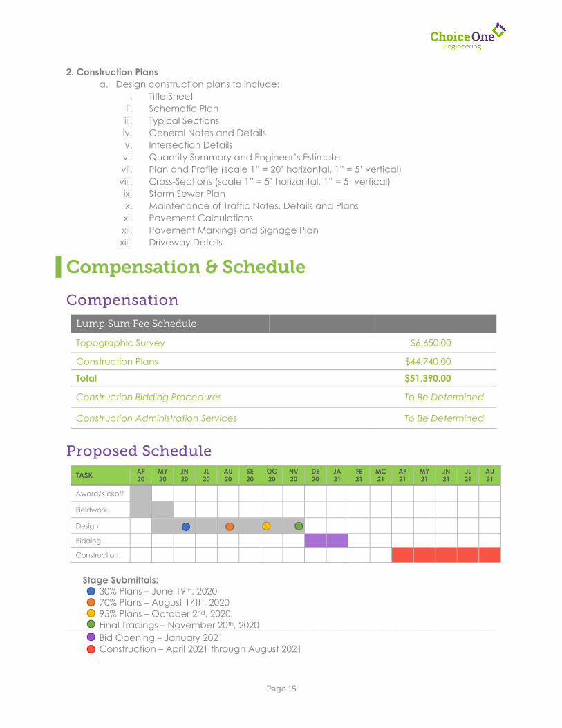
Compensation
Lump Sum Fee Schedule
Topographic Survey $6,650.00
Construction Plans $44,740.00
Total $51,390.00
Construction Bidding Procedures To Be Determined
Construction Administration Services To Be Determined
Proposed Schedule
Stage Submittals:
30% Plans – June 19th, 2020 70% Plans – August 14th, 2020 95% Plans – October 2nd, 2020 Final Tracings – November 20th, 2020 Bid Opening – January 2021 Construction – April 2021 through August 2021
TASK AP 20
MY 20
JN 20
JL 20
AU 20
SE 20
OC 20
NV 20
DE 20
JA 21
FE 21
MC 21
AP 21
MY 21
JN 21
JL 21
AU 21
Award/Kickoff
Fieldwork
Design
Bidding Construction
Engineering, Planning and Zoning City Hall, 209 South Main Street
Marysville, Ohio 43040-1641 (937) 645-7350
FAX (937) 645-7351 www.marysvilleohio.org
March 25, 2020 To: Board of Control Subject: Water Treatment Plant
Construction Management and Inspection Services The City advertised a Request for Qualifications (RFQ) on January 6, 2020 for experienced consulting firms to assist the City with the construction management and inspection for the City’s upcoming Water Treatment Plant. The proposed conventional lime soda softening plant will utilize solid contact clarification, biologically active sand filters, and secondary treatment with ozonation. Additional onsite improvements will include the construction of water distribution lines (including cathodic protection), two (2) sludge lagoons, a clear well (with high service pump room), clarifiers and typical site improvements (i.e. parking lot , storm sewer, detention basin, etc.) Per the Ohio Revised Code, the City uses a Qualification Based Selection (QBS) process for design projects that are anticipated to exceed twenty-five thousand dollars ($25,000) in value. To validate or confirm this selection process, we have provided a timeline (outlined below):
Short listing of the three (3) qualified firms – January 5, 2020 o Only two (2) firms officially submitted on this project
Request for Qualifications – January 6, 2020
Construction Management Team Interviews – February 18, 2020 Final Firm Rankings – February 27, 2020
o Shoaf Consulting was chosen as the firm to design the project
Scope and Contract Negotiations – March 19, 2020 The negotiated contract amount for the construction management and inspection for the City’s upcoming Water Treatment Plant is nine hundred forty-five thousand seven hundred fifty-nine dollars ($945,759.00). Based on the standard protocol followed for the design services, we recommend awarding the engineering design services contract to Shoaf Consulting. Respectfully, Jeremy V. Hoyt, P.E. City Engineer / Deputy Public Service Director
Shoaf Consulting LLC|www.shoafconsulting.com | 614.332.0217 | 614.408.4555 fax
City of Marysville March 10, 2020 Attn: Jeremy V. Hoyt, PE City Engineer / Deputy Public Works Director 209 South Main Street Marysville, OH 43040 Subject: REVISED Proposal for Construction Management / Inspection New Water Treatment Plant, AND Proposal for Fast-Track Design / CA / Periodic Inspection of South Water Tank
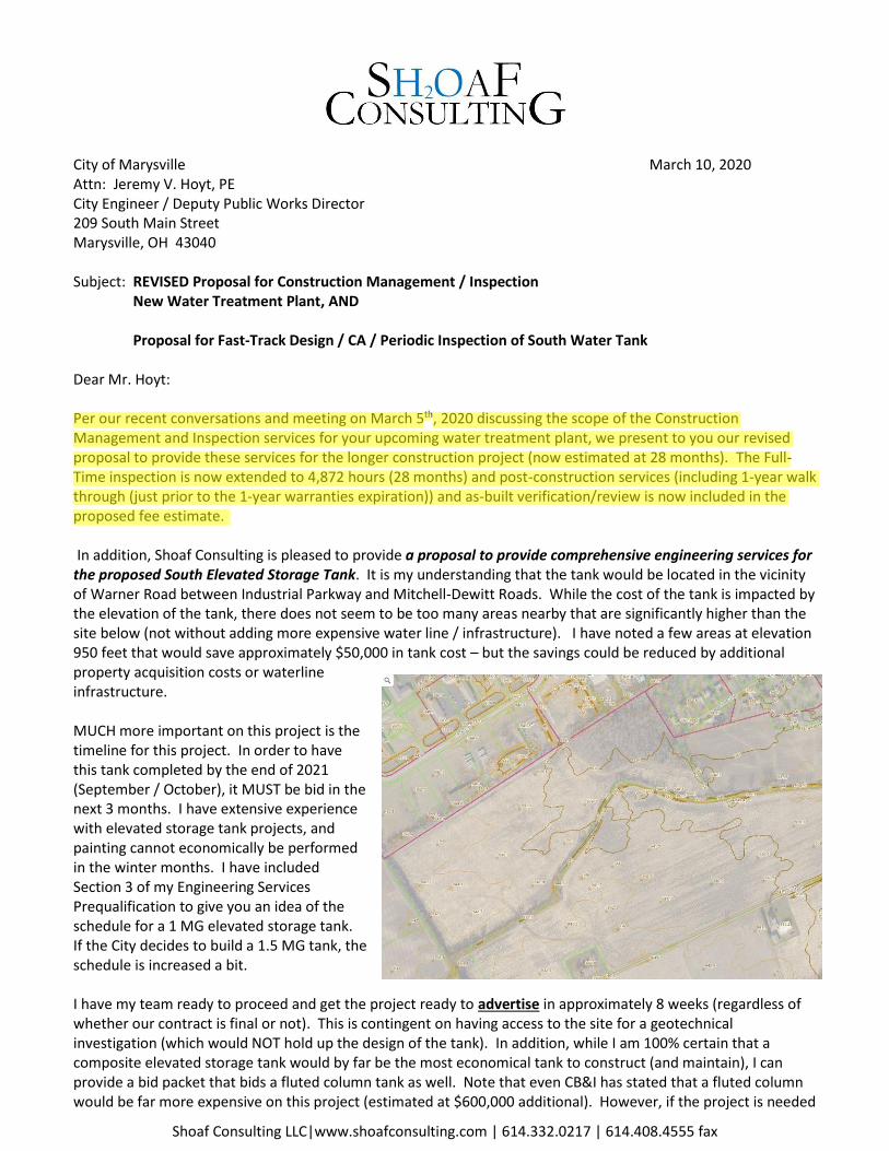
Dear Mr. Hoyt: Per our recent conversations and meeting on March 5th, 2020 discussing the scope of the Construction Management and Inspection services for your upcoming water treatment plant, we present to you our revised proposal to provide these services for the longer construction project (now estimated at 28 months). The Full-Time inspection is now extended to 4,872 hours (28 months) and post-construction services (including 1-year walk through (just prior to the 1-year warranties expiration)) and as-built verification/review is now included in the proposed fee estimate. In addition, Shoaf Consulting is pleased to provide a proposal to provide comprehensive engineering services for the proposed South Elevated Storage Tank. It is my understanding that the tank would be located in the vicinity of Warner Road between Industrial Parkway and Mitchell-Dewitt Roads. While the cost of the tank is impacted by the elevation of the tank, there does not seem to be too many areas nearby that are significantly higher than the site below (not without adding more expensive water line / infrastructure). I have noted a few areas at elevation 950 feet that would save approximately $50,000 in tank cost – but the savings could be reduced by additional property acquisition costs or waterline infrastructure. MUCH more important on this project is the timeline for this project. In order to have this tank completed by the end of 2021 (September / October), it MUST be bid in the next 3 months. I have extensive experience with elevated storage tank projects, and painting cannot economically be performed in the winter months. I have included Section 3 of my Engineering Services Prequalification to give you an idea of the schedule for a 1 MG elevated storage tank. If the City decides to build a 1.5 MG tank, the schedule is increased a bit. I have my team ready to proceed and get the project ready to advertise in approximately 8 weeks (regardless of whether our contract is final or not). This is contingent on having access to the site for a geotechnical investigation (which would NOT hold up the design of the tank). In addition, while I am 100% certain that a composite elevated storage tank would by far be the most economical tank to construct (and maintain), I can provide a bid packet that bids a fluted column tank as well. Note that even CB&I has stated that a fluted column would be far more expensive on this project (estimated at $600,000 additional). However, if the project is needed
jhoyt
Highlight
Per our recent conversations and meeting on March 5 th, 2020 discussing the scope of the Construction Management and Inspection services for your upcoming water treatment plant, we present to you our revised proposal to provide these services for the longer construction project (now estimated at 28 months). The Full-Time inspection is now extended to 4,872 hours (28 months) and post-construction services (including 1-year walk through (just prior to the 1-year warranties expiration)) and as-built verification/review is now included in the proposed fee estimate.
Shoaf Consulting LLC|www.shoafconsulting.com | 614.332.0217 | 614.408.4555 fax
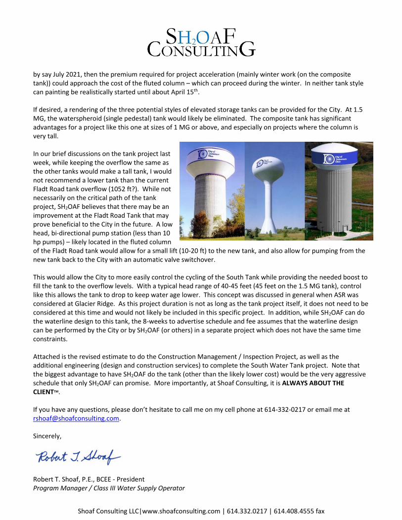
by say July 2021, then the premium required for project acceleration (mainly winter work (on the composite tank)) could approach the cost of the fluted column – which can proceed during the winter. In neither tank style can painting be realistically started until about April 15th. If desired, a rendering of the three potential styles of elevated storage tanks can be provided for the City. At 1.5 MG, the waterspheroid (single pedestal) tank would likely be eliminated. The composite tank has significant advantages for a project like this one at sizes of 1 MG or above, and especially on projects where the column is very tall. In our brief discussions on the tank project last week, while keeping the overflow the same as the other tanks would make a tall tank, I would not recommend a lower tank than the current Fladt Road tank overflow (1052 ft?). While not necessarily on the critical path of the tank project, SH2OAF believes that there may be an improvement at the Fladt Road Tank that may prove beneficial to the City in the future. A low head, bi-directional pump station (less than 10 hp pumps) – likely located in the fluted column of the Fladt Road tank would allow for a small lift (10-20 ft) to the new tank, and also allow for pumping from the new tank back to the City with an automatic valve switchover. This would allow the City to more easily control the cycling of the South Tank while providing the needed boost to fill the tank to the overflow levels. With a typical head range of 40-45 feet (45 feet on the 1.5 MG tank), control like this allows the tank to drop to keep water age lower. This concept was discussed in general when ASR was considered at Glacier Ridge. As this project duration is not as long as the tank project itself, it does not need to be considered at this time and would not likely be included in this specific project. In addition, while SH2OAF can do the waterline design to this tank, the 8-weeks to advertise schedule and fee assumes that the waterline design can be performed by the City or by SH2OAF (or others) in a separate project which does not have the same time constraints. Attached is the revised estimate to do the Construction Management / Inspection Project, as well as the additional engineering (design and construction services) to complete the South Water Tank project. Note that the biggest advantage to have SH2OAF do the tank (other than the likely lower cost) would be the very aggressive schedule that only SH2OAF can promise. More importantly, at Shoaf Consulting, it is ALWAYS ABOUT THE CLIENTTM. If you have any questions, please don’t hesitate to call me on my cell phone at 614-332-0217 or email me at [email protected]. Sincerely,
Robert T. Shoaf, P.E., BCEE - President Program Manager / Class III Water Supply Operator

City of Marysville WTP
Construction Management (with South Tank Adder)
Estimated Effort
3/10/2020
Rob Engineer Tech. Alan Total
Task Description Summary Unit Hours/
Unit
Shoaf
(PM)
CADD Electr. Support Schultsteche
et. al (Ben
Lehman)
Hours ODC's Subs
DESIGN / BIDDING PHASE SERVICES
Review Technical Specifications and Front-End Documents 24 8 32 $4,120 $200 $4,320
Initial Project Set-Up - Cloud Collaboration -
www.SkySITE.com
12 12 $1,800 $200 $2,000
Review Drawings (when available) for overall completeness
and make recommendations for addenda, if any.
40 40 $6,000 $200 $6,200
Attend Pre-Construction Meeting 6 6 $900 $200 $1,100
Attend Bid Opening / Verify Bid Review / Concurrence 8 8 16 $1,720 $1,720
$15,340
CONSTRUCTION PHASE SERVICES
Value Engineering Meeting / Follow-up 12 1.0 12 8 20 $2,600 $50 $2,650
On-Going Project Setup - Cloud Collaboration - 28 months 28 32 24 84 $8,960 $12,480 $21,440
Bi-Weekly PM Field Visit / Data Import / Verification / Photo-
Documentation
28 12.0 336 84 420 $55,860 $1,400 $57,260
Review RFPs and Proposals 144 0.70 100 100 25 226 $26,753 $50 $26,803
Review RFIs 144 1.00 144 144 36 323 $38,218 $50 $38,268
Submittal Review / Inventory 144 1.00 144 144 36 323 $38,218 $50 $38,268
Attend Monthly Progress Meetings 28 6.0 168 42 8 218 $28,730 $1,400 $30,130
Materials Testing During Construction 0 1.0 0 0 $0 $0 $200,000 $220,000
Post-Construction: As-Built Verification / Review 24 1.0 24 6 8 38 $4,790 $50 $4,840
Post-Construction: Warranty / Walk-Through (1- year) 16 1.0 16 4 8 28 $3,460 $100 $3,560
$443,219
INSPECTION (RPR) SERVICES
Resident Project Representative (28 months) 28 174 4,872 4,872 $487,200 $0 $487,200
$487,200
SUB-TOTAL - WTP PROJECT 1,062 420 0 0 273 4,904 6,658 $692,379 $16,430 $200,000 $945,759
SOUTH ELEVATED STORAGE TANK
Design of Elevated Storage Tank / Site Work 94 80 100 80 40 394 $44,200 $500 $44,700
Surveying / Geotech 8 12 20 $1,980 $15,000 $18,480
Bidding / Bid Opening / Bid Recommendation 48 40 16 8 16 128 $14,640 $100 $14,740
Construction Administration (Tank) 292 8 300 $44,320 $500 $44,820
As-Builts (Tank) 16 40 8 64 $5,920 $250 $6,170
Periodic Inspection (Adder to WTP Project) 12 8 96 96 $14,400 $696 $15,096
SUB-TOTAL - SOUTH TANK PROJECT 554 120 156 88 84 0 1,002 $125,460 $2,046 $15,000 $144,006
GRAND TOTAL - WTP / TANK $1,089,765
CONSTRUCTION PHASE SERVICES TOTAL
INSPECTION (RPR) SERVICES TOTAL
Total Cost
Per Task
Labor Costs
Per Task
DESIGN PHASE SERVICES TOTAL
Page 1C:\SH2OAF\Proposals- SH2OAF\2020 SUBMITTED\200131 Marysville CA and Inspection\Final Docs\CM WTP Fee w South Tank - Sh2oaf - rev 030920
jhoyt
Line
jhoyt
Line
City of Marysville Owners Agent for Construction Management / Inspection
Water Treatment Plant Sh2oaf Project Number: 20-0131
Scope of Services March 10, 2020
DESIGN / BIDDING PHASE SERVICES
1. Review Technical Specifications and Front-End / Bid Documents: Prior to advertising,
review the available technical and front-end specifications, bid documents, and
drawings for key items of conflict, contractually important / significant items such as
schedule, to make sure quality components and systems are being specified, and to
make sure the City understands the equipment manufacturers that are being proposed.
2. Initial Project Setup-Cloud Collaboration: Provide / set-up cloud platform for the City,
DP, and Contractors utilize to upload, download, and otherwise collaborate with.
3. Review the Issued for Bidding (or before) drawings when available: Review drawings
for overall completeness and to make recommendations for major inconsistencies for
inclusion into addenda, if any.
4. Attend Pre-Construction Meeting: Provide any advice to the Owner or DP on response
to any questions.
5. Attend Bid Opening, Verify DPs Bid Review: Attend bid opening, review the bid review
process of the DP, and check concurrence of the bid recommendation of the DP.
CONSTRUCTION PHASE SERVICES
6. Value Engineering Meeting / Follow-Up: Initiate and/or attend meeting with the
apparent low bidder (if valid bid) to discuss potential value-engineering items,
potentially items left out, and to discuss any concerns from the GC. Review any
proposed deducts / additions to make sure the pricing is appropriate for the Owner.
7. Initial Project Setup-Cloud Collaboration: Provide / set-up cloud platform for the City,
DP, and Contractors utilize to upload, download, and otherwise collaborate with.
Proposed platform is www.SkySITE.com, and proposal is based on 320 user months
(etc. 10 users for 32 months).
8. On-Going Project Setup-Cloud Collaboration: Provide cloud platform for the City, DP,
and Contractors utilize to upload, download, and otherwise collaborate with. Proposed
platform is www.SkySITE.com, and proposal is based on 320 user months (etc. 10 users
for 32 months).
9. Bi-Weekly PM Field Visit / Data Import / Verification / Photo-Documentation: PM will
visit the site approximately every 2 weeks to generally verify the progress of
construction, meet with field representative, gather photos taken by field
representative, and take targeted-location photos of progress and upload all documents
to www.SkySITE.com under the project portal.
10. Review RFPs and Proposals: Review any RFPs and the corresponding proposals from
the GC for reasonableness and to verify that it is a reasonable solution.
11. Review RFIs: Verify RFI log is up-to date and that RFIs are being responded to in a
timely manner.
12. Submittal Review / Inventory: Verify submittal log and make sure submittals are being
reviewed timely. High-level review critical process submittals including Division 40
specifications.
13. Attend Monthly Progress Meetings: Field Representative and PM to attend and
participate in all monthly progress meetings.
14. Materials Testing During Construction: Contract with City-desired materials testing
firm for required field testing as directed by the City and/ or SH2OAFs field
representative.
15. Post Construction: As-Built Verification / Review: After the as-builts are returned
from the GC, SH2OAF will walk through the plant with drawings with the owner and will
note / mark-up any deficiencies / inconsistencies in the drawings.
16. Post Construction: Warranty / Walk-Through (1-Year): Prior to the 1-year warranties
expiry, SH2OAF will tour the plant with the City and note any potential warranty items.
As most warranties will expire 1 year after the Substantial Completion, these dates must
be coordinated with this date well in advance.
RESIDENT PROJECT REPRESENTATIVE
17. CM Superintendent / Inspector (RPR): SH2OAF will provide a full-time (approximately
40 hours per week and/or as necessary) representative (RPR) to act in the City’s interest
in interfacing with the GC and their subcontractors, the DP, the City, and any regulatory
/ permitting agencies. General Scope for this includes:
a. Contractor Schedule Review: RPR will have a current GC construction schedule
and will review for reasonableness and will coordinate with the GC on any items
that appear to be slipping.
b. Monthly Progress Meetings: RPR will actively attend each progress meeting and
provide City feedback as requested.
c. Pencil Copy Review of Pay Estimates: RPR will review / mark up the “pencil
copy” of the GC pay request on a monthly basis to verify that the progress of the
project matches the claimed work complete in the pay estimate. Will “approve”
pay estimate for City and/or DP final concurrence.
d. Change Order Review / Classification: SH2OAF will review each RFP and
associated change order for reasonableness and will verify and/or classify the
reason for the change. Some of the classifications for change orders include the
following:
i. Unknown Conditions
ii. Owner Requested Change
iii. Improvement
iv. Design Error or Omission
v. Quantity Change
vi. Regulatory Change (Permit, etc.)
e. Daily Reports: RPR will be preparing daily reports showing typical construction
information including temperatures (min / max), number of crews, work
completed, substantive conversations with GC, deliveries, etc. These will be
scanned and located on the cloud – or – will be produced integrally on the cloud
using CM cloud platform by SH2OAF.
f. Tailgate Meetings: While RPR will not be initiating nor running the periodic
tailgate meetings, he will be an active part of the GC process – and – we believe
will enhance the communication and trust in the field. However, as SH2OAF
reports to the City, we have an ultimate responsibly to make sure the City gets
the best project / process available.
g. Permit Coordination: RPR will coordinate with the permit agencies when on-site
and will facilitate the inspection process. All permits will be kept on-site and
stored in the cloud as appropriate/available.
h. Construction Materials Testing: All required testing (Specification Review) will
be documented and dates and status of all testing will be stored on the cloud
platform. In addition, SH2OAF will contract with, coordinate with, and provide
the construction materials testing utilizing a Materials Testing firm acceptable to
the City.
i. Spare Parts Inventory: SH2OAF will prepare (or review / confirm) the list of
spare parts as called out in the specifications. It is critical that the City have a full
set of spare parts when the project is turned over to them at plant start-up.
j. Start-Up Coordination: For a project of this magnitude, there will be many
equipment start-ups. Some might be small, but others are quite critical. RPR will
help coordinate this schedule with the GC, equipment supplier and the Owner to
make sure the 2nd/3rd shift guys either have availability to attend the training
and/or even better have video recordings available of each of the trainings. All
the training videos would be available on the cloud and all will be archived at the
end of the project.
k. Warranty Review / Organization: Keeping warranties and service contact
information will be helpful for the city to have going forward. SH2OAF will
prepare (or review / confirm) all warranties. All warranties and contact info will
be scanned (or received) electronically and will be stored on the project cloud
database.
l. Punch List(s): RPR and SH2OAF will maintain a punchlist of outstanding /
incomplete / unacceptable items during the appropriate periods of the project.
SH2OAF will walk-through the site to verify that each item is completed to the
satisfaction of the City where appropriate.
m. O&M Manuals: Receiving useful O&M Manuals is an important part of every
project. While perhaps a bit less important now with many things being on-line,
having these organized and electronically will benefit plant operations staff.
SH2OAF will upload or make sure electronic O&M manuals are stored
electronically where appropriate on the cloud. All project documentation will be
uploadable to the City’s chosen location at the conclusion of the project.
n. As-built Drawings: Keeping contract documents up to date is a big part of a
construction project. While in the GCs scope, SH2OAF will make sure that the GC
is marking up the Contract Documents regularly in the field. These markups
must be confirmed to be neat, dimensioned red-lines of exactly what was
changed, just as if they would be given to a CAD technician at the end of the
project.
Sh2oaf Consulting - South Tank Scope 031020 draft
City of Marysville South Water Treatment Plant
Scope of Services March 10, 2020
1. Final Design: Perform comprehensive design services including the preparation of plans
and specification for the bidding of a 1 or 1.5 million gallon elevated storage tank. Work
includes the surveying, geotechnical investigation, and site work preparation. Design
will include the delegated design specifications of a composite elevated storage tank, as
well as an alternate for a fluted column water storage tank. Assumptions include:
a. City will provide proposed location of the storage tank.
b. City will allow immediate access to the site for surveying and for geotechnical
investigation.
c. City will provide timely review of any documents.
d. Two design meetings will occur with the City and SH2OAF.
e. SH2OAF will recommend to City the qualified tank constructors.
f. This proposal is for design of the immediate vicinity of the elevated storage tank
– including fence around the property. If required, SH2OAF can design the
infrastructure to get this tank from Industrial Parkway or other location.
g. Work within the column will consist of altitude valve and/or other control valves
and no pumping equipment. Electrical design will include for lighting and level
sensor for interface for City’s SCADA contractor.
2. Geotechnical Investigation: SH2OAF will coordinate with and contract with
subconsultants to provide the required soils information to enable an approved tank
constructor to provide appropriate foundation design and quotation of the project.
3. Surveying: SH2OAF will coordinate with and contract with subconsultants to provide the
required surveying information to enable an approved contractor to bid on the work.
4. Bidding: SH2OAF will assist the City in bidding this project out to Approved Tank
Constructors, by providing bid documents, answering questions, providing addenda (if
necessary), and attending the Bid Opening, and preparing a bid review and bid
recommendation letter for the City.
5. Attend Pre-Construction Meeting and Periodic Construction Progress Meetings:
Schedule and preside over a pre-construction meeting with the selected contractor, as
well as prepare agenda and prepare minutes for this and subsequent construction
progress meetings.
6. Submittal Review: Receive, log, and review all submittals related to the project.
7. Construction Administration: Respond to any RFI’s, RFPs, and any other questions from
the Contractor and prepare responses to each, including the preparation of Field Orders,
RFPs, and other customary construction documentation.

Sh2oaf Consulting - South Tank Scope 031020 draft
8. Periodic Inspection: Provide high-level periodic inspection (2 hours per week) at the
site by PM. Status report and photos of each visit will be logged.
9. As-Built Drawings: At the conclusion of the project, prepare as-built drawings
demonstrating the work as was constructed.
SCHEDULE:
If requested by the City, SH2OAF will mobilize immediately to have bid documents ready for
advertising within 8 weeks from notice to proceed. Note that this does not leave time for Ohio
EPA reviews/approval as this must come later if this schedule is selected.
Related Documents