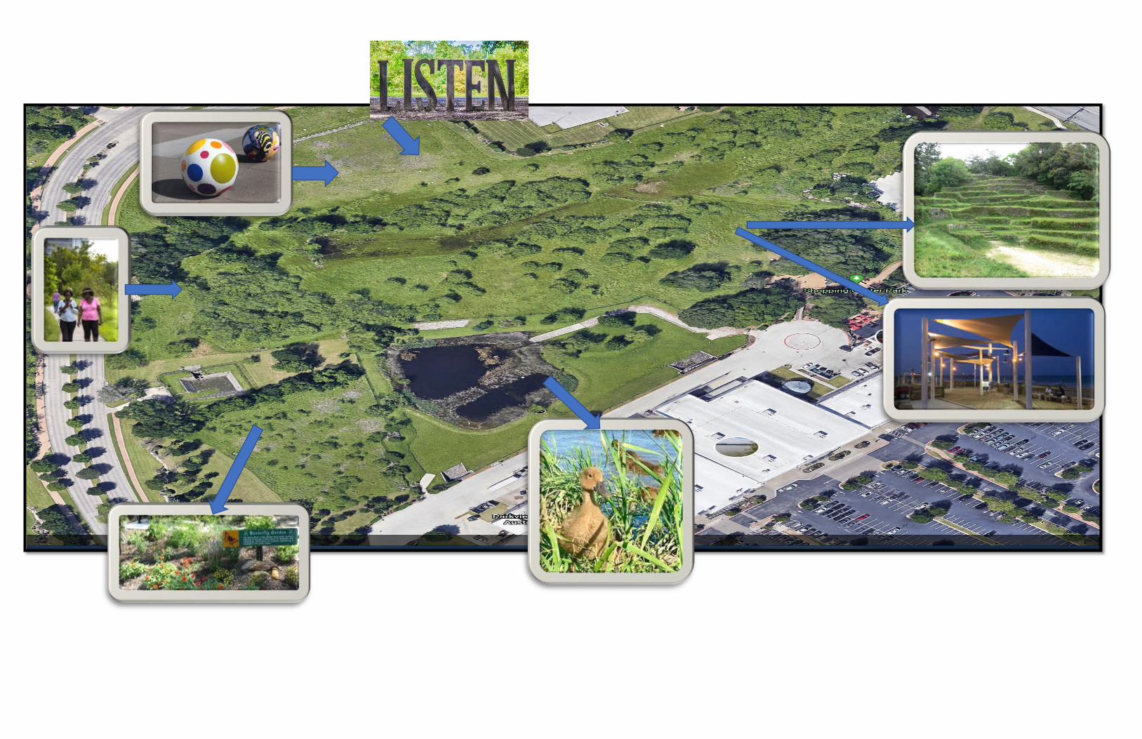
COUNCIL MEETING DATE: SEPTEMBER 1, 2020 CITY COUNCIL AGENDA ITEM #15 STAFF PREPARER/CONTACT INFORMATION: Sylvia Carrillo, City Administrator [email protected] COUNCIL SPONSOR: Council Members Ellett and Reetz SUBJECT: ADMINISTRATION/PLANNING DESCRIPTION: Presentation, Council deliberation and possible action regarding a potential future development plan for the area known as the Homestead. BACKGROUND: The area known as the Homestead was part of an agreement with the Weaver Family. The acres were deeded to the City on February 17, 1998 with conditions. Among the conditions are that the property may only be “used for for non-profit conservation, water quality, flood control and landscaping purposes only, and there shall be no construction permitted on the Property by Grantee, its successors and assigns, except such limited construction as may be required for such conservation, water quality, flood control and landscaping purposes; provided, however, nothing herein shall be deemed to limit the rights of Grantor, its successors and assigns, to utilize the easements expressly reserved herein.” The easements discussed are for drainage. This is a prime area to become a focal point and asset for Sunset Valley. Similar floodway areas such as Buffalo Bayou in Houston and other areas across the country have used floodway areas, typically underutilized and restricted for development to create natural parks and gathering spaces for the public. The Federal Emergency Management Association (FEMA) who regulates floodways, encourages this type of use to prevent further development of sensitive areas. This item would direct staff to explore costs to develop plans similar to the plan presented below. Although the existing pond belongs to the adjacent shopping center, it contains a potential learning zone. The City could approach the center and enter into an agreement to allow this area to be incorporated into the overall plan. The round bollards serve a dual purpose in that they are art as well as pedestrian protection. Also as art is the word “LISTEN”. Buffalo Bayou has several terms throughout such as “listen”, “engage”, and others. It is made of marine grade materials used in boat bumpers and has little maintenance in the event of a flood. That area is also out of the Homestead deed and can have a shade structure or play structure on it to attract visitors who shop in the centers.

Welcome message from author
This document is posted to help you gain knowledge. Please leave a comment to let me know what you think about it! Share it to your friends and learn new things together.
Transcript

COUNCIL MEETING DATE: SEPTEMBER 1, 2020
CITY COUNCIL AGENDA ITEM #15 STAFF PREPARER/CONTACT INFORMATION: Sylvia Carrillo, City Administrator [email protected] COUNCIL SPONSOR: Council Members Ellett and Reetz SUBJECT: ADMINISTRATION/PLANNING
DESCRIPTION: Presentation, Council deliberation and possible action regarding a potential future development plan for the area known as the Homestead.
BACKGROUND: The area known as the Homestead was part of an agreement with the Weaver Family. The acres were deeded to the City on February 17, 1998 with conditions. Among the conditions are that the property may only be “used for
for non-profit conservation, water quality, flood control and landscaping purposes only, and there shall be no construction permitted on the Property by Grantee, its successors and assigns, except such limited construction as may be required for such conservation, water quality, flood control and landscaping purposes; provided, however, nothing herein shall be deemed to limit the rights of Grantor, its successors and assigns, to utilize the easements expressly reserved herein.”
The easements discussed are for drainage. This is a prime area to become a focal point and asset for Sunset Valley. Similar floodway areas such as Buffalo Bayou in Houston and other areas across the country have used floodway areas, typically underutilized and restricted for development to create natural parks and gathering spaces for the public. The Federal Emergency Management Association (FEMA) who regulates floodways, encourages this type of use to prevent further development of sensitive areas. This item would direct staff to explore costs to develop plans similar to the plan presented below. Although the existing pond belongs to the adjacent shopping center, it contains a potential learning zone. The City could approach the center and enter into an agreement to allow this area to be incorporated into the overall plan. The round bollards serve a dual purpose in that they are art as well as pedestrian protection. Also as art is the word “LISTEN”. Buffalo Bayou has several terms throughout such as “listen”, “engage”, and others. It is made of marine grade materials used in boat bumpers and has little maintenance in the event of a flood. That area is also out of the Homestead deed and can have a shade structure or play structure on it to attract visitors who shop in the centers.

Page 2
Lastly, the area would be enhanced with a natural berm around the flood way that could serve as seating for outdoor events in the future.
APPLICABLE CODE SECTIONS: Sunset Valley Financial Services
FUNDING:
CURRENT YEAR FISCAL BUDGET
ACCOUNT BUDGET BUDGETED THIS ITEM REMAINING
01-01-7195 FY 19-20 30,000 30,000 0
STAFF RECOMMENDATION:
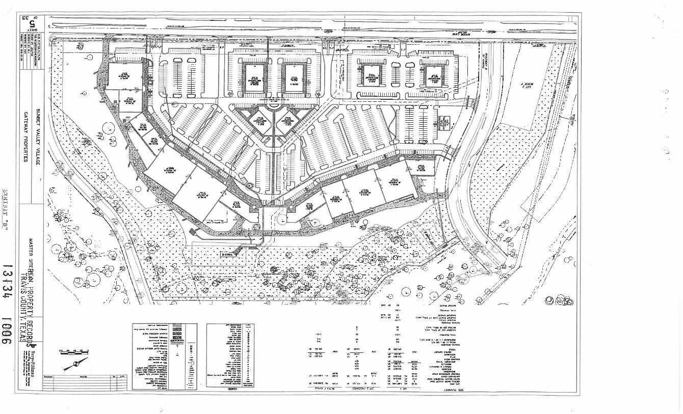
SUPPORTING MATERIALS PROVIDED: YES – HOMESTEAD DEED AND AERIAL PHOTOS


The area known as the Homestead is in a designated floodway (meaning, it WILL flood, not MAY) and an area used for greenspace. However, there are creative uses for floodway areas. FEMA encourages greenspace uses for these areas. In addition, the area is limited by deed restrictions on the property. The deed restrictions on the property state that …” the Property may be used for non-profit conservation, water quality, flood control, and landscaping purposes only, and there shall be no construction permitted on the property by grantee, its successors and assigns, except in such limited construction as may be required for such conservation, water quality, flood control, and landscaping purposes…”
Art
The single word thoughts – Explore, Pause, Reflect, Listen, Emerge, and Observe – are placed at ground level in unexpected areas along the new bayou-side Kinder Footpaths. The four-foot-tall sculptures feature turn-of-the century capital serif type and are crafted from 4” high density polyethylene (high-grade plastic), a material used in marine dock bumpers. The public art project was commissioned by Buffalo Bayou Partnership, through Houston Arts Alliance.
https://buffalobayou.org/monumental-moments-new-public-art-installed/ -
Bollards – Decorative and can be an art project or involve the school, or even educational
Nature
Butterfly garden – natural habitat
Ducks – enhance the pond where this is occurring naturally
Walking/Seating/Cover
Walkways are used – expand wayfinding signs
Natural sitting areas not obstructing the flow of water
Canvas style poles which are easily removed and installed
Solar lighting
Items to Consider 1. Requirements for Development in the Floodway Once a community has adopted a floodway, it must prohibit development in the floodway unless it has been demonstrated through hydrologic and hydraulic analyses performed using standard engineering practice that the development will not result in any increase in flood levels during the base flood. FEMA defines “any” as meaning a zero increase (greater than 0.00 feet). This analysis is usually called a “no-rise” or “zero-rise” analysis and results in a “no-rise” or “zero-rise” certification by a qualified register professional engineer.
44CFR 60.3(d)(3): Prohibit encroachments in the floodway, including fill, new construction, substantial improvements, and other development within the adopted regulatory floodway unless it has been demonstrated through hydrologic and hydraulic analyses performed in accordance with standard engineering practice that the proposed encroachment would not result in any increase in flood levels within the community during occurrence of the base flood discharge.
2. Appropriate uses of floodways There are a number of economic uses that can be conducted in floodways that do not impact flood stages. Where possible these uses should be encouraged. • Agriculture and forestry uses that do not involve buildings or use of fill. • Back yards, lawns, gardens, parking areas and play areas. Often subdivisions can be designed so that there are building sites on each lot that are outside of the floodplain or at least the floodway and that all floodway areas are preserved. • Private or public open space and recreation uses such as golf courses, campgrounds, picnic grounds, boat launching ramps, wildlife and nature reserves, and similar uses. When in public ownership, floodways can provide corridors for trail systems for hiking, jogging, biking, or horse-back riding. Often these uses enhance the value of adjoining properties. • Industrial and commercial uses such as parking lots and loading areas and airport landing strips for light airplanes that do not involve buildings or use of fill. If these uses require fill or construction of buildings, the developer will have to demonstrate that the use will cause no rise in flood stages. Some of these uses such as campgrounds or parking lots may not be suitable for areas subject to flash floods or areas that flood frequently.
https://www.fema.gov/media-library-data/1578062957793-0274cb6a7a3801a07a3db7916e64e80d/FloodwayAnalysis_and_Mapping_Nov_2019.pdf
3. Electrical can be mitigated with Solar or will need to have electrical installed as part of landscaping improvements.
4. Any gathering space will need restrooms. We can’t build a structure there so will need a contract for temporary restrooms during any event.
5. Art can be considered landscaping improvements.
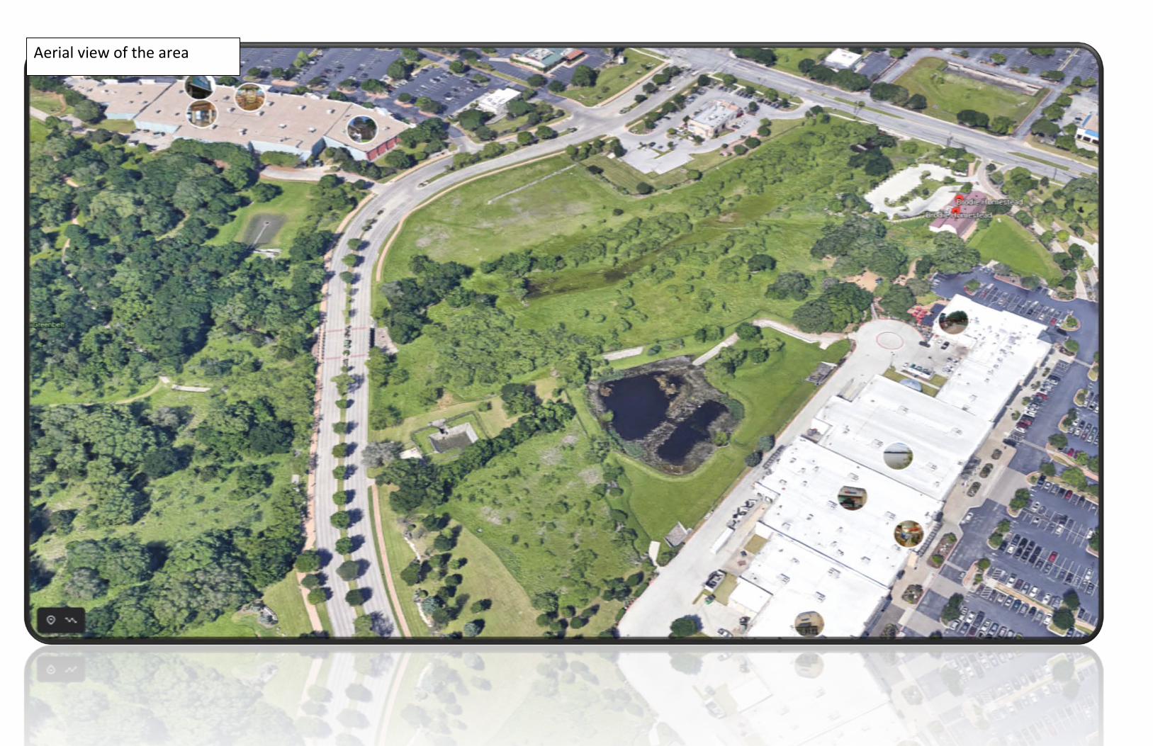
Aerial view of the area
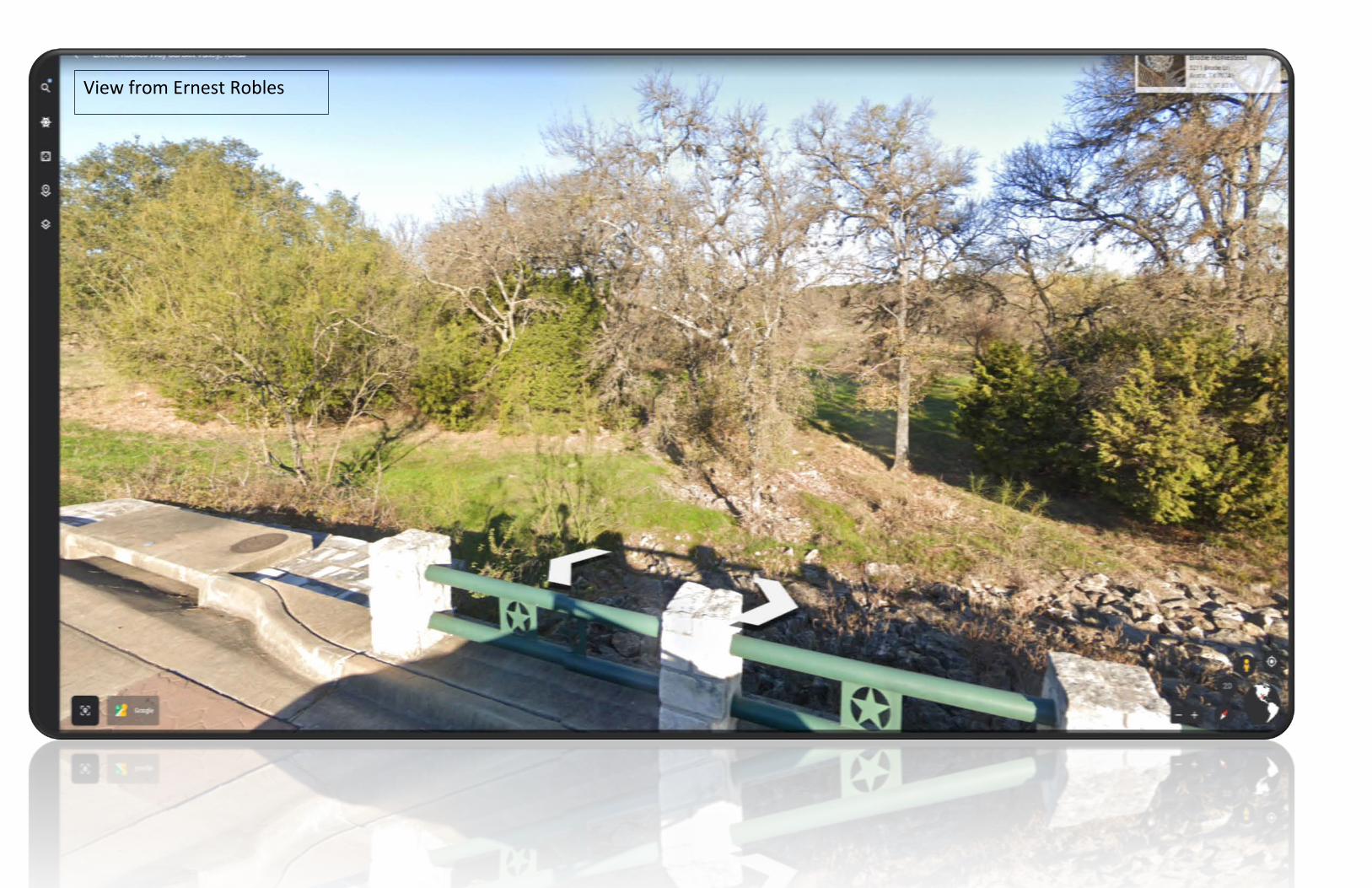
View from Ernest Robles

View from Ernest Robles

View from Ernest Robles
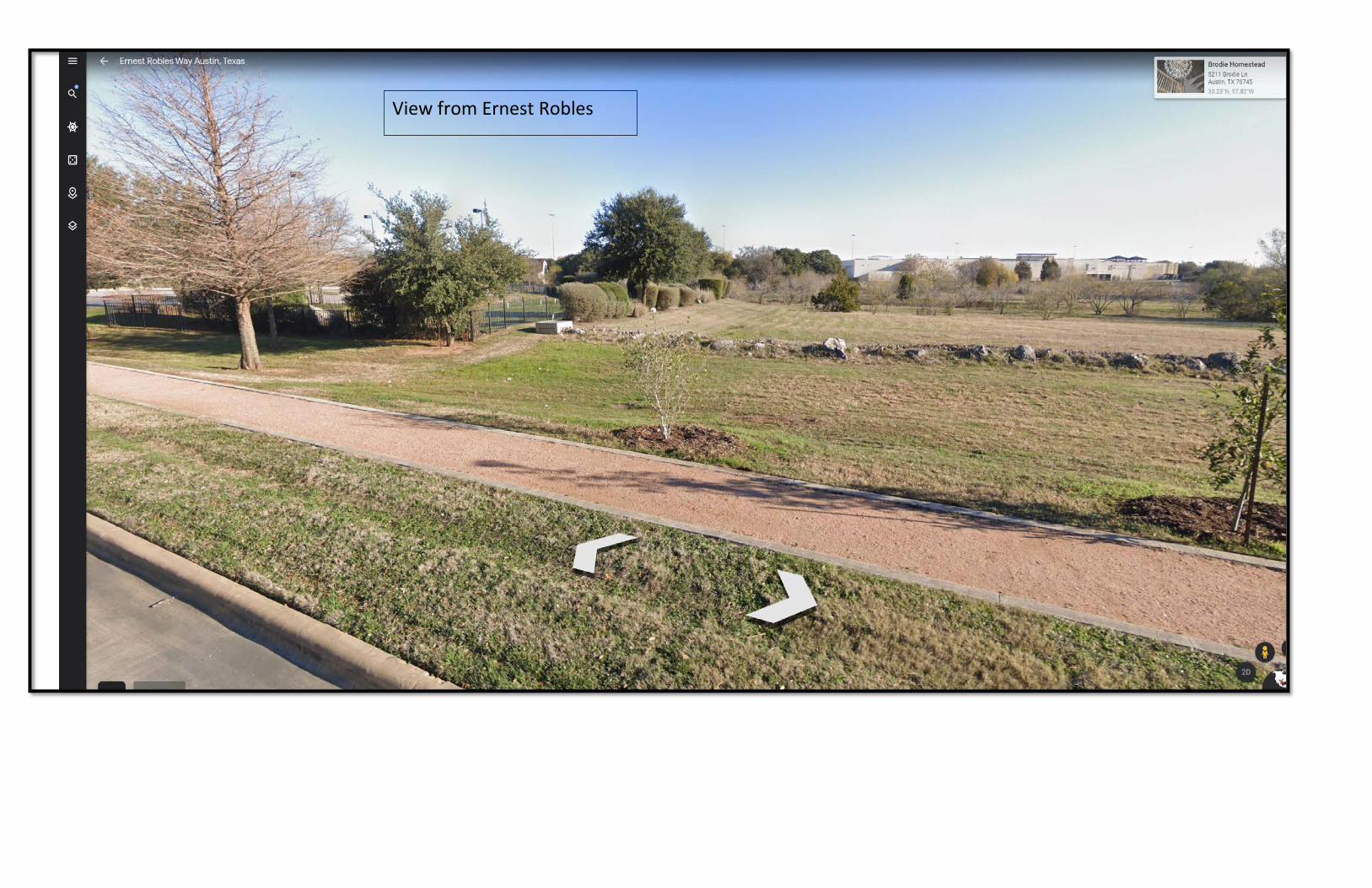
View from Ernest Robles
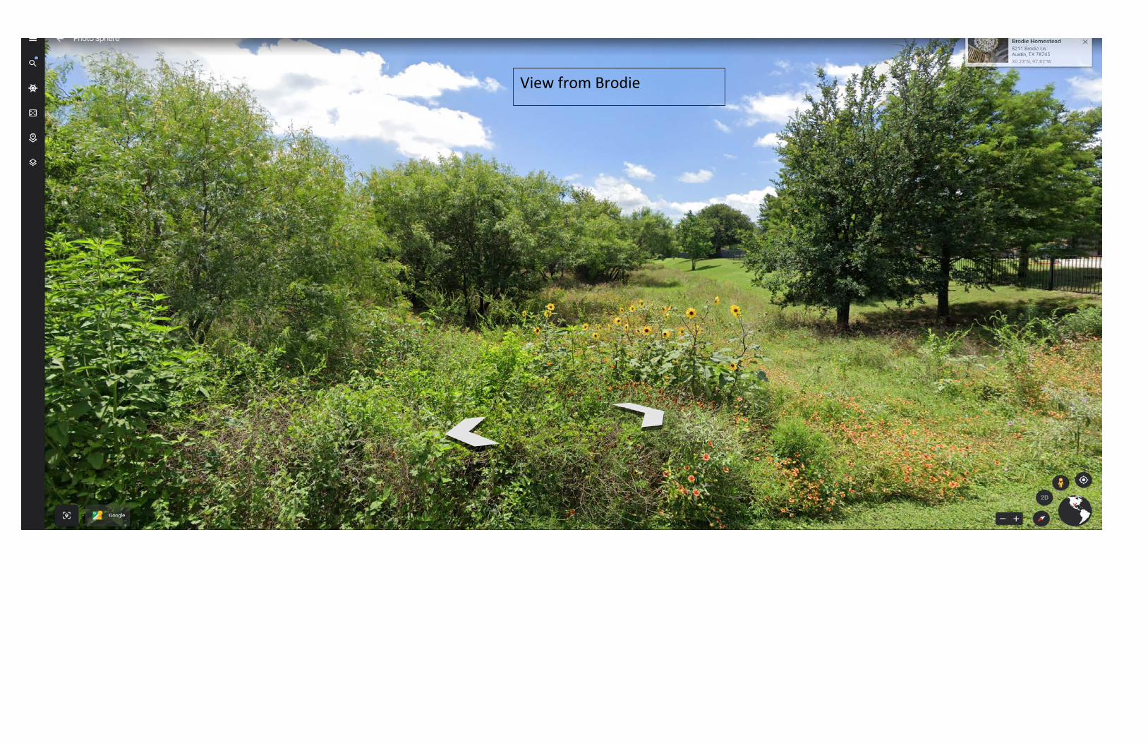
View from Brodie

Length is approx. 1,100 feet
Width is approx, 550 feet
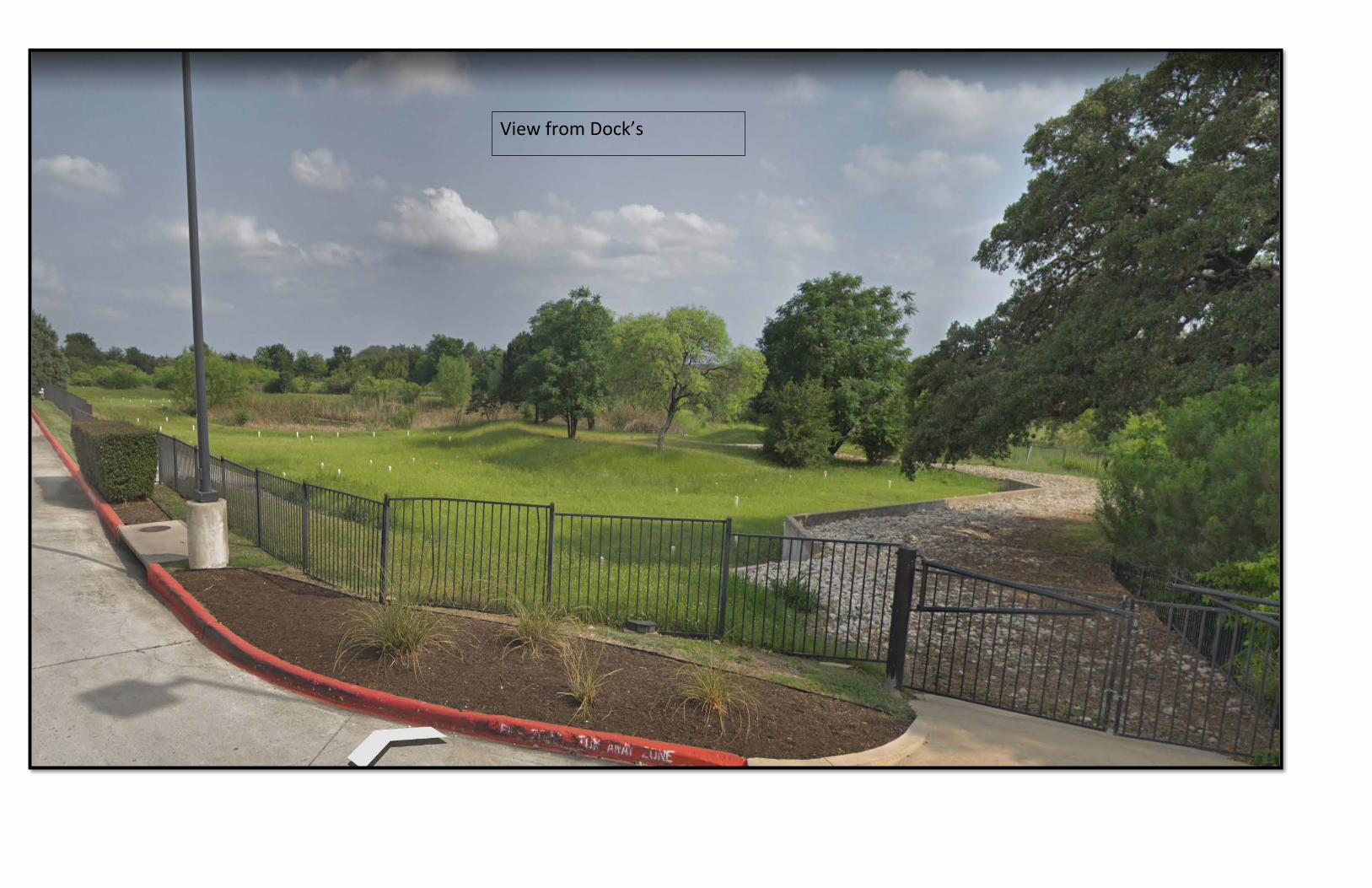
View from Dock’s

View from Shopping Center
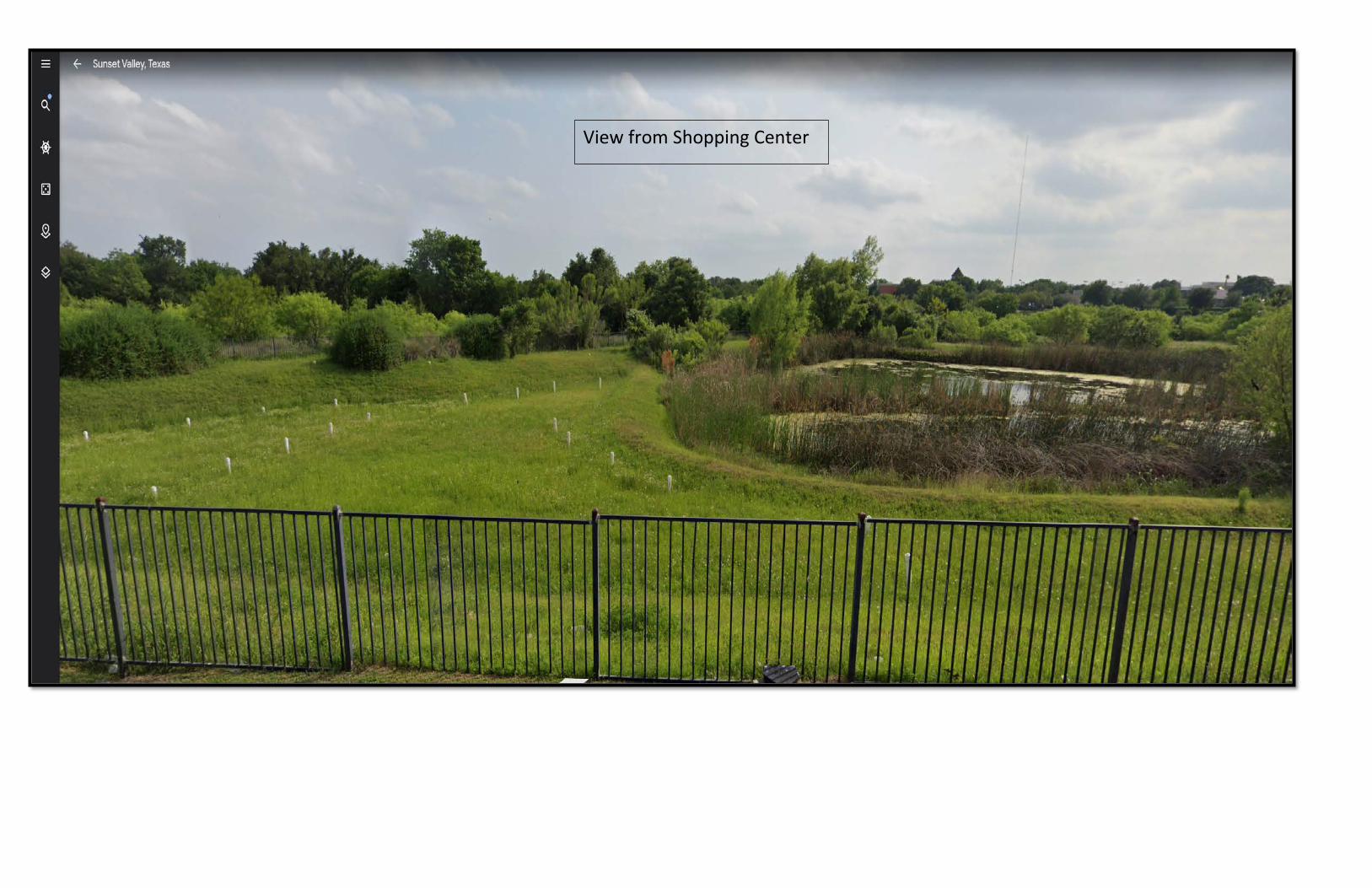
View from Shopping Center

Example of existing landscaping we would use along Ernest Robles
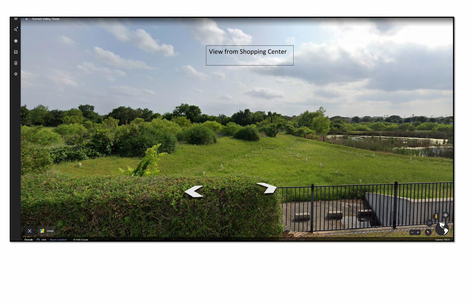
View from Shopping Center

View from Shopping Center
Related Documents