Chapter 5 Interpreting Topographical Maps

Chapter 5 Interpreting Topographical Maps. Topographical Map – shows the physical and human features in an area in the form of symbols.
Dec 21, 2015
Welcome message from author
This document is posted to help you gain knowledge. Please leave a comment to let me know what you think about it! Share it to your friends and learn new things together.
Transcript
Chapter 5
Interpreting Topographical Maps

Interpreting Topographical Maps
Topographical Map – shows the physical and human features in an area in the form of symbols.

Interpreting Topographical Maps
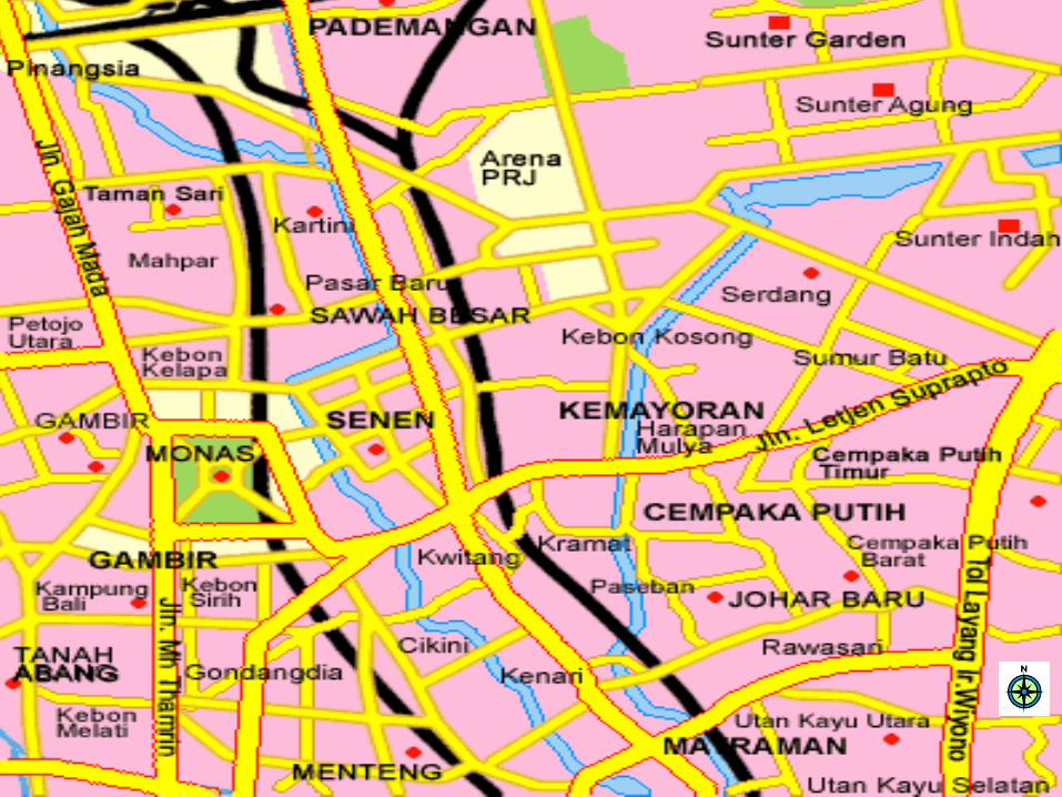
Using Grid References to Describe Locations
northings
eastings

Interpreting Topographical Maps
four-figure grid reference
- to locate the grid square of an area or a large feature on a map
six-figure grid reference
- to find the exact location of a feature on a map
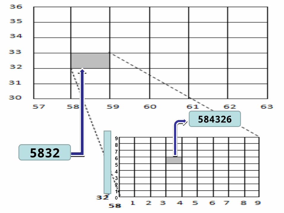
5832
584326

Interpreting Topographical Maps
Finding Directions in a Map
compass point on a map NE
SESW
NW
Interpreting Topographical Maps

Interpreting Topographical Maps
Compass Bearings on a Map
compass point are useful only for finding directions, to be more exact, we should measure the direction in degrees

Interpreting Topographical Maps
Interpreting Topographical Maps
Measuring Distances on a Map
straight-line distance
curved distance

Interpreting Topographical Maps
Interpreting the Physical Environment shown on a Topographical Maps
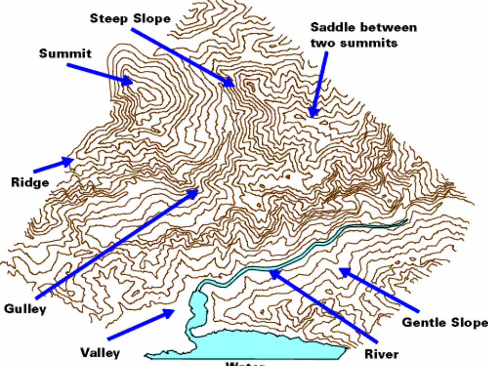
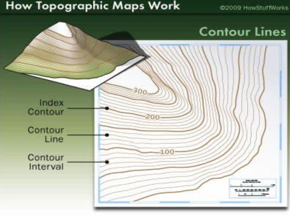
Using contours to represent relief
contours are imaginary lines that joins places of the same height above sea level
close together contours = steep slopesfar apart contours = gentle slopesvery far apart = almost flat land (plain)
Interpreting Topographical Maps
Interpreting Topographical Maps

Interpreting Topographical Maps
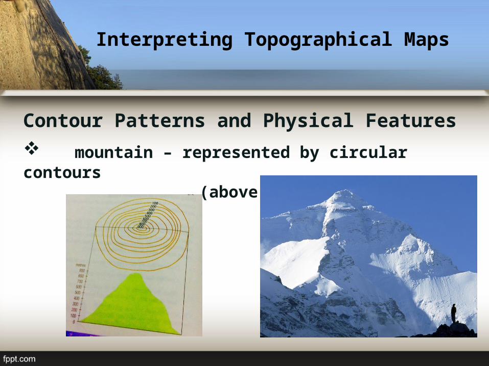
Contour Patterns and Physical Features
hill – represented by circular contours (less than 600 metres)
Interpreting Topographical Maps
Contour Patterns and Physical Features
mountain – represented by circular contours (above 600 metres)
Interpreting Topographical Maps
Contour Patterns and Physical Features
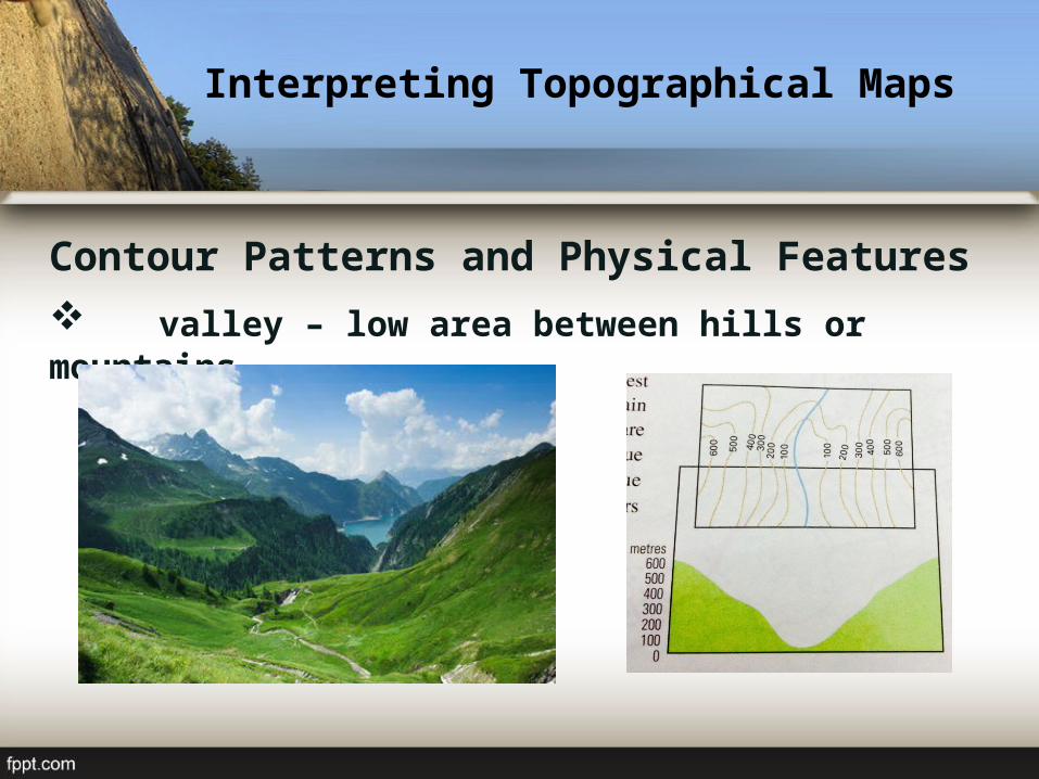
valley – low area between hills or mountains
Interpreting Topographical Maps
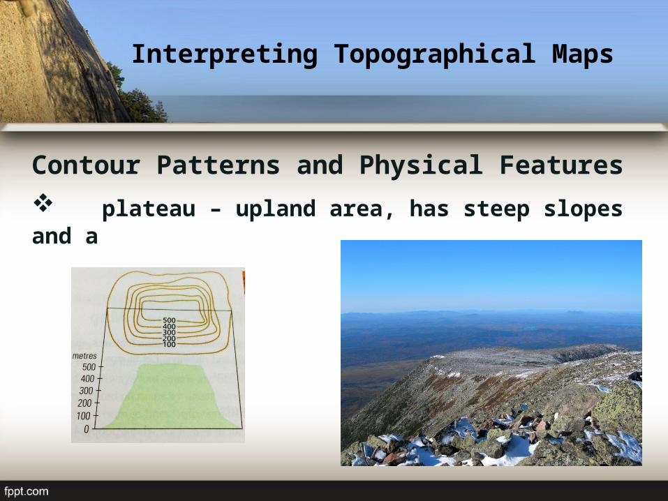
Contour Patterns and Physical Features
plateau – upland area, has steep slopes and a broad, flat top

Interpreting Topographical Maps
Contour Patterns and Physical Features
ridge – upland area that is long, narrow and steep-sided

Interpreting Topographical Maps
Interpreting the Human Environment shown on a Topographical Maps
settlements – place where people live and carry out activities such as farming, buying
and selling of goods
Interpreting Topographical Maps
Interpreting the Human Environment shown on a Topographical Maps
transport lines– refer to routes people use to travelfrom one place to another
Interpreting Topographical Maps
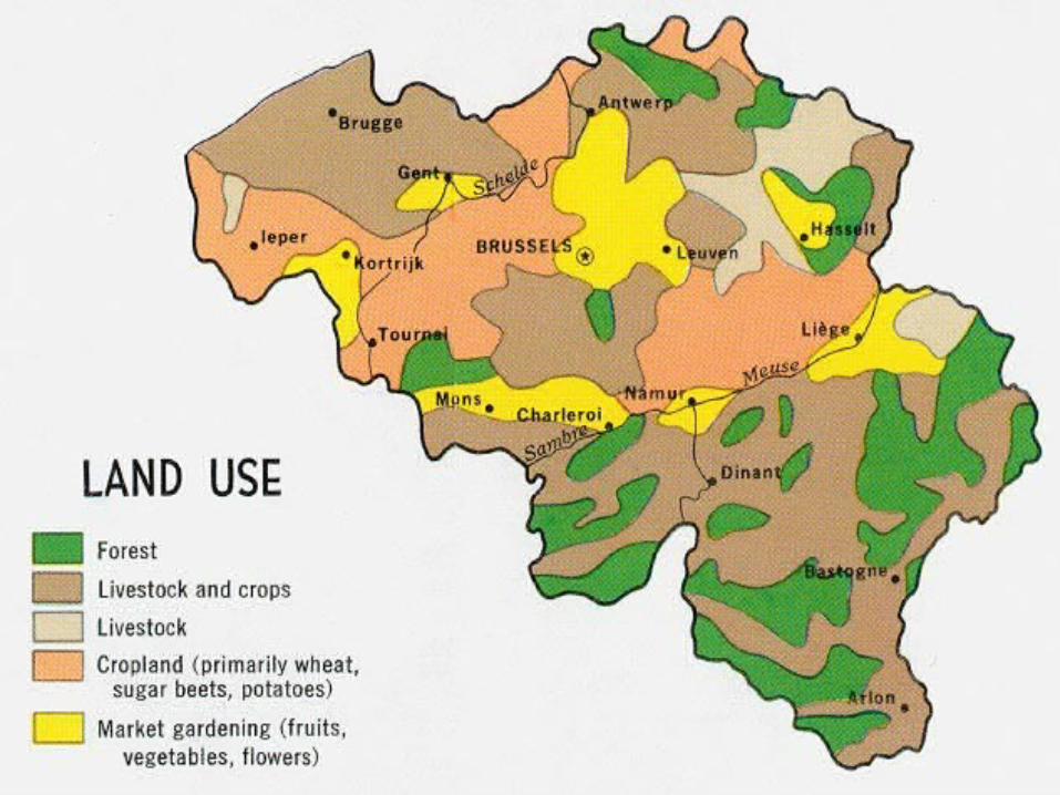
Interpreting the Human Environment shown on a Topographical Maps
land use– refer to how the land is used in an area

Interpreting Topographical Maps

QUIZ
Related Documents