Centre for Geomatics Applications in Rural Development(C-GARD)

Centre for Geomatics Applications in Rural Development(C-GARD)
Dec 24, 2015
Welcome message from author
This document is posted to help you gain knowledge. Please leave a comment to let me know what you think about it! Share it to your friends and learn new things together.
Transcript
Centre for Geomatics Applications in Rural Development(C-GARD)

CGARD:
Established in 2005 as a GIS Centre.
Renamed as a C-GARD in 2009
The Centre is supported by NIRD with softwares and financial grants
CGARD provides GIS services by preparing Map based action plans for Rural programs
ConductedTraining programmes for officials working in Rural projects
Prepared GIS Manuals for Rural applications.
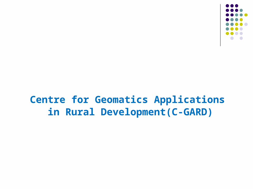
Manpower Resources
1.Sri H.Kurma Rao – Head- CNRM
M.Tech(soil&water Engg)
2.Dr. G. Srinivasa Rao – GIS-Consultant
M.sc, Ph D
3.S. Shanthi Kumar - GIS Analyst
M.sc , M.sc .Tech
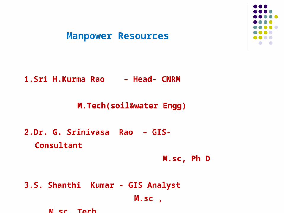
INFRASTRUCTURE
Hardware:IBM Workstations – 3 nosHP Plotter – 1 nosDeskan Scanner – 1 nos
Softwares:ArcGISErdasGRAM ++TrackmakerTerrasyncQuantum GIS
Other:Hand held Trimble Juno GPS – 2 nos
Programs Completed till date in this year 2010
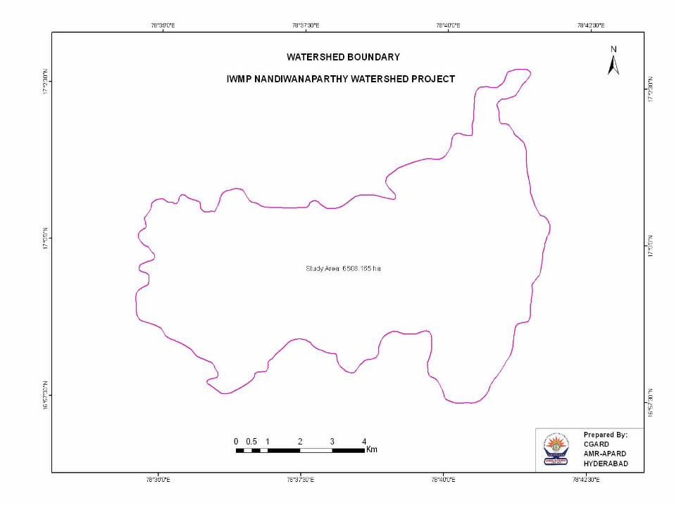
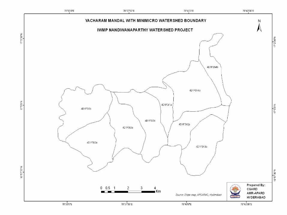
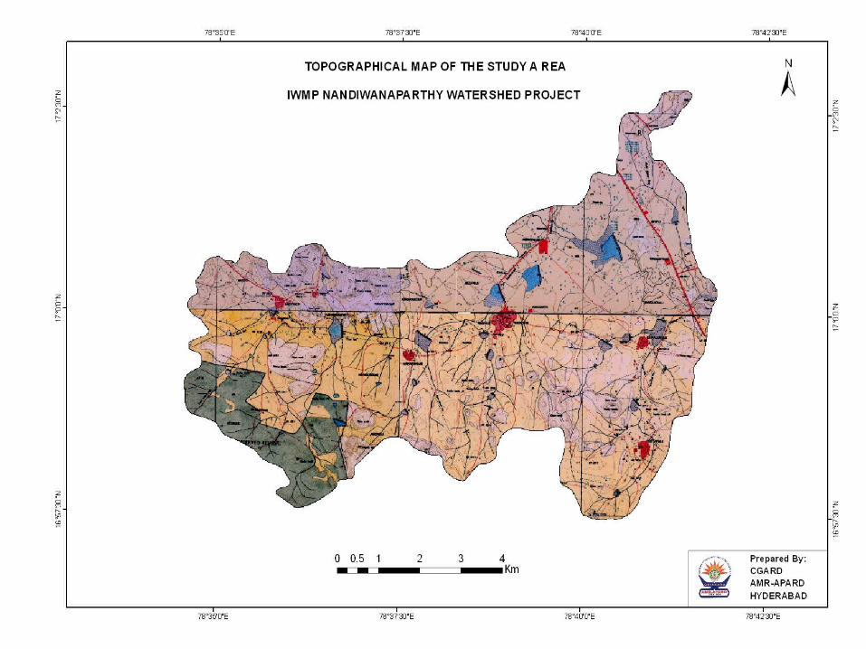
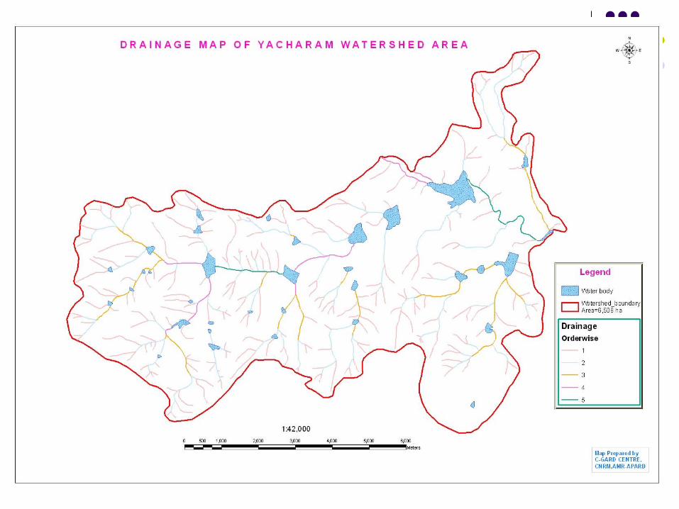
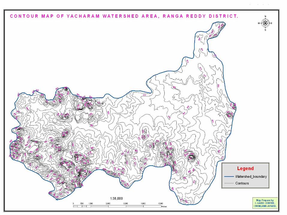
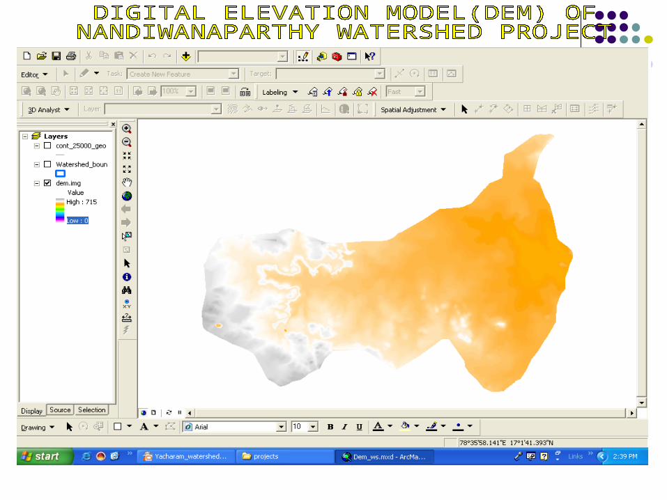
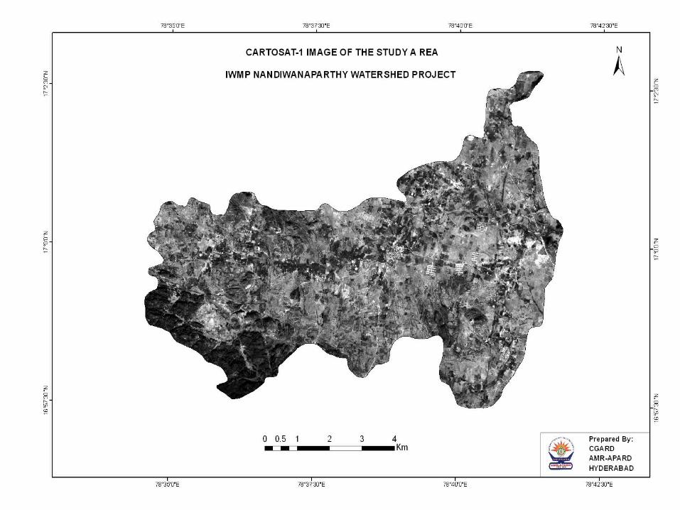
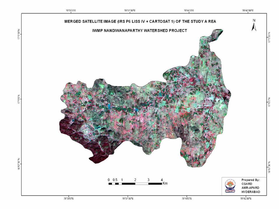
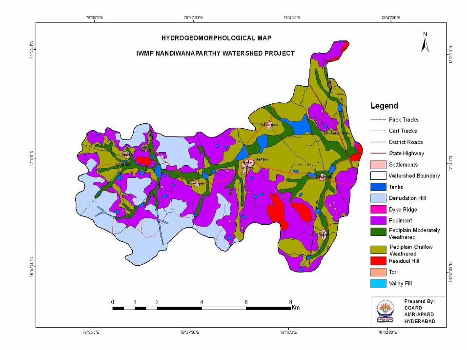
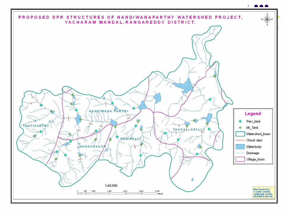
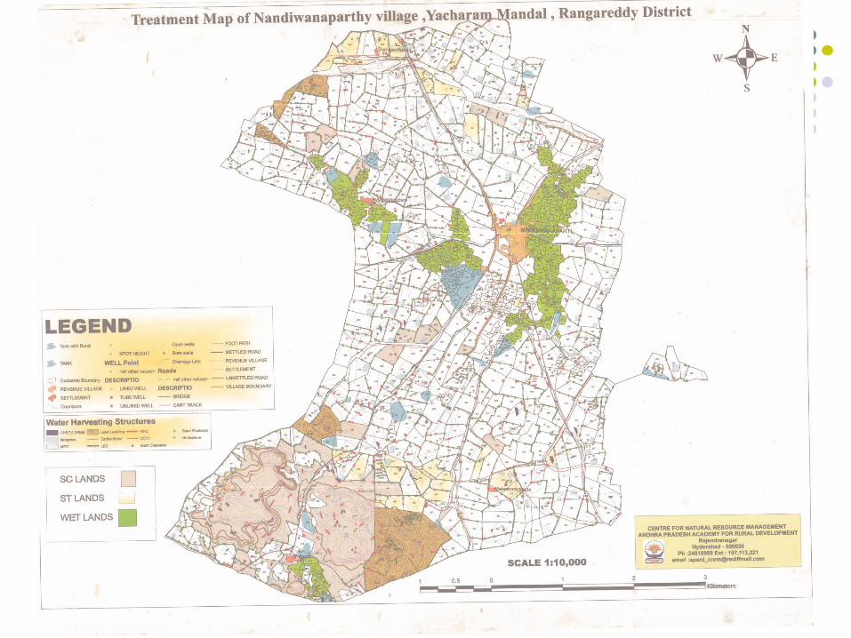
GIS Maps in DPR (Detailed Project Report) were prepared for Nandiwanaparthy Watershed Project of Yacharam Mandal.
Kurnool Disaster Mitigation Map was prepared for DisasterManagement for CMED of APARD.
Cadastral Map and Digital Elevation Maps were prepared for urban Planning Project of APARD campus.
One day Training Programme was conducted on GIS and GPS usage was given to Fields Assistants in
coordination with CRD.
One day Orientation Training on GIS Applications in Rural Development Programs was given to Technical Team
from Orissa ST & SC Development Department, Bhubaneswar, Government of Orissa.
First Phase of DGPS Survey in Madireddypalli Village,Nawabpet Mandal of Rangareddy District Completed .
Provided Training On GIS/RS applications for Disaster management
GIS/RS/GPS Application in Rural Development Certificate Course(CDP&A)

Ongoing programs
Generation of Geo-Database of Mentada Mandal, VizianagaramDistrict for Integrated Mandal Planning (CDP&A)
Second Phase DGPS Survey in Madireddypalli Village, Nawabpet Mandal of Rangareddy District.
3 day Training for Assistant Project Directors of all Districts on the Application of GIS,GPS Technologies in Natural Resources Conservation and Watersheds Planning.
Mapping of 2000 villages for PMES (Wa and teSanitation) t
Publications
Cintributed Chapter4 –Use GIS for DPR Preparation in Watersheds(IWMP)
Prepared Manual for Artificial Ground Water Recharge
Published Article on Remote Sensing Applications in Rural Development in Stanika palana Monthly Magazine-APARD
Article on Utility of Maps in Rural Development in Stanika palana Monthly Magazine-APARD(To be Published)
Article on Application of GIS/GPS in 104 Mobile Healthcare,EMRI in A.P in Stanika palana Monthly Magazine-APARD(To be Published)


THE ENDTHE END

Related Documents