BIOLOGICAL ASSESSMENT CALIFORNIA RESOURCES CORPORATION DECOMMISSIONING OF THE GRUBB LEASE INTAKE/OUTFALL STRUCTURE VENTURA COUNTY, CALIFORNIA Project No. 1802-2271 Prepared for: California Resources Corporation 2575 Vista del Mar, Suite 101 Ventura, California 93001 Prepared by: Padre Associates, Inc. 369 Pacific Street San Luis Obispo, California 93401 JUNE 2019

Welcome message from author
This document is posted to help you gain knowledge. Please leave a comment to let me know what you think about it! Share it to your friends and learn new things together.
Transcript

BIOLOGICAL ASSESSMENT
CALIFORNIA RESOURCES CORPORATION
DECOMMISSIONING OF THE GRUBB LEASE
INTAKE/OUTFALL STRUCTURE
VENTURA COUNTY, CALIFORNIA
Project No. 1802-2271
Prepared for:
California Resources Corporation
2575 Vista del Mar, Suite 101
Ventura, California 93001
Prepared by:
Padre Associates, Inc.
369 Pacific Street
San Luis Obispo, California 93401
JUNE 2019

CRC Grubb Lease Intake/Outfall Structure Decommissioning Project
Biological Assessment
1802-2271
- i -
TABLE OF CONTENTS
1.0 INTRODUCTION ............................................................................................................... 1-1
1.1 SUMMARY OF PROPOSED PROJECT ........................................................................ 1-1
1.2 PROJECT WORK AREAS AND OVERVIEW ................................................................ 1-1
1.2.1 Offshore Intake and Outfall Pipelines ..................................................................... 1-1
1.2.2 Shoreline Vault ........................................................................................................ 1-5
1.2.3 Onshore Facilities ................................................................................................... 1-7
1.3 PROJECT COMPONENTS ............................................................................................ 1-7
1.3.1 Pre-Project Preparation Activities and Surveys ...................................................... 1-8
1.3.2 Pipeline and Vault Removal .................................................................................... 1-9
1.3.3 Ramp Demolition and Armor Rock Reconstruction .............................................. 1-16
1.3.4 Post-Project Survey .............................................................................................. 1-16
1.4 SITE ACCESS AND STAGING .................................................................................... 1-16
1.5 EQUIPMENT/PERSONNEL REQUIREMENTS ........................................................... 1-17
1.6 PROJECT CONSTRUCTION SCHEDULE .................................................................. 1-18
2.0 SPECIES ACCOUNTS AND SSATUS OF SPECIES IN THE ACTION AREA ................ 2-1
2.1 SPECIES ACCOUNTS .................................................................................................. 2-3
2.1.1 California Least Tern (Sternula antillarum) ............................................................. 2-3
2.1.2 Green Turtle (Chelonia mydas) ............................................................................... 2-4
2.1.3 Loggerhead Turtle (Caretta caretta) ....................................................................... 2-4
2.1.4 Leatherback Turtle (Dermochelys coriacea) ........................................................... 2-5
2.1.5 Olive Ridley Turtle (Lepidochelys olivacea) ............................................................ 2-6
2.1.6 Blue Whale (Balaenoptera musculus) ..................................................................... 2-7
2.1.7 Fin Whale (Balaenoptera physalus) ........................................................................ 2-7
2.1.8 Humpback Whale (Megaptera novaeangliae) ......................................................... 2-8
3.0 IMPACT ASSESSMENT ................................................................................................... 3-1
3.1 ONSHORE SEGMENT GROUND DISTURBANCE ....................................................... 3-1
3.2 WATER QUALITY .......................................................................................................... 3-1
3.3 DISTURBANCE TO SEAFLOOR HABITATS ................................................................ 3-2
3.4 VESSEL COLLISION ..................................................................................................... 3-3
3.5 OIL SPILL POTENTIAL .................................................................................................. 3-3
3.5.1 Turtles ..................................................................................................................... 3-4
3.5.2 Marine Birds ............................................................................................................ 3-4
3.5.3 Marine Mammals .................................................................................................... 3-4
4.0 PROJECT INCORPORATED MEASURES ...................................................................... 4-1
4.1 PRE-ACTIVITY ENVIRONMENTAL ORIENTATION ..................................................... 4-1
4.2 MONITORING ................................................................................................................ 4-1
4.2.1 Marine Wildlife Contingency Plan ........................................................................... 4-1
4.3 MEASURES TO REDUCE POTENTIAL IMPACTS TO HARDBOTTOM HABITAT ...... 4-3
4.4 MEASURES TO REDUCE POTENTIAL VESSEL COLLISION IMPACTS ON MARINE
WILDLIFE ....................................................................................................................... 4-3

CRC Grubb Lease Intake/Outfall Structure Decommissioning Project
Biological Assessment
1802-2271
- ii -
4.5 MEASURES TO REDUCE POTENTIAL OIL SPILL IMPACTS ..................................... 4-5
5.0 CUMULATIVE EFFECTS ................................................................................................. 5-1
5.1 COMPLETED PROJECTS ............................................................................................. 5-1
5.2 PROPOSED PROEJCTS ............................................................................................... 5-1
6.0 CONCLUSION AND DETERMINATION .......................................................................... 6-0
7.0 REFERENCES .................................................................................................................. 7-1
LIST OF FIGURES
Figure 1-1. Proposed Waste Outfall and Sea Water Intake Installations .................................. 1-3
Figure 1-2. Photograph of Severed Pipelines ........................................................................... 1-4
Figure 1-3. Onshore Project Components (South Elevation) .................................................... 1-6
Figure 1-4. Steel Sheet Piling Foundation at Concrete Vault ................................................... 1-6
Figure 1-5. Project Facilities ................................................................................................... 1-10
Figure 1-6. Pipeline Recovery Illustration ............................................................................... 1-12
Figure 1-7. Armor Rock Removal ........................................................................................... 1-14
Figure 1-8. Vault Removal ...................................................................................................... 1-15
LIST OF TABLESTable 1-1. Project Equipment List .............................................................. 1-17
Table 1-2. Personnel Requirements ....................................................................................... 1-18
Table 1-3. Project Construction Duration ................................................................................ 1-19
Table 2-1. Federally Listed Species Within the Project Area and Their Likelihood of Occurrence
within the Project Area ................................................................................................... 2-1
Table 6-1. Potential Effects Matrix for Protected Species ......................................................... 6-0
APPENDICES
Appendix A. Oil Spill Response Plan
Appendix B. Anchoring Plot
Appendix C. U.S. Fish and Wildlife Service Species List

CRC Grubb Lease Intake/Outfall Structure Decommissioning Project
Biological Assessment
1802-2271
- iii -
LIST OF ACRONYMS
AT&T AT&T Corporation
BA Biological Assessment
cm centimeter
CRC California Resource Corporation
CSLC California State Lands Commission
DPS Distinct population segment
EFH Essential fish habitat
ESCA Endangered Species Conservation Act
FE Federally endangered
FESA Federal Endangered Species Act
ft feet/foot
FT Federally threatened
in inch
kg kilogram
km kilometer
lbs pounds
m meter
mi miles
MMPA Marine Mammal Protection Act
MWCP Marine Wildlife Contingency Plan
NEPA National Environmental Policy Act
NMFS National Marine Fisheries Service
NOAA National Oceanic and Atmospheric Administration
PCH Pacific Coast Highway
sq. km. square kilometers
PSO Protected Species Observer
PSWP Project Work and Safety Plan
U.S. United States
USCG United States Coast Guard
UPRR Union Pacific Railroad
USFWS United States Fish and Wildlife Service

CRC Grubb Lease Intake/Outfall Structure Decommissioning Project
Biological Assessment
1802-2271
- 1-1 -
1.0 INTRODUCTION
The following Biological Assessment (BA) is for the proposed California Resources
Corporation (CRC) Decommissioning of the Grubb Lease (PRC 3913.1) Intake/Outfall Structure
Project (Project). The BA has been prepared to evaluate the potential affect that the proposed
action may have on Federally threatened, endangered or proposed species described in this
document. This BA is prepared in accordance with legal requirements set forth under Section 7
of the Federal Endangered Species Act (FESA, 16 U.S.C. 1536[c]), and follows the standard
established by the National Environmental Policy Act (NEPA) and FESA guidance. In addition,
the BA is prepared in accordance with the United States (U.S.) Marine Mammal Protection Act
(MMPA) of 1972, amended in 1994, which protects all marine mammals by prohibiting intentional
killing or harassment of cetaceans, pinnipeds, and sirenians. The species considered in this
document were based on information obtained from National Marine Fisheries Service (NMFS)
and the U.S. Fish and Wildlife Service (USFWS) protected species list for the Project area.
1.1 SUMMARY OF PROPOSED PROJECT
CRC is proposing to decommission Project-related facilities located within Lease PRC
3913.1 in accordance with California State Lands Commission (CSLC) lease requirements prior
to the lease expiration in January 2020. The lease agreement requires that CRC plan for
replacement and rehabilitation of the pipelines or plan for full removal of the pipelines. The Project
objective is the removal of the pipelines and appurtenant facilities to fulfill the existing lease
requirements and quit claim the lease.
1.2 PROJECT WORK AREAS AND OVERVIEW
1.2.1 Offshore Intake and Outfall Pipelines
The offshore portion of the facility consists of three 12-inch (in) (30.5 centimeter [cm])-
diameter steel submarine pipelines consisting of two intake pipelines and one outfall pipeline.
The two intake pipelines measure approximately 680 and 630 feet (ft) (207 and 192 meters [m])
in length, and the outfall pipeline measures approximately 500 ft (152 m) in length. The original
materials specification and wall thickness of these pipelines is unknown. The pipelines appear to
be coated with an anti-corrosive coating or weight coating of unknown composition, but most likely
somastic. The external coatings will be sampled prior to removal and tested for the presence of
any hazardous materials.
All three pipelines run southwest, spaced at approximately ten-degree increments from
the vault structure on the beach (Figure 1-1 – Proposed Waste Outfall and Sea Water Intake
Installations). Each of the two intake pipelines has an approximately 6-ft by 6-ft (1.8-m by 1.8-m)
reinforced concrete lattice box structure at the offshore end, which are presumably intake
structures that provided some level of filtering or exclusion when in operation.
All three pipelines are fully severed, as a result of corrosion, just south of the southern
side (seaward side) of the vault in the surf zone area (Figure 1-2 – Photograph of Severed
Pipelines). At the severance points all three pipelines appear to have double walls of internal
steel or plastic pipe with a mastic filler between the walls.

CRC Grubb Lease Intake/Outfall Structure Decommissioning Project
Biological Assessment
1802-2271
- 1-2 -
Offshore, the pipelines appear to be intact and buried through the surf zone. The length
and depth of cover appears to vary with the season and associated annual sand migration. This
approximately 200-ft (61-m) long surf zone segment has not been surveyed due to the difficulties
of working in the surf zone. Further offshore, the remaining 300 to 500 ft (91 to 152 m) of pipe
are exposed and laying on a bedrock and sand seafloor.

CRC Grubb Lease Intake/Outfall Structure Decommissioning Project
Biological Assessment
1802-2271
- 1-3 -
Figure 1-1. Proposed Waste Outfall and Sea Water Intake Installations

CRC Grubb Lease Intake/Outfall Structure Decommissioning Project
Biological Assessment
1802-2271
- 1-4 -
Figure 1-2. Photograph of Severed Pipelines

CRC Grubb Lease Intake/Outfall Structure Decommissioning Project
Biological Assessment
1802-2271
- 1-5 -
1.2.2 Shoreline Vault
The shoreline vault is a reinforced concrete and steel sheet pile structure set in the armor
rock seawall between Pacific Coast Highway and the intertidal zone. The vault measures
approximately 20 ft wide by 14 ft wide and 27 ft in height (6.0 m by 4.2 m by 8.2 m). The two
intake pipelines and one outfall pipeline were originally connected to the seaward side of this
vault. The vault is located within the intertidal zone and its seaward side is inaccessible during
periods of high tide (Figure 1-3 – Onshore Project Components).
Three pipelines within a 36-in (91-cm)-diameter casing exit the vault on the north side
(landward side). The vault interior is partially filled with water and still contains water pumps,
piping, two levels of grating and other ancillary equipment, much of it submerged. The interior
water level does not change with the tides and so appears to be isolated from the ocean. Due to
the flooded condition, the vault interior has only been partially surveyed.
The vault is approximately 27 ft (8.2 m) deep and terminates approximately 12 ft (3.7 m)
below the surrounding sand beach level. Large pumps and equipment appear to be fastened to
the floor of the vault and the floor is assumed to be concrete. The interior vault walls and ceiling
are concrete, and the exterior walls are sheathed with steel sheet pile (Figure 1-4 – Steel Sheet
Piling Foundation at Concrete Vault). The vault backs up to Pacific Coast Highway on the north
side and is surrounded by armor rock on the other three sides.
The top of the fenced vault enclosure is approximately 20 ft (6.1 m) wide by 42 ft (21.8 m)
long and includes three approximately 3-ft by 3-ft pump caisson openings on the southern end
and an access hatch with ladder on the southwest side. The area just north of the vault, between
the concrete vault structure and Pacific Coast Highway, is assumed to be compacted soil covered
with an asphalt layer and then a thin layer of dirt. The entire 20-ft by 42-ft (6.1-m by 12.8-m) vault
enclosure is surrounded by chain link fencing with access through a locked gate on the north side.

CRC Grubb Lease Intake/Outfall Structure Decommissioning Project
Biological Assessment
1802-2271
- 1-6 -
Figure 1-3. Onshore Project Components (South Elevation)
Figure 1-4. Steel Sheet Piling Foundation at Concrete Vault

CRC Grubb Lease Intake/Outfall Structure Decommissioning Project
Biological Assessment
1802-2271
- 1-7 -
1.2.3 Onshore Facilities
The onshore facilities consist of underground pipeline and support structure that span
between the northern side of the vault (landward) and the valve pit located in the CRC onshore
facilities north of the Ventura Freeway – U.S. Highway 101. Exiting the interior wall on the north
side of the vault is a 36-in (91.4 cm)-diameter steel casing containing one 14-in (35.6-cm)-
diameter steel pipeline, one 12-in (30.5-cm)-diameter steel pipeline and one eight-inch (20.3-cm)-
diameter polyvinyl chloride pipe (PVC pipe) liner inside of a second 12-in (30.5-cm)-diameter steel
pipeline. The annulus between the pipelines within the 36-in (91.4-cm) steel casing are filled with
a grout material where they enter the side of the vault. The extent of this grout fill is unknown and
will have to be field verified during decommissioning.
Based on pipeline tracking data, the 36-inch-diameter casing appears to run underground
approximately 220 ft (67.1 m) to the northeast and terminate approximately 80 ft (24.4 m) north
of the Union Pacific Railroad (UPRR) easement. Pipe tracking data suggests that at least one
pipeline exits the 36-in (91.4 cm)-diameter casing and extends underground via the “A” Lease
Canyon Road, underneath the Ventura Freeway – U.S. Highway 101 overpass a distance of
approximately 310 ft (94.5 m), and terminates in a valve box on CRC onshore property. Depth of
burial to the top of the 36-in (91.4 cm)-diameter casing varies from approximately nine ft (2.7 m)
at the southern side of Pacific Coast Highway to over 11 ft (3.4 m) while running under the UPRR
easement and Ventura Freeway (U.S Highway 101) dirt frontage road.
1.3 PROJECT COMPONENTS
The Project would require the following primary components:
• Pre-Project Preparation Activities and Surveys
o Construction of a temporary equipment access ramp
• Removal of the Intake/Outfall facilities within PRC 3913.1 including:
o Recovery of the 6-ft by 6-ft by 6-ft concrete lattice box structures at the offshore
end of each of the intake pipelines;
o Recover of the two, 12-in-diameter steel intake pipelines (approximately 680
and 630 ft [207.3 m and 192.0 m] in length);
o Recovery of the 12-in-diameter steel outfall pipeline (approximately 500 ft
[152.4 m] in length); and
o Demolition and removal of existing 20-ft tall, 20-ft by 40-ft (6.1 m by 6.1 m by
12.2 m) concrete vault and surrounding structure.
• Abandon-in-place the 36-in (91.4-cm)-diameter casing (and internal pipelines) on the
onshore side of the beach vault, including:
o Fill the casing between the onshore side of the beach vault and valve box on
CRC’s lower Grubb lease property with slurry.
• Ramp demolition and reconstruction of the armor rock seawall at the gap created by
removal of the concrete vault
CRC Grubb Lease Intake/Outfall Structure Decommissioning Project
Biological Assessment
1802-2271
- 1-8 -
• Demobilization of equipment and disposal/recycling of recovered pipelines and
appurtenant facility components (fencing, foundation piling, concrete)
• Post-Project survey to confirm removal of pipelines and any associated seafloor
anomalies identified in the Pre-Project survey.
1.3.1 Pre-Project Preparation Activities and Surveys
1.3.1.1 Plans and Survey(s)
Once all regulatory permits are received, but prior commencement of Project activities,
the following technical plans and surveys will be completed:
a. A Project Work and Safety Plan (PSWP) that provides the following will be submitted to
all pertinent agencies for review and approval prior to the start of site work:
• Project-specific Emergency Action Plans
• Project Contacts
• Final scope of work and final dispositions
• Updated Project Schedule
• Step-by-step procedures with supporting engineering calculations
• Quality Management Plan
• Project Management and Communications Plan
• Site Safety Plan
• Certified Asbestos Work Plan (if asbestos is found)
• Diving Safety Plan
• Critical Operations and Curtailments Plan
• Survey Plan
• Confined Space Entry Plan
• Hot Work Plan
• Oil Spill Response Plan
• Marine Safety and Anchoring Plan with anchoring pre-plot
• Excavation Plan
• Certified Traffic Management Plan
• Hazardous Materials Management Plan (if hazardous materials are found)
• Other plans and information required to perform the work safely and in compliance
with all regulatory permits and permissions, Cal OSHA safety regulations, U.S. Coast
Guard (USGC) safety regulations, and owner’s safety requirements, as applicable.

CRC Grubb Lease Intake/Outfall Structure Decommissioning Project
Biological Assessment
1802-2271
- 1-9 -
b. Produce a pre-project multi-beam seafloor survey, with 400 percent coverage, of the
offshore area around the pipelines, including the proposed anchor spreads. This will serve
as the baseline seafloor debris survey that will be compared against a post-
decommissioning seafloor debris survey of the same area to ensure that no debris has
been left underwater on the seafloor.
c. Conduct a pre-project topographic survey of the armor rock seawall on each side of the
vault to determine the pre-construction contours and conditions of the seawall. This will
serve as the baseline for reconstructing the seawall after removal of the vault and the
construction access ramp and restoration of the site to existing contours.
d. Conduct an 811 utility location (DigAlert) survey from the northern edge to the valve pit on
the CRC property to ensure that all utilities are identified and located on the survey maps.
1.3.1.2 Ramp Construction
A temporary equipment access ramp will be constructed across the existing armor rock
seawall approximately 50 ft (15.2 m) south of the concrete vault to provide equipment access to
the Project site. An excavator will remove and relocate the existing armor rock as needed to
create the foundation for the equipment access ramp. All rock removed will be stored for
replacement upon completion of construction activities. An excavator and loader will place
smaller rock and cobble on top of the existing armor rock seawall to create a ramp of sufficient
density and strength to allow tracked construction equipment to travel across it to the beach. The
equipment access ramp will be approximately 30 ft (9.1 m) wide and 60 ft (18.3 m) long.
1.3.2 Pipeline and Vault Removal
1.3.2.1 Offshore Facilities Decommissioning
The proposed final disposition of the offshore facilities is to remove the two reinforced
concrete lattice intake structures and all three 12-in (30.5-cm)-diameter submarine pipelines in
their entirety.
Prior to the start of offshore and onshore decommissioning activities, the work area will be
staged in accordance with the pre-approved Traffic Control Plan. This will include setting up
equipment and materials staging areas along the southern shoulder of Pacific Coast Highway;
most likely the closure of the eastbound bicycle and vehicle lane of Pacific Coast Highway; and
the temporary rerouting of both eastbound and westbound traffic into the existing center divider
and westbound lanes of Pacific Coast Highway. While occasional traffic stops on Pacific Coast
Highway may be needed during equipment ingress and egress, no long-term full closure of Pacific
Coast Highway is anticipated (Figure 1-5 – Project Facilities).

CRC Grubb Lease Intake/Outfall Structure Decommissioning Project
Biological Assessment
1802-2271
- 1-10 -
Figure 1-5. Project Facilities

CRC – Decommissioning of Grubb Lease Intake/Outfall Structure Biological Assessment 1802-2271
- 1-11 -
Offshore work will be initiated by the anchoring of the dive support vessel over the terminus
of the intake and outfall structures (Appendix B – Anchoring Plot). Divers will be deployed to cut
and remove the diffusers from each pipeline. Once cut, the diffuser structures will be winched to
the surface and recovered onboard the vessel. The proposed primary submarine pipeline
removal methodology consists of mounting a winch on top of the existing reinforced concrete
shoreline vault and pulling the submarine pipeline segments to shore along their existing
alignments. The onshore ends of each pipeline will be exposed by an excavator operating on the
beach. The ends of each pipeline will be cut and prepared for attachment of a pull wire or bridle.
Tension will be slowly increased on the pipeline pulling wire until the pipeline breaks free of the
surf zone sand cover. The pipelines will be pulled along their existing alignments up onto the
beach where they will be cut into truckable sections. Once cut, the segments will be lifted from
the beach, placed on a flatbed truck and trucked to an approved offsite recycler or disposal facility
(Figure 1-6 – Pipeline Recovery Illustration). This use of the vault and associated recovery of the
offshore pipelines to shore will be performed prior to decommissioning the shoreline vault and
armor rock.
Alternatively, should the onshore pipe recovery operation be unable to recover all the
submarine pipeline segments to shore, the anchored offshore marine work spread consisting of
a dive support vessel and divers will be used to recover the remaining submarine pipeline
segments.

CRC – Decommissioning of Grubb Lease Intake/Outfall Structure Biological Assessment 1802-2271
- 1-12 -
Figure 1-6. Pipeline Recovery Illustration

CRC – Decommissioning of Grubb Lease Intake/Outfall Structure Biological Assessment 1802-2271
- 1-13 -
1.3.2.2 Shoreline Vault Decommissioning
The proposed final disposition of the shoreline vault is to remove all equipment and
appurtenances from inside the vault and then remove the entire vault structure down to 5 ft (1.5
m) below the existing beach contours and abandon the remaining 7 ft in place.
The decommissioning of the vault will begin once the submarine pipelines have been
removed. To facilitate removal of the vault, all armor rock currently surrounding the vault will be
removed to expose the vault walls down to the beach elevation. (Figure 1-7 – Armor Rock
Removal). Most of the removed armor rock will be used to construct the equipment access ramp
between the Pacific Coast Highway southern shoulder and the beach. The remaining armor rock
will be stored next to the existing armor rock to the east and west of the vault.
The water in the vault will be re-sampled, pumped out, and shipped offsite for appropriate
disposal. The reinforced concrete vault ceiling will be saw cut and removed and all equipment,
appurtenances and debris inside the vault removed and disposed of or recycled at approved
facilities.
Once the water, equipment, appurtenances and debris has been removed from the interior
of the vault, the vault walls will be cut into removable sections with the use of a hydraulically
powered rotary demolition saw (cuts both concrete and steel) attached to an excavator boom
(Figure 1-8 – Vault Removal). In use, the excavator will reach inside the interior and make a
horizontal cut around the base of the walls at an elevation at least five feet below the existing
beach contours, or at a lower elevation if conditions permit. After the base cut has been
completed, the saw will be used to cut the walls into vertical sections for removal. An excavator
will be used to grasp the cut wall pieces and place them in trucks for offsite disposal or recycling
at approved facilities.
The 36-in (91.4-cm)-diameter casing that connects into the shoreward side of the vault,
and pipes contained in that casing, will be excavated and cut back approximately even with the
existing earth slope of the armor rock seawalls that exist on either side of the vault. The casing
and pipes contained in the casing will have been decommissioned in accordance with the
description in Section 1.3.2.3 – Onshore Facility Decommissioning below.
Immediately after the vault decommissioning has been completed, a seawall will be
constructed in the gap left by the removal of the vault to match the armor rock materials, slope
and grade of the existing seawall on either side of the gap. The armor rock that was removed
from around the vault at the beginning of the vault decommissioning will be used to construct this
section of seawall. Remaining rock will be trucked away for disposal.

CRC – Decommissioning of Grubb Lease Intake/Outfall Structure Biological Assessment 1802-2271
- 1-14 -
Figure 1-7. Armor Rock Removal

CRC – Decommissioning of Grubb Lease Intake/Outfall Structure Biological Assessment 1802-2271
- 1-15 -
Figure 1-8. Vault Removal

CRC – Decommissioning of Grubb Lease Intake/Outfall Structure Biological Assessment 1802-2271
- 1-16 -
1.3.2.3 Onshore Facilities Decommissioning
The final disposition of the onshore facilities is to fill the 36-in (91.4-cm)-diameter casing
with cement slurry and abandon it in place after the pipelines inside the casing have been
removed, or alternatively, if the pipelines carried inside the 36-in (91.4-cm)-diameter casing are
found to be already cemented into the 36-in (91.4-cm)-diameter casing, fill these pipelines with
cement slurry and abandon the entire bundle in place. The underground pipe or pipelines
between the landward end of the 36-in (91.4-cm)-diameter casing and their termination in the
valve box located inside CRC onshore facilities on the north side of Ventura Freeway – U.S.
Highway 101 will be filled with cement slurry and abandoned in place.
1.3.3 Ramp Demolition and Armor Rock Reconstruction
Upon completion of pipeline and vault removal activities, terrestrial construction equipment
working from the shoulder of the road will deconstruct the equipment access ramp and construct
the armor rock seawall at the removed vault location using original armor rock from the vault
perimeter. The reconstructed armor rock seawall will match pre-decommissioning contours.
1.3.4 Post-Project Survey
Upon completion of the offshore decommissioning work, a second offshore geophysical
debris survey will be performed, and the results compared to the initial baseline seafloor debris
survey. Any anomalous seafloor objects located in the survey will be positively identified by divers
and any remaining objects related to the decommissioning will be removed. A Project close-out
report with drawings and coordinates of all facilities abandoned in place will be submitted to the
CSLC within approximately 60 days of the completion of the work.
1.4 SITE ACCESS AND STAGING
There is currently only pedestrian access via a concrete stairway to the Project site from
the adjacent roadway. A temporary equipment ramp will be constructed across the existing riprap
approximately 50 ft (15.2 m) south of the concrete vault to provide equipment access to the Project
site. Equipment will need to be moved off the beach with each tidal cycle, as the Project site
becomes inundated at high tide.
Project equipment staging will occur adjacent to the Project site along Pacific Coast Highway
(PCH). The staging area will be approximately 25 ft (7.6 m) by 150 ft (45.7 m).

CRC – Decommissioning of Grubb Lease Intake/Outfall Structure Biological Assessment 1802-2271
- 1-17 -
1.5 EQUIPMENT/PERSONNEL REQUIREMENTS
The primary equipment and personnel requirements for the Project are summarized in
Tables 1-1 and 1-2.
Table 1-1. Project Equipment List
Equipment Type Quantity Horsepower Hours/Day # of Days
Onshore
Onshore Casing and Pipeline
Decommissioning
Excavator 1 310 10 10
Crane 1 220 10 10
4x4 Truck 1 325 10 1
Cement Truck 5 300 10 1
Cement Pump 1 85 10 1
Onshore Pipeline Recovery and
Removal
Excavator 3 310 10 9
Winch 1 150 10 9
Bulldozer 1 435 2 9
4x4 Truck 1 325 5 9
Onshore Vault Removal and Armor
rock Re-Construction
Excavator 3 310 10 10
Crane 1 220 10 10
4x4 Truck 1 325 5 10
Vacuum Truck 5 225 10 1
Offshore
Offshore Intake Structure Removal
Dive Support Vessel 1 1,000 24 4
Shallow Air Dive System 1 50 12 4
Offshore Pipeline Removal Option –
Pull Offshore (Alternative)
Dive Support Vessel 1 1,000 12 4
Shallow Air Dive System 1 50 12 4

CRC – Decommissioning of Grubb Lease Intake/Outfall Structure Biological Assessment 1802-2271
- 1-18 -
Table 1-2. Personnel Requirements
Labor Quantity Hours/Day # of Days
Onshore
Onshore Casing and Pipeline
Decommissioning
Project Manager 1 10 10
Site Supervisor 1 10 10
Heavy Equipment Operator 3 10 10
Rigger 2 10 10
Onshore Pipeline Recovery and Removal
Project Manager 1 10 9
Site Supervisor 1 10 9
Heavy Equipment Operator 3 10 9
Rigger 2 10 9
Onshore Vault Removal and Armor rock Re-
Construction
Project Manager 1 10 10
Site Supervisor 1 10 10
Heavy Equipment Operator 3 10 10
Rigger 2 10 10
Offshore
Offshore Intake Structure Removal
Project Manager 1 12 4
Dive Supervisor 1 12 4
Diver 3 12 4
Tender 1 12 4
Surveyor 1 12 4
Marine Wildlife Monitor 1 12 4
Offshore Pipeline Removal Option – Pull
Offshore (Alternative)
Project Manager 1 12 4
Dive Supervisor 1 12 4
Diver 3 12 4
Tender 2 12 4
Surveyor 1 12 4
Marine Wildlife Monitor 1 12 4
1.6 PROJECT CONSTRUCTION SCHEDULE
Project operations have been proposed to take place in Fall or Winter 2019/2020 to take
advantage of low-tide conditions during that time of year. It is expected that Project activities will
be conducted during daylight hours (approximately 10-12 hours/day) for approximately 73 days.
Onshore and offshore removal activities would be conducted concurrently to minimize
construction timing. Table 1-3 provides a summary of construction timing by task.

CRC – Decommissioning of Grubb Lease Intake/Outfall Structure Biological Assessment 1802-2271
- 1-19 -
Table 1-3. Project Construction Duration
Activity Duration
(days)
Mobilization
Perform Seafloor Debris Survey 2
Onshore Work
Mobilization 15
Strip Concrete Vault – Piping/Fencing/Electric 1
Casing and Pipeline Decommissioning 15
Pipeline Recovery and Removal 15
Vault Removal and Seawall Construction 15
Demobilization 2
Offshore Work
Mobilization 1
Recover Intake Structures 4
Demobilization 1
Final Surveys
Perform Seafloor Debris Survey 2
Total Duration 73*
Note: *Some activities would occur simultaneously. All durations are estimates

CRC – Decommissioning of Grubb Lease Intake/Outfall Structure Biological Assessment 1802-2271
- 1-20 -
PAGE INTENTIONALLY LEFT BLANK

CRC – Decommissioning of Grubb Lease Intake/Outfall Structure Biological Assessment 1802-2271
- 2-1 -
2.0 SPECIES ACCOUNTS AND SATUS OF SPECIES IN THE ACTION AREA
Based on the species lists provided on the USFWS and NMFS websites, an analysis of
the range and habitat preferences was conducted (USFWS, 2019; and NMFS, 2019a) (Appendix
C – U.S. Fish and Wildlife Service Species List). The species descriptions in this section are
confined to those listed species that have a potential to occur in the Project area (Table 2-1).
Certain species were eliminated from these analyses due to the absence of the preferred habitat
or water depths within the Project site. Other species were eliminated from consideration because
the Project site was beyond the recorded geographic range for the species.
Although marine mammals and sea turtles are not expected to occur within the immediate
Project area, there is a likelihood they could be encountered during vessel transit in deeper
waters; therefore, these species are included in the analyses below.
Table 2-1. Federally Listed Species Within the Project Area and Their Likelihood of
Occurrence within the Project Area
Common Name Scientific Name Status1 Designated Critical Habitat Likelihood to occur
in Project Area
PLANTS
California orcutt grass
Orcuttia californica FE None Unlikely to Occur
Gambel’s watercress Nasturtium gambellii FE None Unlikely to Occur
Marsh sandwort Arenaria paludicola FE None Unlikely to Occur
Salt marsh bird’s-beak
Cordylanthus maritimus ssp. maritimus
FE None Unlikely to Occur
Spreading navarretia Navarretia fossalis FT Yes, critical habitat is outside
of Project area. Unlikely to Occur
Ventura marsh milk-vetch
Astragalus pycnostachys var. lanosissmus
FE Yes, critical habitat is outside
of Project area. Unlikely to Occur
INVERTEBRATES
Black abalone Haliotis cracherodii FE Yes, critical habitat is outside
of Project area. Unlikely to Occur
White abalone Haliotis sorenseni FE None Unlikely to Occur
REPTILES
Olive Ridley turtle Lepidochelys olivacea FT None Possible
Green turtle Chelonia mydas FT Yes, critical habitat is outside
of Project area. Possible
Loggerhead turtle Caretta caretta FE Yes, critical habitat is outside
of Project area. Possible
Leatherback turtle Dermochelys coriacea FE Yes, critical habitat is outside
of Project area. Possible
BIRDS
California condor Gymnogyps californianus FE Yes, critical habitat is outside
of Project area. Unlikely to Occur
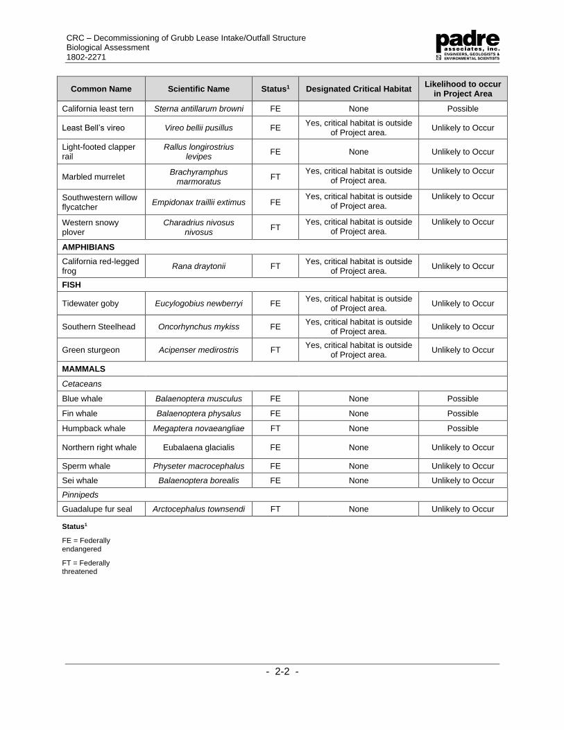
CRC – Decommissioning of Grubb Lease Intake/Outfall Structure Biological Assessment 1802-2271
- 2-2 -
Common Name Scientific Name Status1 Designated Critical Habitat Likelihood to occur
in Project Area
California least tern Sterna antillarum browni FE None Possible
Least Bell’s vireo Vireo bellii pusillus FE Yes, critical habitat is outside
of Project area. Unlikely to Occur
Light-footed clapper rail
Rallus longirostrius levipes
FE None Unlikely to Occur
Marbled murrelet Brachyramphus
marmoratus FT
Yes, critical habitat is outside of Project area.
Unlikely to Occur
Southwestern willow flycatcher
Empidonax traillii extimus FE Yes, critical habitat is outside
of Project area. Unlikely to Occur
Western snowy plover
Charadrius nivosus nivosus
FT Yes, critical habitat is outside
of Project area. Unlikely to Occur
AMPHIBIANS
California red-legged frog
Rana draytonii FT Yes, critical habitat is outside
of Project area. Unlikely to Occur
FISH
Tidewater goby Eucylogobius newberryi FE Yes, critical habitat is outside
of Project area. Unlikely to Occur
Southern Steelhead Oncorhynchus mykiss FE Yes, critical habitat is outside
of Project area. Unlikely to Occur
Green sturgeon Acipenser medirostris FT Yes, critical habitat is outside
of Project area. Unlikely to Occur
MAMMALS
Cetaceans
Blue whale Balaenoptera musculus FE None Possible
Fin whale Balaenoptera physalus FE None Possible
Humpback whale Megaptera novaeangliae FT None Possible
Northern right whale Eubalaena glacialis FE None Unlikely to Occur
Sperm whale Physeter macrocephalus FE None Unlikely to Occur
Sei whale Balaenoptera borealis FE None Unlikely to Occur
Pinnipeds
Guadalupe fur seal Arctocephalus townsendi FT None Unlikely to Occur
Status1
FE = Federally endangered
FT = Federally threatened

CRC – Decommissioning of Grubb Lease Intake/Outfall Structure Biological Assessment 1802-2271
- 2-3 -
2.1 SPECIES ACCOUNTS
This section includes a discussion of the federally listed species that are known to occur
or have potential to occur in the Project area based on habitat availability and known locations of
species in the Project region. These include the following species: California least tern, green
turtle, loggerhead turtle, olive ridley turtle, leatherback turtle, blue whale, fin whale, and humpback
whale. Certain species, such as plant, invertebrate and fish, listed in Table 2-1 above, may occur
within the quadrangle and/or within five miles of the Project area; however, suitable habitat for
these species do not occur in the Project area and, therefore, were not included in the discussion
below. Other species may have been eliminated from consideration because the Project area is
beyond the recorded geographic, elevational, or water depth range for these species.
2.1.1 California Least Tern (Sternula antillarum)
2.1.1.1 Status
The California least tern was listed as a Federally endangered species in 1970 (USFWS,
2017b). No critical habitat has been designated.
2.1.1.2 Range and Habitat
California least terns live along the coast from San Francisco to northern Baja California
and migrate from the southern portion of their range to the north. Least terns begin arriving in
southern California as early as March, migrate to nesting areas by mid- to late-April, and depart
following the fledging of the young in September or October (Frost, 2017). California least terns
establish nesting colonies on sandy soils with little vegetation along the ocean, lagoons, and bays,
where they forage by plunge-diving for small fish. California least terns forage for small epipelagic
fish (anchovy, atherinids, and shiner surfperch) primarily in nearshore ocean waters and in
shallow estuaries (USFWS, 2006). The nearest nesting colony occurs at McGrath Beach, at the
mouth of the Santa Clara River, approximately eight miles southeast of the Project area. During
2016 surveys, an estimated 57 breeding pairs and 62 nests were reported at the Santa Clara
River/McGrath Beach colony (Frost, 2017).
2.1.1.3 Natural History
This species nest in colonies and utilize the upper portions of open beaches or inshore
flat sandy areas that are free of vegetation. The typical colony size is 25 pairs. Most least terns
begin breeding in their third year, and mating begins in April or May. The nest consists of a simple
scrape in the sand or shell fragments and typically there are two eggs in a clutch. Egg incubation
and care for the young are accomplished by both parents. Least terns can re-nest up to two times
if eggs or chicks are lost early in the breeding season. At nesting colonies where feeding activities
have been studied, the birds were documented foraging mostly within two miles (mi) (3.2
kilometers [km]) of the breeding area and primarily in nearshore ocean waters less than 60 feet
deep (USFWS, 2006).
2.1.1.4 Population Trends
The species' population has increased from 600 in 1973 to roughly 7,100 pairs in 2005.
The number of California least tern sites has nearly doubled since the time of listing. (USFWS,
2006).

CRC – Decommissioning of Grubb Lease Intake/Outfall Structure Biological Assessment 1802-2271
- 2-4 -
2.1.2 Green Turtle (Chelonia mydas)
2.1.2.1 Status
The East Pacific distinct population segment (DPS) was listed as Federally threatened on
April 6, 2016. Critical habitat has been designated for the species in Puerto Rico, but none in the
Project area (NMFS, 2015).
2.1.2.2 Range and Habitat
Green turtles occur worldwide and are generally found in tropical and subtropical waters
along continental coasts and islands between 30 degrees North and 30 degrees South. In the
eastern North Pacific, green turtles have been sighted from Baja California to southern Alaska,
but most commonly occur south of San Diego (NMFS, 2015).
2.1.2.3 Natural History
Green turtles can weigh 300 to 350 pounds (lbs) (135 to 160 kilograms [kg]) and are three
feet (one meter) in length. They are herbivorous, feeding primarily on algae and sea grasses
(NMFS, 2017c). Nesting season varies depending on location, but in the southeastern U.S.,
females generally nest in the summer between June and September; peak nesting occurs in June
and July. During the nesting season, females nest at approximately two-week intervals, laying
an average of five clutches. In Florida, green turtle nests contain an average of 135 eggs, which
will incubate for approximately two months before hatching. Females will return to their natal
beaches to lay eggs every two to four years. Sexual maturity in green turtles may occur anywhere
between 20 and 50 years (NMFS, 2015). In the U.S., green turtles nest primarily along the central
and southeast coast of Florida where an estimated 200 to 1,100 females nest annually. There are
no known nesting sites along the west coast of the U.S., and the only known nesting location in
the continental U.S. is on the east coast of Florida.
2.1.2.4 Population Trends
Recent minimum population estimates for green turtles indicate that at least 20,112
individuals are known to occur in the eastern Pacific (NMFS, 2015).
2.1.3 Loggerhead Turtle (Caretta caretta)
2.1.3.1 Status
The loggerhead was first listed as endangered throughout its range on July 28, 1978. In
September 2011, NMFS and USFWS listed nine DPS of loggerhead turtles under the FESA. At
that time, the North Pacific loggerhead turtle DPS was Federally listed as an endangered species
(NMFS, 2011). Critical habitat is designated along the U.S. east coast for the Northwest Atlantic
Ocean DPS. No critical habitat has been designated for the North Pacific DPS (NMFS, 2011).

CRC – Decommissioning of Grubb Lease Intake/Outfall Structure Biological Assessment 1802-2271
- 2-5 -
2.1.3.2 Range and Habitat
Loggerheads are circumglobal, occurring throughout the temperate and tropical regions
of the Atlantic, Pacific, and Indian Oceans. Loggerheads are the most abundant species of sea
turtle found in coastal waters. Within the North Pacific, loggerhead nesting has been documented
only in Japan, although low level nesting may occur outside of Japan in areas surrounding the
South China Sea. In the South Pacific, nesting beaches are restricted to eastern Australia and
New Caledonia and, to a much lesser extent, Vanuatu and Tokelau (NMFS, 2011). Southern
California is considered to be the northern limit of loggerhead turtle distribution in the eastern
Pacific; however, loggerhead turtles have been stranded on beaches as far north as Alaska
(NMFS 2011). In the U.S., nesting occurs only in Florida (NMFS, 2011).
2.1.3.3 Natural History
Loggerhead turtles primarily occur in subtropical to temperate waters and are generally
found over the continental shelf (NMFS, 2009). In the southeastern U.S., mating occurs in late
March to early June and females lay eggs between late April and early September. Females can
lay three to five nests during a single nesting season. Loggerhead sea turtles are primarily
carnivorous, although they do consume some plant matter as well (NMFS, 2009).
2.1.3.4 Population Trends
The north Pacific population of loggerhead turtles is declining (NMFS and USFWS, 2008).
2.1.4 Leatherback Turtle (Dermochelys coriacea)
2.1.4.1 Status
The leatherback turtle was listed as Federally endangered in 1970. NMFS designated
critical habitat to provide protection for endangered leatherback sea turtles along the U.S. West
Coast in January 2012 (NMFS, 2017c). Critical habitat within California extends 16,910 square
miles (43,798 square kilometers [sq. km.]) stretching from Point Arena to Point Arguello, east of
the 9,842-ft (3,000-m) depth contour. The Project area is not located designated critical habitat
for leatherback turtle.
2.1.4.2 Range and Habitat
Leatherback turtles are the most common sea turtle off the west coast of the U.S.
Leatherback turtles have been sighted as far north as Alaska and as far south as Chile (Dept. of
the Navy, 2000; NMFS, 2013) and their extensive latitudinal range is due to their ability to maintain
warmer body temperatures in colder waters (NMFS, 2013). Off the U.S. west coast, leatherback
turtles are most abundant from July to September; however, their presence off the U.S. west coast
is “two pronged” with sightings occurring in northern California, Oregon, Washington, and
southern California, with few sightings occurring along the intermediate (central California)
coastline. Among foraging turtles tagged in coastal waters off California, the majority moved north
and spent time in areas offshore of northern California and Oregon before moving towards the
equatorial eastern Pacific, then eventually westward, presumably towards western Pacific Ocean
nesting beaches (NMFS, 2013).

CRC – Decommissioning of Grubb Lease Intake/Outfall Structure Biological Assessment 1802-2271
- 2-6 -
2.1.4.3 Natural History
The leatherback turtle can reach 2,000 lbs (900 kg) and get 6.5 ft (2 m) in length (Sea
Turtle Conservancy, 2019). Their lifespan and age of sexual maturity are both unknown.
Leatherback turtles are omnivores, but feed principally on soft prey items such as jellyfish and
planktonic chordates (e.g., salps) (Sea Turtle Conservancy, 2019). The leatherback turtle lacks
a hard shell, and instead has a thick, leathery carapace consisting of connective tissue covering
dermal bones. Female leatherbacks lay clutches of approximately 100 eggs on sandy, tropical
beaches. Females nest several times during a nesting season, typically at eight to 12-day
intervals. The eggs will incubate for 60-65 days before hatching (Sea Turtle Conservancy, 2019).
2.1.4.4 Population Trends
Recent leatherback turtle eastern Pacific population estimates indicate that at least 361
nesting females are known to occur (NMFS, 2007c). This population is believed to be decreasing
worldwide (NMFS, 2019b).
2.1.5 Olive Ridley Turtle (Lepidochelys olivacea)
2.1.5.1 Status
In 1978, the breeding populations of the olive ridley turtle on the Pacific coast of Mexico
were listed as Federally endangered while all other populations were listed as Federally
threatened. No critical habitat has been designed for the species.
2.1.5.2 Range and Habitat
This species is considered to be the most common of the marine turtles and is distributed
circumglobally (NMFS, 2014). Within the eastern Pacific Ocean, olive ridley turtles typically occur
in tropical and subtropical waters, as far south as Peru and as far north as California, but
occasionally have been documented as far north as Alaska (NMFS, 2014). The olive ridley is
mainly a "pelagic" sea turtle, but has been known to inhabit coastal areas, including bays and
estuaries.
2.1.5.3 Natural History
Olive ridley turtles weigh on average 100 lbs (45 kg) and are 22 to 31 in (55 to 80 cm) in
length. Their lifespan is unknown, but they reach sexual maturity around 15 years. Vast numbers
of turtles come ashore and nest in what is known as an "arribada" during which hundreds to
thousands of females come ashore to lay their eggs. At many nesting beaches, the nesting
density is so high that previously laid egg clutches are dug up by other females excavating the
nest to lay their own eggs. Major nesting beaches are located on the Pacific coasts of Mexico
and Costa Rica (NMFS, 2014).
2.1.5.4 Population Trends
At-sea abundance estimates appear to support an overall increase in the Endangered
breeding colony populations on the Pacific coast of Mexico (NMFS, 2014).

CRC – Decommissioning of Grubb Lease Intake/Outfall Structure Biological Assessment 1802-2271
- 2-7 -
2.1.6 Blue Whale (Balaenoptera musculus)
2.1.6.1 Status
The blue whale was listed as Federally endangered throughout its range in 1970 under
the Endangered Species Conservation Act (ESCA) of 1969 prior to the passage of the FESA in
1973. No critical habitat has been designated.
2.1.6.2 Range and Habitat
Blue whales are distributed worldwide in circumpolar and temperate waters, and although
they are found in coastal waters, they are thought to occur generally offshore compared to other
baleen whales (Allen et al., 2011). Like most baleen whales, they migrate between warmer water
breeding and calving areas in winter and high-latitude feeding grounds in the summer. Feeding
grounds have been identified in coastal upwelling zones off the coast of California primarily within
two patches near the Gulf of the Farallones and at the western part of the Channel Islands (Allen
et al., 2011). They migrate seasonally between summer and winter, but some evidence suggests
that individuals remain in certain areas year-round. Offshore California, sightings are made
seasonally between June and December in the Southern California Bight (Allen et al., 2011). Blue
whales are frequently observed in the Santa Barbara Channel and around offshore oil platforms.
2.1.6.3 Natural History
Blue whales on average are 75 to 80 ft (21 to 24 m) in length and weigh 100 to 150 tons
(90,700 to 136,000 kg) making it the largest animal on Earth (Allen et al., 2011). Blue whales
have no known social structure and can be seen traveling alone or in groups of 19 to 80
individuals. Blue whales feed primarily on euphausiid shrimp (krill).
2.1.6.4 Population Trends
The most recent estimates of the blue whale indicate that a minimum of 1,551 individuals
are known to occur off the west coast (NMFS, 2018a).
2.1.7 Fin Whale (Balaenoptera physalus)
2.1.7.1 Status
The fin whale was listed as a Federally endangered species in 1973, but no critical habitat
has been identified for this species to date.
2.1.7.2 Range and Habitat
Fin whales are found in deep, offshore waters of all major oceans, primarily in temperate
to polar latitudes, and less commonly in the tropics. Fin whales are migratory, moving seasonally
into and out of high-latitude feeding areas and their wintering areas are not widely known (NMFS,
2017). They are mostly commonly seen feeding over the continental shelf in areas of high
productivity. Peak abundances of fin whales in the Southern California Bight occur after periods
of maximum upwelling, in summer and fall (Allen et. al., 2011).
2.1.7.3 Natural History
Fin whales are on average 59 ft (18 m) in length and weigh 50 to 70 tons (45,000 to 64,000
kg) (Allen et al., 2011). Little is known about the social and mating systems of fin whales. It is
believed that males become sexually mature at six to ten years of age; and females at seven to

CRC – Decommissioning of Grubb Lease Intake/Outfall Structure Biological Assessment 1802-2271
- 2-8 -
12 years of age. Physical maturity is attained at approximately 25 years for both sexes. Usually
mating and birthing occurs in tropical and subtropical areas during midwinter. Fin whales feed on
euphasiid shrimp, copepods, and small fish. Fin whales are usually found in groups of two to
seven whales and are considered fast swimmers (NMFS, 2017a).
2.1.7.4 Population Trends
The most recent estimates of the fin whale population indicate that at least 8,127
individuals are known to occur off California, Oregon, and Washington (NMFS, 2017a).
2.1.8 Humpback Whale (Megaptera novaeangliae)
2.1.8.1 Status
The humpback whale was listed as Federally endangered in 1970. In September 2016,
NMFS revised the FESA listing for the humpback whale to identify 14 DPS, list one as threatened,
four as endangered, and identify nine others as not warranted for listing. The humpback whale
Central America DPS is listed as Federally endangered and the Mexico DPS is listed as a
Federally threatened population, both DPS feed offshore of Oregon (NMFS, 2018b). No critical
habitat has been designated.
2.1.8.2 Range and Habitat
Humpback whales are distributed worldwide and travel great distance during their
seasonal migration, the farthest migration of any animal. Humpback whales spend the winter and
spring months offshore of Central America and Mexico for breeding and calving, and then migrate
to their summer and fall range between California and southern British Columbia to feed (Allen et
al., 2011). Although humpback whales typically travel over deep, oceanic waters during
migration, their feeding and breeding habitats are in shallow, coastal waters over continental
shelves. Cold and productive coastal waters characterize feeding grounds (NMFS, 2018b). In
the North Pacific, the California/Oregon/Washington stock winters in coastal Central America and
Mexico and migrates to areas ranging from the coast of California to southern British Columbia in
summer/fall (NMFS, 2018b).
2.1.8.3 Natural History
Humpback whales are on average 42 ft (13 m) in length and weigh 25 to 40 tons (22,600
to 36,200 kg). Humpback whales are well known for their long pectoral fins, which can be up to
15 ft (4.6 m) long. These extensive fins give them increased maneuverability and they can be
used to slow down or even go backwards. During the summer months, humpbacks spend the
majority of their time feeding and building up fat stores that they will live off of during the winter.
Humpbacks filter feed on tiny crustaceans (mostly krill), plankton, and small fish (Allen et al.,
2011).
2.1.8.4 Population Trends
The most recent population estimates of humpback whales indicate that at least 1,876
individuals occur off California, Oregon, and Washington (NMFS, 2018b). This population
appears to be increasing.

CRC – Decommissioning of Grubb Lease Intake/Outfall Structure Biological Assessment 1802-2271
- 3-1 -
3.0 IMPACT ASSESSMENT
This Biological Assessment has been prepared to provide information to the Federal lead
agencies, NMFS and the USFWS, to determine the potential to affect threatened or endangered
species, based on one of three possible findings for each species potentially affected:
• No effect: the proposed action will not affect the listed species or critical habitat;
• Not likely to adversely affect: effects of the listed species are expected to be
discountable (extremely unlikely to occur), insignificant (minimal impact without take),
or beneficial; and
• Likely to adversely affect: adverse effect may occur as a direct or indirect result of the
proposed action, and the effect is not discountable, insignificant or beneficial.
Potential impacts due to Project activities include temporary degradation of water quality
or seafloor habitats during offshore segment removal and accidental collisions with marine
wildlife. Potential impacts are described below.
3.1 ONSHORE SEGMENT GROUND DISTURBANCE
Heavy equipment operation and associated noise, dust from grading and excavation, and
an increase in human presence have the potential to disrupt foraging activities of some wildlife,
including special-status species. Wildlife using the proposed impact area during Project activities
may be temporarily displaced into adjacent habitats and may experience greater competition for
food and resources. Wildlife injury or mortality due to vehicle, equipment, or foot traffic may also
occur during Project activities. However, due to the short-term nature of the Project and the
implementation of mitigation measures, impacts are not likely to adversely affect federally
protected wildlife.
3.2 WATER QUALITY
Offshore segment removal has the potential to create localized turbidity and affect nearby
soft-bottomed seafloor habitat, and/or hard-bottom substrate. Potentially significant impacts
could occur if removal creates turbidity that would decrease water clarity and reduce visibility for
foraging fish and birds.
California least terns are known to forage in estuaries, harbors, coastal freshwater
habitats, as well as in the open ocean. California least terns usually forage within six inches (15
cm) of the water’s surface and are more likely to forage within two miles (3.2 km) from nesting
sites (Keane and Smith, 2016); however, there is the potential they could occur within the Project
area outside of nesting season. Project impacts are not expected to adversely affect the foraging
success of California least terns based on their foraging ecology and limited disturbance to the
sea floor. Any turbidity created by pipeline recovery will originate on the seafloor and have a
limited range in shallow water depths. In addition, recent foraging studies of California least terns
during and outside of dredging events suggest that the turbidity plums caused by dredging and
disposal operations do not sustainably alter their foraging activity (Keane and Smith, 2016).
Each pipeline will be pulled along its existing alignment to reduce the likelihood of
suspending sediments. Given the limited disturbance area and temporary nature of the Project,

CRC – Decommissioning of Grubb Lease Intake/Outfall Structure Biological Assessment 1802-2271
- 3-2 -
pipeline recovery activities are not likely to adversely affect marine species and any impacts to
foraging birds are expected to be minimal and temporary.
3.3 DISTURBANCE TO SEAFLOOR HABITATS
Organisms residing on the seafloor along the pipelines’ corridors and adjacent to the
recovery areas could be suspended in water, possibly exposing them to fish and
macroinvertebrate predators during the removal process. Therefore, some mortality of benthic
organisms residing within the seafloor sediments in areas within or adjacent to underwater
excavations is assumed. Large, mobile organisms (e.g., fish, large crustaceans) are expected to
depart the area during the disturbance and no Federally protected species were observed along
the pipeline corridor; therefore, impacts are expected to have no effect on protected species.
Marine biological dive surveys were conducted of the three exposed pipelines and pipeline
corridors in November 2018 (Padre, 2018). The nearshore marine habitats and biota are typical
of those found in similar water depths along the Ventura County coastline. The seafloor habitat
inshore of the 16-ft (4.9-m) isobath includes mixed substrate types consisting of medium-sized
cobble (4 to 8-in [10 to 20-cm]-diameter) and small boulders (10 to 15-in [25 to 38-cm]-diameter),
as well as low-relief sandstone bedrock and expanses of sand in between bedrock. Sand waves
of less than one inch (2.5 cm) were observed within sandy-bottom areas. A bed of giant kelp
(Macrocystis pyrifera) occurs offshore of the Project site, but its density becomes sparse
southwest of pipelines’ termini and was not established within the survey corridors during the
November 2018 survey. Kelp bed density fluctuates with the seasons increasing during the
summer months and decreasing after winter storms. Kelp is not present within the surf zone
where wave action disturbs the seafloor.
During dive surveys, a patch of surf grass (Phyllospadix sp.) was observed growing on the
top of the wastewater outfall pipeline at a water depth of 12 ft (3.7 m). The surfgrass patch was
minimal and covered a total area of approximately five square feet (0.5 square meters). Neither
surfgrass nor eelgrass (Zostera marina) was observed anywhere else within the survey corridor.
In addition, no invasive species were identified (i.e., Culerpa taxifolia or Sargassum horneri). No
abalone species were observed during dive surveys and the area appeared generally devoid of
fish species although a few perch (Embiotocidae) and sculpin (Cottidae) species were present.
There was no additional seagrass or kelp observed during the November 2018 dive surveys on
the adjacent pipelines and the habitat is generally similar along all three pipelines.
Pipeline recovery impacts to hard-bottom can occur if offshore segments are pulled across
and cut into sensitive habitats. However, the hard-bottom habitats that were observed beneath
the pipelines were primarily devoid of vegetation due to their location in the surf zone where they
are considered less sensitive because they are routinely subjected to natural disturbances (i.e.,
storm waves) and do not support vegetation or long-lived, slow-growing organisms that are
particularly sensitive to disturbance.
The rocky substrate within the Project area appears to be routinely subjected to substantial
sand scour and supports only a limited algal and invertebrate community. Damage could occur
to the rocky substrate from anchoring of Project vessels or from diver activities. Seafloor
disturbances from offshore decommissioning activities will be limited to a few isolated anchoring
sites and a narrow corridor of sedimentary seafloor within which the pipelines will be removed.

CRC – Decommissioning of Grubb Lease Intake/Outfall Structure Biological Assessment 1802-2271
- 3-3 -
The sedimentary bottom will be disturbed only during removal activities and any Project vessels
will not anchor in hard bottom habitat or within areas of sensitive resources. Kelp beds were not
observed to be established within the Project area; however, kelp beds that could potentially
provide essential fish habitat (EFH) to groundfish and pelagic fish species are located are located
adjacent to the Project area. Project activities are not likely to adversely affect sensitive seafloor
habitats with the implementation of mitigation.
3.4 VESSEL COLLISION
Impacts from vessel operations can range from a change in the animal’s travel route or
time on the surface to direct mortality. During vessel transit and operations, there is the potential
for incidental collisions with marine mammals and sea turtles. Such collisions have been
documented in southern California; however, those collisions are typically associated with areas
with higher population densities of marine wildlife, large ship interactions, and slow moving marine
wildlife on the ocean surface.
The Project vessel(s) will transit each work day from Ventura Harbor to the Project site.
While there is the potential to encounter whales and dolphins near shore, the smaller vessels can
easily change course or reduce speed if marine wildlife if observed in the path of the vessel. With
the exception of vessel transit for mobilization and demobilization, pipeline recovery operations
will occur nearshore and within shallow water depths, so it is unlikely marine wildlife will be present
within the Project area. Therefore, the potential for vessel collision impacts are not expected to
adversely affect sensitive marine wildlife. In addition, CRC has proposed additional monitoring
and mitigation measures to further reduce any potential impact.
3.5 OIL SPILL POTENTIAL
The unintentional release of petroleum from Project vessels into the marine environment
from proposed Project activities could result in potentially significant impacts to the marine biota,
particularly avifauna and early life stage forms of fish and invertebrates, which are sensitive to
those chemicals. Refined products (i.e., diesel, gasoline.) are more toxic than heavier crude or
Bunker-type products, and the loss of a substantial amount of fuel or lubricating oil during survey
operations could affect the water column, seafloor, intertidal habitats, and associated biota,
resulting in their mortality or substantial injury, and in alteration of the existing habitat quality. The
release of petroleum into the marine environment is considered a potentially significant impact.
A Project Oil Spill Response Plan (Appendix A) will be prepared and implemented as necessary
for in water Project activities. The purpose of the offshore pipelines was to supply seawater and
discharge treated, clean water back into the ocean and none of the pipelines were ever used for
the transmission of hydrocarbon content; therefore, there is no risk of petroleum release from the
pipelines during removal activities.
Although many marine organisms have created adaptive strategies to survive in their
environment, when these marine organisms are introduced to oil, it adversely affects them
physiologically. For example, physiological effects from oil spills on marine life could include the
contamination of protective layers of fur or feathers, loss of buoyancy, and loss of locomotive
capabilities. Direct lethal toxicity or sub-lethal irritation and temporary alteration of the chemical
make-up of the ecosystem can also occur.

CRC – Decommissioning of Grubb Lease Intake/Outfall Structure Biological Assessment 1802-2271
- 3-4 -
3.5.1 Turtles
Oil spills are not considered a high cause for mortality for sea turtles, although recent
reports from the Gulf of Mexico Deepwater Horizon spill indicate a possible increase in strandings
of oil impacted turtles. Since sea turtle species have been listed as threatened or endangered
under the FESA, there is very little direct experimental evidence about the toxicity of oil to sea
turtles. Sea turtles are negatively affected by oil at all life stages: eggs on the beach, post
hatchings, young sea turtles in near shore habitats, migrating adults, and foraging grounds. Each
life stage varies depending on the rate, severity, and effects of exposure.
Sea turtles are more vulnerable to oil impacts due to their biological and behavior
characteristics including indiscriminate feeding in convergence zones, long pre-dive inhalations,
and lack of avoidance behavior (Milton et al., 1984). A sea turtle’s diving behavior puts individuals
at risk because they inhale a large amount of air before diving and will resurface over time. During
an oil spill, this would expose sea turtles to long periods of both physical exposure and petroleum
vapors, which can be the most harmful during an oil spill.
3.5.2 Marine Birds
Marine birds can be affected by direct contact with oil in three ways: (1) thermal effects
due to external oiling of plumage; (2) toxic effects of ingested oil as adults; and (3) effects on
eggs, chicks, and reproductive abilities.
The loss of waterproofing is the primary external effect of oil on marine birds and buoyancy
can be lost if the oiling is severe. A main issue with oil on marine birds is the damage oil does to
the arrangement of feathers, which is responsible of water repellency (Fabricius, 1959). Without
water repellency, the water can go through the dense layers of feathers to the skin exposing the
bird to cold water temperatures. To survive, the bird must metabolize fat, sugar, and eventually
skeletal muscle proteins to maintain body heat. The cause of oiled bird deaths can be the result
from exposure and loss of these energy reserves as well as the toxic effects of ingested oil
(Schultz et al., 1983). The internal effect of oil on marine birds varies. Anemia can be the result
of bleeding from inflamed intestinal walls. Oil passing into the trachea and bronchi could result in
the development of pneumonia. A bird’s liver, kidney, and pancreatic functions can be disturbed
due to internal oil exposure. Ingested oil can inhibit a bird’s mechanism for salt excretion that
enables seabirds to obtain fresh water from salt water and could result in dehydration (Holmes
and Cronshaw, 1975).
A bird’s vulnerability to an oil spill depends on each individual species’ behavioral and
other attributes. Some of the more vulnerable species are alcids and sea ducks due to the large
amount of time they spend on the ocean surface, the fact that they dive when disturbed, and their
gregarious behavior. Also, alcids and other birds have low reproductive rates, which result in a
lengthy population recovery time. A bird's vulnerability depends on the season as well. For
example, colonial seabirds are most vulnerable between early spring through autumn because
they are tied to breeding colonies.
3.5.3 Marine Mammals
The impact of direct contact with oil on the animal’s skin varies by species. Cetaceans
have no fur; therefore, they are not susceptible to the insulation effects of hypothermia in other

CRC – Decommissioning of Grubb Lease Intake/Outfall Structure Biological Assessment 1802-2271
- 3-5 -
mammals. However, external impacts to cetaceans from direct skin contract with oil could include:
eye irritation, burns to mucous membranes of eyes and mouth, and increase vulnerability to
infection.
Baleen whales skim the surface of water for feeding and are particularly vulnerable to
ingesting oil and baleen fouling. Adult cetacean would most likely not suffer from oil fouling of
their blowholes because they spout before inhalation, clearing the blowhole. Younger cetaceans
are more vulnerable to inhale oil. Internal injury from oil is more likely for cetaceans due to oil.
Oil inhaled could result in respiratory irritation, inflammation, emphysema, or pneumonia.
Ingestion of oil could cause ulcers, bleeding, and disrupt digestive functions. Both inhalation and
ingested chemicals could cause damage in the liver, kidney, lead to reproductive failure, death,
or result in anemia and immune suppression.
The small size of Project vessels and limited amount of petroleum-fueled equipment on
board greatly reduces the likelihood that a release would occur; therefore, impacts from the
accidental release of petroleum are not likely to adversely affect threatened and endangered
species. In order to reduce the potential impacts from oil spills, CRC has prepared an OSRP that
will detail emergency response protocols in case of a petroleum release and the equipment and
resources that will be available on the Project vessels (Appendix A).

CRC – Decommissioning of Grubb Lease Intake/Outfall Structure Biological Assessment 1802-2271
- 3-6 -
PAGE INTENTIONALLY LEFT BLANK
CRC – Decommissioning of Grubb Lease Intake/Outfall Structure Biological Assessment 1802-2271
- 4-1 -
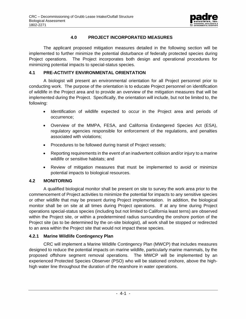
4.0 PROJECT INCORPORATED MEASURES
The applicant proposed mitigation measures detailed in the following section will be
implemented to further minimize the potential disturbance of federally protected species during
Project operations. The Project incorporates both design and operational procedures for
minimizing potential impacts to special-status species.
4.1 PRE-ACTIVITY ENVIRONMENTAL ORIENTATION
A biologist will present an environmental orientation for all Project personnel prior to
conducting work. The purpose of the orientation is to educate Project personnel on identification
of wildlife in the Project area and to provide an overview of the mitigation measures that will be
implemented during the Project. Specifically, the orientation will include, but not be limited to, the
following:
• Identification of wildlife expected to occur in the Project area and periods of
occurrence;
• Overview of the MMPA, FESA, and California Endangered Species Act (ESA),
regulatory agencies responsible for enforcement of the regulations, and penalties
associated with violations;
• Procedures to be followed during transit of Project vessels;
• Reporting requirements in the event of an inadvertent collision and/or injury to a marine
wildlife or sensitive habitats; and
• Review of mitigation measures that must be implemented to avoid or minimize
potential impacts to biological resources.
4.2 MONITORING
A qualified biological monitor shall be present on site to survey the work area prior to the
commencement of Project activities to minimize the potential for impacts to any sensitive species
or other wildlife that may be present during Project implementation. In addition, the biological
monitor shall be on site at all times during Project operations. If at any time during Project
operations special-status species (including but not limited to California least terns) are observed
within the Project site, or within a predetermined radius surrounding the onshore portion of the
Project site (as to be determined by the on-site biologist), all work shall be stopped or redirected
to an area within the Project site that would not impact these species.
4.2.1 Marine Wildlife Contingency Plan
CRC will implement a Marine Wildlife Contingency Plan (MWCP) that includes measures
designed to reduce the potential impacts on marine wildlife, particularly marine mammals, by the
proposed offshore segment removal operations. The MWCP will be implemented by an
experienced Protected Species Observer (PSO) who will be stationed onshore, above the high-
high water line throughout the duration of the nearshore in water operations.
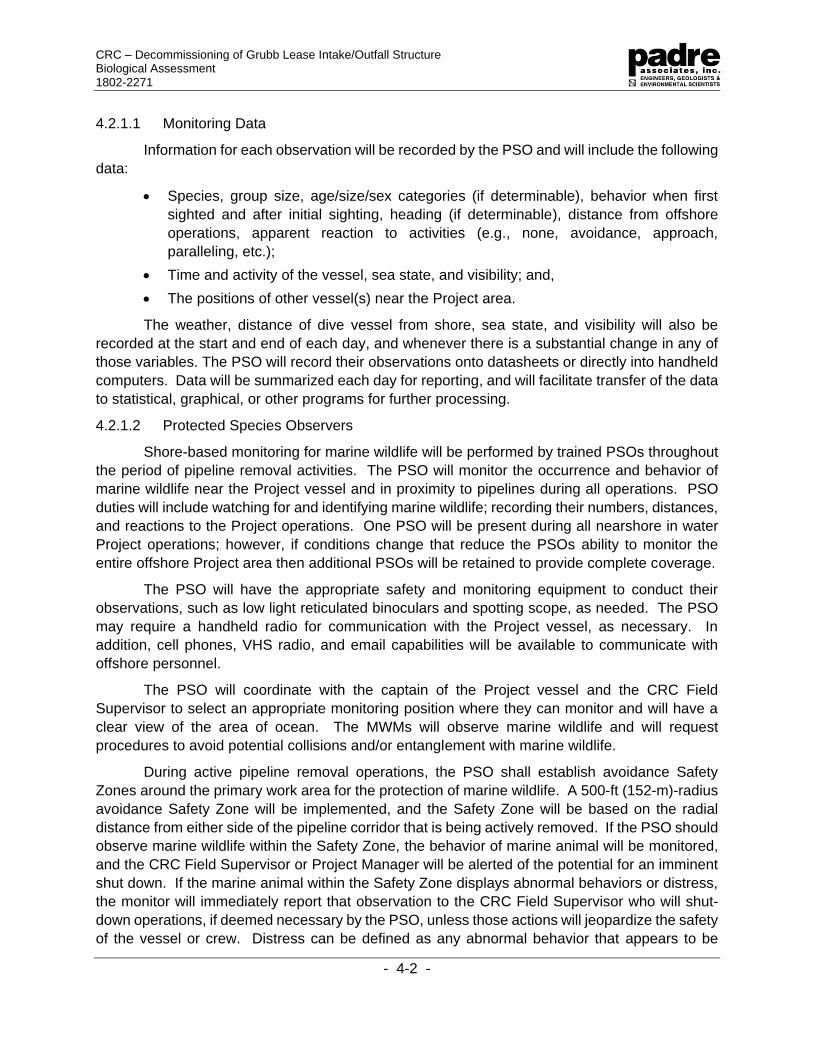
CRC – Decommissioning of Grubb Lease Intake/Outfall Structure Biological Assessment 1802-2271
- 4-2 -
4.2.1.1 Monitoring Data
Information for each observation will be recorded by the PSO and will include the following
data:
• Species, group size, age/size/sex categories (if determinable), behavior when first
sighted and after initial sighting, heading (if determinable), distance from offshore
operations, apparent reaction to activities (e.g., none, avoidance, approach,
paralleling, etc.);
• Time and activity of the vessel, sea state, and visibility; and,
• The positions of other vessel(s) near the Project area.
The weather, distance of dive vessel from shore, sea state, and visibility will also be
recorded at the start and end of each day, and whenever there is a substantial change in any of
those variables. The PSO will record their observations onto datasheets or directly into handheld
computers. Data will be summarized each day for reporting, and will facilitate transfer of the data
to statistical, graphical, or other programs for further processing.
4.2.1.2 Protected Species Observers
Shore-based monitoring for marine wildlife will be performed by trained PSOs throughout
the period of pipeline removal activities. The PSO will monitor the occurrence and behavior of
marine wildlife near the Project vessel and in proximity to pipelines during all operations. PSO
duties will include watching for and identifying marine wildlife; recording their numbers, distances,
and reactions to the Project operations. One PSO will be present during all nearshore in water
Project operations; however, if conditions change that reduce the PSOs ability to monitor the
entire offshore Project area then additional PSOs will be retained to provide complete coverage.
The PSO will have the appropriate safety and monitoring equipment to conduct their
observations, such as low light reticulated binoculars and spotting scope, as needed. The PSO
may require a handheld radio for communication with the Project vessel, as necessary. In
addition, cell phones, VHS radio, and email capabilities will be available to communicate with
offshore personnel.
The PSO will coordinate with the captain of the Project vessel and the CRC Field
Supervisor to select an appropriate monitoring position where they can monitor and will have a
clear view of the area of ocean. The MWMs will observe marine wildlife and will request
procedures to avoid potential collisions and/or entanglement with marine wildlife.
During active pipeline removal operations, the PSO shall establish avoidance Safety
Zones around the primary work area for the protection of marine wildlife. A 500-ft (152-m)-radius
avoidance Safety Zone will be implemented, and the Safety Zone will be based on the radial
distance from either side of the pipeline corridor that is being actively removed. If the PSO should
observe marine wildlife within the Safety Zone, the behavior of marine animal will be monitored,
and the CRC Field Supervisor or Project Manager will be alerted of the potential for an imminent
shut down. If the marine animal within the Safety Zone displays abnormal behaviors or distress,
the monitor will immediately report that observation to the CRC Field Supervisor who will shut-
down operations, if deemed necessary by the PSO, unless those actions will jeopardize the safety
of the vessel or crew. Distress can be defined as any abnormal behavior that appears to be

CRC – Decommissioning of Grubb Lease Intake/Outfall Structure Biological Assessment 1802-2271
- 4-3 -
related to Project operations such as sudden change in direction, rapid breathing, and sudden or
erratic changes in behavior. The PSO will have the authority to stop any work that is perceived
to be harming marine wildlife.
4.2.1.3 Reporting
Throughout the Project, observers will prepare a daily report summarizing the recent
results of the monitoring program or at such other intervals as required by regulatory and resource
agencies. The reports will summarize the species, number of marine wildlife sighted, and any
required actions taken.
4.2.1.4 Injured or Dead Animals
If an injured or dead animal is sighted within Project area, activities will be shut down while
the PSO conducts a brief investigation. Activities can resume after the PSO has (to the best of
his/her ability) determined that the injury resulted from something other than pipeline recovery or
Project vessel operations. After documenting those observations, including supporting
documents (e.g., photographs or other evidence), the operations will resume. Within 24 hours of
the observation, the PSO will notify NMFS and provide them with a copy of the written
documentation. If the cause of injury or death cannot be immediately determined by the PSO,
the incident will be reported immediately to either the NMFS Office of Protected Resources or the
NMFS West Coast Regional Office.
4.3 MEASURES TO REDUCE POTENTIAL IMPACTS TO HARDBOTTOM HABITAT
An anchor pre-plot will be developed specific to the Project site and Project activities
(Appendix B) which will be submitted with the Contractor Work Plan for review and approval by
applicable agencies. Based on a recent geophysical survey of the Project area, the anchor plot
illustrates the hard bottom areas that will be avoided during installation of moorings for the dive
vessel. All mooring locations will be outside of established kelp beds.
Anchors will be lowered to the seafloor in a controlled manner and will be recovered using
a crown line to pull it vertically through the water column reducing sediment resuspension,
seafloor alteration, and potential damage to rocky substrate.
In addition, to reduce the likelihood of damage to seafloor habitats, each pipeline will be
pulled along its existing alignment. The proposed Project has been engineered without the need
for trenching or excavating because the pipeline has been observed to be exposed on top of the
seafloor.
4.4 MEASURES TO REDUCE POTENTIAL VESSEL COLLISION IMPACTS ON MARINE
WILDLIFE
During offshore segment removal, a dive support vessel will be stationary; therefore,
collisions with marine wildlife are very unlikely in the immediate Project area. However, the
potential exists for such collisions when transiting to the Project site. The following measures and
procedures will be implemented to minimize the possibility of such collisions.
Vessel operators and on-board personnel will be watchful for marine mammals and turtles
during vessel transit and Project activities. Slower moving and surface-dwelling turtles and larger

CRC – Decommissioning of Grubb Lease Intake/Outfall Structure Biological Assessment 1802-2271
- 4-4 -
cetaceans could potentially be affected. More common marine mammals in the Project area,
such as dolphins and pinnipeds, would be agile enough to avoid vessels. Regardless, all vessel
operators shall observe the following guidelines:
• Make every effort to maintain the appropriate separation distance from sighted whales
and other marine wildlife (e.g., sea turtles);
• Do not cross directly in front of (perpendicular to) migrating whales or any other marine
mammal or turtle;
• When paralleling whales, vessels will operate at a constant speed that is not faster
than that of the whales;
• Care will be taken to ensure that female whales are not be separated from their calves;
and
• If a whale engages in evasive or defensive action, vessels will reduce speed or stop
until the animal calms or moves out of the area.
If a collision with a marine mammal or turtle occurs, the vessel operator must document
the conditions under which the accident occurred, including the following:
• Location of the vessel when the collision occurred (latitude and longitude);
• Date and time;
• Speed and heading of the vessel;
• Observation conditions (e.g., wind speed and direction, swell height, visibility in miles
or kilometers, and presence of rain or fog);
• Species of marine wildlife contacted;
• Whether an observer was standing watch for the presence of marine wildlife; and
• Name of vessel, operator (the company), and captain or officer in charge of the vessel
at time of accident.
Following an unanticipated strike, the vessel will stop if safe to do so. The vessel is not
obligated to stand by and may proceed after confirming that it will not further damage the animal
by doing so. The vessel will then communicate by radio or telephone all details to the vessel’s
base of operations. From the vessel’s base of operations, a telephone call will be placed to the
Stranding Coordinator, NMFS West Coast Region, Long Beach, California or other regulatory
agency representatives to obtain instructions as required by Project permits.
Alternatively, the vessel captain may contact the NMFS’ Stranding Coordinator directly
using the marine operator to place the call or directly from an onboard telephone, if available.
Under the MMPA, the vessel operator is not allowed to aid injured marine wildlife or recover the
carcass unless requested to do so by the NMFS Stranding Coordinator. The Stranding
Coordinator will then coordinate subsequent action, including enlisting the aid of marine mammal
rescue organizations, if appropriate. As proposed, and with the existing measures incorporated
into the vessel operations, vessel strikes could, but are not likely to, affect Federally listed marine
species.

CRC – Decommissioning of Grubb Lease Intake/Outfall Structure Biological Assessment 1802-2271
- 4-5 -
4.5 MEASURES TO REDUCE POTENTIAL OIL SPILL IMPACTS
An oil spill prevention plan will be used to avoid any release of oil-based products into the
marine environment, and the existing oil spill response and recovery plan will be used to reduce
the effects of accidentally discharged petroleum by facilitating rapid response and cleanup
operations. Any Project vessel will be subject to the requirements and guidelines included within
the Project-specific Oil Spill Contingency Plan (Appendix A). All vessel discharges will comply
with the requirements of the Clean Water Act under the U.S. Coast Guard (USCG) regulation
including the proper treatment and monitoring of vessel effluents as necessary.
Potential spill sources of hydrocarbons during Project activities include releases from
offshore equipment (including Project vessels) used during the pipeline recovery activities, and/or
accidental discharges from onshore fuel storage and refueling operations of construction
equipment. Any Project vessel will fuel itself in harbor, prior to departure to the offshore Project
site and will not require bunkering during Project activities. All Project vessels will have some
equipment requiring fuel on board; however, the potential for a release from diesel-powered
equipment onboard the vessels is minimal due to the small volume of fuel contained within each
piece of equipment. Equipment that is used on a day-to-day basis will be monitored for leaks; if
a leak is observed, the faulty equipment will cease operation and appropriate clean-up and
corrective measures will be implemented. All equipment will have drip pans under them, and
sorbent pads will be available on the vessel for clean-up of minor hydrocarbon leaks from the
deck equipment. All equipment refueling will be conducted over secondary containment to
minimize the potential for fuel spillage. All hydrocarbon-based fluids stored onboard the vessels
will be in appropriate containers and will include secondary containment structures.
In the event of a spill, notifications will be made to the Project team, emergency agencies,
clean-up contractors (if required), and other interested parties. If a spill impacts navigable waters,
notification of the National Response Center is mandatory and normally results in simultaneous
notification of the USCG.

CRC – Decommissioning of Grubb Lease Intake/Outfall Structure Biological Assessment 1802-2271
- 5-1 -
5.0 CUMULATIVE EFFECTS
FESA Regulations at 50 CFR 402.14(g)(3)(4) require Federal agencies to “evaluate the
effects of the action and cumulative effects on the listed species or critical habitat” and “formulate
its biological opinion as to whether the action, taken together with cumulative effects, is likely to
jeopardize the continued existence of listed species or result in the destruction or adverse
modification of critical habitat.”
According to the Endangered Species Consultation Handbook (USFWS and NMFS,
1998), cumulative effects include the effects of future State, local or private actions that are
reasonably certain to occur in the action area considered in a biological opinion. Future Federal
actions that are unrelated to the proposed action are not considered in this section because they
require separate consultation pursuant to Section 7 of FESA. Indicators of effects “reasonably
certain to occur” may include but are not limited to: approval of the action by State or local
agencies or governments (e.g., permits, grants); indications by granting authorities that an action
is imminent; assurances by project sponsors that an action will proceed; the obligation of venture
capital; and/or initiation of contracts. Speculative non-Federal actions that may never be
implemented are not factored into cumulative effects analyses. The following is a summary of
the other marine projects conducted or proposed in the Project area.
5.1 COMPLETED PROJECTS
There are no known completed projects in the region that would contribute to the
cumulative effects of the Project.
5.2 PROPOSED PROEJCTS
There are no known proposed projects in the region that would contribute to the
cumulative effects of the Project.

CRC – Decommissioning of Grubb Lease Intake/Outfall Structure Biological Assessment 1802-2271
- 5-2 -
PAGE INTENTIONALLY LEFT BLANK

CRC Grubb Lease Decommissioning of the Intake/Outfall Structures
Biological Assessment
1802-2271
- 6-0 -
6.0 CONCLUSION AND DETERMINATION
Implementation of the Project will involve potential impacts to marine species and habitats
that could affect threatened and endangered species in the Project area. A total of 30 Federally
listed species have been analyzed in this BA. Table 6-1 provides an analysis of the potential
Project effects on the following: habitat loss, mortality, harassment, loss of prey, loss of
shelter/cover, loss of access to habitats, noise and light effects, habitat fragmentation,
urbanization, increased predation, and critical habitat.
The proposed Project may affect, but is not likely to adversely affect, the listed and
proposed species for the following reasons:
• The Project would not involve temporary or permanent loss of habitat;
• The Project would be of limited geographic effect; and
• The Project will include avoidance, minimization, and mitigation measures, as detailed
in Section 4.0, to avoid and minimize potential adverse effects.

CRC Grubb Lease Decommissioning of the Intake/Outfall Structures
Biological Assessment
1802-2271
- 6-0 -
Table 6-1. Potential Effects Matrix for Protected Species
Species
Lo
ss o
f H
ab
itat1
Mo
rtali
ty2
Hara
ss
men
t3
Lo
ss o
f P
rey
4
Lo
ss o
f C
over5
Lo
ss o
f A
ccess
6
No
ise/L
igh
t7
Hab
itat
Fra
gm
en
tati
on
8
Urb
an
izati
on
9
Pre
dati
on
10
Cri
tical
Hab
ita
t11
Eff
ect
Dete
rmin
ati
on
12
California orcutt grass a,b a a a a a a a a a a a
Gambel’s watercress a,b a a a a a a a a a a a
Marsh sandwort a,b a a a a a a a a a a a
Salt marsh bird’s-beak a,b a a a a a a a a a a a
Spreading navarretia a,b a a a a a a a a a b a
Ventura marsh milk-vetch a,b a a a a a a a a a b a
Black abalone a,b a a a a a a a a a b a
White abalone a,b a a a a a a a a a a a
California condor a,b a a a a a a a a a b a
California least tern b c b b b b b,c b a b a b
Least Bell’s vireo a,b a a a a a a a a a b a
Light-footed clapper rail a,b a a a a a a a a a a a
Marbled murrelet a,b a a a a a a a a a b a
Southwestern willow flycatcher a,b a a a a a a a a a b a
Western snowy plover a,b a a a a a a a a a b a
California red-legged frog a,b a a a a a a a a a b a
Green turtle b b,c b b b b b b a b b b

CRC Grubb Lease Decommissioning of the Intake/Outfall Structures
Biological Assessment
1802-2271
- 6-1 -
Species
Lo
ss o
f H
ab
itat1
Mo
rtali
ty2
Hara
ss
men
t3
Lo
ss o
f P
rey
4
Lo
ss o
f C
over5
Lo
ss o
f A
ccess
6
No
ise/L
igh
t7
Hab
itat
Fra
gm
en
tati
on
8
Urb
an
izati
on
9
Pre
dati
on
10
Cri
tical
Hab
ita
t11
Eff
ect
Dete
rmin
ati
on
12
Loggerhead turtle b b,c b b b b b b a b b b
Leatherback turtle b b,c b b b b b b a b b b
Olive ridley turtle b b,c b b b b b b a b a b
Tidewater goby a a a a a a a a a a b a
Southern Steelhead a a a a a a a a a a b a
Green sturgeon a a a a a a a a a a b a
Blue whale b b,c b b b b b b a b a b
Fin whale b b,c b b b b b b a b a b
Humpback whale b b,c b b b b b b a b a b
Northern right whale a a a a a a a a a a a a
Sperm whale a a a a a a a a a a a a
Sei whale a a a a a a a a a a a a
Guadalupe fur seal a a a a a a a a a a a a
Potential Effects Codes
1Loss of Habitat Codes a. Species not expected to occur in
Project area. b. No habitat will be temporarily or
permanently lost.
2Mortality Codes
a. Species not expected to occur in Project area.
b. Collisions with vessels resulting in the death of listed species have occurred in the recent past. However, due to the Project’s close proximity to shore, as
3Harassment
a. Species not expected to occur in Project area.
b. Project incorporated measures will eliminate the likelihood harassment will occur.
4Loss of Prey
a. Species not expected to occur in Project area.
b. No permanent loss of prey expected. Short-term displacement of prey from immediate area of operations could occur.

CRC Grubb Lease Decommissioning of the Intake/Outfall Structures
Biological Assessment
1802-2271
- 6-2 -
well as proposed mitigation measures, collisions are a low probability event.
c. Oil spills from the Project vessels is a low probability event based on the nature of the Project.
5Loss of Shelter/Cover
a. Species not expected to occur in Project area.
b. Temporary displacement during Project activities within immediate work area. No permanent loss of cover.
6Loss of Access a. Species not expected to occur in
Project area. b. Temporary displacement during
Project operations likely only when vessel is in immediate area. No permanent loss of access.
7Noise/Light Impacts a. Species not expected to occur in
Project area. b. No anticipated light impact. Work is
planned for daylight hours only. c. General construction noise will be
minimal and temporary.
8Habitat Fragmentation
a. Species not expected to occur in Project area.
b. No temporary or permanent loss of habitat will occur. Consequently, no fragmentation.
9Urbanization
a. Not applicable
10Increased Predation
a. Species not expected to occur in Project area.
b. Not likely to be vulnerable to increased predation due short duration of Project operations.
11Critical Habitat
a. No critical habitat designated for species.
b. Critical habitat designated for species, but none occurring in Project area.
12Effect Determination
a. No effect b. May affect, but not likely to adversely
affect c. May affect and likely to adversely affect

AT&T Segments E1 and N9 Cable Removal
Biological Assessment
1702-1974
- 7-1 -
7.0 REFERENCES
Allen, S., Mortenson, J., and, Webb, S. 2011. Field Guide to Marine Mammals of the Pacific
Coast: Baja, California, Oregon, Washington, British Columbia. University of California
Press. Berkeley, California.
Conant, T.A., Dutton, P.H., Eguchi, T., Epperly, S.P., Fahy, C.C., Godfrey, M.H., MacPherson,
S.L., Possardt, E.E., Schroeder, B.A., Seminoff, J.A., Snover, M.L., Upite, C.M., and
Witherington, B.E. 2009. Loggerhead sea turtle (Caretta caretta) 2009 status review under
the U.S. Endangered Species Act. Report of the Loggerhead Biological Review Team to
the National Marine Fisheries Service, August 2009. 222 pages.
Fabricious, E. 1959. What Makes Plumage Waterproof? Tenth Annual Report of the Wildfowl
Trust.
Frost, N. 2017. California least tern breeding survey, 2016 season. California Department of Fish
and Wildlife, Wildlife Branch, Nongame Wildlife Program Report, 2017-03.
Holmes, W. and Cronshaw, J. 1975. Final Progress Report on Studies Completed During 1972
and 1975 on the Effects of Petroleum on Marine Birds. Submitted to the American
Petroleum Institute, Washington, D. C.
Jarvela, L., Thorsteinson, K., and Pelto, M. 1984. Oil and Gas Development and Related Issues.
In: The Navarin Basin Environment and Possible Consequences of Offshore Oil and Gas
Development, L. Jarvela, ed. Chapter 9. Juneau and Anchorage, AK. USDOC, NOAA,
OCSEAP, and USDOI, MMS.et. al. 1984.
Keane, K., and Smith, L. J. 2016. California least tern foraging ecology in southern California. A
review of foraging behavior relative to proposed dredging locations. US Army Corps of
Engineers Research and Development Center. May 2016.
Longcore, T. and Rich, C. 2001. A Review of the Ecological Effects of Road Reconfiguration and
Expansion on Coastal Wetland Ecosystems. The Urban Wildlands Group, Inc. Los
Angeles, CA.
Milton, S, Lutz, P., and Shigenaka, G. 1984. Oil and Sea Turtles: Biology, Planning, and
Response. Planning for Environmental Emergencies. NOAA's Ocean Service Office of
Response and Restoration. 23 Aug. 2004. Web. 14 July 2010.
National Marine Fisheries Service (NMFS). 2011. Endangered and Threatened Species;
Determination of Nice Distinct Population Segments of Loggerhead Sea Turtle as
Endangered or Threatened; Final Rule. Federal Register 76:58868-58952
______2014. Five-year Review: Summary and Evaluation Olive Ridley Sea Turtle (Lepidochelys
olivacea). June 2014.
______2015. Status Review of the Green Turtle (Chelonia mydas) Under the Endangered
Species Act. March 2015. NOAA-TM-NMFS-SWFSC-539.
______2017a. Stock Assessment Report; Fin Whale (Balaenoptera physalus physalus)
California/Oregon/Washington Stock. Revised April 7, 2017.

AT&T Segments E1 and N9 Cable Removal
Biological Assessment
1702-1974
- 7-2 -
______2017b. Stock Assessment Report; North Pacific Right Whale (Eubalaena japonica)
Eastern North Pacific Stock. Revised December 30, 2017.
______2018a. Stock Assessment Report; Blue Whale (Balaenoptera musculus musculus)
Eastern North Pacific stock. Revised April 17, 2018.
______2018b. Stock Assessment Report; Humpback Whale (Megaptera novaenangliae)
California/Oregon/Washington Stock. April 9, 2018.
______2018c. Stock Assessment Report; Sperm Whale (Physeter macrocephalus)
California/Oregon/Washington Stock. Revised June 1, 2018.
______2018d. Stock Assessment Report, Killer Whale (Orcinus orca) Eastern North Pacific
Southern Resident Stock. Revised May 30, 2018.
______2019a. Marine Mammal Stock Assessments NOAA Website:
https://www.fisheries.noaa.gov/national/marine-mammal-protection/marine-mammal-
stock-assessments. Accessed on February 4, 2019.
______2019b. Species in the Spotlight Pacific Leatherback Turtle.
https://www.fisheries.noaa.gov/species/leatherback-turtle#spotlight. Website accessed
January 31, 2019.
National Marine Fisheries Service and U.S. Fish and Wildlife Service. 2008. Recovery Plan for
the Northwest Atlantic Population of the Loggerhead Sea Turtle (Caretta caretta), Second
Revision. National Marine Fisheries Service, Silver Spring, MD.
National Oceanic and Atmospheric Administration (NOAA). 2014. Ten Years of Research and
Conservation, Southern Resident Killer Whales. Northwest Fisheries Science Center.
June 2014.
Padre Associates, Inc. (Padre). 2018. Pre-Construction Marine Biological Dive Survey Letter-
Report for the California Resources Corporation Grubb Lease Decommissioning of
Intake/Outfall Structure. November 2018. pp. 19
Poot, H., Ens, B. J., de Vries, H., Donners, M. A. H., Wernand, M. R., and Marquenie, J. M. 2008.
Green Light for Nocturnally Migrating Birds. Ecology and Society 13(2): 47.
www.ecologyandsociety.org/vol13/iss2/art47/, accessed March 20, 2014
Schultz, D., Johnson, W., and Berkner, A. 1983. A Unique Oiled Bird Rehabilitation Operation -
Myrtle Beach, South Carolina, February, 1981. In: Proceedings 1983 Oil Spill Conference
(Prevention, Behavior, Control, Cleanup). February 29 March 3, 1983, San Antonio, TX.
American Petroleum Institute Pub. No. 4356.
Sea Turtle Conservancy. 2019. Information about sea turtles: Leatherback sea turtle.
https://conserveturtles.org/information-about-sea-turtles-leatherback-sea-turtle/. Website
accessed January 31, 2019.
U.S. Fish and Wildlife Service (USFWS). 2006. Five-Year Status Review: California least tern
(Sternula antillarum browni).

APPENDIX A
OIL SPILL RESPONSE PLAN
Plan in Progress
To Be Forwarded Once Completed

APPENDIX B
ANCHORING PLOT


APPENDIX C
U.S. Fish and Wildlife Service Species List


Related Documents