Best Practice Showcase for the Catchment-Based Approach

Welcome message from author
This document is posted to help you gain knowledge. Please leave a comment to let me know what you think about it! Share it to your friends and learn new things together.
Transcript

Best Practice Showcase for the
Catchment-Based Approach

In recent years it has been increasingly recognised that enhancing the delivery of ecosystem
services through better catchment management should not only be the responsibility of the
public sector, but also the private and third sectors.
Alongside this movement towards shared responsibility, there is also now a growing body of
evidence that far greater environmental improvements can be achieved if all of the groups
actively involved in regulation, land management, scientific research or wildlife conservation in
a catchment area are drawn together with landowners and other interest groups to form a
catchment management partnership.
In response to this increased understanding of the potential benefits of participatory
catchment planning, undertaken with local stakeholders and knowledge providers, in 2011,
Defra announced that the UK Government was committed to adopting a more ‘catchment‐
based approach’ to sharing information, working together and coordinating efforts to protect
England’s water environment.
Now in 2014, there are 109 newly formed Catchment-Based Approach partnerships covering
catchments across the whole of England and the cross-border areas of Wales and Scotland.
Westcountry Rivers Trust
Rain Charm House, Kyl Cober Parc, Stoke Climsland, Callington, Cornwall PL17 8PH
tel: 01579 372140; email: [email protected]; web: www.wrt.org.uk
This document may be reproduced with prior permission of the Westcountry Rivers Trust.
The copyright of all material remains with the originators unless otherwise stated.

Overview This Catchment-Based Approach collection of case studies has been created using funding from the
EU WaterLIFE Project to showcase all of the great work being undertaken by catchment partnerships
across the country. By sharing best practice we aim to avoid duplication of effort and to ensure that
CaBA Hosts can benefit from all of the lessons that have been learnt over the years by those engaged
in catchment management.
To make it easier to find information that is useful to you, we have divided the case studies into
four sections and classified the information into three types:
1
2
3
4
Engage catchment stakeholders &
build effective partnerships...
Use data & evidence to inform
stakeholder-led catchment planning...
Deliver targeted & integrated
catchment interventions...
Use monitoring & modelling
to measure improvements...
Tools & approaches
Help & guidance
Case Studies
Image: River Teign by Nick Paling

An integrated stakeholder-driven assessment of a catchment will enable us to
develop a comprehensive understanding of the challenges we face and, following
this, to develop a strategic, targeted, balanced and therefore cost-effective
catchment management intervention plan.
To achieve this we need to engage with catchment stakeholders and build diverse,
engaged and empowered catchment partnerships comprised of environmental
practitioners, businesses, community groups and interested members of the public.
Once brought together, these partnerships can work to develop a shared
understanding of the issues in their catchment, to build a consensus about what
actions need to be delivered and to agree on their shared vision for their catchment
in the future.
1 Engage catchment stakeholders &
build effective partnerships...
1
Image: Working on-farm in Devon by Nick Paling
Engage catchment stakeholders
& build effective partnerships...
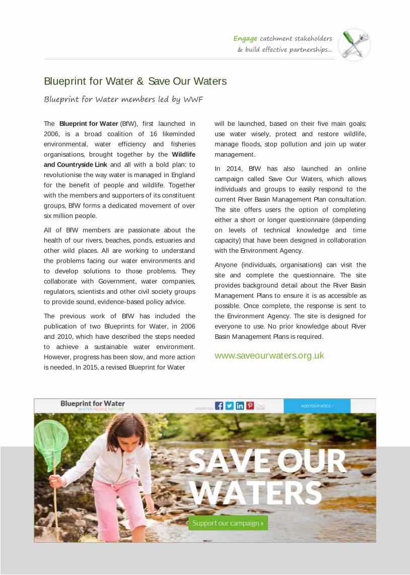
Blueprint for Water & Save Our Waters
Blueprint for Water members led by WWF
The Blueprint for Water (BfW), first launched in
2006, is a broad coalition of 16 likeminded
environmental, water efficiency and fisheries
organisations, brought together by the Wildlife
and Countryside Link and all with a bold plan: to
revolutionise the way water is managed in England
for the benefit of people and wildlife. Together
with the members and supporters of its constituent
groups, BfW forms a dedicated movement of over
six million people.
All of BfW members are passionate about the
health of our rivers, beaches, ponds, estuaries and
other wild places. All are working to understand
the problems facing our water environments and
to develop solutions to those problems. They
collaborate with Government, water companies,
regulators, scientists and other civil society groups
to provide sound, evidence-based policy advice.
The previous work of BfW has included the
publication of two Blueprints for Water, in 2006
and 2010, which have described the steps needed
to achieve a sustainable water environment.
However, progress has been slow, and more action
is needed. In 2015, a revised Blueprint for Water
will be launched, based on their five main goals:
use water wisely, protect and restore wildlife,
manage floods, stop pollution and join up water
management.
In 2014, BfW has also launched an online
campaign called Save Our Waters, which allows
individuals and groups to easily respond to the
current River Basin Management Plan consultation.
The site offers users the option of completing
either a short or longer questionnaire (depending
on levels of technical knowledge and time
capacity) that have been designed in collaboration
with the Environment Agency.
Anyone (individuals, organisations) can visit the
site and complete the questionnaire. The site
provides background detail about the River Basin
Management Plans to ensure it is as accessible as
possible. Once complete, the response is sent to
the Environment Agency. The site is designed for
everyone to use. No prior knowledge about River
Basin Management Plans is required.
www.saveourwaters.org.uk

Engage catchment stakeholders
& build effective partnerships...
The Catchment-Based Approach Website
National Catchment Support Group led by The Rivers Trust
The Catchment-Based Approach (CaBA) Support
Team is comprised of representatives of some of
the environmental Non-Government Organisations
who have been most active in river catchment
management over recent years, and who have
developed a package of support to sit alongside
the local Catchment Partnership Fund grants.
The CaBA Support Team organise conferences,
workshops and run the website, forum and
newsletters to keep CaBA partnerships informed
about best-practice, case-studies and training
which is available to support their work under the
Catchment-Based Approach.
CaBA Film - youtu.be/mtEz4ZMPGP8
The CaBA National Website is designed to fulfil
three main objectives: 1) to act as a showcase of
best practice and case studies in catchment
partnership working; 2) to provide catchment
partnerships with somewhere to communicate the
work they have done, and 3) to provide an online
community forum where members of the CaBA
Community from across the country can meet and
exchange expertise, experiences and lessons learnt.
www.catchmentbasedapproach.org

Engage catchment stakeholders
& build effective partnerships...
Towards Hydrocitizenship
Arts and Humanities Research Council Connected Communities Project
Water is a fundamental resource for society, and at
present a range of challenging water issues face
communities in the UK and internationally. These
include concerns over flooding, sea level rise,
climate change, drought and supply security, water
quality, biodiversity and landscape quality, access
for recreation, water and energy (e.g. fracking),
effective urban drainage, and waste management.
Towards Hydrocitizenship joins a growing body of
academic and policy initiatives which seek to
address local hydrospheres (interconnected water
flows and exchanges) holistically, in ways which
address these interdependent issues on catchment
and systems based scales.
This approach is an adapted version of participant
action research. The project teams will spend time
exploring water issues and resources in the round
in a selected area, and social issues, and seek to
develop projects with relevant individuals, groups
and communities. The projects will be arts based
(e.g. film, story-telling, oral history, site specific
performance, guided walks) (but can incorporate
scientific data) and will seek to generate ‘win-win’
synergies across eco-social challenges with water
as a key focus. The work will explore connections
within communities and between communities –
those connections ranging between harmonious
and conflictual, and latent or extant, human and
non-human.
Funded by the Arts & Humanities Research Council
this project brings together teams from arts,
academic, governance, SME and third sector
communities to work with local communities on a
range of water based eco-social issues.
For more information contact Prof. Owain Jones at
Bath Spa University. Email: [email protected]
www.hydrocitizenship.com

Engage catchment stakeholders
& build effective partnerships...
Downstreams CIC
Simon Redding & Anthony Parsons
Downstreams is a non-profit social enterprise that
uses an online platform to help to build
connections between communities along a river.
Downstream communities can be affected by
floods, environmental pollution and biodiversity
issues from their river. Upstream communities are
often the source of these issues, but do not have
the capability to create change and improve the
situation.
Downstreams' aim is to alleviate these problems by
joining individuals and businesses along the river
together both socially and financially - to look after
their river and protect themselves, just as they are
joined together by the water that passes them by.
Downstreams relies on the provision of open data
about geography as well as information about risks
and impact to communities from flooding,
biodiversity loss, pollution and about projects that
might partially mitigate them.
Downstreams take a joined up view of the
ecosystems around a river, taking nature concerns
and flood resilience concerns together when trying
to find the best solutions. It's clear to them that the
best solutions do not come from professionals
who are a long way from the catchment, but from
people who live in the area and know the local
environment.
Their role is not to deliver solutions, but to explain
problems associated with the river in an area and
elicit solutions that contribute towards solving
these problems. They specifically look for solutions
that can prevent the problem rather than
mitigating impacts.
Downstreams are a national organisation who
facilitate action in local catchments. As such, they
are interested in making contact with local
organisations and community initiatives that would
like to work together - on specific schemes or on a
catchment-wide basis.
www.downstreams.org
@downstreamsCIC

Engage catchment stakeholders
& build effective partnerships...
South West Catchment Information Gateway
Westcountry Rivers Trust
The South West Catchment Information Gateway
aims to provide up-to-date information and
resources relating to all aspects of catchment
management and catchment partnership working
in the South West of England.
The site is designed for Catchment Partnership
Hosts to engage and communicate with
environmental professionals, community groups
and interested individuals from across their
catchments.
The site has information pages for each of the
catchments, summaries about all of the
environmental projects underway across the
region, a Q&A for catchment partners and all of
the latest news from across the South West
Catchment Partnerships.
Anyone who wants to get involved in one of the
South West’s nine catchment partnerships can use
the site to make contact with the catchment hosts
or they can simply use it to keep up-to-date with
all of the latest activity in each of the catchments.
www.swcatchments.info

Engage catchment stakeholders
& build effective partnerships...
Ribble Life
Ribble Rivers Trust & the Ribble Catchment Partnership
Ribble Life is a DEFRA funded pilot scheme aimed
at exploring better ways to engage with people
and organisations to help improve the water
environment at a local catchment level. It is part of
a new catchment-based approach to river basin
management to help deliver the EU Water
Framework Directive (WFD).
The Ribble Rivers Trust is working in partnership
with the Environment Agency to support the
delivery of a holistic approach to catchment
management, including the sustainable use of the
catchment’s rivers, as well as the habitats and
species they support.
The high quality of the Ribble catchment’s water
resources gives it great value – as a habitat for
wildlife, for drinking water, as a recreational
environment, as a basis for tourism and salmon
fishing, and as a central asset underpinning the
local economy.
Ribble Life involves coordinating the efforts of
local stakeholders (incl. local communities, farmers,
public sector organisations and businesses) in the
common aim of restoring habitat and water quality
throughout the Ribble catchment.
The development and implementation of the
Ribble Catchment Management Plan is central to
the project. The Ribble catchment Action Plan will
be launched by December 2012 and will be
developed to guide the management of the
catchment’s water environment in a joined up way.
Ribble Life objectives
To ensure that improvements to rivers in the
Ribble catchment support a healthy local
economy
To share information and communicate
effectively across the Ribble catchment
To work together to maintain and improve the
biodiversity of the Ribble catchment
To reduce pollution and improve the quality of
water in the Ribble catchment
To enhance the amenity value of the Ribble
catchment.
www.ribblelife.org
Image: Ribble Rivers Trust

Engage catchment stakeholders
& build effective partnerships...
The Saving Eden Coalition
Eden Rivers Trust & the Eden Catchment Partnership
The Eden catchment and its rivers and lakes, like
many others in the UK are under threat. These
threats come from all of society and the demands
we place on our natural resources. Development,
agriculture, sewage, invasive species and
sometimes just neglect and ignorance have all
taken their toll. We all want healthy rivers and
lakes, they provide us with clean drinking water,
recreational opportunities, high quality wildlife
habitats and flood protection, but none of us can
achieve this on our own.
We now urgently need to work together to
safeguard the future of the Eden’s rivers and lakes
which is why the Saving Eden Coalition has been
formed. By bringing people together in a
partnership the Coalition aims to get better co-
ordination, communication, shared objectives,
targets and accountability in place to ensure we
are all doing the best we can to drive better and
faster outcomes for the Eden catchment.
Hosted by Eden Rivers Trust, the Saving Eden
Coalition is an organisational partnership. It is
open to representatives from the key audiences
who influence and affect the River Eden Catchment
and its rivers and lakes. These audiences are:
Farmers & Land Managers; Communities;
Politicians and Planners; and Investors.
www.savetheeden.org
Image: Icy Eden by See Like Click (Flickr CC 2.0)
Engage catchment stakeholders
& build effective partnerships...
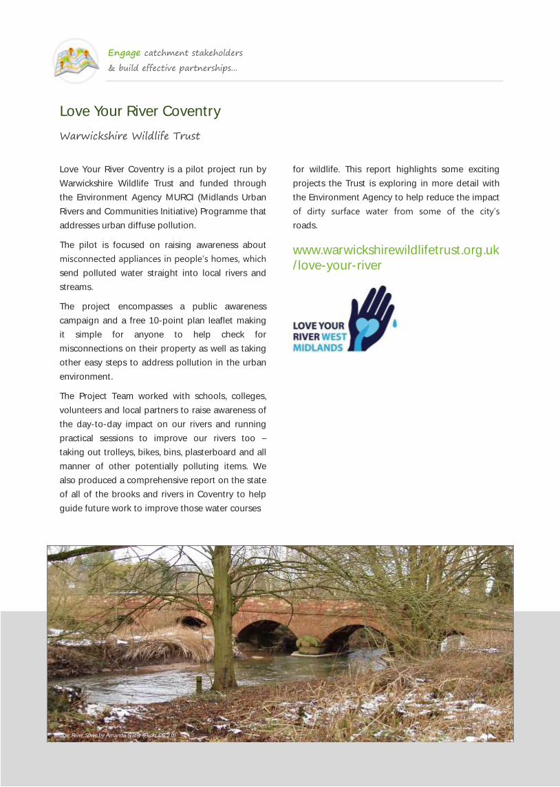
Love Your River Coventry
Warwickshire Wildlife Trust
Love Your River Coventry is a pilot project run by
Warwickshire Wildlife Trust and funded through
the Environment Agency MURCI (Midlands Urban
Rivers and Communities Initiative) Programme that
addresses urban diffuse pollution.
The pilot is focused on raising awareness about
misconnected appliances in people’s homes, which
send polluted water straight into local rivers and
streams.
The project encompasses a public awareness
campaign and a free 10-point plan leaflet making
it simple for anyone to help check for
misconnections on their property as well as taking
other easy steps to address pollution in the urban
environment.
The Project Team worked with schools, colleges,
volunteers and local partners to raise awareness of
the day-to-day impact on our rivers and running
practical sessions to improve our rivers too –
taking out trolleys, bikes, bins, plasterboard and all
manner of other potentially polluting items. We
also produced a comprehensive report on the state
of all of the brooks and rivers in Coventry to help
guide future work to improve those water courses
for wildlife. This report highlights some exciting
projects the Trust is exploring in more detail with
the Environment Agency to help reduce the impact
of dirty surface water from some of the city’s
roads.
www.warwickshirewildlifetrust.org.uk
/love-your-river
Image: River Sowe by Amanda Slater (Flickr CC 2.0)

Engage catchment stakeholders
& build effective partnerships...
Rate My View
South Devon Area of Outstanding Natural Beauty
Rate my View has been developed by the South
Devon AONB in partnership with Plymouth
University as part of the Cordiale project. It is
designed to gather pictures and feedback from
people as they photograph the protected
landscape.
The app, which is free, and available on both Apple
and Android platforms, automatically uploads
pictures taken on smartphones or tablets to the
Rate my View website. It uses GPS technology to
pinpoint the users location and make sure they are
in or near the AONB area, even detecting the
direction the person is facing.
Users then rate their view by giving it between 0
and 5 stars; and submit words or short phrases that
sum up their view. This could include landscape
features “network of Devon hedgebanks”, qualities
“tranquil”, feelings “inspiring”, events “battered by
waves” and much more.
Roger English, Project Officer at South Devon
AONB, said: “The app’s simple nature enables a
participative approach to collecting, sharing and
understanding a range of public perceptions of local
landscapes in and around the South Devon
AONB. We’re hoping that over time it will enable us
to build up a picture of how the AONB is perceived.”
Dr John Martin, of the University’s School of
Geography, Earth and Environmental Sciences,
said: “The app helps to burrow into public
perceptions, finding out what people really think
about the area’s coast, estuaries, countryside and
villages. Over time, with the changing of the
seasons, and as change takes take effect it will
enable us to better understand how we view our
landscapes and discover what we particularly
value.”
The South Devon AONB is one of 46 AONBs in the
country, and stretches from Brixham to Wembury,
and includes towns such as Kingsbridge,
Dartmouth, Salcombe and Modbury in addition to
the spectacular coastline, estuaries and farmed
countryside.
www.ratemyview.co.uk

Engage catchment stakeholders
& build effective partnerships...
Love the Lea
Thames 21
The rivers in East London’s Lea Valley are amongst
the most polluted in Britain. The Lea, Salmons
Brook, the Pymmes Brook, Turkey Brook, the Rivers
Ching and Moselle and the Stonebridge Brook are
being damaged by sewage, household chemicals
and oil on a daily basis.
Thames21’s ‘Love the Lea’ campaign is proposing
three key solutions that will improve the health of
the Lower Lea’s rivers into the future. The first
focuses on the development of a comprehensive
network of natural drainage systems in parks, next
to roads, blocks of flats and at all new
developments. These will cut the amount of
rainwater that enters sewers and thereby reducing
sewage overflows to rivers.
Countless homes are misconnected with pipes
from showers, dishwashers, washing machines and
toilets incorrectly plumbed into the surface water
sewer, instead of the foul sewer for treatment. The
campaign is crucially raising awareness of the issue
amongst local people, something which is missing
from many efforts to tackle misconnections.
Engagement with local communities has found
that people simply don’t know what a
misconnection is, and most are horrified if they
discover they are polluting their local stream.
‘Love the Lea’ is also encouraging London’s local
authorities to do more to improve the health of
rivers. At present, too few people know that what
goes down the drain can end up in a river if the
system isn’t working properly, and councils are well
placed to help spread this message.
Natural Drainage systems can help to cut the
chemicals that get washed into rivers from roads,
such as oil, fuel and metals, when it rains. Roadside
verges can be turned into green filters for storm
water whilst car park bays can be turned into rain
gardens.
The Love the Lea campaign is engaging widely
across communities, embracing too local councils
and other key stakeholders. A poster, online
pledge and Facebook page all help to spread the
message.
www.thames21.org.uk/love-the-lea

Engage catchment stakeholders
& build effective partnerships...
Our River Wear
Wear Rivers Trust, Durham Wildlife Trust, Groundwork NE & Durham County Council
The Lower Wear pilot (through a collaboration
between the EA and Durham University) undertook
a study to evaluate different approaches to engage
local stakeholders and to develop an
understanding of their priorities for the catchment
the values people derive from it and the barriers
they perceived to enjoying the river environment
and becoming involved in its management.
Following this pilot, the partnership wrote a joint
plan for working together for a healthier river
Wear. The plan focuses on the lower part of the
river and its tributaries. It is the product of a
unique initiative to bring together people,
communities and organisations that all have a
connection with the river and care about its future.
It has been made possible through the formation
of a partnership of passionate and enthusiastic
people who have developed this plan and a vision
to work towards: "By 2020 Durham's rivers will run
clear, teeming with wildlife and enjoyed by all."
Our River Wear is an educational and engaging
website that urges people to value and enjoy the
River Wear and everything it has to offer.
www.ourriverwear.org.uk
Image: River Wear by Mr Gareth M (Flickr CC 2.0)

Engage catchment stakeholders
& build effective partnerships...
Thames River Watch
Thames 21
A three year project delivered by Thames 21, this
citizen science project seeks to engage community
groups, individuals, schools and riverside
businesses along the tidal Thames from
Teddington to the Thames Estuary.
The project aims to raise awareness of the
environmental issues that the river faces and
enable people to provide pro-active support and
involvement in improving the health of the tidal
Thames. This project supports the Your Tidal
Thames project which is part of the Catchment
Based Approach to delivering the Water
Framework Directive through active engagement
of the local community.
The health of the tidal Thames is widely
misunderstood. Some people see it as a ‘dirty old
river’ – dead, polluted and to be ignored as much
as possible. This perception is hard to overcome
when floating litter persists and raw sewage flows
into the water during heavy rain events. Some
believe that the estuary is dirty because it’s brown
instead of blue. However other people see the tidal
Thames as a system that has fully recovered over
the last 40 years and is now clean, an idea
reinforced by media reports when the Thames won
the International Theiss River Prize in 2010. The
reality is somewhere in between. Thames River
Watch seeks to tackle the challenge of helping
Londoners better understand the tidal Thames.
Thames River Watch started in July 2013 when the
initial focus was on developing the monitoring
protocols and online data management system. In
the remainder of 2013 work turned to developing
the project brand and publicity materials, training
sessions for volunteers and working with pilot
groups to test and refine the delivery approach of
the project. Early in 2014 the Thames River Watch
project formally launched and began engaging
Londoners in monitoring and understanding the
health of the tidal Thames.
www.thames21.org.uk/thames-river-
watch
Image: Thames Mud by Leon Brocard (Flickr CC 2.0)
Engage catchment stakeholders
& build effective partnerships...
Integrated Local Delivery (ILD) Framework
FWAG South West, Countryside & Community Research Institute & Natural England
Within Gloucestershire, the Farming and Wildlife
Advisory Group (FWAG) and the Countryside and
Community Research Institute (CCRI) at the
University of Gloucestershire have developed an
integrated local delivery (ILD) framework,
implemented in a range of situations, that enables
those with local skills and environmental land
management knowledge to contribute to the
management of sensitive and key environmental
sites.
The first project delivered using the ILD framework
was in the Parish of Uley, Gloucestershire, where
the objective was to support the village and local
farmers in the restoration and long-term
protection of Uley Bury Hill Fort and surrounding
grassland.
The ILD framework was developed in 2004 from a
landscape-scale project that outlined the urgent
need for a simple mechanism that valued local
knowledge and connected this knowledge and all
levels of strategy to delivery by providing local
relevance through a simple transferable process.
The concept of ILD is that each community could
be inspired and enabled to look after its piece of
the global jigsaw to deliver multi-strategy
objectives at a local level. The ILD approach has
been so successfully used in Gloucestershire for
over 10 years, to restore key environmental
protected sites, that the approach is now being
applied to deliver water security through
integrated catchment management.
The Upper Thames Catchment Pilot is a pioneering
initiative, supported by Defra, set up to develop
ways to achieve these aims. The partnership is
committed to identifying related actions, many of
which are already in progress in the catchment,
and linking them together through the steering
group to deliver integrated management of land
and water.
The partnership used the ILD framework to embed
this collaborative working both in the development
of strategic priorities and on-the-ground delivery
through a shared problem-solving approach.
www.fwagsw.org.uk
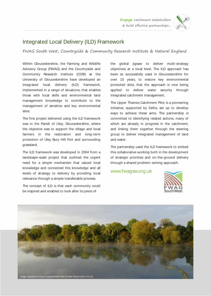
Image: Lakeside morning at Cotswold Water Park by Mark Philpott (Flickr CC 2.0)
Engage catchment stakeholders
& build effective partnerships...
River Wiki
The RESTORE Partnership (incl. the Environment Agency & River Restoration Centre)
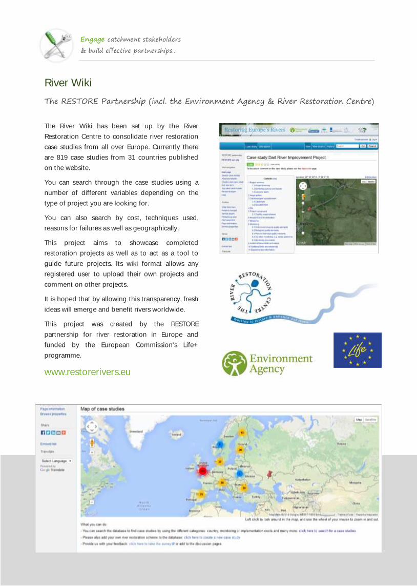
The River Wiki has been set up by the River
Restoration Centre to consolidate river restoration
case studies from all over Europe. Currently there
are 819 case studies from 31 countries published
on the website.
You can search through the case studies using a
number of different variables depending on the
type of project you are looking for.
You can also search by cost, techniques used,
reasons for failures as well as geographically.
This project aims to showcase completed
restoration projects as well as to act as a tool to
guide future projects. Its wiki format allows any
registered user to upload their own projects and
comment on other projects.
It is hoped that by allowing this transparency, fresh
ideas will emerge and benefit rivers worldwide.
This project was created by the RESTORE
partnership for river restoration in Europe and
funded by the European Commission's Life+
programme.
www.restorerivers.eu
Engage catchment stakeholders
& build effective partnerships...
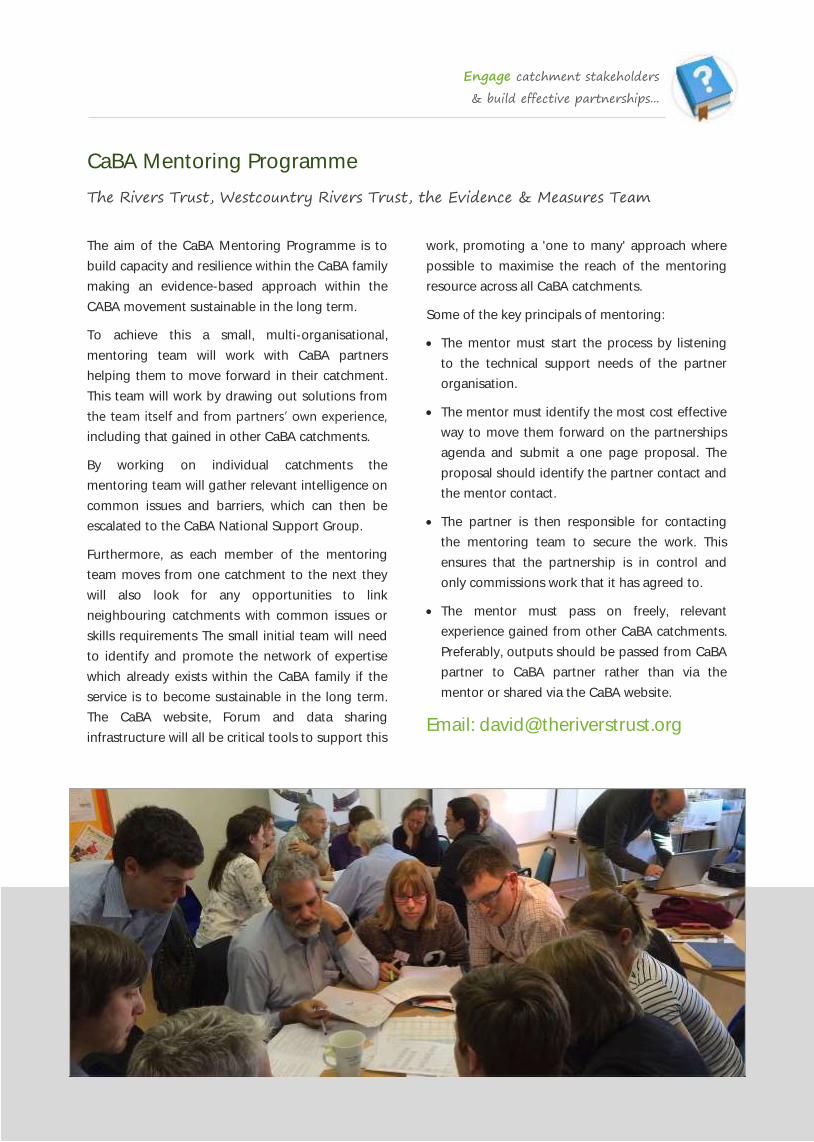
CaBA Mentoring Programme
The Rivers Trust, Westcountry Rivers Trust, the Evidence & Measures Team
The aim of the CaBA Mentoring Programme is to
build capacity and resilience within the CaBA family
making an evidence-based approach within the
CABA movement sustainable in the long term.
To achieve this a small, multi-organisational,
mentoring team will work with CaBA partners
helping them to move forward in their catchment.
This team will work by drawing out solutions from
the team itself and from partners’ own experience,
including that gained in other CaBA catchments.
By working on individual catchments the
mentoring team will gather relevant intelligence on
common issues and barriers, which can then be
escalated to the CaBA National Support Group.
Furthermore, as each member of the mentoring
team moves from one catchment to the next they
will also look for any opportunities to link
neighbouring catchments with common issues or
skills requirements The small initial team will need
to identify and promote the network of expertise
which already exists within the CaBA family if the
service is to become sustainable in the long term.
The CaBA website, Forum and data sharing
infrastructure will all be critical tools to support this
work, promoting a 'one to many' approach where
possible to maximise the reach of the mentoring
resource across all CaBA catchments.
Some of the key principals of mentoring:
The mentor must start the process by listening
to the technical support needs of the partner
organisation.
The mentor must identify the most cost effective
way to move them forward on the partnerships
agenda and submit a one page proposal. The
proposal should identify the partner contact and
the mentor contact.
The partner is then responsible for contacting
the mentoring team to secure the work. This
ensures that the partnership is in control and
only commissions work that it has agreed to.
The mentor must pass on freely, relevant
experience gained from other CaBA catchments.
Preferably, outputs should be passed from CaBA
partner to CaBA partner rather than via the
mentor or shared via the CaBA website.
Email: [email protected]

Engage catchment stakeholders
& build effective partnerships...
Not Another Consultation
Involve
Do you feel like you are not getting the true views
and opinions of the public you are engaging with?
Maybe you feel you see the same faces at all
meetings and are not hearing from all the groups
or individuals in your community.
If so, and you are committed to tackling the issues
within your area, perhaps it is time to try
something different.
The charity INVOLVE, which specialises in public
participation, have produced a practical guidance
document designed to help you plan and deliver
informal engagement events that combine a
community fun day with appropriate engagement
methods.
The guide is especially focussed on health related
engagement with local authorities, but the
contents are likely to be useful for anyone
interested in new ways of involving the public in
services or decisions. It provides practical guidance
on how to develop and plan informal engagement
events. It is a set of guidelines rather than a strict
blueprint. In order to be successful, any public
engagement activity that aims to improve any
aspect of an area must be designed
to suit the local context in which it occurs. What
works for one event or one community may be
inappropriate for others.
www.involve.org.uk

Engage catchment stakeholders
& build effective partnerships...
Ketso
Dr. Joanne Tippett, University of Manchester
Ketso means ‘action’ in Lesotho, where it was
invented. It has been refined over two decades of
action research with communities across the globe.
With Ketso everyone can participate and be more
creative.
Ketso offers a structured way to run a workshop,
using re-useable coloured shapes to capture
everyone's ideas, and is unique in that each part is
designed to act as a prompt for effective
engagement.
Ketso is for anyone who needs or wants to get
great results from working with a group of people.
These groups might be large (e.g. a consultation
with a hundred participants) or small (e.g. a
focused meeting with three people).
Ketso is great if you want to:
Work in groups (meetings, workshops, etc)
Make effective and productive use of people's
time
Engage with others (e.g. stakeholders)
Support collaboration, learning or creativity
Turn talk into action
Ketso is accessible to virtually anyone and is
particularly useful for people who need to work
together on an issue or plan within a limited time
frame. Ketso helps everyone to be a more effective
facilitator and extends the capacity and speed of
those who already run successful workshops.
Ketso is not just a re-usable ‘workshop in a bag’. It
comes with a growing range of free, open-source
support resources, including workshop plans that
you can customise to suit your needs. With Ketso
you have decades of practical research and
experimentation at your fingertips.
www.ketso.com

Engage catchment stakeholders
& build effective partnerships...
‘Fish’ in the Classroom
Various: incl. the Wandle Trust, Westcountry Rivers Trust & the Clyde Foundation
Bringing fish into the classroom is a fantastic,
interactive method of getting children excited
about nature as well as introducing them to the
issues facing the natural environment. Several river
and catchment groups are having great success
with this approach and regularly set up aquariums
in schools.
The Wandle Trust
Trout in the Classroom has been the Wandle
Trust’s award-winning education project since it
began in 2001 in partnership with Thames 21.
Every year they visit local schools and set up
aquariums with Trout eggs in the classroom. The
children get to see the hatching process and rear
the juveniles until they are due to be released into
the river. This ties in with most areas of the
national curriculum and leaves the children with a
great sense of achievement and a newfound
enthusiasm for river ecology.
www.wandletrust.org
Westcountry Rivers Trust
The River Exe Salmon in the Classroom Project has
just completed its fourth year and over 350
primary school pupils in the catchment have now
been involved. As an introduction to rivers and
wildlife, the children investigate the water quality
of their local river by looking at the invertebrates
living there. They then eagerly await the arrival of
their salmon eggs which are soon ready to be
transported from the hatchery. Just weeks after
their arrival, the eggs hatch and 3‐4 weeks later
they emerge as swim‐up fry ready to be released
back into the river at Easter time.
www.wrt.org.uk
Clyde River Foundation
Clyde in the Classroom is an annual scheme where
hatcheries are installed in classrooms for two
months and brown trout eggs are hatched and
raised ready for release into the River Clyde. The
project filters into all areas of the curriculum and
inspires artwork and poetry as well as learning
about trout development and river ecology. So far
the Foundation has had hatcheries in 57% of the
schools within the Clyde catchment and has
engaged with over 16,000 pupils.
www.clyderiverfoundation.org

Engage catchment stakeholders
& build effective partnerships...
Yellow Fish
Environment Agency & various partners
Yellow fish is simple project where yellow fish are
painted next to drains to remind people that what
is put down a drain impacts aquatic life. Road and
surface water drains are designed to allow
rainwater to drain into the nearest waterbody, but
these drains can be a large source of pollution with
substances like engine oil, paint, detergents and
litter being put down them. Once these pollutants
enter a waterbody they can be incredibly harmful
to fish and other organisms that live there.
Led by the Environment Agency, once permission
is obtained from the landowner (usually the local
authority), local community groups receive a pack
including a stencil and guidelines for raising
awareness in the local community. These groups
can be local conservation groups or school groups.
This is a brilliant, active way of getting young
people interested in conservation. The project can
be shaped to suit the group, being equally suited
as the foundation of a whole Key Stage or as a
stand alone activity. Raising awareness within the
community via leaflets and newsletters also Makes
Yellow Fish fantastic for developing learning,
thinking skills and citizenship awareness.
Participant’s are encouraged to send in a feedback
form in order to get their project marked on the
EA’s yellow fish map, showing all the places where
this scheme is being carried out.
Skelton Primary School, York
Skelton Primary School’s Eco Team is one of many
schools that has been involved with the Yellow Fish
Scheme. In conjunction with Tees Valley Wildlife
Trust the children spent an afternoon marking
yellow fish next to drains. The children also went to
the local river to see the possible effects of
pollution. Jo Feary from Redcar and Cleveland
Council also came along to explain to the children
the work that had been done around the river by
the council as well as local residents groups.
yellow.fish@environment-
agency.gov.uk

Engage catchment stakeholders
& build effective partnerships...
The First Tweet: Guide to Social Media
Unity Trust Bank & Social Misfits Media
When you look at the numbers, it’s hard to deny
that social media has become a ubiquitous part of
how the world does business. Ninety one percent
of online adults worldwide now use some sort of
social media regularly.
In the UK alone, there are 41 million Facebook
users, and 10 million people on Twitter. The
question of whether or not social media is
important has been answered., but has social
media become a critical part of how the world
does good?
At Unity Trust Bank and Social Misfits Media, they
engage every day with charities, social enterprises,
and other organisations who they think are
unmatched in their devotion to making social
change. And yet, many of them are not
strategically using the free tools that are available
online to broaden their audiences, spread their
messages and, crucially, raise more funds to
support the work they do.
They surveyed 186 small- and medium-sized UK
charities and social enterprises (all with an annual
turnover of less than £5 million) to find out their
thoughts on social media – if they felt they were
using it strategically for communications and
fundraising, what platforms they used and how
often, and what they felt their challenges were. The
results probably won’t surprise you. Generally, they
found that these organisations are not using social
media as efficiently, effectively, or strategically as
they would like – not due to lack of desire, but
rather lack of skills, time, or understanding.
Having done this research, they then created their
guide, “About that First Tweet,” to help these
organisations take the next step – or in some
cases, the first step – on their social media journey.
In this guide you will find interviews with social
media experts giving their top tips on how to best
engage with the platforms they provide; real-life
examples from large and small organisations on
how they used social media to achieve an offline
goal; a checklist of reminders; and a list of
resources for further reading.
www.unity.co.uk/guide

Engage catchment stakeholders
& build effective partnerships...
Rural Economy & Land Use (RELU) Programme
Various (University of East Anglia, University of London, Westcountry Rivers Trust)
The interdisciplinary RELU Programme, funded
between 2004 and 2011, had the aim of harnessing
the sciences to help and promote sustainable rural
development and advance understanding of the
challenges caused by this change today and in the
future. Research was undertaken to inform policy
and practice with choices on how to manage the
countryside and rural economies.
The findings of several RELU projects highlighted
the need for more sustained and two-way
communication with stakeholders about land
management. The researchers have demonstrated
that new ‘knowledge-bases’ can be established
that combine local knowledge with external
expertise.
The research has also identified a number of
techniques that enable stakeholders, who may
start with different views and levels of
understanding, to redefine the issues collectively in
a way that can help them find innovative solutions
with multiple benefits.
Perhaps the best example of this work is the ESRC-
funded RELU study, led by Laurie Smith from SOAS
at the University of London, which developed the
concept of a ‘catchment area partnership’ (CAP)
and the then novel ‘catchment area delivery
organisations’ (CADO) approach for the delivery of
catchment management in England and Wales.
Piloted in the Tamar and Thurne catchments, the
SOAS project established a clear catchment
management ‘roadmap’ on how to: create a
catchment partnership, integrate scientific
investigation with policy; foster decision-making
and implementation to resolve conflicts; and to
share best practice.
Several of the other RELU projects that looked at
catchment management also characterised a
positive feedback loop in participatory catchment
management planning whereby small initial
changes initially yield a small benefit that, in turn,
goes on to encourage far bigger changes later in
the process. This feedback loop builds local
capacity, levering in new resources, including fresh
commitments of time, expertise and funding.
www.watergov.org
www.soas.ac.uk/relu
youtu.be/XQsGUNxvyjA

It is vital that participatory, stakeholder-led catchment planning is underpinned by
robust data and evidence. Once the data and evidence has been collated, presented
and evaluated, a partnership can then work to define areas of the catchment most
likely to play a critical role in the provision or regulation of different environmental
services.
Robust use of data and evidence created through field-based assessments or
computer modelling can enable a catchment partnership to build consensus about
what needs to be done and where. This ensures that the catchment management
measures included in the delivery plan are targeted into areas where there is the
greatest likelihood of realising multifunctional environmental benefits.
1 Use data & evidence to inform
stakeholder-led catchment planning...
2

Use data & evidence to inform
stakeholder-led catchment planning...
Participatory Ecosystem Services Visualisation
Westcountry Rivers Trust
The Westcountry Rivers Trust, in collaboration with
DEFRA and the Rivers Trust, has developed a
method for undertaking stakeholder-led spatial
visualisation of ecosystem services provisioning
areas across a catchment landscape.
During this participatory process, primary,
secondary and tertiary stakeholders and technical
specialists work with a broker/facilitator to collate
and scrutinise all of the data and evidence relating
to environmental infrastructure and ecosystem
services provision for their area of interest.
Once the evidence has been evaluated, the
partnership then works to develop a series of
conceptual models or ‘rules’ that can be used to
define areas of the catchment most likely to play a
critical role in the provision of the different
ecosystem services, singly or in combination. These
priority areas are locations where a programme of
measures may realise the greatest enhancement in
the provision of multiple ecosystem services.
Fundamentally, this is a data visualisation and
evidence exploration process that facilitates the
development of a shared vision and language in a
catchment group.
WRT first developed this approach during the
Tamar Partnership Pilot in 2012. Since then, the
approach has been adopted in four further
catchments in the South West River Basin District
and WRT are also working to assist two others.
Furthermore, six catchments in the Severn River
Basin District and two catchments in the Anglian
River Basin District (the Cam & Ely Ouse and East
Suffolk) have also used this approach in their
catchment partnerships to date.
To view all of the ESS Visualisation Map Books
produced so far please visit the WRT Issuu page.
issuu.com/westcountryriverstrust

Use data & evidence to inform
stakeholder-led catchment planning...
EcoServ
Durham Wildlife Trust, Sussex Wildlife Trust & various partners
Durham Wildlife Trust created a toolkit for
Ecosystem Service mapping that uses nationally
available datasets. This system is called EcoServ-
GIS. The final toolkit for this was released to other
Wildlife Trusts in August 2014.
The toolkit is one of the Wildlife Trust’s
contributions to the national work that has been
promoting the Ecosystem Approach. EcoServ-GIS
has been showcased at a past Ecosystem
Knowledge Network event and the final toolkit has
outputs for 12 Ecosystem Services: Carbon
Storage; Local Climate; Noise Regulation;
Pollination; Water Purification; Accessible Nature;
Aesthetics; Community Cohesion; Education
Knowledge; Wildlife Watching; Timber; Food
Provision (pending) and as a function of all these,
multifunctionality.
For each of these services carefully constructed
models are created, based on datasets of known
quality and decision processes established in the
National Ecosystem Assessment. Outputs are
created for service ‘capacity’, ‘demand’ and
‘provision’.
Sussex Wildlife Trust (SWT) (through the Sussex
Biodiversity Record Centre (SxBRC), became, along
with Somerset and Northamptonshire, pilot areas
for the toolkit, as it was utilised for the first time
outside Durham. The experience of these three
pilots could then be fed back to Durham Wildlife
Trust so that they could use the shared experiences
to refine the final version of the toolkit.
The Sussex Local Nature Partnership are keen to
promote the understanding of Ecosystem Services
to organisations and projects operating in Sussex.
It is therefore hosting an event to establish what
uses these maps can be put to, and thus how the
maps should be presented, as products, and to
whom. There is a raft of locally generated
information and data that can be used to enhance
the EcoServ-GIS outputs, and experts will be
consulted to seek the optimum presentation of the
data so that the EcoServ-GIS maps can fulfil their
maximum potential in the area.
The outputs of this event will be shared on the
Sussex LNP website and if you are interested in
attending please visit follow the links on the Sussex
LNP website.
wwww.sussexlnp.org.uk
Image: South Downs by SkipnCLick (Flickr CC 2.0)

Use data & evidence to inform
stakeholder-led catchment planning...
Habitat Resilience Tool
Devon Wildlife Trust & The Met Office
The purpose of this tool is to help the user to
understand how resilient habitats are anywhere in
the county. This is important because vulnerable,
less resilient habitats are less likely to deliver the
range of services we need (flood prevention and
clean water for example).
Species that rely on these vulnerable habitats are
less likely to bounce back when their populations
fluctuate. The challenge for all sectors is therefore
clear; to restore habitat resilience, to restore the
components required to secure habitats that are
increased in number, larger in size, better quality
and more joined up.
The most important range of factors influencing
resilience have been modelled. These include:
Habitat Status, Habitat Management, Habitat
Connectivity, Response to Climate Change, and
Topography.
Each layer has a 50m resolution and is allocated a
resilience score from 1 to 10. The user can then
define which layer, or combination of layers, to
scrutinize and uniquely apply weightings to each.
New map outputs are produced at each step.
The map tool is web based and anyone can access
and use it. Map outputs show user defined choices
that are made providing a clear decision trail.
The map will be accessible from Devon Biodiversity
Records Centre and also the Local Nature
Partnership webpages in the near future.
www.dbrc.org.uk
www.naturaldevon.org.uk
Image: Devon Wildlife Trust

Use data & evidence to inform
stakeholder-led catchment planning...
Catchment Data Explorer
Environment Agency
The catchment data explorer is a data download
and visualization tool designed to support the
consultation on the update to the River Basin
Management Plans. Users are freely available to
navigate the site and explore catchments across
the UK.
Users can search for catchments of interest using a
map or by postcode, grid reference and place
name.
Each catchment in the UK has through summaries
and are further categorised in into operational and
management catchments. Data can be
downloaded from the site and there is also a list of
useful web links.
The underlying data in the Catchment Data
Explorer is stored as linked data and is made
available under an Open Government License for
reuse. The site is currently under development as a
“beta”, and will be improved with user feedback
over the coming weeks and months.
The site is open to all, and can be accessed here:
environment.data.gov.uk/catchment
-planning

Use data & evidence to inform
stakeholder-led catchment planning...
Invasive Species Apps: PlantTracker, AquaInvaders & SealifeTracker
Environment Agency & various partners
The Environment Agency have developed three
free mobile apps, which use ‘citizen’ collected data
to map, track and in the future monitor treatment
of Invasive Non Native Species (INNS).
The apps provide reference guides to help people
identify species. The maps that these apps produce
can contribute towards a catchment action or
delivery plan for INNS.
The Plant Tracker project is a collaboration
between the Environment Agency, Scottish Natural
Heritage, the Scottish Environment Protection
Agency, the Nature Locator team and the Centre
for Ecology and Hydrology.
The main aim is to locate incidences of high
priority invasive plant species. There is currently a
lack of information on exactly how serious the
problem presented by invasive plant species really
is. With your help we hope to build the most
complete picture yet and provide the raw data to
those that need it most in (almost) real time.
Obtaining accurate data about the distribution of
invasive species is of paramount importance when
it comes to assessing impact and formulating a
response, but data provision is often patchy and
records are usually unverifiable and lacking
accurate geographic reference.
The PlantTracker project has addressed these
problems by combining the development of a
smartphone application with the power of crowd-
sourcing data collection; that's to say the app
enables real data to be collected by interested
members of the public in the field.
Critically, each record collected is verifiable since it
is comprised of a photograph along with other
relevant metadata. Records are also accurately geo
-located since the app utilises the phone’s inbuilt
GPS capabilities. Another benefit of the app is that
includes photographic ID guides so that people
can distinguish non-natives from our similar
looking indigenous plants.
Data collected by the PlantTracker app is passed
through to the Biological Records Centre's iRecord
system and verified data is passed onto the NBN
Gateway
planttracker.naturelocator.org
naturelocator.org
Use data & evidence to inform
stakeholder-led catchment planning...
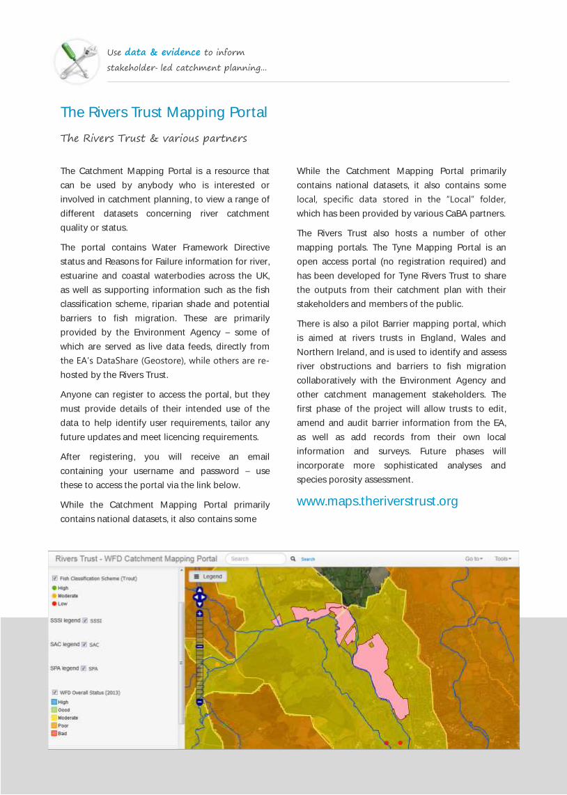
The Rivers Trust Mapping Portal
The Rivers Trust & various partners
The Catchment Mapping Portal is a resource that
can be used by anybody who is interested or
involved in catchment planning, to view a range of
different datasets concerning river catchment
quality or status.
The portal contains Water Framework Directive
status and Reasons for Failure information for river,
estuarine and coastal waterbodies across the UK,
as well as supporting information such as the fish
classification scheme, riparian shade and potential
barriers to fish migration. These are primarily
provided by the Environment Agency – some of
which are served as live data feeds, directly from
the EA’s DataShare (Geostore), while others are re-
hosted by the Rivers Trust.
Anyone can register to access the portal, but they
must provide details of their intended use of the
data to help identify user requirements, tailor any
future updates and meet licencing requirements.
After registering, you will receive an email
containing your username and password – use
these to access the portal via the link below.
While the Catchment Mapping Portal primarily
contains national datasets, it also contains some
While the Catchment Mapping Portal primarily
contains national datasets, it also contains some
local, specific data stored in the “Local” folder,
which has been provided by various CaBA partners.
The Rivers Trust also hosts a number of other
mapping portals. The Tyne Mapping Portal is an
open access portal (no registration required) and
has been developed for Tyne Rivers Trust to share
the outputs from their catchment plan with their
stakeholders and members of the public.
There is also a pilot Barrier mapping portal, which
is aimed at rivers trusts in England, Wales and
Northern Ireland, and is used to identify and assess
river obstructions and barriers to fish migration
collaboratively with the Environment Agency and
other catchment management stakeholders. The
first phase of the project will allow trusts to edit,
amend and audit barrier information from the EA,
as well as add records from their own local
information and surveys. Future phases will
incorporate more sophisticated analyses and
species porosity assessment.
www.maps.theriverstrust.org
Use data & evidence to inform
stakeholder-led catchment planning...
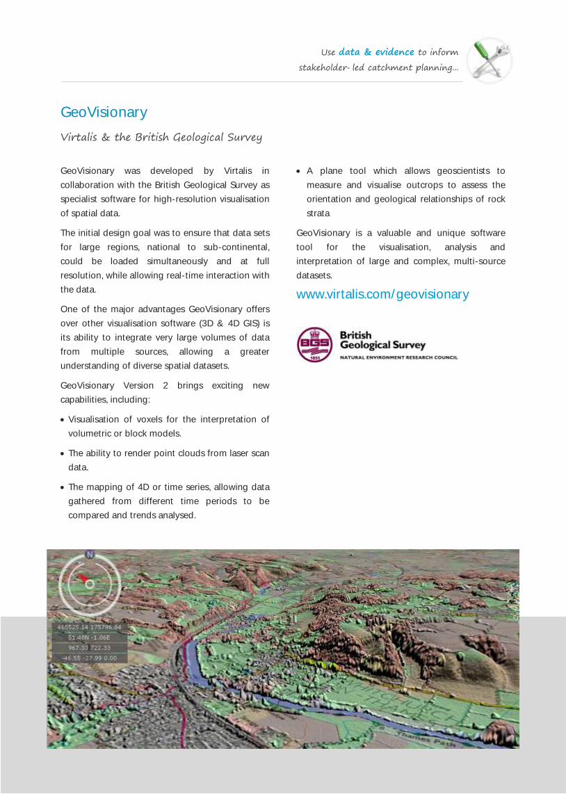
GeoVisionary
Virtalis & the British Geological Survey
GeoVisionary was developed by Virtalis in
collaboration with the British Geological Survey as
specialist software for high-resolution visualisation
of spatial data.
The initial design goal was to ensure that data sets
for large regions, national to sub-continental,
could be loaded simultaneously and at full
resolution, while allowing real-time interaction with
the data.
One of the major advantages GeoVisionary offers
over other visualisation software (3D & 4D GIS) is
its ability to integrate very large volumes of data
from multiple sources, allowing a greater
understanding of diverse spatial datasets.
GeoVisionary Version 2 brings exciting new
capabilities, including:
Visualisation of voxels for the interpretation of
volumetric or block models.
The ability to render point clouds from laser scan
data.
The mapping of 4D or time series, allowing data
gathered from different time periods to be
compared and trends analysed.
A plane tool which allows geoscientists to
measure and visualise outcrops to assess the
orientation and geological relationships of rock
strata
GeoVisionary is a valuable and unique software
tool for the visualisation, analysis and
interpretation of large and complex, multi-source
datasets.
www.virtalis.com/geovisionary

Use data & evidence to inform
stakeholder-led catchment planning...
MAGIC Interactive Map
Defra Family Organisations
MAGIC (also known as Nature Map) is an online
tool which provides geographic information about
the natural environment from across government.
The MAGIC website was originally launched in
2002, and in 2012 the website was updated and re-
launched in May 2013.
The information covers rural, urban, coastal and
marine environments across Great Britain. It is
presented in an interactive map which can be
explored using the various mapping tools
provided.
Natural England manages the service under the
direction of a Steering Group who represent the
MAGIC organisations, these include: The
Department of Environment, Food and Rural
Affairs, English Heritage, Natural England,
Environment Agency, Forestry Commission, and
the Marine Management Organisation.
It is presented in an interactive map which can be
explored using various mapping tools that are
included. Users do not require specialist software
and can access maps using a standard web
browser, but there are options to download some
datasets when available. MAGIC is now managed
by Natural England :
www.magic.gov.uk

Use data & evidence to inform
stakeholder-led catchment planning...
Bathing Water Explorer
Environment Agency
The Bathing Water Data Explorer is an application
designed to enable people to explore information
about English and Welsh designated bathing
waters that has been produced by the Environment
Agency and Natural Resources Wales.
The Bathing Water Data Explorer homepage
provides two ways to find a bathing water. You can
search by name of a bathing water (beach) or
names of counties or districts that contains bathing
waters or a full postcode. As you type in the search
box names of all those districts, counties and
bathing waters that contain the search term so far
will appear, at any point you can click on one of
the results to make a choice. Clicking on a bathing
water’s name will take you to the bathing water’s
profile page.
Alternatively, you can use the controls on the map
or your mouse or pointing device to pan and zoom
to a region of the map. The icons show all of the
bathing waters in that area. Hovering the pointer
over an icon will show the bathing water’s name.
Clicking on an icon will take to you the bathing
water’s profile page.
Once you have located a bathing water, you can
read its Bathing Water Profile, which includes a
summary description and photograph of the beach
and detailed information about the surrounding
area, rivers and streams feeding into the site and a
pollution management plan.
They also include maps of the locations of natural
drainage catchment and of locations of water
quality related features including as surface water
outfalls, emergency or storm overflows and treated
sewage works outfall.
The bathing water profile pages also contain a
summary of annual bathing water quality
compliance results (measuring the overall water
quality for a given year) for the last five years and
the most recent in-season sample assessment
result.
www.environment.data.gov.uk/bwq/
explorer

Use data & evidence to inform
stakeholder-led catchment planning...
EcoSpatial GIS e-Learning Resource
Westcountry Rivers Trust & the Scottish Fisheries Coordination Centre
The use of spatial data and geographic information
(GI) in evidence-based policy and decision making
has seen a rapid expansion in recent years.
Ecological and conservation organisations such as
rivers/fisheries trusts, wildlife trusts and many
others are increasingly being required to collate,
manage and interpret spatial data and evidence in
their work.
The best way to encourage and facilitate the use of
the spatial data in GIS applications is to train
practitioners to develop their GIS and spatial data
skills and, in so doing, build capability in their
organisations.
To meet the growing demand for subject-specific
and relevant GIS training courses Westcountry
Rivers Trust have developed a series of intensive
GIS short-courses specifically tailored to develop
and disseminate best practice and technical GIS
skills in the use of GIS, in practitioners engaged in
catchment management planning, landscape
ecology, fisheries science, river restoration, ecology
and conservation biology.
To support or enhance the delivery of face-to-face
training the Westcountry Rivers Trust have also
developed an online GIS training resource:
EcoSpatial Training. The e-learning resources
developed include:
Video demos of key theory and approaches
Video tutorials and demos of key techniques
Webinar presentations, online surgeries and
discussion sessions
A broad suite of easily accessible case studies
show-casing the application of GIS in the
catchment/ fisheries/wildlife management sector
Online help and technical support post training –
help forum, email/phone support.
www.ecospatial.info

Use data & evidence to inform
stakeholder-led catchment planning...
Ecological Monitoring: Invertebrates
Various
The evaluation of invertebrate communities living
in a river or stream is one of the best methods we
have for assessing the impacts of environmental
stress on the health of an aquatic ecosystem.
To assess the ecological health of the invertebrate
communities in a river, samples are collected using
a standardised method and the organisms found
are identified to the level of taxonomic family or
species. In addition, the approximate abundance of
each group found in the sample is also recorded
and this combined data is used to calculate so‐
called biotic indices, which are used to draw
conclusions about the condition of the river and to
make comparisons between sites on the same or
different rivers.
For their statutory assessments of river condition
for the EU Water Framework Directive, the
resulting data is entered into a software package
called the River InVertebrate Prediction and
Classification System (RIVPACS), which was
developed by the Institute of Freshwater Ecology
(IFE). The RIVPACS package takes physical and
geographical information recorded about the
sample site and makes a prediction of the
invertebrate assemblage that is ‘expected’ to occur
in a river of that type in that geographic location.
This predicted score is then compared with the
score that was actually recorded from the river
sample taken to calculate the Ecological Quality
Ratio (EQR) for the site.
The EQR score is then used as an indicator of the
ecological health of the river for its WFD
invertebrate classification. The current biotic index
used for the WFD Invertebrate Classification is
termed the ‘average score per taxon’ (ASPT) index.
The power of invertebrate assessment as an
indicator of river condition and for identifying what
pressures are causing aquatic ecosystem
degradation, has, in recent years, been further
increased by the development of several new
indices. These indices, which include the
Proportion of Sediment‐sensitive Invertebrates
(PSI) index and the SPEcies At Risk from Pesticides
(SPEARPESTICIDES) index, allow the impacts of these
specific pollutants on the invertebrate communities
living in the river to be evaluated.
www.fba.org.uk
Use data & evidence to inform
stakeholder-led catchment planning...
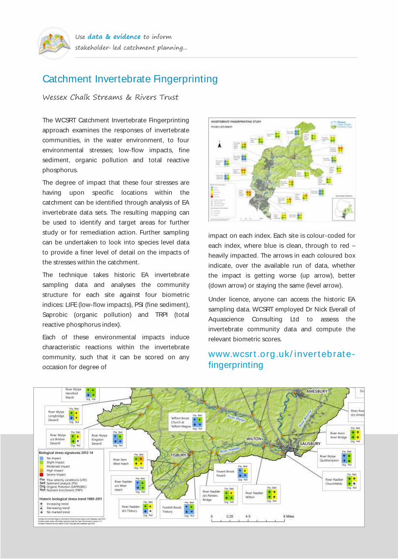
Catchment Invertebrate Fingerprinting
Wessex Chalk Streams & Rivers Trust
The WCSRT Catchment Invertebrate Fingerprinting
approach examines the responses of invertebrate
communities, in the water environment, to four
environmental stresses; low-flow impacts, fine
sediment, organic pollution and total reactive
phosphorus.
The degree of impact that these four stresses are
having upon specific locations within the
catchment can be identified through analysis of EA
invertebrate data sets. The resulting mapping can
be used to identify and target areas for further
study or for remediation action. Further sampling
can be undertaken to look into species level data
to provide a finer level of detail on the impacts of
the stresses within the catchment.
The technique takes historic EA invertebrate
sampling data and analyses the community
structure for each site against four biometric
indices: LIFE (low-flow impacts), PSI (fine sediment),
Saprobic (organic pollution) and TRPI (total
reactive phosphorus index).
Each of these environmental impacts induce
characteristic reactions within the invertebrate
community, such that it can be scored on any
occasion for degree of
impact on each index. Each site is colour-coded for
each index, where blue is clean, through to red –
heavily impacted. The arrows in each coloured box
indicate, over the available run of data, whether
the impact is getting worse (up arrow), better
(down arrow) or staying the same (level arrow).
Under licence, anyone can access the historic EA
sampling data. WCSRT employed Dr Nick Everall of
Aquascience Consulting Ltd to assess the
invertebrate community data and compute the
relevant biometric scores.
www.wcsrt.org.uk/invertebrate-
fingerprinting
Use data & evidence to inform
stakeholder-led catchment planning...
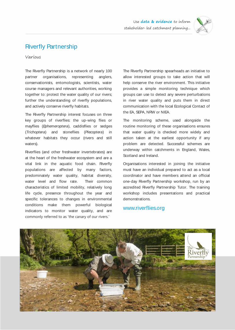
Riverfly Partnership
Various
The Riverfly Partnership is a network of nearly 100
partner organisations, representing anglers,
conservationists, entomologists, scientists, water
course managers and relevant authorities, working
together to: protect the water quality of our rivers;
further the understanding of riverfly populations,
and actively conserve riverfly habitats.
The Riverfly Partnership interest focuses on three
key groups of riverflies: the up-wing flies or
mayflies (Ephemeroptera), caddisflies or sedges
(Trichoptera) and stoneflies (Plecoptera) in
whatever habitats they occur (rivers and still
waters).
Riverflies (and other freshwater invertebrates) are
at the heart of the freshwater ecosystem and are a
vital link in the aquatic food chain. Riverfly
populations are affected by many factors,
predominately water quality, habitat diversity,
water level and flow rate. Their common
characteristics of limited mobility, relatively long
life cycle, presence throughout the year and
specific tolerances to changes in environmental
conditions make them powerful biological
indicators to monitor water quality, and are
commonly referred to as ‘the canary of our rivers.’
The Riverfly Partnership spearheads an initiative to
allow interested groups to take action that will
help conserve the river environment. This initiative
provides a simple monitoring technique which
groups can use to detect any severe perturbations
in river water quality and puts them in direct
communication with the local Ecological Contact of
the EA, SEPA, NRW or NIEA.
The monitoring scheme, used alongside the
routine monitoring of these organisations ensures
that water quality is checked more widely and
action taken at the earliest opportunity if any
problem are detected. Successful schemes are
underway within catchments in England, Wales,
Scotland and Ireland.
Organisations interested in joining the initiative
must have an individual prepared to act as a local
coordinator and have members attend an official
one-day Riverfly Partnership workshop, run by an
accredited Riverfly Partnership Tutor. The training
workshop includes presentations and practical
demonstrations.
www.riverflies.org

Use data & evidence to inform
stakeholder-led catchment planning...
Comet Assay for DNA Damage
Plymouth University
One target system to diagnose the effects of
contaminant exposure on organisms in the
environment is to monitor biological damage by
examining effects on their DNA. Contaminant-
induced damage results in breaks in the DNA
structure. Such breaks could give rise to heritable
changes and thus, population level effects, notably
reproductive success (i.e. fertility and fecundity).
The Comet assay is a simple method to measure
DNA damage. The principle of the technique is to
induce relaxation of the negatively-charged DNA
supercoils where breaks are apparent. The higher
the amount of DNA breaks leads to the greater
distance of migration within the gel using
electrophoresis.
The relative amount of DNA migrated provides a
simple method to measure the DNA breaks in an
individual cell. The aptly-named Comet assay is
due to the appearance of ‘comet heads’ containing
the high molecular weight DNA and the ‘comet
tail’ containing the leading end of molecular
fragments.
The Comet Assay has been used to identify DNA
damage in a number of invertebrate taxa in recent
years, including three bivalve species: the common
cockle, Cerastoderma edule; the blue mussel,
Mytlius edulis and larvae of the pacific oyster,
Crassostrea gigas during two case studies in the
Tamar Estuary. Work is now continuing to examine
DNA damage in a number of other candidate
organisms in freshwater and coastal ecosystems.
Email: [email protected]
Image: Comet Assays by Awantha Dissanayake
Use data & evidence to inform
stakeholder-led catchment planning...
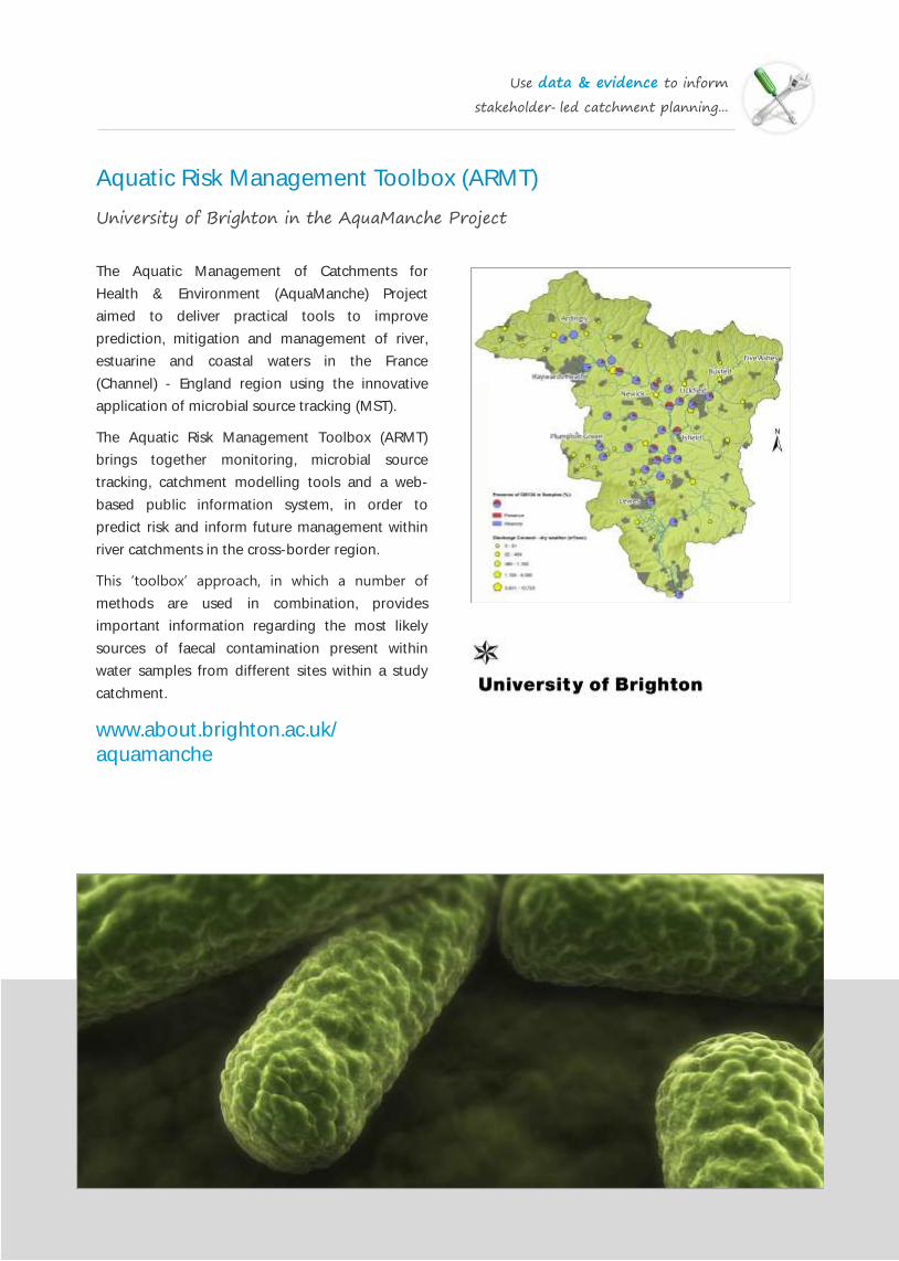
Aquatic Risk Management Toolbox (ARMT)
University of Brighton in the AquaManche Project
The Aquatic Management of Catchments for
Health & Environment (AquaManche) Project
aimed to deliver practical tools to improve
prediction, mitigation and management of river,
estuarine and coastal waters in the France
(Channel) - England region using the innovative
application of microbial source tracking (MST).
The Aquatic Risk Management Toolbox (ARMT)
brings together monitoring, microbial source
tracking, catchment modelling tools and a web-
based public information system, in order to
predict risk and inform future management within
river catchments in the cross-border region.
This ‘toolbox’ approach, in which a number of
methods are used in combination, provides
important information regarding the most likely
sources of faecal contamination present within
water samples from different sites within a study
catchment.
www.about.brighton.ac.uk/
aquamanche
Use data & evidence to inform
stakeholder-led catchment planning...
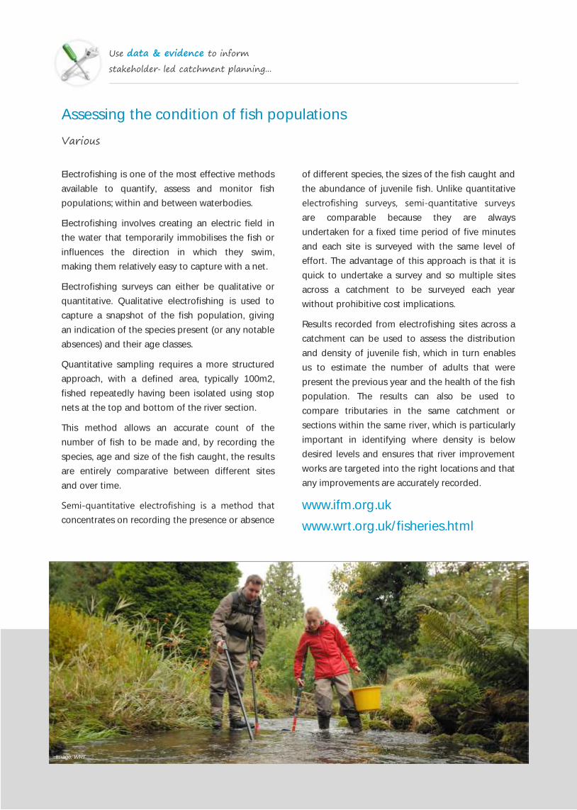
Assessing the condition of fish populations
Various
Electrofishing is one of the most effective methods
available to quantify, assess and monitor fish
populations; within and between waterbodies.
Electrofishing involves creating an electric field in
the water that temporarily immobilises the fish or
influences the direction in which they swim,
making them relatively easy to capture with a net.
Electrofishing surveys can either be qualitative or
quantitative. Qualitative electrofishing is used to
capture a snapshot of the fish population, giving
an indication of the species present (or any notable
absences) and their age classes.
Quantitative sampling requires a more structured
approach, with a defined area, typically 100m2,
fished repeatedly having been isolated using stop
nets at the top and bottom of the river section.
This method allows an accurate count of the
number of fish to be made and, by recording the
species, age and size of the fish caught, the results
are entirely comparative between different sites
and over time.
Semi‐quantitative electrofishing is a method that
concentrates on recording the presence or absence
of different species, the sizes of the fish caught and
the abundance of juvenile fish. Unlike quantitative
electrofishing surveys, semi‐quantitative surveys
are comparable because they are always
undertaken for a fixed time period of five minutes
and each site is surveyed with the same level of
effort. The advantage of this approach is that it is
quick to undertake a survey and so multiple sites
across a catchment to be surveyed each year
without prohibitive cost implications.
Results recorded from electrofishing sites across a
catchment can be used to assess the distribution
and density of juvenile fish, which in turn enables
us to estimate the number of adults that were
present the previous year and the health of the fish
population. The results can also be used to
compare tributaries in the same catchment or
sections within the same river, which is particularly
important in identifying where density is below
desired levels and ensures that river improvement
works are targeted into the right locations and that
any improvements are accurately recorded.
www.ifm.org.uk
www.wrt.org.uk/fisheries.html
Image: WRT

Use data & evidence to inform
stakeholder-led catchment planning...
Fisheries Walkover Surveys
Westcountry Rivers Trust & various other Rivers Trusts
While there is now a wealth of data sources
available to help characterise our river catchments
and prioritise where to start tackling issues, there is
no substitute to getting out on the ground and
undertaking a walkover survey to properly
understand the local environment.
Ground surveys tend to capture the highest level
of accuracy and resolution of environmental data,
which is necessary for identifying specific problems
and targeting measures. In addition, field work will
provide an opportunity to begin engaging with
local landowners and communities which will be
essential for implementing any land use changes.
The objective of the Fisheries Walkover Survey is to
gather information about the location and extent
of the various physical habitat features present
along and immediately surrounding a river, so that
an assessment can be made about habitat quality
and quantity (in-stream & bankside) for fish
(especially salmonids). This should allow factors
which may be limiting salmon productivity to be
identified and recommendations made regarding
habitat restoration techniques.
The survey methodology developed by the
Westcountry Rivers Trust is adapted from the
techniques outlined in the Environment Agency
document Restoration of Riverine Salmon Habitats:
A Guidance Manual (Hendry & Cragg-Hine, 1997).
During the survey, the boundaries of different in-
channel habitat classifications are drawn onto a
map to represent the areas of individual habitat
types using the symbols provided in the key. In this
manner, a mosaic of different habitat types and
features of interest can be compiled and assessed
for the whole section of river and any interventions
required can be identified.
www.wrt.org.uk/fisheries.html

Use data & evidence to inform
stakeholder-led catchment planning...
River Habitat Survey
Environment Agency & various others
The River Habitat Survey (RHS) Project was
initiated at the beginning of the 1990s by the
National Rivers Authority in England and Wales.
The aim of the project was to produce a method
for recording habitat features of importance to
wildlife and to provide an assessment of habitat
quality along rivers in England and Wales.
The method was initially developed and
implemented by a group of geomorphologists,
ecologists, statisticians and experienced
environmental managers from across England and
Wales.
The overall idea was to try to capture in a
quantitative or semi-quantitative way the physical
diversity of rivers. The survey methodology was
based on fluvial geomorphology and ecology. The
focus of the survey methodology was not provide
an inventory of features specifically linked to
known species but to record forms and habitats
that are the results of natural geomorphological
and biological processes. The survey was applied
to more than 24,000 sites in the UK and abroad.
The RHS field method is a systematic assessment
of the physical structure of a watercourse. Data
collection is based on a standard 500m length of
river channel. Information is collected for each site,
including: grid reference, altitude, slope, geology,
height of source and distance from source.
During the field survey, features of the channel
(both in-stream and banks) and adjacent river
corridor are recorded. In all, more than 200
compulsory data entries are made at each site, in
the form of the presence, absence and (in some
case) extent of specific features, collectively
building a comprehensive picture of habitat
diversity and character. Both the map-derived and
field data are computerised, thus allowing easy
access to a database, and rapid analysis of the
information collected.
To establish a community of RHS researchers,
environmental managers and practitioners, a
website has been developed to improve awareness
and knowledge on species and habitats and their
links to catchment processes and human activity.
www.riverhabitatsurvey.org
Image: WRT

Use data & evidence to inform
stakeholder-led catchment planning...
Pollution Tracing Walkover Surveys
Various (incl. APEM, the Environment Agency & various Rivers Trusts)
Several organisations have now developed walk-
over survey methodologies for locating sediment
pollution in river catchments.
The exact methodologies involved vary, but they all
involve walking along watercourses (usually in wet
weather), looking for sediment or other pollution
entering the watercourse and tracing it back to its
source in the landscape.
Once sources of pollution have been identified,
interventions can be delivered to mitigate them or
disconnect the pollution pathway carrying
pollutants to the watercourse.
It is important to note that these surveys give a
very quick snap-shot of the situation in a
catchment (which by their nature are highly
transient) and solutions must be enacted
immediately to ensure success.
Perhaps the most extensive surveys of this kind
have been undertaken by APEM on behalf of the
Environment Agency. The APEM methodology has
now been used by them and others to assess over
14,000km of river in the UK and they now offer
training in the application of this method.
In addition, a number of other groups have
developed their own versions of this approach to
this kind of river corridor assessment: most notably
Severn Rivers Trust and Ribble Rivers Trust.
www.apemltd.co.uk/field-surveys
www.severnriverstrust.com
www.ribbletrust.org.uk/
volunteering/river-walkover-surveys
Image: WRT

Use data & evidence to inform
stakeholder-led catchment planning...
Urban Pollution Monitoring
The Wandle Trust (now part of the South East Rivers Trust)
The Environment Agency is helping Wandle Trust
volunteers to spot pollution alongside the River
Wandle in South London by creating a partnership
to care for the river.
After receiving training, Wandle Trust staff and
volunteers are able to attend minor incidents on
the river, assess the severity and report them to the
EA, who will then react to the incident accordingly.
Pollution incidents that affect water quality are a
contributory factor in holding the Wandle back
from achieving Good Ecological Potential under
the Water Framework Directive. Depending on
circumstances, the EA is not always able to
respond to lower impact pollution incidents. The
aim of the project is to enable the Wandle’s
Carshalton arm to reach Good Ecological Potential
by 2015, and make progress towards moving other
parts of the catchment to good status.
When notified, the Wandle Trust volunteers will
provide a first line of response to assess the
situation and report back to the EA. It is hoped that
this newly established partnership will enable local
Wandle Trust volunteers to keep an eye on the
river, facilitating a more efficient response to all
pollution incidents.
The information gathered by the Wandle Trust is
used to update the EA’s incident management
system and enhance understanding of the River
Wandle, including details of river pollution trends,
and gaining knowledge of where habitat
improvements are needed.
This initiative is just one phase of the Wandle
Delivery Plan, which will integrate the delivery of
habitat and fish passage projects with measures to
reduce and monitor diffuse pollution, and will
increase confidence that the habitat measures will
be successful and that deterioration will not occur.
The volunteer based scheme will be managed by
professional Wandle Trust staff, and is being run as
a pilot on the Wandle. If successful, the scheme
may be rolled out across the South East and
nationally.
www.wandletrust.org
Image: Oil on the Wandle by Simon Bisson (Flickr CC 2.0)

Use data & evidence to inform
stakeholder-led catchment planning...
Sediment Fingerprinting
Various (esp. Plymouth University & Rothamsted Research, North Wyke)
There is increasing interest in tracing the key
sources of sediment in river channels to support
the targeting of mitigation actions that aim to
reduce sediment delivery to surface waters.
Sediment fingerprinting technology relies upon
identifying significant differences in the chemical
properties soil from different sediment sources.
Catchment sediment fingerprints can differ owing
to a range of natural and anthropogenic processes
reflecting underlying geology, landuse and
contamination. Subsequently, the properties of
channel sediments can be matched to those of the
potential sources to identify the main areas
contributing sediment (and contaminants) to the
river channel.
Sediment fingerprinting studies are carried out
using the source-pathway-receptor framework and
study sites are initially assessed to determine the
potential source components such as agricultural
surface soils, road-derived or quarry material for
example. Key pathways (e.g. drainage gullies; farm
tracks; road surfaces) are identified and also the
main receptor component of interest (e.g. river
channel reach or lake waters). Samples of sediment
are taken from each site using a pre-
defined sampling strategy and the geochemical
properties of the sediment then form the basis of
fingerprinting approach.
Properties that can be used to discriminate sources
are: (i) fallout radionuclides (137
Cs, 7Be and
210Pbxs)
which enable discrimination of surface, subsurface
and cultivated sources, (ii) major and minor
element geochemistry, which is related to
geological substrate but also modified by soil
formation processes and weathering and hence
has potential to discriminate landuse, (iii) mineral
magnetic properties, which are sensitive to soil
formation processes and pollution, and (iv)
contaminants from industrial or other
anthropogenic activities e.g. heavy metals.
Among the leading experts in the field of Sediment
Source Fingerprinting are Prof. Will Blake
(Plymouth University) and Prof. Adrian Collins
(Rothamsted Research) who have recently
collaborated in a detailed source apportionment
investigation of sediment sources in the River Taw.
www.wrt.org.uk/projects/crf.html
Image: WRT

Use data & evidence to inform
stakeholder-led catchment planning...
Passive Sampling for Pesticides
South West Water, University of Portsmouth & Westcountry Rivers Trust
Taking samples of river water using the
conventional method of filling bottles by hand can
be costly and time-consuming. The results
obtained from these ‘spot’ samples can, at best,
only provide a snapshot of the concentration
target compounds which may be present at the
time of sampling.
Subsequent interpretation of the analytical results
obtained is also difficult (was it the leading edge of
a pollutant plume, the peak, or the trailing edge..?)
and the time lag between these results and repeat
samples or remedial action inevitably means the
environmental investigation is reactive in nature.
Recently, a number of alternative and innovative
monitoring strategies have been proposed to
overcome these challenges. In particular, research
is focusing on the use of passive samplers which
can be deployed alone or, more often, in
conjunction with spot sampling to provide addition
data on water quality and pollutant loads in rivers.
Recently, a research collaboration between South
West Water, the University of Portsmouth, Natural
Resources Wales and the Westcountry Rivers Trust
has been established to use the ChemcatcherTM
passive sampler (developed at the University) to
investigate water quality in this area.
Chemcatcher™ is a small plastic device fitted with a
specifically tailored receiving-phase disk that has a
high affinity for the target compounds of interest.
In practice, the receiving phase disk is overlaid with
a thin diffusion-limiting membrane. These devices
can be used to obtain the equilibrium
concentration of the pollutants or more typically
the time-weighted average (TWA) concentration
over the sampling period.
The first riverine trials using the ChemcatcherTM
involved investigating pesticides along the River
Exe; a river designated as a WFD Article 7 Drinking
Water Protected Area (DrWPA) with additional
Safeguard Zone (SGZ) status that requires a formal
‘action plan’ to be drawn up by the Environment
Agency. In 2014, the first field deployments of
passive samplers has been undertaken by
Westcountry Rivers Trust in the Tamar and Fowey
Catchments.
www.wrt.org.uk/passivesampling.pdf
youtu.be/f7Xzr4FIJmg
Image: WRT

Use data & evidence to inform
stakeholder-led catchment planning...
In Situ Nutrient Monitoring
Sea Bird & Wavelength Environmental
A huge amount of information can be obtained
using un-attended in situ water quality monitoring
equipment. Recently two submersible data-loggers
for phosphate and nitrate have become available
that allow high frequency measurement of nutrient
concentrations in watercourses.
The Cycle PO4 Phosphate Sensor (below left and
centre) is a submersible, phosphate analyser with
built-in data logger that provides unparalleled
precision and accuracy. Ideal for unattended
monitoring the Cycle PO4 includes keyed, pre-
mixed on-board reagent cartridges and calibration
standards that click into place. Each set of reagents
is sufficient for just over 1000 measurements.
It uses the established ‘molybdenum blue’ method.
A small volume of sample is filtered and drawn in
by precision micro-pumps, reagents are injected
and mixed - if there is phosphate in the sample a
blue colour will develop. The higher the phosphate
concentration the deeper the colour. The controller
software is easy to use but the unit should be set
up by an expert user. Ongoing maintenance can be
done by anyone.
The SUNA V2 Submersible Ultra-Violet Nitrate
Analyser (below right) is a submersible sensor for
the measurement of nitrate concentrations in
water. It has built in data-logging and can be fitted
with an automatic cleaning unit to enable long
term, unattended deployments. It can be easily
interfaced to telemetry units to enable remote
collection of data.
The SUNA V2 uses the chemical-free ultra violet
absorption principle to measure nitrate. It is
available with 10cm and 5cm path-lengths and
uses adaptive sampling techniques (adjusts the
light source in response to turbidity) so that it can
be used in more optically challenging
environments.
The SUNA is best operated by someone with at
least some previous experience with water quality
sensors. Training and instruction and ongoing
support is provided.
wavelength-environmental.co.uk

Use data & evidence to inform
stakeholder-led catchment planning...
In Situ Fluorimetry to Identify Organic Pollution Sources
Turner Designs, Eureka & Westcountry Rivers Trust
There is increasing interest in the use of fluorimetry
in water quality research owing to its ability to
provide an efficient means of tracing organic
inputs to water courses. Upon excitation with an
energy source, a typical river water sample will
display a range of fluorescent emissions, which
include protein-like (e.g. tryptophan) and fulvic/
humic-like fluorescence. These emissions occur at
very distinct wavelengths and are therefore readily
identifiable in emission spectra.
The presence of tryptophan in water is related to
microbial activity and the intensity of tryptophan
fluorescence has been shown to correlate strongly
with Biochemical Oxygen Demand (BOD) and, as
such, the use of fluorimetry may provide a useful
alternative to the time consuming traditional
approach to characterising BOD.
Numerous studies have successfully used protein-
like fluorescence to identify farm and household-
based sources underlining the potential for
fluorescence as a tool for source apportionment in
river systems.
Fluorimetry can also be used to detect Optical
Brightening Agents (OBA). OBAs are a common
component of laundry detergents and, thus,
provide a useful indicator of sewage or grey water
inputs to watercourses. Whereas tryptophan
fluorescence is likely to be associated with both
agricultural and sewage sources, OBA signatures
are confined to sewage. The ability to detect both
tryptophan and OBAs during water quality analysis,
therefore, provides a unique opportunity to
determine the source of organic inputs.
Recent advances in the design of fluorimeters have
enabled the development of submersible units,
which are compact and easily deployed during
field investigations.
Turner Designs have produced the Cyclops 7
fluorimeter, which can be programmed to focus
upon the excitation-emission wavelength pairs of
interest. For deployment, the sensors are
incorporated into the Eureka Manta 2 Sonde
platform, which has the capacity to house multiple
sensors.
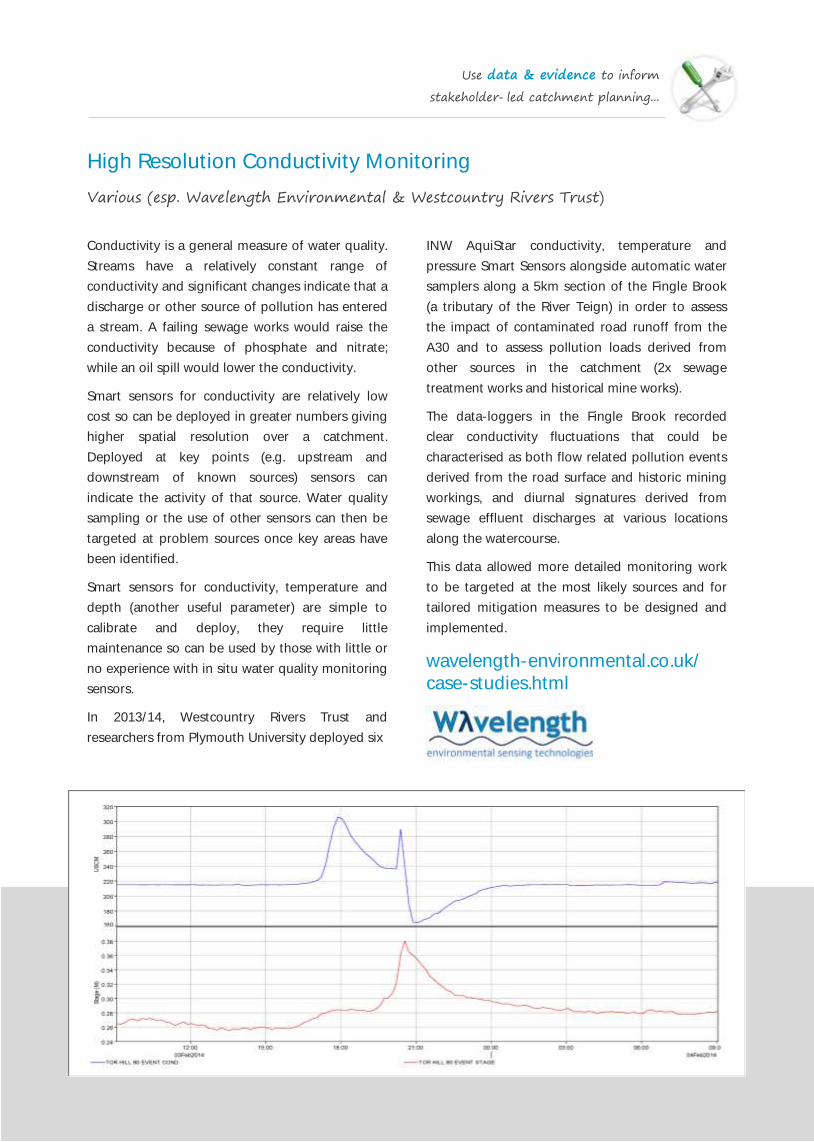
Use data & evidence to inform
stakeholder-led catchment planning...
High Resolution Conductivity Monitoring
Various (esp. Wavelength Environmental & Westcountry Rivers Trust)
Conductivity is a general measure of water quality.
Streams have a relatively constant range of
conductivity and significant changes indicate that a
discharge or other source of pollution has entered
a stream. A failing sewage works would raise the
conductivity because of phosphate and nitrate;
while an oil spill would lower the conductivity.
Smart sensors for conductivity are relatively low
cost so can be deployed in greater numbers giving
higher spatial resolution over a catchment.
Deployed at key points (e.g. upstream and
downstream of known sources) sensors can
indicate the activity of that source. Water quality
sampling or the use of other sensors can then be
targeted at problem sources once key areas have
been identified.
Smart sensors for conductivity, temperature and
depth (another useful parameter) are simple to
calibrate and deploy, they require little
maintenance so can be used by those with little or
no experience with in situ water quality monitoring
sensors.
In 2013/14, Westcountry Rivers Trust and
researchers from Plymouth University deployed six
INW AquiStar conductivity, temperature and
pressure Smart Sensors alongside automatic water
samplers along a 5km section of the Fingle Brook
(a tributary of the River Teign) in order to assess
the impact of contaminated road runoff from the
A30 and to assess pollution loads derived from
other sources in the catchment (2x sewage
treatment works and historical mine works).
The data-loggers in the Fingle Brook recorded
clear conductivity fluctuations that could be
characterised as both flow related pollution events
derived from the road surface and historic mining
workings, and diurnal signatures derived from
sewage effluent discharges at various locations
along the watercourse.
This data allowed more detailed monitoring work
to be targeted at the most likely sources and for
tailored mitigation measures to be designed and
implemented.
wavelength-environmental.co.uk/
case-studies.html
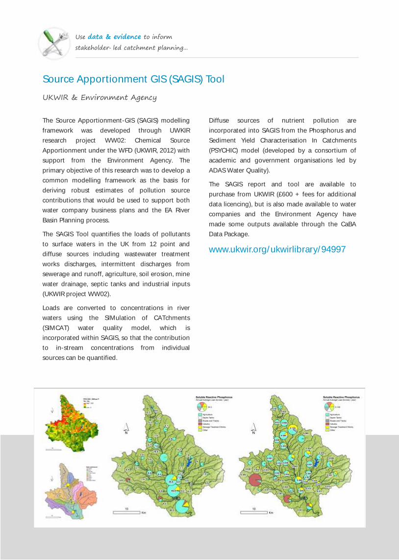
Use data & evidence to inform
stakeholder-led catchment planning...
Source Apportionment GIS (SAGIS) Tool
UKWIR & Environment Agency
The Source Apportionment-GIS (SAGIS) modelling
framework was developed through UWKIR
research project WW02: Chemical Source
Apportionment under the WFD (UKWIR, 2012) with
support from the Environment Agency. The
primary objective of this research was to develop a
common modelling framework as the basis for
deriving robust estimates of pollution source
contributions that would be used to support both
water company business plans and the EA River
Basin Planning process.
The SAGIS Tool quantifies the loads of pollutants
to surface waters in the UK from 12 point and
diffuse sources including wastewater treatment
works discharges, intermittent discharges from
sewerage and runoff, agriculture, soil erosion, mine
water drainage, septic tanks and industrial inputs
(UKWIR project WW02).
Loads are converted to concentrations in river
waters using the SIMulation of CATchments
(SIMCAT) water quality model, which is
incorporated within SAGIS, so that the contribution
to in-stream concentrations from individual
sources can be quantified.
Diffuse sources of nutrient pollution are
incorporated into SAGIS from the Phosphorus and
Sediment Yield Characterisation In Catchments
(PSYCHIC) model (developed by a consortium of
academic and government organisations led by
ADAS Water Quality).
The SAGIS report and tool are available to
purchase from UKWIR (£600 + fees for additional
data licencing), but is also made available to water
companies and the Environment Agency have
made some outputs available through the CaBA
Data Package.
www.ukwir.org/ukwirlibrary/94997

Use data & evidence to inform
stakeholder-led catchment planning...
Fieldmouse
Environment Agency
The Fieldmouse modelling tool helps you target
landscape sources of diffuse pollution, it routes
and decays diffuse loads from Farmscoper and
similar through the catchment and provides an
easy visual assessment of which sources contribute
most to the observed concentration.
It has been designed to provide within catchment
targeting for the CSF project.
Fieldmouse is a steady-state, spatially distributed
catchment model. It uses outputs from the Soil and
Water Assessment Tool (SWAT) model to estimate
losses and decay during transport through the
landscape.
Development work is underway to allow
Fieldmouse to run within the GLUE framework
allowing probabilistic outputs.
The conceptual simplicity and visual outputs of
Fieldmouse give the model the ability to be used in
a participatory modelling environment. The
benefits of participatory modelling in terms of
improved model acceptance by stakeholders and
policy makers have been widely recognised.
The Fieldmouse model and the input data required
can be obtained freely, under an EA open license
with CaBA hosts. However access to ArcGIS
Desktop software and the ArcGIS Spatial Analyst
extension are required to use the model.
Email: john.douglass@environment-
agency.gov.uk
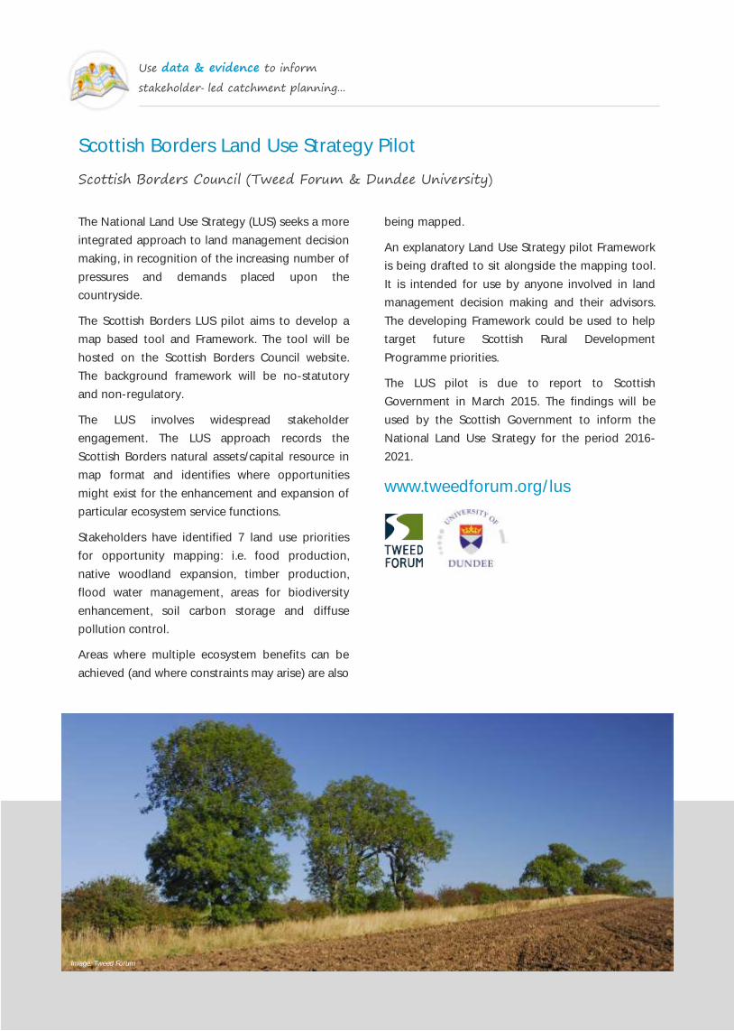
Use data & evidence to inform
stakeholder-led catchment planning...
Scottish Borders Land Use Strategy Pilot
Scottish Borders Council (Tweed Forum & Dundee University)
The National Land Use Strategy (LUS) seeks a more
integrated approach to land management decision
making, in recognition of the increasing number of
pressures and demands placed upon the
countryside.
The Scottish Borders LUS pilot aims to develop a
map based tool and Framework. The tool will be
hosted on the Scottish Borders Council website.
The background framework will be no-statutory
and non-regulatory.
The LUS involves widespread stakeholder
engagement. The LUS approach records the
Scottish Borders natural assets/capital resource in
map format and identifies where opportunities
might exist for the enhancement and expansion of
particular ecosystem service functions.
Stakeholders have identified 7 land use priorities
for opportunity mapping: i.e. food production,
native woodland expansion, timber production,
flood water management, areas for biodiversity
enhancement, soil carbon storage and diffuse
pollution control.
Areas where multiple ecosystem benefits can be
achieved (and where constraints may arise) are also
being mapped.
An explanatory Land Use Strategy pilot Framework
is being drafted to sit alongside the mapping tool.
It is intended for use by anyone involved in land
management decision making and their advisors.
The developing Framework could be used to help
target future Scottish Rural Development
Programme priorities.
The LUS pilot is due to report to Scottish
Government in March 2015. The findings will be
used by the Scottish Government to inform the
National Land Use Strategy for the period 2016-
2021.
www.tweedforum.org/lus
Image: Tweed Forum

Use data & evidence to inform
stakeholder-led catchment planning...
SCIMAP
Sim Reaney, University of Durham (with various partners)
SCIMAP is a risk-mapping framework designed to
identify where in the landscape diffuse pollution is
most likely to be originating. SCIMAP does not try
to make quantitative predictions in real world units
(e.g. mg l-1
) but rather works in relative terms
across the landscape and identifies the most
probable sources of the observed problem.
SCIMAP is based on the identification of locations
of critical source areas within the landscape. These
areas are where there is a source of a problem (fine
sediment for example) and a connection from the
source location to the river or lake. The locations of
the source areas and connection are calculated
from a detailed digital elevation model, land cover
and rainfall information.
For the desktop version of the software, some GIS
knowledge is required to handle the spatial data.
The web based version will require less GIS
knowledge and integrates with Google Earth for
visualization of the results.
The software is free to use for non-commercial use
(i.e. when you are not charging someone else to
use the software). Commercial licenses are
available from Durham University. The required
data needs to be purchased separately.
All of the information required to use SCIMAP,
including a series of tutorial videos, conference
presentations and all of the original scientific
research papers can be found on the SCIMAP
website.
www.scimap.org.uk
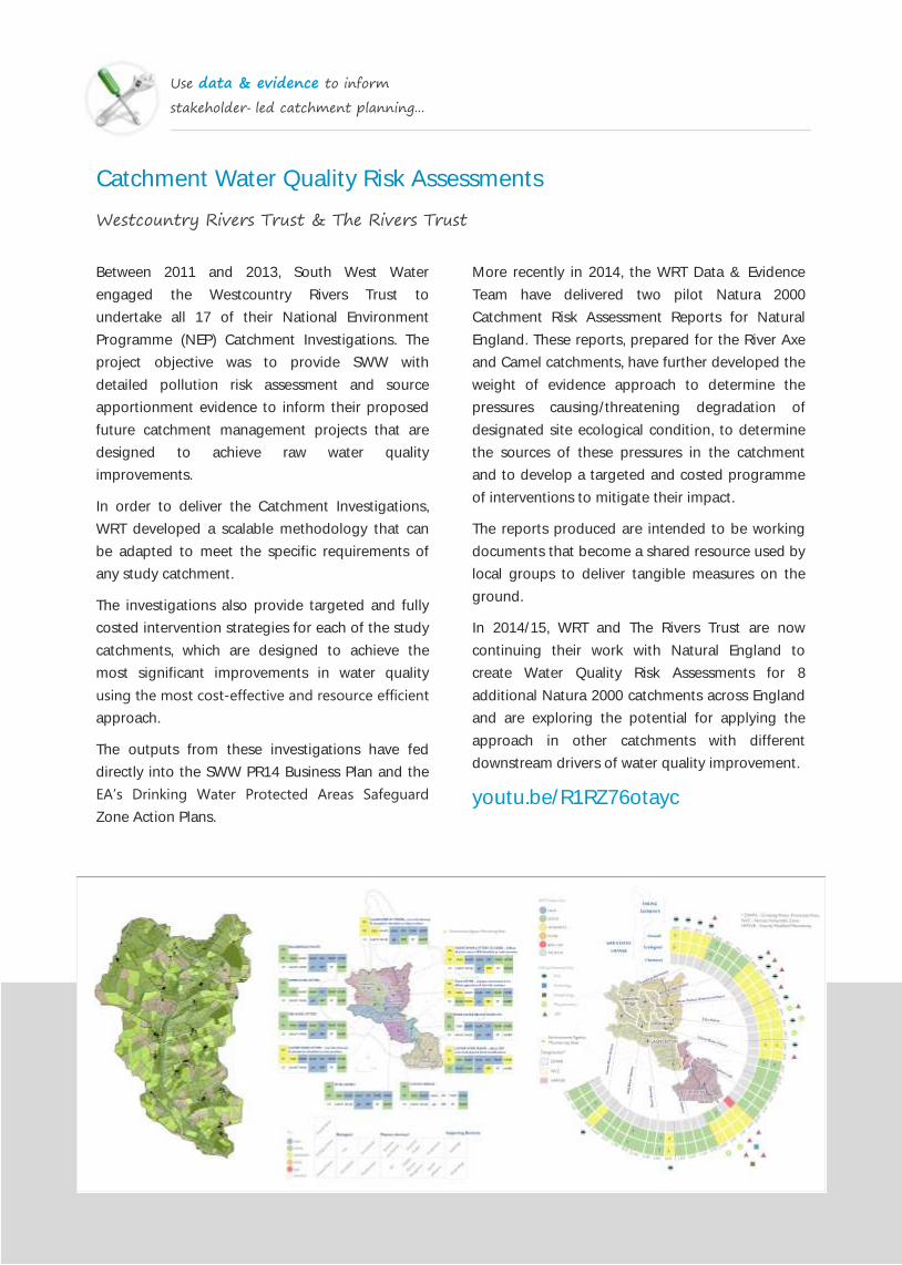
Use data & evidence to inform
stakeholder-led catchment planning...
Catchment Water Quality Risk Assessments
Westcountry Rivers Trust & The Rivers Trust
Between 2011 and 2013, South West Water
engaged the Westcountry Rivers Trust to
undertake all 17 of their National Environment
Programme (NEP) Catchment Investigations. The
project objective was to provide SWW with
detailed pollution risk assessment and source
apportionment evidence to inform their proposed
future catchment management projects that are
designed to achieve raw water quality
improvements.
In order to deliver the Catchment Investigations,
WRT developed a scalable methodology that can
be adapted to meet the specific requirements of
any study catchment.
The investigations also provide targeted and fully
costed intervention strategies for each of the study
catchments, which are designed to achieve the
most significant improvements in water quality
using the most cost‐effective and resource efficient
approach.
The outputs from these investigations have fed
directly into the SWW PR14 Business Plan and the
EA’s Drinking Water Protected Areas Safeguard
Zone Action Plans.
More recently in 2014, the WRT Data & Evidence
Team have delivered two pilot Natura 2000
Catchment Risk Assessment Reports for Natural
England. These reports, prepared for the River Axe
and Camel catchments, have further developed the
weight of evidence approach to determine the
pressures causing/threatening degradation of
designated site ecological condition, to determine
the sources of these pressures in the catchment
and to develop a targeted and costed programme
of interventions to mitigate their impact.
The reports produced are intended to be working
documents that become a shared resource used by
local groups to deliver tangible measures on the
ground.
In 2014/15, WRT and The Rivers Trust are now
continuing their work with Natural England to
create Water Quality Risk Assessments for 8
additional Natura 2000 catchments across England
and are exploring the potential for applying the
approach in other catchments with different
downstream drivers of water quality improvement.
youtu.be/R1RZ76otayc

Use data & evidence to inform
stakeholder-led catchment planning...
Evidence & Measures
Defra, Environment Agency & other partners (e.g. Eden Rivers Trust)
The Evidence and Measures ‘approach’ is not a
model or fixed method, but more a mind-set. It
uses information that is already available and turns
the relevant bits into evidence related to suspected
causes of problems. It then helps stakeholders
reach consensus on the main causes and agree
what to do about them (measures).
Evidence and Measures take the stakeholders' list
of suspected causes to the catchment's problems,
gather relevant information (Environment Agency
datasets, old reports, anecdotal information, GIS
layers etc.), do some processing in Excel and GIS
and draw out evidence for or against suspected
causes. They then summarise this evidence for
stakeholders in Evidence Tables so they can
efficiently evaluate it in a workshop and then move
to setting remedial measures.
Using the outputs for guidance, Evidence and
Measures think all CaBA groups could use part (or
all) of this evidence-based approach: for thorny
issues, problem areas of a catchment or where the
stakeholders disagree about what to do.
The experience of the project team is that the
subsequent release of funds for measures agreed
by stakeholders is about ten times the cost of the
initial Evidence and Measures work.
Perhaps the most well known application of the
approach was the 2010 the River Petteril Evidence
and Measures Project (funded by DEFRA and
Environment Agency) The aim of the project was to
bring together people with different sources of
knowledge and information about the river to work
out what had caused its water quality and wildlife
to decline and what could be done about it.
Email: [email protected]
vimeo.com/62155911

In a stakeholder-led catchment planning processes we can work together to develop
a common understanding of the current and future issues that relate to the
environmental health of the catchment. We can also work to identify what needs to
be done and where it should be delivered to a create healthy, functional ecosystem
that deliver the optimal blend of benefits that they want and need now and in the
future.
Having developed a targeted and tailored plan of what needs to done and where in a
catchment, we then need to go and deliver catchment management interventions
that will achieve the best possible environmental and economic benefits for all of the
interested parties.
3 Deliver targeted & integrated
catchment interventions...
3
Image: WRT

Deliver targeted & integrated
catchment interventions...
Catchment Sensitive Farming
Defra, Natural England & Environment Agency
Funded by DEFRA and the Rural Development
Programme for England, Catchment Sensitive
Farming (CSF) is a joint initiative between the
Environment Agency and Natural England that has
been established in a number of priority
catchments across England.
Overall, CSF has two principle aims: (1) to save
farms money by introducing careful nutrient and
pesticide planning, reduce soil loss and help
farmers meet their statutory obligations such as
Nitrate Vulnerable Zones, and (2) to deliver
environmental benefits such as reducing water
pollution, cleaner drinking water, safer bathing
water, healthier fisheries, thriving wildlife and lower
flood risk for the whole community.
To achieve these goals CSF delivers practical
solutions and targeted support which should
enable farmers and land managers to take
voluntary action to reduce diffuse water pollution
from agriculture to protect water bodies and the
environment.
Catchment Sensitive Farming Officers work with
independent specialists from the farming
community to deliver free advice tailored to the
area and farming sector. This advice includes
workshops, farm events and individual farm
appraisals. CSF also offer capital grants, at up to
60% of the total funding, to deliver improvements
in farm infrastructure.
As part of the Catchment Sensitive Farming
programme, Natural England have also undertaken
an evaluation study to demonstrate the benefits
that the delivery of advice and measures have
realised. In addition to a summary report, Natural
England have also produced a number of case
studies and technical reports covering specific
areas; such as, advice and education delivery, water
quality monitoring and environmental modelling.
www.gov.uk/catchment-sensitive-
farming-reduce-agricultural-water-
pollution
Image: WRT

Deliver targeted & integrated
catchment interventions...
Upstream Thinking
South West Water & various delivery partners
South West Water (SWW) in collaboration with a
group of regional conservation charities, including
the Westcountry Rivers Trust, the county Wildlife
Trusts for Devon and Cornwall and The Farming
and Wildlife Advisory Group, have established one
of the largest and most innovative conservation
projects in the UK: the ‘Upstream Thinking
Initiative’.
This project will deliver over £9 million worth of
strategic land restoration in the Westcountry
between 2010 and 2015, and an even greater
amount over the 2015-2020 funding programme.
The ‘provider is paid’ funding mechanism used in
Upstream Thinking is, perhaps, the most innovative
aspect of the project. SWW have recognized that it
is cheaper to help farmers deliver cleaner raw
water (water in rivers and streams) than it is to pay
for the expensive filtration equipment required to
treat polluted water after it is abstracted from the
river for drinking.
SWW believe that water consumers will be better
served and in a more cost‐effective manner if they
spend money raised from water bills on catchment
restoration in the short term rather than on water
filtration in the long term.
The Upstream Thinking Initiative has seen a wide
array of innovative catchment management and
other environmental interventions delivered,
including: mires restoration, culm grassland
restoration by Devon Wildlife Trust, pesticide
advice and guidance by Cornwall Wildlife Trust and
a reverse auction by Westcountry Rivers Trust in
partnership with the University of East Anglia.
In the first scheme of this kind in the UK, an
auction was successfully used to distribute funds
from a water company to farmers, investing in
capital items to improve water quality. The scheme
offered SWW the opportunity to work directly with
researchers from the University of East Anglia to
devise an innovative mechanism for paying for the
delivery of ecosystem services via their Upstream
Thinking scheme.
www.upstreamthinking.org
www.wrt.org.uk/catchments.html
Image: WRT

Deliver targeted & integrated
catchment interventions...
Sustainable Catchment Management Programme (SCaMP)
United Utilities & various delivery partners
The aims of the SCaMP initiative are to help; (1)
protect and improve water quality, (2) reduce the
rate of increase in raw water colour which will
reduce future revenue costs, (3) reduce or delay
the need for future capital investment for
additional water treatment, (4) deliver government
targets for SSSIs, (5) ensure a sustainable future for
the company's agricultural tenants, (6) enhance
and protect the natural environment, and (7) help
these moorland habitats to become more resilient
to long term climate change.
In addition to their work on SCaMP, United Utilities
have also commissioned an number of catchment
investigations in recent years and they continue to
develop plans for a programme of catchment
management in their currently business plan.
corporate.unitedutilities.com/scamp
-index.aspx
The Sustainable Catchment Management
Programme (SCaMP), has been developed by
United Utilities in association with the Royal
Society for the Protection of Birds (RSPB). The
programme aims to apply an integrated approach
to catchment management across all of the 56,385
hectares of land United Utilities own in the North
West, which they hold to protect the quality of
water entering the reservoirs.
Through the delivery of SCaMP United Utilities is
recognised within the UK water industry as being
at the forefront of water company-funded
catchment management scheme that are aiming to
secure multiple benefits at a landscape scale.
Over the last 30 years there has been a substantial
increase in the levels of colour in the water sources
prior to treatment from many upland catchments.
The removal of colour requires additional process
plant, chemicals, power and waste handling to
meet increasingly demanding drinking water
quality standards. To address this, expensive
capital solutions are often required at a water
works which result in significant increases in annual
operational costs.
Image: United Utilities

Deliver targeted & integrated
catchment interventions...
Wessex Water Catchment Management
Wessex Water
Wessex Water's award winning catchment
management initiative began in 2005, with the
objective of stabilising and then reducing the levels
of contaminant at water sources so no additional
treatment is required. They work with local farmers
and landowners in the catchment areas of the
boreholes and reservoirs to safeguard the quality
of ground and surface waters.
Working together with local farmers and
landowners means they can influence and
implement changes in agricultural land use and
practice to reduce the levels of nitrate and
pesticide that enter the ground and surface water
environments. Methods adopted include data
sharing, advice, practical help and, in some
circumstances, financial incentives. They also liaise
closely with various organisations including the
National Farmers’ Union (NFU) on catchment
management initiatives.
Since the Wessex Water catchment management
programme began in 2005 there have been no
nitrate exceedances in treated water at any of their
‘at risk’ catchments. In addition, they no longer
require additional treatment for pesticides and
metaldehyde removal at one groundwater site and
two surface reservoirs.
These real, measurable outcomes not only provide
cost savings for Wessex Water and its customers,
but also for catchment farmers in terms of
optimised and reduced use of nutrients and
pesticides.
Wessex Water have published a report which
explains their programme, includes case studies
and sets out proposals for the future.
tinyurl.com/ntjzabo
Image: River Piddle Dorset by Jim Linwood (Flickr CC2.0)

Deliver targeted & integrated
catchment interventions...
Environmental Stewardship
Defra, Natural England & various delivery partners
pollution has affected local rivers, farmers will be
able to apply for funding to reduce soil erosion
and run-off from their fields.
The existing Environmental Stewardship and
England Woodland Grant Scheme will be brought
together into a universal scheme that will be open
to applications from both farmers and foresters.
During EU negotiations on the Common
Agricultural Policy, the UK pressed for each country
to have the option to channel a greater proportion
of CAP funding into delivering environmental
benefits. As a result, £3.1billion of funding will be
available for environmental schemes in England
which is a higher proportion of the CAP budget
than ever before.
Defra has announced plans for England’s EU’s
Young Farmers Scheme to give extra support to
farmers under forty years of age and their
intention to apply this support to the maximum
land area of farms.
tinyurl.com/kaebdyy
Environmental Stewardship is a land management
scheme that provides funding to farmers and other
land managers in England to deliver effective
environmental management on your land. There
are currently 3 levels to the scheme:
Entry Level Stewardship (ELS) – includes Uplands
ELS (UELS): simple and effective land
management agreements with priority options
(now closed for new applications)
Organic Entry Level Stewardship (OELS) –
includes Uplands OELS: organic and organic/
conventional mixed farming agreements
Higher Level Stewardship (HLS): more complex
types of management and agreements tailored
to local circumstances
From 2016, the new environmental land
management scheme will be targeted so that
farmers can help deliver environmental priorities
specifically related to their local area, focussing
particularly on increasing biodiversity, helping
wildlife and improving water quality.
For example, if one area is home to rare farmland
birds, farmers will be reimbursed for enhancing
this habitat. If, in another area, agricultural
Image: WRT

Deliver targeted & integrated
catchment interventions...
LEAF (Linking Environment And Farming)
LEAF
LEAF is the leading organisation promoting
sustainable food and farming. They help farmers
produce good food, with care and to
high environmental standards, identified in-store
by the LEAF Marque logo.
LEAF attempts to build public understanding of
food and farming in a number of ways,
including; Open Farm Sunday, Let Nature Feed
Your Senses and year round farm visits to our
national network of Demonstration Farms.
LEAF is also an industry partner in the Campaign
for the Farmed Environment (CFE), which is an
opportunity for their members to demonstrate
their commitment to protecting and enhancing the
farmed environment.
As part of the Campaign, farmers are asked to
ensure that a third of their ELS points come from a
list of key target options. These include options
which result in cleaner water and healthier soil,
protect farmland birds and encourage wildlife and
biodiversity.
LEAF also provide a wide array of educational and
best practice guidance resources on their website,
including their Water Management Tool, which
offers farmers a complete health check for water
use on their farms, and the Simply Sustainable
Water Guidance booklet and film.
The Simply Sustainable Water booklet has been
produced to help farmers develop an effective on-
farm management strategy for efficient water use
and to improve their farm’s contribution to
protecting water in the environment. It allows
farmers to get the best from this valuable resource,
improve awareness of the importance of water and
track changes in water use and quality over time.
Based on Six Simple Steps to help improve the
performance, health and long term sustainability of
their land, farmers are encouraged to set a
baseline by assessing their water use and their
water sources. The six key measures are: (1) water
saving measures, (2) protecting water sources, (3)
soil management, (4) managing drainage, (5)
tracking water use, and (6) water availability and
sunshine hours.
www.leafuk.org
Image: WRT

Deliver targeted & integrated
catchment interventions...
Voluntary Initiative
Various sponsors & partners
Establish a low-cost sprayer testing scheme
(NSTS) with a nationwide network of 294 testing
centres and 465 certificated testers.
Establish the National Register of Spray
Operators (NRoSO), through which spray
operators can demonstrate a commitment to
best practice in pesticide handling and
application.
Create a series of Environmental Information
Sheets as an aid to risk management for all
products sold by members of the Crop
Protection Association.
www.voluntaryinitiative.org.uk
The Voluntary Initiative (VI) began in April 2001. It
is a UK-wide package of measures, agreed with
Government, designed to reduce the
environmental impact of the use of pesticides in
agriculture, horticulture and amenity situations.
Initially a list of 27 proposals, the programme
finally included over 40 different projects covering
research, training, communication and
stewardship.
The combined cost of the programme between
2001 and 2006 to the farming industry, the crop
protection industry, the water industry and others
was estimated to be £45-47m, but during that time
they worked to:
Improve awareness among farmers of the
potential environmental risks arising from
pesticide use; improve the competence of
advisors, improve field practices of spray
operators and optimise their machines.
Engage the farming unions and establishment of
Crop Protection Management Plans (CPMPs) as
a self-audited means of assessing and planning
the environmental aspects of crop protection
activities across the whole farm.

Deliver targeted & integrated
catchment interventions...
Nature Improvement Areas
Various
Nature Improvement Areas (NIA) have been
established to create joined up and resilient
ecological networks at a landscape scale.
They are run by partnerships of local authorities,
local communities and landowners, the private
sector and conservation organisations with funding
provided by the Department for the Environment,
Food and Rural Affairs (Defra) and Natural England
The 12 winning NIA projects were chosen after a
competitive process announced in the Natural
Environment White Paper. These are areas that
have:
Opportunities to establish and improve
ecological networks by enlarging, enhancing and
connecting existing wildlife sites and creating
new sites.
A shared vision for the natural environment
among a wide partnership of local people,
including statutory and voluntary sectors
Surrounding land that can be better integrated
with valued landscapes by restoring wildlife
habitats and support natural processes adapt to
climate change impacts
Benefits to urban areas and communities, with,
where appropriate, ecological networks
extending into urban areas
‘Win-win’ opportunities that offer multiple
benefits, such as for: the water environment and
Water Framework Directive objectives; flood and
coastal erosion risk management, and the low-
carbon economy
Opportunities to inspire people through an
enhanced experience of the natural environment
The Northern Devon Nature Improvement Area
(NIA) is one example of a highly successful
partnership of 15 organisations working on the
river Torridge catchment, led by Devon Wildlife
Trust. The NIA is already delivering impressive
results, demonstrating that large and ambitious
landscape scale approaches really work and deliver
added value and multiple benefits to the
community living in the Torridge catchment.
www.northerndevonnia.org
youtu.be/q2wMk1s4dyc
Image: WRT Image: Gilles San Martin (Flickr CC2.0)
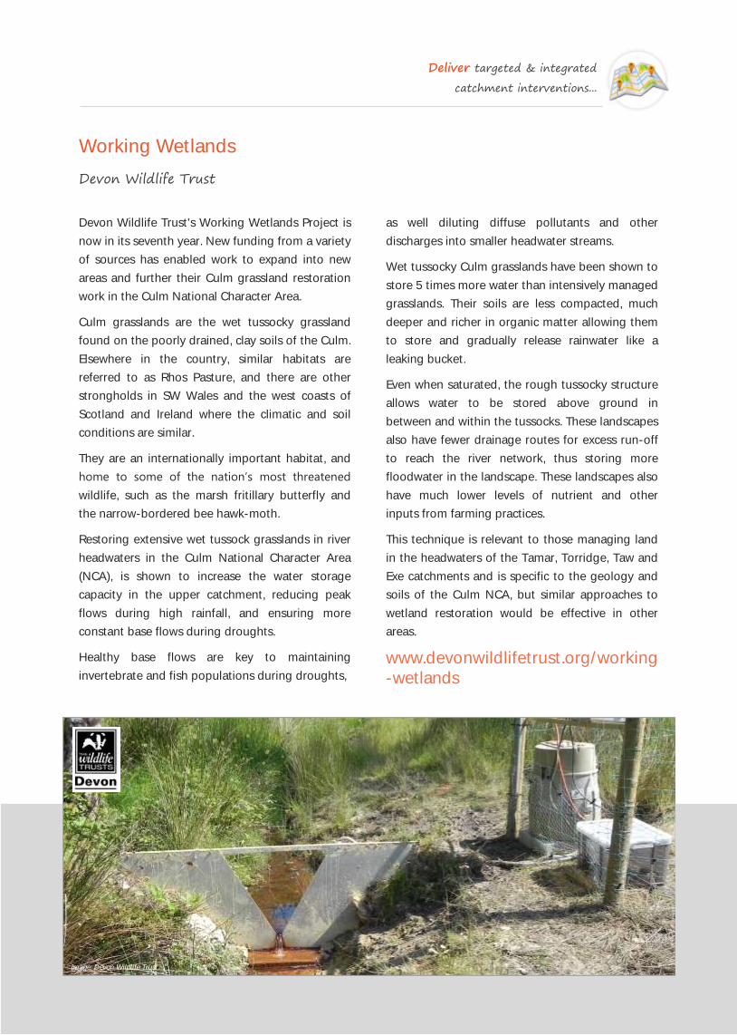
Deliver targeted & integrated
catchment interventions...
Working Wetlands
Devon Wildlife Trust
as well diluting diffuse pollutants and other
discharges into smaller headwater streams.
Wet tussocky Culm grasslands have been shown to
store 5 times more water than intensively managed
grasslands. Their soils are less compacted, much
deeper and richer in organic matter allowing them
to store and gradually release rainwater like a
leaking bucket.
Even when saturated, the rough tussocky structure
allows water to be stored above ground in
between and within the tussocks. These landscapes
also have fewer drainage routes for excess run-off
to reach the river network, thus storing more
floodwater in the landscape. These landscapes also
have much lower levels of nutrient and other
inputs from farming practices.
This technique is relevant to those managing land
in the headwaters of the Tamar, Torridge, Taw and
Exe catchments and is specific to the geology and
soils of the Culm NCA, but similar approaches to
wetland restoration would be effective in other
areas.
www.devonwildlifetrust.org/working
-wetlands
Devon Wildlife Trust's Working Wetlands Project is
now in its seventh year. New funding from a variety
of sources has enabled work to expand into new
areas and further their Culm grassland restoration
work in the Culm National Character Area.
Culm grasslands are the wet tussocky grassland
found on the poorly drained, clay soils of the Culm.
Elsewhere in the country, similar habitats are
referred to as Rhos Pasture, and there are other
strongholds in SW Wales and the west coasts of
Scotland and Ireland where the climatic and soil
conditions are similar.
They are an internationally important habitat, and
home to some of the nation’s most threatened
wildlife, such as the marsh fritillary butterfly and
the narrow-bordered bee hawk-moth.
Restoring extensive wet tussock grasslands in river
headwaters in the Culm National Character Area
(NCA), is shown to increase the water storage
capacity in the upper catchment, reducing peak
flows during high rainfall, and ensuring more
constant base flows during droughts.
Healthy base flows are key to maintaining
invertebrate and fish populations during droughts,
Image: Devon Wildlife Trust

Deliver targeted & integrated
catchment interventions...
Futurescapes
RSPB
Futurescapes is a project run by the RSPB; it has a
large partnership of fellow environment
organisations including local communities,
businesses and government bodies.
Due to decades of habitat loss, the most
threatened UK species are hemmed into
fragmented habitats, mostly in protected areas.
However, it is evident from current conservation
research that this method of conservation is not
enough.
The Futurescapes project aims to reconnect
specific areas of land that were formally
fragmented to provide a rich habitat for wildlife
and diverse, green spaces for people to enjoy.
The project aims to tackle the challenges to wildlife
and society in the following ways:
Build a good partnership with stakeholders to
develop a shared vision for the future, and to
work together to deliver it.
Create more space for nature, by increasing the
size of areas that are managed primarily for
nature conservation.
Making the countryside a better place for
wildlife to adapt to climate change pressures,
and by managing land in ways that help species
move in response to climate change
Putting nature conservation at the heart of
human responses to new pressures on the
countryside, such as bioenergy production and
new infrastructure development.
The RSPB currently has nearly 40 Futurescapes
initiatives around the UK, and plan to expand the
programme to more than 80 places. Two projects
are in the Cairngorms National Park. The Badenoch
and Strathspey Farmed Floodplain Futurescape
encompass grasslands, wetlands, arable mosaics of
the floodplain and tributaries of the River Spey.
Work has focused on facilitating successful Scottish
Rural Development Programme applications,
providing training and enabling free use of rush
management machinery.
You can find our priority areas on the map on the
Futurescapes website.
www.rspb.org.uk/
whatwedo/futurescapes
Image: Grey wagtail by Luc Viatour (Flickr CC2.0)

Deliver targeted & integrated
catchment interventions...
Keeping Rivers Cool
Environment Agency & various partners
To support the identification of key areas to target
and increase riparian shade, LiDAR (Light Detection
And Ranging) data for England and Wales is used
to produce accurate maps of riparian tree
distribution, indicating where the gaps are. The
measure of incoming solar radiation indicates the
likely amount of shade created by the landscape as
well as shading caused by existing vegetation.
It is recognised that riparian shading is not a stand
-alone measure to managing warming in rivers, but
it is a low-risk reversible action and a good start to
keeping rivers cool.
www.asfb.org.uk/keeping-rivers-cool
-new-guidance-for-river-managers
Keeping Rivers Cool is a four year (2012-2016)
Environment Agency led climate change
adaptation project focused on using trees to keep
rivers cool. This approach aims to address the
pressures of climate change on freshwater
ecosystems. The targeted catchments have been
the Wye, Hampshire Avon, Tyne, Ribble, Frome and
the Tywi.
Evidence indicates that some salmon and trout
populations in England and Wales are under stress
from climate change, with some rivers reaching
above the lethal limit for salmonids in recent hot,
dry summers. It has been shown that riparian trees
can help reduce local stream temperatures on hot
summer days. Summer mean and maximum water
temperatures are on average 2-3ºC lower in
shaded versus open rivers.
The Environment Agency has been working with
charitable trusts such as the Woodland Trust and
the Rivers Trusts to plant trees and install riparian
fencing in appropriate sites. The approach aims to
create a mosaic of tree cover along riparian banks,
rather than a blanket cover which could have a
negative impact on other aspects of river ecology.
Image: Keeping Rivers Cool—Ribble Rivers Trust

Deliver targeted & integrated
catchment interventions...
Water Stewardship
WWF & business partners
From the United Nations to rural communities to
corporate boardrooms, water issues are on the
agenda as never before. WWF helps governments
and businesses work together to better manage
this essential resource.
But water stewardship is more than corporate
strategy. It touches people's lives and changes the
way we interact with nature.
Water Stewardship goes beyond being an efficient
water user. It means contributing to the
responsible, sustainable management of
freshwater resources. WWF's work on water
stewardship helps governments, companies,
investors and others understand their water
footprints and become better water stewards.
But the journey doesn’t end there. Beyond water
footprints and reducing the impact of individual
water users, WWF urges companies to look outside
their own operations. We are helping redefine the
role of the private sector in advocating, supporting
and promoting better basin governance, for the
benefit of people and nature.
In the UK, WWF are engaging with individual
businesses to reduce the impacts of their water
use. WWF is the partner of choice for The Coca-
Cola Company, SABMiller, H&M and Marks &
Spencer, among others, to identify opportunities
for enhanced water stewardship. They facilitate
private sector engagement with public policy to
conserve water resources in our priority river
basins.
WWF are also promoting public sector water
stewardship at the river basin level. This includes
measuring water use and impacts at the river basin
level, demonstrating solutions for reducing these
impacts, and promoting national and international
policies that encourage good water stewardship
and ensure environmental flows.
tinyurl.com/khcvd8r
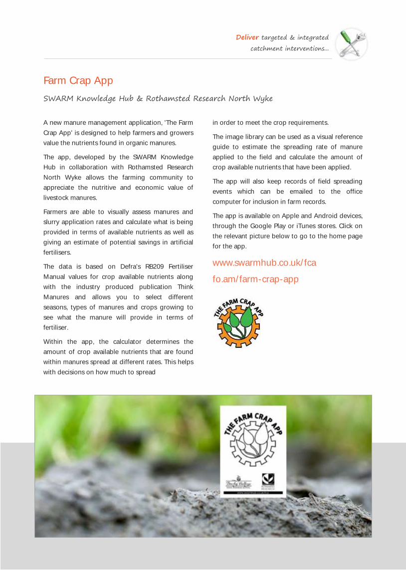
Deliver targeted & integrated
catchment interventions...
Farm Crap App
SWARM Knowledge Hub & Rothamsted Research North Wyke
in order to meet the crop requirements.
The image library can be used as a visual reference
guide to estimate the spreading rate of manure
applied to the field and calculate the amount of
crop available nutrients that have been applied.
The app will also keep records of field spreading
events which can be emailed to the office
computer for inclusion in farm records.
The app is available on Apple and Android devices,
through the Google Play or iTunes stores. Click on
the relevant picture below to go to the home page
for the app.
www.swarmhub.co.uk/fca
fo.am/farm-crap-app
A new manure management application, 'The Farm
Crap App' is designed to help farmers and growers
value the nutrients found in organic manures.
The app, developed by the SWARM Knowledge
Hub in collaboration with Rothamsted Research
North Wyke allows the farming community to
appreciate the nutritive and economic value of
livestock manures.
Farmers are able to visually assess manures and
slurry application rates and calculate what is being
provided in terms of available nutrients as well as
giving an estimate of potential savings in artificial
fertilisers.
The data is based on Defra's RB209 Fertiliser
Manual values for crop available nutrients along
with the industry produced publication Think
Manures and allows you to select different
seasons, types of manures and crops growing to
see what the manure will provide in terms of
fertiliser.
Within the app, the calculator determines the
amount of crop available nutrients that are found
within manures spread at different rates. This helps
with decisions on how much to spread

Deliver targeted & integrated
catchment interventions...
Tweed Natural Flood Management (NFM) Programme
Tweed Forum
A restoration programme has been developed
which will both restore natural habitats and help
reduce the risk of flooding to the main Border
towns.
NFM measures focus on key areas of sub-
catchments including the upper valley and hill
slopes (which are the main sources of flood water
to the river); the valley bottom or floodplain and
the channels and habitats of the river itself. It’s
primarily about reducing surface water run-off
rates and increasing storage.
The project is working in 5 sub-catchments of the
Tweed at 59 individual sites. NFM measures being
put in place include: Blocking hill drains (mostly in
peat bogs), planting hill slope and gully (native)
woodlands, placing log jams across minor
watercourses, undertaking bankside revetment,
creating water retention ponds, re-meandering
rivers, planting transverse hedges and planting
floodplain (native) woodlands.
Funding for the work comes from a wide variety of
public and private sources including; the Scottish
Rural Development Programme (SRDP), the
Scottish Government, voluntary carbon
contributions and Wind Farm Biodiversity Offset
funding schemes.
The scheme is targeted to catchments where there
a flood risk (either to settlements downstream or
to land and agricultural infrastructure) at specific
locations where the most benefit to reducing
surface water flow rates can be achieved.
www.tweedforum.org/projects
Image: Tweed Forum
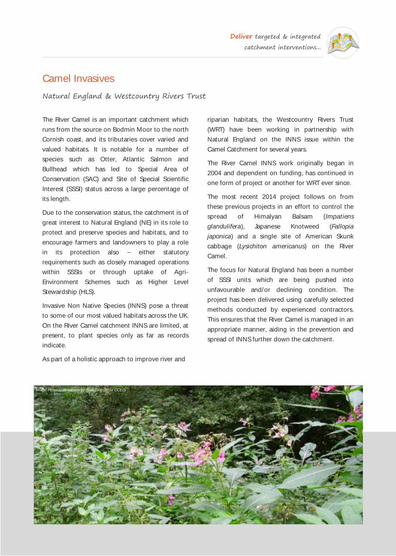
Deliver targeted & integrated
catchment interventions...
Camel Invasives
Natural England & Westcountry Rivers Trust
riparian habitats, the Westcountry Rivers Trust
(WRT) have been working in partnership with
Natural England on the INNS issue within the
Camel Catchment for several years.
The River Camel INNS work originally began in
2004 and dependent on funding, has continued in
one form of project or another for WRT ever since.
The most recent 2014 project follows on from
these previous projects in an effort to control the
spread of Himalyan Balsam (Impatiens
glandulifera), Japanese Knotweed (Fallopia
japonica) and a single site of American Skunk
cabbage (Lysichiton americanus) on the River
Camel.
The focus for Natural England has been a number
of SSSI units which are being pushed into
unfavourable and/or declining condition. The
project has been delivered using carefully selected
methods conducted by experienced contractors.
This ensures that the River Camel is managed in an
appropriate manner, aiding in the prevention and
spread of INNS further down the catchment.
The River Camel is an important catchment which
runs from the source on Bodmin Moor to the north
Cornish coast, and its tributaries cover varied and
valued habitats. It is notable for a number of
species such as Otter, Atlantic Salmon and
Bullhead which has led to Special Area of
Conservation (SAC) and Site of Special Scientific
Interest (SSSI) status across a large percentage of
its length.
Due to the conservation status, the catchment is of
great interest to Natural England (NE) in its role to
protect and preserve species and habitats, and to
encourage farmers and landowners to play a role
in its protection also – either statutory
requirements such as closely managed operations
within SSSIs or through uptake of Agri-
Environment Schemes such as Higher Level
Stewardship (HLS).
Invasive Non Native Species (INNS) pose a threat
to some of our most valued habitats across the UK.
On the River Camel catchment INNS are limited, at
present, to plant species only as far as records
indicate.
As part of a holistic approach to improve river and
Image: Himalayan balsam by Natubico (Flickr CC3.0)

Deliver targeted & integrated
catchment interventions...
Tweed Invasives Project
Tweed Forum
Invasive species such as Giant Hogweed, Japanese
Knotweed and Himalayan Balsam, pose a serious
threat to our natural heritage by out-competing
native species. They can out-compete because the
natural checks and balances (e.g. predation) which
native species are subject to do not affect non-
native species.
The Project uses various elimination methods,
including spraying (with certified herbicides) and
hand-pulling, to ensure that these damaging
invasive species are prevented from flowering each
year. For plants such as Giant Hogweed, with a
seed-life of up to 12 years, this is vital in ensuring
the eventual eradication of the species from the
Tweed catchment.
The Project is a close collaboration between Tweed
Forum staff and local landowners, farmers, ghillies,
fishermen and volunteers. This means that the
control work is carried out in partnership, a key
factor in the success and longevity of our work.
After 10 years of catchment-wide control, Giant
Hogweed coverage is greatly reduced and all
plants have been prevented from flowering. This
means that the seedbank for this species should be
decreasing year on year making eventual
eradication more likely.
Japanese Knotweed has proved more challenging
to control, however, it is more widespread than
previously thought. A number of control methods
have been trialled but the method of manually
chopping the Japanese Knotweed down and then
spraying down the stems appeared the most
successful, with patches treated in this manor
vastly reduced in density and abundance.
The status of Himalayan Balsam control in the Till
sub-catchment is heartening with a steady
decrease in the presence of this species.
During the initial years of control, hand pulling was
the method of control adopted, however, this
proved to be very slow and costly, making it
impossible to cover the whole river. In 2007, the
decision was taken to use chemical control and a
clear reduction in infestation has shown that this
Himalayan Balsam does respond relatively quickly
to coordinated control.
www.tweedforum.org/projects/
current-projects/tweed_invasives
Image: WRT

Deliver targeted & integrated
catchment interventions...
Restoring & Managing Wetlands Using Native Eurasian Beavers
Devon Wildlife Trust
Currently the use of beavers is restricted to a
limited number of fenced sites. However DWT has
submitted an application to monitor the impacts of
the animals living wild on the River Otter.
www.devonwildlifetrust.org/devon-
beaver-project
A wide range of British wetland species depend on
the habitats created by this once widespread
keystone species.
Beavers create complex wetland mosaics, creating
ponds, canals, mires and braided streams, and
coppicing trees like willow as aspen to maintain
open grassland habitats within the mosaic. Their
wetlands store water in headwaters reducing
flooding and ameliorating the impacts of droughts,
and trapping pollutants.
This vegetarian animal coppices trees to
regenerate fresh young shoots, and grazes grasses
and other bankside vegetation. Beavers feel safe
in water and create canals and ponds to expand,
explore and exploit the riparian corridor.
In headwaters they build leaky dams to create
open water where little exists. As well as providing
extensive habitats for wetland species, the dams
trickle water into the headwaters providing healthy
base-flows, and reducing flooding.
Further downstream they coppice riverside trees,
bringing light to more shaded areas and creating
habitats for invertebrates and fish.
Image: David Plummer www.davidplummerimages.co.uk

Deliver targeted & integrated
catchment interventions...
SuDS for Schools
Wildfowl & Wetlands Trust, Environment Agency & Thames Water
The Wildfowl & Wetlands Trust (WWT) is working
in partnership with the Environment Agency and
Thames Water to protect streams and rivers from
pollution, and to ease the strain on existing
drainage systems
As rainwater flows over hard surfaces such as roofs
and roads, it collects pollution, dirt and debris.
This water currently flows into underground pipes
and can go directly in to your local stream or river,
damaging the health of that water body. WWT
wants to improve the quality of surface water
entering streams and rivers and keep them healthy
for the benefit of wildlife and local communities.
The SuDS for Schools Project aims to build
Sustainable Drainage Systems (SuDS) in ten
schools within the Pymmes Brook Catchment in
North London. SuDS mimic natural processes by
catching and slowing the flow of rain water to
streams and rivers, and filtering it to remove
pollution along the way. SuDS also aim to keep
water on the surface rather than being directed
into underground pipes. Examples of SuDS include
rain gardens, swales, detention basins, some types
of ponds, reedbeds and green roofs.
This project helps schools and their local
communities to:
Naturalise and ‘green’ outdoor spaces
Improve the health of local rivers
Provide habitats for wildlife and increase school
biodiversity levels
Save water
Reduce local flooding
Develop whole school understanding related to
environmental conservation and sustainability
Learn outdoors
Forge closer links with the local community and
become a hub for interested parties including
businesses and other schools
Increase school profile through local and regional
media
Develop community understanding related to
environmental conservation and sustainability
www.sudsforschools.wwt.org.uk
Image: Wildfowl & Wetlands Trust

Deliver targeted & integrated
catchment interventions...
SuDS Guidance & Best Practice
Wildfowl & Wetlands Trust & Environment Agency
management options that fit the definition of
sustainable drainage. It also reviews their cost and
effectiveness in helping to meet the objectives of
the Water Framework Directive, to reduce flood
risk and adapt to climate change.
The techniques described focus on intercepting
run-off and trapping sediment before it leaves the
field. This can provide additional benefits such as
temporarily capturing water and slowing down
flow which can help reduce localised flooding and
provide valuable micro-aquatic habitats in the right
circumstances. Options explored in the report
include trenches, wetlands, retention ponds and
buffers and many of these features can be further
enhanced by sediment traps as part of the design.
The report contends that whilst rural SuDS may be
more complex to create compared to a simple
buffer strip, they also provide a number of
additional benefits for the landowner and can
increase the effectiveness of existing features such
as buffer strips, walls and new hedgerows.
tinyurl.com/nm2ywpt
Together with the RSPB, the Wildfowl & Wetlands
Trust (WWT) have produced a publication detailing
how to design and install efficient SuDS. The guide
is aimed at aimed at local authorities, (and
eventual SuDS Approving Bodies (SABs)),
landscape architects, developers, engineers, master
-planners and anyone wishing to deliver benefits
for people and wildlife through SuDS.
Using best practice case studies, the guide
complements existing guidelines and identifies
design features and criteria to maximise ecological
benefits.
www.wwt.org.uk/conser vation/
sav ing-wet lands-and-wi ld l i fe/
influencing-action/guidance
In 2012, the Environment Agency published a
report on Rural Sustainable Drainage Systems
(RSuDS). The report was compiled by Macaulay
Institute with the aim of compiling an inventory of
Rural SuDS that are appropriate for use in
agricultural systems. It also describes their relative
cost and effectiveness in farming systems.
The report provides a list of existing land

Deliver targeted & integrated
catchment interventions...
The Sheffield Waterways Strategy
South Yorkshire Forest, the River Stewardship Company & various partners
The Sheffield Waterways Strategy shows an
inspiring vision of Sheffield’s rivers by 2022; once
again providing places where people choose to
live, work and invest.
The strategy has been prepared by a partnership
between voluntary sector groups and statutory
organisations, all of whom have an active role in
the care and regeneration of Sheffield waterways.
The aim of the group is to promote co-ordinated
regeneration of our waterways.
Sheffield has over 150 miles of rivers and streams
which, to a large extent, are responsible for the
character of the city that we know today. Sheffield
rivers and streams are major assets to the city and
the Strategy will help deliver sustainable
regeneration for future generations.
The vision for Sheffield rivers by 2022 includes
watercourses and river corridors as defining
features of a modern competitive, sustainable and
attractive city, rich in wildlife and offering a
wonderful quality of life to residents, workers and
visitors.
It is hoped the Strategy will help re-engage local
people, inspiring them to volunteer with their local
friends group by joining river clean ups, attending
river themed community events and supporting
future funding bids.
One of the key delivery partners in the Sheffield
Waterways Strategy is local The River Stewardship
Company who work to improve the waterways for
people and wildlife in and around Sheffield.
The RSC passionately believe in the value of well
maintained waterways
As beautiful places for people to relax and enjoy
As rich habitats for wildlife
As desirable settings for businesses and residents
The RSC are committed to delivering high quality
practical riverside management work on behalf of
private, public and third sector customers.
The RSC campaign for better care of our waterways
and run projects to inform and involve local young
people and volunteers in waterway improvements
and fun waterside activities and events.
www.southyorkshireforest.co.uk
wwww.the-rsc.co.uk
Image: Five Weirs Walk in Sheffield by Tim Ellis (Flickr CC2.0)

Deliver targeted & integrated
catchment interventions...
Regenerating Parks in London
Local Authorities, Environment Agecy & local delivery partners
all designed to create more sustainable drainage
and reduce flooding. This restoration also gave the
park a new entrance, adventure playground and
tennis courts.
tinyurl.com/nbcgao6
The restoration of the Mayes Brook in Mayesbrook
Park, in the London Borough of Barking and
Dagenham, has created an ecological and
community focal point within a broader
environmental regeneration project. It was
designed to produce the UK’s first climate change
adaptation public park. The restoration of an urban
river within a barren park landscape is also a good
example of an approach that combines flood
storage, biodiversity enhancement and adaptation
to climate change within a city environment.
thamesriverstrust.org.uk/projects/
mayesbrook-climate-change-park
Ladywell Fields, originally Ladywell Recreation
Ground is a public park in the London Borough of
Lewisham created from three historic fields. The
park, which consists of three adjoining fields,
extends to 22 hectares (54 acres) and follows the
course of the River Ravensbourne.
The River Ravensbourne is the major natural
feature of the park's three fields, but previous work
to reduce flooding had affected its aesthetic,
recreational and environmental value. The park
underwent enhancements in 2007/8 to the
northern Field to divert the river into main area of
the field creating a wonderful natural space where
river dipping and paddling is popular in the
Summer months.
Then in 2010/11, a major £2m project was funded
by the London Development Agency and won
‘best new public space’ in the London Planning
Awards 2011. Renovation, which was undertaken
by BDP and East Architecture, included redesigned
footpaths, river viewing platforms, an orchard and
meadows. The river channel was modified to create
a more naturalistic setting incorporating
backwaters, wetlands and riverside tree planting –
Image: Ladywell Field, Lewisham by Ellis Munro (Flickr CC2.0)

The principal, over-arching aim of any catchment management work is to improve
the water quality in our freshwater ecosystems and to make a significant contribution
to their attainment of good ecological status in accordance with requirements of the
EU Water Framework Directive. It is therefore vital that sufficient evidence is collected
to provide an objective and robust assessment of the improvements delivered.
Ultimately, we must be able to justify that the money spent and the interventions
delivered across the landscape have delivered significant improvements in water
quality (and have therefore made significant contributions to the delivery of good
ecological status of river catchments) and have generated significant secondary
financial, ecological and social benefits.
4 Use monitoring & modelling
to measure improvements...
4
Image: WRT
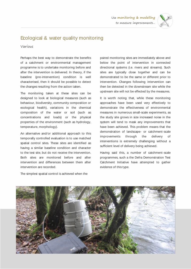
Use monitoring & modelling
to measure improvements...
Ecological & water quality monitoring
Various
paired monitoring sites are immediately above and
below the point of intervention in connected
directional systems (i.e. rivers and streams). Such
sites are typically close together and can be
demonstrated to be the same or different prior to
intervention. Changes following intervention can
then be detected in the downstream site while the
upstream site will not be effected by the measures.
It is worth noting that, while these monitoring
approaches have been used very effectively to
demonstrate the effectiveness of environmental
measures in numerous small-scale experiments, as
the study site grows in size increased noise in the
system will tend to mask any improvements that
have been achieved. This problem means that the
demonstration of landscape- or catchment-scale
improvements through the delivery of
interventions is extremely challenging without a
sufficient level of delivery being achieved.
Having said this, a number of catchment-scale
programmes, such a the Defra Demonstration Test
Catchment Initiative have attempted to gather
evidence of this type.
Perhaps the best way to demonstrate the benefits
of a catchment or environmental management
programme is to undertake monitoring before and
after the intervention is delivered. In theory, if the
baseline (pre-intervention) condition is well
characterised, then it should be possible to detect
the changes resulting from the action taken.
The monitoring taken at these sites can be
designed to look at biological measures (such as
behaviour, biodiversity, community composition or
ecological health), variations in the chemical
composition of the water or soil (such as
concentrations and loads) or the physical
properties of the environment (such as hydrology,
temperature, morphology).
An alternative and/or additional approach to this
temporally controlled evaluation is to use matched
spatial control sites. These sites are identified as
having a similar baseline condition and character
to the test site, but do not receive the intervention.
Both sites are monitored before and after
intervention and differences between them after
intervention are recorded.
The simplest spatial control is achieved when the
Image: WRT

Use monitoring & modelling
to measure improvements...
Defra Demonstration Test Catchments (DTC)
Various partners in each DTC consortium
Demonstration Test Catchments (DTC) is a UK
government-funded project designed to provide
robust evidence regarding how diffuse pollution
from agriculture can be cost-effectively controlled
to improve and maintain water quality in rural river
catchment areas.
The DTC project is currently working in four study
catchments in England, which are representative of
80% of UK soil-rainfall combinations and the major
farm types in England and Wales.
The catchments were selected in order to build on
existing infrastructure, datasets, knowledge and
farming contacts developed through previous and
ongoing initiatives, which have not previously been
well linked.
The catchments are also undergoing enhanced
monitoring through the England Catchment
Sensitive Farming Delivery Initiative.
The Eden in Cumbria
The Wensum in Norfolk
The Avon in Hampshire - and the Tamar on the
Devon/Cornwall border in close association with
the Westcountry Rivers Trust.
DTC was established to address the gap in
empirical evidence on the cost-effectiveness of
combinations of diffuse pollution mitigation
measures at catchment scales. By setting up as a
platform with a community of researchers working
closely with local stakeholders (practitioners and
policy-delivery agents) and policy-makers.
DTC has three main roles:
As a programme of linked and co-ordinated
research projects to provide underpinning
research, from farm to catchment scale, that
informs policy and practical approaches
As a research platform: to host longer-term
collaborative research on diffuse pollution from
agriculture
As a demonstration and co-ordination activity to
demonstrate scientifically robust approaches to
diffuse pollution mitigation
www.demonstratingcatchmentmana
gement.net/
Image: Clouds over the Avon by Allan (Flickr CC2.0)
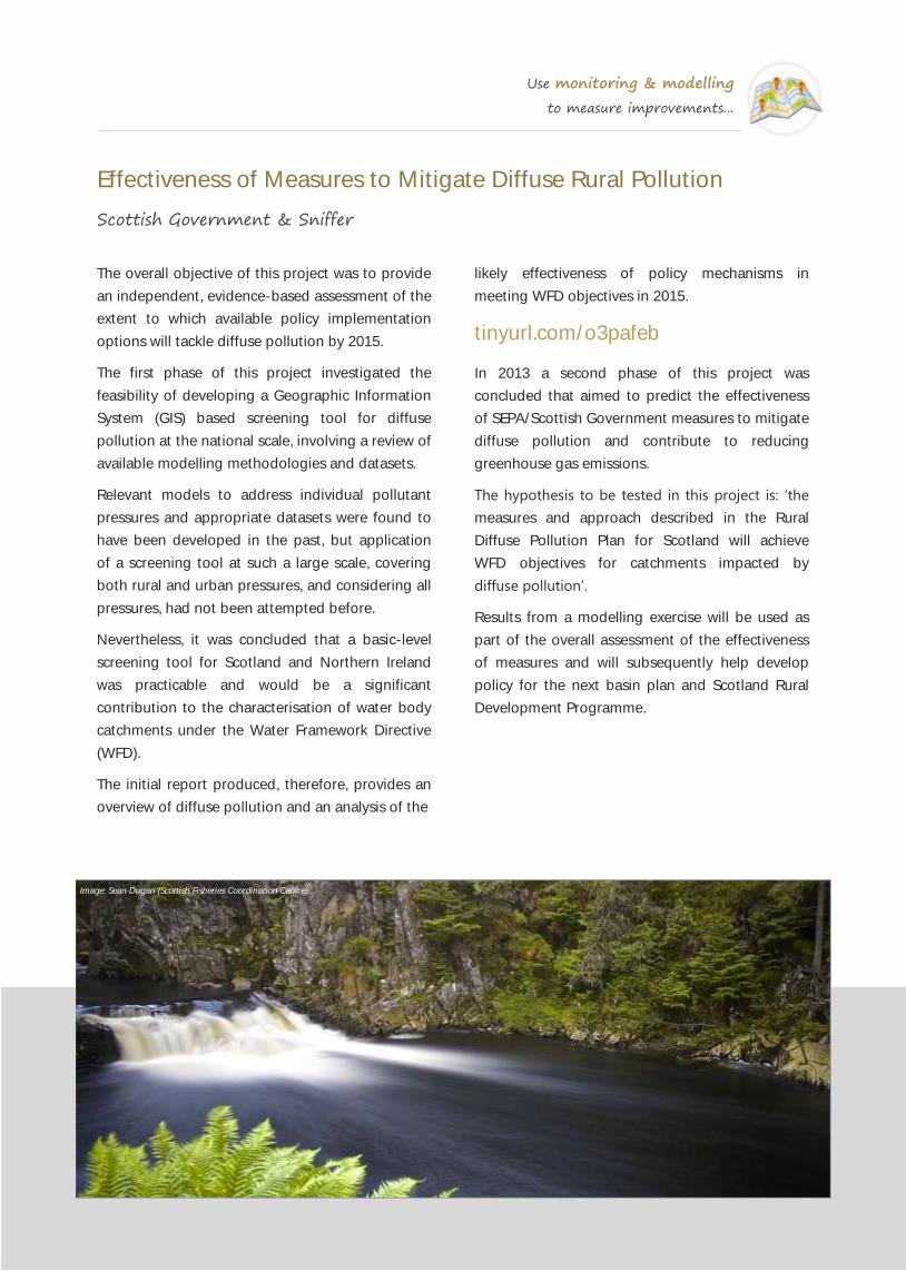
Use monitoring & modelling
to measure improvements...
Effectiveness of Measures to Mitigate Diffuse Rural Pollution
Scottish Government & Sniffer
likely effectiveness of policy mechanisms in
meeting WFD objectives in 2015.
tinyurl.com/o3pafeb
In 2013 a second phase of this project was
concluded that aimed to predict the effectiveness
of SEPA/Scottish Government measures to mitigate
diffuse pollution and contribute to reducing
greenhouse gas emissions.
The hypothesis to be tested in this project is: ‘the
measures and approach described in the Rural
Diffuse Pollution Plan for Scotland will achieve
WFD objectives for catchments impacted by
diffuse pollution’.
Results from a modelling exercise will be used as
part of the overall assessment of the effectiveness
of measures and will subsequently help develop
policy for the next basin plan and Scotland Rural
Development Programme.
The overall objective of this project was to provide
an independent, evidence-based assessment of the
extent to which available policy implementation
options will tackle diffuse pollution by 2015.
The first phase of this project investigated the
feasibility of developing a Geographic Information
System (GIS) based screening tool for diffuse
pollution at the national scale, involving a review of
available modelling methodologies and datasets.
Relevant models to address individual pollutant
pressures and appropriate datasets were found to
have been developed in the past, but application
of a screening tool at such a large scale, covering
both rural and urban pressures, and considering all
pressures, had not been attempted before.
Nevertheless, it was concluded that a basic-level
screening tool for Scotland and Northern Ireland
was practicable and would be a significant
contribution to the characterisation of water body
catchments under the Water Framework Directive
(WFD).
The initial report produced, therefore, provides an
overview of diffuse pollution and an analysis of the
Image: Sean Dugan (Scottish Fisheries Coordination Centre)

Use monitoring & modelling
to measure improvements...
Quantifying the Benefits of Catchment Management Initiatives
UKWIR
This report presents a framework and supporting
toolkit for assessing the benefits of catchment
management schemes.
Specifically it develops an approach for quantifying
the benefits; provides structured, step-by-step
guidance on undertaking a benefit assessment;
offers practical advice and guidance on assessing
effectiveness and monetising resulting benefits;
signposts further guidance, resources and tools;
and discusses how the results of the benefit
assessment may be used in a cost-effectiveness or
cost-benefit analysis.
The framework may be used to undertake a
qualitative, quantitative or monetary assessment of
the benefits (or negative dis-benefits) resulting
from a specific management intervention. The
framework may also be used in an appraisal to
forecast the benefits of one or more options
before a decision is made, or in an evaluation to
measure the benefits realised by an operational
scheme.
This information may be an end in itself, but is
more commonly input into a cost-effectiveness or
cost-benefit analysis to judge whether a scheme is
economically viable or to decide where to invest in
catchment management. This set of four Volumes
comprises a Benefit Assessment Framework, an
Overview Report, a Review of the Effectiveness of
Catchment Management Initiatives and Case
Studies.
www.ukwir.org/ukwirlibrary/95165
tinyurl.com/lqtus5r
Image: WRT

Use monitoring & modelling
to measure improvements...
Catchment Management Evidence Review
Westcountry Rivers Trust
The principal, over‐arching aim of any catchment
management work is to improve the water quality
in our freshwater ecosystems and to make a
significant contribution to their attainment of good
ecological status in accordance with requirements
of the EU Water Framework Directive. It is
therefore vital that sufficient evidence is collected
to provide an objective and robust assessment of
the improvements delivered.
In this review, Westcountry Rivers Trust explore the
data and evidence available, which, taken together,
demonstrate qualitatively and quantitatively that
the delivery of integrated catchment management
interventions can realise genuine improvements in
water quality. To support the evidence collected,
they have also summarised a number of case
studies which demonstrate catchment
management in action.
For each of the main groups of pollutants,
identified key sources of pollutant loads and
examined the impacts these pollutants have on the
aquatic environment, including how they translate
into a cost or risk to society. They have also
identified key mitigation measures for reducing
pollutant loads and evaluated the data and
evidence for the efficacy of these measures. This
process has also allowed them to identify the
interventions for which the evidence of efficacy
does not exist or where it does not exist at an
appropriate scale.
The review also addresses issues of scale and
reviews a selection of modelling tools that can be
used to predict the impact of interventions and
measures at a larger sub-catchment or whole-
catchment scale. It also explores the potential for
secondary environmental, economic and societal
benefits to result from the delivery of catchment
management interventions.
Finally the governance structures currently being
used to implement a catchment management-
based approach in the UK are reviewed and some
of the approaches now being adopted to create
catchment management plans are examined.
issuu.com/westcountryriverstrust
tinyurl.com/qc3htrk
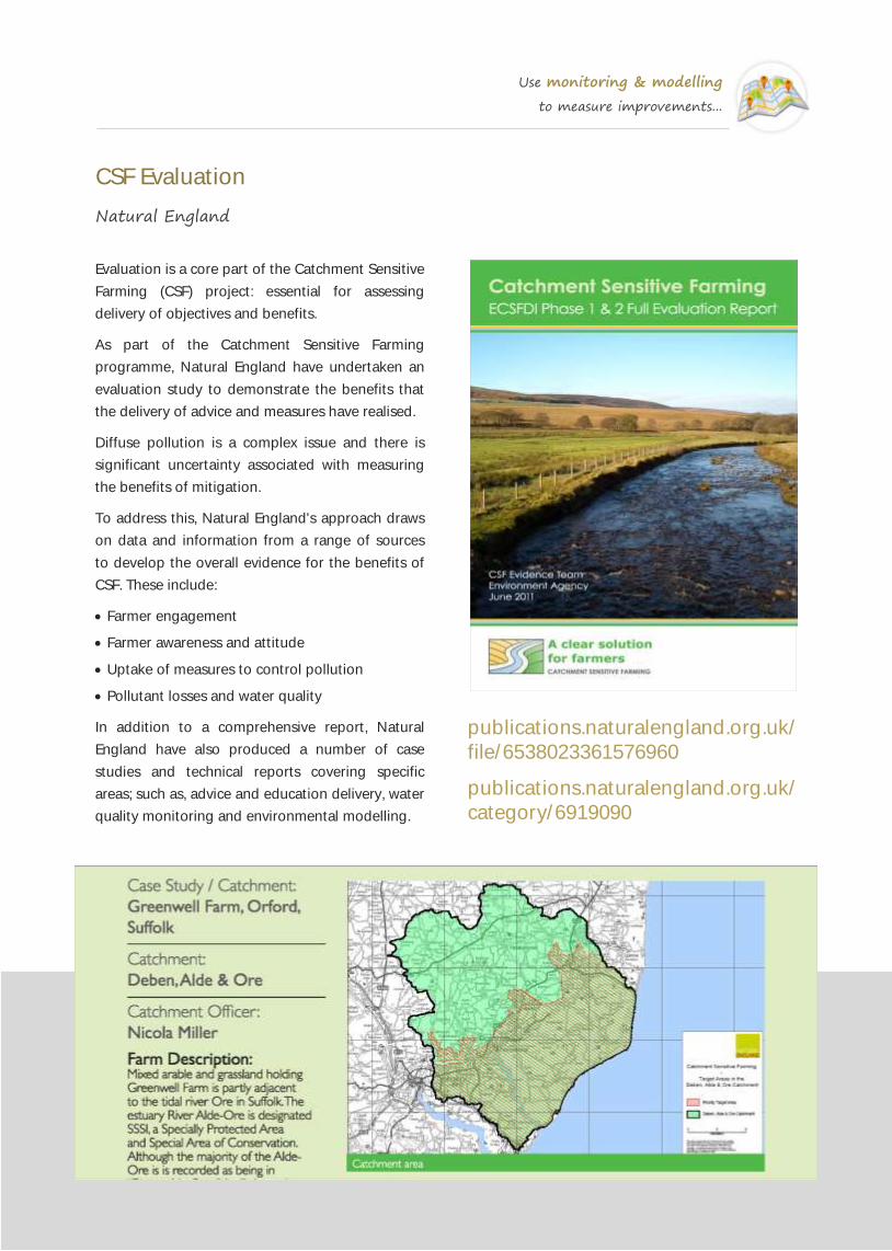
Use monitoring & modelling
to measure improvements...
CSF Evaluation
Natural England
Evaluation is a core part of the Catchment Sensitive
Farming (CSF) project: essential for assessing
delivery of objectives and benefits.
As part of the Catchment Sensitive Farming
programme, Natural England have undertaken an
evaluation study to demonstrate the benefits that
the delivery of advice and measures have realised.
Diffuse pollution is a complex issue and there is
significant uncertainty associated with measuring
the benefits of mitigation.
To address this, Natural England's approach draws
on data and information from a range of sources
to develop the overall evidence for the benefits of
CSF. These include:
Farmer engagement
Farmer awareness and attitude
Uptake of measures to control pollution
Pollutant losses and water quality
In addition to a comprehensive report, Natural
England have also produced a number of case
studies and technical reports covering specific
areas; such as, advice and education delivery, water
quality monitoring and environmental modelling.
publications.naturalengland.org.uk/
file/6538023361576960
publications.naturalengland.org.uk/
category/6919090

Use monitoring & modelling
to measure improvements...
Farmscoper
ADAS
The FARM SCale Optimisation of Pollutant
Emission Reductions (FARMSCOPER) model is a
decision support tool that can be used to assess
diffuse agricultural pollutant loads on a farm and
quantify the impacts of farm pollution control
options on these pollutants.
FARMSCOPER allows unique farming systems to be
created, based on combinations of livestock,
cropping and manure management practices. The
pollutant losses and impacts of mitigation can then
be assessed for these farming systems.
The effect of a potential intervention is expressed
as a percentage reduction in the pollutant loss
from specific sources, areas or pathways.
The tool utilises a number of existing models :
Phosphorus and Sediment Yield Characterisation
in Catchments (PSYCHIC)
National Environment Agricultural Pollution-
Nitrate (NEAP-N)
National Ammonia Reduction Strategy
Evaluation System (NARSES)
MANure Nitrogen Evaluation Routine (MANNER)
IPPC method for methane and nitrous oxide.

Use monitoring & modelling
to measure improvements...
Extended Export Co-Efficient Model (ECM+)
University of East Anglia & Westcountry Rivers Trust
Location and area of lakes and reservoirs with
modelled impact on pollutant load at outflow.
Farming practices: current uptake of Best
Management Practices and effectiveness in
reducing pollutant export.
What makes the ECM+ model such a powerful tool
is that it is constructed with the participation of
farmers, water company representatives and other
stakeholders in the catchment and this allows all of
the input data to be ‘ground-truthed’ before it is
added into the model. The model is also calibrated
at the sub-catchment level with real-world, in-
stream measurements of pollutant load derived
from Environment Agency monitoring data.
Another important component of the ECM+ model
is that, once it has been built, it is then possible to
develop and run a number of scenarios with the
stakeholders (which can include different blends of
both Best Management Practices on farms and
improved sewage treatment measures) and
observe their effects on the export of pollutants to
the watercourse.
youtu.be/XQsGUNxvyjA
The Extended Nutrient Export Coefficient Model
(ECM+) has been developed by the University of
East Anglia under the Rural Economy and Land Use
(RELU) Programme and part-funded by the
Westcountry Rivers Trust.
ECM+ has been developed to predict the effects
implementation of Best Management Practices
(BMP’s) (Cuttle et al. 2007) will have on sediment,
faecal indicator organisms (FIOs), phosphorus and
nitrogen inputs into watercourses.
Put simply, the model uses export coefficients for
different land-use types to calculate exports of
these pollutants based on the following input data:
Landuse distribution—including urban and
various agricultural landuses.
Livestock numbers—including numbers of cattle,
sheep, pigs and poultry.
Population served, treatment levels and locations
of Sewage Treatment Works (STWs).
Population not served by STWs: i.e. septic tanks.
Road and track density.
Rainfall and hydrological data combined with in-
stream processing of pollutants.


WaterLIFE Working with communities, business and
government for healthy rivers
In this collection of case studies we have attempted to create a showcase of the
tools, approaches, best practice guidance and projects currently being delivered by
organisations, groups and individuals engaged in Defra’s Catchment Based
Approach Initiative.
It is hoped that this collection will continue to grow as further case studies are
contributed and all of the material presented here will also be placed onto the
Catchment Based Approach website.
This document has been produced through a collaboration between the
Westcountry Rivers Trust, The Rivers Trust and the Catchment Based Approach
Community and with funding from the EU LIFE Programme as part of the
WaterLIFE Project. WaterLIFE aims to help local communities engage with River
Basin Management Plans and to deliver on-the-ground improvements that
support accelerated delivery of the Water Framework Directive.
Westcountry Rivers Trust
Rain Charm House, Kyl Cober Parc, Stoke Climsland, Callington, Cornwall PL17 8PH
tel: 01579 372140; email: [email protected]; web: www.wrt.org.uk
This document may be reproduced with prior permission of the Westcountry Rivers Trust.
The copyright of all material remains with the originators unless otherwise stated.
Related Documents