Build subservient to Operate The seesaw Jene van der Heide Kadaster / Geonovum Twitter: @jenevanderheide Linkedin: jenevanderheide Mail: [email protected]

Build subservient to operate geobim 2014
Jul 29, 2015
Welcome message from author
This document is posted to help you gain knowledge. Please leave a comment to let me know what you think about it! Share it to your friends and learn new things together.
Transcript

Build subservient to Operate
The seesaw
Jene van der HeideKadaster / GeonovumTwitter: @jenevanderheideLinkedin: jenevanderheideMail: [email protected]
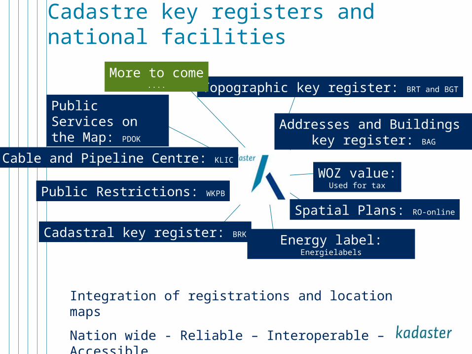
Cadastre key registers and national facilities
Cadastral key register: BRK
Public Services on the Map: PDOK
Cable and Pipeline Centre: KLIC
Public Restrictions: WKPB
Spatial Plans: RO-online
Energy label:Energielabels
Topographic key register: BRT and BGT
Addresses and Buildings key register: BAG
WOZ value:Used for tax
Integration of registrations and location maps
Nation wide - Reliable – Interoperable – Accessible
More to come....
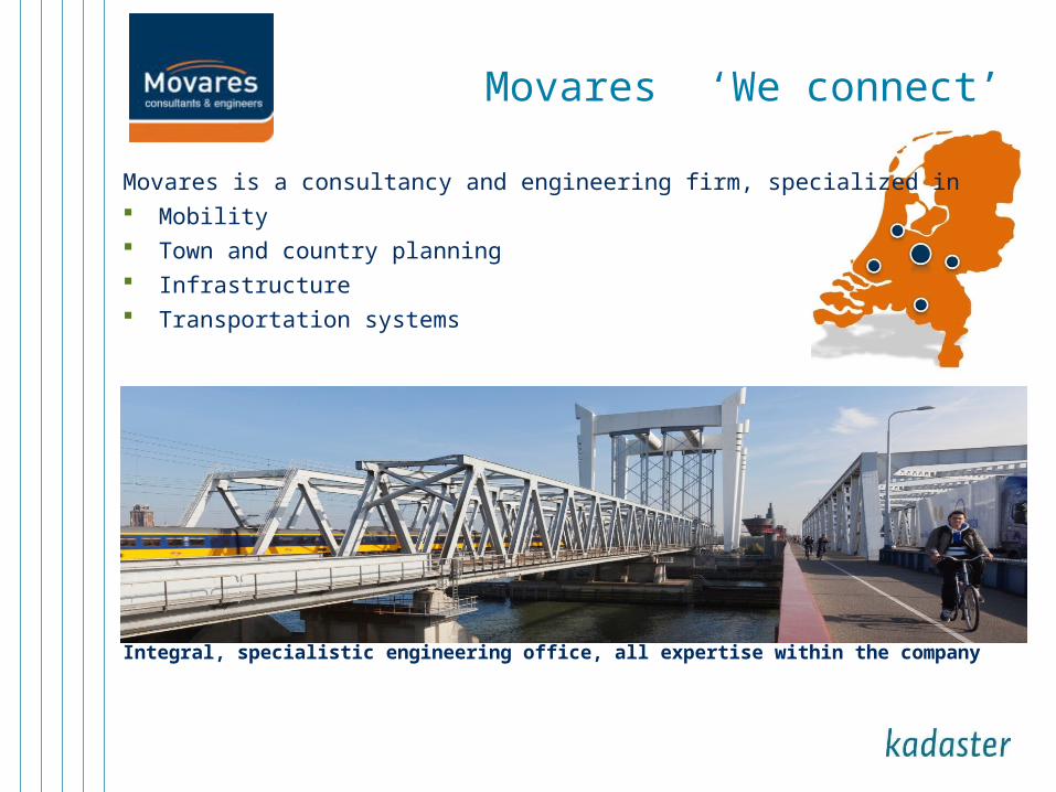
Movares ‘We connect’
Movares is a consultancy and engineering firm, specialized in Mobility Town and country planning Infrastructure Transportation systems
Integral, specialistic engineering office, all expertise within the company

15-04-23 4
What if we have all the harmonized data available?

Spatial environment
Civil engineering
R&U construction
Scale 1:500 – 1:25:000GIS (coordinate system)Geografical objectsTopological networks
Standards (OGC / ISO/TC 211): WMS, WFS, GML, CityGML, etc.
Detailed scaleCAD (Engineering coordinate system)VolumesElement compositions
Standards: LandXML
Big scaleCAD/BIM (B&U coordinat e system)Element compositions
Standards (BuildingSmart): IFC, bsDD
ASSET
MANAGEMENT
Road section
RoadType
Road
Premises
Building
Foundation pile
Foundation element

15-04-23 6
government
market
Assignment
Data request
Data acquisition
€
€Poor data
‘Spatial snapshot’
15-04-23 7
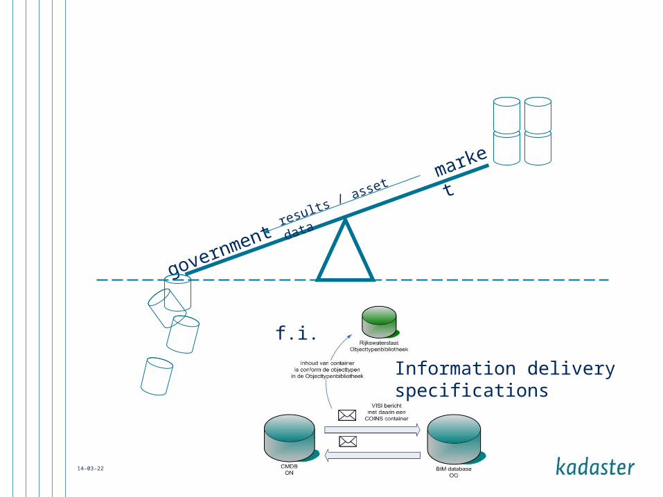
market
governmentresults / asset data
f.i.
Information delivery specifications

15-04-23 8
government
market
Assignment
Apps Avenue Data Avenue of the spatial environment
Level playing field
Framework of trusted data
alley

15-04-23 9
market
governmentresults / asset data
data appsavenue
Compete on intelligence not on data; the ‘alleys’

10
(asset) data aquisition
Asset report
Assetmanagement
Real world
Transition

15-04-23 11
government
market
Data, data, data, ...
Spin-off

15-04-23 12
market
governmentideas / in
novations / solutions
marketend users
Spin-off

15-04-23 13
Asset owner
Service provider
Assignment
Asset manager
Asset management
Data request
Data acquisition
€
€Poor data

Questions
Is a trusted third party (or f.i. a shared service center) needed, with no
interest in a project or in the possible outcome of this project, but with
just the interest in managing and serving data of high quality?
Is a dedicated service / instance from the government for the ‘BIM world’
needed?
How should we connect / use ‘alleys’ of market parties to the ‘avenue’ of the
government?
How can GEOBIM help making the avenue come true?

Thank you for your attention

UitvoeringOmgevingswet
Burgers en bedrijven (open data en services)
Standaard koppelvlak
Andere overheidstaken
Indicatie Beschikbaarheid, Bruikbaarheid en Bestendigheid gegevens in huis/domein
Bonus material
Related Documents


