Parks Victoria Phone 13 1963 www.parks.vic.gov.au Geng there Brisbane Ranges Naonal Park is 80km west of Melbourne via the Western Highway. Turn off at Bacchus Marsh and follow the Geelong-Bacchus Marsh Road. Turn off at Glenmore Road to access the northern reaches of the park, or at Granite Road to access Anakie and the southern end of the park. Things to see and do Walking 1. Ted Errey Nature Circuit – 8km, 3 hours return Leaving Stony Creek Picnic Area, this walk climbs steadily, then descends to cross a broad watercourse and climbs again to join Outlook Track. A short walk to the east reveals a lookout with views over much of the Stony Creek Water Catchment. Following Outlook Track to the west, the walk meanders to Switch Road, Aqueduct and Nelson Tracks, passing two excellent lookouts along the way. The walk descends to join the Anakie Gorge Walk allowing access the Anakie Gorge or Stony Creek Picnic Areas. 2. Anakie Gorge Walk – 3.5km, 1.5 hours one way This walk follows Stony Creek and links Anakie Gorge and Stony Creek Picnic Areas, connuing to the banks of the Lower Stony Creek Reservoir along a relavely flat gradient. Signs along the track explain interesng features. The Ted Errey Nature Circuit intersects the Anakie Gorge Walk 2km (40 minutes) from Stony Creek Picnic Area and 1km (20 minutes) from Anakie Gorge Picnic Area. 3. Wadawurrung Walk – 2.5km, 1 hour return This walk offers excellent views of Anakie Gorge over the Stony Creek Water Catchment. Starng from the Stony Creek Picnic Area, the walk heads towards Lower Stony Creek Reservoir before climbing sharply north toward Switch Road. Turn right and follow Switch Road back to Stony Creek Picnic Area. Along the way there are great views of the You Yangs and Anakie Gorge. The Burchell Trail – 40km, 3 days one way For the more adventurous and well organised, the Burchell Trail is a great way to see the Brisbane Ranges Naonal Park. Starng from Fridays Camping Area or Boar Gully Camping Area, the walk follows orange track markers and uses exisng walks, management tracks and public roads. Overnight camps are located at the Old Mill and Lile River Bush Camping Areas. Let someone know your plans. Picnicking Picnic areas at Stony Creek and Anakie Gorge have wood barbecues (bring your own wood), toilets, picnic tables and seats. Anakie Gorge Picnic Area also has gas barbecues. Other picnic grounds have only basic facilies. Camping There are two camping areas in the park - Boar Gully (seven sites) in the north, and Fridays (ten sites) near Steiglitz. Both have basic pit toilets and tank water, plus designated camp trailer or caravan sites. Bookings are required for all campsites including the Bushwalkers Only sites along the Burchell Trail. Camping fees apply. For further informaon or to book go to www.parks.vic.gov.au/stay Plants and animals Some 619 nave plant species, about one fiſth of Victoria’s total, can be found in the ranges. Brisbane Ranges Grevillea is found only along the Rowsley Fault. Velvet Daisy-bush is rare and found only in scaered locaons across the state and Golden Grevillea is found elsewhere only in Gippsland. In spring, there is a magnificent display of grasstrees, wales, hakeas, bush peas and a variety of orchids. Keep an eye out for kangaroos, wallabies, echidnas, possums and gliders. There are 170 species of nave birds recorded in the park. Two species to look out for are the Yellow-tuſted Honeyeater and nocturnally acve White-throated Nightjar. Facilies Toilets are available at the Stony Creek and Anakie Gorge picnic areas and also at each of the campgrounds. Visitors should bring their own drinking water. There is tank water in some areas, but it is not suitable to drink even if treated. Please take all rubbish away for disposal or recycling. Help prevent the spread of disease Cinnamon fungus (Phytophthora cinnamomi) invades the fine roots of plant species causing roots to rot and ulmately plant death. You can limit the spread of the disease by prevenng the movement of infected soil. Please use the available foot hygiene staons and obeying all signs relang to the management of this silent killer. Be prepared and stay safe Brisbane Ranges Naonal Park is in the Central fire district. Bushfires can occur during the warmer months. It is your responsiblity to check current and forecast weather condions. Campfires cannot be lit on days of Total Fire Ban, however gas cookers can be used for preparing food. For emergency updates and fire informaon listen to local radio, visit emergency.vic.gov.au, download the VicEmergency phone app or call 1800 226 226. For park condions visit www.parks.vic.gov.au or call 13 1963. For emergency assistance call Triple Zero (000). October 2017 Brisbane Ranges Naonal Park Visitor Guide Lile more than an hour’s drive from Melbourne takes you to the state’s richest wildflower environment. The Brisbane Ranges Naonal Park offers excellent opportunies for bushwalking, camping, scenic drives and picnics. Steiglitz Historic Park connects with this park’s south-west corner.

Welcome message from author
This document is posted to help you gain knowledge. Please leave a comment to let me know what you think about it! Share it to your friends and learn new things together.
Transcript
Parks VictoriaPhone 13 1963www.parks.vic.gov.au
Getting thereBrisbane Ranges National Park is 80km west of Melbourne via the Western Highway. Turn off at Bacchus Marsh and follow the Geelong-Bacchus Marsh Road. Turn off at Glenmore Road to access the northern reaches of the park, or at Granite Road to access Anakie and the southern end of the park.
Things to see and doWalking1. Ted Errey Nature Circuit – 8km, 3 hours returnLeaving Stony Creek Picnic Area, this walk climbs steadily, then descends to cross a broad watercourse and climbs again to join Outlook Track. A short walk to the east reveals a lookout with views over much of the Stony Creek Water Catchment.Following Outlook Track to the west, the walk meanders to Switch Road, Aqueduct and Nelson Tracks, passing two excellent lookouts along the way. The walk descends to join the Anakie Gorge Walk allowing access the Anakie Gorge or Stony Creek Picnic Areas.2. Anakie Gorge Walk – 3.5km, 1.5 hours one way This walk follows Stony Creek and links Anakie Gorge and Stony Creek Picnic Areas, continuing to the banks of the Lower Stony Creek Reservoir along a relatively flat gradient. Signs along the track explain interesting features. The Ted Errey Nature Circuit intersects the Anakie Gorge Walk 2km (40 minutes) from Stony Creek Picnic Area and 1km (20 minutes) from Anakie Gorge Picnic Area.3. Wadawurrung Walk – 2.5km, 1 hour returnThis walk offers excellent views of Anakie Gorge over the Stony Creek Water Catchment. Starting from the Stony Creek Picnic Area, the walk heads towards Lower Stony Creek Reservoir before climbing sharply north toward Switch Road. Turn right and follow Switch Road back to Stony Creek Picnic Area. Along the way there are great views of the You Yangs and Anakie Gorge.The Burchell Trail – 40km, 3 days one wayFor the more adventurous and well organised, the Burchell Trail is a great way to see the Brisbane Ranges National Park. Starting from Fridays Camping Area or Boar Gully Camping Area, the walk follows orange track markers and uses existing walks, management tracks and public roads. Overnight camps are located at the Old Mill and Little River Bush Camping Areas. Let someone know your plans.PicnickingPicnic areas at Stony Creek and Anakie Gorge have wood barbecues (bring your own wood), toilets, picnic tables and seats. Anakie Gorge Picnic Area also has gas barbecues. Other picnic grounds have only basic facilities.
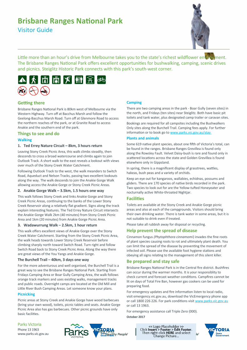
CampingThere are two camping areas in the park - Boar Gully (seven sites) in the north, and Fridays (ten sites) near Steiglitz. Both have basic pit toilets and tank water, plus designated camp trailer or caravan sites.Bookings are required for all campsites including the Bushwalkers Only sites along the Burchell Trail. Camping fees apply. For further information or to book go to www.parks.vic.gov.au/stay Plants and animalsSome 619 native plant species, about one fifth of Victoria’s total, can be found in the ranges. Brisbane Ranges Grevillea is found only along the Rowsley Fault. Velvet Daisy-bush is rare and found only in scattered locations across the state and Golden Grevillea is found elsewhere only in Gippsland.In spring, there is a magnificent display of grasstrees, wattles, hakeas, bush peas and a variety of orchids.Keep an eye out for kangaroos, wallabies, echidnas, possums and gliders. There are 170 species of native birds recorded in the park. Two species to look out for are the Yellow-tufted Honeyeater and nocturnally active White-throated Nightjar.
FacilitiesToilets are available at the Stony Creek and Anakie Gorge picnic areas and also at each of the campgrounds. Visitors should bring their own drinking water. There is tank water in some areas, but it is not suitable to drink even if treated.Please take all rubbish away for disposal or recycling.
Help prevent the spread of diseaseCinnamon fungus (Phytophthora cinnamomi) invades the fine roots of plant species causing roots to rot and ultimately plant death. You can limit the spread of the disease by preventing the movement of infected soil. Please use the available foot hygiene stations and obeying all signs relating to the management of this silent killer.
Be prepared and stay safeBrisbane Ranges National Park is in the Central fire district. Bushfires can occur during the warmer months. It is your responsiblity to check current and forecast weather conditions. Campfires cannot be lit on days of Total Fire Ban, however gas cookers can be used for preparing food.For emergency updates and fire information listen to local radio, visit emergency.vic.gov.au, download the VicEmergency phone app or call 1800 226 226. For park conditions visit www.parks.vic.gov.au or call 13 1963.For emergency assistance call Triple Zero (000).October 2017
Brisbane Ranges National ParkVisitor Guide
Little more than an hour’s drive from Melbourne takes you to the state’s richest wildflower environment. The Brisbane Ranges National Park offers excellent opportunities for bushwalking, camping, scenic drives and picnics. Steiglitz Historic Park connects with this park’s south-west corner.
Related Documents